

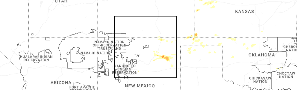
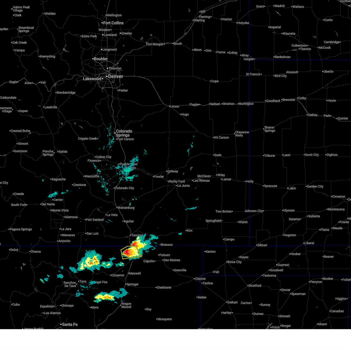
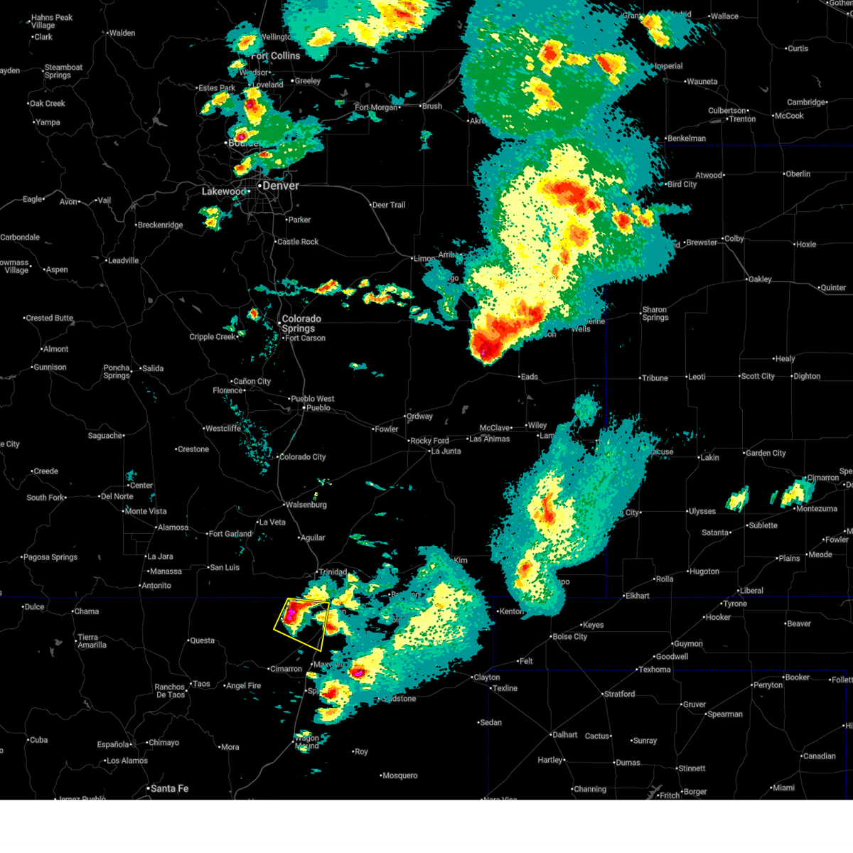
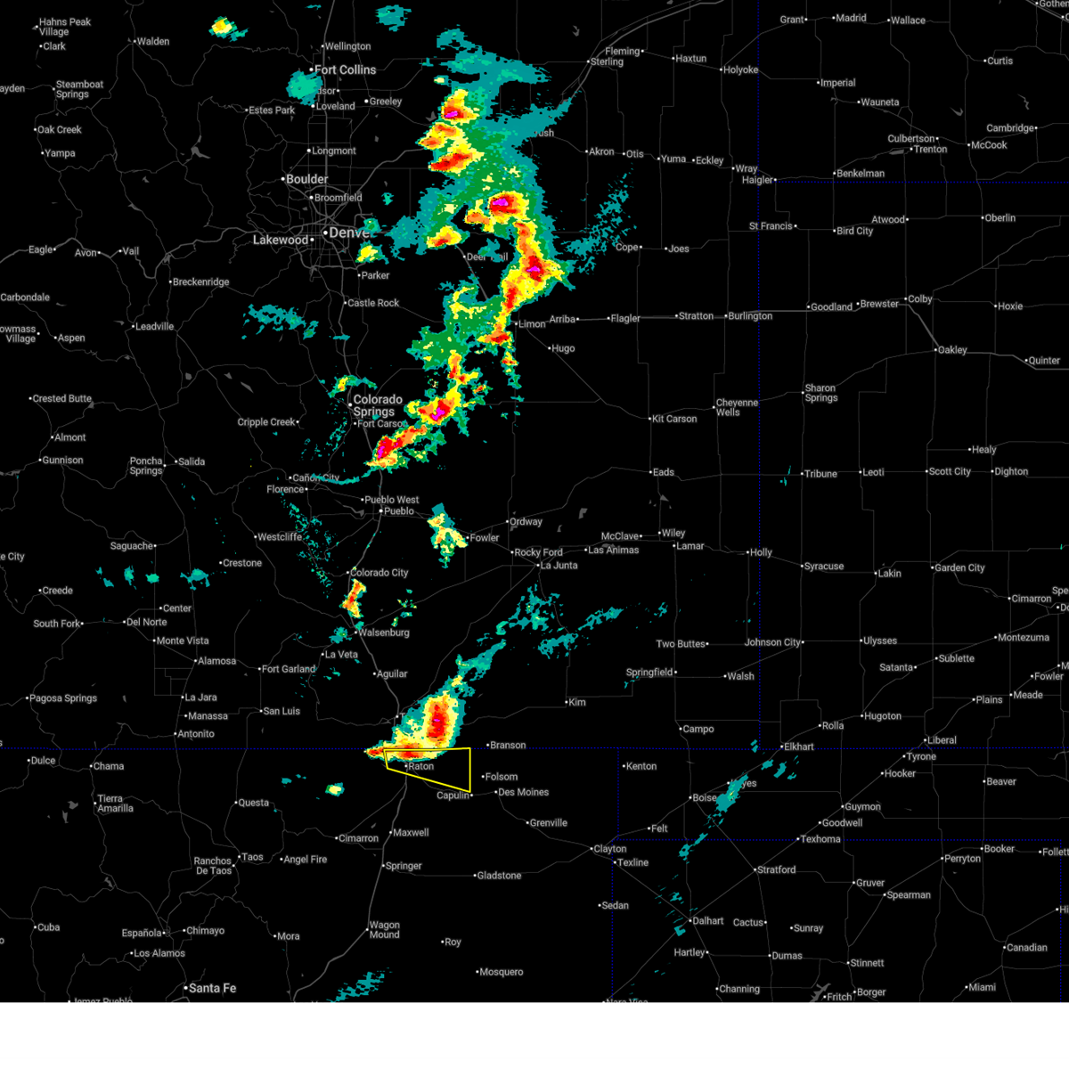
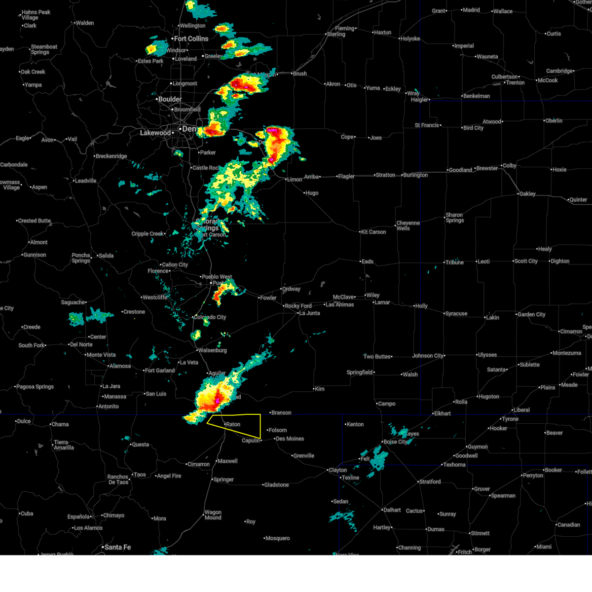
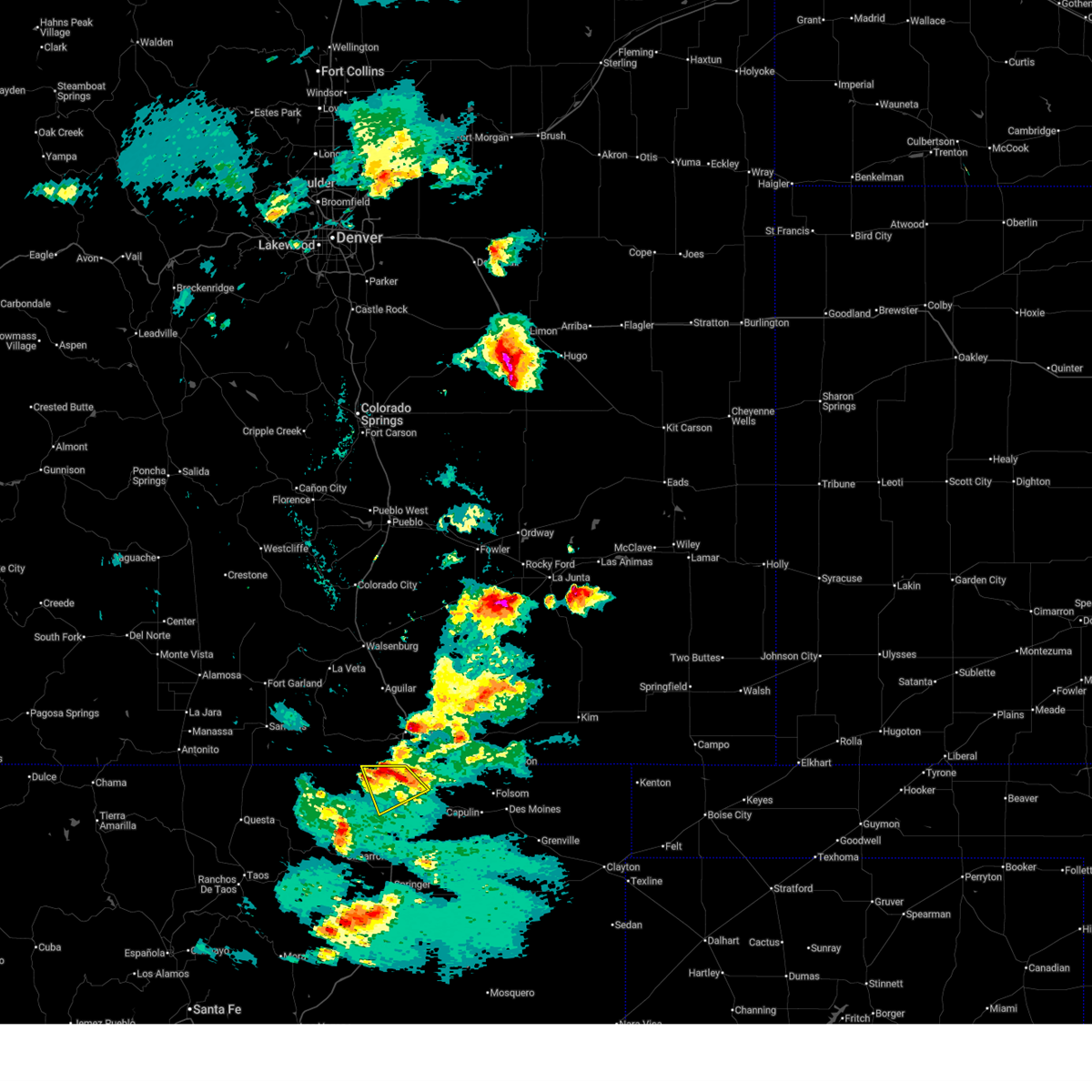
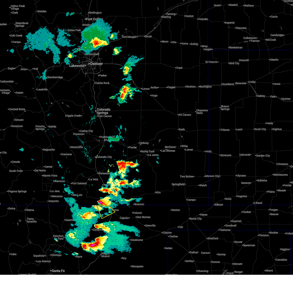
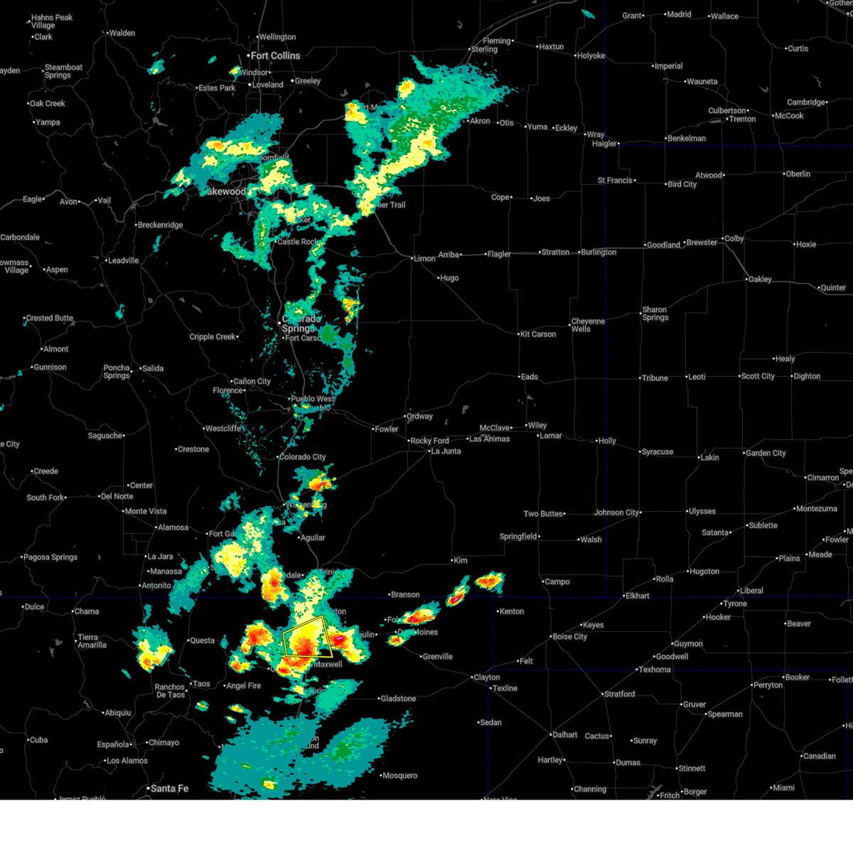
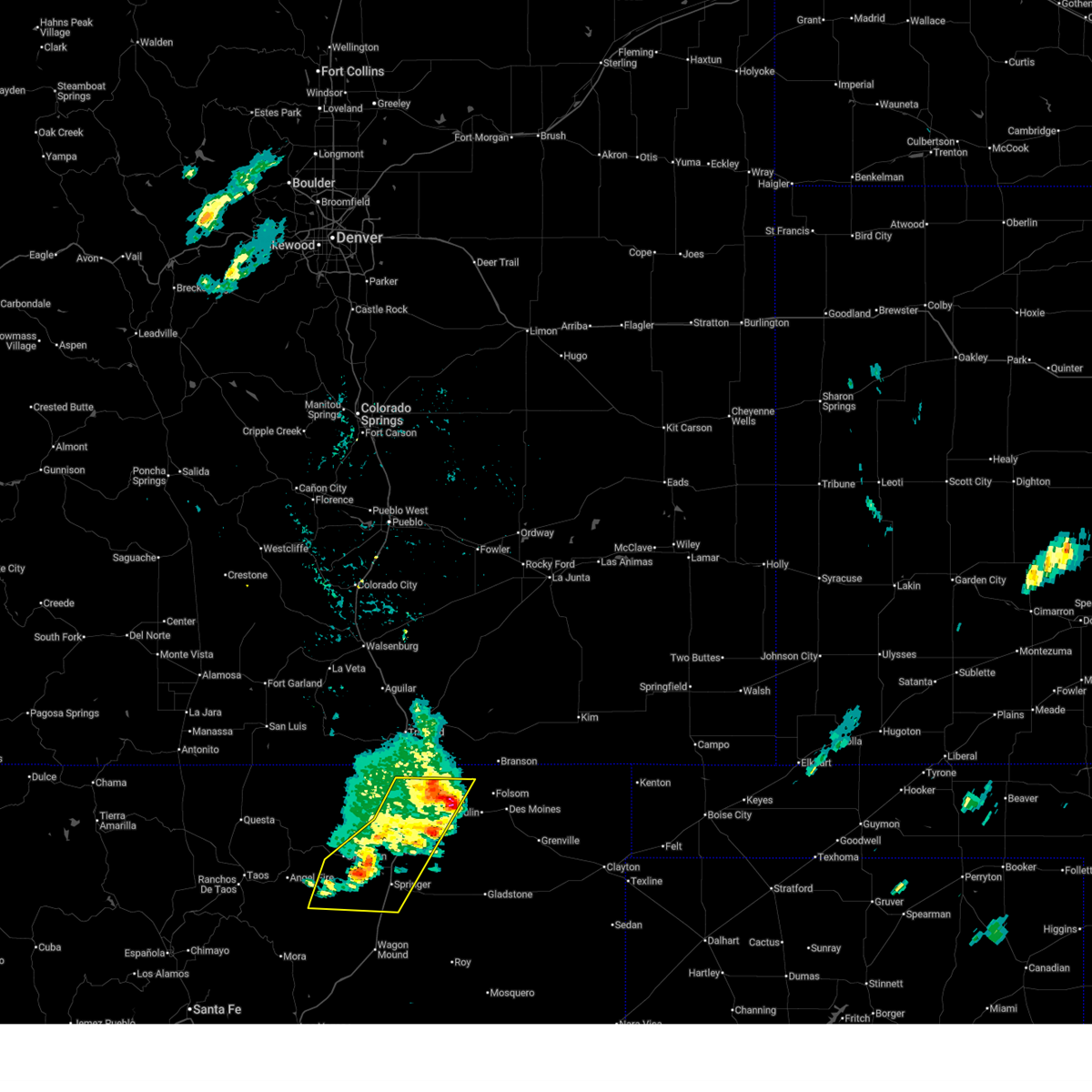
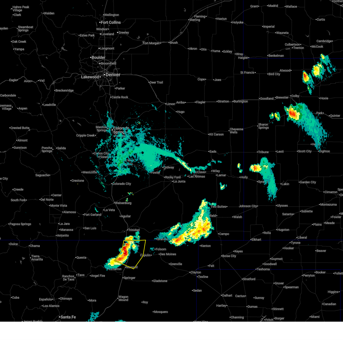
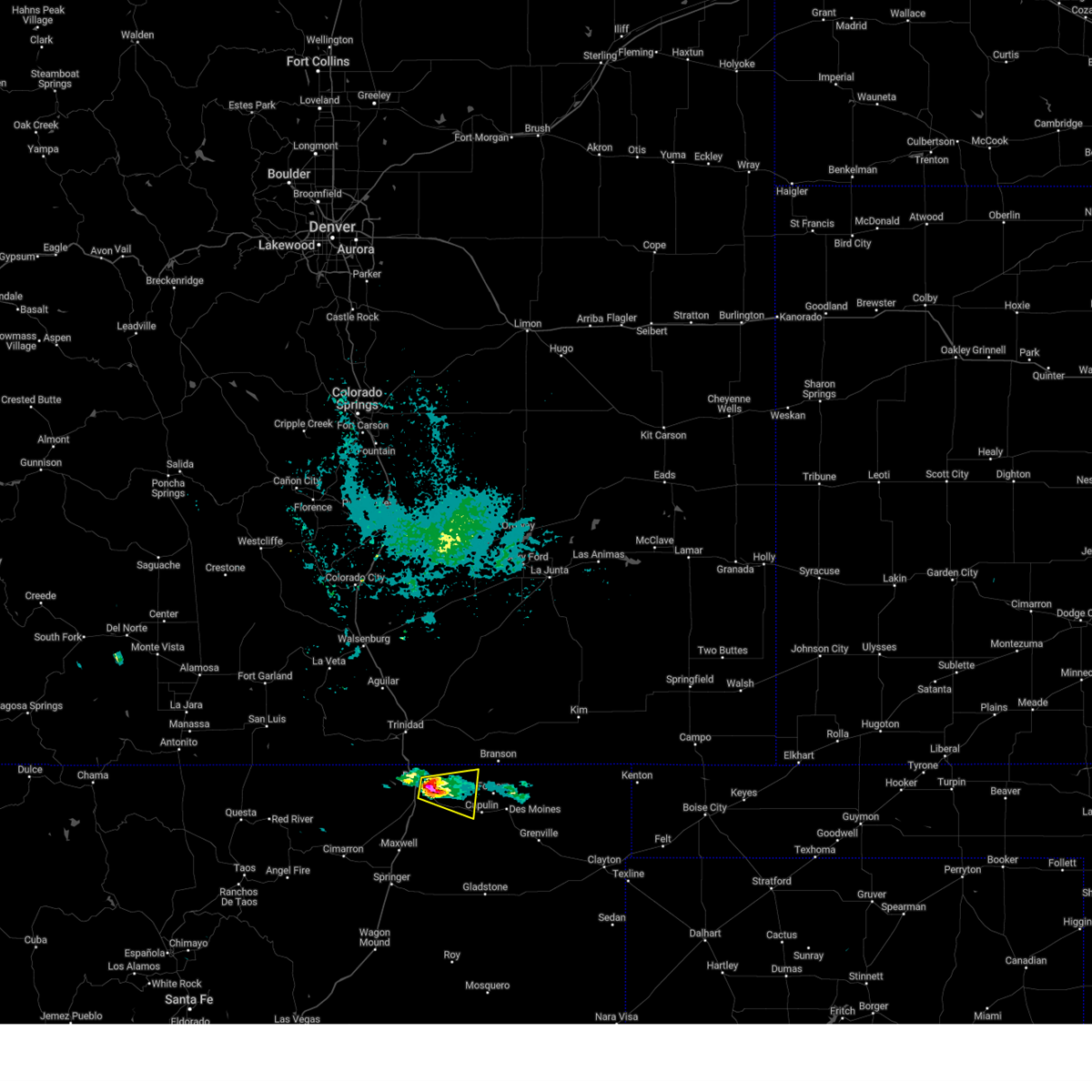
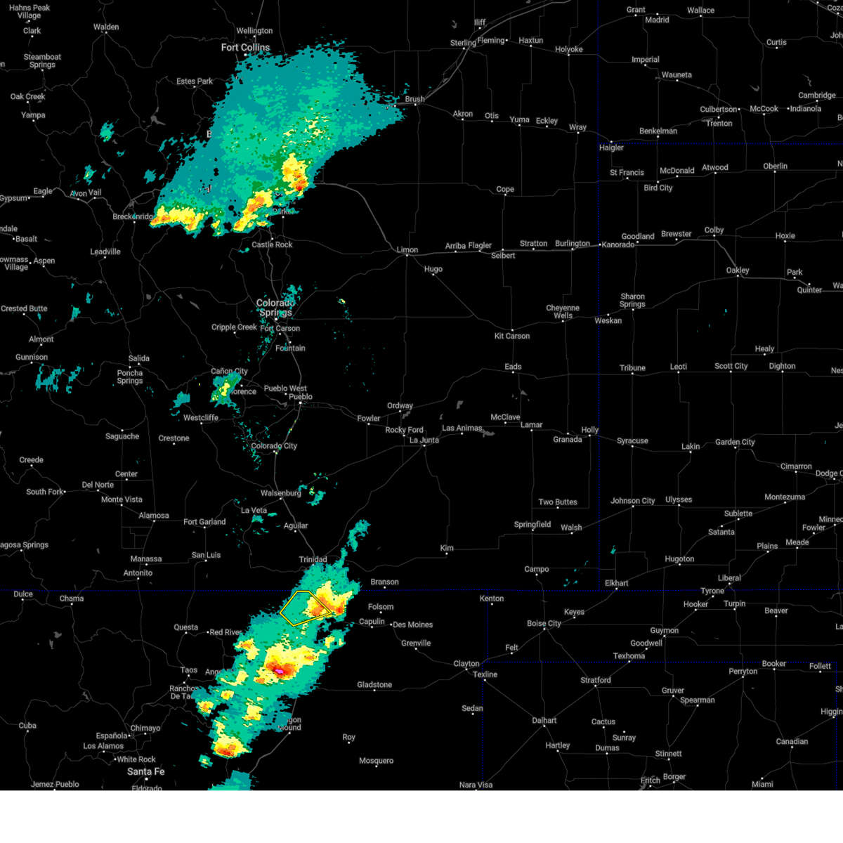
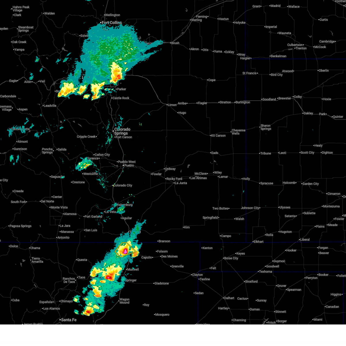
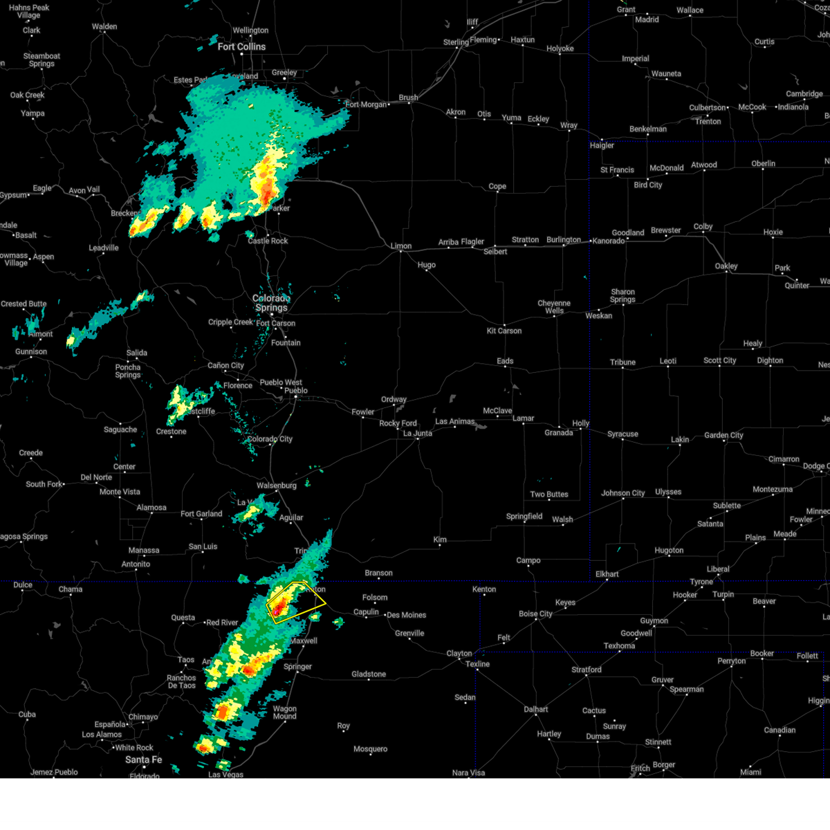
Hail Map for Raton, NM
The Raton, NM area has had 31 reports of on-the-ground hail by trained spotters, and has been under severe weather warnings 32 times during the past 12 months. Doppler radar has detected hail at or near Raton, NM on 79 occasions, including 7 occasions during the past year.
| Name: | Raton, NM |
| Where Located: | 71.3 miles ENE of Taos, NM |
| Map: | Google Map for Raton, NM |
| Population: | 6885 |
| Housing Units: | 3516 |
| More Info: | Search Google for Raton, NM |
5
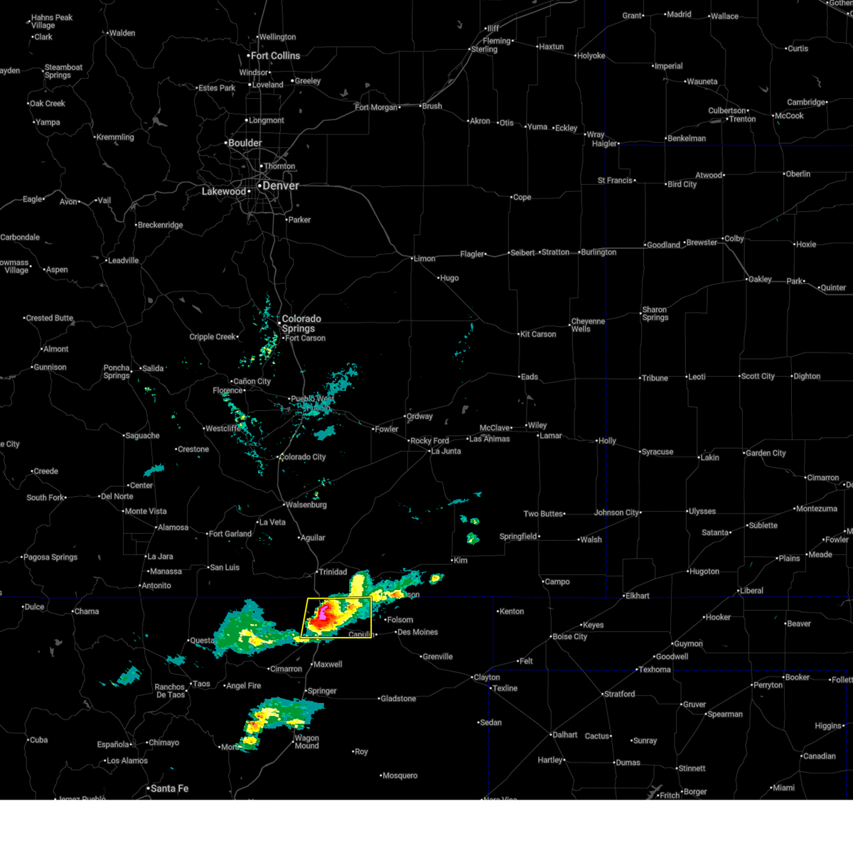
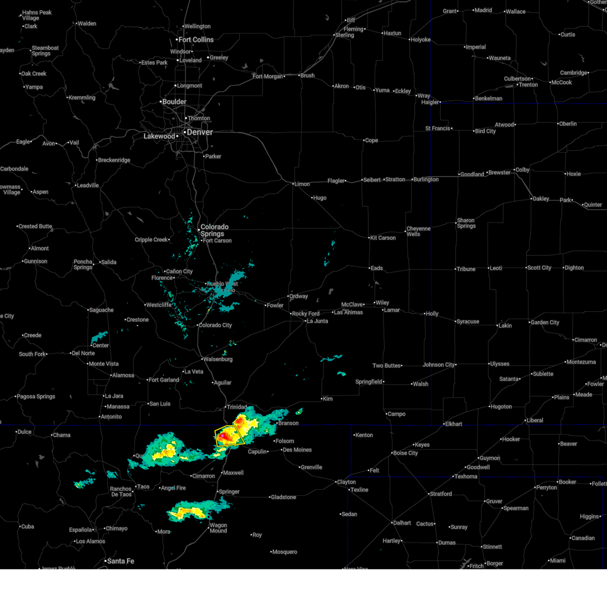
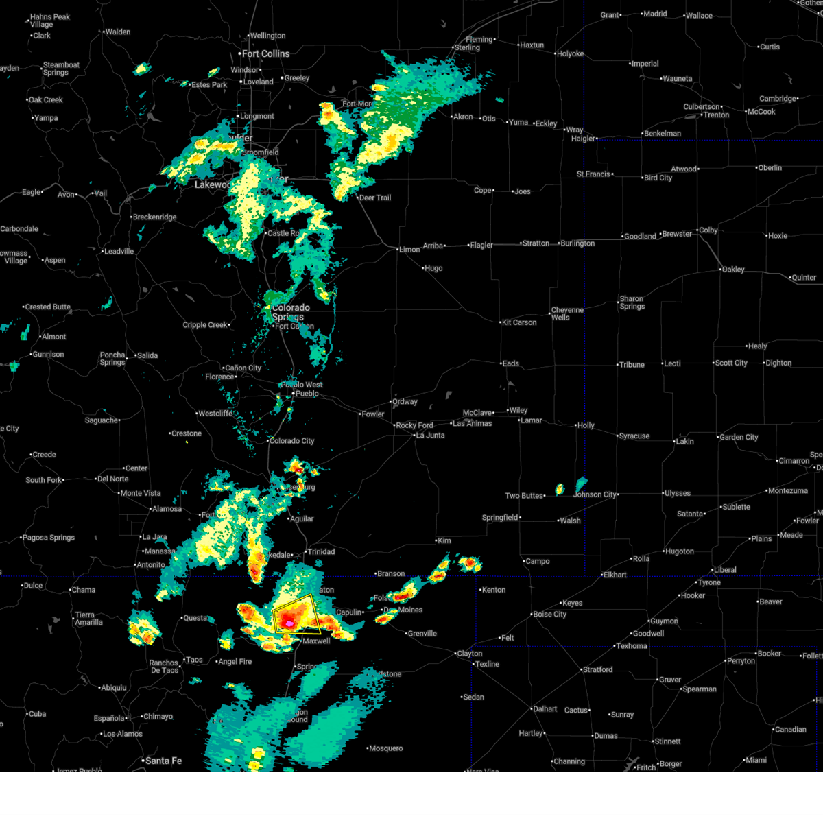
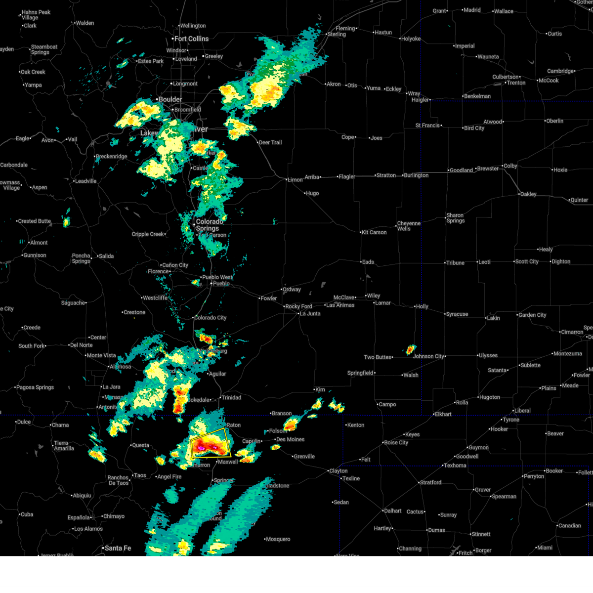
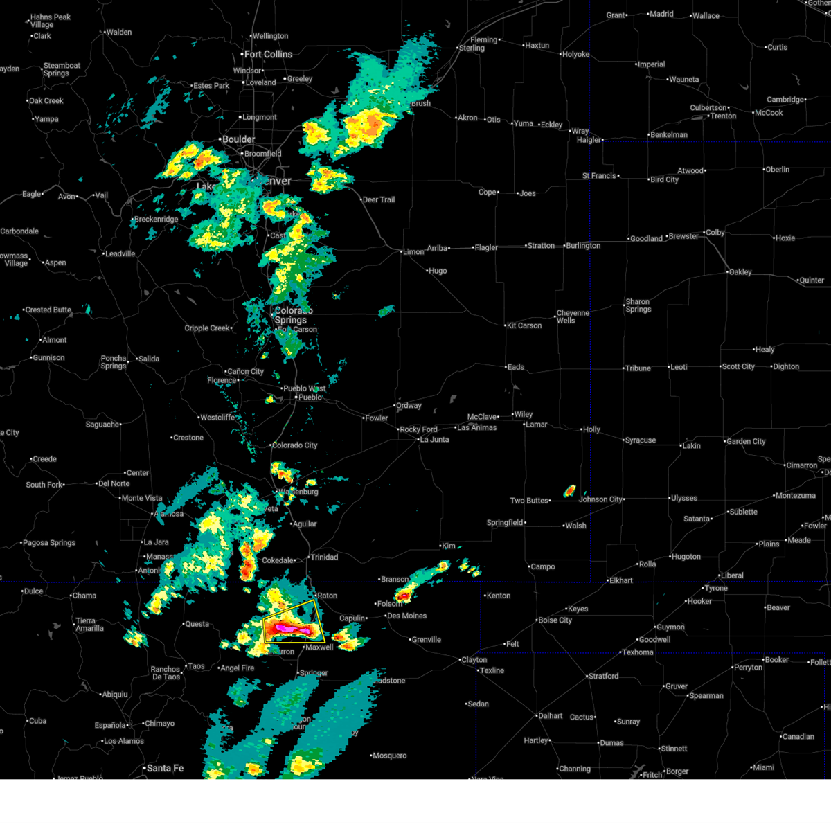
The Top Recent Hail Date for Raton, NM is Friday, June 12, 2026 (1st out of 79)
Hail and Wind Damage Spotted near Raton, NM
| Date / Time | Report Details |
|---|---|
| 6/12/2026 4:49 PM MDT |
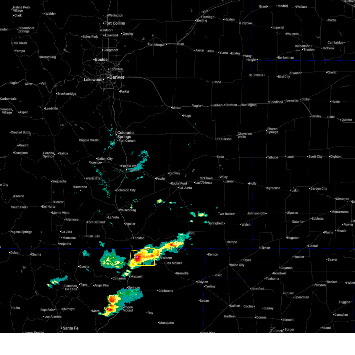 At 449 pm mdt, a severe thunderstorm was located near raton, moving east at 20 mph (radar indicated). Hazards include 60 mph wind gusts and quarter size hail. Hail damage to vehicles is expected. expect wind damage to roofs, siding, and trees. locations impacted include, raton, sugarite, sugarite canyon state park and raton crews airport. this includes the following highways, highway 64 between mile markers 336 and 374. Interstate 25 between mile markers 440 and 458. At 449 pm mdt, a severe thunderstorm was located near raton, moving east at 20 mph (radar indicated). Hazards include 60 mph wind gusts and quarter size hail. Hail damage to vehicles is expected. expect wind damage to roofs, siding, and trees. locations impacted include, raton, sugarite, sugarite canyon state park and raton crews airport. this includes the following highways, highway 64 between mile markers 336 and 374. Interstate 25 between mile markers 440 and 458.
|
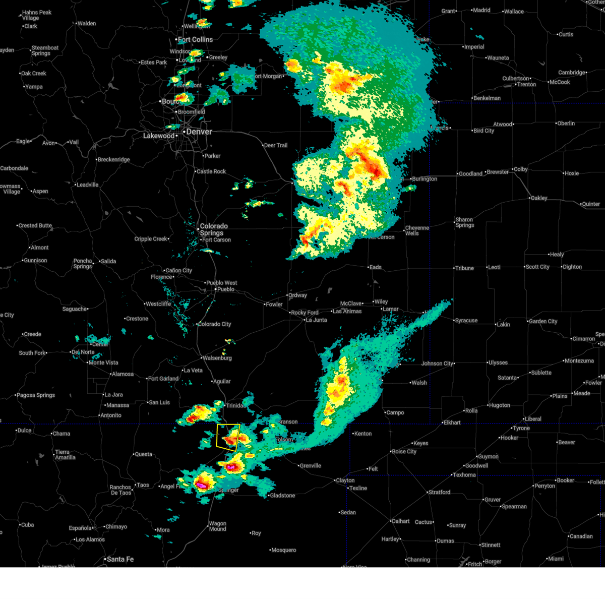
| 6/12/2026 4:27 PM MDT |
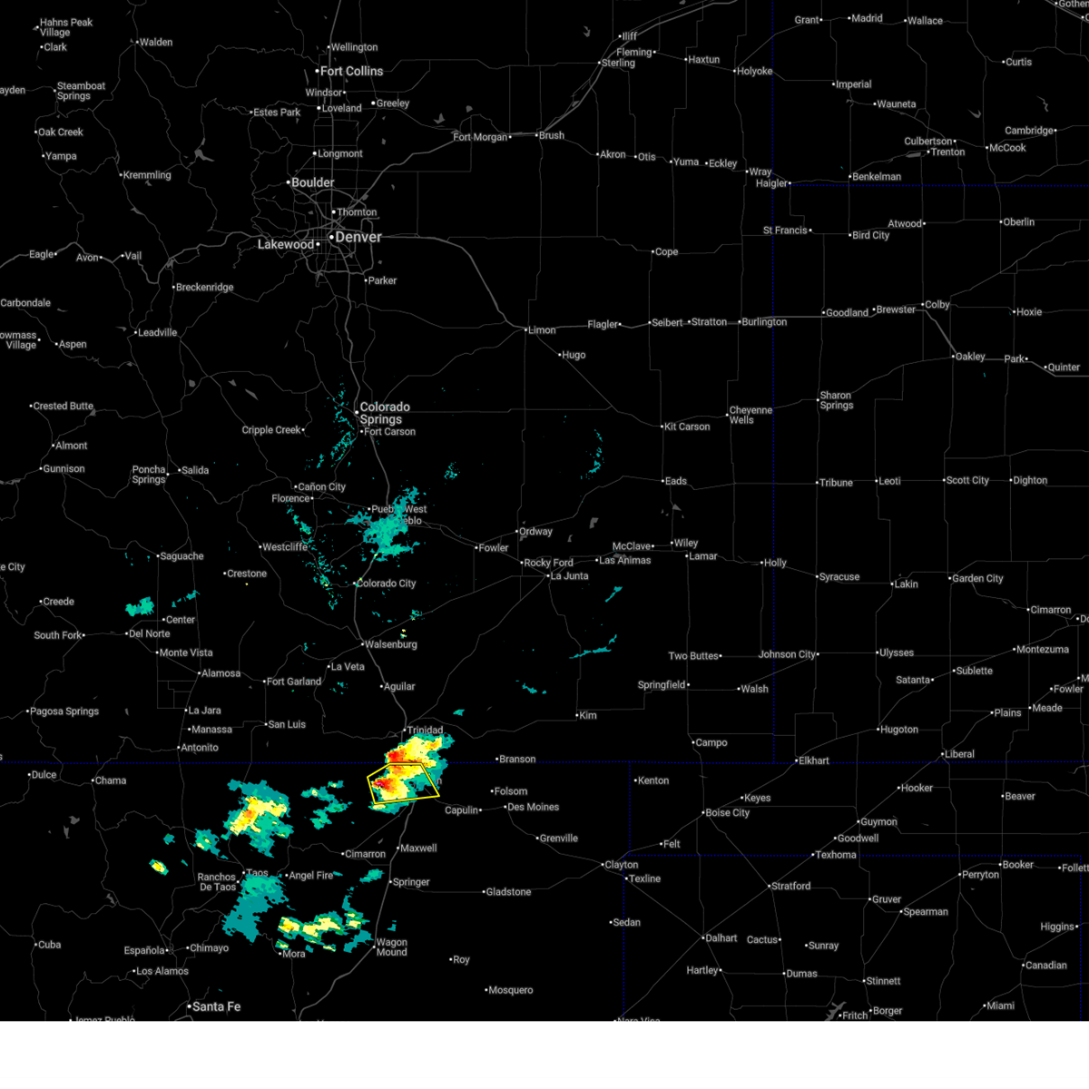
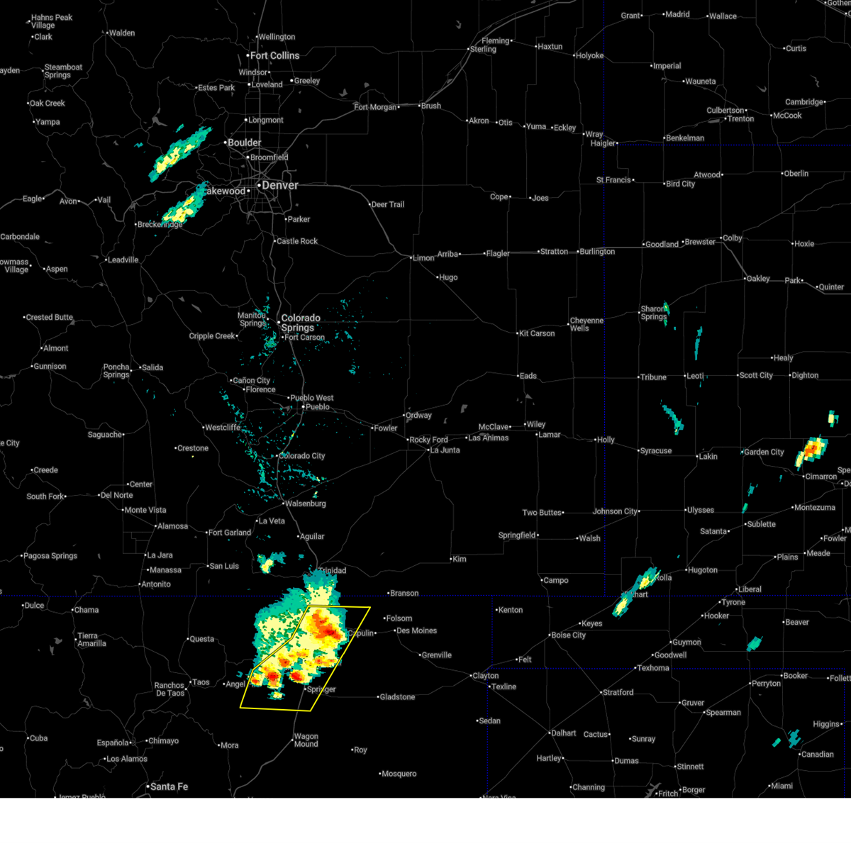
 Svrabq the national weather service in albuquerque has issued a * severe thunderstorm warning for, northeastern colfax county in northeastern new mexico, * until 515 pm mdt. * at 427 pm mdt, a severe thunderstorm was located over raton, moving east at 25 mph (radar indicated). Hazards include 60 mph wind gusts and quarter size hail. Hail damage to vehicles is expected. Expect wind damage to roofs, siding, and trees. Svrabq the national weather service in albuquerque has issued a * severe thunderstorm warning for, northeastern colfax county in northeastern new mexico, * until 515 pm mdt. * at 427 pm mdt, a severe thunderstorm was located over raton, moving east at 25 mph (radar indicated). Hazards include 60 mph wind gusts and quarter size hail. Hail damage to vehicles is expected. Expect wind damage to roofs, siding, and trees.
|
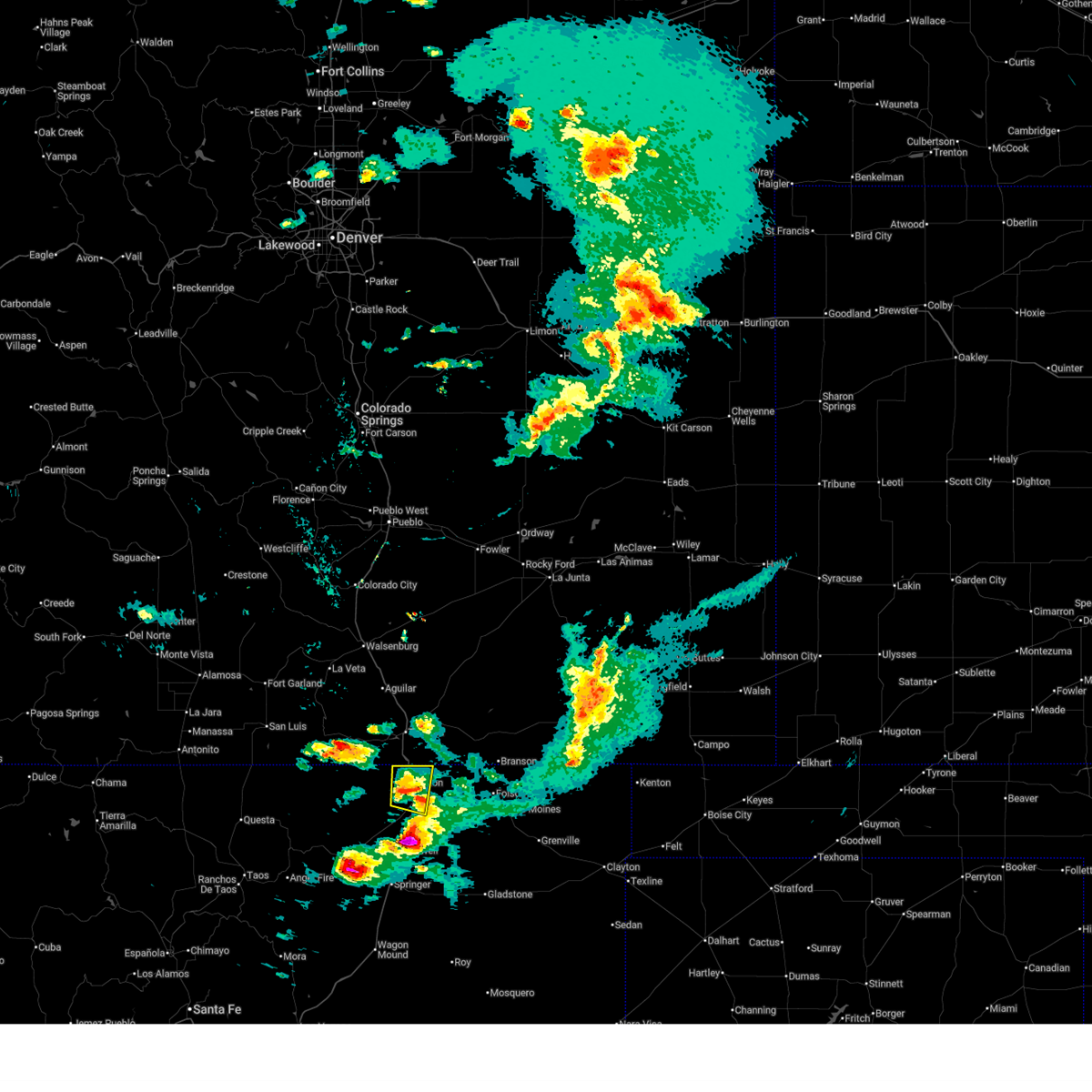
| 6/12/2026 4:16 PM MDT |
 At 416 pm mdt, a severe thunderstorm was located near raton, moving east at 20 mph (radar indicated). Hazards include 60 mph wind gusts and quarter size hail. Hail damage to vehicles is expected. expect wind damage to roofs, siding, and trees. locations impacted include, raton, sugarite and sugarite canyon state park. this includes the following highways, highway 64 between mile markers 344 and 357. Interstate 25 between mile markers 446 and 460. At 416 pm mdt, a severe thunderstorm was located near raton, moving east at 20 mph (radar indicated). Hazards include 60 mph wind gusts and quarter size hail. Hail damage to vehicles is expected. expect wind damage to roofs, siding, and trees. locations impacted include, raton, sugarite and sugarite canyon state park. this includes the following highways, highway 64 between mile markers 344 and 357. Interstate 25 between mile markers 446 and 460.
|
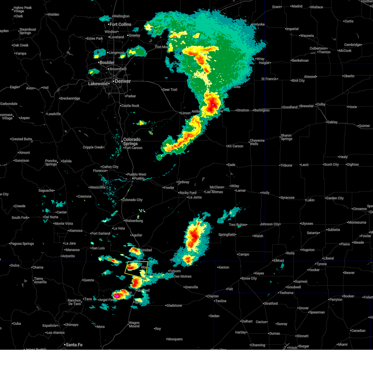
| 6/12/2026 4:03 PM MDT |
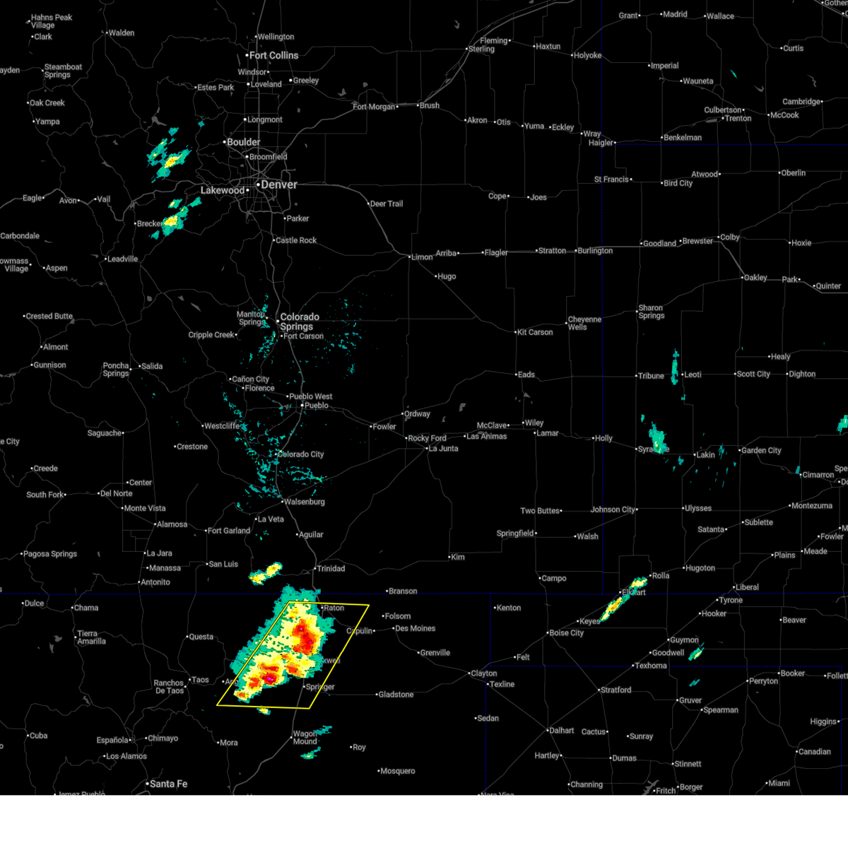
 At 403 pm mdt, a severe thunderstorm was located 7 miles west of raton, moving east at 20 mph (radar indicated). Hazards include 60 mph wind gusts and quarter size hail. Hail damage to vehicles is expected. expect wind damage to roofs, siding, and trees. locations impacted include, raton, sugarite and sugarite canyon state park. this includes the following highways, highway 64 between mile markers 344 and 357. Interstate 25 between mile markers 446 and 460. At 403 pm mdt, a severe thunderstorm was located 7 miles west of raton, moving east at 20 mph (radar indicated). Hazards include 60 mph wind gusts and quarter size hail. Hail damage to vehicles is expected. expect wind damage to roofs, siding, and trees. locations impacted include, raton, sugarite and sugarite canyon state park. this includes the following highways, highway 64 between mile markers 344 and 357. Interstate 25 between mile markers 446 and 460.
|
| 6/12/2026 3:46 PM MDT |
 Svrabq the national weather service in albuquerque has issued a * severe thunderstorm warning for, northeastern colfax county in northeastern new mexico, * until 430 pm mdt. * at 346 pm mdt, a severe thunderstorm was located 12 miles west of raton, moving northeast at 20 mph (radar indicated). Hazards include 60 mph wind gusts and quarter size hail. Hail damage to vehicles is expected. Expect wind damage to roofs, siding, and trees. Svrabq the national weather service in albuquerque has issued a * severe thunderstorm warning for, northeastern colfax county in northeastern new mexico, * until 430 pm mdt. * at 346 pm mdt, a severe thunderstorm was located 12 miles west of raton, moving northeast at 20 mph (radar indicated). Hazards include 60 mph wind gusts and quarter size hail. Hail damage to vehicles is expected. Expect wind damage to roofs, siding, and trees.
|
| 5/24/2026 3:25 PM MDT | Asos station krtn raton crews airpor in colfax county NM, 11.6 miles NNE of Raton, NM |
| 9/17/2025 6:26 PM MDT | The storm which prompted the warning has weakened below severe limits, and no longer poses an immediate threat to life or property. therefore, the warning will be allowed to expire. however, small hail, gusty winds, and heavy rain are still possible with this thunderstorm. a severe thunderstorm watch remains in effect until 1000 pm mdt wednesday for a portion of northeast new mexico. |
| 9/17/2025 6:11 PM MDT | At 611 pm mdt, a severe thunderstorm was located near sugarite, or 6 miles east of raton, moving southeast at 10 mph (radar indicated). Hazards include 60 mph wind gusts and small hail. Expect damage to roofs, siding, and trees. locations impacted include, northeast raton. This includes highway 64 between mile markers 351 and 370. |
| 9/17/2025 5:50 PM MDT | Svrabq the national weather service in albuquerque has issued a * severe thunderstorm warning for, northeastern colfax county in northeastern new mexico, * until 630 pm mdt. * at 550 pm mdt, a severe thunderstorm was located near sugarite, or 6 miles east of raton, moving southeast at 15 mph (radar indicated). Hazards include 60 mph wind gusts and quarter size hail. Hail damage to vehicles is expected. Expect wind damage to roofs, siding, and trees. |
| 9/17/2025 5:44 PM MDT | The storm which prompted the warning has weakened below severe limits, and no longer poses an immediate threat to life or property. therefore, the warning will be allowed to expire. however, small hail and gusty winds are still possible with this thunderstorm. a severe thunderstorm watch remains in effect until 1000 pm mdt wednesday for a portion of northeast new mexico. |
| 9/17/2025 5:36 PM MDT | At 536 pm mdt, a severe thunderstorm was located 9 miles southeast of sugarite, or 10 miles east of raton, moving southeast at 15 mph (radar indicated). Hazards include 60 mph wind gusts and quarter size hail. Hail damage to vehicles is expected. expect wind damage to roofs, siding, and trees. locations impacted include, raton, sugarite and sugarite canyon state park. this includes the following highways, highway 64 between mile markers 350 and 363. Interstate 25 between mile markers 451 and 457. |
| 9/17/2025 5:31 PM MDT | At 531 pm mdt, a severe thunderstorm was located 8 miles southeast of sugarite, or 9 miles east of raton, moving southeast at 15 mph (radar indicated). Hazards include 60 mph wind gusts and half dollar size hail. Hail damage to vehicles is expected. expect wind damage to roofs, siding, and trees. locations impacted include, raton, sugarite and sugarite canyon state park. this includes the following highways, highway 64 between mile markers 350 and 363. Interstate 25 between mile markers 451 and 457. |
| 9/17/2025 5:18 PM MDT | At 518 pm mdt, a severe thunderstorm was located 5 miles southeast of sugarite, or 7 miles east of raton, moving southeast at 15 mph (radar indicated). Hazards include ping pong ball size hail and 60 mph wind gusts. People and animals outdoors will be injured. expect hail damage to roofs, siding, windows, and vehicles. expect wind damage to roofs, siding, and trees. locations impacted include, raton, sugarite and sugarite canyon state park. this includes the following highways, highway 64 between mile markers 350 and 363. Interstate 25 between mile markers 451 and 457. |
| 9/17/2025 4:57 PM MDT | Svrabq the national weather service in albuquerque has issued a * severe thunderstorm warning for, northeastern colfax county in northeastern new mexico, * until 545 pm mdt. * at 457 pm mdt, a severe thunderstorm was located over sugarite, or 5 miles northeast of raton, moving southeast at 15 mph (radar indicated). Hazards include golf ball size hail and 60 mph wind gusts. People and animals outdoors will be injured. expect hail damage to roofs, siding, windows, and vehicles. Expect wind damage to roofs, siding, and trees. |
| 9/17/2025 4:57 PM MDT | The severe thunderstorm warning that was previously in effect has been reissued for colfax county and is in effect until 545 pm mdt. please refer to that bulletin for the latest severe weather information. a severe thunderstorm watch remains in effect until 1000 pm mdt wednesday for a portion of northeast new mexico. |
| 9/17/2025 4:55 PM MDT | Golf Ball sized hail reported 4.7 miles SW of Raton, NM, report via social media with pictures of hail. |
| 9/17/2025 4:48 PM MDT | At 448 pm mdt, a severe thunderstorm was located over sugarite, or near raton, moving southeast at 15 mph (radar indicated). Hazards include 60 mph wind gusts and quarter size hail. Hail damage to vehicles is expected. expect wind damage to roofs, siding, and trees. locations impacted include, raton, sugarite and sugarite canyon state park. this includes the following highways, highway 64 between mile markers 350 and 356. Interstate 25 between mile markers 450 and 460. |
| 9/17/2025 4:09 PM MDT | Svrabq the national weather service in albuquerque has issued a * severe thunderstorm warning for, northeastern colfax county in northeastern new mexico, * until 500 pm mdt. * at 409 pm mdt, a severe thunderstorm was located 7 miles northeast of sugarite canyon state park, or 13 miles northeast of raton, moving east at 10 mph (radar indicated). Hazards include 60 mph wind gusts and quarter size hail. Hail damage to vehicles is expected. Expect wind damage to roofs, siding, and trees. |
| 8/10/2025 7:50 PM MDT | Golf Ball sized hail reported 8 miles NNE of Raton, NM |
| 8/10/2025 7:50 PM MDT |
 Svrabq the national weather service in albuquerque has issued a * severe thunderstorm warning for, northeastern colfax county in northeastern new mexico, * until 830 pm mdt. * at 750 pm mdt, a severe thunderstorm was located 5 miles northeast of raton crews airport, or 6 miles south of raton, moving southeast at 20 mph (radar indicated). Hazards include golf ball size hail and 60 mph wind gusts. People and animals outdoors will be injured. expect hail damage to roofs, siding, windows, and vehicles. Expect wind damage to roofs, siding, and trees. Svrabq the national weather service in albuquerque has issued a * severe thunderstorm warning for, northeastern colfax county in northeastern new mexico, * until 830 pm mdt. * at 750 pm mdt, a severe thunderstorm was located 5 miles northeast of raton crews airport, or 6 miles south of raton, moving southeast at 20 mph (radar indicated). Hazards include golf ball size hail and 60 mph wind gusts. People and animals outdoors will be injured. expect hail damage to roofs, siding, windows, and vehicles. Expect wind damage to roofs, siding, and trees.
|
| 8/10/2025 7:50 PM MDT |
 The severe thunderstorm warning that was previously in effect has been reissued for colfax county and is in effect until 830 pm mdt. please refer to that bulletin for the latest severe weather information. The severe thunderstorm warning that was previously in effect has been reissued for colfax county and is in effect until 830 pm mdt. please refer to that bulletin for the latest severe weather information.
|
| 8/10/2025 7:35 PM MDT |
 At 735 pm mdt, a severe thunderstorm was located 7 miles southwest of raton, moving east at 20 mph (radar indicated). Hazards include golf ball size hail and 60 mph wind gusts. People and animals outdoors will be injured. expect hail damage to roofs, siding, windows, and vehicles. expect wind damage to roofs, siding, and trees. locations impacted include, raton and raton crews airport. this includes the following highways, highway 64 between mile markers 332 and 344. Interstate 25 between mile markers 434 and 458. At 735 pm mdt, a severe thunderstorm was located 7 miles southwest of raton, moving east at 20 mph (radar indicated). Hazards include golf ball size hail and 60 mph wind gusts. People and animals outdoors will be injured. expect hail damage to roofs, siding, windows, and vehicles. expect wind damage to roofs, siding, and trees. locations impacted include, raton and raton crews airport. this includes the following highways, highway 64 between mile markers 332 and 344. Interstate 25 between mile markers 434 and 458.
|
| 8/10/2025 7:10 PM MDT |
 Svrabq the national weather service in albuquerque has issued a * severe thunderstorm warning for, north central colfax county in northeastern new mexico, * until 800 pm mdt. * at 710 pm mdt, a severe thunderstorm was located 15 miles northwest of raton crews airport, or 16 miles west of raton, moving east at 15 mph (radar indicated). Hazards include ping pong ball size hail and 60 mph wind gusts. People and animals outdoors will be injured. expect hail damage to roofs, siding, windows, and vehicles. Expect wind damage to roofs, siding, and trees. Svrabq the national weather service in albuquerque has issued a * severe thunderstorm warning for, north central colfax county in northeastern new mexico, * until 800 pm mdt. * at 710 pm mdt, a severe thunderstorm was located 15 miles northwest of raton crews airport, or 16 miles west of raton, moving east at 15 mph (radar indicated). Hazards include ping pong ball size hail and 60 mph wind gusts. People and animals outdoors will be injured. expect hail damage to roofs, siding, windows, and vehicles. Expect wind damage to roofs, siding, and trees.
|
| 8/10/2025 6:10 PM MDT |
 The storm which prompted the warning has weakened below severe limits, and no longer poses an immediate threat to life or property. therefore, the warning will be allowed to expire. however, small hail and gusty winds are still possible with this thunderstorm. a severe thunderstorm watch remains in effect until 800 pm mdt sunday for a portion of northeast new mexico. The storm which prompted the warning has weakened below severe limits, and no longer poses an immediate threat to life or property. therefore, the warning will be allowed to expire. however, small hail and gusty winds are still possible with this thunderstorm. a severe thunderstorm watch remains in effect until 800 pm mdt sunday for a portion of northeast new mexico.
|
| 8/10/2025 5:52 PM MDT |
 At 552 pm mdt, a severe thunderstorm was located near raton, moving east at 25 mph (radar indicated). Hazards include 60 mph wind gusts and quarter size hail. Hail damage to vehicles is expected. expect wind damage to roofs, siding, and trees. locations impacted include, raton, sugarite and sugarite canyon state park. this includes the following highways, highway 64 between mile markers 340 and 354. Interstate 25 between mile markers 442 and 460. At 552 pm mdt, a severe thunderstorm was located near raton, moving east at 25 mph (radar indicated). Hazards include 60 mph wind gusts and quarter size hail. Hail damage to vehicles is expected. expect wind damage to roofs, siding, and trees. locations impacted include, raton, sugarite and sugarite canyon state park. this includes the following highways, highway 64 between mile markers 340 and 354. Interstate 25 between mile markers 442 and 460.
|
| 8/10/2025 5:33 PM MDT |
 Svrabq the national weather service in albuquerque has issued a * severe thunderstorm warning for, north central colfax county in northeastern new mexico, * until 615 pm mdt. * at 533 pm mdt, a severe thunderstorm was located 12 miles west of raton, moving east at 20 mph (radar indicated). Hazards include 60 mph wind gusts and quarter size hail. Hail damage to vehicles is expected. Expect wind damage to roofs, siding, and trees. Svrabq the national weather service in albuquerque has issued a * severe thunderstorm warning for, north central colfax county in northeastern new mexico, * until 615 pm mdt. * at 533 pm mdt, a severe thunderstorm was located 12 miles west of raton, moving east at 20 mph (radar indicated). Hazards include 60 mph wind gusts and quarter size hail. Hail damage to vehicles is expected. Expect wind damage to roofs, siding, and trees.
|
| 8/10/2025 4:22 PM MDT |
 the severe thunderstorm warning has been cancelled and is no longer in effect the severe thunderstorm warning has been cancelled and is no longer in effect
|
| 8/10/2025 4:14 PM MDT |
 At 414 pm mdt, a severe thunderstorm was located near sugarite, or 9 miles northeast of raton, moving east at 25 mph (radar indicated). Hazards include 60 mph wind gusts and small hail. Expect damage to roofs, siding, and trees. locations impacted include, raton, sugarite and sugarite canyon state park. this includes the following highways, highway 64 between mile markers 350 and 355. Interstate 25 between mile markers 450 and 460. At 414 pm mdt, a severe thunderstorm was located near sugarite, or 9 miles northeast of raton, moving east at 25 mph (radar indicated). Hazards include 60 mph wind gusts and small hail. Expect damage to roofs, siding, and trees. locations impacted include, raton, sugarite and sugarite canyon state park. this includes the following highways, highway 64 between mile markers 350 and 355. Interstate 25 between mile markers 450 and 460.
|
| 8/10/2025 3:39 PM MDT |
 Svrabq the national weather service in albuquerque has issued a * severe thunderstorm warning for, northeastern colfax county in northeastern new mexico, * until 445 pm mdt. * at 339 pm mdt, a severe thunderstorm was located 8 miles north of sugarite canyon state park, or 13 miles north of raton, moving southeast at 25 mph (radar indicated). Hazards include ping pong ball size hail and 60 mph wind gusts. People and animals outdoors will be injured. expect hail damage to roofs, siding, windows, and vehicles. Expect wind damage to roofs, siding, and trees. Svrabq the national weather service in albuquerque has issued a * severe thunderstorm warning for, northeastern colfax county in northeastern new mexico, * until 445 pm mdt. * at 339 pm mdt, a severe thunderstorm was located 8 miles north of sugarite canyon state park, or 13 miles north of raton, moving southeast at 25 mph (radar indicated). Hazards include ping pong ball size hail and 60 mph wind gusts. People and animals outdoors will be injured. expect hail damage to roofs, siding, windows, and vehicles. Expect wind damage to roofs, siding, and trees.
|
| 8/1/2025 5:12 PM MDT |
 the severe thunderstorm warning has been cancelled and is no longer in effect the severe thunderstorm warning has been cancelled and is no longer in effect
|
| 8/1/2025 4:48 PM MDT |
 Svrabq the national weather service in albuquerque has issued a * severe thunderstorm warning for, north central colfax county in northeastern new mexico, * until 530 pm mdt. * at 448 pm mdt, a severe thunderstorm was located 16 miles northwest of raton, moving southeast at 20 mph (radar indicated). Hazards include 60 mph wind gusts and quarter size hail. Hail damage to vehicles is expected. Expect wind damage to roofs, siding, and trees. Svrabq the national weather service in albuquerque has issued a * severe thunderstorm warning for, north central colfax county in northeastern new mexico, * until 530 pm mdt. * at 448 pm mdt, a severe thunderstorm was located 16 miles northwest of raton, moving southeast at 20 mph (radar indicated). Hazards include 60 mph wind gusts and quarter size hail. Hail damage to vehicles is expected. Expect wind damage to roofs, siding, and trees.
|
| 7/18/2025 5:58 PM MDT |
 The storm which prompted the warning has weakened below severe limits, and no longer poses an immediate threat to life or property. therefore, the warning will be allowed to expire. however, gusty winds are still possible with this thunderstorm. The storm which prompted the warning has weakened below severe limits, and no longer poses an immediate threat to life or property. therefore, the warning will be allowed to expire. however, gusty winds are still possible with this thunderstorm.
|
| 7/18/2025 5:43 PM MDT |
 At 543 pm mdt, a severe thunderstorm was located 6 miles southwest of raton crews airport, or 16 miles southwest of raton, moving east at 25 mph (radar indicated). Hazards include 60 mph wind gusts and half dollar size hail. Hail damage to vehicles is expected. expect wind damage to roofs, siding, and trees. locations impacted include, raton and raton crews airport. this includes the following highways, highway 64 between mile markers 322 and 343. Interstate 25 between mile markers 431 and 446. At 543 pm mdt, a severe thunderstorm was located 6 miles southwest of raton crews airport, or 16 miles southwest of raton, moving east at 25 mph (radar indicated). Hazards include 60 mph wind gusts and half dollar size hail. Hail damage to vehicles is expected. expect wind damage to roofs, siding, and trees. locations impacted include, raton and raton crews airport. this includes the following highways, highway 64 between mile markers 322 and 343. Interstate 25 between mile markers 431 and 446.
|
| 7/18/2025 5:27 PM MDT |
 At 527 pm mdt, a severe thunderstorm was located 11 miles west of raton crews airport, or 19 miles southwest of raton, moving east at 20 mph (radar indicated). Hazards include ping pong ball size hail and 60 mph wind gusts. People and animals outdoors will be injured. expect hail damage to roofs, siding, windows, and vehicles. expect wind damage to roofs, siding, and trees. locations impacted include, raton and raton crews airport. this includes the following highways, highway 64 between mile markers 321 and 343. Interstate 25 between mile markers 430 and 446. At 527 pm mdt, a severe thunderstorm was located 11 miles west of raton crews airport, or 19 miles southwest of raton, moving east at 20 mph (radar indicated). Hazards include ping pong ball size hail and 60 mph wind gusts. People and animals outdoors will be injured. expect hail damage to roofs, siding, windows, and vehicles. expect wind damage to roofs, siding, and trees. locations impacted include, raton and raton crews airport. this includes the following highways, highway 64 between mile markers 321 and 343. Interstate 25 between mile markers 430 and 446.
|
| 7/18/2025 5:14 PM MDT |
 Svrabq the national weather service in albuquerque has issued a * severe thunderstorm warning for, central colfax county in northeastern new mexico, * until 600 pm mdt. * at 514 pm mdt, a severe thunderstorm was located 14 miles northwest of maxwell, or 22 miles southwest of raton, moving east at 20 mph (radar indicated). Hazards include 60 mph wind gusts and quarter size hail. Hail damage to vehicles is expected. Expect wind damage to roofs, siding, and trees. Svrabq the national weather service in albuquerque has issued a * severe thunderstorm warning for, central colfax county in northeastern new mexico, * until 600 pm mdt. * at 514 pm mdt, a severe thunderstorm was located 14 miles northwest of maxwell, or 22 miles southwest of raton, moving east at 20 mph (radar indicated). Hazards include 60 mph wind gusts and quarter size hail. Hail damage to vehicles is expected. Expect wind damage to roofs, siding, and trees.
|
| 6/23/2025 3:28 PM MDT |
 The storms which prompted the warning have weakened below severe limits, and no longer pose an immediate threat to life or property. therefore, the warning will be allowed to expire. however, small hail and gusty winds are still possible with these thunderstorms. to report any severe weather that occurred at your location, contact the national weather service office in albuquerque at 1.888.386.7637. The storms which prompted the warning have weakened below severe limits, and no longer pose an immediate threat to life or property. therefore, the warning will be allowed to expire. however, small hail and gusty winds are still possible with these thunderstorms. to report any severe weather that occurred at your location, contact the national weather service office in albuquerque at 1.888.386.7637.
|
| 6/23/2025 3:08 PM MDT |
 At 308 pm mdt, severe thunderstorms were located along a line from near raton crews airport to 9 miles north of ocate, moving east at 15 mph (at 247 pm mdt the raton crews airport recorded a thunderstorm wind gust of 62 mph). Hazards include 60 mph wind gusts and small hail. Expect damage to roofs, siding, and trees. locations impacted include, raton, springer, cimarron, maxwell, raton crews airport, philmont scout ranch, miami and rayado. this includes the following highways, highway 64 between mile markers 305 and 367. Interstate 25 between mile markers 403 and 455. At 308 pm mdt, severe thunderstorms were located along a line from near raton crews airport to 9 miles north of ocate, moving east at 15 mph (at 247 pm mdt the raton crews airport recorded a thunderstorm wind gust of 62 mph). Hazards include 60 mph wind gusts and small hail. Expect damage to roofs, siding, and trees. locations impacted include, raton, springer, cimarron, maxwell, raton crews airport, philmont scout ranch, miami and rayado. this includes the following highways, highway 64 between mile markers 305 and 367. Interstate 25 between mile markers 403 and 455.
|
| 6/23/2025 2:47 PM MDT | Asos station krtn raton crews airpor in colfax county NM, 11.6 miles NNE of Raton, NM |
| 6/23/2025 2:41 PM MDT |
 Svrabq the national weather service in albuquerque has issued a * severe thunderstorm warning for, central colfax county in northeastern new mexico, north central mora county in northeastern new mexico, * until 330 pm mdt. * at 241 pm mdt, severe thunderstorms were located along a line from near raton crews airport to 8 miles east of black lake, moving east at 15 mph (radar indicated). Hazards include 60 mph wind gusts and quarter size hail. Hail damage to vehicles is expected. Expect wind damage to roofs, siding, and trees. Svrabq the national weather service in albuquerque has issued a * severe thunderstorm warning for, central colfax county in northeastern new mexico, north central mora county in northeastern new mexico, * until 330 pm mdt. * at 241 pm mdt, severe thunderstorms were located along a line from near raton crews airport to 8 miles east of black lake, moving east at 15 mph (radar indicated). Hazards include 60 mph wind gusts and quarter size hail. Hail damage to vehicles is expected. Expect wind damage to roofs, siding, and trees.
|
| 6/19/2025 6:08 PM MDT |
 At 608 pm mdt, severe thunderstorms were located along a line from near sugarite to 7 miles north of maxwell, moving east at 30 mph (radar indicated). Hazards include 60 mph wind gusts and quarter size hail. Hail damage to vehicles is expected. expect wind damage to roofs, siding, and trees. locations impacted include, raton, raton crews airport, sugarite and sugarite canyon state park. this includes the following highways, highway 64 between mile markers 325 and 366. Interstate 25 between mile markers 429 and 459. At 608 pm mdt, severe thunderstorms were located along a line from near sugarite to 7 miles north of maxwell, moving east at 30 mph (radar indicated). Hazards include 60 mph wind gusts and quarter size hail. Hail damage to vehicles is expected. expect wind damage to roofs, siding, and trees. locations impacted include, raton, raton crews airport, sugarite and sugarite canyon state park. this includes the following highways, highway 64 between mile markers 325 and 366. Interstate 25 between mile markers 429 and 459.
|
| 6/19/2025 5:55 PM MDT | Storm damage reported in colfax county NM, 8 miles NNE of Raton, NM |
| 6/19/2025 5:50 PM MDT |
 Svrabq the national weather service in albuquerque has issued a * severe thunderstorm warning for, northeastern colfax county in northeastern new mexico, * until 645 pm mdt. * at 550 pm mdt, severe thunderstorms were located along a line from near raton to 11 miles northwest of maxwell, moving east at 20 mph (radar indicated). Hazards include 60 mph wind gusts and quarter size hail. Hail damage to vehicles is expected. Expect wind damage to roofs, siding, and trees. Svrabq the national weather service in albuquerque has issued a * severe thunderstorm warning for, northeastern colfax county in northeastern new mexico, * until 645 pm mdt. * at 550 pm mdt, severe thunderstorms were located along a line from near raton to 11 miles northwest of maxwell, moving east at 20 mph (radar indicated). Hazards include 60 mph wind gusts and quarter size hail. Hail damage to vehicles is expected. Expect wind damage to roofs, siding, and trees.
|
| 6/15/2025 7:45 PM MDT | The asos at raton crew airport observed a wind gust of 68 mph from nearby thunderstorm in colfax county NM, 11.6 miles NNE of Raton, NM |
| 6/11/2025 7:53 PM MDT | Asos station krtn raton crews airpor in colfax county NM, 11.6 miles NNE of Raton, NM |
| 6/7/2025 2:20 PM MDT |
 Svrabq the national weather service in albuquerque has issued a * severe thunderstorm warning for, northeastern colfax county in northeastern new mexico, * until 300 pm mdt. * at 220 pm mdt, a severe thunderstorm was located 7 miles southeast of sugarite, or 7 miles east of raton, moving east at 15 mph (radar indicated). Hazards include 60 mph wind gusts and quarter size hail. Hail damage to vehicles is expected. Expect wind damage to roofs, siding, and trees. Svrabq the national weather service in albuquerque has issued a * severe thunderstorm warning for, northeastern colfax county in northeastern new mexico, * until 300 pm mdt. * at 220 pm mdt, a severe thunderstorm was located 7 miles southeast of sugarite, or 7 miles east of raton, moving east at 15 mph (radar indicated). Hazards include 60 mph wind gusts and quarter size hail. Hail damage to vehicles is expected. Expect wind damage to roofs, siding, and trees.
|
| 5/25/2025 3:58 PM MDT |
 The storm which prompted the warning has weakened below severe limits, and has exited the warned area. therefore, the warning will be allowed to expire. however, small hail and gusty winds are still possible with this thunderstorm. The storm which prompted the warning has weakened below severe limits, and has exited the warned area. therefore, the warning will be allowed to expire. however, small hail and gusty winds are still possible with this thunderstorm.
|
| 5/25/2025 3:33 PM MDT |
 At 333 pm mdt, a severe thunderstorm was located near raton, moving east at 25 mph (radar indicated). Hazards include 60 mph wind gusts and half dollar size hail. Hail damage to vehicles is expected. expect wind damage to roofs, siding, and trees. locations impacted include, raton. this includes the following highways, highway 64 near mile marker 350. Interstate 25 between mile markers 447 and 452. At 333 pm mdt, a severe thunderstorm was located near raton, moving east at 25 mph (radar indicated). Hazards include 60 mph wind gusts and half dollar size hail. Hail damage to vehicles is expected. expect wind damage to roofs, siding, and trees. locations impacted include, raton. this includes the following highways, highway 64 near mile marker 350. Interstate 25 between mile markers 447 and 452.
|
| 5/25/2025 3:08 PM MDT |
 Svrabq the national weather service in albuquerque has issued a * severe thunderstorm warning for, north central colfax county in northeastern new mexico, * until 400 pm mdt. * at 308 pm mdt, a severe thunderstorm was located 12 miles northwest of raton crews airport, or 14 miles west of raton, moving east at 25 mph (radar indicated). Hazards include 60 mph wind gusts and quarter size hail. Hail damage to vehicles is expected. Expect wind damage to roofs, siding, and trees. Svrabq the national weather service in albuquerque has issued a * severe thunderstorm warning for, north central colfax county in northeastern new mexico, * until 400 pm mdt. * at 308 pm mdt, a severe thunderstorm was located 12 miles northwest of raton crews airport, or 14 miles west of raton, moving east at 25 mph (radar indicated). Hazards include 60 mph wind gusts and quarter size hail. Hail damage to vehicles is expected. Expect wind damage to roofs, siding, and trees.
|
| 9/17/2024 1:22 PM MDT |
 Svrabq the national weather service in albuquerque has issued a * severe thunderstorm warning for, central colfax county in northeastern new mexico, * until 200 pm mdt. * at 121 pm mdt, a severe thunderstorm was located near cimarron, or 20 miles northwest of springer, moving northeast at 45 mph (radar indicated). Hazards include 60 mph wind gusts. expect damage to roofs, siding, and trees Svrabq the national weather service in albuquerque has issued a * severe thunderstorm warning for, central colfax county in northeastern new mexico, * until 200 pm mdt. * at 121 pm mdt, a severe thunderstorm was located near cimarron, or 20 miles northwest of springer, moving northeast at 45 mph (radar indicated). Hazards include 60 mph wind gusts. expect damage to roofs, siding, and trees
|
| 9/15/2024 3:05 PM MDT | Asos station krtn raton crews airport; in-cloud flashes still present with decaying tst in colfax county NM, 11.6 miles NNE of Raton, NM |
| 8/12/2024 3:56 PM MDT |
 the severe thunderstorm warning has been cancelled and is no longer in effect the severe thunderstorm warning has been cancelled and is no longer in effect
|
| 8/12/2024 3:46 PM MDT |
 At 345 pm mdt, a severe thunderstorm was located near raton pass, or 8 miles northwest of raton, moving northeast at 25 mph (radar indicated). Hazards include 60 mph wind gusts and quarter size hail. Hail damage to vehicles is expected. expect wind damage to roofs, siding, and trees. locations impacted include, raton, sugarite, and sugarite canyon state park. this includes the following highways, interstate 25 between mile markers 451 and 460. Highway 64 between mile markers 350 and 351. At 345 pm mdt, a severe thunderstorm was located near raton pass, or 8 miles northwest of raton, moving northeast at 25 mph (radar indicated). Hazards include 60 mph wind gusts and quarter size hail. Hail damage to vehicles is expected. expect wind damage to roofs, siding, and trees. locations impacted include, raton, sugarite, and sugarite canyon state park. this includes the following highways, interstate 25 between mile markers 451 and 460. Highway 64 between mile markers 350 and 351.
|
| 8/12/2024 3:32 PM MDT |
 Svrabq the national weather service in albuquerque has issued a * severe thunderstorm warning for, northeastern colfax county in northeastern new mexico, * until 430 pm mdt. * at 332 pm mdt, a severe thunderstorm was located 8 miles southwest of raton pass, or 10 miles west of raton, moving east at 20 mph (radar indicated). Hazards include 60 mph wind gusts and quarter size hail. Hail damage to vehicles is expected. Expect wind damage to roofs, siding, and trees. Svrabq the national weather service in albuquerque has issued a * severe thunderstorm warning for, northeastern colfax county in northeastern new mexico, * until 430 pm mdt. * at 332 pm mdt, a severe thunderstorm was located 8 miles southwest of raton pass, or 10 miles west of raton, moving east at 20 mph (radar indicated). Hazards include 60 mph wind gusts and quarter size hail. Hail damage to vehicles is expected. Expect wind damage to roofs, siding, and trees.
|
| 7/11/2024 4:26 PM MDT |
 The storm that prompted the warning has weakened below severe limits, and has exited the warned area. therefore, the warning will be allowed to expire. The storm that prompted the warning has weakened below severe limits, and has exited the warned area. therefore, the warning will be allowed to expire.
|
| 7/11/2024 4:12 PM MDT |
 At 412 pm mdt, a severe thunderstorm was located near raton, moving southeast at 15 mph (radar indicated). Hazards include 60 mph wind gusts and quarter size hail. Hail damage to vehicles is expected. expect wind damage to roofs, siding, and trees. locations impacted include, raton, sugarite, and sugarite canyon state park. this includes the following highways, interstate 25 between mile markers 448 and 456. Highway 64 between mile markers 350 and 358. At 412 pm mdt, a severe thunderstorm was located near raton, moving southeast at 15 mph (radar indicated). Hazards include 60 mph wind gusts and quarter size hail. Hail damage to vehicles is expected. expect wind damage to roofs, siding, and trees. locations impacted include, raton, sugarite, and sugarite canyon state park. this includes the following highways, interstate 25 between mile markers 448 and 456. Highway 64 between mile markers 350 and 358.
|
| 7/11/2024 3:55 PM MDT |
 Svrabq the national weather service in albuquerque has issued a * severe thunderstorm warning for, northeastern colfax county in northeastern new mexico, * until 430 pm mdt. * at 355 pm mdt, a severe thunderstorm was located over sugarite, or near raton, moving southeast at 15 mph (radar indicated). Hazards include 60 mph wind gusts and half dollar size hail. Hail damage to vehicles is expected. Expect wind damage to roofs, siding, and trees. Svrabq the national weather service in albuquerque has issued a * severe thunderstorm warning for, northeastern colfax county in northeastern new mexico, * until 430 pm mdt. * at 355 pm mdt, a severe thunderstorm was located over sugarite, or near raton, moving southeast at 15 mph (radar indicated). Hazards include 60 mph wind gusts and half dollar size hail. Hail damage to vehicles is expected. Expect wind damage to roofs, siding, and trees.
|
| 7/7/2024 7:07 PM MDT |
 Svrabq the national weather service in albuquerque has issued a * severe thunderstorm warning for, central colfax county in northeastern new mexico, * until 800 pm mdt. * at 706 pm mdt, severe thunderstorms were located along a line extending from raton crews airport to near cimarron, moving southeast at 15 mph (radar indicated). Hazards include 60 mph wind gusts and quarter size hail. Hail damage to vehicles is expected. Expect wind damage to roofs, siding, and trees. Svrabq the national weather service in albuquerque has issued a * severe thunderstorm warning for, central colfax county in northeastern new mexico, * until 800 pm mdt. * at 706 pm mdt, severe thunderstorms were located along a line extending from raton crews airport to near cimarron, moving southeast at 15 mph (radar indicated). Hazards include 60 mph wind gusts and quarter size hail. Hail damage to vehicles is expected. Expect wind damage to roofs, siding, and trees.
|
| 7/7/2024 6:49 PM MDT |
 the severe thunderstorm warning has been cancelled and is no longer in effect the severe thunderstorm warning has been cancelled and is no longer in effect
|
| 7/7/2024 6:34 PM MDT |
 At 634 pm mdt, a severe thunderstorm was located near raton, moving east at 10 mph (radar indicated). Hazards include 60 mph wind gusts and half dollar size hail. Hail damage to vehicles is expected. expect wind damage to roofs, siding, and trees. locations impacted include, raton. This includes interstate 25 between mile markers 455 and 460. At 634 pm mdt, a severe thunderstorm was located near raton, moving east at 10 mph (radar indicated). Hazards include 60 mph wind gusts and half dollar size hail. Hail damage to vehicles is expected. expect wind damage to roofs, siding, and trees. locations impacted include, raton. This includes interstate 25 between mile markers 455 and 460.
|
| 7/7/2024 6:00 PM MDT |
 Svrabq the national weather service in albuquerque has issued a * severe thunderstorm warning for, north central colfax county in northeastern new mexico, * until 700 pm mdt. * at 600 pm mdt, a severe thunderstorm was located 13 miles southwest of raton pass, or 14 miles west of raton, moving southeast at 10 mph (radar indicated). Hazards include 60 mph wind gusts and half dollar size hail. Hail damage to vehicles is expected. Expect wind damage to roofs, siding, and trees. Svrabq the national weather service in albuquerque has issued a * severe thunderstorm warning for, north central colfax county in northeastern new mexico, * until 700 pm mdt. * at 600 pm mdt, a severe thunderstorm was located 13 miles southwest of raton pass, or 14 miles west of raton, moving southeast at 10 mph (radar indicated). Hazards include 60 mph wind gusts and half dollar size hail. Hail damage to vehicles is expected. Expect wind damage to roofs, siding, and trees.
|
| 7/7/2024 5:45 PM MDT |
 At 545 pm mdt, a severe thunderstorm was located 12 miles south of segundo, or 18 miles west of raton, moving southeast at 10 mph (radar indicated). Hazards include ping pong ball size hail and 60 mph wind gusts. People and animals outdoors will be injured. expect hail damage to roofs, siding, windows, and vehicles. expect wind damage to roofs, siding, and trees. locations impacted include, raton and raton crews airport. this includes the following highways, interstate 25 between mile markers 438 and 452. Highway 64 between mile markers 329 and 350, and between mile markers 353 and 356. At 545 pm mdt, a severe thunderstorm was located 12 miles south of segundo, or 18 miles west of raton, moving southeast at 10 mph (radar indicated). Hazards include ping pong ball size hail and 60 mph wind gusts. People and animals outdoors will be injured. expect hail damage to roofs, siding, windows, and vehicles. expect wind damage to roofs, siding, and trees. locations impacted include, raton and raton crews airport. this includes the following highways, interstate 25 between mile markers 438 and 452. Highway 64 between mile markers 329 and 350, and between mile markers 353 and 356.
|
| 7/7/2024 5:31 PM MDT |
 At 530 pm mdt, a severe thunderstorm was located near raton crews airport, or 12 miles southwest of raton, moving southeast at 15 mph (radar indicated). Hazards include 60 mph wind gusts and half dollar size hail. Hail damage to vehicles is expected. expect wind damage to roofs, siding, and trees. locations impacted include, raton and raton crews airport. this includes the following highways, interstate 25 between mile markers 438 and 452. Highway 64 between mile markers 329 and 350, and between mile markers 353 and 356. At 530 pm mdt, a severe thunderstorm was located near raton crews airport, or 12 miles southwest of raton, moving southeast at 15 mph (radar indicated). Hazards include 60 mph wind gusts and half dollar size hail. Hail damage to vehicles is expected. expect wind damage to roofs, siding, and trees. locations impacted include, raton and raton crews airport. this includes the following highways, interstate 25 between mile markers 438 and 452. Highway 64 between mile markers 329 and 350, and between mile markers 353 and 356.
|
| 7/7/2024 5:02 PM MDT |
 Svrabq the national weather service in albuquerque has issued a * severe thunderstorm warning for, north central colfax county in northeastern new mexico, * until 600 pm mdt. * at 502 pm mdt, a severe thunderstorm was located 9 miles southwest of segundo, or 23 miles southwest of trinidad, moving southeast at 15 mph (radar indicated). Hazards include 60 mph wind gusts and half dollar size hail. Hail damage to vehicles is expected. Expect wind damage to roofs, siding, and trees. Svrabq the national weather service in albuquerque has issued a * severe thunderstorm warning for, north central colfax county in northeastern new mexico, * until 600 pm mdt. * at 502 pm mdt, a severe thunderstorm was located 9 miles southwest of segundo, or 23 miles southwest of trinidad, moving southeast at 15 mph (radar indicated). Hazards include 60 mph wind gusts and half dollar size hail. Hail damage to vehicles is expected. Expect wind damage to roofs, siding, and trees.
|
| 7/7/2024 5:00 PM MDT |
 The storm which prompted the warning has moved out of the area. therefore, the warning has been allowed to expire. a severe thunderstorm watch remains in effect until 1100 pm mdt for northeastern new mexico. The storm which prompted the warning has moved out of the area. therefore, the warning has been allowed to expire. a severe thunderstorm watch remains in effect until 1100 pm mdt for northeastern new mexico.
|
| 7/7/2024 4:33 PM MDT |
 Svrabq the national weather service in albuquerque has issued a * severe thunderstorm warning for, north central colfax county in northeastern new mexico, * until 500 pm mdt. * at 432 pm mdt, a severe thunderstorm was located 14 miles southwest of raton pass, or 14 miles west of raton, moving southeast at 20 mph (radar indicated). Hazards include 60 mph wind gusts and half dollar size hail. Hail damage to vehicles is expected. Expect wind damage to roofs, siding, and trees. Svrabq the national weather service in albuquerque has issued a * severe thunderstorm warning for, north central colfax county in northeastern new mexico, * until 500 pm mdt. * at 432 pm mdt, a severe thunderstorm was located 14 miles southwest of raton pass, or 14 miles west of raton, moving southeast at 20 mph (radar indicated). Hazards include 60 mph wind gusts and half dollar size hail. Hail damage to vehicles is expected. Expect wind damage to roofs, siding, and trees.
|
| 7/7/2024 3:39 PM MDT |
 the severe thunderstorm warning has been cancelled and is no longer in effect the severe thunderstorm warning has been cancelled and is no longer in effect
|
| 7/7/2024 3:32 PM MDT |
 At 332 pm mdt, a severe thunderstorm was located 8 miles southeast of raton crews airport, or 16 miles south of raton, moving southeast at 25 mph (radar indicated). Hazards include 60 mph wind gusts. Expect damage to roofs, siding, and trees. locations impacted include, raton and raton crews airport. this includes the following highways, interstate 25 between mile markers 434 and 449. Highway 64 between mile markers 331 and 344, and between mile markers 357 and 366. At 332 pm mdt, a severe thunderstorm was located 8 miles southeast of raton crews airport, or 16 miles south of raton, moving southeast at 25 mph (radar indicated). Hazards include 60 mph wind gusts. Expect damage to roofs, siding, and trees. locations impacted include, raton and raton crews airport. this includes the following highways, interstate 25 between mile markers 434 and 449. Highway 64 between mile markers 331 and 344, and between mile markers 357 and 366.
|
| 7/7/2024 3:21 PM MDT |
 At 321 pm mdt, a severe thunderstorm was located over raton crews airport, or 9 miles southwest of raton, moving east at 15 mph (radar indicated). Hazards include 60 mph wind gusts and penny size hail. Expect damage to roofs, siding, and trees. locations impacted include, raton, sugarite, raton crews airport, and sugarite canyon state park. this includes the following highways, interstate 25 between mile markers 434 and 460. Highway 64 between mile markers 331 and 366. At 321 pm mdt, a severe thunderstorm was located over raton crews airport, or 9 miles southwest of raton, moving east at 15 mph (radar indicated). Hazards include 60 mph wind gusts and penny size hail. Expect damage to roofs, siding, and trees. locations impacted include, raton, sugarite, raton crews airport, and sugarite canyon state park. this includes the following highways, interstate 25 between mile markers 434 and 460. Highway 64 between mile markers 331 and 366.
|
| 7/7/2024 3:10 PM MDT |
 Svrabq the national weather service in albuquerque has issued a * severe thunderstorm warning for, northeastern colfax county in northeastern new mexico, * until 415 pm mdt. * at 310 pm mdt, a severe thunderstorm was located over raton crews airport, or 9 miles south of raton, moving east at 20 mph (radar indicated). Hazards include 60 mph wind gusts and quarter size hail. Hail damage to vehicles is expected. Expect wind damage to roofs, siding, and trees. Svrabq the national weather service in albuquerque has issued a * severe thunderstorm warning for, northeastern colfax county in northeastern new mexico, * until 415 pm mdt. * at 310 pm mdt, a severe thunderstorm was located over raton crews airport, or 9 miles south of raton, moving east at 20 mph (radar indicated). Hazards include 60 mph wind gusts and quarter size hail. Hail damage to vehicles is expected. Expect wind damage to roofs, siding, and trees.
|
| 7/4/2024 8:12 PM MDT |
 The storm which prompted the warning has weakened below severe limits, and no longer poses an immediate threat to life or property. therefore, the warning will be allowed to expire. however, small hail, gusty winds and heavy rain are still possible with this thunderstorm. The storm which prompted the warning has weakened below severe limits, and no longer poses an immediate threat to life or property. therefore, the warning will be allowed to expire. however, small hail, gusty winds and heavy rain are still possible with this thunderstorm.
|
| 7/4/2024 8:04 PM MDT |
 At 803 pm mdt, a severe thunderstorm was located 8 miles east of raton crews airport, or 9 miles southeast of raton, moving east at 20 mph (radar indicated). Hazards include 60 mph wind gusts and penny size hail. Expect damage to roofs, siding, and trees. Locations impacted include, raton and raton crews airport. At 803 pm mdt, a severe thunderstorm was located 8 miles east of raton crews airport, or 9 miles southeast of raton, moving east at 20 mph (radar indicated). Hazards include 60 mph wind gusts and penny size hail. Expect damage to roofs, siding, and trees. Locations impacted include, raton and raton crews airport.
|
| 7/4/2024 7:55 PM MDT | Ping Pong Ball sized hail reported 4.9 miles N of Raton, NM |
| 7/4/2024 7:50 PM MDT |
 At 749 pm mdt, a severe thunderstorm was located near raton crews airport, or 7 miles south of raton, moving east at 25 mph (radar indicated). Hazards include 60 mph wind gusts and quarter size hail. Hail damage to vehicles is expected. expect wind damage to roofs, siding, and trees. Locations impacted include, raton and raton crews airport. At 749 pm mdt, a severe thunderstorm was located near raton crews airport, or 7 miles south of raton, moving east at 25 mph (radar indicated). Hazards include 60 mph wind gusts and quarter size hail. Hail damage to vehicles is expected. expect wind damage to roofs, siding, and trees. Locations impacted include, raton and raton crews airport.
|
| 7/4/2024 7:37 PM MDT |
 At 737 pm mdt, a severe thunderstorm was located near raton, moving east at 20 mph (radar indicated). Hazards include 60 mph wind gusts and penny size hail. Expect damage to roofs, siding, and trees. Locations impacted include, raton, sugarite, raton crews airport, and sugarite canyon state park. At 737 pm mdt, a severe thunderstorm was located near raton, moving east at 20 mph (radar indicated). Hazards include 60 mph wind gusts and penny size hail. Expect damage to roofs, siding, and trees. Locations impacted include, raton, sugarite, raton crews airport, and sugarite canyon state park.
|
| 7/4/2024 7:28 PM MDT |
 Svrabq the national weather service in albuquerque has issued a * severe thunderstorm warning for, northeastern colfax county in northeastern new mexico, * until 815 pm mdt. * at 728 pm mdt, a severe thunderstorm was located 7 miles west of raton, moving east at 25 mph (radar indicated). Hazards include 60 mph wind gusts and quarter size hail. Hail damage to vehicles is expected. Expect wind damage to roofs, siding, and trees. Svrabq the national weather service in albuquerque has issued a * severe thunderstorm warning for, northeastern colfax county in northeastern new mexico, * until 815 pm mdt. * at 728 pm mdt, a severe thunderstorm was located 7 miles west of raton, moving east at 25 mph (radar indicated). Hazards include 60 mph wind gusts and quarter size hail. Hail damage to vehicles is expected. Expect wind damage to roofs, siding, and trees.
|
| 7/3/2024 5:46 PM MDT | Downburst wind gust. asos station krtn raton crews airpor in colfax county NM, 11.6 miles NNE of Raton, NM |
| 6/14/2024 3:24 PM MDT | Asos station krtn raton crews airpor in colfax county NM, 11.6 miles NNE of Raton, NM |
| 6/14/2024 1:57 PM MDT |
 Svrabq the national weather service in albuquerque has issued a * severe thunderstorm warning for, northeastern san miguel county in northeastern new mexico, harding county in northeastern new mexico, northeastern quay county in east central new mexico, union county in northeastern new mexico, eastern colfax county in northeastern new mexico, * until 300 pm mdt. * at 156 pm mdt, severe thunderstorms were located along a line extending from near folsom to 9 miles southeast of mosquero, moving east at 30 mph (radar indicated). Hazards include 60 mph wind gusts and quarter size hail. Hail damage to vehicles is expected. Expect wind damage to roofs, siding, and trees. Svrabq the national weather service in albuquerque has issued a * severe thunderstorm warning for, northeastern san miguel county in northeastern new mexico, harding county in northeastern new mexico, northeastern quay county in east central new mexico, union county in northeastern new mexico, eastern colfax county in northeastern new mexico, * until 300 pm mdt. * at 156 pm mdt, severe thunderstorms were located along a line extending from near folsom to 9 miles southeast of mosquero, moving east at 30 mph (radar indicated). Hazards include 60 mph wind gusts and quarter size hail. Hail damage to vehicles is expected. Expect wind damage to roofs, siding, and trees.
|
| 9/30/2023 4:06 PM MDT |
 The severe thunderstorm warning for northeastern colfax county will expire at 415 pm mdt, the storm which prompted the warning has weakened below severe limits, and no longer poses an immediate threat to life or property. therefore, the warning will be allowed to expire. however, small hail and gusty winds are still possible with this thunderstorm. to report severe weather, contact your local law enforcement and the national weather service in albuquerque. The severe thunderstorm warning for northeastern colfax county will expire at 415 pm mdt, the storm which prompted the warning has weakened below severe limits, and no longer poses an immediate threat to life or property. therefore, the warning will be allowed to expire. however, small hail and gusty winds are still possible with this thunderstorm. to report severe weather, contact your local law enforcement and the national weather service in albuquerque.
|
| 9/30/2023 3:44 PM MDT |
 At 343 pm mdt, a severe thunderstorm was located near raton crews airport, or 8 miles south of raton, moving northeast at 20 mph (radar indicated). Hazards include 60 mph wind gusts and quarter size hail. Hail damage to vehicles is expected. expect wind damage to roofs, siding, and trees. locations impacted include, raton and raton crews airport. this includes the following highways, interstate 25 between mile markers 428 and 453. highway 64 between mile markers 331 and 363. hail threat, radar indicated max hail size, 1. 00 in wind threat, radar indicated max wind gust, 60 mph. At 343 pm mdt, a severe thunderstorm was located near raton crews airport, or 8 miles south of raton, moving northeast at 20 mph (radar indicated). Hazards include 60 mph wind gusts and quarter size hail. Hail damage to vehicles is expected. expect wind damage to roofs, siding, and trees. locations impacted include, raton and raton crews airport. this includes the following highways, interstate 25 between mile markers 428 and 453. highway 64 between mile markers 331 and 363. hail threat, radar indicated max hail size, 1. 00 in wind threat, radar indicated max wind gust, 60 mph.
|
| 9/30/2023 3:27 PM MDT |
 At 327 pm mdt, a severe thunderstorm was located over raton crews airport, or 12 miles south of raton, moving northeast at 25 mph (radar indicated). Hazards include 60 mph wind gusts and quarter size hail. Hail damage to vehicles is expected. Expect wind damage to roofs, siding, and trees. At 327 pm mdt, a severe thunderstorm was located over raton crews airport, or 12 miles south of raton, moving northeast at 25 mph (radar indicated). Hazards include 60 mph wind gusts and quarter size hail. Hail damage to vehicles is expected. Expect wind damage to roofs, siding, and trees.
|
| 7/20/2023 3:48 PM MDT |
 At 347 pm mdt, a severe thunderstorm was located near raton crews airport, or 15 miles southwest of raton, moving east at 20 mph (radar indicated). Hazards include 60 mph wind gusts and quarter size hail. Hail damage to vehicles is expected. Expect wind damage to roofs, siding, and trees. At 347 pm mdt, a severe thunderstorm was located near raton crews airport, or 15 miles southwest of raton, moving east at 20 mph (radar indicated). Hazards include 60 mph wind gusts and quarter size hail. Hail damage to vehicles is expected. Expect wind damage to roofs, siding, and trees.
|
| 7/15/2023 6:22 PM MDT | Golf Ball sized hail reported 10.5 miles NNE of Raton, NM, golf ball sized hail reported on u.s. highway 64 about 10 miles southwest of raton. |
| 7/15/2023 6:21 PM MDT |
 At 621 pm mdt, a severe thunderstorm was located over raton crews airport, or 10 miles south of raton, moving southeast at 20 mph (radar indicated). Hazards include 60 mph wind gusts and quarter size hail. Hail damage to vehicles is expected. expect wind damage to roofs, siding, and trees. locations impacted include, maxwell and raton crews airport. this includes the following highways, interstate 25 between mile markers 423 and 448. highway 64 between mile markers 329 and 344, and between mile markers 357 and 374. hail threat, radar indicated max hail size, 1. 00 in wind threat, radar indicated max wind gust, 60 mph. At 621 pm mdt, a severe thunderstorm was located over raton crews airport, or 10 miles south of raton, moving southeast at 20 mph (radar indicated). Hazards include 60 mph wind gusts and quarter size hail. Hail damage to vehicles is expected. expect wind damage to roofs, siding, and trees. locations impacted include, maxwell and raton crews airport. this includes the following highways, interstate 25 between mile markers 423 and 448. highway 64 between mile markers 329 and 344, and between mile markers 357 and 374. hail threat, radar indicated max hail size, 1. 00 in wind threat, radar indicated max wind gust, 60 mph.
|
| 7/15/2023 5:55 PM MDT |
 At 555 pm mdt, a severe thunderstorm was located near raton crews airport, or 10 miles southwest of raton, moving southeast at 20 mph (radar indicated). Hazards include golf ball size hail and 60 mph wind gusts. People and animals outdoors will be injured. expect hail damage to roofs, siding, windows, and vehicles. Expect wind damage to roofs, siding, and trees. At 555 pm mdt, a severe thunderstorm was located near raton crews airport, or 10 miles southwest of raton, moving southeast at 20 mph (radar indicated). Hazards include golf ball size hail and 60 mph wind gusts. People and animals outdoors will be injured. expect hail damage to roofs, siding, windows, and vehicles. Expect wind damage to roofs, siding, and trees.
|
| 7/15/2023 5:44 PM MDT |
 At 544 pm mdt, a severe thunderstorm was located 10 miles west of raton, moving southeast at 20 mph (radar indicated). Hazards include 60 mph wind gusts and quarter size hail. Hail damage to vehicles is expected. expect wind damage to roofs, siding, and trees. locations impacted include, raton, sugarite and raton crews airport. this includes the following highways, interstate 25 between mile markers 442 and 460. highway 64 between mile markers 321 and 356. hail threat, radar indicated max hail size, 1. 00 in wind threat, radar indicated max wind gust, 60 mph. At 544 pm mdt, a severe thunderstorm was located 10 miles west of raton, moving southeast at 20 mph (radar indicated). Hazards include 60 mph wind gusts and quarter size hail. Hail damage to vehicles is expected. expect wind damage to roofs, siding, and trees. locations impacted include, raton, sugarite and raton crews airport. this includes the following highways, interstate 25 between mile markers 442 and 460. highway 64 between mile markers 321 and 356. hail threat, radar indicated max hail size, 1. 00 in wind threat, radar indicated max wind gust, 60 mph.
|
| 7/15/2023 5:06 PM MDT |
 At 506 pm mdt, a severe thunderstorm was located 9 miles south of segundo, or 20 miles west of raton, moving southeast at 20 mph (radar indicated). Hazards include 60 mph wind gusts and quarter size hail. Hail damage to vehicles is expected. Expect wind damage to roofs, siding, and trees. At 506 pm mdt, a severe thunderstorm was located 9 miles south of segundo, or 20 miles west of raton, moving southeast at 20 mph (radar indicated). Hazards include 60 mph wind gusts and quarter size hail. Hail damage to vehicles is expected. Expect wind damage to roofs, siding, and trees.
|
| 7/15/2023 4:37 PM MDT |
 At 437 pm mdt, a severe thunderstorm was located 7 miles east of sugarite, or 11 miles east of raton, moving southeast at 20 mph (radar indicated). Hazards include 60 mph wind gusts and quarter size hail. Hail damage to vehicles is expected. expect wind damage to roofs, siding, and trees. locations impacted include, raton, sugarite and sugarite canyon state park. this includes the following highways, interstate 25 between mile markers 450 and 454. highway 64 between mile markers 350 and 365, and between mile markers 367 and 368. hail threat, radar indicated max hail size, 1. 00 in wind threat, radar indicated max wind gust, 60 mph. At 437 pm mdt, a severe thunderstorm was located 7 miles east of sugarite, or 11 miles east of raton, moving southeast at 20 mph (radar indicated). Hazards include 60 mph wind gusts and quarter size hail. Hail damage to vehicles is expected. expect wind damage to roofs, siding, and trees. locations impacted include, raton, sugarite and sugarite canyon state park. this includes the following highways, interstate 25 between mile markers 450 and 454. highway 64 between mile markers 350 and 365, and between mile markers 367 and 368. hail threat, radar indicated max hail size, 1. 00 in wind threat, radar indicated max wind gust, 60 mph.
|
| 7/15/2023 4:16 PM MDT |
 At 416 pm mdt, a severe thunderstorm was located over sugarite canyon state park, or 7 miles northeast of raton, moving southeast at 20 mph (radar indicated). Hazards include 60 mph wind gusts and quarter size hail. Hail damage to vehicles is expected. Expect wind damage to roofs, siding, and trees. At 416 pm mdt, a severe thunderstorm was located over sugarite canyon state park, or 7 miles northeast of raton, moving southeast at 20 mph (radar indicated). Hazards include 60 mph wind gusts and quarter size hail. Hail damage to vehicles is expected. Expect wind damage to roofs, siding, and trees.
|
| 7/13/2023 10:27 PM MDT |
 At 1027 pm mdt, a severe thunderstorm was located 7 miles southeast of raton crews airport, or 17 miles south of raton, moving southeast at 25 mph (radar indicated). Hazards include 70 mph wind gusts and ping pong ball size hail. People and animals outdoors will be injured. expect hail damage to roofs, siding, windows, and vehicles. expect considerable tree damage. wind damage is also likely to mobile homes, roofs, and outbuildings. locations impacted include, raton, springer, maxwell and raton crews airport. this includes the following highways, interstate 25 between mile markers 412 and 450. highway 64 between mile markers 321 and 344, and between mile markers 352 and 364. thunderstorm damage threat, considerable hail threat, radar indicated max hail size, 1. 50 in wind threat, radar indicated max wind gust, 70 mph. At 1027 pm mdt, a severe thunderstorm was located 7 miles southeast of raton crews airport, or 17 miles south of raton, moving southeast at 25 mph (radar indicated). Hazards include 70 mph wind gusts and ping pong ball size hail. People and animals outdoors will be injured. expect hail damage to roofs, siding, windows, and vehicles. expect considerable tree damage. wind damage is also likely to mobile homes, roofs, and outbuildings. locations impacted include, raton, springer, maxwell and raton crews airport. this includes the following highways, interstate 25 between mile markers 412 and 450. highway 64 between mile markers 321 and 344, and between mile markers 352 and 364. thunderstorm damage threat, considerable hail threat, radar indicated max hail size, 1. 50 in wind threat, radar indicated max wind gust, 70 mph.
|
| 7/13/2023 10:14 PM MDT |
 At 1014 pm mdt, a severe thunderstorm was located near raton crews airport, or 14 miles south of raton, moving south at 25 mph (radar indicated). Hazards include golf ball size hail and 60 mph wind gusts. People and animals outdoors will be injured. expect hail damage to roofs, siding, windows, and vehicles. Expect wind damage to roofs, siding, and trees. At 1014 pm mdt, a severe thunderstorm was located near raton crews airport, or 14 miles south of raton, moving south at 25 mph (radar indicated). Hazards include golf ball size hail and 60 mph wind gusts. People and animals outdoors will be injured. expect hail damage to roofs, siding, windows, and vehicles. Expect wind damage to roofs, siding, and trees.
|
| 7/13/2023 9:51 PM MDT |
 At 951 pm mdt, severe thunderstorms were located along a line extending from near folsom to 7 miles west of raton crews airport, moving south at 15 mph (radar indicated). Hazards include golf ball size hail and 60 mph wind gusts. People and animals outdoors will be injured. expect hail damage to roofs, siding, windows, and vehicles. expect wind damage to roofs, siding, and trees. locations impacted include, raton, des moines, folsom, raton crews airport, capulin, sugarite canyon state park and sugarite. this includes the following highways, interstate 25 between mile markers 431 and 460. highway 64 between mile markers 324 and 378. thunderstorm damage threat, considerable hail threat, radar indicated max hail size, 1. 75 in wind threat, radar indicated max wind gust, 60 mph. At 951 pm mdt, severe thunderstorms were located along a line extending from near folsom to 7 miles west of raton crews airport, moving south at 15 mph (radar indicated). Hazards include golf ball size hail and 60 mph wind gusts. People and animals outdoors will be injured. expect hail damage to roofs, siding, windows, and vehicles. expect wind damage to roofs, siding, and trees. locations impacted include, raton, des moines, folsom, raton crews airport, capulin, sugarite canyon state park and sugarite. this includes the following highways, interstate 25 between mile markers 431 and 460. highway 64 between mile markers 324 and 378. thunderstorm damage threat, considerable hail threat, radar indicated max hail size, 1. 75 in wind threat, radar indicated max wind gust, 60 mph.
|
| 7/13/2023 9:36 PM MDT |
 At 936 pm mdt, severe thunderstorms were located along a line extending from 7 miles south of trinchera to 8 miles west of raton, moving south at 20 mph (radar indicated). Hazards include two inch hail and 60 mph wind gusts. People and animals outdoors will be injured. expect hail damage to roofs, siding, windows, and vehicles. expect wind damage to roofs, siding, and trees. locations impacted include, raton, des moines, folsom, raton crews airport, capulin, sugarite canyon state park and sugarite. this includes the following highways, interstate 25 between mile markers 431 and 460. highway 64 between mile markers 324 and 378. thunderstorm damage threat, considerable hail threat, radar indicated max hail size, 2. 00 in wind threat, radar indicated max wind gust, 60 mph. At 936 pm mdt, severe thunderstorms were located along a line extending from 7 miles south of trinchera to 8 miles west of raton, moving south at 20 mph (radar indicated). Hazards include two inch hail and 60 mph wind gusts. People and animals outdoors will be injured. expect hail damage to roofs, siding, windows, and vehicles. expect wind damage to roofs, siding, and trees. locations impacted include, raton, des moines, folsom, raton crews airport, capulin, sugarite canyon state park and sugarite. this includes the following highways, interstate 25 between mile markers 431 and 460. highway 64 between mile markers 324 and 378. thunderstorm damage threat, considerable hail threat, radar indicated max hail size, 2. 00 in wind threat, radar indicated max wind gust, 60 mph.
|
| 7/13/2023 9:11 PM MDT |
 At 911 pm mdt, severe thunderstorms were located along a line extending from near trinchera to 11 miles southwest of raton pass, moving southeast at 25 mph (radar indicated). Hazards include 60 mph wind gusts and half dollar size hail. Hail damage to vehicles is expected. Expect wind damage to roofs, siding, and trees. At 911 pm mdt, severe thunderstorms were located along a line extending from near trinchera to 11 miles southwest of raton pass, moving southeast at 25 mph (radar indicated). Hazards include 60 mph wind gusts and half dollar size hail. Hail damage to vehicles is expected. Expect wind damage to roofs, siding, and trees.
|
| 6/27/2023 4:41 PM MDT |
 At 441 pm mdt, a severe thunderstorm was located near raton, moving northeast at 45 mph. this is a destructive storm for raton (radar indicated). Hazards include 80 mph wind gusts. Flying debris will be dangerous to those caught without shelter. mobile homes will be heavily damaged. expect considerable damage to roofs, windows, and vehicles. Extensive tree damage and power outages are likely. At 441 pm mdt, a severe thunderstorm was located near raton, moving northeast at 45 mph. this is a destructive storm for raton (radar indicated). Hazards include 80 mph wind gusts. Flying debris will be dangerous to those caught without shelter. mobile homes will be heavily damaged. expect considerable damage to roofs, windows, and vehicles. Extensive tree damage and power outages are likely.
|
| 6/27/2023 4:34 PM MDT | Asos station krtn raton crews airpor in colfax county NM, 11.6 miles NNE of Raton, NM |
| 6/27/2023 4:29 PM MDT | Asos station krtn raton crews airpor in colfax county NM, 11.6 miles NNE of Raton, NM |
| 6/22/2023 6:07 PM MDT |
 The severe thunderstorm warning for northeastern colfax county will expire at 615 pm mdt, the storm which prompted the warning has weakened below severe limits, and has exited the warned area. therefore, the warning will be allowed to expire. however, small hail, gusty winds and heavy rain are still possible with this thunderstorm. a severe thunderstorm watch remains in effect until 800 pm mdt for northeastern new mexico. to report severe weather, contact the national weather service in albuquerque at 1.888.386.7637. The severe thunderstorm warning for northeastern colfax county will expire at 615 pm mdt, the storm which prompted the warning has weakened below severe limits, and has exited the warned area. therefore, the warning will be allowed to expire. however, small hail, gusty winds and heavy rain are still possible with this thunderstorm. a severe thunderstorm watch remains in effect until 800 pm mdt for northeastern new mexico. to report severe weather, contact the national weather service in albuquerque at 1.888.386.7637.
|
| 6/22/2023 5:47 PM MDT |
 At 547 pm mdt, a severe thunderstorm was located near sugarite, or 8 miles northeast of raton, moving east at 25 mph (radar indicated). Hazards include 60 mph wind gusts and half dollar size hail. Hail damage to vehicles is expected. expect wind damage to roofs, siding, and trees. locations impacted include, raton, sugarite and sugarite canyon state park. this includes highway 64 between mile markers 350 and 352. hail threat, radar indicated max hail size, 1. 25 in wind threat, radar indicated max wind gust, 60 mph. At 547 pm mdt, a severe thunderstorm was located near sugarite, or 8 miles northeast of raton, moving east at 25 mph (radar indicated). Hazards include 60 mph wind gusts and half dollar size hail. Hail damage to vehicles is expected. expect wind damage to roofs, siding, and trees. locations impacted include, raton, sugarite and sugarite canyon state park. this includes highway 64 between mile markers 350 and 352. hail threat, radar indicated max hail size, 1. 25 in wind threat, radar indicated max wind gust, 60 mph.
|
| 6/22/2023 5:11 PM MDT |
 At 510 pm mdt, a severe thunderstorm was located over sugarite, or near raton, moving east at 15 mph (radar indicated). Hazards include ping pong ball size hail and 60 mph wind gusts. People and animals outdoors will be injured. expect hail damage to roofs, siding, windows, and vehicles. Expect wind damage to roofs, siding, and trees. At 510 pm mdt, a severe thunderstorm was located over sugarite, or near raton, moving east at 15 mph (radar indicated). Hazards include ping pong ball size hail and 60 mph wind gusts. People and animals outdoors will be injured. expect hail damage to roofs, siding, windows, and vehicles. Expect wind damage to roofs, siding, and trees.
|
| 6/22/2023 4:31 PM MDT | Quarter sized hail reported 7.2 miles SSE of Raton, NM |
| 6/22/2023 4:30 PM MDT |
 At 429 pm mdt, a severe thunderstorm was located over raton pass, or near raton, moving east at 15 mph (radar indicated). Hazards include 60 mph wind gusts and quarter size hail. Hail damage to vehicles is expected. Expect wind damage to roofs, siding, and trees. At 429 pm mdt, a severe thunderstorm was located over raton pass, or near raton, moving east at 15 mph (radar indicated). Hazards include 60 mph wind gusts and quarter size hail. Hail damage to vehicles is expected. Expect wind damage to roofs, siding, and trees.
|
| 6/17/2023 2:18 PM MDT |
 At 216 pm mdt, a severe thunderstorm was located 11 miles east of sugarite, or 14 miles east of raton, moving east at 45 mph. another severe thunderstorm was located near capulin, moving northeast at 25 mph (radar indicated). Hazards include 70 mph wind gusts and quarter size hail. Hail damage to vehicles is expected. expect considerable tree damage. wind damage is also likely to mobile homes, roofs, and outbuildings. locations impacted include, raton, des moines, folsom, sugarite, capulin and sugarite canyon state park. this includes the following highways, interstate 25 between mile markers 441 and 445. highway 64 near mile marker 343, and between mile markers 350 and 396. thunderstorm damage threat, considerable hail threat, radar indicated max hail size, 1. 00 in wind threat, radar indicated max wind gust, 70 mph. At 216 pm mdt, a severe thunderstorm was located 11 miles east of sugarite, or 14 miles east of raton, moving east at 45 mph. another severe thunderstorm was located near capulin, moving northeast at 25 mph (radar indicated). Hazards include 70 mph wind gusts and quarter size hail. Hail damage to vehicles is expected. expect considerable tree damage. wind damage is also likely to mobile homes, roofs, and outbuildings. locations impacted include, raton, des moines, folsom, sugarite, capulin and sugarite canyon state park. this includes the following highways, interstate 25 between mile markers 441 and 445. highway 64 near mile marker 343, and between mile markers 350 and 396. thunderstorm damage threat, considerable hail threat, radar indicated max hail size, 1. 00 in wind threat, radar indicated max wind gust, 70 mph.
|
| 6/17/2023 2:01 PM MDT | Asos station krtn raton crews airpor in colfax county NM, 11.6 miles NNE of Raton, NM |
| 6/17/2023 1:58 PM MDT |
 At 158 pm mdt, a severe thunderstorm was located over raton, moving east at 50 mph (radar indicated). Hazards include 70 mph wind gusts and quarter size hail. Hail damage to vehicles is expected. expect considerable tree damage. Wind damage is also likely to mobile homes, roofs, and outbuildings. At 158 pm mdt, a severe thunderstorm was located over raton, moving east at 50 mph (radar indicated). Hazards include 70 mph wind gusts and quarter size hail. Hail damage to vehicles is expected. expect considerable tree damage. Wind damage is also likely to mobile homes, roofs, and outbuildings.
|
| 6/17/2023 1:53 PM MDT | Asos station krtn raton crews airpor in colfax county NM, 11.6 miles NNE of Raton, NM |
| 6/12/2023 12:16 PM MDT |
 At 1216 pm mdt, a severe thunderstorm was located near raton crews airport, or 14 miles southwest of raton, moving northeast at 20 mph (radar indicated). Hazards include ping pong ball size hail and 60 mph wind gusts. People and animals outdoors will be injured. expect hail damage to roofs, siding, windows, and vehicles. Expect wind damage to roofs, siding, and trees. At 1216 pm mdt, a severe thunderstorm was located near raton crews airport, or 14 miles southwest of raton, moving northeast at 20 mph (radar indicated). Hazards include ping pong ball size hail and 60 mph wind gusts. People and animals outdoors will be injured. expect hail damage to roofs, siding, windows, and vehicles. Expect wind damage to roofs, siding, and trees.
|
| 6/11/2023 6:24 PM MDT |
 At 624 pm mdt, a severe thunderstorm was located 16 miles northwest of raton crews airport, or 19 miles west of raton, moving northeast at 20 mph (radar indicated). Hazards include 60 mph wind gusts and half dollar size hail. Hail damage to vehicles is expected. Expect wind damage to roofs, siding, and trees. At 624 pm mdt, a severe thunderstorm was located 16 miles northwest of raton crews airport, or 19 miles west of raton, moving northeast at 20 mph (radar indicated). Hazards include 60 mph wind gusts and half dollar size hail. Hail damage to vehicles is expected. Expect wind damage to roofs, siding, and trees.
|
| 5/27/2023 9:34 PM MDT |
 At 934 pm mdt, a severe thunderstorm was located near raton crews airport, or 8 miles south of raton, moving northeast at 15 mph (public). Hazards include quarter size hail. Damage to vehicles is expected. locations impacted include, raton, sugarite, raton crews airport and sugarite canyon state park. this includes the following highways, interstate 25 between mile markers 435 and 460. highway 64 between mile markers 329 and 358. hail threat, radar indicated max hail size, 1. 00 in wind threat, radar indicated max wind gust, <50 mph. At 934 pm mdt, a severe thunderstorm was located near raton crews airport, or 8 miles south of raton, moving northeast at 15 mph (public). Hazards include quarter size hail. Damage to vehicles is expected. locations impacted include, raton, sugarite, raton crews airport and sugarite canyon state park. this includes the following highways, interstate 25 between mile markers 435 and 460. highway 64 between mile markers 329 and 358. hail threat, radar indicated max hail size, 1. 00 in wind threat, radar indicated max wind gust, <50 mph.
|
| 5/27/2023 9:27 PM MDT | Quarter sized hail reported 1.5 miles SSE of Raton, NM, quarter size hail lasted 2 to 3 minutes and completely covered the ground. |
| 5/27/2023 9:02 PM MDT |
 At 901 pm mdt, a severe thunderstorm was located near raton, moving northeast at 30 mph (radar indicated). Hazards include 60 mph wind gusts and quarter size hail. Hail damage to vehicles is expected. Expect wind damage to roofs, siding, and trees. At 901 pm mdt, a severe thunderstorm was located near raton, moving northeast at 30 mph (radar indicated). Hazards include 60 mph wind gusts and quarter size hail. Hail damage to vehicles is expected. Expect wind damage to roofs, siding, and trees.
|
| 5/25/2023 1:43 PM MDT | Quarter sized hail reported 31.1 miles E of Raton, NM |
| 5/24/2023 3:11 PM MDT |
 The severe thunderstorm warning for northwestern union and northeastern colfax counties will expire at 315 pm mdt, the storm which prompted the warning has moved out of the area. therefore, the warning will be allowed to expire. however small hail is still possible with this thunderstorm. a severe thunderstorm watch remains in effect until 900 pm mdt for northeastern new mexico. The severe thunderstorm warning for northwestern union and northeastern colfax counties will expire at 315 pm mdt, the storm which prompted the warning has moved out of the area. therefore, the warning will be allowed to expire. however small hail is still possible with this thunderstorm. a severe thunderstorm watch remains in effect until 900 pm mdt for northeastern new mexico.
|
| 5/24/2023 2:49 PM MDT |
 At 248 pm mdt, a severe thunderstorm was located 10 miles southeast of raton, moving northeast at 30 mph (radar indicated). Hazards include 60 mph wind gusts and half dollar size hail. Hail damage to vehicles is expected. expect wind damage to roofs, siding, and trees. locations impacted include, raton, maxwell, folsom, sugarite, raton crews airport and capulin. this includes the following highways, interstate 25 between mile markers 424 and 453. highway 64 between mile markers 324 and 379. hail threat, radar indicated max hail size, 1. 25 in wind threat, radar indicated max wind gust, 60 mph. At 248 pm mdt, a severe thunderstorm was located 10 miles southeast of raton, moving northeast at 30 mph (radar indicated). Hazards include 60 mph wind gusts and half dollar size hail. Hail damage to vehicles is expected. expect wind damage to roofs, siding, and trees. locations impacted include, raton, maxwell, folsom, sugarite, raton crews airport and capulin. this includes the following highways, interstate 25 between mile markers 424 and 453. highway 64 between mile markers 324 and 379. hail threat, radar indicated max hail size, 1. 25 in wind threat, radar indicated max wind gust, 60 mph.
|
| 5/24/2023 2:29 PM MDT |
 At 228 pm mdt, a severe thunderstorm was located near raton crews airport, or 15 miles south of raton, moving northeast at 30 mph (radar indicated). Hazards include golf ball size hail and 60 mph wind gusts. People and animals outdoors will be injured. expect hail damage to roofs, siding, windows, and vehicles. Expect wind damage to roofs, siding, and trees. At 228 pm mdt, a severe thunderstorm was located near raton crews airport, or 15 miles south of raton, moving northeast at 30 mph (radar indicated). Hazards include golf ball size hail and 60 mph wind gusts. People and animals outdoors will be injured. expect hail damage to roofs, siding, windows, and vehicles. Expect wind damage to roofs, siding, and trees.
|
| 5/20/2023 7:25 PM MDT |
 The severe thunderstorm warning for northeastern colfax county will expire at 730 pm mdt, the storm which prompted the warning has weakened below severe limits, and no longer poses an immediate threat to life or property. therefore, the warning will be allowed to expire. however small hail and heavy rain are still possible with this thunderstorm. The severe thunderstorm warning for northeastern colfax county will expire at 730 pm mdt, the storm which prompted the warning has weakened below severe limits, and no longer poses an immediate threat to life or property. therefore, the warning will be allowed to expire. however small hail and heavy rain are still possible with this thunderstorm.
|
| 5/20/2023 7:18 PM MDT |
 At 718 pm mdt, a severe thunderstorm was located near raton crews airport, or near raton, moving east at 15 mph (radar indicated). Hazards include 60 mph wind gusts and quarter size hail. Hail damage to vehicles is expected. expect wind damage to roofs, siding, and trees. locations impacted include, raton, sugarite, raton crews airport and sugarite canyon state park. this includes the following highways, interstate 25 between mile markers 437 and 458. highway 64 between mile markers 332 and 362. hail threat, radar indicated max hail size, 1. 00 in wind threat, radar indicated max wind gust, 60 mph. At 718 pm mdt, a severe thunderstorm was located near raton crews airport, or near raton, moving east at 15 mph (radar indicated). Hazards include 60 mph wind gusts and quarter size hail. Hail damage to vehicles is expected. expect wind damage to roofs, siding, and trees. locations impacted include, raton, sugarite, raton crews airport and sugarite canyon state park. this includes the following highways, interstate 25 between mile markers 437 and 458. highway 64 between mile markers 332 and 362. hail threat, radar indicated max hail size, 1. 00 in wind threat, radar indicated max wind gust, 60 mph.
|
| 5/20/2023 7:02 PM MDT |
 At 701 pm mdt, a severe thunderstorm was located near raton crews airport, or 9 miles southwest of raton, moving east at 15 mph (radar indicated). Hazards include 60 mph wind gusts and quarter size hail. Hail damage to vehicles is expected. Expect wind damage to roofs, siding, and trees. At 701 pm mdt, a severe thunderstorm was located near raton crews airport, or 9 miles southwest of raton, moving east at 15 mph (radar indicated). Hazards include 60 mph wind gusts and quarter size hail. Hail damage to vehicles is expected. Expect wind damage to roofs, siding, and trees.
|
| 5/10/2023 2:26 PM MDT |
 At 226 pm mdt, a severe thunderstorm was located near raton, moving north at 30 mph (radar indicated). Hazards include 60 mph wind gusts. Expect damage to roofs, siding, and trees. locations impacted include, raton, sugarite, raton crews airport and sugarite canyon state park. this includes the following highways, interstate 25 between mile markers 440 and 460. highway 64 between mile markers 337 and 352. hail threat, radar indicated max hail size, <. 75 in wind threat, radar indicated max wind gust, 60 mph. At 226 pm mdt, a severe thunderstorm was located near raton, moving north at 30 mph (radar indicated). Hazards include 60 mph wind gusts. Expect damage to roofs, siding, and trees. locations impacted include, raton, sugarite, raton crews airport and sugarite canyon state park. this includes the following highways, interstate 25 between mile markers 440 and 460. highway 64 between mile markers 337 and 352. hail threat, radar indicated max hail size, <. 75 in wind threat, radar indicated max wind gust, 60 mph.
|
| 5/10/2023 2:16 PM MDT |
 At 216 pm mdt, a severe thunderstorm was located over raton crews airport, or 10 miles south of raton, moving north at 30 mph (radar indicated). Hazards include 60 mph wind gusts. expect damage to roofs, siding, and trees At 216 pm mdt, a severe thunderstorm was located over raton crews airport, or 10 miles south of raton, moving north at 30 mph (radar indicated). Hazards include 60 mph wind gusts. expect damage to roofs, siding, and trees
|
| 5/10/2023 2:15 PM MDT | Asos station krtn raton crews airpor in colfax county NM, 11.6 miles NNE of Raton, NM |
| 4/12/2023 3:50 PM MDT | Storm damage reported in colfax county NM, 4.5 miles NE of Raton, NM |
| 7/8/2022 2:36 PM MDT | Quarter sized hail reported 1.6 miles NNE of Raton, NM, mostly pea to dime sized but a few quarter sized hailstones. heavy downpour... but no rainfall estimate. |
| 7/8/2022 2:34 PM MDT |
 At 234 pm mdt, a severe thunderstorm was located over raton, moving southeast at 10 mph (radar indicated). Hazards include 60 mph wind gusts and quarter size hail. Hail damage to vehicles is expected. Expect wind damage to roofs, siding, and trees. At 234 pm mdt, a severe thunderstorm was located over raton, moving southeast at 10 mph (radar indicated). Hazards include 60 mph wind gusts and quarter size hail. Hail damage to vehicles is expected. Expect wind damage to roofs, siding, and trees.
|
| 7/8/2022 2:04 PM MDT |
 At 203 pm mdt, a severe thunderstorm was located 10 miles west of raton, moving east at 15 mph (radar indicated). Hazards include 60 mph wind gusts and penny size hail. Expect damage to roofs, siding, and trees. locations impacted include, raton, raton crews airport and raton pass. this includes the following highways, interstate 25 between mile markers 440 and 460. highway 64 between mile markers 337 and 351. hail threat, radar indicated max hail size, 0. 75 in wind threat, radar indicated max wind gust, 60 mph. At 203 pm mdt, a severe thunderstorm was located 10 miles west of raton, moving east at 15 mph (radar indicated). Hazards include 60 mph wind gusts and penny size hail. Expect damage to roofs, siding, and trees. locations impacted include, raton, raton crews airport and raton pass. this includes the following highways, interstate 25 between mile markers 440 and 460. highway 64 between mile markers 337 and 351. hail threat, radar indicated max hail size, 0. 75 in wind threat, radar indicated max wind gust, 60 mph.
|
| 7/8/2022 1:36 PM MDT |
 At 136 pm mdt, a severe thunderstorm was located 16 miles northwest of raton crews airport, or 16 miles west of raton, moving east at 15 mph (radar indicated). Hazards include 60 mph wind gusts and half dollar size hail. Hail damage to vehicles is expected. Expect wind damage to roofs, siding, and trees. At 136 pm mdt, a severe thunderstorm was located 16 miles northwest of raton crews airport, or 16 miles west of raton, moving east at 15 mph (radar indicated). Hazards include 60 mph wind gusts and half dollar size hail. Hail damage to vehicles is expected. Expect wind damage to roofs, siding, and trees.
|
| 5/16/2022 7:29 PM MDT | Asos station krtn raton crews airpor in colfax county NM, 11.6 miles NNE of Raton, NM |
| 6/14/2021 6:03 PM MDT |
 At 602 pm mdt, a severe thunderstorm was located near raton, moving northwest at 10 mph (radar indicated). Hazards include 60 mph wind gusts and quarter size hail. Hail damage to vehicles is expected. expect wind damage to roofs, siding, and trees. locations impacted include, raton and raton crews airport. this includes the following highways, interstate 25 between mile markers 439 and 453. Highway 64 between mile markers 336 and 354. At 602 pm mdt, a severe thunderstorm was located near raton, moving northwest at 10 mph (radar indicated). Hazards include 60 mph wind gusts and quarter size hail. Hail damage to vehicles is expected. expect wind damage to roofs, siding, and trees. locations impacted include, raton and raton crews airport. this includes the following highways, interstate 25 between mile markers 439 and 453. Highway 64 between mile markers 336 and 354.
|
| 6/14/2021 5:46 PM MDT |
 At 546 pm mdt, a severe thunderstorm was located near raton, moving northwest at 25 mph (radar indicated). Hazards include 60 mph wind gusts and quarter size hail. Hail damage to vehicles is expected. Expect wind damage to roofs, siding, and trees. At 546 pm mdt, a severe thunderstorm was located near raton, moving northwest at 25 mph (radar indicated). Hazards include 60 mph wind gusts and quarter size hail. Hail damage to vehicles is expected. Expect wind damage to roofs, siding, and trees.
|
| 5/23/2021 4:20 AM MDT |
 The severe thunderstorm warning for north central colfax county will expire at 430 am mdt, the storm which prompted the warning has weakened below severe limits, and has exited the warned area. therefore, the warning will be allowed to expire. The severe thunderstorm warning for north central colfax county will expire at 430 am mdt, the storm which prompted the warning has weakened below severe limits, and has exited the warned area. therefore, the warning will be allowed to expire.
|
| 5/23/2021 4:02 AM MDT |
 At 401 am mdt, a severe thunderstorm was located over raton, moving northeast at 50 mph (radar indicated). Hazards include 60 mph wind gusts and quarter size hail. Hail damage to vehicles is expected. Expect wind damage to roofs, siding, and trees. At 401 am mdt, a severe thunderstorm was located over raton, moving northeast at 50 mph (radar indicated). Hazards include 60 mph wind gusts and quarter size hail. Hail damage to vehicles is expected. Expect wind damage to roofs, siding, and trees.
|
| 5/22/2021 5:32 PM MDT |
 At 532 pm mdt, a severe thunderstorm was located over raton pass, or 9 miles north of raton, moving northeast at 35 mph (radar indicated). Hazards include 60 mph wind gusts and half dollar size hail. Hail damage to vehicles is expected. expect wind damage to roofs, siding, and trees. locations impacted include, raton, sugarite and sugarite canyon state park. this includes the following highways, interstate 25 between mile markers 448 and 460. Highway 64 between mile markers 350 and 351. At 532 pm mdt, a severe thunderstorm was located over raton pass, or 9 miles north of raton, moving northeast at 35 mph (radar indicated). Hazards include 60 mph wind gusts and half dollar size hail. Hail damage to vehicles is expected. expect wind damage to roofs, siding, and trees. locations impacted include, raton, sugarite and sugarite canyon state park. this includes the following highways, interstate 25 between mile markers 448 and 460. Highway 64 between mile markers 350 and 351.
|
| 5/22/2021 5:12 PM MDT |
 At 512 pm mdt, a severe thunderstorm was located 8 miles west of raton, moving northeast at 35 mph (radar indicated). Hazards include 60 mph wind gusts and quarter size hail. Hail damage to vehicles is expected. Expect wind damage to roofs, siding, and trees. At 512 pm mdt, a severe thunderstorm was located 8 miles west of raton, moving northeast at 35 mph (radar indicated). Hazards include 60 mph wind gusts and quarter size hail. Hail damage to vehicles is expected. Expect wind damage to roofs, siding, and trees.
|
| 5/15/2021 3:25 PM MDT | Quarter sized hail reported 15.2 miles WNW of Raton, NM, hail covering highway 64 11-12 miles west of capulin |
| 9/4/2020 5:31 PM MDT |
 At 531 pm mdt, a severe thunderstorm was located near raton crews airport, or 8 miles south of raton, moving southwest at 15 mph (radar indicated). Hazards include 60 mph wind gusts and quarter size hail. Hail damage to vehicles is expected. Expect wind damage to roofs, siding, and trees. At 531 pm mdt, a severe thunderstorm was located near raton crews airport, or 8 miles south of raton, moving southwest at 15 mph (radar indicated). Hazards include 60 mph wind gusts and quarter size hail. Hail damage to vehicles is expected. Expect wind damage to roofs, siding, and trees.
|
| 8/29/2020 2:30 PM MDT |
 At 230 pm mdt, a severe thunderstorm was located over raton crews airport, or 11 miles south of raton, moving east at 35 mph. this is a very dangerous storm (radar indicated). Hazards include 80 mph wind gusts and quarter size hail. Flying debris will be dangerous to those caught without shelter. mobile homes will be heavily damaged. expect considerable damage to roofs, windows, and vehicles. Extensive tree damage and power outages are likely. At 230 pm mdt, a severe thunderstorm was located over raton crews airport, or 11 miles south of raton, moving east at 35 mph. this is a very dangerous storm (radar indicated). Hazards include 80 mph wind gusts and quarter size hail. Flying debris will be dangerous to those caught without shelter. mobile homes will be heavily damaged. expect considerable damage to roofs, windows, and vehicles. Extensive tree damage and power outages are likely.
|
| 8/29/2020 2:25 PM MDT | Krtn aso in colfax county NM, 11.6 miles NNE of Raton, NM |
| 8/28/2020 3:37 PM MDT | Krtn aso in colfax county NM, 11.6 miles NNE of Raton, NM |
| 8/3/2020 6:36 PM MDT | Krtn aso in colfax county NM, 11.6 miles NNE of Raton, NM |
| 7/29/2020 5:18 PM MDT | Krtn aso in colfax county NM, 11.6 miles NNE of Raton, NM |
| 7/11/2020 4:06 PM MDT |
 The severe thunderstorm warning for northeastern colfax county will expire at 415 pm mdt, the storm which prompted the warning has weakened below severe limits, and no longer poses an immediate threat to life or property. therefore the warning will be allowed to expire. remember, a severe thunderstorm warning remains in effect for a portion of colfax county until 415 pm. The severe thunderstorm warning for northeastern colfax county will expire at 415 pm mdt, the storm which prompted the warning has weakened below severe limits, and no longer poses an immediate threat to life or property. therefore the warning will be allowed to expire. remember, a severe thunderstorm warning remains in effect for a portion of colfax county until 415 pm.
|
| 7/11/2020 4:00 PM MDT |
 At 400 pm mdt, a severe thunderstorm was located near raton, moving northeast at 25 mph (radar indicated). Hazards include 60 mph wind gusts and nickel size hail. Expect damage to roofs, siding, and trees. locations impacted include, raton and raton crews airport. this includes the following highways, interstate 25 between mile markers 437 and 455. Highway 64 between mile markers 330 and 363. At 400 pm mdt, a severe thunderstorm was located near raton, moving northeast at 25 mph (radar indicated). Hazards include 60 mph wind gusts and nickel size hail. Expect damage to roofs, siding, and trees. locations impacted include, raton and raton crews airport. this includes the following highways, interstate 25 between mile markers 437 and 455. Highway 64 between mile markers 330 and 363.
|
| 7/11/2020 3:47 PM MDT |
 At 346 pm mdt, a severe thunderstorm was located 8 miles northwest of raton crews airport, or 10 miles southwest of raton, moving northeast at 25 mph (radar indicated). Hazards include 60 mph wind gusts and quarter size hail. Hail damage to vehicles is expected. Expect wind damage to roofs, siding, and trees. At 346 pm mdt, a severe thunderstorm was located 8 miles northwest of raton crews airport, or 10 miles southwest of raton, moving northeast at 25 mph (radar indicated). Hazards include 60 mph wind gusts and quarter size hail. Hail damage to vehicles is expected. Expect wind damage to roofs, siding, and trees.
|
| 5/16/2020 7:24 PM MDT |
 At 724 pm mdt, a severe thunderstorm was located 7 miles west of raton, moving southeast at 20 mph (radar indicated). Hazards include 60 mph wind gusts and quarter size hail. Hail damage to vehicles is expected. Expect wind damage to roofs, siding, and trees. At 724 pm mdt, a severe thunderstorm was located 7 miles west of raton, moving southeast at 20 mph (radar indicated). Hazards include 60 mph wind gusts and quarter size hail. Hail damage to vehicles is expected. Expect wind damage to roofs, siding, and trees.
|
| 9/7/2019 3:31 PM MDT | Krtn aso in colfax county NM, 11.6 miles NNE of Raton, NM |
| 7/5/2019 2:24 PM MDT |
 The severe thunderstorm warning for northeastern colfax county will expire at 230 pm mdt, the storm which prompted the warning has weakened below severe limits, and no longer poses an immediate threat to life or property. therefore the warning will be allowed to expire. however small hail and gusty winds are still possible with this thunderstorm. The severe thunderstorm warning for northeastern colfax county will expire at 230 pm mdt, the storm which prompted the warning has weakened below severe limits, and no longer poses an immediate threat to life or property. therefore the warning will be allowed to expire. however small hail and gusty winds are still possible with this thunderstorm.
|
| 7/5/2019 2:16 PM MDT |
 At 205 pm mdt, a severe thunderstorm was located 8 miles northeast of raton crews airport, or 8 miles southeast of raton, moving east at 10 mph (radar indicated). Hazards include 60 mph wind gusts and quarter size hail. Hail damage to vehicles is expected. Expect wind damage to roofs, siding, and trees. At 205 pm mdt, a severe thunderstorm was located 8 miles northeast of raton crews airport, or 8 miles southeast of raton, moving east at 10 mph (radar indicated). Hazards include 60 mph wind gusts and quarter size hail. Hail damage to vehicles is expected. Expect wind damage to roofs, siding, and trees.
|
| 7/5/2019 2:05 PM MDT |
 At 205 pm mdt, a severe thunderstorm was located 8 miles northeast of raton crews airport, or 8 miles southeast of raton, moving east at 10 mph (radar indicated). Hazards include 60 mph wind gusts and quarter size hail. Hail damage to vehicles is expected. Expect wind damage to roofs, siding, and trees. At 205 pm mdt, a severe thunderstorm was located 8 miles northeast of raton crews airport, or 8 miles southeast of raton, moving east at 10 mph (radar indicated). Hazards include 60 mph wind gusts and quarter size hail. Hail damage to vehicles is expected. Expect wind damage to roofs, siding, and trees.
|
| 6/15/2019 2:48 PM MDT |
 At 242 pm mdt, severe thunderstorms were located along a line extending from near raton pass to 10 miles southeast of raton, and are nearly stationary (radar indicated). Hazards include significant accumulations of small to medium-sized hail continues along the interstate 25 corridor near and south of raton. Slick roads conditions continue along interstate 25 from raton pass to just south raton as well as u. s. highways 64/87 and state route 72. locations impacted include, raton, sugarite and sugarite canyon state park. this includes interstate 25 between mile markers 443 and 460. 0. 75in <50mph. At 242 pm mdt, severe thunderstorms were located along a line extending from near raton pass to 10 miles southeast of raton, and are nearly stationary (radar indicated). Hazards include significant accumulations of small to medium-sized hail continues along the interstate 25 corridor near and south of raton. Slick roads conditions continue along interstate 25 from raton pass to just south raton as well as u. s. highways 64/87 and state route 72. locations impacted include, raton, sugarite and sugarite canyon state park. this includes interstate 25 between mile markers 443 and 460. 0. 75in <50mph.
|
| 6/15/2019 2:32 PM MDT |
 At 230 pm mdt, severe thunderstorms were located along a line extending from raton pass to 9 miles southeast of raton, and are nearly stationary (radar indicated). Hazards include quarter size hail. significant accumulation of one-half to three-quarter inch hail will create hazardous travel conditions. Damage to vehicles is possible. slick roads conditions are likely along interstate 25 from raton pass to raton as well as u. s. Highways 64/87 and state route 72. At 230 pm mdt, severe thunderstorms were located along a line extending from raton pass to 9 miles southeast of raton, and are nearly stationary (radar indicated). Hazards include quarter size hail. significant accumulation of one-half to three-quarter inch hail will create hazardous travel conditions. Damage to vehicles is possible. slick roads conditions are likely along interstate 25 from raton pass to raton as well as u. s. Highways 64/87 and state route 72.
|
| 6/2/2019 4:20 PM MDT | Quarter sized hail reported 25.4 miles NE of Raton, NM, 2 miles south of the colfax tavern. |
| 4/26/2019 2:25 PM MDT | Quarter sized hail reported 8 miles NNE of Raton, NM |
| 4/26/2019 2:08 PM MDT |
 At 208 pm mdt, a severe thunderstorm was located near raton, moving east at 20 mph (radar indicated). Hazards include 60 mph wind gusts and quarter size hail. Hail damage to vehicles is expected. Expect wind damage to roofs, siding, and trees. At 208 pm mdt, a severe thunderstorm was located near raton, moving east at 20 mph (radar indicated). Hazards include 60 mph wind gusts and quarter size hail. Hail damage to vehicles is expected. Expect wind damage to roofs, siding, and trees.
|
| 8/14/2018 9:45 PM MDT |
 At 945 pm mdt, severe thunderstorms were located along a line extending from near raton crews airport to 8 miles west of maxwell, moving southeast at 25 mph (radar indicated). Hazards include 60 mph wind gusts and quarter size hail. Hail damage to vehicles is expected. Expect wind damage to roofs, siding, and trees. At 945 pm mdt, severe thunderstorms were located along a line extending from near raton crews airport to 8 miles west of maxwell, moving southeast at 25 mph (radar indicated). Hazards include 60 mph wind gusts and quarter size hail. Hail damage to vehicles is expected. Expect wind damage to roofs, siding, and trees.
|
| 8/14/2018 9:38 PM MDT | Krtn aso in colfax county NM, 11.6 miles NNE of Raton, NM |
| 8/7/2018 5:59 PM MDT | Hen Egg sized hail reported 16.2 miles E of Raton, NM, 15 miles west of raton on nm-555 |
| 7/23/2018 4:42 PM MDT |
 At 442 pm mdt, a severe thunderstorm was located near raton crews airport, or 12 miles southwest of raton, moving east at 25 mph (radar indicated). Hazards include ping pong ball size hail and 60 mph wind gusts. People and animals outdoors will be injured. expect hail damage to roofs, siding, windows, and vehicles. Expect wind damage to roofs, siding, and trees. At 442 pm mdt, a severe thunderstorm was located near raton crews airport, or 12 miles southwest of raton, moving east at 25 mph (radar indicated). Hazards include ping pong ball size hail and 60 mph wind gusts. People and animals outdoors will be injured. expect hail damage to roofs, siding, windows, and vehicles. Expect wind damage to roofs, siding, and trees.
|
| 7/11/2018 12:44 PM MDT | Krtn aso in colfax county NM, 11.6 miles NNE of Raton, NM |
| 5/23/2018 4:42 PM MDT |
 The severe thunderstorm warning for north central colfax county will expire at 445 pm mdt, the storm which prompted the warning has moved out of the area. therefore the warning will be allowed to expire. however small hail, gusty winds and heavy rain are still possible with this thunderstorm. a severe thunderstorm watch remains in effect until 900 pm mdt for northeastern new mexico. The severe thunderstorm warning for north central colfax county will expire at 445 pm mdt, the storm which prompted the warning has moved out of the area. therefore the warning will be allowed to expire. however small hail, gusty winds and heavy rain are still possible with this thunderstorm. a severe thunderstorm watch remains in effect until 900 pm mdt for northeastern new mexico.
|
| 5/23/2018 4:21 PM MDT |
 At 357 pm mdt, a severe thunderstorm was located near raton, moving northeast at 20 mph (radar indicated). Hazards include 60 mph wind gusts and quarter size hail. Hail damage to vehicles is expected. Expect wind damage to roofs, siding, and trees. At 357 pm mdt, a severe thunderstorm was located near raton, moving northeast at 20 mph (radar indicated). Hazards include 60 mph wind gusts and quarter size hail. Hail damage to vehicles is expected. Expect wind damage to roofs, siding, and trees.
|
| 5/23/2018 3:57 PM MDT |
 At 357 pm mdt, a severe thunderstorm was located near raton, moving northeast at 20 mph (radar indicated). Hazards include 60 mph wind gusts and quarter size hail. Hail damage to vehicles is expected. Expect wind damage to roofs, siding, and trees. At 357 pm mdt, a severe thunderstorm was located near raton, moving northeast at 20 mph (radar indicated). Hazards include 60 mph wind gusts and quarter size hail. Hail damage to vehicles is expected. Expect wind damage to roofs, siding, and trees.
|
| 5/21/2018 2:41 PM MDT |
 The severe thunderstorm warning for north central colfax county will expire at 245 pm mdt, the storm which prompted the warning has weakened below severe limits, and no longer poses an immediate threat to life or property. therefore the warning will be allowed to expire. however small hail and gusty winds are still possible with this thunderstorm. The severe thunderstorm warning for north central colfax county will expire at 245 pm mdt, the storm which prompted the warning has weakened below severe limits, and no longer poses an immediate threat to life or property. therefore the warning will be allowed to expire. however small hail and gusty winds are still possible with this thunderstorm.
|
| 5/21/2018 2:06 PM MDT |
 At 206 pm mdt, a severe thunderstorm was located 14 miles west of raton crews airport, or 19 miles southwest of raton, moving east at 10 mph (radar indicated). Hazards include 60 mph wind gusts and half dollar size hail. Hail damage to vehicles is expected. expect wind damage to roofs, siding, and trees. locations impacted include, raton and raton crews airport. This includes interstate 25 between mile markers 433 and 451, and between mile markers 454 and 460. At 206 pm mdt, a severe thunderstorm was located 14 miles west of raton crews airport, or 19 miles southwest of raton, moving east at 10 mph (radar indicated). Hazards include 60 mph wind gusts and half dollar size hail. Hail damage to vehicles is expected. expect wind damage to roofs, siding, and trees. locations impacted include, raton and raton crews airport. This includes interstate 25 between mile markers 433 and 451, and between mile markers 454 and 460.
|
| 5/21/2018 1:42 PM MDT |
 At 142 pm mdt, a severe thunderstorm was located 17 miles north of cimarron, or 22 miles southwest of raton, moving east at 10 mph (radar indicated). Hazards include 60 mph wind gusts and half dollar size hail. Hail damage to vehicles is expected. Expect wind damage to roofs, siding, and trees. At 142 pm mdt, a severe thunderstorm was located 17 miles north of cimarron, or 22 miles southwest of raton, moving east at 10 mph (radar indicated). Hazards include 60 mph wind gusts and half dollar size hail. Hail damage to vehicles is expected. Expect wind damage to roofs, siding, and trees.
|
| 8/10/2017 3:56 PM MDT |
 At 356 pm mdt, a severe thunderstorm was located over sugarite, or near raton, moving southeast at 15 mph (radar indicated). Hazards include ping pong ball size hail and 60 mph wind gusts. People and animals outdoors will be injured. expect hail damage to roofs, siding, windows, and vehicles. expect wind damage to roofs, siding, and trees. locations impacted include, raton, raton pass, sugarite and sugarite canyon state park. This includes interstate 25 between mile markers 453 and 460. At 356 pm mdt, a severe thunderstorm was located over sugarite, or near raton, moving southeast at 15 mph (radar indicated). Hazards include ping pong ball size hail and 60 mph wind gusts. People and animals outdoors will be injured. expect hail damage to roofs, siding, windows, and vehicles. expect wind damage to roofs, siding, and trees. locations impacted include, raton, raton pass, sugarite and sugarite canyon state park. This includes interstate 25 between mile markers 453 and 460.
|
| 8/10/2017 3:35 PM MDT |
 At 335 pm mdt, a severe thunderstorm was located over sugarite canyon state park, or near raton, moving southeast at 15 mph (radar indicated). Hazards include ping pong ball size hail and 60 mph wind gusts. People and animals outdoors will be injured. expect hail damage to roofs, siding, windows, and vehicles. Expect wind damage to roofs, siding, and trees. At 335 pm mdt, a severe thunderstorm was located over sugarite canyon state park, or near raton, moving southeast at 15 mph (radar indicated). Hazards include ping pong ball size hail and 60 mph wind gusts. People and animals outdoors will be injured. expect hail damage to roofs, siding, windows, and vehicles. Expect wind damage to roofs, siding, and trees.
|
| 8/9/2017 3:52 PM MDT |
 The severe thunderstorm warning for northeastern colfax county will expire at 400 pm mdt, the storm which prompted the warning has weakened below severe limits, and no longer pose an immediate threat to life or property. therefore the warning will be allowed to expire. however small hail, gusty winds and heavy rain are still possible with this thunderstorm. The severe thunderstorm warning for northeastern colfax county will expire at 400 pm mdt, the storm which prompted the warning has weakened below severe limits, and no longer pose an immediate threat to life or property. therefore the warning will be allowed to expire. however small hail, gusty winds and heavy rain are still possible with this thunderstorm.
|
| 8/9/2017 3:15 PM MDT |
 At 315 pm mdt, a severe thunderstorm was located 10 miles west of raton, moving east at 35 mph (radar indicated). Hazards include 60 mph wind gusts and quarter size hail. Hail damage to vehicles is expected. Expect wind damage to roofs, siding, and trees. At 315 pm mdt, a severe thunderstorm was located 10 miles west of raton, moving east at 35 mph (radar indicated). Hazards include 60 mph wind gusts and quarter size hail. Hail damage to vehicles is expected. Expect wind damage to roofs, siding, and trees.
|
| 7/1/2017 3:10 PM MDT | Ping Pong Ball sized hail reported 31.1 miles E of Raton, NM |
| 6/30/2017 4:40 PM MDT |
 The severe thunderstorm warning for northeastern colfax county will expire at 445 pm mdt. the storm which prompted the warning has moved out of the area. Therefore the warning will be allowed to expire. The severe thunderstorm warning for northeastern colfax county will expire at 445 pm mdt. the storm which prompted the warning has moved out of the area. Therefore the warning will be allowed to expire.
|
| 6/30/2017 4:18 PM MDT |
 At 417 pm mdt, a severe thunderstorm was located over raton, moving east at 20 mph (radar indicated). Hazards include 60 mph wind gusts and quarter size hail. Hail damage to vehicles is expected. expect wind damage to roofs, siding, and trees. locations impacted include, raton, sugarite and sugarite canyon state park. This includes interstate 25 between mile markers 441 and 459. At 417 pm mdt, a severe thunderstorm was located over raton, moving east at 20 mph (radar indicated). Hazards include 60 mph wind gusts and quarter size hail. Hail damage to vehicles is expected. expect wind damage to roofs, siding, and trees. locations impacted include, raton, sugarite and sugarite canyon state park. This includes interstate 25 between mile markers 441 and 459.
|
| 6/30/2017 4:03 PM MDT |
 At 402 pm mdt, a severe thunderstorm was located near raton, moving east at 20 mph (radar indicated). Hazards include 60 mph wind gusts and half dollar size hail. Hail damage to vehicles is expected. Expect wind damage to roofs, siding, and trees. At 402 pm mdt, a severe thunderstorm was located near raton, moving east at 20 mph (radar indicated). Hazards include 60 mph wind gusts and half dollar size hail. Hail damage to vehicles is expected. Expect wind damage to roofs, siding, and trees.
|
| 6/30/2017 3:30 PM MDT |
 At 330 pm mdt, a severe thunderstorm was located 7 miles southeast of raton, moving east at 20 mph (radar indicated). Hazards include 60 mph wind gusts and half dollar size hail. Hail damage to vehicles is expected. Expect wind damage to roofs, siding, and trees. At 330 pm mdt, a severe thunderstorm was located 7 miles southeast of raton, moving east at 20 mph (radar indicated). Hazards include 60 mph wind gusts and half dollar size hail. Hail damage to vehicles is expected. Expect wind damage to roofs, siding, and trees.
|
| 6/30/2017 3:08 PM MDT |
 At 307 pm mdt, a severe thunderstorm was located near raton, moving southeast at 25 mph (radar indicated). Hazards include 60 mph wind gusts and half dollar size hail. Hail damage to vehicles is expected. expect wind damage to roofs, siding, and trees. locations impacted include, raton and raton crews airport. This includes interstate 25 between mile markers 439 and 455. At 307 pm mdt, a severe thunderstorm was located near raton, moving southeast at 25 mph (radar indicated). Hazards include 60 mph wind gusts and half dollar size hail. Hail damage to vehicles is expected. expect wind damage to roofs, siding, and trees. locations impacted include, raton and raton crews airport. This includes interstate 25 between mile markers 439 and 455.
|
| 6/30/2017 2:37 PM MDT |
 At 237 pm mdt, a severe thunderstorm was located 12 miles southwest of raton pass, or 13 miles west of raton, moving southeast at 25 mph (radar indicated). Hazards include 60 mph wind gusts and half dollar size hail. Hail damage to vehicles is expected. Expect wind damage to roofs, siding, and trees. At 237 pm mdt, a severe thunderstorm was located 12 miles southwest of raton pass, or 13 miles west of raton, moving southeast at 25 mph (radar indicated). Hazards include 60 mph wind gusts and half dollar size hail. Hail damage to vehicles is expected. Expect wind damage to roofs, siding, and trees.
|
| 5/6/2017 7:00 PM MDT | Krtn aso in colfax county NM, 11.6 miles NNE of Raton, NM |
| 9/14/2016 3:50 PM MDT | Golf Ball sized hail reported 8.4 miles NNE of Raton, NM, nra whittington center founder post |
| 9/14/2016 3:42 PM MDT |
 At 342 pm mdt, a severe thunderstorm was located near raton crews airport, or 6 miles south of raton, moving east at 20 mph (radar indicated). Hazards include 60 mph wind gusts and quarter size hail. Hail damage to vehicles is expected. Expect wind damage to roofs, siding, and trees. At 342 pm mdt, a severe thunderstorm was located near raton crews airport, or 6 miles south of raton, moving east at 20 mph (radar indicated). Hazards include 60 mph wind gusts and quarter size hail. Hail damage to vehicles is expected. Expect wind damage to roofs, siding, and trees.
|
| 9/2/2016 6:11 PM MDT |
 At 611 pm mdt, a severe thunderstorm was located over raton, moving east at 10 mph (radar indicated). Hazards include 60 mph wind gusts and quarter size hail. Hail damage to vehicles is expected. Expect wind damage to roofs, siding, and trees. At 611 pm mdt, a severe thunderstorm was located over raton, moving east at 10 mph (radar indicated). Hazards include 60 mph wind gusts and quarter size hail. Hail damage to vehicles is expected. Expect wind damage to roofs, siding, and trees.
|
| 7/8/2016 3:40 PM MDT | Half Dollar sized hail reported 0.4 miles W of Raton, NM, there was 0.71 of rain at report and raining again. hail ranging from pea size to half dollar size... most are nickel to quarter size. |
| 7/8/2016 2:39 PM MDT |
 At 238 pm mdt, a severe thunderstorm was located near raton, moving southeast at 15 mph (trained weather spotters). Hazards include 60 mph wind gusts and half dollar size hail. Hail damage to vehicles is expected. expect wind damage to roofs, siding, and trees. locations impacted include, raton, sugarite canyon state park and sugarite. This includes interstate 25 between mile markers 446 and 458. At 238 pm mdt, a severe thunderstorm was located near raton, moving southeast at 15 mph (trained weather spotters). Hazards include 60 mph wind gusts and half dollar size hail. Hail damage to vehicles is expected. expect wind damage to roofs, siding, and trees. locations impacted include, raton, sugarite canyon state park and sugarite. This includes interstate 25 between mile markers 446 and 458.
|
| 7/8/2016 2:27 PM MDT | Half Dollar sized hail reported 0.1 miles ENE of Raton, NM, half dollar size hail reported with quarter size hail continuing to fall. |
| 7/8/2016 2:24 PM MDT |
 At 224 pm mdt, a severe thunderstorm was located over raton, moving southeast at 25 mph (radar indicated). Hazards include quarter size hail and 60 mph wind gusts. Hail damage to vehicles is expected. Expect wind damage to roofs, siding, and trees. At 224 pm mdt, a severe thunderstorm was located over raton, moving southeast at 25 mph (radar indicated). Hazards include quarter size hail and 60 mph wind gusts. Hail damage to vehicles is expected. Expect wind damage to roofs, siding, and trees.
|
| 6/5/2016 5:39 PM MDT |
 The severe thunderstorm warning for north central colfax county will expire at 545 pm mdt, the storm which prompted the warning has weakened below severe limits, and no longer pose an immediate threat to life or property. therefore the warning will be allowed to expire. however gusty winds and heavy rain are still possible with this thunderstorm. to report severe weather, contact your nearest law enforcement agency. they will relay your report to the national weather service albuquerque. The severe thunderstorm warning for north central colfax county will expire at 545 pm mdt, the storm which prompted the warning has weakened below severe limits, and no longer pose an immediate threat to life or property. therefore the warning will be allowed to expire. however gusty winds and heavy rain are still possible with this thunderstorm. to report severe weather, contact your nearest law enforcement agency. they will relay your report to the national weather service albuquerque.
|
| 6/5/2016 5:20 PM MDT |
 At 519 pm mdt, a severe thunderstorm was located over sugarite, or near raton, moving east at 15 mph (radar indicated). Hazards include 60 mph wind gusts and quarter size hail. Hail damage to vehicles is expected. expect wind damage to roofs, siding, and trees. locations impacted include, raton pass, raton, sugarite canyon state park and sugarite. other locations affected include the following location sugarite canyon state park. This includes interstate 25 between mile markers 451 and 460. At 519 pm mdt, a severe thunderstorm was located over sugarite, or near raton, moving east at 15 mph (radar indicated). Hazards include 60 mph wind gusts and quarter size hail. Hail damage to vehicles is expected. expect wind damage to roofs, siding, and trees. locations impacted include, raton pass, raton, sugarite canyon state park and sugarite. other locations affected include the following location sugarite canyon state park. This includes interstate 25 between mile markers 451 and 460.
|
| 6/5/2016 4:55 PM MDT |
 At 455 pm mdt, a severe thunderstorm was located near raton pass, or 7 miles northwest of raton, moving east at 15 mph (radar indicated). Hazards include quarter size hail and 60 mph wind gusts. Hail damage to vehicles is expected. Expect wind damage to roofs, siding, and trees. At 455 pm mdt, a severe thunderstorm was located near raton pass, or 7 miles northwest of raton, moving east at 15 mph (radar indicated). Hazards include quarter size hail and 60 mph wind gusts. Hail damage to vehicles is expected. Expect wind damage to roofs, siding, and trees.
|
| 6/22/2015 6:10 PM MDT | Krtn aso in colfax county NM, 11.6 miles NNE of Raton, NM |
| 6/17/2015 3:10 PM MDT | Quarter sized hail reported 5.7 miles SW of Raton, NM, mostly dime size...few up to quarter size. |
| 6/17/2015 2:48 PM MDT |
 At 248 pm mdt, a severe thunderstorm was located near raton pass, or near raton, moving southeast at 10 mph (radar indicated). Hazards include quarter size hail and 60 mph wind gusts. Hail damage to vehicles is expected. Expect wind damage to roofs, siding and trees. At 248 pm mdt, a severe thunderstorm was located near raton pass, or near raton, moving southeast at 10 mph (radar indicated). Hazards include quarter size hail and 60 mph wind gusts. Hail damage to vehicles is expected. Expect wind damage to roofs, siding and trees.
|
| 6/16/2015 2:50 PM MDT | Half Dollar sized hail reported 31.1 miles E of Raton, NM |
| 6/5/2015 3:46 PM MDT | Quarter sized hail reported 9.4 miles ESE of Raton, NM |
| 6/5/2015 3:46 PM MDT | Quarter sized hail reported 18.2 miles N of Raton, NM |
| 6/5/2015 3:05 PM MDT | At 305 pm mdt, a severe thunderstorm was located 7 miles southeast of raton, moving northeast at 45 mph (trained weather spotters). Hazards include half dollar size hail and 70 mph wind gusts. Hail damage to vehicles is expected. expect considerable tree damage. wind damage is also likely to mobile homes, roofs and outbuildings. This severe thunderstorm will remain over mainly rural areas of northeastern colfax county. |
| 6/5/2015 2:45 PM MDT | At 244 pm mdt, a severe thunderstorm was located near raton crews airport, or 15 miles south of raton, moving northeast at 30 mph (radar indicated). Hazards include 60 mph wind gusts and quarter size hail. Hail damage to vehicles is expected. expect wind damage to roofs, siding and trees. locations impacted include, raton crews airport. This includes interstate 25 between mile markers 429 and 447. |
| 6/5/2015 2:24 PM MDT | At 223 pm mdt, a severe thunderstorm was located near maxwell, or 13 miles north of springer, moving northeast at 30 mph (radar indicated). Hazards include quarter size hail and 60 mph wind gusts. Hail damage to vehicles is expected. Expect wind damage to roofs, siding and trees. |
| 5/30/2015 6:40 PM MDT | Ping Pong Ball sized hail reported 14.3 miles NW of Raton, NM |
| 6/24/2014 1:55 AM MDT | Quarter sized hail reported 0.1 miles ENE of Raton, NM |
| 6/8/2014 5:39 PM MDT | Quarter sized hail reported 0.1 miles ENE of Raton, NM |
| 6/8/2014 4:32 PM MDT | Quarter sized hail reported 8 miles NNE of Raton, NM |
| 6/18/2013 7:00 PM MDT | Quarter sized hail reported 0.1 miles ENE of Raton, NM |
| 6/18/2013 6:55 PM MDT | Half Dollar sized hail reported 0.4 miles W of Raton, NM |
| 5/24/2013 5:30 PM MDT | Golf Ball sized hail reported 8 miles NNE of Raton, NM |
| 6/12/2012 2:37 PM MDT | Quarter sized hail reported 8 miles NNE of Raton, NM |
| 6/12/2012 2:37 PM MDT | Quarter sized hail reported 2.9 miles SSW of Raton, NM |
| 6/12/2012 2:37 PM MDT | Quarter sized hail reported 8.7 miles NNE of Raton, NM |
| 6/6/2012 11:42 PM MDT | Krtn aso in colfax county NM, 11.6 miles NNE of Raton, NM |
| 1/1/0001 12:00 AM | Quarter sized hail reported 0.4 miles W of Raton, NM |
| 1/1/0001 12:00 AM | Krtn aso in colfax county NM, 11.6 miles NNE of Raton, NM |
| 1/1/0001 12:00 AM | Krtn aso in colfax county NM, 11.6 miles NNE of Raton, NM |
Hail Maps for Raton, NM
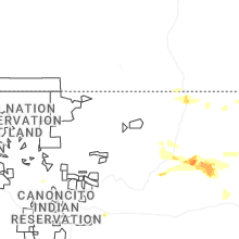
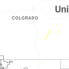
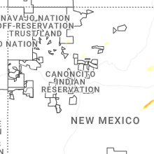
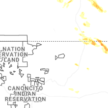
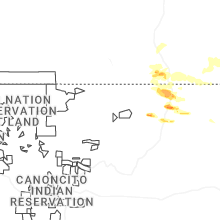
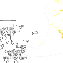
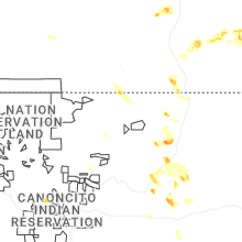
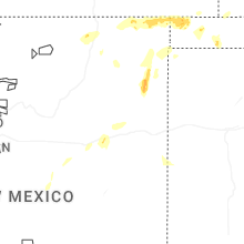
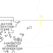
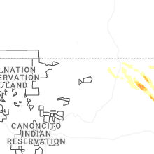
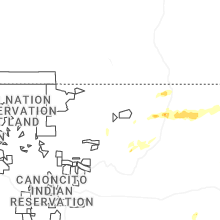


Connect with Interactive Hail Maps