

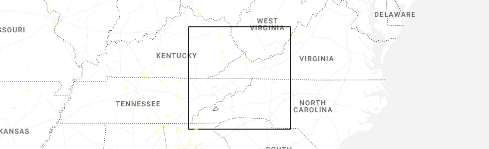
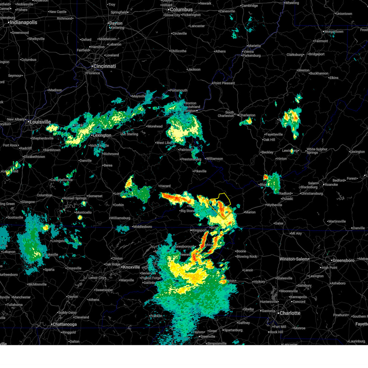
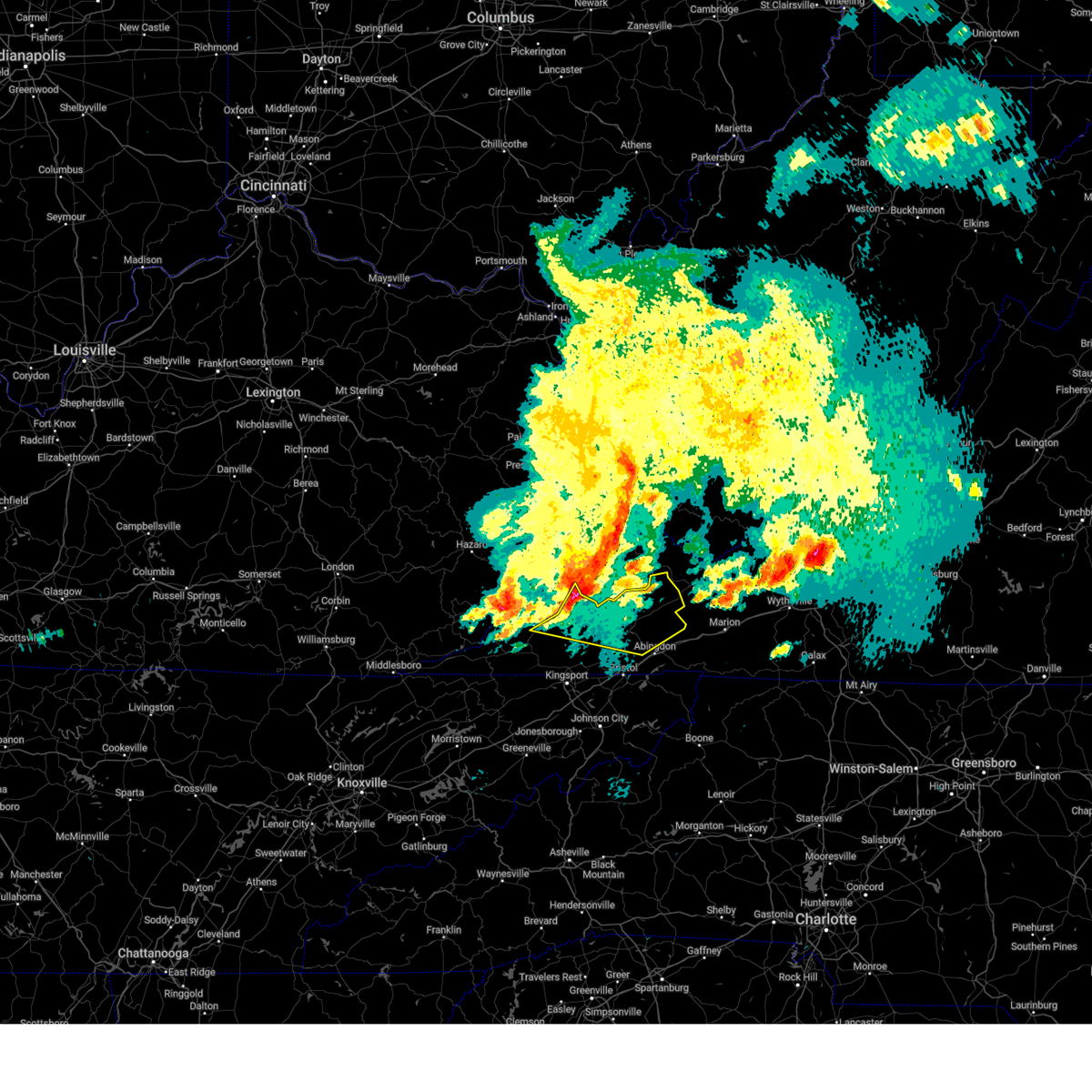
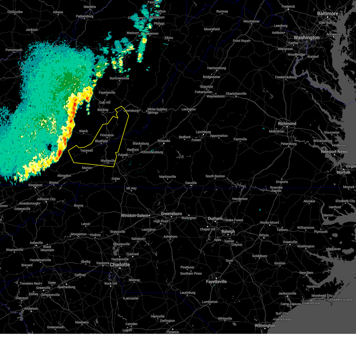
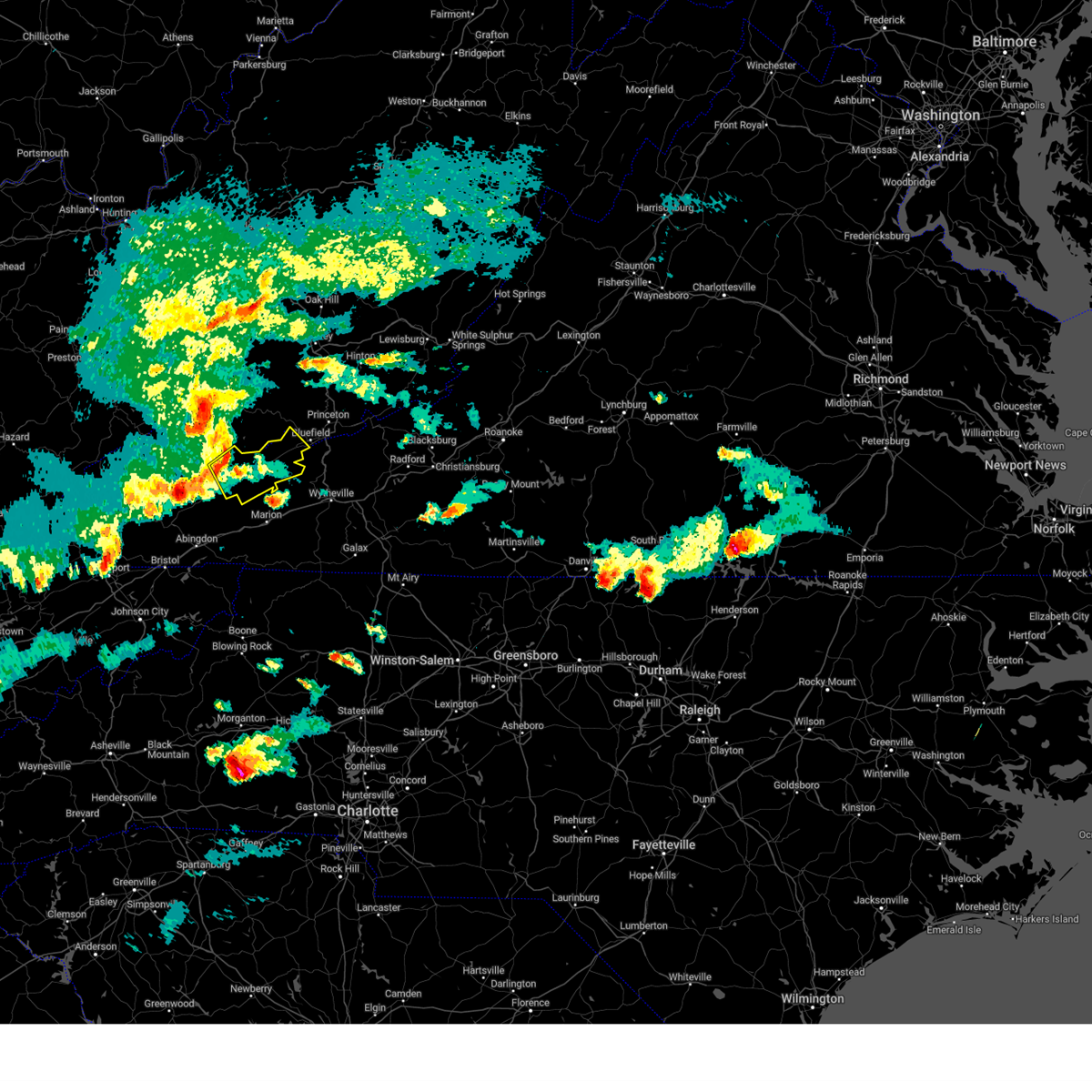
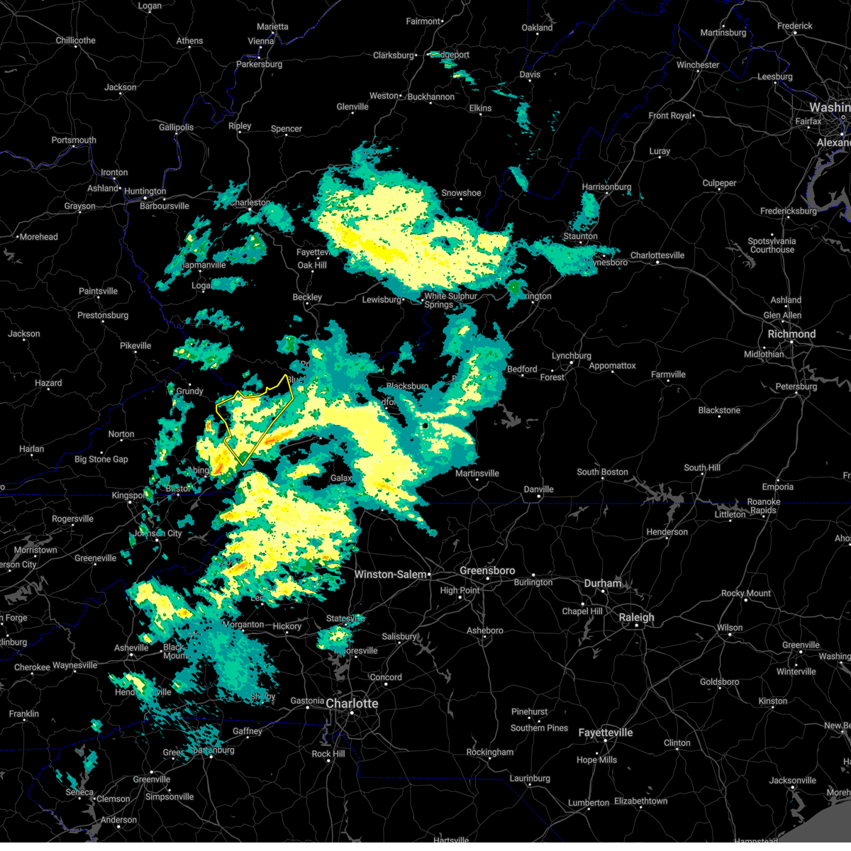
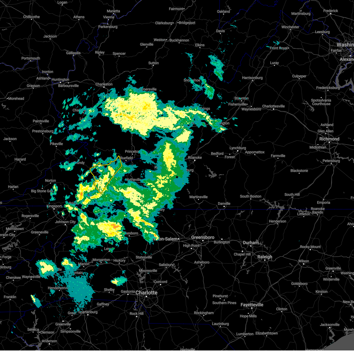
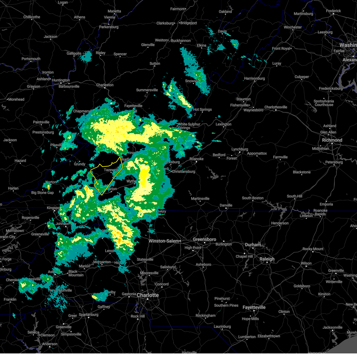
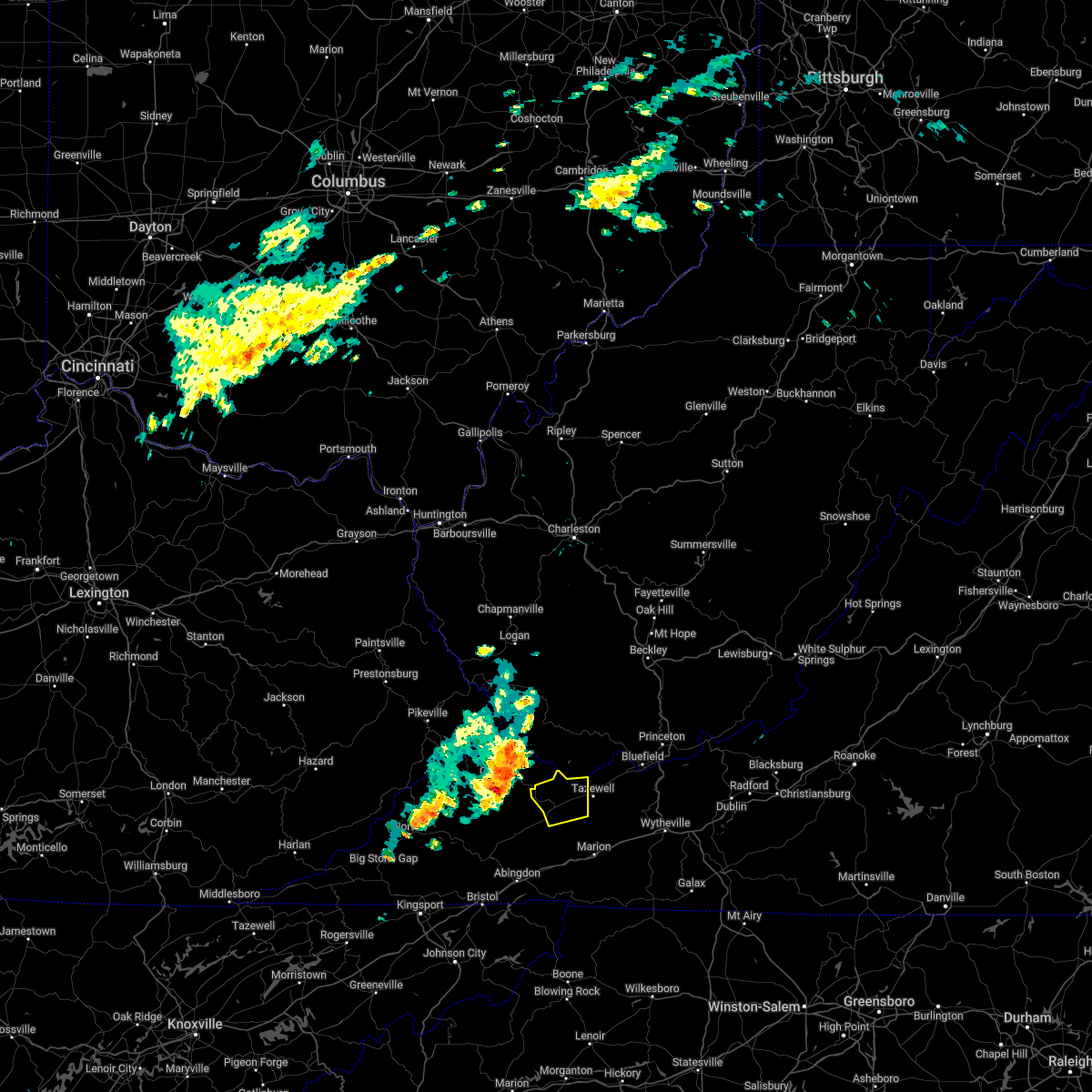
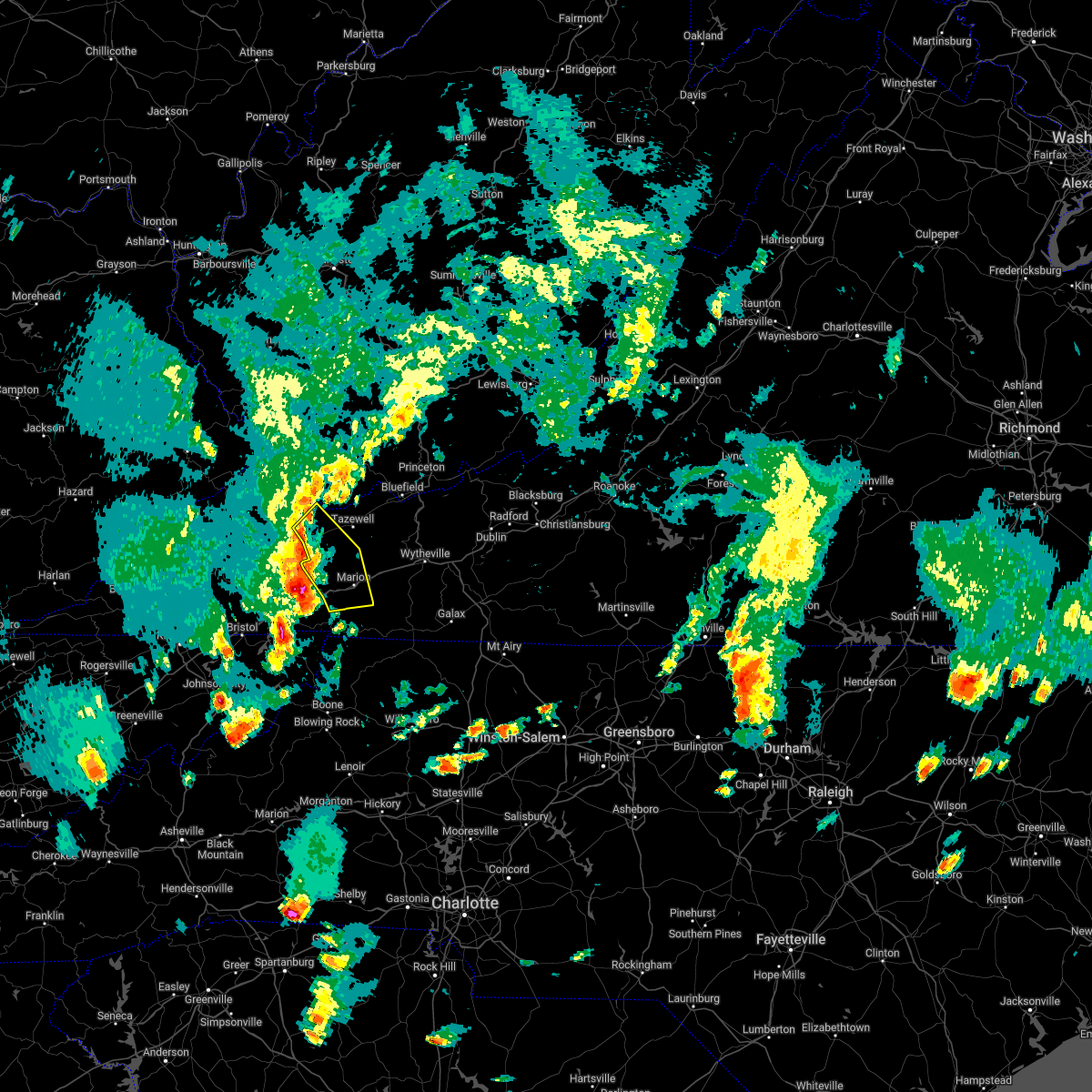
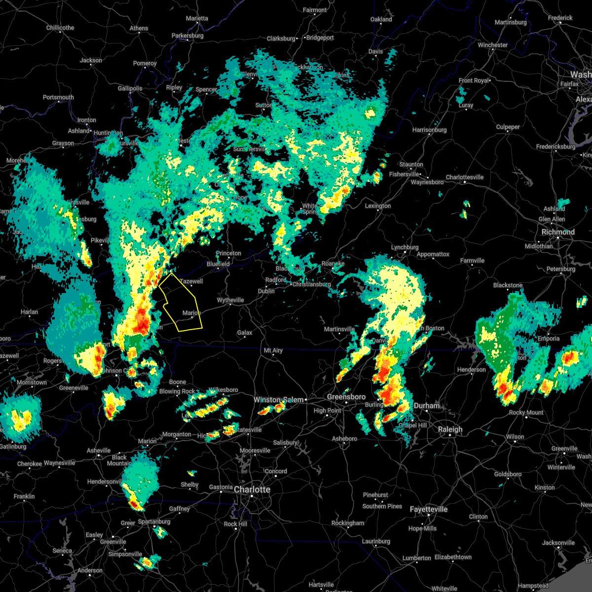
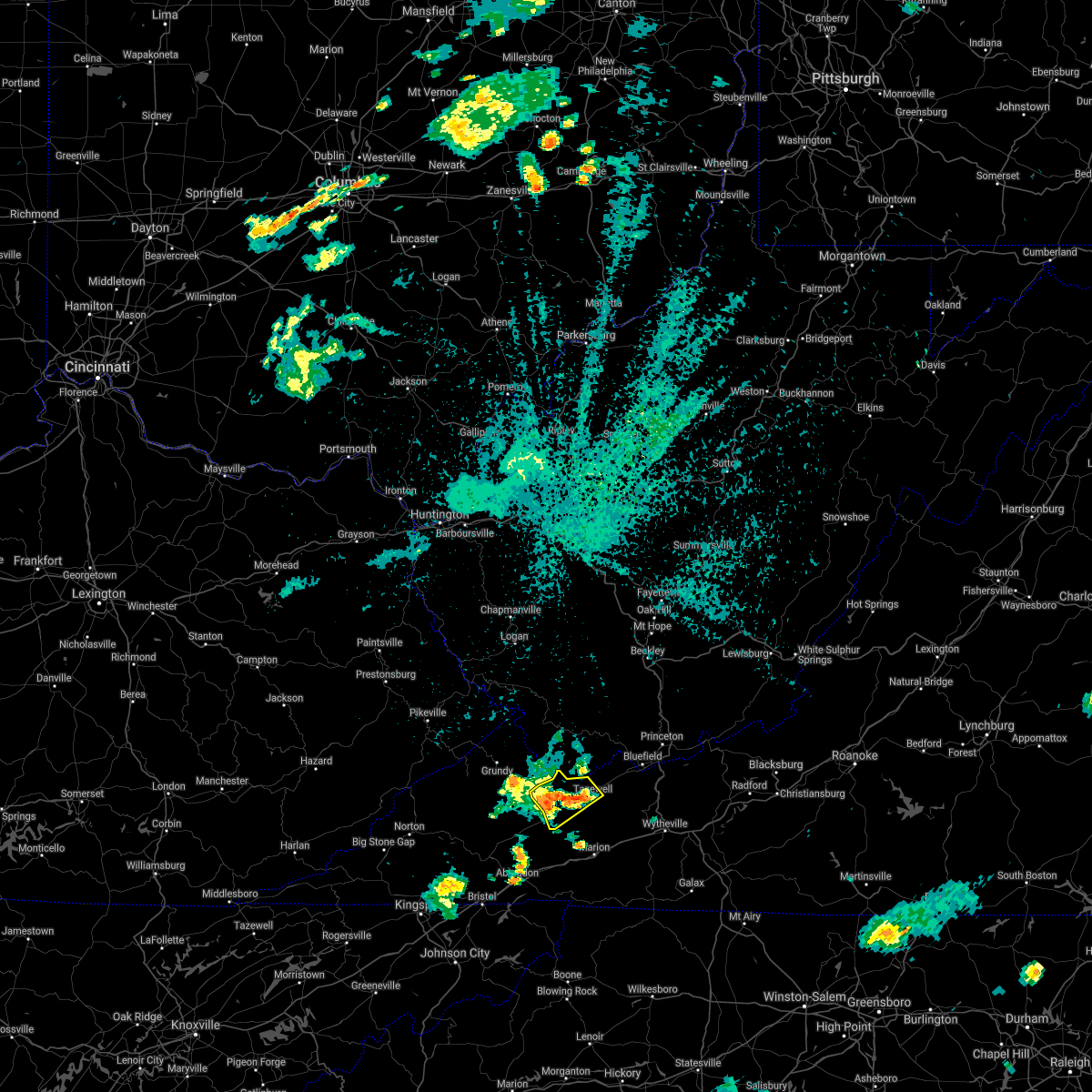
Hail Map for Raven, VA
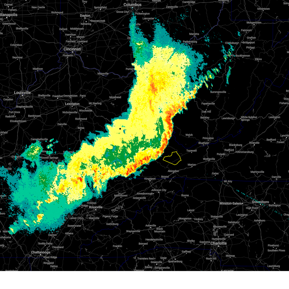
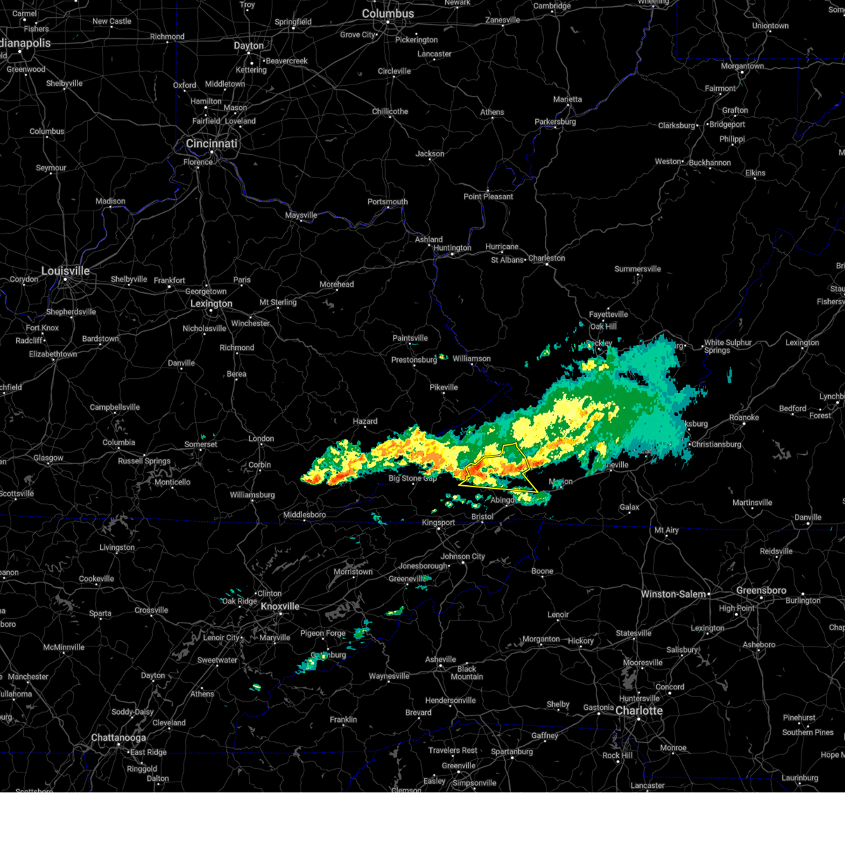
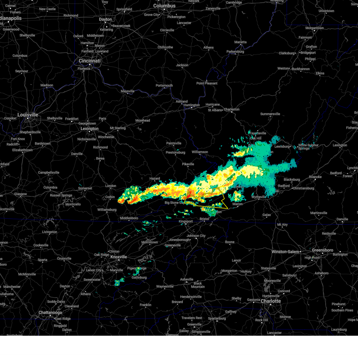
The Raven, VA area has had 1 report of on-the-ground hail by trained spotters, and has been under severe weather warnings 3 times during the past 12 months. Doppler radar has detected hail at or near Raven, VA on 35 occasions.
| Name: | Raven, VA |
| Where Located: | 40.1 miles NNE of Bristol, TN |
| Map: | Google Map for Raven, VA |
| Population: | 2270 |
| Housing Units: | 1081 |
| More Info: | Search Google for Raven, VA |
1
The Top Recent Hail Date for Raven, VA is Friday, June 27, 2025 (12th out of 35)
Hail and Wind Damage Spotted near Raven, VA
| Date / Time | Report Details |
|---|---|
| 3/16/2026 5:26 AM EDT |
 the severe thunderstorm warning has been cancelled and is no longer in effect the severe thunderstorm warning has been cancelled and is no longer in effect
|
| 3/16/2026 5:26 AM EDT |
 At 525 am edt, severe thunderstorms were located along a line extending from near grundy to near weber city, moving northeast at 40 mph (radar indicated). Hazards include 60 mph wind gusts. Expect damage to roofs, siding, and trees. locations impacted include, johnson city, kingsport, bristol tn, bristol va, abingdon, lebanon, gate city, weber city, cleveland va, and spurgeon. this includes the following highways, interstate 26 in tennessee between mile markers 1 and 14. interstate 81 in tennessee between mile markers 50 and 75. Interstate 81 in virginia between mile markers 1 and 19. At 525 am edt, severe thunderstorms were located along a line extending from near grundy to near weber city, moving northeast at 40 mph (radar indicated). Hazards include 60 mph wind gusts. Expect damage to roofs, siding, and trees. locations impacted include, johnson city, kingsport, bristol tn, bristol va, abingdon, lebanon, gate city, weber city, cleveland va, and spurgeon. this includes the following highways, interstate 26 in tennessee between mile markers 1 and 14. interstate 81 in tennessee between mile markers 50 and 75. Interstate 81 in virginia between mile markers 1 and 19.
|
| 3/16/2026 5:06 AM EDT |
 Svrmrx the national weather service in morristown has issued a * severe thunderstorm warning for, sullivan county in east tennessee, northeastern hawkins county in east tennessee, northern washington county in east tennessee, northeastern greene county in east tennessee, northwestern carter county in east tennessee, russell county in southwestern virginia, the city of norton in southwestern virginia, the city of bristol in southwestern virginia, scott county in southwestern virginia, western washington county in southwestern virginia, central wise county in southwestern virginia, * until 600 am edt. * at 506 am edt, severe thunderstorms were located along a line extending from near wise to near surgoinsville, moving northeast at 40 mph (radar indicated). Hazards include 60 mph wind gusts. expect damage to roofs, siding, and trees Svrmrx the national weather service in morristown has issued a * severe thunderstorm warning for, sullivan county in east tennessee, northeastern hawkins county in east tennessee, northern washington county in east tennessee, northeastern greene county in east tennessee, northwestern carter county in east tennessee, russell county in southwestern virginia, the city of norton in southwestern virginia, the city of bristol in southwestern virginia, scott county in southwestern virginia, western washington county in southwestern virginia, central wise county in southwestern virginia, * until 600 am edt. * at 506 am edt, severe thunderstorms were located along a line extending from near wise to near surgoinsville, moving northeast at 40 mph (radar indicated). Hazards include 60 mph wind gusts. expect damage to roofs, siding, and trees
|
| 7/1/2025 5:36 PM EDT |
 Svrrnk the national weather service in blacksburg has issued a * severe thunderstorm warning for, northwestern giles county in southwestern virginia, northwestern smyth county in southwestern virginia, tazewell county in southwestern virginia, central bland county in southwestern virginia, southern summers county in southeastern west virginia, mercer county in southeastern west virginia, southwestern monroe county in southeastern west virginia, * until 630 pm edt. * at 536 pm edt, severe thunderstorms were located along a line extending from near mullens to 6 miles east of davenport, moving southeast at 20 mph (radar indicated). Hazards include 60 mph wind gusts. expect damage to roofs, siding, and trees Svrrnk the national weather service in blacksburg has issued a * severe thunderstorm warning for, northwestern giles county in southwestern virginia, northwestern smyth county in southwestern virginia, tazewell county in southwestern virginia, central bland county in southwestern virginia, southern summers county in southeastern west virginia, mercer county in southeastern west virginia, southwestern monroe county in southeastern west virginia, * until 630 pm edt. * at 536 pm edt, severe thunderstorms were located along a line extending from near mullens to 6 miles east of davenport, moving southeast at 20 mph (radar indicated). Hazards include 60 mph wind gusts. expect damage to roofs, siding, and trees
|
| 6/17/2025 10:22 PM EDT |
 At 1021 pm edt, severe thunderstorms were located along a line extending from trammel to 9 miles northeast of lebanon to near saltville, moving northeast at 30 mph (radar indicated). Hazards include 60 mph wind gusts. Expect damage to roofs, siding, and trees. locations impacted include, abingdon, lebanon, cleveland va, honaker, dye, lindell, rosedale, and emory-meadowview. This includes interstate 81 in virginia between mile markers 22 and 23. At 1021 pm edt, severe thunderstorms were located along a line extending from trammel to 9 miles northeast of lebanon to near saltville, moving northeast at 30 mph (radar indicated). Hazards include 60 mph wind gusts. Expect damage to roofs, siding, and trees. locations impacted include, abingdon, lebanon, cleveland va, honaker, dye, lindell, rosedale, and emory-meadowview. This includes interstate 81 in virginia between mile markers 22 and 23.
|
| 6/17/2025 10:22 PM EDT |
 the severe thunderstorm warning has been cancelled and is no longer in effect the severe thunderstorm warning has been cancelled and is no longer in effect
|
| 6/17/2025 10:07 PM EDT |
 At 1006 pm edt, severe thunderstorms were located along a line extending from near wise to 6 miles west of allison gap, moving northeast at 40 mph (radar indicated). Hazards include 60 mph wind gusts and penny size hail. Expect damage to roofs, siding, and trees. locations impacted include, abingdon, norton, lebanon, wise, cleveland va, coeburn, honaker, st. paul, dungannon, and rosedale. This includes interstate 81 in virginia between mile markers 22 and 23. At 1006 pm edt, severe thunderstorms were located along a line extending from near wise to 6 miles west of allison gap, moving northeast at 40 mph (radar indicated). Hazards include 60 mph wind gusts and penny size hail. Expect damage to roofs, siding, and trees. locations impacted include, abingdon, norton, lebanon, wise, cleveland va, coeburn, honaker, st. paul, dungannon, and rosedale. This includes interstate 81 in virginia between mile markers 22 and 23.
|
| 6/17/2025 9:47 PM EDT |
 Svrmrx the national weather service in morristown has issued a * severe thunderstorm warning for, russell county in southwestern virginia, the city of norton in southwestern virginia, northeastern scott county in southwestern virginia, central washington county in southwestern virginia, southeastern wise county in southwestern virginia, * until 1045 pm edt. * at 947 pm edt, severe thunderstorms were located along a line extending from 6 miles southeast of big stone gap to near abingdon, moving northeast at 40 mph (radar indicated). Hazards include 60 mph wind gusts and quarter size hail. Hail damage to vehicles is expected. Expect wind damage to roofs, siding, and trees. Svrmrx the national weather service in morristown has issued a * severe thunderstorm warning for, russell county in southwestern virginia, the city of norton in southwestern virginia, northeastern scott county in southwestern virginia, central washington county in southwestern virginia, southeastern wise county in southwestern virginia, * until 1045 pm edt. * at 947 pm edt, severe thunderstorms were located along a line extending from 6 miles southeast of big stone gap to near abingdon, moving northeast at 40 mph (radar indicated). Hazards include 60 mph wind gusts and quarter size hail. Hail damage to vehicles is expected. Expect wind damage to roofs, siding, and trees.
|
| 5/30/2025 12:50 PM EDT | Tree on powerlines down at dismal river road whitewood... v in buchanan county VA, 9.8 miles S of Raven, VA |
| 5/30/2025 12:50 PM EDT |
 Svrrnk the national weather service in blacksburg has issued a * severe thunderstorm warning for, tazewell county in southwestern virginia, * until 200 pm edt. * at 1249 pm edt, a severe thunderstorm was located 7 miles northwest of glen burke, or 10 miles east of grundy, moving east at 30 mph (radar indicated). Hazards include 60 mph wind gusts. expect damage to roofs, siding, and trees Svrrnk the national weather service in blacksburg has issued a * severe thunderstorm warning for, tazewell county in southwestern virginia, * until 200 pm edt. * at 1249 pm edt, a severe thunderstorm was located 7 miles northwest of glen burke, or 10 miles east of grundy, moving east at 30 mph (radar indicated). Hazards include 60 mph wind gusts. expect damage to roofs, siding, and trees
|
| 5/17/2025 2:29 AM EDT |
 Svrmrx the national weather service in morristown has issued a * severe thunderstorm warning for, sullivan county in east tennessee, hawkins county in east tennessee, washington county in east tennessee, northeastern greene county in east tennessee, north central johnson county in east tennessee, northwestern carter county in east tennessee, russell county in southwestern virginia, the city of bristol in southwestern virginia, scott county in southwestern virginia, washington county in southwestern virginia, * until 330 am edt. * at 229 am edt, severe thunderstorms were located along a line extending from 7 miles southeast of grundy to near trammel to 8 miles southeast of big stone gap to sneedville, moving southeast at 40 mph (radar indicated). Hazards include 60 mph wind gusts and penny size hail. expect damage to roofs, siding, and trees Svrmrx the national weather service in morristown has issued a * severe thunderstorm warning for, sullivan county in east tennessee, hawkins county in east tennessee, washington county in east tennessee, northeastern greene county in east tennessee, north central johnson county in east tennessee, northwestern carter county in east tennessee, russell county in southwestern virginia, the city of bristol in southwestern virginia, scott county in southwestern virginia, washington county in southwestern virginia, * until 330 am edt. * at 229 am edt, severe thunderstorms were located along a line extending from 7 miles southeast of grundy to near trammel to 8 miles southeast of big stone gap to sneedville, moving southeast at 40 mph (radar indicated). Hazards include 60 mph wind gusts and penny size hail. expect damage to roofs, siding, and trees
|
| 5/16/2025 3:01 PM EDT |
 the severe thunderstorm warning has been cancelled and is no longer in effect the severe thunderstorm warning has been cancelled and is no longer in effect
|
| 5/16/2025 3:01 PM EDT |
 At 300 pm edt, a severe thunderstorm was located near cleveland va, or near lebanon, moving east at 45 mph (radar indicated). Hazards include 60 mph wind gusts and quarter size hail. Hail damage to vehicles is expected. expect wind damage to roofs, siding, and trees. locations impacted include, lebanon, lindell, dye, castlewood, holston, hansonville, honaker, rosedale, cleveland va, and st. Paul. At 300 pm edt, a severe thunderstorm was located near cleveland va, or near lebanon, moving east at 45 mph (radar indicated). Hazards include 60 mph wind gusts and quarter size hail. Hail damage to vehicles is expected. expect wind damage to roofs, siding, and trees. locations impacted include, lebanon, lindell, dye, castlewood, holston, hansonville, honaker, rosedale, cleveland va, and st. Paul.
|
| 5/16/2025 2:57 PM EDT |
 Svrrnk the national weather service in blacksburg has issued a * severe thunderstorm warning for, smyth county in southwestern virginia, tazewell county in southwestern virginia, central bland county in southwestern virginia, western wythe county in southwestern virginia, mercer county in southeastern west virginia, * until 400 pm edt. * at 256 pm edt, severe thunderstorms were located along a line extending from 8 miles south of hanover to 8 miles northeast of lebanon to 11 miles south of trammel, moving east at 60 mph (radar indicated). Hazards include 60 mph wind gusts and quarter size hail. Hail damage to vehicles is expected. Expect wind damage to roofs, siding, and trees. Svrrnk the national weather service in blacksburg has issued a * severe thunderstorm warning for, smyth county in southwestern virginia, tazewell county in southwestern virginia, central bland county in southwestern virginia, western wythe county in southwestern virginia, mercer county in southeastern west virginia, * until 400 pm edt. * at 256 pm edt, severe thunderstorms were located along a line extending from 8 miles south of hanover to 8 miles northeast of lebanon to 11 miles south of trammel, moving east at 60 mph (radar indicated). Hazards include 60 mph wind gusts and quarter size hail. Hail damage to vehicles is expected. Expect wind damage to roofs, siding, and trees.
|
| 5/16/2025 2:37 PM EDT |
 Svrmrx the national weather service in morristown has issued a * severe thunderstorm warning for, russell county in southwestern virginia, the southeastern city of norton in southwestern virginia, northeastern scott county in southwestern virginia, southeastern wise county in southwestern virginia, central washington county in southwestern virginia, * until 315 pm edt. * at 236 pm edt, severe thunderstorms were located along a line extending from near clintwood to near wise to near norton, moving east at 50 mph (radar indicated). Hazards include 60 mph wind gusts and quarter size hail. Hail damage to vehicles is expected. Expect wind damage to roofs, siding, and trees. Svrmrx the national weather service in morristown has issued a * severe thunderstorm warning for, russell county in southwestern virginia, the southeastern city of norton in southwestern virginia, northeastern scott county in southwestern virginia, southeastern wise county in southwestern virginia, central washington county in southwestern virginia, * until 315 pm edt. * at 236 pm edt, severe thunderstorms were located along a line extending from near clintwood to near wise to near norton, moving east at 50 mph (radar indicated). Hazards include 60 mph wind gusts and quarter size hail. Hail damage to vehicles is expected. Expect wind damage to roofs, siding, and trees.
|
| 5/16/2025 2:29 PM EDT |
 The storms which prompted the warning have moved out of the area. therefore, the warning will be allowed to expire. a severe thunderstorm watch remains in effect until 600 pm edt for northwestern north carolina, southwestern virginia, and southeastern west virginia. The storms which prompted the warning have moved out of the area. therefore, the warning will be allowed to expire. a severe thunderstorm watch remains in effect until 600 pm edt for northwestern north carolina, southwestern virginia, and southeastern west virginia.
|
| 5/16/2025 2:03 PM EDT | A couple trees downed by thunderstorm winds on mill creek road near boxwood lane. time estimated from rada in tazewell county VA, 1.5 miles ESE of Raven, VA |
| 5/16/2025 1:51 PM EDT |
 At 151 pm edt, severe thunderstorms were located along a line extending from gary to bandy to raven, moving east at 45 mph (radar indicated). Hazards include 70 mph wind gusts and ping pong ball size hail. People and animals outdoors will be injured. expect hail damage to roofs, siding, windows, and vehicles. expect considerable tree damage. wind damage is also likely to mobile homes, roofs, and outbuildings. Locations impacted include, bluefield, richlands, tazewell, saltville, cedar bluff, matoaka, and ceres. At 151 pm edt, severe thunderstorms were located along a line extending from gary to bandy to raven, moving east at 45 mph (radar indicated). Hazards include 70 mph wind gusts and ping pong ball size hail. People and animals outdoors will be injured. expect hail damage to roofs, siding, windows, and vehicles. expect considerable tree damage. wind damage is also likely to mobile homes, roofs, and outbuildings. Locations impacted include, bluefield, richlands, tazewell, saltville, cedar bluff, matoaka, and ceres.
|
| 5/16/2025 1:31 PM EDT |
 Svrrnk the national weather service in blacksburg has issued a * severe thunderstorm warning for, northwestern smyth county in southwestern virginia, tazewell county in southwestern virginia, western bland county in southwestern virginia, northwestern wythe county in southwestern virginia, southwestern mercer county in southeastern west virginia, * until 230 pm edt. * at 128 pm edt, severe thunderstorms were located along a line extending from 11 miles southeast of argo to near grundy to near clintwood, moving east at 45 mph (radar indicated). Hazards include 60 mph wind gusts and half dollar size hail. Hail damage to vehicles is expected. Expect wind damage to roofs, siding, and trees. Svrrnk the national weather service in blacksburg has issued a * severe thunderstorm warning for, northwestern smyth county in southwestern virginia, tazewell county in southwestern virginia, western bland county in southwestern virginia, northwestern wythe county in southwestern virginia, southwestern mercer county in southeastern west virginia, * until 230 pm edt. * at 128 pm edt, severe thunderstorms were located along a line extending from 11 miles southeast of argo to near grundy to near clintwood, moving east at 45 mph (radar indicated). Hazards include 60 mph wind gusts and half dollar size hail. Hail damage to vehicles is expected. Expect wind damage to roofs, siding, and trees.
|
| 3/31/2025 3:12 AM EDT | Tree on power lin in buchanan county VA, 6.4 miles ESE of Raven, VA |
| 3/31/2025 3:11 AM EDT |
 Svrrnk the national weather service in blacksburg has issued a * severe thunderstorm warning for, western giles county in southwestern virginia, northern smyth county in southwestern virginia, tazewell county in southwestern virginia, bland county in southwestern virginia, northwestern wythe county in southwestern virginia, summers county in southeastern west virginia, mercer county in southeastern west virginia, western monroe county in southeastern west virginia, * until 415 am edt. * at 310 am edt, severe thunderstorms were located along a line extending from near davenport to near amherstdale-robinette, moving east at 55 mph (radar indicated). Hazards include 60 mph wind gusts. expect damage to roofs, siding, and trees Svrrnk the national weather service in blacksburg has issued a * severe thunderstorm warning for, western giles county in southwestern virginia, northern smyth county in southwestern virginia, tazewell county in southwestern virginia, bland county in southwestern virginia, northwestern wythe county in southwestern virginia, summers county in southeastern west virginia, mercer county in southeastern west virginia, western monroe county in southeastern west virginia, * until 415 am edt. * at 310 am edt, severe thunderstorms were located along a line extending from near davenport to near amherstdale-robinette, moving east at 55 mph (radar indicated). Hazards include 60 mph wind gusts. expect damage to roofs, siding, and trees
|
| 3/31/2025 3:06 AM EDT |
 Svrmrx the national weather service in morristown has issued a * severe thunderstorm warning for, northeastern russell county in southwestern virginia, * until 330 am edt. * at 305 am edt, severe thunderstorms were located along a line extending from 7 miles east of grundy to 7 miles northeast of davenport to near cleveland va, moving east at 45 mph (radar indicated). Hazards include 60 mph wind gusts and penny size hail. expect damage to roofs, siding, and trees Svrmrx the national weather service in morristown has issued a * severe thunderstorm warning for, northeastern russell county in southwestern virginia, * until 330 am edt. * at 305 am edt, severe thunderstorms were located along a line extending from 7 miles east of grundy to 7 miles northeast of davenport to near cleveland va, moving east at 45 mph (radar indicated). Hazards include 60 mph wind gusts and penny size hail. expect damage to roofs, siding, and trees
|
| 2/6/2025 10:47 AM EST |
 the severe thunderstorm warning has been cancelled and is no longer in effect the severe thunderstorm warning has been cancelled and is no longer in effect
|
| 2/6/2025 10:47 AM EST |
 At 1047 am est, a severe thunderstorm was located near cleveland va, or near lebanon, moving east at 60 mph (radar indicated). Hazards include 60 mph wind gusts. Expect damage to roofs, siding, and trees. locations impacted include, lebanon, cleveland va, honaker, st. Paul, dye, castlewood, and rosedale. At 1047 am est, a severe thunderstorm was located near cleveland va, or near lebanon, moving east at 60 mph (radar indicated). Hazards include 60 mph wind gusts. Expect damage to roofs, siding, and trees. locations impacted include, lebanon, cleveland va, honaker, st. Paul, dye, castlewood, and rosedale.
|
| 2/6/2025 10:29 AM EST |
 Svrmrx the national weather service in morristown has issued a * severe thunderstorm warning for, russell county in southwestern virginia, southeastern wise county in southwestern virginia, northeastern washington county in southwestern virginia, * until 1130 am est. * at 1029 am est, a severe thunderstorm was located near trammel, or 9 miles east of wise, moving east at 60 mph (radar indicated). Hazards include 60 mph wind gusts and penny size hail. expect damage to roofs, siding, and trees Svrmrx the national weather service in morristown has issued a * severe thunderstorm warning for, russell county in southwestern virginia, southeastern wise county in southwestern virginia, northeastern washington county in southwestern virginia, * until 1130 am est. * at 1029 am est, a severe thunderstorm was located near trammel, or 9 miles east of wise, moving east at 60 mph (radar indicated). Hazards include 60 mph wind gusts and penny size hail. expect damage to roofs, siding, and trees
|
| 5/26/2024 4:23 PM EDT |
 At 422 pm edt, severe thunderstorms were located along a line extending from near war to near allison gap to 7 miles southeast of abingdon, moving east at 50 mph (radar indicated). Hazards include 60 mph wind gusts and quarter size hail. Hail damage to vehicles is expected. expect wind damage to roofs, siding, and trees. Locations impacted include, marion, richlands, bluefield, tazewell, saltville, chilhowie, and rural retreat. At 422 pm edt, severe thunderstorms were located along a line extending from near war to near allison gap to 7 miles southeast of abingdon, moving east at 50 mph (radar indicated). Hazards include 60 mph wind gusts and quarter size hail. Hail damage to vehicles is expected. expect wind damage to roofs, siding, and trees. Locations impacted include, marion, richlands, bluefield, tazewell, saltville, chilhowie, and rural retreat.
|
| 5/26/2024 4:18 PM EDT |
 At 417 pm edt, a severe thunderstorm was located near abingdon, moving east at 50 mph (radar indicated). Hazards include 60 mph wind gusts. Expect damage to roofs, siding, and trees. locations impacted include, bristol va, abingdon, lebanon, glade spring, honaker, damascus, emory-meadow view, rosedale, dye, and lindell. This includes interstate 81 in virginia between mile markers 1 and 34. At 417 pm edt, a severe thunderstorm was located near abingdon, moving east at 50 mph (radar indicated). Hazards include 60 mph wind gusts. Expect damage to roofs, siding, and trees. locations impacted include, bristol va, abingdon, lebanon, glade spring, honaker, damascus, emory-meadow view, rosedale, dye, and lindell. This includes interstate 81 in virginia between mile markers 1 and 34.
|
| 5/26/2024 4:18 PM EDT |
 the severe thunderstorm warning has been cancelled and is no longer in effect the severe thunderstorm warning has been cancelled and is no longer in effect
|
| 5/26/2024 4:07 PM EDT |
 Svrrnk the national weather service in blacksburg has issued a * severe thunderstorm warning for, smyth county in southwestern virginia, tazewell county in southwestern virginia, western bland county in southwestern virginia, western wythe county in southwestern virginia, western grayson county in southwestern virginia, southwestern mercer county in southeastern west virginia, * until 515 pm edt. * at 407 pm edt, severe thunderstorms were located along a line extending from 7 miles east of grundy to near lebanon to near bristol va, moving east at 50 mph (radar indicated). Hazards include 60 mph wind gusts. expect damage to roofs, siding, and trees Svrrnk the national weather service in blacksburg has issued a * severe thunderstorm warning for, smyth county in southwestern virginia, tazewell county in southwestern virginia, western bland county in southwestern virginia, western wythe county in southwestern virginia, western grayson county in southwestern virginia, southwestern mercer county in southeastern west virginia, * until 515 pm edt. * at 407 pm edt, severe thunderstorms were located along a line extending from 7 miles east of grundy to near lebanon to near bristol va, moving east at 50 mph (radar indicated). Hazards include 60 mph wind gusts. expect damage to roofs, siding, and trees
|
| 5/26/2024 3:47 PM EDT |
 Svrmrx the national weather service in morristown has issued a * severe thunderstorm warning for, russell county in southwestern virginia, the city of bristol in southwestern virginia, southeastern scott county in southwestern virginia, washington county in southwestern virginia, * until 445 pm edt. * at 347 pm edt, a severe thunderstorm was located 15 miles northeast of weber city, or 15 miles northeast of gate city, moving east at 50 mph (radar indicated). Hazards include 60 mph wind gusts. expect damage to roofs, siding, and trees Svrmrx the national weather service in morristown has issued a * severe thunderstorm warning for, russell county in southwestern virginia, the city of bristol in southwestern virginia, southeastern scott county in southwestern virginia, washington county in southwestern virginia, * until 445 pm edt. * at 347 pm edt, a severe thunderstorm was located 15 miles northeast of weber city, or 15 miles northeast of gate city, moving east at 50 mph (radar indicated). Hazards include 60 mph wind gusts. expect damage to roofs, siding, and trees
|
| 2/12/2024 10:56 PM EST |
 At 1054 pm est, severe thunderstorms were located along a line extending from near glen burke to mountain city, moving east at 50 mph (radar indicated). Hazards include 60 mph wind gusts. expect damage to roofs, siding, and trees At 1054 pm est, severe thunderstorms were located along a line extending from near glen burke to mountain city, moving east at 50 mph (radar indicated). Hazards include 60 mph wind gusts. expect damage to roofs, siding, and trees
|
| 7/29/2023 4:53 PM EDT |
 At 452 pm edt, a severe thunderstorm was located near lebanon, moving east at 20 mph (radar indicated). Hazards include 60 mph wind gusts and quarter size hail. Hail damage to vehicles is expected. Expect wind damage to roofs, siding, and trees. At 452 pm edt, a severe thunderstorm was located near lebanon, moving east at 20 mph (radar indicated). Hazards include 60 mph wind gusts and quarter size hail. Hail damage to vehicles is expected. Expect wind damage to roofs, siding, and trees.
|
| 7/29/2023 4:06 PM EDT |
 At 406 pm edt, a severe thunderstorm was located over mayking, or near whitesburg, moving southeast at 35 mph (radar indicated). Hazards include 60 mph wind gusts and quarter size hail. Hail damage to vehicles is expected. Expect wind damage to roofs, siding, and trees. At 406 pm edt, a severe thunderstorm was located over mayking, or near whitesburg, moving southeast at 35 mph (radar indicated). Hazards include 60 mph wind gusts and quarter size hail. Hail damage to vehicles is expected. Expect wind damage to roofs, siding, and trees.
|
| 7/28/2023 5:13 PM EDT |
 The severe thunderstorm warning for giles, northwestern smyth, tazewell, bland, greenbrier, summers, mercer and monroe counties will expire at 515 pm edt, the storms which prompted the warning have moved out of the area. therefore, the warning will be allowed to expire. a severe thunderstorm watch remains in effect until 1100 pm edt for southwestern and west central virginia, and southeastern west virginia. The severe thunderstorm warning for giles, northwestern smyth, tazewell, bland, greenbrier, summers, mercer and monroe counties will expire at 515 pm edt, the storms which prompted the warning have moved out of the area. therefore, the warning will be allowed to expire. a severe thunderstorm watch remains in effect until 1100 pm edt for southwestern and west central virginia, and southeastern west virginia.
|
| 7/28/2023 4:31 PM EDT |
 At 431 pm edt, severe thunderstorms were located along a line extending from 6 miles northwest of bingham to near hix to pipestem resort state park to near amonate, moving southeast at 60 mph (radar indicated). Hazards include 60 mph wind gusts. Expect damage to roofs, siding, and trees. locations impacted include, alleghany, bluefield, bland, princeton, richlands, tazewell, and lewisburg. this includes the following locations the west virginia state fairgrounds and mercer county airport. hail threat, radar indicated max hail size, <. 75 in wind threat, radar indicated max wind gust, 60 mph. At 431 pm edt, severe thunderstorms were located along a line extending from 6 miles northwest of bingham to near hix to pipestem resort state park to near amonate, moving southeast at 60 mph (radar indicated). Hazards include 60 mph wind gusts. Expect damage to roofs, siding, and trees. locations impacted include, alleghany, bluefield, bland, princeton, richlands, tazewell, and lewisburg. this includes the following locations the west virginia state fairgrounds and mercer county airport. hail threat, radar indicated max hail size, <. 75 in wind threat, radar indicated max wind gust, 60 mph.
|
| 7/28/2023 4:30 PM EDT |
 At 430 pm edt, severe thunderstorms were located along a line extending from 7 miles southwest of claypool hill to 8 miles south of cleveland va, moving southeast at 15 mph (radar indicated). Hazards include 60 mph wind gusts and quarter size hail. Hail damage to vehicles is expected. expect wind damage to roofs, siding, and trees. locations impacted include, lebanon, cleveland va, honaker, st. paul, dye, castlewood, holston, hansonville and rosedale. hail threat, radar indicated max hail size, 1. 00 in wind threat, radar indicated max wind gust, 60 mph. At 430 pm edt, severe thunderstorms were located along a line extending from 7 miles southwest of claypool hill to 8 miles south of cleveland va, moving southeast at 15 mph (radar indicated). Hazards include 60 mph wind gusts and quarter size hail. Hail damage to vehicles is expected. expect wind damage to roofs, siding, and trees. locations impacted include, lebanon, cleveland va, honaker, st. paul, dye, castlewood, holston, hansonville and rosedale. hail threat, radar indicated max hail size, 1. 00 in wind threat, radar indicated max wind gust, 60 mph.
|
| 7/28/2023 4:06 PM EDT |
 At 405 pm edt, severe thunderstorms were located along a line extending from 7 miles west of raven to 8 miles southwest of trammel, moving east at 10 mph (radar indicated). Hazards include 60 mph wind gusts and quarter size hail. Hail damage to vehicles is expected. Expect wind damage to roofs, siding, and trees. At 405 pm edt, severe thunderstorms were located along a line extending from 7 miles west of raven to 8 miles southwest of trammel, moving east at 10 mph (radar indicated). Hazards include 60 mph wind gusts and quarter size hail. Hail damage to vehicles is expected. Expect wind damage to roofs, siding, and trees.
|
| 7/28/2023 4:03 PM EDT |
 At 402 pm edt, severe thunderstorms were located along a line extending from 6 miles south of burnwell to near sophia to near hanover, moving east at 30 mph (radar indicated). Hazards include 60 mph wind gusts. expect damage to roofs, siding, and trees At 402 pm edt, severe thunderstorms were located along a line extending from 6 miles south of burnwell to near sophia to near hanover, moving east at 30 mph (radar indicated). Hazards include 60 mph wind gusts. expect damage to roofs, siding, and trees
|
| 5/16/2023 6:07 PM EDT |
 At 606 pm edt, a severe thunderstorm was located near cliffield, or near tazewell, moving east at 50 mph (radar indicated). Hazards include 60 mph wind gusts. Expect damage to roofs, siding, and trees. locations impacted include, richlands, bluefield, tazewell, cedar bluff, burkes garden, pocahontas, and raven. hail threat, radar indicated max hail size, <. 75 in wind threat, radar indicated max wind gust, 60 mph. At 606 pm edt, a severe thunderstorm was located near cliffield, or near tazewell, moving east at 50 mph (radar indicated). Hazards include 60 mph wind gusts. Expect damage to roofs, siding, and trees. locations impacted include, richlands, bluefield, tazewell, cedar bluff, burkes garden, pocahontas, and raven. hail threat, radar indicated max hail size, <. 75 in wind threat, radar indicated max wind gust, 60 mph.
|
| 5/16/2023 5:50 PM EDT | One tree was blown down in red as in tazewell county VA, 0.8 miles SSE of Raven, VA |
| 5/16/2023 5:49 PM EDT |
 At 549 pm edt, a severe thunderstorm was located near cleveland va, or near lebanon, moving east at 30 mph (radar indicated). Hazards include 60 mph wind gusts and penny size hail. Expect damage to roofs, siding, and trees. Locations impacted include, lebanon, honaker, dye and rosedale. At 549 pm edt, a severe thunderstorm was located near cleveland va, or near lebanon, moving east at 30 mph (radar indicated). Hazards include 60 mph wind gusts and penny size hail. Expect damage to roofs, siding, and trees. Locations impacted include, lebanon, honaker, dye and rosedale.
|
| 5/16/2023 5:37 PM EDT |
 At 537 pm edt, a severe thunderstorm was located near grundy, moving east at 55 mph (radar indicated). Hazards include 60 mph wind gusts and quarter size hail. Hail damage to vehicles is expected. Expect wind damage to roofs, siding, and trees. At 537 pm edt, a severe thunderstorm was located near grundy, moving east at 55 mph (radar indicated). Hazards include 60 mph wind gusts and quarter size hail. Hail damage to vehicles is expected. Expect wind damage to roofs, siding, and trees.
|
| 5/16/2023 5:34 PM EDT |
 At 534 pm edt, a severe thunderstorm was located near trammel, or 8 miles southwest of davenport, moving east at 40 mph (radar indicated). Hazards include 60 mph wind gusts and nickel size hail. expect damage to roofs, siding, and trees At 534 pm edt, a severe thunderstorm was located near trammel, or 8 miles southwest of davenport, moving east at 40 mph (radar indicated). Hazards include 60 mph wind gusts and nickel size hail. expect damage to roofs, siding, and trees
|
| 3/3/2023 5:25 PM EST |
 The severe thunderstorm warning for northwestern smyth and tazewell counties will expire at 530 pm est, the storm which prompted the warning has weakened below severe limits, and no longer poses an immediate threat to life or property. therefore, the warning will be allowed to expire. however gusty winds are still possible with this thunderstorm. The severe thunderstorm warning for northwestern smyth and tazewell counties will expire at 530 pm est, the storm which prompted the warning has weakened below severe limits, and no longer poses an immediate threat to life or property. therefore, the warning will be allowed to expire. however gusty winds are still possible with this thunderstorm.
|
| 3/3/2023 5:14 PM EST |
 At 514 pm est, a severe thunderstorm was located near allison gap, or 7 miles northwest of saltville, moving northeast at 60 mph (radar indicated). Hazards include 60 mph wind gusts. Expect damage to roofs, siding, and trees. locations impacted include, richlands, tazewell, saltville, chilhowie, cedar bluff, pocahontas, and raven. hail threat, radar indicated max hail size, <. 75 in wind threat, radar indicated max wind gust, 60 mph. At 514 pm est, a severe thunderstorm was located near allison gap, or 7 miles northwest of saltville, moving northeast at 60 mph (radar indicated). Hazards include 60 mph wind gusts. Expect damage to roofs, siding, and trees. locations impacted include, richlands, tazewell, saltville, chilhowie, cedar bluff, pocahontas, and raven. hail threat, radar indicated max hail size, <. 75 in wind threat, radar indicated max wind gust, 60 mph.
|
| 3/3/2023 5:00 PM EST |
 At 500 pm est, a severe thunderstorm was located near allison gap, or near saltville, moving northeast at 60 mph (radar indicated). Hazards include 60 mph wind gusts. expect damage to roofs, siding, and trees At 500 pm est, a severe thunderstorm was located near allison gap, or near saltville, moving northeast at 60 mph (radar indicated). Hazards include 60 mph wind gusts. expect damage to roofs, siding, and trees
|
| 8/5/2022 6:50 PM EDT |
 At 650 pm edt, severe thunderstorms were located along a line extending from davenport to near raven, moving northeast at 40 mph (radar indicated). Hazards include 60 mph wind gusts and penny size hail. Expect damage to roofs, siding, and trees. locations impacted include, honaker and dye. hail threat, radar indicated max hail size, 0. 75 in wind threat, radar indicated max wind gust, 60 mph. At 650 pm edt, severe thunderstorms were located along a line extending from davenport to near raven, moving northeast at 40 mph (radar indicated). Hazards include 60 mph wind gusts and penny size hail. Expect damage to roofs, siding, and trees. locations impacted include, honaker and dye. hail threat, radar indicated max hail size, 0. 75 in wind threat, radar indicated max wind gust, 60 mph.
|
| 8/5/2022 6:30 PM EDT |
 At 630 pm edt, severe thunderstorms were located along a line extending from payne gap to near trammel to near raven, moving northeast at 35 mph (radar indicated). Hazards include 60 mph wind gusts and penny size hail. Expect damage to roofs, siding, and trees. locations impacted include, lebanon, cleveland va, coeburn, honaker, pound, st. paul, dye, castlewood and rosedale. hail threat, radar indicated max hail size, 0. 75 in wind threat, radar indicated max wind gust, 60 mph. At 630 pm edt, severe thunderstorms were located along a line extending from payne gap to near trammel to near raven, moving northeast at 35 mph (radar indicated). Hazards include 60 mph wind gusts and penny size hail. Expect damage to roofs, siding, and trees. locations impacted include, lebanon, cleveland va, coeburn, honaker, pound, st. paul, dye, castlewood and rosedale. hail threat, radar indicated max hail size, 0. 75 in wind threat, radar indicated max wind gust, 60 mph.
|
| 8/5/2022 5:57 PM EDT |
 At 556 pm edt, severe thunderstorms were located along a line extending from near payne gap to 8 miles northeast of gate city to near quarry, moving northeast at 35 mph (radar indicated). Hazards include 60 mph wind gusts and penny size hail. expect damage to roofs, siding, and trees At 556 pm edt, severe thunderstorms were located along a line extending from near payne gap to 8 miles northeast of gate city to near quarry, moving northeast at 35 mph (radar indicated). Hazards include 60 mph wind gusts and penny size hail. expect damage to roofs, siding, and trees
|
| 7/21/2022 2:55 AM EDT |
 At 254 am edt, severe thunderstorms were located along a line extending from 6 miles west of glen burke to 7 miles north of lebanon to 7 miles south of trammel to near wise, moving southeast at 40 mph (radar indicated). Hazards include 60 mph wind gusts. Expect damage to roofs, siding, and trees. locations impacted include, lebanon, cleveland va, coeburn, honaker, st. paul, dye, castlewood, hansonville and rosedale. hail threat, radar indicated max hail size, <. 75 in wind threat, radar indicated max wind gust, 60 mph. At 254 am edt, severe thunderstorms were located along a line extending from 6 miles west of glen burke to 7 miles north of lebanon to 7 miles south of trammel to near wise, moving southeast at 40 mph (radar indicated). Hazards include 60 mph wind gusts. Expect damage to roofs, siding, and trees. locations impacted include, lebanon, cleveland va, coeburn, honaker, st. paul, dye, castlewood, hansonville and rosedale. hail threat, radar indicated max hail size, <. 75 in wind threat, radar indicated max wind gust, 60 mph.
|
| 7/21/2022 2:32 AM EDT |
 At 232 am edt, severe thunderstorms were located along a line extending from near big rock to 6 miles south of haysi to near wise to near big stone gap, moving southeast at 40 mph (radar indicated). Hazards include 60 mph wind gusts. expect damage to roofs, siding, and trees At 232 am edt, severe thunderstorms were located along a line extending from near big rock to 6 miles south of haysi to near wise to near big stone gap, moving southeast at 40 mph (radar indicated). Hazards include 60 mph wind gusts. expect damage to roofs, siding, and trees
|
| 6/17/2022 3:36 PM EDT |
 At 334 pm edt, severe thunderstorms were located along a line extending from renick to lewisburg to union to bland to broadford, moving southeast at 55 mph (radar indicated). Hazards include 60 mph wind gusts. Expect damage to roofs, siding, and trees. locations impacted include, bluefield, bland, princeton, richlands, tazewell, lewisburg, and pearisburg. this includes the following locations the west virginia state fairgrounds and mercer county airport. hail threat, radar indicated max hail size, <. 75 in wind threat, radar indicated max wind gust, 60 mph. At 334 pm edt, severe thunderstorms were located along a line extending from renick to lewisburg to union to bland to broadford, moving southeast at 55 mph (radar indicated). Hazards include 60 mph wind gusts. Expect damage to roofs, siding, and trees. locations impacted include, bluefield, bland, princeton, richlands, tazewell, lewisburg, and pearisburg. this includes the following locations the west virginia state fairgrounds and mercer county airport. hail threat, radar indicated max hail size, <. 75 in wind threat, radar indicated max wind gust, 60 mph.
|
| 6/17/2022 3:02 PM EDT |
 At 301 pm edt, severe thunderstorms were located along a line extending from near richwood to abingdon, moving southeast at 55 mph (radar indicated). Hazards include 60 mph wind gusts. expect damage to roofs, siding, and trees At 301 pm edt, severe thunderstorms were located along a line extending from near richwood to abingdon, moving southeast at 55 mph (radar indicated). Hazards include 60 mph wind gusts. expect damage to roofs, siding, and trees
|
| 6/2/2022 12:08 PM EDT |
 At 1208 pm edt, a severe thunderstorm was located near davenport, moving east at 30 mph (radar indicated). Hazards include 60 mph wind gusts and quarter size hail. Hail damage to vehicles is expected. Expect wind damage to roofs, siding, and trees. At 1208 pm edt, a severe thunderstorm was located near davenport, moving east at 30 mph (radar indicated). Hazards include 60 mph wind gusts and quarter size hail. Hail damage to vehicles is expected. Expect wind damage to roofs, siding, and trees.
|
| 5/6/2022 7:20 PM EDT |
 At 720 pm edt, severe thunderstorms were located along a line extending from 8 miles southwest of raven to near broadford to adwolf, moving northeast at 50 mph (radar indicated). Hazards include 60 mph wind gusts. Expect damage to roofs, siding, and trees. locations impacted include, lebanon, cleveland va, glade spring, honaker, st. paul, dye, lindell, castlewood, rosedale and emory-meadow view. this includes interstate 81 in virginia between mile markers 31 and 34. hail threat, radar indicated max hail size, <. 75 in wind threat, radar indicated max wind gust, 60 mph. At 720 pm edt, severe thunderstorms were located along a line extending from 8 miles southwest of raven to near broadford to adwolf, moving northeast at 50 mph (radar indicated). Hazards include 60 mph wind gusts. Expect damage to roofs, siding, and trees. locations impacted include, lebanon, cleveland va, glade spring, honaker, st. paul, dye, lindell, castlewood, rosedale and emory-meadow view. this includes interstate 81 in virginia between mile markers 31 and 34. hail threat, radar indicated max hail size, <. 75 in wind threat, radar indicated max wind gust, 60 mph.
|
| 5/6/2022 6:56 PM EDT |
 At 655 pm edt, severe thunderstorms were located along a line extending from 11 miles southwest of cleveland va to near abingdon to 12 miles east of bristol va, moving northeast at 45 mph. this line of storms has a history of producing damaging winds (radar indicated). Hazards include 60 mph wind gusts. expect damage to roofs, siding, and trees At 655 pm edt, severe thunderstorms were located along a line extending from 11 miles southwest of cleveland va to near abingdon to 12 miles east of bristol va, moving northeast at 45 mph. this line of storms has a history of producing damaging winds (radar indicated). Hazards include 60 mph wind gusts. expect damage to roofs, siding, and trees
|
| 5/6/2022 5:21 PM EDT |
 At 519 pm edt, severe thunderstorms were located along a line extending from raven to near allison gap to 7 miles southwest of quarry, moving northeast at 60 mph (radar indicated). Hazards include 60 mph wind gusts and quarter size hail. Hail damage to vehicles is expected. expect wind damage to roofs, siding, and trees. Locations impacted include, marion, richlands, saltville, chilhowie, cedar bluff, mount rogers national recreation area, and sugar grove. At 519 pm edt, severe thunderstorms were located along a line extending from raven to near allison gap to 7 miles southwest of quarry, moving northeast at 60 mph (radar indicated). Hazards include 60 mph wind gusts and quarter size hail. Hail damage to vehicles is expected. expect wind damage to roofs, siding, and trees. Locations impacted include, marion, richlands, saltville, chilhowie, cedar bluff, mount rogers national recreation area, and sugar grove.
|
| 5/6/2022 5:04 PM EDT |
 At 503 pm edt, severe thunderstorms were located along a line extending from near lebanon to 9 miles west of saltville to abingdon, moving northeast at 60 mph (radar indicated). Hazards include 60 mph wind gusts and quarter size hail. Hail damage to vehicles is expected. Expect wind damage to roofs, siding, and trees. At 503 pm edt, severe thunderstorms were located along a line extending from near lebanon to 9 miles west of saltville to abingdon, moving northeast at 60 mph (radar indicated). Hazards include 60 mph wind gusts and quarter size hail. Hail damage to vehicles is expected. Expect wind damage to roofs, siding, and trees.
|
| 8/14/2021 12:05 AM EDT |
 At 1204 am edt, a severe thunderstorm was located over cedar bluff, moving northeast at 20 mph (radar indicated). Hazards include 60 mph wind gusts. Expect damage to roofs, siding, and trees. locations impacted include, richlands, tazewell, cedar bluff, raven, glen burke, jewell ridge, and amonate. hail threat, radar indicated max hail size, <. 75 in wind threat, radar indicated max wind gust, 60 mph. At 1204 am edt, a severe thunderstorm was located over cedar bluff, moving northeast at 20 mph (radar indicated). Hazards include 60 mph wind gusts. Expect damage to roofs, siding, and trees. locations impacted include, richlands, tazewell, cedar bluff, raven, glen burke, jewell ridge, and amonate. hail threat, radar indicated max hail size, <. 75 in wind threat, radar indicated max wind gust, 60 mph.
|
| 8/13/2021 11:48 PM EDT |
 At 1146 pm edt, a severe thunderstorm was located near raven, or near richlands, moving northeast at 15 mph (radar indicated). Hazards include 60 mph wind gusts. expect damage to roofs, siding, and trees At 1146 pm edt, a severe thunderstorm was located near raven, or near richlands, moving northeast at 15 mph (radar indicated). Hazards include 60 mph wind gusts. expect damage to roofs, siding, and trees
|
| 8/13/2021 11:25 PM EDT |
 At 1125 pm edt, a severe thunderstorm was located 7 miles southwest of raven, or 10 miles southwest of richlands, moving northeast at 15 mph (radar indicated). Hazards include 60 mph wind gusts. Expect damage to roofs, siding, and trees. locations impacted include, lebanon, honaker, dye and rosedale. hail threat, radar indicated max hail size, <. 75 in wind threat, radar indicated max wind gust, 60 mph. At 1125 pm edt, a severe thunderstorm was located 7 miles southwest of raven, or 10 miles southwest of richlands, moving northeast at 15 mph (radar indicated). Hazards include 60 mph wind gusts. Expect damage to roofs, siding, and trees. locations impacted include, lebanon, honaker, dye and rosedale. hail threat, radar indicated max hail size, <. 75 in wind threat, radar indicated max wind gust, 60 mph.
|
| 8/13/2021 11:11 PM EDT |
 At 1111 pm edt, a severe thunderstorm was located over cleveland va, or near lebanon, moving northeast at 15 mph (radar indicated). Hazards include 60 mph wind gusts. Expect damage to roofs, siding, and trees. locations impacted include, lebanon, cleveland va, honaker, dye and rosedale. hail threat, radar indicated max hail size, <. 75 in wind threat, radar indicated max wind gust, 60 mph. At 1111 pm edt, a severe thunderstorm was located over cleveland va, or near lebanon, moving northeast at 15 mph (radar indicated). Hazards include 60 mph wind gusts. Expect damage to roofs, siding, and trees. locations impacted include, lebanon, cleveland va, honaker, dye and rosedale. hail threat, radar indicated max hail size, <. 75 in wind threat, radar indicated max wind gust, 60 mph.
|
| 8/13/2021 10:46 PM EDT |
 At 1046 pm edt, a severe thunderstorm was located near cleveland va, or 10 miles west of lebanon, moving east at 15 mph (radar indicated). Hazards include 60 mph wind gusts and penny size hail. expect damage to roofs, siding, and trees At 1046 pm edt, a severe thunderstorm was located near cleveland va, or 10 miles west of lebanon, moving east at 15 mph (radar indicated). Hazards include 60 mph wind gusts and penny size hail. expect damage to roofs, siding, and trees
|
| 8/7/2021 4:20 PM EDT |
 At 420 pm edt, a severe thunderstorm was located near claypool hill, or near richlands, moving east at 15 mph (radar indicated). Hazards include 60 mph wind gusts and quarter size hail. Hail damage to vehicles is expected. expect wind damage to roofs, siding, and trees. locations impacted include, dye and rosedale. hail threat, radar indicated max hail size, 1. 00 in wind threat, radar indicated max wind gust, 60 mph. At 420 pm edt, a severe thunderstorm was located near claypool hill, or near richlands, moving east at 15 mph (radar indicated). Hazards include 60 mph wind gusts and quarter size hail. Hail damage to vehicles is expected. expect wind damage to roofs, siding, and trees. locations impacted include, dye and rosedale. hail threat, radar indicated max hail size, 1. 00 in wind threat, radar indicated max wind gust, 60 mph.
|
| 8/7/2021 4:07 PM EDT |
 At 407 pm edt, a severe thunderstorm was located near raven, or near richlands, moving east at 15 mph (radar indicated). Hazards include 60 mph wind gusts and quarter size hail. Hail damage to vehicles is expected. Expect wind damage to roofs, siding, and trees. At 407 pm edt, a severe thunderstorm was located near raven, or near richlands, moving east at 15 mph (radar indicated). Hazards include 60 mph wind gusts and quarter size hail. Hail damage to vehicles is expected. Expect wind damage to roofs, siding, and trees.
|
| 7/10/2021 5:05 PM EDT |
 At 504 pm edt, a severe thunderstorm was located near jewell ridge, or 11 miles north of richlands, moving southeast at 30 mph (radar indicated). Hazards include 60 mph wind gusts. expect damage to roofs, siding, and trees At 504 pm edt, a severe thunderstorm was located near jewell ridge, or 11 miles north of richlands, moving southeast at 30 mph (radar indicated). Hazards include 60 mph wind gusts. expect damage to roofs, siding, and trees
|
| 6/7/2021 4:28 PM EDT |
 At 427 pm edt, severe thunderstorms were located along a line extending from 7 miles south of trammel to near abingdon, moving northeast at 30 mph (radar indicated). Hazards include 60 mph wind gusts. Expect damage to roofs, siding, and trees. locations impacted include, bristol va, abingdon, lebanon, cleveland va, glade spring, honaker, st. paul, emory-meadow view, rosedale and dye. This includes interstate 81 in virginia between mile markers 9 and 34. At 427 pm edt, severe thunderstorms were located along a line extending from 7 miles south of trammel to near abingdon, moving northeast at 30 mph (radar indicated). Hazards include 60 mph wind gusts. Expect damage to roofs, siding, and trees. locations impacted include, bristol va, abingdon, lebanon, cleveland va, glade spring, honaker, st. paul, emory-meadow view, rosedale and dye. This includes interstate 81 in virginia between mile markers 9 and 34.
|
| 6/7/2021 3:59 PM EDT |
 At 358 pm edt, severe thunderstorms were located along a line extending from 11 miles northeast of gate city to 11 miles southeast of bristol tn, moving northeast at 30 mph (radar indicated). Hazards include 60 mph wind gusts. expect damage to roofs, siding, and trees At 358 pm edt, severe thunderstorms were located along a line extending from 11 miles northeast of gate city to 11 miles southeast of bristol tn, moving northeast at 30 mph (radar indicated). Hazards include 60 mph wind gusts. expect damage to roofs, siding, and trees
|
| 6/7/2021 3:59 PM EDT |
 The national weather service in morristown has issued a * severe thunderstorm warning for. eastern sullivan county in east tennessee. northwestern johnson county in east tennessee. northeastern carter county in east tennessee. Russell county in southwestern virginia. The national weather service in morristown has issued a * severe thunderstorm warning for. eastern sullivan county in east tennessee. northwestern johnson county in east tennessee. northeastern carter county in east tennessee. Russell county in southwestern virginia.
|
| 3/27/2021 1:43 PM EDT |
 The severe thunderstorm warning for eastern sullivan, johnson, carter, eastern russell and washington counties and the eastern city of bristol will expire at 145 pm edt, the storms which prompted the warning have moved out of the area. therefore, the warning will be allowed to expire. The severe thunderstorm warning for eastern sullivan, johnson, carter, eastern russell and washington counties and the eastern city of bristol will expire at 145 pm edt, the storms which prompted the warning have moved out of the area. therefore, the warning will be allowed to expire.
|
| 3/27/2021 1:25 PM EDT |
 At 125 pm edt, severe thunderstorms were located along a line extending from near davenport to near elk park, moving east at 35 mph (radar indicated). Hazards include 60 mph wind gusts and penny size hail. Expect damage to roofs, siding, and trees. locations impacted include, bristol tn, bristol va, elizabethton, abingdon, lebanon, mountain city, hampton, glade spring, honaker and damascus. This includes interstate 81 in virginia between mile markers 6 and 34. At 125 pm edt, severe thunderstorms were located along a line extending from near davenport to near elk park, moving east at 35 mph (radar indicated). Hazards include 60 mph wind gusts and penny size hail. Expect damage to roofs, siding, and trees. locations impacted include, bristol tn, bristol va, elizabethton, abingdon, lebanon, mountain city, hampton, glade spring, honaker and damascus. This includes interstate 81 in virginia between mile markers 6 and 34.
|
| 3/27/2021 1:15 PM EDT |
 At 114 pm edt, severe thunderstorms were located along a line extending from glen burke to near bakersville, moving east at 40 mph (radar indicated). Hazards include 60 mph wind gusts and quarter size hail. Hail damage to vehicles is expected. Expect wind damage to roofs, siding, and trees. At 114 pm edt, severe thunderstorms were located along a line extending from glen burke to near bakersville, moving east at 40 mph (radar indicated). Hazards include 60 mph wind gusts and quarter size hail. Hail damage to vehicles is expected. Expect wind damage to roofs, siding, and trees.
|
| 3/27/2021 1:01 PM EDT |
 At 101 pm edt, severe thunderstorms were located along a line extending from near trammel to 6 miles east of erwin, moving east at 35 mph (radar indicated). Hazards include 60 mph wind gusts and penny size hail. expect damage to roofs, siding, and trees At 101 pm edt, severe thunderstorms were located along a line extending from near trammel to 6 miles east of erwin, moving east at 35 mph (radar indicated). Hazards include 60 mph wind gusts and penny size hail. expect damage to roofs, siding, and trees
|
| 3/27/2021 1:01 PM EDT |
 The national weather service in morristown has issued a * severe thunderstorm warning for. sullivan county in east tennessee. northeastern washington county in east tennessee. northeastern unicoi county in east tennessee. Johnson county in east tennessee. The national weather service in morristown has issued a * severe thunderstorm warning for. sullivan county in east tennessee. northeastern washington county in east tennessee. northeastern unicoi county in east tennessee. Johnson county in east tennessee.
|
| 8/28/2020 7:20 PM EDT |
 At 720 pm edt, a severe thunderstorm was located near abingdon, moving northeast at 20 mph (radar indicated). Hazards include 60 mph wind gusts and quarter size hail. Hail damage to vehicles is expected. Expect wind damage to roofs, siding, and trees. At 720 pm edt, a severe thunderstorm was located near abingdon, moving northeast at 20 mph (radar indicated). Hazards include 60 mph wind gusts and quarter size hail. Hail damage to vehicles is expected. Expect wind damage to roofs, siding, and trees.
|
| 4/9/2020 2:50 AM EDT |
 The severe thunderstorm warning for central russell, northeastern lee, northeastern scott and wise counties and the city of norton will expire at 300 am edt, the storms which prompted the warning have weakened below severe limits, and no longer pose an immediate threat to life or property. therefore, the warning will be allowed to expire. however gusty winds are still possible with these thunderstorms. a severe thunderstorm watch remains in effect until 600 am edt for southwestern virginia. The severe thunderstorm warning for central russell, northeastern lee, northeastern scott and wise counties and the city of norton will expire at 300 am edt, the storms which prompted the warning have weakened below severe limits, and no longer pose an immediate threat to life or property. therefore, the warning will be allowed to expire. however gusty winds are still possible with these thunderstorms. a severe thunderstorm watch remains in effect until 600 am edt for southwestern virginia.
|
| 4/9/2020 2:28 AM EDT |
 At 228 am edt, severe thunderstorms were located along a line extending from breaks interstate to near clintwood to holmes mill, moving southeast at 45 mph (radar indicated). Hazards include 60 mph wind gusts and penny size hail. Expect damage to roofs, siding, and trees. locations impacted include, norton, wise, big stone gap, cleveland va, coeburn, appalachia, honaker, pound, st. Paul and dungannon. At 228 am edt, severe thunderstorms were located along a line extending from breaks interstate to near clintwood to holmes mill, moving southeast at 45 mph (radar indicated). Hazards include 60 mph wind gusts and penny size hail. Expect damage to roofs, siding, and trees. locations impacted include, norton, wise, big stone gap, cleveland va, coeburn, appalachia, honaker, pound, st. Paul and dungannon.
|
| 4/9/2020 2:11 AM EDT |
 At 210 am edt, severe thunderstorms were located along a line extending from paw paw to dunham to arthur, moving southeast at 45 mph (radar indicated). Hazards include 60 mph wind gusts and penny size hail. expect damage to roofs, siding, and trees At 210 am edt, severe thunderstorms were located along a line extending from paw paw to dunham to arthur, moving southeast at 45 mph (radar indicated). Hazards include 60 mph wind gusts and penny size hail. expect damage to roofs, siding, and trees
|
| 4/8/2020 5:48 PM EDT |
 At 547 pm edt, severe thunderstorms were located along a line extending from near claypool hill to atkins to patterson, moving south at 25 mph (radar indicated). Hazards include 60 mph wind gusts. expect damage to roofs, siding, and trees At 547 pm edt, severe thunderstorms were located along a line extending from near claypool hill to atkins to patterson, moving south at 25 mph (radar indicated). Hazards include 60 mph wind gusts. expect damage to roofs, siding, and trees
|
| 1/11/2020 7:57 PM EST |
 At 756 pm est, severe thunderstorms were located along a line extending from gratton to near thomas bridge to rominger, moving east at 50 mph (radar indicated). Hazards include 70 mph wind gusts and quarter size hail. Hail damage to vehicles is expected. expect considerable tree damage. wind damage is also likely to mobile homes, roofs, and outbuildings. locations impacted include, boone, marion, richlands, bluefield, tazewell, saltville, and chilhowie. This includes the following location appalachian state university. At 756 pm est, severe thunderstorms were located along a line extending from gratton to near thomas bridge to rominger, moving east at 50 mph (radar indicated). Hazards include 70 mph wind gusts and quarter size hail. Hail damage to vehicles is expected. expect considerable tree damage. wind damage is also likely to mobile homes, roofs, and outbuildings. locations impacted include, boone, marion, richlands, bluefield, tazewell, saltville, and chilhowie. This includes the following location appalachian state university.
|
| 1/11/2020 7:51 PM EST |
 The severe thunderstorm warning for northeastern sullivan, johnson, eastern carter, eastern russell and washington counties and the east central city of bristol will expire at 800 pm est, the storms which prompted the warning have moved out of the warned area. therefore, the warning will be allowed to expire. The severe thunderstorm warning for northeastern sullivan, johnson, eastern carter, eastern russell and washington counties and the east central city of bristol will expire at 800 pm est, the storms which prompted the warning have moved out of the warned area. therefore, the warning will be allowed to expire.
|
| 1/11/2020 7:42 PM EST |
 At 741 pm est, severe thunderstorms were located along a line extending from near raven to near chilhowie to near elk park, moving east at 50 mph (radar indicated). Hazards include 60 mph wind gusts and quarter size hail. Hail damage to vehicles is expected. expect wind damage to roofs, siding, and trees. locations impacted include, boone, marion, richlands, bluefield, tazewell, saltville, and chilhowie. This includes the following location appalachian state university. At 741 pm est, severe thunderstorms were located along a line extending from near raven to near chilhowie to near elk park, moving east at 50 mph (radar indicated). Hazards include 60 mph wind gusts and quarter size hail. Hail damage to vehicles is expected. expect wind damage to roofs, siding, and trees. locations impacted include, boone, marion, richlands, bluefield, tazewell, saltville, and chilhowie. This includes the following location appalachian state university.
|
| 1/11/2020 7:27 PM EST |
 At 726 pm est, severe thunderstorms were located along a line extending from near cleveland va to abingdon to near erwin, moving east at 40 mph (radar indicated). Hazards include 60 mph wind gusts and quarter size hail. Hail damage to vehicles is expected. Expect wind damage to roofs, siding, and trees. At 726 pm est, severe thunderstorms were located along a line extending from near cleveland va to abingdon to near erwin, moving east at 40 mph (radar indicated). Hazards include 60 mph wind gusts and quarter size hail. Hail damage to vehicles is expected. Expect wind damage to roofs, siding, and trees.
|
| 1/11/2020 7:16 PM EST |
 At 715 pm est, severe thunderstorms were located along a line extending from near cleveland va to near elk park, moving east at 65 mph (radar indicated). Hazards include 70 mph wind gusts. Expect considerable tree damage. Damage is likely to mobile homes, roofs, and outbuildings. At 715 pm est, severe thunderstorms were located along a line extending from near cleveland va to near elk park, moving east at 65 mph (radar indicated). Hazards include 70 mph wind gusts. Expect considerable tree damage. Damage is likely to mobile homes, roofs, and outbuildings.
|
| 10/31/2019 2:06 PM EDT |
 At 205 pm edt, severe thunderstorms were located along a line extending from 7 miles southwest of summersville to near quarry, moving east at 60 mph (radar indicated). Hazards include 60 mph wind gusts. Expect damage to roofs, siding, and trees. locations impacted include, bluefield, wytheville, bland, princeton, marion, richlands, and tazewell. this includes the following location mercer county airport. A tornado watch remains in effect until 700 pm edt for northwestern north carolina, southwestern virginia, and southeastern west virginia. At 205 pm edt, severe thunderstorms were located along a line extending from 7 miles southwest of summersville to near quarry, moving east at 60 mph (radar indicated). Hazards include 60 mph wind gusts. Expect damage to roofs, siding, and trees. locations impacted include, bluefield, wytheville, bland, princeton, marion, richlands, and tazewell. this includes the following location mercer county airport. A tornado watch remains in effect until 700 pm edt for northwestern north carolina, southwestern virginia, and southeastern west virginia.
|
| 10/31/2019 1:32 PM EDT |
 At 130 pm edt, severe thunderstorms were located along a line extending from near oceana to near bristol va, moving northeast at 55 mph (radar indicated). Hazards include 60 mph wind gusts. expect damage to roofs, siding, and trees At 130 pm edt, severe thunderstorms were located along a line extending from near oceana to near bristol va, moving northeast at 55 mph (radar indicated). Hazards include 60 mph wind gusts. expect damage to roofs, siding, and trees
|
| 10/31/2019 1:32 PM EDT |
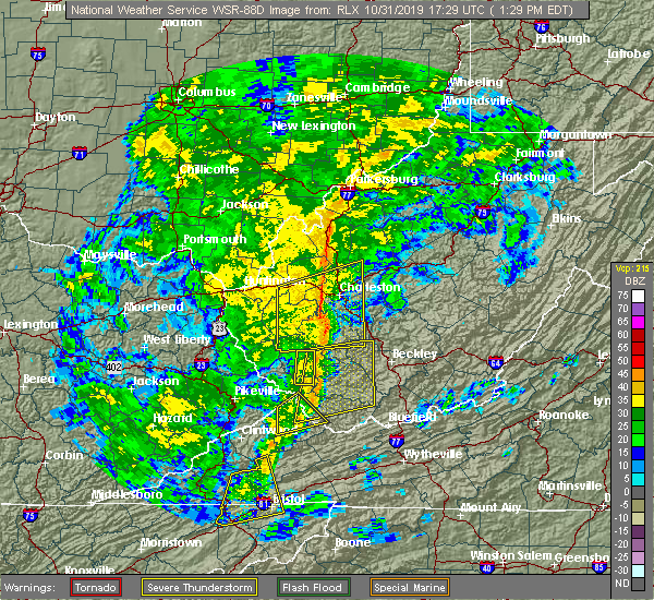 At 130 pm edt, severe thunderstorms were located along a line extending from near oceana to near bristol va, moving northeast at 55 mph (radar indicated). Hazards include 60 mph wind gusts. expect damage to roofs, siding, and trees At 130 pm edt, severe thunderstorms were located along a line extending from near oceana to near bristol va, moving northeast at 55 mph (radar indicated). Hazards include 60 mph wind gusts. expect damage to roofs, siding, and trees
|
| 6/22/2019 1:53 AM EDT |
 At 152 am edt, severe thunderstorms were located along a line extending from near lebanon to near ashland, moving east at 45 mph (radar indicated). Hazards include 60 mph wind gusts. Expect damage to roofs, siding, and trees. Locations impacted include, abingdon, lebanon, mountain city, cleveland va, glade spring, honaker, damascus, laurel bloomery, emory-meadow view, rosedale, shady valley, lindell, holston, harr and konnarock. At 152 am edt, severe thunderstorms were located along a line extending from near lebanon to near ashland, moving east at 45 mph (radar indicated). Hazards include 60 mph wind gusts. Expect damage to roofs, siding, and trees. Locations impacted include, abingdon, lebanon, mountain city, cleveland va, glade spring, honaker, damascus, laurel bloomery, emory-meadow view, rosedale, shady valley, lindell, holston, harr and konnarock.
|
| 6/22/2019 1:38 AM EDT |
 At 137 am edt, severe thunderstorms were located along a line extending from 6 miles southwest of cleveland va to near reese, moving northeast at 45 mph (radar indicated). Hazards include 60 mph wind gusts. Expect damage to roofs, siding, and trees. Locations impacted include, bristol tn, bristol va, abingdon, lebanon, mountain city, cleveland va, walnut hill, glade spring, honaker, damascus, laurel bloomery, emory-meadow view, rosedale, shady valley, south holston dam, collingwood, doeville, hansonville, konnarock and neva. At 137 am edt, severe thunderstorms were located along a line extending from 6 miles southwest of cleveland va to near reese, moving northeast at 45 mph (radar indicated). Hazards include 60 mph wind gusts. Expect damage to roofs, siding, and trees. Locations impacted include, bristol tn, bristol va, abingdon, lebanon, mountain city, cleveland va, walnut hill, glade spring, honaker, damascus, laurel bloomery, emory-meadow view, rosedale, shady valley, south holston dam, collingwood, doeville, hansonville, konnarock and neva.
|
| 6/22/2019 1:08 AM EDT |
 At 108 am edt, severe thunderstorms were located along a line extending from 11 miles northeast of gate city to near erwin, moving east at 50 mph (radar indicated). Hazards include 60 mph wind gusts. expect damage to roofs, siding, and trees At 108 am edt, severe thunderstorms were located along a line extending from 11 miles northeast of gate city to near erwin, moving east at 50 mph (radar indicated). Hazards include 60 mph wind gusts. expect damage to roofs, siding, and trees
|
| 6/17/2019 3:21 PM EDT |
 The severe thunderstorm warning for southwestern tazewell and western bland counties will expire at 330 pm edt, the storm which prompted the warning has weakened below severe limits, and no longer poses an immediate threat to life or property. therefore, the warning will be allowed to expire. however heavy rain is still possible with this thunderstorm. when it is safe to do so, please send your reports of hail of any size, as well as reports of any wind damage, including downed trees or large limbs, to the national weather service by calling toll free at 1, 8 6 6, 2 1 5, 4 3 2 4. reports and pictures can also be shared on the national weather service blacksburg facebook page and on twitter. The severe thunderstorm warning for southwestern tazewell and western bland counties will expire at 330 pm edt, the storm which prompted the warning has weakened below severe limits, and no longer poses an immediate threat to life or property. therefore, the warning will be allowed to expire. however heavy rain is still possible with this thunderstorm. when it is safe to do so, please send your reports of hail of any size, as well as reports of any wind damage, including downed trees or large limbs, to the national weather service by calling toll free at 1, 8 6 6, 2 1 5, 4 3 2 4. reports and pictures can also be shared on the national weather service blacksburg facebook page and on twitter.
|
| 6/17/2019 3:17 PM EDT |
 At 316 pm edt, a severe thunderstorm was located near cliffield, moving east at 20 mph (radar indicated). Hazards include 60 mph wind gusts and quarter size hail. Hail damage to vehicles is expected. expect wind damage to roofs, siding, and trees. Locations impacted include, richlands, tazewell, cedar bluff, raven, and glen burke. At 316 pm edt, a severe thunderstorm was located near cliffield, moving east at 20 mph (radar indicated). Hazards include 60 mph wind gusts and quarter size hail. Hail damage to vehicles is expected. expect wind damage to roofs, siding, and trees. Locations impacted include, richlands, tazewell, cedar bluff, raven, and glen burke.
|
| 6/17/2019 2:42 PM EDT |
 At 242 pm edt, a severe thunderstorm was located over richlands, moving east at 20 mph (radar indicated). Hazards include 60 mph wind gusts and quarter size hail. Hail damage to vehicles is expected. expect wind damage to roofs, siding, and trees. Locations impacted include, richlands, tazewell, cedar bluff, raven, and amonate. At 242 pm edt, a severe thunderstorm was located over richlands, moving east at 20 mph (radar indicated). Hazards include 60 mph wind gusts and quarter size hail. Hail damage to vehicles is expected. expect wind damage to roofs, siding, and trees. Locations impacted include, richlands, tazewell, cedar bluff, raven, and amonate.
|
| 6/17/2019 2:37 PM EDT | Tazewell co. warning point has had several reports of downed trees in the raven are in tazewell county VA, 0.7 miles NNW of Raven, VA |
| 6/17/2019 2:37 PM EDT |
 At 236 pm edt, a severe thunderstorm was located over raven, or over richlands, moving northeast at 20 mph (radar indicated). Hazards include 60 mph wind gusts and quarter size hail. Hail damage to vehicles is expected. expect wind damage to roofs, siding, and trees. Locations impacted include, honaker and dye. At 236 pm edt, a severe thunderstorm was located over raven, or over richlands, moving northeast at 20 mph (radar indicated). Hazards include 60 mph wind gusts and quarter size hail. Hail damage to vehicles is expected. expect wind damage to roofs, siding, and trees. Locations impacted include, honaker and dye.
|
| 6/17/2019 2:32 PM EDT |
 At 232 pm edt, a severe thunderstorm was located over raven, moving east at 20 mph (radar indicated). Hazards include 60 mph wind gusts and quarter size hail. Hail damage to vehicles is expected. Expect wind damage to roofs, siding, and trees. At 232 pm edt, a severe thunderstorm was located over raven, moving east at 20 mph (radar indicated). Hazards include 60 mph wind gusts and quarter size hail. Hail damage to vehicles is expected. Expect wind damage to roofs, siding, and trees.
|
| 6/17/2019 2:20 PM EDT |
 At 220 pm edt, a severe thunderstorm was located over raven, or near richlands, moving northeast at 25 mph (radar indicated). Hazards include 60 mph wind gusts and quarter size hail. Hail damage to vehicles is expected. Expect wind damage to roofs, siding, and trees. At 220 pm edt, a severe thunderstorm was located over raven, or near richlands, moving northeast at 25 mph (radar indicated). Hazards include 60 mph wind gusts and quarter size hail. Hail damage to vehicles is expected. Expect wind damage to roofs, siding, and trees.
|
| 5/29/2019 4:57 PM EDT |
 The severe thunderstorm warning for western giles. smyth. tazewell. bland. western wythe. summers. mercer and western monroe counties will expire at 500 pm edt. The storms which prompted the warning have moved out of the area, but additional storms are expected so a new warning has been issued for a portion of the area. The severe thunderstorm warning for western giles. smyth. tazewell. bland. western wythe. summers. mercer and western monroe counties will expire at 500 pm edt. The storms which prompted the warning have moved out of the area, but additional storms are expected so a new warning has been issued for a portion of the area.
|
| 5/29/2019 4:57 PM EDT |
 The severe thunderstorm warning for western giles, smyth, tazewell, bland, western wythe, summers, mercer and western monroe counties will expire at 500 pm edt, the storms which prompted the warning have moved out of the area, but additional storms are expected so a new warning has been issued for a portion of the area. a severe thunderstorm watch remains in effect until 800 pm edt for southwestern and west central virginia, and southeastern west virginia. when it is safe to do so, please send your reports of hail of any size, as well as reports of any wind damage, including downed trees or large limbs, to the national weather service by calling toll free at 1, 8 6 6, 2 1 5, 4 3 2 4. reports and pictures can also be shared on the national weather service blacksburg facebook page and on twitter. The severe thunderstorm warning for western giles, smyth, tazewell, bland, western wythe, summers, mercer and western monroe counties will expire at 500 pm edt, the storms which prompted the warning have moved out of the area, but additional storms are expected so a new warning has been issued for a portion of the area. a severe thunderstorm watch remains in effect until 800 pm edt for southwestern and west central virginia, and southeastern west virginia. when it is safe to do so, please send your reports of hail of any size, as well as reports of any wind damage, including downed trees or large limbs, to the national weather service by calling toll free at 1, 8 6 6, 2 1 5, 4 3 2 4. reports and pictures can also be shared on the national weather service blacksburg facebook page and on twitter.
|
| 5/29/2019 4:55 PM EDT |
 At 454 pm edt, severe thunderstorms were located along a line extending from chapel to near thomas bridge, moving east at 30 mph. additional storms will be moring into the region from the west (radar indicated). Hazards include 60 mph wind gusts and quarter size hail. Hail damage to vehicles is expected. Expect wind damage to roofs, siding, and trees. At 454 pm edt, severe thunderstorms were located along a line extending from chapel to near thomas bridge, moving east at 30 mph. additional storms will be moring into the region from the west (radar indicated). Hazards include 60 mph wind gusts and quarter size hail. Hail damage to vehicles is expected. Expect wind damage to roofs, siding, and trees.
|
| 5/29/2019 4:02 PM EDT |
 At 401 pm edt, severe thunderstorms were located along a line extending from near bradley to near coal city to near welch to near lebanon, moving east at 45 mph (radar indicated). Hazards include 70 mph wind gusts and quarter size hail. Hail damage to vehicles is expected. expect considerable tree damage. wind damage is also likely to mobile homes, roofs, and outbuildings. locations impacted include, bluefield, wytheville, bland, princeton, and marion. This includes the following location mercer county airport. At 401 pm edt, severe thunderstorms were located along a line extending from near bradley to near coal city to near welch to near lebanon, moving east at 45 mph (radar indicated). Hazards include 70 mph wind gusts and quarter size hail. Hail damage to vehicles is expected. expect considerable tree damage. wind damage is also likely to mobile homes, roofs, and outbuildings. locations impacted include, bluefield, wytheville, bland, princeton, and marion. This includes the following location mercer county airport.
|
| 5/29/2019 3:50 PM EDT | Small trees down. time estimated from radar. gravel roads washed ou in buchanan county VA, 9.8 miles S of Raven, VA |
| 5/29/2019 3:25 PM EDT |
 At 324 pm edt, severe thunderstorms were located along a line extending from wharton to 6 miles southeast of argo to 8 miles south of trammel, moving east at 40 mph (radar indicated). Hazards include 60 mph wind gusts and quarter size hail. Hail damage to vehicles is expected. Expect wind damage to roofs, siding, and trees. At 324 pm edt, severe thunderstorms were located along a line extending from wharton to 6 miles southeast of argo to 8 miles south of trammel, moving east at 40 mph (radar indicated). Hazards include 60 mph wind gusts and quarter size hail. Hail damage to vehicles is expected. Expect wind damage to roofs, siding, and trees.
|
| 5/26/2019 9:29 PM EDT | Tree dow in tazewell county VA, 0.7 miles NNW of Raven, VA |
| 5/26/2019 9:05 PM EDT |
 At 905 pm edt, severe thunderstorms were located along a line extending from near camp creek state park to near gary to 8 miles west of allison gap, moving east at 45 mph. trees have already been reported down in richlands (law enforcement). Hazards include 60 mph wind gusts. expect damage to roofs, siding, and trees At 905 pm edt, severe thunderstorms were located along a line extending from near camp creek state park to near gary to 8 miles west of allison gap, moving east at 45 mph. trees have already been reported down in richlands (law enforcement). Hazards include 60 mph wind gusts. expect damage to roofs, siding, and trees
|
| 5/26/2019 9:00 PM EDT | Corrects previous tstm wnd dmg report from 1 se raven. large tree down. time from rada in tazewell county VA, 0.7 miles NNW of Raven, VA |
| 5/26/2019 9:00 PM EDT | Large tree down blocking both lanes of u.s. route 460 wes in tazewell county VA, 1.5 miles S of Raven, VA |
| 5/26/2019 8:56 PM EDT | Corrects previous tstm wnd dmg report from 2 n raven. large tree down blocking both lanes of u.s. route 460 wes in tazewell county VA, 1.5 miles S of Raven, VA |
| 4/14/2019 8:32 PM EDT |
 At 831 pm edt, severe thunderstorms were located along a line extending from near stanaford to near ceres, moving northeast at 60 mph (radar indicated). Hazards include 60 mph wind gusts. expect damage to roofs, siding, and trees At 831 pm edt, severe thunderstorms were located along a line extending from near stanaford to near ceres, moving northeast at 60 mph (radar indicated). Hazards include 60 mph wind gusts. expect damage to roofs, siding, and trees
|
| 9/9/2018 8:13 PM EDT |
 At 812 pm edt, severe thunderstorms were located along a line extending from near trammel to 7 miles southwest of quarry, moving northeast at 40 mph (radar indicated). Hazards include 60 mph wind gusts and penny size hail. Expect damage to roofs, siding, and trees. locations impacted include, abingdon, lebanon, cleveland va, glade spring, honaker, st. Paul, dye, lindell, emory-meadow view, rosedale and castlewood. At 812 pm edt, severe thunderstorms were located along a line extending from near trammel to 7 miles southwest of quarry, moving northeast at 40 mph (radar indicated). Hazards include 60 mph wind gusts and penny size hail. Expect damage to roofs, siding, and trees. locations impacted include, abingdon, lebanon, cleveland va, glade spring, honaker, st. Paul, dye, lindell, emory-meadow view, rosedale and castlewood.
|
| 9/9/2018 7:51 PM EDT |
 At 751 pm edt, severe thunderstorms were located along a line extending from 10 miles southeast of wise to near abingdon, moving northeast at 40 mph (radar indicated). Hazards include 60 mph wind gusts and penny size hail. Expect damage to roofs, siding, and trees. locations impacted include, bristol va, abingdon, lebanon, cleveland va, glade spring, honaker, st. Paul, damascus, nickelsville, dungannon, emory-meadow view, rosedale, dye, lindell, collingwood, castlewood, holston, hansonville, hilander park and benhams. At 751 pm edt, severe thunderstorms were located along a line extending from 10 miles southeast of wise to near abingdon, moving northeast at 40 mph (radar indicated). Hazards include 60 mph wind gusts and penny size hail. Expect damage to roofs, siding, and trees. locations impacted include, bristol va, abingdon, lebanon, cleveland va, glade spring, honaker, st. Paul, damascus, nickelsville, dungannon, emory-meadow view, rosedale, dye, lindell, collingwood, castlewood, holston, hansonville, hilander park and benhams.
|
| 9/9/2018 7:33 PM EDT |
 At 732 pm edt, severe thunderstorms were located along a line extending from 8 miles south of norton to bristol tn, moving northeast at 40 mph (radar indicated). Hazards include 60 mph wind gusts and penny size hail. Expect damage to roofs, siding, and trees. locations impacted include, kingsport, bristol tn, bristol va, abingdon, lebanon, gate city, cleveland va, walnut hill, bluff city, glade spring, honaker, st. Paul, damascus, nickelsville, dungannon, laurel bloomery, emory-meadow view, rosedale, shady valley and south holston dam. At 732 pm edt, severe thunderstorms were located along a line extending from 8 miles south of norton to bristol tn, moving northeast at 40 mph (radar indicated). Hazards include 60 mph wind gusts and penny size hail. Expect damage to roofs, siding, and trees. locations impacted include, kingsport, bristol tn, bristol va, abingdon, lebanon, gate city, cleveland va, walnut hill, bluff city, glade spring, honaker, st. Paul, damascus, nickelsville, dungannon, laurel bloomery, emory-meadow view, rosedale, shady valley and south holston dam.
|
| 9/9/2018 7:12 PM EDT |
 At 712 pm edt, severe thunderstorms were located along a line extending from 12 miles north of surgoinsville to near oak grove, moving northeast at 40 mph (radar indicated). Hazards include 60 mph wind gusts and penny size hail. expect damage to roofs, siding, and trees At 712 pm edt, severe thunderstorms were located along a line extending from 12 miles north of surgoinsville to near oak grove, moving northeast at 40 mph (radar indicated). Hazards include 60 mph wind gusts and penny size hail. expect damage to roofs, siding, and trees
|
| 9/9/2018 6:28 PM EDT |
 At 628 pm edt, a severe thunderstorm was located near davenport, moving northeast at 20 mph (radar indicated). Hazards include 60 mph wind gusts and penny size hail. Expect damage to roofs, siding, and trees. locations impacted include, lebanon, cleveland va, honaker, st. Paul, dye, hansonville, rosedale and castlewood. At 628 pm edt, a severe thunderstorm was located near davenport, moving northeast at 20 mph (radar indicated). Hazards include 60 mph wind gusts and penny size hail. Expect damage to roofs, siding, and trees. locations impacted include, lebanon, cleveland va, honaker, st. Paul, dye, hansonville, rosedale and castlewood.
|
| 9/9/2018 6:09 PM EDT |
 At 609 pm edt, a severe thunderstorm was located over cleveland va, or near lebanon, moving northeast at 20 mph (radar indicated). Hazards include 60 mph wind gusts and penny size hail. expect damage to roofs, siding, and trees At 609 pm edt, a severe thunderstorm was located over cleveland va, or near lebanon, moving northeast at 20 mph (radar indicated). Hazards include 60 mph wind gusts and penny size hail. expect damage to roofs, siding, and trees
|
| 6/25/2018 3:53 PM EDT |
 At 353 pm edt, severe thunderstorms were located along a line extending from near richlands to near bristol tn, moving east at 30 mph (radar indicated). Hazards include 60 mph wind gusts and penny size hail. expect damage to roofs, siding, and trees At 353 pm edt, severe thunderstorms were located along a line extending from near richlands to near bristol tn, moving east at 30 mph (radar indicated). Hazards include 60 mph wind gusts and penny size hail. expect damage to roofs, siding, and trees
|
| 4/4/2018 2:54 AM EDT |
 The severe thunderstorm warning for russell and northern washington counties will expire at 300 am edt, the storm which prompted the warning has weakened below severe limits, and no longer poses an immediate threat to life or property. therefore the warning will be allowed to expire. however gusty winds and heavy rain are still possible with this thunderstorm. a severe thunderstorm watch remains in effect until 300 am edt for southwestern virginia. The severe thunderstorm warning for russell and northern washington counties will expire at 300 am edt, the storm which prompted the warning has weakened below severe limits, and no longer poses an immediate threat to life or property. therefore the warning will be allowed to expire. however gusty winds and heavy rain are still possible with this thunderstorm. a severe thunderstorm watch remains in effect until 300 am edt for southwestern virginia.
|
| 4/4/2018 2:22 AM EDT |
 At 222 am edt, a severe thunderstorm was located 12 miles south of trammel, or 14 miles southeast of wise, moving east at 55 mph (radar indicated). Hazards include 60 mph wind gusts. expect damage to roofs, siding, and trees At 222 am edt, a severe thunderstorm was located 12 miles south of trammel, or 14 miles southeast of wise, moving east at 55 mph (radar indicated). Hazards include 60 mph wind gusts. expect damage to roofs, siding, and trees
|
| 4/4/2018 2:17 AM EDT |
 At 216 am edt, severe thunderstorms were located along a line extending from near red jacket to woodman to near davenport to 12 miles southeast of norton, moving east at 60 mph (radar indicated). Hazards include 60 mph wind gusts. expect damage to roofs, siding, and trees At 216 am edt, severe thunderstorms were located along a line extending from near red jacket to woodman to near davenport to 12 miles southeast of norton, moving east at 60 mph (radar indicated). Hazards include 60 mph wind gusts. expect damage to roofs, siding, and trees
|
| 5/27/2017 7:21 PM EDT |
 The severe thunderstorm warning for northwestern smyth, tazewell, bland and northwestern wythe counties will expire at 730 pm edt, the storm which prompted the warning has weakened below severe limits, and no longer poses an immediate threat to life or property. therefore the warning will be allowed to expire. a severe thunderstorm watch remains in effect until 200 am edt for northwestern north carolina, and southwestern virginia. when it is safe to do so, please send your reports of hail of any size, as well as reports of any wind damage, including downed trees or large limbs, to the national weather service by calling toll free at 1, 8 6 6, 2 1 5, 4 3 2 4. reports and pictures can also be shared on the national weather service blacksburg facebook page and on twitter. The severe thunderstorm warning for northwestern smyth, tazewell, bland and northwestern wythe counties will expire at 730 pm edt, the storm which prompted the warning has weakened below severe limits, and no longer poses an immediate threat to life or property. therefore the warning will be allowed to expire. a severe thunderstorm watch remains in effect until 200 am edt for northwestern north carolina, and southwestern virginia. when it is safe to do so, please send your reports of hail of any size, as well as reports of any wind damage, including downed trees or large limbs, to the national weather service by calling toll free at 1, 8 6 6, 2 1 5, 4 3 2 4. reports and pictures can also be shared on the national weather service blacksburg facebook page and on twitter.
|
| 5/27/2017 6:55 PM EDT |
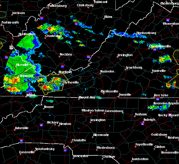 At 654 pm edt, a severe thunderstorm was located over burkes garden, moving east at 30 mph (radar indicated). Hazards include 60 mph wind gusts and quarter size hail. Hail damage to vehicles is expected. expect wind damage to roofs, siding, and trees. Locations impacted include, bland, richlands, bluefield, tazewell, and cedar bluff. At 654 pm edt, a severe thunderstorm was located over burkes garden, moving east at 30 mph (radar indicated). Hazards include 60 mph wind gusts and quarter size hail. Hail damage to vehicles is expected. expect wind damage to roofs, siding, and trees. Locations impacted include, bland, richlands, bluefield, tazewell, and cedar bluff.
|
| 5/27/2017 6:30 PM EDT |
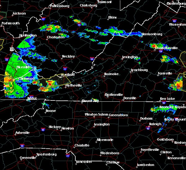 At 630 pm edt, a severe thunderstorm was located over asberrys, moving east at 35 mph (radar indicated). Hazards include 60 mph wind gusts and quarter size hail. Hail damage to vehicles is expected. Expect wind damage to roofs, siding, and trees. At 630 pm edt, a severe thunderstorm was located over asberrys, moving east at 35 mph (radar indicated). Hazards include 60 mph wind gusts and quarter size hail. Hail damage to vehicles is expected. Expect wind damage to roofs, siding, and trees.
|
| 5/24/2017 2:45 PM EDT |
 At 244 pm edt, a severe thunderstorm was located over broadford, moving northeast at 35 mph (radar indicated). Hazards include 60 mph wind gusts. Expect damage to roofs, siding, and trees. Locations impacted include, marion, richlands, tazewell, saltville, and chilhowie. At 244 pm edt, a severe thunderstorm was located over broadford, moving northeast at 35 mph (radar indicated). Hazards include 60 mph wind gusts. Expect damage to roofs, siding, and trees. Locations impacted include, marion, richlands, tazewell, saltville, and chilhowie.
|
| 5/24/2017 2:32 PM EDT |
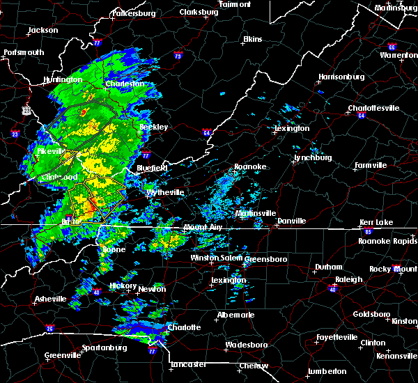 At 231 pm edt, a severe thunderstorm was located over allison gap, moving northeast at 40 mph (radar indicated). Hazards include 60 mph wind gusts. Expect damage to roofs, siding, and trees. Locations impacted include, marion, richlands, tazewell, saltville, and chilhowie. At 231 pm edt, a severe thunderstorm was located over allison gap, moving northeast at 40 mph (radar indicated). Hazards include 60 mph wind gusts. Expect damage to roofs, siding, and trees. Locations impacted include, marion, richlands, tazewell, saltville, and chilhowie.
|
| 5/24/2017 2:21 PM EDT |
 At 221 pm edt, severe thunderstorms were located along a line extending from 6 miles north of lebanon to 7 miles west of saltville to 7 miles southwest of quarry to 9 miles southeast of abingdon, moving northeast at 45 mph (radar indicated). Hazards include 60 mph wind gusts. Expect damage to roofs, siding, and trees. Locations impacted include, abingdon, lebanon, glade spring, honaker, damascus, lindell, dye, emory-meadow view, rosedale and konnarock. At 221 pm edt, severe thunderstorms were located along a line extending from 6 miles north of lebanon to 7 miles west of saltville to 7 miles southwest of quarry to 9 miles southeast of abingdon, moving northeast at 45 mph (radar indicated). Hazards include 60 mph wind gusts. Expect damage to roofs, siding, and trees. Locations impacted include, abingdon, lebanon, glade spring, honaker, damascus, lindell, dye, emory-meadow view, rosedale and konnarock.
|
| 5/24/2017 2:14 PM EDT |
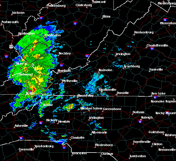 At 214 pm edt, a severe thunderstorm was located near abingdon, moving northeast at 45 mph (radar indicated). Hazards include 60 mph wind gusts. expect damage to roofs, siding, and trees At 214 pm edt, a severe thunderstorm was located near abingdon, moving northeast at 45 mph (radar indicated). Hazards include 60 mph wind gusts. expect damage to roofs, siding, and trees
|
| 5/24/2017 2:13 PM EDT |
 At 213 pm edt, severe thunderstorms were located along a line extending from near lebanon to near abingdon to 8 miles northwest of mountain city, moving northeast at 55 mph (radar indicated). Hazards include 60 mph wind gusts. Expect damage to roofs, siding, and trees. Locations impacted include, abingdon, lebanon, cleveland va, glade spring, honaker, damascus, emory-meadow view, rosedale, lindell, dye, holston, hansonville, hilander park, harr and konnarock. At 213 pm edt, severe thunderstorms were located along a line extending from near lebanon to near abingdon to 8 miles northwest of mountain city, moving northeast at 55 mph (radar indicated). Hazards include 60 mph wind gusts. Expect damage to roofs, siding, and trees. Locations impacted include, abingdon, lebanon, cleveland va, glade spring, honaker, damascus, emory-meadow view, rosedale, lindell, dye, holston, hansonville, hilander park, harr and konnarock.
|
| 5/24/2017 1:39 PM EDT |
 At 139 pm edt, severe thunderstorms were located along a line extending from 6 miles north of surgoinsville to 10 miles west of gray to 8 miles west of jonesborough to 11 miles southeast of tusculum, moving northeast at 45 mph (radar indicated). Hazards include 60 mph wind gusts. expect damage to roofs, siding, and trees At 139 pm edt, severe thunderstorms were located along a line extending from 6 miles north of surgoinsville to 10 miles west of gray to 8 miles west of jonesborough to 11 miles southeast of tusculum, moving northeast at 45 mph (radar indicated). Hazards include 60 mph wind gusts. expect damage to roofs, siding, and trees
|
| 3/1/2017 12:03 PM EST |
 At 1202 pm est, severe thunderstorms were located along a line extending from near lebanon to 6 miles northeast of surgoinsville, moving southeast at 25 mph (radar indicated). Hazards include 60 mph wind gusts and penny size hail. Expect damage to roofs, siding, and trees. locations impacted include, kingsport, bristol tn, bristol va, abingdon, rogersville, lebanon, gate city, surgoinsville, weber city, cleveland va, walnut hill, church hill, mount carmel, coeburn, glade spring, honaker, st. Paul, damascus, nickelsville and dungannon. At 1202 pm est, severe thunderstorms were located along a line extending from near lebanon to 6 miles northeast of surgoinsville, moving southeast at 25 mph (radar indicated). Hazards include 60 mph wind gusts and penny size hail. Expect damage to roofs, siding, and trees. locations impacted include, kingsport, bristol tn, bristol va, abingdon, rogersville, lebanon, gate city, surgoinsville, weber city, cleveland va, walnut hill, church hill, mount carmel, coeburn, glade spring, honaker, st. Paul, damascus, nickelsville and dungannon.
|
| 3/1/2017 11:10 AM EST |
 At 1109 am est, severe thunderstorms were located along a line extending from 8 miles east of wise to near jonesville, moving southeast at 50 mph (radar indicated). Hazards include 60 mph wind gusts and penny size hail. expect damage to roofs, siding, and trees At 1109 am est, severe thunderstorms were located along a line extending from 8 miles east of wise to near jonesville, moving southeast at 50 mph (radar indicated). Hazards include 60 mph wind gusts and penny size hail. expect damage to roofs, siding, and trees
|
| 3/1/2017 10:52 AM EST |
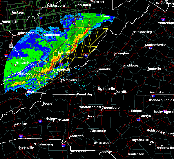 At 1052 am est, severe thunderstorms were located along a line extending from jewell ridge to raven to near davenport, moving southeast at 50 mph (radar indicated). Hazards include 60 mph wind gusts and quarter size hail. Hail damage to vehicles is expected. Expect wind damage to roofs, siding, and trees. At 1052 am est, severe thunderstorms were located along a line extending from jewell ridge to raven to near davenport, moving southeast at 50 mph (radar indicated). Hazards include 60 mph wind gusts and quarter size hail. Hail damage to vehicles is expected. Expect wind damage to roofs, siding, and trees.
|
| 7/6/2016 8:29 PM EDT |
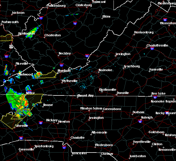 At 828 pm edt, a severe thunderstorm was located near jewell ridge, moving east at 30 mph (radar indicated). Hazards include 60 mph wind gusts. Expect damage to roofs. siding. And trees. At 828 pm edt, a severe thunderstorm was located near jewell ridge, moving east at 30 mph (radar indicated). Hazards include 60 mph wind gusts. Expect damage to roofs. siding. And trees.
|
| 6/23/2016 8:46 PM EDT |
 At 845 pm edt, a severe thunderstorm was located 8 miles east of abingdon, moving southeast at 35 mph (radar indicated). Hazards include 60 mph wind gusts and quarter size hail. Hail damage to vehicles is expected. expect wind damage to roofs, siding, and trees. locations impacted include, bristol tn, bristol va, abingdon, lebanon, cleveland va, glade spring, honaker, st. Paul, damascus, hilander park, harr, holston, konnarock, rosedale, castlewood, dye, lindell, emory-meadow view and hansonville. At 845 pm edt, a severe thunderstorm was located 8 miles east of abingdon, moving southeast at 35 mph (radar indicated). Hazards include 60 mph wind gusts and quarter size hail. Hail damage to vehicles is expected. expect wind damage to roofs, siding, and trees. locations impacted include, bristol tn, bristol va, abingdon, lebanon, cleveland va, glade spring, honaker, st. Paul, damascus, hilander park, harr, holston, konnarock, rosedale, castlewood, dye, lindell, emory-meadow view and hansonville.
|
| 6/23/2016 8:37 PM EDT |
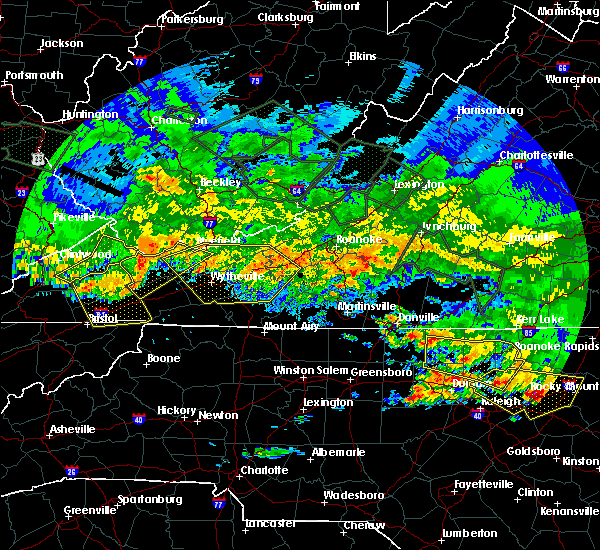 At 837 pm edt, severe thunderstorms were located along a line extending from near war to near allison gap, moving southeast at 60 mph (radar indicated). Hazards include 70 mph wind gusts. Expect considerable tree damage. damage is likely to mobile homes, roofs, and outbuildings. Locations impacted include, richlands, bluefield, tazewell, saltville, and cedar bluff. At 837 pm edt, severe thunderstorms were located along a line extending from near war to near allison gap, moving southeast at 60 mph (radar indicated). Hazards include 70 mph wind gusts. Expect considerable tree damage. damage is likely to mobile homes, roofs, and outbuildings. Locations impacted include, richlands, bluefield, tazewell, saltville, and cedar bluff.
|
| 6/23/2016 8:15 PM EDT |
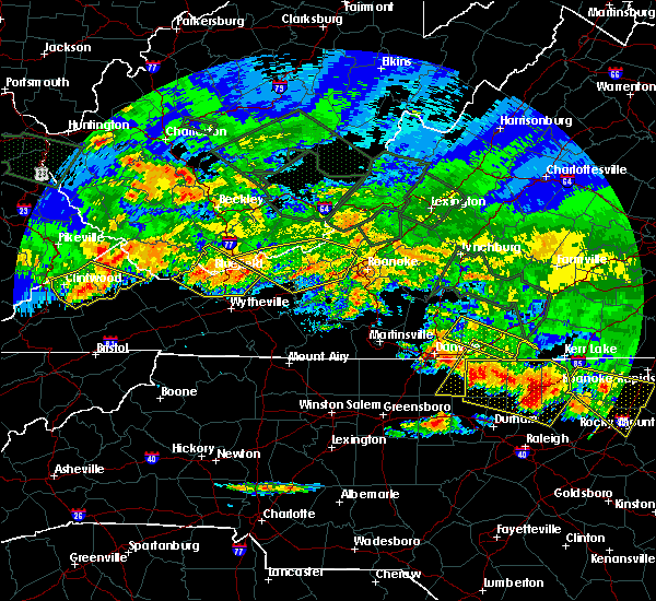 At 814 pm edt, severe thunderstorms were located along a line extending from near war to davenport, moving east at 45 mph (radar indicated). Hazards include 60 mph wind gusts. Expect damage to roofs. siding. And trees. At 814 pm edt, severe thunderstorms were located along a line extending from near war to davenport, moving east at 45 mph (radar indicated). Hazards include 60 mph wind gusts. Expect damage to roofs. siding. And trees.
|
| 6/23/2016 8:11 PM EDT |
 At 811 pm edt, a severe thunderstorm was located near cleveland va, or 7 miles south of davenport, moving southeast at 35 mph (radar indicated). Hazards include 60 mph wind gusts and quarter size hail. Hail damage to vehicles is expected. Expect wind damage to roofs, siding, and trees. At 811 pm edt, a severe thunderstorm was located near cleveland va, or 7 miles south of davenport, moving southeast at 35 mph (radar indicated). Hazards include 60 mph wind gusts and quarter size hail. Hail damage to vehicles is expected. Expect wind damage to roofs, siding, and trees.
|
| 6/21/2016 6:57 PM EDT | The severe thunderstorm warning for northwestern grayson, tazewell, smyth, southwestern wythe and southwestern bland counties will expire at 700 pm edt, the storm which prompted the warning has weakened below severe limits, and no longer poses an immediate threat to life or property. therefore the warning will be allowed to expire. however gusty winds and heavy rain are still possible with this thunderstorm. a severe thunderstorm watch remains in effect until 1000 pm edt for virginia and west virginia. when it is safe to do so, please send your reports of hail of any size, as well as any reports of wind damage, including downed trees or large limbs, to the national weather service by calling toll free at 1, 8 6 6, 2 1 5, 4 3 2 4. reports and pictures can also be shared on the national weather service blacksburg facebook page and on twitter. |
| 6/21/2016 6:36 PM EDT |
 At 636 pm edt, a severe thunderstorm was located near raven, or near richlands, moving southeast at 25 mph (radar indicated). Hazards include 60 mph wind gusts and quarter size hail. Hail damage to vehicles is expected. expect wind damage to roofs, siding, and trees. Locations impacted include, glade spring, honaker, dye, lindell, rosedale and emory-meadow view. At 636 pm edt, a severe thunderstorm was located near raven, or near richlands, moving southeast at 25 mph (radar indicated). Hazards include 60 mph wind gusts and quarter size hail. Hail damage to vehicles is expected. expect wind damage to roofs, siding, and trees. Locations impacted include, glade spring, honaker, dye, lindell, rosedale and emory-meadow view.
|
| 6/21/2016 6:22 PM EDT |
 At 621 pm edt, a severe thunderstorm was located over cliffield, moving southeast at 35 mph (radar indicated). Hazards include 60 mph wind gusts and quarter size hail. Hail damage to vehicles is expected. expect wind damage to roofs, siding, and trees. Locations impacted include, marion, richlands, tazewell, saltville, and chilhowie. At 621 pm edt, a severe thunderstorm was located over cliffield, moving southeast at 35 mph (radar indicated). Hazards include 60 mph wind gusts and quarter size hail. Hail damage to vehicles is expected. expect wind damage to roofs, siding, and trees. Locations impacted include, marion, richlands, tazewell, saltville, and chilhowie.
|
| 6/21/2016 6:12 PM EDT |
 At 612 pm edt, a severe thunderstorm was located over raven, or near richlands, moving southeast at 25 mph (radar indicated). Hazards include 60 mph wind gusts and quarter size hail. Hail damage to vehicles is expected. Expect wind damage to roofs, siding, and trees. At 612 pm edt, a severe thunderstorm was located over raven, or near richlands, moving southeast at 25 mph (radar indicated). Hazards include 60 mph wind gusts and quarter size hail. Hail damage to vehicles is expected. Expect wind damage to roofs, siding, and trees.
|
| 6/21/2016 6:06 PM EDT |
 At 605 pm edt, a severe thunderstorm was located over glen burke, moving southeast at 40 mph (radar indicated). Hazards include 60 mph wind gusts and quarter size hail. Hail damage to vehicles is expected. Expect wind damage to roofs, siding, and trees. At 605 pm edt, a severe thunderstorm was located over glen burke, moving southeast at 40 mph (radar indicated). Hazards include 60 mph wind gusts and quarter size hail. Hail damage to vehicles is expected. Expect wind damage to roofs, siding, and trees.
|
| 6/16/2016 10:37 PM EDT |
 The severe thunderstorm warning for northeastern russell county will expire at 1045 pm edt, the storms which prompted the warning have weakened below severe limits, and have exited the warned area. therefore the warning will be allowed to expire. however gusty winds are still possible with these thunderstorms. The severe thunderstorm warning for northeastern russell county will expire at 1045 pm edt, the storms which prompted the warning have weakened below severe limits, and have exited the warned area. therefore the warning will be allowed to expire. however gusty winds are still possible with these thunderstorms.
|
| 6/16/2016 10:18 PM EDT |
 At 1017 pm edt, severe thunderstorms were located along a line extending from broadford to near davenport, moving southeast at 20 mph (radar indicated). Hazards include 60 mph wind gusts and quarter size hail. Hail damage to vehicles is expected. expect wind damage to roofs, siding, and trees. Locations impacted include, honaker, dye and rosedale. At 1017 pm edt, severe thunderstorms were located along a line extending from broadford to near davenport, moving southeast at 20 mph (radar indicated). Hazards include 60 mph wind gusts and quarter size hail. Hail damage to vehicles is expected. expect wind damage to roofs, siding, and trees. Locations impacted include, honaker, dye and rosedale.
|
| 6/16/2016 10:01 PM EDT |
 At 1001 pm edt, severe thunderstorms were located along a line extending from near allison gap to near davenport, moving southeast at 20 mph (radar indicated). Hazards include 60 mph wind gusts and quarter size hail. Hail damage to vehicles is expected. expect wind damage to roofs, siding, and trees. Locations impacted include, honaker, dye and rosedale. At 1001 pm edt, severe thunderstorms were located along a line extending from near allison gap to near davenport, moving southeast at 20 mph (radar indicated). Hazards include 60 mph wind gusts and quarter size hail. Hail damage to vehicles is expected. expect wind damage to roofs, siding, and trees. Locations impacted include, honaker, dye and rosedale.
|
| 6/16/2016 9:47 PM EDT |
 At 947 pm edt, severe thunderstorms were located along a line extending from near claypool hill to near davenport, moving south at 25 mph (radar indicated). Hazards include 60 mph wind gusts and quarter size hail. Hail damage to vehicles is expected. expect wind damage to roofs, siding, and trees. Locations impacted include, honaker, dye and rosedale. At 947 pm edt, severe thunderstorms were located along a line extending from near claypool hill to near davenport, moving south at 25 mph (radar indicated). Hazards include 60 mph wind gusts and quarter size hail. Hail damage to vehicles is expected. expect wind damage to roofs, siding, and trees. Locations impacted include, honaker, dye and rosedale.
|
| 6/16/2016 9:28 PM EDT |
 At 927 pm edt, a severe thunderstorm was located over raven, or near richlands, moving southeast at 25 mph (radar indicated). Hazards include 60 mph wind gusts and quarter size hail. Hail damage to vehicles is expected. Expect wind damage to roofs, siding, and trees. At 927 pm edt, a severe thunderstorm was located over raven, or near richlands, moving southeast at 25 mph (radar indicated). Hazards include 60 mph wind gusts and quarter size hail. Hail damage to vehicles is expected. Expect wind damage to roofs, siding, and trees.
|
| 6/16/2016 9:15 PM EDT | Powerlines down along redwood drive in rave in tazewell county VA, 0.4 miles WSW of Raven, VA |
| 6/16/2016 9:02 PM EDT |
 At 900 pm edt, a severe thunderstorm was located near jewell ridge, moving southeast at 25 mph (radar indicated). Hazards include 60 mph wind gusts and quarter size hail. Hail damage to vehicles is expected. Expect wind damage to roofs, siding, and trees. At 900 pm edt, a severe thunderstorm was located near jewell ridge, moving southeast at 25 mph (radar indicated). Hazards include 60 mph wind gusts and quarter size hail. Hail damage to vehicles is expected. Expect wind damage to roofs, siding, and trees.
|
| 6/4/2016 6:36 PM EDT |
 At 635 pm edt, a severe thunderstorm was located near bandy, moving northeast at 25 mph (radar indicated). Hazards include 60 mph wind gusts. Expect damage to roofs. siding. And trees. At 635 pm edt, a severe thunderstorm was located near bandy, moving northeast at 25 mph (radar indicated). Hazards include 60 mph wind gusts. Expect damage to roofs. siding. And trees.
|
| 5/12/2016 6:41 PM EDT |
 At 640 pm edt, severe thunderstorms were located along a line extending from 19 miles northeast of cleveland to 6 miles southeast of lebanon, moving northeast at 35 mph (radar indicated). Hazards include 60 mph wind gusts and penny size hail. Expect damage to roofs. siding. and trees. Locations impacted include, abingdon, glade spring, honaker, dye, lindell, rosedale and emory-meadow view. At 640 pm edt, severe thunderstorms were located along a line extending from 19 miles northeast of cleveland to 6 miles southeast of lebanon, moving northeast at 35 mph (radar indicated). Hazards include 60 mph wind gusts and penny size hail. Expect damage to roofs. siding. and trees. Locations impacted include, abingdon, glade spring, honaker, dye, lindell, rosedale and emory-meadow view.
|
| 5/12/2016 6:25 PM EDT |
 At 624 pm edt, severe thunderstorms were located along a line extending from 11 miles northeast of cleveland to near bristol, moving northeast at 35 mph (radar indicated). Hazards include 60 mph wind gusts and penny size hail. Expect damage to roofs. siding. And trees. At 624 pm edt, severe thunderstorms were located along a line extending from 11 miles northeast of cleveland to near bristol, moving northeast at 35 mph (radar indicated). Hazards include 60 mph wind gusts and penny size hail. Expect damage to roofs. siding. And trees.
|
| 7/14/2015 8:25 PM EDT |
 At 825 pm edt, severe thunderstorms were located along a line extending from 10 miles west of cleveland to 6 miles north of lebanon, moving southeast at 35 mph (radar indicated). Hazards include 60 mph wind gusts and nickel size hail. Expect damage to roofs. Siding and trees. At 825 pm edt, severe thunderstorms were located along a line extending from 10 miles west of cleveland to 6 miles north of lebanon, moving southeast at 35 mph (radar indicated). Hazards include 60 mph wind gusts and nickel size hail. Expect damage to roofs. Siding and trees.
|
| 7/14/2015 8:21 PM EDT |
 At 821 pm edt, severe thunderstorms were located along a line extending from princeton to near bandy to trammel, moving south at 45 mph (radar indicated). Hazards include 60 mph wind gusts and quarter size hail. Hail damage to vehicles is expected. expect wind damage to roofs, siding and trees. locations impacted include, bluefield, wytheville, bland, princeton, and marion. This includes mercer county airport. At 821 pm edt, severe thunderstorms were located along a line extending from princeton to near bandy to trammel, moving south at 45 mph (radar indicated). Hazards include 60 mph wind gusts and quarter size hail. Hail damage to vehicles is expected. expect wind damage to roofs, siding and trees. locations impacted include, bluefield, wytheville, bland, princeton, and marion. This includes mercer county airport.
|
| 7/14/2015 8:01 PM EDT |
 At 801 pm edt, severe thunderstorms were located along a line extending from near mullens to near war to john flannagan lake, moving south at 40 mph (radar indicated). Hazards include 60 mph wind gusts and quarter size hail. Hail damage to vehicles is expected. Expect wind damage to roofs, siding and trees. At 801 pm edt, severe thunderstorms were located along a line extending from near mullens to near war to john flannagan lake, moving south at 40 mph (radar indicated). Hazards include 60 mph wind gusts and quarter size hail. Hail damage to vehicles is expected. Expect wind damage to roofs, siding and trees.
|
| 7/13/2015 6:22 PM EDT |
 At 621 pm edt, severe thunderstorms were located along a line extending from near hinton to richlands, moving east at 50 mph (radar indicated). Hazards include 60 mph wind gusts. Expect damage to roofs. siding and trees. locations impacted include, bluefield, princeton, richlands, tazewell, and hinton. This includes mercer county airport. At 621 pm edt, severe thunderstorms were located along a line extending from near hinton to richlands, moving east at 50 mph (radar indicated). Hazards include 60 mph wind gusts. Expect damage to roofs. siding and trees. locations impacted include, bluefield, princeton, richlands, tazewell, and hinton. This includes mercer county airport.
|
| 7/13/2015 6:22 PM EDT |
 At 537 pm edt, severe thunderstorms were located along a line extending from near dry creek to near war, moving east at 50 mph. another severe thunderstorm was developing in western tazewell just west of claypool hill and is also rapidly approaching severe limits (radar indicated). Hazards include 70 mph wind gusts and quarter size hail. Hail damage to vehicles is expected. expect considerable tree damage. Wind damage is also likely to mobile homes, roofs and outbuildings. At 537 pm edt, severe thunderstorms were located along a line extending from near dry creek to near war, moving east at 50 mph. another severe thunderstorm was developing in western tazewell just west of claypool hill and is also rapidly approaching severe limits (radar indicated). Hazards include 70 mph wind gusts and quarter size hail. Hail damage to vehicles is expected. expect considerable tree damage. Wind damage is also likely to mobile homes, roofs and outbuildings.
|
| 7/13/2015 6:20 PM EDT |
 A severe thunderstorm warning remains in effect until 700 pm edt for washington. central russell. southeastern scott counties and the city of bristol. at 620 pm edt. severe thunderstorms were located along a line extending from 23 miles east of lebanon to 7 miles southwest of gate city. Moving east at 60 mph. A severe thunderstorm warning remains in effect until 700 pm edt for washington. central russell. southeastern scott counties and the city of bristol. at 620 pm edt. severe thunderstorms were located along a line extending from 23 miles east of lebanon to 7 miles southwest of gate city. Moving east at 60 mph.
|
| 7/13/2015 6:05 PM EDT |
 At 517 pm edt, severe thunderstorms were located along a line extending from 19 miles north of wise to 21 miles northwest of jonesville, moving southeast at 45 mph (radar indicated). Hazards include 60 mph wind gusts and quarter size hail. Hail damage to vehicles is possible. Expect wind damage to roofs, siding and trees. At 517 pm edt, severe thunderstorms were located along a line extending from 19 miles north of wise to 21 miles northwest of jonesville, moving southeast at 45 mph (radar indicated). Hazards include 60 mph wind gusts and quarter size hail. Hail damage to vehicles is possible. Expect wind damage to roofs, siding and trees.
|
| 7/13/2015 6:03 PM EDT |
 At 601 pm edt, severe thunderstorms were located along a line extending from 12 miles northeast of lebanon to 8 miles southeast of jonesville, moving east at 50 mph (radar indicated). Hazards include 60 mph wind gusts and quarter size hail. Hail damage to vehicles is possible. Expect wind damage to roofs, siding and trees. At 601 pm edt, severe thunderstorms were located along a line extending from 12 miles northeast of lebanon to 8 miles southeast of jonesville, moving east at 50 mph (radar indicated). Hazards include 60 mph wind gusts and quarter size hail. Hail damage to vehicles is possible. Expect wind damage to roofs, siding and trees.
|
| 7/13/2015 5:39 PM EDT |
 At 537 pm edt, severe thunderstorms were located along a line extending from near dry creek to near war, moving east at 50 mph. another severe thunderstorm was developing in western tazewell just west of claypool hill and is also rapidly approaching severe limits (radar indicated). Hazards include 70 mph wind gusts and quarter size hail. Hail damage to vehicles is expected. expect considerable tree damage. Wind damage is also likely to mobile homes, roofs and outbuildings. At 537 pm edt, severe thunderstorms were located along a line extending from near dry creek to near war, moving east at 50 mph. another severe thunderstorm was developing in western tazewell just west of claypool hill and is also rapidly approaching severe limits (radar indicated). Hazards include 70 mph wind gusts and quarter size hail. Hail damage to vehicles is expected. expect considerable tree damage. Wind damage is also likely to mobile homes, roofs and outbuildings.
|
| 7/13/2015 5:39 PM EDT |
 At 539 pm edt, severe thunderstorms were located along a line extending from 13 miles northwest of cleveland to 7 miles north of jonesville, moving southeast at 45 mph (radar indicated). Hazards include 60 mph wind gusts and quarter size hail. Hail damage to vehicles is expected. expect wind damage to roofs, siding and trees. locations impacted include, norton, lebanon, wise, gate city, jonesville, big stone gap, pennington gap, weber city, cleveland, coeburn, appalachia, honaker, pound, st. paul, nickelsville, dungannon, st. Charles, duffield, clinchport and dryden. At 539 pm edt, severe thunderstorms were located along a line extending from 13 miles northwest of cleveland to 7 miles north of jonesville, moving southeast at 45 mph (radar indicated). Hazards include 60 mph wind gusts and quarter size hail. Hail damage to vehicles is expected. expect wind damage to roofs, siding and trees. locations impacted include, norton, lebanon, wise, gate city, jonesville, big stone gap, pennington gap, weber city, cleveland, coeburn, appalachia, honaker, pound, st. paul, nickelsville, dungannon, st. Charles, duffield, clinchport and dryden.
|
| 7/13/2015 5:19 PM EDT |
 At 517 pm edt, severe thunderstorms were located along a line extending from 19 miles north of wise to 21 miles northwest of jonesville, moving southeast at 45 mph (radar indicated). Hazards include 60 mph wind gusts and quarter size hail. Hail damage to vehicles is possible. Expect wind damage to roofs, siding and trees. At 517 pm edt, severe thunderstorms were located along a line extending from 19 miles north of wise to 21 miles northwest of jonesville, moving southeast at 45 mph (radar indicated). Hazards include 60 mph wind gusts and quarter size hail. Hail damage to vehicles is possible. Expect wind damage to roofs, siding and trees.
|
| 6/21/2015 5:52 PM EDT |
 The severe thunderstorm warning for southwestern giles, tazewell and bland counties will expire at 600 pm edt, the storm which prompted the warning has moved out of the area. therefore the warning will be allowed to expire. a severe thunderstorm watch remains in effect until 800 pm edt for southwestern virginia and southeastern west virginia. when it is safe to do so, please send your reports of hail of any size, as well as any reports of wind damage, including downed trees or large limbs, to the national weather service by calling toll free at 1, 8 6 6, 2 1 5, 4 3 2 4. reports and pictures can also be shared on the national weather service blacksburg facebook page and on twitter. The severe thunderstorm warning for southwestern giles, tazewell and bland counties will expire at 600 pm edt, the storm which prompted the warning has moved out of the area. therefore the warning will be allowed to expire. a severe thunderstorm watch remains in effect until 800 pm edt for southwestern virginia and southeastern west virginia. when it is safe to do so, please send your reports of hail of any size, as well as any reports of wind damage, including downed trees or large limbs, to the national weather service by calling toll free at 1, 8 6 6, 2 1 5, 4 3 2 4. reports and pictures can also be shared on the national weather service blacksburg facebook page and on twitter.
|
| 6/21/2015 5:30 PM EDT |
 At 529 pm edt, a severe thunderstorm was located over suiter, moving southeast at 30 mph (radar indicated). Hazards include 60 mph wind gusts and quarter size hail. Hail damage to vehicles is expected. expect wind damage to roofs, siding and trees. Locations impacted include, bland, richlands, bluefield, tazewell, and cedar bluff. At 529 pm edt, a severe thunderstorm was located over suiter, moving southeast at 30 mph (radar indicated). Hazards include 60 mph wind gusts and quarter size hail. Hail damage to vehicles is expected. expect wind damage to roofs, siding and trees. Locations impacted include, bland, richlands, bluefield, tazewell, and cedar bluff.
|
| 6/21/2015 4:55 PM EDT |
 At 454 pm edt, a severe thunderstorm was located near tiptop, moving southeast at 30 mph (radar indicated). Hazards include 60 mph wind gusts and quarter size hail. Hail damage to vehicles is expected. Expect wind damage to roofs, siding and trees. At 454 pm edt, a severe thunderstorm was located near tiptop, moving southeast at 30 mph (radar indicated). Hazards include 60 mph wind gusts and quarter size hail. Hail damage to vehicles is expected. Expect wind damage to roofs, siding and trees.
|
| 6/18/2015 6:48 PM EDT | At 648 pm edt, severe thunderstorms were located along a line extending from near bandy to near raven, moving southeast at 25 mph (radar indicated). Hazards include 60 mph wind gusts and quarter size hail. Hail damage to vehicles is expected. Expect wind damage to roofs, siding and trees. |
| 6/8/2015 6:32 PM EDT | At 630 pm edt, severe thunderstorms were located along a line extending from near tazewell, to south of abingdon, moving east at 40 mph (radar indicated). Hazards include 60 mph wind gusts. Expect damage to roofs. siding and trees. Locations impacted include, marion, richlands, bluefield, tazewell, saltville chilhowie and mount rogers. |
| 6/8/2015 6:17 PM EDT | At 616 pm edt, severe thunderstorms were located along a line extending from near raven to near bristol va, moving east at 35 mph (radar indicated). Hazards include 60 mph wind gusts and nickel size hail. Expect damage to roofs. siding and trees. Locations impacted include, bristol va, abingdon, lebanon, glade spring, honaker, damascus, benhams, hilander park, holston, konnarock, rosedale, dye, lindell, emory-meadow view and hansonville. |
| 6/8/2015 6:09 PM EDT | At 606 pm edt, severe thunderstorms were located along a line extending from near richlands to bristol virginia, moving east at 35 mph (radar indicated). Hazards include 60 mph wind gusts. Expect damage to roofs. Siding and trees. |
| 6/8/2015 5:55 PM EDT | Several trees down in the northern end of the county and a tree down on house on franks hollow road in the swords creek are in russell county VA, 1.3 miles E of Raven, VA |
| 6/8/2015 5:45 PM EDT | At 544 pm edt, severe thunderstorms were located along a line extending from near trammel to 6 miles east of weber city, moving east at 30 mph (radar indicated). Hazards include 60 mph wind gusts and nickel size hail. Expect damage to roofs. Siding and trees. |
| 4/19/2015 11:33 PM EDT | At 1132 pm edt, severe thunderstorms were located along a line extending from 11 miles northeast of cleveland to 9 miles north of abingdon to 8 miles north of mountain city, moving northeast at 55 mph (radar indicated). Hazards include 60 mph wind gusts. Expect damage to roofs. siding and trees. locations impacted include, abingdon, lebanon, mountain city, bristol tn, bristol va, bristol, cleveland, walnut hill, bluff city, glade spring, honaker, st. paul, damascus, lindell, hansonville, laurel bloomery, holston, castlewood, collingwood and rosedale. 75in. |
| 4/19/2015 11:33 PM EDT | At 1132 pm edt, severe thunderstorms were located along a line extending from 11 miles northeast of cleveland to 9 miles north of abingdon to 8 miles north of mountain city, moving northeast at 55 mph (radar indicated). Hazards include 60 mph wind gusts. Expect damage to roofs. siding and trees. locations impacted include, abingdon, lebanon, mountain city, bristol tn, bristol va, bristol, cleveland, walnut hill, bluff city, glade spring, honaker, st. paul, damascus, lindell, hansonville, laurel bloomery, holston, castlewood, collingwood and rosedale. 75in. |
| 4/19/2015 11:11 PM EDT | At 1110 pm edt, severe thunderstorms were located along a line extending from 8 miles west of cleveland to 9 miles northwest of bristol va to near bristol, moving northeast at 55 mph (radar indicated). Hazards include 60 mph wind gusts. Expect damage to roofs. Siding and trees. |
| 4/19/2015 11:11 PM EDT | At 1110 pm edt, severe thunderstorms were located along a line extending from 8 miles west of cleveland to 9 miles northwest of bristol va to near bristol, moving northeast at 55 mph (radar indicated). Hazards include 60 mph wind gusts. Expect damage to roofs. Siding and trees. |
| 7/5/2012 2:40 PM EDT | Several trees dow in russell county VA, 4.2 miles NNE of Raven, VA |
| 7/5/2012 2:25 PM EDT | Multiple trees down in buchanan county VA, 7.1 miles SE of Raven, VA |
| 7/1/2012 10:30 AM EDT | Quarter sized hail reported 0.7 miles NNW of Raven, VA |
| 6/29/2012 8:56 PM EDT | Trees down in rave in tazewell county VA, 1.1 miles WNW of Raven, VA |
Hail Maps for Raven, VA


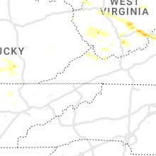


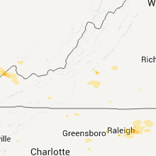


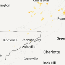


Connect with Interactive Hail Maps