

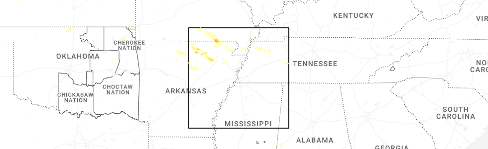
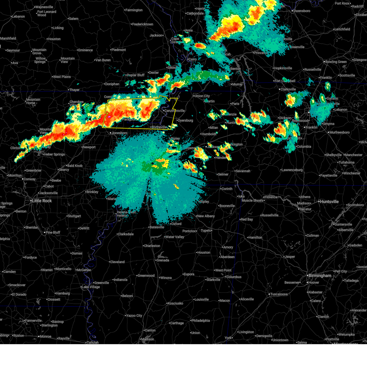
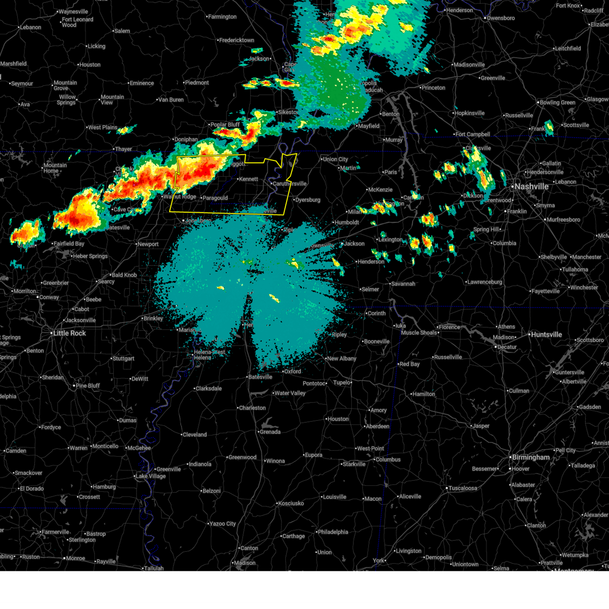
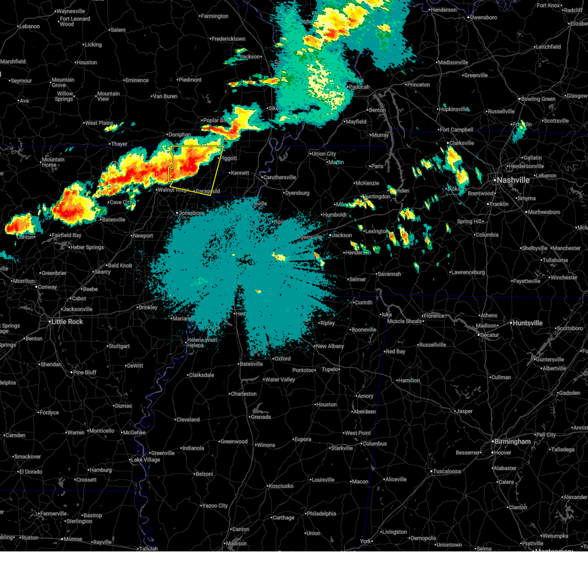
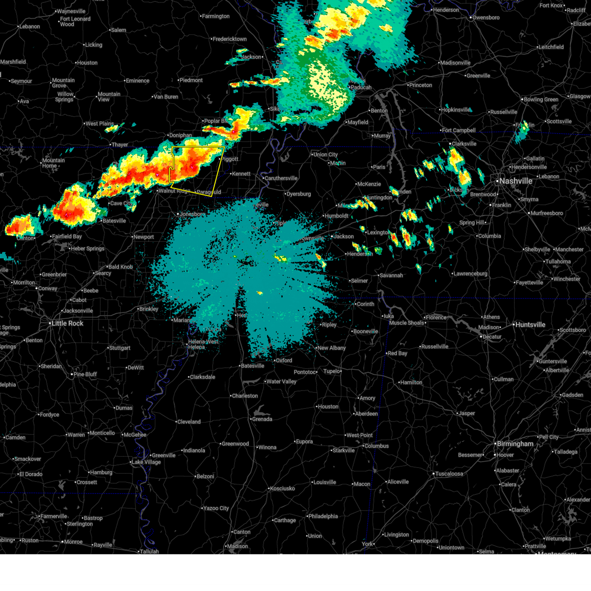
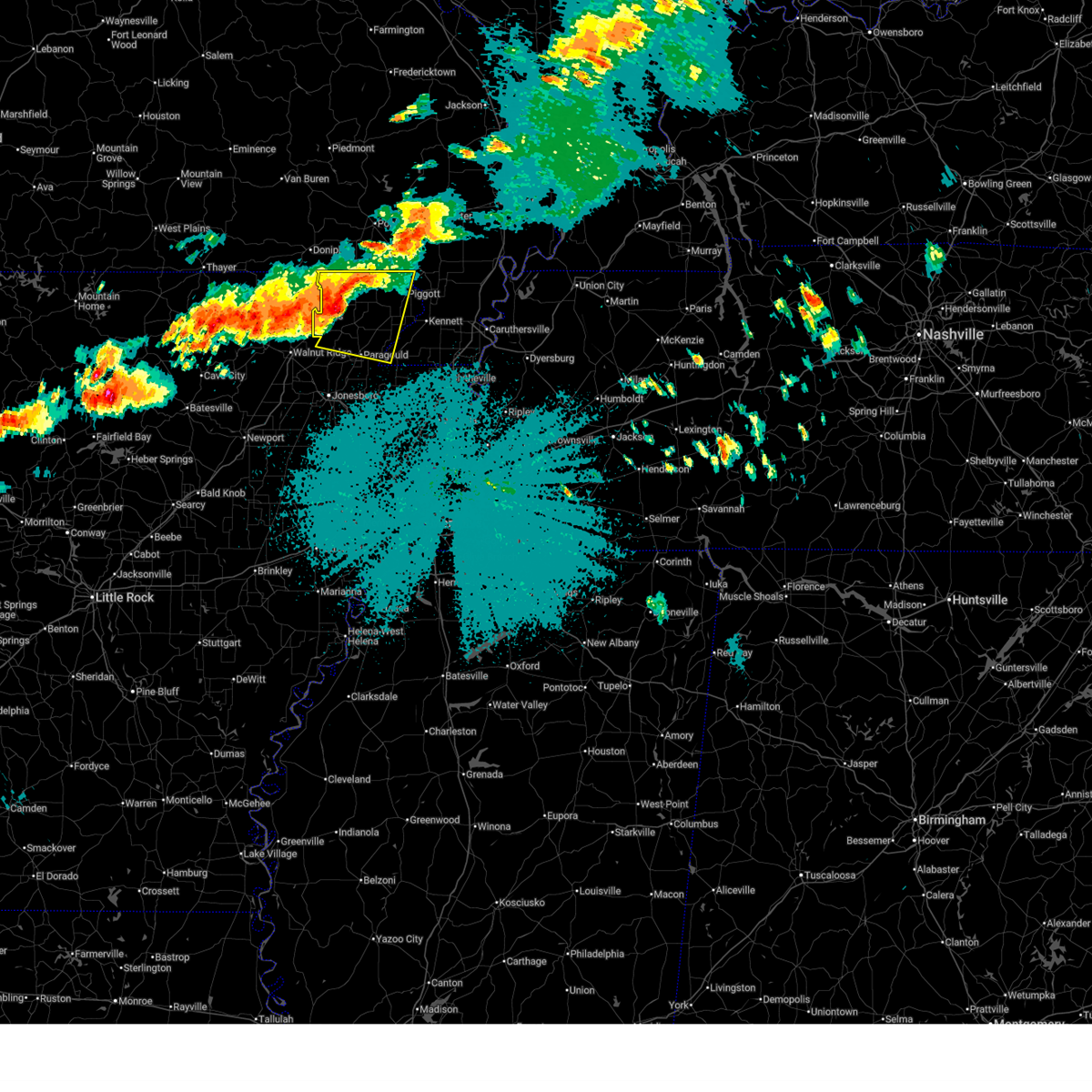
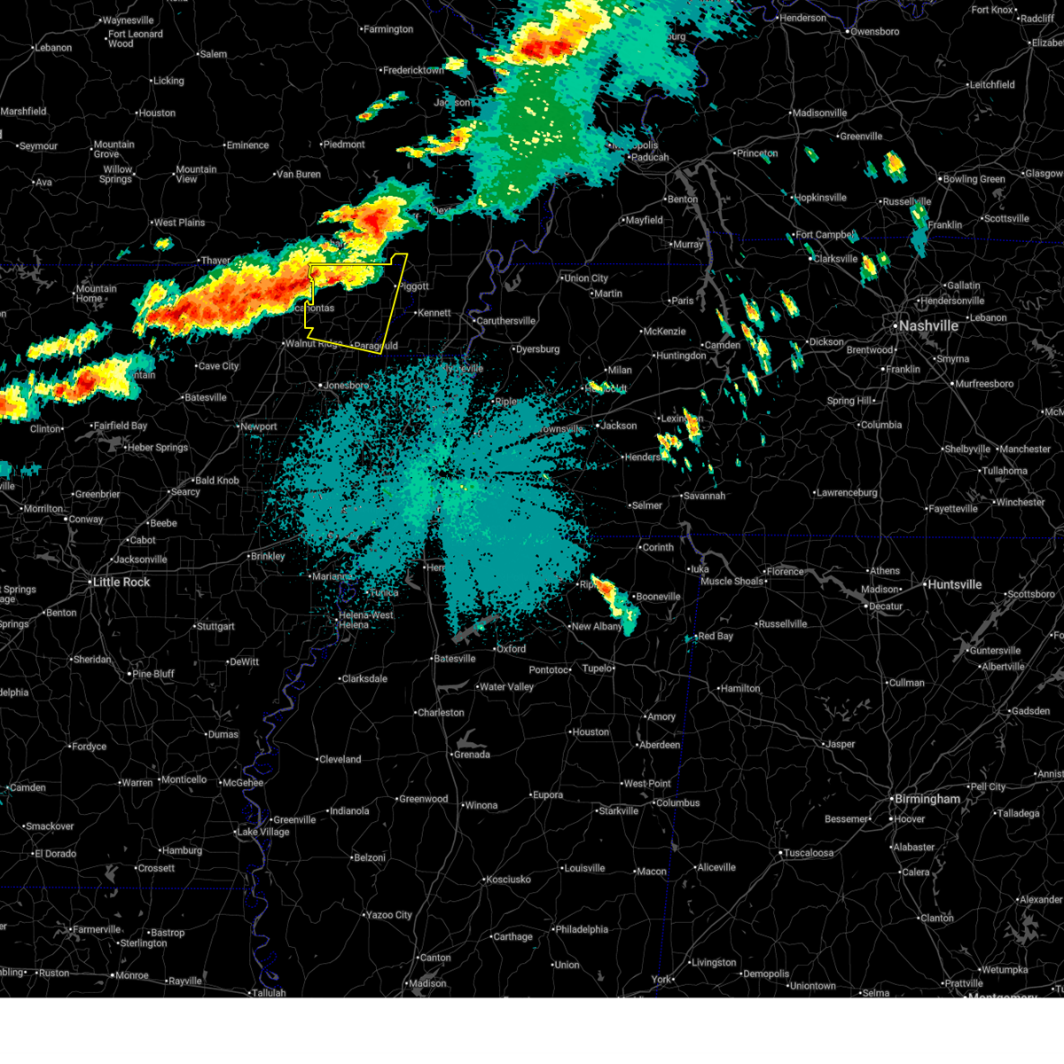
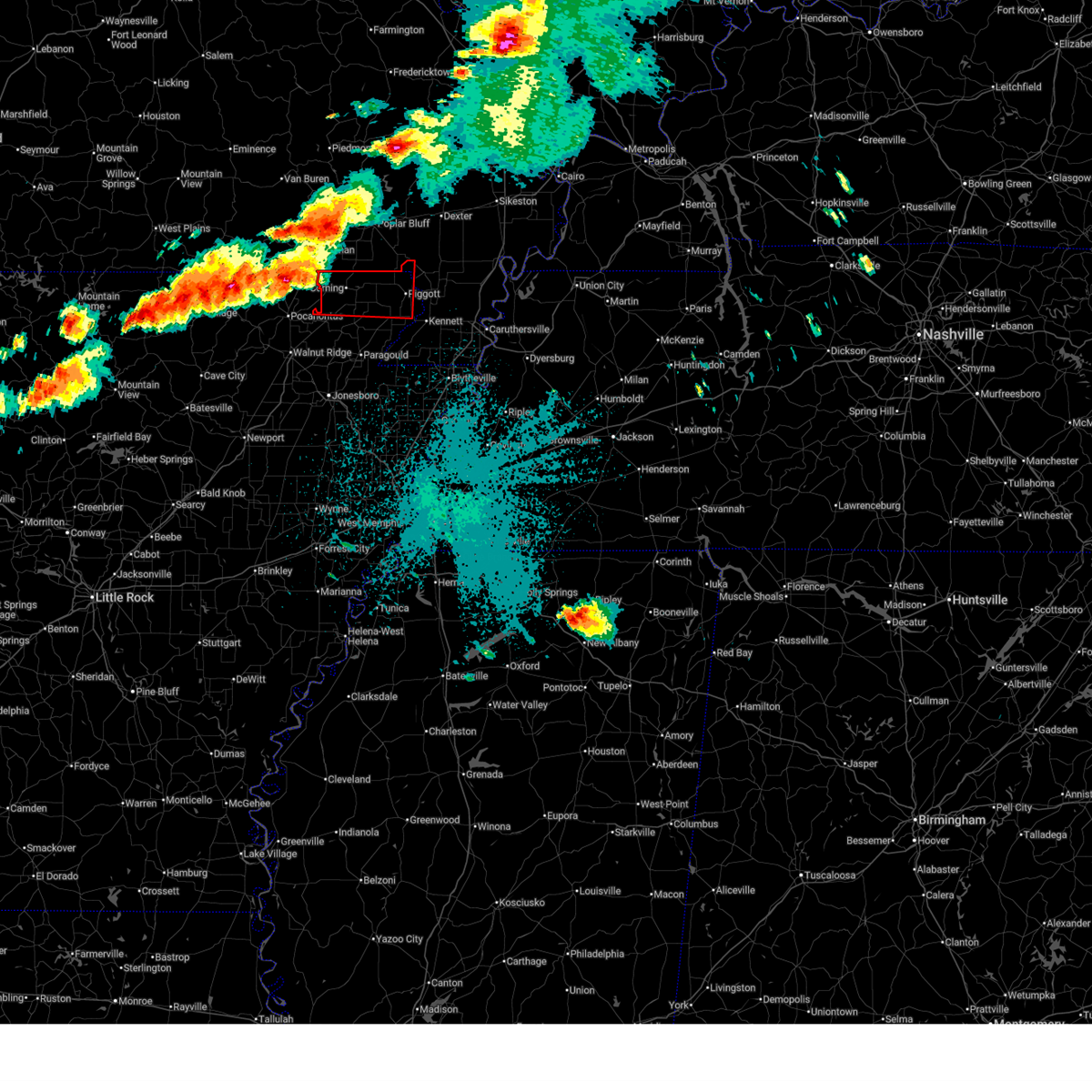
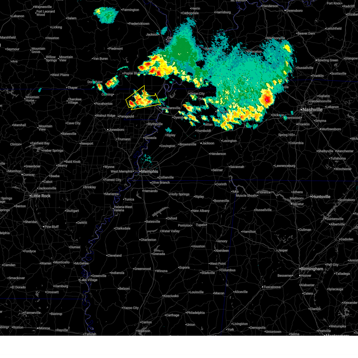
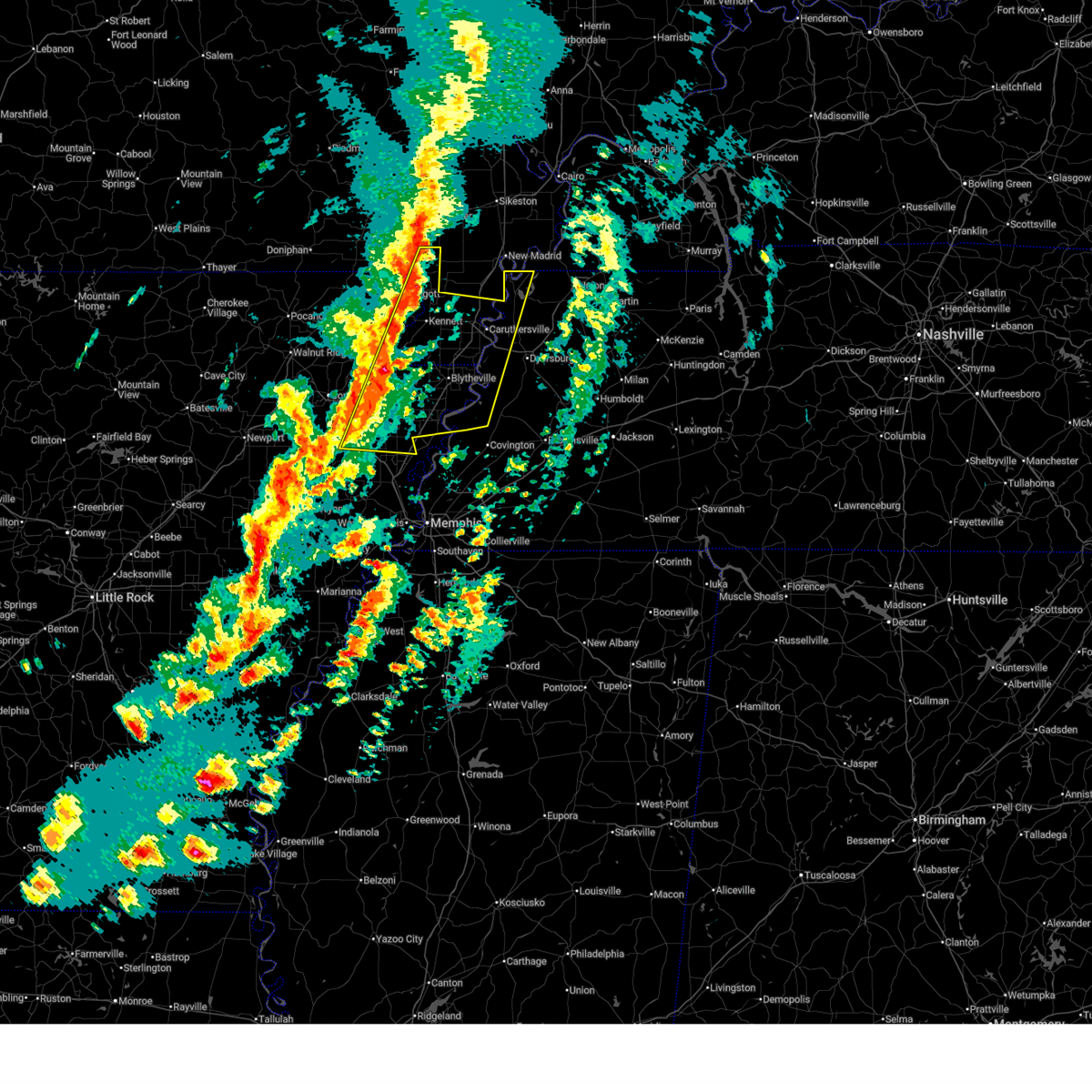
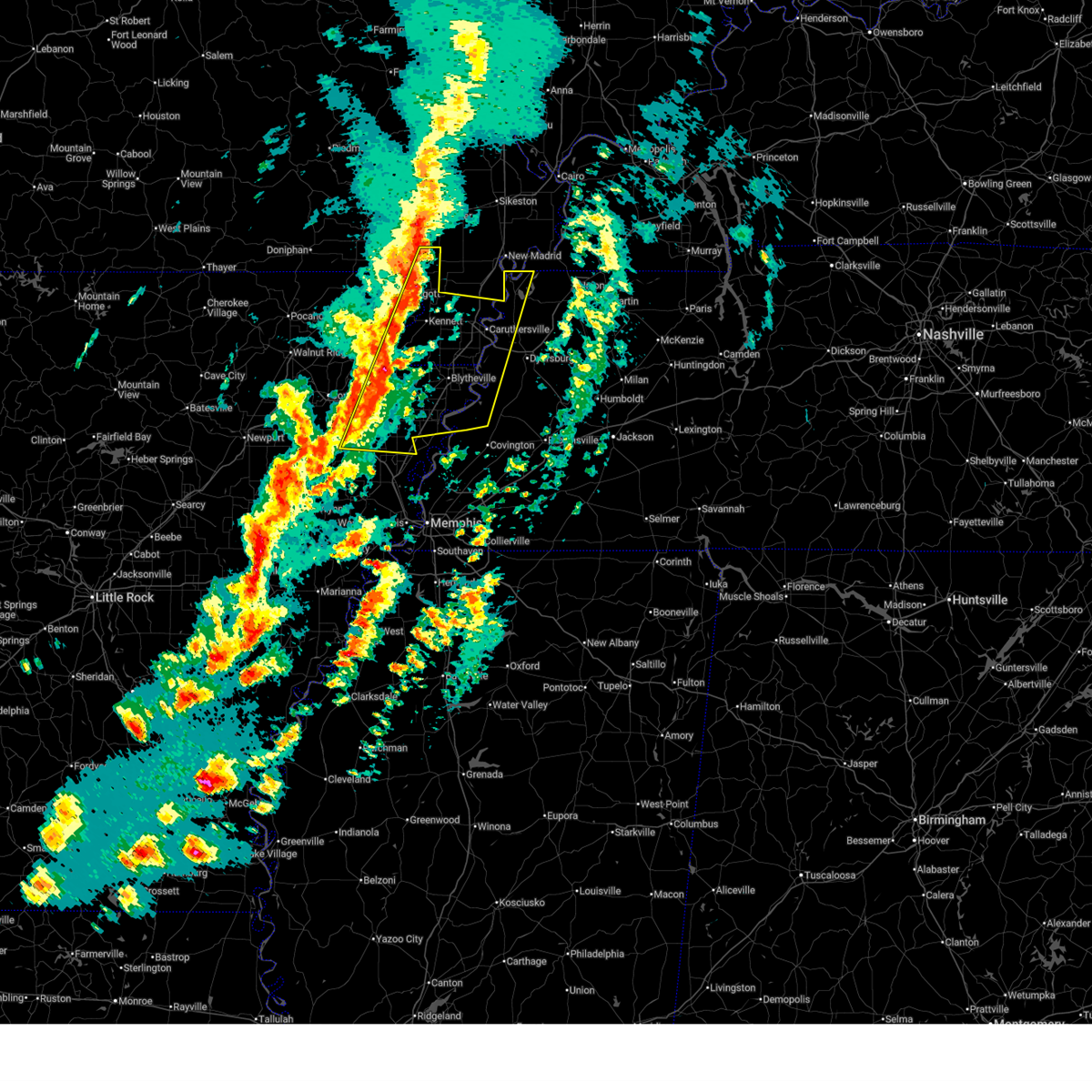
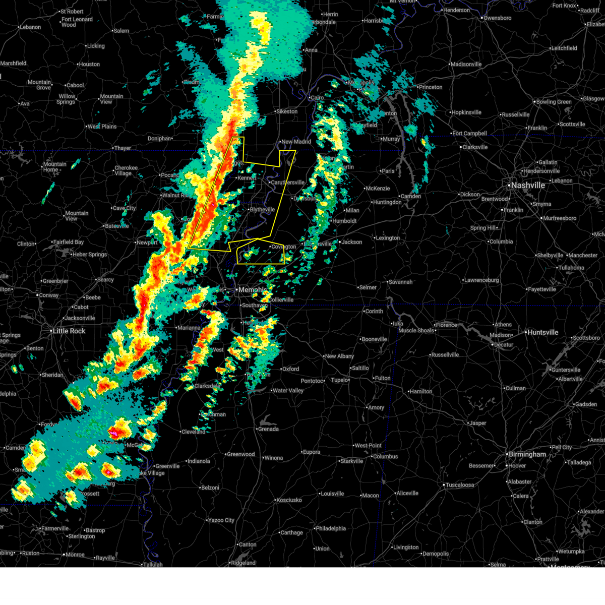
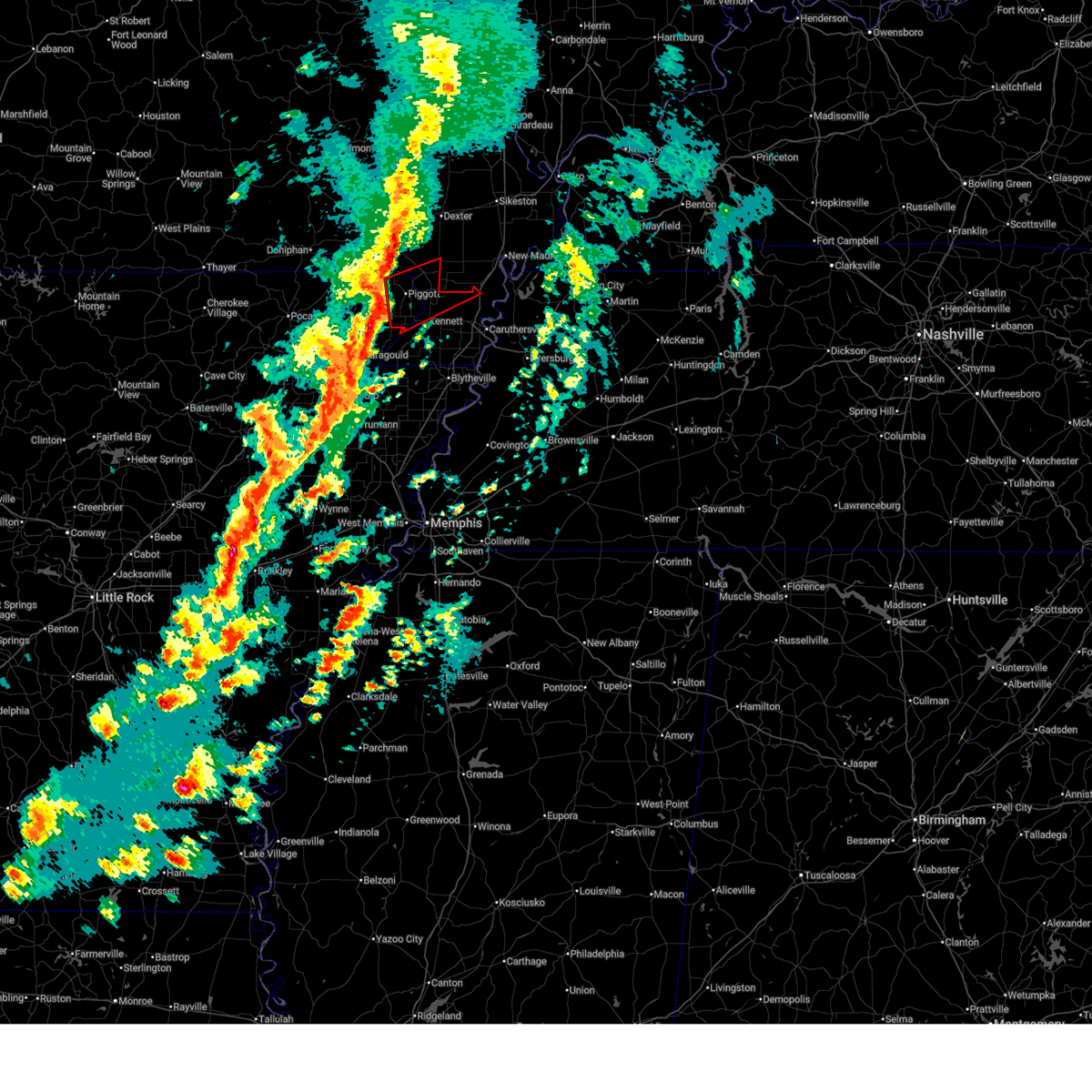
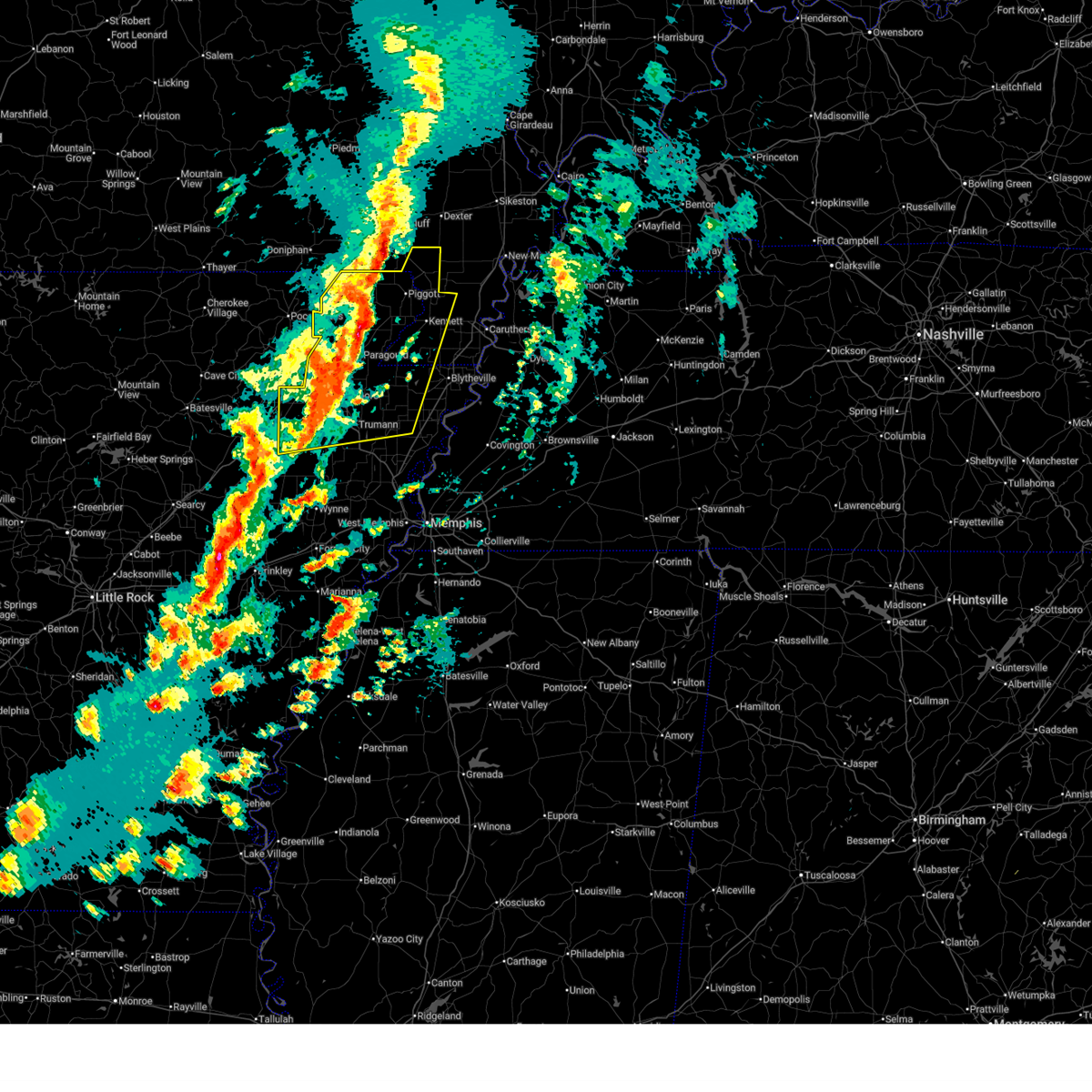
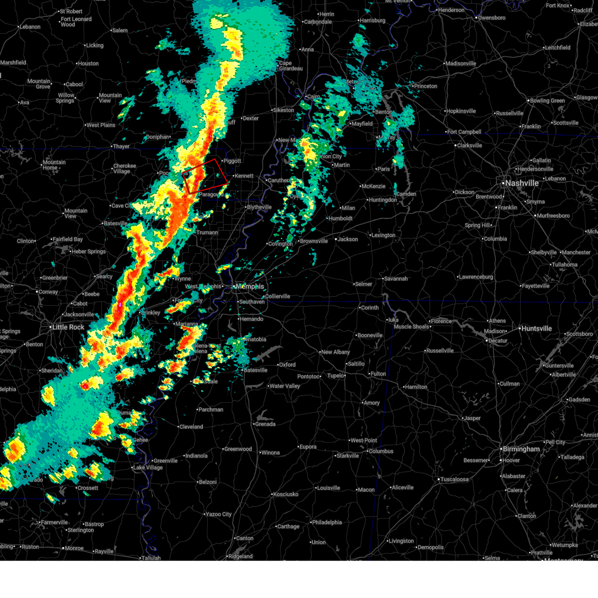
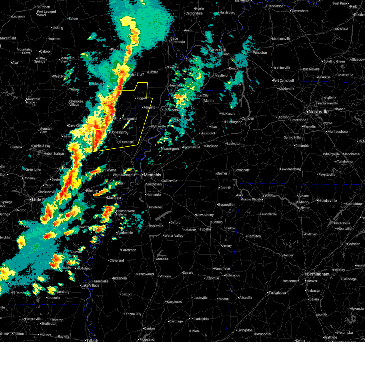
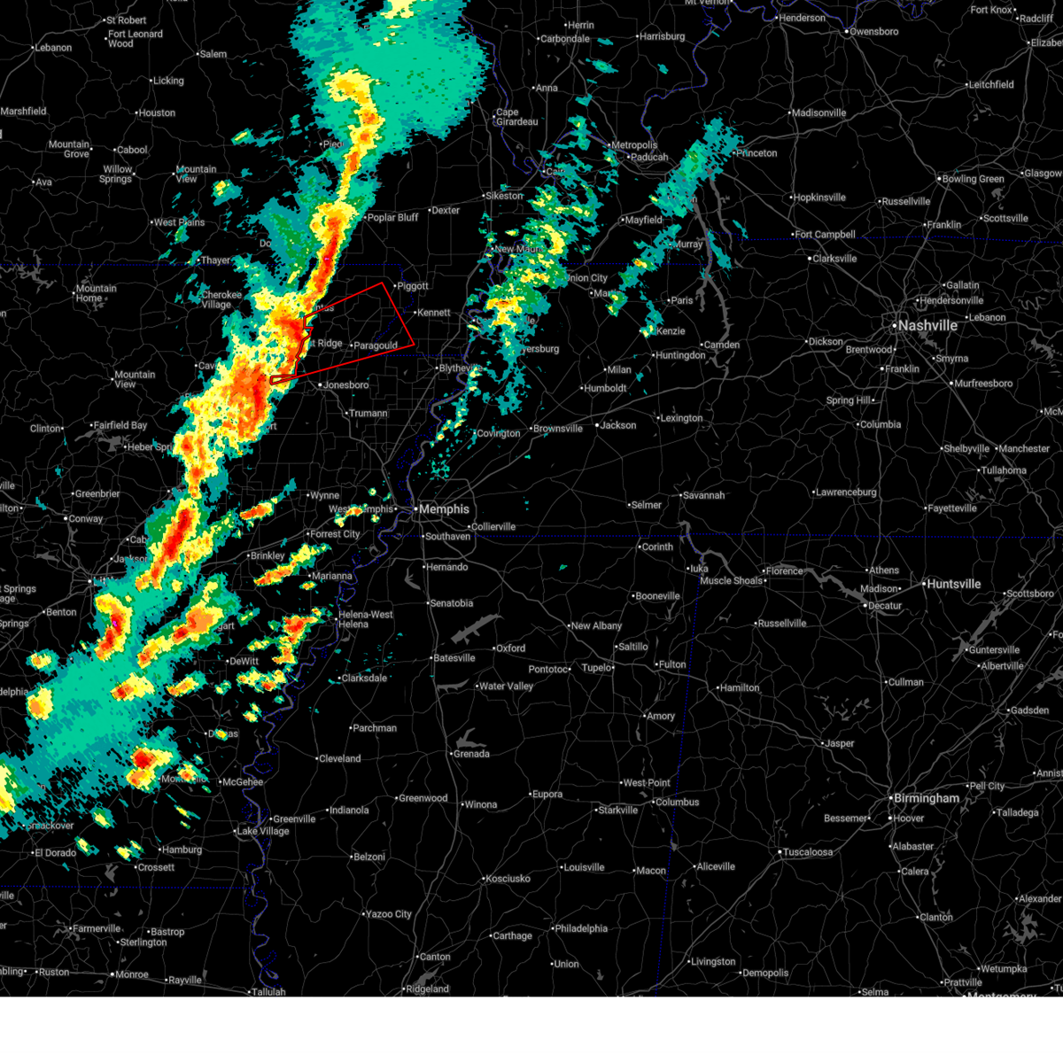
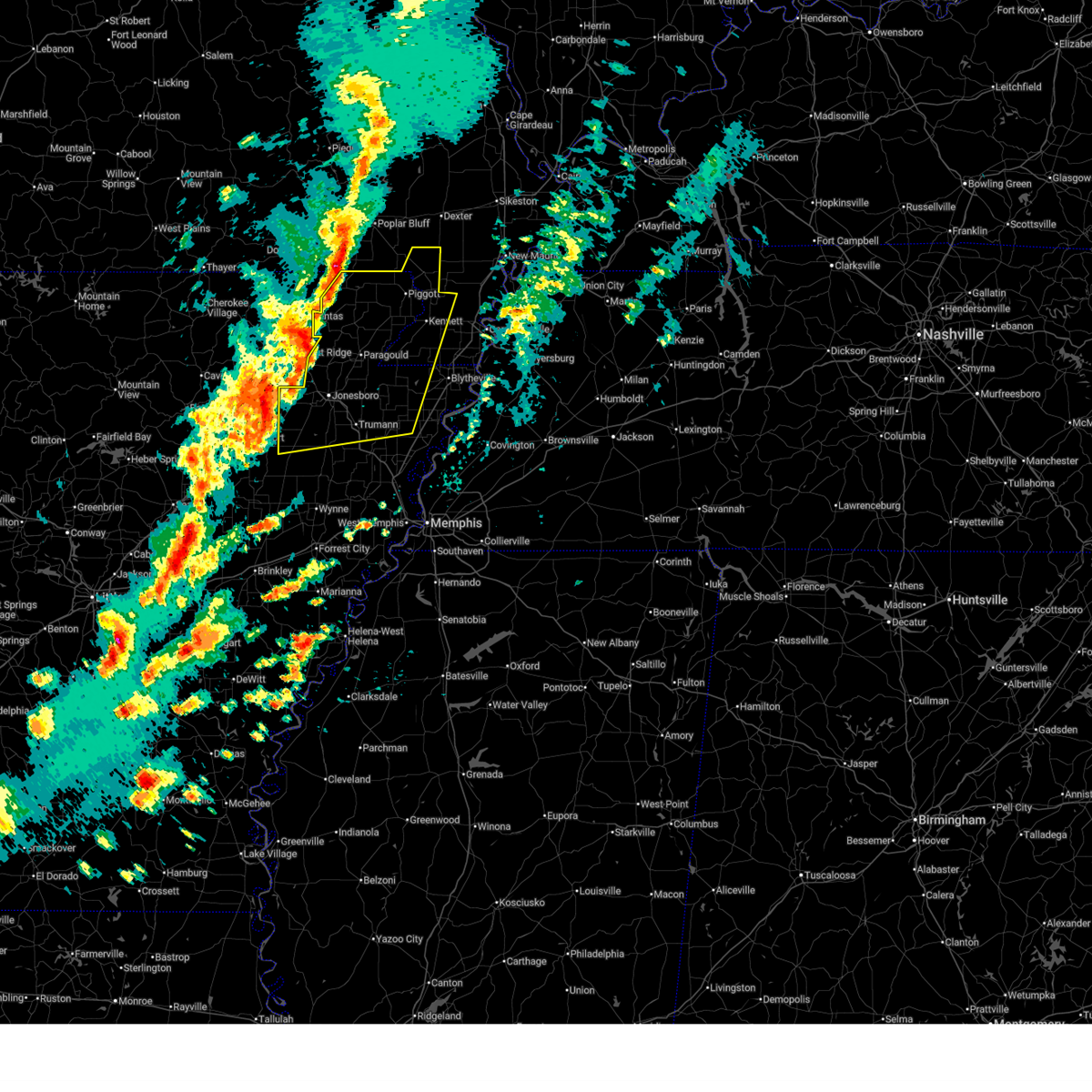
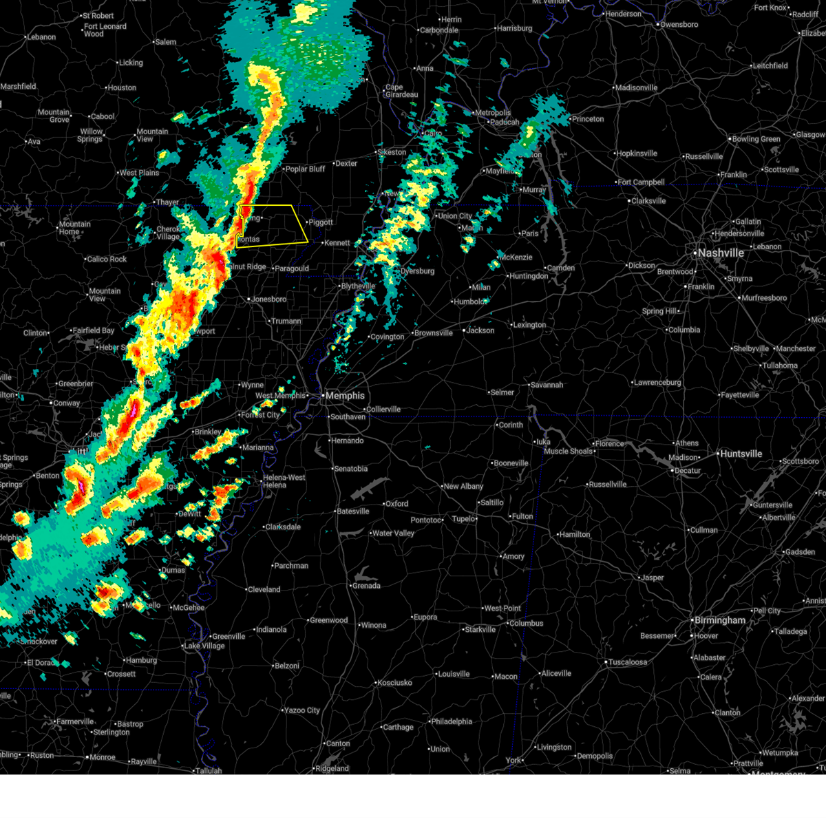
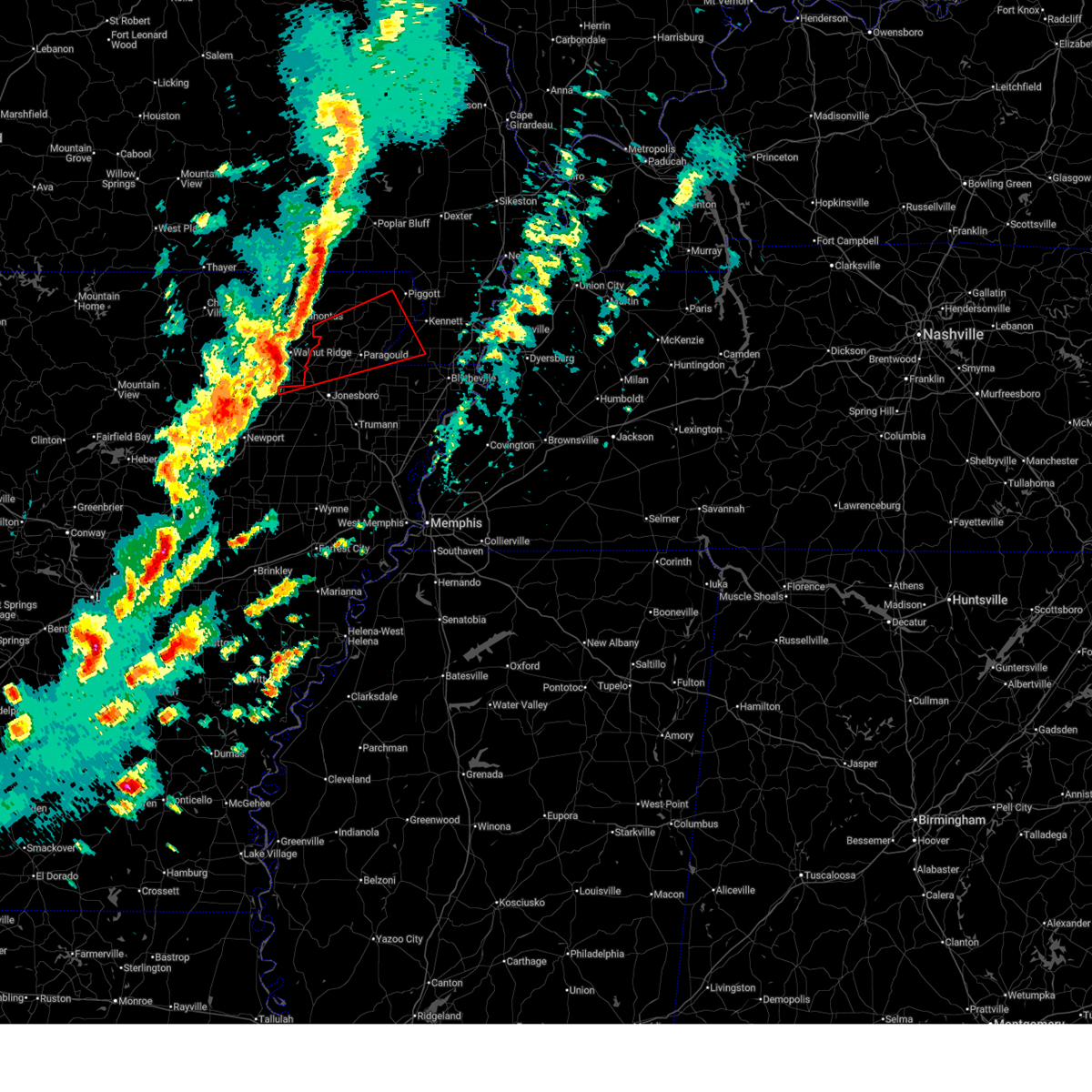
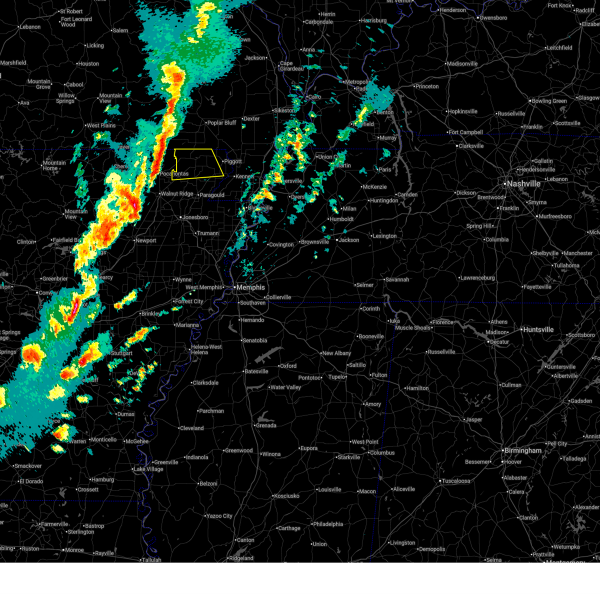
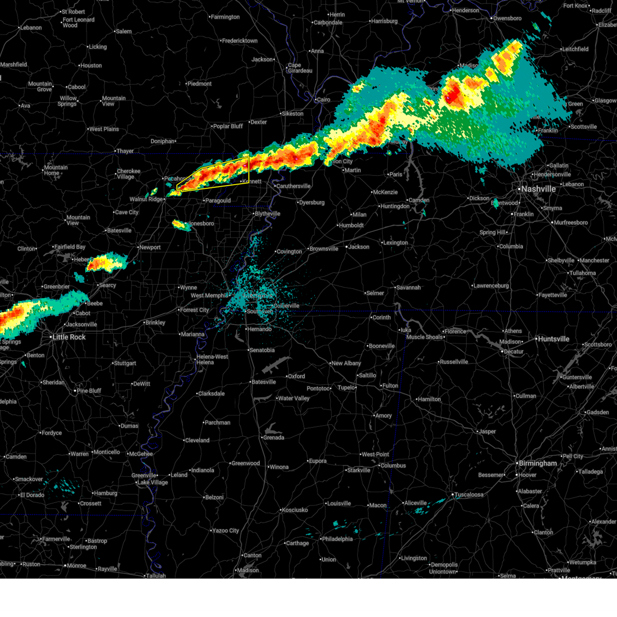
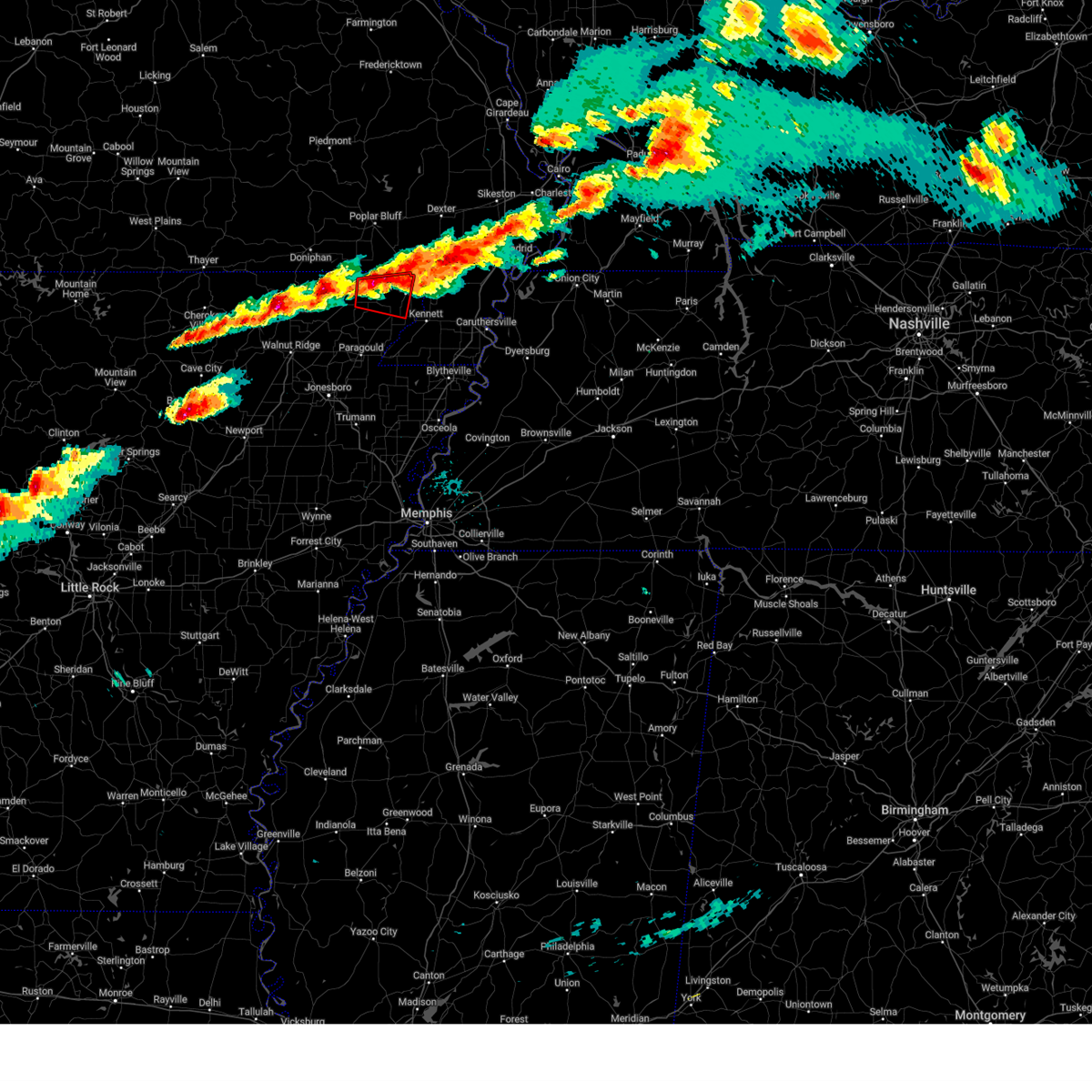
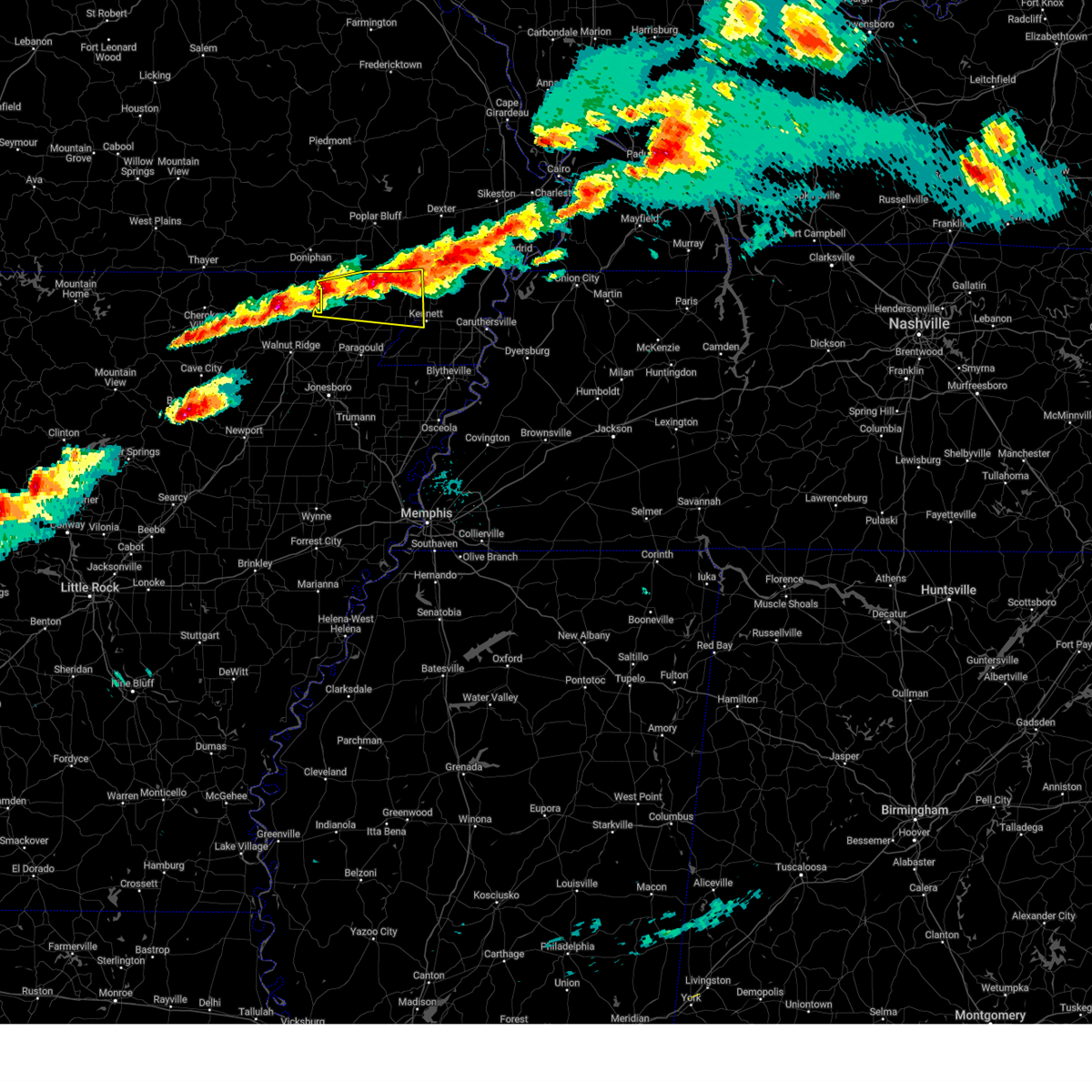
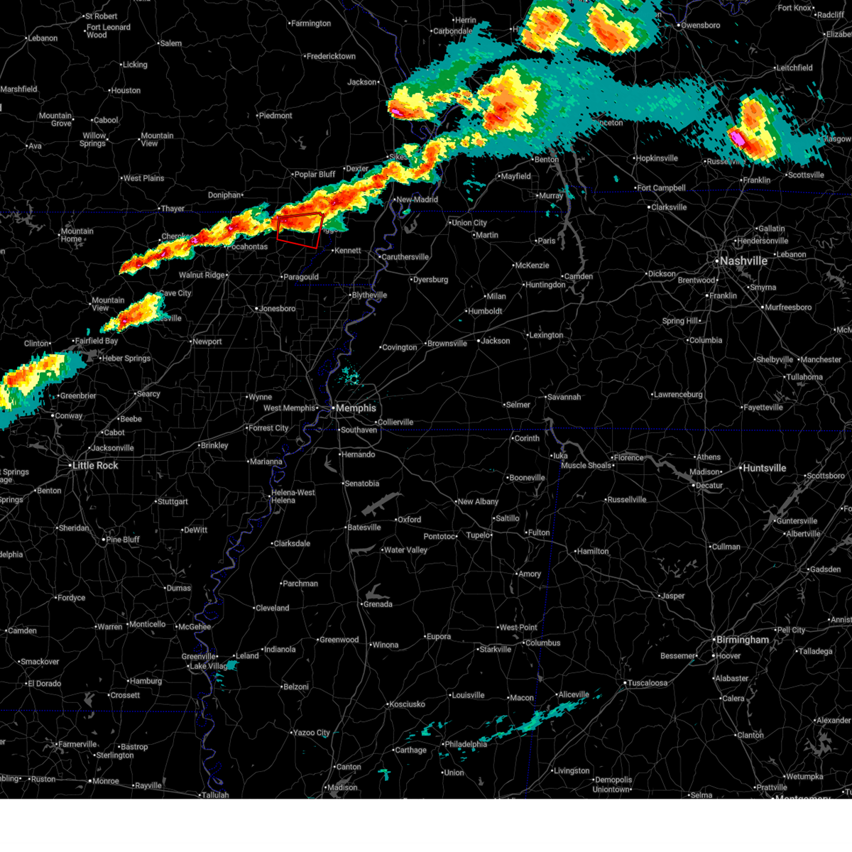
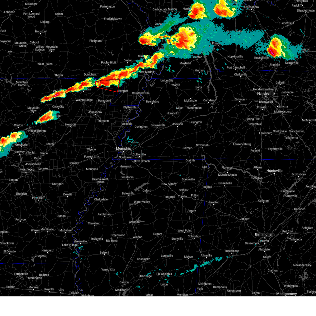
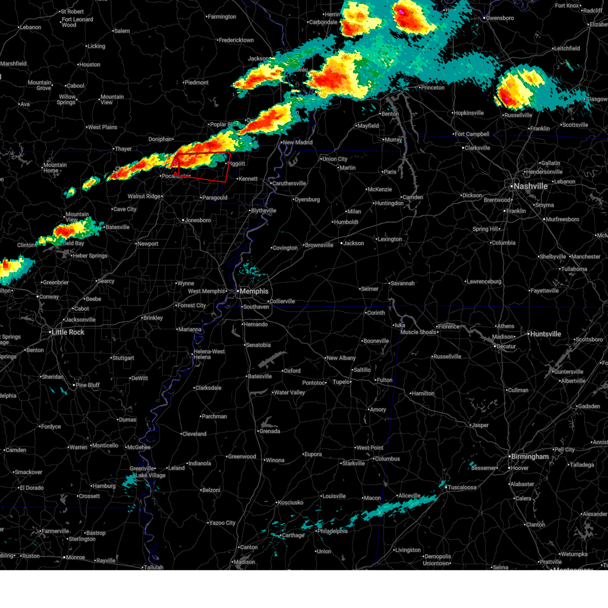
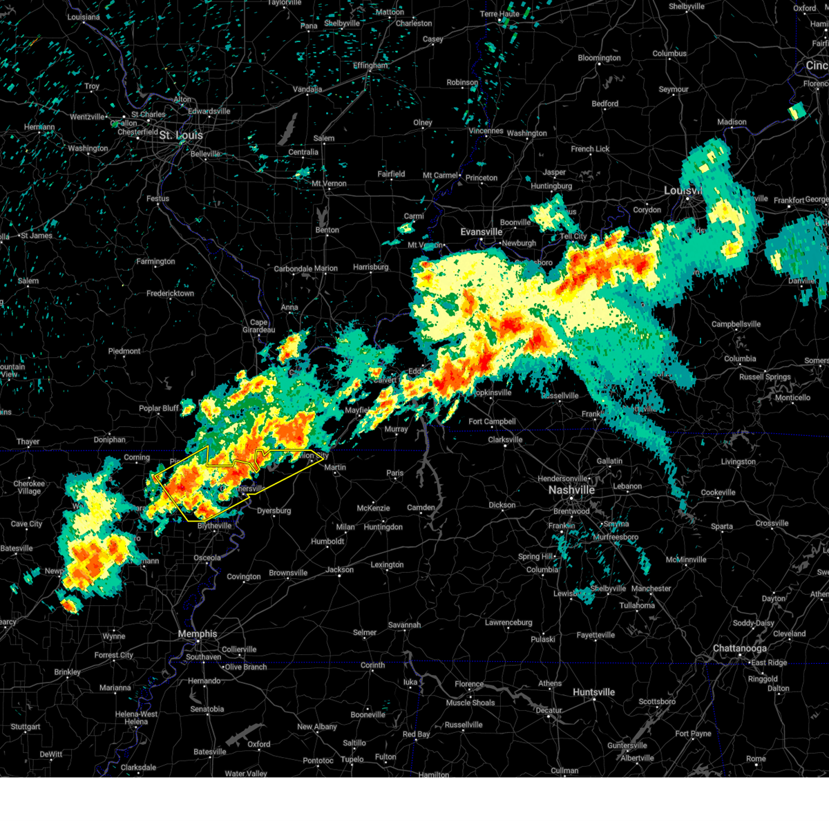
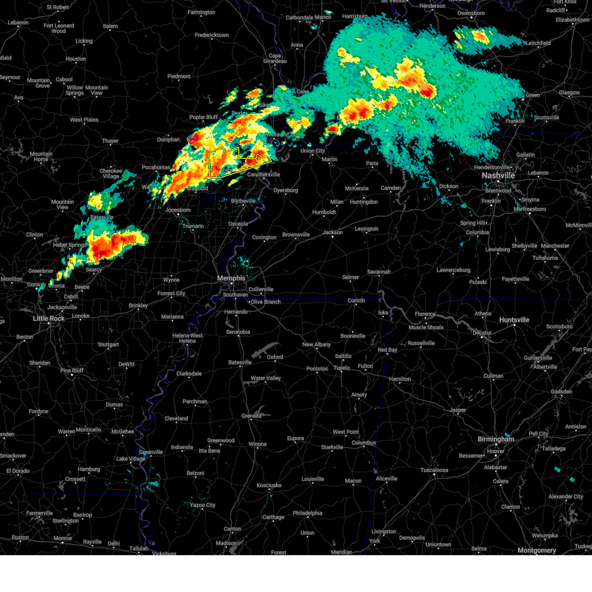
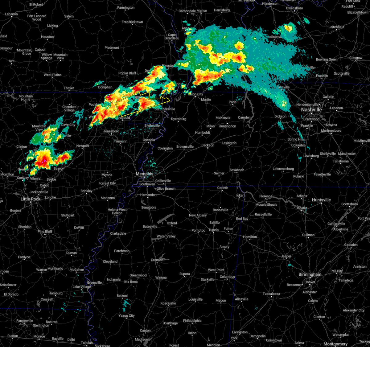
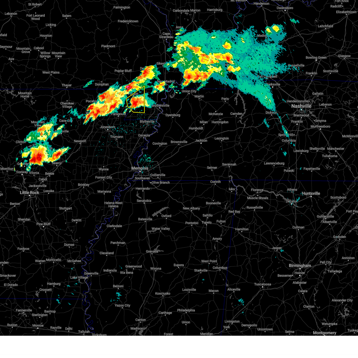
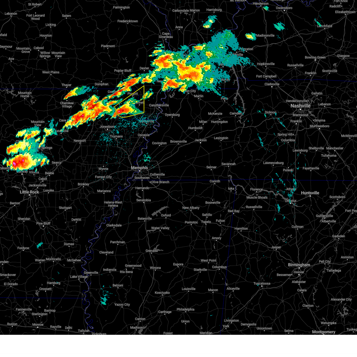
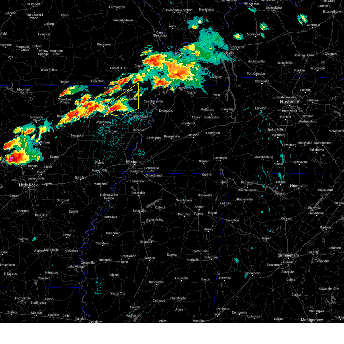
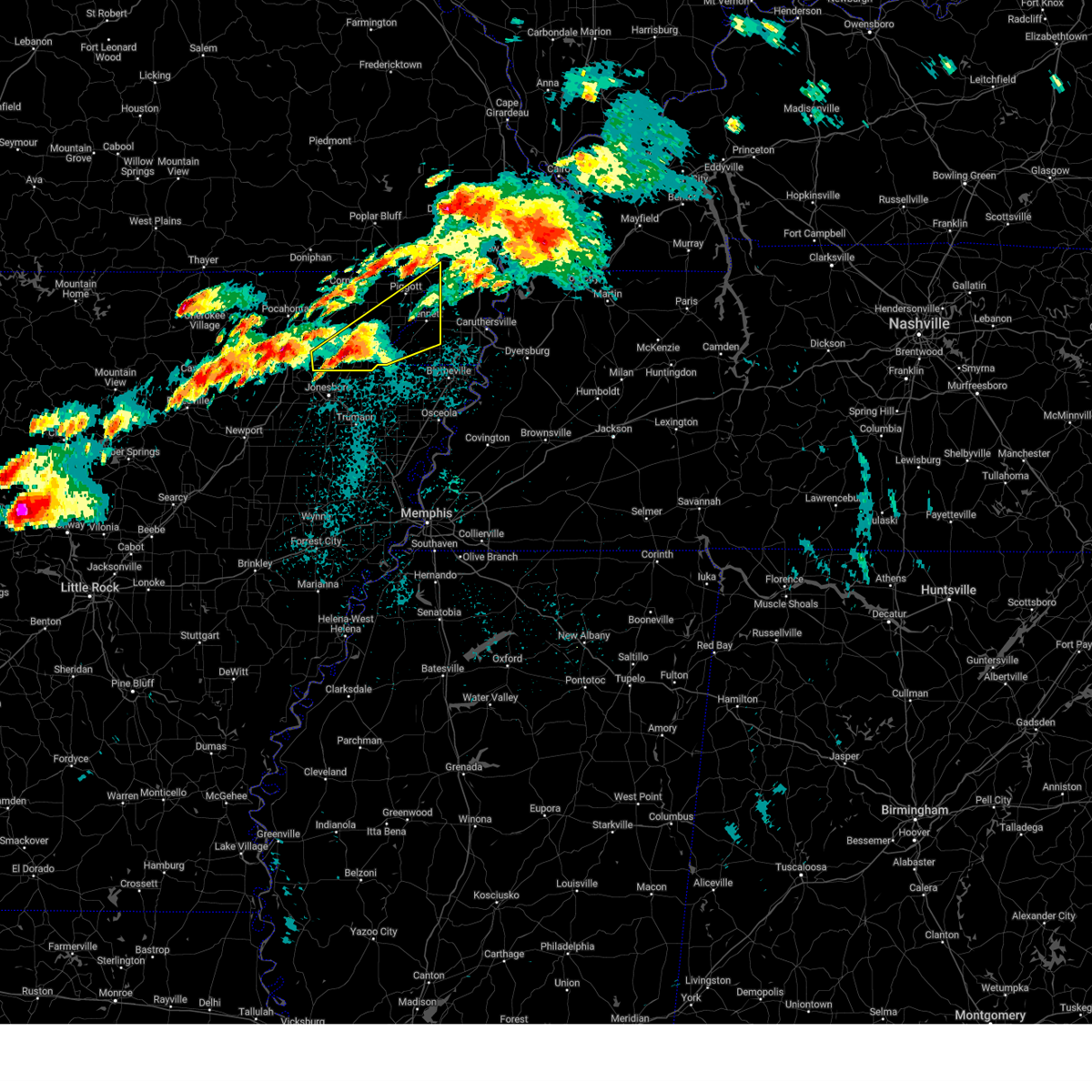
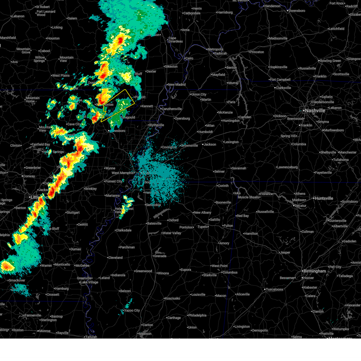
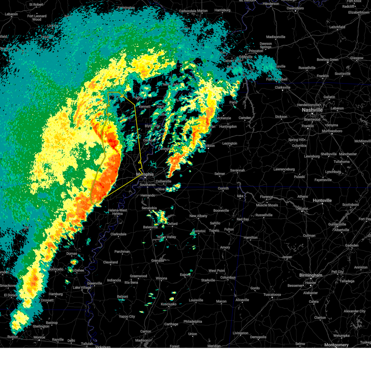
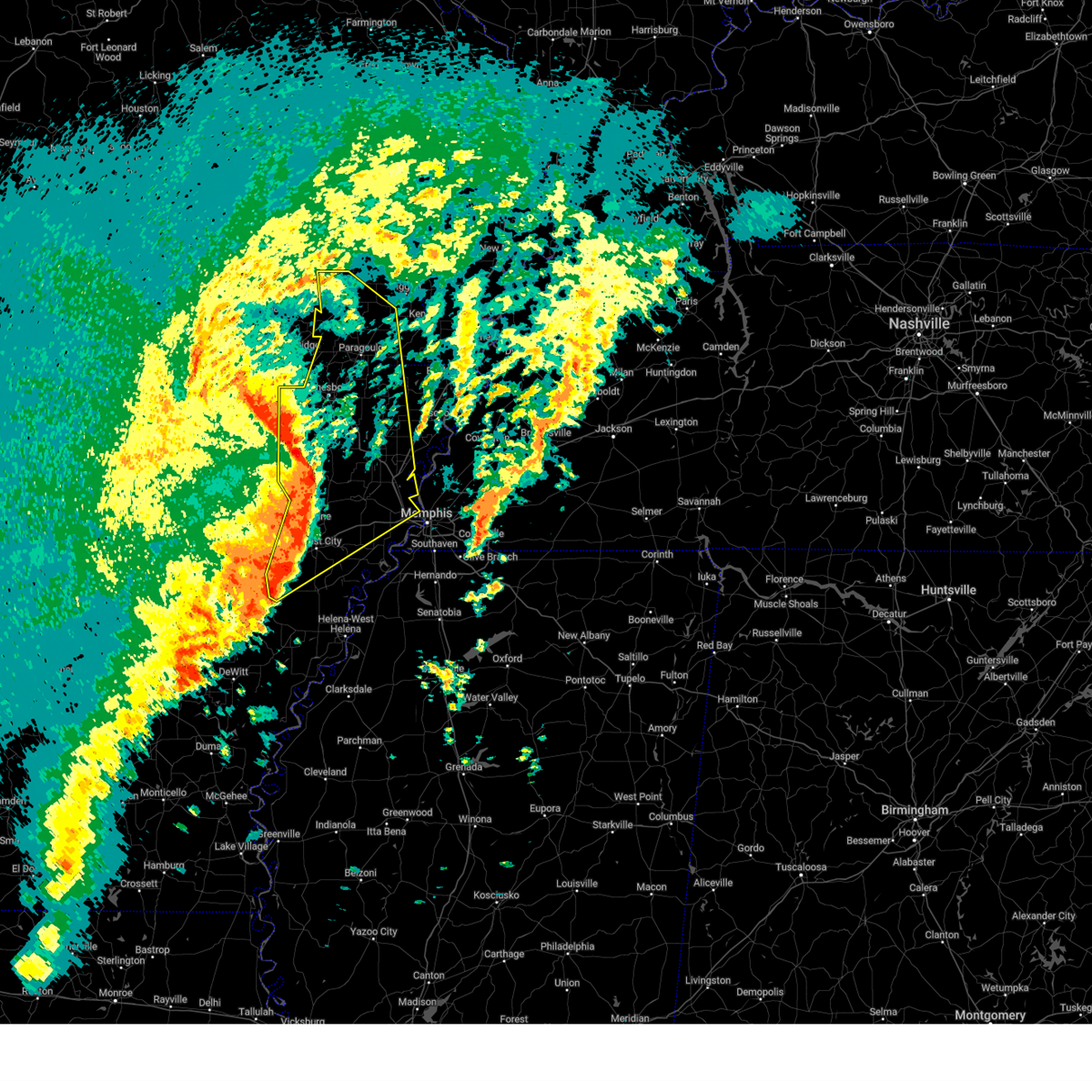
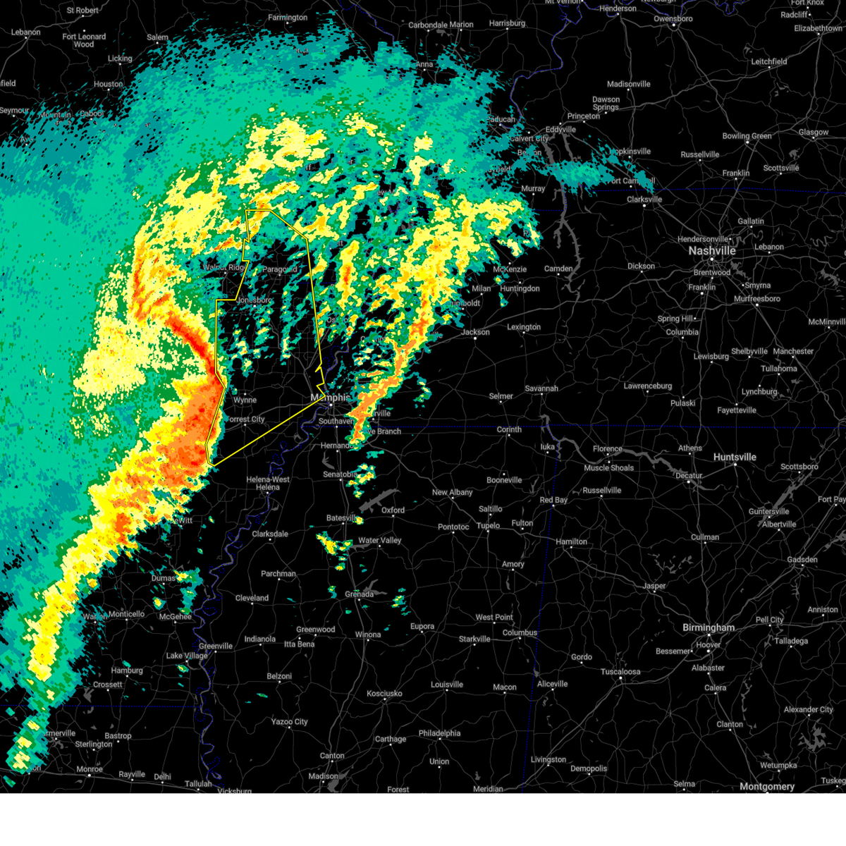
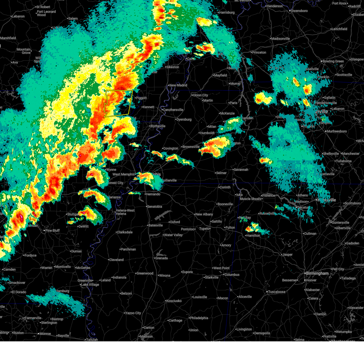
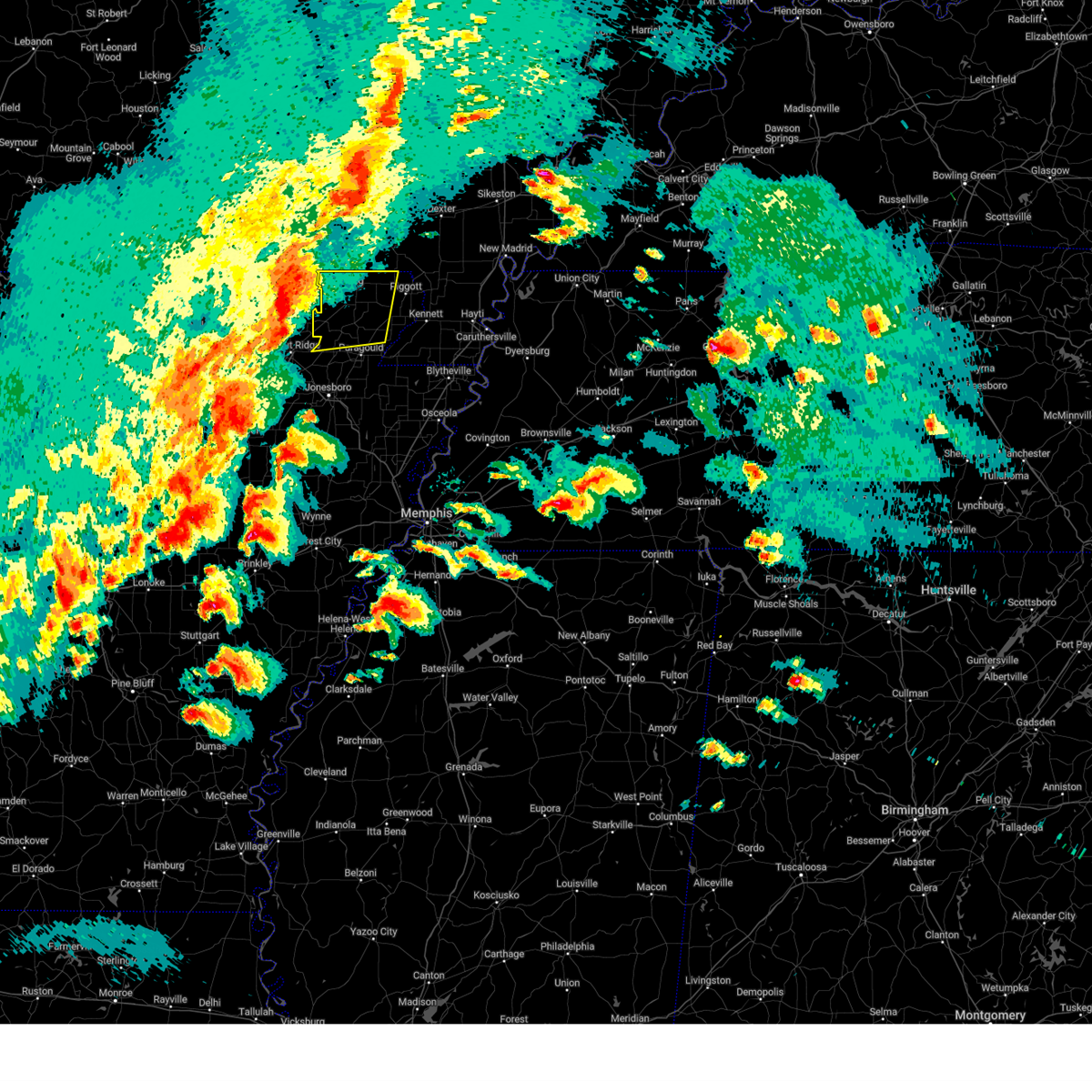
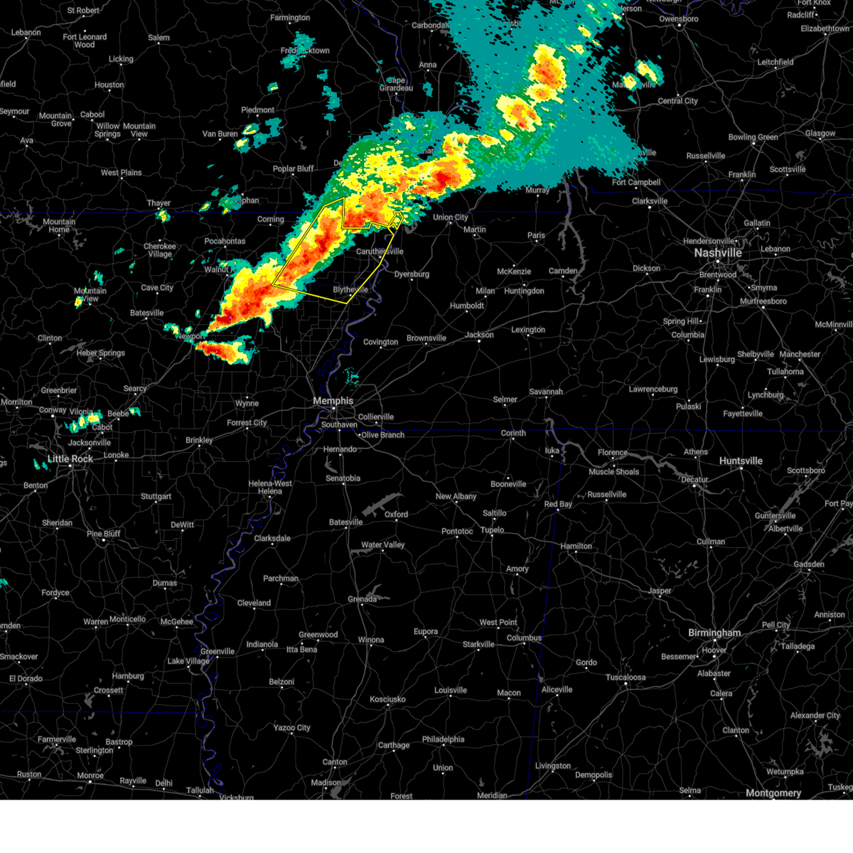
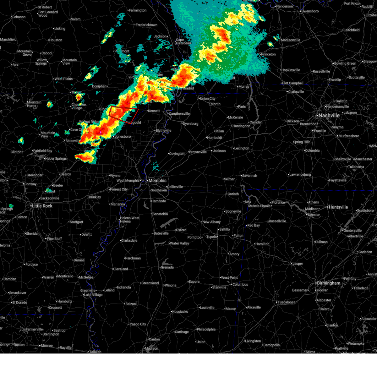
Hail Map for Rector, AR
The Rector, AR area has had 6 reports of on-the-ground hail by trained spotters, and has been under severe weather warnings 25 times during the past 12 months. Doppler radar has detected hail at or near Rector, AR on 59 occasions, including 6 occasions during the past year.
| Name: | Rector, AR |
| Where Located: | 78.1 miles N of Memphis, TN |
| Map: | Google Map for Rector, AR |
| Population: | 1977 |
| Housing Units: | 975 |
| More Info: | Search Google for Rector, AR |
0
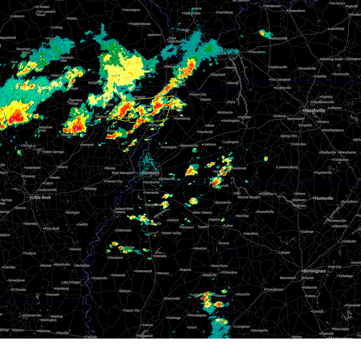
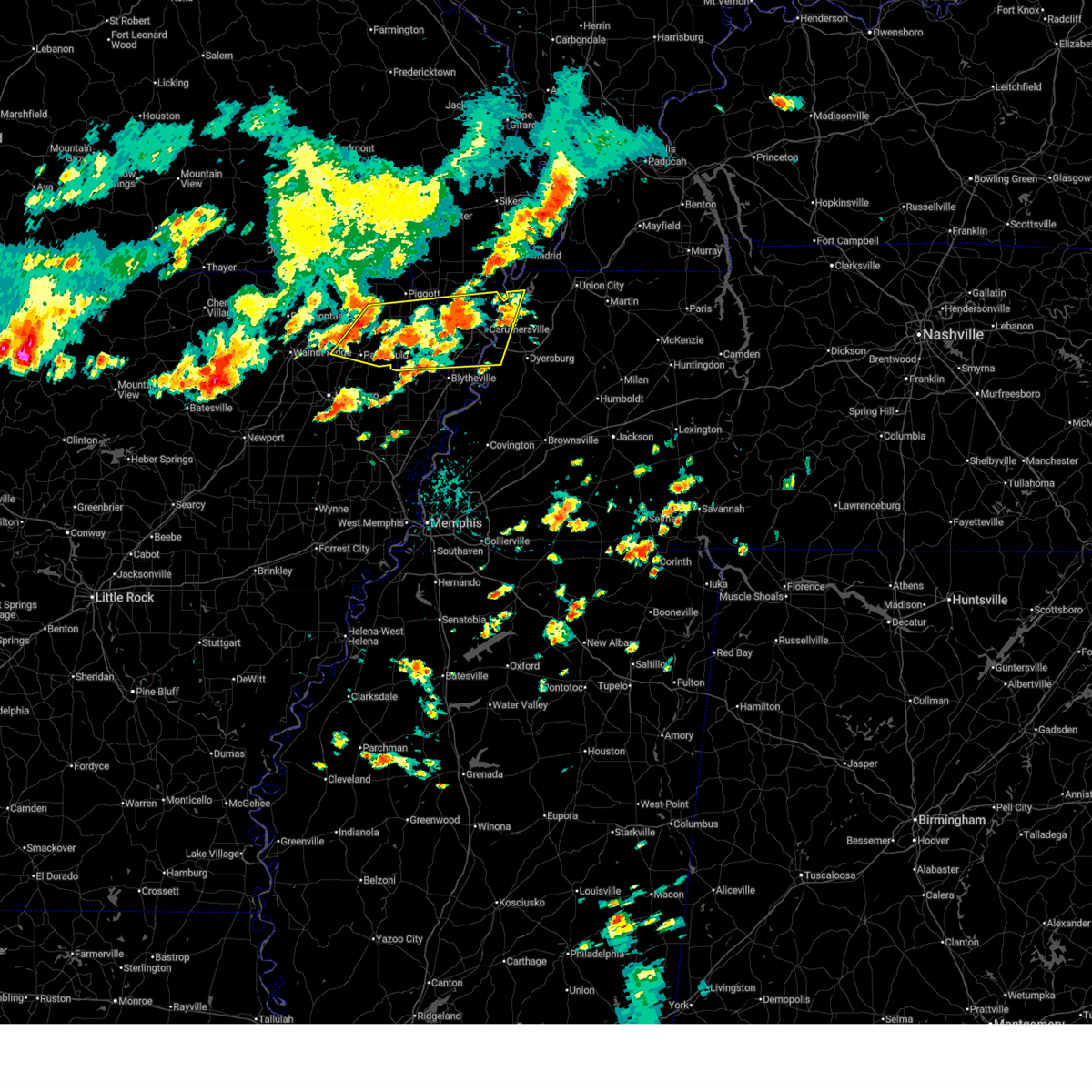
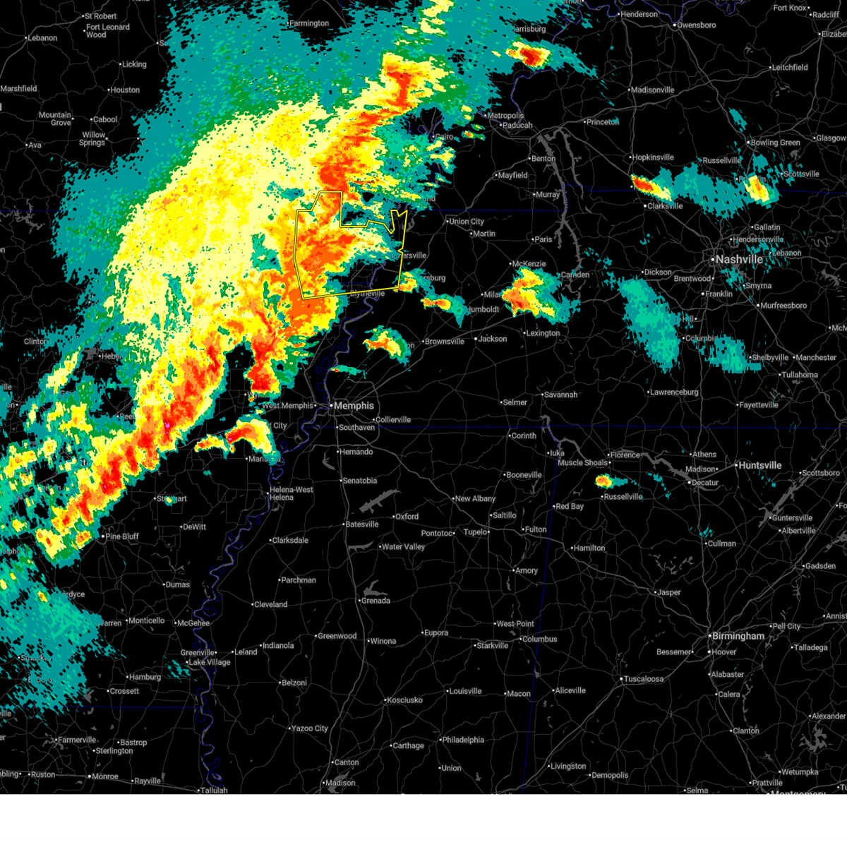
The Top Recent Hail Date for Rector, AR is Saturday, June 13, 2026 (28th out of 59)
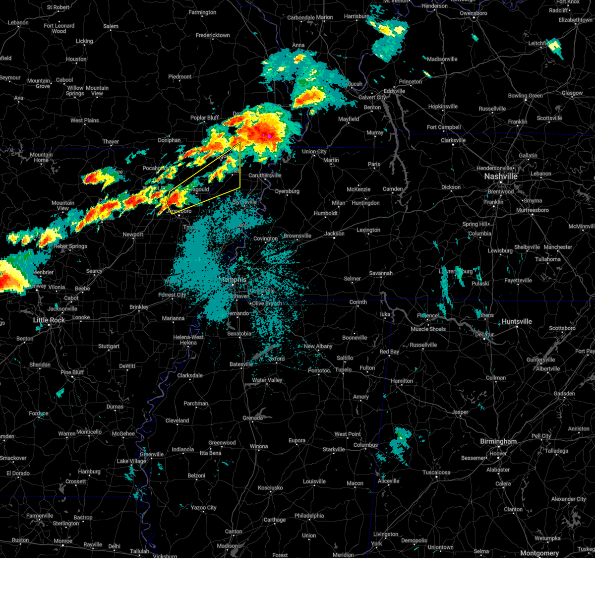
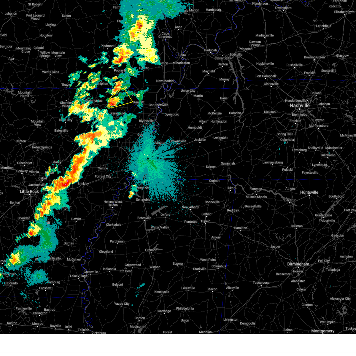
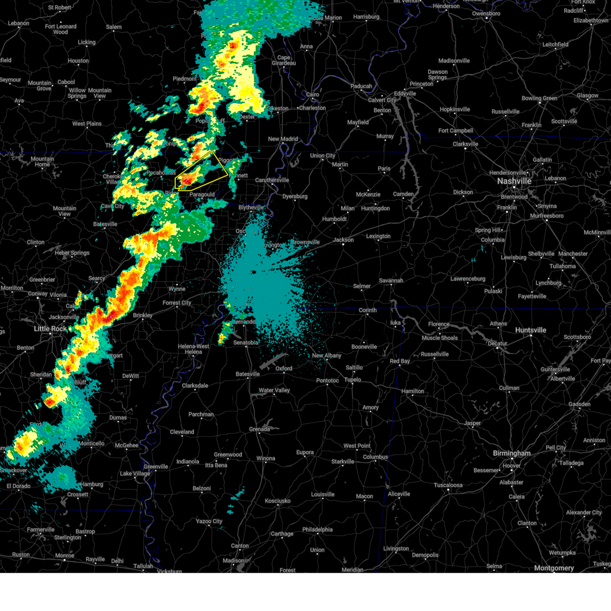
Hail and Wind Damage Spotted near Rector, AR
| Date / Time | Report Details |
|---|---|
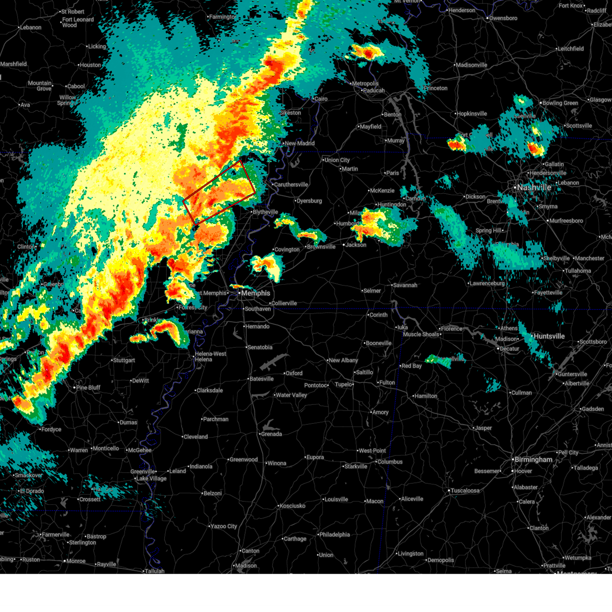
| 6/13/2026 3:50 PM CDT |
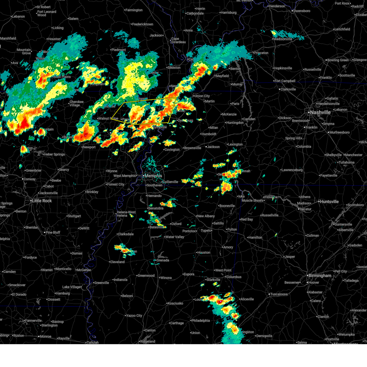 The storm which prompted the warning has weakened below severe limits, and no longer poses an immediate threat to life or property. therefore, the warning will be allowed to expire. however, small hail is still possible with this thunderstorm. The storm which prompted the warning has weakened below severe limits, and no longer poses an immediate threat to life or property. therefore, the warning will be allowed to expire. however, small hail is still possible with this thunderstorm.
|
| 6/13/2026 3:30 PM CDT |
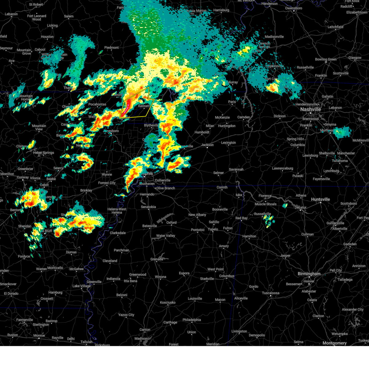
 At 330 pm cdt, a severe thunderstorm was located near hayti, moving east at 30 mph (radar indicated). Hazards include 60 mph wind gusts and quarter size hail. Hail damage to vehicles is expected. expect wind damage to roofs, siding, and trees. locations impacted include, paragould, kennett, caruthersville, gosnell, hayti, steele, rector, senath, marmaduke, reelfoot lake state park, tiptonville, ridgely, oak grove heights, cardwell, hornersville, hayti heights, arbyrd, cooter, lafe, and wardell. this includes the following highways, interstate 55 in arkansas near mile marker 72. Interstate 55 in missouri between mile markers 1 and 29. At 330 pm cdt, a severe thunderstorm was located near hayti, moving east at 30 mph (radar indicated). Hazards include 60 mph wind gusts and quarter size hail. Hail damage to vehicles is expected. expect wind damage to roofs, siding, and trees. locations impacted include, paragould, kennett, caruthersville, gosnell, hayti, steele, rector, senath, marmaduke, reelfoot lake state park, tiptonville, ridgely, oak grove heights, cardwell, hornersville, hayti heights, arbyrd, cooter, lafe, and wardell. this includes the following highways, interstate 55 in arkansas near mile marker 72. Interstate 55 in missouri between mile markers 1 and 29.
|
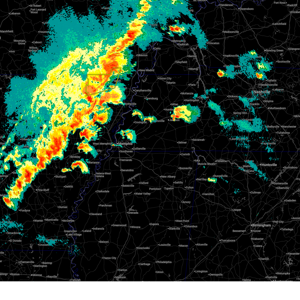
| 6/13/2026 3:09 PM CDT |
 Svrmeg the national weather service in memphis has issued a * severe thunderstorm warning for, central greene county in eastern arkansas, northwestern mississippi county in eastern arkansas, southeastern clay county in eastern arkansas, pemiscot county in southeastern missouri, dunklin county in southeastern missouri, northwestern dyer county in west tennessee, lake county in west tennessee, * until 400 pm cdt. * at 309 pm cdt, a severe thunderstorm was located over deering, or near hayti, moving east at 30 mph (radar indicated). Hazards include 60 mph wind gusts and quarter size hail. Hail damage to vehicles is expected. Expect wind damage to roofs, siding, and trees. Svrmeg the national weather service in memphis has issued a * severe thunderstorm warning for, central greene county in eastern arkansas, northwestern mississippi county in eastern arkansas, southeastern clay county in eastern arkansas, pemiscot county in southeastern missouri, dunklin county in southeastern missouri, northwestern dyer county in west tennessee, lake county in west tennessee, * until 400 pm cdt. * at 309 pm cdt, a severe thunderstorm was located over deering, or near hayti, moving east at 30 mph (radar indicated). Hazards include 60 mph wind gusts and quarter size hail. Hail damage to vehicles is expected. Expect wind damage to roofs, siding, and trees.
|
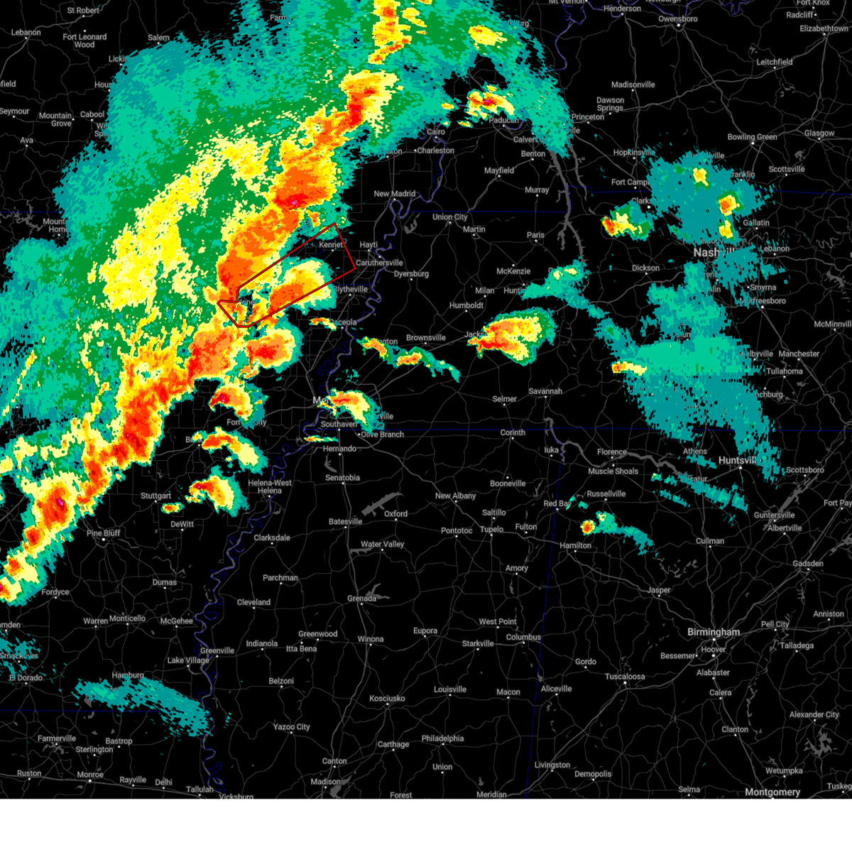
| 4/27/2026 11:30 PM CDT |
 At 1130 pm cdt, a severe thunderstorm was located over bolton, or near hayti, moving east at 50 mph (radar indicated). Hazards include 60 mph wind gusts and quarter size hail. Hail damage to vehicles is expected. expect wind damage to roofs, siding, and trees. locations impacted include, paragould, blytheville, kennett, caruthersville, piggott, gosnell, portageville, hayti, steele, leachville, rector, senath, brookland, monette, marmaduke, reelfoot lake state park, crowleys ridge state park, lake frierson state park, tiptonville, and ridgely. this includes the following highways, interstate 55 in arkansas between mile markers 65 and 72. Interstate 55 in missouri between mile markers 1 and 31. At 1130 pm cdt, a severe thunderstorm was located over bolton, or near hayti, moving east at 50 mph (radar indicated). Hazards include 60 mph wind gusts and quarter size hail. Hail damage to vehicles is expected. expect wind damage to roofs, siding, and trees. locations impacted include, paragould, blytheville, kennett, caruthersville, piggott, gosnell, portageville, hayti, steele, leachville, rector, senath, brookland, monette, marmaduke, reelfoot lake state park, crowleys ridge state park, lake frierson state park, tiptonville, and ridgely. this includes the following highways, interstate 55 in arkansas between mile markers 65 and 72. Interstate 55 in missouri between mile markers 1 and 31.
|
| 4/27/2026 11:01 PM CDT |
 At 1100 pm cdt, a severe thunderstorm was located near greenway, or near piggott, moving east at 50 mph (radar indicated). Hazards include 60 mph wind gusts and quarter size hail. Hail damage to vehicles is expected. expect wind damage to roofs, siding, and trees. locations impacted include, paragould, blytheville, kennett, caruthersville, piggott, gosnell, corning, portageville, hayti, steele, leachville, rector, senath, brookland, monette, marmaduke, reelfoot lake state park, crowleys ridge state park, lake frierson state park, and tiptonville. this includes the following highways, interstate 55 in arkansas between mile markers 65 and 72. Interstate 55 in missouri between mile markers 1 and 31. At 1100 pm cdt, a severe thunderstorm was located near greenway, or near piggott, moving east at 50 mph (radar indicated). Hazards include 60 mph wind gusts and quarter size hail. Hail damage to vehicles is expected. expect wind damage to roofs, siding, and trees. locations impacted include, paragould, blytheville, kennett, caruthersville, piggott, gosnell, corning, portageville, hayti, steele, leachville, rector, senath, brookland, monette, marmaduke, reelfoot lake state park, crowleys ridge state park, lake frierson state park, and tiptonville. this includes the following highways, interstate 55 in arkansas between mile markers 65 and 72. Interstate 55 in missouri between mile markers 1 and 31.
|
| 4/27/2026 10:55 PM CDT | Thunderstorm wind gust reported near rector. estimated at 60 mp in clay county AR, 0.4 miles SSW of Rector, AR |
| 4/27/2026 10:54 PM CDT |
 Svrmeg the national weather service in memphis has issued a * severe thunderstorm warning for, greene county in eastern arkansas, northeastern craighead county in eastern arkansas, northern mississippi county in eastern arkansas, clay county in eastern arkansas, pemiscot county in southeastern missouri, dunklin county in southeastern missouri, western dyer county in west tennessee, north central lauderdale county in west tennessee, lake county in west tennessee, * until midnight cdt. * at 1053 pm cdt, a severe thunderstorm was located over rector, moving east at 50 mph (radar indicated). Hazards include 70 mph wind gusts and quarter size hail. Hail damage to vehicles is expected. expect considerable tree damage. Wind damage is also likely to mobile homes, roofs, and outbuildings. Svrmeg the national weather service in memphis has issued a * severe thunderstorm warning for, greene county in eastern arkansas, northeastern craighead county in eastern arkansas, northern mississippi county in eastern arkansas, clay county in eastern arkansas, pemiscot county in southeastern missouri, dunklin county in southeastern missouri, western dyer county in west tennessee, north central lauderdale county in west tennessee, lake county in west tennessee, * until midnight cdt. * at 1053 pm cdt, a severe thunderstorm was located over rector, moving east at 50 mph (radar indicated). Hazards include 70 mph wind gusts and quarter size hail. Hail damage to vehicles is expected. expect considerable tree damage. Wind damage is also likely to mobile homes, roofs, and outbuildings.
|
| 4/27/2026 10:48 PM CDT |
 At 1047 pm cdt, a severe thunderstorm was located near rector, moving east at 50 mph (radar indicated). Hazards include 70 mph wind gusts and quarter size hail. Hail damage to vehicles is expected. expect considerable tree damage. wind damage is also likely to mobile homes, roofs, and outbuildings. locations impacted include, paragould, piggott, corning, rector, marmaduke, chalk bluff natural area, oak grove heights, cardwell, lafe, reyno, knobel, st. Francis, pollard, greenway, o'kean, mcdougal, success, peach orchard, delaplaine, and datto. At 1047 pm cdt, a severe thunderstorm was located near rector, moving east at 50 mph (radar indicated). Hazards include 70 mph wind gusts and quarter size hail. Hail damage to vehicles is expected. expect considerable tree damage. wind damage is also likely to mobile homes, roofs, and outbuildings. locations impacted include, paragould, piggott, corning, rector, marmaduke, chalk bluff natural area, oak grove heights, cardwell, lafe, reyno, knobel, st. Francis, pollard, greenway, o'kean, mcdougal, success, peach orchard, delaplaine, and datto.
|
| 4/27/2026 10:41 PM CDT |
 At 1041 pm cdt, a severe thunderstorm was located near lafe, or near marmaduke, moving east at 50 mph. this is a destructive storm (radar indicated). Hazards include 80 mph wind gusts and quarter size hail. Flying debris will be dangerous to those caught without shelter. mobile homes will be heavily damaged. expect considerable damage to roofs, windows, and vehicles. extensive tree damage and power outages are likely. locations impacted include, paragould, piggott, corning, rector, marmaduke, chalk bluff natural area, oak grove heights, cardwell, lafe, reyno, knobel, st. Francis, pollard, greenway, o'kean, mcdougal, success, peach orchard, delaplaine, and datto. At 1041 pm cdt, a severe thunderstorm was located near lafe, or near marmaduke, moving east at 50 mph. this is a destructive storm (radar indicated). Hazards include 80 mph wind gusts and quarter size hail. Flying debris will be dangerous to those caught without shelter. mobile homes will be heavily damaged. expect considerable damage to roofs, windows, and vehicles. extensive tree damage and power outages are likely. locations impacted include, paragould, piggott, corning, rector, marmaduke, chalk bluff natural area, oak grove heights, cardwell, lafe, reyno, knobel, st. Francis, pollard, greenway, o'kean, mcdougal, success, peach orchard, delaplaine, and datto.
|
| 4/27/2026 10:32 PM CDT |
 At 1031 pm cdt, a severe thunderstorm was located over knobel, or 8 miles south of corning, moving east at 50 mph (radar indicated). Hazards include 70 mph wind gusts and quarter size hail. Hail damage to vehicles is expected. expect considerable tree damage. wind damage is also likely to mobile homes, roofs, and outbuildings. locations impacted include, paragould, piggott, corning, rector, marmaduke, chalk bluff natural area, oak grove heights, cardwell, lafe, reyno, knobel, st. Francis, pollard, greenway, o'kean, mcdougal, success, peach orchard, delaplaine, and datto. At 1031 pm cdt, a severe thunderstorm was located over knobel, or 8 miles south of corning, moving east at 50 mph (radar indicated). Hazards include 70 mph wind gusts and quarter size hail. Hail damage to vehicles is expected. expect considerable tree damage. wind damage is also likely to mobile homes, roofs, and outbuildings. locations impacted include, paragould, piggott, corning, rector, marmaduke, chalk bluff natural area, oak grove heights, cardwell, lafe, reyno, knobel, st. Francis, pollard, greenway, o'kean, mcdougal, success, peach orchard, delaplaine, and datto.
|
| 4/27/2026 10:09 PM CDT |
 Svrmeg the national weather service in memphis has issued a * severe thunderstorm warning for, greene county in eastern arkansas, clay county in eastern arkansas, western dunklin county in southeastern missouri, * until 1100 pm cdt. * at 1008 pm cdt, a severe thunderstorm was located near attica, or near pocahontas, moving east at 50 mph (radar indicated). Hazards include 60 mph wind gusts and quarter size hail. Hail damage to vehicles is expected. Expect wind damage to roofs, siding, and trees. Svrmeg the national weather service in memphis has issued a * severe thunderstorm warning for, greene county in eastern arkansas, clay county in eastern arkansas, western dunklin county in southeastern missouri, * until 1100 pm cdt. * at 1008 pm cdt, a severe thunderstorm was located near attica, or near pocahontas, moving east at 50 mph (radar indicated). Hazards include 60 mph wind gusts and quarter size hail. Hail damage to vehicles is expected. Expect wind damage to roofs, siding, and trees.
|
| 4/27/2026 9:41 PM CDT |
 Tormeg the national weather service in memphis has issued a * tornado warning for, clay county in eastern arkansas, north central dunklin county in southeastern missouri, * until 1030 pm cdt. * at 940 pm cdt, a severe thunderstorm capable of producing a tornado was located over maynard, or 11 miles north of pocahontas, moving east at 50 mph (radar indicated rotation). Hazards include tornado and quarter size hail. Flying debris will be dangerous to those caught without shelter. mobile homes will be damaged or destroyed. damage to roofs, windows, and vehicles will occur. Tree damage is likely. Tormeg the national weather service in memphis has issued a * tornado warning for, clay county in eastern arkansas, north central dunklin county in southeastern missouri, * until 1030 pm cdt. * at 940 pm cdt, a severe thunderstorm capable of producing a tornado was located over maynard, or 11 miles north of pocahontas, moving east at 50 mph (radar indicated rotation). Hazards include tornado and quarter size hail. Flying debris will be dangerous to those caught without shelter. mobile homes will be damaged or destroyed. damage to roofs, windows, and vehicles will occur. Tree damage is likely.
|
| 4/16/2026 6:41 PM CDT |
 Svrmeg the national weather service in memphis has issued a * severe thunderstorm warning for, southeastern clay county in eastern arkansas, northwestern pemiscot county in southeastern missouri, northeastern dunklin county in southeastern missouri, * until 730 pm cdt. * at 641 pm cdt, a severe thunderstorm was located near rector, moving east at 30 mph (radar indicated). Hazards include 60 mph wind gusts and quarter size hail. Hail damage to vehicles is expected. Expect wind damage to roofs, siding, and trees. Svrmeg the national weather service in memphis has issued a * severe thunderstorm warning for, southeastern clay county in eastern arkansas, northwestern pemiscot county in southeastern missouri, northeastern dunklin county in southeastern missouri, * until 730 pm cdt. * at 641 pm cdt, a severe thunderstorm was located near rector, moving east at 30 mph (radar indicated). Hazards include 60 mph wind gusts and quarter size hail. Hail damage to vehicles is expected. Expect wind damage to roofs, siding, and trees.
|
| 3/15/2026 6:44 PM CDT |
 At 643 pm cdt, severe thunderstorms were located along a line extending from near malden to near marked tree, moving east at 60 mph (radar indicated). Hazards include 70 mph wind gusts and quarter size hail. Hail damage to vehicles is expected. expect considerable tree damage. wind damage is also likely to mobile homes, roofs, and outbuildings. locations impacted include, blytheville, kennett, osceola, trumann, caruthersville, malden, piggott, gosnell, manila, hayti, marked tree, steele, lake city, leachville, campbell, lepanto, senath, monette, caraway, and luxora. this includes the following highways, interstate 55 in arkansas between mile markers 35 and 38, and between mile markers 42 and 72. Interstate 55 in missouri between mile markers 1 and 28. At 643 pm cdt, severe thunderstorms were located along a line extending from near malden to near marked tree, moving east at 60 mph (radar indicated). Hazards include 70 mph wind gusts and quarter size hail. Hail damage to vehicles is expected. expect considerable tree damage. wind damage is also likely to mobile homes, roofs, and outbuildings. locations impacted include, blytheville, kennett, osceola, trumann, caruthersville, malden, piggott, gosnell, manila, hayti, marked tree, steele, lake city, leachville, campbell, lepanto, senath, monette, caraway, and luxora. this includes the following highways, interstate 55 in arkansas between mile markers 35 and 38, and between mile markers 42 and 72. Interstate 55 in missouri between mile markers 1 and 28.
|
| 3/15/2026 6:44 PM CDT |
 the severe thunderstorm warning has been cancelled and is no longer in effect the severe thunderstorm warning has been cancelled and is no longer in effect
|
| 3/15/2026 6:41 PM CDT |
 Svrmeg the national weather service in memphis has issued a * severe thunderstorm warning for, southeastern greene county in eastern arkansas, eastern craighead county in eastern arkansas, northeastern poinsett county in eastern arkansas, mississippi county in eastern arkansas, eastern clay county in eastern arkansas, pemiscot county in southeastern missouri, dunklin county in southeastern missouri, tipton county in west tennessee, western dyer county in west tennessee, western lauderdale county in west tennessee, lake county in west tennessee, * until 730 pm cdt. * at 640 pm cdt, severe thunderstorms were located along a line extending from near malden to 6 miles northwest of marked tree, moving east at 60 mph (radar indicated). Hazards include 70 mph wind gusts and quarter size hail. Hail damage to vehicles is expected. expect considerable tree damage. Wind damage is also likely to mobile homes, roofs, and outbuildings. Svrmeg the national weather service in memphis has issued a * severe thunderstorm warning for, southeastern greene county in eastern arkansas, eastern craighead county in eastern arkansas, northeastern poinsett county in eastern arkansas, mississippi county in eastern arkansas, eastern clay county in eastern arkansas, pemiscot county in southeastern missouri, dunklin county in southeastern missouri, tipton county in west tennessee, western dyer county in west tennessee, western lauderdale county in west tennessee, lake county in west tennessee, * until 730 pm cdt. * at 640 pm cdt, severe thunderstorms were located along a line extending from near malden to 6 miles northwest of marked tree, moving east at 60 mph (radar indicated). Hazards include 70 mph wind gusts and quarter size hail. Hail damage to vehicles is expected. expect considerable tree damage. Wind damage is also likely to mobile homes, roofs, and outbuildings.
|
| 3/15/2026 6:29 PM CDT |
 Tormeg the national weather service in memphis has issued a * tornado warning for, eastern clay county in eastern arkansas, northwestern pemiscot county in southeastern missouri, northeastern dunklin county in southeastern missouri, * until 700 pm cdt. * at 629 pm cdt, a severe thunderstorm capable of producing a tornado was located over greenway, or near piggott, moving east at 60 mph (radar indicated rotation). Hazards include tornado and quarter size hail. Flying debris will be dangerous to those caught without shelter. mobile homes will be damaged or destroyed. damage to roofs, windows, and vehicles will occur. Tree damage is likely. Tormeg the national weather service in memphis has issued a * tornado warning for, eastern clay county in eastern arkansas, northwestern pemiscot county in southeastern missouri, northeastern dunklin county in southeastern missouri, * until 700 pm cdt. * at 629 pm cdt, a severe thunderstorm capable of producing a tornado was located over greenway, or near piggott, moving east at 60 mph (radar indicated rotation). Hazards include tornado and quarter size hail. Flying debris will be dangerous to those caught without shelter. mobile homes will be damaged or destroyed. damage to roofs, windows, and vehicles will occur. Tree damage is likely.
|
| 3/15/2026 6:24 PM CDT | Damage to a home... barn... and several downed trees off of cr 42 in clay county AR, 3.1 miles SE of Rector, AR |
| 3/15/2026 6:21 PM CDT |
 At 621 pm cdt, severe thunderstorms were located along a line extending from 6 miles southwest of qulin to near weiner, moving east at 60 mph. these are destructive storms for jonesboro and brookland (radar indicated). Hazards include 80 mph wind gusts and quarter size hail. Flying debris will be dangerous to those caught without shelter. mobile homes will be heavily damaged. expect considerable damage to roofs, windows, and vehicles. extensive tree damage and power outages are likely. Locations impacted include, jonesboro, paragould, kennett, trumann, malden, piggott, corning, manila, harrisburg, bono, lake city, leachville, campbell, rector, lepanto, bay, senath, brookland, monette, and caraway. At 621 pm cdt, severe thunderstorms were located along a line extending from 6 miles southwest of qulin to near weiner, moving east at 60 mph. these are destructive storms for jonesboro and brookland (radar indicated). Hazards include 80 mph wind gusts and quarter size hail. Flying debris will be dangerous to those caught without shelter. mobile homes will be heavily damaged. expect considerable damage to roofs, windows, and vehicles. extensive tree damage and power outages are likely. Locations impacted include, jonesboro, paragould, kennett, trumann, malden, piggott, corning, manila, harrisburg, bono, lake city, leachville, campbell, rector, lepanto, bay, senath, brookland, monette, and caraway.
|
| 3/15/2026 6:19 PM CDT |
 At 618 pm cdt, a severe thunderstorm capable of producing a tornado was located over marmaduke, moving east at 70 mph (radar indicated rotation). Hazards include tornado and quarter size hail. Flying debris will be dangerous to those caught without shelter. mobile homes will be damaged or destroyed. damage to roofs, windows, and vehicles will occur. tree damage is likely. Locations impacted include, paragould, rector, marmaduke, oak grove heights, lafe, beech grove, crockett, pratt, hargrave corner, heubner, stonewall, cotton belt, fritz, mounds, gainesville, halliday, knob, leonard, and noxburn. At 618 pm cdt, a severe thunderstorm capable of producing a tornado was located over marmaduke, moving east at 70 mph (radar indicated rotation). Hazards include tornado and quarter size hail. Flying debris will be dangerous to those caught without shelter. mobile homes will be damaged or destroyed. damage to roofs, windows, and vehicles will occur. tree damage is likely. Locations impacted include, paragould, rector, marmaduke, oak grove heights, lafe, beech grove, crockett, pratt, hargrave corner, heubner, stonewall, cotton belt, fritz, mounds, gainesville, halliday, knob, leonard, and noxburn.
|
| 3/15/2026 6:19 PM CDT |
 the tornado warning has been cancelled and is no longer in effect the tornado warning has been cancelled and is no longer in effect
|
| 3/15/2026 6:14 PM CDT |
 At 614 pm cdt, severe thunderstorms were located along a line extending from near neelyville to weiner, moving east at 60 mph (radar indicated). Hazards include 70 mph wind gusts and quarter size hail. Hail damage to vehicles is expected. expect considerable tree damage. wind damage is also likely to mobile homes, roofs, and outbuildings. Locations impacted include, jonesboro, paragould, kennett, trumann, malden, piggott, corning, manila, harrisburg, bono, lake city, leachville, campbell, rector, lepanto, bay, senath, brookland, monette, and caraway. At 614 pm cdt, severe thunderstorms were located along a line extending from near neelyville to weiner, moving east at 60 mph (radar indicated). Hazards include 70 mph wind gusts and quarter size hail. Hail damage to vehicles is expected. expect considerable tree damage. wind damage is also likely to mobile homes, roofs, and outbuildings. Locations impacted include, jonesboro, paragould, kennett, trumann, malden, piggott, corning, manila, harrisburg, bono, lake city, leachville, campbell, rector, lepanto, bay, senath, brookland, monette, and caraway.
|
| 3/15/2026 6:09 PM CDT |
 At 609 pm cdt, a severe thunderstorm capable of producing a tornado was located near oak grove heights, or near paragould, moving east at 55 mph (radar indicated rotation). Hazards include tornado and quarter size hail. Flying debris will be dangerous to those caught without shelter. mobile homes will be damaged or destroyed. damage to roofs, windows, and vehicles will occur. tree damage is likely. Locations impacted include, paragould, bono, rector, senath, marmaduke, crowleys ridge state park, lake frierson state park, oak grove heights, cardwell, hornersville, arbyrd, lafe, o'kean, delaplaine, egypt, evening star, beech grove, walcott, fontaine, and crockett. At 609 pm cdt, a severe thunderstorm capable of producing a tornado was located near oak grove heights, or near paragould, moving east at 55 mph (radar indicated rotation). Hazards include tornado and quarter size hail. Flying debris will be dangerous to those caught without shelter. mobile homes will be damaged or destroyed. damage to roofs, windows, and vehicles will occur. tree damage is likely. Locations impacted include, paragould, bono, rector, senath, marmaduke, crowleys ridge state park, lake frierson state park, oak grove heights, cardwell, hornersville, arbyrd, lafe, o'kean, delaplaine, egypt, evening star, beech grove, walcott, fontaine, and crockett.
|
| 3/15/2026 6:05 PM CDT |
 Svrmeg the national weather service in memphis has issued a * severe thunderstorm warning for, greene county in eastern arkansas, craighead county in eastern arkansas, northern poinsett county in eastern arkansas, northwestern mississippi county in eastern arkansas, clay county in eastern arkansas, northwestern pemiscot county in southeastern missouri, dunklin county in southeastern missouri, * until 645 pm cdt. * at 605 pm cdt, severe thunderstorms were located along a line extending from near neelyville to near grubbs, moving east at 60 mph (radar indicated). Hazards include 60 mph wind gusts and quarter size hail. Hail damage to vehicles is expected. Expect wind damage to roofs, siding, and trees. Svrmeg the national weather service in memphis has issued a * severe thunderstorm warning for, greene county in eastern arkansas, craighead county in eastern arkansas, northern poinsett county in eastern arkansas, northwestern mississippi county in eastern arkansas, clay county in eastern arkansas, northwestern pemiscot county in southeastern missouri, dunklin county in southeastern missouri, * until 645 pm cdt. * at 605 pm cdt, severe thunderstorms were located along a line extending from near neelyville to near grubbs, moving east at 60 mph (radar indicated). Hazards include 60 mph wind gusts and quarter size hail. Hail damage to vehicles is expected. Expect wind damage to roofs, siding, and trees.
|
| 3/15/2026 5:52 PM CDT |
 At 552 pm cdt, a severe thunderstorm was located over datto, or near corning, moving east at 50 mph (radar indicated). Hazards include 60 mph wind gusts and quarter size hail. Hail damage to vehicles is expected. expect wind damage to roofs, siding, and trees. Locations impacted include, corning, rector, reyno, knobel, mcdougal, success, peach orchard, delaplaine, datto, crockett, heelstring, pratt, hargrave corner, stonewall, tipperary, hickoria, case, brookings, knob, and twin oaks. At 552 pm cdt, a severe thunderstorm was located over datto, or near corning, moving east at 50 mph (radar indicated). Hazards include 60 mph wind gusts and quarter size hail. Hail damage to vehicles is expected. expect wind damage to roofs, siding, and trees. Locations impacted include, corning, rector, reyno, knobel, mcdougal, success, peach orchard, delaplaine, datto, crockett, heelstring, pratt, hargrave corner, stonewall, tipperary, hickoria, case, brookings, knob, and twin oaks.
|
| 3/15/2026 5:47 PM CDT |
 Tormeg the national weather service in memphis has issued a * tornado warning for, greene county in eastern arkansas, northwestern craighead county in eastern arkansas, southern clay county in eastern arkansas, southwestern dunklin county in southeastern missouri, * until 630 pm cdt. * at 547 pm cdt, a confirmed tornado was located over minturn, or near hoxie, moving northeast at 55 mph (weather spotters confirmed tornado). Hazards include damaging tornado and quarter size hail. Flying debris will be dangerous to those caught without shelter. mobile homes will be damaged or destroyed. damage to roofs, windows, and vehicles will occur. Tree damage is likely. Tormeg the national weather service in memphis has issued a * tornado warning for, greene county in eastern arkansas, northwestern craighead county in eastern arkansas, southern clay county in eastern arkansas, southwestern dunklin county in southeastern missouri, * until 630 pm cdt. * at 547 pm cdt, a confirmed tornado was located over minturn, or near hoxie, moving northeast at 55 mph (weather spotters confirmed tornado). Hazards include damaging tornado and quarter size hail. Flying debris will be dangerous to those caught without shelter. mobile homes will be damaged or destroyed. damage to roofs, windows, and vehicles will occur. Tree damage is likely.
|
| 3/15/2026 5:33 PM CDT |
 Svrmeg the national weather service in memphis has issued a * severe thunderstorm warning for, northwestern greene county in eastern arkansas, clay county in eastern arkansas, * until 615 pm cdt. * at 532 pm cdt, a severe thunderstorm was located over attica, or 7 miles north of pocahontas, moving east at 50 mph (radar indicated). Hazards include 60 mph wind gusts and quarter size hail. Hail damage to vehicles is expected. Expect wind damage to roofs, siding, and trees. Svrmeg the national weather service in memphis has issued a * severe thunderstorm warning for, northwestern greene county in eastern arkansas, clay county in eastern arkansas, * until 615 pm cdt. * at 532 pm cdt, a severe thunderstorm was located over attica, or 7 miles north of pocahontas, moving east at 50 mph (radar indicated). Hazards include 60 mph wind gusts and quarter size hail. Hail damage to vehicles is expected. Expect wind damage to roofs, siding, and trees.
|
| 5/16/2025 8:59 PM CDT |
 At 858 pm cdt, severe thunderstorms were located along a line extending from near wardell to near rector to near beech grove, moving east at 40 mph (radar indicated). Hazards include ping pong ball size hail and 60 mph wind gusts. People and animals outdoors will be injured. expect hail damage to roofs, siding, windows, and vehicles. expect wind damage to roofs, siding, and trees. Locations impacted include, ipley, stonewall, heubner, marmaduke, evening star, delaplaine, tipperary, clarkton, rector, case, lorine, baird, frisbee, west kennett, leonard, white oak, peach orchard, beech grove, nimmons, and bell city. At 858 pm cdt, severe thunderstorms were located along a line extending from near wardell to near rector to near beech grove, moving east at 40 mph (radar indicated). Hazards include ping pong ball size hail and 60 mph wind gusts. People and animals outdoors will be injured. expect hail damage to roofs, siding, windows, and vehicles. expect wind damage to roofs, siding, and trees. Locations impacted include, ipley, stonewall, heubner, marmaduke, evening star, delaplaine, tipperary, clarkton, rector, case, lorine, baird, frisbee, west kennett, leonard, white oak, peach orchard, beech grove, nimmons, and bell city.
|
| 5/16/2025 8:43 PM CDT |
 At 843 pm cdt, severe thunderstorms were located along a line extending from holcomb to 6 miles west of rector to o'kean, moving east at 55 mph (radar indicated). Hazards include ping pong ball size hail and 60 mph wind gusts. People and animals outdoors will be injured. expect hail damage to roofs, siding, windows, and vehicles. expect wind damage to roofs, siding, and trees. Locations impacted include, knobel, ipley, stonewall, heubner, marmaduke, evening star, delaplaine, tipperary, clarkton, rector, hickoria, case, lorine, brookings, chalk bluff battlefield park, baird, pollard, frisbee, mcguires, and west kennett. At 843 pm cdt, severe thunderstorms were located along a line extending from holcomb to 6 miles west of rector to o'kean, moving east at 55 mph (radar indicated). Hazards include ping pong ball size hail and 60 mph wind gusts. People and animals outdoors will be injured. expect hail damage to roofs, siding, windows, and vehicles. expect wind damage to roofs, siding, and trees. Locations impacted include, knobel, ipley, stonewall, heubner, marmaduke, evening star, delaplaine, tipperary, clarkton, rector, hickoria, case, lorine, brookings, chalk bluff battlefield park, baird, pollard, frisbee, mcguires, and west kennett.
|
| 5/16/2025 8:25 PM CDT |
 Svrmeg the national weather service in memphis has issued a * severe thunderstorm warning for, northern greene county in eastern arkansas, clay county in eastern arkansas, northeastern dunklin county in southeastern missouri, * until 915 pm cdt. * at 825 pm cdt, a severe thunderstorm was located near knobel, or near corning, moving east at 50 mph (radar indicated). Hazards include golf ball size hail and 60 mph wind gusts. People and animals outdoors will be injured. expect hail damage to roofs, siding, windows, and vehicles. Expect wind damage to roofs, siding, and trees. Svrmeg the national weather service in memphis has issued a * severe thunderstorm warning for, northern greene county in eastern arkansas, clay county in eastern arkansas, northeastern dunklin county in southeastern missouri, * until 915 pm cdt. * at 825 pm cdt, a severe thunderstorm was located near knobel, or near corning, moving east at 50 mph (radar indicated). Hazards include golf ball size hail and 60 mph wind gusts. People and animals outdoors will be injured. expect hail damage to roofs, siding, windows, and vehicles. Expect wind damage to roofs, siding, and trees.
|
| 5/16/2025 8:03 PM CDT |
 At 803 pm cdt, a severe thunderstorm was located near corning, moving east at 45 mph (radar indicated). Hazards include ping pong ball size hail and 60 mph wind gusts. People and animals outdoors will be injured. expect hail damage to roofs, siding, windows, and vehicles. expect wind damage to roofs, siding, and trees. locations impacted include, knobel, mcdougal, stonewall, chalk bluff natural area, tipperary, rector, hickoria, brookings, chalk bluff battlefield park, pollard, leonard, twin oaks, peach orchard, datto, nimmons, saint francis, heelstring, bell city, pratt, and st. Francis. At 803 pm cdt, a severe thunderstorm was located near corning, moving east at 45 mph (radar indicated). Hazards include ping pong ball size hail and 60 mph wind gusts. People and animals outdoors will be injured. expect hail damage to roofs, siding, windows, and vehicles. expect wind damage to roofs, siding, and trees. locations impacted include, knobel, mcdougal, stonewall, chalk bluff natural area, tipperary, rector, hickoria, brookings, chalk bluff battlefield park, pollard, leonard, twin oaks, peach orchard, datto, nimmons, saint francis, heelstring, bell city, pratt, and st. Francis.
|
| 5/16/2025 7:50 PM CDT |
 the tornado warning has been cancelled and is no longer in effect the tornado warning has been cancelled and is no longer in effect
|
| 5/16/2025 7:45 PM CDT |
 Svrmeg the national weather service in memphis has issued a * severe thunderstorm warning for, north central greene county in eastern arkansas, clay county in eastern arkansas, central dunklin county in southeastern missouri, * until 830 pm cdt. * at 744 pm cdt, a severe thunderstorm was located over reyno, or 10 miles west of corning, moving east at 45 mph (radar indicated). Hazards include 60 mph wind gusts and half dollar size hail. Hail damage to vehicles is expected. Expect wind damage to roofs, siding, and trees. Svrmeg the national weather service in memphis has issued a * severe thunderstorm warning for, north central greene county in eastern arkansas, clay county in eastern arkansas, central dunklin county in southeastern missouri, * until 830 pm cdt. * at 744 pm cdt, a severe thunderstorm was located over reyno, or 10 miles west of corning, moving east at 45 mph (radar indicated). Hazards include 60 mph wind gusts and half dollar size hail. Hail damage to vehicles is expected. Expect wind damage to roofs, siding, and trees.
|
| 5/16/2025 7:37 PM CDT |
 At 737 pm cdt, a severe thunderstorm capable of producing a tornado was located near mcdougal, or 8 miles east of corning, moving east at 50 mph (radar indicated rotation). Hazards include tornado and golf ball size hail. Flying debris will be dangerous to those caught without shelter. mobile homes will be damaged or destroyed. damage to roofs, windows, and vehicles will occur. tree damage is likely. locations impacted include, mcdougal, pratt, st. Francis, hargrave corner, tipperary, piggott, hickoria, chalk bluff battlefield park, pollard, crockett, greenway, saint francis, and rector. At 737 pm cdt, a severe thunderstorm capable of producing a tornado was located near mcdougal, or 8 miles east of corning, moving east at 50 mph (radar indicated rotation). Hazards include tornado and golf ball size hail. Flying debris will be dangerous to those caught without shelter. mobile homes will be damaged or destroyed. damage to roofs, windows, and vehicles will occur. tree damage is likely. locations impacted include, mcdougal, pratt, st. Francis, hargrave corner, tipperary, piggott, hickoria, chalk bluff battlefield park, pollard, crockett, greenway, saint francis, and rector.
|
| 5/16/2025 7:30 PM CDT |
 the tornado warning has been cancelled and is no longer in effect the tornado warning has been cancelled and is no longer in effect
|
| 5/16/2025 7:30 PM CDT |
 At 730 pm cdt, a severe thunderstorm capable of producing a tornado was located near corning, moving east at 50 mph (radar indicated rotation). Hazards include tornado and golf ball size hail. Flying debris will be dangerous to those caught without shelter. mobile homes will be damaged or destroyed. damage to roofs, windows, and vehicles will occur. tree damage is likely. locations impacted include, mcdougal, pratt, st. Francis, hargrave corner, tipperary, piggott, hickoria, chalk bluff battlefield park, pollard, crockett, twin oaks, greenway, corning, saint francis, and rector. At 730 pm cdt, a severe thunderstorm capable of producing a tornado was located near corning, moving east at 50 mph (radar indicated rotation). Hazards include tornado and golf ball size hail. Flying debris will be dangerous to those caught without shelter. mobile homes will be damaged or destroyed. damage to roofs, windows, and vehicles will occur. tree damage is likely. locations impacted include, mcdougal, pratt, st. Francis, hargrave corner, tipperary, piggott, hickoria, chalk bluff battlefield park, pollard, crockett, twin oaks, greenway, corning, saint francis, and rector.
|
| 5/16/2025 7:14 PM CDT |
 Tormeg the national weather service in memphis has issued a * tornado warning for, north central greene county in eastern arkansas, clay county in eastern arkansas, * until 800 pm cdt. * at 714 pm cdt, a severe thunderstorm capable of producing a tornado was located over reyno, or 11 miles west of corning, moving east at 50 mph (radar indicated rotation). Hazards include tornado and golf ball size hail. Flying debris will be dangerous to those caught without shelter. mobile homes will be damaged or destroyed. damage to roofs, windows, and vehicles will occur. Tree damage is likely. Tormeg the national weather service in memphis has issued a * tornado warning for, north central greene county in eastern arkansas, clay county in eastern arkansas, * until 800 pm cdt. * at 714 pm cdt, a severe thunderstorm capable of producing a tornado was located over reyno, or 11 miles west of corning, moving east at 50 mph (radar indicated rotation). Hazards include tornado and golf ball size hail. Flying debris will be dangerous to those caught without shelter. mobile homes will be damaged or destroyed. damage to roofs, windows, and vehicles will occur. Tree damage is likely.
|
| 5/16/2025 7:24 AM CDT |
 Svrmeg the national weather service in memphis has issued a * severe thunderstorm warning for, northeastern greene county in eastern arkansas, southeastern clay county in eastern arkansas, pemiscot county in southeastern missouri, dunklin county in southeastern missouri, northern obion county in west tennessee, lake county in west tennessee, * until 815 am cdt. * at 724 am cdt, a severe thunderstorm was located near kennett, moving northeast at 55 mph (radar indicated). Hazards include 60 mph wind gusts and quarter size hail. Hail damage to vehicles is expected. Expect wind damage to roofs, siding, and trees. Svrmeg the national weather service in memphis has issued a * severe thunderstorm warning for, northeastern greene county in eastern arkansas, southeastern clay county in eastern arkansas, pemiscot county in southeastern missouri, dunklin county in southeastern missouri, northern obion county in west tennessee, lake county in west tennessee, * until 815 am cdt. * at 724 am cdt, a severe thunderstorm was located near kennett, moving northeast at 55 mph (radar indicated). Hazards include 60 mph wind gusts and quarter size hail. Hail damage to vehicles is expected. Expect wind damage to roofs, siding, and trees.
|
| 5/16/2025 6:47 AM CDT |
 At 646 am cdt, a severe thunderstorm was located near piggott, moving northeast at 60 mph (radar indicated). Hazards include 60 mph wind gusts and quarter size hail. Hail damage to vehicles is expected. expect wind damage to roofs, siding, and trees. Locations impacted include, ipley, heubner, clarkton, rector, stewart, lorine, chalk bluff battlefield park, baird, stanley, pollard, frisbee, mcguires, west kennett, leonard, white oak, hayward, peach orchard, nimmons, saint francis, and bell city. At 646 am cdt, a severe thunderstorm was located near piggott, moving northeast at 60 mph (radar indicated). Hazards include 60 mph wind gusts and quarter size hail. Hail damage to vehicles is expected. expect wind damage to roofs, siding, and trees. Locations impacted include, ipley, heubner, clarkton, rector, stewart, lorine, chalk bluff battlefield park, baird, stanley, pollard, frisbee, mcguires, west kennett, leonard, white oak, hayward, peach orchard, nimmons, saint francis, and bell city.
|
| 5/16/2025 6:47 AM CDT |
 the severe thunderstorm warning has been cancelled and is no longer in effect the severe thunderstorm warning has been cancelled and is no longer in effect
|
| 5/16/2025 6:44 AM CDT |
 At 644 am cdt, a severe thunderstorm was located over piggott, moving northeast at 60 mph (radar indicated). Hazards include 60 mph wind gusts and quarter size hail. Hail damage to vehicles is expected. expect wind damage to roofs, siding, and trees. Locations impacted include, knobel, ipley, stonewall, heubner, marmaduke, tipperary, clarkton, fritz, rector, hickoria, stewart, lorine, chalk bluff battlefield park, baird, stanley, pollard, frisbee, mcguires, west kennett, and leonard. At 644 am cdt, a severe thunderstorm was located over piggott, moving northeast at 60 mph (radar indicated). Hazards include 60 mph wind gusts and quarter size hail. Hail damage to vehicles is expected. expect wind damage to roofs, siding, and trees. Locations impacted include, knobel, ipley, stonewall, heubner, marmaduke, tipperary, clarkton, fritz, rector, hickoria, stewart, lorine, chalk bluff battlefield park, baird, stanley, pollard, frisbee, mcguires, west kennett, and leonard.
|
| 5/16/2025 6:25 AM CDT |
 Svrmeg the national weather service in memphis has issued a * severe thunderstorm warning for, northeastern greene county in eastern arkansas, eastern clay county in eastern arkansas, northern pemiscot county in southeastern missouri, northeastern dunklin county in southeastern missouri, * until 715 am cdt. * at 625 am cdt, a severe thunderstorm was located near lafe, or near marmaduke, moving northeast at 60 mph (radar indicated). Hazards include quarter size hail. damage to vehicles is expected Svrmeg the national weather service in memphis has issued a * severe thunderstorm warning for, northeastern greene county in eastern arkansas, eastern clay county in eastern arkansas, northern pemiscot county in southeastern missouri, northeastern dunklin county in southeastern missouri, * until 715 am cdt. * at 625 am cdt, a severe thunderstorm was located near lafe, or near marmaduke, moving northeast at 60 mph (radar indicated). Hazards include quarter size hail. damage to vehicles is expected
|
| 5/16/2025 6:16 AM CDT |
 At 616 am cdt, a severe thunderstorm was located near kennett, moving northeast at 50 mph (radar indicated). Hazards include ping pong ball size hail and 60 mph wind gusts. People and animals outdoors will be injured. expect hail damage to roofs, siding, windows, and vehicles. expect wind damage to roofs, siding, and trees. Locations impacted include, ipley, octa, scobeville, vincit, clarkton, rector, lorine, baird, caruth, deer land, frisbee, mcguires, west kennett, leonard, white oak, nimmons, bowie corner, bell city, providence, and pratt. At 616 am cdt, a severe thunderstorm was located near kennett, moving northeast at 50 mph (radar indicated). Hazards include ping pong ball size hail and 60 mph wind gusts. People and animals outdoors will be injured. expect hail damage to roofs, siding, windows, and vehicles. expect wind damage to roofs, siding, and trees. Locations impacted include, ipley, octa, scobeville, vincit, clarkton, rector, lorine, baird, caruth, deer land, frisbee, mcguires, west kennett, leonard, white oak, nimmons, bowie corner, bell city, providence, and pratt.
|
| 5/16/2025 6:16 AM CDT |
 the severe thunderstorm warning has been cancelled and is no longer in effect the severe thunderstorm warning has been cancelled and is no longer in effect
|
| 5/16/2025 6:03 AM CDT |
 At 603 am cdt, a severe thunderstorm was located near rector, moving northeast at 50 mph (radar indicated). Hazards include ping pong ball size hail and 60 mph wind gusts. People and animals outdoors will be injured. expect hail damage to roofs, siding, windows, and vehicles. expect wind damage to roofs, siding, and trees. Locations impacted include, scobeville, marmaduke, clarkton, cardwell, mounds, halliday, caruth, deer land, west kennett, leonard, white oak, bell city, providence, pratt, noland, kennett, bertig, carryville, buck donic, and dillman. At 603 am cdt, a severe thunderstorm was located near rector, moving northeast at 50 mph (radar indicated). Hazards include ping pong ball size hail and 60 mph wind gusts. People and animals outdoors will be injured. expect hail damage to roofs, siding, windows, and vehicles. expect wind damage to roofs, siding, and trees. Locations impacted include, scobeville, marmaduke, clarkton, cardwell, mounds, halliday, caruth, deer land, west kennett, leonard, white oak, bell city, providence, pratt, noland, kennett, bertig, carryville, buck donic, and dillman.
|
| 5/16/2025 5:51 AM CDT |
 At 551 am cdt, a severe thunderstorm was located near oak grove heights, or near paragould, moving northeast at 50 mph (radar indicated). Hazards include ping pong ball size hail and 60 mph wind gusts. People and animals outdoors will be injured. expect hail damage to roofs, siding, windows, and vehicles. expect wind damage to roofs, siding, and trees. Locations impacted include, scobeville, marmaduke, clarkton, cardwell, mounds, halliday, caruth, deer land, west kennett, leonard, white oak, beech grove, bell city, providence, pratt, noland, kennett, bertig, carryville, and buck donic. At 551 am cdt, a severe thunderstorm was located near oak grove heights, or near paragould, moving northeast at 50 mph (radar indicated). Hazards include ping pong ball size hail and 60 mph wind gusts. People and animals outdoors will be injured. expect hail damage to roofs, siding, windows, and vehicles. expect wind damage to roofs, siding, and trees. Locations impacted include, scobeville, marmaduke, clarkton, cardwell, mounds, halliday, caruth, deer land, west kennett, leonard, white oak, beech grove, bell city, providence, pratt, noland, kennett, bertig, carryville, and buck donic.
|
| 5/16/2025 5:41 AM CDT |
 the severe thunderstorm warning has been cancelled and is no longer in effect the severe thunderstorm warning has been cancelled and is no longer in effect
|
| 5/16/2025 5:41 AM CDT |
 At 541 am cdt, a severe thunderstorm was located near paragould, moving northeast at 50 mph (radar indicated). Hazards include ping pong ball size hail and 60 mph wind gusts. People and animals outdoors will be injured. expect hail damage to roofs, siding, windows, and vehicles. expect wind damage to roofs, siding, and trees. Locations impacted include, scobeville, marmaduke, clarkton, cardwell, mounds, halliday, caruth, deer land, light, west kennett, leonard, white oak, bethel, finch, lorado, faulknerville, beech grove, bell city, providence, and pratt. At 541 am cdt, a severe thunderstorm was located near paragould, moving northeast at 50 mph (radar indicated). Hazards include ping pong ball size hail and 60 mph wind gusts. People and animals outdoors will be injured. expect hail damage to roofs, siding, windows, and vehicles. expect wind damage to roofs, siding, and trees. Locations impacted include, scobeville, marmaduke, clarkton, cardwell, mounds, halliday, caruth, deer land, light, west kennett, leonard, white oak, bethel, finch, lorado, faulknerville, beech grove, bell city, providence, and pratt.
|
| 5/16/2025 5:27 AM CDT |
 Svrmeg the national weather service in memphis has issued a * severe thunderstorm warning for, greene county in eastern arkansas, north central craighead county in eastern arkansas, southeastern clay county in eastern arkansas, dunklin county in southeastern missouri, * until 630 am cdt. * at 527 am cdt, a severe thunderstorm was located over lake frierson state park, moving northeast at 50 mph (radar indicated). Hazards include 60 mph wind gusts and quarter size hail. Hail damage to vehicles is expected. Expect wind damage to roofs, siding, and trees. Svrmeg the national weather service in memphis has issued a * severe thunderstorm warning for, greene county in eastern arkansas, north central craighead county in eastern arkansas, southeastern clay county in eastern arkansas, dunklin county in southeastern missouri, * until 630 am cdt. * at 527 am cdt, a severe thunderstorm was located over lake frierson state park, moving northeast at 50 mph (radar indicated). Hazards include 60 mph wind gusts and quarter size hail. Hail damage to vehicles is expected. Expect wind damage to roofs, siding, and trees.
|
| 4/20/2025 9:00 PM CDT |
 At 900 pm cdt, a severe thunderstorm was located near knobel, or 8 miles southeast of corning, moving northeast at 50 mph (radar indicated). Hazards include 60 mph wind gusts and quarter size hail. Hail damage to vehicles is expected. expect wind damage to roofs, siding, and trees. Locations impacted include, knobel, lafe, mcdougal, pratt, knob, stonewall, crockett, tipperary, rector, hickoria, and peach orchard. At 900 pm cdt, a severe thunderstorm was located near knobel, or 8 miles southeast of corning, moving northeast at 50 mph (radar indicated). Hazards include 60 mph wind gusts and quarter size hail. Hail damage to vehicles is expected. expect wind damage to roofs, siding, and trees. Locations impacted include, knobel, lafe, mcdougal, pratt, knob, stonewall, crockett, tipperary, rector, hickoria, and peach orchard.
|
| 4/20/2025 8:47 PM CDT |
 At 847 pm cdt, a severe thunderstorm was located over evening star, or 12 miles north of crowleys ridge state park, moving northeast at 45 mph (radar indicated). Hazards include 60 mph wind gusts and quarter size hail. Hail damage to vehicles is expected. expect wind damage to roofs, siding, and trees. Locations impacted include, knobel, mcdougal, pratt, stonewall, evening star, delaplaine, tipperary, rector, hickoria, case, lafe, brookings, knob, crockett, peach orchard, beech grove, and o'kean. At 847 pm cdt, a severe thunderstorm was located over evening star, or 12 miles north of crowleys ridge state park, moving northeast at 45 mph (radar indicated). Hazards include 60 mph wind gusts and quarter size hail. Hail damage to vehicles is expected. expect wind damage to roofs, siding, and trees. Locations impacted include, knobel, mcdougal, pratt, stonewall, evening star, delaplaine, tipperary, rector, hickoria, case, lafe, brookings, knob, crockett, peach orchard, beech grove, and o'kean.
|
| 4/20/2025 8:23 PM CDT |
 Svrmeg the national weather service in memphis has issued a * severe thunderstorm warning for, northwestern greene county in eastern arkansas, central clay county in eastern arkansas, * until 915 pm cdt. * at 823 pm cdt, a severe thunderstorm was located over hoxie, moving northeast at 50 mph (radar indicated). Hazards include 60 mph wind gusts and quarter size hail. Hail damage to vehicles is expected. Expect wind damage to roofs, siding, and trees. Svrmeg the national weather service in memphis has issued a * severe thunderstorm warning for, northwestern greene county in eastern arkansas, central clay county in eastern arkansas, * until 915 pm cdt. * at 823 pm cdt, a severe thunderstorm was located over hoxie, moving northeast at 50 mph (radar indicated). Hazards include 60 mph wind gusts and quarter size hail. Hail damage to vehicles is expected. Expect wind damage to roofs, siding, and trees.
|
| 4/5/2025 1:21 PM CDT |
 Svrmeg the national weather service in memphis has issued a * severe thunderstorm warning for, eastern craighead county in eastern arkansas, eastern st. francis county in eastern arkansas, mississippi county in eastern arkansas, crittenden county in eastern arkansas, southeastern clay county in eastern arkansas, greene county in eastern arkansas, eastern lee county in eastern arkansas, eastern poinsett county in eastern arkansas, northern phillips county in eastern arkansas, desoto county in northwestern mississippi, northwestern tate county in northwestern mississippi, northern tunica county in northwestern mississippi, dunklin county in southeastern missouri, pemiscot county in southeastern missouri, lauderdale county in west tennessee, southwestern haywood county in west tennessee, shelby county in west tennessee, tipton county in west tennessee, southwestern dyer county in west tennessee, * until 215 pm cdt. * at 120 pm cdt, severe thunderstorms were located along a line extending from evening star to joiner to near hughes to near marvell, moving east at 55 mph. this storm system is moving over areas already impacted earlier in the week. these are destructive storms for shelby, mississippi, and desoto (radar indicated). Hazards include 80 mph wind gusts and quarter size hail. Flying debris will be dangerous to those caught without shelter. mobile homes will be heavily damaged. expect considerable damage to roofs, windows, and vehicles. Extensive tree damage and power outages are likely. Svrmeg the national weather service in memphis has issued a * severe thunderstorm warning for, eastern craighead county in eastern arkansas, eastern st. francis county in eastern arkansas, mississippi county in eastern arkansas, crittenden county in eastern arkansas, southeastern clay county in eastern arkansas, greene county in eastern arkansas, eastern lee county in eastern arkansas, eastern poinsett county in eastern arkansas, northern phillips county in eastern arkansas, desoto county in northwestern mississippi, northwestern tate county in northwestern mississippi, northern tunica county in northwestern mississippi, dunklin county in southeastern missouri, pemiscot county in southeastern missouri, lauderdale county in west tennessee, southwestern haywood county in west tennessee, shelby county in west tennessee, tipton county in west tennessee, southwestern dyer county in west tennessee, * until 215 pm cdt. * at 120 pm cdt, severe thunderstorms were located along a line extending from evening star to joiner to near hughes to near marvell, moving east at 55 mph. this storm system is moving over areas already impacted earlier in the week. these are destructive storms for shelby, mississippi, and desoto (radar indicated). Hazards include 80 mph wind gusts and quarter size hail. Flying debris will be dangerous to those caught without shelter. mobile homes will be heavily damaged. expect considerable damage to roofs, windows, and vehicles. Extensive tree damage and power outages are likely.
|
| 4/5/2025 1:09 PM CDT |
 At 109 pm cdt, severe thunderstorms were located along a line extending from o'kean to near caraway to near new home, moving northeast at 80 mph. these are destructive storms for truman (radar indicated). Hazards include 90 mph wind gusts and half dollar size hail. You are in a life-threatening situation. flying debris may be deadly to those caught without shelter. mobile homes will be heavily damaged or destroyed. homes and businesses will have substantial roof and window damage. expect extensive tree damage and power outages. Locations impacted include, three forks, payneway, paulding, apt, stonewall, new castle, success, mounds, alto, judd hill, beech grove, gill, needham, bunney, lake poinsett state park, hawkins, milligan ridge, buck donic, village creek state park, and julius. At 109 pm cdt, severe thunderstorms were located along a line extending from o'kean to near caraway to near new home, moving northeast at 80 mph. these are destructive storms for truman (radar indicated). Hazards include 90 mph wind gusts and half dollar size hail. You are in a life-threatening situation. flying debris may be deadly to those caught without shelter. mobile homes will be heavily damaged or destroyed. homes and businesses will have substantial roof and window damage. expect extensive tree damage and power outages. Locations impacted include, three forks, payneway, paulding, apt, stonewall, new castle, success, mounds, alto, judd hill, beech grove, gill, needham, bunney, lake poinsett state park, hawkins, milligan ridge, buck donic, village creek state park, and julius.
|
| 4/5/2025 1:04 PM CDT |
 At 104 pm cdt, severe thunderstorms were located along a line extending from near o'kean to near lepanto to near new home, moving northeast at 65 mph. this storm system is moving over areas already impacted earlier in the week (radar indicated). Hazards include 70 mph wind gusts and quarter size hail. Hail damage to vehicles is expected. expect considerable tree damage. wind damage is also likely to mobile homes, roofs, and outbuildings. Locations impacted include, three forks, payneway, paulding, apt, stonewall, new castle, success, mounds, alto, judd hill, beech grove, gill, needham, bunney, lake poinsett state park, hawkins, milligan ridge, buck donic, dryden, and village creek state park. At 104 pm cdt, severe thunderstorms were located along a line extending from near o'kean to near lepanto to near new home, moving northeast at 65 mph. this storm system is moving over areas already impacted earlier in the week (radar indicated). Hazards include 70 mph wind gusts and quarter size hail. Hail damage to vehicles is expected. expect considerable tree damage. wind damage is also likely to mobile homes, roofs, and outbuildings. Locations impacted include, three forks, payneway, paulding, apt, stonewall, new castle, success, mounds, alto, judd hill, beech grove, gill, needham, bunney, lake poinsett state park, hawkins, milligan ridge, buck donic, dryden, and village creek state park.
|
| 4/5/2025 12:39 PM CDT |
 At 1239 pm cdt, severe thunderstorms were located along a line extending from near strawberry to near cherry valley to near new salem, moving northeast at 70 mph. this storm system is moving over areas already impacted earlier in the week (radar indicated). Hazards include 70 mph wind gusts and quarter size hail. Hail damage to vehicles is expected. expect considerable tree damage. wind damage is also likely to mobile homes, roofs, and outbuildings. Locations impacted include, three forks, payneway, paulding, apt, stonewall, new castle, success, mounds, alto, judd hill, beech grove, gill, needham, bunney, lake poinsett state park, hawkins, milligan ridge, buck donic, dryden, and village creek state park. At 1239 pm cdt, severe thunderstorms were located along a line extending from near strawberry to near cherry valley to near new salem, moving northeast at 70 mph. this storm system is moving over areas already impacted earlier in the week (radar indicated). Hazards include 70 mph wind gusts and quarter size hail. Hail damage to vehicles is expected. expect considerable tree damage. wind damage is also likely to mobile homes, roofs, and outbuildings. Locations impacted include, three forks, payneway, paulding, apt, stonewall, new castle, success, mounds, alto, judd hill, beech grove, gill, needham, bunney, lake poinsett state park, hawkins, milligan ridge, buck donic, dryden, and village creek state park.
|
| 4/5/2025 12:31 PM CDT |
 Svrmeg the national weather service in memphis has issued a * severe thunderstorm warning for, greene county in eastern arkansas, northwestern lee county in eastern arkansas, craighead county in eastern arkansas, st. francis county in eastern arkansas, poinsett county in eastern arkansas, western mississippi county in eastern arkansas, crittenden county in eastern arkansas, western clay county in eastern arkansas, cross county in eastern arkansas, southwestern dunklin county in southeastern missouri, * until 130 pm cdt. * at 1230 pm cdt, severe thunderstorms were located along a line extending from 7 miles south of strawberry to near hickory ridge to near alfrey, moving northeast at 65 mph. this storm system is moving over areas already impacted earlier in the week (radar indicated). Hazards include 70 mph wind gusts and quarter size hail. Hail damage to vehicles is expected. expect considerable tree damage. Wind damage is also likely to mobile homes, roofs, and outbuildings. Svrmeg the national weather service in memphis has issued a * severe thunderstorm warning for, greene county in eastern arkansas, northwestern lee county in eastern arkansas, craighead county in eastern arkansas, st. francis county in eastern arkansas, poinsett county in eastern arkansas, western mississippi county in eastern arkansas, crittenden county in eastern arkansas, western clay county in eastern arkansas, cross county in eastern arkansas, southwestern dunklin county in southeastern missouri, * until 130 pm cdt. * at 1230 pm cdt, severe thunderstorms were located along a line extending from 7 miles south of strawberry to near hickory ridge to near alfrey, moving northeast at 65 mph. this storm system is moving over areas already impacted earlier in the week (radar indicated). Hazards include 70 mph wind gusts and quarter size hail. Hail damage to vehicles is expected. expect considerable tree damage. Wind damage is also likely to mobile homes, roofs, and outbuildings.
|
| 4/3/2025 7:53 PM CDT |
 At 752 pm cdt, severe thunderstorms were located along a line extending from near rector to marmaduke to oak grove heights, moving northeast at 60 mph (radar indicated). Hazards include 60 mph wind gusts and penny size hail. Expect damage to roofs, siding, and trees. locations impacted include, scobeville, marmaduke, clarkton, mounds, halliday, caruth, pollard, deer land, west kennett, leonard, white oak, peach orchard, bell city, providence, pratt, st. Francis, noland, kennett, campbell, and carryville. At 752 pm cdt, severe thunderstorms were located along a line extending from near rector to marmaduke to oak grove heights, moving northeast at 60 mph (radar indicated). Hazards include 60 mph wind gusts and penny size hail. Expect damage to roofs, siding, and trees. locations impacted include, scobeville, marmaduke, clarkton, mounds, halliday, caruth, pollard, deer land, west kennett, leonard, white oak, peach orchard, bell city, providence, pratt, st. Francis, noland, kennett, campbell, and carryville.
|
| 4/3/2025 7:41 PM CDT |
 Svrmeg the national weather service in memphis has issued a * severe thunderstorm warning for, central greene county in eastern arkansas, eastern clay county in eastern arkansas, northwestern pemiscot county in southeastern missouri, dunklin county in southeastern missouri, * until 830 pm cdt. * at 741 pm cdt, severe thunderstorms were located along a line extending from near lafe to near oak grove heights to walcott, moving northeast at 60 mph (radar indicated). Hazards include 60 mph wind gusts and penny size hail. expect damage to roofs, siding, and trees Svrmeg the national weather service in memphis has issued a * severe thunderstorm warning for, central greene county in eastern arkansas, eastern clay county in eastern arkansas, northwestern pemiscot county in southeastern missouri, dunklin county in southeastern missouri, * until 830 pm cdt. * at 741 pm cdt, severe thunderstorms were located along a line extending from near lafe to near oak grove heights to walcott, moving northeast at 60 mph (radar indicated). Hazards include 60 mph wind gusts and penny size hail. expect damage to roofs, siding, and trees
|
| 4/2/2025 7:36 PM CDT |
 The storm which prompted the warning has moved out of the area. therefore, the warning will be allowed to expire. a tornado watch remains in effect until midnight cdt for eastern arkansas, and southeastern missouri. The storm which prompted the warning has moved out of the area. therefore, the warning will be allowed to expire. a tornado watch remains in effect until midnight cdt for eastern arkansas, and southeastern missouri.
|
| 4/2/2025 7:25 PM CDT |
 At 725 pm cdt, a severe thunderstorm was located near parma, or near lilbourn, moving northeast at 70 mph (radar indicated). Hazards include 60 mph wind gusts and quarter size hail. Hail damage to vehicles is expected. expect wind damage to roofs, siding, and trees. locations impacted include, valley ridge, heubner, glennonville, marmaduke, chalk bluff natural area, rector, chalk bluff battlefield park, pollard, leonard, townley, nimmons, saint francis, bell city, pratt, st. Francis, hargrave corner, campbell, morris state park, wilhelmina, and carryville. At 725 pm cdt, a severe thunderstorm was located near parma, or near lilbourn, moving northeast at 70 mph (radar indicated). Hazards include 60 mph wind gusts and quarter size hail. Hail damage to vehicles is expected. expect wind damage to roofs, siding, and trees. locations impacted include, valley ridge, heubner, glennonville, marmaduke, chalk bluff natural area, rector, chalk bluff battlefield park, pollard, leonard, townley, nimmons, saint francis, bell city, pratt, st. Francis, hargrave corner, campbell, morris state park, wilhelmina, and carryville.
|
| 4/2/2025 7:13 PM CDT |
 Svrmeg the national weather service in memphis has issued a * severe thunderstorm warning for, northeastern greene county in eastern arkansas, northern mississippi county in eastern arkansas, eastern clay county in eastern arkansas, pemiscot county in southeastern missouri, dunklin county in southeastern missouri, western dyer county in west tennessee, lake county in west tennessee, * until 815 pm cdt. * at 713 pm cdt, a severe thunderstorm was located near kennett, moving northeast at 50 mph (radar indicated). Hazards include 60 mph wind gusts and nickel size hail. expect damage to roofs, siding, and trees Svrmeg the national weather service in memphis has issued a * severe thunderstorm warning for, northeastern greene county in eastern arkansas, northern mississippi county in eastern arkansas, eastern clay county in eastern arkansas, pemiscot county in southeastern missouri, dunklin county in southeastern missouri, western dyer county in west tennessee, lake county in west tennessee, * until 815 pm cdt. * at 713 pm cdt, a severe thunderstorm was located near kennett, moving northeast at 50 mph (radar indicated). Hazards include 60 mph wind gusts and nickel size hail. expect damage to roofs, siding, and trees
|
| 4/2/2025 6:58 PM CDT |
 At 658 pm cdt, a large and extremely dangerous tornado was located near cardwell, or near leachville, moving northeast at 60 mph. this is a particularly dangerous situation. take cover now! (radar indicated rotation). Hazards include damaging tornado. You are in a life-threatening situation. flying debris may be deadly to those caught without shelter. mobile homes will be destroyed. considerable damage to homes, businesses, and vehicles is likely and complete destruction is possible. Locations impacted include, paulding, scobeville, new survey, marmaduke, gobler, covington, farrville, cardwell, lester, mounds, halliday, caruth, deer land, arkmo, west kennett, leonard, white oak, bethel, finch, and bell city. At 658 pm cdt, a large and extremely dangerous tornado was located near cardwell, or near leachville, moving northeast at 60 mph. this is a particularly dangerous situation. take cover now! (radar indicated rotation). Hazards include damaging tornado. You are in a life-threatening situation. flying debris may be deadly to those caught without shelter. mobile homes will be destroyed. considerable damage to homes, businesses, and vehicles is likely and complete destruction is possible. Locations impacted include, paulding, scobeville, new survey, marmaduke, gobler, covington, farrville, cardwell, lester, mounds, halliday, caruth, deer land, arkmo, west kennett, leonard, white oak, bethel, finch, and bell city.
|
| 4/2/2025 6:56 PM CDT |
 At 656 pm cdt, a severe thunderstorm capable of producing a tornado was located near cardwell, or near leachville, moving northeast at 70 mph (radar indicated rotation). Hazards include tornado. Flying debris will be dangerous to those caught without shelter. mobile homes will be damaged or destroyed. damage to roofs, windows, and vehicles will occur. tree damage is likely. Locations impacted include, paulding, scobeville, new survey, marmaduke, gobler, covington, farrville, cardwell, lester, mounds, halliday, caruth, deer land, arkmo, west kennett, leonard, white oak, bethel, finch, and bell city. At 656 pm cdt, a severe thunderstorm capable of producing a tornado was located near cardwell, or near leachville, moving northeast at 70 mph (radar indicated rotation). Hazards include tornado. Flying debris will be dangerous to those caught without shelter. mobile homes will be damaged or destroyed. damage to roofs, windows, and vehicles will occur. tree damage is likely. Locations impacted include, paulding, scobeville, new survey, marmaduke, gobler, covington, farrville, cardwell, lester, mounds, halliday, caruth, deer land, arkmo, west kennett, leonard, white oak, bethel, finch, and bell city.
|
| 4/2/2025 6:49 PM CDT |
 Svrmeg the national weather service in memphis has issued a * severe thunderstorm warning for, northern greene county in eastern arkansas, clay county in eastern arkansas, northeastern dunklin county in southeastern missouri, * until 745 pm cdt. * at 649 pm cdt, a severe thunderstorm was located near rector, moving northeast at 50 mph (radar indicated). Hazards include 60 mph wind gusts and quarter size hail. Hail damage to vehicles is expected. Expect wind damage to roofs, siding, and trees. Svrmeg the national weather service in memphis has issued a * severe thunderstorm warning for, northern greene county in eastern arkansas, clay county in eastern arkansas, northeastern dunklin county in southeastern missouri, * until 745 pm cdt. * at 649 pm cdt, a severe thunderstorm was located near rector, moving northeast at 50 mph (radar indicated). Hazards include 60 mph wind gusts and quarter size hail. Hail damage to vehicles is expected. Expect wind damage to roofs, siding, and trees.
|
| 4/2/2025 6:34 PM CDT |
 Tormeg the national weather service in memphis has issued a * tornado warning for, southeastern greene county in eastern arkansas, craighead county in eastern arkansas, northwestern mississippi county in eastern arkansas, southeastern clay county in eastern arkansas, west central pemiscot county in southeastern missouri, dunklin county in southeastern missouri, * until 730 pm cdt. * at 634 pm cdt, a severe thunderstorm capable of producing a tornado was located over cash, or 8 miles southwest of bono, moving northeast at 50 mph (radar indicated rotation). Hazards include tornado. Flying debris will be dangerous to those caught without shelter. mobile homes will be damaged or destroyed. damage to roofs, windows, and vehicles will occur. Tree damage is likely. Tormeg the national weather service in memphis has issued a * tornado warning for, southeastern greene county in eastern arkansas, craighead county in eastern arkansas, northwestern mississippi county in eastern arkansas, southeastern clay county in eastern arkansas, west central pemiscot county in southeastern missouri, dunklin county in southeastern missouri, * until 730 pm cdt. * at 634 pm cdt, a severe thunderstorm capable of producing a tornado was located over cash, or 8 miles southwest of bono, moving northeast at 50 mph (radar indicated rotation). Hazards include tornado. Flying debris will be dangerous to those caught without shelter. mobile homes will be damaged or destroyed. damage to roofs, windows, and vehicles will occur. Tree damage is likely.
|
| 4/2/2025 6:31 PM CDT |
 At 631 pm cdt, severe thunderstorms were located along a line extending from near harviell to 6 miles southwest of mcdougal to evening star, moving northeast at 50 mph (radar indicated). Hazards include 60 mph wind gusts and quarter size hail. Hail damage to vehicles is expected. expect wind damage to roofs, siding, and trees. Locations impacted include, knobel, mcdougal, stonewall, heubner, marmaduke, evening star, delaplaine, tipperary, hickoria, success, case, brookings, halliday, pollard, twin oaks, palatka, peach orchard, datto, faulknerville, and noxburn. At 631 pm cdt, severe thunderstorms were located along a line extending from near harviell to 6 miles southwest of mcdougal to evening star, moving northeast at 50 mph (radar indicated). Hazards include 60 mph wind gusts and quarter size hail. Hail damage to vehicles is expected. expect wind damage to roofs, siding, and trees. Locations impacted include, knobel, mcdougal, stonewall, heubner, marmaduke, evening star, delaplaine, tipperary, hickoria, success, case, brookings, halliday, pollard, twin oaks, palatka, peach orchard, datto, faulknerville, and noxburn.
|
| 4/2/2025 5:56 PM CDT |
 Svrmeg the national weather service in memphis has issued a * severe thunderstorm warning for, northern greene county in eastern arkansas, clay county in eastern arkansas, * until 700 pm cdt. * at 555 pm cdt, severe thunderstorms were located along a line extending from near doniphan to portia, moving northeast at 45 mph (radar indicated). Hazards include 60 mph wind gusts and quarter size hail. Hail damage to vehicles is expected. Expect wind damage to roofs, siding, and trees. Svrmeg the national weather service in memphis has issued a * severe thunderstorm warning for, northern greene county in eastern arkansas, clay county in eastern arkansas, * until 700 pm cdt. * at 555 pm cdt, severe thunderstorms were located along a line extending from near doniphan to portia, moving northeast at 45 mph (radar indicated). Hazards include 60 mph wind gusts and quarter size hail. Hail damage to vehicles is expected. Expect wind damage to roofs, siding, and trees.
|
| 3/30/2025 7:23 PM CDT |
 At 723 pm cdt, severe thunderstorms were located along a line extending from near holcomb to near kennett to near cardwell, moving east at 45 mph (radar indicated). Hazards include 60 mph wind gusts and half dollar size hail. Hail damage to vehicles is expected. expect wind damage to roofs, siding, and trees. locations impacted include, paulding, scobeville, calumet, new survey, marmaduke, gobler, covington, mounds, leonard, providence, st. Francis, noland, carryville, buck donic, homestown, dillman, piggott, steele, stark city, and hollywood. At 723 pm cdt, severe thunderstorms were located along a line extending from near holcomb to near kennett to near cardwell, moving east at 45 mph (radar indicated). Hazards include 60 mph wind gusts and half dollar size hail. Hail damage to vehicles is expected. expect wind damage to roofs, siding, and trees. locations impacted include, paulding, scobeville, calumet, new survey, marmaduke, gobler, covington, mounds, leonard, providence, st. Francis, noland, carryville, buck donic, homestown, dillman, piggott, steele, stark city, and hollywood.
|
| 3/30/2025 7:09 PM CDT |
 The tornado threat has diminished and the tornado warning has been cancelled. however, large hail and damaging winds remain likely and a severe thunderstorm warning remains in effect for the area. a tornado watch remains in effect until 1100 pm cdt for eastern arkansas. The tornado threat has diminished and the tornado warning has been cancelled. however, large hail and damaging winds remain likely and a severe thunderstorm warning remains in effect for the area. a tornado watch remains in effect until 1100 pm cdt for eastern arkansas.
|
| 3/30/2025 7:07 PM CDT |
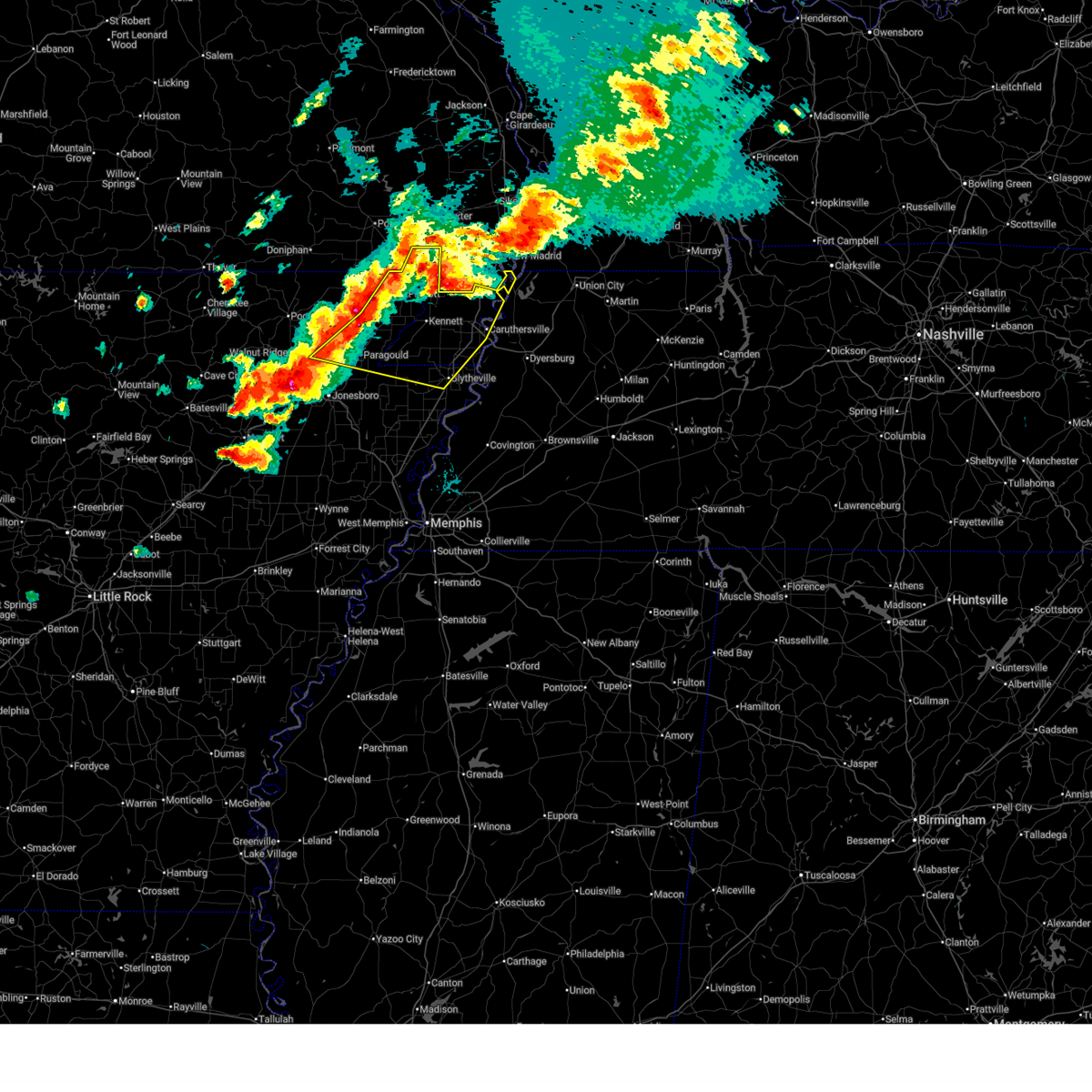 Svrmeg the national weather service in memphis has issued a * severe thunderstorm warning for, greene county in eastern arkansas, northeastern craighead county in eastern arkansas, northwestern mississippi county in eastern arkansas, eastern clay county in eastern arkansas, pemiscot county in southeastern missouri, dunklin county in southeastern missouri, western lake county in west tennessee, * until 745 pm cdt. * at 707 pm cdt, severe thunderstorms were located along a line extending from st. francis to near rector to near paragould, moving east at 40 mph (radar indicated). Hazards include golf ball size hail and 60 mph wind gusts. People and animals outdoors will be injured. expect hail damage to roofs, siding, windows, and vehicles. Expect wind damage to roofs, siding, and trees. Svrmeg the national weather service in memphis has issued a * severe thunderstorm warning for, greene county in eastern arkansas, northeastern craighead county in eastern arkansas, northwestern mississippi county in eastern arkansas, eastern clay county in eastern arkansas, pemiscot county in southeastern missouri, dunklin county in southeastern missouri, western lake county in west tennessee, * until 745 pm cdt. * at 707 pm cdt, severe thunderstorms were located along a line extending from st. francis to near rector to near paragould, moving east at 40 mph (radar indicated). Hazards include golf ball size hail and 60 mph wind gusts. People and animals outdoors will be injured. expect hail damage to roofs, siding, windows, and vehicles. Expect wind damage to roofs, siding, and trees.
|
| 3/30/2025 7:03 PM CDT |
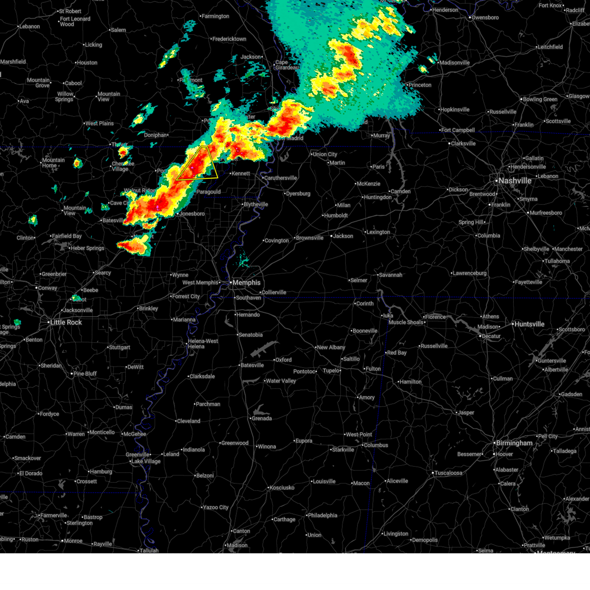 At 703 pm cdt, a severe thunderstorm was located 7 miles west of rector, moving east at 50 mph (radar indicated. at 643 pm cdt, golf ball sized hail was reported near corning). Hazards include golf ball size hail and 60 mph wind gusts. People and animals outdoors will be injured. expect hail damage to roofs, siding, windows, and vehicles. expect wind damage to roofs, siding, and trees. Locations impacted include, mcdougal, pratt, stonewall, heubner, marmaduke, evening star, tipperary, rector, hickoria, lafe, knob, crockett, and leonard. At 703 pm cdt, a severe thunderstorm was located 7 miles west of rector, moving east at 50 mph (radar indicated. at 643 pm cdt, golf ball sized hail was reported near corning). Hazards include golf ball size hail and 60 mph wind gusts. People and animals outdoors will be injured. expect hail damage to roofs, siding, windows, and vehicles. expect wind damage to roofs, siding, and trees. Locations impacted include, mcdougal, pratt, stonewall, heubner, marmaduke, evening star, tipperary, rector, hickoria, lafe, knob, crockett, and leonard.
|
| 3/30/2025 7:01 PM CDT |
 At 701 pm cdt, a severe thunderstorm capable of producing a tornado was located over lafe, or near marmaduke, moving east at 45 mph (radar indicated rotation). Hazards include tornado and ping pong ball size hail. Flying debris will be dangerous to those caught without shelter. mobile homes will be damaged or destroyed. damage to roofs, windows, and vehicles will occur. tree damage is likely. Locations impacted include, hargrave corner, stonewall, heubner, cotton belt, marmaduke, evening star, delaplaine, fritz, rector, bard, case, lafe, brookings, gainesville, mounds, halliday, oak grove heights, peach orchard, noxburn, and beech grove. At 701 pm cdt, a severe thunderstorm capable of producing a tornado was located over lafe, or near marmaduke, moving east at 45 mph (radar indicated rotation). Hazards include tornado and ping pong ball size hail. Flying debris will be dangerous to those caught without shelter. mobile homes will be damaged or destroyed. damage to roofs, windows, and vehicles will occur. tree damage is likely. Locations impacted include, hargrave corner, stonewall, heubner, cotton belt, marmaduke, evening star, delaplaine, fritz, rector, bard, case, lafe, brookings, gainesville, mounds, halliday, oak grove heights, peach orchard, noxburn, and beech grove.
|
| 3/30/2025 6:44 PM CDT |
 At 644 pm cdt, a severe thunderstorm was located over peach orchard, or 10 miles southwest of corning, moving east at 55 mph (radar indicated). Hazards include golf ball size hail and 60 mph wind gusts. People and animals outdoors will be injured. expect hail damage to roofs, siding, windows, and vehicles. expect wind damage to roofs, siding, and trees. Locations impacted include, knobel, mcdougal, heelstring, pratt, stonewall, heubner, marmaduke, evening star, delaplaine, tipperary, rector, hickoria, case, lafe, brookings, knob, crockett, leonard, twin oaks, and peach orchard. At 644 pm cdt, a severe thunderstorm was located over peach orchard, or 10 miles southwest of corning, moving east at 55 mph (radar indicated). Hazards include golf ball size hail and 60 mph wind gusts. People and animals outdoors will be injured. expect hail damage to roofs, siding, windows, and vehicles. expect wind damage to roofs, siding, and trees. Locations impacted include, knobel, mcdougal, heelstring, pratt, stonewall, heubner, marmaduke, evening star, delaplaine, tipperary, rector, hickoria, case, lafe, brookings, knob, crockett, leonard, twin oaks, and peach orchard.
|
| 3/30/2025 6:36 PM CDT |
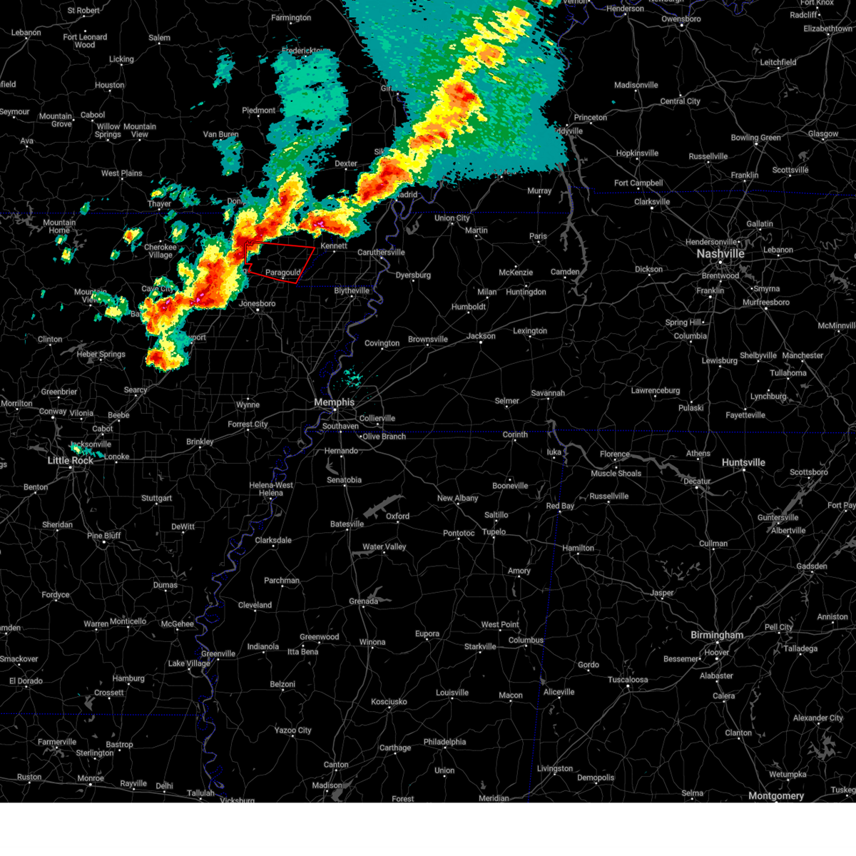 Tormeg the national weather service in memphis has issued a * tornado warning for, greene county in eastern arkansas, southwestern clay county in eastern arkansas, * until 715 pm cdt. * at 636 pm cdt, a severe thunderstorm capable of producing a tornado was located near o'kean, or 7 miles east of pocahontas, moving east at 45 mph (radar indicated rotation). Hazards include tornado and hail up to two inches in diameter. Flying debris will be dangerous to those caught without shelter. mobile homes will be damaged or destroyed. damage to roofs, windows, and vehicles will occur. Tree damage is likely. Tormeg the national weather service in memphis has issued a * tornado warning for, greene county in eastern arkansas, southwestern clay county in eastern arkansas, * until 715 pm cdt. * at 636 pm cdt, a severe thunderstorm capable of producing a tornado was located near o'kean, or 7 miles east of pocahontas, moving east at 45 mph (radar indicated rotation). Hazards include tornado and hail up to two inches in diameter. Flying debris will be dangerous to those caught without shelter. mobile homes will be damaged or destroyed. damage to roofs, windows, and vehicles will occur. Tree damage is likely.
|
| 3/30/2025 6:26 PM CDT |
 Svrmeg the national weather service in memphis has issued a * severe thunderstorm warning for, northern greene county in eastern arkansas, clay county in eastern arkansas, * until 715 pm cdt. * at 626 pm cdt, a severe thunderstorm was located over pocahontas, moving east at 55 mph (radar indicated). Hazards include two inch hail and 60 mph wind gusts. People and animals outdoors will be injured. expect hail damage to roofs, siding, windows, and vehicles. Expect wind damage to roofs, siding, and trees. Svrmeg the national weather service in memphis has issued a * severe thunderstorm warning for, northern greene county in eastern arkansas, clay county in eastern arkansas, * until 715 pm cdt. * at 626 pm cdt, a severe thunderstorm was located over pocahontas, moving east at 55 mph (radar indicated). Hazards include two inch hail and 60 mph wind gusts. People and animals outdoors will be injured. expect hail damage to roofs, siding, windows, and vehicles. Expect wind damage to roofs, siding, and trees.
|
| 3/30/2025 6:23 PM CDT |
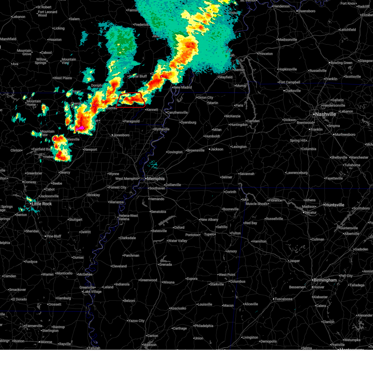 The tornado warning that was previously in effect has been reissued for clay county and is in effect until 7pm. please refer to that bulletin for the latest severe weather information. a tornado watch remains in effect until 1100 pm cdt for eastern arkansas, and southeastern missouri. The tornado warning that was previously in effect has been reissued for clay county and is in effect until 7pm. please refer to that bulletin for the latest severe weather information. a tornado watch remains in effect until 1100 pm cdt for eastern arkansas, and southeastern missouri.
|
| 3/30/2025 6:17 PM CDT |
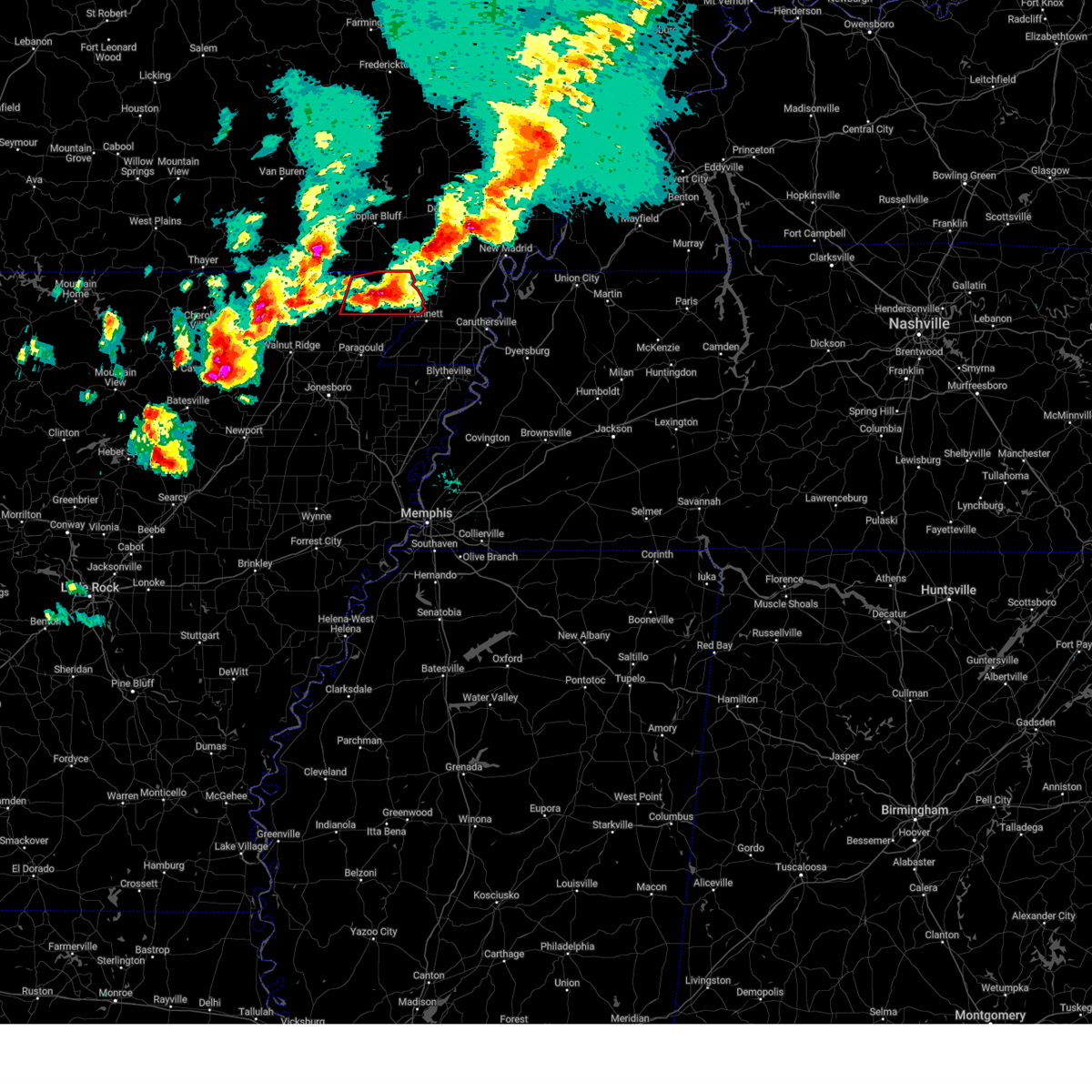 At 617 pm cdt, a severe thunderstorm capable of producing a tornado was located over piggott, moving east at 55 mph (radar indicated rotation). Hazards include tornado and two inch hail. Flying debris will be dangerous to those caught without shelter. mobile homes will be damaged or destroyed. damage to roofs, windows, and vehicles will occur. tree damage is likely. locations impacted include, knobel, saint francis, mcdougal, bell city, pratt, st. Francis, carryville, chalk bluff natural area, tipperary, piggott, hickoria, rhyne, chalk bluff battlefield park, pollard, knob, crockett, greenway, nimmons, rector, and corning. At 617 pm cdt, a severe thunderstorm capable of producing a tornado was located over piggott, moving east at 55 mph (radar indicated rotation). Hazards include tornado and two inch hail. Flying debris will be dangerous to those caught without shelter. mobile homes will be damaged or destroyed. damage to roofs, windows, and vehicles will occur. tree damage is likely. locations impacted include, knobel, saint francis, mcdougal, bell city, pratt, st. Francis, carryville, chalk bluff natural area, tipperary, piggott, hickoria, rhyne, chalk bluff battlefield park, pollard, knob, crockett, greenway, nimmons, rector, and corning.
|
| 3/30/2025 6:02 PM CDT |
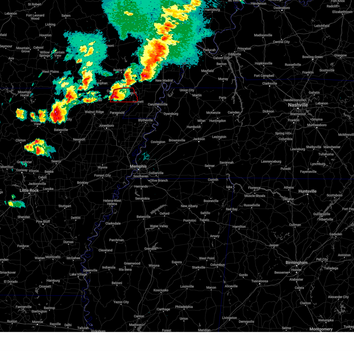 At 602 pm cdt, a severe thunderstorm capable of producing a tornado was located near mcdougal, or 9 miles east of corning, moving east at 55 mph (radar indicated rotation). Hazards include tornado and golf ball size hail. Flying debris will be dangerous to those caught without shelter. mobile homes will be damaged or destroyed. damage to roofs, windows, and vehicles will occur. tree damage is likely. locations impacted include, knobel, saint francis, mcdougal, bell city, pratt, st. Francis, carryville, chalk bluff natural area, tipperary, piggott, hickoria, rhyne, chalk bluff battlefield park, pollard, knob, crockett, greenway, nimmons, rector, and corning. At 602 pm cdt, a severe thunderstorm capable of producing a tornado was located near mcdougal, or 9 miles east of corning, moving east at 55 mph (radar indicated rotation). Hazards include tornado and golf ball size hail. Flying debris will be dangerous to those caught without shelter. mobile homes will be damaged or destroyed. damage to roofs, windows, and vehicles will occur. tree damage is likely. locations impacted include, knobel, saint francis, mcdougal, bell city, pratt, st. Francis, carryville, chalk bluff natural area, tipperary, piggott, hickoria, rhyne, chalk bluff battlefield park, pollard, knob, crockett, greenway, nimmons, rector, and corning.
|
| 3/30/2025 5:55 PM CDT |
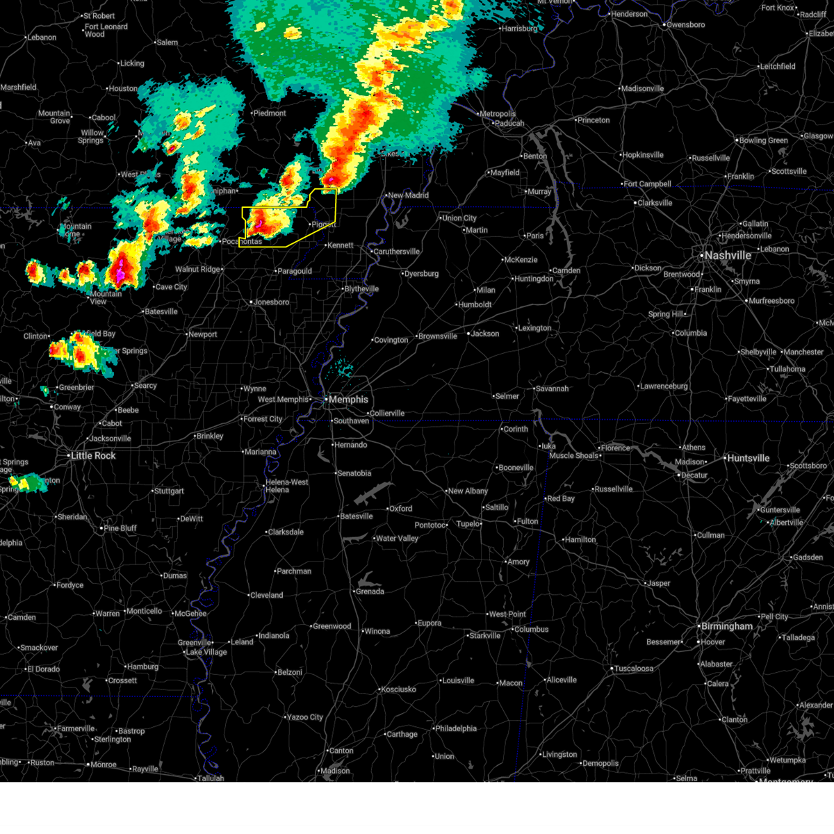 The severe thunderstorm warning will be allowed to expire at 600 pm cdt. a tornado warning still remains in effect for clay county until 630 pm cdt a tornado watch remains in effect until 1100 pm cdt for eastern arkansas, and southeastern missouri. The severe thunderstorm warning will be allowed to expire at 600 pm cdt. a tornado warning still remains in effect for clay county until 630 pm cdt a tornado watch remains in effect until 1100 pm cdt for eastern arkansas, and southeastern missouri.
|
| 3/30/2025 5:46 PM CDT |
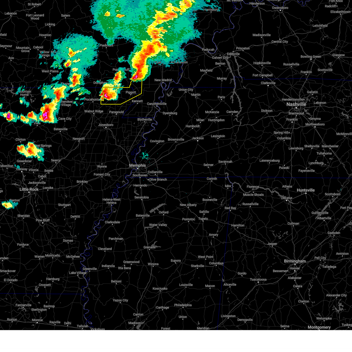 At 545 pm cdt, a severe thunderstorm was located near knobel, or near corning, moving east at 55 mph (radar indicated). Hazards include golf ball size hail and 60 mph wind gusts. People and animals outdoors will be injured. expect hail damage to roofs, siding, windows, and vehicles. expect wind damage to roofs, siding, and trees. Locations impacted include, knobel, mcdougal, valley ridge, stonewall, glennonville, delaplaine, chalk bluff natural area, tipperary, hickoria, success, brookings, chalk bluff battlefield park, baird, pollard, mcguires, twin oaks, townley, palatka, peach orchard, and datto. At 545 pm cdt, a severe thunderstorm was located near knobel, or near corning, moving east at 55 mph (radar indicated). Hazards include golf ball size hail and 60 mph wind gusts. People and animals outdoors will be injured. expect hail damage to roofs, siding, windows, and vehicles. expect wind damage to roofs, siding, and trees. Locations impacted include, knobel, mcdougal, valley ridge, stonewall, glennonville, delaplaine, chalk bluff natural area, tipperary, hickoria, success, brookings, chalk bluff battlefield park, baird, pollard, mcguires, twin oaks, townley, palatka, peach orchard, and datto.
|
| 3/30/2025 5:39 PM CDT |
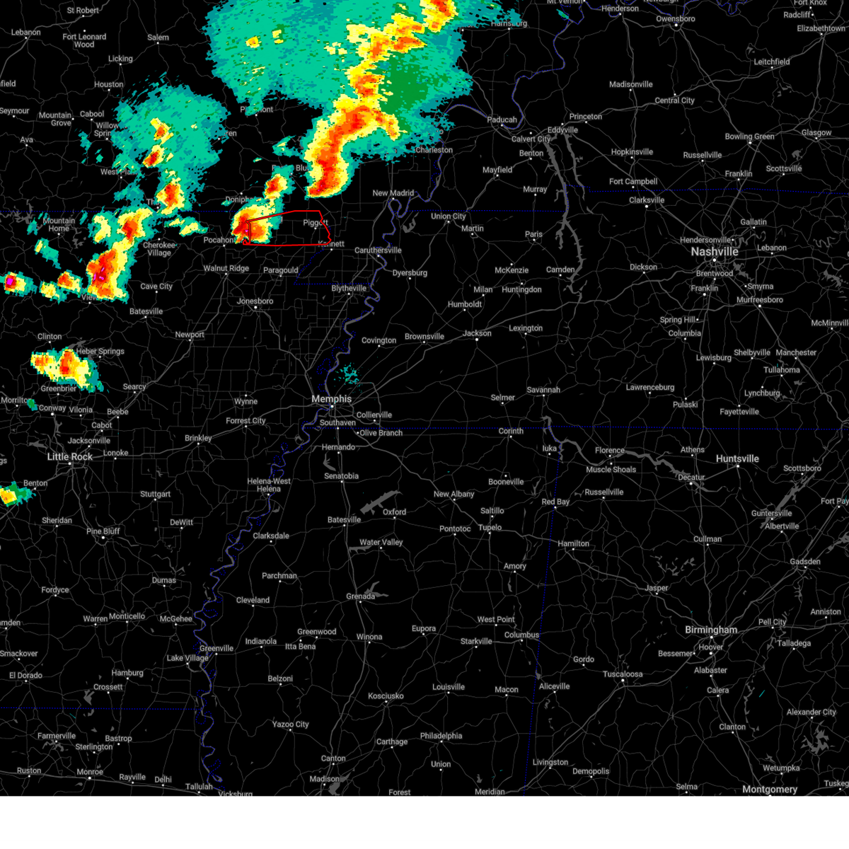 Tormeg the national weather service in memphis has issued a * tornado warning for, clay county in eastern arkansas, * until 630 pm cdt. * at 539 pm cdt, a severe thunderstorm capable of producing a tornado was located over biggers, or 11 miles northeast of pocahontas, moving east at 55 mph (radar indicated rotation). Hazards include tornado and golf ball size hail. Flying debris will be dangerous to those caught without shelter. mobile homes will be damaged or destroyed. damage to roofs, windows, and vehicles will occur. Tree damage is likely. Tormeg the national weather service in memphis has issued a * tornado warning for, clay county in eastern arkansas, * until 630 pm cdt. * at 539 pm cdt, a severe thunderstorm capable of producing a tornado was located over biggers, or 11 miles northeast of pocahontas, moving east at 55 mph (radar indicated rotation). Hazards include tornado and golf ball size hail. Flying debris will be dangerous to those caught without shelter. mobile homes will be damaged or destroyed. damage to roofs, windows, and vehicles will occur. Tree damage is likely.
|
| 3/30/2025 5:37 PM CDT |
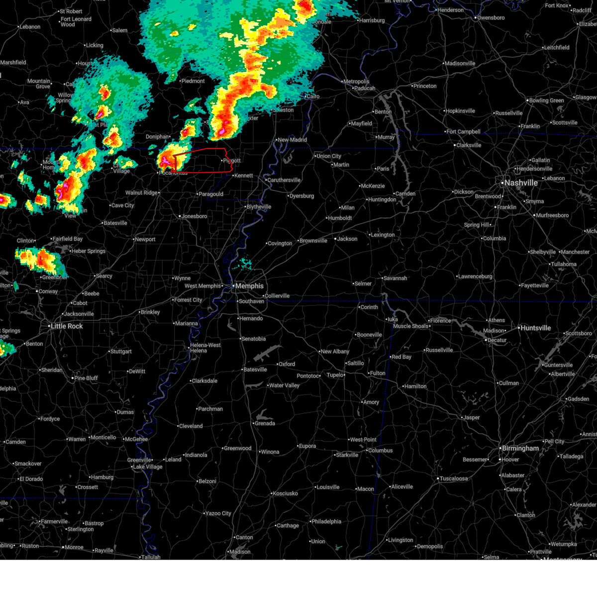 Tormeg the national weather service in memphis has issued a * tornado warning for, clay county in eastern arkansas, * until 630 pm cdt. * at 537 pm cdt, a severe thunderstorm capable of producing a tornado was located over biggers, or 10 miles northeast of pocahontas, moving east at 55 mph (radar indicated rotation). Hazards include tornado. Flying debris will be dangerous to those caught without shelter. mobile homes will be damaged or destroyed. damage to roofs, windows, and vehicles will occur. Tree damage is likely. Tormeg the national weather service in memphis has issued a * tornado warning for, clay county in eastern arkansas, * until 630 pm cdt. * at 537 pm cdt, a severe thunderstorm capable of producing a tornado was located over biggers, or 10 miles northeast of pocahontas, moving east at 55 mph (radar indicated rotation). Hazards include tornado. Flying debris will be dangerous to those caught without shelter. mobile homes will be damaged or destroyed. damage to roofs, windows, and vehicles will occur. Tree damage is likely.
|
| 3/30/2025 5:20 PM CDT |
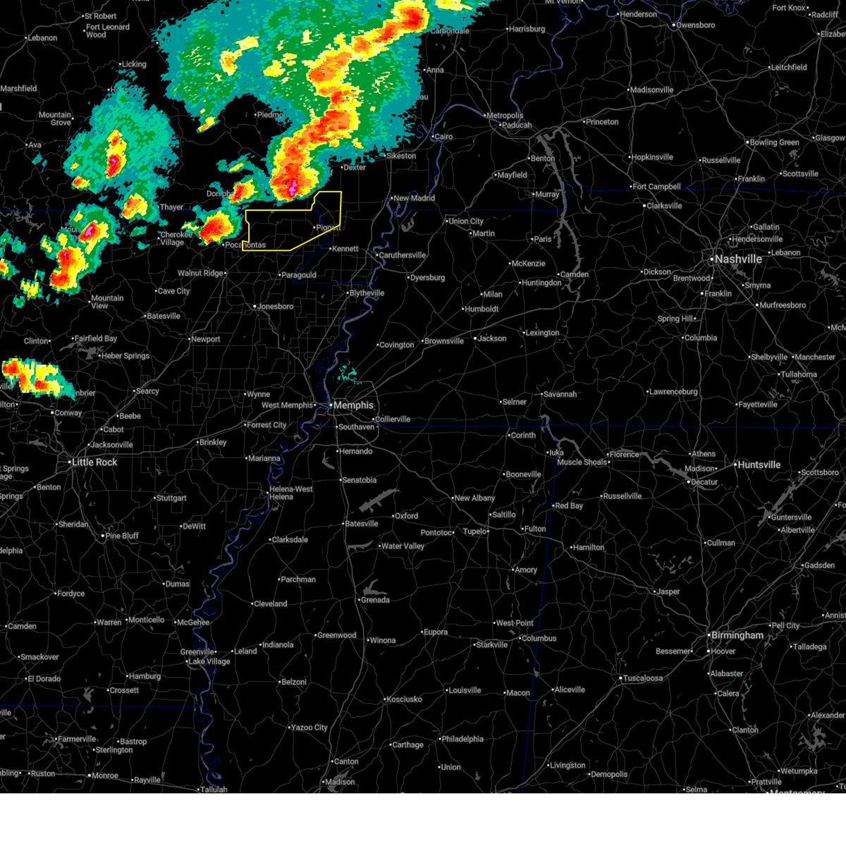 Svrmeg the national weather service in memphis has issued a * severe thunderstorm warning for, northwestern greene county in eastern arkansas, clay county in eastern arkansas, northeastern dunklin county in southeastern missouri, * until 600 pm cdt. * at 520 pm cdt, a severe thunderstorm was located near attica, or 9 miles northwest of pocahontas, moving east at 55 mph (radar indicated). Hazards include golf ball size hail and 60 mph wind gusts. People and animals outdoors will be injured. expect hail damage to roofs, siding, windows, and vehicles. Expect wind damage to roofs, siding, and trees. Svrmeg the national weather service in memphis has issued a * severe thunderstorm warning for, northwestern greene county in eastern arkansas, clay county in eastern arkansas, northeastern dunklin county in southeastern missouri, * until 600 pm cdt. * at 520 pm cdt, a severe thunderstorm was located near attica, or 9 miles northwest of pocahontas, moving east at 55 mph (radar indicated). Hazards include golf ball size hail and 60 mph wind gusts. People and animals outdoors will be injured. expect hail damage to roofs, siding, windows, and vehicles. Expect wind damage to roofs, siding, and trees.
|
| 3/15/2025 12:42 AM CDT |
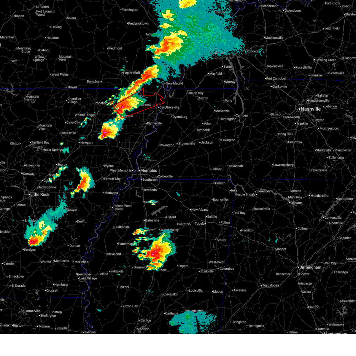 Tormeg the national weather service in memphis has issued a * tornado warning for, eastern greene county in eastern arkansas, southeastern clay county in eastern arkansas, northern pemiscot county in southeastern missouri, southern dunklin county in southeastern missouri, * until 130 am cdt. * at 1242 am cdt, a severe thunderstorm capable of producing a tornado was located near marmaduke, moving northeast at 50 mph (radar indicated rotation). Hazards include tornado and half dollar size hail. Flying debris will be dangerous to those caught without shelter. mobile homes will be damaged or destroyed. damage to roofs, windows, and vehicles will occur. Tree damage is likely. Tormeg the national weather service in memphis has issued a * tornado warning for, eastern greene county in eastern arkansas, southeastern clay county in eastern arkansas, northern pemiscot county in southeastern missouri, southern dunklin county in southeastern missouri, * until 130 am cdt. * at 1242 am cdt, a severe thunderstorm capable of producing a tornado was located near marmaduke, moving northeast at 50 mph (radar indicated rotation). Hazards include tornado and half dollar size hail. Flying debris will be dangerous to those caught without shelter. mobile homes will be damaged or destroyed. damage to roofs, windows, and vehicles will occur. Tree damage is likely.
|
| 3/15/2025 12:27 AM CDT |
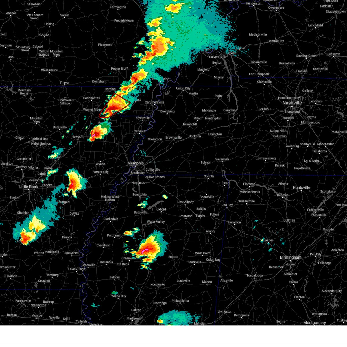 At 1227 am cdt, a confirmed large and extremely dangerous tornado was located over paragould, moving northeast at 50 mph. this is a particularly dangerous situation. take cover now! (weather spotters confirmed tornado). Hazards include damaging tornado. You are in a life-threatening situation. flying debris may be deadly to those caught without shelter. mobile homes will be destroyed. considerable damage to homes, businesses, and vehicles is likely and complete destruction is possible. Locations impacted include, crowleys ridge state park, stonewall, heubner, crowley's ridge state park, marmaduke, walcott, tipperary, fritz, rector, mounds, halliday, light, leonard, finch, lorado, noxburn, beech grove, paragould, fontaine, and cotton belt. At 1227 am cdt, a confirmed large and extremely dangerous tornado was located over paragould, moving northeast at 50 mph. this is a particularly dangerous situation. take cover now! (weather spotters confirmed tornado). Hazards include damaging tornado. You are in a life-threatening situation. flying debris may be deadly to those caught without shelter. mobile homes will be destroyed. considerable damage to homes, businesses, and vehicles is likely and complete destruction is possible. Locations impacted include, crowleys ridge state park, stonewall, heubner, crowley's ridge state park, marmaduke, walcott, tipperary, fritz, rector, mounds, halliday, light, leonard, finch, lorado, noxburn, beech grove, paragould, fontaine, and cotton belt.
|
| 3/15/2025 12:27 AM CDT |
 the tornado warning has been cancelled and is no longer in effect the tornado warning has been cancelled and is no longer in effect
|
| 3/15/2025 12:16 AM CDT |
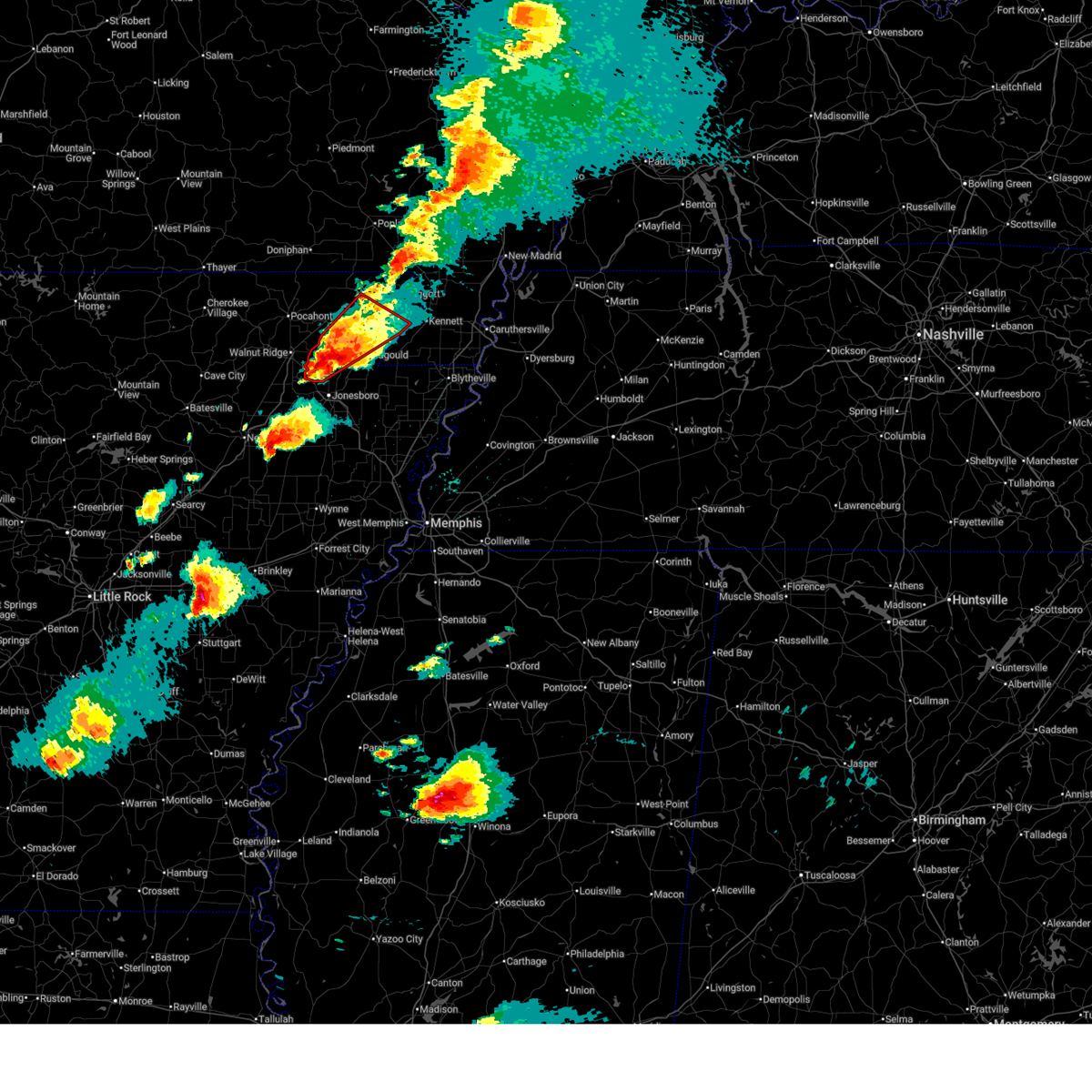 At 1216 am cdt, a confirmed tornado was located over lake frierson state park, moving northeast at 50 mph (weather spotters confirmed tornado). Hazards include damaging tornado and half dollar size hail. Flying debris will be dangerous to those caught without shelter. mobile homes will be damaged or destroyed. damage to roofs, windows, and vehicles will occur. tree damage is likely. Locations impacted include, crowleys ridge state park, stonewall, heubner, crowley's ridge state park, marmaduke, evening star, walcott, tipperary, fritz, rector, mounds, halliday, light, leonard, lanieve, finch, lorado, herndon, faulknerville, and noxburn. At 1216 am cdt, a confirmed tornado was located over lake frierson state park, moving northeast at 50 mph (weather spotters confirmed tornado). Hazards include damaging tornado and half dollar size hail. Flying debris will be dangerous to those caught without shelter. mobile homes will be damaged or destroyed. damage to roofs, windows, and vehicles will occur. tree damage is likely. Locations impacted include, crowleys ridge state park, stonewall, heubner, crowley's ridge state park, marmaduke, evening star, walcott, tipperary, fritz, rector, mounds, halliday, light, leonard, lanieve, finch, lorado, herndon, faulknerville, and noxburn.
|
| 3/15/2025 12:12 AM CDT |
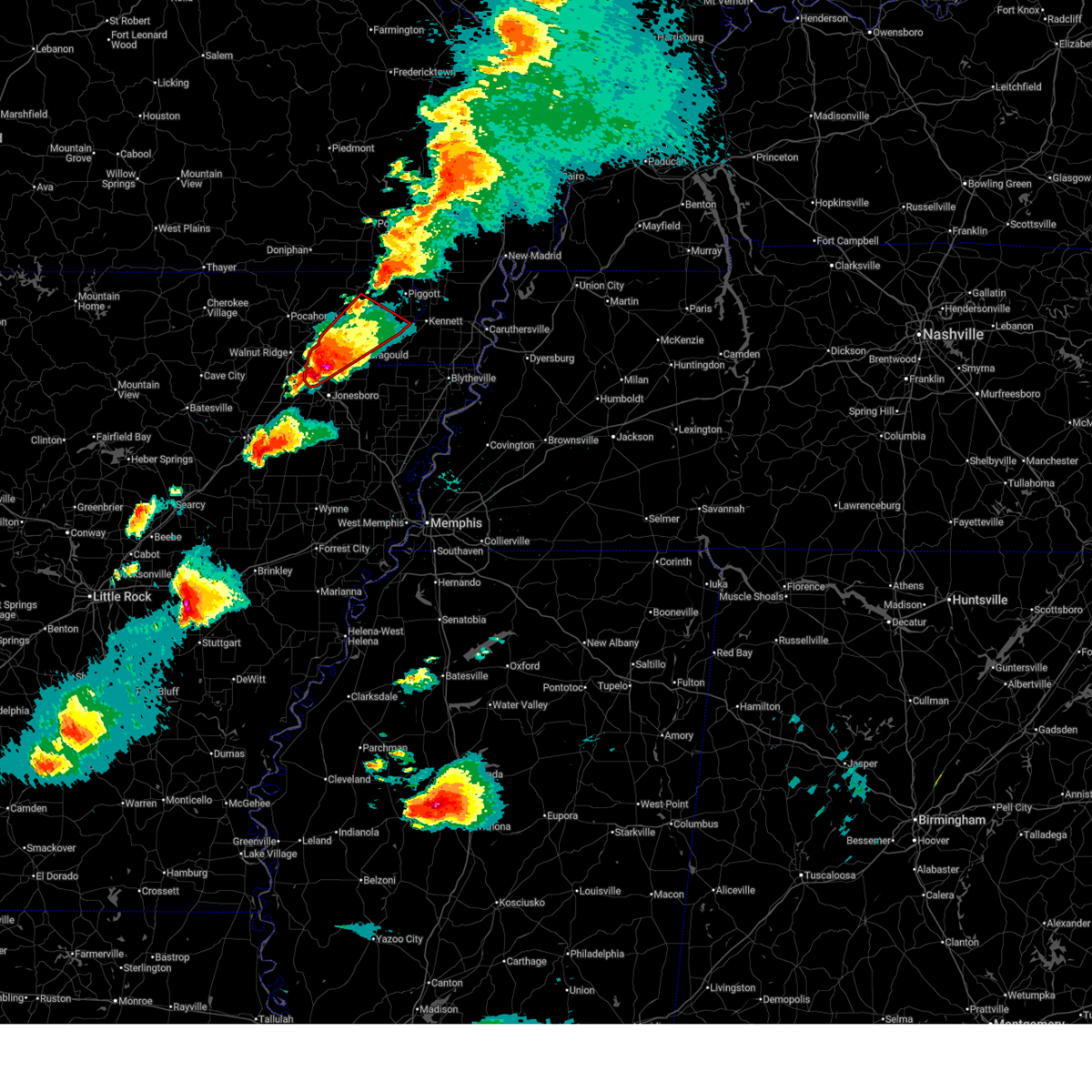 At 1212 am cdt, a severe thunderstorm capable of producing a tornado was located over lake frierson state park, moving northeast at 45 mph (radar indicated rotation). Hazards include tornado and half dollar size hail. Flying debris will be dangerous to those caught without shelter. mobile homes will be damaged or destroyed. damage to roofs, windows, and vehicles will occur. tree damage is likely. Locations impacted include, crowleys ridge state park, stonewall, heubner, crowley's ridge state park, marmaduke, evening star, walcott, tipperary, fritz, rector, dorothy, mounds, halliday, light, leonard, lanieve, finch, lorado, herndon, and faulknerville. At 1212 am cdt, a severe thunderstorm capable of producing a tornado was located over lake frierson state park, moving northeast at 45 mph (radar indicated rotation). Hazards include tornado and half dollar size hail. Flying debris will be dangerous to those caught without shelter. mobile homes will be damaged or destroyed. damage to roofs, windows, and vehicles will occur. tree damage is likely. Locations impacted include, crowleys ridge state park, stonewall, heubner, crowley's ridge state park, marmaduke, evening star, walcott, tipperary, fritz, rector, dorothy, mounds, halliday, light, leonard, lanieve, finch, lorado, herndon, and faulknerville.
|
| 3/15/2025 12:00 AM CDT |
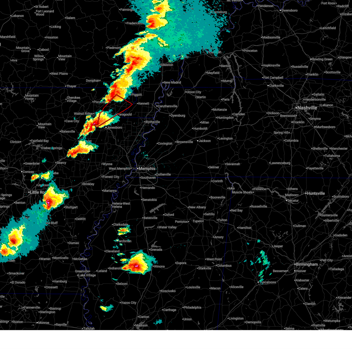 Tormeg the national weather service in memphis has issued a * tornado warning for, greene county in eastern arkansas, northwestern craighead county in eastern arkansas, south central clay county in eastern arkansas, * until 1245 am cdt. * at 1200 am cdt, a large and extremely dangerous tornado was located near bono, moving northeast at 50 mph. this is a particularly dangerous situation. take cover now! (radar indicated rotation). Hazards include damaging tornado. You are in a life-threatening situation. flying debris may be deadly to those caught without shelter. mobile homes will be destroyed. Considerable damage to homes, businesses, and vehicles is likely and complete destruction is possible. Tormeg the national weather service in memphis has issued a * tornado warning for, greene county in eastern arkansas, northwestern craighead county in eastern arkansas, south central clay county in eastern arkansas, * until 1245 am cdt. * at 1200 am cdt, a large and extremely dangerous tornado was located near bono, moving northeast at 50 mph. this is a particularly dangerous situation. take cover now! (radar indicated rotation). Hazards include damaging tornado. You are in a life-threatening situation. flying debris may be deadly to those caught without shelter. mobile homes will be destroyed. Considerable damage to homes, businesses, and vehicles is likely and complete destruction is possible.
|
| 8/17/2024 2:41 AM CDT |
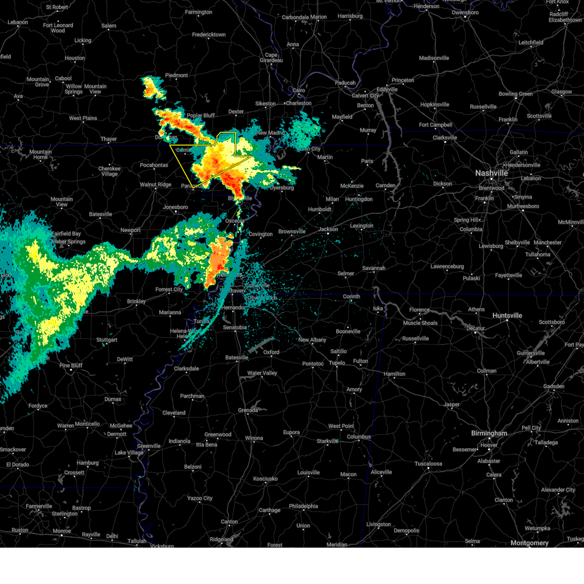 The storm which prompted the warning has weakened below severe limits, and has exited the warned area. therefore, the warning will be allowed to expire. The storm which prompted the warning has weakened below severe limits, and has exited the warned area. therefore, the warning will be allowed to expire.
|
| 8/17/2024 1:58 AM CDT |
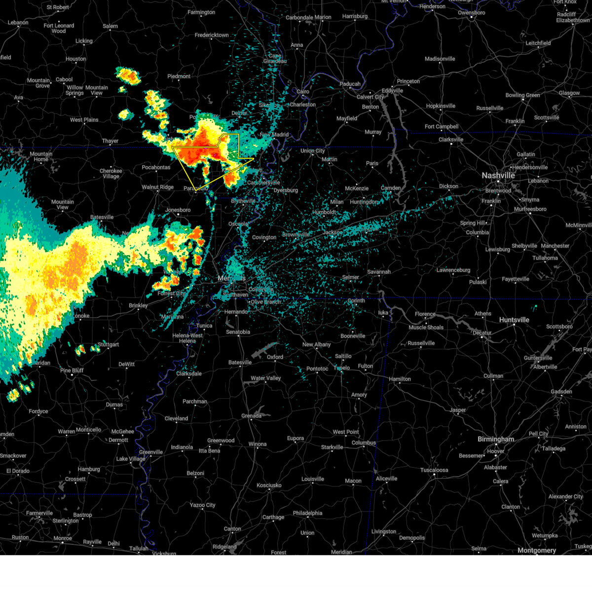 Svrmeg the national weather service in memphis has issued a * severe thunderstorm warning for, northeastern greene county in eastern arkansas, clay county in eastern arkansas, northwestern pemiscot county in southeastern missouri, northeastern dunklin county in southeastern missouri, * until 245 am cdt. * at 158 am cdt, a severe thunderstorm was located over mcdougal, or 10 miles west of chalk bluff natural area, moving southeast at 35 mph (radar indicated). Hazards include 60 mph wind gusts and quarter size hail. Hail damage to vehicles is expected. Expect wind damage to roofs, siding, and trees. Svrmeg the national weather service in memphis has issued a * severe thunderstorm warning for, northeastern greene county in eastern arkansas, clay county in eastern arkansas, northwestern pemiscot county in southeastern missouri, northeastern dunklin county in southeastern missouri, * until 245 am cdt. * at 158 am cdt, a severe thunderstorm was located over mcdougal, or 10 miles west of chalk bluff natural area, moving southeast at 35 mph (radar indicated). Hazards include 60 mph wind gusts and quarter size hail. Hail damage to vehicles is expected. Expect wind damage to roofs, siding, and trees.
|
| 8/17/2024 1:24 AM CDT |
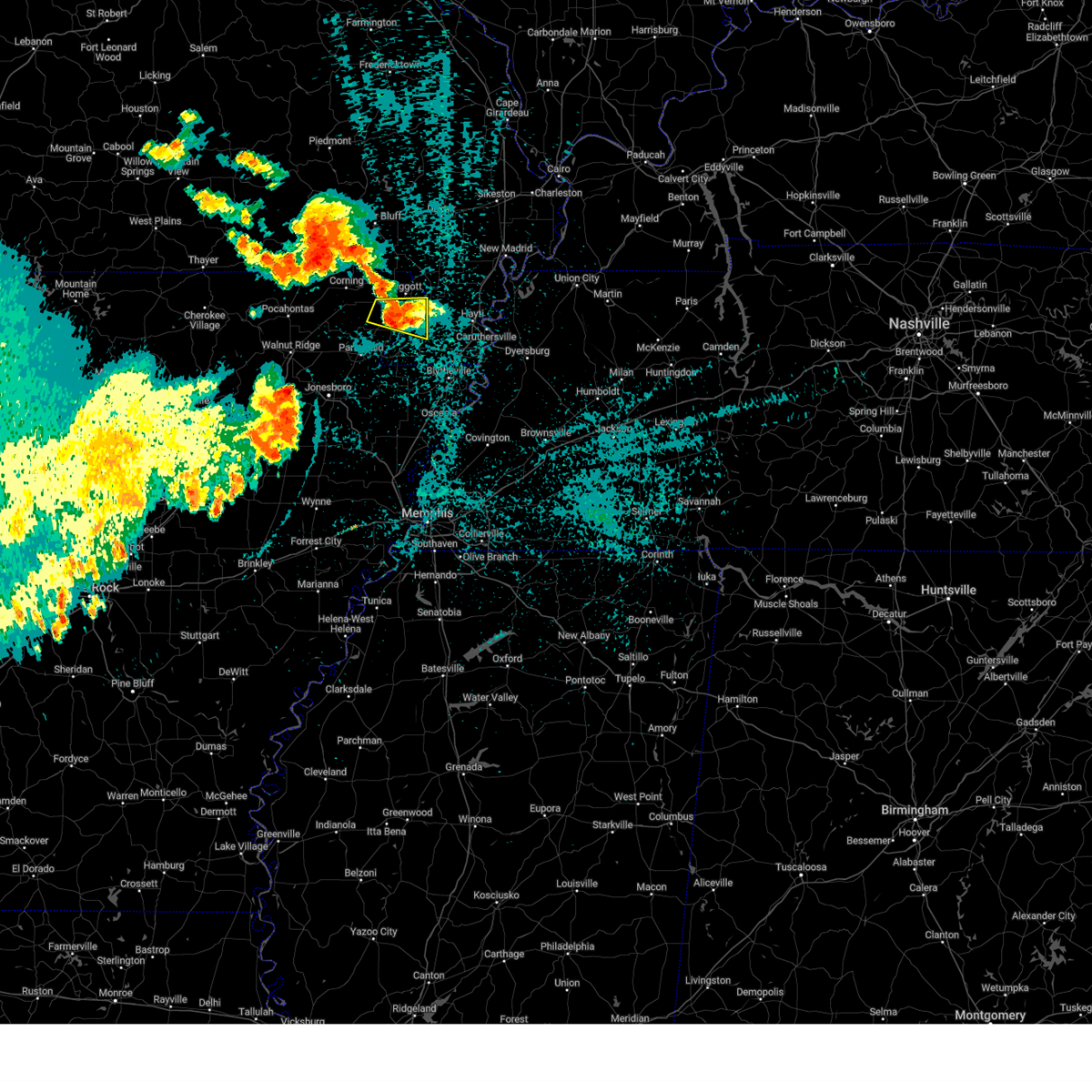 The storm which prompted the warning has weakened below severe limits, and no longer poses an immediate threat to life or property. therefore, the warning will be allowed to expire. The storm which prompted the warning has weakened below severe limits, and no longer poses an immediate threat to life or property. therefore, the warning will be allowed to expire.
|
| 8/17/2024 1:10 AM CDT | Quarter sized hail reported 0.4 miles SSW of Rector, AR |
| 8/17/2024 1:07 AM CDT |
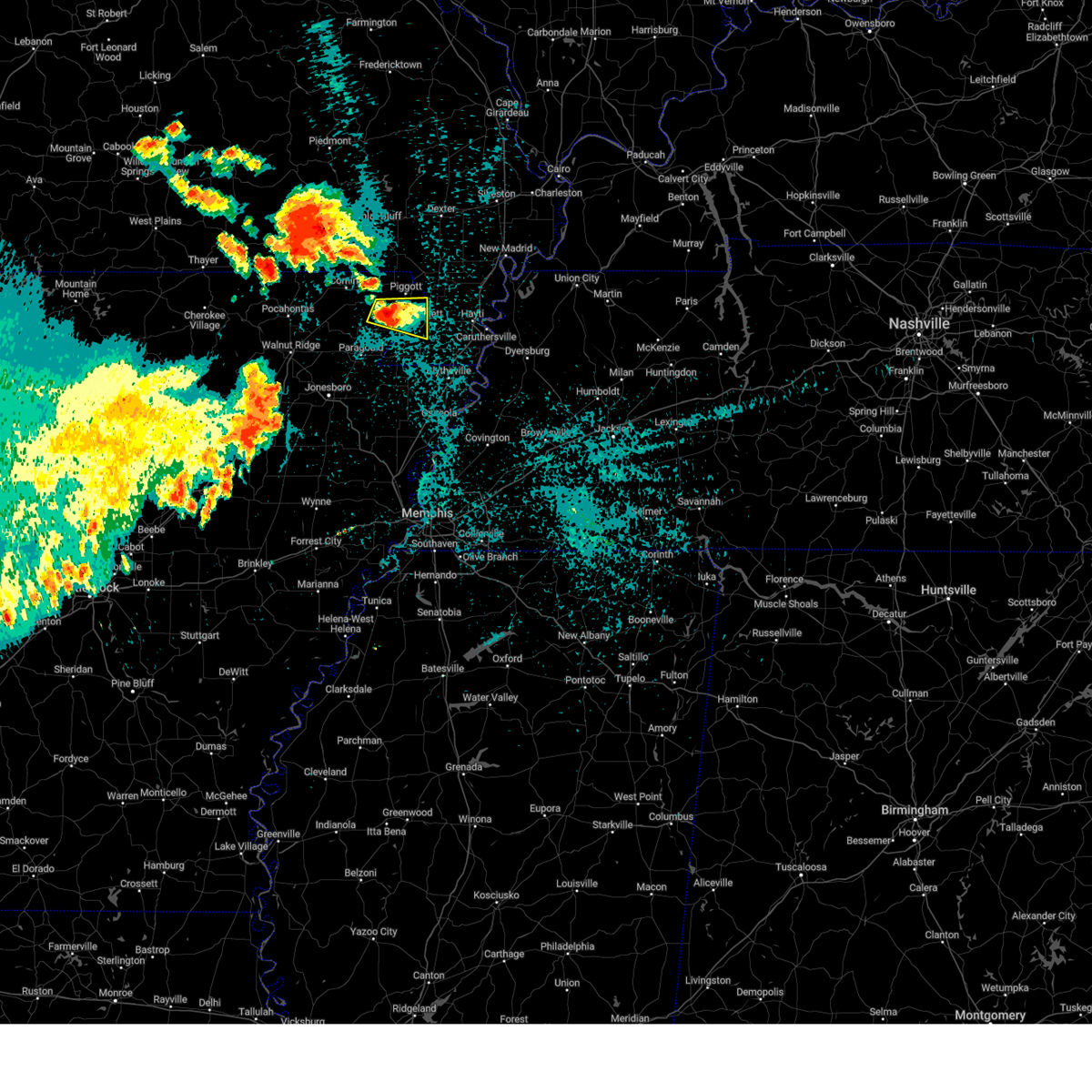 At 107 am cdt, a severe thunderstorm was located over rector, moving east at 25 mph (radar indicated). Hazards include 60 mph wind gusts and quarter size hail. Hail damage to vehicles is expected. expect wind damage to roofs, siding, and trees. Locations impacted include, kennett, rector, greenway, nimmons, bell city, pratt, hargrave corner, heubner, carryville, holly island, rhyne, leonard, noland, octa, scobeville, vincit, and dillman. At 107 am cdt, a severe thunderstorm was located over rector, moving east at 25 mph (radar indicated). Hazards include 60 mph wind gusts and quarter size hail. Hail damage to vehicles is expected. expect wind damage to roofs, siding, and trees. Locations impacted include, kennett, rector, greenway, nimmons, bell city, pratt, hargrave corner, heubner, carryville, holly island, rhyne, leonard, noland, octa, scobeville, vincit, and dillman.
|
| 8/17/2024 12:50 AM CDT |
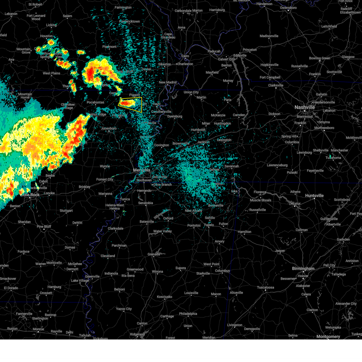 Svrmeg the national weather service in memphis has issued a * severe thunderstorm warning for, northeastern greene county in eastern arkansas, southeastern clay county in eastern arkansas, east central dunklin county in southeastern missouri, * until 130 am cdt. * at 1250 am cdt, a severe thunderstorm was located near rector, moving east at 25 mph (radar indicated). Hazards include 60 mph wind gusts and quarter size hail. Hail damage to vehicles is expected. Expect wind damage to roofs, siding, and trees. Svrmeg the national weather service in memphis has issued a * severe thunderstorm warning for, northeastern greene county in eastern arkansas, southeastern clay county in eastern arkansas, east central dunklin county in southeastern missouri, * until 130 am cdt. * at 1250 am cdt, a severe thunderstorm was located near rector, moving east at 25 mph (radar indicated). Hazards include 60 mph wind gusts and quarter size hail. Hail damage to vehicles is expected. Expect wind damage to roofs, siding, and trees.
|
| 6/9/2024 12:09 AM CDT |
 At 1209 am cdt, severe thunderstorms were located along a line extending from near holcomb to arbyrd to brookland, moving southeast at 40 mph (radar indicated). Hazards include ping pong ball size hail and 60 mph wind gusts. People and animals outdoors will be injured. expect hail damage to roofs, siding, windows, and vehicles. expect wind damage to roofs, siding, and trees. Locations impacted include, jonesboro, paragould, kennett, caruthersville, malden, piggott, hayti, steele, bono, lake city, leachville, campbell, rector, bay, senath, brookland, monette, marmaduke, chalk bluff natural area, and crowleys ridge state park. At 1209 am cdt, severe thunderstorms were located along a line extending from near holcomb to arbyrd to brookland, moving southeast at 40 mph (radar indicated). Hazards include ping pong ball size hail and 60 mph wind gusts. People and animals outdoors will be injured. expect hail damage to roofs, siding, windows, and vehicles. expect wind damage to roofs, siding, and trees. Locations impacted include, jonesboro, paragould, kennett, caruthersville, malden, piggott, hayti, steele, bono, lake city, leachville, campbell, rector, bay, senath, brookland, monette, marmaduke, chalk bluff natural area, and crowleys ridge state park.
|
| 6/8/2024 11:54 PM CDT |
 At 1154 pm cdt, a severe thunderstorm was located over marmaduke, moving southeast at 35 mph (radar indicated). Hazards include ping pong ball size hail and 60 mph wind gusts. People and animals outdoors will be injured. expect hail damage to roofs, siding, windows, and vehicles. expect wind damage to roofs, siding, and trees. Locations impacted include, jonesboro, paragould, kennett, caruthersville, malden, piggott, hayti, steele, bono, lake city, leachville, campbell, rector, bay, senath, brookland, monette, marmaduke, chalk bluff natural area, and crowleys ridge state park. At 1154 pm cdt, a severe thunderstorm was located over marmaduke, moving southeast at 35 mph (radar indicated). Hazards include ping pong ball size hail and 60 mph wind gusts. People and animals outdoors will be injured. expect hail damage to roofs, siding, windows, and vehicles. expect wind damage to roofs, siding, and trees. Locations impacted include, jonesboro, paragould, kennett, caruthersville, malden, piggott, hayti, steele, bono, lake city, leachville, campbell, rector, bay, senath, brookland, monette, marmaduke, chalk bluff natural area, and crowleys ridge state park.
|
| 6/8/2024 11:46 PM CDT |
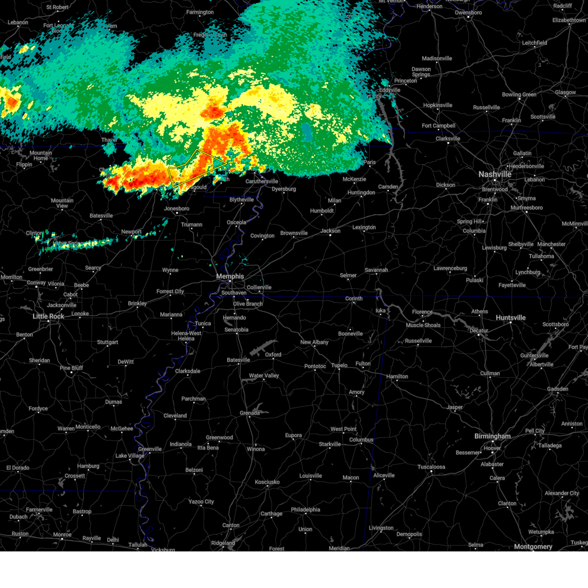 At 1146 pm cdt, a severe thunderstorm was located near lafe, or near marmaduke, moving southeast at 40 mph (radar indicated). Hazards include 60 mph wind gusts and penny size hail. Expect damage to roofs, siding, and trees. Locations impacted include, piggott, rector, lafe, knobel, greenway, mcdougal, peach orchard, delaplaine, evening star, beech grove, crockett, pratt, stonewall, tipperary, hickoria, case, brookings, knob, and faulknerville. At 1146 pm cdt, a severe thunderstorm was located near lafe, or near marmaduke, moving southeast at 40 mph (radar indicated). Hazards include 60 mph wind gusts and penny size hail. Expect damage to roofs, siding, and trees. Locations impacted include, piggott, rector, lafe, knobel, greenway, mcdougal, peach orchard, delaplaine, evening star, beech grove, crockett, pratt, stonewall, tipperary, hickoria, case, brookings, knob, and faulknerville.
|
| 6/8/2024 11:40 PM CDT |
 Svrmeg the national weather service in memphis has issued a * severe thunderstorm warning for, greene county in eastern arkansas, craighead county in eastern arkansas, northwestern mississippi county in eastern arkansas, clay county in eastern arkansas, western pemiscot county in southeastern missouri, dunklin county in southeastern missouri, * until 1230 am cdt. * at 1139 pm cdt, a severe thunderstorm was located 7 miles east of knobel, or 9 miles southeast of corning, moving southeast at 35 mph (radar indicated). Hazards include 60 mph wind gusts and penny size hail. expect damage to roofs, siding, and trees Svrmeg the national weather service in memphis has issued a * severe thunderstorm warning for, greene county in eastern arkansas, craighead county in eastern arkansas, northwestern mississippi county in eastern arkansas, clay county in eastern arkansas, western pemiscot county in southeastern missouri, dunklin county in southeastern missouri, * until 1230 am cdt. * at 1139 pm cdt, a severe thunderstorm was located 7 miles east of knobel, or 9 miles southeast of corning, moving southeast at 35 mph (radar indicated). Hazards include 60 mph wind gusts and penny size hail. expect damage to roofs, siding, and trees
|
| 6/8/2024 11:14 PM CDT |
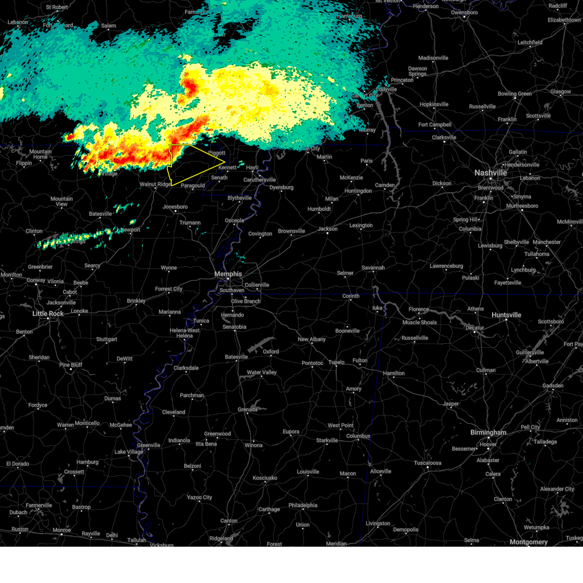 Svrmeg the national weather service in memphis has issued a * severe thunderstorm warning for, northwestern greene county in eastern arkansas, clay county in eastern arkansas, * until midnight cdt. * at 1114 pm cdt, a severe thunderstorm was located over success, or 8 miles northwest of corning, moving southeast at 35 mph (radar indicated). Hazards include 60 mph wind gusts and penny size hail. expect damage to roofs, siding, and trees Svrmeg the national weather service in memphis has issued a * severe thunderstorm warning for, northwestern greene county in eastern arkansas, clay county in eastern arkansas, * until midnight cdt. * at 1114 pm cdt, a severe thunderstorm was located over success, or 8 miles northwest of corning, moving southeast at 35 mph (radar indicated). Hazards include 60 mph wind gusts and penny size hail. expect damage to roofs, siding, and trees
|
| 5/26/2024 11:10 PM CDT |
 At 1110 pm cdt, severe thunderstorms were located along a line extending from wardell to kennett to near senath to near lake frierson state park, moving southeast at 20 mph (radar indicated). Hazards include ping pong ball size hail and 60 mph wind gusts. People and animals outdoors will be injured. expect hail damage to roofs, siding, windows, and vehicles. expect wind damage to roofs, siding, and trees. Locations impacted include, jonesboro, paragould, kennett, caruthersville, piggott, portageville, hayti, campbell, rector, senath, brookland, monette, marmaduke, crowleys ridge state park, lake frierson state park, clarkton, oak grove heights, cardwell, hornersville, and holcomb. At 1110 pm cdt, severe thunderstorms were located along a line extending from wardell to kennett to near senath to near lake frierson state park, moving southeast at 20 mph (radar indicated). Hazards include ping pong ball size hail and 60 mph wind gusts. People and animals outdoors will be injured. expect hail damage to roofs, siding, windows, and vehicles. expect wind damage to roofs, siding, and trees. Locations impacted include, jonesboro, paragould, kennett, caruthersville, piggott, portageville, hayti, campbell, rector, senath, brookland, monette, marmaduke, crowleys ridge state park, lake frierson state park, clarkton, oak grove heights, cardwell, hornersville, and holcomb.
|
| 5/26/2024 10:58 PM CDT |
 At 1058 pm cdt, severe thunderstorms were located along a line extending from near wardell to near kennett to near rector to lake frierson state park, moving southeast at 20 mph (radar indicated). Hazards include ping pong ball size hail and 60 mph wind gusts. People and animals outdoors will be injured. expect hail damage to roofs, siding, windows, and vehicles. expect wind damage to roofs, siding, and trees. Locations impacted include, jonesboro, paragould, kennett, caruthersville, piggott, portageville, hayti, campbell, rector, senath, brookland, monette, marmaduke, chalk bluff natural area, crowleys ridge state park, lake frierson state park, clarkton, oak grove heights, cardwell, and hornersville. At 1058 pm cdt, severe thunderstorms were located along a line extending from near wardell to near kennett to near rector to lake frierson state park, moving southeast at 20 mph (radar indicated). Hazards include ping pong ball size hail and 60 mph wind gusts. People and animals outdoors will be injured. expect hail damage to roofs, siding, windows, and vehicles. expect wind damage to roofs, siding, and trees. Locations impacted include, jonesboro, paragould, kennett, caruthersville, piggott, portageville, hayti, campbell, rector, senath, brookland, monette, marmaduke, chalk bluff natural area, crowleys ridge state park, lake frierson state park, clarkton, oak grove heights, cardwell, and hornersville.
|
| 5/26/2024 10:57 PM CDT |
 At 1057 pm cdt, a severe thunderstorm capable of producing a tornado was located over greenway, or near piggott, moving east at 35 mph (radar indicated rotation). Hazards include tornado and quarter size hail. Flying debris will be dangerous to those caught without shelter. mobile homes will be damaged or destroyed. damage to roofs, windows, and vehicles will occur. tree damage is likely. locations impacted include, kennett, piggott, rector, clarkton, holcomb, st. Francis, pollard, greenway, saint francis, crockett, nimmons, heubner, lorine, west kennett, leonard, bell city, pratt, hargrave corner, carryville, and holly island. At 1057 pm cdt, a severe thunderstorm capable of producing a tornado was located over greenway, or near piggott, moving east at 35 mph (radar indicated rotation). Hazards include tornado and quarter size hail. Flying debris will be dangerous to those caught without shelter. mobile homes will be damaged or destroyed. damage to roofs, windows, and vehicles will occur. tree damage is likely. locations impacted include, kennett, piggott, rector, clarkton, holcomb, st. Francis, pollard, greenway, saint francis, crockett, nimmons, heubner, lorine, west kennett, leonard, bell city, pratt, hargrave corner, carryville, and holly island.
|
| 5/26/2024 10:46 PM CDT |
 At 1045 pm cdt, severe thunderstorms were located along a line extending from near gideon to near greenway to rector to near fontaine, moving southeast at 20 mph (radar indicated). Hazards include ping pong ball size hail and 60 mph wind gusts. People and animals outdoors will be injured. expect hail damage to roofs, siding, windows, and vehicles. expect wind damage to roofs, siding, and trees. Locations impacted include, jonesboro, paragould, kennett, caruthersville, piggott, portageville, hayti, campbell, rector, senath, brookland, monette, marmaduke, chalk bluff natural area, crowleys ridge state park, lake frierson state park, clarkton, oak grove heights, cardwell, and hornersville. At 1045 pm cdt, severe thunderstorms were located along a line extending from near gideon to near greenway to rector to near fontaine, moving southeast at 20 mph (radar indicated). Hazards include ping pong ball size hail and 60 mph wind gusts. People and animals outdoors will be injured. expect hail damage to roofs, siding, windows, and vehicles. expect wind damage to roofs, siding, and trees. Locations impacted include, jonesboro, paragould, kennett, caruthersville, piggott, portageville, hayti, campbell, rector, senath, brookland, monette, marmaduke, chalk bluff natural area, crowleys ridge state park, lake frierson state park, clarkton, oak grove heights, cardwell, and hornersville.
|
| 5/26/2024 10:42 PM CDT |
 At 1041 pm cdt, a severe thunderstorm capable of producing a tornado was located near rector, moving east at 35 mph (radar indicated rotation). Hazards include tornado and half dollar size hail. Flying debris will be dangerous to those caught without shelter. mobile homes will be damaged or destroyed. damage to roofs, windows, and vehicles will occur. tree damage is likely. locations impacted include, kennett, piggott, rector, clarkton, holcomb, lafe, st. Francis, pollard, greenway, saint francis, crockett, nimmons, stonewall, heubner, tipperary, hickoria, lorine, west kennett, leonard, and bell city. At 1041 pm cdt, a severe thunderstorm capable of producing a tornado was located near rector, moving east at 35 mph (radar indicated rotation). Hazards include tornado and half dollar size hail. Flying debris will be dangerous to those caught without shelter. mobile homes will be damaged or destroyed. damage to roofs, windows, and vehicles will occur. tree damage is likely. locations impacted include, kennett, piggott, rector, clarkton, holcomb, lafe, st. Francis, pollard, greenway, saint francis, crockett, nimmons, stonewall, heubner, tipperary, hickoria, lorine, west kennett, leonard, and bell city.
|
| 5/26/2024 10:41 PM CDT |
 Svrmeg the national weather service in memphis has issued a * severe thunderstorm warning for, greene county in eastern arkansas, northeastern craighead county in eastern arkansas, clay county in eastern arkansas, pemiscot county in southeastern missouri, dunklin county in southeastern missouri, * until 1130 pm cdt. * at 1040 pm cdt, severe thunderstorms were located along a line extending from near clarkton to near greenway to rector to near fontaine, moving southeast at 20 mph (radar indicated). Hazards include 60 mph wind gusts and half dollar size hail. Hail damage to vehicles is expected. Expect wind damage to roofs, siding, and trees. Svrmeg the national weather service in memphis has issued a * severe thunderstorm warning for, greene county in eastern arkansas, northeastern craighead county in eastern arkansas, clay county in eastern arkansas, pemiscot county in southeastern missouri, dunklin county in southeastern missouri, * until 1130 pm cdt. * at 1040 pm cdt, severe thunderstorms were located along a line extending from near clarkton to near greenway to rector to near fontaine, moving southeast at 20 mph (radar indicated). Hazards include 60 mph wind gusts and half dollar size hail. Hail damage to vehicles is expected. Expect wind damage to roofs, siding, and trees.
|
| 5/26/2024 10:32 PM CDT |
 At 1031 pm cdt, severe thunderstorms were located along a line extending from near campbell to delaplaine, moving southeast at 25 mph (radar indicated). Hazards include golf ball size hail and 60 mph wind gusts. People and animals outdoors will be injured. expect hail damage to roofs, siding, windows, and vehicles. expect wind damage to roofs, siding, and trees. locations impacted include, piggott, corning, campbell, rector, chalk bluff natural area, malden, clarkton, holcomb, lafe, knobel, st. Francis, pollard, greenway, mcdougal, peach orchard, delaplaine, glennonville, evening star, beech grove, and saint francis. At 1031 pm cdt, severe thunderstorms were located along a line extending from near campbell to delaplaine, moving southeast at 25 mph (radar indicated). Hazards include golf ball size hail and 60 mph wind gusts. People and animals outdoors will be injured. expect hail damage to roofs, siding, windows, and vehicles. expect wind damage to roofs, siding, and trees. locations impacted include, piggott, corning, campbell, rector, chalk bluff natural area, malden, clarkton, holcomb, lafe, knobel, st. Francis, pollard, greenway, mcdougal, peach orchard, delaplaine, glennonville, evening star, beech grove, and saint francis.
|
| 5/26/2024 10:28 PM CDT |
 Tormeg the national weather service in memphis has issued a * tornado warning for, northeastern greene county in eastern arkansas, clay county in eastern arkansas, east central dunklin county in southeastern missouri, * until 1115 pm cdt. * at 1028 pm cdt, a severe thunderstorm capable of producing a tornado was located near knobel, or 7 miles southeast of corning, moving east at 35 mph (radar indicated rotation). Hazards include tornado and golf ball size hail. Flying debris will be dangerous to those caught without shelter. mobile homes will be damaged or destroyed. damage to roofs, windows, and vehicles will occur. Tree damage is likely. Tormeg the national weather service in memphis has issued a * tornado warning for, northeastern greene county in eastern arkansas, clay county in eastern arkansas, east central dunklin county in southeastern missouri, * until 1115 pm cdt. * at 1028 pm cdt, a severe thunderstorm capable of producing a tornado was located near knobel, or 7 miles southeast of corning, moving east at 35 mph (radar indicated rotation). Hazards include tornado and golf ball size hail. Flying debris will be dangerous to those caught without shelter. mobile homes will be damaged or destroyed. damage to roofs, windows, and vehicles will occur. Tree damage is likely.
|
| 5/26/2024 10:13 PM CDT |
 At 1013 pm cdt, severe thunderstorms were located along a line extending from glennonville to near biggers, moving southeast at 25 mph (radar indicated). Hazards include golf ball size hail and 60 mph wind gusts. People and animals outdoors will be injured. expect hail damage to roofs, siding, windows, and vehicles. expect wind damage to roofs, siding, and trees. locations impacted include, piggott, corning, campbell, rector, chalk bluff natural area, malden, clarkton, holcomb, lafe, reyno, knobel, st. Francis, pollard, greenway, o'kean, mcdougal, success, peach orchard, delaplaine, and datto. At 1013 pm cdt, severe thunderstorms were located along a line extending from glennonville to near biggers, moving southeast at 25 mph (radar indicated). Hazards include golf ball size hail and 60 mph wind gusts. People and animals outdoors will be injured. expect hail damage to roofs, siding, windows, and vehicles. expect wind damage to roofs, siding, and trees. locations impacted include, piggott, corning, campbell, rector, chalk bluff natural area, malden, clarkton, holcomb, lafe, reyno, knobel, st. Francis, pollard, greenway, o'kean, mcdougal, success, peach orchard, delaplaine, and datto.
|
| 5/26/2024 10:09 PM CDT |
 At 1009 pm cdt, severe thunderstorms were located along a line extending from glennonville to near biggers, moving southeast at 25 mph (radar indicated). Hazards include 60 mph wind gusts and half dollar size hail. Hail damage to vehicles is expected. expect wind damage to roofs, siding, and trees. locations impacted include, piggott, corning, campbell, rector, chalk bluff natural area, malden, clarkton, holcomb, lafe, reyno, knobel, st. Francis, pollard, greenway, o'kean, mcdougal, success, peach orchard, delaplaine, and datto. At 1009 pm cdt, severe thunderstorms were located along a line extending from glennonville to near biggers, moving southeast at 25 mph (radar indicated). Hazards include 60 mph wind gusts and half dollar size hail. Hail damage to vehicles is expected. expect wind damage to roofs, siding, and trees. locations impacted include, piggott, corning, campbell, rector, chalk bluff natural area, malden, clarkton, holcomb, lafe, reyno, knobel, st. Francis, pollard, greenway, o'kean, mcdougal, success, peach orchard, delaplaine, and datto.
|
| 5/26/2024 9:52 PM CDT |
 Svrmeg the national weather service in memphis has issued a * severe thunderstorm warning for, northwestern greene county in eastern arkansas, clay county in eastern arkansas, northeastern dunklin county in southeastern missouri, * until 1045 pm cdt. * at 952 pm cdt, severe thunderstorms were located along a line extending from near qulin to near attica, moving southeast at 25 mph (radar indicated). Hazards include 60 mph wind gusts and quarter size hail. Hail damage to vehicles is expected. Expect wind damage to roofs, siding, and trees. Svrmeg the national weather service in memphis has issued a * severe thunderstorm warning for, northwestern greene county in eastern arkansas, clay county in eastern arkansas, northeastern dunklin county in southeastern missouri, * until 1045 pm cdt. * at 952 pm cdt, severe thunderstorms were located along a line extending from near qulin to near attica, moving southeast at 25 mph (radar indicated). Hazards include 60 mph wind gusts and quarter size hail. Hail damage to vehicles is expected. Expect wind damage to roofs, siding, and trees.
|
| 5/26/2024 7:19 AM CDT |
 At 719 am cdt, severe thunderstorms were located along a line extending from portageville to near hornersville, moving southeast at 60 mph (radar indicated). Hazards include 60 mph wind gusts and quarter size hail. Hail damage to vehicles is expected. expect wind damage to roofs, siding, and trees. locations impacted include, kennett, caruthersville, malden, piggott, portageville, hayti, steele, campbell, rector, senath, marmaduke, reelfoot lake state park, tiptonville, ridgely, holcomb, hayti heights, cooter, wardell, st. Francis, and greenway. At 719 am cdt, severe thunderstorms were located along a line extending from portageville to near hornersville, moving southeast at 60 mph (radar indicated). Hazards include 60 mph wind gusts and quarter size hail. Hail damage to vehicles is expected. expect wind damage to roofs, siding, and trees. locations impacted include, kennett, caruthersville, malden, piggott, portageville, hayti, steele, campbell, rector, senath, marmaduke, reelfoot lake state park, tiptonville, ridgely, holcomb, hayti heights, cooter, wardell, st. Francis, and greenway.
|
| 5/26/2024 7:19 AM CDT |
 the severe thunderstorm warning has been cancelled and is no longer in effect the severe thunderstorm warning has been cancelled and is no longer in effect
|
| 5/26/2024 7:05 AM CDT | Numerous large tree limbs and at least one power pole were blown down in rector. time approximate based on rada in clay county AR, 0.4 miles SSW of Rector, AR |
| 5/26/2024 7:03 AM CDT |
 Svrmeg the national weather service in memphis has issued a * severe thunderstorm warning for, northeastern greene county in eastern arkansas, northeastern mississippi county in eastern arkansas, eastern clay county in eastern arkansas, pemiscot county in southeastern missouri, dunklin county in southeastern missouri, western dyer county in west tennessee, obion county in west tennessee, lake county in west tennessee, * until 745 am cdt. * at 702 am cdt, severe thunderstorms were located along a line extending from malden to near marmaduke, moving southeast at 35 mph (radar indicated). Hazards include 60 mph wind gusts and quarter size hail. Hail damage to vehicles is expected. Expect wind damage to roofs, siding, and trees. Svrmeg the national weather service in memphis has issued a * severe thunderstorm warning for, northeastern greene county in eastern arkansas, northeastern mississippi county in eastern arkansas, eastern clay county in eastern arkansas, pemiscot county in southeastern missouri, dunklin county in southeastern missouri, western dyer county in west tennessee, obion county in west tennessee, lake county in west tennessee, * until 745 am cdt. * at 702 am cdt, severe thunderstorms were located along a line extending from malden to near marmaduke, moving southeast at 35 mph (radar indicated). Hazards include 60 mph wind gusts and quarter size hail. Hail damage to vehicles is expected. Expect wind damage to roofs, siding, and trees.
|
| 5/26/2024 6:31 AM CDT |
 At 631 am cdt, severe thunderstorms were located along a line extending from near success to near college city to near cave city, moving east at 35 mph (radar indicated). Hazards include 60 mph wind gusts and quarter size hail. Hail damage to vehicles is expected. expect wind damage to roofs, siding, and trees. locations impacted include, paragould, piggott, corning, rector, marmaduke, crowleys ridge state park, lake frierson state park, oak grove heights, lafe, reyno, knobel, st. Francis, pollard, greenway, o'kean, mcdougal, success, peach orchard, delaplaine, and datto. At 631 am cdt, severe thunderstorms were located along a line extending from near success to near college city to near cave city, moving east at 35 mph (radar indicated). Hazards include 60 mph wind gusts and quarter size hail. Hail damage to vehicles is expected. expect wind damage to roofs, siding, and trees. locations impacted include, paragould, piggott, corning, rector, marmaduke, crowleys ridge state park, lake frierson state park, oak grove heights, lafe, reyno, knobel, st. Francis, pollard, greenway, o'kean, mcdougal, success, peach orchard, delaplaine, and datto.
|
| 5/26/2024 6:18 AM CDT |
 Svrmeg the national weather service in memphis has issued a * severe thunderstorm warning for, greene county in eastern arkansas, clay county in eastern arkansas, * until 700 am cdt. * at 617 am cdt, severe thunderstorms were located along a line extending from near maynard to imboden to sidney, moving east at 35 mph (radar indicated). Hazards include 70 mph wind gusts and half dollar size hail. Hail damage to vehicles is expected. expect considerable tree damage. Wind damage is also likely to mobile homes, roofs, and outbuildings. Svrmeg the national weather service in memphis has issued a * severe thunderstorm warning for, greene county in eastern arkansas, clay county in eastern arkansas, * until 700 am cdt. * at 617 am cdt, severe thunderstorms were located along a line extending from near maynard to imboden to sidney, moving east at 35 mph (radar indicated). Hazards include 70 mph wind gusts and half dollar size hail. Hail damage to vehicles is expected. expect considerable tree damage. Wind damage is also likely to mobile homes, roofs, and outbuildings.
|
| 5/25/2024 2:24 AM CDT |
 The storm which prompted the warning has weakened below severe limits, and no longer poses an immediate threat to life or property. therefore, the warning will be allowed to expire. however, small hail and gusty winds are still possible with this thunderstorm. The storm which prompted the warning has weakened below severe limits, and no longer poses an immediate threat to life or property. therefore, the warning will be allowed to expire. however, small hail and gusty winds are still possible with this thunderstorm.
|
| 5/25/2024 1:59 AM CDT |
 At 159 am cdt, a severe thunderstorm was located over corning, moving southeast at 35 mph (radar indicated). Hazards include 60 mph wind gusts and quarter size hail. Hail damage to vehicles is expected. expect wind damage to roofs, siding, and trees. locations impacted include, piggott, corning, rector, marmaduke, chalk bluff natural area, oak grove heights, lafe, reyno, knobel, st. Francis, pollard, greenway, o'kean, mcdougal, success, peach orchard, delaplaine, datto, evening star, and beech grove. At 159 am cdt, a severe thunderstorm was located over corning, moving southeast at 35 mph (radar indicated). Hazards include 60 mph wind gusts and quarter size hail. Hail damage to vehicles is expected. expect wind damage to roofs, siding, and trees. locations impacted include, piggott, corning, rector, marmaduke, chalk bluff natural area, oak grove heights, lafe, reyno, knobel, st. Francis, pollard, greenway, o'kean, mcdougal, success, peach orchard, delaplaine, datto, evening star, and beech grove.
|
| 5/25/2024 1:38 AM CDT |
 Svrmeg the national weather service in memphis has issued a * severe thunderstorm warning for, northern greene county in eastern arkansas, clay county in eastern arkansas, northeastern dunklin county in southeastern missouri, * until 230 am cdt. * at 138 am cdt, a severe thunderstorm was located near success, or 7 miles southeast of doniphan, moving southeast at 30 mph (radar indicated). Hazards include 60 mph wind gusts and quarter size hail. Hail damage to vehicles is expected. Expect wind damage to roofs, siding, and trees. Svrmeg the national weather service in memphis has issued a * severe thunderstorm warning for, northern greene county in eastern arkansas, clay county in eastern arkansas, northeastern dunklin county in southeastern missouri, * until 230 am cdt. * at 138 am cdt, a severe thunderstorm was located near success, or 7 miles southeast of doniphan, moving southeast at 30 mph (radar indicated). Hazards include 60 mph wind gusts and quarter size hail. Hail damage to vehicles is expected. Expect wind damage to roofs, siding, and trees.
|
| 5/9/2024 12:12 AM CDT |
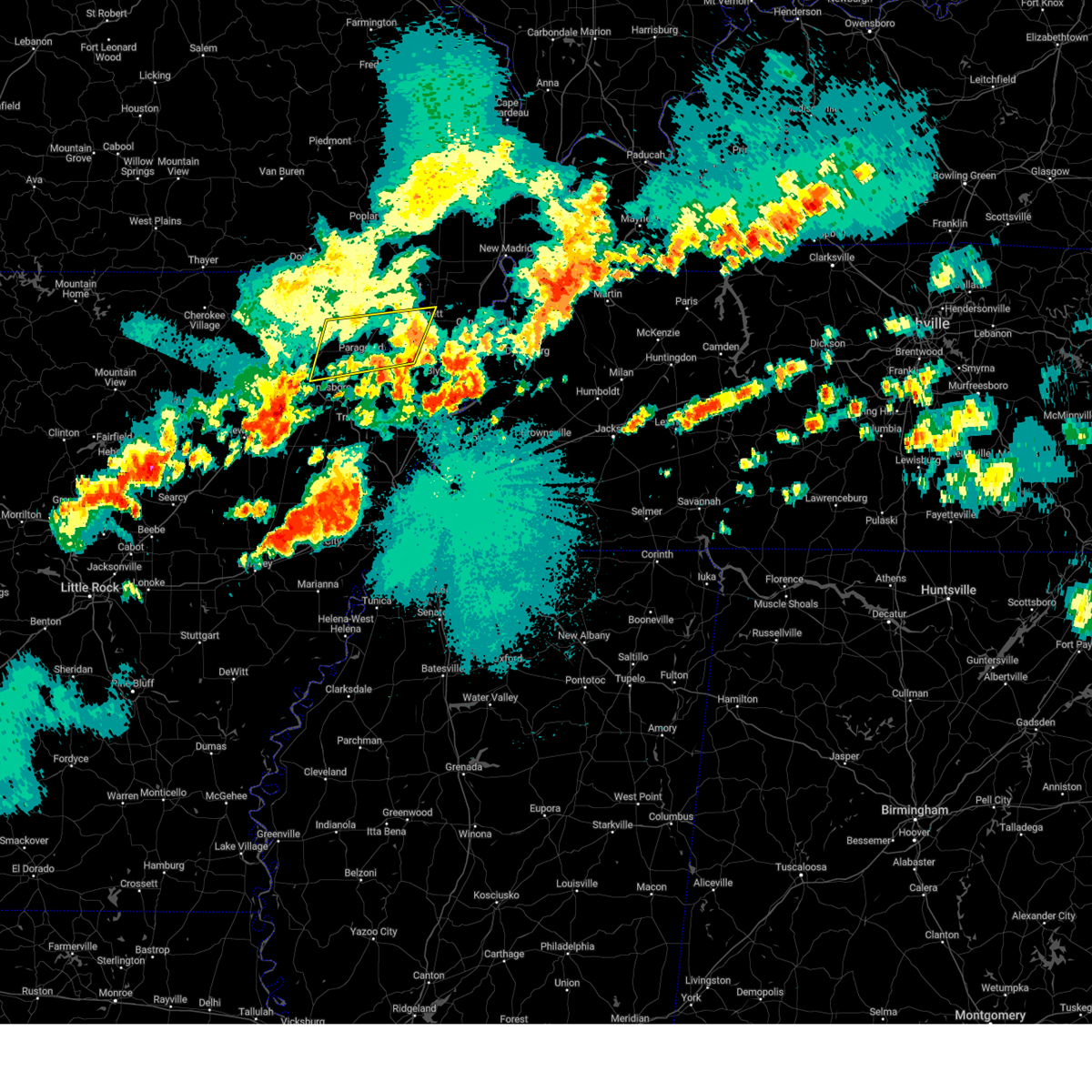 the severe thunderstorm warning has been cancelled and is no longer in effect the severe thunderstorm warning has been cancelled and is no longer in effect
|
| 5/8/2024 11:49 PM CDT |
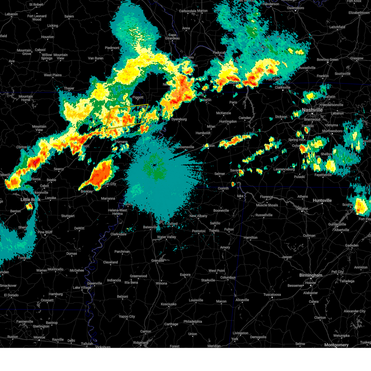 Svrmeg the national weather service in memphis has issued a * severe thunderstorm warning for, greene county in eastern arkansas, northeastern craighead county in eastern arkansas, southeastern clay county in eastern arkansas, southern dunklin county in southeastern missouri, * until 1230 am cdt. * at 1149 pm cdt, a severe thunderstorm was located over crowleys ridge state park, moving east at 50 mph (radar indicated). Hazards include 60 mph wind gusts and penny size hail. expect damage to roofs, siding, and trees Svrmeg the national weather service in memphis has issued a * severe thunderstorm warning for, greene county in eastern arkansas, northeastern craighead county in eastern arkansas, southeastern clay county in eastern arkansas, southern dunklin county in southeastern missouri, * until 1230 am cdt. * at 1149 pm cdt, a severe thunderstorm was located over crowleys ridge state park, moving east at 50 mph (radar indicated). Hazards include 60 mph wind gusts and penny size hail. expect damage to roofs, siding, and trees
|
| 5/8/2024 10:34 PM CDT |
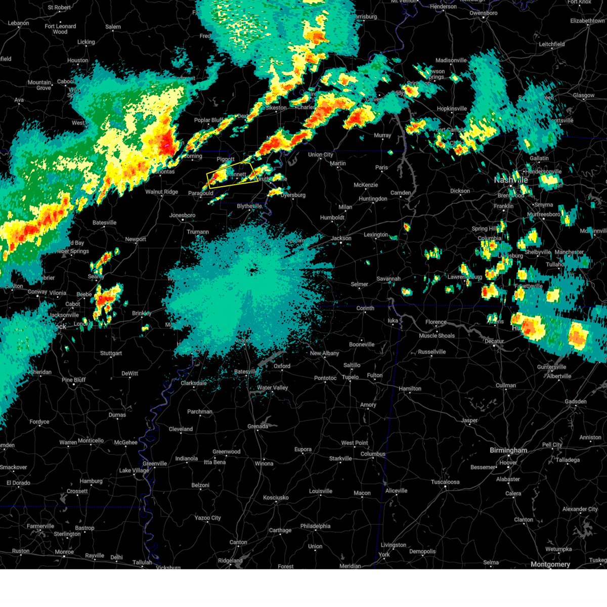 Svrmeg the national weather service in memphis has issued a * severe thunderstorm warning for, northeastern greene county in eastern arkansas, southeastern clay county in eastern arkansas, northwestern pemiscot county in southeastern missouri, east central dunklin county in southeastern missouri, * until 1115 pm cdt. * at 1034 pm cdt, a severe thunderstorm was located over rector, moving east at 30 mph (radar indicated). Hazards include 60 mph wind gusts and quarter size hail. Hail damage to vehicles is expected. Expect wind damage to roofs, siding, and trees. Svrmeg the national weather service in memphis has issued a * severe thunderstorm warning for, northeastern greene county in eastern arkansas, southeastern clay county in eastern arkansas, northwestern pemiscot county in southeastern missouri, east central dunklin county in southeastern missouri, * until 1115 pm cdt. * at 1034 pm cdt, a severe thunderstorm was located over rector, moving east at 30 mph (radar indicated). Hazards include 60 mph wind gusts and quarter size hail. Hail damage to vehicles is expected. Expect wind damage to roofs, siding, and trees.
|
| 7/18/2023 4:03 PM CDT |
 At 402 pm cdt, a severe thunderstorm was located near senath, moving southeast at 40 mph (radar indicated). Hazards include 60 mph wind gusts and penny size hail. expect damage to roofs, siding, and trees At 402 pm cdt, a severe thunderstorm was located near senath, moving southeast at 40 mph (radar indicated). Hazards include 60 mph wind gusts and penny size hail. expect damage to roofs, siding, and trees
|
| 7/18/2023 4:03 PM CDT |
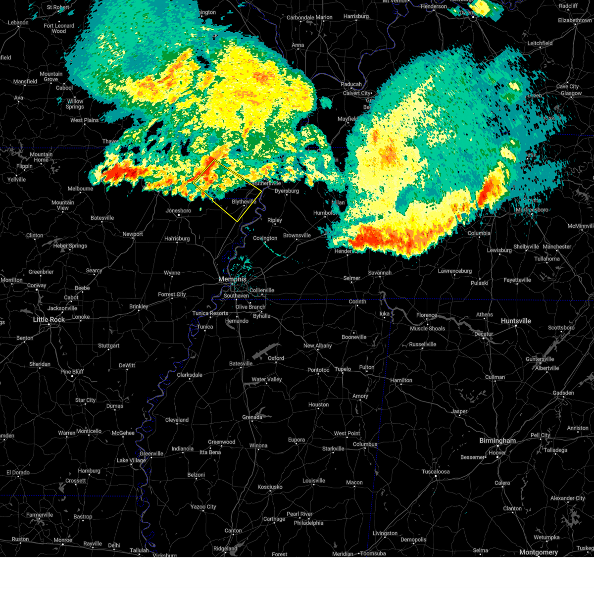 At 402 pm cdt, a severe thunderstorm was located near senath, moving southeast at 40 mph (radar indicated). Hazards include 60 mph wind gusts and penny size hail. expect damage to roofs, siding, and trees At 402 pm cdt, a severe thunderstorm was located near senath, moving southeast at 40 mph (radar indicated). Hazards include 60 mph wind gusts and penny size hail. expect damage to roofs, siding, and trees
|
| 7/6/2023 9:05 PM CDT |
 At 905 pm cdt, a severe thunderstorm was located near greenway, or near rector, moving southeast at 10 mph (radar indicated). Hazards include 60 mph wind gusts and half dollar size hail. Hail damage to vehicles is expected. expect wind damage to roofs, siding, and trees. locations impacted include, kennett, rector, senath, greenway, nimmons, bell city, pratt, noland, hargrave corner, holly island, lorine, west kennett, leonard, white oak, ipley, octa, scobeville, vincit, dillman and caruth. hail threat, radar indicated max hail size, 1. 25 in wind threat, radar indicated max wind gust, 60 mph. At 905 pm cdt, a severe thunderstorm was located near greenway, or near rector, moving southeast at 10 mph (radar indicated). Hazards include 60 mph wind gusts and half dollar size hail. Hail damage to vehicles is expected. expect wind damage to roofs, siding, and trees. locations impacted include, kennett, rector, senath, greenway, nimmons, bell city, pratt, noland, hargrave corner, holly island, lorine, west kennett, leonard, white oak, ipley, octa, scobeville, vincit, dillman and caruth. hail threat, radar indicated max hail size, 1. 25 in wind threat, radar indicated max wind gust, 60 mph.
|
| 7/6/2023 8:57 PM CDT |
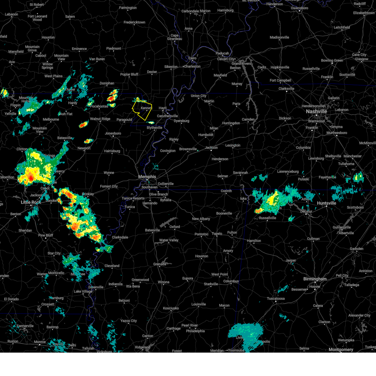 At 857 pm cdt, a severe thunderstorm was located near greenway, or near rector, moving southeast at 10 mph (radar indicated). Hazards include 60 mph wind gusts and quarter size hail. Hail damage to vehicles is expected. Expect wind damage to roofs, siding, and trees. At 857 pm cdt, a severe thunderstorm was located near greenway, or near rector, moving southeast at 10 mph (radar indicated). Hazards include 60 mph wind gusts and quarter size hail. Hail damage to vehicles is expected. Expect wind damage to roofs, siding, and trees.
|
| 7/5/2023 4:16 PM CDT |
 At 416 pm cdt, a severe thunderstorm was located over greenway, or near rector, and is nearly stationary (radar indicated). Hazards include 60 mph wind gusts and quarter size hail. Hail damage to vehicles is expected. Expect wind damage to roofs, siding, and trees. At 416 pm cdt, a severe thunderstorm was located over greenway, or near rector, and is nearly stationary (radar indicated). Hazards include 60 mph wind gusts and quarter size hail. Hail damage to vehicles is expected. Expect wind damage to roofs, siding, and trees.
|
| 7/5/2023 4:16 PM CDT |
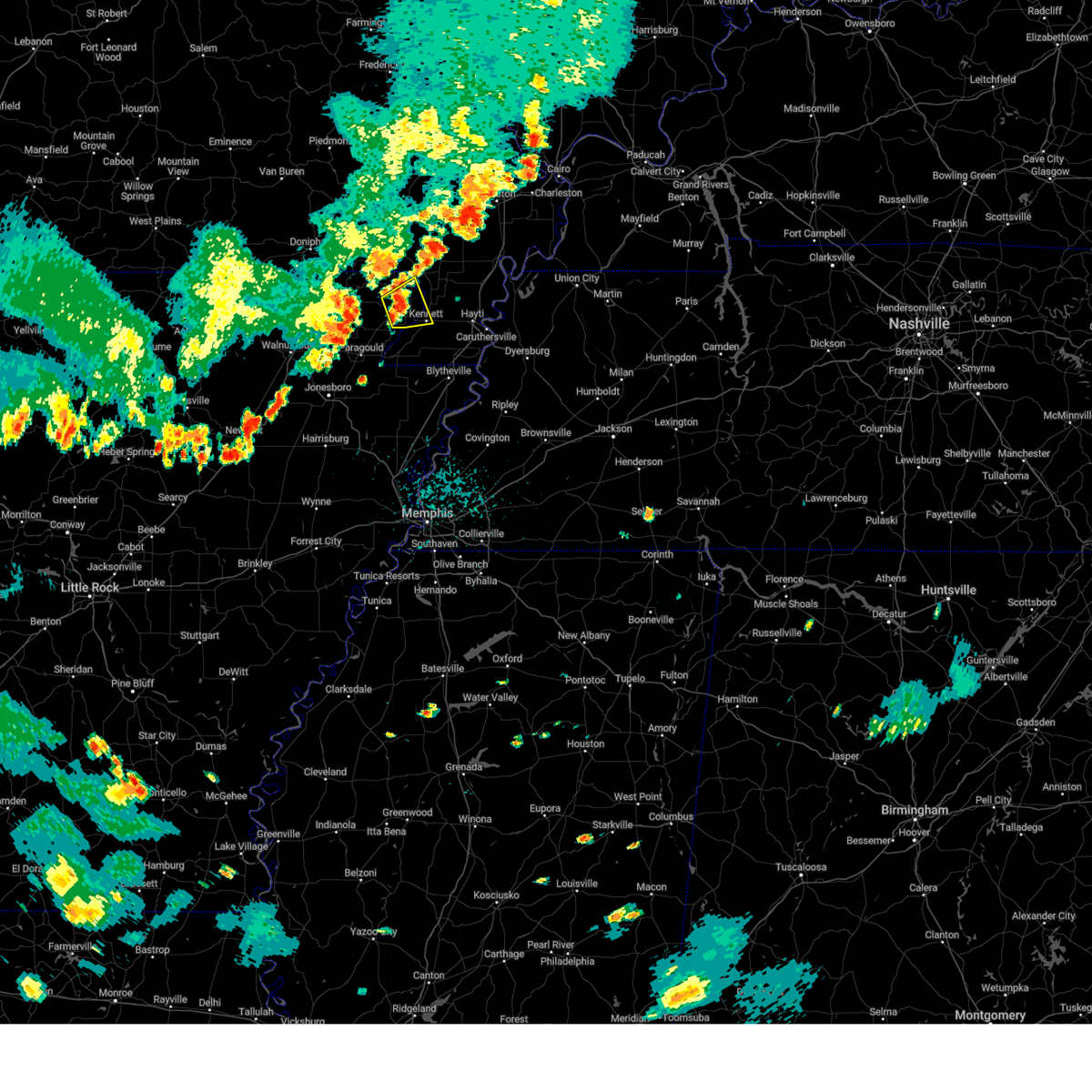 At 416 pm cdt, a severe thunderstorm was located over greenway, or near rector, and is nearly stationary (radar indicated). Hazards include 60 mph wind gusts and quarter size hail. Hail damage to vehicles is expected. Expect wind damage to roofs, siding, and trees. At 416 pm cdt, a severe thunderstorm was located over greenway, or near rector, and is nearly stationary (radar indicated). Hazards include 60 mph wind gusts and quarter size hail. Hail damage to vehicles is expected. Expect wind damage to roofs, siding, and trees.
|
| 6/14/2023 9:01 PM CDT |
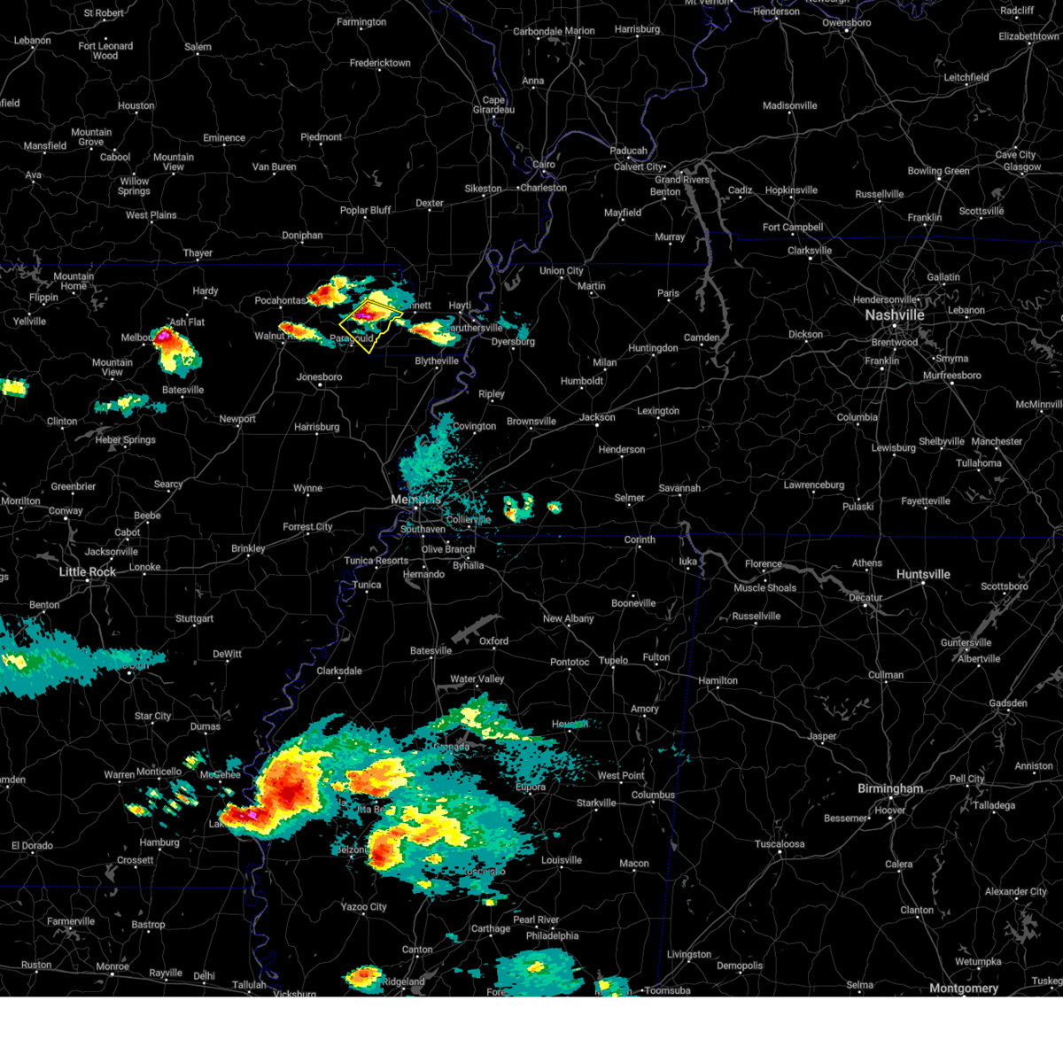 At 901 pm cdt, a severe thunderstorm was located over marmaduke, moving southeast at 30 mph (radar indicated). Hazards include two inch hail and 60 mph wind gusts. People and animals outdoors will be injured. expect hail damage to roofs, siding, windows, and vehicles. expect wind damage to roofs, siding, and trees. locations impacted include, paragould, rector, marmaduke, oak grove heights, lafe, brighton, bertig, heubner, cotton belt, fritz, bard, gainesville, mounds, halliday, leonard and noxburn. thunderstorm damage threat, considerable hail threat, radar indicated max hail size, 2. 00 in wind threat, radar indicated max wind gust, 60 mph. At 901 pm cdt, a severe thunderstorm was located over marmaduke, moving southeast at 30 mph (radar indicated). Hazards include two inch hail and 60 mph wind gusts. People and animals outdoors will be injured. expect hail damage to roofs, siding, windows, and vehicles. expect wind damage to roofs, siding, and trees. locations impacted include, paragould, rector, marmaduke, oak grove heights, lafe, brighton, bertig, heubner, cotton belt, fritz, bard, gainesville, mounds, halliday, leonard and noxburn. thunderstorm damage threat, considerable hail threat, radar indicated max hail size, 2. 00 in wind threat, radar indicated max wind gust, 60 mph.
|
| 6/14/2023 8:52 PM CDT |
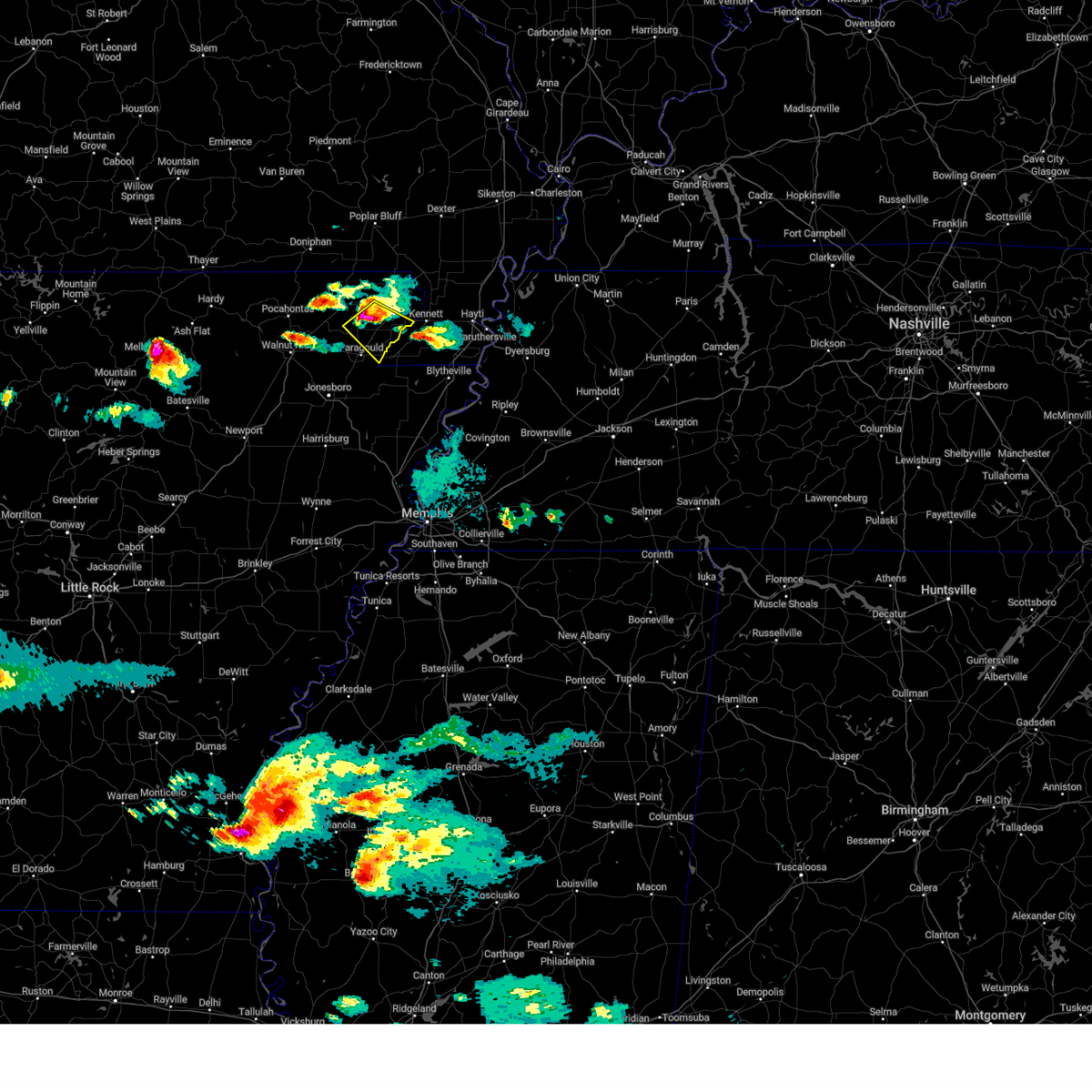 At 852 pm cdt, a severe thunderstorm was located near marmaduke, moving southeast at 30 mph (radar indicated). Hazards include two inch hail and 60 mph wind gusts. People and animals outdoors will be injured. expect hail damage to roofs, siding, windows, and vehicles. expect wind damage to roofs, siding, and trees. locations impacted include, rector, marmaduke, oak grove heights, lafe, brighton, hargrave corner, bertig, stonewall, heubner, cotton belt, fritz, bard, gainesville, mounds, halliday, knob, leonard and noxburn. thunderstorm damage threat, considerable hail threat, radar indicated max hail size, 2. 00 in wind threat, radar indicated max wind gust, 60 mph. At 852 pm cdt, a severe thunderstorm was located near marmaduke, moving southeast at 30 mph (radar indicated). Hazards include two inch hail and 60 mph wind gusts. People and animals outdoors will be injured. expect hail damage to roofs, siding, windows, and vehicles. expect wind damage to roofs, siding, and trees. locations impacted include, rector, marmaduke, oak grove heights, lafe, brighton, hargrave corner, bertig, stonewall, heubner, cotton belt, fritz, bard, gainesville, mounds, halliday, knob, leonard and noxburn. thunderstorm damage threat, considerable hail threat, radar indicated max hail size, 2. 00 in wind threat, radar indicated max wind gust, 60 mph.
|
| 6/14/2023 8:45 PM CDT |
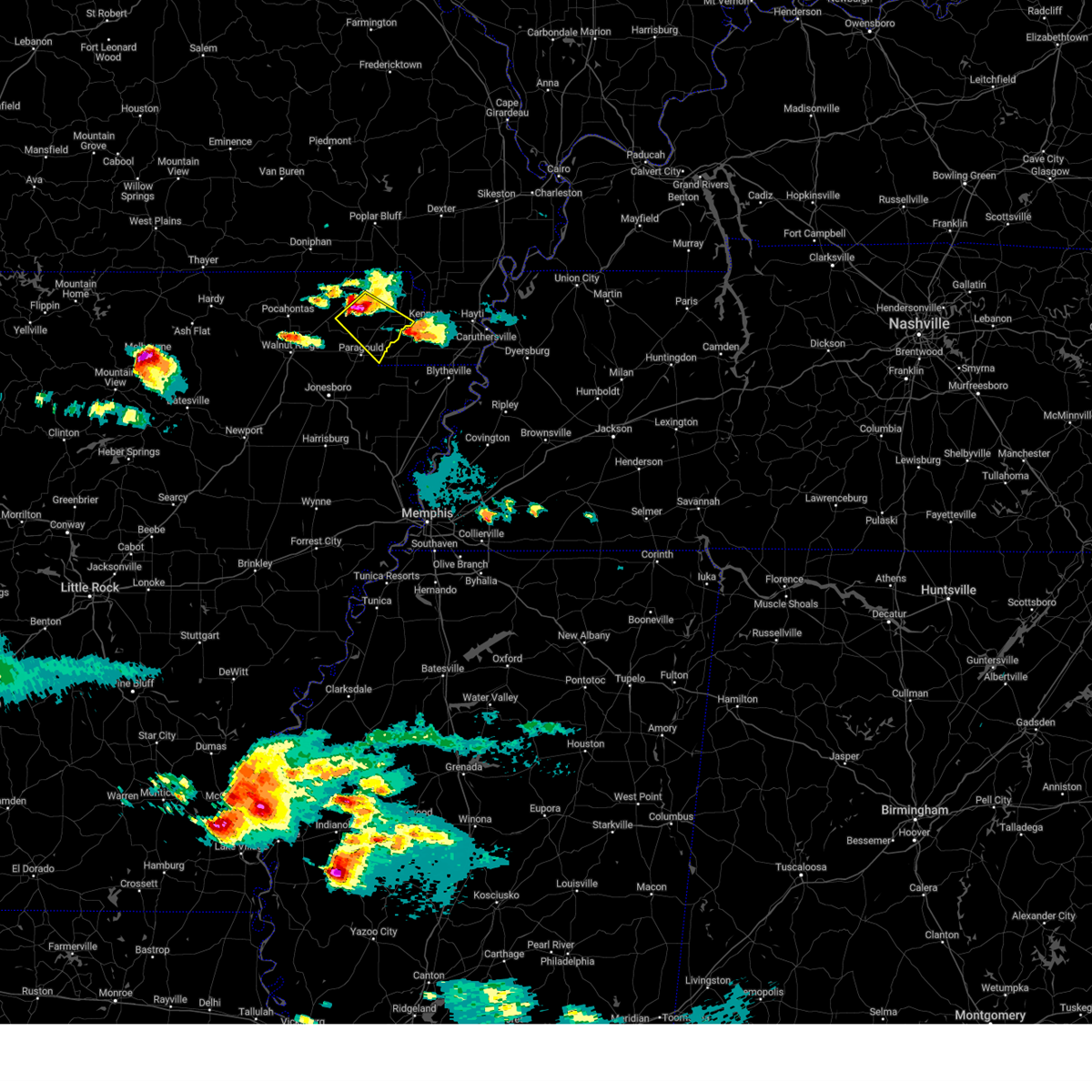 At 845 pm cdt, a severe thunderstorm was located near lafe, or near marmaduke, moving southeast at 30 mph (radar indicated). Hazards include golf ball size hail and 60 mph wind gusts. People and animals outdoors will be injured. expect hail damage to roofs, siding, windows, and vehicles. expect wind damage to roofs, siding, and trees. locations impacted include, rector, marmaduke, oak grove heights, lafe, pratt, brighton, hargrave corner, bertig, stonewall, heubner, cotton belt, tipperary, fritz, bard, gainesville, mounds, halliday, knob, leonard and noxburn. thunderstorm damage threat, considerable hail threat, radar indicated max hail size, 1. 75 in wind threat, radar indicated max wind gust, 60 mph. At 845 pm cdt, a severe thunderstorm was located near lafe, or near marmaduke, moving southeast at 30 mph (radar indicated). Hazards include golf ball size hail and 60 mph wind gusts. People and animals outdoors will be injured. expect hail damage to roofs, siding, windows, and vehicles. expect wind damage to roofs, siding, and trees. locations impacted include, rector, marmaduke, oak grove heights, lafe, pratt, brighton, hargrave corner, bertig, stonewall, heubner, cotton belt, tipperary, fritz, bard, gainesville, mounds, halliday, knob, leonard and noxburn. thunderstorm damage threat, considerable hail threat, radar indicated max hail size, 1. 75 in wind threat, radar indicated max wind gust, 60 mph.
|
| 6/14/2023 8:33 PM CDT |
 At 833 pm cdt, a severe thunderstorm was located near knobel, or near corning, moving southeast at 30 mph (radar indicated). Hazards include two inch hail and 60 mph wind gusts. People and animals outdoors will be injured. expect hail damage to roofs, siding, windows, and vehicles. expect wind damage to roofs, siding, and trees. locations impacted include, corning, rector, marmaduke, oak grove heights, lafe, knobel, peach orchard, pratt, brighton, hargrave corner, bertig, stonewall, heubner, cotton belt, tipperary, fritz, bard, gainesville, mounds and halliday. thunderstorm damage threat, considerable hail threat, radar indicated max hail size, 2. 00 in wind threat, radar indicated max wind gust, 60 mph. At 833 pm cdt, a severe thunderstorm was located near knobel, or near corning, moving southeast at 30 mph (radar indicated). Hazards include two inch hail and 60 mph wind gusts. People and animals outdoors will be injured. expect hail damage to roofs, siding, windows, and vehicles. expect wind damage to roofs, siding, and trees. locations impacted include, corning, rector, marmaduke, oak grove heights, lafe, knobel, peach orchard, pratt, brighton, hargrave corner, bertig, stonewall, heubner, cotton belt, tipperary, fritz, bard, gainesville, mounds and halliday. thunderstorm damage threat, considerable hail threat, radar indicated max hail size, 2. 00 in wind threat, radar indicated max wind gust, 60 mph.
|
| 6/14/2023 8:29 PM CDT |
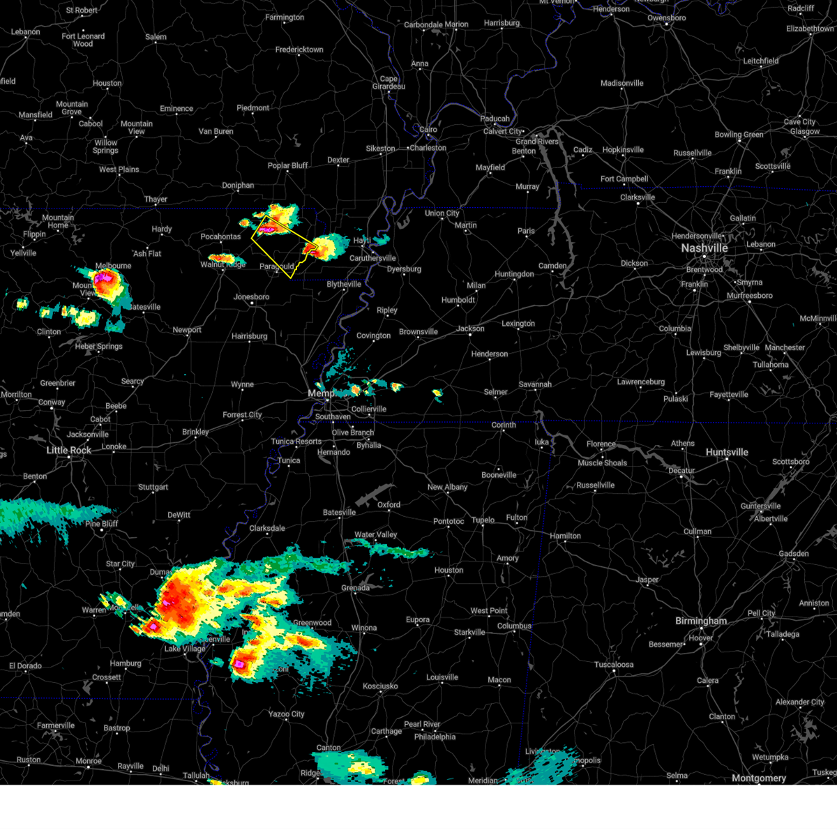 At 828 pm cdt, a severe thunderstorm was located over knobel, or near corning, moving southeast at 30 mph (radar indicated). Hazards include golf ball size hail and 60 mph wind gusts. People and animals outdoors will be injured. expect hail damage to roofs, siding, windows, and vehicles. Expect wind damage to roofs, siding, and trees. At 828 pm cdt, a severe thunderstorm was located over knobel, or near corning, moving southeast at 30 mph (radar indicated). Hazards include golf ball size hail and 60 mph wind gusts. People and animals outdoors will be injured. expect hail damage to roofs, siding, windows, and vehicles. Expect wind damage to roofs, siding, and trees.
|
| 6/14/2023 8:09 PM CDT | Quarter sized hail reported 0.4 miles SSW of Rector, AR, public report of quarter sized hail. |
| 6/14/2023 8:09 PM CDT | Ping Pong Ball sized hail reported 0.4 miles SSW of Rector, AR, corrects previous hail report from rector. public report of 1.5 inch hail... from kait. |
| 6/14/2023 8:09 PM CDT |
 At 809 pm cdt, a severe thunderstorm was located near success, or near corning, moving east at 20 mph (radar indicated). Hazards include 60 mph wind gusts and quarter size hail. Hail damage to vehicles is expected. expect wind damage to roofs, siding, and trees. locations impacted include, piggott, corning, rector, chalk bluff natural area, reyno, knobel, st. francis, pollard, greenway, mcdougal, success, datto, saint francis, crockett, nimmons, tipperary, hickoria, twin oaks, palatka and heelstring. hail threat, radar indicated max hail size, 1. 00 in wind threat, radar indicated max wind gust, 60 mph. At 809 pm cdt, a severe thunderstorm was located near success, or near corning, moving east at 20 mph (radar indicated). Hazards include 60 mph wind gusts and quarter size hail. Hail damage to vehicles is expected. expect wind damage to roofs, siding, and trees. locations impacted include, piggott, corning, rector, chalk bluff natural area, reyno, knobel, st. francis, pollard, greenway, mcdougal, success, datto, saint francis, crockett, nimmons, tipperary, hickoria, twin oaks, palatka and heelstring. hail threat, radar indicated max hail size, 1. 00 in wind threat, radar indicated max wind gust, 60 mph.
|
| 6/14/2023 7:48 PM CDT |
 At 748 pm cdt, a severe thunderstorm was located near success, or 9 miles south of doniphan, moving east at 15 mph (radar indicated). Hazards include 60 mph wind gusts and quarter size hail. Hail damage to vehicles is expected. Expect wind damage to roofs, siding, and trees. At 748 pm cdt, a severe thunderstorm was located near success, or 9 miles south of doniphan, moving east at 15 mph (radar indicated). Hazards include 60 mph wind gusts and quarter size hail. Hail damage to vehicles is expected. Expect wind damage to roofs, siding, and trees.
|
| 2/8/2023 7:05 PM CST |
 At 704 pm cst, a severe thunderstorm was located over rector, moving northeast at 40 mph (radar indicated). Hazards include 60 mph wind gusts. Expect damage to roofs, siding, and trees. locations impacted include, malden, piggott, campbell, rector, chalk bluff natural area, clarkton, holcomb, st. francis, pollard, greenway, glennonville, saint francis, crockett, nimmons, heubner, bell city, pratt, hargrave corner, carryville and holly island. hail threat, radar indicated max hail size, <. 75 in wind threat, radar indicated max wind gust, 60 mph. At 704 pm cst, a severe thunderstorm was located over rector, moving northeast at 40 mph (radar indicated). Hazards include 60 mph wind gusts. Expect damage to roofs, siding, and trees. locations impacted include, malden, piggott, campbell, rector, chalk bluff natural area, clarkton, holcomb, st. francis, pollard, greenway, glennonville, saint francis, crockett, nimmons, heubner, bell city, pratt, hargrave corner, carryville and holly island. hail threat, radar indicated max hail size, <. 75 in wind threat, radar indicated max wind gust, 60 mph.
|
| 2/8/2023 6:51 PM CST |
 At 650 pm cst, a severe thunderstorm was located near marmaduke, moving northeast at 40 mph (radar indicated). Hazards include 60 mph wind gusts. expect damage to roofs, siding, and trees At 650 pm cst, a severe thunderstorm was located near marmaduke, moving northeast at 40 mph (radar indicated). Hazards include 60 mph wind gusts. expect damage to roofs, siding, and trees
|
| 2/8/2023 5:56 PM CST |
 At 556 pm cst, a severe thunderstorm was located near pollard, or near rector, moving northeast at 45 mph (radar indicated). Hazards include 60 mph wind gusts. expect damage to roofs, siding, and trees At 556 pm cst, a severe thunderstorm was located near pollard, or near rector, moving northeast at 45 mph (radar indicated). Hazards include 60 mph wind gusts. expect damage to roofs, siding, and trees
|
| 7/17/2022 8:28 PM CDT |
 At 827 pm cdt, a severe thunderstorm was located over success, or near corning, moving southeast at 30 mph (radar indicated). Hazards include 60 mph wind gusts. expect damage to roofs, siding, and trees At 827 pm cdt, a severe thunderstorm was located over success, or near corning, moving southeast at 30 mph (radar indicated). Hazards include 60 mph wind gusts. expect damage to roofs, siding, and trees
|
| 7/17/2022 7:48 PM CDT |
 At 747 pm cdt, a severe thunderstorm was located over doniphan, moving southeast at 50 mph (radar indicated). Hazards include 60 mph wind gusts. expect damage to roofs, siding, and trees At 747 pm cdt, a severe thunderstorm was located over doniphan, moving southeast at 50 mph (radar indicated). Hazards include 60 mph wind gusts. expect damage to roofs, siding, and trees
|
| 5/21/2022 7:20 PM CDT |
 The severe thunderstorm warning for eastern greene. eastern craighead. northwestern mississippi. eastern clay and southwestern dunklin counties will expire at 730 pm cdt. the storms which prompted the warning have moved out of the area. therefore, the warning will be allowed to expire. A severe thunderstorm watch remains in effect until 1000 pm cdt for. The severe thunderstorm warning for eastern greene. eastern craighead. northwestern mississippi. eastern clay and southwestern dunklin counties will expire at 730 pm cdt. the storms which prompted the warning have moved out of the area. therefore, the warning will be allowed to expire. A severe thunderstorm watch remains in effect until 1000 pm cdt for.
|
| 5/21/2022 7:20 PM CDT |
 The severe thunderstorm warning for eastern greene, eastern craighead, northwestern mississippi, eastern clay and southwestern dunklin counties will expire at 730 pm cdt, the storms which prompted the warning have moved out of the area. therefore, the warning will be allowed to expire. a severe thunderstorm watch remains in effect until 1000 pm cdt for eastern arkansas, and southeastern missouri. The severe thunderstorm warning for eastern greene, eastern craighead, northwestern mississippi, eastern clay and southwestern dunklin counties will expire at 730 pm cdt, the storms which prompted the warning have moved out of the area. therefore, the warning will be allowed to expire. a severe thunderstorm watch remains in effect until 1000 pm cdt for eastern arkansas, and southeastern missouri.
|
| 5/21/2022 7:03 PM CDT |
 At 703 pm cdt, severe thunderstorms were located along a line extending from near corning to cardwell to near jonesboro, moving east at 35 mph (radar indicated). Hazards include 60 mph wind gusts and half dollar size hail. Hail damage to vehicles is expected. expect wind damage to roofs, siding, and trees. locations impacted include, jonesboro, kennett, piggott, manila, lake city, leachville, rector, bay, senath, brookland, monette, caraway, chalk bluff natural area, cardwell, hornersville, arbyrd, pollard, greenway, mcdougal and crockett. hail threat, radar indicated max hail size, 1. 25 in wind threat, radar indicated max wind gust, 60 mph. At 703 pm cdt, severe thunderstorms were located along a line extending from near corning to cardwell to near jonesboro, moving east at 35 mph (radar indicated). Hazards include 60 mph wind gusts and half dollar size hail. Hail damage to vehicles is expected. expect wind damage to roofs, siding, and trees. locations impacted include, jonesboro, kennett, piggott, manila, lake city, leachville, rector, bay, senath, brookland, monette, caraway, chalk bluff natural area, cardwell, hornersville, arbyrd, pollard, greenway, mcdougal and crockett. hail threat, radar indicated max hail size, 1. 25 in wind threat, radar indicated max wind gust, 60 mph.
|
| 5/21/2022 7:01 PM CDT |
 At 701 pm cdt, severe thunderstorms were located along a line extending from near mcdougal to near arbyrd to near bay, moving east at 50 mph (radar indicated). Hazards include 60 mph wind gusts and quarter size hail. Hail damage to vehicles is expected. Expect wind damage to roofs, siding, and trees. At 701 pm cdt, severe thunderstorms were located along a line extending from near mcdougal to near arbyrd to near bay, moving east at 50 mph (radar indicated). Hazards include 60 mph wind gusts and quarter size hail. Hail damage to vehicles is expected. Expect wind damage to roofs, siding, and trees.
|
| 5/21/2022 6:35 PM CDT |
 At 634 pm cdt, severe thunderstorms were located along a line extending from near maynard to near crowleys ridge state park to near cash, moving east at 35 mph (radar indicated). Hazards include 60 mph wind gusts and half dollar size hail. Hail damage to vehicles is expected. Expect wind damage to roofs, siding, and trees. At 634 pm cdt, severe thunderstorms were located along a line extending from near maynard to near crowleys ridge state park to near cash, moving east at 35 mph (radar indicated). Hazards include 60 mph wind gusts and half dollar size hail. Hail damage to vehicles is expected. Expect wind damage to roofs, siding, and trees.
|
| 3/30/2022 3:25 PM CDT |
 At 325 pm cdt, severe thunderstorms were located along a line extending from near bernie to near kennett, moving east at 45 mph (radar indicated). Hazards include 60 mph wind gusts. Expect damage to roofs, siding, and trees. locations impacted include, kennett, malden, piggott, hayti, steele, campbell, rector, senath, chalk bluff natural area, clarkton, cardwell, holcomb, hayti heights, arbyrd, wardell, st. Francis, pollard, greenway, glennonville and bolton. At 325 pm cdt, severe thunderstorms were located along a line extending from near bernie to near kennett, moving east at 45 mph (radar indicated). Hazards include 60 mph wind gusts. Expect damage to roofs, siding, and trees. locations impacted include, kennett, malden, piggott, hayti, steele, campbell, rector, senath, chalk bluff natural area, clarkton, cardwell, holcomb, hayti heights, arbyrd, wardell, st. Francis, pollard, greenway, glennonville and bolton.
|
| 3/30/2022 2:55 PM CDT |
 At 255 pm cdt, severe thunderstorms were located along a line extending from 6 miles east of neelyville to near oak grove heights, moving east at 45 mph (radar indicated). Hazards include 60 mph wind gusts. expect damage to roofs, siding, and trees At 255 pm cdt, severe thunderstorms were located along a line extending from 6 miles east of neelyville to near oak grove heights, moving east at 45 mph (radar indicated). Hazards include 60 mph wind gusts. expect damage to roofs, siding, and trees
|
| 3/30/2022 2:28 PM CDT |
 At 228 pm cdt, severe thunderstorms were located along a line extending from near oxly to near walcott, moving northeast at 60 mph (radar indicated). Hazards include 60 mph wind gusts. expect damage to roofs, siding, and trees At 228 pm cdt, severe thunderstorms were located along a line extending from near oxly to near walcott, moving northeast at 60 mph (radar indicated). Hazards include 60 mph wind gusts. expect damage to roofs, siding, and trees
|
| 3/7/2022 12:48 AM CST |
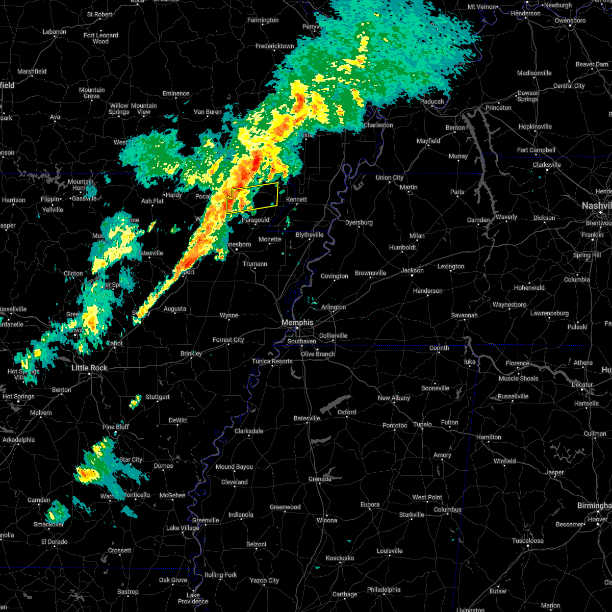 At 1248 am cst, a severe thunderstorm was located over delaplaine, or 12 miles east of pocahontas, moving east at 50 mph (radar indicated). Hazards include 60 mph wind gusts. expect damage to roofs, siding, and trees At 1248 am cst, a severe thunderstorm was located over delaplaine, or 12 miles east of pocahontas, moving east at 50 mph (radar indicated). Hazards include 60 mph wind gusts. expect damage to roofs, siding, and trees
|
| 2/22/2022 5:27 AM CST |
 At 526 am cst, severe thunderstorms were located along a line extending from near glennonville to near senath to near lake city, moving east at 60 mph (radar indicated). Hazards include 60 mph wind gusts and penny size hail. expect damage to roofs, siding, and trees At 526 am cst, severe thunderstorms were located along a line extending from near glennonville to near senath to near lake city, moving east at 60 mph (radar indicated). Hazards include 60 mph wind gusts and penny size hail. expect damage to roofs, siding, and trees
|
| 2/22/2022 5:18 AM CST |
 At 518 am cst, severe thunderstorms were located along a line extending from qulin to near rector to near marmaduke to near greenfield, moving east at 60 mph (radar indicated). Hazards include 60 mph wind gusts. Expect damage to roofs, siding, and trees. Locations impacted include, jonesboro, paragould, kennett, malden, piggott, bono, lake city, campbell, rector, bay, senath, brookland, monette, caraway, marmaduke, chalk bluff natural area, crowleys ridge state park, lake frierson state park, oak grove heights and cardwell. At 518 am cst, severe thunderstorms were located along a line extending from qulin to near rector to near marmaduke to near greenfield, moving east at 60 mph (radar indicated). Hazards include 60 mph wind gusts. Expect damage to roofs, siding, and trees. Locations impacted include, jonesboro, paragould, kennett, malden, piggott, bono, lake city, campbell, rector, bay, senath, brookland, monette, caraway, marmaduke, chalk bluff natural area, crowleys ridge state park, lake frierson state park, oak grove heights and cardwell.
|
| 2/22/2022 4:46 AM CST |
 At 445 am cst, severe thunderstorms were located along a line extending from 6 miles north of maynard to near tuckerman, moving east at 60 mph (radar indicated). Hazards include 60 mph wind gusts and penny size hail. expect damage to roofs, siding, and trees At 445 am cst, severe thunderstorms were located along a line extending from 6 miles north of maynard to near tuckerman, moving east at 60 mph (radar indicated). Hazards include 60 mph wind gusts and penny size hail. expect damage to roofs, siding, and trees
|
| 10/25/2021 12:38 AM CDT |
 At 1237 am cdt, severe thunderstorms were located along a line extending from near matthews to near risco to near piggott, moving east at 55 mph (radar indicated). Hazards include 60 mph wind gusts. Expect damage to roofs, siding, and trees. locations impacted include, kennett, caruthersville, malden, piggott, portageville, hayti, campbell, rector, chalk bluff natural area, holcomb, hayti heights, wardell, st. francis, pollard, greenway, mcdougal, bolton, deering, saint francis and crockett. hail threat, radar indicated max hail size, <. 75 in wind threat, radar indicated max wind gust, 60 mph. At 1237 am cdt, severe thunderstorms were located along a line extending from near matthews to near risco to near piggott, moving east at 55 mph (radar indicated). Hazards include 60 mph wind gusts. Expect damage to roofs, siding, and trees. locations impacted include, kennett, caruthersville, malden, piggott, portageville, hayti, campbell, rector, chalk bluff natural area, holcomb, hayti heights, wardell, st. francis, pollard, greenway, mcdougal, bolton, deering, saint francis and crockett. hail threat, radar indicated max hail size, <. 75 in wind threat, radar indicated max wind gust, 60 mph.
|
| 10/25/2021 12:05 AM CDT |
 At 1205 am cdt, severe thunderstorms were located along a line extending from near qulin to near corning to near biggers, moving east at 55 mph (radar indicated). Hazards include 60 mph wind gusts and nickel size hail. expect damage to roofs, siding, and trees At 1205 am cdt, severe thunderstorms were located along a line extending from near qulin to near corning to near biggers, moving east at 55 mph (radar indicated). Hazards include 60 mph wind gusts and nickel size hail. expect damage to roofs, siding, and trees
|
| 5/4/2021 2:53 AM CDT |
 The severe thunderstorm warning for eastern greene, eastern clay and central dunklin counties will expire at 300 am cdt, the storm which prompted the warning has moved out of the area. therefore, the warning will be allowed to expire. however gusty winds are still possible with this thunderstorm. a severe thunderstorm watch remains in effect until 800 am cdt for eastern arkansas, and southeastern missouri. remember, a severe thunderstorm warning still remains in effect for eastern clay county in arkansas and dunklin county in missouri. The severe thunderstorm warning for eastern greene, eastern clay and central dunklin counties will expire at 300 am cdt, the storm which prompted the warning has moved out of the area. therefore, the warning will be allowed to expire. however gusty winds are still possible with this thunderstorm. a severe thunderstorm watch remains in effect until 800 am cdt for eastern arkansas, and southeastern missouri. remember, a severe thunderstorm warning still remains in effect for eastern clay county in arkansas and dunklin county in missouri.
|
| 5/4/2021 2:46 AM CDT |
 At 246 am cdt, a severe thunderstorm was located over chalk bluff natural area, moving northeast at 30 mph (radar indicated). Hazards include 60 mph wind gusts and quarter size hail. Hail damage to vehicles is expected. expect wind damage to roofs, siding, and trees. locations impacted include, paragould, malden, piggott, campbell, rector, marmaduke, chalk bluff natural area, cardwell, holcomb, arbyrd, st. Francis, pollard, greenway, glennonville, saint francis, crockett, nimmons, heubner, fritz and bard. At 246 am cdt, a severe thunderstorm was located over chalk bluff natural area, moving northeast at 30 mph (radar indicated). Hazards include 60 mph wind gusts and quarter size hail. Hail damage to vehicles is expected. expect wind damage to roofs, siding, and trees. locations impacted include, paragould, malden, piggott, campbell, rector, marmaduke, chalk bluff natural area, cardwell, holcomb, arbyrd, st. Francis, pollard, greenway, glennonville, saint francis, crockett, nimmons, heubner, fritz and bard.
|
| 5/4/2021 2:29 AM CDT |
 At 208 am cdt, a severe thunderstorm was located 7 miles southwest of mcdougal, or 8 miles southeast of corning, moving northeast at 30 mph (radar indicated). Hazards include 60 mph wind gusts and quarter size hail. Hail damage to vehicles is expected. Expect wind damage to roofs, siding, and trees. At 208 am cdt, a severe thunderstorm was located 7 miles southwest of mcdougal, or 8 miles southeast of corning, moving northeast at 30 mph (radar indicated). Hazards include 60 mph wind gusts and quarter size hail. Hail damage to vehicles is expected. Expect wind damage to roofs, siding, and trees.
|
| 5/4/2021 2:29 AM CDT |
 At 229 am cdt, a severe thunderstorm was located over pollard, or 7 miles southwest of chalk bluff natural area, moving northeast at 30 mph (radar indicated). Hazards include 60 mph wind gusts and quarter size hail. Hail damage to vehicles is expected. expect wind damage to roofs, siding, and trees. locations impacted include, paragould, malden, piggott, corning, campbell, rector, marmaduke, chalk bluff natural area, oak grove heights, cardwell, holcomb, arbyrd, lafe, knobel, st. Francis, pollard, greenway, mcdougal, peach orchard and glennonville. At 229 am cdt, a severe thunderstorm was located over pollard, or 7 miles southwest of chalk bluff natural area, moving northeast at 30 mph (radar indicated). Hazards include 60 mph wind gusts and quarter size hail. Hail damage to vehicles is expected. expect wind damage to roofs, siding, and trees. locations impacted include, paragould, malden, piggott, corning, campbell, rector, marmaduke, chalk bluff natural area, oak grove heights, cardwell, holcomb, arbyrd, lafe, knobel, st. Francis, pollard, greenway, mcdougal, peach orchard and glennonville.
|
| 5/4/2021 2:08 AM CDT |
 At 208 am cdt, a severe thunderstorm was located 7 miles southwest of mcdougal, or 8 miles southeast of corning, moving northeast at 30 mph (radar indicated). Hazards include 60 mph wind gusts and quarter size hail. Hail damage to vehicles is expected. Expect wind damage to roofs, siding, and trees. At 208 am cdt, a severe thunderstorm was located 7 miles southwest of mcdougal, or 8 miles southeast of corning, moving northeast at 30 mph (radar indicated). Hazards include 60 mph wind gusts and quarter size hail. Hail damage to vehicles is expected. Expect wind damage to roofs, siding, and trees.
|
| 4/9/2021 4:52 PM CDT |
 The severe thunderstorm warning for northeastern greene and south central clay counties will expire at 500 pm cdt, the storm which prompted the warning has weakened below severe limits. therefore, the warning will be allowed to expire. a severe thunderstorm watch remains in effect until 1100 pm cdt for eastern arkansas, and southeastern missouri. The severe thunderstorm warning for northeastern greene and south central clay counties will expire at 500 pm cdt, the storm which prompted the warning has weakened below severe limits. therefore, the warning will be allowed to expire. a severe thunderstorm watch remains in effect until 1100 pm cdt for eastern arkansas, and southeastern missouri.
|
| 4/9/2021 4:41 PM CDT |
 At 440 pm cdt, a severe thunderstorm was located over marmaduke, moving northeast at 30 mph (radar indicated). Hazards include ping pong ball size hail and 60 mph wind gusts. People and animals outdoors will be injured. expect hail damage to roofs, siding, windows, and vehicles. expect wind damage to roofs, siding, and trees. Locations impacted include, rector, marmaduke, lafe, mounds, halliday, knob, bertig, heubner, leonard and fritz. At 440 pm cdt, a severe thunderstorm was located over marmaduke, moving northeast at 30 mph (radar indicated). Hazards include ping pong ball size hail and 60 mph wind gusts. People and animals outdoors will be injured. expect hail damage to roofs, siding, windows, and vehicles. expect wind damage to roofs, siding, and trees. Locations impacted include, rector, marmaduke, lafe, mounds, halliday, knob, bertig, heubner, leonard and fritz.
|
| 4/9/2021 4:31 PM CDT |
 At 431 pm cdt, a severe thunderstorm was located near oak grove heights, or near marmaduke, moving northeast at 30 mph (radar indicated). Hazards include golf ball size hail and 60 mph wind gusts. People and animals outdoors will be injured. expect hail damage to roofs, siding, windows, and vehicles. expect wind damage to roofs, siding, and trees. locations impacted include, paragould, rector, marmaduke, oak grove heights, lafe, brighton, bertig, heubner, cotton belt, fritz, bard, gainesville, mounds, halliday, knob, leonard and noxburn. Golf ball size hail was reported near paragould at 420 pm. At 431 pm cdt, a severe thunderstorm was located near oak grove heights, or near marmaduke, moving northeast at 30 mph (radar indicated). Hazards include golf ball size hail and 60 mph wind gusts. People and animals outdoors will be injured. expect hail damage to roofs, siding, windows, and vehicles. expect wind damage to roofs, siding, and trees. locations impacted include, paragould, rector, marmaduke, oak grove heights, lafe, brighton, bertig, heubner, cotton belt, fritz, bard, gainesville, mounds, halliday, knob, leonard and noxburn. Golf ball size hail was reported near paragould at 420 pm.
|
| 4/9/2021 4:26 PM CDT |
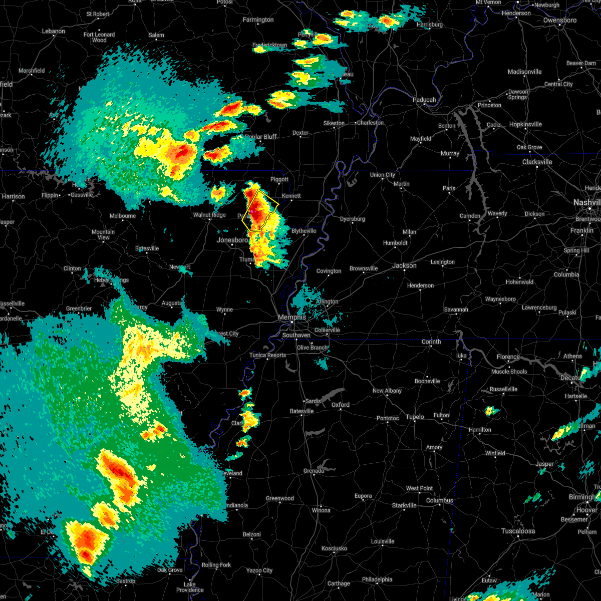 At 426 pm cdt, a severe thunderstorm was located near paragould, moving northeast at 30 mph (radar indicated). Hazards include ping pong ball size hail and 60 mph wind gusts. People and animals outdoors will be injured. expect hail damage to roofs, siding, windows, and vehicles. expect wind damage to roofs, siding, and trees. Locations impacted include, paragould, rector, marmaduke, oak grove heights, lafe, brighton, bertig, heubner, cotton belt, fritz, bard, gainesville, mounds, halliday, knob, leonard, bethel and noxburn. At 426 pm cdt, a severe thunderstorm was located near paragould, moving northeast at 30 mph (radar indicated). Hazards include ping pong ball size hail and 60 mph wind gusts. People and animals outdoors will be injured. expect hail damage to roofs, siding, windows, and vehicles. expect wind damage to roofs, siding, and trees. Locations impacted include, paragould, rector, marmaduke, oak grove heights, lafe, brighton, bertig, heubner, cotton belt, fritz, bard, gainesville, mounds, halliday, knob, leonard, bethel and noxburn.
|
| 4/9/2021 4:25 PM CDT |
 At 425 pm cdt, a severe thunderstorm was located near paragould, moving northeast at 30 mph (radar indicated). Hazards include ping pong ball size hail and 60 mph wind gusts. People and animals outdoors will be injured. expect hail damage to roofs, siding, windows, and vehicles. expect wind damage to roofs, siding, and trees. Locations impacted include, paragould, rector, marmaduke, oak grove heights, lafe, brighton, bertig, heubner, cotton belt, fritz, bard, gainesville, mounds, halliday, knob, leonard, bethel and noxburn. At 425 pm cdt, a severe thunderstorm was located near paragould, moving northeast at 30 mph (radar indicated). Hazards include ping pong ball size hail and 60 mph wind gusts. People and animals outdoors will be injured. expect hail damage to roofs, siding, windows, and vehicles. expect wind damage to roofs, siding, and trees. Locations impacted include, paragould, rector, marmaduke, oak grove heights, lafe, brighton, bertig, heubner, cotton belt, fritz, bard, gainesville, mounds, halliday, knob, leonard, bethel and noxburn.
|
| 4/9/2021 4:20 PM CDT |
 At 420 pm cdt, a severe thunderstorm was located over paragould, moving northeast at 35 mph (radar indicated). Hazards include ping pong ball size hail and 60 mph wind gusts. People and animals outdoors will be injured. expect hail damage to roofs, siding, windows, and vehicles. expect wind damage to roofs, siding, and trees. Locations impacted include, paragould, rector, senath, marmaduke, oak grove heights, cardwell, arbyrd, lafe, heubner, macey, schug, fritz, bard, mounds, halliday, leonard, bethel, noxburn, brighton and bertig. At 420 pm cdt, a severe thunderstorm was located over paragould, moving northeast at 35 mph (radar indicated). Hazards include ping pong ball size hail and 60 mph wind gusts. People and animals outdoors will be injured. expect hail damage to roofs, siding, windows, and vehicles. expect wind damage to roofs, siding, and trees. Locations impacted include, paragould, rector, senath, marmaduke, oak grove heights, cardwell, arbyrd, lafe, heubner, macey, schug, fritz, bard, mounds, halliday, leonard, bethel, noxburn, brighton and bertig.
|
| 4/9/2021 4:20 PM CDT |
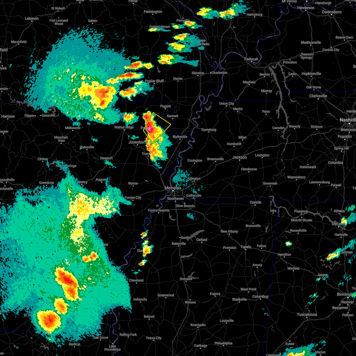 At 420 pm cdt, a severe thunderstorm was located over paragould, moving northeast at 35 mph (radar indicated). Hazards include ping pong ball size hail and 60 mph wind gusts. People and animals outdoors will be injured. expect hail damage to roofs, siding, windows, and vehicles. expect wind damage to roofs, siding, and trees. Locations impacted include, paragould, rector, senath, marmaduke, oak grove heights, cardwell, arbyrd, lafe, heubner, macey, schug, fritz, bard, mounds, halliday, leonard, bethel, noxburn, brighton and bertig. At 420 pm cdt, a severe thunderstorm was located over paragould, moving northeast at 35 mph (radar indicated). Hazards include ping pong ball size hail and 60 mph wind gusts. People and animals outdoors will be injured. expect hail damage to roofs, siding, windows, and vehicles. expect wind damage to roofs, siding, and trees. Locations impacted include, paragould, rector, senath, marmaduke, oak grove heights, cardwell, arbyrd, lafe, heubner, macey, schug, fritz, bard, mounds, halliday, leonard, bethel, noxburn, brighton and bertig.
|
| 4/9/2021 4:07 PM CDT |
 At 407 pm cdt, a severe thunderstorm was located near brookland, moving northeast at 30 mph (radar indicated). Hazards include ping pong ball size hail and 60 mph wind gusts. People and animals outdoors will be injured. expect hail damage to roofs, siding, windows, and vehicles. Expect wind damage to roofs, siding, and trees. At 407 pm cdt, a severe thunderstorm was located near brookland, moving northeast at 30 mph (radar indicated). Hazards include ping pong ball size hail and 60 mph wind gusts. People and animals outdoors will be injured. expect hail damage to roofs, siding, windows, and vehicles. Expect wind damage to roofs, siding, and trees.
|
| 6/5/2020 11:07 AM CDT |
 At 1107 am cdt, severe thunderstorms were located along a line extending from near parma to near greenway to near marmaduke to near crowleys ridge state park, moving southeast at 35 mph (radar indicated). Hazards include 60 mph wind gusts. expect damage to roofs, siding, and trees At 1107 am cdt, severe thunderstorms were located along a line extending from near parma to near greenway to near marmaduke to near crowleys ridge state park, moving southeast at 35 mph (radar indicated). Hazards include 60 mph wind gusts. expect damage to roofs, siding, and trees
|
| 6/5/2020 10:47 AM CDT |
 At 1046 am cdt, a severe thunderstorm was located near knobel, or 9 miles south of corning, moving southeast at 25 mph (radar indicated). Hazards include 60 mph wind gusts and quarter size hail. Hail damage to vehicles is expected. expect wind damage to roofs, siding, and trees. Locations impacted include, paragould, corning, rector, marmaduke, oak grove heights, lafe, knobel, mcdougal, crockett, pratt, hargrave corner, stonewall, heubner, tipperary, hickoria, gainesville, halliday, knob and noxburn. At 1046 am cdt, a severe thunderstorm was located near knobel, or 9 miles south of corning, moving southeast at 25 mph (radar indicated). Hazards include 60 mph wind gusts and quarter size hail. Hail damage to vehicles is expected. expect wind damage to roofs, siding, and trees. Locations impacted include, paragould, corning, rector, marmaduke, oak grove heights, lafe, knobel, mcdougal, crockett, pratt, hargrave corner, stonewall, heubner, tipperary, hickoria, gainesville, halliday, knob and noxburn.
|
| 6/5/2020 10:29 AM CDT |
 At 1028 am cdt, a severe thunderstorm was located over corning, moving southeast at 30 mph (radar indicated). Hazards include 60 mph wind gusts and quarter size hail. Hail damage to vehicles is expected. Expect wind damage to roofs, siding, and trees. At 1028 am cdt, a severe thunderstorm was located over corning, moving southeast at 30 mph (radar indicated). Hazards include 60 mph wind gusts and quarter size hail. Hail damage to vehicles is expected. Expect wind damage to roofs, siding, and trees.
|
| 5/4/2020 5:12 PM CDT |
 At 512 pm cdt, a severe thunderstorm was located near pollard, or near piggott, moving east at 55 mph (radar indicated). Hazards include 60 mph wind gusts and quarter size hail. Hail damage to vehicles is expected. Expect wind damage to roofs, siding, and trees. At 512 pm cdt, a severe thunderstorm was located near pollard, or near piggott, moving east at 55 mph (radar indicated). Hazards include 60 mph wind gusts and quarter size hail. Hail damage to vehicles is expected. Expect wind damage to roofs, siding, and trees.
|
| 5/3/2020 1:50 PM CDT |
 At 149 pm cdt, severe thunderstorms were located along a line extending from near parma to near senath, moving east at 55 mph (radar indicated). Hazards include 70 mph wind gusts and half dollar size hail. Hail damage to vehicles is expected. expect considerable tree damage. wind damage is also likely to mobile homes, roofs, and outbuildings. Locations impacted include, paragould, dyersburg, kennett, caruthersville, piggott, portageville, hayti, steele, campbell, rector, senath, marmaduke, reelfoot lake state park, chalk bluff natural area, tiptonville, malden, ridgely, oak grove heights, cardwell and hornersville. At 149 pm cdt, severe thunderstorms were located along a line extending from near parma to near senath, moving east at 55 mph (radar indicated). Hazards include 70 mph wind gusts and half dollar size hail. Hail damage to vehicles is expected. expect considerable tree damage. wind damage is also likely to mobile homes, roofs, and outbuildings. Locations impacted include, paragould, dyersburg, kennett, caruthersville, piggott, portageville, hayti, steele, campbell, rector, senath, marmaduke, reelfoot lake state park, chalk bluff natural area, tiptonville, malden, ridgely, oak grove heights, cardwell and hornersville.
|
| 5/3/2020 1:45 PM CDT | A few trees down in rector... clay c in clay county AR, 0.4 miles NW of Rector, AR |
| 5/3/2020 1:30 PM CDT |
 At 130 pm cdt, severe thunderstorms were located along a line extending from near glennonville to near oak grove heights, moving east at 70 mph (radar indicated). Hazards include 70 mph wind gusts and half dollar size hail. Hail damage to vehicles is expected. expect considerable tree damage. Wind damage is also likely to mobile homes, roofs, and outbuildings. At 130 pm cdt, severe thunderstorms were located along a line extending from near glennonville to near oak grove heights, moving east at 70 mph (radar indicated). Hazards include 70 mph wind gusts and half dollar size hail. Hail damage to vehicles is expected. expect considerable tree damage. Wind damage is also likely to mobile homes, roofs, and outbuildings.
|
| 5/3/2020 1:27 PM CDT |
 At 127 pm cdt, a severe thunderstorm was located near pollard, or near piggott, moving east at 55 mph (radar indicated). Hazards include 70 mph wind gusts and half dollar size hail. Hail damage to vehicles is expected. expect considerable tree damage. wind damage is also likely to mobile homes, roofs, and outbuildings. Locations impacted include, piggott, corning, rector, chalk bluff natural area, lafe, reyno, knobel, pollard, greenway, mcdougal, success, peach orchard, delaplaine, datto, crockett, stonewall, heubner, tipperary, hickoria and brookings. At 127 pm cdt, a severe thunderstorm was located near pollard, or near piggott, moving east at 55 mph (radar indicated). Hazards include 70 mph wind gusts and half dollar size hail. Hail damage to vehicles is expected. expect considerable tree damage. wind damage is also likely to mobile homes, roofs, and outbuildings. Locations impacted include, piggott, corning, rector, chalk bluff natural area, lafe, reyno, knobel, pollard, greenway, mcdougal, success, peach orchard, delaplaine, datto, crockett, stonewall, heubner, tipperary, hickoria and brookings.
|
| 5/3/2020 1:14 PM CDT |
 At 113 pm cdt, a severe thunderstorm was located over corning, moving east at 50 mph (radar indicated). Hazards include 70 mph wind gusts and half dollar size hail. Hail damage to vehicles is expected. expect considerable tree damage. wind damage is also likely to mobile homes, roofs, and outbuildings. Locations impacted include, piggott, corning, rector, chalk bluff natural area, lafe, reyno, knobel, pollard, greenway, mcdougal, success, peach orchard, delaplaine, datto, crockett, stonewall, heubner, tipperary, hickoria and brookings. At 113 pm cdt, a severe thunderstorm was located over corning, moving east at 50 mph (radar indicated). Hazards include 70 mph wind gusts and half dollar size hail. Hail damage to vehicles is expected. expect considerable tree damage. wind damage is also likely to mobile homes, roofs, and outbuildings. Locations impacted include, piggott, corning, rector, chalk bluff natural area, lafe, reyno, knobel, pollard, greenway, mcdougal, success, peach orchard, delaplaine, datto, crockett, stonewall, heubner, tipperary, hickoria and brookings.
|
| 5/3/2020 12:59 PM CDT |
 At 1259 pm cdt, a severe thunderstorm was located over datto, or 9 miles west of corning, moving east at 55 mph (radar indicated). Hazards include 70 mph wind gusts and ping pong ball size hail. People and animals outdoors will be injured. expect hail damage to roofs, siding, windows, and vehicles. expect considerable tree damage. Wind damage is also likely to mobile homes, roofs, and outbuildings. At 1259 pm cdt, a severe thunderstorm was located over datto, or 9 miles west of corning, moving east at 55 mph (radar indicated). Hazards include 70 mph wind gusts and ping pong ball size hail. People and animals outdoors will be injured. expect hail damage to roofs, siding, windows, and vehicles. expect considerable tree damage. Wind damage is also likely to mobile homes, roofs, and outbuildings.
|
| 4/28/2020 11:53 PM CDT |
 The severe thunderstorm warning for eastern greene, craighead, northwestern mississippi, eastern clay, western pemiscot and dunklin counties will expire at midnight cdt, the severe thunderstorm which prompted the warning is now approaching the mississippi river. therefore, the warning will be allowed to expire. however gusty winds are still possible with this thunderstorm. a severe thunderstorm watch remains in effect until 300 am cdt for eastern arkansas, and southeastern missouri. The severe thunderstorm warning for eastern greene, craighead, northwestern mississippi, eastern clay, western pemiscot and dunklin counties will expire at midnight cdt, the severe thunderstorm which prompted the warning is now approaching the mississippi river. therefore, the warning will be allowed to expire. however gusty winds are still possible with this thunderstorm. a severe thunderstorm watch remains in effect until 300 am cdt for eastern arkansas, and southeastern missouri.
|
| 4/28/2020 11:34 PM CDT |
 At 1131 pm cdt, a severe thunderstorm was located near kennett, moving east at 30 mph (radar indicated). Hazards include 70 mph wind gusts. Expect considerable tree damage. damage is likely to mobile homes, roofs, and outbuildings. Locations impacted include, jonesboro, paragould, blytheville, kennett, osceola, piggott, gosnell, manila, lake city, leachville, campbell, rector, bay, senath, brookland, monette, caraway, marmaduke, chalk bluff natural area and malden. At 1131 pm cdt, a severe thunderstorm was located near kennett, moving east at 30 mph (radar indicated). Hazards include 70 mph wind gusts. Expect considerable tree damage. damage is likely to mobile homes, roofs, and outbuildings. Locations impacted include, jonesboro, paragould, blytheville, kennett, osceola, piggott, gosnell, manila, lake city, leachville, campbell, rector, bay, senath, brookland, monette, caraway, marmaduke, chalk bluff natural area and malden.
|
| 4/28/2020 11:09 PM CDT |
 At 1109 pm cdt, a severe thunderstorm was located near marmaduke, moving east at 35 mph (radar indicated). Hazards include 70 mph wind gusts. Expect considerable tree damage. Damage is likely to mobile homes, roofs, and outbuildings. At 1109 pm cdt, a severe thunderstorm was located near marmaduke, moving east at 35 mph (radar indicated). Hazards include 70 mph wind gusts. Expect considerable tree damage. Damage is likely to mobile homes, roofs, and outbuildings.
|
| 4/28/2020 10:53 PM CDT |
 At 1052 pm cdt, severe thunderstorms were located along a line extending from near mcdougal to paragould to 6 miles southwest of jonesboro, moving east at 35 mph (law enforcement. at 1049 pm, 60 mph winds were reported in bono). Hazards include 60 mph wind gusts. Expect damage to roofs, siding, and trees. Locations impacted include, jonesboro, paragould, kennett, piggott, corning, bono, lake city, leachville, campbell, rector, bay, senath, brookland, monette, caraway, marmaduke, chalk bluff natural area, crowleys ridge state park, lake frierson state park and malden. At 1052 pm cdt, severe thunderstorms were located along a line extending from near mcdougal to paragould to 6 miles southwest of jonesboro, moving east at 35 mph (law enforcement. at 1049 pm, 60 mph winds were reported in bono). Hazards include 60 mph wind gusts. Expect damage to roofs, siding, and trees. Locations impacted include, jonesboro, paragould, kennett, piggott, corning, bono, lake city, leachville, campbell, rector, bay, senath, brookland, monette, caraway, marmaduke, chalk bluff natural area, crowleys ridge state park, lake frierson state park and malden.
|
| 4/28/2020 10:35 PM CDT |
 At 1035 pm cdt, a severe thunderstorm was located near evening star, or 7 miles north of crowleys ridge state park, moving east at 45 mph (radar indicated). Hazards include 60 mph wind gusts. expect damage to roofs, siding, and trees At 1035 pm cdt, a severe thunderstorm was located near evening star, or 7 miles north of crowleys ridge state park, moving east at 45 mph (radar indicated). Hazards include 60 mph wind gusts. expect damage to roofs, siding, and trees
|
| 4/8/2020 10:12 PM CDT |
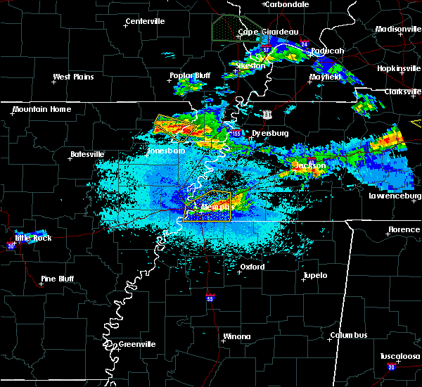 At 1012 pm cdt, a severe thunderstorm was located near cardwell, or near marmaduke, moving southeast at 25 mph (radar indicated). Hazards include 60 mph wind gusts and quarter size hail. Hail damage to vehicles is expected. Expect wind damage to roofs, siding, and trees. At 1012 pm cdt, a severe thunderstorm was located near cardwell, or near marmaduke, moving southeast at 25 mph (radar indicated). Hazards include 60 mph wind gusts and quarter size hail. Hail damage to vehicles is expected. Expect wind damage to roofs, siding, and trees.
|
| 4/8/2020 9:45 PM CDT | Hen Egg sized hail reported 8.2 miles E of Rector, AR, irregularly shaped hail up to 2 inches in diameter in knob. |
| 4/8/2020 9:44 PM CDT |
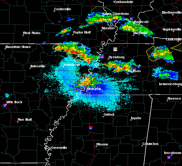 At 944 pm cdt, a severe thunderstorm was located over marmaduke, moving southeast at 20 mph (radar indicated). Hazards include 60 mph wind gusts and quarter size hail. Hail damage to vehicles is expected. expect wind damage to roofs, siding, and trees. Locations impacted include, rector, senath, marmaduke, cardwell, arbyrd, lafe, brighton, bertig, stonewall, heubner, fritz, bard, mounds, halliday, knob, leonard, bucoda, octa, paulding and scobeville. At 944 pm cdt, a severe thunderstorm was located over marmaduke, moving southeast at 20 mph (radar indicated). Hazards include 60 mph wind gusts and quarter size hail. Hail damage to vehicles is expected. expect wind damage to roofs, siding, and trees. Locations impacted include, rector, senath, marmaduke, cardwell, arbyrd, lafe, brighton, bertig, stonewall, heubner, fritz, bard, mounds, halliday, knob, leonard, bucoda, octa, paulding and scobeville.
|
| 4/8/2020 9:41 PM CDT | Quarter sized hail reported 3.8 miles N of Rector, AR |
| 4/8/2020 9:27 PM CDT |
 At 927 pm cdt, a severe thunderstorm was located over lafe, or near marmaduke, moving southeast at 30 mph (radar indicated). Hazards include 60 mph wind gusts and quarter size hail. Hail damage to vehicles is expected. Expect wind damage to roofs, siding, and trees. At 927 pm cdt, a severe thunderstorm was located over lafe, or near marmaduke, moving southeast at 30 mph (radar indicated). Hazards include 60 mph wind gusts and quarter size hail. Hail damage to vehicles is expected. Expect wind damage to roofs, siding, and trees.
|
| 3/28/2020 5:27 PM CDT |
 At 527 pm cdt, doppler radar indicated a severe thunderstorm producing a tornado was located near cardwell, or near paragould, moving northeast at 45 mph (radar indicated rotation). Hazards include tornado. Flying debris will be dangerous to those caught without shelter. mobile homes will be damaged or destroyed. damage to roofs, windows, and vehicles will occur. Tree damage is likely. At 527 pm cdt, doppler radar indicated a severe thunderstorm producing a tornado was located near cardwell, or near paragould, moving northeast at 45 mph (radar indicated rotation). Hazards include tornado. Flying debris will be dangerous to those caught without shelter. mobile homes will be damaged or destroyed. damage to roofs, windows, and vehicles will occur. Tree damage is likely.
|
| 3/28/2020 5:27 PM CDT |
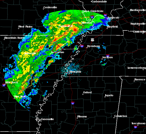 At 527 pm cdt, doppler radar indicated a severe thunderstorm producing a tornado was located near cardwell, or near paragould, moving northeast at 45 mph (radar indicated rotation). Hazards include tornado. Flying debris will be dangerous to those caught without shelter. mobile homes will be damaged or destroyed. damage to roofs, windows, and vehicles will occur. Tree damage is likely. At 527 pm cdt, doppler radar indicated a severe thunderstorm producing a tornado was located near cardwell, or near paragould, moving northeast at 45 mph (radar indicated rotation). Hazards include tornado. Flying debris will be dangerous to those caught without shelter. mobile homes will be damaged or destroyed. damage to roofs, windows, and vehicles will occur. Tree damage is likely.
|
| 3/24/2020 11:11 AM CDT |
 At 1111 am cdt, a severe thunderstorm was located over rector, moving east at 60 mph (radar indicated). Hazards include 60 mph wind gusts and quarter size hail. Hail damage to vehicles is expected. expect wind damage to roofs, siding, and trees. locations impacted include, paragould, kennett, piggott, campbell, rector, senath, marmaduke, clarkton, oak grove heights, holcomb, lafe, st. Francis, pollard, greenway, walcott, saint francis, crockett, nimmons, mounds and halliday. At 1111 am cdt, a severe thunderstorm was located over rector, moving east at 60 mph (radar indicated). Hazards include 60 mph wind gusts and quarter size hail. Hail damage to vehicles is expected. expect wind damage to roofs, siding, and trees. locations impacted include, paragould, kennett, piggott, campbell, rector, senath, marmaduke, clarkton, oak grove heights, holcomb, lafe, st. Francis, pollard, greenway, walcott, saint francis, crockett, nimmons, mounds and halliday.
|
| 3/24/2020 10:59 AM CDT |
 At 1058 am cdt, a severe thunderstorm was located near lafe, or 9 miles northwest of marmaduke, moving east at 60 mph (radar indicated). Hazards include 60 mph wind gusts and quarter size hail. Hail damage to vehicles is expected. Expect wind damage to roofs, siding, and trees. At 1058 am cdt, a severe thunderstorm was located near lafe, or 9 miles northwest of marmaduke, moving east at 60 mph (radar indicated). Hazards include 60 mph wind gusts and quarter size hail. Hail damage to vehicles is expected. Expect wind damage to roofs, siding, and trees.
|
| 3/24/2020 10:34 AM CDT |
 At 1034 am cdt, a severe thunderstorm was located over biggers, or 8 miles east of pocahontas, moving east at 65 mph (radar indicated). Hazards include 60 mph wind gusts and quarter size hail. Hail damage to vehicles is expected. Expect wind damage to roofs, siding, and trees. At 1034 am cdt, a severe thunderstorm was located over biggers, or 8 miles east of pocahontas, moving east at 65 mph (radar indicated). Hazards include 60 mph wind gusts and quarter size hail. Hail damage to vehicles is expected. Expect wind damage to roofs, siding, and trees.
|
| 3/3/2020 12:25 AM CST |
 At 1225 am cst, a severe thunderstorm was located over lake frierson state park, moving northeast at 50 mph (radar indicated). Hazards include half dollar size hail. damage to vehicles is expected At 1225 am cst, a severe thunderstorm was located over lake frierson state park, moving northeast at 50 mph (radar indicated). Hazards include half dollar size hail. damage to vehicles is expected
|
| 1/11/2020 1:15 AM CST |
 At 115 am cst, severe thunderstorms were located along a line extending from near puxico to near beech grove, moving northeast at 55 mph (radar indicated). Hazards include 60 mph wind gusts. Expect damage to roofs, siding, and trees. locations impacted include, paragould, kennett, piggott, manila, lake city, leachville, campbell, rector, senath, brookland, monette, marmaduke, chalk bluff natural area, oak grove heights, cardwell, hornersville, holcomb, arbyrd, st. Francis and dell. At 115 am cst, severe thunderstorms were located along a line extending from near puxico to near beech grove, moving northeast at 55 mph (radar indicated). Hazards include 60 mph wind gusts. Expect damage to roofs, siding, and trees. locations impacted include, paragould, kennett, piggott, manila, lake city, leachville, campbell, rector, senath, brookland, monette, marmaduke, chalk bluff natural area, oak grove heights, cardwell, hornersville, holcomb, arbyrd, st. Francis and dell.
|
| 1/11/2020 12:47 AM CST |
 At 1247 am cst, severe thunderstorms were located along a line extending from near harviell to bono, moving northeast at 55 mph (radar indicated). Hazards include 60 mph wind gusts. expect damage to roofs, siding, and trees At 1247 am cst, severe thunderstorms were located along a line extending from near harviell to bono, moving northeast at 55 mph (radar indicated). Hazards include 60 mph wind gusts. expect damage to roofs, siding, and trees
|
| 8/6/2019 8:15 PM CDT |
 At 815 pm cdt, a severe thunderstorm was located over marmaduke, moving southeast at 45 mph (radar indicated). Hazards include 60 mph wind gusts and quarter size hail. Hail damage to vehicles is expected. Expect wind damage to roofs, siding, and trees. At 815 pm cdt, a severe thunderstorm was located over marmaduke, moving southeast at 45 mph (radar indicated). Hazards include 60 mph wind gusts and quarter size hail. Hail damage to vehicles is expected. Expect wind damage to roofs, siding, and trees.
|
| 6/26/2019 5:45 PM CDT |
 At 526 pm cdt, a severe thunderstorm was located over biggers, or 10 miles east of pocahontas, moving east at 30 mph (radar indicated). Hazards include 60 mph wind gusts. expect damage to roofs, siding, and trees At 526 pm cdt, a severe thunderstorm was located over biggers, or 10 miles east of pocahontas, moving east at 30 mph (radar indicated). Hazards include 60 mph wind gusts. expect damage to roofs, siding, and trees
|
| 6/26/2019 5:26 PM CDT |
 At 526 pm cdt, a severe thunderstorm was located over biggers, or 10 miles east of pocahontas, moving east at 30 mph (radar indicated). Hazards include 60 mph wind gusts. expect damage to roofs, siding, and trees At 526 pm cdt, a severe thunderstorm was located over biggers, or 10 miles east of pocahontas, moving east at 30 mph (radar indicated). Hazards include 60 mph wind gusts. expect damage to roofs, siding, and trees
|
| 6/23/2019 3:18 PM CDT |
 At 317 pm cdt, severe thunderstorms were located along a line extending from near glennonville to near arbyrd, moving east at 45 mph (radar indicated). Hazards include 60 mph wind gusts. Expect damage to roofs, siding, and trees. locations impacted include, paragould, kennett, malden, piggott, campbell, rector, senath, marmaduke, chalk bluff natural area, clarkton, cardwell, hornersville, holcomb, arbyrd, wardell, st. Francis, pollard, greenway, mcdougal and glennonville. At 317 pm cdt, severe thunderstorms were located along a line extending from near glennonville to near arbyrd, moving east at 45 mph (radar indicated). Hazards include 60 mph wind gusts. Expect damage to roofs, siding, and trees. locations impacted include, paragould, kennett, malden, piggott, campbell, rector, senath, marmaduke, chalk bluff natural area, clarkton, cardwell, hornersville, holcomb, arbyrd, wardell, st. Francis, pollard, greenway, mcdougal and glennonville.
|
| 6/23/2019 3:03 PM CDT |
 At 303 pm cdt, severe thunderstorms were located along a line extending from near qulin to near paragould, moving east at 40 mph (radar indicated). Hazards include 60 mph wind gusts. expect damage to roofs, siding, and trees At 303 pm cdt, severe thunderstorms were located along a line extending from near qulin to near paragould, moving east at 40 mph (radar indicated). Hazards include 60 mph wind gusts. expect damage to roofs, siding, and trees
|
| 6/23/2019 2:47 PM CDT |
 At 247 pm cdt, severe thunderstorms were located along a line extending from near corning to near crowleys ridge state park, moving east at 50 mph (radar indicated). Hazards include 60 mph wind gusts. Expect damage to roofs, siding, and trees. Locations impacted include, paragould, piggott, corning, rector, marmaduke, chalk bluff natural area, crowleys ridge state park, lake frierson state park, oak grove heights, cardwell, arbyrd, lafe, reyno, knobel, pollard, greenway, o`kean, mcdougal, success and peach orchard. At 247 pm cdt, severe thunderstorms were located along a line extending from near corning to near crowleys ridge state park, moving east at 50 mph (radar indicated). Hazards include 60 mph wind gusts. Expect damage to roofs, siding, and trees. Locations impacted include, paragould, piggott, corning, rector, marmaduke, chalk bluff natural area, crowleys ridge state park, lake frierson state park, oak grove heights, cardwell, arbyrd, lafe, reyno, knobel, pollard, greenway, o`kean, mcdougal, success and peach orchard.
|
| 6/23/2019 2:31 PM CDT |
 At 230 pm cdt, severe thunderstorms were located along a line extending from near success to near fontaine, moving east at 45 mph (radar indicated. at 227 pm cdt, a wind gust of 63 mph was measured in walnut ridge). Hazards include 60 mph wind gusts. expect damage to roofs, siding, and trees At 230 pm cdt, severe thunderstorms were located along a line extending from near success to near fontaine, moving east at 45 mph (radar indicated. at 227 pm cdt, a wind gust of 63 mph was measured in walnut ridge). Hazards include 60 mph wind gusts. expect damage to roofs, siding, and trees
|
| 6/23/2019 2:31 PM CDT |
 The national weather service in memphis has issued a * severe thunderstorm warning for. greene county in eastern arkansas. clay county in eastern arkansas. western dunklin county in southeastern missouri. Until 315 pm cdt. The national weather service in memphis has issued a * severe thunderstorm warning for. greene county in eastern arkansas. clay county in eastern arkansas. western dunklin county in southeastern missouri. Until 315 pm cdt.
|
| 6/21/2019 5:46 PM CDT |
 At 544 pm cdt, severe thunderstorms were located along a line extending from near tiptonville to near o`kean, moving southeast at 25 mph (radar indicated, measured at kennett missouri airport). Hazards include 60 mph wind gusts. expect damage to roofs, siding, and trees At 544 pm cdt, severe thunderstorms were located along a line extending from near tiptonville to near o`kean, moving southeast at 25 mph (radar indicated, measured at kennett missouri airport). Hazards include 60 mph wind gusts. expect damage to roofs, siding, and trees
|
| 6/21/2019 5:46 PM CDT |
 The national weather service in memphis has issued a * severe thunderstorm warning for. greene county in eastern arkansas. central craighead county in eastern arkansas. northwestern mississippi county in eastern arkansas. Clay county in eastern arkansas. The national weather service in memphis has issued a * severe thunderstorm warning for. greene county in eastern arkansas. central craighead county in eastern arkansas. northwestern mississippi county in eastern arkansas. Clay county in eastern arkansas.
|
| 6/21/2019 5:25 PM CDT |
 At 456 pm cdt, severe thunderstorms were located along a line extending from near bernie to near success, moving southeast at 30 mph (radar indicated). Hazards include 60 mph wind gusts. expect damage to roofs, siding, and trees At 456 pm cdt, severe thunderstorms were located along a line extending from near bernie to near success, moving southeast at 30 mph (radar indicated). Hazards include 60 mph wind gusts. expect damage to roofs, siding, and trees
|
| 6/21/2019 5:25 PM CDT |
 At 525 pm cdt, a severe thunderstorm was located over mcdougal, or 8 miles west of chalk bluff natural area, moving southeast at 5 mph (radar indicated). Hazards include 60 mph wind gusts and nickel size hail. Expect damage to roofs, siding, and trees. locations impacted include, kennett, malden, piggott, corning, portageville, hayti, campbell, rector, marmaduke, chalk bluff natural area, tiptonville, oak grove heights, holcomb, hayti heights, lafe, reyno, wardell, knobel, st. Francis and pollard. At 525 pm cdt, a severe thunderstorm was located over mcdougal, or 8 miles west of chalk bluff natural area, moving southeast at 5 mph (radar indicated). Hazards include 60 mph wind gusts and nickel size hail. Expect damage to roofs, siding, and trees. locations impacted include, kennett, malden, piggott, corning, portageville, hayti, campbell, rector, marmaduke, chalk bluff natural area, tiptonville, oak grove heights, holcomb, hayti heights, lafe, reyno, wardell, knobel, st. Francis and pollard.
|
| 6/21/2019 4:56 PM CDT |
 At 456 pm cdt, severe thunderstorms were located along a line extending from near bernie to near success, moving southeast at 30 mph (radar indicated). Hazards include 60 mph wind gusts. expect damage to roofs, siding, and trees At 456 pm cdt, severe thunderstorms were located along a line extending from near bernie to near success, moving southeast at 30 mph (radar indicated). Hazards include 60 mph wind gusts. expect damage to roofs, siding, and trees
|
| 5/2/2019 5:54 PM CDT |
 At 554 pm cdt, doppler radar indicated a severe thunderstorm producing a tornado was located near arbyrd, or near senath, moving northeast at 20 mph (radar indicated rotation). Hazards include tornado. Flying debris will be dangerous to those caught without shelter. mobile homes will be damaged or destroyed. damage to roofs, windows, and vehicles will occur. Tree damage is likely. At 554 pm cdt, doppler radar indicated a severe thunderstorm producing a tornado was located near arbyrd, or near senath, moving northeast at 20 mph (radar indicated rotation). Hazards include tornado. Flying debris will be dangerous to those caught without shelter. mobile homes will be damaged or destroyed. damage to roofs, windows, and vehicles will occur. Tree damage is likely.
|
| 5/2/2019 5:54 PM CDT |
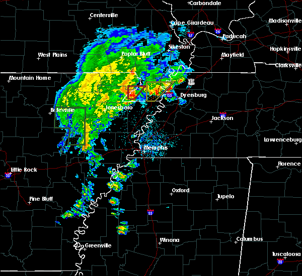 At 554 pm cdt, doppler radar indicated a severe thunderstorm producing a tornado was located near arbyrd, or near senath, moving northeast at 20 mph (radar indicated rotation). Hazards include tornado. Flying debris will be dangerous to those caught without shelter. mobile homes will be damaged or destroyed. damage to roofs, windows, and vehicles will occur. Tree damage is likely. At 554 pm cdt, doppler radar indicated a severe thunderstorm producing a tornado was located near arbyrd, or near senath, moving northeast at 20 mph (radar indicated rotation). Hazards include tornado. Flying debris will be dangerous to those caught without shelter. mobile homes will be damaged or destroyed. damage to roofs, windows, and vehicles will occur. Tree damage is likely.
|
| 3/14/2019 6:39 AM CDT |
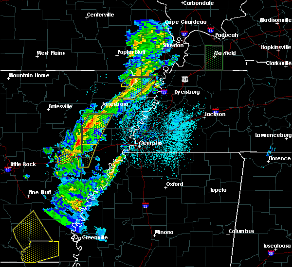 At 639 am cdt, a severe thunderstorm was located near senath, moving northeast at 60 mph (radar indicated). Hazards include 60 mph wind gusts. Expect damage to roofs, siding, and trees. locations impacted include, kennett, piggott, rector, senath, cardwell, hornersville, holcomb, arbyrd, wardell, greenway, bragg city, nimmons, arkmo, west kennett, leonard, bell city, pratt, noland, carryville and happy corners. A tornado watch remains in effect until noon cdt for eastern arkansas, and southeastern missouri. At 639 am cdt, a severe thunderstorm was located near senath, moving northeast at 60 mph (radar indicated). Hazards include 60 mph wind gusts. Expect damage to roofs, siding, and trees. locations impacted include, kennett, piggott, rector, senath, cardwell, hornersville, holcomb, arbyrd, wardell, greenway, bragg city, nimmons, arkmo, west kennett, leonard, bell city, pratt, noland, carryville and happy corners. A tornado watch remains in effect until noon cdt for eastern arkansas, and southeastern missouri.
|
| 3/14/2019 6:21 AM CDT |
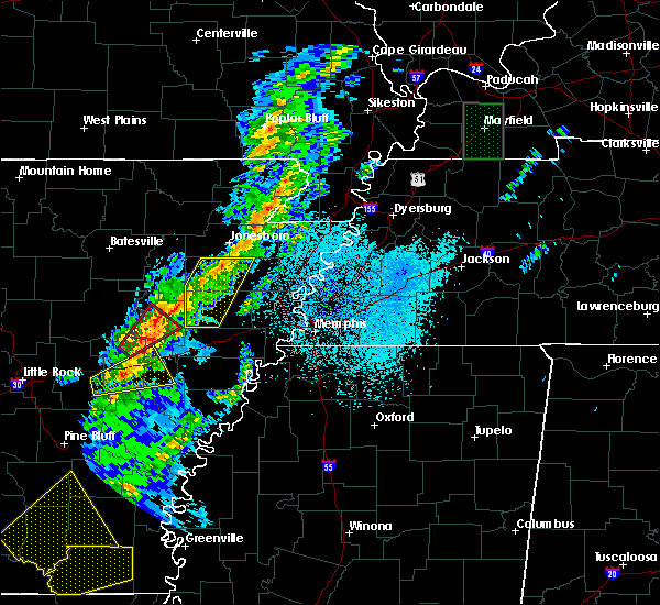 At 621 am cdt, a severe thunderstorm was located near paragould, moving northeast at 60 mph (radar indicated). Hazards include 60 mph wind gusts. expect damage to roofs, siding, and trees At 621 am cdt, a severe thunderstorm was located near paragould, moving northeast at 60 mph (radar indicated). Hazards include 60 mph wind gusts. expect damage to roofs, siding, and trees
|
| 12/1/2018 3:26 AM CST |
 At 325 am cst, a severe thunderstorm was located over marmaduke, moving northeast at 55 mph (radar indicated). Hazards include 60 mph wind gusts. Expect damage to roofs, siding, and trees. locations impacted include, jonesboro, paragould, kennett, piggott, campbell, rector, senath, brookland, marmaduke, clarkton, oak grove heights, cardwell, hornersville, holcomb, arbyrd, st. francis, greenway, saint francis, crockett and nimmons. A tornado watch remains in effect until 800 am cst for eastern arkansas. At 325 am cst, a severe thunderstorm was located over marmaduke, moving northeast at 55 mph (radar indicated). Hazards include 60 mph wind gusts. Expect damage to roofs, siding, and trees. locations impacted include, jonesboro, paragould, kennett, piggott, campbell, rector, senath, brookland, marmaduke, clarkton, oak grove heights, cardwell, hornersville, holcomb, arbyrd, st. francis, greenway, saint francis, crockett and nimmons. A tornado watch remains in effect until 800 am cst for eastern arkansas.
|
| 12/1/2018 3:26 AM CST |
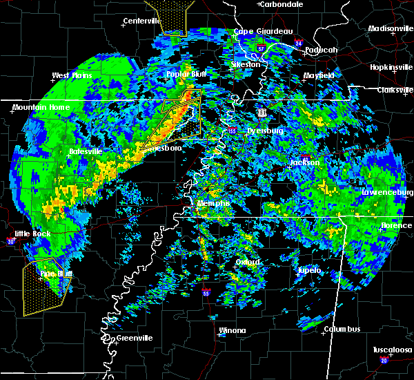 At 325 am cst, a severe thunderstorm was located over marmaduke, moving northeast at 55 mph (radar indicated). Hazards include 60 mph wind gusts. Expect damage to roofs, siding, and trees. locations impacted include, jonesboro, paragould, kennett, piggott, campbell, rector, senath, brookland, marmaduke, clarkton, oak grove heights, cardwell, hornersville, holcomb, arbyrd, st. francis, greenway, saint francis, crockett and nimmons. A tornado watch remains in effect until 800 am cst for eastern arkansas. At 325 am cst, a severe thunderstorm was located over marmaduke, moving northeast at 55 mph (radar indicated). Hazards include 60 mph wind gusts. Expect damage to roofs, siding, and trees. locations impacted include, jonesboro, paragould, kennett, piggott, campbell, rector, senath, brookland, marmaduke, clarkton, oak grove heights, cardwell, hornersville, holcomb, arbyrd, st. francis, greenway, saint francis, crockett and nimmons. A tornado watch remains in effect until 800 am cst for eastern arkansas.
|
| 12/1/2018 3:08 AM CST |
 At 307 am cst, a severe thunderstorm was located over walcott, or over crowleys ridge state park, moving northeast at 55 mph (radar indicated). Hazards include 60 mph wind gusts. expect damage to roofs, siding, and trees At 307 am cst, a severe thunderstorm was located over walcott, or over crowleys ridge state park, moving northeast at 55 mph (radar indicated). Hazards include 60 mph wind gusts. expect damage to roofs, siding, and trees
|
| 8/6/2018 3:36 PM CDT |
 At 336 pm cdt, a severe thunderstorm was located near marmaduke, moving east at 15 mph (radar indicated). Hazards include 60 mph wind gusts and quarter size hail. Hail damage to vehicles is expected. Expect wind damage to roofs, siding, and trees. At 336 pm cdt, a severe thunderstorm was located near marmaduke, moving east at 15 mph (radar indicated). Hazards include 60 mph wind gusts and quarter size hail. Hail damage to vehicles is expected. Expect wind damage to roofs, siding, and trees.
|
| 5/31/2018 11:42 PM CDT |
 At 1141 pm cdt, a severe thunderstorm was located over rector, moving east at 35 mph (radar indicated). Hazards include 60 mph wind gusts. expect damage to roofs, siding, and trees At 1141 pm cdt, a severe thunderstorm was located over rector, moving east at 35 mph (radar indicated). Hazards include 60 mph wind gusts. expect damage to roofs, siding, and trees
|
| 5/31/2018 11:05 PM CDT |
 At 1104 pm cdt, severe thunderstorms were located along a line extending from near peach orchard to lake charles state park, moving southeast at 25 mph (radar indicated). Hazards include 60 mph wind gusts. expect damage to roofs, siding, and trees At 1104 pm cdt, severe thunderstorms were located along a line extending from near peach orchard to lake charles state park, moving southeast at 25 mph (radar indicated). Hazards include 60 mph wind gusts. expect damage to roofs, siding, and trees
|
| 5/20/2018 2:45 PM CDT |
 At 245 pm cdt, a severe thunderstorm was located near marmaduke, moving east at 10 mph (radar indicated). Hazards include golf ball size hail and 60 mph wind gusts. People and animals outdoors will be injured. expect hail damage to roofs, siding, windows, and vehicles. Expect wind damage to roofs, siding, and trees. At 245 pm cdt, a severe thunderstorm was located near marmaduke, moving east at 10 mph (radar indicated). Hazards include golf ball size hail and 60 mph wind gusts. People and animals outdoors will be injured. expect hail damage to roofs, siding, windows, and vehicles. Expect wind damage to roofs, siding, and trees.
|
| 3/26/2018 6:41 AM CDT |
 At 641 am cdt, a severe thunderstorm was located near lafe, or 7 miles northwest of marmaduke, moving east at 25 mph (radar indicated). Hazards include quarter size hail. Damage to vehicles is expected. Locations impacted include, rector, marmaduke, lafe, knobel, peach orchard, crockett, pratt, hargrave corner, stonewall, heubner, tipperary, fritz, knob and leonard. At 641 am cdt, a severe thunderstorm was located near lafe, or 7 miles northwest of marmaduke, moving east at 25 mph (radar indicated). Hazards include quarter size hail. Damage to vehicles is expected. Locations impacted include, rector, marmaduke, lafe, knobel, peach orchard, crockett, pratt, hargrave corner, stonewall, heubner, tipperary, fritz, knob and leonard.
|
| 3/26/2018 6:41 AM CDT |
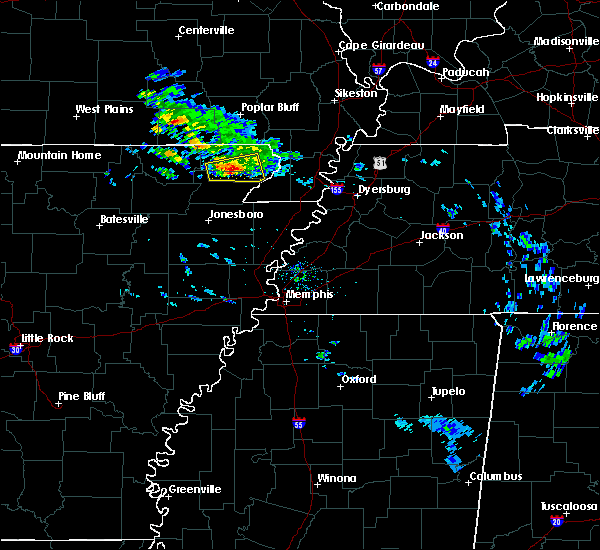 At 641 am cdt, a severe thunderstorm was located near lafe, or 7 miles northwest of marmaduke, moving east at 25 mph (radar indicated). Hazards include quarter size hail. Damage to vehicles is expected. Locations impacted include, rector, marmaduke, lafe, knobel, peach orchard, crockett, pratt, hargrave corner, stonewall, heubner, tipperary, fritz, knob and leonard. At 641 am cdt, a severe thunderstorm was located near lafe, or 7 miles northwest of marmaduke, moving east at 25 mph (radar indicated). Hazards include quarter size hail. Damage to vehicles is expected. Locations impacted include, rector, marmaduke, lafe, knobel, peach orchard, crockett, pratt, hargrave corner, stonewall, heubner, tipperary, fritz, knob and leonard.
|
| 3/26/2018 6:22 AM CDT |
 At 622 am cdt, a severe thunderstorm was located near peach orchard, or 10 miles south of corning, moving east at 35 mph (radar indicated). Hazards include half dollar size hail. damage to vehicles is expected At 622 am cdt, a severe thunderstorm was located near peach orchard, or 10 miles south of corning, moving east at 35 mph (radar indicated). Hazards include half dollar size hail. damage to vehicles is expected
|
| 3/26/2018 6:22 AM CDT |
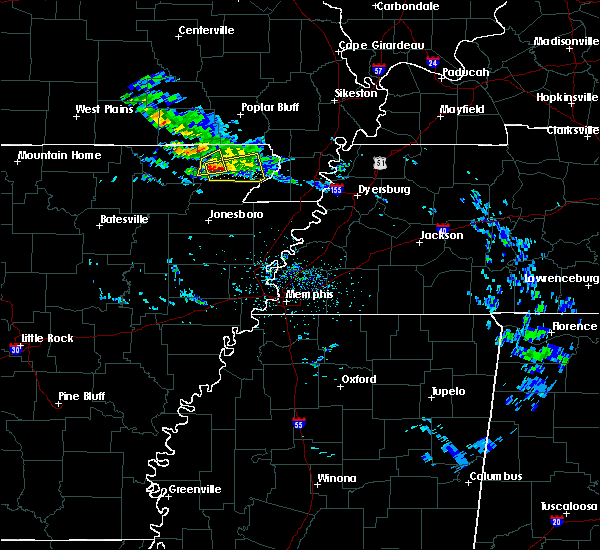 At 622 am cdt, a severe thunderstorm was located near peach orchard, or 10 miles south of corning, moving east at 35 mph (radar indicated). Hazards include half dollar size hail. damage to vehicles is expected At 622 am cdt, a severe thunderstorm was located near peach orchard, or 10 miles south of corning, moving east at 35 mph (radar indicated). Hazards include half dollar size hail. damage to vehicles is expected
|
| 2/24/2018 5:31 PM CST |
 At 530 pm cst, a severe thunderstorm producing a tornado was located near walcott, or near crowleys ridge state park, moving northeast at 55 mph (radar indicated rotation). Hazards include tornado. Flying debris will be dangerous to those caught without shelter. mobile homes will be damaged or destroyed. damage to roofs, windows, and vehicles will occur. tree damage is likely. Locations impacted include, paragould, rector, marmaduke, crowleys ridge state park, lake frierson state park, oak grove heights, lafe, evening star, walcott, beech grove, stonewall, heubner, fritz, mounds, halliday, light, leonard, finch, lorado and faulknerville. At 530 pm cst, a severe thunderstorm producing a tornado was located near walcott, or near crowleys ridge state park, moving northeast at 55 mph (radar indicated rotation). Hazards include tornado. Flying debris will be dangerous to those caught without shelter. mobile homes will be damaged or destroyed. damage to roofs, windows, and vehicles will occur. tree damage is likely. Locations impacted include, paragould, rector, marmaduke, crowleys ridge state park, lake frierson state park, oak grove heights, lafe, evening star, walcott, beech grove, stonewall, heubner, fritz, mounds, halliday, light, leonard, finch, lorado and faulknerville.
|
| 2/24/2018 5:15 PM CST |
 At 515 pm cst, a severe thunderstorm producing a tornado was located near minturn, or near hoxie, moving northeast at 35 mph (radar indicated rotation). Hazards include tornado. Flying debris will be dangerous to those caught without shelter. mobile homes will be damaged or destroyed. damage to roofs, windows, and vehicles will occur. Tree damage is likely. At 515 pm cst, a severe thunderstorm producing a tornado was located near minturn, or near hoxie, moving northeast at 35 mph (radar indicated rotation). Hazards include tornado. Flying debris will be dangerous to those caught without shelter. mobile homes will be damaged or destroyed. damage to roofs, windows, and vehicles will occur. Tree damage is likely.
|
| 2/24/2018 5:05 PM CST |
 At 505 pm cst, a severe thunderstorm was located over o`kean, or 8 miles northeast of walnut ridge, moving northeast at 60 mph (radar indicated). Hazards include 60 mph wind gusts. expect damage to roofs, siding, and trees At 505 pm cst, a severe thunderstorm was located over o`kean, or 8 miles northeast of walnut ridge, moving northeast at 60 mph (radar indicated). Hazards include 60 mph wind gusts. expect damage to roofs, siding, and trees
|
| 2/20/2018 10:49 PM CST |
 At 1049 pm cst, a severe thunderstorm was located over marmaduke, moving northeast at 55 mph (radar indicated). Hazards include 60 mph wind gusts. Expect damage to roofs, siding, and trees. locations impacted include, malden, piggott, campbell, rector, marmaduke, chalk bluff natural area, clarkton, holcomb, lafe, st. Francis, pollard, greenway, mcdougal, glennonville, saint francis, crockett, nimmons, heubner, fritz and lorine. At 1049 pm cst, a severe thunderstorm was located over marmaduke, moving northeast at 55 mph (radar indicated). Hazards include 60 mph wind gusts. Expect damage to roofs, siding, and trees. locations impacted include, malden, piggott, campbell, rector, marmaduke, chalk bluff natural area, clarkton, holcomb, lafe, st. Francis, pollard, greenway, mcdougal, glennonville, saint francis, crockett, nimmons, heubner, fritz and lorine.
|
| 2/20/2018 10:41 PM CST |
 At 1040 pm cst, a severe thunderstorm was located over paragould, moving northeast at 55 mph (radar indicated). Hazards include 60 mph wind gusts. expect damage to roofs, siding, and trees At 1040 pm cst, a severe thunderstorm was located over paragould, moving northeast at 55 mph (radar indicated). Hazards include 60 mph wind gusts. expect damage to roofs, siding, and trees
|
| 8/11/2017 11:40 AM CDT |
 At 1139 am cdt, a severe thunderstorm was located near greenway, or near piggott, moving east at 35 mph (radar indicated). Hazards include 60 mph wind gusts. expect damage to roofs, siding, and trees At 1139 am cdt, a severe thunderstorm was located near greenway, or near piggott, moving east at 35 mph (radar indicated). Hazards include 60 mph wind gusts. expect damage to roofs, siding, and trees
|
| 5/27/2017 9:38 PM CDT |
 At 937 pm cdt, severe thunderstorms were located along a line extending from pollard to near brookland to near swifton, moving southeast at 35 mph (radar indicated). Hazards include 70 mph wind gusts and quarter size hail. Hail damage to vehicles is expected. expect considerable tree damage. Wind damage is also likely to mobile homes, roofs, and outbuildings. At 937 pm cdt, severe thunderstorms were located along a line extending from pollard to near brookland to near swifton, moving southeast at 35 mph (radar indicated). Hazards include 70 mph wind gusts and quarter size hail. Hail damage to vehicles is expected. expect considerable tree damage. Wind damage is also likely to mobile homes, roofs, and outbuildings.
|
| 5/27/2017 9:25 PM CDT |
 At 925 pm cdt, severe thunderstorms were located along a line extending from mcdougal to near walcott to near strawberry, moving east at 60 mph (radar indicated). Hazards include 70 mph wind gusts. Expect considerable tree damage. damage is likely to mobile homes, roofs, and outbuildings. locations impacted include, jonesboro, paragould, kennett, pocahontas, walnut ridge, piggott, corning, hoxie, bono, lake city, leachville, campbell, rector, senath, brookland, monette, marmaduke, black rock, lake charles state park and chalk bluff natural area. A tornado watch remains in effect until 200 am cdt for eastern arkansas, and southeastern missouri. At 925 pm cdt, severe thunderstorms were located along a line extending from mcdougal to near walcott to near strawberry, moving east at 60 mph (radar indicated). Hazards include 70 mph wind gusts. Expect considerable tree damage. damage is likely to mobile homes, roofs, and outbuildings. locations impacted include, jonesboro, paragould, kennett, pocahontas, walnut ridge, piggott, corning, hoxie, bono, lake city, leachville, campbell, rector, senath, brookland, monette, marmaduke, black rock, lake charles state park and chalk bluff natural area. A tornado watch remains in effect until 200 am cdt for eastern arkansas, and southeastern missouri.
|
| 5/27/2017 9:06 PM CDT |
 At 906 pm cdt, severe thunderstorms were located along a line extending from near doniphan to near pocahontas to near sidney, moving southeast at 60 mph (radar indicated). Hazards include 70 mph wind gusts. Expect considerable tree damage. Damage is likely to mobile homes, roofs, and outbuildings. At 906 pm cdt, severe thunderstorms were located along a line extending from near doniphan to near pocahontas to near sidney, moving southeast at 60 mph (radar indicated). Hazards include 70 mph wind gusts. Expect considerable tree damage. Damage is likely to mobile homes, roofs, and outbuildings.
|
| 5/27/2017 5:43 AM CDT |
 At 542 am cdt, severe thunderstorms were located along a line extending from glennonville to greenway to near marmaduke, moving east at 60 mph (radar indicated). Hazards include 60 mph wind gusts and quarter size hail. Hail damage to vehicles is expected. expect wind damage to roofs, siding, and trees. locations impacted include, kennett, malden, piggott, corning, campbell, rector, marmaduke, chalk bluff natural area, clarkton, holcomb, lafe, knobel, st. Francis, pollard, greenway, mcdougal, glennonville, saint francis, crockett and nimmons. At 542 am cdt, severe thunderstorms were located along a line extending from glennonville to greenway to near marmaduke, moving east at 60 mph (radar indicated). Hazards include 60 mph wind gusts and quarter size hail. Hail damage to vehicles is expected. expect wind damage to roofs, siding, and trees. locations impacted include, kennett, malden, piggott, corning, campbell, rector, marmaduke, chalk bluff natural area, clarkton, holcomb, lafe, knobel, st. Francis, pollard, greenway, mcdougal, glennonville, saint francis, crockett and nimmons.
|
| 5/27/2017 5:25 AM CDT |
 At 525 am cdt, severe thunderstorms were located along a line extending from near neelyville to 6 miles east of knobel to near evening star, moving east at 55 mph (radar indicated). Hazards include 60 mph wind gusts and quarter size hail. Hail damage to vehicles is expected. Expect wind damage to roofs, siding, and trees. At 525 am cdt, severe thunderstorms were located along a line extending from near neelyville to 6 miles east of knobel to near evening star, moving east at 55 mph (radar indicated). Hazards include 60 mph wind gusts and quarter size hail. Hail damage to vehicles is expected. Expect wind damage to roofs, siding, and trees.
|
| 4/30/2017 1:56 AM CDT |
 At 155 am cdt, a severe thunderstorm was located over piggott, moving east at 65 mph (radar indicated). Hazards include 60 mph wind gusts. expect damage to roofs, siding, and trees At 155 am cdt, a severe thunderstorm was located over piggott, moving east at 65 mph (radar indicated). Hazards include 60 mph wind gusts. expect damage to roofs, siding, and trees
|
| 4/30/2017 1:25 AM CDT |
 At 124 am cdt, severe thunderstorms were located along a line extending from 8 miles west of budapest to near biggers, moving northeast at 55 mph (radar indicated). Hazards include 60 mph wind gusts and quarter size hail. Hail damage to vehicles is expected. expect wind damage to roofs, siding, and trees. locations impacted include, jonesboro, paragould, piggott, corning, bono, marmaduke, chalk bluff natural area, crowleys ridge state park, lake frierson state park, oak grove heights, lafe, reyno, maynard, biggers, cash, knobel, st. Francis, pollard, o`kean and mcdougal. At 124 am cdt, severe thunderstorms were located along a line extending from 8 miles west of budapest to near biggers, moving northeast at 55 mph (radar indicated). Hazards include 60 mph wind gusts and quarter size hail. Hail damage to vehicles is expected. expect wind damage to roofs, siding, and trees. locations impacted include, jonesboro, paragould, piggott, corning, bono, marmaduke, chalk bluff natural area, crowleys ridge state park, lake frierson state park, oak grove heights, lafe, reyno, maynard, biggers, cash, knobel, st. Francis, pollard, o`kean and mcdougal.
|
| 4/30/2017 1:17 AM CDT |
 At 117 am cdt, a severe thunderstorm producing a tornado was located near beech grove, or near crowleys ridge state park, moving northeast at 55 mph (radar indicated rotation). Hazards include tornado. Flying debris will be dangerous to those caught without shelter. mobile homes will be damaged or destroyed. damage to roofs, windows, and vehicles will occur. tree damage is likely. this dangerous storm will be near, oak grove heights and lafe around 125 am cdt. marmaduke around 135 am cdt. rector around 140 am cdt. greenway around 150 am cdt. kennett around 155 am cdt. holcomb around 200 am cdt. Other locations impacted by this tornadic thunderstorm include ipley, octa, scobeville, stonewall, vincit, heubner, fritz, bard, case and lorine. At 117 am cdt, a severe thunderstorm producing a tornado was located near beech grove, or near crowleys ridge state park, moving northeast at 55 mph (radar indicated rotation). Hazards include tornado. Flying debris will be dangerous to those caught without shelter. mobile homes will be damaged or destroyed. damage to roofs, windows, and vehicles will occur. tree damage is likely. this dangerous storm will be near, oak grove heights and lafe around 125 am cdt. marmaduke around 135 am cdt. rector around 140 am cdt. greenway around 150 am cdt. kennett around 155 am cdt. holcomb around 200 am cdt. Other locations impacted by this tornadic thunderstorm include ipley, octa, scobeville, stonewall, vincit, heubner, fritz, bard, case and lorine.
|
| 4/30/2017 1:17 AM CDT |
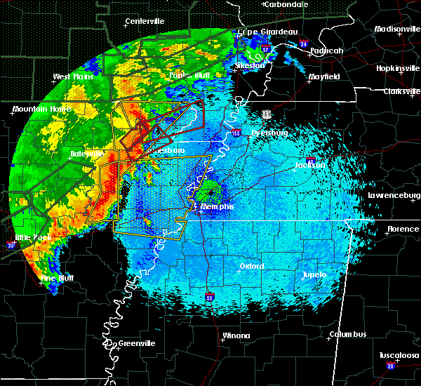 At 117 am cdt, a severe thunderstorm producing a tornado was located near beech grove, or near crowleys ridge state park, moving northeast at 55 mph (radar indicated rotation). Hazards include tornado. Flying debris will be dangerous to those caught without shelter. mobile homes will be damaged or destroyed. damage to roofs, windows, and vehicles will occur. tree damage is likely. this dangerous storm will be near, oak grove heights and lafe around 125 am cdt. marmaduke around 135 am cdt. rector around 140 am cdt. greenway around 150 am cdt. kennett around 155 am cdt. holcomb around 200 am cdt. Other locations impacted by this tornadic thunderstorm include ipley, octa, scobeville, stonewall, vincit, heubner, fritz, bard, case and lorine. At 117 am cdt, a severe thunderstorm producing a tornado was located near beech grove, or near crowleys ridge state park, moving northeast at 55 mph (radar indicated rotation). Hazards include tornado. Flying debris will be dangerous to those caught without shelter. mobile homes will be damaged or destroyed. damage to roofs, windows, and vehicles will occur. tree damage is likely. this dangerous storm will be near, oak grove heights and lafe around 125 am cdt. marmaduke around 135 am cdt. rector around 140 am cdt. greenway around 150 am cdt. kennett around 155 am cdt. holcomb around 200 am cdt. Other locations impacted by this tornadic thunderstorm include ipley, octa, scobeville, stonewall, vincit, heubner, fritz, bard, case and lorine.
|
| 4/30/2017 12:52 AM CDT |
 At 1252 am cdt, severe thunderstorms were located along a line extending from near attica to near minturn, moving northeast at 55 mph (radar indicated). Hazards include 60 mph wind gusts and quarter size hail. Hail damage to vehicles is expected. Expect wind damage to roofs, siding, and trees. At 1252 am cdt, severe thunderstorms were located along a line extending from near attica to near minturn, moving northeast at 55 mph (radar indicated). Hazards include 60 mph wind gusts and quarter size hail. Hail damage to vehicles is expected. Expect wind damage to roofs, siding, and trees.
|
| 4/29/2017 9:06 PM CDT |
 The severe thunderstorm warning for mississippi, eastern clay, southwestern pemiscot, southern dunklin and northwestern lauderdale counties will expire at 915 pm cdt, the storms which prompted the warning have weakened below severe limits, and have exited the warned area. therefore, the warning will be allowed to expire. however heavy rain is still possible with these thunderstorms. The severe thunderstorm warning for mississippi, eastern clay, southwestern pemiscot, southern dunklin and northwestern lauderdale counties will expire at 915 pm cdt, the storms which prompted the warning have weakened below severe limits, and have exited the warned area. therefore, the warning will be allowed to expire. however heavy rain is still possible with these thunderstorms.
|
| 4/29/2017 8:49 PM CDT |
 At 849 pm cdt, severe thunderstorms were located along a line extending from near senath to 6 miles north of ashport, moving northeast at 50 mph (radar indicated). Hazards include 60 mph wind gusts. Expect damage to roofs, siding, and trees. Locations impacted include, blytheville, kennett, osceola, piggott, gosnell, manila, steele, leachville, rector, senath, caraway, luxora, keiser, cardwell, hornersville, arbyrd, cooter, dell, pollard and greenway. At 849 pm cdt, severe thunderstorms were located along a line extending from near senath to 6 miles north of ashport, moving northeast at 50 mph (radar indicated). Hazards include 60 mph wind gusts. Expect damage to roofs, siding, and trees. Locations impacted include, blytheville, kennett, osceola, piggott, gosnell, manila, steele, leachville, rector, senath, caraway, luxora, keiser, cardwell, hornersville, arbyrd, cooter, dell, pollard and greenway.
|
| 4/29/2017 8:18 PM CDT |
 At 817 pm cdt, a severe thunderstorm was located over caraway, moving northeast at 40 mph (radar indicated). Hazards include 60 mph wind gusts. expect damage to roofs, siding, and trees At 817 pm cdt, a severe thunderstorm was located over caraway, moving northeast at 40 mph (radar indicated). Hazards include 60 mph wind gusts. expect damage to roofs, siding, and trees
|
| 3/25/2017 1:48 AM CDT |
 At 148 am cdt, a severe thunderstorm was located near greenway, or near piggott, moving northeast at 60 mph (radar indicated). Hazards include 60 mph wind gusts. Expect damage to roofs, siding, and trees. Locations impacted include, blytheville, kennett, trumann, piggott, gosnell, manila, lake city, leachville, rector, lepanto, senath, monette, caraway, marmaduke, cardwell, hornersville, arbyrd, dell, pollard and greenway. At 148 am cdt, a severe thunderstorm was located near greenway, or near piggott, moving northeast at 60 mph (radar indicated). Hazards include 60 mph wind gusts. Expect damage to roofs, siding, and trees. Locations impacted include, blytheville, kennett, trumann, piggott, gosnell, manila, lake city, leachville, rector, lepanto, senath, monette, caraway, marmaduke, cardwell, hornersville, arbyrd, dell, pollard and greenway.
|
| 3/25/2017 1:36 AM CDT |
 At 135 am cdt, a severe thunderstorm was located over marmaduke, moving northeast at 60 mph (radar indicated). Hazards include 60 mph wind gusts. Expect damage to roofs, siding, and trees. Locations impacted include, jonesboro, paragould, blytheville, kennett, trumann, piggott, gosnell, manila, harrisburg, lake city, leachville, rector, lepanto, bay, senath, brookland, monette, caraway, marmaduke and oak grove heights. At 135 am cdt, a severe thunderstorm was located over marmaduke, moving northeast at 60 mph (radar indicated). Hazards include 60 mph wind gusts. Expect damage to roofs, siding, and trees. Locations impacted include, jonesboro, paragould, blytheville, kennett, trumann, piggott, gosnell, manila, harrisburg, lake city, leachville, rector, lepanto, bay, senath, brookland, monette, caraway, marmaduke and oak grove heights.
|
| 3/25/2017 1:23 AM CDT |
 At 123 am cdt, a severe thunderstorm was located over paragould, moving northeast at 60 mph (radar indicated). Hazards include 60 mph wind gusts. Expect damage to roofs, siding, and trees. Locations impacted include, jonesboro, paragould, blytheville, kennett, trumann, piggott, gosnell, manila, harrisburg, lake city, leachville, rector, lepanto, bay, senath, brookland, monette, caraway, marmaduke and crowleys ridge state park. At 123 am cdt, a severe thunderstorm was located over paragould, moving northeast at 60 mph (radar indicated). Hazards include 60 mph wind gusts. Expect damage to roofs, siding, and trees. Locations impacted include, jonesboro, paragould, blytheville, kennett, trumann, piggott, gosnell, manila, harrisburg, lake city, leachville, rector, lepanto, bay, senath, brookland, monette, caraway, marmaduke and crowleys ridge state park.
|
| 3/25/2017 1:08 AM CDT |
 At 107 am cdt, a severe thunderstorm was located over bono, moving northeast at 60 mph (radar indicated). Hazards include 60 mph wind gusts. expect damage to roofs, siding, and trees At 107 am cdt, a severe thunderstorm was located over bono, moving northeast at 60 mph (radar indicated). Hazards include 60 mph wind gusts. expect damage to roofs, siding, and trees
|
| 3/9/2017 8:10 PM CST |
 At 810 pm cst, severe thunderstorms were located along a line extending from near wardell to 6 miles south of mcdougal to near maynard, moving southeast at 40 mph (radar indicated). Hazards include 60 mph wind gusts and quarter size hail. Hail damage to vehicles is expected. Expect wind damage to roofs, siding, and trees. At 810 pm cst, severe thunderstorms were located along a line extending from near wardell to 6 miles south of mcdougal to near maynard, moving southeast at 40 mph (radar indicated). Hazards include 60 mph wind gusts and quarter size hail. Hail damage to vehicles is expected. Expect wind damage to roofs, siding, and trees.
|
| 3/7/2017 3:30 AM CST |
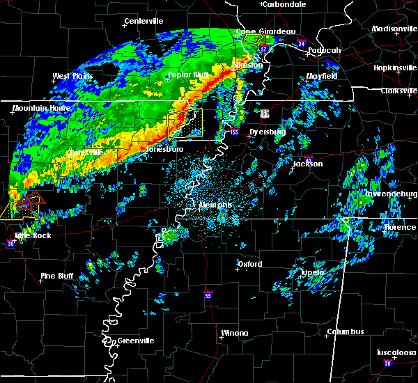 At 330 am cst, a severe thunderstorm was located near rector, moving east at 60 mph (radar indicated). Hazards include 60 mph wind gusts and quarter size hail. Hail damage to vehicles is expected. expect wind damage to roofs, siding, and trees. locations impacted include, kennett, rector, senath, marmaduke, cardwell, hornersville, holcomb, arbyrd, greenway, nimmons, heubner, fritz, bard, lorine, mounds, west kennett, leonard, bell city, pratt and noland. A tornado watch remains in effect until 500 am cst for eastern arkansas, and southeastern missouri. At 330 am cst, a severe thunderstorm was located near rector, moving east at 60 mph (radar indicated). Hazards include 60 mph wind gusts and quarter size hail. Hail damage to vehicles is expected. expect wind damage to roofs, siding, and trees. locations impacted include, kennett, rector, senath, marmaduke, cardwell, hornersville, holcomb, arbyrd, greenway, nimmons, heubner, fritz, bard, lorine, mounds, west kennett, leonard, bell city, pratt and noland. A tornado watch remains in effect until 500 am cst for eastern arkansas, and southeastern missouri.
|
| 3/7/2017 3:07 AM CST |
 At 307 am cst, a severe thunderstorm was located over beech grove, or 9 miles northwest of paragould, moving east at 50 mph (radar indicated). Hazards include 60 mph wind gusts and quarter size hail. Hail damage to vehicles is expected. Expect wind damage to roofs, siding, and trees. At 307 am cst, a severe thunderstorm was located over beech grove, or 9 miles northwest of paragould, moving east at 50 mph (radar indicated). Hazards include 60 mph wind gusts and quarter size hail. Hail damage to vehicles is expected. Expect wind damage to roofs, siding, and trees.
|
| 3/7/2017 3:07 AM CST |
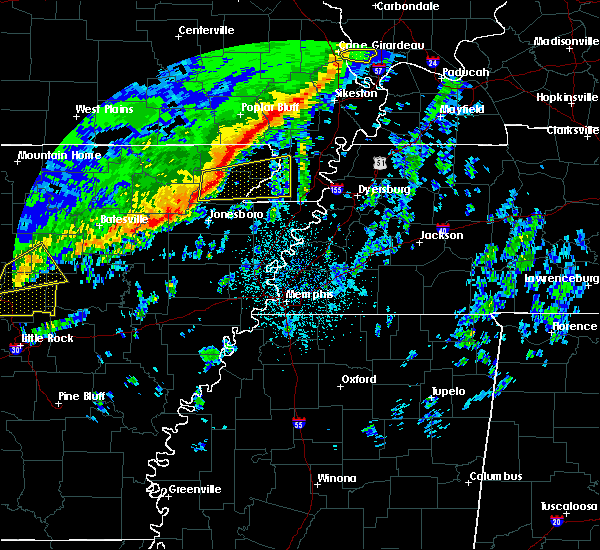 At 307 am cst, a severe thunderstorm was located over beech grove, or 9 miles northwest of paragould, moving east at 50 mph (radar indicated). Hazards include 60 mph wind gusts and quarter size hail. Hail damage to vehicles is expected. Expect wind damage to roofs, siding, and trees. At 307 am cst, a severe thunderstorm was located over beech grove, or 9 miles northwest of paragould, moving east at 50 mph (radar indicated). Hazards include 60 mph wind gusts and quarter size hail. Hail damage to vehicles is expected. Expect wind damage to roofs, siding, and trees.
|
| 3/1/2017 4:05 AM CST |
 At 403 am cst, severe thunderstorms were located along a line extending from near neelyville to rector to near monette, moving east at 70 mph (radar indicated). Hazards include 75 mph wind gusts. Expect considerable tree damage. damage is likely to mobile homes, roofs, and outbuildings. a 58 58 mph gust was reported at corning at 355 am cst. locations impacted include, paragould, piggott, corning, rector, marmaduke, chalk bluff natural area, oak grove heights, lafe, knobel, pollard, greenway, mcdougal, beech grove, crockett, nimmons, stonewall, heubner, tipperary, fritz and hickoria. A tornado watch remains in effect until 800 am cst for eastern arkansas, and southeastern missouri. At 403 am cst, severe thunderstorms were located along a line extending from near neelyville to rector to near monette, moving east at 70 mph (radar indicated). Hazards include 75 mph wind gusts. Expect considerable tree damage. damage is likely to mobile homes, roofs, and outbuildings. a 58 58 mph gust was reported at corning at 355 am cst. locations impacted include, paragould, piggott, corning, rector, marmaduke, chalk bluff natural area, oak grove heights, lafe, knobel, pollard, greenway, mcdougal, beech grove, crockett, nimmons, stonewall, heubner, tipperary, fritz and hickoria. A tornado watch remains in effect until 800 am cst for eastern arkansas, and southeastern missouri.
|
| 3/1/2017 3:46 AM CST |
 At 345 am cst, severe thunderstorms were located along a line extending from near success to near evening star to near bono, moving east at 75 mph (radar indicated). Hazards include 75 mph wind gusts. Expect considerable tree damage. damage is likely to mobile homes, roofs, and outbuildings. thie line of severe thunderstorms produced a 76 mph gust at walnut ridge at 335 am cst. locations impacted include, paragould, piggott, corning, rector, marmaduke, chalk bluff natural area, crowleys ridge state park, lake frierson state park, oak grove heights, lafe, reyno, knobel, pollard, greenway, mcdougal, success, peach orchard, delaplaine, datto and evening star. A tornado watch remains in effect until 800 am cst for eastern arkansas, and southeastern missouri. At 345 am cst, severe thunderstorms were located along a line extending from near success to near evening star to near bono, moving east at 75 mph (radar indicated). Hazards include 75 mph wind gusts. Expect considerable tree damage. damage is likely to mobile homes, roofs, and outbuildings. thie line of severe thunderstorms produced a 76 mph gust at walnut ridge at 335 am cst. locations impacted include, paragould, piggott, corning, rector, marmaduke, chalk bluff natural area, crowleys ridge state park, lake frierson state park, oak grove heights, lafe, reyno, knobel, pollard, greenway, mcdougal, success, peach orchard, delaplaine, datto and evening star. A tornado watch remains in effect until 800 am cst for eastern arkansas, and southeastern missouri.
|
| 3/1/2017 3:41 AM CST |
 At 340 am cst, severe thunderstorms were located along a line extending from 6 miles north of maynard to near o`kean to near bono, moving east at 70 mph (radar indicated). Hazards include 75 mph wind gusts. Expect considerable tree damage. damage is likely to mobile homes, roofs, and outbuildings. thie line of severe thunderstorms produced a 76 mph gust at walnut ridge at 335 am cst. locations impacted include, paragould, piggott, corning, rector, marmaduke, chalk bluff natural area, crowleys ridge state park, lake frierson state park, oak grove heights, lafe, reyno, knobel, pollard, greenway, mcdougal, success, peach orchard, delaplaine, datto and evening star. A tornado watch remains in effect until 800 am cst for eastern arkansas, and southeastern missouri. At 340 am cst, severe thunderstorms were located along a line extending from 6 miles north of maynard to near o`kean to near bono, moving east at 70 mph (radar indicated). Hazards include 75 mph wind gusts. Expect considerable tree damage. damage is likely to mobile homes, roofs, and outbuildings. thie line of severe thunderstorms produced a 76 mph gust at walnut ridge at 335 am cst. locations impacted include, paragould, piggott, corning, rector, marmaduke, chalk bluff natural area, crowleys ridge state park, lake frierson state park, oak grove heights, lafe, reyno, knobel, pollard, greenway, mcdougal, success, peach orchard, delaplaine, datto and evening star. A tornado watch remains in effect until 800 am cst for eastern arkansas, and southeastern missouri.
|
| 3/1/2017 3:28 AM CST |
 At 328 am cst, severe thunderstorms were located along a line extending from near dalton to 6 miles northwest of college city to near alicia, moving east at 70 mph (radar indicated). Hazards include 60 mph wind gusts. expect damage to roofs, siding, and trees At 328 am cst, severe thunderstorms were located along a line extending from near dalton to 6 miles northwest of college city to near alicia, moving east at 70 mph (radar indicated). Hazards include 60 mph wind gusts. expect damage to roofs, siding, and trees
|
| 12/17/2016 4:31 PM CST |
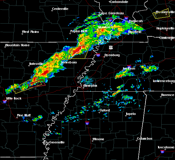 At 431 pm cst, a severe thunderstorm was located near rector, moving northeast at 35 mph (radar indicated). Hazards include 60 mph wind gusts and quarter size hail. Hail damage to vehicles is expected. expect wind damage to roofs, siding, and trees. locations impacted include, paragould, kennett, rector, senath, marmaduke, cardwell, hornersville, holcomb, arbyrd, wardell, greenway, deering, bragg city, nimmons, brighton, bethel, west kennett, bell city, leonard and halliday. A tornado watch remains in effect until 900 pm cst for eastern arkansas, and southeastern missouri. At 431 pm cst, a severe thunderstorm was located near rector, moving northeast at 35 mph (radar indicated). Hazards include 60 mph wind gusts and quarter size hail. Hail damage to vehicles is expected. expect wind damage to roofs, siding, and trees. locations impacted include, paragould, kennett, rector, senath, marmaduke, cardwell, hornersville, holcomb, arbyrd, wardell, greenway, deering, bragg city, nimmons, brighton, bethel, west kennett, bell city, leonard and halliday. A tornado watch remains in effect until 900 pm cst for eastern arkansas, and southeastern missouri.
|
| 12/17/2016 4:27 PM CST |
 At 426 pm cst, a severe thunderstorm was located near rector, moving northeast at 35 mph (radar indicated). Hazards include 60 mph wind gusts and quarter size hail. Hail damage to vehicles is expected. Expect wind damage to roofs, siding, and trees. At 426 pm cst, a severe thunderstorm was located near rector, moving northeast at 35 mph (radar indicated). Hazards include 60 mph wind gusts and quarter size hail. Hail damage to vehicles is expected. Expect wind damage to roofs, siding, and trees.
|
| 12/17/2016 3:07 PM CST |
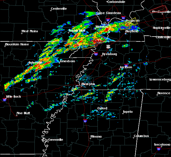 The severe thunderstorm warning for southeastern clay county will expire at 315 pm cst, the storm which prompted the warning has weakened below severe limits, and no longer pose an immediate threat to life or property. therefore, the warning will be allowed to expire. a tornado watch remains in effect until 900 pm cst for eastern arkansas, and southeastern missouri. The severe thunderstorm warning for southeastern clay county will expire at 315 pm cst, the storm which prompted the warning has weakened below severe limits, and no longer pose an immediate threat to life or property. therefore, the warning will be allowed to expire. a tornado watch remains in effect until 900 pm cst for eastern arkansas, and southeastern missouri.
|
| 12/17/2016 2:59 PM CST |
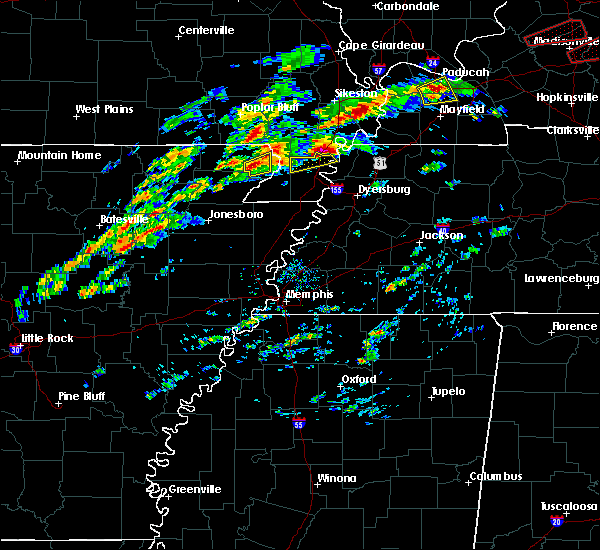 At 259 pm cst, a severe thunderstorm was located over rector, moving northeast at 45 mph (radar indicated). Hazards include 60 mph wind gusts and quarter size hail. Hail damage to vehicles is expected. expect wind damage to roofs, siding, and trees. locations impacted include, piggott, rector, greenway, holly island, hargrave corner and pratt. A tornado watch remains in effect until 900 pm cst for eastern arkansas, and southeastern missouri. At 259 pm cst, a severe thunderstorm was located over rector, moving northeast at 45 mph (radar indicated). Hazards include 60 mph wind gusts and quarter size hail. Hail damage to vehicles is expected. expect wind damage to roofs, siding, and trees. locations impacted include, piggott, rector, greenway, holly island, hargrave corner and pratt. A tornado watch remains in effect until 900 pm cst for eastern arkansas, and southeastern missouri.
|
| 12/17/2016 2:43 PM CST |
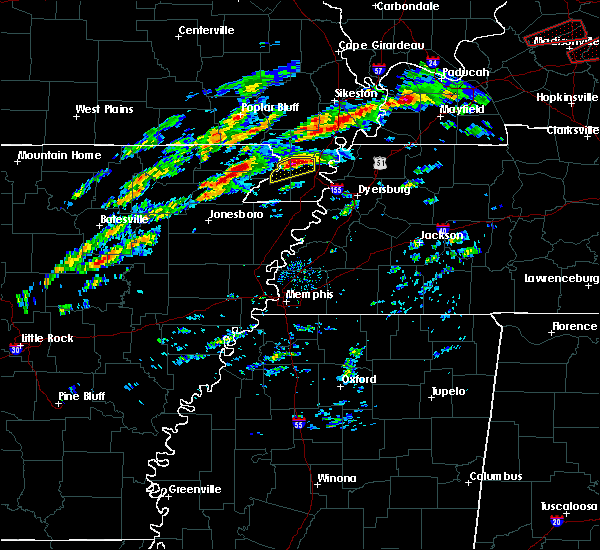 At 243 pm cst, a severe thunderstorm was located over lafe, or near marmaduke, moving northeast at 45 mph (radar indicated). Hazards include 60 mph wind gusts and quarter size hail. Hail damage to vehicles is expected. Expect wind damage to roofs, siding, and trees. At 243 pm cst, a severe thunderstorm was located over lafe, or near marmaduke, moving northeast at 45 mph (radar indicated). Hazards include 60 mph wind gusts and quarter size hail. Hail damage to vehicles is expected. Expect wind damage to roofs, siding, and trees.
|
| 3/31/2016 10:59 AM CDT |
 At 1059 am cdt, severe thunderstorms were located along a line extending from near rector to near leachville, moving east at 50 mph (radar indicated). Hazards include 60 mph wind gusts and quarter size hail. Hail damage to vehicles is expected. Expect wind damage to roofs, siding, and trees. At 1059 am cdt, severe thunderstorms were located along a line extending from near rector to near leachville, moving east at 50 mph (radar indicated). Hazards include 60 mph wind gusts and quarter size hail. Hail damage to vehicles is expected. Expect wind damage to roofs, siding, and trees.
|
| 3/31/2016 10:59 AM CDT |
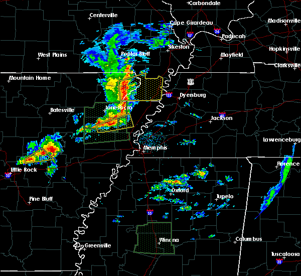 At 1059 am cdt, severe thunderstorms were located along a line extending from near rector to near leachville, moving east at 50 mph (radar indicated). Hazards include 60 mph wind gusts and quarter size hail. Hail damage to vehicles is expected. Expect wind damage to roofs, siding, and trees. At 1059 am cdt, severe thunderstorms were located along a line extending from near rector to near leachville, moving east at 50 mph (radar indicated). Hazards include 60 mph wind gusts and quarter size hail. Hail damage to vehicles is expected. Expect wind damage to roofs, siding, and trees.
|
| 12/23/2015 1:30 PM CST | At 130 pm cst, a severe thunderstorm was located over st. francis, or over campbell, moving northeast at 70 mph (radar indicated). Hazards include 60 mph wind gusts and nickel size hail. Expect damage to roofs. siding and trees. this severe storm will be near, clarkton around 135 pm cst. malden and malden around 140 pm cst. other locations impacted by this severe thunderstorm include fritz, bertig, nimmons, white oak, brighton, buck donic, west kennett, dillman, brian and bell city. A tornado watch remains in effect until 500 pm cst for eastern arkansas and southeastern missouri. |
| 12/23/2015 1:30 PM CST | At 130 pm cst, a severe thunderstorm was located over st. francis, or over campbell, moving northeast at 70 mph (radar indicated). Hazards include 60 mph wind gusts and nickel size hail. Expect damage to roofs. siding and trees. this severe storm will be near, clarkton around 135 pm cst. malden and malden around 140 pm cst. other locations impacted by this severe thunderstorm include fritz, bertig, nimmons, white oak, brighton, buck donic, west kennett, dillman, brian and bell city. A tornado watch remains in effect until 500 pm cst for eastern arkansas and southeastern missouri. |
| 12/23/2015 1:19 PM CST | At 119 pm cst, a severe thunderstorm was located near greenway, or near piggott, moving northeast at 70 mph (radar indicated). Hazards include 60 mph wind gusts and quarter size hail. Hail damage to vehicles is expected. expect wind damage to roofs, siding and trees. this severe storm will be near, chalk bluff natural area around 125 pm cst. st. francis and saint francis around 130 pm cst. campbell, clarkton and glennonville around 135 pm cst. malden and malden around 140 pm cst. other locations impacted by this severe thunderstorm include fritz, bertig, nimmons, white oak, goobertown, crockett, brighton, bethel, buck donic and west kennett. A tornado watch remains in effect until 500 pm cst for eastern arkansas and southeastern missouri. |
| 12/23/2015 1:19 PM CST | At 119 pm cst, a severe thunderstorm was located near greenway, or near piggott, moving northeast at 70 mph (radar indicated). Hazards include 60 mph wind gusts and quarter size hail. Hail damage to vehicles is expected. expect wind damage to roofs, siding and trees. this severe storm will be near, chalk bluff natural area around 125 pm cst. st. francis and saint francis around 130 pm cst. campbell, clarkton and glennonville around 135 pm cst. malden and malden around 140 pm cst. other locations impacted by this severe thunderstorm include fritz, bertig, nimmons, white oak, goobertown, crockett, brighton, bethel, buck donic and west kennett. A tornado watch remains in effect until 500 pm cst for eastern arkansas and southeastern missouri. |
| 12/23/2015 12:59 PM CST | At 1259 pm cst, a severe thunderstorm was located over beech grove, or near paragould, moving northeast at 60 mph (radar indicated). Hazards include 60 mph wind gusts and quarter size hail. Hail damage to vehicles is expected. expect wind damage to roofs, siding and trees. this severe thunderstorm will be near, lafe around 105 pm cst. marmaduke around 110 pm cst. rector around 115 pm cst. greenway around 120 pm cst. piggott and pollard around 125 pm cst. chalk bluff natural area, st. francis and saint francis around 130 pm cst. campbell, clarkton and glennonville around 135 pm cst. malden and malden around 140 pm cst. other locations impacted by this severe thunderstorm include nimmons, white oak, goobertown, crockett, brighton, bethel, west kennett, brian, bell city and scobeville. A tornado watch remains in effect until 500 pm cst for eastern arkansas and southeastern missouri. |
| 12/23/2015 12:59 PM CST | At 1259 pm cst, a severe thunderstorm was located over beech grove, or near paragould, moving northeast at 60 mph (radar indicated). Hazards include 60 mph wind gusts and quarter size hail. Hail damage to vehicles is expected. expect wind damage to roofs, siding and trees. this severe thunderstorm will be near, lafe around 105 pm cst. marmaduke around 110 pm cst. rector around 115 pm cst. greenway around 120 pm cst. piggott and pollard around 125 pm cst. chalk bluff natural area, st. francis and saint francis around 130 pm cst. campbell, clarkton and glennonville around 135 pm cst. malden and malden around 140 pm cst. other locations impacted by this severe thunderstorm include nimmons, white oak, goobertown, crockett, brighton, bethel, west kennett, brian, bell city and scobeville. A tornado watch remains in effect until 500 pm cst for eastern arkansas and southeastern missouri. |
| 12/23/2015 11:05 AM CST | At 1105 am cst, a severe thunderstorm was located over malden, moving northeast at 50 mph (radar indicated). Hazards include 60 mph wind gusts. Expect damage to roofs. siding and trees. this severe thunderstorm will remain over mainly rural areas of eastern clay and northeastern dunklin counties, including the following locations, rhyne, brian, baird, mc guires, valley ridge, townley, wilhelmina, providence and pratt. A tornado watch remains in effect until 500 pm cst for eastern arkansas and southeastern missouri. |
| 12/23/2015 11:05 AM CST | At 1105 am cst, a severe thunderstorm was located over malden, moving northeast at 50 mph (radar indicated). Hazards include 60 mph wind gusts. Expect damage to roofs. siding and trees. this severe thunderstorm will remain over mainly rural areas of eastern clay and northeastern dunklin counties, including the following locations, rhyne, brian, baird, mc guires, valley ridge, townley, wilhelmina, providence and pratt. A tornado watch remains in effect until 500 pm cst for eastern arkansas and southeastern missouri. |
| 12/23/2015 10:46 AM CST | At 1045 am cst, a severe thunderstorm was located over pollard, or near piggott, moving northeast at 50 mph (radar indicated). Hazards include 60 mph wind gusts. Expect damage to roofs. siding and trees. this severe thunderstorm will be near, chalk bluff natural area around 1050 am cst. st. francis, saint francis and glennonville around 1055 am cst. campbell around 1100 am cst. malden, malden and clarkton around 1105 am cst. other locations impacted by this severe thunderstorm include rhyne, brian, crockett, baird, mc guires, valley ridge, townley, wilhelmina, providence and pratt. A tornado watch remains in effect until 500 pm cst for eastern arkansas and southeastern missouri. |
| 12/23/2015 10:46 AM CST | At 1045 am cst, a severe thunderstorm was located over pollard, or near piggott, moving northeast at 50 mph (radar indicated). Hazards include 60 mph wind gusts. Expect damage to roofs. siding and trees. this severe thunderstorm will be near, chalk bluff natural area around 1050 am cst. st. francis, saint francis and glennonville around 1055 am cst. campbell around 1100 am cst. malden, malden and clarkton around 1105 am cst. other locations impacted by this severe thunderstorm include rhyne, brian, crockett, baird, mc guires, valley ridge, townley, wilhelmina, providence and pratt. A tornado watch remains in effect until 500 pm cst for eastern arkansas and southeastern missouri. |
| 4/19/2015 8:32 PM CDT | At 832 pm cdt, a severe thunderstorm was located near senath, moving east at 55 mph (radar indicated). Hazards include 60 mph wind gusts. Expect damage to roofs. Siding and trees. |
| 4/19/2015 8:32 PM CDT | At 832 pm cdt, a severe thunderstorm was located near senath, moving east at 55 mph (radar indicated). Hazards include 60 mph wind gusts. Expect damage to roofs. Siding and trees. |
| 4/9/2015 7:07 PM CDT | A severe thunderstorm warning remains in effect until 745 pm cdt for northeastern greene. eastern clay and eastern dunklin counties. at 707 pm cdt. a severe thunderstorm was located over lafe. or 8 miles west of marmaduke. moving northeast at 50 mph. hazard. 60 mph wind gusts and quarter size hail. |
| 4/9/2015 7:07 PM CDT | A severe thunderstorm warning remains in effect until 745 pm cdt for northeastern greene. eastern clay and eastern dunklin counties. at 707 pm cdt. a severe thunderstorm was located over lafe. or 8 miles west of marmaduke. moving northeast at 50 mph. hazard. 60 mph wind gusts and quarter size hail. |
| 4/9/2015 6:59 PM CDT | The national weather service in memphis has issued a * severe thunderstorm warning for. greene county in eastern arkansas. eastern clay county in eastern arkansas. eastern dunklin county in southeastern missouri. Until 745 pm cdt. |
| 4/9/2015 6:59 PM CDT | The national weather service in memphis has issued a * severe thunderstorm warning for. greene county in eastern arkansas. eastern clay county in eastern arkansas. eastern dunklin county in southeastern missouri. Until 745 pm cdt. |
| 3/31/2015 9:07 PM CDT | The national weather service in memphis has issued a * severe thunderstorm warning for. northwestern mississippi county in eastern arkansas. eastern greene county in eastern arkansas. southeastern clay county in eastern arkansas. Southern dunklin county in southeastern missouri. |
| 3/31/2015 9:07 PM CDT | The national weather service in memphis has issued a * severe thunderstorm warning for. northwestern mississippi county in eastern arkansas. eastern greene county in eastern arkansas. southeastern clay county in eastern arkansas. Southern dunklin county in southeastern missouri. |
| 3/31/2015 5:52 PM CDT | A severe thunderstorm warning remains in effect until 615 pm cdt for northeastern greene. southeastern clay and southeastern dunklin counties. at 551 pm cdt. the public reported a severe thunderstorm producing quarter size hail. this storm was located near senath. Moving southeast at 30 mph. |
| 3/31/2015 5:52 PM CDT | A severe thunderstorm warning remains in effect until 615 pm cdt for northeastern greene. southeastern clay and southeastern dunklin counties. at 551 pm cdt. the public reported a severe thunderstorm producing quarter size hail. this storm was located near senath. Moving southeast at 30 mph. |
| 3/31/2015 4:45 PM CST | Quarter sized hail reported 0.4 miles NW of Rector, AR, dime to quarter size hail near rector. |
| 3/31/2015 5:35 PM CDT | The national weather service in memphis has issued a * severe thunderstorm warning for. northeastern greene county in eastern arkansas. southeastern clay county in eastern arkansas. southern dunklin county in southeastern missouri. Until 615 pm cdt. |
| 3/31/2015 5:35 PM CDT | The national weather service in memphis has issued a * severe thunderstorm warning for. northeastern greene county in eastern arkansas. southeastern clay county in eastern arkansas. southern dunklin county in southeastern missouri. Until 615 pm cdt. |
| 7/23/2014 2:15 PM CDT | Trees and power lines down around clay county. several county roads are blocked by the trees and power line in clay county AR, 0.4 miles NW of Rector, AR |
| 7/23/2014 1:55 PM CDT | Roof turbine blown off in recto in clay county AR, 0.4 miles NW of Rector, AR |
| 1/1/0001 12:00 AM | Siding and metal roof damage to a house. trees uprooted along hwys 141 and 90. barn damaged in area in clay county AR, 6.6 miles SE of Rector, AR |
| 1/1/0001 12:00 AM | A few trees down and a trampoline flipped in the town of recto in clay county AR, 0.4 miles NW of Rector, AR |
| 1/1/0001 12:00 AM | A shed was blown dow in clay county AR, 0.4 miles NW of Rector, AR |
Hail Maps for Rector, AR
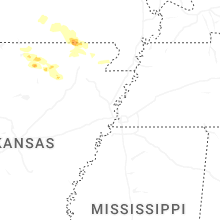
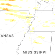
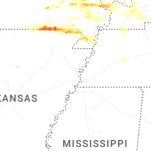
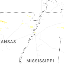
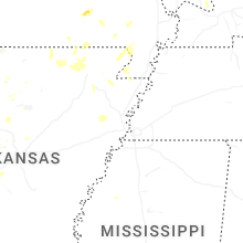


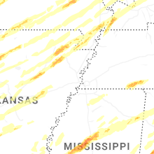


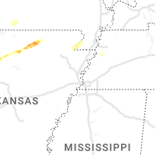


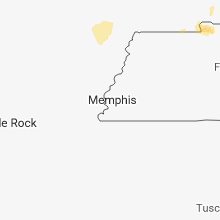


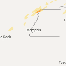


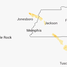


Connect with Interactive Hail Maps