

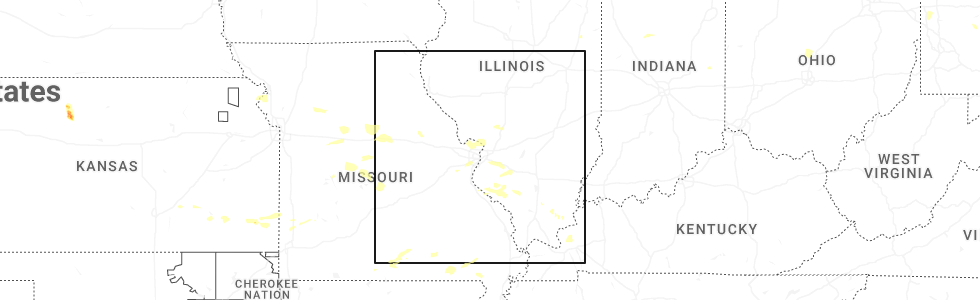
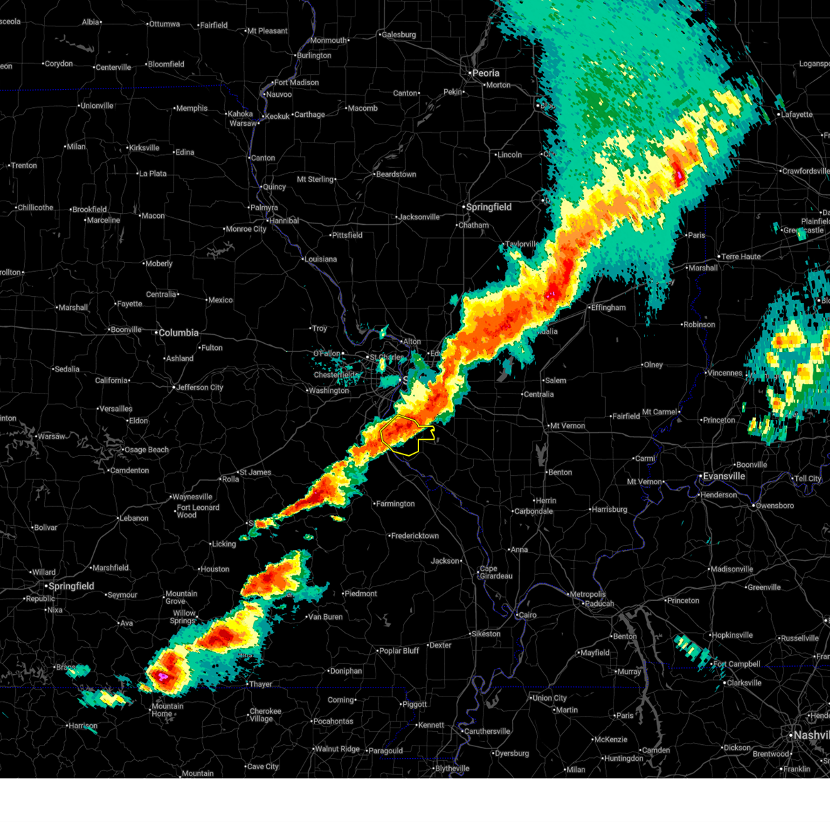
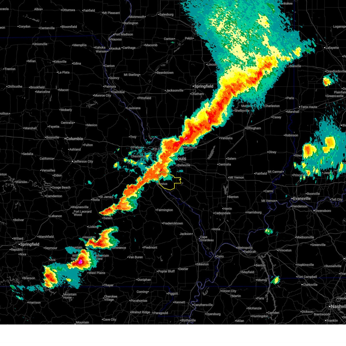
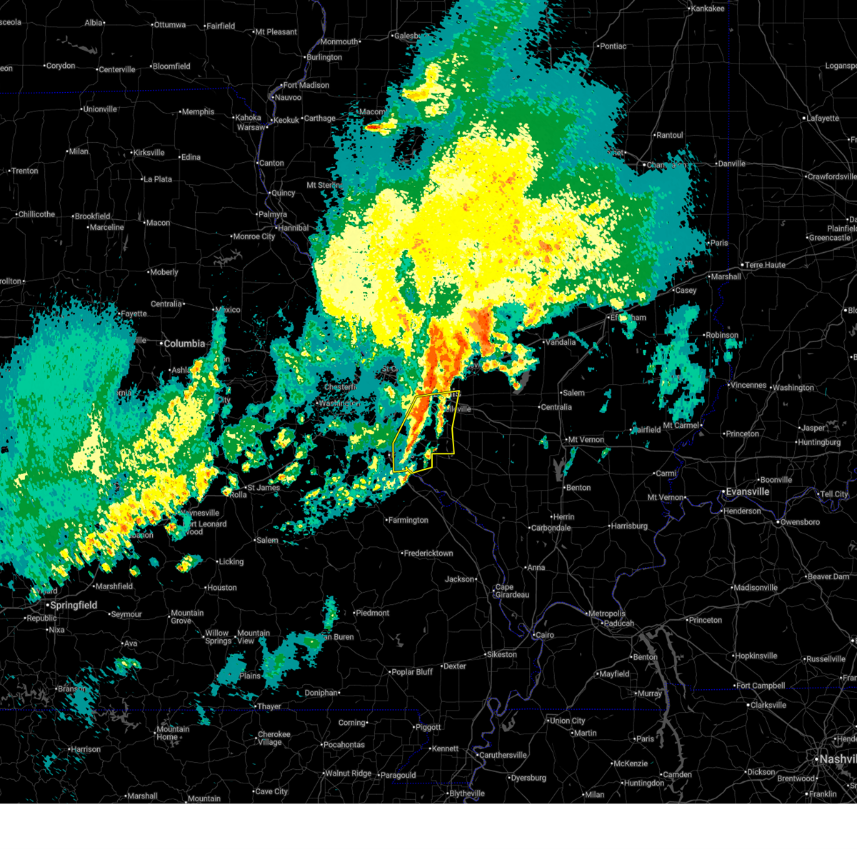
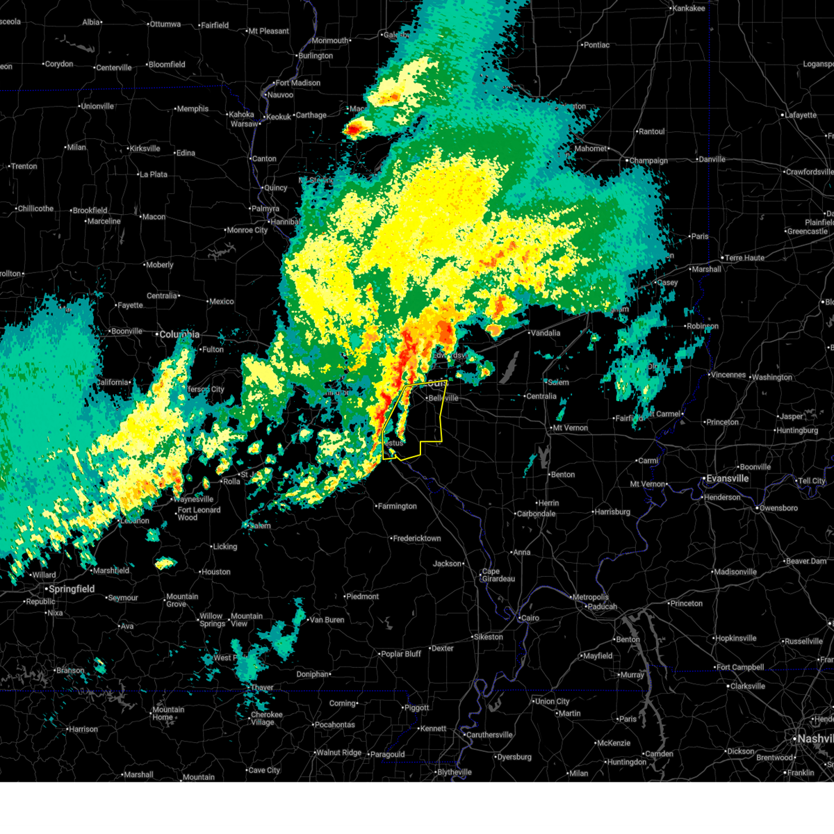
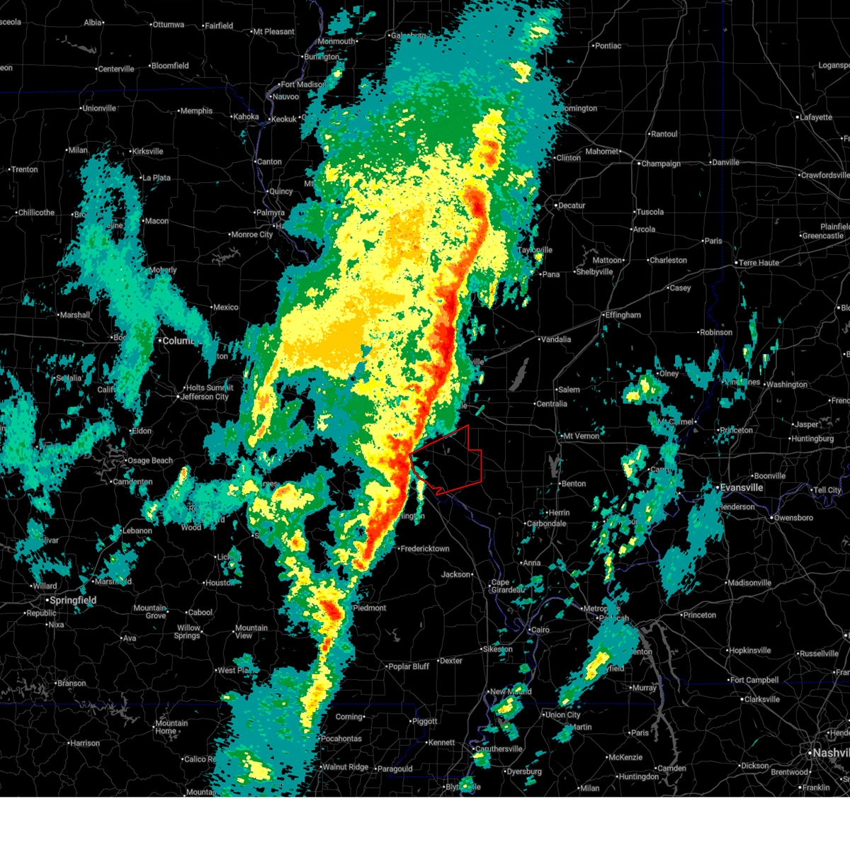
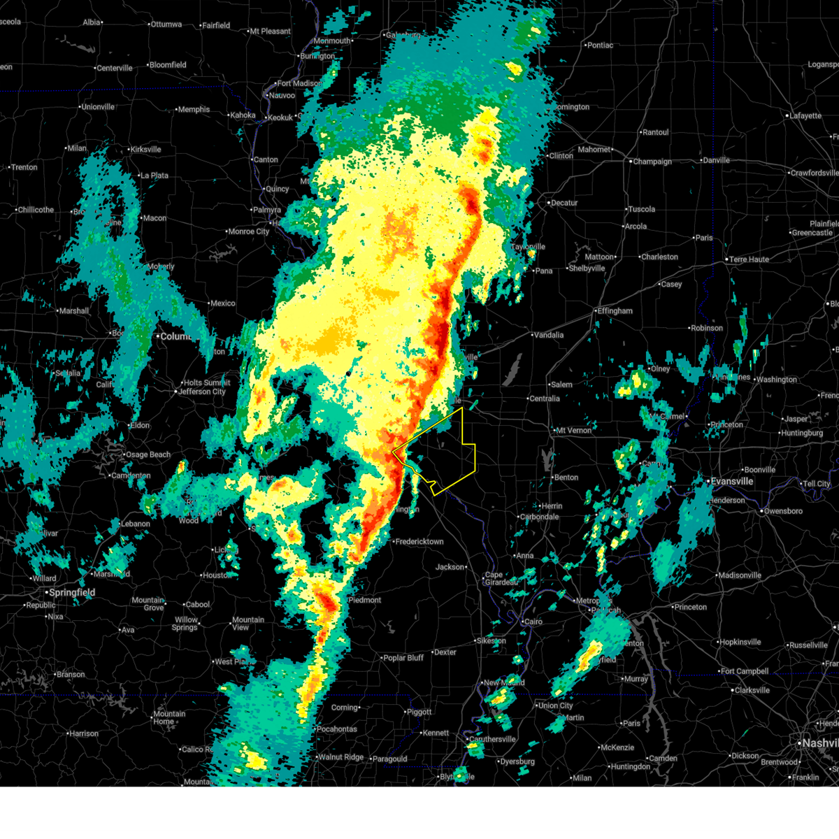
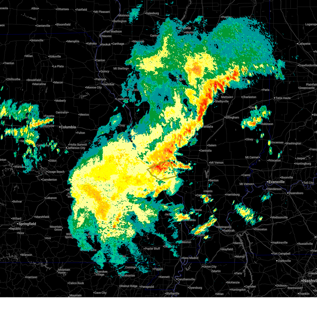
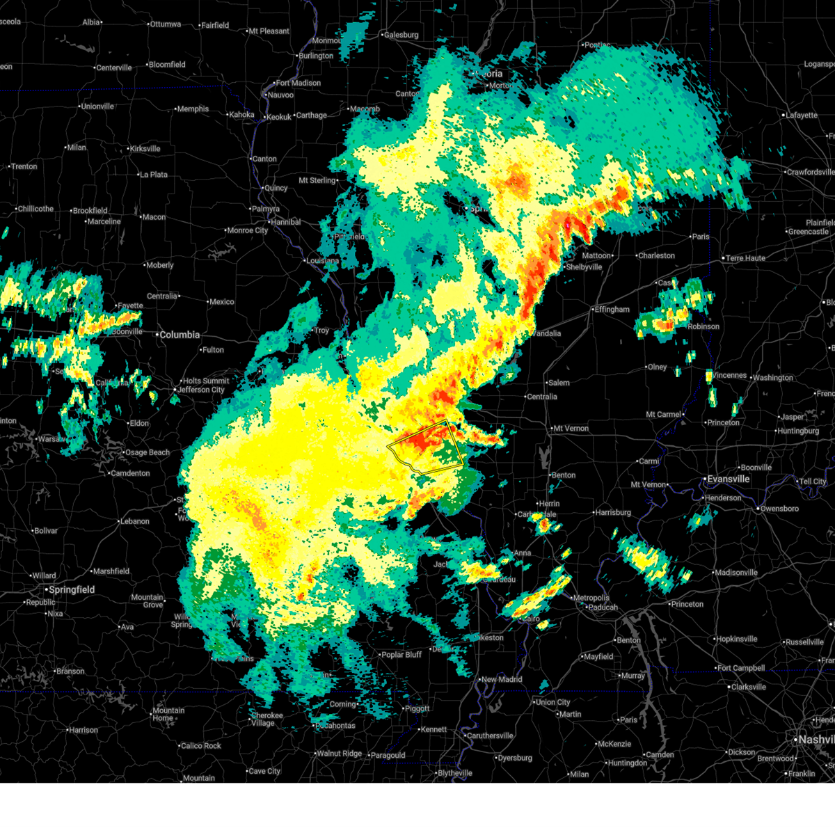
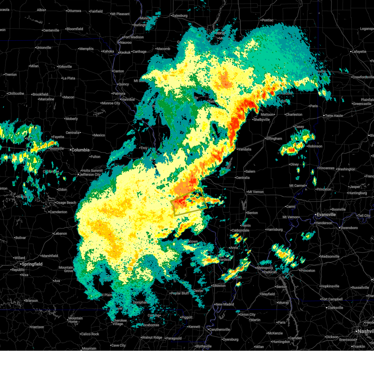
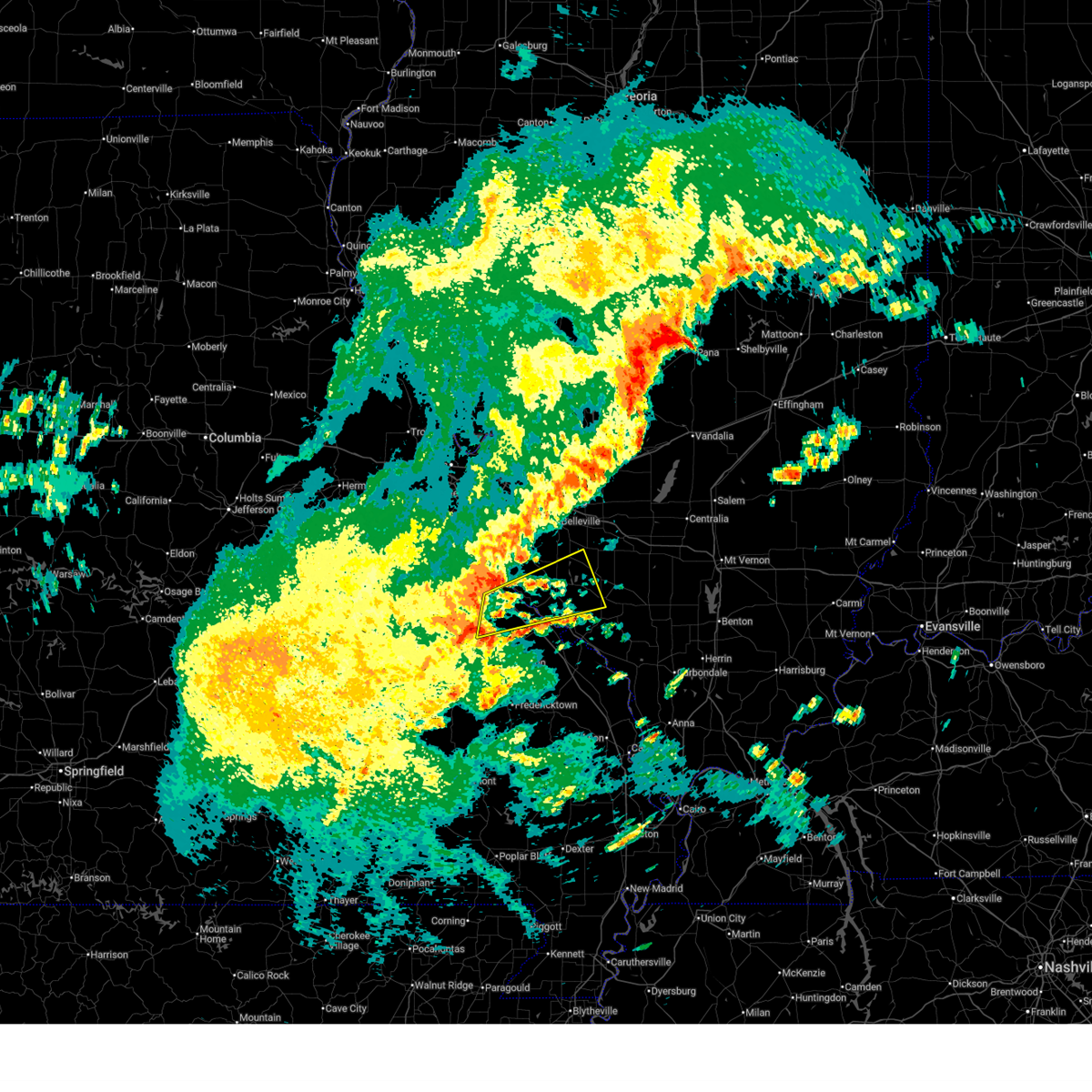
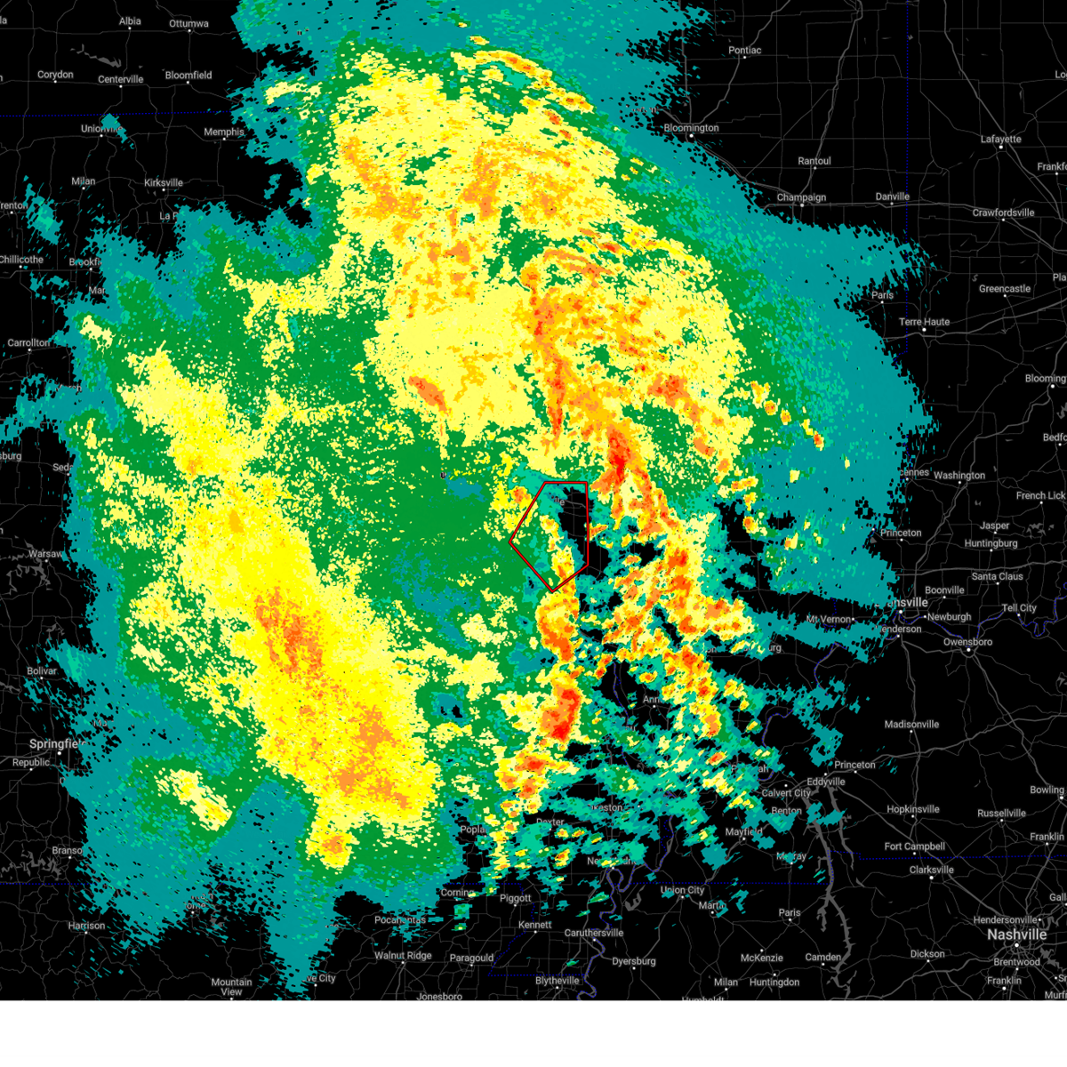
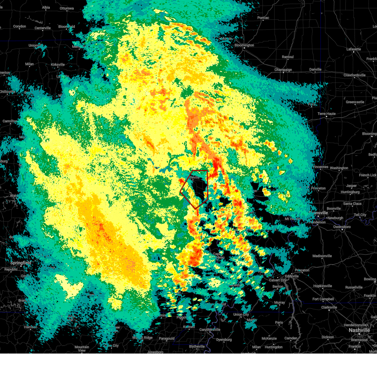
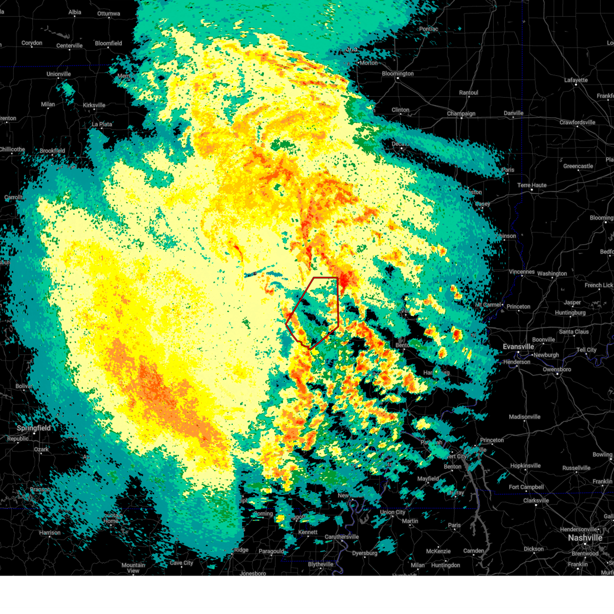
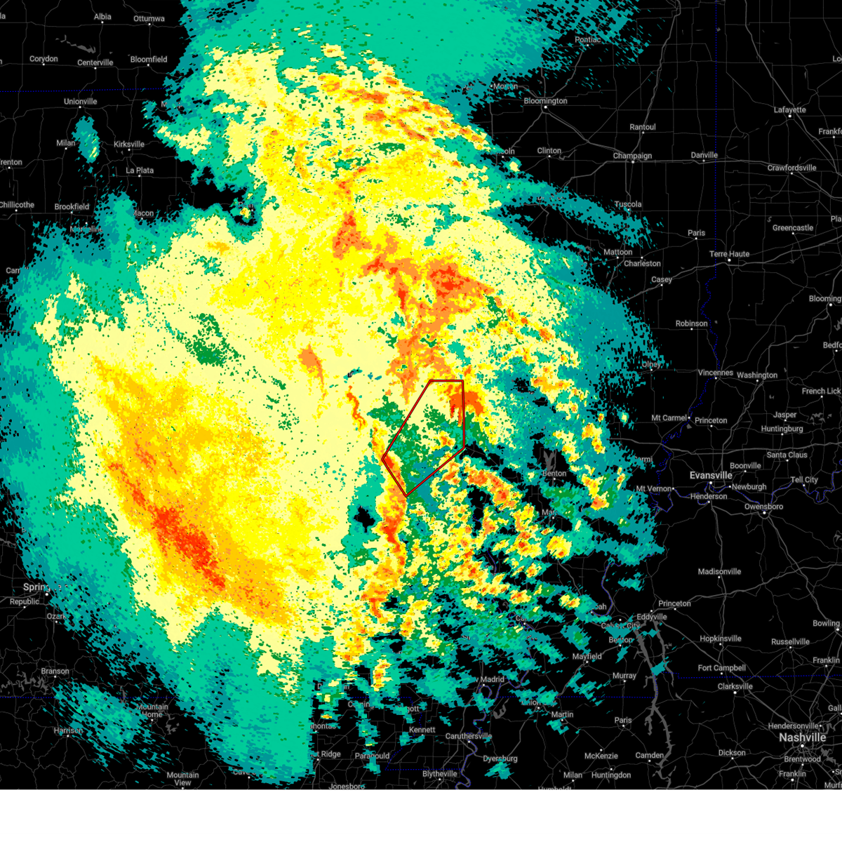
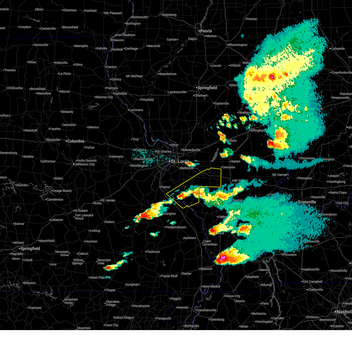
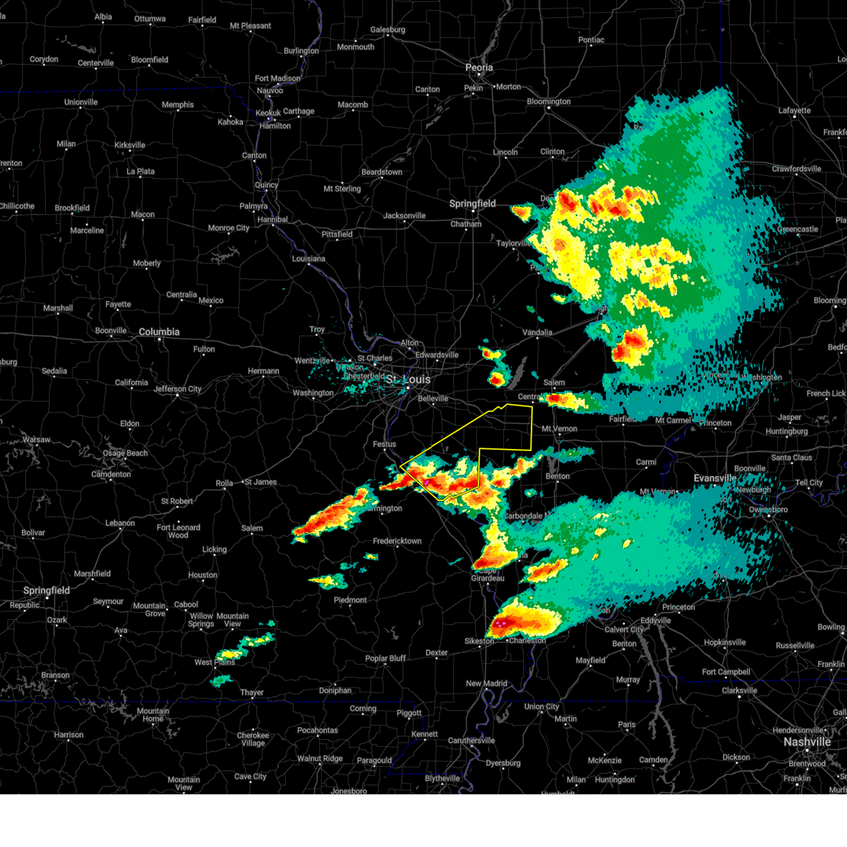
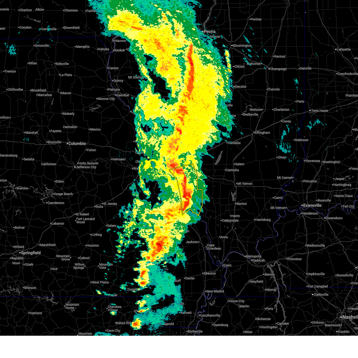
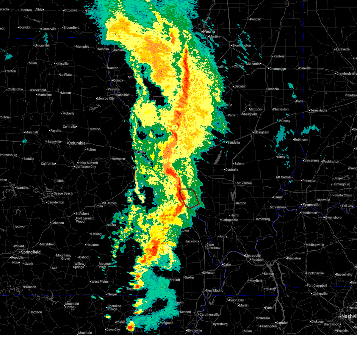
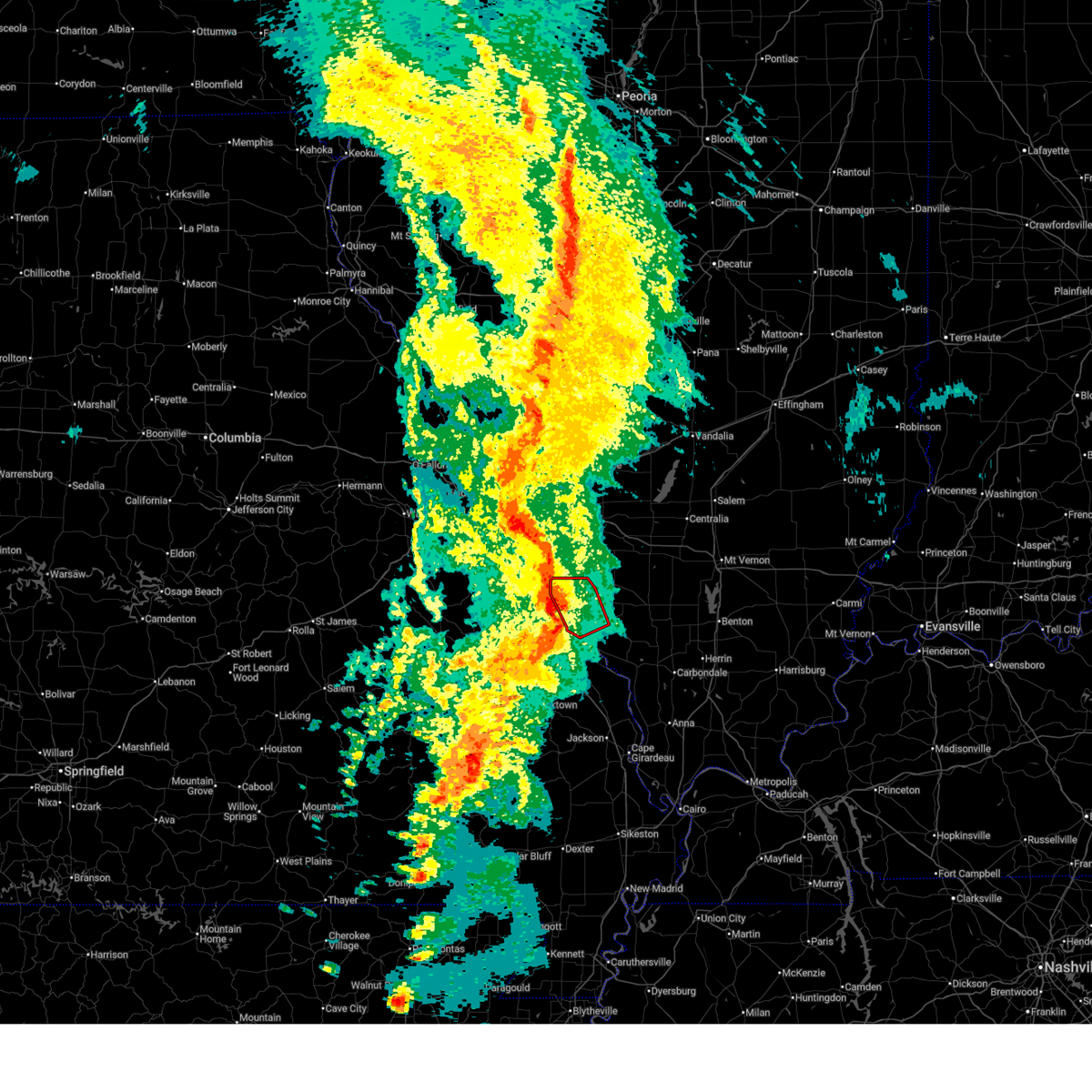
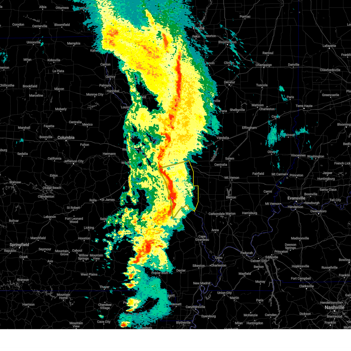
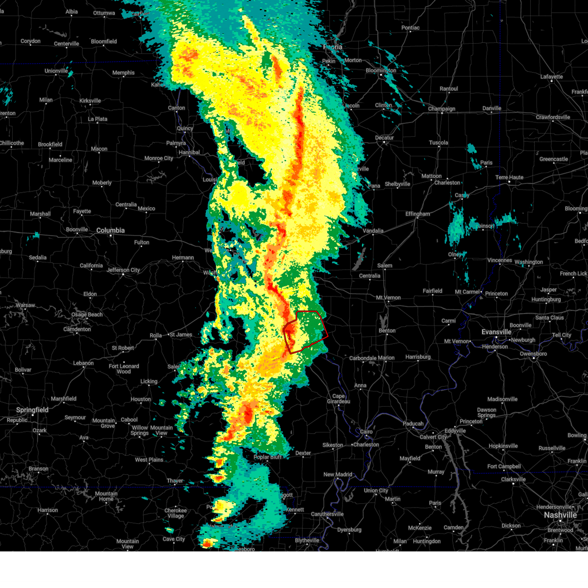
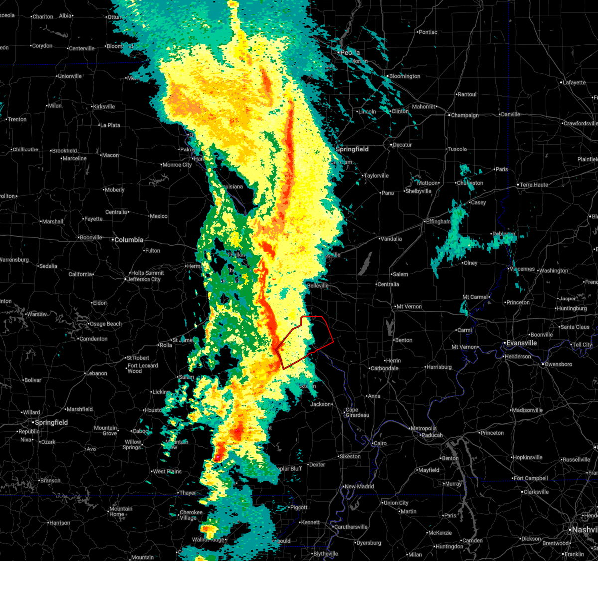
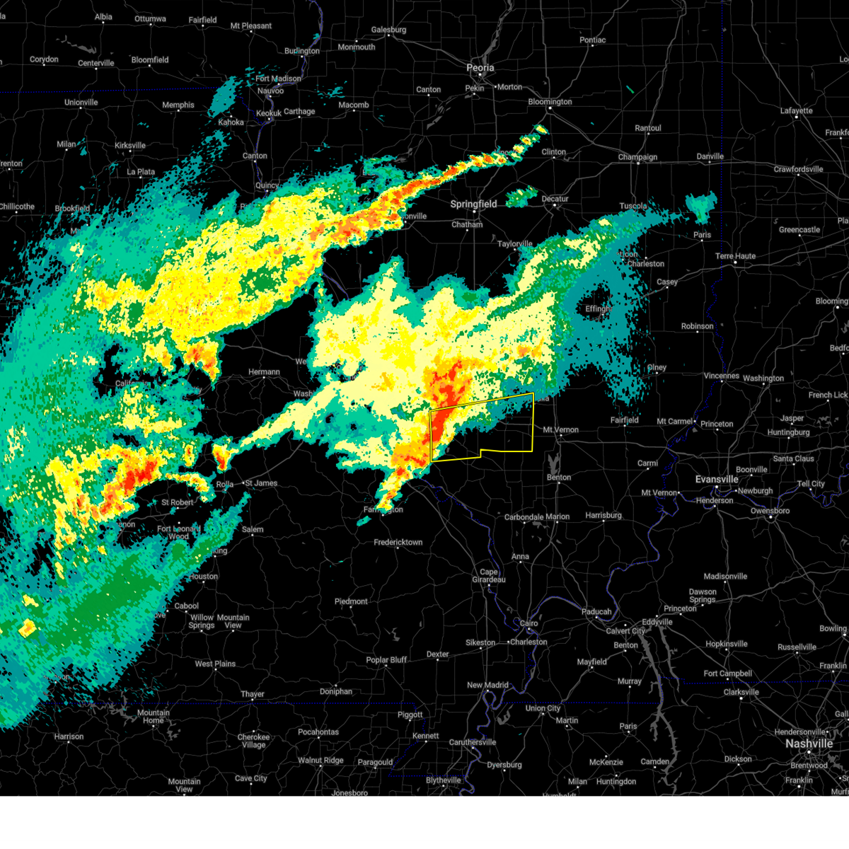
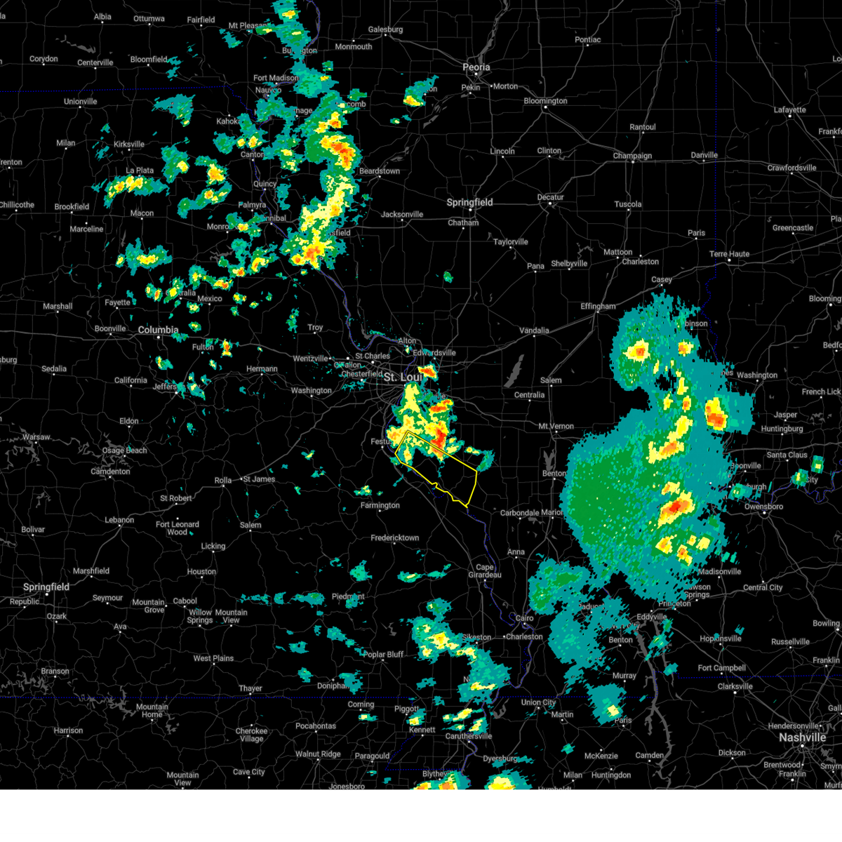
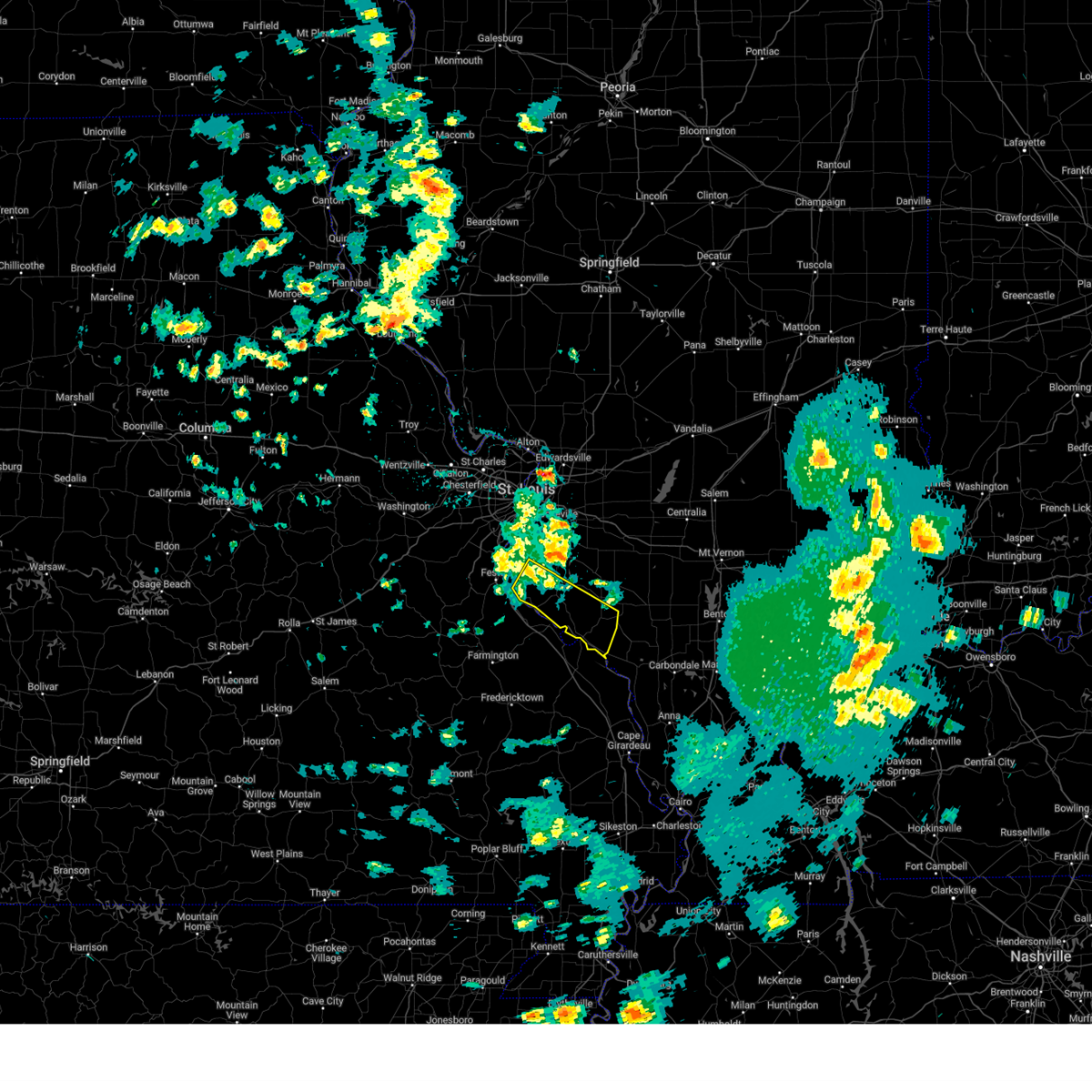
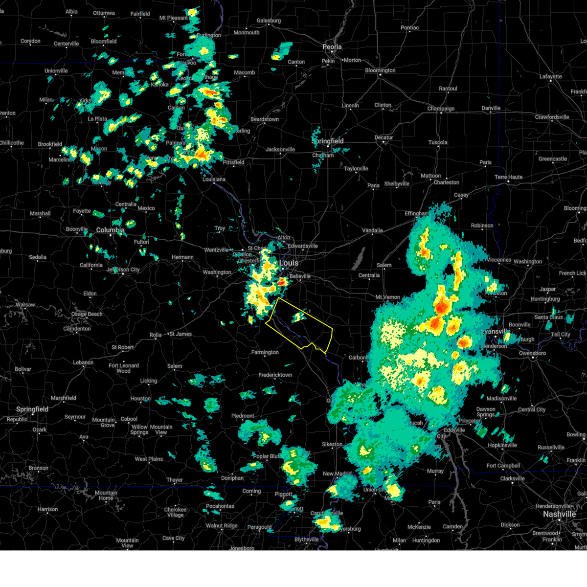
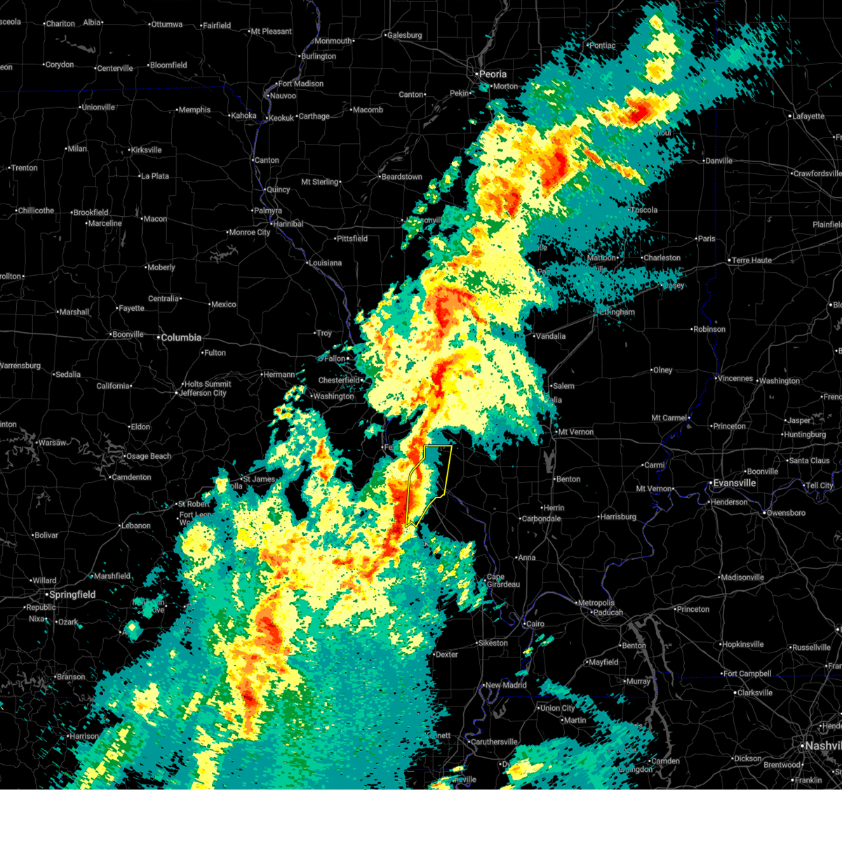
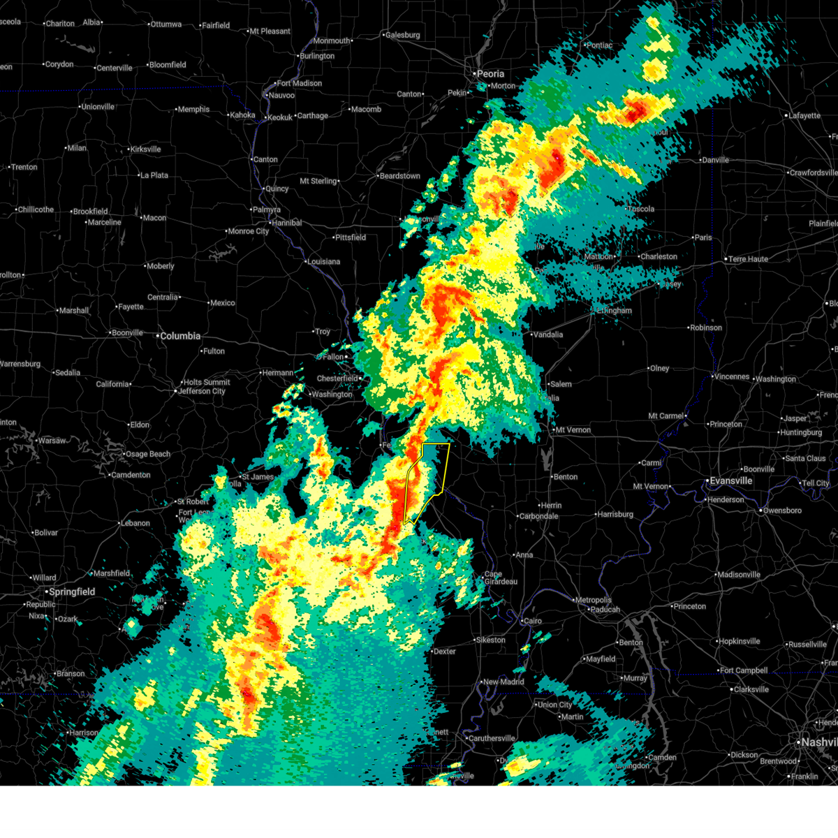
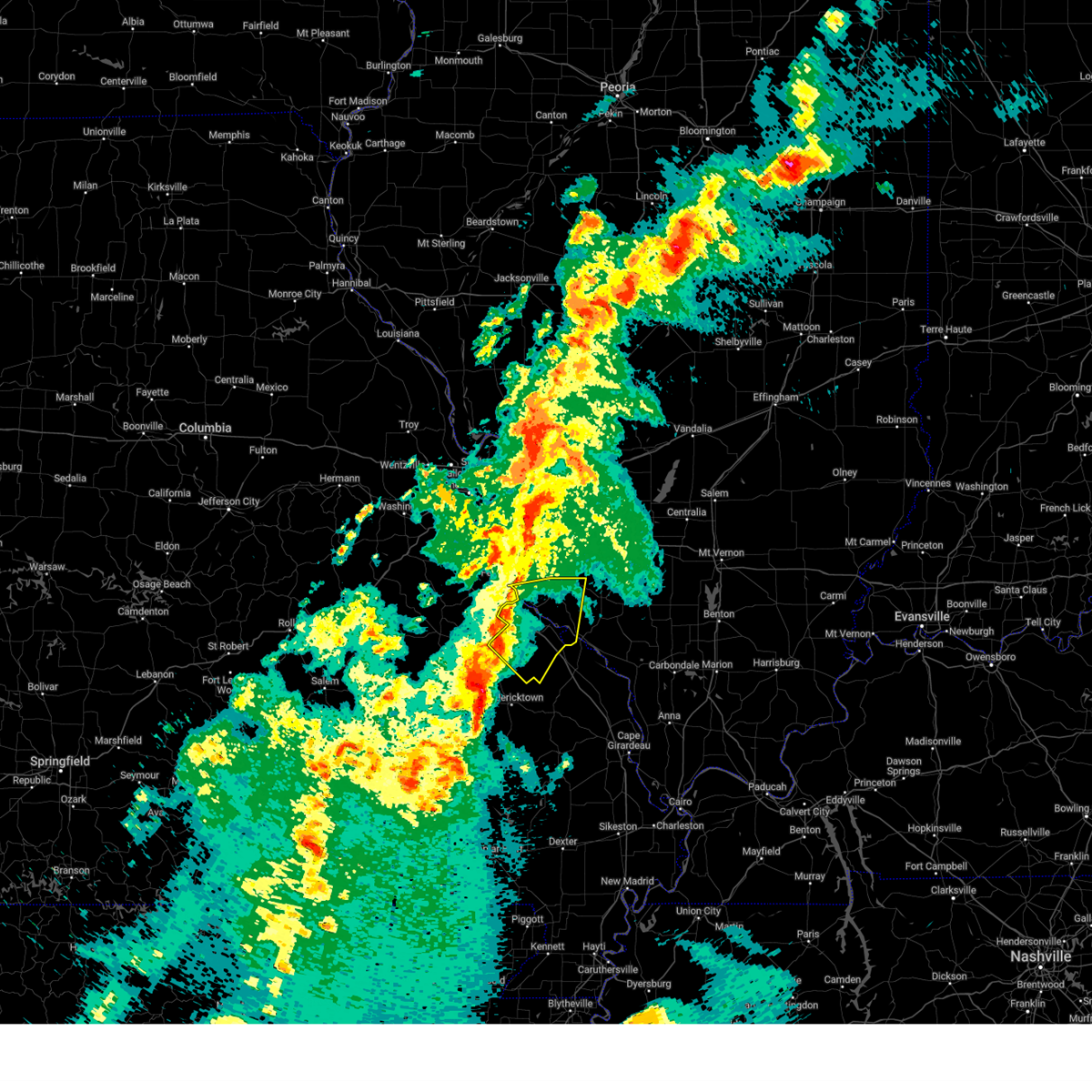
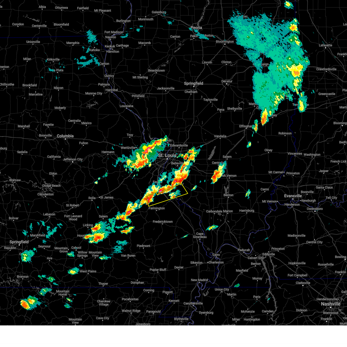
Hail Map for Red Bud, IL
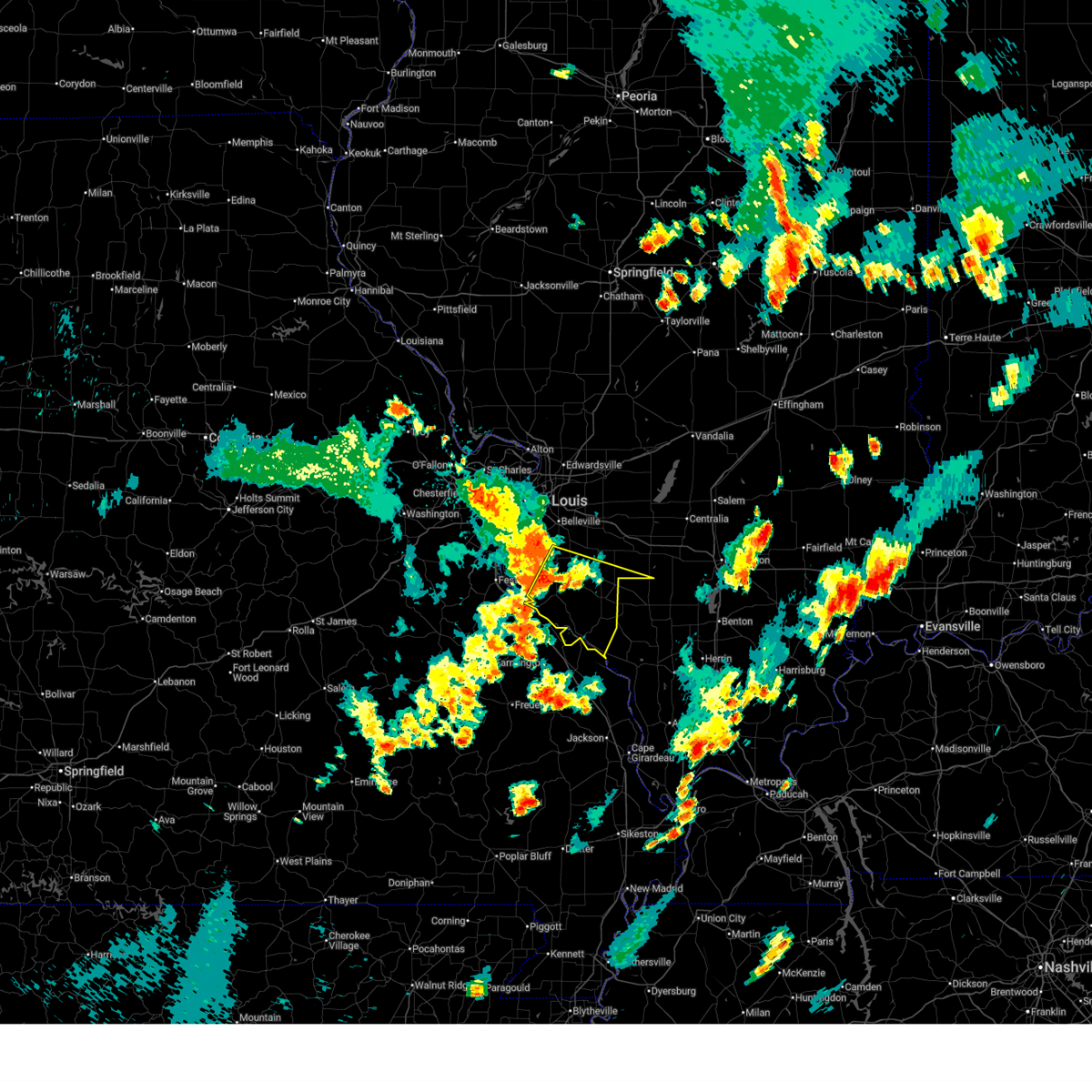
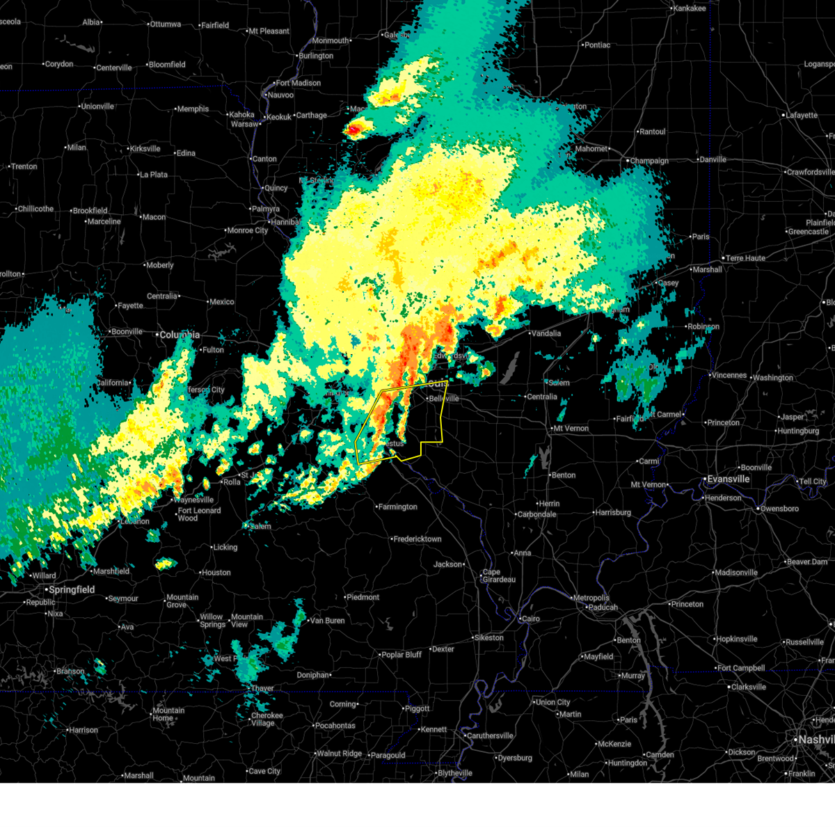
The Red Bud, IL area has had 16 reports of on-the-ground hail by trained spotters, and has been under severe weather warnings 22 times during the past 12 months. Doppler radar has detected hail at or near Red Bud, IL on 68 occasions, including 3 occasions during the past year.
| Name: | Red Bud, IL |
| Where Located: | 30.7 miles SSE of Saint Louis, MO |
| Map: | Google Map for Red Bud, IL |
| Population: | 3698 |
| Housing Units: | 1649 |
| More Info: | Search Google for Red Bud, IL |
0
The Top Recent Hail Date for Red Bud, IL is Friday, July 10, 2026 (55th out of 68)
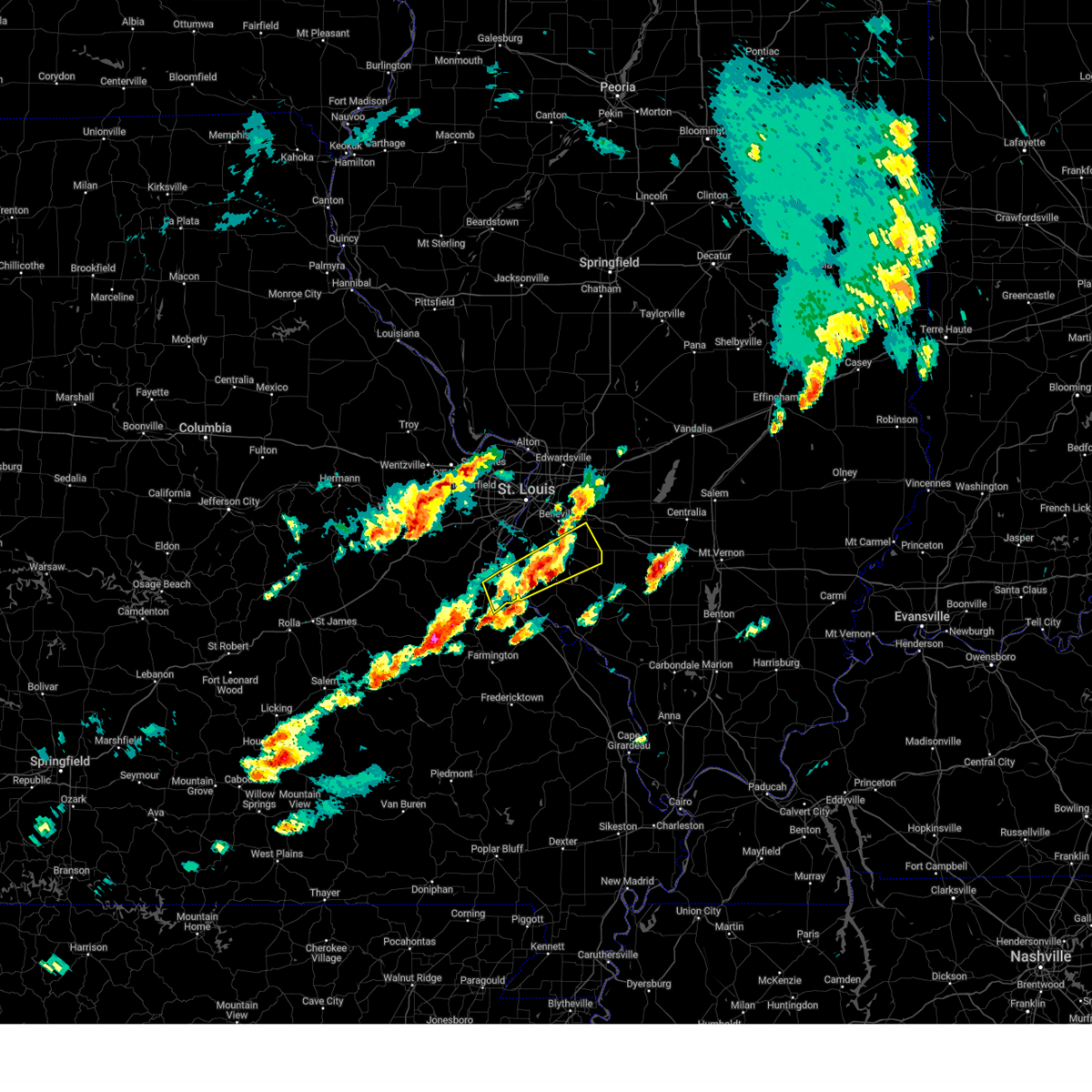
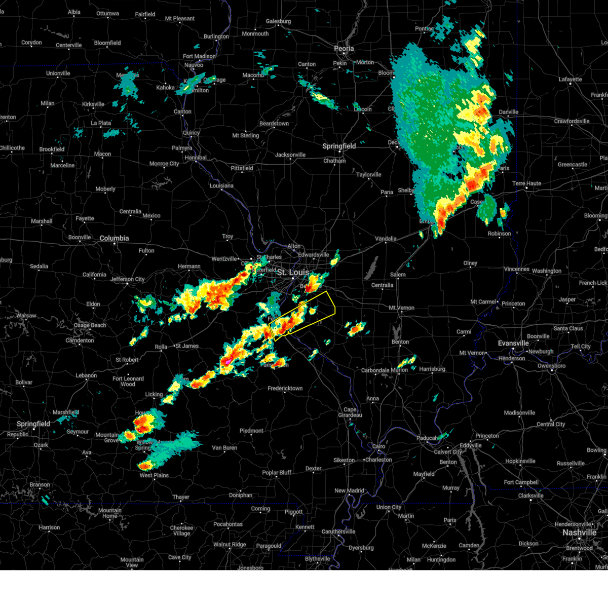
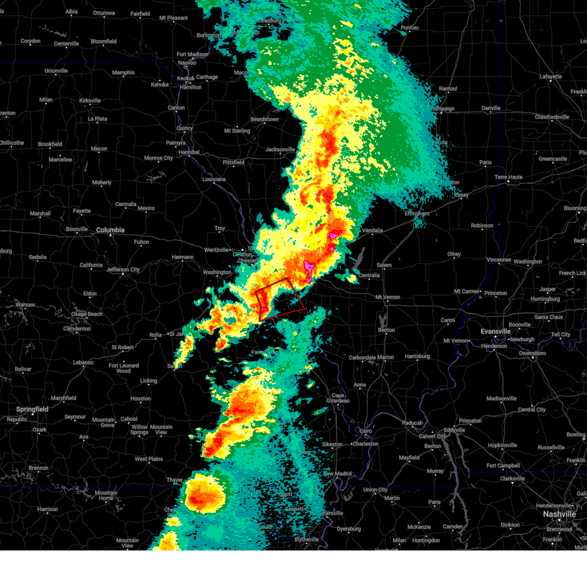
Hail and Wind Damage Spotted near Red Bud, IL
| Date / Time | Report Details |
|---|---|
| 7/4/2026 4:42 PM CDT |
 Svrlsx the national weather service in st louis has issued a * severe thunderstorm warning for, southwestern washington county in south central illinois, southeastern monroe county in southwestern illinois, randolph county in southwestern illinois, southeastern saint clair county in southwestern illinois, * until 545 pm cdt. * at 442 pm cdt, a severe thunderstorm was located 5 miles north of red bud, moving southeast at 30 mph (radar indicated). Hazards include 60 mph wind gusts and quarter size hail. Hail damage to vehicles is expected. Expect wind damage to roofs, siding, and trees. Svrlsx the national weather service in st louis has issued a * severe thunderstorm warning for, southwestern washington county in south central illinois, southeastern monroe county in southwestern illinois, randolph county in southwestern illinois, southeastern saint clair county in southwestern illinois, * until 545 pm cdt. * at 442 pm cdt, a severe thunderstorm was located 5 miles north of red bud, moving southeast at 30 mph (radar indicated). Hazards include 60 mph wind gusts and quarter size hail. Hail damage to vehicles is expected. Expect wind damage to roofs, siding, and trees.
|
| 4/27/2026 8:33 PM CDT |
 At 833 pm cdt, severe thunderstorms were located along a line from over central city to 6 miles east of coulterville, or along a line from over centralia to 12 miles southwest of nashville, moving east at 50 mph (radar indicated). Hazards include 70 mph wind gusts and quarter size hail. Hail damage to vehicles is expected. expect considerable tree damage. wind damage is also likely to mobile homes, roofs, and outbuildings. locations impacted include, red bud, new athens, st. libory, prairie, marissa, preston, okawville, baldwin, carlyle, lively grove, sparta, tilden, eden, nashville, coulterville, shattuc, wamac, irvington, posen and ashley. This includes interstate 64 in illinois between exits 41 and 61. At 833 pm cdt, severe thunderstorms were located along a line from over central city to 6 miles east of coulterville, or along a line from over centralia to 12 miles southwest of nashville, moving east at 50 mph (radar indicated). Hazards include 70 mph wind gusts and quarter size hail. Hail damage to vehicles is expected. expect considerable tree damage. wind damage is also likely to mobile homes, roofs, and outbuildings. locations impacted include, red bud, new athens, st. libory, prairie, marissa, preston, okawville, baldwin, carlyle, lively grove, sparta, tilden, eden, nashville, coulterville, shattuc, wamac, irvington, posen and ashley. This includes interstate 64 in illinois between exits 41 and 61.
|
| 4/27/2026 8:20 PM CDT |
 At 820 pm cdt, severe thunderstorms were located along a line from 5 miles southeast of carlyle to over tilden, or along a line from 5 miles southeast of carlyle to near sparta, moving east at 50 mph (radar indicated). Hazards include 70 mph wind gusts and quarter size hail. Hail damage to vehicles is expected. expect considerable tree damage. wind damage is also likely to mobile homes, roofs, and outbuildings. locations impacted include, red bud, new athens, albers, aviston, germantown, breese, marissa, okawville, baldwin, beckemeyer, carlyle, lively grove, sparta, tilden, nashville, coulterville, shattuc, wamac, irvington and ashley. This includes interstate 64 in illinois between exits 34 and 61. At 820 pm cdt, severe thunderstorms were located along a line from 5 miles southeast of carlyle to over tilden, or along a line from 5 miles southeast of carlyle to near sparta, moving east at 50 mph (radar indicated). Hazards include 70 mph wind gusts and quarter size hail. Hail damage to vehicles is expected. expect considerable tree damage. wind damage is also likely to mobile homes, roofs, and outbuildings. locations impacted include, red bud, new athens, albers, aviston, germantown, breese, marissa, okawville, baldwin, beckemeyer, carlyle, lively grove, sparta, tilden, nashville, coulterville, shattuc, wamac, irvington and ashley. This includes interstate 64 in illinois between exits 34 and 61.
|
| 4/27/2026 7:59 PM CDT |
 At 759 pm cdt, severe thunderstorms were located along a line from near smithton to near new design, or along a line from 7 miles southwest of freeburg to near red bud, moving east at 20 mph (radar indicated). Hazards include 60 mph wind gusts and quarter size hail. Hail damage to vehicles is expected. expect wind damage to roofs, siding, and trees. Locations impacted include, valmeyer, harrisonville, foster pond, monroe city, waterloo, madonnaville, chalfin bridge, wartburg, maeystown, fults, burksville, new design, renault, hecker and ames. At 759 pm cdt, severe thunderstorms were located along a line from near smithton to near new design, or along a line from 7 miles southwest of freeburg to near red bud, moving east at 20 mph (radar indicated). Hazards include 60 mph wind gusts and quarter size hail. Hail damage to vehicles is expected. expect wind damage to roofs, siding, and trees. Locations impacted include, valmeyer, harrisonville, foster pond, monroe city, waterloo, madonnaville, chalfin bridge, wartburg, maeystown, fults, burksville, new design, renault, hecker and ames.
|
| 4/27/2026 7:56 PM CDT |
 Svrlsx the national weather service in st louis has issued a * severe thunderstorm warning for, clinton county in south central illinois, washington county in south central illinois, southern monroe county in southwestern illinois, northern randolph county in southwestern illinois, eastern saint clair county in southwestern illinois, * until 900 pm cdt. * at 756 pm cdt, severe thunderstorms were located along a line from over scott afb to 5 miles southeast of new design, or along a line from over scott afb to near red bud, moving east at 40 mph (radar indicated). Hazards include 60 mph wind gusts and quarter size hail. Hail damage to vehicles is expected. Expect wind damage to roofs, siding, and trees. Svrlsx the national weather service in st louis has issued a * severe thunderstorm warning for, clinton county in south central illinois, washington county in south central illinois, southern monroe county in southwestern illinois, northern randolph county in southwestern illinois, eastern saint clair county in southwestern illinois, * until 900 pm cdt. * at 756 pm cdt, severe thunderstorms were located along a line from over scott afb to 5 miles southeast of new design, or along a line from over scott afb to near red bud, moving east at 40 mph (radar indicated). Hazards include 60 mph wind gusts and quarter size hail. Hail damage to vehicles is expected. Expect wind damage to roofs, siding, and trees.
|
| 4/27/2026 7:24 PM CDT |
 Svrlsx the national weather service in st louis has issued a * severe thunderstorm warning for, monroe county in southwestern illinois, * until 815 pm cdt. * at 724 pm cdt, severe thunderstorms were located along a line from near columbia to near crystal city, moving east at 60 mph (radar indicated). Hazards include 60 mph wind gusts and half dollar size hail. Hail damage to vehicles is expected. Expect wind damage to roofs, siding, and trees. Svrlsx the national weather service in st louis has issued a * severe thunderstorm warning for, monroe county in southwestern illinois, * until 815 pm cdt. * at 724 pm cdt, severe thunderstorms were located along a line from near columbia to near crystal city, moving east at 60 mph (radar indicated). Hazards include 60 mph wind gusts and half dollar size hail. Hail damage to vehicles is expected. Expect wind damage to roofs, siding, and trees.
|
| 4/15/2026 10:36 PM CDT |
 the severe thunderstorm warning has been cancelled and is no longer in effect the severe thunderstorm warning has been cancelled and is no longer in effect
|
| 4/15/2026 10:27 PM CDT |
 the severe thunderstorm warning has been cancelled and is no longer in effect the severe thunderstorm warning has been cancelled and is no longer in effect
|
| 4/15/2026 10:27 PM CDT |
 At 1027 pm cdt, severe thunderstorms were located along a line from over centreville to 8 miles southeast of crystal city, moving east at 40 mph (radar indicated). Hazards include 60 mph wind gusts. Expect damage to roofs, siding, and trees. locations impacted include, cahokia, crystal city, columbia, dupo, cahokia parks airport, centreville, belleville, east st. louis, fairview heights, waterloo, millstadt, swansea, o'fallon, shiloh, smithton, freeburg, scott afb and lebanon. this includes the following highways, interstate 64 in illinois between exits 12 and 19. Interstate 55 in missouri near exit 170. At 1027 pm cdt, severe thunderstorms were located along a line from over centreville to 8 miles southeast of crystal city, moving east at 40 mph (radar indicated). Hazards include 60 mph wind gusts. Expect damage to roofs, siding, and trees. locations impacted include, cahokia, crystal city, columbia, dupo, cahokia parks airport, centreville, belleville, east st. louis, fairview heights, waterloo, millstadt, swansea, o'fallon, shiloh, smithton, freeburg, scott afb and lebanon. this includes the following highways, interstate 64 in illinois between exits 12 and 19. Interstate 55 in missouri near exit 170.
|
| 4/15/2026 10:15 PM CDT |
 Svrlsx the national weather service in st louis has issued a * severe thunderstorm warning for, monroe county in southwestern illinois, central saint clair county in southwestern illinois, central jefferson county in east central missouri, south central saint louis county in east central missouri, southern saint louis city in east central missouri, * until 1100 pm cdt. * at 1015 pm cdt, severe thunderstorms were located along a line from over east carondelet to over olympian village, or along a line from near st. louis to 6 miles south of festus, moving east at 45 mph (radar indicated). Hazards include 60 mph wind gusts. expect damage to roofs, siding, and trees Svrlsx the national weather service in st louis has issued a * severe thunderstorm warning for, monroe county in southwestern illinois, central saint clair county in southwestern illinois, central jefferson county in east central missouri, south central saint louis county in east central missouri, southern saint louis city in east central missouri, * until 1100 pm cdt. * at 1015 pm cdt, severe thunderstorms were located along a line from over east carondelet to over olympian village, or along a line from near st. louis to 6 miles south of festus, moving east at 45 mph (radar indicated). Hazards include 60 mph wind gusts. expect damage to roofs, siding, and trees
|
| 4/4/2026 6:25 AM CDT |
 At 625 am cdt, severe thunderstorms were located along a line from 5 miles east of evansville to over chester, or along a line from 9 miles southwest of sparta to over chester, moving east at 40 mph (radar indicated). Hazards include 60 mph wind gusts and small hail. Expect damage to roofs, siding, and trees. Locations impacted include, ruma, red bud, ellis grove, kaskaskia, evansville, prairie, chester, new palestine, preston, walsh, baldwin, bremen, blair, houston, steeleville, sparta, percy, eden, tilden and coulterville. At 625 am cdt, severe thunderstorms were located along a line from 5 miles east of evansville to over chester, or along a line from 9 miles southwest of sparta to over chester, moving east at 40 mph (radar indicated). Hazards include 60 mph wind gusts and small hail. Expect damage to roofs, siding, and trees. Locations impacted include, ruma, red bud, ellis grove, kaskaskia, evansville, prairie, chester, new palestine, preston, walsh, baldwin, bremen, blair, houston, steeleville, sparta, percy, eden, tilden and coulterville.
|
| 4/4/2026 6:25 AM CDT |
 the severe thunderstorm warning has been cancelled and is no longer in effect the severe thunderstorm warning has been cancelled and is no longer in effect
|
| 4/4/2026 6:08 AM CDT |
 Svrlsx the national weather service in st louis has issued a * severe thunderstorm warning for, randolph county in southwestern illinois, northeastern sainte genevieve county in southeastern missouri, * until 715 am cdt. * at 608 am cdt, severe thunderstorms were located along a line from near ste. genevieve to near ste. genevieve, moving east at 40 mph (radar indicated). Hazards include 60 mph wind gusts and small hail. expect damage to roofs, siding, and trees Svrlsx the national weather service in st louis has issued a * severe thunderstorm warning for, randolph county in southwestern illinois, northeastern sainte genevieve county in southeastern missouri, * until 715 am cdt. * at 608 am cdt, severe thunderstorms were located along a line from near ste. genevieve to near ste. genevieve, moving east at 40 mph (radar indicated). Hazards include 60 mph wind gusts and small hail. expect damage to roofs, siding, and trees
|
| 3/15/2026 5:49 PM CDT |
 At 549 pm cdt, a severe thunderstorm capable of producing a tornado was located near baldwin, or 9 miles northwest of sparta, moving east at 55 mph (radar indicated rotation). Hazards include tornado. Flying debris will be dangerous to those caught without shelter. mobile homes will be damaged or destroyed. damage to roofs, windows and vehicles will occur. tree damage is likely. locations impacted include, red bud, ellis grove, evansville, prairie, preston, baldwin, new athens, blair, lenzburg, houston, marissa, steeleville, sparta, eden, percy, tilden, st. Libory and coulterville. At 549 pm cdt, a severe thunderstorm capable of producing a tornado was located near baldwin, or 9 miles northwest of sparta, moving east at 55 mph (radar indicated rotation). Hazards include tornado. Flying debris will be dangerous to those caught without shelter. mobile homes will be damaged or destroyed. damage to roofs, windows and vehicles will occur. tree damage is likely. locations impacted include, red bud, ellis grove, evansville, prairie, preston, baldwin, new athens, blair, lenzburg, houston, marissa, steeleville, sparta, eden, percy, tilden, st. Libory and coulterville.
|
| 3/15/2026 5:42 PM CDT | A portion of the roof of trinity lutheran church was removed. time estimated from rada in randolph county IL, 4 miles WNW of Red Bud, IL |
| 3/15/2026 5:34 PM CDT |
 Torlsx the national weather service in st louis has issued a * tornado warning for, southeastern monroe county in southwestern illinois, randolph county in southwestern illinois, southeastern saint clair county in southwestern illinois, * until 615 pm cdt. * at 534 pm cdt, a severe thunderstorm capable of producing a tornado was located 7 miles north of ste. genevieve, moving east at 50 mph (radar indicated rotation). Hazards include tornado. Flying debris will be dangerous to those caught without shelter. mobile homes will be damaged or destroyed. damage to roofs, windows and vehicles will occur. Tree damage is likely. Torlsx the national weather service in st louis has issued a * tornado warning for, southeastern monroe county in southwestern illinois, randolph county in southwestern illinois, southeastern saint clair county in southwestern illinois, * until 615 pm cdt. * at 534 pm cdt, a severe thunderstorm capable of producing a tornado was located 7 miles north of ste. genevieve, moving east at 50 mph (radar indicated rotation). Hazards include tornado. Flying debris will be dangerous to those caught without shelter. mobile homes will be damaged or destroyed. damage to roofs, windows and vehicles will occur. Tree damage is likely.
|
| 3/15/2026 5:28 PM CDT |
 Svrlsx the national weather service in st louis has issued a * severe thunderstorm warning for, southern monroe county in southwestern illinois, randolph county in southwestern illinois, southeastern saint clair county in southwestern illinois, * until 615 pm cdt. * at 528 pm cdt, a severe thunderstorm was located 5 miles northeast of bloomsdale, or 10 miles northwest of ste. genevieve, moving northeast at 50 mph (radar indicated). Hazards include 60 mph wind gusts. expect damage to roofs, siding, and trees Svrlsx the national weather service in st louis has issued a * severe thunderstorm warning for, southern monroe county in southwestern illinois, randolph county in southwestern illinois, southeastern saint clair county in southwestern illinois, * until 615 pm cdt. * at 528 pm cdt, a severe thunderstorm was located 5 miles northeast of bloomsdale, or 10 miles northwest of ste. genevieve, moving northeast at 50 mph (radar indicated). Hazards include 60 mph wind gusts. expect damage to roofs, siding, and trees
|
| 3/11/2026 5:10 AM CDT |
 The storm which prompted the warning has moved out of the area. therefore, the warning will be allowed to expire. however, gusty winds are still possible with this thunderstorm. to report severe weather, contact your nearest law enforcement agency. they will send your report to the national weather service office. The storm which prompted the warning has moved out of the area. therefore, the warning will be allowed to expire. however, gusty winds are still possible with this thunderstorm. to report severe weather, contact your nearest law enforcement agency. they will send your report to the national weather service office.
|
| 3/11/2026 4:58 AM CDT |
 At 458 am cdt, a severe thunderstorm was located 7 miles southwest of red bud, moving east at 55 mph (radar indicated). Hazards include 60 mph wind gusts. Expect damage to roofs, siding, and trees. Locations impacted include, fults, maeystown, prairie du rocher, renault, modoc, ames, roots, ruma, evansville, red bud, prairie, hecker, preston, walsh, baldwin, new athens, houston, marissa, sparta and lenzburg. At 458 am cdt, a severe thunderstorm was located 7 miles southwest of red bud, moving east at 55 mph (radar indicated). Hazards include 60 mph wind gusts. Expect damage to roofs, siding, and trees. Locations impacted include, fults, maeystown, prairie du rocher, renault, modoc, ames, roots, ruma, evansville, red bud, prairie, hecker, preston, walsh, baldwin, new athens, houston, marissa, sparta and lenzburg.
|
| 3/11/2026 4:58 AM CDT |
 the severe thunderstorm warning has been cancelled and is no longer in effect the severe thunderstorm warning has been cancelled and is no longer in effect
|
| 3/11/2026 4:51 AM CDT |
 At 451 am cdt, a severe thunderstorm was located 5 miles northeast of bloomsdale, or 9 miles northwest of ste. genevieve, moving east at 55 mph (radar indicated). Hazards include 60 mph wind gusts. Expect damage to roofs, siding, and trees. locations impacted include, bloomsdale, fults, maeystown, prairie du rocher, renault, modoc, ames, ruma, evansville, red bud, prairie, hecker, preston, baldwin, new athens, houston, marissa, sparta and lenzburg. This includes interstate 55 in missouri between exits 154 and 170. At 451 am cdt, a severe thunderstorm was located 5 miles northeast of bloomsdale, or 9 miles northwest of ste. genevieve, moving east at 55 mph (radar indicated). Hazards include 60 mph wind gusts. Expect damage to roofs, siding, and trees. locations impacted include, bloomsdale, fults, maeystown, prairie du rocher, renault, modoc, ames, ruma, evansville, red bud, prairie, hecker, preston, baldwin, new athens, houston, marissa, sparta and lenzburg. This includes interstate 55 in missouri between exits 154 and 170.
|
| 3/11/2026 4:51 AM CDT |
 the severe thunderstorm warning has been cancelled and is no longer in effect the severe thunderstorm warning has been cancelled and is no longer in effect
|
| 3/11/2026 4:35 AM CDT |
 Svrlsx the national weather service in st louis has issued a * severe thunderstorm warning for, southern monroe county in southwestern illinois, northern randolph county in southwestern illinois, southeastern saint clair county in southwestern illinois, southeastern jefferson county in east central missouri, northwestern sainte genevieve county in southeastern missouri, north central saint francois county in southeastern missouri, * until 515 am cdt. * at 435 am cdt, a severe thunderstorm was located 10 miles south of olympian village, or 9 miles northeast of bonne terre, moving east at 55 mph (radar indicated). Hazards include 60 mph wind gusts. expect damage to roofs, siding, and trees Svrlsx the national weather service in st louis has issued a * severe thunderstorm warning for, southern monroe county in southwestern illinois, northern randolph county in southwestern illinois, southeastern saint clair county in southwestern illinois, southeastern jefferson county in east central missouri, northwestern sainte genevieve county in southeastern missouri, north central saint francois county in southeastern missouri, * until 515 am cdt. * at 435 am cdt, a severe thunderstorm was located 10 miles south of olympian village, or 9 miles northeast of bonne terre, moving east at 55 mph (radar indicated). Hazards include 60 mph wind gusts. expect damage to roofs, siding, and trees
|
| 5/20/2025 12:45 AM CDT |
 the tornado warning has been cancelled and is no longer in effect the tornado warning has been cancelled and is no longer in effect
|
| 5/20/2025 12:36 AM CDT |
 At 1236 am cdt, severe thunderstorms capable of producing a tornado were located along a line from over waterloo to near baldwin, or along a line from over waterloo to 5 miles southeast of red bud, moving northeast at 50 mph (radar indicated rotation). Hazards include tornado. Flying debris will be dangerous to those caught without shelter. mobile homes will be damaged or destroyed. damage to roofs, windows and vehicles will occur. tree damage is likely. locations impacted include, belleville, o'fallon, east st. louis, collinsville, fairview heights, swansea, shiloh, waterloo, columbia, mascoutah, lebanon, freeburg, caseyville, millstadt, red bud, new baden, scott afb, smithton, new athens and marissa. This includes interstate 64 in illinois between exits 12 and 27. At 1236 am cdt, severe thunderstorms capable of producing a tornado were located along a line from over waterloo to near baldwin, or along a line from over waterloo to 5 miles southeast of red bud, moving northeast at 50 mph (radar indicated rotation). Hazards include tornado. Flying debris will be dangerous to those caught without shelter. mobile homes will be damaged or destroyed. damage to roofs, windows and vehicles will occur. tree damage is likely. locations impacted include, belleville, o'fallon, east st. louis, collinsville, fairview heights, swansea, shiloh, waterloo, columbia, mascoutah, lebanon, freeburg, caseyville, millstadt, red bud, new baden, scott afb, smithton, new athens and marissa. This includes interstate 64 in illinois between exits 12 and 27.
|
| 5/20/2025 12:24 AM CDT |
 At 1224 am cdt, severe thunderstorms capable of producing a tornado were located along a line from near waterloo to 7 miles north of ste. genevieve, moving northeast at 50 mph (radar indicated rotation). Hazards include tornado. Flying debris will be dangerous to those caught without shelter. mobile homes will be damaged or destroyed. damage to roofs, windows and vehicles will occur. tree damage is likely. locations impacted include, belleville, o'fallon, east st. louis, collinsville, fairview heights, swansea, shiloh, waterloo, columbia, mascoutah, lebanon, ste. genevieve, freeburg, caseyville, millstadt, red bud, new baden, scott afb, smithton and new athens. This includes interstate 64 in illinois between exits 12 and 27. At 1224 am cdt, severe thunderstorms capable of producing a tornado were located along a line from near waterloo to 7 miles north of ste. genevieve, moving northeast at 50 mph (radar indicated rotation). Hazards include tornado. Flying debris will be dangerous to those caught without shelter. mobile homes will be damaged or destroyed. damage to roofs, windows and vehicles will occur. tree damage is likely. locations impacted include, belleville, o'fallon, east st. louis, collinsville, fairview heights, swansea, shiloh, waterloo, columbia, mascoutah, lebanon, ste. genevieve, freeburg, caseyville, millstadt, red bud, new baden, scott afb, smithton and new athens. This includes interstate 64 in illinois between exits 12 and 27.
|
| 5/20/2025 12:24 AM CDT |
 the tornado warning has been cancelled and is no longer in effect the tornado warning has been cancelled and is no longer in effect
|
| 5/20/2025 12:12 AM CDT |
 Torlsx the national weather service in st louis has issued a * tornado warning for, monroe county in southwestern illinois, northwestern randolph county in southwestern illinois, saint clair county in southwestern illinois, southeastern jefferson county in east central missouri, northeastern sainte genevieve county in southeastern missouri, * until 115 am cdt. * at 1212 am cdt, a severe thunderstorm capable of producing a tornado was located 9 miles north of bloomsdale, or 8 miles southeast of crystal city, moving northeast at 55 mph (radar indicated rotation). Hazards include tornado. Flying debris will be dangerous to those caught without shelter. mobile homes will be damaged or destroyed. damage to roofs, windows and vehicles will occur. Tree damage is likely. Torlsx the national weather service in st louis has issued a * tornado warning for, monroe county in southwestern illinois, northwestern randolph county in southwestern illinois, saint clair county in southwestern illinois, southeastern jefferson county in east central missouri, northeastern sainte genevieve county in southeastern missouri, * until 115 am cdt. * at 1212 am cdt, a severe thunderstorm capable of producing a tornado was located 9 miles north of bloomsdale, or 8 miles southeast of crystal city, moving northeast at 55 mph (radar indicated rotation). Hazards include tornado. Flying debris will be dangerous to those caught without shelter. mobile homes will be damaged or destroyed. damage to roofs, windows and vehicles will occur. Tree damage is likely.
|
| 5/16/2025 4:39 PM CDT |
 the severe thunderstorm warning has been cancelled and is no longer in effect the severe thunderstorm warning has been cancelled and is no longer in effect
|
| 5/16/2025 4:19 PM CDT |
 At 419 pm cdt, a severe thunderstorm was located near evansville, or 7 miles northeast of ste. genevieve, moving northeast at 65 mph (public reported quarter size hail in st. genevieve). Hazards include 60 mph wind gusts and quarter size hail. Hail damage to vehicles is expected. expect wind damage to roofs, siding, and trees. locations impacted include, chester, ste. genevieve, sparta, red bud, nashville, bremen, steeleville, marissa, okawville, wamac, percy, coulterville, tilden, evansville, lively grove, irvington, ashley, baldwin, st. mary and posen. this includes the following state parks, felix valle house state park. This includes interstate 64 in illinois between exits 41 and 61. At 419 pm cdt, a severe thunderstorm was located near evansville, or 7 miles northeast of ste. genevieve, moving northeast at 65 mph (public reported quarter size hail in st. genevieve). Hazards include 60 mph wind gusts and quarter size hail. Hail damage to vehicles is expected. expect wind damage to roofs, siding, and trees. locations impacted include, chester, ste. genevieve, sparta, red bud, nashville, bremen, steeleville, marissa, okawville, wamac, percy, coulterville, tilden, evansville, lively grove, irvington, ashley, baldwin, st. mary and posen. this includes the following state parks, felix valle house state park. This includes interstate 64 in illinois between exits 41 and 61.
|
| 5/16/2025 4:16 PM CDT |
 the severe thunderstorm warning has been cancelled and is no longer in effect the severe thunderstorm warning has been cancelled and is no longer in effect
|
| 5/16/2025 4:16 PM CDT |
 At 416 pm cdt, a severe thunderstorm was located near ste. genevieve, moving northeast at 65 mph (radar indicated). Hazards include 60 mph wind gusts and quarter size hail. Hail damage to vehicles is expected. expect wind damage to roofs, siding, and trees. locations impacted include, chester, ste. genevieve, sparta, red bud, nashville, bremen, steeleville, marissa, okawville, wamac, percy, coulterville, tilden, evansville, lively grove, irvington, ashley, baldwin, st. mary and posen. this includes the following state parks, felix valle house state park. This includes interstate 64 in illinois between exits 41 and 61. At 416 pm cdt, a severe thunderstorm was located near ste. genevieve, moving northeast at 65 mph (radar indicated). Hazards include 60 mph wind gusts and quarter size hail. Hail damage to vehicles is expected. expect wind damage to roofs, siding, and trees. locations impacted include, chester, ste. genevieve, sparta, red bud, nashville, bremen, steeleville, marissa, okawville, wamac, percy, coulterville, tilden, evansville, lively grove, irvington, ashley, baldwin, st. mary and posen. this includes the following state parks, felix valle house state park. This includes interstate 64 in illinois between exits 41 and 61.
|
| 5/16/2025 4:15 PM CDT |
 Svrlsx the national weather service in st louis has issued a * severe thunderstorm warning for, southwestern marion county in south central illinois, washington county in south central illinois, southeastern monroe county in southwestern illinois, randolph county in southwestern illinois, southeastern saint clair county in southwestern illinois, northeastern sainte genevieve county in southeastern missouri, * until 500 pm cdt. * at 415 pm cdt, a severe thunderstorm was located over ste. genevieve, moving northeast at 65 mph (radar indicated). Hazards include 60 mph wind gusts and quarter size hail. Hail damage to vehicles is expected. Expect wind damage to roofs, siding, and trees. Svrlsx the national weather service in st louis has issued a * severe thunderstorm warning for, southwestern marion county in south central illinois, washington county in south central illinois, southeastern monroe county in southwestern illinois, randolph county in southwestern illinois, southeastern saint clair county in southwestern illinois, northeastern sainte genevieve county in southeastern missouri, * until 500 pm cdt. * at 415 pm cdt, a severe thunderstorm was located over ste. genevieve, moving northeast at 65 mph (radar indicated). Hazards include 60 mph wind gusts and quarter size hail. Hail damage to vehicles is expected. Expect wind damage to roofs, siding, and trees.
|
| 5/16/2025 3:00 PM CDT | Golf Ball sized hail reported 0.2 miles W of Red Bud, IL, pictures received on x. time estimated. |
| 5/16/2025 2:58 PM CDT | Ping Pong Ball sized hail reported 0.2 miles W of Red Bud, IL |
| 5/16/2025 2:55 PM CDT | Half Dollar sized hail reported 0.9 miles E of Red Bud, IL, report from mping: half dollar (1.25 in.). |
| 5/16/2025 2:52 PM CDT |
 Svrlsx the national weather service in st louis has issued a * severe thunderstorm warning for, southwestern clinton county in south central illinois, western washington county in south central illinois, southeastern monroe county in southwestern illinois, north central randolph county in southwestern illinois, southeastern saint clair county in southwestern illinois, * until 330 pm cdt. * at 252 pm cdt, a severe thunderstorm was located over red bud, moving east at 60 mph (radar indicated). Hazards include 60 mph wind gusts and half dollar size hail. Hail damage to vehicles is expected. Expect wind damage to roofs, siding, and trees. Svrlsx the national weather service in st louis has issued a * severe thunderstorm warning for, southwestern clinton county in south central illinois, western washington county in south central illinois, southeastern monroe county in southwestern illinois, north central randolph county in southwestern illinois, southeastern saint clair county in southwestern illinois, * until 330 pm cdt. * at 252 pm cdt, a severe thunderstorm was located over red bud, moving east at 60 mph (radar indicated). Hazards include 60 mph wind gusts and half dollar size hail. Hail damage to vehicles is expected. Expect wind damage to roofs, siding, and trees.
|
| 4/29/2025 7:32 AM CDT |
 the severe thunderstorm warning has been cancelled and is no longer in effect the severe thunderstorm warning has been cancelled and is no longer in effect
|
| 4/29/2025 7:32 AM CDT |
 At 732 am cdt, a severe thunderstorm was located near lively grove, or 13 miles south of new baden, moving northeast at 55 mph (radar indicated). Hazards include 60 mph wind gusts and quarter size hail. Hail damage to vehicles is expected. expect wind damage to roofs, siding, and trees. this severe thunderstorm will be near, red bud and evansville around 710 am cdt. baldwin around 715 am cdt. other locations impacted by the severe thunderstorm include prairie, ruma, ames, preston, houston, lenzburg, fayetteville, st. libory, stone church and venedy. This includes interstate 64 in illinois near exit 41. At 732 am cdt, a severe thunderstorm was located near lively grove, or 13 miles south of new baden, moving northeast at 55 mph (radar indicated). Hazards include 60 mph wind gusts and quarter size hail. Hail damage to vehicles is expected. expect wind damage to roofs, siding, and trees. this severe thunderstorm will be near, red bud and evansville around 710 am cdt. baldwin around 715 am cdt. other locations impacted by the severe thunderstorm include prairie, ruma, ames, preston, houston, lenzburg, fayetteville, st. libory, stone church and venedy. This includes interstate 64 in illinois near exit 41.
|
| 4/29/2025 7:08 AM CDT |
 Svrlsx the national weather service in st louis has issued a * severe thunderstorm warning for, western washington county in south central illinois, monroe county in southwestern illinois, northern randolph county in southwestern illinois, southern saint clair county in southwestern illinois, southeastern jefferson county in east central missouri, northwestern sainte genevieve county in southeastern missouri, * until 800 am cdt. * at 708 am cdt, a severe thunderstorm was located over red bud, moving east at 50 mph (radar indicated). Hazards include 60 mph wind gusts and quarter size hail. Hail damage to vehicles is expected. expect wind damage to roofs, siding, and trees. this severe thunderstorm will be near, red bud and evansville around 710 am cdt. baldwin around 715 am cdt. other locations impacted by the severe thunderstorm include prairie, ruma, ames, hecker, preston, lenzburg, houston, st. libory, stone church and johannisburg. this includes the following state parks, gov. dunklin's grave historic site. this includes the following highways, interstate 64 in illinois near exit 41. Interstate 55 in missouri between exits 162 and 178. Svrlsx the national weather service in st louis has issued a * severe thunderstorm warning for, western washington county in south central illinois, monroe county in southwestern illinois, northern randolph county in southwestern illinois, southern saint clair county in southwestern illinois, southeastern jefferson county in east central missouri, northwestern sainte genevieve county in southeastern missouri, * until 800 am cdt. * at 708 am cdt, a severe thunderstorm was located over red bud, moving east at 50 mph (radar indicated). Hazards include 60 mph wind gusts and quarter size hail. Hail damage to vehicles is expected. expect wind damage to roofs, siding, and trees. this severe thunderstorm will be near, red bud and evansville around 710 am cdt. baldwin around 715 am cdt. other locations impacted by the severe thunderstorm include prairie, ruma, ames, hecker, preston, lenzburg, houston, st. libory, stone church and johannisburg. this includes the following state parks, gov. dunklin's grave historic site. this includes the following highways, interstate 64 in illinois near exit 41. Interstate 55 in missouri between exits 162 and 178.
|
| 4/20/2025 8:24 PM CDT |
 At 824 pm cdt, severe thunderstorms were located along a line from over fairview heights to near chester, moving east at 60 mph (radar indicated). Hazards include 60 mph wind gusts and small hail. Expect damage to roofs, siding, and trees. locations impacted include, st. louis, belleville, o'fallon, east st. louis, fairview heights, cahokia, swansea, shiloh, columbia, chester, mascoutah, centreville, lebanon, freeburg, sparta, dupo, millstadt, red bud, scott afb and cahokia parks airport. this includes the following highways, interstate 64 in illinois between exits 14 and 23. Interstate 55 in missouri near exit 141. At 824 pm cdt, severe thunderstorms were located along a line from over fairview heights to near chester, moving east at 60 mph (radar indicated). Hazards include 60 mph wind gusts and small hail. Expect damage to roofs, siding, and trees. locations impacted include, st. louis, belleville, o'fallon, east st. louis, fairview heights, cahokia, swansea, shiloh, columbia, chester, mascoutah, centreville, lebanon, freeburg, sparta, dupo, millstadt, red bud, scott afb and cahokia parks airport. this includes the following highways, interstate 64 in illinois between exits 14 and 23. Interstate 55 in missouri near exit 141.
|
| 4/20/2025 8:24 PM CDT |
 the severe thunderstorm warning has been cancelled and is no longer in effect the severe thunderstorm warning has been cancelled and is no longer in effect
|
| 4/20/2025 8:21 PM CDT |
 the tornado warning has been cancelled and is no longer in effect the tornado warning has been cancelled and is no longer in effect
|
| 4/20/2025 8:21 PM CDT |
 At 821 pm cdt, severe thunderstorms capable of producing a tornado were located along a line from near evansville to 5 miles northwest of chester, or along a line from near red bud to 5 miles northwest of chester, moving northeast at 55 mph (radar indicated rotation). Hazards include tornado. Flying debris will be dangerous to those caught without shelter. mobile homes will be damaged or destroyed. damage to roofs, windows and vehicles will occur. tree damage is likely. Locations impacted include, chester, sparta, red bud, bremen, steeleville, evansville, baldwin, preston, blair, prairie, ellis grove, ruma, houston, walsh, new palestine and welge. At 821 pm cdt, severe thunderstorms capable of producing a tornado were located along a line from near evansville to 5 miles northwest of chester, or along a line from near red bud to 5 miles northwest of chester, moving northeast at 55 mph (radar indicated rotation). Hazards include tornado. Flying debris will be dangerous to those caught without shelter. mobile homes will be damaged or destroyed. damage to roofs, windows and vehicles will occur. tree damage is likely. Locations impacted include, chester, sparta, red bud, bremen, steeleville, evansville, baldwin, preston, blair, prairie, ellis grove, ruma, houston, walsh, new palestine and welge.
|
| 4/20/2025 8:13 PM CDT |
 At 813 pm cdt, tornado producing storms were located along a line from 6 miles west of evansville to near st. mary, or along a line from 8 miles north of ste. genevieve to 5 miles southeast of ste. genevieve, moving northeast at 60 mph (weather spotters confirmed tornado near st. genevieve). Hazards include damaging tornado. Flying debris will be dangerous to those caught without shelter. mobile homes will be damaged or destroyed. damage to roofs, windows and vehicles will occur. tree damage is likely. locations impacted include, chester, ste. genevieve, sparta, red bud, bremen, steeleville, evansville, baldwin, st. mary, preston, blair, prairie du rocher, prairie, ellis grove, ruma, houston, kaskaskia, walsh, roots and new palestine. This includes the following state parks, felix valle house state park. At 813 pm cdt, tornado producing storms were located along a line from 6 miles west of evansville to near st. mary, or along a line from 8 miles north of ste. genevieve to 5 miles southeast of ste. genevieve, moving northeast at 60 mph (weather spotters confirmed tornado near st. genevieve). Hazards include damaging tornado. Flying debris will be dangerous to those caught without shelter. mobile homes will be damaged or destroyed. damage to roofs, windows and vehicles will occur. tree damage is likely. locations impacted include, chester, ste. genevieve, sparta, red bud, bremen, steeleville, evansville, baldwin, st. mary, preston, blair, prairie du rocher, prairie, ellis grove, ruma, houston, kaskaskia, walsh, roots and new palestine. This includes the following state parks, felix valle house state park.
|
| 4/20/2025 8:11 PM CDT |
 At 811 pm cdt, severe thunderstorms were located along a line from over east carondelet to near st. mary, or along a line from over lemay to 11 miles south of ste. genevieve, moving east at 60 mph (radar indicated). Hazards include 60 mph wind gusts and small hail. Expect damage to roofs, siding, and trees. locations impacted include, st. louis, belleville, o'fallon, east st. louis, arnold, fairview heights, cahokia, swansea, shiloh, waterloo, columbia, chester, sunset hills, mascoutah, centreville, lebanon, ste. genevieve, freeburg, sparta and dupo. this includes the following state parks, felix valle house state park. this includes the following highways, interstate 64 in illinois between exits 14 and 23. Interstate 55 in missouri between exits 141 and 150, and near exit 191. At 811 pm cdt, severe thunderstorms were located along a line from over east carondelet to near st. mary, or along a line from over lemay to 11 miles south of ste. genevieve, moving east at 60 mph (radar indicated). Hazards include 60 mph wind gusts and small hail. Expect damage to roofs, siding, and trees. locations impacted include, st. louis, belleville, o'fallon, east st. louis, arnold, fairview heights, cahokia, swansea, shiloh, waterloo, columbia, chester, sunset hills, mascoutah, centreville, lebanon, ste. genevieve, freeburg, sparta and dupo. this includes the following state parks, felix valle house state park. this includes the following highways, interstate 64 in illinois between exits 14 and 23. Interstate 55 in missouri between exits 141 and 150, and near exit 191.
|
| 4/20/2025 8:11 PM CDT |
 the severe thunderstorm warning has been cancelled and is no longer in effect the severe thunderstorm warning has been cancelled and is no longer in effect
|
| 4/20/2025 8:08 PM CDT |
 At 808 pm cdt, severe thunderstorms capable of producing a tornado were located along a line from 7 miles northwest of ste. genevieve to 7 miles south of ste. genevieve, moving northeast at 60 mph (radar indicated rotation). Hazards include tornado. Flying debris will be dangerous to those caught without shelter. mobile homes will be damaged or destroyed. damage to roofs, windows and vehicles will occur. tree damage is likely. locations impacted include, chester, ste. genevieve, sparta, red bud, bremen, steeleville, evansville, baldwin, st. mary, preston, blair, prairie du rocher, prairie, ellis grove, ruma, houston, kaskaskia, roots, modoc and walsh. this includes the following state parks, felix valle house state park. This includes interstate 55 in missouri between exits 141 and 150. At 808 pm cdt, severe thunderstorms capable of producing a tornado were located along a line from 7 miles northwest of ste. genevieve to 7 miles south of ste. genevieve, moving northeast at 60 mph (radar indicated rotation). Hazards include tornado. Flying debris will be dangerous to those caught without shelter. mobile homes will be damaged or destroyed. damage to roofs, windows and vehicles will occur. tree damage is likely. locations impacted include, chester, ste. genevieve, sparta, red bud, bremen, steeleville, evansville, baldwin, st. mary, preston, blair, prairie du rocher, prairie, ellis grove, ruma, houston, kaskaskia, roots, modoc and walsh. this includes the following state parks, felix valle house state park. This includes interstate 55 in missouri between exits 141 and 150.
|
| 4/20/2025 7:56 PM CDT |
 Torlsx the national weather service in st louis has issued a * tornado warning for, randolph county in southwestern illinois, sainte genevieve county in southeastern missouri, * until 845 pm cdt. * at 756 pm cdt, severe thunderstorms capable of producing a tornado were located along a line from over rocky ridge to over coffman, or along a line from 13 miles east of desloge to 11 miles east of farmington, moving northeast at 60 mph (radar indicated rotation). Hazards include tornado. Flying debris will be dangerous to those caught without shelter. mobile homes will be damaged or destroyed. damage to roofs, windows and vehicles will occur. Tree damage is likely. Torlsx the national weather service in st louis has issued a * tornado warning for, randolph county in southwestern illinois, sainte genevieve county in southeastern missouri, * until 845 pm cdt. * at 756 pm cdt, severe thunderstorms capable of producing a tornado were located along a line from over rocky ridge to over coffman, or along a line from 13 miles east of desloge to 11 miles east of farmington, moving northeast at 60 mph (radar indicated rotation). Hazards include tornado. Flying debris will be dangerous to those caught without shelter. mobile homes will be damaged or destroyed. damage to roofs, windows and vehicles will occur. Tree damage is likely.
|
| 4/20/2025 7:53 PM CDT |
 Svrlsx the national weather service in st louis has issued a * severe thunderstorm warning for, monroe county in southwestern illinois, randolph county in southwestern illinois, saint clair county in southwestern illinois, northeastern jefferson county in east central missouri, south central saint louis county in east central missouri, northern madison county in southeastern missouri, sainte genevieve county in southeastern missouri, southeastern saint francois county in southeastern missouri, * until 845 pm cdt. * at 753 pm cdt, severe thunderstorms were located along a line from over fenton to over womac, or along a line from over fenton to 10 miles northeast of fredericktown, moving east at 60 mph (radar indicated). Hazards include 60 mph wind gusts and small hail. expect damage to roofs, siding, and trees Svrlsx the national weather service in st louis has issued a * severe thunderstorm warning for, monroe county in southwestern illinois, randolph county in southwestern illinois, saint clair county in southwestern illinois, northeastern jefferson county in east central missouri, south central saint louis county in east central missouri, northern madison county in southeastern missouri, sainte genevieve county in southeastern missouri, southeastern saint francois county in southeastern missouri, * until 845 pm cdt. * at 753 pm cdt, severe thunderstorms were located along a line from over fenton to over womac, or along a line from over fenton to 10 miles northeast of fredericktown, moving east at 60 mph (radar indicated). Hazards include 60 mph wind gusts and small hail. expect damage to roofs, siding, and trees
|
| 4/19/2025 1:43 AM CDT |
 Svrlsx the national weather service in st louis has issued a * severe thunderstorm warning for, southern clinton county in south central illinois, washington county in south central illinois, east central monroe county in southwestern illinois, northeastern randolph county in southwestern illinois, southeastern saint clair county in southwestern illinois, * until 230 am cdt. * at 143 am cdt, a severe thunderstorm was located near freeburg, moving east at 65 mph (radar indicated). Hazards include 60 mph wind gusts. expect damage to roofs, siding, and trees Svrlsx the national weather service in st louis has issued a * severe thunderstorm warning for, southern clinton county in south central illinois, washington county in south central illinois, east central monroe county in southwestern illinois, northeastern randolph county in southwestern illinois, southeastern saint clair county in southwestern illinois, * until 230 am cdt. * at 143 am cdt, a severe thunderstorm was located near freeburg, moving east at 65 mph (radar indicated). Hazards include 60 mph wind gusts. expect damage to roofs, siding, and trees
|
| 4/10/2025 3:30 PM CDT |
 the severe thunderstorm warning has been cancelled and is no longer in effect the severe thunderstorm warning has been cancelled and is no longer in effect
|
| 4/10/2025 3:19 PM CDT |
 At 319 pm cdt, severe thunderstorms were located along a line from near baldwin to 7 miles south of ste. genevieve, or along a line from 7 miles west of sparta to 7 miles south of ste. genevieve, moving southeast at 55 mph (radar indicated). Hazards include 60 mph wind gusts and small hail. Expect damage to roofs, siding, and trees. this severe thunderstorm will be near, new design and waterloo around 255 pm cdt. red bud around 305 pm cdt. Other locations impacted by the severe thunderstorm include fults, kidd, burksville, maeystown, wartburg, renault, ames, prairie du rocher, kellogg and prairie. At 319 pm cdt, severe thunderstorms were located along a line from near baldwin to 7 miles south of ste. genevieve, or along a line from 7 miles west of sparta to 7 miles south of ste. genevieve, moving southeast at 55 mph (radar indicated). Hazards include 60 mph wind gusts and small hail. Expect damage to roofs, siding, and trees. this severe thunderstorm will be near, new design and waterloo around 255 pm cdt. red bud around 305 pm cdt. Other locations impacted by the severe thunderstorm include fults, kidd, burksville, maeystown, wartburg, renault, ames, prairie du rocher, kellogg and prairie.
|
| 4/10/2025 3:19 PM CDT |
 the severe thunderstorm warning has been cancelled and is no longer in effect the severe thunderstorm warning has been cancelled and is no longer in effect
|
| 4/10/2025 2:53 PM CDT |
 Svrlsx the national weather service in st louis has issued a * severe thunderstorm warning for, southern monroe county in southwestern illinois, randolph county in southwestern illinois, southeastern jefferson county in east central missouri, northeastern sainte genevieve county in southeastern missouri, * until 400 pm cdt. * at 253 pm cdt, severe thunderstorms were located along a line from 5 miles west of new design to 7 miles northeast of bonne terre, or along a line from 7 miles southwest of waterloo to 7 miles northeast of bonne terre, moving southeast at 55 mph (radar indicated). Hazards include 60 mph wind gusts and small hail. Expect damage to roofs, siding, and trees. this severe thunderstorm will be near, new design and waterloo around 255 pm cdt. bloomsdale and red bud around 305 pm cdt. other locations impacted by the severe thunderstorm include fults, kidd, burksville, maeystown, wartburg, madonnaville, chalfin bridge, monroe city, foster pond and renault. this includes the following state parks, felix valle house state park. This includes interstate 55 in missouri between exits 150 and 162. Svrlsx the national weather service in st louis has issued a * severe thunderstorm warning for, southern monroe county in southwestern illinois, randolph county in southwestern illinois, southeastern jefferson county in east central missouri, northeastern sainte genevieve county in southeastern missouri, * until 400 pm cdt. * at 253 pm cdt, severe thunderstorms were located along a line from 5 miles west of new design to 7 miles northeast of bonne terre, or along a line from 7 miles southwest of waterloo to 7 miles northeast of bonne terre, moving southeast at 55 mph (radar indicated). Hazards include 60 mph wind gusts and small hail. Expect damage to roofs, siding, and trees. this severe thunderstorm will be near, new design and waterloo around 255 pm cdt. bloomsdale and red bud around 305 pm cdt. other locations impacted by the severe thunderstorm include fults, kidd, burksville, maeystown, wartburg, madonnaville, chalfin bridge, monroe city, foster pond and renault. this includes the following state parks, felix valle house state park. This includes interstate 55 in missouri between exits 150 and 162.
|
| 4/2/2025 4:49 PM CDT |
 At 449 pm cdt, severe thunderstorms were located along a line from over red bud to 7 miles south of ste. genevieve, moving northeast at 60 mph (radar indicated). Hazards include 60 mph wind gusts and quarter size hail. Hail damage to vehicles is expected. expect wind damage to roofs, siding, and trees. locations impacted include, chester, ste. genevieve, red bud, evansville, baldwin, st. mary, womac, preston, prairie du rocher, prairie, ellis grove, ruma, kaskaskia, roots, kellogg, modoc, river aux vases, minnith and walsh. this includes the following state parks, felix valle house state park. This includes interstate 55 in missouri between exits 141 and 150. At 449 pm cdt, severe thunderstorms were located along a line from over red bud to 7 miles south of ste. genevieve, moving northeast at 60 mph (radar indicated). Hazards include 60 mph wind gusts and quarter size hail. Hail damage to vehicles is expected. expect wind damage to roofs, siding, and trees. locations impacted include, chester, ste. genevieve, red bud, evansville, baldwin, st. mary, womac, preston, prairie du rocher, prairie, ellis grove, ruma, kaskaskia, roots, kellogg, modoc, river aux vases, minnith and walsh. this includes the following state parks, felix valle house state park. This includes interstate 55 in missouri between exits 141 and 150.
|
| 4/2/2025 4:49 PM CDT |
 the severe thunderstorm warning has been cancelled and is no longer in effect the severe thunderstorm warning has been cancelled and is no longer in effect
|
| 4/2/2025 4:30 PM CDT |
 Svrlsx the national weather service in st louis has issued a * severe thunderstorm warning for, southwestern monroe county in southwestern illinois, central randolph county in southwestern illinois, sainte genevieve county in southeastern missouri, * until 500 pm cdt. * at 430 pm cdt, severe thunderstorms were located along a line from over bloomsdale to 5 miles west of weingarten, or along a line from 12 miles west of ste. genevieve to 8 miles northeast of farmington, moving northeast at 60 mph (radar indicated). Hazards include 60 mph wind gusts and quarter size hail. Hail damage to vehicles is expected. Expect wind damage to roofs, siding, and trees. Svrlsx the national weather service in st louis has issued a * severe thunderstorm warning for, southwestern monroe county in southwestern illinois, central randolph county in southwestern illinois, sainte genevieve county in southeastern missouri, * until 500 pm cdt. * at 430 pm cdt, severe thunderstorms were located along a line from over bloomsdale to 5 miles west of weingarten, or along a line from 12 miles west of ste. genevieve to 8 miles northeast of farmington, moving northeast at 60 mph (radar indicated). Hazards include 60 mph wind gusts and quarter size hail. Hail damage to vehicles is expected. Expect wind damage to roofs, siding, and trees.
|
| 3/30/2025 2:57 PM CDT |
 the severe thunderstorm warning has been cancelled and is no longer in effect the severe thunderstorm warning has been cancelled and is no longer in effect
|
| 3/30/2025 2:57 PM CDT |
 At 257 pm cdt, a severe thunderstorm was located near bloomsdale, or 8 miles northwest of ste. genevieve, moving northeast at 45 mph (radar indicated). Hazards include 60 mph wind gusts and half dollar size hail. Hail damage to vehicles is expected. expect wind damage to roofs, siding, and trees. locations impacted include, bonne terre, desloge, ste. genevieve, red bud, leadwood, park hills, evansville, bloomsdale, preston, prairie du rocher, prairie, ruma, kidd, kellogg, modoc, ames, french village, roots and walsh. this includes the following state parks, st. francois state park. This includes interstate 55 in missouri between exits 154 and 162. At 257 pm cdt, a severe thunderstorm was located near bloomsdale, or 8 miles northwest of ste. genevieve, moving northeast at 45 mph (radar indicated). Hazards include 60 mph wind gusts and half dollar size hail. Hail damage to vehicles is expected. expect wind damage to roofs, siding, and trees. locations impacted include, bonne terre, desloge, ste. genevieve, red bud, leadwood, park hills, evansville, bloomsdale, preston, prairie du rocher, prairie, ruma, kidd, kellogg, modoc, ames, french village, roots and walsh. this includes the following state parks, st. francois state park. This includes interstate 55 in missouri between exits 154 and 162.
|
| 3/30/2025 2:41 PM CDT |
 At 241 pm cdt, a severe thunderstorm was located 7 miles north of marissa, or 10 miles southeast of freeburg, moving northeast at 40 mph. another severe thunderstorm was located south of olympian village (radar indicated). Hazards include ping pong ball size hail and 60 mph wind gusts. People and animals outdoors will be injured. expect hail damage to roofs, siding, windows, and vehicles. expect wind damage to roofs, siding, and trees. locations impacted include, red bud, new athens, new design, st. libory, lenzburg, hecker, fayetteville, maeystown, fults, renault and chalfin bridge. This includes interstate 55 in missouri near exit 170. At 241 pm cdt, a severe thunderstorm was located 7 miles north of marissa, or 10 miles southeast of freeburg, moving northeast at 40 mph. another severe thunderstorm was located south of olympian village (radar indicated). Hazards include ping pong ball size hail and 60 mph wind gusts. People and animals outdoors will be injured. expect hail damage to roofs, siding, windows, and vehicles. expect wind damage to roofs, siding, and trees. locations impacted include, red bud, new athens, new design, st. libory, lenzburg, hecker, fayetteville, maeystown, fults, renault and chalfin bridge. This includes interstate 55 in missouri near exit 170.
|
| 3/30/2025 2:33 PM CDT |
 At 233 pm cdt, a severe thunderstorm was located over new athens, or 9 miles southeast of freeburg, moving northeast at 40 mph (radar indicated). Hazards include ping pong ball size hail and 60 mph wind gusts. People and animals outdoors will be injured. expect hail damage to roofs, siding, windows, and vehicles. expect wind damage to roofs, siding, and trees. locations impacted include, belleville, festus, waterloo, mascoutah, crystal city, freeburg, red bud, herculaneum, smithton, new athens, valmeyer, olympian village, new design, st. libory, lenzburg, hecker, fayetteville, maeystown, fults and burksville. This includes interstate 55 in missouri between exits 170 and 175. At 233 pm cdt, a severe thunderstorm was located over new athens, or 9 miles southeast of freeburg, moving northeast at 40 mph (radar indicated). Hazards include ping pong ball size hail and 60 mph wind gusts. People and animals outdoors will be injured. expect hail damage to roofs, siding, windows, and vehicles. expect wind damage to roofs, siding, and trees. locations impacted include, belleville, festus, waterloo, mascoutah, crystal city, freeburg, red bud, herculaneum, smithton, new athens, valmeyer, olympian village, new design, st. libory, lenzburg, hecker, fayetteville, maeystown, fults and burksville. This includes interstate 55 in missouri between exits 170 and 175.
|
| 3/30/2025 2:27 PM CDT |
 Svrlsx the national weather service in st louis has issued a * severe thunderstorm warning for, south central monroe county in southwestern illinois, northwestern randolph county in southwestern illinois, south central jefferson county in east central missouri, northern sainte genevieve county in southeastern missouri, northwestern saint francois county in southeastern missouri, * until 315 pm cdt. * at 227 pm cdt, a severe thunderstorm was located near bonne terre, moving northeast at 55 mph (radar indicated). Hazards include ping pong ball size hail and 60 mph wind gusts. People and animals outdoors will be injured. expect hail damage to roofs, siding, windows, and vehicles. Expect wind damage to roofs, siding, and trees. Svrlsx the national weather service in st louis has issued a * severe thunderstorm warning for, south central monroe county in southwestern illinois, northwestern randolph county in southwestern illinois, south central jefferson county in east central missouri, northern sainte genevieve county in southeastern missouri, northwestern saint francois county in southeastern missouri, * until 315 pm cdt. * at 227 pm cdt, a severe thunderstorm was located near bonne terre, moving northeast at 55 mph (radar indicated). Hazards include ping pong ball size hail and 60 mph wind gusts. People and animals outdoors will be injured. expect hail damage to roofs, siding, windows, and vehicles. Expect wind damage to roofs, siding, and trees.
|
| 3/30/2025 2:22 PM CDT | Quarter sized hail reported 5.3 miles SW of Red Bud, IL, report from mping: quarter (1.00 in.). |
| 3/30/2025 2:10 PM CDT |
 At 210 pm cdt, severe thunderstorms were located over new design, or 7 miles south of waterloo, moving northeast at 35 mph (radar indicated). Hazards include 60 mph wind gusts and quarter size hail. Hail damage to vehicles is expected. expect wind damage to roofs, siding, and trees. locations impacted include, belleville, festus, waterloo, mascoutah, crystal city, freeburg, red bud, herculaneum, smithton, new athens, valmeyer, olympian village, new design, st. libory, lenzburg, hecker, fayetteville, maeystown, fults and burksville. This includes interstate 55 in missouri between exits 170 and 175. At 210 pm cdt, severe thunderstorms were located over new design, or 7 miles south of waterloo, moving northeast at 35 mph (radar indicated). Hazards include 60 mph wind gusts and quarter size hail. Hail damage to vehicles is expected. expect wind damage to roofs, siding, and trees. locations impacted include, belleville, festus, waterloo, mascoutah, crystal city, freeburg, red bud, herculaneum, smithton, new athens, valmeyer, olympian village, new design, st. libory, lenzburg, hecker, fayetteville, maeystown, fults and burksville. This includes interstate 55 in missouri between exits 170 and 175.
|
| 3/30/2025 1:58 PM CDT |
 Svrlsx the national weather service in st louis has issued a * severe thunderstorm warning for, monroe county in southwestern illinois, north central randolph county in southwestern illinois, southeastern saint clair county in southwestern illinois, southeastern jefferson county in east central missouri, * until 300 pm cdt. * at 158 pm cdt, a severe thunderstorm was located over olympian village, or 6 miles east of de soto, moving northeast at 40 mph. additional severe thunderstorms are located over central monroe county (radar indicated). Hazards include 60 mph wind gusts and quarter size hail. Hail damage to vehicles is expected. Expect wind damage to roofs, siding, and trees. Svrlsx the national weather service in st louis has issued a * severe thunderstorm warning for, monroe county in southwestern illinois, north central randolph county in southwestern illinois, southeastern saint clair county in southwestern illinois, southeastern jefferson county in east central missouri, * until 300 pm cdt. * at 158 pm cdt, a severe thunderstorm was located over olympian village, or 6 miles east of de soto, moving northeast at 40 mph. additional severe thunderstorms are located over central monroe county (radar indicated). Hazards include 60 mph wind gusts and quarter size hail. Hail damage to vehicles is expected. Expect wind damage to roofs, siding, and trees.
|
| 3/14/2025 10:28 PM CDT |
 Torlsx the national weather service in st louis has issued a * tornado warning for, monroe county in southwestern illinois, southwestern saint clair county in southwestern illinois, northeastern jefferson county in east central missouri, south central saint louis county in east central missouri, * until 1115 pm cdt. * at 1028 pm cdt, a severe thunderstorm capable of producing a tornado was located over crystal city, moving northeast at 60 mph (radar indicated rotation). Hazards include tornado and quarter size hail. Flying debris will be dangerous to those caught without shelter. mobile homes will be damaged or destroyed. damage to roofs, windows and vehicles will occur. Tree damage is likely. Torlsx the national weather service in st louis has issued a * tornado warning for, monroe county in southwestern illinois, southwestern saint clair county in southwestern illinois, northeastern jefferson county in east central missouri, south central saint louis county in east central missouri, * until 1115 pm cdt. * at 1028 pm cdt, a severe thunderstorm capable of producing a tornado was located over crystal city, moving northeast at 60 mph (radar indicated rotation). Hazards include tornado and quarter size hail. Flying debris will be dangerous to those caught without shelter. mobile homes will be damaged or destroyed. damage to roofs, windows and vehicles will occur. Tree damage is likely.
|
| 7/8/2024 5:30 PM CDT |
 Svrlsx the national weather service in st louis has issued a * severe thunderstorm warning for, east central monroe county in southwestern illinois, st. clair county in southwestern illinois, * until 615 pm cdt. * at 530 pm cdt, severe thunderstorms were located along a line extending from near caseyville to smithton to new design, moving east at 25 mph (radar indicated). Hazards include 60 mph wind gusts and penny size hail. Expect damage to roofs, siding, and trees. severe thunderstorms will be near, belleville, o'fallon, collinsville, fairview heights, swansea, shiloh, freeburg, caseyville, red bud, and smithton around 535 pm cdt. scott afb around 540 pm cdt. mascoutah, lebanon, and new athens around 545 pm cdt. other locations in the path of these severe thunderstorms include new baden and marissa. This includes interstate 64 in illinois between exits 9 and 27. Svrlsx the national weather service in st louis has issued a * severe thunderstorm warning for, east central monroe county in southwestern illinois, st. clair county in southwestern illinois, * until 615 pm cdt. * at 530 pm cdt, severe thunderstorms were located along a line extending from near caseyville to smithton to new design, moving east at 25 mph (radar indicated). Hazards include 60 mph wind gusts and penny size hail. Expect damage to roofs, siding, and trees. severe thunderstorms will be near, belleville, o'fallon, collinsville, fairview heights, swansea, shiloh, freeburg, caseyville, red bud, and smithton around 535 pm cdt. scott afb around 540 pm cdt. mascoutah, lebanon, and new athens around 545 pm cdt. other locations in the path of these severe thunderstorms include new baden and marissa. This includes interstate 64 in illinois between exits 9 and 27.
|
| 5/26/2024 6:38 PM CDT |
 Torlsx the national weather service in st louis has issued a * tornado warning for, clinton county in south central illinois, washington county in south central illinois, randolph county in southwestern illinois, eastern st. clair county in southwestern illinois, * until 745 pm cdt. * at 638 pm cdt, severe thunderstorms capable of producing both tornadoes and extensive straight line wind damage were located along a line extending from near aviston to near new memphis to near bloomsdale, moving east at 45 mph (radar indicated rotation). Hazards include tornado and quarter size hail. Flying debris will be dangerous to those caught without shelter. mobile homes will be damaged or destroyed. damage to roofs, windows, and vehicles will occur. tree damage is likely. these dangerous storms will be near, breese, red bud, marissa, aviston, okawville, st. rose, germantown, albers, and baldwin around 645 pm cdt. sparta, carlyle, beckemeyer, tilden, evansville, and lively grove around 650 pm cdt. nashville around 655 pm cdt. other locations in the path of these tornadic storms include coulterville, chester, bremen, centralia, steeleville, wamac, percy, irvington, ashley and shattuc. this also includes carlyle lake recreational area. This includes interstate 64 in illinois between exits 27 and 61. Torlsx the national weather service in st louis has issued a * tornado warning for, clinton county in south central illinois, washington county in south central illinois, randolph county in southwestern illinois, eastern st. clair county in southwestern illinois, * until 745 pm cdt. * at 638 pm cdt, severe thunderstorms capable of producing both tornadoes and extensive straight line wind damage were located along a line extending from near aviston to near new memphis to near bloomsdale, moving east at 45 mph (radar indicated rotation). Hazards include tornado and quarter size hail. Flying debris will be dangerous to those caught without shelter. mobile homes will be damaged or destroyed. damage to roofs, windows, and vehicles will occur. tree damage is likely. these dangerous storms will be near, breese, red bud, marissa, aviston, okawville, st. rose, germantown, albers, and baldwin around 645 pm cdt. sparta, carlyle, beckemeyer, tilden, evansville, and lively grove around 650 pm cdt. nashville around 655 pm cdt. other locations in the path of these tornadic storms include coulterville, chester, bremen, centralia, steeleville, wamac, percy, irvington, ashley and shattuc. this also includes carlyle lake recreational area. This includes interstate 64 in illinois between exits 27 and 61.
|
| 5/26/2024 6:26 PM CDT |
 Svrlsx the national weather service in st louis has issued a * severe thunderstorm warning for, monroe county in southwestern illinois, northern randolph county in southwestern illinois, southeastern st. clair county in southwestern illinois, northeastern ste. genevieve county in southeastern missouri, * until 715 pm cdt. * at 626 pm cdt, a severe thunderstorm was located near crystal city, moving east at 60 mph (radar indicated). Hazards include 60 mph wind gusts and quarter size hail. Hail damage to vehicles is expected. Expect wind damage to roofs, siding, and trees. Svrlsx the national weather service in st louis has issued a * severe thunderstorm warning for, monroe county in southwestern illinois, northern randolph county in southwestern illinois, southeastern st. clair county in southwestern illinois, northeastern ste. genevieve county in southeastern missouri, * until 715 pm cdt. * at 626 pm cdt, a severe thunderstorm was located near crystal city, moving east at 60 mph (radar indicated). Hazards include 60 mph wind gusts and quarter size hail. Hail damage to vehicles is expected. Expect wind damage to roofs, siding, and trees.
|
| 5/8/2024 6:21 PM CDT |
 the severe thunderstorm warning has been cancelled and is no longer in effect the severe thunderstorm warning has been cancelled and is no longer in effect
|
| 5/8/2024 6:21 PM CDT |
 At 620 pm cdt, severe thunderstorms were located along a line extending from near red bud to near evansville to near ste. genevieve, moving east at 45 mph (broadcast media 65 mph winds in bloomsdale, mo). Hazards include 60 mph wind gusts and quarter size hail. Hail damage to vehicles is expected. expect wind damage to roofs, siding, and trees. Locations impacted include, red bud, evansville, prairie, ruma, roots, modoc, and kellogg. At 620 pm cdt, severe thunderstorms were located along a line extending from near red bud to near evansville to near ste. genevieve, moving east at 45 mph (broadcast media 65 mph winds in bloomsdale, mo). Hazards include 60 mph wind gusts and quarter size hail. Hail damage to vehicles is expected. expect wind damage to roofs, siding, and trees. Locations impacted include, red bud, evansville, prairie, ruma, roots, modoc, and kellogg.
|
| 5/8/2024 6:18 PM CDT |
 At 617 pm cdt, a severe thunderstorm capable of producing a tornado was located near ste. genevieve, moving east at 45 mph (radar indicated rotation). Hazards include tornado. Flying debris will be dangerous to those caught without shelter. mobile homes will be damaged or destroyed. damage to roofs, windows, and vehicles will occur. tree damage is likely. this dangerous storm will be near, evansville around 625 pm cdt. Other locations in the path of this tornadic thunderstorm include sparta and coulterville. At 617 pm cdt, a severe thunderstorm capable of producing a tornado was located near ste. genevieve, moving east at 45 mph (radar indicated rotation). Hazards include tornado. Flying debris will be dangerous to those caught without shelter. mobile homes will be damaged or destroyed. damage to roofs, windows, and vehicles will occur. tree damage is likely. this dangerous storm will be near, evansville around 625 pm cdt. Other locations in the path of this tornadic thunderstorm include sparta and coulterville.
|
| 5/8/2024 6:18 PM CDT |
 the tornado warning has been cancelled and is no longer in effect the tornado warning has been cancelled and is no longer in effect
|
| 5/8/2024 6:16 PM CDT | Power pole down across roadway south of red bud and tree on house in red bud. minor damage to hous in randolph county IL, 0.2 miles W of Red Bud, IL |
| 5/8/2024 6:14 PM CDT |
 At 613 pm cdt, severe thunderstorms were located along a line extending from near red bud to near ste. genevieve to near weingarten, moving east at 50 mph (broadcast media 65 mph winds in bloomsdale, mo). Hazards include 60 mph wind gusts and quarter size hail. Hail damage to vehicles is expected. expect wind damage to roofs, siding, and trees. locations impacted include, waterloo, ste. genevieve, red bud, evansville, bloomsdale, rocky ridge, new design, prairie du rocher, prairie, hecker, ruma, fults, renault, kellogg, ames, roots, modoc, burksville, and kidd. this also includes felix valle house state park. This includes interstate 55 in missouri between exits 150 and 162. At 613 pm cdt, severe thunderstorms were located along a line extending from near red bud to near ste. genevieve to near weingarten, moving east at 50 mph (broadcast media 65 mph winds in bloomsdale, mo). Hazards include 60 mph wind gusts and quarter size hail. Hail damage to vehicles is expected. expect wind damage to roofs, siding, and trees. locations impacted include, waterloo, ste. genevieve, red bud, evansville, bloomsdale, rocky ridge, new design, prairie du rocher, prairie, hecker, ruma, fults, renault, kellogg, ames, roots, modoc, burksville, and kidd. this also includes felix valle house state park. This includes interstate 55 in missouri between exits 150 and 162.
|
| 5/8/2024 6:14 PM CDT |
 the severe thunderstorm warning has been cancelled and is no longer in effect the severe thunderstorm warning has been cancelled and is no longer in effect
|
| 5/8/2024 6:08 PM CDT |
 Torlsx the national weather service in st louis has issued a * tornado warning for, southeastern monroe county in southwestern illinois, randolph county in southwestern illinois, northeastern ste. genevieve county in southeastern missouri, * until 700 pm cdt. * at 607 pm cdt, a severe thunderstorm capable of producing a tornado was located over bloomsdale, moving east at 45 mph (radar indicated rotation). Hazards include tornado. Flying debris will be dangerous to those caught without shelter. mobile homes will be damaged or destroyed. damage to roofs, windows, and vehicles will occur. tree damage is likely. this dangerous storm will be near, ste. genevieve around 615 pm cdt. evansville around 620 pm cdt. other locations in the path of this tornadic thunderstorm include sparta. this also includes felix valle house state park. This includes interstate 55 in missouri between exits 154 and 162. Torlsx the national weather service in st louis has issued a * tornado warning for, southeastern monroe county in southwestern illinois, randolph county in southwestern illinois, northeastern ste. genevieve county in southeastern missouri, * until 700 pm cdt. * at 607 pm cdt, a severe thunderstorm capable of producing a tornado was located over bloomsdale, moving east at 45 mph (radar indicated rotation). Hazards include tornado. Flying debris will be dangerous to those caught without shelter. mobile homes will be damaged or destroyed. damage to roofs, windows, and vehicles will occur. tree damage is likely. this dangerous storm will be near, ste. genevieve around 615 pm cdt. evansville around 620 pm cdt. other locations in the path of this tornadic thunderstorm include sparta. this also includes felix valle house state park. This includes interstate 55 in missouri between exits 154 and 162.
|
| 5/8/2024 5:50 PM CDT |
 Svrlsx the national weather service in st louis has issued a * severe thunderstorm warning for, monroe county in southwestern illinois, western randolph county in southwestern illinois, southeastern jefferson county in east central missouri, ste. genevieve county in southeastern missouri, * until 630 pm cdt. * at 549 pm cdt, severe thunderstorms were located along a line extending from near olympian village to near bonne terre to leadwood, moving east at 45 mph (radar indicated). Hazards include 60 mph wind gusts and quarter size hail. Hail damage to vehicles is expected. Expect wind damage to roofs, siding, and trees. Svrlsx the national weather service in st louis has issued a * severe thunderstorm warning for, monroe county in southwestern illinois, western randolph county in southwestern illinois, southeastern jefferson county in east central missouri, ste. genevieve county in southeastern missouri, * until 630 pm cdt. * at 549 pm cdt, severe thunderstorms were located along a line extending from near olympian village to near bonne terre to leadwood, moving east at 45 mph (radar indicated). Hazards include 60 mph wind gusts and quarter size hail. Hail damage to vehicles is expected. Expect wind damage to roofs, siding, and trees.
|
| 5/8/2024 2:17 PM CDT |
 the severe thunderstorm warning has been cancelled and is no longer in effect the severe thunderstorm warning has been cancelled and is no longer in effect
|
| 5/8/2024 2:03 PM CDT |
 At 203 pm cdt, a severe thunderstorm was located near red bud, moving east at 30 mph (radar indicated). Hazards include 60 mph wind gusts and quarter size hail. Hail damage to vehicles is expected. expect wind damage to roofs, siding, and trees. locations impacted include, sparta, red bud, new athens, marissa, baldwin, st. Libory, prairie, lenzburg, hecker, and houston. At 203 pm cdt, a severe thunderstorm was located near red bud, moving east at 30 mph (radar indicated). Hazards include 60 mph wind gusts and quarter size hail. Hail damage to vehicles is expected. expect wind damage to roofs, siding, and trees. locations impacted include, sparta, red bud, new athens, marissa, baldwin, st. Libory, prairie, lenzburg, hecker, and houston.
|
| 5/8/2024 1:42 PM CDT |
 Svrlsx the national weather service in st louis has issued a * severe thunderstorm warning for, southeastern monroe county in southwestern illinois, north central randolph county in southwestern illinois, southeastern st. clair county in southwestern illinois, * until 230 pm cdt. * at 142 pm cdt, a severe thunderstorm was located near new design, moving east at 30 mph (radar indicated). Hazards include 60 mph wind gusts and quarter size hail. Hail damage to vehicles is expected. Expect wind damage to roofs, siding, and trees. Svrlsx the national weather service in st louis has issued a * severe thunderstorm warning for, southeastern monroe county in southwestern illinois, north central randolph county in southwestern illinois, southeastern st. clair county in southwestern illinois, * until 230 pm cdt. * at 142 pm cdt, a severe thunderstorm was located near new design, moving east at 30 mph (radar indicated). Hazards include 60 mph wind gusts and quarter size hail. Hail damage to vehicles is expected. Expect wind damage to roofs, siding, and trees.
|
| 5/7/2024 5:16 AM CDT |
 At 516 am cdt, severe thunderstorms were located along a line extending from near new athens to 7 miles north of alliance, moving east at 40 mph (radar indicated). Hazards include 60 mph wind gusts. Expect damage to roofs, siding, and trees. locations impacted include, chester, evansville, baldwin, st. mary, sparta, tilden, bremen, steeleville, percy and coulterville. this also includes felix valle house state park. This includes interstate 55 in missouri between exits 141 and 150. At 516 am cdt, severe thunderstorms were located along a line extending from near new athens to 7 miles north of alliance, moving east at 40 mph (radar indicated). Hazards include 60 mph wind gusts. Expect damage to roofs, siding, and trees. locations impacted include, chester, evansville, baldwin, st. mary, sparta, tilden, bremen, steeleville, percy and coulterville. this also includes felix valle house state park. This includes interstate 55 in missouri between exits 141 and 150.
|
| 5/7/2024 5:16 AM CDT |
 the severe thunderstorm warning has been cancelled and is no longer in effect the severe thunderstorm warning has been cancelled and is no longer in effect
|
| 5/7/2024 4:58 AM CDT |
 Svrlsx the national weather service in st louis has issued a * severe thunderstorm warning for, randolph county in southwestern illinois, ste. genevieve county in southeastern missouri, southeastern st. francois county in southeastern missouri, * until 545 am cdt. * at 458 am cdt, severe thunderstorms were located along a line extending from near new design to near junction city, moving east at 40 mph (radar indicated). Hazards include 60 mph wind gusts. Expect damage to roofs, siding, and trees. severe thunderstorms will be near, ste. genevieve, red bud, evansville, and womac around 505 am cdt. baldwin and st. mary around 510 am cdt. chester around 515 am cdt. other locations in the path of these severe thunderstorms include sparta, bremen, tilden, steeleville, coulterville and percy. this includes interstate 55 in missouri between exits 141 and 157. This also includes hawn state park and felix valle house state park. Svrlsx the national weather service in st louis has issued a * severe thunderstorm warning for, randolph county in southwestern illinois, ste. genevieve county in southeastern missouri, southeastern st. francois county in southeastern missouri, * until 545 am cdt. * at 458 am cdt, severe thunderstorms were located along a line extending from near new design to near junction city, moving east at 40 mph (radar indicated). Hazards include 60 mph wind gusts. Expect damage to roofs, siding, and trees. severe thunderstorms will be near, ste. genevieve, red bud, evansville, and womac around 505 am cdt. baldwin and st. mary around 510 am cdt. chester around 515 am cdt. other locations in the path of these severe thunderstorms include sparta, bremen, tilden, steeleville, coulterville and percy. this includes interstate 55 in missouri between exits 141 and 157. This also includes hawn state park and felix valle house state park.
|
| 5/4/2024 6:39 PM CDT |
 Svrlsx the national weather service in st louis has issued a * severe thunderstorm warning for, randolph county in southwestern illinois, eastern ste. genevieve county in southeastern missouri, * until 730 pm cdt. * at 639 pm cdt, severe thunderstorms were located along a line extending from near red bud to near womac, moving east at 30 mph (radar indicated). Hazards include 60 mph wind gusts and penny size hail. Expect damage to roofs, siding, and trees. severe thunderstorms will be near, ste. genevieve, evansville, baldwin, and st. mary around 645 pm cdt. chester around 655 pm cdt. other locations in the path of these severe thunderstorms include sparta, bremen, tilden, steeleville, percy and coulterville. this includes interstate 55 in missouri between exits 141 and 150. This also includes felix valle house state park. Svrlsx the national weather service in st louis has issued a * severe thunderstorm warning for, randolph county in southwestern illinois, eastern ste. genevieve county in southeastern missouri, * until 730 pm cdt. * at 639 pm cdt, severe thunderstorms were located along a line extending from near red bud to near womac, moving east at 30 mph (radar indicated). Hazards include 60 mph wind gusts and penny size hail. Expect damage to roofs, siding, and trees. severe thunderstorms will be near, ste. genevieve, evansville, baldwin, and st. mary around 645 pm cdt. chester around 655 pm cdt. other locations in the path of these severe thunderstorms include sparta, bremen, tilden, steeleville, percy and coulterville. this includes interstate 55 in missouri between exits 141 and 150. This also includes felix valle house state park.
|
| 4/29/2024 2:52 AM CDT |
 At 252 am cdt, a severe thunderstorm was located over red bud, moving northeast at 40 mph (radar indicated). Hazards include 60 mph wind gusts. Expect damage to roofs, siding, and trees. locations impacted include, ste. genevieve, red bud, evansville, bloomsdale, baldwin, preston, prairie du rocher, prairie, hecker, ellis grove, ruma, walsh, renault, kellogg, ames, roots, modoc, and kidd. this also includes felix valle house state park. This includes interstate 55 in missouri between exits 154 and 157. At 252 am cdt, a severe thunderstorm was located over red bud, moving northeast at 40 mph (radar indicated). Hazards include 60 mph wind gusts. Expect damage to roofs, siding, and trees. locations impacted include, ste. genevieve, red bud, evansville, bloomsdale, baldwin, preston, prairie du rocher, prairie, hecker, ellis grove, ruma, walsh, renault, kellogg, ames, roots, modoc, and kidd. this also includes felix valle house state park. This includes interstate 55 in missouri between exits 154 and 157.
|
| 4/29/2024 2:38 AM CDT |
 At 237 am cdt, a severe thunderstorm was located 8 miles south of new design, moving northeast at 40 mph (radar indicated). Hazards include 60 mph wind gusts. Expect damage to roofs, siding, and trees. locations impacted include, ste. genevieve, red bud, evansville, bloomsdale, baldwin, rocky ridge, preston, prairie du rocher, prairie, hecker, ellis grove, ruma, fults, walsh, renault, kellogg, ames, roots, modoc, and kidd. this also includes felix valle house state park. This includes interstate 55 in missouri between exits 154 and 162. At 237 am cdt, a severe thunderstorm was located 8 miles south of new design, moving northeast at 40 mph (radar indicated). Hazards include 60 mph wind gusts. Expect damage to roofs, siding, and trees. locations impacted include, ste. genevieve, red bud, evansville, bloomsdale, baldwin, rocky ridge, preston, prairie du rocher, prairie, hecker, ellis grove, ruma, fults, walsh, renault, kellogg, ames, roots, modoc, and kidd. this also includes felix valle house state park. This includes interstate 55 in missouri between exits 154 and 162.
|
| 4/29/2024 2:38 AM CDT |
 the severe thunderstorm warning has been cancelled and is no longer in effect the severe thunderstorm warning has been cancelled and is no longer in effect
|
| 4/29/2024 2:20 AM CDT |
 Svrlsx the national weather service in st louis has issued a * severe thunderstorm warning for, southern monroe county in southwestern illinois, northwestern randolph county in southwestern illinois, southeastern jefferson county in east central missouri, northern ste. genevieve county in southeastern missouri, north central st. francois county in southeastern missouri, * until 300 am cdt. * at 220 am cdt, a severe thunderstorm was located 7 miles west of bloomsdale, moving northeast at 40 mph (radar indicated). Hazards include 60 mph wind gusts. expect damage to roofs, siding, and trees Svrlsx the national weather service in st louis has issued a * severe thunderstorm warning for, southern monroe county in southwestern illinois, northwestern randolph county in southwestern illinois, southeastern jefferson county in east central missouri, northern ste. genevieve county in southeastern missouri, north central st. francois county in southeastern missouri, * until 300 am cdt. * at 220 am cdt, a severe thunderstorm was located 7 miles west of bloomsdale, moving northeast at 40 mph (radar indicated). Hazards include 60 mph wind gusts. expect damage to roofs, siding, and trees
|
| 4/18/2024 6:55 PM CDT |
 the tornado warning has been cancelled and is no longer in effect the tornado warning has been cancelled and is no longer in effect
|
| 4/18/2024 6:55 PM CDT |
 At 655 pm cdt, a severe thunderstorm capable of producing a tornado was located near evansville, moving east at 60 mph (radar indicated rotation). Hazards include tornado and quarter size hail. Flying debris will be dangerous to those caught without shelter. mobile homes will be damaged or destroyed. damage to roofs, windows, and vehicles will occur. tree damage is likely. Locations impacted include, sparta. At 655 pm cdt, a severe thunderstorm capable of producing a tornado was located near evansville, moving east at 60 mph (radar indicated rotation). Hazards include tornado and quarter size hail. Flying debris will be dangerous to those caught without shelter. mobile homes will be damaged or destroyed. damage to roofs, windows, and vehicles will occur. tree damage is likely. Locations impacted include, sparta.
|
| 4/18/2024 6:52 PM CDT |
 At 651 pm cdt, severe thunderstorms were located along a line extending from near okawville to baldwin to near rocky ridge, moving east at 70 mph. a severe thunderstorm was also located north of lesterville (radar indicated). Hazards include 70 mph wind gusts and quarter size hail. Hail damage to vehicles is expected. expect considerable tree damage. wind damage is also likely to mobile homes, roofs, and outbuildings. locations impacted include, farmington, chester, bonne terre, desloge, ste. genevieve, sparta, fredericktown, red bud, nashville, bismarck, ironton, leadwood, bremen, park hills, reynolds, steeleville, new athens, marissa, ellington, and coulterville. this also includes st. joe state park, st. francois state park, johnsons shut-ins state park, hawn state park, fort davidson historic site, felix valle house state park, elephant rocks state park, taum sauk mountain state park, missouri mines historic site, and clearwater lake recreational area. this includes the following highways, interstate 64 in illinois between exits 50 and 61. Interstate 55 in missouri between exits 141 and 162. At 651 pm cdt, severe thunderstorms were located along a line extending from near okawville to baldwin to near rocky ridge, moving east at 70 mph. a severe thunderstorm was also located north of lesterville (radar indicated). Hazards include 70 mph wind gusts and quarter size hail. Hail damage to vehicles is expected. expect considerable tree damage. wind damage is also likely to mobile homes, roofs, and outbuildings. locations impacted include, farmington, chester, bonne terre, desloge, ste. genevieve, sparta, fredericktown, red bud, nashville, bismarck, ironton, leadwood, bremen, park hills, reynolds, steeleville, new athens, marissa, ellington, and coulterville. this also includes st. joe state park, st. francois state park, johnsons shut-ins state park, hawn state park, fort davidson historic site, felix valle house state park, elephant rocks state park, taum sauk mountain state park, missouri mines historic site, and clearwater lake recreational area. this includes the following highways, interstate 64 in illinois between exits 50 and 61. Interstate 55 in missouri between exits 141 and 162.
|
| 4/18/2024 6:52 PM CDT |
 the severe thunderstorm warning has been cancelled and is no longer in effect the severe thunderstorm warning has been cancelled and is no longer in effect
|
| 4/18/2024 6:34 PM CDT |
 Torlsx the national weather service in st louis has issued a * tornado warning for, southeastern monroe county in southwestern illinois, randolph county in southwestern illinois, northeastern ste. genevieve county in southeastern missouri, * until 715 pm cdt. * at 634 pm cdt, a severe thunderstorm capable of producing a tornado was located near bloomsdale, moving east at 60 mph (radar indicated rotation). Hazards include tornado. Flying debris will be dangerous to those caught without shelter. mobile homes will be damaged or destroyed. damage to roofs, windows, and vehicles will occur. tree damage is likely. this dangerous storm will be near, evansville around 645 pm cdt. other locations in the path of this tornadic thunderstorm include sparta. this also includes felix valle house state park. This includes interstate 55 in missouri between exits 154 and 162. Torlsx the national weather service in st louis has issued a * tornado warning for, southeastern monroe county in southwestern illinois, randolph county in southwestern illinois, northeastern ste. genevieve county in southeastern missouri, * until 715 pm cdt. * at 634 pm cdt, a severe thunderstorm capable of producing a tornado was located near bloomsdale, moving east at 60 mph (radar indicated rotation). Hazards include tornado. Flying debris will be dangerous to those caught without shelter. mobile homes will be damaged or destroyed. damage to roofs, windows, and vehicles will occur. tree damage is likely. this dangerous storm will be near, evansville around 645 pm cdt. other locations in the path of this tornadic thunderstorm include sparta. this also includes felix valle house state park. This includes interstate 55 in missouri between exits 154 and 162.
|
| 4/18/2024 6:13 PM CDT |
 Svrlsx the national weather service in st louis has issued a * severe thunderstorm warning for, monroe county in southwestern illinois, washington county in south central illinois, randolph county in southwestern illinois, southeastern st. clair county in southwestern illinois, iron county in southeastern missouri, southeastern jefferson county in east central missouri, ste. genevieve county in southeastern missouri, reynolds county in southeastern missouri, madison county in southeastern missouri, southern washington county in east central missouri, st. francois county in southeastern missouri, * until 730 pm cdt. * at 613 pm cdt, severe thunderstorms were located along a line extending from waterloo to 6 miles northwest of bonne terre to 7 miles north of bunker, moving southeast at 35 mph (radar indicated). Hazards include 60 mph wind gusts and quarter size hail. Hail damage to vehicles is expected. Expect wind damage to roofs, siding, and trees. Svrlsx the national weather service in st louis has issued a * severe thunderstorm warning for, monroe county in southwestern illinois, washington county in south central illinois, randolph county in southwestern illinois, southeastern st. clair county in southwestern illinois, iron county in southeastern missouri, southeastern jefferson county in east central missouri, ste. genevieve county in southeastern missouri, reynolds county in southeastern missouri, madison county in southeastern missouri, southern washington county in east central missouri, st. francois county in southeastern missouri, * until 730 pm cdt. * at 613 pm cdt, severe thunderstorms were located along a line extending from waterloo to 6 miles northwest of bonne terre to 7 miles north of bunker, moving southeast at 35 mph (radar indicated). Hazards include 60 mph wind gusts and quarter size hail. Hail damage to vehicles is expected. Expect wind damage to roofs, siding, and trees.
|
| 4/2/2024 2:02 AM CDT |
 the tornado warning has been cancelled and is no longer in effect the tornado warning has been cancelled and is no longer in effect
|
| 4/2/2024 2:02 AM CDT |
 At 201 am cdt, a severe squall line capable of producing both tornadoes and extensive straight line wind damage was located near ste. genevieve, moving east at 50 mph (radar indicated rotation). Hazards include tornado. Flying debris will be dangerous to those caught without shelter. mobile homes will be damaged or destroyed. damage to roofs, windows, and vehicles will occur. tree damage is likely. these dangerous storms will be near, ste. genevieve and evansville around 205 am cdt. this also includes felix valle house state park. This includes interstate 55 in missouri between exits 150 and 157. At 201 am cdt, a severe squall line capable of producing both tornadoes and extensive straight line wind damage was located near ste. genevieve, moving east at 50 mph (radar indicated rotation). Hazards include tornado. Flying debris will be dangerous to those caught without shelter. mobile homes will be damaged or destroyed. damage to roofs, windows, and vehicles will occur. tree damage is likely. these dangerous storms will be near, ste. genevieve and evansville around 205 am cdt. this also includes felix valle house state park. This includes interstate 55 in missouri between exits 150 and 157.
|
| 4/2/2024 1:49 AM CDT |
 Torlsx the national weather service in st louis has issued a * tornado warning for, south central monroe county in southwestern illinois, central randolph county in southwestern illinois, northern ste. genevieve county in southeastern missouri, north central st. francois county in southeastern missouri, * until 215 am cdt. * at 149 am cdt, severe thunderstorms capable of producing both tornadoes and extensive straight line wind damage were located over rocky ridge, moving east at 50 mph (radar indicated rotation). Hazards include tornado. Flying debris will be dangerous to those caught without shelter. mobile homes will be damaged or destroyed. damage to roofs, windows, and vehicles will occur. tree damage is likely. these dangerous storms will be near, bloomsdale around 155 am cdt. ste. genevieve around 200 am cdt. other locations in the path of this tornadic thunderstorm include evansville. this also includes felix valle house state park. This includes interstate 55 in missouri between exits 150 and 162. Torlsx the national weather service in st louis has issued a * tornado warning for, south central monroe county in southwestern illinois, central randolph county in southwestern illinois, northern ste. genevieve county in southeastern missouri, north central st. francois county in southeastern missouri, * until 215 am cdt. * at 149 am cdt, severe thunderstorms capable of producing both tornadoes and extensive straight line wind damage were located over rocky ridge, moving east at 50 mph (radar indicated rotation). Hazards include tornado. Flying debris will be dangerous to those caught without shelter. mobile homes will be damaged or destroyed. damage to roofs, windows, and vehicles will occur. tree damage is likely. these dangerous storms will be near, bloomsdale around 155 am cdt. ste. genevieve around 200 am cdt. other locations in the path of this tornadic thunderstorm include evansville. this also includes felix valle house state park. This includes interstate 55 in missouri between exits 150 and 162.
|
| 4/2/2024 1:40 AM CDT |
 At 139 am cdt, a severe thunderstorm was located 7 miles west of bloomsdale, moving east at 55 mph (radar indicated). Hazards include 60 mph wind gusts. Expect damage to roofs, siding, and trees. locations impacted include, belleville, arnold, farmington, festus, waterloo, columbia, bonne terre, de soto, pevely, desloge, crystal city, ste. genevieve, millstadt, red bud, herculaneum, hillsboro, byrnes mill, bismarck, leadwood, and antonia. this also includes st. joe state park, st. francois state park, hawn state park, felix valle house state park, mastodon historic site, sandy creek covered bridge historic site, missouri mines historic site, and gov. dunklin's grave historic site. This includes interstate 55 in missouri between exits 141 and 191. At 139 am cdt, a severe thunderstorm was located 7 miles west of bloomsdale, moving east at 55 mph (radar indicated). Hazards include 60 mph wind gusts. Expect damage to roofs, siding, and trees. locations impacted include, belleville, arnold, farmington, festus, waterloo, columbia, bonne terre, de soto, pevely, desloge, crystal city, ste. genevieve, millstadt, red bud, herculaneum, hillsboro, byrnes mill, bismarck, leadwood, and antonia. this also includes st. joe state park, st. francois state park, hawn state park, felix valle house state park, mastodon historic site, sandy creek covered bridge historic site, missouri mines historic site, and gov. dunklin's grave historic site. This includes interstate 55 in missouri between exits 141 and 191.
|
| 4/2/2024 1:40 AM CDT |
 the severe thunderstorm warning has been cancelled and is no longer in effect the severe thunderstorm warning has been cancelled and is no longer in effect
|
| 4/2/2024 1:18 AM CDT |
 Svrlsx the national weather service in st louis has issued a * severe thunderstorm warning for, monroe county in southwestern illinois, western randolph county in southwestern illinois, southwestern st. clair county in southwestern illinois, northwestern iron county in southeastern missouri, jefferson county in east central missouri, ste. genevieve county in southeastern missouri, washington county in east central missouri, southeastern franklin county in east central missouri, st. francois county in southeastern missouri, * until 200 am cdt. * at 117 am cdt, a severe thunderstorm was located near de soto, moving east at 55 mph (radar indicated). Hazards include 60 mph wind gusts. expect damage to roofs, siding, and trees Svrlsx the national weather service in st louis has issued a * severe thunderstorm warning for, monroe county in southwestern illinois, western randolph county in southwestern illinois, southwestern st. clair county in southwestern illinois, northwestern iron county in southeastern missouri, jefferson county in east central missouri, ste. genevieve county in southeastern missouri, washington county in east central missouri, southeastern franklin county in east central missouri, st. francois county in southeastern missouri, * until 200 am cdt. * at 117 am cdt, a severe thunderstorm was located near de soto, moving east at 55 mph (radar indicated). Hazards include 60 mph wind gusts. expect damage to roofs, siding, and trees
|
| 3/14/2024 5:26 PM CDT |
 At 526 pm cdt, a severe thunderstorm capable of producing a tornado was located near red bud, moving east at 50 mph. another possible tornado was near marissa (radar indicated rotation). Hazards include tornado and two inch hail. Flying debris will be dangerous to those caught without shelter. mobile homes will be damaged or destroyed. damage to roofs, windows, and vehicles will occur. tree damage is likely. Locations impacted include, red bud, new athens, marissa, lenzburg, and hecker. At 526 pm cdt, a severe thunderstorm capable of producing a tornado was located near red bud, moving east at 50 mph. another possible tornado was near marissa (radar indicated rotation). Hazards include tornado and two inch hail. Flying debris will be dangerous to those caught without shelter. mobile homes will be damaged or destroyed. damage to roofs, windows, and vehicles will occur. tree damage is likely. Locations impacted include, red bud, new athens, marissa, lenzburg, and hecker.
|
| 3/14/2024 5:15 PM CDT |
 At 514 pm cdt, a severe thunderstorm capable of producing a tornado was located near new design, moving northeast at 35 mph. another severe thunderstorm capable of producing a tornado was located south of new athens (radar indicated rotation). Hazards include tornado and two inch hail. Flying debris will be dangerous to those caught without shelter. mobile homes will be damaged or destroyed. damage to roofs, windows, and vehicles will occur. tree damage is likely. Locations impacted include, red bud, new athens, marissa, new design, lenzburg, hecker, renault, and burksville. At 514 pm cdt, a severe thunderstorm capable of producing a tornado was located near new design, moving northeast at 35 mph. another severe thunderstorm capable of producing a tornado was located south of new athens (radar indicated rotation). Hazards include tornado and two inch hail. Flying debris will be dangerous to those caught without shelter. mobile homes will be damaged or destroyed. damage to roofs, windows, and vehicles will occur. tree damage is likely. Locations impacted include, red bud, new athens, marissa, new design, lenzburg, hecker, renault, and burksville.
|
| 3/14/2024 5:06 PM CDT |
 At 505 pm cdt, a severe thunderstorm capable of producing a tornado was located 8 miles southwest of new design, moving east at 35 mph. another severe thunderstorm capable of producing a tornado was located north of red bud (radar indicated rotation). Hazards include tornado and tennis ball size hail. Flying debris will be dangerous to those caught without shelter. mobile homes will be damaged or destroyed. damage to roofs, windows, and vehicles will occur. tree damage is likely. Locations impacted include, red bud, new athens and marissa. At 505 pm cdt, a severe thunderstorm capable of producing a tornado was located 8 miles southwest of new design, moving east at 35 mph. another severe thunderstorm capable of producing a tornado was located north of red bud (radar indicated rotation). Hazards include tornado and tennis ball size hail. Flying debris will be dangerous to those caught without shelter. mobile homes will be damaged or destroyed. damage to roofs, windows, and vehicles will occur. tree damage is likely. Locations impacted include, red bud, new athens and marissa.
|
| 3/14/2024 4:59 PM CDT | Hen Egg sized hail reported 4.2 miles S of Red Bud, IL, report from mping: hen egg+ (2.25 in.). |
| 3/14/2024 4:58 PM CDT |
 Torlsx the national weather service in st louis has issued a * tornado warning for, monroe county in southwestern illinois, north central randolph county in southwestern illinois, southeastern st. clair county in southwestern illinois, * until 600 pm cdt. * at 457 pm cdt, a severe thunderstorm capable of producing a tornado was located near crystal city, moving northeast at 35 mph. another severe thunderstorm capable of producing a tornado was norhtwest of red bud (radar indicated rotation). Hazards include tornado and hail up to two inches in diameter. Flying debris will be dangerous to those caught without shelter. mobile homes will be damaged or destroyed. damage to roofs, windows, and vehicles will occur. tree damage is likely. this dangerous storm will be near, new design around 510 pm cdt. Other locations in the path of this tornadic thunderstorm include red bud and new athens. Torlsx the national weather service in st louis has issued a * tornado warning for, monroe county in southwestern illinois, north central randolph county in southwestern illinois, southeastern st. clair county in southwestern illinois, * until 600 pm cdt. * at 457 pm cdt, a severe thunderstorm capable of producing a tornado was located near crystal city, moving northeast at 35 mph. another severe thunderstorm capable of producing a tornado was norhtwest of red bud (radar indicated rotation). Hazards include tornado and hail up to two inches in diameter. Flying debris will be dangerous to those caught without shelter. mobile homes will be damaged or destroyed. damage to roofs, windows, and vehicles will occur. tree damage is likely. this dangerous storm will be near, new design around 510 pm cdt. Other locations in the path of this tornadic thunderstorm include red bud and new athens.
|
| 3/14/2024 4:50 PM CDT |
 Svrlsx the national weather service in st louis has issued a * severe thunderstorm warning for, east central monroe county in southwestern illinois, north central randolph county in southwestern illinois, southeastern st. clair county in southwestern illinois, * until 530 pm cdt. * at 449 pm cdt, a severe thunderstorm was located over new design, moving east at 35 mph (trained weather spotters). Hazards include golf ball size hail and 60 mph wind gusts. People and animals outdoors will be injured. expect hail damage to roofs, siding, windows, and vehicles. Expect wind damage to roofs, siding, and trees. Svrlsx the national weather service in st louis has issued a * severe thunderstorm warning for, east central monroe county in southwestern illinois, north central randolph county in southwestern illinois, southeastern st. clair county in southwestern illinois, * until 530 pm cdt. * at 449 pm cdt, a severe thunderstorm was located over new design, moving east at 35 mph (trained weather spotters). Hazards include golf ball size hail and 60 mph wind gusts. People and animals outdoors will be injured. expect hail damage to roofs, siding, windows, and vehicles. Expect wind damage to roofs, siding, and trees.
|
| 3/13/2024 6:28 PM CDT |
 Svrlsx the national weather service in st louis has issued a * severe thunderstorm warning for, northeastern randolph county in southwestern illinois, * until 715 pm cdt. * at 628 pm cdt, a severe thunderstorm was located near baldwin, moving east at 15 mph (radar indicated). Hazards include 60 mph wind gusts and quarter size hail. Hail damage to vehicles is expected. Expect wind damage to roofs, siding, and trees. Svrlsx the national weather service in st louis has issued a * severe thunderstorm warning for, northeastern randolph county in southwestern illinois, * until 715 pm cdt. * at 628 pm cdt, a severe thunderstorm was located near baldwin, moving east at 15 mph (radar indicated). Hazards include 60 mph wind gusts and quarter size hail. Hail damage to vehicles is expected. Expect wind damage to roofs, siding, and trees.
|
| 3/13/2024 6:04 PM CDT |
 the severe thunderstorm warning has been cancelled and is no longer in effect the severe thunderstorm warning has been cancelled and is no longer in effect
|
| 3/13/2024 6:04 PM CDT |
 At 604 pm cdt, a severe thunderstorm was located near red bud, moving east at 30 mph (radar indicated). Hazards include ping pong ball size hail and 60 mph wind gusts. People and animals outdoors will be injured. expect hail damage to roofs, siding, windows, and vehicles. expect wind damage to roofs, siding, and trees. Locations impacted include, sparta, red bud, baldwin, preston, prairie, ruma, and houston. At 604 pm cdt, a severe thunderstorm was located near red bud, moving east at 30 mph (radar indicated). Hazards include ping pong ball size hail and 60 mph wind gusts. People and animals outdoors will be injured. expect hail damage to roofs, siding, windows, and vehicles. expect wind damage to roofs, siding, and trees. Locations impacted include, sparta, red bud, baldwin, preston, prairie, ruma, and houston.
|
| 3/13/2024 5:56 PM CDT | Power lines dow in randolph county IL, 0.7 miles NNW of Red Bud, IL |
| 3/13/2024 5:51 PM CDT |
 At 550 pm cdt, a severe thunderstorm was located near red bud, moving east at 20 mph (the county emergency manager reported golf ball size hail in ames at 548 pm). Hazards include two inch hail and 60 mph wind gusts. People and animals outdoors will be injured. expect hail damage to roofs, siding, windows, and vehicles. expect wind damage to roofs, siding, and trees. Locations impacted include, sparta, red bud, evansville, baldwin, preston, prairie, ruma, houston, walsh, and ames. At 550 pm cdt, a severe thunderstorm was located near red bud, moving east at 20 mph (the county emergency manager reported golf ball size hail in ames at 548 pm). Hazards include two inch hail and 60 mph wind gusts. People and animals outdoors will be injured. expect hail damage to roofs, siding, windows, and vehicles. expect wind damage to roofs, siding, and trees. Locations impacted include, sparta, red bud, evansville, baldwin, preston, prairie, ruma, houston, walsh, and ames.
|
| 3/13/2024 5:50 PM CDT | Golf Ball sized hail reported 5.5 miles N of Red Bud, IL |
| 3/13/2024 5:49 PM CDT | Golf Ball sized hail reported 4.8 miles NNE of Red Bud, IL |
| 3/13/2024 5:47 PM CDT | Quarter sized hail reported 5.5 miles N of Red Bud, IL, hail was mostly the size of pennies and dimes... but observer did see quarter size hail mixed in. |
| 3/13/2024 5:43 PM CDT |
 Svrlsx the national weather service in st louis has issued a * severe thunderstorm warning for, southeastern monroe county in southwestern illinois, northwestern randolph county in southwestern illinois, * until 630 pm cdt. * at 543 pm cdt, a severe thunderstorm was located near red bud, moving east at 25 mph (trained weather spotters. there have been numerous reports of quarter and slightly larger hail near ames). Hazards include golf ball size hail and 60 mph wind gusts. People and animals outdoors will be injured. expect hail damage to roofs, siding, windows, and vehicles. Expect wind damage to roofs, siding, and trees. Svrlsx the national weather service in st louis has issued a * severe thunderstorm warning for, southeastern monroe county in southwestern illinois, northwestern randolph county in southwestern illinois, * until 630 pm cdt. * at 543 pm cdt, a severe thunderstorm was located near red bud, moving east at 25 mph (trained weather spotters. there have been numerous reports of quarter and slightly larger hail near ames). Hazards include golf ball size hail and 60 mph wind gusts. People and animals outdoors will be injured. expect hail damage to roofs, siding, windows, and vehicles. Expect wind damage to roofs, siding, and trees.
|
| 3/13/2024 5:35 PM CDT |
 At 534 pm cdt, a severe thunderstorm was located near red bud, moving east at 25 mph (trained weather spotters. emergency management reported almost half dollar size hail in ames). Hazards include golf ball size hail and 60 mph wind gusts. People and animals outdoors will be injured. expect hail damage to roofs, siding, windows, and vehicles. expect wind damage to roofs, siding, and trees. Locations impacted include, red bud, prairie, ruma, renault, ames, and kidd. At 534 pm cdt, a severe thunderstorm was located near red bud, moving east at 25 mph (trained weather spotters. emergency management reported almost half dollar size hail in ames). Hazards include golf ball size hail and 60 mph wind gusts. People and animals outdoors will be injured. expect hail damage to roofs, siding, windows, and vehicles. expect wind damage to roofs, siding, and trees. Locations impacted include, red bud, prairie, ruma, renault, ames, and kidd.
|
| 3/13/2024 5:24 PM CDT |
 the severe thunderstorm warning has been cancelled and is no longer in effect the severe thunderstorm warning has been cancelled and is no longer in effect
|
| 3/13/2024 5:24 PM CDT |
 At 523 pm cdt, a severe thunderstorm was located 8 miles south of new design, moving east at 35 mph (radar indicated). Hazards include golf ball size hail and 60 mph wind gusts. People and animals outdoors will be injured. expect hail damage to roofs, siding, windows, and vehicles. expect wind damage to roofs, siding, and trees. Locations impacted include, red bud, evansville, prairie du rocher, prairie, ruma, fults, renault, ames, and kidd. At 523 pm cdt, a severe thunderstorm was located 8 miles south of new design, moving east at 35 mph (radar indicated). Hazards include golf ball size hail and 60 mph wind gusts. People and animals outdoors will be injured. expect hail damage to roofs, siding, windows, and vehicles. expect wind damage to roofs, siding, and trees. Locations impacted include, red bud, evansville, prairie du rocher, prairie, ruma, fults, renault, ames, and kidd.
|
| 3/13/2024 5:07 PM CDT |
 Svrlsx the national weather service in st louis has issued a * severe thunderstorm warning for, southern monroe county in southwestern illinois, northwestern randolph county in southwestern illinois, north central ste. genevieve county in southeastern missouri, * until 545 pm cdt. * at 505 pm cdt, a severe thunderstorm was located 8 miles north of bloomsdale, moving east at 25 mph (radar indicated. this storm has a history of large hail in southeast jefferson county). Hazards include 60 mph wind gusts and half dollar size hail. Hail damage to vehicles is expected. Expect wind damage to roofs, siding, and trees. Svrlsx the national weather service in st louis has issued a * severe thunderstorm warning for, southern monroe county in southwestern illinois, northwestern randolph county in southwestern illinois, north central ste. genevieve county in southeastern missouri, * until 545 pm cdt. * at 505 pm cdt, a severe thunderstorm was located 8 miles north of bloomsdale, moving east at 25 mph (radar indicated. this storm has a history of large hail in southeast jefferson county). Hazards include 60 mph wind gusts and half dollar size hail. Hail damage to vehicles is expected. Expect wind damage to roofs, siding, and trees.
|
| 8/25/2023 4:36 PM CDT |
 At 435 pm cdt, a severe thunderstorm was located just northwest of baldwin, moving southeast at 15 mph (radar indicated). Hazards include 60 mph wind gusts and quarter size hail. Hail damage to vehicles is expected. expect wind damage to roofs, siding, and trees. locations impacted include, sparta, red bud, marissa, baldwin, preston, blair, prairie, lenzburg, and houston. hail threat, radar indicated max hail size, 1. 00 in wind threat, radar indicated max wind gust, 60 mph. At 435 pm cdt, a severe thunderstorm was located just northwest of baldwin, moving southeast at 15 mph (radar indicated). Hazards include 60 mph wind gusts and quarter size hail. Hail damage to vehicles is expected. expect wind damage to roofs, siding, and trees. locations impacted include, sparta, red bud, marissa, baldwin, preston, blair, prairie, lenzburg, and houston. hail threat, radar indicated max hail size, 1. 00 in wind threat, radar indicated max wind gust, 60 mph.
|
| 8/25/2023 4:17 PM CDT |
 At 417 pm cdt, a severe thunderstorm was located over baldwin, moving southeast at 5 mph (radar indicated). Hazards include 60 mph wind gusts and quarter size hail. Hail damage to vehicles is expected. Expect wind damage to roofs, siding, and trees. At 417 pm cdt, a severe thunderstorm was located over baldwin, moving southeast at 5 mph (radar indicated). Hazards include 60 mph wind gusts and quarter size hail. Hail damage to vehicles is expected. Expect wind damage to roofs, siding, and trees.
|
| 8/12/2023 5:38 AM CDT |
 The severe thunderstorm warning for monroe, st. clair, jefferson and southeastern franklin counties will expire at 545 am cdt, the storms which prompted the warning have weakened below severe limits, and no longer pose an immediate threat to life or property. therefore, the warning will be allowed to expire. however, gusty winds and heavy rain are still possible with these thunderstorms. a severe thunderstorm watch remains in effect until 1000 am cdt for south central and southwestern illinois, and southeastern and east central missouri. The severe thunderstorm warning for monroe, st. clair, jefferson and southeastern franklin counties will expire at 545 am cdt, the storms which prompted the warning have weakened below severe limits, and no longer pose an immediate threat to life or property. therefore, the warning will be allowed to expire. however, gusty winds and heavy rain are still possible with these thunderstorms. a severe thunderstorm watch remains in effect until 1000 am cdt for south central and southwestern illinois, and southeastern and east central missouri.
|
| 8/12/2023 5:26 AM CDT |
 At 526 am cdt, severe thunderstorms were located along a line extending from near mascoutah to near new athens to near new design to 6 miles southwest of hillsboro, moving southeast at 45 mph (radar indicated). Hazards include 60 mph wind gusts. Expect damage to roofs, siding, and trees. locations impacted include, belleville, o`fallon, swansea, shiloh, festus, waterloo, mascoutah, de soto, pevely, crystal city, lebanon, freeburg, red bud, herculaneum, new baden, hillsboro, scott afb, smithton, new athens, and marissa. this also includes sandy creek covered bridge historic site and gov. dunklin`s grave historic site. this includes the following highways, interstate 64 in illinois between exits 19 and 27. interstate 55 in missouri between exits 170 and 180. hail threat, radar indicated max hail size, <. 75 in wind threat, radar indicated max wind gust, 60 mph. At 526 am cdt, severe thunderstorms were located along a line extending from near mascoutah to near new athens to near new design to 6 miles southwest of hillsboro, moving southeast at 45 mph (radar indicated). Hazards include 60 mph wind gusts. Expect damage to roofs, siding, and trees. locations impacted include, belleville, o`fallon, swansea, shiloh, festus, waterloo, mascoutah, de soto, pevely, crystal city, lebanon, freeburg, red bud, herculaneum, new baden, hillsboro, scott afb, smithton, new athens, and marissa. this also includes sandy creek covered bridge historic site and gov. dunklin`s grave historic site. this includes the following highways, interstate 64 in illinois between exits 19 and 27. interstate 55 in missouri between exits 170 and 180. hail threat, radar indicated max hail size, <. 75 in wind threat, radar indicated max wind gust, 60 mph.
|
| 8/12/2023 5:18 AM CDT |
 At 517 am cdt, severe thunderstorms were located along a line extending from near lebanon to smithton to valmeyer to near lonedell, moving southeast at 50 mph (radar indicated). Hazards include 60 mph wind gusts. Expect damage to roofs, siding, and trees. locations impacted include, belleville, o`fallon, east st. louis, collinsville, arnold, fairview heights, cahokia, swansea, shiloh, festus, eureka, waterloo, columbia, mascoutah, pacific, de soto, pevely, centreville, crystal city, and lebanon. this also includes mastodon historic site, sandy creek covered bridge historic site, gov. dunklin`s grave historic site, and robertsville state park. this includes the following highways, interstate 64 in illinois between exits 9 and 27. interstate 44 in missouri between exits 251 and 253. interstate 55 in missouri between exits 170 and 191. hail threat, radar indicated max hail size, <. 75 in wind threat, radar indicated max wind gust, 60 mph. At 517 am cdt, severe thunderstorms were located along a line extending from near lebanon to smithton to valmeyer to near lonedell, moving southeast at 50 mph (radar indicated). Hazards include 60 mph wind gusts. Expect damage to roofs, siding, and trees. locations impacted include, belleville, o`fallon, east st. louis, collinsville, arnold, fairview heights, cahokia, swansea, shiloh, festus, eureka, waterloo, columbia, mascoutah, pacific, de soto, pevely, centreville, crystal city, and lebanon. this also includes mastodon historic site, sandy creek covered bridge historic site, gov. dunklin`s grave historic site, and robertsville state park. this includes the following highways, interstate 64 in illinois between exits 9 and 27. interstate 44 in missouri between exits 251 and 253. interstate 55 in missouri between exits 170 and 191. hail threat, radar indicated max hail size, <. 75 in wind threat, radar indicated max wind gust, 60 mph.
|
| 8/12/2023 4:46 AM CDT |
 At 446 am cdt, severe thunderstorms were located along a line extending from glasgow village to fenton to villa ridge, moving southeast at 60 mph (trained weather spotters). Hazards include 60 mph wind gusts. expect damage to roofs, siding, and trees At 446 am cdt, severe thunderstorms were located along a line extending from glasgow village to fenton to villa ridge, moving southeast at 60 mph (trained weather spotters). Hazards include 60 mph wind gusts. expect damage to roofs, siding, and trees
|
| 7/29/2023 4:47 PM CDT |
 At 447 pm cdt, severe thunderstorms were located along a line extending from near alhambra to albers to near bremen, moving east at 40 mph (radar indicated). Hazards include 70 mph wind gusts and quarter size hail. Hail damage to vehicles is expected. expect considerable tree damage. wind damage is also likely to mobile homes, roofs, and outbuildings. severe thunderstorms will be near, breese, sparta, steeleville, aviston, okawville, st. rose, germantown, percy, coulterville, and tilden around 450 pm cdt. beckemeyer around 455 pm cdt. greenville, carlyle, nashville, beaver creek, and reno around 500 pm cdt. other locations in the path of these severe thunderstorms include tamalco, centralia, wamac, irvington, mulberry grove, shattuc, boulder, centralia, sandoval, central city, ashley, odin, patoka, fairman, salem and shobonier. this includes the following highways, interstate 70 in illinois between exits 24 and 68. interstate 55 in illinois near exit 37. interstate 57 in illinois between exits 109 and 135. interstate 64 in illinois between exits 34 and 61. interstate 55 in missouri between exits 141 and 154. this also includes hawn state park, felix valle house state park, and carlyle lake recreational area. thunderstorm damage threat, considerable hail threat, radar indicated max hail size, 1. 00 in wind threat, radar indicated max wind gust, 70 mph. At 447 pm cdt, severe thunderstorms were located along a line extending from near alhambra to albers to near bremen, moving east at 40 mph (radar indicated). Hazards include 70 mph wind gusts and quarter size hail. Hail damage to vehicles is expected. expect considerable tree damage. wind damage is also likely to mobile homes, roofs, and outbuildings. severe thunderstorms will be near, breese, sparta, steeleville, aviston, okawville, st. rose, germantown, percy, coulterville, and tilden around 450 pm cdt. beckemeyer around 455 pm cdt. greenville, carlyle, nashville, beaver creek, and reno around 500 pm cdt. other locations in the path of these severe thunderstorms include tamalco, centralia, wamac, irvington, mulberry grove, shattuc, boulder, centralia, sandoval, central city, ashley, odin, patoka, fairman, salem and shobonier. this includes the following highways, interstate 70 in illinois between exits 24 and 68. interstate 55 in illinois near exit 37. interstate 57 in illinois between exits 109 and 135. interstate 64 in illinois between exits 34 and 61. interstate 55 in missouri between exits 141 and 154. this also includes hawn state park, felix valle house state park, and carlyle lake recreational area. thunderstorm damage threat, considerable hail threat, radar indicated max hail size, 1. 00 in wind threat, radar indicated max wind gust, 70 mph.
|
| 7/29/2023 4:39 PM CDT |
 At 438 pm cdt, severe thunderstorms were located along a line extending from livingston to near aviston to near red bud, moving east at 40 mph (radar indicated). Hazards include 70 mph wind gusts and quarter size hail. Hail damage to vehicles is expected. expect considerable tree damage. wind damage is also likely to mobile homes, roofs, and outbuildings. these severe storms will be near, breese, new baden, marissa, aviston, st. rose, germantown, albers, pocahontas, baldwin, and jamestown around 445 pm cdt. other locations in the path of these severe thunderstorms include sparta, okawville, tilden, carlyle, beckemeyer, lively grove, beaver creek, greenville and coulterville. this also includes felix valle house state park and horseshoe lake state park. this includes the following highways, interstate 70 in illinois between exits 21 and 45. interstate 55 in illinois between exits 23 and 30. interstate 64 in illinois between exits 9 and 41. interstate 55 in missouri between exits 157 and 170. thunderstorm damage threat, considerable hail threat, radar indicated max hail size, 1. 00 in wind threat, radar indicated max wind gust, 70 mph. At 438 pm cdt, severe thunderstorms were located along a line extending from livingston to near aviston to near red bud, moving east at 40 mph (radar indicated). Hazards include 70 mph wind gusts and quarter size hail. Hail damage to vehicles is expected. expect considerable tree damage. wind damage is also likely to mobile homes, roofs, and outbuildings. these severe storms will be near, breese, new baden, marissa, aviston, st. rose, germantown, albers, pocahontas, baldwin, and jamestown around 445 pm cdt. other locations in the path of these severe thunderstorms include sparta, okawville, tilden, carlyle, beckemeyer, lively grove, beaver creek, greenville and coulterville. this also includes felix valle house state park and horseshoe lake state park. this includes the following highways, interstate 70 in illinois between exits 21 and 45. interstate 55 in illinois between exits 23 and 30. interstate 64 in illinois between exits 9 and 41. interstate 55 in missouri between exits 157 and 170. thunderstorm damage threat, considerable hail threat, radar indicated max hail size, 1. 00 in wind threat, radar indicated max wind gust, 70 mph.
|
| 7/29/2023 4:28 PM CDT |
 At 427 pm cdt, severe thunderstorms were located along a line extending from near prairietown to near st. jacob to near red bud, moving east at 40 mph. these are destructive storms for st. clair, monroe, and randolph counties in illinois (trained weather spotters). Hazards include 80 mph wind gusts and quarter size hail. Flying debris will be dangerous to those caught without shelter. mobile homes will be heavily damaged. expect considerable damage to roofs, windows, and vehicles. extensive tree damage and power outages are likely. these severe storms will be near, highland, mascoutah, red bud, new baden, scott afb, trenton, new athens, aviston, marine, and alhambra around 435 pm cdt. other locations in the path of these severe thunderstorms include marissa, st. rose, albers, baldwin, new memphis, breese, germantown, pocahontas, jamestown, sparta, okawville, tilden, carlyle, beckemeyer, lively grove, greenville, coulterville and beaver creek. this also includes felix valle house state park and horseshoe lake state park. this includes the following highways, interstate 70 in illinois between exits 21 and 45. interstate 55 in illinois between exits 23 and 30. interstate 64 in illinois between exits 9 and 41. interstate 55 in missouri between exits 157 and 170. thunderstorm damage threat, destructive hail threat, radar indicated max hail size, 1. 00 in wind threat, observed max wind gust, 80 mph. At 427 pm cdt, severe thunderstorms were located along a line extending from near prairietown to near st. jacob to near red bud, moving east at 40 mph. these are destructive storms for st. clair, monroe, and randolph counties in illinois (trained weather spotters). Hazards include 80 mph wind gusts and quarter size hail. Flying debris will be dangerous to those caught without shelter. mobile homes will be heavily damaged. expect considerable damage to roofs, windows, and vehicles. extensive tree damage and power outages are likely. these severe storms will be near, highland, mascoutah, red bud, new baden, scott afb, trenton, new athens, aviston, marine, and alhambra around 435 pm cdt. other locations in the path of these severe thunderstorms include marissa, st. rose, albers, baldwin, new memphis, breese, germantown, pocahontas, jamestown, sparta, okawville, tilden, carlyle, beckemeyer, lively grove, greenville, coulterville and beaver creek. this also includes felix valle house state park and horseshoe lake state park. this includes the following highways, interstate 70 in illinois between exits 21 and 45. interstate 55 in illinois between exits 23 and 30. interstate 64 in illinois between exits 9 and 41. interstate 55 in missouri between exits 157 and 170. thunderstorm damage threat, destructive hail threat, radar indicated max hail size, 1. 00 in wind threat, observed max wind gust, 80 mph.
|
| 7/29/2023 4:16 PM CDT |
 At 413 pm cdt, severe thunderstorms were located along a line extending from near bethalto to near collinsville to 9 miles north of bloomsdale, moving east at 40 mph. these are destructive storms for many areas in madison, st clair, and monroe counties in illinois (trained weather spotters. at 354 pm a wind gust of 80 mph was recorded at lambert international airport). Hazards include 80 mph wind gusts and quarter size hail. Flying debris will be dangerous to those caught without shelter. mobile homes will be heavily damaged. expect considerable damage to roofs, windows, and vehicles. extensive tree damage and power outages are likely. severe thunderstorms will be near, belleville, o`fallon, edwardsville, swansea, glen carbon, shiloh, troy, maryville, lebanon, and freeburg around 420 pm cdt. mascoutah, st. jacob, and marine around 425 pm cdt. highland, new baden, trenton, new athens, and alhambra around 430 pm cdt. other locations in the path of these severe thunderstorms include aviston, baldwin, marissa, st. rose, albers, new memphis, breese, germantown, pocahontas, jamestown and sparta. this includes the following highways, interstate 70 in illinois between exits 21 and 45. interstate 55 in illinois between exits 23 and 30. interstate 64 in illinois between exits 9 and 41. interstate 55 in missouri between exits 157 and 170. this also includes felix valle house state park and horseshoe lake state park. thunderstorm damage threat, destructive hail threat, radar indicated max hail size, 1. 00 in wind threat, observed max wind gust, 80 mph. At 413 pm cdt, severe thunderstorms were located along a line extending from near bethalto to near collinsville to 9 miles north of bloomsdale, moving east at 40 mph. these are destructive storms for many areas in madison, st clair, and monroe counties in illinois (trained weather spotters. at 354 pm a wind gust of 80 mph was recorded at lambert international airport). Hazards include 80 mph wind gusts and quarter size hail. Flying debris will be dangerous to those caught without shelter. mobile homes will be heavily damaged. expect considerable damage to roofs, windows, and vehicles. extensive tree damage and power outages are likely. severe thunderstorms will be near, belleville, o`fallon, edwardsville, swansea, glen carbon, shiloh, troy, maryville, lebanon, and freeburg around 420 pm cdt. mascoutah, st. jacob, and marine around 425 pm cdt. highland, new baden, trenton, new athens, and alhambra around 430 pm cdt. other locations in the path of these severe thunderstorms include aviston, baldwin, marissa, st. rose, albers, new memphis, breese, germantown, pocahontas, jamestown and sparta. this includes the following highways, interstate 70 in illinois between exits 21 and 45. interstate 55 in illinois between exits 23 and 30. interstate 64 in illinois between exits 9 and 41. interstate 55 in missouri between exits 157 and 170. this also includes felix valle house state park and horseshoe lake state park. thunderstorm damage threat, destructive hail threat, radar indicated max hail size, 1. 00 in wind threat, observed max wind gust, 80 mph.
|
| 7/29/2023 3:57 PM CDT |
 At 356 pm cdt, severe thunderstorms were located along a line extending from near jerseyville to madison to oakville, moving southeast at 45 mph (trained weather spotters. widespread wind damage reported across northern st. charles county). Hazards include 70 mph wind gusts and quarter size hail. Hail damage to vehicles is expected. expect considerable tree damage. wind damage is also likely to mobile homes, roofs, and outbuildings. severe thunderstorms will be near, belleville, granite city, alton, east st. louis, collinsville, edwardsville, godfrey, fairview heights, cahokia, and glen carbon around 400 pm cdt. o`fallon, swansea, maryville, and millstadt around 405 pm cdt. shiloh, troy, smithton, and dorsey around 410 pm cdt. lebanon, freeburg, scott afb, and prairietown around 415 pm cdt. other locations in the path of these severe thunderstorms include mascoutah, new athens, carpenter, new baden, st. jacob, worden, marine, highland, marissa and alhambra. this includes the following highways, interstate 70 in illinois between exits 21 and 30. interstate 55 in illinois between exits 23 and 41. interstate 64 in illinois between exits 9 and 27. interstate 44 in missouri between exits 272 and 277. interstate 55 in missouri between exits 170 and 191. this also includes scott joplin historic site, confluence state park, mastodon historic site, sandy creek covered bridge historic site, gov. dunklin`s grave historic site, and horseshoe lake state park. thunderstorm damage threat, considerable hail threat, radar indicated max hail size, 1. 00 in wind threat, observed max wind gust, 70 mph. At 356 pm cdt, severe thunderstorms were located along a line extending from near jerseyville to madison to oakville, moving southeast at 45 mph (trained weather spotters. widespread wind damage reported across northern st. charles county). Hazards include 70 mph wind gusts and quarter size hail. Hail damage to vehicles is expected. expect considerable tree damage. wind damage is also likely to mobile homes, roofs, and outbuildings. severe thunderstorms will be near, belleville, granite city, alton, east st. louis, collinsville, edwardsville, godfrey, fairview heights, cahokia, and glen carbon around 400 pm cdt. o`fallon, swansea, maryville, and millstadt around 405 pm cdt. shiloh, troy, smithton, and dorsey around 410 pm cdt. lebanon, freeburg, scott afb, and prairietown around 415 pm cdt. other locations in the path of these severe thunderstorms include mascoutah, new athens, carpenter, new baden, st. jacob, worden, marine, highland, marissa and alhambra. this includes the following highways, interstate 70 in illinois between exits 21 and 30. interstate 55 in illinois between exits 23 and 41. interstate 64 in illinois between exits 9 and 27. interstate 44 in missouri between exits 272 and 277. interstate 55 in missouri between exits 170 and 191. this also includes scott joplin historic site, confluence state park, mastodon historic site, sandy creek covered bridge historic site, gov. dunklin`s grave historic site, and horseshoe lake state park. thunderstorm damage threat, considerable hail threat, radar indicated max hail size, 1. 00 in wind threat, observed max wind gust, 70 mph.
|
| 7/16/2023 4:06 PM CDT |
 At 406 pm cdt, a severe thunderstorm was located 7 miles southwest of new design, moving east at 40 mph (radar indicated). Hazards include 60 mph wind gusts. Expect damage to roofs, siding, and trees. locations impacted include, waterloo, red bud, valmeyer, new design, hecker, maeystown, fults, renault, ames, madonnaville, chalfin bridge, wartburg, burksville, monroe city, foster pond, and kidd. hail threat, radar indicated max hail size, <. 75 in wind threat, radar indicated max wind gust, 60 mph. At 406 pm cdt, a severe thunderstorm was located 7 miles southwest of new design, moving east at 40 mph (radar indicated). Hazards include 60 mph wind gusts. Expect damage to roofs, siding, and trees. locations impacted include, waterloo, red bud, valmeyer, new design, hecker, maeystown, fults, renault, ames, madonnaville, chalfin bridge, wartburg, burksville, monroe city, foster pond, and kidd. hail threat, radar indicated max hail size, <. 75 in wind threat, radar indicated max wind gust, 60 mph.
|
| 7/16/2023 3:45 PM CDT |
 At 345 pm cdt, a severe thunderstorm was located over horine, moving east at 40 mph (radar indicated). Hazards include 60 mph wind gusts and penny size hail. expect damage to roofs, siding, and trees At 345 pm cdt, a severe thunderstorm was located over horine, moving east at 40 mph (radar indicated). Hazards include 60 mph wind gusts and penny size hail. expect damage to roofs, siding, and trees
|
| 7/5/2023 2:36 PM CDT |
 At 236 pm cdt, a severe thunderstorm was located near red bud, and is nearly stationary (radar indicated). Hazards include 60 mph wind gusts and quarter size hail. Hail damage to vehicles is expected. Expect wind damage to roofs, siding, and trees. At 236 pm cdt, a severe thunderstorm was located near red bud, and is nearly stationary (radar indicated). Hazards include 60 mph wind gusts and quarter size hail. Hail damage to vehicles is expected. Expect wind damage to roofs, siding, and trees.
|
| 7/1/2023 4:43 PM CDT |
 The severe thunderstorm warning for randolph and ste. genevieve counties will expire at 445 pm cdt, the storms which prompted the warning have moved out of the area. therefore, the warning will be allowed to expire. a severe thunderstorm watch remains in effect until 900 pm cdt for southwestern illinois, and southeastern missouri. The severe thunderstorm warning for randolph and ste. genevieve counties will expire at 445 pm cdt, the storms which prompted the warning have moved out of the area. therefore, the warning will be allowed to expire. a severe thunderstorm watch remains in effect until 900 pm cdt for southwestern illinois, and southeastern missouri.
|
| 7/1/2023 4:10 PM CDT |
 At 409 pm cdt, severe thunderstorms were located along a line extending from rocky ridge to near womac, moving northeast at 50 mph (radar indicated). Hazards include 60 mph wind gusts. Expect damage to roofs, siding, and trees. locations impacted include, bloomsdale, weingarten, ste. genevieve, st. mary, evansville, chester, baldwin, sparta and bremen. this also includes hawn state park and felix valle house state park. this includes interstate 55 in missouri between exits 141 and 157. hail threat, radar indicated max hail size, <. 75 in wind threat, radar indicated max wind gust, 60 mph. At 409 pm cdt, severe thunderstorms were located along a line extending from rocky ridge to near womac, moving northeast at 50 mph (radar indicated). Hazards include 60 mph wind gusts. Expect damage to roofs, siding, and trees. locations impacted include, bloomsdale, weingarten, ste. genevieve, st. mary, evansville, chester, baldwin, sparta and bremen. this also includes hawn state park and felix valle house state park. this includes interstate 55 in missouri between exits 141 and 157. hail threat, radar indicated max hail size, <. 75 in wind threat, radar indicated max wind gust, 60 mph.
|
| 7/1/2023 3:54 PM CDT |
 At 354 pm cdt, severe thunderstorms were located along a line extending from near farmington to near cobalt, moving northeast at 50 mph (radar indicated). Hazards include 60 mph wind gusts. Expect damage to roofs, siding, and trees. severe thunderstorms will be near, fredericktown, junction city, cobalt, and womac around 400 pm cdt. rocky ridge, coffman, and weingarten around 405 pm cdt. bloomsdale around 410 pm cdt. other locations in the path of these severe thunderstorms include ste. genevieve, st. mary, chester and evansville. this includes interstate 55 in missouri between exits 141 and 157. this also includes hawn state park and felix valle house state park. hail threat, radar indicated max hail size, <. 75 in wind threat, radar indicated max wind gust, 60 mph. At 354 pm cdt, severe thunderstorms were located along a line extending from near farmington to near cobalt, moving northeast at 50 mph (radar indicated). Hazards include 60 mph wind gusts. Expect damage to roofs, siding, and trees. severe thunderstorms will be near, fredericktown, junction city, cobalt, and womac around 400 pm cdt. rocky ridge, coffman, and weingarten around 405 pm cdt. bloomsdale around 410 pm cdt. other locations in the path of these severe thunderstorms include ste. genevieve, st. mary, chester and evansville. this includes interstate 55 in missouri between exits 141 and 157. this also includes hawn state park and felix valle house state park. hail threat, radar indicated max hail size, <. 75 in wind threat, radar indicated max wind gust, 60 mph.
|
| 5/8/2023 10:24 PM CDT |
 At 1023 pm cdt, a severe thunderstorm was located near baldwin, moving east at 40 mph (radar indicated). Hazards include 60 mph wind gusts and quarter size hail. Hail damage to vehicles is expected. expect wind damage to roofs, siding, and trees. locations impacted include, sparta, red bud, marissa, coulterville, tilden, evansville, baldwin, eden, preston, blair, prairie, ruma, houston, and walsh. hail threat, radar indicated max hail size, 1. 00 in wind threat, radar indicated max wind gust, 60 mph. At 1023 pm cdt, a severe thunderstorm was located near baldwin, moving east at 40 mph (radar indicated). Hazards include 60 mph wind gusts and quarter size hail. Hail damage to vehicles is expected. expect wind damage to roofs, siding, and trees. locations impacted include, sparta, red bud, marissa, coulterville, tilden, evansville, baldwin, eden, preston, blair, prairie, ruma, houston, and walsh. hail threat, radar indicated max hail size, 1. 00 in wind threat, radar indicated max wind gust, 60 mph.
|
| 5/8/2023 10:05 PM CDT |
 At 1005 pm cdt, a severe thunderstorm was located near red bud, moving east at 40 mph (radar indicated). Hazards include 60 mph wind gusts and quarter size hail. Hail damage to vehicles is expected. Expect wind damage to roofs, siding, and trees. At 1005 pm cdt, a severe thunderstorm was located near red bud, moving east at 40 mph (radar indicated). Hazards include 60 mph wind gusts and quarter size hail. Hail damage to vehicles is expected. Expect wind damage to roofs, siding, and trees.
|
| 4/15/2023 7:11 PM CDT |
 At 711 pm cdt, severe thunderstorms were located along a line extending from near lebanon to near new athens, moving east at 45 mph (trained weather spotters). Hazards include 60 mph wind gusts and quarter size hail. Hail damage to vehicles is expected. expect wind damage to roofs, siding, and trees. locations impacted include, belleville, o`fallon, east st. louis, fairview heights, cahokia, swansea, shiloh, columbia, mascoutah, centreville, lebanon, freeburg, caseyville, dupo, millstadt, red bud, new baden, scott afb, cahokia parks airport, and smithton. This includes interstate 64 in illinois between exits 12 and 27. At 711 pm cdt, severe thunderstorms were located along a line extending from near lebanon to near new athens, moving east at 45 mph (trained weather spotters). Hazards include 60 mph wind gusts and quarter size hail. Hail damage to vehicles is expected. expect wind damage to roofs, siding, and trees. locations impacted include, belleville, o`fallon, east st. louis, fairview heights, cahokia, swansea, shiloh, columbia, mascoutah, centreville, lebanon, freeburg, caseyville, dupo, millstadt, red bud, new baden, scott afb, cahokia parks airport, and smithton. This includes interstate 64 in illinois between exits 12 and 27.
|
| 4/15/2023 6:58 PM CDT |
 At 658 pm cdt, severe thunderstorms were located along a line extending from fairview heights to near new design, moving east at 45 mph (trained weather spotters). Hazards include 60 mph wind gusts and quarter size hail. Hail damage to vehicles is expected. expect wind damage to roofs, siding, and trees. locations impacted include, belleville, o`fallon, east st. louis, fairview heights, cahokia, swansea, shiloh, waterloo, columbia, mascoutah, centreville, lebanon, freeburg, caseyville, dupo, millstadt, red bud, new baden, scott afb, and cahokia parks airport. This includes interstate 64 in illinois between exits 12 and 27. At 658 pm cdt, severe thunderstorms were located along a line extending from fairview heights to near new design, moving east at 45 mph (trained weather spotters). Hazards include 60 mph wind gusts and quarter size hail. Hail damage to vehicles is expected. expect wind damage to roofs, siding, and trees. locations impacted include, belleville, o`fallon, east st. louis, fairview heights, cahokia, swansea, shiloh, waterloo, columbia, mascoutah, centreville, lebanon, freeburg, caseyville, dupo, millstadt, red bud, new baden, scott afb, and cahokia parks airport. This includes interstate 64 in illinois between exits 12 and 27.
|
| 4/15/2023 6:52 PM CDT |
 At 652 pm cdt, a confirmed tornado was located near red bud, moving northeast at 60 mph (radar confirmed tornado). Hazards include damaging tornado and quarter size hail. Flying debris will be dangerous to those caught without shelter. mobile homes will be damaged or destroyed. damage to roofs, windows, and vehicles will occur. tree damage is likely. this tornado will be near, new athens around 655 pm cdt. This includes interstate 64 in illinois between exits 23 and 27. At 652 pm cdt, a confirmed tornado was located near red bud, moving northeast at 60 mph (radar confirmed tornado). Hazards include damaging tornado and quarter size hail. Flying debris will be dangerous to those caught without shelter. mobile homes will be damaged or destroyed. damage to roofs, windows, and vehicles will occur. tree damage is likely. this tornado will be near, new athens around 655 pm cdt. This includes interstate 64 in illinois between exits 23 and 27.
|
| 4/15/2023 6:43 PM CDT |
 At 643 pm cdt, a severe thunderstorm capable of producing a tornado was located near new design, moving northeast at 60 mph (radar indicated rotation). Hazards include tornado and quarter size hail. Flying debris will be dangerous to those caught without shelter. mobile homes will be damaged or destroyed. damage to roofs, windows, and vehicles will occur. tree damage is likely. this dangerous storm will be near, red bud around 650 pm cdt. other locations in the path of this tornadic thunderstorm include new athens. This includes interstate 64 in illinois between exits 23 and 27. At 643 pm cdt, a severe thunderstorm capable of producing a tornado was located near new design, moving northeast at 60 mph (radar indicated rotation). Hazards include tornado and quarter size hail. Flying debris will be dangerous to those caught without shelter. mobile homes will be damaged or destroyed. damage to roofs, windows, and vehicles will occur. tree damage is likely. this dangerous storm will be near, red bud around 650 pm cdt. other locations in the path of this tornadic thunderstorm include new athens. This includes interstate 64 in illinois between exits 23 and 27.
|
| 4/15/2023 6:34 PM CDT |
 At 634 pm cdt, a severe thunderstorm capable of producing a tornado was located near crystal city, moving northeast at 60 mph (radar indicated rotation). Hazards include tornado. Flying debris will be dangerous to those caught without shelter. mobile homes will be damaged or destroyed. damage to roofs, windows, and vehicles will occur. tree damage is likely. this dangerous storm will be near, new design around 645 pm cdt. red bud around 650 pm cdt. other locations in the path of this tornadic thunderstorm include new athens. this also includes gov. dunklin`s grave historic site. this includes the following highways, interstate 64 in illinois between exits 23 and 27. Interstate 55 in missouri between exits 170 and 187. At 634 pm cdt, a severe thunderstorm capable of producing a tornado was located near crystal city, moving northeast at 60 mph (radar indicated rotation). Hazards include tornado. Flying debris will be dangerous to those caught without shelter. mobile homes will be damaged or destroyed. damage to roofs, windows, and vehicles will occur. tree damage is likely. this dangerous storm will be near, new design around 645 pm cdt. red bud around 650 pm cdt. other locations in the path of this tornadic thunderstorm include new athens. this also includes gov. dunklin`s grave historic site. this includes the following highways, interstate 64 in illinois between exits 23 and 27. Interstate 55 in missouri between exits 170 and 187.
|
| 4/15/2023 6:27 PM CDT |
 At 626 pm cdt, severe thunderstorms were located along a line extending from sunset hills to near olympian village, moving east at 45 mph (radar indicated). Hazards include 60 mph wind gusts and quarter size hail. Hail damage to vehicles is expected. Expect wind damage to roofs, siding, and trees. At 626 pm cdt, severe thunderstorms were located along a line extending from sunset hills to near olympian village, moving east at 45 mph (radar indicated). Hazards include 60 mph wind gusts and quarter size hail. Hail damage to vehicles is expected. Expect wind damage to roofs, siding, and trees.
|
| 4/5/2023 9:27 AM CDT |
 At 927 am cdt, severe thunderstorms were located along a line extending from waterloo to near new design to 7 miles north of bloomsdale, moving northeast at 60 mph (radar indicated). Hazards include 60 mph wind gusts and penny size hail. Expect damage to roofs, siding, and trees. these severe storms will be near, freeburg, red bud and smithton around 940 am cdt. belleville and baldwin around 945 am cdt. new athens around 950 am cdt. marissa around 955 am cdt. other locations impacted by these severe thunderstorms include barr, fayetteville, renault, lenzburg, ames, madonnaville, prairie, floraville, hecker and chalfin bridge. hail threat, radar indicated max hail size, 0. 75 in wind threat, radar indicated max wind gust, 60 mph. At 927 am cdt, severe thunderstorms were located along a line extending from waterloo to near new design to 7 miles north of bloomsdale, moving northeast at 60 mph (radar indicated). Hazards include 60 mph wind gusts and penny size hail. Expect damage to roofs, siding, and trees. these severe storms will be near, freeburg, red bud and smithton around 940 am cdt. belleville and baldwin around 945 am cdt. new athens around 950 am cdt. marissa around 955 am cdt. other locations impacted by these severe thunderstorms include barr, fayetteville, renault, lenzburg, ames, madonnaville, prairie, floraville, hecker and chalfin bridge. hail threat, radar indicated max hail size, 0. 75 in wind threat, radar indicated max wind gust, 60 mph.
|
| 4/5/2023 9:11 AM CDT |
 At 910 am cdt, severe thunderstorms were located along a line extending from festus to near olympian village to 6 miles northeast of bonne terre, moving northeast at 60 mph (radar indicated). Hazards include 60 mph wind gusts and penny size hail. Expect damage to roofs, siding, and trees. severe thunderstorms will be near, festus, pevely, crystal city, herculaneum, barnhart and horine around 915 am cdt. valmeyer around 920 am cdt. waterloo and new design around 930 am cdt. freeburg, red bud and smithton around 940 am cdt. belleville and baldwin around 945 am cdt. new athens around 950 am cdt. marissa around 955 am cdt. other locations impacted by these severe thunderstorms include barr, madonnaville, prairie, floraville, chalfin bridge, fults, burksville, ruma, monroe city and harrisonville. this includes interstate 55 in missouri between exits 162 and 180. this also includes gov. dunklin`s grave historic site. hail threat, radar indicated max hail size, 0. 75 in wind threat, radar indicated max wind gust, 60 mph. At 910 am cdt, severe thunderstorms were located along a line extending from festus to near olympian village to 6 miles northeast of bonne terre, moving northeast at 60 mph (radar indicated). Hazards include 60 mph wind gusts and penny size hail. Expect damage to roofs, siding, and trees. severe thunderstorms will be near, festus, pevely, crystal city, herculaneum, barnhart and horine around 915 am cdt. valmeyer around 920 am cdt. waterloo and new design around 930 am cdt. freeburg, red bud and smithton around 940 am cdt. belleville and baldwin around 945 am cdt. new athens around 950 am cdt. marissa around 955 am cdt. other locations impacted by these severe thunderstorms include barr, madonnaville, prairie, floraville, chalfin bridge, fults, burksville, ruma, monroe city and harrisonville. this includes interstate 55 in missouri between exits 162 and 180. this also includes gov. dunklin`s grave historic site. hail threat, radar indicated max hail size, 0. 75 in wind threat, radar indicated max wind gust, 60 mph.
|
| 4/5/2023 8:12 AM CDT |
 At 812 am cdt, severe thunderstorms were located along a line extending from dupo to near fountain to near crystal city, moving east at 60 mph (radar indicated). Hazards include 60 mph wind gusts and penny size hail. Expect damage to roofs, siding, and trees. these severe storms will be near, cahokia, waterloo, centreville, millstadt, cahokia parks airport and alorton around 815 am cdt. east st. louis and fairview heights around 820 am cdt. other locations in the path of these severe thunderstorms include belleville, swansea, shiloh, freeburg, smithton, new design, mascoutah, lebanon, red bud, scott afb, new athens, new baden and marissa. This includes interstate 64 in illinois between exits 14 and 27. At 812 am cdt, severe thunderstorms were located along a line extending from dupo to near fountain to near crystal city, moving east at 60 mph (radar indicated). Hazards include 60 mph wind gusts and penny size hail. Expect damage to roofs, siding, and trees. these severe storms will be near, cahokia, waterloo, centreville, millstadt, cahokia parks airport and alorton around 815 am cdt. east st. louis and fairview heights around 820 am cdt. other locations in the path of these severe thunderstorms include belleville, swansea, shiloh, freeburg, smithton, new design, mascoutah, lebanon, red bud, scott afb, new athens, new baden and marissa. This includes interstate 64 in illinois between exits 14 and 27.
|
| 4/5/2023 8:00 AM CDT |
 At 800 am cdt, severe thunderstorms were located along a line extending from mehlville to barnhart to near hillsboro, moving east at 60 mph (radar indicated). Hazards include 60 mph wind gusts and penny size hail. Expect damage to roofs, siding, and trees. severe thunderstorms will be near, columbia, lemay, oakville, mehlville, affton, st. george, valmeyer, bella villa, east carondelet and wilbur park around 805 am cdt. cahokia, centreville, dupo, millstadt, cahokia parks airport and alorton around 810 am cdt. east st. louis, fairview heights and waterloo around 815 am cdt. belleville, swansea, shiloh, smithton and new design around 820 am cdt. other locations in the path of these severe thunderstorms include o`fallon, mascoutah, freeburg, red bud, scott afb, lebanon, new baden, new athens and marissa. this includes the following highways, interstate 64 in illinois between exits 14 and 27. interstate 55 in missouri between exits 178 and 191. this also includes mastodon historic site and gov. Dunklin`s grave historic site. At 800 am cdt, severe thunderstorms were located along a line extending from mehlville to barnhart to near hillsboro, moving east at 60 mph (radar indicated). Hazards include 60 mph wind gusts and penny size hail. Expect damage to roofs, siding, and trees. severe thunderstorms will be near, columbia, lemay, oakville, mehlville, affton, st. george, valmeyer, bella villa, east carondelet and wilbur park around 805 am cdt. cahokia, centreville, dupo, millstadt, cahokia parks airport and alorton around 810 am cdt. east st. louis, fairview heights and waterloo around 815 am cdt. belleville, swansea, shiloh, smithton and new design around 820 am cdt. other locations in the path of these severe thunderstorms include o`fallon, mascoutah, freeburg, red bud, scott afb, lebanon, new baden, new athens and marissa. this includes the following highways, interstate 64 in illinois between exits 14 and 27. interstate 55 in missouri between exits 178 and 191. this also includes mastodon historic site and gov. Dunklin`s grave historic site.
|
| 2/22/2023 2:38 PM CST |
 The severe thunderstorm warning for south central monroe, western randolph, eastern ste. genevieve and southeastern st. francois counties will expire at 245 pm cst, the storms which prompted the warning have moved out of the area. therefore, the warning will be allowed to expire. a tornado watch remains in effect until 600 pm cst for southwestern illinois, and southeastern missouri. The severe thunderstorm warning for south central monroe, western randolph, eastern ste. genevieve and southeastern st. francois counties will expire at 245 pm cst, the storms which prompted the warning have moved out of the area. therefore, the warning will be allowed to expire. a tornado watch remains in effect until 600 pm cst for southwestern illinois, and southeastern missouri.
|
| 2/22/2023 2:28 PM CST | Large tree blown dow in monroe county IL, 4.2 miles SE of Red Bud, IL |
| 2/22/2023 2:23 PM CST |
 At 222 pm cst, severe thunderstorms were located along a line extending from troy to near lebanon to freeburg, moving northeast at 50 mph (radar indicated). Hazards include 60 mph wind gusts. Expect damage to roofs, siding, and trees. locations impacted include, st. jacob, highland, new baden, st. rose, new memphis, trenton, albers, pocahontas, jamestown, aviston, germantown, breese and beckemeyer. this includes the following highways, interstate 70 in illinois between exits 30 and 36. Interstate 64 in illinois between exits 12 and 41. At 222 pm cst, severe thunderstorms were located along a line extending from troy to near lebanon to freeburg, moving northeast at 50 mph (radar indicated). Hazards include 60 mph wind gusts. Expect damage to roofs, siding, and trees. locations impacted include, st. jacob, highland, new baden, st. rose, new memphis, trenton, albers, pocahontas, jamestown, aviston, germantown, breese and beckemeyer. this includes the following highways, interstate 70 in illinois between exits 30 and 36. Interstate 64 in illinois between exits 12 and 41.
|
| 2/22/2023 2:21 PM CST |
 At 220 pm cst, severe thunderstorms were located along a line extending from near red bud to near evansville to near womac, moving east at 50 mph (radar indicated). Hazards include 60 mph wind gusts. Expect damage to roofs, siding, and trees. locations impacted include, ste. genevieve, red bud, evansville, st. mary, womac, coffman, prairie du rocher, prairie, ruma, renault, kellogg, ames, roots, modoc, minnith, libertyville and river aux vases. this also includes felix valle house state park. This includes interstate 55 in missouri between exits 141 and 150. At 220 pm cst, severe thunderstorms were located along a line extending from near red bud to near evansville to near womac, moving east at 50 mph (radar indicated). Hazards include 60 mph wind gusts. Expect damage to roofs, siding, and trees. locations impacted include, ste. genevieve, red bud, evansville, st. mary, womac, coffman, prairie du rocher, prairie, ruma, renault, kellogg, ames, roots, modoc, minnith, libertyville and river aux vases. this also includes felix valle house state park. This includes interstate 55 in missouri between exits 141 and 150.
|
| 2/22/2023 2:08 PM CST |
 At 208 pm cst, severe thunderstorms were located along a line extending from 7 miles southeast of crystal city to bloomsdale to near junction city, moving northeast at 50 mph (radar indicated). Hazards include 60 mph wind gusts. Expect damage to roofs, siding, and trees. locations impacted include, ste. genevieve, red bud and evansville. this also includes hawn state park and felix valle house state park. This includes interstate 55 in missouri between exits 141 and 162. At 208 pm cst, severe thunderstorms were located along a line extending from 7 miles southeast of crystal city to bloomsdale to near junction city, moving northeast at 50 mph (radar indicated). Hazards include 60 mph wind gusts. Expect damage to roofs, siding, and trees. locations impacted include, ste. genevieve, red bud and evansville. this also includes hawn state park and felix valle house state park. This includes interstate 55 in missouri between exits 141 and 162.
|
| 2/22/2023 2:05 PM CST | Corrects previous tstm wnd dmg report from 3 ese new design. large tree blown dow in monroe county IL, 4.2 miles SE of Red Bud, IL |
| 2/22/2023 2:01 PM CST |
 At 200 pm cst, severe thunderstorms were located along a line extending from brooklyn to near centreville to near fountain, moving northeast at 45 mph (radar indicated). Hazards include 60 mph wind gusts. Expect damage to roofs, siding, and trees. severe thunderstorms will be near, east st. louis, centreville, washington park, madison, fairmont city and alorton around 205 pm cst. belleville, collinsville, fairview heights and swansea around 210 pm cst. shiloh and caseyville around 215 pm cst. o`fallon, troy, maryville, lebanon, scott afb and smithton around 220 pm cst. other locations in the path of these severe thunderstorms include freeburg, new athens, mascoutah, trenton, st. jacob, aviston, highland, new baden, st. rose and new memphis. this includes the following highways, interstate 70 in illinois between exits 24 and 36. Interstate 64 in illinois between exits 9 and 41. At 200 pm cst, severe thunderstorms were located along a line extending from brooklyn to near centreville to near fountain, moving northeast at 45 mph (radar indicated). Hazards include 60 mph wind gusts. Expect damage to roofs, siding, and trees. severe thunderstorms will be near, east st. louis, centreville, washington park, madison, fairmont city and alorton around 205 pm cst. belleville, collinsville, fairview heights and swansea around 210 pm cst. shiloh and caseyville around 215 pm cst. o`fallon, troy, maryville, lebanon, scott afb and smithton around 220 pm cst. other locations in the path of these severe thunderstorms include freeburg, new athens, mascoutah, trenton, st. jacob, aviston, highland, new baden, st. rose and new memphis. this includes the following highways, interstate 70 in illinois between exits 24 and 36. Interstate 64 in illinois between exits 9 and 41.
|
| 2/22/2023 1:53 PM CST |
 At 153 pm cst, severe thunderstorms were located along a line extending from near crystal city to near desloge to near roselle, moving east at 35 mph (radar indicated). Hazards include 60 mph wind gusts. Expect damage to roofs, siding, and trees. severe thunderstorms will be near, weingarten and rocky ridge around 210 pm cst. other locations in the path of these severe thunderstorms include bloomsdale, red bud, womac, ste. genevieve and st. mary. this includes interstate 55 in missouri between exits 141 and 170. this also includes st. Joe state park, hawn state park, felix valle house state park, and missouri mines historic site. At 153 pm cst, severe thunderstorms were located along a line extending from near crystal city to near desloge to near roselle, moving east at 35 mph (radar indicated). Hazards include 60 mph wind gusts. Expect damage to roofs, siding, and trees. severe thunderstorms will be near, weingarten and rocky ridge around 210 pm cst. other locations in the path of these severe thunderstorms include bloomsdale, red bud, womac, ste. genevieve and st. mary. this includes interstate 55 in missouri between exits 141 and 170. this also includes st. Joe state park, hawn state park, felix valle house state park, and missouri mines historic site.
|
| 8/20/2022 11:36 PM CDT |
 At 1134 pm cdt, a severe thunderstorm was located over baldwin, moving east at 40 mph (public). Hazards include 60 mph wind gusts and quarter size hail. Hail damage to vehicles is expected. expect wind damage to roofs, siding, and trees. locations impacted include, sparta, coulterville, tilden, baldwin, eden, preston, houston and walsh. hail threat, observed max hail size, 1. 00 in wind threat, radar indicated max wind gust, 60 mph. At 1134 pm cdt, a severe thunderstorm was located over baldwin, moving east at 40 mph (public). Hazards include 60 mph wind gusts and quarter size hail. Hail damage to vehicles is expected. expect wind damage to roofs, siding, and trees. locations impacted include, sparta, coulterville, tilden, baldwin, eden, preston, houston and walsh. hail threat, observed max hail size, 1. 00 in wind threat, radar indicated max wind gust, 60 mph.
|
| 8/20/2022 11:20 PM CDT |
 At 1119 pm cdt, a severe thunderstorm was located near red bud, moving east at 40 mph (public). Hazards include 60 mph wind gusts and quarter size hail. Hail damage to vehicles is expected. expect wind damage to roofs, siding, and trees. locations impacted include, sparta, red bud, coulterville, tilden, evansville, baldwin, eden, preston, prairie, ruma, houston, walsh, ames and modoc. hail threat, observed max hail size, 1. 00 in wind threat, radar indicated max wind gust, 60 mph. At 1119 pm cdt, a severe thunderstorm was located near red bud, moving east at 40 mph (public). Hazards include 60 mph wind gusts and quarter size hail. Hail damage to vehicles is expected. expect wind damage to roofs, siding, and trees. locations impacted include, sparta, red bud, coulterville, tilden, evansville, baldwin, eden, preston, prairie, ruma, houston, walsh, ames and modoc. hail threat, observed max hail size, 1. 00 in wind threat, radar indicated max wind gust, 60 mph.
|
| 8/20/2022 11:02 PM CDT |
 At 1101 pm cdt, a severe thunderstorm was located near bloomsdale, moving east at 40 mph (radar indicated). Hazards include 60 mph wind gusts and quarter size hail. Hail damage to vehicles is expected. expect wind damage to roofs, siding, and trees. this severe thunderstorm will be near, red bud around 1115 pm cdt. evansville around 1120 pm cdt. baldwin around 1130 pm cdt. sparta around 1140 pm cdt. coulterville and tilden around 1145 pm cdt. other locations impacted by this severe thunderstorm include ruma, walsh, renault, preston, ames, modoc, prairie, eden, prairie du rocher and kidd. hail threat, radar indicated max hail size, 1. 00 in wind threat, radar indicated max wind gust, 60 mph. At 1101 pm cdt, a severe thunderstorm was located near bloomsdale, moving east at 40 mph (radar indicated). Hazards include 60 mph wind gusts and quarter size hail. Hail damage to vehicles is expected. expect wind damage to roofs, siding, and trees. this severe thunderstorm will be near, red bud around 1115 pm cdt. evansville around 1120 pm cdt. baldwin around 1130 pm cdt. sparta around 1140 pm cdt. coulterville and tilden around 1145 pm cdt. other locations impacted by this severe thunderstorm include ruma, walsh, renault, preston, ames, modoc, prairie, eden, prairie du rocher and kidd. hail threat, radar indicated max hail size, 1. 00 in wind threat, radar indicated max wind gust, 60 mph.
|
| 6/17/2022 6:16 AM CDT |
 At 616 am cdt, severe thunderstorms were located along a line extending from near coulterville to near ste. genevieve to near bonne terre, moving southeast at 30 mph (radar indicated). Hazards include 60 mph wind gusts. Expect damage to roofs, siding, and trees. locations impacted include, farmington, chester, bonne terre, desloge, ste. genevieve, sparta, red bud, bismarck, leadwood, bremen, park hills, steeleville, marissa, percy, coulterville, tilden, iron mountain lake, evansville, bloomsdale and baldwin. this also includes st. joe state park, st. francois state park, hawn state park, felix valle house state park, and missouri mines historic site. this includes interstate 55 in missouri between exits 141 and 162. hail threat, radar indicated max hail size, <. 75 in wind threat, radar indicated max wind gust, 60 mph. At 616 am cdt, severe thunderstorms were located along a line extending from near coulterville to near ste. genevieve to near bonne terre, moving southeast at 30 mph (radar indicated). Hazards include 60 mph wind gusts. Expect damage to roofs, siding, and trees. locations impacted include, farmington, chester, bonne terre, desloge, ste. genevieve, sparta, red bud, bismarck, leadwood, bremen, park hills, steeleville, marissa, percy, coulterville, tilden, iron mountain lake, evansville, bloomsdale and baldwin. this also includes st. joe state park, st. francois state park, hawn state park, felix valle house state park, and missouri mines historic site. this includes interstate 55 in missouri between exits 141 and 162. hail threat, radar indicated max hail size, <. 75 in wind threat, radar indicated max wind gust, 60 mph.
|
| 6/17/2022 6:11 AM CDT |
 At 611 am cdt, severe thunderstorms were located along a line extending from near tilden to near ste. genevieve to near bonne terre, moving southeast at 30 mph (radar indicated). Hazards include 60 mph wind gusts. Expect damage to roofs, siding, and trees. locations impacted include, ste. genevieve, sparta, coulterville, tilden, evansville, chester, st. mary, farmington, park hills, knob lick and womac. this also includes st. joe state park, st. francois state park, hawn state park, felix valle house state park, and missouri mines historic site. this includes interstate 55 in missouri between exits 141 and 162. hail threat, radar indicated max hail size, <. 75 in wind threat, radar indicated max wind gust, 60 mph. At 611 am cdt, severe thunderstorms were located along a line extending from near tilden to near ste. genevieve to near bonne terre, moving southeast at 30 mph (radar indicated). Hazards include 60 mph wind gusts. Expect damage to roofs, siding, and trees. locations impacted include, ste. genevieve, sparta, coulterville, tilden, evansville, chester, st. mary, farmington, park hills, knob lick and womac. this also includes st. joe state park, st. francois state park, hawn state park, felix valle house state park, and missouri mines historic site. this includes interstate 55 in missouri between exits 141 and 162. hail threat, radar indicated max hail size, <. 75 in wind threat, radar indicated max wind gust, 60 mph.
|
| 6/17/2022 5:49 AM CDT |
 At 549 am cdt, severe thunderstorms were located along a line extending from near red bud to near de soto, moving east at 60 mph (radar indicated). Hazards include 60 mph wind gusts and penny size hail. Expect damage to roofs, siding, and trees. locations impacted include, festus, bonne terre, de soto, crystal city, red bud, herculaneum, hillsboro, olympian village, evansville, bloomsdale, baldwin, mineral point, old mines, richwoods, rocky ridge, horine, prairie du rocher, prairie, ruma and maeystown. this also includes washington state park and st. francois state park. this includes interstate 55 in missouri between exits 154 and 178. hail threat, radar indicated max hail size, 0. 75 in wind threat, radar indicated max wind gust, 60 mph. At 549 am cdt, severe thunderstorms were located along a line extending from near red bud to near de soto, moving east at 60 mph (radar indicated). Hazards include 60 mph wind gusts and penny size hail. Expect damage to roofs, siding, and trees. locations impacted include, festus, bonne terre, de soto, crystal city, red bud, herculaneum, hillsboro, olympian village, evansville, bloomsdale, baldwin, mineral point, old mines, richwoods, rocky ridge, horine, prairie du rocher, prairie, ruma and maeystown. this also includes washington state park and st. francois state park. this includes interstate 55 in missouri between exits 154 and 178. hail threat, radar indicated max hail size, 0. 75 in wind threat, radar indicated max wind gust, 60 mph.
|
| 6/17/2022 5:45 AM CDT |
 At 545 am cdt, severe thunderstorms were located along a line extending from 6 miles northeast of new athens to 8 miles southwest of new design to near old mines, moving southeast at 30 mph (radar indicated). Hazards include 60 mph wind gusts and penny size hail. Expect damage to roofs, siding, and trees. severe thunderstorms will be near, marissa around 555 am cdt. tilden around 605 am cdt. other locations in the path of these severe thunderstorms include sparta, ste. genevieve, coulterville, evansville, bonne terre, leadwood, desloge, chester, st. mary, farmington and park hills. this includes interstate 55 in missouri between exits 141 and 162. this also includes st. joe state park, st. francois state park, hawn state park, felix valle house state park, and missouri mines historic site. hail threat, radar indicated max hail size, 0. 75 in wind threat, radar indicated max wind gust, 60 mph. At 545 am cdt, severe thunderstorms were located along a line extending from 6 miles northeast of new athens to 8 miles southwest of new design to near old mines, moving southeast at 30 mph (radar indicated). Hazards include 60 mph wind gusts and penny size hail. Expect damage to roofs, siding, and trees. severe thunderstorms will be near, marissa around 555 am cdt. tilden around 605 am cdt. other locations in the path of these severe thunderstorms include sparta, ste. genevieve, coulterville, evansville, bonne terre, leadwood, desloge, chester, st. mary, farmington and park hills. this includes interstate 55 in missouri between exits 141 and 162. this also includes st. joe state park, st. francois state park, hawn state park, felix valle house state park, and missouri mines historic site. hail threat, radar indicated max hail size, 0. 75 in wind threat, radar indicated max wind gust, 60 mph.
|
| 6/17/2022 5:33 AM CDT |
 At 533 am cdt, severe thunderstorms were located along a line extending from near valmeyer to near richwoods, moving east at 60 mph (radar indicated). Hazards include 60 mph wind gusts and penny size hail. Expect damage to roofs, siding, and trees. locations impacted include, de soto, red bud, olympian village, evansville, baldwin, bloomsdale and rocky ridge. this also includes washington state park and st. francois state park. this includes interstate 55 in missouri between exits 154 and 178. hail threat, radar indicated max hail size, 0. 75 in wind threat, radar indicated max wind gust, 60 mph. At 533 am cdt, severe thunderstorms were located along a line extending from near valmeyer to near richwoods, moving east at 60 mph (radar indicated). Hazards include 60 mph wind gusts and penny size hail. Expect damage to roofs, siding, and trees. locations impacted include, de soto, red bud, olympian village, evansville, baldwin, bloomsdale and rocky ridge. this also includes washington state park and st. francois state park. this includes interstate 55 in missouri between exits 154 and 178. hail threat, radar indicated max hail size, 0. 75 in wind threat, radar indicated max wind gust, 60 mph.
|
| 6/17/2022 5:23 AM CDT |
 At 523 am cdt, severe thunderstorms were located along a line extending from near antonia to near miramiguoa park, moving east at 60 mph (radar indicated). Hazards include 60 mph wind gusts and penny size hail. Expect damage to roofs, siding, and trees. severe thunderstorms will be near, festus, crystal city, herculaneum and horine around 530 am cdt. old mines around 540 am cdt. other locations in the path of these severe thunderstorms include de soto, red bud, olympian village, evansville and baldwin. this includes interstate 55 in missouri between exits 154 and 178. this also includes washington state park and st. francois state park. hail threat, radar indicated max hail size, 0. 75 in wind threat, radar indicated max wind gust, 60 mph. At 523 am cdt, severe thunderstorms were located along a line extending from near antonia to near miramiguoa park, moving east at 60 mph (radar indicated). Hazards include 60 mph wind gusts and penny size hail. Expect damage to roofs, siding, and trees. severe thunderstorms will be near, festus, crystal city, herculaneum and horine around 530 am cdt. old mines around 540 am cdt. other locations in the path of these severe thunderstorms include de soto, red bud, olympian village, evansville and baldwin. this includes interstate 55 in missouri between exits 154 and 178. this also includes washington state park and st. francois state park. hail threat, radar indicated max hail size, 0. 75 in wind threat, radar indicated max wind gust, 60 mph.
|
| 5/19/2022 5:42 PM CDT |
 The severe thunderstorm warning for central monroe, randolph, south central st. clair and east central ste. genevieve counties will expire at 545 pm cdt, the storms which prompted the warning have moved out of the area. therefore, the warning will be allowed to expire. a tornado watch remains in effect until 700 pm cdt for southeastern missouri. a tornado watch also remains in effect until 1100 pm cdt for southwestern illinois. The severe thunderstorm warning for central monroe, randolph, south central st. clair and east central ste. genevieve counties will expire at 545 pm cdt, the storms which prompted the warning have moved out of the area. therefore, the warning will be allowed to expire. a tornado watch remains in effect until 700 pm cdt for southeastern missouri. a tornado watch also remains in effect until 1100 pm cdt for southwestern illinois.
|
| 5/19/2022 5:25 PM CDT | Trees fallen over rte 155... power lines down and power outag in randolph county IL, 5.5 miles N of Red Bud, IL |
| 5/19/2022 5:19 PM CDT |
 At 518 pm cdt, severe thunderstorms were located along a line extending from near smithton to near st. mary, moving northeast at 60 mph (radar indicated). Hazards include 60 mph wind gusts and penny size hail. Expect damage to roofs, siding, and trees. these severe storms will be near, smithton around 525 pm cdt. other locations in the path of these severe thunderstorms include steeleville and percy. this also includes felix valle house state park. This includes interstate 55 in missouri between exits 141 and 143. At 518 pm cdt, severe thunderstorms were located along a line extending from near smithton to near st. mary, moving northeast at 60 mph (radar indicated). Hazards include 60 mph wind gusts and penny size hail. Expect damage to roofs, siding, and trees. these severe storms will be near, smithton around 525 pm cdt. other locations in the path of these severe thunderstorms include steeleville and percy. this also includes felix valle house state park. This includes interstate 55 in missouri between exits 141 and 143.
|
| 5/19/2022 5:06 PM CDT |
 At 506 pm cdt, severe thunderstorms were located along a line extending from near waterloo to 8 miles east of coffman, moving northeast at 60 mph (radar indicated). Hazards include 60 mph wind gusts and penny size hail. Expect damage to roofs, siding, and trees. severe thunderstorms will be near, waterloo and new design around 510 pm cdt. st. mary around 515 pm cdt. smithton around 520 pm cdt. chester around 525 pm cdt. other locations in the path of these severe thunderstorms include bremen, steeleville and percy. this includes interstate 55 in missouri between exits 141 and 178. This also includes hawn state park and felix valle house state park. At 506 pm cdt, severe thunderstorms were located along a line extending from near waterloo to 8 miles east of coffman, moving northeast at 60 mph (radar indicated). Hazards include 60 mph wind gusts and penny size hail. Expect damage to roofs, siding, and trees. severe thunderstorms will be near, waterloo and new design around 510 pm cdt. st. mary around 515 pm cdt. smithton around 520 pm cdt. chester around 525 pm cdt. other locations in the path of these severe thunderstorms include bremen, steeleville and percy. this includes interstate 55 in missouri between exits 141 and 178. This also includes hawn state park and felix valle house state park.
|
| 4/11/2022 6:07 AM CDT |
 At 607 am cdt, a severe thunderstorm was located near red bud, moving northeast at 45 mph (radar indicated). Hazards include 60 mph wind gusts and quarter size hail. Hail damage to vehicles is expected. expect wind damage to roofs, siding, and trees. this severe thunderstorm will be near, baldwin around 610 am cdt. new athens around 615 am cdt. marissa around 620 am cdt. tilden around 625 am cdt. other locations in the path of this severe thunderstorm include lively grove, okawville and nashville. this includes interstate 64 in illinois between exits 34 and 50. hail threat, radar indicated max hail size, 1. 00 in wind threat, radar indicated max wind gust, 60 mph. At 607 am cdt, a severe thunderstorm was located near red bud, moving northeast at 45 mph (radar indicated). Hazards include 60 mph wind gusts and quarter size hail. Hail damage to vehicles is expected. expect wind damage to roofs, siding, and trees. this severe thunderstorm will be near, baldwin around 610 am cdt. new athens around 615 am cdt. marissa around 620 am cdt. tilden around 625 am cdt. other locations in the path of this severe thunderstorm include lively grove, okawville and nashville. this includes interstate 64 in illinois between exits 34 and 50. hail threat, radar indicated max hail size, 1. 00 in wind threat, radar indicated max wind gust, 60 mph.
|
| 4/11/2022 5:53 AM CDT |
 At 553 am cdt, a severe thunderstorm was located over valmeyer, moving east at 40 mph (radar indicated). Hazards include 60 mph wind gusts and quarter size hail. Hail damage to vehicles is expected. expect wind damage to roofs, siding, and trees. locations impacted include, waterloo and new design. this also includes mastodon historic site and gov. dunklin`s grave historic site. this includes interstate 55 in missouri between exits 185 and 187. hail threat, radar indicated max hail size, 1. 00 in wind threat, radar indicated max wind gust, 60 mph. At 553 am cdt, a severe thunderstorm was located over valmeyer, moving east at 40 mph (radar indicated). Hazards include 60 mph wind gusts and quarter size hail. Hail damage to vehicles is expected. expect wind damage to roofs, siding, and trees. locations impacted include, waterloo and new design. this also includes mastodon historic site and gov. dunklin`s grave historic site. this includes interstate 55 in missouri between exits 185 and 187. hail threat, radar indicated max hail size, 1. 00 in wind threat, radar indicated max wind gust, 60 mph.
|
| 4/11/2022 5:31 AM CDT |
 At 531 am cdt, a severe thunderstorm was located near hillsboro, moving east at 45 mph (radar indicated). Hazards include 60 mph wind gusts and quarter size hail. Hail damage to vehicles is expected. expect wind damage to roofs, siding, and trees. this severe thunderstorm will be near, festus, crystal city and horine around 540 am cdt. pevely, herculaneum and barnhart around 545 am cdt. valmeyer around 550 am cdt. other locations in the path of this severe thunderstorm include fountain, waterloo and new design. this includes interstate 55 in missouri between exits 170 and 187. this also includes mastodon historic site, sandy creek covered bridge historic site, and gov. dunklin`s grave historic site. hail threat, radar indicated max hail size, 1. 00 in wind threat, radar indicated max wind gust, 60 mph. At 531 am cdt, a severe thunderstorm was located near hillsboro, moving east at 45 mph (radar indicated). Hazards include 60 mph wind gusts and quarter size hail. Hail damage to vehicles is expected. expect wind damage to roofs, siding, and trees. this severe thunderstorm will be near, festus, crystal city and horine around 540 am cdt. pevely, herculaneum and barnhart around 545 am cdt. valmeyer around 550 am cdt. other locations in the path of this severe thunderstorm include fountain, waterloo and new design. this includes interstate 55 in missouri between exits 170 and 187. this also includes mastodon historic site, sandy creek covered bridge historic site, and gov. dunklin`s grave historic site. hail threat, radar indicated max hail size, 1. 00 in wind threat, radar indicated max wind gust, 60 mph.
|
| 10/24/2021 8:38 PM CDT |
 At 838 pm cdt, a severe thunderstorm was located near red bud, moving northeast at 45 mph (radar indicated). Hazards include 60 mph wind gusts. Expect damage to roofs, siding, and trees. Locations impacted include, baldwin, new athens, sparta and marissa. At 838 pm cdt, a severe thunderstorm was located near red bud, moving northeast at 45 mph (radar indicated). Hazards include 60 mph wind gusts. Expect damage to roofs, siding, and trees. Locations impacted include, baldwin, new athens, sparta and marissa.
|
| 10/24/2021 8:27 PM CDT |
 At 827 pm cdt, a severe thunderstorm was located 7 miles northeast of bloomsdale, moving northeast at 45 mph (radar indicated). Hazards include 60 mph wind gusts. Expect damage to roofs, siding, and trees. this severe thunderstorm will be near, red bud and evansville around 840 pm cdt. Other locations in the path of this severe thunderstorm include baldwin, new athens, sparta and marissa. At 827 pm cdt, a severe thunderstorm was located 7 miles northeast of bloomsdale, moving northeast at 45 mph (radar indicated). Hazards include 60 mph wind gusts. Expect damage to roofs, siding, and trees. this severe thunderstorm will be near, red bud and evansville around 840 pm cdt. Other locations in the path of this severe thunderstorm include baldwin, new athens, sparta and marissa.
|
| 8/12/2021 7:14 PM CDT |
 At 712 pm cdt, severe thunderstorms were located along a line extending from shiloh to new design to near de soto, moving southeast at 50 mph (this line of storms has a history of damaging wind gusts). Hazards include 70 mph wind gusts. Expect considerable tree damage. damage is likely to mobile homes, roofs, and outbuildings. severe thunderstorms will be near, mascoutah, lebanon, red bud and scott afb around 720 pm cdt. new baden around 725 pm cdt. albers, evansville, baldwin and new memphis around 730 pm cdt. other locations in the path of these severe thunderstorms include bloomsdale, rocky ridge, sparta, okawville, weingarten, ste. genevieve, nashville, steeleville, percy, chester and st. mary. this includes the following highways, interstate 64 in illinois between exits 14 and 61. interstate 55 in missouri between exits 141 and 174. this also includes hawn state park and felix valle house state park. thunderstorm damage threat, considerable hail threat, radar indicated max hail size, <. 75 in wind threat, radar indicated max wind gust, 70 mph. At 712 pm cdt, severe thunderstorms were located along a line extending from shiloh to new design to near de soto, moving southeast at 50 mph (this line of storms has a history of damaging wind gusts). Hazards include 70 mph wind gusts. Expect considerable tree damage. damage is likely to mobile homes, roofs, and outbuildings. severe thunderstorms will be near, mascoutah, lebanon, red bud and scott afb around 720 pm cdt. new baden around 725 pm cdt. albers, evansville, baldwin and new memphis around 730 pm cdt. other locations in the path of these severe thunderstorms include bloomsdale, rocky ridge, sparta, okawville, weingarten, ste. genevieve, nashville, steeleville, percy, chester and st. mary. this includes the following highways, interstate 64 in illinois between exits 14 and 61. interstate 55 in missouri between exits 141 and 174. this also includes hawn state park and felix valle house state park. thunderstorm damage threat, considerable hail threat, radar indicated max hail size, <. 75 in wind threat, radar indicated max wind gust, 70 mph.
|
| 8/12/2021 6:37 PM CDT |
 At 636 pm cdt, severe thunderstorms were located along a line extending from east alton to near valley park to near st. clair, moving southeast at 40 mph (this line of storms has a history of damaging wind gusts). Hazards include 60 mph wind gusts and penny size hail. Expect damage to roofs, siding, and trees. severe thunderstorms will be near, st. louis, kirkwood, sunset hills, des peres, valley park, fenton, byrnes mill, oakland, murphy and high ridge around 640 pm cdt. granite city, crestwood, madison, affton, south roxana, grantwood village, sappington and concord around 645 pm cdt. edwardsville, arnold, pontoon beach, lakeshire, mehlville, antonia, green park and st. george around 650 pm cdt. collinsville, maryville, oakville, barnhart, imperial and dittmer around 655 pm cdt. other locations in the path of these severe thunderstorms include glen carbon, troy, columbia, caseyville, cedar hill lakes, fountain, o`fallon, valmeyer, waterloo, hillsboro, st. jacob, de soto, lebanon and scott afb. this includes the following highways, interstate 64 in illinois between exits 9 and 41. interstate 44 in missouri between exits 239 and 247, and between exits 257 and 277. interstate 55 in missouri between exits 170 and 191. this also includes scott joplin historic site, route 66 state park, castlewood state park, confluence state park, mastodon historic site, sandy creek covered bridge historic site, gov. dunklin`s grave historic site, robertsville state park, and horseshoe lake state park. hail threat, radar indicated max hail size, 0. 75 in wind threat, radar indicated max wind gust, 60 mph. At 636 pm cdt, severe thunderstorms were located along a line extending from east alton to near valley park to near st. clair, moving southeast at 40 mph (this line of storms has a history of damaging wind gusts). Hazards include 60 mph wind gusts and penny size hail. Expect damage to roofs, siding, and trees. severe thunderstorms will be near, st. louis, kirkwood, sunset hills, des peres, valley park, fenton, byrnes mill, oakland, murphy and high ridge around 640 pm cdt. granite city, crestwood, madison, affton, south roxana, grantwood village, sappington and concord around 645 pm cdt. edwardsville, arnold, pontoon beach, lakeshire, mehlville, antonia, green park and st. george around 650 pm cdt. collinsville, maryville, oakville, barnhart, imperial and dittmer around 655 pm cdt. other locations in the path of these severe thunderstorms include glen carbon, troy, columbia, caseyville, cedar hill lakes, fountain, o`fallon, valmeyer, waterloo, hillsboro, st. jacob, de soto, lebanon and scott afb. this includes the following highways, interstate 64 in illinois between exits 9 and 41. interstate 44 in missouri between exits 239 and 247, and between exits 257 and 277. interstate 55 in missouri between exits 170 and 191. this also includes scott joplin historic site, route 66 state park, castlewood state park, confluence state park, mastodon historic site, sandy creek covered bridge historic site, gov. dunklin`s grave historic site, robertsville state park, and horseshoe lake state park. hail threat, radar indicated max hail size, 0. 75 in wind threat, radar indicated max wind gust, 60 mph.
|
| 7/10/2021 1:37 AM CDT |
 At 136 am cdt, severe thunderstorms were located along a line extending from 6 miles southwest of new design to near bloomsdale to 6 miles north of bonne terre, moving east at 50 mph (trained weather spotters reported estimated 60 mph wind gusts earlier in old mines). Hazards include 60 mph wind gusts. Expect damage to roofs, siding, and trees. locations impacted include, farmington, bonne terre, desloge, ste. genevieve, red bud, potosi, bismarck, leadwood, park hills, olympian village, iron mountain lake, evansville, bloomsdale, irondale, baldwin, st. mary, mineral point, old mines, weingarten and womac. this also includes st. joe state park, st. francois state park, hawn state park, felix valle house state park, and missouri mines historic site. This includes interstate 55 in missouri between exits 141 and 170. At 136 am cdt, severe thunderstorms were located along a line extending from 6 miles southwest of new design to near bloomsdale to 6 miles north of bonne terre, moving east at 50 mph (trained weather spotters reported estimated 60 mph wind gusts earlier in old mines). Hazards include 60 mph wind gusts. Expect damage to roofs, siding, and trees. locations impacted include, farmington, bonne terre, desloge, ste. genevieve, red bud, potosi, bismarck, leadwood, park hills, olympian village, iron mountain lake, evansville, bloomsdale, irondale, baldwin, st. mary, mineral point, old mines, weingarten and womac. this also includes st. joe state park, st. francois state park, hawn state park, felix valle house state park, and missouri mines historic site. This includes interstate 55 in missouri between exits 141 and 170.
|
| 7/10/2021 1:32 AM CDT |
 At 132 am cdt, severe thunderstorms were located along a line extending from near edwardsville to near shiloh to near fountain, moving east at 30 mph (trained weather spotters reported a 72 mph wind gust in o`fallon illinois). Hazards include 70 mph wind gusts. Expect considerable tree damage. damage is likely to mobile homes, roofs, and outbuildings. locations impacted include, belleville, o`fallon, collinsville, edwardsville, fairview heights, swansea, glen carbon, shiloh, highland, troy, waterloo, maryville, mascoutah, breese, lebanon, freeburg, millstadt, red bud, new baden and scott afb. this includes the following highways, interstate 70 in illinois between exits 21 and 36. interstate 55 in illinois near exit 23. Interstate 64 in illinois between exits 12 and 41. At 132 am cdt, severe thunderstorms were located along a line extending from near edwardsville to near shiloh to near fountain, moving east at 30 mph (trained weather spotters reported a 72 mph wind gust in o`fallon illinois). Hazards include 70 mph wind gusts. Expect considerable tree damage. damage is likely to mobile homes, roofs, and outbuildings. locations impacted include, belleville, o`fallon, collinsville, edwardsville, fairview heights, swansea, glen carbon, shiloh, highland, troy, waterloo, maryville, mascoutah, breese, lebanon, freeburg, millstadt, red bud, new baden and scott afb. this includes the following highways, interstate 70 in illinois between exits 21 and 36. interstate 55 in illinois near exit 23. Interstate 64 in illinois between exits 12 and 41.
|
| 7/10/2021 1:26 AM CDT |
 At 126 am cdt, severe thunderstorms were located along a line extending from crystal city to near olympian village to 6 miles east of old mines, moving east at 50 mph (radar indicated). Hazards include 60 mph wind gusts and quarter size hail. Hail damage to vehicles is expected. expect wind damage to roofs, siding, and trees. locations impacted include, crystal city, bonne terre, bloomsdale, ste. genevieve, red bud, rocky ridge, weingarten, evansville, baldwin and st. mary. this also includes washington state park, st. joe state park, st. francois state park, hawn state park, felix valle house state park, sandy creek covered bridge historic site, and missouri mines historic site. This includes interstate 55 in missouri between exits 141 and 178. At 126 am cdt, severe thunderstorms were located along a line extending from crystal city to near olympian village to 6 miles east of old mines, moving east at 50 mph (radar indicated). Hazards include 60 mph wind gusts and quarter size hail. Hail damage to vehicles is expected. expect wind damage to roofs, siding, and trees. locations impacted include, crystal city, bonne terre, bloomsdale, ste. genevieve, red bud, rocky ridge, weingarten, evansville, baldwin and st. mary. this also includes washington state park, st. joe state park, st. francois state park, hawn state park, felix valle house state park, sandy creek covered bridge historic site, and missouri mines historic site. This includes interstate 55 in missouri between exits 141 and 178.
|
| 7/10/2021 1:16 AM CDT |
 At 115 am cdt, severe thunderstorms were located along a line extending from near roxana to near belleville to near arnold, moving east at 30 mph (trained weather spotters). Hazards include 70 mph wind gusts. Expect considerable tree damage. damage is likely to mobile homes, roofs, and outbuildings. locations impacted include, fairview heights, millstadt, belleville, edwardsville, swansea, shiloh, columbia, maryville, freeburg, smithton, glen carbon, troy, waterloo, lebanon, scott afb, mascoutah, marine, new design, new baden, st. jacob and highland. this also includes mastodon historic site, gov. dunklin`s grave historic site, and horseshoe lake state park. this includes the following highways, interstate 70 in illinois between exits 21 and 36. interstate 55 in illinois near exit 23. interstate 64 in illinois between exits 9 and 41. Interstate 55 in missouri between exits 180 and 190. At 115 am cdt, severe thunderstorms were located along a line extending from near roxana to near belleville to near arnold, moving east at 30 mph (trained weather spotters). Hazards include 70 mph wind gusts. Expect considerable tree damage. damage is likely to mobile homes, roofs, and outbuildings. locations impacted include, fairview heights, millstadt, belleville, edwardsville, swansea, shiloh, columbia, maryville, freeburg, smithton, glen carbon, troy, waterloo, lebanon, scott afb, mascoutah, marine, new design, new baden, st. jacob and highland. this also includes mastodon historic site, gov. dunklin`s grave historic site, and horseshoe lake state park. this includes the following highways, interstate 70 in illinois between exits 21 and 36. interstate 55 in illinois near exit 23. interstate 64 in illinois between exits 9 and 41. Interstate 55 in missouri between exits 180 and 190.
|
| 7/10/2021 1:08 AM CDT |
 At 108 am cdt, severe thunderstorms were located along a line extending from near cedar hill lakes to 7 miles west of de soto to 6 miles southwest of richwoods, moving east at 50 mph (radar indicated). Hazards include 60 mph wind gusts and half dollar size hail. Hail damage to vehicles is expected. expect wind damage to roofs, siding, and trees. severe thunderstorms will be near, de soto and hillsboro around 115 am cdt. pevely, olympian village and horine around 120 am cdt. festus, crystal city, herculaneum and mineral point around 125 am cdt. other locations in the path of these severe thunderstorms include bonne terre, bloomsdale, ste. genevieve, red bud, evansville, rocky ridge, weingarten, baldwin and st. mary. this includes interstate 55 in missouri between exits 141 and 178. this also includes washington state park, st. joe state park, st. Francois state park, hawn state park, felix valle house state park, sandy creek covered bridge historic site, and missouri mines historic site. At 108 am cdt, severe thunderstorms were located along a line extending from near cedar hill lakes to 7 miles west of de soto to 6 miles southwest of richwoods, moving east at 50 mph (radar indicated). Hazards include 60 mph wind gusts and half dollar size hail. Hail damage to vehicles is expected. expect wind damage to roofs, siding, and trees. severe thunderstorms will be near, de soto and hillsboro around 115 am cdt. pevely, olympian village and horine around 120 am cdt. festus, crystal city, herculaneum and mineral point around 125 am cdt. other locations in the path of these severe thunderstorms include bonne terre, bloomsdale, ste. genevieve, red bud, evansville, rocky ridge, weingarten, baldwin and st. mary. this includes interstate 55 in missouri between exits 141 and 178. this also includes washington state park, st. joe state park, st. Francois state park, hawn state park, felix valle house state park, sandy creek covered bridge historic site, and missouri mines historic site.
|
| 7/10/2021 12:54 AM CDT |
 At 1254 am cdt, severe thunderstorms were located along a line extending from alton to near east carondelet to high ridge, moving east at 30 mph (lambert airport reported a wind gust near 70 mph). Hazards include 70 mph wind gusts. Expect considerable tree damage. damage is likely to mobile homes, roofs, and outbuildings. these severe storms will be near, cahokia, columbia, dupo, cahokia parks airport, east alton, fairmont city, brooklyn and east carondelet around 100 am cdt. other locations in the path of these severe thunderstorms include wood river, centreville, washington park, alorton, hartford, rosewood heights, east st. louis, bethalto, pontoon beach, millstadt, south roxana, roxana, fairview heights, oakville, swansea, valmeyer, fountain, belleville, edwardsville, shiloh, maryville, smithton, glen carbon, troy, waterloo, freeburg, lebanon and scott afb. this also includes scott joplin historic site, mastodon historic site, gov. dunklin`s grave historic site, and horseshoe lake state park. this includes the following highways, interstate 70 in illinois between exits 21 and 36. interstate 55 in illinois near exit 23. interstate 64 in illinois between exits 9 and 41. Interstate 55 in missouri between exits 180 and 191. At 1254 am cdt, severe thunderstorms were located along a line extending from alton to near east carondelet to high ridge, moving east at 30 mph (lambert airport reported a wind gust near 70 mph). Hazards include 70 mph wind gusts. Expect considerable tree damage. damage is likely to mobile homes, roofs, and outbuildings. these severe storms will be near, cahokia, columbia, dupo, cahokia parks airport, east alton, fairmont city, brooklyn and east carondelet around 100 am cdt. other locations in the path of these severe thunderstorms include wood river, centreville, washington park, alorton, hartford, rosewood heights, east st. louis, bethalto, pontoon beach, millstadt, south roxana, roxana, fairview heights, oakville, swansea, valmeyer, fountain, belleville, edwardsville, shiloh, maryville, smithton, glen carbon, troy, waterloo, freeburg, lebanon and scott afb. this also includes scott joplin historic site, mastodon historic site, gov. dunklin`s grave historic site, and horseshoe lake state park. this includes the following highways, interstate 70 in illinois between exits 21 and 36. interstate 55 in illinois near exit 23. interstate 64 in illinois between exits 9 and 41. Interstate 55 in missouri between exits 180 and 191.
|
| 7/10/2021 12:42 AM CDT |
 At 1242 am cdt, severe thunderstorms were located along a line extending from near portage des sioux to mackenzie to near byrnes mill, moving east at 30 mph (trained weather spotters). Hazards include 60 mph wind gusts. Expect damage to roofs, siding, and trees. severe thunderstorms will be near, lemay, mehlville, affton, spanish lake, green park, st. george, bella villa, west alton and east carondelet around 1250 am cdt. cahokia, columbia, dupo, cahokia parks airport and brooklyn around 1255 am cdt. st. louis, alton, centreville, east alton, fairmont city and alorton around 100 am cdt. other locations in the path of these severe thunderstorms include arnold, wood river, washington park, south roxana, roxana, hartford, rosewood heights, east st. louis, fairview heights, bethalto, pontoon beach, millstadt, barnhart, oakville, imperial, belleville, edwardsville, swansea, shiloh, valmeyer, fountain, maryville, freeburg, smithton, glen carbon, troy and waterloo. this includes the following highways, interstate 70 in illinois between exits 21 and 36. interstate 55 in illinois near exit 23. interstate 64 in illinois between exits 9 and 41. interstate 55 in missouri between exits 180 and 191. this also includes scott joplin historic site, mastodon historic site, gov. Dunklin`s grave historic site, and horseshoe lake state park. At 1242 am cdt, severe thunderstorms were located along a line extending from near portage des sioux to mackenzie to near byrnes mill, moving east at 30 mph (trained weather spotters). Hazards include 60 mph wind gusts. Expect damage to roofs, siding, and trees. severe thunderstorms will be near, lemay, mehlville, affton, spanish lake, green park, st. george, bella villa, west alton and east carondelet around 1250 am cdt. cahokia, columbia, dupo, cahokia parks airport and brooklyn around 1255 am cdt. st. louis, alton, centreville, east alton, fairmont city and alorton around 100 am cdt. other locations in the path of these severe thunderstorms include arnold, wood river, washington park, south roxana, roxana, hartford, rosewood heights, east st. louis, fairview heights, bethalto, pontoon beach, millstadt, barnhart, oakville, imperial, belleville, edwardsville, swansea, shiloh, valmeyer, fountain, maryville, freeburg, smithton, glen carbon, troy and waterloo. this includes the following highways, interstate 70 in illinois between exits 21 and 36. interstate 55 in illinois near exit 23. interstate 64 in illinois between exits 9 and 41. interstate 55 in missouri between exits 180 and 191. this also includes scott joplin historic site, mastodon historic site, gov. Dunklin`s grave historic site, and horseshoe lake state park.
|
| 5/27/2021 3:12 PM CDT |
 The severe thunderstorm warning for monroe, northwestern randolph, southeastern jefferson and northeastern ste. genevieve counties will expire at 315 pm cdt, the storm which prompted the warning has weakened below severe limits, and no longer poses an immediate threat to life or property. therefore, the warning will be allowed to expire. however gusty winds and heavy rain are still possible with this thunderstorm. a severe thunderstorm watch remains in effect until 700 pm cdt for southwestern illinois, and southeastern and east central missouri. The severe thunderstorm warning for monroe, northwestern randolph, southeastern jefferson and northeastern ste. genevieve counties will expire at 315 pm cdt, the storm which prompted the warning has weakened below severe limits, and no longer poses an immediate threat to life or property. therefore, the warning will be allowed to expire. however gusty winds and heavy rain are still possible with this thunderstorm. a severe thunderstorm watch remains in effect until 700 pm cdt for southwestern illinois, and southeastern and east central missouri.
|
| 5/27/2021 2:46 PM CDT |
 At 246 pm cdt, a severe thunderstorm was located over festus, moving east at 45 mph (radar indicated). Hazards include 60 mph wind gusts and quarter size hail. Hail damage to vehicles is expected. expect wind damage to roofs, siding, and trees. this severe thunderstorm will be near, new design around 305 pm cdt. other locations in the path of this severe thunderstorm include red bud and evansville. this includes interstate 55 in missouri between exits 162 and 180. this also includes gov. Dunklin`s grave historic site. At 246 pm cdt, a severe thunderstorm was located over festus, moving east at 45 mph (radar indicated). Hazards include 60 mph wind gusts and quarter size hail. Hail damage to vehicles is expected. expect wind damage to roofs, siding, and trees. this severe thunderstorm will be near, new design around 305 pm cdt. other locations in the path of this severe thunderstorm include red bud and evansville. this includes interstate 55 in missouri between exits 162 and 180. this also includes gov. Dunklin`s grave historic site.
|
| 3/27/2021 7:51 PM CDT |
 At 750 pm cdt, severe thunderstorms were located along a line extending from near marissa to near iron mountain lake, moving east at 30 mph (trained weather spotters reported tree limbs down in farmington). Hazards include 60 mph wind gusts and quarter size hail. Hail damage to vehicles is expected. expect wind damage to roofs, siding, and trees. locations impacted include, farmington, ste. genevieve, sparta, red bud, park hills, new athens, marissa, tilden, iron mountain lake, evansville, lively grove, bloomsdale, baldwin, st. mary, knob lick, weingarten, womac, rocky ridge, coffman and preston. this also includes hawn state park and felix valle house state park. This includes interstate 55 in missouri between exits 141 and 157. At 750 pm cdt, severe thunderstorms were located along a line extending from near marissa to near iron mountain lake, moving east at 30 mph (trained weather spotters reported tree limbs down in farmington). Hazards include 60 mph wind gusts and quarter size hail. Hail damage to vehicles is expected. expect wind damage to roofs, siding, and trees. locations impacted include, farmington, ste. genevieve, sparta, red bud, park hills, new athens, marissa, tilden, iron mountain lake, evansville, lively grove, bloomsdale, baldwin, st. mary, knob lick, weingarten, womac, rocky ridge, coffman and preston. this also includes hawn state park and felix valle house state park. This includes interstate 55 in missouri between exits 141 and 157.
|
| 3/27/2021 7:38 PM CDT |
 At 738 pm cdt, severe thunderstorms were located along a line extending from near new athens to near pilot knob, moving east at 35 mph (radar indicated). Hazards include 60 mph wind gusts and quarter size hail. Hail damage to vehicles is expected. expect wind damage to roofs, siding, and trees. locations impacted include, farmington, ste. genevieve, sparta, red bud, park hills, new athens, marissa, tilden, iron mountain lake, evansville, lively grove, bloomsdale, baldwin, st. mary, knob lick, weingarten, womac, rocky ridge, coffman and iron mountain. this also includes st. joe state park, hawn state park, felix valle house state park, and missouri mines historic site. This includes interstate 55 in missouri between exits 141 and 162. At 738 pm cdt, severe thunderstorms were located along a line extending from near new athens to near pilot knob, moving east at 35 mph (radar indicated). Hazards include 60 mph wind gusts and quarter size hail. Hail damage to vehicles is expected. expect wind damage to roofs, siding, and trees. locations impacted include, farmington, ste. genevieve, sparta, red bud, park hills, new athens, marissa, tilden, iron mountain lake, evansville, lively grove, bloomsdale, baldwin, st. mary, knob lick, weingarten, womac, rocky ridge, coffman and iron mountain. this also includes st. joe state park, hawn state park, felix valle house state park, and missouri mines historic site. This includes interstate 55 in missouri between exits 141 and 162.
|
| 3/27/2021 7:27 PM CDT |
 At 727 pm cdt, severe thunderstorms were located along a line extending from near smithton to near pilot knob, moving east at 35 mph (radar indicated). Hazards include 60 mph wind gusts and quarter size hail. Hail damage to vehicles is expected. Expect wind damage to roofs, siding, and trees. At 727 pm cdt, severe thunderstorms were located along a line extending from near smithton to near pilot knob, moving east at 35 mph (radar indicated). Hazards include 60 mph wind gusts and quarter size hail. Hail damage to vehicles is expected. Expect wind damage to roofs, siding, and trees.
|
| 8/10/2020 6:36 PM CDT |
 At 635 pm cdt, severe thunderstorms were located along a line extending from near troy to near smithton to 7 miles northwest of bloomsdale, moving east at 40 mph (trained weather spotters reported power lines and tree limbs down in waterloo). Hazards include 70 mph wind gusts. Expect considerable tree damage. damage is likely to mobile homes, roofs, and outbuildings. locations impacted include, belleville, o`fallon, fairview heights, swansea, shiloh, mascoutah, breese, lebanon, freeburg, sparta, red bud, new baden, carlyle, nashville, scott afb, centralia, smithton, trenton, steeleville and new athens. this also includes carlyle lake recreational area. This includes interstate 64 in illinois between exits 14 and 61. At 635 pm cdt, severe thunderstorms were located along a line extending from near troy to near smithton to 7 miles northwest of bloomsdale, moving east at 40 mph (trained weather spotters reported power lines and tree limbs down in waterloo). Hazards include 70 mph wind gusts. Expect considerable tree damage. damage is likely to mobile homes, roofs, and outbuildings. locations impacted include, belleville, o`fallon, fairview heights, swansea, shiloh, mascoutah, breese, lebanon, freeburg, sparta, red bud, new baden, carlyle, nashville, scott afb, centralia, smithton, trenton, steeleville and new athens. this also includes carlyle lake recreational area. This includes interstate 64 in illinois between exits 14 and 61.
|
| 8/10/2020 6:22 PM CDT |
 At 622 pm cdt, severe thunderstorms were located along a line extending from glen carbon to near waterloo to near olympian village, moving east at 40 mph (trained weather spotters). Hazards include 70 mph wind gusts. Expect considerable tree damage. damage is likely to mobile homes, roofs, and outbuildings. locations impacted include, st. louis, belleville, granite city, o`fallon, east st. louis, collinsville, fairview heights, cahokia, swansea, glen carbon, shiloh, highland, troy, waterloo, columbia, maryville, mascoutah, pontoon beach, centreville and breese. this also includes scott joplin historic site, carlyle lake recreational area, and horseshoe lake state park. This includes interstate 64 in illinois between exits 9 and 61. At 622 pm cdt, severe thunderstorms were located along a line extending from glen carbon to near waterloo to near olympian village, moving east at 40 mph (trained weather spotters). Hazards include 70 mph wind gusts. Expect considerable tree damage. damage is likely to mobile homes, roofs, and outbuildings. locations impacted include, st. louis, belleville, granite city, o`fallon, east st. louis, collinsville, fairview heights, cahokia, swansea, glen carbon, shiloh, highland, troy, waterloo, columbia, maryville, mascoutah, pontoon beach, centreville and breese. this also includes scott joplin historic site, carlyle lake recreational area, and horseshoe lake state park. This includes interstate 64 in illinois between exits 9 and 61.
|
| 8/10/2020 6:12 PM CDT |
 At 612 pm cdt, severe thunderstorms were located along a line extending from near hartford to near fountain to de soto, moving east at 40 mph (trained weather spotters reported trees and power lines down in arnold). Hazards include 60 mph wind gusts. Expect damage to roofs, siding, and trees. locations impacted include, st. louis, belleville, university city, granite city, o`fallon, east st. louis, collinsville, edwardsville, webster groves, ferguson, arnold, fairview heights, clayton, cahokia, jennings, swansea, glen carbon, shiloh, crestwood and festus. this also includes scott joplin historic site, mastodon historic site, gov. dunklin`s grave historic site, carlyle lake recreational area, and horseshoe lake state park. this includes the following highways, interstate 70 in illinois between exits 21 and 30. interstate 55 in illinois near exit 23. interstate 64 in illinois between exits 9 and 61. Interstate 55 in missouri between exits 170 and 191. At 612 pm cdt, severe thunderstorms were located along a line extending from near hartford to near fountain to de soto, moving east at 40 mph (trained weather spotters reported trees and power lines down in arnold). Hazards include 60 mph wind gusts. Expect damage to roofs, siding, and trees. locations impacted include, st. louis, belleville, university city, granite city, o`fallon, east st. louis, collinsville, edwardsville, webster groves, ferguson, arnold, fairview heights, clayton, cahokia, jennings, swansea, glen carbon, shiloh, crestwood and festus. this also includes scott joplin historic site, mastodon historic site, gov. dunklin`s grave historic site, carlyle lake recreational area, and horseshoe lake state park. this includes the following highways, interstate 70 in illinois between exits 21 and 30. interstate 55 in illinois near exit 23. interstate 64 in illinois between exits 9 and 61. Interstate 55 in missouri between exits 170 and 191.
|
| 8/10/2020 5:59 PM CDT |
 At 559 pm cdt, severe thunderstorms were located along a line extending from black jack to near antonia to near de soto, moving east at 40 mph (trained weather spotters). Hazards include 60 mph wind gusts. expect damage to roofs, siding, and trees At 559 pm cdt, severe thunderstorms were located along a line extending from black jack to near antonia to near de soto, moving east at 40 mph (trained weather spotters). Hazards include 60 mph wind gusts. expect damage to roofs, siding, and trees
|
| 7/15/2020 5:35 PM CDT |
 At 535 pm cdt, a severe thunderstorm was located 9 miles south of new design, moving east at 30 mph (radar indicated). Hazards include 60 mph wind gusts. expect damage to roofs, siding, and trees At 535 pm cdt, a severe thunderstorm was located 9 miles south of new design, moving east at 30 mph (radar indicated). Hazards include 60 mph wind gusts. expect damage to roofs, siding, and trees
|
| 3/12/2020 1:09 PM CDT |
 At 108 pm cdt, a severe thunderstorm was located near evansville, moving east at 65 mph (radar indicated). Hazards include quarter size hail. damage to vehicles is expected At 108 pm cdt, a severe thunderstorm was located near evansville, moving east at 65 mph (radar indicated). Hazards include quarter size hail. damage to vehicles is expected
|
| 3/2/2020 7:00 PM CST |
 At 700 pm cst, a severe thunderstorm was located over red bud, moving northeast at 55 mph (radar indicated). Hazards include quarter size hail. damage to vehicles is expected At 700 pm cst, a severe thunderstorm was located over red bud, moving northeast at 55 mph (radar indicated). Hazards include quarter size hail. damage to vehicles is expected
|
| 10/21/2019 4:27 AM CDT |
 The severe thunderstorm warning for monroe, randolph and jefferson counties will expire at 430 am cdt, the storms which prompted the warning have weakened below severe limits, or have exited the warned area. therefore, the warning will be allowed to expire. a tornado watch remains in effect until 900 am cdt for south central and southwestern illinois, and southeastern and east central missouri. The severe thunderstorm warning for monroe, randolph and jefferson counties will expire at 430 am cdt, the storms which prompted the warning have weakened below severe limits, or have exited the warned area. therefore, the warning will be allowed to expire. a tornado watch remains in effect until 900 am cdt for south central and southwestern illinois, and southeastern and east central missouri.
|
| 10/21/2019 4:16 AM CDT |
 At 415 am cdt, severe thunderstorms were located along a line extending from near arnold to near red bud to 6 miles northeast of perryville, moving east at 75 mph (radar indicated). Hazards include 60 mph wind gusts. Expect damage to roofs, siding, and trees. locations impacted include, arnold, festus, waterloo, columbia, chester, de soto, pevely, crystal city, sparta, red bud, herculaneum, hillsboro, byrnes mill, high ridge, antonia, barnhart, cedar hill, oakville, murphy and mehlville. this also includes mastodon historic site, sandy creek covered bridge historic site, and gov. dunklin`s grave historic site. This includes interstate 55 in missouri between exits 170 and 190. At 415 am cdt, severe thunderstorms were located along a line extending from near arnold to near red bud to 6 miles northeast of perryville, moving east at 75 mph (radar indicated). Hazards include 60 mph wind gusts. Expect damage to roofs, siding, and trees. locations impacted include, arnold, festus, waterloo, columbia, chester, de soto, pevely, crystal city, sparta, red bud, herculaneum, hillsboro, byrnes mill, high ridge, antonia, barnhart, cedar hill, oakville, murphy and mehlville. this also includes mastodon historic site, sandy creek covered bridge historic site, and gov. dunklin`s grave historic site. This includes interstate 55 in missouri between exits 170 and 190.
|
| 10/21/2019 3:44 AM CDT |
 At 344 am cdt, severe thunderstorms were located along a line extending from 7 miles east of anthonies mill to leadwood to 6 miles south of cobalt, moving northeast at 75 mph (radar indicated). Hazards include 60 mph wind gusts. expect damage to roofs, siding, and trees At 344 am cdt, severe thunderstorms were located along a line extending from 7 miles east of anthonies mill to leadwood to 6 miles south of cobalt, moving northeast at 75 mph (radar indicated). Hazards include 60 mph wind gusts. expect damage to roofs, siding, and trees
|
| 8/20/2019 1:21 PM CDT |
 At 121 pm cdt, a severe thunderstorm was located near ste. genevieve, moving southeast at 20 mph (radar indicated). Hazards include 60 mph wind gusts and quarter size hail. Hail damage to vehicles is expected. Expect wind damage to roofs, siding, and trees. At 121 pm cdt, a severe thunderstorm was located near ste. genevieve, moving southeast at 20 mph (radar indicated). Hazards include 60 mph wind gusts and quarter size hail. Hail damage to vehicles is expected. Expect wind damage to roofs, siding, and trees.
|
| 7/17/2019 6:46 PM CDT |
 At 645 pm cdt, severe thunderstorms were located along a line extending from near new athens to near de soto, moving south at 30 mph (radar indicated). Hazards include 60 mph wind gusts. Expect damage to roofs, siding, and trees. locations impacted include, festus, waterloo, columbia, de soto, pevely, crystal city, red bud, herculaneum, hillsboro, barnhart, valmeyer, olympian village, fountain, old mines, new design, horine, imperial, maeystown, kimmswick and fults. this also includes washington state park, sandy creek covered bridge historic site, and gov. dunklin`s grave historic site. This includes interstate 55 in missouri between exits 170 and 187. At 645 pm cdt, severe thunderstorms were located along a line extending from near new athens to near de soto, moving south at 30 mph (radar indicated). Hazards include 60 mph wind gusts. Expect damage to roofs, siding, and trees. locations impacted include, festus, waterloo, columbia, de soto, pevely, crystal city, red bud, herculaneum, hillsboro, barnhart, valmeyer, olympian village, fountain, old mines, new design, horine, imperial, maeystown, kimmswick and fults. this also includes washington state park, sandy creek covered bridge historic site, and gov. dunklin`s grave historic site. This includes interstate 55 in missouri between exits 170 and 187.
|
| 7/17/2019 6:41 PM CDT |
 The severe thunderstorm warning for monroe, southwestern st. clair, jefferson, northeastern washington, eastern franklin and st. louis counties and southwestern st. louis city will expire at 645 pm cdt, the storms which prompted the warning have moved out of most of the area. a new warning has replaced southern portions of this warning. a severe thunderstorm watch remains in effect until 900 pm cdt for southwestern illinois, and southeastern and east central missouri. The severe thunderstorm warning for monroe, southwestern st. clair, jefferson, northeastern washington, eastern franklin and st. louis counties and southwestern st. louis city will expire at 645 pm cdt, the storms which prompted the warning have moved out of most of the area. a new warning has replaced southern portions of this warning. a severe thunderstorm watch remains in effect until 900 pm cdt for southwestern illinois, and southeastern and east central missouri.
|
| 7/17/2019 6:37 PM CDT |
 At 637 pm cdt, severe thunderstorms were located along a line extending from near new athens to near de soto, moving south at 35 mph (radar indicated). Hazards include 60 mph wind gusts. expect damage to roofs, siding, and trees At 637 pm cdt, severe thunderstorms were located along a line extending from near new athens to near de soto, moving south at 35 mph (radar indicated). Hazards include 60 mph wind gusts. expect damage to roofs, siding, and trees
|
| 7/17/2019 6:18 PM CDT |
 At 618 pm cdt, severe thunderstorms were located along a line extending from cahokia parks airport to near parkway, moving southeast at 65 mph (radar indicated). Hazards include 60 mph wind gusts. Expect damage to roofs, siding, and trees. locations impacted include, st. louis, st. charles, chesterfield, wildwood, university city, ballwin, kirkwood, maryland heights, webster groves, arnold, manchester, creve coeur, overland, clayton, washington, crestwood, festus, town and country, union and eureka. this also includes babler memorial state park, washington state park, route 66 state park, castlewood state park, mastodon historic site, sandy creek covered bridge historic site, gov. dunklin`s grave historic site, and robertsville state park. this includes the following highways, interstate 44 in missouri between exits 247 and 277. interstate 55 in missouri between exits 170 and 191. Interstate 70 in missouri near exit 231. At 618 pm cdt, severe thunderstorms were located along a line extending from cahokia parks airport to near parkway, moving southeast at 65 mph (radar indicated). Hazards include 60 mph wind gusts. Expect damage to roofs, siding, and trees. locations impacted include, st. louis, st. charles, chesterfield, wildwood, university city, ballwin, kirkwood, maryland heights, webster groves, arnold, manchester, creve coeur, overland, clayton, washington, crestwood, festus, town and country, union and eureka. this also includes babler memorial state park, washington state park, route 66 state park, castlewood state park, mastodon historic site, sandy creek covered bridge historic site, gov. dunklin`s grave historic site, and robertsville state park. this includes the following highways, interstate 44 in missouri between exits 247 and 277. interstate 55 in missouri between exits 170 and 191. Interstate 70 in missouri near exit 231.
|
| 7/17/2019 6:01 PM CDT |
 The national weather service in st louis has issued a * severe thunderstorm warning for. monroe county in southwestern illinois. southwestern st. clair county in southwestern illinois. southwestern st. louis city in east central missouri. southwestern st. Charles county in east central missouri. The national weather service in st louis has issued a * severe thunderstorm warning for. monroe county in southwestern illinois. southwestern st. clair county in southwestern illinois. southwestern st. louis city in east central missouri. southwestern st. Charles county in east central missouri.
|
| 7/17/2019 6:01 PM CDT |
 At 601 pm cdt, severe thunderstorms were located along a line extending from overland to near beaufort, moving southeast at 65 mph (radar indicated). Hazards include 60 mph wind gusts. expect damage to roofs, siding, and trees At 601 pm cdt, severe thunderstorms were located along a line extending from overland to near beaufort, moving southeast at 65 mph (radar indicated). Hazards include 60 mph wind gusts. expect damage to roofs, siding, and trees
|
| 6/26/2019 3:13 PM CDT |
 At 253 pm cdt, severe thunderstorms were located along a line extending from 6 miles southwest of red bud to near ste. genevieve, moving northeast at 20 mph (radar indicated). Hazards include 60 mph wind gusts and quarter size hail. Hail damage to vehicles is expected. Expect wind damage to roofs, siding, and trees. At 253 pm cdt, severe thunderstorms were located along a line extending from 6 miles southwest of red bud to near ste. genevieve, moving northeast at 20 mph (radar indicated). Hazards include 60 mph wind gusts and quarter size hail. Hail damage to vehicles is expected. Expect wind damage to roofs, siding, and trees.
|
| 6/26/2019 3:13 PM CDT |
 At 313 pm cdt, severe thunderstorms were located along a line extending from red bud to near ste. genevieve, moving northeast at 20 mph (radar indicated). Hazards include 60 mph wind gusts and quarter size hail. Hail damage to vehicles is expected. expect wind damage to roofs, siding, and trees. locations impacted include, chester, ste. genevieve, red bud, new athens, evansville, baldwin, preston, prairie du rocher, prairie, lenzburg, fayetteville, ellis grove, ruma, kaskaskia, walsh, kellogg, ames, roots, modoc and new palestine. This also includes felix valle house state park. At 313 pm cdt, severe thunderstorms were located along a line extending from red bud to near ste. genevieve, moving northeast at 20 mph (radar indicated). Hazards include 60 mph wind gusts and quarter size hail. Hail damage to vehicles is expected. expect wind damage to roofs, siding, and trees. locations impacted include, chester, ste. genevieve, red bud, new athens, evansville, baldwin, preston, prairie du rocher, prairie, lenzburg, fayetteville, ellis grove, ruma, kaskaskia, walsh, kellogg, ames, roots, modoc and new palestine. This also includes felix valle house state park.
|
| 6/26/2019 2:53 PM CDT |
 At 253 pm cdt, severe thunderstorms were located along a line extending from 6 miles southwest of red bud to near ste. genevieve, moving northeast at 20 mph (radar indicated). Hazards include 60 mph wind gusts and quarter size hail. Hail damage to vehicles is expected. Expect wind damage to roofs, siding, and trees. At 253 pm cdt, severe thunderstorms were located along a line extending from 6 miles southwest of red bud to near ste. genevieve, moving northeast at 20 mph (radar indicated). Hazards include 60 mph wind gusts and quarter size hail. Hail damage to vehicles is expected. Expect wind damage to roofs, siding, and trees.
|
| 6/26/2019 2:53 PM CDT |
 The national weather service in st louis has issued a * severe thunderstorm warning for. southeastern monroe county in southwestern illinois. northwestern randolph county in southwestern illinois. southeastern st. clair county in southwestern illinois. northeastern ste. Genevieve county in southeastern missouri. The national weather service in st louis has issued a * severe thunderstorm warning for. southeastern monroe county in southwestern illinois. northwestern randolph county in southwestern illinois. southeastern st. clair county in southwestern illinois. northeastern ste. Genevieve county in southeastern missouri.
|
| 6/5/2019 7:23 PM CDT |
 At 722 pm cdt, severe thunderstorms were located along a line extending from near freeburg to near sunset hills to near new melle, moving south at 35 mph (radar indicated). Hazards include 60 mph wind gusts. Expect damage to roofs, siding, and trees. locations impacted include, st. louis, chesterfield, belleville, wildwood, university city, ballwin, o`fallon, kirkwood, east st. louis, collinsville, webster groves, arnold, manchester, creve coeur, fairview heights, clayton, cahokia, swansea, shiloh and crestwood. this also includes babler memorial state park, scott joplin historic site, route 66 state park, castlewood state park, mastodon historic site, sandy creek covered bridge historic site, gov. dunklin`s grave historic site, and robertsville state park. this includes the following highways, interstate 64 in illinois between exits 9 and 27. interstate 44 in missouri between exits 242 and 277. Interstate 55 in missouri between exits 178 and 191. At 722 pm cdt, severe thunderstorms were located along a line extending from near freeburg to near sunset hills to near new melle, moving south at 35 mph (radar indicated). Hazards include 60 mph wind gusts. Expect damage to roofs, siding, and trees. locations impacted include, st. louis, chesterfield, belleville, wildwood, university city, ballwin, o`fallon, kirkwood, east st. louis, collinsville, webster groves, arnold, manchester, creve coeur, fairview heights, clayton, cahokia, swansea, shiloh and crestwood. this also includes babler memorial state park, scott joplin historic site, route 66 state park, castlewood state park, mastodon historic site, sandy creek covered bridge historic site, gov. dunklin`s grave historic site, and robertsville state park. this includes the following highways, interstate 64 in illinois between exits 9 and 27. interstate 44 in missouri between exits 242 and 277. Interstate 55 in missouri between exits 178 and 191.
|
| 6/5/2019 7:03 PM CDT |
 At 703 pm cdt, severe thunderstorms were located along a line extending from o`fallon to clayton, moving south at 40 mph (radar indicated). Hazards include 60 mph wind gusts. expect damage to roofs, siding, and trees At 703 pm cdt, severe thunderstorms were located along a line extending from o`fallon to clayton, moving south at 40 mph (radar indicated). Hazards include 60 mph wind gusts. expect damage to roofs, siding, and trees
|
| 5/21/2019 2:20 PM CDT |
 At 720 pm cdt, severe thunderstorms were located along a line extending from granite city to near coffman, moving east at 30 mph (radar indicated). Hazards include 60 mph wind gusts. Expect damage to roofs, siding, and trees. locations impacted include, st. louis, belleville, university city, granite city, o`fallon, east st. louis, collinsville, edwardsville, fairview heights, clayton, cahokia, swansea, glen carbon, shiloh, bellefontaine neighbors, troy, waterloo, columbia, richmond heights and chester. this also includes scott joplin historic site, felix valle house state park, and horseshoe lake state park. this includes the following highways, interstate 64 in illinois between exits 9 and 27. Interstate 55 in missouri between exits 141 and 162. At 720 pm cdt, severe thunderstorms were located along a line extending from granite city to near coffman, moving east at 30 mph (radar indicated). Hazards include 60 mph wind gusts. Expect damage to roofs, siding, and trees. locations impacted include, st. louis, belleville, university city, granite city, o`fallon, east st. louis, collinsville, edwardsville, fairview heights, clayton, cahokia, swansea, glen carbon, shiloh, bellefontaine neighbors, troy, waterloo, columbia, richmond heights and chester. this also includes scott joplin historic site, felix valle house state park, and horseshoe lake state park. this includes the following highways, interstate 64 in illinois between exits 9 and 27. Interstate 55 in missouri between exits 141 and 162.
|
| 5/21/2019 2:10 PM CDT |
 At 710 pm cdt, severe thunderstorms were located along a line extending from caseyville to near grassy, moving east at 45 mph (radar indicated). Hazards include 60 mph wind gusts. Expect damage to roofs, siding, and trees. locations impacted include, st. louis, belleville, university city, granite city, o`fallon, kirkwood, east st. louis, collinsville, edwardsville, webster groves, arnold, fairview heights, clayton, cahokia, jennings, swansea, glen carbon, shiloh, crestwood and festus. this also includes scott joplin historic site, hawn state park, felix valle house state park, mastodon historic site, gov. dunklin`s grave historic site, and horseshoe lake state park. this includes the following highways, interstate 64 in illinois between exits 9 and 27. interstate 44 in missouri near exit 277. Interstate 55 in missouri between exits 141 and 191. At 710 pm cdt, severe thunderstorms were located along a line extending from caseyville to near grassy, moving east at 45 mph (radar indicated). Hazards include 60 mph wind gusts. Expect damage to roofs, siding, and trees. locations impacted include, st. louis, belleville, university city, granite city, o`fallon, kirkwood, east st. louis, collinsville, edwardsville, webster groves, arnold, fairview heights, clayton, cahokia, jennings, swansea, glen carbon, shiloh, crestwood and festus. this also includes scott joplin historic site, hawn state park, felix valle house state park, mastodon historic site, gov. dunklin`s grave historic site, and horseshoe lake state park. this includes the following highways, interstate 64 in illinois between exits 9 and 27. interstate 44 in missouri near exit 277. Interstate 55 in missouri between exits 141 and 191.
|
| 5/21/2019 1:32 PM CDT |
 At 631 pm cdt, severe thunderstorms were located along a line extending from clarkson valley to near sam a. baker state park, moving east at 45 mph (radar indicated). Hazards include 60 mph wind gusts and penny size hail. expect damage to roofs, siding, and trees At 631 pm cdt, severe thunderstorms were located along a line extending from clarkson valley to near sam a. baker state park, moving east at 45 mph (radar indicated). Hazards include 60 mph wind gusts and penny size hail. expect damage to roofs, siding, and trees
|
| 4/7/2019 8:15 PM CDT |
 At 815 pm cdt, severe thunderstorms were located along a line extending from near mascoutah to near red bud, moving east at 35 mph (radar indicated). Hazards include 60 mph wind gusts. Expect damage to roofs, siding, and trees. locations impacted include, belleville, o`fallon, fairview heights, swansea, shiloh, waterloo, mascoutah, lebanon, freeburg, red bud, new baden, scott afb, smithton, new athens, marissa, baldwin, new design, st. libory, prairie and lenzburg. This includes interstate 64 in illinois between exits 12 and 27. At 815 pm cdt, severe thunderstorms were located along a line extending from near mascoutah to near red bud, moving east at 35 mph (radar indicated). Hazards include 60 mph wind gusts. Expect damage to roofs, siding, and trees. locations impacted include, belleville, o`fallon, fairview heights, swansea, shiloh, waterloo, mascoutah, lebanon, freeburg, red bud, new baden, scott afb, smithton, new athens, marissa, baldwin, new design, st. libory, prairie and lenzburg. This includes interstate 64 in illinois between exits 12 and 27.
|
| 4/7/2019 7:48 PM CDT |
 At 748 pm cdt, severe thunderstorms were located along a line extending from near belleville to near new design, moving east at 35 mph (radar indicated). Hazards include 60 mph wind gusts. expect damage to roofs, siding, and trees At 748 pm cdt, severe thunderstorms were located along a line extending from near belleville to near new design, moving east at 35 mph (radar indicated). Hazards include 60 mph wind gusts. expect damage to roofs, siding, and trees
|
| 12/1/2018 4:09 AM CST |
 At 409 am cst, a severe thunderstorm was located near bremen, moving northeast at 60 mph (radar indicated). Hazards include 60 mph wind gusts. Expect damage to roofs, siding, and trees. Locations impacted include, chester, sparta, red bud, bremen, steeleville, percy, coulterville, tilden, evansville, baldwin, eden, preston, blair, prairie, ellis grove, ruma, houston, rockwood, kaskaskia and walsh. At 409 am cst, a severe thunderstorm was located near bremen, moving northeast at 60 mph (radar indicated). Hazards include 60 mph wind gusts. Expect damage to roofs, siding, and trees. Locations impacted include, chester, sparta, red bud, bremen, steeleville, percy, coulterville, tilden, evansville, baldwin, eden, preston, blair, prairie, ellis grove, ruma, houston, rockwood, kaskaskia and walsh.
|
| 12/1/2018 3:54 AM CST |
 At 354 am cst, a severe thunderstorm was located near st. mary, moving northeast at 60 mph (radar indicated). Hazards include 60 mph wind gusts. expect damage to roofs, siding, and trees At 354 am cst, a severe thunderstorm was located near st. mary, moving northeast at 60 mph (radar indicated). Hazards include 60 mph wind gusts. expect damage to roofs, siding, and trees
|
| 6/28/2018 7:18 PM CDT |
 At 718 pm cdt, severe thunderstorms were located along a line extending from new design to steeleville, moving south at 15 mph (radar indicated). Hazards include 60 mph wind gusts and penny size hail. Expect damage to roofs, siding, and trees. Locations impacted include, waterloo, chester, red bud, bremen, evansville, new design, preston, prairie du rocher, prairie, ellis grove, ruma, maeystown, rockwood, fults, kaskaskia, walsh, renault, kellogg, ames and roots. At 718 pm cdt, severe thunderstorms were located along a line extending from new design to steeleville, moving south at 15 mph (radar indicated). Hazards include 60 mph wind gusts and penny size hail. Expect damage to roofs, siding, and trees. Locations impacted include, waterloo, chester, red bud, bremen, evansville, new design, preston, prairie du rocher, prairie, ellis grove, ruma, maeystown, rockwood, fults, kaskaskia, walsh, renault, kellogg, ames and roots.
|
| 6/28/2018 6:56 PM CDT |
 At 655 pm cdt, severe thunderstorms were located along a line extending from near waterloo to near sparta, moving south at 15 mph (radar indicated). Hazards include 60 mph wind gusts. expect damage to roofs, siding, and trees At 655 pm cdt, severe thunderstorms were located along a line extending from near waterloo to near sparta, moving south at 15 mph (radar indicated). Hazards include 60 mph wind gusts. expect damage to roofs, siding, and trees
|
| 6/28/2018 6:28 PM CDT |
 At 628 pm cdt, severe thunderstorms were located along a line extending from near watson to near kinmundy to near okawville to cahokia, moving southeast at 60 mph (trained weather spotters. many trees and power lines have been reported down). Hazards include 60 mph wind gusts. Expect damage to roofs, siding, and trees. locations impacted include, st. louis, belleville, o`fallon, east st. louis, collinsville, fairview heights, cahokia, swansea, centralia, shiloh, highland, waterloo, columbia, salem, mascoutah, centreville, breese, lebanon, freeburg and caseyville. this also includes carlyle lake recreational area. this includes the following highways, interstate 57 in illinois between exits 116 and 135. Interstate 64 in illinois between exits 9 and 41. At 628 pm cdt, severe thunderstorms were located along a line extending from near watson to near kinmundy to near okawville to cahokia, moving southeast at 60 mph (trained weather spotters. many trees and power lines have been reported down). Hazards include 60 mph wind gusts. Expect damage to roofs, siding, and trees. locations impacted include, st. louis, belleville, o`fallon, east st. louis, collinsville, fairview heights, cahokia, swansea, centralia, shiloh, highland, waterloo, columbia, salem, mascoutah, centreville, breese, lebanon, freeburg and caseyville. this also includes carlyle lake recreational area. this includes the following highways, interstate 57 in illinois between exits 116 and 135. Interstate 64 in illinois between exits 9 and 41.
|
| 6/28/2018 6:25 PM CDT |
 A severe thunderstorm warning remains in effect until 645 pm cdt for clinton and southern bond counties in south central illinois. monroe county in southwestern illinois. northern washington county in south central illinois. southeastern madison county in southwestern illinois. marion and southern fayette counties in south central illinois. st. Clair county in southwestern illinois. A severe thunderstorm warning remains in effect until 645 pm cdt for clinton and southern bond counties in south central illinois. monroe county in southwestern illinois. northern washington county in south central illinois. southeastern madison county in southwestern illinois. marion and southern fayette counties in south central illinois. st. Clair county in southwestern illinois.
|
| 6/28/2018 6:06 PM CDT |
 A severe thunderstorm warning remains in effect until 645 pm cdt for bond county in south central illinois. monroe county in southwestern illinois. southeastern montgomery county in south central illinois. st. clair county in southwestern illinois. clinton and northern washington counties in south central illinois. southeastern madison county in southwestern illinois. Marion and. A severe thunderstorm warning remains in effect until 645 pm cdt for bond county in south central illinois. monroe county in southwestern illinois. southeastern montgomery county in south central illinois. st. clair county in southwestern illinois. clinton and northern washington counties in south central illinois. southeastern madison county in southwestern illinois. Marion and.
|
| 6/28/2018 6:06 PM CDT |
 At 605 pm cdt, severe thunderstorms were located along a line extending from 6 miles east of cowden to near mulberry grove to highland to st. louis, moving south at 35 mph (trained weather spotters. numerous trees and power lines have been reported down across the area). Hazards include 60 mph wind gusts. Expect damage to roofs, siding, and trees. locations impacted include, st. louis, chesterfield, belleville, university city, ballwin, granite city, o`fallon, kirkwood, maryland heights, east st. louis, collinsville, edwardsville, webster groves, ferguson, arnold, manchester, creve coeur, fairview heights, overland and clayton. this also includes scott joplin historic site, mastodon historic site, carlyle lake recreational area, and horseshoe lake state park. this includes the following highways, interstate 70 in illinois between exits 21 and 76. interstate 55 in illinois near exit 23. interstate 57 in illinois between exits 116 and 135. interstate 64 in illinois between exits 9 and 41. interstate 44 in missouri between exits 272 and 277. Interstate 55 in missouri between exits 187 and 191. At 605 pm cdt, severe thunderstorms were located along a line extending from 6 miles east of cowden to near mulberry grove to highland to st. louis, moving south at 35 mph (trained weather spotters. numerous trees and power lines have been reported down across the area). Hazards include 60 mph wind gusts. Expect damage to roofs, siding, and trees. locations impacted include, st. louis, chesterfield, belleville, university city, ballwin, granite city, o`fallon, kirkwood, maryland heights, east st. louis, collinsville, edwardsville, webster groves, ferguson, arnold, manchester, creve coeur, fairview heights, overland and clayton. this also includes scott joplin historic site, mastodon historic site, carlyle lake recreational area, and horseshoe lake state park. this includes the following highways, interstate 70 in illinois between exits 21 and 76. interstate 55 in illinois near exit 23. interstate 57 in illinois between exits 116 and 135. interstate 64 in illinois between exits 9 and 41. interstate 44 in missouri between exits 272 and 277. Interstate 55 in missouri between exits 187 and 191.
|
| 6/28/2018 5:22 PM CDT |
 At 521 pm cdt, severe thunderstorms were located along a line extending from near taylorville to witt to near carlinville to near orchard farms, moving southeast at 60 mph (trained weather spotters. numerous trees and power lines have been reported down when this line of storms moved through parts of missouri and illinois). Hazards include 60 mph wind gusts. expect damage to roofs, siding, and trees At 521 pm cdt, severe thunderstorms were located along a line extending from near taylorville to witt to near carlinville to near orchard farms, moving southeast at 60 mph (trained weather spotters. numerous trees and power lines have been reported down when this line of storms moved through parts of missouri and illinois). Hazards include 60 mph wind gusts. expect damage to roofs, siding, and trees
|
| 6/14/2018 7:47 PM CDT |
 At 747 pm cdt, severe thunderstorms were located along a line extending from 8 miles southwest of red bud to 6 miles north of st. mary to 6 miles southwest of perryville, moving east at 25 mph (radar indicated). Hazards include 60 mph wind gusts and quarter size hail. Hail damage to vehicles is expected. expect wind damage to roofs, siding, and trees. locations impacted include, chester, ste. genevieve, sparta, red bud, bremen, steeleville, percy, evansville, willisville, bloomsdale, st. mary, weingarten, rocky ridge, coffman, eden, preston, blair, prairie du rocher, prairie and ellis grove. this also includes hawn state park and felix valle house state park. This includes interstate 55 in missouri between exits 141 and 157. At 747 pm cdt, severe thunderstorms were located along a line extending from 8 miles southwest of red bud to 6 miles north of st. mary to 6 miles southwest of perryville, moving east at 25 mph (radar indicated). Hazards include 60 mph wind gusts and quarter size hail. Hail damage to vehicles is expected. expect wind damage to roofs, siding, and trees. locations impacted include, chester, ste. genevieve, sparta, red bud, bremen, steeleville, percy, evansville, willisville, bloomsdale, st. mary, weingarten, rocky ridge, coffman, eden, preston, blair, prairie du rocher, prairie and ellis grove. this also includes hawn state park and felix valle house state park. This includes interstate 55 in missouri between exits 141 and 157.
|
| 6/14/2018 7:23 PM CDT |
 At 723 pm cdt, severe thunderstorms were located along a line extending from near valmeyer to 7 miles northeast of bloomsdale to near weingarten to near womac, moving southeast at 35 mph (radar indicated). Hazards include 60 mph wind gusts and quarter size hail. Hail damage to vehicles is expected. Expect wind damage to roofs, siding, and trees. At 723 pm cdt, severe thunderstorms were located along a line extending from near valmeyer to 7 miles northeast of bloomsdale to near weingarten to near womac, moving southeast at 35 mph (radar indicated). Hazards include 60 mph wind gusts and quarter size hail. Hail damage to vehicles is expected. Expect wind damage to roofs, siding, and trees.
|
| 5/14/2018 7:55 PM CDT |
 The severe thunderstorm warning for randolph, ste. genevieve and st. francois counties will expire at 800 pm cdt, the storms which prompted the warning have weakened below severe limits, and no longer pose an immediate threat to life or property. therefore, the warning will be allowed to expire. however gusty winds are still possible with these thunderstorms. a severe thunderstorm watch remains in effect until 1000 pm cdt for east central missouri. a severe thunderstorm watch also remains in effect until 1000 pm cdt for southwestern illinois. The severe thunderstorm warning for randolph, ste. genevieve and st. francois counties will expire at 800 pm cdt, the storms which prompted the warning have weakened below severe limits, and no longer pose an immediate threat to life or property. therefore, the warning will be allowed to expire. however gusty winds are still possible with these thunderstorms. a severe thunderstorm watch remains in effect until 1000 pm cdt for east central missouri. a severe thunderstorm watch also remains in effect until 1000 pm cdt for southwestern illinois.
|
| 5/14/2018 7:17 PM CDT |
 At 717 pm cdt, severe thunderstorms were located along a line extending from near mascoutah to 7 miles north of bonne terre, moving southeast at 30 mph (radar indicated). Hazards include 60 mph wind gusts. Expect damage to roofs, siding, and trees. locations impacted include, festus, waterloo, de soto, crystal city, freeburg, red bud, herculaneum, smithton, new athens, marissa, valmeyer, olympian village, new design, st. libory, lenzburg, hecker, fayetteville, maeystown, fults and madonnaville. This includes interstate 55 in missouri between exits 170 and 178. At 717 pm cdt, severe thunderstorms were located along a line extending from near mascoutah to 7 miles north of bonne terre, moving southeast at 30 mph (radar indicated). Hazards include 60 mph wind gusts. Expect damage to roofs, siding, and trees. locations impacted include, festus, waterloo, de soto, crystal city, freeburg, red bud, herculaneum, smithton, new athens, marissa, valmeyer, olympian village, new design, st. libory, lenzburg, hecker, fayetteville, maeystown, fults and madonnaville. This includes interstate 55 in missouri between exits 170 and 178.
|
| 5/14/2018 7:04 PM CDT |
 At 703 pm cdt, severe thunderstorms were located along a line extending from near freeburg to near bonne terre, moving southeast at 30 mph (radar indicated). Hazards include 60 mph wind gusts. Expect damage to roofs, siding, and trees. locations impacted include, belleville, o`fallon, fairview heights, swansea, shiloh, festus, waterloo, columbia, mascoutah, de soto, pevely, crystal city, lebanon, freeburg, millstadt, red bud, herculaneum, new baden, hillsboro and scott afb. this also includes sandy creek covered bridge historic site and gov. dunklin`s grave historic site. this includes the following highways, interstate 64 in illinois between exits 14 and 27. Interstate 55 in missouri between exits 170 and 185. At 703 pm cdt, severe thunderstorms were located along a line extending from near freeburg to near bonne terre, moving southeast at 30 mph (radar indicated). Hazards include 60 mph wind gusts. Expect damage to roofs, siding, and trees. locations impacted include, belleville, o`fallon, fairview heights, swansea, shiloh, festus, waterloo, columbia, mascoutah, de soto, pevely, crystal city, lebanon, freeburg, millstadt, red bud, herculaneum, new baden, hillsboro and scott afb. this also includes sandy creek covered bridge historic site and gov. dunklin`s grave historic site. this includes the following highways, interstate 64 in illinois between exits 14 and 27. Interstate 55 in missouri between exits 170 and 185.
|
| 5/14/2018 7:04 PM CDT |
 A severe thunderstorm warning remains in effect until 730 pm cdt for monroe. st. clair and southern jefferson counties. at 703 pm cdt, severe thunderstorms were located along a line extending from near freeburg to near bonne terre, moving southeast at 30 mph. hazard. 60 mph wind gusts. A severe thunderstorm warning remains in effect until 730 pm cdt for monroe. st. clair and southern jefferson counties. at 703 pm cdt, severe thunderstorms were located along a line extending from near freeburg to near bonne terre, moving southeast at 30 mph. hazard. 60 mph wind gusts.
|
| 5/14/2018 6:50 PM CDT |
 At 649 pm cdt, severe thunderstorms were located along a line extending from near new athens to 7 miles south of de soto, moving southeast at 35 mph (trained weather spotters). Hazards include 60 mph wind gusts. expect damage to roofs, siding, and trees At 649 pm cdt, severe thunderstorms were located along a line extending from near new athens to 7 miles south of de soto, moving southeast at 35 mph (trained weather spotters). Hazards include 60 mph wind gusts. expect damage to roofs, siding, and trees
|
| 5/14/2018 6:29 PM CDT |
 At 629 pm cdt, severe thunderstorms were located along a line extending from near centreville to near richwoods, moving southeast at 30 mph (radar indicated). Hazards include 60 mph wind gusts. expect damage to roofs, siding, and trees At 629 pm cdt, severe thunderstorms were located along a line extending from near centreville to near richwoods, moving southeast at 30 mph (radar indicated). Hazards include 60 mph wind gusts. expect damage to roofs, siding, and trees
|
| 4/3/2018 3:21 PM CDT |
 The national weather service in st louis has issued a * severe thunderstorm warning for. southeastern monroe county in southwestern illinois. north central randolph county in southwestern illinois. southeastern st. clair county in southwestern illinois. Until 400 pm cdt. The national weather service in st louis has issued a * severe thunderstorm warning for. southeastern monroe county in southwestern illinois. north central randolph county in southwestern illinois. southeastern st. clair county in southwestern illinois. Until 400 pm cdt.
|
| 11/5/2017 5:16 PM CDT |
 At 416 pm cst, a severe thunderstorm was located over red bud, moving east at 35 mph (trained weather spotters. quarter size hail reported in red bud). Hazards include 60 mph wind gusts and quarter size hail. Hail damage to vehicles is expected. expect wind damage to roofs, siding, and trees. locations impacted include, sparta, red bud, steeleville, marissa, percy, coulterville, tilden, evansville, baldwin, eden, preston, blair, prairie du rocher, prairie, ruma, houston, walsh and ames. A tornado watch remains in effect until 700 pm cst for south central and southwestern illinois. At 416 pm cst, a severe thunderstorm was located over red bud, moving east at 35 mph (trained weather spotters. quarter size hail reported in red bud). Hazards include 60 mph wind gusts and quarter size hail. Hail damage to vehicles is expected. expect wind damage to roofs, siding, and trees. locations impacted include, sparta, red bud, steeleville, marissa, percy, coulterville, tilden, evansville, baldwin, eden, preston, blair, prairie du rocher, prairie, ruma, houston, walsh and ames. A tornado watch remains in effect until 700 pm cst for south central and southwestern illinois.
|
| 11/5/2017 5:12 PM CDT | Quarter sized hail reported 0.2 miles W of Red Bud, IL |
| 11/5/2017 5:07 PM CDT |
 At 407 pm cst, a severe thunderstorm was located over red bud, moving east at 45 mph (radar indicated). Hazards include 60 mph wind gusts and quarter size hail. Hail damage to vehicles is expected. Expect wind damage to roofs, siding, and trees. At 407 pm cst, a severe thunderstorm was located over red bud, moving east at 45 mph (radar indicated). Hazards include 60 mph wind gusts and quarter size hail. Hail damage to vehicles is expected. Expect wind damage to roofs, siding, and trees.
|
| 10/10/2017 3:50 PM CDT |
 At 349 pm cdt, a severe thunderstorm was located over red bud, moving northeast at 25 mph (radar indicated). Hazards include 60 mph wind gusts. Expect damage to roofs, siding, and trees. Locations impacted include, red bud, prairie, hecker, ruma and ames. At 349 pm cdt, a severe thunderstorm was located over red bud, moving northeast at 25 mph (radar indicated). Hazards include 60 mph wind gusts. Expect damage to roofs, siding, and trees. Locations impacted include, red bud, prairie, hecker, ruma and ames.
|
| 10/10/2017 3:38 PM CDT |
 At 337 pm cdt, a severe thunderstorm was located near new design, moving northeast at 25 mph (radar indicated). Hazards include 60 mph wind gusts and penny size hail. Expect damage to roofs, siding, and trees. Locations impacted include, red bud, new design, prairie, hecker, ruma, renault, ames, kidd and burksville. At 337 pm cdt, a severe thunderstorm was located near new design, moving northeast at 25 mph (radar indicated). Hazards include 60 mph wind gusts and penny size hail. Expect damage to roofs, siding, and trees. Locations impacted include, red bud, new design, prairie, hecker, ruma, renault, ames, kidd and burksville.
|
| 10/10/2017 3:25 PM CDT |
 At 324 pm cdt, a severe thunderstorm was located 9 miles southwest of new design, moving northeast at 25 mph (radar indicated). Hazards include 60 mph wind gusts and quarter size hail. Hail damage to vehicles is expected. Expect wind damage to roofs, siding, and trees. At 324 pm cdt, a severe thunderstorm was located 9 miles southwest of new design, moving northeast at 25 mph (radar indicated). Hazards include 60 mph wind gusts and quarter size hail. Hail damage to vehicles is expected. Expect wind damage to roofs, siding, and trees.
|
| 6/18/2017 2:08 AM CDT |
 At 205 am cdt, severe thunderstorms were located along a line extending from 6 miles east of freeburg to near baldwin to near bloomsdale, moving east at 45 mph (trained weather spotters reported tree damage between hecker and red bud in eastern monroe county around 155 am). Hazards include 60 mph wind gusts. expect damage to roofs, siding, and trees At 205 am cdt, severe thunderstorms were located along a line extending from 6 miles east of freeburg to near baldwin to near bloomsdale, moving east at 45 mph (trained weather spotters reported tree damage between hecker and red bud in eastern monroe county around 155 am). Hazards include 60 mph wind gusts. expect damage to roofs, siding, and trees
|
| 6/18/2017 2:03 AM CDT | Tree branches of unknown size down on hwy 159 between redbud and hecker illinoi in monroe county IL, 4.9 miles S of Red Bud, IL |
| 6/18/2017 1:55 AM CDT | Tree branches of unknown size down on hwy 159 between redbud and hecker illinoi in monroe county IL, 4.9 miles S of Red Bud, IL |
| 5/19/2017 5:42 AM CDT |
 The severe thunderstorm warning for southeastern calhoun, monroe, northeastern st. charles, eastern jefferson and st. louis counties and st. louis city will expire at 545 am cdt, the storms which prompted the warning have moved out of the area. therefore the warning will be allowed to expire. however gusty winds are still possible with these thunderstorms. a severe thunderstorm watch remains in effect until 1000 am cdt for southwestern illinois, and east central missouri. The severe thunderstorm warning for southeastern calhoun, monroe, northeastern st. charles, eastern jefferson and st. louis counties and st. louis city will expire at 545 am cdt, the storms which prompted the warning have moved out of the area. therefore the warning will be allowed to expire. however gusty winds are still possible with these thunderstorms. a severe thunderstorm watch remains in effect until 1000 am cdt for southwestern illinois, and east central missouri.
|
| 5/19/2017 5:19 AM CDT |
 At 519 am cdt, severe thunderstorms were located along a line extending from near grafton to near red bud, moving northeast at 60 mph (radar indicated). Hazards include 70 mph wind gusts. Expect considerable tree damage. damage is likely to mobile homes, roofs, and outbuildings. locations impacted include, st. louis, o`fallon, st. charles, st. peters, florissant, chesterfield, university city, ballwin, kirkwood, maryland heights, hazelwood, webster groves, ferguson, arnold, manchester, creve coeur, overland, clayton, jennings and st. ann. this also includes scott joplin historic site, confluence state park, mastodon historic site, gov. dunklin`s grave historic site, and first missouri state capitol historic site. this includes the following highways, interstate 44 in missouri between exits 272 and 277. interstate 55 in missouri between exits 170 and 191. Interstate 70 in missouri between exits 220 and 231. At 519 am cdt, severe thunderstorms were located along a line extending from near grafton to near red bud, moving northeast at 60 mph (radar indicated). Hazards include 70 mph wind gusts. Expect considerable tree damage. damage is likely to mobile homes, roofs, and outbuildings. locations impacted include, st. louis, o`fallon, st. charles, st. peters, florissant, chesterfield, university city, ballwin, kirkwood, maryland heights, hazelwood, webster groves, ferguson, arnold, manchester, creve coeur, overland, clayton, jennings and st. ann. this also includes scott joplin historic site, confluence state park, mastodon historic site, gov. dunklin`s grave historic site, and first missouri state capitol historic site. this includes the following highways, interstate 44 in missouri between exits 272 and 277. interstate 55 in missouri between exits 170 and 191. Interstate 70 in missouri between exits 220 and 231.
|
| 5/19/2017 5:02 AM CDT |
 At 502 am cdt, severe thunderstorms were located along a line extending from near st. paul to 9 miles southeast of crystal city, moving east at 55 mph (radar indicated). Hazards include 70 mph wind gusts. Expect considerable tree damage. damage is likely to mobile homes, roofs, and outbuildings. locations impacted include, st. louis, o`fallon, st. charles, st. peters, florissant, chesterfield, wildwood, university city, ballwin, wentzville, kirkwood, maryland heights, hazelwood, webster groves, ferguson, arnold, manchester, creve coeur, overland and clayton. this also includes babler memorial state park, scott joplin historic site, route 66 state park, castlewood state park, confluence state park, mastodon historic site, sandy creek covered bridge historic site, gov. dunklin`s grave historic site, first missouri state capitol historic site, and robertsville state park. this includes the following highways, interstate 44 in missouri between exits 251 and 277. interstate 55 in missouri between exits 170 and 191. Interstate 70 in missouri between exits 203 and 231. At 502 am cdt, severe thunderstorms were located along a line extending from near st. paul to 9 miles southeast of crystal city, moving east at 55 mph (radar indicated). Hazards include 70 mph wind gusts. Expect considerable tree damage. damage is likely to mobile homes, roofs, and outbuildings. locations impacted include, st. louis, o`fallon, st. charles, st. peters, florissant, chesterfield, wildwood, university city, ballwin, wentzville, kirkwood, maryland heights, hazelwood, webster groves, ferguson, arnold, manchester, creve coeur, overland and clayton. this also includes babler memorial state park, scott joplin historic site, route 66 state park, castlewood state park, confluence state park, mastodon historic site, sandy creek covered bridge historic site, gov. dunklin`s grave historic site, first missouri state capitol historic site, and robertsville state park. this includes the following highways, interstate 44 in missouri between exits 251 and 277. interstate 55 in missouri between exits 170 and 191. Interstate 70 in missouri between exits 203 and 231.
|
| 5/19/2017 4:39 AM CDT |
 At 439 am cdt, severe thunderstorms were located along a line extending from near truesdale to near de soto, moving east at 55 mph (radar indicated). Hazards include 70 mph wind gusts. Expect considerable tree damage. Damage is likely to mobile homes, roofs, and outbuildings. At 439 am cdt, severe thunderstorms were located along a line extending from near truesdale to near de soto, moving east at 55 mph (radar indicated). Hazards include 70 mph wind gusts. Expect considerable tree damage. Damage is likely to mobile homes, roofs, and outbuildings.
|
| 4/5/2017 12:43 AM CDT |
 At 1242 am cdt, severe thunderstorms were located along a line extending from twin oaks to near valmeyer to near bloomsdale, moving northeast at 50 mph (radar indicated). Hazards include 60 mph wind gusts and penny size hail. Expect damage to roofs, siding, and trees. locations impacted include, st. louis, chesterfield, wildwood, university city, ballwin, kirkwood, east st. louis, webster groves, arnold, manchester, creve coeur, overland, clayton, cahokia, jennings, crestwood, festus, bellefontaine neighbors, town and country and eureka. this also includes scott joplin historic site, route 66 state park, castlewood state park, mastodon historic site, and gov. dunklin`s grave historic site. this includes the following highways, interstate 44 in missouri between exits 264 and 277. Interstate 55 in missouri between exits 154 and 191. At 1242 am cdt, severe thunderstorms were located along a line extending from twin oaks to near valmeyer to near bloomsdale, moving northeast at 50 mph (radar indicated). Hazards include 60 mph wind gusts and penny size hail. Expect damage to roofs, siding, and trees. locations impacted include, st. louis, chesterfield, wildwood, university city, ballwin, kirkwood, east st. louis, webster groves, arnold, manchester, creve coeur, overland, clayton, cahokia, jennings, crestwood, festus, bellefontaine neighbors, town and country and eureka. this also includes scott joplin historic site, route 66 state park, castlewood state park, mastodon historic site, and gov. dunklin`s grave historic site. this includes the following highways, interstate 44 in missouri between exits 264 and 277. Interstate 55 in missouri between exits 154 and 191.
|
| 4/5/2017 12:30 AM CDT |
 At 1230 am cdt, severe thunderstorms were located along a line extending from near eureka to near hillsboro to 8 miles northeast of bonne terre, moving northeast at 45 mph (radar indicated). Hazards include 60 mph wind gusts and nickel size hail. Expect damage to roofs, siding, and trees. locations impacted include, st. louis, chesterfield, wildwood, university city, ballwin, kirkwood, east st. louis, webster groves, arnold, manchester, creve coeur, overland, clayton, cahokia, jennings, crestwood, festus, bellefontaine neighbors, town and country and eureka. this also includes scott joplin historic site, route 66 state park, castlewood state park, mastodon historic site, sandy creek covered bridge historic site, and gov. dunklin`s grave historic site. this includes the following highways, interstate 44 in missouri between exits 261 and 277. Interstate 55 in missouri between exits 154 and 191. At 1230 am cdt, severe thunderstorms were located along a line extending from near eureka to near hillsboro to 8 miles northeast of bonne terre, moving northeast at 45 mph (radar indicated). Hazards include 60 mph wind gusts and nickel size hail. Expect damage to roofs, siding, and trees. locations impacted include, st. louis, chesterfield, wildwood, university city, ballwin, kirkwood, east st. louis, webster groves, arnold, manchester, creve coeur, overland, clayton, cahokia, jennings, crestwood, festus, bellefontaine neighbors, town and country and eureka. this also includes scott joplin historic site, route 66 state park, castlewood state park, mastodon historic site, sandy creek covered bridge historic site, and gov. dunklin`s grave historic site. this includes the following highways, interstate 44 in missouri between exits 261 and 277. Interstate 55 in missouri between exits 154 and 191.
|
| 4/5/2017 12:20 AM CDT |
 At 1220 am cdt, severe thunderstorms were located along a line extending from near pacific to near hillsboro to near bonne terre, moving northeast at 45 mph (radar indicated). Hazards include 60 mph wind gusts and nickel size hail. expect damage to roofs, siding, and trees At 1220 am cdt, severe thunderstorms were located along a line extending from near pacific to near hillsboro to near bonne terre, moving northeast at 45 mph (radar indicated). Hazards include 60 mph wind gusts and nickel size hail. expect damage to roofs, siding, and trees
|
| 3/7/2017 12:59 AM CST |
 At 1259 am cst, severe thunderstorms were located along a line extending from mackenzie to valmeyer, moving east at 55 mph (radar indicated). Hazards include 60 mph wind gusts and quarter size hail. Hail damage to vehicles is expected. expect wind damage to roofs, siding, and trees. locations impacted include, belleville, o`fallon, east st. louis, arnold, fairview heights, cahokia, swansea, shiloh, waterloo, columbia, mascoutah, centreville, lebanon, freeburg, dupo, millstadt, red bud, scott afb, mehlville and oakville. this includes interstate 64 in illinois between exits 12 and 23. A tornado watch remains in effect until 400 am cst for southwestern illinois, and east central missouri. At 1259 am cst, severe thunderstorms were located along a line extending from mackenzie to valmeyer, moving east at 55 mph (radar indicated). Hazards include 60 mph wind gusts and quarter size hail. Hail damage to vehicles is expected. expect wind damage to roofs, siding, and trees. locations impacted include, belleville, o`fallon, east st. louis, arnold, fairview heights, cahokia, swansea, shiloh, waterloo, columbia, mascoutah, centreville, lebanon, freeburg, dupo, millstadt, red bud, scott afb, mehlville and oakville. this includes interstate 64 in illinois between exits 12 and 23. A tornado watch remains in effect until 400 am cst for southwestern illinois, and east central missouri.
|
| 3/7/2017 12:48 AM CST |
 At 1247 am cst, severe thunderstorms were located along a line extending from valley park to near horine, moving east at 55 mph (radar indicated). Hazards include 60 mph wind gusts and penny size hail. expect damage to roofs, siding, and trees At 1247 am cst, severe thunderstorms were located along a line extending from valley park to near horine, moving east at 55 mph (radar indicated). Hazards include 60 mph wind gusts and penny size hail. expect damage to roofs, siding, and trees
|
| 2/28/2017 6:40 PM CST |
 At 639 pm cst, severe thunderstorms were located along a line extending from near okawville to near lively grove, moving northeast at 45 mph (radar indicated). Hazards include golf ball size hail and 70 mph wind gusts. People and animals outdoors will be injured. expect hail damage to roofs, siding, windows, and vehicles. expect considerable tree damage. wind damage is also likely to mobile homes, roofs, and outbuildings. locations impacted include, sparta, red bud, nashville, new athens, marissa, okawville, coulterville, tilden, lively grove, baldwin, posen, eden, st. libory, prairie, lenzburg, johannisburg, covington, fayetteville, addieville and oakdale. this includes interstate 64 in illinois between exits 41 and 50. A tornado watch remains in effect until 900 pm cst for south central and southwestern illinois. At 639 pm cst, severe thunderstorms were located along a line extending from near okawville to near lively grove, moving northeast at 45 mph (radar indicated). Hazards include golf ball size hail and 70 mph wind gusts. People and animals outdoors will be injured. expect hail damage to roofs, siding, windows, and vehicles. expect considerable tree damage. wind damage is also likely to mobile homes, roofs, and outbuildings. locations impacted include, sparta, red bud, nashville, new athens, marissa, okawville, coulterville, tilden, lively grove, baldwin, posen, eden, st. libory, prairie, lenzburg, johannisburg, covington, fayetteville, addieville and oakdale. this includes interstate 64 in illinois between exits 41 and 50. A tornado watch remains in effect until 900 pm cst for south central and southwestern illinois.
|
| 2/28/2017 6:30 PM CST | Tree down blocking road in monroe county IL, 6.3 miles S of Red Bud, IL |
| 2/28/2017 6:26 PM CST |
 At 625 pm cst, severe thunderstorms were located along a line extending from near new memphis to near new athens, moving northeast at 65 mph (trained weather spotters). Hazards include golf ball size hail and 60 mph wind gusts. People and animals outdoors will be injured. expect hail damage to roofs, siding, windows, and vehicles. expect wind damage to roofs, siding, and trees. locations impacted include, freeburg, sparta, red bud, nashville, new athens, marissa, okawville, coulterville, tilden, lively grove, baldwin, posen, eden, st. libory, prairie, lenzburg, johannisburg, hecker, covington and fayetteville. this includes interstate 64 in illinois between exits 41 and 50. A tornado watch remains in effect until 900 pm cst for south central and southwestern illinois. At 625 pm cst, severe thunderstorms were located along a line extending from near new memphis to near new athens, moving northeast at 65 mph (trained weather spotters). Hazards include golf ball size hail and 60 mph wind gusts. People and animals outdoors will be injured. expect hail damage to roofs, siding, windows, and vehicles. expect wind damage to roofs, siding, and trees. locations impacted include, freeburg, sparta, red bud, nashville, new athens, marissa, okawville, coulterville, tilden, lively grove, baldwin, posen, eden, st. libory, prairie, lenzburg, johannisburg, hecker, covington and fayetteville. this includes interstate 64 in illinois between exits 41 and 50. A tornado watch remains in effect until 900 pm cst for south central and southwestern illinois.
|
| 2/28/2017 6:25 PM CST | Golf Ball sized hail reported 0.7 miles NNW of Red Bud, IL |
| 2/28/2017 6:14 PM CST |
 At 614 pm cst, severe thunderstorms were located along a line extending from near new athens to red bud, moving northeast at 45 mph (trained weather spotters). Hazards include golf ball size hail and 60 mph wind gusts. People and animals outdoors will be injured. expect hail damage to roofs, siding, windows, and vehicles. Expect wind damage to roofs, siding, and trees. At 614 pm cst, severe thunderstorms were located along a line extending from near new athens to red bud, moving northeast at 45 mph (trained weather spotters). Hazards include golf ball size hail and 60 mph wind gusts. People and animals outdoors will be injured. expect hail damage to roofs, siding, windows, and vehicles. Expect wind damage to roofs, siding, and trees.
|
| 2/28/2017 6:13 PM CST | Ping Pong Ball sized hail reported 0.2 miles W of Red Bud, IL |
| 2/28/2017 6:00 PM CST | Ping Pong Ball sized hail reported 6.3 miles S of Red Bud, IL |
| 2/28/2017 6:00 PM CST | Golf Ball sized hail reported 6.3 miles S of Red Bud, IL |
| 2/28/2017 5:57 PM CST |
 At 556 pm cst, a severe thunderstorm was located near new athens, moving east at 60 mph (trained weather spotters). Hazards include 60 mph wind gusts and quarter size hail. Hail damage to vehicles is expected. expect wind damage to roofs, siding, and trees. locations impacted include, festus, waterloo, mascoutah, pevely, crystal city, freeburg, red bud, herculaneum, smithton, new athens, marissa, valmeyer, baldwin, new design, st. libory, prairie, lenzburg, hecker, fayetteville and maeystown. this includes interstate 55 in missouri near exit 178. A tornado watch remains in effect until 900 pm cst for south central and southwestern illinois, and southeastern and east central missouri. At 556 pm cst, a severe thunderstorm was located near new athens, moving east at 60 mph (trained weather spotters). Hazards include 60 mph wind gusts and quarter size hail. Hail damage to vehicles is expected. expect wind damage to roofs, siding, and trees. locations impacted include, festus, waterloo, mascoutah, pevely, crystal city, freeburg, red bud, herculaneum, smithton, new athens, marissa, valmeyer, baldwin, new design, st. libory, prairie, lenzburg, hecker, fayetteville and maeystown. this includes interstate 55 in missouri near exit 178. A tornado watch remains in effect until 900 pm cst for south central and southwestern illinois, and southeastern and east central missouri.
|
| 2/28/2017 5:36 PM CST |
 At 536 pm cst, a severe thunderstorm was located near crystal city, moving east at 55 mph (radar indicated). Hazards include 60 mph wind gusts and quarter size hail. Hail damage to vehicles is expected. Expect wind damage to roofs, siding, and trees. At 536 pm cst, a severe thunderstorm was located near crystal city, moving east at 55 mph (radar indicated). Hazards include 60 mph wind gusts and quarter size hail. Hail damage to vehicles is expected. Expect wind damage to roofs, siding, and trees.
|
| 2/28/2017 4:07 PM CST |
 At 406 pm cst, a severe thunderstorm was located 7 miles northwest of bloomsdale, moving east at 45 mph (radar indicated). Hazards include 60 mph wind gusts and half dollar size hail. Hail damage to vehicles is expected. Expect wind damage to roofs, siding, and trees. At 406 pm cst, a severe thunderstorm was located 7 miles northwest of bloomsdale, moving east at 45 mph (radar indicated). Hazards include 60 mph wind gusts and half dollar size hail. Hail damage to vehicles is expected. Expect wind damage to roofs, siding, and trees.
|
| 9/16/2016 3:13 PM CDT |
 At 312 pm cdt, a severe thunderstorm was located near evansville, moving northeast at 15 mph (radar indicated). Hazards include quarter size hail. damage to vehicles is expected At 312 pm cdt, a severe thunderstorm was located near evansville, moving northeast at 15 mph (radar indicated). Hazards include quarter size hail. damage to vehicles is expected
|
| 7/13/2016 4:11 PM CDT |
 At 410 pm cdt, severe thunderstorms were located along a line extending from near farmersville to near baldwin, moving east at 50 mph (trained weather spotters. numerous reports of wind damage and measured wind gusts of 60 to 70 mph). Hazards include 70 mph wind gusts. Expect considerable tree damage. damage is likely to mobile homes, roofs, and outbuildings. locations impacted include, belleville, o`fallon, east st. louis, collinsville, edwardsville, fairview heights, swansea, glen carbon, shiloh, wood river, highland, troy, waterloo, bethalto, maryville, mascoutah, greenville, litchfield, hillsboro and carlinville. this also includes lake lou yaeger. this includes the following highways, interstate 70 in illinois between exits 21 and 52. interstate 55 in illinois between exits 23 and 63. Interstate 64 in illinois between exits 9 and 50. At 410 pm cdt, severe thunderstorms were located along a line extending from near farmersville to near baldwin, moving east at 50 mph (trained weather spotters. numerous reports of wind damage and measured wind gusts of 60 to 70 mph). Hazards include 70 mph wind gusts. Expect considerable tree damage. damage is likely to mobile homes, roofs, and outbuildings. locations impacted include, belleville, o`fallon, east st. louis, collinsville, edwardsville, fairview heights, swansea, glen carbon, shiloh, wood river, highland, troy, waterloo, bethalto, maryville, mascoutah, greenville, litchfield, hillsboro and carlinville. this also includes lake lou yaeger. this includes the following highways, interstate 70 in illinois between exits 21 and 52. interstate 55 in illinois between exits 23 and 63. Interstate 64 in illinois between exits 9 and 50.
|
| 7/13/2016 3:58 PM CDT | Large limbs down in randolph county IL, 0.2 miles W of Red Bud, IL |
| 7/13/2016 3:52 PM CDT | Trees and power lines down in randolph county IL, 0.2 miles W of Red Bud, IL |
| 7/13/2016 3:48 PM CDT |
 At 347 pm cdt, severe thunderstorms were located along a line extending from near palmyra to 6 miles south of new design, moving east at 50 mph (trained weather spotters. numerous reports of wind damage and measured winds of 60 to 70 mph). Hazards include 70 mph wind gusts. Expect considerable tree damage. Damage is likely to mobile homes, roofs, and outbuildings. At 347 pm cdt, severe thunderstorms were located along a line extending from near palmyra to 6 miles south of new design, moving east at 50 mph (trained weather spotters. numerous reports of wind damage and measured winds of 60 to 70 mph). Hazards include 70 mph wind gusts. Expect considerable tree damage. Damage is likely to mobile homes, roofs, and outbuildings.
|
| 7/13/2016 3:39 PM CDT |
 At 338 pm cdt, severe thunderstorms were located along a line extending from near new berlin to crystal city, moving east at 60 mph (trained weather spotters. numerous reports of wind damage and measured winds of 60 to 70 mph. one gust to 72 mph). Hazards include 70 mph wind gusts. Expect considerable tree damage. damage is likely to mobile homes, roofs, and outbuildings. locations impacted include, st. louis, o`fallon, st. charles, st. peters, florissant, belleville, wildwood, university city, ballwin, granite city, alton, kirkwood, maryland heights, east st. louis, hazelwood, collinsville, edwardsville, webster groves, ferguson and arnold. this also includes babler memorial state park, scott joplin historic site, route 66 state park, castlewood state park, confluence state park, mastodon historic site, sandy creek covered bridge historic site, gov. dunklin`s grave historic site, first missouri state capitol historic site, pere marquette state park, beaver dam state park, and horseshoe lake state park. this includes the following highways, interstate 64 in illinois between exits 9 and 12. interstate 44 in missouri between exits 261 and 277. interstate 55 in missouri between exits 174 and 191. Interstate 70 in missouri between exits 220 and 231. At 338 pm cdt, severe thunderstorms were located along a line extending from near new berlin to crystal city, moving east at 60 mph (trained weather spotters. numerous reports of wind damage and measured winds of 60 to 70 mph. one gust to 72 mph). Hazards include 70 mph wind gusts. Expect considerable tree damage. damage is likely to mobile homes, roofs, and outbuildings. locations impacted include, st. louis, o`fallon, st. charles, st. peters, florissant, belleville, wildwood, university city, ballwin, granite city, alton, kirkwood, maryland heights, east st. louis, hazelwood, collinsville, edwardsville, webster groves, ferguson and arnold. this also includes babler memorial state park, scott joplin historic site, route 66 state park, castlewood state park, confluence state park, mastodon historic site, sandy creek covered bridge historic site, gov. dunklin`s grave historic site, first missouri state capitol historic site, pere marquette state park, beaver dam state park, and horseshoe lake state park. this includes the following highways, interstate 64 in illinois between exits 9 and 12. interstate 44 in missouri between exits 261 and 277. interstate 55 in missouri between exits 174 and 191. Interstate 70 in missouri between exits 220 and 231.
|
| 7/13/2016 3:15 PM CDT |
 At 314 pm cdt, severe thunderstorms were located along a line extending from near chapin to near richwoods, moving east at 55 mph (trained weather spotters. numeruus reports of trees down and winds in excess of 60 mph). Hazards include 70 mph wind gusts. Expect considerable tree damage. damage is likely to mobile homes, roofs, and outbuildings. locations impacted include, st. louis, o`fallon, st. charles, st. peters, florissant, belleville, wildwood, university city, ballwin, granite city, wentzville, alton, kirkwood, maryland heights, east st. louis, hazelwood, collinsville, edwardsville, webster groves and ferguson. this also includes babler memorial state park, scott joplin historic site, route 66 state park, castlewood state park, confluence state park, mastodon historic site, sandy creek covered bridge historic site, gov. dunklin`s grave historic site, first missouri state capitol historic site, robertsville state park, meramec state park, pere marquette state park, beaver dam state park, and horseshoe lake state park. this includes the following highways, interstate 64 in illinois between exits 9 and 12. interstate 44 in missouri between exits 230 and 277. interstate 55 in missouri between exits 174 and 191. Interstate 70 in missouri between exits 208 and 231. At 314 pm cdt, severe thunderstorms were located along a line extending from near chapin to near richwoods, moving east at 55 mph (trained weather spotters. numeruus reports of trees down and winds in excess of 60 mph). Hazards include 70 mph wind gusts. Expect considerable tree damage. damage is likely to mobile homes, roofs, and outbuildings. locations impacted include, st. louis, o`fallon, st. charles, st. peters, florissant, belleville, wildwood, university city, ballwin, granite city, wentzville, alton, kirkwood, maryland heights, east st. louis, hazelwood, collinsville, edwardsville, webster groves and ferguson. this also includes babler memorial state park, scott joplin historic site, route 66 state park, castlewood state park, confluence state park, mastodon historic site, sandy creek covered bridge historic site, gov. dunklin`s grave historic site, first missouri state capitol historic site, robertsville state park, meramec state park, pere marquette state park, beaver dam state park, and horseshoe lake state park. this includes the following highways, interstate 64 in illinois between exits 9 and 12. interstate 44 in missouri between exits 230 and 277. interstate 55 in missouri between exits 174 and 191. Interstate 70 in missouri between exits 208 and 231.
|
| 7/13/2016 2:58 PM CDT |
 At 258 pm cdt, severe thunderstorms were located along a line extending from naples to near miramiguoa park, moving east at 55 mph (trained weather spotters). Hazards include 70 mph wind gusts. Expect considerable tree damage. Damage is likely to mobile homes, roofs, and outbuildings. At 258 pm cdt, severe thunderstorms were located along a line extending from naples to near miramiguoa park, moving east at 55 mph (trained weather spotters). Hazards include 70 mph wind gusts. Expect considerable tree damage. Damage is likely to mobile homes, roofs, and outbuildings.
|
| 5/11/2016 9:29 PM CDT |
 At 929 pm cdt, severe thunderstorms were located along a line extending from near red bud to 10 miles south of anthonies mill, moving east at 35 mph (radar indicated). Hazards include 60 mph wind gusts and quarter size hail. Hail damage to vehicles is expected. Expect wind damage to roofs, siding, and trees. At 929 pm cdt, severe thunderstorms were located along a line extending from near red bud to 10 miles south of anthonies mill, moving east at 35 mph (radar indicated). Hazards include 60 mph wind gusts and quarter size hail. Hail damage to vehicles is expected. Expect wind damage to roofs, siding, and trees.
|
| 5/11/2016 3:38 PM CDT | Quarter sized hail reported 0.2 miles W of Red Bud, IL |
| 5/11/2016 3:38 PM CDT |
 At 337 pm cdt, a severe thunderstorm was located over red bud, moving east at 15 mph (trained weather spotters reported two inch hail at red bud. larger hail is likely with this storm). Hazards include tennis ball size hail and 60 mph wind gusts. People and animals outdoors will be injured. expect hail damage to roofs, siding, windows, and vehicles. expect wind damage to roofs, siding, and trees. locations impacted include, festus, de soto, crystal city, sparta, red bud, new athens, marissa, olympian village, evansville, bloomsdale, baldwin, new design, preston, blair, prairie du rocher, prairie, lenzburg, ellis grove, ruma and houston. This includes interstate 55 in missouri between exits 157 and 175. At 337 pm cdt, a severe thunderstorm was located over red bud, moving east at 15 mph (trained weather spotters reported two inch hail at red bud. larger hail is likely with this storm). Hazards include tennis ball size hail and 60 mph wind gusts. People and animals outdoors will be injured. expect hail damage to roofs, siding, windows, and vehicles. expect wind damage to roofs, siding, and trees. locations impacted include, festus, de soto, crystal city, sparta, red bud, new athens, marissa, olympian village, evansville, bloomsdale, baldwin, new design, preston, blair, prairie du rocher, prairie, lenzburg, ellis grove, ruma and houston. This includes interstate 55 in missouri between exits 157 and 175.
|
| 5/11/2016 3:34 PM CDT | Hen Egg sized hail reported 0.2 miles W of Red Bud, IL |
| 5/11/2016 3:30 PM CDT | Half Dollar sized hail reported 0.2 miles W of Red Bud, IL |
| 5/11/2016 3:15 PM CDT |
 At 315 pm cdt, a severe thunderstorm was located near olympian village, moving east at 65 mph (radar indicated). Hazards include 60 mph wind gusts and quarter size hail. Hail damage to vehicles is expected. Expect wind damage to roofs, siding, and trees. At 315 pm cdt, a severe thunderstorm was located near olympian village, moving east at 65 mph (radar indicated). Hazards include 60 mph wind gusts and quarter size hail. Hail damage to vehicles is expected. Expect wind damage to roofs, siding, and trees.
|
| 5/11/2016 2:49 PM CDT |
 At 249 pm cdt, a severe thunderstorm was located near new memphis, moving east at 35 mph (trained weather spotters). Hazards include golf ball size hail and 60 mph wind gusts. People and animals outdoors will be injured. expect hail damage to roofs, siding, windows, and vehicles. expect wind damage to roofs, siding, and trees. locations impacted include, belleville, o`fallon, shiloh, waterloo, mascoutah, lebanon, freeburg, red bud, new baden, scott afb, smithton, new athens, marissa, valmeyer, new design, st. libory, lenzburg, hecker, summerfield and fayetteville. This includes interstate 64 in illinois between exits 19 and 27. At 249 pm cdt, a severe thunderstorm was located near new memphis, moving east at 35 mph (trained weather spotters). Hazards include golf ball size hail and 60 mph wind gusts. People and animals outdoors will be injured. expect hail damage to roofs, siding, windows, and vehicles. expect wind damage to roofs, siding, and trees. locations impacted include, belleville, o`fallon, shiloh, waterloo, mascoutah, lebanon, freeburg, red bud, new baden, scott afb, smithton, new athens, marissa, valmeyer, new design, st. libory, lenzburg, hecker, summerfield and fayetteville. This includes interstate 64 in illinois between exits 19 and 27.
|
| 5/11/2016 2:44 PM CDT |
 At 244 pm cdt, a severe thunderstorm was located near new design, moving east at 20 mph (trained weather spotters. quarter size hail was reported in maeystown). Hazards include quarter size hail. Damage to vehicles is expected. locations impacted include, red bud, evansville, preston, prairie du rocher, prairie, ruma, maeystown, fults, modoc, ames, renault, chalfin bridge and kidd. This includes interstate 55 in missouri between exits 162 and 170. At 244 pm cdt, a severe thunderstorm was located near new design, moving east at 20 mph (trained weather spotters. quarter size hail was reported in maeystown). Hazards include quarter size hail. Damage to vehicles is expected. locations impacted include, red bud, evansville, preston, prairie du rocher, prairie, ruma, maeystown, fults, modoc, ames, renault, chalfin bridge and kidd. This includes interstate 55 in missouri between exits 162 and 170.
|
| 5/11/2016 2:28 PM CDT |
 At 227 pm cdt, a severe thunderstorm was located over freeburg, moving east at 25 mph (trained weather spotters. quarter size hail reported in new athens). Hazards include golf ball size hail and 60 mph wind gusts. People and animals outdoors will be injured. expect hail damage to roofs, siding, windows, and vehicles. expect wind damage to roofs, siding, and trees. locations impacted include, belleville, o`fallon, east st. louis, fairview heights, cahokia, swansea, shiloh, waterloo, columbia, mascoutah, centreville, lebanon, freeburg, millstadt, red bud, new baden, scott afb, smithton, new athens and alorton. This includes interstate 64 in illinois between exits 12 and 27. At 227 pm cdt, a severe thunderstorm was located over freeburg, moving east at 25 mph (trained weather spotters. quarter size hail reported in new athens). Hazards include golf ball size hail and 60 mph wind gusts. People and animals outdoors will be injured. expect hail damage to roofs, siding, windows, and vehicles. expect wind damage to roofs, siding, and trees. locations impacted include, belleville, o`fallon, east st. louis, fairview heights, cahokia, swansea, shiloh, waterloo, columbia, mascoutah, centreville, lebanon, freeburg, millstadt, red bud, new baden, scott afb, smithton, new athens and alorton. This includes interstate 64 in illinois between exits 12 and 27.
|
| 5/11/2016 2:12 PM CDT |
 At 212 pm cdt, a severe thunderstorm was located near crystal city, moving east at 25 mph (radar indicated). Hazards include ping pong ball size hail. People and animals outdoors will be injured. Expect damage to roofs, siding, windows, and vehicles. At 212 pm cdt, a severe thunderstorm was located near crystal city, moving east at 25 mph (radar indicated). Hazards include ping pong ball size hail. People and animals outdoors will be injured. Expect damage to roofs, siding, windows, and vehicles.
|
| 5/11/2016 1:55 PM CDT |
 At 154 pm cdt, a severe thunderstorm was located near columbia, moving east at 25 mph (radar indicated). Hazards include two inch hail and 60 mph wind gusts. this storm has a history of large hail. People and animals outdoors will be injured. expect hail damage to roofs, siding, windows, and vehicles. Expect wind damage to roofs, siding, and trees. At 154 pm cdt, a severe thunderstorm was located near columbia, moving east at 25 mph (radar indicated). Hazards include two inch hail and 60 mph wind gusts. this storm has a history of large hail. People and animals outdoors will be injured. expect hail damage to roofs, siding, windows, and vehicles. Expect wind damage to roofs, siding, and trees.
|
| 4/30/2016 8:58 PM CDT |
 At 857 pm cdt, a severe thunderstorm was located near scott afb, moving east at 35 mph (trained weather spotters). Hazards include quarter size hail. Damage to vehicles is expected. locations impacted include, belleville, o`fallon, fairview heights, cahokia, swansea, shiloh, waterloo, columbia, mascoutah, centreville, freeburg, millstadt, red bud, new baden, scott afb, smithton, new athens, alorton, okawville and valmeyer. This includes interstate 64 in illinois between exits 34 and 41. At 857 pm cdt, a severe thunderstorm was located near scott afb, moving east at 35 mph (trained weather spotters). Hazards include quarter size hail. Damage to vehicles is expected. locations impacted include, belleville, o`fallon, fairview heights, cahokia, swansea, shiloh, waterloo, columbia, mascoutah, centreville, freeburg, millstadt, red bud, new baden, scott afb, smithton, new athens, alorton, okawville and valmeyer. This includes interstate 64 in illinois between exits 34 and 41.
|
| 4/30/2016 8:31 PM CDT |
 At 830 pm cdt, a severe thunderstorm was located over dupo, moving east at 20 mph (trained weather spotters). Hazards include quarter size hail. damage to vehicles is expected At 830 pm cdt, a severe thunderstorm was located over dupo, moving east at 20 mph (trained weather spotters). Hazards include quarter size hail. damage to vehicles is expected
|
| 4/30/2016 8:02 PM CDT |
 At 802 pm cdt, a severe thunderstorm was located over antonia, moving east at 20 mph (trained weather spotters). Hazards include quarter size hail. Damage to vehicles is expected. locations impacted include, belleville, east st. louis, arnold, cahokia, festus, waterloo, columbia, sunset hills, de soto, pevely, centreville, crystal city, washington park, dupo, fenton, millstadt, herculaneum, hillsboro, byrnes mill and lakeshire. this also includes mastodon historic site, sandy creek covered bridge historic site, and gov. dunklin`s grave historic site. This includes interstate 55 in missouri between exits 174 and 191. At 802 pm cdt, a severe thunderstorm was located over antonia, moving east at 20 mph (trained weather spotters). Hazards include quarter size hail. Damage to vehicles is expected. locations impacted include, belleville, east st. louis, arnold, cahokia, festus, waterloo, columbia, sunset hills, de soto, pevely, centreville, crystal city, washington park, dupo, fenton, millstadt, herculaneum, hillsboro, byrnes mill and lakeshire. this also includes mastodon historic site, sandy creek covered bridge historic site, and gov. dunklin`s grave historic site. This includes interstate 55 in missouri between exits 174 and 191.
|
| 4/30/2016 7:43 PM CDT |
 At 743 pm cdt, a severe thunderstorm was located near house springs, moving east at 20 mph (trained weather spotters). Hazards include quarter size hail. damage to vehicles is expected At 743 pm cdt, a severe thunderstorm was located near house springs, moving east at 20 mph (trained weather spotters). Hazards include quarter size hail. damage to vehicles is expected
|
| 2/20/2016 6:46 PM CST |
 At 646 pm cst, a severe thunderstorm was located 9 miles north of bloomsdale, moving east at 25 mph (radar indicated). Hazards include quarter size hail. damage to vehicles is expected At 646 pm cst, a severe thunderstorm was located 9 miles north of bloomsdale, moving east at 25 mph (radar indicated). Hazards include quarter size hail. damage to vehicles is expected
|
| 12/23/2015 10:57 AM CST | A severe thunderstorm warning remains in effect until 1115 am cst for southeastern st. clair. randolph and southeastern monroe counties. at 1056 am cst. severe thunderstorms were located along a line extending from near red bud to chester. moving northeast at 75 mph. hazard. 60 mph wind gusts. |
| 12/23/2015 10:37 AM CST | At 1037 am cst, severe thunderstorms were located along a line extending from near bloomsdale to near coffman, moving northeast at 65 mph (radar indicated). Hazards include 60 mph wind gusts. Expect damage to roofs. Siding and trees. |
| 12/23/2015 10:37 AM CST | At 1037 am cst, severe thunderstorms were located along a line extending from near bloomsdale to near coffman, moving northeast at 65 mph (radar indicated). Hazards include 60 mph wind gusts. Expect damage to roofs. Siding and trees. |
| 8/9/2015 8:42 PM CDT |
 At 841 pm cdt, severe thunderstorms were located along a line extending from near lively grove to near percy to 10 miles southwest of ava, moving east at 55 mph (radar indicated). Hazards include 60 mph wind gusts. Expect damage to roofs. siding and trees. Locations impacted include, chester, sparta, red bud, bremen, steeleville, new athens, marissa, percy, coulterville, tilden, evansville, lively grove, ashley, baldwin, posen, eden, preston, blair, prairie and lenzburg. At 841 pm cdt, severe thunderstorms were located along a line extending from near lively grove to near percy to 10 miles southwest of ava, moving east at 55 mph (radar indicated). Hazards include 60 mph wind gusts. Expect damage to roofs. siding and trees. Locations impacted include, chester, sparta, red bud, bremen, steeleville, new athens, marissa, percy, coulterville, tilden, evansville, lively grove, ashley, baldwin, posen, eden, preston, blair, prairie and lenzburg.
|
| 8/9/2015 8:29 PM CDT |
 At 829 pm cdt, severe thunderstorms were located along a line extending from 6 miles north of marissa to near sparta to 6 miles south of chester, moving east at 55 mph (radar indicated). Hazards include 60 mph wind gusts. Expect damage to roofs. Siding and trees. At 829 pm cdt, severe thunderstorms were located along a line extending from 6 miles north of marissa to near sparta to 6 miles south of chester, moving east at 55 mph (radar indicated). Hazards include 60 mph wind gusts. Expect damage to roofs. Siding and trees.
|
| 8/9/2015 8:10 PM CDT |
 At 808 pm cdt, severe thunderstorms were located along a line extending from near red bud to near ste. genevieve to near coffman, moving east at 50 mph (radar indicated). Hazards include 60 mph wind gusts. tree damage continues to be reported across parts of jefferson county. Expect damage to roofs. siding and trees. locations impacted include, waterloo, chester, ste. genevieve, sparta, red bud, new athens, marissa, evansville, baldwin, st. mary, weingarten, new design, rocky ridge, coffman, preston, blair, prairie du rocher, prairie, lenzburg and hecker. this warning also includes hawn state park and felix valle house state park. This includes interstate 55 in missouri between exits 141 and 154. At 808 pm cdt, severe thunderstorms were located along a line extending from near red bud to near ste. genevieve to near coffman, moving east at 50 mph (radar indicated). Hazards include 60 mph wind gusts. tree damage continues to be reported across parts of jefferson county. Expect damage to roofs. siding and trees. locations impacted include, waterloo, chester, ste. genevieve, sparta, red bud, new athens, marissa, evansville, baldwin, st. mary, weingarten, new design, rocky ridge, coffman, preston, blair, prairie du rocher, prairie, lenzburg and hecker. this warning also includes hawn state park and felix valle house state park. This includes interstate 55 in missouri between exits 141 and 154.
|
| 8/9/2015 8:00 PM CDT |
 At 759 pm cdt, severe thunderstorms were located along a line extending from near waterloo to near ste. genevieve to near coffman, moving east at 50 mph (radar indicated). Hazards include 60 mph wind gusts. tree damage has been reported throughout the southern half of jefferon county. Expect damage to roofs. siding and trees. locations impacted include, farmington, waterloo, chester, ste. genevieve, sparta, red bud, park hills, new athens, marissa, valmeyer, evansville, bloomsdale, baldwin, st. mary, weingarten, new design, rocky ridge, coffman, preston and blair. this warning also includes hawn state park and felix valle house state park. This includes interstate 55 in missouri between exits 141 and 162. At 759 pm cdt, severe thunderstorms were located along a line extending from near waterloo to near ste. genevieve to near coffman, moving east at 50 mph (radar indicated). Hazards include 60 mph wind gusts. tree damage has been reported throughout the southern half of jefferon county. Expect damage to roofs. siding and trees. locations impacted include, farmington, waterloo, chester, ste. genevieve, sparta, red bud, park hills, new athens, marissa, valmeyer, evansville, bloomsdale, baldwin, st. mary, weingarten, new design, rocky ridge, coffman, preston and blair. this warning also includes hawn state park and felix valle house state park. This includes interstate 55 in missouri between exits 141 and 162.
|
| 8/9/2015 7:47 PM CDT |
 At 746 pm cdt, severe thunderstorms were located along a line extending from fountain to near bloomsdale to near park hills, moving east at 50 mph (radar indicated). Hazards include 60 mph wind gusts. damage to trees was reported in the de soto area around 727 pm. Expect damage to roofs. siding and trees. locations impacted include, farmington, festus, waterloo, chester, bonne terre, pevely, desloge, crystal city, ste. genevieve, sparta, red bud, herculaneum, leadwood, barnhart, park hills, new athens, marissa, valmeyer, olympian village and evansville. this warning also includes , st. francois state park, hawn state park, felix valle house state park, missouri mines historic site, and gov. dunklin`s grave historic site. This includes interstate 55 in missouri between exits 141 and 180. At 746 pm cdt, severe thunderstorms were located along a line extending from fountain to near bloomsdale to near park hills, moving east at 50 mph (radar indicated). Hazards include 60 mph wind gusts. damage to trees was reported in the de soto area around 727 pm. Expect damage to roofs. siding and trees. locations impacted include, farmington, festus, waterloo, chester, bonne terre, pevely, desloge, crystal city, ste. genevieve, sparta, red bud, herculaneum, leadwood, barnhart, park hills, new athens, marissa, valmeyer, olympian village and evansville. this warning also includes , st. francois state park, hawn state park, felix valle house state park, missouri mines historic site, and gov. dunklin`s grave historic site. This includes interstate 55 in missouri between exits 141 and 180.
|
| 8/9/2015 7:35 PM CDT |
 At 735 pm cdt, severe thunderstorms were located along a line extending from antonia to near olympian village to irondale, moving east at 50 mph (radar indicated). Hazards include 60 mph wind gusts. Expect damage to roofs. Siding and trees. At 735 pm cdt, severe thunderstorms were located along a line extending from antonia to near olympian village to irondale, moving east at 50 mph (radar indicated). Hazards include 60 mph wind gusts. Expect damage to roofs. Siding and trees.
|
Hail Maps for Red Bud, IL
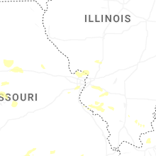
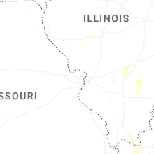


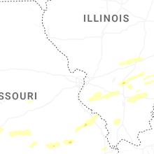


Connect with Interactive Hail Maps