

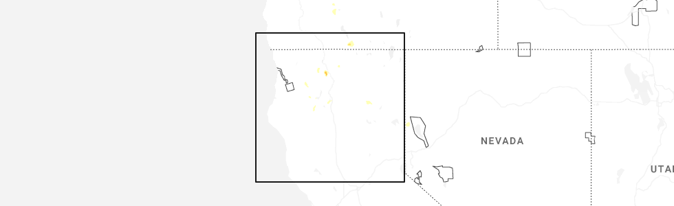
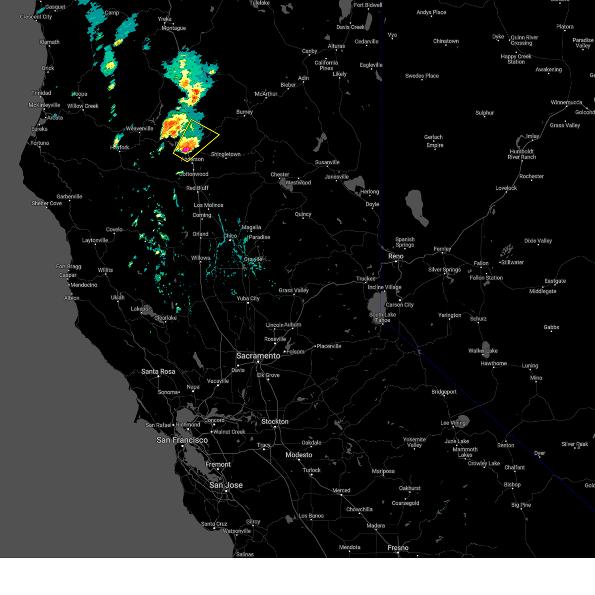
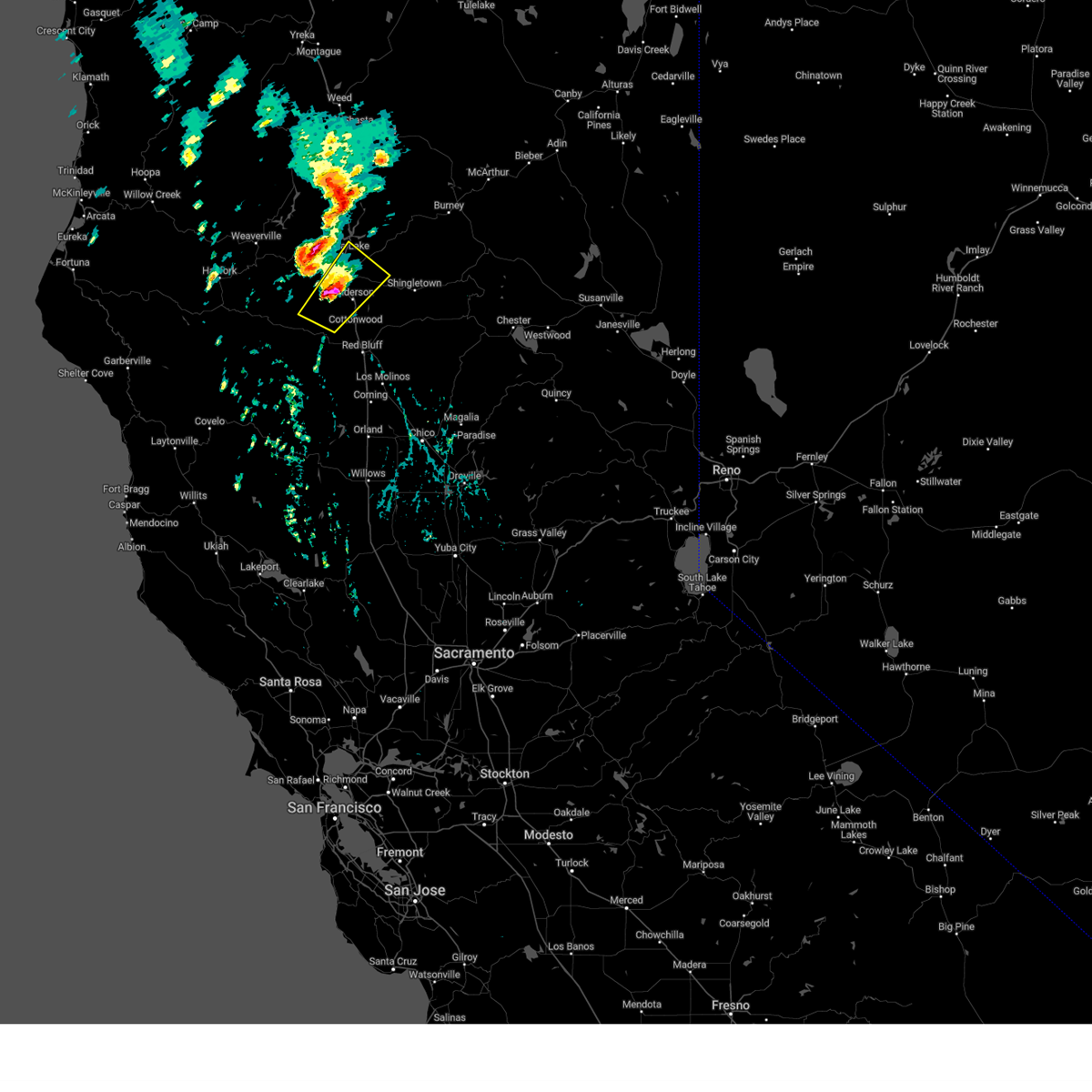
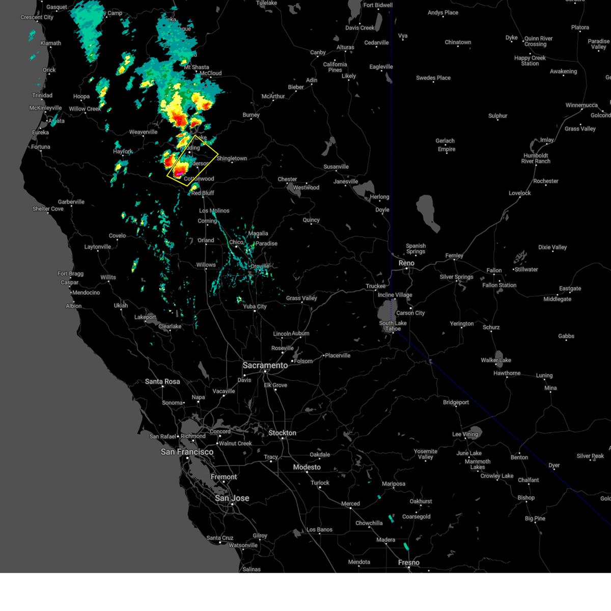
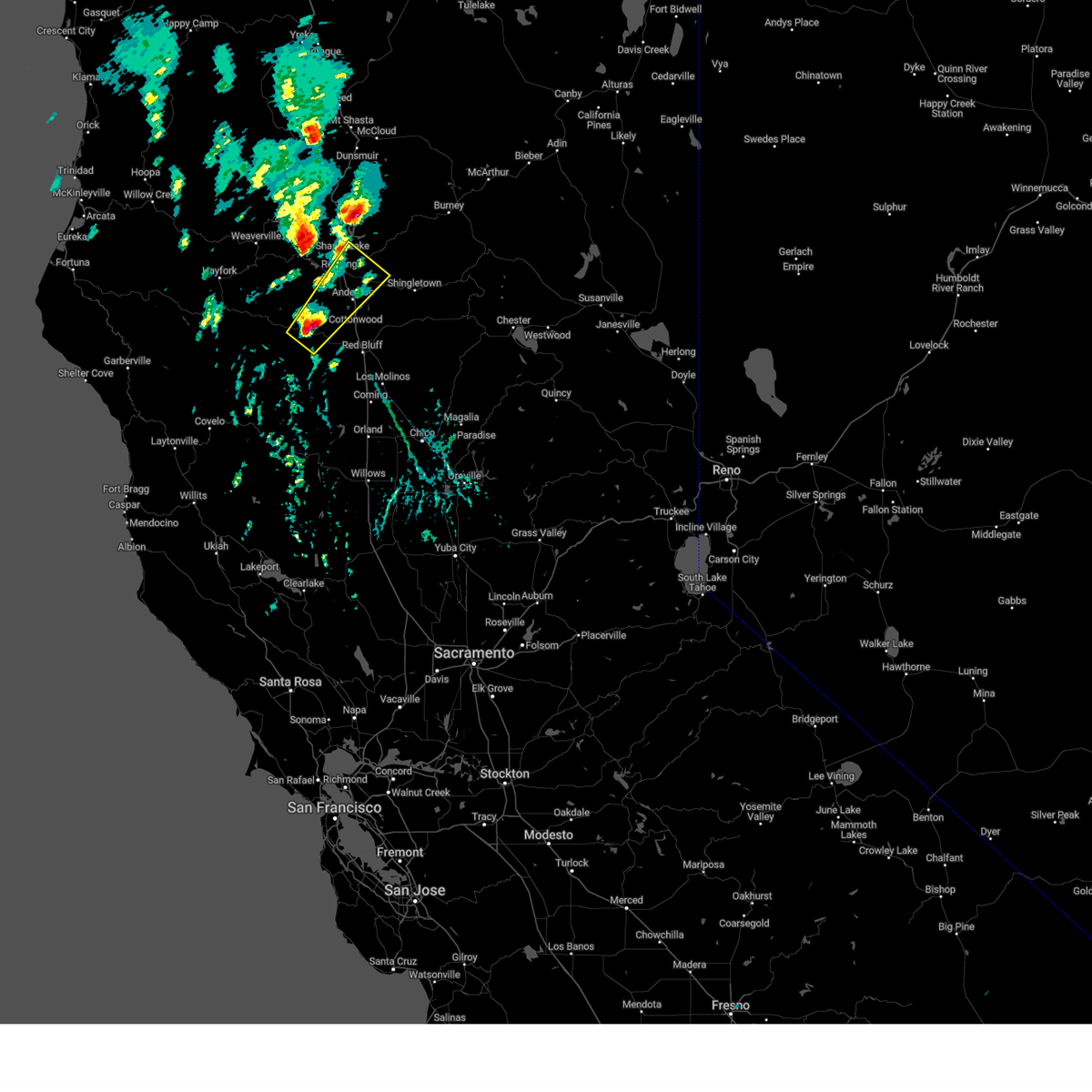
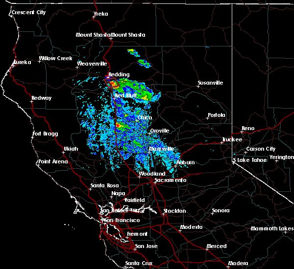
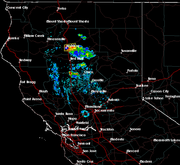
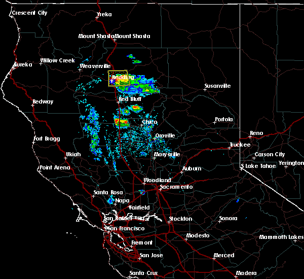
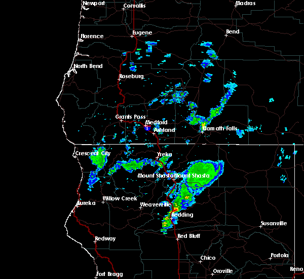
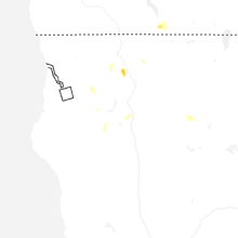
Hail Map for Redding, CA
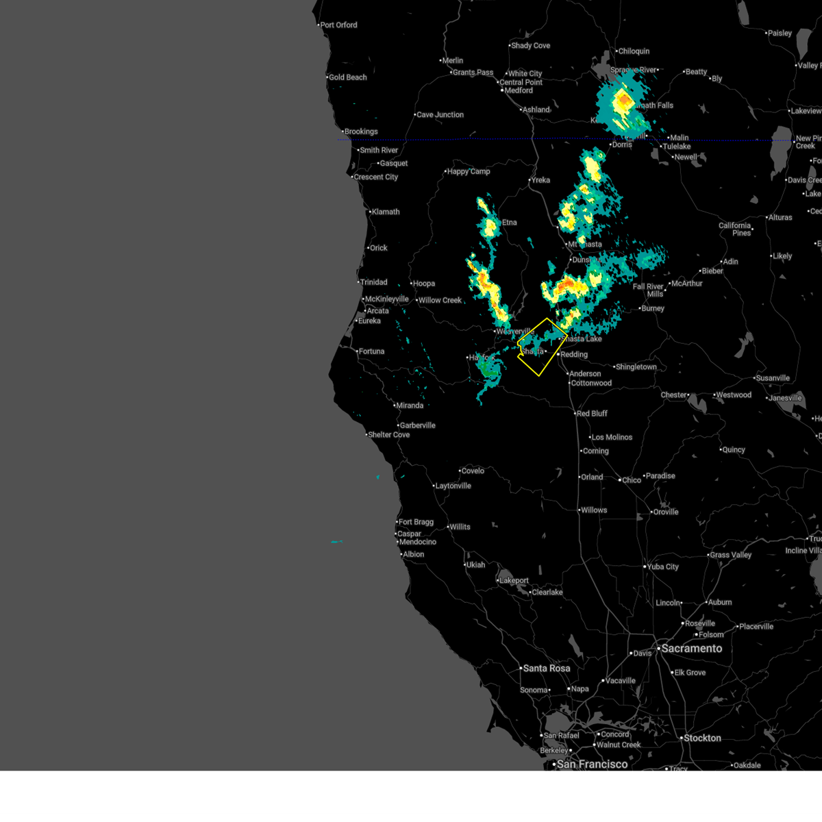
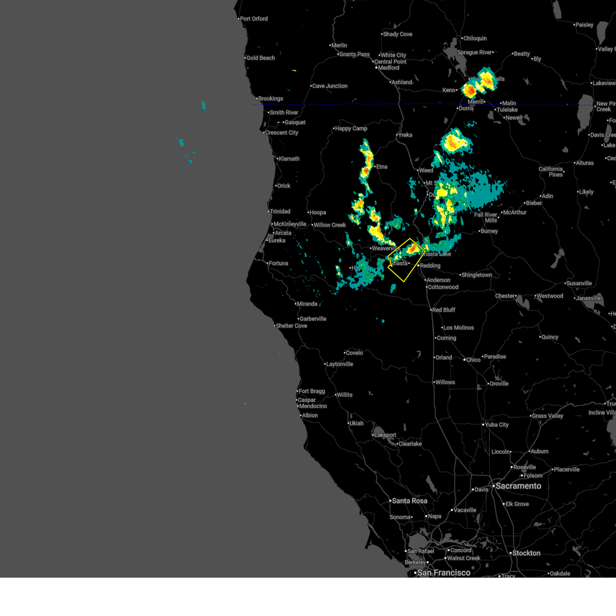
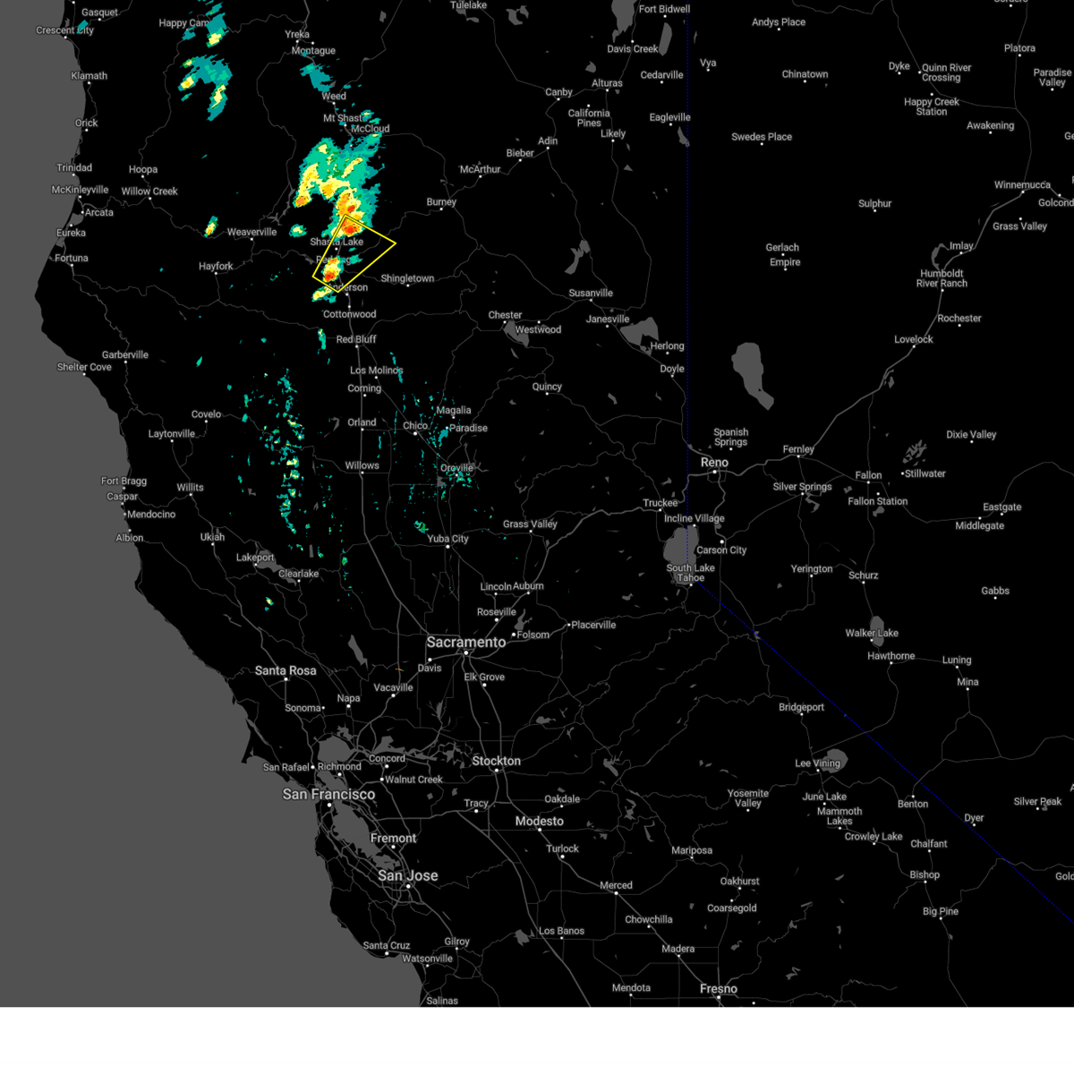
The Redding, CA area has had 4 reports of on-the-ground hail by trained spotters, and has been under severe weather warnings 2 times during the past 12 months. Doppler radar has detected hail at or near Redding, CA on 6 occasions, including 1 occasion during the past year.
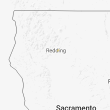
| Name: | Redding, CA |
| Where Located: | 3.1 miles SSE of Redding, CA |
| Map: | Google Map for Redding, CA |
| Population: | 89861 |
| Housing Units: | 38679 |
| More Info: | Search Google for Redding, CA |
0
The Top Recent Hail Date for Redding, CA is Tuesday, July 1, 2025 (6th out of 6)
Hail and Wind Damage Spotted near Redding, CA
| Date / Time | Report Details |
|---|---|
| 7/1/2025 7:12 PM PDT |
 the severe thunderstorm warning has been cancelled and is no longer in effect the severe thunderstorm warning has been cancelled and is no longer in effect
|
| 7/1/2025 6:40 PM PDT |
 Svrsto the national weather service in sacramento has issued a * severe thunderstorm warning for, southwestern shasta county in northern california, * until 730 pm pdt. * at 640 pm pdt, a severe thunderstorm was located over shasta dam, moving southwest at 15 mph (radar indicated). Hazards include 60 mph wind gusts and quarter size hail. Hail damage to vehicles is expected. Expect wind damage to roofs, siding, and trees. Svrsto the national weather service in sacramento has issued a * severe thunderstorm warning for, southwestern shasta county in northern california, * until 730 pm pdt. * at 640 pm pdt, a severe thunderstorm was located over shasta dam, moving southwest at 15 mph (radar indicated). Hazards include 60 mph wind gusts and quarter size hail. Hail damage to vehicles is expected. Expect wind damage to roofs, siding, and trees.
|
| 8/17/2024 5:26 PM PDT |
 The storm which prompted the warning has weakened below severe limits, and has exited the warned area. therefore, the warning will be allowed to expire. however heavy rain and small hail are still possible through the evening with any additional storms. The storm which prompted the warning has weakened below severe limits, and has exited the warned area. therefore, the warning will be allowed to expire. however heavy rain and small hail are still possible through the evening with any additional storms.
|
| 8/17/2024 4:58 PM PDT |
 At 457 pm pdt, a severe thunderstorm was located over redding, moving northeast at 35 mph (radar indicated). Hazards include 60 mph wind gusts and quarter size hail. Hail damage to vehicles is expected. expect wind damage to roofs, siding, and trees. Locations impacted include, redding, palo cedro, shasta lake, central valley cdp, o'brien, keswick, central valley, mountain gate, centerville, and millville, and portions of interstate 5. At 457 pm pdt, a severe thunderstorm was located over redding, moving northeast at 35 mph (radar indicated). Hazards include 60 mph wind gusts and quarter size hail. Hail damage to vehicles is expected. expect wind damage to roofs, siding, and trees. Locations impacted include, redding, palo cedro, shasta lake, central valley cdp, o'brien, keswick, central valley, mountain gate, centerville, and millville, and portions of interstate 5.
|
| 8/17/2024 4:44 PM PDT |
 The storm which prompted the warning has moved out of the area. therefore, the warning will be allowed to expire. The storm which prompted the warning has moved out of the area. therefore, the warning will be allowed to expire.
|
| 8/17/2024 4:43 PM PDT |
 Svrsto the national weather service in sacramento has issued a * severe thunderstorm warning for, south central shasta county in northern california, * until 530 pm pdt. * at 443 pm pdt, a severe thunderstorm was located over centerville, or near redding, moving northeast at 35 mph (radar indicated). Hazards include 60 mph wind gusts and quarter size hail. Hail damage to vehicles is expected. Expect wind damage to roofs, siding, and trees. Svrsto the national weather service in sacramento has issued a * severe thunderstorm warning for, south central shasta county in northern california, * until 530 pm pdt. * at 443 pm pdt, a severe thunderstorm was located over centerville, or near redding, moving northeast at 35 mph (radar indicated). Hazards include 60 mph wind gusts and quarter size hail. Hail damage to vehicles is expected. Expect wind damage to roofs, siding, and trees.
|
| 8/17/2024 4:23 PM PDT |
 At 422 pm pdt, a severe thunderstorm was located near olinda, or 13 miles southwest of redding, moving northeast at 35 mph (radar indicated). Hazards include 60 mph wind gusts and quarter size hail. Hail damage to vehicles is expected. expect wind damage to roofs, siding, and trees. Locations impacted include, redding, palo cedro, shasta lake, anderson, central valley cdp, millville, central valley, olinda, mountain gate, centerville, igo, and cottonwood. At 422 pm pdt, a severe thunderstorm was located near olinda, or 13 miles southwest of redding, moving northeast at 35 mph (radar indicated). Hazards include 60 mph wind gusts and quarter size hail. Hail damage to vehicles is expected. expect wind damage to roofs, siding, and trees. Locations impacted include, redding, palo cedro, shasta lake, anderson, central valley cdp, millville, central valley, olinda, mountain gate, centerville, igo, and cottonwood.
|
| 8/17/2024 4:07 PM PDT |
 Svrsto the national weather service in sacramento has issued a * severe thunderstorm warning for, northwestern tehama county in northern california, south central shasta county in northern california, * until 445 pm pdt. * at 407 pm pdt, a severe thunderstorm was located over rosewood, or 20 miles northwest of red bluff, moving northeast at 35 mph (radar indicated). Hazards include 60 mph wind gusts and quarter size hail. Hail damage to vehicles is expected. Expect wind damage to roofs, siding, and trees. Svrsto the national weather service in sacramento has issued a * severe thunderstorm warning for, northwestern tehama county in northern california, south central shasta county in northern california, * until 445 pm pdt. * at 407 pm pdt, a severe thunderstorm was located over rosewood, or 20 miles northwest of red bluff, moving northeast at 35 mph (radar indicated). Hazards include 60 mph wind gusts and quarter size hail. Hail damage to vehicles is expected. Expect wind damage to roofs, siding, and trees.
|
| 8/10/2019 12:19 AM PDT |
 At 1219 am pdt, a severe thunderstorm was located over anderson, or 11 miles south of palo cedro, moving north at 30 mph (radar indicated). Hazards include 60 mph wind gusts and quarter size hail. Hail damage to vehicles is expected. expect wind damage to roofs, siding, and trees. Locations impacted include, redding, palo cedro, anderson, igo, keswick, millville, olinda, centerville and cottonwood. At 1219 am pdt, a severe thunderstorm was located over anderson, or 11 miles south of palo cedro, moving north at 30 mph (radar indicated). Hazards include 60 mph wind gusts and quarter size hail. Hail damage to vehicles is expected. expect wind damage to roofs, siding, and trees. Locations impacted include, redding, palo cedro, anderson, igo, keswick, millville, olinda, centerville and cottonwood.
|
| 8/10/2019 12:13 AM PDT | Electrical pole down and arcin in shasta county CA, 2.1 miles NNW of Redding, CA |
| 8/9/2019 11:56 PM PDT |
 At 1155 pm pdt, a severe thunderstorm was located near blossom, or 7 miles northwest of red bluff, moving north at 30 mph (radar indicated). Hazards include 60 mph wind gusts and half dollar size hail. Hail damage to vehicles is expected. Expect wind damage to roofs, siding, and trees. At 1155 pm pdt, a severe thunderstorm was located near blossom, or 7 miles northwest of red bluff, moving north at 30 mph (radar indicated). Hazards include 60 mph wind gusts and half dollar size hail. Hail damage to vehicles is expected. Expect wind damage to roofs, siding, and trees.
|
| 5/24/2019 10:24 PM PDT | Ping Pong Ball sized hail reported 1.4 miles WSW of Redding, CA, ping pong sized hail was reported near hartnell ave and victor ave in redding... ca. picture on twitter. |
| 5/24/2019 8:53 PM PDT | Redding aiprot reported a 58 mph wind gus in shasta county CA, 4.7 miles NW of Redding, CA |
| 5/24/2019 8:37 PM PDT |
 At 835 pm pdt, a severe thunderstorm capable of producing a tornado was located near interstate 5 and anderson, or 9 miles south of redding, moving south at 15 mph (radar indicated rotation and funnel cloud reported). Hazards include tornado and two inch hail. Flying debris will be dangerous to those caught without shelter. mobile homes will be damaged or destroyed. damage to roofs, windows, and vehicles will occur. Tree damage is likely. At 835 pm pdt, a severe thunderstorm capable of producing a tornado was located near interstate 5 and anderson, or 9 miles south of redding, moving south at 15 mph (radar indicated rotation and funnel cloud reported). Hazards include tornado and two inch hail. Flying debris will be dangerous to those caught without shelter. mobile homes will be damaged or destroyed. damage to roofs, windows, and vehicles will occur. Tree damage is likely.
|
| 5/24/2019 8:16 PM PDT |
 At 815 pm pdt, a severe thunderstorm capable of producing a tornado was located over anderson, or near redding, moving south at 20 mph (radar indicated rotation). Hazards include tornado and hail up to two inches in diameter. Flying debris will be dangerous to those caught without shelter. mobile homes will be damaged or destroyed. damage to roofs, windows, and vehicles will occur. tree damage is likely. This dangerous storm will be near, anderson around 820 pm pdt. At 815 pm pdt, a severe thunderstorm capable of producing a tornado was located over anderson, or near redding, moving south at 20 mph (radar indicated rotation). Hazards include tornado and hail up to two inches in diameter. Flying debris will be dangerous to those caught without shelter. mobile homes will be damaged or destroyed. damage to roofs, windows, and vehicles will occur. tree damage is likely. This dangerous storm will be near, anderson around 820 pm pdt.
|
| 5/24/2019 8:13 PM PDT | Ping Pong Ball sized hail reported 1.4 miles WSW of Redding, CA, ping pong sized hail was reported near hartnell ave and victor ave in redding... ca. picture on twitter. |
| 5/24/2019 8:12 PM PDT | Quarter sized hail reported 1 miles SW of Redding, CA, quarter size hail was reported near enterprise high school in redding. |
| 5/24/2019 8:10 PM PDT | Golf Ball sized hail reported 2.4 miles WSW of Redding, CA, golf ball size hail reported in redding. |
| 5/24/2019 8:08 PM PDT |
 At 808 pm pdt, a severe thunderstorm was located over redding, moving south at 20 mph (public). Hazards include golf ball size hail and 60 mph wind gusts. People and animals outdoors will be injured. expect hail damage to roofs, siding, windows, and vehicles. expect wind damage to roofs, siding, and trees. Locations impacted include, redding, palo cedro, shasta lake, millville and central valley cdp. At 808 pm pdt, a severe thunderstorm was located over redding, moving south at 20 mph (public). Hazards include golf ball size hail and 60 mph wind gusts. People and animals outdoors will be injured. expect hail damage to roofs, siding, windows, and vehicles. expect wind damage to roofs, siding, and trees. Locations impacted include, redding, palo cedro, shasta lake, millville and central valley cdp.
|
| 5/24/2019 7:59 PM PDT |
 At 758 pm pdt, severe thunderstorms were located along a line extending from 6 miles east of mountain gate to near central valley, moving south at 10 mph (public). Hazards include golf ball size hail and 60 mph wind gusts. People and animals outdoors will be injured. expect hail damage to roofs, siding, windows, and vehicles. expect wind damage to roofs, siding, and trees. Locations impacted include, redding, palo cedro, shasta lake, central valley cdp, millville and central valley. At 758 pm pdt, severe thunderstorms were located along a line extending from 6 miles east of mountain gate to near central valley, moving south at 10 mph (public). Hazards include golf ball size hail and 60 mph wind gusts. People and animals outdoors will be injured. expect hail damage to roofs, siding, windows, and vehicles. expect wind damage to roofs, siding, and trees. Locations impacted include, redding, palo cedro, shasta lake, central valley cdp, millville and central valley.
|
| 5/24/2019 7:45 PM PDT |
 At 744 pm pdt, a severe thunderstorm was located near mountain gate, or 8 miles north of palo cedro, moving south at 15 mph (radar indicated). Hazards include 60 mph wind gusts and quarter size hail. Hail damage to vehicles is expected. Expect wind damage to roofs, siding, and trees. At 744 pm pdt, a severe thunderstorm was located near mountain gate, or 8 miles north of palo cedro, moving south at 15 mph (radar indicated). Hazards include 60 mph wind gusts and quarter size hail. Hail damage to vehicles is expected. Expect wind damage to roofs, siding, and trees.
|
| 3/27/2019 3:38 PM PDT |
 At 337 pm pdt, a severe thunderstorm was located near shasta dam, moving northeast at 20 mph (radar indicated). Hazards include quarter size hail. damage to vehicles is expected At 337 pm pdt, a severe thunderstorm was located near shasta dam, moving northeast at 20 mph (radar indicated). Hazards include quarter size hail. damage to vehicles is expected
|
| 10/25/2014 5:06 PM PDT | Redding airport wind gust of 60 mp in shasta county CA, 4.3 miles NW of Redding, CA |
Hail Maps for Redding, CA


Connect with Interactive Hail Maps