

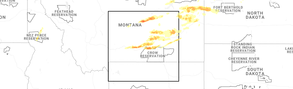
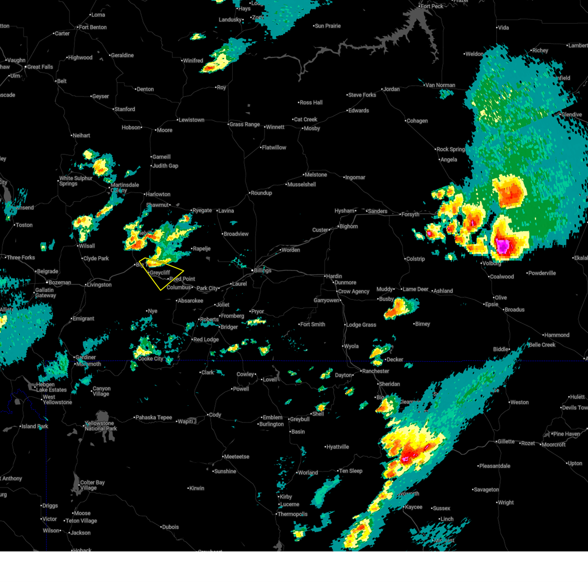
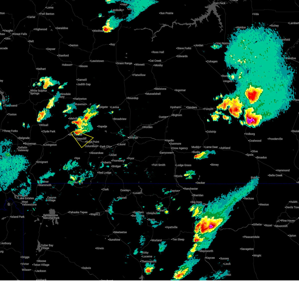
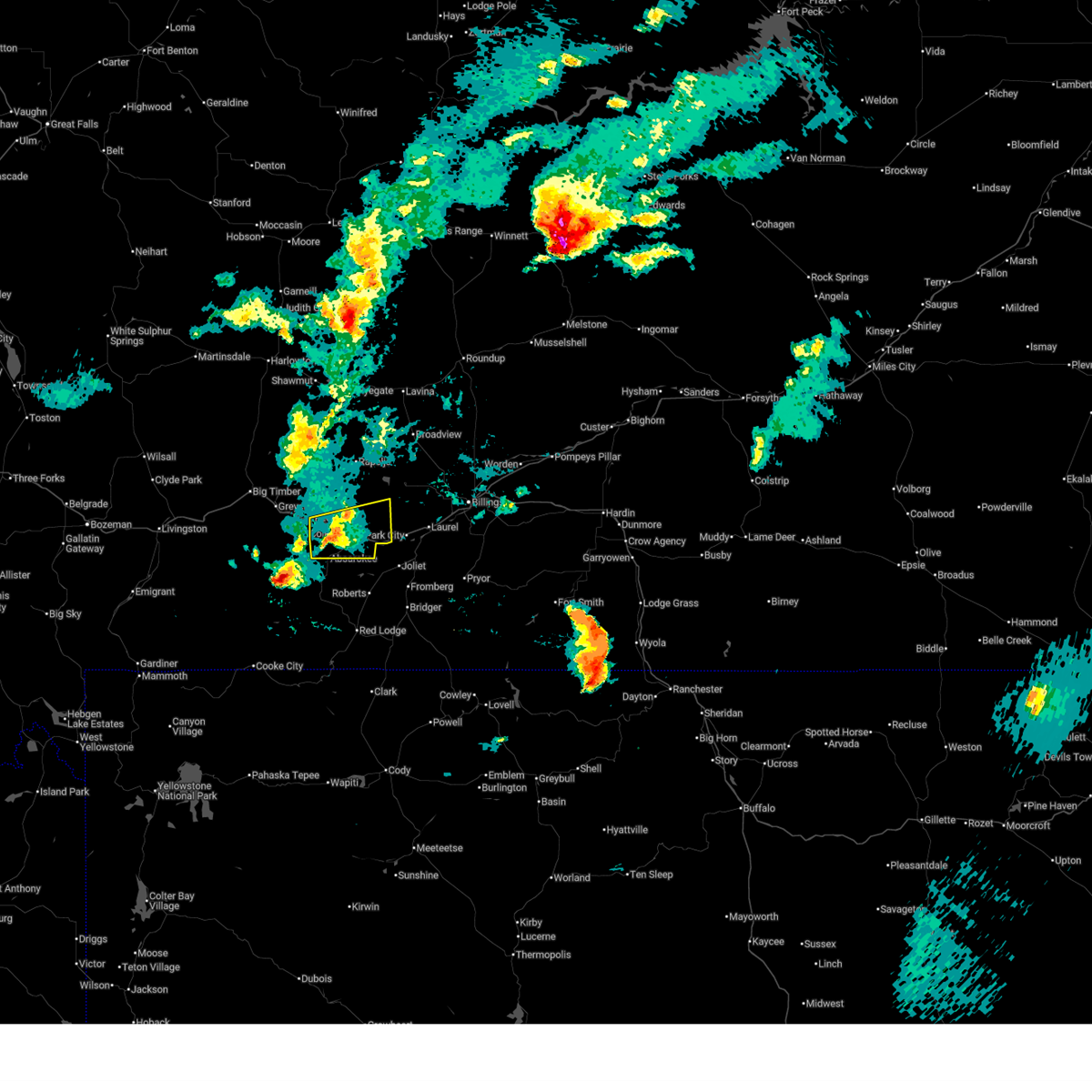
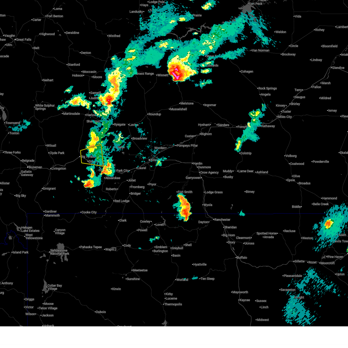
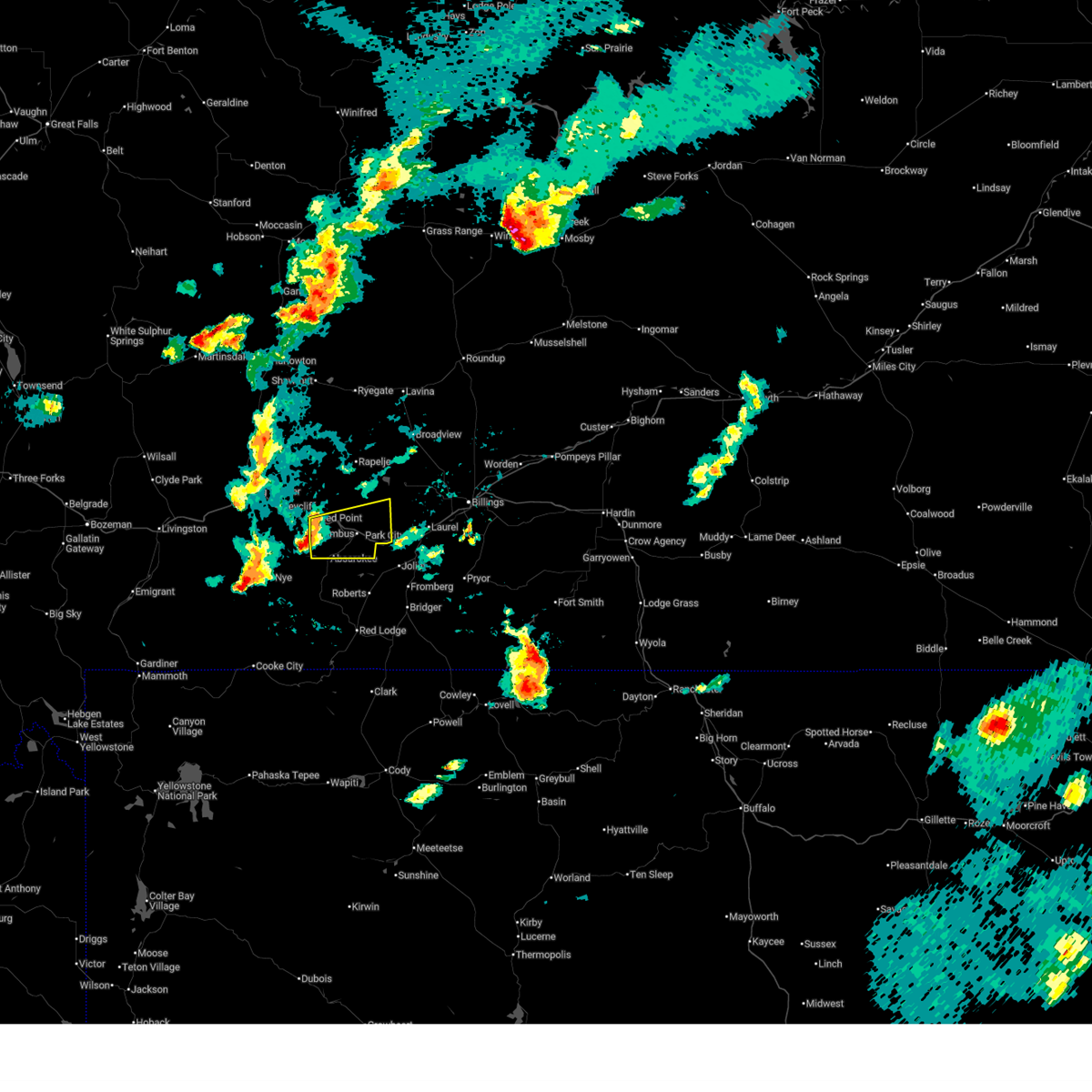
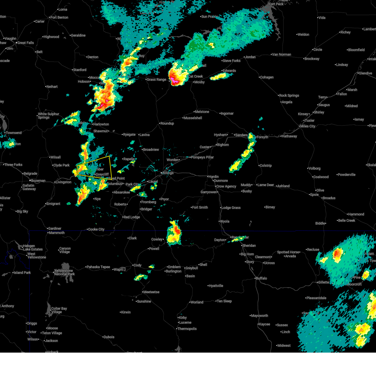
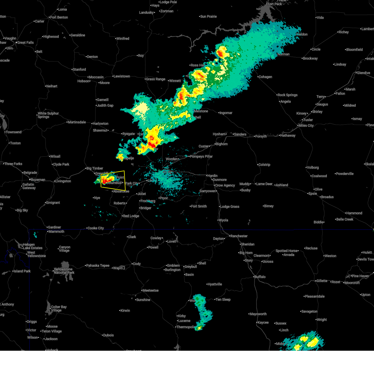
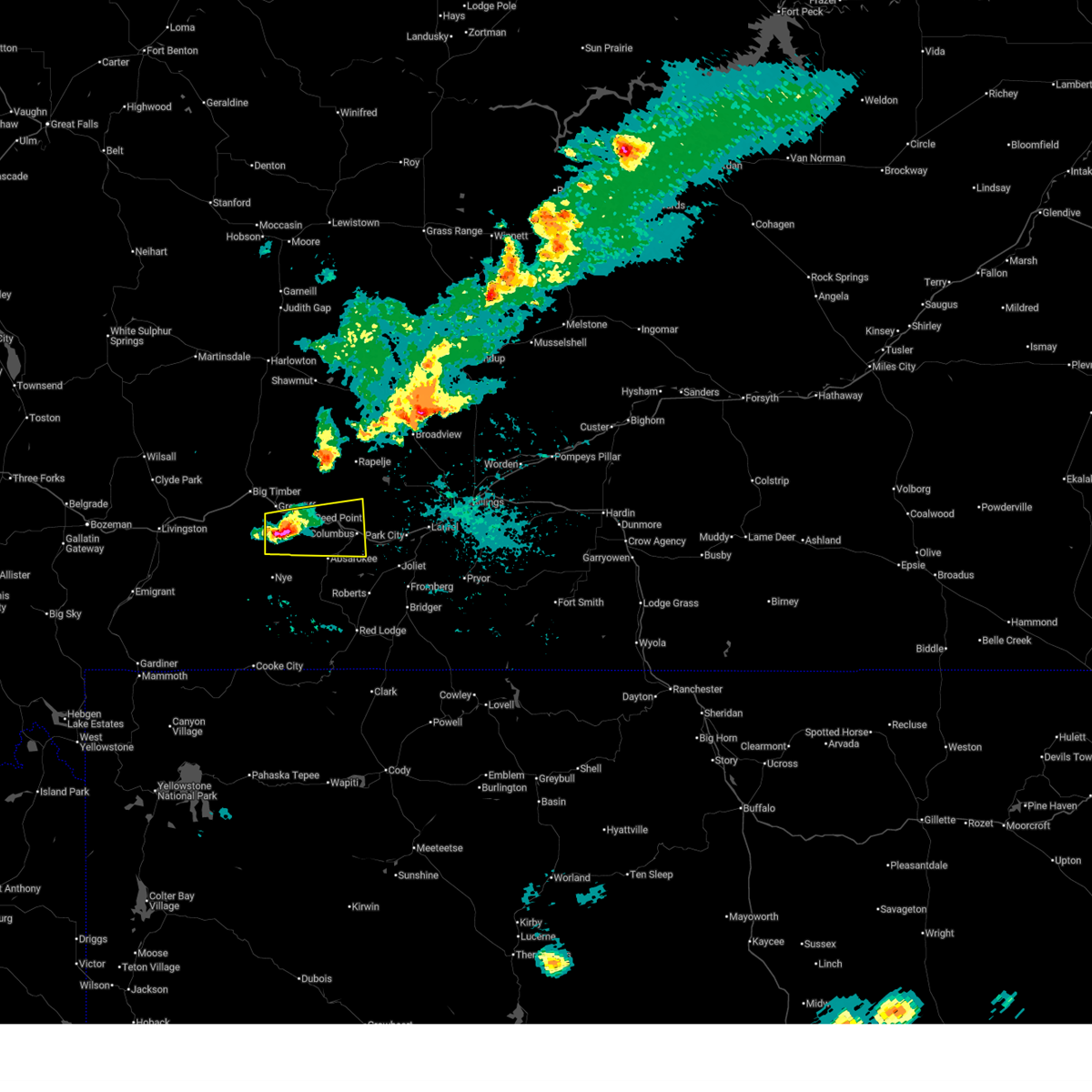
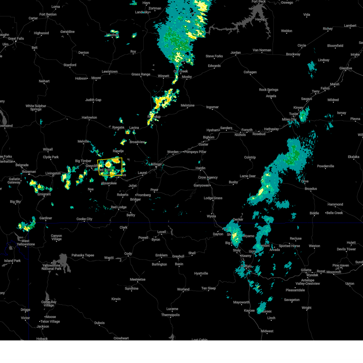
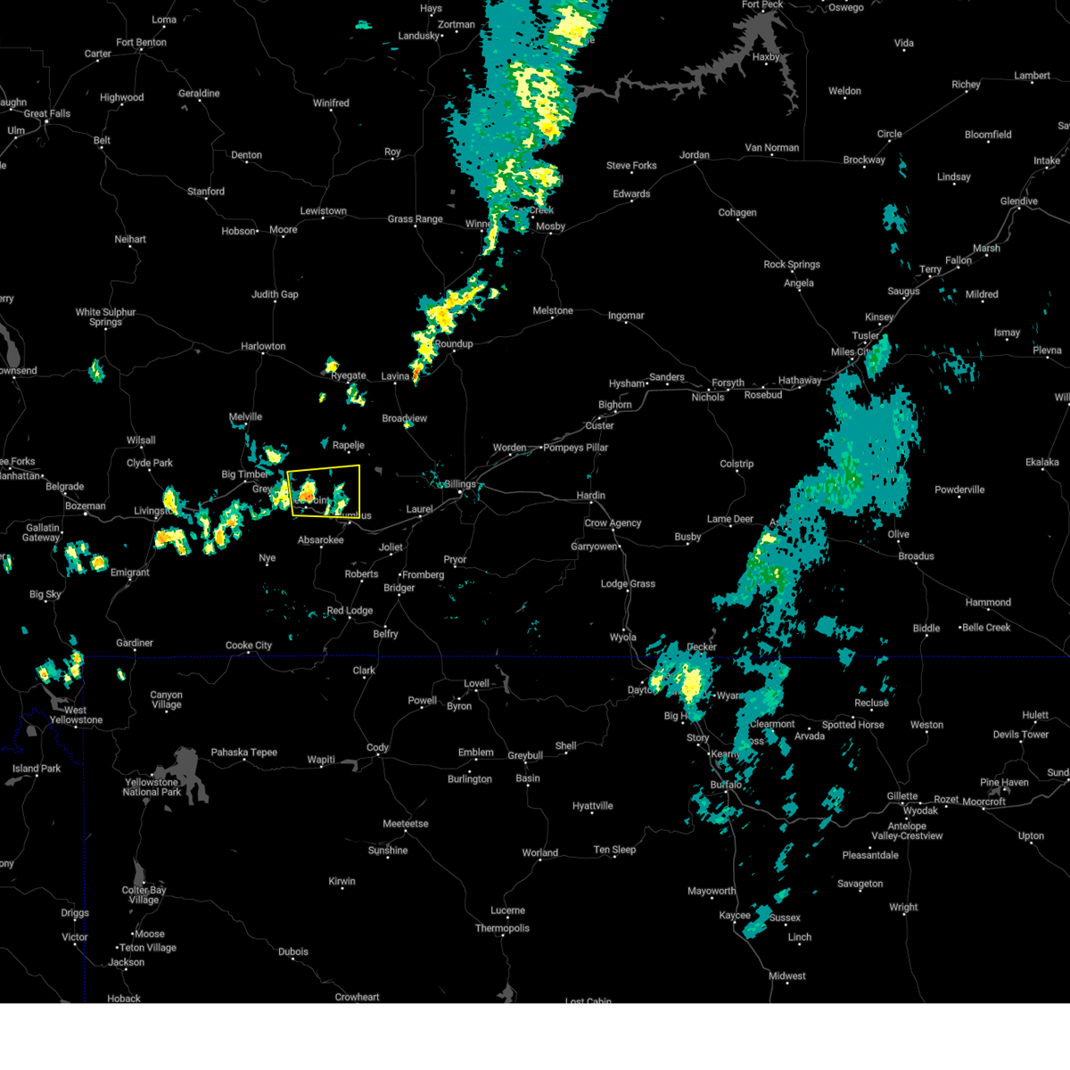
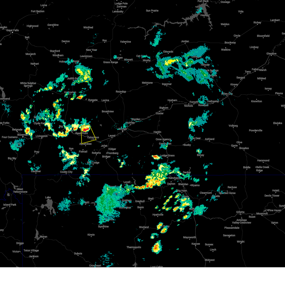
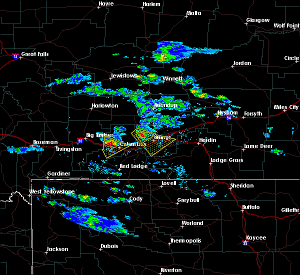
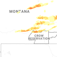
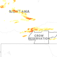
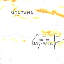
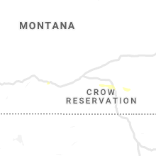
Hail Map for Reed Point, MT
The Reed Point, MT area has had 20 reports of on-the-ground hail by trained spotters, and has been under severe weather warnings 5 times during the past 12 months. Doppler radar has detected hail at or near Reed Point, MT on 25 occasions, including 2 occasions during the past year.
| Name: | Reed Point, MT |
| Where Located: | 50.5 miles W of Billings, MT |
| Map: | Google Map for Reed Point, MT |
| Population: | 193 |
| Housing Units: | 99 |
| More Info: | Search Google for Reed Point, MT |
0
The Top Recent Hail Date for Reed Point, MT is Thursday, August 7, 2025 (8th out of 25)
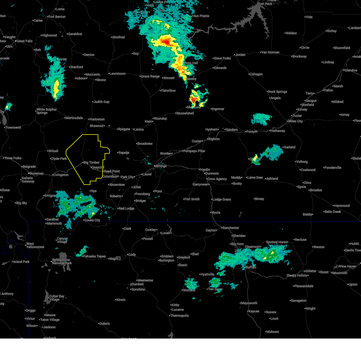
Hail and Wind Damage Spotted near Reed Point, MT
| Date / Time | Report Details |
|---|---|
| 5/13/2026 6:31 PM MDT |
 Svrbyz the national weather service in billings has issued a * severe thunderstorm warning for, sweet grass county in south central montana, * until 730 pm mdt. * at 631 pm mdt, a severe thunderstorm was located over big timber, moving northeast at 35 mph (radar indicated). Hazards include 60 mph wind gusts. expect damage to roofs, siding, and trees Svrbyz the national weather service in billings has issued a * severe thunderstorm warning for, sweet grass county in south central montana, * until 730 pm mdt. * at 631 pm mdt, a severe thunderstorm was located over big timber, moving northeast at 35 mph (radar indicated). Hazards include 60 mph wind gusts. expect damage to roofs, siding, and trees
|
| 5/13/2026 4:35 PM MDT | Mesonet station dbym8 derby mountai in sweet grass county MT, 18.4 miles ENE of Reed Point, MT |
| 5/13/2026 4:32 PM MDT |
 At 432 pm mdt, showers and thunderstorms producing strong to damaging winds were located along a line from 21 miles northeast of clyde park to 19 miles north of absarokee, moving northeast at 50 mph (weather station reported. at 4:15pm, the big timber airport gusted 67 mph). Hazards include 60 to 70 mph wind gusts. Expect considerable tree damage. damage is likely to mobile homes, roofs, and outbuildings. Locations impacted include, livingston, big timber, clyde park, melville, mc leod, springdale, greycliff and reed point. At 432 pm mdt, showers and thunderstorms producing strong to damaging winds were located along a line from 21 miles northeast of clyde park to 19 miles north of absarokee, moving northeast at 50 mph (weather station reported. at 4:15pm, the big timber airport gusted 67 mph). Hazards include 60 to 70 mph wind gusts. Expect considerable tree damage. damage is likely to mobile homes, roofs, and outbuildings. Locations impacted include, livingston, big timber, clyde park, melville, mc leod, springdale, greycliff and reed point.
|
| 5/13/2026 3:58 PM MDT |
 Svrbyz the national weather service in billings has issued a * severe thunderstorm warning for, north central park county in south central montana, central stillwater county in south central montana, sweet grass county in south central montana, * until 500 pm mdt. * at 358 pm mdt, showers and thunderstorms producing strong to damaging winds were located along a line from near livingston to 19 miles west of absarokee moving northeast at 50 mph (weather station reported). Hazards include 60 to 70 mph wind gusts. Expect considerable tree damage. Damage is likely to mobile homes, roofs, and outbuildings. Svrbyz the national weather service in billings has issued a * severe thunderstorm warning for, north central park county in south central montana, central stillwater county in south central montana, sweet grass county in south central montana, * until 500 pm mdt. * at 358 pm mdt, showers and thunderstorms producing strong to damaging winds were located along a line from near livingston to 19 miles west of absarokee moving northeast at 50 mph (weather station reported). Hazards include 60 to 70 mph wind gusts. Expect considerable tree damage. Damage is likely to mobile homes, roofs, and outbuildings.
|
| 7/29/2025 5:49 PM MDT |
 the severe thunderstorm warning has been cancelled and is no longer in effect the severe thunderstorm warning has been cancelled and is no longer in effect
|
| 7/29/2025 5:27 PM MDT |
 Svrbyz the national weather service in billings has issued a * severe thunderstorm warning for, central stillwater county in south central montana, east central sweet grass county in south central montana, * until 630 pm mdt. * at 527 pm mdt, a severe thunderstorm was located 11 miles east of big timber, moving southeast at 15 mph (radar indicated). Hazards include ping pong ball size hail and 60 mph wind gusts. People and animals outdoors will be injured. expect hail damage to roofs, siding, windows, and vehicles. Expect wind damage to roofs, siding, and trees. Svrbyz the national weather service in billings has issued a * severe thunderstorm warning for, central stillwater county in south central montana, east central sweet grass county in south central montana, * until 630 pm mdt. * at 527 pm mdt, a severe thunderstorm was located 11 miles east of big timber, moving southeast at 15 mph (radar indicated). Hazards include ping pong ball size hail and 60 mph wind gusts. People and animals outdoors will be injured. expect hail damage to roofs, siding, windows, and vehicles. Expect wind damage to roofs, siding, and trees.
|
| 6/15/2025 7:24 PM MDT |
 The severe thunderstorm which prompted the warning has weakened. therefore, the warning will be allowed to expire. a severe thunderstorm watch remains in effect until 1100 pm mdt for south central montana. The severe thunderstorm which prompted the warning has weakened. therefore, the warning will be allowed to expire. a severe thunderstorm watch remains in effect until 1100 pm mdt for south central montana.
|
| 6/15/2025 7:21 PM MDT |
 the severe thunderstorm warning has been cancelled and is no longer in effect the severe thunderstorm warning has been cancelled and is no longer in effect
|
| 6/15/2025 7:06 PM MDT |
 At 706 pm mdt, a severe thunderstorm was located near big timber, moving east at 25 mph (radar indicated). Hazards include 60 mph wind gusts and quarter size hail. Hail damage to vehicles is expected. expect wind damage to roofs, siding, and trees. Locations impacted include, greycliff and reed point. At 706 pm mdt, a severe thunderstorm was located near big timber, moving east at 25 mph (radar indicated). Hazards include 60 mph wind gusts and quarter size hail. Hail damage to vehicles is expected. expect wind damage to roofs, siding, and trees. Locations impacted include, greycliff and reed point.
|
| 6/15/2025 7:04 PM MDT |
 Svrbyz the national weather service in billings has issued a * severe thunderstorm warning for, east central stillwater county in south central montana, * until 730 pm mdt. * at 704 pm mdt, a severe thunderstorm was located near absarokee, or 11 miles west of columbus, moving east at 35 mph (radar indicated). Hazards include 60 mph wind gusts and half dollar size hail. Hail damage to vehicles is expected. Expect wind damage to roofs, siding, and trees. Svrbyz the national weather service in billings has issued a * severe thunderstorm warning for, east central stillwater county in south central montana, * until 730 pm mdt. * at 704 pm mdt, a severe thunderstorm was located near absarokee, or 11 miles west of columbus, moving east at 35 mph (radar indicated). Hazards include 60 mph wind gusts and half dollar size hail. Hail damage to vehicles is expected. Expect wind damage to roofs, siding, and trees.
|
| 6/15/2025 6:49 PM MDT |
 Svrbyz the national weather service in billings has issued a * severe thunderstorm warning for, northwestern stillwater county in south central montana, central sweet grass county in south central montana, * until 745 pm mdt. * at 649 pm mdt, a severe thunderstorm was located near big timber, moving east at 25 mph (radar indicated). Hazards include 60 mph wind gusts and quarter size hail. Hail damage to vehicles is expected. Expect wind damage to roofs, siding, and trees. Svrbyz the national weather service in billings has issued a * severe thunderstorm warning for, northwestern stillwater county in south central montana, central sweet grass county in south central montana, * until 745 pm mdt. * at 649 pm mdt, a severe thunderstorm was located near big timber, moving east at 25 mph (radar indicated). Hazards include 60 mph wind gusts and quarter size hail. Hail damage to vehicles is expected. Expect wind damage to roofs, siding, and trees.
|
| 6/13/2025 5:37 PM MDT |
 At 537 pm mdt, a severe thunderstorm was located 9 miles north of absarokee, or 11 miles west of columbus, moving east at 25 mph (radar indicated). Hazards include 60 mph wind gusts and half dollar size hail. Hail damage to vehicles is expected. expect wind damage to roofs, siding, and trees. Locations impacted include, columbus and reed point. At 537 pm mdt, a severe thunderstorm was located 9 miles north of absarokee, or 11 miles west of columbus, moving east at 25 mph (radar indicated). Hazards include 60 mph wind gusts and half dollar size hail. Hail damage to vehicles is expected. expect wind damage to roofs, siding, and trees. Locations impacted include, columbus and reed point.
|
| 6/13/2025 5:19 PM MDT |
 At 519 pm mdt, a severe thunderstorm was located 12 miles northwest of absarokee, or 17 miles west of columbus, moving east at 25 mph (radar indicated). Hazards include golf ball size hail and 60 mph wind gusts. People and animals outdoors will be injured. expect hail damage to roofs, siding, windows, and vehicles. expect wind damage to roofs, siding, and trees. Locations impacted include, columbus, absarokee and reed point. At 519 pm mdt, a severe thunderstorm was located 12 miles northwest of absarokee, or 17 miles west of columbus, moving east at 25 mph (radar indicated). Hazards include golf ball size hail and 60 mph wind gusts. People and animals outdoors will be injured. expect hail damage to roofs, siding, windows, and vehicles. expect wind damage to roofs, siding, and trees. Locations impacted include, columbus, absarokee and reed point.
|
| 6/13/2025 5:12 PM MDT |
 Svrbyz the national weather service in billings has issued a * severe thunderstorm warning for, central stillwater county in south central montana, central sweet grass county in south central montana, * until 615 pm mdt. * at 512 pm mdt, a severe thunderstorm was located 13 miles northwest of absarokee, or 19 miles southeast of big timber, moving east at 25 mph (radar indicated). Hazards include 60 mph wind gusts and half dollar size hail. Hail damage to vehicles is expected. Expect wind damage to roofs, siding, and trees. Svrbyz the national weather service in billings has issued a * severe thunderstorm warning for, central stillwater county in south central montana, central sweet grass county in south central montana, * until 615 pm mdt. * at 512 pm mdt, a severe thunderstorm was located 13 miles northwest of absarokee, or 19 miles southeast of big timber, moving east at 25 mph (radar indicated). Hazards include 60 mph wind gusts and half dollar size hail. Hail damage to vehicles is expected. Expect wind damage to roofs, siding, and trees.
|
| 7/25/2024 6:45 PM MDT |
 At 644 pm mdt, a severe thunderstorm was located 12 miles north of columbus, moving east at 35 mph (radar indicated). Hazards include 60 mph wind gusts. Expect damage to roofs, siding, and trees. Locations impacted include, reed point. At 644 pm mdt, a severe thunderstorm was located 12 miles north of columbus, moving east at 35 mph (radar indicated). Hazards include 60 mph wind gusts. Expect damage to roofs, siding, and trees. Locations impacted include, reed point.
|
| 7/25/2024 6:24 PM MDT |
 Svrbyz the national weather service in billings has issued a * severe thunderstorm warning for, central stillwater county in south central montana, east central sweet grass county in south central montana, * until 700 pm mdt. * at 624 pm mdt, a severe thunderstorm was located 18 miles northwest of columbus, moving east at 40 mph (radar indicated). Hazards include 60 mph wind gusts. possible damage to roofs, siding, and trees Svrbyz the national weather service in billings has issued a * severe thunderstorm warning for, central stillwater county in south central montana, east central sweet grass county in south central montana, * until 700 pm mdt. * at 624 pm mdt, a severe thunderstorm was located 18 miles northwest of columbus, moving east at 40 mph (radar indicated). Hazards include 60 mph wind gusts. possible damage to roofs, siding, and trees
|
| 8/6/2023 5:59 PM MDT |
 At 558 pm mdt, a severe thunderstorm was located 14 miles northwest of columbus, moving south at 18 mph (radar indicated). Hazards include 60 mph wind gusts, heavy rain, and quarter size hail. Hail damage to vehicles is expected. Expect wind damage to roofs, siding, and trees. At 558 pm mdt, a severe thunderstorm was located 14 miles northwest of columbus, moving south at 18 mph (radar indicated). Hazards include 60 mph wind gusts, heavy rain, and quarter size hail. Hail damage to vehicles is expected. Expect wind damage to roofs, siding, and trees.
|
| 5/23/2023 4:56 PM MDT |
 The severe thunderstorm warning for central sweet grass county will expire at 500 pm mdt, the storm which prompted the warning has weakened below severe limits, and no longer poses an immediate threat to life or property. therefore, the warning will be allowed to expire. however small hail and heavy rain are still possible with this thunderstorm. The severe thunderstorm warning for central sweet grass county will expire at 500 pm mdt, the storm which prompted the warning has weakened below severe limits, and no longer poses an immediate threat to life or property. therefore, the warning will be allowed to expire. however small hail and heavy rain are still possible with this thunderstorm.
|
| 5/23/2023 4:37 PM MDT |
 At 437 pm mdt, a severe thunderstorm was located near big timber, moving northeast at 15 mph (radar indicated). Hazards include 60 mph wind gusts and quarter size hail. Hail damage to vehicles is expected. expect wind damage to roofs, siding, and trees. locations impacted include, big timber and greycliff. hail threat, radar indicated max hail size, 1. 00 in wind threat, radar indicated max wind gust, 60 mph. At 437 pm mdt, a severe thunderstorm was located near big timber, moving northeast at 15 mph (radar indicated). Hazards include 60 mph wind gusts and quarter size hail. Hail damage to vehicles is expected. expect wind damage to roofs, siding, and trees. locations impacted include, big timber and greycliff. hail threat, radar indicated max hail size, 1. 00 in wind threat, radar indicated max wind gust, 60 mph.
|
| 5/23/2023 4:07 PM MDT |
 At 405 pm mdt, a severe thunderstorm was located near big timber, moving northeast at 15 mph (radar indicated). Hazards include 60 mph wind gusts and quarter size hail. Hail damage to vehicles is expected. expect wind damage to roofs, siding, and trees. Travellers along interstate 90 should prepare for poor visibility in heavy rainfall. At 405 pm mdt, a severe thunderstorm was located near big timber, moving northeast at 15 mph (radar indicated). Hazards include 60 mph wind gusts and quarter size hail. Hail damage to vehicles is expected. expect wind damage to roofs, siding, and trees. Travellers along interstate 90 should prepare for poor visibility in heavy rainfall.
|
| 7/13/2022 3:42 PM MDT |
 At 340 pm mdt, severe thunderstorms were located along a line extending from 15 miles northwest of columbus to near joliet, moving northeast at 35 mph (public. at 335 pm, 69 mph wind was reported 2 miles east southeast of columbus). Hazards include 70 mph wind gusts. Expect considerable tree damage. Damage is likely to mobile homes, roofs, and outbuildings. At 340 pm mdt, severe thunderstorms were located along a line extending from 15 miles northwest of columbus to near joliet, moving northeast at 35 mph (public. at 335 pm, 69 mph wind was reported 2 miles east southeast of columbus). Hazards include 70 mph wind gusts. Expect considerable tree damage. Damage is likely to mobile homes, roofs, and outbuildings.
|
| 7/3/2022 4:15 PM MDT |
 At 414 pm mdt, a severe thunderstorm was located near big timber, moving east at 25 mph (radar indicated). Hazards include 60 mph wind gusts and half dollar size hail. Hail damage to vehicles is expected. expect wind damage to roofs, siding, and trees. this severe thunderstorm will remain over mainly rural areas of north central stillwater and east central sweet grass counties, including the following locations, reed point and greycliff. hail threat, radar indicated max hail size, 1. 25 in wind threat, radar indicated max wind gust, 60 mph. At 414 pm mdt, a severe thunderstorm was located near big timber, moving east at 25 mph (radar indicated). Hazards include 60 mph wind gusts and half dollar size hail. Hail damage to vehicles is expected. expect wind damage to roofs, siding, and trees. this severe thunderstorm will remain over mainly rural areas of north central stillwater and east central sweet grass counties, including the following locations, reed point and greycliff. hail threat, radar indicated max hail size, 1. 25 in wind threat, radar indicated max wind gust, 60 mph.
|
| 7/7/2021 6:14 PM MDT |
 At 612 pm mdt, severe thunderstorms were located along a line extending from 9 miles northeast of harlowton to 15 miles south of deadmans basin reservoir to 15 miles northwest of columbus to 11 miles southwest of absarokee, moving east at 50 mph (radar indicated). Hazards include 60 mph wind gusts. penny size hail is possible with strongest storms along the line. Expect damage to roofs, siding, and trees. this storm has a history of producing 60 mph wind gusts. Locations impacted include, columbus, harlowton, ryegate, deadmans basin reservoir, absarokee, franklin, reed point, halfbreed lake wildlife, fishtail, shawmut, hailstone wildlife refuge, dean, cooney reservoir state park, nye, roscoe and rapelje. At 612 pm mdt, severe thunderstorms were located along a line extending from 9 miles northeast of harlowton to 15 miles south of deadmans basin reservoir to 15 miles northwest of columbus to 11 miles southwest of absarokee, moving east at 50 mph (radar indicated). Hazards include 60 mph wind gusts. penny size hail is possible with strongest storms along the line. Expect damage to roofs, siding, and trees. this storm has a history of producing 60 mph wind gusts. Locations impacted include, columbus, harlowton, ryegate, deadmans basin reservoir, absarokee, franklin, reed point, halfbreed lake wildlife, fishtail, shawmut, hailstone wildlife refuge, dean, cooney reservoir state park, nye, roscoe and rapelje.
|
| 7/7/2021 5:49 PM MDT |
 At 546 pm mdt, severe thunderstorms were located along a line extending from 17 miles west of harlowton to 6 miles southeast of big timber to 25 miles north of cooke city, moving east at 40 mph (radar indicated. at 540pm a gust of 60 mph was reported at the big timber airport). Hazards include 60 mph wind gusts. quarter size hail is possible with the stronger storms along the line. Hail damage to vehicles is expected. Expect wind damage to roofs, siding, and trees. At 546 pm mdt, severe thunderstorms were located along a line extending from 17 miles west of harlowton to 6 miles southeast of big timber to 25 miles north of cooke city, moving east at 40 mph (radar indicated. at 540pm a gust of 60 mph was reported at the big timber airport). Hazards include 60 mph wind gusts. quarter size hail is possible with the stronger storms along the line. Hail damage to vehicles is expected. Expect wind damage to roofs, siding, and trees.
|
| 7/23/2020 5:42 PM MDT |
 At 523 pm mdt, severe thunderstorms were located along a line extending from 8 miles northeast of ryegate to 6 miles west of joliet, moving east at 50 mph (radar indicated). Hazards include 60 mph wind gusts. a wind gust of 61 mph was reported at the big timber airport at 4:40 pm mdt. Expect damage to roofs, siding, and trees. Locations impacted include, columbus, bridger, joliet, fromberg, ryegate, deadmans basin reservoir, absarokee, lavina, franklin, reed point, halfbreed lake wildlife, edgar, fishtail, boyd, shawmut, hailstone wildlife refuge, roberts, molt, cooney reservoir state park and park city. At 523 pm mdt, severe thunderstorms were located along a line extending from 8 miles northeast of ryegate to 6 miles west of joliet, moving east at 50 mph (radar indicated). Hazards include 60 mph wind gusts. a wind gust of 61 mph was reported at the big timber airport at 4:40 pm mdt. Expect damage to roofs, siding, and trees. Locations impacted include, columbus, bridger, joliet, fromberg, ryegate, deadmans basin reservoir, absarokee, lavina, franklin, reed point, halfbreed lake wildlife, edgar, fishtail, boyd, shawmut, hailstone wildlife refuge, roberts, molt, cooney reservoir state park and park city.
|
| 7/23/2020 5:24 PM MDT |
 At 523 pm mdt, severe thunderstorms were located along a line extending from 8 miles northeast of ryegate to 6 miles west of joliet, moving east at 50 mph (radar indicated). Hazards include 60 mph wind gusts. a wind gust of 61 mph was reported at the big timber airport at 4:40 pm mdt. Expect damage to roofs, siding, and trees. Locations impacted include, columbus, bridger, joliet, fromberg, ryegate, deadmans basin reservoir, absarokee, lavina, franklin, reed point, halfbreed lake wildlife, edgar, fishtail, boyd, shawmut, hailstone wildlife refuge, roberts, molt, cooney reservoir state park and park city. At 523 pm mdt, severe thunderstorms were located along a line extending from 8 miles northeast of ryegate to 6 miles west of joliet, moving east at 50 mph (radar indicated). Hazards include 60 mph wind gusts. a wind gust of 61 mph was reported at the big timber airport at 4:40 pm mdt. Expect damage to roofs, siding, and trees. Locations impacted include, columbus, bridger, joliet, fromberg, ryegate, deadmans basin reservoir, absarokee, lavina, franklin, reed point, halfbreed lake wildlife, edgar, fishtail, boyd, shawmut, hailstone wildlife refuge, roberts, molt, cooney reservoir state park and park city.
|
| 7/23/2020 5:10 PM MDT |
 At 508 pm mdt, severe thunderstorms were located along a line extending from near deadmans basin reservoir to near absarokee, moving east at 50 mph (radar indicated. a wind gust of 61 mph was reported at the big timber airport at 4:40 pm mdt). Hazards include 60 mph wind gusts. expect damage to roofs, siding, and trees At 508 pm mdt, severe thunderstorms were located along a line extending from near deadmans basin reservoir to near absarokee, moving east at 50 mph (radar indicated. a wind gust of 61 mph was reported at the big timber airport at 4:40 pm mdt). Hazards include 60 mph wind gusts. expect damage to roofs, siding, and trees
|
| 8/11/2019 5:55 PM MDT | Hen Egg sized hail reported 12 miles S of Reed Point, MT, 2.0 hail reported |
| 6/30/2019 6:10 PM MDT | Strong winds lasted 2-3 minutes in stillwater county MT, 9.9 miles SW of Reed Point, MT |
| 6/30/2019 5:43 PM MDT | Quarter sized hail reported 12 miles S of Reed Point, MT |
| 7/28/2018 5:29 PM MDT |
 At 528 pm mdt, a severe thunderstorm was located near columbus, moving southeast at 35 mph (trained weather spotters). Hazards include 60 mph wind gusts and half dollar size hail. Hail damage to vehicles is expected. expect wind damage to roofs, siding, and trees. Locations impacted include, columbus, joliet, fromberg, absarokee, reed point, edgar, fishtail, boyd, roberts, silesia, cooney reservoir state park, park city and rockvale. At 528 pm mdt, a severe thunderstorm was located near columbus, moving southeast at 35 mph (trained weather spotters). Hazards include 60 mph wind gusts and half dollar size hail. Hail damage to vehicles is expected. expect wind damage to roofs, siding, and trees. Locations impacted include, columbus, joliet, fromberg, absarokee, reed point, edgar, fishtail, boyd, roberts, silesia, cooney reservoir state park, park city and rockvale.
|
| 7/28/2018 5:23 PM MDT | Half Dollar sized hail reported 4.5 miles NW of Reed Point, MT |
| 7/28/2018 5:15 PM MDT | Quarter sized hail reported 3.1 miles SE of Reed Point, MT |
| 7/28/2018 5:02 PM MDT |
 At 501 pm mdt, a severe thunderstorm was located 17 miles northwest of columbus, moving southeast at 45 mph. another strong thunderstorm was located north of columbus (radar indicated). Hazards include 60 mph wind gusts and quarter size hail. Hail damage to vehicles is expected. Expect wind damage to roofs, siding, and trees. At 501 pm mdt, a severe thunderstorm was located 17 miles northwest of columbus, moving southeast at 45 mph. another strong thunderstorm was located north of columbus (radar indicated). Hazards include 60 mph wind gusts and quarter size hail. Hail damage to vehicles is expected. Expect wind damage to roofs, siding, and trees.
|
| 7/27/2018 4:12 PM MDT |
 At 410 pm mdt, a severe thunderstorm was located 9 miles northwest of columbus, moving southeast at 30 mph (trained weather spotters). Hazards include ping pong ball size hail and 60 mph wind gusts. People and animals outdoors will be injured. expect hail damage to roofs, siding, windows, and vehicles. expect wind damage to roofs, siding, and trees. Locations impacted include, columbus, absarokee, reed point and fishtail. At 410 pm mdt, a severe thunderstorm was located 9 miles northwest of columbus, moving southeast at 30 mph (trained weather spotters). Hazards include ping pong ball size hail and 60 mph wind gusts. People and animals outdoors will be injured. expect hail damage to roofs, siding, windows, and vehicles. expect wind damage to roofs, siding, and trees. Locations impacted include, columbus, absarokee, reed point and fishtail.
|
| 7/27/2018 3:55 PM MDT | Ping Pong Ball sized hail reported 4.4 miles S of Reed Point, MT |
| 7/27/2018 3:52 PM MDT |
 At 352 pm mdt, a severe thunderstorm was located 17 miles northwest of columbus, moving southeast at 35 mph (radar indicated). Hazards include 60 mph wind gusts and half dollar size hail. Hail damage to vehicles is expected. Expect wind damage to roofs, siding, and trees. At 352 pm mdt, a severe thunderstorm was located 17 miles northwest of columbus, moving southeast at 35 mph (radar indicated). Hazards include 60 mph wind gusts and half dollar size hail. Hail damage to vehicles is expected. Expect wind damage to roofs, siding, and trees.
|
| 1/1/0001 12:00 AM | Golf Ball sized hail reported 5.1 miles NNW of Reed Point, MT, hail and strong winds broke windows and caused damage to roofs and aluminum trailers. |
| 7/26/2018 4:50 PM MDT |
 At 449 pm mdt, a severe thunderstorm was located 15 miles northwest of columbus, moving southeast at 35 mph (trained weather spotters. golfball hail reported north of reed point). Hazards include golf ball size hail and 60 mph wind gusts. People and animals outdoors will be injured. expect hail damage to roofs, siding, windows, and vehicles. Expect wind damage to roofs, siding, and trees. At 449 pm mdt, a severe thunderstorm was located 15 miles northwest of columbus, moving southeast at 35 mph (trained weather spotters. golfball hail reported north of reed point). Hazards include golf ball size hail and 60 mph wind gusts. People and animals outdoors will be injured. expect hail damage to roofs, siding, windows, and vehicles. Expect wind damage to roofs, siding, and trees.
|
| 7/26/2018 4:45 PM MDT | Golf Ball sized hail reported 4.4 miles S of Reed Point, MT, trees being stripped of leaves and small branches. |
| 7/2/2018 6:57 PM MDT |
 At 654 pm mdt, a severe thunderstorm was located near absarokee, or 10 miles west of columbus, moving east at 40 mph (radar indicated). Hazards include 60 mph wind gusts and half dollar size hail. Hail damage to vehicles is expected. expect wind damage to roofs, siding, and trees. this severe thunderstorm will be near, columbus around 710 pm mdt. laurel around 745 pm mdt. other locations impacted by this severe thunderstorm include cooney reservoir state park, reed point, edgar, fishtail, park city, rockvale, boyd and silesia. this warning does not include the city of billings. This warning replaces the previous warning for stillwater county. At 654 pm mdt, a severe thunderstorm was located near absarokee, or 10 miles west of columbus, moving east at 40 mph (radar indicated). Hazards include 60 mph wind gusts and half dollar size hail. Hail damage to vehicles is expected. expect wind damage to roofs, siding, and trees. this severe thunderstorm will be near, columbus around 710 pm mdt. laurel around 745 pm mdt. other locations impacted by this severe thunderstorm include cooney reservoir state park, reed point, edgar, fishtail, park city, rockvale, boyd and silesia. this warning does not include the city of billings. This warning replaces the previous warning for stillwater county.
|
| 7/2/2018 6:47 PM MDT |
 At 647 pm mdt, a severe thunderstorm was located 8 miles northwest of absarokee, or 15 miles west of columbus, moving east at 40 mph (radar indicated). Hazards include 60 mph wind gusts and half dollar size hail. Hail damage to vehicles is expected. expect wind damage to roofs, siding, and trees. Locations impacted include, columbus, absarokee and reed point. At 647 pm mdt, a severe thunderstorm was located 8 miles northwest of absarokee, or 15 miles west of columbus, moving east at 40 mph (radar indicated). Hazards include 60 mph wind gusts and half dollar size hail. Hail damage to vehicles is expected. expect wind damage to roofs, siding, and trees. Locations impacted include, columbus, absarokee and reed point.
|
| 7/2/2018 6:44 PM MDT | Quarter sized hail reported 12.8 miles NE of Reed Point, MT |
| 7/2/2018 6:22 PM MDT |
 At 622 pm mdt, a severe thunderstorm was located 17 miles south of big timber, moving east at 40 mph (radar indicated). Hazards include 60 mph wind gusts and quarter size hail. Hail damage to vehicles is expected. Expect wind damage to roofs, siding, and trees. At 622 pm mdt, a severe thunderstorm was located 17 miles south of big timber, moving east at 40 mph (radar indicated). Hazards include 60 mph wind gusts and quarter size hail. Hail damage to vehicles is expected. Expect wind damage to roofs, siding, and trees.
|
| 5/26/2018 9:08 PM MDT | Quarter sized hail reported 7.1 miles S of Reed Point, MT, measured and picture verification |
| 7/16/2017 3:53 PM MDT |
 The severe thunderstorm warning for stillwater, central carbon, yellowstone and central sweet grass counties will expire at 400 pm mdt, winds have weakened below severe limits over the past half hour along the outflow boundary, and are moving out of the warned area. therefore, the warning will be allowed to expire. however, gusty winds of 30 to 45 mph will remain possible through 430 pm mdt across this area. The severe thunderstorm warning for stillwater, central carbon, yellowstone and central sweet grass counties will expire at 400 pm mdt, winds have weakened below severe limits over the past half hour along the outflow boundary, and are moving out of the warned area. therefore, the warning will be allowed to expire. however, gusty winds of 30 to 45 mph will remain possible through 430 pm mdt across this area.
|
| 7/16/2017 3:20 PM MDT |
 At 316 pm mdt, a severe thunderstorm was located 5 miles east of billings, moving east at 40 mph. other severe storms extended southwest to the nye area (billings airport). Hazards include 60 mph wind gusts. Expect damage to roofs, siding, and trees. Locations impacted include, billings, columbus, laurel, joliet, fromberg, lockwood, worden, huntley, shepherd, billings heights, billings west end, absarokee, ballantine, broadview, reed point, halfbreed lake wildlife, pompeys pillar, edgar, silesia and cooney reservoir state park. At 316 pm mdt, a severe thunderstorm was located 5 miles east of billings, moving east at 40 mph. other severe storms extended southwest to the nye area (billings airport). Hazards include 60 mph wind gusts. Expect damage to roofs, siding, and trees. Locations impacted include, billings, columbus, laurel, joliet, fromberg, lockwood, worden, huntley, shepherd, billings heights, billings west end, absarokee, ballantine, broadview, reed point, halfbreed lake wildlife, pompeys pillar, edgar, silesia and cooney reservoir state park.
|
| 7/16/2017 2:58 PM MDT |
 At 255 pm mdt, severe thunderstorms were located 9 miles northwest of billings west end, to 15 miles south of fishtail. these storms were moving east at 40 mph. this replaces the warning previously in effect for this area (radar indicated). Hazards include 60 mph wind gusts and half-inch hail. expect damage to roofs, siding, and trees At 255 pm mdt, severe thunderstorms were located 9 miles northwest of billings west end, to 15 miles south of fishtail. these storms were moving east at 40 mph. this replaces the warning previously in effect for this area (radar indicated). Hazards include 60 mph wind gusts and half-inch hail. expect damage to roofs, siding, and trees
|
| 5/7/2017 3:15 PM MDT | Quarter sized hail reported 4.4 miles S of Reed Point, MT |
| 8/5/2015 5:14 PM MDT |
 At 513 pm mdt, a severe thunderstorm was located 8 miles northwest of columbus, moving northeast at 35 mph (radar indicated). Hazards include 60 mph wind gusts and penny size hail. Expect damage to roofs. siding and trees. This severe thunderstorm will remain over mainly rural areas of central stillwater county. At 513 pm mdt, a severe thunderstorm was located 8 miles northwest of columbus, moving northeast at 35 mph (radar indicated). Hazards include 60 mph wind gusts and penny size hail. Expect damage to roofs. siding and trees. This severe thunderstorm will remain over mainly rural areas of central stillwater county.
|
| 8/5/2015 4:54 PM MDT |
 At 453 pm mdt, a severe thunderstorm was located near reed point, or 14 miles west of columbus, moving east at 40 mph (radar indicated). Hazards include 60 mph wind gusts and quarter size hail. Hail damage to vehicles is expected. expect wind damage to roofs, siding and trees. this severe thunderstorm will be near, columbus around 515 pm mdt. Other locations impacted by this severe thunderstorm include reed point. At 453 pm mdt, a severe thunderstorm was located near reed point, or 14 miles west of columbus, moving east at 40 mph (radar indicated). Hazards include 60 mph wind gusts and quarter size hail. Hail damage to vehicles is expected. expect wind damage to roofs, siding and trees. this severe thunderstorm will be near, columbus around 515 pm mdt. Other locations impacted by this severe thunderstorm include reed point.
|
| 6/4/2015 12:44 AM MDT | At 1242 am mdt, a severe thunderstorm was located 9 miles east of big timber, moving east at 20 mph (radar indicated. between 1220 and 1230 am mdt...hail up to one-half inch in diameter covered the ground in big timber and was accompanied by 50 mph wind gusts and torrential rainfall). Hazards include 60 mph wind gusts and quarter size hail. Hail damage to vehicles is expected. expect wind damage to roofs, siding and trees. Locations impacted include, greycliff. |
| 6/4/2015 12:25 AM MDT | At 1224 am mdt, a severe thunderstorm was located near big timber, moving east at 20 mph (radar indicated). Hazards include 60 mph wind gusts and quarter size hail. Hail damage to vehicles is expected. expect wind damage to roofs, siding and trees. Locations impacted include, big timber and greycliff. |
| 6/3/2015 11:55 PM MDT | At 1155 pm mdt, a severe thunderstorm was located near big timber, moving east at 20 mph (radar indicated). Hazards include 60 mph wind gusts and quarter size hail. Hail damage to vehicles is expected. Expect wind damage to roofs, siding and trees. |
| 5/18/2014 3:52 PM MDT | Quarter sized hail reported 9.3 miles SSW of Reed Point, MT |
| 5/18/2014 3:52 PM MDT | Golf Ball sized hail reported 2.7 miles W of Reed Point, MT |
| 5/18/2014 3:50 PM MDT | Quarter sized hail reported 4.4 miles S of Reed Point, MT |
| 5/18/2014 3:27 PM MDT | Quarter sized hail reported 8.5 miles E of Reed Point, MT |
| 7/25/2013 6:53 PM MDT | Storm damage reported in sweet grass county MT, 19.8 miles S of Reed Point, MT |
| 6/22/2013 12:55 PM MDT | Quarter sized hail reported 4.4 miles S of Reed Point, MT |
| 6/22/2013 12:40 PM MDT | Quarter sized hail reported 4.4 miles S of Reed Point, MT |
| 6/14/2013 7:24 PM MDT | Half Dollar sized hail reported 5.1 miles S of Reed Point, MT, delayed report from thursday...june 14th...2013. half dollar size hail. |
| 6/13/2013 5:35 PM MDT | Golf Ball sized hail reported 9.9 miles SW of Reed Point, MT |
| 1/1/0001 12:00 AM | Storm damage reported in stillwater county MT, 4.5 miles NW of Reed Point, MT |
| 1/1/0001 12:00 AM | Golf Ball sized hail reported 0.5 miles NNE of Reed Point, MT, report from traveller on i-90 |
| 1/1/0001 12:00 AM | Half Dollar sized hail reported 18.4 miles S of Reed Point, MT, 2.50 rainfall total |
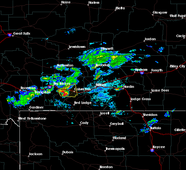
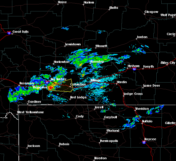
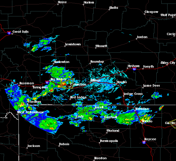
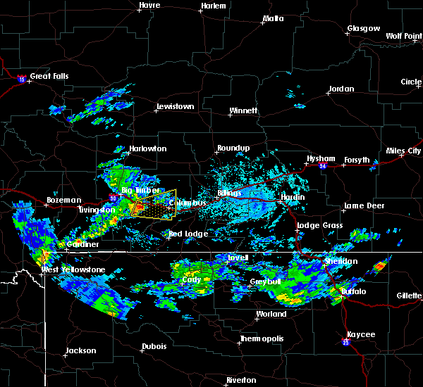
Hail Maps for Reed Point, MT


Connect with Interactive Hail Maps