

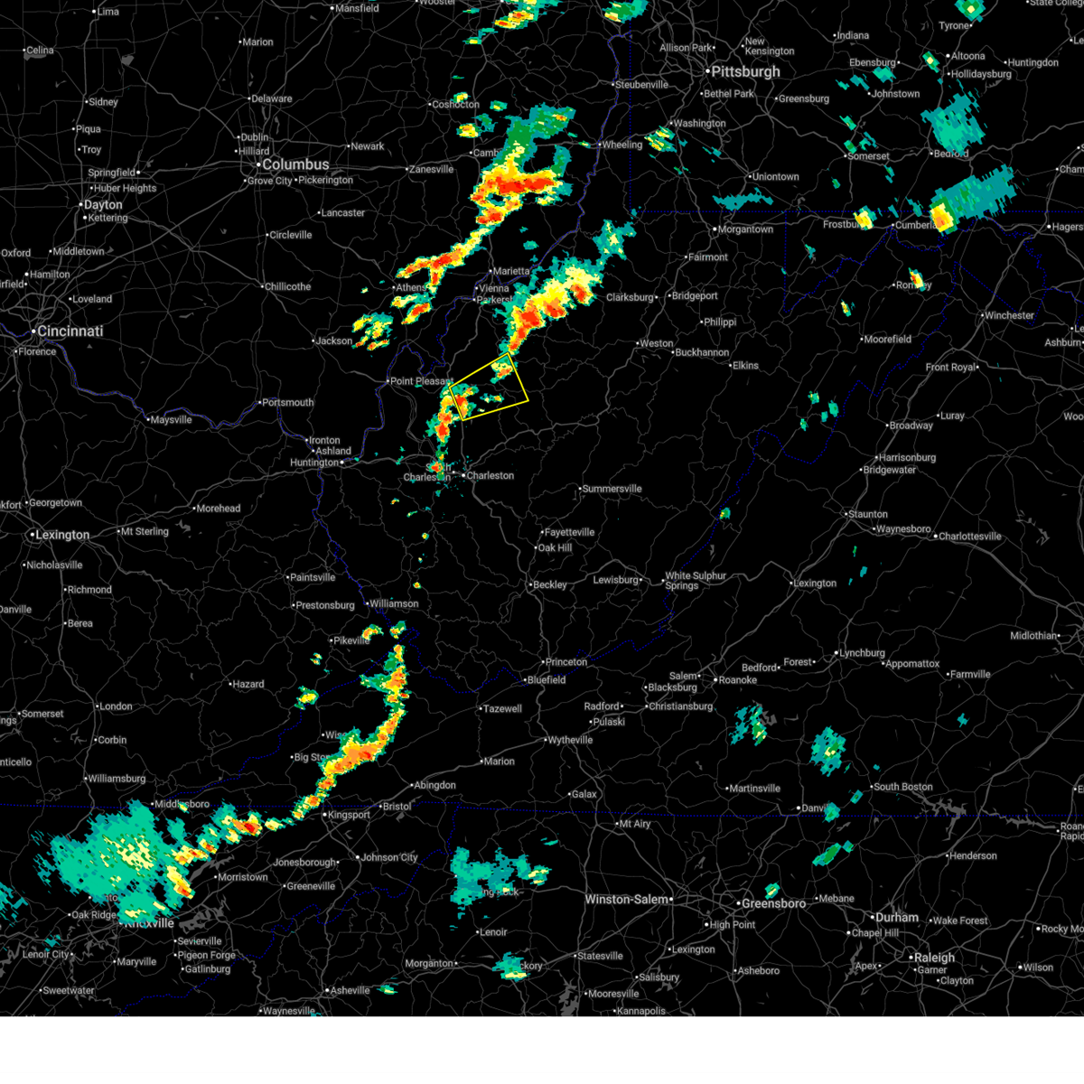
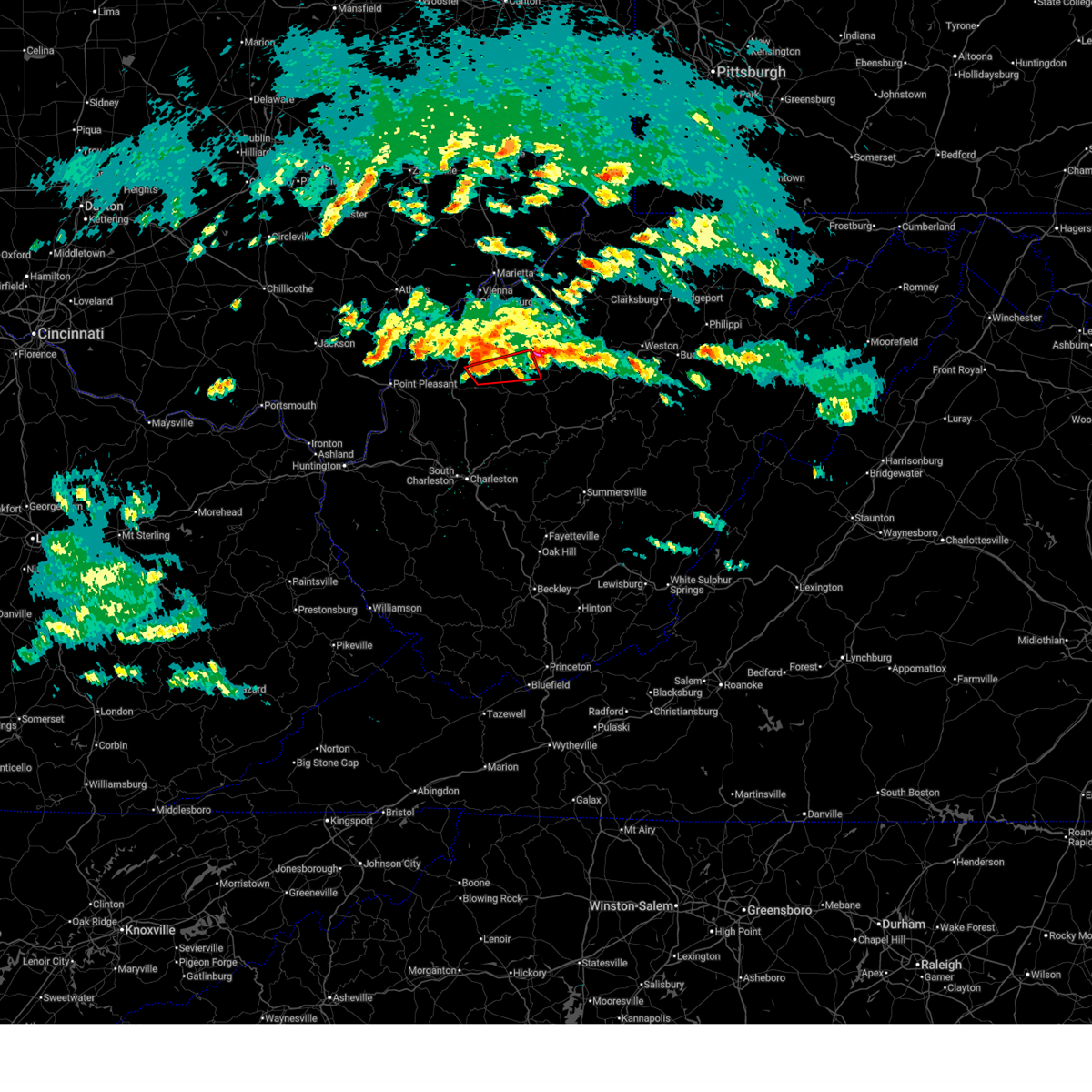
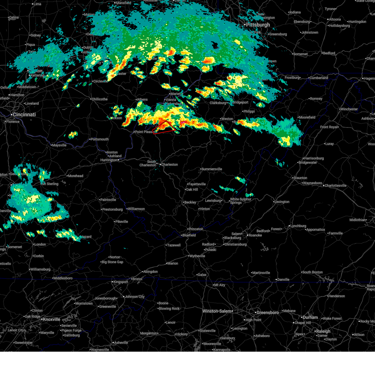
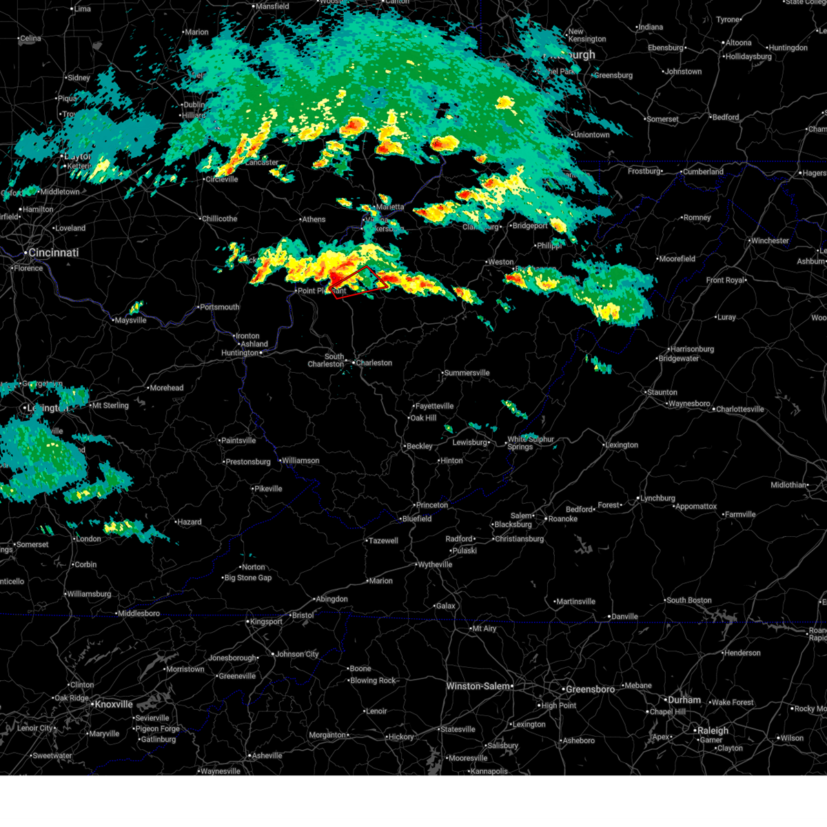
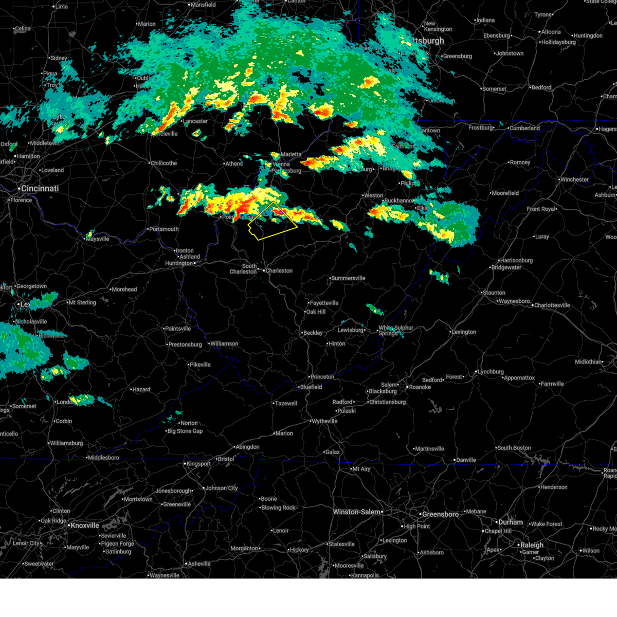
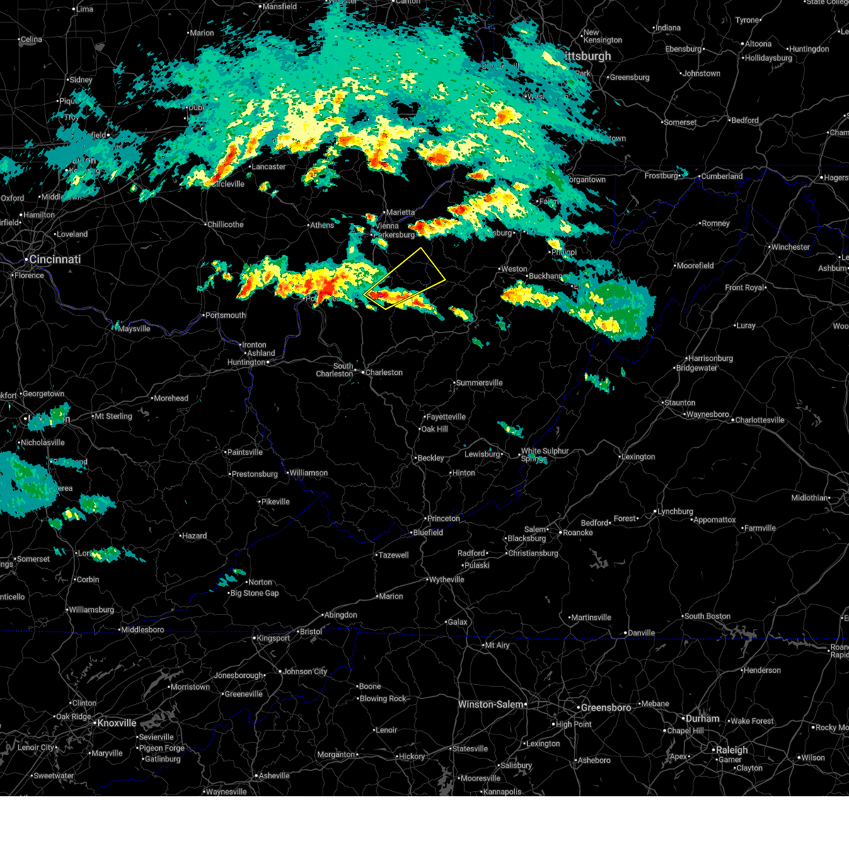
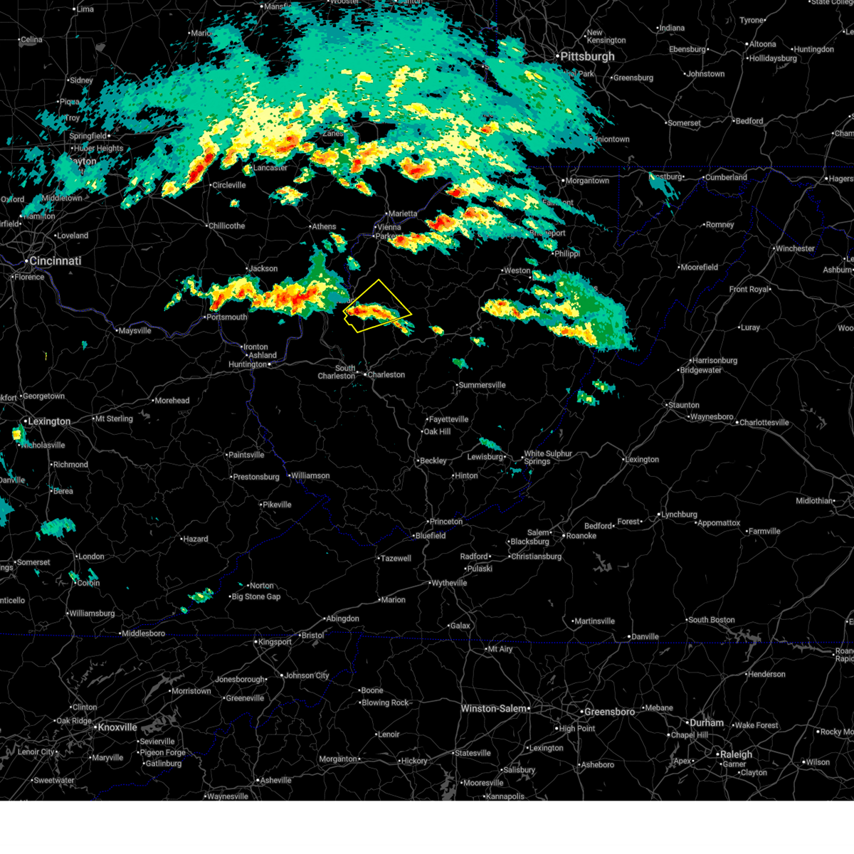
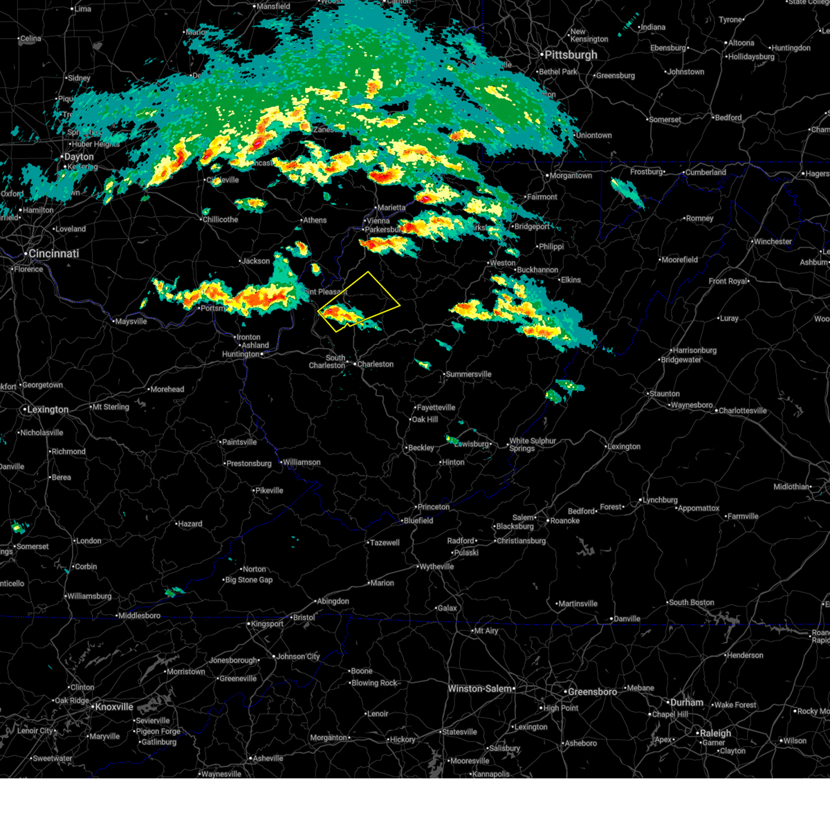
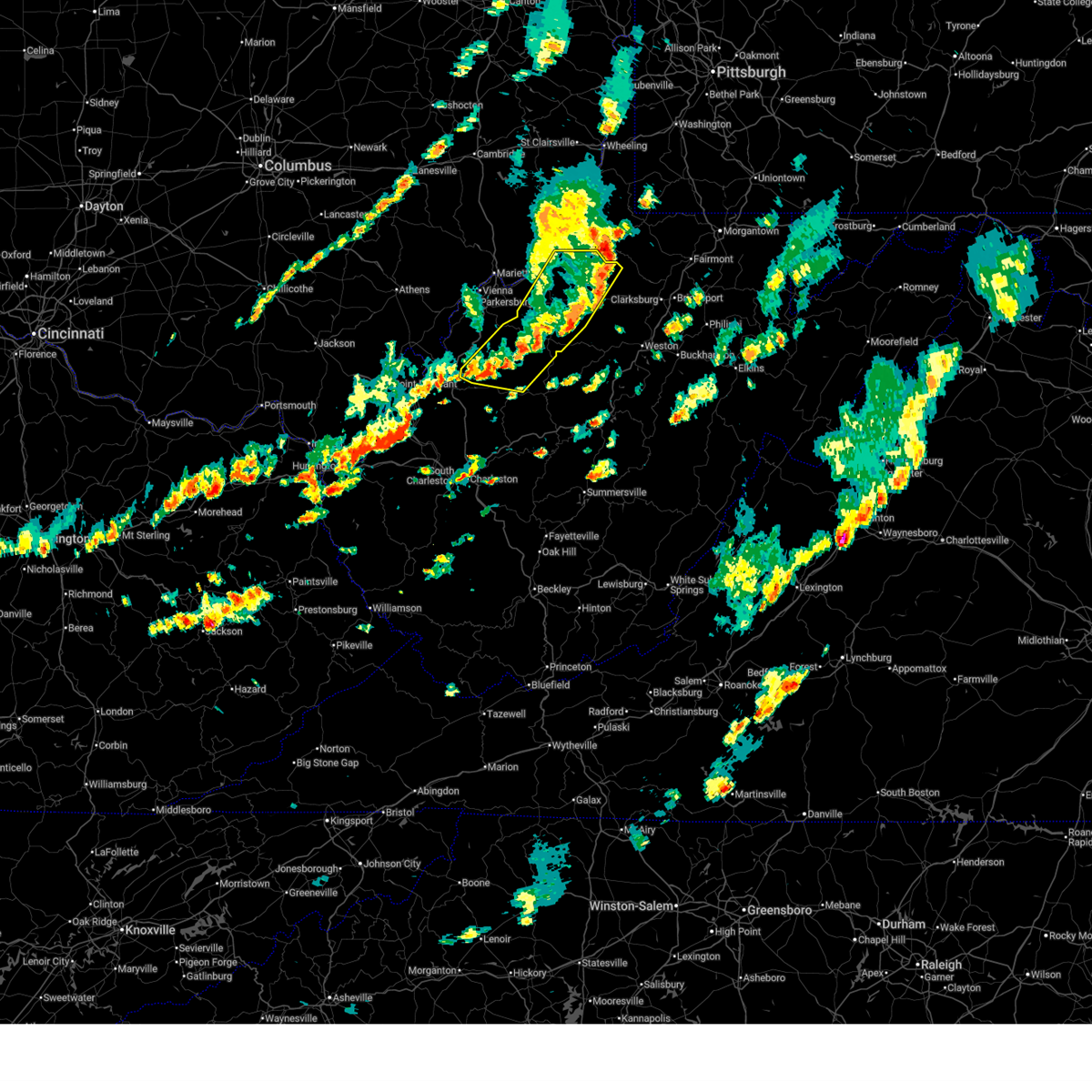
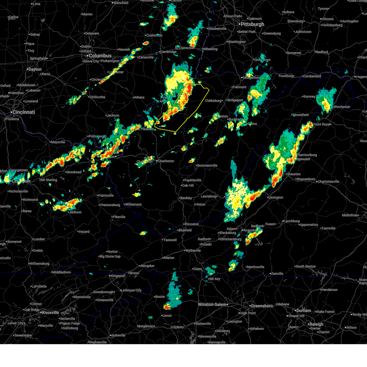
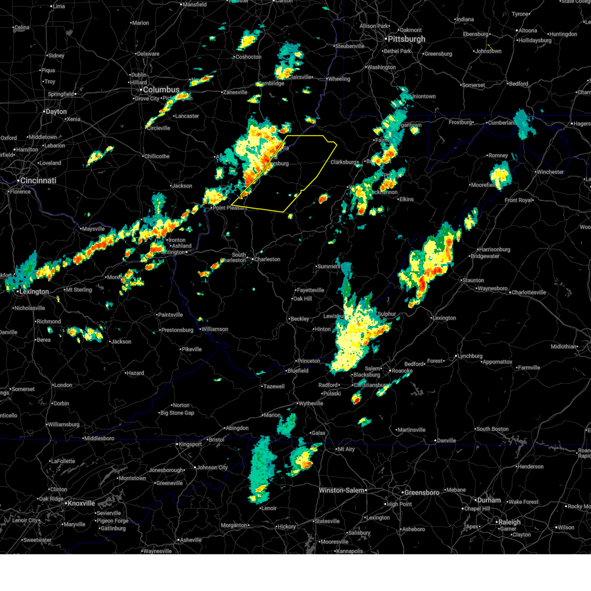
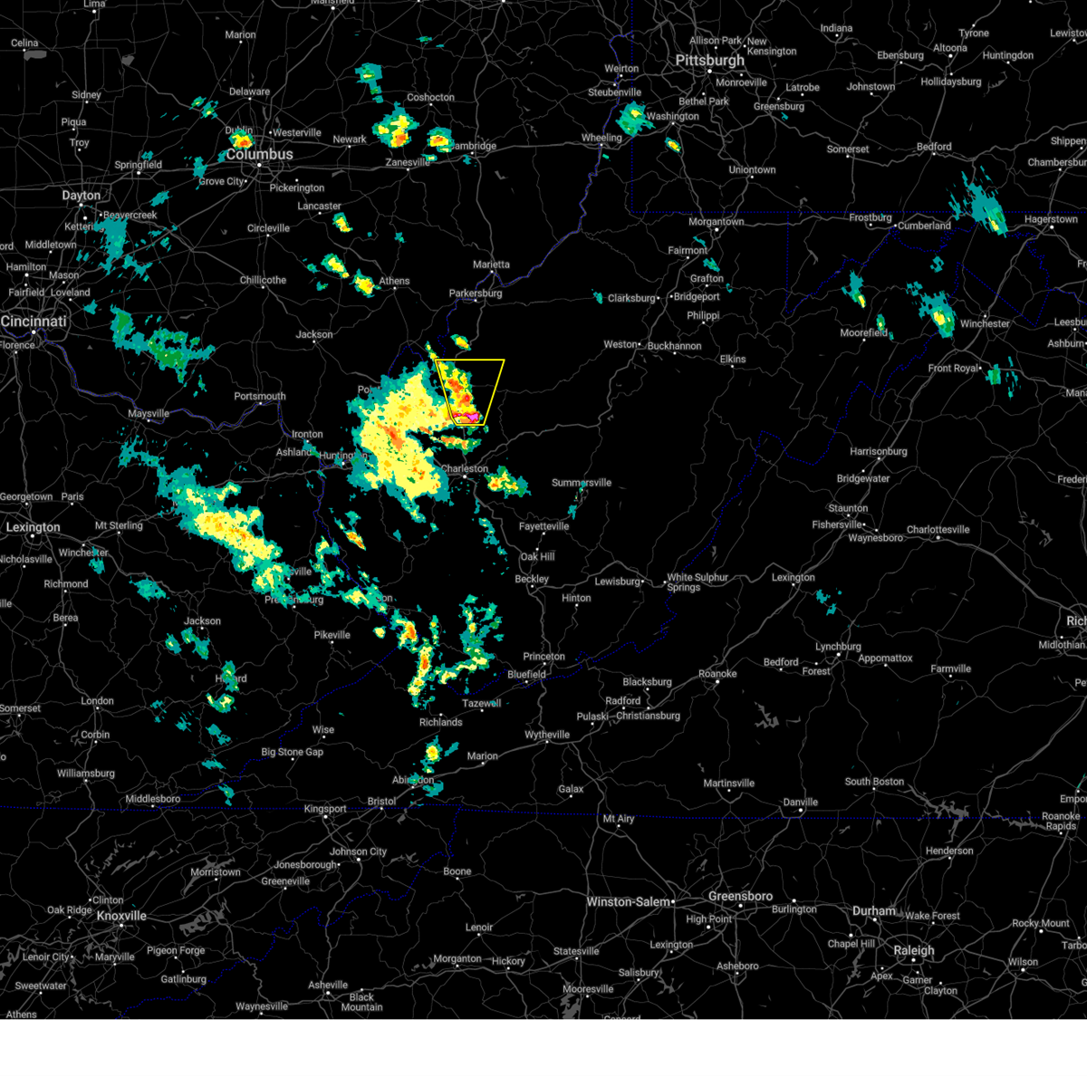
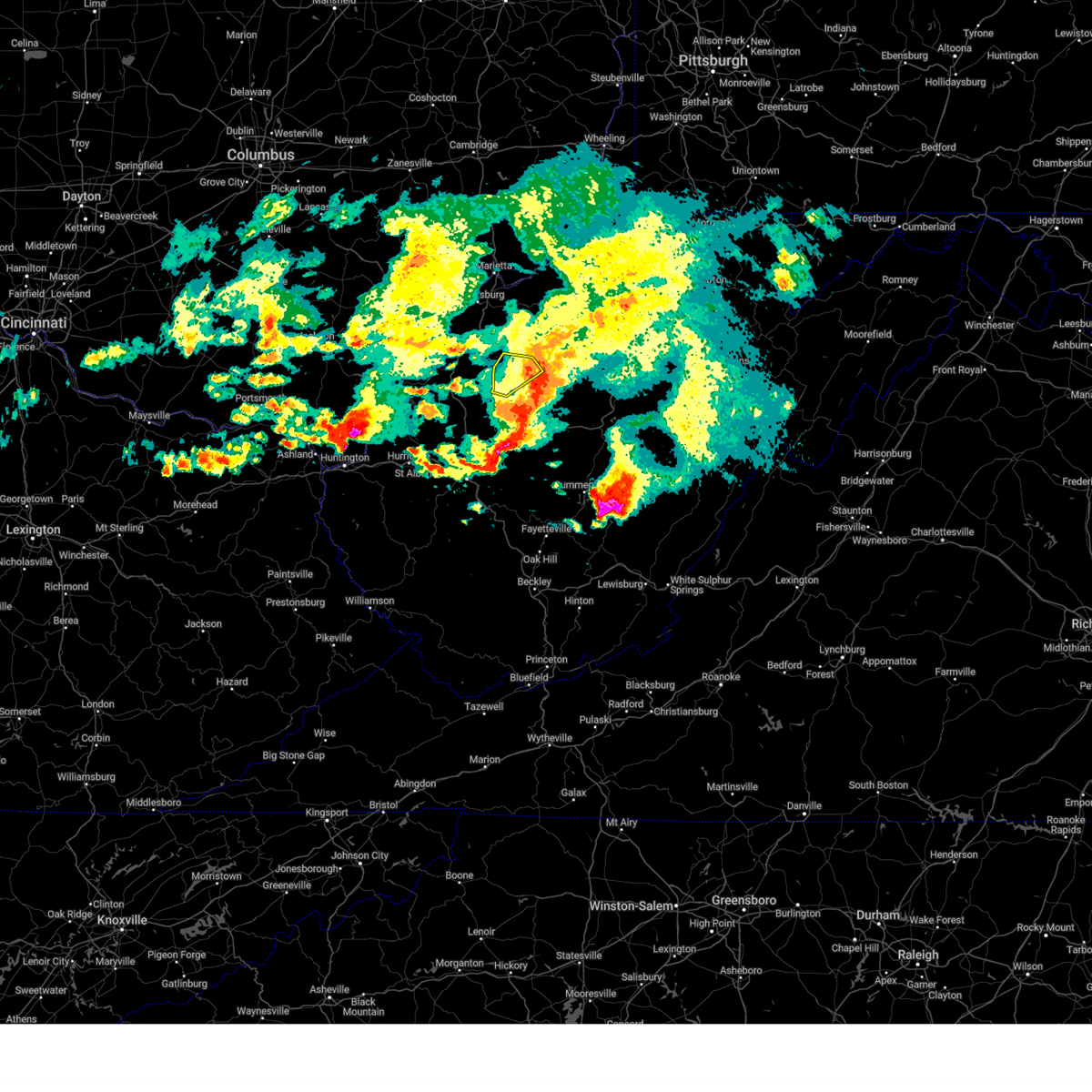
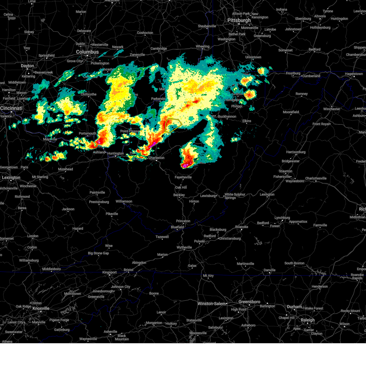
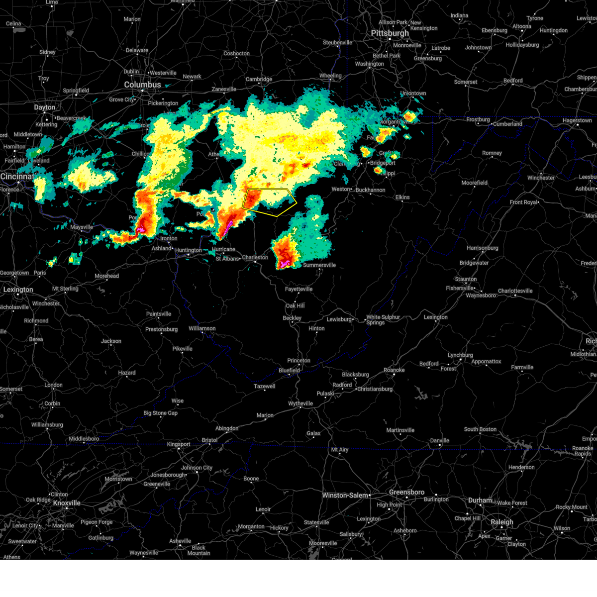
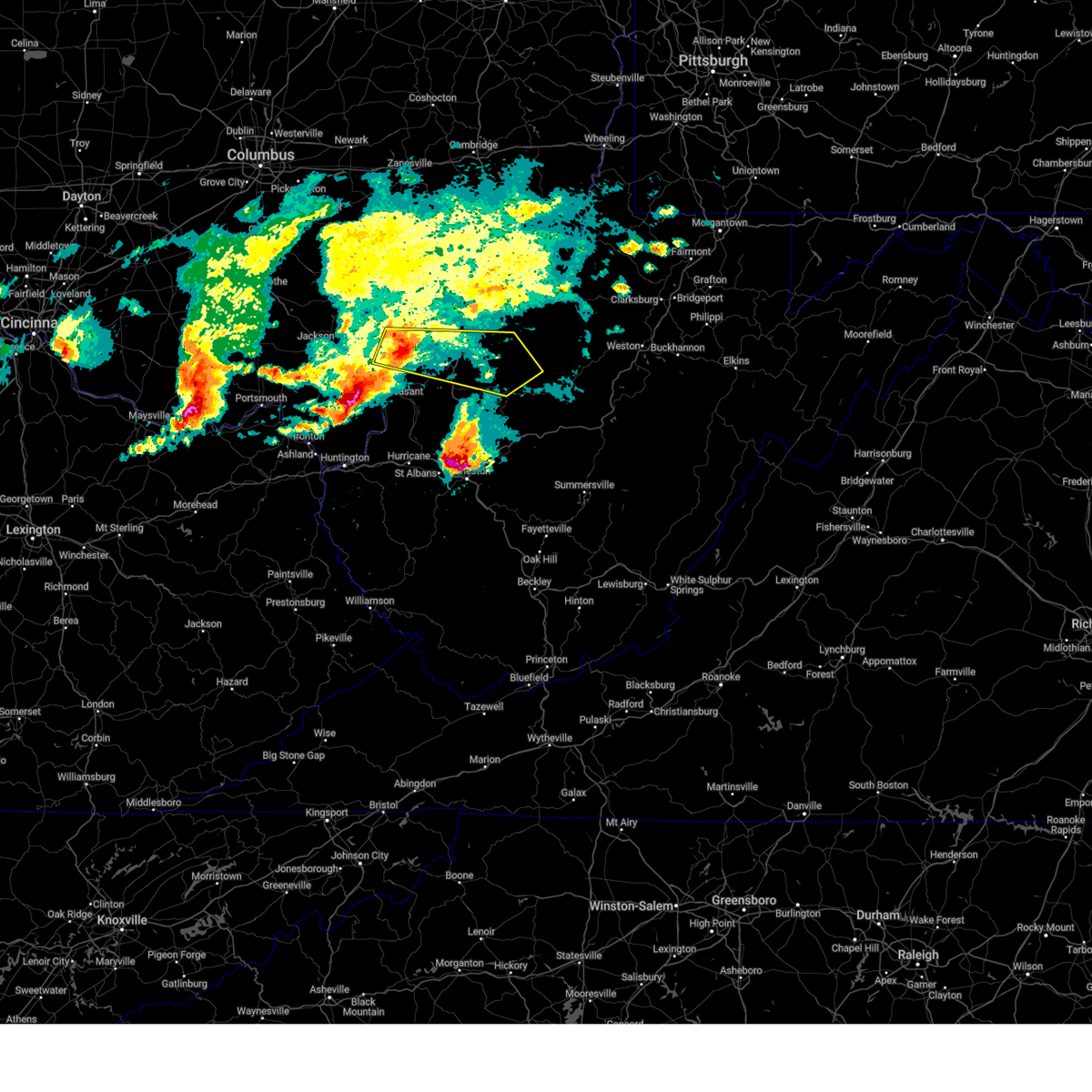
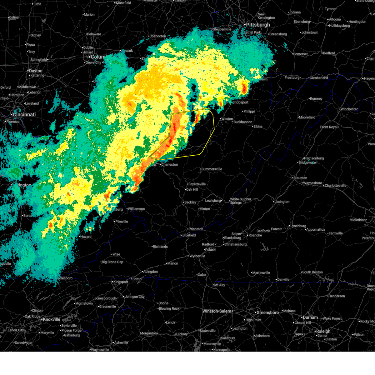
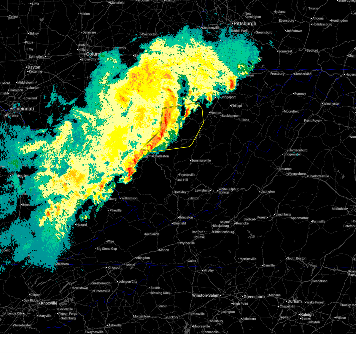
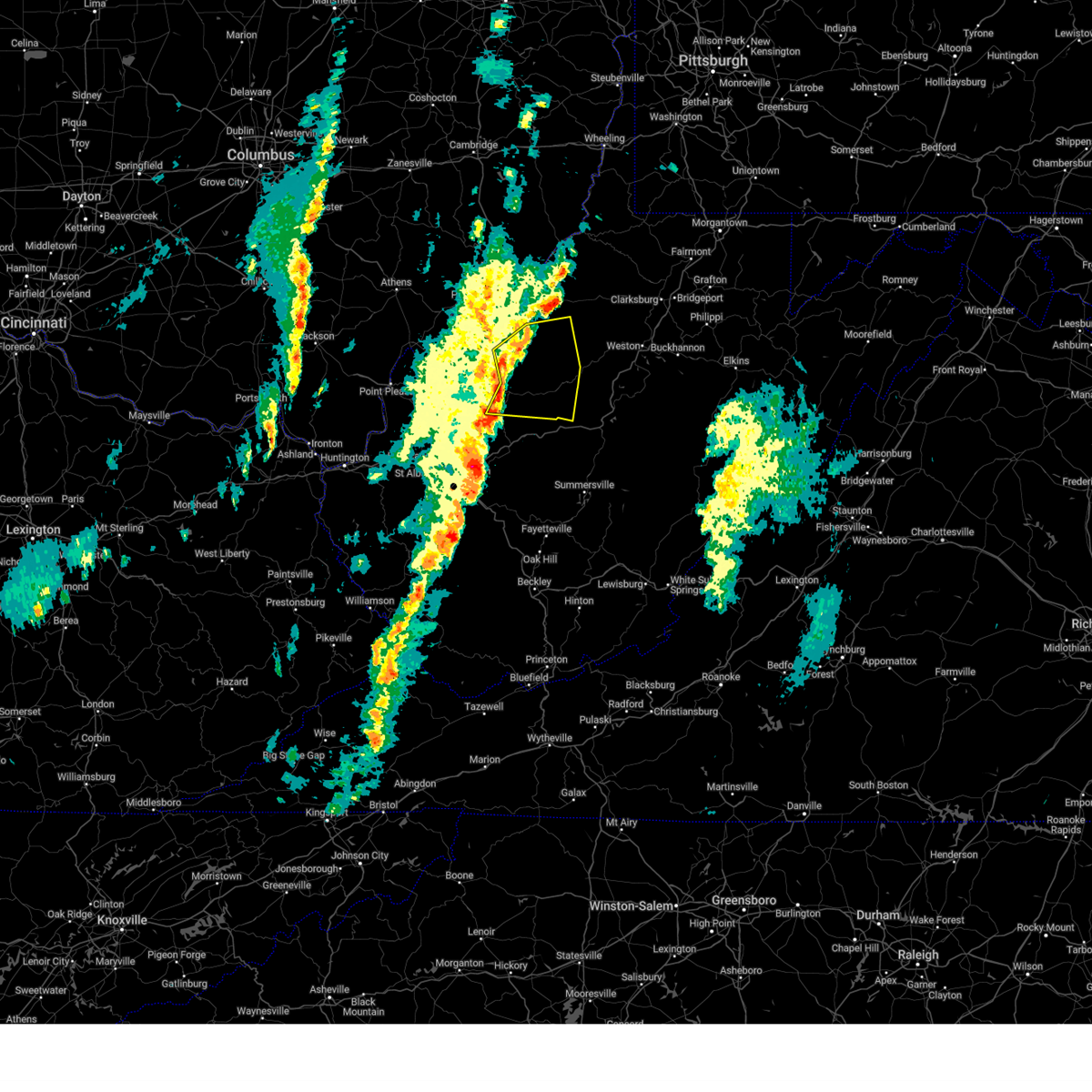
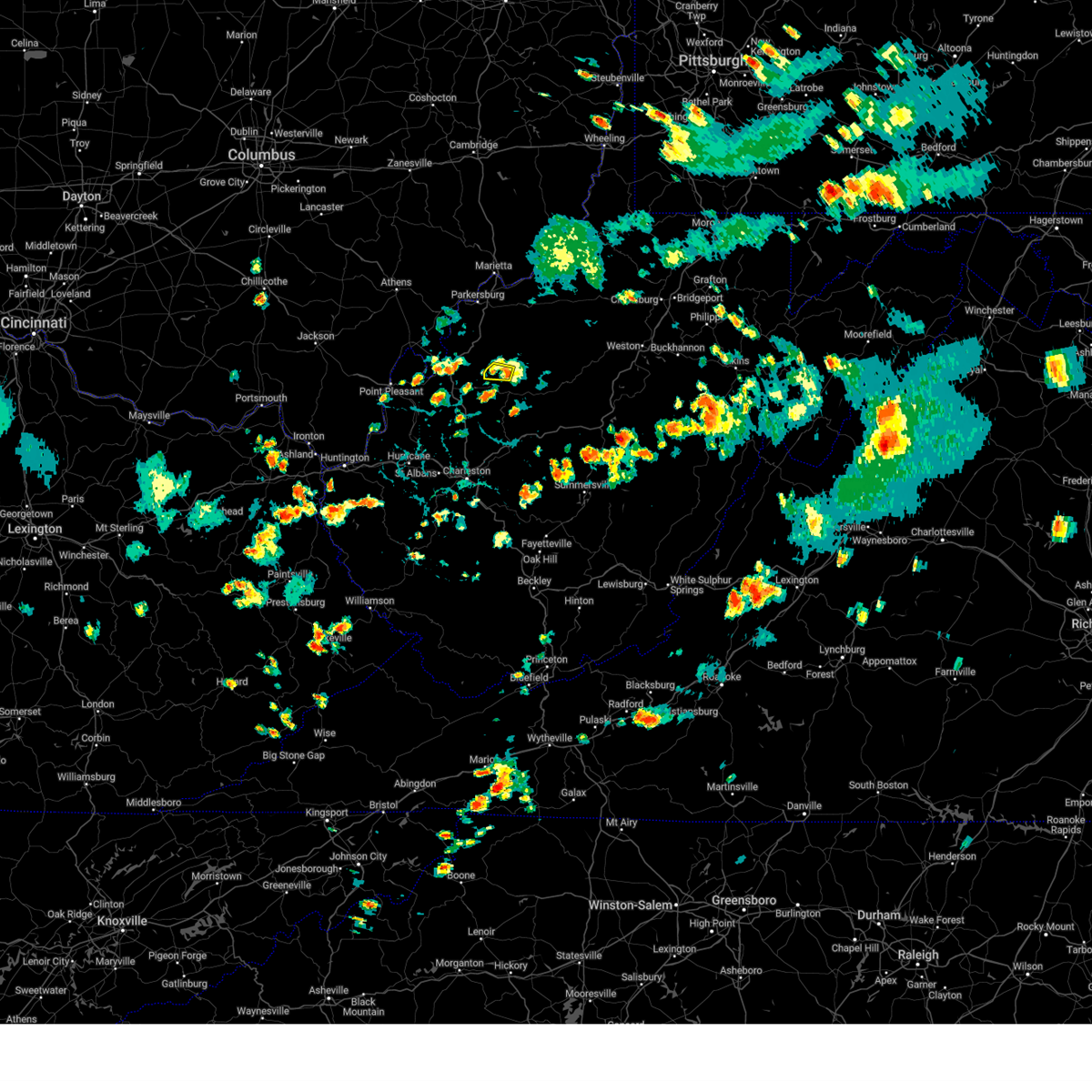
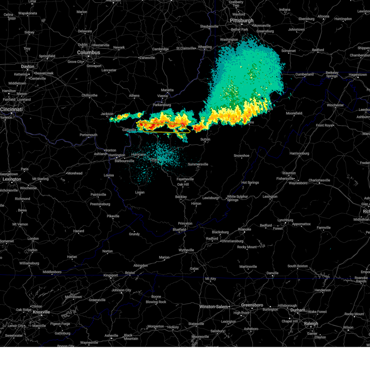
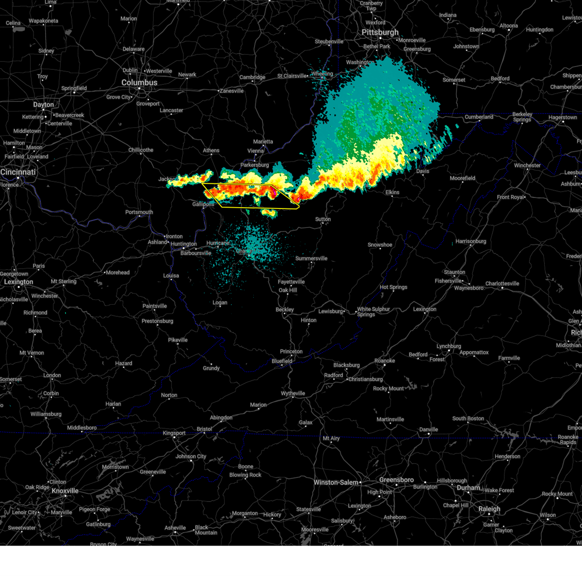
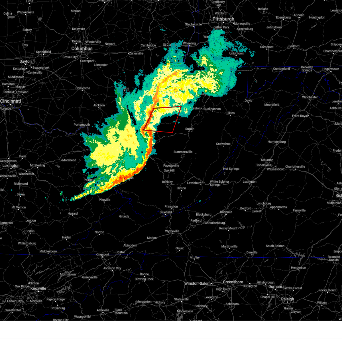
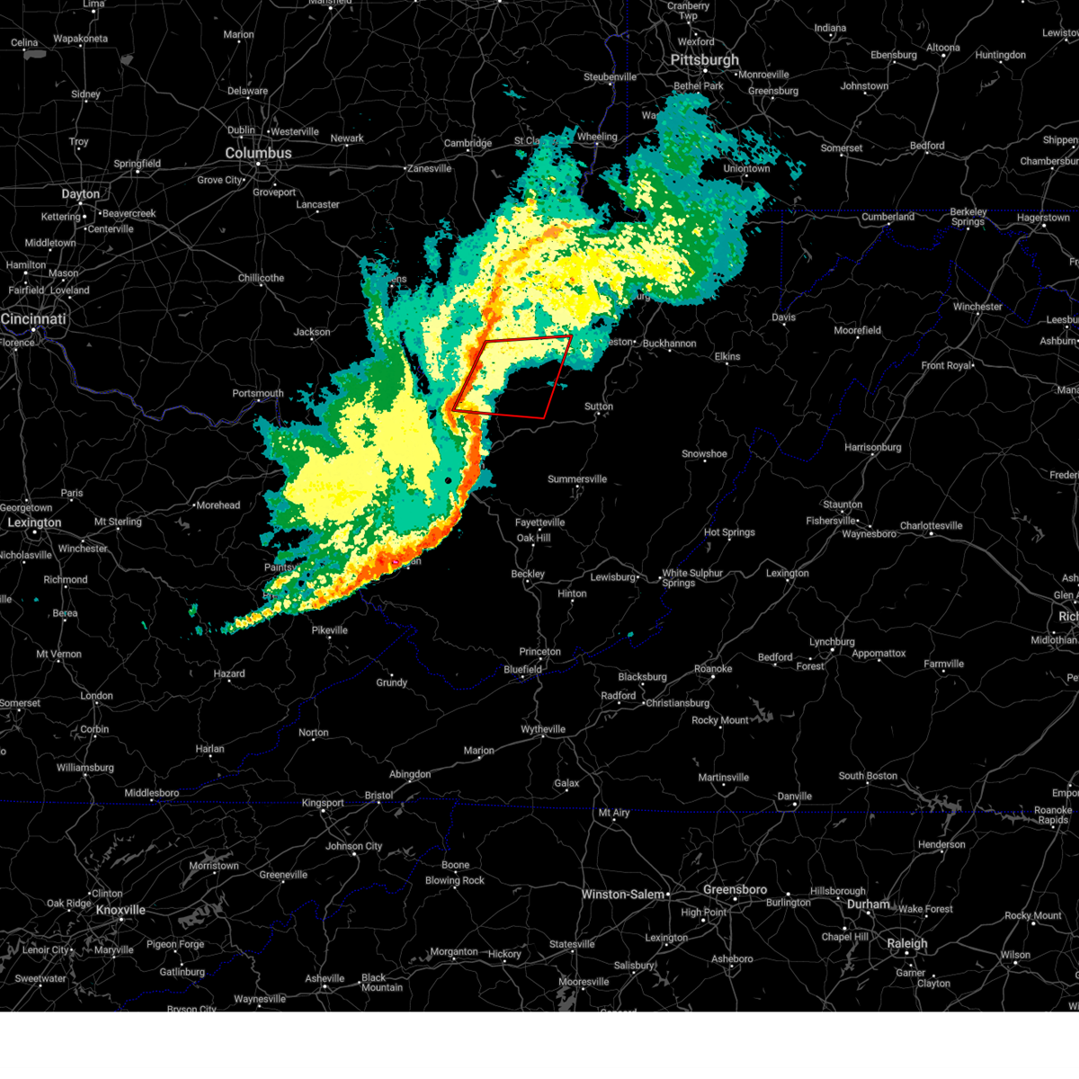
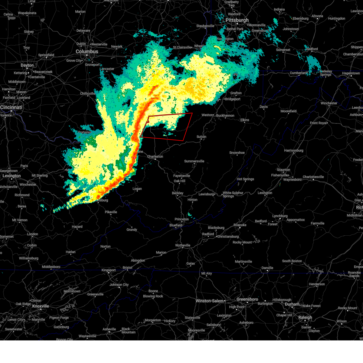
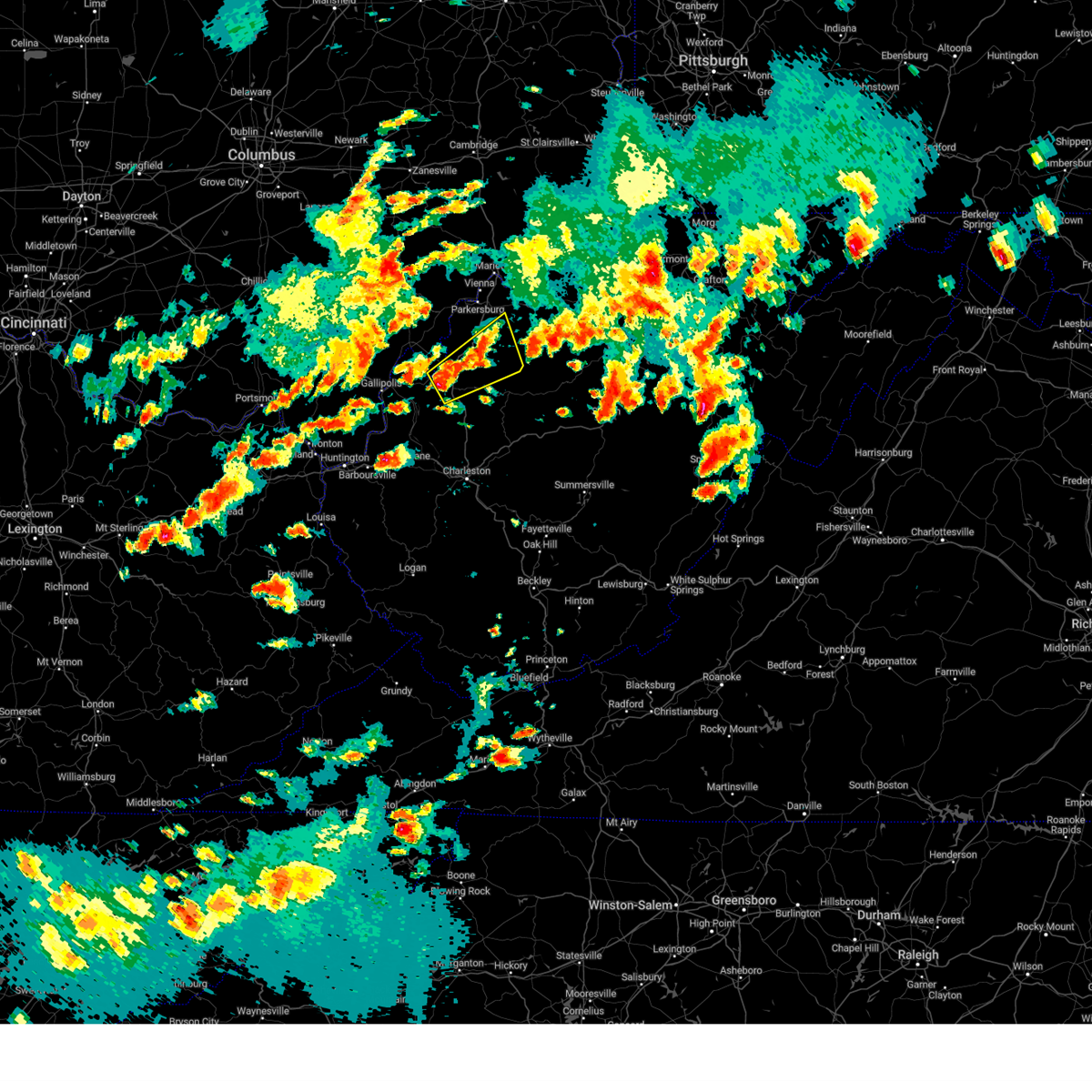
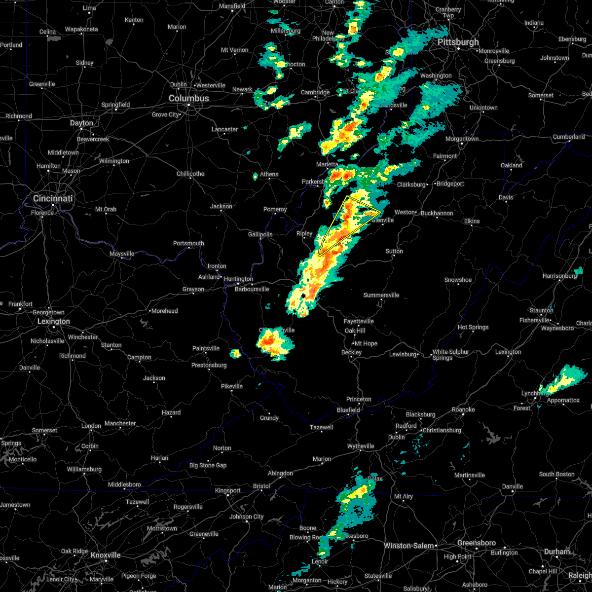
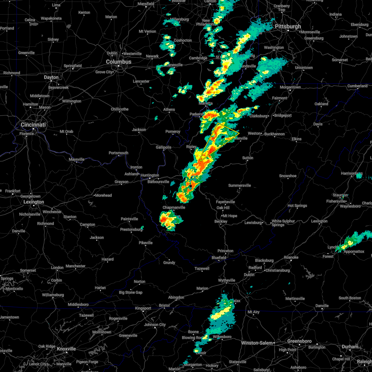
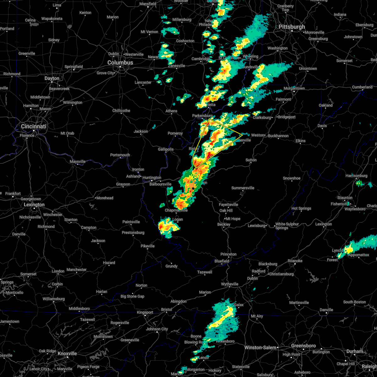
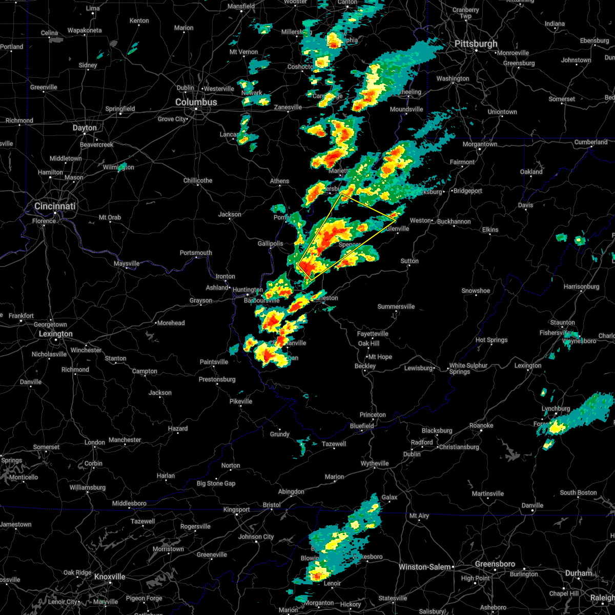
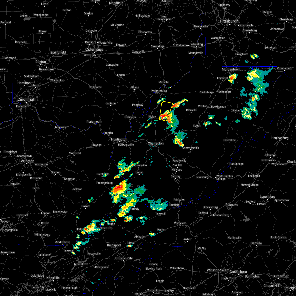
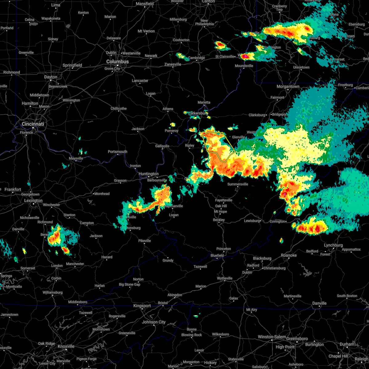
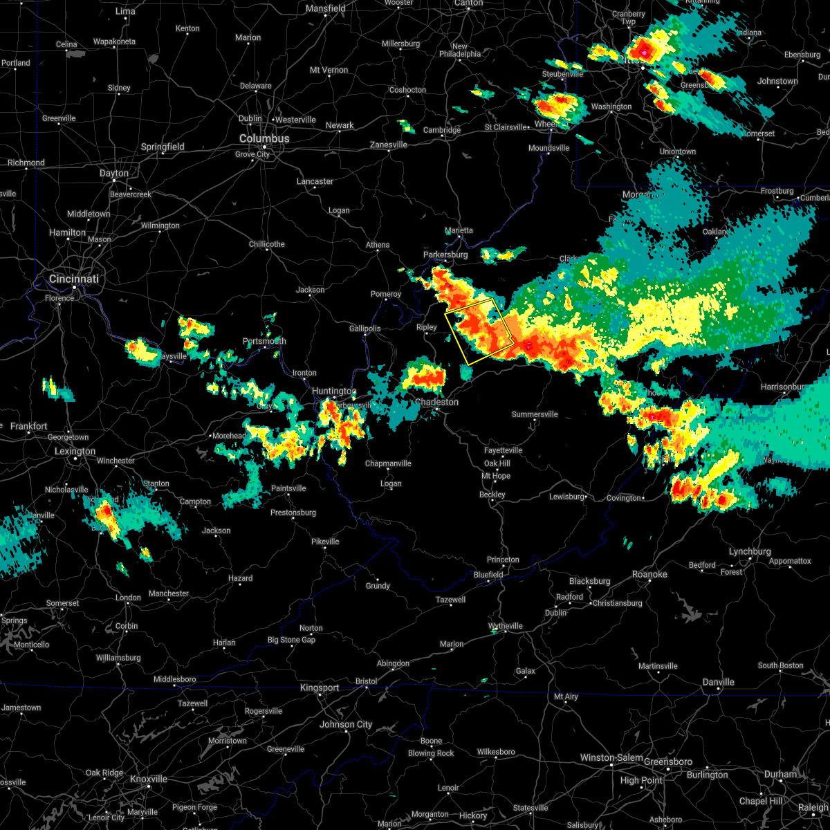
Hail Map for Reedy, WV
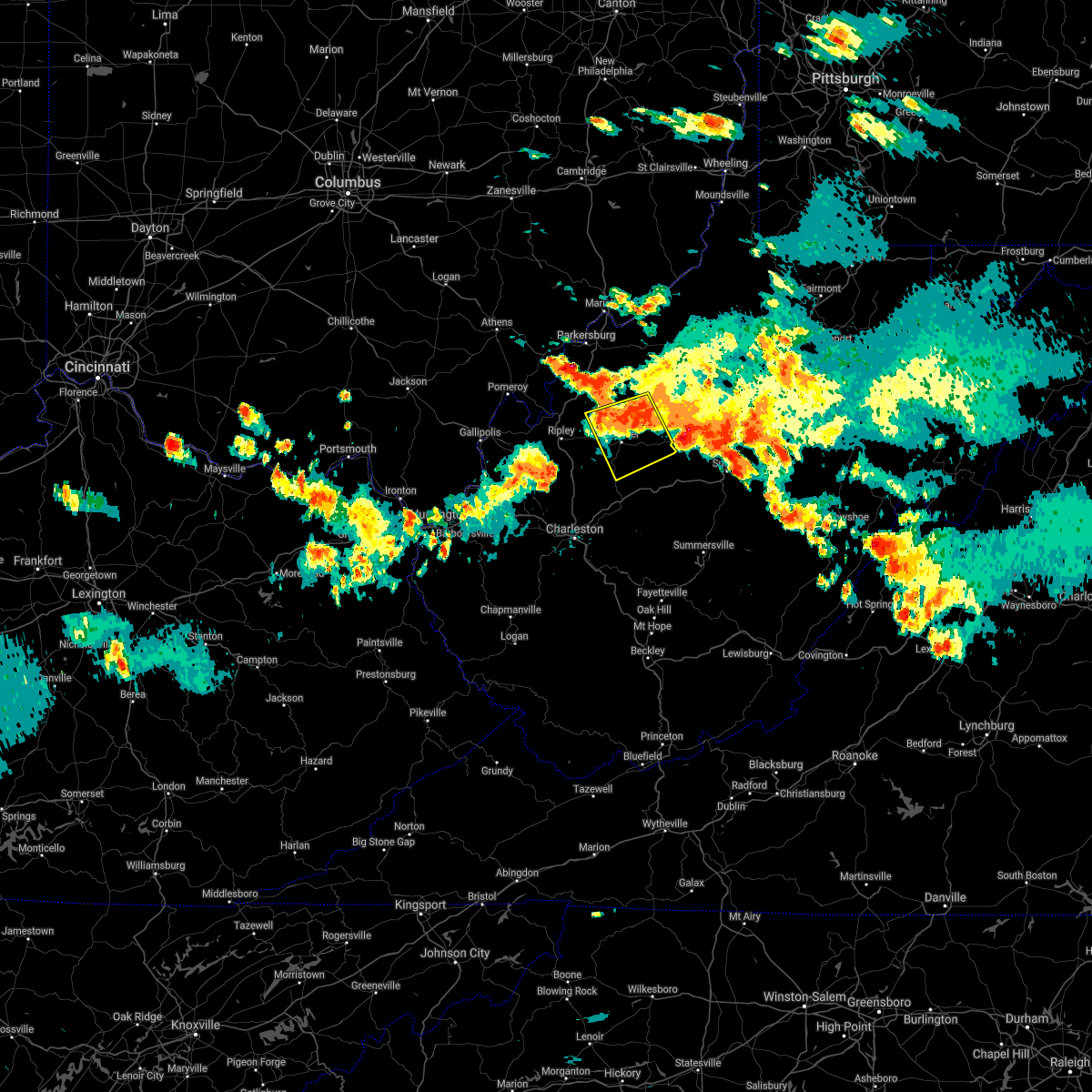
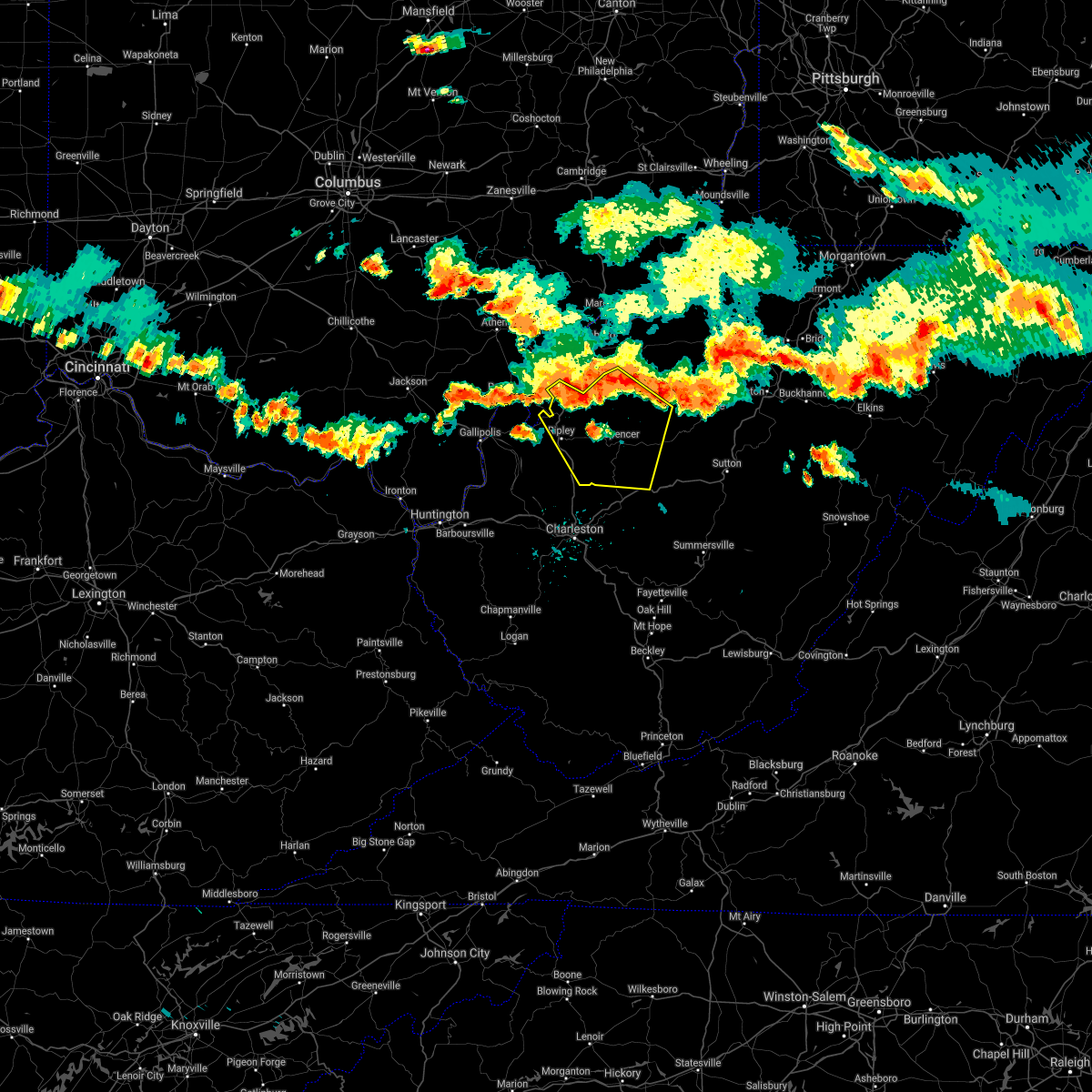
The Reedy, WV area has had 3 reports of on-the-ground hail by trained spotters, and has been under severe weather warnings 12 times during the past 12 months. Doppler radar has detected hail at or near Reedy, WV on 37 occasions.
| Name: | Reedy, WV |
| Where Located: | 39.6 miles NNE of Charleston, WV |
| Map: | Google Map for Reedy, WV |
| Population: | 182 |
| Housing Units: | 79 |
| More Info: | Search Google for Reedy, WV |
2
The Top Recent Hail Date for Reedy, WV is Saturday, August 31, 2024 (9th out of 37)

Hail and Wind Damage Spotted near Reedy, WV
| Date / Time | Report Details |
|---|---|
| 7/5/2026 2:26 PM EDT |
 Svrrlx the national weather service in charleston west virginia has issued a * severe thunderstorm warning for, south central wirt county in northwestern west virginia, northwestern roane county in central west virginia, southeastern jackson county in northwestern west virginia, * until 300 pm edt. * at 225 pm edt, a severe thunderstorm was located near kenna, or 7 miles southeast of ripley, moving northeast at 25 mph (radar indicated). Hazards include 60 mph wind gusts and quarter size hail. Hail damage to vehicles is expected. Expect wind damage to roofs, siding, and trees. Svrrlx the national weather service in charleston west virginia has issued a * severe thunderstorm warning for, south central wirt county in northwestern west virginia, northwestern roane county in central west virginia, southeastern jackson county in northwestern west virginia, * until 300 pm edt. * at 225 pm edt, a severe thunderstorm was located near kenna, or 7 miles southeast of ripley, moving northeast at 25 mph (radar indicated). Hazards include 60 mph wind gusts and quarter size hail. Hail damage to vehicles is expected. Expect wind damage to roofs, siding, and trees.
|
| 6/18/2026 6:11 AM EDT |
 Svrrlx the national weather service in charleston west virginia has issued a * severe thunderstorm warning for, meigs county in southeastern ohio, northeastern gallia county in southeastern ohio, southeastern vinton county in southeastern ohio, southeastern athens county in southeastern ohio, northwestern calhoun county in north central west virginia, northwestern mason county in western west virginia, southwestern ritchie county in northwestern west virginia, wirt county in northwestern west virginia, northwestern roane county in central west virginia, northern jackson county in northwestern west virginia, wood county in northwestern west virginia, * until 645 am edt. * at 611 am edt, a severe thunderstorm was located 7 miles southwest of rutland, moving east at 65 mph (radar indicated). Hazards include 60 mph wind gusts. expect damage to roofs, siding, and trees Svrrlx the national weather service in charleston west virginia has issued a * severe thunderstorm warning for, meigs county in southeastern ohio, northeastern gallia county in southeastern ohio, southeastern vinton county in southeastern ohio, southeastern athens county in southeastern ohio, northwestern calhoun county in north central west virginia, northwestern mason county in western west virginia, southwestern ritchie county in northwestern west virginia, wirt county in northwestern west virginia, northwestern roane county in central west virginia, northern jackson county in northwestern west virginia, wood county in northwestern west virginia, * until 645 am edt. * at 611 am edt, a severe thunderstorm was located 7 miles southwest of rutland, moving east at 65 mph (radar indicated). Hazards include 60 mph wind gusts. expect damage to roofs, siding, and trees
|
| 2/20/2026 1:15 AM EST |
 The tornado warning has been allowed to expire as the tornado threat has decreased. however, large hail and damaging winds remain likely and a severe thunderstorm warning remains in effect for the area. however, small hail and heavy rain are still possible with this thunderstorm. The tornado warning has been allowed to expire as the tornado threat has decreased. however, large hail and damaging winds remain likely and a severe thunderstorm warning remains in effect for the area. however, small hail and heavy rain are still possible with this thunderstorm.
|
| 2/20/2026 1:08 AM EST |
 At 107 am est, a severe thunderstorm capable of producing a tornado was located 8 miles south of elizabeth, moving east at 55 mph (radar indicated rotation). Hazards include tornado and quarter size hail. Flying debris will be dangerous to those caught without shelter. mobile homes will be damaged or destroyed. damage to roofs, windows, and vehicles will occur. tree damage is likely. Locations impacted include, reedy, creston, lucille, annamoriah, and munday. At 107 am est, a severe thunderstorm capable of producing a tornado was located 8 miles south of elizabeth, moving east at 55 mph (radar indicated rotation). Hazards include tornado and quarter size hail. Flying debris will be dangerous to those caught without shelter. mobile homes will be damaged or destroyed. damage to roofs, windows, and vehicles will occur. tree damage is likely. Locations impacted include, reedy, creston, lucille, annamoriah, and munday.
|
| 2/20/2026 1:00 AM EST |
 Torrlx the national weather service in charleston west virginia has issued a * tornado warning for, northwestern calhoun county in north central west virginia, southern wirt county in northwestern west virginia, northwestern roane county in central west virginia, east central jackson county in northwestern west virginia, * until 115 am est. * at 100 am est, a severe thunderstorm capable of producing a tornado was located 7 miles east of sandyville, or 11 miles northwest of spencer, moving east at 50 mph (radar indicated rotation). Hazards include tornado and quarter size hail. Flying debris will be dangerous to those caught without shelter. mobile homes will be damaged or destroyed. damage to roofs, windows, and vehicles will occur. tree damage is likely. This tornadic thunderstorm will remain over mainly rural areas of northwestern calhoun, southern wirt, northwestern roane and east central jackson counties, including the following locations, lucille, peewee, reedy, creston, annamoriah, leroy, and munday. Torrlx the national weather service in charleston west virginia has issued a * tornado warning for, northwestern calhoun county in north central west virginia, southern wirt county in northwestern west virginia, northwestern roane county in central west virginia, east central jackson county in northwestern west virginia, * until 115 am est. * at 100 am est, a severe thunderstorm capable of producing a tornado was located 7 miles east of sandyville, or 11 miles northwest of spencer, moving east at 50 mph (radar indicated rotation). Hazards include tornado and quarter size hail. Flying debris will be dangerous to those caught without shelter. mobile homes will be damaged or destroyed. damage to roofs, windows, and vehicles will occur. tree damage is likely. This tornadic thunderstorm will remain over mainly rural areas of northwestern calhoun, southern wirt, northwestern roane and east central jackson counties, including the following locations, lucille, peewee, reedy, creston, annamoriah, leroy, and munday.
|
| 2/20/2026 12:54 AM EST |
 At 1254 am est, a severe thunderstorm capable of producing a tornado was located near sandyville, or 7 miles northeast of ripley, moving east at 55 mph (radar indicated rotation). Hazards include tornado and quarter size hail. Flying debris will be dangerous to those caught without shelter. mobile homes will be damaged or destroyed. damage to roofs, windows, and vehicles will occur. tree damage is likely. This tornadic thunderstorm will remain over mainly rural areas of southwestern wirt, northwestern roane and east central jackson counties, including the following locations, leroy, peewee, and reedy. At 1254 am est, a severe thunderstorm capable of producing a tornado was located near sandyville, or 7 miles northeast of ripley, moving east at 55 mph (radar indicated rotation). Hazards include tornado and quarter size hail. Flying debris will be dangerous to those caught without shelter. mobile homes will be damaged or destroyed. damage to roofs, windows, and vehicles will occur. tree damage is likely. This tornadic thunderstorm will remain over mainly rural areas of southwestern wirt, northwestern roane and east central jackson counties, including the following locations, leroy, peewee, and reedy.
|
| 2/20/2026 12:46 AM EST |
 Torrlx the national weather service in charleston west virginia has issued a * tornado warning for, southwestern wirt county in northwestern west virginia, northwestern roane county in central west virginia, central jackson county in northwestern west virginia, * until 100 am est. * at 1245 am est, a severe thunderstorm capable of producing a tornado was located near ripley, moving east at 45 mph (radar indicated rotation). Hazards include tornado and quarter size hail. Flying debris will be dangerous to those caught without shelter. mobile homes will be damaged or destroyed. damage to roofs, windows, and vehicles will occur. tree damage is likely. this dangerous storm will be near, ripley and sandyville around 1250 am est. Other locations impacted by this tornadic thunderstorm include cottageville, leroy, peewee, reedy, and evans. Torrlx the national weather service in charleston west virginia has issued a * tornado warning for, southwestern wirt county in northwestern west virginia, northwestern roane county in central west virginia, central jackson county in northwestern west virginia, * until 100 am est. * at 1245 am est, a severe thunderstorm capable of producing a tornado was located near ripley, moving east at 45 mph (radar indicated rotation). Hazards include tornado and quarter size hail. Flying debris will be dangerous to those caught without shelter. mobile homes will be damaged or destroyed. damage to roofs, windows, and vehicles will occur. tree damage is likely. this dangerous storm will be near, ripley and sandyville around 1250 am est. Other locations impacted by this tornadic thunderstorm include cottageville, leroy, peewee, reedy, and evans.
|
| 2/20/2026 12:37 AM EST |
 The severe thunderstorm which prompted the warning has moved out of the warned area. therefore, the warning has been allowed to expire. however, small hail and heavy rain are still possible with this thunderstorm. remember, a severe thunderstorm warning still remains in effect for portions of roane and jackson counties. The severe thunderstorm which prompted the warning has moved out of the warned area. therefore, the warning has been allowed to expire. however, small hail and heavy rain are still possible with this thunderstorm. remember, a severe thunderstorm warning still remains in effect for portions of roane and jackson counties.
|
| 2/20/2026 12:34 AM EST |
 Svrrlx the national weather service in charleston west virginia has issued a * severe thunderstorm warning for, northern calhoun county in north central west virginia, southwestern ritchie county in northwestern west virginia, west central gilmer county in north central west virginia, southeastern wirt county in northwestern west virginia, northwestern roane county in central west virginia, east central jackson county in northwestern west virginia, * until 100 am est. * at 1234 am est, a severe thunderstorm was located 7 miles northwest of spencer, moving northeast at 50 mph (radar indicated). Hazards include quarter size hail. damage to vehicles is expected Svrrlx the national weather service in charleston west virginia has issued a * severe thunderstorm warning for, northern calhoun county in north central west virginia, southwestern ritchie county in northwestern west virginia, west central gilmer county in north central west virginia, southeastern wirt county in northwestern west virginia, northwestern roane county in central west virginia, east central jackson county in northwestern west virginia, * until 100 am est. * at 1234 am est, a severe thunderstorm was located 7 miles northwest of spencer, moving northeast at 50 mph (radar indicated). Hazards include quarter size hail. damage to vehicles is expected
|
| 2/20/2026 12:19 AM EST |
 the severe thunderstorm warning has been cancelled and is no longer in effect the severe thunderstorm warning has been cancelled and is no longer in effect
|
| 2/20/2026 12:19 AM EST |
 At 1218 am est, a severe thunderstorm was located near ripley, moving northeast at 45 mph (radar indicated). Hazards include quarter size hail. Damage to vehicles is expected. Locations impacted include, ripley, spencer, kenna, reedy, statts mills, given, leroy, fairplain, and gay. At 1218 am est, a severe thunderstorm was located near ripley, moving northeast at 45 mph (radar indicated). Hazards include quarter size hail. Damage to vehicles is expected. Locations impacted include, ripley, spencer, kenna, reedy, statts mills, given, leroy, fairplain, and gay.
|
| 2/20/2026 12:05 AM EST |
 Svrrlx the national weather service in charleston west virginia has issued a * severe thunderstorm warning for, east central mason county in western west virginia, northeastern putnam county in western west virginia, southwestern wirt county in northwestern west virginia, northwestern roane county in central west virginia, central jackson county in northwestern west virginia, * until 1230 am est. * at 1205 am est, a severe thunderstorm was located 7 miles northwest of kenna, or 8 miles southwest of ripley, moving northeast at 50 mph (radar indicated). Hazards include quarter size hail. damage to vehicles is expected Svrrlx the national weather service in charleston west virginia has issued a * severe thunderstorm warning for, east central mason county in western west virginia, northeastern putnam county in western west virginia, southwestern wirt county in northwestern west virginia, northwestern roane county in central west virginia, central jackson county in northwestern west virginia, * until 1230 am est. * at 1205 am est, a severe thunderstorm was located 7 miles northwest of kenna, or 8 miles southwest of ripley, moving northeast at 50 mph (radar indicated). Hazards include quarter size hail. damage to vehicles is expected
|
| 6/19/2025 2:27 PM EDT |
 The storms which prompted the warning have weakened below severe limits, and have exited the warned area. therefore, the warning will be allowed to expire. however, gusty winds are still possible with these thunderstorms. The storms which prompted the warning have weakened below severe limits, and have exited the warned area. therefore, the warning will be allowed to expire. however, gusty winds are still possible with these thunderstorms.
|
| 6/19/2025 2:09 PM EDT |
 At 209 pm edt, severe thunderstorms were located along a line extending from near middlebourne to near north bend state park to 8 miles east of sandyville, moving east at 40 mph (radar indicated). Hazards include 60 mph wind gusts. Expect damage to roofs, siding, and trees. Locations impacted include, harrisville, elizabeth, middlebourne, pennsboro, west union, sandyville, north bend state park, ellenboro, cairo, reedy, pullman, friendly, alma, cherry, smithville, maxwell, lucille, mountain, lima, and hebron. At 209 pm edt, severe thunderstorms were located along a line extending from near middlebourne to near north bend state park to 8 miles east of sandyville, moving east at 40 mph (radar indicated). Hazards include 60 mph wind gusts. Expect damage to roofs, siding, and trees. Locations impacted include, harrisville, elizabeth, middlebourne, pennsboro, west union, sandyville, north bend state park, ellenboro, cairo, reedy, pullman, friendly, alma, cherry, smithville, maxwell, lucille, mountain, lima, and hebron.
|
| 6/19/2025 2:09 PM EDT |
 the severe thunderstorm warning has been cancelled and is no longer in effect the severe thunderstorm warning has been cancelled and is no longer in effect
|
| 6/19/2025 1:47 PM EDT |
 Svrrlx the national weather service in charleston west virginia has issued a * severe thunderstorm warning for, east central washington county in southeastern ohio, pleasants county in northwestern west virginia, northwestern calhoun county in north central west virginia, ritchie county in northwestern west virginia, western doddridge county in northern west virginia, wirt county in northwestern west virginia, tyler county in northern west virginia, northwestern roane county in central west virginia, northern jackson county in northwestern west virginia, central wood county in northwestern west virginia, * until 230 pm edt. * at 147 pm edt, severe thunderstorms were located along a line extending from near st. marys to near mineralwells to near ravenswood, moving east at 40 mph (radar indicated). Hazards include 60 mph wind gusts. expect damage to roofs, siding, and trees Svrrlx the national weather service in charleston west virginia has issued a * severe thunderstorm warning for, east central washington county in southeastern ohio, pleasants county in northwestern west virginia, northwestern calhoun county in north central west virginia, ritchie county in northwestern west virginia, western doddridge county in northern west virginia, wirt county in northwestern west virginia, tyler county in northern west virginia, northwestern roane county in central west virginia, northern jackson county in northwestern west virginia, central wood county in northwestern west virginia, * until 230 pm edt. * at 147 pm edt, severe thunderstorms were located along a line extending from near st. marys to near mineralwells to near ravenswood, moving east at 40 mph (radar indicated). Hazards include 60 mph wind gusts. expect damage to roofs, siding, and trees
|
| 5/5/2025 2:48 PM EDT |
 Svrrlx the national weather service in charleston west virginia has issued a * severe thunderstorm warning for, eastern meigs county in southeastern ohio, southwestern wirt county in northwestern west virginia, northwestern roane county in central west virginia, jackson county in northwestern west virginia, * until 315 pm edt. * at 247 pm edt, a severe thunderstorm was located near kenna, or 10 miles southeast of ripley, moving north at 25 mph (radar indicated). Hazards include 60 mph wind gusts and quarter size hail. Hail damage to vehicles is expected. Expect wind damage to roofs, siding, and trees. Svrrlx the national weather service in charleston west virginia has issued a * severe thunderstorm warning for, eastern meigs county in southeastern ohio, southwestern wirt county in northwestern west virginia, northwestern roane county in central west virginia, jackson county in northwestern west virginia, * until 315 pm edt. * at 247 pm edt, a severe thunderstorm was located near kenna, or 10 miles southeast of ripley, moving north at 25 mph (radar indicated). Hazards include 60 mph wind gusts and quarter size hail. Hail damage to vehicles is expected. Expect wind damage to roofs, siding, and trees.
|
| 4/14/2025 6:42 PM EDT |
 The storm which prompted the warning has weakened below severe limits, and no longer poses an immediate threat to life or property. therefore, the warning will be allowed to expire. however, gusty winds are still possible with this thunderstorm. a severe thunderstorm watch remains in effect until 1100 pm edt for central, north central and northwestern west virginia. The storm which prompted the warning has weakened below severe limits, and no longer poses an immediate threat to life or property. therefore, the warning will be allowed to expire. however, gusty winds are still possible with this thunderstorm. a severe thunderstorm watch remains in effect until 1100 pm edt for central, north central and northwestern west virginia.
|
| 4/14/2025 6:22 PM EDT |
 At 621 pm edt, a severe thunderstorm was located near spencer, moving east at 50 mph (radar indicated). Hazards include 60 mph wind gusts and penny size hail. Expect damage to roofs, siding, and trees. Locations impacted include, creston, lucille, annamoriah, spencer, and reedy. At 621 pm edt, a severe thunderstorm was located near spencer, moving east at 50 mph (radar indicated). Hazards include 60 mph wind gusts and penny size hail. Expect damage to roofs, siding, and trees. Locations impacted include, creston, lucille, annamoriah, spencer, and reedy.
|
| 4/14/2025 6:22 PM EDT |
 the severe thunderstorm warning has been cancelled and is no longer in effect the severe thunderstorm warning has been cancelled and is no longer in effect
|
| 4/14/2025 6:03 PM EDT |
 the severe thunderstorm warning has been cancelled and is no longer in effect the severe thunderstorm warning has been cancelled and is no longer in effect
|
| 4/14/2025 6:03 PM EDT |
 At 602 pm edt, a severe thunderstorm was located over sandyville, or 8 miles northeast of ripley, moving east at 50 mph (radar indicated). Hazards include 60 mph wind gusts and quarter size hail. Hail damage to vehicles is expected. expect wind damage to roofs, siding, and trees. Locations impacted include, lucille, cherry, sandyville, peewee, reedy, creston, annamoriah, spencer, leroy, munday, palestine, and ravenswood. At 602 pm edt, a severe thunderstorm was located over sandyville, or 8 miles northeast of ripley, moving east at 50 mph (radar indicated). Hazards include 60 mph wind gusts and quarter size hail. Hail damage to vehicles is expected. expect wind damage to roofs, siding, and trees. Locations impacted include, lucille, cherry, sandyville, peewee, reedy, creston, annamoriah, spencer, leroy, munday, palestine, and ravenswood.
|
| 4/14/2025 5:40 PM EDT |
 Svrrlx the national weather service in charleston west virginia has issued a * severe thunderstorm warning for, central meigs county in southeastern ohio, northeastern gallia county in southeastern ohio, northwestern calhoun county in north central west virginia, north central mason county in western west virginia, wirt county in northwestern west virginia, northwestern roane county in central west virginia, northern jackson county in northwestern west virginia, southwestern wood county in northwestern west virginia, * until 645 pm edt. * at 540 pm edt, a severe thunderstorm was located over pomeroy, moving east at 50 mph (radar indicated). Hazards include 60 mph wind gusts and quarter size hail. Hail damage to vehicles is expected. Expect wind damage to roofs, siding, and trees. Svrrlx the national weather service in charleston west virginia has issued a * severe thunderstorm warning for, central meigs county in southeastern ohio, northeastern gallia county in southeastern ohio, northwestern calhoun county in north central west virginia, north central mason county in western west virginia, wirt county in northwestern west virginia, northwestern roane county in central west virginia, northern jackson county in northwestern west virginia, southwestern wood county in northwestern west virginia, * until 645 pm edt. * at 540 pm edt, a severe thunderstorm was located over pomeroy, moving east at 50 mph (radar indicated). Hazards include 60 mph wind gusts and quarter size hail. Hail damage to vehicles is expected. Expect wind damage to roofs, siding, and trees.
|
| 4/3/2025 5:34 AM EDT |
 the severe thunderstorm warning has been cancelled and is no longer in effect the severe thunderstorm warning has been cancelled and is no longer in effect
|
| 4/3/2025 5:34 AM EDT |
 At 533 am edt, severe thunderstorms were located along a line extending from near elizabeth to near spencer to near sissonville, moving east at 60 mph (radar indicated). Hazards include 60 mph wind gusts. Expect damage to roofs, siding, and trees. Locations impacted include, cherry, smithville, glenville, newberne, lucille, berea, stumptown, poca, tanner, macfarlan, frametown, wilsie, harmony, sand fork, tariff, gassaway, arnoldsburg, servia, auburn, and grantsville. At 533 am edt, severe thunderstorms were located along a line extending from near elizabeth to near spencer to near sissonville, moving east at 60 mph (radar indicated). Hazards include 60 mph wind gusts. Expect damage to roofs, siding, and trees. Locations impacted include, cherry, smithville, glenville, newberne, lucille, berea, stumptown, poca, tanner, macfarlan, frametown, wilsie, harmony, sand fork, tariff, gassaway, arnoldsburg, servia, auburn, and grantsville.
|
| 4/3/2025 5:21 AM EDT |
 Svrrlx the national weather service in charleston west virginia has issued a * severe thunderstorm warning for, calhoun county in north central west virginia, east central putnam county in western west virginia, northern kanawha county in central west virginia, wirt county in northwestern west virginia, roane county in central west virginia, eastern jackson county in northwestern west virginia, south central wood county in northwestern west virginia, southern ritchie county in northwestern west virginia, southwestern doddridge county in northern west virginia, gilmer county in north central west virginia, northwestern lewis county in northern west virginia, western braxton county in north central west virginia, northern clay county in north central west virginia, * until 600 am edt. * at 521 am edt, severe thunderstorms were located along a line extending from 8 miles west of elizabeth to 7 miles west of spencer to near poca, moving east at 60 mph (radar indicated). Hazards include 60 mph wind gusts. expect damage to roofs, siding, and trees Svrrlx the national weather service in charleston west virginia has issued a * severe thunderstorm warning for, calhoun county in north central west virginia, east central putnam county in western west virginia, northern kanawha county in central west virginia, wirt county in northwestern west virginia, roane county in central west virginia, eastern jackson county in northwestern west virginia, south central wood county in northwestern west virginia, southern ritchie county in northwestern west virginia, southwestern doddridge county in northern west virginia, gilmer county in north central west virginia, northwestern lewis county in northern west virginia, western braxton county in north central west virginia, northern clay county in north central west virginia, * until 600 am edt. * at 521 am edt, severe thunderstorms were located along a line extending from 8 miles west of elizabeth to 7 miles west of spencer to near poca, moving east at 60 mph (radar indicated). Hazards include 60 mph wind gusts. expect damage to roofs, siding, and trees
|
| 3/31/2025 2:14 AM EDT |
 The storms which prompted the warning have weakened below severe limits, and no longer pose an immediate threat to life or property. therefore, the warning will be allowed to expire. however, small hail, gusty winds and heavy rain are still possible with these thunderstorms. a severe thunderstorm watch remains in effect until 600 am edt for western, central, north central and northwestern west virginia. The storms which prompted the warning have weakened below severe limits, and no longer pose an immediate threat to life or property. therefore, the warning will be allowed to expire. however, small hail, gusty winds and heavy rain are still possible with these thunderstorms. a severe thunderstorm watch remains in effect until 600 am edt for western, central, north central and northwestern west virginia.
|
| 3/31/2025 2:01 AM EDT |
 At 201 am edt, severe thunderstorms were located along a line extending from near elizabeth to near kenna, moving east at 50 mph (radar indicated). Hazards include 60 mph wind gusts. Expect damage to roofs, siding, and trees. Locations impacted include, statts mills, cherry, peewee, smithville, given, spencer, palestine, lucille, reedy, creston, brohard, annamoriah, leroy, fairplain, gay, munday, and ripley. At 201 am edt, severe thunderstorms were located along a line extending from near elizabeth to near kenna, moving east at 50 mph (radar indicated). Hazards include 60 mph wind gusts. Expect damage to roofs, siding, and trees. Locations impacted include, statts mills, cherry, peewee, smithville, given, spencer, palestine, lucille, reedy, creston, brohard, annamoriah, leroy, fairplain, gay, munday, and ripley.
|
| 3/31/2025 2:01 AM EDT |
 the severe thunderstorm warning has been cancelled and is no longer in effect the severe thunderstorm warning has been cancelled and is no longer in effect
|
| 3/31/2025 1:42 AM EDT |
 Svrrlx the national weather service in charleston west virginia has issued a * severe thunderstorm warning for, northwestern calhoun county in north central west virginia, east central mason county in western west virginia, southwestern ritchie county in northwestern west virginia, wirt county in northwestern west virginia, northwestern roane county in central west virginia, jackson county in northwestern west virginia, * until 215 am edt. * at 141 am edt, severe thunderstorms were located along a line extending from near sandyville to near buffalo, moving east at 60 mph (radar indicated). Hazards include 60 mph wind gusts. expect damage to roofs, siding, and trees Svrrlx the national weather service in charleston west virginia has issued a * severe thunderstorm warning for, northwestern calhoun county in north central west virginia, east central mason county in western west virginia, southwestern ritchie county in northwestern west virginia, wirt county in northwestern west virginia, northwestern roane county in central west virginia, jackson county in northwestern west virginia, * until 215 am edt. * at 141 am edt, severe thunderstorms were located along a line extending from near sandyville to near buffalo, moving east at 60 mph (radar indicated). Hazards include 60 mph wind gusts. expect damage to roofs, siding, and trees
|
| 3/16/2025 11:00 AM EDT |
 Svrrlx the national weather service in charleston west virginia has issued a * severe thunderstorm warning for, calhoun county in north central west virginia, southern ritchie county in northwestern west virginia, western gilmer county in north central west virginia, west central braxton county in north central west virginia, eastern wirt county in northwestern west virginia, central roane county in central west virginia, * until 1145 am edt. * at 1100 am edt, severe thunderstorms were located along a line extending from near elizabeth to 12 miles west of grantsville to near spencer to 10 miles northwest of amma, moving east at 30 mph (radar indicated). Hazards include 60 mph wind gusts. expect damage to roofs, siding, and trees Svrrlx the national weather service in charleston west virginia has issued a * severe thunderstorm warning for, calhoun county in north central west virginia, southern ritchie county in northwestern west virginia, western gilmer county in north central west virginia, west central braxton county in north central west virginia, eastern wirt county in northwestern west virginia, central roane county in central west virginia, * until 1145 am edt. * at 1100 am edt, severe thunderstorms were located along a line extending from near elizabeth to 12 miles west of grantsville to near spencer to 10 miles northwest of amma, moving east at 30 mph (radar indicated). Hazards include 60 mph wind gusts. expect damage to roofs, siding, and trees
|
| 8/31/2024 2:01 PM EDT |
 The storm which prompted the warning has weakened below severe limits, and no longer poses an immediate threat to life or property. therefore, the warning has been allowed to expire. however, small hail, gusty winds and heavy rain are still possible with this thunderstorm. a severe thunderstorm watch remains in effect until 700 pm edt for central and northwestern west virginia. a severe thunderstorm warning has been issued for northern roane county until 200 pm edt. to report severe weather, contact your nearest law enforcement agency. they will relay your report to the national weather service charleston west virginia. The storm which prompted the warning has weakened below severe limits, and no longer poses an immediate threat to life or property. therefore, the warning has been allowed to expire. however, small hail, gusty winds and heavy rain are still possible with this thunderstorm. a severe thunderstorm watch remains in effect until 700 pm edt for central and northwestern west virginia. a severe thunderstorm warning has been issued for northern roane county until 200 pm edt. to report severe weather, contact your nearest law enforcement agency. they will relay your report to the national weather service charleston west virginia.
|
| 8/31/2024 1:58 PM EDT |
 Svrrlx the national weather service in charleston west virginia has issued a * severe thunderstorm warning for, northwestern calhoun county in north central west virginia, southern wirt county in northwestern west virginia, northern roane county in central west virginia, * until 230 pm edt. * at 158 pm edt, a severe thunderstorm was located near spencer, moving east at 15 mph (radar indicated). Hazards include 60 mph wind gusts and quarter size hail. Hail damage to vehicles is expected. Expect wind damage to roofs, siding, and trees. Svrrlx the national weather service in charleston west virginia has issued a * severe thunderstorm warning for, northwestern calhoun county in north central west virginia, southern wirt county in northwestern west virginia, northern roane county in central west virginia, * until 230 pm edt. * at 158 pm edt, a severe thunderstorm was located near spencer, moving east at 15 mph (radar indicated). Hazards include 60 mph wind gusts and quarter size hail. Hail damage to vehicles is expected. Expect wind damage to roofs, siding, and trees.
|
| 8/31/2024 1:47 PM EDT |
 At 147 pm edt, a severe thunderstorm was located over sandyville, or near ripley, moving east at 30 mph (radar indicated). Hazards include 60 mph wind gusts and quarter size hail. Hail damage to vehicles is expected. expect wind damage to roofs, siding, and trees. Locations impacted include, ripley, sandyville, reedy, leroy, peewee, and gay. At 147 pm edt, a severe thunderstorm was located over sandyville, or near ripley, moving east at 30 mph (radar indicated). Hazards include 60 mph wind gusts and quarter size hail. Hail damage to vehicles is expected. expect wind damage to roofs, siding, and trees. Locations impacted include, ripley, sandyville, reedy, leroy, peewee, and gay.
|
| 8/31/2024 1:31 PM EDT |
 Svrrlx the national weather service in charleston west virginia has issued a * severe thunderstorm warning for, southwestern wirt county in northwestern west virginia, northwestern roane county in central west virginia, central jackson county in northwestern west virginia, * until 200 pm edt. * at 131 pm edt, a severe thunderstorm was located near ravenswood, or near ripley, moving east at 30 mph (radar indicated). Hazards include 60 mph wind gusts and quarter size hail. Hail damage to vehicles is expected. Expect wind damage to roofs, siding, and trees. Svrrlx the national weather service in charleston west virginia has issued a * severe thunderstorm warning for, southwestern wirt county in northwestern west virginia, northwestern roane county in central west virginia, central jackson county in northwestern west virginia, * until 200 pm edt. * at 131 pm edt, a severe thunderstorm was located near ravenswood, or near ripley, moving east at 30 mph (radar indicated). Hazards include 60 mph wind gusts and quarter size hail. Hail damage to vehicles is expected. Expect wind damage to roofs, siding, and trees.
|
| 8/29/2024 5:30 PM EDT |
 The storm which prompted the warning has weakened below severe limits, and no longer poses an immediate threat to life or property. therefore, the warning will be allowed to expire. The storm which prompted the warning has weakened below severe limits, and no longer poses an immediate threat to life or property. therefore, the warning will be allowed to expire.
|
| 8/29/2024 5:18 PM EDT |
 At 517 pm edt, a severe thunderstorm was located 7 miles north of spencer, and is nearly stationary (radar indicated). Hazards include 60 mph wind gusts and quarter size hail. Hail damage to vehicles is expected. expect wind damage to roofs, siding, and trees. Locations impacted include, reedy. At 517 pm edt, a severe thunderstorm was located 7 miles north of spencer, and is nearly stationary (radar indicated). Hazards include 60 mph wind gusts and quarter size hail. Hail damage to vehicles is expected. expect wind damage to roofs, siding, and trees. Locations impacted include, reedy.
|
| 8/29/2024 5:06 PM EDT | Corrects previous tstm wnd dmg report from 2 wnw reedy. tree on power lin in roane county WV, 2.5 miles ESE of Reedy, WV |
| 8/29/2024 4:53 PM EDT |
 Svrrlx the national weather service in charleston west virginia has issued a * severe thunderstorm warning for, south central wirt county in northwestern west virginia, northwestern roane county in central west virginia, * until 530 pm edt. * at 453 pm edt, a severe thunderstorm was located 7 miles northwest of spencer, and is nearly stationary (radar indicated). Hazards include 60 mph wind gusts and quarter size hail. Hail damage to vehicles is expected. Expect wind damage to roofs, siding, and trees. Svrrlx the national weather service in charleston west virginia has issued a * severe thunderstorm warning for, south central wirt county in northwestern west virginia, northwestern roane county in central west virginia, * until 530 pm edt. * at 453 pm edt, a severe thunderstorm was located 7 miles northwest of spencer, and is nearly stationary (radar indicated). Hazards include 60 mph wind gusts and quarter size hail. Hail damage to vehicles is expected. Expect wind damage to roofs, siding, and trees.
|
| 7/14/2024 7:13 PM EDT |
 The storms which prompted the warning have weakened below severe limits, and no longer pose an immediate threat to life or property. therefore, the warning will be allowed to expire. however, gusty winds of 40 to 50 mph are still possible with these thunderstorms. The storms which prompted the warning have weakened below severe limits, and no longer pose an immediate threat to life or property. therefore, the warning will be allowed to expire. however, gusty winds of 40 to 50 mph are still possible with these thunderstorms.
|
| 7/14/2024 7:00 PM EDT |
 At 658 pm edt, severe thunderstorms were located along a line extending from 7 miles east of kenna to near dunbar to near spurlockville, moving southeast at 45 mph (radar indicated). Hazards include 5o to 60 mph wind gusts. Expect damage to roofs, siding, and trees. locations impacted include, charleston, nitro, spencer, hamlin, jefferson, south charleston, st. Albans, dunbar, sissonville, chesapeake, marmet, belle, clendenin, cedar grove, poca, pinch, institute, tornado, coal fork, and elkview. At 658 pm edt, severe thunderstorms were located along a line extending from 7 miles east of kenna to near dunbar to near spurlockville, moving southeast at 45 mph (radar indicated). Hazards include 5o to 60 mph wind gusts. Expect damage to roofs, siding, and trees. locations impacted include, charleston, nitro, spencer, hamlin, jefferson, south charleston, st. Albans, dunbar, sissonville, chesapeake, marmet, belle, clendenin, cedar grove, poca, pinch, institute, tornado, coal fork, and elkview.
|
| 7/14/2024 7:00 PM EDT |
 the severe thunderstorm warning has been cancelled and is no longer in effect the severe thunderstorm warning has been cancelled and is no longer in effect
|
| 7/14/2024 6:46 PM EDT |
 the severe thunderstorm warning has been cancelled and is no longer in effect the severe thunderstorm warning has been cancelled and is no longer in effect
|
| 7/14/2024 6:46 PM EDT |
 At 645 pm edt, severe thunderstorms were located along a line extending from near kenna to poca to near hamlin, moving southeast at 45 mph (radar indicated). Hazards include 60 mph wind gusts. Expect damage to roofs, siding, and trees. locations impacted include, charleston, nitro, ripley, spencer, winfield, hamlin, jefferson, south charleston, st. Albans, dunbar, hurricane, ravenswood, sissonville, milton, chesapeake, eleanor, marmet, belle, clendenin, and cedar grove. At 645 pm edt, severe thunderstorms were located along a line extending from near kenna to poca to near hamlin, moving southeast at 45 mph (radar indicated). Hazards include 60 mph wind gusts. Expect damage to roofs, siding, and trees. locations impacted include, charleston, nitro, ripley, spencer, winfield, hamlin, jefferson, south charleston, st. Albans, dunbar, hurricane, ravenswood, sissonville, milton, chesapeake, eleanor, marmet, belle, clendenin, and cedar grove.
|
| 7/14/2024 6:07 PM EDT |
 Svrrlx the national weather service in charleston west virginia has issued a * severe thunderstorm warning for, central calhoun county in north central west virginia, southern mason county in western west virginia, cabell county in central west virginia, putnam county in western west virginia, kanawha county in central west virginia, northern lincoln county in central west virginia, roane county in central west virginia, jackson county in northwestern west virginia, northeastern wayne county in western west virginia, northern boone county in central west virginia, * until 715 pm edt. * at 607 pm edt, severe thunderstorms were located along a line extending from 6 miles southwest of racine to 8 miles west of buffalo to proctorville, moving southeast at 45 mph (radar indicated). Hazards include 60 mph wind gusts. expect damage to roofs, siding, and trees Svrrlx the national weather service in charleston west virginia has issued a * severe thunderstorm warning for, central calhoun county in north central west virginia, southern mason county in western west virginia, cabell county in central west virginia, putnam county in western west virginia, kanawha county in central west virginia, northern lincoln county in central west virginia, roane county in central west virginia, jackson county in northwestern west virginia, northeastern wayne county in western west virginia, northern boone county in central west virginia, * until 715 pm edt. * at 607 pm edt, severe thunderstorms were located along a line extending from 6 miles southwest of racine to 8 miles west of buffalo to proctorville, moving southeast at 45 mph (radar indicated). Hazards include 60 mph wind gusts. expect damage to roofs, siding, and trees
|
| 7/5/2024 7:11 PM EDT |
 Svrrlx the national weather service in charleston west virginia has issued a * severe thunderstorm warning for, calhoun county in north central west virginia, south central ritchie county in northwestern west virginia, western gilmer county in north central west virginia, southeastern wirt county in northwestern west virginia, northern roane county in central west virginia, * until 745 pm edt. * at 709 pm edt, a severe thunderstorm was located near spencer, moving east at 25 mph (radar indicated). Hazards include 60 mph wind gusts and quarter size hail. Hail damage to vehicles is expected. Expect wind damage to roofs, siding, and trees. Svrrlx the national weather service in charleston west virginia has issued a * severe thunderstorm warning for, calhoun county in north central west virginia, south central ritchie county in northwestern west virginia, western gilmer county in north central west virginia, southeastern wirt county in northwestern west virginia, northern roane county in central west virginia, * until 745 pm edt. * at 709 pm edt, a severe thunderstorm was located near spencer, moving east at 25 mph (radar indicated). Hazards include 60 mph wind gusts and quarter size hail. Hail damage to vehicles is expected. Expect wind damage to roofs, siding, and trees.
|
| 5/26/2024 5:26 PM EDT |
 The storm which prompted the warning has moved out of the area. therefore, the warning will be allowed to expire. however, gusty winds are still possible with this thunderstorm. a severe thunderstorm watch remains in effect until 800 pm edt for southeastern ohio, and western and northwestern west virginia. a severe thunderstorm watch also remains in effect until 900 pm edt for southeastern ohio, and central, north central and northwestern west virginia. The storm which prompted the warning has moved out of the area. therefore, the warning will be allowed to expire. however, gusty winds are still possible with this thunderstorm. a severe thunderstorm watch remains in effect until 800 pm edt for southeastern ohio, and western and northwestern west virginia. a severe thunderstorm watch also remains in effect until 900 pm edt for southeastern ohio, and central, north central and northwestern west virginia.
|
| 5/26/2024 5:15 PM EDT | A large tree was blown down along falling timber road near palestine. time estimated from rada in wirt county WV, 3.7 miles SSW of Reedy, WV |
| 5/26/2024 4:44 PM EDT |
 At 443 pm edt, a severe thunderstorm was located over ravenswood, or near racine, moving northeast at 50 mph (radar indicated). Hazards include 60 mph wind gusts and penny size hail. Expect damage to roofs, siding, and trees. Locations impacted include, parkersburg, athens, marietta, belpre, ripley, spencer, beverly, elizabeth, coolville, chesterhill, forked run state park, vienna, ravenswood, williamstown, sissonville, clendenin, pinch, sandyville, mineralwells, and kenna. At 443 pm edt, a severe thunderstorm was located over ravenswood, or near racine, moving northeast at 50 mph (radar indicated). Hazards include 60 mph wind gusts and penny size hail. Expect damage to roofs, siding, and trees. Locations impacted include, parkersburg, athens, marietta, belpre, ripley, spencer, beverly, elizabeth, coolville, chesterhill, forked run state park, vienna, ravenswood, williamstown, sissonville, clendenin, pinch, sandyville, mineralwells, and kenna.
|
| 5/26/2024 4:32 PM EDT |
 Svrrlx the national weather service in charleston west virginia has issued a * severe thunderstorm warning for, eastern meigs county in southeastern ohio, washington county in southeastern ohio, southern morgan county in southeastern ohio, southeastern athens county in southeastern ohio, northeastern kanawha county in central west virginia, wirt county in northwestern west virginia, roane county in central west virginia, northwestern clay county in north central west virginia, jackson county in northwestern west virginia, wood county in northwestern west virginia, * until 530 pm edt. * at 432 pm edt, a severe thunderstorm was located over racine, moving northeast at 120 mph (radar indicated). Hazards include 60 mph wind gusts and penny size hail. expect damage to roofs, siding, and trees Svrrlx the national weather service in charleston west virginia has issued a * severe thunderstorm warning for, eastern meigs county in southeastern ohio, washington county in southeastern ohio, southern morgan county in southeastern ohio, southeastern athens county in southeastern ohio, northeastern kanawha county in central west virginia, wirt county in northwestern west virginia, roane county in central west virginia, northwestern clay county in north central west virginia, jackson county in northwestern west virginia, wood county in northwestern west virginia, * until 530 pm edt. * at 432 pm edt, a severe thunderstorm was located over racine, moving northeast at 120 mph (radar indicated). Hazards include 60 mph wind gusts and penny size hail. expect damage to roofs, siding, and trees
|
| 4/17/2024 10:48 PM EDT |
 Svrrlx the national weather service in charleston west virginia has issued a * severe thunderstorm warning for, southern calhoun county in north central west virginia, east central mason county in western west virginia, west central braxton county in north central west virginia, south central wirt county in northwestern west virginia, roane county in central west virginia, jackson county in northwestern west virginia, * until 1115 pm edt. * at 1047 pm edt, severe thunderstorms were located along a line extending from 6 miles north of spencer to 9 miles south of racine, moving southeast at 30 mph (radar indicated). Hazards include 60 mph wind gusts and quarter size hail. Hail damage to vehicles is expected. Expect wind damage to roofs, siding, and trees. Svrrlx the national weather service in charleston west virginia has issued a * severe thunderstorm warning for, southern calhoun county in north central west virginia, east central mason county in western west virginia, west central braxton county in north central west virginia, south central wirt county in northwestern west virginia, roane county in central west virginia, jackson county in northwestern west virginia, * until 1115 pm edt. * at 1047 pm edt, severe thunderstorms were located along a line extending from 6 miles north of spencer to 9 miles south of racine, moving southeast at 30 mph (radar indicated). Hazards include 60 mph wind gusts and quarter size hail. Hail damage to vehicles is expected. Expect wind damage to roofs, siding, and trees.
|
| 4/17/2024 10:41 PM EDT |
 Svrrlx the national weather service in charleston west virginia has issued a * severe thunderstorm warning for, southern meigs county in southeastern ohio, northeastern gallia county in southeastern ohio, central calhoun county in north central west virginia, northeastern mason county in western west virginia, southern wirt county in northwestern west virginia, northwestern roane county in central west virginia, northern jackson county in northwestern west virginia, * until 1045 pm edt. * at 1019 pm edt, severe thunderstorms were located along a line extending from 7 miles southeast of elizabeth to mason, moving southeast at 30 mph (radar indicated). Hazards include 60 mph wind gusts and half dollar size hail. Hail damage to vehicles is expected. Expect wind damage to roofs, siding, and trees. Svrrlx the national weather service in charleston west virginia has issued a * severe thunderstorm warning for, southern meigs county in southeastern ohio, northeastern gallia county in southeastern ohio, central calhoun county in north central west virginia, northeastern mason county in western west virginia, southern wirt county in northwestern west virginia, northwestern roane county in central west virginia, northern jackson county in northwestern west virginia, * until 1045 pm edt. * at 1019 pm edt, severe thunderstorms were located along a line extending from 7 miles southeast of elizabeth to mason, moving southeast at 30 mph (radar indicated). Hazards include 60 mph wind gusts and half dollar size hail. Hail damage to vehicles is expected. Expect wind damage to roofs, siding, and trees.
|
| 4/17/2024 10:39 PM EDT |
 the severe thunderstorm warning has been cancelled and is no longer in effect the severe thunderstorm warning has been cancelled and is no longer in effect
|
| 4/17/2024 10:39 PM EDT |
 At 1037 pm edt, severe thunderstorms were located along a line extending from near grantsville to near racine, moving southeast at 30 mph (radar indicated). Hazards include 60 mph wind gusts and quarter size hail. Hail damage to vehicles is expected. expect wind damage to roofs, siding, and trees. Locations impacted include, ripley, spencer, ravenswood, sandyville, reedy, millstone, cottageville, mount alto, evans, mount zion, leroy, and letart. At 1037 pm edt, severe thunderstorms were located along a line extending from near grantsville to near racine, moving southeast at 30 mph (radar indicated). Hazards include 60 mph wind gusts and quarter size hail. Hail damage to vehicles is expected. expect wind damage to roofs, siding, and trees. Locations impacted include, ripley, spencer, ravenswood, sandyville, reedy, millstone, cottageville, mount alto, evans, mount zion, leroy, and letart.
|
| 4/17/2024 10:19 PM EDT |
 Svrrlx the national weather service in charleston west virginia has issued a * severe thunderstorm warning for, southern meigs county in southeastern ohio, northeastern gallia county in southeastern ohio, central calhoun county in north central west virginia, northeastern mason county in western west virginia, southern wirt county in northwestern west virginia, northwestern roane county in central west virginia, northern jackson county in northwestern west virginia, * until 1045 pm edt. * at 1019 pm edt, severe thunderstorms were located along a line extending from 7 miles southeast of elizabeth to mason, moving southeast at 30 mph (radar indicated). Hazards include 60 mph wind gusts and half dollar size hail. Hail damage to vehicles is expected. Expect wind damage to roofs, siding, and trees. Svrrlx the national weather service in charleston west virginia has issued a * severe thunderstorm warning for, southern meigs county in southeastern ohio, northeastern gallia county in southeastern ohio, central calhoun county in north central west virginia, northeastern mason county in western west virginia, southern wirt county in northwestern west virginia, northwestern roane county in central west virginia, northern jackson county in northwestern west virginia, * until 1045 pm edt. * at 1019 pm edt, severe thunderstorms were located along a line extending from 7 miles southeast of elizabeth to mason, moving southeast at 30 mph (radar indicated). Hazards include 60 mph wind gusts and half dollar size hail. Hail damage to vehicles is expected. Expect wind damage to roofs, siding, and trees.
|
| 4/2/2024 11:18 AM EDT |
 the tornado warning has been cancelled and is no longer in effect the tornado warning has been cancelled and is no longer in effect
|
| 4/2/2024 11:18 AM EDT |
 At 1117 am edt, a severe squall line capable of producing both tornadoes and extensive straight line wind damage was located along a line extending from near elizabeth to kenna, moving east at 70 mph (radar indicated rotation). Hazards include tornado. Flying debris will be dangerous to those caught without shelter. mobile homes will be damaged or destroyed. damage to roofs, windows, and vehicles will occur. tree damage is likely. these dangerous storms will be near, spencer around 1125 am edt. grantsville and arnoldsburg around 1135 am edt. Other locations impacted by these tornadic storms include millstone, statts mills, cherry, peewee, harmony, tariff, mount zion, palestine, orma, and lucille. At 1117 am edt, a severe squall line capable of producing both tornadoes and extensive straight line wind damage was located along a line extending from near elizabeth to kenna, moving east at 70 mph (radar indicated rotation). Hazards include tornado. Flying debris will be dangerous to those caught without shelter. mobile homes will be damaged or destroyed. damage to roofs, windows, and vehicles will occur. tree damage is likely. these dangerous storms will be near, spencer around 1125 am edt. grantsville and arnoldsburg around 1135 am edt. Other locations impacted by these tornadic storms include millstone, statts mills, cherry, peewee, harmony, tariff, mount zion, palestine, orma, and lucille.
|
| 4/2/2024 11:03 AM EDT |
 Torrlx the national weather service in charleston west virginia has issued a * tornado warning for, calhoun county in north central west virginia, east central mason county in western west virginia, southeastern ritchie county in northwestern west virginia, northwestern gilmer county in north central west virginia, wirt county in northwestern west virginia, roane county in central west virginia, jackson county in northwestern west virginia, * until 1145 am edt. * at 1103 am edt, severe thunderstorms capable of producing both tornadoes and extensive straight line wind damage were located along a line extending from near ravenswood to near buffalo, moving east at 65 mph (radar indicated rotation). Hazards include tornado. Flying debris will be dangerous to those caught without shelter. mobile homes will be damaged or destroyed. damage to roofs, windows, and vehicles will occur. tree damage is likely. these dangerous storms will be near, ripley and sandyville around 1110 am edt. spencer around 1125 am edt. Other locations impacted by these tornadic storms include millstone, statts mills, cherry, given, mount zion, cottageville, lucille, big springs, brohard, and stumptown. Torrlx the national weather service in charleston west virginia has issued a * tornado warning for, calhoun county in north central west virginia, east central mason county in western west virginia, southeastern ritchie county in northwestern west virginia, northwestern gilmer county in north central west virginia, wirt county in northwestern west virginia, roane county in central west virginia, jackson county in northwestern west virginia, * until 1145 am edt. * at 1103 am edt, severe thunderstorms capable of producing both tornadoes and extensive straight line wind damage were located along a line extending from near ravenswood to near buffalo, moving east at 65 mph (radar indicated rotation). Hazards include tornado. Flying debris will be dangerous to those caught without shelter. mobile homes will be damaged or destroyed. damage to roofs, windows, and vehicles will occur. tree damage is likely. these dangerous storms will be near, ripley and sandyville around 1110 am edt. spencer around 1125 am edt. Other locations impacted by these tornadic storms include millstone, statts mills, cherry, given, mount zion, cottageville, lucille, big springs, brohard, and stumptown.
|
| 8/7/2023 2:41 PM EDT |
 The severe thunderstorm warning for wirt, northwestern roane, northeastern jackson and south central wood counties will expire at 245 pm edt, the storm which prompted the warning has moved out of the area. therefore, the warning will be allowed to expire. a tornado watch remains in effect until 600 pm edt for southeastern ohio, and central, north central and northwestern west virginia. The severe thunderstorm warning for wirt, northwestern roane, northeastern jackson and south central wood counties will expire at 245 pm edt, the storm which prompted the warning has moved out of the area. therefore, the warning will be allowed to expire. a tornado watch remains in effect until 600 pm edt for southeastern ohio, and central, north central and northwestern west virginia.
|
| 8/7/2023 2:34 PM EDT |
 At 233 pm edt, a severe thunderstorm was located near elizabeth, moving northeast at 70 mph (radar indicated). Hazards include 60 mph wind gusts and quarter size hail. Hail damage to vehicles is expected. expect wind damage to roofs, siding, and trees. Locations impacted include, ripley, elizabeth, ravenswood, sandyville, reedy, cherry, peewee, walker, palestine, lucille, greencastle, creston, morristown, rockport, and leroy. At 233 pm edt, a severe thunderstorm was located near elizabeth, moving northeast at 70 mph (radar indicated). Hazards include 60 mph wind gusts and quarter size hail. Hail damage to vehicles is expected. expect wind damage to roofs, siding, and trees. Locations impacted include, ripley, elizabeth, ravenswood, sandyville, reedy, cherry, peewee, walker, palestine, lucille, greencastle, creston, morristown, rockport, and leroy.
|
| 8/7/2023 2:23 PM EDT |
 At 223 pm edt, a severe thunderstorm was located 7 miles northeast of sandyville, or 10 miles southwest of elizabeth, moving northeast at 70 mph (radar indicated). Hazards include 70 mph wind gusts and quarter size hail. Hail damage to vehicles is expected. expect considerable tree damage. wind damage is also likely to mobile homes, roofs, and outbuildings. locations impacted include, ripley, elizabeth, ravenswood, sandyville, reedy, cherry, peewee, walker, palestine, lucille, greencastle, creston, morristown, rockport, and leroy. thunderstorm damage threat, considerable hail threat, radar indicated max hail size, 1. 00 in wind threat, radar indicated max wind gust, 70 mph. At 223 pm edt, a severe thunderstorm was located 7 miles northeast of sandyville, or 10 miles southwest of elizabeth, moving northeast at 70 mph (radar indicated). Hazards include 70 mph wind gusts and quarter size hail. Hail damage to vehicles is expected. expect considerable tree damage. wind damage is also likely to mobile homes, roofs, and outbuildings. locations impacted include, ripley, elizabeth, ravenswood, sandyville, reedy, cherry, peewee, walker, palestine, lucille, greencastle, creston, morristown, rockport, and leroy. thunderstorm damage threat, considerable hail threat, radar indicated max hail size, 1. 00 in wind threat, radar indicated max wind gust, 70 mph.
|
| 8/7/2023 2:16 PM EDT |
 At 216 pm edt, a severe thunderstorm was located over sandyville, or near ripley, moving northeast at 70 mph (radar indicated). Hazards include 60 mph wind gusts and quarter size hail. Hail damage to vehicles is expected. Expect wind damage to roofs, siding, and trees. At 216 pm edt, a severe thunderstorm was located over sandyville, or near ripley, moving northeast at 70 mph (radar indicated). Hazards include 60 mph wind gusts and quarter size hail. Hail damage to vehicles is expected. Expect wind damage to roofs, siding, and trees.
|
| 6/13/2022 9:17 PM EDT |
 At 917 pm edt, severe thunderstorms were located along a line extending from 8 miles northeast of marietta to 6 miles northwest of north bend state park to near elizabeth, moving east at 65 mph (radar indicated). Hazards include 60 mph wind gusts and nickel size hail. Expect damage to roofs, siding, and trees. locations impacted include, parkersburg, marietta, belpre, spencer, st. marys, elizabeth, vienna, williamstown, belmont, mineralwells, lubeck, boaz, newport, north hills, reedy, cherry, schultz, lucille, davisville and peewee. hail threat, radar indicated max hail size, 0. 88 in wind threat, radar indicated max wind gust, 60 mph. At 917 pm edt, severe thunderstorms were located along a line extending from 8 miles northeast of marietta to 6 miles northwest of north bend state park to near elizabeth, moving east at 65 mph (radar indicated). Hazards include 60 mph wind gusts and nickel size hail. Expect damage to roofs, siding, and trees. locations impacted include, parkersburg, marietta, belpre, spencer, st. marys, elizabeth, vienna, williamstown, belmont, mineralwells, lubeck, boaz, newport, north hills, reedy, cherry, schultz, lucille, davisville and peewee. hail threat, radar indicated max hail size, 0. 88 in wind threat, radar indicated max wind gust, 60 mph.
|
| 6/13/2022 9:17 PM EDT |
 A severe thunderstorm warning remains in effect until 930 pm edt for southeastern washington. southwestern pleasants. west central calhoun. southwestern ritchie. wirt. northwestern roane and wood counties. At 917 pm edt, severe thunderstorms were located along a line extending from 8 miles northeast of marietta to 6 miles northwest of. A severe thunderstorm warning remains in effect until 930 pm edt for southeastern washington. southwestern pleasants. west central calhoun. southwestern ritchie. wirt. northwestern roane and wood counties. At 917 pm edt, severe thunderstorms were located along a line extending from 8 miles northeast of marietta to 6 miles northwest of.
|
| 6/13/2022 9:09 PM EDT |
 A severe thunderstorm warning remains in effect until 930 pm edt for southern washington. southwestern pleasants. west central calhoun. southwestern ritchie. wirt. northwestern roane. northeastern jackson and wood counties. At 908 pm edt, severe thunderstorms were located along a line extending from near marietta to 9 miles east of mineralwells to near. A severe thunderstorm warning remains in effect until 930 pm edt for southern washington. southwestern pleasants. west central calhoun. southwestern ritchie. wirt. northwestern roane. northeastern jackson and wood counties. At 908 pm edt, severe thunderstorms were located along a line extending from near marietta to 9 miles east of mineralwells to near.
|
| 6/13/2022 9:09 PM EDT |
 At 908 pm edt, severe thunderstorms were located along a line extending from near marietta to 9 miles east of mineralwells to near elizabeth, moving east at 65 mph (radar indicated). Hazards include 60 mph wind gusts and nickel size hail. Expect damage to roofs, siding, and trees. locations impacted include, parkersburg, marietta, belpre, ripley, spencer, st. marys, elizabeth, vienna, ravenswood, williamstown, belmont, sandyville, washington, mineralwells, lubeck, boaz, newport, north hills, reedy and cherry. hail threat, radar indicated max hail size, 0. 88 in wind threat, radar indicated max wind gust, 60 mph. At 908 pm edt, severe thunderstorms were located along a line extending from near marietta to 9 miles east of mineralwells to near elizabeth, moving east at 65 mph (radar indicated). Hazards include 60 mph wind gusts and nickel size hail. Expect damage to roofs, siding, and trees. locations impacted include, parkersburg, marietta, belpre, ripley, spencer, st. marys, elizabeth, vienna, ravenswood, williamstown, belmont, sandyville, washington, mineralwells, lubeck, boaz, newport, north hills, reedy and cherry. hail threat, radar indicated max hail size, 0. 88 in wind threat, radar indicated max wind gust, 60 mph.
|
| 6/13/2022 9:06 PM EDT |
 At 905 pm edt, severe thunderstorms were located along a line extending from near vienna to near elizabeth to 7 miles west of spencer, moving east at 55 mph (radar indicated). Hazards include 60 mph wind gusts and quarter size hail. Hail damage to vehicles is possible. Expect wind damage to roofs, siding, and trees. At 905 pm edt, severe thunderstorms were located along a line extending from near vienna to near elizabeth to 7 miles west of spencer, moving east at 55 mph (radar indicated). Hazards include 60 mph wind gusts and quarter size hail. Hail damage to vehicles is possible. Expect wind damage to roofs, siding, and trees.
|
| 6/13/2022 9:06 PM EDT |
 The national weather service in charleston west virginia has issued a * severe thunderstorm warning for. southeastern washington county in southeastern ohio. pleasants county in northwestern west virginia. calhoun county in north central west virginia. Ritchie county in northwestern west virginia. The national weather service in charleston west virginia has issued a * severe thunderstorm warning for. southeastern washington county in southeastern ohio. pleasants county in northwestern west virginia. calhoun county in north central west virginia. Ritchie county in northwestern west virginia.
|
| 6/13/2022 8:44 PM EDT |
 At 843 pm edt, severe thunderstorms were located along a line extending from 8 miles northwest of coolville to near forked run state park to 8 miles south of racine, moving northeast at 65 mph (radar indicated). Hazards include 60 mph wind gusts and nickel size hail. expect damage to roofs, siding, and trees At 843 pm edt, severe thunderstorms were located along a line extending from 8 miles northwest of coolville to near forked run state park to 8 miles south of racine, moving northeast at 65 mph (radar indicated). Hazards include 60 mph wind gusts and nickel size hail. expect damage to roofs, siding, and trees
|
| 3/23/2022 8:21 PM EDT |
 The severe thunderstorm warning for northern calhoun, southwestern ritchie, northwestern gilmer, eastern wirt and northwestern roane counties will expire at 830 pm edt, the storm which prompted the warning has weakened below severe limits, and no longer poses an immediate threat to life or property. therefore, the warning will be allowed to expire. however small hail and gusty winds are still possible with this thunderstorm. a tornado watch remains in effect until 1000 pm edt for central, north central and northwestern west virginia. The severe thunderstorm warning for northern calhoun, southwestern ritchie, northwestern gilmer, eastern wirt and northwestern roane counties will expire at 830 pm edt, the storm which prompted the warning has weakened below severe limits, and no longer poses an immediate threat to life or property. therefore, the warning will be allowed to expire. however small hail and gusty winds are still possible with this thunderstorm. a tornado watch remains in effect until 1000 pm edt for central, north central and northwestern west virginia.
|
| 3/23/2022 8:17 PM EDT |
 At 816 pm edt, a severe thunderstorm was located 7 miles southeast of elizabeth, moving northeast at 70 mph (radar indicated). Hazards include 60 mph wind gusts and nickel size hail. Expect damage to roofs, siding, and trees. locations impacted include, spencer, grantsville, reedy, cherry, smithville, newberne, lucille, creston, big springs, brohard, macfarlan, annamoriah, burnt house and munday. hail threat, radar indicated max hail size, 0. 88 in wind threat, radar indicated max wind gust, 60 mph. At 816 pm edt, a severe thunderstorm was located 7 miles southeast of elizabeth, moving northeast at 70 mph (radar indicated). Hazards include 60 mph wind gusts and nickel size hail. Expect damage to roofs, siding, and trees. locations impacted include, spencer, grantsville, reedy, cherry, smithville, newberne, lucille, creston, big springs, brohard, macfarlan, annamoriah, burnt house and munday. hail threat, radar indicated max hail size, 0. 88 in wind threat, radar indicated max wind gust, 60 mph.
|
| 3/23/2022 8:11 PM EDT |
 At 810 pm edt, a severe thunderstorm was located 8 miles north of spencer, moving northeast at 60 mph (radar indicated). Hazards include 60 mph wind gusts and nickel size hail. Expect damage to roofs, siding, and trees. locations impacted include, ripley, spencer, elizabeth, grantsville, kenna, reedy, statts mills, cherry, smithville, kentuck, newberne, lucille, big springs, brohard, macfarlan, annamoriah, fairplain, burnt house, peewee and walker. hail threat, radar indicated max hail size, 0. 88 in wind threat, radar indicated max wind gust, 60 mph. At 810 pm edt, a severe thunderstorm was located 8 miles north of spencer, moving northeast at 60 mph (radar indicated). Hazards include 60 mph wind gusts and nickel size hail. Expect damage to roofs, siding, and trees. locations impacted include, ripley, spencer, elizabeth, grantsville, kenna, reedy, statts mills, cherry, smithville, kentuck, newberne, lucille, big springs, brohard, macfarlan, annamoriah, fairplain, burnt house, peewee and walker. hail threat, radar indicated max hail size, 0. 88 in wind threat, radar indicated max wind gust, 60 mph.
|
| 3/23/2022 7:46 PM EDT |
 At 745 pm edt, a severe thunderstorm was located near kenna, or 11 miles northeast of winfield, moving northeast at 70 mph (radar indicated). Hazards include 60 mph wind gusts and nickel size hail. expect damage to roofs, siding, and trees At 745 pm edt, a severe thunderstorm was located near kenna, or 11 miles northeast of winfield, moving northeast at 70 mph (radar indicated). Hazards include 60 mph wind gusts and nickel size hail. expect damage to roofs, siding, and trees
|
| 8/3/2021 5:04 PM EDT |
 At 503 pm edt, a severe thunderstorm was located near spencer, moving north at 20 mph (radar indicated). Hazards include 60 mph wind gusts and quarter size hail. Hail damage to vehicles is expected. Expect wind damage to roofs, siding, and trees. At 503 pm edt, a severe thunderstorm was located near spencer, moving north at 20 mph (radar indicated). Hazards include 60 mph wind gusts and quarter size hail. Hail damage to vehicles is expected. Expect wind damage to roofs, siding, and trees.
|
| 6/13/2021 6:25 PM EDT |
 The severe thunderstorm warning for southern calhoun, north central nicholas, southwestern gilmer, southern braxton, central roane, northwestern webster and northeastern clay counties will expire at 630 pm edt, the storms which prompted the warning have moved out of the area. therefore, the warning will be allowed to expire. a severe thunderstorm watch remains in effect until 700 pm edt for central, southeastern, north central, northeastern and northwestern west virginia. The severe thunderstorm warning for southern calhoun, north central nicholas, southwestern gilmer, southern braxton, central roane, northwestern webster and northeastern clay counties will expire at 630 pm edt, the storms which prompted the warning have moved out of the area. therefore, the warning will be allowed to expire. a severe thunderstorm watch remains in effect until 700 pm edt for central, southeastern, north central, northeastern and northwestern west virginia.
|
| 6/13/2021 6:24 PM EDT |
 At 624 pm edt, a severe thunderstorm was located near elizabeth, moving southeast at 35 mph (radar indicated). Hazards include 60 mph wind gusts and penny size hail. expect damage to roofs, siding, and trees At 624 pm edt, a severe thunderstorm was located near elizabeth, moving southeast at 35 mph (radar indicated). Hazards include 60 mph wind gusts and penny size hail. expect damage to roofs, siding, and trees
|
| 6/13/2021 6:09 PM EDT |
 At 609 pm edt, severe thunderstorms were located along a line extending from 7 miles southeast of spencer to near addison (webster springs), moving southeast at 25 mph (radar indicated). Hazards include 60 mph wind gusts and quarter size hail. Hail damage to vehicles is expected. expect wind damage to roofs, siding, and trees. Locations impacted include, spencer, sutton, webster springs, gassaway, addison (webster springs), birch river, arnoldsburg, big otter, wallback, flatwoods, reedy, nebo, shock, millstone, rosedale, mount zion, little birch, erbacon, diana and frametown. At 609 pm edt, severe thunderstorms were located along a line extending from 7 miles southeast of spencer to near addison (webster springs), moving southeast at 25 mph (radar indicated). Hazards include 60 mph wind gusts and quarter size hail. Hail damage to vehicles is expected. expect wind damage to roofs, siding, and trees. Locations impacted include, spencer, sutton, webster springs, gassaway, addison (webster springs), birch river, arnoldsburg, big otter, wallback, flatwoods, reedy, nebo, shock, millstone, rosedale, mount zion, little birch, erbacon, diana and frametown.
|
| 6/13/2021 5:53 PM EDT |
 The severe thunderstorm warning for central calhoun, southern wirt, central roane and east central jackson counties will expire at 600 pm edt, the storms which prompted the warning have weakened below severe limits, and no longer pose an immediate threat to life or property. therefore, the warning will be allowed to expire. a severe thunderstorm watch remains in effect until 700 pm edt for central, north central and northwestern west virginia. remember, a severe thunderstorm warning still remains in effect for portions of roane and calhoun counties until 630 pm. The severe thunderstorm warning for central calhoun, southern wirt, central roane and east central jackson counties will expire at 600 pm edt, the storms which prompted the warning have weakened below severe limits, and no longer pose an immediate threat to life or property. therefore, the warning will be allowed to expire. a severe thunderstorm watch remains in effect until 700 pm edt for central, north central and northwestern west virginia. remember, a severe thunderstorm warning still remains in effect for portions of roane and calhoun counties until 630 pm.
|
| 6/13/2021 5:45 PM EDT |
 At 544 pm edt, severe thunderstorms were located along a line extending from near spencer to 8 miles northwest of webster springs, moving southeast at 25 mph (radar indicated). Hazards include 60 mph wind gusts and quarter size hail. Hail damage to vehicles is expected. Expect wind damage to roofs, siding, and trees. At 544 pm edt, severe thunderstorms were located along a line extending from near spencer to 8 miles northwest of webster springs, moving southeast at 25 mph (radar indicated). Hazards include 60 mph wind gusts and quarter size hail. Hail damage to vehicles is expected. Expect wind damage to roofs, siding, and trees.
|
| 6/13/2021 5:29 PM EDT |
 At 529 pm edt, severe thunderstorms were located along a line extending from near grantsville to 8 miles southeast of sandyville, moving southeast at 30 mph (radar indicated). Hazards include 60 mph wind gusts and quarter size hail. Hail damage to vehicles is expected. Expect wind damage to roofs, siding, and trees. At 529 pm edt, severe thunderstorms were located along a line extending from near grantsville to 8 miles southeast of sandyville, moving southeast at 30 mph (radar indicated). Hazards include 60 mph wind gusts and quarter size hail. Hail damage to vehicles is expected. Expect wind damage to roofs, siding, and trees.
|
| 8/25/2020 5:40 PM EDT | Trees down around the town of lucil in wirt county WV, 3.4 miles SW of Reedy, WV |
| 8/25/2020 5:24 PM EDT |
 At 524 pm edt, a severe thunderstorm was located over ravenswood, or 8 miles south of forked run state park, moving southeast at 40 mph (radar indicated). Hazards include 60 mph wind gusts. expect damage to roofs, siding, and trees At 524 pm edt, a severe thunderstorm was located over ravenswood, or 8 miles south of forked run state park, moving southeast at 40 mph (radar indicated). Hazards include 60 mph wind gusts. expect damage to roofs, siding, and trees
|
| 5/10/2020 9:24 PM EDT |
 At 924 pm edt, a severe thunderstorm was located over sandyville, or 7 miles north of ripley, moving east at 55 mph (radar indicated). Hazards include 60 mph wind gusts and half dollar size hail. Hail damage to vehicles is expected. Expect wind damage to roofs, siding, and trees. At 924 pm edt, a severe thunderstorm was located over sandyville, or 7 miles north of ripley, moving east at 55 mph (radar indicated). Hazards include 60 mph wind gusts and half dollar size hail. Hail damage to vehicles is expected. Expect wind damage to roofs, siding, and trees.
|
| 4/9/2020 1:34 AM EDT |
 At 133 am edt, severe thunderstorms were located along a line extending from 7 miles northeast of elizabeth to near spencer, moving east at 60 mph (radar indicated). Hazards include 70 mph wind gusts and quarter size hail. Hail damage to vehicles is expected. expect considerable tree damage. wind damage is also likely to mobile homes, roofs, and outbuildings. locations impacted include, parkersburg, marietta, belpre, spencer, harrisville, st. Marys, elizabeth, grantsville, vienna, williamstown, pennsboro, belmont, mineralwells, arnoldsburg, north bend state park, boaz, lubeck, newport, north hills and ellenboro. At 133 am edt, severe thunderstorms were located along a line extending from 7 miles northeast of elizabeth to near spencer, moving east at 60 mph (radar indicated). Hazards include 70 mph wind gusts and quarter size hail. Hail damage to vehicles is expected. expect considerable tree damage. wind damage is also likely to mobile homes, roofs, and outbuildings. locations impacted include, parkersburg, marietta, belpre, spencer, harrisville, st. Marys, elizabeth, grantsville, vienna, williamstown, pennsboro, belmont, mineralwells, arnoldsburg, north bend state park, boaz, lubeck, newport, north hills and ellenboro.
|
| 4/9/2020 1:18 AM EDT |
 At 116 am edt, a severe thunderstorm was located near elizabeth, moving east at 50 mph (radar indicated). Hazards include 70 mph wind gusts and quarter size hail. Hail damage to vehicles is expected. expect considerable tree damage. wind damage is also likely to mobile homes, roofs, and outbuildings. locations impacted include, parkersburg, marietta, belpre, ripley, spencer, harrisville, st. Marys, elizabeth, grantsville, vienna, williamstown, pennsboro, belmont, sandyville, mineralwells, arnoldsburg, washington, north bend state park, lubeck and boaz. At 116 am edt, a severe thunderstorm was located near elizabeth, moving east at 50 mph (radar indicated). Hazards include 70 mph wind gusts and quarter size hail. Hail damage to vehicles is expected. expect considerable tree damage. wind damage is also likely to mobile homes, roofs, and outbuildings. locations impacted include, parkersburg, marietta, belpre, ripley, spencer, harrisville, st. Marys, elizabeth, grantsville, vienna, williamstown, pennsboro, belmont, sandyville, mineralwells, arnoldsburg, washington, north bend state park, lubeck and boaz.
|
| 4/9/2020 1:01 AM EDT |
 At 100 am edt, a severe thunderstorm was located 7 miles east of forked run state park, moving east at 65 mph (radar indicated). Hazards include 70 mph wind gusts and quarter size hail. Hail damage to vehicles is expected. expect considerable tree damage. wind damage is also likely to mobile homes, roofs, and outbuildings. locations impacted include, parkersburg, marietta, belpre, ripley, spencer, harrisville, st. Marys, elizabeth, racine, grantsville, coolville, forked run state park, vienna, ravenswood, williamstown, pennsboro, belmont, sandyville, mineralwells and arnoldsburg. At 100 am edt, a severe thunderstorm was located 7 miles east of forked run state park, moving east at 65 mph (radar indicated). Hazards include 70 mph wind gusts and quarter size hail. Hail damage to vehicles is expected. expect considerable tree damage. wind damage is also likely to mobile homes, roofs, and outbuildings. locations impacted include, parkersburg, marietta, belpre, ripley, spencer, harrisville, st. Marys, elizabeth, racine, grantsville, coolville, forked run state park, vienna, ravenswood, williamstown, pennsboro, belmont, sandyville, mineralwells and arnoldsburg.
|
| 4/9/2020 12:54 AM EDT |
 At 1253 am edt, a severe thunderstorm was located near forked run state park, moving east at 75 mph (radar indicated). Hazards include 70 mph wind gusts and quarter size hail. Hail damage to vehicles is expected. expect considerable tree damage. Wind damage is also likely to mobile homes, roofs, and outbuildings. At 1253 am edt, a severe thunderstorm was located near forked run state park, moving east at 75 mph (radar indicated). Hazards include 70 mph wind gusts and quarter size hail. Hail damage to vehicles is expected. expect considerable tree damage. Wind damage is also likely to mobile homes, roofs, and outbuildings.
|
| 8/8/2019 7:24 PM EDT |
 At 723 pm edt, a severe thunderstorm was located near elizabeth, moving southeast at 35 mph (radar indicated). Hazards include 60 mph wind gusts and quarter size hail. Hail damage to vehicles is expected. Expect wind damage to roofs, siding, and trees. At 723 pm edt, a severe thunderstorm was located near elizabeth, moving southeast at 35 mph (radar indicated). Hazards include 60 mph wind gusts and quarter size hail. Hail damage to vehicles is expected. Expect wind damage to roofs, siding, and trees.
|
| 5/29/2019 1:09 PM EDT |
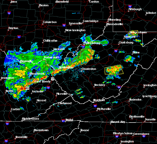 The severe thunderstorm warning for east central mason, northern putnam, wirt, western roane, jackson and south central wood counties will expire at 115 pm edt, the storms which prompted the warning have weakened below severe limits, and no longer pose an immediate threat to life or property. therefore, the warning will be allowed to expire. however gusty winds of 40 to 50mph are still possible with these thunderstorms. a severe thunderstorm watch remains in effect until 700 pm edt for central, western and northwestern west virginia. The severe thunderstorm warning for east central mason, northern putnam, wirt, western roane, jackson and south central wood counties will expire at 115 pm edt, the storms which prompted the warning have weakened below severe limits, and no longer pose an immediate threat to life or property. therefore, the warning will be allowed to expire. however gusty winds of 40 to 50mph are still possible with these thunderstorms. a severe thunderstorm watch remains in effect until 700 pm edt for central, western and northwestern west virginia.
|
| 5/29/2019 12:56 PM EDT |
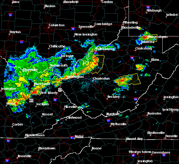 At 1255 pm edt, severe thunderstorms were located along a line extending from 6 miles west of elizabeth to near ripley to buffalo, moving east at 45 mph (radar indicated). Hazards include 60 mph wind gusts and nickel size hail. Expect damage to roofs, siding, and trees. Locations impacted include, ripley, spencer, elizabeth, buffalo, kenna, reedy, statts mills, cherry, peewee, harmony, given, kentuck, liberty, palestine, grimms landing, lucille, morristown, rockport, leroy and fairplain. At 1255 pm edt, severe thunderstorms were located along a line extending from 6 miles west of elizabeth to near ripley to buffalo, moving east at 45 mph (radar indicated). Hazards include 60 mph wind gusts and nickel size hail. Expect damage to roofs, siding, and trees. Locations impacted include, ripley, spencer, elizabeth, buffalo, kenna, reedy, statts mills, cherry, peewee, harmony, given, kentuck, liberty, palestine, grimms landing, lucille, morristown, rockport, leroy and fairplain.
|
| 5/29/2019 12:55 PM EDT | Several trees down on us 33 near roane and jackson county line in roane county WV, 7.2 miles NE of Reedy, WV |
| 5/29/2019 12:55 PM EDT | Tree dow in wirt county WV, 5.4 miles SE of Reedy, WV |
| 5/29/2019 12:33 PM EDT |
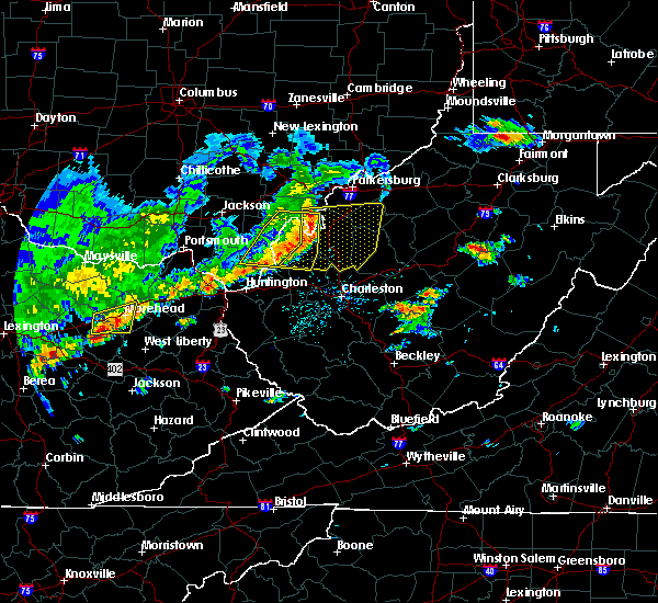 At 1232 pm edt, severe thunderstorms were located along a line extending from forked run state park to 11 miles east of point pleasant to 12 miles north of ona, moving east at 45 mph (radar indicated). Hazards include 60 mph wind gusts and nickel size hail. expect damage to roofs, siding, and trees At 1232 pm edt, severe thunderstorms were located along a line extending from forked run state park to 11 miles east of point pleasant to 12 miles north of ona, moving east at 45 mph (radar indicated). Hazards include 60 mph wind gusts and nickel size hail. expect damage to roofs, siding, and trees
|
| 5/26/2019 7:09 PM EDT |
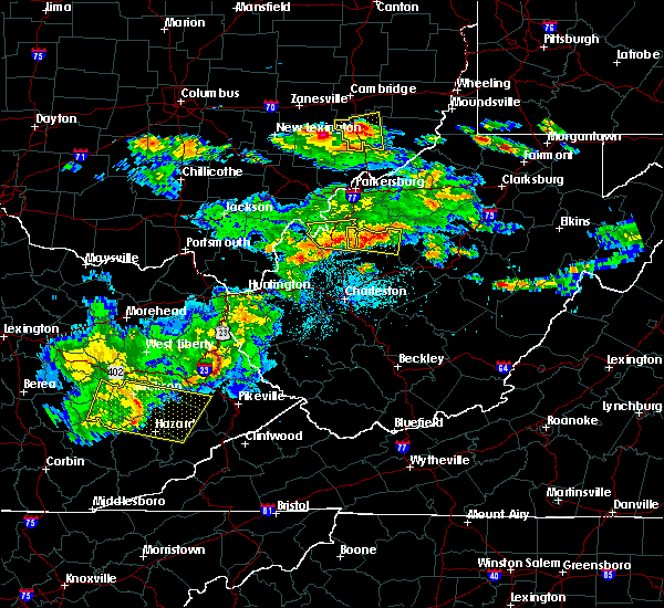 The national weather service in charleston west virginia has issued a * severe thunderstorm warning for. west central calhoun county in north central west virginia. northern roane county in central west virginia. east central jackson county in northwestern west virginia. Until 745 pm edt. The national weather service in charleston west virginia has issued a * severe thunderstorm warning for. west central calhoun county in north central west virginia. northern roane county in central west virginia. east central jackson county in northwestern west virginia. Until 745 pm edt.
|
| 5/25/2019 5:23 PM EDT |
 At 523 pm edt, a severe thunderstorm was located 7 miles northwest of spencer, moving east at 20 mph (radar indicated). Hazards include 60 mph wind gusts and quarter size hail. Hail damage to vehicles is expected. Expect wind damage to roofs, siding, and trees. At 523 pm edt, a severe thunderstorm was located 7 miles northwest of spencer, moving east at 20 mph (radar indicated). Hazards include 60 mph wind gusts and quarter size hail. Hail damage to vehicles is expected. Expect wind damage to roofs, siding, and trees.
|
| 10/28/2018 7:35 PM EDT |
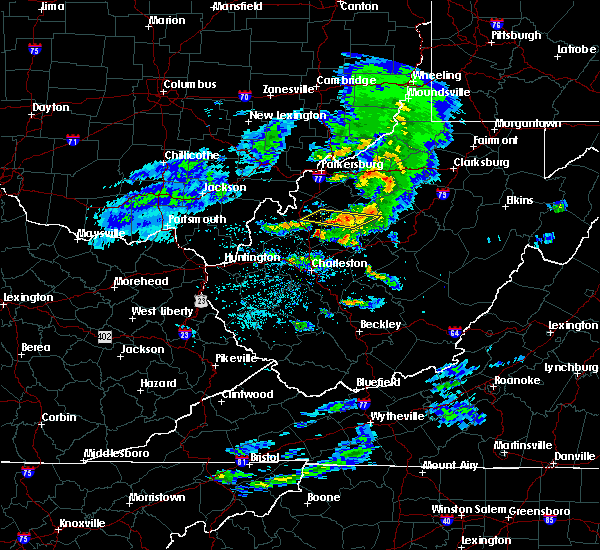 The severe thunderstorm warning for central calhoun, northern roane and east central jackson counties will expire at 745 pm edt, the storms which prompted the warning have weakened below severe limits, and no longer pose an immediate threat to life or property. therefore, the warning will be allowed to expire. however small hail and gusty winds are still possible with these thunderstorms. to report severe weather, contact your nearest law enforcement agency. they will relay your report to the national weather service charleston west virginia. The severe thunderstorm warning for central calhoun, northern roane and east central jackson counties will expire at 745 pm edt, the storms which prompted the warning have weakened below severe limits, and no longer pose an immediate threat to life or property. therefore, the warning will be allowed to expire. however small hail and gusty winds are still possible with these thunderstorms. to report severe weather, contact your nearest law enforcement agency. they will relay your report to the national weather service charleston west virginia.
|
| 10/28/2018 7:19 PM EDT |
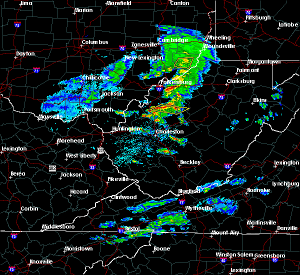 At 719 pm edt, severe thunderstorms were located along a line extending from 8 miles northwest of spencer to near ripley, moving east at 50 mph (radar indicated). Hazards include 60 mph wind gusts and quarter size hail. Hail damage to vehicles is expected. Expect wind damage to roofs, siding, and trees. At 719 pm edt, severe thunderstorms were located along a line extending from 8 miles northwest of spencer to near ripley, moving east at 50 mph (radar indicated). Hazards include 60 mph wind gusts and quarter size hail. Hail damage to vehicles is expected. Expect wind damage to roofs, siding, and trees.
|
| 7/10/2017 7:50 PM EDT |
 At 749 pm edt, a severe thunderstorm was located near spencer, moving southeast at 35 mph (radar indicated). Hazards include 60 mph wind gusts and quarter size hail. Hail damage to vehicles is expected. expect wind damage to roofs, siding, and trees. Locations impacted include, spencer, reedy and gandeeville. At 749 pm edt, a severe thunderstorm was located near spencer, moving southeast at 35 mph (radar indicated). Hazards include 60 mph wind gusts and quarter size hail. Hail damage to vehicles is expected. expect wind damage to roofs, siding, and trees. Locations impacted include, spencer, reedy and gandeeville.
|
| 7/10/2017 7:40 PM EDT |
 At 739 pm edt, a severe thunderstorm was located near sandyville, or 10 miles northeast of ripley, moving southeast at 35 mph (radar indicated). Hazards include 60 mph wind gusts and half dollar size hail. Hail damage to vehicles is expected. Expect wind damage to roofs, siding, and trees. At 739 pm edt, a severe thunderstorm was located near sandyville, or 10 miles northeast of ripley, moving southeast at 35 mph (radar indicated). Hazards include 60 mph wind gusts and half dollar size hail. Hail damage to vehicles is expected. Expect wind damage to roofs, siding, and trees.
|
| 4/29/2017 12:48 AM EDT |
 At 1247 am edt, a severe thunderstorm was located near ravenswood, or 9 miles north of ripley, moving east at 60 mph (radar indicated). Hazards include 60 mph wind gusts and quarter size hail. Hail damage to vehicles is expected. expect wind damage to roofs, siding, and trees. locations impacted include, parkersburg, ripley, spencer, elizabeth, ravenswood, sandyville, mineralwells, lubeck, cairo, reedy, statts mills, cherry, given, cottageville, lucille, davisville, brohard, macfarlan, annamoriah and fairplain. this includes the following highways, interstate 77 in west virginia between mile markers 127 and 175. Route 50 in west virginia between mile markers 12 and 32. At 1247 am edt, a severe thunderstorm was located near ravenswood, or 9 miles north of ripley, moving east at 60 mph (radar indicated). Hazards include 60 mph wind gusts and quarter size hail. Hail damage to vehicles is expected. expect wind damage to roofs, siding, and trees. locations impacted include, parkersburg, ripley, spencer, elizabeth, ravenswood, sandyville, mineralwells, lubeck, cairo, reedy, statts mills, cherry, given, cottageville, lucille, davisville, brohard, macfarlan, annamoriah and fairplain. this includes the following highways, interstate 77 in west virginia between mile markers 127 and 175. Route 50 in west virginia between mile markers 12 and 32.
|
| 4/29/2017 12:28 AM EDT |
 At 1228 am edt, a severe thunderstorm was located over new haven, or near pomeroy, moving east at 60 mph (radar indicated). Hazards include 60 mph wind gusts and quarter size hail. Hail damage to vehicles is expected. Expect wind damage to roofs, siding, and trees. At 1228 am edt, a severe thunderstorm was located over new haven, or near pomeroy, moving east at 60 mph (radar indicated). Hazards include 60 mph wind gusts and quarter size hail. Hail damage to vehicles is expected. Expect wind damage to roofs, siding, and trees.
|
| 3/1/2017 6:34 AM EST |
 At 634 am est, a severe thunderstorm was located 7 miles northwest of grantsville, moving east at 70 mph (radar indicated). Hazards include 70 mph wind gusts and half dollar size hail. Hail damage to vehicles is expected. expect considerable tree damage. wind damage is also likely to mobile homes, roofs, and outbuildings. Locations impacted include, grantsville, reedy, cherry, peewee, smithville, mount zion, palestine, lucille, creston, big springs, brohard, tanner, macfarlan, annamoriah, burnt house and munday. At 634 am est, a severe thunderstorm was located 7 miles northwest of grantsville, moving east at 70 mph (radar indicated). Hazards include 70 mph wind gusts and half dollar size hail. Hail damage to vehicles is expected. expect considerable tree damage. wind damage is also likely to mobile homes, roofs, and outbuildings. Locations impacted include, grantsville, reedy, cherry, peewee, smithville, mount zion, palestine, lucille, creston, big springs, brohard, tanner, macfarlan, annamoriah, burnt house and munday.
|
| 3/1/2017 6:15 AM EST |
 At 615 am est, a severe thunderstorm was located near sandyville, or 9 miles northeast of ripley, moving east at 70 mph (radar indicated). Hazards include 70 mph wind gusts and half dollar size hail. Hail damage to vehicles is expected. expect considerable tree damage. Wind damage is also likely to mobile homes, roofs, and outbuildings. At 615 am est, a severe thunderstorm was located near sandyville, or 9 miles northeast of ripley, moving east at 70 mph (radar indicated). Hazards include 70 mph wind gusts and half dollar size hail. Hail damage to vehicles is expected. expect considerable tree damage. Wind damage is also likely to mobile homes, roofs, and outbuildings.
|
| 9/30/2016 2:48 PM EDT |
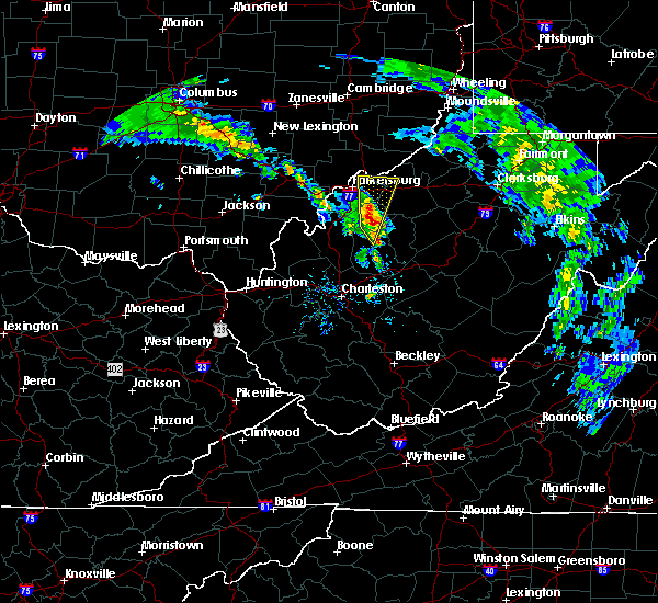 At 248 pm edt, a severe thunderstorm was located near elizabeth, moving north at 30 mph (radar indicated). Hazards include 60 mph wind gusts and quarter size hail. Hail damage to vehicles is expected. Locations impacted include, spencer, elizabeth, boaz, reedy, schultz, waverly, walker, lucille, nutter farm, cherry, freeport, petroleum, palestine and greencastle. At 248 pm edt, a severe thunderstorm was located near elizabeth, moving north at 30 mph (radar indicated). Hazards include 60 mph wind gusts and quarter size hail. Hail damage to vehicles is expected. Locations impacted include, spencer, elizabeth, boaz, reedy, schultz, waverly, walker, lucille, nutter farm, cherry, freeport, petroleum, palestine and greencastle.
|
| 9/30/2016 2:31 PM EDT |
 At 230 pm edt, a severe thunderstorm was located near spencer, moving north at 30 mph (radar indicated). Hazards include 60 mph wind gusts and quarter size hail. hail damage to vehicles is expected At 230 pm edt, a severe thunderstorm was located near spencer, moving north at 30 mph (radar indicated). Hazards include 60 mph wind gusts and quarter size hail. hail damage to vehicles is expected
|
| 9/30/2016 2:24 PM EDT | Golf Ball sized hail reported 3.5 miles N of Reedy, WV, golfball hail reported at the roane county golf course. est duration of 10 mins. time based on radar |
| 9/30/2016 2:11 PM EDT |
 At 210 pm edt, a severe thunderstorm was located 7 miles southwest of spencer, moving north at 30 mph (radar indicated). Hazards include 60 mph wind gusts and quarter size hail. hail damage to vehicles is expected At 210 pm edt, a severe thunderstorm was located 7 miles southwest of spencer, moving north at 30 mph (radar indicated). Hazards include 60 mph wind gusts and quarter size hail. hail damage to vehicles is expected
|
| 6/23/2016 6:17 PM EDT |
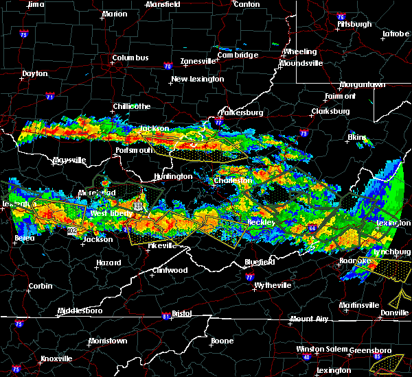 At 616 pm edt, severe thunderstorms were located along a line extending from 7 miles northeast of oak hill to near point pleasant to near sandyville to 9 miles north of spencer, moving east at 35 mph (radar indicated). Hazards include 60 mph wind gusts and quarter size hail. Hail damage to vehicles is expected. expect wind damage to roofs, siding, and trees. locations impacted include, point pleasant, gallipolis, ripley, spencer, rio grande, sandyville, henderson, vinton, reedy, leon, cheshire, adamsville, fairplain, harmony, gallopolis ferry, gandeeville, letart, evans, given and mount alto. A tornado watch remains in effect until 1000 pm edt for southeastern ohio, and western, north central, central and northwestern west virginia. At 616 pm edt, severe thunderstorms were located along a line extending from 7 miles northeast of oak hill to near point pleasant to near sandyville to 9 miles north of spencer, moving east at 35 mph (radar indicated). Hazards include 60 mph wind gusts and quarter size hail. Hail damage to vehicles is expected. expect wind damage to roofs, siding, and trees. locations impacted include, point pleasant, gallipolis, ripley, spencer, rio grande, sandyville, henderson, vinton, reedy, leon, cheshire, adamsville, fairplain, harmony, gallopolis ferry, gandeeville, letart, evans, given and mount alto. A tornado watch remains in effect until 1000 pm edt for southeastern ohio, and western, north central, central and northwestern west virginia.
|
| 6/23/2016 5:58 PM EDT |
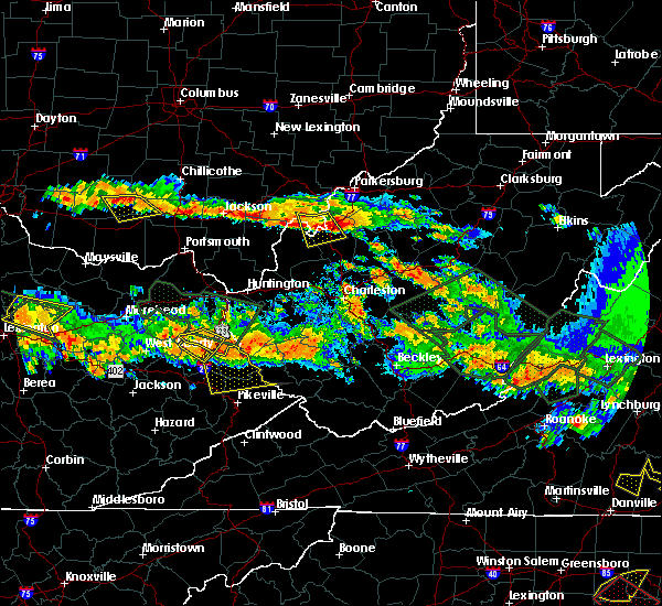 At 558 pm edt, severe thunderstorms were located along a line extending from 11 miles northwest of jackson to near wellston to near pomeroy to 6 miles east of forked run state park, moving southeast at 35 mph (radar indicated). Hazards include 60 mph wind gusts and quarter size hail. Hail damage to vehicles is expected. Expect wind damage to roofs, siding, and trees. At 558 pm edt, severe thunderstorms were located along a line extending from 11 miles northwest of jackson to near wellston to near pomeroy to 6 miles east of forked run state park, moving southeast at 35 mph (radar indicated). Hazards include 60 mph wind gusts and quarter size hail. Hail damage to vehicles is expected. Expect wind damage to roofs, siding, and trees.
|
| 6/16/2016 4:44 PM EDT | Golf Ball sized hail reported 3.5 miles N of Reedy, WV, 4 to 6 diameter tree limbs were reported |
| 6/16/2016 4:44 PM EDT | 4 to 6 diameter tree limbs were reported down at roane county golf cours in roane county WV, 3.5 miles N of Reedy, WV |
| 6/16/2016 4:44 PM EDT | 4 to 6 diameter tree limbs were reported down at roane county golf cours in roane county WV, 3.5 miles N of Reedy, WV |
| 6/16/2016 4:42 PM EDT | Half Dollar sized hail reported 2.2 miles NNE of Reedy, WV |
| 6/16/2016 4:40 PM EDT |
 At 440 pm edt, a severe thunderstorm was located 7 miles northwest of spencer, moving east at 35 mph (radar indicated). Hazards include 60 mph wind gusts and quarter size hail. Hail damage to vehicles is expected. Expect wind damage to roofs, siding, and trees. At 440 pm edt, a severe thunderstorm was located 7 miles northwest of spencer, moving east at 35 mph (radar indicated). Hazards include 60 mph wind gusts and quarter size hail. Hail damage to vehicles is expected. Expect wind damage to roofs, siding, and trees.
|
| 6/16/2016 4:33 PM EDT |
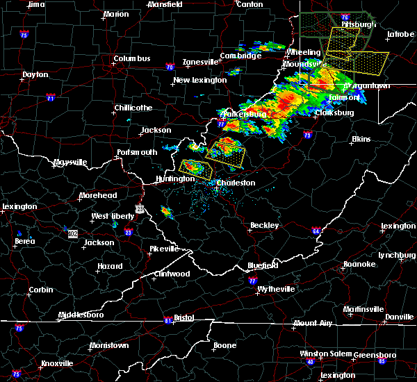 At 433 pm edt, a severe thunderstorm was located 8 miles west of spencer, moving east at 30 mph (radar indicated). Hazards include 60 mph wind gusts and quarter size hail. Hail damage to vehicles is expected. expect wind damage to roofs, siding, and trees. Locations impacted include, ripley, spencer, sandyville, reedy, fairplain, looneyville, harmony, gay, statts mills, gandeeville and leroy. At 433 pm edt, a severe thunderstorm was located 8 miles west of spencer, moving east at 30 mph (radar indicated). Hazards include 60 mph wind gusts and quarter size hail. Hail damage to vehicles is expected. expect wind damage to roofs, siding, and trees. Locations impacted include, ripley, spencer, sandyville, reedy, fairplain, looneyville, harmony, gay, statts mills, gandeeville and leroy.
|
| 6/16/2016 4:12 PM EDT |
 At 412 pm edt, a severe thunderstorm was located over sandyville, or near ripley, moving east at 70 mph (radar indicated). Hazards include 60 mph wind gusts and quarter size hail. Expect wind damage to roofs. siding. And trees. At 412 pm edt, a severe thunderstorm was located over sandyville, or near ripley, moving east at 70 mph (radar indicated). Hazards include 60 mph wind gusts and quarter size hail. Expect wind damage to roofs. siding. And trees.
|
| 5/2/2016 2:37 AM EDT |
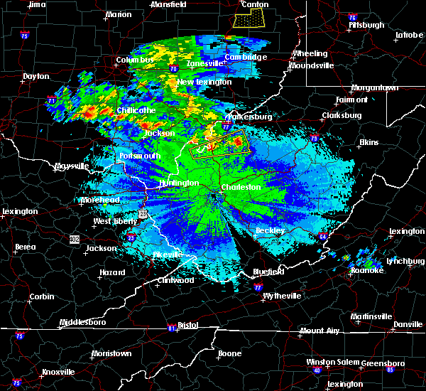 At 235 am edt, a severe thunderstorm was located 8 miles southwest of elizabeth, moving east at 35 mph (radar indicated). Hazards include 60 mph wind gusts and quarter size hail. Hail damage to vehicles is expected. expect wind damage to roofs, siding, and trees. Locations impacted include, elizabeth, ravenswood, sandyville, reedy, peewee, mount alto, creston, rockport, lucille, cherry, cottageville, palestine, morristown, greencastle and leroy. At 235 am edt, a severe thunderstorm was located 8 miles southwest of elizabeth, moving east at 35 mph (radar indicated). Hazards include 60 mph wind gusts and quarter size hail. Hail damage to vehicles is expected. expect wind damage to roofs, siding, and trees. Locations impacted include, elizabeth, ravenswood, sandyville, reedy, peewee, mount alto, creston, rockport, lucille, cherry, cottageville, palestine, morristown, greencastle and leroy.
|
| 5/2/2016 1:57 AM EDT |
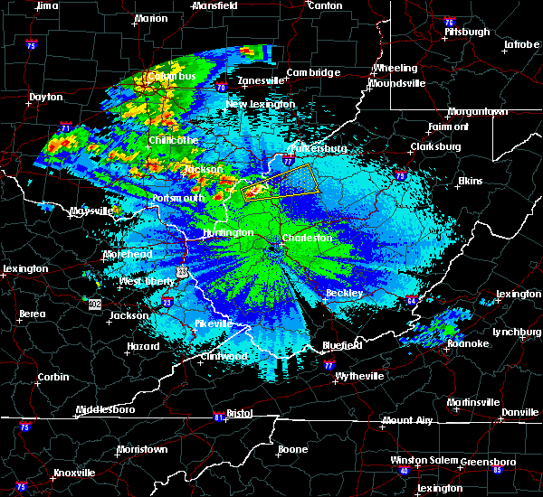 At 157 am edt, a severe thunderstorm was located near racine, moving east at 35 mph (radar indicated). Hazards include 60 mph wind gusts and quarter size hail. Hail damage to vehicles is expected. Expect wind damage to roofs, siding, and trees. At 157 am edt, a severe thunderstorm was located near racine, moving east at 35 mph (radar indicated). Hazards include 60 mph wind gusts and quarter size hail. Hail damage to vehicles is expected. Expect wind damage to roofs, siding, and trees.
|
| 4/28/2016 3:27 PM EDT | The severe thunderstorm warning for southern wirt and northwestern roane counties will expire at 330 pm edt, the storm which prompted the warning has weakened below severe limits, and have exited the warned area. therefore the warning will be allowed to expire. to report severe weather, contact your nearest law enforcement agency. they will relay your report to the national weather service charleston west virginia. |
| 4/28/2016 3:13 PM EDT |
 At 312 pm edt, a severe thunderstorm was located 8 miles south of elizabeth, moving east at 30 mph (radar indicated). Hazards include 60 mph wind gusts and half dollar size hail. Hail damage to vehicles is expected. expect wind damage to roofs, siding, and trees. Locations impacted include, reedy, cherry, peewee, palestine, creston and lucille. At 312 pm edt, a severe thunderstorm was located 8 miles south of elizabeth, moving east at 30 mph (radar indicated). Hazards include 60 mph wind gusts and half dollar size hail. Hail damage to vehicles is expected. expect wind damage to roofs, siding, and trees. Locations impacted include, reedy, cherry, peewee, palestine, creston and lucille.
|
| 4/28/2016 2:55 PM EDT |
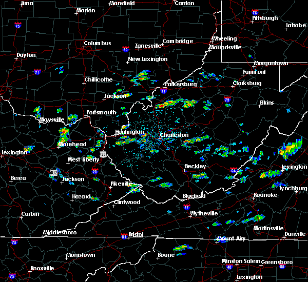 At 254 pm edt, a severe thunderstorm was located near sandyville, or 10 miles northeast of ripley, moving east at 20 mph (radar indicated). Hazards include 60 mph wind gusts and half dollar size hail. Hail damage to vehicles is expected. Expect wind damage to roofs, siding, and trees. At 254 pm edt, a severe thunderstorm was located near sandyville, or 10 miles northeast of ripley, moving east at 20 mph (radar indicated). Hazards include 60 mph wind gusts and half dollar size hail. Hail damage to vehicles is expected. Expect wind damage to roofs, siding, and trees.
|
| 4/26/2016 4:30 PM EDT |
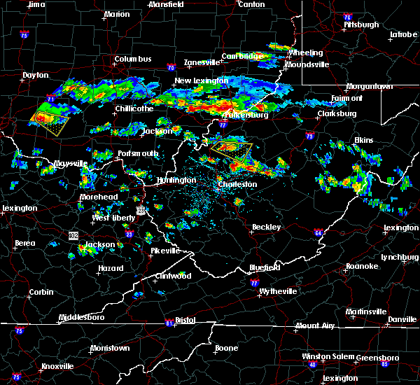 At 430 pm edt, a severe thunderstorm was located near sandyville, or 8 miles northeast of ripley, moving southeast at 35 mph (radar indicated). Hazards include 60 mph wind gusts and quarter size hail. Hail damage to vehicles is expected. expect wind damage to roofs, siding, and trees. Locations impacted include, spencer, sandyville, reedy, peewee, creston, annamoriah, lucille and leroy. At 430 pm edt, a severe thunderstorm was located near sandyville, or 8 miles northeast of ripley, moving southeast at 35 mph (radar indicated). Hazards include 60 mph wind gusts and quarter size hail. Hail damage to vehicles is expected. expect wind damage to roofs, siding, and trees. Locations impacted include, spencer, sandyville, reedy, peewee, creston, annamoriah, lucille and leroy.
|
| 4/26/2016 4:12 PM EDT |
 At 411 pm edt, a severe thunderstorm was located over ravenswood, or 8 miles south of forked run state park, moving southeast at 30 mph (radar indicated). Hazards include ping pong ball size hail and 60 mph wind gusts. People and animals outdoors will be injured. expect hail damage to roofs, siding, windows, and vehicles. Expect wind damage to roofs, siding, and trees. At 411 pm edt, a severe thunderstorm was located over ravenswood, or 8 miles south of forked run state park, moving southeast at 30 mph (radar indicated). Hazards include ping pong ball size hail and 60 mph wind gusts. People and animals outdoors will be injured. expect hail damage to roofs, siding, windows, and vehicles. Expect wind damage to roofs, siding, and trees.
|
| 4/26/2016 4:12 PM EDT |
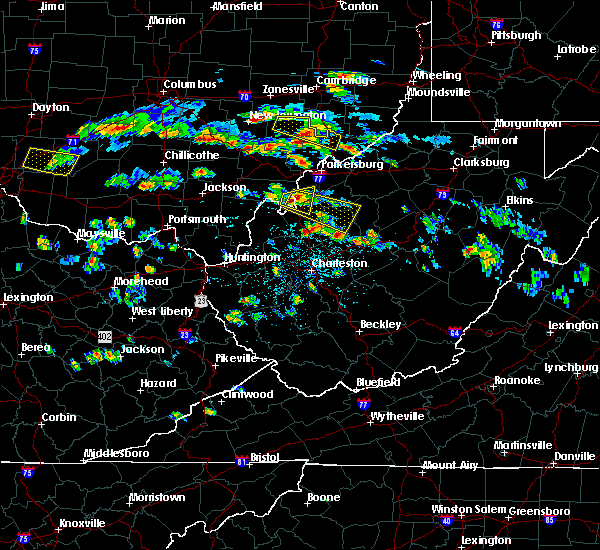 At 411 pm edt, a severe thunderstorm was located over ravenswood, or 8 miles south of forked run state park, moving southeast at 30 mph (radar indicated). Hazards include ping pong ball size hail and 60 mph wind gusts. People and animals outdoors will be injured. expect hail damage to roofs, siding, windows, and vehicles. Expect wind damage to roofs, siding, and trees. At 411 pm edt, a severe thunderstorm was located over ravenswood, or 8 miles south of forked run state park, moving southeast at 30 mph (radar indicated). Hazards include ping pong ball size hail and 60 mph wind gusts. People and animals outdoors will be injured. expect hail damage to roofs, siding, windows, and vehicles. Expect wind damage to roofs, siding, and trees.
|
| 7/14/2015 5:18 PM EDT |
 At 518 pm edt, doppler radar indicated a line of severe thunderstorms capable of producing damaging winds in excess of 60 mph. these storms were located along a line extending from sandyville to 6 miles northwest of kenna to near buffalo, and moving southeast at 50 mph. At 518 pm edt, doppler radar indicated a line of severe thunderstorms capable of producing damaging winds in excess of 60 mph. these storms were located along a line extending from sandyville to 6 miles northwest of kenna to near buffalo, and moving southeast at 50 mph.
|
| 7/14/2015 5:09 PM EDT |
 At 507 pm edt, doppler radar indicated a line of severe thunderstorms capable of producing damaging winds in excess of 60 mph. these storms were located along a line extending from 6 miles southeast of pennsboro to near grantsville to 8 miles north of spencer, moving southeast at 45 mph. locations impacted include, spencer, harrisville, glenville, elizabeth, grantsville, salem, pennsboro, west union, arnoldsburg, north bend state park, cedar creek state park, ellenboro, cairo, reedy, sand fork, pullman, auburn, coxs mills, creston and wolf summit. At 507 pm edt, doppler radar indicated a line of severe thunderstorms capable of producing damaging winds in excess of 60 mph. these storms were located along a line extending from 6 miles southeast of pennsboro to near grantsville to 8 miles north of spencer, moving southeast at 45 mph. locations impacted include, spencer, harrisville, glenville, elizabeth, grantsville, salem, pennsboro, west union, arnoldsburg, north bend state park, cedar creek state park, ellenboro, cairo, reedy, sand fork, pullman, auburn, coxs mills, creston and wolf summit.
|
| 7/14/2015 4:34 PM EDT |
 At 433 pm edt, doppler radar indicated a line of severe thunderstorms capable of producing damaging winds in excess of 60 mph. these storms were located along a line extending from near belmont to mineralwells to forked run state park, and moving southeast at 45 mph. At 433 pm edt, doppler radar indicated a line of severe thunderstorms capable of producing damaging winds in excess of 60 mph. these storms were located along a line extending from near belmont to mineralwells to forked run state park, and moving southeast at 45 mph.
|
| 7/7/2015 4:55 PM EDT | Spotter reported a tree down on rt 5 near creston... time estimated from radar in wirt county WV, 9.1 miles WSW of Reedy, WV |
| 7/7/2015 4:45 PM EDT |
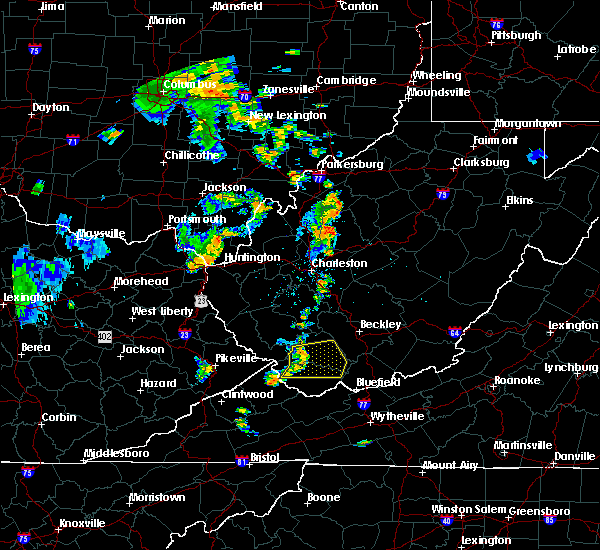 At 444 pm edt, doppler radar indicated a line of severe thunderstorms capable of producing damaging winds in excess of 60 mph. these storms were located along a line extending from elizabeth to near spencer, and moving east at 35 mph. At 444 pm edt, doppler radar indicated a line of severe thunderstorms capable of producing damaging winds in excess of 60 mph. these storms were located along a line extending from elizabeth to near spencer, and moving east at 35 mph.
|
| 6/26/2015 7:57 PM EDT | The severe thunderstorm warning for southeastern meigs. roane. southern wirt. central calhoun. east central mason and jackson counties will expire at 800 pm edt. this severe thunderstorm warning will expire at 8. however. a new severe thunderstorm warning has been issued downstream for roane county in west virginia. North central nicholas county in west. |
| 6/26/2015 7:57 PM EDT | The severe thunderstorm warning for southeastern meigs, roane, southern wirt, central calhoun, east central mason and jackson counties will expire at 800 pm edt, this severe thunderstorm warning will expire at 8. however, a new severe thunderstorm warning has been issued downstream for roane county in west virginia, north central nicholas county in west virginia, southern calhoun county in west virginia, central clay county in west virginia, southwestern gilmer county in west virginia, braxton county in west virginia, southeastern jackson county in west virginia, and northeastern kanawha county in west virginia until 900 pm edt. |
| 6/26/2015 7:54 PM EDT | At 753 pm edt, doppler radar indicated a severe thunderstorm capable of producing half dollar size hail and destructive winds in excess of 70 mph. this storm was located near spencer, and moving east at 35 mph. |
| 6/26/2015 7:27 PM EDT | At 727 pm edt, doppler radar indicated a severe thunderstorm capable of producing large damaging hail up to golf ball size and destructive winds in excess of 70 mph. this storm was located near ripley, moving east at 25 mph. locations impacted include, ripley, spencer, grantsville, ravenswood, amma, sandyville, arnoldsburg, kenna, reedy, fairplain, creston, harmony, gandeeville, looneyville, evans, left hand, given, tariff, peewee and mount zion. |
| 6/26/2015 7:27 PM EDT | At 727 pm edt, doppler radar indicated a severe thunderstorm capable of producing large damaging hail up to golf ball size and destructive winds in excess of 70 mph. this storm was located near ripley, moving east at 25 mph. locations impacted include, ripley, spencer, grantsville, ravenswood, amma, sandyville, arnoldsburg, kenna, reedy, fairplain, creston, harmony, gandeeville, looneyville, evans, left hand, given, tariff, peewee and mount zion. |
| 6/26/2015 7:00 PM EDT | At 659 pm edt, doppler radar indicated a severe thunderstorm capable of producing quarter size hail and damaging winds in excess of 60 mph. this storm was located 7 miles west of ripley, and moving east at 35 mph. |
| 6/26/2015 7:00 PM EDT | At 659 pm edt, doppler radar indicated a severe thunderstorm capable of producing quarter size hail and damaging winds in excess of 60 mph. this storm was located 7 miles west of ripley, and moving east at 35 mph. |
| 5/11/2015 6:54 PM EDT | At 652 pm edt, national weather service doppler radar continued to indicate a severe thunderstorm capable of producing quarter size. |
| 5/11/2015 6:54 PM EDT | At 652 pm edt, national weather service doppler radar continued to indicate a severe thunderstorm capable of producing quarter size. |
| 5/11/2015 6:26 PM EDT | At 623 pm edt, national weather service doppler radar indicated a severe thunderstorm capable of producing quarter size hail, and damaging winds in excess of 60 mph. this storm was located 14 miles southwest of ripley, or 9 miles north of winfield, moving northeast at 35 mph. * other locations in the warning include but are not limited to sandyville and ravenswood. this will impact the following interstate, i-77 between mile markers 129 and 161 in west virginia. very heavy rain will also fall from this severe thunderstorm, and will cause water to pond on roads and quickly fill roadside ditches and small streams. a severe thunderstorm watch remains in effect until 1000 pm edt monday evening for central kentucky and southeast ohio and central west virginia. a severe thunderstorm watch also remains in effect until 100 am edt tuesday morning for central west virginia. please report hail or strong wind to the national weather service by calling toll free, 800-401-9535, when you can do so safely. you may also report severe weather by posting your report to the charleston west virginia national weather service facebook page, or by using the twitter hashtag, nwsrlx. |
| 5/11/2015 6:26 PM EDT | At 623 pm edt, national weather service doppler radar indicated a severe thunderstorm capable of producing quarter size hail, and damaging winds in excess of 60 mph. this storm was located 14 miles southwest of ripley, or 9 miles north of winfield, moving northeast at 35 mph. * other locations in the warning include but are not limited to sandyville and ravenswood. this will impact the following interstate, i-77 between mile markers 129 and 161 in west virginia. very heavy rain will also fall from this severe thunderstorm, and will cause water to pond on roads and quickly fill roadside ditches and small streams. a severe thunderstorm watch remains in effect until 1000 pm edt monday evening for central kentucky and southeast ohio and central west virginia. a severe thunderstorm watch also remains in effect until 100 am edt tuesday morning for central west virginia. please report hail or strong wind to the national weather service by calling toll free, 800-401-9535, when you can do so safely. you may also report severe weather by posting your report to the charleston west virginia national weather service facebook page, or by using the twitter hashtag, nwsrlx. |
| 4/9/2015 5:37 PM EDT | The severe thunderstorm warning for northwestern roane. south central wood. western wirt and northern jackson counties in west virginia will expire at 545 pm edt. the storm which prompted the warning has weakened and moved out of the warned area. A severe thunderstorm watch remains in effect until 1000 pm edt. |
| 4/9/2015 5:16 PM EDT | A severe thunderstorm warning remains in effect until 545 pm edt for northwestern roane. south central wood. western wirt and northern jackson counties in west virginia. at 514 pm edt. national weather service doppler radar continued to indicate a severe thunderstorm capable of producing quarter size hail. and damaging winds in excess of 60 mph. This storm was. |
| 4/9/2015 4:41 PM EDT | The national weather service in charleston has issued a * severe thunderstorm warning for. northern jackson county in west virginia. this includes the city of ripley. northern mason county in west virginia. This includes the city of point pleasant. |
| 4/9/2015 4:41 PM EDT | The national weather service in charleston has issued a * severe thunderstorm warning for. northern jackson county in west virginia. this includes the city of ripley. northern mason county in west virginia. This includes the city of point pleasant. |
| 4/9/2015 3:26 PM EDT | A severe thunderstorm warning remains in effect until 345 pm edt for northwestern roane. south central wood. western wirt and northern jackson counties in west virginia. at 323 pm edt. national weather service doppler radar continued to indicate a severe thunderstorm capable of producing quarter size hail. and damaging winds in excess of 60 mph. This storm was. |
| 4/9/2015 2:55 PM EDT | The national weather service in charleston has issued a * severe thunderstorm warning for. northern jackson county in west virginia. this includes the city of ripley. northeastern mason county in west virginia. Northwestern roane county in west virginia. |
| 4/9/2015 2:55 PM EDT | The national weather service in charleston has issued a * severe thunderstorm warning for. northern jackson county in west virginia. this includes the city of ripley. northeastern mason county in west virginia. Northwestern roane county in west virginia. |
| 7/8/2014 2:51 PM EDT | Trees down. time estimated from rada in roane county WV, 0.2 miles E of Reedy, WV |
| 12/22/2013 2:00 AM EST | Trees down in reedy... spencer... and at robertson ridge in roane county WV, 2 miles WNW of Reedy, WV |
| 6/13/2013 5:40 AM EDT | Multiple trees down along county rd 13 in leroy... w in jackson county WV, 6.7 miles E of Reedy, WV |
| 1/1/0001 12:00 AM | Small branches broken in wirt county WV, 4.8 miles S of Reedy, WV |
| 1/1/0001 12:00 AM | Metal roof peeled on a shed in wirt county WV, 1.9 miles SW of Reedy, WV |
Hail Maps for Reedy, WV


Connect with Interactive Hail Maps