

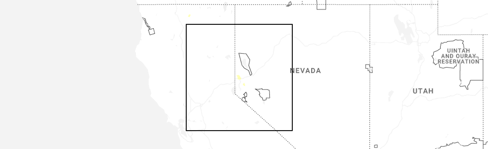
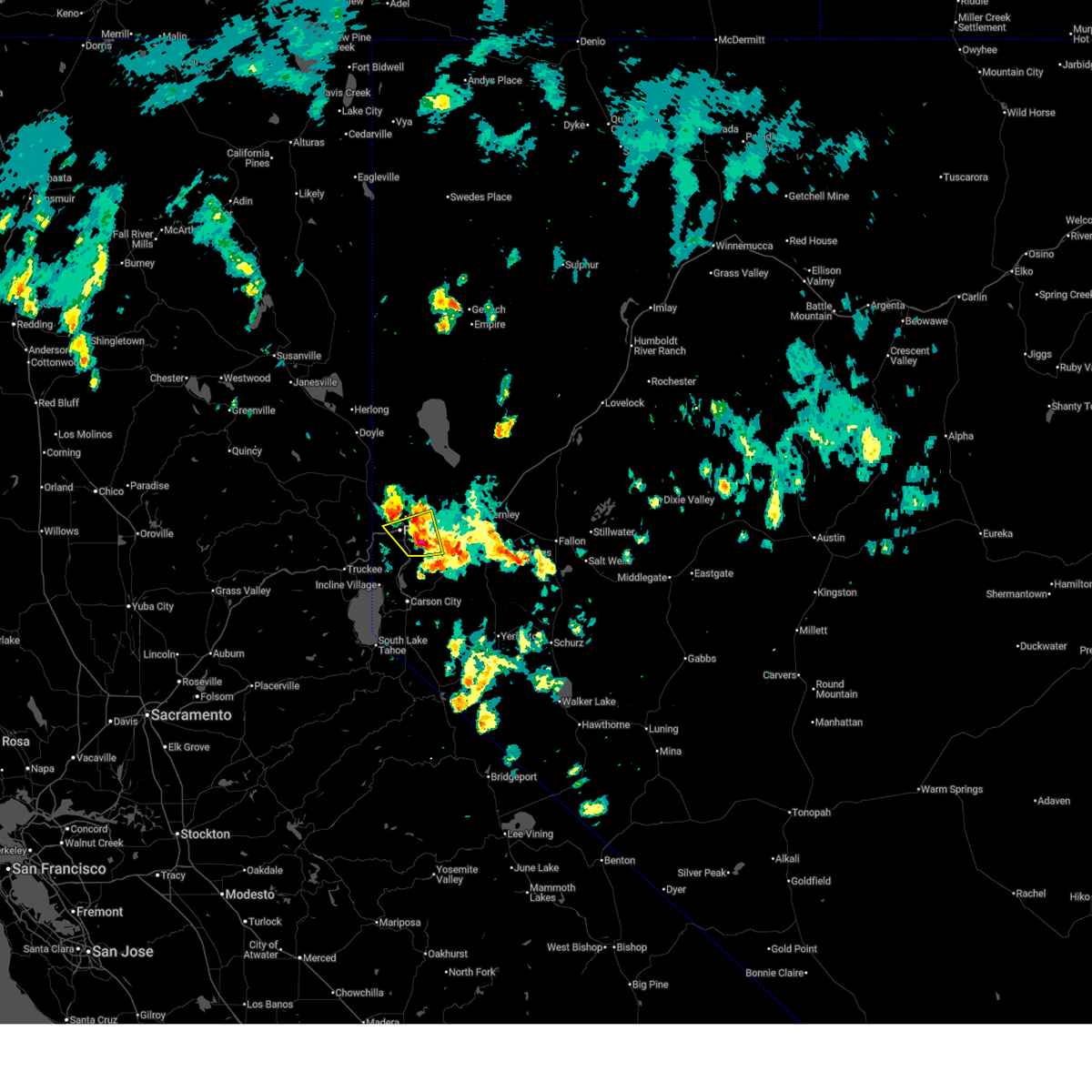
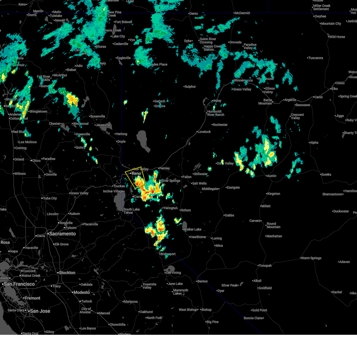
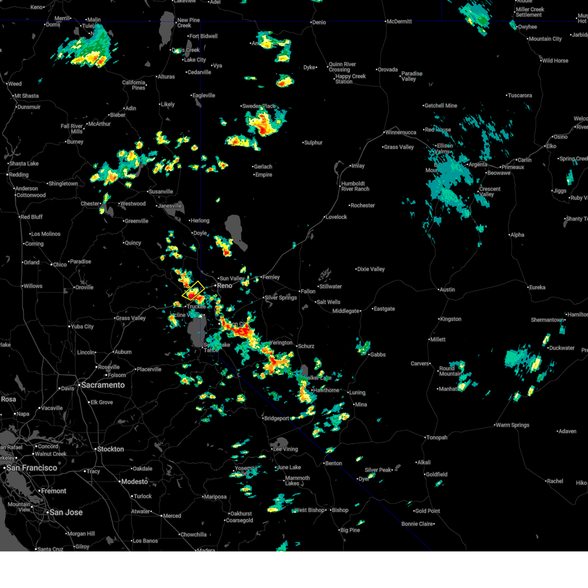
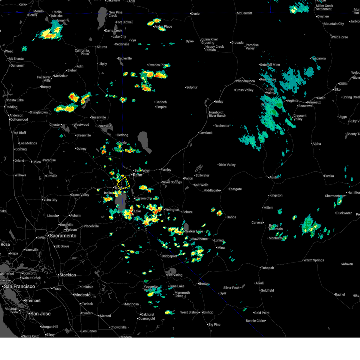
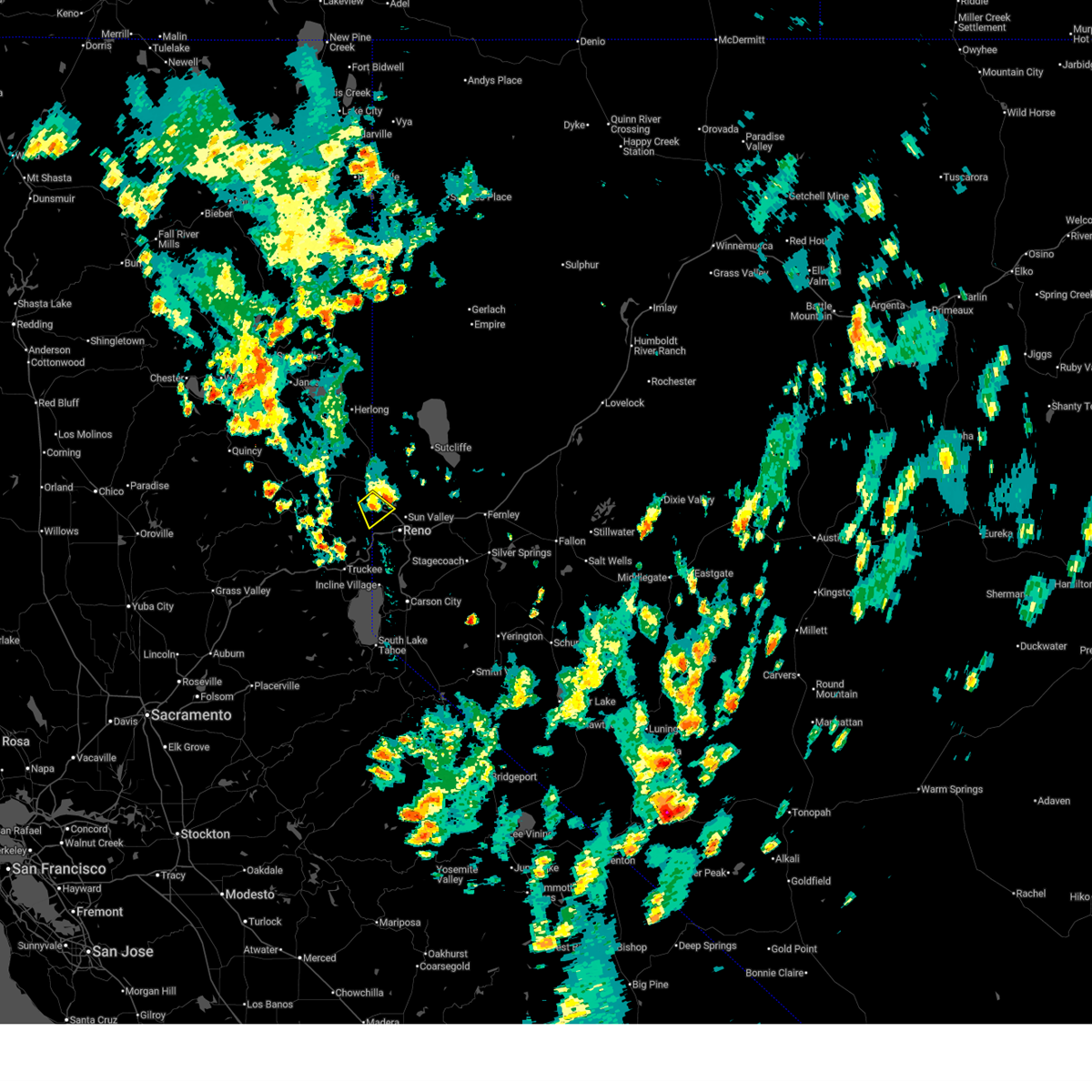
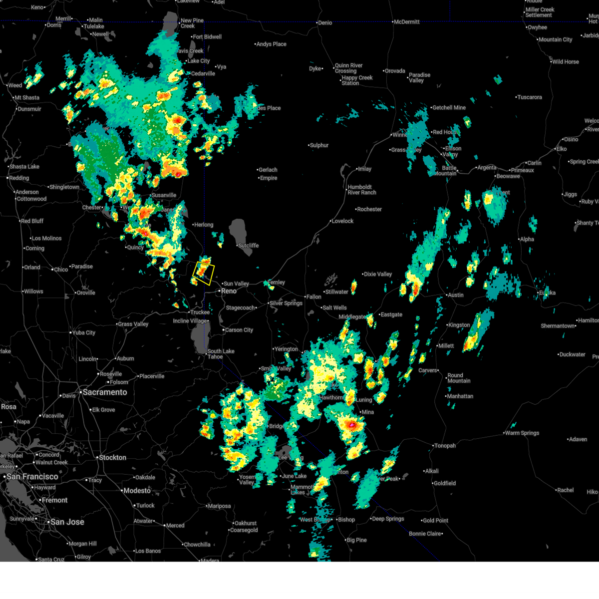
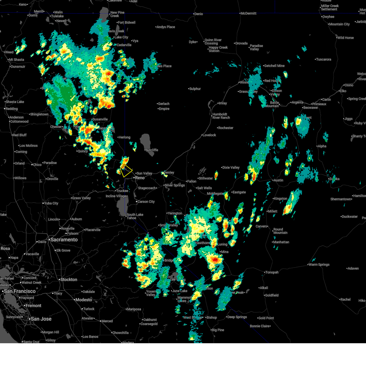
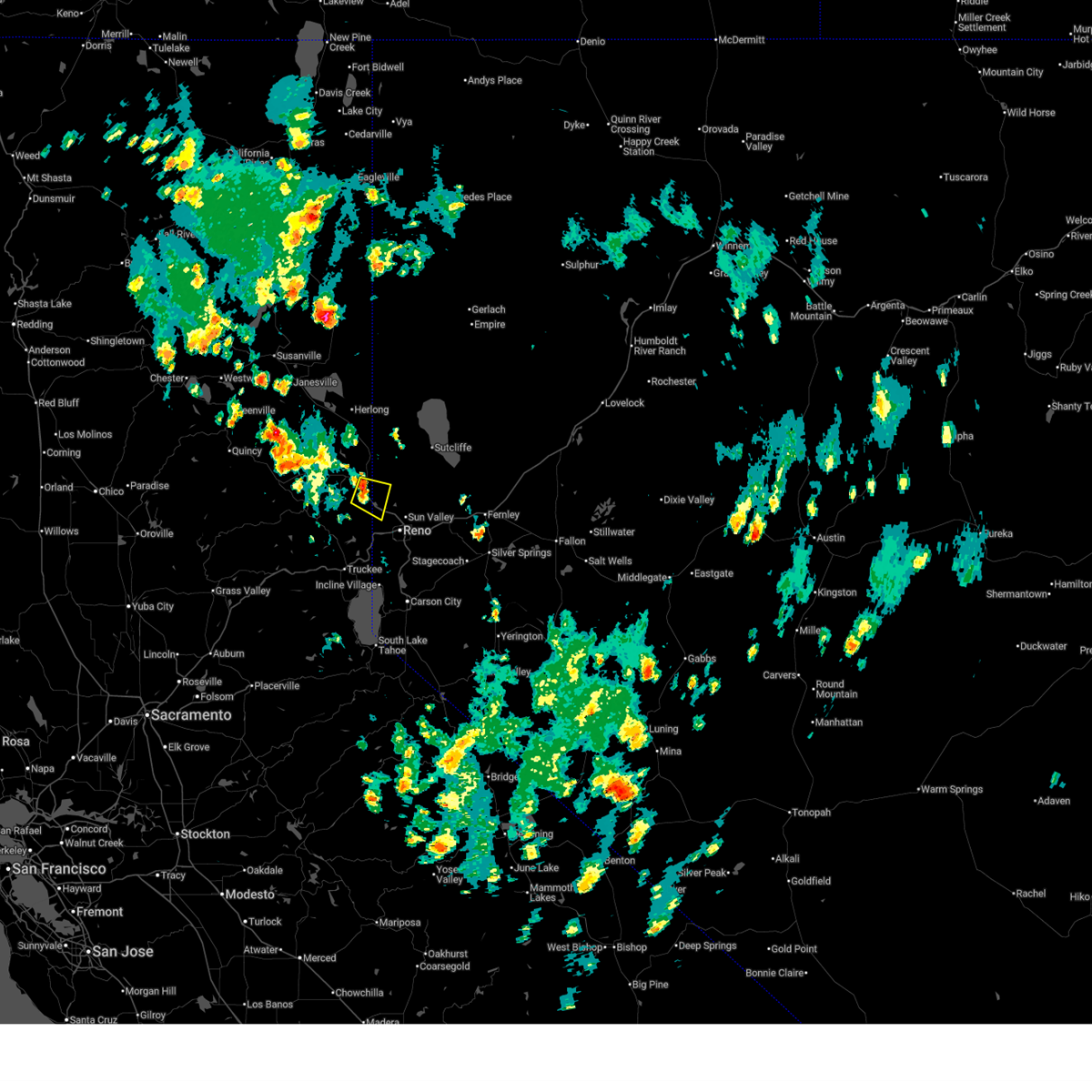
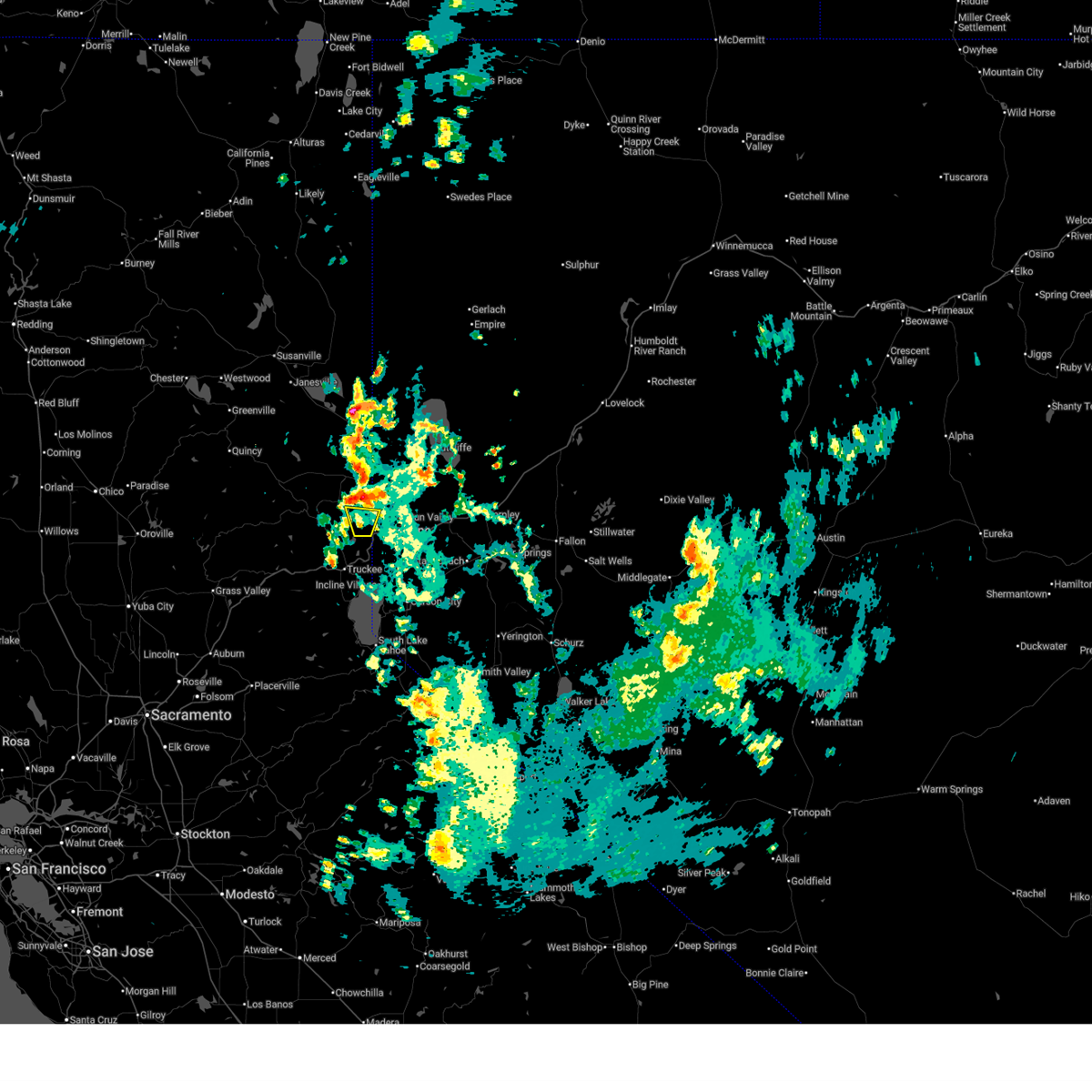
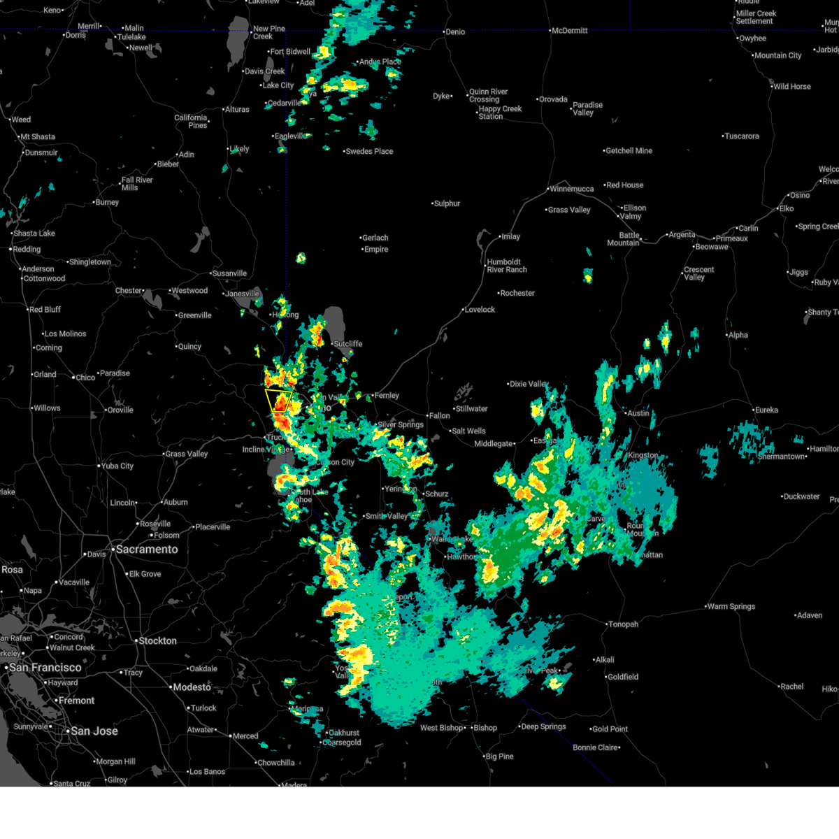
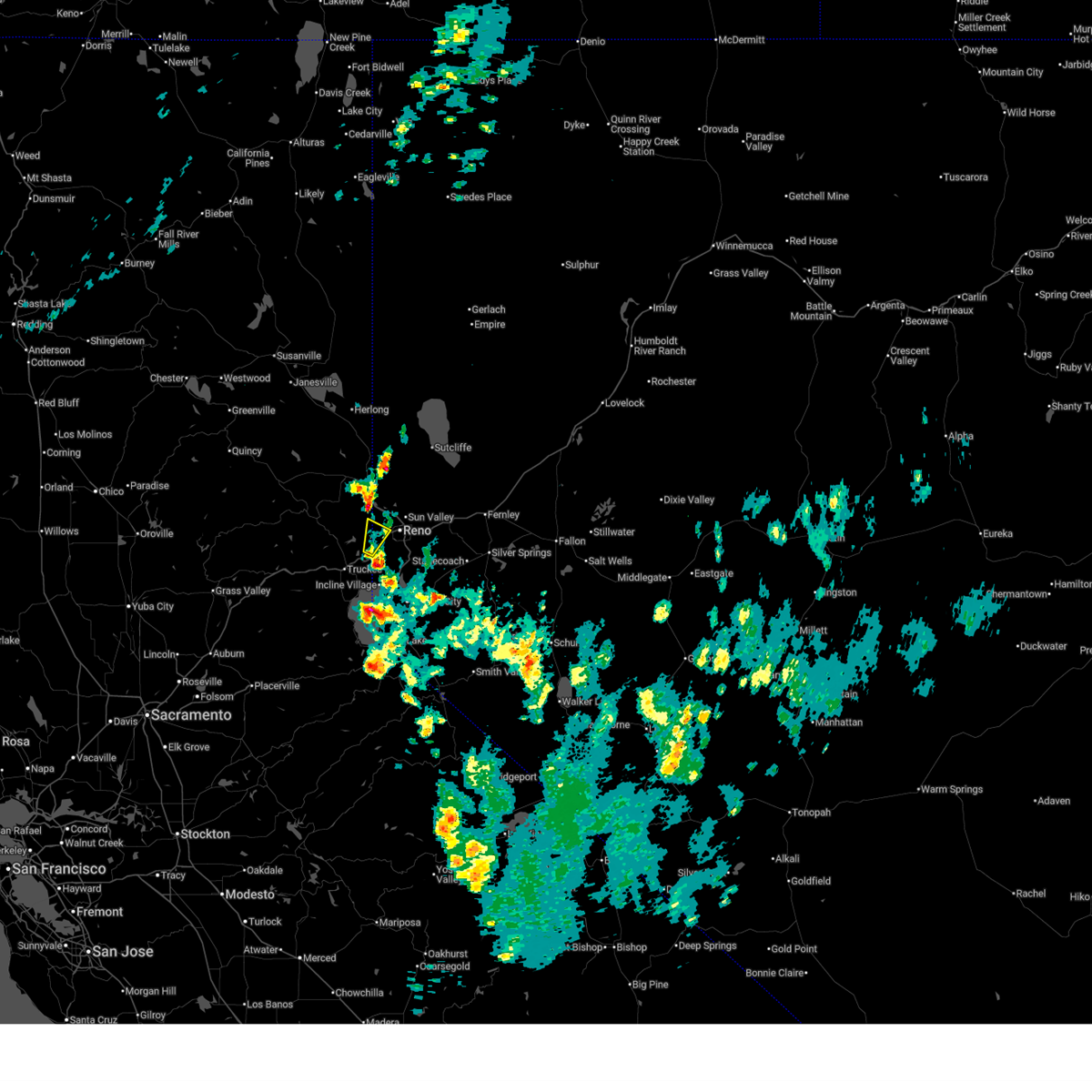
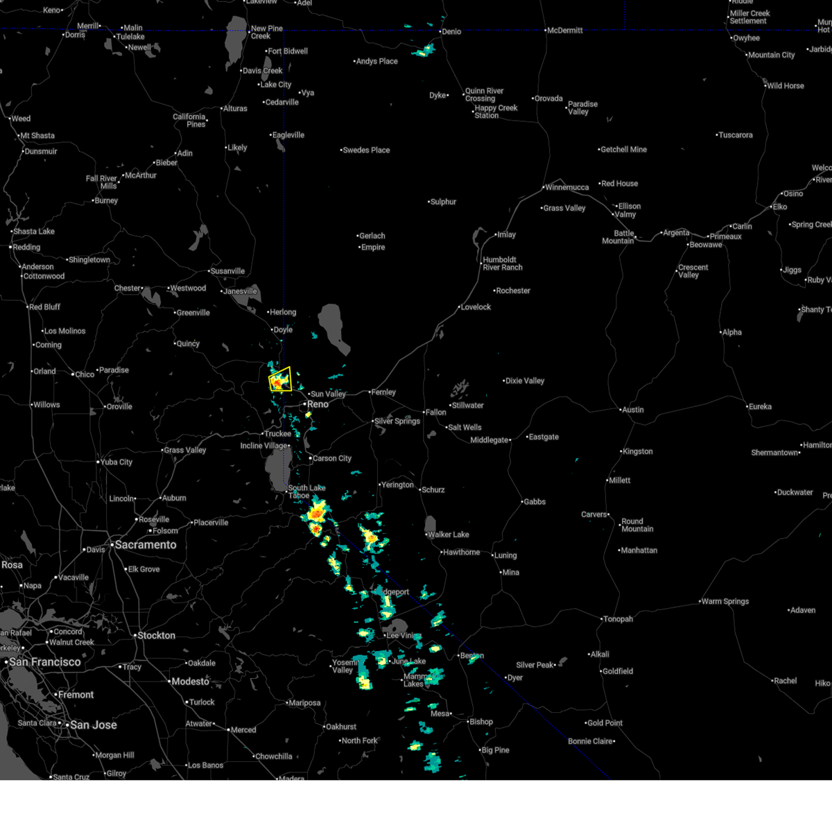
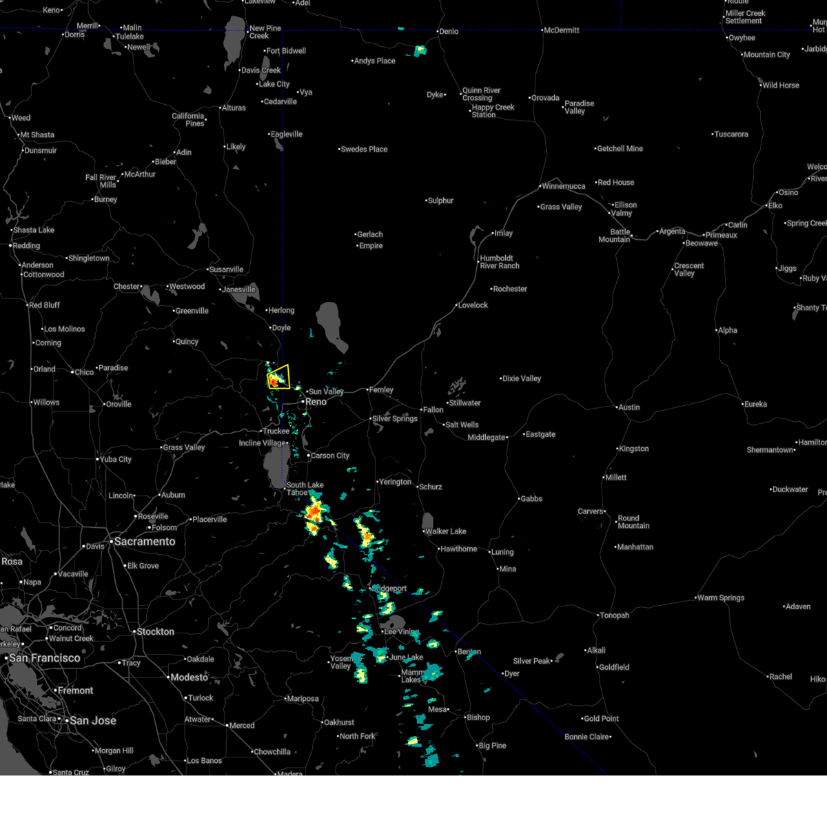
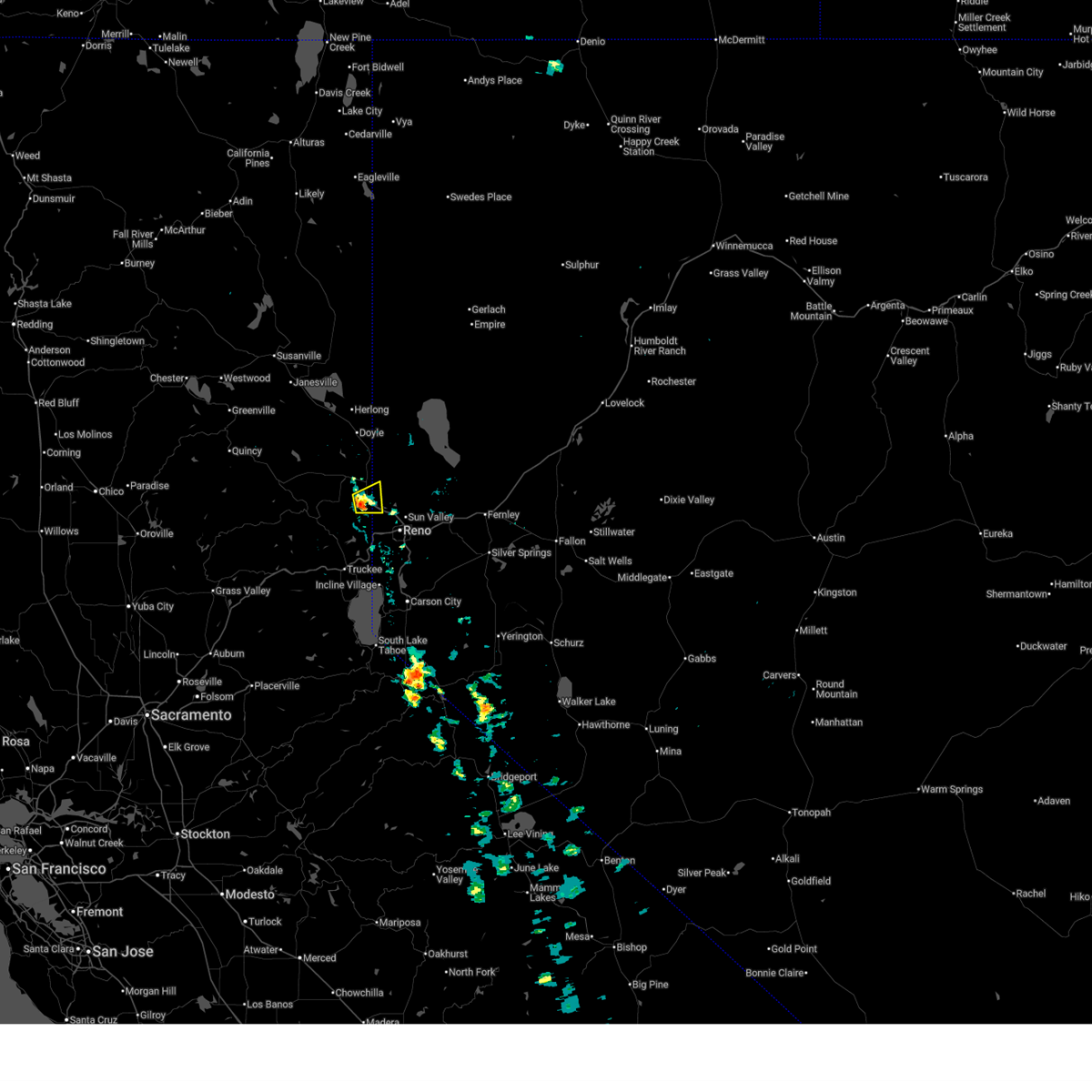
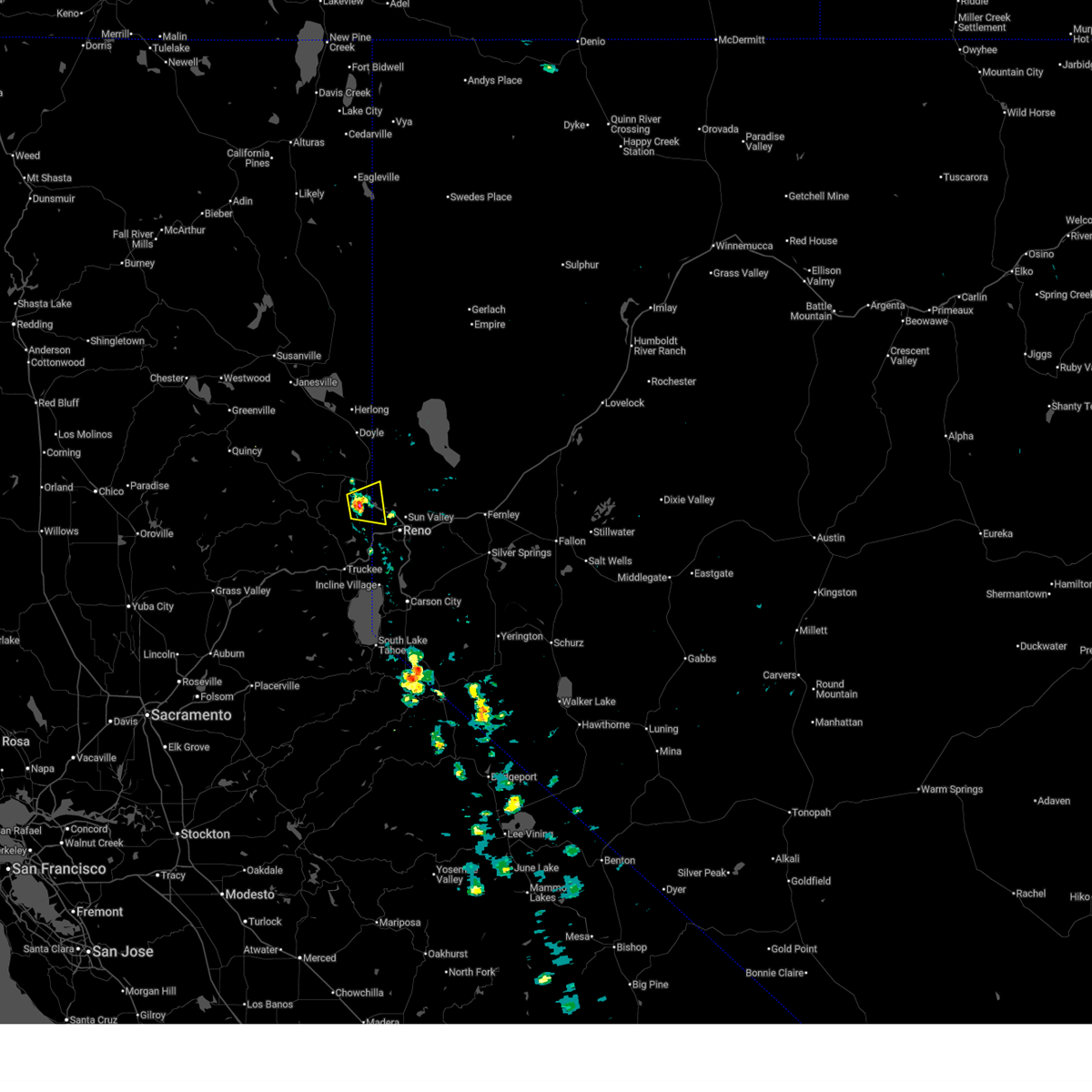
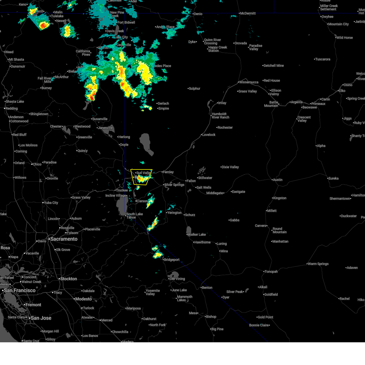
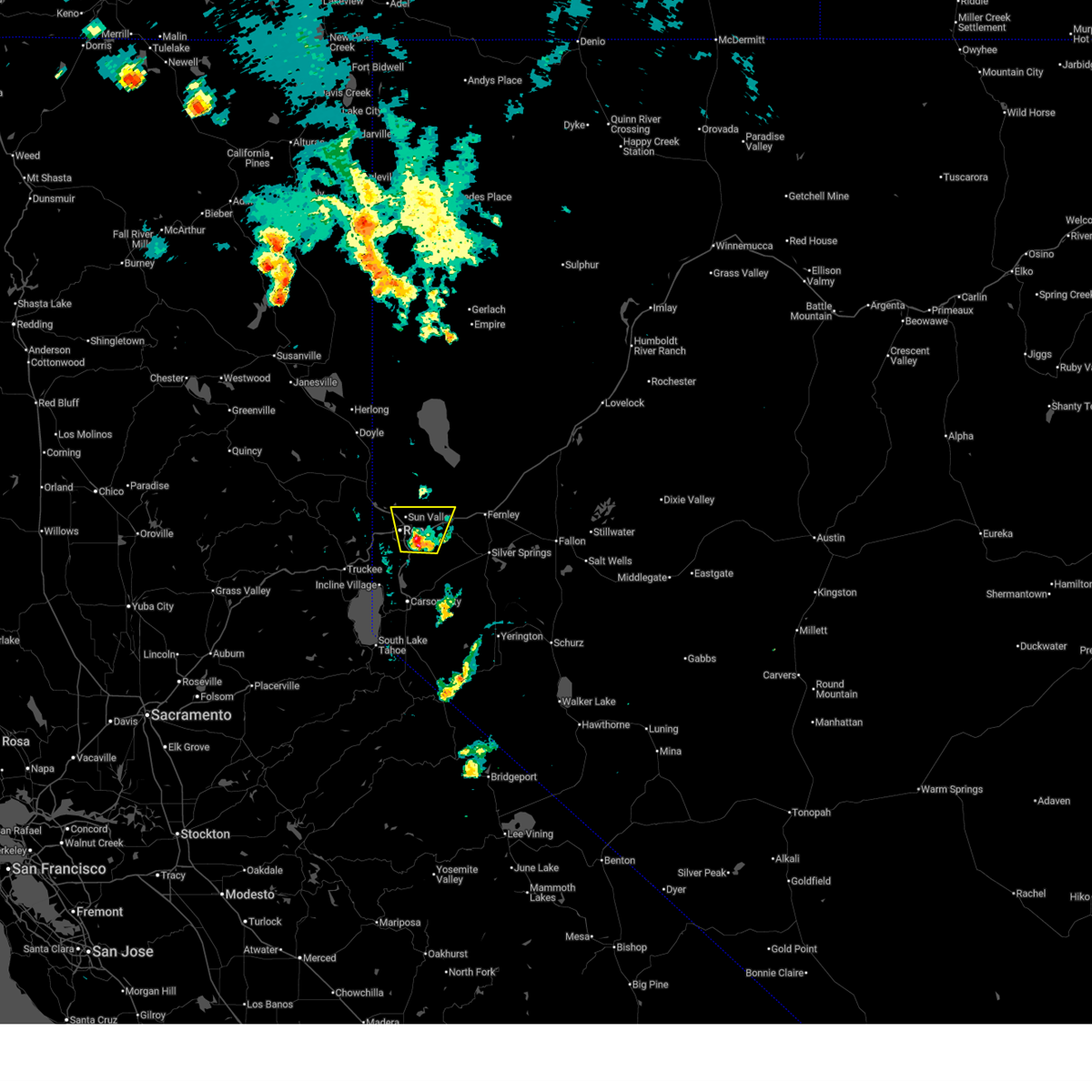
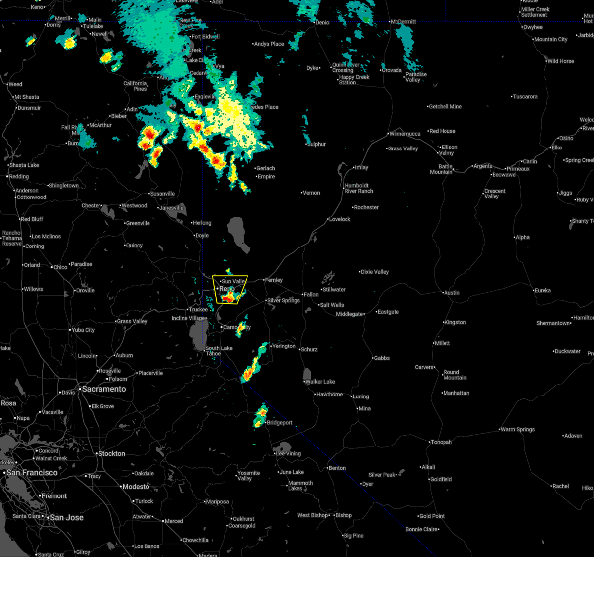
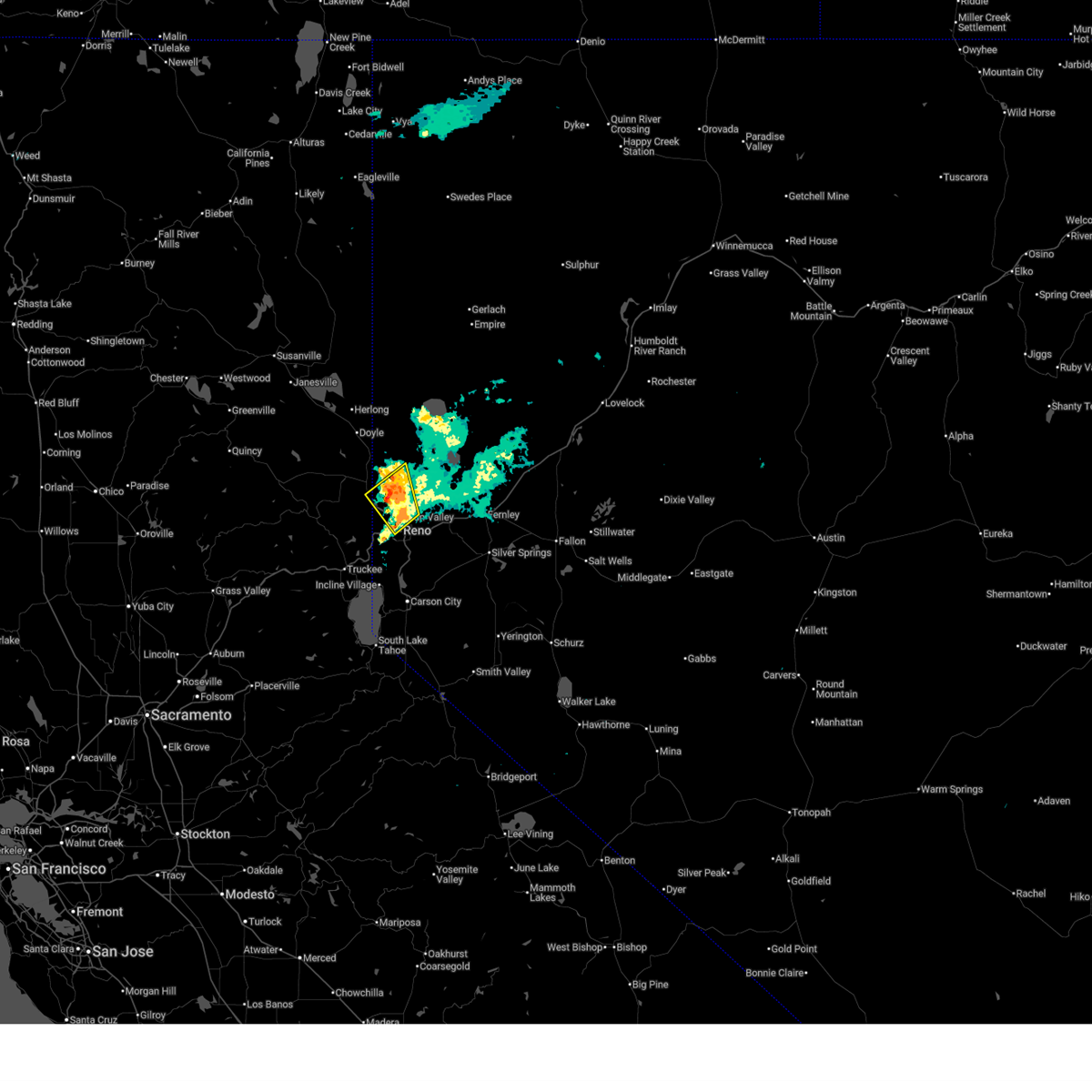
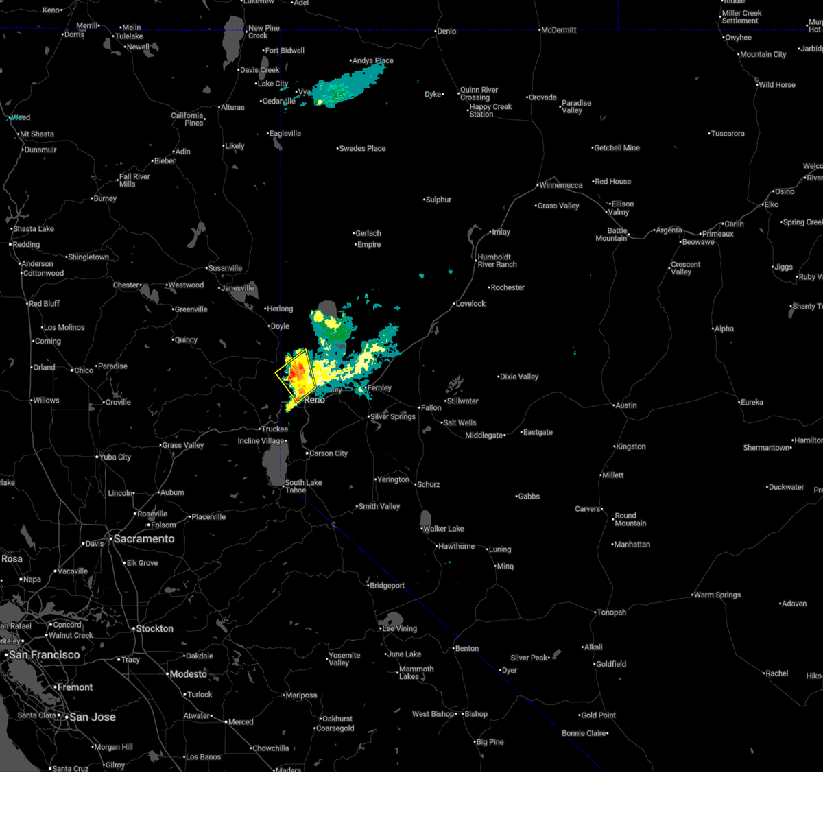
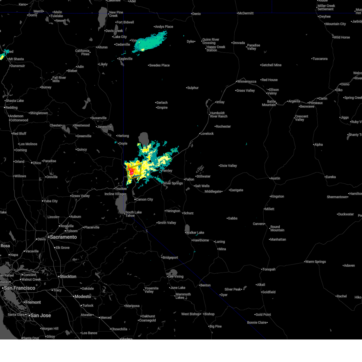
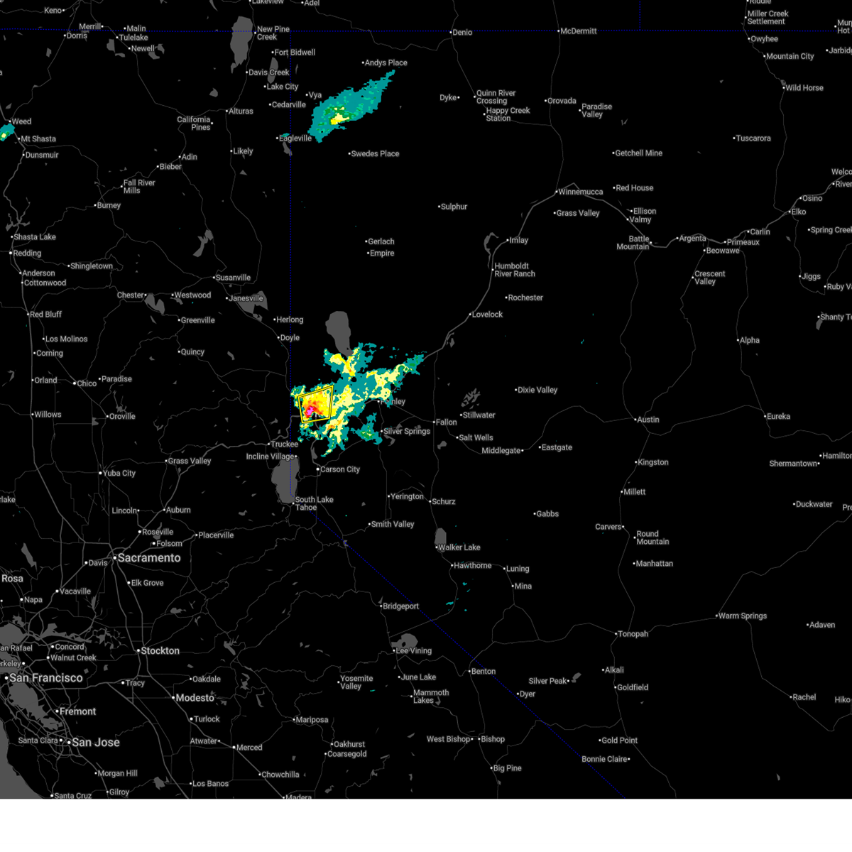
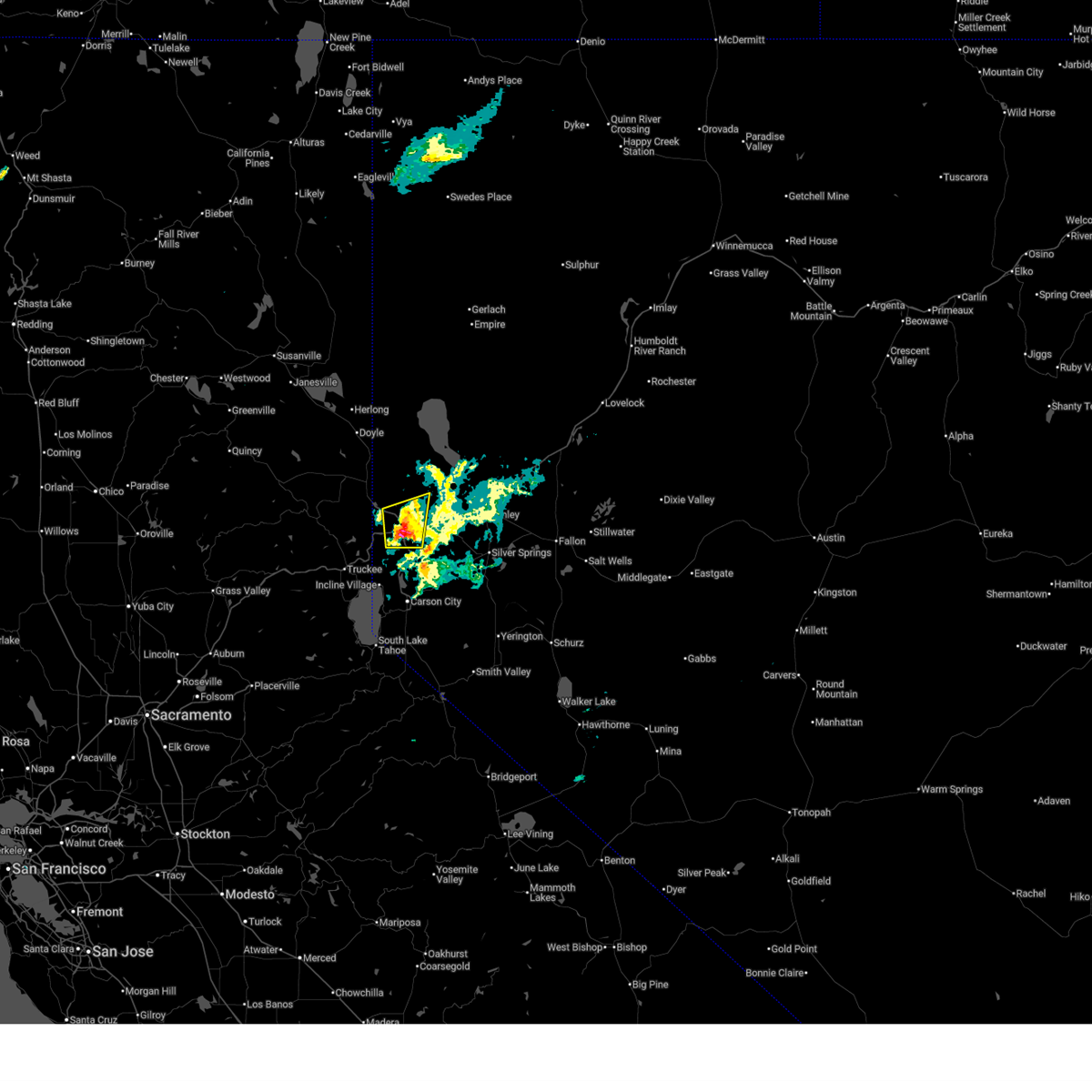
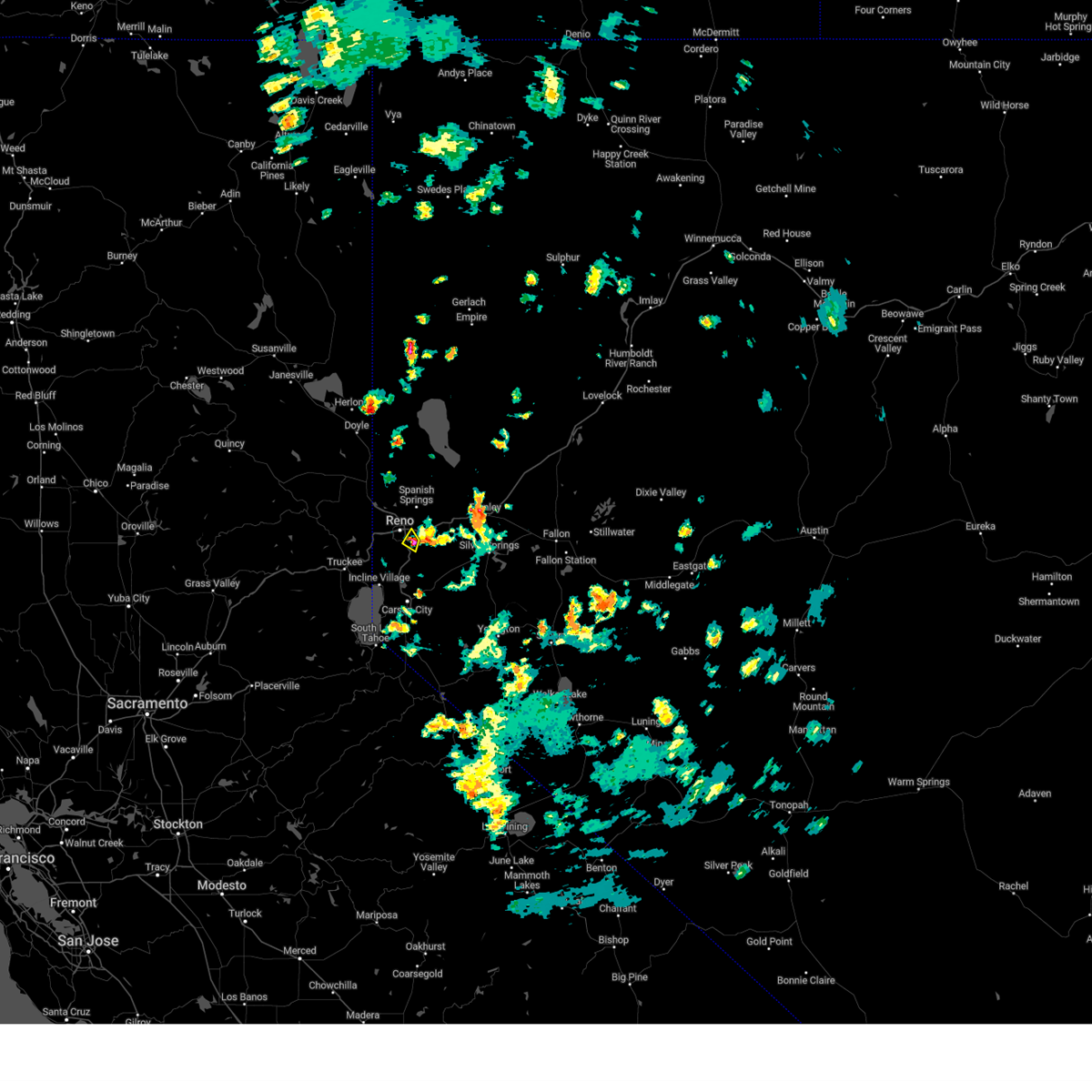
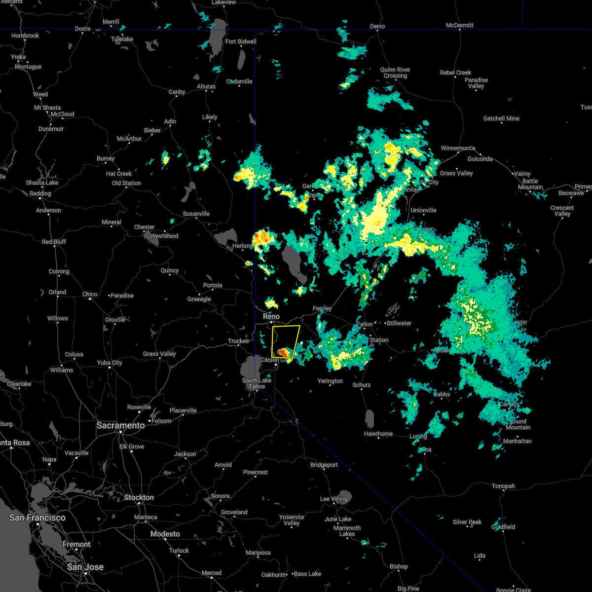
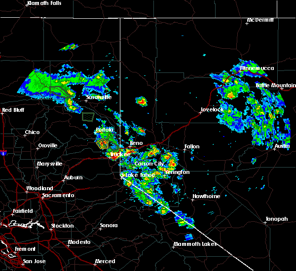
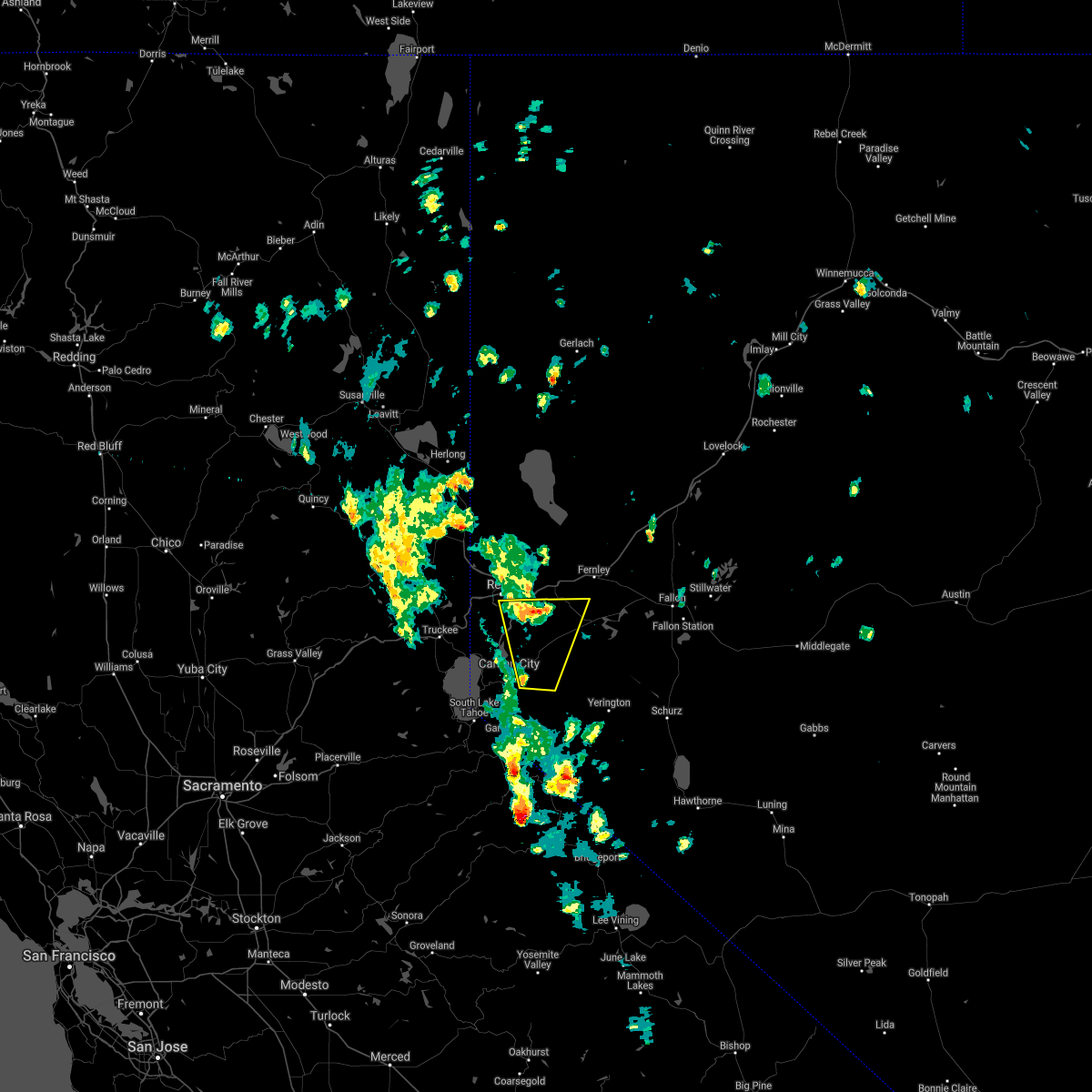
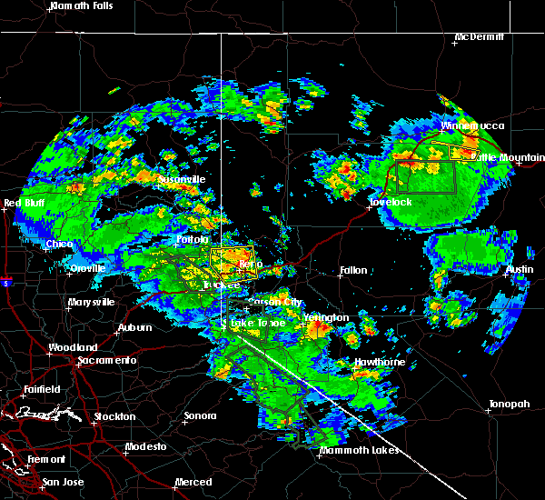
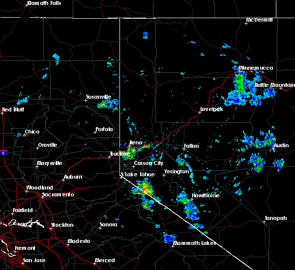
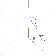
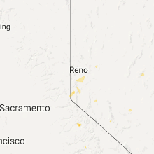
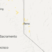
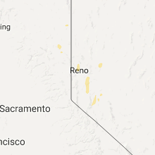
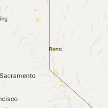
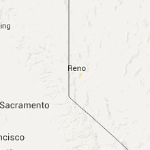
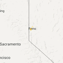
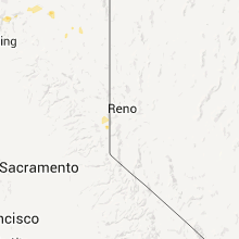
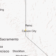
Hail Map for Reno, NV
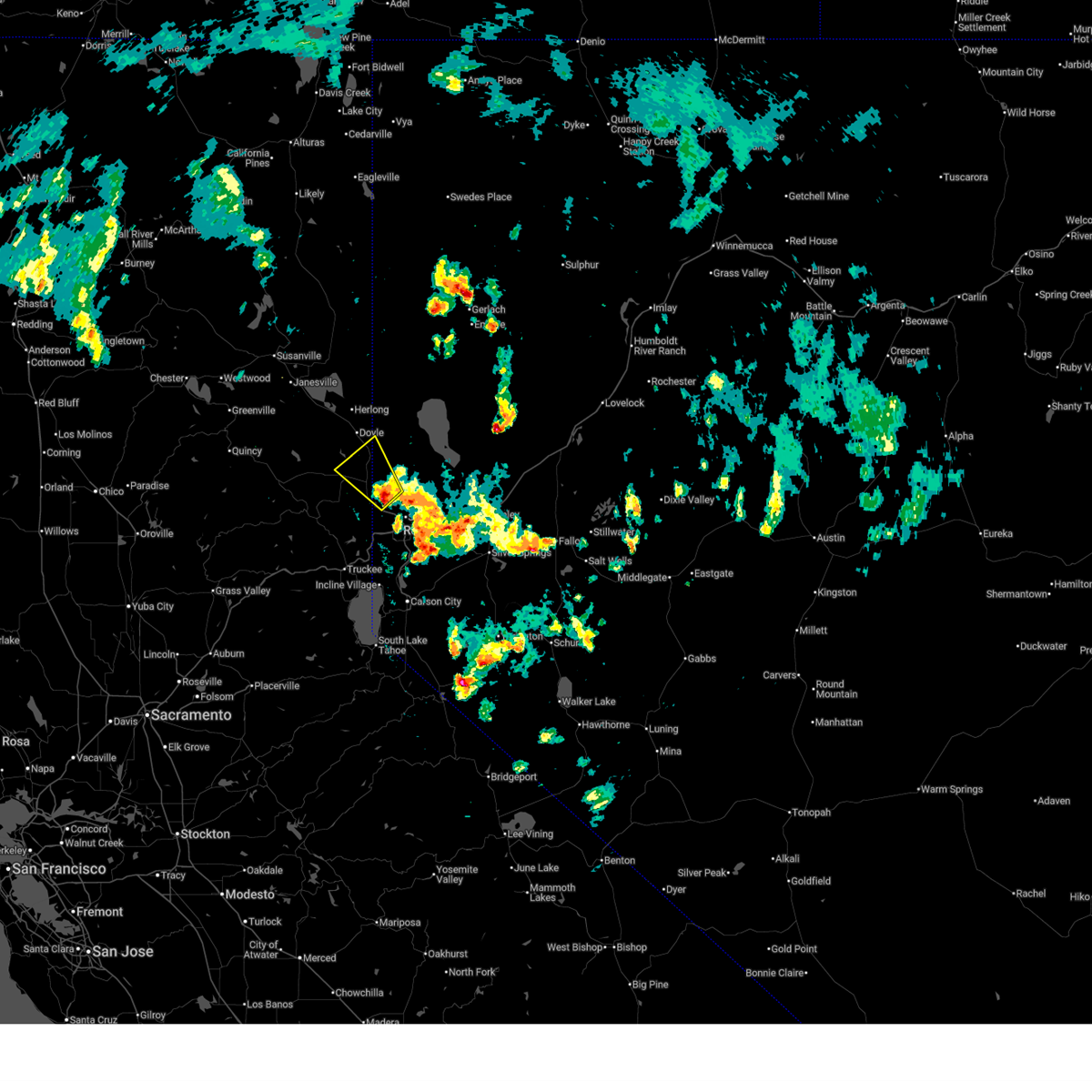
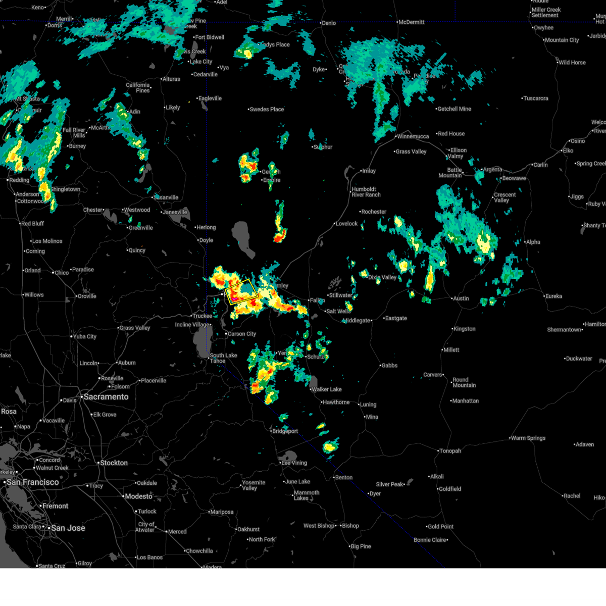
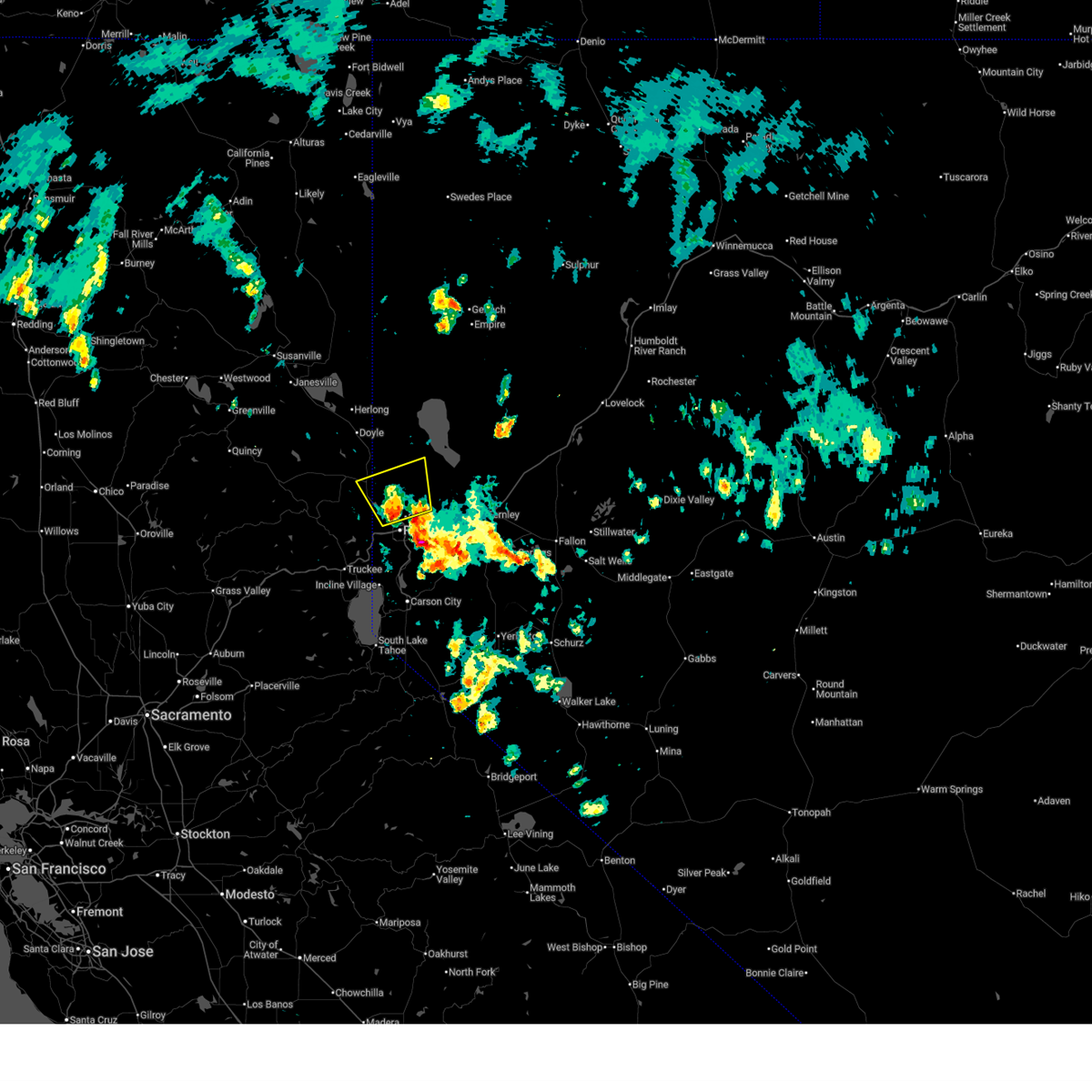
The Reno, NV area has had 7 reports of on-the-ground hail by trained spotters, and has been under severe weather warnings 26 times during the past 12 months. Doppler radar has detected hail at or near Reno, NV on 27 occasions, including 5 occasions during the past year.
| Name: | Reno, NV |
| Where Located: | 2 miles WSW of Reno, NV |
| Map: | Google Map for Reno, NV |
| Population: | 225221 |
| Housing Units: | 102582 |
| More Info: | Search Google for Reno, NV |
4
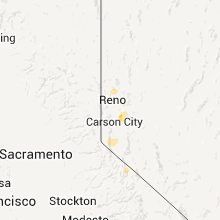
The Top Recent Hail Date for Reno, NV is Sunday, July 27, 2025 (3rd out of 27)
Hail and Wind Damage Spotted near Reno, NV
| Date / Time | Report Details |
|---|---|
| 6/19/2026 3:31 PM PDT |
 Svrrev the national weather service in reno has issued a * severe thunderstorm warning for, plumas county in northern california, sierra county in northern california, southeastern lassen county in northern california, southern washoe county in western nevada, * until 415 pm pdt. * at 330 pm pdt, a severe thunderstorm was located near cold springs, or 10 miles southeast of chilcoot, moving northwest at 30 mph (radar indicated). Hazards include 60 mph wind gusts and quarter size hail. Hail damage to vehicles is expected. Expect wind damage to roofs, siding, fencing and trees. Svrrev the national weather service in reno has issued a * severe thunderstorm warning for, plumas county in northern california, sierra county in northern california, southeastern lassen county in northern california, southern washoe county in western nevada, * until 415 pm pdt. * at 330 pm pdt, a severe thunderstorm was located near cold springs, or 10 miles southeast of chilcoot, moving northwest at 30 mph (radar indicated). Hazards include 60 mph wind gusts and quarter size hail. Hail damage to vehicles is expected. Expect wind damage to roofs, siding, fencing and trees.
|
| 6/19/2026 3:15 PM PDT |
 Svrrev the national weather service in reno has issued a * severe thunderstorm warning for, storey county in western nevada, south central washoe county in western nevada, * until 345 pm pdt. * at 314 pm pdt, a severe thunderstorm was located over lockwood, or 9 miles east of reno, moving northeast at 10 mph (radar indicated). Hazards include 60 mph wind gusts and quarter size hail. hail accumulation possible along interstate 80. Hail damage to vehicles is expected. Expect wind damage to roofs, siding, fencing and trees. Svrrev the national weather service in reno has issued a * severe thunderstorm warning for, storey county in western nevada, south central washoe county in western nevada, * until 345 pm pdt. * at 314 pm pdt, a severe thunderstorm was located over lockwood, or 9 miles east of reno, moving northeast at 10 mph (radar indicated). Hazards include 60 mph wind gusts and quarter size hail. hail accumulation possible along interstate 80. Hail damage to vehicles is expected. Expect wind damage to roofs, siding, fencing and trees.
|
| 6/19/2026 3:07 PM PDT |
 Svrrev the national weather service in reno has issued a * severe thunderstorm warning for, sierra county in northern california, southeastern lassen county in northern california, southern washoe county in western nevada, * until 330 pm pdt. * at 306 pm pdt, a severe thunderstorm was located near golden valley, or 7 miles northeast of reno, moving north at 30 mph (radar indicated). Hazards include 60 mph wind gusts and quarter size hail. Hail damage to vehicles is expected. Expect wind damage to roofs, siding, fencing and trees. Svrrev the national weather service in reno has issued a * severe thunderstorm warning for, sierra county in northern california, southeastern lassen county in northern california, southern washoe county in western nevada, * until 330 pm pdt. * at 306 pm pdt, a severe thunderstorm was located near golden valley, or 7 miles northeast of reno, moving north at 30 mph (radar indicated). Hazards include 60 mph wind gusts and quarter size hail. Hail damage to vehicles is expected. Expect wind damage to roofs, siding, fencing and trees.
|
| 6/19/2026 3:06 PM PDT |
 At 306 pm pdt, a severe thunderstorm was located near spanish springs, or 16 miles northeast of reno, moving north at 30 mph (radar indicated). Hazards include 60 mph wind gusts and quarter size hail. Hail damage to vehicles is expected. expect wind damage to roofs, siding, fencing and trees. Locations impacted include, reno, sparks, lockwood, wingfield springs, damonte ranch, northwest reno, caughlin ranch, reno-tahoe international airport, hidden valley, spanish springs, mustang, nws reno, patrick, and sun valley. At 306 pm pdt, a severe thunderstorm was located near spanish springs, or 16 miles northeast of reno, moving north at 30 mph (radar indicated). Hazards include 60 mph wind gusts and quarter size hail. Hail damage to vehicles is expected. expect wind damage to roofs, siding, fencing and trees. Locations impacted include, reno, sparks, lockwood, wingfield springs, damonte ranch, northwest reno, caughlin ranch, reno-tahoe international airport, hidden valley, spanish springs, mustang, nws reno, patrick, and sun valley.
|
| 6/19/2026 2:32 PM PDT |
 Svrrev the national weather service in reno has issued a * severe thunderstorm warning for, storey county in western nevada, southern washoe county in western nevada, * until 315 pm pdt. * at 231 pm pdt, a severe thunderstorm was located over lockwood, or 11 miles east of reno, moving north at 30 mph (radar indicated). Hazards include 60 mph wind gusts and quarter size hail. Hail damage to vehicles is expected. Expect wind damage to roofs, siding, fencing and trees. Svrrev the national weather service in reno has issued a * severe thunderstorm warning for, storey county in western nevada, southern washoe county in western nevada, * until 315 pm pdt. * at 231 pm pdt, a severe thunderstorm was located over lockwood, or 11 miles east of reno, moving north at 30 mph (radar indicated). Hazards include 60 mph wind gusts and quarter size hail. Hail damage to vehicles is expected. Expect wind damage to roofs, siding, fencing and trees.
|
| 5/3/2026 3:20 PM PDT | Mesonet station nv013 northwest ren in washoe county NV, 2.7 miles S of Reno, NV |
| 5/3/2026 2:53 PM PDT | Asos station krno ren in washoe county NV, 4.5 miles WNW of Reno, NV |
| 8/27/2025 2:14 PM PDT |
 Svrrev the national weather service in reno has issued a * severe thunderstorm warning for, sierra county in northern california, nevada county in northern california, southern washoe county in western nevada, * until 245 pm pdt. * at 213 pm pdt, a severe thunderstorm was located over boca reservoir, moving east at 10 mph (radar indicated). Hazards include 60 mph wind gusts and quarter size hail. Hail damage to vehicles is expected. Expect wind damage to roofs, siding, fencing and trees. Svrrev the national weather service in reno has issued a * severe thunderstorm warning for, sierra county in northern california, nevada county in northern california, southern washoe county in western nevada, * until 245 pm pdt. * at 213 pm pdt, a severe thunderstorm was located over boca reservoir, moving east at 10 mph (radar indicated). Hazards include 60 mph wind gusts and quarter size hail. Hail damage to vehicles is expected. Expect wind damage to roofs, siding, fencing and trees.
|
| 8/27/2025 1:53 PM PDT |
 Svrrev the national weather service in reno has issued a * severe thunderstorm warning for, placer county in central california, sierra county in northern california, nevada county in northern california, southern washoe county in western nevada, * until 230 pm pdt. * at 153 pm pdt, a severe thunderstorm was located over hirschdale, or near boca reservoir, moving northeast at 10 mph (radar indicated). Hazards include 60 mph wind gusts and quarter size hail. Hail damage to vehicles is expected. Expect wind damage to roofs, siding, fencing and trees. Svrrev the national weather service in reno has issued a * severe thunderstorm warning for, placer county in central california, sierra county in northern california, nevada county in northern california, southern washoe county in western nevada, * until 230 pm pdt. * at 153 pm pdt, a severe thunderstorm was located over hirschdale, or near boca reservoir, moving northeast at 10 mph (radar indicated). Hazards include 60 mph wind gusts and quarter size hail. Hail damage to vehicles is expected. Expect wind damage to roofs, siding, fencing and trees.
|
| 8/24/2025 3:30 PM PDT |
 The storm which prompted the warning has weakened below severe limits, and no longer poses an immediate threat to life or property. therefore, the warning has been allowed to expire. however, heavy rain is still possible with this thunderstorm. The storm which prompted the warning has weakened below severe limits, and no longer poses an immediate threat to life or property. therefore, the warning has been allowed to expire. however, heavy rain is still possible with this thunderstorm.
|
| 8/24/2025 3:07 PM PDT |
 The storm which prompted the warning has weakened below severe limits, and no longer poses an immediate threat to life or property. therefore, the warning has been allowed to expire. however, small hail and gusty winds are still possible with this thunderstorm. The storm which prompted the warning has weakened below severe limits, and no longer poses an immediate threat to life or property. therefore, the warning has been allowed to expire. however, small hail and gusty winds are still possible with this thunderstorm.
|
| 8/24/2025 3:06 PM PDT |
 Svrrev the national weather service in reno has issued a * severe thunderstorm warning for, sierra county in northern california, southeastern lassen county in northern california, southern washoe county in western nevada, * until 330 pm pdt. * at 306 pm pdt, a severe thunderstorm was located near cold springs valley, or 10 miles north of verdi, moving southeast at 15 mph (radar indicated). Hazards include 60 mph wind gusts and quarter size hail. Hail damage to vehicles is expected. Expect wind damage to roofs, siding, fencing and trees. Svrrev the national weather service in reno has issued a * severe thunderstorm warning for, sierra county in northern california, southeastern lassen county in northern california, southern washoe county in western nevada, * until 330 pm pdt. * at 306 pm pdt, a severe thunderstorm was located near cold springs valley, or 10 miles north of verdi, moving southeast at 15 mph (radar indicated). Hazards include 60 mph wind gusts and quarter size hail. Hail damage to vehicles is expected. Expect wind damage to roofs, siding, fencing and trees.
|
| 8/24/2025 2:37 PM PDT |
 Svrrev the national weather service in reno has issued a * severe thunderstorm warning for, sierra county in northern california, southeastern lassen county in northern california, southern washoe county in western nevada, * until 300 pm pdt. * at 236 pm pdt, a severe thunderstorm was located near hallelujah junction, or 8 miles southeast of chilcoot, moving east at 15 mph (radar indicated). Hazards include 60 mph wind gusts and quarter size hail. Hail damage to vehicles is expected. Expect wind damage to roofs, siding, fencing and trees. Svrrev the national weather service in reno has issued a * severe thunderstorm warning for, sierra county in northern california, southeastern lassen county in northern california, southern washoe county in western nevada, * until 300 pm pdt. * at 236 pm pdt, a severe thunderstorm was located near hallelujah junction, or 8 miles southeast of chilcoot, moving east at 15 mph (radar indicated). Hazards include 60 mph wind gusts and quarter size hail. Hail damage to vehicles is expected. Expect wind damage to roofs, siding, fencing and trees.
|
| 8/23/2025 3:32 PM PDT |
 the severe thunderstorm warning has been cancelled and is no longer in effect the severe thunderstorm warning has been cancelled and is no longer in effect
|
| 8/23/2025 3:05 PM PDT |
 Svrrev the national weather service in reno has issued a * severe thunderstorm warning for, sierra county in northern california, southern washoe county in western nevada, * until 345 pm pdt. * at 305 pm pdt, a severe thunderstorm was located over dog valley, or near verdi, moving north at 10 mph (radar indicated). Hazards include quarter size hail and torrential rain. hail damage with potential flash flooding Svrrev the national weather service in reno has issued a * severe thunderstorm warning for, sierra county in northern california, southern washoe county in western nevada, * until 345 pm pdt. * at 305 pm pdt, a severe thunderstorm was located over dog valley, or near verdi, moving north at 10 mph (radar indicated). Hazards include quarter size hail and torrential rain. hail damage with potential flash flooding
|
| 8/23/2025 2:23 PM PDT |
 Svrrev the national weather service in reno has issued a * severe thunderstorm warning for, sierra county in northern california, nevada county in northern california, southern washoe county in western nevada, * until 300 pm pdt. * at 223 pm pdt, a severe thunderstorm was located near floriston, or near verdi, moving north at 10 mph (radar indicated). Hazards include quarter size hail and torrential rain. Damage to vehicles is expected. Flash flooding is possible with this storm. Svrrev the national weather service in reno has issued a * severe thunderstorm warning for, sierra county in northern california, nevada county in northern california, southern washoe county in western nevada, * until 300 pm pdt. * at 223 pm pdt, a severe thunderstorm was located near floriston, or near verdi, moving north at 10 mph (radar indicated). Hazards include quarter size hail and torrential rain. Damage to vehicles is expected. Flash flooding is possible with this storm.
|
| 8/12/2025 3:59 PM PDT |
 the severe thunderstorm warning has been cancelled and is no longer in effect the severe thunderstorm warning has been cancelled and is no longer in effect
|
| 8/12/2025 3:48 PM PDT |
 the severe thunderstorm warning has been cancelled and is no longer in effect the severe thunderstorm warning has been cancelled and is no longer in effect
|
| 8/12/2025 3:48 PM PDT |
 At 348 pm pdt, a severe thunderstorm was located near cold springs valley, or 9 miles north of verdi, moving east at 20 mph (radar indicated). Hazards include 60 mph wind gusts and quarter size hail. Hail damage to vehicles is expected. expect wind damage to roofs, siding, fencing and trees. Locations impacted include, cold springs, cold springs valley, us 395 at calif-nevada line near bordertown, and us 395 at sierra-lassen co line. At 348 pm pdt, a severe thunderstorm was located near cold springs valley, or 9 miles north of verdi, moving east at 20 mph (radar indicated). Hazards include 60 mph wind gusts and quarter size hail. Hail damage to vehicles is expected. expect wind damage to roofs, siding, fencing and trees. Locations impacted include, cold springs, cold springs valley, us 395 at calif-nevada line near bordertown, and us 395 at sierra-lassen co line.
|
| 8/12/2025 3:41 PM PDT |
 Svrrev the national weather service in reno has issued a * severe thunderstorm warning for, plumas county in northern california, sierra county in northern california, southeastern lassen county in northern california, southern washoe county in western nevada, * until 415 pm pdt. * at 340 pm pdt, a severe thunderstorm was located near cold springs valley, or 9 miles northwest of verdi, moving east at 20 mph (radar indicated). Hazards include 60 mph wind gusts and quarter size hail. Hail damage to vehicles is expected. Expect wind damage to roofs, siding, fencing and trees. Svrrev the national weather service in reno has issued a * severe thunderstorm warning for, plumas county in northern california, sierra county in northern california, southeastern lassen county in northern california, southern washoe county in western nevada, * until 415 pm pdt. * at 340 pm pdt, a severe thunderstorm was located near cold springs valley, or 9 miles northwest of verdi, moving east at 20 mph (radar indicated). Hazards include 60 mph wind gusts and quarter size hail. Hail damage to vehicles is expected. Expect wind damage to roofs, siding, fencing and trees.
|
| 7/30/2025 4:37 PM PDT | Asos station krno ren in washoe county NV, 4.5 miles WNW of Reno, NV |
| 7/29/2025 7:13 PM PDT |
 The storm which prompted the warning has weakened below severe limits, and no longer poses an immediate threat to life or property. therefore, the warning will be allowed to expire. however, small hail and heavy rain are still possible with this thunderstorm. The storm which prompted the warning has weakened below severe limits, and no longer poses an immediate threat to life or property. therefore, the warning will be allowed to expire. however, small hail and heavy rain are still possible with this thunderstorm.
|
| 7/29/2025 7:00 PM PDT | Quarter sized hail reported 9 miles NW of Reno, NV, trained weather spotter at the intersection of veterans pkwy and piper peak lane in reno reported a few hailstones one inch in diameter. |
| 7/29/2025 7:00 PM PDT |
 At 700 pm pdt, a severe thunderstorm was located over hidden valley, or 7 miles east of reno, moving north at 15 mph (radar indicated). Hazards include quarter size hail. Damage to vehicles is expected. Locations impacted include, reno, sparks, lockwood, wingfield springs, damonte ranch, lemmon valley, golden valley, reno-tahoe international airport, hidden valley, spanish springs, lemmon valley-golden valley, mustang, nws reno, patrick, and sun valley. At 700 pm pdt, a severe thunderstorm was located over hidden valley, or 7 miles east of reno, moving north at 15 mph (radar indicated). Hazards include quarter size hail. Damage to vehicles is expected. Locations impacted include, reno, sparks, lockwood, wingfield springs, damonte ranch, lemmon valley, golden valley, reno-tahoe international airport, hidden valley, spanish springs, lemmon valley-golden valley, mustang, nws reno, patrick, and sun valley.
|
| 7/29/2025 6:51 PM PDT |
 Svrrev the national weather service in reno has issued a * severe thunderstorm warning for, storey county in western nevada, southern washoe county in western nevada, * until 715 pm pdt. * at 650 pm pdt, a severe thunderstorm was located over hidden valley, or 8 miles southeast of reno, moving north at 15 mph (trained weather spotter). Hazards include quarter size hail. damage to vehicles is expected Svrrev the national weather service in reno has issued a * severe thunderstorm warning for, storey county in western nevada, southern washoe county in western nevada, * until 715 pm pdt. * at 650 pm pdt, a severe thunderstorm was located over hidden valley, or 8 miles southeast of reno, moving north at 15 mph (trained weather spotter). Hazards include quarter size hail. damage to vehicles is expected
|
| 7/29/2025 6:25 PM PDT | Quarter sized hail reported 9.6 miles NW of Reno, NV, delayed report. public reported 1 inch hail verified with a photo. |
| 7/27/2025 8:56 PM PDT |
 the severe thunderstorm warning has been cancelled and is no longer in effect the severe thunderstorm warning has been cancelled and is no longer in effect
|
| 7/27/2025 8:48 PM PDT |
 Svrrev the national weather service in reno has issued a * severe thunderstorm warning for, sierra county in northern california, southeastern lassen county in northern california, southern washoe county in western nevada, * until 915 pm pdt. * at 848 pm pdt, a severe thunderstorm was located near lemmon valley-golden valley, or 11 miles north of reno, moving northwest at 25 mph (radar indicated). Hazards include 40 mph wind gusts and quarter size hail. Hail damage to vehicles is expected. Expect wind damage to roofs, siding, fencing and trees. Svrrev the national weather service in reno has issued a * severe thunderstorm warning for, sierra county in northern california, southeastern lassen county in northern california, southern washoe county in western nevada, * until 915 pm pdt. * at 848 pm pdt, a severe thunderstorm was located near lemmon valley-golden valley, or 11 miles north of reno, moving northwest at 25 mph (radar indicated). Hazards include 40 mph wind gusts and quarter size hail. Hail damage to vehicles is expected. Expect wind damage to roofs, siding, fencing and trees.
|
| 7/27/2025 8:36 PM PDT |
 At 836 pm pdt, a severe thunderstorm was located over golden valley, or over reno, moving north at 10 mph (radar indicated). Hazards include 40 mph wind gusts and quarter size hail. Hail damage to vehicles is expected. expect wind damage to roofs, siding, fencing and trees. Locations impacted include, reno, sparks, stead, wingfield springs, northwest reno, spanish springs, lemmon valley, golden valley, caughlin ranch, lemmon valley-golden valley, verdi-mogul, cold springs, nws reno, spanish springs airport, and sun valley. At 836 pm pdt, a severe thunderstorm was located over golden valley, or over reno, moving north at 10 mph (radar indicated). Hazards include 40 mph wind gusts and quarter size hail. Hail damage to vehicles is expected. expect wind damage to roofs, siding, fencing and trees. Locations impacted include, reno, sparks, stead, wingfield springs, northwest reno, spanish springs, lemmon valley, golden valley, caughlin ranch, lemmon valley-golden valley, verdi-mogul, cold springs, nws reno, spanish springs airport, and sun valley.
|
| 7/27/2025 8:30 PM PDT | Quarter sized hail reported 0.9 miles NW of Reno, NV, public reported 1 inch hail verified with a photo. |
| 7/27/2025 8:20 PM PDT |
 At 819 pm pdt, a severe thunderstorm was located over reno, moving north at 10 mph (radar indicated). Hazards include 40 mph wind gusts and quarter size hail. Hail damage to vehicles is expected. expect wind damage to roofs, siding, fencing and trees. Locations impacted include, reno, sparks, stead, wingfield springs, northwest reno, spanish springs, lemmon valley, golden valley, caughlin ranch, reno-tahoe international airport, lemmon valley-golden valley, verdi-mogul, cold springs, nws reno, spanish springs airport, and sun valley. At 819 pm pdt, a severe thunderstorm was located over reno, moving north at 10 mph (radar indicated). Hazards include 40 mph wind gusts and quarter size hail. Hail damage to vehicles is expected. expect wind damage to roofs, siding, fencing and trees. Locations impacted include, reno, sparks, stead, wingfield springs, northwest reno, spanish springs, lemmon valley, golden valley, caughlin ranch, reno-tahoe international airport, lemmon valley-golden valley, verdi-mogul, cold springs, nws reno, spanish springs airport, and sun valley.
|
| 7/27/2025 8:07 PM PDT |
 Svrrev the national weather service in reno has issued a * severe thunderstorm warning for, storey county in western nevada, southern washoe county in western nevada, * until 845 pm pdt. * at 807 pm pdt, a severe thunderstorm was located over reno-tahoe international airport, or near reno, moving north at 10 mph (radar indicated). Hazards include 40 mph wind gusts and quarter size hail. Hail damage to vehicles is expected. Expect wind damage to roofs, siding, fencing and trees. Svrrev the national weather service in reno has issued a * severe thunderstorm warning for, storey county in western nevada, southern washoe county in western nevada, * until 845 pm pdt. * at 807 pm pdt, a severe thunderstorm was located over reno-tahoe international airport, or near reno, moving north at 10 mph (radar indicated). Hazards include 40 mph wind gusts and quarter size hail. Hail damage to vehicles is expected. Expect wind damage to roofs, siding, fencing and trees.
|
| 7/2/2025 3:38 PM PDT | Peak outflow gust at mesonet station cldnv 1.9 s cold springs valley (nv dot in washoe county NV, 11.3 miles SE of Reno, NV |
| 7/1/2025 5:50 PM PDT | Peak outflow gust at mesonet station cw8738 ren in washoe county NV, 24.1 miles SSW of Reno, NV |
| 7/1/2025 5:30 PM PDT | Peak outflow gust at mesonet station rgx virginia pea in washoe county NV, 26.1 miles SW of Reno, NV |
| 10/7/2024 4:40 PM PDT | Mesonet station desn2 desert spring in washoe county NV, 11.1 miles SSW of Reno, NV |
| 7/21/2024 5:30 PM PDT |
 Svrrev the national weather service in reno has issued a * severe thunderstorm warning for, southern washoe county in western nevada, * until 615 pm pdt. * at 530 pm pdt, a severe thunderstorm was located over hidden valley, or 7 miles southeast of reno, and is nearly stationary (radar indicated). Hazards include 60 mph wind gusts and quarter size hail. Hail damage to vehicles is expected. Expect wind damage to roofs, siding, fencing and trees. Svrrev the national weather service in reno has issued a * severe thunderstorm warning for, southern washoe county in western nevada, * until 615 pm pdt. * at 530 pm pdt, a severe thunderstorm was located over hidden valley, or 7 miles southeast of reno, and is nearly stationary (radar indicated). Hazards include 60 mph wind gusts and quarter size hail. Hail damage to vehicles is expected. Expect wind damage to roofs, siding, fencing and trees.
|
| 8/17/2023 6:00 PM PDT | Storm damage reported in washoe county NV, 34.4 miles SSW of Reno, NV |
| 8/8/2022 6:57 PM PDT |
 The severe thunderstorm warning for storey, south central washoe and northern lyon counties and central carson city will expire at 700 pm pdt, the storm which prompted the warning has weakened below severe limits, and no longer poses an immediate threat to life or property. therefore, the warning will be allowed to expire. however gusty winds and heavy rain are still possible with this thunderstorm. The severe thunderstorm warning for storey, south central washoe and northern lyon counties and central carson city will expire at 700 pm pdt, the storm which prompted the warning has weakened below severe limits, and no longer poses an immediate threat to life or property. therefore, the warning will be allowed to expire. however gusty winds and heavy rain are still possible with this thunderstorm.
|
| 8/8/2022 6:33 PM PDT |
 At 633 pm pdt, a severe thunderstorm was located over virginia city, moving north at 25 mph (radar indicated). Hazards include 60 mph wind gusts and penny size hail. expect damage to roofs, siding, fencing and trees At 633 pm pdt, a severe thunderstorm was located over virginia city, moving north at 25 mph (radar indicated). Hazards include 60 mph wind gusts and penny size hail. expect damage to roofs, siding, fencing and trees
|
| 6/23/2022 5:00 PM PDT | Mesonet station cw8738 ren in washoe county NV, 24.1 miles SSW of Reno, NV |
| 7/22/2020 4:26 PM PDT |
 The severe thunderstorm warning for sierra, storey and southern washoe counties will expire at 430 pm pdt, the storm which prompted the warning has weakened below severe limits, and no longer poses an immediate threat to life or property. therefore, the warning will be allowed to expire. however gusty winds and heavy rain are still possible in the reno area with this thunderstorm. The severe thunderstorm warning for sierra, storey and southern washoe counties will expire at 430 pm pdt, the storm which prompted the warning has weakened below severe limits, and no longer poses an immediate threat to life or property. therefore, the warning will be allowed to expire. however gusty winds and heavy rain are still possible in the reno area with this thunderstorm.
|
| 7/22/2020 4:15 PM PDT |
 At 413 pm pdt, a severe thunderstorm was located over reno, moving north at 10 mph (radar indicated). Hazards include 60 mph wind gusts and nickel size hail. Expect damage to roofs, siding, fencing and trees. heavy rain is also occuring with this storm. expectimg some ponding on roads and poorly drained areas around town. Locations impacted include, reno, sparks, wingfield springs, damonte ranch, northwest reno, spanish springs, lemmon valley, mogul, golden valley, verdi-mogul, caughlin ranch, reno-tahoe international airport, hidden valley, somersett, stead, lemmon valley-golden valley, nws reno and sun valley. At 413 pm pdt, a severe thunderstorm was located over reno, moving north at 10 mph (radar indicated). Hazards include 60 mph wind gusts and nickel size hail. Expect damage to roofs, siding, fencing and trees. heavy rain is also occuring with this storm. expectimg some ponding on roads and poorly drained areas around town. Locations impacted include, reno, sparks, wingfield springs, damonte ranch, northwest reno, spanish springs, lemmon valley, mogul, golden valley, verdi-mogul, caughlin ranch, reno-tahoe international airport, hidden valley, somersett, stead, lemmon valley-golden valley, nws reno and sun valley.
|
| 7/22/2020 4:01 PM PDT |
 At 400 pm pdt, a severe thunderstorm was located over caughlin ranch, or near reno, moving north at 10 mph (radar indicated). Hazards include 60 mph wind gusts. expect damage to roofs, siding, fencing and trees At 400 pm pdt, a severe thunderstorm was located over caughlin ranch, or near reno, moving north at 10 mph (radar indicated). Hazards include 60 mph wind gusts. expect damage to roofs, siding, fencing and trees
|
| 5/24/2018 4:26 PM PDT |
 The severe thunderstorm warning for storey, south central washoe, douglas, and northern lyon counties and eastern carson city will expire at 430 pm pdt, the severe thunderstorm which prompted the warning has weakened. therefore, the warning will be allowed to expire. however heavy rain, pea size hail, and gusty winds are still likely with this thunderstorm. i-80 will likely be impacted by heavy rain between reno and usa parkway. The severe thunderstorm warning for storey, south central washoe, douglas, and northern lyon counties and eastern carson city will expire at 430 pm pdt, the severe thunderstorm which prompted the warning has weakened. therefore, the warning will be allowed to expire. however heavy rain, pea size hail, and gusty winds are still likely with this thunderstorm. i-80 will likely be impacted by heavy rain between reno and usa parkway.
|
| 5/24/2018 3:28 PM PDT |
 At 328 pm pdt, a severe thunderstorm was located near dayton, or 9 miles east of carson city, moving north at 20 mph (radar indicated). Hazards include 60 mph wind gusts and quarter size hail. Hail damage to vehicles is expected. expect wind damage to roofs, siding, fencing, and trees. Dust storms resulting in serious accidents. At 328 pm pdt, a severe thunderstorm was located near dayton, or 9 miles east of carson city, moving north at 20 mph (radar indicated). Hazards include 60 mph wind gusts and quarter size hail. Hail damage to vehicles is expected. expect wind damage to roofs, siding, fencing, and trees. Dust storms resulting in serious accidents.
|
| 7/29/2017 4:39 PM PDT | Mesonet reported a wind gust of 69 mp in storey county NV, 14.9 miles NW of Reno, NV |
| 2/16/2017 5:50 AM PST | The galena raws sensor recorded a wind gust of 75 mph at an elevation of 5610 f in washoe county NV, 9.8 miles N of Reno, NV |
| 7/8/2015 3:40 PM PDT |
 The severe thunderstorm warning for sierra, southeastern lassen, southern washoe and storey counties will expire at 345 pm pdt, the storm which prompted the warning has weakened below severe limits, and no longer poses an immediate threat to life or property. therefore the warning will be allowed to expire. however heavy rain is still possible with this thunderstorm. please post any storm reports to nws social media or report to local law enforcement agency. The severe thunderstorm warning for sierra, southeastern lassen, southern washoe and storey counties will expire at 345 pm pdt, the storm which prompted the warning has weakened below severe limits, and no longer poses an immediate threat to life or property. therefore the warning will be allowed to expire. however heavy rain is still possible with this thunderstorm. please post any storm reports to nws social media or report to local law enforcement agency.
|
| 7/8/2015 3:28 PM PDT |
 At 327 pm pdt, the public reported a severe thunderstorm producing quarter size hail and damaging winds in excess of 60 mph. this storm was located near lemmon valley-golden valley, or 12 miles north of reno, moving north at 15 mph. locations impacted include, reno, sparks, caughlin ranch, spanish springs, northwest reno, hidden valley, lemmon valley-golden valley, verdi-mogul, stead, reno-tahoe international airport, wingfield springs, dog valley, mogul, lockwood, verdi, golden valley, somersett, lemmon valley, cold springs valley and stead airport. At 327 pm pdt, the public reported a severe thunderstorm producing quarter size hail and damaging winds in excess of 60 mph. this storm was located near lemmon valley-golden valley, or 12 miles north of reno, moving north at 15 mph. locations impacted include, reno, sparks, caughlin ranch, spanish springs, northwest reno, hidden valley, lemmon valley-golden valley, verdi-mogul, stead, reno-tahoe international airport, wingfield springs, dog valley, mogul, lockwood, verdi, golden valley, somersett, lemmon valley, cold springs valley and stead airport.
|
| 7/8/2015 3:06 PM PDT |
 At 303 pm pdt, a severe thunderstorm capable of producing quarter size hail and damaging winds in excess of 60 mph is continuing to move through reno. this storm was located over reno, and moving north at 20 mph. this storm has a history of producing large. At 303 pm pdt, a severe thunderstorm capable of producing quarter size hail and damaging winds in excess of 60 mph is continuing to move through reno. this storm was located over reno, and moving north at 20 mph. this storm has a history of producing large.
|
| 7/8/2015 2:52 PM PDT |
 At 251 pm pdt, the public reported a severe thunderstorm producing large damaging hail up to golf ball size and damaging winds in excess of 60 mph. this storm was located over galena when severe activity was reported. this storm is moving north towards reno-tahoe international airport, or near reno, at 15 mph. locations impacted include, reno, sparks, reno-tahoe international airport, wingfield springs, damonte ranch, caughlin ranch, pleasant valley, spanish springs, northwest reno, lockwood, hidden valley, galena, golden valley, verdi-mogul, lemmon valley-golden valley, sun valley and nws reno. At 251 pm pdt, the public reported a severe thunderstorm producing large damaging hail up to golf ball size and damaging winds in excess of 60 mph. this storm was located over galena when severe activity was reported. this storm is moving north towards reno-tahoe international airport, or near reno, at 15 mph. locations impacted include, reno, sparks, reno-tahoe international airport, wingfield springs, damonte ranch, caughlin ranch, pleasant valley, spanish springs, northwest reno, lockwood, hidden valley, galena, golden valley, verdi-mogul, lemmon valley-golden valley, sun valley and nws reno.
|
| 7/8/2015 2:42 PM PDT | Tree damage at evans and 5th street near city bus terminal in reno. trees were 20 to 30 feet tall and limbs that were broken off ranged from 1 inch to 6 inches diameter in washoe county NV, 2.1 miles SW of Reno, NV |
| 7/8/2015 2:35 PM PDT | Golf Ball sized hail reported 2.1 miles SW of Reno, NV, hail covering the ground at mt rose highway in south reno. |
| 7/8/2015 2:32 PM PDT |
 At 231 pm pdt, doppler radar indicated a severe thunderstorm capable of producing quarter size hail and damaging winds in excess of 60 mph. this storm was located over damonte ranch, or 9 miles south of reno, and moving north at 15 mph. * very heavy will accompany this storm and localized urban flooding will be possible. At 231 pm pdt, doppler radar indicated a severe thunderstorm capable of producing quarter size hail and damaging winds in excess of 60 mph. this storm was located over damonte ranch, or 9 miles south of reno, and moving north at 15 mph. * very heavy will accompany this storm and localized urban flooding will be possible.
|
| 7/7/2015 3:09 PM PDT |
 At 306 pm pdt, doppler radar indicated a severe thunderstorm capable of producing quarter size hail and damaging winds in excess of 60 mph. this storm is approaching hallelujah junction, and hwy 70 near vinton an chilcoot, moving north at 20 mph. torrential rain with blinding visibility and ponding of water is the main threat with this storm. locations impacted include, chilcoot, vinton, chilcoot-vinton, hallelujah junction, cold springs valley, verdi-mogul, ca 49 at sierra-plumas co line, ca 70 at plumas-lassen co line, us 395 at sierra-lassen co line and us 395 at calif-nevada line near bordertown. At 306 pm pdt, doppler radar indicated a severe thunderstorm capable of producing quarter size hail and damaging winds in excess of 60 mph. this storm is approaching hallelujah junction, and hwy 70 near vinton an chilcoot, moving north at 20 mph. torrential rain with blinding visibility and ponding of water is the main threat with this storm. locations impacted include, chilcoot, vinton, chilcoot-vinton, hallelujah junction, cold springs valley, verdi-mogul, ca 49 at sierra-plumas co line, ca 70 at plumas-lassen co line, us 395 at sierra-lassen co line and us 395 at calif-nevada line near bordertown.
|
| 7/7/2015 2:49 PM PDT |
 At 248 pm pdt, doppler radar indicated a severe thunderstorm capable of producing damaging winds in excess of 60 mph. this storm was located near dog valley, or 8 miles northwest of verdi, and moving north at 20 mph. nickel size hail may also accompany the damaging winds. At 248 pm pdt, doppler radar indicated a severe thunderstorm capable of producing damaging winds in excess of 60 mph. this storm was located near dog valley, or 8 miles northwest of verdi, and moving north at 20 mph. nickel size hail may also accompany the damaging winds.
|
| 7/7/2015 2:40 PM PDT | 5000 people reported power outages in washoe county with most in south ren in washoe county NV, 2.1 miles SW of Reno, NV |
| 7/7/2015 2:38 PM PDT | Peak gust measured at nws reno forecast office with a southerly direction of 180 in washoe county NV, 2.1 miles SW of Reno, NV |
| 7/7/2015 2:30 PM PDT | Cessna aircraft flipped at reno-tahoe airport. reported by krno towe in washoe county NV, 2.1 miles SW of Reno, NV |
| 7/7/2015 2:29 PM PDT | Reno airport krno asos peak gust with southerly direction of 170 in washoe county NV, 2.1 miles SW of Reno, NV |
| 6/30/2015 7:22 PM PDT | 61 mph wind gust measured at the reno nw in washoe county NV, 4.3 miles SW of Reno, NV |
| 6/27/2015 5:38 PM PDT |
 At 535 pm pdt, doppler radar indicated a severe thunderstorm capable of producing quarter size hail and destructive winds in excess of 70 mph. this storm was located over cold springs valley, or 11 miles northwest of reno, moving north at 20 mph. locations impacted include, cold springs valley and stead. At 535 pm pdt, doppler radar indicated a severe thunderstorm capable of producing quarter size hail and destructive winds in excess of 70 mph. this storm was located over cold springs valley, or 11 miles northwest of reno, moving north at 20 mph. locations impacted include, cold springs valley and stead.
|
| 6/27/2015 5:18 PM PDT |
 At 517 pm pdt, doppler radar indicated a severe thunderstorm capable of producing damaging winds in excess of 60 mph. this storm was located over somersett, or near verdi, and moving north at 20 mph. penny size hail may also accompany the damaging winds. At 517 pm pdt, doppler radar indicated a severe thunderstorm capable of producing damaging winds in excess of 60 mph. this storm was located over somersett, or near verdi, and moving north at 20 mph. penny size hail may also accompany the damaging winds.
|
| 6/27/2015 5:09 PM PDT |
 At 508 pm pdt, doppler radar indicated a severe thunderstorm capable of producing damaging winds in excess of 60 mph. this storm was located over verdi, moving north at 25 mph. penny size hail may also accompany the damaging winds. locations impacted include, reno, dog valley, mogul, verdi, cold springs valley and stead. At 508 pm pdt, doppler radar indicated a severe thunderstorm capable of producing damaging winds in excess of 60 mph. this storm was located over verdi, moving north at 25 mph. penny size hail may also accompany the damaging winds. locations impacted include, reno, dog valley, mogul, verdi, cold springs valley and stead.
|
| 6/27/2015 4:53 PM PDT |
 At 452 pm pdt, doppler radar indicated a severe thunderstorm capable of producing destructive winds in excess of 70 mph. this storm was located near mogul, or near verdi, and moving north at 25 mph. At 452 pm pdt, doppler radar indicated a severe thunderstorm capable of producing destructive winds in excess of 70 mph. this storm was located near mogul, or near verdi, and moving north at 25 mph.
|
| 7/20/2014 3:40 PM PDT | Thunderstorm wind gusts removed shingles from the roofs of the vintage hills apartments in south ren in washoe county NV, 6.5 miles NW of Reno, NV |
| 7/1/2014 6:13 PM PDT | 71 mph wind gust reported at nws reno office at 613p in washoe county NV, 5.2 miles SSE of Reno, NV |
| 7/1/2014 5:55 PM PDT | 68 mph wind gust reported at reno airpor in washoe county NV, 2.1 miles SW of Reno, NV |
| 7/20/2013 5:25 PM PDT | At nws reno office in washoe county NV, 2.1 miles SW of Reno, NV |
| 7/20/2013 5:21 PM PDT | At the reno airport in washoe county NV, 2.1 miles SW of Reno, NV |
| 7/20/2013 5:20 PM PDT | At nws reno office in washoe county NV, 2.1 miles SW of Reno, NV |
| 6/28/2013 6:30 PM PDT | Ping Pong Ball sized hail reported 8.4 miles S of Reno, NV, received photo of hailstones near stead airport between 1 and 1 1/2 inch diameter. time estimated near 630 pm. |
| 6/28/2013 6:22 PM PDT | Quarter sized hail reported 9 miles S of Reno, NV, several reports of 1 inch hail in the golden valley area. |
| 6/28/2013 6:15 PM PDT | Quarter sized hail reported 7 miles SSW of Reno, NV, heavy rain with 1 inch hail reported in golden valley. |
Hail Maps for Reno, NV
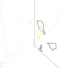

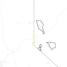


Connect with Interactive Hail Maps