

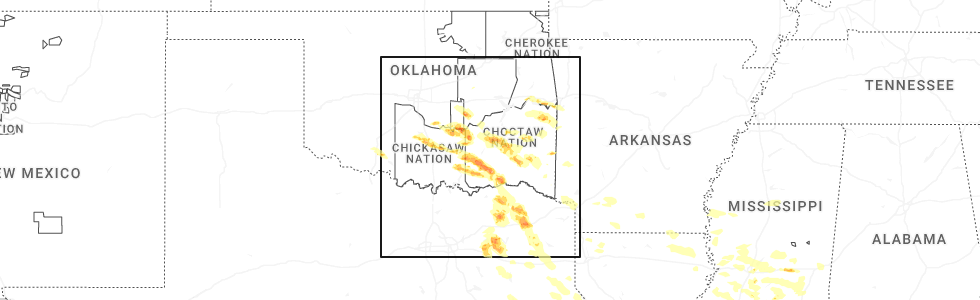
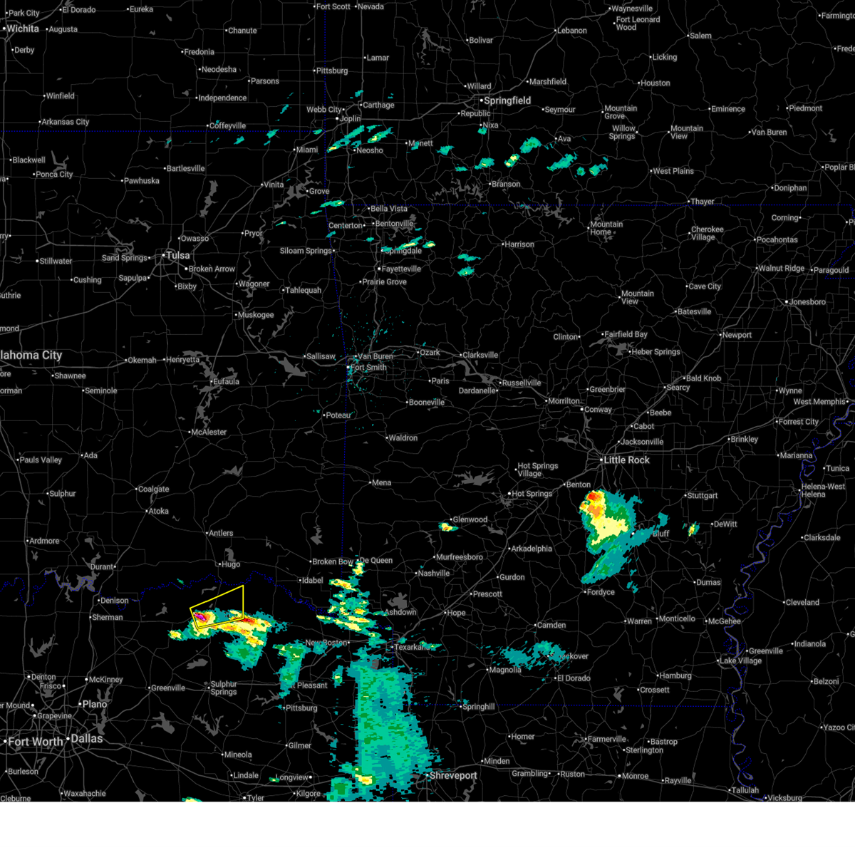
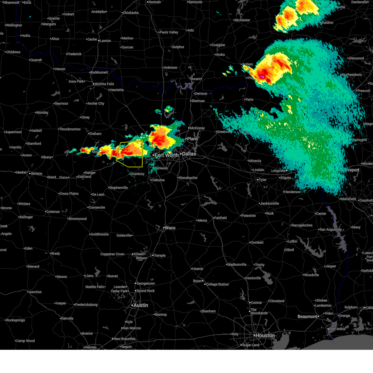
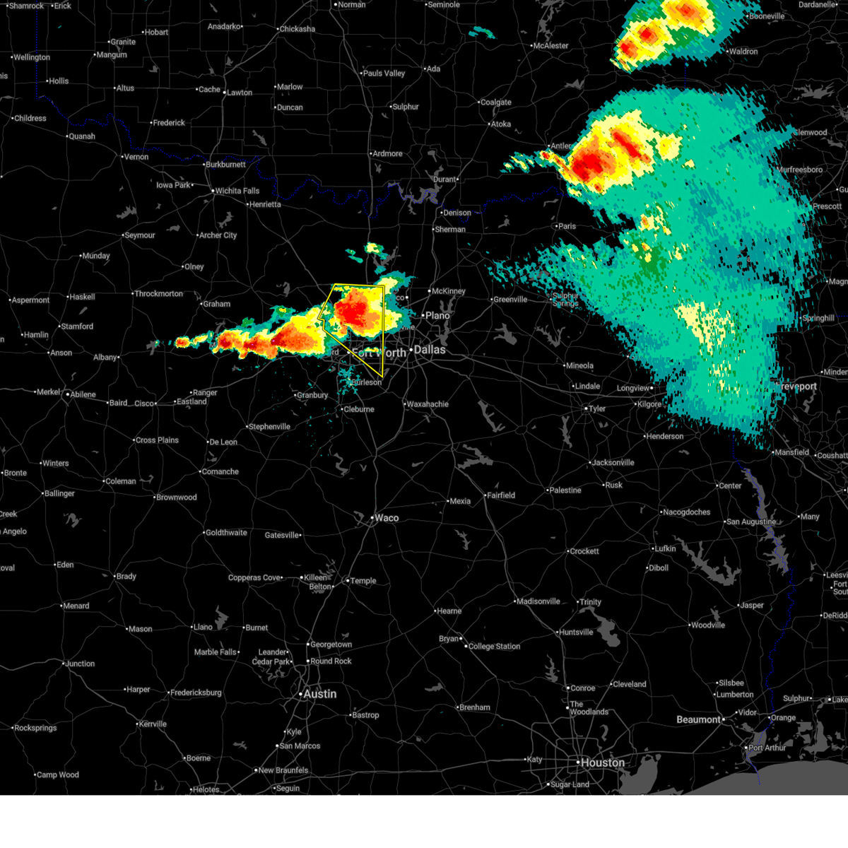
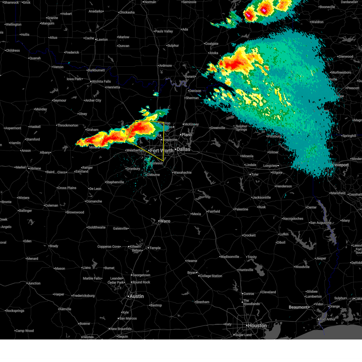
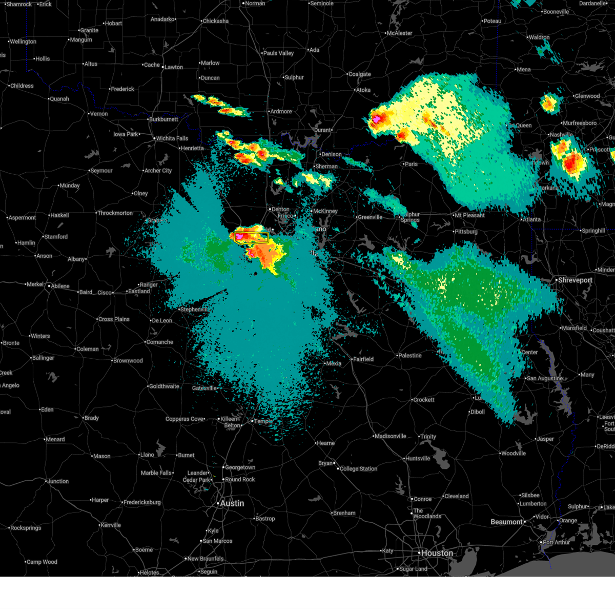
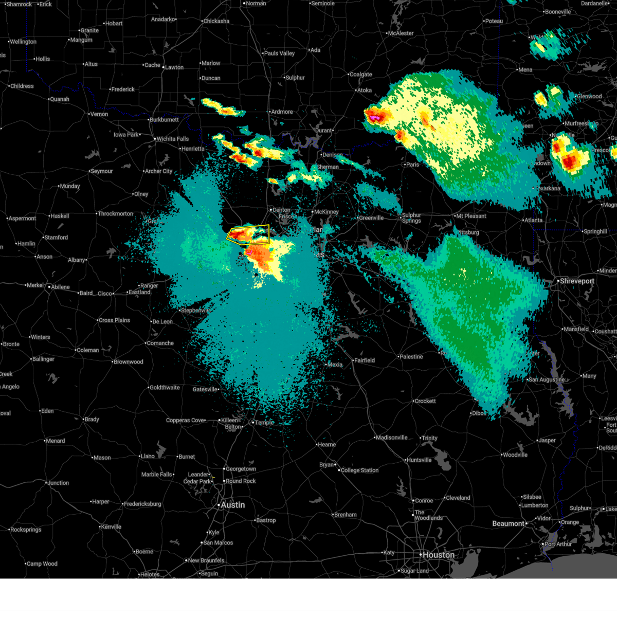
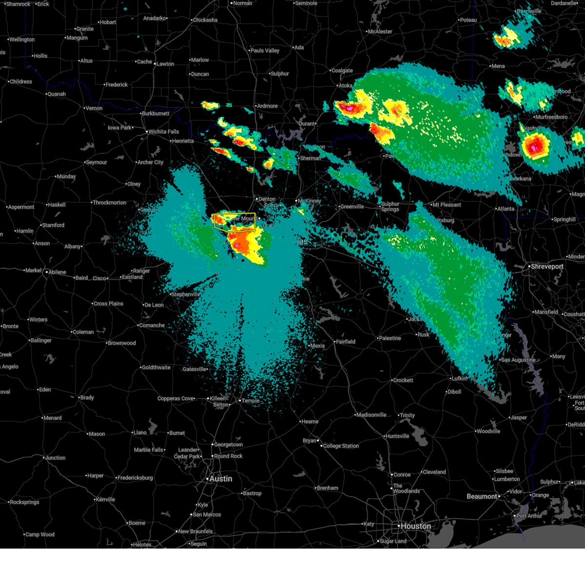
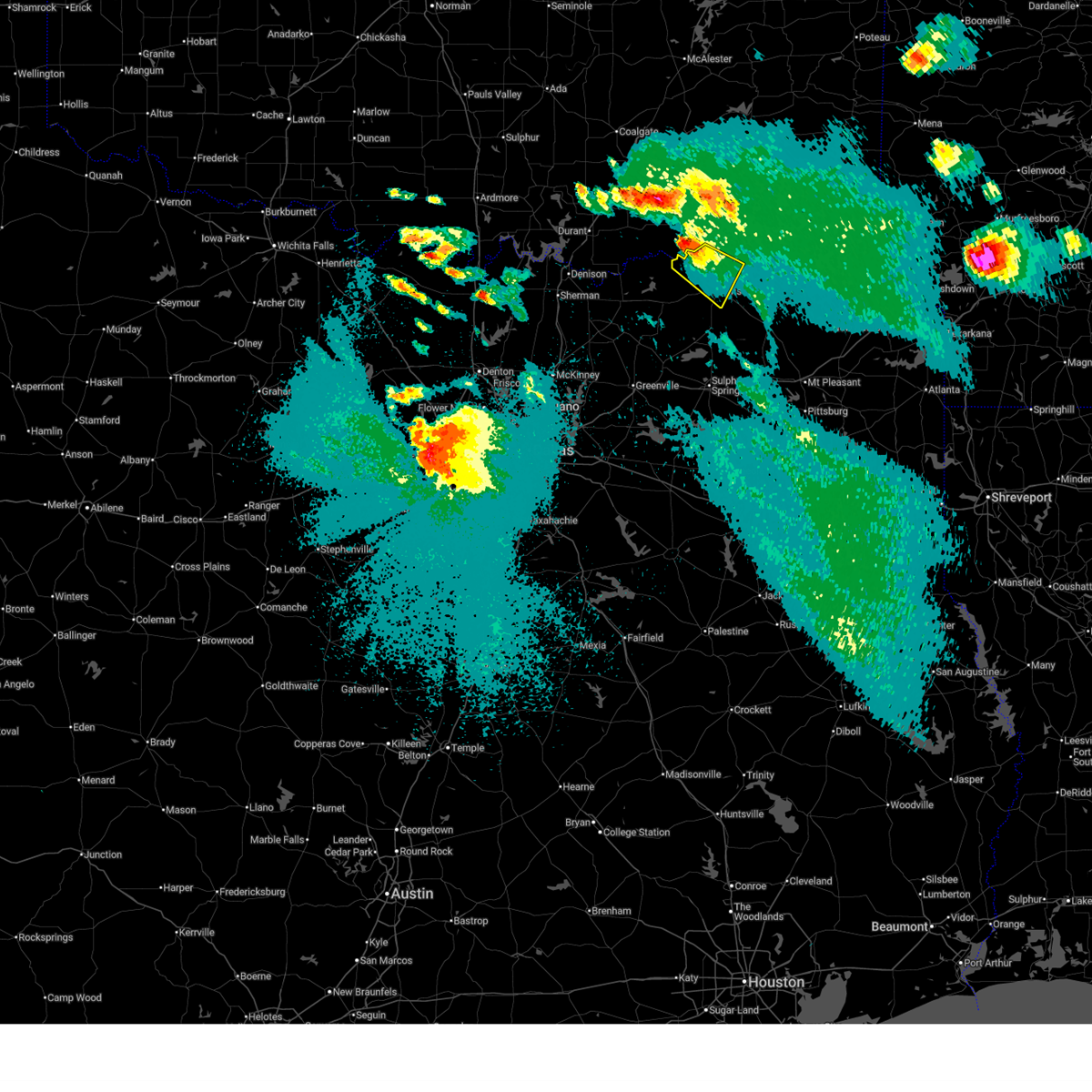
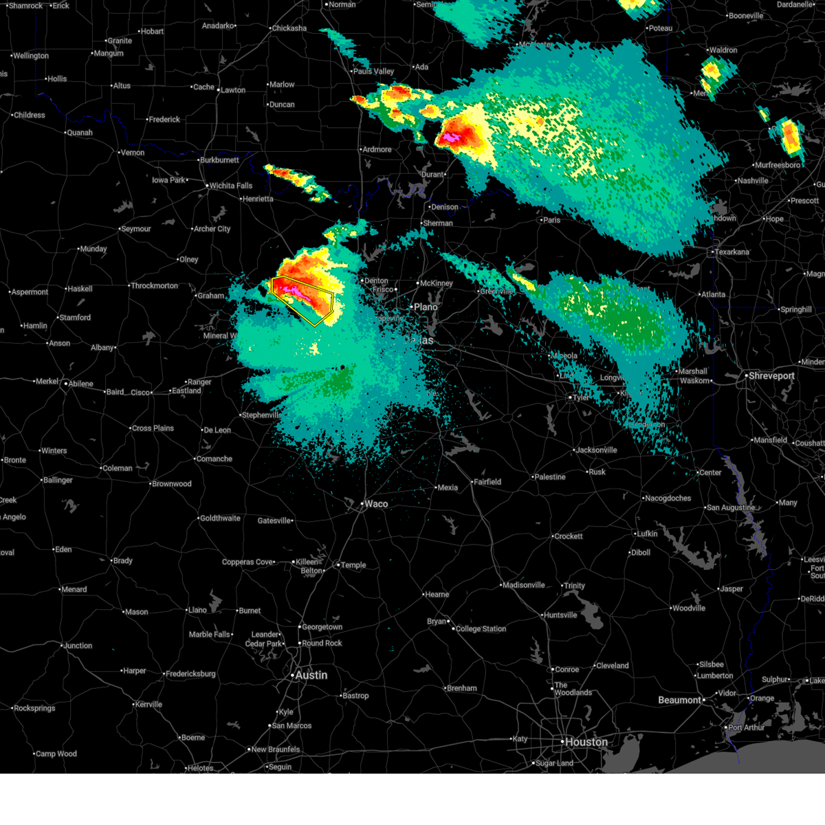
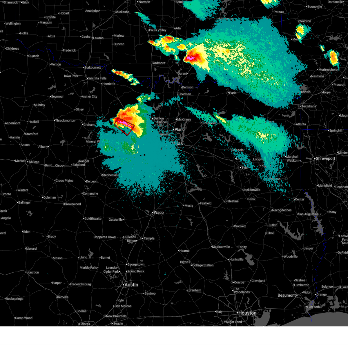
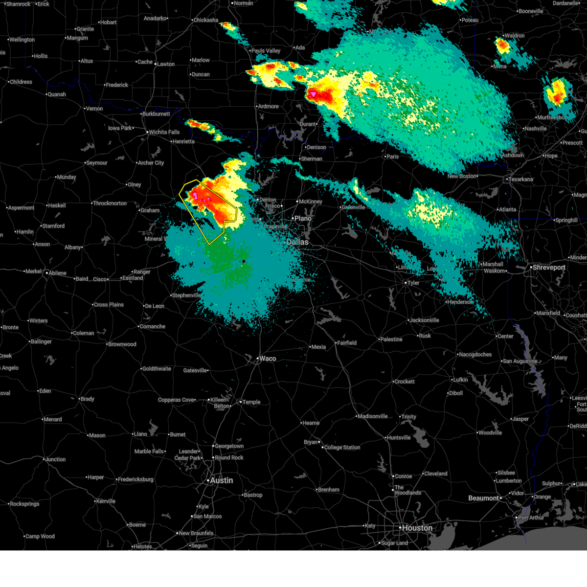
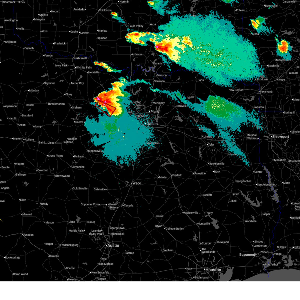
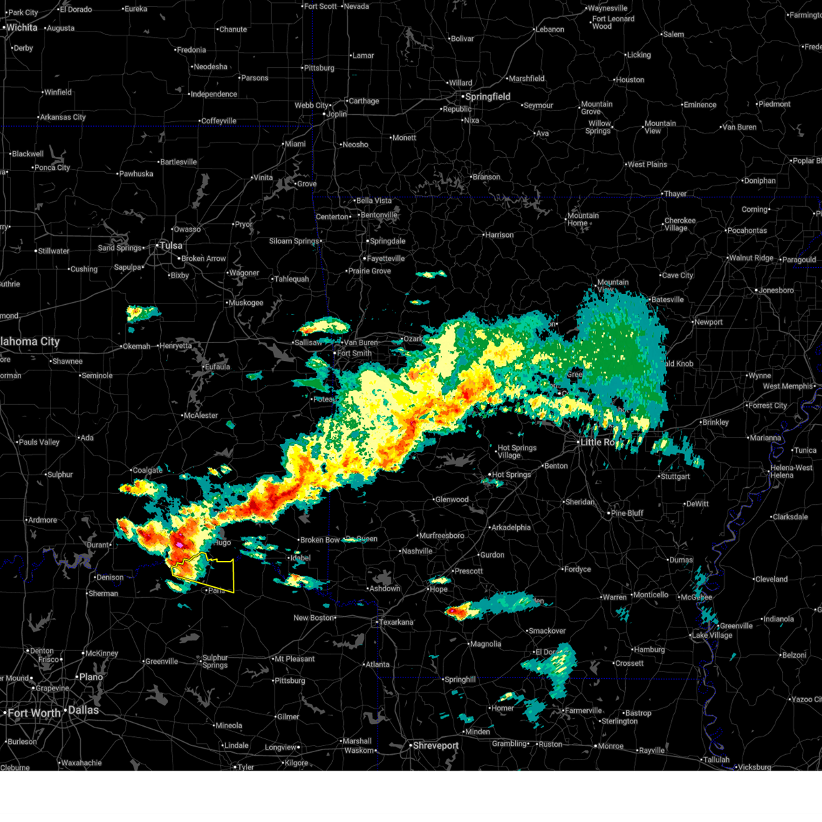
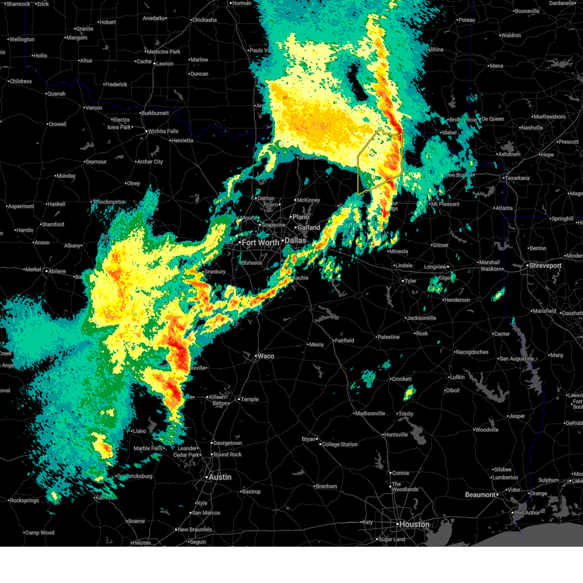
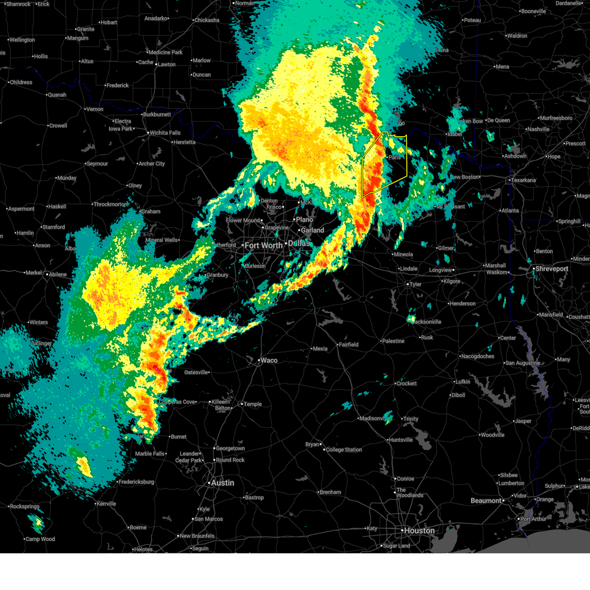
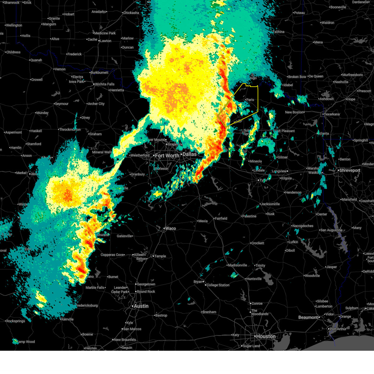
Hail Map for Reno, TX
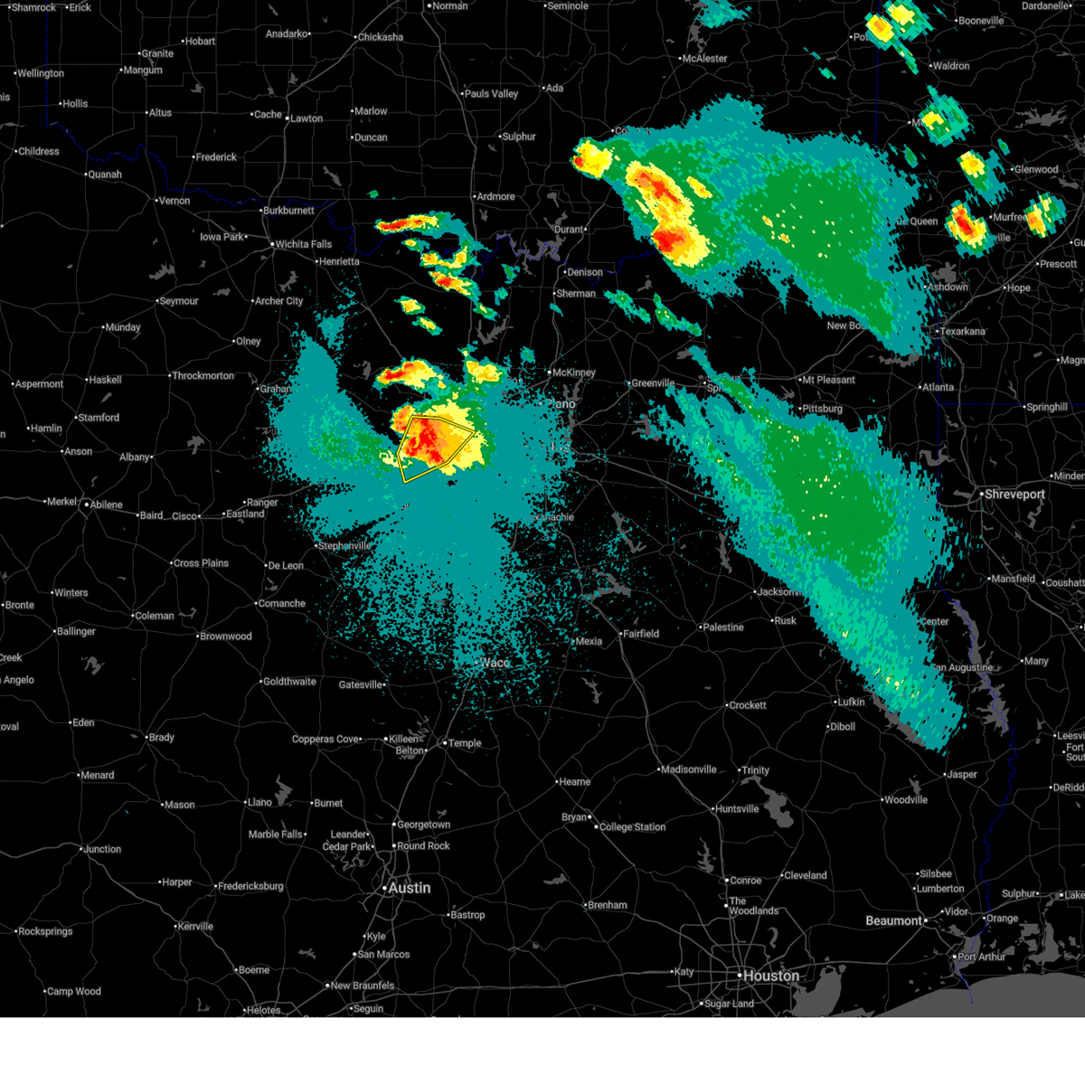
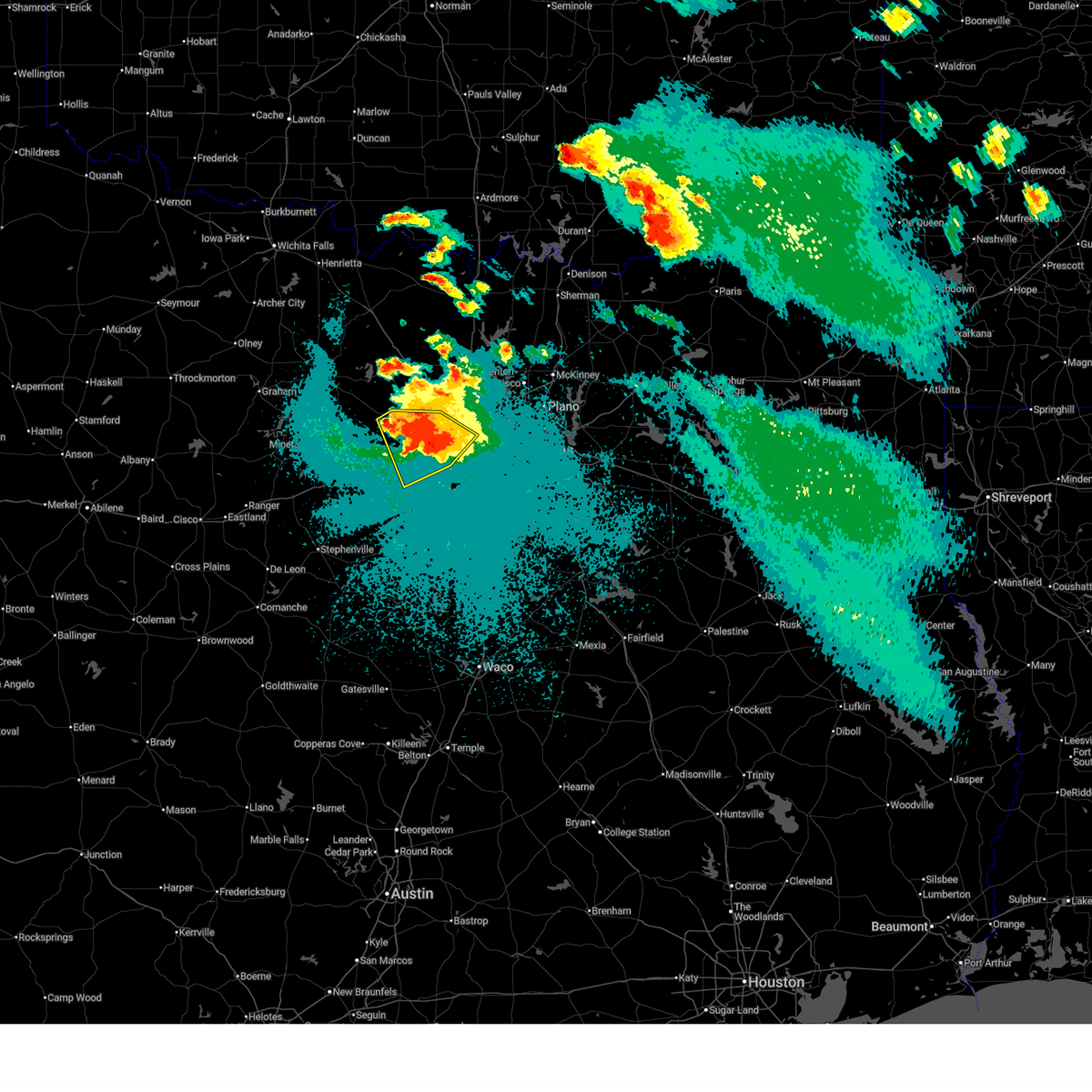
The Reno, TX area has had 2 reports of on-the-ground hail by trained spotters, and has been under severe weather warnings 71 times during the past 12 months. Doppler radar has detected hail at or near Reno, TX on 201 occasions, including 12 occasions during the past year.
| Name: | Reno, TX |
| Where Located: | 61.9 miles SE of Atoka, OK |
| Map: | Google Map for Reno, TX |
| Population: | 3166 |
| Housing Units: | 1265 |
| More Info: | Search Google for Reno, TX |
1
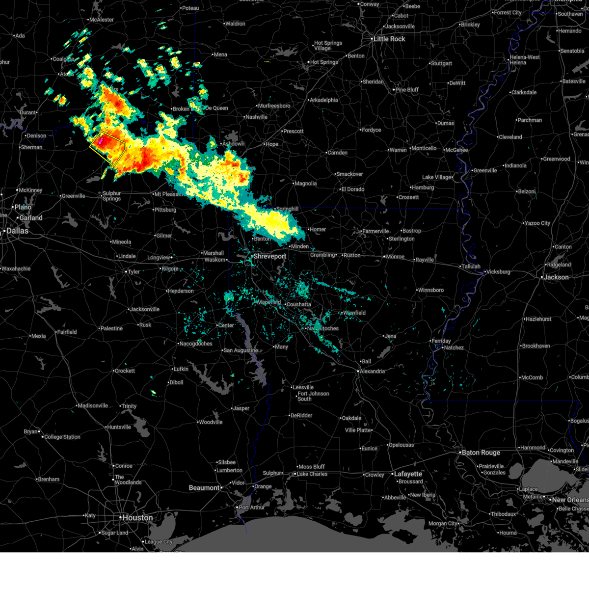
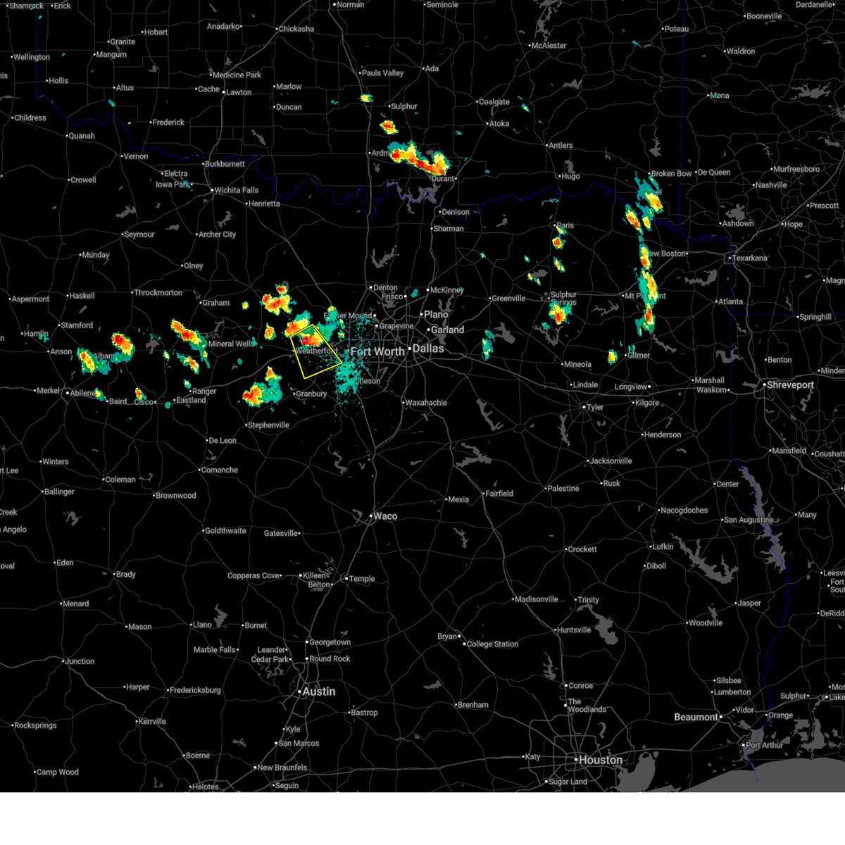
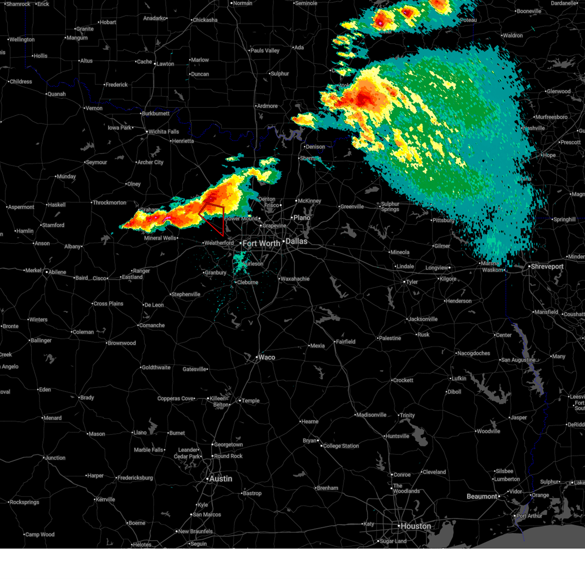
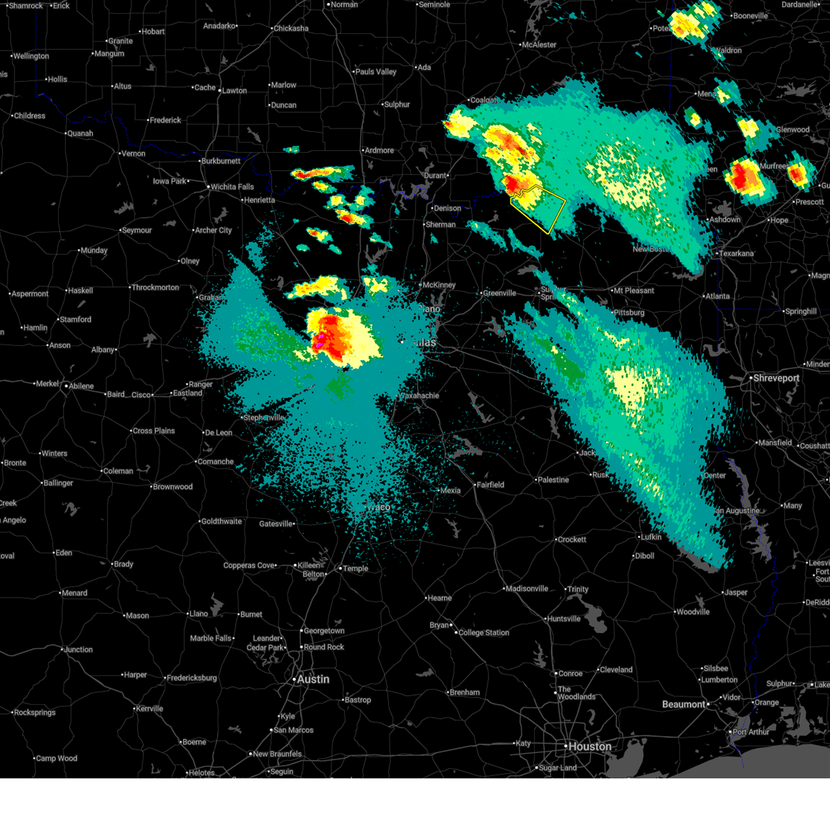
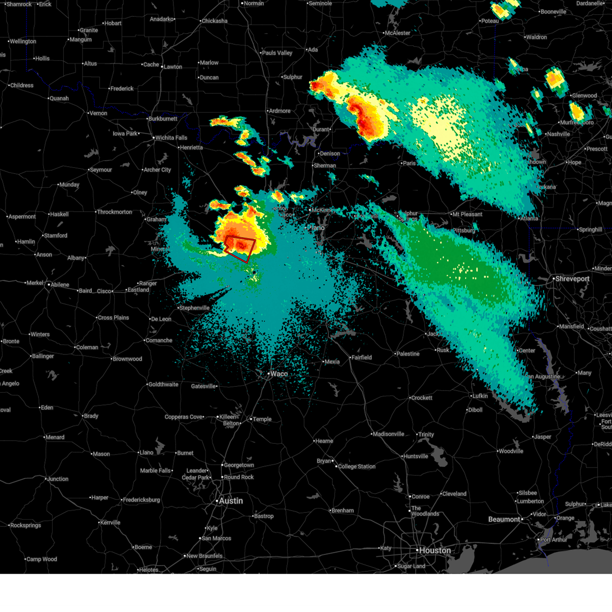
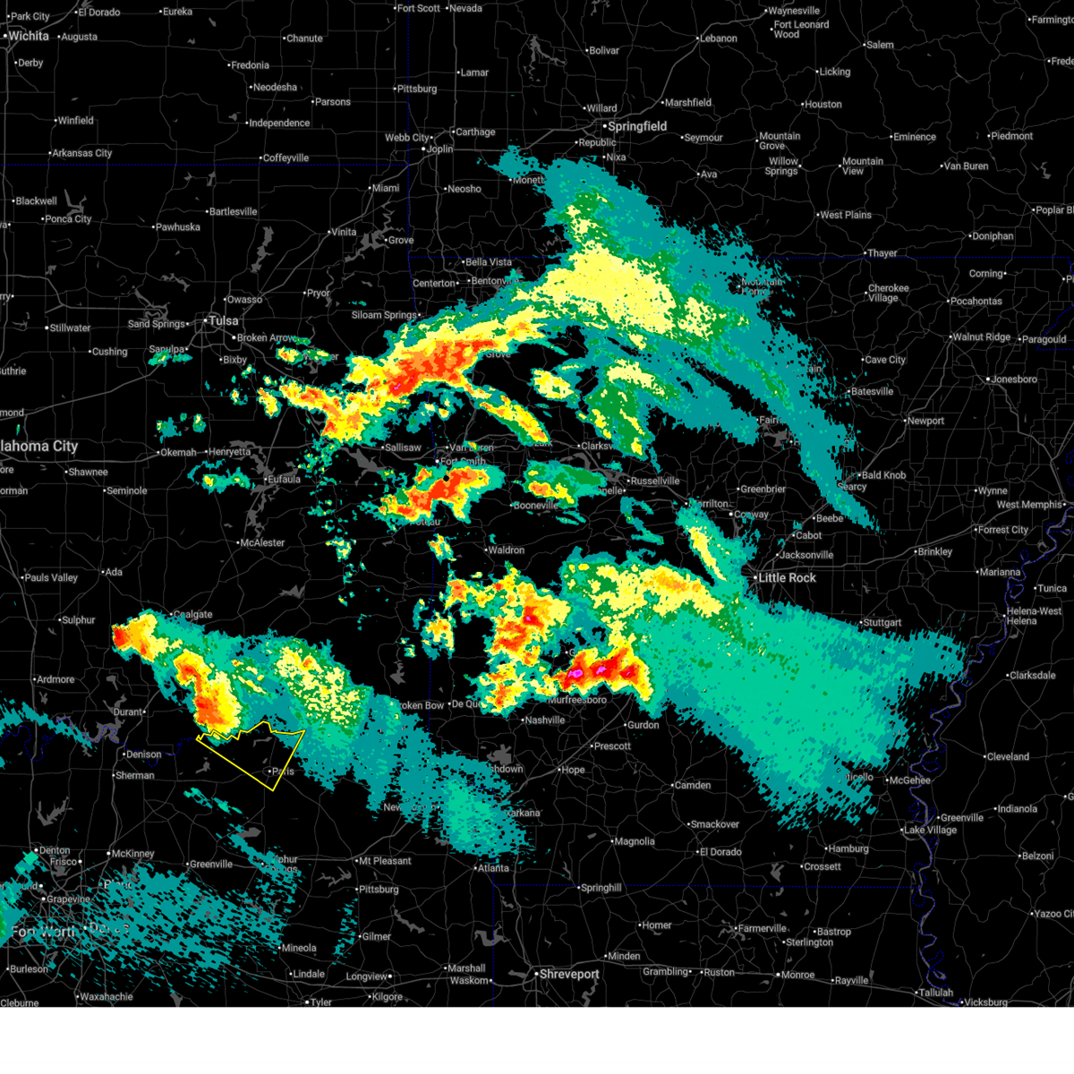
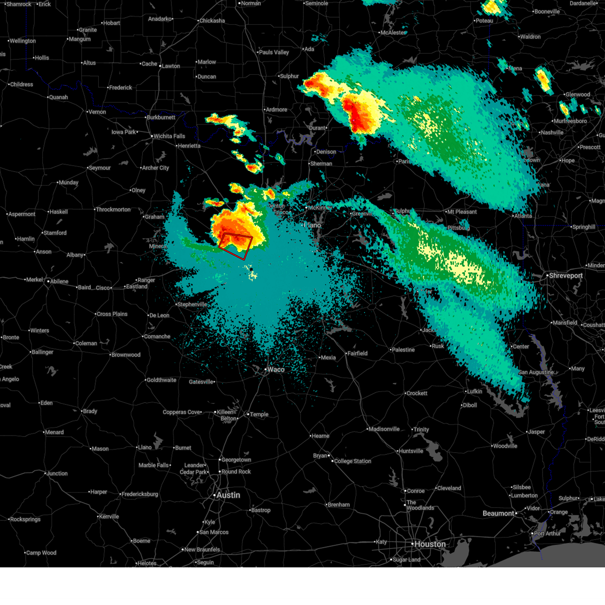
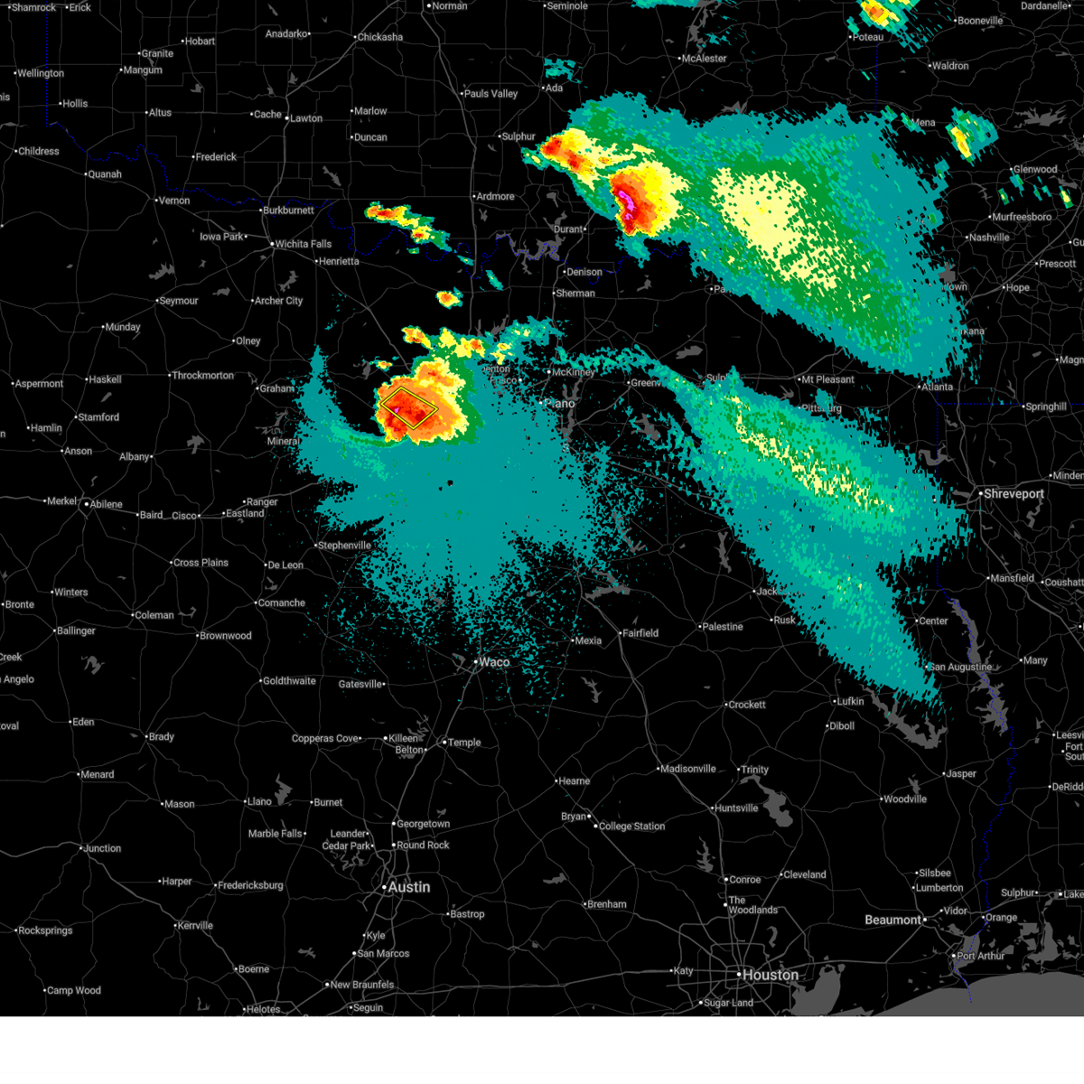
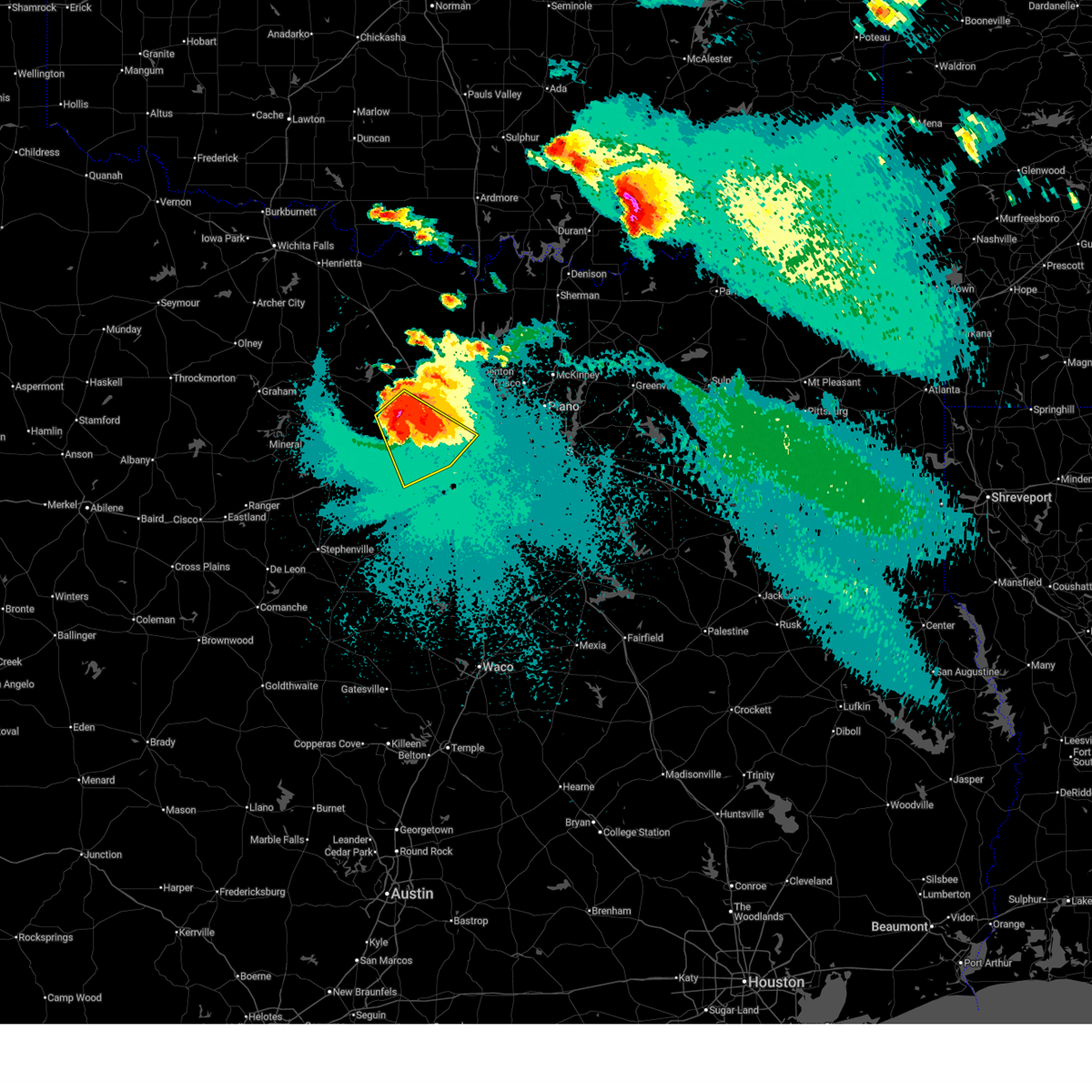
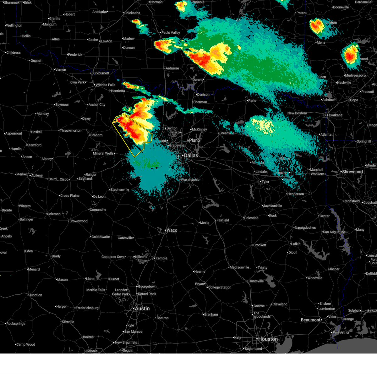
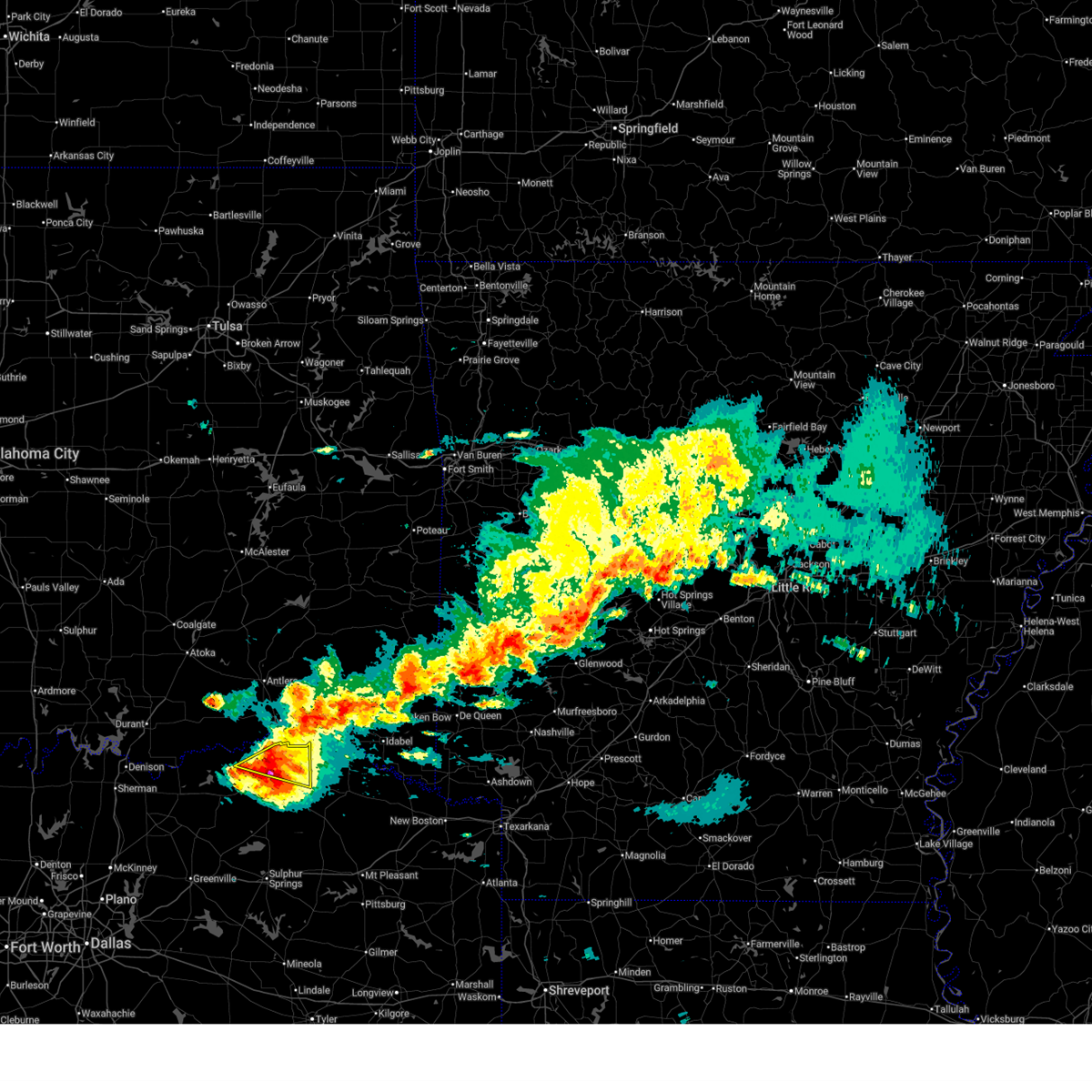
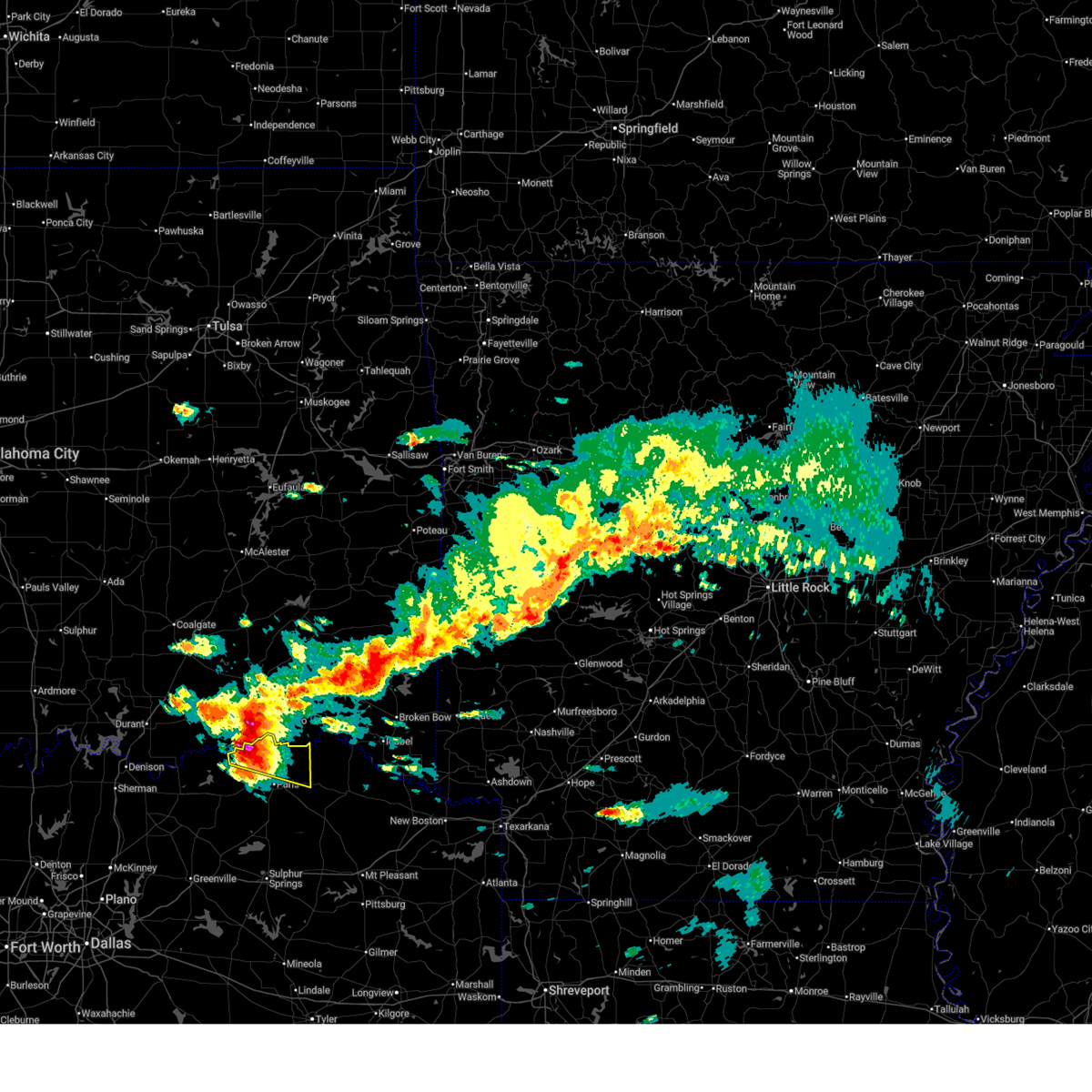
The Top Recent Hail Date for Reno, TX is Friday, April 24, 2026 (20th out of 201)
Hail and Wind Damage Spotted near Reno, TX
| Date / Time | Report Details |
|---|---|
| 6/23/2026 6:39 PM CDT |
 The storm which prompted the warning has moved out of the area. therefore the warning will be allowed to expire. however, gusty winds are still possible. a severe thunderstorm watch remains in effect until 1000 pm cdt for north central texas. The storm which prompted the warning has moved out of the area. therefore the warning will be allowed to expire. however, gusty winds are still possible. a severe thunderstorm watch remains in effect until 1000 pm cdt for north central texas.
|
| 6/23/2026 6:10 PM CDT |
 Svrfwd the national weather service in fort worth has issued a * severe thunderstorm warning for, northeastern lamar county in north central texas, * until 645 pm cdt. * at 610 pm cdt, a severe thunderstorm was located near blossom, or 7 miles northeast of paris, moving east at 20 mph (radar indicated). Hazards include 65 mph wind gusts and penny size hail. Expect damage to roofs, siding, and trees. this severe thunderstorm will be near, blossom around 615 pm cdt. Other locations impacted by this severe thunderstorm include faught, sun valley, novice, midcity, and atlas. Svrfwd the national weather service in fort worth has issued a * severe thunderstorm warning for, northeastern lamar county in north central texas, * until 645 pm cdt. * at 610 pm cdt, a severe thunderstorm was located near blossom, or 7 miles northeast of paris, moving east at 20 mph (radar indicated). Hazards include 65 mph wind gusts and penny size hail. Expect damage to roofs, siding, and trees. this severe thunderstorm will be near, blossom around 615 pm cdt. Other locations impacted by this severe thunderstorm include faught, sun valley, novice, midcity, and atlas.
|
| 6/23/2026 9:47 AM CDT |
 the severe thunderstorm warning has been cancelled and is no longer in effect the severe thunderstorm warning has been cancelled and is no longer in effect
|
| 6/23/2026 9:34 AM CDT |
 At 934 am cdt, a severe thunderstorm was located just south of paris, moving southeast at 10 mph (radar indicated). Hazards include 60 mph wind gusts and quarter size hail. Hail damage to vehicles is expected. expect wind damage to roofs, siding, and trees. Locations impacted include, paris, pattonville, biardstown, atlas, taylor town, glory, clardy, and broadway junction. At 934 am cdt, a severe thunderstorm was located just south of paris, moving southeast at 10 mph (radar indicated). Hazards include 60 mph wind gusts and quarter size hail. Hail damage to vehicles is expected. expect wind damage to roofs, siding, and trees. Locations impacted include, paris, pattonville, biardstown, atlas, taylor town, glory, clardy, and broadway junction.
|
| 6/23/2026 9:03 AM CDT |
 Svrfwd the national weather service in fort worth has issued a * severe thunderstorm warning for, central lamar county in north central texas, * until 1000 am cdt. * at 903 am cdt, a severe thunderstorm was located over paris, moving southeast at 10 mph (radar indicated). Hazards include 60 mph wind gusts and quarter size hail. Hail damage to vehicles is expected. expect wind damage to roofs, siding, and trees. this severe thunderstorm will be near, paris and lake crook around 910 am cdt. reno around 915 am cdt. Other locations impacted by this severe thunderstorm include toco, biardstown, atlas, taylor town, brookston, sun valley, glory, clardy, and broadway junction. Svrfwd the national weather service in fort worth has issued a * severe thunderstorm warning for, central lamar county in north central texas, * until 1000 am cdt. * at 903 am cdt, a severe thunderstorm was located over paris, moving southeast at 10 mph (radar indicated). Hazards include 60 mph wind gusts and quarter size hail. Hail damage to vehicles is expected. expect wind damage to roofs, siding, and trees. this severe thunderstorm will be near, paris and lake crook around 910 am cdt. reno around 915 am cdt. Other locations impacted by this severe thunderstorm include toco, biardstown, atlas, taylor town, brookston, sun valley, glory, clardy, and broadway junction.
|
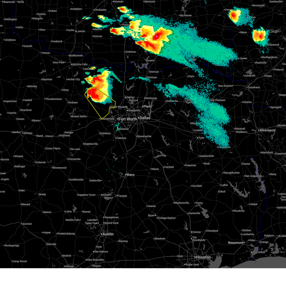
| 6/19/2026 4:42 AM CDT |
 At 442 am cdt, severe thunderstorms were located along a line extending from near poolville to near brock to near lipan, moving east at 30 mph (radar indicated). Hazards include 60 mph wind gusts. Expect damage to roofs, siding, and trees. Locations impacted include, weatherford, mineral wells, willow park, aledo, springtown, brock, hudson oaks, western lake, annetta, poolville, cool, lake mineral wells, lake weatherford, horseshoe bend, annetta south, annetta north, millsap, adell, advance, and salesville. At 442 am cdt, severe thunderstorms were located along a line extending from near poolville to near brock to near lipan, moving east at 30 mph (radar indicated). Hazards include 60 mph wind gusts. Expect damage to roofs, siding, and trees. Locations impacted include, weatherford, mineral wells, willow park, aledo, springtown, brock, hudson oaks, western lake, annetta, poolville, cool, lake mineral wells, lake weatherford, horseshoe bend, annetta south, annetta north, millsap, adell, advance, and salesville.
|
| 6/19/2026 4:13 AM CDT |
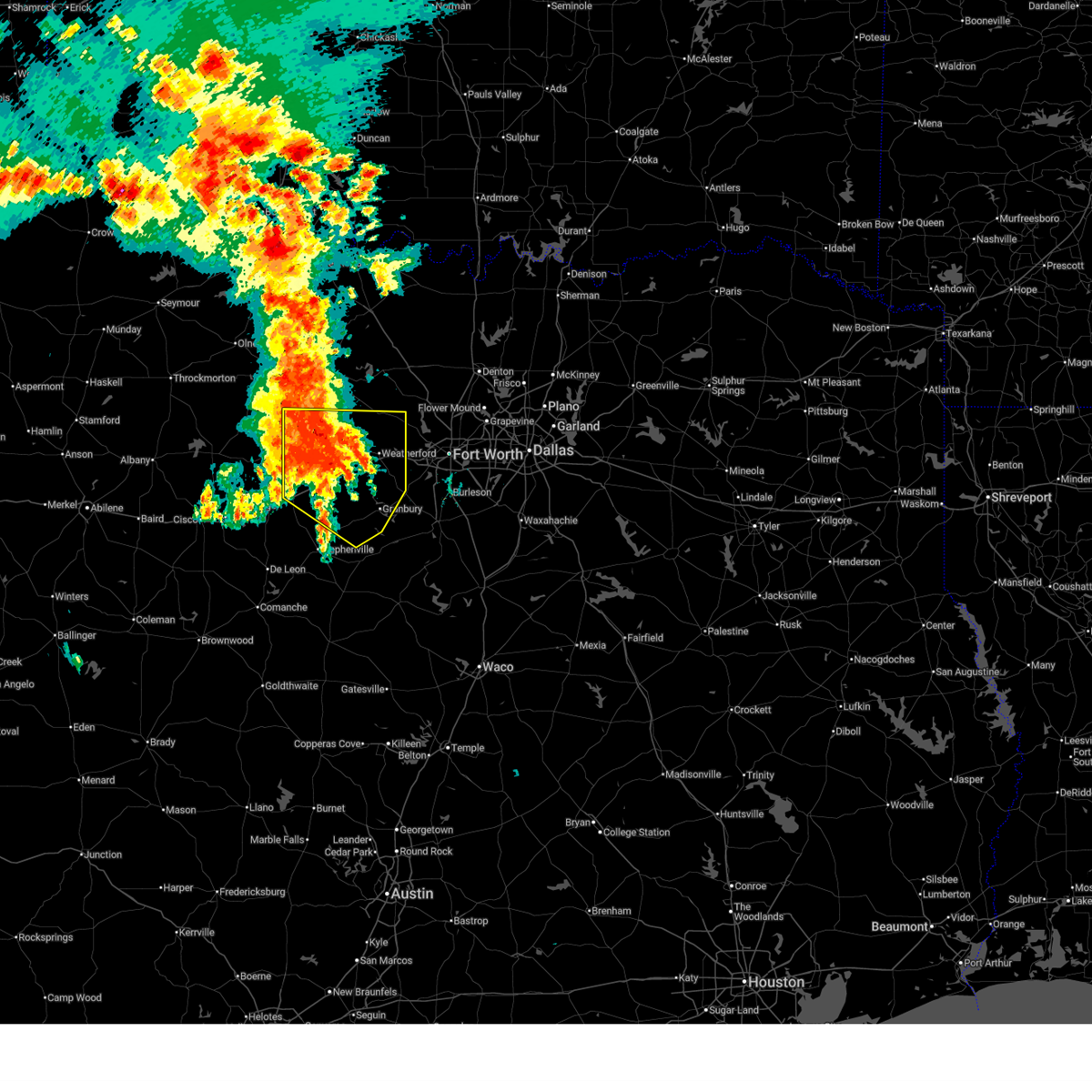 Svrfwd the national weather service in fort worth has issued a * severe thunderstorm warning for, northeastern erath county in north central texas, parker county in north central texas, palo pinto county in north central texas, hood county in north central texas, * until 515 am cdt. * at 413 am cdt, severe thunderstorms were located along a line extending from near graford to 6 miles east of palo pinto to near gordon, moving east at 35 mph (radar indicated). Hazards include 60 mph wind gusts and penny size hail. expect damage to roofs, siding, and trees Svrfwd the national weather service in fort worth has issued a * severe thunderstorm warning for, northeastern erath county in north central texas, parker county in north central texas, palo pinto county in north central texas, hood county in north central texas, * until 515 am cdt. * at 413 am cdt, severe thunderstorms were located along a line extending from near graford to 6 miles east of palo pinto to near gordon, moving east at 35 mph (radar indicated). Hazards include 60 mph wind gusts and penny size hail. expect damage to roofs, siding, and trees
|
| 5/28/2026 4:03 PM CDT |
 At 401 pm cdt, a severe thunderstorm was located over willow park, moving southeast at 25 mph. another severe thunderstorm was located 5 miles north of weatherford, moving southeast at 25 mph (radar indicated. at 358 pm cdt...quarter size hail was reported northwest of willow park with this storm). Hazards include 60 mph wind gusts and half dollar size hail. Hail damage to vehicles is expected. expect wind damage to roofs, siding, and trees. Locations impacted include, west fort worth, weatherford, benbrook, white settlement, azle, willow park, aledo, hudson oaks, annetta, lake weatherford, annetta south, annetta north, la junta, highland addition, and benbrook lake. At 401 pm cdt, a severe thunderstorm was located over willow park, moving southeast at 25 mph. another severe thunderstorm was located 5 miles north of weatherford, moving southeast at 25 mph (radar indicated. at 358 pm cdt...quarter size hail was reported northwest of willow park with this storm). Hazards include 60 mph wind gusts and half dollar size hail. Hail damage to vehicles is expected. expect wind damage to roofs, siding, and trees. Locations impacted include, west fort worth, weatherford, benbrook, white settlement, azle, willow park, aledo, hudson oaks, annetta, lake weatherford, annetta south, annetta north, la junta, highland addition, and benbrook lake.
|
| 5/28/2026 3:49 PM CDT |
 At 348 pm cdt, a severe thunderstorm was located near weatherford, moving southeast at 20 mph (radar indicated). Hazards include 60 mph wind gusts and half dollar size hail. Hail damage to vehicles is expected. expect wind damage to roofs, siding, and trees. Locations impacted include, fort worth, weatherford, benbrook, white settlement, azle, willow park, aledo, hudson oaks, annetta, lake weatherford, annetta south, annetta north, la junta, highland addition, and benbrook lake. At 348 pm cdt, a severe thunderstorm was located near weatherford, moving southeast at 20 mph (radar indicated). Hazards include 60 mph wind gusts and half dollar size hail. Hail damage to vehicles is expected. expect wind damage to roofs, siding, and trees. Locations impacted include, fort worth, weatherford, benbrook, white settlement, azle, willow park, aledo, hudson oaks, annetta, lake weatherford, annetta south, annetta north, la junta, highland addition, and benbrook lake.
|
| 5/28/2026 3:40 PM CDT |
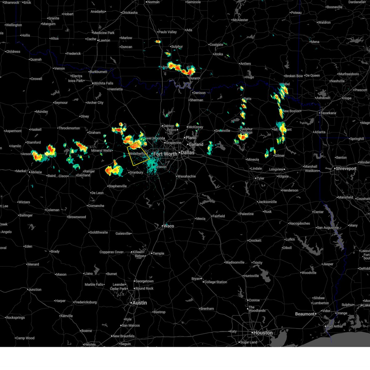 Svrfwd the national weather service in fort worth has issued a * severe thunderstorm warning for, eastern parker county in north central texas, west central tarrant county in north central texas, * until 415 pm cdt. * at 339 pm cdt, a severe thunderstorm was located near lake weatherford, or 7 miles northeast of weatherford, moving southeast at 25 mph (radar indicated). Hazards include 60 mph wind gusts and quarter size hail. Hail damage to vehicles is expected. Expect wind damage to roofs, siding, and trees. Svrfwd the national weather service in fort worth has issued a * severe thunderstorm warning for, eastern parker county in north central texas, west central tarrant county in north central texas, * until 415 pm cdt. * at 339 pm cdt, a severe thunderstorm was located near lake weatherford, or 7 miles northeast of weatherford, moving southeast at 25 mph (radar indicated). Hazards include 60 mph wind gusts and quarter size hail. Hail damage to vehicles is expected. Expect wind damage to roofs, siding, and trees.
|
| 4/29/2026 4:51 PM CDT |
 The storm which prompted the warning has moved out of the area. therefore the warning will be allowed to expire. a severe thunderstorm watch remains in effect until 700 pm cdt for north central texas. to report severe weather, contact your nearest law enforcement agency. they will relay your report to the national weather service fort worth. The storm which prompted the warning has moved out of the area. therefore the warning will be allowed to expire. a severe thunderstorm watch remains in effect until 700 pm cdt for north central texas. to report severe weather, contact your nearest law enforcement agency. they will relay your report to the national weather service fort worth.
|
| 4/29/2026 4:36 PM CDT |
 At 436 pm cdt, a severe thunderstorm was located near blossom, or 9 miles northeast of paris, moving east at 40 mph (emergency management. at 426 pm cdt...quarter size hail was reported in paris with this storm). Hazards include half dollar size hail. Damage to vehicles is possible. Locations impacted include, paris, blossom, novice, sun valley, and faught. At 436 pm cdt, a severe thunderstorm was located near blossom, or 9 miles northeast of paris, moving east at 40 mph (emergency management. at 426 pm cdt...quarter size hail was reported in paris with this storm). Hazards include half dollar size hail. Damage to vehicles is possible. Locations impacted include, paris, blossom, novice, sun valley, and faught.
|
| 4/29/2026 4:14 PM CDT |
 Svrfwd the national weather service in fort worth has issued a * severe thunderstorm warning for, central lamar county in north central texas, * until 500 pm cdt. * at 414 pm cdt, a severe thunderstorm was located near lake gibbons, moving east at 45 mph (radar indicated). Hazards include ping pong ball size hail. People and animals outdoors will be injured. Expect damage to roofs, siding, windows, and vehicles. Svrfwd the national weather service in fort worth has issued a * severe thunderstorm warning for, central lamar county in north central texas, * until 500 pm cdt. * at 414 pm cdt, a severe thunderstorm was located near lake gibbons, moving east at 45 mph (radar indicated). Hazards include ping pong ball size hail. People and animals outdoors will be injured. Expect damage to roofs, siding, windows, and vehicles.
|
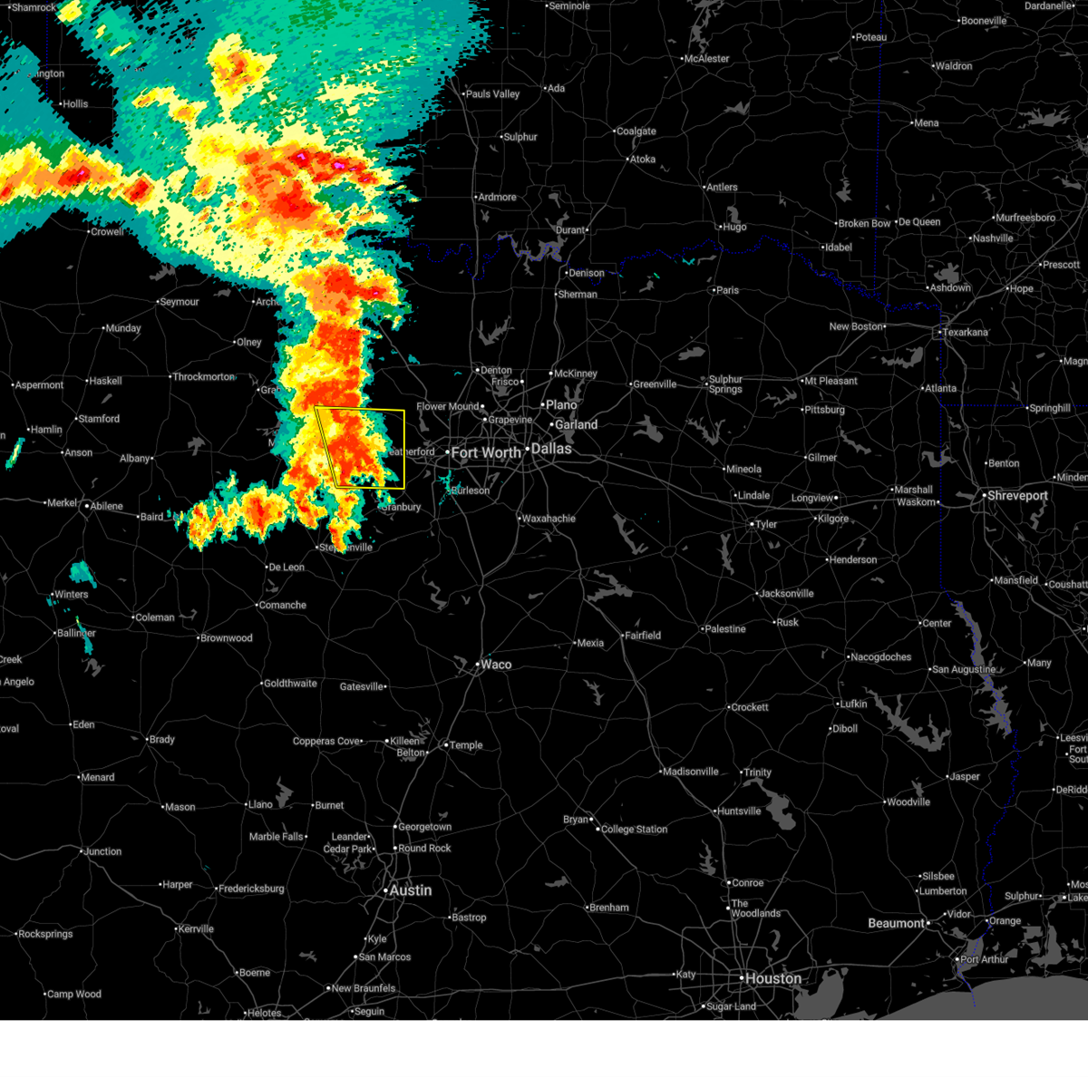
| 4/28/2026 5:21 PM CDT |
 Svrfwd the national weather service in fort worth has issued a * severe thunderstorm warning for, parker county in north central texas, * until 630 pm cdt. * at 521 pm cdt, a severe thunderstorm was located near cool, or 7 miles east of mineral wells, moving southeast at 30 mph (radar indicated). Hazards include tennis ball size hail and 60 mph wind gusts. People and animals outdoors will be injured. expect hail damage to roofs, siding, windows, and vehicles. Expect wind damage to roofs, siding, and trees. Svrfwd the national weather service in fort worth has issued a * severe thunderstorm warning for, parker county in north central texas, * until 630 pm cdt. * at 521 pm cdt, a severe thunderstorm was located near cool, or 7 miles east of mineral wells, moving southeast at 30 mph (radar indicated). Hazards include tennis ball size hail and 60 mph wind gusts. People and animals outdoors will be injured. expect hail damage to roofs, siding, windows, and vehicles. Expect wind damage to roofs, siding, and trees.
|
| 4/28/2026 5:14 PM CDT |
 At 514 pm cdt, a severe thunderstorm was located near pecan acres, or near eagle mountain, moving southeast at 30 mph (radar indicated). Hazards include golf ball size hail and 70 mph wind gusts. People and animals outdoors will be injured. expect hail damage to roofs, siding, windows, and vehicles. expect considerable tree damage. wind damage is also likely to mobile homes, roofs, and outbuildings. Locations impacted include, fort worth, arlington, grand prairie, denton, lewisville, flower mound, euless, bedford, grapevine, haltom city, keller, hurst, southlake, watauga, colleyville, corinth, saginaw, highland village, azle, and trophy club. At 514 pm cdt, a severe thunderstorm was located near pecan acres, or near eagle mountain, moving southeast at 30 mph (radar indicated). Hazards include golf ball size hail and 70 mph wind gusts. People and animals outdoors will be injured. expect hail damage to roofs, siding, windows, and vehicles. expect considerable tree damage. wind damage is also likely to mobile homes, roofs, and outbuildings. Locations impacted include, fort worth, arlington, grand prairie, denton, lewisville, flower mound, euless, bedford, grapevine, haltom city, keller, hurst, southlake, watauga, colleyville, corinth, saginaw, highland village, azle, and trophy club.
|
| 4/28/2026 4:48 PM CDT |
 Svrfwd the national weather service in fort worth has issued a * severe thunderstorm warning for, southeastern wise county in north central texas, southwestern denton county in north central texas, northeastern parker county in north central texas, tarrant county in north central texas, * until 600 pm cdt. * at 448 pm cdt, a severe thunderstorm was located near boyd, moving southeast at 30 mph (radar indicated). Hazards include golf ball size hail and 70 mph wind gusts. People and animals outdoors will be injured. expect hail damage to roofs, siding, windows, and vehicles. expect considerable tree damage. Wind damage is also likely to mobile homes, roofs, and outbuildings. Svrfwd the national weather service in fort worth has issued a * severe thunderstorm warning for, southeastern wise county in north central texas, southwestern denton county in north central texas, northeastern parker county in north central texas, tarrant county in north central texas, * until 600 pm cdt. * at 448 pm cdt, a severe thunderstorm was located near boyd, moving southeast at 30 mph (radar indicated). Hazards include golf ball size hail and 70 mph wind gusts. People and animals outdoors will be injured. expect hail damage to roofs, siding, windows, and vehicles. expect considerable tree damage. Wind damage is also likely to mobile homes, roofs, and outbuildings.
|
| 4/28/2026 4:30 PM CDT |
 Torfwd the national weather service in fort worth has issued a * tornado warning for, southwestern wise county in north central texas, northeastern parker county in north central texas, * until 500 pm cdt. * at 429 pm cdt, a severe thunderstorm capable of producing a tornado was located near paradise, or 9 miles south of bridgeport, moving southeast at 30 mph (radar indicated rotation). Hazards include tornado and golf ball size hail plus 65 mph winds. Flying debris will be dangerous to those caught without shelter. mobile homes will be damaged or destroyed. damage to roofs, windows, and vehicles will occur. Tree damage is likely. Torfwd the national weather service in fort worth has issued a * tornado warning for, southwestern wise county in north central texas, northeastern parker county in north central texas, * until 500 pm cdt. * at 429 pm cdt, a severe thunderstorm capable of producing a tornado was located near paradise, or 9 miles south of bridgeport, moving southeast at 30 mph (radar indicated rotation). Hazards include tornado and golf ball size hail plus 65 mph winds. Flying debris will be dangerous to those caught without shelter. mobile homes will be damaged or destroyed. damage to roofs, windows, and vehicles will occur. Tree damage is likely.
|
| 4/27/2026 7:17 PM CDT |
 Svrfwd the national weather service in fort worth has issued a * severe thunderstorm warning for, north central hunt county in north central texas, northwestern delta county in north central texas, southwestern lamar county in north central texas, southeastern fannin county in north central texas, * until 815 pm cdt. * at 716 pm cdt, a severe thunderstorm was located over wolfe city, or 14 miles southeast of bonham, moving northeast at 35 mph (trained weather spotters. at 715 pm cdt, quarter sized hail was reported in wolfe city). Hazards include 60 mph wind gusts and quarter size hail. Hail damage to vehicles is expected. expect wind damage to roofs, siding, and trees. this severe thunderstorm will be near, honey grove around 735 pm cdt. sumner and lake gibbons around 805 pm cdt. paris and lake crook around 810 pm cdt. Other locations impacted by this severe thunderstorm include east direct, toco, atlas, noble, direct, allens chapel, allens point, dial, howland, and forest hill. Svrfwd the national weather service in fort worth has issued a * severe thunderstorm warning for, north central hunt county in north central texas, northwestern delta county in north central texas, southwestern lamar county in north central texas, southeastern fannin county in north central texas, * until 815 pm cdt. * at 716 pm cdt, a severe thunderstorm was located over wolfe city, or 14 miles southeast of bonham, moving northeast at 35 mph (trained weather spotters. at 715 pm cdt, quarter sized hail was reported in wolfe city). Hazards include 60 mph wind gusts and quarter size hail. Hail damage to vehicles is expected. expect wind damage to roofs, siding, and trees. this severe thunderstorm will be near, honey grove around 735 pm cdt. sumner and lake gibbons around 805 pm cdt. paris and lake crook around 810 pm cdt. Other locations impacted by this severe thunderstorm include east direct, toco, atlas, noble, direct, allens chapel, allens point, dial, howland, and forest hill.
|
| 4/25/2026 11:59 PM CDT |
 Svrfwd the national weather service in fort worth has issued a * severe thunderstorm warning for, northwestern tarrant county in north central texas, * until 1230 am cdt. * at 1159 pm cdt, a severe thunderstorm was located over saginaw, moving southeast at 25 mph (radar indicated). Hazards include tennis ball size hail and 60 mph wind gusts. People and animals outdoors will be injured. expect hail damage to roofs, siding, windows, and vehicles. expect wind damage to roofs, siding, and trees. this severe thunderstorm will be near, fort worth, saginaw, sansom park, lake worth, and blue mound around 1205 am cdt. haltom city and watauga around 1210 am cdt. richland hills and north richland hills around 1215 am cdt. other locations impacted by this severe thunderstorm include lake worth, lakeside, westover hills, and newark. this includes the following highways, interstate 35w between mile markers 50 and 66. interstate 20 near mile marker 433. Interstate 30 between mile markers 8 and 16. Svrfwd the national weather service in fort worth has issued a * severe thunderstorm warning for, northwestern tarrant county in north central texas, * until 1230 am cdt. * at 1159 pm cdt, a severe thunderstorm was located over saginaw, moving southeast at 25 mph (radar indicated). Hazards include tennis ball size hail and 60 mph wind gusts. People and animals outdoors will be injured. expect hail damage to roofs, siding, windows, and vehicles. expect wind damage to roofs, siding, and trees. this severe thunderstorm will be near, fort worth, saginaw, sansom park, lake worth, and blue mound around 1205 am cdt. haltom city and watauga around 1210 am cdt. richland hills and north richland hills around 1215 am cdt. other locations impacted by this severe thunderstorm include lake worth, lakeside, westover hills, and newark. this includes the following highways, interstate 35w between mile markers 50 and 66. interstate 20 near mile marker 433. Interstate 30 between mile markers 8 and 16.
|
| 4/25/2026 11:56 PM CDT |
 At 1156 pm cdt, a severe thunderstorm was located over eagle mountain, moving southeast at 25 mph (radar indicated). Hazards include tennis ball size hail and 60 mph wind gusts. People and animals outdoors will be injured. expect hail damage to roofs, siding, windows, and vehicles. expect wind damage to roofs, siding, and trees. this severe storm will be near, fort worth, saginaw, eagle mountain, and haslet around 1200 am cdt. Other locations impacted by this severe thunderstorm include newark. At 1156 pm cdt, a severe thunderstorm was located over eagle mountain, moving southeast at 25 mph (radar indicated). Hazards include tennis ball size hail and 60 mph wind gusts. People and animals outdoors will be injured. expect hail damage to roofs, siding, windows, and vehicles. expect wind damage to roofs, siding, and trees. this severe storm will be near, fort worth, saginaw, eagle mountain, and haslet around 1200 am cdt. Other locations impacted by this severe thunderstorm include newark.
|
| 4/25/2026 11:51 PM CDT |
 At 1151 pm cdt, a severe thunderstorm was located near eagle mountain, moving east at 25 mph (radar indicated). Hazards include two inch hail and 60 mph wind gusts. People and animals outdoors will be injured. expect hail damage to roofs, siding, windows, and vehicles. expect wind damage to roofs, siding, and trees. this severe storm will be near, fort worth, saginaw, eagle mountain, and haslet around 1155 pm cdt. keller around 1200 am cdt. watauga and north richland hills around 1205 am cdt. southlake around 1210 am cdt. colleyville around 1215 am cdt. Other locations impacted by this severe thunderstorm include westlake and newark. At 1151 pm cdt, a severe thunderstorm was located near eagle mountain, moving east at 25 mph (radar indicated). Hazards include two inch hail and 60 mph wind gusts. People and animals outdoors will be injured. expect hail damage to roofs, siding, windows, and vehicles. expect wind damage to roofs, siding, and trees. this severe storm will be near, fort worth, saginaw, eagle mountain, and haslet around 1155 pm cdt. keller around 1200 am cdt. watauga and north richland hills around 1205 am cdt. southlake around 1210 am cdt. colleyville around 1215 am cdt. Other locations impacted by this severe thunderstorm include westlake and newark.
|
| 4/25/2026 11:44 PM CDT |
 At 1144 pm cdt, a severe thunderstorm was located over pecan acres, or near eagle mountain, moving east at 20 mph (radar indicated). Hazards include golf ball size hail and 60 mph wind gusts. People and animals outdoors will be injured. expect hail damage to roofs, siding, windows, and vehicles. expect wind damage to roofs, siding, and trees. this severe storm will be near, fort worth, eagle mountain, pecan acres, and haslet around 1150 pm cdt. saginaw around 1155 pm cdt. keller around 1205 am cdt. watauga and north richland hills around 1210 am cdt. southlake around 1215 am cdt. Other locations impacted by this severe thunderstorm include westlake, newark, highland addition, sanctuary, marshall creek, la junta, and grapevine lake. At 1144 pm cdt, a severe thunderstorm was located over pecan acres, or near eagle mountain, moving east at 20 mph (radar indicated). Hazards include golf ball size hail and 60 mph wind gusts. People and animals outdoors will be injured. expect hail damage to roofs, siding, windows, and vehicles. expect wind damage to roofs, siding, and trees. this severe storm will be near, fort worth, eagle mountain, pecan acres, and haslet around 1150 pm cdt. saginaw around 1155 pm cdt. keller around 1205 am cdt. watauga and north richland hills around 1210 am cdt. southlake around 1215 am cdt. Other locations impacted by this severe thunderstorm include westlake, newark, highland addition, sanctuary, marshall creek, la junta, and grapevine lake.
|
| 4/25/2026 11:29 PM CDT |
 Svrfwd the national weather service in fort worth has issued a * severe thunderstorm warning for, southeastern wise county in north central texas, southwestern denton county in north central texas, northeastern parker county in north central texas, northern tarrant county in north central texas, * until 1215 am cdt. * at 1129 pm cdt, a severe thunderstorm was located over briar, moving east at 30 mph (radar indicated). Hazards include ping pong ball size hail and 60 mph wind gusts. People and animals outdoors will be injured. expect hail damage to roofs, siding, windows, and vehicles. expect wind damage to roofs, siding, and trees. this severe thunderstorm will be near, eagle mountain, pecan acres, rhome, haslet, and aurora around 1135 pm cdt. fort worth around 1140 pm cdt. roanoke and northlake around 1150 pm cdt. keller and trophy club around 1155 pm cdt. flower mound and southlake around 1200 am cdt. colleyville around 1205 am cdt. other locations impacted by this severe thunderstorm include westlake, newark, highland addition, keeter, sanctuary, marshall creek, la junta, and grapevine lake. This includes interstate 35w between mile markers 61 and 74. Svrfwd the national weather service in fort worth has issued a * severe thunderstorm warning for, southeastern wise county in north central texas, southwestern denton county in north central texas, northeastern parker county in north central texas, northern tarrant county in north central texas, * until 1215 am cdt. * at 1129 pm cdt, a severe thunderstorm was located over briar, moving east at 30 mph (radar indicated). Hazards include ping pong ball size hail and 60 mph wind gusts. People and animals outdoors will be injured. expect hail damage to roofs, siding, windows, and vehicles. expect wind damage to roofs, siding, and trees. this severe thunderstorm will be near, eagle mountain, pecan acres, rhome, haslet, and aurora around 1135 pm cdt. fort worth around 1140 pm cdt. roanoke and northlake around 1150 pm cdt. keller and trophy club around 1155 pm cdt. flower mound and southlake around 1200 am cdt. colleyville around 1205 am cdt. other locations impacted by this severe thunderstorm include westlake, newark, highland addition, keeter, sanctuary, marshall creek, la junta, and grapevine lake. This includes interstate 35w between mile markers 61 and 74.
|
| 4/25/2026 11:08 PM CDT |
 The storm which prompted the warning has weakened below severe limits. therefore the warning will be allowed to expire. however small hail and gusty winds are still possible with this thunderstorm. a tornado watch remains in effect until 500 am cdt for north central texas. The storm which prompted the warning has weakened below severe limits. therefore the warning will be allowed to expire. however small hail and gusty winds are still possible with this thunderstorm. a tornado watch remains in effect until 500 am cdt for north central texas.
|
| 4/25/2026 10:44 PM CDT |
 At 1044 pm cdt, a severe thunderstorm was located near pat mayse lake, or 15 miles northwest of paris, moving southeast at 35 mph (radar indicated). Hazards include 60 mph wind gusts and quarter size hail. Hail damage to vehicles is expected. expect wind damage to roofs, siding, and trees. Locations impacted include, paris, lake crook, powderly, sumner, lake gibbons, pat mayse lake, camp maxey, arthur city, novice, toco, east direct, forest chapel, garretts bluff, direct, midcity, chicota, globe, faught, and belk. At 1044 pm cdt, a severe thunderstorm was located near pat mayse lake, or 15 miles northwest of paris, moving southeast at 35 mph (radar indicated). Hazards include 60 mph wind gusts and quarter size hail. Hail damage to vehicles is expected. expect wind damage to roofs, siding, and trees. Locations impacted include, paris, lake crook, powderly, sumner, lake gibbons, pat mayse lake, camp maxey, arthur city, novice, toco, east direct, forest chapel, garretts bluff, direct, midcity, chicota, globe, faught, and belk.
|
| 4/25/2026 10:36 PM CDT |
 At 1036 pm cdt, a severe thunderstorm was located over white settlement, moving southeast at 15 mph (radar indicated). Hazards include two inch hail and 60 mph wind gusts. People and animals outdoors will be injured. expect hail damage to roofs, siding, windows, and vehicles. expect wind damage to roofs, siding, and trees. this severe storm will be near, fort worth, benbrook, white settlement, river oaks, and westworth village around 1040 pm cdt. Other locations impacted by this severe thunderstorm include lake worth, lakeside, westover hills, sanctuary, benbrook lake, annetta south, annetta north, and cresson. At 1036 pm cdt, a severe thunderstorm was located over white settlement, moving southeast at 15 mph (radar indicated). Hazards include two inch hail and 60 mph wind gusts. People and animals outdoors will be injured. expect hail damage to roofs, siding, windows, and vehicles. expect wind damage to roofs, siding, and trees. this severe storm will be near, fort worth, benbrook, white settlement, river oaks, and westworth village around 1040 pm cdt. Other locations impacted by this severe thunderstorm include lake worth, lakeside, westover hills, sanctuary, benbrook lake, annetta south, annetta north, and cresson.
|
| 4/25/2026 10:32 PM CDT |
 At 1031 pm cdt, a severe thunderstorm was located 10 miles south of boswell, or 18 miles southwest of hugo, moving southeast at 50 mph (radar indicated). Hazards include ping pong ball size hail and 60 mph wind gusts. People and animals outdoors will be injured. expect hail damage to roofs, siding, windows, and vehicles. expect wind damage to roofs, siding, and trees. Locations impacted include, paris, lake crook, arthur city, powderly, sumner, lake gibbons, camp maxey, pat mayse lake, novice, toco, monkstown, east direct, forest chapel, garretts bluff, direct, midcity, chicota, globe, faught, and belk. At 1031 pm cdt, a severe thunderstorm was located 10 miles south of boswell, or 18 miles southwest of hugo, moving southeast at 50 mph (radar indicated). Hazards include ping pong ball size hail and 60 mph wind gusts. People and animals outdoors will be injured. expect hail damage to roofs, siding, windows, and vehicles. expect wind damage to roofs, siding, and trees. Locations impacted include, paris, lake crook, arthur city, powderly, sumner, lake gibbons, camp maxey, pat mayse lake, novice, toco, monkstown, east direct, forest chapel, garretts bluff, direct, midcity, chicota, globe, faught, and belk.
|
| 4/25/2026 10:21 PM CDT |
 At 1021 pm cdt, a severe thunderstorm was located near lake worth, moving southeast at 25 mph (radar indicated). Hazards include two inch hail and 70 mph wind gusts. People and animals outdoors will be injured. expect hail damage to roofs, siding, windows, and vehicles. expect considerable tree damage. wind damage is also likely to mobile homes, roofs, and outbuildings. this severe storm will be near, fort worth, benbrook, white settlement, lake worth, and westworth village around 1025 pm cdt. river oaks around 1030 pm cdt. Other locations impacted by this severe thunderstorm include lake worth, lakeside, westover hills, annetta south, annetta north, highland addition, sanctuary, la junta, newark, and benbrook lake. At 1021 pm cdt, a severe thunderstorm was located near lake worth, moving southeast at 25 mph (radar indicated). Hazards include two inch hail and 70 mph wind gusts. People and animals outdoors will be injured. expect hail damage to roofs, siding, windows, and vehicles. expect considerable tree damage. wind damage is also likely to mobile homes, roofs, and outbuildings. this severe storm will be near, fort worth, benbrook, white settlement, lake worth, and westworth village around 1025 pm cdt. river oaks around 1030 pm cdt. Other locations impacted by this severe thunderstorm include lake worth, lakeside, westover hills, annetta south, annetta north, highland addition, sanctuary, la junta, newark, and benbrook lake.
|
| 4/25/2026 10:19 PM CDT |
 At 1019 pm cdt, a severe thunderstorm capable of producing a tornado was located near azle, moving southeast at 20 mph (radar indicated rotation). Hazards include tornado and two inch hail. Flying debris will be dangerous to those caught without shelter. mobile homes will be damaged or destroyed. damage to roofs, windows, and vehicles will occur. tree damage is likely. this dangerous storm will be near, fort worth, azle, and eagle mountain around 1025 pm cdt. lake worth around 1030 pm cdt. white settlement around 1035 pm cdt. river oaks, sansom park, and westworth village around 1040 pm cdt. saginaw around 1045 pm cdt. Other locations impacted by this tornadic thunderstorm include sanctuary, lake worth, la junta, lakeside, westover hills, and highland addition. At 1019 pm cdt, a severe thunderstorm capable of producing a tornado was located near azle, moving southeast at 20 mph (radar indicated rotation). Hazards include tornado and two inch hail. Flying debris will be dangerous to those caught without shelter. mobile homes will be damaged or destroyed. damage to roofs, windows, and vehicles will occur. tree damage is likely. this dangerous storm will be near, fort worth, azle, and eagle mountain around 1025 pm cdt. lake worth around 1030 pm cdt. white settlement around 1035 pm cdt. river oaks, sansom park, and westworth village around 1040 pm cdt. saginaw around 1045 pm cdt. Other locations impacted by this tornadic thunderstorm include sanctuary, lake worth, la junta, lakeside, westover hills, and highland addition.
|
| 4/25/2026 10:15 PM CDT |
 Svrfwd the national weather service in fort worth has issued a * severe thunderstorm warning for, northern lamar county in north central texas, northeastern fannin county in north central texas, * until 1115 pm cdt. * at 1014 pm cdt, a severe thunderstorm was located near bennington, or 23 miles east of durant, moving southeast at 40 mph (radar indicated). Hazards include two inch hail and 60 mph wind gusts. People and animals outdoors will be injured. expect hail damage to roofs, siding, windows, and vehicles. Expect wind damage to roofs, siding, and trees. Svrfwd the national weather service in fort worth has issued a * severe thunderstorm warning for, northern lamar county in north central texas, northeastern fannin county in north central texas, * until 1115 pm cdt. * at 1014 pm cdt, a severe thunderstorm was located near bennington, or 23 miles east of durant, moving southeast at 40 mph (radar indicated). Hazards include two inch hail and 60 mph wind gusts. People and animals outdoors will be injured. expect hail damage to roofs, siding, windows, and vehicles. Expect wind damage to roofs, siding, and trees.
|
| 4/25/2026 10:14 PM CDT |
 Torfwd the national weather service in fort worth has issued a * tornado warning for, east central parker county in north central texas, northwestern tarrant county in north central texas, * until 1100 pm cdt. * at 1014 pm cdt, a potentially large and extremely dangerous tornado was located near azle, moving southeast at 25 mph. this is a particularly dangerous situation. take cover now! (radar indicated rotation). Hazards include damaging tornado. You are in a life-threatening situation. flying debris may be deadly to those caught without shelter. mobile homes will be destroyed. considerable damage to homes, businesses, and vehicles is likely and complete destruction is possible. the tornado will be near, fort worth, azle, and eagle mountain around 1020 pm cdt. lake worth around 1025 pm cdt. white settlement and sansom park around 1030 pm cdt. river oaks and westworth village around 1035 pm cdt. saginaw around 1040 pm cdt. other locations impacted by this tornadic thunderstorm include sanctuary, lake worth, la junta, lakeside, westover hills, and highland addition. this includes the following highways, interstate 35w between mile markers 58 and 61. interstate 20 between mile markers 431 and 432. Interstate 30 between mile markers 4 and 12. Torfwd the national weather service in fort worth has issued a * tornado warning for, east central parker county in north central texas, northwestern tarrant county in north central texas, * until 1100 pm cdt. * at 1014 pm cdt, a potentially large and extremely dangerous tornado was located near azle, moving southeast at 25 mph. this is a particularly dangerous situation. take cover now! (radar indicated rotation). Hazards include damaging tornado. You are in a life-threatening situation. flying debris may be deadly to those caught without shelter. mobile homes will be destroyed. considerable damage to homes, businesses, and vehicles is likely and complete destruction is possible. the tornado will be near, fort worth, azle, and eagle mountain around 1020 pm cdt. lake worth around 1025 pm cdt. white settlement and sansom park around 1030 pm cdt. river oaks and westworth village around 1035 pm cdt. saginaw around 1040 pm cdt. other locations impacted by this tornadic thunderstorm include sanctuary, lake worth, la junta, lakeside, westover hills, and highland addition. this includes the following highways, interstate 35w between mile markers 58 and 61. interstate 20 between mile markers 431 and 432. Interstate 30 between mile markers 4 and 12.
|
| 4/25/2026 10:06 PM CDT |
 At 1006 pm cdt, a severe thunderstorm was located over azle, moving southeast at 40 mph. this is a destructive storm for parker, wise and tarrant counties (radar indicated). Hazards include 80 mph wind gusts and baseball size hail. Flying debris will be dangerous to those caught without shelter. mobile homes will be heavily damaged. expect considerable damage to roofs, windows, and vehicles. extensive tree damage and power outages are likely. this severe storm will be near, azle and eagle mountain around 1010 pm cdt. Other locations impacted by this severe thunderstorm include newark, highland addition, keeter, sanctuary, and la junta. At 1006 pm cdt, a severe thunderstorm was located over azle, moving southeast at 40 mph. this is a destructive storm for parker, wise and tarrant counties (radar indicated). Hazards include 80 mph wind gusts and baseball size hail. Flying debris will be dangerous to those caught without shelter. mobile homes will be heavily damaged. expect considerable damage to roofs, windows, and vehicles. extensive tree damage and power outages are likely. this severe storm will be near, azle and eagle mountain around 1010 pm cdt. Other locations impacted by this severe thunderstorm include newark, highland addition, keeter, sanctuary, and la junta.
|
| 4/25/2026 10:05 PM CDT |
 Svrfwd the national weather service in fort worth has issued a * severe thunderstorm warning for, south central wise county in north central texas, eastern parker county in north central texas, northwestern tarrant county in north central texas, * until 1100 pm cdt. * at 1004 pm cdt, a severe thunderstorm was located over azle, moving southeast at 15 mph. this is a destructive storm for tarrant, parker and wise counties (radar indicated). Hazards include 80 mph wind gusts and baseball size hail. Flying debris will be dangerous to those caught without shelter. mobile homes will be heavily damaged. expect considerable damage to roofs, windows, and vehicles. extensive tree damage and power outages are likely. this severe thunderstorm will be near, fort worth, azle, and eagle mountain around 1010 pm cdt. lake worth around 1020 pm cdt. white settlement around 1025 pm cdt. river oaks, sansom park, and westworth village around 1030 pm cdt. benbrook around 1045 pm cdt. other locations impacted by this severe thunderstorm include annetta south, keeter, agnes, lake worth, lakeside, westover hills, newark, annetta north, highland addition, and sanctuary. this includes the following highways, interstate 35w between mile markers 47 and 64. interstate 20 between mile markers 412 and 433. Interstate 30 between mile markers 1 and 19. Svrfwd the national weather service in fort worth has issued a * severe thunderstorm warning for, south central wise county in north central texas, eastern parker county in north central texas, northwestern tarrant county in north central texas, * until 1100 pm cdt. * at 1004 pm cdt, a severe thunderstorm was located over azle, moving southeast at 15 mph. this is a destructive storm for tarrant, parker and wise counties (radar indicated). Hazards include 80 mph wind gusts and baseball size hail. Flying debris will be dangerous to those caught without shelter. mobile homes will be heavily damaged. expect considerable damage to roofs, windows, and vehicles. extensive tree damage and power outages are likely. this severe thunderstorm will be near, fort worth, azle, and eagle mountain around 1010 pm cdt. lake worth around 1020 pm cdt. white settlement around 1025 pm cdt. river oaks, sansom park, and westworth village around 1030 pm cdt. benbrook around 1045 pm cdt. other locations impacted by this severe thunderstorm include annetta south, keeter, agnes, lake worth, lakeside, westover hills, newark, annetta north, highland addition, and sanctuary. this includes the following highways, interstate 35w between mile markers 47 and 64. interstate 20 between mile markers 412 and 433. Interstate 30 between mile markers 1 and 19.
|
| 4/25/2026 9:54 PM CDT |
 At 954 pm cdt, a severe thunderstorm capable of producing a tornado was located over springtown, or 8 miles southwest of briar, moving southeast at 20 mph (radar indicated rotation). Hazards include tornado and baseball size hail. Flying debris will be dangerous to those caught without shelter. mobile homes will be damaged or destroyed. damage to roofs, windows, and vehicles will occur. tree damage is likely. Locations impacted include, briar, springtown, keeter, and highland addition. At 954 pm cdt, a severe thunderstorm capable of producing a tornado was located over springtown, or 8 miles southwest of briar, moving southeast at 20 mph (radar indicated rotation). Hazards include tornado and baseball size hail. Flying debris will be dangerous to those caught without shelter. mobile homes will be damaged or destroyed. damage to roofs, windows, and vehicles will occur. tree damage is likely. Locations impacted include, briar, springtown, keeter, and highland addition.
|
| 4/25/2026 9:46 PM CDT |
 At 945 pm cdt, severe thunderstorms were located along a line extending from near poolville to near pecan acres, moving southeast at 25 mph. these are destructive storms for southern wise, northwest tarrant, and northeast parker counties (radar indicated). Hazards include baseball size hail and 70 mph wind gusts. People and animals outdoors will be severely injured. expect shattered windows, extensive damage to roofs, siding, and vehicles. these severe storms will be near, azle, briar, eagle mountain, pecan acres, reno, springtown, pelican bay, and haslet around 950 pm cdt. Other locations impacted by these severe thunderstorms include balsora, cottondale, newark, highland addition, keeter, sanctuary, and la junta. At 945 pm cdt, severe thunderstorms were located along a line extending from near poolville to near pecan acres, moving southeast at 25 mph. these are destructive storms for southern wise, northwest tarrant, and northeast parker counties (radar indicated). Hazards include baseball size hail and 70 mph wind gusts. People and animals outdoors will be severely injured. expect shattered windows, extensive damage to roofs, siding, and vehicles. these severe storms will be near, azle, briar, eagle mountain, pecan acres, reno, springtown, pelican bay, and haslet around 950 pm cdt. Other locations impacted by these severe thunderstorms include balsora, cottondale, newark, highland addition, keeter, sanctuary, and la junta.
|
| 4/25/2026 9:31 PM CDT |
 At 931 pm cdt, a severe thunderstorm capable of producing a tornado was located near poolville, or 12 miles west of briar, moving southeast at 25 mph (radar indicated rotation). Hazards include tornado and baseball size hail. Flying debris will be dangerous to those caught without shelter. mobile homes will be damaged or destroyed. damage to roofs, windows, and vehicles will occur. tree damage is likely. Locations impacted include, briar, springtown, boyd, keeter, cottondale, and highland addition. At 931 pm cdt, a severe thunderstorm capable of producing a tornado was located near poolville, or 12 miles west of briar, moving southeast at 25 mph (radar indicated rotation). Hazards include tornado and baseball size hail. Flying debris will be dangerous to those caught without shelter. mobile homes will be damaged or destroyed. damage to roofs, windows, and vehicles will occur. tree damage is likely. Locations impacted include, briar, springtown, boyd, keeter, cottondale, and highland addition.
|
| 4/25/2026 9:27 PM CDT |
 At 926 pm cdt, severe thunderstorms were located along a line extending from near lake bridgeport to aurora, moving southeast at 30 mph. these are destructive storms for southern wise county (radar indicated). Hazards include baseball size hail and 70 mph wind gusts. People and animals outdoors will be severely injured. expect shattered windows, extensive damage to roofs, siding, and vehicles. these severe storms will be near, briar, pecan acres, rhome, haslet, aurora, boyd, and lake bridgeport around 930 pm cdt. reno around 935 pm cdt. azle, eagle mountain, and springtown around 940 pm cdt. pelican bay around 945 pm cdt. Other locations impacted by these severe thunderstorms include balsora, cottondale, newark, runaway bay, lake bridgeport, highland addition, keeter, sanctuary, and la junta. At 926 pm cdt, severe thunderstorms were located along a line extending from near lake bridgeport to aurora, moving southeast at 30 mph. these are destructive storms for southern wise county (radar indicated). Hazards include baseball size hail and 70 mph wind gusts. People and animals outdoors will be severely injured. expect shattered windows, extensive damage to roofs, siding, and vehicles. these severe storms will be near, briar, pecan acres, rhome, haslet, aurora, boyd, and lake bridgeport around 930 pm cdt. reno around 935 pm cdt. azle, eagle mountain, and springtown around 940 pm cdt. pelican bay around 945 pm cdt. Other locations impacted by these severe thunderstorms include balsora, cottondale, newark, runaway bay, lake bridgeport, highland addition, keeter, sanctuary, and la junta.
|
| 4/25/2026 9:23 PM CDT |
 At 923 pm cdt, a severe thunderstorm capable of producing a tornado was located near paradise, or 8 miles south of bridgeport, moving southeast at 10 mph (radar indicated rotation). Hazards include tornado and tennis ball size hail. Flying debris will be dangerous to those caught without shelter. mobile homes will be damaged or destroyed. damage to roofs, windows, and vehicles will occur. tree damage is likely. This tornadic thunderstorm will remain over mainly rural areas of southwestern wise and north central parker counties, including the following locations, balsora, boonsville, cottondale, runaway bay, lake bridgeport, keeter, and highland addition. At 923 pm cdt, a severe thunderstorm capable of producing a tornado was located near paradise, or 8 miles south of bridgeport, moving southeast at 10 mph (radar indicated rotation). Hazards include tornado and tennis ball size hail. Flying debris will be dangerous to those caught without shelter. mobile homes will be damaged or destroyed. damage to roofs, windows, and vehicles will occur. tree damage is likely. This tornadic thunderstorm will remain over mainly rural areas of southwestern wise and north central parker counties, including the following locations, balsora, boonsville, cottondale, runaway bay, lake bridgeport, keeter, and highland addition.
|
| 4/25/2026 9:15 PM CDT |
 The storms that prompted this severe thunderstorm warning conitnue to produce a severe threat. as such, a new severe thunderstorm warning has been issued for eastern jack, wise, northeast parker, and northwest tarrant counties through 1015 pm cdt. a tornado watch remains in effect until 1100 pm cdt for north central texas. The storms that prompted this severe thunderstorm warning conitnue to produce a severe threat. as such, a new severe thunderstorm warning has been issued for eastern jack, wise, northeast parker, and northwest tarrant counties through 1015 pm cdt. a tornado watch remains in effect until 1100 pm cdt for north central texas.
|
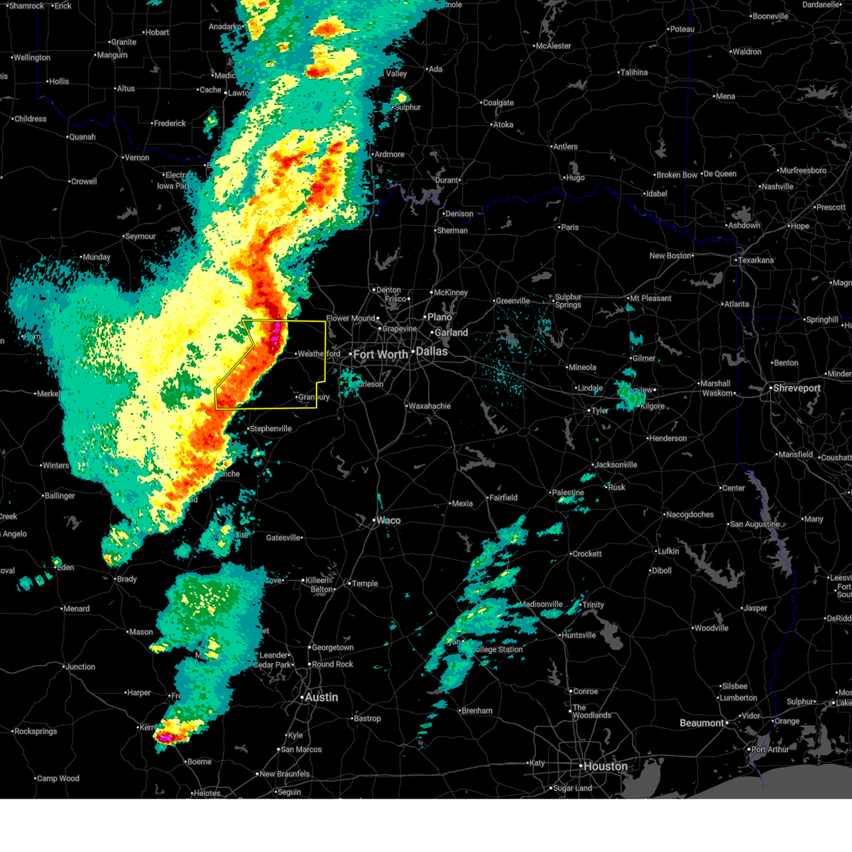
| 4/25/2026 9:13 PM CDT |
 Svrfwd the national weather service in fort worth has issued a * severe thunderstorm warning for, southwestern wise county in north central texas, east central jack county in north central texas, northeastern parker county in north central texas, northwestern tarrant county in north central texas, * until 1015 pm cdt. * at 912 pm cdt, severe thunderstorms were located along a line extending from 7 miles northwest of lake bridgeport to near boyd, moving southeast at 20 mph (radar indicated). Hazards include tennis ball size hail and 70 mph wind gusts. People and animals outdoors will be injured. expect hail damage to roofs, siding, windows, and vehicles. expect considerable tree damage. wind damage is also likely to mobile homes, roofs, and outbuildings. severe thunderstorms will be near, bridgeport, briar, pecan acres, reno, aurora, boyd, paradise, and lake bridgeport around 920 pm cdt. eagle mountain and rhome around 930 pm cdt. pelican bay and haslet around 940 pm cdt. Other locations impacted by these severe thunderstorms include balsora, wizard wells, vineyard, cottondale, newark, runaway bay, lake bridgeport, highland addition, keeter, and sanctuary. Svrfwd the national weather service in fort worth has issued a * severe thunderstorm warning for, southwestern wise county in north central texas, east central jack county in north central texas, northeastern parker county in north central texas, northwestern tarrant county in north central texas, * until 1015 pm cdt. * at 912 pm cdt, severe thunderstorms were located along a line extending from 7 miles northwest of lake bridgeport to near boyd, moving southeast at 20 mph (radar indicated). Hazards include tennis ball size hail and 70 mph wind gusts. People and animals outdoors will be injured. expect hail damage to roofs, siding, windows, and vehicles. expect considerable tree damage. wind damage is also likely to mobile homes, roofs, and outbuildings. severe thunderstorms will be near, bridgeport, briar, pecan acres, reno, aurora, boyd, paradise, and lake bridgeport around 920 pm cdt. eagle mountain and rhome around 930 pm cdt. pelican bay and haslet around 940 pm cdt. Other locations impacted by these severe thunderstorms include balsora, wizard wells, vineyard, cottondale, newark, runaway bay, lake bridgeport, highland addition, keeter, and sanctuary.
|
| 4/25/2026 9:10 PM CDT |
 Torfwd the national weather service in fort worth has issued a * tornado warning for, southwestern wise county in north central texas, east central jack county in north central texas, north central parker county in north central texas, * until 1000 pm cdt. * at 909 pm cdt, a severe thunderstorm capable of producing a tornado was located 7 miles northeast of poolville, or 9 miles south of bridgeport, moving southeast at 15 mph. an additional area of rotation was located in runaway bay, moving to the west at around 5 mph (radar indicated rotation). Hazards include tornado and tennis ball size hail. Flying debris will be dangerous to those caught without shelter. mobile homes will be damaged or destroyed. damage to roofs, windows, and vehicles will occur. tree damage is likely. this dangerous storm will be near, springtown around 925 pm cdt. briar around 940 pm cdt. Other locations impacted by this tornadic thunderstorm include balsora, boonsville, vineyard, cottondale, runaway bay, lake bridgeport, keeter, wizard wells, and highland addition. Torfwd the national weather service in fort worth has issued a * tornado warning for, southwestern wise county in north central texas, east central jack county in north central texas, north central parker county in north central texas, * until 1000 pm cdt. * at 909 pm cdt, a severe thunderstorm capable of producing a tornado was located 7 miles northeast of poolville, or 9 miles south of bridgeport, moving southeast at 15 mph. an additional area of rotation was located in runaway bay, moving to the west at around 5 mph (radar indicated rotation). Hazards include tornado and tennis ball size hail. Flying debris will be dangerous to those caught without shelter. mobile homes will be damaged or destroyed. damage to roofs, windows, and vehicles will occur. tree damage is likely. this dangerous storm will be near, springtown around 925 pm cdt. briar around 940 pm cdt. Other locations impacted by this tornadic thunderstorm include balsora, boonsville, vineyard, cottondale, runaway bay, lake bridgeport, keeter, wizard wells, and highland addition.
|
| 4/25/2026 9:02 PM CDT |
 At 902 pm cdt, severe thunderstorms were located along a line extending from near springtown to 8 miles northwest of lake bridgeport, moving southeast at 30 mph (radar indicated). Hazards include tennis ball size hail and 70 mph wind gusts. People and animals outdoors will be injured. expect hail damage to roofs, siding, windows, and vehicles. expect considerable tree damage. wind damage is also likely to mobile homes, roofs, and outbuildings. these severe storms will be near, azle, bridgeport, briar, reno, springtown, and lake bridgeport around 910 pm cdt. paradise around 915 pm cdt. pecan acres around 930 pm cdt. boyd around 940 pm cdt. Other locations impacted by these severe thunderstorms include cundiff, cottondale, lake bridgeport, keeter, crafton, balsora, agnes, boonsville, wizard wells, and vineyard. At 902 pm cdt, severe thunderstorms were located along a line extending from near springtown to 8 miles northwest of lake bridgeport, moving southeast at 30 mph (radar indicated). Hazards include tennis ball size hail and 70 mph wind gusts. People and animals outdoors will be injured. expect hail damage to roofs, siding, windows, and vehicles. expect considerable tree damage. wind damage is also likely to mobile homes, roofs, and outbuildings. these severe storms will be near, azle, bridgeport, briar, reno, springtown, and lake bridgeport around 910 pm cdt. paradise around 915 pm cdt. pecan acres around 930 pm cdt. boyd around 940 pm cdt. Other locations impacted by these severe thunderstorms include cundiff, cottondale, lake bridgeport, keeter, crafton, balsora, agnes, boonsville, wizard wells, and vineyard.
|
| 4/25/2026 8:50 PM CDT |
 At 849 pm cdt, severe thunderstorms were located along a line extending from 6 miles southwest of paradise to 7 miles south of newport, moving east at 15 mph (public. at 843 pm cdt 2 inch hail was reported in runaway bay). Hazards include two inch hail and 70 mph wind gusts. People and animals outdoors will be injured. expect hail damage to roofs, siding, windows, and vehicles. expect considerable tree damage. wind damage is also likely to mobile homes, roofs, and outbuildings. these severe storms will be near, bridgeport, paradise, and lake bridgeport around 855 pm cdt. chico around 905 pm cdt. briar and boyd around 910 pm cdt. aurora around 920 pm cdt. pecan acres and rhome around 925 pm cdt. Other locations impacted by these severe thunderstorms include cundiff, cottondale, lake bridgeport, keeter, crafton, joplin, balsora, agnes, boonsville, and wizard wells. At 849 pm cdt, severe thunderstorms were located along a line extending from 6 miles southwest of paradise to 7 miles south of newport, moving east at 15 mph (public. at 843 pm cdt 2 inch hail was reported in runaway bay). Hazards include two inch hail and 70 mph wind gusts. People and animals outdoors will be injured. expect hail damage to roofs, siding, windows, and vehicles. expect considerable tree damage. wind damage is also likely to mobile homes, roofs, and outbuildings. these severe storms will be near, bridgeport, paradise, and lake bridgeport around 855 pm cdt. chico around 905 pm cdt. briar and boyd around 910 pm cdt. aurora around 920 pm cdt. pecan acres and rhome around 925 pm cdt. Other locations impacted by these severe thunderstorms include cundiff, cottondale, lake bridgeport, keeter, crafton, joplin, balsora, agnes, boonsville, and wizard wells.
|
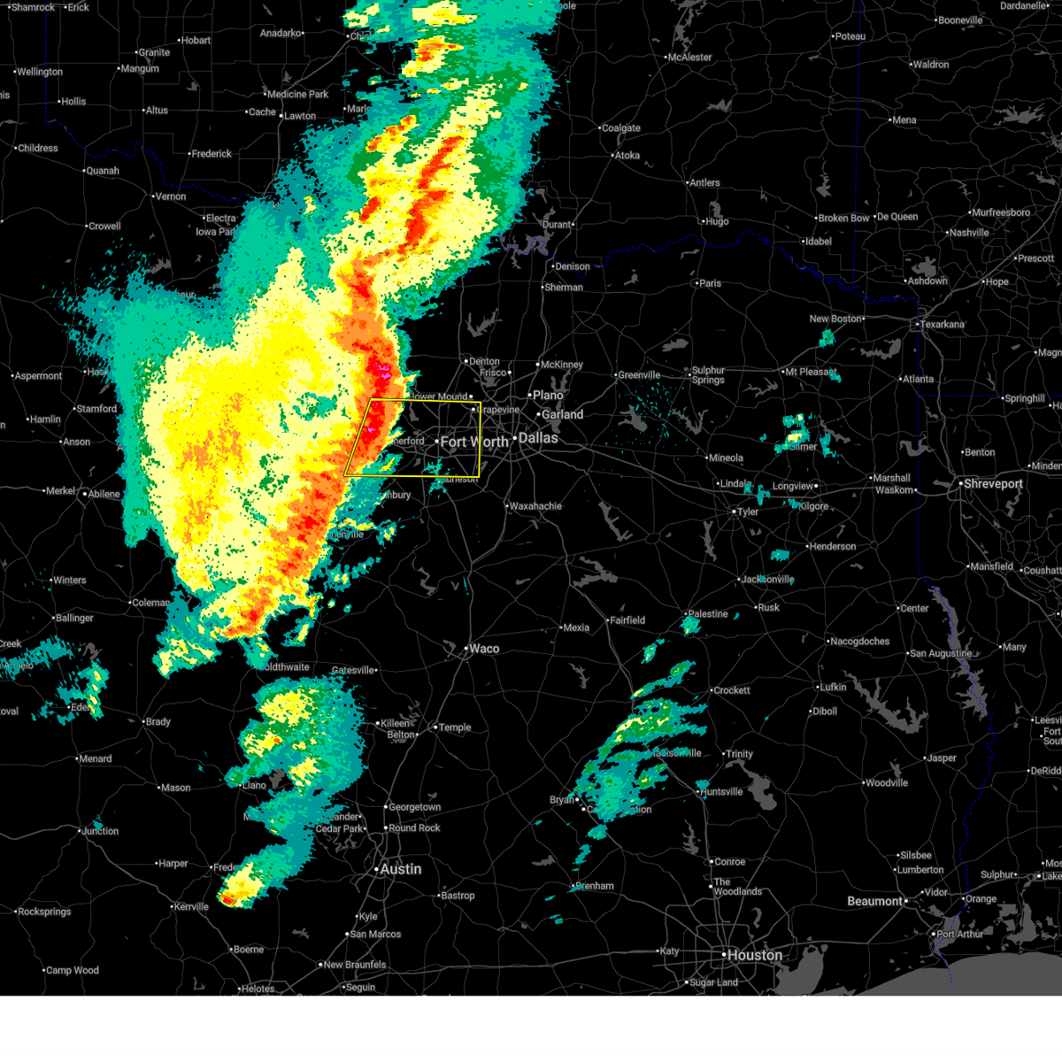
| 4/25/2026 8:16 PM CDT |
 Svrfwd the national weather service in fort worth has issued a * severe thunderstorm warning for, wise county in north central texas, eastern jack county in north central texas, northeastern parker county in north central texas, * until 915 pm cdt. * at 815 pm cdt, a severe thunderstorm was located near lake bridgeport, or 8 miles west of bridgeport, moving southeast at 35 mph. this is a destructive storm for eastern jack, western and southern wise, and northern parker counties. (radar indicated). Hazards include baseball size hail and 70 mph wind gusts. People and animals outdoors will be severely injured. expect shattered windows, extensive damage to roofs, siding, and vehicles. this severe thunderstorm will be near, bridgeport and lake bridgeport around 820 pm cdt. springtown around 845 pm cdt. briar and reno around 850 pm cdt. azle around 900 pm cdt. Other locations impacted by this severe thunderstorm include cundiff, cottondale, lake bridgeport, keeter, crafton, gibtown, joplin, balsora, agnes, and boonsville. Svrfwd the national weather service in fort worth has issued a * severe thunderstorm warning for, wise county in north central texas, eastern jack county in north central texas, northeastern parker county in north central texas, * until 915 pm cdt. * at 815 pm cdt, a severe thunderstorm was located near lake bridgeport, or 8 miles west of bridgeport, moving southeast at 35 mph. this is a destructive storm for eastern jack, western and southern wise, and northern parker counties. (radar indicated). Hazards include baseball size hail and 70 mph wind gusts. People and animals outdoors will be severely injured. expect shattered windows, extensive damage to roofs, siding, and vehicles. this severe thunderstorm will be near, bridgeport and lake bridgeport around 820 pm cdt. springtown around 845 pm cdt. briar and reno around 850 pm cdt. azle around 900 pm cdt. Other locations impacted by this severe thunderstorm include cundiff, cottondale, lake bridgeport, keeter, crafton, gibtown, joplin, balsora, agnes, and boonsville.
|
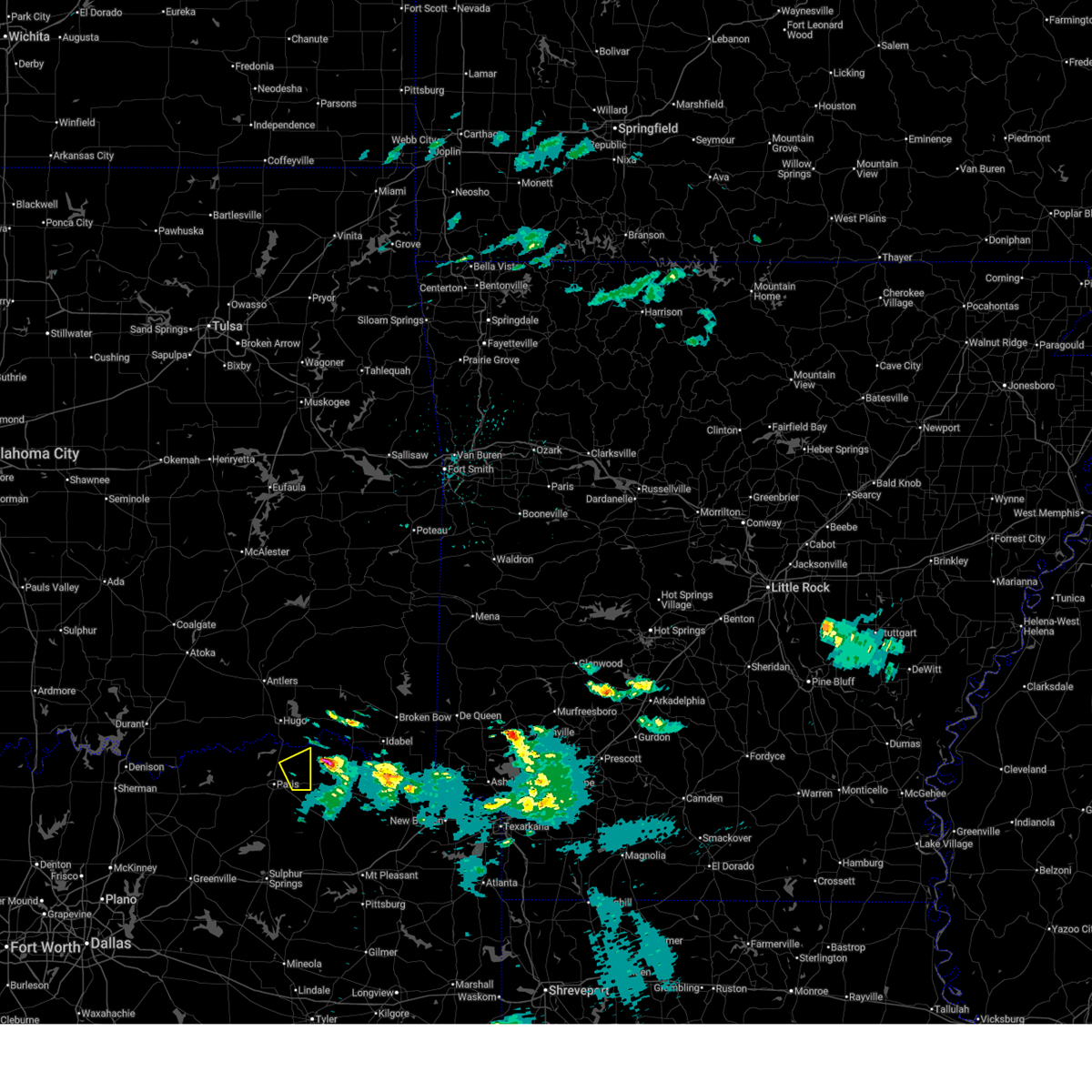
| 4/24/2026 8:14 PM CDT |
 At 814 pm cdt, a confirmed tornado was located near pattonville, or 7 miles southeast of paris, moving southeast at 30 mph (weather spotters confirmed tornado). Hazards include damaging tornado and tennis ball size hail. Flying debris will be dangerous to those caught without shelter. mobile homes will be damaged or destroyed. damage to roofs, windows, and vehicles will occur. tree damage is likely. this tornado will be near, pattonville around 820 pm cdt. Other locations impacted by this tornadic thunderstorm include milton, deport, and clardy. At 814 pm cdt, a confirmed tornado was located near pattonville, or 7 miles southeast of paris, moving southeast at 30 mph (weather spotters confirmed tornado). Hazards include damaging tornado and tennis ball size hail. Flying debris will be dangerous to those caught without shelter. mobile homes will be damaged or destroyed. damage to roofs, windows, and vehicles will occur. tree damage is likely. this tornado will be near, pattonville around 820 pm cdt. Other locations impacted by this tornadic thunderstorm include milton, deport, and clardy.
|
| 4/24/2026 8:08 PM CDT |
 At 808 pm cdt, severe thunderstorms were located along a line extending from near pattonville to 8 miles southwest of sumner, moving southeast at 30 mph (radar indicated). Hazards include tennis ball size hail and 60 mph wind gusts. People and animals outdoors will be injured. expect hail damage to roofs, siding, windows, and vehicles. expect wind damage to roofs, siding, and trees. these severe storms will be near, paris and pattonville around 815 pm cdt. Other locations impacted by these severe thunderstorms include toco, biardstown, atlas, globe, brookston, tigertown, sun valley, clardy, milton, and deport. At 808 pm cdt, severe thunderstorms were located along a line extending from near pattonville to 8 miles southwest of sumner, moving southeast at 30 mph (radar indicated). Hazards include tennis ball size hail and 60 mph wind gusts. People and animals outdoors will be injured. expect hail damage to roofs, siding, windows, and vehicles. expect wind damage to roofs, siding, and trees. these severe storms will be near, paris and pattonville around 815 pm cdt. Other locations impacted by these severe thunderstorms include toco, biardstown, atlas, globe, brookston, tigertown, sun valley, clardy, milton, and deport.
|
| 4/24/2026 8:05 PM CDT |
 At 805 pm cdt, a severe thunderstorm was located near paris, moving southeast at 20 mph (radar indicated). Hazards include two inch hail and 60 mph wind gusts. People and animals outdoors will be injured. expect hail damage to roofs, siding, windows, and vehicles. expect wind damage to roofs, siding, and trees. this severe storm will be near, blossom around 810 pm cdt. Other locations impacted by this severe thunderstorm include faught, sun valley, chicota, novice, globe, and midcity. At 805 pm cdt, a severe thunderstorm was located near paris, moving southeast at 20 mph (radar indicated). Hazards include two inch hail and 60 mph wind gusts. People and animals outdoors will be injured. expect hail damage to roofs, siding, windows, and vehicles. expect wind damage to roofs, siding, and trees. this severe storm will be near, blossom around 810 pm cdt. Other locations impacted by this severe thunderstorm include faught, sun valley, chicota, novice, globe, and midcity.
|
| 4/24/2026 8:00 PM CDT |
 Torfwd the national weather service in fort worth has issued a * tornado warning for, east central lamar county in north central texas, * until 845 pm cdt. * at 800 pm cdt, a severe thunderstorm capable of producing a tornado was located over paris, moving southeast at 30 mph (radar indicated rotation). Hazards include tornado and tennis ball size hail. Flying debris will be dangerous to those caught without shelter. mobile homes will be damaged or destroyed. damage to roofs, windows, and vehicles will occur. tree damage is likely. this dangerous storm will be near, paris and reno around 805 pm cdt. pattonville around 815 pm cdt. Other locations impacted by this tornadic thunderstorm include toco, sun valley, clardy, milton, and deport. Torfwd the national weather service in fort worth has issued a * tornado warning for, east central lamar county in north central texas, * until 845 pm cdt. * at 800 pm cdt, a severe thunderstorm capable of producing a tornado was located over paris, moving southeast at 30 mph (radar indicated rotation). Hazards include tornado and tennis ball size hail. Flying debris will be dangerous to those caught without shelter. mobile homes will be damaged or destroyed. damage to roofs, windows, and vehicles will occur. tree damage is likely. this dangerous storm will be near, paris and reno around 805 pm cdt. pattonville around 815 pm cdt. Other locations impacted by this tornadic thunderstorm include toco, sun valley, clardy, milton, and deport.
|
| 4/24/2026 7:36 PM CDT |
 Svrfwd the national weather service in fort worth has issued a * severe thunderstorm warning for, central lamar county in north central texas, * until 830 pm cdt. * at 736 pm cdt, a severe thunderstorm was located over sumner, or 10 miles west of paris, moving east at 35 mph (radar indicated). Hazards include tennis ball size hail and 60 mph wind gusts. People and animals outdoors will be injured. expect hail damage to roofs, siding, windows, and vehicles. expect wind damage to roofs, siding, and trees. this severe thunderstorm will be near, paris, lake crook, sumner, and lake gibbons around 740 pm cdt. reno around 750 pm cdt. blossom and pattonville around 805 pm cdt. Other locations impacted by this severe thunderstorm include toco, biardstown, atlas, globe, brookston, tigertown, sun valley, clardy, milton, and deport. Svrfwd the national weather service in fort worth has issued a * severe thunderstorm warning for, central lamar county in north central texas, * until 830 pm cdt. * at 736 pm cdt, a severe thunderstorm was located over sumner, or 10 miles west of paris, moving east at 35 mph (radar indicated). Hazards include tennis ball size hail and 60 mph wind gusts. People and animals outdoors will be injured. expect hail damage to roofs, siding, windows, and vehicles. expect wind damage to roofs, siding, and trees. this severe thunderstorm will be near, paris, lake crook, sumner, and lake gibbons around 740 pm cdt. reno around 750 pm cdt. blossom and pattonville around 805 pm cdt. Other locations impacted by this severe thunderstorm include toco, biardstown, atlas, globe, brookston, tigertown, sun valley, clardy, milton, and deport.
|
| 4/24/2026 7:27 PM CDT |
 At 727 pm cdt, a severe thunderstorm was located near pat mayse lake, or 12 miles northwest of paris, moving east at 35 mph (radar indicated). Hazards include tennis ball size hail and 60 mph wind gusts. People and animals outdoors will be injured. expect hail damage to roofs, siding, windows, and vehicles. expect wind damage to roofs, siding, and trees. this severe storm will be near, paris, lake crook, camp maxey, powderly, and pat mayse lake around 735 pm cdt. blossom around 755 pm cdt. Other locations impacted by this severe thunderstorm include east direct, chicota, globe, faught, sun valley, novice, forest chapel, belk, garretts bluff, and direct. At 727 pm cdt, a severe thunderstorm was located near pat mayse lake, or 12 miles northwest of paris, moving east at 35 mph (radar indicated). Hazards include tennis ball size hail and 60 mph wind gusts. People and animals outdoors will be injured. expect hail damage to roofs, siding, windows, and vehicles. expect wind damage to roofs, siding, and trees. this severe storm will be near, paris, lake crook, camp maxey, powderly, and pat mayse lake around 735 pm cdt. blossom around 755 pm cdt. Other locations impacted by this severe thunderstorm include east direct, chicota, globe, faught, sun valley, novice, forest chapel, belk, garretts bluff, and direct.
|
| 4/24/2026 7:19 PM CDT |
 Svrfwd the national weather service in fort worth has issued a * severe thunderstorm warning for, northern lamar county in north central texas, * until 815 pm cdt. * at 718 pm cdt, severe thunderstorms were located along a line extending from near soper to 8 miles northwest of sumner, moving east at 35 mph (radar indicated). Hazards include two inch hail and 60 mph wind gusts. People and animals outdoors will be injured. expect hail damage to roofs, siding, windows, and vehicles. expect wind damage to roofs, siding, and trees. severe thunderstorms will be near, camp maxey and pat mayse lake around 725 pm cdt. paris, powderly, and arthur city around 735 pm cdt. Other locations impacted by these severe thunderstorms include east direct, chicota, globe, faught, sun valley, novice, forest chapel, belk, garretts bluff, and direct. Svrfwd the national weather service in fort worth has issued a * severe thunderstorm warning for, northern lamar county in north central texas, * until 815 pm cdt. * at 718 pm cdt, severe thunderstorms were located along a line extending from near soper to 8 miles northwest of sumner, moving east at 35 mph (radar indicated). Hazards include two inch hail and 60 mph wind gusts. People and animals outdoors will be injured. expect hail damage to roofs, siding, windows, and vehicles. expect wind damage to roofs, siding, and trees. severe thunderstorms will be near, camp maxey and pat mayse lake around 725 pm cdt. paris, powderly, and arthur city around 735 pm cdt. Other locations impacted by these severe thunderstorms include east direct, chicota, globe, faught, sun valley, novice, forest chapel, belk, garretts bluff, and direct.
|
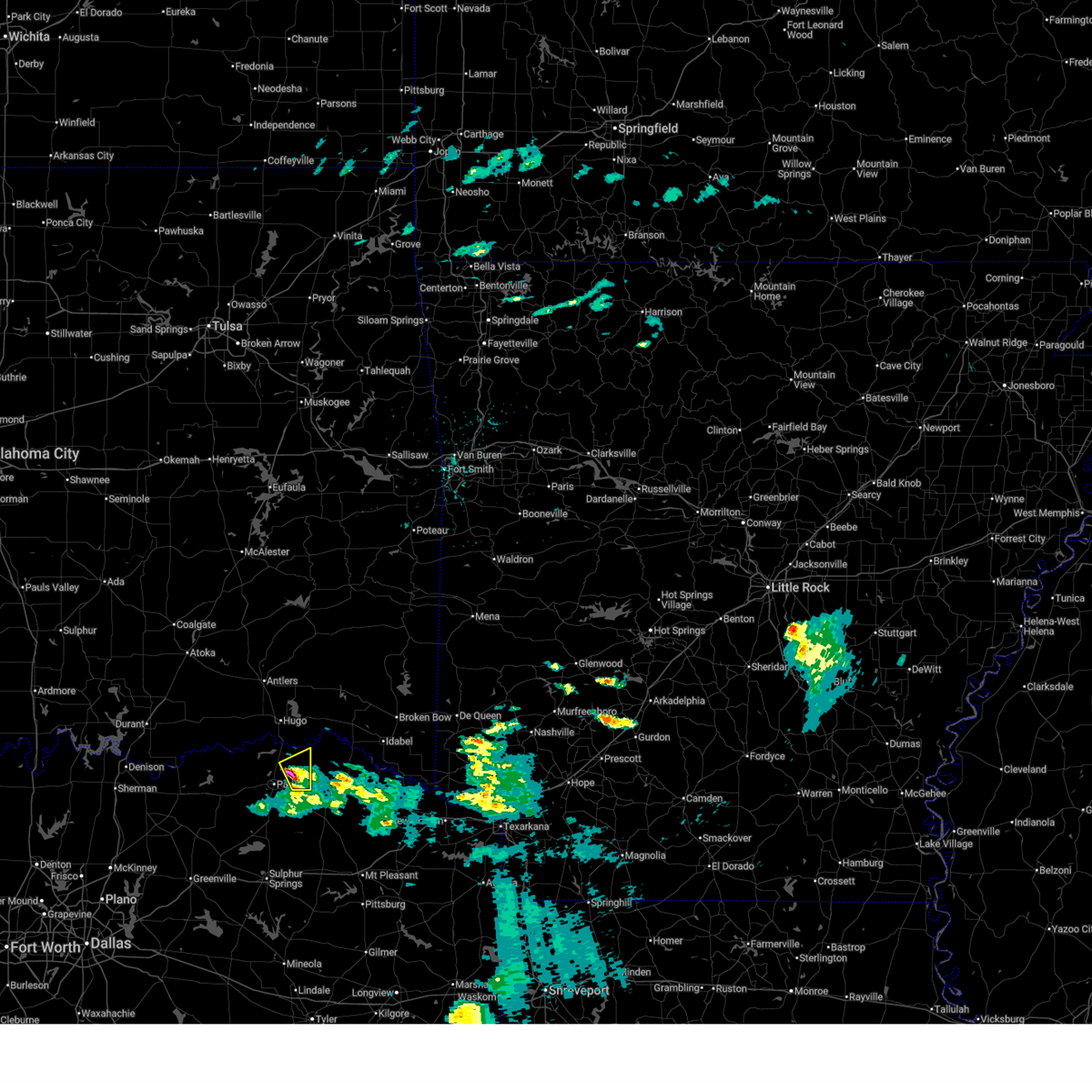
| 3/11/2026 12:06 AM CDT |
 The storm which prompted the warning has moved out of the area. therefore the warning will be allowed to expire. however gusty winds and heavy rain are still possible with this thunderstorm. a severe thunderstorm watch remains in effect until 200 am cdt for north central texas. The storm which prompted the warning has moved out of the area. therefore the warning will be allowed to expire. however gusty winds and heavy rain are still possible with this thunderstorm. a severe thunderstorm watch remains in effect until 200 am cdt for north central texas.
|
| 3/10/2026 11:33 PM CDT |
 the severe thunderstorm warning has been cancelled and is no longer in effect the severe thunderstorm warning has been cancelled and is no longer in effect
|
| 3/10/2026 11:33 PM CDT |
 At 1132 pm cdt, a severe thunderstorm was located near roxton, or 10 miles south of paris, moving northeast at 55 mph (radar indicated). Hazards include 65 mph wind gusts. Expect damage to roofs, siding, and trees. this severe storm will be near, paris and reno around 1140 pm cdt. blossom around 1145 pm cdt. Other locations impacted by this severe thunderstorm include charleston, lake creek, glory, pacio, midcity, minter, forest hill, petty, taylor town, and globe. At 1132 pm cdt, a severe thunderstorm was located near roxton, or 10 miles south of paris, moving northeast at 55 mph (radar indicated). Hazards include 65 mph wind gusts. Expect damage to roofs, siding, and trees. this severe storm will be near, paris and reno around 1140 pm cdt. blossom around 1145 pm cdt. Other locations impacted by this severe thunderstorm include charleston, lake creek, glory, pacio, midcity, minter, forest hill, petty, taylor town, and globe.
|
| 3/10/2026 11:18 PM CDT |
 Svrfwd the national weather service in fort worth has issued a * severe thunderstorm warning for, northeastern hunt county in north central texas, delta county in north central texas, lamar county in north central texas, southeastern fannin county in north central texas, * until 1215 am cdt. * at 1118 pm cdt, a severe thunderstorm was located 7 miles east of wolfe city, or 7 miles north of commerce, moving northeast at 50 mph (radar indicated). Hazards include 65 mph wind gusts. Expect damage to roofs, siding, and trees. this severe thunderstorm will be near, roxton around 1135 pm cdt. paris and lake gibbons around 1150 pm cdt. lake crook around 1155 pm cdt. camp maxey and powderly around 1200 am cdt. pat mayse lake around 1205 am cdt. arthur city around 1210 am cdt. Other locations impacted by this severe thunderstorm include charleston, lake creek, glory, pacio, midcity, minter, forest hill, bug tussle, petty, and taylor town. Svrfwd the national weather service in fort worth has issued a * severe thunderstorm warning for, northeastern hunt county in north central texas, delta county in north central texas, lamar county in north central texas, southeastern fannin county in north central texas, * until 1215 am cdt. * at 1118 pm cdt, a severe thunderstorm was located 7 miles east of wolfe city, or 7 miles north of commerce, moving northeast at 50 mph (radar indicated). Hazards include 65 mph wind gusts. Expect damage to roofs, siding, and trees. this severe thunderstorm will be near, roxton around 1135 pm cdt. paris and lake gibbons around 1150 pm cdt. lake crook around 1155 pm cdt. camp maxey and powderly around 1200 am cdt. pat mayse lake around 1205 am cdt. arthur city around 1210 am cdt. Other locations impacted by this severe thunderstorm include charleston, lake creek, glory, pacio, midcity, minter, forest hill, bug tussle, petty, and taylor town.
|
| 3/10/2026 8:56 PM CDT |
 Svrfwd the national weather service in fort worth has issued a * severe thunderstorm warning for, parker county in north central texas, tarrant county in north central texas, * until 1000 pm cdt. * at 855 pm cdt, a severe thunderstorm was located over willow park, or 8 miles east of weatherford, moving east at 40 mph (radar indicated). Hazards include 65 mph wind gusts and quarter size hail. Hail damage to vehicles is expected. expect wind damage to roofs, siding, and trees. this severe thunderstorm will be near, white settlement, lake worth, and westworth village around 905 pm cdt. saginaw and fort worth around 915 pm cdt. haltom city around 920 pm cdt. richland hills and north richland hills around 925 pm cdt. hurst around 930 pm cdt. arlington, euless, and bedford around 935 pm cdt. Other locations impacted by this severe thunderstorm include lake arlington, dennis, annetta south, benbrook lake, lake worth, lakeside, westover hills, tin top, horseshoe bend, and annetta north. Svrfwd the national weather service in fort worth has issued a * severe thunderstorm warning for, parker county in north central texas, tarrant county in north central texas, * until 1000 pm cdt. * at 855 pm cdt, a severe thunderstorm was located over willow park, or 8 miles east of weatherford, moving east at 40 mph (radar indicated). Hazards include 65 mph wind gusts and quarter size hail. Hail damage to vehicles is expected. expect wind damage to roofs, siding, and trees. this severe thunderstorm will be near, white settlement, lake worth, and westworth village around 905 pm cdt. saginaw and fort worth around 915 pm cdt. haltom city around 920 pm cdt. richland hills and north richland hills around 925 pm cdt. hurst around 930 pm cdt. arlington, euless, and bedford around 935 pm cdt. Other locations impacted by this severe thunderstorm include lake arlington, dennis, annetta south, benbrook lake, lake worth, lakeside, westover hills, tin top, horseshoe bend, and annetta north.
|
| 3/10/2026 8:32 PM CDT |
 At 832 pm cdt, a severe thunderstorm was located over brock, or 9 miles west of weatherford, moving east at 35 mph (radar indicated). Hazards include 65 mph wind gusts and half dollar size hail. Hail damage to vehicles is expected. expect wind damage to roofs, siding, and trees. this severe storm will be near, weatherford and brock around 835 pm cdt. willow park, hudson oaks, and annetta around 850 pm cdt. aledo and lake weatherford around 855 pm cdt. Other locations impacted by this severe thunderstorm include adell, santo, dennis, mambrino, agnes, acton, bennett, oran, waples, and new salem. At 832 pm cdt, a severe thunderstorm was located over brock, or 9 miles west of weatherford, moving east at 35 mph (radar indicated). Hazards include 65 mph wind gusts and half dollar size hail. Hail damage to vehicles is expected. expect wind damage to roofs, siding, and trees. this severe storm will be near, weatherford and brock around 835 pm cdt. willow park, hudson oaks, and annetta around 850 pm cdt. aledo and lake weatherford around 855 pm cdt. Other locations impacted by this severe thunderstorm include adell, santo, dennis, mambrino, agnes, acton, bennett, oran, waples, and new salem.
|
| 3/10/2026 8:32 PM CDT |
 the severe thunderstorm warning has been cancelled and is no longer in effect the severe thunderstorm warning has been cancelled and is no longer in effect
|
| 3/10/2026 7:58 PM CDT |
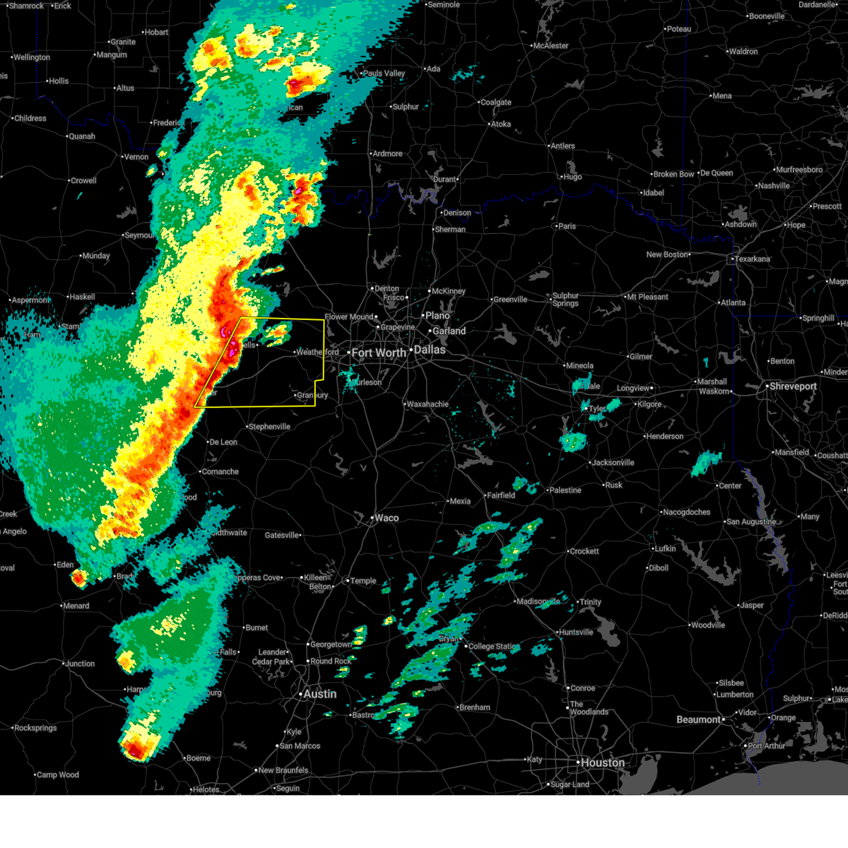 Svrfwd the national weather service in fort worth has issued a * severe thunderstorm warning for, northern erath county in north central texas, northeastern eastland county in north central texas, parker county in north central texas, palo pinto county in north central texas, hood county in north central texas, * until 900 pm cdt. * at 758 pm cdt, a severe thunderstorm was located near lake palo pinto, or 13 miles southwest of mineral wells, moving east at 45 mph (radar indicated). Hazards include 70 mph wind gusts and half dollar size hail. Hail damage to vehicles is expected. expect considerable tree damage. wind damage is also likely to mobile homes, roofs, and outbuildings. this severe thunderstorm will be near, brock around 815 pm cdt. weatherford and western lake around 825 pm cdt. hudson oaks and annetta around 835 pm cdt. willow park and aledo around 840 pm cdt. other locations impacted by this severe thunderstorm include adell, santo, dennis, mambrino, agnes, acton, bennett, oran, waples, and new salem. this includes the following highways, interstate 20 between mile markers 358 and 422. Interstate 30 near mile marker 1. Svrfwd the national weather service in fort worth has issued a * severe thunderstorm warning for, northern erath county in north central texas, northeastern eastland county in north central texas, parker county in north central texas, palo pinto county in north central texas, hood county in north central texas, * until 900 pm cdt. * at 758 pm cdt, a severe thunderstorm was located near lake palo pinto, or 13 miles southwest of mineral wells, moving east at 45 mph (radar indicated). Hazards include 70 mph wind gusts and half dollar size hail. Hail damage to vehicles is expected. expect considerable tree damage. wind damage is also likely to mobile homes, roofs, and outbuildings. this severe thunderstorm will be near, brock around 815 pm cdt. weatherford and western lake around 825 pm cdt. hudson oaks and annetta around 835 pm cdt. willow park and aledo around 840 pm cdt. other locations impacted by this severe thunderstorm include adell, santo, dennis, mambrino, agnes, acton, bennett, oran, waples, and new salem. this includes the following highways, interstate 20 between mile markers 358 and 422. Interstate 30 near mile marker 1.
|
| 10/24/2025 8:53 PM CDT | The storm which prompted the warning has moved out of the area. therefore the warning will be allowed to expire. a severe thunderstorm watch remains in effect until midnight cdt for north central texas. |
| 10/24/2025 8:25 PM CDT | Svrfwd the national weather service in fort worth has issued a * severe thunderstorm warning for, parker county in north central texas, * until 900 pm cdt. * at 825 pm cdt, a severe thunderstorm was located over hudson oaks, or near weatherford, moving east at 30 mph (radar indicated). Hazards include 60 mph wind gusts. Expect damage to roofs, siding, and trees. this severe thunderstorm will be near, weatherford, willow park, aledo, hudson oaks, annetta, and lake weatherford around 830 pm cdt. Other locations impacted by this severe thunderstorm include agnes, peaster, tin top, horseshoe bend, annetta south, annetta north, highland addition, sanctuary, la junta, and cresson. |
| 10/24/2025 7:57 PM CDT | At 757 pm cdt, a severe thunderstorm was located over lake weatherford, or near weatherford, moving northeast at 15 mph (radar indicated). Hazards include 60 mph wind gusts. Expect damage to roofs, siding, and trees. this severe storm will be near, willow park around 805 pm cdt. azle around 815 pm cdt. reno around 825 pm cdt. Other locations impacted by this severe thunderstorm include agnes, annetta south, annetta north, highland addition, sanctuary, and la junta. |
| 10/24/2025 7:51 PM CDT | The tornado threat has diminished and the tornado warning has been cancelled. however, damaging winds remain likely and a severe thunderstorm warning remains in effect for the area. |
| 10/24/2025 7:42 PM CDT | At 742 pm cdt, a severe thunderstorm capable of producing a tornado was located over weatherford, moving northeast at 20 mph (radar indicated rotation). Hazards include tornado. Flying debris will be dangerous to those caught without shelter. mobile homes will be damaged or destroyed. damage to roofs, windows, and vehicles will occur. tree damage is likely. this dangerous storm will be near, weatherford, willow park, hudson oaks, and lake weatherford around 750 pm cdt. Other locations impacted by this tornadic thunderstorm include highland addition, sanctuary, la junta, and annetta north. |
| 10/24/2025 7:34 PM CDT | Torfwd the national weather service in fort worth has issued a * tornado warning for, northeastern parker county in north central texas, * until 800 pm cdt. * at 733 pm cdt, a severe thunderstorm capable of producing a tornado was located over weatherford, moving northeast at 20 mph (radar indicated rotation). Hazards include tornado. Flying debris will be dangerous to those caught without shelter. mobile homes will be damaged or destroyed. damage to roofs, windows, and vehicles will occur. tree damage is likely. this dangerous storm will be near, weatherford, willow park, hudson oaks, and lake weatherford around 740 pm cdt. other locations impacted by this tornadic thunderstorm include annetta north, highland addition, sanctuary, and la junta. This includes interstate 20 between mile markers 406 and 419. |
| 10/24/2025 7:29 PM CDT | Svrfwd the national weather service in fort worth has issued a * severe thunderstorm warning for, parker county in north central texas, * until 830 pm cdt. * at 728 pm cdt, a severe thunderstorm was located over weatherford, moving northeast at 15 mph (radar indicated). Hazards include 60 mph wind gusts and quarter size hail. Hail damage to vehicles is expected. expect wind damage to roofs, siding, and trees. this severe thunderstorm will be near, weatherford, willow park, hudson oaks, and lake weatherford around 735 pm cdt. azle around 800 pm cdt. reno around 815 pm cdt. other locations impacted by this severe thunderstorm include brock junction, adell, peaster, advance, dennis, annetta south, agnes, authon, annetta north, and highland addition. this includes the following highways, interstate 20 between mile markers 395 and 422. Interstate 30 near mile marker 1. |
| 9/5/2025 9:46 PM CDT |
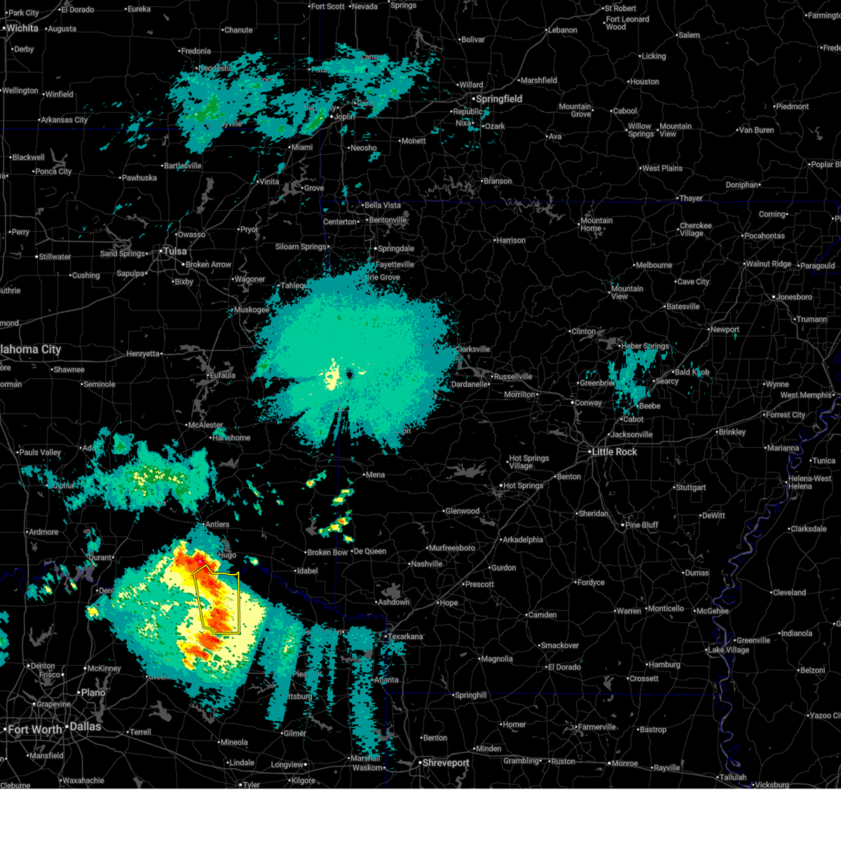 the severe thunderstorm warning has been cancelled and is no longer in effect the severe thunderstorm warning has been cancelled and is no longer in effect
|
| 9/5/2025 9:35 PM CDT |
 At 934 pm cdt, severe thunderstorms were located along a line extending from goodland to near blossom to near bogata, moving east at 35 mph (radar indicated). Hazards include 60 mph wind gusts and nickel size hail. Expect damage to roofs, siding, and trees. These severe thunderstorms will remain over mainly rural areas of lamar county, including the following locations, toco, atlas, glory, forest chapel, broadway junction, midcity, deport, minter, biardstown, and chicota. At 934 pm cdt, severe thunderstorms were located along a line extending from goodland to near blossom to near bogata, moving east at 35 mph (radar indicated). Hazards include 60 mph wind gusts and nickel size hail. Expect damage to roofs, siding, and trees. These severe thunderstorms will remain over mainly rural areas of lamar county, including the following locations, toco, atlas, glory, forest chapel, broadway junction, midcity, deport, minter, biardstown, and chicota.
|
| 9/5/2025 9:11 PM CDT |
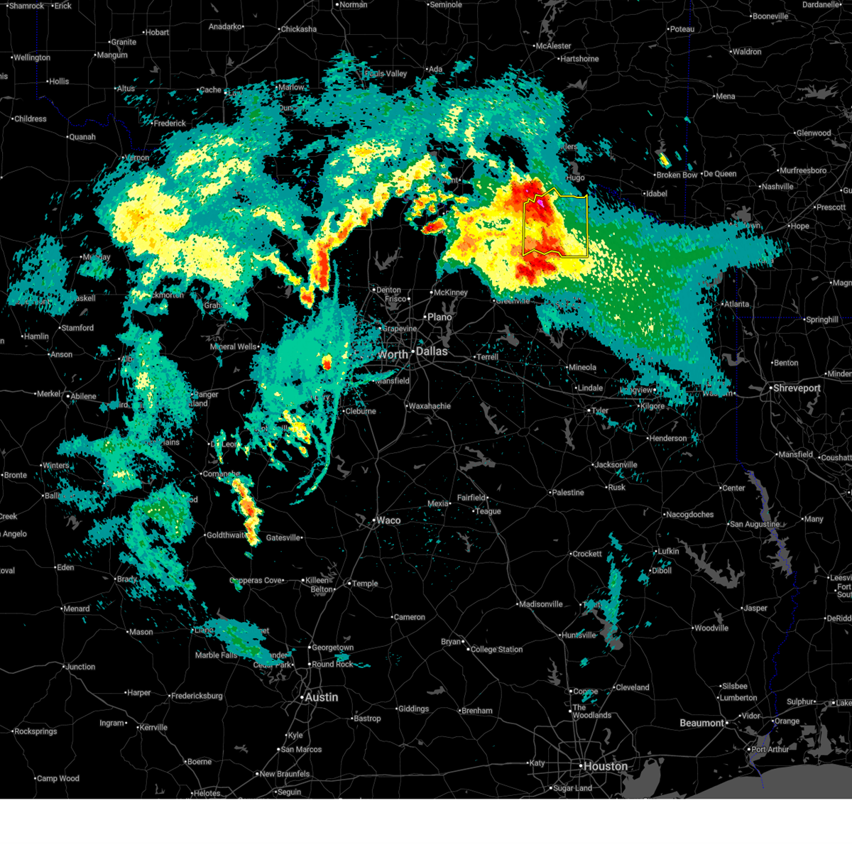 the severe thunderstorm warning has been cancelled and is no longer in effect the severe thunderstorm warning has been cancelled and is no longer in effect
|
| 9/5/2025 9:11 PM CDT |
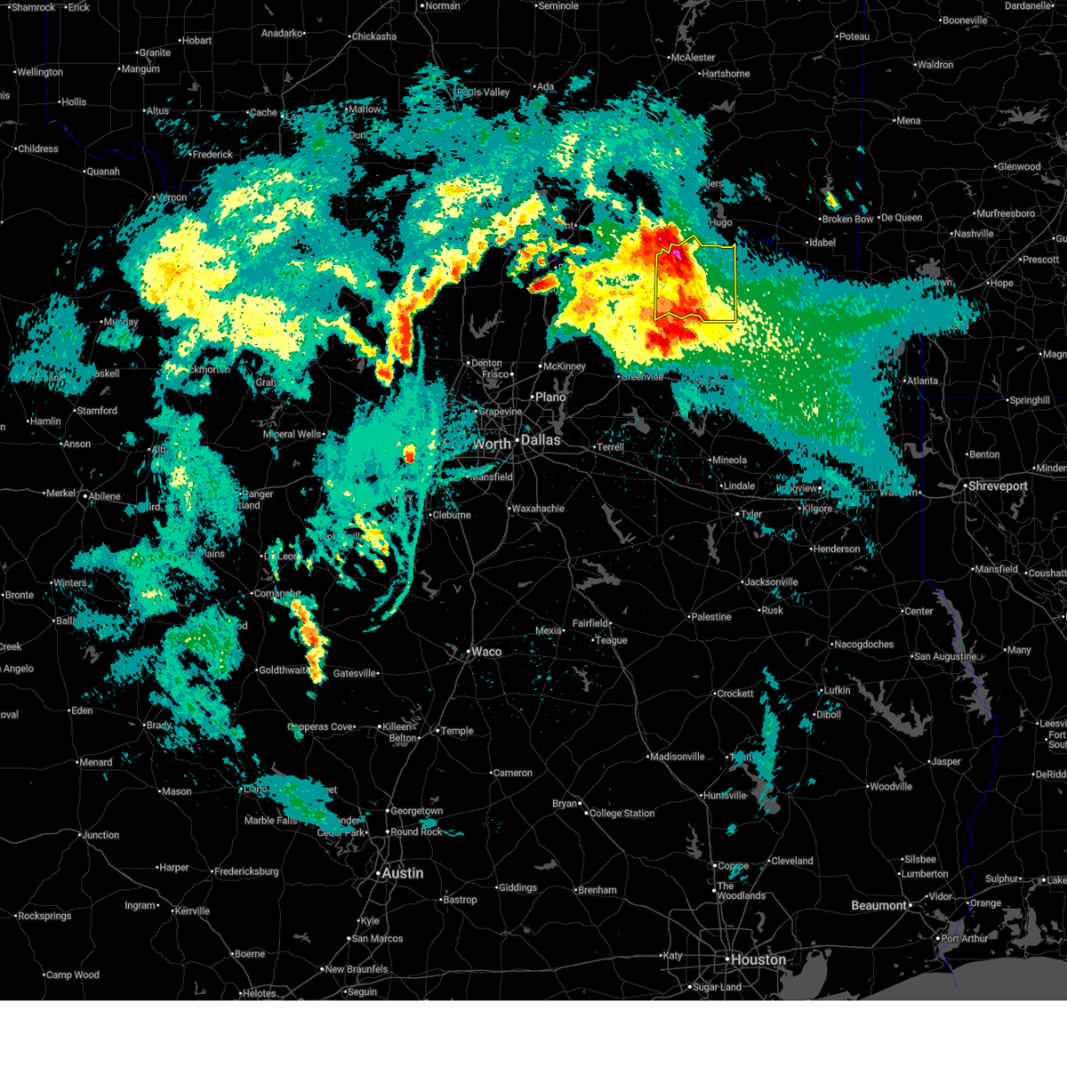 At 911 pm cdt, severe thunderstorms were located along a line extending from boswell to paris to sulphur bluff, moving east at 40 mph (radar indicated). Hazards include 60 mph wind gusts and quarter size hail. Hail damage to vehicles is expected. expect wind damage to roofs, siding, and trees. these severe storms will be near, paris, reno, camp maxey, powderly, pattonville, lake crook, and pat mayse lake around 915 pm cdt. blossom and arthur city around 920 pm cdt. Other locations impacted by these severe thunderstorms include glory, direct, midcity, minter, forest hill, petty, taylor town, globe, brookston, and sun valley. At 911 pm cdt, severe thunderstorms were located along a line extending from boswell to paris to sulphur bluff, moving east at 40 mph (radar indicated). Hazards include 60 mph wind gusts and quarter size hail. Hail damage to vehicles is expected. expect wind damage to roofs, siding, and trees. these severe storms will be near, paris, reno, camp maxey, powderly, pattonville, lake crook, and pat mayse lake around 915 pm cdt. blossom and arthur city around 920 pm cdt. Other locations impacted by these severe thunderstorms include glory, direct, midcity, minter, forest hill, petty, taylor town, globe, brookston, and sun valley.
|
| 9/5/2025 8:53 PM CDT |
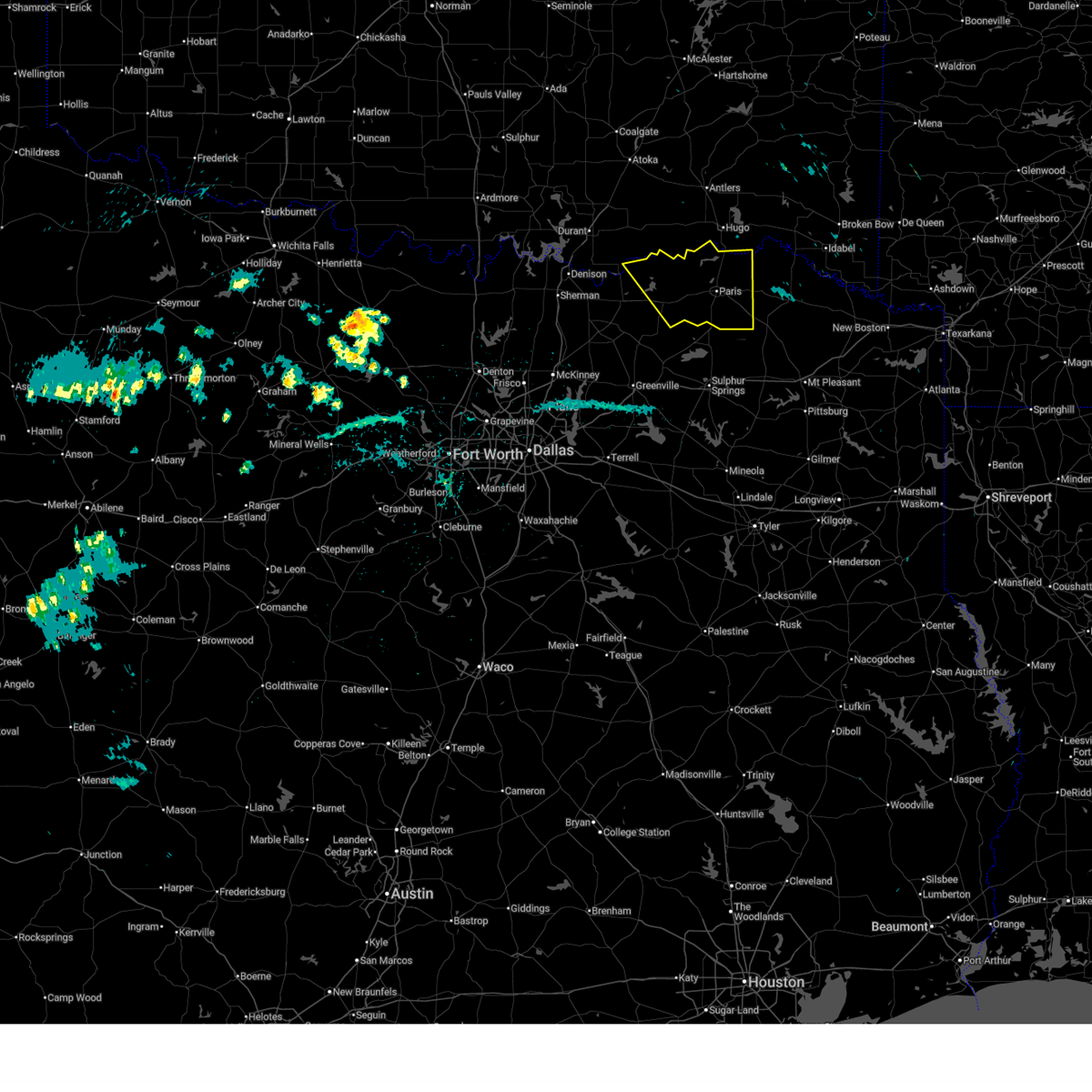 Svrfwd the national weather service in fort worth has issued a * severe thunderstorm warning for, lamar county in north central texas, northeastern fannin county in north central texas, * until 1000 pm cdt. * at 852 pm cdt, severe thunderstorms were located along a line extending from crockett lake to toco to near big creek lake, moving east at 35 mph (radar indicated). Hazards include 60 mph wind gusts and quarter size hail. Hail damage to vehicles is expected. expect wind damage to roofs, siding, and trees. severe thunderstorms will be near, roxton, sumner, and lake gibbons around 900 pm cdt. lake crook and pat mayse lake around 905 pm cdt. parish, reno and camp maxey around 910 pm cdt. powderly around 915 pm cdt. blossom and pattonville around 920 pm cdt. arthur city around 925 pm cdt. Other locations impacted by these severe thunderstorms include telephone, glory, duplex, direct, midcity, minter, forest hill, petty, taylor town, and globe. Svrfwd the national weather service in fort worth has issued a * severe thunderstorm warning for, lamar county in north central texas, northeastern fannin county in north central texas, * until 1000 pm cdt. * at 852 pm cdt, severe thunderstorms were located along a line extending from crockett lake to toco to near big creek lake, moving east at 35 mph (radar indicated). Hazards include 60 mph wind gusts and quarter size hail. Hail damage to vehicles is expected. expect wind damage to roofs, siding, and trees. severe thunderstorms will be near, roxton, sumner, and lake gibbons around 900 pm cdt. lake crook and pat mayse lake around 905 pm cdt. parish, reno and camp maxey around 910 pm cdt. powderly around 915 pm cdt. blossom and pattonville around 920 pm cdt. arthur city around 925 pm cdt. Other locations impacted by these severe thunderstorms include telephone, glory, duplex, direct, midcity, minter, forest hill, petty, taylor town, and globe.
|
| 6/8/2025 11:34 PM CDT |
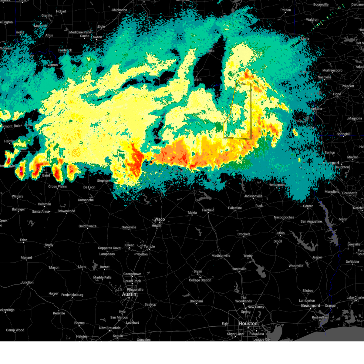 the severe thunderstorm warning has been cancelled and is no longer in effect the severe thunderstorm warning has been cancelled and is no longer in effect
|
| 6/8/2025 11:22 PM CDT |
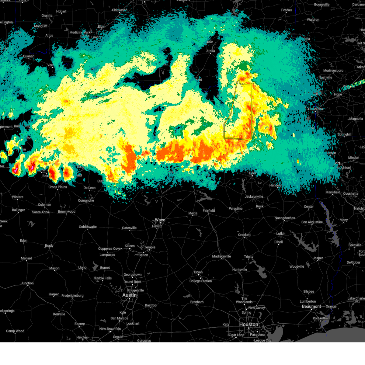 At 1121 pm cdt, severe thunderstorms were located along a line extending from near bogata to near point, moving southeast at 45 mph (radar indicated). Hazards include 70 mph wind gusts. Expect considerable tree damage. damage is likely to mobile homes, roofs, and outbuildings. These severe thunderstorms will impact areas of hopkins, delta and lamar counties, including the following locations, new birthright, ridgeway, glory, pacio, midcity, minter, taylor town, nelta, sun valley, and novice. At 1121 pm cdt, severe thunderstorms were located along a line extending from near bogata to near point, moving southeast at 45 mph (radar indicated). Hazards include 70 mph wind gusts. Expect considerable tree damage. damage is likely to mobile homes, roofs, and outbuildings. These severe thunderstorms will impact areas of hopkins, delta and lamar counties, including the following locations, new birthright, ridgeway, glory, pacio, midcity, minter, taylor town, nelta, sun valley, and novice.
|
| 6/8/2025 11:22 PM CDT |
 the severe thunderstorm warning has been cancelled and is no longer in effect the severe thunderstorm warning has been cancelled and is no longer in effect
|
| 6/8/2025 11:14 PM CDT |
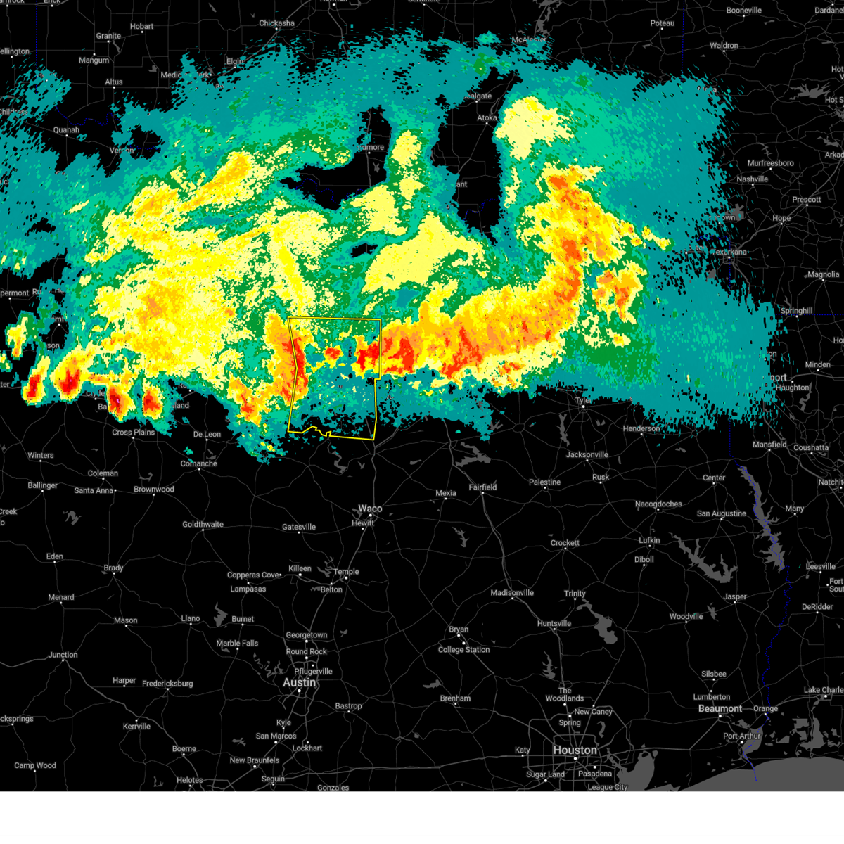 Svrfwd the national weather service in fort worth has issued a * severe thunderstorm warning for, somervell county in north central texas, johnson county in north central texas, eastern parker county in north central texas, tarrant county in north central texas, northwestern hill county in central texas, eastern hood county in north central texas, * until midnight cdt. * at 1114 pm cdt, severe thunderstorms were located along a line extending from near springtown to 6 miles south of annetta to near squaw creek reservoir, moving east at 45 mph (radar indicated). Hazards include 70 mph wind gusts and quarter size hail. Hail damage to vehicles is expected. expect considerable tree damage. Wind damage is also likely to mobile homes, roofs, and outbuildings. Svrfwd the national weather service in fort worth has issued a * severe thunderstorm warning for, somervell county in north central texas, johnson county in north central texas, eastern parker county in north central texas, tarrant county in north central texas, northwestern hill county in central texas, eastern hood county in north central texas, * until midnight cdt. * at 1114 pm cdt, severe thunderstorms were located along a line extending from near springtown to 6 miles south of annetta to near squaw creek reservoir, moving east at 45 mph (radar indicated). Hazards include 70 mph wind gusts and quarter size hail. Hail damage to vehicles is expected. expect considerable tree damage. Wind damage is also likely to mobile homes, roofs, and outbuildings.
|
| 6/8/2025 11:08 PM CDT |
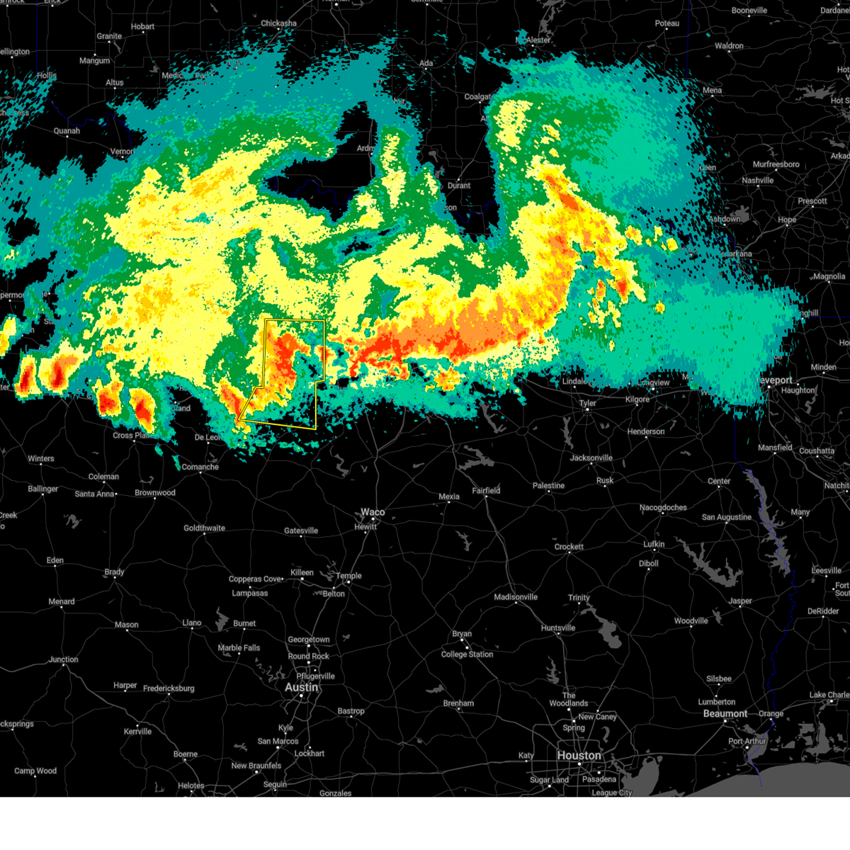 At 1108 pm cdt, severe thunderstorms were located along a line extending from near poolville to western lake to bluff dale, moving east at 45 mph (radar indicated). Hazards include 70 mph wind gusts and quarter size hail. Hail damage to vehicles is expected. expect considerable tree damage. wind damage is also likely to mobile homes, roofs, and outbuildings. Locations impacted include, lipan, dinosaur valley state park, weatherford, glen rose, mambrino, willow park, acton, bennett, lake weatherford, waples, horseshoe bend, annetta north, nemo, brock junction, pecan plantation, advance, lake granbury, springtown, authon, and millsap. At 1108 pm cdt, severe thunderstorms were located along a line extending from near poolville to western lake to bluff dale, moving east at 45 mph (radar indicated). Hazards include 70 mph wind gusts and quarter size hail. Hail damage to vehicles is expected. expect considerable tree damage. wind damage is also likely to mobile homes, roofs, and outbuildings. Locations impacted include, lipan, dinosaur valley state park, weatherford, glen rose, mambrino, willow park, acton, bennett, lake weatherford, waples, horseshoe bend, annetta north, nemo, brock junction, pecan plantation, advance, lake granbury, springtown, authon, and millsap.
|
| 6/8/2025 11:08 PM CDT |
 the severe thunderstorm warning has been cancelled and is no longer in effect the severe thunderstorm warning has been cancelled and is no longer in effect
|
| 6/8/2025 10:58 PM CDT |
 At 1057 pm cdt, severe thunderstorms were located along a line extending from near paris to near greenville club lake, moving east at 55 mph (radar indicated). Hazards include 70 mph wind gusts and penny size hail. Expect considerable tree damage. damage is likely to mobile homes, roofs, and outbuildings. These severe thunderstorms will impact areas of northern hunt, hopkins, delta and lamar counties, including the following locations, neylandville, new birthright, ridgeway, pacio, midcity, taylor town, sun valley, peerless, dike, and atlas. At 1057 pm cdt, severe thunderstorms were located along a line extending from near paris to near greenville club lake, moving east at 55 mph (radar indicated). Hazards include 70 mph wind gusts and penny size hail. Expect considerable tree damage. damage is likely to mobile homes, roofs, and outbuildings. These severe thunderstorms will impact areas of northern hunt, hopkins, delta and lamar counties, including the following locations, neylandville, new birthright, ridgeway, pacio, midcity, taylor town, sun valley, peerless, dike, and atlas.
|
| 6/8/2025 10:58 PM CDT |
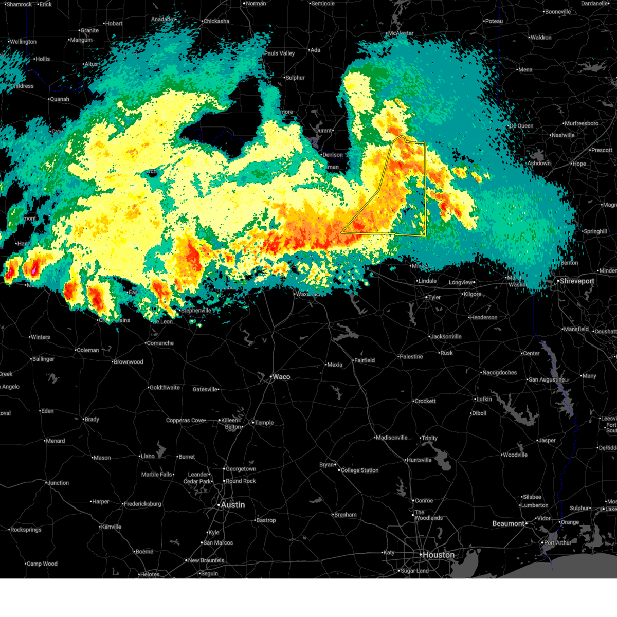 the severe thunderstorm warning has been cancelled and is no longer in effect the severe thunderstorm warning has been cancelled and is no longer in effect
|
| 6/8/2025 10:47 PM CDT |
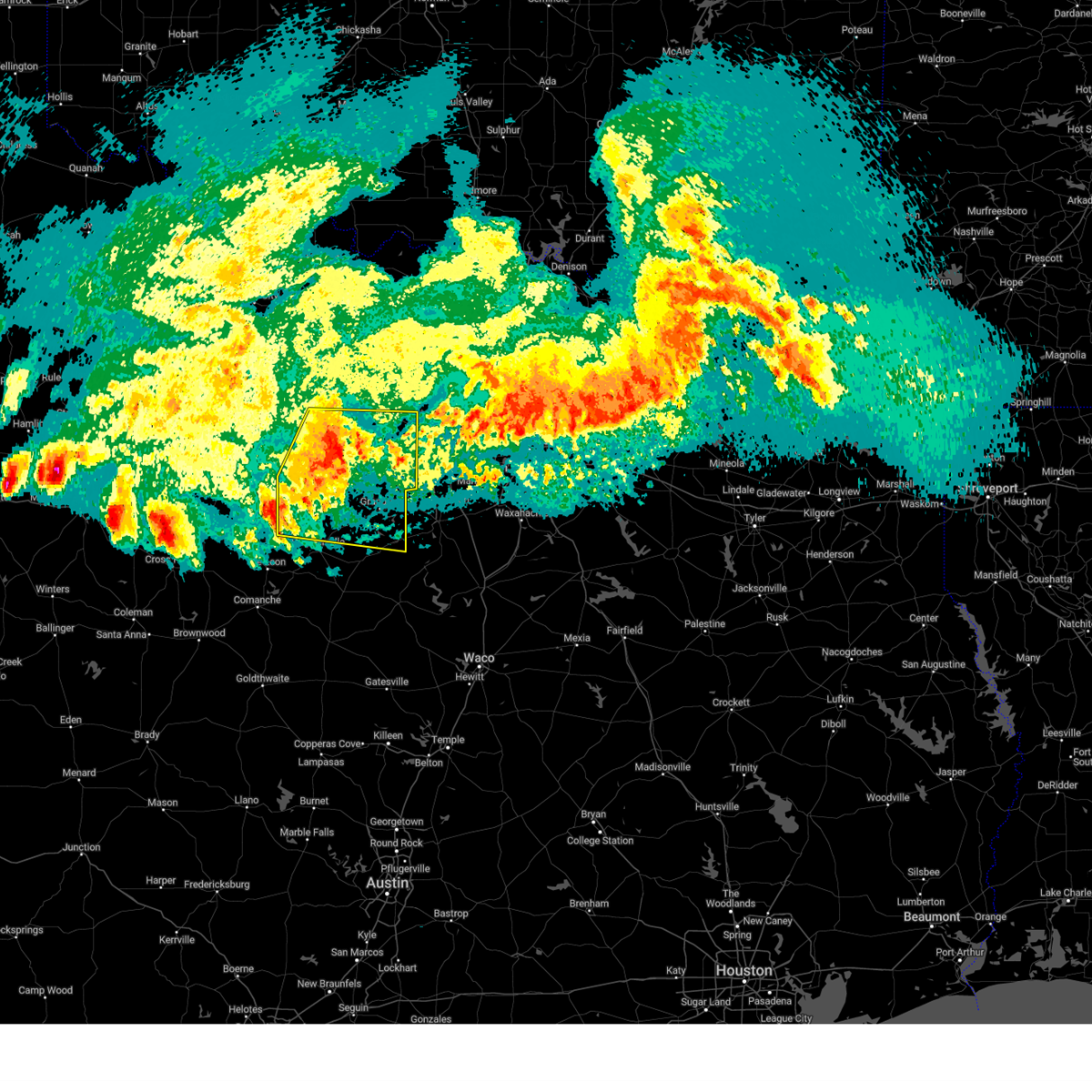 At 1047 pm cdt, severe thunderstorms were located along a line extending from 8 miles east of graford to 8 miles northwest of lipan to huckabay, moving east at 45 mph (radar indicated). Hazards include 70 mph wind gusts and quarter size hail. Hail damage to vehicles is expected. expect considerable tree damage. wind damage is also likely to mobile homes, roofs, and outbuildings. Locations impacted include, lipan, palo pinto, santo, dinosaur valley state park, weatherford, glen rose, mambrino, willow park, acton, bennett, lake weatherford, waples, thurber, graford, hannibal, horseshoe bend, salesville, annetta north, nemo, and brock junction. At 1047 pm cdt, severe thunderstorms were located along a line extending from 8 miles east of graford to 8 miles northwest of lipan to huckabay, moving east at 45 mph (radar indicated). Hazards include 70 mph wind gusts and quarter size hail. Hail damage to vehicles is expected. expect considerable tree damage. wind damage is also likely to mobile homes, roofs, and outbuildings. Locations impacted include, lipan, palo pinto, santo, dinosaur valley state park, weatherford, glen rose, mambrino, willow park, acton, bennett, lake weatherford, waples, thurber, graford, hannibal, horseshoe bend, salesville, annetta north, nemo, and brock junction.
|
| 6/8/2025 10:36 PM CDT |
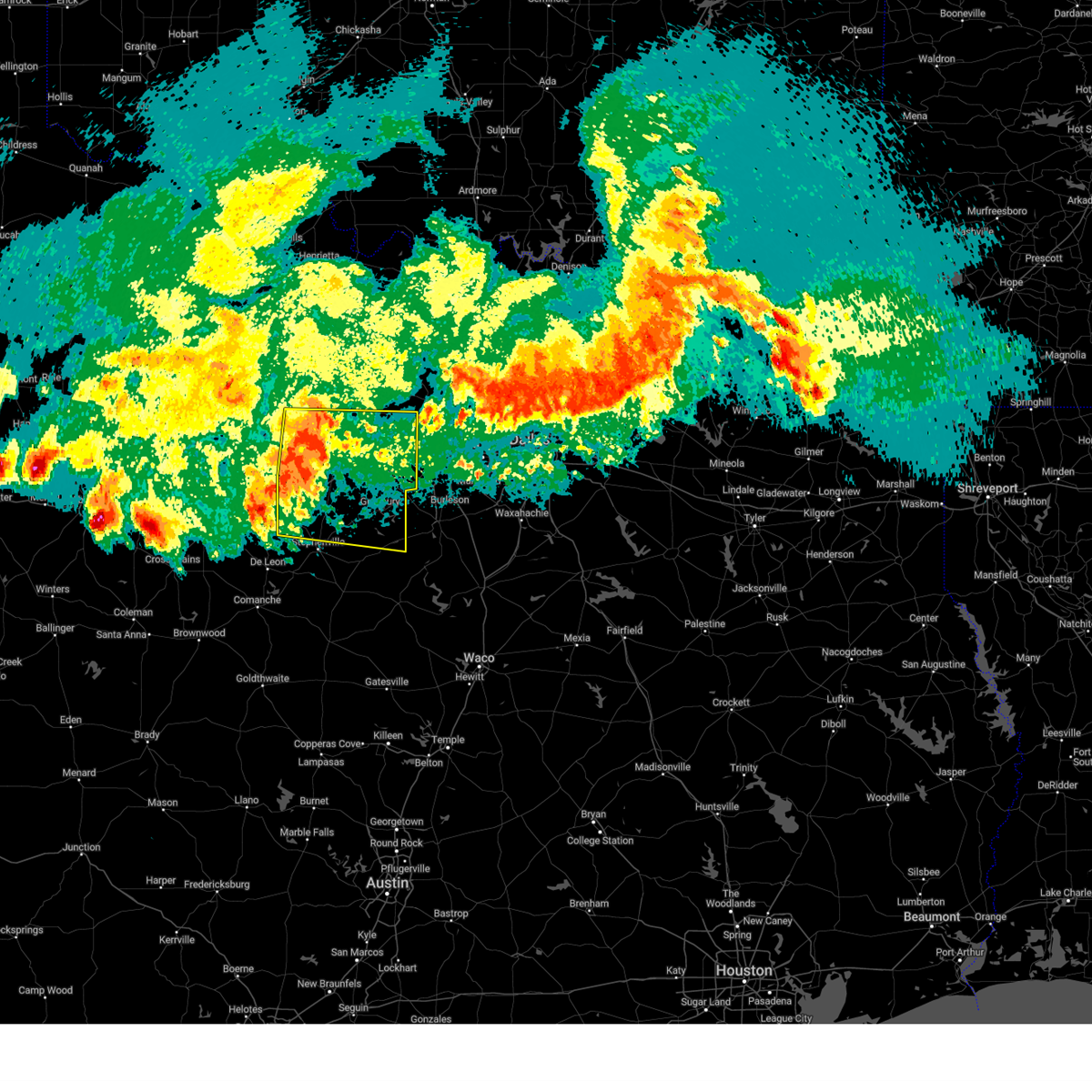 Svrfwd the national weather service in fort worth has issued a * severe thunderstorm warning for, northern somervell county in north central texas, northern erath county in north central texas, parker county in north central texas, palo pinto county in north central texas, hood county in north central texas, * until 1130 pm cdt. * at 1035 pm cdt, severe thunderstorms were located along a line extending from near graford to near lake palo pinto to 6 miles west of huckabay, moving east at 45 mph (radar indicated). Hazards include 65 mph wind gusts and quarter size hail. Hail damage to vehicles is expected. Expect wind damage to roofs, siding, and trees. Svrfwd the national weather service in fort worth has issued a * severe thunderstorm warning for, northern somervell county in north central texas, northern erath county in north central texas, parker county in north central texas, palo pinto county in north central texas, hood county in north central texas, * until 1130 pm cdt. * at 1035 pm cdt, severe thunderstorms were located along a line extending from near graford to near lake palo pinto to 6 miles west of huckabay, moving east at 45 mph (radar indicated). Hazards include 65 mph wind gusts and quarter size hail. Hail damage to vehicles is expected. Expect wind damage to roofs, siding, and trees.
|
| 6/8/2025 10:28 PM CDT |
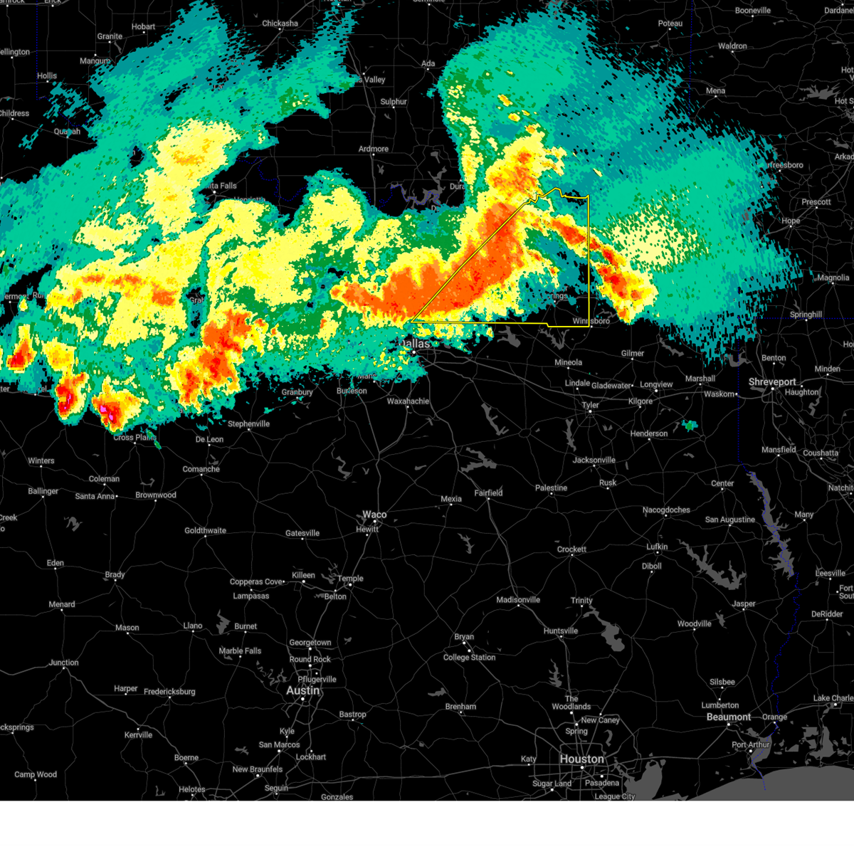 Svrfwd the national weather service in fort worth has issued a * severe thunderstorm warning for, hunt county in north central texas, hopkins county in north central texas, delta county in north central texas, lamar county in north central texas, southeastern collin county in north central texas, southern fannin county in north central texas, * until 1145 pm cdt. * at 1026 pm cdt, severe thunderstorms were located along a line extending from near dodd city to fairview, moving southeast at 45 mph (radar indicated). Hazards include 70 mph wind gusts and penny size hail. Expect considerable tree damage. damage is likely to mobile homes, roofs, and outbuildings. these severe thunderstorms will affect areas from plano to blue ridge to wolfe city to paris, including the following locations, neylandville, new birthright, ridgeway, pacio, nobility, midcity, direct, forest hill, taylor town, and floyd. This includes interstate 30 between mile markers 82 and 142. Svrfwd the national weather service in fort worth has issued a * severe thunderstorm warning for, hunt county in north central texas, hopkins county in north central texas, delta county in north central texas, lamar county in north central texas, southeastern collin county in north central texas, southern fannin county in north central texas, * until 1145 pm cdt. * at 1026 pm cdt, severe thunderstorms were located along a line extending from near dodd city to fairview, moving southeast at 45 mph (radar indicated). Hazards include 70 mph wind gusts and penny size hail. Expect considerable tree damage. damage is likely to mobile homes, roofs, and outbuildings. these severe thunderstorms will affect areas from plano to blue ridge to wolfe city to paris, including the following locations, neylandville, new birthright, ridgeway, pacio, nobility, midcity, direct, forest hill, taylor town, and floyd. This includes interstate 30 between mile markers 82 and 142.
|
| 5/19/2025 11:39 PM CDT |
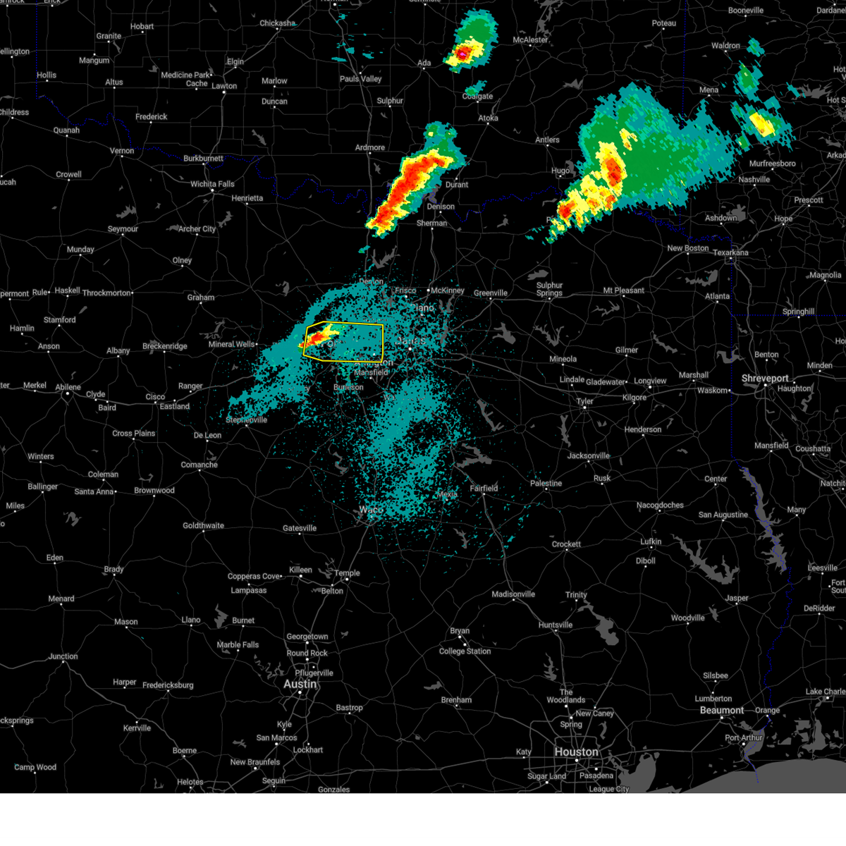 Svrfwd the national weather service in fort worth has issued a * severe thunderstorm warning for, northeastern parker county in north central texas, tarrant county in north central texas, * until 1230 am cdt. * at 1138 pm cdt, a severe thunderstorm was located near azle, moving east at 35 mph (radar indicated). Hazards include 60 mph wind gusts and half dollar size hail. Hail damage to vehicles is expected. expect wind damage to roofs, siding, and trees. this severe thunderstorm will be near, white settlement, lake worth, eagle mountain, fort worth, and azle around 1145 pm cdt. sansom park, river oaks, saginaw, and westworth village around 1150 pm cdt. blue mound around 1155 pm cdt. haltom city around 1200 am cdt. north richland hills, richland hills, and watauga around 1205 am cdt. hurst around 1210 am cdt. euless, colleyville, and bedford around 1215 am cdt. arlington around 1220 am cdt. other locations impacted by this severe thunderstorm include lake arlington, lake worth, westover hills, lakeside, sanctuary, highland addition, dalworthington gardens, la junta, and annetta north. this includes the following highways, interstate 35w between mile markers 47 and 65. interstate 20 between mile markers 413 and 427. Interstate 30 between mile markers 1 and 32. Svrfwd the national weather service in fort worth has issued a * severe thunderstorm warning for, northeastern parker county in north central texas, tarrant county in north central texas, * until 1230 am cdt. * at 1138 pm cdt, a severe thunderstorm was located near azle, moving east at 35 mph (radar indicated). Hazards include 60 mph wind gusts and half dollar size hail. Hail damage to vehicles is expected. expect wind damage to roofs, siding, and trees. this severe thunderstorm will be near, white settlement, lake worth, eagle mountain, fort worth, and azle around 1145 pm cdt. sansom park, river oaks, saginaw, and westworth village around 1150 pm cdt. blue mound around 1155 pm cdt. haltom city around 1200 am cdt. north richland hills, richland hills, and watauga around 1205 am cdt. hurst around 1210 am cdt. euless, colleyville, and bedford around 1215 am cdt. arlington around 1220 am cdt. other locations impacted by this severe thunderstorm include lake arlington, lake worth, westover hills, lakeside, sanctuary, highland addition, dalworthington gardens, la junta, and annetta north. this includes the following highways, interstate 35w between mile markers 47 and 65. interstate 20 between mile markers 413 and 427. Interstate 30 between mile markers 1 and 32.
|
| 5/19/2025 11:11 PM CDT |
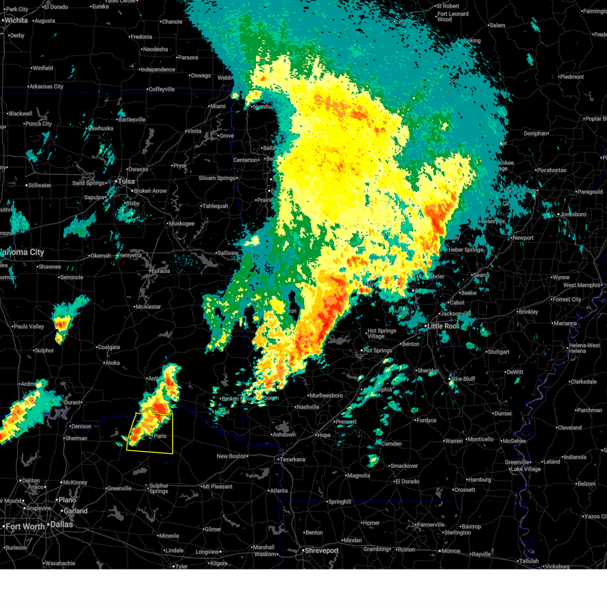 Svrfwd the national weather service in fort worth has issued a * severe thunderstorm warning for, lamar county in north central texas, * until 1215 am cdt. * at 1110 pm cdt, a severe thunderstorm was located near lake gibbons, or 9 miles west of paris, moving east at 30 mph (radar indicated). Hazards include 65 mph wind gusts and quarter size hail. Hail damage to vehicles is expected. expect wind damage to roofs, siding, and trees. this severe thunderstorm will be near, paris and lake gibbons around 1115 pm cdt. lake crook around 1120 pm cdt. reno around 1130 pm cdt. blossom around 1140 pm cdt. pattonville around 1145 pm cdt. Other locations impacted by this severe thunderstorm include toco, atlas, noble, glory, forest chapel, broadway junction, midcity, garretts bluff, deport, and biardstown. Svrfwd the national weather service in fort worth has issued a * severe thunderstorm warning for, lamar county in north central texas, * until 1215 am cdt. * at 1110 pm cdt, a severe thunderstorm was located near lake gibbons, or 9 miles west of paris, moving east at 30 mph (radar indicated). Hazards include 65 mph wind gusts and quarter size hail. Hail damage to vehicles is expected. expect wind damage to roofs, siding, and trees. this severe thunderstorm will be near, paris and lake gibbons around 1115 pm cdt. lake crook around 1120 pm cdt. reno around 1130 pm cdt. blossom around 1140 pm cdt. pattonville around 1145 pm cdt. Other locations impacted by this severe thunderstorm include toco, atlas, noble, glory, forest chapel, broadway junction, midcity, garretts bluff, deport, and biardstown.
|
| 5/17/2025 8:48 PM CDT |
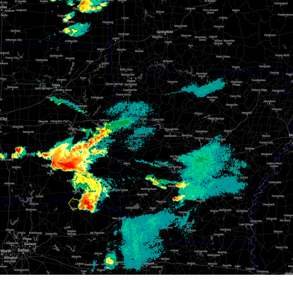 the severe thunderstorm warning has been cancelled and is no longer in effect the severe thunderstorm warning has been cancelled and is no longer in effect
|
| 5/17/2025 8:29 PM CDT |
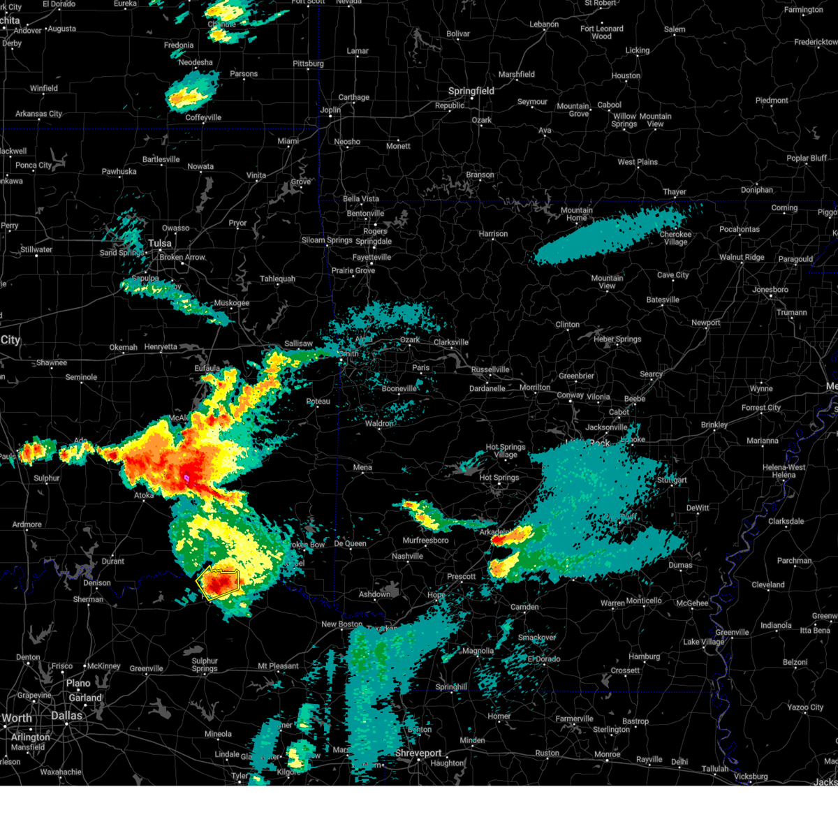 Svrfwd the national weather service in fort worth has issued a * severe thunderstorm warning for, northeastern lamar county in north central texas, * until 915 pm cdt. * at 829 pm cdt, a severe thunderstorm was located near powderly, or 11 miles northeast of paris, moving northeast at 25 mph (radar indicated). Hazards include 60 mph wind gusts and quarter size hail. Hail damage to vehicles is expected. Expect wind damage to roofs, siding, and trees. Svrfwd the national weather service in fort worth has issued a * severe thunderstorm warning for, northeastern lamar county in north central texas, * until 915 pm cdt. * at 829 pm cdt, a severe thunderstorm was located near powderly, or 11 miles northeast of paris, moving northeast at 25 mph (radar indicated). Hazards include 60 mph wind gusts and quarter size hail. Hail damage to vehicles is expected. Expect wind damage to roofs, siding, and trees.
|
| 4/26/2025 3:10 PM CDT |
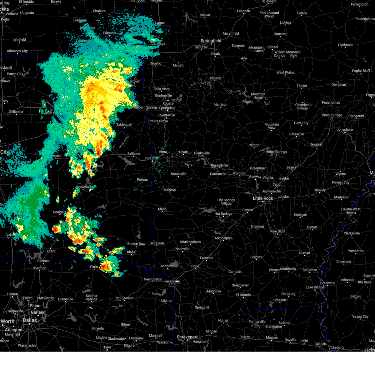 Svrfwd the national weather service in fort worth has issued a * severe thunderstorm warning for, east central lamar county in north central texas, * until 345 pm cdt. * at 310 pm cdt, a severe thunderstorm was located near blossom, or 12 miles east of paris, moving northeast at 20 mph (radar indicated). Hazards include 60 mph wind gusts and quarter size hail. Hail damage to vehicles is expected. Expect wind damage to roofs, siding, and trees. Svrfwd the national weather service in fort worth has issued a * severe thunderstorm warning for, east central lamar county in north central texas, * until 345 pm cdt. * at 310 pm cdt, a severe thunderstorm was located near blossom, or 12 miles east of paris, moving northeast at 20 mph (radar indicated). Hazards include 60 mph wind gusts and quarter size hail. Hail damage to vehicles is expected. Expect wind damage to roofs, siding, and trees.
|
| 4/19/2025 11:13 PM CDT |
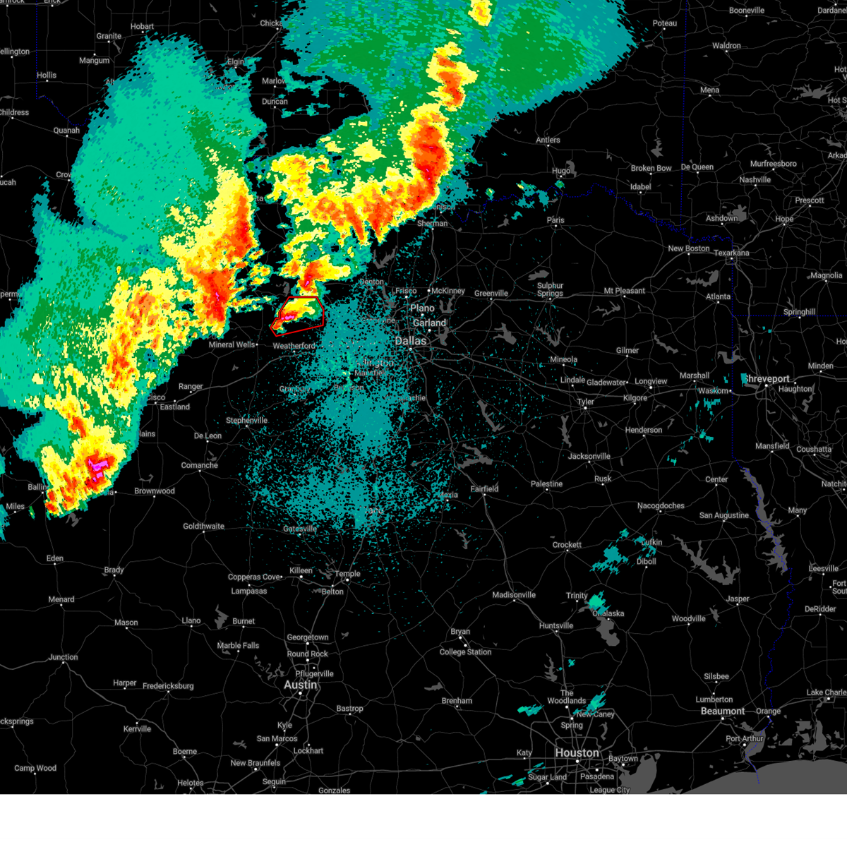 Torfwd the national weather service in fort worth has issued a * tornado warning for, southwestern wise county in north central texas, northern parker county in north central texas, * until midnight cdt. * at 1112 pm cdt, a severe thunderstorm capable of producing a tornado was located near poolville, or 12 miles northeast of mineral wells, moving northeast at 30 mph (radar indicated rotation). Hazards include tornado and golf ball size hail. Flying debris will be dangerous to those caught without shelter. mobile homes will be damaged or destroyed. damage to roofs, windows, and vehicles will occur. tree damage is likely. this dangerous storm will be near, poolville around 1120 pm cdt. paradise around 1145 pm cdt. Other locations impacted by this tornadic thunderstorm include adell, balsora, agnes, boonsville, advance, cottondale, keeter, highland addition, and authon. Torfwd the national weather service in fort worth has issued a * tornado warning for, southwestern wise county in north central texas, northern parker county in north central texas, * until midnight cdt. * at 1112 pm cdt, a severe thunderstorm capable of producing a tornado was located near poolville, or 12 miles northeast of mineral wells, moving northeast at 30 mph (radar indicated rotation). Hazards include tornado and golf ball size hail. Flying debris will be dangerous to those caught without shelter. mobile homes will be damaged or destroyed. damage to roofs, windows, and vehicles will occur. tree damage is likely. this dangerous storm will be near, poolville around 1120 pm cdt. paradise around 1145 pm cdt. Other locations impacted by this tornadic thunderstorm include adell, balsora, agnes, boonsville, advance, cottondale, keeter, highland addition, and authon.
|
| 4/19/2025 10:49 PM CDT |
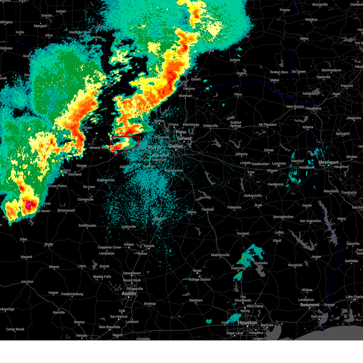 At 1049 pm cdt, a severe thunderstorm capable of producing a tornado was located near cool, or 7 miles southeast of mineral wells, moving northeast at 35 mph (radar indicated rotation). Hazards include tornado and tennis ball size hail. Flying debris will be dangerous to those caught without shelter. mobile homes will be damaged or destroyed. damage to roofs, windows, and vehicles will occur. tree damage is likely. this dangerous storm will be near, springtown around 1120 pm cdt. Other locations impacted by this tornadic thunderstorm include adell, peaster, whitt, advance, agnes, bennett, authon, garner, millsap, and sanctuary. At 1049 pm cdt, a severe thunderstorm capable of producing a tornado was located near cool, or 7 miles southeast of mineral wells, moving northeast at 35 mph (radar indicated rotation). Hazards include tornado and tennis ball size hail. Flying debris will be dangerous to those caught without shelter. mobile homes will be damaged or destroyed. damage to roofs, windows, and vehicles will occur. tree damage is likely. this dangerous storm will be near, springtown around 1120 pm cdt. Other locations impacted by this tornadic thunderstorm include adell, peaster, whitt, advance, agnes, bennett, authon, garner, millsap, and sanctuary.
|
| 4/19/2025 10:37 PM CDT |
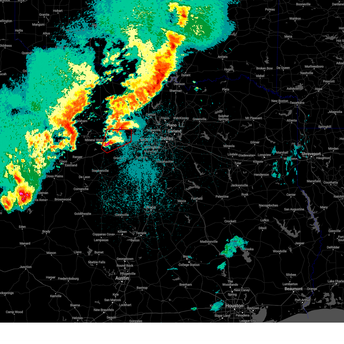 Torfwd the national weather service in fort worth has issued a * tornado warning for, parker county in north central texas, east central palo pinto county in north central texas, * until 1115 pm cdt. * at 1036 pm cdt, a severe thunderstorm capable of producing a tornado was located near brock, or 8 miles south of mineral wells, moving northeast at 40 mph (radar indicated rotation). Hazards include tornado and tennis ball size hail. Flying debris will be dangerous to those caught without shelter. mobile homes will be damaged or destroyed. damage to roofs, windows, and vehicles will occur. tree damage is likely. this dangerous storm will be near, cool around 1045 pm cdt. other locations impacted by this tornadic thunderstorm include brock junction, adell, peaster, whitt, advance, agnes, bennett, authon, new salem, and garner. This includes interstate 20 between mile markers 387 and 415. Torfwd the national weather service in fort worth has issued a * tornado warning for, parker county in north central texas, east central palo pinto county in north central texas, * until 1115 pm cdt. * at 1036 pm cdt, a severe thunderstorm capable of producing a tornado was located near brock, or 8 miles south of mineral wells, moving northeast at 40 mph (radar indicated rotation). Hazards include tornado and tennis ball size hail. Flying debris will be dangerous to those caught without shelter. mobile homes will be damaged or destroyed. damage to roofs, windows, and vehicles will occur. tree damage is likely. this dangerous storm will be near, cool around 1045 pm cdt. other locations impacted by this tornadic thunderstorm include brock junction, adell, peaster, whitt, advance, agnes, bennett, authon, new salem, and garner. This includes interstate 20 between mile markers 387 and 415.
|
| 4/19/2025 10:23 PM CDT |
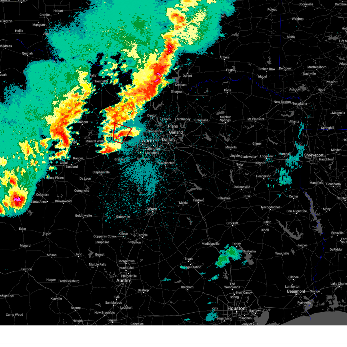 At 1023 pm cdt, a confirmed tornado was located near weatherford, moving north at 35 mph (law enforcement confirmed tornado). Hazards include damaging tornado and quarter size hail. Flying debris will be dangerous to those caught without shelter. mobile homes will be damaged or destroyed. damage to roofs, windows, and vehicles will occur. tree damage is likely. this tornado will be near, springtown around 1035 pm cdt. Other locations impacted by this tornadic thunderstorm include adell, peaster, agnes, boonsville, advance, authon, cottondale, keeter, and highland addition. At 1023 pm cdt, a confirmed tornado was located near weatherford, moving north at 35 mph (law enforcement confirmed tornado). Hazards include damaging tornado and quarter size hail. Flying debris will be dangerous to those caught without shelter. mobile homes will be damaged or destroyed. damage to roofs, windows, and vehicles will occur. tree damage is likely. this tornado will be near, springtown around 1035 pm cdt. Other locations impacted by this tornadic thunderstorm include adell, peaster, agnes, boonsville, advance, authon, cottondale, keeter, and highland addition.
|
| 4/19/2025 10:13 PM CDT |
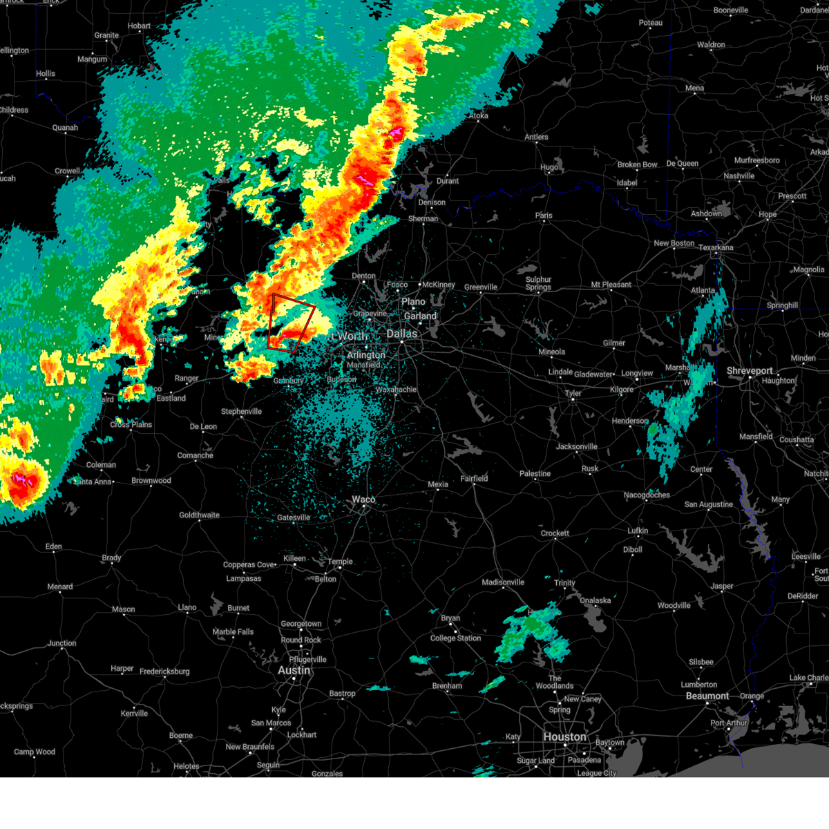 Torfwd the national weather service in fort worth has issued a * tornado warning for, southwestern wise county in north central texas, northern parker county in north central texas, * until 1100 pm cdt. * at 1012 pm cdt, a severe thunderstorm capable of producing a tornado was located near weatherford, moving north at 25 mph (radar indicated rotation). Hazards include tornado and quarter size hail. Flying debris will be dangerous to those caught without shelter. mobile homes will be damaged or destroyed. damage to roofs, windows, and vehicles will occur. tree damage is likely. this dangerous storm will be near, weatherford around 1020 pm cdt. poolville around 1040 pm cdt. other locations impacted by this tornadic thunderstorm include adell, peaster, agnes, boonsville, advance, authon, cottondale, keeter, highland addition, and annetta north. This includes interstate 20 between mile markers 401 and 412. Torfwd the national weather service in fort worth has issued a * tornado warning for, southwestern wise county in north central texas, northern parker county in north central texas, * until 1100 pm cdt. * at 1012 pm cdt, a severe thunderstorm capable of producing a tornado was located near weatherford, moving north at 25 mph (radar indicated rotation). Hazards include tornado and quarter size hail. Flying debris will be dangerous to those caught without shelter. mobile homes will be damaged or destroyed. damage to roofs, windows, and vehicles will occur. tree damage is likely. this dangerous storm will be near, weatherford around 1020 pm cdt. poolville around 1040 pm cdt. other locations impacted by this tornadic thunderstorm include adell, peaster, agnes, boonsville, advance, authon, cottondale, keeter, highland addition, and annetta north. This includes interstate 20 between mile markers 401 and 412.
|
| 4/19/2025 4:00 AM CDT |
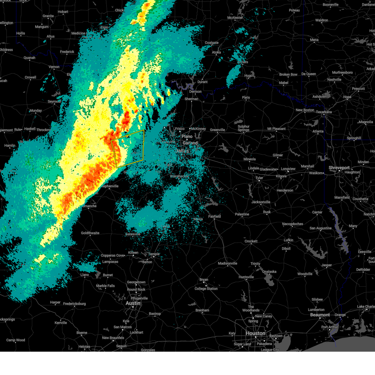 Svrfwd the national weather service in fort worth has issued a * severe thunderstorm warning for, southwestern wise county in north central texas, southeastern jack county in north central texas, parker county in north central texas, northeastern palo pinto county in north central texas, * until 430 am cdt. * at 359 am cdt, a severe thunderstorm was located over cool, or near mineral wells, moving east at 50 mph (radar indicated). Hazards include 60 mph wind gusts and quarter size hail. Hail damage to vehicles is expected. expect wind damage to roofs, siding, and trees. this severe thunderstorm will be near, weatherford around 405 am cdt. lake weatherford around 415 am cdt. azle and reno around 425 am cdt. other locations impacted by this severe thunderstorm include brock junction, adell, peaster, whitt, advance, dennis, cottondale, annetta south, keeter, and gibtown. this includes the following highways, interstate 20 between mile markers 389 and 422. Interstate 30 near mile marker 1. Svrfwd the national weather service in fort worth has issued a * severe thunderstorm warning for, southwestern wise county in north central texas, southeastern jack county in north central texas, parker county in north central texas, northeastern palo pinto county in north central texas, * until 430 am cdt. * at 359 am cdt, a severe thunderstorm was located over cool, or near mineral wells, moving east at 50 mph (radar indicated). Hazards include 60 mph wind gusts and quarter size hail. Hail damage to vehicles is expected. expect wind damage to roofs, siding, and trees. this severe thunderstorm will be near, weatherford around 405 am cdt. lake weatherford around 415 am cdt. azle and reno around 425 am cdt. other locations impacted by this severe thunderstorm include brock junction, adell, peaster, whitt, advance, dennis, cottondale, annetta south, keeter, and gibtown. this includes the following highways, interstate 20 between mile markers 389 and 422. Interstate 30 near mile marker 1.
|
| 3/29/2025 9:38 PM CDT |
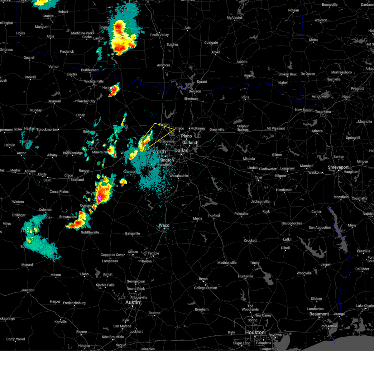 At 937 pm cdt, a severe thunderstorm was located over pecan acres, or near briar, moving northeast at 35 mph (radar indicated). Hazards include 60 mph wind gusts and quarter size hail. Hail damage to vehicles is expected. expect wind damage to roofs, siding, and trees. this severe storm will be near, haslet, new fairview, and rhome around 945 pm cdt. justin and northlake around 950 pm cdt. denton, corral city, and argyle around 1000 pm cdt. Other locations impacted by this severe thunderstorm include stony, ponder, oak point, newark, dish, marshall creek, lewisville lake, and grapevine lake. At 937 pm cdt, a severe thunderstorm was located over pecan acres, or near briar, moving northeast at 35 mph (radar indicated). Hazards include 60 mph wind gusts and quarter size hail. Hail damage to vehicles is expected. expect wind damage to roofs, siding, and trees. this severe storm will be near, haslet, new fairview, and rhome around 945 pm cdt. justin and northlake around 950 pm cdt. denton, corral city, and argyle around 1000 pm cdt. Other locations impacted by this severe thunderstorm include stony, ponder, oak point, newark, dish, marshall creek, lewisville lake, and grapevine lake.
|
| 3/29/2025 9:38 PM CDT |
 the severe thunderstorm warning has been cancelled and is no longer in effect the severe thunderstorm warning has been cancelled and is no longer in effect
|
| 3/29/2025 9:21 PM CDT |
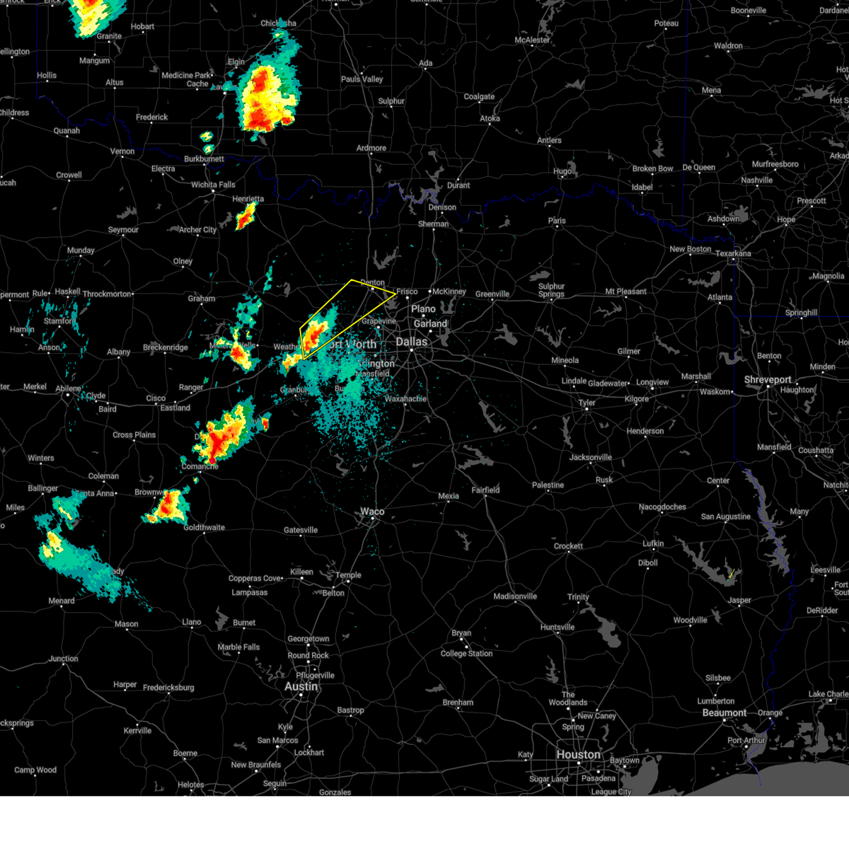 Svrfwd the national weather service in fort worth has issued a * severe thunderstorm warning for, southeastern wise county in north central texas, southern denton county in north central texas, northeastern parker county in north central texas, northwestern tarrant county in north central texas, * until 1015 pm cdt. * at 920 pm cdt, a severe thunderstorm was located near reno, or near azle, moving northeast at 35 mph (radar indicated). Hazards include 60 mph wind gusts and quarter size hail. Hail damage to vehicles is expected. expect wind damage to roofs, siding, and trees. this severe thunderstorm will be near, pecan acres, eagle mountain, briar, pelican bay, azle, and reno around 925 pm cdt. aurora, haslet, and rhome around 935 pm cdt. new fairview around 940 pm cdt. justin around 950 pm cdt. denton and northlake around 955 pm cdt. krum around 1010 pm cdt. other locations impacted by this severe thunderstorm include oak point, keeter, stony, ponder, newark, dish, sanctuary, highland addition, marshall creek, and la junta. this includes the following highways, interstate 35 between mile markers 468 and 469. interstate 35w between mile markers 66 and 85. interstate 35e between mile markers 457 and 466. Interstate 20 between mile markers 412 and 415. Svrfwd the national weather service in fort worth has issued a * severe thunderstorm warning for, southeastern wise county in north central texas, southern denton county in north central texas, northeastern parker county in north central texas, northwestern tarrant county in north central texas, * until 1015 pm cdt. * at 920 pm cdt, a severe thunderstorm was located near reno, or near azle, moving northeast at 35 mph (radar indicated). Hazards include 60 mph wind gusts and quarter size hail. Hail damage to vehicles is expected. expect wind damage to roofs, siding, and trees. this severe thunderstorm will be near, pecan acres, eagle mountain, briar, pelican bay, azle, and reno around 925 pm cdt. aurora, haslet, and rhome around 935 pm cdt. new fairview around 940 pm cdt. justin around 950 pm cdt. denton and northlake around 955 pm cdt. krum around 1010 pm cdt. other locations impacted by this severe thunderstorm include oak point, keeter, stony, ponder, newark, dish, sanctuary, highland addition, marshall creek, and la junta. this includes the following highways, interstate 35 between mile markers 468 and 469. interstate 35w between mile markers 66 and 85. interstate 35e between mile markers 457 and 466. Interstate 20 between mile markers 412 and 415.
|
| 3/4/2025 7:30 AM CST |
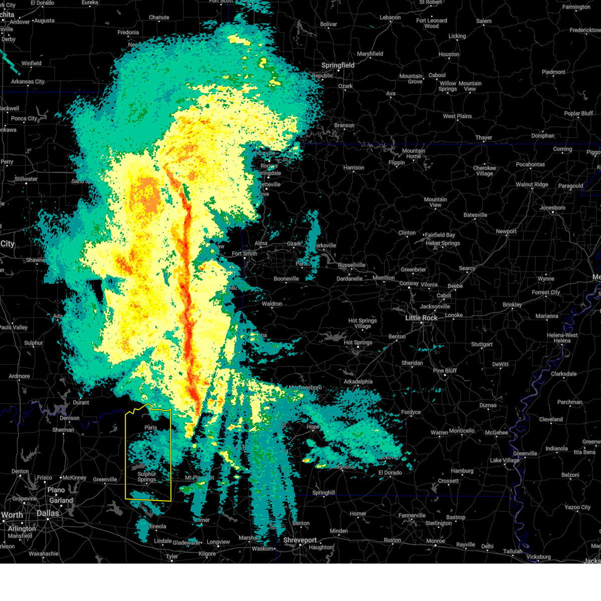 The storms which prompted the warning have moved out of the area. therefore the warning has been allowed to expire. however gusty winds are still possible with these thunderstorms. a tornado watch remains in effect until 1100 am cst for north central texas. The storms which prompted the warning have moved out of the area. therefore the warning has been allowed to expire. however gusty winds are still possible with these thunderstorms. a tornado watch remains in effect until 1100 am cst for north central texas.
|
| 3/4/2025 6:51 AM CST |
 the severe thunderstorm warning has been cancelled and is no longer in effect the severe thunderstorm warning has been cancelled and is no longer in effect
|
| 3/4/2025 6:51 AM CST |
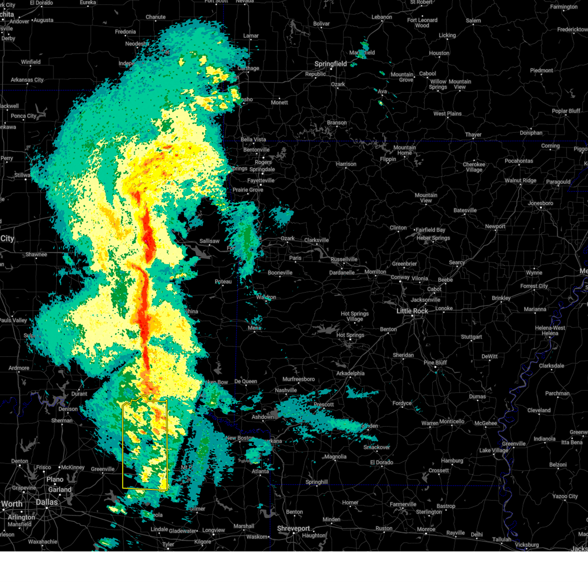 At 650 am cst, severe thunderstorms were located along a line extending from paris to sulphur springs, moving east at 55 mph (radar indicated). Hazards include 65 mph wind gusts and quarter size hail. Hail damage to vehicles is expected. expect wind damage to roofs, siding, and trees. Locations impacted include, new birthright, ridgeway, pacio, como, midcity, direct, forest hill, cooper lake, taylor town, sun valley, peerless, dike, atlas, weaver, tira, noble, forest chapel, pine forest, broadway junction, and garretts bluff. At 650 am cst, severe thunderstorms were located along a line extending from paris to sulphur springs, moving east at 55 mph (radar indicated). Hazards include 65 mph wind gusts and quarter size hail. Hail damage to vehicles is expected. expect wind damage to roofs, siding, and trees. Locations impacted include, new birthright, ridgeway, pacio, como, midcity, direct, forest hill, cooper lake, taylor town, sun valley, peerless, dike, atlas, weaver, tira, noble, forest chapel, pine forest, broadway junction, and garretts bluff.
|
| 3/4/2025 6:31 AM CST |
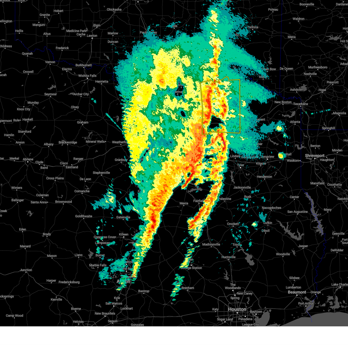 At 629 am cst, severe thunderstorms were located along a line extending from near crockett lake to pecan gap to cumby, moving east at 60 mph. several reports of wind damage have been received with this line of storms (emergency management). Hazards include 65 mph wind gusts and quarter size hail. Hail damage to vehicles is expected. expect wind damage to roofs, siding, and trees. These severe thunderstorms will move over most of hunt, hopkins, delta, lamar and eastern fannin counties, including the following locations, neylandville, new birthright, ridgeway, pacio, midcity, direct, forest hill, taylor town, sun valley, and gober. At 629 am cst, severe thunderstorms were located along a line extending from near crockett lake to pecan gap to cumby, moving east at 60 mph. several reports of wind damage have been received with this line of storms (emergency management). Hazards include 65 mph wind gusts and quarter size hail. Hail damage to vehicles is expected. expect wind damage to roofs, siding, and trees. These severe thunderstorms will move over most of hunt, hopkins, delta, lamar and eastern fannin counties, including the following locations, neylandville, new birthright, ridgeway, pacio, midcity, direct, forest hill, taylor town, sun valley, and gober.
|
| 3/4/2025 6:19 AM CST |
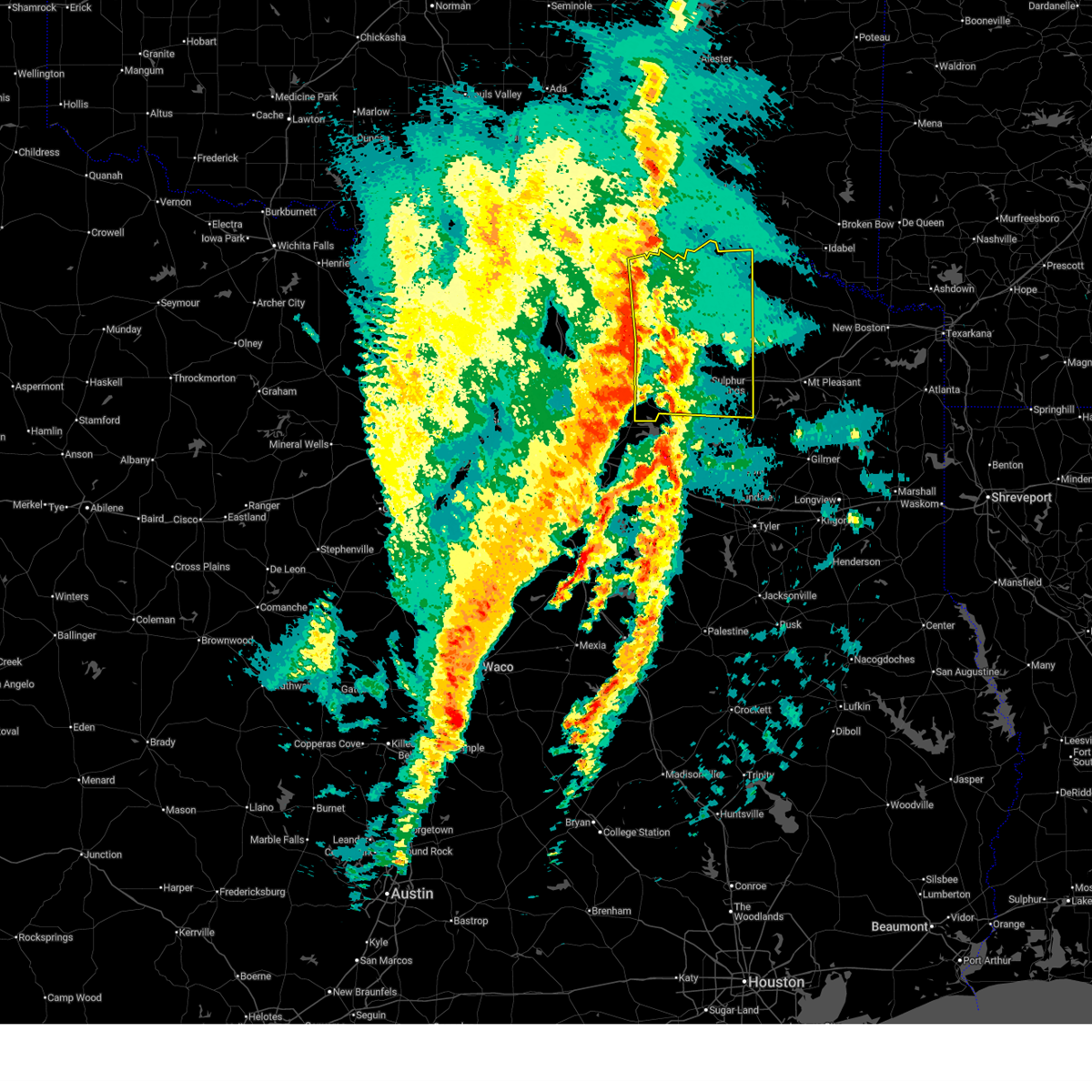 Svrfwd the national weather service in fort worth has issued a * severe thunderstorm warning for, eastern hunt county in north central texas, hopkins county in north central texas, delta county in north central texas, lamar county in north central texas, eastern fannin county in north central texas, * until 730 am cst. * at 618 am cst, severe thunderstorms were located along a line extending from near dodd city to wolfe city to near greenville, moving east at 60 mph (radar indicated). Hazards include 65 mph wind gusts and quarter size hail. Hail damage to vehicles is expected. expect wind damage to roofs, siding, and trees. other locations impacted by this severe thunderstorm include neylandville, new birthright, ridgeway, pacio, midcity, direct, forest hill, taylor town, sun valley, and gober. This includes interstate 30 between mile markers 95 and 142. Svrfwd the national weather service in fort worth has issued a * severe thunderstorm warning for, eastern hunt county in north central texas, hopkins county in north central texas, delta county in north central texas, lamar county in north central texas, eastern fannin county in north central texas, * until 730 am cst. * at 618 am cst, severe thunderstorms were located along a line extending from near dodd city to wolfe city to near greenville, moving east at 60 mph (radar indicated). Hazards include 65 mph wind gusts and quarter size hail. Hail damage to vehicles is expected. expect wind damage to roofs, siding, and trees. other locations impacted by this severe thunderstorm include neylandville, new birthright, ridgeway, pacio, midcity, direct, forest hill, taylor town, sun valley, and gober. This includes interstate 30 between mile markers 95 and 142.
|
| 3/4/2025 5:09 AM CST |
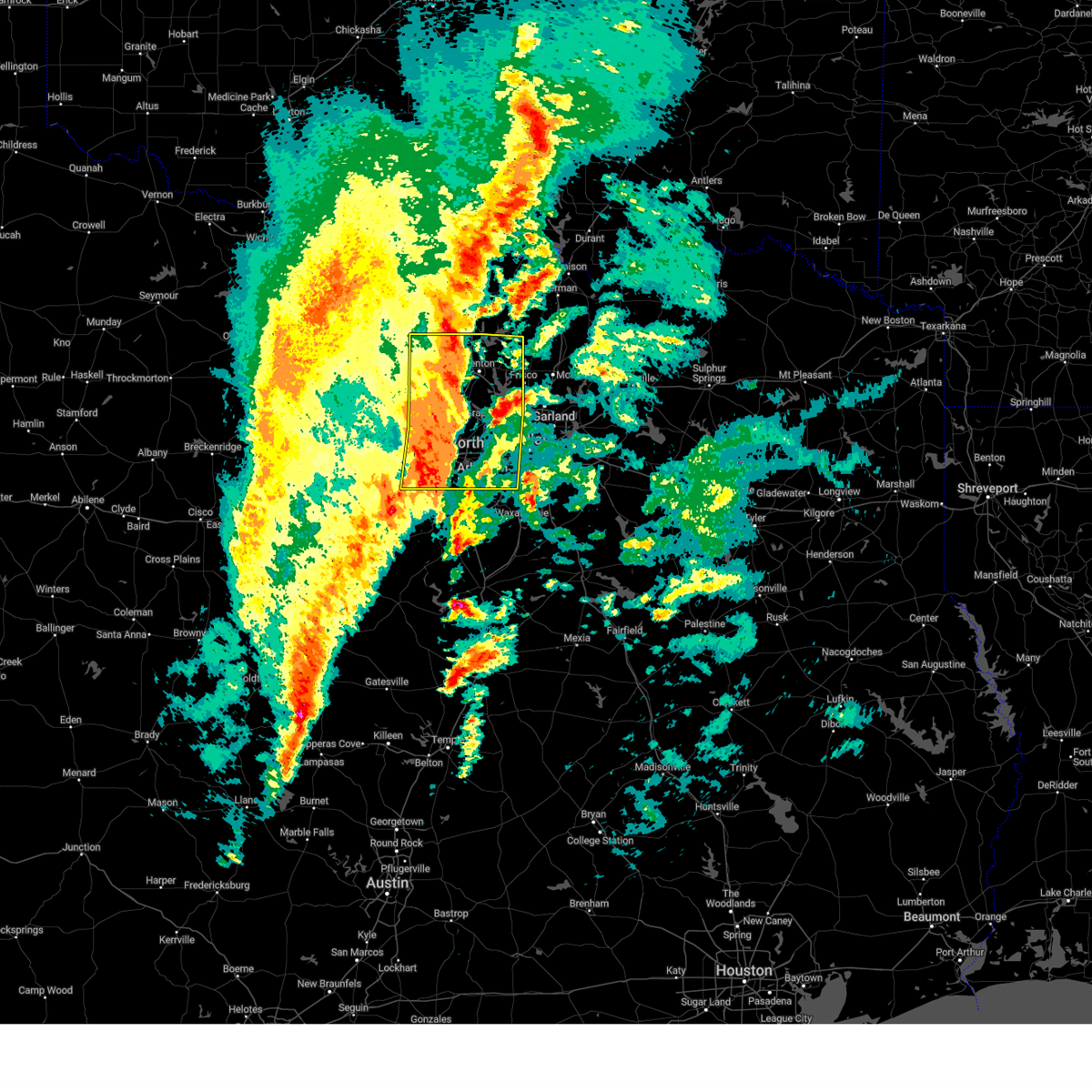 At 508 am cst, severe thunderstorms were located along a line extending from near sanger to trophy club to near crowley, moving east at 50 mph. this storm is currently producing widespread wind gusts of 70 to 75 mph! (radar indicated). Hazards include 75 mph wind gusts and quarter size hail. Hail damage to vehicles is expected. expect considerable tree damage. wind damage is also likely to mobile homes, roofs, and outbuildings. these severe storms will be near, denton, double oak, copper canyon, flower mound, bartonville, pantego, irving, euless, corinth, and rendon around 515 am cst. krugerville, hebron, dallas, carrollton, lake lewisville, pilot point, little elm, and the colony around 520 am cst. cedar hill state park, cedar hill, plano, hackberry, frisco, prosper, farmers branch, and celina around 525 am cst. duncanville, cockrell hill, addison, desoto, and dallas love field around 530 am cst. Other locations impacted by these severe thunderstorms include joe pool lake, mountain creek lake, providence village, stony, ponder, lewisville lake, bolivar, lincoln park, dish, and grapevine lake. At 508 am cst, severe thunderstorms were located along a line extending from near sanger to trophy club to near crowley, moving east at 50 mph. this storm is currently producing widespread wind gusts of 70 to 75 mph! (radar indicated). Hazards include 75 mph wind gusts and quarter size hail. Hail damage to vehicles is expected. expect considerable tree damage. wind damage is also likely to mobile homes, roofs, and outbuildings. these severe storms will be near, denton, double oak, copper canyon, flower mound, bartonville, pantego, irving, euless, corinth, and rendon around 515 am cst. krugerville, hebron, dallas, carrollton, lake lewisville, pilot point, little elm, and the colony around 520 am cst. cedar hill state park, cedar hill, plano, hackberry, frisco, prosper, farmers branch, and celina around 525 am cst. duncanville, cockrell hill, addison, desoto, and dallas love field around 530 am cst. Other locations impacted by these severe thunderstorms include joe pool lake, mountain creek lake, providence village, stony, ponder, lewisville lake, bolivar, lincoln park, dish, and grapevine lake.
|
| 3/4/2025 4:42 AM CST |
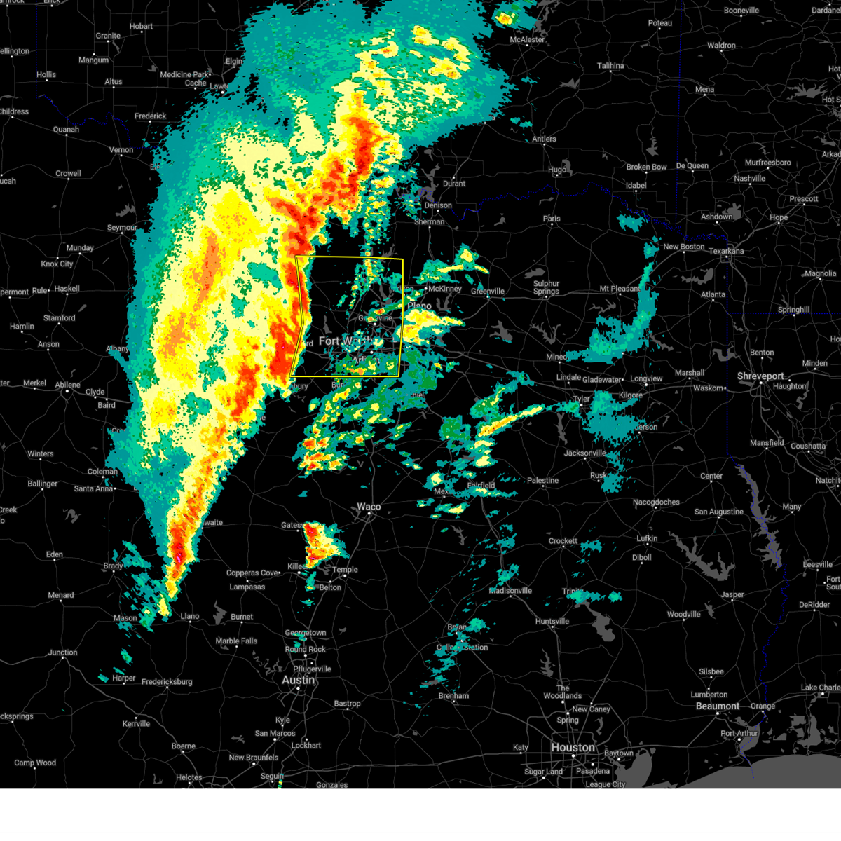 Svrfwd the national weather service in fort worth has issued a * severe thunderstorm warning for, wise county in north central texas, denton county in north central texas, eastern parker county in north central texas, tarrant county in north central texas, western dallas county in north central texas, * until 545 am cst. * at 440 am cst, severe thunderstorms were located along a line extending from alvord to springtown to near western lake, moving east at 50 mph. this storm is currently producing 70 mph winds and wind damage near decatur in wise county! (radar indicated). Hazards include 70 mph wind gusts and quarter size hail. Expect considerable tree damage. wind damage is also likely to mobile homes, roofs, and outbuildings. severe thunderstorms will be near, lake weatherford, aurora, alvord, boyd, pecan acres, eagle mountain, annetta, aledo, new fairview, and fort worth around 445 am cst. haslet and rhome around 450 am cst. white settlement, lake worth, sansom park, benbrook, saginaw, and westworth village around 455 am cst. justin, blue mound, and river oaks around 500 am cst. denton, edgecliff village, flower mound, edgecliff, roanoke, keller, haltom city, northlake, crowley, and watauga around 505 am cst. bartonville, sanger, north richland hills, richland hills, corral city, krum, forest hill, trophy club, argyle, and everman around 510 am cst. double oak, copper canyon, euless, rendon, kennedale, colleyville, bedford, arlington, grapevine, and hurst around 515 am cst. pantego, corinth, highland village, lewisville, hickory creek, mansfield, shady shores, and dfw intl airport around 520 am cst. other locations impacted by these severe thunderstorms include cottondale, joe pool lake, mountain creek lake, providence village, stony, ponder, lewisville lake, bolivar, lincoln park, and dish. this includes the following highways, interstate 35 between mile markers 468 and 481. interstate 35w between mile markers 38 and 85. interstate 35e between mile markers 432 and 466. interstate 20 between mile markers 410 and 463. Interstate 30 between mile markers 1 and 42. Svrfwd the national weather service in fort worth has issued a * severe thunderstorm warning for, wise county in north central texas, denton county in north central texas, eastern parker county in north central texas, tarrant county in north central texas, western dallas county in north central texas, * until 545 am cst. * at 440 am cst, severe thunderstorms were located along a line extending from alvord to springtown to near western lake, moving east at 50 mph. this storm is currently producing 70 mph winds and wind damage near decatur in wise county! (radar indicated). Hazards include 70 mph wind gusts and quarter size hail. Expect considerable tree damage. wind damage is also likely to mobile homes, roofs, and outbuildings. severe thunderstorms will be near, lake weatherford, aurora, alvord, boyd, pecan acres, eagle mountain, annetta, aledo, new fairview, and fort worth around 445 am cst. haslet and rhome around 450 am cst. white settlement, lake worth, sansom park, benbrook, saginaw, and westworth village around 455 am cst. justin, blue mound, and river oaks around 500 am cst. denton, edgecliff village, flower mound, edgecliff, roanoke, keller, haltom city, northlake, crowley, and watauga around 505 am cst. bartonville, sanger, north richland hills, richland hills, corral city, krum, forest hill, trophy club, argyle, and everman around 510 am cst. double oak, copper canyon, euless, rendon, kennedale, colleyville, bedford, arlington, grapevine, and hurst around 515 am cst. pantego, corinth, highland village, lewisville, hickory creek, mansfield, shady shores, and dfw intl airport around 520 am cst. other locations impacted by these severe thunderstorms include cottondale, joe pool lake, mountain creek lake, providence village, stony, ponder, lewisville lake, bolivar, lincoln park, and dish. this includes the following highways, interstate 35 between mile markers 468 and 481. interstate 35w between mile markers 38 and 85. interstate 35e between mile markers 432 and 466. interstate 20 between mile markers 410 and 463. Interstate 30 between mile markers 1 and 42.
|
| 3/4/2025 4:36 AM CST |
 At 435 am cst, severe thunderstorms were located along a line extending from near sunset to poolville to brock, moving east at 55 mph. a 66 mph wind gust was measured near poolville at 433 am cst (trained weather spotters). Hazards include 65 mph wind gusts and penny size hail. Expect damage to roofs, siding, and trees. these severe storms will be near, lake weatherford, alvord, paradise, bridgeport, briar, decatur, weatherford, reno, springtown, and hudson oaks around 440 am cst. boyd, annetta, aledo, willow park, and azle around 445 am cst. Other locations impacted by these severe thunderstorms include adell, dennis, cottondale, park springs, crafton, agnes, boonsville, bennett, garner, and tin top. At 435 am cst, severe thunderstorms were located along a line extending from near sunset to poolville to brock, moving east at 55 mph. a 66 mph wind gust was measured near poolville at 433 am cst (trained weather spotters). Hazards include 65 mph wind gusts and penny size hail. Expect damage to roofs, siding, and trees. these severe storms will be near, lake weatherford, alvord, paradise, bridgeport, briar, decatur, weatherford, reno, springtown, and hudson oaks around 440 am cst. boyd, annetta, aledo, willow park, and azle around 445 am cst. Other locations impacted by these severe thunderstorms include adell, dennis, cottondale, park springs, crafton, agnes, boonsville, bennett, garner, and tin top.
|
| 3/4/2025 4:36 AM CST |
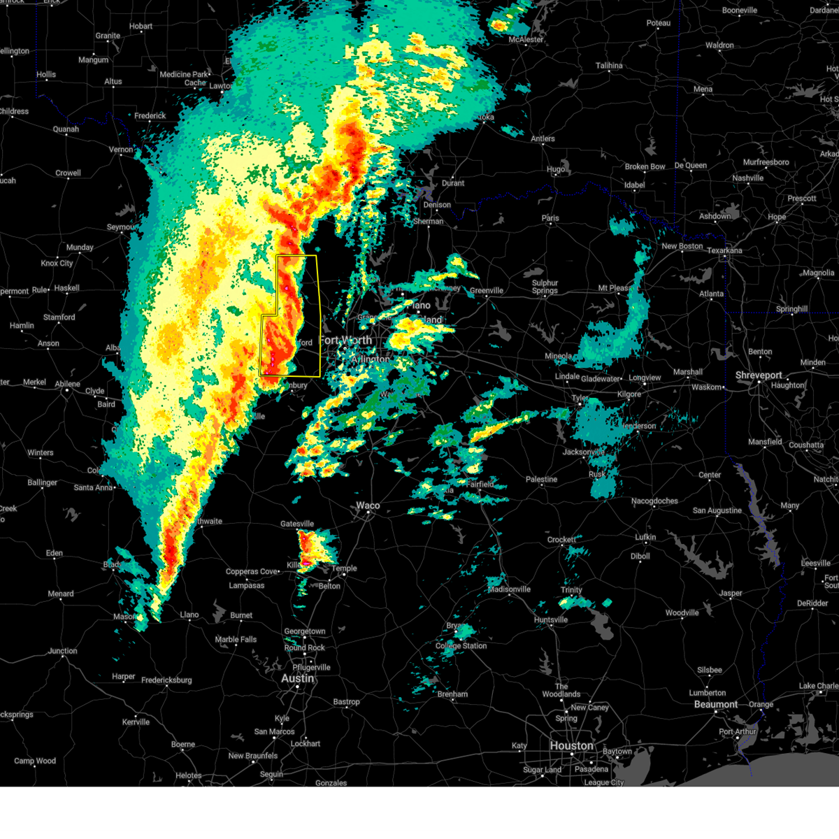 the severe thunderstorm warning has been cancelled and is no longer in effect the severe thunderstorm warning has been cancelled and is no longer in effect
|
| 3/4/2025 4:22 AM CST |
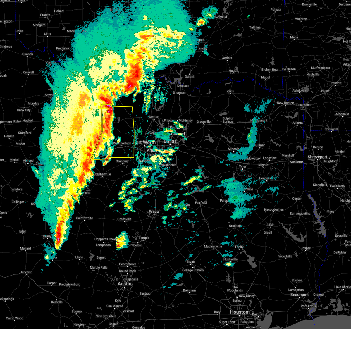 At 422 am cst, severe thunderstorms were located along a line extending from near newport to poolville to lipan, moving east at 55 mph (radar indicated). Hazards include 60 mph wind gusts and penny size hail. Expect damage to roofs, siding, and trees. these severe storms will be near, cool, poolville, bridgeport, brock, and lake bridgeport around 425 am cst. sunset, chico, and weatherford around 430 am cst. alvord, paradise, springtown, and western lake around 435 am cst. lake weatherford, boyd, annetta, willow park, briar, decatur, reno, and hudson oaks around 440 am cst. aledo and azle around 445 am cst. Other locations impacted by these severe thunderstorms include adell, lost creek reservoir, santo, cundiff, dennis, cottondale, park springs, crafton, gibtown, and joplin. At 422 am cst, severe thunderstorms were located along a line extending from near newport to poolville to lipan, moving east at 55 mph (radar indicated). Hazards include 60 mph wind gusts and penny size hail. Expect damage to roofs, siding, and trees. these severe storms will be near, cool, poolville, bridgeport, brock, and lake bridgeport around 425 am cst. sunset, chico, and weatherford around 430 am cst. alvord, paradise, springtown, and western lake around 435 am cst. lake weatherford, boyd, annetta, willow park, briar, decatur, reno, and hudson oaks around 440 am cst. aledo and azle around 445 am cst. Other locations impacted by these severe thunderstorms include adell, lost creek reservoir, santo, cundiff, dennis, cottondale, park springs, crafton, gibtown, and joplin.
|
| 3/4/2025 4:03 AM CST |
 At 402 am cst, severe thunderstorms were located along a line extending from near jacksboro to graford to gordon, moving east at 60 mph (radar indicated). Hazards include 60 mph wind gusts and penny size hail. Expect damage to roofs, siding, and trees. these severe storms will be near, jacksboro, mineral wells, and fort richardson state park around 410 am cst. cool and lake mineral wells around 415 am cst. poolville, brock, and lake bridgeport around 420 am cst. bridgeport, chico, and weatherford around 425 am cst. paradise, springtown, and western lake around 430 am cst. lake weatherford, alvord, annetta, willow park, briar, decatur, reno, and hudson oaks around 435 am cst. Boyd, aledo, and azle around 440 am cst. At 402 am cst, severe thunderstorms were located along a line extending from near jacksboro to graford to gordon, moving east at 60 mph (radar indicated). Hazards include 60 mph wind gusts and penny size hail. Expect damage to roofs, siding, and trees. these severe storms will be near, jacksboro, mineral wells, and fort richardson state park around 410 am cst. cool and lake mineral wells around 415 am cst. poolville, brock, and lake bridgeport around 420 am cst. bridgeport, chico, and weatherford around 425 am cst. paradise, springtown, and western lake around 430 am cst. lake weatherford, alvord, annetta, willow park, briar, decatur, reno, and hudson oaks around 435 am cst. Boyd, aledo, and azle around 440 am cst.
|
| 3/4/2025 4:03 AM CST |
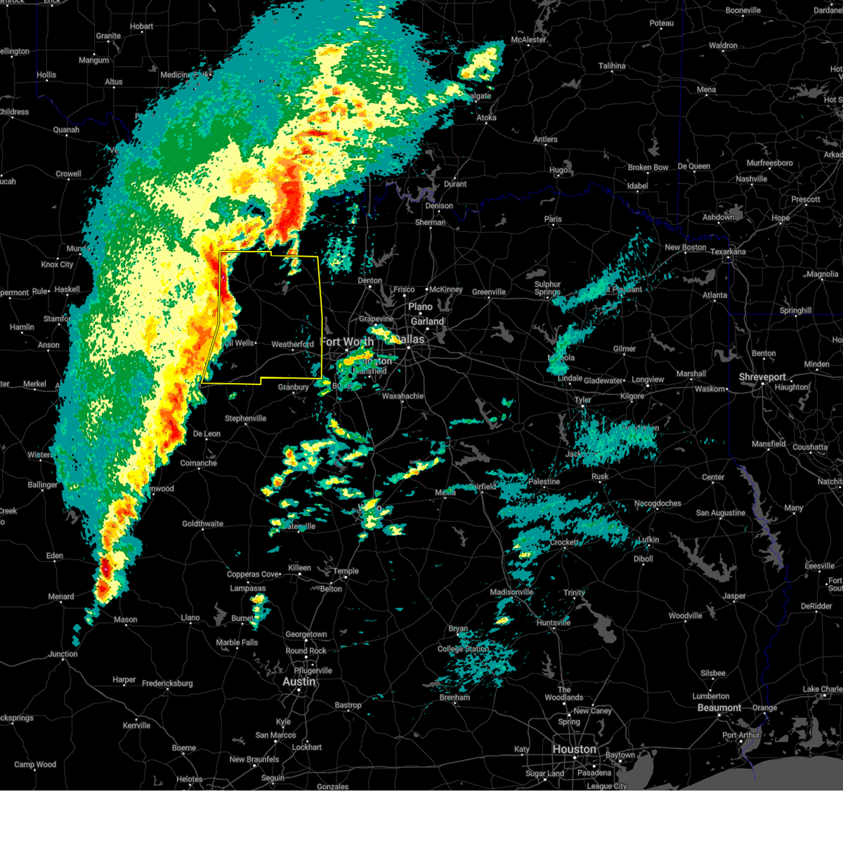 the severe thunderstorm warning has been cancelled and is no longer in effect the severe thunderstorm warning has been cancelled and is no longer in effect
|
| 3/4/2025 3:52 AM CST |
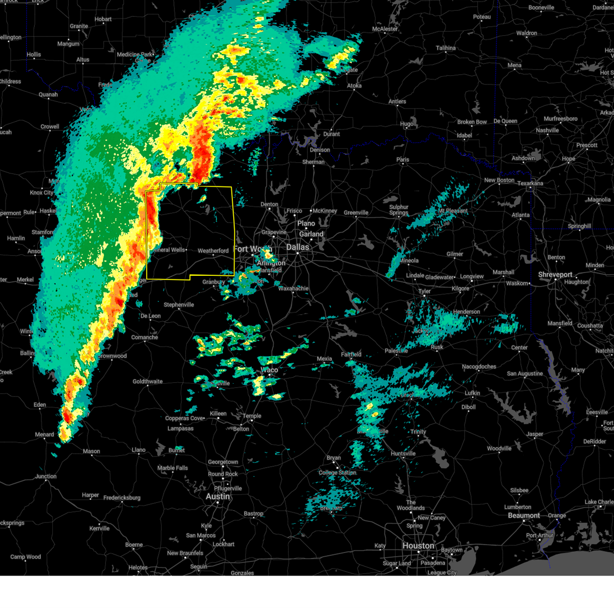 Svrfwd the national weather service in fort worth has issued a * severe thunderstorm warning for, eastern young county in north central texas, wise county in north central texas, jack county in north central texas, parker county in north central texas, palo pinto county in north central texas, * until 500 am cst. * at 352 am cst, severe thunderstorms were located along a line extending from from loving to graford to strawn, moving east at 55 mph (radar indicated). Hazards include 60 mph wind gusts and penny size hail. Expect damage to roofs, siding, and trees. severe thunderstorms will be near, lake palo pinto, jacksboro, graford, gordon, and palo pinto around 400 am cst. mineral wells and fort richardson state park around 405 am cst. cool and lake mineral wells around 410 am cst. poolville, brock, and lake bridgeport around 420 am cst. bridgeport and weatherford around 425 am cst. chico, springtown, and western lake around 430 am cst. lake weatherford, alvord, paradise, sunset, and hudson oaks around 435 am cst. boyd, annetta, aledo, willow park, briar, decatur, azle, and reno around 440 am cst. other locations impacted by these severe thunderstorms include santo, cundiff, park springs, crafton, gibtown, joplin, bartons chapel, bennett, vineyard, and wizard wells. this includes the following highways, interstate 20 between mile markers 370 and 422. Interstate 30 near mile marker 1. Svrfwd the national weather service in fort worth has issued a * severe thunderstorm warning for, eastern young county in north central texas, wise county in north central texas, jack county in north central texas, parker county in north central texas, palo pinto county in north central texas, * until 500 am cst. * at 352 am cst, severe thunderstorms were located along a line extending from from loving to graford to strawn, moving east at 55 mph (radar indicated). Hazards include 60 mph wind gusts and penny size hail. Expect damage to roofs, siding, and trees. severe thunderstorms will be near, lake palo pinto, jacksboro, graford, gordon, and palo pinto around 400 am cst. mineral wells and fort richardson state park around 405 am cst. cool and lake mineral wells around 410 am cst. poolville, brock, and lake bridgeport around 420 am cst. bridgeport and weatherford around 425 am cst. chico, springtown, and western lake around 430 am cst. lake weatherford, alvord, paradise, sunset, and hudson oaks around 435 am cst. boyd, annetta, aledo, willow park, briar, decatur, azle, and reno around 440 am cst. other locations impacted by these severe thunderstorms include santo, cundiff, park springs, crafton, gibtown, joplin, bartons chapel, bennett, vineyard, and wizard wells. this includes the following highways, interstate 20 between mile markers 370 and 422. Interstate 30 near mile marker 1.
|
| 6/4/2024 5:21 AM CDT |
 the severe thunderstorm warning has been cancelled and is no longer in effect the severe thunderstorm warning has been cancelled and is no longer in effect
|
| 6/4/2024 4:42 AM CDT |
 Svrfwd the national weather service in fort worth has issued a * severe thunderstorm warning for, lamar county in north central texas, northeastern fannin county in north central texas, * until 545 am cdt. * at 442 am cdt, severe thunderstorms were located along a line extending from near monkstown to near hugo, moving southeast at 45 mph (radar indicated). Hazards include 60 mph wind gusts. Expect damage to roofs, siding, and trees. severe thunderstorms will be near, pat mayse lake around 445 am cdt. camp maxey, arthur city, and sumner around 450 am cdt. paris, powderly, and lake gibbons around 455 am cdt. lake crook around 500 am cdt. reno around 505 am cdt. blossom around 510 am cdt. pattonville around 515 am cdt. Other locations impacted by these severe thunderstorms include east direct, toco, monkstown, atlas, glory, forest chapel, midcity, direct, garretts bluff, and minter. Svrfwd the national weather service in fort worth has issued a * severe thunderstorm warning for, lamar county in north central texas, northeastern fannin county in north central texas, * until 545 am cdt. * at 442 am cdt, severe thunderstorms were located along a line extending from near monkstown to near hugo, moving southeast at 45 mph (radar indicated). Hazards include 60 mph wind gusts. Expect damage to roofs, siding, and trees. severe thunderstorms will be near, pat mayse lake around 445 am cdt. camp maxey, arthur city, and sumner around 450 am cdt. paris, powderly, and lake gibbons around 455 am cdt. lake crook around 500 am cdt. reno around 505 am cdt. blossom around 510 am cdt. pattonville around 515 am cdt. Other locations impacted by these severe thunderstorms include east direct, toco, monkstown, atlas, glory, forest chapel, midcity, direct, garretts bluff, and minter.
|
| 6/2/2024 6:01 PM CDT |
 At 601 pm cdt, a severe thunderstorm was located near benbrook, moving east at 15 mph (radar indicated). Hazards include 60 mph wind gusts and quarter size hail. Hail damage to vehicles is expected. expect wind damage to roofs, siding, and trees. this severe storm will be near, white settlement and westworth village around 605 pm cdt. river oaks around 615 pm cdt. sansom park around 625 pm cdt. Lake worth around 630 pm cdt. At 601 pm cdt, a severe thunderstorm was located near benbrook, moving east at 15 mph (radar indicated). Hazards include 60 mph wind gusts and quarter size hail. Hail damage to vehicles is expected. expect wind damage to roofs, siding, and trees. this severe storm will be near, white settlement and westworth village around 605 pm cdt. river oaks around 615 pm cdt. sansom park around 625 pm cdt. Lake worth around 630 pm cdt.
|
| 6/2/2024 6:01 PM CDT |
 the severe thunderstorm warning has been cancelled and is no longer in effect the severe thunderstorm warning has been cancelled and is no longer in effect
|
| 6/2/2024 5:43 PM CDT |
 Svrfwd the national weather service in fort worth has issued a * severe thunderstorm warning for, southeastern parker county in north central texas, western tarrant county in north central texas, * until 630 pm cdt. * at 542 pm cdt, a severe thunderstorm was located over aledo, or 7 miles west of benbrook, moving east at 15 mph (radar indicated). Hazards include 60 mph wind gusts and quarter size hail. Hail damage to vehicles is expected. expect wind damage to roofs, siding, and trees. this severe thunderstorm will be near, benbrook around 550 pm cdt. white settlement around 555 pm cdt. westworth village around 605 pm cdt. Lake worth around 625 pm cdt. Svrfwd the national weather service in fort worth has issued a * severe thunderstorm warning for, southeastern parker county in north central texas, western tarrant county in north central texas, * until 630 pm cdt. * at 542 pm cdt, a severe thunderstorm was located over aledo, or 7 miles west of benbrook, moving east at 15 mph (radar indicated). Hazards include 60 mph wind gusts and quarter size hail. Hail damage to vehicles is expected. expect wind damage to roofs, siding, and trees. this severe thunderstorm will be near, benbrook around 550 pm cdt. white settlement around 555 pm cdt. westworth village around 605 pm cdt. Lake worth around 625 pm cdt.
|
| 6/2/2024 5:04 PM CDT |
 At 503 pm cdt, the leading edge of a cluster of severe thunderstorms was located along a line extending from near decatur to near springtown, moving east at 50 mph (radar indicated). Hazards include 60 mph wind gusts and nickel size hail. Expect damage to roofs, siding, and trees. These severe storms will be near, briar, pecan acres, reno, rhome, new fairview, aurora, and boyd around 510 pm cdt. At 503 pm cdt, the leading edge of a cluster of severe thunderstorms was located along a line extending from near decatur to near springtown, moving east at 50 mph (radar indicated). Hazards include 60 mph wind gusts and nickel size hail. Expect damage to roofs, siding, and trees. These severe storms will be near, briar, pecan acres, reno, rhome, new fairview, aurora, and boyd around 510 pm cdt.
|
| 6/2/2024 4:36 PM CDT |
 Svrfwd the national weather service in fort worth has issued a * severe thunderstorm warning for, wise county in north central texas, northern parker county in north central texas, * until 530 pm cdt. * at 434 pm cdt, the leading edge of a cluster of severe thunderstorms was located along a line from western wise county into southeastern jack county, moving east at 45 mph (radar indicated). Hazards include 65 mph wind gusts and nickel size hail. Expect damage to roofs, siding, and trees. severe thunderstorms will be near, bridgeport, chico, and lake bridgeport around 440 pm cdt. paradise around 445 pm cdt. alvord and poolville around 450 pm cdt. Decatur and boyd around 455 pm cdt. Svrfwd the national weather service in fort worth has issued a * severe thunderstorm warning for, wise county in north central texas, northern parker county in north central texas, * until 530 pm cdt. * at 434 pm cdt, the leading edge of a cluster of severe thunderstorms was located along a line from western wise county into southeastern jack county, moving east at 45 mph (radar indicated). Hazards include 65 mph wind gusts and nickel size hail. Expect damage to roofs, siding, and trees. severe thunderstorms will be near, bridgeport, chico, and lake bridgeport around 440 pm cdt. paradise around 445 pm cdt. alvord and poolville around 450 pm cdt. Decatur and boyd around 455 pm cdt.
|
| 5/28/2024 5:32 AM CDT |
 Svrfwd the national weather service in fort worth has issued a * severe thunderstorm warning for, rockwall county in north central texas, southwestern hunt county in north central texas, northern kaufman county in north central texas, southern denton county in north central texas, eastern parker county in north central texas, tarrant county in north central texas, collin county in north central texas, dallas county in north central texas, * until 630 am cdt. * at 530 am cdt, severe thunderstorms were located along a line extending from 6 miles east of celina to near springtown, moving southeast at 50 mph (radar indicated). Hazards include 70 mph wind gusts and half dollar size hail. Hail damage to vehicles is expected. expect considerable tree damage. wind damage is also likely to mobile homes, roofs, and outbuildings. severe thunderstorms will be near, fort worth, mckinney, frisco, lewisville, flower mound, the colony, corinth, highland village, azle, and trophy club around 535 am cdt. grapevine, keller, southlake, and princeton around 540 am cdt. plano, carrollton, allen, coppell, watauga, colleyville, saginaw, north richland hills, fairview, and lucas around 545 am cdt. dallas, irving, bedford, haltom city, wylie, hurst, addison, sansom park, lake worth, and parker around 550 am cdt. garland, richardson, euless, farmers branch, richland hills, river oaks, and murphy around 555 am cdt. arlington, grand prairie, and sachse around 600 am cdt. rowlett, rockwall, university park, highland park, royse city, pantego, caddo mills, and dallas love field around 605 am cdt. mesquite, cockrell hill, fate, and mobile city around 610 am cdt. other locations impacted by these severe thunderstorms include joe pool lake, cash, sand branch, mountain creek lake, union valley, lewisville lake, branch, lavon lake, josephine, and new hope. this includes the following highways, interstate 35w between mile markers 37 and 73. interstate 35e between mile markers 411 and 458. interstate 20 between mile markers 417 and 499. interstate 30 between mile markers 1 and 87. Interstate 45 between mile markers 267 and 284. Svrfwd the national weather service in fort worth has issued a * severe thunderstorm warning for, rockwall county in north central texas, southwestern hunt county in north central texas, northern kaufman county in north central texas, southern denton county in north central texas, eastern parker county in north central texas, tarrant county in north central texas, collin county in north central texas, dallas county in north central texas, * until 630 am cdt. * at 530 am cdt, severe thunderstorms were located along a line extending from 6 miles east of celina to near springtown, moving southeast at 50 mph (radar indicated). Hazards include 70 mph wind gusts and half dollar size hail. Hail damage to vehicles is expected. expect considerable tree damage. wind damage is also likely to mobile homes, roofs, and outbuildings. severe thunderstorms will be near, fort worth, mckinney, frisco, lewisville, flower mound, the colony, corinth, highland village, azle, and trophy club around 535 am cdt. grapevine, keller, southlake, and princeton around 540 am cdt. plano, carrollton, allen, coppell, watauga, colleyville, saginaw, north richland hills, fairview, and lucas around 545 am cdt. dallas, irving, bedford, haltom city, wylie, hurst, addison, sansom park, lake worth, and parker around 550 am cdt. garland, richardson, euless, farmers branch, richland hills, river oaks, and murphy around 555 am cdt. arlington, grand prairie, and sachse around 600 am cdt. rowlett, rockwall, university park, highland park, royse city, pantego, caddo mills, and dallas love field around 605 am cdt. mesquite, cockrell hill, fate, and mobile city around 610 am cdt. other locations impacted by these severe thunderstorms include joe pool lake, cash, sand branch, mountain creek lake, union valley, lewisville lake, branch, lavon lake, josephine, and new hope. this includes the following highways, interstate 35w between mile markers 37 and 73. interstate 35e between mile markers 411 and 458. interstate 20 between mile markers 417 and 499. interstate 30 between mile markers 1 and 87. Interstate 45 between mile markers 267 and 284.
|
| 5/28/2024 5:11 AM CDT |
 At 510 am cdt, a severe thunderstorm was located near bridgeport, moving southeast at 30 mph (radar indicated). Hazards include golf ball size hail and 65 mph wind gusts. People and animals outdoors will be injured. expect hail damage to roofs, siding, windows, and vehicles. expect wind damage to roofs, siding, and trees. this severe storm will be near, decatur and paradise around 515 am cdt. boyd around 525 am cdt. briar and aurora around 530 am cdt. pecan acres around 535 am cdt. reno and rhome around 540 am cdt. Other locations impacted by this severe thunderstorm include rosston, cottondale, providence village, ponder, stony, lake ray roberts, agnes, boonsville, bolivar, and lincoln park. At 510 am cdt, a severe thunderstorm was located near bridgeport, moving southeast at 30 mph (radar indicated). Hazards include golf ball size hail and 65 mph wind gusts. People and animals outdoors will be injured. expect hail damage to roofs, siding, windows, and vehicles. expect wind damage to roofs, siding, and trees. this severe storm will be near, decatur and paradise around 515 am cdt. boyd around 525 am cdt. briar and aurora around 530 am cdt. pecan acres around 535 am cdt. reno and rhome around 540 am cdt. Other locations impacted by this severe thunderstorm include rosston, cottondale, providence village, ponder, stony, lake ray roberts, agnes, boonsville, bolivar, and lincoln park.
|
| 5/28/2024 5:00 AM CDT |
 Svrfwd the national weather service in fort worth has issued a * severe thunderstorm warning for, wise county in north central texas, denton county in north central texas, northeastern parker county in north central texas, southwestern cooke county in north central texas, * until 600 am cdt. * at 459 am cdt, a severe thunderstorm was located 8 miles east of alvord, or 9 miles north of decatur, moving southeast at 25 mph (radar indicated). Hazards include 65 mph wind gusts and quarter size hail. Hail damage to vehicles is expected. expect wind damage to roofs, siding, and trees. this severe thunderstorm will be near, northlake around 535 am cdt. denton and justin around 540 am cdt. flower mound, argyle, and corral city around 545 am cdt. other locations impacted by this severe thunderstorm include rosston, cottondale, providence village, ponder, stony, lake ray roberts, agnes, boonsville, bolivar, and lincoln park. this includes the following highways, interstate 35 between mile markers 468 and 484. interstate 35w between mile markers 75 and 85. Interstate 35e between mile markers 460 and 466. Svrfwd the national weather service in fort worth has issued a * severe thunderstorm warning for, wise county in north central texas, denton county in north central texas, northeastern parker county in north central texas, southwestern cooke county in north central texas, * until 600 am cdt. * at 459 am cdt, a severe thunderstorm was located 8 miles east of alvord, or 9 miles north of decatur, moving southeast at 25 mph (radar indicated). Hazards include 65 mph wind gusts and quarter size hail. Hail damage to vehicles is expected. expect wind damage to roofs, siding, and trees. this severe thunderstorm will be near, northlake around 535 am cdt. denton and justin around 540 am cdt. flower mound, argyle, and corral city around 545 am cdt. other locations impacted by this severe thunderstorm include rosston, cottondale, providence village, ponder, stony, lake ray roberts, agnes, boonsville, bolivar, and lincoln park. this includes the following highways, interstate 35 between mile markers 468 and 484. interstate 35w between mile markers 75 and 85. Interstate 35e between mile markers 460 and 466.
|
| 5/22/2024 8:42 PM CDT |
 The storm which prompted the warning has weakened below severe limits. therefore the warning will be allowed to expire. however small hail is still possible with this thunderstorm. The storm which prompted the warning has weakened below severe limits. therefore the warning will be allowed to expire. however small hail is still possible with this thunderstorm.
|
| 5/22/2024 8:19 PM CDT |
 At 818 pm cdt, a severe thunderstorm was located over cooper, or 15 miles north of sulphur springs, moving east at 25 mph (radar indicated). Hazards include golf ball size hail and 65 mph wind gusts. People and animals outdoors will be injured. expect hail damage to roofs, siding, windows, and vehicles. expect wind damage to roofs, siding, and trees. Locations impacted include, paris, cooper, blossom, roxton, cooper lake, lake crook, lake gibbons, big creek lake, cooper lake state park, pattonville, klondike, powderly, sumner, camp maxey, forest hill, deport, tira, pecan gap, novice, and toco. At 818 pm cdt, a severe thunderstorm was located over cooper, or 15 miles north of sulphur springs, moving east at 25 mph (radar indicated). Hazards include golf ball size hail and 65 mph wind gusts. People and animals outdoors will be injured. expect hail damage to roofs, siding, windows, and vehicles. expect wind damage to roofs, siding, and trees. Locations impacted include, paris, cooper, blossom, roxton, cooper lake, lake crook, lake gibbons, big creek lake, cooper lake state park, pattonville, klondike, powderly, sumner, camp maxey, forest hill, deport, tira, pecan gap, novice, and toco.
|
| 5/22/2024 7:57 PM CDT |
 Svrfwd the national weather service in fort worth has issued a * severe thunderstorm warning for, hopkins county in north central texas, delta county in north central texas, lamar county in north central texas, * until 845 pm cdt. * at 757 pm cdt, a severe thunderstorm was located near sulphur springs, moving east at 40 mph. another severe storm was located just south of paris, moving east at 40 mph (radar indicated). Hazards include ping pong ball size hail and 65 mph wind gusts. People and animals outdoors will be injured. expect hail damage to roofs, siding, windows, and vehicles. expect wind damage to roofs, siding, and trees. this severe thunderstorm will remain over mainly rural areas of hopkins, delta and lamar counties, including the following locations, new birthright, glory, pacio, minter, forest hill, petty, taylor town, globe, pecan gap, and nelta. This includes interstate 30 between mile markers 120 and 142. Svrfwd the national weather service in fort worth has issued a * severe thunderstorm warning for, hopkins county in north central texas, delta county in north central texas, lamar county in north central texas, * until 845 pm cdt. * at 757 pm cdt, a severe thunderstorm was located near sulphur springs, moving east at 40 mph. another severe storm was located just south of paris, moving east at 40 mph (radar indicated). Hazards include ping pong ball size hail and 65 mph wind gusts. People and animals outdoors will be injured. expect hail damage to roofs, siding, windows, and vehicles. expect wind damage to roofs, siding, and trees. this severe thunderstorm will remain over mainly rural areas of hopkins, delta and lamar counties, including the following locations, new birthright, glory, pacio, minter, forest hill, petty, taylor town, globe, pecan gap, and nelta. This includes interstate 30 between mile markers 120 and 142.
|
| 5/22/2024 4:41 PM CDT |
 the severe thunderstorm warning has been cancelled and is no longer in effect the severe thunderstorm warning has been cancelled and is no longer in effect
|
| 5/22/2024 4:29 PM CDT |
 At 429 pm cdt, a severe thunderstorm was located over cool, or near mineral wells, moving east at 35 mph (radar indicated). Hazards include 60 mph wind gusts and quarter size hail. Hail damage to vehicles is expected. expect wind damage to roofs, siding, and trees. this severe storm will be near, weatherford around 440 pm cdt. lake weatherford around 455 pm cdt. azle and reno around 505 pm cdt. Other locations impacted by this severe thunderstorm include brock junction, peaster, bennett, authon, millsap, garner, annetta south, annetta north, sanctuary, and la junta. At 429 pm cdt, a severe thunderstorm was located over cool, or near mineral wells, moving east at 35 mph (radar indicated). Hazards include 60 mph wind gusts and quarter size hail. Hail damage to vehicles is expected. expect wind damage to roofs, siding, and trees. this severe storm will be near, weatherford around 440 pm cdt. lake weatherford around 455 pm cdt. azle and reno around 505 pm cdt. Other locations impacted by this severe thunderstorm include brock junction, peaster, bennett, authon, millsap, garner, annetta south, annetta north, sanctuary, and la junta.
|
| 5/22/2024 4:29 PM CDT |
 the severe thunderstorm warning has been cancelled and is no longer in effect the severe thunderstorm warning has been cancelled and is no longer in effect
|
| 5/22/2024 4:10 PM CDT |
 Svrfwd the national weather service in fort worth has issued a * severe thunderstorm warning for, parker county in north central texas, east central palo pinto county in north central texas, * until 515 pm cdt. * at 409 pm cdt, a severe thunderstorm was located 7 miles southwest of mineral wells, moving east at 35 mph (radar indicated). Hazards include 60 mph wind gusts and quarter size hail. Hail damage to vehicles is expected. expect wind damage to roofs, siding, and trees. this severe thunderstorm will be near, mineral wells around 415 pm cdt. cool around 420 pm cdt. weatherford around 435 pm cdt. hudson oaks and lake weatherford around 450 pm cdt. willow park around 455 pm cdt. azle around 505 pm cdt. other locations impacted by this severe thunderstorm include brock junction, peaster, dennis, annetta south, bennett, authon, millsap, garner, tin top, and brazos. this includes the following highways, interstate 20 between mile markers 389 and 422. Interstate 30 near mile marker 1. Svrfwd the national weather service in fort worth has issued a * severe thunderstorm warning for, parker county in north central texas, east central palo pinto county in north central texas, * until 515 pm cdt. * at 409 pm cdt, a severe thunderstorm was located 7 miles southwest of mineral wells, moving east at 35 mph (radar indicated). Hazards include 60 mph wind gusts and quarter size hail. Hail damage to vehicles is expected. expect wind damage to roofs, siding, and trees. this severe thunderstorm will be near, mineral wells around 415 pm cdt. cool around 420 pm cdt. weatherford around 435 pm cdt. hudson oaks and lake weatherford around 450 pm cdt. willow park around 455 pm cdt. azle around 505 pm cdt. other locations impacted by this severe thunderstorm include brock junction, peaster, dennis, annetta south, bennett, authon, millsap, garner, tin top, and brazos. this includes the following highways, interstate 20 between mile markers 389 and 422. Interstate 30 near mile marker 1.
|
| 5/22/2024 1:07 PM CDT |
 The storm which prompted the warning has moved out of the area. therefore the warning will be allowed to expire. a tornado watch remains in effect until 800 pm cdt for north central texas. a severe thunderstorm watch remains in effect until 800 pm cdt for north central texas. remember, a severe thunderstorm warning still remains in effect for northern tarrant and southern denton counties!. The storm which prompted the warning has moved out of the area. therefore the warning will be allowed to expire. a tornado watch remains in effect until 800 pm cdt for north central texas. a severe thunderstorm watch remains in effect until 800 pm cdt for north central texas. remember, a severe thunderstorm warning still remains in effect for northern tarrant and southern denton counties!.
|
| 5/22/2024 12:32 PM CDT |
 At 1232 pm cdt, a severe thunderstorm was located over aurora, or near briar, moving northeast at 35 mph (trained weather spotters). Hazards include 60 mph wind gusts and quarter size hail. Hail damage to vehicles is expected. expect wind damage to roofs, siding, and trees. this severe storm will be near, rhome and new fairview around 1240 pm cdt. justin and northlake around 1250 pm cdt. Other locations impacted by this severe thunderstorm include westlake, newark, dish, keeter, grapevine lake, marshall creek, cottondale, and lewisville lake. At 1232 pm cdt, a severe thunderstorm was located over aurora, or near briar, moving northeast at 35 mph (trained weather spotters). Hazards include 60 mph wind gusts and quarter size hail. Hail damage to vehicles is expected. expect wind damage to roofs, siding, and trees. this severe storm will be near, rhome and new fairview around 1240 pm cdt. justin and northlake around 1250 pm cdt. Other locations impacted by this severe thunderstorm include westlake, newark, dish, keeter, grapevine lake, marshall creek, cottondale, and lewisville lake.
|
| 5/22/2024 12:12 PM CDT |
 Svrfwd the national weather service in fort worth has issued a * severe thunderstorm warning for, southeastern wise county in north central texas, southwestern denton county in north central texas, northeastern parker county in north central texas, northern tarrant county in north central texas, * until 115 pm cdt. * at 1212 pm cdt, a severe thunderstorm was located over springtown, or near briar, moving east at 35 mph (radar indicated). Hazards include 60 mph wind gusts and quarter size hail. Hail damage to vehicles is expected. expect wind damage to roofs, siding, and trees. this severe thunderstorm will be near, azle, briar, and reno around 1215 pm cdt. eagle mountain, pecan acres, and pelican bay around 1220 pm cdt. rhome and haslet around 1225 pm cdt. fort worth around 1235 pm cdt. northlake around 1240 pm cdt. flower mound, keller, and roanoke around 1245 pm cdt. trophy club around 1250 pm cdt. southlake, double oak, and bartonville around 1255 pm cdt. other locations impacted by this severe thunderstorm include peaster, keeter, westlake, agnes, lake worth, lakeside, newark, dish, sanctuary, and highland addition. This includes interstate 35w between mile markers 53 and 78. Svrfwd the national weather service in fort worth has issued a * severe thunderstorm warning for, southeastern wise county in north central texas, southwestern denton county in north central texas, northeastern parker county in north central texas, northern tarrant county in north central texas, * until 115 pm cdt. * at 1212 pm cdt, a severe thunderstorm was located over springtown, or near briar, moving east at 35 mph (radar indicated). Hazards include 60 mph wind gusts and quarter size hail. Hail damage to vehicles is expected. expect wind damage to roofs, siding, and trees. this severe thunderstorm will be near, azle, briar, and reno around 1215 pm cdt. eagle mountain, pecan acres, and pelican bay around 1220 pm cdt. rhome and haslet around 1225 pm cdt. fort worth around 1235 pm cdt. northlake around 1240 pm cdt. flower mound, keller, and roanoke around 1245 pm cdt. trophy club around 1250 pm cdt. southlake, double oak, and bartonville around 1255 pm cdt. other locations impacted by this severe thunderstorm include peaster, keeter, westlake, agnes, lake worth, lakeside, newark, dish, sanctuary, and highland addition. This includes interstate 35w between mile markers 53 and 78.
|
| 5/9/2024 4:21 PM CDT |
 At 420 pm cdt, a severe thunderstorm was located near roxton, or 10 miles west of paris, moving northeast at 40 mph (radar indicated). Hazards include ping pong ball size hail and 60 mph wind gusts. People and animals outdoors will be injured. expect damage to roofs, siding, windows, and vehicles. this severe storm will be near, paris and lake gibbons around 425 pm cdt. lake crook and sumner around 430 pm cdt. reno around 435 pm cdt. Other locations impacted by this severe thunderstorm include east direct, toco, atlas, noble, forest chapel, midcity, direct, garretts bluff, forest hill, and chicota. At 420 pm cdt, a severe thunderstorm was located near roxton, or 10 miles west of paris, moving northeast at 40 mph (radar indicated). Hazards include ping pong ball size hail and 60 mph wind gusts. People and animals outdoors will be injured. expect damage to roofs, siding, windows, and vehicles. this severe storm will be near, paris and lake gibbons around 425 pm cdt. lake crook and sumner around 430 pm cdt. reno around 435 pm cdt. Other locations impacted by this severe thunderstorm include east direct, toco, atlas, noble, forest chapel, midcity, direct, garretts bluff, forest hill, and chicota.
|
| 5/9/2024 4:21 PM CDT |
 the severe thunderstorm warning has been cancelled and is no longer in effect the severe thunderstorm warning has been cancelled and is no longer in effect
|
| 5/9/2024 3:59 PM CDT |
 Svrfwd the national weather service in fort worth has issued a * severe thunderstorm warning for, lamar county in north central texas, southeastern fannin county in north central texas, * until 515 pm cdt. * at 359 pm cdt, a severe thunderstorm was located near honey grove, or 12 miles east of bonham, moving northeast at 40 mph (radar indicated). Hazards include 60 mph wind gusts and quarter size hail. Hail damage to vehicles is expected. expect wind damage to roofs, siding, and trees. this severe thunderstorm will be near, honey grove around 405 pm cdt. paris and lake gibbons around 425 pm cdt. lake crook around 430 pm cdt. reno around 435 pm cdt. Other locations impacted by this severe thunderstorm include midcity, direct, forest hill, bug tussle, petty, globe, brookston, sun valley, novice, and lamasco. Svrfwd the national weather service in fort worth has issued a * severe thunderstorm warning for, lamar county in north central texas, southeastern fannin county in north central texas, * until 515 pm cdt. * at 359 pm cdt, a severe thunderstorm was located near honey grove, or 12 miles east of bonham, moving northeast at 40 mph (radar indicated). Hazards include 60 mph wind gusts and quarter size hail. Hail damage to vehicles is expected. expect wind damage to roofs, siding, and trees. this severe thunderstorm will be near, honey grove around 405 pm cdt. paris and lake gibbons around 425 pm cdt. lake crook around 430 pm cdt. reno around 435 pm cdt. Other locations impacted by this severe thunderstorm include midcity, direct, forest hill, bug tussle, petty, globe, brookston, sun valley, novice, and lamasco.
|
| 4/8/2024 11:12 PM CDT |
 Svrfwd the national weather service in fort worth has issued a * severe thunderstorm warning for, eastern wise county in north central texas, northwestern denton county in north central texas, northeastern parker county in north central texas, * until midnight cdt. * at 1112 pm cdt, a severe thunderstorm was located near briar, moving northeast at 45 mph (radar indicated). Hazards include ping pong ball size hail and 60 mph wind gusts. People and animals outdoors will be injured. expect hail damage to roofs, siding, windows, and vehicles. Expect wind damage to roofs, siding, and trees. Svrfwd the national weather service in fort worth has issued a * severe thunderstorm warning for, eastern wise county in north central texas, northwestern denton county in north central texas, northeastern parker county in north central texas, * until midnight cdt. * at 1112 pm cdt, a severe thunderstorm was located near briar, moving northeast at 45 mph (radar indicated). Hazards include ping pong ball size hail and 60 mph wind gusts. People and animals outdoors will be injured. expect hail damage to roofs, siding, windows, and vehicles. Expect wind damage to roofs, siding, and trees.
|
| 4/1/2024 6:36 PM CDT |
 At 635 pm cdt, a severe thunderstorm was located near springtown, moving east at 50 mph (radar indicated). Hazards include two inch hail and 65 mph wind gusts. People and animals outdoors will be injured. expect damage to roofs, siding, windows, and vehicles. this severe storm will be near, pecan acres, rhome, new fairview, and aurora around 640 pm cdt. Other locations impacted by this severe thunderstorm include newark, sanctuary, keeter, highland addition, cottondale, and la junta. At 635 pm cdt, a severe thunderstorm was located near springtown, moving east at 50 mph (radar indicated). Hazards include two inch hail and 65 mph wind gusts. People and animals outdoors will be injured. expect damage to roofs, siding, windows, and vehicles. this severe storm will be near, pecan acres, rhome, new fairview, and aurora around 640 pm cdt. Other locations impacted by this severe thunderstorm include newark, sanctuary, keeter, highland addition, cottondale, and la junta.
|
| 4/1/2024 6:25 PM CDT |
 the severe thunderstorm warning has been cancelled and is no longer in effect the severe thunderstorm warning has been cancelled and is no longer in effect
|
| 4/1/2024 6:25 PM CDT |
 At 624 pm cdt, a severe thunderstorm was located over springtown, moving east at 50 mph (radar indicated). Hazards include 65 mph wind gusts and half dollar size hail. Hail damage to vehicles is expected. expect wind damage to roofs, siding, and trees. this severe storm will be near, briar, reno, and springtown around 630 pm cdt. pecan acres, rhome, aurora, and boyd around 635 pm cdt. Other locations impacted by this severe thunderstorm include peaster, agnes, boonsville, cottondale, newark, sanctuary, keeter, highland addition, and la junta. At 624 pm cdt, a severe thunderstorm was located over springtown, moving east at 50 mph (radar indicated). Hazards include 65 mph wind gusts and half dollar size hail. Hail damage to vehicles is expected. expect wind damage to roofs, siding, and trees. this severe storm will be near, briar, reno, and springtown around 630 pm cdt. pecan acres, rhome, aurora, and boyd around 635 pm cdt. Other locations impacted by this severe thunderstorm include peaster, agnes, boonsville, cottondale, newark, sanctuary, keeter, highland addition, and la junta.
|
| 4/1/2024 6:08 PM CDT |
 Svrfwd the national weather service in fort worth has issued a * severe thunderstorm warning for, southern wise county in north central texas, southeastern jack county in north central texas, northern parker county in north central texas, northwestern tarrant county in north central texas, * until 700 pm cdt. * at 607 pm cdt, a severe thunderstorm was located near poolville, moving east at 50 mph (radar indicated). Hazards include 65 mph wind gusts and half dollar size hail. Hail damage to vehicles is expected. expect wind damage to roofs, siding, and trees. this severe thunderstorm will be near, poolville around 610 pm cdt. springtown around 615 pm cdt. briar and reno around 625 pm cdt. pecan acres, rhome, and aurora around 630 pm cdt. Other locations impacted by this severe thunderstorm include adell, peaster, whitt, advance, cottondale, keeter, gibtown, agnes, boonsville, and authon. Svrfwd the national weather service in fort worth has issued a * severe thunderstorm warning for, southern wise county in north central texas, southeastern jack county in north central texas, northern parker county in north central texas, northwestern tarrant county in north central texas, * until 700 pm cdt. * at 607 pm cdt, a severe thunderstorm was located near poolville, moving east at 50 mph (radar indicated). Hazards include 65 mph wind gusts and half dollar size hail. Hail damage to vehicles is expected. expect wind damage to roofs, siding, and trees. this severe thunderstorm will be near, poolville around 610 pm cdt. springtown around 615 pm cdt. briar and reno around 625 pm cdt. pecan acres, rhome, and aurora around 630 pm cdt. Other locations impacted by this severe thunderstorm include adell, peaster, whitt, advance, cottondale, keeter, gibtown, agnes, boonsville, and authon.
|
| 3/14/2024 10:25 PM CDT |
 The storms which prompted the warning have moved out of the area. therefore the warning will be allowed to expire. however small hail, gusty winds and heavy rain are still possible with these thunderstorms. a severe thunderstorm watch remains in effect until midnight cdt for north central texas. The storms which prompted the warning have moved out of the area. therefore the warning will be allowed to expire. however small hail, gusty winds and heavy rain are still possible with these thunderstorms. a severe thunderstorm watch remains in effect until midnight cdt for north central texas.
|
| 3/14/2024 10:04 PM CDT |
 At 1002 pm cdt, severe thunderstorms were located along a line extending from 7 miles southwest of raymond gary state park to big creek lake, moving east at 35 mph (radar indicated). Hazards include 60 mph wind gusts and half dollar size hail. Hail damage to vehicles is expected. expect wind damage to roofs, siding, and trees. Locations impacted include, paris, cooper, blossom, roxton, lake crook, cooper lake, powderly, sumner, lake gibbons, big creek lake, pattonville, arthur city, camp maxey, klondike, pat mayse lake, cooper lake state park, forest hill, deport, pecan gap, and novice. At 1002 pm cdt, severe thunderstorms were located along a line extending from 7 miles southwest of raymond gary state park to big creek lake, moving east at 35 mph (radar indicated). Hazards include 60 mph wind gusts and half dollar size hail. Hail damage to vehicles is expected. expect wind damage to roofs, siding, and trees. Locations impacted include, paris, cooper, blossom, roxton, lake crook, cooper lake, powderly, sumner, lake gibbons, big creek lake, pattonville, arthur city, camp maxey, klondike, pat mayse lake, cooper lake state park, forest hill, deport, pecan gap, and novice.
|
| 3/14/2024 10:04 PM CDT |
 the severe thunderstorm warning has been cancelled and is no longer in effect the severe thunderstorm warning has been cancelled and is no longer in effect
|
| 3/14/2024 9:35 PM CDT |
 Svrfwd the national weather service in fort worth has issued a * severe thunderstorm warning for, northeastern hunt county in north central texas, delta county in north central texas, lamar county in north central texas, southeastern fannin county in north central texas, * until 1030 pm cdt. * at 934 pm cdt, severe thunderstorms were located along a line extending from pat mayse lake to near wolfe city, moving east at 35 mph (radar indicated). Hazards include 60 mph wind gusts and half dollar size hail. Hail damage to vehicles is expected. Expect wind damage to roofs, siding, and trees. Svrfwd the national weather service in fort worth has issued a * severe thunderstorm warning for, northeastern hunt county in north central texas, delta county in north central texas, lamar county in north central texas, southeastern fannin county in north central texas, * until 1030 pm cdt. * at 934 pm cdt, severe thunderstorms were located along a line extending from pat mayse lake to near wolfe city, moving east at 35 mph (radar indicated). Hazards include 60 mph wind gusts and half dollar size hail. Hail damage to vehicles is expected. Expect wind damage to roofs, siding, and trees.
|
| 10/4/2023 8:49 PM CDT |
 At 849 pm cdt, severe thunderstorms were located along a line extending from springtown to near azle to near annetta, moving east at 45 mph (radar indicated). Hazards include 70 mph wind gusts and ping pong ball size hail. People and animals outdoors will be injured. expect hail damage to roofs, siding, windows, and vehicles. expect considerable tree damage. wind damage is also likely to mobile homes, roofs, and outbuildings. locations impacted include, fort worth, haltom city, burleson, weatherford, watauga, benbrook, saginaw, white settlement, crowley, forest hill, azle, richland hills, river oaks, everman, sansom park, lake worth, eagle mountain, briar, rendon, and north richland hills. thunderstorm damage threat, considerable hail threat, radar indicated max hail size, 1. 50 in wind threat, radar indicated max wind gust, 70 mph. At 849 pm cdt, severe thunderstorms were located along a line extending from springtown to near azle to near annetta, moving east at 45 mph (radar indicated). Hazards include 70 mph wind gusts and ping pong ball size hail. People and animals outdoors will be injured. expect hail damage to roofs, siding, windows, and vehicles. expect considerable tree damage. wind damage is also likely to mobile homes, roofs, and outbuildings. locations impacted include, fort worth, haltom city, burleson, weatherford, watauga, benbrook, saginaw, white settlement, crowley, forest hill, azle, richland hills, river oaks, everman, sansom park, lake worth, eagle mountain, briar, rendon, and north richland hills. thunderstorm damage threat, considerable hail threat, radar indicated max hail size, 1. 50 in wind threat, radar indicated max wind gust, 70 mph.
|
| 10/4/2023 8:26 PM CDT |
 At 826 pm cdt, severe thunderstorms were located along a line extending from near poolville to 10 miles north of weatherford to near brock, moving east at 45 mph (radar indicated). Hazards include 70 mph wind gusts and ping pong ball size hail. People and animals outdoors will be injured. expect hail damage to roofs, siding, windows, and vehicles. expect considerable tree damage. Wind damage is also likely to mobile homes, roofs, and outbuildings. At 826 pm cdt, severe thunderstorms were located along a line extending from near poolville to 10 miles north of weatherford to near brock, moving east at 45 mph (radar indicated). Hazards include 70 mph wind gusts and ping pong ball size hail. People and animals outdoors will be injured. expect hail damage to roofs, siding, windows, and vehicles. expect considerable tree damage. Wind damage is also likely to mobile homes, roofs, and outbuildings.
|
| 10/4/2023 8:02 PM CDT |
 At 801 pm cdt, a severe thunderstorm was located near crockett lake, or 20 miles northwest of paris, moving east at 35 mph (radar indicated). Hazards include 60 mph wind gusts and quarter size hail. Hail damage to vehicles is expected. Expect wind damage to roofs, siding, and trees. At 801 pm cdt, a severe thunderstorm was located near crockett lake, or 20 miles northwest of paris, moving east at 35 mph (radar indicated). Hazards include 60 mph wind gusts and quarter size hail. Hail damage to vehicles is expected. Expect wind damage to roofs, siding, and trees.
|
| 9/24/2023 7:57 PM CDT |
 The severe thunderstorm warning for central lamar county will expire at 800 pm cdt, the storm which prompted the warning has weakened below severe limits. therefore the warning will be allowed to expire. however small hail and gusty winds are still possible with this thunderstorm. a severe thunderstorm watch remains in effect until 1100 pm cdt for north central texas. The severe thunderstorm warning for central lamar county will expire at 800 pm cdt, the storm which prompted the warning has weakened below severe limits. therefore the warning will be allowed to expire. however small hail and gusty winds are still possible with this thunderstorm. a severe thunderstorm watch remains in effect until 1100 pm cdt for north central texas.
|
| 9/24/2023 7:31 PM CDT |
 At 731 pm cdt, a severe thunderstorm was located near lake gibbons, or 9 miles west of paris, moving northeast at 20 mph (radar indicated). Hazards include 60 mph wind gusts and quarter size hail. Hail damage to vehicles is expected. expect wind damage to roofs, siding, and trees. locations impacted include, paris, lake crook, sumner, lake gibbons, camp maxey, pat mayse lake, powderly, toco, atlas, globe, and brookston. hail threat, radar indicated max hail size, 1. 00 in wind threat, radar indicated max wind gust, 60 mph. At 731 pm cdt, a severe thunderstorm was located near lake gibbons, or 9 miles west of paris, moving northeast at 20 mph (radar indicated). Hazards include 60 mph wind gusts and quarter size hail. Hail damage to vehicles is expected. expect wind damage to roofs, siding, and trees. locations impacted include, paris, lake crook, sumner, lake gibbons, camp maxey, pat mayse lake, powderly, toco, atlas, globe, and brookston. hail threat, radar indicated max hail size, 1. 00 in wind threat, radar indicated max wind gust, 60 mph.
|
| 9/24/2023 7:10 PM CDT |
 At 710 pm cdt, a severe thunderstorm was located near roxton, or 13 miles west of paris, moving northeast at 15 mph (radar indicated). Hazards include 60 mph wind gusts and quarter size hail. Hail damage to vehicles is expected. expect wind damage to roofs, siding, and trees. locations impacted include, paris, roxton, lake crook, sumner, lake gibbons, camp maxey, pat mayse lake, powderly, forest hill, toco, atlas, noble, petty, globe, and brookston. hail threat, radar indicated max hail size, 1. 00 in wind threat, radar indicated max wind gust, 60 mph. At 710 pm cdt, a severe thunderstorm was located near roxton, or 13 miles west of paris, moving northeast at 15 mph (radar indicated). Hazards include 60 mph wind gusts and quarter size hail. Hail damage to vehicles is expected. expect wind damage to roofs, siding, and trees. locations impacted include, paris, roxton, lake crook, sumner, lake gibbons, camp maxey, pat mayse lake, powderly, forest hill, toco, atlas, noble, petty, globe, and brookston. hail threat, radar indicated max hail size, 1. 00 in wind threat, radar indicated max wind gust, 60 mph.
|
| 9/24/2023 6:55 PM CDT |
 At 655 pm cdt, a severe thunderstorm was located near honey grove, or 17 miles west of paris, moving northeast at 15 mph (radar indicated). Hazards include 60 mph wind gusts and quarter size hail. Hail damage to vehicles is expected. Expect wind damage to roofs, siding, and trees. At 655 pm cdt, a severe thunderstorm was located near honey grove, or 17 miles west of paris, moving northeast at 15 mph (radar indicated). Hazards include 60 mph wind gusts and quarter size hail. Hail damage to vehicles is expected. Expect wind damage to roofs, siding, and trees.
|
| 9/8/2023 10:19 PM CDT |
 At 1018 pm cdt, a severe thunderstorm was located over pelican bay, or over briar, moving southeast at 15 mph (radar indicated). Hazards include 60 mph wind gusts and penny size hail. expect damage to roofs, siding, and trees At 1018 pm cdt, a severe thunderstorm was located over pelican bay, or over briar, moving southeast at 15 mph (radar indicated). Hazards include 60 mph wind gusts and penny size hail. expect damage to roofs, siding, and trees
|
| 7/16/2023 11:57 AM CDT |
 At 1157 am cdt, a severe thunderstorm was located over pattonville, or 9 miles southeast of paris, moving east at 45 mph (radar indicated). Hazards include 60 mph wind gusts and penny size hail. expect damage to roofs, siding, and trees At 1157 am cdt, a severe thunderstorm was located over pattonville, or 9 miles southeast of paris, moving east at 45 mph (radar indicated). Hazards include 60 mph wind gusts and penny size hail. expect damage to roofs, siding, and trees
|
| 7/16/2023 11:48 AM CDT |
 At 1148 am cdt, a severe thunderstorm was located over paris, moving east at 35 mph (radar indicated). Hazards include 60 mph wind gusts and penny size hail. Expect damage to roofs, siding, and trees. locations impacted include, paris, commerce, cooper, honey grove, blossom, roxton, campbell, cooper lake, pat mayse lake, lake crook, powderly, sumner, lake gibbons, big creek lake, cooper lake state park, pattonville, arthur city, camp maxey, klondike and forest hill. hail threat, radar indicated max hail size, 0. 75 in wind threat, radar indicated max wind gust, 60 mph. At 1148 am cdt, a severe thunderstorm was located over paris, moving east at 35 mph (radar indicated). Hazards include 60 mph wind gusts and penny size hail. Expect damage to roofs, siding, and trees. locations impacted include, paris, commerce, cooper, honey grove, blossom, roxton, campbell, cooper lake, pat mayse lake, lake crook, powderly, sumner, lake gibbons, big creek lake, cooper lake state park, pattonville, arthur city, camp maxey, klondike and forest hill. hail threat, radar indicated max hail size, 0. 75 in wind threat, radar indicated max wind gust, 60 mph.
|
| 7/16/2023 11:22 AM CDT |
 At 1122 am cdt, a severe thunderstorm was located 7 miles northwest of roxton, or 13 miles west of paris, moving east at 35 mph (radar indicated). Hazards include 60 mph wind gusts and penny size hail. expect damage to roofs, siding, and trees At 1122 am cdt, a severe thunderstorm was located 7 miles northwest of roxton, or 13 miles west of paris, moving east at 35 mph (radar indicated). Hazards include 60 mph wind gusts and penny size hail. expect damage to roofs, siding, and trees
|
| 7/3/2023 8:42 PM CDT |
 The severe thunderstorm warning for delta and southern lamar counties will expire at 845 pm cdt, the storms which prompted the warning have weakened below severe limits. therefore the warning will be allowed to expire. however gusty winds are still possible with these thunderstorms. The severe thunderstorm warning for delta and southern lamar counties will expire at 845 pm cdt, the storms which prompted the warning have weakened below severe limits. therefore the warning will be allowed to expire. however gusty winds are still possible with these thunderstorms.
|
| 7/3/2023 8:13 PM CDT |
 At 813 pm cdt, severe thunderstorms were located along a line extending from near klondike to lake gibbons, moving southeast at 15 mph (radar indicated). Hazards include 60 mph wind gusts. Expect damage to roofs, siding, and trees. locations impacted include, paris, cooper, blossom, roxton, lake crook, cooper lake, sumner, lake gibbons, big creek lake, pattonville, klondike, cooper lake state park, deport, pecan gap, toco, sun valley, glory, pacio, minter and taylor town. hail threat, radar indicated max hail size, <. 75 in wind threat, radar indicated max wind gust, 60 mph. At 813 pm cdt, severe thunderstorms were located along a line extending from near klondike to lake gibbons, moving southeast at 15 mph (radar indicated). Hazards include 60 mph wind gusts. Expect damage to roofs, siding, and trees. locations impacted include, paris, cooper, blossom, roxton, lake crook, cooper lake, sumner, lake gibbons, big creek lake, pattonville, klondike, cooper lake state park, deport, pecan gap, toco, sun valley, glory, pacio, minter and taylor town. hail threat, radar indicated max hail size, <. 75 in wind threat, radar indicated max wind gust, 60 mph.
|
| 7/3/2023 7:52 PM CDT |
 At 752 pm cdt, severe thunderstorms were located along a line extending from 8 miles west of big creek lake to near sumner, moving southeast at 10 mph (radar indicated). Hazards include 60 mph wind gusts and quarter size hail. Hail damage to vehicles is expected. Expect wind damage to roofs, siding, and trees. At 752 pm cdt, severe thunderstorms were located along a line extending from 8 miles west of big creek lake to near sumner, moving southeast at 10 mph (radar indicated). Hazards include 60 mph wind gusts and quarter size hail. Hail damage to vehicles is expected. Expect wind damage to roofs, siding, and trees.
|
| 6/18/2023 6:35 AM CDT |
 The severe thunderstorm warning for northeastern lamar county will expire at 645 am cdt, the storm which prompted the warning has moved out of the area. therefore the warning will be allowed to expire. The severe thunderstorm warning for northeastern lamar county will expire at 645 am cdt, the storm which prompted the warning has moved out of the area. therefore the warning will be allowed to expire.
|
| 6/18/2023 6:07 AM CDT |
 At 607 am cdt, a severe thunderstorm was located over paris, moving southeast at 45 mph (radar indicated). Hazards include half dollar size hail. Damage to vehicles is possible. locations impacted include, paris, blossom, lake crook, arthur city, powderly, sumner, lake gibbons, camp maxey, pat mayse lake, pattonville, novice, toco, sun valley, midcity and faught. hail threat, radar indicated max hail size, 1. 25 in wind threat, radar indicated max wind gust, <50 mph. At 607 am cdt, a severe thunderstorm was located over paris, moving southeast at 45 mph (radar indicated). Hazards include half dollar size hail. Damage to vehicles is possible. locations impacted include, paris, blossom, lake crook, arthur city, powderly, sumner, lake gibbons, camp maxey, pat mayse lake, pattonville, novice, toco, sun valley, midcity and faught. hail threat, radar indicated max hail size, 1. 25 in wind threat, radar indicated max wind gust, <50 mph.
|
| 6/18/2023 5:53 AM CDT |
 At 553 am cdt, a severe thunderstorm was located near pat mayse lake, or 12 miles northwest of paris, moving east at 45 mph (radar indicated). Hazards include half dollar size hail. Damage to vehicles is possible. locations impacted include, paris, blossom, lake crook, arthur city, powderly, sumner, lake gibbons, camp maxey, pat mayse lake, pattonville, forest hill, novice, toco, sun valley, east direct, forest chapel, direct, garretts bluff, midcity and chicota. hail threat, radar indicated max hail size, 1. 25 in wind threat, radar indicated max wind gust, <50 mph. At 553 am cdt, a severe thunderstorm was located near pat mayse lake, or 12 miles northwest of paris, moving east at 45 mph (radar indicated). Hazards include half dollar size hail. Damage to vehicles is possible. locations impacted include, paris, blossom, lake crook, arthur city, powderly, sumner, lake gibbons, camp maxey, pat mayse lake, pattonville, forest hill, novice, toco, sun valley, east direct, forest chapel, direct, garretts bluff, midcity and chicota. hail threat, radar indicated max hail size, 1. 25 in wind threat, radar indicated max wind gust, <50 mph.
|
| 6/18/2023 5:38 AM CDT |
 At 537 am cdt, a severe thunderstorm was located 9 miles north of crockett lake, moving east at 45 mph (radar indicated). Hazards include half dollar size hail. damage to vehicles is possible At 537 am cdt, a severe thunderstorm was located 9 miles north of crockett lake, moving east at 45 mph (radar indicated). Hazards include half dollar size hail. damage to vehicles is possible
|
| 6/18/2023 3:29 AM CDT |
 At 329 am cdt, a severe thunderstorm was located near paris, moving east at 50 mph (radar indicated). Hazards include half dollar size hail. damage to vehicles is possible At 329 am cdt, a severe thunderstorm was located near paris, moving east at 50 mph (radar indicated). Hazards include half dollar size hail. damage to vehicles is possible
|
| 6/18/2023 12:21 AM CDT |
 At 1221 am cdt, a severe thunderstorm was located 9 miles east of powderly, or 13 miles northeast of paris, moving east at 35 mph (radar indicated). Hazards include 65 mph wind gusts and half dollar size hail. Hail damage to vehicles is expected. expect wind damage to roofs, siding, and trees. locations impacted include, paris, blossom, lake crook, pattonville, arthur city, powderly, sumner, lake gibbons, camp maxey, pat mayse lake, deport, novice, toco, sun valley, forest chapel, midcity, biardstown, chicota, faught and clardy. hail threat, radar indicated max hail size, 1. 25 in wind threat, radar indicated max wind gust, 65 mph. At 1221 am cdt, a severe thunderstorm was located 9 miles east of powderly, or 13 miles northeast of paris, moving east at 35 mph (radar indicated). Hazards include 65 mph wind gusts and half dollar size hail. Hail damage to vehicles is expected. expect wind damage to roofs, siding, and trees. locations impacted include, paris, blossom, lake crook, pattonville, arthur city, powderly, sumner, lake gibbons, camp maxey, pat mayse lake, deport, novice, toco, sun valley, forest chapel, midcity, biardstown, chicota, faught and clardy. hail threat, radar indicated max hail size, 1. 25 in wind threat, radar indicated max wind gust, 65 mph.
|
| 6/18/2023 12:08 AM CDT |
 At 1208 am cdt, a severe thunderstorm was located over lake gibbons, or near paris, moving east at 30 mph (radar indicated). Hazards include 65 mph wind gusts and half dollar size hail. Hail damage to vehicles is expected. expect wind damage to roofs, siding, and trees. locations impacted include, paris, blossom, roxton, lake crook, powderly, sumner, lake gibbons, pattonville, arthur city, camp maxey, pat mayse lake, forest hill, deport, novice, toco, sun valley, glory, pacio, direct and midcity. hail threat, radar indicated max hail size, 1. 25 in wind threat, radar indicated max wind gust, 65 mph. At 1208 am cdt, a severe thunderstorm was located over lake gibbons, or near paris, moving east at 30 mph (radar indicated). Hazards include 65 mph wind gusts and half dollar size hail. Hail damage to vehicles is expected. expect wind damage to roofs, siding, and trees. locations impacted include, paris, blossom, roxton, lake crook, powderly, sumner, lake gibbons, pattonville, arthur city, camp maxey, pat mayse lake, forest hill, deport, novice, toco, sun valley, glory, pacio, direct and midcity. hail threat, radar indicated max hail size, 1. 25 in wind threat, radar indicated max wind gust, 65 mph.
|
| 6/17/2023 11:50 PM CDT |
 At 1150 pm cdt, a severe thunderstorm was located near sumner, or 15 miles northwest of paris, moving east at 30 mph (radar indicated). Hazards include 65 mph wind gusts and half dollar size hail. Hail damage to vehicles is expected. Expect wind damage to roofs, siding, and trees. At 1150 pm cdt, a severe thunderstorm was located near sumner, or 15 miles northwest of paris, moving east at 30 mph (radar indicated). Hazards include 65 mph wind gusts and half dollar size hail. Hail damage to vehicles is expected. Expect wind damage to roofs, siding, and trees.
|
| 6/15/2023 10:26 PM CDT |
 At 1025 pm cdt, severe thunderstorms were located along a line extending from 6 miles northwest of roxton to near wolfe city, moving southeast at 30 mph (radar indicated). Hazards include 65 mph wind gusts and quarter size hail. Hail damage to vehicles is expected. Expect wind damage to roofs, siding, and trees. At 1025 pm cdt, severe thunderstorms were located along a line extending from 6 miles northwest of roxton to near wolfe city, moving southeast at 30 mph (radar indicated). Hazards include 65 mph wind gusts and quarter size hail. Hail damage to vehicles is expected. Expect wind damage to roofs, siding, and trees.
|
| 6/14/2023 11:28 AM CDT |
 At 1127 am cdt, a severe thunderstorm was located 7 miles south of pattonville, or 13 miles northwest of hagansport, moving east at 50 mph (radar indicated). Hazards include golf ball size hail and 60 mph wind gusts. People and animals outdoors will be injured. expect hail damage to roofs, siding, windows, and vehicles. Expect wind damage to roofs, siding, and trees. At 1127 am cdt, a severe thunderstorm was located 7 miles south of pattonville, or 13 miles northwest of hagansport, moving east at 50 mph (radar indicated). Hazards include golf ball size hail and 60 mph wind gusts. People and animals outdoors will be injured. expect hail damage to roofs, siding, windows, and vehicles. Expect wind damage to roofs, siding, and trees.
|
| 6/14/2023 11:20 AM CDT |
 At 1120 am cdt, severe thunderstorms were located along a line extending from near blossom to 7 miles west of pattonville, moving east at 45 mph (radar indicated). Hazards include ping pong ball size hail and 60 mph wind gusts. People and animals outdoors will be injured. expect hail damage to roofs, siding, windows, and vehicles. expect wind damage to roofs, siding, and trees. locations impacted include, paris, blossom, roxton, lake crook, pattonville, lake gibbons, deport, novice, toco, sun valley, atlas, glory, broadway junction, minter, howland, biardstown, taylor town, faught, clardy and milton. hail threat, radar indicated max hail size, 1. 50 in wind threat, radar indicated max wind gust, 60 mph. At 1120 am cdt, severe thunderstorms were located along a line extending from near blossom to 7 miles west of pattonville, moving east at 45 mph (radar indicated). Hazards include ping pong ball size hail and 60 mph wind gusts. People and animals outdoors will be injured. expect hail damage to roofs, siding, windows, and vehicles. expect wind damage to roofs, siding, and trees. locations impacted include, paris, blossom, roxton, lake crook, pattonville, lake gibbons, deport, novice, toco, sun valley, atlas, glory, broadway junction, minter, howland, biardstown, taylor town, faught, clardy and milton. hail threat, radar indicated max hail size, 1. 50 in wind threat, radar indicated max wind gust, 60 mph.
|
| 6/14/2023 11:11 AM CDT |
 At 1110 am cdt, severe thunderstorms were located along a line extending from blossom to near roxton, moving east at 50 mph (radar indicated). Hazards include ping pong ball size hail and 60 mph wind gusts. People and animals outdoors will be injured. expect hail damage to roofs, siding, windows, and vehicles. expect wind damage to roofs, siding, and trees. locations impacted include, paris, blossom, roxton, lake crook, lake gibbons, pattonville, powderly, sumner, camp maxey, forest hill, deport, novice, toco, sun valley, glory, minter, petty, taylor town, brookston and cunningham. hail threat, observed max hail size, 1. 50 in wind threat, radar indicated max wind gust, 60 mph. At 1110 am cdt, severe thunderstorms were located along a line extending from blossom to near roxton, moving east at 50 mph (radar indicated). Hazards include ping pong ball size hail and 60 mph wind gusts. People and animals outdoors will be injured. expect hail damage to roofs, siding, windows, and vehicles. expect wind damage to roofs, siding, and trees. locations impacted include, paris, blossom, roxton, lake crook, lake gibbons, pattonville, powderly, sumner, camp maxey, forest hill, deport, novice, toco, sun valley, glory, minter, petty, taylor town, brookston and cunningham. hail threat, observed max hail size, 1. 50 in wind threat, radar indicated max wind gust, 60 mph.
|
| 6/14/2023 11:05 AM CDT |
 At 1105 am cdt, severe thunderstorms were located along a line extending from near paris to near roxton, moving east at 45 mph (radar indicated). Hazards include golf ball size hail and 60 mph wind gusts. People and animals outdoors will be injured. expect hail damage to roofs, siding, windows, and vehicles. expect wind damage to roofs, siding, and trees. locations impacted include, paris, blossom, roxton, lake crook, powderly, sumner, lake gibbons, pattonville, arthur city, camp maxey, pat mayse lake, forest hill, deport, novice, toco, sun valley, glory, direct, midcity and minter. thunderstorm damage threat, considerable hail threat, observed max hail size, 1. 75 in wind threat, radar indicated max wind gust, 60 mph. At 1105 am cdt, severe thunderstorms were located along a line extending from near paris to near roxton, moving east at 45 mph (radar indicated). Hazards include golf ball size hail and 60 mph wind gusts. People and animals outdoors will be injured. expect hail damage to roofs, siding, windows, and vehicles. expect wind damage to roofs, siding, and trees. locations impacted include, paris, blossom, roxton, lake crook, powderly, sumner, lake gibbons, pattonville, arthur city, camp maxey, pat mayse lake, forest hill, deport, novice, toco, sun valley, glory, direct, midcity and minter. thunderstorm damage threat, considerable hail threat, observed max hail size, 1. 75 in wind threat, radar indicated max wind gust, 60 mph.
|
| 6/14/2023 11:00 AM CDT |
 At 1059 am cdt, severe thunderstorms were located along a line extending from paris to near honey grove, moving east at 45 mph (radar indicated). Hazards include golf ball size hail and 60 mph wind gusts. People and animals outdoors will be injured. expect hail damage to roofs, siding, windows, and vehicles. expect wind damage to roofs, siding, and trees. locations impacted include, paris, honey grove, blossom, roxton, dodd city, lake crook, powderly, sumner, lake gibbons, pattonville, arthur city, camp maxey, pat mayse lake, forest hill, deport, windom, novice, toco, sun valley and glory. thunderstorm damage threat, considerable hail threat, observed max hail size, 1. 75 in wind threat, radar indicated max wind gust, 60 mph. At 1059 am cdt, severe thunderstorms were located along a line extending from paris to near honey grove, moving east at 45 mph (radar indicated). Hazards include golf ball size hail and 60 mph wind gusts. People and animals outdoors will be injured. expect hail damage to roofs, siding, windows, and vehicles. expect wind damage to roofs, siding, and trees. locations impacted include, paris, honey grove, blossom, roxton, dodd city, lake crook, powderly, sumner, lake gibbons, pattonville, arthur city, camp maxey, pat mayse lake, forest hill, deport, windom, novice, toco, sun valley and glory. thunderstorm damage threat, considerable hail threat, observed max hail size, 1. 75 in wind threat, radar indicated max wind gust, 60 mph.
|
| 6/14/2023 10:58 AM CDT |
 At 1058 am cdt, severe thunderstorms were located along a line extending from paris to near honey grove, moving east at 45 mph (radar indicated). Hazards include 60 mph wind gusts and half dollar size hail. Hail damage to vehicles is expected. expect wind damage to roofs, siding, and trees. locations impacted include, paris, honey grove, blossom, roxton, dodd city, lake crook, powderly, sumner, lake gibbons, pattonville, arthur city, camp maxey, pat mayse lake, forest hill, deport, windom, novice, toco, sun valley and glory. hail threat, radar indicated max hail size, 1. 25 in wind threat, radar indicated max wind gust, 60 mph. At 1058 am cdt, severe thunderstorms were located along a line extending from paris to near honey grove, moving east at 45 mph (radar indicated). Hazards include 60 mph wind gusts and half dollar size hail. Hail damage to vehicles is expected. expect wind damage to roofs, siding, and trees. locations impacted include, paris, honey grove, blossom, roxton, dodd city, lake crook, powderly, sumner, lake gibbons, pattonville, arthur city, camp maxey, pat mayse lake, forest hill, deport, windom, novice, toco, sun valley and glory. hail threat, radar indicated max hail size, 1. 25 in wind threat, radar indicated max wind gust, 60 mph.
|
| 6/14/2023 10:48 AM CDT |
 At 1048 am cdt, severe thunderstorms were located along a line extending from lake gibbons to near coffee mill lake, moving east at 55 mph (radar indicated). Hazards include 60 mph wind gusts and half dollar size hail. Hail damage to vehicles is expected. expect wind damage to roofs, siding, and trees. locations impacted include, paris, honey grove, blossom, roxton, dodd city, lake crook, powderly, sumner, lake gibbons, pattonville, arthur city, camp maxey, pat mayse lake, forest hill, deport, windom, novice, toco, sun valley and glory. hail threat, radar indicated max hail size, 1. 25 in wind threat, radar indicated max wind gust, 60 mph. At 1048 am cdt, severe thunderstorms were located along a line extending from lake gibbons to near coffee mill lake, moving east at 55 mph (radar indicated). Hazards include 60 mph wind gusts and half dollar size hail. Hail damage to vehicles is expected. expect wind damage to roofs, siding, and trees. locations impacted include, paris, honey grove, blossom, roxton, dodd city, lake crook, powderly, sumner, lake gibbons, pattonville, arthur city, camp maxey, pat mayse lake, forest hill, deport, windom, novice, toco, sun valley and glory. hail threat, radar indicated max hail size, 1. 25 in wind threat, radar indicated max wind gust, 60 mph.
|
| 6/14/2023 10:42 AM CDT |
 At 1042 am cdt, severe thunderstorms were located along a line extending from near crockett lake to near coffee mill lake, moving east at 45 mph (radar indicated). Hazards include 60 mph wind gusts and quarter size hail. Hail damage to vehicles is expected. expect wind damage to roofs, siding, and trees. locations impacted include, paris, bonham, honey grove, blossom, roxton, dodd city, lake bonham, pat mayse lake, lake crook, powderly, sumner, lake gibbons, pattonville, arthur city, camp maxey, forest hill, boyd, deport, windom and novice. hail threat, radar indicated max hail size, 1. 00 in wind threat, radar indicated max wind gust, 60 mph. At 1042 am cdt, severe thunderstorms were located along a line extending from near crockett lake to near coffee mill lake, moving east at 45 mph (radar indicated). Hazards include 60 mph wind gusts and quarter size hail. Hail damage to vehicles is expected. expect wind damage to roofs, siding, and trees. locations impacted include, paris, bonham, honey grove, blossom, roxton, dodd city, lake bonham, pat mayse lake, lake crook, powderly, sumner, lake gibbons, pattonville, arthur city, camp maxey, forest hill, boyd, deport, windom and novice. hail threat, radar indicated max hail size, 1. 00 in wind threat, radar indicated max wind gust, 60 mph.
|
| 6/14/2023 10:37 AM CDT |
 At 1037 am cdt, severe thunderstorms were located along a line extending from near crockett lake to near lake bonham, moving east at 45 mph (radar indicated). Hazards include quarter size hail. damage to vehicles is possible At 1037 am cdt, severe thunderstorms were located along a line extending from near crockett lake to near lake bonham, moving east at 45 mph (radar indicated). Hazards include quarter size hail. damage to vehicles is possible
|
| 6/13/2023 4:41 PM CDT |
 The severe thunderstorm warning for southeastern lamar county will expire at 445 pm cdt, the storm which prompted the warning has moved out of the area. therefore the warning will be allowed to expire. a severe thunderstorm watch remains in effect until 900 pm cdt for north central texas. The severe thunderstorm warning for southeastern lamar county will expire at 445 pm cdt, the storm which prompted the warning has moved out of the area. therefore the warning will be allowed to expire. a severe thunderstorm watch remains in effect until 900 pm cdt for north central texas.
|
| 6/13/2023 4:27 PM CDT |
 At 426 pm cdt, a severe thunderstorm was located near pattonville, or near paris, moving northeast at 35 mph (radar indicated). Hazards include quarter size hail. damage to vehicles is possible At 426 pm cdt, a severe thunderstorm was located near pattonville, or near paris, moving northeast at 35 mph (radar indicated). Hazards include quarter size hail. damage to vehicles is possible
|
| 6/13/2023 3:46 PM CDT |
 At 345 pm cdt, a severe thunderstorm was located near cooper, or 16 miles north of sulphur springs, moving northeast at 50 mph (trained weather spotters). Hazards include golf ball size hail. People and animals outdoors will be injured. Expect damage to roofs, siding, windows, and vehicles. At 345 pm cdt, a severe thunderstorm was located near cooper, or 16 miles north of sulphur springs, moving northeast at 50 mph (trained weather spotters). Hazards include golf ball size hail. People and animals outdoors will be injured. Expect damage to roofs, siding, windows, and vehicles.
|
| 6/13/2023 6:22 AM CDT |
 The severe thunderstorm warning for southeastern wise and northeastern parker counties will expire at 630 am cdt, the storm which prompted the warning has moved out of the area. therefore the warning will be allowed to expire. a severe thunderstorm watch remains in effect until 1000 am cdt for north central texas. The severe thunderstorm warning for southeastern wise and northeastern parker counties will expire at 630 am cdt, the storm which prompted the warning has moved out of the area. therefore the warning will be allowed to expire. a severe thunderstorm watch remains in effect until 1000 am cdt for north central texas.
|
| 6/13/2023 6:06 AM CDT |
 At 605 am cdt, a severe thunderstorm was located over briar, moving east at 30 mph (radar indicated). Hazards include ping pong ball size hail. People and animals outdoors will be injured. Expect damage to roofs, siding, windows, and vehicles. At 605 am cdt, a severe thunderstorm was located over briar, moving east at 30 mph (radar indicated). Hazards include ping pong ball size hail. People and animals outdoors will be injured. Expect damage to roofs, siding, windows, and vehicles.
|
| 6/13/2023 6:02 AM CDT |
 At 602 am cdt, a severe thunderstorm was located near briar, moving east at 30 mph (public). Hazards include ping pong ball size hail. People and animals outdoors will be injured. expect damage to roofs, siding, windows, and vehicles. locations impacted include, briar, reno, springtown, new fairview, aurora, boyd, sanctuary, la junta, cottondale, highland addition and keeter. hail threat, radar indicated max hail size, 1. 50 in wind threat, radar indicated max wind gust, <50 mph. At 602 am cdt, a severe thunderstorm was located near briar, moving east at 30 mph (public). Hazards include ping pong ball size hail. People and animals outdoors will be injured. expect damage to roofs, siding, windows, and vehicles. locations impacted include, briar, reno, springtown, new fairview, aurora, boyd, sanctuary, la junta, cottondale, highland addition and keeter. hail threat, radar indicated max hail size, 1. 50 in wind threat, radar indicated max wind gust, <50 mph.
|
| 6/13/2023 5:53 AM CDT |
 At 552 am cdt, a severe thunderstorm was located near springtown, or 8 miles west of briar, moving east at 30 mph (public). Hazards include ping pong ball size hail. People and animals outdoors will be injured. expect damage to roofs, siding, windows, and vehicles. locations impacted include, bridgeport, briar, reno, springtown, new fairview, aurora, boyd, poolville, paradise, lake bridgeport, runaway bay, sanctuary, la junta, cottondale, keeter, balsora, agnes, boonsville and highland addition. hail threat, radar indicated max hail size, 1. 50 in wind threat, radar indicated max wind gust, <50 mph. At 552 am cdt, a severe thunderstorm was located near springtown, or 8 miles west of briar, moving east at 30 mph (public). Hazards include ping pong ball size hail. People and animals outdoors will be injured. expect damage to roofs, siding, windows, and vehicles. locations impacted include, bridgeport, briar, reno, springtown, new fairview, aurora, boyd, poolville, paradise, lake bridgeport, runaway bay, sanctuary, la junta, cottondale, keeter, balsora, agnes, boonsville and highland addition. hail threat, radar indicated max hail size, 1. 50 in wind threat, radar indicated max wind gust, <50 mph.
|
| 6/13/2023 5:48 AM CDT |
 At 548 am cdt, a severe thunderstorm was located near roxton, or 17 miles north of commerce, moving southeast at 25 mph (radar indicated). Hazards include 60 mph wind gusts and half dollar size hail. Hail damage to vehicles is expected. Expect wind damage to roofs, siding, and trees. At 548 am cdt, a severe thunderstorm was located near roxton, or 17 miles north of commerce, moving southeast at 25 mph (radar indicated). Hazards include 60 mph wind gusts and half dollar size hail. Hail damage to vehicles is expected. Expect wind damage to roofs, siding, and trees.
|
| 6/13/2023 5:39 AM CDT |
 At 538 am cdt, a severe thunderstorm was located near poolville, or 10 miles southwest of bridgeport, moving east at 30 mph (public). Hazards include golf ball size hail. People and animals outdoors will be injured. expect damage to roofs, siding, windows, and vehicles. locations impacted include, bridgeport, briar, reno, springtown, new fairview, aurora, boyd, poolville, paradise, lake bridgeport, runaway bay, sanctuary, la junta, cottondale, keeter, balsora, agnes, boonsville and highland addition. thunderstorm damage threat, considerable hail threat, radar indicated max hail size, 1. 75 in wind threat, radar indicated max wind gust, <50 mph. At 538 am cdt, a severe thunderstorm was located near poolville, or 10 miles southwest of bridgeport, moving east at 30 mph (public). Hazards include golf ball size hail. People and animals outdoors will be injured. expect damage to roofs, siding, windows, and vehicles. locations impacted include, bridgeport, briar, reno, springtown, new fairview, aurora, boyd, poolville, paradise, lake bridgeport, runaway bay, sanctuary, la junta, cottondale, keeter, balsora, agnes, boonsville and highland addition. thunderstorm damage threat, considerable hail threat, radar indicated max hail size, 1. 75 in wind threat, radar indicated max wind gust, <50 mph.
|
| 6/13/2023 5:26 AM CDT |
 At 526 am cdt, a severe thunderstorm was located 9 miles northwest of poolville, or 13 miles southwest of bridgeport, moving east at 30 mph (radar indicated). Hazards include ping pong ball size hail. People and animals outdoors will be injured. Expect damage to roofs, siding, windows, and vehicles. At 526 am cdt, a severe thunderstorm was located 9 miles northwest of poolville, or 13 miles southwest of bridgeport, moving east at 30 mph (radar indicated). Hazards include ping pong ball size hail. People and animals outdoors will be injured. Expect damage to roofs, siding, windows, and vehicles.
|
| 6/11/2023 10:07 PM CDT |
 At 1007 pm cdt, a severe thunderstorm was located over briar, moving east at 30 mph (radar indicated). Hazards include quarter size hail. Damage to vehicles is possible. locations impacted include, fort worth, azle, eagle mountain, briar, pecan acres, reno, pelican bay, rhome, haslet, new fairview, aurora, boyd, newark, sanctuary, la junta, keeter, highland addition, cottondale and lake worth. hail threat, radar indicated max hail size, 1. 00 in wind threat, radar indicated max wind gust, <50 mph. At 1007 pm cdt, a severe thunderstorm was located over briar, moving east at 30 mph (radar indicated). Hazards include quarter size hail. Damage to vehicles is possible. locations impacted include, fort worth, azle, eagle mountain, briar, pecan acres, reno, pelican bay, rhome, haslet, new fairview, aurora, boyd, newark, sanctuary, la junta, keeter, highland addition, cottondale and lake worth. hail threat, radar indicated max hail size, 1. 00 in wind threat, radar indicated max wind gust, <50 mph.
|
| 6/11/2023 9:55 PM CDT |
 At 955 pm cdt, a severe thunderstorm was located over springtown, or near briar, moving east at 35 mph. golf ball size hail was just reported in springtown (radar indicated). Hazards include golf ball size hail. People and animals outdoors will be injured. Expect damage to roofs, siding, windows, and vehicles. At 955 pm cdt, a severe thunderstorm was located over springtown, or near briar, moving east at 35 mph. golf ball size hail was just reported in springtown (radar indicated). Hazards include golf ball size hail. People and animals outdoors will be injured. Expect damage to roofs, siding, windows, and vehicles.
|
| 6/11/2023 9:41 PM CDT |
 At 941 pm cdt, a severe thunderstorm was located near springtown, or 7 miles west of azle, moving east at 40 mph (radar indicated). Hazards include 60 mph wind gusts and half dollar size hail. Hail damage to vehicles is expected. expect wind damage to roofs, siding, and trees. locations impacted include, weatherford, azle, briar, willow park, reno, aledo, springtown, hudson oaks, annetta, poolville, lake weatherford, annetta south, annetta north, sanctuary, la junta, adell, advance, peaster, agnes and authon. hail threat, radar indicated max hail size, 1. 25 in wind threat, radar indicated max wind gust, 60 mph. At 941 pm cdt, a severe thunderstorm was located near springtown, or 7 miles west of azle, moving east at 40 mph (radar indicated). Hazards include 60 mph wind gusts and half dollar size hail. Hail damage to vehicles is expected. expect wind damage to roofs, siding, and trees. locations impacted include, weatherford, azle, briar, willow park, reno, aledo, springtown, hudson oaks, annetta, poolville, lake weatherford, annetta south, annetta north, sanctuary, la junta, adell, advance, peaster, agnes and authon. hail threat, radar indicated max hail size, 1. 25 in wind threat, radar indicated max wind gust, 60 mph.
|
| 6/11/2023 9:26 PM CDT |
 At 926 pm cdt, a severe thunderstorm was located 8 miles north of weatherford, moving east at 40 mph (radar indicated). Hazards include 60 mph wind gusts and half dollar size hail. Hail damage to vehicles is expected. expect wind damage to roofs, siding, and trees. locations impacted include, weatherford, mineral wells, azle, briar, willow park, reno, aledo, springtown, brock, hudson oaks, annetta, poolville, cool, lake mineral wells, lake weatherford, annetta south, annetta north, millsap, sanctuary and la junta. hail threat, radar indicated max hail size, 1. 25 in wind threat, radar indicated max wind gust, 60 mph. At 926 pm cdt, a severe thunderstorm was located 8 miles north of weatherford, moving east at 40 mph (radar indicated). Hazards include 60 mph wind gusts and half dollar size hail. Hail damage to vehicles is expected. expect wind damage to roofs, siding, and trees. locations impacted include, weatherford, mineral wells, azle, briar, willow park, reno, aledo, springtown, brock, hudson oaks, annetta, poolville, cool, lake mineral wells, lake weatherford, annetta south, annetta north, millsap, sanctuary and la junta. hail threat, radar indicated max hail size, 1. 25 in wind threat, radar indicated max wind gust, 60 mph.
|
| 6/11/2023 9:13 PM CDT |
 The severe thunderstorm warning for southeastern lamar county will expire at 915 pm cdt, the storm which prompted the warning has weakened below severe limits. therefore the warning will be allowed to expire. however gusty winds and heavy rain are still possible with this thunderstorm. The severe thunderstorm warning for southeastern lamar county will expire at 915 pm cdt, the storm which prompted the warning has weakened below severe limits. therefore the warning will be allowed to expire. however gusty winds and heavy rain are still possible with this thunderstorm.
|
| 6/11/2023 8:59 PM CDT |
 At 859 pm cdt, a severe thunderstorm was located over mineral wells, moving east at 40 mph (radar indicated). Hazards include golf ball size hail and 65 mph wind gusts. People and animals outdoors will be injured. expect hail damage to roofs, siding, windows, and vehicles. Expect wind damage to roofs, siding, and trees. At 859 pm cdt, a severe thunderstorm was located over mineral wells, moving east at 40 mph (radar indicated). Hazards include golf ball size hail and 65 mph wind gusts. People and animals outdoors will be injured. expect hail damage to roofs, siding, windows, and vehicles. Expect wind damage to roofs, siding, and trees.
|
| 6/11/2023 8:10 PM CDT |
 At 810 pm cdt, a severe thunderstorm was located near sumner, or 7 miles northwest of paris, moving south at 25 mph (radar indicated). Hazards include 60 mph wind gusts and half dollar size hail. Hail damage to vehicles is expected. Expect wind damage to roofs, siding, and trees. At 810 pm cdt, a severe thunderstorm was located near sumner, or 7 miles northwest of paris, moving south at 25 mph (radar indicated). Hazards include 60 mph wind gusts and half dollar size hail. Hail damage to vehicles is expected. Expect wind damage to roofs, siding, and trees.
|
| 6/11/2023 6:57 PM CDT |
 At 657 pm cdt, a severe thunderstorm was located over western lake, or 8 miles south of weatherford, moving east at 20 mph (radar indicated). Hazards include golf ball size hail and 60 mph wind gusts. People and animals outdoors will be injured. expect hail damage to roofs, siding, windows, and vehicles. Expect wind damage to roofs, siding, and trees. At 657 pm cdt, a severe thunderstorm was located over western lake, or 8 miles south of weatherford, moving east at 20 mph (radar indicated). Hazards include golf ball size hail and 60 mph wind gusts. People and animals outdoors will be injured. expect hail damage to roofs, siding, windows, and vehicles. Expect wind damage to roofs, siding, and trees.
|
| 6/11/2023 6:37 PM CDT |
 At 636 pm cdt, a severe thunderstorm was located near brock, or 7 miles southwest of weatherford, moving east at 15 mph (radar indicated). Hazards include two inch hail and 60 mph wind gusts. People and animals outdoors will be injured. expect hail damage to roofs, siding, windows, and vehicles. expect wind damage to roofs, siding, and trees. locations impacted include, weatherford, azle, briar, willow park, reno, aledo, brock, hudson oaks, western lake, annetta, lake weatherford, cresson, annetta south, annetta north, sanctuary, la junta, peaster, highland addition and tin top. thunderstorm damage threat, considerable hail threat, observed max hail size, 2. 00 in wind threat, radar indicated max wind gust, 60 mph. At 636 pm cdt, a severe thunderstorm was located near brock, or 7 miles southwest of weatherford, moving east at 15 mph (radar indicated). Hazards include two inch hail and 60 mph wind gusts. People and animals outdoors will be injured. expect hail damage to roofs, siding, windows, and vehicles. expect wind damage to roofs, siding, and trees. locations impacted include, weatherford, azle, briar, willow park, reno, aledo, brock, hudson oaks, western lake, annetta, lake weatherford, cresson, annetta south, annetta north, sanctuary, la junta, peaster, highland addition and tin top. thunderstorm damage threat, considerable hail threat, observed max hail size, 2. 00 in wind threat, radar indicated max wind gust, 60 mph.
|
| 6/11/2023 6:23 PM CDT |
 At 623 pm cdt, a severe thunderstorm was located over brock, or 9 miles west of weatherford, moving southeast at 15 mph (radar indicated). Hazards include 60 mph wind gusts and half dollar size hail. Hail damage to vehicles is expected. expect wind damage to roofs, siding, and trees. locations impacted include, weatherford, mineral wells, azle, briar, willow park, reno, aledo, brock, hudson oaks, western lake, annetta, cool, lake mineral wells, lake weatherford, cresson, annetta south, annetta north, millsap, sanctuary and la junta. hail threat, radar indicated max hail size, 1. 25 in wind threat, radar indicated max wind gust, 60 mph. At 623 pm cdt, a severe thunderstorm was located over brock, or 9 miles west of weatherford, moving southeast at 15 mph (radar indicated). Hazards include 60 mph wind gusts and half dollar size hail. Hail damage to vehicles is expected. expect wind damage to roofs, siding, and trees. locations impacted include, weatherford, mineral wells, azle, briar, willow park, reno, aledo, brock, hudson oaks, western lake, annetta, cool, lake mineral wells, lake weatherford, cresson, annetta south, annetta north, millsap, sanctuary and la junta. hail threat, radar indicated max hail size, 1. 25 in wind threat, radar indicated max wind gust, 60 mph.
|
| 6/11/2023 6:04 PM CDT |
 At 604 pm cdt, a severe thunderstorm was located near brock, or 9 miles southeast of mineral wells, moving east at 20 mph (radar indicated). Hazards include 60 mph wind gusts and half dollar size hail. Hail damage to vehicles is expected. Expect wind damage to roofs, siding, and trees. At 604 pm cdt, a severe thunderstorm was located near brock, or 9 miles southeast of mineral wells, moving east at 20 mph (radar indicated). Hazards include 60 mph wind gusts and half dollar size hail. Hail damage to vehicles is expected. Expect wind damage to roofs, siding, and trees.
|
| 5/4/2023 11:02 PM CDT |
 At 1102 pm cdt, a severe thunderstorm was located over paris, moving east at 35 mph (radar indicated). Hazards include 60 mph wind gusts and quarter size hail. Hail damage to vehicles is expected. expect wind damage to roofs, siding, and trees. locations impacted include, paris, blossom, roxton, lake crook, pattonville, lake gibbons, sumner, forest hill, deport, toco, sun valley, atlas, noble, glory, broadway junction, minter, biardstown, howland, petty and brookston. hail threat, radar indicated max hail size, 1. 00 in wind threat, radar indicated max wind gust, 60 mph. At 1102 pm cdt, a severe thunderstorm was located over paris, moving east at 35 mph (radar indicated). Hazards include 60 mph wind gusts and quarter size hail. Hail damage to vehicles is expected. expect wind damage to roofs, siding, and trees. locations impacted include, paris, blossom, roxton, lake crook, pattonville, lake gibbons, sumner, forest hill, deport, toco, sun valley, atlas, noble, glory, broadway junction, minter, biardstown, howland, petty and brookston. hail threat, radar indicated max hail size, 1. 00 in wind threat, radar indicated max wind gust, 60 mph.
|
| 5/4/2023 10:40 PM CDT |
 At 1039 pm cdt, a cluster of severe thunderstorms was located near roxton, or 13 miles west of paris, moving east at 35 mph (radar indicated). Hazards include 60 mph wind gusts and quarter size hail. Hail damage to vehicles is expected. Expect wind damage to roofs, siding, and trees. At 1039 pm cdt, a cluster of severe thunderstorms was located near roxton, or 13 miles west of paris, moving east at 35 mph (radar indicated). Hazards include 60 mph wind gusts and quarter size hail. Hail damage to vehicles is expected. Expect wind damage to roofs, siding, and trees.
|
| 4/26/2023 11:25 PM CDT |
 The severe thunderstorm warning for northern lamar county will expire at 1130 pm cdt, the storm which prompted the warning has weakened below severe limits, and has exited the warned area. therefore, the warning will be allowed to expire. The severe thunderstorm warning for northern lamar county will expire at 1130 pm cdt, the storm which prompted the warning has weakened below severe limits, and has exited the warned area. therefore, the warning will be allowed to expire.
|
| 4/26/2023 10:48 PM CDT |
 At 1047 pm cdt, a severe thunderstorm was located 7 miles northeast of honey grove, or 14 miles west of paris, moving northeast at 40 mph (radar indicated). Hazards include quarter size hail. damage to vehicles is possible At 1047 pm cdt, a severe thunderstorm was located 7 miles northeast of honey grove, or 14 miles west of paris, moving northeast at 40 mph (radar indicated). Hazards include quarter size hail. damage to vehicles is possible
|
| 4/2/2023 6:53 PM CDT |
 At 653 pm cdt, a severe thunderstorm was located over aurora, or over briar, moving east at 40 mph (radar indicated). Hazards include 60 mph wind gusts and quarter size hail. Hail damage to vehicles is expected. expect wind damage to roofs, siding, and trees. locations impacted include, azle, briar, pecan acres, reno, springtown, rhome, new fairview, aurora, boyd, newark, sanctuary, la junta, keeter and highland addition. hail threat, radar indicated max hail size, 1. 00 in wind threat, radar indicated max wind gust, 60 mph. At 653 pm cdt, a severe thunderstorm was located over aurora, or over briar, moving east at 40 mph (radar indicated). Hazards include 60 mph wind gusts and quarter size hail. Hail damage to vehicles is expected. expect wind damage to roofs, siding, and trees. locations impacted include, azle, briar, pecan acres, reno, springtown, rhome, new fairview, aurora, boyd, newark, sanctuary, la junta, keeter and highland addition. hail threat, radar indicated max hail size, 1. 00 in wind threat, radar indicated max wind gust, 60 mph.
|
| 4/2/2023 6:51 PM CDT |
 At 651 pm cdt, a severe thunderstorm was located over rhome, or near briar, moving east at 40 mph (radar indicated). Hazards include 60 mph wind gusts and quarter size hail. Hail damage to vehicles is expected. Expect wind damage to roofs, siding, and trees. At 651 pm cdt, a severe thunderstorm was located over rhome, or near briar, moving east at 40 mph (radar indicated). Hazards include 60 mph wind gusts and quarter size hail. Hail damage to vehicles is expected. Expect wind damage to roofs, siding, and trees.
|
| 4/2/2023 6:28 PM CDT |
 At 628 pm cdt, a severe thunderstorm was located near poolville, or 12 miles south of bridgeport, moving east at 35 mph (radar indicated). Hazards include 60 mph wind gusts and quarter size hail. Hail damage to vehicles is expected. expect wind damage to roofs, siding, and trees. locations impacted include, azle, briar, pecan acres, reno, springtown, rhome, new fairview, aurora, boyd, poolville, paradise, newark, sanctuary, la junta, advance, cottondale, keeter, balsora, agnes and boonsville. hail threat, radar indicated max hail size, 1. 00 in wind threat, radar indicated max wind gust, 60 mph. At 628 pm cdt, a severe thunderstorm was located near poolville, or 12 miles south of bridgeport, moving east at 35 mph (radar indicated). Hazards include 60 mph wind gusts and quarter size hail. Hail damage to vehicles is expected. expect wind damage to roofs, siding, and trees. locations impacted include, azle, briar, pecan acres, reno, springtown, rhome, new fairview, aurora, boyd, poolville, paradise, newark, sanctuary, la junta, advance, cottondale, keeter, balsora, agnes and boonsville. hail threat, radar indicated max hail size, 1. 00 in wind threat, radar indicated max wind gust, 60 mph.
|
| 4/2/2023 5:59 PM CDT |
 At 559 pm cdt, a severe thunderstorm was located 10 miles northwest of poolville, or 13 miles southeast of jacksboro, moving east at 40 mph (radar indicated). Hazards include 60 mph wind gusts and quarter size hail. Hail damage to vehicles is expected. Expect wind damage to roofs, siding, and trees. At 559 pm cdt, a severe thunderstorm was located 10 miles northwest of poolville, or 13 miles southeast of jacksboro, moving east at 40 mph (radar indicated). Hazards include 60 mph wind gusts and quarter size hail. Hail damage to vehicles is expected. Expect wind damage to roofs, siding, and trees.
|
| 4/2/2023 4:51 PM CDT |
 At 451 pm cdt, a severe thunderstorm was located over ravenna, or near bonham, moving east at 65 mph (radar indicated). Hazards include 60 mph wind gusts and quarter size hail. Hail damage to vehicles is expected. Expect wind damage to roofs, siding, and trees. At 451 pm cdt, a severe thunderstorm was located over ravenna, or near bonham, moving east at 65 mph (radar indicated). Hazards include 60 mph wind gusts and quarter size hail. Hail damage to vehicles is expected. Expect wind damage to roofs, siding, and trees.
|
| 4/2/2023 3:34 PM CDT |
 At 334 pm cdt, a severe thunderstorm was located near weatherford, moving east at 55 mph (radar indicated). Hazards include 60 mph wind gusts and half dollar size hail. Hail damage to vehicles is expected. expect wind damage to roofs, siding, and trees. locations impacted include, weatherford, azle, briar, willow park, reno, springtown, hudson oaks, poolville, paradise, lake weatherford, perrin, sanctuary, la junta, adell, advance, cottondale, gibtown, agnes, boonsville and garner. hail threat, radar indicated max hail size, 1. 25 in wind threat, radar indicated max wind gust, 60 mph. At 334 pm cdt, a severe thunderstorm was located near weatherford, moving east at 55 mph (radar indicated). Hazards include 60 mph wind gusts and half dollar size hail. Hail damage to vehicles is expected. expect wind damage to roofs, siding, and trees. locations impacted include, weatherford, azle, briar, willow park, reno, springtown, hudson oaks, poolville, paradise, lake weatherford, perrin, sanctuary, la junta, adell, advance, cottondale, gibtown, agnes, boonsville and garner. hail threat, radar indicated max hail size, 1. 25 in wind threat, radar indicated max wind gust, 60 mph.
|
| 4/2/2023 3:23 PM CDT |
 At 323 pm cdt, a severe thunderstorm was located near brock, or 9 miles southeast of mineral wells, moving east at 55 mph (radar indicated). Hazards include 60 mph wind gusts and half dollar size hail. Hail damage to vehicles is expected. expect wind damage to roofs, siding, and trees. locations impacted include, weatherford, mineral wells, azle, briar, willow park, reno, aledo, springtown, brock, hudson oaks, annetta, graford, poolville, paradise, cool, lake mineral wells, lake weatherford, annetta north, millsap and perrin. hail threat, radar indicated max hail size, 1. 25 in wind threat, radar indicated max wind gust, 60 mph. At 323 pm cdt, a severe thunderstorm was located near brock, or 9 miles southeast of mineral wells, moving east at 55 mph (radar indicated). Hazards include 60 mph wind gusts and half dollar size hail. Hail damage to vehicles is expected. expect wind damage to roofs, siding, and trees. locations impacted include, weatherford, mineral wells, azle, briar, willow park, reno, aledo, springtown, brock, hudson oaks, annetta, graford, poolville, paradise, cool, lake mineral wells, lake weatherford, annetta north, millsap and perrin. hail threat, radar indicated max hail size, 1. 25 in wind threat, radar indicated max wind gust, 60 mph.
|
| 4/2/2023 3:15 PM CDT |
 At 315 pm cdt, a severe thunderstorm was located near brock, or 8 miles south of mineral wells, moving east at 55 mph (radar indicated). Hazards include 60 mph wind gusts and half dollar size hail. Hail damage to vehicles is expected. Expect wind damage to roofs, siding, and trees. At 315 pm cdt, a severe thunderstorm was located near brock, or 8 miles south of mineral wells, moving east at 55 mph (radar indicated). Hazards include 60 mph wind gusts and half dollar size hail. Hail damage to vehicles is expected. Expect wind damage to roofs, siding, and trees.
|
| 3/24/2023 5:29 AM CDT |
 At 528 am cdt, severe thunderstorms were located along a line extending from pecan acres to godley, moving northeast at 55 mph (radar indicated). Hazards include 60 mph wind gusts. Expect damage to roofs, siding, and trees. locations impacted include, fort worth, arlington, grand prairie, mansfield, euless, bedford, grapevine, haltom city, keller, hurst, burleson, cleburne, southlake, weatherford, watauga, colleyville, benbrook, saginaw, white settlement and crowley. hail threat, radar indicated max hail size, <. 75 in wind threat, radar indicated max wind gust, 60 mph. At 528 am cdt, severe thunderstorms were located along a line extending from pecan acres to godley, moving northeast at 55 mph (radar indicated). Hazards include 60 mph wind gusts. Expect damage to roofs, siding, and trees. locations impacted include, fort worth, arlington, grand prairie, mansfield, euless, bedford, grapevine, haltom city, keller, hurst, burleson, cleburne, southlake, weatherford, watauga, colleyville, benbrook, saginaw, white settlement and crowley. hail threat, radar indicated max hail size, <. 75 in wind threat, radar indicated max wind gust, 60 mph.
|
| 3/24/2023 5:23 AM CDT |
 The tornado warning for southwestern wise and northeastern parker counties will expire at 530 am cdt, the tornadic thunderstorm which prompted the warning has weakened and moved out of the warned area. therefore, the warning will be allowed to expire. a severe thunderstorm watch remains in effect until 600 am cdt for north central texas. The tornado warning for southwestern wise and northeastern parker counties will expire at 530 am cdt, the tornadic thunderstorm which prompted the warning has weakened and moved out of the warned area. therefore, the warning will be allowed to expire. a severe thunderstorm watch remains in effect until 600 am cdt for north central texas.
|
| 3/24/2023 5:11 AM CDT |
 At 510 am cdt, severe thunderstorms were located along a line extending from near springtown to near granbury, moving northeast at 55 mph (radar indicated). Hazards include 65 mph wind gusts and penny size hail. expect damage to roofs, siding, and trees At 510 am cdt, severe thunderstorms were located along a line extending from near springtown to near granbury, moving northeast at 55 mph (radar indicated). Hazards include 65 mph wind gusts and penny size hail. expect damage to roofs, siding, and trees
|
| 3/24/2023 5:05 AM CDT |
 At 504 am cdt, a severe thunderstorm capable of producing a tornado was located near poolville, or 11 miles south of bridgeport, moving northeast at 55 mph (radar indicated rotation). Hazards include tornado. Flying debris will be dangerous to those caught without shelter. mobile homes will be damaged or destroyed. damage to roofs, windows, and vehicles will occur. tree damage is likely. this dangerous storm will be near, boyd around 515 am cdt. Other locations impacted by this tornadic thunderstorm include keeter, agnes and cottondale. At 504 am cdt, a severe thunderstorm capable of producing a tornado was located near poolville, or 11 miles south of bridgeport, moving northeast at 55 mph (radar indicated rotation). Hazards include tornado. Flying debris will be dangerous to those caught without shelter. mobile homes will be damaged or destroyed. damage to roofs, windows, and vehicles will occur. tree damage is likely. this dangerous storm will be near, boyd around 515 am cdt. Other locations impacted by this tornadic thunderstorm include keeter, agnes and cottondale.
|
| 3/24/2023 4:54 AM CDT |
 At 453 am cdt, a severe thunderstorm capable of producing a tornado was located near poolville, or 10 miles northeast of mineral wells, moving northeast at 60 mph (radar indicated rotation). Hazards include tornado. Flying debris will be dangerous to those caught without shelter. mobile homes will be damaged or destroyed. damage to roofs, windows, and vehicles will occur. tree damage is likely. this dangerous storm will be near, poolville around 500 am cdt. springtown around 510 am cdt. briar and reno around 515 am cdt. boyd around 520 am cdt. Other locations impacted by this tornadic thunderstorm include adell, peaster, agnes, advance, authon, cottondale, keeter, sanctuary, highland addition and la junta. At 453 am cdt, a severe thunderstorm capable of producing a tornado was located near poolville, or 10 miles northeast of mineral wells, moving northeast at 60 mph (radar indicated rotation). Hazards include tornado. Flying debris will be dangerous to those caught without shelter. mobile homes will be damaged or destroyed. damage to roofs, windows, and vehicles will occur. tree damage is likely. this dangerous storm will be near, poolville around 500 am cdt. springtown around 510 am cdt. briar and reno around 515 am cdt. boyd around 520 am cdt. Other locations impacted by this tornadic thunderstorm include adell, peaster, agnes, advance, authon, cottondale, keeter, sanctuary, highland addition and la junta.
|
| 3/16/2023 4:32 PM CDT |
 At 432 pm cdt, a severe thunderstorm was located near azle, moving east at 30 mph (radar indicated). Hazards include 60 mph wind gusts and quarter size hail. Hail damage to vehicles is expected. Expect wind damage to roofs, siding, and trees. At 432 pm cdt, a severe thunderstorm was located near azle, moving east at 30 mph (radar indicated). Hazards include 60 mph wind gusts and quarter size hail. Hail damage to vehicles is expected. Expect wind damage to roofs, siding, and trees.
|
| 3/16/2023 3:51 PM CDT |
 At 351 pm cdt, a severe thunderstorm was located near lake worth, moving east at 40 mph (trained weather spotters). Hazards include ping pong ball size hail and 60 mph wind gusts. People and animals outdoors will be injured. expect hail damage to roofs, siding, windows, and vehicles. Expect wind damage to roofs, siding, and trees. At 351 pm cdt, a severe thunderstorm was located near lake worth, moving east at 40 mph (trained weather spotters). Hazards include ping pong ball size hail and 60 mph wind gusts. People and animals outdoors will be injured. expect hail damage to roofs, siding, windows, and vehicles. Expect wind damage to roofs, siding, and trees.
|
| 3/16/2023 3:39 PM CDT |
 At 339 pm cdt, a severe thunderstorm was located over willow park, or 7 miles east of weatherford, moving east at 45 mph (trained weather spotters). Hazards include tennis ball size hail and 70 mph wind gusts. People and animals outdoors will be injured. expect hail damage to roofs, siding, windows, and vehicles. expect considerable tree damage. wind damage is also likely to mobile homes, roofs, and outbuildings. Locations impacted include, fort worth, weatherford, benbrook, white settlement, azle, river oaks, sansom park, lake worth, eagle mountain, briar, pecan acres, willow park, reno, aledo, westworth village, hudson oaks, pelican bay, haslet, annetta and lake weatherford. At 339 pm cdt, a severe thunderstorm was located over willow park, or 7 miles east of weatherford, moving east at 45 mph (trained weather spotters). Hazards include tennis ball size hail and 70 mph wind gusts. People and animals outdoors will be injured. expect hail damage to roofs, siding, windows, and vehicles. expect considerable tree damage. wind damage is also likely to mobile homes, roofs, and outbuildings. Locations impacted include, fort worth, weatherford, benbrook, white settlement, azle, river oaks, sansom park, lake worth, eagle mountain, briar, pecan acres, willow park, reno, aledo, westworth village, hudson oaks, pelican bay, haslet, annetta and lake weatherford.
|
| 3/16/2023 3:24 PM CDT |
 At 323 pm cdt, a severe thunderstorm was located 7 miles northwest of weatherford, moving east at 45 mph (trained weather spotters). Hazards include tennis ball size hail and 65 mph wind gusts. People and animals outdoors will be injured. expect hail damage to roofs, siding, windows, and vehicles. expect wind damage to roofs, siding, and trees. locations impacted include, fort worth, weatherford, benbrook, white settlement, azle, river oaks, sansom park, lake worth, eagle mountain, briar, pecan acres, willow park, reno, aledo, springtown, westworth village, hudson oaks, pelican bay, rhome and haslet. thunderstorm damage threat, considerable hail threat, radar indicated max hail size, 2. 50 in wind threat, radar indicated max wind gust, 65 mph. At 323 pm cdt, a severe thunderstorm was located 7 miles northwest of weatherford, moving east at 45 mph (trained weather spotters). Hazards include tennis ball size hail and 65 mph wind gusts. People and animals outdoors will be injured. expect hail damage to roofs, siding, windows, and vehicles. expect wind damage to roofs, siding, and trees. locations impacted include, fort worth, weatherford, benbrook, white settlement, azle, river oaks, sansom park, lake worth, eagle mountain, briar, pecan acres, willow park, reno, aledo, springtown, westworth village, hudson oaks, pelican bay, rhome and haslet. thunderstorm damage threat, considerable hail threat, radar indicated max hail size, 2. 50 in wind threat, radar indicated max wind gust, 65 mph.
|
| 3/16/2023 3:12 PM CDT |
 At 312 pm cdt, a severe thunderstorm was located near lake mineral wells, or near mineral wells, moving east at 45 mph (radar indicated). Hazards include golf ball size hail and 60 mph wind gusts. People and animals outdoors will be injured. expect hail damage to roofs, siding, windows, and vehicles. Expect wind damage to roofs, siding, and trees. At 312 pm cdt, a severe thunderstorm was located near lake mineral wells, or near mineral wells, moving east at 45 mph (radar indicated). Hazards include golf ball size hail and 60 mph wind gusts. People and animals outdoors will be injured. expect hail damage to roofs, siding, windows, and vehicles. Expect wind damage to roofs, siding, and trees.
|
| 3/2/2023 8:36 PM CST |
 The severe thunderstorm warning for northeastern delta and eastern lamar counties will expire at 845 pm cst, the storms which prompted the warning have moved out of the area. therefore the warning will be allowed to expire. however gusty winds are still possible with these thunderstorms. a tornado watch remains in effect until 1000 pm cst for north central texas. The severe thunderstorm warning for northeastern delta and eastern lamar counties will expire at 845 pm cst, the storms which prompted the warning have moved out of the area. therefore the warning will be allowed to expire. however gusty winds are still possible with these thunderstorms. a tornado watch remains in effect until 1000 pm cst for north central texas.
|
| 3/2/2023 8:25 PM CST |
 At 823 pm cst, severe thunderstorms were located along a line extending from the red river to blossom to sulfur bluf, moving east at 50 mph (radar indicated). Hazards include 60 mph wind gusts. Expect damage to roofs, siding, and trees. locations impacted include, paris, blossom, lake crook, powderly, pattonville, arthur city, camp maxey, pat mayse lake, deport, novice, sun valley, glory, pacio, midcity, minter, taylor town, cunningham, broadway junction, biardstown and chicota. hail threat, radar indicated max hail size, <. 75 in wind threat, observed max wind gust, 60 mph. At 823 pm cst, severe thunderstorms were located along a line extending from the red river to blossom to sulfur bluf, moving east at 50 mph (radar indicated). Hazards include 60 mph wind gusts. Expect damage to roofs, siding, and trees. locations impacted include, paris, blossom, lake crook, powderly, pattonville, arthur city, camp maxey, pat mayse lake, deport, novice, sun valley, glory, pacio, midcity, minter, taylor town, cunningham, broadway junction, biardstown and chicota. hail threat, radar indicated max hail size, <. 75 in wind threat, observed max wind gust, 60 mph.
|
| 3/2/2023 8:03 PM CST |
 At 803 pm cst, severe thunderstorms were located along a line extending from arthur city to paris to cooper lake state park, moving east at 50 mph (radar indicated). Hazards include 70 mph wind gusts. Expect considerable tree damage. damage is likely to mobile homes, roofs, and outbuildings. locations impacted include, paris, cooper, blossom, roxton, cooper lake, pat mayse lake, lake crook, powderly, sumner, lake gibbons, big creek lake, pattonville, arthur city, camp maxey, klondike, cooper lake state park, forest hill, deport, pecan gap and novice. thunderstorm damage threat, considerable hail threat, radar indicated max hail size, <. 75 in wind threat, observed max wind gust, 70 mph. At 803 pm cst, severe thunderstorms were located along a line extending from arthur city to paris to cooper lake state park, moving east at 50 mph (radar indicated). Hazards include 70 mph wind gusts. Expect considerable tree damage. damage is likely to mobile homes, roofs, and outbuildings. locations impacted include, paris, cooper, blossom, roxton, cooper lake, pat mayse lake, lake crook, powderly, sumner, lake gibbons, big creek lake, pattonville, arthur city, camp maxey, klondike, cooper lake state park, forest hill, deport, pecan gap and novice. thunderstorm damage threat, considerable hail threat, radar indicated max hail size, <. 75 in wind threat, observed max wind gust, 70 mph.
|
| 3/2/2023 7:29 PM CST |
 At 727 pm cst, severe thunderstorms were located along a line extending from the red river to near commerce, moving east at 45 mph (radar indicated). Hazards include 70 mph wind gusts. Expect considerable tree damage. Damage is likely to mobile homes, roofs, and outbuildings. At 727 pm cst, severe thunderstorms were located along a line extending from the red river to near commerce, moving east at 45 mph (radar indicated). Hazards include 70 mph wind gusts. Expect considerable tree damage. Damage is likely to mobile homes, roofs, and outbuildings.
|
| 3/2/2023 5:44 PM CST |
 At 543 pm cst, a severe thunderstorm was located over lake worth, moving east at 45 mph (radar indicated). Hazards include 70 mph wind gusts and penny size hail. Expect considerable tree damage. damage is likely to mobile homes, roofs, and outbuildings. locations impacted include, weatherford, azle, briar, willow park, reno, aledo, springtown, brock, hudson oaks, western lake, annetta, lake weatherford, annetta south, annetta north, sanctuary, la junta, dennis, agnes, tin top and highland addition. thunderstorm damage threat, considerable hail threat, radar indicated max hail size, 0. 75 in wind threat, radar indicated max wind gust, 70 mph. At 543 pm cst, a severe thunderstorm was located over lake worth, moving east at 45 mph (radar indicated). Hazards include 70 mph wind gusts and penny size hail. Expect considerable tree damage. damage is likely to mobile homes, roofs, and outbuildings. locations impacted include, weatherford, azle, briar, willow park, reno, aledo, springtown, brock, hudson oaks, western lake, annetta, lake weatherford, annetta south, annetta north, sanctuary, la junta, dennis, agnes, tin top and highland addition. thunderstorm damage threat, considerable hail threat, radar indicated max hail size, 0. 75 in wind threat, radar indicated max wind gust, 70 mph.
|
| 3/2/2023 5:13 PM CST |
 At 512 pm cst, a severe thunderstorm was located just west of weatherford, moving east at 45 mph. a 71 mph wind gust was reported at mineral wells airport in the last few minutes (radar indicated). Hazards include 70 mph wind gusts and quarter size hail. Hail damage to vehicles is expected. expect considerable tree damage. wind damage is also likely to mobile homes, roofs, and outbuildings. locations impacted include, weatherford, mineral wells, azle, briar, willow park, reno, aledo, springtown, brock, hudson oaks, western lake, annetta, poolville, cool, lake mineral wells, lake weatherford, annetta south, annetta north, millsap and sanctuary. thunderstorm damage threat, considerable hail threat, radar indicated max hail size, 1. 00 in wind threat, radar indicated max wind gust, 70 mph. At 512 pm cst, a severe thunderstorm was located just west of weatherford, moving east at 45 mph. a 71 mph wind gust was reported at mineral wells airport in the last few minutes (radar indicated). Hazards include 70 mph wind gusts and quarter size hail. Hail damage to vehicles is expected. expect considerable tree damage. wind damage is also likely to mobile homes, roofs, and outbuildings. locations impacted include, weatherford, mineral wells, azle, briar, willow park, reno, aledo, springtown, brock, hudson oaks, western lake, annetta, poolville, cool, lake mineral wells, lake weatherford, annetta south, annetta north, millsap and sanctuary. thunderstorm damage threat, considerable hail threat, radar indicated max hail size, 1. 00 in wind threat, radar indicated max wind gust, 70 mph.
|
| 3/2/2023 4:59 PM CST |
 At 459 pm cst, a severe thunderstorm was located over cool, or over mineral wells, moving east at 45 mph (radar indicated). Hazards include 70 mph wind gusts and quarter size hail. Hail damage to vehicles is expected. expect considerable tree damage. Wind damage is also likely to mobile homes, roofs, and outbuildings. At 459 pm cst, a severe thunderstorm was located over cool, or over mineral wells, moving east at 45 mph (radar indicated). Hazards include 70 mph wind gusts and quarter size hail. Hail damage to vehicles is expected. expect considerable tree damage. Wind damage is also likely to mobile homes, roofs, and outbuildings.
|
| 3/2/2023 2:05 PM CST |
 At 205 pm cst, a severe thunderstorm was located near poolville, or 13 miles southwest of bridgeport, moving northeast at 45 mph (radar indicated). Hazards include ping pong ball size hail and 60 mph wind gusts. People and animals outdoors will be injured. expect hail damage to roofs, siding, windows, and vehicles. Expect wind damage to roofs, siding, and trees. At 205 pm cst, a severe thunderstorm was located near poolville, or 13 miles southwest of bridgeport, moving northeast at 45 mph (radar indicated). Hazards include ping pong ball size hail and 60 mph wind gusts. People and animals outdoors will be injured. expect hail damage to roofs, siding, windows, and vehicles. Expect wind damage to roofs, siding, and trees.
|
| 1/2/2023 11:56 PM CST |
 At 1156 pm cst, a severe thunderstorm was located near powderly, or 12 miles northeast of paris, moving northeast at 55 mph (radar indicated). Hazards include quarter size hail. Damage to vehicles is possible. locations impacted include, paris, blossom, powderly, camp maxey, arthur city, pat mayse lake, novice, sun valley, chicota, faught and midcity. hail threat, radar indicated max hail size, 1. 00 in wind threat, radar indicated max wind gust, <50 mph. At 1156 pm cst, a severe thunderstorm was located near powderly, or 12 miles northeast of paris, moving northeast at 55 mph (radar indicated). Hazards include quarter size hail. Damage to vehicles is possible. locations impacted include, paris, blossom, powderly, camp maxey, arthur city, pat mayse lake, novice, sun valley, chicota, faught and midcity. hail threat, radar indicated max hail size, 1. 00 in wind threat, radar indicated max wind gust, <50 mph.
|
| 1/2/2023 11:39 PM CST |
 At 1138 pm cst, a severe thunderstorm was located near toco, moving northeast at 55 mph (radar indicated). Hazards include quarter size hail. damage to vehicles is possible At 1138 pm cst, a severe thunderstorm was located near toco, moving northeast at 55 mph (radar indicated). Hazards include quarter size hail. damage to vehicles is possible
|
| 12/13/2022 10:29 AM CST |
 At 1028 am cst, severe thunderstorms were located along a line extending from near honey grove to greenville club lake, moving east at 55 mph (radar indicated). Hazards include 60 mph wind gusts and half dollar size hail. Hail damage to vehicles is expected. Expect wind damage to roofs, siding, and trees. At 1028 am cst, severe thunderstorms were located along a line extending from near honey grove to greenville club lake, moving east at 55 mph (radar indicated). Hazards include 60 mph wind gusts and half dollar size hail. Hail damage to vehicles is expected. Expect wind damage to roofs, siding, and trees.
|
| 12/13/2022 8:06 AM CST |
 The tornado warning for northwestern tarrant county will expire at 815 am cst, the storm which prompted the warning has weakened below severe limits, and has exited the warned area. therefore, the warning will be allowed to expire. however gusty winds are still possible with this thunderstorm. a tornado watch remains in effect until 1100 am cst for north central texas. The tornado warning for northwestern tarrant county will expire at 815 am cst, the storm which prompted the warning has weakened below severe limits, and has exited the warned area. therefore, the warning will be allowed to expire. however gusty winds are still possible with this thunderstorm. a tornado watch remains in effect until 1100 am cst for north central texas.
|
| 12/13/2022 7:52 AM CST |
 At 752 am cst, a severe thunderstorm capable of producing a tornado was located over pelican bay, or over azle, moving northeast at 30 mph (radar indicated rotation). Hazards include tornado. Flying debris will be dangerous to those caught without shelter. mobile homes will be damaged or destroyed. damage to roofs, windows, and vehicles will occur. tree damage is likely. this dangerous storm will be near, eagle mountain around 755 am cst. pecan acres around 800 am cst. saginaw around 805 am cst. haslet around 810 am cst. keller and roanoke around 825 am cst. southlake around 830 am cst. Other locations impacted by this tornadic thunderstorm include westlake, newark and lake worth. At 752 am cst, a severe thunderstorm capable of producing a tornado was located over pelican bay, or over azle, moving northeast at 30 mph (radar indicated rotation). Hazards include tornado. Flying debris will be dangerous to those caught without shelter. mobile homes will be damaged or destroyed. damage to roofs, windows, and vehicles will occur. tree damage is likely. this dangerous storm will be near, eagle mountain around 755 am cst. pecan acres around 800 am cst. saginaw around 805 am cst. haslet around 810 am cst. keller and roanoke around 825 am cst. southlake around 830 am cst. Other locations impacted by this tornadic thunderstorm include westlake, newark and lake worth.
|
| 12/13/2022 7:35 AM CST |
 At 735 am cst, a severe thunderstorm capable of producing a tornado was located near lake weatherford, or 8 miles southwest of azle, moving northeast at 30 mph (radar indicated rotation). Hazards include tornado. Flying debris will be dangerous to those caught without shelter. mobile homes will be damaged or destroyed. damage to roofs, windows, and vehicles will occur. tree damage is likely. this dangerous storm will be near, reno around 750 am cst. azle, eagle mountain, briar and pelican bay around 755 am cst. pecan acres and blue mound around 805 am cst. saginaw around 810 am cst. keller, roanoke and haslet around 815 am cst. other locations impacted by this tornadic thunderstorm include sanctuary, highland addition, la junta, westlake, lakeside, newark and lake worth. This includes interstate 35w between mile markers 59 and 67. At 735 am cst, a severe thunderstorm capable of producing a tornado was located near lake weatherford, or 8 miles southwest of azle, moving northeast at 30 mph (radar indicated rotation). Hazards include tornado. Flying debris will be dangerous to those caught without shelter. mobile homes will be damaged or destroyed. damage to roofs, windows, and vehicles will occur. tree damage is likely. this dangerous storm will be near, reno around 750 am cst. azle, eagle mountain, briar and pelican bay around 755 am cst. pecan acres and blue mound around 805 am cst. saginaw around 810 am cst. keller, roanoke and haslet around 815 am cst. other locations impacted by this tornadic thunderstorm include sanctuary, highland addition, la junta, westlake, lakeside, newark and lake worth. This includes interstate 35w between mile markers 59 and 67.
|
| 12/13/2022 6:12 AM CST |
 At 612 am cst, a severe thunderstorm capable of producing a tornado was located near lake mineral wells, or 7 miles northeast of mineral wells, moving northeast at 35 mph (radar indicated rotation). Hazards include tornado. Flying debris will be dangerous to those caught without shelter. mobile homes will be damaged or destroyed. damage to roofs, windows, and vehicles will occur. tree damage is likely. this dangerous storm will be near, poolville around 625 am cst. springtown around 645 am cst. paradise around 655 am cst. Other locations impacted by this tornadic thunderstorm include adell, agnes, whitt, advance, authon, cottondale, keeter, boonsville and garner. At 612 am cst, a severe thunderstorm capable of producing a tornado was located near lake mineral wells, or 7 miles northeast of mineral wells, moving northeast at 35 mph (radar indicated rotation). Hazards include tornado. Flying debris will be dangerous to those caught without shelter. mobile homes will be damaged or destroyed. damage to roofs, windows, and vehicles will occur. tree damage is likely. this dangerous storm will be near, poolville around 625 am cst. springtown around 645 am cst. paradise around 655 am cst. Other locations impacted by this tornadic thunderstorm include adell, agnes, whitt, advance, authon, cottondale, keeter, boonsville and garner.
|
| 11/4/2022 5:37 PM CDT |
 At 536 pm cdt, severe thunderstorms were located along a line extending from 9 miles south of bennington to near wolfe city, moving northeast at 45 mph (radar indicated). Hazards include 60 mph wind gusts and quarter size hail. Hail damage to vehicles is expected. Expect wind damage to roofs, siding, and trees. At 536 pm cdt, severe thunderstorms were located along a line extending from 9 miles south of bennington to near wolfe city, moving northeast at 45 mph (radar indicated). Hazards include 60 mph wind gusts and quarter size hail. Hail damage to vehicles is expected. Expect wind damage to roofs, siding, and trees.
|
| 11/4/2022 3:56 PM CDT |
 At 356 pm cdt, a severe thunderstorm capable of producing a tornado was located near honey grove, or 14 miles southeast of bonham, moving northeast at 50 mph (radar indicated rotation). Hazards include tornado and quarter size hail. Flying debris will be dangerous to those caught without shelter. mobile homes will be damaged or destroyed. damage to roofs, windows, and vehicles will occur. tree damage is likely. this dangerous storm will be near, honey grove around 400 pm cdt. roxton around 410 pm cdt. sumner and lake gibbons around 425 pm cdt. paris, camp maxey and lake crook around 430 pm cdt. pat mayse lake and powderly around 435 pm cdt. arthur city around 440 pm cdt. Other locations impacted by this tornadic thunderstorm include east direct, toco, noble, forest chapel, cotton center, midcity, garretts bluff, direct, allens chapel and allens point. At 356 pm cdt, a severe thunderstorm capable of producing a tornado was located near honey grove, or 14 miles southeast of bonham, moving northeast at 50 mph (radar indicated rotation). Hazards include tornado and quarter size hail. Flying debris will be dangerous to those caught without shelter. mobile homes will be damaged or destroyed. damage to roofs, windows, and vehicles will occur. tree damage is likely. this dangerous storm will be near, honey grove around 400 pm cdt. roxton around 410 pm cdt. sumner and lake gibbons around 425 pm cdt. paris, camp maxey and lake crook around 430 pm cdt. pat mayse lake and powderly around 435 pm cdt. arthur city around 440 pm cdt. Other locations impacted by this tornadic thunderstorm include east direct, toco, noble, forest chapel, cotton center, midcity, garretts bluff, direct, allens chapel and allens point.
|
| 10/24/2022 10:13 AM CDT |
 At 1012 am cdt, severe thunderstorms were located along a line extending from 6 miles west of krum to azle to 8 miles south of aledo, moving east at 55 mph (radar indicated). Hazards include 60 mph wind gusts. expect damage to roofs, siding, and trees At 1012 am cdt, severe thunderstorms were located along a line extending from 6 miles west of krum to azle to 8 miles south of aledo, moving east at 55 mph (radar indicated). Hazards include 60 mph wind gusts. expect damage to roofs, siding, and trees
|
| 10/24/2022 9:56 AM CDT |
 At 956 am cdt, severe thunderstorms were located along a line extending from 7 miles east of decatur to near springtown to near western lake, moving east at 45 mph (radar indicated). Hazards include 60 mph wind gusts. Expect damage to roofs, siding, and trees. locations impacted include, fort worth, denton, weatherford, benbrook, saginaw, white settlement, azle, river oaks, decatur, sansom park, lake worth, eagle mountain, briar, pecan acres, krum, willow park, justin, reno, aledo and springtown. hail threat, radar indicated max hail size, <. 75 in wind threat, radar indicated max wind gust, 60 mph. At 956 am cdt, severe thunderstorms were located along a line extending from 7 miles east of decatur to near springtown to near western lake, moving east at 45 mph (radar indicated). Hazards include 60 mph wind gusts. Expect damage to roofs, siding, and trees. locations impacted include, fort worth, denton, weatherford, benbrook, saginaw, white settlement, azle, river oaks, decatur, sansom park, lake worth, eagle mountain, briar, pecan acres, krum, willow park, justin, reno, aledo and springtown. hail threat, radar indicated max hail size, <. 75 in wind threat, radar indicated max wind gust, 60 mph.
|
| 10/24/2022 9:41 AM CDT |
 At 940 am cdt, severe thunderstorms were located along a line extending from near paradise to near poolville to near western lake, moving east at 50 mph (radar indicated). Hazards include 60 mph wind gusts. expect damage to roofs, siding, and trees At 940 am cdt, severe thunderstorms were located along a line extending from near paradise to near poolville to near western lake, moving east at 50 mph (radar indicated). Hazards include 60 mph wind gusts. expect damage to roofs, siding, and trees
|
| 9/4/2022 3:13 PM CDT |
 At 312 pm cdt, a severe thunderstorm was located near runaway bay, moving south at 15 mph (radar indicated). Hazards include 60 mph wind gusts and quarter size hail. Hail damage to vehicles is expected. Expect wind damage to roofs, siding, and trees. At 312 pm cdt, a severe thunderstorm was located near runaway bay, moving south at 15 mph (radar indicated). Hazards include 60 mph wind gusts and quarter size hail. Hail damage to vehicles is expected. Expect wind damage to roofs, siding, and trees.
|
| 5/5/2022 1:10 PM CDT |
 The severe thunderstorm warning for southern lamar and northeastern delta counties will expire at 115 pm cdt, the storm which prompted the warning has weakened below severe limits, and has exited the warned area. therefore, the warning will be allowed to expire. however small hail and gusty winds are still possible with this thunderstorm. The severe thunderstorm warning for southern lamar and northeastern delta counties will expire at 115 pm cdt, the storm which prompted the warning has weakened below severe limits, and has exited the warned area. therefore, the warning will be allowed to expire. however small hail and gusty winds are still possible with this thunderstorm.
|
| 5/5/2022 12:42 PM CDT |
 At 1241 pm cdt, a severe thunderstorm was located 9 miles west of deport, or 9 miles south of paris, moving northeast at 70 mph (radar indicated). Hazards include 60 mph wind gusts and quarter size hail. Hail damage to vehicles is expected. expect wind damage to roofs, siding, and trees. locations impacted include, paris, blossom, deport, roxton and sun valley. hail threat, radar indicated max hail size, 1. 00 in wind threat, radar indicated max wind gust, 60 mph. At 1241 pm cdt, a severe thunderstorm was located 9 miles west of deport, or 9 miles south of paris, moving northeast at 70 mph (radar indicated). Hazards include 60 mph wind gusts and quarter size hail. Hail damage to vehicles is expected. expect wind damage to roofs, siding, and trees. locations impacted include, paris, blossom, deport, roxton and sun valley. hail threat, radar indicated max hail size, 1. 00 in wind threat, radar indicated max wind gust, 60 mph.
|
| 5/5/2022 12:21 PM CDT |
 At 1221 pm cdt, a severe thunderstorm was located over cooper, or 13 miles northeast of commerce, moving northeast at 50 mph (radar indicated). Hazards include 60 mph wind gusts and quarter size hail. Hail damage to vehicles is expected. Expect wind damage to roofs, siding, and trees. At 1221 pm cdt, a severe thunderstorm was located over cooper, or 13 miles northeast of commerce, moving northeast at 50 mph (radar indicated). Hazards include 60 mph wind gusts and quarter size hail. Hail damage to vehicles is expected. Expect wind damage to roofs, siding, and trees.
|
| 4/13/2022 12:41 PM CDT |
 At 1240 pm cdt, a severe thunderstorm was located near cumby, or 7 miles west of sulphur springs, moving east at 35 mph (law enforcement). Hazards include 60 mph wind gusts and quarter size hail. Hail damage to vehicles is expected. expect wind damage to roofs, siding, and trees. locations impacted include, paris, sulphur springs, cooper, blossom, cumby, como, deport, cooper lake park south sulphur, cooper lake park doctors creek, tira and sun valley. hail threat, observed max hail size, 1. 00 in wind threat, radar indicated max wind gust, 60 mph. At 1240 pm cdt, a severe thunderstorm was located near cumby, or 7 miles west of sulphur springs, moving east at 35 mph (law enforcement). Hazards include 60 mph wind gusts and quarter size hail. Hail damage to vehicles is expected. expect wind damage to roofs, siding, and trees. locations impacted include, paris, sulphur springs, cooper, blossom, cumby, como, deport, cooper lake park south sulphur, cooper lake park doctors creek, tira and sun valley. hail threat, observed max hail size, 1. 00 in wind threat, radar indicated max wind gust, 60 mph.
|
| 4/13/2022 12:21 PM CDT |
 At 1220 pm cdt, a severe thunderstorm was located near commerce, moving east at 40 mph (radar indicated). Hazards include 60 mph wind gusts and quarter size hail. Hail damage to vehicles is expected. Expect wind damage to roofs, siding, and trees. At 1220 pm cdt, a severe thunderstorm was located near commerce, moving east at 40 mph (radar indicated). Hazards include 60 mph wind gusts and quarter size hail. Hail damage to vehicles is expected. Expect wind damage to roofs, siding, and trees.
|
| 4/4/2022 9:44 PM CDT |
 At 943 pm cdt, a severe thunderstorm was located near honey grove, or 14 miles west of paris, moving northeast at 30 mph (radar indicated). Hazards include 60 mph wind gusts and quarter size hail. Hail damage to vehicles is expected. Expect wind damage to roofs, siding, and trees. At 943 pm cdt, a severe thunderstorm was located near honey grove, or 14 miles west of paris, moving northeast at 30 mph (radar indicated). Hazards include 60 mph wind gusts and quarter size hail. Hail damage to vehicles is expected. Expect wind damage to roofs, siding, and trees.
|
| 3/30/2022 6:12 AM CDT |
 The severe thunderstorm warning for north central hopkins, eastern lamar and northeastern delta counties will expire at 615 am cdt, the storm which prompted the warning has moved out of the area. therefore the warning will be allowed to expire. however gusty winds are still possible with this thunderstorm. a tornado watch remains in effect until 700 am cdt for north central texas. The severe thunderstorm warning for north central hopkins, eastern lamar and northeastern delta counties will expire at 615 am cdt, the storm which prompted the warning has moved out of the area. therefore the warning will be allowed to expire. however gusty winds are still possible with this thunderstorm. a tornado watch remains in effect until 700 am cdt for north central texas.
|
| 3/30/2022 6:02 AM CDT |
 At 601 am cdt, a cluster of severe thunderstorms was located from near paris to tira, moving northeast at 55 mph (radar indicated). Hazards include 60 mph wind gusts. Expect damage to roofs, siding, and trees. locations impacted include, paris, blossom, deport, tira and sun valley. hail threat, radar indicated max hail size, <. 75 in wind threat, radar indicated max wind gust, 60 mph. At 601 am cdt, a cluster of severe thunderstorms was located from near paris to tira, moving northeast at 55 mph (radar indicated). Hazards include 60 mph wind gusts. Expect damage to roofs, siding, and trees. locations impacted include, paris, blossom, deport, tira and sun valley. hail threat, radar indicated max hail size, <. 75 in wind threat, radar indicated max wind gust, 60 mph.
|
| 3/30/2022 5:51 AM CDT |
 At 550 am cdt, a cluster of severe thunderstorms was located from near paris to north of sulphur springs , moving northeast at 55 mph (radar indicated). Hazards include 60 mph wind gusts. Expect damage to roofs, siding, and trees. locations impacted include, paris, cooper, blossom, deport, cooper lake park south sulphur, cooper lake park doctors creek, tira, toco and sun valley. hail threat, radar indicated max hail size, <. 75 in wind threat, radar indicated max wind gust, 60 mph. At 550 am cdt, a cluster of severe thunderstorms was located from near paris to north of sulphur springs , moving northeast at 55 mph (radar indicated). Hazards include 60 mph wind gusts. Expect damage to roofs, siding, and trees. locations impacted include, paris, cooper, blossom, deport, cooper lake park south sulphur, cooper lake park doctors creek, tira, toco and sun valley. hail threat, radar indicated max hail size, <. 75 in wind threat, radar indicated max wind gust, 60 mph.
|
| 3/30/2022 5:38 AM CDT |
 At 538 am cdt, a severe thunderstorm was located 5 miles northwest of sulphur springs, moving northeast at 55 mph (radar indicated). Hazards include 60 mph wind gusts. Expect damage to roofs, siding, and trees. locations impacted include, paris, cooper, blossom, cumby, deport, cooper lake park south sulphur, cooper lake park doctors creek, roxton, tira, pecan gap, toco and sun valley. hail threat, radar indicated max hail size, <. 75 in wind threat, radar indicated max wind gust, 60 mph. At 538 am cdt, a severe thunderstorm was located 5 miles northwest of sulphur springs, moving northeast at 55 mph (radar indicated). Hazards include 60 mph wind gusts. Expect damage to roofs, siding, and trees. locations impacted include, paris, cooper, blossom, cumby, deport, cooper lake park south sulphur, cooper lake park doctors creek, roxton, tira, pecan gap, toco and sun valley. hail threat, radar indicated max hail size, <. 75 in wind threat, radar indicated max wind gust, 60 mph.
|
| 3/30/2022 5:19 AM CDT |
 At 518 am cdt, a line of severe thunderstorms was located from honey grove to commerce, moving northeast at 55 mph (radar indicated). Hazards include 60 mph wind gusts. expect damage to roofs, siding, and trees At 518 am cdt, a line of severe thunderstorms was located from honey grove to commerce, moving northeast at 55 mph (radar indicated). Hazards include 60 mph wind gusts. expect damage to roofs, siding, and trees
|
| 3/21/2022 8:59 PM CDT |
 At 859 pm cdt, severe thunderstorms were located along a line extending from 11 miles southeast of goodland to 10 miles south of paris, moving northeast at 65 mph (radar indicated). Hazards include 60 mph wind gusts and quarter size hail. Hail damage to vehicles is expected. Expect wind damage to roofs, siding, and trees. At 859 pm cdt, severe thunderstorms were located along a line extending from 11 miles southeast of goodland to 10 miles south of paris, moving northeast at 65 mph (radar indicated). Hazards include 60 mph wind gusts and quarter size hail. Hail damage to vehicles is expected. Expect wind damage to roofs, siding, and trees.
|
| 3/21/2022 6:27 PM CDT |
 The severe thunderstorm warning for northwestern johnson, eastern parker, western tarrant and northeastern hood counties will expire at 630 pm cdt, the storm which prompted the warning has moved out of the area. therefore the warning will be allowed to expire. a tornado watch remains in effect until 1000 pm cdt for north central texas. The severe thunderstorm warning for northwestern johnson, eastern parker, western tarrant and northeastern hood counties will expire at 630 pm cdt, the storm which prompted the warning has moved out of the area. therefore the warning will be allowed to expire. a tornado watch remains in effect until 1000 pm cdt for north central texas.
|
| 3/21/2022 5:44 PM CDT |
 At 544 pm cdt, a severe thunderstorm was located over blue mound, or over saginaw, moving northeast at 55 mph (radar indicated). Hazards include ping pong ball size hail and 60 mph wind gusts. People and animals outdoors will be injured. expect hail damage to roofs, siding, windows, and vehicles. expect wind damage to roofs, siding, and trees. Locations impacted include, fort worth, keller, weatherford, benbrook, saginaw, white settlement, azle, granbury, river oaks, sansom park, lake worth, eagle mountain, briar, pecan plantation, roanoke, pecan acres, willow park, reno, aledo and westworth village. At 544 pm cdt, a severe thunderstorm was located over blue mound, or over saginaw, moving northeast at 55 mph (radar indicated). Hazards include ping pong ball size hail and 60 mph wind gusts. People and animals outdoors will be injured. expect hail damage to roofs, siding, windows, and vehicles. expect wind damage to roofs, siding, and trees. Locations impacted include, fort worth, keller, weatherford, benbrook, saginaw, white settlement, azle, granbury, river oaks, sansom park, lake worth, eagle mountain, briar, pecan plantation, roanoke, pecan acres, willow park, reno, aledo and westworth village.
|
| 3/21/2022 5:28 PM CDT |
 At 527 pm cdt, a severe thunderstorm was located over willow park, or near weatherford, moving northeast at 75 mph (radar indicated). Hazards include 60 mph wind gusts and quarter size hail. Hail damage to vehicles is expected. Expect wind damage to roofs, siding, and trees. At 527 pm cdt, a severe thunderstorm was located over willow park, or near weatherford, moving northeast at 75 mph (radar indicated). Hazards include 60 mph wind gusts and quarter size hail. Hail damage to vehicles is expected. Expect wind damage to roofs, siding, and trees.
|
| 3/21/2022 4:59 PM CDT |
 At 458 pm cdt, a severe thunderstorm was located near lipan, or 11 miles west of granbury, moving northeast at 80 mph (radar indicated). Hazards include 60 mph wind gusts and quarter size hail. Hail damage to vehicles is expected. Expect wind damage to roofs, siding, and trees. At 458 pm cdt, a severe thunderstorm was located near lipan, or 11 miles west of granbury, moving northeast at 80 mph (radar indicated). Hazards include 60 mph wind gusts and quarter size hail. Hail damage to vehicles is expected. Expect wind damage to roofs, siding, and trees.
|
| 2/21/2022 9:14 PM CST |
 At 914 pm cst, a severe thunderstorm was located over mineral wells, moving northeast at 55 mph (radar indicated). Hazards include 60 mph wind gusts and quarter size hail. Hail damage to vehicles is expected. expect wind damage to roofs, siding, and trees. locations impacted include, azle, briar, reno, springtown, boyd and sanctuary. hail threat, observed max hail size, 1. 00 in wind threat, observed max wind gust, 60 mph. At 914 pm cst, a severe thunderstorm was located over mineral wells, moving northeast at 55 mph (radar indicated). Hazards include 60 mph wind gusts and quarter size hail. Hail damage to vehicles is expected. expect wind damage to roofs, siding, and trees. locations impacted include, azle, briar, reno, springtown, boyd and sanctuary. hail threat, observed max hail size, 1. 00 in wind threat, observed max wind gust, 60 mph.
|
| 2/21/2022 9:06 PM CST |
 The severe thunderstorm warning for southwestern wise and northeastern parker counties will expire at 915 pm cst, the severe thunderstorm which prompted the warning has moved out of the warned area.therefore, the warning will be allowed to expire. a severe thunderstorm watch remains in effect until 200 am cst for north central texas. The severe thunderstorm warning for southwestern wise and northeastern parker counties will expire at 915 pm cst, the severe thunderstorm which prompted the warning has moved out of the warned area.therefore, the warning will be allowed to expire. a severe thunderstorm watch remains in effect until 200 am cst for north central texas.
|
| 2/21/2022 9:05 PM CST |
 At 904 pm cst, a severe thunderstorm was located over reno, or near briar, moving east at 45 mph (radar indicated). Hazards include 60 mph wind gusts and quarter size hail. Hail damage to vehicles is expected. Expect wind damage to roofs, siding, and trees. At 904 pm cst, a severe thunderstorm was located over reno, or near briar, moving east at 45 mph (radar indicated). Hazards include 60 mph wind gusts and quarter size hail. Hail damage to vehicles is expected. Expect wind damage to roofs, siding, and trees.
|
| 2/21/2022 9:04 PM CST |
 At 903 pm cst, a severe thunderstorm was located over briar, moving east at 55 mph (radar indicated). Hazards include 60 mph wind gusts and quarter size hail. Hail damage to vehicles is expected. Expect wind damage to roofs, siding, and trees. At 903 pm cst, a severe thunderstorm was located over briar, moving east at 55 mph (radar indicated). Hazards include 60 mph wind gusts and quarter size hail. Hail damage to vehicles is expected. Expect wind damage to roofs, siding, and trees.
|
| 2/21/2022 8:57 PM CST |
 At 857 pm cst, a severe thunderstorm was located over springtown, or 9 miles west of briar, moving east at 55 mph (radar indicated). Hazards include 60 mph wind gusts and quarter size hail. Hail damage to vehicles is expected. expect wind damage to roofs, siding, and trees. locations impacted include, azle, briar, reno, springtown, boyd, poolville, cottondale and sanctuary. hail threat, observed max hail size, 1. 00 in wind threat, observed max wind gust, 60 mph. At 857 pm cst, a severe thunderstorm was located over springtown, or 9 miles west of briar, moving east at 55 mph (radar indicated). Hazards include 60 mph wind gusts and quarter size hail. Hail damage to vehicles is expected. expect wind damage to roofs, siding, and trees. locations impacted include, azle, briar, reno, springtown, boyd, poolville, cottondale and sanctuary. hail threat, observed max hail size, 1. 00 in wind threat, observed max wind gust, 60 mph.
|
| 2/21/2022 8:38 PM CST |
 At 837 pm cst, a severe thunderstorm was located over mineral wells state park, or over mineral wells, moving east at 45 mph (radar indicated). Hazards include 60 mph wind gusts and quarter size hail. Hail damage to vehicles is expected. expect wind damage to roofs, siding, and trees. locations impacted include, weatherford, mineral wells, azle, briar, willow park, reno, springtown, hudson oaks, boyd, cool, poolville, cottondale, mineral wells state park, millsap and sanctuary. hail threat, radar indicated max hail size, 1. 00 in wind threat, observed max wind gust, 60 mph. At 837 pm cst, a severe thunderstorm was located over mineral wells state park, or over mineral wells, moving east at 45 mph (radar indicated). Hazards include 60 mph wind gusts and quarter size hail. Hail damage to vehicles is expected. expect wind damage to roofs, siding, and trees. locations impacted include, weatherford, mineral wells, azle, briar, willow park, reno, springtown, hudson oaks, boyd, cool, poolville, cottondale, mineral wells state park, millsap and sanctuary. hail threat, radar indicated max hail size, 1. 00 in wind threat, observed max wind gust, 60 mph.
|
| 2/21/2022 8:21 PM CST | At 821 pm cst, a severe thunderstorm was located 7 miles south of graford, or 11 miles west of mineral wells, moving east at 45 mph (radar indicated). Hazards include 60 mph wind gusts and nickel size hail. expect damage to roofs, siding, and trees |
| 11/10/2021 9:32 PM CST |
 At 932 pm cst, a severe thunderstorm was located near paris, moving east at 35 mph (radar indicated). Hazards include 60 mph wind gusts and penny size hail. Expect damage to roofs, siding, and trees. locations impacted include, paris, blossom and sun valley. hail threat, radar indicated max hail size, 0. 75 in wind threat, radar indicated max wind gust, 60 mph. At 932 pm cst, a severe thunderstorm was located near paris, moving east at 35 mph (radar indicated). Hazards include 60 mph wind gusts and penny size hail. Expect damage to roofs, siding, and trees. locations impacted include, paris, blossom and sun valley. hail threat, radar indicated max hail size, 0. 75 in wind threat, radar indicated max wind gust, 60 mph.
|
| 11/10/2021 9:05 PM CST | At 905 pm cst, a severe thunderstorm was located 12 miles northeast of honey grove, or 14 miles west of paris, moving east at 35 mph (radar indicated). Hazards include 60 mph wind gusts and penny size hail. expect damage to roofs, siding, and trees |
| 11/10/2021 8:56 PM CST |
 At 856 pm cst, severe thunderstorms were located along a line extending from near anna to near boonsville, moving southeast at 30 mph (radar indicated). Hazards include 65 mph wind gusts and penny size hail. expect damage to roofs, siding, and trees At 856 pm cst, severe thunderstorms were located along a line extending from near anna to near boonsville, moving southeast at 30 mph (radar indicated). Hazards include 65 mph wind gusts and penny size hail. expect damage to roofs, siding, and trees
|
| 10/27/2021 2:30 AM CDT |
 At 229 am cdt, severe thunderstorms were located along a line extending from 7 miles northeast of decatur to near aledo, moving east at 40 mph (radar indicated). Hazards include 60 mph wind gusts. expect damage to roofs, siding, and trees At 229 am cdt, severe thunderstorms were located along a line extending from 7 miles northeast of decatur to near aledo, moving east at 40 mph (radar indicated). Hazards include 60 mph wind gusts. expect damage to roofs, siding, and trees
|
| 10/27/2021 2:13 AM CDT |
 At 212 am cdt, severe thunderstorms were located along a line extending from near chico to 7 miles north of oak trail shores, moving east at 45 mph (radar indicated). Hazards include 65 mph wind gusts. Expect damage to roofs, siding, and trees. locations impacted include, weatherford, azle, decatur, bridgeport, briar, pecan acres, willow park, reno, aledo, springtown, hudson oaks, alvord, annetta, new fairview, aurora, boyd, chico, paradise, poolville and cottondale. hail threat, radar indicated max hail size, <. 75 in wind threat, radar indicated max wind gust, 65 mph. At 212 am cdt, severe thunderstorms were located along a line extending from near chico to 7 miles north of oak trail shores, moving east at 45 mph (radar indicated). Hazards include 65 mph wind gusts. Expect damage to roofs, siding, and trees. locations impacted include, weatherford, azle, decatur, bridgeport, briar, pecan acres, willow park, reno, aledo, springtown, hudson oaks, alvord, annetta, new fairview, aurora, boyd, chico, paradise, poolville and cottondale. hail threat, radar indicated max hail size, <. 75 in wind threat, radar indicated max wind gust, 65 mph.
|
| 10/27/2021 2:00 AM CDT |
 At 159 am cdt, severe thunderstorms were located along a line extending from 9 miles west of chico to 10 miles northeast of lipan, moving east at 55 mph (radar indicated). Hazards include 65 mph wind gusts. Expect damage to roofs, siding, and trees. locations impacted include, weatherford, mineral wells, azle, decatur, bridgeport, briar, pecan acres, willow park, reno, aledo, springtown, hudson oaks, alvord, annetta, new fairview, aurora, boyd, chico, paradise and cool. hail threat, radar indicated max hail size, <. 75 in wind threat, observed max wind gust, 65 mph. At 159 am cdt, severe thunderstorms were located along a line extending from 9 miles west of chico to 10 miles northeast of lipan, moving east at 55 mph (radar indicated). Hazards include 65 mph wind gusts. Expect damage to roofs, siding, and trees. locations impacted include, weatherford, mineral wells, azle, decatur, bridgeport, briar, pecan acres, willow park, reno, aledo, springtown, hudson oaks, alvord, annetta, new fairview, aurora, boyd, chico, paradise and cool. hail threat, radar indicated max hail size, <. 75 in wind threat, observed max wind gust, 65 mph.
|
| 10/27/2021 1:44 AM CDT |
 At 143 am cdt, severe thunderstorms were located along a line extending from near jacksboro to 7 miles northwest of lipan, moving east at 55 mph (radar indicated). Hazards include 60 mph wind gusts. expect damage to roofs, siding, and trees At 143 am cdt, severe thunderstorms were located along a line extending from near jacksboro to 7 miles northwest of lipan, moving east at 55 mph (radar indicated). Hazards include 60 mph wind gusts. expect damage to roofs, siding, and trees
|
| 10/11/2021 12:10 AM CDT |
 The severe thunderstorm warning for southeastern hunt, northwestern van zandt, hopkins, rains, southeastern lamar and delta counties will expire at 1215 am cdt, the storms which prompted the warning have moved out of the area. therefore the warning will be allowed to expire. a tornado watch remains in effect until 200 am cdt for north central texas. The severe thunderstorm warning for southeastern hunt, northwestern van zandt, hopkins, rains, southeastern lamar and delta counties will expire at 1215 am cdt, the storms which prompted the warning have moved out of the area. therefore the warning will be allowed to expire. a tornado watch remains in effect until 200 am cdt for north central texas.
|
| 10/10/2021 11:28 PM CDT |
 At 1126 pm cdt, severe thunderstorms were located along a line extending from near paris to near wills point, moving east at 40 mph (radar indicated). Hazards include 60 mph wind gusts. expect damage to roofs, siding, and trees At 1126 pm cdt, severe thunderstorms were located along a line extending from near paris to near wills point, moving east at 40 mph (radar indicated). Hazards include 60 mph wind gusts. expect damage to roofs, siding, and trees
|
| 10/10/2021 10:34 PM CDT |
 At 1034 pm cdt, severe thunderstorms were located along a line extending from 11 miles southeast of albany to near greenville to near combine, moving east at 60 mph (radar indicated). Hazards include 60 mph wind gusts and penny size hail. expect damage to roofs, siding, and trees At 1034 pm cdt, severe thunderstorms were located along a line extending from 11 miles southeast of albany to near greenville to near combine, moving east at 60 mph (radar indicated). Hazards include 60 mph wind gusts and penny size hail. expect damage to roofs, siding, and trees
|
| 10/10/2021 8:50 PM CDT |
 At 850 pm cdt, severe thunderstorms were located along a line extending from 8 miles south of burneyville to aurora to oak trail shores, moving east at 50 mph (radar indicated). Hazards include 60 mph wind gusts and quarter size hail. Hail damage to vehicles is expected. Expect wind damage to roofs, siding, and trees. At 850 pm cdt, severe thunderstorms were located along a line extending from 8 miles south of burneyville to aurora to oak trail shores, moving east at 50 mph (radar indicated). Hazards include 60 mph wind gusts and quarter size hail. Hail damage to vehicles is expected. Expect wind damage to roofs, siding, and trees.
|
| 10/10/2021 8:13 PM CDT |
 At 813 pm cdt, severe thunderstorms were located along a line extending from 7 miles west of poolville to cool to 6 miles northwest of lipan, moving east at 50 mph (radar indicated). Hazards include 70 mph wind gusts and quarter size hail. Hail damage to vehicles is expected. expect considerable tree damage. Wind damage is also likely to mobile homes, roofs, and outbuildings. At 813 pm cdt, severe thunderstorms were located along a line extending from 7 miles west of poolville to cool to 6 miles northwest of lipan, moving east at 50 mph (radar indicated). Hazards include 70 mph wind gusts and quarter size hail. Hail damage to vehicles is expected. expect considerable tree damage. Wind damage is also likely to mobile homes, roofs, and outbuildings.
|
| 10/10/2021 8:08 PM CDT |
 At 808 pm cdt, a severe thunderstorm was located 11 miles west of boonsville, or 13 miles southeast of jacksboro, moving east at 55 mph (radar indicated). Hazards include 70 mph wind gusts and quarter size hail. Hail damage to vehicles is expected. expect considerable tree damage. Wind damage is also likely to mobile homes, roofs, and outbuildings. At 808 pm cdt, a severe thunderstorm was located 11 miles west of boonsville, or 13 miles southeast of jacksboro, moving east at 55 mph (radar indicated). Hazards include 70 mph wind gusts and quarter size hail. Hail damage to vehicles is expected. expect considerable tree damage. Wind damage is also likely to mobile homes, roofs, and outbuildings.
|
| 10/10/2021 7:54 PM CDT |
 At 753 pm cdt, severe thunderstorms were located along a line extending from near newport to near graford to near gorman, moving east at 50 mph (radar indicated). Hazards include 60 mph wind gusts and quarter size hail. Hail damage to vehicles is expected. Expect wind damage to roofs, siding, and trees. At 753 pm cdt, severe thunderstorms were located along a line extending from near newport to near graford to near gorman, moving east at 50 mph (radar indicated). Hazards include 60 mph wind gusts and quarter size hail. Hail damage to vehicles is expected. Expect wind damage to roofs, siding, and trees.
|
| 7/28/2021 6:23 PM CDT |
 At 622 pm cdt, a severe thunderstorm was located over haltom city, and is nearly stationary (radar indicated). Hazards include 60 mph wind gusts. pea to half inch size hail. expect damage to roofs, siding, and trees At 622 pm cdt, a severe thunderstorm was located over haltom city, and is nearly stationary (radar indicated). Hazards include 60 mph wind gusts. pea to half inch size hail. expect damage to roofs, siding, and trees
|
| 7/27/2021 6:14 PM CDT |
 At 613 pm cdt, a severe thunderstorm was located over springtown, or 7 miles west of briar, and is nearly stationary (radar indicated). Hazards include 70 mph wind gusts. Expect considerable tree damage. Damage is likely to mobile homes, roofs, and outbuildings. At 613 pm cdt, a severe thunderstorm was located over springtown, or 7 miles west of briar, and is nearly stationary (radar indicated). Hazards include 70 mph wind gusts. Expect considerable tree damage. Damage is likely to mobile homes, roofs, and outbuildings.
|
| 5/17/2021 1:07 AM CDT |
 At 107 am cdt, a severe thunderstorm was located 10 miles northeast of weatherford, moving southeast at 15 mph (radar indicated). Hazards include quarter size hail. Damage to vehicles is possible. Locations impacted include, weatherford, azle, willow park, reno, aledo, springtown, hudson oaks, annetta, annetta south, annetta north and sanctuary. At 107 am cdt, a severe thunderstorm was located 10 miles northeast of weatherford, moving southeast at 15 mph (radar indicated). Hazards include quarter size hail. Damage to vehicles is possible. Locations impacted include, weatherford, azle, willow park, reno, aledo, springtown, hudson oaks, annetta, annetta south, annetta north and sanctuary.
|
| 5/17/2021 12:45 AM CDT |
 At 1245 am cdt, a severe thunderstorm was located near springtown, or 10 miles north of weatherford, moving southeast at 15 mph (radar indicated). Hazards include 60 mph wind gusts and quarter size hail. Hail damage to vehicles is expected. Expect wind damage to roofs, siding, and trees. At 1245 am cdt, a severe thunderstorm was located near springtown, or 10 miles north of weatherford, moving southeast at 15 mph (radar indicated). Hazards include 60 mph wind gusts and quarter size hail. Hail damage to vehicles is expected. Expect wind damage to roofs, siding, and trees.
|
| 5/17/2021 12:13 AM CDT |
 At 1213 am cdt, a severe thunderstorm was located over reno, or near azle, moving southeast at 20 mph (radar indicated). Hazards include 60 mph wind gusts and quarter size hail. Hail damage to vehicles is expected. Expect wind damage to roofs, siding, and trees. At 1213 am cdt, a severe thunderstorm was located over reno, or near azle, moving southeast at 20 mph (radar indicated). Hazards include 60 mph wind gusts and quarter size hail. Hail damage to vehicles is expected. Expect wind damage to roofs, siding, and trees.
|
| 5/10/2021 5:53 PM CDT |
 At 553 pm cdt, a severe thunderstorm was located over hudson oaks, or near weatherford, moving northeast at 40 mph (public). Hazards include golf ball size hail. People and animals outdoors will be injured. expect damage to roofs, siding, windows, and vehicles. this severe storm will be near, azle and reno around 615 pm cdt. Briar around 620 pm cdt. At 553 pm cdt, a severe thunderstorm was located over hudson oaks, or near weatherford, moving northeast at 40 mph (public). Hazards include golf ball size hail. People and animals outdoors will be injured. expect damage to roofs, siding, windows, and vehicles. this severe storm will be near, azle and reno around 615 pm cdt. Briar around 620 pm cdt.
|
| 5/10/2021 5:46 PM CDT |
 At 545 pm cdt, a severe thunderstorm was located just southwest of weatherford, moving northeast at 40 mph (radar indicated). Hazards include ping pong ball size hail. People and animals outdoors will be injured. expect damage to roofs, siding, windows, and vehicles. The hail core will impact the city of weatherford. At 545 pm cdt, a severe thunderstorm was located just southwest of weatherford, moving northeast at 40 mph (radar indicated). Hazards include ping pong ball size hail. People and animals outdoors will be injured. expect damage to roofs, siding, windows, and vehicles. The hail core will impact the city of weatherford.
|
| 5/10/2021 5:34 PM CDT |
 At 533 pm cdt, a severe thunderstorm was located 9 miles southwest of weatherford, moving northeast at 30 mph (radar indicated). Hazards include half dollar size hail. Damage to vehicles is possible. this severe thunderstorm will be near, weatherford, hudson oaks and annetta around 600 pm cdt. willow park and aledo around 605 pm cdt. this includes the following highways, interstate 20 between mile markers 393 and 422. Interstate 30 near mile marker 1. At 533 pm cdt, a severe thunderstorm was located 9 miles southwest of weatherford, moving northeast at 30 mph (radar indicated). Hazards include half dollar size hail. Damage to vehicles is possible. this severe thunderstorm will be near, weatherford, hudson oaks and annetta around 600 pm cdt. willow park and aledo around 605 pm cdt. this includes the following highways, interstate 20 between mile markers 393 and 422. Interstate 30 near mile marker 1.
|
| 5/3/2021 6:42 PM CDT |
 At 640 pm cdt, a cluster of severe thunderstorms were located along a line with one storm near aledo and another near granbury, moving northeast at 25 mph (radar indicated). Hazards include 60 mph wind gusts and half dollar size hail. Hail damage to vehicles is expected. Expect wind damage to roofs, siding, and trees. At 640 pm cdt, a cluster of severe thunderstorms were located along a line with one storm near aledo and another near granbury, moving northeast at 25 mph (radar indicated). Hazards include 60 mph wind gusts and half dollar size hail. Hail damage to vehicles is expected. Expect wind damage to roofs, siding, and trees.
|
| 5/3/2021 5:42 PM CDT |
 At 541 pm cdt, a severe thunderstorm was located near granbury, moving northeast at 25 mph. trained spotters have reported golf ball size hail with this storm north of granbury (trained weather spotters). Hazards include golf ball size hail and 60 mph wind gusts. People and animals outdoors will be injured. expect hail damage to roofs, siding, windows, and vehicles. Expect wind damage to roofs, siding, and trees. At 541 pm cdt, a severe thunderstorm was located near granbury, moving northeast at 25 mph. trained spotters have reported golf ball size hail with this storm north of granbury (trained weather spotters). Hazards include golf ball size hail and 60 mph wind gusts. People and animals outdoors will be injured. expect hail damage to roofs, siding, windows, and vehicles. Expect wind damage to roofs, siding, and trees.
|
| 5/3/2021 5:11 PM CDT |
 At 509 pm cdt, a severe thunderstorm was located near granbury with another severe thunderstorm located near willow park, moving northeast at 25 mph. golf ball size hail was reported in granbury (trained weather spotters). Hazards include golf ball size hail and 60 mph wind gusts. People and animals outdoors will be injured. expect hail damage to roofs, siding, windows, and vehicles. expect wind damage to roofs, siding, and trees. locations impacted include, fort worth, keller, weatherford, saginaw, white settlement, azle, granbury, sansom park, lake worth, eagle mountain, briar, pecan acres, willow park, reno, aledo, springtown, westworth village, blue mound, hudson oaks and pelican bay. A tornado watch remains in effect until 1100 pm cdt for north central texas. At 509 pm cdt, a severe thunderstorm was located near granbury with another severe thunderstorm located near willow park, moving northeast at 25 mph. golf ball size hail was reported in granbury (trained weather spotters). Hazards include golf ball size hail and 60 mph wind gusts. People and animals outdoors will be injured. expect hail damage to roofs, siding, windows, and vehicles. expect wind damage to roofs, siding, and trees. locations impacted include, fort worth, keller, weatherford, saginaw, white settlement, azle, granbury, sansom park, lake worth, eagle mountain, briar, pecan acres, willow park, reno, aledo, springtown, westworth village, blue mound, hudson oaks and pelican bay. A tornado watch remains in effect until 1100 pm cdt for north central texas.
|
| 5/3/2021 4:55 PM CDT |
 At 454 pm cdt, a severe thunderstorm was located near oak trail shores, with another severe thunderstorm located near weatherford, moving northeast at 30 mph (radar indicated). Hazards include 60 mph wind gusts and half dollar size hail. Hail damage to vehicles is expected. Expect wind damage to roofs, siding, and trees. At 454 pm cdt, a severe thunderstorm was located near oak trail shores, with another severe thunderstorm located near weatherford, moving northeast at 30 mph (radar indicated). Hazards include 60 mph wind gusts and half dollar size hail. Hail damage to vehicles is expected. Expect wind damage to roofs, siding, and trees.
|
| 4/28/2021 7:39 PM CDT |
 At 739 pm cdt, a severe thunderstorm was located over hudson oaks, or near weatherford, moving northeast at 35 mph (radar indicated). Hazards include 60 mph wind gusts and half dollar size hail. Hail damage to vehicles is expected. expect wind damage to roofs, siding, and trees. locations impacted include, weatherford, azle, briar, willow park, reno, aledo, hudson oaks, annetta, annetta south, annetta north and sanctuary. A tornado watch remains in effect until 900 pm cdt for north central texas. At 739 pm cdt, a severe thunderstorm was located over hudson oaks, or near weatherford, moving northeast at 35 mph (radar indicated). Hazards include 60 mph wind gusts and half dollar size hail. Hail damage to vehicles is expected. expect wind damage to roofs, siding, and trees. locations impacted include, weatherford, azle, briar, willow park, reno, aledo, hudson oaks, annetta, annetta south, annetta north and sanctuary. A tornado watch remains in effect until 900 pm cdt for north central texas.
|
| 4/28/2021 7:23 PM CDT |
 At 723 pm cdt, a severe thunderstorm was located near weatherford, moving east at 30 mph (radar indicated). Hazards include 60 mph wind gusts and half dollar size hail. Hail damage to vehicles is expected. expect wind damage to roofs, siding, and trees. locations impacted include, weatherford, azle, briar, willow park, reno, aledo, hudson oaks, annetta, annetta south, annetta north and sanctuary. A tornado watch remains in effect until 900 pm cdt for north central texas. At 723 pm cdt, a severe thunderstorm was located near weatherford, moving east at 30 mph (radar indicated). Hazards include 60 mph wind gusts and half dollar size hail. Hail damage to vehicles is expected. expect wind damage to roofs, siding, and trees. locations impacted include, weatherford, azle, briar, willow park, reno, aledo, hudson oaks, annetta, annetta south, annetta north and sanctuary. A tornado watch remains in effect until 900 pm cdt for north central texas.
|
| 4/28/2021 7:08 PM CDT |
 At 708 pm cdt, a severe thunderstorm was located 8 miles southeast of cool, or 10 miles west of weatherford, moving east at 35 mph (radar indicated). Hazards include 60 mph wind gusts and half dollar size hail. Hail damage to vehicles is expected. Expect wind damage to roofs, siding, and trees. At 708 pm cdt, a severe thunderstorm was located 8 miles southeast of cool, or 10 miles west of weatherford, moving east at 35 mph (radar indicated). Hazards include 60 mph wind gusts and half dollar size hail. Hail damage to vehicles is expected. Expect wind damage to roofs, siding, and trees.
|
| 4/23/2021 9:43 PM CDT |
 At 942 pm cdt, a severe thunderstorm was located 10 miles northwest of paris, moving east at 30 mph (radar indicated). Hazards include 60 mph wind gusts and nickel size hail. Expect damage to roofs, siding, and trees. Locations impacted include, paris and toco. At 942 pm cdt, a severe thunderstorm was located 10 miles northwest of paris, moving east at 30 mph (radar indicated). Hazards include 60 mph wind gusts and nickel size hail. Expect damage to roofs, siding, and trees. Locations impacted include, paris and toco.
|
| 4/23/2021 9:12 PM CDT |
 At 912 pm cdt, a severe thunderstorm was located 10 miles north of honey grove, or 19 miles northeast of bonham, moving northeast at 35 mph (radar indicated). Hazards include 60 mph wind gusts and nickel size hail. expect damage to roofs, siding, and trees At 912 pm cdt, a severe thunderstorm was located 10 miles north of honey grove, or 19 miles northeast of bonham, moving northeast at 35 mph (radar indicated). Hazards include 60 mph wind gusts and nickel size hail. expect damage to roofs, siding, and trees
|
| 4/9/2021 10:37 PM CDT |
 At 1037 pm cdt, severe thunderstorms were located along a line extending from near idabel to near campbell, moving southeast at 55 mph (radar indicated). Hazards include 60 mph wind gusts. Expect damage to roofs, siding, and trees. Locations impacted include, paris, honey grove, blossom, deport, roxton, ladonia, pecan gap, toco and sun valley. At 1037 pm cdt, severe thunderstorms were located along a line extending from near idabel to near campbell, moving southeast at 55 mph (radar indicated). Hazards include 60 mph wind gusts. Expect damage to roofs, siding, and trees. Locations impacted include, paris, honey grove, blossom, deport, roxton, ladonia, pecan gap, toco and sun valley.
|
| 4/9/2021 10:21 PM CDT |
 At 1021 pm cdt, severe thunderstorms were located along a line extending from near powderly to leonard, moving southeast at 50 mph (radar indicated). Hazards include 60 mph wind gusts and penny size hail. Expect damage to roofs, siding, and trees. Locations impacted include, paris, bonham, leonard, honey grove, blossom, deport, dodd city, bailey, bonham state park, roxton, ladonia, pecan gap, windom, toco and sun valley. At 1021 pm cdt, severe thunderstorms were located along a line extending from near powderly to leonard, moving southeast at 50 mph (radar indicated). Hazards include 60 mph wind gusts and penny size hail. Expect damage to roofs, siding, and trees. Locations impacted include, paris, bonham, leonard, honey grove, blossom, deport, dodd city, bailey, bonham state park, roxton, ladonia, pecan gap, windom, toco and sun valley.
|
| 4/9/2021 10:03 PM CDT |
 At 1003 pm cdt, severe thunderstorms were located along a line extending from fort towson to whitewright, moving southeast at 45 mph (radar indicated). Hazards include 60 mph wind gusts and penny size hail. Expect damage to roofs, siding, and trees. Locations impacted include, paris, bonham, leonard, honey grove, whitewright, blossom, savoy, ector, deport, dodd city, bailey, ravenna, bonham state park, roxton, trenton, ladonia, pecan gap, windom, toco and sun valley. At 1003 pm cdt, severe thunderstorms were located along a line extending from fort towson to whitewright, moving southeast at 45 mph (radar indicated). Hazards include 60 mph wind gusts and penny size hail. Expect damage to roofs, siding, and trees. Locations impacted include, paris, bonham, leonard, honey grove, whitewright, blossom, savoy, ector, deport, dodd city, bailey, ravenna, bonham state park, roxton, trenton, ladonia, pecan gap, windom, toco and sun valley.
|
| 4/9/2021 9:42 PM CDT |
 At 941 pm cdt, severe thunderstorms were located along a line extending from near savoy to telephone to antlers, moving southeast at 55 mph (radar indicated). Hazards include 60 mph wind gusts and penny size hail. expect damage to roofs, siding, and trees At 941 pm cdt, severe thunderstorms were located along a line extending from near savoy to telephone to antlers, moving southeast at 55 mph (radar indicated). Hazards include 60 mph wind gusts and penny size hail. expect damage to roofs, siding, and trees
|
| 3/24/2021 9:11 PM CDT |
 At 910 pm cdt, a severe thunderstorm was located over roanoke, or over trophy club, moving northeast at 35 mph. multiple reports of golf ball size hail and larger have been received (public). Hazards include two inch hail. People and animals outdoors will be injured. expect damage to roofs, siding, windows, and vehicles. Locations impacted include, fort worth, denton, flower mound, haltom city, keller, southlake, weatherford, watauga, benbrook, corinth, saginaw, white settlement, highland village, azle, trophy club, river oaks, lake dallas, sansom park, lake worth and eagle mountain. At 910 pm cdt, a severe thunderstorm was located over roanoke, or over trophy club, moving northeast at 35 mph. multiple reports of golf ball size hail and larger have been received (public). Hazards include two inch hail. People and animals outdoors will be injured. expect damage to roofs, siding, windows, and vehicles. Locations impacted include, fort worth, denton, flower mound, haltom city, keller, southlake, weatherford, watauga, benbrook, corinth, saginaw, white settlement, highland village, azle, trophy club, river oaks, lake dallas, sansom park, lake worth and eagle mountain.
|
| 3/24/2021 8:58 PM CDT |
 At 857 pm cdt, a severe thunderstorm was located over haslet, or near keller, moving northeast at 30 mph. two inch hail was reported just south of highway 287 and blue mound road. another severe thunderstorm is located just north of aledo (public). Hazards include two inch hail. People and animals outdoors will be injured. expect damage to roofs, siding, windows, and vehicles. Locations impacted include, fort worth, denton, flower mound, haltom city, keller, southlake, weatherford, watauga, benbrook, corinth, saginaw, white settlement, highland village, azle, trophy club, river oaks, lake dallas, sansom park, lake worth and eagle mountain. At 857 pm cdt, a severe thunderstorm was located over haslet, or near keller, moving northeast at 30 mph. two inch hail was reported just south of highway 287 and blue mound road. another severe thunderstorm is located just north of aledo (public). Hazards include two inch hail. People and animals outdoors will be injured. expect damage to roofs, siding, windows, and vehicles. Locations impacted include, fort worth, denton, flower mound, haltom city, keller, southlake, weatherford, watauga, benbrook, corinth, saginaw, white settlement, highland village, azle, trophy club, river oaks, lake dallas, sansom park, lake worth and eagle mountain.
|
| 3/24/2021 8:40 PM CDT |
 At 839 pm cdt, a cluster of severe thunderstorms was located from southwest of aledo to azle to haslet, moving northeast at 40 mph (radar indicated). Hazards include half dollar size hail. damage to vehicles is possible At 839 pm cdt, a cluster of severe thunderstorms was located from southwest of aledo to azle to haslet, moving northeast at 40 mph (radar indicated). Hazards include half dollar size hail. damage to vehicles is possible
|
| 3/17/2021 4:19 AM CDT |
 At 418 am cdt, severe thunderstorms were located along a line extending from decatur to near annetta, moving east at 45 mph (radar indicated). Hazards include 60 mph wind gusts and nickel size hail. Expect damage to roofs, siding, and trees. Locations impacted include, fort worth, arlington, irving, grand prairie, denton, lewisville, flower mound, mansfield, euless, bedford, grapevine, haltom city, keller, coppell, hurst, burleson, southlake, weatherford, watauga and colleyville. At 418 am cdt, severe thunderstorms were located along a line extending from decatur to near annetta, moving east at 45 mph (radar indicated). Hazards include 60 mph wind gusts and nickel size hail. Expect damage to roofs, siding, and trees. Locations impacted include, fort worth, arlington, irving, grand prairie, denton, lewisville, flower mound, mansfield, euless, bedford, grapevine, haltom city, keller, coppell, hurst, burleson, southlake, weatherford, watauga and colleyville.
|
| 3/17/2021 3:40 AM CDT |
 The national weather service in fort worth has issued a * severe thunderstorm warning for. wise county in north central texas. denton county in north central texas. parker county in north central texas. Tarrant county in north central texas. The national weather service in fort worth has issued a * severe thunderstorm warning for. wise county in north central texas. denton county in north central texas. parker county in north central texas. Tarrant county in north central texas.
|
| 11/24/2020 9:43 PM CST |
 At 942 pm cst, a severe thunderstorm was located 7 miles southwest of paris, moving east at 55 mph (radar indicated). Hazards include 60 mph wind gusts. Expect damage to roofs, siding, and trees. Locations impacted include, paris, cooper, blossom, deport, cooper lake park doctors creek, roxton, pecan gap, toco and sun valley. At 942 pm cst, a severe thunderstorm was located 7 miles southwest of paris, moving east at 55 mph (radar indicated). Hazards include 60 mph wind gusts. Expect damage to roofs, siding, and trees. Locations impacted include, paris, cooper, blossom, deport, cooper lake park doctors creek, roxton, pecan gap, toco and sun valley.
|
| 11/24/2020 9:14 PM CST |
 At 914 pm cst, a severe thunderstorm was located near bailey, or 9 miles southeast of bonham, moving east at 55 mph (radar indicated). Hazards include 60 mph wind gusts. expect damage to roofs, siding, and trees At 914 pm cst, a severe thunderstorm was located near bailey, or 9 miles southeast of bonham, moving east at 55 mph (radar indicated). Hazards include 60 mph wind gusts. expect damage to roofs, siding, and trees
|
| 11/24/2020 8:09 PM CST |
 At 808 pm cst, severe thunderstorms were located along a line extending from pilot point to near pecan acres, moving east at 35 mph (radar indicated). Hazards include 60 mph wind gusts. expect damage to roofs, siding, and trees At 808 pm cst, severe thunderstorms were located along a line extending from pilot point to near pecan acres, moving east at 35 mph (radar indicated). Hazards include 60 mph wind gusts. expect damage to roofs, siding, and trees
|
| 11/24/2020 7:39 PM CST |
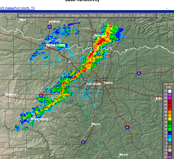 At 738 pm cst, a severe thunderstorm was located over springtown, or 7 miles west of briar, moving east at 35 mph (radar indicated). Hazards include 60 mph wind gusts and penny size hail. expect damage to roofs, siding, and trees At 738 pm cst, a severe thunderstorm was located over springtown, or 7 miles west of briar, moving east at 35 mph (radar indicated). Hazards include 60 mph wind gusts and penny size hail. expect damage to roofs, siding, and trees
|
| 9/27/2020 11:14 PM CDT |
 At 1114 pm cdt, severe thunderstorms were located along a line extending from near deport to 8 miles southwest of honey grove, moving southeast at 35 mph (radar indicated). Hazards include 60 mph wind gusts and quarter size hail. Hail damage to vehicles is expected. Expect wind damage to roofs, siding, and trees. At 1114 pm cdt, severe thunderstorms were located along a line extending from near deport to 8 miles southwest of honey grove, moving southeast at 35 mph (radar indicated). Hazards include 60 mph wind gusts and quarter size hail. Hail damage to vehicles is expected. Expect wind damage to roofs, siding, and trees.
|
| 9/27/2020 10:49 PM CDT |
 At 1048 pm cdt, severe thunderstorms were located along a line extending from a bonham to paris line, moving southwest at 25 mph (radar indicated). Hazards include 60 mph wind gusts and quarter size hail. Hail damage to vehicles is expected. expect wind damage to roofs, siding, and trees. these severe storms will be near, bonham, dodd city, ravenna and bonham state park around 1055 pm cdt. honey grove around 1105 pm cdt. Other locations impacted by these severe thunderstorms include toco, roxton, sun valley, ladonia, windom and pecan gap. At 1048 pm cdt, severe thunderstorms were located along a line extending from a bonham to paris line, moving southwest at 25 mph (radar indicated). Hazards include 60 mph wind gusts and quarter size hail. Hail damage to vehicles is expected. expect wind damage to roofs, siding, and trees. these severe storms will be near, bonham, dodd city, ravenna and bonham state park around 1055 pm cdt. honey grove around 1105 pm cdt. Other locations impacted by these severe thunderstorms include toco, roxton, sun valley, ladonia, windom and pecan gap.
|
| 9/27/2020 10:13 PM CDT |
 At 1012 pm cdt, severe thunderstorms were located along a line extending from near boswell to 12 miles southeast of bennington to near ravenna, moving southeast at 30 mph (radar indicated). Hazards include 65 mph wind gusts and quarter size hail. Hail damage to vehicles is expected. expect wind damage to roofs, siding, and trees. severe thunderstorms will be near, bonham state park around 1035 pm cdt. dodd city around 1040 pm cdt. paris and honey grove around 1050 pm cdt. blossom around 1110 pm cdt. Other locations impacted by these severe thunderstorms include direct, camp maxey, toco, powderly, roxton, sun valley, ladonia, windom and pecan gap. At 1012 pm cdt, severe thunderstorms were located along a line extending from near boswell to 12 miles southeast of bennington to near ravenna, moving southeast at 30 mph (radar indicated). Hazards include 65 mph wind gusts and quarter size hail. Hail damage to vehicles is expected. expect wind damage to roofs, siding, and trees. severe thunderstorms will be near, bonham state park around 1035 pm cdt. dodd city around 1040 pm cdt. paris and honey grove around 1050 pm cdt. blossom around 1110 pm cdt. Other locations impacted by these severe thunderstorms include direct, camp maxey, toco, powderly, roxton, sun valley, ladonia, windom and pecan gap.
|
| 8/29/2020 7:42 PM CDT |
 At 742 pm cdt, severe thunderstorms were located along a line extending from colleyville to 6 miles north of willow park, moving southeast at 15 mph (radar indicated). Hazards include 60 mph wind gusts and penny size hail. Expect damage to roofs, siding, and trees. Locations impacted include, fort worth, arlington, grand prairie, euless, bedford, grapevine, haltom city, keller, hurst, southlake, weatherford, watauga, colleyville, benbrook, saginaw, white settlement, azle, richland hills, river oaks and sansom park. At 742 pm cdt, severe thunderstorms were located along a line extending from colleyville to 6 miles north of willow park, moving southeast at 15 mph (radar indicated). Hazards include 60 mph wind gusts and penny size hail. Expect damage to roofs, siding, and trees. Locations impacted include, fort worth, arlington, grand prairie, euless, bedford, grapevine, haltom city, keller, hurst, southlake, weatherford, watauga, colleyville, benbrook, saginaw, white settlement, azle, richland hills, river oaks and sansom park.
|
| 8/29/2020 7:15 PM CDT |
 At 715 pm cdt, severe thunderstorms were located along a line extending from southlake to near springtown, moving southeast at 25 mph (radar indicated). Hazards include 60 mph wind gusts. expect damage to roofs, siding, and trees At 715 pm cdt, severe thunderstorms were located along a line extending from southlake to near springtown, moving southeast at 25 mph (radar indicated). Hazards include 60 mph wind gusts. expect damage to roofs, siding, and trees
|
| 8/29/2020 6:49 PM CDT |
 At 649 pm cdt, a severe thunderstorm was located over pecan acres, or near briar, and is nearly stationary (radar indicated). Hazards include 60 mph wind gusts and penny size hail. expect damage to roofs, siding, and trees At 649 pm cdt, a severe thunderstorm was located over pecan acres, or near briar, and is nearly stationary (radar indicated). Hazards include 60 mph wind gusts and penny size hail. expect damage to roofs, siding, and trees
|
| 7/12/2020 12:55 AM CDT |
 At 1254 am cdt, severe thunderstorms were located along a line extending from 9 miles north of boswell to near sawyer to 10 miles east of raymond gary state park, moving south at 40 mph (radar indicated). Hazards include 60 mph wind gusts. expect damage to roofs, siding, and trees At 1254 am cdt, severe thunderstorms were located along a line extending from 9 miles north of boswell to near sawyer to 10 miles east of raymond gary state park, moving south at 40 mph (radar indicated). Hazards include 60 mph wind gusts. expect damage to roofs, siding, and trees
|
| 6/23/2020 5:33 AM CDT |
 At 533 am cdt, a severe thunderstorm was located over blue mound, or near saginaw, moving east at 25 mph (radar indicated). Hazards include 60 mph wind gusts. Expect damage to roofs, siding, and trees. Locations impacted include, fort worth, keller, watauga, saginaw, azle, eagle mountain, briar, pecan acres, reno, springtown, pelican bay, haslet, newark and sanctuary. At 533 am cdt, a severe thunderstorm was located over blue mound, or near saginaw, moving east at 25 mph (radar indicated). Hazards include 60 mph wind gusts. Expect damage to roofs, siding, and trees. Locations impacted include, fort worth, keller, watauga, saginaw, azle, eagle mountain, briar, pecan acres, reno, springtown, pelican bay, haslet, newark and sanctuary.
|
| 6/23/2020 4:53 AM CDT |
 At 453 am cdt, a severe thunderstorm was located near poolville, or 13 miles south of bridgeport, moving east at 45 mph (radar indicated). Hazards include 60 mph wind gusts. expect damage to roofs, siding, and trees At 453 am cdt, a severe thunderstorm was located near poolville, or 13 miles south of bridgeport, moving east at 45 mph (radar indicated). Hazards include 60 mph wind gusts. expect damage to roofs, siding, and trees
|
| 5/15/2020 10:28 PM CDT |
 At 1027 pm cdt, a line of severe thunderstorms was located from near mineral wells to stephenville, moving east at 30 mph (radar indicated). Hazards include 60 mph wind gusts and penny size hail. expect damage to roofs, siding, and trees At 1027 pm cdt, a line of severe thunderstorms was located from near mineral wells to stephenville, moving east at 30 mph (radar indicated). Hazards include 60 mph wind gusts and penny size hail. expect damage to roofs, siding, and trees
|
| 5/8/2020 4:08 AM CDT |
 At 407 am cdt, severe thunderstorms were located along a line extending from near blossom to 7 miles north of dodd city to 6 miles west of knollwood to lindsay, moving southeast at 30 mph (radar indicated). Hazards include 60 mph wind gusts and quarter size hail. Hail damage to vehicles is expected. Expect wind damage to roofs, siding, and trees. At 407 am cdt, severe thunderstorms were located along a line extending from near blossom to 7 miles north of dodd city to 6 miles west of knollwood to lindsay, moving southeast at 30 mph (radar indicated). Hazards include 60 mph wind gusts and quarter size hail. Hail damage to vehicles is expected. Expect wind damage to roofs, siding, and trees.
|
| 5/8/2020 3:50 AM CDT |
 At 349 am cdt, severe thunderstorms were located along a line extending from 8 miles west of broken bow to near clarksville to near paris to near ravenna, moving southeast at 50 mph (radar indicated). Hazards include 70 mph wind gusts and quarter size hail. Hail damage to vehicles is expected. expect considerable tree damage. wind damage is also likely to mobile homes, roofs, and outbuildings. Locations impacted include, greenville, paris, sulphur springs, bonham, commerce, leonard, cooper, honey grove, whitewright, blossom, wolfe city, savoy, celeste, ector, campbell, deport, dodd city, bailey, ravenna and bonham state park. At 349 am cdt, severe thunderstorms were located along a line extending from 8 miles west of broken bow to near clarksville to near paris to near ravenna, moving southeast at 50 mph (radar indicated). Hazards include 70 mph wind gusts and quarter size hail. Hail damage to vehicles is expected. expect considerable tree damage. wind damage is also likely to mobile homes, roofs, and outbuildings. Locations impacted include, greenville, paris, sulphur springs, bonham, commerce, leonard, cooper, honey grove, whitewright, blossom, wolfe city, savoy, celeste, ector, campbell, deport, dodd city, bailey, ravenna and bonham state park.
|
| 5/8/2020 3:13 AM CDT |
 At 312 am cdt, severe thunderstorms were located along a line extending from 7 miles southeast of kosoma to 7 miles south of soper to near durant, moving southeast at 65 mph (radar indicated). Hazards include 70 mph wind gusts and quarter size hail. Hail damage to vehicles is expected. expect considerable tree damage. Wind damage is also likely to mobile homes, roofs, and outbuildings. At 312 am cdt, severe thunderstorms were located along a line extending from 7 miles southeast of kosoma to 7 miles south of soper to near durant, moving southeast at 65 mph (radar indicated). Hazards include 70 mph wind gusts and quarter size hail. Hail damage to vehicles is expected. expect considerable tree damage. Wind damage is also likely to mobile homes, roofs, and outbuildings.
|
| 5/7/2020 10:05 PM CDT |
 At 1004 pm cdt, a severe thunderstorm was located 7 miles northwest of weatherford, moving southeast at 40 mph (radar indicated). Hazards include two inch hail and 60 mph wind gusts. People and animals outdoors will be injured. expect hail damage to roofs, siding, windows, and vehicles. expect wind damage to roofs, siding, and trees. Locations impacted include, weatherford, azle, briar, willow park, reno, aledo, springtown, hudson oaks, annetta, boyd, cottondale, annetta south, annetta north and sanctuary. At 1004 pm cdt, a severe thunderstorm was located 7 miles northwest of weatherford, moving southeast at 40 mph (radar indicated). Hazards include two inch hail and 60 mph wind gusts. People and animals outdoors will be injured. expect hail damage to roofs, siding, windows, and vehicles. expect wind damage to roofs, siding, and trees. Locations impacted include, weatherford, azle, briar, willow park, reno, aledo, springtown, hudson oaks, annetta, boyd, cottondale, annetta south, annetta north and sanctuary.
|
| 5/7/2020 9:51 PM CDT |
 At 950 pm cdt, a severe thunderstorm was located near poolville, or 10 miles northeast of mineral wells, moving southeast at 45 mph (radar indicated). Hazards include two inch hail and 60 mph wind gusts. People and animals outdoors will be injured. expect hail damage to roofs, siding, windows, and vehicles. expect wind damage to roofs, siding, and trees. Locations impacted include, weatherford, mineral wells, azle, decatur, bridgeport, briar, willow park, reno, aledo, springtown, hudson oaks, annetta, boyd, paradise, cool, poolville, cottondale, boonsville, mineral wells state park and runaway bay. At 950 pm cdt, a severe thunderstorm was located near poolville, or 10 miles northeast of mineral wells, moving southeast at 45 mph (radar indicated). Hazards include two inch hail and 60 mph wind gusts. People and animals outdoors will be injured. expect hail damage to roofs, siding, windows, and vehicles. expect wind damage to roofs, siding, and trees. Locations impacted include, weatherford, mineral wells, azle, decatur, bridgeport, briar, willow park, reno, aledo, springtown, hudson oaks, annetta, boyd, paradise, cool, poolville, cottondale, boonsville, mineral wells state park and runaway bay.
|
| 5/7/2020 9:28 PM CDT |
 At 927 pm cdt, a severe thunderstorm was located 7 miles south of jacksboro, moving southeast at 45 mph (radar indicated). Hazards include two inch hail and 60 mph wind gusts. People and animals outdoors will be injured. expect hail damage to roofs, siding, windows, and vehicles. Expect wind damage to roofs, siding, and trees. At 927 pm cdt, a severe thunderstorm was located 7 miles south of jacksboro, moving southeast at 45 mph (radar indicated). Hazards include two inch hail and 60 mph wind gusts. People and animals outdoors will be injured. expect hail damage to roofs, siding, windows, and vehicles. Expect wind damage to roofs, siding, and trees.
|
| 4/28/2020 11:18 PM CDT |
 At 1118 pm cdt, severe thunderstorms were located along a line extending from deport to near celina, moving south at 40 mph (radar indicated). Hazards include 60 mph wind gusts and quarter size hail. Hail damage to vehicles is expected. expect wind damage to roofs, siding, and trees. Locations impacted include, paris, bonham, van alstyne, leonard, honey grove, whitewright, blossom, tom bean, ector, deport, dodd city, bailey, bonham state park, roxton, trenton, ladonia, pecan gap, windom, toco and sun valley. At 1118 pm cdt, severe thunderstorms were located along a line extending from deport to near celina, moving south at 40 mph (radar indicated). Hazards include 60 mph wind gusts and quarter size hail. Hail damage to vehicles is expected. expect wind damage to roofs, siding, and trees. Locations impacted include, paris, bonham, van alstyne, leonard, honey grove, whitewright, blossom, tom bean, ector, deport, dodd city, bailey, bonham state park, roxton, trenton, ladonia, pecan gap, windom, toco and sun valley.
|
| 4/28/2020 11:06 PM CDT |
 At 1106 pm cdt, severe thunderstorms were located along a line extending from near springtown to near graford, moving southeast at 20 mph (radar indicated). Hazards include 60 mph wind gusts and half dollar size hail. Hail damage to vehicles is expected. expect wind damage to roofs, siding, and trees. Locations impacted include, weatherford, mineral wells, azle, briar, willow park, reno, aledo, springtown, hudson oaks, annetta, gordon, cool, mineral wells state park, annetta south, annetta north, millsap and sanctuary. At 1106 pm cdt, severe thunderstorms were located along a line extending from near springtown to near graford, moving southeast at 20 mph (radar indicated). Hazards include 60 mph wind gusts and half dollar size hail. Hail damage to vehicles is expected. expect wind damage to roofs, siding, and trees. Locations impacted include, weatherford, mineral wells, azle, briar, willow park, reno, aledo, springtown, hudson oaks, annetta, gordon, cool, mineral wells state park, annetta south, annetta north, millsap and sanctuary.
|
| 4/28/2020 10:55 PM CDT |
 At 1054 pm cdt, a severe thunderstorm was located near fort worth, moving southeast at 45 mph (radar indicated). Hazards include 60 mph wind gusts and quarter size hail. Hail damage to vehicles is expected. Expect wind damage to roofs, siding, and trees. At 1054 pm cdt, a severe thunderstorm was located near fort worth, moving southeast at 45 mph (radar indicated). Hazards include 60 mph wind gusts and quarter size hail. Hail damage to vehicles is expected. Expect wind damage to roofs, siding, and trees.
|
| 4/28/2020 10:32 PM CDT |
 At 1031 pm cdt, severe thunderstorms were located along a line extending from sawyer to lake texoma, moving south at 40 mph (radar indicated). Hazards include 60 mph wind gusts and quarter size hail. Hail damage to vehicles is expected. Expect wind damage to roofs, siding, and trees. At 1031 pm cdt, severe thunderstorms were located along a line extending from sawyer to lake texoma, moving south at 40 mph (radar indicated). Hazards include 60 mph wind gusts and quarter size hail. Hail damage to vehicles is expected. Expect wind damage to roofs, siding, and trees.
|
| 4/28/2020 10:25 PM CDT |
 At 1024 pm cdt, severe thunderstorms were located along a line extending from near boonsville to 7 miles south of bryson, moving southeast at 20 mph (radar indicated). Hazards include 60 mph wind gusts and half dollar size hail. Hail damage to vehicles is expected. Expect wind damage to roofs, siding, and trees. At 1024 pm cdt, severe thunderstorms were located along a line extending from near boonsville to 7 miles south of bryson, moving southeast at 20 mph (radar indicated). Hazards include 60 mph wind gusts and half dollar size hail. Hail damage to vehicles is expected. Expect wind damage to roofs, siding, and trees.
|
| 4/28/2020 4:08 AM CDT |
 At 407 am cdt, a severe thunderstorm was located over eagle mountain, moving southeast at 25 mph. this storm has a history of producing half dollar size hail (trained weather spotters). Hazards include ping pong ball size hail. People and animals outdoors will be injured. expect damage to roofs, siding, windows, and vehicles. Locations impacted include, fort worth, haltom city, benbrook, saginaw, white settlement, azle, river oaks, sansom park, lake worth, eagle mountain, briar, north richland hills, pecan acres, reno, westworth village, blue mound, pelican bay, lakeside, westover hills and sanctuary. At 407 am cdt, a severe thunderstorm was located over eagle mountain, moving southeast at 25 mph. this storm has a history of producing half dollar size hail (trained weather spotters). Hazards include ping pong ball size hail. People and animals outdoors will be injured. expect damage to roofs, siding, windows, and vehicles. Locations impacted include, fort worth, haltom city, benbrook, saginaw, white settlement, azle, river oaks, sansom park, lake worth, eagle mountain, briar, north richland hills, pecan acres, reno, westworth village, blue mound, pelican bay, lakeside, westover hills and sanctuary.
|
| 4/28/2020 3:50 AM CDT |
 At 349 am cdt, a severe thunderstorm was located over over azle, moving east at 20 mph. at 340 am cdt, quarter size hail was reported in azle (trained weather spotters). Hazards include ping pong ball size hail. People and animals outdoors will be injured. expect damage to roofs, siding, windows, and vehicles. Locations impacted include, fort worth, haltom city, benbrook, saginaw, white settlement, azle, river oaks, sansom park, lake worth, eagle mountain, briar, north richland hills, pecan acres, willow park, reno, aledo, springtown, westworth village, blue mound and pelican bay. At 349 am cdt, a severe thunderstorm was located over over azle, moving east at 20 mph. at 340 am cdt, quarter size hail was reported in azle (trained weather spotters). Hazards include ping pong ball size hail. People and animals outdoors will be injured. expect damage to roofs, siding, windows, and vehicles. Locations impacted include, fort worth, haltom city, benbrook, saginaw, white settlement, azle, river oaks, sansom park, lake worth, eagle mountain, briar, north richland hills, pecan acres, willow park, reno, aledo, springtown, westworth village, blue mound and pelican bay.
|
| 4/28/2020 3:24 AM CDT |
 At 324 am cdt, a severe thunderstorm was located 8 miles south of bridgeport, moving southeast at 30 mph (radar indicated). Hazards include half dollar size hail. damage to vehicles is possible At 324 am cdt, a severe thunderstorm was located 8 miles south of bridgeport, moving southeast at 30 mph (radar indicated). Hazards include half dollar size hail. damage to vehicles is possible
|
| 4/24/2020 7:50 PM CDT |
 At 749 pm cdt, a severe thunderstorm capable of producing a tornado was located near paris, moving east at 45 mph (radar indicated rotation). Hazards include tornado and two inch hail. Flying debris will be dangerous to those caught without shelter. mobile homes will be damaged or destroyed. damage to roofs, windows, and vehicles will occur. tree damage is likely. this dangerous storm will be near, blossom around 805 pm cdt. Other locations impacted by this tornadic thunderstorm include sun valley. At 749 pm cdt, a severe thunderstorm capable of producing a tornado was located near paris, moving east at 45 mph (radar indicated rotation). Hazards include tornado and two inch hail. Flying debris will be dangerous to those caught without shelter. mobile homes will be damaged or destroyed. damage to roofs, windows, and vehicles will occur. tree damage is likely. this dangerous storm will be near, blossom around 805 pm cdt. Other locations impacted by this tornadic thunderstorm include sun valley.
|
| 4/24/2020 7:38 PM CDT |
 At 737 pm cdt, a thunderstorm with a history of producing tornadoes was located near paris, moving east at 35 mph (weather spotters confirmed tornado). Hazards include damaging tornado and hail up to two inches in diameter. Flying debris will be dangerous to those caught without shelter. mobile homes will be damaged or destroyed. damage to roofs, windows, and vehicles will occur. tree damage is likely. the tornado will be near, paris around 745 pm cdt. blossom around 800 pm cdt. deport around 810 pm cdt. Other locations impacted by this tornadic thunderstorm include toco and sun valley. At 737 pm cdt, a thunderstorm with a history of producing tornadoes was located near paris, moving east at 35 mph (weather spotters confirmed tornado). Hazards include damaging tornado and hail up to two inches in diameter. Flying debris will be dangerous to those caught without shelter. mobile homes will be damaged or destroyed. damage to roofs, windows, and vehicles will occur. tree damage is likely. the tornado will be near, paris around 745 pm cdt. blossom around 800 pm cdt. deport around 810 pm cdt. Other locations impacted by this tornadic thunderstorm include toco and sun valley.
|
| 4/24/2020 7:35 PM CDT |
 At 734 pm cdt, a thunderstorm with a history of producing tornadoes was located 15 miles northwest of paris, moving southeast at 20 mph (weather spotters confirmed tornado). Hazards include damaging tornado and hail up to two inches in diameter. Flying debris will be dangerous to those caught without shelter. mobile homes will be damaged or destroyed. damage to roofs, windows, and vehicles will occur. tree damage is likely. the tornado will be near, paris around 815 pm cdt. Other locations impacted by this tornadic thunderstorm include sun valley. At 734 pm cdt, a thunderstorm with a history of producing tornadoes was located 15 miles northwest of paris, moving southeast at 20 mph (weather spotters confirmed tornado). Hazards include damaging tornado and hail up to two inches in diameter. Flying debris will be dangerous to those caught without shelter. mobile homes will be damaged or destroyed. damage to roofs, windows, and vehicles will occur. tree damage is likely. the tornado will be near, paris around 815 pm cdt. Other locations impacted by this tornadic thunderstorm include sun valley.
|
| 4/24/2020 7:09 PM CDT |
 At 708 pm cdt, a confirmed tornado was located 8 miles south of paris, moving east at 35 mph (weather spotters confirmed tornado). Hazards include damaging tornado and golf ball size hail. Flying debris will be dangerous to those caught without shelter. mobile homes will be damaged or destroyed. damage to roofs, windows, and vehicles will occur. tree damage is likely. this tornado will be near, deport around 735 pm cdt. Other locations impacted by this tornadic thunderstorm include toco, roxton and sun valley. At 708 pm cdt, a confirmed tornado was located 8 miles south of paris, moving east at 35 mph (weather spotters confirmed tornado). Hazards include damaging tornado and golf ball size hail. Flying debris will be dangerous to those caught without shelter. mobile homes will be damaged or destroyed. damage to roofs, windows, and vehicles will occur. tree damage is likely. this tornado will be near, deport around 735 pm cdt. Other locations impacted by this tornadic thunderstorm include toco, roxton and sun valley.
|
| 4/24/2020 6:54 PM CDT |
 At 653 pm cdt, a severe thunderstorm capable of producing a tornado was located 10 miles east of honey grove, or 11 miles southwest of paris, moving east at 30 mph (radar indicated rotation). Hazards include tornado and golf ball size hail. Flying debris will be dangerous to those caught without shelter. mobile homes will be damaged or destroyed. damage to roofs, windows, and vehicles will occur. tree damage is likely. this dangerous storm will be near, blossom around 735 pm cdt. deport around 740 pm cdt. Other locations impacted by this tornadic thunderstorm include toco, roxton and sun valley. At 653 pm cdt, a severe thunderstorm capable of producing a tornado was located 10 miles east of honey grove, or 11 miles southwest of paris, moving east at 30 mph (radar indicated rotation). Hazards include tornado and golf ball size hail. Flying debris will be dangerous to those caught without shelter. mobile homes will be damaged or destroyed. damage to roofs, windows, and vehicles will occur. tree damage is likely. this dangerous storm will be near, blossom around 735 pm cdt. deport around 740 pm cdt. Other locations impacted by this tornadic thunderstorm include toco, roxton and sun valley.
|
| 4/24/2020 6:45 PM CDT |
 At 645 pm cdt, a severe thunderstorm was located near honey grove, or 15 miles west of paris, moving east at 20 mph (radar indicated). Hazards include 60 mph wind gusts and quarter size hail. Hail damage to vehicles is expected. Expect wind damage to roofs, siding, and trees. At 645 pm cdt, a severe thunderstorm was located near honey grove, or 15 miles west of paris, moving east at 20 mph (radar indicated). Hazards include 60 mph wind gusts and quarter size hail. Hail damage to vehicles is expected. Expect wind damage to roofs, siding, and trees.
|
| 4/22/2020 8:39 PM CDT |
 The severe thunderstorm warning for northeastern lamar county will expire at 845 pm cdt, the storms which prompted the warning have weakened below severe limits, and have exited the warned area. therefore the warning will be allowed to expire. however gusty winds are still possible with these thunderstorms. a tornado watch remains in effect until 900 pm cdt for north central texas. The severe thunderstorm warning for northeastern lamar county will expire at 845 pm cdt, the storms which prompted the warning have weakened below severe limits, and have exited the warned area. therefore the warning will be allowed to expire. however gusty winds are still possible with these thunderstorms. a tornado watch remains in effect until 900 pm cdt for north central texas.
|
| 4/22/2020 8:24 PM CDT |
 At 823 pm cdt, severe thunderstorms were located along a line extending from 6 miles north of manchester to 10 miles north of blossom to paris, moving east at 35 mph (radar indicated). Hazards include 70 mph wind gusts and quarter size hail. Hail damage to vehicles is expected. expect considerable tree damage. wind damage is also likely to mobile homes, roofs, and outbuildings. locations impacted include, paris, blossom and sun valley. A tornado watch remains in effect until 900 pm cdt for north texas. At 823 pm cdt, severe thunderstorms were located along a line extending from 6 miles north of manchester to 10 miles north of blossom to paris, moving east at 35 mph (radar indicated). Hazards include 70 mph wind gusts and quarter size hail. Hail damage to vehicles is expected. expect considerable tree damage. wind damage is also likely to mobile homes, roofs, and outbuildings. locations impacted include, paris, blossom and sun valley. A tornado watch remains in effect until 900 pm cdt for north texas.
|
| 4/22/2020 8:03 PM CDT |
 At 801 pm cdt, severe thunderstorms were located along a line extending from 7 miles south of sawyer to 10 miles northeast of paris to 9 miles east of honey grove, moving east at 40 mph (radar indicated). Hazards include 70 to 75 mph wind gusts and ping pong ball size hail. People and animals outdoors will be injured. expect hail damage to roofs, siding, windows, and vehicles. expect considerable tree damage. wind damage is also likely to mobile homes, roofs, and outbuildings. locations impacted include, paris, blossom, roxton, toco. novice, faught and sun valley. A tornado watch remains in effect until 900 pm cdt for north texas. At 801 pm cdt, severe thunderstorms were located along a line extending from 7 miles south of sawyer to 10 miles northeast of paris to 9 miles east of honey grove, moving east at 40 mph (radar indicated). Hazards include 70 to 75 mph wind gusts and ping pong ball size hail. People and animals outdoors will be injured. expect hail damage to roofs, siding, windows, and vehicles. expect considerable tree damage. wind damage is also likely to mobile homes, roofs, and outbuildings. locations impacted include, paris, blossom, roxton, toco. novice, faught and sun valley. A tornado watch remains in effect until 900 pm cdt for north texas.
|
| 4/22/2020 7:40 PM CDT |
 At 738 pm cdt, severe thunderstorms were located along a line extending from 9 miles southwest of goodland to 10 miles northwest of paris to near dodd city, moving east at 45 mph (radar indicated). Hazards include 70 mph wind gusts and ping pong ball size hail. People and animals outdoors will be injured. expect hail damage to roofs, siding, windows, and vehicles. expect considerable tree damage. Wind damage is also likely to mobile homes, roofs, and outbuildings. At 738 pm cdt, severe thunderstorms were located along a line extending from 9 miles southwest of goodland to 10 miles northwest of paris to near dodd city, moving east at 45 mph (radar indicated). Hazards include 70 mph wind gusts and ping pong ball size hail. People and animals outdoors will be injured. expect hail damage to roofs, siding, windows, and vehicles. expect considerable tree damage. Wind damage is also likely to mobile homes, roofs, and outbuildings.
|
| 4/19/2020 3:52 PM CDT |
 At 351 pm cdt, a severe thunderstorm was located near deport, or 13 miles southeast of paris, moving east at 60 mph (radar indicated). Hazards include quarter size hail. Damage to vehicles is possible. Locations impacted include, paris, blossom, deport and sun valley. At 351 pm cdt, a severe thunderstorm was located near deport, or 13 miles southeast of paris, moving east at 60 mph (radar indicated). Hazards include quarter size hail. Damage to vehicles is possible. Locations impacted include, paris, blossom, deport and sun valley.
|
| 4/19/2020 3:42 PM CDT |
 At 342 pm cdt, a severe thunderstorm was located 9 miles south of paris, moving east at 50 mph (radar indicated). Hazards include quarter size hail. damage to vehicles is possible At 342 pm cdt, a severe thunderstorm was located 9 miles south of paris, moving east at 50 mph (radar indicated). Hazards include quarter size hail. damage to vehicles is possible
|
| 4/19/2020 2:45 PM CDT |
 At 245 pm cdt, a severe thunderstorm was located 8 miles northwest of blossom, or 9 miles northeast of paris, moving northeast at 45 mph (radar indicated). Hazards include quarter size hail. Damage to vehicles is possible. Locations impacted include, sun valley. At 245 pm cdt, a severe thunderstorm was located 8 miles northwest of blossom, or 9 miles northeast of paris, moving northeast at 45 mph (radar indicated). Hazards include quarter size hail. Damage to vehicles is possible. Locations impacted include, sun valley.
|
| 4/19/2020 2:33 PM CDT |
 At 233 pm cdt, a severe thunderstorm was located over paris, moving northeast at 45 mph (radar indicated). Hazards include quarter size hail. Damage to vehicles is possible. Locations impacted include, paris, blossom, toco and sun valley. At 233 pm cdt, a severe thunderstorm was located over paris, moving northeast at 45 mph (radar indicated). Hazards include quarter size hail. Damage to vehicles is possible. Locations impacted include, paris, blossom, toco and sun valley.
|
| 4/19/2020 2:20 PM CDT |
 At 220 pm cdt, a severe thunderstorm was located 8 miles southwest of paris, moving northeast at 45 mph (radar indicated). Hazards include quarter size hail. damage to vehicles is possible At 220 pm cdt, a severe thunderstorm was located 8 miles southwest of paris, moving northeast at 45 mph (radar indicated). Hazards include quarter size hail. damage to vehicles is possible
|
| 4/12/2020 4:45 PM CDT |
 At 444 pm cdt, a severe thunderstorm was located 7 miles northeast of paris, moving east at 30 mph (law enforcement). Hazards include ping pong ball size hail. People and animals outdoors will be injured. expect damage to roofs, siding, windows, and vehicles. Locations impacted include, paris, blossom and sun valley. At 444 pm cdt, a severe thunderstorm was located 7 miles northeast of paris, moving east at 30 mph (law enforcement). Hazards include ping pong ball size hail. People and animals outdoors will be injured. expect damage to roofs, siding, windows, and vehicles. Locations impacted include, paris, blossom and sun valley.
|
| 4/12/2020 4:10 PM CDT |
 At 409 pm cdt, a severe thunderstorm was located 13 miles northeast of honey grove, or 16 miles northwest of paris, moving east at 25 mph. a second severe thunderstorm capable of producing quarter size hail may impact northern fannin county (radar indicated). Hazards include half dollar size hail. damage to vehicles is possible At 409 pm cdt, a severe thunderstorm was located 13 miles northeast of honey grove, or 16 miles northwest of paris, moving east at 25 mph. a second severe thunderstorm capable of producing quarter size hail may impact northern fannin county (radar indicated). Hazards include half dollar size hail. damage to vehicles is possible
|
| 3/18/2020 11:43 PM CDT |
 The severe thunderstorm warning for southeastern wise and northeastern parker counties will expire at 1145 pm cdt, the storms which prompted the warning have weakened below severe limits. therefore the warning will be allowed to expire. gusty winds and heavy rain are still possible with these thunderstorms. The severe thunderstorm warning for southeastern wise and northeastern parker counties will expire at 1145 pm cdt, the storms which prompted the warning have weakened below severe limits. therefore the warning will be allowed to expire. gusty winds and heavy rain are still possible with these thunderstorms.
|
| 3/18/2020 11:31 PM CDT |
 At 1130 pm cdt, severe thunderstorms were located along a line extending from 10 miles east of decatur to near new fairview to near azle, moving east at 35 mph (radar indicated). Hazards include 60 mph wind gusts. Expect damage to roofs, siding, and trees. locations impacted include, azle, decatur, briar, pecan acres, reno, springtown, new fairview, aurora, boyd, rhome, newark and sanctuary. A tornado watch remains in effect until midnight cdt for north central texas. At 1130 pm cdt, severe thunderstorms were located along a line extending from 10 miles east of decatur to near new fairview to near azle, moving east at 35 mph (radar indicated). Hazards include 60 mph wind gusts. Expect damage to roofs, siding, and trees. locations impacted include, azle, decatur, briar, pecan acres, reno, springtown, new fairview, aurora, boyd, rhome, newark and sanctuary. A tornado watch remains in effect until midnight cdt for north central texas.
|
| 3/18/2020 11:13 PM CDT |
 At 1113 pm cdt, severe thunderstorms were located along a line extending from near new fairview to near weatherford, moving east at 40 mph (radar indicated). Hazards include 60 mph wind gusts. Expect damage to roofs, siding, and trees. locations impacted include, azle, decatur, briar, pecan acres, reno, springtown, new fairview, aurora, boyd, paradise, cottondale, rhome, newark and sanctuary. A tornado watch remains in effect until midnight cdt for north central texas. At 1113 pm cdt, severe thunderstorms were located along a line extending from near new fairview to near weatherford, moving east at 40 mph (radar indicated). Hazards include 60 mph wind gusts. Expect damage to roofs, siding, and trees. locations impacted include, azle, decatur, briar, pecan acres, reno, springtown, new fairview, aurora, boyd, paradise, cottondale, rhome, newark and sanctuary. A tornado watch remains in effect until midnight cdt for north central texas.
|
| 3/18/2020 10:59 PM CDT |
 At 1059 pm cdt, severe thunderstorms were located along a line extending from near boyd to 10 miles west of weatherford, moving east at 30 mph. these storms produced a 56 mph wind gust at mineral wells airport over the last several minutes (radar indicated). Hazards include 60 mph wind gusts and penny size hail. Expect damage to roofs, siding, and trees. locations impacted include, weatherford, mineral wells, azle, decatur, bridgeport, briar, pecan acres, willow park, reno, springtown, hudson oaks, new fairview, aurora, boyd, paradise, cool, poolville, cottondale, boonsville and mineral wells state park. A tornado watch remains in effect until midnight cdt for north central texas. At 1059 pm cdt, severe thunderstorms were located along a line extending from near boyd to 10 miles west of weatherford, moving east at 30 mph. these storms produced a 56 mph wind gust at mineral wells airport over the last several minutes (radar indicated). Hazards include 60 mph wind gusts and penny size hail. Expect damage to roofs, siding, and trees. locations impacted include, weatherford, mineral wells, azle, decatur, bridgeport, briar, pecan acres, willow park, reno, springtown, hudson oaks, new fairview, aurora, boyd, paradise, cool, poolville, cottondale, boonsville and mineral wells state park. A tornado watch remains in effect until midnight cdt for north central texas.
|
| 3/18/2020 10:40 PM CDT |
 At 1040 pm cdt, severe thunderstorms were located along a line extending from near boonsville to 9 miles southwest of mineral wells, moving east at 40 mph (radar indicated). Hazards include 60 mph wind gusts and quarter size hail. Hail damage to vehicles is expected. Expect wind damage to roofs, siding, and trees. At 1040 pm cdt, severe thunderstorms were located along a line extending from near boonsville to 9 miles southwest of mineral wells, moving east at 40 mph (radar indicated). Hazards include 60 mph wind gusts and quarter size hail. Hail damage to vehicles is expected. Expect wind damage to roofs, siding, and trees.
|
| 1/10/2020 3:26 PM CST |
 At 325 pm cst, a severe thunderstorm was located near springtown, or near briar, moving northeast at 50 mph (radar indicated). Hazards include 60 mph wind gusts and quarter size hail. Hail damage to vehicles is expected. Expect wind damage to roofs, siding, and trees. At 325 pm cst, a severe thunderstorm was located near springtown, or near briar, moving northeast at 50 mph (radar indicated). Hazards include 60 mph wind gusts and quarter size hail. Hail damage to vehicles is expected. Expect wind damage to roofs, siding, and trees.
|
| 1/10/2020 3:05 PM CST |
 At 305 pm cst, a severe thunderstorm was located over weatherford, moving northeast at 50 mph (radar indicated). Hazards include 60 mph wind gusts and quarter size hail. Hail damage to vehicles is expected. Expect wind damage to roofs, siding, and trees. At 305 pm cst, a severe thunderstorm was located over weatherford, moving northeast at 50 mph (radar indicated). Hazards include 60 mph wind gusts and quarter size hail. Hail damage to vehicles is expected. Expect wind damage to roofs, siding, and trees.
|
| 1/10/2020 2:36 PM CST |
 At 236 pm cst, a severe thunderstorm was located over springtown, or 7 miles west of briar, moving northeast at 50 mph (radar indicated). Hazards include 60 mph wind gusts and quarter size hail. Hail damage to vehicles is expected. Expect wind damage to roofs, siding, and trees. At 236 pm cst, a severe thunderstorm was located over springtown, or 7 miles west of briar, moving northeast at 50 mph (radar indicated). Hazards include 60 mph wind gusts and quarter size hail. Hail damage to vehicles is expected. Expect wind damage to roofs, siding, and trees.
|
| 11/30/2019 8:13 AM CST |
 The severe thunderstorm warning for lamar, northwestern delta and southeastern fannin counties will expire at 815 am cst, the storm which prompted the warning has weakened below severe limits. therefore the warning will be allowed to expire. however heavy rain is still possible with this thunderstorm. The severe thunderstorm warning for lamar, northwestern delta and southeastern fannin counties will expire at 815 am cst, the storm which prompted the warning has weakened below severe limits. therefore the warning will be allowed to expire. however heavy rain is still possible with this thunderstorm.
|
| 11/30/2019 7:36 AM CST |
 At 735 am cst, a severe thunderstorm was located 8 miles south of honey grove, or 16 miles north of commerce, moving northeast at 50 mph (radar indicated). Hazards include quarter size hail. damage to vehicles is possible At 735 am cst, a severe thunderstorm was located 8 miles south of honey grove, or 16 miles north of commerce, moving northeast at 50 mph (radar indicated). Hazards include quarter size hail. damage to vehicles is possible
|
| 10/21/2019 1:41 AM CDT |
 At 140 am cdt, a severe thunderstorm was located near manchester, or 15 miles northwest of clarksville, moving east at 45 mph (radar indicated). Hazards include 60 mph wind gusts. Expect damage to roofs, siding, and trees. locations impacted include, paris, blossom and sun valley. A tornado watch remains in effect until 200 am cdt for north central texas. At 140 am cdt, a severe thunderstorm was located near manchester, or 15 miles northwest of clarksville, moving east at 45 mph (radar indicated). Hazards include 60 mph wind gusts. Expect damage to roofs, siding, and trees. locations impacted include, paris, blossom and sun valley. A tornado watch remains in effect until 200 am cdt for north central texas.
|
| 10/21/2019 1:17 AM CDT |
 At 117 am cdt, a severe thunderstorm was located near paris, moving east at 50 mph (radar indicated). Hazards include 60 mph wind gusts. Expect damage to roofs, siding, and trees. locations impacted include, paris, blossom, roxton, toco and sun valley. A tornado watch remains in effect until 200 am cdt for north central texas. At 117 am cdt, a severe thunderstorm was located near paris, moving east at 50 mph (radar indicated). Hazards include 60 mph wind gusts. Expect damage to roofs, siding, and trees. locations impacted include, paris, blossom, roxton, toco and sun valley. A tornado watch remains in effect until 200 am cdt for north central texas.
|
| 10/21/2019 12:53 AM CDT |
 At 1253 am cdt, a severe thunderstorm was located near honey grove, or 16 miles west of paris, moving east at 55 mph (radar indicated). Hazards include 60 mph wind gusts. expect damage to roofs, siding, and trees At 1253 am cdt, a severe thunderstorm was located near honey grove, or 16 miles west of paris, moving east at 55 mph (radar indicated). Hazards include 60 mph wind gusts. expect damage to roofs, siding, and trees
|
| 10/21/2019 12:19 AM CDT |
 A severe thunderstorm warning remains in effect until 1245 am cdt for southern denton. northern parker and northern tarrant counties. At 1218 am cdt, a line of severe thunderstorms extends from just east of denton to north forth worth to weatherford, moving east at 40 mph. A severe thunderstorm warning remains in effect until 1245 am cdt for southern denton. northern parker and northern tarrant counties. At 1218 am cdt, a line of severe thunderstorms extends from just east of denton to north forth worth to weatherford, moving east at 40 mph.
|
| 10/20/2019 11:58 PM CDT |
 At 1157 pm cdt, a line of severe thunderstorms extends from near denton to northwest fort worth to near weatherford, moving east at 35 mph (radar indicated). Hazards include 65 mph wind gusts and penny size hail. Expect damage to roofs, siding, and trees. locations impacted include, fort worth, arlington, denton, lewisville, flower mound, euless, bedford, grapevine, haltom city, keller, hurst, the colony, southlake, weatherford, watauga, colleyville, benbrook, corinth, saginaw and mineral wells. A tornado watch remains in effect until 200 am cdt for north central texas. At 1157 pm cdt, a line of severe thunderstorms extends from near denton to northwest fort worth to near weatherford, moving east at 35 mph (radar indicated). Hazards include 65 mph wind gusts and penny size hail. Expect damage to roofs, siding, and trees. locations impacted include, fort worth, arlington, denton, lewisville, flower mound, euless, bedford, grapevine, haltom city, keller, hurst, the colony, southlake, weatherford, watauga, colleyville, benbrook, corinth, saginaw and mineral wells. A tornado watch remains in effect until 200 am cdt for north central texas.
|
| 10/20/2019 11:41 PM CDT |
 At 1140 pm cdt, a line of severe thunderstorms was located from near denton to mineral wells, moving east at 40 mph. a 75 mph wind gust was reported at mineral wells airport in the last few minutes (radar indicated). Hazards include 70 mph wind gusts. Expect considerable tree damage. Damage is likely to mobile homes, roofs, and outbuildings. At 1140 pm cdt, a line of severe thunderstorms was located from near denton to mineral wells, moving east at 40 mph. a 75 mph wind gust was reported at mineral wells airport in the last few minutes (radar indicated). Hazards include 70 mph wind gusts. Expect considerable tree damage. Damage is likely to mobile homes, roofs, and outbuildings.
|
| 10/20/2019 7:45 PM CDT |
 At 717 pm cdt, a severe thunderstorm was located near willow park, or 8 miles west of white settlement, moving northeast at 25 mph (radar indicated). Hazards include quarter size hail. damage to vehicles is possible At 717 pm cdt, a severe thunderstorm was located near willow park, or 8 miles west of white settlement, moving northeast at 25 mph (radar indicated). Hazards include quarter size hail. damage to vehicles is possible
|
| 10/20/2019 7:18 PM CDT |
 At 717 pm cdt, a severe thunderstorm was located near willow park, or 8 miles west of white settlement, moving northeast at 25 mph (radar indicated). Hazards include quarter size hail. damage to vehicles is possible At 717 pm cdt, a severe thunderstorm was located near willow park, or 8 miles west of white settlement, moving northeast at 25 mph (radar indicated). Hazards include quarter size hail. damage to vehicles is possible
|
| 10/20/2019 7:08 PM CDT |
 At 708 pm cdt, a severe thunderstorm was located over weatherford, moving northeast at 30 mph (radar indicated). Hazards include 60 mph wind gusts and half dollar size hail. Hail damage to vehicles is expected. expect wind damage to roofs, siding, and trees. locations impacted include, weatherford, briar, reno, springtown and poolville. A tornado watch remains in effect until 200 am cdt for north central texas. At 708 pm cdt, a severe thunderstorm was located over weatherford, moving northeast at 30 mph (radar indicated). Hazards include 60 mph wind gusts and half dollar size hail. Hail damage to vehicles is expected. expect wind damage to roofs, siding, and trees. locations impacted include, weatherford, briar, reno, springtown and poolville. A tornado watch remains in effect until 200 am cdt for north central texas.
|
| 10/20/2019 6:55 PM CDT |
 At 654 pm cdt, a severe thunderstorm was located 7 miles southeast of cool, or 8 miles west of weatherford, moving northeast at 30 mph (radar indicated). Hazards include 60 mph wind gusts and half dollar size hail. Hail damage to vehicles is expected. expect wind damage to roofs, siding, and trees. Locations impacted include, weatherford, briar, reno, springtown, cool, poolville and millsap. At 654 pm cdt, a severe thunderstorm was located 7 miles southeast of cool, or 8 miles west of weatherford, moving northeast at 30 mph (radar indicated). Hazards include 60 mph wind gusts and half dollar size hail. Hail damage to vehicles is expected. expect wind damage to roofs, siding, and trees. Locations impacted include, weatherford, briar, reno, springtown, cool, poolville and millsap.
|
| 10/20/2019 6:47 PM CDT |
 At 647 pm cdt, a severe thunderstorm was located 7 miles southeast of cool, or 10 miles west of weatherford, moving northeast at 30 mph (radar indicated). Hazards include 60 mph wind gusts and half dollar size hail. Hail damage to vehicles is expected. Expect wind damage to roofs, siding, and trees. At 647 pm cdt, a severe thunderstorm was located 7 miles southeast of cool, or 10 miles west of weatherford, moving northeast at 30 mph (radar indicated). Hazards include 60 mph wind gusts and half dollar size hail. Hail damage to vehicles is expected. Expect wind damage to roofs, siding, and trees.
|
| 10/15/2019 4:55 PM CDT |
 At 426 pm cdt, a severe thunderstorm was located near goodland, or near hugo, moving southeast at 20 mph (radar indicated). Hazards include 60 mph wind gusts and quarter size hail. Hail damage to vehicles is expected. Expect wind damage to roofs, siding, and trees. At 426 pm cdt, a severe thunderstorm was located near goodland, or near hugo, moving southeast at 20 mph (radar indicated). Hazards include 60 mph wind gusts and quarter size hail. Hail damage to vehicles is expected. Expect wind damage to roofs, siding, and trees.
|
| 10/15/2019 4:26 PM CDT |
 At 426 pm cdt, a severe thunderstorm was located near goodland, or near hugo, moving southeast at 20 mph (radar indicated). Hazards include 60 mph wind gusts and quarter size hail. Hail damage to vehicles is expected. Expect wind damage to roofs, siding, and trees. At 426 pm cdt, a severe thunderstorm was located near goodland, or near hugo, moving southeast at 20 mph (radar indicated). Hazards include 60 mph wind gusts and quarter size hail. Hail damage to vehicles is expected. Expect wind damage to roofs, siding, and trees.
|
| 10/10/2019 9:14 PM CDT |
 At 912 pm cdt, severe thunderstorms were located along a line extending from bartonville to near crowley, moving northeast at 40 mph (radar indicated. a 60 mph wind gusts was reported at spinks airport). Hazards include 60 mph wind gusts and quarter size hail. Hail damage to vehicles is expected. expect wind damage to roofs, siding, and trees. Locations impacted include, fort worth, arlington, grand prairie, mansfield, euless, bedford, grapevine, haltom city, keller, hurst, burleson, cleburne, southlake, weatherford, watauga, colleyville, benbrook, saginaw, white settlement and crowley. At 912 pm cdt, severe thunderstorms were located along a line extending from bartonville to near crowley, moving northeast at 40 mph (radar indicated. a 60 mph wind gusts was reported at spinks airport). Hazards include 60 mph wind gusts and quarter size hail. Hail damage to vehicles is expected. expect wind damage to roofs, siding, and trees. Locations impacted include, fort worth, arlington, grand prairie, mansfield, euless, bedford, grapevine, haltom city, keller, hurst, burleson, cleburne, southlake, weatherford, watauga, colleyville, benbrook, saginaw, white settlement and crowley.
|
| 10/10/2019 8:42 PM CDT |
 At 842 pm cdt, severe thunderstorms were located along a line extending from pecan acres to 6 miles west of godley, moving northeast at 40 mph (radar indicated). Hazards include 60 mph wind gusts and quarter size hail. Hail damage to vehicles is expected. Expect wind damage to roofs, siding, and trees. At 842 pm cdt, severe thunderstorms were located along a line extending from pecan acres to 6 miles west of godley, moving northeast at 40 mph (radar indicated). Hazards include 60 mph wind gusts and quarter size hail. Hail damage to vehicles is expected. Expect wind damage to roofs, siding, and trees.
|
| 10/10/2019 8:02 PM CDT |
 At 802 pm cdt, a severe thunderstorm was located 8 miles south of cool, or 11 miles southeast of mineral wells, moving east at 30 mph (radar indicated). Hazards include tennis ball size hail and 60 mph wind gusts. People and animals outdoors will be injured. expect hail damage to roofs, siding, windows, and vehicles. expect wind damage to roofs, siding, and trees. Locations impacted include, weatherford, mineral wells, azle, briar, willow park, reno, aledo, springtown, hudson oaks, annetta, cool, mineral wells state park, annetta south, annetta north, millsap and sanctuary. At 802 pm cdt, a severe thunderstorm was located 8 miles south of cool, or 11 miles southeast of mineral wells, moving east at 30 mph (radar indicated). Hazards include tennis ball size hail and 60 mph wind gusts. People and animals outdoors will be injured. expect hail damage to roofs, siding, windows, and vehicles. expect wind damage to roofs, siding, and trees. Locations impacted include, weatherford, mineral wells, azle, briar, willow park, reno, aledo, springtown, hudson oaks, annetta, cool, mineral wells state park, annetta south, annetta north, millsap and sanctuary.
|
| 10/6/2019 5:58 PM CDT |
 At 558 pm cdt, a severe thunderstorm was located near willow park, or near azle, moving southeast at 15 mph (radar indicated). Hazards include 60 mph wind gusts and quarter size hail. Hail damage to vehicles is expected. Expect wind damage to roofs, siding, and trees. At 558 pm cdt, a severe thunderstorm was located near willow park, or near azle, moving southeast at 15 mph (radar indicated). Hazards include 60 mph wind gusts and quarter size hail. Hail damage to vehicles is expected. Expect wind damage to roofs, siding, and trees.
|
| 7/10/2019 6:37 PM CDT |
 The severe thunderstorm warning for southeastern wise and northwestern tarrant counties will expire at 645 pm cdt. the storm which prompted the warning has moved out of the area. therefore the warning will be allowed to expire. However heavy rain is still possible with this thunderstorm. The severe thunderstorm warning for southeastern wise and northwestern tarrant counties will expire at 645 pm cdt. the storm which prompted the warning has moved out of the area. therefore the warning will be allowed to expire. However heavy rain is still possible with this thunderstorm.
|
| 7/10/2019 6:30 PM CDT |
 A severe thunderstorm warning remains in effect until 645 pm cdt for southeastern wise and northwestern tarrant counties. at 629 pm cdt, a severe thunderstorm was located over pecan acres, or near eagle mountain, moving south at 25 mph. hazard. 60 mph wind gusts and quarter size hail. source. Radar indicated. A severe thunderstorm warning remains in effect until 645 pm cdt for southeastern wise and northwestern tarrant counties. at 629 pm cdt, a severe thunderstorm was located over pecan acres, or near eagle mountain, moving south at 25 mph. hazard. 60 mph wind gusts and quarter size hail. source. Radar indicated.
|
| 7/10/2019 5:51 PM CDT |
 The national weather service in fort worth has issued a * severe thunderstorm warning for. southeastern wise county in north central texas. southern denton county in north central texas. northwestern tarrant county in north central texas. Until 645 pm cdt. The national weather service in fort worth has issued a * severe thunderstorm warning for. southeastern wise county in north central texas. southern denton county in north central texas. northwestern tarrant county in north central texas. Until 645 pm cdt.
|
| 6/23/2019 7:11 PM CDT |
 At 711 pm cdt, a severe thunderstorm was located over paris, moving northeast at 30 mph (radar indicated). Hazards include 60 mph wind gusts and quarter size hail. Hail damage to vehicles is expected. Expect wind damage to roofs, siding, and trees. At 711 pm cdt, a severe thunderstorm was located over paris, moving northeast at 30 mph (radar indicated). Hazards include 60 mph wind gusts and quarter size hail. Hail damage to vehicles is expected. Expect wind damage to roofs, siding, and trees.
|
| 6/19/2019 8:51 PM CDT |
 At 850 pm cdt, a severe thunderstorm was located over paris, moving east at 25 mph (trained weather spotters). Hazards include golf ball size hail. People and animals outdoors will be injured. Expect damage to roofs, siding, windows, and vehicles. At 850 pm cdt, a severe thunderstorm was located over paris, moving east at 25 mph (trained weather spotters). Hazards include golf ball size hail. People and animals outdoors will be injured. Expect damage to roofs, siding, windows, and vehicles.
|
| 6/19/2019 6:19 PM CDT |
 At 618 pm cdt, severe thunderstorms were located near blossom and near paris, moving northeast at 30 mph (radar indicated). Hazards include 60 mph wind gusts and quarter size hail. Hail damage to vehicles is expected. expect wind damage to roofs, siding, and trees. locations impacted include, paris, blossom, deport and sun valley. A tornado watch remains in effect until midnight cdt for north central texas. At 618 pm cdt, severe thunderstorms were located near blossom and near paris, moving northeast at 30 mph (radar indicated). Hazards include 60 mph wind gusts and quarter size hail. Hail damage to vehicles is expected. expect wind damage to roofs, siding, and trees. locations impacted include, paris, blossom, deport and sun valley. A tornado watch remains in effect until midnight cdt for north central texas.
|
| 6/19/2019 5:57 PM CDT |
 At 557 pm cdt, a severe thunderstorm was located over paris, moving northeast at 30 mph (radar indicated). Hazards include 60 mph wind gusts and quarter size hail. Hail damage to vehicles is expected. Expect wind damage to roofs, siding, and trees. At 557 pm cdt, a severe thunderstorm was located over paris, moving northeast at 30 mph (radar indicated). Hazards include 60 mph wind gusts and quarter size hail. Hail damage to vehicles is expected. Expect wind damage to roofs, siding, and trees.
|
| 6/19/2019 5:00 PM CDT |
 At 500 pm cdt, a severe thunderstorm was located 8 miles north of cooper, or 15 miles southwest of paris, moving northeast at 30 mph (radar indicated). Hazards include 60 mph wind gusts and quarter size hail. Hail damage to vehicles is expected. Expect wind damage to roofs, siding, and trees. At 500 pm cdt, a severe thunderstorm was located 8 miles north of cooper, or 15 miles southwest of paris, moving northeast at 30 mph (radar indicated). Hazards include 60 mph wind gusts and quarter size hail. Hail damage to vehicles is expected. Expect wind damage to roofs, siding, and trees.
|
| 6/16/2019 2:29 PM CDT |
 The national weather service in fort worth has issued a * severe thunderstorm warning for. parker county in north central texas. palo pinto county in north central texas. until 330 pm cdt. At 227 pm cdt, severe thunderstorms were located along a line. The national weather service in fort worth has issued a * severe thunderstorm warning for. parker county in north central texas. palo pinto county in north central texas. until 330 pm cdt. At 227 pm cdt, severe thunderstorms were located along a line.
|
| 6/1/2019 5:00 PM CDT |
 At 459 pm cdt, a severe thunderstorm was located near poolville, or 11 miles north of weatherford, moving southeast at 20 mph (radar indicated). Hazards include 60 mph wind gusts and quarter size hail. Hail damage to vehicles is expected. expect wind damage to roofs, siding, and trees. Locations impacted include, weatherford, azle, briar, willow park, reno, springtown, poolville and sanctuary. At 459 pm cdt, a severe thunderstorm was located near poolville, or 11 miles north of weatherford, moving southeast at 20 mph (radar indicated). Hazards include 60 mph wind gusts and quarter size hail. Hail damage to vehicles is expected. expect wind damage to roofs, siding, and trees. Locations impacted include, weatherford, azle, briar, willow park, reno, springtown, poolville and sanctuary.
|
| 6/1/2019 4:36 PM CDT |
 At 436 pm cdt, a severe thunderstorm was located near poolville, or 13 miles northeast of mineral wells, moving east at 20 mph (radar indicated). Hazards include 60 mph wind gusts and quarter size hail. Hail damage to vehicles is expected. Expect wind damage to roofs, siding, and trees. At 436 pm cdt, a severe thunderstorm was located near poolville, or 13 miles northeast of mineral wells, moving east at 20 mph (radar indicated). Hazards include 60 mph wind gusts and quarter size hail. Hail damage to vehicles is expected. Expect wind damage to roofs, siding, and trees.
|
| 5/29/2019 6:38 PM CDT |
 The severe thunderstorm warning for central lamar and northwestern delta counties will expire at 645 pm cdt, the storm which prompted the warning has weakened below severe limits. therefore the warning will be allowed to expire. a tornado watch remains in effect until 800 pm cdt for north central texas. The severe thunderstorm warning for central lamar and northwestern delta counties will expire at 645 pm cdt, the storm which prompted the warning has weakened below severe limits. therefore the warning will be allowed to expire. a tornado watch remains in effect until 800 pm cdt for north central texas.
|
| 5/29/2019 6:20 PM CDT |
 At 618 pm cdt, a severe thunderstorm was located 10 miles southwest of paris, moving east at 50 mph (radar indicated). Hazards include 60 mph wind gusts and quarter size hail. Hail damage to vehicles is expected. expect wind damage to roofs, siding, and trees. locations impacted include, paris, blossom, roxton, pecan gap, toco and sun valley. A tornado watch remains in effect until 800 pm cdt for north central texas. At 618 pm cdt, a severe thunderstorm was located 10 miles southwest of paris, moving east at 50 mph (radar indicated). Hazards include 60 mph wind gusts and quarter size hail. Hail damage to vehicles is expected. expect wind damage to roofs, siding, and trees. locations impacted include, paris, blossom, roxton, pecan gap, toco and sun valley. A tornado watch remains in effect until 800 pm cdt for north central texas.
|
| 5/29/2019 5:51 PM CDT |
 At 551 pm cdt, a severe thunderstorm was located near wolfe city, or 11 miles southeast of bonham, moving east at 50 mph (radar indicated). Hazards include 60 mph wind gusts and half dollar size hail. Hail damage to vehicles is expected. Expect wind damage to roofs, siding, and trees. At 551 pm cdt, a severe thunderstorm was located near wolfe city, or 11 miles southeast of bonham, moving east at 50 mph (radar indicated). Hazards include 60 mph wind gusts and half dollar size hail. Hail damage to vehicles is expected. Expect wind damage to roofs, siding, and trees.
|
| 5/29/2019 3:08 PM CDT |
 At 308 pm cdt, a severe thunderstorm was located near blossom, or near paris, moving northeast at 25 mph (radar indicated). Hazards include ping pong ball size hail and 60 mph wind gusts. People and animals outdoors will be injured. expect hail damage to roofs, siding, windows, and vehicles. expect wind damage to roofs, siding, and trees. locations impacted include, paris, blossom and sun valley. A tornado watch remains in effect until 800 pm cdt for north central texas. At 308 pm cdt, a severe thunderstorm was located near blossom, or near paris, moving northeast at 25 mph (radar indicated). Hazards include ping pong ball size hail and 60 mph wind gusts. People and animals outdoors will be injured. expect hail damage to roofs, siding, windows, and vehicles. expect wind damage to roofs, siding, and trees. locations impacted include, paris, blossom and sun valley. A tornado watch remains in effect until 800 pm cdt for north central texas.
|
| 5/29/2019 2:57 PM CDT |
 At 257 pm cdt, a severe thunderstorm was located near paris, moving northeast at 25 mph (radar indicated). Hazards include 60 mph wind gusts and quarter size hail. Hail damage to vehicles is expected. Expect wind damage to roofs, siding, and trees. At 257 pm cdt, a severe thunderstorm was located near paris, moving northeast at 25 mph (radar indicated). Hazards include 60 mph wind gusts and quarter size hail. Hail damage to vehicles is expected. Expect wind damage to roofs, siding, and trees.
|
| 5/29/2019 12:50 PM CDT |
 At 1250 pm cdt, a severe thunderstorm was located near willow park, or near weatherford, moving east at 40 mph (radar indicated). Hazards include 60 mph wind gusts and quarter size hail. Hail damage to vehicles is expected. expect wind damage to roofs, siding, and trees. locations impacted include, weatherford, azle, briar, willow park, reno, aledo, springtown, hudson oaks, annetta, boyd, paradise, poolville, cottondale, boonsville, annetta south, annetta north and sanctuary. A tornado watch remains in effect until 800 pm cdt for north central texas. At 1250 pm cdt, a severe thunderstorm was located near willow park, or near weatherford, moving east at 40 mph (radar indicated). Hazards include 60 mph wind gusts and quarter size hail. Hail damage to vehicles is expected. expect wind damage to roofs, siding, and trees. locations impacted include, weatherford, azle, briar, willow park, reno, aledo, springtown, hudson oaks, annetta, boyd, paradise, poolville, cottondale, boonsville, annetta south, annetta north and sanctuary. A tornado watch remains in effect until 800 pm cdt for north central texas.
|
| 5/29/2019 12:39 PM CDT |
 At 1238 pm cdt, severe thunderstorms were located along a line extending from near poolville to 6 miles northwest of weatherford to 9 miles north of oak trail shores, moving east at 45 mph (radar indicated). Hazards include 60 mph wind gusts and quarter size hail. Hail damage to vehicles is expected. expect wind damage to roofs, siding, and trees. Locations impacted include, weatherford, azle, briar, willow park, reno, aledo, springtown, hudson oaks, annetta, boyd, paradise, poolville, cottondale, boonsville, annetta south, annetta north and sanctuary. At 1238 pm cdt, severe thunderstorms were located along a line extending from near poolville to 6 miles northwest of weatherford to 9 miles north of oak trail shores, moving east at 45 mph (radar indicated). Hazards include 60 mph wind gusts and quarter size hail. Hail damage to vehicles is expected. expect wind damage to roofs, siding, and trees. Locations impacted include, weatherford, azle, briar, willow park, reno, aledo, springtown, hudson oaks, annetta, boyd, paradise, poolville, cottondale, boonsville, annetta south, annetta north and sanctuary.
|
| 5/29/2019 12:15 PM CDT |
 At 1215 pm cdt, severe thunderstorms were located along a line extending from 7 miles northeast of graford to mineral wells to 6 miles northwest of lipan, moving east at 45 mph (radar indicated). Hazards include 60 mph wind gusts and quarter size hail. Hail damage to vehicles is expected. Expect wind damage to roofs, siding, and trees. At 1215 pm cdt, severe thunderstorms were located along a line extending from 7 miles northeast of graford to mineral wells to 6 miles northwest of lipan, moving east at 45 mph (radar indicated). Hazards include 60 mph wind gusts and quarter size hail. Hail damage to vehicles is expected. Expect wind damage to roofs, siding, and trees.
|
| 4/23/2019 9:06 PM CDT |
 At 906 pm cdt, a cluster of severe thunderstorms was located from near springtown to willow park to aledo , moving east at 35 mph (radar indicated). Hazards include 65 mph wind gusts and penny size hail. expect damage to roofs, siding, and trees At 906 pm cdt, a cluster of severe thunderstorms was located from near springtown to willow park to aledo , moving east at 35 mph (radar indicated). Hazards include 65 mph wind gusts and penny size hail. expect damage to roofs, siding, and trees
|
| 4/23/2019 8:52 PM CDT |
 At 851 pm cdt, a cluster of severe thunderstorms was located from near springtown to weatherford to oak trail shores, moving east at 35 mph (radar indicated). Hazards include 60 mph wind gusts and quarter size hail. Hail damage to vehicles is expected. expect wind damage to roofs, siding, and trees. Locations impacted include, weatherford, azle, briar, willow park, reno, aledo, springtown, hudson oaks, annetta, oak trail shores, annetta south, annetta north and sanctuary. At 851 pm cdt, a cluster of severe thunderstorms was located from near springtown to weatherford to oak trail shores, moving east at 35 mph (radar indicated). Hazards include 60 mph wind gusts and quarter size hail. Hail damage to vehicles is expected. expect wind damage to roofs, siding, and trees. Locations impacted include, weatherford, azle, briar, willow park, reno, aledo, springtown, hudson oaks, annetta, oak trail shores, annetta south, annetta north and sanctuary.
|
| 4/23/2019 8:37 PM CDT |
 At 836 pm cdt, a severe thunderstorm was located near oak trail shores, or 10 miles northwest of granbury, moving east at 35 mph (radar indicated). Hazards include 60 mph wind gusts and quarter size hail. Hail damage to vehicles is expected. expect wind damage to roofs, siding, and trees. Locations impacted include, weatherford, mineral wells, azle, briar, willow park, reno, aledo, springtown, hudson oaks, annetta, lipan, cool, mineral wells state park, oak trail shores, annetta south, annetta north, millsap and sanctuary. At 836 pm cdt, a severe thunderstorm was located near oak trail shores, or 10 miles northwest of granbury, moving east at 35 mph (radar indicated). Hazards include 60 mph wind gusts and quarter size hail. Hail damage to vehicles is expected. expect wind damage to roofs, siding, and trees. Locations impacted include, weatherford, mineral wells, azle, briar, willow park, reno, aledo, springtown, hudson oaks, annetta, lipan, cool, mineral wells state park, oak trail shores, annetta south, annetta north, millsap and sanctuary.
|
| 4/23/2019 8:22 PM CDT |
 At 821 pm cdt, a severe thunderstorm was located over lipan, or 14 miles northwest of granbury, moving east at 35 mph (radar indicated). Hazards include 60 mph wind gusts and quarter size hail. Hail damage to vehicles is expected. Expect wind damage to roofs, siding, and trees. At 821 pm cdt, a severe thunderstorm was located over lipan, or 14 miles northwest of granbury, moving east at 35 mph (radar indicated). Hazards include 60 mph wind gusts and quarter size hail. Hail damage to vehicles is expected. Expect wind damage to roofs, siding, and trees.
|
| 4/13/2019 10:12 AM CDT |
 At 1011 am cdt, a severe thunderstorm was located 7 miles east of decatur, moving north at 35 mph. in addition, another thunderstorm is developing near lake worth and may become severe (radar indicated). Hazards include quarter size hail. Damage to vehicles is possible. Locations impacted include, fort worth, saginaw, azle, decatur, eagle mountain, briar, pecan acres, pelican bay, haslet, new fairview, aurora, boyd, lindsay, forestburg, rhome, ponder and newark. At 1011 am cdt, a severe thunderstorm was located 7 miles east of decatur, moving north at 35 mph. in addition, another thunderstorm is developing near lake worth and may become severe (radar indicated). Hazards include quarter size hail. Damage to vehicles is possible. Locations impacted include, fort worth, saginaw, azle, decatur, eagle mountain, briar, pecan acres, pelican bay, haslet, new fairview, aurora, boyd, lindsay, forestburg, rhome, ponder and newark.
|
| 4/13/2019 10:10 AM CDT |
 At 1009 am cdt, a severe thunderstorm was located near boyd, or 8 miles northwest of briar, moving north at 50 mph. in addition, another thunderstorm is developing near lake worth and may become severe (radar indicated). Hazards include quarter size hail. Damage to vehicles is possible. Locations impacted include, weatherford, azle, decatur, bridgeport, briar, willow park, reno, aledo, springtown, hudson oaks, alvord, annetta, boyd, chico, paradise, cottondale, runaway bay, annetta north, lake bridgeport and sanctuary. At 1009 am cdt, a severe thunderstorm was located near boyd, or 8 miles northwest of briar, moving north at 50 mph. in addition, another thunderstorm is developing near lake worth and may become severe (radar indicated). Hazards include quarter size hail. Damage to vehicles is possible. Locations impacted include, weatherford, azle, decatur, bridgeport, briar, willow park, reno, aledo, springtown, hudson oaks, alvord, annetta, boyd, chico, paradise, cottondale, runaway bay, annetta north, lake bridgeport and sanctuary.
|
| 4/13/2019 9:40 AM CDT |
 At 940 am cdt, a severe thunderstorm was located over willow park, or 8 miles west of white settlement, moving north at 45 mph (radar indicated). Hazards include half dollar size hail. damage to vehicles is possible At 940 am cdt, a severe thunderstorm was located over willow park, or 8 miles west of white settlement, moving north at 45 mph (radar indicated). Hazards include half dollar size hail. damage to vehicles is possible
|
| 4/13/2019 9:37 AM CDT |
 At 937 am cdt, a severe thunderstorm was located over pecan acres, or near eagle mountain, moving north at 40 mph (radar indicated). Hazards include ping pong ball size hail. People and animals outdoors will be injured. Expect damage to roofs, siding, windows, and vehicles. At 937 am cdt, a severe thunderstorm was located over pecan acres, or near eagle mountain, moving north at 40 mph (radar indicated). Hazards include ping pong ball size hail. People and animals outdoors will be injured. Expect damage to roofs, siding, windows, and vehicles.
|
| 3/13/2019 6:38 AM CDT |
 At 637 am cdt, severe thunderstorms were located along a line extending from north of paris to near sulphur springs to canton, moving east at 45 mph (radar indicated). Hazards include 60 mph wind gusts. Expect damage to roofs, siding, and trees. Locations impacted include, paris, sulphur springs, canton, grand saline, van, cooper, blossom, edgewood, emory, como, deport, fruitvale, edom, cooper lake park south sulphur, cooper lake park doctors creek, roxton, tira, toco and sun valley. At 637 am cdt, severe thunderstorms were located along a line extending from north of paris to near sulphur springs to canton, moving east at 45 mph (radar indicated). Hazards include 60 mph wind gusts. Expect damage to roofs, siding, and trees. Locations impacted include, paris, sulphur springs, canton, grand saline, van, cooper, blossom, edgewood, emory, como, deport, fruitvale, edom, cooper lake park south sulphur, cooper lake park doctors creek, roxton, tira, toco and sun valley.
|
| 3/13/2019 6:06 AM CDT |
 At 605 am cdt, severe thunderstorms were located along a line extending from the red river north of honey grove to commerce to kemp, moving east at 45 mph (radar indicated). Hazards include 60 mph wind gusts. expect damage to roofs, siding, and trees At 605 am cdt, severe thunderstorms were located along a line extending from the red river north of honey grove to commerce to kemp, moving east at 45 mph (radar indicated). Hazards include 60 mph wind gusts. expect damage to roofs, siding, and trees
|
| 3/13/2019 4:11 AM CDT |
 At 410 am cdt, severe thunderstorms were located along a line extending from springtown to glen rose, moving east at 50 mph (radar indicated). Hazards include 60 mph wind gusts. Expect damage to roofs, siding, and trees. Locations impacted include, weatherford, stephenville, mineral wells, azle, granbury, dublin, briar, pecan plantation, willow park, reno, aledo, springtown, glen rose, hudson oaks, annetta, lipan, cool, poolville, dinosaur valley state park and oak trail shores. At 410 am cdt, severe thunderstorms were located along a line extending from springtown to glen rose, moving east at 50 mph (radar indicated). Hazards include 60 mph wind gusts. Expect damage to roofs, siding, and trees. Locations impacted include, weatherford, stephenville, mineral wells, azle, granbury, dublin, briar, pecan plantation, willow park, reno, aledo, springtown, glen rose, hudson oaks, annetta, lipan, cool, poolville, dinosaur valley state park and oak trail shores.
|
| 3/13/2019 3:12 AM CDT |
 At 311 am cdt, severe thunderstorms were located along a line extending from graford to de leon, moving east at 50 mph (radar indicated). Hazards include 60 mph wind gusts. expect damage to roofs, siding, and trees At 311 am cdt, severe thunderstorms were located along a line extending from graford to de leon, moving east at 50 mph (radar indicated). Hazards include 60 mph wind gusts. expect damage to roofs, siding, and trees
|
| 3/9/2019 7:12 AM CST |
 The severe thunderstorm warning for lamar county will expire at 715 am cst, the storm which prompted the warning has moved out of the area. therefore the warning will be allowed to expire. a severe thunderstorm watch remains in effect until 1100 am cst for north central texas. The severe thunderstorm warning for lamar county will expire at 715 am cst, the storm which prompted the warning has moved out of the area. therefore the warning will be allowed to expire. a severe thunderstorm watch remains in effect until 1100 am cst for north central texas.
|
| 3/9/2019 6:56 AM CST |
 At 655 am cst, a severe thunderstorm was located over blossom, or 9 miles east of paris, moving northeast at 60 mph (radar indicated). Hazards include quarter size hail. Damage to vehicles is possible. Locations impacted include, paris, blossom, deport, roxton, toco and sun valley. At 655 am cst, a severe thunderstorm was located over blossom, or 9 miles east of paris, moving northeast at 60 mph (radar indicated). Hazards include quarter size hail. Damage to vehicles is possible. Locations impacted include, paris, blossom, deport, roxton, toco and sun valley.
|
| 3/9/2019 6:29 AM CST |
 At 629 am cst, a severe thunderstorm was located 10 miles south of honey grove, or 14 miles north of commerce, moving northeast at 70 mph (radar indicated). Hazards include quarter size hail. damage to vehicles is possible At 629 am cst, a severe thunderstorm was located 10 miles south of honey grove, or 14 miles north of commerce, moving northeast at 70 mph (radar indicated). Hazards include quarter size hail. damage to vehicles is possible
|
| 11/30/2018 8:38 PM CST |
 At 837 pm cst, severe thunderstorms were located along a line extending from sanger to haslet, moving northeast at 45 mph (radar indicated). Hazards include 60 mph wind gusts and quarter size hail. Hail damage to vehicles is expected. expect wind damage to roofs, siding, and trees. locations impacted include, fort worth, plano, carrollton, frisco, denton, lewisville, flower mound, grapevine, keller, coppell, the colony, southlake, watauga, colleyville, corinth, saginaw, highland village, azle, trophy club and lake dallas. A tornado watch remains in effect until midnight cst for north central texas. At 837 pm cst, severe thunderstorms were located along a line extending from sanger to haslet, moving northeast at 45 mph (radar indicated). Hazards include 60 mph wind gusts and quarter size hail. Hail damage to vehicles is expected. expect wind damage to roofs, siding, and trees. locations impacted include, fort worth, plano, carrollton, frisco, denton, lewisville, flower mound, grapevine, keller, coppell, the colony, southlake, watauga, colleyville, corinth, saginaw, highland village, azle, trophy club and lake dallas. A tornado watch remains in effect until midnight cst for north central texas.
|
| 11/30/2018 8:04 PM CST |
 At 803 pm cst, severe thunderstorms were located along a line extending from 11 miles southeast of forestburg to near springtown, moving east at 40 mph (radar indicated). Hazards include 60 mph wind gusts and quarter size hail. Hail damage to vehicles is expected. Expect wind damage to roofs, siding, and trees. At 803 pm cst, severe thunderstorms were located along a line extending from 11 miles southeast of forestburg to near springtown, moving east at 40 mph (radar indicated). Hazards include 60 mph wind gusts and quarter size hail. Hail damage to vehicles is expected. Expect wind damage to roofs, siding, and trees.
|
| 11/30/2018 7:48 PM CST |
 At 747 pm cst, severe thunderstorms were located along a line extending from bridgeport to near cool, moving east at 35 mph (radar indicated). Hazards include 60 mph wind gusts and quarter size hail. Hail damage to vehicles is expected. expect wind damage to roofs, siding, and trees. locations impacted include, weatherford, mineral wells, azle, decatur, bridgeport, briar, pecan acres, willow park, reno, aledo, springtown, hudson oaks, annetta, new fairview, aurora, boyd, paradise, cool, poolville and cottondale. A tornado watch remains in effect until midnight cst for north central texas. At 747 pm cst, severe thunderstorms were located along a line extending from bridgeport to near cool, moving east at 35 mph (radar indicated). Hazards include 60 mph wind gusts and quarter size hail. Hail damage to vehicles is expected. expect wind damage to roofs, siding, and trees. locations impacted include, weatherford, mineral wells, azle, decatur, bridgeport, briar, pecan acres, willow park, reno, aledo, springtown, hudson oaks, annetta, new fairview, aurora, boyd, paradise, cool, poolville and cottondale. A tornado watch remains in effect until midnight cst for north central texas.
|
| 11/30/2018 7:21 PM CST |
 At 721 pm cst, a line of severe thunderstorms was located 8 miles northwest of mineral wells state park, or 8 miles north of mineral wells, moving east at 45 mph (radar indicated). Hazards include 60 mph wind gusts and quarter size hail. Hail damage to vehicles is expected. Expect wind damage to roofs, siding, and trees. At 721 pm cst, a line of severe thunderstorms was located 8 miles northwest of mineral wells state park, or 8 miles north of mineral wells, moving east at 45 mph (radar indicated). Hazards include 60 mph wind gusts and quarter size hail. Hail damage to vehicles is expected. Expect wind damage to roofs, siding, and trees.
|
| 4/21/2018 5:05 PM CDT |
 The national weather service in fort worth has issued a * severe thunderstorm warning for. parker county in north central texas. northwestern tarrant county in north central texas. until 600 pm cdt. At 503 pm cdt, two severe thunderstorms located near willow park. The national weather service in fort worth has issued a * severe thunderstorm warning for. parker county in north central texas. northwestern tarrant county in north central texas. until 600 pm cdt. At 503 pm cdt, two severe thunderstorms located near willow park.
|
| 4/21/2018 4:42 PM CDT |
 At 440 pm cdt, two severe thunderstorms were located between 7 miles north of weatherford and 6 miles west of mineral wells, moving east at 30 mph (radar indicated). Hazards include 60 mph wind gusts and quarter size hail. Hail damage to vehicles is expected. expect wind damage to roofs, siding, and trees. Locations impacted include, weatherford, mineral wells, azle, briar, willow park, reno, aledo, springtown, hudson oaks, cool, poolville, mineral wells state park, annetta north and sanctuary. At 440 pm cdt, two severe thunderstorms were located between 7 miles north of weatherford and 6 miles west of mineral wells, moving east at 30 mph (radar indicated). Hazards include 60 mph wind gusts and quarter size hail. Hail damage to vehicles is expected. expect wind damage to roofs, siding, and trees. Locations impacted include, weatherford, mineral wells, azle, briar, willow park, reno, aledo, springtown, hudson oaks, cool, poolville, mineral wells state park, annetta north and sanctuary.
|
| 4/21/2018 4:15 PM CDT |
 At 414 pm cdt, a severe thunderstorm was located near mineral wells, moving east at 35 mph (radar indicated). Hazards include 60 mph wind gusts and quarter size hail. Hail damage to vehicles is expected. Expect wind damage to roofs, siding, and trees. At 414 pm cdt, a severe thunderstorm was located near mineral wells, moving east at 35 mph (radar indicated). Hazards include 60 mph wind gusts and quarter size hail. Hail damage to vehicles is expected. Expect wind damage to roofs, siding, and trees.
|
| 4/13/2018 4:16 PM CDT |
 At 415 pm cdt, a severe thunderstorm was located near krugerville, or near denton, moving northeast at 40 mph (radar indicated). Hazards include 60 mph wind gusts and half dollar size hail. Hail damage to vehicles is expected. expect wind damage to roofs, siding, and trees. locations impacted include, frisco, denton, flower mound, corinth, azle, lake dallas, briar, eagle mountain, pecan acres, krum, pilot point, argyle, justin, shady shores, aubrey, northlake, krugerville, cross roads, pelican bay and bartonville. A tornado watch remains in effect until 1000 pm cdt for north central texas. At 415 pm cdt, a severe thunderstorm was located near krugerville, or near denton, moving northeast at 40 mph (radar indicated). Hazards include 60 mph wind gusts and half dollar size hail. Hail damage to vehicles is expected. expect wind damage to roofs, siding, and trees. locations impacted include, frisco, denton, flower mound, corinth, azle, lake dallas, briar, eagle mountain, pecan acres, krum, pilot point, argyle, justin, shady shores, aubrey, northlake, krugerville, cross roads, pelican bay and bartonville. A tornado watch remains in effect until 1000 pm cdt for north central texas.
|
| 4/13/2018 4:06 PM CDT |
 At 405 pm cdt, a severe thunderstorm was located near azle, moving northeast at 30 mph (radar indicated). Hazards include 60 mph wind gusts and quarter size hail. Hail damage to vehicles is expected. Expect wind damage to roofs, siding, and trees. At 405 pm cdt, a severe thunderstorm was located near azle, moving northeast at 30 mph (radar indicated). Hazards include 60 mph wind gusts and quarter size hail. Hail damage to vehicles is expected. Expect wind damage to roofs, siding, and trees.
|
| 4/13/2018 3:32 PM CDT |
 At 331 pm cdt, a severe thunderstorm was located over aurora, or over briar, moving northeast at 40 mph (radar indicated). Hazards include 60 mph wind gusts and quarter size hail. Hail damage to vehicles is expected. Expect wind damage to roofs, siding, and trees. At 331 pm cdt, a severe thunderstorm was located over aurora, or over briar, moving northeast at 40 mph (radar indicated). Hazards include 60 mph wind gusts and quarter size hail. Hail damage to vehicles is expected. Expect wind damage to roofs, siding, and trees.
|
| 4/6/2018 5:28 PM CDT |
 At 527 pm cdt, a severe thunderstorm was located over north richland hills and watauga, moving east at 15 mph (radar indicated). Hazards include 60 mph wind gusts and quarter size hail. Hail damage to vehicles is expected. expect wind damage to roofs, siding, and trees. this severe storm will be near, richland hills around 530 pm cdt. hurst and colleyville around 540 pm cdt. bedford around 545 pm cdt. Fort worth, arlington, grand prairie and euless around 600 pm cdt. At 527 pm cdt, a severe thunderstorm was located over north richland hills and watauga, moving east at 15 mph (radar indicated). Hazards include 60 mph wind gusts and quarter size hail. Hail damage to vehicles is expected. expect wind damage to roofs, siding, and trees. this severe storm will be near, richland hills around 530 pm cdt. hurst and colleyville around 540 pm cdt. bedford around 545 pm cdt. Fort worth, arlington, grand prairie and euless around 600 pm cdt.
|
| 4/6/2018 5:25 PM CDT |
 At 522 pm cdt, a severe thunderstorm was located over springtown, moving east at 25 mph (radar indicated). Hazards include 60 mph wind gusts and half dollar size hail. Hail damage to vehicles is expected. expect wind damage to roofs, siding, and trees. this severe storm will be near, azle and briar around 545 pm cdt. pecan acres around 550 pm cdt. Other locations impacted by this severe thunderstorm include sanctuary, newark and rhome. At 522 pm cdt, a severe thunderstorm was located over springtown, moving east at 25 mph (radar indicated). Hazards include 60 mph wind gusts and half dollar size hail. Hail damage to vehicles is expected. expect wind damage to roofs, siding, and trees. this severe storm will be near, azle and briar around 545 pm cdt. pecan acres around 550 pm cdt. Other locations impacted by this severe thunderstorm include sanctuary, newark and rhome.
|
| 4/6/2018 5:12 PM CDT |
 At 508 pm cdt, a severe thunderstorm was located over north fort worth, north of 820 near the intersection of i-35w and 287. the storm is moving east at 30 mph (radar indicated). Hazards include 60 mph wind gusts and quarter size hail. Hail damage to vehicles is expected. expect wind damage to roofs, siding, and trees. this severe storm will be near, keller around 515 pm cdt. richland hills and north richland hills around 520 pm cdt. bedford, hurst and colleyville around 525 pm cdt. fort worth, arlington and euless around 540 pm cdt. grand prairie around 545 pm cdt. Cockrell hill around 600 pm cdt. At 508 pm cdt, a severe thunderstorm was located over north fort worth, north of 820 near the intersection of i-35w and 287. the storm is moving east at 30 mph (radar indicated). Hazards include 60 mph wind gusts and quarter size hail. Hail damage to vehicles is expected. expect wind damage to roofs, siding, and trees. this severe storm will be near, keller around 515 pm cdt. richland hills and north richland hills around 520 pm cdt. bedford, hurst and colleyville around 525 pm cdt. fort worth, arlington and euless around 540 pm cdt. grand prairie around 545 pm cdt. Cockrell hill around 600 pm cdt.
|
| 4/6/2018 5:09 PM CDT |
 At 509 pm cdt, a severe thunderstorm was located near poolville, or 12 miles west of briar, moving east at 25 mph (radar indicated). Hazards include 60 mph wind gusts and quarter size hail. Hail damage to vehicles is expected. Expect wind damage to roofs, siding, and trees. At 509 pm cdt, a severe thunderstorm was located near poolville, or 12 miles west of briar, moving east at 25 mph (radar indicated). Hazards include 60 mph wind gusts and quarter size hail. Hail damage to vehicles is expected. Expect wind damage to roofs, siding, and trees.
|
| 4/6/2018 4:54 PM CDT |
 At 453 pm cdt, a severe thunderstorm was located over eagle mountain, moving east at 25 mph (radar indicated). Hazards include 60 mph wind gusts and quarter size hail. Hail damage to vehicles is expected. Expect wind damage to roofs, siding, and trees. At 453 pm cdt, a severe thunderstorm was located over eagle mountain, moving east at 25 mph (radar indicated). Hazards include 60 mph wind gusts and quarter size hail. Hail damage to vehicles is expected. Expect wind damage to roofs, siding, and trees.
|
| 4/6/2018 4:26 PM CDT |
 At 425 pm cdt, a severe thunderstorm was located over deport, or 13 miles northwest of hagansport, moving east at 30 mph (radar indicated). Hazards include 60 mph wind gusts and quarter size hail. Hail damage to vehicles is expected. Expect wind damage to roofs, siding, and trees. At 425 pm cdt, a severe thunderstorm was located over deport, or 13 miles northwest of hagansport, moving east at 30 mph (radar indicated). Hazards include 60 mph wind gusts and quarter size hail. Hail damage to vehicles is expected. Expect wind damage to roofs, siding, and trees.
|
| 4/6/2018 4:03 PM CDT |
 At 400 pm cdt, a severe thunderstorm was located just east of paris, moving east at 25 mph (radar indicated). Hazards include 60 mph wind gusts and quarter size hail. Hail damage to vehicles is expected. expect wind damage to roofs, siding, and trees. this severe storm will be near, blossom around 415 pm cdt. Quarter size hail was reported at the paris justice center. At 400 pm cdt, a severe thunderstorm was located just east of paris, moving east at 25 mph (radar indicated). Hazards include 60 mph wind gusts and quarter size hail. Hail damage to vehicles is expected. expect wind damage to roofs, siding, and trees. this severe storm will be near, blossom around 415 pm cdt. Quarter size hail was reported at the paris justice center.
|
| 4/6/2018 3:44 PM CDT |
 At 342 pm cdt, a severe thunderstorm was located near paris, moving east at 30 mph (radar indicated). Hazards include 60 mph wind gusts and quarter size hail. Hail damage to vehicles is expected. expect wind damage to roofs, siding, and trees. The hail core will move over northern portions of the city of paris. At 342 pm cdt, a severe thunderstorm was located near paris, moving east at 30 mph (radar indicated). Hazards include 60 mph wind gusts and quarter size hail. Hail damage to vehicles is expected. expect wind damage to roofs, siding, and trees. The hail core will move over northern portions of the city of paris.
|
| 4/6/2018 3:25 PM CDT |
 At 324 pm cdt, a severe thunderstorm was located 12 miles northeast of honey grove, or 12 miles west of paris, moving east at 25 mph (radar indicated). Hazards include 60 mph wind gusts and quarter size hail. Hail damage to vehicles is expected. Expect wind damage to roofs, siding, and trees. At 324 pm cdt, a severe thunderstorm was located 12 miles northeast of honey grove, or 12 miles west of paris, moving east at 25 mph (radar indicated). Hazards include 60 mph wind gusts and quarter size hail. Hail damage to vehicles is expected. Expect wind damage to roofs, siding, and trees.
|
| 1/21/2018 4:23 PM CST |
 At 423 pm cst, a severe thunderstorm was located 7 miles west of paris, moving northeast at 45 mph (radar indicated). Hazards include 60 mph wind gusts and quarter size hail. Hail damage to vehicles is expected. expect wind damage to roofs, siding, and trees. locations impacted include, paris and toco. A tornado watch remains in effect until 1100 pm cst for north central texas. At 423 pm cst, a severe thunderstorm was located 7 miles west of paris, moving northeast at 45 mph (radar indicated). Hazards include 60 mph wind gusts and quarter size hail. Hail damage to vehicles is expected. expect wind damage to roofs, siding, and trees. locations impacted include, paris and toco. A tornado watch remains in effect until 1100 pm cst for north central texas.
|
| 1/21/2018 3:56 PM CST |
 At 355 pm cst, a severe thunderstorm was located 7 miles south of honey grove, or 16 miles north of commerce, moving northeast at 45 mph (radar indicated). Hazards include 60 mph wind gusts and quarter size hail. Hail damage to vehicles is expected. Expect wind damage to roofs, siding, and trees. At 355 pm cst, a severe thunderstorm was located 7 miles south of honey grove, or 16 miles north of commerce, moving northeast at 45 mph (radar indicated). Hazards include 60 mph wind gusts and quarter size hail. Hail damage to vehicles is expected. Expect wind damage to roofs, siding, and trees.
|
| 8/6/2017 7:19 PM CDT |
 At 719 pm cdt, a severe thunderstorm was located 8 miles northeast of oak trail shores, or 9 miles northeast of granbury, moving south at 25 mph. this storm has a history of producing wind damage across portions of parker county near aledo (radar indicated). Hazards include 60 mph wind gusts and penny size hail. expect damage to roofs, siding, and trees At 719 pm cdt, a severe thunderstorm was located 8 miles northeast of oak trail shores, or 9 miles northeast of granbury, moving south at 25 mph. this storm has a history of producing wind damage across portions of parker county near aledo (radar indicated). Hazards include 60 mph wind gusts and penny size hail. expect damage to roofs, siding, and trees
|
| 8/6/2017 7:06 PM CDT |
 At 705 pm cdt, a severe thunderstorm was located over annetta, or 7 miles southeast of weatherford, moving south at 15 mph. this storm has a history of producing wind damage just north of aledo (radar indicated). Hazards include 65 mph wind gusts and quarter size hail. Hail damage to vehicles is expected. expect wind damage to roofs, siding, and trees. Locations impacted include, weatherford, azle, willow park, reno, aledo, hudson oaks, annetta, annetta south, annetta north and sanctuary. At 705 pm cdt, a severe thunderstorm was located over annetta, or 7 miles southeast of weatherford, moving south at 15 mph. this storm has a history of producing wind damage just north of aledo (radar indicated). Hazards include 65 mph wind gusts and quarter size hail. Hail damage to vehicles is expected. expect wind damage to roofs, siding, and trees. Locations impacted include, weatherford, azle, willow park, reno, aledo, hudson oaks, annetta, annetta south, annetta north and sanctuary.
|
| 8/6/2017 6:41 PM CDT |
 At 640 pm cdt, a severe thunderstorm was located near willow park, or 7 miles southwest of azle, moving southeast at 15 mph (radar indicated). Hazards include 65 mph wind gusts and quarter size hail. Hail damage to vehicles is expected. expect wind damage to roofs, siding, and trees. Locations impacted include, fort worth, haltom city, weatherford, saginaw, white settlement, azle, sansom park, lake worth, eagle mountain, briar, pecan acres, willow park, reno, springtown, blue mound, hudson oaks, pelican bay, annetta, lakeside and newark. At 640 pm cdt, a severe thunderstorm was located near willow park, or 7 miles southwest of azle, moving southeast at 15 mph (radar indicated). Hazards include 65 mph wind gusts and quarter size hail. Hail damage to vehicles is expected. expect wind damage to roofs, siding, and trees. Locations impacted include, fort worth, haltom city, weatherford, saginaw, white settlement, azle, sansom park, lake worth, eagle mountain, briar, pecan acres, willow park, reno, springtown, blue mound, hudson oaks, pelican bay, annetta, lakeside and newark.
|
| 8/6/2017 6:38 PM CDT |
 At 637 pm cdt, a severe thunderstorm was located over willow park, or near weatherford, moving south at 15 mph. this storm has a history of producing wind damage in springtown (radar indicated). Hazards include 65 mph wind gusts and quarter size hail. Hail damage to vehicles is expected. Expect wind damage to roofs, siding, and trees. At 637 pm cdt, a severe thunderstorm was located over willow park, or near weatherford, moving south at 15 mph. this storm has a history of producing wind damage in springtown (radar indicated). Hazards include 65 mph wind gusts and quarter size hail. Hail damage to vehicles is expected. Expect wind damage to roofs, siding, and trees.
|
| 8/6/2017 6:30 PM CDT |
 At 629 pm cdt, a severe thunderstorm was located near reno, or near azle, moving southeast at 15 mph (radar indicated). Hazards include 65 mph wind gusts and quarter size hail. Hail damage to vehicles is expected. expect wind damage to roofs, siding, and trees. Locations impacted include, fort worth, haltom city, weatherford, saginaw, white settlement, azle, sansom park, lake worth, eagle mountain, briar, pecan acres, willow park, reno, springtown, blue mound, hudson oaks, pelican bay, annetta, aurora and boyd. At 629 pm cdt, a severe thunderstorm was located near reno, or near azle, moving southeast at 15 mph (radar indicated). Hazards include 65 mph wind gusts and quarter size hail. Hail damage to vehicles is expected. expect wind damage to roofs, siding, and trees. Locations impacted include, fort worth, haltom city, weatherford, saginaw, white settlement, azle, sansom park, lake worth, eagle mountain, briar, pecan acres, willow park, reno, springtown, blue mound, hudson oaks, pelican bay, annetta, aurora and boyd.
|
| 8/6/2017 6:07 PM CDT |
 At 607 pm cdt, a severe thunderstorm was located over springtown, or near briar, moving southeast at 15 mph (radar indicated). Hazards include 65 mph wind gusts and quarter size hail. Hail damage to vehicles is expected. Expect wind damage to roofs, siding, and trees. At 607 pm cdt, a severe thunderstorm was located over springtown, or near briar, moving southeast at 15 mph (radar indicated). Hazards include 65 mph wind gusts and quarter size hail. Hail damage to vehicles is expected. Expect wind damage to roofs, siding, and trees.
|
| 7/23/2017 8:51 PM CDT |
 At 850 pm cdt, severe thunderstorms were located along a line extending from near manchester to 9 miles southeast of honey grove to near bonham state park to gunter, moving south at 40 mph (radar indicated). Hazards include 65 mph wind gusts and penny size hail. Expect damage to roofs, siding, and trees. Locations impacted include, paris, van alstyne, howe, leonard, whitewright, gunter, blossom, tom bean, deport, bailey, dorchester, roxton, trenton, ladonia, pecan gap and sun valley. At 850 pm cdt, severe thunderstorms were located along a line extending from near manchester to 9 miles southeast of honey grove to near bonham state park to gunter, moving south at 40 mph (radar indicated). Hazards include 65 mph wind gusts and penny size hail. Expect damage to roofs, siding, and trees. Locations impacted include, paris, van alstyne, howe, leonard, whitewright, gunter, blossom, tom bean, deport, bailey, dorchester, roxton, trenton, ladonia, pecan gap and sun valley.
|
| 7/23/2017 8:17 PM CDT |
 At 816 pm cdt, severe thunderstorms were located along a line extending from near raymond gary state park to near dorchester, moving south at 40 mph (radar indicated). Hazards include 60 mph wind gusts and hail to penny size. expect damage to roofs, siding, and trees At 816 pm cdt, severe thunderstorms were located along a line extending from near raymond gary state park to near dorchester, moving south at 40 mph (radar indicated). Hazards include 60 mph wind gusts and hail to penny size. expect damage to roofs, siding, and trees
|
| 7/3/2017 4:16 AM CDT |
 At 415 am cdt, a severe thunderstorm was located near paris, moving southeast at 25 mph. other potentially severe thunderstorms were 5 miles northwest of roxton and 8 miles northwest of honey grove (radar indicated). Hazards include 60 mph wind gusts and quarter size hail. Hail damage to vehicles is expected. expect wind damage to roofs, siding, and trees. Locations impacted include, paris, roxton and toco. At 415 am cdt, a severe thunderstorm was located near paris, moving southeast at 25 mph. other potentially severe thunderstorms were 5 miles northwest of roxton and 8 miles northwest of honey grove (radar indicated). Hazards include 60 mph wind gusts and quarter size hail. Hail damage to vehicles is expected. expect wind damage to roofs, siding, and trees. Locations impacted include, paris, roxton and toco.
|
| 7/3/2017 3:54 AM CDT |
 At 353 am cdt, a severe thunderstorm was located near paris, moving southeast at 35 mph (radar indicated). Hazards include 60 mph wind gusts and up to quarter size hail. Hail damage to vehicles is expected. expect wind damage to roofs, siding, and trees. Locations impacted include, paris, roxton and toco. At 353 am cdt, a severe thunderstorm was located near paris, moving southeast at 35 mph (radar indicated). Hazards include 60 mph wind gusts and up to quarter size hail. Hail damage to vehicles is expected. expect wind damage to roofs, siding, and trees. Locations impacted include, paris, roxton and toco.
|
| 7/3/2017 3:34 AM CDT |
 The national weather service in fort worth has issued a * severe thunderstorm warning for. central lamar county in north central texas. east central fannin county in north central texas. until 430 am cdt. At 333 am cdt, a severe thunderstorm was located 9 miles northeast. The national weather service in fort worth has issued a * severe thunderstorm warning for. central lamar county in north central texas. east central fannin county in north central texas. until 430 am cdt. At 333 am cdt, a severe thunderstorm was located 9 miles northeast.
|
| 7/3/2017 1:28 AM CDT |
 The severe thunderstorm warning for southeastern lamar and northeastern delta counties will expire at 130 am cdt, the severe thunderstorm which prompted the warning is moving out of the warned area and has weakened. therefore, the warning will be allowed to expire on time. however gusty winds to 35 mph and heavy rain are still possible with this thunderstorm. some minor flooding of typical low-lying areas and smaller creeks may be ongoing. to report severe weather, contact your nearest law enforcement agency. they will relay your report to the national weather service fort worth. The severe thunderstorm warning for southeastern lamar and northeastern delta counties will expire at 130 am cdt, the severe thunderstorm which prompted the warning is moving out of the warned area and has weakened. therefore, the warning will be allowed to expire on time. however gusty winds to 35 mph and heavy rain are still possible with this thunderstorm. some minor flooding of typical low-lying areas and smaller creeks may be ongoing. to report severe weather, contact your nearest law enforcement agency. they will relay your report to the national weather service fort worth.
|
| 7/3/2017 1:13 AM CDT |
 At 1257 am cdt, a severe thunderstorm was located near paris, moving east at 50 mph (radar indicated). Hazards include 60 mph wind gusts and dime size hail. Expect damage to roofs, siding, and trees. Locations impacted include, paris, blossom, deport, roxton, toco and sun valley. At 1257 am cdt, a severe thunderstorm was located near paris, moving east at 50 mph (radar indicated). Hazards include 60 mph wind gusts and dime size hail. Expect damage to roofs, siding, and trees. Locations impacted include, paris, blossom, deport, roxton, toco and sun valley.
|
| 7/3/2017 12:58 AM CDT |
 At 1257 am cdt, a severe thunderstorm was located near paris, moving east at 50 mph (radar indicated). Hazards include 60 mph wind gusts and dime size hail. Expect damage to roofs, siding, and trees. Locations impacted include, paris, blossom, deport, roxton, toco and sun valley. At 1257 am cdt, a severe thunderstorm was located near paris, moving east at 50 mph (radar indicated). Hazards include 60 mph wind gusts and dime size hail. Expect damage to roofs, siding, and trees. Locations impacted include, paris, blossom, deport, roxton, toco and sun valley.
|
| 7/3/2017 12:38 AM CDT |
 At 1237 am cdt, a severe thunderstorm was located 7 miles east of honey grove, or 14 miles west of paris, moving east at 40 mph (radar indicated). Hazards include 60 mph wind gusts. expect damage to roofs, siding, and trees At 1237 am cdt, a severe thunderstorm was located 7 miles east of honey grove, or 14 miles west of paris, moving east at 40 mph (radar indicated). Hazards include 60 mph wind gusts. expect damage to roofs, siding, and trees
|
| 6/19/2017 6:18 AM CDT |
 At 617 am cdt, a severe thunderstorm was located near decatur, moving south at 25 mph (radar indicated). Hazards include 60 mph wind gusts and quarter size hail. Hail damage to vehicles is expected. Expect wind damage to roofs, siding, and trees. At 617 am cdt, a severe thunderstorm was located near decatur, moving south at 25 mph (radar indicated). Hazards include 60 mph wind gusts and quarter size hail. Hail damage to vehicles is expected. Expect wind damage to roofs, siding, and trees.
|
| 4/26/2017 7:45 AM CDT |
 At 745 am cdt, a severe thunderstorm was located 9 miles south of paris, moving northeast at 50 mph (radar indicated). Hazards include half dollar size hail. damage to vehicles is possible At 745 am cdt, a severe thunderstorm was located 9 miles south of paris, moving northeast at 50 mph (radar indicated). Hazards include half dollar size hail. damage to vehicles is possible
|
| 4/21/2017 9:45 PM CDT |
 At 944 pm cdt, a severe thunderstorm was located over paris, moving east at 35 mph. golf ball size hail was recently reported in paris (radar indicated). Hazards include golf ball size hail and 60 mph wind gusts. People and animals outdoors will be injured. expect hail damage to roofs, siding, windows, and vehicles. expect wind damage to roofs, siding, and trees. this severe storm will be near, blossom around 1000 pm cdt. other locations impacted by this severe thunderstorm include toco and sun valley. A tornado watch remains in effect until 100 am cdt for north central texas. At 944 pm cdt, a severe thunderstorm was located over paris, moving east at 35 mph. golf ball size hail was recently reported in paris (radar indicated). Hazards include golf ball size hail and 60 mph wind gusts. People and animals outdoors will be injured. expect hail damage to roofs, siding, windows, and vehicles. expect wind damage to roofs, siding, and trees. this severe storm will be near, blossom around 1000 pm cdt. other locations impacted by this severe thunderstorm include toco and sun valley. A tornado watch remains in effect until 100 am cdt for north central texas.
|
| 4/21/2017 9:12 PM CDT |
 At 912 pm cdt, a severe thunderstorm was located 10 miles north of honey grove, or 17 miles west of paris, moving southeast at 35 mph (radar indicated). Hazards include 60 mph wind gusts and quarter size hail. Hail damage to vehicles is expected. Expect wind damage to roofs, siding, and trees. At 912 pm cdt, a severe thunderstorm was located 10 miles north of honey grove, or 17 miles west of paris, moving southeast at 35 mph (radar indicated). Hazards include 60 mph wind gusts and quarter size hail. Hail damage to vehicles is expected. Expect wind damage to roofs, siding, and trees.
|
| 4/4/2017 9:33 PM CDT |
 At 933 pm cdt, a severe thunderstorm was located 9 miles west of deport, or 11 miles south of paris, moving northeast at 50 mph (radar indicated). Hazards include ping pong ball size hail. People and animals outdoors will be injured. expect damage to roofs, siding, windows, and vehicles. this severe thunderstorm will be near, blossom and deport around 945 pm cdt. Other locations impacted by this severe thunderstorm include sun valley. At 933 pm cdt, a severe thunderstorm was located 9 miles west of deport, or 11 miles south of paris, moving northeast at 50 mph (radar indicated). Hazards include ping pong ball size hail. People and animals outdoors will be injured. expect damage to roofs, siding, windows, and vehicles. this severe thunderstorm will be near, blossom and deport around 945 pm cdt. Other locations impacted by this severe thunderstorm include sun valley.
|
| 4/4/2017 9:04 PM CDT |
 At 903 pm cdt, a severe thunderstorm was located over blossom, or 9 miles east of paris, moving northeast at 45 mph (radar indicated). Hazards include golf ball size hail and 60 mph wind gusts. People and animals outdoors will be injured. expect hail damage to roofs, siding, windows, and vehicles. expect wind damage to roofs, siding, and trees. locations impacted include, paris, blossom and sun valley. Another storm 5 miles southeast of roxton may produce quarter size hail as it moves northeast at 45 mph. At 903 pm cdt, a severe thunderstorm was located over blossom, or 9 miles east of paris, moving northeast at 45 mph (radar indicated). Hazards include golf ball size hail and 60 mph wind gusts. People and animals outdoors will be injured. expect hail damage to roofs, siding, windows, and vehicles. expect wind damage to roofs, siding, and trees. locations impacted include, paris, blossom and sun valley. Another storm 5 miles southeast of roxton may produce quarter size hail as it moves northeast at 45 mph.
|
| 4/4/2017 8:50 PM CDT |
 At 848 pm cdt, a severe thunderstorm was located near paris, moving northeast at 50 mph (radar indicated). Hazards include golf ball size hail and 60 mph wind gusts. People and animals outdoors will be injured. expect hail damage to roofs, siding, windows, and vehicles. expect wind damage to roofs, siding, and trees. locations impacted include, paris, blossom, deport, roxton, toco and sun valley. Another storm just southwest of roxton may produce quarter size hail. At 848 pm cdt, a severe thunderstorm was located near paris, moving northeast at 50 mph (radar indicated). Hazards include golf ball size hail and 60 mph wind gusts. People and animals outdoors will be injured. expect hail damage to roofs, siding, windows, and vehicles. expect wind damage to roofs, siding, and trees. locations impacted include, paris, blossom, deport, roxton, toco and sun valley. Another storm just southwest of roxton may produce quarter size hail.
|
| 4/4/2017 8:36 PM CDT |
 At 836 pm cdt, a severe thunderstorm was located 10 miles north of cooper, or 13 miles southwest of paris, moving northeast at 50 mph (radar indicated). Hazards include half dollar size hail. Damage to vehicles is possible. Locations impacted include, paris, blossom, deport, roxton, pecan gap, toco and sun valley. At 836 pm cdt, a severe thunderstorm was located 10 miles north of cooper, or 13 miles southwest of paris, moving northeast at 50 mph (radar indicated). Hazards include half dollar size hail. Damage to vehicles is possible. Locations impacted include, paris, blossom, deport, roxton, pecan gap, toco and sun valley.
|
| 4/4/2017 8:24 PM CDT |
 At 824 pm cdt, a severe thunderstorm was located 9 miles south of honey grove, or 15 miles north of commerce, moving northeast at 50 mph (radar indicated). Hazards include quarter size hail. damage to vehicles is possible At 824 pm cdt, a severe thunderstorm was located 9 miles south of honey grove, or 15 miles north of commerce, moving northeast at 50 mph (radar indicated). Hazards include quarter size hail. damage to vehicles is possible
|
| 3/29/2017 1:56 AM CDT |
 At 156 am cdt, severe thunderstorms were located along a line extending from near decatur to near aledo, moving east at 25 mph (radar indicated). Hazards include 60 mph wind gusts and penny size hail. Expect damage to roofs, siding, and trees. these severe storms will be near, decatur around 210 am cdt. benbrook and white settlement around 220 am cdt. westworth village and westworth around 225 am cdt. crowley, forest hill, river oaks, everman, sansom park, edgecliff village, new fairview and edgecliff around 230 am cdt. Other locations impacted by these severe thunderstorms include westlake, ponder, rhome, westover hills, newark, sanctuary and marshall creek. At 156 am cdt, severe thunderstorms were located along a line extending from near decatur to near aledo, moving east at 25 mph (radar indicated). Hazards include 60 mph wind gusts and penny size hail. Expect damage to roofs, siding, and trees. these severe storms will be near, decatur around 210 am cdt. benbrook and white settlement around 220 am cdt. westworth village and westworth around 225 am cdt. crowley, forest hill, river oaks, everman, sansom park, edgecliff village, new fairview and edgecliff around 230 am cdt. Other locations impacted by these severe thunderstorms include westlake, ponder, rhome, westover hills, newark, sanctuary and marshall creek.
|
| 3/29/2017 1:49 AM CDT |
 At 149 am cdt, severe thunderstorms were located along a line extending from near paradise to near annetta, moving east at 25 mph (radar indicated). Hazards include 60 mph wind gusts and penny size hail. Expect damage to roofs, siding, and trees. severe thunderstorms will be near, decatur around 205 am cdt. benbrook and white settlement around 220 am cdt. river oaks, sansom park, westworth village, new fairview and westworth around 225 am cdt. crowley, forest hill, kennedale, everman, edgecliff village and edgecliff around 230 am cdt. other locations impacted by these severe thunderstorms include westlake, ponder, rhome, westover hills, newark, sanctuary and marshall creek. this includes the following interstates, interstate 35w between mile markers 38 and 81. interstate 20 between mile markers 419 and 453. Interstate 30 between mile markers 1 and 31. At 149 am cdt, severe thunderstorms were located along a line extending from near paradise to near annetta, moving east at 25 mph (radar indicated). Hazards include 60 mph wind gusts and penny size hail. Expect damage to roofs, siding, and trees. severe thunderstorms will be near, decatur around 205 am cdt. benbrook and white settlement around 220 am cdt. river oaks, sansom park, westworth village, new fairview and westworth around 225 am cdt. crowley, forest hill, kennedale, everman, edgecliff village and edgecliff around 230 am cdt. other locations impacted by these severe thunderstorms include westlake, ponder, rhome, westover hills, newark, sanctuary and marshall creek. this includes the following interstates, interstate 35w between mile markers 38 and 81. interstate 20 between mile markers 419 and 453. Interstate 30 between mile markers 1 and 31.
|
| 3/29/2017 1:24 AM CDT |
 At 124 am cdt, a severe thunderstorm was located 7 miles east of cool, or 7 miles northwest of weatherford, moving northeast at 45 mph (radar indicated). Hazards include 60 mph wind gusts and nickel size hail. Expect damage to roofs, siding, and trees. this severe thunderstorm will be near, weatherford and hudson oaks around 135 am cdt. willow park around 140 am cdt. springtown around 145 am cdt. other locations impacted by this severe thunderstorm include annetta south, annetta north and millsap. This includes interstate 20 between mile markers 390 and 419. At 124 am cdt, a severe thunderstorm was located 7 miles east of cool, or 7 miles northwest of weatherford, moving northeast at 45 mph (radar indicated). Hazards include 60 mph wind gusts and nickel size hail. Expect damage to roofs, siding, and trees. this severe thunderstorm will be near, weatherford and hudson oaks around 135 am cdt. willow park around 140 am cdt. springtown around 145 am cdt. other locations impacted by this severe thunderstorm include annetta south, annetta north and millsap. This includes interstate 20 between mile markers 390 and 419.
|
| 3/26/2017 11:12 PM CDT |
 At 1111 pm cdt, a severe thunderstorm was located 9 miles north of cooper, or 14 miles southwest of paris, moving northeast at 25 mph (radar indicated). Hazards include 60 mph wind gusts and quarter size hail. Hail damage to vehicles is expected. expect wind damage to roofs, siding, and trees. This severe thunderstorm will remain over mainly rural areas of lamar and delta counties, including the following locations: toco, roxton, sun valley and pecan gap. At 1111 pm cdt, a severe thunderstorm was located 9 miles north of cooper, or 14 miles southwest of paris, moving northeast at 25 mph (radar indicated). Hazards include 60 mph wind gusts and quarter size hail. Hail damage to vehicles is expected. expect wind damage to roofs, siding, and trees. This severe thunderstorm will remain over mainly rural areas of lamar and delta counties, including the following locations: toco, roxton, sun valley and pecan gap.
|
| 3/26/2017 10:45 PM CDT |
 At 1043 pm cdt, a severe thunderstorm was located 8 miles south of honey grove near ladonia, with another strong storm near roxton, both moving east at 35 mph (radar indicated). Hazards include golf ball size hail and 60 mph wind gusts. People and animals outdoors will be injured. expect hail damage to roofs, siding, windows, and vehicles. expect wind damage to roofs, siding, and trees. this severe storm will be near, blossom and deport around 1130 pm cdt. other locations impacted by this severe thunderstorm include toco, roxton, sun valley, ladonia, windom and pecan gap. A tornado watch remains in effect until 1100 pm cdt for north central texas. At 1043 pm cdt, a severe thunderstorm was located 8 miles south of honey grove near ladonia, with another strong storm near roxton, both moving east at 35 mph (radar indicated). Hazards include golf ball size hail and 60 mph wind gusts. People and animals outdoors will be injured. expect hail damage to roofs, siding, windows, and vehicles. expect wind damage to roofs, siding, and trees. this severe storm will be near, blossom and deport around 1130 pm cdt. other locations impacted by this severe thunderstorm include toco, roxton, sun valley, ladonia, windom and pecan gap. A tornado watch remains in effect until 1100 pm cdt for north central texas.
|
| 3/26/2017 10:28 PM CDT |
 At 1025 pm cdt, a severe thunderstorm was located near ladonia with another severe storm near bailey. these storms are moving east- northeast at 40 mph (radar indicated). Hazards include ping pong ball to golf ball size hail and 60 mph wind gusts. People and animals outdoors will be injured. expect hail damage to roofs, siding, windows, and vehicles. expect wind damage to roofs, siding, and trees. this severe storm will be near, reno around 1100 pm cdt. blossom around 1110 pm cdt. other locations impacted by this severe thunderstorm include toco, ladonia, windom, pecan gap, roxton, sun valley and trenton. A tornado watch remains in effect until 1100 pm cdt for north central texas. At 1025 pm cdt, a severe thunderstorm was located near ladonia with another severe storm near bailey. these storms are moving east- northeast at 40 mph (radar indicated). Hazards include ping pong ball to golf ball size hail and 60 mph wind gusts. People and animals outdoors will be injured. expect hail damage to roofs, siding, windows, and vehicles. expect wind damage to roofs, siding, and trees. this severe storm will be near, reno around 1100 pm cdt. blossom around 1110 pm cdt. other locations impacted by this severe thunderstorm include toco, ladonia, windom, pecan gap, roxton, sun valley and trenton. A tornado watch remains in effect until 1100 pm cdt for north central texas.
|
| 3/26/2017 10:11 PM CDT |
 At 1010 pm cdt, a severe thunderstorm was located near wolfe city, or 11 miles northwest of commerce, moving northeast at 35 mph (radar indicated). Hazards include 60 mph wind gusts and half dollar size hail. Hail damage to vehicles is expected. expect wind damage to roofs, siding, and trees. this severe thunderstorm will be near, reno around 1100 pm cdt. blossom around 1110 pm cdt. other locations impacted by this severe thunderstorm include toco, ladonia, windom, pecan gap, roxton, sun valley and trenton. A tornado watch remains in effect until 1100 pm cdt for north central texas. At 1010 pm cdt, a severe thunderstorm was located near wolfe city, or 11 miles northwest of commerce, moving northeast at 35 mph (radar indicated). Hazards include 60 mph wind gusts and half dollar size hail. Hail damage to vehicles is expected. expect wind damage to roofs, siding, and trees. this severe thunderstorm will be near, reno around 1100 pm cdt. blossom around 1110 pm cdt. other locations impacted by this severe thunderstorm include toco, ladonia, windom, pecan gap, roxton, sun valley and trenton. A tornado watch remains in effect until 1100 pm cdt for north central texas.
|
| 3/26/2017 7:04 PM CDT |
 At 704 pm cdt, a severe thunderstorm was located near springtown, or near briar, moving northeast at 35 mph (radar indicated). Hazards include 60 mph wind gusts and quarter size hail. Hail damage to vehicles is expected. expect wind damage to roofs, siding, and trees. locations impacted include, azle, briar, pecan acres, reno, springtown, aurora, rhome, newark and sanctuary. A tornado watch remains in effect until 1100 pm cdt for north central texas. At 704 pm cdt, a severe thunderstorm was located near springtown, or near briar, moving northeast at 35 mph (radar indicated). Hazards include 60 mph wind gusts and quarter size hail. Hail damage to vehicles is expected. expect wind damage to roofs, siding, and trees. locations impacted include, azle, briar, pecan acres, reno, springtown, aurora, rhome, newark and sanctuary. A tornado watch remains in effect until 1100 pm cdt for north central texas.
|
| 3/26/2017 6:48 PM CDT |
 At 648 pm cdt, a severe thunderstorm was located near springtown, or 9 miles north of weatherford, moving northeast at 40 mph (radar indicated). Hazards include 60 mph wind gusts and quarter size hail. Hail damage to vehicles is expected. expect wind damage to roofs, siding, and trees. this severe thunderstorm will be near, azle and briar around 705 pm cdt. pecan acres and aurora around 710 pm cdt. other locations impacted by this severe thunderstorm include newark, annetta south, annetta north, sanctuary and rhome. A tornado watch remains in effect until 1100 pm cdt for north central texas. At 648 pm cdt, a severe thunderstorm was located near springtown, or 9 miles north of weatherford, moving northeast at 40 mph (radar indicated). Hazards include 60 mph wind gusts and quarter size hail. Hail damage to vehicles is expected. expect wind damage to roofs, siding, and trees. this severe thunderstorm will be near, azle and briar around 705 pm cdt. pecan acres and aurora around 710 pm cdt. other locations impacted by this severe thunderstorm include newark, annetta south, annetta north, sanctuary and rhome. A tornado watch remains in effect until 1100 pm cdt for north central texas.
|
| 8/12/2016 4:10 PM CDT |
 The severe thunderstorm warning for fannin and lamar counties will expire at 415 pm cdt, the storms which prompted the warning have weakened below severe limits. therefore the warning will be allowed to expire. however gusty winds and heavy rain are still possible with these thunderstorms. The severe thunderstorm warning for fannin and lamar counties will expire at 415 pm cdt, the storms which prompted the warning have weakened below severe limits. therefore the warning will be allowed to expire. however gusty winds and heavy rain are still possible with these thunderstorms.
|
| 8/12/2016 3:44 PM CDT |
 At 343 pm cdt, several strong to severe thunderstorms were located along a line extending from near whitewright to honey grove to 7 miles west of paris to 8 miles northwest of blossom, moving southeast at 30 mph (radar indicated). Hazards include 60 mph wind gusts. Expect damage to roofs. siding. and trees. these severe storms will be near, paris around 350 pm cdt. blossom around 400 pm cdt. bailey around 405 pm cdt. Other locations impacted by these severe thunderstorms include ladonia, roxton, trenton, toco, sun valley, windom and pecan gap. At 343 pm cdt, several strong to severe thunderstorms were located along a line extending from near whitewright to honey grove to 7 miles west of paris to 8 miles northwest of blossom, moving southeast at 30 mph (radar indicated). Hazards include 60 mph wind gusts. Expect damage to roofs. siding. and trees. these severe storms will be near, paris around 350 pm cdt. blossom around 400 pm cdt. bailey around 405 pm cdt. Other locations impacted by these severe thunderstorms include ladonia, roxton, trenton, toco, sun valley, windom and pecan gap.
|
| 8/12/2016 3:21 PM CDT |
 At 320 pm cdt, severe thunderstorms were located along a line extending from near savoy to 15 miles south of boswell, moving southeast at 20 mph (radar indicated). Hazards include 60 mph wind gusts and quarter size hail. Hail damage to vehicles is expected. expect wind damage to roofs, siding, and trees. severe thunderstorms will be near, bonham around 335 pm cdt. bonham state park around 350 pm cdt. bailey around 405 pm cdt. leonard around 410 pm cdt. Other locations impacted by these severe thunderstorms include ladonia, roxton, trenton, toco, sun valley, windom and pecan gap. At 320 pm cdt, severe thunderstorms were located along a line extending from near savoy to 15 miles south of boswell, moving southeast at 20 mph (radar indicated). Hazards include 60 mph wind gusts and quarter size hail. Hail damage to vehicles is expected. expect wind damage to roofs, siding, and trees. severe thunderstorms will be near, bonham around 335 pm cdt. bonham state park around 350 pm cdt. bailey around 405 pm cdt. leonard around 410 pm cdt. Other locations impacted by these severe thunderstorms include ladonia, roxton, trenton, toco, sun valley, windom and pecan gap.
|
| 7/15/2016 8:21 AM CDT |
 At 819 am cdt, a severe thunderstorm was located near pecan acres, or near briar, moving southeast at 15 mph (radar indicated). Hazards include 65 mph wind gusts and quarter size hail. Hail damage to vehicles is expected. expect wind damage to roofs, siding, and trees. Locations impacted include, fort worth, denton, flower mound, azle, trophy club, decatur, briar, eagle mountain, roanoke, pecan acres, argyle, justin, reno, double oak, northlake, pelican bay, haslet, bartonville, copper canyon and new fairview. At 819 am cdt, a severe thunderstorm was located near pecan acres, or near briar, moving southeast at 15 mph (radar indicated). Hazards include 65 mph wind gusts and quarter size hail. Hail damage to vehicles is expected. expect wind damage to roofs, siding, and trees. Locations impacted include, fort worth, denton, flower mound, azle, trophy club, decatur, briar, eagle mountain, roanoke, pecan acres, argyle, justin, reno, double oak, northlake, pelican bay, haslet, bartonville, copper canyon and new fairview.
|
| 7/15/2016 8:05 AM CDT |
 The national weather service in fort worth has issued a * severe thunderstorm warning for. northeastern parker county in north central texas. southeastern wise county in north central texas. southwestern denton county in north central texas. Northwestern tarrant county in north central texas. The national weather service in fort worth has issued a * severe thunderstorm warning for. northeastern parker county in north central texas. southeastern wise county in north central texas. southwestern denton county in north central texas. Northwestern tarrant county in north central texas.
|
| 7/15/2016 8:05 AM CDT |
 At 804 am cdt, a severe thunderstorm was located over boyd, or near briar, moving southeast at 35 mph (radar indicated). Hazards include 65 mph wind gusts and quarter size hail. Hail damage to vehicles is expected. Expect wind damage to roofs, siding, and trees. At 804 am cdt, a severe thunderstorm was located over boyd, or near briar, moving southeast at 35 mph (radar indicated). Hazards include 65 mph wind gusts and quarter size hail. Hail damage to vehicles is expected. Expect wind damage to roofs, siding, and trees.
|
| 7/9/2016 5:07 PM CDT |
 The severe thunderstorm warning for parker and western tarrant counties will expire at 515 pm cdt, the storm which prompted the warning has weakened below severe limits. therefore the warning will be allowed to expire. however gusty winds of 40 to 50 mph are still possible with this thunderstorm. The severe thunderstorm warning for parker and western tarrant counties will expire at 515 pm cdt, the storm which prompted the warning has weakened below severe limits. therefore the warning will be allowed to expire. however gusty winds of 40 to 50 mph are still possible with this thunderstorm.
|
| 7/9/2016 4:35 PM CDT |
 At 434 pm cdt, a severe thunderstorm was located over eagle mountain, moving southwest at 20 mph (radar indicated). Hazards include 60 mph wind gusts. Expect damage to roofs. siding. and trees. this severe thunderstorm will be near, haltom city, saginaw, eagle mountain, blue mound and pelican bay around 440 pm cdt. lake worth around 455 pm cdt. river oaks, sansom park and lakeside around 500 pm cdt. white settlement and westworth village around 505 pm cdt. benbrook and aledo around 515 pm cdt. other locations impacted by this severe thunderstorm include annetta north, millsap, sanctuary, westover hills, annetta south and newark. this includes the following interstates, interstate 35w between mile markers 45 and 67. interstate 20 between mile markers 392 and 436. interstate 30 between mile markers 1 and 16. Interstate 820 between mile markers 1 and 18. At 434 pm cdt, a severe thunderstorm was located over eagle mountain, moving southwest at 20 mph (radar indicated). Hazards include 60 mph wind gusts. Expect damage to roofs. siding. and trees. this severe thunderstorm will be near, haltom city, saginaw, eagle mountain, blue mound and pelican bay around 440 pm cdt. lake worth around 455 pm cdt. river oaks, sansom park and lakeside around 500 pm cdt. white settlement and westworth village around 505 pm cdt. benbrook and aledo around 515 pm cdt. other locations impacted by this severe thunderstorm include annetta north, millsap, sanctuary, westover hills, annetta south and newark. this includes the following interstates, interstate 35w between mile markers 45 and 67. interstate 20 between mile markers 392 and 436. interstate 30 between mile markers 1 and 16. Interstate 820 between mile markers 1 and 18.
|
| 6/18/2016 7:24 PM CDT |
 At 723 pm cdt, a severe thunderstorm was located near paris, moving northwest at 20 mph (radar indicated). Hazards include 60 mph wind gusts. Expect damage to roofs. siding. and trees. this severe storm will be near, reno around 730 pm cdt. Other locations impacted by this severe thunderstorm include roxton and toco. At 723 pm cdt, a severe thunderstorm was located near paris, moving northwest at 20 mph (radar indicated). Hazards include 60 mph wind gusts. Expect damage to roofs. siding. and trees. this severe storm will be near, reno around 730 pm cdt. Other locations impacted by this severe thunderstorm include roxton and toco.
|
| 6/18/2016 7:08 PM CDT |
 At 708 pm cdt, a severe thunderstorm was located 8 miles south of paris, moving northwest at 20 mph (radar indicated). Hazards include 60 mph wind gusts and quarter size hail. Hail damage to vehicles is expected. expect wind damage to roofs, siding, and trees. this severe thunderstorm will be near, reno around 725 pm cdt. Other locations impacted by this severe thunderstorm include sun valley, roxton and toco. At 708 pm cdt, a severe thunderstorm was located 8 miles south of paris, moving northwest at 20 mph (radar indicated). Hazards include 60 mph wind gusts and quarter size hail. Hail damage to vehicles is expected. expect wind damage to roofs, siding, and trees. this severe thunderstorm will be near, reno around 725 pm cdt. Other locations impacted by this severe thunderstorm include sun valley, roxton and toco.
|
| 5/30/2016 2:07 AM CDT |
 The severe thunderstorm warning for parker and southeastern palo pinto counties will expire at 215 am cdt, the storm which prompted the warning has weakened below severe limits. therefore the warning will be allowed to expire. however heavy rain is still possible with this thunderstorm. The severe thunderstorm warning for parker and southeastern palo pinto counties will expire at 215 am cdt, the storm which prompted the warning has weakened below severe limits. therefore the warning will be allowed to expire. however heavy rain is still possible with this thunderstorm.
|
| 5/30/2016 1:29 AM CDT |
 At 128 am cdt, a severe thunderstorm was located 8 miles south of mineral wells, moving east at 55 mph (radar indicated). Hazards include 60 mph wind gusts. Expect damage to roofs. siding. and trees. this severe thunderstorm will be near, cool around 135 am cdt. mineral wells state park around 140 am cdt. weatherford and hudson oaks around 155 am cdt. willow park around 200 am cdt. azle and briar around 210 am cdt. other locations impacted by this severe thunderstorm include annetta north, millsap, sanctuary and annetta south. this includes the following interstates, interstate 20 between mile markers 382 and 422. Interstate 30 near mile marker 1. At 128 am cdt, a severe thunderstorm was located 8 miles south of mineral wells, moving east at 55 mph (radar indicated). Hazards include 60 mph wind gusts. Expect damage to roofs. siding. and trees. this severe thunderstorm will be near, cool around 135 am cdt. mineral wells state park around 140 am cdt. weatherford and hudson oaks around 155 am cdt. willow park around 200 am cdt. azle and briar around 210 am cdt. other locations impacted by this severe thunderstorm include annetta north, millsap, sanctuary and annetta south. this includes the following interstates, interstate 20 between mile markers 382 and 422. Interstate 30 near mile marker 1.
|
| 5/27/2016 4:08 AM CDT |
 At 408 am cdt, severe thunderstorms were located along a line extending from near springtown to 9 miles south of annetta, moving northeast at 45 mph (radar indicated). Hazards include 60 mph wind gusts and penny size hail. Expect damage to roofs. siding. and trees. severe thunderstorms will be near, azle, briar, eagle mountain and pelican bay around 415 am cdt. pecan acres and aledo around 420 am cdt. benbrook around 430 am cdt. burleson, crowley, westworth village and edgecliff around 435 am cdt. forest hill, everman and edgecliff village around 440 am cdt. kennedale and rendon around 445 am cdt. richland hills around 450 am cdt. pantego around 455 am cdt. other locations impacted by these severe thunderstorms include annetta north, sanctuary, westover hills, annetta south, westlake and newark. this includes the following interstates, interstate 35w between mile markers 38 and 67. interstate 20 between mile markers 414 and 452. interstate 30 between mile markers 1 and 30. Interstate 820 between mile markers 1 and 35. At 408 am cdt, severe thunderstorms were located along a line extending from near springtown to 9 miles south of annetta, moving northeast at 45 mph (radar indicated). Hazards include 60 mph wind gusts and penny size hail. Expect damage to roofs. siding. and trees. severe thunderstorms will be near, azle, briar, eagle mountain and pelican bay around 415 am cdt. pecan acres and aledo around 420 am cdt. benbrook around 430 am cdt. burleson, crowley, westworth village and edgecliff around 435 am cdt. forest hill, everman and edgecliff village around 440 am cdt. kennedale and rendon around 445 am cdt. richland hills around 450 am cdt. pantego around 455 am cdt. other locations impacted by these severe thunderstorms include annetta north, sanctuary, westover hills, annetta south, westlake and newark. this includes the following interstates, interstate 35w between mile markers 38 and 67. interstate 20 between mile markers 414 and 452. interstate 30 between mile markers 1 and 30. Interstate 820 between mile markers 1 and 35.
|
| 5/11/2016 9:42 PM CDT |
 At 941 pm cdt, a severe thunderstorm was located 7 miles northwest of weatherford, moving east at 35 mph (radar indicated). Hazards include 60 mph wind gusts. Expect damage to roofs. siding. and trees. this severe thunderstorm will be near, weatherford and hudson oaks around 955 pm cdt. willow park around 1000 pm cdt. azle and briar around 1010 pm cdt. eagle mountain, pelican bay and lakeside around 1015 pm cdt. white settlement and lake worth around 1020 pm cdt. saginaw, river oaks, sansom park and westworth village around 1025 pm cdt. blue mound around 1030 pm cdt. Haltom city and haslet around 1035 pm cdt. At 941 pm cdt, a severe thunderstorm was located 7 miles northwest of weatherford, moving east at 35 mph (radar indicated). Hazards include 60 mph wind gusts. Expect damage to roofs. siding. and trees. this severe thunderstorm will be near, weatherford and hudson oaks around 955 pm cdt. willow park around 1000 pm cdt. azle and briar around 1010 pm cdt. eagle mountain, pelican bay and lakeside around 1015 pm cdt. white settlement and lake worth around 1020 pm cdt. saginaw, river oaks, sansom park and westworth village around 1025 pm cdt. blue mound around 1030 pm cdt. Haltom city and haslet around 1035 pm cdt.
|
| 5/10/2016 7:27 PM CDT |
 At 725 pm cdt, severe thunderstorms were located along a line extending from near sansom park to near crowley, moving east at 35 mph (radar indicated. at 720 pm a 70 mph wind gust was reported at jrb navy base in nw fort worth. other spotters are reporting 60 to 65 mph winds across western tarrant county). Hazards include 70 mph wind gusts and quarter size hail. Hail damage to vehicles is expected. expect considerable tree damage. wind damage is also likely to mobile homes, roofs, and outbuildings. these severe storms will be near, saginaw and blue mound around 730 pm cdt. haltom city, burleson, watauga, edgecliff village and edgecliff around 735 pm cdt. forest hill and richland hills around 740 pm cdt. bedford, hurst, kennedale, everman, rendon and north richland hills around 745 pm cdt. colleyville around 750 pm cdt. fort worth, arlington, mansfield, euless and pantego around 755 pm cdt. grand prairie around 800 pm cdt. Other locations impacted by these severe thunderstorms include annetta north, sanctuary, westover hills, annetta south and westlake. At 725 pm cdt, severe thunderstorms were located along a line extending from near sansom park to near crowley, moving east at 35 mph (radar indicated. at 720 pm a 70 mph wind gust was reported at jrb navy base in nw fort worth. other spotters are reporting 60 to 65 mph winds across western tarrant county). Hazards include 70 mph wind gusts and quarter size hail. Hail damage to vehicles is expected. expect considerable tree damage. wind damage is also likely to mobile homes, roofs, and outbuildings. these severe storms will be near, saginaw and blue mound around 730 pm cdt. haltom city, burleson, watauga, edgecliff village and edgecliff around 735 pm cdt. forest hill and richland hills around 740 pm cdt. bedford, hurst, kennedale, everman, rendon and north richland hills around 745 pm cdt. colleyville around 750 pm cdt. fort worth, arlington, mansfield, euless and pantego around 755 pm cdt. grand prairie around 800 pm cdt. Other locations impacted by these severe thunderstorms include annetta north, sanctuary, westover hills, annetta south and westlake.
|
| 5/10/2016 7:11 PM CDT |
 At 709 pm cdt, severe thunderstorms were located along a line extending from near lakeside to 8 miles south of aledo, moving east at 35 mph (radar indicated). Hazards include 65 mph wind gusts and quarter size hail. Hail damage to vehicles is possible. expect wind damage to roofs, siding, and trees. these severe storms will be near, benbrook, white settlement and lakeside around 715 pm cdt. river oaks, sansom park, lake worth and westworth village around 720 pm cdt. saginaw and fort worth around 725 pm cdt. blue mound around 730 pm cdt. haltom city, burleson, watauga, crowley and edgecliff around 735 pm. forest hill, richland hills and edgecliff village around 740 pm cdt. hurst, everman, rendon and north richland hills around 745 pm cdt. Bedford, colleyville and kennedale around 750 pm cdt. At 709 pm cdt, severe thunderstorms were located along a line extending from near lakeside to 8 miles south of aledo, moving east at 35 mph (radar indicated). Hazards include 65 mph wind gusts and quarter size hail. Hail damage to vehicles is possible. expect wind damage to roofs, siding, and trees. these severe storms will be near, benbrook, white settlement and lakeside around 715 pm cdt. river oaks, sansom park, lake worth and westworth village around 720 pm cdt. saginaw and fort worth around 725 pm cdt. blue mound around 730 pm cdt. haltom city, burleson, watauga, crowley and edgecliff around 735 pm. forest hill, richland hills and edgecliff village around 740 pm cdt. hurst, everman, rendon and north richland hills around 745 pm cdt. Bedford, colleyville and kennedale around 750 pm cdt.
|
| 5/10/2016 6:53 PM CDT |
 At 651 pm cdt, a severe thunderstorm was located over weatherford, moving east at 30 mph (radar indicated). Hazards include ping pong ball size hail and 65 mph wind gusts. People and animals outdoors will be injured. expect hail damage to roofs, siding, windows, and vehicles. expect wind damage to roofs, siding, and trees. this severe thunderstorm will be near, annetta around 655 pm cdt. willow park around 700 pm cdt. aledo around 705 pm cdt. lakeside around 720 pm cdt. benbrook, white settlement and lake worth around 725 pm cdt. fort worth around 730 pm cdt. edgecliff village and edgecliff around 735 pm cdt. Blue mound around 740 pm cdt. At 651 pm cdt, a severe thunderstorm was located over weatherford, moving east at 30 mph (radar indicated). Hazards include ping pong ball size hail and 65 mph wind gusts. People and animals outdoors will be injured. expect hail damage to roofs, siding, windows, and vehicles. expect wind damage to roofs, siding, and trees. this severe thunderstorm will be near, annetta around 655 pm cdt. willow park around 700 pm cdt. aledo around 705 pm cdt. lakeside around 720 pm cdt. benbrook, white settlement and lake worth around 725 pm cdt. fort worth around 730 pm cdt. edgecliff village and edgecliff around 735 pm cdt. Blue mound around 740 pm cdt.
|
| 5/10/2016 6:32 PM CDT |
 At 632 pm cdt, a severe thunderstorm was located 11 miles northeast of lipan, or 11 miles southwest of weatherford, moving northeast at 40 mph (radar indicated). Hazards include golf ball size hail and 65 mph wind gusts. People and animals outdoors will be injured. expect hail damage to roofs, siding, windows, and vehicles. expect wind damage to roofs, siding, and trees. this severe storm will be near, weatherford, hudson oaks and annetta around 655 pm cdt. Willow park and aledo around 700 pm cdt. At 632 pm cdt, a severe thunderstorm was located 11 miles northeast of lipan, or 11 miles southwest of weatherford, moving northeast at 40 mph (radar indicated). Hazards include golf ball size hail and 65 mph wind gusts. People and animals outdoors will be injured. expect hail damage to roofs, siding, windows, and vehicles. expect wind damage to roofs, siding, and trees. this severe storm will be near, weatherford, hudson oaks and annetta around 655 pm cdt. Willow park and aledo around 700 pm cdt.
|
| 5/10/2016 6:06 PM CDT |
 At 606 pm cdt, a severe thunderstorm was located near lipan, or 20 miles north of stephenville, moving northeast at 35 mph (radar indicated). Hazards include ping pong ball size hail and 60 mph wind gusts. People and animals outdoors will be injured. expect hail damage to roofs, siding, windows, and vehicles. Expect wind damage to roofs, siding, and trees. At 606 pm cdt, a severe thunderstorm was located near lipan, or 20 miles north of stephenville, moving northeast at 35 mph (radar indicated). Hazards include ping pong ball size hail and 60 mph wind gusts. People and animals outdoors will be injured. expect hail damage to roofs, siding, windows, and vehicles. Expect wind damage to roofs, siding, and trees.
|
| 5/9/2016 9:24 PM CDT |
 The severe thunderstorm warning for southeastern lamar county will expire at 930 pm cdt, the storm which prompted the warning has moved out of the area. therefore the warning will be allowed to expire. a tornado watch remains in effect until 1100 pm cdt for north central texas. The severe thunderstorm warning for southeastern lamar county will expire at 930 pm cdt, the storm which prompted the warning has moved out of the area. therefore the warning will be allowed to expire. a tornado watch remains in effect until 1100 pm cdt for north central texas.
|
| 5/9/2016 9:06 PM CDT |
 At 905 pm cdt, a severe thunderstorm was located near blossom, or near paris, moving east at 30 mph (radar indicated). Hazards include golf ball size hail and 60 mph wind gusts. People and animals outdoors will be injured. expect hail damage to roofs, siding, windows, and vehicles. expect wind damage to roofs, siding, and trees. this severe storm will be near, blossom around 915 pm cdt. other locations impacted by this severe thunderstorm include sun valley. A tornado watch remains in effect until 1100 pm cdt for north central texas. At 905 pm cdt, a severe thunderstorm was located near blossom, or near paris, moving east at 30 mph (radar indicated). Hazards include golf ball size hail and 60 mph wind gusts. People and animals outdoors will be injured. expect hail damage to roofs, siding, windows, and vehicles. expect wind damage to roofs, siding, and trees. this severe storm will be near, blossom around 915 pm cdt. other locations impacted by this severe thunderstorm include sun valley. A tornado watch remains in effect until 1100 pm cdt for north central texas.
|
| 5/9/2016 8:54 PM CDT |
 The tornado warning for east central lamar county will expire at 900 pm cdt, the storm which prompted the warning has moved out of the area. therefore the warning will be allowed to expire. a tornado watch remains in effect until 1100 pm cdt for north central texas. remember, a severe thunderstorm warning still remains in effect for lamar county until 930pm. The tornado warning for east central lamar county will expire at 900 pm cdt, the storm which prompted the warning has moved out of the area. therefore the warning will be allowed to expire. a tornado watch remains in effect until 1100 pm cdt for north central texas. remember, a severe thunderstorm warning still remains in effect for lamar county until 930pm.
|
| 5/9/2016 8:52 PM CDT |
 At 850 pm cdt, a severe thunderstorm was located near paris, moving east at 25 mph (radar indicated). Hazards include golf ball size hail and 70 mph wind gusts. People and animals outdoors will be injured. expect hail damage to roofs, siding, windows, and vehicles. expect considerable tree damage. wind damage is also likely to mobile homes, roofs, and outbuildings. this severe storm will be near, blossom around 915 pm cdt. other locations impacted by this severe thunderstorm include sun valley and toco. A tornado watch remains in effect until 900 pm cdt for north central texas. At 850 pm cdt, a severe thunderstorm was located near paris, moving east at 25 mph (radar indicated). Hazards include golf ball size hail and 70 mph wind gusts. People and animals outdoors will be injured. expect hail damage to roofs, siding, windows, and vehicles. expect considerable tree damage. wind damage is also likely to mobile homes, roofs, and outbuildings. this severe storm will be near, blossom around 915 pm cdt. other locations impacted by this severe thunderstorm include sun valley and toco. A tornado watch remains in effect until 900 pm cdt for north central texas.
|
| 5/9/2016 8:44 PM CDT |
 At 843 pm cdt, a severe thunderstorm capable of producing a tornado was located over blossom, or 12 miles east of paris, moving northeast at 25 mph (radar indicated rotation). Hazards include tornado and tennis ball size hail. Flying debris will be dangerous to those caught without shelter. mobile homes will be damaged or destroyed. damage to roofs, windows, and vehicles will occur. tree damage is likely. This tornadic thunderstorm will remain over mainly rural areas of east central lamar county, including the following locations: sun valley. At 843 pm cdt, a severe thunderstorm capable of producing a tornado was located over blossom, or 12 miles east of paris, moving northeast at 25 mph (radar indicated rotation). Hazards include tornado and tennis ball size hail. Flying debris will be dangerous to those caught without shelter. mobile homes will be damaged or destroyed. damage to roofs, windows, and vehicles will occur. tree damage is likely. This tornadic thunderstorm will remain over mainly rural areas of east central lamar county, including the following locations: sun valley.
|
| 5/9/2016 8:35 PM CDT |
 At 835 pm cdt, a severe thunderstorm capable of producing a tornado was located near blossom, or 13 miles east of paris, moving northeast at 25 mph (radar indicated rotation). Hazards include tornado and baseball size hail. Flying debris will be dangerous to those caught without shelter. mobile homes will be damaged or destroyed. damage to roofs, windows, and vehicles will occur. tree damage is likely. This tornadic thunderstorm will remain over mainly rural areas of east central lamar county, including the following locations: sun valley. At 835 pm cdt, a severe thunderstorm capable of producing a tornado was located near blossom, or 13 miles east of paris, moving northeast at 25 mph (radar indicated rotation). Hazards include tornado and baseball size hail. Flying debris will be dangerous to those caught without shelter. mobile homes will be damaged or destroyed. damage to roofs, windows, and vehicles will occur. tree damage is likely. This tornadic thunderstorm will remain over mainly rural areas of east central lamar county, including the following locations: sun valley.
|
| 5/9/2016 8:26 PM CDT |
 At 825 pm cdt, a severe thunderstorm was located 8 miles east of honey grove, or 13 miles southwest of paris, moving east at 25 mph (radar indicated). Hazards include golf ball size hail and 70 mph wind gusts. People and animals outdoors will be injured. expect hail damage to roofs, siding, windows, and vehicles. expect considerable tree damage. wind damage is also likely to mobile homes, roofs, and outbuildings. this severe thunderstorm will be near, reno around 900 pm cdt. blossom around 915 pm cdt. other locations impacted by this severe thunderstorm include sun valley, roxton and toco. A tornado watch remains in effect until 900 pm cdt for north central texas. At 825 pm cdt, a severe thunderstorm was located 8 miles east of honey grove, or 13 miles southwest of paris, moving east at 25 mph (radar indicated). Hazards include golf ball size hail and 70 mph wind gusts. People and animals outdoors will be injured. expect hail damage to roofs, siding, windows, and vehicles. expect considerable tree damage. wind damage is also likely to mobile homes, roofs, and outbuildings. this severe thunderstorm will be near, reno around 900 pm cdt. blossom around 915 pm cdt. other locations impacted by this severe thunderstorm include sun valley, roxton and toco. A tornado watch remains in effect until 900 pm cdt for north central texas.
|
| 5/9/2016 8:08 PM CDT |
 At 808 pm cdt, a severe thunderstorm capable of producing a tornado was located over paris, moving east at 25 mph (radar indicated rotation). Hazards include tornado and hail up to two inches in diameter. Flying debris will be dangerous to those caught without shelter. mobile homes will be damaged or destroyed. damage to roofs, windows, and vehicles will occur. tree damage is likely. this dangerous storm will be near, blossom around 825 pm cdt. Other locations impacted by this tornadic thunderstorm include sun valley. At 808 pm cdt, a severe thunderstorm capable of producing a tornado was located over paris, moving east at 25 mph (radar indicated rotation). Hazards include tornado and hail up to two inches in diameter. Flying debris will be dangerous to those caught without shelter. mobile homes will be damaged or destroyed. damage to roofs, windows, and vehicles will occur. tree damage is likely. this dangerous storm will be near, blossom around 825 pm cdt. Other locations impacted by this tornadic thunderstorm include sun valley.
|
| 5/9/2016 8:05 PM CDT |
 At 805 pm cdt, a severe thunderstorm was located 8 miles north of blossom, or 14 miles northeast of paris, moving east at 25 mph. this is a very dangerous storm (radar indicated). Hazards include baseball size hail and 70 mph wind gusts. People and animals outdoors will be severely injured. expect shattered windows, extensive damage to roofs, siding, and vehicles. this severe thunderstorm will remain over mainly rural areas of lamar county, including the following locations: sun valley, roxton and toco. A tornado watch remains in effect until 900 pm cdt for north central texas. At 805 pm cdt, a severe thunderstorm was located 8 miles north of blossom, or 14 miles northeast of paris, moving east at 25 mph. this is a very dangerous storm (radar indicated). Hazards include baseball size hail and 70 mph wind gusts. People and animals outdoors will be severely injured. expect shattered windows, extensive damage to roofs, siding, and vehicles. this severe thunderstorm will remain over mainly rural areas of lamar county, including the following locations: sun valley, roxton and toco. A tornado watch remains in effect until 900 pm cdt for north central texas.
|
| 5/9/2016 7:28 PM CDT |
 At 727 pm cdt, a severe thunderstorm was located near paris, moving east at 25 mph. this is a very dangerous storm with a history of producing baseball size hail northwest of paris (radar indicated). Hazards include baseball size hail and 70 mph wind gusts. People and animals outdoors will be severely injured. expect shattered windows, extensive damage to roofs, siding, and vehicles. this severe thunderstorm will be near, paris around 740 pm cdt. north of reno and blossom around 745 pm cdt. other locations impacted by this severe thunderstorm include toco and sun valley. A tornado watch remains in effect until 900 pm cdt for north central texas. At 727 pm cdt, a severe thunderstorm was located near paris, moving east at 25 mph. this is a very dangerous storm with a history of producing baseball size hail northwest of paris (radar indicated). Hazards include baseball size hail and 70 mph wind gusts. People and animals outdoors will be severely injured. expect shattered windows, extensive damage to roofs, siding, and vehicles. this severe thunderstorm will be near, paris around 740 pm cdt. north of reno and blossom around 745 pm cdt. other locations impacted by this severe thunderstorm include toco and sun valley. A tornado watch remains in effect until 900 pm cdt for north central texas.
|
| 5/9/2016 7:16 PM CDT |
 At 715 pm cdt, a severe thunderstorm capable of producing a tornado was located 10 miles northwest of blossom, or 10 miles northeast of paris, moving northeast at 25 mph (radar indicated rotation). Hazards include tornado and half dollar size hail. Flying debris will be dangerous to those caught without shelter. mobile homes will be damaged or destroyed. damage to roofs, windows, and vehicles will occur. tree damage is likely. Locations impacted include, powderly. At 715 pm cdt, a severe thunderstorm capable of producing a tornado was located 10 miles northwest of blossom, or 10 miles northeast of paris, moving northeast at 25 mph (radar indicated rotation). Hazards include tornado and half dollar size hail. Flying debris will be dangerous to those caught without shelter. mobile homes will be damaged or destroyed. damage to roofs, windows, and vehicles will occur. tree damage is likely. Locations impacted include, powderly.
|
| 5/9/2016 6:56 PM CDT |
 At 655 pm cdt, a severe thunderstorm capable of producing a tornado was located 7 miles north of paris, moving northeast at 25 mph (radar indicated rotation). Hazards include tornado and ping pong ball size hail. Flying debris will be dangerous to those caught without shelter. mobile homes will be damaged or destroyed. damage to roofs, windows, and vehicles will occur. tree damage is likely. This tornadic thunderstorm will remain over mainly rural areas of northeastern lamar county, including the following locations: powderly. At 655 pm cdt, a severe thunderstorm capable of producing a tornado was located 7 miles north of paris, moving northeast at 25 mph (radar indicated rotation). Hazards include tornado and ping pong ball size hail. Flying debris will be dangerous to those caught without shelter. mobile homes will be damaged or destroyed. damage to roofs, windows, and vehicles will occur. tree damage is likely. This tornadic thunderstorm will remain over mainly rural areas of northeastern lamar county, including the following locations: powderly.
|
| 5/9/2016 6:36 PM CDT |
 At 635 pm cdt, a severe thunderstorm capable of producing a tornado was located 10 miles west of paris, moving northeast at 30 mph (radar indicated rotation). Hazards include tornado and hail up to two inches in diameter. Flying debris will be dangerous to those caught without shelter. mobile homes will be damaged or destroyed. damage to roofs, windows, and vehicles will occur. tree damage is likely. this dangerous storm will be near, sumner around 640 pm cdt. north side of paris around 650 pm cdt. Other locations impacted by this tornadic thunderstorm include powderly. At 635 pm cdt, a severe thunderstorm capable of producing a tornado was located 10 miles west of paris, moving northeast at 30 mph (radar indicated rotation). Hazards include tornado and hail up to two inches in diameter. Flying debris will be dangerous to those caught without shelter. mobile homes will be damaged or destroyed. damage to roofs, windows, and vehicles will occur. tree damage is likely. this dangerous storm will be near, sumner around 640 pm cdt. north side of paris around 650 pm cdt. Other locations impacted by this tornadic thunderstorm include powderly.
|
| 5/8/2016 8:05 PM CDT |
 The severe thunderstorm warning for northeastern parker and wise counties will expire at 815 pm cdt, the storm which prompted the warning has weakened below severe limits. therefore the warning will be allowed to expire. a severe thunderstorm watch remains in effect until 900 pm cdt for north central texas. The severe thunderstorm warning for northeastern parker and wise counties will expire at 815 pm cdt, the storm which prompted the warning has weakened below severe limits. therefore the warning will be allowed to expire. a severe thunderstorm watch remains in effect until 900 pm cdt for north central texas.
|
| 5/8/2016 7:49 PM CDT |
 At 748 pm cdt, a severe thunderstorm was located near bridgeport, moving northeast at 45 mph (radar indicated). Hazards include 60 mph wind gusts. Expect damage to roofs. siding. and trees. this severe storm will be near, decatur around 805 pm cdt. Other locations impacted by this severe thunderstorm include rhome, sanctuary, lake bridgeport, runaway bay and newark. At 748 pm cdt, a severe thunderstorm was located near bridgeport, moving northeast at 45 mph (radar indicated). Hazards include 60 mph wind gusts. Expect damage to roofs. siding. and trees. this severe storm will be near, decatur around 805 pm cdt. Other locations impacted by this severe thunderstorm include rhome, sanctuary, lake bridgeport, runaway bay and newark.
|
| 5/8/2016 7:12 PM CDT |
 At 711 pm cdt, a severe thunderstorm was located near graford, or 13 miles northwest of mineral wells, moving northeast at 45 mph (radar indicated). Hazards include 60 mph wind gusts. Expect damage to roofs. siding. and trees. this severe thunderstorm will be near, poolville around 735 pm cdt. boonsville around 740 pm cdt. bridgeport and cottondale around 750 pm cdt. paradise around 755 pm cdt. decatur around 805 pm cdt. Other locations impacted by this severe thunderstorm include rhome, millsap, sanctuary, lake bridgeport, runaway bay and newark. At 711 pm cdt, a severe thunderstorm was located near graford, or 13 miles northwest of mineral wells, moving northeast at 45 mph (radar indicated). Hazards include 60 mph wind gusts. Expect damage to roofs. siding. and trees. this severe thunderstorm will be near, poolville around 735 pm cdt. boonsville around 740 pm cdt. bridgeport and cottondale around 750 pm cdt. paradise around 755 pm cdt. decatur around 805 pm cdt. Other locations impacted by this severe thunderstorm include rhome, millsap, sanctuary, lake bridgeport, runaway bay and newark.
|
| 4/29/2016 3:57 PM CDT | The severe thunderstorm warning for eastern lamar county will expire at 400 pm cdt, the severe thunderstorm which prompted the warning has moved out of the warned area. therefore the warning will be allowed to expire. a tornado watch remains in effect until 1000 pm cdt for north central texas. |
| 4/29/2016 3:07 PM CDT |
 At 307 pm cdt, a severe thunderstorm was located 8 miles southwest of blossom, or 8 miles southeast of paris, moving northeast at 40 mph (radar indicated). Hazards include 60 mph wind gusts. Expect damage to roofs. siding. and trees. this severe thunderstorm will be near, blossom around 320 pm cdt. other locations impacted by this severe thunderstorm include sun valley. A tornado watch remains in effect until 1000 pm cdt for north central texas. At 307 pm cdt, a severe thunderstorm was located 8 miles southwest of blossom, or 8 miles southeast of paris, moving northeast at 40 mph (radar indicated). Hazards include 60 mph wind gusts. Expect damage to roofs. siding. and trees. this severe thunderstorm will be near, blossom around 320 pm cdt. other locations impacted by this severe thunderstorm include sun valley. A tornado watch remains in effect until 1000 pm cdt for north central texas.
|
| 4/26/2016 9:01 PM CDT |
 At 900 pm cdt, severe thunderstorms were located along a line extending from 7 miles east of alvord to springtown to 9 miles north of oak trail shores, moving east at 40 mph (radar indicated). Hazards include 60 mph wind gusts and nickel size hail. Expect damage to roofs. siding. and trees. locations impacted include, weatherford, azle, decatur, bridgeport, briar, pecan acres, willow park, reno, aledo, springtown, hudson oaks, alvord, annetta, new fairview, aurora, boyd, chico, paradise, cool and boonsville. A tornado watch remains in effect until midnight cdt for north central texas. At 900 pm cdt, severe thunderstorms were located along a line extending from 7 miles east of alvord to springtown to 9 miles north of oak trail shores, moving east at 40 mph (radar indicated). Hazards include 60 mph wind gusts and nickel size hail. Expect damage to roofs. siding. and trees. locations impacted include, weatherford, azle, decatur, bridgeport, briar, pecan acres, willow park, reno, aledo, springtown, hudson oaks, alvord, annetta, new fairview, aurora, boyd, chico, paradise, cool and boonsville. A tornado watch remains in effect until midnight cdt for north central texas.
|
| 4/26/2016 8:31 PM CDT |
 At 831 pm cdt, severe thunderstorms were located along a line extending from bowie to runaway bay to gordon, moving east at 40 mph (radar indicated). Hazards include 60 mph wind gusts and penny size hail. Expect damage to roofs. siding. And trees. At 831 pm cdt, severe thunderstorms were located along a line extending from bowie to runaway bay to gordon, moving east at 40 mph (radar indicated). Hazards include 60 mph wind gusts and penny size hail. Expect damage to roofs. siding. And trees.
|
| 4/20/2016 1:18 AM CDT |
 At 117 am cdt, severe thunderstorms were located along a line extending from near poolville to weatherford to near oak trail shores, moving east at 40 mph (radar indicated). Hazards include 65 mph wind gusts and quarter size hail. Hail damage to vehicles is expected. expect wind damage to roofs, siding, and trees. these severe storms will be near, hudson oaks around 120 am cdt. weatherford and annetta around 125 am cdt. willow park and aledo around 130 am cdt. springtown around 135 am cdt. azle and briar around 145 am cdt. Other locations impacted by these severe thunderstorms include annetta north, millsap, sanctuary and annetta south. At 117 am cdt, severe thunderstorms were located along a line extending from near poolville to weatherford to near oak trail shores, moving east at 40 mph (radar indicated). Hazards include 65 mph wind gusts and quarter size hail. Hail damage to vehicles is expected. expect wind damage to roofs, siding, and trees. these severe storms will be near, hudson oaks around 120 am cdt. weatherford and annetta around 125 am cdt. willow park and aledo around 130 am cdt. springtown around 135 am cdt. azle and briar around 145 am cdt. Other locations impacted by these severe thunderstorms include annetta north, millsap, sanctuary and annetta south.
|
| 4/20/2016 12:44 AM CDT |
 At 1243 am cdt, severe thunderstorms were located along a line extending from near graford to 8 miles south of mineral wells to gordon, moving northeast at 30 mph (radar indicated). Hazards include 60 mph wind gusts and quarter size hail. Hail damage to vehicles is expected. expect wind damage to roofs, siding, and trees. severe thunderstorms will be near, graford around 1250 am cdt. cool and mineral wells state park around 100 am cdt. mineral wells around 105 am cdt. poolville around 120 am cdt. weatherford and hudson oaks around 130 am cdt. willow park around 135 am cdt. azle, briar and springtown around 145 am cdt. other locations impacted by these severe thunderstorms include annetta north, millsap, mingus, sanctuary and annetta south. this includes the following interstates, interstate 20 between mile markers 371 and 422. Interstate 30 near mile marker 1. At 1243 am cdt, severe thunderstorms were located along a line extending from near graford to 8 miles south of mineral wells to gordon, moving northeast at 30 mph (radar indicated). Hazards include 60 mph wind gusts and quarter size hail. Hail damage to vehicles is expected. expect wind damage to roofs, siding, and trees. severe thunderstorms will be near, graford around 1250 am cdt. cool and mineral wells state park around 100 am cdt. mineral wells around 105 am cdt. poolville around 120 am cdt. weatherford and hudson oaks around 130 am cdt. willow park around 135 am cdt. azle, briar and springtown around 145 am cdt. other locations impacted by these severe thunderstorms include annetta north, millsap, mingus, sanctuary and annetta south. this includes the following interstates, interstate 20 between mile markers 371 and 422. Interstate 30 near mile marker 1.
|
| 4/11/2016 3:31 PM CDT |
 At 329 pm cdt, a severe thunderstorm was located 14 miles south of soper, or 16 miles northwest of paris, moving east at 50 mph (radar indicated). Hazards include 60 mph wind gusts and half dollar size hail. Hail damage to vehicles is expected. expect wind damage to roofs, siding, and trees. Locations impacted include, pat mayse lake, paris, blossom and sun valley. At 329 pm cdt, a severe thunderstorm was located 14 miles south of soper, or 16 miles northwest of paris, moving east at 50 mph (radar indicated). Hazards include 60 mph wind gusts and half dollar size hail. Hail damage to vehicles is expected. expect wind damage to roofs, siding, and trees. Locations impacted include, pat mayse lake, paris, blossom and sun valley.
|
| 4/11/2016 2:58 PM CDT |
 At 257 pm cdt, a severe thunderstorm was located 17 miles north of bonham, moving east at 40 mph (radar indicated). Hazards include 60 mph wind gusts and half dollar size hail. Hail damage to vehicles is expected. expect wind damage to roofs, siding, and trees. This severe thunderstorm will remain over mainly rural areas of northeastern fannin and northern lamar counties, including the following locations: sun valley. At 257 pm cdt, a severe thunderstorm was located 17 miles north of bonham, moving east at 40 mph (radar indicated). Hazards include 60 mph wind gusts and half dollar size hail. Hail damage to vehicles is expected. expect wind damage to roofs, siding, and trees. This severe thunderstorm will remain over mainly rural areas of northeastern fannin and northern lamar counties, including the following locations: sun valley.
|
| 3/30/2016 4:43 PM CDT |
 At 443 pm cdt, severe thunderstorms were located along a line extending from river oaks to 9 miles northwest of godley, moving east at 45 mph (radar indicated). Hazards include 60 mph wind gusts and nickel size hail. Expect damage to roofs. siding. And trees. At 443 pm cdt, severe thunderstorms were located along a line extending from river oaks to 9 miles northwest of godley, moving east at 45 mph (radar indicated). Hazards include 60 mph wind gusts and nickel size hail. Expect damage to roofs. siding. And trees.
|
| 3/30/2016 4:06 PM CDT |
 At 406 pm cdt, severe thunderstorms were located along a line extending from 6 miles north of hudson oaks to 10 miles southeast of cool, moving northeast at 25 mph (radar indicated). Hazards include 60 mph wind gusts and quarter size hail. Hail damage to vehicles is expected. expect wind damage to roofs, siding, and trees. Locations impacted include, weatherford, azle, briar, willow park, reno, springtown, hudson oaks, annetta, annetta south, annetta north and sanctuary. At 406 pm cdt, severe thunderstorms were located along a line extending from 6 miles north of hudson oaks to 10 miles southeast of cool, moving northeast at 25 mph (radar indicated). Hazards include 60 mph wind gusts and quarter size hail. Hail damage to vehicles is expected. expect wind damage to roofs, siding, and trees. Locations impacted include, weatherford, azle, briar, willow park, reno, springtown, hudson oaks, annetta, annetta south, annetta north and sanctuary.
|
| 3/30/2016 3:33 PM CDT |
 At 332 pm cdt, a severe thunderstorm was located 8 miles west of weatherford, moving northeast at 25 mph (radar indicated). Hazards include 60 mph wind gusts and quarter size hail. Hail damage to vehicles is expected. Expect wind damage to roofs, siding, and trees. At 332 pm cdt, a severe thunderstorm was located 8 miles west of weatherford, moving northeast at 25 mph (radar indicated). Hazards include 60 mph wind gusts and quarter size hail. Hail damage to vehicles is expected. Expect wind damage to roofs, siding, and trees.
|
| 3/23/2016 9:00 PM CDT |
 At 859 pm cdt, a severe thunderstorm was located near eagle mountain, moving east at 25 mph (radar indicated). Hazards include 70 mph wind gusts and ping pong ball size hail. People and animals outdoors will be injured. expect hail damage to roofs, siding, windows, and vehicles. expect considerable tree damage. wind damage is also likely to mobile homes, roofs, and outbuildings. Locations impacted include, fort worth, bedford, grapevine, haltom city, keller, hurst, southlake, watauga, colleyville, saginaw, azle, sansom park, lake worth, briar, eagle mountain, north richland hills, pecan acres, reno, springtown and blue mound. At 859 pm cdt, a severe thunderstorm was located near eagle mountain, moving east at 25 mph (radar indicated). Hazards include 70 mph wind gusts and ping pong ball size hail. People and animals outdoors will be injured. expect hail damage to roofs, siding, windows, and vehicles. expect considerable tree damage. wind damage is also likely to mobile homes, roofs, and outbuildings. Locations impacted include, fort worth, bedford, grapevine, haltom city, keller, hurst, southlake, watauga, colleyville, saginaw, azle, sansom park, lake worth, briar, eagle mountain, north richland hills, pecan acres, reno, springtown and blue mound.
|
| 3/23/2016 8:26 PM CDT |
 At 825 pm cdt, a severe thunderstorm was located over reno, or near azle, moving east at 45 mph (radar indicated). Hazards include ping pong ball size hail and 65 mph wind gusts. People and animals outdoors will be injured. expect hail damage to roofs, siding, windows, and vehicles. Expect wind damage to roofs, siding, and trees. At 825 pm cdt, a severe thunderstorm was located over reno, or near azle, moving east at 45 mph (radar indicated). Hazards include ping pong ball size hail and 65 mph wind gusts. People and animals outdoors will be injured. expect hail damage to roofs, siding, windows, and vehicles. Expect wind damage to roofs, siding, and trees.
|
| 3/23/2016 8:12 PM CDT |
 At 812 pm cdt, a severe thunderstorm was located over boyd, or near briar, moving northeast at 55 mph (radar indicated). Hazards include ping pong ball size hail and 65 mph wind gusts. People and animals outdoors will be injured. expect hail damage to roofs, siding, windows, and vehicles. expect wind damage to roofs, siding, and trees. Locations impacted include, briar, pecan acres, reno, springtown, new fairview, aurora, boyd, paradise, boonsville, cottondale, rhome and newark. At 812 pm cdt, a severe thunderstorm was located over boyd, or near briar, moving northeast at 55 mph (radar indicated). Hazards include ping pong ball size hail and 65 mph wind gusts. People and animals outdoors will be injured. expect hail damage to roofs, siding, windows, and vehicles. expect wind damage to roofs, siding, and trees. Locations impacted include, briar, pecan acres, reno, springtown, new fairview, aurora, boyd, paradise, boonsville, cottondale, rhome and newark.
|
| 3/23/2016 8:10 PM CDT |
 At 809 pm cdt, a severe thunderstorm was located near weatherford, moving northeast at 55 mph (radar indicated). Hazards include ping pong ball size hail and 65 mph wind gusts. People and animals outdoors will be injured. expect hail damage to roofs, siding, windows, and vehicles. Expect wind damage to roofs, siding, and trees. At 809 pm cdt, a severe thunderstorm was located near weatherford, moving northeast at 55 mph (radar indicated). Hazards include ping pong ball size hail and 65 mph wind gusts. People and animals outdoors will be injured. expect hail damage to roofs, siding, windows, and vehicles. Expect wind damage to roofs, siding, and trees.
|
| 3/23/2016 8:04 PM CDT |
 At 803 pm cdt, a severe thunderstorm was located near cottondale, or 8 miles west of briar, moving northeast at 55 mph (radar indicated). Hazards include 60 mph wind gusts and half dollar size hail. Hail damage to vehicles is expected. Expect wind damage to roofs, siding, and trees. At 803 pm cdt, a severe thunderstorm was located near cottondale, or 8 miles west of briar, moving northeast at 55 mph (radar indicated). Hazards include 60 mph wind gusts and half dollar size hail. Hail damage to vehicles is expected. Expect wind damage to roofs, siding, and trees.
|
| 3/18/2016 12:51 PM CDT |
 The severe thunderstorm warning for east central lamar county will expire at 100 pm cdt, the storm which prompted the warning has moved out of the area. therefore the warning will be allowed to expire. The severe thunderstorm warning for east central lamar county will expire at 100 pm cdt, the storm which prompted the warning has moved out of the area. therefore the warning will be allowed to expire.
|
| 3/18/2016 12:41 PM CDT |
 At 1241 pm cdt, a severe thunderstorm was located over blossom, or 9 miles east of paris, moving east at 35 mph (radar indicated). Hazards include quarter size hail. Damage to vehicles is expected. Locations impacted include, paris, blossom and sun valley. At 1241 pm cdt, a severe thunderstorm was located over blossom, or 9 miles east of paris, moving east at 35 mph (radar indicated). Hazards include quarter size hail. Damage to vehicles is expected. Locations impacted include, paris, blossom and sun valley.
|
| 3/18/2016 12:15 PM CDT |
 At 1215 pm cdt, a severe thunderstorm was located 8 miles west of paris, moving east at 25 mph (radar indicated). Hazards include quarter size hail. damage to vehicles is expected At 1215 pm cdt, a severe thunderstorm was located 8 miles west of paris, moving east at 25 mph (radar indicated). Hazards include quarter size hail. damage to vehicles is expected
|
| 3/18/2016 11:24 AM CDT |
 The severe thunderstorm warning for northeastern lamar county will expire at 1130 am cdt, the storm which prompted the warning has weakened below severe limits, and has exited the warned area. therefore the warning will be allowed to expire. The severe thunderstorm warning for northeastern lamar county will expire at 1130 am cdt, the storm which prompted the warning has weakened below severe limits, and has exited the warned area. therefore the warning will be allowed to expire.
|
| 3/18/2016 11:12 AM CDT |
 At 1112 am cdt, a severe thunderstorm was located 8 miles west of manchester, or 17 miles northeast of paris, moving southeast at 30 mph (radar indicated). Hazards include quarter size hail. Damage to vehicles is expected. Locations impacted include, paris, blossom and sun valley. At 1112 am cdt, a severe thunderstorm was located 8 miles west of manchester, or 17 miles northeast of paris, moving southeast at 30 mph (radar indicated). Hazards include quarter size hail. Damage to vehicles is expected. Locations impacted include, paris, blossom and sun valley.
|
| 3/18/2016 10:45 AM CDT |
 At 1044 am cdt, a severe thunderstorm was located 7 miles southwest of sawyer, or 7 miles southeast of hugo, moving southeast at 40 mph (radar indicated). Hazards include quarter size hail. damage to vehicles is expected At 1044 am cdt, a severe thunderstorm was located 7 miles southwest of sawyer, or 7 miles southeast of hugo, moving southeast at 40 mph (radar indicated). Hazards include quarter size hail. damage to vehicles is expected
|
| 3/17/2016 8:39 AM CDT |
 At 839 am cdt, a severe thunderstorm was located 11 miles north of blossom, or 11 miles northeast of paris, moving east at 40 mph (radar indicated). Hazards include 60 mph wind gusts and quarter size hail. Hail damage to vehicles is expected. Expect wind damage to roofs, siding, and trees. At 839 am cdt, a severe thunderstorm was located 11 miles north of blossom, or 11 miles northeast of paris, moving east at 40 mph (radar indicated). Hazards include 60 mph wind gusts and quarter size hail. Hail damage to vehicles is expected. Expect wind damage to roofs, siding, and trees.
|
| 3/17/2016 6:10 AM CDT |
 At 610 am cdt, a severe thunderstorm was located near hudson oaks, or near weatherford, moving east at 40 mph (radar indicated). Hazards include 60 mph wind gusts and half dollar size hail. Hail damage to vehicles is expected. Expect wind damage to roofs, siding, and trees. At 610 am cdt, a severe thunderstorm was located near hudson oaks, or near weatherford, moving east at 40 mph (radar indicated). Hazards include 60 mph wind gusts and half dollar size hail. Hail damage to vehicles is expected. Expect wind damage to roofs, siding, and trees.
|
| 3/17/2016 5:55 AM CDT |
 At 554 am cdt, a severe thunderstorm capable of producing a tornado was located just to the northwest of weatherford, moving east at 35 mph (radar indicated rotation). Hazards include tornado. Flying debris will be dangerous to those caught without shelter. mobile homes will be damaged or destroyed. damage to roofs, windows, and vehicles will occur. tree damage is likely. this dangerous storm will be near, weatherford around 605 am cdt. willow park around 615 am cdt. Other locations impacted by this tornadic thunderstorm include sanctuary. At 554 am cdt, a severe thunderstorm capable of producing a tornado was located just to the northwest of weatherford, moving east at 35 mph (radar indicated rotation). Hazards include tornado. Flying debris will be dangerous to those caught without shelter. mobile homes will be damaged or destroyed. damage to roofs, windows, and vehicles will occur. tree damage is likely. this dangerous storm will be near, weatherford around 605 am cdt. willow park around 615 am cdt. Other locations impacted by this tornadic thunderstorm include sanctuary.
|
| 3/17/2016 5:43 AM CDT |
 At 542 am cdt, a severe thunderstorm capable of producing a tornado was located near cool, or near mineral wells, moving east at 35 mph (radar indicated rotation). Hazards include tornado. Flying debris will be dangerous to those caught without shelter. mobile homes will be damaged or destroyed. damage to roofs, windows, and vehicles will occur. tree damage is likely. this dangerous storm will be near, weatherford and hudson oaks around 605 am cdt. willow park around 610 am cdt. azle and springtown around 615 am cdt. Other locations impacted by this tornadic thunderstorm include sanctuary, millsap and annetta north. At 542 am cdt, a severe thunderstorm capable of producing a tornado was located near cool, or near mineral wells, moving east at 35 mph (radar indicated rotation). Hazards include tornado. Flying debris will be dangerous to those caught without shelter. mobile homes will be damaged or destroyed. damage to roofs, windows, and vehicles will occur. tree damage is likely. this dangerous storm will be near, weatherford and hudson oaks around 605 am cdt. willow park around 610 am cdt. azle and springtown around 615 am cdt. Other locations impacted by this tornadic thunderstorm include sanctuary, millsap and annetta north.
|
| 3/17/2016 5:26 AM CDT |
 At 525 am cdt, a severe thunderstorm was located 7 miles north of mineral wells, moving east at 30 mph (radar indicated). Hazards include quarter size hail. damage to vehicles is expected At 525 am cdt, a severe thunderstorm was located 7 miles north of mineral wells, moving east at 30 mph (radar indicated). Hazards include quarter size hail. damage to vehicles is expected
|
| 3/17/2016 3:47 AM CDT |
 At 347 am cdt, a severe thunderstorm was located near willow park, or 7 miles southwest of azle, moving east at 30 mph (radar indicated). Hazards include half dollar size hail. Damage to vehicles is expected. Locations impacted include, weatherford, azle, briar, willow park, reno, aledo, springtown, hudson oaks, annetta, annetta north and sanctuary. At 347 am cdt, a severe thunderstorm was located near willow park, or 7 miles southwest of azle, moving east at 30 mph (radar indicated). Hazards include half dollar size hail. Damage to vehicles is expected. Locations impacted include, weatherford, azle, briar, willow park, reno, aledo, springtown, hudson oaks, annetta, annetta north and sanctuary.
|
| 3/17/2016 3:30 AM CDT |
 At 330 am cdt, a severe thunderstorm was located near weatherford, moving east at 30 mph (radar indicated). Hazards include half dollar size hail. damage to vehicles is expected At 330 am cdt, a severe thunderstorm was located near weatherford, moving east at 30 mph (radar indicated). Hazards include half dollar size hail. damage to vehicles is expected
|
| 3/8/2016 10:43 AM CST |
 At 1043 am cst, a severe thunderstorm was located 7 miles northwest of paris, moving northeast at 45 mph (radar indicated). Hazards include 60 mph wind gusts. Expect damage to roofs. siding. and trees. This severe thunderstorm will remain over mainly rural areas of lamar county, including the following locations: sun valley, roxton and toco. At 1043 am cst, a severe thunderstorm was located 7 miles northwest of paris, moving northeast at 45 mph (radar indicated). Hazards include 60 mph wind gusts. Expect damage to roofs. siding. and trees. This severe thunderstorm will remain over mainly rural areas of lamar county, including the following locations: sun valley, roxton and toco.
|
| 3/8/2016 10:18 AM CST |
 At 1017 am cst, a severe thunderstorm was located near honey grove, or 20 miles west of paris, moving northeast at 50 mph (radar indicated). Hazards include 60 mph wind gusts. Expect damage to roofs. siding. and trees. this severe thunderstorm will be near, paris and reno around 1040 am cst. Other locations impacted by this severe thunderstorm include sun valley, toco and roxton. At 1017 am cst, a severe thunderstorm was located near honey grove, or 20 miles west of paris, moving northeast at 50 mph (radar indicated). Hazards include 60 mph wind gusts. Expect damage to roofs. siding. and trees. this severe thunderstorm will be near, paris and reno around 1040 am cst. Other locations impacted by this severe thunderstorm include sun valley, toco and roxton.
|
| 12/23/2015 5:34 AM CST |
 At 532 am cst, a severe thunderstorm was located near paris, moving northeast at 45 mph (radar indicated). Hazards include 60 mph wind gusts and quarter size hail. Hail damage to vehicles is expected. expect wind damage to roofs, siding and trees. Locations impacted include, paris, blossom, deport, roxton, toco and sun valley. At 532 am cst, a severe thunderstorm was located near paris, moving northeast at 45 mph (radar indicated). Hazards include 60 mph wind gusts and quarter size hail. Hail damage to vehicles is expected. expect wind damage to roofs, siding and trees. Locations impacted include, paris, blossom, deport, roxton, toco and sun valley.
|
| 12/23/2015 5:07 AM CST |
 At 506 am cst, a severe thunderstorm was located 9 miles southwest of paris, moving northeast at 50 mph (radar indicated). Hazards include 60 mph wind gusts and quarter size hail. Hail damage to vehicles is expected. Expect wind damage to roofs, siding and trees. At 506 am cst, a severe thunderstorm was located 9 miles southwest of paris, moving northeast at 50 mph (radar indicated). Hazards include 60 mph wind gusts and quarter size hail. Hail damage to vehicles is expected. Expect wind damage to roofs, siding and trees.
|
| 11/17/2015 5:27 AM CST |
 At 525 am cst, severe thunderstorms were located along a line extending from 14 miles north of honey grove to 6 miles southeast of wolfe city, moving east at 35 mph (radar indicated. this storm has produced wind damage). Hazards include 60 mph wind gusts and penny size hail. Expect damage to roofs. Siding and trees. At 525 am cst, severe thunderstorms were located along a line extending from 14 miles north of honey grove to 6 miles southeast of wolfe city, moving east at 35 mph (radar indicated. this storm has produced wind damage). Hazards include 60 mph wind gusts and penny size hail. Expect damage to roofs. Siding and trees.
|
| 11/17/2015 3:16 AM CST |
 At 316 am cst, a severe thunderstorm was located over river oaks, moving east at 40 mph (radar indicated). Hazards include 60 mph wind gusts and penny size hail. Expect damage to roofs. siding and trees. locations impacted include, fort worth, arlington, grand prairie, mansfield, euless, bedford, grapevine, haltom city, keller, coppell, hurst, burleson, southlake, watauga, colleyville, benbrook, saginaw, white settlement, crowley and forest hill. A tornado watch remains in effect until 600 am cst for north central texas. At 316 am cst, a severe thunderstorm was located over river oaks, moving east at 40 mph (radar indicated). Hazards include 60 mph wind gusts and penny size hail. Expect damage to roofs. siding and trees. locations impacted include, fort worth, arlington, grand prairie, mansfield, euless, bedford, grapevine, haltom city, keller, coppell, hurst, burleson, southlake, watauga, colleyville, benbrook, saginaw, white settlement, crowley and forest hill. A tornado watch remains in effect until 600 am cst for north central texas.
|
| 11/17/2015 3:01 AM CST |
 At 300 am cst, a line of severe thunderstorms was located from near briar to anetta south, moving east at 45 mph. some damage was reported in southern parker county with these storms (radar indicated). Hazards include 60 mph wind gusts. Expect damage to roofs. Siding and trees. At 300 am cst, a line of severe thunderstorms was located from near briar to anetta south, moving east at 45 mph. some damage was reported in southern parker county with these storms (radar indicated). Hazards include 60 mph wind gusts. Expect damage to roofs. Siding and trees.
|
| 11/5/2015 5:06 PM CST |
 At 505 pm cst, a severe thunderstorm was located near poolville, or 12 miles northeast of mineral wells, moving east at 50 mph (radar indicated). Hazards include 70 mph wind gusts and quarter size hail. Hail damage to vehicles is expected. expect considerable tree damage. Wind damage is also likely to mobile homes, roofs and outbuildings. At 505 pm cst, a severe thunderstorm was located near poolville, or 12 miles northeast of mineral wells, moving east at 50 mph (radar indicated). Hazards include 70 mph wind gusts and quarter size hail. Hail damage to vehicles is expected. expect considerable tree damage. Wind damage is also likely to mobile homes, roofs and outbuildings.
|
| 11/5/2015 1:55 PM CST |
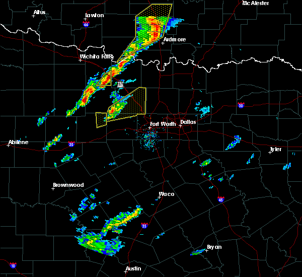 At 155 pm cst, a severe thunderstorm was located 7 miles west of poolville, or 14 miles northeast of mineral wells, moving northeast at 50 mph (radar indicated). Hazards include 60 mph wind gusts and quarter size hail. Hail damage to vehicles is expected. Expect wind damage to roofs, siding and trees. At 155 pm cst, a severe thunderstorm was located 7 miles west of poolville, or 14 miles northeast of mineral wells, moving northeast at 50 mph (radar indicated). Hazards include 60 mph wind gusts and quarter size hail. Hail damage to vehicles is expected. Expect wind damage to roofs, siding and trees.
|
| 5/28/2015 8:12 PM CDT | The severe thunderstorm warning for parker, wise, northeastern palo pinto and eastern jack counties will expire at 815 pm cdt, the storms which prompted the warning have weakened below severe limits, and no longer pose an immediate threat to life or property. therefore the warning will be allowed to expire. however small. |
| 5/28/2015 7:56 PM CDT | At 756 pm cdt, severe thunderstorms were located along a line extending from near sunset to near cottondale to 6 miles south of cool, moving east at 15 mph (radar indicated). Hazards include 60 mph wind gusts and quarter size hail. Hail damage to vehicles is expected. expect wind damage to roofs, siding and trees. locations impacted include, weatherford, mineral wells, azle, decatur, bridgeport, jacksboro, briar, pecan acres, willow park, reno, aledo, springtown, hudson oaks, alvord, annetta, new fairview, aurora, boyd, chico and graford. this includes the following interstates, interstate 20 between mile markers 397 and 422. Interstate 30 near mile marker 1. |
| 5/28/2015 7:21 PM CDT | At 720 pm cdt, severe thunderstorms were located along a line extending from near newport to 7 miles northwest of boonsville to 12 miles southwest of graford, moving east at 45 mph (radar indicated). Hazards include 70 mph wind gusts and quarter size hail. Hail damage to vehicles is expected. expect considerable tree damage. Wind damage is also likely to mobile homes, roofs and outbuildings. |
| 5/27/2015 8:20 PM CDT | At 819 pm cdt, a severe thunderstorm was located near justin, or 11 miles northwest of trophy club, moving northeast at 30 mph. another strong storm was also located near forest hill and south fort worth moving north (radar indicated). Hazards include ping pong ball size hail and 60 mph wind gusts. People and animals outdoors will be injured. expect hail damage to roofs, siding, windows and vehicles. expect wind damage to roofs, siding and trees. locations impacted include, fort worth, arlington, grand prairie, denton, lewisville, flower mound, mansfield, euless, bedford, grapevine, haltom city, keller, hurst, burleson, southlake, watauga, colleyville, benbrook, corinth and saginaw. this includes the following interstates, interstate 35 between mile markers 468 and 469. interstate 35w between mile markers 38 and 85. interstate 35e between mile markers 457 and 466. interstate 20 between mile markers 423 and 453. interstate 30 between mile markers 2 and 31. Interstate 820 between mile markers 1 and 35. |
| 5/27/2015 8:02 PM CDT | At 802 pm cdt, a severe thunderstorm was located near new fairview, or 8 miles northeast of briar, moving northeast at 35 mph (radar indicated). Hazards include 60 mph wind gusts and quarter size hail. Hail damage to vehicles is expected. Expect wind damage to roofs, siding and trees. |
| 5/27/2015 7:24 PM CDT | At 724 pm cdt, a severe thunderstorm was located over lakeside, or near azle, moving northeast at 30 mph (radar indicated). Hazards include 60 mph wind gusts and quarter size hail. Hail damage to vehicles is expected. expect wind damage to roofs, siding and trees. locations impacted include, fort worth, arlington, euless, bedford, haltom city, keller, hurst, southlake, weatherford, watauga, colleyville, benbrook, saginaw, white settlement, azle, richland hills, river oaks, sansom park, lake worth and eagle mountain. this includes the following interstates, interstate 35w between mile markers 47 and 67. interstate 20 between mile markers 412 and 432. interstate 30 between mile markers 1 and 27. Interstate 820 between mile markers 1 and 33. |
| 5/27/2015 7:08 PM CDT | At 708 pm cdt, a severe thunderstorm was located near willow park, or 7 miles west of white settlement, moving northeast at 30 mph (radar indicated). Hazards include 60 mph wind gusts and quarter size hail. Hail damage to vehicles is expected. Expect wind damage to roofs, siding and trees. |
| 5/26/2015 9:42 PM CDT | At 942 pm cdt, a severe thunderstorm was located 9 miles northeast of lipan, or 13 miles southwest of weatherford, moving east at 30 mph (radar indicated). Hazards include 60 mph wind gusts and quarter size hail. Hail damage to vehicles is expected. Expect wind damage to roofs, siding and trees. |
| 5/25/2015 3:10 PM CDT | At 309 pm cdt, severe thunderstorms were located along a line extending from saginaw to arlington to venus, moving east at 50 mph (radar indicated). Hazards include 70 mph wind gusts and quarter size hail. Hail damage to vehicles is expected. expect considerable tree damage. wind damage is also likely to mobile homes, roofs and outbuildings. locations impacted include, dallas, fort worth, arlington, irving, grand prairie, mesquite, carrollton, flower mound, mansfield, euless, desoto, bedford, grapevine, cedar hill, haltom city, keller, coppell, duncanville, hurst and burleson. this includes the following interstates, interstate 35w between mile markers 15 and 67. interstate 35e between mile markers 399 and 445. interstate 20 between mile markers 429 and 485. interstate 30 between mile markers 6 and 56. interstate 635 between mile markers 1 and 8, and between mile markers 20 and 36. interstate 820 between mile markers 5 and 35. interstate 45 between mile markers 262 and 284. A tornado watch remains in effect until 600 pm cdt for north central texas. |
| 5/25/2015 2:55 PM CDT | At 254 pm cdt, severe thunderstorms were located along a line extending from near willow park to keene, moving east at 55 mph (radar indicated). Hazards include 70 mph wind gusts and quarter size hail. Hail damage to vehicles is expected. expect considerable tree damage. Wind damage is also likely to mobile homes, roofs and outbuildings. |
| 5/25/2015 2:47 PM CDT | At 247 pm cdt, severe thunderstorms were located along a line extending from willow park to joshua, moving east at 45 mph (radar indicated). Hazards include 70 mph wind gusts and penny size hail. Expect considerable tree damage. damage is likely to mobile homes, roofs and outbuildings. locations impacted include, fort worth, arlington, grand prairie, mansfield, euless, bedford, grapevine, haltom city, keller, coppell, hurst, burleson, southlake, weatherford, watauga, colleyville, benbrook, saginaw, white settlement and crowley. this includes the following interstates, interstate 35w between mile markers 38 and 67. interstate 20 between mile markers 401 and 453. interstate 30 between mile markers 1 and 31. interstate 820 between mile markers 1 and 35. A tornado watch remains in effect until 600 pm cdt for north central texas. |
| 5/25/2015 2:10 PM CDT | At 208 pm cdt, severe thunderstorms were located along a line extending from near reno to 6 miles southwest of annetta, moving east at 40 mph (radar indicated). Hazards include 70 mph wind gusts and penny size hail. Expect considerable tree damage. damage is likely to mobile homes, roofs and outbuildings. locations impacted include, fort worth, arlington, grand prairie, mansfield, euless, bedford, grapevine, haltom city, keller, coppell, hurst, burleson, southlake, weatherford, watauga, colleyville, benbrook, saginaw, white settlement and crowley. this includes the following interstates, interstate 35w between mile markers 38 and 67. interstate 20 between mile markers 398 and 453. interstate 30 between mile markers 1 and 31. interstate 820 between mile markers 1 and 35. A tornado watch remains in effect until 600 pm cdt for north central texas. |
| 5/25/2015 1:41 PM CDT | At 141 pm cdt, severe thunderstorms were located along a line extending from near springtown to near oak trail shores, moving east at 30 mph (radar indicated). Hazards include 60 mph wind gusts and penny size hail. Expect damage to roofs. Siding and trees. |
| 5/25/2015 1:23 PM CDT | At 122 pm cdt, severe thunderstorms were located along a line extending from near poolville to 8 miles northeast of lipan, moving east at 40 mph (radar indicated). Hazards include 70 mph wind gusts and penny size hail. Expect considerable tree damage. damage is likely to mobile homes, roofs and outbuildings. locations impacted include, weatherford, mineral wells, azle, briar, willow park, reno, aledo, springtown, hudson oaks, annetta, cool, poolville, mineral wells state park, annetta south, annetta north, millsap and sanctuary. this includes the following interstates, interstate 20 between mile markers 390 and 422. interstate 30 near mile marker 1. A tornado watch remains in effect until 600 pm cdt for north central texas. |
| 5/25/2015 12:46 PM CDT | At 1246 pm cdt, severe thunderstorms were located along a line extending from near graford to 9 miles northeast of gordon, moving east at 45 mph (radar indicated). Hazards include 70 mph wind gusts and penny size hail. Expect considerable tree damage. Damage is likely to mobile homes, roofs and outbuildings. |
| 5/19/2015 7:29 PM CDT | At 729 pm cdt, a severe thunderstorm was located over cool, or over mineral wells, moving east at 35 mph (radar indicated). Hazards include two inch hail and 60 mph wind gusts. People and animals outdoors will be injured. expect hail damage to roofs, siding, windows and vehicles. Expect wind damage to roofs, siding and trees. |
| 5/17/2015 12:23 AM CDT | The severe thunderstorm warning for eastern parker county will expire at 1230 am cdt, the storms which prompted the warning have moved out of the warned area. therefore the warning will be allowed to expire. heavy rain will be possible in the wake of these storms. |
| 5/17/2015 12:15 AM CDT | At 1214 am cdt, severe thunderstorms were located along a line extending from near boyd to near aurora to near pecan acres to lakeside to near aledo, moving east at 60 mph (radar indicated). Hazards include 70 mph wind gusts. Expect considerable tree damage. damage is likely to mobile homes, roofs and outbuildings. locations impacted include, weatherford, azle, briar, willow park, reno, aledo, springtown, hudson oaks, annetta, poolville, annetta south, annetta north and sanctuary. this includes the following interstates, interstate 20 between mile markers 406 and 422. interstate 30 near mile marker 1. 75in. |
| 5/16/2015 11:52 PM CDT | At 1150 pm cdt, severe thunderstorms were located along a line extending from 8 miles north of mineral wells state park to 7 miles southwest of poolville to near weatherford to 7 miles northeast of lipan, moving east at 60 mph (radar indicated). Hazards include 60 mph wind gusts. Expect damage to roofs. siding and trees. locations impacted include, weatherford, mineral wells, azle, briar, willow park, reno, aledo, springtown, hudson oaks, annetta, graford, gordon, cool, poolville, mineral wells state park, annetta south, annetta north, millsap and sanctuary. this includes the following interstates, interstate 20 between mile markers 368 and 422. interstate 30 near mile marker 1. Possible. |
| 5/16/2015 11:31 PM CDT | At 1130 pm cdt, severe thunderstorms were located along a line extending from near graford to 11 miles south of mineral wells to 8 miles north of morgan mill, moving east at 50 mph (radar indicated). Hazards include 60 mph wind gusts. Expect damage to roofs. Siding and trees. |
| 5/10/2015 1:42 PM CDT | At 141 pm cdt, a severe thunderstorm was located over pelican bay, or over briar, moving northeast at 55 mph. another severe thunderstorm was also located west of haslet near pelican acres, .along moving northeast (radar indicated). Hazards include 60 mph wind gusts and quarter size hail. Hail damage to vehicles is expected. Expect wind damage to roofs, siding and trees. |
| 5/10/2015 6:08 AM CDT | At 608 am cdt, severe thunderstorms were located along a line extending from reno to near benbrook to near cleburne state park, moving east at 45 mph (radar indicated). Hazards include 60 mph wind gusts. Expect damage to roofs. siding and trees. locations impacted include, weatherford, azle, granbury, briar, pecan plantation, willow park, reno, aledo, springtown, glen rose, hudson oaks, annetta, oak trail shores, poolville, dinosaur valley state park, annetta south, annetta north and sanctuary. 75in. |
| 5/10/2015 5:57 AM CDT | At 556 am cdt, a severe thunderstorm was located near aledo, or near white settlement, moving northeast at 50 mph (radar indicated). Hazards include 60 mph wind gusts. Expect damage to roofs. siding and trees. this severe thunderstorm will be near, benbrook around 600 am cdt. white settlement, westworth village and lakeside around 605 am cdt. bedford, hurst and north richland hills around 625 am cdt. keller, southlake and colleyville around 630 am cdt. irving, grapevine and coppell around 640 am cdt. other locations impacted by this severe thunderstorm include westover hills, westlake and newark. 75in. |
| 5/10/2015 5:45 AM CDT | At 545 am cdt, severe thunderstorms were located along a line extending from 10 miles northwest of weatherford to 5 miles south of annetta to glen rose, moving east at 45 mph (radar indicated). Hazards include 60 mph wind gusts. Expect damage to roofs. siding and trees. locations impacted include, weatherford, mineral wells, azle, granbury, briar, pecan plantation, willow park, reno, aledo, springtown, glen rose, hudson oaks, annetta, lipan, cool, oak trail shores, poolville, dinosaur valley state park, mineral wells state park and tolar. 75in. |
| 5/10/2015 5:15 AM CDT | At 515 am cdt, severe thunderstorms were located along a line extending from 10 miles southwest of mineral wells to near lipan to 10 miles north of hico, moving east at 45 mph (radar indicated). Hazards include 60 mph wind gusts. Expect damage to roofs. Siding and trees. |
| 5/9/2015 2:14 PM CDT | At 212 pm cdt, a severe thunderstorm was located 8 miles west of paris, moving east at 40 mph (radar indicated). Hazards include 60 mph wind gusts and half dollar size hail. Hail damage to vehicles is expected. expect wind damage to roofs, siding and trees. this severe storm will be near, toco around 220 pm cdt. paris around 225 pm cdt. 1. 25in. |
| 5/9/2015 1:49 PM CDT | At 149 pm cdt, a severe thunderstorm was located over honey grove, or 17 miles east of bonham, moving northeast at 25 mph (radar indicated). Hazards include 65 mph wind gusts and quarter size hail. Hail damage to vehicles is expected. expect wind damage to roofs, siding and trees. this severe thunderstorm will be near, toco around 240 pm cdt. a tornado watch remains in effect until 900 pm cdt for north central texas. 1. 00in. |
| 5/7/2015 8:54 PM CDT | At 854 pm cdt, severe thunderstorms were located along a line extending from near decatur to near boyd to 6 miles north of weatherford, moving east at 50 mph (radar indicated). Hazards include 70 mph wind gusts and quarter size hail. Hail damage to vehicles is expected. expect considerable tree damage. Wind damage is also likely to mobile homes, roofs and outbuildings. |
| 5/7/2015 8:07 PM CDT | At 806 pm cdt, severe thunderstorms were located along a line extending from near jacksboro to near graford to 10 miles northwest of gordon, moving east at 45 mph (radar indicated). Hazards include 70 mph wind gusts and quarter size hail. Hail damage to vehicles is expected. expect considerable tree damage. Wind damage is also likely to mobile homes, roofs and outbuildings. |
| 5/7/2015 5:13 PM CDT | At 512 pm cdt, a severe thunderstorm was located near springtown, or 11 miles north of weatherford, moving north at 40 mph (radar indicated). Hazards include ping pong ball size hail and 60 mph wind gusts. People and animals outdoors will be injured. expect hail damage to roofs, siding, windows and vehicles. Expect wind damage to roofs, siding and trees. |
| 4/26/2015 7:27 PM CDT | At 727 pm cdt, a severe thunderstorm was located 7 miles south of mineral wells, moving northeast at 60 mph (radar indicated). Hazards include quarter size hail. Damage to vehicles is expected. locations impacted include, mineral wells, briar, reno, springtown, cool, poolville, mineral wells state park and millsap. a tornado watch remains in effect until 1100 pm cdt for north central texas. 1. 00in. |
| 4/26/2015 7:09 PM CDT | At 709 pm cdt, a severe thunderstorm was located over gordon, or 21 miles east of ranger, moving northeast at 60 mph (radar indicated). Hazards include 60 mph wind gusts and quarter size hail. Hail damage to vehicles is expected. Expect wind damage to roofs, siding and trees. |
| 4/18/2015 6:58 PM CDT | At 657 pm cdt, severe thunderstorms were located along a line extending from 7 miles south of poolville to 8 miles south of annetta, moving east at 55 mph (radar indicated). Hazards include 70 mph wind gusts and half dollar size hail. the strongest winds will affect the area south of i-20. Hail damage to vehicles is expected. expect considerable tree damage. wind damage is also likely to mobile homes, roofs and outbuildings. locations impacted include, weatherford, mineral wells, azle, briar, willow park, reno, aledo, springtown, hudson oaks, annetta, cool, poolville, mineral wells state park, annetta south, annetta north, millsap and sanctuary. Possible. |
| 4/18/2015 6:41 PM CDT | At 641 pm cdt, severe thunderstorms were located along a line extending from 6 miles southwest of springtown to near lipan, moving east at 35 mph (radar indicated). Hazards include 60 mph wind gusts and half dollar size hail. Hail damage to vehicles is expected. Expect wind damage to roofs, siding and trees. |
| 4/1/2015 7:43 PM CDT | A severe thunderstorm warning remains in effect until 815 pm cdt for south central wise and northeastern parker counties. at 742 pm cdt. a severe thunderstorm was located near springtown. or 10 miles west of briar. moving northeast at 25 mph. hazard. 60 mph wind gusts and quarter size hail. source. Trained weather spotters. |
| 4/1/2015 7:29 PM CDT | The national weather service in fort worth has issued a * severe thunderstorm warning for. south central wise county in north central texas. northeastern parker county in north central texas. until 815 pm cdt * at 729 pm cdt. A severe thunderstorm was located near poolville. |
| 4/1/2015 4:59 PM CDT | The national weather service in fort worth has issued a * severe thunderstorm warning for. southwestern denton county in north central texas. southeastern wise county in north central texas. northwestern tarrant county in north central texas. Until 545 pm cdt. |
| 4/1/2015 4:54 PM CDT | A severe thunderstorm warning remains in effect until 515 pm cdt for southeastern wise. northwestern tarrant and northeastern parker counties. at 453 pm cdt. a severe thunderstorm was located over pecan acres. or near eagle mountain. moving northeast at 20 mph. hazard. Tennis ball size hail and 60 mph wind gusts. |
| 4/1/2015 3:38 PM CST | Tennis Ball sized hail reported 0.8 miles WNW of Reno, TX, tennis ball sized hail 1 sw of reno |
| 4/1/2015 4:28 PM CDT | The national weather service in fort worth has issued a * severe thunderstorm warning for. southeastern wise county in north central texas. northwestern tarrant county in north central texas. northeastern parker county in north central texas. Until 515 pm cdt. |
| 4/1/2015 4:16 PM CDT | A severe thunderstorm warning remains in effect until 430 pm cdt for northwestern tarrant and northeastern parker counties. at 415 pm cdt. a severe thunderstorm was located over reno. or near azle. moving northeast at 15 mph. hazard. hen egg size hail and 60 mph wind gusts. source. Radar indicated. |
| 4/1/2015 4:06 PM CDT | A severe thunderstorm warning remains in effect until 430 pm cdt for northwestern tarrant and northeastern parker counties. at 404 pm cdt. a severe thunderstorm was located over pelican bay. or over azle. moving northeast at 20 mph. hazard. ping pong ball size hail and 60 mph wind gusts. source. Radar indicated. |
| 4/1/2015 3:49 PM CDT | The national weather service in fort worth has issued a * severe thunderstorm warning for. northwestern tarrant county in north central texas. northeastern parker county in north central texas. until 430 pm cdt * at 349 pm cdt. A severe thunderstorm was located near azle. |
| 3/25/2015 7:54 AM CDT | The national weather service in fort worth has issued a * severe thunderstorm warning for. eastern lamar county in northeastern texas. until 830 am cdt * at 753 am cdt. Doppler radar indicated a severe thunderstorm capable of producing half dollar size hail and damaging winds in. |
| 5/21/2013 3:30 PM CDT | Trees and powerlines down at reno city hall in lamar county TX, 0.3 miles W of Reno, TX |
| 1/1/0001 12:00 AM | Quarter sized hail reported 1.8 miles NNE of Reno, TX, reported at hwy 199 and midway |
Hail Maps for Reno, TX
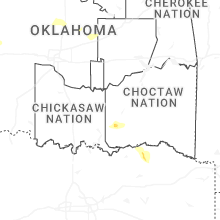
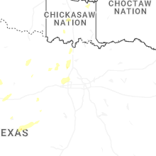
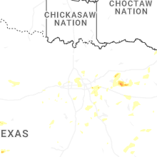
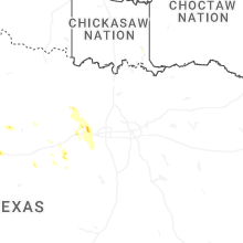
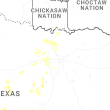
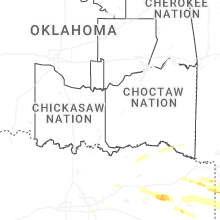

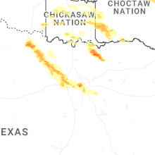
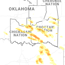
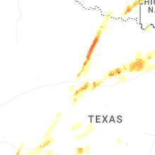
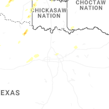
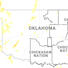
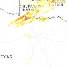

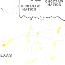

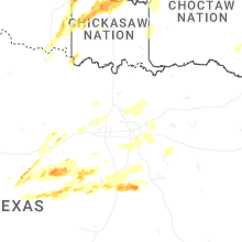
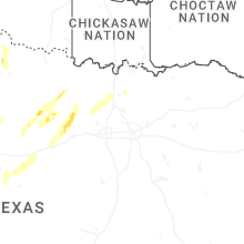
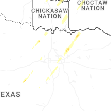


Connect with Interactive Hail Maps