

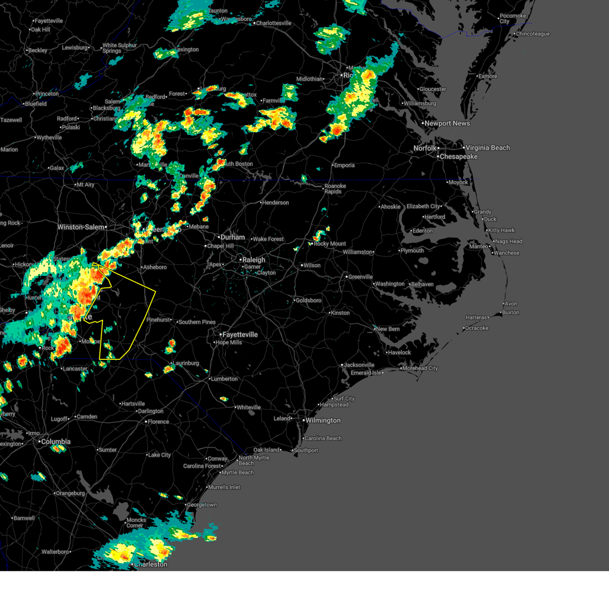
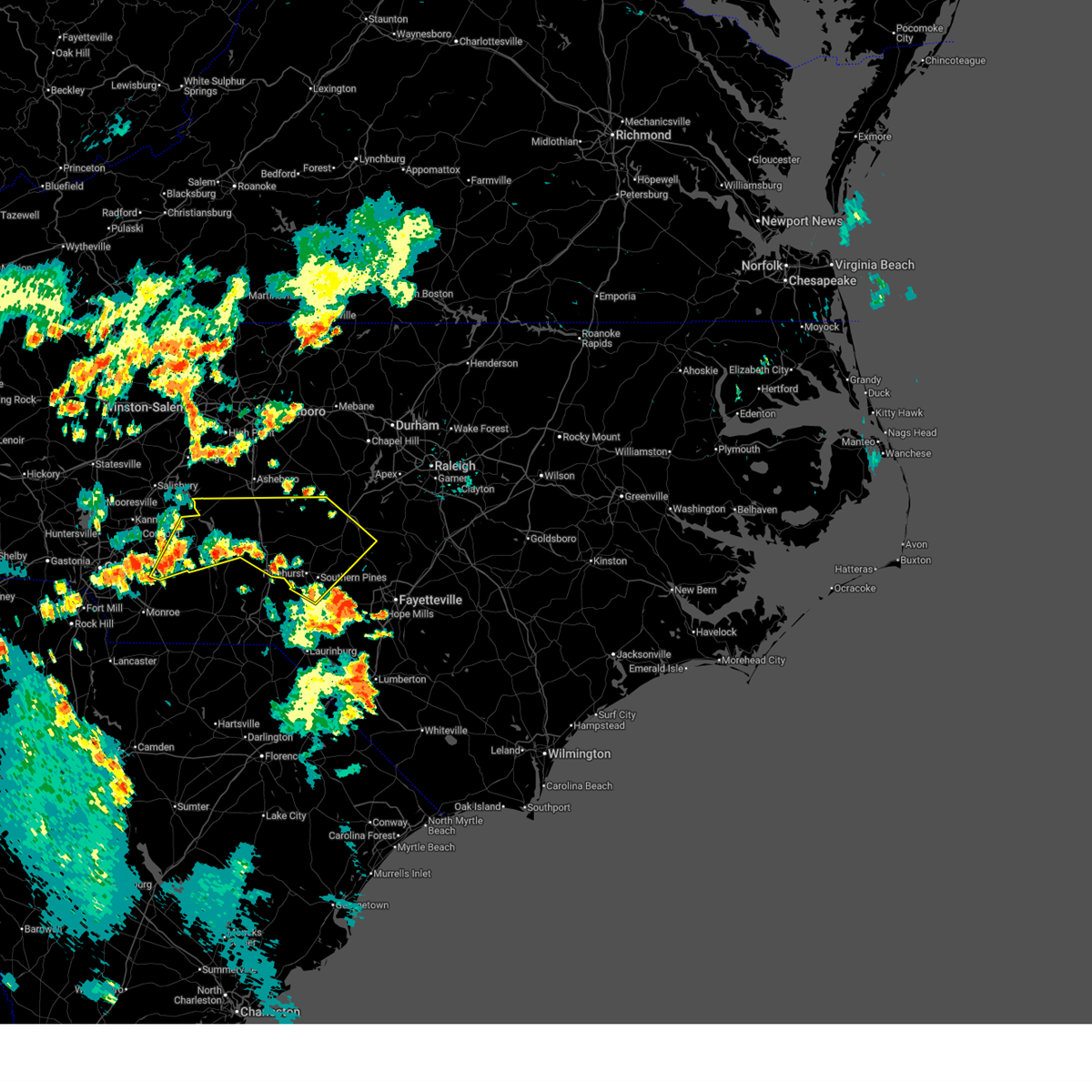
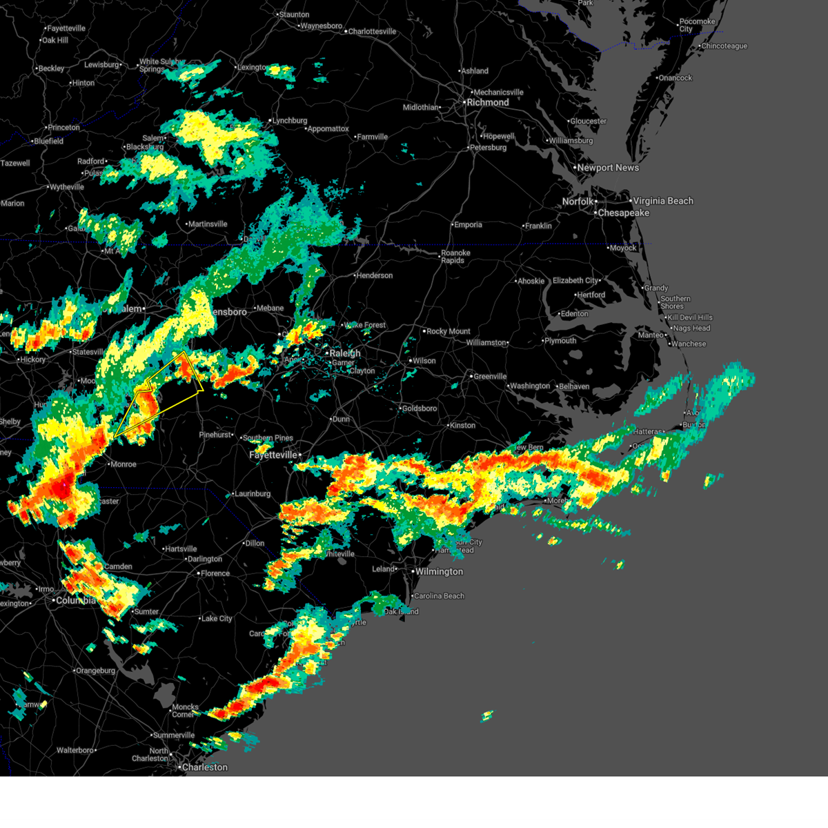
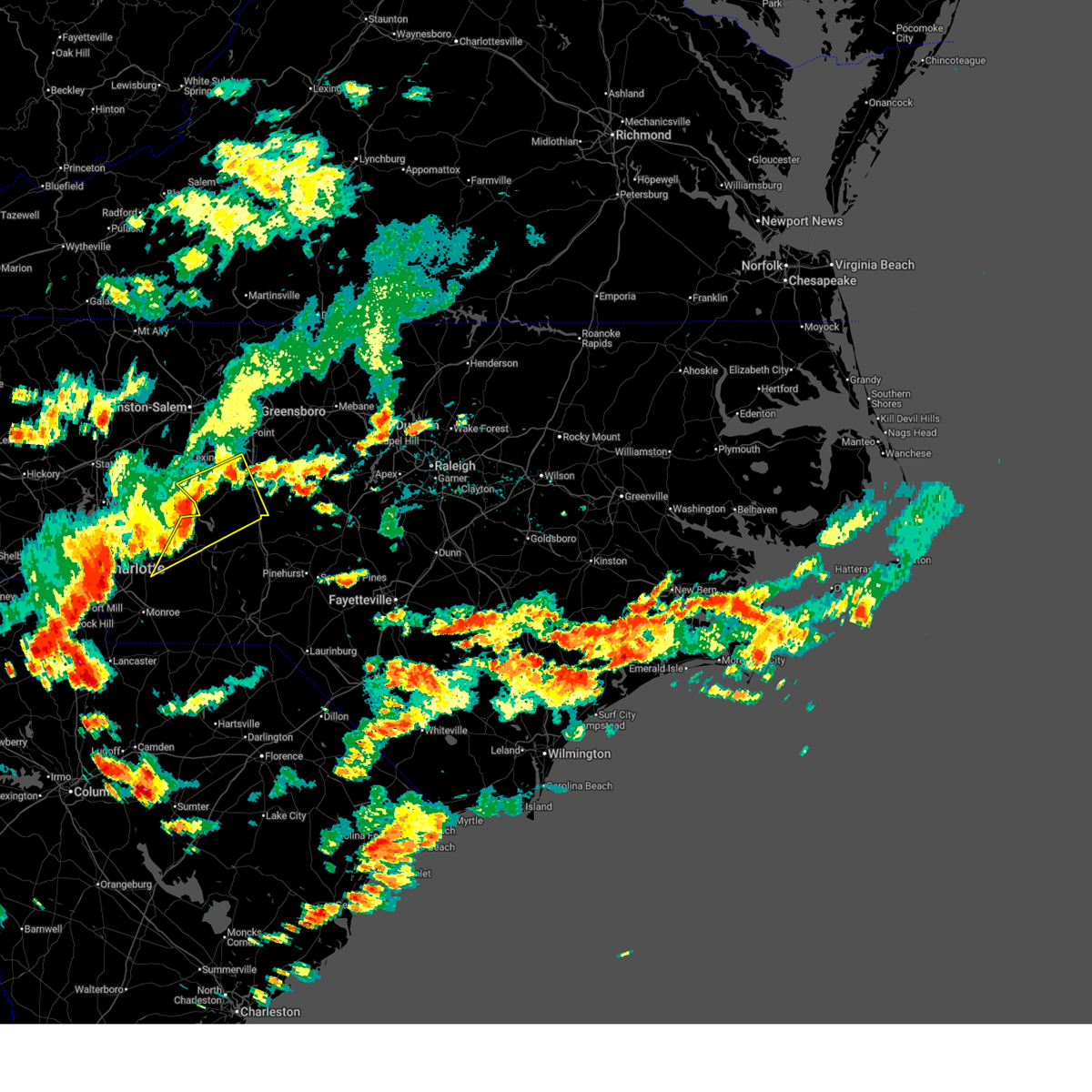
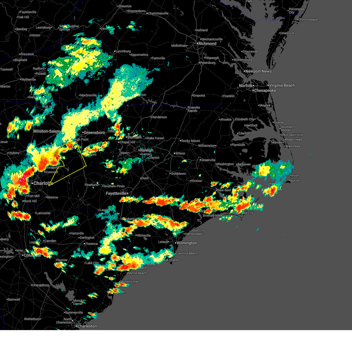
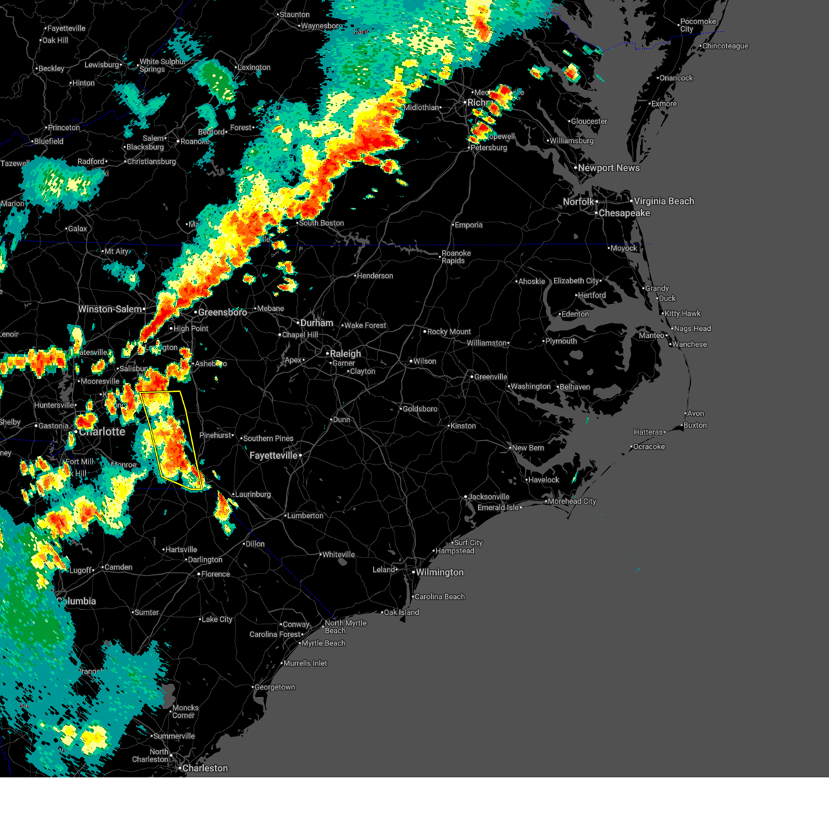
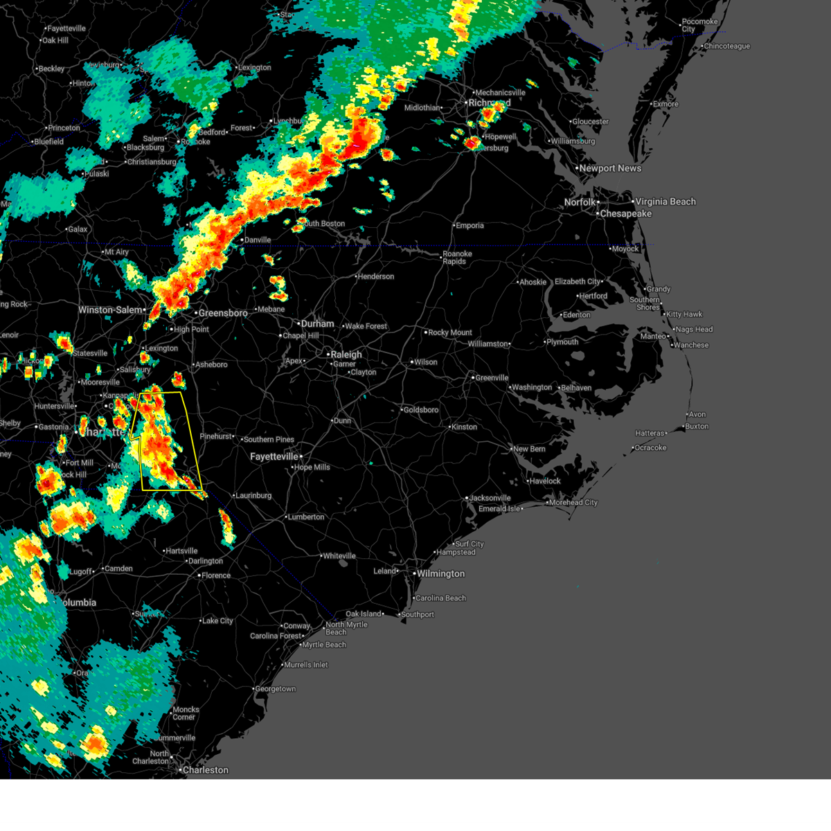
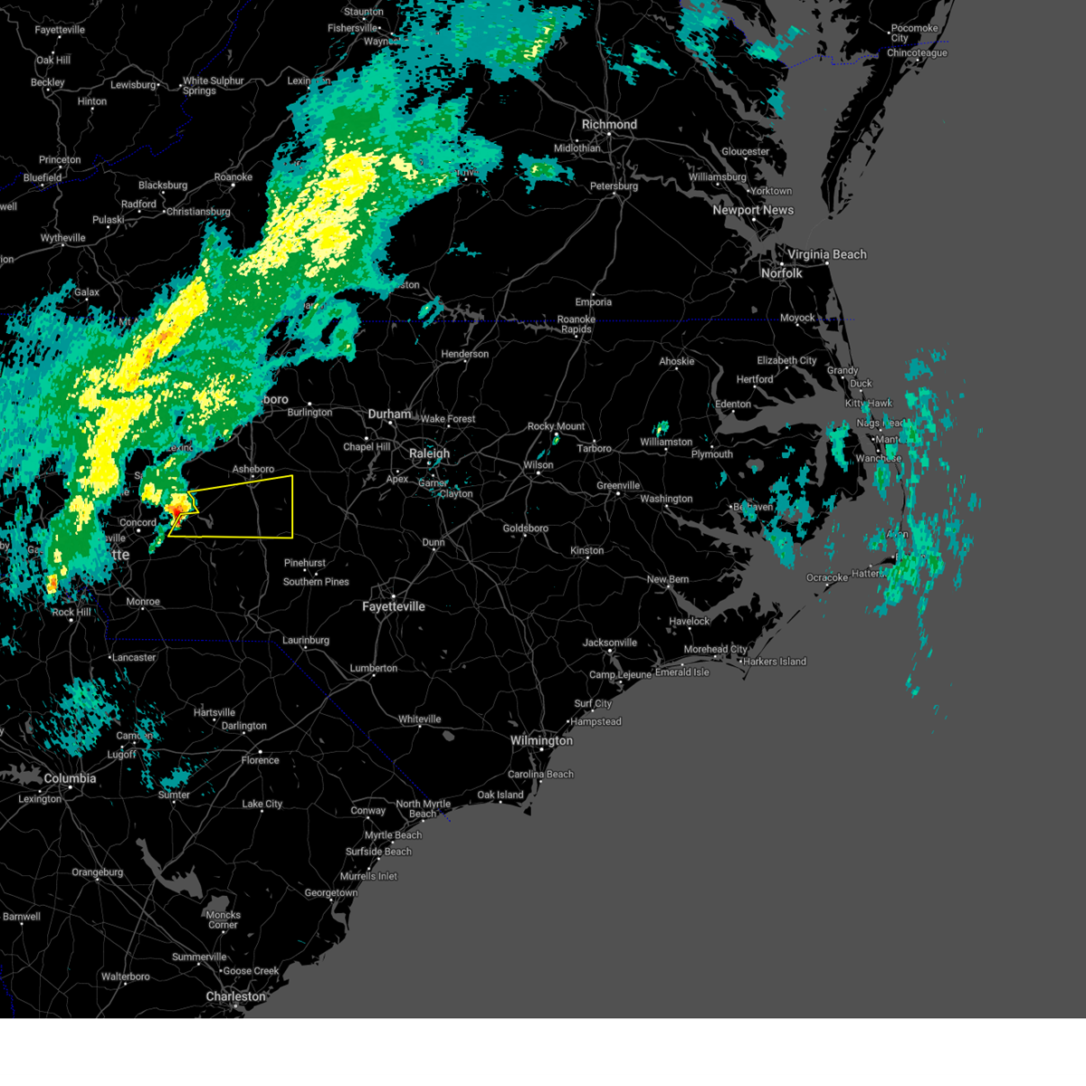
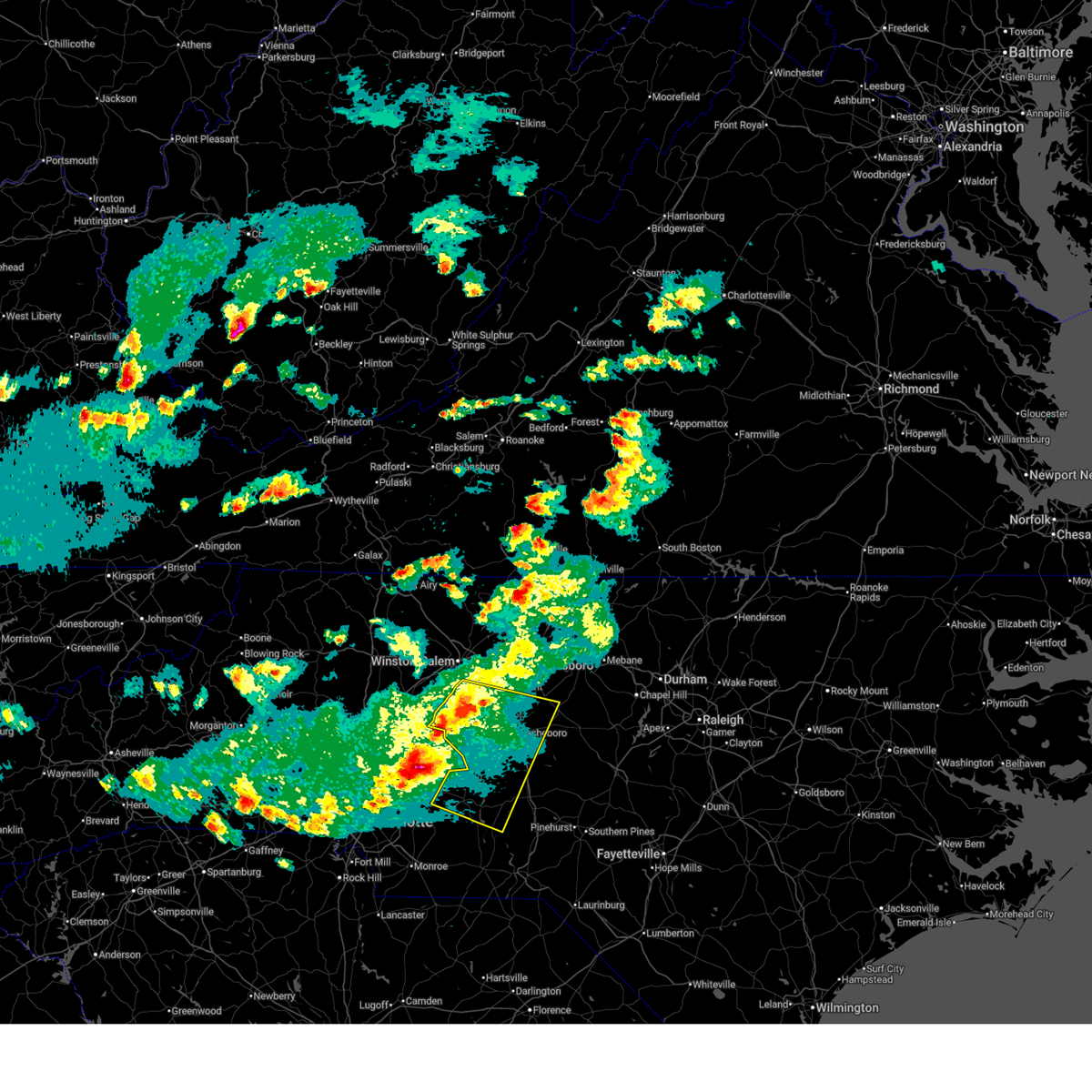
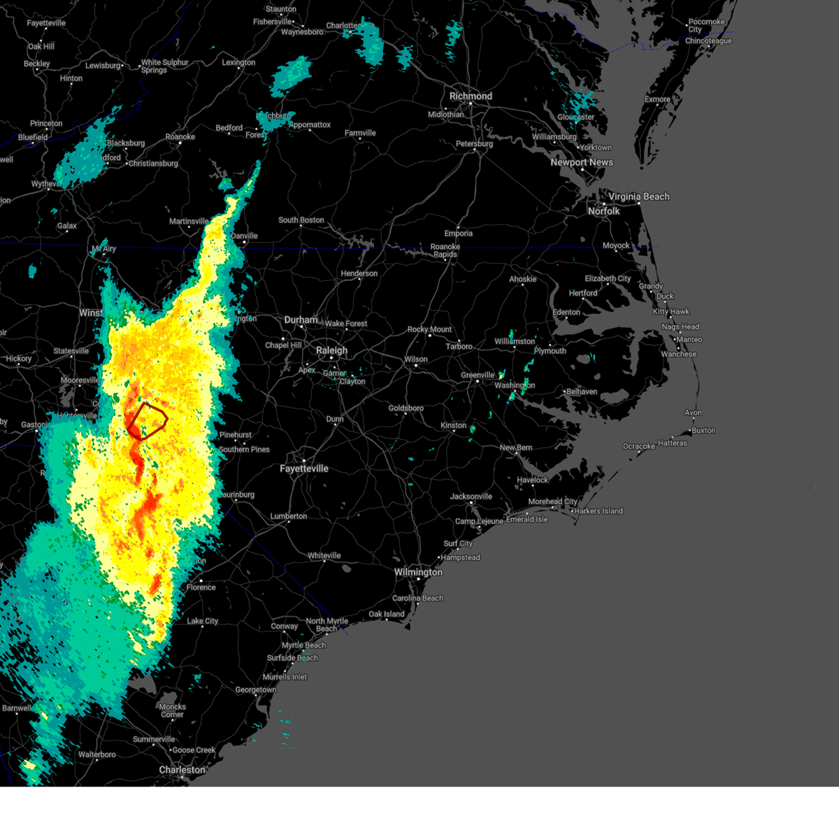
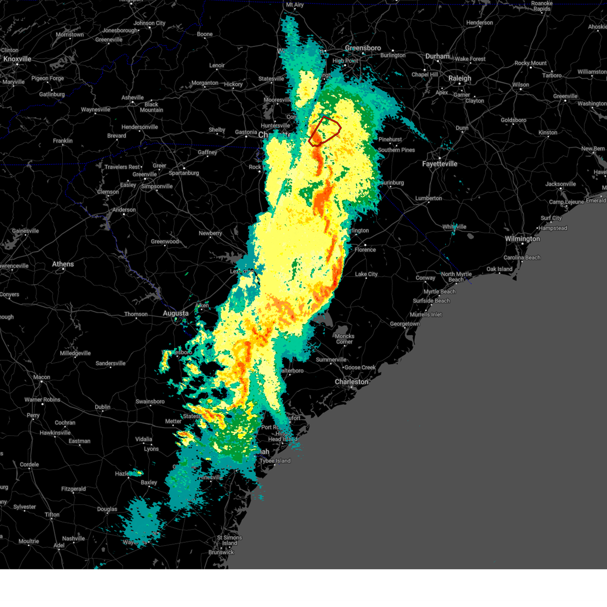
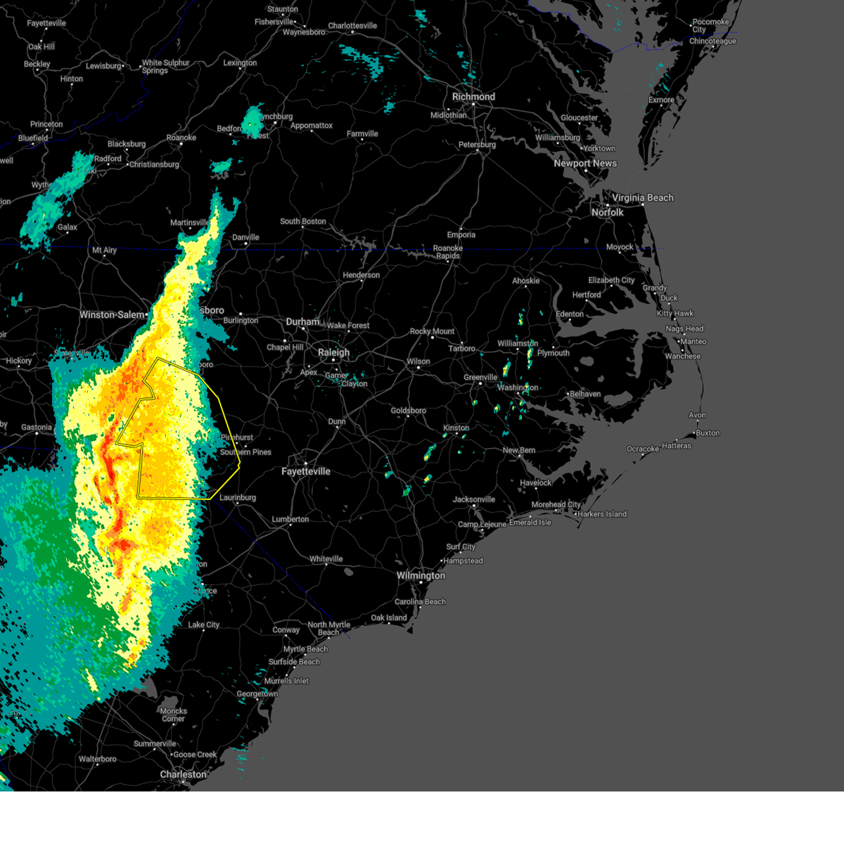
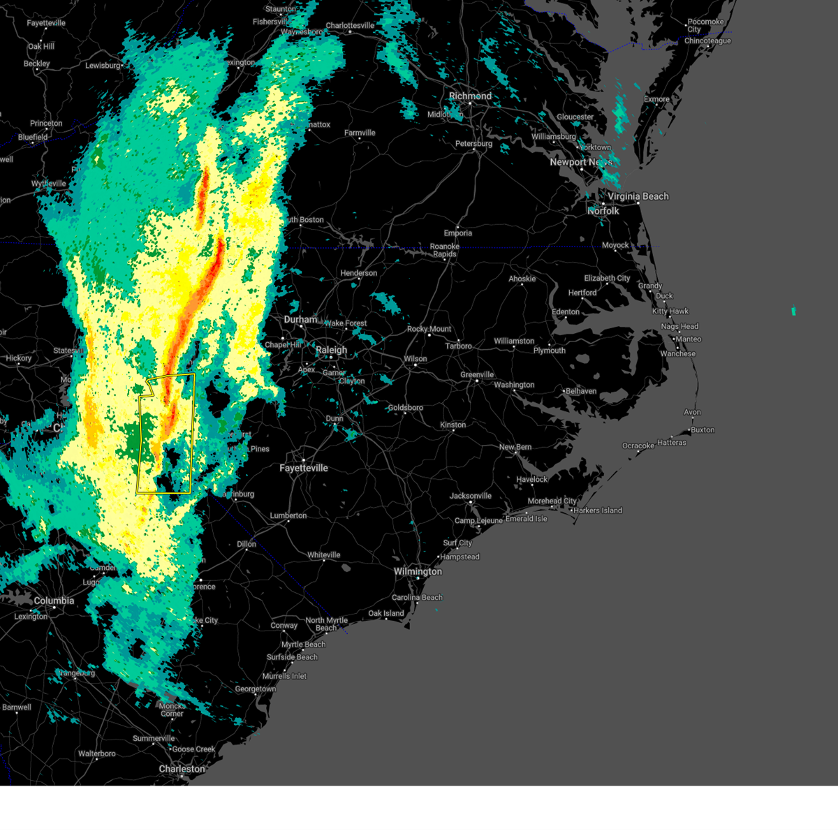
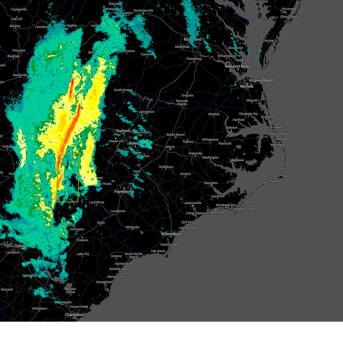
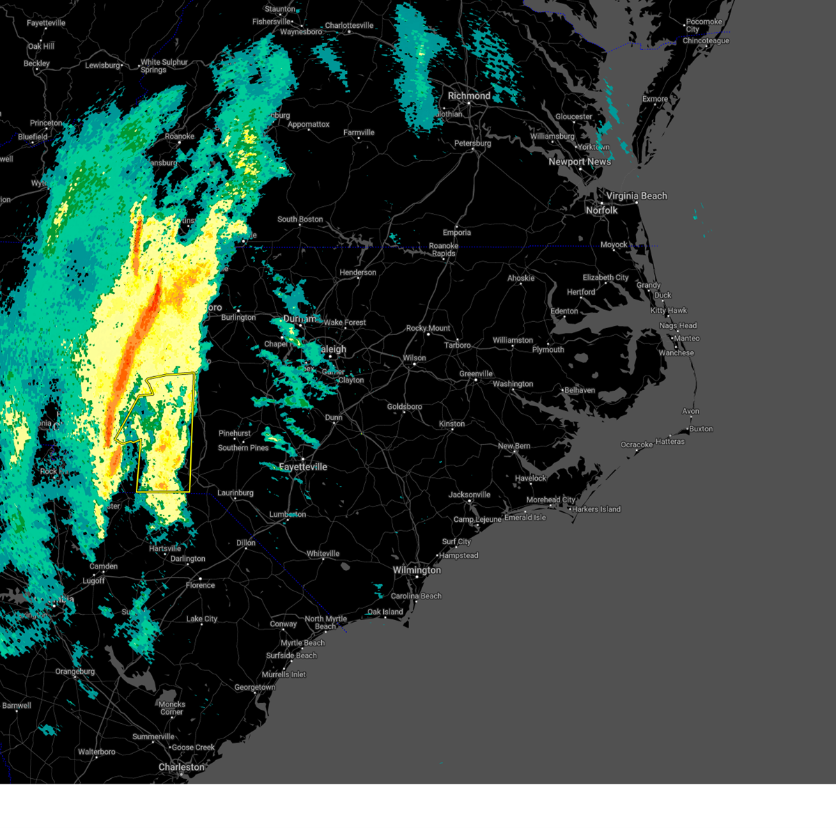
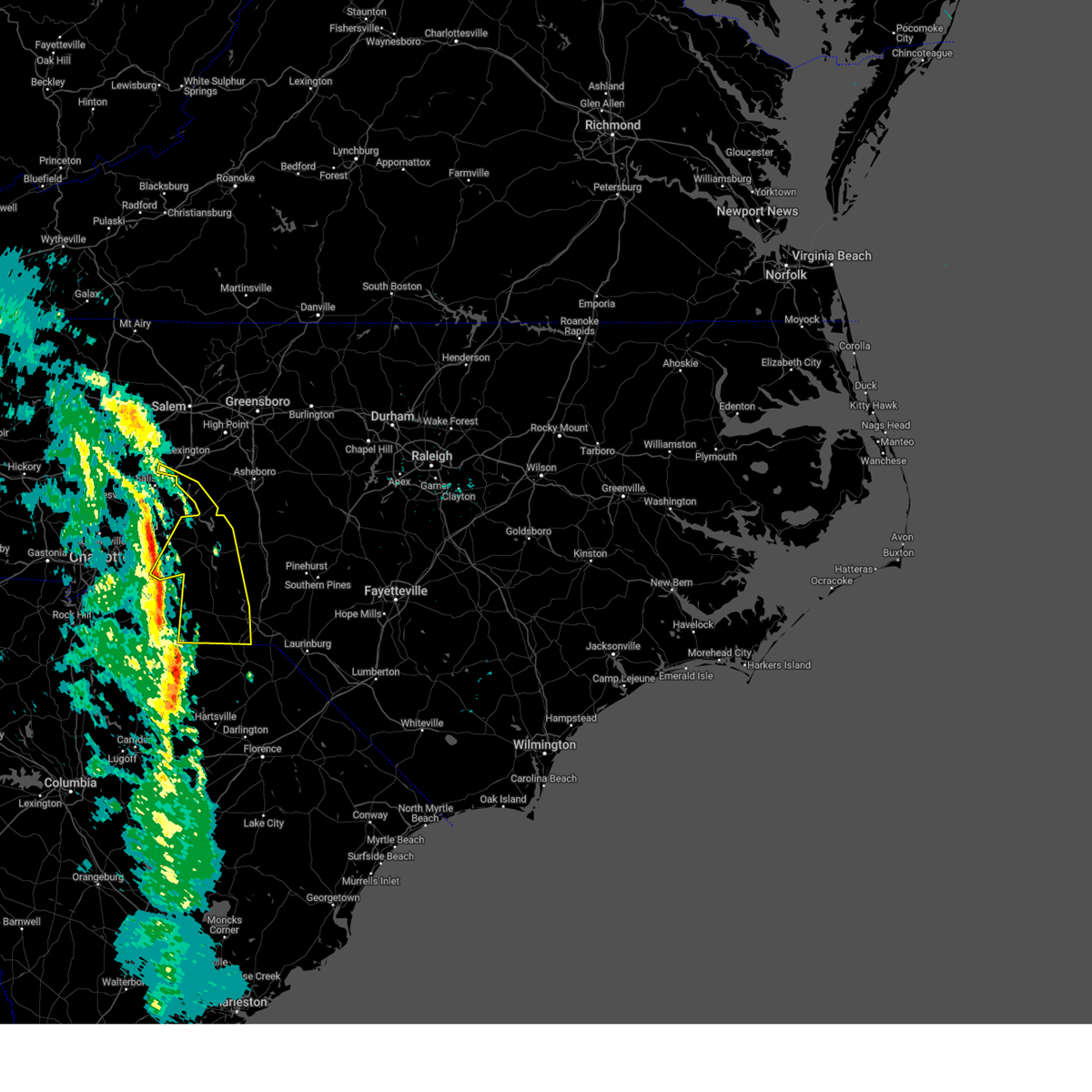
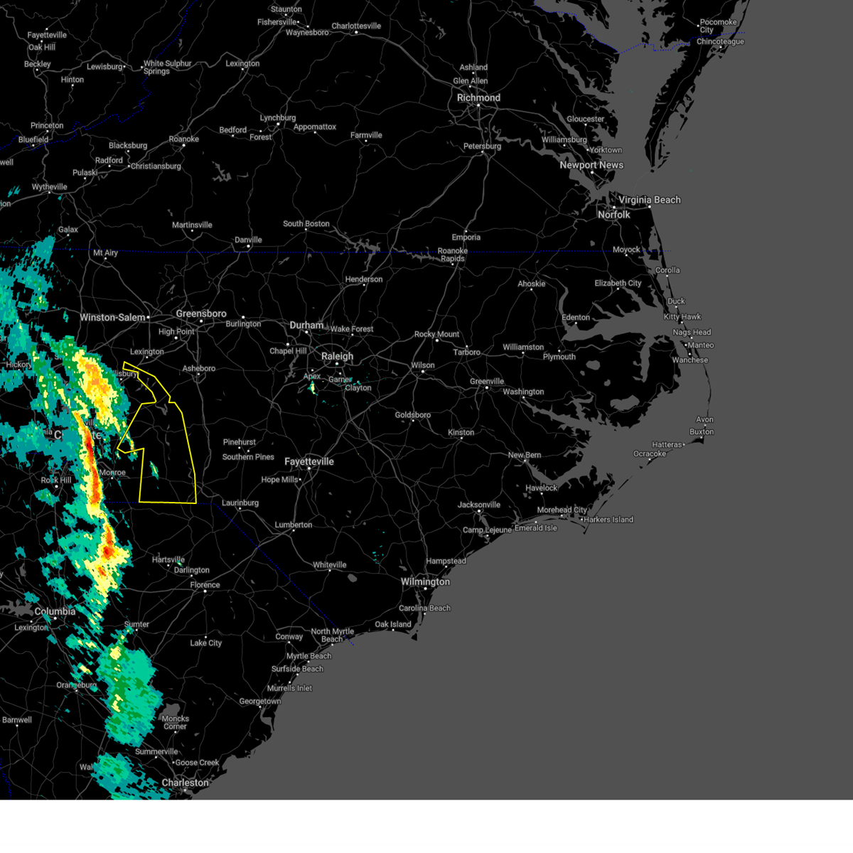
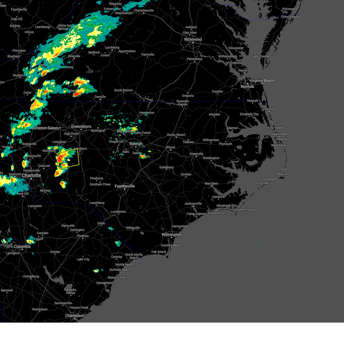
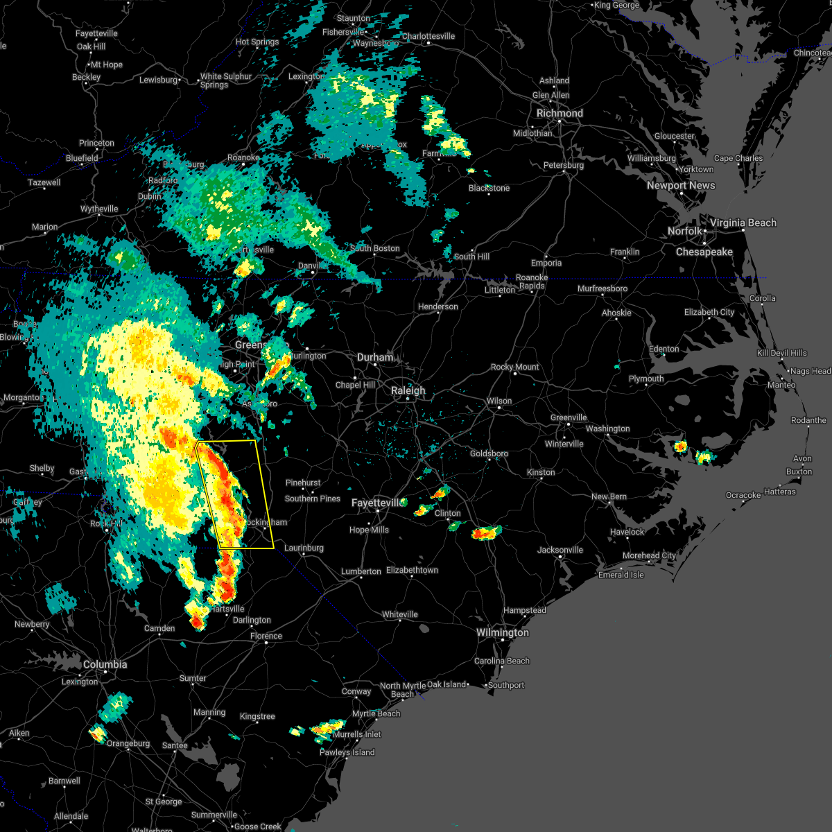
Hail Map for Richfield, NC
The Richfield, NC area has had 0 reports of on-the-ground hail by trained spotters, and has been under severe weather warnings 11 times during the past 12 months. Doppler radar has detected hail at or near Richfield, NC on 42 occasions.
| Name: | Richfield, NC |
| Where Located: | 37.1 miles ENE of Charlotte, NC |
| Map: | Google Map for Richfield, NC |
| Population: | 613 |
| Housing Units: | 258 |
| More Info: | Search Google for Richfield, NC |
1
The Top Recent Hail Date for Richfield, NC is Sunday, August 18, 2024 (7th out of 42)

Hail and Wind Damage Spotted near Richfield, NC
| Date / Time | Report Details |
|---|---|
| 7/10/2026 4:01 PM EDT |
 At 400 pm edt, severe thunderstorms were located along a line extending from 8 miles west of badin lake to plyler to 6 miles east of midland to unionville to near mineral springs, moving east at 35 mph (law enforcement. at 400 pm, trees were being reported down near the town of oakboro in stanly county). Hazards include 70 mph wind gusts and nickel size hail. Expect considerable tree damage. damage is likely to mobile homes, roofs, and outbuildings. locations impacted include, albemarle, wadesboro, troy, badin lake, biscoe, ansonville, plyler, midland, polkton, and locust. this includes the following highways, interstate 85 near mile marker 83. Interstate 73 between mile markers 46 and 60. At 400 pm edt, severe thunderstorms were located along a line extending from 8 miles west of badin lake to plyler to 6 miles east of midland to unionville to near mineral springs, moving east at 35 mph (law enforcement. at 400 pm, trees were being reported down near the town of oakboro in stanly county). Hazards include 70 mph wind gusts and nickel size hail. Expect considerable tree damage. damage is likely to mobile homes, roofs, and outbuildings. locations impacted include, albemarle, wadesboro, troy, badin lake, biscoe, ansonville, plyler, midland, polkton, and locust. this includes the following highways, interstate 85 near mile marker 83. Interstate 73 between mile markers 46 and 60.
|
| 7/10/2026 3:55 PM EDT |
 At 355 pm edt, severe thunderstorms were located along a line extending from 7 miles southeast of rockwell to near plyler to near midland to unionville to mineral springs, moving east at 30 mph (radar indicated). Hazards include 70 mph wind gusts and quarter size hail. Hail damage to vehicles is expected. expect considerable tree damage. wind damage is also likely to mobile homes, roofs, and outbuildings. locations impacted include, albemarle, wadesboro, troy, badin lake, biscoe, ansonville, plyler, midland, polkton, and locust. this includes the following highways, interstate 85 near mile marker 83. Interstate 73 between mile markers 46 and 60. At 355 pm edt, severe thunderstorms were located along a line extending from 7 miles southeast of rockwell to near plyler to near midland to unionville to mineral springs, moving east at 30 mph (radar indicated). Hazards include 70 mph wind gusts and quarter size hail. Hail damage to vehicles is expected. expect considerable tree damage. wind damage is also likely to mobile homes, roofs, and outbuildings. locations impacted include, albemarle, wadesboro, troy, badin lake, biscoe, ansonville, plyler, midland, polkton, and locust. this includes the following highways, interstate 85 near mile marker 83. Interstate 73 between mile markers 46 and 60.
|
| 7/10/2026 3:36 PM EDT |
 Svrrah the national weather service in raleigh has issued a * severe thunderstorm warning for, northwestern moore county in central north carolina, southern davidson county in central north carolina, anson county in central north carolina, montgomery county in central north carolina, northwestern richmond county in central north carolina, southwestern randolph county in central north carolina, stanly county in central north carolina, * until 430 pm edt. * at 335 pm edt, severe thunderstorms were located along a line extending from granite quarry to near kannapolis to near harrisburg to near mint hill to near pineville, moving southeast at 35 mph (radar indicated). Hazards include 70 mph wind gusts and quarter size hail. Hail damage to vehicles is expected. expect considerable tree damage. Wind damage is also likely to mobile homes, roofs, and outbuildings. Svrrah the national weather service in raleigh has issued a * severe thunderstorm warning for, northwestern moore county in central north carolina, southern davidson county in central north carolina, anson county in central north carolina, montgomery county in central north carolina, northwestern richmond county in central north carolina, southwestern randolph county in central north carolina, stanly county in central north carolina, * until 430 pm edt. * at 335 pm edt, severe thunderstorms were located along a line extending from granite quarry to near kannapolis to near harrisburg to near mint hill to near pineville, moving southeast at 35 mph (radar indicated). Hazards include 70 mph wind gusts and quarter size hail. Hail damage to vehicles is expected. expect considerable tree damage. Wind damage is also likely to mobile homes, roofs, and outbuildings.
|
| 6/18/2026 8:33 PM EDT |
 At 833 pm edt, severe thunderstorms were located along a line extending from near albemarle to 8 miles southwest of goldston to 8 miles south of sanford, moving east at 60 mph (radar indicated). Hazards include 60 mph wind gusts and penny size hail. Expect damage to roofs, siding, and trees. locations impacted include, sanford, albemarle, troy, badin lake, biscoe, goldston, seagrove, plyler, locust, and badin. this includes the following highways, us 1 near mile marker 69. Interstate 73 between mile markers 49 and 66. At 833 pm edt, severe thunderstorms were located along a line extending from near albemarle to 8 miles southwest of goldston to 8 miles south of sanford, moving east at 60 mph (radar indicated). Hazards include 60 mph wind gusts and penny size hail. Expect damage to roofs, siding, and trees. locations impacted include, sanford, albemarle, troy, badin lake, biscoe, goldston, seagrove, plyler, locust, and badin. this includes the following highways, us 1 near mile marker 69. Interstate 73 between mile markers 49 and 66.
|
| 6/18/2026 7:54 PM EDT |
 Svrrah the national weather service in raleigh has issued a * severe thunderstorm warning for, moore county in central north carolina, southeastern davidson county in central north carolina, west central harnett county in central north carolina, montgomery county in central north carolina, southern randolph county in central north carolina, stanly county in central north carolina, southwestern lee county in central north carolina, northwestern hoke county in central north carolina, southwestern chatham county in central north carolina, * until 845 pm edt. * at 753 pm edt, severe thunderstorms were located along a line extending from near fairview in union county to near biscoe to 6 miles southeast of aberdeen, moving northeast at 30 mph (radar indicated). Hazards include 60 mph wind gusts and penny size hail. expect damage to roofs, siding, and trees Svrrah the national weather service in raleigh has issued a * severe thunderstorm warning for, moore county in central north carolina, southeastern davidson county in central north carolina, west central harnett county in central north carolina, montgomery county in central north carolina, southern randolph county in central north carolina, stanly county in central north carolina, southwestern lee county in central north carolina, northwestern hoke county in central north carolina, southwestern chatham county in central north carolina, * until 845 pm edt. * at 753 pm edt, severe thunderstorms were located along a line extending from near fairview in union county to near biscoe to 6 miles southeast of aberdeen, moving northeast at 30 mph (radar indicated). Hazards include 60 mph wind gusts and penny size hail. expect damage to roofs, siding, and trees
|
| 3/16/2026 4:54 PM EDT | Tree down at bell road and south gold branch roa in stanly county NC, 1.1 miles SW of Richfield, NC |
| 3/16/2026 4:51 PM EDT |
 Svrrah the national weather service in raleigh has issued a * severe thunderstorm warning for, northwestern moore county in central north carolina, southeastern davidson county in central north carolina, anson county in central north carolina, montgomery county in central north carolina, richmond county in central north carolina, randolph county in central north carolina, stanly county in central north carolina, * until 530 pm edt. * at 451 pm edt, severe thunderstorms were located along a line extending from near rockwell to near albemarle to 7 miles southeast of sturdivants, moving northeast at 45 mph (radar indicated). Hazards include 60 mph wind gusts. expect damage to roofs, siding, and trees Svrrah the national weather service in raleigh has issued a * severe thunderstorm warning for, northwestern moore county in central north carolina, southeastern davidson county in central north carolina, anson county in central north carolina, montgomery county in central north carolina, richmond county in central north carolina, randolph county in central north carolina, stanly county in central north carolina, * until 530 pm edt. * at 451 pm edt, severe thunderstorms were located along a line extending from near rockwell to near albemarle to 7 miles southeast of sturdivants, moving northeast at 45 mph (radar indicated). Hazards include 60 mph wind gusts. expect damage to roofs, siding, and trees
|
| 3/16/2026 10:19 AM EDT |
 Svrrah the national weather service in raleigh has issued a * severe thunderstorm warning for, southern davidson county in central north carolina, northwestern anson county in central north carolina, montgomery county in central north carolina, western randolph county in central north carolina, stanly county in central north carolina, south central guilford county in central north carolina, * until 1100 am edt. * at 1019 am edt, severe thunderstorms were located along a line extending from near high rock lake to near unionville, moving northeast at 55 mph (radar indicated). Hazards include 60 mph wind gusts. expect damage to roofs, siding, and trees Svrrah the national weather service in raleigh has issued a * severe thunderstorm warning for, southern davidson county in central north carolina, northwestern anson county in central north carolina, montgomery county in central north carolina, western randolph county in central north carolina, stanly county in central north carolina, south central guilford county in central north carolina, * until 1100 am edt. * at 1019 am edt, severe thunderstorms were located along a line extending from near high rock lake to near unionville, moving northeast at 55 mph (radar indicated). Hazards include 60 mph wind gusts. expect damage to roofs, siding, and trees
|
| 12/19/2025 5:12 AM EST |
 Svrrah the national weather service in raleigh has issued a * severe thunderstorm warning for, southeastern davidson county in central north carolina, western montgomery county in central north carolina, western randolph county in central north carolina, stanly county in central north carolina, * until 545 am est. * at 511 am est, severe thunderstorms were located along a line extending from near linwood to near rockwell to near midland, moving east at 45 mph (radar indicated). Hazards include 60 mph wind gusts. expect damage to roofs, siding, and trees Svrrah the national weather service in raleigh has issued a * severe thunderstorm warning for, southeastern davidson county in central north carolina, western montgomery county in central north carolina, western randolph county in central north carolina, stanly county in central north carolina, * until 545 am est. * at 511 am est, severe thunderstorms were located along a line extending from near linwood to near rockwell to near midland, moving east at 45 mph (radar indicated). Hazards include 60 mph wind gusts. expect damage to roofs, siding, and trees
|
| 8/1/2025 6:05 PM EDT |
 At 605 pm edt, severe thunderstorms were located along a line extending from north carolina zoo to near albemarle, moving southeast at 20 mph (radar indicated). Hazards include 60 mph wind gusts. Expect damage to roofs, siding, and trees. these severe storms will be near, albemarle, badin lake, and seagrove. Other locations impacted by these severe thunderstorms include eldorado, badin, fish tales marina, morrow mountain state park, and finger. At 605 pm edt, severe thunderstorms were located along a line extending from north carolina zoo to near albemarle, moving southeast at 20 mph (radar indicated). Hazards include 60 mph wind gusts. Expect damage to roofs, siding, and trees. these severe storms will be near, albemarle, badin lake, and seagrove. Other locations impacted by these severe thunderstorms include eldorado, badin, fish tales marina, morrow mountain state park, and finger.
|
| 8/1/2025 5:44 PM EDT |
 At 543 pm edt, severe thunderstorms were located along a line extending from asheboro to 7 miles north of plyler, moving southeast at 20 mph (radar indicated). Hazards include 60 mph wind gusts. Expect damage to roofs, siding, and trees. these severe storms will be near, asheboro, albemarle, badin lake, plyler, and seagrove. Other locations impacted by these severe thunderstorms include eldorado, badin, gordontown, fish tales marina, and morrow mountain state park. At 543 pm edt, severe thunderstorms were located along a line extending from asheboro to 7 miles north of plyler, moving southeast at 20 mph (radar indicated). Hazards include 60 mph wind gusts. Expect damage to roofs, siding, and trees. these severe storms will be near, asheboro, albemarle, badin lake, plyler, and seagrove. Other locations impacted by these severe thunderstorms include eldorado, badin, gordontown, fish tales marina, and morrow mountain state park.
|
| 8/1/2025 5:14 PM EDT |
 Svrrah the national weather service in raleigh has issued a * severe thunderstorm warning for, southern davidson county in central north carolina, northwestern montgomery county in central north carolina, western randolph county in central north carolina, central stanly county in central north carolina, * until 615 pm edt. * at 513 pm edt, severe thunderstorms were located along a line extending from 6 miles west of randleman to near rockwell, moving southeast at 20 mph (radar indicated). Hazards include 60 mph wind gusts. Expect damage to roofs, siding, and trees. severe thunderstorms will be near, high rock lake around 520 pm edt. asheboro around 520 pm edt. badin lake around 540 pm edt. albemarle around 545 pm edt. plyler around 550 pm edt. Other locations impacted by these severe thunderstorms include trinity, eldorado, badin, gordontown, and fish tales marina. Svrrah the national weather service in raleigh has issued a * severe thunderstorm warning for, southern davidson county in central north carolina, northwestern montgomery county in central north carolina, western randolph county in central north carolina, central stanly county in central north carolina, * until 615 pm edt. * at 513 pm edt, severe thunderstorms were located along a line extending from 6 miles west of randleman to near rockwell, moving southeast at 20 mph (radar indicated). Hazards include 60 mph wind gusts. Expect damage to roofs, siding, and trees. severe thunderstorms will be near, high rock lake around 520 pm edt. asheboro around 520 pm edt. badin lake around 540 pm edt. albemarle around 545 pm edt. plyler around 550 pm edt. Other locations impacted by these severe thunderstorms include trinity, eldorado, badin, gordontown, and fish tales marina.
|
| 7/9/2025 6:19 PM EDT |
 At 618 pm edt, severe thunderstorms were located along a line extending from 8 miles southwest of troy to 8 miles east of ansonville to near rockingham, moving north at 20 mph (law enforcement). Hazards include 60 mph wind gusts. Expect damage to roofs, siding, and trees. Locations impacted include, albemarle, rockingham, wadesboro, troy, badin lake, ansonville, norwood, badin, mount gilead, and richfield. At 618 pm edt, severe thunderstorms were located along a line extending from 8 miles southwest of troy to 8 miles east of ansonville to near rockingham, moving north at 20 mph (law enforcement). Hazards include 60 mph wind gusts. Expect damage to roofs, siding, and trees. Locations impacted include, albemarle, rockingham, wadesboro, troy, badin lake, ansonville, norwood, badin, mount gilead, and richfield.
|
| 7/9/2025 6:05 PM EDT |
 At 604 pm edt, severe thunderstorms were located in a cluster from near badin lake to 6 miles north of ansonville to near wadesboro, moving northeast at 25 mph (law enforcement). Hazards include 60 mph wind gusts. Expect damage to roofs, siding, and trees. Locations impacted include, albemarle, rockingham, wadesboro, troy, badin lake, ansonville, plyler, polkton, norwood, and badin. At 604 pm edt, severe thunderstorms were located in a cluster from near badin lake to 6 miles north of ansonville to near wadesboro, moving northeast at 25 mph (law enforcement). Hazards include 60 mph wind gusts. Expect damage to roofs, siding, and trees. Locations impacted include, albemarle, rockingham, wadesboro, troy, badin lake, ansonville, plyler, polkton, norwood, and badin.
|
| 7/9/2025 5:45 PM EDT |
 Svrrah the national weather service in raleigh has issued a * severe thunderstorm warning for, anson county in central north carolina, western montgomery county in central north carolina, western richmond county in central north carolina, stanly county in central north carolina, * until 630 pm edt. * at 545 pm edt, severe thunderstorms were located along a line extending from near plyler to 7 miles southwest of wadesboro, moving northeast at 20 mph (radar indicated). Hazards include 60 mph wind gusts. expect damage to roofs, siding, and trees Svrrah the national weather service in raleigh has issued a * severe thunderstorm warning for, anson county in central north carolina, western montgomery county in central north carolina, western richmond county in central north carolina, stanly county in central north carolina, * until 630 pm edt. * at 545 pm edt, severe thunderstorms were located along a line extending from near plyler to 7 miles southwest of wadesboro, moving northeast at 20 mph (radar indicated). Hazards include 60 mph wind gusts. expect damage to roofs, siding, and trees
|
| 6/10/2025 8:17 PM EDT |
 At 816 pm edt, a severe thunderstorm was located near albemarle, moving southeast at 15 mph (radar indicated). Hazards include 60 mph wind gusts and quarter size hail. Hail damage to vehicles is expected. expect wind damage to roofs, siding, and trees. Locations impacted include, albemarle, badin lake, plyler, norwood, badin, richfield, new london, uwharrie haven, morrow mountain state park, and lake tillery. At 816 pm edt, a severe thunderstorm was located near albemarle, moving southeast at 15 mph (radar indicated). Hazards include 60 mph wind gusts and quarter size hail. Hail damage to vehicles is expected. expect wind damage to roofs, siding, and trees. Locations impacted include, albemarle, badin lake, plyler, norwood, badin, richfield, new london, uwharrie haven, morrow mountain state park, and lake tillery.
|
| 6/10/2025 7:40 PM EDT |
 Svrrah the national weather service in raleigh has issued a * severe thunderstorm warning for, western montgomery county in central north carolina, stanly county in central north carolina, * until 830 pm edt. * at 740 pm edt, a severe thunderstorm was located near mt pleasant, or 9 miles west of albemarle, moving east at 20 mph (radar indicated). Hazards include 60 mph wind gusts and quarter size hail. Hail damage to vehicles is expected. Expect wind damage to roofs, siding, and trees. Svrrah the national weather service in raleigh has issued a * severe thunderstorm warning for, western montgomery county in central north carolina, stanly county in central north carolina, * until 830 pm edt. * at 740 pm edt, a severe thunderstorm was located near mt pleasant, or 9 miles west of albemarle, moving east at 20 mph (radar indicated). Hazards include 60 mph wind gusts and quarter size hail. Hail damage to vehicles is expected. Expect wind damage to roofs, siding, and trees.
|
| 5/17/2025 7:20 AM EDT |
 Svrrah the national weather service in raleigh has issued a * severe thunderstorm warning for, northwestern moore county in central north carolina, southeastern davidson county in central north carolina, northern montgomery county in central north carolina, southern randolph county in central north carolina, northeastern stanly county in central north carolina, * until 815 am edt. * at 720 am edt, a severe thunderstorm was located near rockwell, or 10 miles northwest of albemarle, moving east at 55 mph (radar indicated). Hazards include 60 mph wind gusts and quarter size hail. Hail damage to vehicles is expected. Expect wind damage to roofs, siding, and trees. Svrrah the national weather service in raleigh has issued a * severe thunderstorm warning for, northwestern moore county in central north carolina, southeastern davidson county in central north carolina, northern montgomery county in central north carolina, southern randolph county in central north carolina, northeastern stanly county in central north carolina, * until 815 am edt. * at 720 am edt, a severe thunderstorm was located near rockwell, or 10 miles northwest of albemarle, moving east at 55 mph (radar indicated). Hazards include 60 mph wind gusts and quarter size hail. Hail damage to vehicles is expected. Expect wind damage to roofs, siding, and trees.
|
| 5/8/2025 8:27 PM EDT |
 At 827 pm edt, severe thunderstorms were located along a line extending from 8 miles northeast of randleman to 6 miles south of albemarle, moving east at 40 mph (radar indicated). Hazards include 60 mph wind gusts and quarter size hail. Hail damage to vehicles is expected. expect wind damage to roofs, siding, and trees. Locations impacted include, asheboro, albemarle, randleman, troy, siler city, badin lake, north carolina zoo, biscoe, ansonville, and goldston. At 827 pm edt, severe thunderstorms were located along a line extending from 8 miles northeast of randleman to 6 miles south of albemarle, moving east at 40 mph (radar indicated). Hazards include 60 mph wind gusts and quarter size hail. Hail damage to vehicles is expected. expect wind damage to roofs, siding, and trees. Locations impacted include, asheboro, albemarle, randleman, troy, siler city, badin lake, north carolina zoo, biscoe, ansonville, and goldston.
|
| 5/8/2025 8:14 PM EDT |
 Svrrah the national weather service in raleigh has issued a * severe thunderstorm warning for, northwestern moore county in central north carolina, southeastern davidson county in central north carolina, northern anson county in central north carolina, montgomery county in central north carolina, northwestern richmond county in central north carolina, randolph county in central north carolina, stanly county in central north carolina, southwestern chatham county in central north carolina, * until 900 pm edt. * at 814 pm edt, severe thunderstorms were located along a line extending from 6 miles north of randleman to near plyler, moving southeast at 40 mph (radar indicated). Hazards include 60 mph wind gusts and quarter size hail. Hail damage to vehicles is expected. Expect wind damage to roofs, siding, and trees. Svrrah the national weather service in raleigh has issued a * severe thunderstorm warning for, northwestern moore county in central north carolina, southeastern davidson county in central north carolina, northern anson county in central north carolina, montgomery county in central north carolina, northwestern richmond county in central north carolina, randolph county in central north carolina, stanly county in central north carolina, southwestern chatham county in central north carolina, * until 900 pm edt. * at 814 pm edt, severe thunderstorms were located along a line extending from 6 miles north of randleman to near plyler, moving southeast at 40 mph (radar indicated). Hazards include 60 mph wind gusts and quarter size hail. Hail damage to vehicles is expected. Expect wind damage to roofs, siding, and trees.
|
| 5/8/2025 7:58 PM EDT |
 At 757 pm edt, severe thunderstorms were located along a line extending from near thomasville to near mt pleasant, moving east at 35 mph (radar indicated). Hazards include 60 mph wind gusts and quarter size hail. Hail damage to vehicles is expected. expect wind damage to roofs, siding, and trees. Locations impacted include, high point, asheboro, lexington, albemarle, randleman, troy, badin lake, north carolina zoo, thomasville, and seagrove. At 757 pm edt, severe thunderstorms were located along a line extending from near thomasville to near mt pleasant, moving east at 35 mph (radar indicated). Hazards include 60 mph wind gusts and quarter size hail. Hail damage to vehicles is expected. expect wind damage to roofs, siding, and trees. Locations impacted include, high point, asheboro, lexington, albemarle, randleman, troy, badin lake, north carolina zoo, thomasville, and seagrove.
|
| 5/8/2025 7:47 PM EDT |
 the severe thunderstorm warning has been cancelled and is no longer in effect the severe thunderstorm warning has been cancelled and is no longer in effect
|
| 5/8/2025 7:47 PM EDT |
 At 745 pm edt, severe thunderstorms were located along a line extending from near lexington to 6 miles east of kannapolis, moving east at 30 mph (radar indicated). Hazards include 60 mph wind gusts and half dollar size hail. Hail damage to vehicles is expected. expect wind damage to roofs, siding, and trees. Locations impacted include, high point, asheboro, lexington, albemarle, randleman, troy, badin lake, north carolina zoo, thomasville, and seagrove. At 745 pm edt, severe thunderstorms were located along a line extending from near lexington to 6 miles east of kannapolis, moving east at 30 mph (radar indicated). Hazards include 60 mph wind gusts and half dollar size hail. Hail damage to vehicles is expected. expect wind damage to roofs, siding, and trees. Locations impacted include, high point, asheboro, lexington, albemarle, randleman, troy, badin lake, north carolina zoo, thomasville, and seagrove.
|
| 5/8/2025 7:31 PM EDT |
 At 731 pm edt, severe thunderstorms were located along a line extending from 6 miles northwest of lexington to near china grove, moving east at 15 mph (radar indicated). Hazards include 60 mph wind gusts and half dollar size hail. Hail damage to vehicles is expected. expect wind damage to roofs, siding, and trees. Locations impacted include, high point, asheboro, lexington, albemarle, randleman, troy, badin lake, north carolina zoo, thomasville, and clemmons. At 731 pm edt, severe thunderstorms were located along a line extending from 6 miles northwest of lexington to near china grove, moving east at 15 mph (radar indicated). Hazards include 60 mph wind gusts and half dollar size hail. Hail damage to vehicles is expected. expect wind damage to roofs, siding, and trees. Locations impacted include, high point, asheboro, lexington, albemarle, randleman, troy, badin lake, north carolina zoo, thomasville, and clemmons.
|
| 5/8/2025 7:14 PM EDT |
 Svrrah the national weather service in raleigh has issued a * severe thunderstorm warning for, south central forsyth county in central north carolina, davidson county in central north carolina, western montgomery county in central north carolina, randolph county in central north carolina, stanly county in central north carolina, southwestern guilford county in central north carolina, * until 815 pm edt. * at 713 pm edt, severe thunderstorms were located along a line extending from near bermuda run to kannapolis, moving southeast at 35 mph (radar indicated). Hazards include 60 mph wind gusts and quarter size hail. Hail damage to vehicles is expected. Expect wind damage to roofs, siding, and trees. Svrrah the national weather service in raleigh has issued a * severe thunderstorm warning for, south central forsyth county in central north carolina, davidson county in central north carolina, western montgomery county in central north carolina, randolph county in central north carolina, stanly county in central north carolina, southwestern guilford county in central north carolina, * until 815 pm edt. * at 713 pm edt, severe thunderstorms were located along a line extending from near bermuda run to kannapolis, moving southeast at 35 mph (radar indicated). Hazards include 60 mph wind gusts and quarter size hail. Hail damage to vehicles is expected. Expect wind damage to roofs, siding, and trees.
|
| 3/16/2025 9:53 AM EDT |
 The tornado threat has diminished and the tornado warning has been cancelled. however, large hail and damaging winds remain likely and a severe thunderstorm warning remains in effect for the area. a tornado watch remains in effect until 200 pm edt for central north carolina. The tornado threat has diminished and the tornado warning has been cancelled. however, large hail and damaging winds remain likely and a severe thunderstorm warning remains in effect for the area. a tornado watch remains in effect until 200 pm edt for central north carolina.
|
| 3/16/2025 9:51 AM EDT |
 At 951 am edt, a severe thunderstorm capable of producing a tornado was located over albemarle, moving northeast at 50 mph (radar indicated rotation). Hazards include tornado. Flying debris will be dangerous to those caught without shelter. mobile homes will be damaged or destroyed. damage to roofs, windows, and vehicles will occur. tree damage is likely. This tornadic thunderstorm will remain over mainly rural areas of northeastern stanly county, including the following locations, new london, morrow mountain state park, badin, richfield, and lake tillery. At 951 am edt, a severe thunderstorm capable of producing a tornado was located over albemarle, moving northeast at 50 mph (radar indicated rotation). Hazards include tornado. Flying debris will be dangerous to those caught without shelter. mobile homes will be damaged or destroyed. damage to roofs, windows, and vehicles will occur. tree damage is likely. This tornadic thunderstorm will remain over mainly rural areas of northeastern stanly county, including the following locations, new london, morrow mountain state park, badin, richfield, and lake tillery.
|
| 3/16/2025 9:47 AM EDT |
 At 947 am edt, severe thunderstorms were located along a line extending from 7 miles east of high rock lake to 6 miles north of ansonville to 10 miles southeast of wadesboro, moving northeast at 50 mph (radar indicated). Hazards include 60 mph wind gusts and quarter size hail. Hail damage to vehicles is expected. expect wind damage to roofs, siding, and trees. Locations impacted include, blewett falls lake, steeds, badin, fish tales marina, denton, new london, white store, covington, pekin, and biscoe. At 947 am edt, severe thunderstorms were located along a line extending from 7 miles east of high rock lake to 6 miles north of ansonville to 10 miles southeast of wadesboro, moving northeast at 50 mph (radar indicated). Hazards include 60 mph wind gusts and quarter size hail. Hail damage to vehicles is expected. expect wind damage to roofs, siding, and trees. Locations impacted include, blewett falls lake, steeds, badin, fish tales marina, denton, new london, white store, covington, pekin, and biscoe.
|
| 3/16/2025 9:44 AM EDT |
 At 944 am edt, a severe thunderstorm capable of producing a tornado was located near albemarle, moving northeast at 40 mph (radar indicated rotation). Hazards include tornado. Flying debris will be dangerous to those caught without shelter. mobile homes will be damaged or destroyed. damage to roofs, windows, and vehicles will occur. tree damage is likely. this dangerous storm will be near, albemarle around 950 am edt. Other locations impacted by this tornadic thunderstorm include new london, morrow mountain state park, badin, richfield, and lake tillery. At 944 am edt, a severe thunderstorm capable of producing a tornado was located near albemarle, moving northeast at 40 mph (radar indicated rotation). Hazards include tornado. Flying debris will be dangerous to those caught without shelter. mobile homes will be damaged or destroyed. damage to roofs, windows, and vehicles will occur. tree damage is likely. this dangerous storm will be near, albemarle around 950 am edt. Other locations impacted by this tornadic thunderstorm include new london, morrow mountain state park, badin, richfield, and lake tillery.
|
| 3/16/2025 9:38 AM EDT |
 At 938 am edt, a severe thunderstorm capable of producing a tornado was located near albemarle, moving northeast at 50 mph (radar indicated rotation). Hazards include tornado. Flying debris will be dangerous to those caught without shelter. mobile homes will be damaged or destroyed. damage to roofs, windows, and vehicles will occur. tree damage is likely. this dangerous storm will be near, albemarle around 945 am edt. Other locations impacted by this tornadic thunderstorm include new london, morrow mountain state park, oakboro, badin, and richfield. At 938 am edt, a severe thunderstorm capable of producing a tornado was located near albemarle, moving northeast at 50 mph (radar indicated rotation). Hazards include tornado. Flying debris will be dangerous to those caught without shelter. mobile homes will be damaged or destroyed. damage to roofs, windows, and vehicles will occur. tree damage is likely. this dangerous storm will be near, albemarle around 945 am edt. Other locations impacted by this tornadic thunderstorm include new london, morrow mountain state park, oakboro, badin, and richfield.
|
| 3/16/2025 9:34 AM EDT |
 Torrah the national weather service in raleigh has issued a * tornado warning for, central stanly county in central north carolina, * until 1000 am edt. * at 934 am edt, a severe thunderstorm capable of producing a tornado was located 7 miles south of plyler, or 8 miles southwest of albemarle, moving northeast at 50 mph (radar indicated rotation). Hazards include tornado. Flying debris will be dangerous to those caught without shelter. mobile homes will be damaged or destroyed. damage to roofs, windows, and vehicles will occur. tree damage is likely. this dangerous storm will be near, albemarle and plyler around 940 am edt. Other locations impacted by this tornadic thunderstorm include stanfield, morrow mountain state park, oakboro, new london, and badin. Torrah the national weather service in raleigh has issued a * tornado warning for, central stanly county in central north carolina, * until 1000 am edt. * at 934 am edt, a severe thunderstorm capable of producing a tornado was located 7 miles south of plyler, or 8 miles southwest of albemarle, moving northeast at 50 mph (radar indicated rotation). Hazards include tornado. Flying debris will be dangerous to those caught without shelter. mobile homes will be damaged or destroyed. damage to roofs, windows, and vehicles will occur. tree damage is likely. this dangerous storm will be near, albemarle and plyler around 940 am edt. Other locations impacted by this tornadic thunderstorm include stanfield, morrow mountain state park, oakboro, new london, and badin.
|
| 3/16/2025 9:15 AM EDT |
 Svrrah the national weather service in raleigh has issued a * severe thunderstorm warning for, western moore county in central north carolina, north central scotland county in central north carolina, southeastern davidson county in central north carolina, anson county in central north carolina, montgomery county in central north carolina, richmond county in central north carolina, southwestern randolph county in central north carolina, stanly county in central north carolina, * until 1000 am edt. * at 914 am edt, severe thunderstorms were located along a line extending from near fairview in union county to near pageland to 6 miles east of mt pisgah, moving northeast at 60 mph. upper level roation can be seen on radar moving over trinity, in union county nc (radar indicated). Hazards include 60 mph wind gusts and quarter size hail. Hail damage to vehicles is expected. Expect wind damage to roofs, siding, and trees. Svrrah the national weather service in raleigh has issued a * severe thunderstorm warning for, western moore county in central north carolina, north central scotland county in central north carolina, southeastern davidson county in central north carolina, anson county in central north carolina, montgomery county in central north carolina, richmond county in central north carolina, southwestern randolph county in central north carolina, stanly county in central north carolina, * until 1000 am edt. * at 914 am edt, severe thunderstorms were located along a line extending from near fairview in union county to near pageland to 6 miles east of mt pisgah, moving northeast at 60 mph. upper level roation can be seen on radar moving over trinity, in union county nc (radar indicated). Hazards include 60 mph wind gusts and quarter size hail. Hail damage to vehicles is expected. Expect wind damage to roofs, siding, and trees.
|
| 3/5/2025 9:24 AM EST |
 The storms which prompted the warning have weakened below severe limits, and no longer pose an immediate threat to life or property. therefore, the warning will be allowed to expire. however, gusty winds are still possible with these thunderstorms, especially across northern stanly and southern randolph counties. a tornado watch remains in effect until 100 pm est for central north carolina. The storms which prompted the warning have weakened below severe limits, and no longer pose an immediate threat to life or property. therefore, the warning will be allowed to expire. however, gusty winds are still possible with these thunderstorms, especially across northern stanly and southern randolph counties. a tornado watch remains in effect until 100 pm est for central north carolina.
|
| 3/5/2025 9:05 AM EST |
 At 905 am est, severe thunderstorms were located along a line extending from 8 miles southeast of high rock lake to near sturdivants, moving northeast at 50 mph (radar indicated). Hazards include 60 mph wind gusts. Expect damage to roofs, siding, and trees. Locations impacted include, albemarle, blewett falls lake, eldorado, badin, fish tales marina, denton, new london, white store, covington and pekin. At 905 am est, severe thunderstorms were located along a line extending from 8 miles southeast of high rock lake to near sturdivants, moving northeast at 50 mph (radar indicated). Hazards include 60 mph wind gusts. Expect damage to roofs, siding, and trees. Locations impacted include, albemarle, blewett falls lake, eldorado, badin, fish tales marina, denton, new london, white store, covington and pekin.
|
| 3/5/2025 8:39 AM EST |
 Svrrah the national weather service in raleigh has issued a * severe thunderstorm warning for, southeastern davidson county in central north carolina, anson county in central north carolina, montgomery county in central north carolina, western richmond county in central north carolina, southwestern randolph county in central north carolina, stanly county in central north carolina, * until 930 am est. * at 838 am est, severe thunderstorms were located along a line extending from near rockwell to 8 miles south of monroe, moving northeast at 70 mph (radar indicated). Hazards include 60 mph wind gusts. expect damage to roofs, siding, and trees Svrrah the national weather service in raleigh has issued a * severe thunderstorm warning for, southeastern davidson county in central north carolina, anson county in central north carolina, montgomery county in central north carolina, western richmond county in central north carolina, southwestern randolph county in central north carolina, stanly county in central north carolina, * until 930 am est. * at 838 am est, severe thunderstorms were located along a line extending from near rockwell to 8 miles south of monroe, moving northeast at 70 mph (radar indicated). Hazards include 60 mph wind gusts. expect damage to roofs, siding, and trees
|
| 2/16/2025 7:30 AM EST |
 Svrrah the national weather service in raleigh has issued a * severe thunderstorm warning for, western alamance county in central north carolina, forsyth county in central north carolina, northwestern moore county in central north carolina, davidson county in central north carolina, northwestern montgomery county in central north carolina, randolph county in central north carolina, northern stanly county in central north carolina, guilford county in central north carolina, * until 815 am est. * at 729 am est, severe thunderstorms were located along a line extending from winston-salem to near lexington to near high rock lake, moving northeast at 80 mph (radar indicated). Hazards include 60 mph wind gusts. expect damage to roofs, siding, and trees Svrrah the national weather service in raleigh has issued a * severe thunderstorm warning for, western alamance county in central north carolina, forsyth county in central north carolina, northwestern moore county in central north carolina, davidson county in central north carolina, northwestern montgomery county in central north carolina, randolph county in central north carolina, northern stanly county in central north carolina, guilford county in central north carolina, * until 815 am est. * at 729 am est, severe thunderstorms were located along a line extending from winston-salem to near lexington to near high rock lake, moving northeast at 80 mph (radar indicated). Hazards include 60 mph wind gusts. expect damage to roofs, siding, and trees
|
| 12/29/2024 10:21 AM EST |
 Svrrah the national weather service in raleigh has issued a * severe thunderstorm warning for, forsyth county in central north carolina, western moore county in central north carolina, scotland county in central north carolina, davidson county in central north carolina, eastern anson county in central north carolina, montgomery county in central north carolina, richmond county in central north carolina, randolph county in central north carolina, eastern stanly county in central north carolina, western guilford county in central north carolina, * until 1100 am est. * at 1021 am est, severe thunderstorms were located along a line extending from bermuda run to near high rock lake to 6 miles north of ansonville to 8 miles north of chesterfield, moving northeast at 40 mph (radar indicated). Hazards include 60 mph wind gusts. expect damage to roofs, siding, and trees Svrrah the national weather service in raleigh has issued a * severe thunderstorm warning for, forsyth county in central north carolina, western moore county in central north carolina, scotland county in central north carolina, davidson county in central north carolina, eastern anson county in central north carolina, montgomery county in central north carolina, richmond county in central north carolina, randolph county in central north carolina, eastern stanly county in central north carolina, western guilford county in central north carolina, * until 1100 am est. * at 1021 am est, severe thunderstorms were located along a line extending from bermuda run to near high rock lake to 6 miles north of ansonville to 8 miles north of chesterfield, moving northeast at 40 mph (radar indicated). Hazards include 60 mph wind gusts. expect damage to roofs, siding, and trees
|
| 12/29/2024 9:57 AM EST |
 At 957 am est, severe thunderstorms were located along a line extending from near mt pleasant to 6 miles northeast of unionville to near wingate, moving northeast at 55 mph (radar indicated). Hazards include 60 mph wind gusts. Expect damage to roofs, siding, and trees. Locations impacted include, albemarle, wadesboro, badin lake, ansonville, plyler, midland, polkton, locust, norwood, and badin. At 957 am est, severe thunderstorms were located along a line extending from near mt pleasant to 6 miles northeast of unionville to near wingate, moving northeast at 55 mph (radar indicated). Hazards include 60 mph wind gusts. Expect damage to roofs, siding, and trees. Locations impacted include, albemarle, wadesboro, badin lake, ansonville, plyler, midland, polkton, locust, norwood, and badin.
|
| 12/29/2024 9:40 AM EST |
 Svrrah the national weather service in raleigh has issued a * severe thunderstorm warning for, southern davidson county in central north carolina, anson county in central north carolina, western montgomery county in central north carolina, western richmond county in central north carolina, stanly county in central north carolina, * until 1030 am est. * at 940 am est, severe thunderstorms were located along a line extending from charlotte motor speedway to near lake park to 6 miles north of buford, moving northeast at 55 mph (radar indicated). Hazards include 60 mph wind gusts. expect damage to roofs, siding, and trees Svrrah the national weather service in raleigh has issued a * severe thunderstorm warning for, southern davidson county in central north carolina, anson county in central north carolina, western montgomery county in central north carolina, western richmond county in central north carolina, stanly county in central north carolina, * until 1030 am est. * at 940 am est, severe thunderstorms were located along a line extending from charlotte motor speedway to near lake park to 6 miles north of buford, moving northeast at 55 mph (radar indicated). Hazards include 60 mph wind gusts. expect damage to roofs, siding, and trees
|
| 9/24/2024 5:39 PM EDT |
 Svrrah the national weather service in raleigh has issued a * severe thunderstorm warning for, southeastern davidson county in central north carolina, northwestern montgomery county in central north carolina, southwestern randolph county in central north carolina, northeastern stanly county in central north carolina, * until 630 pm edt. * at 539 pm edt, a severe thunderstorm was located near high rock lake, or 10 miles northwest of badin lake, moving east at 20 mph (radar indicated). Hazards include 60 mph wind gusts and quarter size hail. Hail damage to vehicles is expected. Expect wind damage to roofs, siding, and trees. Svrrah the national weather service in raleigh has issued a * severe thunderstorm warning for, southeastern davidson county in central north carolina, northwestern montgomery county in central north carolina, southwestern randolph county in central north carolina, northeastern stanly county in central north carolina, * until 630 pm edt. * at 539 pm edt, a severe thunderstorm was located near high rock lake, or 10 miles northwest of badin lake, moving east at 20 mph (radar indicated). Hazards include 60 mph wind gusts and quarter size hail. Hail damage to vehicles is expected. Expect wind damage to roofs, siding, and trees.
|
| 9/24/2024 5:36 PM EDT | Powerlines and trees down in the 13000 block of bringle ferry roa in rowan county NC, 8.4 miles S of Richfield, NC |
| 8/18/2024 7:03 PM EDT |
 Svrrah the national weather service in raleigh has issued a * severe thunderstorm warning for, southeastern davidson county in central north carolina, montgomery county in central north carolina, randolph county in central north carolina, northeastern stanly county in central north carolina, southern guilford county in central north carolina, * until 800 pm edt. * at 703 pm edt, severe thunderstorms were located along a line extending from high point to 11 miles southeast of lexington to near albemarle, moving east at 15 mph (radar indicated). Hazards include 60 mph wind gusts and quarter size hail. Hail damage to vehicles is expected. Expect wind damage to roofs, siding, and trees. Svrrah the national weather service in raleigh has issued a * severe thunderstorm warning for, southeastern davidson county in central north carolina, montgomery county in central north carolina, randolph county in central north carolina, northeastern stanly county in central north carolina, southern guilford county in central north carolina, * until 800 pm edt. * at 703 pm edt, severe thunderstorms were located along a line extending from high point to 11 miles southeast of lexington to near albemarle, moving east at 15 mph (radar indicated). Hazards include 60 mph wind gusts and quarter size hail. Hail damage to vehicles is expected. Expect wind damage to roofs, siding, and trees.
|
| 7/18/2024 5:20 PM EDT | Tree down blocking roadway near bringle ferry rd and wyatts grove church r in rowan county NC, 8.4 miles S of Richfield, NC |
| 5/8/2024 4:31 PM EDT |
 Svrrah the national weather service in raleigh has issued a * severe thunderstorm warning for, anson county in central north carolina, western montgomery county in central north carolina, western richmond county in central north carolina, stanly county in central north carolina, * until 515 pm edt. * at 429 pm edt, a severe thunderstorm extending from coddle creek reservoir to near fairview in union county to weddington, moving east at 55 mph into stanly and anson counties (radar indicated). Hazards include 70 mph wind gusts and quarter size hail. Hail damage to vehicles is expected. expect considerable tree damage. Wind damage is also likely to mobile homes, roofs, and outbuildings. Svrrah the national weather service in raleigh has issued a * severe thunderstorm warning for, anson county in central north carolina, western montgomery county in central north carolina, western richmond county in central north carolina, stanly county in central north carolina, * until 515 pm edt. * at 429 pm edt, a severe thunderstorm extending from coddle creek reservoir to near fairview in union county to weddington, moving east at 55 mph into stanly and anson counties (radar indicated). Hazards include 70 mph wind gusts and quarter size hail. Hail damage to vehicles is expected. expect considerable tree damage. Wind damage is also likely to mobile homes, roofs, and outbuildings.
|
| 5/6/2024 11:38 PM EDT |
 the severe thunderstorm warning has been cancelled and is no longer in effect the severe thunderstorm warning has been cancelled and is no longer in effect
|
| 5/6/2024 11:26 PM EDT |
 At 1126 pm edt, severe thunderstorms were located along a line extending from near thomasville to 12 miles west of asheboro to 11 miles east of high rock lake, moving east at 40 mph (radar indicated). Hazards include 60 mph wind gusts and penny size hail. Expect damage to roofs, siding, and trees. Locations impacted include, high point, asheboro, lexington, randleman, badin lake, thomasville, archdale, trinity, denton, and richfield. At 1126 pm edt, severe thunderstorms were located along a line extending from near thomasville to 12 miles west of asheboro to 11 miles east of high rock lake, moving east at 40 mph (radar indicated). Hazards include 60 mph wind gusts and penny size hail. Expect damage to roofs, siding, and trees. Locations impacted include, high point, asheboro, lexington, randleman, badin lake, thomasville, archdale, trinity, denton, and richfield.
|
| 5/6/2024 11:10 PM EDT |
 Svrrah the national weather service in raleigh has issued a * severe thunderstorm warning for, davidson county in central north carolina, northwestern montgomery county in central north carolina, western randolph county in central north carolina, northeastern stanly county in central north carolina, southwestern guilford county in central north carolina, * until midnight edt. * at 1110 pm edt, severe thunderstorms were located along a line extending from near thomasville to 7 miles southeast of lexington to near high rock lake, moving east at 30 mph (radar indicated). Hazards include 60 mph wind gusts and quarter size hail. Hail damage to vehicles is expected. Expect wind damage to roofs, siding, and trees. Svrrah the national weather service in raleigh has issued a * severe thunderstorm warning for, davidson county in central north carolina, northwestern montgomery county in central north carolina, western randolph county in central north carolina, northeastern stanly county in central north carolina, southwestern guilford county in central north carolina, * until midnight edt. * at 1110 pm edt, severe thunderstorms were located along a line extending from near thomasville to 7 miles southeast of lexington to near high rock lake, moving east at 30 mph (radar indicated). Hazards include 60 mph wind gusts and quarter size hail. Hail damage to vehicles is expected. Expect wind damage to roofs, siding, and trees.
|
| 4/11/2024 8:28 PM EDT |
 At 827 pm edt, a severe thunderstorm was located 7 miles northeast of midland, or 12 miles southwest of albemarle, moving northeast at 40 mph (radar indicated). Hazards include 60 mph wind gusts. Expect damage to roofs, siding, and trees. Locations impacted include, lexington, albemarle, badin lake, linwood, plyler, badin, denton, richfield, new london, and eldorado. At 827 pm edt, a severe thunderstorm was located 7 miles northeast of midland, or 12 miles southwest of albemarle, moving northeast at 40 mph (radar indicated). Hazards include 60 mph wind gusts. Expect damage to roofs, siding, and trees. Locations impacted include, lexington, albemarle, badin lake, linwood, plyler, badin, denton, richfield, new london, and eldorado.
|
| 4/11/2024 8:15 PM EDT |
 Svrrah the national weather service in raleigh has issued a * severe thunderstorm warning for, southeastern davidson county in central north carolina, northwestern montgomery county in central north carolina, southwestern randolph county in central north carolina, central stanly county in central north carolina, * until 900 pm edt. * at 815 pm edt, a severe thunderstorm was located over midland, or 14 miles north of monroe, moving northeast at 40 mph (radar indicated). Hazards include 60 mph wind gusts. expect damage to roofs, siding, and trees Svrrah the national weather service in raleigh has issued a * severe thunderstorm warning for, southeastern davidson county in central north carolina, northwestern montgomery county in central north carolina, southwestern randolph county in central north carolina, central stanly county in central north carolina, * until 900 pm edt. * at 815 pm edt, a severe thunderstorm was located over midland, or 14 miles north of monroe, moving northeast at 40 mph (radar indicated). Hazards include 60 mph wind gusts. expect damage to roofs, siding, and trees
|
| 1/9/2024 3:22 PM EST |
 At 322 pm est, severe thunderstorms were located along a line extending from 7 miles east of rockwell to near sturdivants, moving northeast at 70 mph (radar indicated). Hazards include 60 mph wind gusts. expect damage to roofs, siding, and trees At 322 pm est, severe thunderstorms were located along a line extending from 7 miles east of rockwell to near sturdivants, moving northeast at 70 mph (radar indicated). Hazards include 60 mph wind gusts. expect damage to roofs, siding, and trees
|
| 1/9/2024 2:20 PM EST | Trees down along bringle ferry road at panther creek roa in rowan county NC, 8.4 miles S of Richfield, NC |
| 1/9/2024 2:12 PM EST | Corrects time of previous tstm wnd dmg report from 4 se craven. trees down along bringle ferry road at panther creek roa in rowan county NC, 8.4 miles S of Richfield, NC |
| 1/9/2024 2:07 PM EST |
 At 207 pm est, severe thunderstorms were located along a line extending from near pine hall to near kernersville to 7 miles southeast of high rock lake, moving northeast at 55 mph (radar indicated). Hazards include 60 mph wind gusts. Expect damage to roofs, siding, and trees. Locations impacted include, lexington, badin lake, thomasville, denton, richfield, new london, gordontown, fish tales marina, high rock lake, and whip-o-will campground. At 207 pm est, severe thunderstorms were located along a line extending from near pine hall to near kernersville to 7 miles southeast of high rock lake, moving northeast at 55 mph (radar indicated). Hazards include 60 mph wind gusts. Expect damage to roofs, siding, and trees. Locations impacted include, lexington, badin lake, thomasville, denton, richfield, new london, gordontown, fish tales marina, high rock lake, and whip-o-will campground.
|
| 1/9/2024 2:03 PM EST |
 At 203 pm est, severe thunderstorms were located along a line extending from near rockwell to near midland to lake park, moving northeast at 50 mph (radar indicated). Hazards include 60 mph wind gusts. expect damage to roofs, siding, and trees At 203 pm est, severe thunderstorms were located along a line extending from near rockwell to near midland to lake park, moving northeast at 50 mph (radar indicated). Hazards include 60 mph wind gusts. expect damage to roofs, siding, and trees
|
| 1/9/2024 1:39 PM EST |
 At 139 pm est, severe thunderstorms were located along a line extending from near enon to near bermuda run to near harrisburg, moving northeast at 55 mph (radar indicated). Hazards include 60 mph wind gusts. expect damage to roofs, siding, and trees At 139 pm est, severe thunderstorms were located along a line extending from near enon to near bermuda run to near harrisburg, moving northeast at 55 mph (radar indicated). Hazards include 60 mph wind gusts. expect damage to roofs, siding, and trees
|
| 8/15/2023 5:01 PM EDT |
 At 500 pm edt, severe thunderstorms were located along a line extending from near rockwell to 8 miles west of ansonville to near buford, moving east at 40 mph (radar indicated). Hazards include 60 mph wind gusts. expect damage to roofs, siding, and trees At 500 pm edt, severe thunderstorms were located along a line extending from near rockwell to 8 miles west of ansonville to near buford, moving east at 40 mph (radar indicated). Hazards include 60 mph wind gusts. expect damage to roofs, siding, and trees
|
| 8/7/2023 6:13 PM EDT |
 At 613 pm edt, severe thunderstorms were located along a line extending from monroeton to 6 miles south of troy, moving east at 50 mph (radar indicated). Hazards include 70 mph wind gusts. Expect considerable tree damage. damage is likely to mobile homes, roofs, and outbuildings. Locations impacted include, greensboro, high point, asheboro, albemarle, randleman, troy, badin lake, north carolina zoo, thomasville and kernersville. At 613 pm edt, severe thunderstorms were located along a line extending from monroeton to 6 miles south of troy, moving east at 50 mph (radar indicated). Hazards include 70 mph wind gusts. Expect considerable tree damage. damage is likely to mobile homes, roofs, and outbuildings. Locations impacted include, greensboro, high point, asheboro, albemarle, randleman, troy, badin lake, north carolina zoo, thomasville and kernersville.
|
| 8/7/2023 6:01 PM EDT |
 At 600 pm edt, severe thunderstorms were located along a line extending from near bethany to 9 miles southeast of albemarle, moving east at 60 mph (radar indicated). Hazards include 70 mph wind gusts. Expect considerable tree damage. damage is likely to mobile homes, roofs, and outbuildings. Locations impacted include, greensboro, winston-salem, high point, asheboro, lexington, albemarle, randleman, troy, badin lake and north carolina zoo. At 600 pm edt, severe thunderstorms were located along a line extending from near bethany to 9 miles southeast of albemarle, moving east at 60 mph (radar indicated). Hazards include 70 mph wind gusts. Expect considerable tree damage. damage is likely to mobile homes, roofs, and outbuildings. Locations impacted include, greensboro, winston-salem, high point, asheboro, lexington, albemarle, randleman, troy, badin lake and north carolina zoo.
|
| 8/7/2023 5:48 PM EDT |
 At 547 pm edt, severe thunderstorms were located along a line extending from near ellisboro to near plyler, moving east at 50 mph (radar indicated). Hazards include 60 mph wind gusts. Expect damage to roofs, siding, and trees. Locations impacted include, greensboro, winston-salem, high point, asheboro, lexington, albemarle, randleman, troy, badin lake and north carolina zoo. At 547 pm edt, severe thunderstorms were located along a line extending from near ellisboro to near plyler, moving east at 50 mph (radar indicated). Hazards include 60 mph wind gusts. Expect damage to roofs, siding, and trees. Locations impacted include, greensboro, winston-salem, high point, asheboro, lexington, albemarle, randleman, troy, badin lake and north carolina zoo.
|
| 8/7/2023 5:43 PM EDT |
 At 543 pm edt, a severe thunderstorm capable of producing a tornado was located over mt pleasant, or 11 miles east of downtown concord, moving east at 50 mph (radar indicated rotation). Hazards include tornado. Flying debris will be dangerous to those caught without shelter. mobile homes will be damaged or destroyed. damage to roofs, windows, and vehicles will occur. tree damage is likely. this dangerous storm will be near, plyler around 550 pm edt. albemarle and badin lake around 600 pm edt. troy around 620 pm edt. biscoe around 625 pm edt. Other locations impacted by this tornadic thunderstorm include uwharrie haven, steeds, eldorado, badin and fish tales marina. At 543 pm edt, a severe thunderstorm capable of producing a tornado was located over mt pleasant, or 11 miles east of downtown concord, moving east at 50 mph (radar indicated rotation). Hazards include tornado. Flying debris will be dangerous to those caught without shelter. mobile homes will be damaged or destroyed. damage to roofs, windows, and vehicles will occur. tree damage is likely. this dangerous storm will be near, plyler around 550 pm edt. albemarle and badin lake around 600 pm edt. troy around 620 pm edt. biscoe around 625 pm edt. Other locations impacted by this tornadic thunderstorm include uwharrie haven, steeds, eldorado, badin and fish tales marina.
|
| 8/7/2023 5:27 PM EDT |
 At 526 pm edt, severe thunderstorms were located along a line extending from germanton to near downtown concord, moving east at 50 mph (radar indicated). Hazards include 60 mph wind gusts. expect damage to roofs, siding, and trees At 526 pm edt, severe thunderstorms were located along a line extending from germanton to near downtown concord, moving east at 50 mph (radar indicated). Hazards include 60 mph wind gusts. expect damage to roofs, siding, and trees
|
| 8/6/2023 4:44 PM EDT |
 At 443 pm edt, severe thunderstorms were located along a line extending from 8 miles northwest of thomasville to 8 miles northwest of ansonville, moving east at 30 mph (radar indicated). Hazards include 60 mph wind gusts. Expect damage to roofs, siding, and trees. locations impacted include, greensboro, winston-salem, high point, asheboro, lexington, albemarle, randleman, troy, badin lake and north carolina zoo. hail threat, radar indicated max hail size, <. 75 in wind threat, radar indicated max wind gust, 60 mph. At 443 pm edt, severe thunderstorms were located along a line extending from 8 miles northwest of thomasville to 8 miles northwest of ansonville, moving east at 30 mph (radar indicated). Hazards include 60 mph wind gusts. Expect damage to roofs, siding, and trees. locations impacted include, greensboro, winston-salem, high point, asheboro, lexington, albemarle, randleman, troy, badin lake and north carolina zoo. hail threat, radar indicated max hail size, <. 75 in wind threat, radar indicated max wind gust, 60 mph.
|
| 8/6/2023 4:19 PM EDT |
 At 418 pm edt, severe thunderstorms were located along a line extending from near clemmons to near midland, moving southeast at 30 mph (radar indicated). Hazards include 60 mph wind gusts. expect damage to roofs, siding, and trees At 418 pm edt, severe thunderstorms were located along a line extending from near clemmons to near midland, moving southeast at 30 mph (radar indicated). Hazards include 60 mph wind gusts. expect damage to roofs, siding, and trees
|
| 6/26/2023 10:59 PM EDT |
 At 1059 pm edt, a severe thunderstorm was located near plyler, or 9 miles northwest of albemarle, moving east at 25 mph (radar indicated). Hazards include 60 mph wind gusts and quarter size hail. Hail damage to vehicles is expected. expect wind damage to roofs, siding, and trees. locations impacted include, albemarle, badin lake, plyler, badin, richfield, new london, pinehaven marina, fish tales marina, morrow mountain state park and finger. hail threat, radar indicated max hail size, 1. 00 in wind threat, radar indicated max wind gust, 60 mph. At 1059 pm edt, a severe thunderstorm was located near plyler, or 9 miles northwest of albemarle, moving east at 25 mph (radar indicated). Hazards include 60 mph wind gusts and quarter size hail. Hail damage to vehicles is expected. expect wind damage to roofs, siding, and trees. locations impacted include, albemarle, badin lake, plyler, badin, richfield, new london, pinehaven marina, fish tales marina, morrow mountain state park and finger. hail threat, radar indicated max hail size, 1. 00 in wind threat, radar indicated max wind gust, 60 mph.
|
| 6/26/2023 10:43 PM EDT |
 At 1042 pm edt, a severe thunderstorm was located near rockwell, or 10 miles east of kannapolis, moving east at 30 mph (radar indicated). Hazards include 60 mph wind gusts and quarter size hail. Hail damage to vehicles is expected. Expect wind damage to roofs, siding, and trees. At 1042 pm edt, a severe thunderstorm was located near rockwell, or 10 miles east of kannapolis, moving east at 30 mph (radar indicated). Hazards include 60 mph wind gusts and quarter size hail. Hail damage to vehicles is expected. Expect wind damage to roofs, siding, and trees.
|
| 6/19/2023 1:22 PM EDT |
 At 122 pm edt, a severe thunderstorm was located near albemarle, moving northeast at 20 mph (radar indicated). Hazards include 60 mph wind gusts. expect damage to roofs, siding, and trees At 122 pm edt, a severe thunderstorm was located near albemarle, moving northeast at 20 mph (radar indicated). Hazards include 60 mph wind gusts. expect damage to roofs, siding, and trees
|
| 6/19/2023 12:55 PM EDT | Tree down blocking roadway at the 48800 block of high rock rd in richfiel in stanly county NC, 2.2 miles S of Richfield, NC |
| 1/12/2023 7:30 PM EST |
 At 729 pm est, severe thunderstorms were located along a line extending from near randleman to 10 miles north of marshville, moving northeast at 65 mph (radar indicated). Hazards include 60 mph wind gusts and penny size hail. Expect damage to roofs, siding, and trees. locations impacted include, asheboro, albemarle, troy, badin lake, north carolina zoo, ansonville, seagrove, plyler, midland and polkton. hail threat, radar indicated max hail size, 0. 75 in wind threat, radar indicated max wind gust, 60 mph. At 729 pm est, severe thunderstorms were located along a line extending from near randleman to 10 miles north of marshville, moving northeast at 65 mph (radar indicated). Hazards include 60 mph wind gusts and penny size hail. Expect damage to roofs, siding, and trees. locations impacted include, asheboro, albemarle, troy, badin lake, north carolina zoo, ansonville, seagrove, plyler, midland and polkton. hail threat, radar indicated max hail size, 0. 75 in wind threat, radar indicated max wind gust, 60 mph.
|
| 1/12/2023 7:10 PM EST |
 At 710 pm est, severe thunderstorms were located along a line extending from 6 miles southeast of lexington to wesley chapel, moving east at 65 mph (radar indicated). Hazards include 60 mph wind gusts and penny size hail. expect damage to roofs, siding, and trees At 710 pm est, severe thunderstorms were located along a line extending from 6 miles southeast of lexington to wesley chapel, moving east at 65 mph (radar indicated). Hazards include 60 mph wind gusts and penny size hail. expect damage to roofs, siding, and trees
|
| 8/10/2022 5:25 PM EDT |
 The severe thunderstorm warning for stanly county will expire at 530 pm edt, the storms which prompted the warning have moved out of the area. therefore, the warning will be allowed to expire. however gusty winds are still possible with these thunderstorms. The severe thunderstorm warning for stanly county will expire at 530 pm edt, the storms which prompted the warning have moved out of the area. therefore, the warning will be allowed to expire. however gusty winds are still possible with these thunderstorms.
|
| 8/10/2022 4:54 PM EDT |
 At 453 pm edt, severe thunderstorms were located along a line extending from 6 miles southeast of rockwell to near midland, moving northeast at 15 mph (law enforcement. at 443 pm, law enforcement reported trees down near locust). Hazards include 60 mph wind gusts. Expect damage to roofs, siding, and trees. locations impacted include, albemarle, badin lake, plyler, fairview in union county, locust, badin, oakboro, stanfield, richfield and new london. hail threat, radar indicated max hail size, <. 75 in wind threat, observed max wind gust, 60 mph. At 453 pm edt, severe thunderstorms were located along a line extending from 6 miles southeast of rockwell to near midland, moving northeast at 15 mph (law enforcement. at 443 pm, law enforcement reported trees down near locust). Hazards include 60 mph wind gusts. Expect damage to roofs, siding, and trees. locations impacted include, albemarle, badin lake, plyler, fairview in union county, locust, badin, oakboro, stanfield, richfield and new london. hail threat, radar indicated max hail size, <. 75 in wind threat, observed max wind gust, 60 mph.
|
| 8/10/2022 4:41 PM EDT |
 At 440 pm edt, severe thunderstorms were located along a line extending from near mt pleasant to midland, moving northeast at 15 mph (radar indicated). Hazards include 60 mph wind gusts. expect damage to roofs, siding, and trees At 440 pm edt, severe thunderstorms were located along a line extending from near mt pleasant to midland, moving northeast at 15 mph (radar indicated). Hazards include 60 mph wind gusts. expect damage to roofs, siding, and trees
|
| 8/6/2022 4:21 PM EDT | Report of a tree through house on river rd. a couple other trees down on the 3700 block of river r in rowan county NC, 5.9 miles SSW of Richfield, NC |
| 7/29/2022 6:34 PM EDT |
 At 633 pm edt, a severe thunderstorm was located near midland, or 9 miles southeast of downtown concord, moving east at 20 mph (radar indicated). Hazards include 60 mph wind gusts. expect damage to roofs, siding, and trees At 633 pm edt, a severe thunderstorm was located near midland, or 9 miles southeast of downtown concord, moving east at 20 mph (radar indicated). Hazards include 60 mph wind gusts. expect damage to roofs, siding, and trees
|
| 6/17/2022 6:04 PM EDT |
 At 603 pm edt, severe thunderstorms were located along a line extending from 8 miles east of roxboro to 13 miles northeast of siler city to near rockwell, moving southeast at 30 mph (emergency management). Hazards include 70 mph wind gusts and quarter size hail. Hail damage to vehicles is expected. expect considerable tree damage. wind damage is also likely to mobile homes, roofs, and outbuildings. locations impacted include, durham, chapel hill, burlington, asheboro, albemarle, graham, oxford, roxboro, hillsborough and creedmoor. thunderstorm damage threat, considerable hail threat, radar indicated max hail size, 1. 00 in wind threat, radar indicated max wind gust, 70 mph. At 603 pm edt, severe thunderstorms were located along a line extending from 8 miles east of roxboro to 13 miles northeast of siler city to near rockwell, moving southeast at 30 mph (emergency management). Hazards include 70 mph wind gusts and quarter size hail. Hail damage to vehicles is expected. expect considerable tree damage. wind damage is also likely to mobile homes, roofs, and outbuildings. locations impacted include, durham, chapel hill, burlington, asheboro, albemarle, graham, oxford, roxboro, hillsborough and creedmoor. thunderstorm damage threat, considerable hail threat, radar indicated max hail size, 1. 00 in wind threat, radar indicated max wind gust, 70 mph.
|
| 6/17/2022 5:45 PM EDT |
 At 543 pm edt, severe thunderstorms were located along a line extending from near roxboro to 8 miles southwest of graham to near granite quarry, moving southeast at 30 mph (emergency management reported. at 5:40 pm, several trees were reported down near exit 157 of i-40 and i-85 in mebane). Hazards include 70 mph wind gusts and quarter size hail. Hail damage to vehicles is expected. expect considerable tree damage. wind damage is also likely to mobile homes, roofs, and outbuildings. locations impacted include, durham, high point, chapel hill, burlington, asheboro, lexington, albemarle, graham, oxford and roxboro. thunderstorm damage threat, considerable hail threat, radar indicated max hail size, 1. 00 in wind threat, radar indicated max wind gust, 70 mph. At 543 pm edt, severe thunderstorms were located along a line extending from near roxboro to 8 miles southwest of graham to near granite quarry, moving southeast at 30 mph (emergency management reported. at 5:40 pm, several trees were reported down near exit 157 of i-40 and i-85 in mebane). Hazards include 70 mph wind gusts and quarter size hail. Hail damage to vehicles is expected. expect considerable tree damage. wind damage is also likely to mobile homes, roofs, and outbuildings. locations impacted include, durham, high point, chapel hill, burlington, asheboro, lexington, albemarle, graham, oxford and roxboro. thunderstorm damage threat, considerable hail threat, radar indicated max hail size, 1. 00 in wind threat, radar indicated max wind gust, 70 mph.
|
| 6/17/2022 5:34 PM EDT |
 At 534 pm edt, severe thunderstorms were located along a line extending from near roxboro to 8 miles south of elon to near salisbury, moving southeast at 30 mph (radar indicated). Hazards include 70 mph wind gusts and quarter size hail. Hail damage to vehicles is expected. expect considerable tree damage. Wind damage is also likely to mobile homes, roofs, and outbuildings. At 534 pm edt, severe thunderstorms were located along a line extending from near roxboro to 8 miles south of elon to near salisbury, moving southeast at 30 mph (radar indicated). Hazards include 70 mph wind gusts and quarter size hail. Hail damage to vehicles is expected. expect considerable tree damage. Wind damage is also likely to mobile homes, roofs, and outbuildings.
|
| 6/16/2022 4:27 PM EDT |
 At 425 pm edt, a severe thunderstorm was located near plyler, or near albemarle, and is nearly stationary. a second severe thunderstorm was located northeast of locust (radar indicated). Hazards include 60 mph wind gusts and nickel size hail. expect damage to roofs, siding, and trees At 425 pm edt, a severe thunderstorm was located near plyler, or near albemarle, and is nearly stationary. a second severe thunderstorm was located northeast of locust (radar indicated). Hazards include 60 mph wind gusts and nickel size hail. expect damage to roofs, siding, and trees
|
| 5/27/2022 7:01 AM EDT |
 At 700 am edt, severe thunderstorms were located along a line extending from 8 miles south of thomasville to 9 miles west of asheboro to near badin lake, moving northeast at 35 mph (radar indicated). Hazards include 60 mph wind gusts. Expect damage to roofs, siding, and trees. Locations impacted include, high point, asheboro, albemarle, randleman, troy, badin lake, north carolina zoo, seagrove, archdale and trinity. At 700 am edt, severe thunderstorms were located along a line extending from 8 miles south of thomasville to 9 miles west of asheboro to near badin lake, moving northeast at 35 mph (radar indicated). Hazards include 60 mph wind gusts. Expect damage to roofs, siding, and trees. Locations impacted include, high point, asheboro, albemarle, randleman, troy, badin lake, north carolina zoo, seagrove, archdale and trinity.
|
| 5/27/2022 6:42 AM EDT |
 At 641 am edt, severe thunderstorms were located along a line extending from 7 miles southeast of high rock lake to near plyler to 10 miles south of albemarle, moving northeast at 45 mph (radar indicated). Hazards include 60 mph wind gusts. expect damage to roofs, siding, and trees At 641 am edt, severe thunderstorms were located along a line extending from 7 miles southeast of high rock lake to near plyler to 10 miles south of albemarle, moving northeast at 45 mph (radar indicated). Hazards include 60 mph wind gusts. expect damage to roofs, siding, and trees
|
| 5/23/2022 2:39 PM EDT |
 The severe thunderstorm warning for anson, montgomery, central richmond and stanly counties will expire at 245 pm edt, the storms which prompted the warning have moved out of the area. therefore, the warning will be allowed to expire. however gusty winds are still possible with these thunderstorms. The severe thunderstorm warning for anson, montgomery, central richmond and stanly counties will expire at 245 pm edt, the storms which prompted the warning have moved out of the area. therefore, the warning will be allowed to expire. however gusty winds are still possible with these thunderstorms.
|
| 5/23/2022 2:14 PM EDT |
 At 214 pm edt, severe thunderstorms were located along a line extending from near albemarle to 8 miles northeast of wadesboro, moving northeast at 55 mph (radar indicated). Hazards include 60 mph wind gusts. Expect damage to roofs, siding, and trees. Locations impacted include, albemarle, rockingham, wadesboro, troy, badin lake, hamlet, ansonville, plyler, polkton and norwood. At 214 pm edt, severe thunderstorms were located along a line extending from near albemarle to 8 miles northeast of wadesboro, moving northeast at 55 mph (radar indicated). Hazards include 60 mph wind gusts. Expect damage to roofs, siding, and trees. Locations impacted include, albemarle, rockingham, wadesboro, troy, badin lake, hamlet, ansonville, plyler, polkton and norwood.
|
| 5/23/2022 2:09 PM EDT |
 At 209 pm edt, a severe thunderstorm capable of producing a tornado was located near plyler, or near albemarle, moving northeast at 45 mph (radar indicated rotation). Hazards include tornado. Flying debris will be dangerous to those caught without shelter. mobile homes will be damaged or destroyed. damage to roofs, windows, and vehicles will occur. tree damage is likely. this dangerous storm will be near, badin lake around 220 pm edt. Other locations impacted by this tornadic thunderstorm include newsom, pinehaven marina, eldorado, badin and fish tales marina. At 209 pm edt, a severe thunderstorm capable of producing a tornado was located near plyler, or near albemarle, moving northeast at 45 mph (radar indicated rotation). Hazards include tornado. Flying debris will be dangerous to those caught without shelter. mobile homes will be damaged or destroyed. damage to roofs, windows, and vehicles will occur. tree damage is likely. this dangerous storm will be near, badin lake around 220 pm edt. Other locations impacted by this tornadic thunderstorm include newsom, pinehaven marina, eldorado, badin and fish tales marina.
|
| 5/23/2022 1:59 PM EDT |
 At 159 pm edt, a severe thunderstorm capable of producing a tornado was located near plyler, or 7 miles west of albemarle, moving northeast at 45 mph (radar indicated rotation). Hazards include tornado. Flying debris will be dangerous to those caught without shelter. mobile homes will be damaged or destroyed. damage to roofs, windows, and vehicles will occur. tree damage is likely. this dangerous storm will be near, albemarle around 210 pm edt. badin lake around 220 pm edt. Other locations impacted by this tornadic thunderstorm include eldorado, badin, fish tales marina, finger and richfield. At 159 pm edt, a severe thunderstorm capable of producing a tornado was located near plyler, or 7 miles west of albemarle, moving northeast at 45 mph (radar indicated rotation). Hazards include tornado. Flying debris will be dangerous to those caught without shelter. mobile homes will be damaged or destroyed. damage to roofs, windows, and vehicles will occur. tree damage is likely. this dangerous storm will be near, albemarle around 210 pm edt. badin lake around 220 pm edt. Other locations impacted by this tornadic thunderstorm include eldorado, badin, fish tales marina, finger and richfield.
|
| 5/23/2022 1:44 PM EDT |
 At 144 pm edt, severe thunderstorms were located along a line extending from near midland to near sturdivants, moving northeast at 40 mph (radar indicated). Hazards include 60 mph wind gusts. expect damage to roofs, siding, and trees At 144 pm edt, severe thunderstorms were located along a line extending from near midland to near sturdivants, moving northeast at 40 mph (radar indicated). Hazards include 60 mph wind gusts. expect damage to roofs, siding, and trees
|
| 5/6/2022 7:21 PM EDT |
 At 720 pm edt, a severe thunderstorm was located 9 miles south of troy, moving northeast at 60 mph (radar indicated). Hazards include 60 mph wind gusts and half dollar size hail. Hail damage to vehicles is expected. Expect wind damage to roofs, siding, and trees. At 720 pm edt, a severe thunderstorm was located 9 miles south of troy, moving northeast at 60 mph (radar indicated). Hazards include 60 mph wind gusts and half dollar size hail. Hail damage to vehicles is expected. Expect wind damage to roofs, siding, and trees.
|
| 4/26/2022 1:37 PM EDT |
 At 136 pm edt, severe thunderstorms were located along a line extending from 6 miles southeast of lexington to plyler to near marshville, moving east at 30 mph (radar indicated). Hazards include 60 mph wind gusts and quarter size hail. Hail damage to vehicles is expected. expect wind damage to roofs, siding, and trees. severe thunderstorms will be near, albemarle around 150 pm edt. thomasville around 155 pm edt. wadesboro, badin lake and ansonville around 200 pm edt. asheboro and troy around 220 pm edt. randleman around 225 pm edt. seagrove around 230 pm edt. other locations impacted by these severe thunderstorms include blewett falls lake, trinity, steeds, eldorado and badin. hail threat, radar indicated max hail size, 1. 00 in wind threat, radar indicated max wind gust, 60 mph. At 136 pm edt, severe thunderstorms were located along a line extending from 6 miles southeast of lexington to plyler to near marshville, moving east at 30 mph (radar indicated). Hazards include 60 mph wind gusts and quarter size hail. Hail damage to vehicles is expected. expect wind damage to roofs, siding, and trees. severe thunderstorms will be near, albemarle around 150 pm edt. thomasville around 155 pm edt. wadesboro, badin lake and ansonville around 200 pm edt. asheboro and troy around 220 pm edt. randleman around 225 pm edt. seagrove around 230 pm edt. other locations impacted by these severe thunderstorms include blewett falls lake, trinity, steeds, eldorado and badin. hail threat, radar indicated max hail size, 1. 00 in wind threat, radar indicated max wind gust, 60 mph.
|
| 8/19/2021 8:07 PM EDT |
 At 807 pm edt, a severe thunderstorm was located over albemarle, moving east at 25 mph (radar indicated). Hazards include 60 mph wind gusts. expect damage to roofs, siding, and trees At 807 pm edt, a severe thunderstorm was located over albemarle, moving east at 25 mph (radar indicated). Hazards include 60 mph wind gusts. expect damage to roofs, siding, and trees
|
| 8/14/2021 1:37 AM EDT |
 The severe thunderstorm warning for southern davidson, northwestern montgomery and northern stanly counties will expire at 145 am edt, the storms which prompted the warning have weakened below severe limits, and no longer pose an immediate threat to life or property. therefore, the warning will be allowed to expire. however gusty winds and heavy rain are still possible with these thunderstorms. to report severe weather, contact your nearest law enforcement agency. they will relay your report to the national weather service raleigh. The severe thunderstorm warning for southern davidson, northwestern montgomery and northern stanly counties will expire at 145 am edt, the storms which prompted the warning have weakened below severe limits, and no longer pose an immediate threat to life or property. therefore, the warning will be allowed to expire. however gusty winds and heavy rain are still possible with these thunderstorms. to report severe weather, contact your nearest law enforcement agency. they will relay your report to the national weather service raleigh.
|
| 8/14/2021 12:54 AM EDT |
 At 1254 am edt, severe thunderstorms were located along a line extending from near linwood to 7 miles east of high rock lake to near mt pleasant, moving east at 15 mph (radar indicated). Hazards include 60 mph wind gusts and quarter size hail. Hail damage to vehicles is expected. expect wind damage to roofs, siding, and trees. locations impacted include, lexington, albemarle, badin lake, thomasville, linwood, plyler, badin, denton, richfield and new london. hail threat, radar indicated max hail size, 1. 00 in wind threat, radar indicated max wind gust, 60 mph. At 1254 am edt, severe thunderstorms were located along a line extending from near linwood to 7 miles east of high rock lake to near mt pleasant, moving east at 15 mph (radar indicated). Hazards include 60 mph wind gusts and quarter size hail. Hail damage to vehicles is expected. expect wind damage to roofs, siding, and trees. locations impacted include, lexington, albemarle, badin lake, thomasville, linwood, plyler, badin, denton, richfield and new london. hail threat, radar indicated max hail size, 1. 00 in wind threat, radar indicated max wind gust, 60 mph.
|
| 8/14/2021 12:37 AM EDT |
 At 1236 am edt, severe thunderstorms were located along a line extending from near spencer to high rock lake to near mt pleasant, moving northeast at 10 mph (radar indicated). Hazards include 60 mph wind gusts and quarter size hail. Hail damage to vehicles is expected. Expect wind damage to roofs, siding, and trees. At 1236 am edt, severe thunderstorms were located along a line extending from near spencer to high rock lake to near mt pleasant, moving northeast at 10 mph (radar indicated). Hazards include 60 mph wind gusts and quarter size hail. Hail damage to vehicles is expected. Expect wind damage to roofs, siding, and trees.
|
| 3/27/2021 4:59 PM EDT |
 At 459 pm edt, a severe thunderstorm was located over badin lake, moving east at 40 mph (radar indicated). Hazards include 60 mph wind gusts and quarter size hail. Hail damage to vehicles is expected. expect wind damage to roofs, siding, and trees. Locations impacted include, albemarle, troy, badin lake, plyler, fairview in union county, locust, norwood, badin, oakboro and stanfield. At 459 pm edt, a severe thunderstorm was located over badin lake, moving east at 40 mph (radar indicated). Hazards include 60 mph wind gusts and quarter size hail. Hail damage to vehicles is expected. expect wind damage to roofs, siding, and trees. Locations impacted include, albemarle, troy, badin lake, plyler, fairview in union county, locust, norwood, badin, oakboro and stanfield.
|
| 3/27/2021 4:29 PM EDT |
 At 428 pm edt, a severe thunderstorm was located near mt pleasant, or 7 miles east of downtown concord, moving east at 40 mph. additional storms were located near richfield and mount gilead (radar indicated). Hazards include 60 mph wind gusts and half dollar size hail. Hail damage to vehicles is expected. Expect wind damage to roofs, siding, and trees. At 428 pm edt, a severe thunderstorm was located near mt pleasant, or 7 miles east of downtown concord, moving east at 40 mph. additional storms were located near richfield and mount gilead (radar indicated). Hazards include 60 mph wind gusts and half dollar size hail. Hail damage to vehicles is expected. Expect wind damage to roofs, siding, and trees.
|
| 3/25/2021 6:54 PM EDT |
 At 654 pm edt, severe thunderstorms were located along a line extending from 7 miles north of plyler to near albemarle to near sturdivants, moving east at 35 mph (radar indicated). Hazards include 60 mph wind gusts. expect damage to roofs, siding, and trees At 654 pm edt, severe thunderstorms were located along a line extending from 7 miles north of plyler to near albemarle to near sturdivants, moving east at 35 mph (radar indicated). Hazards include 60 mph wind gusts. expect damage to roofs, siding, and trees
|
| 3/18/2021 5:37 PM EDT |
 At 535 pm edt, a severe thunderstorm was located near midland, or 11 miles southeast of downtown concord, moving east at 45 mph (radar indicated). Hazards include 60 mph wind gusts and penny size hail. expect damage to roofs, siding, and trees At 535 pm edt, a severe thunderstorm was located near midland, or 11 miles southeast of downtown concord, moving east at 45 mph (radar indicated). Hazards include 60 mph wind gusts and penny size hail. expect damage to roofs, siding, and trees
|
| 9/29/2020 4:10 PM EDT |
 The severe thunderstorm warning for montgomery and stanly counties will expire at 415 pm edt, the storm which prompted the warning has weakened below severe limits, and no longer poses an immediate threat to life or property. therefore, the warning will be allowed to expire. however small hail and gusty winds are still possible with this thunderstorm. The severe thunderstorm warning for montgomery and stanly counties will expire at 415 pm edt, the storm which prompted the warning has weakened below severe limits, and no longer poses an immediate threat to life or property. therefore, the warning will be allowed to expire. however small hail and gusty winds are still possible with this thunderstorm.
|
| 9/29/2020 3:40 PM EDT |
 At 340 pm edt, a severe thunderstorm was located near albemarle, moving northeast at 40 mph (radar indicated). Hazards include 60 mph wind gusts and penny size hail. Expect damage to roofs, siding, and trees. Locations impacted include, albemarle, troy, badin lake, biscoe, plyler, midland, locust, norwood, badin and oakboro. At 340 pm edt, a severe thunderstorm was located near albemarle, moving northeast at 40 mph (radar indicated). Hazards include 60 mph wind gusts and penny size hail. Expect damage to roofs, siding, and trees. Locations impacted include, albemarle, troy, badin lake, biscoe, plyler, midland, locust, norwood, badin and oakboro.
|
| 9/29/2020 3:21 PM EDT |
 At 321 pm edt, a severe thunderstorm was located 7 miles east of midland, or 13 miles southwest of albemarle, moving northeast at 55 mph (radar indicated). Hazards include 60 mph wind gusts. expect damage to roofs, siding, and trees At 321 pm edt, a severe thunderstorm was located 7 miles east of midland, or 13 miles southwest of albemarle, moving northeast at 55 mph (radar indicated). Hazards include 60 mph wind gusts. expect damage to roofs, siding, and trees
|
| 8/31/2020 7:42 AM EDT |
 The severe thunderstorm warning for stanly county will expire at 745 am edt, the storm which prompted the warning has weakened below severe limits, and no longer poses an immediate threat to life or property. therefore, the warning will be allowed to expire. however gusty winds and heavy rain are still possible with this thunderstorm. The severe thunderstorm warning for stanly county will expire at 745 am edt, the storm which prompted the warning has weakened below severe limits, and no longer poses an immediate threat to life or property. therefore, the warning will be allowed to expire. however gusty winds and heavy rain are still possible with this thunderstorm.
|
| 8/31/2020 7:21 AM EDT |
 At 655 am edt, a severe thunderstorm was located near midland, or 10 miles southeast of downtown concord, moving east at 15 mph (radar indicated). Hazards include 60 mph wind gusts and penny size hail. expect damage to roofs, siding, and trees At 655 am edt, a severe thunderstorm was located near midland, or 10 miles southeast of downtown concord, moving east at 15 mph (radar indicated). Hazards include 60 mph wind gusts and penny size hail. expect damage to roofs, siding, and trees
|
| 8/31/2020 6:56 AM EDT |
 At 655 am edt, a severe thunderstorm was located near midland, or 10 miles southeast of downtown concord, moving east at 15 mph (radar indicated). Hazards include 60 mph wind gusts and penny size hail. expect damage to roofs, siding, and trees At 655 am edt, a severe thunderstorm was located near midland, or 10 miles southeast of downtown concord, moving east at 15 mph (radar indicated). Hazards include 60 mph wind gusts and penny size hail. expect damage to roofs, siding, and trees
|
| 7/18/2020 6:36 PM EDT |
 The severe thunderstorm warning for northwestern anson, western montgomery and stanly counties will expire at 645 pm edt, the storms which prompted the warning have weakened below severe limits, and no longer pose an immediate threat to life or property. therefore, the warning will be allowed to expire. however, gusty winds are still possible with these thunderstorms. The severe thunderstorm warning for northwestern anson, western montgomery and stanly counties will expire at 645 pm edt, the storms which prompted the warning have weakened below severe limits, and no longer pose an immediate threat to life or property. therefore, the warning will be allowed to expire. however, gusty winds are still possible with these thunderstorms.
|
| 7/18/2020 6:05 PM EDT |
 At 604 pm edt, severe thunderstorms were located along a line extending from 6 miles northeast of mt pleasant to midland, moving southeast at 25 mph (radar indicated). Hazards include 60 mph wind gusts and penny size hail. expect damage to roofs, siding, and trees At 604 pm edt, severe thunderstorms were located along a line extending from 6 miles northeast of mt pleasant to midland, moving southeast at 25 mph (radar indicated). Hazards include 60 mph wind gusts and penny size hail. expect damage to roofs, siding, and trees
|
| 6/22/2020 7:42 PM EDT |
 At 741 pm edt, a cluster of severe thunderstorms were located along a line extending from near plyler to near midland and stanfield, moving east at 25 mph (radar indicated). Hazards include 60 mph wind gusts. Expect damage to roofs, siding, and trees. Locations impacted include, albemarle, wadesboro, badin lake, ansonville, plyler, midland, polkton, locust, norwood and badin. At 741 pm edt, a cluster of severe thunderstorms were located along a line extending from near plyler to near midland and stanfield, moving east at 25 mph (radar indicated). Hazards include 60 mph wind gusts. Expect damage to roofs, siding, and trees. Locations impacted include, albemarle, wadesboro, badin lake, ansonville, plyler, midland, polkton, locust, norwood and badin.
|
| 6/22/2020 7:20 PM EDT |
 At 719 pm edt, a severe thunderstorm was located over mint hill, or 13 miles north of monroe, moving east at 20 mph (radar indicated). Hazards include 60 mph wind gusts. expect damage to roofs, siding, and trees At 719 pm edt, a severe thunderstorm was located over mint hill, or 13 miles north of monroe, moving east at 20 mph (radar indicated). Hazards include 60 mph wind gusts. expect damage to roofs, siding, and trees
|
| 6/11/2020 9:43 PM EDT |
 At 942 pm edt, severe thunderstorms were located along a line extending from near biscoe to near albemarle, moving south at 5 mph (radar indicated). Hazards include 60 mph wind gusts. expect damage to roofs, siding, and trees At 942 pm edt, severe thunderstorms were located along a line extending from near biscoe to near albemarle, moving south at 5 mph (radar indicated). Hazards include 60 mph wind gusts. expect damage to roofs, siding, and trees
|
| 6/11/2020 8:43 PM EDT |
 At 842 pm edt, severe thunderstorms were located along a line extending from 8 miles west of goldston to badin lake, moving southeast at 5 mph (radar indicated). Hazards include 60 mph wind gusts. expect damage to roofs, siding, and trees At 842 pm edt, severe thunderstorms were located along a line extending from 8 miles west of goldston to badin lake, moving southeast at 5 mph (radar indicated). Hazards include 60 mph wind gusts. expect damage to roofs, siding, and trees
|
| 5/22/2020 5:16 PM EDT |
 At 516 pm edt, severe thunderstorms were located along a line extending from near albemarle to 10 miles south of troy to near chesterfield, moving east at 55 mph (radar indicated). Hazards include 60 mph wind gusts and penny size hail. Expect damage to roofs, siding, and trees. Locations impacted include, albemarle, rockingham, wadesboro, troy, badin lake, hamlet, biscoe, ansonville, plyler and norwood. At 516 pm edt, severe thunderstorms were located along a line extending from near albemarle to 10 miles south of troy to near chesterfield, moving east at 55 mph (radar indicated). Hazards include 60 mph wind gusts and penny size hail. Expect damage to roofs, siding, and trees. Locations impacted include, albemarle, rockingham, wadesboro, troy, badin lake, hamlet, biscoe, ansonville, plyler and norwood.
|
| 5/22/2020 5:03 PM EDT |
 At 503 pm edt, severe thunderstorms were located along a line extending from near plyler to 7 miles northeast of ansonville to 7 miles east of pageland, moving east at 50 mph (radar indicated). Hazards include 60 mph wind gusts and nickel size hail. Expect damage to roofs, siding, and trees. Locations impacted include, albemarle, rockingham, wadesboro, troy, badin lake, hamlet, biscoe, ansonville, plyler and polkton. At 503 pm edt, severe thunderstorms were located along a line extending from near plyler to 7 miles northeast of ansonville to 7 miles east of pageland, moving east at 50 mph (radar indicated). Hazards include 60 mph wind gusts and nickel size hail. Expect damage to roofs, siding, and trees. Locations impacted include, albemarle, rockingham, wadesboro, troy, badin lake, hamlet, biscoe, ansonville, plyler and polkton.
|
| 5/22/2020 4:32 PM EDT |
 At 432 pm edt, severe thunderstorms were located along a line extending from west concord to fairview in union county to near lancaster, moving northeast at 55 mph (radar indicated). Hazards include 60 mph wind gusts and nickel size hail. expect damage to roofs, siding, and trees At 432 pm edt, severe thunderstorms were located along a line extending from west concord to fairview in union county to near lancaster, moving northeast at 55 mph (radar indicated). Hazards include 60 mph wind gusts and nickel size hail. expect damage to roofs, siding, and trees
|
| 5/21/2020 2:54 PM EDT |
 At 253 pm edt, severe thunderstorms were located along a line extending from 6 miles northwest of ansonville to 8 miles west of wadesboro to near pageland, moving north at 20 mph (radar indicated). Hazards include 60 mph wind gusts. Expect damage to roofs, siding, and trees. Locations impacted include, albemarle, wadesboro, troy, badin lake, ansonville, plyler, polkton, locust, norwood and badin. At 253 pm edt, severe thunderstorms were located along a line extending from 6 miles northwest of ansonville to 8 miles west of wadesboro to near pageland, moving north at 20 mph (radar indicated). Hazards include 60 mph wind gusts. Expect damage to roofs, siding, and trees. Locations impacted include, albemarle, wadesboro, troy, badin lake, ansonville, plyler, polkton, locust, norwood and badin.
|
| 5/21/2020 2:27 PM EDT |
 At 227 pm edt, severe thunderstorms were located along a line extending from near ansonville to 6 miles northwest of wadesboro to 6 miles east of pageland, moving north at 20 mph (radar indicated). Hazards include 60 mph wind gusts. Expect damage to roofs, siding, and trees. Locations impacted include, albemarle, wadesboro, troy, badin lake, ansonville, plyler, polkton, locust, norwood and badin. At 227 pm edt, severe thunderstorms were located along a line extending from near ansonville to 6 miles northwest of wadesboro to 6 miles east of pageland, moving north at 20 mph (radar indicated). Hazards include 60 mph wind gusts. Expect damage to roofs, siding, and trees. Locations impacted include, albemarle, wadesboro, troy, badin lake, ansonville, plyler, polkton, locust, norwood and badin.
|
| 5/21/2020 2:19 PM EDT |
 At 219 pm edt, severe thunderstorms were located along a line extending from near badin lake to near ansonville to near pageland, moving north at 10 mph (radar indicated). Hazards include 60 mph wind gusts. expect damage to roofs, siding, and trees At 219 pm edt, severe thunderstorms were located along a line extending from near badin lake to near ansonville to near pageland, moving north at 10 mph (radar indicated). Hazards include 60 mph wind gusts. expect damage to roofs, siding, and trees
|
| 5/21/2020 1:54 PM EDT |
 At 153 pm edt, doppler radar indicated severe thunderstorms capable of producing damaging winds in excess of 60 mph. these storms were located along a line extending from 10 miles southeast of high rock lake to near badin lake to 10 miles northwest of ansonville to near sturdivants, moving northeast at 10 mph. locations impacted include, albemarle, wadesboro, troy, badin lake, biscoe, ansonville, seagrove, plyler, polkton and norwood. At 153 pm edt, doppler radar indicated severe thunderstorms capable of producing damaging winds in excess of 60 mph. these storms were located along a line extending from 10 miles southeast of high rock lake to near badin lake to 10 miles northwest of ansonville to near sturdivants, moving northeast at 10 mph. locations impacted include, albemarle, wadesboro, troy, badin lake, biscoe, ansonville, seagrove, plyler, polkton and norwood.
|
| 5/21/2020 1:15 PM EDT |
 At 114 pm edt, severe thunderstorms were located along a line extending from 6 miles west of badin lake to near albemarle to 8 miles west of ansonville to near sturdivants, moving northeast at 25 mph (radar indicated). Hazards include 60 mph wind gusts. damage to roofs, siding, and trees At 114 pm edt, severe thunderstorms were located along a line extending from 6 miles west of badin lake to near albemarle to 8 miles west of ansonville to near sturdivants, moving northeast at 25 mph (radar indicated). Hazards include 60 mph wind gusts. damage to roofs, siding, and trees
|
| 5/21/2020 12:43 PM EDT |
 At 1242 pm edt, severe thunderstorms were located along a line extending from plyler to 9 miles south of albemarle, moving north at 15 mph (radar indicated). Hazards include 60 mph wind gusts. Expect damage to roofs, siding, and trees. Locations impacted include, albemarle, plyler, norwood, richfield and lake tillery. At 1242 pm edt, severe thunderstorms were located along a line extending from plyler to 9 miles south of albemarle, moving north at 15 mph (radar indicated). Hazards include 60 mph wind gusts. Expect damage to roofs, siding, and trees. Locations impacted include, albemarle, plyler, norwood, richfield and lake tillery.
|
| 5/21/2020 12:18 PM EDT |
 At 1216 pm edt, two severe thunderstorms were located along a line extending from 9 miles south of plyler to near ansonville, moving east at 15 mph (radar indicated). Hazards include 60 mph wind gusts. expect damage to roofs, siding, and trees At 1216 pm edt, two severe thunderstorms were located along a line extending from 9 miles south of plyler to near ansonville, moving east at 15 mph (radar indicated). Hazards include 60 mph wind gusts. expect damage to roofs, siding, and trees
|
| 4/25/2020 11:53 PM EDT |
 The severe thunderstorm warning for northwestern moore, southeastern davidson, northern anson, montgomery, northwestern richmond, randolph and stanly counties will expire at midnight edt, the storms which prompted the warning have weakened below severe limits, and no longer pose an immediate threat to life or property. therefore, the warning will be allowed to expire. to report severe weather, contact your nearest law enforcement agency. they will relay your report to the national weather service raleigh. The severe thunderstorm warning for northwestern moore, southeastern davidson, northern anson, montgomery, northwestern richmond, randolph and stanly counties will expire at midnight edt, the storms which prompted the warning have weakened below severe limits, and no longer pose an immediate threat to life or property. therefore, the warning will be allowed to expire. to report severe weather, contact your nearest law enforcement agency. they will relay your report to the national weather service raleigh.
|
| 4/25/2020 11:37 PM EDT |
 At 1136 pm edt, severe thunderstorms were located along a line extending from 9 miles east of randleman to 6 miles east of north carolina zoo to 7 miles southeast of albemarle, moving east at 30 mph (radar indicated). Hazards include 60 mph wind gusts and half dollar size hail. Hail damage to vehicles is expected. expect wind damage to roofs, siding, and trees. Locations impacted include, asheboro, albemarle, randleman, troy, badin lake, north carolina zoo, biscoe, ansonville, seagrove and plyler. At 1136 pm edt, severe thunderstorms were located along a line extending from 9 miles east of randleman to 6 miles east of north carolina zoo to 7 miles southeast of albemarle, moving east at 30 mph (radar indicated). Hazards include 60 mph wind gusts and half dollar size hail. Hail damage to vehicles is expected. expect wind damage to roofs, siding, and trees. Locations impacted include, asheboro, albemarle, randleman, troy, badin lake, north carolina zoo, biscoe, ansonville, seagrove and plyler.
|
| 4/25/2020 11:18 PM EDT |
 At 1118 pm edt, severe thunderstorms were located along a line extending from near randleman to near north carolina zoo to 9 miles south of plyler, moving northeast at 55 mph (radar indicated). Hazards include 60 mph wind gusts and half dollar size hail. Hail damage to vehicles is expected. expect wind damage to roofs, siding, and trees. Locations impacted include, asheboro, albemarle, randleman, troy, badin lake, north carolina zoo, biscoe, ansonville, seagrove and plyler. At 1118 pm edt, severe thunderstorms were located along a line extending from near randleman to near north carolina zoo to 9 miles south of plyler, moving northeast at 55 mph (radar indicated). Hazards include 60 mph wind gusts and half dollar size hail. Hail damage to vehicles is expected. expect wind damage to roofs, siding, and trees. Locations impacted include, asheboro, albemarle, randleman, troy, badin lake, north carolina zoo, biscoe, ansonville, seagrove and plyler.
|
| 4/25/2020 10:57 PM EDT |
 At 1056 pm edt, severe thunderstorms were located along a line extending from 9 miles southeast of lexington to near badin lake to 6 miles southeast of midland, moving east at 30 mph (radar indicated). Hazards include 60 mph wind gusts and quarter size hail. Hail damage to vehicles is expected. Expect wind damage to roofs, siding, and trees. At 1056 pm edt, severe thunderstorms were located along a line extending from 9 miles southeast of lexington to near badin lake to 6 miles southeast of midland, moving east at 30 mph (radar indicated). Hazards include 60 mph wind gusts and quarter size hail. Hail damage to vehicles is expected. Expect wind damage to roofs, siding, and trees.
|
| 4/25/2020 10:57 PM EDT |
 The national weather service in raleigh has issued a * severe thunderstorm warning for. northwestern moore county in central north carolina. southeastern davidson county in central north carolina. northern anson county in central north carolina. Montgomery county in central north carolina. The national weather service in raleigh has issued a * severe thunderstorm warning for. northwestern moore county in central north carolina. southeastern davidson county in central north carolina. northern anson county in central north carolina. Montgomery county in central north carolina.
|
| 4/25/2020 10:29 PM EDT |
 At 1028 pm edt, a severe thunderstorm was located near rockwell, or 12 miles east of kannapolis, moving northeast at 60 mph (radar indicated). Hazards include 60 mph wind gusts and quarter size hail. Hail damage to vehicles is expected. Expect wind damage to roofs, siding, and trees. At 1028 pm edt, a severe thunderstorm was located near rockwell, or 12 miles east of kannapolis, moving northeast at 60 mph (radar indicated). Hazards include 60 mph wind gusts and quarter size hail. Hail damage to vehicles is expected. Expect wind damage to roofs, siding, and trees.
|
| 4/13/2020 5:52 AM EDT |
 At 552 am edt, severe thunderstorms were located along a line extending from 8 miles southwest of seagrove to near ansonville to near buford, moving northeast at 55 mph (radar indicated). Hazards include 60 mph wind gusts. expect damage to roofs, siding, and trees At 552 am edt, severe thunderstorms were located along a line extending from 8 miles southwest of seagrove to near ansonville to near buford, moving northeast at 55 mph (radar indicated). Hazards include 60 mph wind gusts. expect damage to roofs, siding, and trees
|
| 4/13/2020 5:30 AM EDT |
 At 530 am edt, severe thunderstorms were located along a line extending from near badin lake to 9 miles north of marshville, moving northeast at 70 mph (radar indicated). Hazards include 60 mph wind gusts. Expect damage to roofs, siding, and trees. Locations impacted include, albemarle, troy, badin lake, plyler, locust, norwood, badin, oakboro, stanfield and mount gilead. At 530 am edt, severe thunderstorms were located along a line extending from near badin lake to 9 miles north of marshville, moving northeast at 70 mph (radar indicated). Hazards include 60 mph wind gusts. Expect damage to roofs, siding, and trees. Locations impacted include, albemarle, troy, badin lake, plyler, locust, norwood, badin, oakboro, stanfield and mount gilead.
|
| 4/13/2020 5:10 AM EDT |
 At 510 am edt, severe thunderstorms were located along a line extending from 6 miles east of rockwell to fairview in union county, moving northeast at 75 mph (radar indicated). Hazards include 60 mph wind gusts. expect damage to roofs, siding, and trees At 510 am edt, severe thunderstorms were located along a line extending from 6 miles east of rockwell to fairview in union county, moving northeast at 75 mph (radar indicated). Hazards include 60 mph wind gusts. expect damage to roofs, siding, and trees
|
| 2/6/2020 12:41 PM EST |
 At 1240 pm est, a severe thunderstorm capable of producing a tornado was located near plyler, or 9 miles west of albemarle, moving northeast at 75 mph (radar indicated rotation). Hazards include tornado. Flying debris will be dangerous to those caught without shelter. mobile homes will be damaged or destroyed. damage to roofs, windows, and vehicles will occur. tree damage is likely. this dangerous storm will be near, albemarle around 1250 pm est. badin lake around 1255 pm est. Other locations impacted by this tornadic thunderstorm include stanfield, badin, finger, richfield and new london. At 1240 pm est, a severe thunderstorm capable of producing a tornado was located near plyler, or 9 miles west of albemarle, moving northeast at 75 mph (radar indicated rotation). Hazards include tornado. Flying debris will be dangerous to those caught without shelter. mobile homes will be damaged or destroyed. damage to roofs, windows, and vehicles will occur. tree damage is likely. this dangerous storm will be near, albemarle around 1250 pm est. badin lake around 1255 pm est. Other locations impacted by this tornadic thunderstorm include stanfield, badin, finger, richfield and new london.
|
| 2/6/2020 12:35 PM EST |
 At 1234 pm est, severe thunderstorms were located along a line extending from near high rock lake to near hemby bridge to near indian land, moving east at 65 mph (radar indicated). Hazards include 60 mph wind gusts. expect damage to roofs, siding, and trees At 1234 pm est, severe thunderstorms were located along a line extending from near high rock lake to near hemby bridge to near indian land, moving east at 65 mph (radar indicated). Hazards include 60 mph wind gusts. expect damage to roofs, siding, and trees
|
| 2/6/2020 12:20 PM EST |
 At 1219 pm est, severe thunderstorms were located along a line extending from 6 miles south of mcleansville to 10 miles southwest of asheboro to 8 miles northwest of badin lake, moving northeast at 60 mph (radar indicated). Hazards include 60 mph wind gusts. Expect damage to roofs, siding, and trees. Locations impacted include, asheboro, albemarle, troy, north carolina zoo, badin lake, seagrove, plyler, badin, ramseur and denton. At 1219 pm est, severe thunderstorms were located along a line extending from 6 miles south of mcleansville to 10 miles southwest of asheboro to 8 miles northwest of badin lake, moving northeast at 60 mph (radar indicated). Hazards include 60 mph wind gusts. Expect damage to roofs, siding, and trees. Locations impacted include, asheboro, albemarle, troy, north carolina zoo, badin lake, seagrove, plyler, badin, ramseur and denton.
|
| 2/6/2020 12:12 PM EST |
 At 1210 pm est, a severe thunderstorm capable of producing a tornado was located near badin lake, moving east at 55 mph (radar indicated rotation. this storm has a history of producing a tornado. at 1144 am, an emergency manager reported a tornado near kannapolis). Hazards include tornado. Flying debris will be dangerous to those caught without shelter. mobile homes will be damaged or destroyed. damage to roofs, windows, and vehicles will occur. tree damage is likely. This tornadic thunderstorm will remain over mainly rural areas of southeastern davidson, northwestern montgomery, southwestern randolph and northeastern stanly counties, including the following locations, newsom, pinehaven marina, eldorado, fish tales marina and richfield. At 1210 pm est, a severe thunderstorm capable of producing a tornado was located near badin lake, moving east at 55 mph (radar indicated rotation. this storm has a history of producing a tornado. at 1144 am, an emergency manager reported a tornado near kannapolis). Hazards include tornado. Flying debris will be dangerous to those caught without shelter. mobile homes will be damaged or destroyed. damage to roofs, windows, and vehicles will occur. tree damage is likely. This tornadic thunderstorm will remain over mainly rural areas of southeastern davidson, northwestern montgomery, southwestern randolph and northeastern stanly counties, including the following locations, newsom, pinehaven marina, eldorado, fish tales marina and richfield.
|
| 2/6/2020 11:55 AM EST |
 At 1153 am est, a confirmed tornado was reported near kannapolis with this storm. the storm is currently located near rockwell, or 12 miles southeast of salisbury, moving east at 55 mph (emergency management confirmed tornado near kannapolis). Hazards include damaging tornado. Flying debris will be dangerous to those caught without shelter. mobile homes will be damaged or destroyed. damage to roofs, windows, and vehicles will occur. tree damage is likely. the tornado will be near, badin lake around 1210 pm est. Other locations impacted by this tornadic thunderstorm include newsom, pinehaven marina, eldorado, badin and morrow mountain state park. At 1153 am est, a confirmed tornado was reported near kannapolis with this storm. the storm is currently located near rockwell, or 12 miles southeast of salisbury, moving east at 55 mph (emergency management confirmed tornado near kannapolis). Hazards include damaging tornado. Flying debris will be dangerous to those caught without shelter. mobile homes will be damaged or destroyed. damage to roofs, windows, and vehicles will occur. tree damage is likely. the tornado will be near, badin lake around 1210 pm est. Other locations impacted by this tornadic thunderstorm include newsom, pinehaven marina, eldorado, badin and morrow mountain state park.
|
| 2/6/2020 11:49 AM EST |
 At 1148 am est, severe thunderstorms were located along a line extending from 6 miles east of linwood to east charlotte, moving east at 35 mph (radar indicated). Hazards include 60 mph wind gusts. expect damage to roofs, siding, and trees At 1148 am est, severe thunderstorms were located along a line extending from 6 miles east of linwood to east charlotte, moving east at 35 mph (radar indicated). Hazards include 60 mph wind gusts. expect damage to roofs, siding, and trees
|
| 1/11/2020 10:38 PM EST |
 At 1037 pm est, severe thunderstorms were located along a line extending from 7 miles southeast of midland to 7 miles north of mt pisgah, moving east at 65 mph (radar indicated). Hazards include 60 mph wind gusts. expect damage to roofs, siding, and trees At 1037 pm est, severe thunderstorms were located along a line extending from 7 miles southeast of midland to 7 miles north of mt pisgah, moving east at 65 mph (radar indicated). Hazards include 60 mph wind gusts. expect damage to roofs, siding, and trees
|
| 1/11/2020 10:37 PM EST |
 At 1037 pm est, severe thunderstorms were located along a line extending from near stoneville to near mt pleasant, moving east at 45 mph (radar indicated). Hazards include 60 mph wind gusts. Expect damage to roofs, siding, and trees. Locations impacted include, greensboro, winston-salem, high point, asheboro, lexington, albemarle, randleman, badin lake, thomasville and kernersville. At 1037 pm est, severe thunderstorms were located along a line extending from near stoneville to near mt pleasant, moving east at 45 mph (radar indicated). Hazards include 60 mph wind gusts. Expect damage to roofs, siding, and trees. Locations impacted include, greensboro, winston-salem, high point, asheboro, lexington, albemarle, randleman, badin lake, thomasville and kernersville.
|
| 1/11/2020 10:00 PM EST |
 At 959 pm est, severe thunderstorms were located along a line extending from king to near charlotte, moving northeast at 45 mph (radar indicated). Hazards include 60 mph wind gusts. expect fallen trees and damage to roofs and siding At 959 pm est, severe thunderstorms were located along a line extending from king to near charlotte, moving northeast at 45 mph (radar indicated). Hazards include 60 mph wind gusts. expect fallen trees and damage to roofs and siding
|
| 10/31/2019 6:32 PM EDT |
 At 630 pm edt, severe thunderstorms were located along a line extending from near thomasville to 7 miles north of badin lake to plyler, moving northeast at 50 mph (radar indicated). Hazards include 60 mph wind gusts. Expect damage to roofs, siding, and trees. locations impacted include, asheboro, albemarle, badin lake, plyler, locust, badin, denton, stanfield, richfield and new london. A tornado watch remains in effect until 1100 pm edt for central north carolina. At 630 pm edt, severe thunderstorms were located along a line extending from near thomasville to 7 miles north of badin lake to plyler, moving northeast at 50 mph (radar indicated). Hazards include 60 mph wind gusts. Expect damage to roofs, siding, and trees. locations impacted include, asheboro, albemarle, badin lake, plyler, locust, badin, denton, stanfield, richfield and new london. A tornado watch remains in effect until 1100 pm edt for central north carolina.
|
| 10/31/2019 6:19 PM EDT |
 At 618 pm edt, severe thunderstorms were located along a line extending from 8 miles southeast of lexington to 6 miles west of badin lake, moving northeast at 50 mph (radar indicated). Hazards include 60 mph wind gusts. Expect damage to roofs, siding, and trees. locations impacted include, asheboro, albemarle, badin lake, plyler, locust, badin, denton, stanfield, richfield and new london. A tornado watch remains in effect until 1100 pm edt for central north carolina. At 618 pm edt, severe thunderstorms were located along a line extending from 8 miles southeast of lexington to 6 miles west of badin lake, moving northeast at 50 mph (radar indicated). Hazards include 60 mph wind gusts. Expect damage to roofs, siding, and trees. locations impacted include, asheboro, albemarle, badin lake, plyler, locust, badin, denton, stanfield, richfield and new london. A tornado watch remains in effect until 1100 pm edt for central north carolina.
|
| 10/31/2019 5:54 PM EDT |
 At 553 pm edt, severe thunderstorms were located along a line extending from near faith to near midland, moving northeast at 50 mph (radar indicated). Hazards include 60 mph wind gusts. expect damage to roofs, siding, and trees At 553 pm edt, severe thunderstorms were located along a line extending from near faith to near midland, moving northeast at 50 mph (radar indicated). Hazards include 60 mph wind gusts. expect damage to roofs, siding, and trees
|
| 8/19/2019 5:05 PM EDT |
 At 504 pm edt, severe thunderstorms were located along a line extending from near siler city to 8 miles southeast of high rock lake, moving north at 5 mph (radar indicated). Hazards include 60 mph wind gusts and quarter size hail. Hail damage to vehicles is expected. expect wind damage to roofs, siding, and trees. Locations impacted include, high point, asheboro, lexington, albemarle, randleman, siler city, badin lake, north carolina zoo, thomasville and goldston. At 504 pm edt, severe thunderstorms were located along a line extending from near siler city to 8 miles southeast of high rock lake, moving north at 5 mph (radar indicated). Hazards include 60 mph wind gusts and quarter size hail. Hail damage to vehicles is expected. expect wind damage to roofs, siding, and trees. Locations impacted include, high point, asheboro, lexington, albemarle, randleman, siler city, badin lake, north carolina zoo, thomasville and goldston.
|
| 8/19/2019 4:43 PM EDT |
 The national weather service in raleigh has issued a * severe thunderstorm warning for. southern alamance county in central north carolina. northwestern moore county in central north carolina. davidson county in central north carolina. Northern montgomery county in central north carolina. The national weather service in raleigh has issued a * severe thunderstorm warning for. southern alamance county in central north carolina. northwestern moore county in central north carolina. davidson county in central north carolina. Northern montgomery county in central north carolina.
|
| 6/20/2019 5:20 PM EDT |
 At 520 pm edt, a severe thunderstorm was located near badin lake, moving east at 45 mph (radar indicated). Hazards include 60 mph wind gusts. Expect damage to roofs, siding, and trees. Locations impacted include, asheboro, albemarle, troy, badin lake, north carolina zoo, seagrove, plyler, fairview in union county, locust and badin. At 520 pm edt, a severe thunderstorm was located near badin lake, moving east at 45 mph (radar indicated). Hazards include 60 mph wind gusts. Expect damage to roofs, siding, and trees. Locations impacted include, asheboro, albemarle, troy, badin lake, north carolina zoo, seagrove, plyler, fairview in union county, locust and badin.
|
| 6/20/2019 5:01 PM EDT |
 At 500 pm edt, a severe thunderstorm was located near rockwell, or 11 miles northwest of albemarle, moving east at 45 mph (radar indicated). Hazards include 60 mph wind gusts and penny size hail. expect damage to roofs, siding, and trees At 500 pm edt, a severe thunderstorm was located near rockwell, or 11 miles northwest of albemarle, moving east at 45 mph (radar indicated). Hazards include 60 mph wind gusts and penny size hail. expect damage to roofs, siding, and trees
|
| 5/4/2019 5:40 PM EDT |
 At 539 pm edt, severe thunderstorms were located along a line extending from 6 miles north of badin lake to near plyler, moving east at 30 mph (radar indicated). Hazards include 60 mph wind gusts and quarter size hail. Hail damage to vehicles is expected. expect wind damage to roofs, siding, and trees. Locations impacted include, badin lake, badin, richfield, new london, newsom, pinehaven marina, fish tales marina and whip-o-will campground. At 539 pm edt, severe thunderstorms were located along a line extending from 6 miles north of badin lake to near plyler, moving east at 30 mph (radar indicated). Hazards include 60 mph wind gusts and quarter size hail. Hail damage to vehicles is expected. expect wind damage to roofs, siding, and trees. Locations impacted include, badin lake, badin, richfield, new london, newsom, pinehaven marina, fish tales marina and whip-o-will campground.
|
| 5/4/2019 5:36 PM EDT | Two trees down on willie rd... one at fontana dr and another at spivey r in stanly county NC, 1.7 miles SSW of Richfield, NC |
| 5/4/2019 5:15 PM EDT |
 The national weather service in raleigh has issued a * severe thunderstorm warning for. southeastern davidson county in central north carolina. northwestern montgomery county in central north carolina. northern stanly county in central north carolina. Until 600 pm edt. The national weather service in raleigh has issued a * severe thunderstorm warning for. southeastern davidson county in central north carolina. northwestern montgomery county in central north carolina. northern stanly county in central north carolina. Until 600 pm edt.
|
| 5/4/2019 5:04 PM EDT |
 At 503 pm edt, a severe thunderstorm was located near rockwell, or 11 miles northwest of albemarle, moving east at 25 mph (radar indicated). Hazards include 60 mph wind gusts and quarter size hail. Hail damage to vehicles is expected. expect wind damage to roofs, siding, and trees. Locations impacted include, badin lake, badin, richfield, new london, newsom, pinehaven marina, eldorado, fish tales marina and whip-o-will campground. At 503 pm edt, a severe thunderstorm was located near rockwell, or 11 miles northwest of albemarle, moving east at 25 mph (radar indicated). Hazards include 60 mph wind gusts and quarter size hail. Hail damage to vehicles is expected. expect wind damage to roofs, siding, and trees. Locations impacted include, badin lake, badin, richfield, new london, newsom, pinehaven marina, eldorado, fish tales marina and whip-o-will campground.
|
| 5/4/2019 4:38 PM EDT |
 The national weather service in raleigh has issued a * severe thunderstorm warning for. southeastern davidson county in central north carolina. northwestern montgomery county in central north carolina. northeastern stanly county in central north carolina. Until 515 pm edt. The national weather service in raleigh has issued a * severe thunderstorm warning for. southeastern davidson county in central north carolina. northwestern montgomery county in central north carolina. northeastern stanly county in central north carolina. Until 515 pm edt.
|
| 4/19/2019 3:36 PM EDT |
 At 336 pm edt, a severe thunderstorm was located near ansonville, or near wadesboro, moving northeast at 45 mph (radar indicated). Hazards include 60 mph wind gusts. Expect damage to roofs, siding, and trees. locations impacted include, albemarle, wadesboro, troy, badin lake, biscoe, ansonville, plyler, polkton, norwood and badin. A tornado watch remains in effect until 500 pm edt for central north carolina. At 336 pm edt, a severe thunderstorm was located near ansonville, or near wadesboro, moving northeast at 45 mph (radar indicated). Hazards include 60 mph wind gusts. Expect damage to roofs, siding, and trees. locations impacted include, albemarle, wadesboro, troy, badin lake, biscoe, ansonville, plyler, polkton, norwood and badin. A tornado watch remains in effect until 500 pm edt for central north carolina.
|
| 4/19/2019 3:17 PM EDT |
 At 314 pm edt, a line of severe thunderstorms were moving northeast at 55 mph into anson and stanly counties. the storms extended from near ansonville to 10 miles west of albemarle. these storms are moving quickly (radar indicated). Hazards include 60 mph wind gusts. expect damage to roofs, siding, and trees At 314 pm edt, a line of severe thunderstorms were moving northeast at 55 mph into anson and stanly counties. the storms extended from near ansonville to 10 miles west of albemarle. these storms are moving quickly (radar indicated). Hazards include 60 mph wind gusts. expect damage to roofs, siding, and trees
|
| 4/19/2019 2:26 PM EDT |
 At 225 pm edt, severe thunderstorms were located along a line extending from near enon to 8 miles east of rockwell, moving north at 60 mph (radar indicated). Hazards include 60 mph wind gusts and penny size hail. expect damage to roofs, siding, and trees At 225 pm edt, severe thunderstorms were located along a line extending from near enon to 8 miles east of rockwell, moving north at 60 mph (radar indicated). Hazards include 60 mph wind gusts and penny size hail. expect damage to roofs, siding, and trees
|
| 9/27/2018 9:41 PM EDT |
 At 939 pm edt, severe thunderstorms were located along a line extending from near china grove to fairview in union county to near heath springs, moving northeast at 60 mph (radar indicated). Hazards include 60 mph wind gusts. expect damage to roofs, siding, and trees At 939 pm edt, severe thunderstorms were located along a line extending from near china grove to fairview in union county to near heath springs, moving northeast at 60 mph (radar indicated). Hazards include 60 mph wind gusts. expect damage to roofs, siding, and trees
|
| 9/27/2018 5:07 PM EDT |
 At 506 pm edt, a severe thunderstorm was located near badin lake, moving east at 25 mph (radar indicated). Hazards include 60 mph wind gusts and penny size hail. Expect damage to roofs, siding, and trees. Locations impacted include, albemarle, badin lake, badin, richfield, new london, newsom, pinehaven marina, fish tales marina and whip-o-will campground. At 506 pm edt, a severe thunderstorm was located near badin lake, moving east at 25 mph (radar indicated). Hazards include 60 mph wind gusts and penny size hail. Expect damage to roofs, siding, and trees. Locations impacted include, albemarle, badin lake, badin, richfield, new london, newsom, pinehaven marina, fish tales marina and whip-o-will campground.
|
| 9/27/2018 4:53 PM EDT |
 At 452 pm edt, a severe thunderstorm was located near plyler, or 9 miles northwest of albemarle, moving northeast at 45 mph (radar indicated). Hazards include 60 mph wind gusts and penny size hail. expect damage to roofs, siding, and trees At 452 pm edt, a severe thunderstorm was located near plyler, or 9 miles northwest of albemarle, moving northeast at 45 mph (radar indicated). Hazards include 60 mph wind gusts and penny size hail. expect damage to roofs, siding, and trees
|
| 8/8/2018 7:19 PM EDT |
 At 718 pm edt, severe thunderstorms were located along a line extending from thomasville to 6 miles east of high rock lake to near ansonville, moving east at 30 mph (radar indicated). Hazards include 60 mph wind gusts. Expect damage to roofs, siding, and trees. Locations impacted include, greensboro, high point, asheboro, albemarle, randleman, troy, badin lake, north carolina zoo, thomasville and biscoe. At 718 pm edt, severe thunderstorms were located along a line extending from thomasville to 6 miles east of high rock lake to near ansonville, moving east at 30 mph (radar indicated). Hazards include 60 mph wind gusts. Expect damage to roofs, siding, and trees. Locations impacted include, greensboro, high point, asheboro, albemarle, randleman, troy, badin lake, north carolina zoo, thomasville and biscoe.
|
| 8/8/2018 6:39 PM EDT |
 At 639 pm edt, severe thunderstorms were located along a line extending from clemmons to salisbury to near midland, moving east at 30 mph (radar indicated). Hazards include 60 mph wind gusts. expect damage to roofs, siding, and trees At 639 pm edt, severe thunderstorms were located along a line extending from clemmons to salisbury to near midland, moving east at 30 mph (radar indicated). Hazards include 60 mph wind gusts. expect damage to roofs, siding, and trees
|
| 7/22/2018 9:06 PM EDT |
 The severe thunderstorm warning for northwestern anson, western montgomery and stanly counties will expire at 915 pm edt, the storms which prompted the warning have weakened below severe limits, and no longer pose an immediate threat to life or property. therefore, the warning will be allowed to expire. to report severe weather, contact your nearest law enforcement agency. they will relay your report to the national weather service raleigh. The severe thunderstorm warning for northwestern anson, western montgomery and stanly counties will expire at 915 pm edt, the storms which prompted the warning have weakened below severe limits, and no longer pose an immediate threat to life or property. therefore, the warning will be allowed to expire. to report severe weather, contact your nearest law enforcement agency. they will relay your report to the national weather service raleigh.
|
| 7/22/2018 8:49 PM EDT |
 At 849 pm edt, severe thunderstorms were located along a line extending from near badin lake to near plyler to 8 miles west of ansonville, moving northeast at 20 mph (radar indicated). Hazards include 60 mph wind gusts. Expect damage to roofs, siding, and trees. Locations impacted include, albemarle, badin lake, ansonville, plyler, norwood, badin, oakboro, richfield, new london and uwharrie haven. At 849 pm edt, severe thunderstorms were located along a line extending from near badin lake to near plyler to 8 miles west of ansonville, moving northeast at 20 mph (radar indicated). Hazards include 60 mph wind gusts. Expect damage to roofs, siding, and trees. Locations impacted include, albemarle, badin lake, ansonville, plyler, norwood, badin, oakboro, richfield, new london and uwharrie haven.
|
| 7/22/2018 8:37 PM EDT |
 At 837 pm edt, severe thunderstorms were located along a line extending from near plyler to 11 miles east of midland, moving northeast at 15 mph (radar indicated). Hazards include 60 mph wind gusts. Expect damage to roofs, siding, and trees. Locations impacted include, albemarle, badin lake, ansonville, plyler, locust, norwood, badin, oakboro, stanfield and richfield. At 837 pm edt, severe thunderstorms were located along a line extending from near plyler to 11 miles east of midland, moving northeast at 15 mph (radar indicated). Hazards include 60 mph wind gusts. Expect damage to roofs, siding, and trees. Locations impacted include, albemarle, badin lake, ansonville, plyler, locust, norwood, badin, oakboro, stanfield and richfield.
|
| 7/22/2018 8:09 PM EDT |
 At 809 pm edt, severe thunderstorms were located along a line extending from near mt pleasant to near fairview in union county to 7 miles south of wingate, moving northeast at 25 mph (radar indicated). Hazards include 60 mph wind gusts. expect damage to roofs, siding, and trees At 809 pm edt, severe thunderstorms were located along a line extending from near mt pleasant to near fairview in union county to 7 miles south of wingate, moving northeast at 25 mph (radar indicated). Hazards include 60 mph wind gusts. expect damage to roofs, siding, and trees
|
| 6/25/2018 7:28 PM EDT | Trees blown down at stokes ferry rd and river r in rowan county NC, 3.4 miles SSW of Richfield, NC |
| 6/25/2018 7:17 PM EDT |
 At 716 pm edt, a line of severe thunderstorms was moving southeast at 40 to 50 mph into the warning area (radar indicated). Hazards include 60 mph wind gusts. expect damage to trees and crops At 716 pm edt, a line of severe thunderstorms was moving southeast at 40 to 50 mph into the warning area (radar indicated). Hazards include 60 mph wind gusts. expect damage to trees and crops
|
| 6/3/2018 9:17 PM EDT |
 At 917 pm edt, a severe thunderstorm was located near badin lake, moving southeast at 30 mph (radar indicated). Hazards include 60 mph wind gusts and quarter size hail. Hail damage to vehicles is expected. expect wind damage to roofs, siding, and trees. Locations impacted include, albemarle, badin lake, plyler, norwood, badin, oakboro, mount gilead, new london, uwharrie haven and morrow mountain state park. At 917 pm edt, a severe thunderstorm was located near badin lake, moving southeast at 30 mph (radar indicated). Hazards include 60 mph wind gusts and quarter size hail. Hail damage to vehicles is expected. expect wind damage to roofs, siding, and trees. Locations impacted include, albemarle, badin lake, plyler, norwood, badin, oakboro, mount gilead, new london, uwharrie haven and morrow mountain state park.
|
| 6/3/2018 8:55 PM EDT |
 At 855 pm edt, a severe thunderstorm was located near mt pleasant, or 11 miles northwest of albemarle, moving southeast at 30 mph (radar indicated). Hazards include 60 mph wind gusts and quarter size hail. Hail damage to vehicles is expected. Expect wind damage to roofs, siding, and trees. At 855 pm edt, a severe thunderstorm was located near mt pleasant, or 11 miles northwest of albemarle, moving southeast at 30 mph (radar indicated). Hazards include 60 mph wind gusts and quarter size hail. Hail damage to vehicles is expected. Expect wind damage to roofs, siding, and trees.
|
| 4/24/2018 6:37 PM EDT |
 At 635 pm edt, a severe thunderstorm was located over mt pleasant, or 9 miles east of downtown concord, moving east at 25 mph (trained weather spotters). Hazards include 60 mph wind gusts and quarter size hail. Hail damage to vehicles is expected. Expect wind damage to roofs, siding, and trees. At 635 pm edt, a severe thunderstorm was located over mt pleasant, or 9 miles east of downtown concord, moving east at 25 mph (trained weather spotters). Hazards include 60 mph wind gusts and quarter size hail. Hail damage to vehicles is expected. Expect wind damage to roofs, siding, and trees.
|
| 4/15/2018 4:24 PM EDT |
 The severe thunderstorm warning for western anson and stanly counties will expire at 430 pm edt, the storm which prompted the warning has moved out of the area. therefore the warning will be allowed to expire. however gusty winds and heavy rain are still possible with this thunderstorm. a tornado watch remains in effect until 1100 pm edt for central north carolina. to report severe weather, contact your nearest law enforcement agency. they will relay your report to the national weather service raleigh. The severe thunderstorm warning for western anson and stanly counties will expire at 430 pm edt, the storm which prompted the warning has moved out of the area. therefore the warning will be allowed to expire. however gusty winds and heavy rain are still possible with this thunderstorm. a tornado watch remains in effect until 1100 pm edt for central north carolina. to report severe weather, contact your nearest law enforcement agency. they will relay your report to the national weather service raleigh.
|
| 4/15/2018 4:00 PM EDT |
 At 359 pm edt, a severe thunderstorm was located over plyler, or near albemarle, moving northeast at 55 mph (radar indicated). Hazards include 70 mph wind gusts and quarter size hail. Hail damage to vehicles is expected. expect considerable tree damage. wind damage is also likely to mobile homes, roofs, and outbuildings. locations impacted include, albemarle, badin lake, ansonville, plyler, midland, polkton, locust, norwood, badin and oakboro. A tornado watch remains in effect until 1100 pm edt for central north carolina. At 359 pm edt, a severe thunderstorm was located over plyler, or near albemarle, moving northeast at 55 mph (radar indicated). Hazards include 70 mph wind gusts and quarter size hail. Hail damage to vehicles is expected. expect considerable tree damage. wind damage is also likely to mobile homes, roofs, and outbuildings. locations impacted include, albemarle, badin lake, ansonville, plyler, midland, polkton, locust, norwood, badin and oakboro. A tornado watch remains in effect until 1100 pm edt for central north carolina.
|
| 4/15/2018 3:45 PM EDT |
 At 344 pm edt, a severe thunderstorm was located near midland, or 14 miles north of monroe, moving northeast at 50 mph (radar indicated). Hazards include 70 mph wind gusts and quarter size hail. Hail damage to vehicles is expected. expect considerable tree damage. Wind damage is also likely to mobile homes, roofs, and outbuildings. At 344 pm edt, a severe thunderstorm was located near midland, or 14 miles north of monroe, moving northeast at 50 mph (radar indicated). Hazards include 70 mph wind gusts and quarter size hail. Hail damage to vehicles is expected. expect considerable tree damage. Wind damage is also likely to mobile homes, roofs, and outbuildings.
|
| 9/1/2017 2:16 PM EDT |
 At 216 pm edt, a severe thunderstorm capable of producing a tornado was located over plyler, or near albemarle, moving northeast at 10 mph (radar indicated rotation). Hazards include tornado. Flying debris will be dangerous to those caught without shelter. mobile homes will be damaged or destroyed. damage to roofs, windows, and vehicles will occur. Tree damage is likely. At 216 pm edt, a severe thunderstorm capable of producing a tornado was located over plyler, or near albemarle, moving northeast at 10 mph (radar indicated rotation). Hazards include tornado. Flying debris will be dangerous to those caught without shelter. mobile homes will be damaged or destroyed. damage to roofs, windows, and vehicles will occur. Tree damage is likely.
|
| 7/28/2017 5:59 PM EDT |
 At 556 pm edt, a severe thunderstorm was located 9 miles southeast of sturdivants, or 11 miles southwest of wadesboro, moving east at 20 mph (radar indicated). Hazards include 60 mph wind gusts. Expect damage to trees and crops. Locations impacted include, albemarle, wadesboro, badin lake, ansonville, plyler, midland, polkton, locust, norwood and badin. At 556 pm edt, a severe thunderstorm was located 9 miles southeast of sturdivants, or 11 miles southwest of wadesboro, moving east at 20 mph (radar indicated). Hazards include 60 mph wind gusts. Expect damage to trees and crops. Locations impacted include, albemarle, wadesboro, badin lake, ansonville, plyler, midland, polkton, locust, norwood and badin.
|
| 7/28/2017 5:26 PM EDT |
 At 524 pm edt, a line of severe thunderstorms were located from near monroe to concord, moving moving northeast at 25 mph (radar indicated). Hazards include 60 mph wind gusts. expect damage to trees and crops At 524 pm edt, a line of severe thunderstorms were located from near monroe to concord, moving moving northeast at 25 mph (radar indicated). Hazards include 60 mph wind gusts. expect damage to trees and crops
|
| 7/18/2017 7:11 PM EDT |
 At 711 pm edt, severe thunderstorms were located along a line extending from near troy to albemarle, moving south at 20 mph (radar indicated). Hazards include 60 mph wind gusts. Expect damage to roofs, siding, and trees. Locations impacted include, albemarle, troy, badin lake, biscoe, plyler, locust, norwood, badin, oakboro and stanfield. At 711 pm edt, severe thunderstorms were located along a line extending from near troy to albemarle, moving south at 20 mph (radar indicated). Hazards include 60 mph wind gusts. Expect damage to roofs, siding, and trees. Locations impacted include, albemarle, troy, badin lake, biscoe, plyler, locust, norwood, badin, oakboro and stanfield.
|
| 7/18/2017 6:48 PM EDT |
 At 648 pm edt, severe thunderstorms were located along a line extending from 9 miles north of troy to near mt pleasant, moving south at 10 mph (radar indicated). Hazards include 60 mph wind gusts. expect damage to roofs, siding, and trees At 648 pm edt, severe thunderstorms were located along a line extending from 9 miles north of troy to near mt pleasant, moving south at 10 mph (radar indicated). Hazards include 60 mph wind gusts. expect damage to roofs, siding, and trees
|
| 7/8/2017 5:57 PM EDT |
 At 556 pm edt, a severe thunderstorm was located near high rock lake, or 12 miles northwest of badin lake, moving southeast at 15 mph (radar indicated). Hazards include 60 mph wind gusts and nickel size hail. expect damage to roofs, siding, and trees At 556 pm edt, a severe thunderstorm was located near high rock lake, or 12 miles northwest of badin lake, moving southeast at 15 mph (radar indicated). Hazards include 60 mph wind gusts and nickel size hail. expect damage to roofs, siding, and trees
|
| 7/5/2017 6:21 PM EDT |
 At 620 pm edt, severe thunderstorms were located along a line extending from near plyler to near midland, moving east at 35 mph (radar indicated). Hazards include 60 mph wind gusts. expect damage to roofs, siding, and trees At 620 pm edt, severe thunderstorms were located along a line extending from near plyler to near midland, moving east at 35 mph (radar indicated). Hazards include 60 mph wind gusts. expect damage to roofs, siding, and trees
|
| 6/24/2017 1:46 AM EDT |
 At 146 am edt, severe thunderstorms were located along a line extending from near mcleansville to near asheboro to 9 miles south of plyler, moving northeast at 60 mph (radar indicated). Hazards include 60 mph wind gusts. expect damage to roofs, siding, and trees At 146 am edt, severe thunderstorms were located along a line extending from near mcleansville to near asheboro to 9 miles south of plyler, moving northeast at 60 mph (radar indicated). Hazards include 60 mph wind gusts. expect damage to roofs, siding, and trees
|
| 5/28/2017 3:05 AM EDT |
 At 304 am edt, severe thunderstorms were located along a line extending from 7 miles northwest of thomasville to near lexington to near rockwell, moving east at 45 mph (radar indicated). Hazards include 60 mph wind gusts. Expect damage to roofs, siding, and trees. Locations impacted include, high point, asheboro, lexington, albemarle, randleman, badin lake, north carolina zoo, and thomasville. At 304 am edt, severe thunderstorms were located along a line extending from 7 miles northwest of thomasville to near lexington to near rockwell, moving east at 45 mph (radar indicated). Hazards include 60 mph wind gusts. Expect damage to roofs, siding, and trees. Locations impacted include, high point, asheboro, lexington, albemarle, randleman, badin lake, north carolina zoo, and thomasville.
|
| 5/28/2017 2:38 AM EDT |
 At 237 am edt, severe thunderstorms were located along a line extending from near mocksville to near harrisburg, moving east at 45 mph (radar indicated). Hazards include 60 mph wind gusts. expect damage to roofs, siding, and trees At 237 am edt, severe thunderstorms were located along a line extending from near mocksville to near harrisburg, moving east at 45 mph (radar indicated). Hazards include 60 mph wind gusts. expect damage to roofs, siding, and trees
|
| 5/5/2017 2:28 AM EDT |
 At 228 am edt, severe thunderstorms were located along a line extending from 8 miles north of plyler to near albemarle to 9 miles north of ansonville, moving northeast at 45 mph (radar indicated). Hazards include 60 mph wind gusts. Expect damage to roofs, siding, and trees. Locations impacted include, albemarle, badin lake, norwood, badin, richfield, new london, pinehaven marina, eldorado, fish tales marina and morrow mountain state park. At 228 am edt, severe thunderstorms were located along a line extending from 8 miles north of plyler to near albemarle to 9 miles north of ansonville, moving northeast at 45 mph (radar indicated). Hazards include 60 mph wind gusts. Expect damage to roofs, siding, and trees. Locations impacted include, albemarle, badin lake, norwood, badin, richfield, new london, pinehaven marina, eldorado, fish tales marina and morrow mountain state park.
|
| 5/5/2017 2:08 AM EDT |
 At 207 am edt, a severe thunderstorm was located 10 miles southeast of midland, or 15 miles southwest of albemarle, moving northeast at 45 mph (radar indicated). Hazards include 60 mph wind gusts. expect damage to roofs, siding, and trees At 207 am edt, a severe thunderstorm was located 10 miles southeast of midland, or 15 miles southwest of albemarle, moving northeast at 45 mph (radar indicated). Hazards include 60 mph wind gusts. expect damage to roofs, siding, and trees
|
| 5/1/2017 6:14 PM EDT |
 At 614 pm edt, a severe thunderstorm was located over badin lake, moving east at 45 mph (radar indicated). Hazards include 60 mph wind gusts. Expect damage to roofs, siding, and trees. Locations impacted include, albemarle, badin lake, seagrove, plyler, badin, star, richfield, new london, steeds and eldorado. At 614 pm edt, a severe thunderstorm was located over badin lake, moving east at 45 mph (radar indicated). Hazards include 60 mph wind gusts. Expect damage to roofs, siding, and trees. Locations impacted include, albemarle, badin lake, seagrove, plyler, badin, star, richfield, new london, steeds and eldorado.
|
| 5/1/2017 6:06 PM EDT |
 At 605 pm edt, a severe thunderstorm was located near plyler, or 5 miles northwest of albemarle, moving east at 45 mph (radar indicated). Hazards include 60 mph wind gusts. expect damage to roofs, siding, and trees At 605 pm edt, a severe thunderstorm was located near plyler, or 5 miles northwest of albemarle, moving east at 45 mph (radar indicated). Hazards include 60 mph wind gusts. expect damage to roofs, siding, and trees
|
| 4/6/2017 5:20 AM EDT |
 At 518 am edt, a severe thunderstorm was located 7 miles northeast of badin lake, moving northeast at 65 mph (radar indicated. dime size hail was reported in albemarle at 514 am edt). Hazards include quarter size hail. Damage to vehicles is possible. Locations impacted include, asheboro, albemarle, troy, north carolina zoo, badin lake, seagrove, badin, denton, richfield and new london. At 518 am edt, a severe thunderstorm was located 7 miles northeast of badin lake, moving northeast at 65 mph (radar indicated. dime size hail was reported in albemarle at 514 am edt). Hazards include quarter size hail. Damage to vehicles is possible. Locations impacted include, asheboro, albemarle, troy, north carolina zoo, badin lake, seagrove, badin, denton, richfield and new london.
|
| 4/6/2017 5:13 AM EDT |
 At 513 am edt, a severe thunderstorm was located near badin lake, moving northeast at 70 mph (radar indicated). Hazards include quarter to half dollar size hail. Damage to vehicles is expected. Locations impacted include, asheboro, albemarle, troy, north carolina zoo, badin lake, seagrove, plyler, norwood, badin and denton. At 513 am edt, a severe thunderstorm was located near badin lake, moving northeast at 70 mph (radar indicated). Hazards include quarter to half dollar size hail. Damage to vehicles is expected. Locations impacted include, asheboro, albemarle, troy, north carolina zoo, badin lake, seagrove, plyler, norwood, badin and denton.
|
| 4/6/2017 4:57 AM EDT |
 At 457 am edt, a severe thunderstorm was located 8 miles east of unionville, or 13 miles northeast of monroe, moving northeast at 65 mph (radar indicated). Hazards include quarter size hail. damage to vehicles is possible At 457 am edt, a severe thunderstorm was located 8 miles east of unionville, or 13 miles northeast of monroe, moving northeast at 65 mph (radar indicated). Hazards include quarter size hail. damage to vehicles is possible
|
| 3/21/2017 9:32 PM EDT |
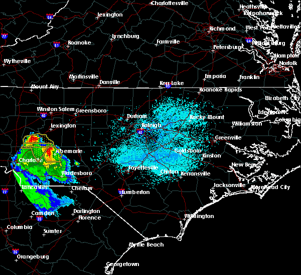 At 932 pm edt, a severe thunderstorm was located near albemarle, moving east at 20 mph (radar indicated). Hazards include 60 mph wind gusts and nickel size hail. Expect damage to roofs, siding, and trees. Locations impacted include, albemarle, badin lake, plyler, badin, richfield, new london, morrow mountain state park and lake tillery. At 932 pm edt, a severe thunderstorm was located near albemarle, moving east at 20 mph (radar indicated). Hazards include 60 mph wind gusts and nickel size hail. Expect damage to roofs, siding, and trees. Locations impacted include, albemarle, badin lake, plyler, badin, richfield, new london, morrow mountain state park and lake tillery.
|
| 3/21/2017 9:24 PM EDT |
 At 922 pm edt, a severe thunderstorm was located between richfield and mount pleasant, or about 9 miles northwest of albemarle, moving east at 30 mph (radar indicated). Hazards include quarter size hail. Damage to vehicles is expected. Locations impacted include, albemarle, badin lake, plyler, badin, richfield, new london, morrow mountain state park, finger and lake tillery. At 922 pm edt, a severe thunderstorm was located between richfield and mount pleasant, or about 9 miles northwest of albemarle, moving east at 30 mph (radar indicated). Hazards include quarter size hail. Damage to vehicles is expected. Locations impacted include, albemarle, badin lake, plyler, badin, richfield, new london, morrow mountain state park, finger and lake tillery.
|
| 3/21/2017 9:15 PM EDT |
 At 911 pm edt, a severe thunderstorm was located 8 miles west of richfield, moving east at 30 mph. the other storm near oakboro has weakened to below severe limits, though wind gusts as high as 45 mph will remain possible with that storm (radar indicated). Hazards include quarter size hail. Damage to vehicles is expected. Locations impacted include, richfield, plyer, and new london. At 911 pm edt, a severe thunderstorm was located 8 miles west of richfield, moving east at 30 mph. the other storm near oakboro has weakened to below severe limits, though wind gusts as high as 45 mph will remain possible with that storm (radar indicated). Hazards include quarter size hail. Damage to vehicles is expected. Locations impacted include, richfield, plyer, and new london.
|
| 3/21/2017 8:59 PM EDT |
 At 858 pm edt, a pair of severe thunderstorms were located along a line extending from 2 miles east of concord to near stanfield and locust, moving east at 25 mph (radar indicated). Hazards include quarter size hail. Damage to vehicles is expected. Locations impacted include, albemarle, badin lake, plyler, locust, norwood, badin, oakboro, stanfield, richfield and new london. At 858 pm edt, a pair of severe thunderstorms were located along a line extending from 2 miles east of concord to near stanfield and locust, moving east at 25 mph (radar indicated). Hazards include quarter size hail. Damage to vehicles is expected. Locations impacted include, albemarle, badin lake, plyler, locust, norwood, badin, oakboro, stanfield, richfield and new london.
|
| 3/1/2017 7:11 PM EST |
 At 711 pm est, a severe thunderstorm was located near rockwell, or 11 miles northwest of albemarle, moving east at 55 mph (radar indicated). Hazards include 60 mph wind gusts and quarter size hail. Hail damage to vehicles is expected. Expect wind damage to roofs, siding, and trees. At 711 pm est, a severe thunderstorm was located near rockwell, or 11 miles northwest of albemarle, moving east at 55 mph (radar indicated). Hazards include 60 mph wind gusts and quarter size hail. Hail damage to vehicles is expected. Expect wind damage to roofs, siding, and trees.
|
| 11/30/2016 7:25 PM EST |
 At 724 pm est, severe thunderstorms were located along a line extending from near badin lake to near wadesboro to 9 miles east of kershaw, moving northeast at 60 mph (radar indicated). Hazards include 60 mph wind gusts. Expect damage to roofs. siding. and trees. Locations impacted include, albemarle, rockingham, wadesboro, troy, badin lake, hamlet, biscoe, ansonville andhoffman. At 724 pm est, severe thunderstorms were located along a line extending from near badin lake to near wadesboro to 9 miles east of kershaw, moving northeast at 60 mph (radar indicated). Hazards include 60 mph wind gusts. Expect damage to roofs. siding. and trees. Locations impacted include, albemarle, rockingham, wadesboro, troy, badin lake, hamlet, biscoe, ansonville andhoffman.
|
| 11/30/2016 6:54 PM EST |
 At 650 pm est, severe thunderstorms were located along a line extending from just east of charlotte to 7 miles south of mineral springs to 12 miles south of great falls, moving northeast at 55 mph (radar indicated). Hazards include 60 mph wind gusts. Expect damage to roofs. siding. And trees. At 650 pm est, severe thunderstorms were located along a line extending from just east of charlotte to 7 miles south of mineral springs to 12 miles south of great falls, moving northeast at 55 mph (radar indicated). Hazards include 60 mph wind gusts. Expect damage to roofs. siding. And trees.
|
| 9/28/2016 7:34 PM EDT |
 At 734 pm edt, a severe thunderstorm was located near badin lake, moving northeast at 30 mph (radar indicated). Hazards include 60 mph wind gusts and quarter size hail. Hail damage to vehicles is expected. Expect wind damage to roofs, siding, and trees. At 734 pm edt, a severe thunderstorm was located near badin lake, moving northeast at 30 mph (radar indicated). Hazards include 60 mph wind gusts and quarter size hail. Hail damage to vehicles is expected. Expect wind damage to roofs, siding, and trees.
|
| 8/27/2016 5:13 PM EDT |
 At 512 pm edt, severe thunderstorms were located along a line extending from 8 miles east of wadesboro to near badin lake, moving southwest at 30 mph (radar indicated). Hazards include 60 mph wind gusts. Expect damage to roofs. siding. And trees. At 512 pm edt, severe thunderstorms were located along a line extending from 8 miles east of wadesboro to near badin lake, moving southwest at 30 mph (radar indicated). Hazards include 60 mph wind gusts. Expect damage to roofs. siding. And trees.
|
| 8/27/2016 5:07 PM EDT |
 At 507 pm edt, severe thunderstorms were located along a line extending from near ansonville to near albemarle, moving southwest at 20 mph (radar indicated). Hazards include 60 mph wind gusts. Expect damage to roofs. siding. and trees. Locations impacted include, albemarle, badin lake, norwood, badin, mount gilead, richfield, new london, fish tales marina, morrow mountain state park and pinehaven marina. At 507 pm edt, severe thunderstorms were located along a line extending from near ansonville to near albemarle, moving southwest at 20 mph (radar indicated). Hazards include 60 mph wind gusts. Expect damage to roofs. siding. and trees. Locations impacted include, albemarle, badin lake, norwood, badin, mount gilead, richfield, new london, fish tales marina, morrow mountain state park and pinehaven marina.
|
| 8/27/2016 4:32 PM EDT |
 At 431 pm edt, a severe thunderstorm was located over troy, moving west at 10 mph (radar indicated). Hazards include 60 mph wind gusts and penny size hail. Expect damage to roofs. siding. And trees. At 431 pm edt, a severe thunderstorm was located over troy, moving west at 10 mph (radar indicated). Hazards include 60 mph wind gusts and penny size hail. Expect damage to roofs. siding. And trees.
|
| 7/16/2016 7:03 PM EDT |
 At 702 pm edt, severe thunderstorms were located along a line extending from badin lake to 8 miles southwest of troy to near sturdivants, moving east at 40 mph (radar indicated). Hazards include 60 mph wind gusts. Expect damage to roofs. siding. and trees. Locations impacted include, albemarle, rockingham, wadesboro, troy, badin lake, biscoe, ansonville, polkton, norwood and badin. At 702 pm edt, severe thunderstorms were located along a line extending from badin lake to 8 miles southwest of troy to near sturdivants, moving east at 40 mph (radar indicated). Hazards include 60 mph wind gusts. Expect damage to roofs. siding. and trees. Locations impacted include, albemarle, rockingham, wadesboro, troy, badin lake, biscoe, ansonville, polkton, norwood and badin.
|
| 7/16/2016 6:40 PM EDT |
 At 640 pm edt, severe thunderstorms were located along a line extending from near plyler to 12 miles northwest of ansonville to near wingate, moving east at 30 mph (radar indicated). Hazards include 60 mph wind gusts. Expect damage to roofs. siding. And trees. At 640 pm edt, severe thunderstorms were located along a line extending from near plyler to 12 miles northwest of ansonville to near wingate, moving east at 30 mph (radar indicated). Hazards include 60 mph wind gusts. Expect damage to roofs. siding. And trees.
|
| 7/11/2016 6:47 PM EDT |
 At 646 pm edt, a severe thunderstorm was located near badin lake, moving east at 25 mph (radar indicated). Hazards include 60 mph wind gusts and quarter size hail. Hail damage to vehicles is expected. expect wind damage to roofs, siding, and trees. Locations impacted include, asheboro, albemarle, troy, badin lake, north carolina zoo, biscoe, seagrove, plyler, badin and denton. At 646 pm edt, a severe thunderstorm was located near badin lake, moving east at 25 mph (radar indicated). Hazards include 60 mph wind gusts and quarter size hail. Hail damage to vehicles is expected. expect wind damage to roofs, siding, and trees. Locations impacted include, asheboro, albemarle, troy, badin lake, north carolina zoo, biscoe, seagrove, plyler, badin and denton.
|
| 7/11/2016 6:31 PM EDT |
 At 631 pm edt, a severe thunderstorm was located near plyler, or 7 miles northwest of albemarle, moving east at 25 mph (radar indicated). Hazards include 60 mph wind gusts and quarter size hail. Hail damage to vehicles is expected. Expect wind damage to roofs, siding, and trees. At 631 pm edt, a severe thunderstorm was located near plyler, or 7 miles northwest of albemarle, moving east at 25 mph (radar indicated). Hazards include 60 mph wind gusts and quarter size hail. Hail damage to vehicles is expected. Expect wind damage to roofs, siding, and trees.
|
| 7/11/2016 6:27 PM EDT | The severe thunderstorm warning for stanly and northwestern anson counties will expire at 630 pm edt, the storms which prompted the warning have weakened below severe limits, and no longer pose an immediate threat to life or property. therefore the warning will be allowed to expire. however small hail, gusty winds and heavy rain are still possible with these thunderstorms. |
| 7/11/2016 6:16 PM EDT |
 At 616 pm edt, severe thunderstorms were located along a line extending from near midland to 7 miles east of sturdivants, moving east at 25 mph (radar indicated). Hazards include 60 mph wind gusts and quarter size hail. Hail damage to vehicles is expected. expect wind damage to roofs, siding, and trees. Locations impacted include, albemarle, badin lake, ansonville, plyler, locust, norwood, badin, oakboro, stanfield and richfield. At 616 pm edt, severe thunderstorms were located along a line extending from near midland to 7 miles east of sturdivants, moving east at 25 mph (radar indicated). Hazards include 60 mph wind gusts and quarter size hail. Hail damage to vehicles is expected. expect wind damage to roofs, siding, and trees. Locations impacted include, albemarle, badin lake, ansonville, plyler, locust, norwood, badin, oakboro, stanfield and richfield.
|
| 7/11/2016 6:06 PM EDT |
 At 606 pm edt, severe thunderstorms were located along a line extending from near midland to near sturdivants, moving east at 25 mph (radar indicated). Hazards include 60 mph wind gusts and quarter size hail. Hail damage to vehicles is expected. expect wind damage to roofs, siding, and trees. Locations impacted include, albemarle, wadesboro, badin lake, ansonville, plyler, midland, polkton, locust, norwood and badin. At 606 pm edt, severe thunderstorms were located along a line extending from near midland to near sturdivants, moving east at 25 mph (radar indicated). Hazards include 60 mph wind gusts and quarter size hail. Hail damage to vehicles is expected. expect wind damage to roofs, siding, and trees. Locations impacted include, albemarle, wadesboro, badin lake, ansonville, plyler, midland, polkton, locust, norwood and badin.
|
| 7/11/2016 5:49 PM EDT |
 At 548 pm edt, severe thunderstorms were located along a line extending from near reedy creek park to near sturdivants, moving east at 25 mph (radar indicated). Hazards include 60 mph wind gusts and quarter size hail. Hail damage to vehicles is expected. Expect wind damage to roofs, siding, and trees. At 548 pm edt, severe thunderstorms were located along a line extending from near reedy creek park to near sturdivants, moving east at 25 mph (radar indicated). Hazards include 60 mph wind gusts and quarter size hail. Hail damage to vehicles is expected. Expect wind damage to roofs, siding, and trees.
|
| 7/8/2016 9:30 PM EDT |
 At 930 pm edt, severe thunderstorms were located along a line extending from 10 miles west of goldston to 9 miles southwest of troy, moving southeast at 35 mph (radar indicated). Hazards include 60 mph wind gusts and quarter size hail. Hail damage to vehicles is expected. expect wind damage to roofs, siding, and trees. locations impacted include, albemarle, troy, siler city, badin lake, biscoe, goldston, plyler, locust, norwood and badin. A severe thunderstorm watch remains in effect until midnight edt for central north carolina. At 930 pm edt, severe thunderstorms were located along a line extending from 10 miles west of goldston to 9 miles southwest of troy, moving southeast at 35 mph (radar indicated). Hazards include 60 mph wind gusts and quarter size hail. Hail damage to vehicles is expected. expect wind damage to roofs, siding, and trees. locations impacted include, albemarle, troy, siler city, badin lake, biscoe, goldston, plyler, locust, norwood and badin. A severe thunderstorm watch remains in effect until midnight edt for central north carolina.
|
| 7/8/2016 8:39 PM EDT |
 At 838 pm edt, severe thunderstorms were located along a line extending from near randleman to 6 miles southeast of high rock lake, moving southeast at 55 mph (radar indicated). Hazards include 60 mph wind gusts and quarter size hail. Hail damage to vehicles is expected. Expect wind damage to roofs, siding, and trees. At 838 pm edt, severe thunderstorms were located along a line extending from near randleman to 6 miles southeast of high rock lake, moving southeast at 55 mph (radar indicated). Hazards include 60 mph wind gusts and quarter size hail. Hail damage to vehicles is expected. Expect wind damage to roofs, siding, and trees.
|
| 7/5/2016 4:56 PM EDT |
 At 455 pm edt, severe thunderstorms were located along a line extending from near winston-salem to 10 miles east of high rock lake to near plyler, moving east at 40 mph (radar indicated). Hazards include 60 mph wind gusts. Expect damage to roofs. siding. and trees. locations impacted include, winston-salem, lexington, albemarle, badin lake, thomasville, kernersville, plyler, walkertown, badin and denton. A severe thunderstorm watch remains in effect until 1000 pm edt for central north carolina. At 455 pm edt, severe thunderstorms were located along a line extending from near winston-salem to 10 miles east of high rock lake to near plyler, moving east at 40 mph (radar indicated). Hazards include 60 mph wind gusts. Expect damage to roofs. siding. and trees. locations impacted include, winston-salem, lexington, albemarle, badin lake, thomasville, kernersville, plyler, walkertown, badin and denton. A severe thunderstorm watch remains in effect until 1000 pm edt for central north carolina.
|
| 7/5/2016 4:41 PM EDT |
 At 440 pm edt, severe thunderstorms were located along a line extending from clemmons to near high rock lake to near mt pleasant, moving east at 45 mph (radar indicated). Hazards include 60 mph wind gusts. Expect damage to roofs. siding. and trees. Locations impacted include, winston-salem, lexington, albemarle, badin lake, thomasville, kernersville, clemmons, bermuda run, linwood and plyler. At 440 pm edt, severe thunderstorms were located along a line extending from clemmons to near high rock lake to near mt pleasant, moving east at 45 mph (radar indicated). Hazards include 60 mph wind gusts. Expect damage to roofs. siding. and trees. Locations impacted include, winston-salem, lexington, albemarle, badin lake, thomasville, kernersville, clemmons, bermuda run, linwood and plyler.
|
| 7/5/2016 4:25 PM EDT |
 At 425 pm edt, severe thunderstorms were located along a line extending from near huntsville to salisbury to near downtown concord, moving east at 40 mph (radar indicated). Hazards include 60 mph wind gusts. Expect damage to roofs. siding. And trees. At 425 pm edt, severe thunderstorms were located along a line extending from near huntsville to salisbury to near downtown concord, moving east at 40 mph (radar indicated). Hazards include 60 mph wind gusts. Expect damage to roofs. siding. And trees.
|
| 5/3/2016 8:07 PM EDT |
 At 806 pm edt, a severe thunderstorm was located over high rock lake, or 10 miles northwest of badin lake, moving east at 50 mph (radar indicated). Hazards include ping pong ball size hail. People and animals outdoors will be injured. expect damage to roofs, siding, windows, and vehicles. Locations impacted include, badin lake, plyler, badin, denton, star, richfield, new london, fish tales marina and martha. At 806 pm edt, a severe thunderstorm was located over high rock lake, or 10 miles northwest of badin lake, moving east at 50 mph (radar indicated). Hazards include ping pong ball size hail. People and animals outdoors will be injured. expect damage to roofs, siding, windows, and vehicles. Locations impacted include, badin lake, plyler, badin, denton, star, richfield, new london, fish tales marina and martha.
|
| 5/3/2016 7:39 PM EDT |
 At 738 pm edt, a severe thunderstorm was located 10 miles west of high rock lake, moving east east at 60 mph (radar indicated). Hazards include half dollar size hail. damage to vehicles is expected At 738 pm edt, a severe thunderstorm was located 10 miles west of high rock lake, moving east east at 60 mph (radar indicated). Hazards include half dollar size hail. damage to vehicles is expected
|
| 2/24/2016 2:25 PM EST |
 At 224 pm est, doppler radar indicated a line of severe thunderstorms capable of producing damaging winds up to 60 mph. these storms were located along a line extending from 9 miles northeast of badin lake to 6 miles east of pageland, and moving east at 20 mph. At 224 pm est, doppler radar indicated a line of severe thunderstorms capable of producing damaging winds up to 60 mph. these storms were located along a line extending from 9 miles northeast of badin lake to 6 miles east of pageland, and moving east at 20 mph.
|
| 2/24/2016 2:02 PM EST |
 At 202 pm est, doppler radar continued to indicate a line of severe thunderstorms capable of producing damaging winds in excess of 58 mph. these storms were located along a line extending from near badin lake to 6 miles southeast of sturdivants, moving northeast at 20 mph. locations impacted include, albemarle, wadesboro, troy, badin lake, biscoe, ansonville, plyler, midland, polkton and locust. a tornado watch remains in effect until 700 pm est for central north carolina. At 202 pm est, doppler radar continued to indicate a line of severe thunderstorms capable of producing damaging winds in excess of 58 mph. these storms were located along a line extending from near badin lake to 6 miles southeast of sturdivants, moving northeast at 20 mph. locations impacted include, albemarle, wadesboro, troy, badin lake, biscoe, ansonville, plyler, midland, polkton and locust. a tornado watch remains in effect until 700 pm est for central north carolina.
|
| 2/24/2016 1:43 PM EST |
 At 143 pm est, doppler radar indicated a line of severe thunderstorms capable of producing damaging winds in excess of 58 mph. these storms were located along a line extending from 8 miles east of high rock lake to 6 miles south of wingate, and moving northeast at 105 mph. At 143 pm est, doppler radar indicated a line of severe thunderstorms capable of producing damaging winds in excess of 58 mph. these storms were located along a line extending from 8 miles east of high rock lake to 6 miles south of wingate, and moving northeast at 105 mph.
|
| 2/3/2016 1:15 PM EST |
 At 114 pm est, doppler radar indicated a severe thunderstorm capable of producing damaging winds in excess of 58 mph. this storm was located 7 miles north of badin lake, and moving northeast at 45 mph. At 114 pm est, doppler radar indicated a severe thunderstorm capable of producing damaging winds in excess of 58 mph. this storm was located 7 miles north of badin lake, and moving northeast at 45 mph.
|
| 7/23/2015 6:01 PM EDT |
 At 559 pm edt, doppler radar continued to indicate a severe thunderstorm capable of producing quarter size hail and damaging winds in excess of 58 mph. this storm was located near mt pleasant, or 11 miles west of albemarle, moving northeast at 15 mph. locations impacted include, finger, badin lake, plyler, badin, richfield and new london. At 559 pm edt, doppler radar continued to indicate a severe thunderstorm capable of producing quarter size hail and damaging winds in excess of 58 mph. this storm was located near mt pleasant, or 11 miles west of albemarle, moving northeast at 15 mph. locations impacted include, finger, badin lake, plyler, badin, richfield and new london.
|
| 7/23/2015 5:41 PM EDT |
 At 540 pm edt, doppler radar indicated a severe thunderstorm capable of producing quarter size hail and damaging winds in excess of 58 mph. this storm was located near midland, or 12 miles southeast of downtown concord, and moving northeast at 15 mph. At 540 pm edt, doppler radar indicated a severe thunderstorm capable of producing quarter size hail and damaging winds in excess of 58 mph. this storm was located near midland, or 12 miles southeast of downtown concord, and moving northeast at 15 mph.
|
| 7/13/2015 9:08 PM EDT |
 At 908 pm edt, doppler radar indicated a line of severe thunderstorms capable of producing quarter size hail and damaging winds in excess of 58 mph. these storms were located along a line extending from faith to 6 miles north of plyler to midland, and moving east at 20 mph. At 908 pm edt, doppler radar indicated a line of severe thunderstorms capable of producing quarter size hail and damaging winds in excess of 58 mph. these storms were located along a line extending from faith to 6 miles north of plyler to midland, and moving east at 20 mph.
|
| 5/11/2015 8:07 PM EDT | At 807 pm edt, doppler radar indicated a severe thunderstorm capable of producing quarter size hail and damaging winds in excess of 58 mph. this storm was located near albemarle, moving northeast at 20 mph. locations impacted include, albemarle, badin lake, norwood, badin, richfield, new london, morrow mountain state park and lake tillery. |
| 5/11/2015 7:56 PM EDT | At 755 pm edt, doppler radar indicated a severe thunderstorm capable of producing quarter size hail and damaging winds in excess of 58 mph. this storm was located near plyler, or 7 miles southwest of albemarle, and moving northeast at 20 mph. |
| 4/20/2015 5:58 PM EDT | At 557 pm edt, doppler radar indicated a line of severe thunderstorms capable of producing quarter size hail and damaging winds in excess of 58 mph. these storms were located along a line extending from near rockwell to 6 miles southeast of mt pleasant to near midland, and moving northeast at 50 mph. |
Hail Maps for Richfield, NC
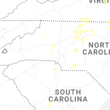
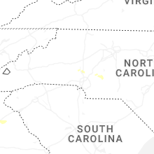
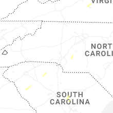


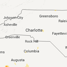


Connect with Interactive Hail Maps