

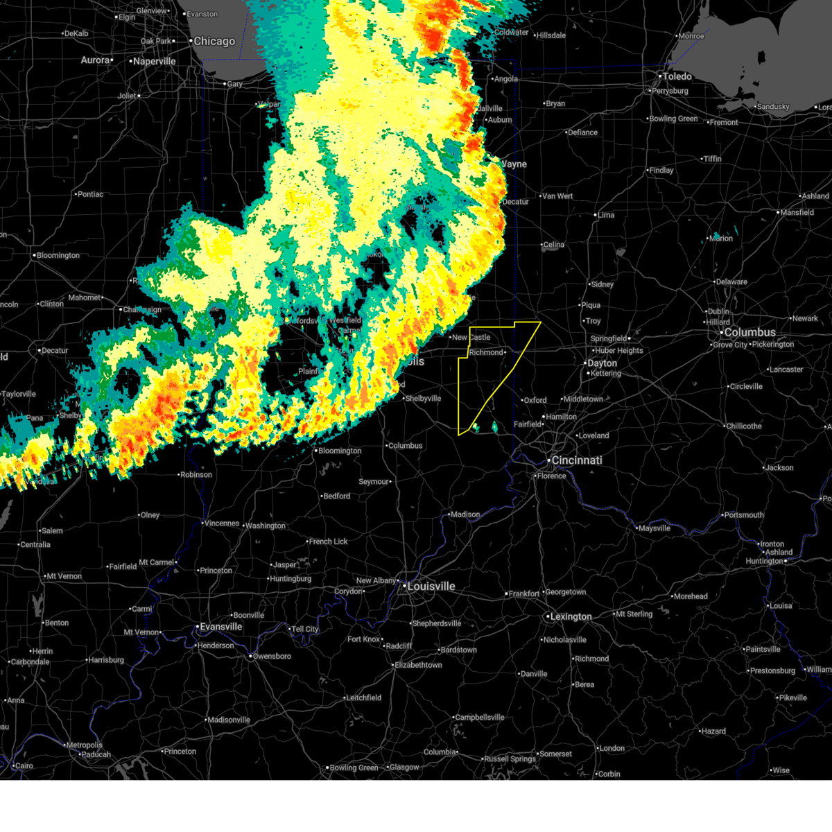
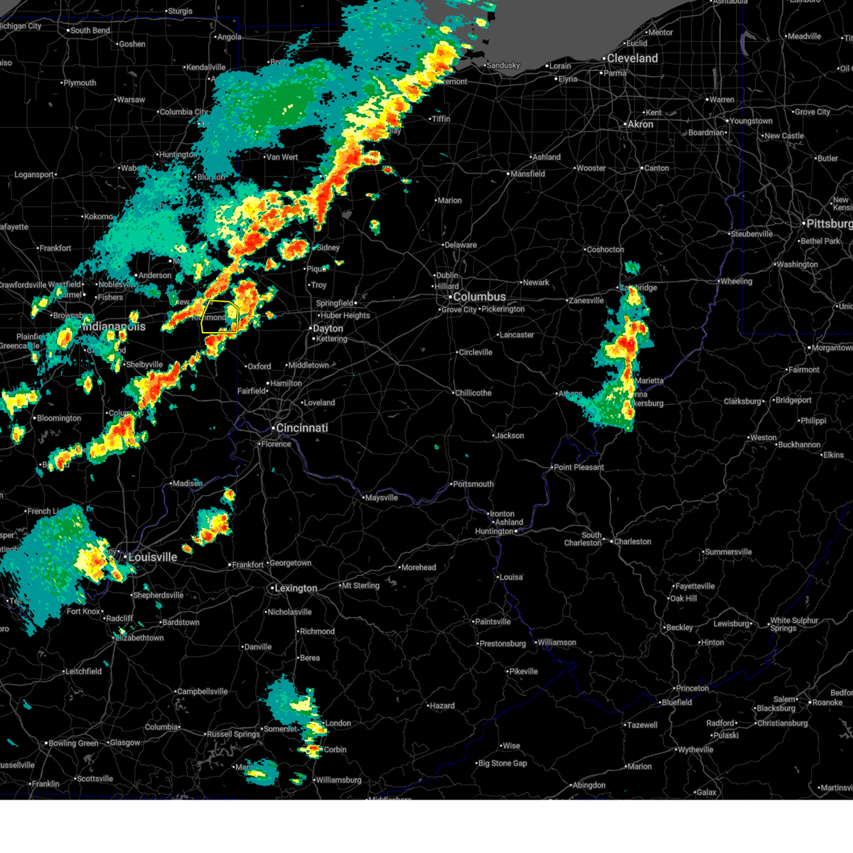
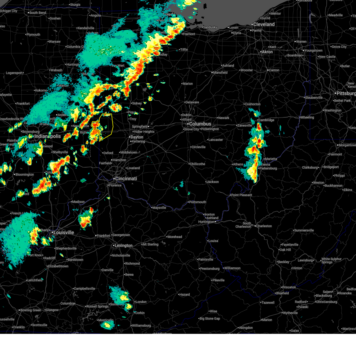
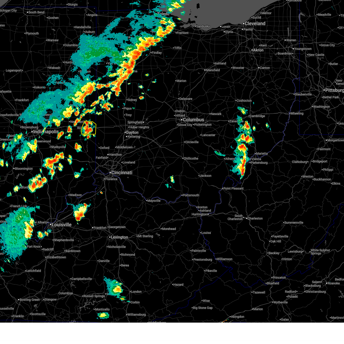
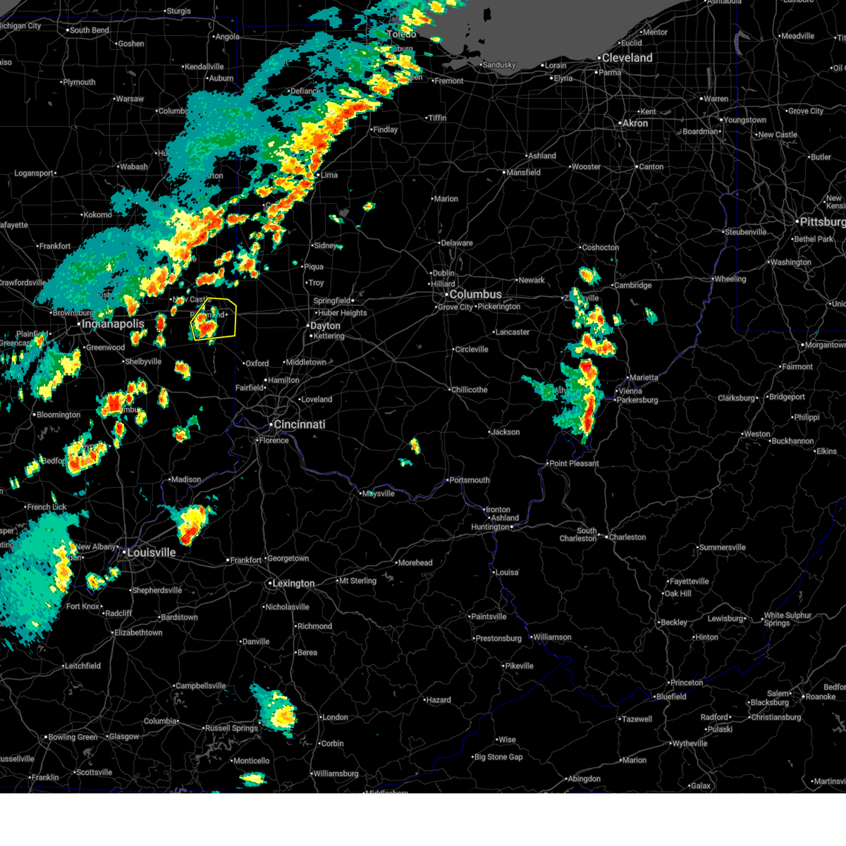
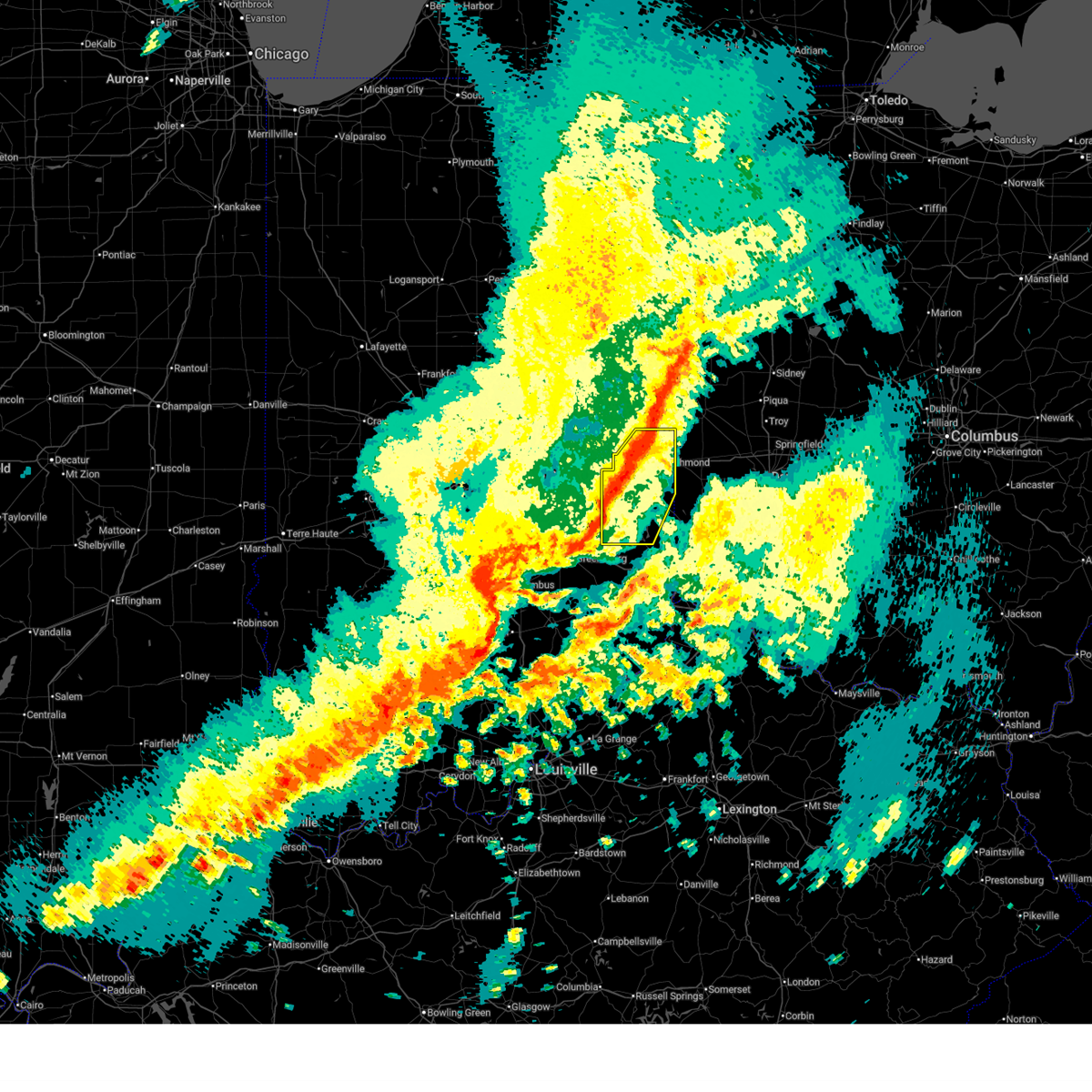
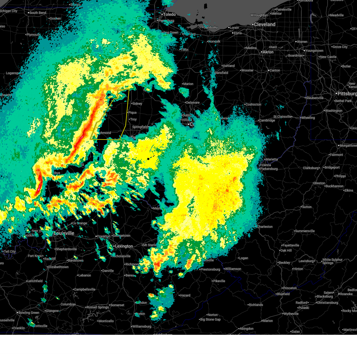
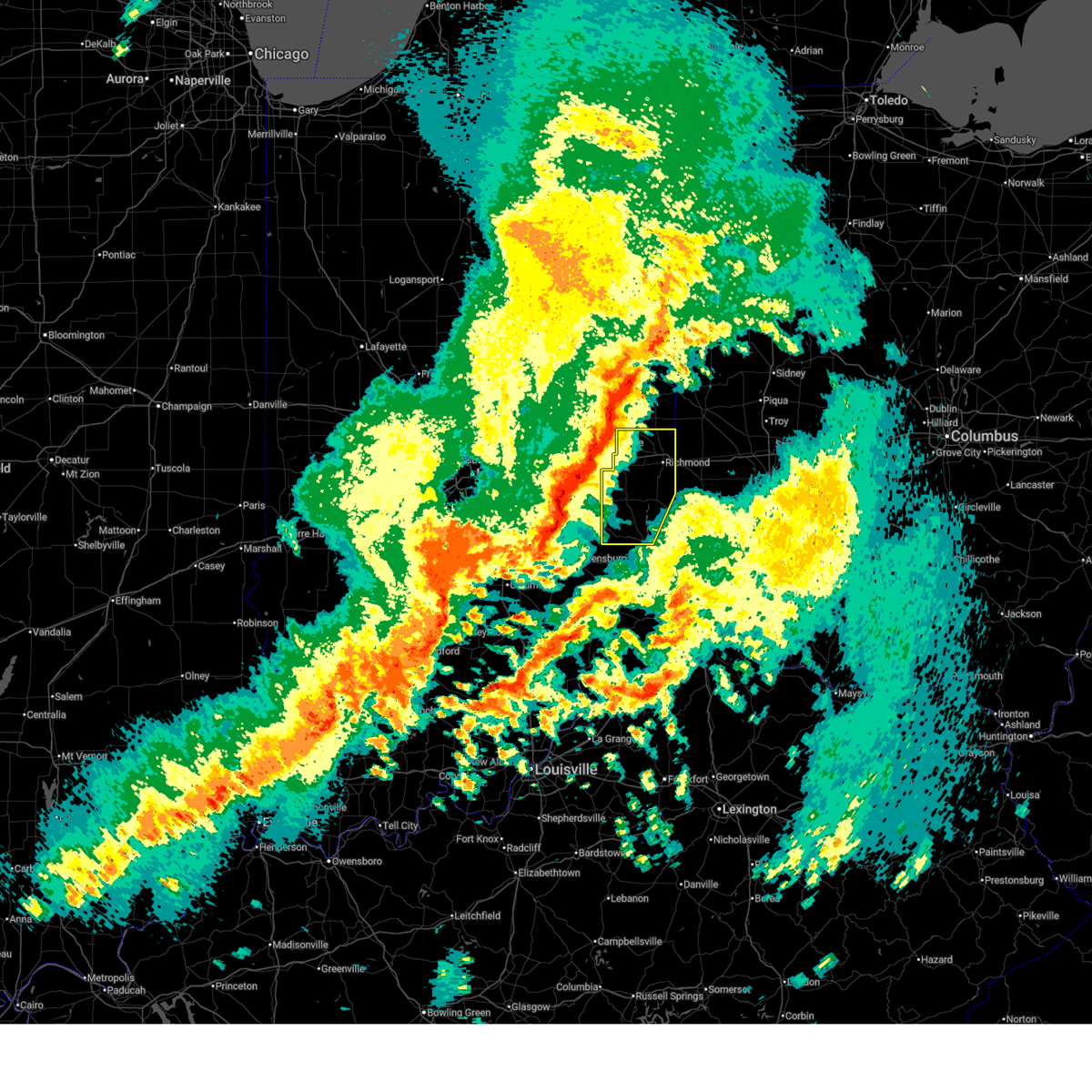
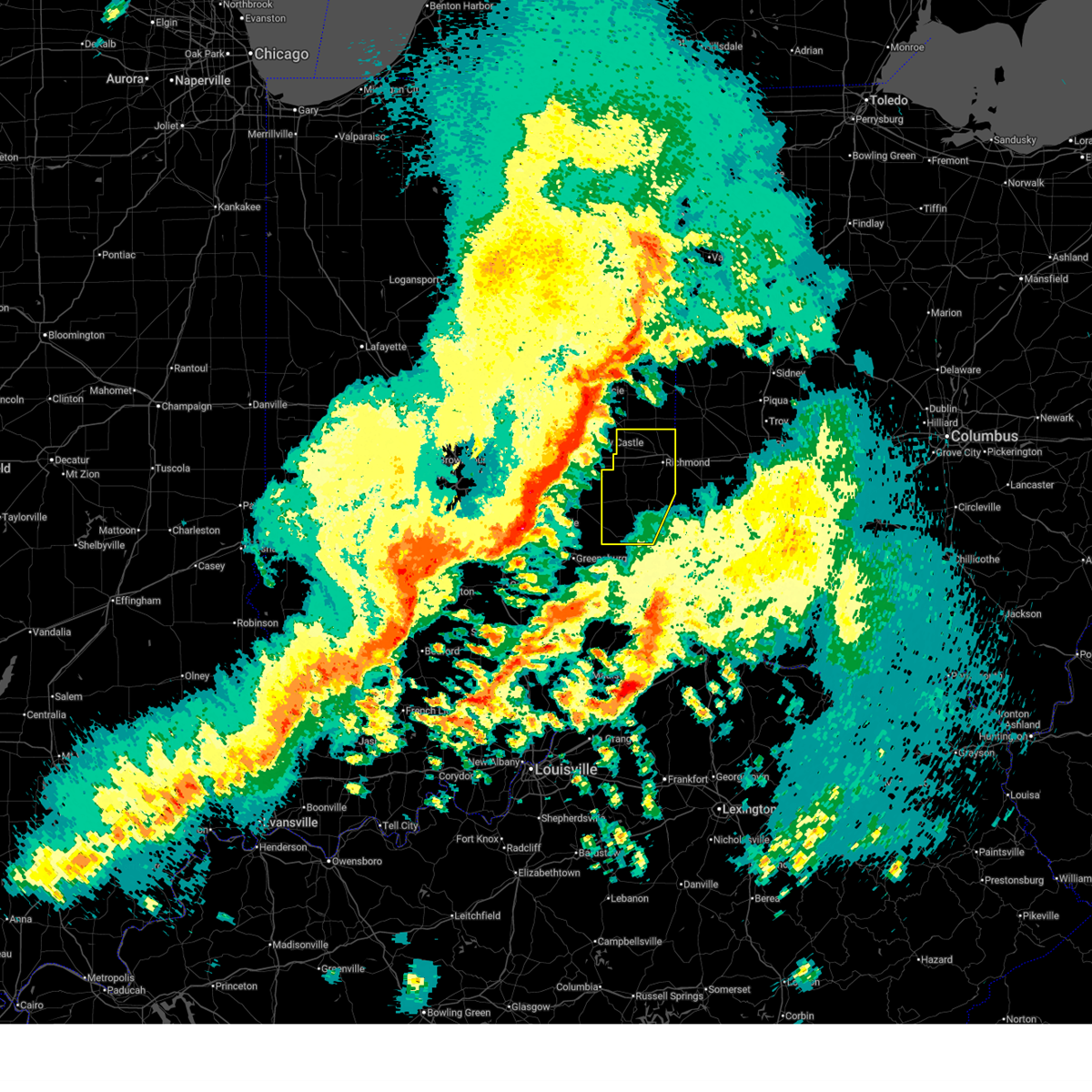
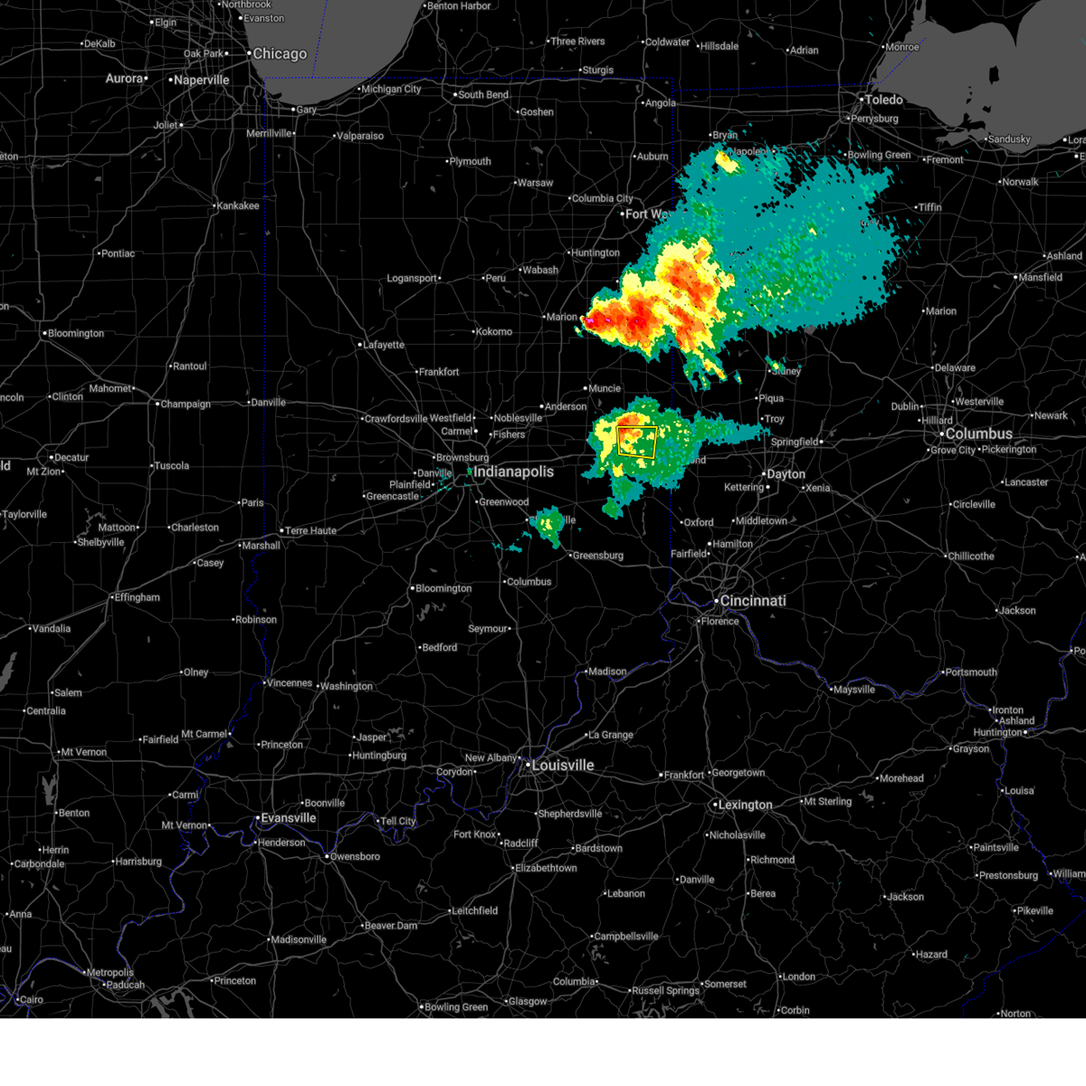
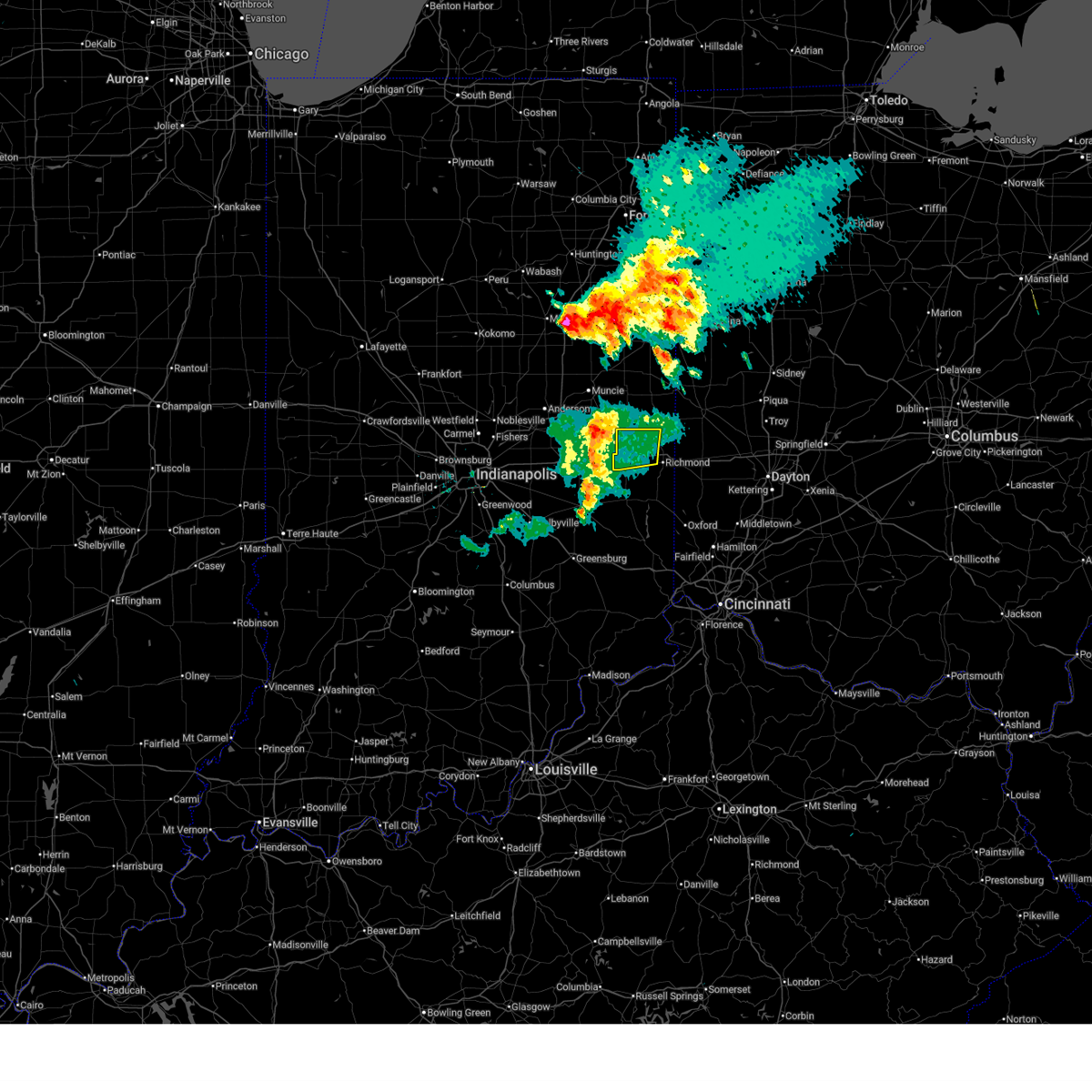
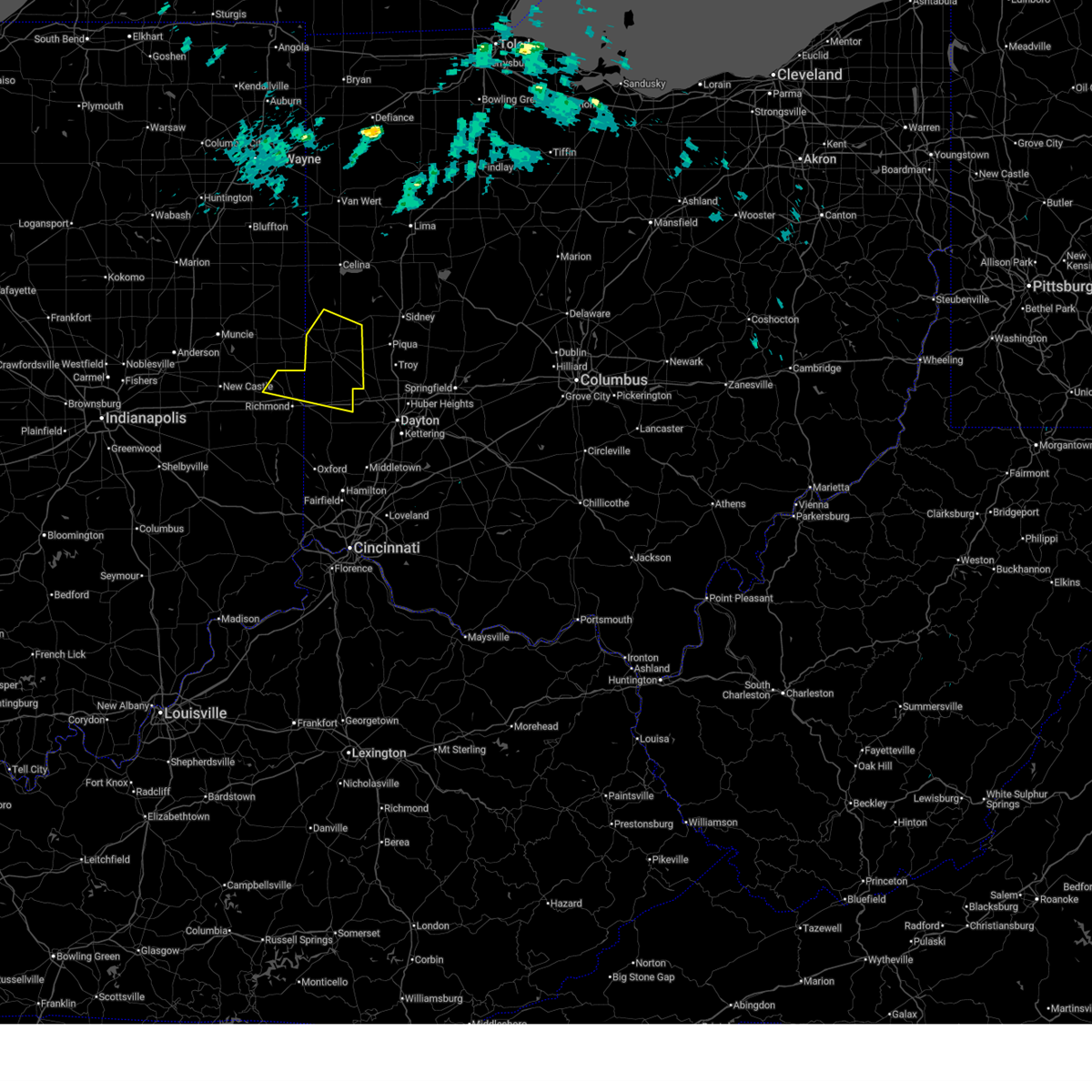
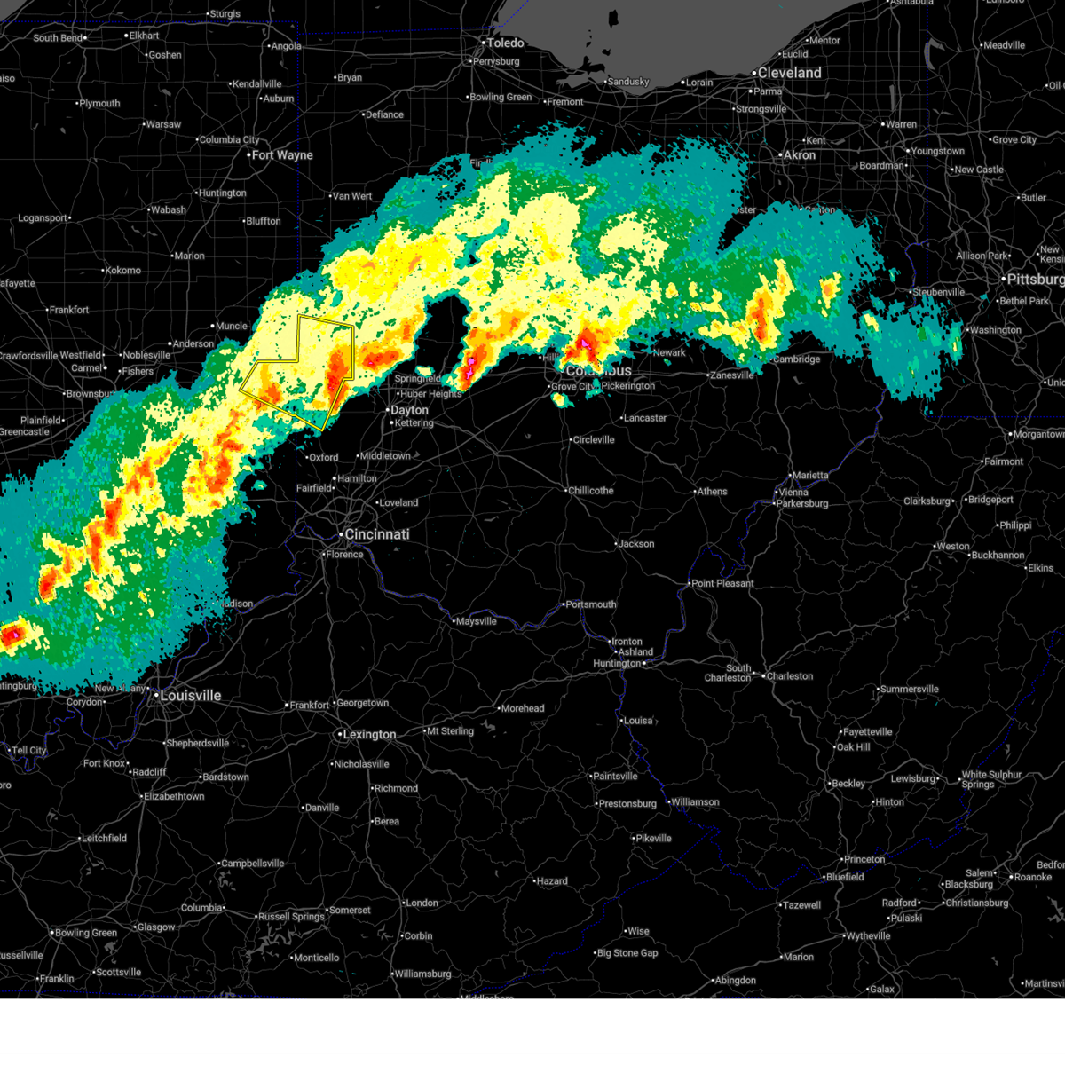
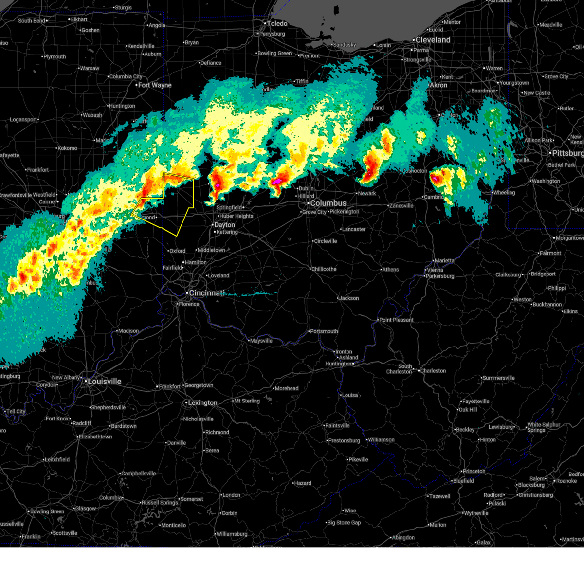
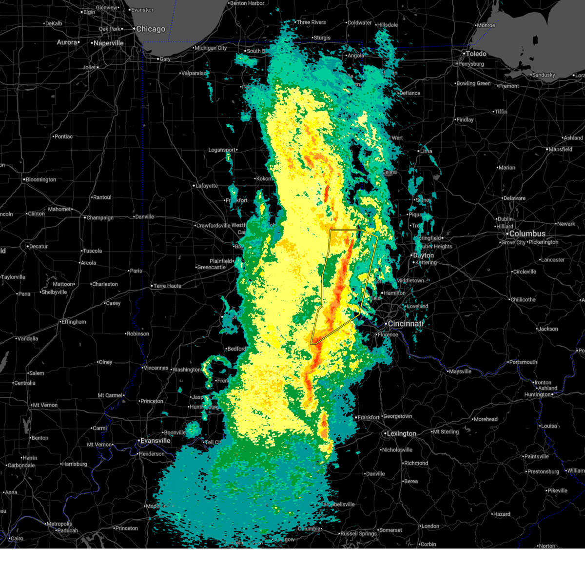
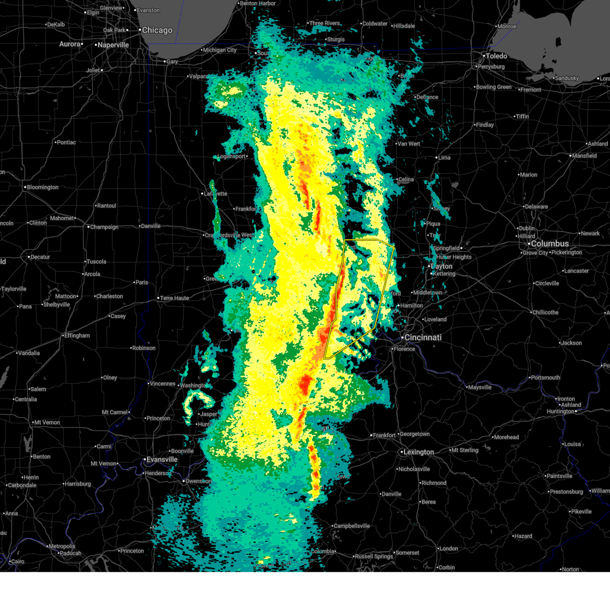
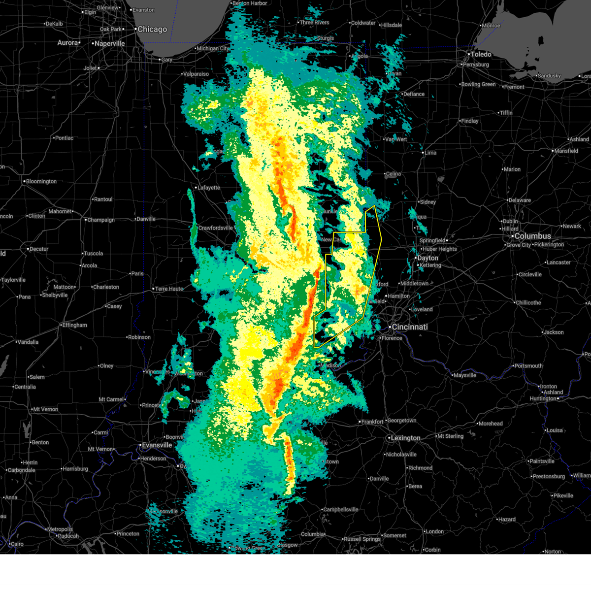
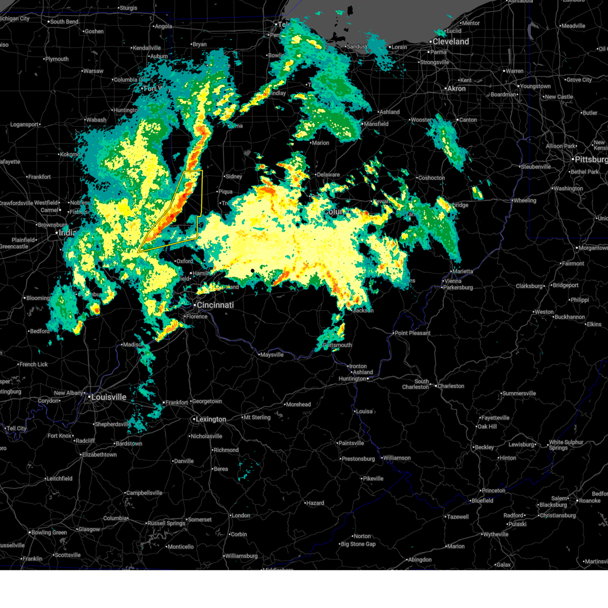
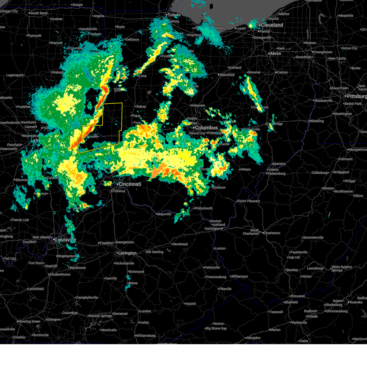
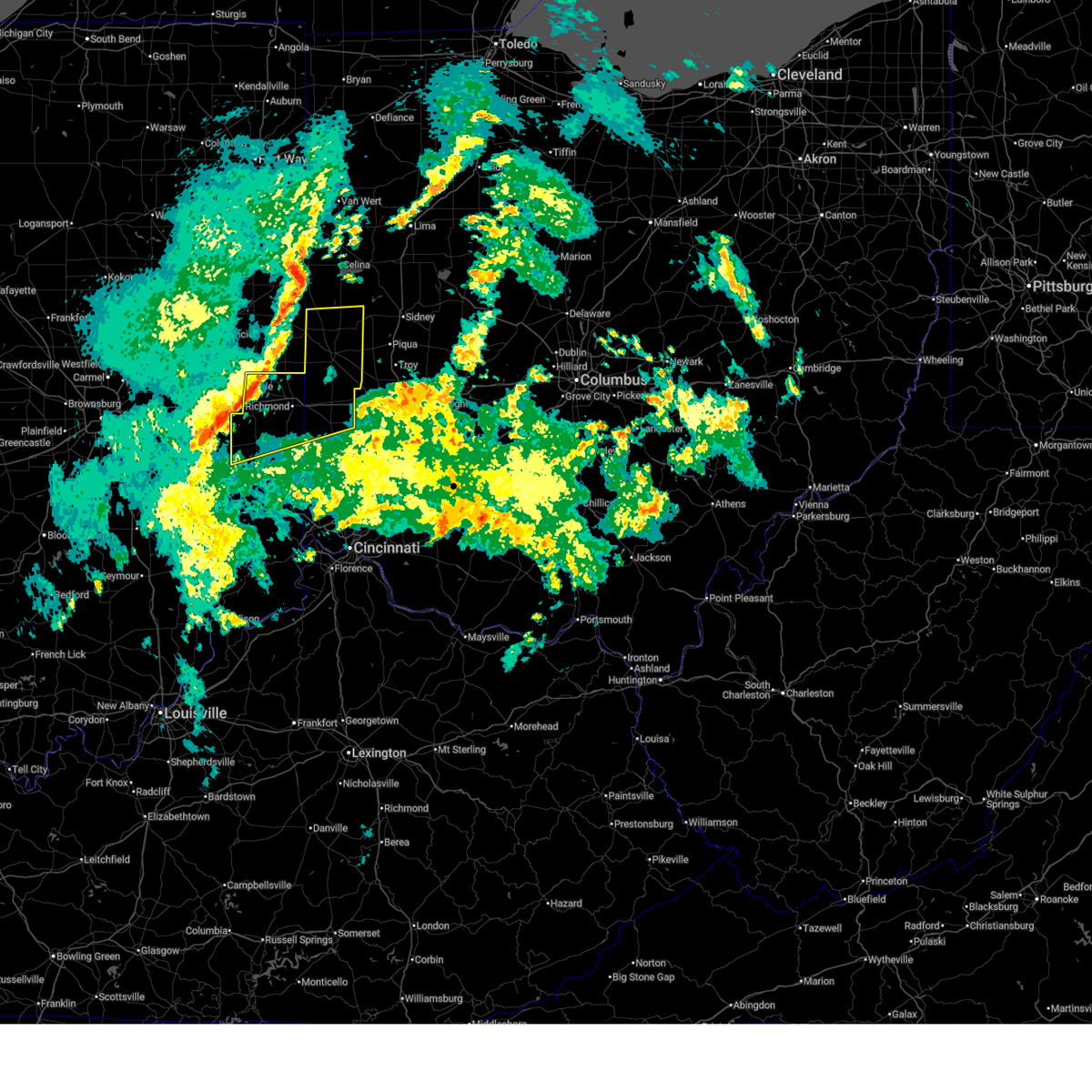
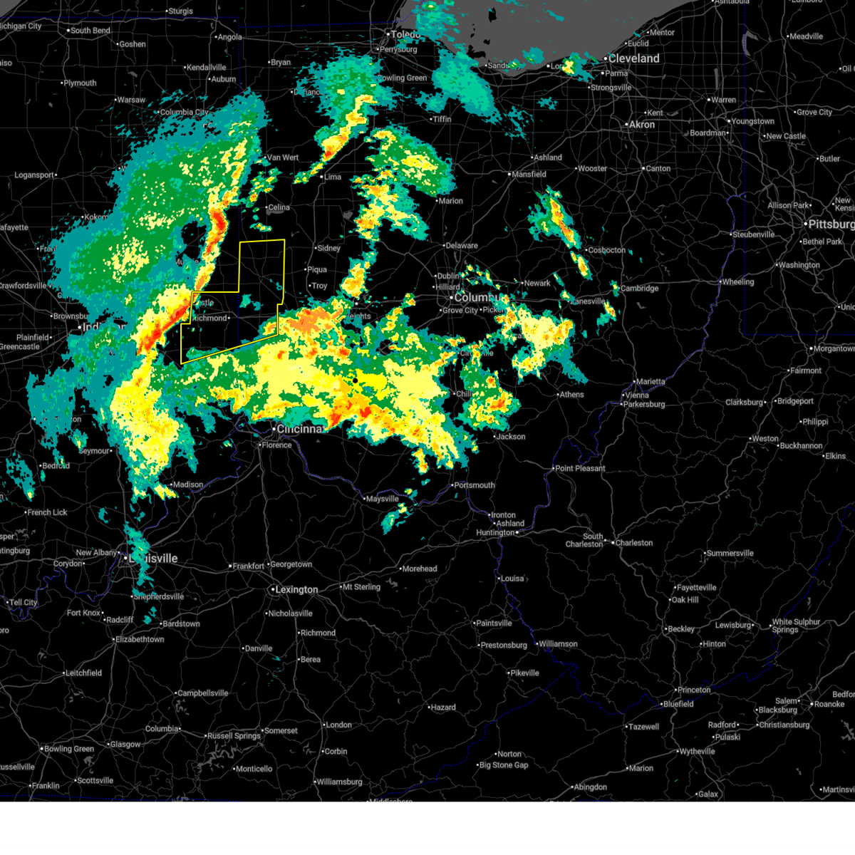
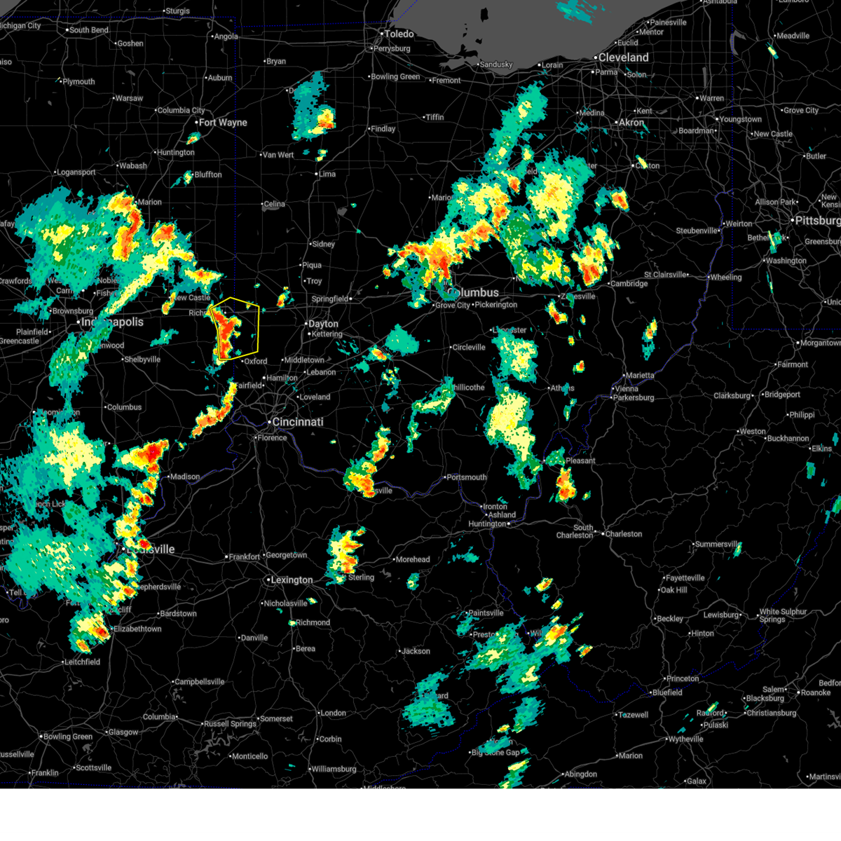
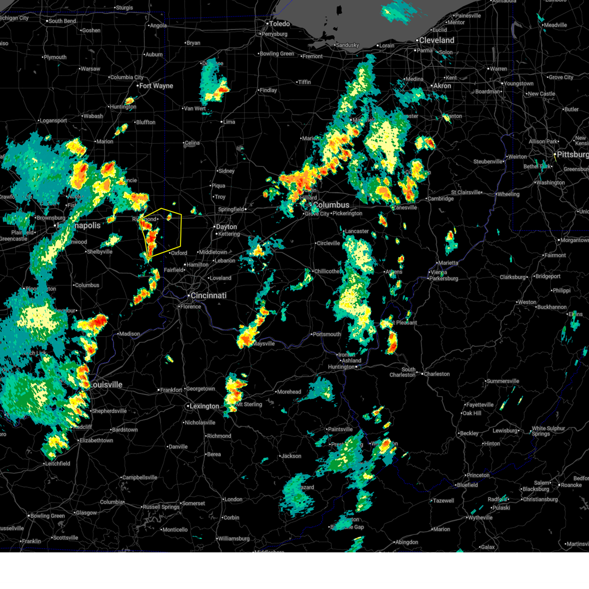
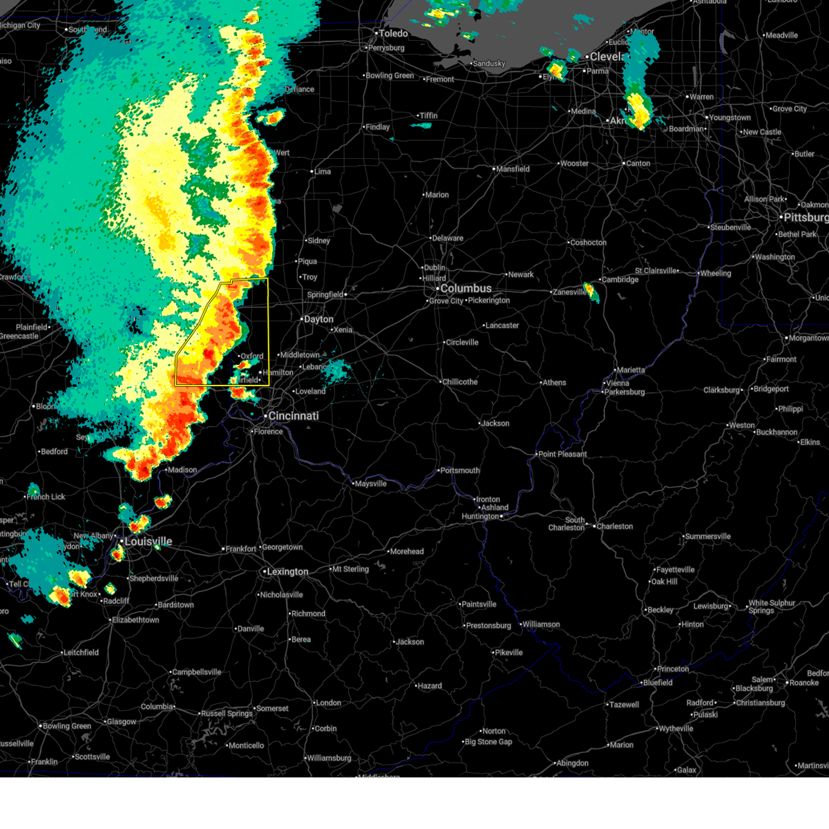
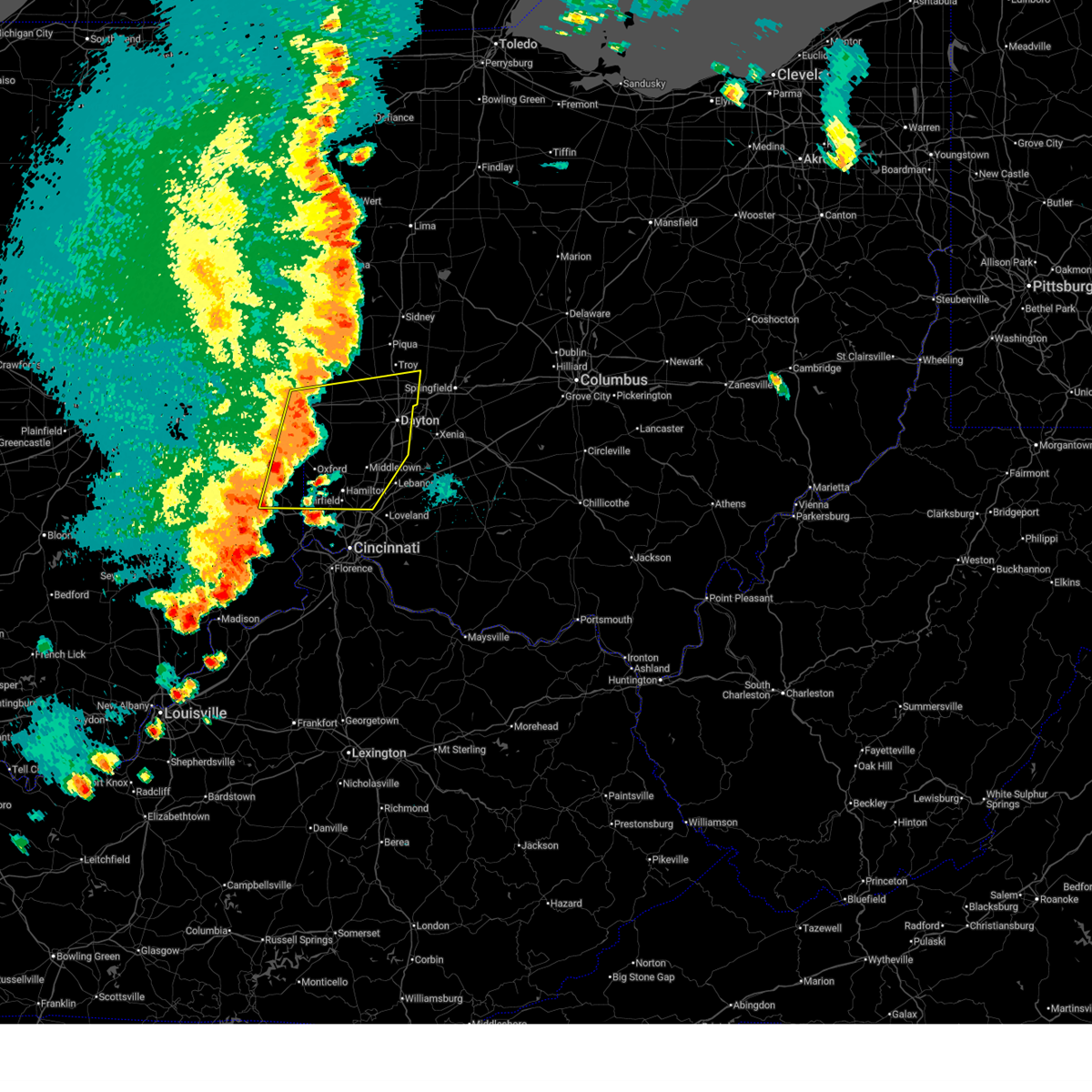
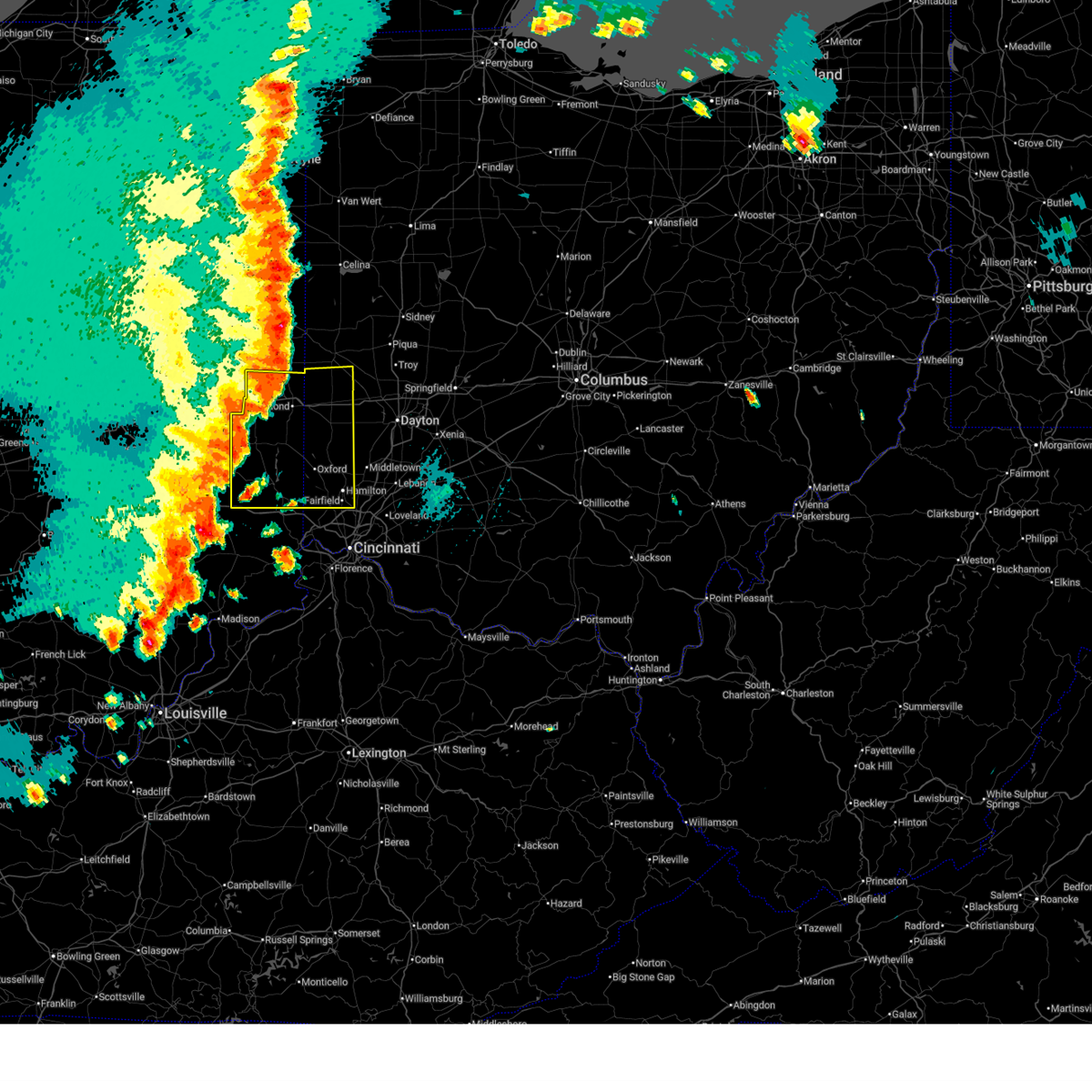
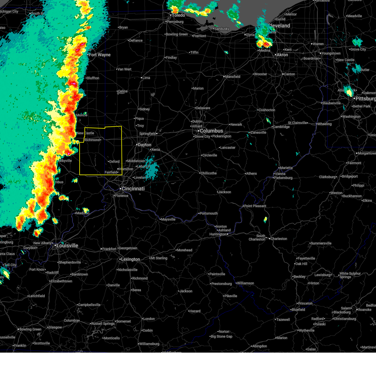
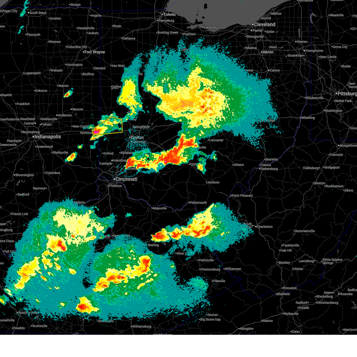
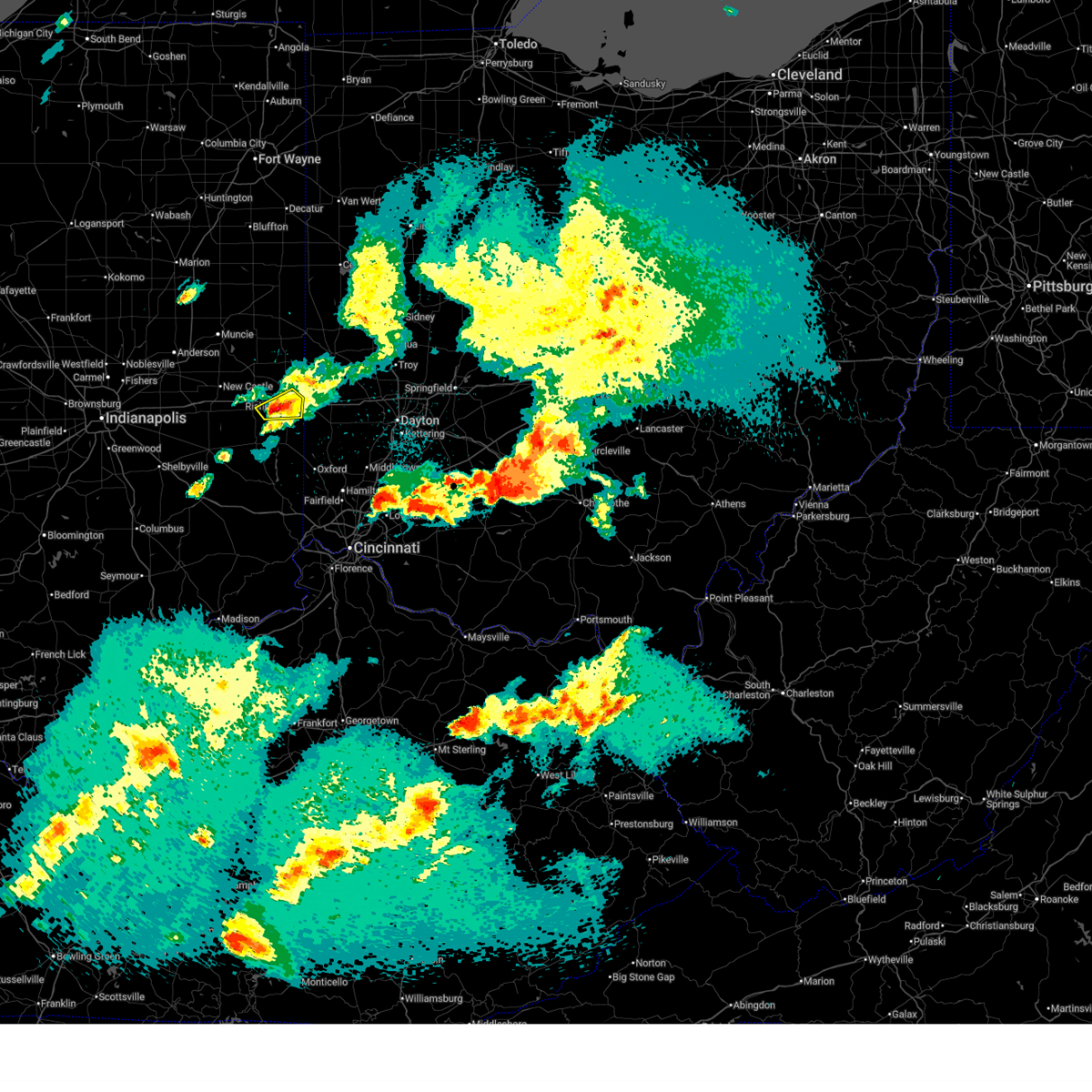
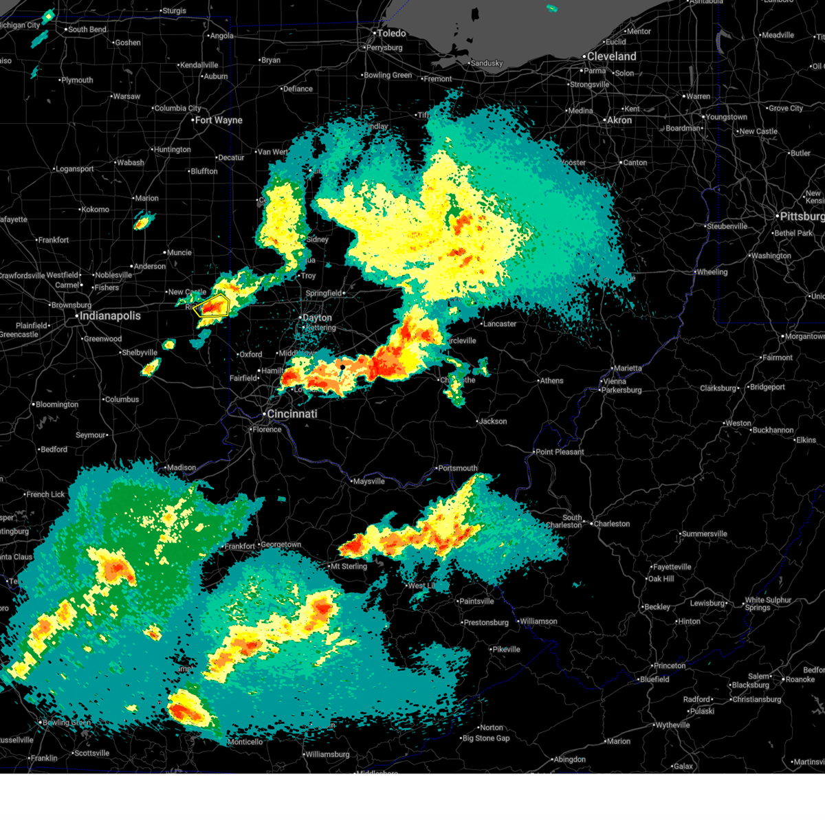
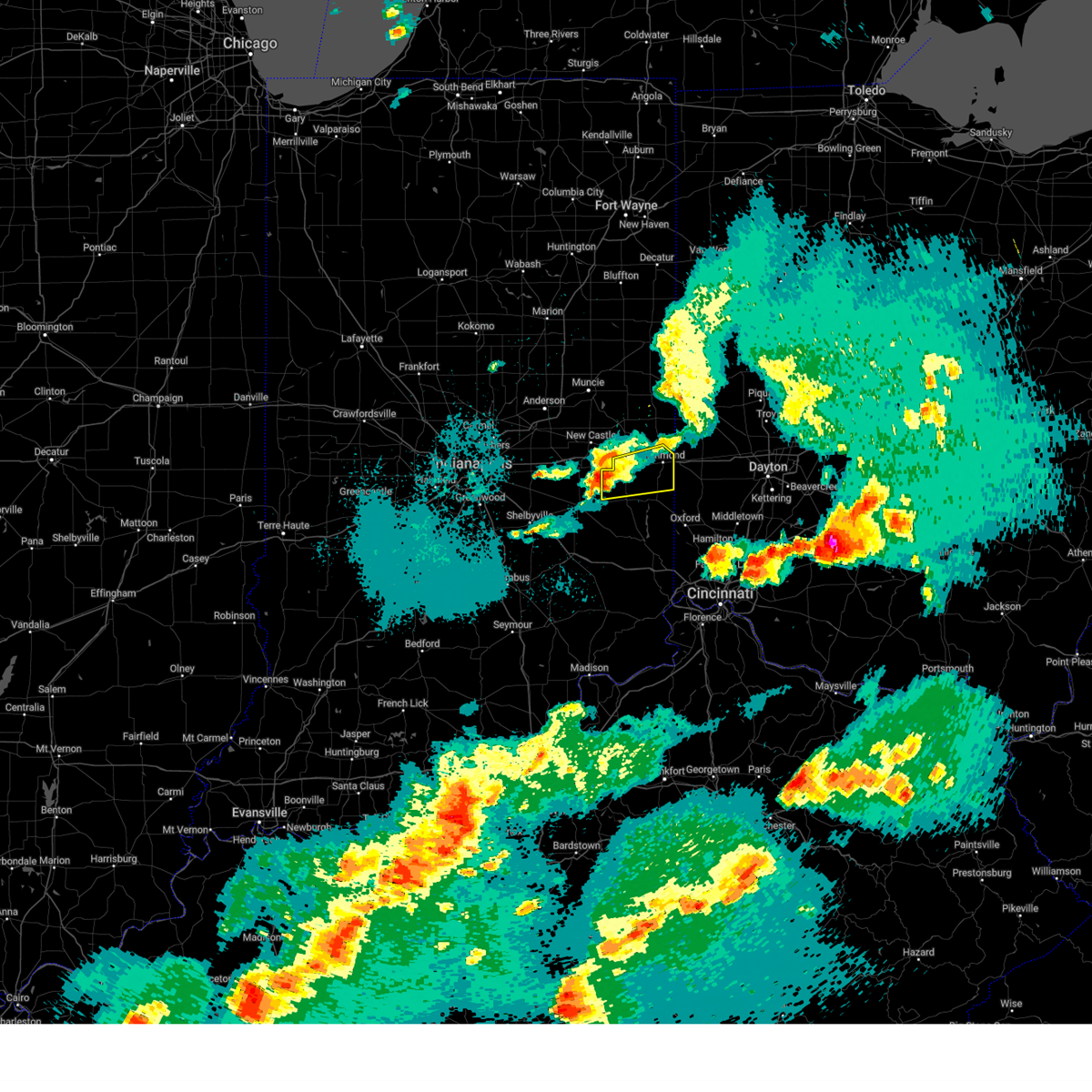
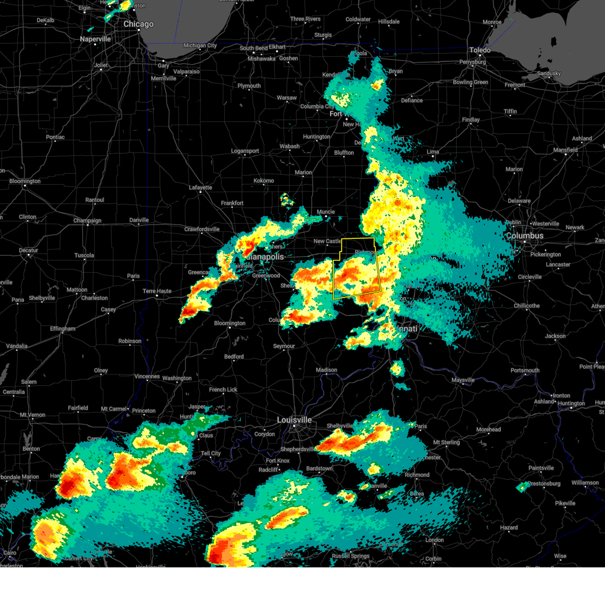
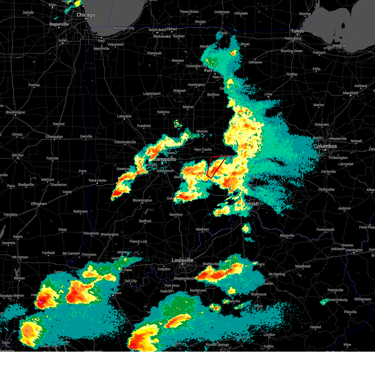
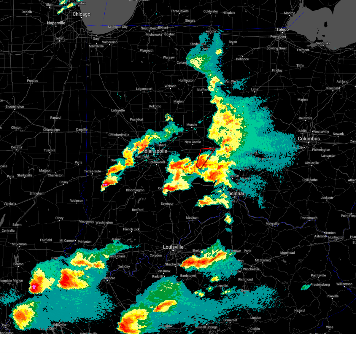
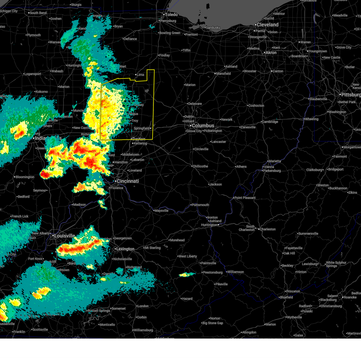
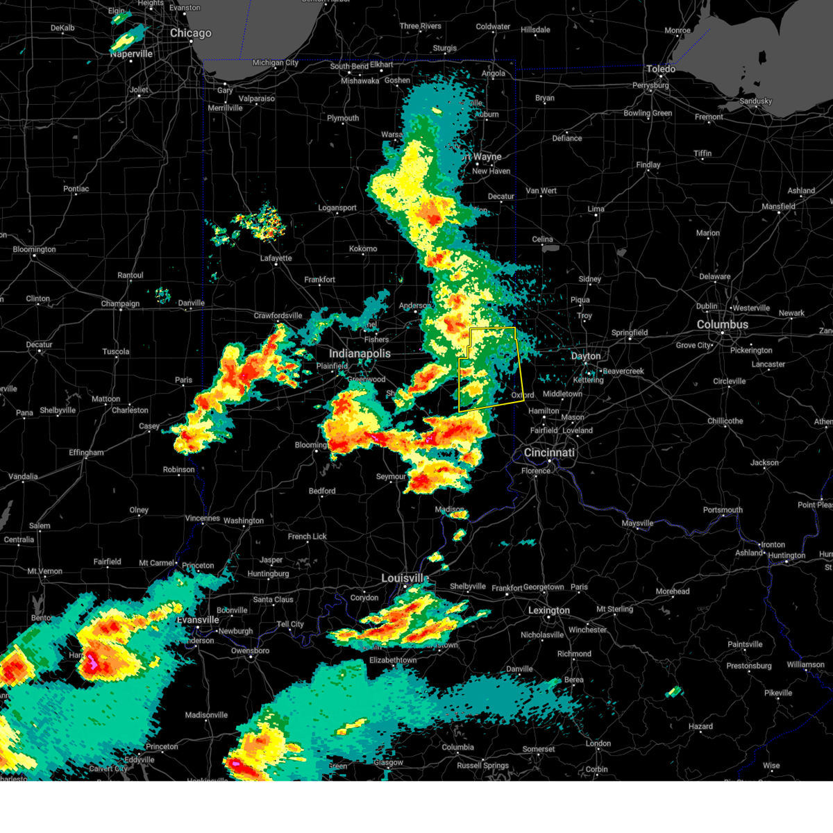
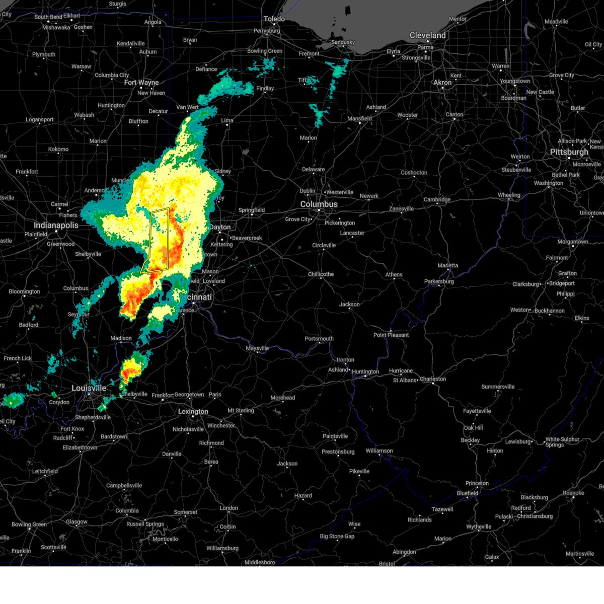
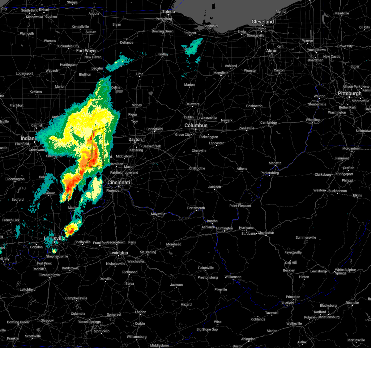
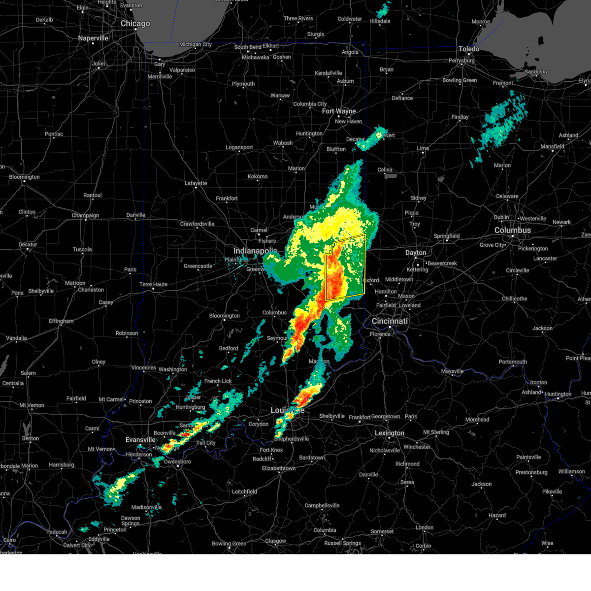
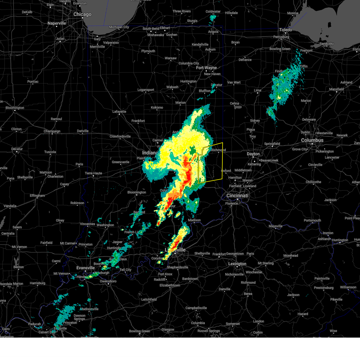
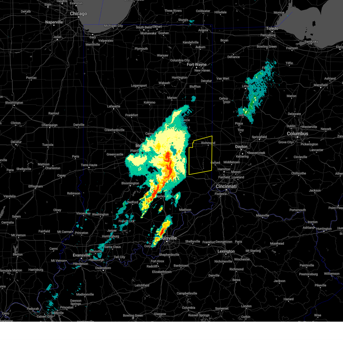
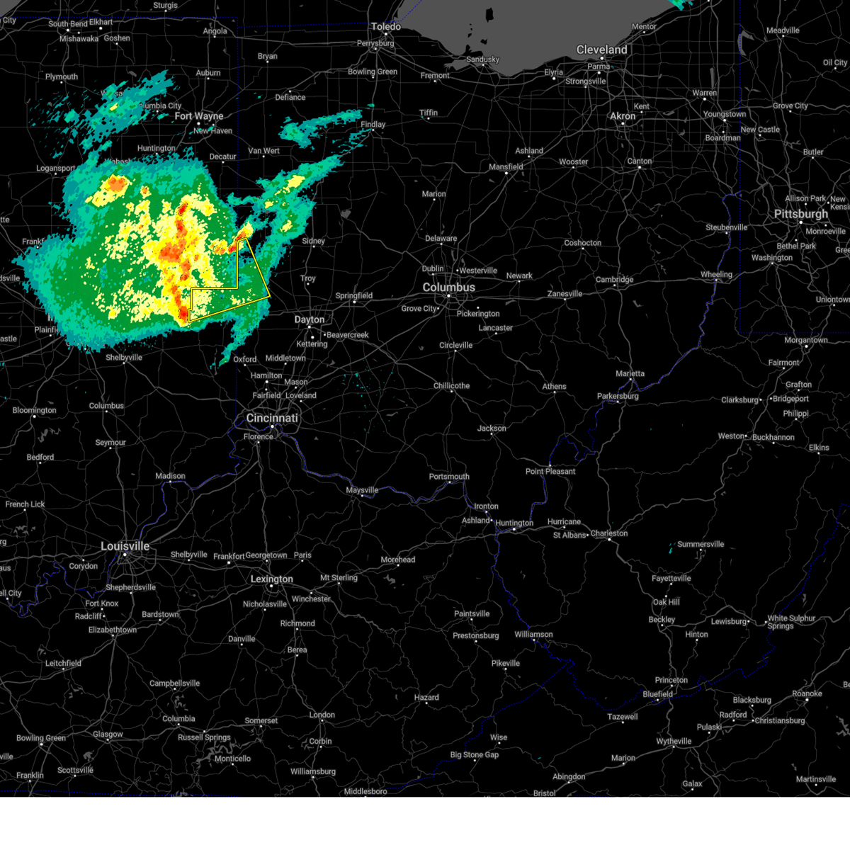
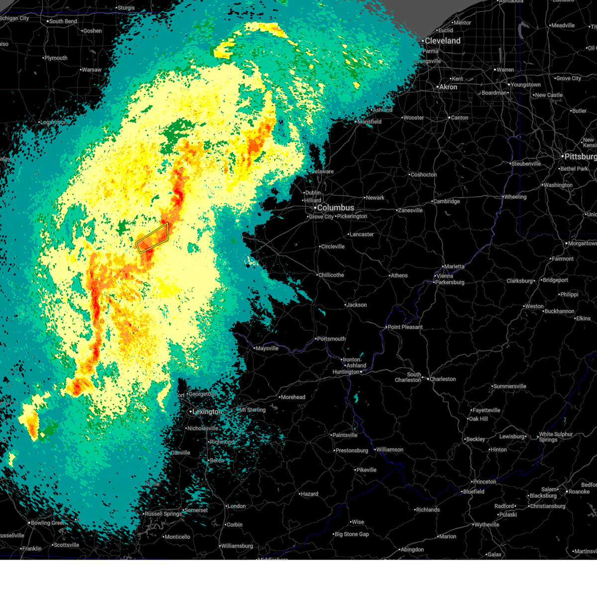
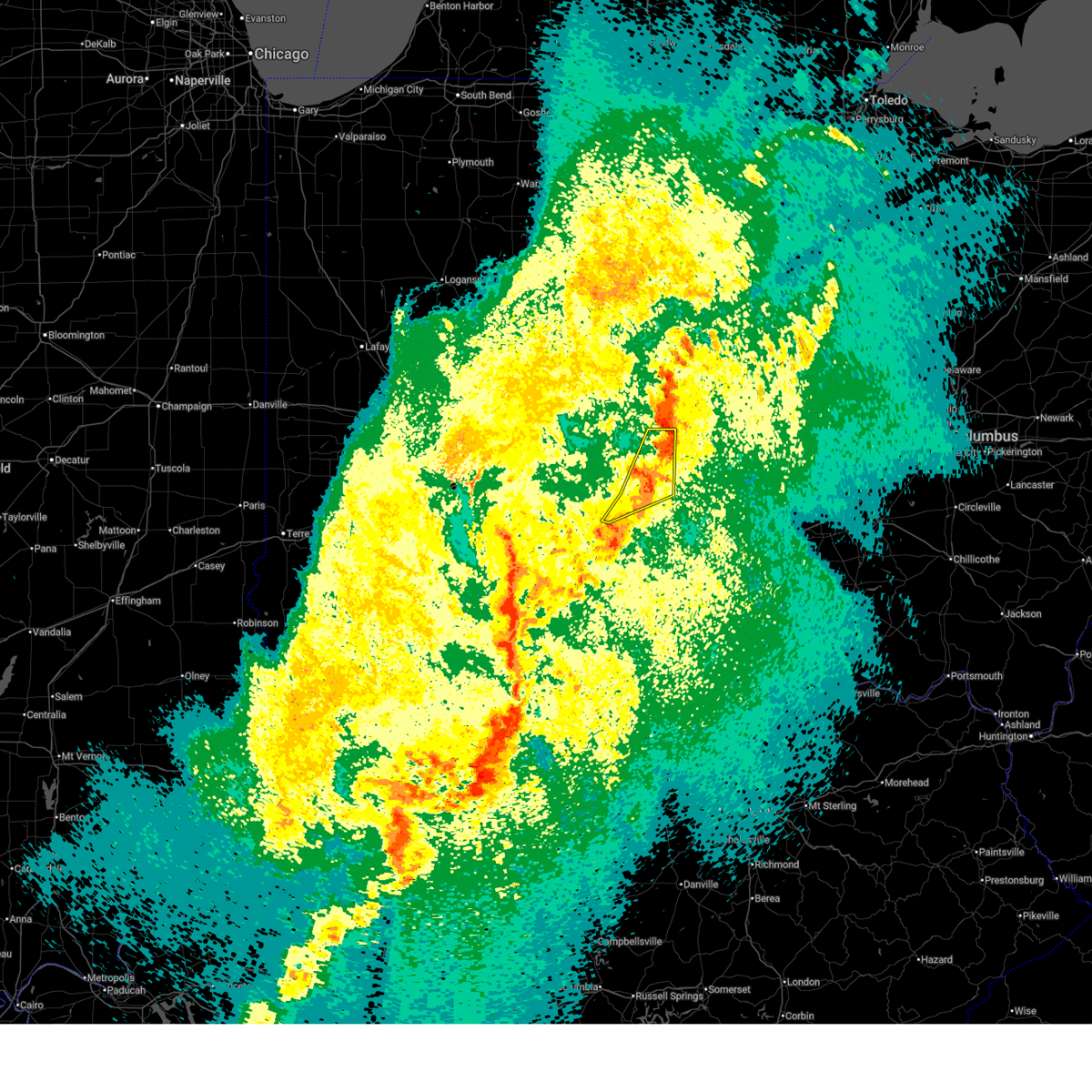
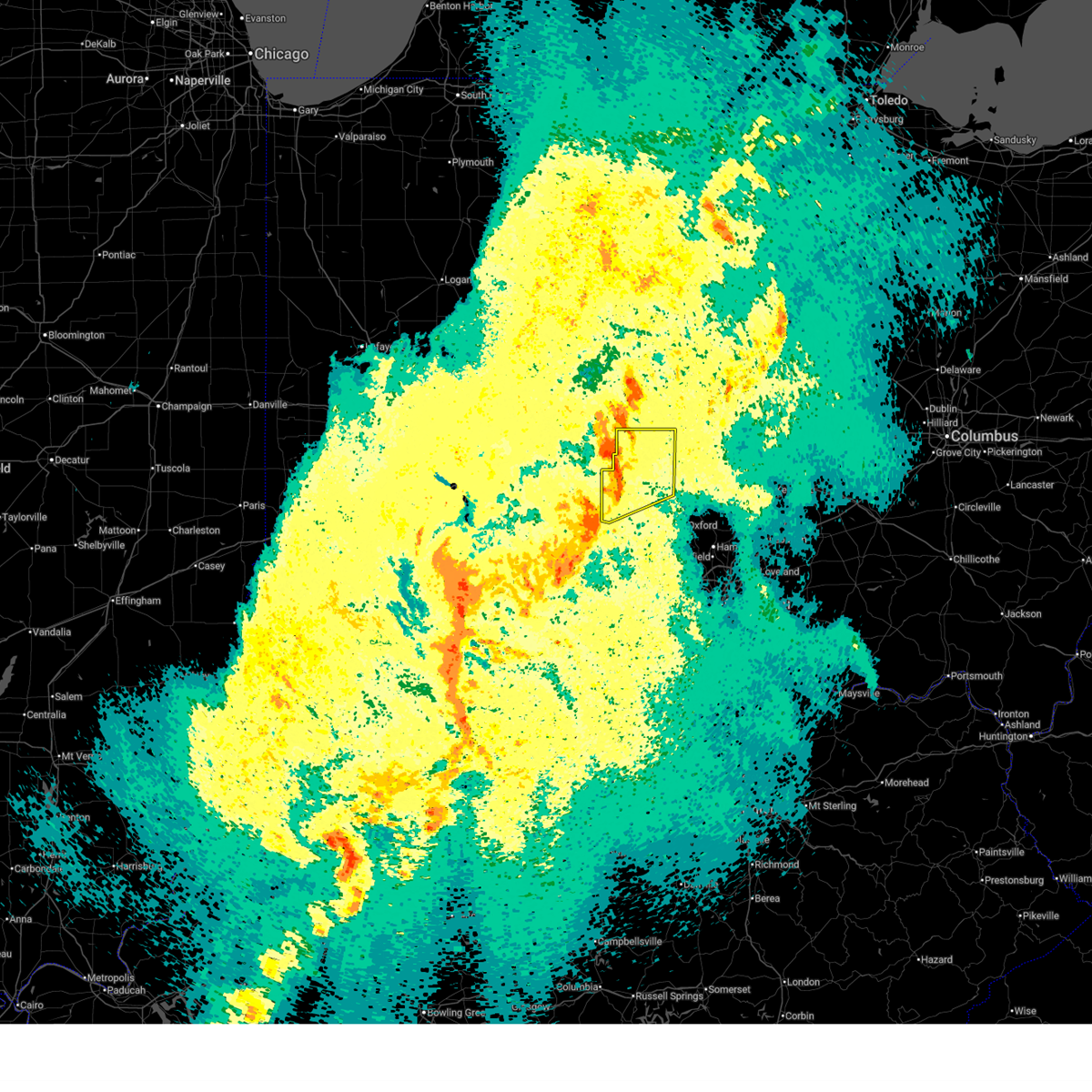
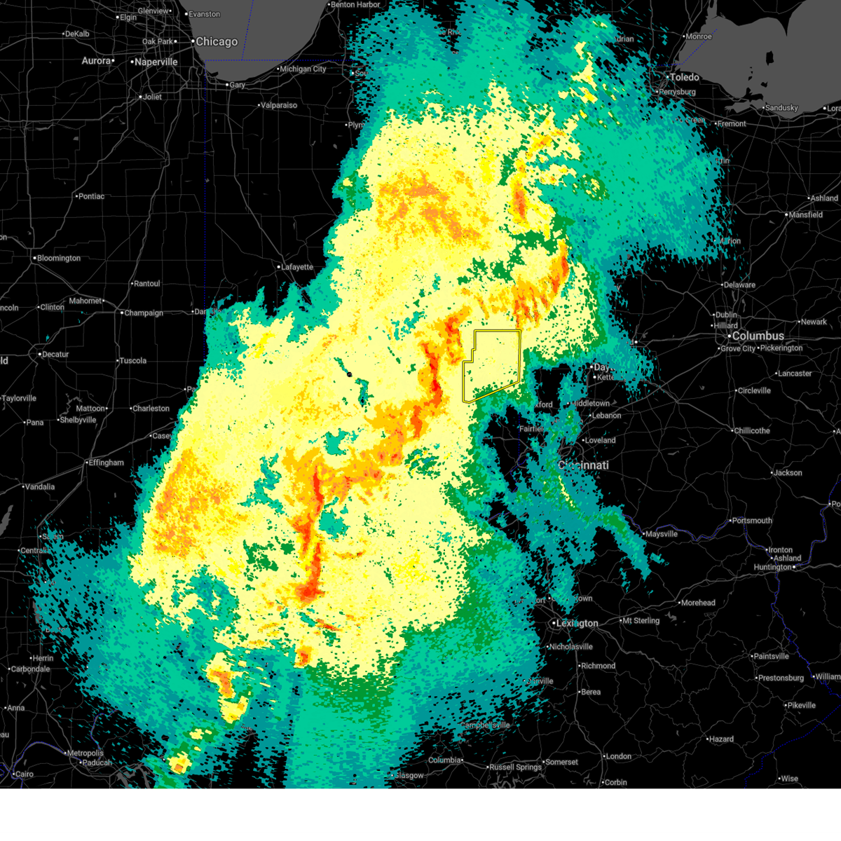
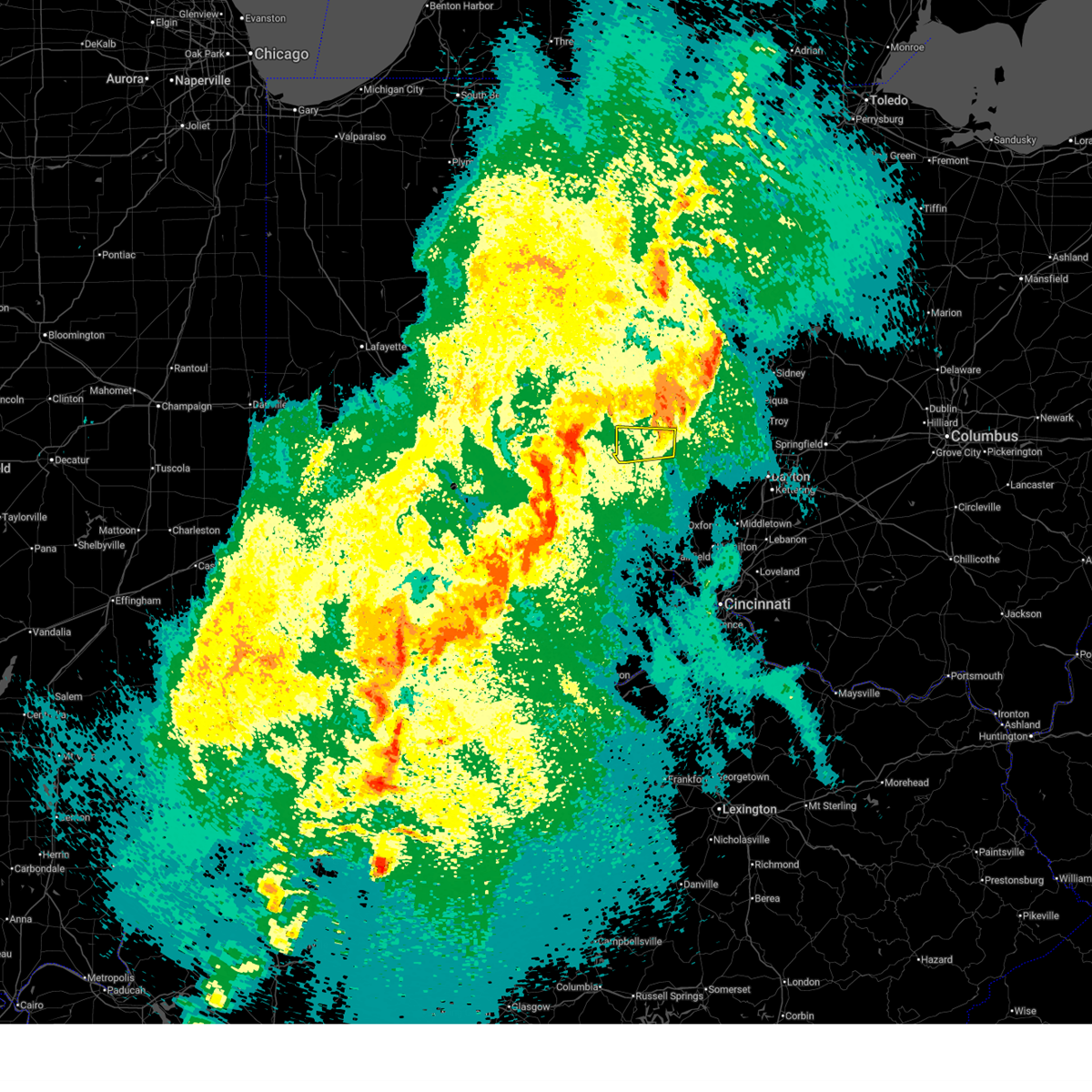
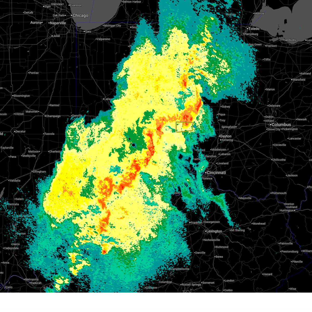
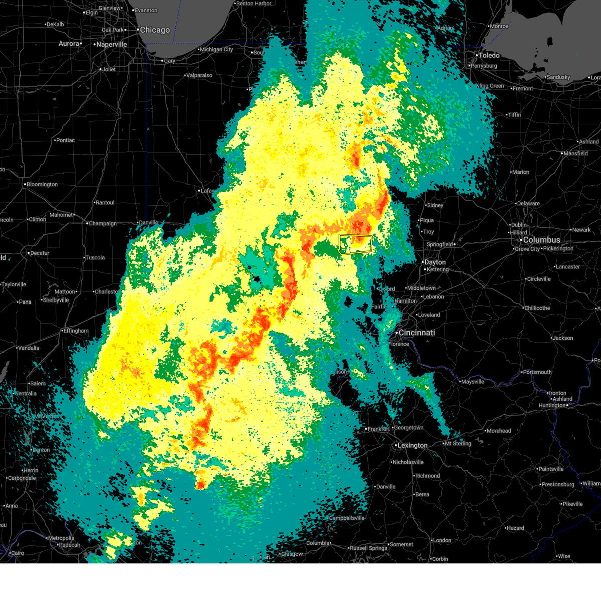
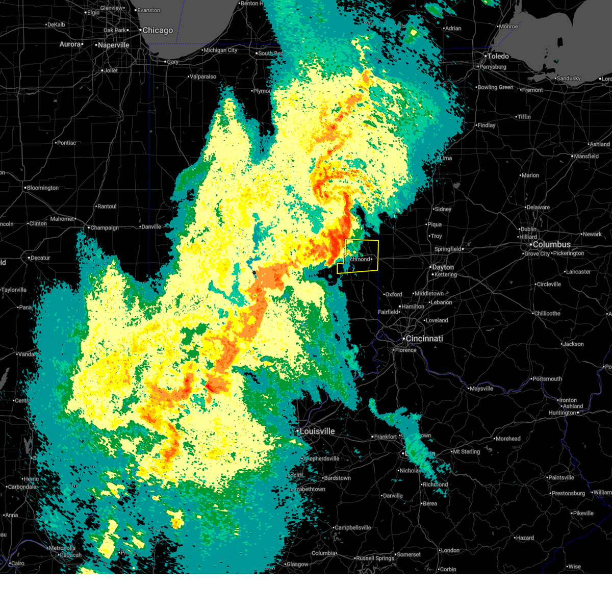
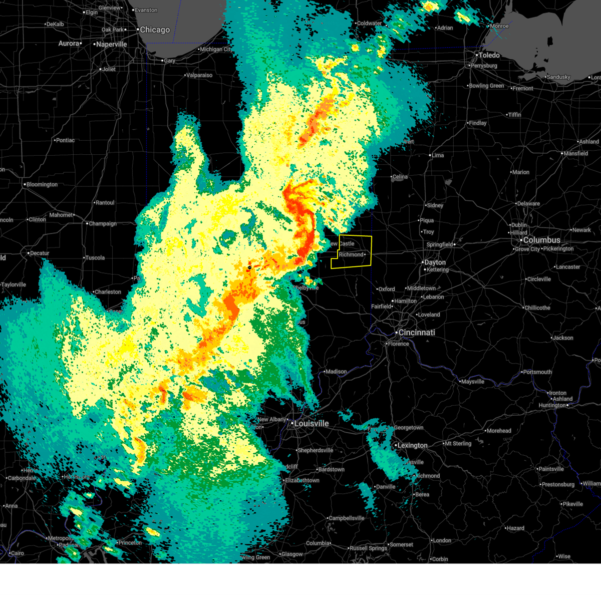
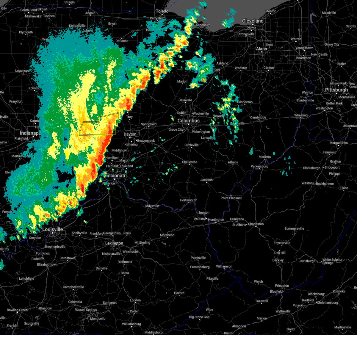
Hail Map for Richmond, IN
The Richmond, IN area has had 10 reports of on-the-ground hail by trained spotters, and has been under severe weather warnings 27 times during the past 12 months. Doppler radar has detected hail at or near Richmond, IN on 66 occasions, including 1 occasion during the past year.
| Name: | Richmond, IN |
| Where Located: | 54.2 miles NNW of Cincinnati, OH |
| Map: | Google Map for Richmond, IN |
| Population: | 36812 |
| Housing Units: | 17649 |
| More Info: | Search Google for Richmond, IN |
1
The Top Recent Hail Date for Richmond, IN is Tuesday, May 19, 2026 (23rd out of 66)
Hail and Wind Damage Spotted near Richmond, IN
| Date / Time | Report Details |
|---|---|
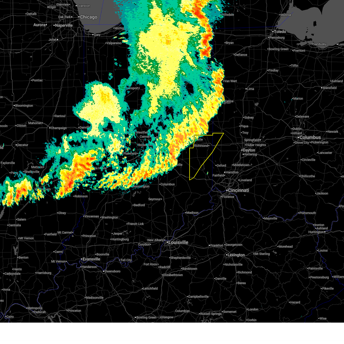
| 7/4/2026 9:41 PM EDT | Several trees down in the richmond area. time estimated from rada in wayne county IN, 1 miles E of Richmond, IN |
| 6/12/2026 12:05 AM EDT |
 At 1205 am edt, severe thunderstorms were located along a line extending from near versailles to near connersville, moving east at 55 mph (radar indicated). Hazards include 60 mph wind gusts. Expect damage to trees and power lines. locations impacted include, richmond, connersville, batesville, centerville, liberty, new paris, new madison, oldenburg, lake santee, waterloo, blooming grove, columbia, metamora, bunker hill, abington, brownsville, laurel, eldorado, spring grove, and boston. this includes the following interstates, i-70 in indiana between mile markers 151 and 156. i-70 in ohio between mile markers 0 and 4. I-74 in indiana between mile markers 145 and 149. At 1205 am edt, severe thunderstorms were located along a line extending from near versailles to near connersville, moving east at 55 mph (radar indicated). Hazards include 60 mph wind gusts. Expect damage to trees and power lines. locations impacted include, richmond, connersville, batesville, centerville, liberty, new paris, new madison, oldenburg, lake santee, waterloo, blooming grove, columbia, metamora, bunker hill, abington, brownsville, laurel, eldorado, spring grove, and boston. this includes the following interstates, i-70 in indiana between mile markers 151 and 156. i-70 in ohio between mile markers 0 and 4. I-74 in indiana between mile markers 145 and 149.
|
| 6/12/2026 12:00 AM EDT |
 At 1200 am edt, severe thunderstorms were located along a line extending from versailles to near connersville, moving east at 55 mph (radar indicated). Hazards include 60 mph wind gusts. Expect damage to trees and power lines. locations impacted include, richmond, connersville, batesville, centerville, liberty, new paris, new madison, fountain city, oldenburg, glenwood, lake santee, waterloo, blooming grove, columbia, metamora, bunker hill, abington, brownsville, wayne lakes, and laurel. this includes the following interstates, i-70 in indiana between mile markers 142 and 156. i-70 in ohio between mile markers 0 and 4. I-74 in indiana between mile markers 145 and 149. At 1200 am edt, severe thunderstorms were located along a line extending from versailles to near connersville, moving east at 55 mph (radar indicated). Hazards include 60 mph wind gusts. Expect damage to trees and power lines. locations impacted include, richmond, connersville, batesville, centerville, liberty, new paris, new madison, fountain city, oldenburg, glenwood, lake santee, waterloo, blooming grove, columbia, metamora, bunker hill, abington, brownsville, wayne lakes, and laurel. this includes the following interstates, i-70 in indiana between mile markers 142 and 156. i-70 in ohio between mile markers 0 and 4. I-74 in indiana between mile markers 145 and 149.
|
| 6/11/2026 11:53 PM EDT | Tree downed in richmond. time estimated by rada in wayne county IN, 0.2 miles NNW of Richmond, IN |
| 6/11/2026 11:31 PM EDT |
 At 1131 pm edt, severe thunderstorms were located along a line extending from winchester to 8 miles northeast of shelbyville, moving east at 50 mph (radar indicated). Hazards include 60 mph wind gusts. Expect damage to trees and power lines. locations impacted include, richmond, connersville, batesville, centerville, cambridge city, liberty, hagerstown, new paris, new madison, fountain city, dublin, oldenburg, glenwood, lake santee, franklin, waterloo, blooming grove, columbia, metamora, and bunker hill. this includes the following interstates, i-70 in indiana between mile markers 134 and 156. i-70 in ohio between mile markers 0 and 4. I-74 in indiana between mile markers 145 and 149. At 1131 pm edt, severe thunderstorms were located along a line extending from winchester to 8 miles northeast of shelbyville, moving east at 50 mph (radar indicated). Hazards include 60 mph wind gusts. Expect damage to trees and power lines. locations impacted include, richmond, connersville, batesville, centerville, cambridge city, liberty, hagerstown, new paris, new madison, fountain city, dublin, oldenburg, glenwood, lake santee, franklin, waterloo, blooming grove, columbia, metamora, and bunker hill. this includes the following interstates, i-70 in indiana between mile markers 134 and 156. i-70 in ohio between mile markers 0 and 4. I-74 in indiana between mile markers 145 and 149.
|
| 6/11/2026 11:12 PM EDT |
 Svriln the national weather service in wilmington has issued a * severe thunderstorm warning for, western franklin county in southeastern indiana, wayne county in east central indiana, northwestern union county in east central indiana, fayette county in east central indiana, northwestern preble county in west central ohio, southwestern darke county in west central ohio, * until 1215 am edt. * at 1112 pm edt, severe thunderstorms were located along a line extending from muncie to near greenwood, moving east at 55 mph (radar indicated). Hazards include 60 mph wind gusts. expect damage to trees and power lines Svriln the national weather service in wilmington has issued a * severe thunderstorm warning for, western franklin county in southeastern indiana, wayne county in east central indiana, northwestern union county in east central indiana, fayette county in east central indiana, northwestern preble county in west central ohio, southwestern darke county in west central ohio, * until 1215 am edt. * at 1112 pm edt, severe thunderstorms were located along a line extending from muncie to near greenwood, moving east at 55 mph (radar indicated). Hazards include 60 mph wind gusts. expect damage to trees and power lines
|
| 5/19/2026 6:28 PM EDT |
 the severe thunderstorm warning has been cancelled and is no longer in effect the severe thunderstorm warning has been cancelled and is no longer in effect
|
| 5/19/2026 6:10 PM EDT |
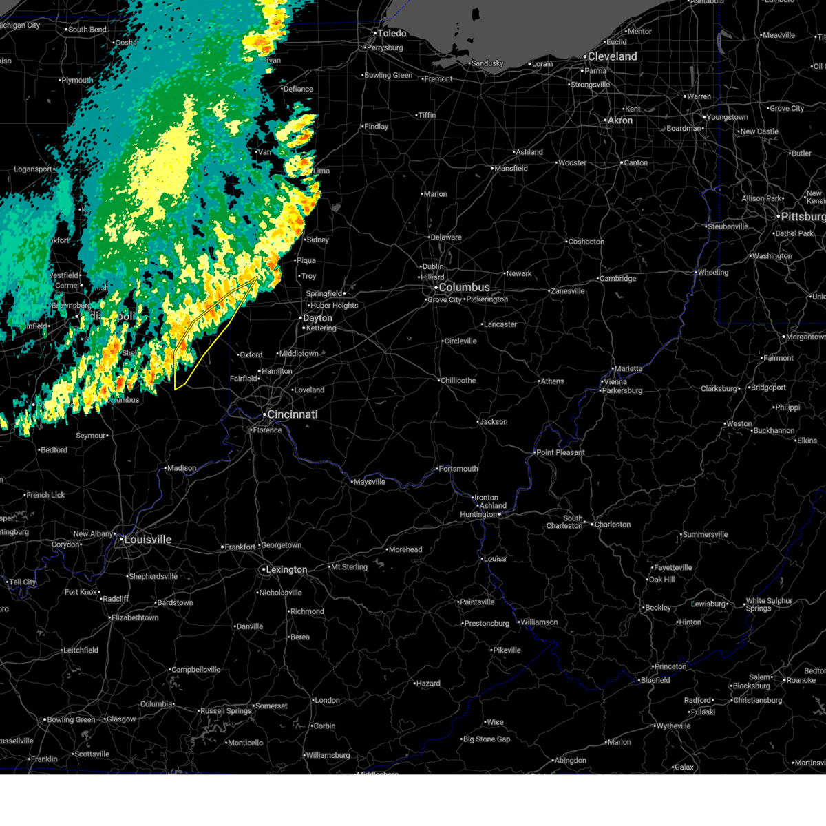
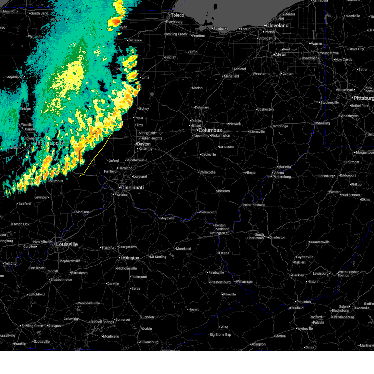
 Svriln the national weather service in wilmington has issued a * severe thunderstorm warning for, northeastern wayne county in east central indiana, northern preble county in west central ohio, southwestern darke county in west central ohio, * until 700 pm edt. * at 609 pm edt, a severe thunderstorm was located over richmond, moving northeast at 35 mph (radar indicated). Hazards include 60 mph wind gusts and quarter size hail. Minor hail damage to vehicles is possible. Expect wind damage to trees and power lines. Svriln the national weather service in wilmington has issued a * severe thunderstorm warning for, northeastern wayne county in east central indiana, northern preble county in west central ohio, southwestern darke county in west central ohio, * until 700 pm edt. * at 609 pm edt, a severe thunderstorm was located over richmond, moving northeast at 35 mph (radar indicated). Hazards include 60 mph wind gusts and quarter size hail. Minor hail damage to vehicles is possible. Expect wind damage to trees and power lines.
|
| 5/19/2026 6:07 PM EDT | Trees down in richmond. time estimated from rada in wayne county IN, 0.2 miles NNW of Richmond, IN |
| 5/19/2026 6:04 PM EDT |
 At 604 pm edt, a severe thunderstorm was located over centerville, moving northeast at 30 mph (radar indicated). Hazards include 60 mph wind gusts and quarter size hail. Minor hail damage to vehicles is possible. expect wind damage to trees and power lines. locations impacted include, richmond, centerville, abington, greens fork, spring grove, boston, richmond municipal airport, and middleboro. this includes the following interstates, i-70 in indiana between mile markers 140 and 156. I-70 in ohio near mile marker 0. At 604 pm edt, a severe thunderstorm was located over centerville, moving northeast at 30 mph (radar indicated). Hazards include 60 mph wind gusts and quarter size hail. Minor hail damage to vehicles is possible. expect wind damage to trees and power lines. locations impacted include, richmond, centerville, abington, greens fork, spring grove, boston, richmond municipal airport, and middleboro. this includes the following interstates, i-70 in indiana between mile markers 140 and 156. I-70 in ohio near mile marker 0.
|
| 5/19/2026 5:55 PM EDT |
 Svriln the national weather service in wilmington has issued a * severe thunderstorm warning for, wayne county in east central indiana, northern union county in east central indiana, northeastern fayette county in east central indiana, * until 645 pm edt. * at 555 pm edt, a severe thunderstorm was located near connersville, moving northeast at 25 mph (radar indicated). Hazards include 60 mph wind gusts and quarter size hail. Minor hail damage to vehicles is possible. Expect wind damage to trees and power lines. Svriln the national weather service in wilmington has issued a * severe thunderstorm warning for, wayne county in east central indiana, northern union county in east central indiana, northeastern fayette county in east central indiana, * until 645 pm edt. * at 555 pm edt, a severe thunderstorm was located near connersville, moving northeast at 25 mph (radar indicated). Hazards include 60 mph wind gusts and quarter size hail. Minor hail damage to vehicles is possible. Expect wind damage to trees and power lines.
|
| 4/28/2026 12:12 AM EDT | Trees down in glen miller park. time estimated from rada in wayne county IN, 1.7 miles WSW of Richmond, IN |
| 4/27/2026 11:58 PM EDT |
 At 1158 pm edt, severe thunderstorms were located along a line extending from fountain city to 6 miles north of lake santee, moving east at 55 mph (radar indicated). Hazards include 60 mph wind gusts. Expect damage to trees and power lines. locations impacted include, richmond, connersville, brookville, centerville, cambridge city, liberty, hagerstown, fountain city, dublin, glenwood, lake santee, salem, waterloo, blooming grove, columbia, metamora, bunker hill, abington, brownsville, and laurel. this includes the following interstates, i-70 in indiana between mile markers 134 and 156. I-70 in ohio near mile marker 0. At 1158 pm edt, severe thunderstorms were located along a line extending from fountain city to 6 miles north of lake santee, moving east at 55 mph (radar indicated). Hazards include 60 mph wind gusts. Expect damage to trees and power lines. locations impacted include, richmond, connersville, brookville, centerville, cambridge city, liberty, hagerstown, fountain city, dublin, glenwood, lake santee, salem, waterloo, blooming grove, columbia, metamora, bunker hill, abington, brownsville, and laurel. this includes the following interstates, i-70 in indiana between mile markers 134 and 156. I-70 in ohio near mile marker 0.
|
| 4/27/2026 11:56 PM EDT |
 Svriln the national weather service in wilmington has issued a * severe thunderstorm warning for, eastern wayne county in east central indiana, western shelby county in west central ohio, northern preble county in west central ohio, darke county in west central ohio, northwestern montgomery county in west central ohio, southwestern auglaize county in west central ohio, western miami county in west central ohio, * until 100 am edt. * at 1156 pm edt, severe thunderstorms were located along a line extending from near winchester to glenwood, moving east at 50 mph (radar indicated). Hazards include 60 mph wind gusts. expect damage to trees and power lines Svriln the national weather service in wilmington has issued a * severe thunderstorm warning for, eastern wayne county in east central indiana, western shelby county in west central ohio, northern preble county in west central ohio, darke county in west central ohio, northwestern montgomery county in west central ohio, southwestern auglaize county in west central ohio, western miami county in west central ohio, * until 100 am edt. * at 1156 pm edt, severe thunderstorms were located along a line extending from near winchester to glenwood, moving east at 50 mph (radar indicated). Hazards include 60 mph wind gusts. expect damage to trees and power lines
|
| 4/27/2026 11:42 PM EDT |
 At 1142 pm edt, severe thunderstorms were located along a line extending from 6 miles northeast of new castle to 8 miles southwest of rushville, moving east at 55 mph (radar indicated). Hazards include 60 mph wind gusts. Expect damage to trees and power lines. locations impacted include, richmond, connersville, brookville, centerville, cambridge city, liberty, hagerstown, fountain city, dublin, glenwood, lake santee, franklin, salem, waterloo, blooming grove, columbia, metamora, bunker hill, abington, and brownsville. this includes the following interstates, i-70 in indiana between mile markers 134 and 156. I-70 in ohio near mile marker 0. At 1142 pm edt, severe thunderstorms were located along a line extending from 6 miles northeast of new castle to 8 miles southwest of rushville, moving east at 55 mph (radar indicated). Hazards include 60 mph wind gusts. Expect damage to trees and power lines. locations impacted include, richmond, connersville, brookville, centerville, cambridge city, liberty, hagerstown, fountain city, dublin, glenwood, lake santee, franklin, salem, waterloo, blooming grove, columbia, metamora, bunker hill, abington, and brownsville. this includes the following interstates, i-70 in indiana between mile markers 134 and 156. I-70 in ohio near mile marker 0.
|
| 4/27/2026 11:28 PM EDT |
 Svriln the national weather service in wilmington has issued a * severe thunderstorm warning for, northern franklin county in southeastern indiana, wayne county in east central indiana, union county in east central indiana, fayette county in east central indiana, * until 1215 am edt. * at 1128 pm edt, severe thunderstorms were located along a line extending from near new castle to shelbyville, moving east at 50 mph (radar indicated). Hazards include 60 mph wind gusts. expect damage to trees and power lines Svriln the national weather service in wilmington has issued a * severe thunderstorm warning for, northern franklin county in southeastern indiana, wayne county in east central indiana, union county in east central indiana, fayette county in east central indiana, * until 1215 am edt. * at 1128 pm edt, severe thunderstorms were located along a line extending from near new castle to shelbyville, moving east at 50 mph (radar indicated). Hazards include 60 mph wind gusts. expect damage to trees and power lines
|
| 4/14/2026 7:00 PM EDT |
 At 700 pm edt, a severe thunderstorm was located near hagerstown, moving east at 35 mph (radar indicated). Hazards include 60 mph wind gusts. Expect damage to trees and power lines. locations impacted include, richmond, centerville, hagerstown, fountain city, greens fork, economy and williamsburg. This includes i-70 in indiana between mile markers 141 and 149. At 700 pm edt, a severe thunderstorm was located near hagerstown, moving east at 35 mph (radar indicated). Hazards include 60 mph wind gusts. Expect damage to trees and power lines. locations impacted include, richmond, centerville, hagerstown, fountain city, greens fork, economy and williamsburg. This includes i-70 in indiana between mile markers 141 and 149.
|
| 4/14/2026 6:40 PM EDT |
 Svriln the national weather service in wilmington has issued a * severe thunderstorm warning for, northwestern wayne county in east central indiana, * until 715 pm edt. * at 639 pm edt, a severe thunderstorm was located over new castle, moving east at 30 mph (radar indicated). Hazards include 60 mph wind gusts and penny size hail. expect damage to trees and power lines Svriln the national weather service in wilmington has issued a * severe thunderstorm warning for, northwestern wayne county in east central indiana, * until 715 pm edt. * at 639 pm edt, a severe thunderstorm was located over new castle, moving east at 30 mph (radar indicated). Hazards include 60 mph wind gusts and penny size hail. expect damage to trees and power lines
|
| 3/26/2026 8:39 PM EDT |
 At 838 pm edt, severe thunderstorms were located along a line extending from near ansonia to near fountain city, moving east at 45 mph (radar indicated). Hazards include 60 mph wind gusts and quarter size hail. Minor hail damage to vehicles is possible. expect wind damage to trees and power lines. Locations impacted include, richmond, greenville, versailles, arcanum, bradford, lewisburg, union city, new paris, ansonia, new madison, fountain city, webster, wayne lakes, gettysburg, eldorado, verona, west manchester, greens fork, pitsburg, and bethel. At 838 pm edt, severe thunderstorms were located along a line extending from near ansonia to near fountain city, moving east at 45 mph (radar indicated). Hazards include 60 mph wind gusts and quarter size hail. Minor hail damage to vehicles is possible. expect wind damage to trees and power lines. Locations impacted include, richmond, greenville, versailles, arcanum, bradford, lewisburg, union city, new paris, ansonia, new madison, fountain city, webster, wayne lakes, gettysburg, eldorado, verona, west manchester, greens fork, pitsburg, and bethel.
|
| 3/26/2026 8:20 PM EDT |
 Svriln the national weather service in wilmington has issued a * severe thunderstorm warning for, northern wayne county in east central indiana, northern preble county in west central ohio, darke county in west central ohio, * until 900 pm edt. * at 820 pm edt, severe thunderstorms were located along a line extending from 6 miles southeast of portland to 8 miles southwest of winchester, moving east at 55 mph (radar indicated). Hazards include 60 mph wind gusts and quarter size hail. Minor hail damage to vehicles is possible. Expect wind damage to trees and power lines. Svriln the national weather service in wilmington has issued a * severe thunderstorm warning for, northern wayne county in east central indiana, northern preble county in west central ohio, darke county in west central ohio, * until 900 pm edt. * at 820 pm edt, severe thunderstorms were located along a line extending from 6 miles southeast of portland to 8 miles southwest of winchester, moving east at 55 mph (radar indicated). Hazards include 60 mph wind gusts and quarter size hail. Minor hail damage to vehicles is possible. Expect wind damage to trees and power lines.
|
| 3/22/2026 10:29 PM EDT |
 The storms which prompted the warning have weakened below severe limits and no longer pose an immediate threat to life or property. therefore, the warning will be allowed to expire. a severe thunderstorm watch remains in effect until midnight edt for east central indiana, and west central ohio. please report previous wind damage or hail to the national weather service by going to our website at weather.gov/iln and submitting your report via social media. The storms which prompted the warning have weakened below severe limits and no longer pose an immediate threat to life or property. therefore, the warning will be allowed to expire. a severe thunderstorm watch remains in effect until midnight edt for east central indiana, and west central ohio. please report previous wind damage or hail to the national weather service by going to our website at weather.gov/iln and submitting your report via social media.
|
| 3/22/2026 10:01 PM EDT |
 Svriln the national weather service in wilmington has issued a * severe thunderstorm warning for, wayne county in east central indiana, northern preble county in west central ohio, darke county in west central ohio, * until 1030 pm edt. * at 1001 pm edt, severe thunderstorms were located along a line extending from near union city to near cambridge city, moving southeast at 50 mph (radar indicated). Hazards include 60 mph wind gusts and quarter size hail. Minor hail damage to vehicles is possible. Expect wind damage to trees and power lines. Svriln the national weather service in wilmington has issued a * severe thunderstorm warning for, wayne county in east central indiana, northern preble county in west central ohio, darke county in west central ohio, * until 1030 pm edt. * at 1001 pm edt, severe thunderstorms were located along a line extending from near union city to near cambridge city, moving southeast at 50 mph (radar indicated). Hazards include 60 mph wind gusts and quarter size hail. Minor hail damage to vehicles is possible. Expect wind damage to trees and power lines.
|
| 3/16/2026 12:27 AM EDT |
 The storms which prompted the warning have weakened below severe limits and no longer pose an immediate threat to life or property. therefore, the warning will be allowed to expire. however, gusty winds are still possible with these thunderstorms. a tornado watch remains in effect until 500 am edt for southeastern indiana. a severe thunderstorm watch remains in effect until 400 am edt for southeastern and east central indiana, and southwestern and west central ohio. please report previous wind damage or hail to the national weather service by going to our website at weather.gov/iln and submitting your report via social media. The storms which prompted the warning have weakened below severe limits and no longer pose an immediate threat to life or property. therefore, the warning will be allowed to expire. however, gusty winds are still possible with these thunderstorms. a tornado watch remains in effect until 500 am edt for southeastern indiana. a severe thunderstorm watch remains in effect until 400 am edt for southeastern and east central indiana, and southwestern and west central ohio. please report previous wind damage or hail to the national weather service by going to our website at weather.gov/iln and submitting your report via social media.
|
| 3/16/2026 12:12 AM EDT |
 At 1212 am edt, severe thunderstorms were located along a line extending from hagerstown to connersville to near versailles, moving northeast at 65 mph (radar indicated). Hazards include 60 mph wind gusts. Expect damage to trees and power lines. locations impacted include, richmond, oxford, connersville, harrison, batesville, brookville, centerville, cambridge city, bright, hidden valley, liberty, versailles, milan, hagerstown, new paris, osgood, new madison, fountain city, dublin, and west college corner. this includes the following interstates, i-70 in indiana between mile markers 134 and 156. i-70 in ohio between mile markers 0 and 9. i-74 in indiana between mile markers 145 and 171. I-74 in ohio near mile marker 0. At 1212 am edt, severe thunderstorms were located along a line extending from hagerstown to connersville to near versailles, moving northeast at 65 mph (radar indicated). Hazards include 60 mph wind gusts. Expect damage to trees and power lines. locations impacted include, richmond, oxford, connersville, harrison, batesville, brookville, centerville, cambridge city, bright, hidden valley, liberty, versailles, milan, hagerstown, new paris, osgood, new madison, fountain city, dublin, and west college corner. this includes the following interstates, i-70 in indiana between mile markers 134 and 156. i-70 in ohio between mile markers 0 and 9. i-74 in indiana between mile markers 145 and 171. I-74 in ohio near mile marker 0.
|
| 3/15/2026 11:52 PM EDT |
 Svriln the national weather service in wilmington has issued a * severe thunderstorm warning for, franklin county in southeastern indiana, ripley county in southeastern indiana, wayne county in east central indiana, union county in east central indiana, northern dearborn county in southeastern indiana, fayette county in east central indiana, western preble county in west central ohio, northwestern butler county in southwestern ohio, southwestern darke county in west central ohio, * until 1230 am edt. * at 1151 pm edt, severe thunderstorms were located along a line extending from 10 miles southwest of new castle to 8 miles northwest of lake santee to 9 miles south of vernon, moving northeast at 65 mph (radar indicated). Hazards include 60 mph wind gusts. expect damage to trees and power lines Svriln the national weather service in wilmington has issued a * severe thunderstorm warning for, franklin county in southeastern indiana, ripley county in southeastern indiana, wayne county in east central indiana, union county in east central indiana, northern dearborn county in southeastern indiana, fayette county in east central indiana, western preble county in west central ohio, northwestern butler county in southwestern ohio, southwestern darke county in west central ohio, * until 1230 am edt. * at 1151 pm edt, severe thunderstorms were located along a line extending from 10 miles southwest of new castle to 8 miles northwest of lake santee to 9 miles south of vernon, moving northeast at 65 mph (radar indicated). Hazards include 60 mph wind gusts. expect damage to trees and power lines
|
| 3/11/2026 9:59 AM EDT |
 At 959 am edt, a severe thunderstorm was located near greenville, moving east at 80 mph (radar indicated). Hazards include 60 mph wind gusts. Expect damage to trees and power lines. locations impacted include, richmond, connersville, greenville, eaton, centerville, versailles, liberty, arcanum, bradford, lewisburg, new paris, west alexandria, ansonia, new madison, waterloo, webster, abington, brownsville, wayne lakes, and russia. this includes the following interstates, i-70 in indiana between mile markers 148 and 156. I-70 in ohio between mile markers 0 and 17. At 959 am edt, a severe thunderstorm was located near greenville, moving east at 80 mph (radar indicated). Hazards include 60 mph wind gusts. Expect damage to trees and power lines. locations impacted include, richmond, connersville, greenville, eaton, centerville, versailles, liberty, arcanum, bradford, lewisburg, new paris, west alexandria, ansonia, new madison, waterloo, webster, abington, brownsville, wayne lakes, and russia. this includes the following interstates, i-70 in indiana between mile markers 148 and 156. I-70 in ohio between mile markers 0 and 17.
|
| 3/11/2026 9:45 AM EDT |
 At 945 am edt, a severe thunderstorm was located near fountain city, moving east at 75 mph (radar indicated). Hazards include 60 mph wind gusts. Expect damage to trees and power lines. locations impacted include, richmond, connersville, greenville, eaton, centerville, cambridge city, versailles, liberty, arcanum, bradford, lewisburg, hagerstown, union city, new paris, west alexandria, ansonia, new madison, fountain city, dublin, and franklin. this includes the following interstates, i-70 in indiana between mile markers 134 and 156. I-70 in ohio between mile markers 0 and 17. At 945 am edt, a severe thunderstorm was located near fountain city, moving east at 75 mph (radar indicated). Hazards include 60 mph wind gusts. Expect damage to trees and power lines. locations impacted include, richmond, connersville, greenville, eaton, centerville, cambridge city, versailles, liberty, arcanum, bradford, lewisburg, hagerstown, union city, new paris, west alexandria, ansonia, new madison, fountain city, dublin, and franklin. this includes the following interstates, i-70 in indiana between mile markers 134 and 156. I-70 in ohio between mile markers 0 and 17.
|
| 3/11/2026 9:44 AM EDT | Roof blown off building on south 8th street. time estimated from rada in wayne county IN, 1.6 miles N of Richmond, IN |
| 3/11/2026 9:32 AM EDT |
 At 931 am edt, a severe thunderstorm was located over hagerstown, moving east at 80 mph (radar indicated). Hazards include 60 mph wind gusts. Expect damage to trees and power lines. locations impacted include, richmond, connersville, greenville, eaton, centerville, cambridge city, versailles, liberty, arcanum, bradford, lewisburg, hagerstown, union city, new paris, west alexandria, ansonia, new madison, fountain city, dublin, and glenwood. this includes the following interstates, i-70 in indiana between mile markers 134 and 156. I-70 in ohio between mile markers 0 and 17. At 931 am edt, a severe thunderstorm was located over hagerstown, moving east at 80 mph (radar indicated). Hazards include 60 mph wind gusts. Expect damage to trees and power lines. locations impacted include, richmond, connersville, greenville, eaton, centerville, cambridge city, versailles, liberty, arcanum, bradford, lewisburg, hagerstown, union city, new paris, west alexandria, ansonia, new madison, fountain city, dublin, and glenwood. this includes the following interstates, i-70 in indiana between mile markers 134 and 156. I-70 in ohio between mile markers 0 and 17.
|
| 3/11/2026 9:26 AM EDT |
 Svriln the national weather service in wilmington has issued a * severe thunderstorm warning for, wayne county in east central indiana, northern union county in east central indiana, fayette county in east central indiana, west central shelby county in west central ohio, preble county in west central ohio, darke county in west central ohio, * until 1015 am edt. * at 926 am edt, a severe thunderstorm was located near hagerstown, moving east at 90 mph (radar indicated). Hazards include 60 mph wind gusts. expect damage to trees and power lines Svriln the national weather service in wilmington has issued a * severe thunderstorm warning for, wayne county in east central indiana, northern union county in east central indiana, fayette county in east central indiana, west central shelby county in west central ohio, preble county in west central ohio, darke county in west central ohio, * until 1015 am edt. * at 926 am edt, a severe thunderstorm was located near hagerstown, moving east at 90 mph (radar indicated). Hazards include 60 mph wind gusts. expect damage to trees and power lines
|
| 12/28/2025 9:05 PM EST |
 Svriln the national weather service in wilmington has issued a * severe thunderstorm warning for, eastern wayne county in east central indiana, union county in east central indiana, southeastern fayette county in east central indiana, preble county in west central ohio, northwestern butler county in southwestern ohio, southern darke county in west central ohio, northwestern montgomery county in west central ohio, miami county in west central ohio, * until 945 pm est. * at 905 pm est, severe thunderstorms were located along a line extending from 6 miles west of greenville to near richmond to 9 miles south of connersville, moving east at 45 mph (radar indicated). Hazards include 60 mph wind gusts. expect damage to trees and power lines Svriln the national weather service in wilmington has issued a * severe thunderstorm warning for, eastern wayne county in east central indiana, union county in east central indiana, southeastern fayette county in east central indiana, preble county in west central ohio, northwestern butler county in southwestern ohio, southern darke county in west central ohio, northwestern montgomery county in west central ohio, miami county in west central ohio, * until 945 pm est. * at 905 pm est, severe thunderstorms were located along a line extending from 6 miles west of greenville to near richmond to 9 miles south of connersville, moving east at 45 mph (radar indicated). Hazards include 60 mph wind gusts. expect damage to trees and power lines
|
| 12/28/2025 8:12 PM EST | Awos station krid richmond municipal airpor in wayne county IN, 5.7 miles NNW of Richmond, IN |
| 7/25/2025 3:49 PM EDT |
 Svriln the national weather service in wilmington has issued a * severe thunderstorm warning for, northeastern wayne county in east central indiana, northwestern preble county in west central ohio, southern darke county in west central ohio, * until 430 pm edt. * at 349 pm edt, severe thunderstorms were located along a line extending from near union city to near centerville, moving east at 30 mph (radar indicated). Hazards include 60 mph wind gusts. expect damage to trees and power lines Svriln the national weather service in wilmington has issued a * severe thunderstorm warning for, northeastern wayne county in east central indiana, northwestern preble county in west central ohio, southern darke county in west central ohio, * until 430 pm edt. * at 349 pm edt, severe thunderstorms were located along a line extending from near union city to near centerville, moving east at 30 mph (radar indicated). Hazards include 60 mph wind gusts. expect damage to trees and power lines
|
| 7/12/2025 6:06 PM EDT |
 The storm which prompted the warning has moved out of the area. therefore, the warning will be allowed to expire. please report previous wind damage or hail to the national weather service by going to our website at weather.gov/iln and submitting your report via social media. remember, a severe thunderstorm warning still remains in effect for much of preble county until 6:45 pm. The storm which prompted the warning has moved out of the area. therefore, the warning will be allowed to expire. please report previous wind damage or hail to the national weather service by going to our website at weather.gov/iln and submitting your report via social media. remember, a severe thunderstorm warning still remains in effect for much of preble county until 6:45 pm.
|
| 7/12/2025 5:55 PM EDT |
 At 555 pm edt, a severe thunderstorm was located near eaton, moving northeast at 30 mph (radar indicated). Hazards include 60 mph wind gusts. Expect damage to trees and power lines. locations impacted include, richmond, eaton, camden, new paris, fairhaven, oklahoma, west florence, morning sun, interstate 70 at us route 127, muttonville, sugar valley, lake lakengren, and new hope. this includes the following interstates, i-70 in indiana between mile markers 154 and 156. I-70 in ohio between mile markers 0 and 11. At 555 pm edt, a severe thunderstorm was located near eaton, moving northeast at 30 mph (radar indicated). Hazards include 60 mph wind gusts. Expect damage to trees and power lines. locations impacted include, richmond, eaton, camden, new paris, fairhaven, oklahoma, west florence, morning sun, interstate 70 at us route 127, muttonville, sugar valley, lake lakengren, and new hope. this includes the following interstates, i-70 in indiana between mile markers 154 and 156. I-70 in ohio between mile markers 0 and 11.
|
| 7/12/2025 5:55 PM EDT |
 the severe thunderstorm warning has been cancelled and is no longer in effect the severe thunderstorm warning has been cancelled and is no longer in effect
|
| 7/12/2025 5:54 PM EDT |
 Svriln the national weather service in wilmington has issued a * severe thunderstorm warning for, northern preble county in west central ohio, southeastern darke county in west central ohio, northwestern montgomery county in west central ohio, southwestern miami county in west central ohio, * until 645 pm edt. * at 554 pm edt, a severe thunderstorm was located near new paris, moving northeast at 30 mph (radar indicated). Hazards include 60 mph wind gusts. expect damage to trees and power lines Svriln the national weather service in wilmington has issued a * severe thunderstorm warning for, northern preble county in west central ohio, southeastern darke county in west central ohio, northwestern montgomery county in west central ohio, southwestern miami county in west central ohio, * until 645 pm edt. * at 554 pm edt, a severe thunderstorm was located near new paris, moving northeast at 30 mph (radar indicated). Hazards include 60 mph wind gusts. expect damage to trees and power lines
|
| 7/12/2025 5:41 PM EDT |
 At 541 pm edt, a severe thunderstorm was located 7 miles northeast of liberty, moving northeast at 30 mph (radar indicated). Hazards include 60 mph wind gusts. Expect damage to trees and power lines. locations impacted include, richmond, eaton, centerville, liberty, camden, new paris, west college corner, salem, abington, college corner, spring grove, somerville, boston, richmond municipal airport, goodwins corner, oklahoma, west florence, cottage grove, morning sun, and interstate 70 at exit 145. this includes the following interstates, i-70 in indiana between mile markers 145 and 156. I-70 in ohio between mile markers 0 and 11. At 541 pm edt, a severe thunderstorm was located 7 miles northeast of liberty, moving northeast at 30 mph (radar indicated). Hazards include 60 mph wind gusts. Expect damage to trees and power lines. locations impacted include, richmond, eaton, centerville, liberty, camden, new paris, west college corner, salem, abington, college corner, spring grove, somerville, boston, richmond municipal airport, goodwins corner, oklahoma, west florence, cottage grove, morning sun, and interstate 70 at exit 145. this includes the following interstates, i-70 in indiana between mile markers 145 and 156. I-70 in ohio between mile markers 0 and 11.
|
| 7/12/2025 5:41 PM EDT |
 the severe thunderstorm warning has been cancelled and is no longer in effect the severe thunderstorm warning has been cancelled and is no longer in effect
|
| 7/12/2025 5:29 PM EDT |
 Svriln the national weather service in wilmington has issued a * severe thunderstorm warning for, northeastern franklin county in southeastern indiana, southeastern wayne county in east central indiana, union county in east central indiana, east central fayette county in east central indiana, western preble county in west central ohio, northwestern butler county in southwestern ohio, * until 615 pm edt. * at 529 pm edt, a severe thunderstorm was located over liberty, moving northeast at 30 mph (radar indicated). Hazards include 60 mph wind gusts. expect damage to trees and power lines Svriln the national weather service in wilmington has issued a * severe thunderstorm warning for, northeastern franklin county in southeastern indiana, southeastern wayne county in east central indiana, union county in east central indiana, east central fayette county in east central indiana, western preble county in west central ohio, northwestern butler county in southwestern ohio, * until 615 pm edt. * at 529 pm edt, a severe thunderstorm was located over liberty, moving northeast at 30 mph (radar indicated). Hazards include 60 mph wind gusts. expect damage to trees and power lines
|
| 6/18/2025 6:23 PM EDT |
 At 623 pm edt, severe thunderstorms were located along a line extending from near arcanum to near oxford, moving east at 60 mph (radar indicated). Hazards include 70 mph wind gusts and quarter size hail. Minor hail damage to vehicles is possible. expect considerable tree damage. wind damage is also likely to mobile homes, roofs, and outbuildings. locations impacted include, hamilton, fairfield, richmond, oxford, connersville, eaton, batesville, brookville, centerville, ross, liberty, arcanum, camden, lewisburg, new paris, west alexandria, new madison, gratis, fountain city, and seven mile. this includes the following interstates, i-70 in indiana between mile markers 145 and 156. i-70 in ohio between mile markers 0 and 17. I-74 in indiana between mile markers 145 and 148. At 623 pm edt, severe thunderstorms were located along a line extending from near arcanum to near oxford, moving east at 60 mph (radar indicated). Hazards include 70 mph wind gusts and quarter size hail. Minor hail damage to vehicles is possible. expect considerable tree damage. wind damage is also likely to mobile homes, roofs, and outbuildings. locations impacted include, hamilton, fairfield, richmond, oxford, connersville, eaton, batesville, brookville, centerville, ross, liberty, arcanum, camden, lewisburg, new paris, west alexandria, new madison, gratis, fountain city, and seven mile. this includes the following interstates, i-70 in indiana between mile markers 145 and 156. i-70 in ohio between mile markers 0 and 17. I-74 in indiana between mile markers 145 and 148.
|
| 6/18/2025 6:21 PM EDT |
 Svriln the national weather service in wilmington has issued a * severe thunderstorm warning for, eastern franklin county in southeastern indiana, southeastern wayne county in east central indiana, union county in east central indiana, preble county in west central ohio, butler county in southwestern ohio, northwestern warren county in southwestern ohio, southern darke county in west central ohio, montgomery county in west central ohio, southern miami county in west central ohio, * until 715 pm edt. * at 620 pm edt, severe thunderstorms were located along a line extending from near new madison to near brookville, moving northeast at 60 mph (radar indicated). Hazards include 70 mph wind gusts and quarter size hail. Minor hail damage to vehicles is possible. expect considerable tree damage. Wind damage is also likely to mobile homes, roofs, and outbuildings. Svriln the national weather service in wilmington has issued a * severe thunderstorm warning for, eastern franklin county in southeastern indiana, southeastern wayne county in east central indiana, union county in east central indiana, preble county in west central ohio, butler county in southwestern ohio, northwestern warren county in southwestern ohio, southern darke county in west central ohio, montgomery county in west central ohio, southern miami county in west central ohio, * until 715 pm edt. * at 620 pm edt, severe thunderstorms were located along a line extending from near new madison to near brookville, moving northeast at 60 mph (radar indicated). Hazards include 70 mph wind gusts and quarter size hail. Minor hail damage to vehicles is possible. expect considerable tree damage. Wind damage is also likely to mobile homes, roofs, and outbuildings.
|
| 6/18/2025 6:20 PM EDT | Several healthy trees were downed either by being split or being uproote in wayne county IN, 1.9 miles WNW of Richmond, IN |
| 6/18/2025 6:15 PM EDT | Several trees and tree limbs down. time estimated by rada in wayne county IN, 1.9 miles WNW of Richmond, IN |
| 6/18/2025 5:57 PM EDT |
 At 557 pm edt, severe thunderstorms were located along a line extending from near fountain city to near lake santee, moving east at 40 mph (trained weather spotters). Hazards include 70 mph wind gusts and penny size hail. Expect considerable tree damage. damage is likely to mobile homes, roofs, and outbuildings. locations impacted include, hamilton, fairfield, richmond, oxford, connersville, eaton, batesville, brookville, centerville, cambridge city, ross, liberty, arcanum, camden, lewisburg, hagerstown, new paris, west alexandria, new madison, and gratis. this includes the following interstates, i-70 in indiana between mile markers 134 and 156. i-70 in ohio between mile markers 0 and 17. I-74 in indiana between mile markers 145 and 148. At 557 pm edt, severe thunderstorms were located along a line extending from near fountain city to near lake santee, moving east at 40 mph (trained weather spotters). Hazards include 70 mph wind gusts and penny size hail. Expect considerable tree damage. damage is likely to mobile homes, roofs, and outbuildings. locations impacted include, hamilton, fairfield, richmond, oxford, connersville, eaton, batesville, brookville, centerville, cambridge city, ross, liberty, arcanum, camden, lewisburg, hagerstown, new paris, west alexandria, new madison, and gratis. this includes the following interstates, i-70 in indiana between mile markers 134 and 156. i-70 in ohio between mile markers 0 and 17. I-74 in indiana between mile markers 145 and 148.
|
| 6/18/2025 5:27 PM EDT |
 Svriln the national weather service in wilmington has issued a * severe thunderstorm warning for, franklin county in southeastern indiana, wayne county in east central indiana, union county in east central indiana, fayette county in east central indiana, preble county in west central ohio, butler county in southwestern ohio, southern darke county in west central ohio, * until 630 pm edt. * at 527 pm edt, severe thunderstorms were located along a line extending from 9 miles northwest of new castle to 10 miles southwest of rushville, moving east at 60 mph (public). Hazards include 70 mph wind gusts and penny size hail. Expect considerable tree damage. Damage is likely to mobile homes, roofs, and outbuildings. Svriln the national weather service in wilmington has issued a * severe thunderstorm warning for, franklin county in southeastern indiana, wayne county in east central indiana, union county in east central indiana, fayette county in east central indiana, preble county in west central ohio, butler county in southwestern ohio, southern darke county in west central ohio, * until 630 pm edt. * at 527 pm edt, severe thunderstorms were located along a line extending from 9 miles northwest of new castle to 10 miles southwest of rushville, moving east at 60 mph (public). Hazards include 70 mph wind gusts and penny size hail. Expect considerable tree damage. Damage is likely to mobile homes, roofs, and outbuildings.
|
| 5/16/2025 10:14 PM EDT |
 Svriln the national weather service in wilmington has issued a * severe thunderstorm warning for, east central wayne county in east central indiana, northern preble county in west central ohio, southern darke county in west central ohio, northwestern montgomery county in west central ohio, southwestern miami county in west central ohio, * until 1100 pm edt. * at 1013 pm edt, a severe thunderstorm was located over richmond, moving east at 45 mph (radar indicated). Hazards include 60 mph wind gusts and quarter size hail. Minor hail damage to vehicles is possible. Expect wind damage to trees and power lines. Svriln the national weather service in wilmington has issued a * severe thunderstorm warning for, east central wayne county in east central indiana, northern preble county in west central ohio, southern darke county in west central ohio, northwestern montgomery county in west central ohio, southwestern miami county in west central ohio, * until 1100 pm edt. * at 1013 pm edt, a severe thunderstorm was located over richmond, moving east at 45 mph (radar indicated). Hazards include 60 mph wind gusts and quarter size hail. Minor hail damage to vehicles is possible. Expect wind damage to trees and power lines.
|
| 5/16/2025 10:06 PM EDT |
 At 1006 pm edt, a severe thunderstorm was located near dublin, moving east at 45 mph (radar indicated). Hazards include 60 mph wind gusts and quarter size hail. Minor hail damage to vehicles is possible. expect wind damage to trees and power lines. locations impacted include, spring grove, interstate 70 at exit 145, centerville, richmond, and east germantown. This includes i-70 in indiana between mile markers 143 and 155. At 1006 pm edt, a severe thunderstorm was located near dublin, moving east at 45 mph (radar indicated). Hazards include 60 mph wind gusts and quarter size hail. Minor hail damage to vehicles is possible. expect wind damage to trees and power lines. locations impacted include, spring grove, interstate 70 at exit 145, centerville, richmond, and east germantown. This includes i-70 in indiana between mile markers 143 and 155.
|
| 5/16/2025 10:06 PM EDT |
 the severe thunderstorm warning has been cancelled and is no longer in effect the severe thunderstorm warning has been cancelled and is no longer in effect
|
| 5/16/2025 9:50 PM EDT |
 Svriln the national weather service in wilmington has issued a * severe thunderstorm warning for, southern wayne county in east central indiana, northern union county in east central indiana, northern fayette county in east central indiana, * until 1030 pm edt. * at 950 pm edt, a severe thunderstorm was located 7 miles north of rushville, moving east at 45 mph (radar indicated). Hazards include 60 mph wind gusts and quarter size hail. Minor hail damage to vehicles is possible. Expect wind damage to trees and power lines. Svriln the national weather service in wilmington has issued a * severe thunderstorm warning for, southern wayne county in east central indiana, northern union county in east central indiana, northern fayette county in east central indiana, * until 1030 pm edt. * at 950 pm edt, a severe thunderstorm was located 7 miles north of rushville, moving east at 45 mph (radar indicated). Hazards include 60 mph wind gusts and quarter size hail. Minor hail damage to vehicles is possible. Expect wind damage to trees and power lines.
|
| 5/16/2025 8:28 PM EDT |
 The storm which prompted the warning has moved out of the area. therefore, the warning will be allowed to expire. however, small hail, gusty winds and heavy rain are still possible with this thunderstorm. a tornado watch remains in effect until 300 am edt for southeastern and east central indiana, and southwestern and west central ohio. please report previous wind damage or hail to the national weather service by going to our website at weather.gov/iln and submitting your report via social media. The storm which prompted the warning has moved out of the area. therefore, the warning will be allowed to expire. however, small hail, gusty winds and heavy rain are still possible with this thunderstorm. a tornado watch remains in effect until 300 am edt for southeastern and east central indiana, and southwestern and west central ohio. please report previous wind damage or hail to the national weather service by going to our website at weather.gov/iln and submitting your report via social media.
|
| 5/16/2025 8:26 PM EDT |
 the tornado warning has been cancelled and is no longer in effect the tornado warning has been cancelled and is no longer in effect
|
| 5/16/2025 8:18 PM EDT |
 Toriln the national weather service in wilmington has issued a * tornado warning for, southwestern wayne county in east central indiana, central fayette county in east central indiana, * until 845 pm edt. * at 818 pm edt, a severe thunderstorm capable of producing a tornado was located near glenwood, moving north at 40 mph (radar indicated rotation). Hazards include tornado. Flying debris will be dangerous to those caught without shelter. mobile homes will be damaged or destroyed. damage to roofs, windows, and vehicles will occur. Tree damage is likely. Toriln the national weather service in wilmington has issued a * tornado warning for, southwestern wayne county in east central indiana, central fayette county in east central indiana, * until 845 pm edt. * at 818 pm edt, a severe thunderstorm capable of producing a tornado was located near glenwood, moving north at 40 mph (radar indicated rotation). Hazards include tornado. Flying debris will be dangerous to those caught without shelter. mobile homes will be damaged or destroyed. damage to roofs, windows, and vehicles will occur. Tree damage is likely.
|
| 5/16/2025 8:13 PM EDT |
 Svriln the national weather service in wilmington has issued a * severe thunderstorm warning for, east central wayne county in east central indiana, shelby county in west central ohio, western champaign county in west central ohio, northern preble county in west central ohio, western logan county in west central ohio, darke county in west central ohio, western clark county in west central ohio, auglaize county in west central ohio, mercer county in west central ohio, northwestern greene county in west central ohio, northern montgomery county in west central ohio, western hardin county in west central ohio, miami county in west central ohio, * until 900 pm edt. * at 813 pm edt, severe thunderstorms were located along a line extending from near fort recovery to 6 miles west of new madison, moving east at 65 mph (radar indicated). Hazards include 60 mph wind gusts. expect damage to trees and power lines Svriln the national weather service in wilmington has issued a * severe thunderstorm warning for, east central wayne county in east central indiana, shelby county in west central ohio, western champaign county in west central ohio, northern preble county in west central ohio, western logan county in west central ohio, darke county in west central ohio, western clark county in west central ohio, auglaize county in west central ohio, mercer county in west central ohio, northwestern greene county in west central ohio, northern montgomery county in west central ohio, western hardin county in west central ohio, miami county in west central ohio, * until 900 pm edt. * at 813 pm edt, severe thunderstorms were located along a line extending from near fort recovery to 6 miles west of new madison, moving east at 65 mph (radar indicated). Hazards include 60 mph wind gusts. expect damage to trees and power lines
|
| 5/16/2025 7:46 PM EDT |
 Svriln the national weather service in wilmington has issued a * severe thunderstorm warning for, northern franklin county in southeastern indiana, wayne county in east central indiana, union county in east central indiana, fayette county in east central indiana, northwestern butler county in southwestern ohio, western preble county in west central ohio, * until 830 pm edt. * at 746 pm edt, a severe thunderstorm was located near rushville, moving east at 55 mph (radar indicated). Hazards include 60 mph wind gusts and penny size hail. expect damage to trees and power lines Svriln the national weather service in wilmington has issued a * severe thunderstorm warning for, northern franklin county in southeastern indiana, wayne county in east central indiana, union county in east central indiana, fayette county in east central indiana, northwestern butler county in southwestern ohio, western preble county in west central ohio, * until 830 pm edt. * at 746 pm edt, a severe thunderstorm was located near rushville, moving east at 55 mph (radar indicated). Hazards include 60 mph wind gusts and penny size hail. expect damage to trees and power lines
|
| 4/29/2025 1:14 PM EDT |
 The storm which prompted the warning has moved out of the area. therefore, the warning will be allowed to expire. however, gusty winds and heavy rain are still possible with this thunderstorm. a severe thunderstorm watch remains in effect until 700 pm edt for southeastern and east central indiana, and west central ohio. please report previous wind damage or hail to the national weather service by going to our website at weather.gov/iln and submitting your report via social media. The storm which prompted the warning has moved out of the area. therefore, the warning will be allowed to expire. however, gusty winds and heavy rain are still possible with this thunderstorm. a severe thunderstorm watch remains in effect until 700 pm edt for southeastern and east central indiana, and west central ohio. please report previous wind damage or hail to the national weather service by going to our website at weather.gov/iln and submitting your report via social media.
|
| 4/29/2025 1:02 PM EDT |
 the severe thunderstorm warning has been cancelled and is no longer in effect the severe thunderstorm warning has been cancelled and is no longer in effect
|
| 4/29/2025 1:02 PM EDT |
 At 102 pm edt, a severe thunderstorm was located near liberty, moving northeast at 55 mph (radar indicated). Hazards include 70 mph wind gusts and quarter size hail. Minor hail damage to vehicles is possible. expect considerable tree damage. wind damage is also likely to mobile homes, roofs, and outbuildings. locations impacted include, richmond municipal airport, dunlapsville, whitewater state park, goodwins corner, mounds state recreation area, spring grove, abington, brownsville, cottage grove, liberty, interstate 70 at exit 145, salem, fountain city, boston, witts station, charlottesville, blooming grove, billingsville, middleboro, and clifton. this includes the following interstates, i-70 in indiana between mile markers 144 and 156. I-70 in ohio near mile marker 0. At 102 pm edt, a severe thunderstorm was located near liberty, moving northeast at 55 mph (radar indicated). Hazards include 70 mph wind gusts and quarter size hail. Minor hail damage to vehicles is possible. expect considerable tree damage. wind damage is also likely to mobile homes, roofs, and outbuildings. locations impacted include, richmond municipal airport, dunlapsville, whitewater state park, goodwins corner, mounds state recreation area, spring grove, abington, brownsville, cottage grove, liberty, interstate 70 at exit 145, salem, fountain city, boston, witts station, charlottesville, blooming grove, billingsville, middleboro, and clifton. this includes the following interstates, i-70 in indiana between mile markers 144 and 156. I-70 in ohio near mile marker 0.
|
| 4/29/2025 12:51 PM EDT |
 At 1251 pm edt, a severe thunderstorm was located near liberty, moving east at 55 mph (radar indicated). Hazards include 70 mph wind gusts and quarter size hail. Minor hail damage to vehicles is possible. expect considerable tree damage. wind damage is also likely to mobile homes, roofs, and outbuildings. locations impacted include, goodwins corner, dublin, abington, brownsville, waterloo, east germantown, connersville, greens fork, buena vista, boston, blooming grove, laurel, billingsville, clifton, alpine, whitewater, centerville, mixersville, brookville, and columbia. this includes the following interstates, i-70 in indiana between mile markers 134 and 156. I-70 in ohio near mile marker 0. At 1251 pm edt, a severe thunderstorm was located near liberty, moving east at 55 mph (radar indicated). Hazards include 70 mph wind gusts and quarter size hail. Minor hail damage to vehicles is possible. expect considerable tree damage. wind damage is also likely to mobile homes, roofs, and outbuildings. locations impacted include, goodwins corner, dublin, abington, brownsville, waterloo, east germantown, connersville, greens fork, buena vista, boston, blooming grove, laurel, billingsville, clifton, alpine, whitewater, centerville, mixersville, brookville, and columbia. this includes the following interstates, i-70 in indiana between mile markers 134 and 156. I-70 in ohio near mile marker 0.
|
| 4/29/2025 12:36 PM EDT |
 At 1235 pm edt, a severe thunderstorm was located over glenwood, moving northeast at 55 mph (radar indicated). Hazards include 70 mph wind gusts and quarter size hail. Minor hail damage to vehicles is possible. expect considerable tree damage. wind damage is also likely to mobile homes, roofs, and outbuildings. locations impacted include, goodwins corner, dublin, abington, brownsville, waterloo, east germantown, connersville, greens fork, buena vista, boston, blooming grove, laurel, billingsville, clifton, alpine, whitewater, centerville, mixersville, brookville, and columbia. this includes the following interstates, i-70 in indiana between mile markers 134 and 156. I-70 in ohio near mile marker 0. At 1235 pm edt, a severe thunderstorm was located over glenwood, moving northeast at 55 mph (radar indicated). Hazards include 70 mph wind gusts and quarter size hail. Minor hail damage to vehicles is possible. expect considerable tree damage. wind damage is also likely to mobile homes, roofs, and outbuildings. locations impacted include, goodwins corner, dublin, abington, brownsville, waterloo, east germantown, connersville, greens fork, buena vista, boston, blooming grove, laurel, billingsville, clifton, alpine, whitewater, centerville, mixersville, brookville, and columbia. this includes the following interstates, i-70 in indiana between mile markers 134 and 156. I-70 in ohio near mile marker 0.
|
| 4/29/2025 12:16 PM EDT |
 Svriln the national weather service in wilmington has issued a * severe thunderstorm warning for, franklin county in southeastern indiana, wayne county in east central indiana, union county in east central indiana, fayette county in east central indiana, * until 115 pm edt. * at 1216 pm edt, a severe thunderstorm was located 7 miles east of shelbyville, moving northeast at 55 mph (radar indicated). Hazards include 60 mph wind gusts and penny size hail. expect damage to trees and power lines Svriln the national weather service in wilmington has issued a * severe thunderstorm warning for, franklin county in southeastern indiana, wayne county in east central indiana, union county in east central indiana, fayette county in east central indiana, * until 115 pm edt. * at 1216 pm edt, a severe thunderstorm was located 7 miles east of shelbyville, moving northeast at 55 mph (radar indicated). Hazards include 60 mph wind gusts and penny size hail. expect damage to trees and power lines
|
| 4/19/2025 6:16 AM EDT |
 Svriln the national weather service in wilmington has issued a * severe thunderstorm warning for, northern wayne county in east central indiana, northwestern preble county in west central ohio, western darke county in west central ohio, * until 700 am edt. * at 616 am edt, a severe thunderstorm was located near hagerstown, moving northeast at 55 mph (radar indicated). Hazards include 60 mph wind gusts. expect damage to trees and power lines Svriln the national weather service in wilmington has issued a * severe thunderstorm warning for, northern wayne county in east central indiana, northwestern preble county in west central ohio, western darke county in west central ohio, * until 700 am edt. * at 616 am edt, a severe thunderstorm was located near hagerstown, moving northeast at 55 mph (radar indicated). Hazards include 60 mph wind gusts. expect damage to trees and power lines
|
| 4/3/2025 12:08 AM EDT |
 The tornado threat has diminished and the tornado warning has been cancelled. however, large hail and damaging winds remain likely and a severe thunderstorm warning remains in effect for the area. however, gusty winds are still possible with this thunderstorm. a tornado watch remains in effect until 400 am edt for east central indiana, and west central ohio. please report previous tornadoes, wind damage or hail to the national weather service by going to our website at weather.gov/iln and submitting your report via social media. The tornado threat has diminished and the tornado warning has been cancelled. however, large hail and damaging winds remain likely and a severe thunderstorm warning remains in effect for the area. however, gusty winds are still possible with this thunderstorm. a tornado watch remains in effect until 400 am edt for east central indiana, and west central ohio. please report previous tornadoes, wind damage or hail to the national weather service by going to our website at weather.gov/iln and submitting your report via social media.
|
| 4/2/2025 11:56 PM EDT |
 At 1156 pm edt, a severe thunderstorm capable of producing a tornado was located 7 miles northeast of liberty, moving northeast at 60 mph (radar indicated rotation). Hazards include tornado. Flying debris will be dangerous to those caught without shelter. mobile homes will be damaged or destroyed. damage to roofs, windows, and vehicles will occur. tree damage is likely. locations impacted include, richmond municipal airport, witts station, fairhaven, goodwins corner, oklahoma, west florence, lewisburg, eaton, west alexandria, wheatville, kitchel, interstate 70 at us route 127, muttonville, pyrmont, sugar valley, lake lakengren, new hope, boston, west manchester, and richmond. This includes i-70 in ohio between mile markers 3 and 18. At 1156 pm edt, a severe thunderstorm capable of producing a tornado was located 7 miles northeast of liberty, moving northeast at 60 mph (radar indicated rotation). Hazards include tornado. Flying debris will be dangerous to those caught without shelter. mobile homes will be damaged or destroyed. damage to roofs, windows, and vehicles will occur. tree damage is likely. locations impacted include, richmond municipal airport, witts station, fairhaven, goodwins corner, oklahoma, west florence, lewisburg, eaton, west alexandria, wheatville, kitchel, interstate 70 at us route 127, muttonville, pyrmont, sugar valley, lake lakengren, new hope, boston, west manchester, and richmond. This includes i-70 in ohio between mile markers 3 and 18.
|
| 4/2/2025 11:56 PM EDT |
 the tornado warning has been cancelled and is no longer in effect the tornado warning has been cancelled and is no longer in effect
|
| 4/2/2025 11:48 PM EDT |
 Toriln the national weather service in wilmington has issued a * tornado warning for, southeastern wayne county in east central indiana, union county in east central indiana, east central fayette county in east central indiana, preble county in west central ohio, west central montgomery county in west central ohio, * until 1215 am edt. * at 1148 pm edt, a severe thunderstorm capable of producing a tornado was located over liberty, moving northeast at 60 mph (radar indicated rotation). Hazards include tornado. Flying debris will be dangerous to those caught without shelter. mobile homes will be damaged or destroyed. damage to roofs, windows, and vehicles will occur. Tree damage is likely. Toriln the national weather service in wilmington has issued a * tornado warning for, southeastern wayne county in east central indiana, union county in east central indiana, east central fayette county in east central indiana, preble county in west central ohio, west central montgomery county in west central ohio, * until 1215 am edt. * at 1148 pm edt, a severe thunderstorm capable of producing a tornado was located over liberty, moving northeast at 60 mph (radar indicated rotation). Hazards include tornado. Flying debris will be dangerous to those caught without shelter. mobile homes will be damaged or destroyed. damage to roofs, windows, and vehicles will occur. Tree damage is likely.
|
| 4/2/2025 11:44 PM EDT |
 Svriln the national weather service in wilmington has issued a * severe thunderstorm warning for, southeastern wayne county in east central indiana, northern union county in east central indiana, southeastern fayette county in east central indiana, west central preble county in west central ohio, * until midnight edt. * at 1144 pm edt, a severe thunderstorm was located near connersville, moving northeast at 55 mph (radar indicated). Hazards include 70 mph wind gusts. Expect considerable tree damage. Damage is likely to mobile homes, roofs, and outbuildings. Svriln the national weather service in wilmington has issued a * severe thunderstorm warning for, southeastern wayne county in east central indiana, northern union county in east central indiana, southeastern fayette county in east central indiana, west central preble county in west central ohio, * until midnight edt. * at 1144 pm edt, a severe thunderstorm was located near connersville, moving northeast at 55 mph (radar indicated). Hazards include 70 mph wind gusts. Expect considerable tree damage. Damage is likely to mobile homes, roofs, and outbuildings.
|
| 4/2/2025 11:35 PM EDT |
 At 1135 pm edt, a severe thunderstorm was located near fountain city, moving northeast at 65 mph (radar indicated). Hazards include 60 mph wind gusts and penny size hail. Expect damage to trees and power lines. locations impacted include, richmond municipal airport, whitewater state park, spring grove, abington, mettel field, brownsville, liberty, waterloo, connersville, interstate 70 at exit 145, greens fork, williamsburg, bethel, fountain city, springersville, boston, witts station, alquina, middleboro, and clifton. This includes i-70 in indiana between mile markers 142 and 156. At 1135 pm edt, a severe thunderstorm was located near fountain city, moving northeast at 65 mph (radar indicated). Hazards include 60 mph wind gusts and penny size hail. Expect damage to trees and power lines. locations impacted include, richmond municipal airport, whitewater state park, spring grove, abington, mettel field, brownsville, liberty, waterloo, connersville, interstate 70 at exit 145, greens fork, williamsburg, bethel, fountain city, springersville, boston, witts station, alquina, middleboro, and clifton. This includes i-70 in indiana between mile markers 142 and 156.
|
| 4/2/2025 11:18 PM EDT |
 At 1118 pm edt, a severe thunderstorm was located over cambridge city, moving northeast at 60 mph (radar indicated). Hazards include 60 mph wind gusts and penny size hail. Expect damage to trees and power lines. locations impacted include, richmond municipal airport, mount auburn, franklin, whitewater state park, dublin, spring grove, abington, mettel field, brownsville, cambridge city, bunker hill, liberty, waterloo, east germantown, connersville, interstate 70 at exit 145, bentonville, economy, greens fork, and williamsburg. This includes i-70 in indiana between mile markers 134 and 156. At 1118 pm edt, a severe thunderstorm was located over cambridge city, moving northeast at 60 mph (radar indicated). Hazards include 60 mph wind gusts and penny size hail. Expect damage to trees and power lines. locations impacted include, richmond municipal airport, mount auburn, franklin, whitewater state park, dublin, spring grove, abington, mettel field, brownsville, cambridge city, bunker hill, liberty, waterloo, east germantown, connersville, interstate 70 at exit 145, bentonville, economy, greens fork, and williamsburg. This includes i-70 in indiana between mile markers 134 and 156.
|
| 4/2/2025 10:59 PM EDT |
 Svriln the national weather service in wilmington has issued a * severe thunderstorm warning for, wayne county in east central indiana, northern union county in east central indiana, fayette county in east central indiana, * until 1145 pm edt. * at 1059 pm edt, a severe thunderstorm was located near rushville, moving northeast at 65 mph (radar indicated). Hazards include 60 mph wind gusts and quarter size hail. Minor hail damage to vehicles is possible. Expect wind damage to trees and power lines. Svriln the national weather service in wilmington has issued a * severe thunderstorm warning for, wayne county in east central indiana, northern union county in east central indiana, fayette county in east central indiana, * until 1145 pm edt. * at 1059 pm edt, a severe thunderstorm was located near rushville, moving northeast at 65 mph (radar indicated). Hazards include 60 mph wind gusts and quarter size hail. Minor hail damage to vehicles is possible. Expect wind damage to trees and power lines.
|
| 4/2/2025 10:51 PM EDT |
 The storm which prompted the warning has moved out of the area. therefore, the warning will be allowed to expire. a tornado watch remains in effect until 400 am edt for east central indiana, and west central ohio. please report previous wind damage or hail to the national weather service by going to our website at weather.gov/iln and submitting your report via social media. The storm which prompted the warning has moved out of the area. therefore, the warning will be allowed to expire. a tornado watch remains in effect until 400 am edt for east central indiana, and west central ohio. please report previous wind damage or hail to the national weather service by going to our website at weather.gov/iln and submitting your report via social media.
|
| 4/2/2025 10:41 PM EDT |
 the severe thunderstorm warning has been cancelled and is no longer in effect the severe thunderstorm warning has been cancelled and is no longer in effect
|
| 4/2/2025 10:41 PM EDT |
 At 1041 pm edt, a severe thunderstorm was located over fountain city, moving northeast at 65 mph (radar indicated). Hazards include 60 mph wind gusts and quarter size hail. Minor hail damage to vehicles is possible. expect wind damage to trees and power lines. locations impacted include, franklin, middleboro, whitewater, jacksonburg, interstate 70 at exit 145, economy, greens fork, williamsburg, bethel, hagerstown, fountain city, centerville, and richmond. This includes i-70 in indiana between mile markers 135 and 153. At 1041 pm edt, a severe thunderstorm was located over fountain city, moving northeast at 65 mph (radar indicated). Hazards include 60 mph wind gusts and quarter size hail. Minor hail damage to vehicles is possible. expect wind damage to trees and power lines. locations impacted include, franklin, middleboro, whitewater, jacksonburg, interstate 70 at exit 145, economy, greens fork, williamsburg, bethel, hagerstown, fountain city, centerville, and richmond. This includes i-70 in indiana between mile markers 135 and 153.
|
| 4/2/2025 10:22 PM EDT |
 the severe thunderstorm warning has been cancelled and is no longer in effect the severe thunderstorm warning has been cancelled and is no longer in effect
|
| 4/2/2025 10:22 PM EDT |
 At 1022 pm edt, a severe thunderstorm was located near hagerstown, moving northeast at 60 mph (radar indicated). Hazards include 70 mph wind gusts and quarter size hail. Minor hail damage to vehicles is possible. expect considerable tree damage. wind damage is also likely to mobile homes, roofs, and outbuildings. locations impacted include, mount auburn, franklin, dublin, spring grove, cambridge city, middleboro, whitewater, jacksonburg, east germantown, centerville, interstate 70 at exit 145, bentonville, economy, greens fork, williamsburg, bethel, milton, hagerstown, fountain city, and richmond. This includes i-70 in indiana between mile markers 134 and 155. At 1022 pm edt, a severe thunderstorm was located near hagerstown, moving northeast at 60 mph (radar indicated). Hazards include 70 mph wind gusts and quarter size hail. Minor hail damage to vehicles is possible. expect considerable tree damage. wind damage is also likely to mobile homes, roofs, and outbuildings. locations impacted include, mount auburn, franklin, dublin, spring grove, cambridge city, middleboro, whitewater, jacksonburg, east germantown, centerville, interstate 70 at exit 145, bentonville, economy, greens fork, williamsburg, bethel, milton, hagerstown, fountain city, and richmond. This includes i-70 in indiana between mile markers 134 and 155.
|
| 4/2/2025 10:16 PM EDT |
 At 1015 pm edt, a severe thunderstorm was located near winchester, moving northeast at 70 mph. this is a destructive storm for wayne, northern fayette and northern union counties (radar indicated). Hazards include 80 mph wind gusts and quarter size hail. Flying debris will be dangerous to those caught without shelter. mobile homes will be heavily damaged. expect considerable damage to roofs, windows, and vehicles. extensive tree damage and power outages are likely. locations impacted include, richmond municipal airport, mount auburn, franklin, dublin, spring grove, abington, cambridge city, east germantown, interstate 70 at exit 145, bentonville, economy, greens fork, williamsburg, bethel, hagerstown, fountain city, boston, middleboro, whitewater, and jacksonburg. This includes i-70 in indiana between mile markers 134 and 156. At 1015 pm edt, a severe thunderstorm was located near winchester, moving northeast at 70 mph. this is a destructive storm for wayne, northern fayette and northern union counties (radar indicated). Hazards include 80 mph wind gusts and quarter size hail. Flying debris will be dangerous to those caught without shelter. mobile homes will be heavily damaged. expect considerable damage to roofs, windows, and vehicles. extensive tree damage and power outages are likely. locations impacted include, richmond municipal airport, mount auburn, franklin, dublin, spring grove, abington, cambridge city, east germantown, interstate 70 at exit 145, bentonville, economy, greens fork, williamsburg, bethel, hagerstown, fountain city, boston, middleboro, whitewater, and jacksonburg. This includes i-70 in indiana between mile markers 134 and 156.
|
| 4/2/2025 9:56 PM EDT |
 Svriln the national weather service in wilmington has issued a * severe thunderstorm warning for, wayne county in east central indiana, northwestern union county in east central indiana, northern fayette county in east central indiana, * until 1100 pm edt. * at 955 pm edt, a severe thunderstorm was located near new castle, moving northeast at 70 mph. this is a destructive storm for wayne, northern fayette and northern union counties (radar indicated). Hazards include 80 mph wind gusts and quarter size hail. Flying debris will be dangerous to those caught without shelter. mobile homes will be heavily damaged. expect considerable damage to roofs, windows, and vehicles. Extensive tree damage and power outages are likely. Svriln the national weather service in wilmington has issued a * severe thunderstorm warning for, wayne county in east central indiana, northwestern union county in east central indiana, northern fayette county in east central indiana, * until 1100 pm edt. * at 955 pm edt, a severe thunderstorm was located near new castle, moving northeast at 70 mph. this is a destructive storm for wayne, northern fayette and northern union counties (radar indicated). Hazards include 80 mph wind gusts and quarter size hail. Flying debris will be dangerous to those caught without shelter. mobile homes will be heavily damaged. expect considerable damage to roofs, windows, and vehicles. Extensive tree damage and power outages are likely.
|
| 3/30/2025 8:26 PM EDT |
 The storms which prompted the warning have weakened below severe limits and no longer pose an immediate threat to life or property. therefore, the warning will be allowed to expire. however, gusty winds are still possible with these thunderstorms. a tornado watch remains in effect until 100 am edt for east central indiana, and west central ohio. a severe thunderstorm watch remains in effect until 1000 pm edt for west central ohio. please report previous wind damage or hail to the national weather service by going to our website at weather.gov/iln and submitting your report via social media. The storms which prompted the warning have weakened below severe limits and no longer pose an immediate threat to life or property. therefore, the warning will be allowed to expire. however, gusty winds are still possible with these thunderstorms. a tornado watch remains in effect until 100 am edt for east central indiana, and west central ohio. a severe thunderstorm watch remains in effect until 1000 pm edt for west central ohio. please report previous wind damage or hail to the national weather service by going to our website at weather.gov/iln and submitting your report via social media.
|
| 3/30/2025 8:00 PM EDT |
 At 759 pm edt, severe thunderstorms were located along a line extending from near centerville to near osgood, moving east at 60 mph (radar indicated). Hazards include 70 mph wind gusts and quarter size hail. Minor hail damage to vehicles is possible. expect considerable tree damage. wind damage is also likely to mobile homes, roofs, and outbuildings. locations impacted include, goodwins corner, west florence, abington, morning sun, bright, st. leon, muttonville, mount healthy, boston, camden, dry ridge, blue jay, reily, college corner, brookville, logan, dunlap, new haven, sugar valley, and lawrenceville. this includes the following interstates, i-74 in indiana between mile markers 157 and 171. I-74 in ohio between mile markers 0 and 7, and near mile marker 9. At 759 pm edt, severe thunderstorms were located along a line extending from near centerville to near osgood, moving east at 60 mph (radar indicated). Hazards include 70 mph wind gusts and quarter size hail. Minor hail damage to vehicles is possible. expect considerable tree damage. wind damage is also likely to mobile homes, roofs, and outbuildings. locations impacted include, goodwins corner, west florence, abington, morning sun, bright, st. leon, muttonville, mount healthy, boston, camden, dry ridge, blue jay, reily, college corner, brookville, logan, dunlap, new haven, sugar valley, and lawrenceville. this includes the following interstates, i-74 in indiana between mile markers 157 and 171. I-74 in ohio between mile markers 0 and 7, and near mile marker 9.
|
| 3/30/2025 7:55 PM EDT |
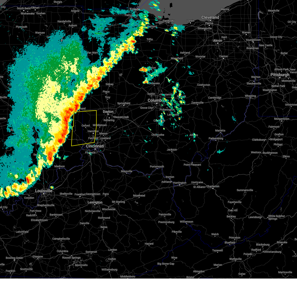 Svriln the national weather service in wilmington has issued a * severe thunderstorm warning for, eastern franklin county in southeastern indiana, southeastern wayne county in east central indiana, union county in east central indiana, northern dearborn county in southeastern indiana, northwestern hamilton county in southwestern ohio, butler county in southwestern ohio, preble county in west central ohio, * until 900 pm edt. * at 755 pm edt, severe thunderstorms were located along a line extending from cambridge city to near osgood, moving east at 60 mph (radar indicated). Hazards include 60 mph wind gusts and quarter size hail. Minor hail damage to vehicles is possible. Expect wind damage to trees and power lines. Svriln the national weather service in wilmington has issued a * severe thunderstorm warning for, eastern franklin county in southeastern indiana, southeastern wayne county in east central indiana, union county in east central indiana, northern dearborn county in southeastern indiana, northwestern hamilton county in southwestern ohio, butler county in southwestern ohio, preble county in west central ohio, * until 900 pm edt. * at 755 pm edt, severe thunderstorms were located along a line extending from cambridge city to near osgood, moving east at 60 mph (radar indicated). Hazards include 60 mph wind gusts and quarter size hail. Minor hail damage to vehicles is possible. Expect wind damage to trees and power lines.
|
| 3/30/2025 7:51 PM EDT |
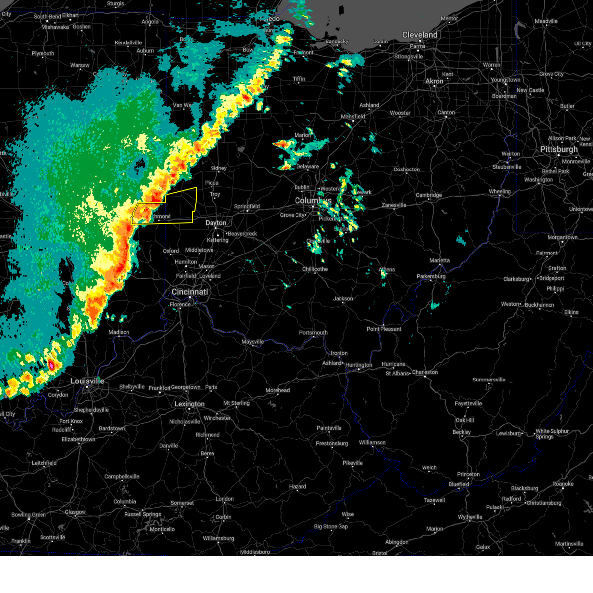 Svriln the national weather service in wilmington has issued a * severe thunderstorm warning for, wayne county in east central indiana, northern preble county in west central ohio, southern darke county in west central ohio, * until 830 pm edt. * at 750 pm edt, severe thunderstorms were located along a line extending from 6 miles west of fountain city to connersville, moving east at 60 mph (radar indicated). Hazards include 60 mph wind gusts and penny size hail. expect damage to trees and power lines Svriln the national weather service in wilmington has issued a * severe thunderstorm warning for, wayne county in east central indiana, northern preble county in west central ohio, southern darke county in west central ohio, * until 830 pm edt. * at 750 pm edt, severe thunderstorms were located along a line extending from 6 miles west of fountain city to connersville, moving east at 60 mph (radar indicated). Hazards include 60 mph wind gusts and penny size hail. expect damage to trees and power lines
|
| 3/19/2025 10:09 PM EDT |
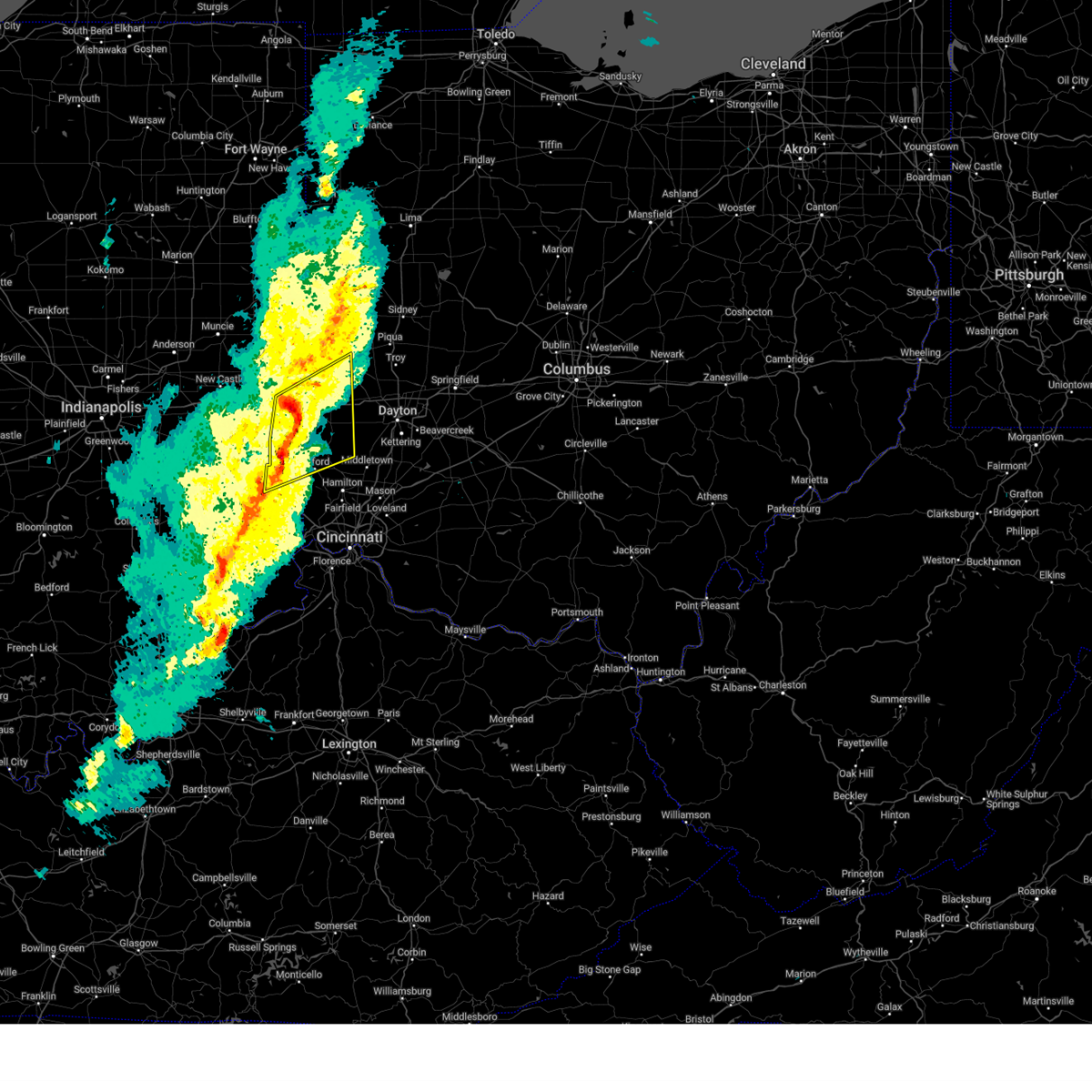 At 1009 pm edt, a severe thunderstorm was located over richmond, moving northeast at 50 mph (radar indicated). Hazards include 60 mph wind gusts. Expect damage to trees and power lines. locations impacted include, goodwins corner, west florence, abington, brownsville, morning sun, new madison, west alexandria, wheatville, interstate 70 at us route 127, muttonville, new hope, boston, camden, fairhaven, billingsville, arcanum, clifton, whitewater, lewisburg, and new paris. this includes the following interstates, i-70 in indiana between mile markers 145 and 156. I-70 in ohio between mile markers 0 and 17. At 1009 pm edt, a severe thunderstorm was located over richmond, moving northeast at 50 mph (radar indicated). Hazards include 60 mph wind gusts. Expect damage to trees and power lines. locations impacted include, goodwins corner, west florence, abington, brownsville, morning sun, new madison, west alexandria, wheatville, interstate 70 at us route 127, muttonville, new hope, boston, camden, fairhaven, billingsville, arcanum, clifton, whitewater, lewisburg, and new paris. this includes the following interstates, i-70 in indiana between mile markers 145 and 156. I-70 in ohio between mile markers 0 and 17.
|
| 3/19/2025 10:09 PM EDT |
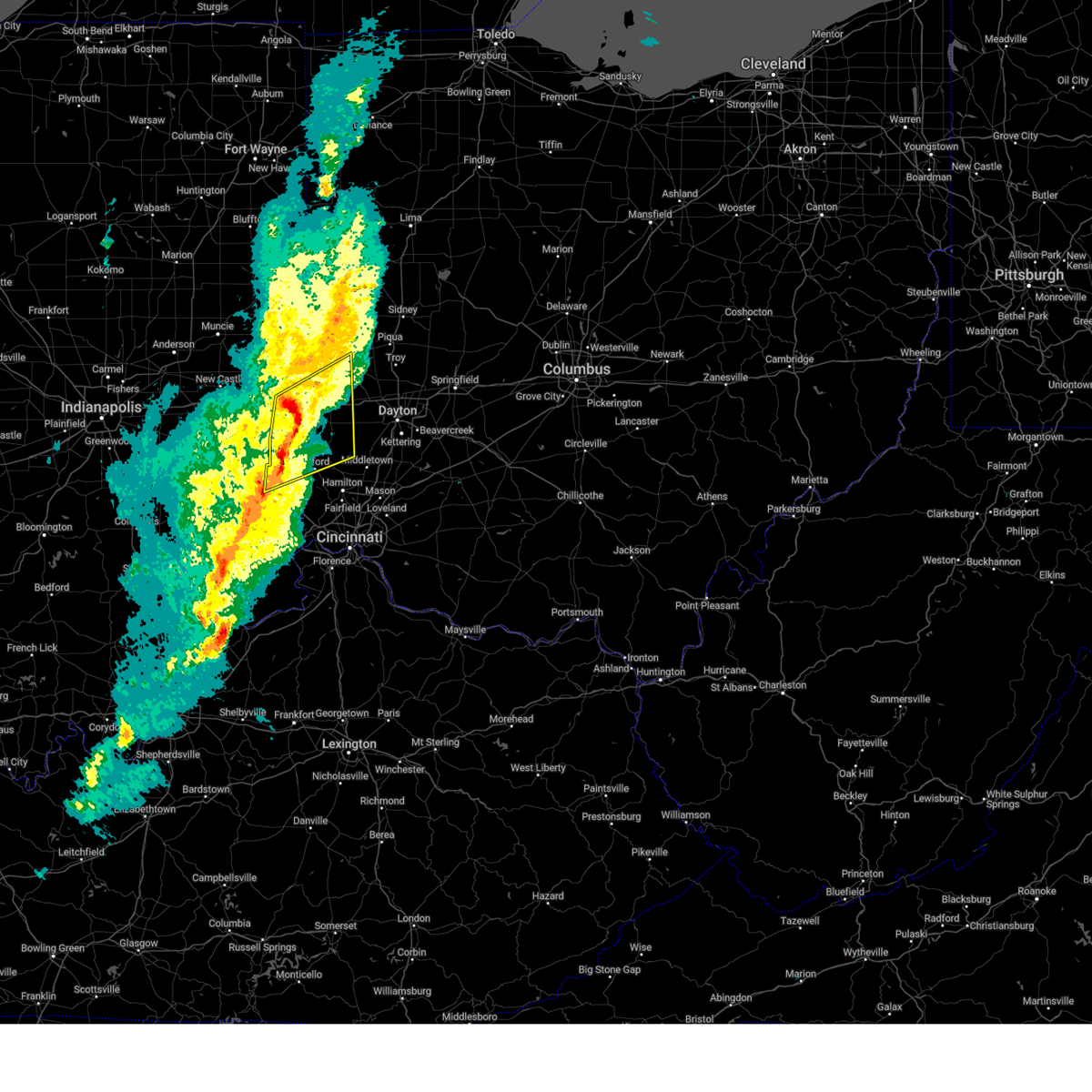 the severe thunderstorm warning has been cancelled and is no longer in effect the severe thunderstorm warning has been cancelled and is no longer in effect
|
| 3/19/2025 10:00 PM EDT |
 The storm which prompted the warning has moved out of the area. therefore, this warning will be allowed to expire, with a new warning issued upstream. a severe thunderstorm watch remains in effect until 100 am edt for southeastern and east central indiana. please report previous wind damage or hail to the national weather service by going to our website at weather.gov/iln and submitting your report via social media. remember, a severe thunderstorm warning still remains in effect. The storm which prompted the warning has moved out of the area. therefore, this warning will be allowed to expire, with a new warning issued upstream. a severe thunderstorm watch remains in effect until 100 am edt for southeastern and east central indiana. please report previous wind damage or hail to the national weather service by going to our website at weather.gov/iln and submitting your report via social media. remember, a severe thunderstorm warning still remains in effect.
|
| 3/19/2025 9:58 PM EDT |
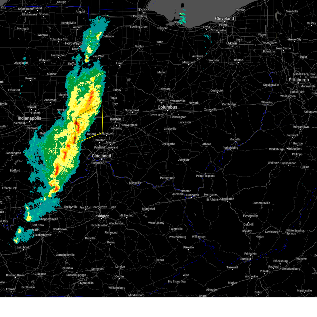 Svriln the national weather service in wilmington has issued a * severe thunderstorm warning for, northeastern franklin county in southeastern indiana, southeastern wayne county in east central indiana, union county in east central indiana, southeastern fayette county in east central indiana, northwestern butler county in southwestern ohio, preble county in west central ohio, southern darke county in west central ohio, * until 1045 pm edt. * at 958 pm edt, a severe thunderstorm was located 7 miles south of centerville, moving northeast at 50 mph (radar indicated). Hazards include 60 mph wind gusts. expect damage to trees and power lines Svriln the national weather service in wilmington has issued a * severe thunderstorm warning for, northeastern franklin county in southeastern indiana, southeastern wayne county in east central indiana, union county in east central indiana, southeastern fayette county in east central indiana, northwestern butler county in southwestern ohio, preble county in west central ohio, southern darke county in west central ohio, * until 1045 pm edt. * at 958 pm edt, a severe thunderstorm was located 7 miles south of centerville, moving northeast at 50 mph (radar indicated). Hazards include 60 mph wind gusts. expect damage to trees and power lines
|
| 3/19/2025 9:51 PM EDT |
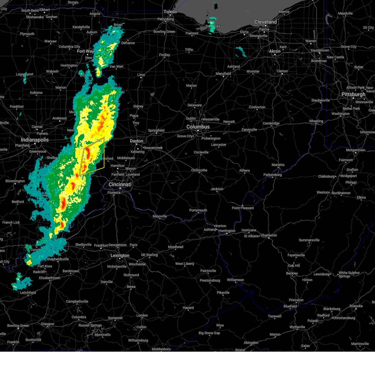 At 951 pm edt, a severe thunderstorm was located near connersville, moving northeast at 65 mph (radar indicated). Hazards include 60 mph wind gusts. Expect damage to trees and power lines. locations impacted include, richmond municipal airport, dunlapsville, whitewater state park, goodwins corner, mounds state recreation area, abington, mettel field, brownsville, hamburg, cottage grove, bunker hill, liberty, waterloo, connersville, peppertown, salem, oldenburg, springersville, boston, and witts station. this includes the following interstates, i-70 in indiana near mile marker 155. I-74 in indiana between mile markers 145 and 148. At 951 pm edt, a severe thunderstorm was located near connersville, moving northeast at 65 mph (radar indicated). Hazards include 60 mph wind gusts. Expect damage to trees and power lines. locations impacted include, richmond municipal airport, dunlapsville, whitewater state park, goodwins corner, mounds state recreation area, abington, mettel field, brownsville, hamburg, cottage grove, bunker hill, liberty, waterloo, connersville, peppertown, salem, oldenburg, springersville, boston, and witts station. this includes the following interstates, i-70 in indiana near mile marker 155. I-74 in indiana between mile markers 145 and 148.
|
| 3/19/2025 9:36 PM EDT |
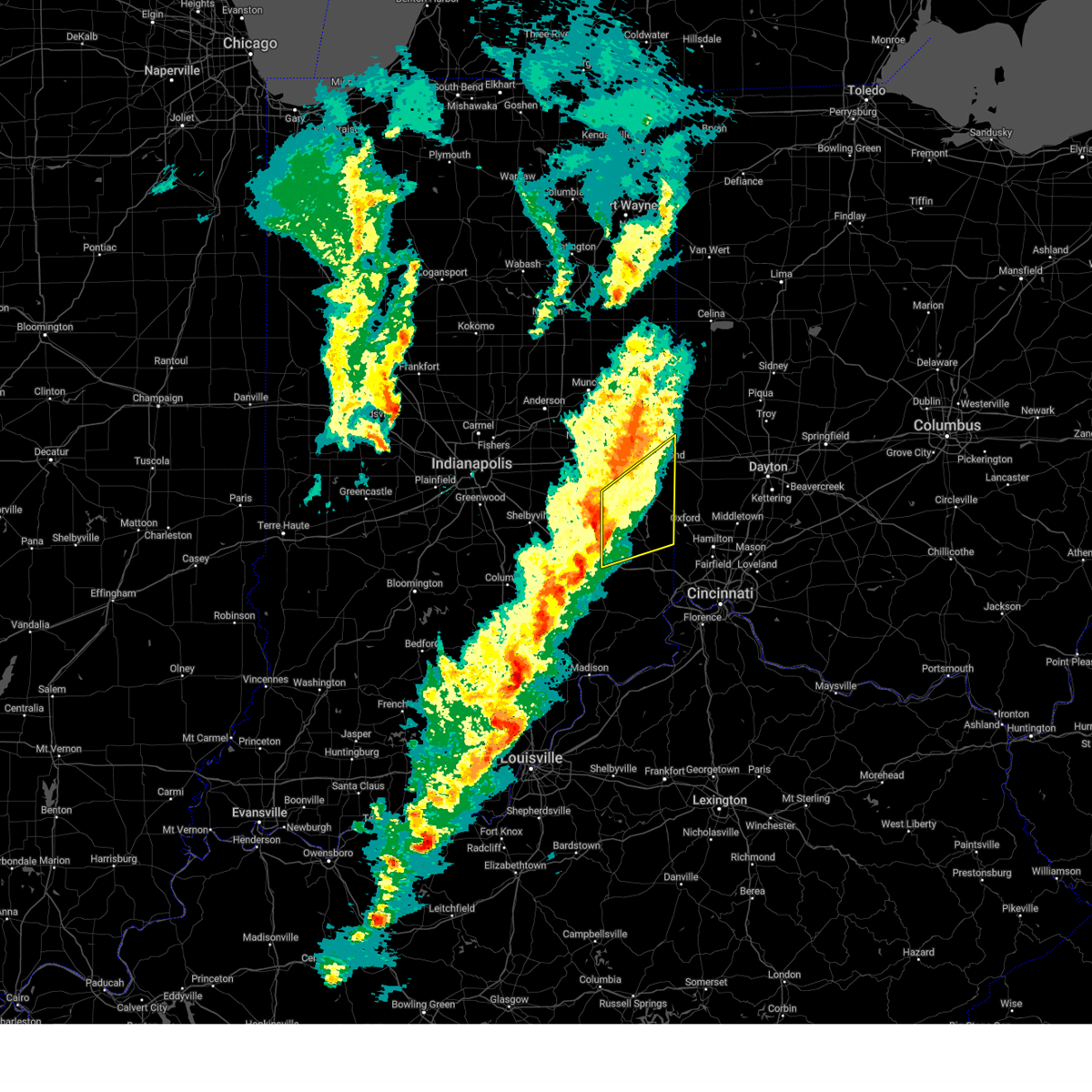 At 936 pm edt, a severe thunderstorm was located near lake santee, moving northeast at 55 mph (radar indicated). Hazards include 60 mph wind gusts and penny size hail. Expect damage to trees and power lines. locations impacted include, goodwins corner, abington, brownsville, waterloo, connersville, oldenburg, buena vista, boston, blooming grove, laurel, billingsville, clifton, alpine, whitewater, centerville, mixersville, brookville, columbia, kitchel, and richmond. this includes the following interstates, i-70 in indiana between mile markers 146 and 156. i-70 in ohio near mile marker 0. I-74 in indiana between mile markers 145 and 148. At 936 pm edt, a severe thunderstorm was located near lake santee, moving northeast at 55 mph (radar indicated). Hazards include 60 mph wind gusts and penny size hail. Expect damage to trees and power lines. locations impacted include, goodwins corner, abington, brownsville, waterloo, connersville, oldenburg, buena vista, boston, blooming grove, laurel, billingsville, clifton, alpine, whitewater, centerville, mixersville, brookville, columbia, kitchel, and richmond. this includes the following interstates, i-70 in indiana between mile markers 146 and 156. i-70 in ohio near mile marker 0. I-74 in indiana between mile markers 145 and 148.
|
| 3/19/2025 9:18 PM EDT |
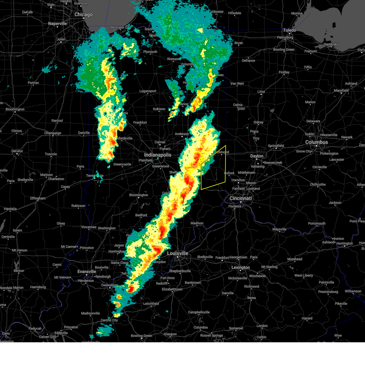 Svriln the national weather service in wilmington has issued a * severe thunderstorm warning for, franklin county in southeastern indiana, southern wayne county in east central indiana, union county in east central indiana, fayette county in east central indiana, * until 1000 pm edt. * at 917 pm edt, a severe thunderstorm was located over greensburg, moving northeast at 55 mph (radar indicated). Hazards include 60 mph wind gusts and penny size hail. expect damage to trees and power lines Svriln the national weather service in wilmington has issued a * severe thunderstorm warning for, franklin county in southeastern indiana, southern wayne county in east central indiana, union county in east central indiana, fayette county in east central indiana, * until 1000 pm edt. * at 917 pm edt, a severe thunderstorm was located over greensburg, moving northeast at 55 mph (radar indicated). Hazards include 60 mph wind gusts and penny size hail. expect damage to trees and power lines
|
| 3/15/2025 6:44 AM EDT |
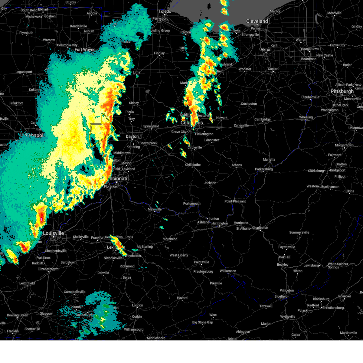 The severe thunderstorm which prompted the warning has moved out of the warned area. therefore, the warning will be allowed to expire. however, gusty winds are still possible with this thunderstorm. a tornado watch remains in effect until 1000 am edt for east central indiana, and west central ohio. please report previous wind damage or hail to the national weather service by going to our website at weather.gov/iln and submitting your report via social media. The severe thunderstorm which prompted the warning has moved out of the warned area. therefore, the warning will be allowed to expire. however, gusty winds are still possible with this thunderstorm. a tornado watch remains in effect until 1000 am edt for east central indiana, and west central ohio. please report previous wind damage or hail to the national weather service by going to our website at weather.gov/iln and submitting your report via social media.
|
| 3/15/2025 6:35 AM EDT | Storm damage reported in wayne county IN, 0.2 miles NNW of Richmond, IN |
| 3/15/2025 6:29 AM EDT |
 the severe thunderstorm warning has been cancelled and is no longer in effect the severe thunderstorm warning has been cancelled and is no longer in effect
|
| 3/15/2025 6:29 AM EDT |
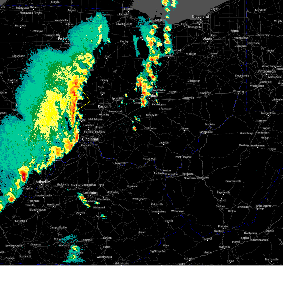 At 629 am edt, a severe thunderstorm was located near fountain city, moving northeast at 65 mph (radar indicated). Hazards include 60 mph wind gusts and penny size hail. Expect damage to trees and power lines. locations impacted include, richmond municipal airport, eldorado, ithaca, spring grove, abington, brownsville, new madison, interstate 70 at exit 145, williamsburg, hollansburg, bethel, fountain city, boston, middleboro, clifton, west manchester, whitewater, new paris, sharpeye, and centerville. this includes the following interstates, i-70 in indiana between mile markers 144 and 156. I-70 in ohio between mile markers 0 and 8. At 629 am edt, a severe thunderstorm was located near fountain city, moving northeast at 65 mph (radar indicated). Hazards include 60 mph wind gusts and penny size hail. Expect damage to trees and power lines. locations impacted include, richmond municipal airport, eldorado, ithaca, spring grove, abington, brownsville, new madison, interstate 70 at exit 145, williamsburg, hollansburg, bethel, fountain city, boston, middleboro, clifton, west manchester, whitewater, new paris, sharpeye, and centerville. this includes the following interstates, i-70 in indiana between mile markers 144 and 156. I-70 in ohio between mile markers 0 and 8.
|
| 3/15/2025 6:23 AM EDT |
 the severe thunderstorm warning has been cancelled and is no longer in effect the severe thunderstorm warning has been cancelled and is no longer in effect
|
| 3/15/2025 6:23 AM EDT |
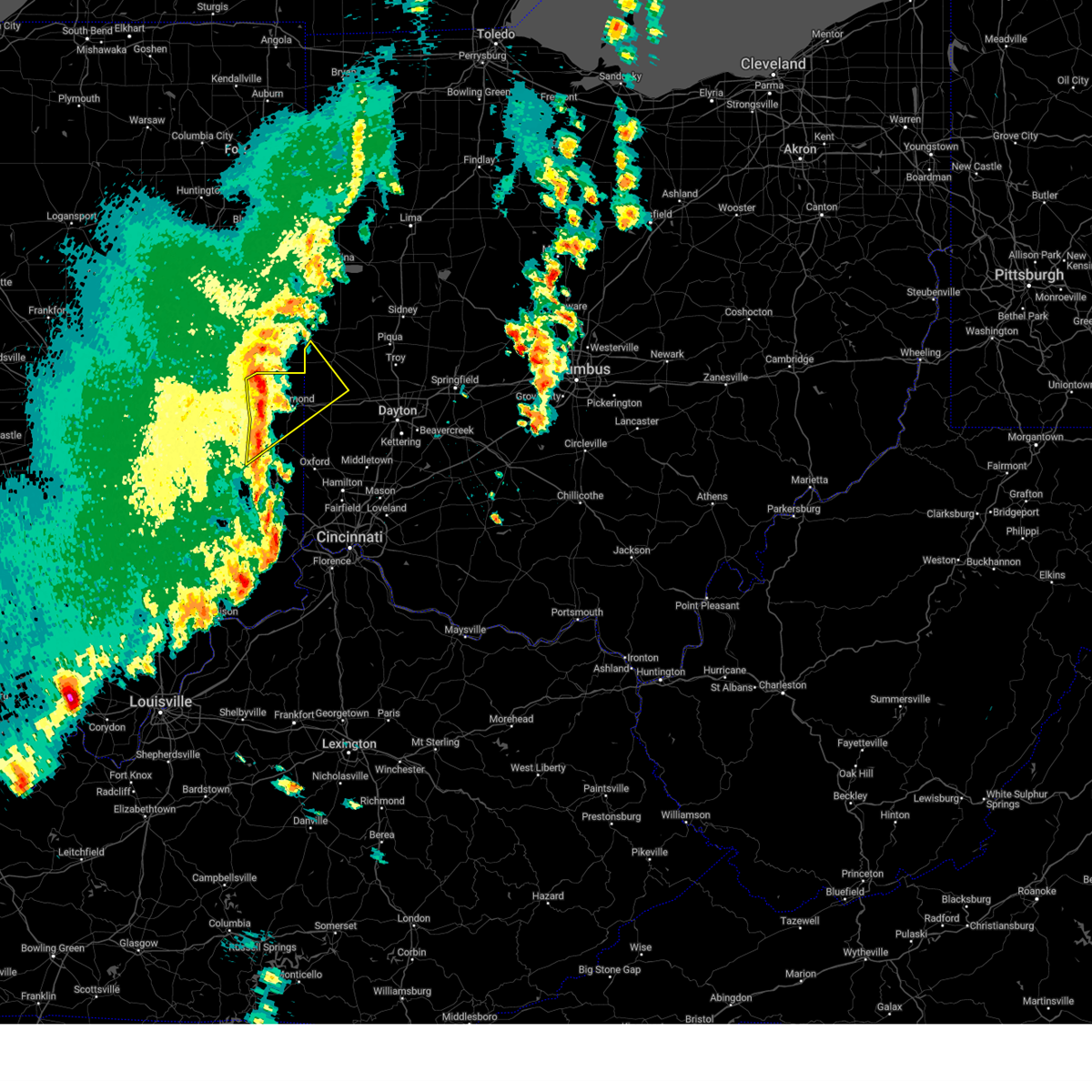 At 622 am edt, a severe thunderstorm was located over centerville, moving northeast at 65 mph (radar indicated). Hazards include 60 mph wind gusts and penny size hail. Expect damage to trees and power lines. locations impacted include, richmond municipal airport, eldorado, ithaca, spring grove, abington, mettel field, brownsville, cambridge city, new madison, waterloo, east germantown, connersville, interstate 70 at exit 145, economy, greens fork, williamsburg, hollansburg, bethel, hagerstown, and fountain city. this includes the following interstates, i-70 in indiana between mile markers 136 and 156. I-70 in ohio between mile markers 0 and 8. At 622 am edt, a severe thunderstorm was located over centerville, moving northeast at 65 mph (radar indicated). Hazards include 60 mph wind gusts and penny size hail. Expect damage to trees and power lines. locations impacted include, richmond municipal airport, eldorado, ithaca, spring grove, abington, mettel field, brownsville, cambridge city, new madison, waterloo, east germantown, connersville, interstate 70 at exit 145, economy, greens fork, williamsburg, hollansburg, bethel, hagerstown, and fountain city. this includes the following interstates, i-70 in indiana between mile markers 136 and 156. I-70 in ohio between mile markers 0 and 8.
|
| 3/15/2025 5:59 AM EDT |
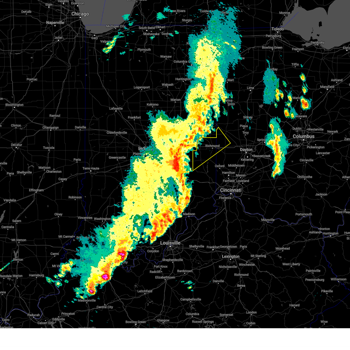 Svriln the national weather service in wilmington has issued a * severe thunderstorm warning for, northwestern franklin county in southeastern indiana, wayne county in east central indiana, northwestern union county in east central indiana, fayette county in east central indiana, northwestern preble county in west central ohio, southwestern darke county in west central ohio, * until 645 am edt. * at 558 am edt, a severe thunderstorm was located over rushville, moving northeast at 65 mph (radar indicated). Hazards include 70 mph wind gusts and quarter size hail. Minor hail damage to vehicles is possible. expect considerable tree damage. Wind damage is also likely to mobile homes, roofs, and outbuildings. Svriln the national weather service in wilmington has issued a * severe thunderstorm warning for, northwestern franklin county in southeastern indiana, wayne county in east central indiana, northwestern union county in east central indiana, fayette county in east central indiana, northwestern preble county in west central ohio, southwestern darke county in west central ohio, * until 645 am edt. * at 558 am edt, a severe thunderstorm was located over rushville, moving northeast at 65 mph (radar indicated). Hazards include 70 mph wind gusts and quarter size hail. Minor hail damage to vehicles is possible. expect considerable tree damage. Wind damage is also likely to mobile homes, roofs, and outbuildings.
|
| 7/29/2024 10:20 PM EDT |
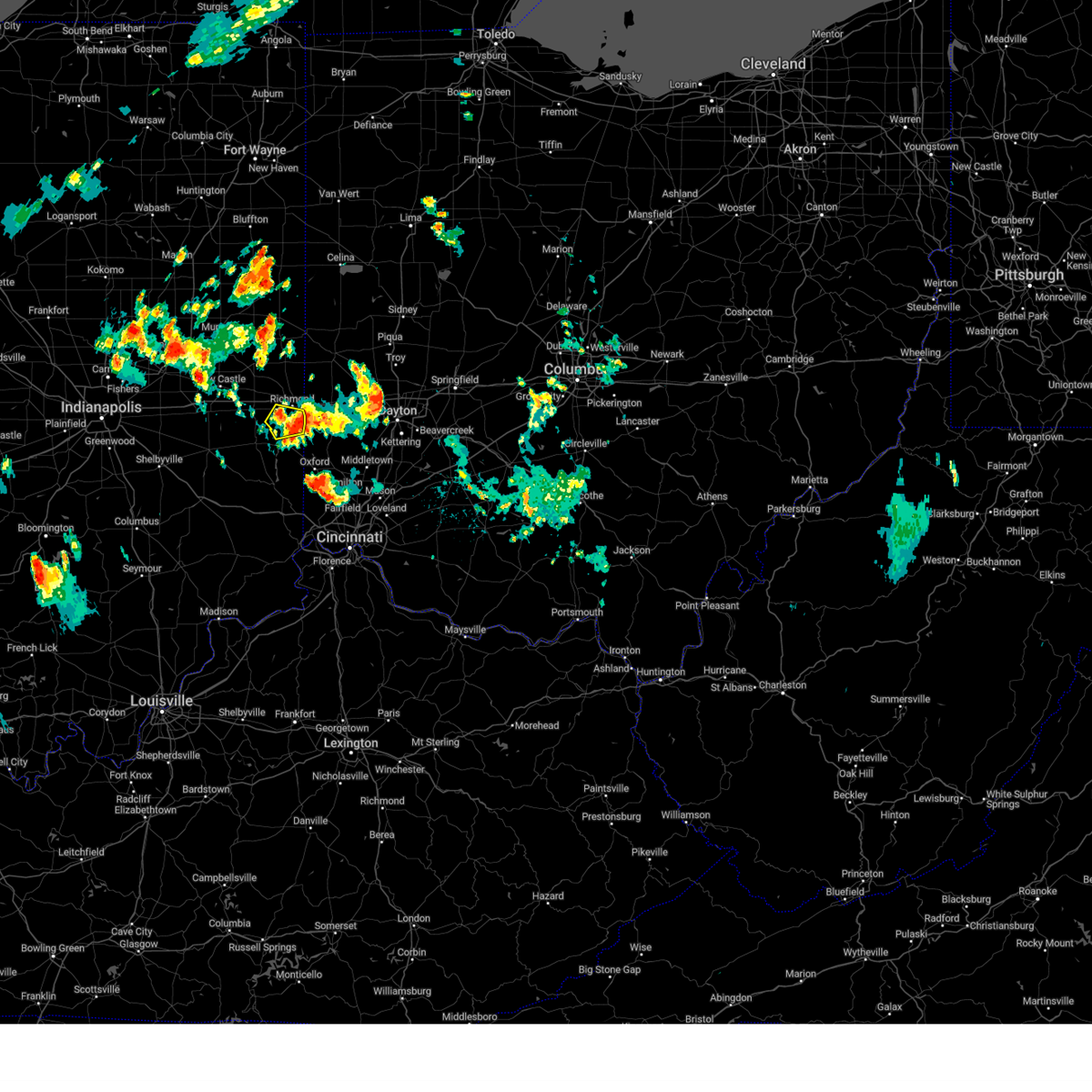 The storm which prompted the warning has weakened below severe limits and has exited the warned area. therefore, the warning will be allowed to expire. please report previous wind damage or hail to the national weather service by going to our website at weather.gov/iln and submitting your report via social media. The storm which prompted the warning has weakened below severe limits and has exited the warned area. therefore, the warning will be allowed to expire. please report previous wind damage or hail to the national weather service by going to our website at weather.gov/iln and submitting your report via social media.
|
| 7/29/2024 10:06 PM EDT |
 At 1006 pm edt, a severe thunderstorm was located near centerville, moving southeast at 15 mph (radar indicated). Hazards include 60 mph wind gusts and penny size hail. Expect damage to trees and power lines. Locations impacted include, richmond, centerville, abington, brownsville, boston, richmond municipal airport, witts station, philomath, clifton, and kitchel. At 1006 pm edt, a severe thunderstorm was located near centerville, moving southeast at 15 mph (radar indicated). Hazards include 60 mph wind gusts and penny size hail. Expect damage to trees and power lines. Locations impacted include, richmond, centerville, abington, brownsville, boston, richmond municipal airport, witts station, philomath, clifton, and kitchel.
|
| 7/29/2024 10:06 PM EDT |
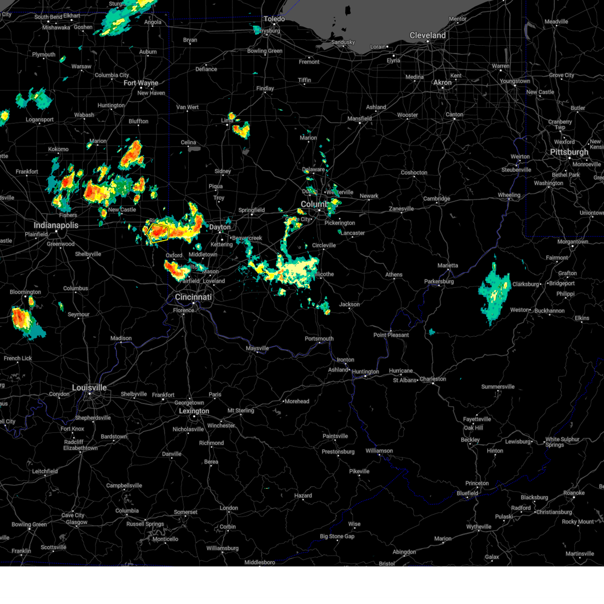 the severe thunderstorm warning has been cancelled and is no longer in effect the severe thunderstorm warning has been cancelled and is no longer in effect
|
| 7/29/2024 9:55 PM EDT |
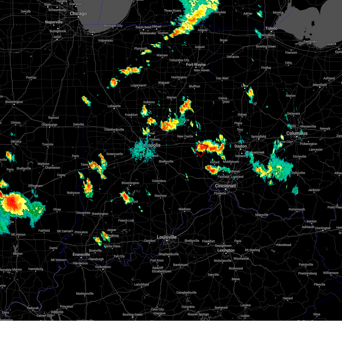 The tornado threat has diminished and the tornado warning has been cancelled. however, large hail and damaging winds remain likely and a severe thunderstorm warning remains in effect for the area. please report previous tornadoes, wind damage or hail to the national weather service by going to our website at weather.gov/iln and submitting your report via social media. remember, a severe thunderstorm warning still remains in effect for portions of fayette, wayne, and union counties. The tornado threat has diminished and the tornado warning has been cancelled. however, large hail and damaging winds remain likely and a severe thunderstorm warning remains in effect for the area. please report previous tornadoes, wind damage or hail to the national weather service by going to our website at weather.gov/iln and submitting your report via social media. remember, a severe thunderstorm warning still remains in effect for portions of fayette, wayne, and union counties.
|
| 7/29/2024 9:49 PM EDT |
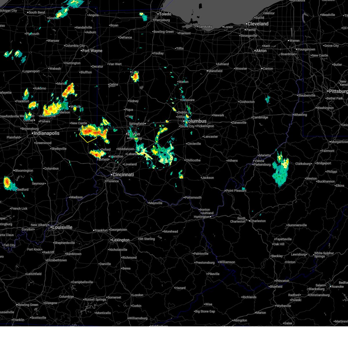 Svriln the national weather service in wilmington has issued a * severe thunderstorm warning for, southern wayne county in east central indiana, northern union county in east central indiana, east central fayette county in east central indiana, * until 1030 pm edt. * at 949 pm edt, a severe thunderstorm was located near centerville, moving southeast at 15 mph (radar indicated). Hazards include 60 mph wind gusts and penny size hail. expect damage to trees and power lines Svriln the national weather service in wilmington has issued a * severe thunderstorm warning for, southern wayne county in east central indiana, northern union county in east central indiana, east central fayette county in east central indiana, * until 1030 pm edt. * at 949 pm edt, a severe thunderstorm was located near centerville, moving southeast at 15 mph (radar indicated). Hazards include 60 mph wind gusts and penny size hail. expect damage to trees and power lines
|
| 7/29/2024 9:45 PM EDT |
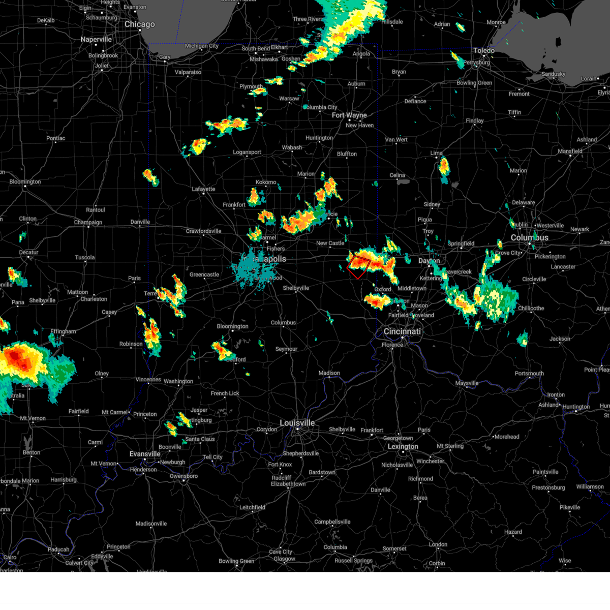 At 945 pm edt, a severe thunderstorm capable of producing a tornado was located near centerville, moving southeast at 15 mph (radar indicated rotation). Hazards include tornado. Flying debris will be dangerous to those caught without shelter. mobile homes will be damaged or destroyed. damage to roofs, windows, and vehicles will occur. tree damage is likely. Locations impacted include, richmond, connersville, centerville, waterloo, abington, philomath, beesons, and springersville. At 945 pm edt, a severe thunderstorm capable of producing a tornado was located near centerville, moving southeast at 15 mph (radar indicated rotation). Hazards include tornado. Flying debris will be dangerous to those caught without shelter. mobile homes will be damaged or destroyed. damage to roofs, windows, and vehicles will occur. tree damage is likely. Locations impacted include, richmond, connersville, centerville, waterloo, abington, philomath, beesons, and springersville.
|
| 7/29/2024 9:30 PM EDT |
 The tornado warning that was previously in effect has been reissued for portions of wayne, union, and fayette counties and is in effect until 10:00pm. please refer to that bulletin for the latest severe weather information. please report previous tornadoes, wind damage or hail to the national weather service by going to our website at weather.gov/iln and submitting your report via social media. remember, a tornado warning still remains in effect for portions of wayne, union, and fayette counties and is in effect until 10:00pm. The tornado warning that was previously in effect has been reissued for portions of wayne, union, and fayette counties and is in effect until 10:00pm. please refer to that bulletin for the latest severe weather information. please report previous tornadoes, wind damage or hail to the national weather service by going to our website at weather.gov/iln and submitting your report via social media. remember, a tornado warning still remains in effect for portions of wayne, union, and fayette counties and is in effect until 10:00pm.
|
| 7/29/2024 9:28 PM EDT |
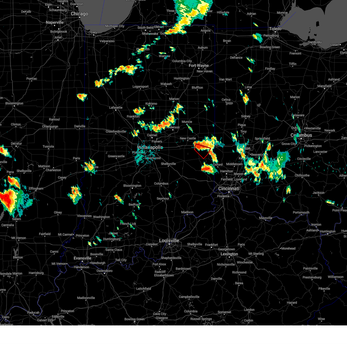 Toriln the national weather service in wilmington has issued a * tornado warning for, southern wayne county in east central indiana, northwestern union county in east central indiana, northeastern fayette county in east central indiana, * until 1000 pm edt. * at 928 pm edt, a severe thunderstorm capable of producing a tornado was located near cambridge city, moving southeast at 15 mph (radar indicated rotation). Hazards include tornado. Flying debris will be dangerous to those caught without shelter. mobile homes will be damaged or destroyed. damage to roofs, windows, and vehicles will occur. Tree damage is likely. Toriln the national weather service in wilmington has issued a * tornado warning for, southern wayne county in east central indiana, northwestern union county in east central indiana, northeastern fayette county in east central indiana, * until 1000 pm edt. * at 928 pm edt, a severe thunderstorm capable of producing a tornado was located near cambridge city, moving southeast at 15 mph (radar indicated rotation). Hazards include tornado. Flying debris will be dangerous to those caught without shelter. mobile homes will be damaged or destroyed. damage to roofs, windows, and vehicles will occur. Tree damage is likely.
|
| 7/29/2024 9:16 PM EDT |
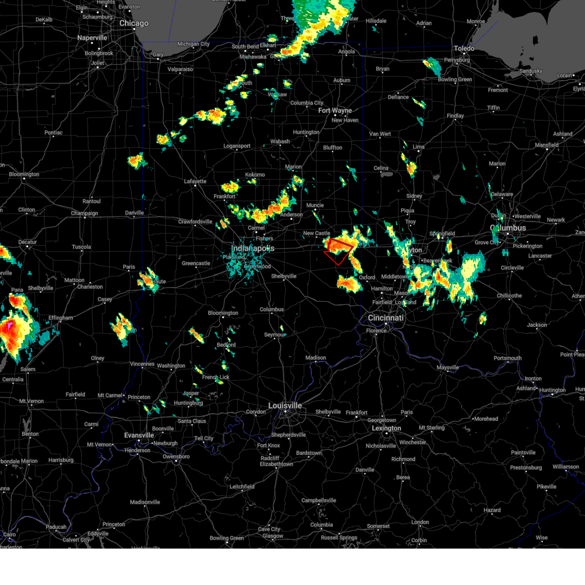 At 915 pm edt, a severe thunderstorm capable of producing a tornado was located over cambridge city, moving southeast at 15 mph (radar indicated rotation). Hazards include tornado. Flying debris will be dangerous to those caught without shelter. mobile homes will be damaged or destroyed. damage to roofs, windows, and vehicles will occur. tree damage is likely. locations impacted include, richmond, connersville, centerville, cambridge city, hagerstown, dublin, waterloo, milton, east germantown, mount auburn, mettel field, jacksonburg, interstate 70 at exit 145, and beesons. This includes i-70 in indiana between mile markers 134 and 145. At 915 pm edt, a severe thunderstorm capable of producing a tornado was located over cambridge city, moving southeast at 15 mph (radar indicated rotation). Hazards include tornado. Flying debris will be dangerous to those caught without shelter. mobile homes will be damaged or destroyed. damage to roofs, windows, and vehicles will occur. tree damage is likely. locations impacted include, richmond, connersville, centerville, cambridge city, hagerstown, dublin, waterloo, milton, east germantown, mount auburn, mettel field, jacksonburg, interstate 70 at exit 145, and beesons. This includes i-70 in indiana between mile markers 134 and 145.
|
| 7/29/2024 9:00 PM EDT |
 Toriln the national weather service in wilmington has issued a * tornado warning for, southwestern wayne county in east central indiana, northeastern fayette county in east central indiana, * until 930 pm edt. * at 900 pm edt, a severe thunderstorm capable of producing a tornado was located over dublin, moving southeast at 20 mph (radar indicated rotation). Hazards include tornado. Flying debris will be dangerous to those caught without shelter. mobile homes will be damaged or destroyed. damage to roofs, windows, and vehicles will occur. Tree damage is likely. Toriln the national weather service in wilmington has issued a * tornado warning for, southwestern wayne county in east central indiana, northeastern fayette county in east central indiana, * until 930 pm edt. * at 900 pm edt, a severe thunderstorm capable of producing a tornado was located over dublin, moving southeast at 20 mph (radar indicated rotation). Hazards include tornado. Flying debris will be dangerous to those caught without shelter. mobile homes will be damaged or destroyed. damage to roofs, windows, and vehicles will occur. Tree damage is likely.
|
| 7/29/2024 8:56 PM EDT |
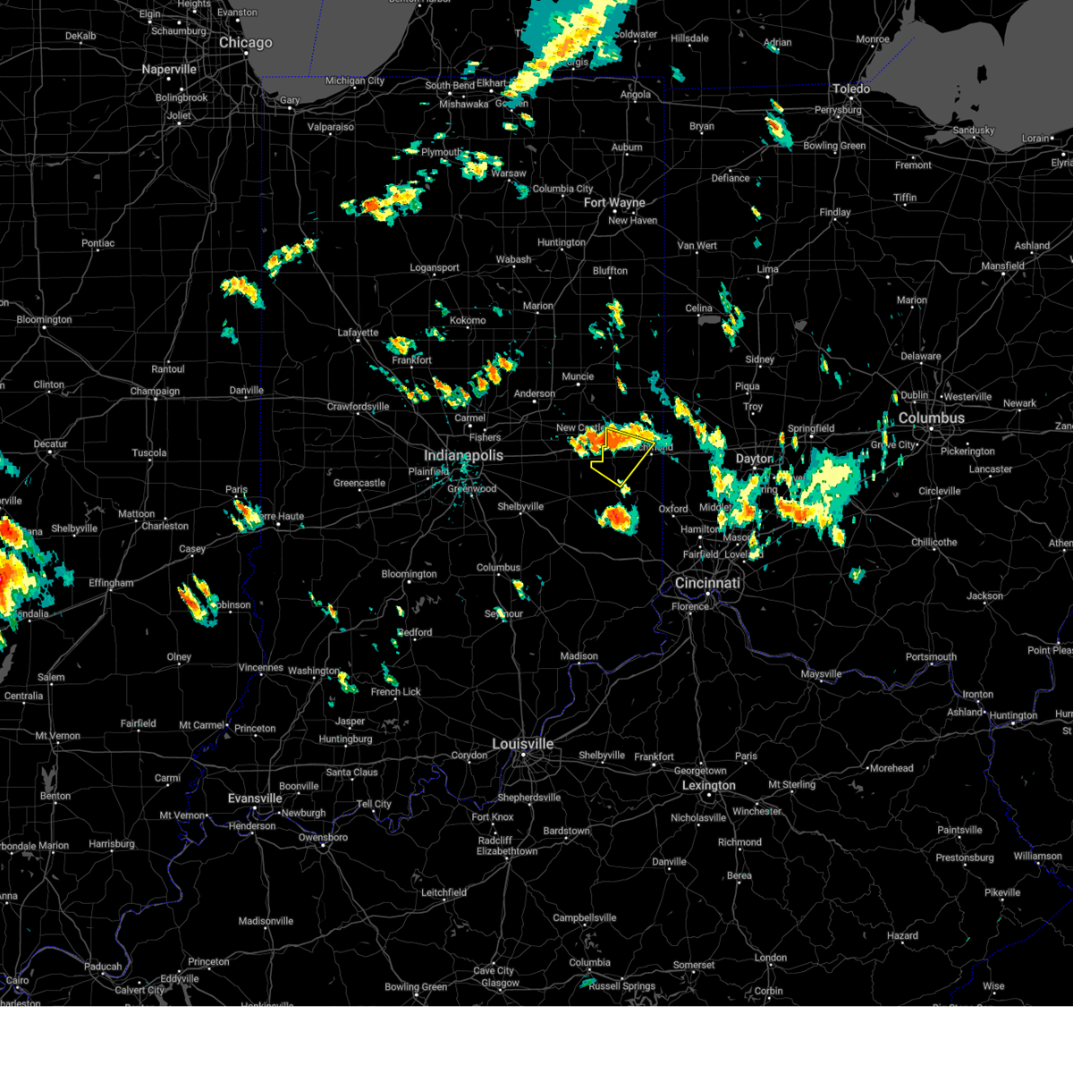 Svriln the national weather service in wilmington has issued a * severe thunderstorm warning for, wayne county in east central indiana, northern fayette county in east central indiana, * until 945 pm edt. * at 855 pm edt, a severe thunderstorm was located near dublin, moving southeast at 15 mph (radar indicated). Hazards include 60 mph wind gusts and nickel size hail. expect damage to trees and power lines Svriln the national weather service in wilmington has issued a * severe thunderstorm warning for, wayne county in east central indiana, northern fayette county in east central indiana, * until 945 pm edt. * at 855 pm edt, a severe thunderstorm was located near dublin, moving southeast at 15 mph (radar indicated). Hazards include 60 mph wind gusts and nickel size hail. expect damage to trees and power lines
|
| 7/9/2024 9:33 PM EDT |
 the severe thunderstorm warning has been cancelled and is no longer in effect the severe thunderstorm warning has been cancelled and is no longer in effect
|
| 7/9/2024 9:19 PM EDT |
 Svriln the national weather service in wilmington has issued a * severe thunderstorm warning for, northwestern preble county in west central ohio, * until 1000 pm edt. * at 918 pm edt, a severe thunderstorm was located near eaton, moving northeast at 30 mph (radar indicated). Hazards include 60 mph wind gusts. Expect damage to roofs, siding, and trees. this severe thunderstorm will be near, eaton and new paris around 925 pm edt. Lewisburg around 930 pm edt. Svriln the national weather service in wilmington has issued a * severe thunderstorm warning for, northwestern preble county in west central ohio, * until 1000 pm edt. * at 918 pm edt, a severe thunderstorm was located near eaton, moving northeast at 30 mph (radar indicated). Hazards include 60 mph wind gusts. Expect damage to roofs, siding, and trees. this severe thunderstorm will be near, eaton and new paris around 925 pm edt. Lewisburg around 930 pm edt.
|
| 7/9/2024 9:11 PM EDT |
 Svriln the national weather service in wilmington has issued a * severe thunderstorm warning for, southeastern wayne county in east central indiana, northeastern union county in east central indiana, central preble county in west central ohio, * until 945 pm edt. * at 910 pm edt, a severe thunderstorm was located 7 miles northeast of liberty, moving northeast at 30 mph (radar indicated). Hazards include 60 mph wind gusts and penny size hail. expect damage to trees and power lines Svriln the national weather service in wilmington has issued a * severe thunderstorm warning for, southeastern wayne county in east central indiana, northeastern union county in east central indiana, central preble county in west central ohio, * until 945 pm edt. * at 910 pm edt, a severe thunderstorm was located 7 miles northeast of liberty, moving northeast at 30 mph (radar indicated). Hazards include 60 mph wind gusts and penny size hail. expect damage to trees and power lines
|
| 6/17/2024 3:08 PM EDT |
 The storm which prompted the warning has weakened below severe limits and has exited the warned area. therefore, the warning will be allowed to expire. please report previous wind damage or hail to the national weather service by going to our website at weather.gov/iln and submitting your report via social media. The storm which prompted the warning has weakened below severe limits and has exited the warned area. therefore, the warning will be allowed to expire. please report previous wind damage or hail to the national weather service by going to our website at weather.gov/iln and submitting your report via social media.
|
| 6/17/2024 3:00 PM EDT |
 At 259 pm edt, a severe thunderstorm was located near fountain city, moving northeast at 15 mph (radar indicated). Hazards include 60 mph wind gusts and quarter size hail. Minor hail damage to vehicles is possible. expect wind damage to trees and power lines. locations impacted include, richmond, centerville, fountain city, greens fork, bethel, hollansburg, whitewater, interstate 70 at exit 145, middleboro, and williamsburg. This includes i-70 in indiana between mile markers 141 and 152. At 259 pm edt, a severe thunderstorm was located near fountain city, moving northeast at 15 mph (radar indicated). Hazards include 60 mph wind gusts and quarter size hail. Minor hail damage to vehicles is possible. expect wind damage to trees and power lines. locations impacted include, richmond, centerville, fountain city, greens fork, bethel, hollansburg, whitewater, interstate 70 at exit 145, middleboro, and williamsburg. This includes i-70 in indiana between mile markers 141 and 152.
|
| 6/17/2024 2:46 PM EDT |
 At 246 pm edt, a severe thunderstorm was located near centerville, moving northeast at 15 mph (radar indicated). Hazards include 60 mph wind gusts. Expect damage to trees and power lines. locations impacted include, richmond, centerville, new paris, fountain city, eldorado, greens fork, spring grove, bethel, hollansburg, whitewater, middleboro, interstate 70 at exit 145, and williamsburg. This includes i-70 in indiana between mile markers 141 and 154. At 246 pm edt, a severe thunderstorm was located near centerville, moving northeast at 15 mph (radar indicated). Hazards include 60 mph wind gusts. Expect damage to trees and power lines. locations impacted include, richmond, centerville, new paris, fountain city, eldorado, greens fork, spring grove, bethel, hollansburg, whitewater, middleboro, interstate 70 at exit 145, and williamsburg. This includes i-70 in indiana between mile markers 141 and 154.
|
| 6/17/2024 2:34 PM EDT |
 Svriln the national weather service in wilmington has issued a * severe thunderstorm warning for, eastern wayne county in east central indiana, northwestern preble county in west central ohio, southwestern darke county in west central ohio, * until 315 pm edt. * at 234 pm edt, a severe thunderstorm was located over centerville, moving northeast at 15 mph (radar indicated). Hazards include 60 mph wind gusts. expect damage to trees and power lines Svriln the national weather service in wilmington has issued a * severe thunderstorm warning for, eastern wayne county in east central indiana, northwestern preble county in west central ohio, southwestern darke county in west central ohio, * until 315 pm edt. * at 234 pm edt, a severe thunderstorm was located over centerville, moving northeast at 15 mph (radar indicated). Hazards include 60 mph wind gusts. expect damage to trees and power lines
|
| 5/7/2024 8:24 PM EDT |
 Toriln the national weather service in wilmington has issued a * tornado warning for, southeastern wayne county in east central indiana, union county in east central indiana, southeastern fayette county in east central indiana, southwestern preble county in west central ohio, * until 900 pm edt. * at 824 pm edt, a severe thunderstorm capable of producing a tornado was located near connersville, moving east at 30 mph (radar indicated rotation). Hazards include tornado. Flying debris will be dangerous to those caught without shelter. mobile homes will be damaged or destroyed. damage to roofs, windows, and vehicles will occur. Tree damage is likely. Toriln the national weather service in wilmington has issued a * tornado warning for, southeastern wayne county in east central indiana, union county in east central indiana, southeastern fayette county in east central indiana, southwestern preble county in west central ohio, * until 900 pm edt. * at 824 pm edt, a severe thunderstorm capable of producing a tornado was located near connersville, moving east at 30 mph (radar indicated rotation). Hazards include tornado. Flying debris will be dangerous to those caught without shelter. mobile homes will be damaged or destroyed. damage to roofs, windows, and vehicles will occur. Tree damage is likely.
|
| 5/7/2024 8:11 PM EDT |
 The storm which prompted the warning has moved out of the area. therefore, the warning will be allowed to expire. a tornado watch remains in effect until 100 am edt for southeastern and east central indiana. please report previous wind damage or hail to the national weather service by going to our website at weather.gov/iln and submitting your report via social media. remember, a tornado warning still remains in effect for southern fayette, western union, and northern franklin counties until 8:30 pm. The storm which prompted the warning has moved out of the area. therefore, the warning will be allowed to expire. a tornado watch remains in effect until 100 am edt for southeastern and east central indiana. please report previous wind damage or hail to the national weather service by going to our website at weather.gov/iln and submitting your report via social media. remember, a tornado warning still remains in effect for southern fayette, western union, and northern franklin counties until 8:30 pm.
|
| 5/7/2024 7:52 PM EDT |
 At 751 pm edt, a severe thunderstorm was located near glenwood, moving east at 50 mph (radar indicated). Hazards include 60 mph wind gusts and quarter size hail. Minor hail damage to vehicles is possible. expect wind damage to trees and power lines. locations impacted include, richmond, connersville, centerville, liberty, glenwood, salem, waterloo, blooming grove, columbia, bunker hill, abington, brownsville, laurel, milton, spring grove, boston, richmond municipal airport, dunlapsville, whitewater state park, and mounds state recreation area. This includes i-70 in indiana between mile markers 148 and 154. At 751 pm edt, a severe thunderstorm was located near glenwood, moving east at 50 mph (radar indicated). Hazards include 60 mph wind gusts and quarter size hail. Minor hail damage to vehicles is possible. expect wind damage to trees and power lines. locations impacted include, richmond, connersville, centerville, liberty, glenwood, salem, waterloo, blooming grove, columbia, bunker hill, abington, brownsville, laurel, milton, spring grove, boston, richmond municipal airport, dunlapsville, whitewater state park, and mounds state recreation area. This includes i-70 in indiana between mile markers 148 and 154.
|
| 5/7/2024 7:47 PM EDT |
 Svriln the national weather service in wilmington has issued a * severe thunderstorm warning for, northern franklin county in southeastern indiana, southern wayne county in east central indiana, union county in east central indiana, fayette county in east central indiana, * until 815 pm edt. * at 747 pm edt, a severe thunderstorm was located over glenwood, moving east at 50 mph (radar indicated). Hazards include 60 mph wind gusts and quarter size hail. Minor hail damage to vehicles is possible. Expect wind damage to trees and power lines. Svriln the national weather service in wilmington has issued a * severe thunderstorm warning for, northern franklin county in southeastern indiana, southern wayne county in east central indiana, union county in east central indiana, fayette county in east central indiana, * until 815 pm edt. * at 747 pm edt, a severe thunderstorm was located over glenwood, moving east at 50 mph (radar indicated). Hazards include 60 mph wind gusts and quarter size hail. Minor hail damage to vehicles is possible. Expect wind damage to trees and power lines.
|
| 4/2/2024 5:54 PM EDT |
 Svriln the national weather service in wilmington has issued a * severe thunderstorm warning for, northeastern wayne county in east central indiana, southwestern shelby county in west central ohio, northern preble county in west central ohio, southern darke county in west central ohio, miami county in west central ohio, * until 645 pm edt. * at 554 pm edt, a severe thunderstorm was located near new paris, moving northeast at 55 mph (radar indicated). Hazards include 60 mph wind gusts and quarter size hail. Minor hail damage to vehicles is possible. Expect wind damage to trees and power lines. Svriln the national weather service in wilmington has issued a * severe thunderstorm warning for, northeastern wayne county in east central indiana, southwestern shelby county in west central ohio, northern preble county in west central ohio, southern darke county in west central ohio, miami county in west central ohio, * until 645 pm edt. * at 554 pm edt, a severe thunderstorm was located near new paris, moving northeast at 55 mph (radar indicated). Hazards include 60 mph wind gusts and quarter size hail. Minor hail damage to vehicles is possible. Expect wind damage to trees and power lines.
|
| 4/2/2024 5:45 PM EDT | Barns damaged. time estimated from rada in wayne county IN, 3.7 miles SW of Richmond, IN |
| 3/14/2024 9:34 PM EDT |
 At 933 pm edt, a severe thunderstorm was located near fountain city, moving east at 60 mph (radar indicated). Hazards include 60 mph wind gusts and quarter size hail. Minor hail damage to vehicles is possible. expect wind damage to trees and power lines. Locations impacted include, arcanum, lewisburg, new madison, wayne lakes, eldorado, verona, west manchester, pitsburg, bethel, hollansburg, gordon, ithaca, castine, whitewater, and middleboro. At 933 pm edt, a severe thunderstorm was located near fountain city, moving east at 60 mph (radar indicated). Hazards include 60 mph wind gusts and quarter size hail. Minor hail damage to vehicles is possible. expect wind damage to trees and power lines. Locations impacted include, arcanum, lewisburg, new madison, wayne lakes, eldorado, verona, west manchester, pitsburg, bethel, hollansburg, gordon, ithaca, castine, whitewater, and middleboro.
|
| 3/14/2024 9:16 PM EDT |
 The tornado threat has diminished and the tornado warning has been cancelled. however, large hail and damaging winds remain likely and a severe thunderstorm warning remains in effect for the area. a tornado watch remains in effect until midnight edt for east central indiana, and west central ohio. please report previous tornadoes, wind damage or hail to the national weather service by going to our website at weather.gov/iln and submitting your report via social media. The tornado threat has diminished and the tornado warning has been cancelled. however, large hail and damaging winds remain likely and a severe thunderstorm warning remains in effect for the area. a tornado watch remains in effect until midnight edt for east central indiana, and west central ohio. please report previous tornadoes, wind damage or hail to the national weather service by going to our website at weather.gov/iln and submitting your report via social media.
|
| 3/14/2024 9:15 PM EDT |
 Svriln the national weather service in wilmington has issued a * severe thunderstorm warning for, northern wayne county in east central indiana, northern preble county in west central ohio, southern darke county in west central ohio, northwestern montgomery county in west central ohio, * until 1000 pm edt. * at 914 pm edt, a severe thunderstorm was located near fountain city, moving east at 45 mph (radar indicated). Hazards include 60 mph wind gusts and quarter size hail. Minor hail damage to vehicles is possible. Expect wind damage to trees and power lines. Svriln the national weather service in wilmington has issued a * severe thunderstorm warning for, northern wayne county in east central indiana, northern preble county in west central ohio, southern darke county in west central ohio, northwestern montgomery county in west central ohio, * until 1000 pm edt. * at 914 pm edt, a severe thunderstorm was located near fountain city, moving east at 45 mph (radar indicated). Hazards include 60 mph wind gusts and quarter size hail. Minor hail damage to vehicles is possible. Expect wind damage to trees and power lines.
|
| 3/14/2024 9:04 PM EDT |
 At 903 pm edt, a severe thunderstorm capable of producing a tornado was located near fountain city, moving east at 35 mph (radar indicated rotation). Hazards include tornado and golf ball size hail. Flying debris will be dangerous to those caught without shelter. mobile homes will be damaged or destroyed. damage to roofs, windows, and vehicles will occur. tree damage is likely. locations impacted include, richmond, fountain city, bethel, whitewater, middleboro, and williamsburg. This includes i-70 in indiana between mile markers 151 and 154. At 903 pm edt, a severe thunderstorm capable of producing a tornado was located near fountain city, moving east at 35 mph (radar indicated rotation). Hazards include tornado and golf ball size hail. Flying debris will be dangerous to those caught without shelter. mobile homes will be damaged or destroyed. damage to roofs, windows, and vehicles will occur. tree damage is likely. locations impacted include, richmond, fountain city, bethel, whitewater, middleboro, and williamsburg. This includes i-70 in indiana between mile markers 151 and 154.
|
| 3/14/2024 8:53 PM EDT |
 At 853 pm edt, a severe thunderstorm capable of producing a tornado was located over hagerstown, moving east at 45 mph (radar indicated rotation). Hazards include tornado and golf ball size hail. Flying debris will be dangerous to those caught without shelter. mobile homes will be damaged or destroyed. damage to roofs, windows, and vehicles will occur. tree damage is likely. locations impacted include, richmond, centerville, hagerstown, fountain city, franklin, greens fork, spring grove, bethel, economy, whitewater, middleboro, interstate 70 at exit 145, and williamsburg. This includes i-70 in indiana between mile markers 140 and 155. At 853 pm edt, a severe thunderstorm capable of producing a tornado was located over hagerstown, moving east at 45 mph (radar indicated rotation). Hazards include tornado and golf ball size hail. Flying debris will be dangerous to those caught without shelter. mobile homes will be damaged or destroyed. damage to roofs, windows, and vehicles will occur. tree damage is likely. locations impacted include, richmond, centerville, hagerstown, fountain city, franklin, greens fork, spring grove, bethel, economy, whitewater, middleboro, interstate 70 at exit 145, and williamsburg. This includes i-70 in indiana between mile markers 140 and 155.
|
| 3/14/2024 8:42 PM EDT |
 Toriln the national weather service in wilmington has issued a * tornado warning for, wayne county in east central indiana, * until 915 pm edt. * at 842 pm edt, a severe thunderstorm capable of producing a tornado was located near new castle, moving east at 45 mph (radar indicated rotation). Hazards include tornado and golf ball size hail. Flying debris will be dangerous to those caught without shelter. mobile homes will be damaged or destroyed. damage to roofs, windows, and vehicles will occur. Tree damage is likely. Toriln the national weather service in wilmington has issued a * tornado warning for, wayne county in east central indiana, * until 915 pm edt. * at 842 pm edt, a severe thunderstorm capable of producing a tornado was located near new castle, moving east at 45 mph (radar indicated rotation). Hazards include tornado and golf ball size hail. Flying debris will be dangerous to those caught without shelter. mobile homes will be damaged or destroyed. damage to roofs, windows, and vehicles will occur. Tree damage is likely.
|
| 3/14/2024 8:33 PM EDT |
 Svriln the national weather service in wilmington has issued a * severe thunderstorm warning for, wayne county in east central indiana, * until 915 pm edt. * at 833 pm edt, a severe thunderstorm was located near new castle, moving east at 50 mph (radar indicated). Hazards include ping pong ball size hail. People and animals outdoors will be injured. Expect damage to roofs, siding, windows, and vehicles. Svriln the national weather service in wilmington has issued a * severe thunderstorm warning for, wayne county in east central indiana, * until 915 pm edt. * at 833 pm edt, a severe thunderstorm was located near new castle, moving east at 50 mph (radar indicated). Hazards include ping pong ball size hail. People and animals outdoors will be injured. Expect damage to roofs, siding, windows, and vehicles.
|
| 2/28/2024 3:54 AM EST |
 At 354 am est, a severe thunderstorm capable of producing a tornado was located near richmond, moving northeast at 45 mph (radar indicated rotation). Hazards include tornado. Flying debris will be dangerous to those caught without shelter. mobile homes will be damaged or destroyed. damage to roofs, windows, and vehicles will occur. tree damage is likely. locations impacted include, richmond, eaton, new paris, oklahoma, west florence, sugar valley, lake lakengren, and new hope. This includes i-70 in ohio between mile markers 0 and 9. At 354 am est, a severe thunderstorm capable of producing a tornado was located near richmond, moving northeast at 45 mph (radar indicated rotation). Hazards include tornado. Flying debris will be dangerous to those caught without shelter. mobile homes will be damaged or destroyed. damage to roofs, windows, and vehicles will occur. tree damage is likely. locations impacted include, richmond, eaton, new paris, oklahoma, west florence, sugar valley, lake lakengren, and new hope. This includes i-70 in ohio between mile markers 0 and 9.
|
| 2/28/2024 3:54 AM EST |
 The storms which prompted the warning have moved out of the area. therefore, the warning will be allowed to expire. however, gusty winds and heavy rain are still possible with these thunderstorms. a tornado watch remains in effect until 600 am est for east central indiana, and west central ohio. please report previous wind damage or hail to the national weather service by going to our website at weather.gov/iln and submitting your report via social media. The storms which prompted the warning have moved out of the area. therefore, the warning will be allowed to expire. however, gusty winds and heavy rain are still possible with these thunderstorms. a tornado watch remains in effect until 600 am est for east central indiana, and west central ohio. please report previous wind damage or hail to the national weather service by going to our website at weather.gov/iln and submitting your report via social media.
|
| 2/28/2024 3:45 AM EST |
 At 345 am est, a severe thunderstorm capable of producing a tornado was located near liberty, moving northeast at 45 mph (radar indicated rotation). Hazards include tornado. Flying debris will be dangerous to those caught without shelter. mobile homes will be damaged or destroyed. damage to roofs, windows, and vehicles will occur. tree damage is likely. locations impacted include, richmond, eaton, liberty, new paris, abington, brownsville, boston, richmond municipal airport, witts station, oklahoma, west florence, clifton, kitchel, sugar valley, lake lakengren, and new hope. this includes the following interstates, i-70 in indiana near mile marker 156. I-70 in ohio between mile markers 0 and 9. At 345 am est, a severe thunderstorm capable of producing a tornado was located near liberty, moving northeast at 45 mph (radar indicated rotation). Hazards include tornado. Flying debris will be dangerous to those caught without shelter. mobile homes will be damaged or destroyed. damage to roofs, windows, and vehicles will occur. tree damage is likely. locations impacted include, richmond, eaton, liberty, new paris, abington, brownsville, boston, richmond municipal airport, witts station, oklahoma, west florence, clifton, kitchel, sugar valley, lake lakengren, and new hope. this includes the following interstates, i-70 in indiana near mile marker 156. I-70 in ohio between mile markers 0 and 9.
|
| 2/28/2024 3:39 AM EST |
 Toriln the national weather service in wilmington has issued a * tornado warning for, southeastern wayne county in east central indiana, northern union county in east central indiana, east central fayette county in east central indiana, northwestern preble county in west central ohio, * until 415 am est. * at 338 am est, a severe thunderstorm capable of producing a tornado was located near connersville, moving northeast at 45 mph (radar indicated rotation). Hazards include tornado. Flying debris will be dangerous to those caught without shelter. mobile homes will be damaged or destroyed. damage to roofs, windows, and vehicles will occur. Tree damage is likely. Toriln the national weather service in wilmington has issued a * tornado warning for, southeastern wayne county in east central indiana, northern union county in east central indiana, east central fayette county in east central indiana, northwestern preble county in west central ohio, * until 415 am est. * at 338 am est, a severe thunderstorm capable of producing a tornado was located near connersville, moving northeast at 45 mph (radar indicated rotation). Hazards include tornado. Flying debris will be dangerous to those caught without shelter. mobile homes will be damaged or destroyed. damage to roofs, windows, and vehicles will occur. Tree damage is likely.
|
| 2/28/2024 3:31 AM EST |
 At 330 am est, severe thunderstorms were located along a line extending from 6 miles west of fountain city to connersville, moving east at 45 mph (radar indicated). Hazards include 60 mph wind gusts and penny size hail. Expect damage to trees and power lines. locations impacted include, richmond, connersville, centerville, cambridge city, liberty, fountain city, glenwood, waterloo, columbia, bunker hill, abington, brownsville, milton, greens fork, east germantown, spring grove, bethel, boston, whitewater, and richmond municipal airport. this includes the following interstates, i-70 in indiana between mile markers 138 and 156. I-70 in ohio near mile marker 0. At 330 am est, severe thunderstorms were located along a line extending from 6 miles west of fountain city to connersville, moving east at 45 mph (radar indicated). Hazards include 60 mph wind gusts and penny size hail. Expect damage to trees and power lines. locations impacted include, richmond, connersville, centerville, cambridge city, liberty, fountain city, glenwood, waterloo, columbia, bunker hill, abington, brownsville, milton, greens fork, east germantown, spring grove, bethel, boston, whitewater, and richmond municipal airport. this includes the following interstates, i-70 in indiana between mile markers 138 and 156. I-70 in ohio near mile marker 0.
|
| 2/28/2024 3:23 AM EST |
 At 323 am est, severe thunderstorms were located along a line extending from hagerstown to glenwood, moving east at 45 mph (radar indicated). Hazards include 60 mph wind gusts. Expect damage to trees and power lines. locations impacted include, richmond, connersville, centerville, cambridge city, liberty, hagerstown, fountain city, dublin, glenwood, waterloo, columbia, bunker hill, abington, brownsville, milton, greens fork, east germantown, spring grove, bethel, and economy. this includes the following interstates, i-70 in indiana between mile markers 134 and 156. I-70 in ohio near mile marker 0. At 323 am est, severe thunderstorms were located along a line extending from hagerstown to glenwood, moving east at 45 mph (radar indicated). Hazards include 60 mph wind gusts. Expect damage to trees and power lines. locations impacted include, richmond, connersville, centerville, cambridge city, liberty, hagerstown, fountain city, dublin, glenwood, waterloo, columbia, bunker hill, abington, brownsville, milton, greens fork, east germantown, spring grove, bethel, and economy. this includes the following interstates, i-70 in indiana between mile markers 134 and 156. I-70 in ohio near mile marker 0.
|
| 2/28/2024 3:08 AM EST |
 Svriln the national weather service in wilmington has issued a * severe thunderstorm warning for, wayne county in east central indiana, northwestern union county in east central indiana, fayette county in east central indiana, * until 400 am est. * at 308 am est, severe thunderstorms were located along a line extending from 6 miles northeast of new castle to rushville, moving east at 55 mph (radar indicated). Hazards include 60 mph wind gusts. expect damage to trees and power lines Svriln the national weather service in wilmington has issued a * severe thunderstorm warning for, wayne county in east central indiana, northwestern union county in east central indiana, fayette county in east central indiana, * until 400 am est. * at 308 am est, severe thunderstorms were located along a line extending from 6 miles northeast of new castle to rushville, moving east at 55 mph (radar indicated). Hazards include 60 mph wind gusts. expect damage to trees and power lines
|
| 7/29/2023 4:15 AM EDT |
 At 415 am edt, a severe thunderstorm was located 7 miles west of eaton, moving southeast at 60 mph (radar indicated). Hazards include 60 mph wind gusts and penny size hail. expect damage to trees and power lines At 415 am edt, a severe thunderstorm was located 7 miles west of eaton, moving southeast at 60 mph (radar indicated). Hazards include 60 mph wind gusts and penny size hail. expect damage to trees and power lines
|
| 7/23/2023 6:12 PM EDT |
 The severe thunderstorm warning for western franklin county in southeastern indiana, southern wayne, western union and fayette counties in east central indiana will expire at 615 pm edt, the storms which prompted the warning have south into southwestern franklin county indiana. a new severe thundestorm warning has been issued for this storm as it moves to the southeast. therefore, the warning will be allowed to expire. please report previous wind damage or hail to the national weather service by going to our website at weather.gov/iln and submitting your report via social media. remember, a severe thunderstorm warning still remains in effect for southwestern franklin county indiana until 7:00 pm edt. The severe thunderstorm warning for western franklin county in southeastern indiana, southern wayne, western union and fayette counties in east central indiana will expire at 615 pm edt, the storms which prompted the warning have south into southwestern franklin county indiana. a new severe thundestorm warning has been issued for this storm as it moves to the southeast. therefore, the warning will be allowed to expire. please report previous wind damage or hail to the national weather service by going to our website at weather.gov/iln and submitting your report via social media. remember, a severe thunderstorm warning still remains in effect for southwestern franklin county indiana until 7:00 pm edt.
|
| 7/23/2023 5:48 PM EDT |
 At 547 pm edt, severe thunderstorms were located along a line extending from near dublin to near lake santee, moving southeast at 20 mph (radar indicated). Hazards include ping pong ball size hail and 60 mph wind gusts. People and animals outdoors will be injured. expect hail damage to roofs, siding, windows, and vehicles. expect wind damage to trees and power lines. locations impacted include, richmond, connersville, brookville, centerville, cambridge city, dublin, oldenburg, glenwood, lake santee, waterloo, blooming grove, columbia, metamora, bunker hill, abington, brownsville, laurel, east germantown, mount auburn and dunlapsville. this includes i-70 in indiana between mile markers 134 and 137. hail threat, radar indicated max hail size, 1. 50 in wind threat, radar indicated max wind gust, 60 mph. At 547 pm edt, severe thunderstorms were located along a line extending from near dublin to near lake santee, moving southeast at 20 mph (radar indicated). Hazards include ping pong ball size hail and 60 mph wind gusts. People and animals outdoors will be injured. expect hail damage to roofs, siding, windows, and vehicles. expect wind damage to trees and power lines. locations impacted include, richmond, connersville, brookville, centerville, cambridge city, dublin, oldenburg, glenwood, lake santee, waterloo, blooming grove, columbia, metamora, bunker hill, abington, brownsville, laurel, east germantown, mount auburn and dunlapsville. this includes i-70 in indiana between mile markers 134 and 137. hail threat, radar indicated max hail size, 1. 50 in wind threat, radar indicated max wind gust, 60 mph.
|
| 7/23/2023 5:39 PM EDT |
 The severe thunderstorm warning for southwestern wayne and northern fayette counties will expire at 545 pm edt, this severe thunderstorm warning has been replaced by a new warning for southern wayne and northern fayette counties in indiana. therefore, this warning will be allowed to expire. please report previous wind damage or hail to the national weather service by going to our website at weather.gov/iln and submitting your report via social media. remember, a severe thunderstorm warning still remains in effect. The severe thunderstorm warning for southwestern wayne and northern fayette counties will expire at 545 pm edt, this severe thunderstorm warning has been replaced by a new warning for southern wayne and northern fayette counties in indiana. therefore, this warning will be allowed to expire. please report previous wind damage or hail to the national weather service by going to our website at weather.gov/iln and submitting your report via social media. remember, a severe thunderstorm warning still remains in effect.
|
| 7/23/2023 5:36 PM EDT |
 At 535 pm edt, severe thunderstorms were located along a line extending from near dublin to near lake santee, moving southeast at 20 mph (radar indicated). Hazards include 60 mph wind gusts and quarter size hail. Minor hail damage to vehicles is possible. Expect wind damage to trees and power lines. At 535 pm edt, severe thunderstorms were located along a line extending from near dublin to near lake santee, moving southeast at 20 mph (radar indicated). Hazards include 60 mph wind gusts and quarter size hail. Minor hail damage to vehicles is possible. Expect wind damage to trees and power lines.
|
| 7/23/2023 5:06 PM EDT |
 At 504 pm edt, a severe thunderstorm was located just west of dublin, moving east at 20 mph (radar indicated). Hazards include 60 mph wind gusts and quarter size hail. Minor hail damage to vehicles is possible. Expect wind damage to trees and power lines. At 504 pm edt, a severe thunderstorm was located just west of dublin, moving east at 20 mph (radar indicated). Hazards include 60 mph wind gusts and quarter size hail. Minor hail damage to vehicles is possible. Expect wind damage to trees and power lines.
|
| 7/2/2023 5:53 PM EDT |
 At 553 pm edt, severe thunderstorms were located along a line extending from near new madison to 7 miles southeast of brookville, moving east at 35 mph (radar indicated). Hazards include 60 mph wind gusts. Expect damage to trees and power lines. locations impacted include, richmond, centerville, liberty, fountain city, west college corner, salem, scipio, spring grove, bethel, cedar grove, boston, mount carmel, whitewater, richmond municipal airport, goodwins corner, cottage grove, rockdale, sharptown, saint peter and witts station. this includes the following interstates, i-70 in indiana between mile markers 147 and 156. i-70 in ohio near mile marker 0. hail threat, radar indicated max hail size, <. 75 in wind threat, radar indicated max wind gust, 60 mph. At 553 pm edt, severe thunderstorms were located along a line extending from near new madison to 7 miles southeast of brookville, moving east at 35 mph (radar indicated). Hazards include 60 mph wind gusts. Expect damage to trees and power lines. locations impacted include, richmond, centerville, liberty, fountain city, west college corner, salem, scipio, spring grove, bethel, cedar grove, boston, mount carmel, whitewater, richmond municipal airport, goodwins corner, cottage grove, rockdale, sharptown, saint peter and witts station. this includes the following interstates, i-70 in indiana between mile markers 147 and 156. i-70 in ohio near mile marker 0. hail threat, radar indicated max hail size, <. 75 in wind threat, radar indicated max wind gust, 60 mph.
|
| 7/2/2023 5:45 PM EDT |
 At 545 pm edt, severe thunderstorms were located along a line extending from near fountain city to 6 miles south of brookville, moving east at 65 mph (radar indicated). Hazards include 70 mph wind gusts. Expect considerable tree damage. damage is likely to mobile homes, roofs, and outbuildings. locations impacted include, richmond, brookville, centerville, liberty, fountain city, west college corner, salem, abington, scipio, spring grove, bethel, cedar grove, boston, mount carmel, whitewater, richmond municipal airport, dunlapsville, whitewater state park, goodwins corner and mounds state recreation area. this includes the following interstates, i-70 in indiana between mile markers 147 and 156. i-70 in ohio near mile marker 0. thunderstorm damage threat, considerable hail threat, radar indicated max hail size, <. 75 in wind threat, radar indicated max wind gust, 70 mph. At 545 pm edt, severe thunderstorms were located along a line extending from near fountain city to 6 miles south of brookville, moving east at 65 mph (radar indicated). Hazards include 70 mph wind gusts. Expect considerable tree damage. damage is likely to mobile homes, roofs, and outbuildings. locations impacted include, richmond, brookville, centerville, liberty, fountain city, west college corner, salem, abington, scipio, spring grove, bethel, cedar grove, boston, mount carmel, whitewater, richmond municipal airport, dunlapsville, whitewater state park, goodwins corner and mounds state recreation area. this includes the following interstates, i-70 in indiana between mile markers 147 and 156. i-70 in ohio near mile marker 0. thunderstorm damage threat, considerable hail threat, radar indicated max hail size, <. 75 in wind threat, radar indicated max wind gust, 70 mph.
|
| 7/2/2023 5:31 PM EDT | Trees and large branches downed from abington to centerville to richmon in wayne county IN, 8 miles NNE of Richmond, IN |
| 7/2/2023 5:16 PM EDT |
 At 516 pm edt, severe thunderstorms were located along a line extending from 8 miles north of hagerstown to near lake santee, moving east at 35 mph (radar indicated). Hazards include 70 mph wind gusts and penny size hail. Expect considerable tree damage. Damage is likely to mobile homes, roofs, and outbuildings. At 516 pm edt, severe thunderstorms were located along a line extending from 8 miles north of hagerstown to near lake santee, moving east at 35 mph (radar indicated). Hazards include 70 mph wind gusts and penny size hail. Expect considerable tree damage. Damage is likely to mobile homes, roofs, and outbuildings.
|
| 6/29/2023 5:03 PM EDT | Tree down at intersection of henley and backmeyer rds. time estimated from rada in wayne county IN, 1.9 miles WNW of Richmond, IN |
| 6/29/2023 5:02 PM EDT | Tree down. time estimated from rada in wayne county IN, 0.2 miles NNW of Richmond, IN |
| 2/27/2023 2:22 PM EST |
 The severe thunderstorm warning for southeastern wayne, northern union and east central fayette counties in east central indiana will expire at 230 pm est, the storm which prompted the warning has moved out of the area. therefore, the warning will be allowed to expire. a tornado watch remains in effect until 600 pm est for east central indiana, and west central ohio. please report previous wind damage or hail to the national weather service by going to our website at weather.gov/iln and submitting your report via social media. The severe thunderstorm warning for southeastern wayne, northern union and east central fayette counties in east central indiana will expire at 230 pm est, the storm which prompted the warning has moved out of the area. therefore, the warning will be allowed to expire. a tornado watch remains in effect until 600 pm est for east central indiana, and west central ohio. please report previous wind damage or hail to the national weather service by going to our website at weather.gov/iln and submitting your report via social media.
|
| 2/27/2023 1:59 PM EST |
 At 159 pm est, a severe thunderstorm was located near connersville, moving northeast at 55 mph (radar indicated). Hazards include 60 mph wind gusts and quarter size hail. Minor hail damage to vehicles is possible. expect wind damage to trees and power lines. locations impacted include, richmond, connersville, centerville, waterloo, abington, spring grove, boston, whitewater, richmond municipal airport, mettel field, middleboro, philomath, beesons and witts station. This includes i-70 in indiana between mile markers 148 and 156. At 159 pm est, a severe thunderstorm was located near connersville, moving northeast at 55 mph (radar indicated). Hazards include 60 mph wind gusts and quarter size hail. Minor hail damage to vehicles is possible. expect wind damage to trees and power lines. locations impacted include, richmond, connersville, centerville, waterloo, abington, spring grove, boston, whitewater, richmond municipal airport, mettel field, middleboro, philomath, beesons and witts station. This includes i-70 in indiana between mile markers 148 and 156.
|
| 2/27/2023 1:50 PM EST |
 At 150 pm est, a severe thunderstorm was located near connersville, moving northeast at 55 mph (radar indicated). Hazards include 60 mph wind gusts and quarter size hail. Minor hail damage to vehicles is possible. expect wind damage to trees and power lines. locations impacted include, richmond, connersville, centerville, waterloo, bunker hill, abington, brownsville, spring grove, boston, whitewater, richmond municipal airport, witts station, mettel field, middleboro, clifton, interstate 70 at exit 145, kitchel, philomath, beesons and springersville. This includes i-70 in indiana between mile markers 145 and 156. At 150 pm est, a severe thunderstorm was located near connersville, moving northeast at 55 mph (radar indicated). Hazards include 60 mph wind gusts and quarter size hail. Minor hail damage to vehicles is possible. expect wind damage to trees and power lines. locations impacted include, richmond, connersville, centerville, waterloo, bunker hill, abington, brownsville, spring grove, boston, whitewater, richmond municipal airport, witts station, mettel field, middleboro, clifton, interstate 70 at exit 145, kitchel, philomath, beesons and springersville. This includes i-70 in indiana between mile markers 145 and 156.
|
| 2/27/2023 1:41 PM EST |
 At 141 pm est, a severe thunderstorm was located over glenwood, moving northeast at 55 mph (radar indicated). Hazards include 60 mph wind gusts. expect damage to trees and power lines At 141 pm est, a severe thunderstorm was located over glenwood, moving northeast at 55 mph (radar indicated). Hazards include 60 mph wind gusts. expect damage to trees and power lines
|
| 8/29/2022 6:10 PM EDT | Tree knocked down across us 27 in wayne county IN, 5 miles N of Richmond, IN |
| 8/1/2022 10:18 AM EDT |
 At 1018 am edt, severe thunderstorms were located along a line extending from brookville to richmond, moving east at 45 mph (radar indicated). Hazards include 60 mph wind gusts. Expect damage to trees and power lines. locations impacted include, richmond, batesville, brookville, centerville, liberty, fountain city, west college corner, oldenburg, salem, blooming grove, metamora, abington, brownsville, laurel, spring grove, bethel, boston, whitewater, richmond municipal airport and dunlapsville. this includes the following interstates, i-70 in indiana between mile markers 144 and 156. i-74 in indiana between mile markers 145 and 148. hail threat, radar indicated max hail size, <. 75 in wind threat, radar indicated max wind gust, 60 mph. At 1018 am edt, severe thunderstorms were located along a line extending from brookville to richmond, moving east at 45 mph (radar indicated). Hazards include 60 mph wind gusts. Expect damage to trees and power lines. locations impacted include, richmond, batesville, brookville, centerville, liberty, fountain city, west college corner, oldenburg, salem, blooming grove, metamora, abington, brownsville, laurel, spring grove, bethel, boston, whitewater, richmond municipal airport and dunlapsville. this includes the following interstates, i-70 in indiana between mile markers 144 and 156. i-74 in indiana between mile markers 145 and 148. hail threat, radar indicated max hail size, <. 75 in wind threat, radar indicated max wind gust, 60 mph.
|
| 8/1/2022 10:09 AM EDT |
 At 1009 am edt, severe thunderstorms were located along a line extending from lake santee to centerville, moving east at 50 mph (radar indicated). Hazards include 60 mph wind gusts. Expect damage to trees and power lines. locations impacted include, richmond, connersville, batesville, brookville, centerville, cambridge city, liberty, hagerstown, fountain city, west college corner, oldenburg, lake santee, salem, waterloo, blooming grove, columbia, metamora, bunker hill, abington and brownsville. this includes the following interstates, i-70 in indiana between mile markers 137 and 156. i-74 in indiana between mile markers 145 and 148. hail threat, radar indicated max hail size, <. 75 in wind threat, radar indicated max wind gust, 60 mph. At 1009 am edt, severe thunderstorms were located along a line extending from lake santee to centerville, moving east at 50 mph (radar indicated). Hazards include 60 mph wind gusts. Expect damage to trees and power lines. locations impacted include, richmond, connersville, batesville, brookville, centerville, cambridge city, liberty, hagerstown, fountain city, west college corner, oldenburg, lake santee, salem, waterloo, blooming grove, columbia, metamora, bunker hill, abington and brownsville. this includes the following interstates, i-70 in indiana between mile markers 137 and 156. i-74 in indiana between mile markers 145 and 148. hail threat, radar indicated max hail size, <. 75 in wind threat, radar indicated max wind gust, 60 mph.
|
| 8/1/2022 9:54 AM EDT |
 At 953 am edt, severe thunderstorms were located along a line extending from rushville to hagerstown, moving east at 45 mph (radar indicated). Hazards include 60 mph wind gusts. Expect damage to trees and power lines. locations impacted include, richmond, connersville, batesville, brookville, centerville, cambridge city, liberty, hagerstown, fountain city, dublin, west college corner, oldenburg, lake santee, franklin, salem, waterloo, blooming grove, columbia, metamora and bunker hill. this includes the following interstates, i-70 in indiana between mile markers 134 and 156. i-74 in indiana between mile markers 145 and 148. hail threat, radar indicated max hail size, <. 75 in wind threat, radar indicated max wind gust, 60 mph. At 953 am edt, severe thunderstorms were located along a line extending from rushville to hagerstown, moving east at 45 mph (radar indicated). Hazards include 60 mph wind gusts. Expect damage to trees and power lines. locations impacted include, richmond, connersville, batesville, brookville, centerville, cambridge city, liberty, hagerstown, fountain city, dublin, west college corner, oldenburg, lake santee, franklin, salem, waterloo, blooming grove, columbia, metamora and bunker hill. this includes the following interstates, i-70 in indiana between mile markers 134 and 156. i-74 in indiana between mile markers 145 and 148. hail threat, radar indicated max hail size, <. 75 in wind threat, radar indicated max wind gust, 60 mph.
|
| 8/1/2022 9:42 AM EDT |
 At 941 am edt, severe thunderstorms were located along a line extending from shelbyville to new castle, moving east at 45 mph (radar indicated). Hazards include 60 mph wind gusts. expect damage to trees and power lines At 941 am edt, severe thunderstorms were located along a line extending from shelbyville to new castle, moving east at 45 mph (radar indicated). Hazards include 60 mph wind gusts. expect damage to trees and power lines
|
| 7/23/2022 10:29 AM EDT | A couple of medium-sized branches down. photo verified. time estimated from rada in wayne county IN, 1.9 miles NNE of Richmond, IN |
| 7/23/2022 10:28 AM EDT |
 At 1028 am edt, severe thunderstorms were located along a line extending from near covington to arcanum to near richmond, moving southeast at 55 mph (radar indicated). Hazards include 60 mph wind gusts. Expect damage to trees and power lines. locations impacted include, richmond, greenville, centerville, cambridge city, versailles, arcanum, hagerstown, new paris, ansonia, new madison, fountain city, dublin, franklin, webster, wayne lakes, gettysburg, eldorado, verona, west manchester and greens fork. this includes the following interstates, i-70 in indiana between mile markers 134 and 156. i-70 in ohio between mile markers 0 and 11. hail threat, radar indicated max hail size, <. 75 in wind threat, radar indicated max wind gust, 60 mph. At 1028 am edt, severe thunderstorms were located along a line extending from near covington to arcanum to near richmond, moving southeast at 55 mph (radar indicated). Hazards include 60 mph wind gusts. Expect damage to trees and power lines. locations impacted include, richmond, greenville, centerville, cambridge city, versailles, arcanum, hagerstown, new paris, ansonia, new madison, fountain city, dublin, franklin, webster, wayne lakes, gettysburg, eldorado, verona, west manchester and greens fork. this includes the following interstates, i-70 in indiana between mile markers 134 and 156. i-70 in ohio between mile markers 0 and 11. hail threat, radar indicated max hail size, <. 75 in wind threat, radar indicated max wind gust, 60 mph.
|
| 7/23/2022 10:25 AM EDT | 8 trees down scattered througout wayne county. all reports north of i-70. time estimated from rada in wayne county IN, 4.7 miles S of Richmond, IN |
| 7/23/2022 10:14 AM EDT |
 At 1014 am edt, severe thunderstorms were located along a line extending from 7 miles north of ansonia to 6 miles south of union city to near hagerstown, moving southeast at 55 mph (radar indicated). Hazards include 60 mph wind gusts and penny size hail. Expect damage to trees and power lines. locations impacted include, richmond, greenville, coldwater, centerville, cambridge city, versailles, st. henry, arcanum, hagerstown, union city, new paris, fort recovery, ansonia, new madison, fountain city, dublin, franklin, webster, wayne lakes and gettysburg. this includes the following interstates, i-70 in indiana between mile markers 134 and 156. i-70 in ohio between mile markers 0 and 11. hail threat, radar indicated max hail size, 0. 75 in wind threat, radar indicated max wind gust, 60 mph. At 1014 am edt, severe thunderstorms were located along a line extending from 7 miles north of ansonia to 6 miles south of union city to near hagerstown, moving southeast at 55 mph (radar indicated). Hazards include 60 mph wind gusts and penny size hail. Expect damage to trees and power lines. locations impacted include, richmond, greenville, coldwater, centerville, cambridge city, versailles, st. henry, arcanum, hagerstown, union city, new paris, fort recovery, ansonia, new madison, fountain city, dublin, franklin, webster, wayne lakes and gettysburg. this includes the following interstates, i-70 in indiana between mile markers 134 and 156. i-70 in ohio between mile markers 0 and 11. hail threat, radar indicated max hail size, 0. 75 in wind threat, radar indicated max wind gust, 60 mph.
|
| 7/23/2022 9:59 AM EDT |
 At 959 am edt, severe thunderstorms were located along a line extending from near portland to 7 miles west of winchester to 8 miles south of muncie, moving southeast at 60 mph (radar indicated). Hazards include 60 mph wind gusts and penny size hail. expect damage to trees and power lines At 959 am edt, severe thunderstorms were located along a line extending from near portland to 7 miles west of winchester to 8 miles south of muncie, moving southeast at 60 mph (radar indicated). Hazards include 60 mph wind gusts and penny size hail. expect damage to trees and power lines
|
| 6/13/2022 5:12 PM EDT | Storm damage reported in wayne county IN, 5.7 miles NNW of Richmond, IN |
| 6/6/2022 4:52 PM EDT |
 The severe thunderstorm warning for southeastern wayne and northern preble counties will expire at 500 pm edt, the storm which prompted the warning has weakened below severe limits, and no longer poses an immediate threat to life or property. therefore, the warning will be allowed to expire. please report previous wind damage or hail to the national weather service by going to our website at weather.gov/iln and submitting your report via social media. The severe thunderstorm warning for southeastern wayne and northern preble counties will expire at 500 pm edt, the storm which prompted the warning has weakened below severe limits, and no longer poses an immediate threat to life or property. therefore, the warning will be allowed to expire. please report previous wind damage or hail to the national weather service by going to our website at weather.gov/iln and submitting your report via social media.
|
| 6/6/2022 4:36 PM EDT |
 At 435 pm edt, a severe thunderstorm was located near eaton, moving northeast at 40 mph (a 60 mph wind gust was recorded at rid (richmond) awos). Hazards include 60 mph wind gusts. Expect damage to trees and power lines. locations impacted include, richmond, eaton, lewisburg, new paris, eldorado, west manchester, richmond municipal airport, interstate 70 at us route 127, oklahoma, west florence, new hope and lake lakengren. this includes the following interstates, i-70 in indiana between mile markers 154 and 156. i-70 in ohio between mile markers 0 and 13. hail threat, radar indicated max hail size, <. 75 in wind threat, radar indicated max wind gust, 60 mph. At 435 pm edt, a severe thunderstorm was located near eaton, moving northeast at 40 mph (a 60 mph wind gust was recorded at rid (richmond) awos). Hazards include 60 mph wind gusts. Expect damage to trees and power lines. locations impacted include, richmond, eaton, lewisburg, new paris, eldorado, west manchester, richmond municipal airport, interstate 70 at us route 127, oklahoma, west florence, new hope and lake lakengren. this includes the following interstates, i-70 in indiana between mile markers 154 and 156. i-70 in ohio between mile markers 0 and 13. hail threat, radar indicated max hail size, <. 75 in wind threat, radar indicated max wind gust, 60 mph.
|
| 6/6/2022 4:31 PM EDT |
 At 429 pm edt, a severe thunderstorm was located 8 miles west of eaton, moving northeast at 40 mph (a 60 mph wind gust was recorded at rid (richmond) awos). Hazards include 60 mph wind gusts. Expect damage to trees and power lines. locations impacted include, richmond, eaton, lewisburg, new paris, eldorado, west manchester, boston, richmond municipal airport, witts station, oklahoma, west florence, kitchel, interstate 70 at us route 127, sugar valley, lake lakengren and new hope. this includes the following interstates, i-70 in indiana between mile markers 154 and 156. i-70 in ohio between mile markers 0 and 13. hail threat, radar indicated max hail size, <. 75 in wind threat, radar indicated max wind gust, 60 mph. At 429 pm edt, a severe thunderstorm was located 8 miles west of eaton, moving northeast at 40 mph (a 60 mph wind gust was recorded at rid (richmond) awos). Hazards include 60 mph wind gusts. Expect damage to trees and power lines. locations impacted include, richmond, eaton, lewisburg, new paris, eldorado, west manchester, boston, richmond municipal airport, witts station, oklahoma, west florence, kitchel, interstate 70 at us route 127, sugar valley, lake lakengren and new hope. this includes the following interstates, i-70 in indiana between mile markers 154 and 156. i-70 in ohio between mile markers 0 and 13. hail threat, radar indicated max hail size, <. 75 in wind threat, radar indicated max wind gust, 60 mph.
|
| 6/6/2022 4:25 PM EDT | Storm damage reported in wayne county IN, 5.7 miles NNW of Richmond, IN |
| 6/6/2022 4:17 PM EDT |
 At 417 pm edt, a severe thunderstorm was located over liberty, moving northeast at 40 mph (radar indicated). Hazards include 60 mph wind gusts. expect damage to trees and power lines At 417 pm edt, a severe thunderstorm was located over liberty, moving northeast at 40 mph (radar indicated). Hazards include 60 mph wind gusts. expect damage to trees and power lines
|
| 6/1/2022 7:35 PM EDT |
 At 735 pm edt, a severe thunderstorm was located near connersville, moving east at 15 mph (radar indicated). Hazards include 60 mph wind gusts and quarter size hail. Minor hail damage to vehicles is possible. expect wind damage to trees and power lines. locations impacted include, richmond, connersville, centerville, liberty, salem, waterloo, bunker hill, abington, brownsville, boston, richmond municipal airport, witts station, dunlapsville, alquina, whitewater state park, goodwins corner, mettel field, cottage grove, clifton and kitchel. this includes the following interstates, i-70 in indiana between mile markers 155 and 156. hail threat, radar indicated max hail size, 1. 00 in wind threat, radar indicated max wind gust, 60 mph. At 735 pm edt, a severe thunderstorm was located near connersville, moving east at 15 mph (radar indicated). Hazards include 60 mph wind gusts and quarter size hail. Minor hail damage to vehicles is possible. expect wind damage to trees and power lines. locations impacted include, richmond, connersville, centerville, liberty, salem, waterloo, bunker hill, abington, brownsville, boston, richmond municipal airport, witts station, dunlapsville, alquina, whitewater state park, goodwins corner, mettel field, cottage grove, clifton and kitchel. this includes the following interstates, i-70 in indiana between mile markers 155 and 156. hail threat, radar indicated max hail size, 1. 00 in wind threat, radar indicated max wind gust, 60 mph.
|
| 6/1/2022 7:21 PM EDT |
 At 720 pm edt, a severe thunderstorm was located near connersville, moving east at 25 mph (radar indicated). Hazards include 60 mph wind gusts and quarter size hail. Minor hail damage to vehicles is possible. Expect wind damage to trees and power lines. At 720 pm edt, a severe thunderstorm was located near connersville, moving east at 25 mph (radar indicated). Hazards include 60 mph wind gusts and quarter size hail. Minor hail damage to vehicles is possible. Expect wind damage to trees and power lines.
|
| 5/21/2022 4:53 PM EDT |
 The severe thunderstorm warning for wayne, northern union, fayette counties in east central indiana and northwestern preble counties in west central ohio will expire at 500 pm edt, the storm which prompted the warning has moved out of the area. therefore, the warning will be allowed to expire. however gusty winds and heavy rain are still possible with additional thunderstorms moving in from the west. a severe thunderstorm watch remains in effect until 700 pm edt for east central indiana, and west central ohio. please report previous wind damage or hail to the national weather service by going to our website at weather.gov/iln and submitting your report via social media. The severe thunderstorm warning for wayne, northern union, fayette counties in east central indiana and northwestern preble counties in west central ohio will expire at 500 pm edt, the storm which prompted the warning has moved out of the area. therefore, the warning will be allowed to expire. however gusty winds and heavy rain are still possible with additional thunderstorms moving in from the west. a severe thunderstorm watch remains in effect until 700 pm edt for east central indiana, and west central ohio. please report previous wind damage or hail to the national weather service by going to our website at weather.gov/iln and submitting your report via social media.
|
| 5/21/2022 4:52 PM EDT |
 At 452 pm edt, a severe thunderstorm was located near richmond, moving northeast at 30 mph (radar indicated). Hazards include 60 mph wind gusts and quarter size hail. Minor hail damage to vehicles is possible. expect wind damage to trees and power lines. locations impacted include, richmond, connersville, eaton, centerville, cambridge city, liberty, new paris, dublin, waterloo, bunker hill, abington, brownsville, east germantown, spring grove, boston, mount auburn, richmond municipal airport, whitewater state park, west florence and mettel field. this includes the following interstates, i-70 in indiana between mile markers 140 and 156. i-70 in ohio between mile markers 0 and 5. hail threat, radar indicated max hail size, 1. 00 in wind threat, radar indicated max wind gust, 60 mph. At 452 pm edt, a severe thunderstorm was located near richmond, moving northeast at 30 mph (radar indicated). Hazards include 60 mph wind gusts and quarter size hail. Minor hail damage to vehicles is possible. expect wind damage to trees and power lines. locations impacted include, richmond, connersville, eaton, centerville, cambridge city, liberty, new paris, dublin, waterloo, bunker hill, abington, brownsville, east germantown, spring grove, boston, mount auburn, richmond municipal airport, whitewater state park, west florence and mettel field. this includes the following interstates, i-70 in indiana between mile markers 140 and 156. i-70 in ohio between mile markers 0 and 5. hail threat, radar indicated max hail size, 1. 00 in wind threat, radar indicated max wind gust, 60 mph.
|
| 5/21/2022 4:32 PM EDT |
 At 431 pm edt, a severe thunderstorm capable of producing a tornado was located over liberty, moving northeast at 30 mph (radar indicated rotation). Hazards include tornado. Flying debris will be dangerous to those caught without shelter. mobile homes will be damaged or destroyed. damage to roofs, windows, and vehicles will occur. tree damage is likely. locations impacted include, richmond, liberty, abington, brownsville, boston, richmond municipal airport, witts station, whitewater state park, kitchel, goodwins corner, philomath and clifton. this includes the following interstates, i-70 in indiana between mile markers 155 and 156. I-70 in ohio near mile marker 0. At 431 pm edt, a severe thunderstorm capable of producing a tornado was located over liberty, moving northeast at 30 mph (radar indicated rotation). Hazards include tornado. Flying debris will be dangerous to those caught without shelter. mobile homes will be damaged or destroyed. damage to roofs, windows, and vehicles will occur. tree damage is likely. locations impacted include, richmond, liberty, abington, brownsville, boston, richmond municipal airport, witts station, whitewater state park, kitchel, goodwins corner, philomath and clifton. this includes the following interstates, i-70 in indiana between mile markers 155 and 156. I-70 in ohio near mile marker 0.
|
| 5/21/2022 4:25 PM EDT |
 At 424 pm edt, a severe thunderstorm capable of producing a tornado was located near liberty, moving northeast at 25 mph (radar indicated rotation). Hazards include tornado. Flying debris will be dangerous to those caught without shelter. mobile homes will be damaged or destroyed. damage to roofs, windows, and vehicles will occur. Tree damage is likely. At 424 pm edt, a severe thunderstorm capable of producing a tornado was located near liberty, moving northeast at 25 mph (radar indicated rotation). Hazards include tornado. Flying debris will be dangerous to those caught without shelter. mobile homes will be damaged or destroyed. damage to roofs, windows, and vehicles will occur. Tree damage is likely.
|
| 5/21/2022 4:15 PM EDT |
 At 415 pm edt, a severe thunderstorm was located over connersville, moving northeast at 30 mph (radar indicated). Hazards include 60 mph wind gusts and quarter size hail. Minor hail damage to vehicles is possible. Expect wind damage to trees and power lines. At 415 pm edt, a severe thunderstorm was located over connersville, moving northeast at 30 mph (radar indicated). Hazards include 60 mph wind gusts and quarter size hail. Minor hail damage to vehicles is possible. Expect wind damage to trees and power lines.
|
| 3/6/2022 3:56 AM EST |
 At 355 am est, severe thunderstorms were located along a line extending from 6 miles south of winchester to near hagerstown, moving east at 50 mph (radar indicated). Hazards include 60 mph wind gusts. Expect damage to trees and power lines. locations impacted include, richmond, arcanum, hagerstown, new paris, new madison, fountain city, franklin, wayne lakes, eldorado, verona, west manchester, pitsburg, bethel, hollansburg, gordon, palestine, economy, ithaca, castine and whitewater. this includes i-70 in indiana near mile marker 152. hail threat, radar indicated max hail size, <. 75 in wind threat, radar indicated max wind gust, 60 mph. At 355 am est, severe thunderstorms were located along a line extending from 6 miles south of winchester to near hagerstown, moving east at 50 mph (radar indicated). Hazards include 60 mph wind gusts. Expect damage to trees and power lines. locations impacted include, richmond, arcanum, hagerstown, new paris, new madison, fountain city, franklin, wayne lakes, eldorado, verona, west manchester, pitsburg, bethel, hollansburg, gordon, palestine, economy, ithaca, castine and whitewater. this includes i-70 in indiana near mile marker 152. hail threat, radar indicated max hail size, <. 75 in wind threat, radar indicated max wind gust, 60 mph.
|
| 3/6/2022 3:37 AM EST |
 At 337 am est, severe thunderstorms were located along a line extending from near muncie to 7 miles west of new castle, moving east at 55 mph (radar indicated). Hazards include 60 mph wind gusts. expect damage to trees and power lines At 337 am est, severe thunderstorms were located along a line extending from near muncie to 7 miles west of new castle, moving east at 55 mph (radar indicated). Hazards include 60 mph wind gusts. expect damage to trees and power lines
|
| 12/11/2021 4:12 AM EST |
 At 412 am est, severe thunderstorms were located along a line extending from near fountain city to near connersville, moving east at 65 mph (radar indicated). Hazards include 60 mph wind gusts. Expect damage to trees and power lines. locations impacted include, richmond, connersville, centerville, liberty, fountain city, waterloo, columbia, abington, brownsville, spring grove, bethel, boston, whitewater, richmond municipal airport, whitewater state park, goodwins corner, mettel field, springersville and witts station. this includes i-70 in indiana between mile markers 143 and 156. hail threat, radar indicated max hail size, <. 75 in wind threat, radar indicated max wind gust, 60 mph. At 412 am est, severe thunderstorms were located along a line extending from near fountain city to near connersville, moving east at 65 mph (radar indicated). Hazards include 60 mph wind gusts. Expect damage to trees and power lines. locations impacted include, richmond, connersville, centerville, liberty, fountain city, waterloo, columbia, abington, brownsville, spring grove, bethel, boston, whitewater, richmond municipal airport, whitewater state park, goodwins corner, mettel field, springersville and witts station. this includes i-70 in indiana between mile markers 143 and 156. hail threat, radar indicated max hail size, <. 75 in wind threat, radar indicated max wind gust, 60 mph.
|
| 12/11/2021 4:01 AM EST |
 At 401 am est, severe thunderstorms were located along a line extending from near centerville to near glenwood, moving east at 60 mph (radar indicated). Hazards include 60 mph wind gusts. Expect damage to trees and power lines. locations impacted include, richmond, connersville, centerville, cambridge city, liberty, hagerstown, fountain city, dublin, glenwood, waterloo, columbia, bunker hill, abington, brownsville, greens fork, east germantown, spring grove, bethel, boston and mount auburn. this includes i-70 in indiana between mile markers 134 and 156. hail threat, radar indicated max hail size, <. 75 in wind threat, radar indicated max wind gust, 60 mph. At 401 am est, severe thunderstorms were located along a line extending from near centerville to near glenwood, moving east at 60 mph (radar indicated). Hazards include 60 mph wind gusts. Expect damage to trees and power lines. locations impacted include, richmond, connersville, centerville, cambridge city, liberty, hagerstown, fountain city, dublin, glenwood, waterloo, columbia, bunker hill, abington, brownsville, greens fork, east germantown, spring grove, bethel, boston and mount auburn. this includes i-70 in indiana between mile markers 134 and 156. hail threat, radar indicated max hail size, <. 75 in wind threat, radar indicated max wind gust, 60 mph.
|
| 12/11/2021 3:46 AM EST |
 At 346 am est, severe thunderstorms were located along a line extending from 6 miles southwest of dublin to rushville, moving east at 60 mph (radar indicated). Hazards include 60 mph wind gusts. expect damage to trees and power lines At 346 am est, severe thunderstorms were located along a line extending from 6 miles southwest of dublin to rushville, moving east at 60 mph (radar indicated). Hazards include 60 mph wind gusts. expect damage to trees and power lines
|
| 8/7/2021 6:39 PM EDT |
 At 638 pm edt, a severe thunderstorm was located near hagerstown, moving southwest at 15 mph (radar indicated). Hazards include 60 mph wind gusts and quarter size hail. Minor hail damage to vehicles is possible. expect wind damage to trees and power lines. locations impacted include, richmond, centerville, cambridge city, hagerstown, fountain city, dublin, franklin, greens fork, east germantown, economy, mount auburn, jacksonburg, interstate 70 at exit 145 and williamsburg. this includes i-70 in indiana between mile markers 134 and 149. hail threat, radar indicated max hail size, 1. 00 in wind threat, radar indicated max wind gust, 60 mph. At 638 pm edt, a severe thunderstorm was located near hagerstown, moving southwest at 15 mph (radar indicated). Hazards include 60 mph wind gusts and quarter size hail. Minor hail damage to vehicles is possible. expect wind damage to trees and power lines. locations impacted include, richmond, centerville, cambridge city, hagerstown, fountain city, dublin, franklin, greens fork, east germantown, economy, mount auburn, jacksonburg, interstate 70 at exit 145 and williamsburg. this includes i-70 in indiana between mile markers 134 and 149. hail threat, radar indicated max hail size, 1. 00 in wind threat, radar indicated max wind gust, 60 mph.
|
| 8/7/2021 6:23 PM EDT |
 The severe thunderstorm warning for northeastern wayne county will expire at 630 pm edt, remember, a severe thunderstorm warning still remains in effect for northern wayne county indiana. The severe thunderstorm warning for northeastern wayne county will expire at 630 pm edt, remember, a severe thunderstorm warning still remains in effect for northern wayne county indiana.
|
| 8/7/2021 6:20 PM EDT |
 At 619 pm edt, a severe thunderstorm was located 8 miles northwest of fountain city, moving south at 10 mph (radar indicated). Hazards include 60 mph wind gusts and quarter size hail. Minor hail damage to vehicles is possible. Expect wind damage to trees and power lines. At 619 pm edt, a severe thunderstorm was located 8 miles northwest of fountain city, moving south at 10 mph (radar indicated). Hazards include 60 mph wind gusts and quarter size hail. Minor hail damage to vehicles is possible. Expect wind damage to trees and power lines.
|
| 8/7/2021 6:09 PM EDT |
 At 609 pm edt, a severe thunderstorm was located near fountain city, moving south at 10 mph (radar indicated). Hazards include 60 mph wind gusts and quarter size hail. Minor hail damage to vehicles is possible. expect wind damage to trees and power lines. locations impacted include, richmond, centerville, fountain city, greens fork, bethel, economy, whitewater, interstate 70 at exit 145, middleboro and williamsburg. this includes i-70 in indiana between mile markers 144 and 151. hail threat, radar indicated max hail size, 1. 00 in wind threat, radar indicated max wind gust, 60 mph. At 609 pm edt, a severe thunderstorm was located near fountain city, moving south at 10 mph (radar indicated). Hazards include 60 mph wind gusts and quarter size hail. Minor hail damage to vehicles is possible. expect wind damage to trees and power lines. locations impacted include, richmond, centerville, fountain city, greens fork, bethel, economy, whitewater, interstate 70 at exit 145, middleboro and williamsburg. this includes i-70 in indiana between mile markers 144 and 151. hail threat, radar indicated max hail size, 1. 00 in wind threat, radar indicated max wind gust, 60 mph.
|
| 8/7/2021 5:51 PM EDT |
 At 551 pm edt, a severe thunderstorm was located near fountain city, moving south at 10 mph (radar indicated). Hazards include 60 mph wind gusts and quarter size hail. Minor hail damage to vehicles is possible. Expect wind damage to trees and power lines. At 551 pm edt, a severe thunderstorm was located near fountain city, moving south at 10 mph (radar indicated). Hazards include 60 mph wind gusts and quarter size hail. Minor hail damage to vehicles is possible. Expect wind damage to trees and power lines.
|
| 6/27/2021 5:57 PM EDT |
 The severe thunderstorm warning for wayne, northern union and central fayette counties in east central indiana will expire at 600 pm edt, the storm which prompted the warning has weakened below severe limits, and no longer poses an immediate threat to life or property. therefore, the warning will be allowed to expire. however gusty winds are still possible with this thunderstorm. please report previous wind damage or hail to the national weather service by going to our website at weather.gov/iln and submitting your report via social media. The severe thunderstorm warning for wayne, northern union and central fayette counties in east central indiana will expire at 600 pm edt, the storm which prompted the warning has weakened below severe limits, and no longer poses an immediate threat to life or property. therefore, the warning will be allowed to expire. however gusty winds are still possible with this thunderstorm. please report previous wind damage or hail to the national weather service by going to our website at weather.gov/iln and submitting your report via social media.
|
| 6/27/2021 5:45 PM EDT |
 At 545 pm edt, a severe thunderstorm was located near centerville, moving northeast at 35 mph (radar indicated). Hazards include 60 mph wind gusts. Expect damage to trees and power lines. locations impacted include, richmond, connersville, centerville, cambridge city, dublin, waterloo, columbia, bunker hill, abington, brownsville, greens fork, east germantown, spring grove, boston, mount auburn, richmond municipal airport, mettel field, interstate 70 at exit 145, springersville and witts station. This includes i-70 in indiana between mile markers 134 and 155. At 545 pm edt, a severe thunderstorm was located near centerville, moving northeast at 35 mph (radar indicated). Hazards include 60 mph wind gusts. Expect damage to trees and power lines. locations impacted include, richmond, connersville, centerville, cambridge city, dublin, waterloo, columbia, bunker hill, abington, brownsville, greens fork, east germantown, spring grove, boston, mount auburn, richmond municipal airport, mettel field, interstate 70 at exit 145, springersville and witts station. This includes i-70 in indiana between mile markers 134 and 155.
|
| 6/27/2021 5:09 PM EDT |
 At 509 pm edt, a severe thunderstorm was located near rushville, moving northeast at 35 mph (radar indicated). Hazards include 60 mph wind gusts. expect damage to trees and power lines At 509 pm edt, a severe thunderstorm was located near rushville, moving northeast at 35 mph (radar indicated). Hazards include 60 mph wind gusts. expect damage to trees and power lines
|
| 6/18/2021 8:23 PM EDT |
 At 823 pm edt, a severe thunderstorm was located over eaton, moving east at 45 mph (radar indicated). Hazards include 70 mph wind gusts and quarter size hail. Minor hail damage to vehicles is possible. expect considerable tree damage. wind damage is also likely to mobile homes, roofs, and outbuildings. locations impacted include, richmond, eaton, camden, west alexandria, gratis, new lebanon, farmersville, west elkton, boston, richmond municipal airport, oklahoma, west florence, wheatville, muttonville, sugar valley, lake lakengren and new hope. A tornado watch remains in effect until 1100 pm edt for east central indiana, and southwestern and west central ohio. At 823 pm edt, a severe thunderstorm was located over eaton, moving east at 45 mph (radar indicated). Hazards include 70 mph wind gusts and quarter size hail. Minor hail damage to vehicles is possible. expect considerable tree damage. wind damage is also likely to mobile homes, roofs, and outbuildings. locations impacted include, richmond, eaton, camden, west alexandria, gratis, new lebanon, farmersville, west elkton, boston, richmond municipal airport, oklahoma, west florence, wheatville, muttonville, sugar valley, lake lakengren and new hope. A tornado watch remains in effect until 1100 pm edt for east central indiana, and southwestern and west central ohio.
|
| 6/18/2021 8:14 PM EDT |
 At 814 pm edt, a severe thunderstorm was located near new paris, moving east at 45 mph (radar indicated). Hazards include 60 mph wind gusts and quarter size hail. Minor hail damage to vehicles is possible. Expect wind damage to trees and power lines. At 814 pm edt, a severe thunderstorm was located near new paris, moving east at 45 mph (radar indicated). Hazards include 60 mph wind gusts and quarter size hail. Minor hail damage to vehicles is possible. Expect wind damage to trees and power lines.
|
| 6/18/2021 8:07 PM EDT |
 At 807 pm edt, a severe thunderstorm was located near richmond, moving east at 50 mph (radar indicated). Hazards include ping pong ball size hail. People and animals outdoors will be injured. expect damage to roofs, siding, windows, and vehicles. locations impacted include, richmond, centerville, fountain city, greens fork, spring grove, bethel, boston, whitewater, richmond municipal airport, middleboro, jacksonburg, interstate 70 at exit 145 and williamsburg. this includes the following interstates, i-70 in indiana between mile markers 140 and 156. i-70 in ohio near mile marker 0. A tornado watch remains in effect until 1100 pm edt for east central indiana, and west central ohio. At 807 pm edt, a severe thunderstorm was located near richmond, moving east at 50 mph (radar indicated). Hazards include ping pong ball size hail. People and animals outdoors will be injured. expect damage to roofs, siding, windows, and vehicles. locations impacted include, richmond, centerville, fountain city, greens fork, spring grove, bethel, boston, whitewater, richmond municipal airport, middleboro, jacksonburg, interstate 70 at exit 145 and williamsburg. this includes the following interstates, i-70 in indiana between mile markers 140 and 156. i-70 in ohio near mile marker 0. A tornado watch remains in effect until 1100 pm edt for east central indiana, and west central ohio.
|
| 6/18/2021 7:51 PM EDT |
 At 750 pm edt, a severe thunderstorm was located near hagerstown, moving east at 50 mph (radar indicated). Hazards include quarter size hail. minor damage to vehicles is possible At 750 pm edt, a severe thunderstorm was located near hagerstown, moving east at 50 mph (radar indicated). Hazards include quarter size hail. minor damage to vehicles is possible
|
| 11/15/2020 10:45 AM EST | 34 mph wind gust took down a hallow base full size live tree. it did damage to a roof and structur in wayne county IN, 0.2 miles NNW of Richmond, IN |
| 9/7/2020 8:28 PM EDT |
 The severe thunderstorm warning for northeastern wayne, northwestern preble and southwestern darke counties will expire at 830 pm edt, the storm which prompted the warning has weakened below severe limits, and no longer poses an immediate threat to life or property. therefore, the warning will be allowed to expire. please report previous wind damage or hail to the national weather service by going to our website at weather.gov/iln and submitting your report via social media. The severe thunderstorm warning for northeastern wayne, northwestern preble and southwestern darke counties will expire at 830 pm edt, the storm which prompted the warning has weakened below severe limits, and no longer poses an immediate threat to life or property. therefore, the warning will be allowed to expire. please report previous wind damage or hail to the national weather service by going to our website at weather.gov/iln and submitting your report via social media.
|
| 9/7/2020 8:11 PM EDT |
 At 811 pm edt, a severe thunderstorm was located near fountain city, moving east at 25 mph (radar indicated). Hazards include 60 mph wind gusts and penny size hail. Expect damage to trees and power lines. locations impacted include, richmond, centerville, new paris, new madison, fountain city, eldorado, greens fork, spring grove, bethel, hollansburg, palestine, whitewater, middleboro, interstate 70 at exit 145 and williamsburg. this includes the following interstates, i-70 in indiana between mile markers 143 and 156. I-70 in ohio between mile markers 0 and 6. At 811 pm edt, a severe thunderstorm was located near fountain city, moving east at 25 mph (radar indicated). Hazards include 60 mph wind gusts and penny size hail. Expect damage to trees and power lines. locations impacted include, richmond, centerville, new paris, new madison, fountain city, eldorado, greens fork, spring grove, bethel, hollansburg, palestine, whitewater, middleboro, interstate 70 at exit 145 and williamsburg. this includes the following interstates, i-70 in indiana between mile markers 143 and 156. I-70 in ohio between mile markers 0 and 6.
|
| 9/7/2020 8:00 PM EDT |
 At 800 pm edt, a severe thunderstorm was located near fountain city, moving east at 25 mph (radar indicated). Hazards include 60 mph wind gusts and penny size hail. Expect damage to trees and power lines. locations impacted include, richmond, centerville, hagerstown, new paris, new madison, fountain city, eldorado, greens fork, spring grove, bethel, hollansburg, palestine, economy, whitewater, middleboro and williamsburg. this includes the following interstates, i-70 in indiana between mile markers 144 and 156. I-70 in ohio between mile markers 0 and 6. At 800 pm edt, a severe thunderstorm was located near fountain city, moving east at 25 mph (radar indicated). Hazards include 60 mph wind gusts and penny size hail. Expect damage to trees and power lines. locations impacted include, richmond, centerville, hagerstown, new paris, new madison, fountain city, eldorado, greens fork, spring grove, bethel, hollansburg, palestine, economy, whitewater, middleboro and williamsburg. this includes the following interstates, i-70 in indiana between mile markers 144 and 156. I-70 in ohio between mile markers 0 and 6.
|
| 9/7/2020 7:45 PM EDT |
 At 745 pm edt, a severe thunderstorm was located near hagerstown, moving east at 30 mph (radar indicated). Hazards include 60 mph wind gusts and penny size hail. expect damage to trees and power lines At 745 pm edt, a severe thunderstorm was located near hagerstown, moving east at 30 mph (radar indicated). Hazards include 60 mph wind gusts and penny size hail. expect damage to trees and power lines
|
| 7/7/2020 3:48 PM EDT |
 At 348 pm edt, a severe thunderstorm was located over cambridge city, moving east at 10 mph (radar indicated). Hazards include 60 mph wind gusts and quarter size hail. Minor hail damage to vehicles is possible. Expect wind damage to trees and power lines. At 348 pm edt, a severe thunderstorm was located over cambridge city, moving east at 10 mph (radar indicated). Hazards include 60 mph wind gusts and quarter size hail. Minor hail damage to vehicles is possible. Expect wind damage to trees and power lines.
|
| 7/7/2020 1:55 PM EDT | Tree down at porterfield rd and route 12 in wayne county IN, 4 miles WSW of Richmond, IN |
| 7/7/2020 1:22 PM EDT |
 At 122 pm edt, a severe thunderstorm was located near fountain city, moving east at 15 mph (radar indicated). Hazards include 60 mph wind gusts and quarter size hail. Minor hail damage to vehicles is possible. expect wind damage to trees and power lines. locations impacted include, richmond, hagerstown, fountain city, greens fork, economy and williamsburg. This includes i-70 in indiana between mile markers 147 and 149. At 122 pm edt, a severe thunderstorm was located near fountain city, moving east at 15 mph (radar indicated). Hazards include 60 mph wind gusts and quarter size hail. Minor hail damage to vehicles is possible. expect wind damage to trees and power lines. locations impacted include, richmond, hagerstown, fountain city, greens fork, economy and williamsburg. This includes i-70 in indiana between mile markers 147 and 149.
|
| 7/7/2020 1:01 PM EDT |
 The national weather service in wilmington has issued a * severe thunderstorm warning for. northern wayne county in east central indiana. until 145 pm edt. At 101 pm edt, a severe thunderstorm was located near hagerstown, moving east at 15 mph. The national weather service in wilmington has issued a * severe thunderstorm warning for. northern wayne county in east central indiana. until 145 pm edt. At 101 pm edt, a severe thunderstorm was located near hagerstown, moving east at 15 mph.
|
| 6/10/2020 3:57 PM EDT |
 At 356 pm edt, a severe thunderstorm was located over richmond, moving northeast at 35 mph (radar indicated). Hazards include 60 mph wind gusts. expect damage to trees and power lines At 356 pm edt, a severe thunderstorm was located over richmond, moving northeast at 35 mph (radar indicated). Hazards include 60 mph wind gusts. expect damage to trees and power lines
|
| 6/9/2020 7:40 PM EDT |
 At 739 pm edt, a severe thunderstorm was located over new paris, moving northeast at 35 mph (radar indicated). Hazards include 60 mph wind gusts. expect damage to trees and power lines At 739 pm edt, a severe thunderstorm was located over new paris, moving northeast at 35 mph (radar indicated). Hazards include 60 mph wind gusts. expect damage to trees and power lines
|
| 5/10/2020 2:56 PM EDT |
 The severe thunderstorm warning for eastern wayne, southwestern shelby, northern preble, darke and northwestern miami counties will expire at 300 pm edt, an additional severe thunderstorm warning has been issued for portions of darke, preble, shelby, and miami counties until 345 pm. please report previous wind damage or hail to the national weather service by going to our website at weather.gov/iln and submitting your report via social media. The severe thunderstorm warning for eastern wayne, southwestern shelby, northern preble, darke and northwestern miami counties will expire at 300 pm edt, an additional severe thunderstorm warning has been issued for portions of darke, preble, shelby, and miami counties until 345 pm. please report previous wind damage or hail to the national weather service by going to our website at weather.gov/iln and submitting your report via social media.
|
| 5/10/2020 2:52 PM EDT |
 At 251 pm edt, severe thunderstorms were located along a line extending from near richmond to near brookville, moving northeast at 60 mph (radar indicated). Hazards include 60 mph wind gusts and penny size hail. expect damage to trees and power lines At 251 pm edt, severe thunderstorms were located along a line extending from near richmond to near brookville, moving northeast at 60 mph (radar indicated). Hazards include 60 mph wind gusts and penny size hail. expect damage to trees and power lines
|
| 5/10/2020 2:49 PM EDT |
 At 249 pm edt, severe thunderstorms were located along a line extending from near ansonia to richmond, moving east at 45 mph (radar indicated). Hazards include 60 mph wind gusts and penny size hail. Expect damage to trees and power lines. locations impacted include, richmond, greenville, centerville, versailles, covington, arcanum, newport, bradford, lewisburg, new paris, ansonia, new madison, fountain city, webster, wayne lakes, russia, gettysburg, eldorado, verona and west manchester. this includes the following interstates, i-70 in indiana between mile markers 144 and 156. I-70 in ohio between mile markers 0 and 15. At 249 pm edt, severe thunderstorms were located along a line extending from near ansonia to richmond, moving east at 45 mph (radar indicated). Hazards include 60 mph wind gusts and penny size hail. Expect damage to trees and power lines. locations impacted include, richmond, greenville, centerville, versailles, covington, arcanum, newport, bradford, lewisburg, new paris, ansonia, new madison, fountain city, webster, wayne lakes, russia, gettysburg, eldorado, verona and west manchester. this includes the following interstates, i-70 in indiana between mile markers 144 and 156. I-70 in ohio between mile markers 0 and 15.
|
| 5/10/2020 2:37 PM EDT |
 At 236 pm edt, severe thunderstorms were located along a line extending from near union city to near cambridge city, moving northeast at 65 mph (radar indicated). Hazards include 60 mph wind gusts and penny size hail. expect damage to trees and power lines At 236 pm edt, severe thunderstorms were located along a line extending from near union city to near cambridge city, moving northeast at 65 mph (radar indicated). Hazards include 60 mph wind gusts and penny size hail. expect damage to trees and power lines
|
| 4/8/2020 10:11 PM EDT |
 The severe thunderstorm warning for franklin county in southeastern indiana, wayne county in east central indiana, northern ripley county in southeastern indiana, union and fayette counties in east central indiana will expire at 1015 pm edt, the storm which prompted the warning has moved out of the area. therefore, the warning will be allowed to expire. a tornado watch remains in effect until 200 am edt for southeastern and east central indiana, and west central ohio. please report previous wind damage or hail to the national weather service by going to our website at weather.gov/iln and submitting your report via social media. The severe thunderstorm warning for franklin county in southeastern indiana, wayne county in east central indiana, northern ripley county in southeastern indiana, union and fayette counties in east central indiana will expire at 1015 pm edt, the storm which prompted the warning has moved out of the area. therefore, the warning will be allowed to expire. a tornado watch remains in effect until 200 am edt for southeastern and east central indiana, and west central ohio. please report previous wind damage or hail to the national weather service by going to our website at weather.gov/iln and submitting your report via social media.
|
| 4/8/2020 9:48 PM EDT |
 At 948 pm edt, a severe thunderstorm was located near liberty, moving east at 50 mph (radar indicated). Hazards include 70 mph wind gusts and quarter size hail. Minor hail damage to vehicles is possible. expect considerable tree damage. wind damage is also likely to mobile homes, roofs, and outbuildings. locations impacted include, richmond, connersville, batesville, brookville, centerville, liberty, osgood, fountain city, west college corner, oldenburg, lake santee, salem, waterloo, blooming grove, columbia, metamora, bunker hill, abington, brownsville and laurel. this includes the following interstates, i-70 in indiana between mile markers 138 and 156. i-70 in ohio near mile marker 0. i-74 in indiana between mile markers 145 and 157. A tornado watch remains in effect until 200 am edt for southeastern and east central indiana, and west central ohio. At 948 pm edt, a severe thunderstorm was located near liberty, moving east at 50 mph (radar indicated). Hazards include 70 mph wind gusts and quarter size hail. Minor hail damage to vehicles is possible. expect considerable tree damage. wind damage is also likely to mobile homes, roofs, and outbuildings. locations impacted include, richmond, connersville, batesville, brookville, centerville, liberty, osgood, fountain city, west college corner, oldenburg, lake santee, salem, waterloo, blooming grove, columbia, metamora, bunker hill, abington, brownsville and laurel. this includes the following interstates, i-70 in indiana between mile markers 138 and 156. i-70 in ohio near mile marker 0. i-74 in indiana between mile markers 145 and 157. A tornado watch remains in effect until 200 am edt for southeastern and east central indiana, and west central ohio.
|
| 4/8/2020 9:33 PM EDT |
 At 933 pm edt, a severe thunderstorm was located near connersville, moving east at 55 mph (radar indicated). Hazards include 70 mph wind gusts and quarter size hail. Minor hail damage to vehicles is possible. expect considerable tree damage. wind damage is also likely to mobile homes, roofs, and outbuildings. locations impacted include, richmond, connersville, batesville, brookville, centerville, cambridge city, liberty, hagerstown, osgood, fountain city, dublin, west college corner, oldenburg, glenwood, lake santee, franklin, salem, waterloo, blooming grove and columbia. this includes the following interstates, i-70 in indiana between mile markers 134 and 156. i-70 in ohio near mile marker 0. i-74 in indiana between mile markers 145 and 157. A tornado watch remains in effect until 200 am edt for southeastern and east central indiana, and west central ohio. At 933 pm edt, a severe thunderstorm was located near connersville, moving east at 55 mph (radar indicated). Hazards include 70 mph wind gusts and quarter size hail. Minor hail damage to vehicles is possible. expect considerable tree damage. wind damage is also likely to mobile homes, roofs, and outbuildings. locations impacted include, richmond, connersville, batesville, brookville, centerville, cambridge city, liberty, hagerstown, osgood, fountain city, dublin, west college corner, oldenburg, glenwood, lake santee, franklin, salem, waterloo, blooming grove and columbia. this includes the following interstates, i-70 in indiana between mile markers 134 and 156. i-70 in ohio near mile marker 0. i-74 in indiana between mile markers 145 and 157. A tornado watch remains in effect until 200 am edt for southeastern and east central indiana, and west central ohio.
|
| 4/8/2020 9:21 PM EDT |
 At 921 pm edt, a severe thunderstorm was located 7 miles west of dublin, moving east at 60 mph (radar indicated). Hazards include 70 mph wind gusts and quarter size hail. Minor hail damage to vehicles is possible. expect considerable tree damage. wind damage is also likely to mobile homes, roofs, and outbuildings. locations impacted include, richmond, connersville, batesville, brookville, centerville, cambridge city, liberty, hagerstown, osgood, fountain city, dublin, west college corner, oldenburg, glenwood, lake santee, franklin, salem, waterloo, blooming grove and columbia. this includes the following interstates, i-70 in indiana between mile markers 134 and 156. i-70 in ohio near mile marker 0. i-74 in indiana between mile markers 145 and 157. A tornado watch remains in effect until 200 am edt for southeastern and east central indiana, and west central ohio. At 921 pm edt, a severe thunderstorm was located 7 miles west of dublin, moving east at 60 mph (radar indicated). Hazards include 70 mph wind gusts and quarter size hail. Minor hail damage to vehicles is possible. expect considerable tree damage. wind damage is also likely to mobile homes, roofs, and outbuildings. locations impacted include, richmond, connersville, batesville, brookville, centerville, cambridge city, liberty, hagerstown, osgood, fountain city, dublin, west college corner, oldenburg, glenwood, lake santee, franklin, salem, waterloo, blooming grove and columbia. this includes the following interstates, i-70 in indiana between mile markers 134 and 156. i-70 in ohio near mile marker 0. i-74 in indiana between mile markers 145 and 157. A tornado watch remains in effect until 200 am edt for southeastern and east central indiana, and west central ohio.
|
| 4/8/2020 9:08 PM EDT |
 At 907 pm edt, a severe thunderstorm was located 8 miles east of greenfield, moving east at 60 mph (radar indicated). Hazards include 70 mph wind gusts and quarter size hail. Minor hail damage to vehicles is possible. expect considerable tree damage. Wind damage is also likely to mobile homes, roofs, and outbuildings. At 907 pm edt, a severe thunderstorm was located 8 miles east of greenfield, moving east at 60 mph (radar indicated). Hazards include 70 mph wind gusts and quarter size hail. Minor hail damage to vehicles is possible. expect considerable tree damage. Wind damage is also likely to mobile homes, roofs, and outbuildings.
|
| 3/28/2020 1:24 PM EDT |
 The severe thunderstorm warning for southeastern wayne and northern union counties in east central indiana will expire at 130 pm edt, the storm which prompted the warning has weakened below severe limits, and no longer poses an immediate threat to life or property. therefore, the warning will be allowed to expire. however small hail and gusty winds are still possible with this thunderstorm. please report previous wind damage or hail to the national weather service by going to our website at weather.gov/iln and submitting your report via social media. The severe thunderstorm warning for southeastern wayne and northern union counties in east central indiana will expire at 130 pm edt, the storm which prompted the warning has weakened below severe limits, and no longer poses an immediate threat to life or property. therefore, the warning will be allowed to expire. however small hail and gusty winds are still possible with this thunderstorm. please report previous wind damage or hail to the national weather service by going to our website at weather.gov/iln and submitting your report via social media.
|
| 3/28/2020 1:20 PM EDT |
 At 120 pm edt, a severe thunderstorm was located near liberty, moving east at 60 mph (radar indicated). Hazards include quarter size hail. Minor damage to vehicles is possible. locations impacted include, richmond, centerville, liberty, abington, brownsville, spring grove, boston, richmond municipal airport, witts station, whitewater state park, goodwins corner, clifton, kitchel and philomath. this includes the following interstates, i-70 in indiana between mile markers 154 and 156. I-70 in ohio near mile marker 0. At 120 pm edt, a severe thunderstorm was located near liberty, moving east at 60 mph (radar indicated). Hazards include quarter size hail. Minor damage to vehicles is possible. locations impacted include, richmond, centerville, liberty, abington, brownsville, spring grove, boston, richmond municipal airport, witts station, whitewater state park, goodwins corner, clifton, kitchel and philomath. this includes the following interstates, i-70 in indiana between mile markers 154 and 156. I-70 in ohio near mile marker 0.
|
| 3/28/2020 1:10 PM EDT |
 At 110 pm edt, a severe thunderstorm was located over connersville, moving east at 60 mph (radar indicated). Hazards include quarter size hail. Minor damage to vehicles is possible. locations impacted include, richmond, connersville, centerville, liberty, waterloo, columbia, bunker hill, abington, brownsville, spring grove, boston, richmond municipal airport, witts station, dunlapsville, alquina, whitewater state park, goodwins corner, mettel field, clifton and nulltown. this includes the following interstates, i-70 in indiana between mile markers 154 and 156. I-70 in ohio near mile marker 0. At 110 pm edt, a severe thunderstorm was located over connersville, moving east at 60 mph (radar indicated). Hazards include quarter size hail. Minor damage to vehicles is possible. locations impacted include, richmond, connersville, centerville, liberty, waterloo, columbia, bunker hill, abington, brownsville, spring grove, boston, richmond municipal airport, witts station, dunlapsville, alquina, whitewater state park, goodwins corner, mettel field, clifton and nulltown. this includes the following interstates, i-70 in indiana between mile markers 154 and 156. I-70 in ohio near mile marker 0.
|
| 3/28/2020 12:55 PM EDT |
 At 1254 pm edt, a severe thunderstorm was located over rushville, moving east at 60 mph (radar indicated). Hazards include half dollar size hail. minor damage to vehicles is possible At 1254 pm edt, a severe thunderstorm was located over rushville, moving east at 60 mph (radar indicated). Hazards include half dollar size hail. minor damage to vehicles is possible
|
| 8/18/2019 9:11 PM EDT |
 At 842 pm edt, severe thunderstorms were located along a line extending from 10 miles northwest of hagerstown to 6 miles west of dublin to 8 miles west of rushville, moving east at 40 mph. gusty winds will occur well in advance of the line of storms (radar indicated). Hazards include 60 mph wind gusts. expect damage to trees and power lines At 842 pm edt, severe thunderstorms were located along a line extending from 10 miles northwest of hagerstown to 6 miles west of dublin to 8 miles west of rushville, moving east at 40 mph. gusty winds will occur well in advance of the line of storms (radar indicated). Hazards include 60 mph wind gusts. expect damage to trees and power lines
|
| 8/18/2019 8:44 PM EDT |
 The national weather service in wilmington has issued a * severe thunderstorm warning for. wayne county in east central indiana. union county in east central indiana. fayette county in east central indiana. Northwestern preble county in west central ohio. The national weather service in wilmington has issued a * severe thunderstorm warning for. wayne county in east central indiana. union county in east central indiana. fayette county in east central indiana. Northwestern preble county in west central ohio.
|
| 7/16/2019 4:48 PM EDT | A tree and power lines were downed on niewoehner road between locust grove road and wolfe roa in wayne county IN, 4.9 miles NNW of Richmond, IN |
| 7/16/2019 4:46 PM EDT |
 At 445 pm edt, a severe thunderstorm was located near richmond, moving northeast at 30 mph (radar indicated). Hazards include 60 mph wind gusts. expect damage to trees and power lines At 445 pm edt, a severe thunderstorm was located near richmond, moving northeast at 30 mph (radar indicated). Hazards include 60 mph wind gusts. expect damage to trees and power lines
|
| 6/15/2019 9:43 PM EDT |
 At 943 pm edt, a severe thunderstorm was located near liberty, moving northeast at 40 mph (radar indicated). Hazards include 60 mph wind gusts. expect damage to trees and power lines At 943 pm edt, a severe thunderstorm was located near liberty, moving northeast at 40 mph (radar indicated). Hazards include 60 mph wind gusts. expect damage to trees and power lines
|
| 5/30/2019 8:25 PM EDT |
 At 825 pm edt, a severe thunderstorm was located over centerville, moving east at 30 mph (radar indicated). Hazards include 60 mph wind gusts and quarter size hail. Minor hail damage to vehicles is possible. expect wind damage to trees and power lines. locations impacted include, richmond, centerville, abington, greens fork, spring grove, interstate 70 at exit 145 and middleboro. this includes the following interstates, i-70 in indiana between mile markers 142 and 156. I-70 in ohio near mile marker 0. At 825 pm edt, a severe thunderstorm was located over centerville, moving east at 30 mph (radar indicated). Hazards include 60 mph wind gusts and quarter size hail. Minor hail damage to vehicles is possible. expect wind damage to trees and power lines. locations impacted include, richmond, centerville, abington, greens fork, spring grove, interstate 70 at exit 145 and middleboro. this includes the following interstates, i-70 in indiana between mile markers 142 and 156. I-70 in ohio near mile marker 0.
|
| 5/30/2019 8:09 PM EDT |
 At 808 pm edt, a severe thunderstorm was located over hagerstown, moving east at 35 mph (radar indicated). Hazards include 60 mph wind gusts and quarter size hail. Minor hail damage to vehicles is possible. Expect wind damage to trees and power lines. At 808 pm edt, a severe thunderstorm was located over hagerstown, moving east at 35 mph (radar indicated). Hazards include 60 mph wind gusts and quarter size hail. Minor hail damage to vehicles is possible. Expect wind damage to trees and power lines.
|
| 5/27/2019 10:42 PM EDT |
 The tornado warning for northern preble county will expire at 1045 pm edt, the storm which prompted the warning has moved out of the area. therefore, the warning will be allowed to expire. a tornado watch remains in effect until 200 am edt for east central indiana, and west central ohio. please report previous tornadoes, wind damage or hail to the national weather service by going to our website at weather.gov/iln and submitting your report via social media. The tornado warning for northern preble county will expire at 1045 pm edt, the storm which prompted the warning has moved out of the area. therefore, the warning will be allowed to expire. a tornado watch remains in effect until 200 am edt for east central indiana, and west central ohio. please report previous tornadoes, wind damage or hail to the national weather service by going to our website at weather.gov/iln and submitting your report via social media.
|
| 5/27/2019 10:20 PM EDT |
 The tornado warning for northeastern wayne county will expire at 1030 pm edt, the storm which prompted the warning has moved out of the area. therefore, the warning will be allowed to expire. a tornado watch remains in effect until 200 am edt for east central indiana, and west central ohio. please report previous tornadoes, wind damage or hail to the national weather service by going to our website at weather.gov/iln and submitting your report via social media. The tornado warning for northeastern wayne county will expire at 1030 pm edt, the storm which prompted the warning has moved out of the area. therefore, the warning will be allowed to expire. a tornado watch remains in effect until 200 am edt for east central indiana, and west central ohio. please report previous tornadoes, wind damage or hail to the national weather service by going to our website at weather.gov/iln and submitting your report via social media.
|
| 5/27/2019 10:15 PM EDT |
 At 1015 pm edt, a severe thunderstorm capable of producing a tornado was located over new paris, moving east at 35 mph (radar indicated rotation). Hazards include tornado and quarter size hail. Flying debris will be dangerous to those caught without shelter. mobile homes will be damaged or destroyed. damage to roofs, windows, and vehicles will occur. Tree damage is likely. At 1015 pm edt, a severe thunderstorm capable of producing a tornado was located over new paris, moving east at 35 mph (radar indicated rotation). Hazards include tornado and quarter size hail. Flying debris will be dangerous to those caught without shelter. mobile homes will be damaged or destroyed. damage to roofs, windows, and vehicles will occur. Tree damage is likely.
|
| 5/27/2019 10:00 PM EDT |
 At 959 pm edt, a severe thunderstorm capable of producing a tornado was located near new madison, moving east at 40 mph (radar indicated rotation). Hazards include tornado and quarter size hail. Flying debris will be dangerous to those caught without shelter. mobile homes will be damaged or destroyed. damage to roofs, windows, and vehicles will occur. tree damage is likely. locations impacted include, richmond, eaton, arcanum, lewisburg, new paris, new madison, wayne lakes, eldorado, west manchester, hollansburg, ithaca, castine, oklahoma, interstate 70 at us route 127, abbottsville and new hope. this includes the following interstates, i-70 in indiana near mile marker 156. I-70 in ohio between mile markers 0 and 13. At 959 pm edt, a severe thunderstorm capable of producing a tornado was located near new madison, moving east at 40 mph (radar indicated rotation). Hazards include tornado and quarter size hail. Flying debris will be dangerous to those caught without shelter. mobile homes will be damaged or destroyed. damage to roofs, windows, and vehicles will occur. tree damage is likely. locations impacted include, richmond, eaton, arcanum, lewisburg, new paris, new madison, wayne lakes, eldorado, west manchester, hollansburg, ithaca, castine, oklahoma, interstate 70 at us route 127, abbottsville and new hope. this includes the following interstates, i-70 in indiana near mile marker 156. I-70 in ohio between mile markers 0 and 13.
|
| 5/27/2019 9:58 PM EDT |
 At 958 pm edt, a severe thunderstorm capable of producing a tornado was located near fountain city, moving east at 35 mph (radar indicated rotation). Hazards include tornado and quarter size hail. Flying debris will be dangerous to those caught without shelter. mobile homes will be damaged or destroyed. damage to roofs, windows, and vehicles will occur. Tree damage is likely. At 958 pm edt, a severe thunderstorm capable of producing a tornado was located near fountain city, moving east at 35 mph (radar indicated rotation). Hazards include tornado and quarter size hail. Flying debris will be dangerous to those caught without shelter. mobile homes will be damaged or destroyed. damage to roofs, windows, and vehicles will occur. Tree damage is likely.
|
| 5/27/2019 9:48 PM EDT |
 At 936 pm edt, a severe thunderstorm capable of producing a tornado was located over fountain city, moving east at 40 mph (radar indicated rotation). Hazards include tornado and hail up to two inches in diameter. Flying debris will be dangerous to those caught without shelter. mobile homes will be damaged or destroyed. damage to roofs, windows, and vehicles will occur. Tree damage is likely. At 936 pm edt, a severe thunderstorm capable of producing a tornado was located over fountain city, moving east at 40 mph (radar indicated rotation). Hazards include tornado and hail up to two inches in diameter. Flying debris will be dangerous to those caught without shelter. mobile homes will be damaged or destroyed. damage to roofs, windows, and vehicles will occur. Tree damage is likely.
|
| 5/27/2019 9:42 PM EDT |
 At 941 pm edt, a severe thunderstorm capable of producing a tornado was located over fountain city, moving east at 40 mph (radar indicated rotation). Hazards include tornado and ping pong ball size hail. Flying debris will be dangerous to those caught without shelter. mobile homes will be damaged or destroyed. damage to roofs, windows, and vehicles will occur. tree damage is likely. locations impacted include, richmond, centerville, fountain city, spring grove, bethel, whitewater, interstate 70 at exit 145, middleboro and williamsburg. This includes i-70 in indiana between mile markers 144 and 155. At 941 pm edt, a severe thunderstorm capable of producing a tornado was located over fountain city, moving east at 40 mph (radar indicated rotation). Hazards include tornado and ping pong ball size hail. Flying debris will be dangerous to those caught without shelter. mobile homes will be damaged or destroyed. damage to roofs, windows, and vehicles will occur. tree damage is likely. locations impacted include, richmond, centerville, fountain city, spring grove, bethel, whitewater, interstate 70 at exit 145, middleboro and williamsburg. This includes i-70 in indiana between mile markers 144 and 155.
|
| 5/27/2019 9:36 PM EDT |
 At 936 pm edt, a severe thunderstorm capable of producing a tornado was located over fountain city, moving east at 40 mph (radar indicated rotation). Hazards include tornado and hail up to two inches in diameter. Flying debris will be dangerous to those caught without shelter. mobile homes will be damaged or destroyed. damage to roofs, windows, and vehicles will occur. Tree damage is likely. At 936 pm edt, a severe thunderstorm capable of producing a tornado was located over fountain city, moving east at 40 mph (radar indicated rotation). Hazards include tornado and hail up to two inches in diameter. Flying debris will be dangerous to those caught without shelter. mobile homes will be damaged or destroyed. damage to roofs, windows, and vehicles will occur. Tree damage is likely.
|
| 5/27/2019 9:29 PM EDT |
 At 922 pm edt, a severe thunderstorm capable of producing a tornado was located near hagerstown, moving east at 45 mph (radar indicated rotation). Hazards include tornado and golf ball size hail. Flying debris will be dangerous to those caught without shelter. mobile homes will be damaged or destroyed. damage to roofs, windows, and vehicles will occur. Tree damage is likely. At 922 pm edt, a severe thunderstorm capable of producing a tornado was located near hagerstown, moving east at 45 mph (radar indicated rotation). Hazards include tornado and golf ball size hail. Flying debris will be dangerous to those caught without shelter. mobile homes will be damaged or destroyed. damage to roofs, windows, and vehicles will occur. Tree damage is likely.
|
| 5/27/2019 9:23 PM EDT |
 At 922 pm edt, a severe thunderstorm capable of producing a tornado was located near hagerstown, moving east at 45 mph (radar indicated rotation). Hazards include tornado and golf ball size hail. Flying debris will be dangerous to those caught without shelter. mobile homes will be damaged or destroyed. damage to roofs, windows, and vehicles will occur. Tree damage is likely. At 922 pm edt, a severe thunderstorm capable of producing a tornado was located near hagerstown, moving east at 45 mph (radar indicated rotation). Hazards include tornado and golf ball size hail. Flying debris will be dangerous to those caught without shelter. mobile homes will be damaged or destroyed. damage to roofs, windows, and vehicles will occur. Tree damage is likely.
|
| 5/27/2019 9:18 PM EDT |
 At 918 pm edt, a severe thunderstorm capable of producing a tornado was located near hagerstown, moving east at 45 mph (radar indicated rotation). Hazards include tornado and golf ball size hail. Flying debris will be dangerous to those caught without shelter. mobile homes will be damaged or destroyed. damage to roofs, windows, and vehicles will occur. tree damage is likely. locations impacted include, richmond, centerville, hagerstown, fountain city, franklin, greens fork, spring grove, bethel, economy, whitewater, middleboro, interstate 70 at exit 145 and williamsburg. this includes the following interstates, i-70 in indiana between mile markers 144 and 156. I-70 in ohio near mile marker 0. At 918 pm edt, a severe thunderstorm capable of producing a tornado was located near hagerstown, moving east at 45 mph (radar indicated rotation). Hazards include tornado and golf ball size hail. Flying debris will be dangerous to those caught without shelter. mobile homes will be damaged or destroyed. damage to roofs, windows, and vehicles will occur. tree damage is likely. locations impacted include, richmond, centerville, hagerstown, fountain city, franklin, greens fork, spring grove, bethel, economy, whitewater, middleboro, interstate 70 at exit 145 and williamsburg. this includes the following interstates, i-70 in indiana between mile markers 144 and 156. I-70 in ohio near mile marker 0.
|
| 5/27/2019 9:10 PM EDT |
 At 909 pm edt, a severe thunderstorm capable of producing a tornado was located near hagerstown, moving east at 45 mph (radar indicated rotation). Hazards include tornado and golf ball size hail. Flying debris will be dangerous to those caught without shelter. mobile homes will be damaged or destroyed. damage to roofs, windows, and vehicles will occur. tree damage is likely. locations impacted include, richmond, centerville, hagerstown, fountain city, franklin, greens fork, spring grove, bethel, economy, whitewater, middleboro, interstate 70 at exit 145 and williamsburg. this includes the following interstates, i-70 in indiana between mile markers 144 and 156. I-70 in ohio near mile marker 0. At 909 pm edt, a severe thunderstorm capable of producing a tornado was located near hagerstown, moving east at 45 mph (radar indicated rotation). Hazards include tornado and golf ball size hail. Flying debris will be dangerous to those caught without shelter. mobile homes will be damaged or destroyed. damage to roofs, windows, and vehicles will occur. tree damage is likely. locations impacted include, richmond, centerville, hagerstown, fountain city, franklin, greens fork, spring grove, bethel, economy, whitewater, middleboro, interstate 70 at exit 145 and williamsburg. this includes the following interstates, i-70 in indiana between mile markers 144 and 156. I-70 in ohio near mile marker 0.
|
| 5/27/2019 8:59 PM EDT |
 At 859 pm edt, a severe thunderstorm capable of producing a tornado was located 7 miles northwest of hagerstown, moving east at 45 mph (radar indicated rotation). Hazards include tornado and golf ball size hail. Flying debris will be dangerous to those caught without shelter. mobile homes will be damaged or destroyed. damage to roofs, windows, and vehicles will occur. Tree damage is likely. At 859 pm edt, a severe thunderstorm capable of producing a tornado was located 7 miles northwest of hagerstown, moving east at 45 mph (radar indicated rotation). Hazards include tornado and golf ball size hail. Flying debris will be dangerous to those caught without shelter. mobile homes will be damaged or destroyed. damage to roofs, windows, and vehicles will occur. Tree damage is likely.
|
| 5/19/2019 8:40 PM EDT |
 At 840 pm edt, a severe thunderstorm was located near eaton, moving east at 45 mph (radar indicated). Hazards include 60 mph wind gusts. Expect damage to trees and power lines. locations impacted include, eaton, arcanum, camden, lewisburg, new paris, west alexandria, new madison, gratis, wayne lakes, eldorado, verona, west manchester, pitsburg, hollansburg, gordon, ithaca, castine, oklahoma, west florence and wheatville. This includes i-70 in ohio between mile markers 0 and 17. At 840 pm edt, a severe thunderstorm was located near eaton, moving east at 45 mph (radar indicated). Hazards include 60 mph wind gusts. Expect damage to trees and power lines. locations impacted include, eaton, arcanum, camden, lewisburg, new paris, west alexandria, new madison, gratis, wayne lakes, eldorado, verona, west manchester, pitsburg, hollansburg, gordon, ithaca, castine, oklahoma, west florence and wheatville. This includes i-70 in ohio between mile markers 0 and 17.
|
| 5/19/2019 8:39 PM EDT | Multiple trees down near whitewater road and 227 intersection. time estimated from rada in wayne county IN, 8.1 miles SSW of Richmond, IN |
| 5/19/2019 8:32 PM EDT |
 At 832 pm edt, a severe thunderstorm was located near new paris, moving east at 40 mph (radar indicated). Hazards include 60 mph wind gusts. Expect damage to trees and power lines. locations impacted include, richmond, eaton, arcanum, camden, lewisburg, new paris, west alexandria, new madison, gratis, fountain city, wayne lakes, eldorado, verona, west manchester, pitsburg, spring grove, bethel, hollansburg, gordon and boston. this includes the following interstates, i-70 in indiana between mile markers 150 and 156. I-70 in ohio between mile markers 0 and 17. At 832 pm edt, a severe thunderstorm was located near new paris, moving east at 40 mph (radar indicated). Hazards include 60 mph wind gusts. Expect damage to trees and power lines. locations impacted include, richmond, eaton, arcanum, camden, lewisburg, new paris, west alexandria, new madison, gratis, fountain city, wayne lakes, eldorado, verona, west manchester, pitsburg, spring grove, bethel, hollansburg, gordon and boston. this includes the following interstates, i-70 in indiana between mile markers 150 and 156. I-70 in ohio between mile markers 0 and 17.
|
| 5/19/2019 8:27 PM EDT |
 The severe thunderstorm warning for wayne, union and southern fayette counties in east central indiana will expire at 830 pm edt, an additional severe thunderstorm warning remains in effect for portions of wayne and union counties until 900 pm. please report previous wind damage or hail to the national weather service by going to our website at weather.gov/iln and submitting your report via social media. The severe thunderstorm warning for wayne, union and southern fayette counties in east central indiana will expire at 830 pm edt, an additional severe thunderstorm warning remains in effect for portions of wayne and union counties until 900 pm. please report previous wind damage or hail to the national weather service by going to our website at weather.gov/iln and submitting your report via social media.
|
| 5/19/2019 8:22 PM EDT |
 At 822 pm edt, a severe thunderstorm was located near richmond, moving east at 45 mph (radar indicated). Hazards include 60 mph wind gusts. expect damage to trees and power lines At 822 pm edt, a severe thunderstorm was located near richmond, moving east at 45 mph (radar indicated). Hazards include 60 mph wind gusts. expect damage to trees and power lines
|
| 5/19/2019 8:19 PM EDT |
 At 819 pm edt, a severe thunderstorm was located 4 miles southwest of richmond, moving east at 45 mph (radar indicated). Hazards include 60 mph wind gusts. Expect damage to trees and power lines. locations impacted include, richmond, connersville, centerville, liberty, fountain city, glenwood, waterloo, columbia, bunker hill, abington, brownsville, greens fork, east germantown, spring grove, boston, whitewater, richmond municipal airport, dunlapsville, whitewater state park and mettel field. This includes i-70 in indiana between mile markers 138 and 156. At 819 pm edt, a severe thunderstorm was located 4 miles southwest of richmond, moving east at 45 mph (radar indicated). Hazards include 60 mph wind gusts. Expect damage to trees and power lines. locations impacted include, richmond, connersville, centerville, liberty, fountain city, glenwood, waterloo, columbia, bunker hill, abington, brownsville, greens fork, east germantown, spring grove, boston, whitewater, richmond municipal airport, dunlapsville, whitewater state park and mettel field. This includes i-70 in indiana between mile markers 138 and 156.
|
| 5/19/2019 8:10 PM EDT |
 At 755 pm edt, a severe thunderstorm was located near glenwood, moving northeast at 45 mph (radar indicated). Hazards include 60 mph wind gusts. Expect damage to trees and power lines. locations impacted include, richmond, connersville, centerville, cambridge city, liberty, hagerstown, fountain city, dublin, glenwood, waterloo, columbia, bunker hill, abington, brownsville, greens fork, east germantown, spring grove, boston, mount auburn and whitewater. This includes i-70 in indiana between mile markers 134 and 156. At 755 pm edt, a severe thunderstorm was located near glenwood, moving northeast at 45 mph (radar indicated). Hazards include 60 mph wind gusts. Expect damage to trees and power lines. locations impacted include, richmond, connersville, centerville, cambridge city, liberty, hagerstown, fountain city, dublin, glenwood, waterloo, columbia, bunker hill, abington, brownsville, greens fork, east germantown, spring grove, boston, mount auburn and whitewater. This includes i-70 in indiana between mile markers 134 and 156.
|
| 5/19/2019 7:55 PM EDT |
 At 739 pm edt, a severe thunderstorm was located near rushville, moving east at 45 mph (radar indicated). Hazards include 60 mph wind gusts. expect damage to trees and power lines At 739 pm edt, a severe thunderstorm was located near rushville, moving east at 45 mph (radar indicated). Hazards include 60 mph wind gusts. expect damage to trees and power lines
|
| 5/19/2019 7:40 PM EDT |
 At 739 pm edt, a severe thunderstorm was located near rushville, moving east at 45 mph (radar indicated). Hazards include 60 mph wind gusts. expect damage to trees and power lines At 739 pm edt, a severe thunderstorm was located near rushville, moving east at 45 mph (radar indicated). Hazards include 60 mph wind gusts. expect damage to trees and power lines
|
| 4/14/2019 3:45 PM EDT |
 At 345 pm edt, a severe thunderstorm was located 7 miles southeast of richmond, moving northeast at 40 mph (radar indicated). Hazards include 60 mph wind gusts. expect damage to trees and power lines At 345 pm edt, a severe thunderstorm was located 7 miles southeast of richmond, moving northeast at 40 mph (radar indicated). Hazards include 60 mph wind gusts. expect damage to trees and power lines
|
| 4/14/2019 3:37 PM EDT |
 At 337 pm edt, a severe thunderstorm was located near richmond, moving northeast at 55 mph (radar indicated). Hazards include 60 mph wind gusts and nickel size hail. Expect damage to trees and power lines. locations impacted include, richmond, centerville, liberty, salem, abington, brownsville, spring grove, boston, whitewater, richmond municipal airport, witts station, dunlapsville, alquina, whitewater state park, goodwins corner, cottage grove, middleboro, clifton, interstate 70 at exit 145 and kitchel. this includes the following interstates, i-70 in indiana between mile markers 140 and 156. I-70 in ohio near mile marker 0. At 337 pm edt, a severe thunderstorm was located near richmond, moving northeast at 55 mph (radar indicated). Hazards include 60 mph wind gusts and nickel size hail. Expect damage to trees and power lines. locations impacted include, richmond, centerville, liberty, salem, abington, brownsville, spring grove, boston, whitewater, richmond municipal airport, witts station, dunlapsville, alquina, whitewater state park, goodwins corner, cottage grove, middleboro, clifton, interstate 70 at exit 145 and kitchel. this includes the following interstates, i-70 in indiana between mile markers 140 and 156. I-70 in ohio near mile marker 0.
|
| 4/14/2019 3:26 PM EDT |
 At 324 pm edt, a severe thunderstorm was located near connersville, moving northeast at 55 mph. an nws cooperative observer in alpine indiana reported quarter sized hail recently with this storm (trained weather spotters). Hazards include 60 mph wind gusts and quarter size hail. Minor hail damage to vehicles is possible. expect wind damage to trees and power lines. locations impacted include, richmond, connersville, centerville, cambridge city, liberty, dublin, salem, waterloo, abington, brownsville, east germantown, spring grove, boston, mount auburn, whitewater, richmond municipal airport, dunlapsville, whitewater state park, goodwins corner and mettel field. this includes the following interstates, i-70 in indiana between mile markers 139 and 156. I-70 in ohio near mile marker 0. At 324 pm edt, a severe thunderstorm was located near connersville, moving northeast at 55 mph. an nws cooperative observer in alpine indiana reported quarter sized hail recently with this storm (trained weather spotters). Hazards include 60 mph wind gusts and quarter size hail. Minor hail damage to vehicles is possible. expect wind damage to trees and power lines. locations impacted include, richmond, connersville, centerville, cambridge city, liberty, dublin, salem, waterloo, abington, brownsville, east germantown, spring grove, boston, mount auburn, whitewater, richmond municipal airport, dunlapsville, whitewater state park, goodwins corner and mettel field. this includes the following interstates, i-70 in indiana between mile markers 139 and 156. I-70 in ohio near mile marker 0.
|
| 4/14/2019 3:19 PM EDT |
 At 319 pm edt, a severe thunderstorm was located near connersville, moving northeast at 55 mph (radar indicated). Hazards include 60 mph wind gusts and quarter size hail. Minor hail damage to vehicles is possible. expect wind damage to trees and power lines. locations impacted include, richmond, connersville, centerville, cambridge city, liberty, dublin, salem, waterloo, columbia, bunker hill, abington, brownsville, laurel, east germantown, spring grove, boston, mount auburn, whitewater, richmond municipal airport and dunlapsville. this includes the following interstates, i-70 in indiana between mile markers 139 and 156. I-70 in ohio near mile marker 0. At 319 pm edt, a severe thunderstorm was located near connersville, moving northeast at 55 mph (radar indicated). Hazards include 60 mph wind gusts and quarter size hail. Minor hail damage to vehicles is possible. expect wind damage to trees and power lines. locations impacted include, richmond, connersville, centerville, cambridge city, liberty, dublin, salem, waterloo, columbia, bunker hill, abington, brownsville, laurel, east germantown, spring grove, boston, mount auburn, whitewater, richmond municipal airport and dunlapsville. this includes the following interstates, i-70 in indiana between mile markers 139 and 156. I-70 in ohio near mile marker 0.
|
| 4/14/2019 3:04 PM EDT |
 At 304 pm edt, a severe thunderstorm was located near lake santee, moving northeast at 55 mph (radar indicated). Hazards include 60 mph wind gusts and half dollar size hail. Minor hail damage to vehicles is possible. Expect wind damage to trees and power lines. At 304 pm edt, a severe thunderstorm was located near lake santee, moving northeast at 55 mph (radar indicated). Hazards include 60 mph wind gusts and half dollar size hail. Minor hail damage to vehicles is possible. Expect wind damage to trees and power lines.
|
| 6/13/2018 3:36 PM EDT |
 At 335 pm edt, severe thunderstorms were located along a line extending from near centerville to near cambridge city to southwest of dublin, moving southeast at 25 mph. these storms have weakened some in the last 10 minutes, but still have potential to create damaging wind gusts especially across portions of fayette county (radar indicated). Hazards include 60 mph wind gusts. Expect damage to trees and power lines. locations impacted include, richmond, connersville, centerville, cambridge city, liberty, dublin, waterloo, columbia, bunker hill, abington, brownsville, greens fork, east germantown, spring grove, boston, mount auburn, richmond municipal airport, dunlapsville, whitewater state park and mettel field. this includes the following interstates, i-70 in indiana between mile markers 136 and 150, and near mile marker 156. I-70 in ohio near mile marker 0. At 335 pm edt, severe thunderstorms were located along a line extending from near centerville to near cambridge city to southwest of dublin, moving southeast at 25 mph. these storms have weakened some in the last 10 minutes, but still have potential to create damaging wind gusts especially across portions of fayette county (radar indicated). Hazards include 60 mph wind gusts. Expect damage to trees and power lines. locations impacted include, richmond, connersville, centerville, cambridge city, liberty, dublin, waterloo, columbia, bunker hill, abington, brownsville, greens fork, east germantown, spring grove, boston, mount auburn, richmond municipal airport, dunlapsville, whitewater state park and mettel field. this includes the following interstates, i-70 in indiana between mile markers 136 and 150, and near mile marker 156. I-70 in ohio near mile marker 0.
|
| 6/13/2018 3:15 PM EDT |
 At 314 pm edt, severe thunderstorms were located along a line extending from economy to hagerstown to dublin, moving southeast at 25 mph (radar indicated). Hazards include 60 mph wind gusts and penny size hail. expect damage to trees and power lines At 314 pm edt, severe thunderstorms were located along a line extending from economy to hagerstown to dublin, moving southeast at 25 mph (radar indicated). Hazards include 60 mph wind gusts and penny size hail. expect damage to trees and power lines
|
| 5/31/2018 4:40 PM EDT |
 The severe thunderstorm warning for eastern wayne county will expire at 445 pm edt, the storm which prompted the warning is moving out of the area. therefore, the warning will be allowed to expire. however gusty winds are still possible with this thunderstorm. a severe thunderstorm watch remains in effect until 600 pm edt for east central indiana. please report previous wind damage or hail to the national weather service by going to our website at weather.gov/iln and submitting your report via social media. The severe thunderstorm warning for eastern wayne county will expire at 445 pm edt, the storm which prompted the warning is moving out of the area. therefore, the warning will be allowed to expire. however gusty winds are still possible with this thunderstorm. a severe thunderstorm watch remains in effect until 600 pm edt for east central indiana. please report previous wind damage or hail to the national weather service by going to our website at weather.gov/iln and submitting your report via social media.
|
| 5/31/2018 4:30 PM EDT |
 At 429 pm edt, a severe thunderstorm was located over richmond, moving east at 50 mph (radar indicated). Hazards include 60 mph wind gusts. Expect damage to trees and power lines. locations impacted include, richmond, fountain city, spring grove, bethel, boston, whitewater, richmond municipal airport and middleboro. This includes i-70 in indiana between mile markers 148 and 155. At 429 pm edt, a severe thunderstorm was located over richmond, moving east at 50 mph (radar indicated). Hazards include 60 mph wind gusts. Expect damage to trees and power lines. locations impacted include, richmond, fountain city, spring grove, bethel, boston, whitewater, richmond municipal airport and middleboro. This includes i-70 in indiana between mile markers 148 and 155.
|
| 5/31/2018 4:23 PM EDT | Tree limbs down... including a large 8 to 10 inch diameter limb at nw 3rd street and richmond avenu in wayne county IN, 0.2 miles NNW of Richmond, IN |
| 5/31/2018 4:22 PM EDT | A tree was uprooted at richmond ave and sedgwick ave... in richmon in wayne county IN, 1 miles E of Richmond, IN |
| 5/31/2018 4:04 PM EDT |
 At 404 pm edt, a severe thunderstorm was located over dublin, moving east at 50 mph (radar indicated). Hazards include 60 mph wind gusts. expect damage to trees and power lines At 404 pm edt, a severe thunderstorm was located over dublin, moving east at 50 mph (radar indicated). Hazards include 60 mph wind gusts. expect damage to trees and power lines
|
| 5/20/2018 6:12 PM EDT |
 The severe thunderstorm warning for southeastern wayne, northeastern union counties in east central indiana and northwestern preble counties in west central ohio will expire at 615 pm edt, the storm which prompted the warning has weakened below severe limits, and no longer poses an immediate threat to life or property. therefore, the warning will be allowed to expire. however small hail and gusty winds are still possible with this thunderstorm. please report previous wind damage or hail to the national weather service by going to our website at weather.gov/iln and submitting your report via social media. remember, a severe thunderstorm warning still remains in effect for preble county. The severe thunderstorm warning for southeastern wayne, northeastern union counties in east central indiana and northwestern preble counties in west central ohio will expire at 615 pm edt, the storm which prompted the warning has weakened below severe limits, and no longer poses an immediate threat to life or property. therefore, the warning will be allowed to expire. however small hail and gusty winds are still possible with this thunderstorm. please report previous wind damage or hail to the national weather service by going to our website at weather.gov/iln and submitting your report via social media. remember, a severe thunderstorm warning still remains in effect for preble county.
|
| 5/20/2018 6:02 PM EDT |
 At 550 pm edt, a severe thunderstorm was located over richmond, moving southeast at 35 mph (radar indicated). Hazards include 60 mph wind gusts and quarter size hail. Minor hail damage to vehicles is possible. expect wind damage to trees and power lines. locations impacted include, richmond, centerville, new paris, abington, spring grove, boston, richmond municipal airport, witts station, west florence, middleboro, sugar valley, new hope and lake lakengren. this includes the following interstates, i-70 in indiana between mile markers 146 and 156. I-70 in ohio between mile markers 0 and 9. At 550 pm edt, a severe thunderstorm was located over richmond, moving southeast at 35 mph (radar indicated). Hazards include 60 mph wind gusts and quarter size hail. Minor hail damage to vehicles is possible. expect wind damage to trees and power lines. locations impacted include, richmond, centerville, new paris, abington, spring grove, boston, richmond municipal airport, witts station, west florence, middleboro, sugar valley, new hope and lake lakengren. this includes the following interstates, i-70 in indiana between mile markers 146 and 156. I-70 in ohio between mile markers 0 and 9.
|
| 5/20/2018 6:02 PM EDT |
 At 601 pm edt, a severe thunderstorm was located near eaton, moving southeast at 35 mph (radar indicated). Hazards include 60 mph wind gusts and quarter size hail. Minor hail damage to vehicles is possible. expect wind damage to trees and power lines. locations impacted include, richmond, abington, boston, richmond municipal airport, witts station, west florence, sugar valley, new hope and lake lakengren. This includes i-70 in ohio between mile markers 1 and 5. At 601 pm edt, a severe thunderstorm was located near eaton, moving southeast at 35 mph (radar indicated). Hazards include 60 mph wind gusts and quarter size hail. Minor hail damage to vehicles is possible. expect wind damage to trees and power lines. locations impacted include, richmond, abington, boston, richmond municipal airport, witts station, west florence, sugar valley, new hope and lake lakengren. This includes i-70 in ohio between mile markers 1 and 5.
|
| 5/20/2018 5:50 PM EDT |
 At 550 pm edt, a severe thunderstorm was located over richmond, moving southeast at 35 mph (radar indicated). Hazards include 60 mph wind gusts and quarter size hail. Minor hail damage to vehicles is possible. expect wind damage to trees and power lines. locations impacted include, richmond, centerville, new paris, abington, spring grove, boston, richmond municipal airport, witts station, west florence, middleboro, sugar valley, new hope and lake lakengren. this includes the following interstates, i-70 in indiana between mile markers 146 and 156. I-70 in ohio between mile markers 0 and 9. At 550 pm edt, a severe thunderstorm was located over richmond, moving southeast at 35 mph (radar indicated). Hazards include 60 mph wind gusts and quarter size hail. Minor hail damage to vehicles is possible. expect wind damage to trees and power lines. locations impacted include, richmond, centerville, new paris, abington, spring grove, boston, richmond municipal airport, witts station, west florence, middleboro, sugar valley, new hope and lake lakengren. this includes the following interstates, i-70 in indiana between mile markers 146 and 156. I-70 in ohio between mile markers 0 and 9.
|
| 5/20/2018 5:38 PM EDT |
 At 538 pm edt, a severe thunderstorm was located over centerville, moving southeast at 35 mph (radar indicated). Hazards include 60 mph wind gusts and quarter size hail. Minor hail damage to vehicles is possible. Expect wind damage to trees and power lines. At 538 pm edt, a severe thunderstorm was located over centerville, moving southeast at 35 mph (radar indicated). Hazards include 60 mph wind gusts and quarter size hail. Minor hail damage to vehicles is possible. Expect wind damage to trees and power lines.
|
| 5/20/2018 5:22 PM EDT |
 At 522 pm edt, a severe thunderstorm was located over eaton, moving east at 30 mph (radar indicated). Hazards include 60 mph wind gusts and quarter size hail. Minor hail damage to vehicles is possible. expect wind damage to trees and power lines. locations impacted include, eaton, camden, lewisburg, new paris, west alexandria, gratis, oklahoma, west florence, wheatville, interstate 70 at us route 127, sugar valley, lake lakengren and new hope. This includes i-70 in ohio between mile markers 1 and 15. At 522 pm edt, a severe thunderstorm was located over eaton, moving east at 30 mph (radar indicated). Hazards include 60 mph wind gusts and quarter size hail. Minor hail damage to vehicles is possible. expect wind damage to trees and power lines. locations impacted include, eaton, camden, lewisburg, new paris, west alexandria, gratis, oklahoma, west florence, wheatville, interstate 70 at us route 127, sugar valley, lake lakengren and new hope. This includes i-70 in ohio between mile markers 1 and 15.
|
| 5/20/2018 5:08 PM EDT |
 At 508 pm edt, a severe thunderstorm was located near new paris, moving east at 30 mph (radar indicated). Hazards include 60 mph wind gusts and quarter size hail. Minor hail damage to vehicles is possible. Expect wind damage to trees and power lines. At 508 pm edt, a severe thunderstorm was located near new paris, moving east at 30 mph (radar indicated). Hazards include 60 mph wind gusts and quarter size hail. Minor hail damage to vehicles is possible. Expect wind damage to trees and power lines.
|
| 4/3/2018 3:11 PM EDT |
 At 310 pm edt, a severe thunderstorm was located near richmond, moving northeast at 55 mph (radar indicated). Hazards include 60 mph wind gusts and quarter size hail. Minor hail damage to vehicles is possible. Expect wind damage to trees and power lines. At 310 pm edt, a severe thunderstorm was located near richmond, moving northeast at 55 mph (radar indicated). Hazards include 60 mph wind gusts and quarter size hail. Minor hail damage to vehicles is possible. Expect wind damage to trees and power lines.
|
| 9/4/2017 11:12 PM EDT |
 The severe thunderstorm warning for southern wayne county will expire at 1115 pm edt, the storm which prompted the warning has weakened below severe limits, and no longer poses an immediate threat to life or property. therefore, the warning will be allowed to expire. however gusty winds and heavy rain are still possible with this thunderstorm. please report previous wind damage or hail to the national weather service by going to our website at weather.gov/iln and submitting your report via social media. The severe thunderstorm warning for southern wayne county will expire at 1115 pm edt, the storm which prompted the warning has weakened below severe limits, and no longer poses an immediate threat to life or property. therefore, the warning will be allowed to expire. however gusty winds and heavy rain are still possible with this thunderstorm. please report previous wind damage or hail to the national weather service by going to our website at weather.gov/iln and submitting your report via social media.
|
| 9/4/2017 10:55 PM EDT |
 At 1055 pm edt, a severe thunderstorm was located over centerville, moving east at 35 mph (radar indicated). Hazards include 60 mph wind gusts and quarter size hail. Minor hail damage to vehicles is possible. Expect wind damage to trees and power lines. At 1055 pm edt, a severe thunderstorm was located over centerville, moving east at 35 mph (radar indicated). Hazards include 60 mph wind gusts and quarter size hail. Minor hail damage to vehicles is possible. Expect wind damage to trees and power lines.
|
| 9/4/2017 10:41 PM EDT |
 At 1041 pm edt, a severe thunderstorm was located near new madison, moving east at 55 mph (radar indicated). Hazards include 60 mph wind gusts. expect damage to trees and power lines At 1041 pm edt, a severe thunderstorm was located near new madison, moving east at 55 mph (radar indicated). Hazards include 60 mph wind gusts. expect damage to trees and power lines
|
| 9/4/2017 10:27 PM EDT |
 At 1027 pm edt, a severe thunderstorm was located near new paris, moving east at 45 mph (radar indicated). Hazards include 60 mph wind gusts and penny size hail. Expect damage to trees and power lines. locations impacted include, richmond, eaton, centerville, arcanum, lewisburg, new paris, new madison, fountain city, eldorado, verona, west manchester, greens fork, spring grove, bethel, hollansburg, gordon, economy, ithaca, castine and whitewater. this includes the following interstates, i-70 in indiana between mile markers 138 and 156. I-70 in ohio between mile markers 0 and 17. At 1027 pm edt, a severe thunderstorm was located near new paris, moving east at 45 mph (radar indicated). Hazards include 60 mph wind gusts and penny size hail. Expect damage to trees and power lines. locations impacted include, richmond, eaton, centerville, arcanum, lewisburg, new paris, new madison, fountain city, eldorado, verona, west manchester, greens fork, spring grove, bethel, hollansburg, gordon, economy, ithaca, castine and whitewater. this includes the following interstates, i-70 in indiana between mile markers 138 and 156. I-70 in ohio between mile markers 0 and 17.
|
| 9/4/2017 10:13 PM EDT |
 At 1013 pm edt, a severe thunderstorm was located near fountain city, moving east at 45 mph (radar indicated). Hazards include 60 mph wind gusts and quarter size hail. Minor hail damage to vehicles is possible. Expect wind damage to trees and power lines. At 1013 pm edt, a severe thunderstorm was located near fountain city, moving east at 45 mph (radar indicated). Hazards include 60 mph wind gusts and quarter size hail. Minor hail damage to vehicles is possible. Expect wind damage to trees and power lines.
|
| 7/11/2017 2:31 PM EDT | Large 10 inch limb down on nw 8th street near peacock r in wayne county IN, 0.2 miles NNW of Richmond, IN |
| 7/11/2017 2:30 PM EDT | Storm damage reported in wayne county IN, 5.7 miles NNW of Richmond, IN |
| 7/11/2017 2:28 PM EDT |
 At 227 pm edt, showers and embedded severe thunderstorms were located along a line extending from near new madison to near darrtown, moving east at 60 mph (radar indicated). Hazards include 60 mph wind gusts. expect damage to trees and power lines At 227 pm edt, showers and embedded severe thunderstorms were located along a line extending from near new madison to near darrtown, moving east at 60 mph (radar indicated). Hazards include 60 mph wind gusts. expect damage to trees and power lines
|
| 7/11/2017 2:20 PM EDT | Large tree fell on office building. photo verified. time estimated from rada in wayne county IN, 1.9 miles S of Richmond, IN |
| 7/7/2017 4:54 PM EDT |
 At 454 pm edt, a severe thunderstorm was located near richmond, moving southeast at 25 mph (radar indicated). Hazards include 60 mph wind gusts and quarter size hail. Minor hail damage to vehicles is possible. expect wind damage to trees and power lines. locations impacted include, richmond, new paris, eldorado, boston, richmond municipal airport and witts station. this includes the following interstates, i-70 in indiana between mile markers 155 and 156. I-70 in ohio between mile markers 0 and 5. At 454 pm edt, a severe thunderstorm was located near richmond, moving southeast at 25 mph (radar indicated). Hazards include 60 mph wind gusts and quarter size hail. Minor hail damage to vehicles is possible. expect wind damage to trees and power lines. locations impacted include, richmond, new paris, eldorado, boston, richmond municipal airport and witts station. this includes the following interstates, i-70 in indiana between mile markers 155 and 156. I-70 in ohio between mile markers 0 and 5.
|
| 7/7/2017 4:45 PM EDT |
 At 445 pm edt, a severe thunderstorm was located near new paris, moving southeast at 25 mph (radar indicated). Hazards include 60 mph wind gusts and quarter size hail. Minor hail damage to vehicles is possible. Expect wind damage to trees and power lines. At 445 pm edt, a severe thunderstorm was located near new paris, moving southeast at 25 mph (radar indicated). Hazards include 60 mph wind gusts and quarter size hail. Minor hail damage to vehicles is possible. Expect wind damage to trees and power lines.
|
| 7/7/2017 4:40 PM EDT | Quarter sized hail reported 2.3 miles N of Richmond, IN, photo verified. |
| 7/7/2017 4:38 PM EDT |
 At 438 pm edt, a severe thunderstorm was located over richmond, moving southeast at 25 mph (radar indicated). Hazards include 60 mph wind gusts and quarter size hail. Minor hail damage to vehicles is possible. expect wind damage to trees and power lines. locations impacted include, richmond, centerville, new paris, fountain city, eldorado, spring grove, boston, whitewater, richmond municipal airport, interstate 70 at exit 145, witts station and middleboro. this includes the following interstates, i-70 in indiana between mile markers 146 and 156. I-70 in ohio between mile markers 0 and 5. At 438 pm edt, a severe thunderstorm was located over richmond, moving southeast at 25 mph (radar indicated). Hazards include 60 mph wind gusts and quarter size hail. Minor hail damage to vehicles is possible. expect wind damage to trees and power lines. locations impacted include, richmond, centerville, new paris, fountain city, eldorado, spring grove, boston, whitewater, richmond municipal airport, interstate 70 at exit 145, witts station and middleboro. this includes the following interstates, i-70 in indiana between mile markers 146 and 156. I-70 in ohio between mile markers 0 and 5.
|
| 7/7/2017 4:35 PM EDT | Multiple reports of trees down in richmond proper... northeast richmond... and us 27 south of richmond. time estimated from rada in wayne county IN, 0.2 miles NNW of Richmond, IN |
| 7/7/2017 4:29 PM EDT |
 At 428 pm edt, a severe thunderstorm was located near centerville, moving southeast at 25 mph (radar indicated). Hazards include 60 mph wind gusts and quarter size hail. Minor hail damage to vehicles is possible. expect wind damage to trees and power lines. locations impacted include, richmond, centerville, new paris, fountain city, eldorado, greens fork, spring grove, boston, whitewater, richmond municipal airport, witts station, middleboro, interstate 70 at exit 145, williamsburg and kitchel. this includes the following interstates, i-70 in indiana between mile markers 141 and 156. I-70 in ohio between mile markers 0 and 5. At 428 pm edt, a severe thunderstorm was located near centerville, moving southeast at 25 mph (radar indicated). Hazards include 60 mph wind gusts and quarter size hail. Minor hail damage to vehicles is possible. expect wind damage to trees and power lines. locations impacted include, richmond, centerville, new paris, fountain city, eldorado, greens fork, spring grove, boston, whitewater, richmond municipal airport, witts station, middleboro, interstate 70 at exit 145, williamsburg and kitchel. this includes the following interstates, i-70 in indiana between mile markers 141 and 156. I-70 in ohio between mile markers 0 and 5.
|
| 7/7/2017 4:18 PM EDT |
 At 418 pm edt, a severe thunderstorm was located near hagerstown, moving southeast at 25 mph (radar indicated). Hazards include 60 mph wind gusts and quarter size hail. Minor hail damage to vehicles is possible. Expect wind damage to trees and power lines. At 418 pm edt, a severe thunderstorm was located near hagerstown, moving southeast at 25 mph (radar indicated). Hazards include 60 mph wind gusts and quarter size hail. Minor hail damage to vehicles is possible. Expect wind damage to trees and power lines.
|
| 2/24/2017 6:34 PM EST |
 At 634 pm est, a severe thunderstorm was located near camden, moving northeast at 45 mph (radar indicated). Hazards include 60 mph wind gusts and quarter size hail. Hail damage to vehicles is expected. expect wind damage to roofs, siding, and trees. locations impacted include, richmond, oxford, eaton, camden, lewisburg, new paris, west alexandria, gratis, west college corner, darrtown, eldorado, west manchester, college corner, somerville, west elkton, boston, richmond municipal airport, goodwins corner, oklahoma and west florence. this includes the following interstates, i-70 in indiana between mile markers 155 and 156. I-70 in ohio between mile markers 0 and 17. At 634 pm est, a severe thunderstorm was located near camden, moving northeast at 45 mph (radar indicated). Hazards include 60 mph wind gusts and quarter size hail. Hail damage to vehicles is expected. expect wind damage to roofs, siding, and trees. locations impacted include, richmond, oxford, eaton, camden, lewisburg, new paris, west alexandria, gratis, west college corner, darrtown, eldorado, west manchester, college corner, somerville, west elkton, boston, richmond municipal airport, goodwins corner, oklahoma and west florence. this includes the following interstates, i-70 in indiana between mile markers 155 and 156. I-70 in ohio between mile markers 0 and 17.
|
| 2/24/2017 6:19 PM EST |
 At 619 pm est, a severe thunderstorm was located over liberty, moving northeast at 45 mph (radar indicated). Hazards include 60 mph wind gusts and quarter size hail. Hail damage to vehicles is expected. Expect wind damage to roofs, siding, and trees. At 619 pm est, a severe thunderstorm was located over liberty, moving northeast at 45 mph (radar indicated). Hazards include 60 mph wind gusts and quarter size hail. Hail damage to vehicles is expected. Expect wind damage to roofs, siding, and trees.
|
| 1/10/2017 9:14 PM EST |
 At 912 pm est, severe thunderstorms were located along a line extending from near west alexandria to 7 miles west of bright to 12 miles east of vernon, moving southeast at 45 mph. strong to severe winds can be expected to continue for 20 minutes after the rain ends (radar indicated). Hazards include 60 mph wind gusts. Expect damage to roofs, siding, and trees. locations impacted include, dayton, hamilton, huber heights, richmond, trotwood, oxford, vandalia, englewood, trenton, harrison, eaton, batesville, moraine, lawrenceburg, greendale, aurora, bright, hidden valley, ross and cleves. this includes the following interstates, i-70 in indiana between mile markers 154 and 156. i-70 in ohio between mile markers 0 and 36. i-74 in indiana between mile markers 145 and 171. i-74 in ohio between mile markers 0 and 7. I-75 in ohio between mile markers 58 and 61. At 912 pm est, severe thunderstorms were located along a line extending from near west alexandria to 7 miles west of bright to 12 miles east of vernon, moving southeast at 45 mph. strong to severe winds can be expected to continue for 20 minutes after the rain ends (radar indicated). Hazards include 60 mph wind gusts. Expect damage to roofs, siding, and trees. locations impacted include, dayton, hamilton, huber heights, richmond, trotwood, oxford, vandalia, englewood, trenton, harrison, eaton, batesville, moraine, lawrenceburg, greendale, aurora, bright, hidden valley, ross and cleves. this includes the following interstates, i-70 in indiana between mile markers 154 and 156. i-70 in ohio between mile markers 0 and 36. i-74 in indiana between mile markers 145 and 171. i-74 in ohio between mile markers 0 and 7. I-75 in ohio between mile markers 58 and 61.
|
| 1/10/2017 9:09 PM EST |
 At 908 pm est, severe thunderstorms were located along a line extending from west alexandria to 9 miles east of batesville to 9 miles east of vernon, moving southeast at 45 mph. strong to severe winds can be expected to continue for 20 minutes after the rain ends (radar indicated). Hazards include 60 mph wind gusts. Expect damage to roofs, siding, and trees. locations impacted include, dayton, hamilton, huber heights, richmond, trotwood, oxford, vandalia, englewood, trenton, harrison, eaton, batesville, moraine, lawrenceburg, greendale, aurora, bright, hidden valley, ross and cleves. this includes the following interstates, i-70 in indiana between mile markers 154 and 156. i-70 in ohio between mile markers 0 and 36. i-74 in indiana between mile markers 145 and 171. i-74 in ohio between mile markers 0 and 7. I-75 in ohio between mile markers 58 and 61. At 908 pm est, severe thunderstorms were located along a line extending from west alexandria to 9 miles east of batesville to 9 miles east of vernon, moving southeast at 45 mph. strong to severe winds can be expected to continue for 20 minutes after the rain ends (radar indicated). Hazards include 60 mph wind gusts. Expect damage to roofs, siding, and trees. locations impacted include, dayton, hamilton, huber heights, richmond, trotwood, oxford, vandalia, englewood, trenton, harrison, eaton, batesville, moraine, lawrenceburg, greendale, aurora, bright, hidden valley, ross and cleves. this includes the following interstates, i-70 in indiana between mile markers 154 and 156. i-70 in ohio between mile markers 0 and 36. i-74 in indiana between mile markers 145 and 171. i-74 in ohio between mile markers 0 and 7. I-75 in ohio between mile markers 58 and 61.
|
| 1/10/2017 8:44 PM EST |
 At 844 pm est, severe thunderstorms were located along a line extending from new paris to lake santee to near north vernon, moving southeast at 45 mph (radar indicated). Hazards include 60 mph wind gusts. expect damage to roofs, siding, and trees At 844 pm est, severe thunderstorms were located along a line extending from new paris to lake santee to near north vernon, moving southeast at 45 mph (radar indicated). Hazards include 60 mph wind gusts. expect damage to roofs, siding, and trees
|
| 1/10/2017 8:36 PM EST |
 At 836 pm est, severe thunderstorms were located along a line extending from near new madison to near connersville to greensburg, moving east at 55 mph (radar indicated). Hazards include 60 mph wind gusts. Expect damage to roofs, siding, and trees. locations impacted include, richmond, oxford, connersville, greenville, eaton, batesville, west milton, brookville, centerville, liberty, arcanum, versailles, camden, milan, lewisburg, new paris, osgood, west alexandria, new madison and fountain city. this includes the following interstates, i-70 in indiana between mile markers 140 and 156. i-70 in ohio between mile markers 0 and 20. I-74 in indiana between mile markers 145 and 164. At 836 pm est, severe thunderstorms were located along a line extending from near new madison to near connersville to greensburg, moving east at 55 mph (radar indicated). Hazards include 60 mph wind gusts. Expect damage to roofs, siding, and trees. locations impacted include, richmond, oxford, connersville, greenville, eaton, batesville, west milton, brookville, centerville, liberty, arcanum, versailles, camden, milan, lewisburg, new paris, osgood, west alexandria, new madison and fountain city. this includes the following interstates, i-70 in indiana between mile markers 140 and 156. i-70 in ohio between mile markers 0 and 20. I-74 in indiana between mile markers 145 and 164.
|
| 1/10/2017 8:06 PM EST |
 At 805 pm est, severe thunderstorms were located along a line extending from 9 miles east of muncie to 9 miles southwest of shelbyville, moving east at 50 mph (radar indicated). Hazards include 60 mph wind gusts. expect damage to roofs, siding, and trees At 805 pm est, severe thunderstorms were located along a line extending from 9 miles east of muncie to 9 miles southwest of shelbyville, moving east at 50 mph (radar indicated). Hazards include 60 mph wind gusts. expect damage to roofs, siding, and trees
|
| 7/13/2016 8:41 PM EDT |
 At 840 pm edt, a severe thunderstorm was located near new paris, moving east at 45 mph (radar indicated). Hazards include 60 mph wind gusts. Expect damage to roofs. siding. and trees. Locations impacted include, richmond, trotwood, miamisburg, greenville, eaton, centerville, liberty, arcanum, camden, lewisburg, new paris, west alexandria, new madison, gratis, fountain city, brookville, germantown, new lebanon, farmersville and abington. At 840 pm edt, a severe thunderstorm was located near new paris, moving east at 45 mph (radar indicated). Hazards include 60 mph wind gusts. Expect damage to roofs. siding. and trees. Locations impacted include, richmond, trotwood, miamisburg, greenville, eaton, centerville, liberty, arcanum, camden, lewisburg, new paris, west alexandria, new madison, gratis, fountain city, brookville, germantown, new lebanon, farmersville and abington.
|
| 7/13/2016 8:25 PM EDT |
 At 825 pm edt, a severe thunderstorm was located near richmond, moving east at 45 mph (radar indicated). Hazards include 60 mph wind gusts. Expect damage to roofs. siding. And trees. At 825 pm edt, a severe thunderstorm was located near richmond, moving east at 45 mph (radar indicated). Hazards include 60 mph wind gusts. Expect damage to roofs. siding. And trees.
|
| 7/13/2016 8:17 PM EDT |
 At 817 pm edt, severe thunderstorms were located along a line extending from near fountain city to near oldenburg, moving east at 45 mph (radar indicated). Hazards include 60 mph wind gusts. Expect damage to roofs. siding. and trees. Locations impacted include, richmond, connersville, brookville, centerville, cambridge city, liberty, hagerstown, fountain city, dublin, glenwood, franklin, salem, waterloo, blooming grove, columbia, metamora, bunker hill, abington, brownsville and laurel. At 817 pm edt, severe thunderstorms were located along a line extending from near fountain city to near oldenburg, moving east at 45 mph (radar indicated). Hazards include 60 mph wind gusts. Expect damage to roofs. siding. and trees. Locations impacted include, richmond, connersville, brookville, centerville, cambridge city, liberty, hagerstown, fountain city, dublin, glenwood, franklin, salem, waterloo, blooming grove, columbia, metamora, bunker hill, abington, brownsville and laurel.
|
| 7/13/2016 7:51 PM EDT |
 At 751 pm edt, severe thunderstorms were located along a line extending from 6 miles northeast of new castle to 6 miles northwest of greensburg, moving east at 40 mph (radar indicated). Hazards include 60 mph wind gusts. Expect damage to roofs. siding. And trees. At 751 pm edt, severe thunderstorms were located along a line extending from 6 miles northeast of new castle to 6 miles northwest of greensburg, moving east at 40 mph (radar indicated). Hazards include 60 mph wind gusts. Expect damage to roofs. siding. And trees.
|
| 6/23/2016 2:44 AM EDT |
 At 244 am edt, severe thunderstorms were located along a line extending from fairborn to near oxford, moving southeast at 60 mph (radar indicated). Hazards include 70 mph wind gusts and penny size hail. Expect considerable tree damage. damage is likely to mobile homes, roofs, and outbuildings. locations impacted include, dayton, hamilton, kettering, middletown, beavercreek, huber heights, richmond, fairborn, xenia, trotwood, oxford, miamisburg, springboro, vandalia, connersville, englewood, monroe, trenton, franklin and eaton. A tornado watch remains in effect until 500 am edt for southeastern and east central indiana, and west central and southwestern ohio. At 244 am edt, severe thunderstorms were located along a line extending from fairborn to near oxford, moving southeast at 60 mph (radar indicated). Hazards include 70 mph wind gusts and penny size hail. Expect considerable tree damage. damage is likely to mobile homes, roofs, and outbuildings. locations impacted include, dayton, hamilton, kettering, middletown, beavercreek, huber heights, richmond, fairborn, xenia, trotwood, oxford, miamisburg, springboro, vandalia, connersville, englewood, monroe, trenton, franklin and eaton. A tornado watch remains in effect until 500 am edt for southeastern and east central indiana, and west central and southwestern ohio.
|
| 6/23/2016 2:23 AM EDT |
 At 222 am edt, severe thunderstorms were located along a line extending from near west milton to near connersville, moving southeast at 60 mph (radar indicated). Hazards include 60 mph wind gusts and penny size hail. Expect damage to roofs. siding. And trees. At 222 am edt, severe thunderstorms were located along a line extending from near west milton to near connersville, moving southeast at 60 mph (radar indicated). Hazards include 60 mph wind gusts and penny size hail. Expect damage to roofs. siding. And trees.
|
| 6/23/2016 2:01 AM EDT |
 At 201 am edt, severe thunderstorms were located along a line extending from ansonia to near dublin, moving east at 55 mph (radar indicated). Hazards include 70 mph wind gusts and penny size hail. Expect considerable tree damage. damage is likely to mobile homes, roofs, and outbuildings. locations impacted include, richmond, greenville, eaton, centerville, cambridge city, liberty, arcanum, lewisburg, hagerstown, union city, new paris, west alexandria, ansonia, new madison, fountain city, dublin, webster, abington, wayne lakes and gettysburg. A tornado watch remains in effect until 500 am edt for east central indiana, and west central ohio. At 201 am edt, severe thunderstorms were located along a line extending from ansonia to near dublin, moving east at 55 mph (radar indicated). Hazards include 70 mph wind gusts and penny size hail. Expect considerable tree damage. damage is likely to mobile homes, roofs, and outbuildings. locations impacted include, richmond, greenville, eaton, centerville, cambridge city, liberty, arcanum, lewisburg, hagerstown, union city, new paris, west alexandria, ansonia, new madison, fountain city, dublin, webster, abington, wayne lakes and gettysburg. A tornado watch remains in effect until 500 am edt for east central indiana, and west central ohio.
|
| 6/23/2016 1:47 AM EDT |
 At 146 am edt, a severe thunderstorm was located 7 miles north of hagerstown, moving southeast at 65 mph (radar indicated). Hazards include 70 mph wind gusts and penny size hail. Expect considerable tree damage. Damage is likely to mobile homes, roofs, and outbuildings. At 146 am edt, a severe thunderstorm was located 7 miles north of hagerstown, moving southeast at 65 mph (radar indicated). Hazards include 70 mph wind gusts and penny size hail. Expect considerable tree damage. Damage is likely to mobile homes, roofs, and outbuildings.
|
| 6/4/2016 6:34 PM EDT |
 At 634 pm edt, a severe thunderstorm capable of producing a tornado was located over fountain city, moving east at 25 mph (radar indicated rotation). Hazards include tornado and quarter size hail. Flying debris will be dangerous to those caught without shelter. mobile homes will be damaged or destroyed. damage to roofs, windows, and vehicles will occur. Tree damage is likely. At 634 pm edt, a severe thunderstorm capable of producing a tornado was located over fountain city, moving east at 25 mph (radar indicated rotation). Hazards include tornado and quarter size hail. Flying debris will be dangerous to those caught without shelter. mobile homes will be damaged or destroyed. damage to roofs, windows, and vehicles will occur. Tree damage is likely.
|
| 4/28/2016 5:09 PM EDT |
 The tornado warning for northeastern wayne county will expire at 515 pm edt, the storm which prompted the warning has weakened below severe limits, and no longer appears capable of producing a tornado. therefore the warning will be allowed to expire. please report previous tornadoes, wind damage or hail to the national weather service by going to our website at weather.gov/iln and submitting your report via social media. The tornado warning for northeastern wayne county will expire at 515 pm edt, the storm which prompted the warning has weakened below severe limits, and no longer appears capable of producing a tornado. therefore the warning will be allowed to expire. please report previous tornadoes, wind damage or hail to the national weather service by going to our website at weather.gov/iln and submitting your report via social media.
|
| 4/28/2016 4:59 PM EDT |
 At 459 pm edt, a severe thunderstorm capable of producing a tornado was located near fountain city, moving east at 20 mph (radar indicated rotation). Hazards include tornado. Flying debris will be dangerous to those caught without shelter. mobile homes will be damaged or destroyed. damage to roofs, windows, and vehicles will occur. tree damage is likely. Locations impacted include, richmond, whitewater and middleboro. At 459 pm edt, a severe thunderstorm capable of producing a tornado was located near fountain city, moving east at 20 mph (radar indicated rotation). Hazards include tornado. Flying debris will be dangerous to those caught without shelter. mobile homes will be damaged or destroyed. damage to roofs, windows, and vehicles will occur. tree damage is likely. Locations impacted include, richmond, whitewater and middleboro.
|
| 4/28/2016 4:48 PM EDT |
 At 448 pm edt, a severe thunderstorm capable of producing a tornado was located near hagerstown, moving east at 30 mph (radar indicated rotation). Hazards include tornado and quarter size hail. Flying debris will be dangerous to those caught without shelter. mobile homes will be damaged or destroyed. damage to roofs, windows, and vehicles will occur. Tree damage is likely. At 448 pm edt, a severe thunderstorm capable of producing a tornado was located near hagerstown, moving east at 30 mph (radar indicated rotation). Hazards include tornado and quarter size hail. Flying debris will be dangerous to those caught without shelter. mobile homes will be damaged or destroyed. damage to roofs, windows, and vehicles will occur. Tree damage is likely.
|
| 3/27/2016 10:20 PM EDT | One tree was reported knocked down at the intersection of us 27 and esteb r in wayne county IN, 5.1 miles NNE of Richmond, IN |
| 3/27/2016 10:18 PM EDT |
 At 1017 pm edt, radar indicated a severe thunderstorm located near new paris, moving east at 50 mph. at 1016 pm, a 59 mph wind gust was recorded at the richmond municipal airport in wayne county. storm hazards include, winds to 60 mph, locations impacted include, richmond, liberty, new paris, new madison, fountain city, eldorado, spring grove, bethel, boston, whitewater, fairhaven, sugar valley, west florence, kitchel, new hope in preble county, goodwins corner, witts station, middleboro and richmond municipal airport. this includes the following interstates, i-70 in indiana between mile markers 149 and 156. i-70 in ohio between mile markers 0 and 9. At 1017 pm edt, radar indicated a severe thunderstorm located near new paris, moving east at 50 mph. at 1016 pm, a 59 mph wind gust was recorded at the richmond municipal airport in wayne county. storm hazards include, winds to 60 mph, locations impacted include, richmond, liberty, new paris, new madison, fountain city, eldorado, spring grove, bethel, boston, whitewater, fairhaven, sugar valley, west florence, kitchel, new hope in preble county, goodwins corner, witts station, middleboro and richmond municipal airport. this includes the following interstates, i-70 in indiana between mile markers 149 and 156. i-70 in ohio between mile markers 0 and 9.
|
| 3/27/2016 10:16 PM EDT | Storm damage reported in wayne county IN, 5.7 miles NNW of Richmond, IN |
| 3/27/2016 9:59 PM EDT |
 At 959 pm edt, radar indicated a severe thunderstorm located near connersville, moving northeast at 50 mph. storm hazards include, winds to 60 mph,. At 959 pm edt, radar indicated a severe thunderstorm located near connersville, moving northeast at 50 mph. storm hazards include, winds to 60 mph,.
|
| 12/23/2015 5:06 PM EST | At 506 pm est, radar indicated severe thunderstorms located along a line extending from 7 miles north of union city to near lewisburg, moving east at 55 mph. storm hazards include, damaging winds to 70 mph, very heavy rain which may cause minor flooding, locations impacted include, richmond, greenville, versailles, arcanum, hagerstown, union city, new paris, ansonia, new madison, fountain city, franklin, webster, wayne lakes, gettysburg, eldorado, verona, west manchester, greens fork, pitsburg and spring grove. this includes i-70 in indiana between mile markers 134 and 154. |
| 12/23/2015 5:06 PM EST | At 506 pm est, radar indicated severe thunderstorms located along a line extending from 7 miles north of union city to near lewisburg, moving east at 55 mph. storm hazards include, damaging winds to 70 mph, very heavy rain which may cause minor flooding, locations impacted include, richmond, greenville, versailles, arcanum, hagerstown, union city, new paris, ansonia, new madison, fountain city, franklin, webster, wayne lakes, gettysburg, eldorado, verona, west manchester, greens fork, pitsburg and spring grove. this includes i-70 in indiana between mile markers 134 and 154. |
| 12/23/2015 4:42 PM EST | At 442 pm est, radar indicated severe thunderstorms located along a line extending from near hagerstown to 6 miles southwest of liberty to 7 miles north of brooksburg, moving northeast at 60 mph. storm hazards include, winds to 60 mph, very heavy rain which may cause minor flooding, locations impacted include, richmond, connersville, harrison, lawrenceburg, greendale, aurora, brookville, centerville, rising sun, hidden valley, bright, liberty, versailles, milan, dillsboro, west college corner, moores hill, guilford, salem and wilmington. this includes the following interstates, i-70 in indiana between mile markers 154 and 156. i-70 in ohio near mile marker 0. i-74 in indiana between mile markers 152 and 171. i-74 in ohio near mile marker 0. |
| 12/23/2015 4:27 PM EST | At 427 pm est, radar indicated severe thunderstorms located along a line extending from near muncie to dublin, moving east at 60 mph. storm hazards include, winds to 60 mph, very heavy rain which may cause minor flooding,. |
| 12/23/2015 4:27 PM EST | At 427 pm est, radar indicated severe thunderstorms located along a line extending from near muncie to dublin, moving east at 60 mph. storm hazards include, winds to 60 mph, very heavy rain which may cause minor flooding,. |
| 12/23/2015 4:09 PM EST | The national weather service in wilmington has issued a * severe thunderstorm warning for. fayette county in east central indiana. ohio county in southeastern indiana. union county in east central indiana. Dearborn county in southeastern indiana. |
| 8/3/2015 4:51 PM EDT |
 At 451 pm edt, radar indicated that the severe thunderstorm had weakened. this storm was located over new paris, moving east at 40 mph. storm hazards include, winds to 60 mph, quarter size hail, frequent cloud to ground lightning, very heavy rain which may cause minor flooding, locations impacted include, richmond, centerville, spring grove, middleboro and interstate 70 at exit 145. this includes i-70 in indiana between mile markers 143 and 155. At 451 pm edt, radar indicated that the severe thunderstorm had weakened. this storm was located over new paris, moving east at 40 mph. storm hazards include, winds to 60 mph, quarter size hail, frequent cloud to ground lightning, very heavy rain which may cause minor flooding, locations impacted include, richmond, centerville, spring grove, middleboro and interstate 70 at exit 145. this includes i-70 in indiana between mile markers 143 and 155.
|
| 8/3/2015 4:44 PM EDT | Several trees down near webster...as well as near centervill in wayne county IN, 5.5 miles SSE of Richmond, IN |
| 8/3/2015 4:37 PM EDT |
 At 436 pm edt, radar indicated a severe thunderstorm located near centerville, moving east at 25 mph. storm hazards include, winds to 60 mph, quarter size hail, frequent cloud to ground lightning, very heavy rain which may cause minor flooding,. At 436 pm edt, radar indicated a severe thunderstorm located near centerville, moving east at 25 mph. storm hazards include, winds to 60 mph, quarter size hail, frequent cloud to ground lightning, very heavy rain which may cause minor flooding,.
|
| 8/3/2015 4:24 PM EDT |
 At 423 pm edt, radar indicated a severe thunderstorm located near new paris, moving southeast at 25 mph. storm hazards include, winds to 60 mph, quarter size hail, frequent cloud to ground lightning,. At 423 pm edt, radar indicated a severe thunderstorm located near new paris, moving southeast at 25 mph. storm hazards include, winds to 60 mph, quarter size hail, frequent cloud to ground lightning,.
|
| 8/3/2015 4:23 PM EDT | Quarter sized hail reported 0.2 miles NNW of Richmond, IN |
| 8/3/2015 4:23 PM EDT | Quarter sized hail reported 1 miles NNE of Richmond, IN |
| 8/3/2015 4:07 PM EDT |
 At 407 pm edt, radar indicated a severe thunderstorm located over richmond, moving southeast at 35 mph. storm hazards include, winds to 60 mph, half dollar size hail, frequent cloud to ground lightning, locations impacted include, richmond, centerville, hagerstown, new paris, new madison, fountain city, abington, greens fork, spring grove, bethel, economy, whitewater, jacksonburg, interstate 70 at exit 145, williamsburg and middleboro. this includes the following interstates, i-70 in indiana between mile markers 140 and 156. i-70 in ohio near mile marker 0. At 407 pm edt, radar indicated a severe thunderstorm located over richmond, moving southeast at 35 mph. storm hazards include, winds to 60 mph, half dollar size hail, frequent cloud to ground lightning, locations impacted include, richmond, centerville, hagerstown, new paris, new madison, fountain city, abington, greens fork, spring grove, bethel, economy, whitewater, jacksonburg, interstate 70 at exit 145, williamsburg and middleboro. this includes the following interstates, i-70 in indiana between mile markers 140 and 156. i-70 in ohio near mile marker 0.
|
| 8/3/2015 3:46 PM EDT |
 At 344 pm edt, radar indicated a severe thunderstorm located near hagerstown, moving southeast at 35 mph. storm hazards include, winds to 60 mph, half dollar size hail, frequent cloud to ground lightning,. At 344 pm edt, radar indicated a severe thunderstorm located near hagerstown, moving southeast at 35 mph. storm hazards include, winds to 60 mph, half dollar size hail, frequent cloud to ground lightning,.
|
| 7/18/2015 8:35 PM EDT | Tree limb on power line and on fire at 1655 round barn roa in wayne county IN, 3.9 miles ESE of Richmond, IN |
| 7/18/2015 8:26 PM EDT |
 At 826 pm edt, radar indicated severe thunderstorms located along a line extending from near union city to near new madison, moving east at 35 mph. storm hazards include, winds to 60 mph, frequent cloud to ground lightning, very heavy rain which may cause minor flooding, locations impacted include, richmond, greenville, arcanum, lewisburg, new paris, new madison, wayne lakes, eldorado, verona, west manchester, hollansburg, gordon, palestine, ithaca, castine, sharps crossing, pikeville, abbottsville, interstate 70 at us route 127 and sharpeye. At 826 pm edt, radar indicated severe thunderstorms located along a line extending from near union city to near new madison, moving east at 35 mph. storm hazards include, winds to 60 mph, frequent cloud to ground lightning, very heavy rain which may cause minor flooding, locations impacted include, richmond, greenville, arcanum, lewisburg, new paris, new madison, wayne lakes, eldorado, verona, west manchester, hollansburg, gordon, palestine, ithaca, castine, sharps crossing, pikeville, abbottsville, interstate 70 at us route 127 and sharpeye.
|
| 7/18/2015 8:14 PM EDT |
 At 814 pm edt, radar indicated severe thunderstorms located along a line extending from near fountain city to near new paris, moving east at 25 mph. storm hazards include, winds to 60 mph,. At 814 pm edt, radar indicated severe thunderstorms located along a line extending from near fountain city to near new paris, moving east at 25 mph. storm hazards include, winds to 60 mph,.
|
| 7/18/2015 7:58 PM EDT |
 At 757 pm edt, radar indicated a severe thunderstorm located near fountain city, moving northeast at 35 mph. storm hazards include, winds to 60 mph, very heavy rain which may cause minor flooding,. At 757 pm edt, radar indicated a severe thunderstorm located near fountain city, moving northeast at 35 mph. storm hazards include, winds to 60 mph, very heavy rain which may cause minor flooding,.
|
| 7/17/2015 5:13 PM EDT |
 At 513 pm edt, radar indicated a severe thunderstorm over richmond, moving east at 15 mph. storm hazards include, winds to 60 mph, quarter size hail, very heavy rain which may cause minor flooding, locations impacted include, richmond, new paris, spring grove, boston, new hope in preble county, west florence and richmond municipal airport. At 513 pm edt, radar indicated a severe thunderstorm over richmond, moving east at 15 mph. storm hazards include, winds to 60 mph, quarter size hail, very heavy rain which may cause minor flooding, locations impacted include, richmond, new paris, spring grove, boston, new hope in preble county, west florence and richmond municipal airport.
|
| 7/17/2015 4:58 PM EDT | The severe thunderstorm warning for southeastern wayne county will expire at 500 pm edt, this warning has been replaced by another severe thunderstorm warning, in effect for southeastern wayne county until 545 pm. please report previous wind damage or hail to the national weather service by going to our website at weather.gov/iln and submit your report via social media. |
| 7/17/2015 4:56 PM EDT |
 At 455 pm edt, radar indicated a severe thunderstorm located over richmond, moving southeast at 15 mph. hail to quarter size has been reported with this storm in richmond. storm hazards include, winds to 60 mph, quarter size hail,. At 455 pm edt, radar indicated a severe thunderstorm located over richmond, moving southeast at 15 mph. hail to quarter size has been reported with this storm in richmond. storm hazards include, winds to 60 mph, quarter size hail,.
|
| 7/17/2015 4:54 PM EDT | Quarter sized hail reported 0.2 miles NNW of Richmond, IN, west side of richmond |
| 7/17/2015 4:52 PM EDT | Quarter sized hail reported 1.1 miles ESE of Richmond, IN, shave report. |
| 7/17/2015 4:52 PM EDT |
 At 451 pm edt, radar indicated a severe thunderstorm located over richmond, moving southeast at 15 mph. storm hazards include, winds to 60 mph, quarter size hail, very heavy rain which may cause minor flooding, locations impacted include, richmond, centerville, greens fork, spring grove and richmond municipal airport. At 451 pm edt, radar indicated a severe thunderstorm located over richmond, moving southeast at 15 mph. storm hazards include, winds to 60 mph, quarter size hail, very heavy rain which may cause minor flooding, locations impacted include, richmond, centerville, greens fork, spring grove and richmond municipal airport.
|
| 7/17/2015 4:39 PM EDT |
 At 439 pm edt, radar indicated a severe thunderstorm located over centerville, moving southeast at 15 mph. storm hazards include, winds to 60 mph, quarter size hail, very heavy rain which may cause minor flooding, locations impacted include, richmond, centerville, greens fork, spring grove, interstate 70 at exit 145 and richmond municipal airport. At 439 pm edt, radar indicated a severe thunderstorm located over centerville, moving southeast at 15 mph. storm hazards include, winds to 60 mph, quarter size hail, very heavy rain which may cause minor flooding, locations impacted include, richmond, centerville, greens fork, spring grove, interstate 70 at exit 145 and richmond municipal airport.
|
| 7/17/2015 4:33 PM EDT | Quarter sized hail reported 5.9 miles ESE of Richmond, IN, shave report. |
| 7/17/2015 4:27 PM EDT |
 At 426 pm edt, radar indicated a severe thunderstorm located near centerville, moving southeast at 20 mph. storm hazards include, winds to 60 mph, quarter size hail, very heavy rain which may cause minor flooding, locations impacted include, richmond, centerville, greens fork, spring grove, jacksonburg, richmond municipal airport and middleboro. At 426 pm edt, radar indicated a severe thunderstorm located near centerville, moving southeast at 20 mph. storm hazards include, winds to 60 mph, quarter size hail, very heavy rain which may cause minor flooding, locations impacted include, richmond, centerville, greens fork, spring grove, jacksonburg, richmond municipal airport and middleboro.
|
| 7/17/2015 4:13 PM EDT |
 At 413 pm edt, radar indicated a severe thunderstorm located near hagerstown, moving east at 15 mph. storm hazards include, winds to 60 mph, quarter size hail, very heavy rain which may cause minor flooding,. At 413 pm edt, radar indicated a severe thunderstorm located near hagerstown, moving east at 15 mph. storm hazards include, winds to 60 mph, quarter size hail, very heavy rain which may cause minor flooding,.
|
| 7/13/2015 12:44 PM EDT |
 At 1244 pm edt, radar indicated severe thunderstorms located along a line extending from near west carrollton to 9 miles south of glenwood, moving south at 45 mph. storm hazards include, winds to 60 mph, penny size hail, frequent cloud to ground lightning, very heavy rain which may cause minor flooding, locations impacted include, richmond, trotwood, oxford, miamisburg, springboro, connersville, eaton, moraine, carlisle, brookville, liberty, camden, lewisburg, west alexandria, gratis, west college corner, oldenburg, glenwood, west carrollton city and salem. At 1244 pm edt, radar indicated severe thunderstorms located along a line extending from near west carrollton to 9 miles south of glenwood, moving south at 45 mph. storm hazards include, winds to 60 mph, penny size hail, frequent cloud to ground lightning, very heavy rain which may cause minor flooding, locations impacted include, richmond, trotwood, oxford, miamisburg, springboro, connersville, eaton, moraine, carlisle, brookville, liberty, camden, lewisburg, west alexandria, gratis, west college corner, oldenburg, glenwood, west carrollton city and salem.
|
| 7/13/2015 12:25 PM EDT |
 At 1225 pm edt, radar indicated severe thunderstorms located along a line extending from near lewisburg to near dublin, moving southeast at 40 mph. storm hazards include, winds to 60 mph, frequent cloud to ground lightning, very heavy rain which may cause minor flooding,. At 1225 pm edt, radar indicated severe thunderstorms located along a line extending from near lewisburg to near dublin, moving southeast at 40 mph. storm hazards include, winds to 60 mph, frequent cloud to ground lightning, very heavy rain which may cause minor flooding,.
|
| 6/18/2015 4:52 PM EDT | The severe thunderstorm warning for southeastern wayne and northeastern union counties in east central indiana, and preble county in west central ohio will expire at 500 pm edt, the storm has moved out of the warned area, therefore this severe thunderstorm warning will be allowed to expire. however, another severe thunderstorm warning has been issued downstream for eastern preble and montgomery counties until 530 pm edt. please report previous wind damage or hail to the national weather service by going to our website at weather.gov/iln and submitting your report via social media. |
| 6/18/2015 4:52 PM EDT | The severe thunderstorm warning for southeastern wayne and northeastern union counties in east central indiana, and preble county in west central ohio will expire at 500 pm edt, the storm has moved out of the warned area, therefore this severe thunderstorm warning will be allowed to expire. however, another severe thunderstorm warning has been issued downstream for eastern preble and montgomery counties until 530 pm edt. please report previous wind damage or hail to the national weather service by going to our website at weather.gov/iln and submitting your report via social media. |
| 6/18/2015 4:34 PM EDT | At 426 pm edt, radar indicated that the severe thunderstorm had strengthened. this storm was located near west florence, moving east at 35 mph. storm hazards include, winds to 60 mph, quarter size hail, locations impacted include, eaton, camden and lewisburg. in addition, lake lakengren, muttonville, west manchester, oklahoma, wheatville, west alexandria and gratis are near the path of this storm. this includes the following interstate, i-70 between mile markers 151 and 156 in indiana and between mile markers 0 and 17 in ohio,. |
| 6/18/2015 4:34 PM EDT | At 426 pm edt, radar indicated that the severe thunderstorm had strengthened. this storm was located near west florence, moving east at 35 mph. storm hazards include, winds to 60 mph, quarter size hail, locations impacted include, eaton, camden and lewisburg. in addition, lake lakengren, muttonville, west manchester, oklahoma, wheatville, west alexandria and gratis are near the path of this storm. this includes the following interstate, i-70 between mile markers 151 and 156 in indiana and between mile markers 0 and 17 in ohio,. |
| 6/18/2015 4:30 PM EDT | Large tree limb snappe in wayne county IN, 1.7 miles NNW of Richmond, IN |
| 6/18/2015 4:23 PM EDT | The severe thunderstorm warning for wayne county will expire at 430 pm edt, the storm has moved out of the warned area, therefore this severe thunderstorm warning will be allowed to expire. however, another severe thunderstorm warning has been issued downstream for preble, southeast wayne and northern union counties until 500 pm edt. please report previous wind damage or hail to the national weather service by going to our website at weather.gov/iln and submitting your report via social media. |
| 6/18/2015 4:21 PM EDT | At 414 pm edt, radar indicated a severe thunderstorm located near centerville, moving east at 30 mph. storm hazards include, winds to 60 mph, quarter size hail,. |
| 6/18/2015 4:21 PM EDT | At 414 pm edt, radar indicated a severe thunderstorm located near centerville, moving east at 30 mph. storm hazards include, winds to 60 mph, quarter size hail,. |
| 6/18/2015 4:18 PM EDT | Numerous full sized trees and power lines down in and around richmon in wayne county IN, 0.2 miles NNW of Richmond, IN |
| 6/18/2015 4:07 PM EDT | At 402 pm edt, radar indicated that the severe thunderstorm had weakened. this storm was located near east germantown, moving east at 25 mph. storm hazards include, winds to 60 mph, quarter size hail, locations impacted include, centerville, richmond and fountain city. in addition, greens fork, williamsburg, richmond municipal airport, middleboro and spring grove are near the path of this storm. this includes the following interstate, i-70 between mile markers 135 and 156,. |
| 6/18/2015 3:46 PM EDT | At 342 pm edt, radar indicated a severe thunderstorm located 8 miles northwest of bentonville, moving east at 25 mph. storm hazards include, winds to 60 mph, quarter size hail,. |
| 5/11/2015 3:09 PM EDT | At 307 pm edt, radar continued to indicate severe thunderstorms located along a line extending from 7 miles northeast of economy to clifton, moving northeast at 60 mph. storm hazards include, winds to 60 mph, penny size hail, locations impacted include, richmond, new paris, greenville, ansonia, arcanum, lewisburg and versailles. in addition, boston, spring grove, witts station, richmond municipal airport, whitewater, middleboro, bethel and west florence are near the path of these storms. this includes the following interstate, i-70 between mile markers 136 and 156 in indiana and between mile markers 0 and 21 in ohio, , 0.75in. |
| 5/11/2015 3:09 PM EDT | At 307 pm edt, radar continued to indicate severe thunderstorms located along a line extending from 7 miles northeast of economy to clifton, moving northeast at 60 mph. storm hazards include, winds to 60 mph, penny size hail, locations impacted include, richmond, new paris, greenville, ansonia, arcanum, lewisburg and versailles. in addition, boston, spring grove, witts station, richmond municipal airport, whitewater, middleboro, bethel and west florence are near the path of these storms. this includes the following interstate, i-70 between mile markers 136 and 156 in indiana and between mile markers 0 and 21 in ohio, , 0.75in. |
| 5/11/2015 2:54 PM EDT | At 251 pm edt, radar indicated severe thunderstorms located along a line extending from franklin to columbia, moving northeast at 60 mph. storm hazards include, winds to 60 mph, penny size hail,. |
| 5/11/2015 2:54 PM EDT | At 251 pm edt, radar indicated severe thunderstorms located along a line extending from franklin to columbia, moving northeast at 60 mph. storm hazards include, winds to 60 mph, penny size hail,. |
| 4/8/2015 10:03 AM EDT | A severe thunderstorm warning remains in effect until 1015 am edt for eastern wayne. eastern fayette and union counties in east central indiana. at 1001 am edt. radar continued to indicate severe thunderstorms located along a line extending from bethel to richmond municipal airport to cottage grove. Moving east at 50 mph. |
| 4/8/2015 10:00 AM EDT | Several downed trees in wayne county IN, 0.2 miles NNW of Richmond, IN |
| 4/8/2015 9:48 AM EDT | A severe thunderstorm warning remains in effect until 1015 am edt for wayne. fayette and union counties in east central indiana. at 946 am edt. radar continued to indicate severe thunderstorms located along a line extending from williamsburg to centerville to alquina. moving east at 50 mph. Storm hazards include. |
| 4/8/2015 9:34 AM EDT | The national weather service in wilmington has issued a * severe thunderstorm warning for. wayne county in east central indiana. fayette county in east central indiana. union county in east central indiana. Until 1015 am edt. |
| 7/1/2014 3:35 AM EDT | Several trees down. time estimate in wayne county IN, 1.1 miles NNW of Richmond, IN |
| 6/24/2014 5:00 PM EDT | Limbs down on power lines. one tree down north of indiana avenue. time estimate in wayne county IN, 0.2 miles NNW of Richmond, IN |
| 6/19/2014 3:03 PM EDT | One tree limb was downed on a car on south 11th street. time estimated from rada in wayne county IN, 0.9 miles N of Richmond, IN |
| 6/19/2014 3:00 PM EDT | One tree down near us 27 and martin rd. time estimated from rada in wayne county IN, 4 miles S of Richmond, IN |
| 10/31/2013 11:47 PM EDT | Trees were blown down on houses on test roa in wayne county IN, 3.5 miles ENE of Richmond, IN |
| 10/31/2013 10:51 PM EDT | Large tree fell on two cars plus several reports of trees down around wayne count in wayne county IN, 0.2 miles NNW of Richmond, IN |
| 10/31/2013 4:27 AM EDT | Trees were blown down on houses on test roa in wayne county IN, 3.5 miles ENE of Richmond, IN |
| 7/23/2013 2:01 PM EDT | Large limbs and power lines down in wayne county IN, 0.2 miles NNW of Richmond, IN |
| 7/10/2013 2:27 PM EDT | 2 trees down in richmond area in wayne county IN, 0.2 miles NNW of Richmond, IN |
| 9/21/2012 8:20 PM EDT | Two trees and utility poles reported down northwest of richmond in wayne county IN, 4.5 miles SSE of Richmond, IN |
| 9/7/2012 3:15 PM EDT | Large tree limb 12 inches in diamter fell on a car near the 900 block of north d street. time estimated from rada in wayne county IN, 0.2 miles NNW of Richmond, IN |
| 8/5/2012 7:00 AM EDT | Tree reported down on i-70 east near mm 153. time estimate in wayne county IN, 3 miles SSW of Richmond, IN |
| 7/24/2012 11:10 AM EDT | Numerous trees down between and including economy and richmond...including a large tree down on a house in richmon in wayne county IN, 0.2 miles NNW of Richmond, IN |
| 7/24/2012 11:03 AM EDT | Tree down on sr 227 at weiss road in wayne county IN, 2.2 miles SSW of Richmond, IN |
| 7/18/2012 3:12 PM EDT | A three foot diameter tree was downed on peacock roa in wayne county IN, 1.6 miles E of Richmond, IN |
| 6/29/2012 4:15 PM EDT | Widespread tree damage. powerlines down. roof off a school and house roof damage in richmon in wayne county IN, 0.2 miles NNW of Richmond, IN |
| 6/29/2012 4:02 PM EDT | At least 2 reports of roofs blown off buildings in richmond. numerous reports of in wayne county IN, 0.2 miles NNW of Richmond, IN |
| 4/30/2012 7:30 PM EDT | Large tree limb down across sim hodgin parkway in wayne county IN, 0.2 miles NNW of Richmond, IN |
| 3/2/2012 3:57 PM EST | Golf Ball sized hail reported 0.2 miles NNW of Richmond, IN |
| 3/2/2012 3:42 PM EST | Golf Ball sized hail reported 0.2 miles NNW of Richmond, IN |
| 1/1/0001 12:00 AM | House with roof damage and a trailer pushed onto porc in wayne county IN, 0.2 miles NNW of Richmond, IN |
| 1/1/0001 12:00 AM | House with roof damage and a trailer pushed onto porch. corrected tim in wayne county IN, 0.2 miles NNW of Richmond, IN |
| 1/1/0001 12:00 AM | Roof blown off the press box and a dugout at mcbride stadiu in wayne county IN, 1.6 miles E of Richmond, IN |
| 1/1/0001 12:00 AM | Large tree down near intersection of 9th street and south e stree in wayne county IN, 0.2 miles NNW of Richmond, IN |
| 1/1/0001 12:00 AM | Siding torn off a business in wayne county IN, 2.4 miles SE of Richmond, IN |
| 1/1/0001 12:00 AM | Multiple trees down across the city...with one falling on a house located on hunt stree in wayne county IN, 0.2 miles NNW of Richmond, IN |
| 1/1/0001 12:00 AM | Half Dollar sized hail reported 7.3 miles NNW of Richmond, IN, windshields broken |
| 1/1/0001 12:00 AM | Half Dollar sized hail reported 7.3 miles NNW of Richmond, IN, half dollar size hail caused broken windshields. |
| 1/1/0001 12:00 AM | Numerous trees down across richmon in wayne county IN, 0.2 miles NNW of Richmond, IN |
| 1/1/0001 12:00 AM | A garage was significantly damaged. siding and window damage done to a hous in wayne county IN, 4.2 miles SSE of Richmond, IN |
| 1/1/0001 12:00 AM | Wind damage to road construction sign in wayne county IN, 0.2 miles NNW of Richmond, IN |
Hail Maps for Richmond, IN


Connect with Interactive Hail Maps