

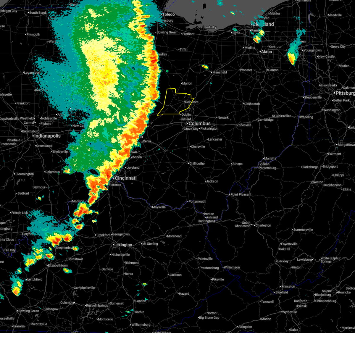
Hail Map for Richwood, OH
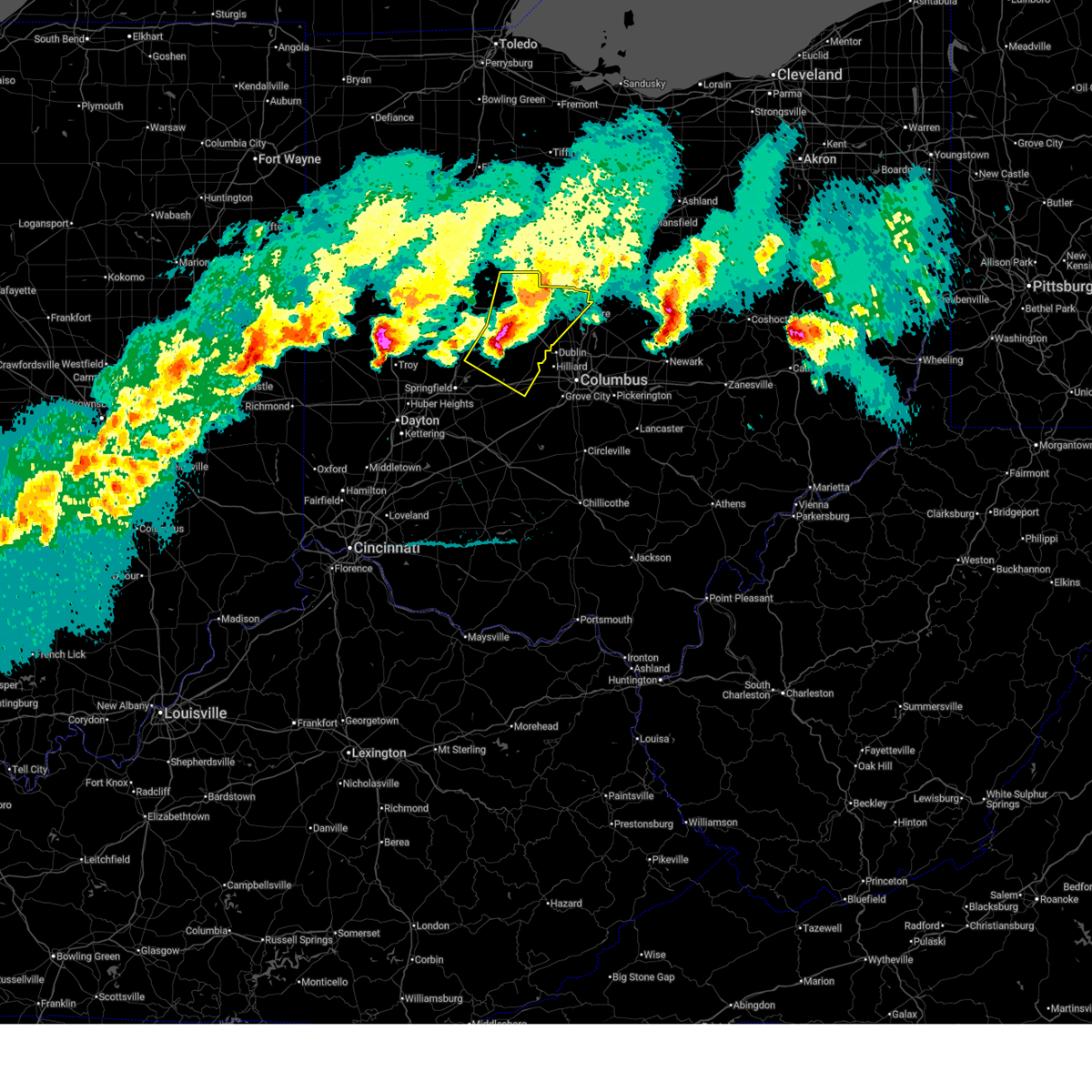
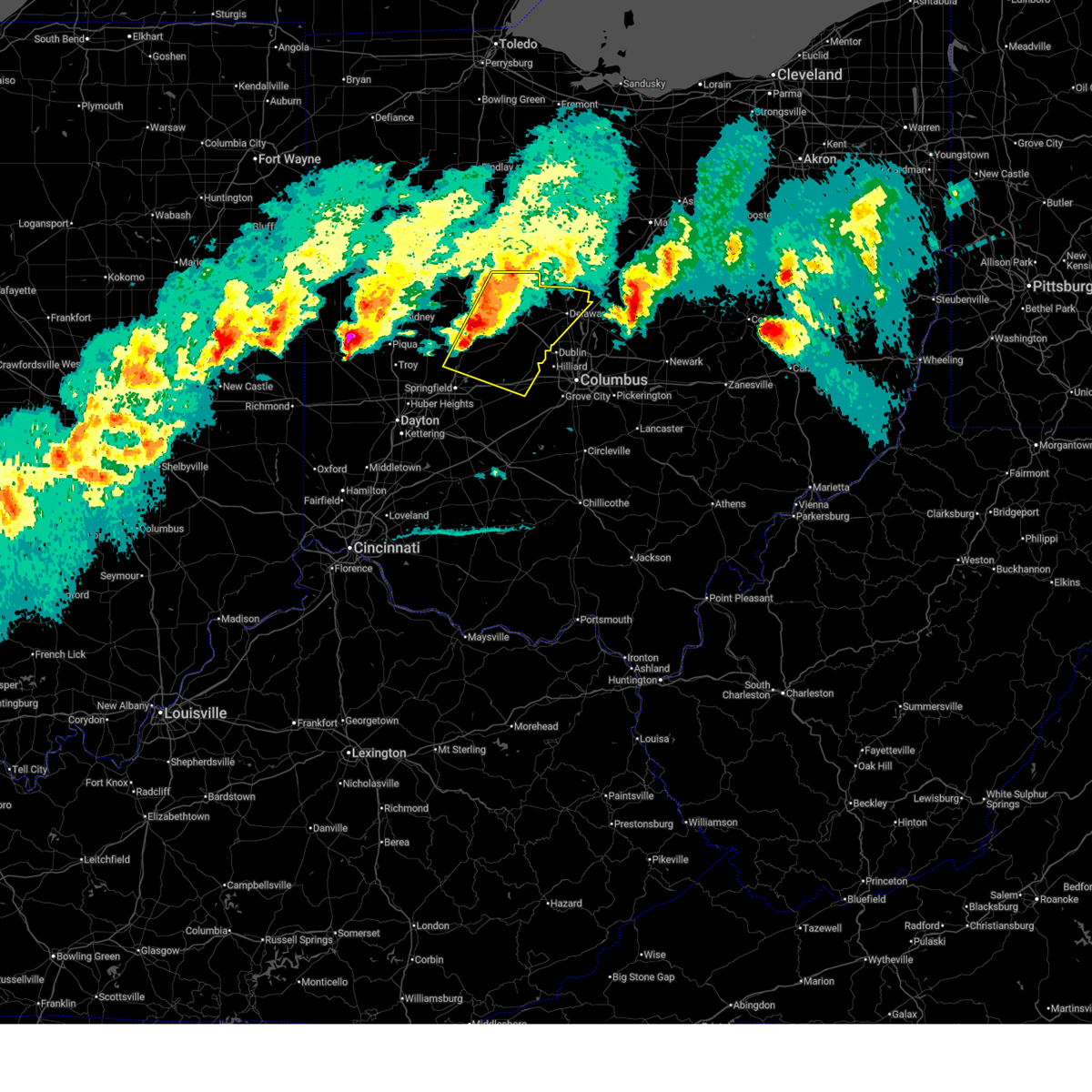
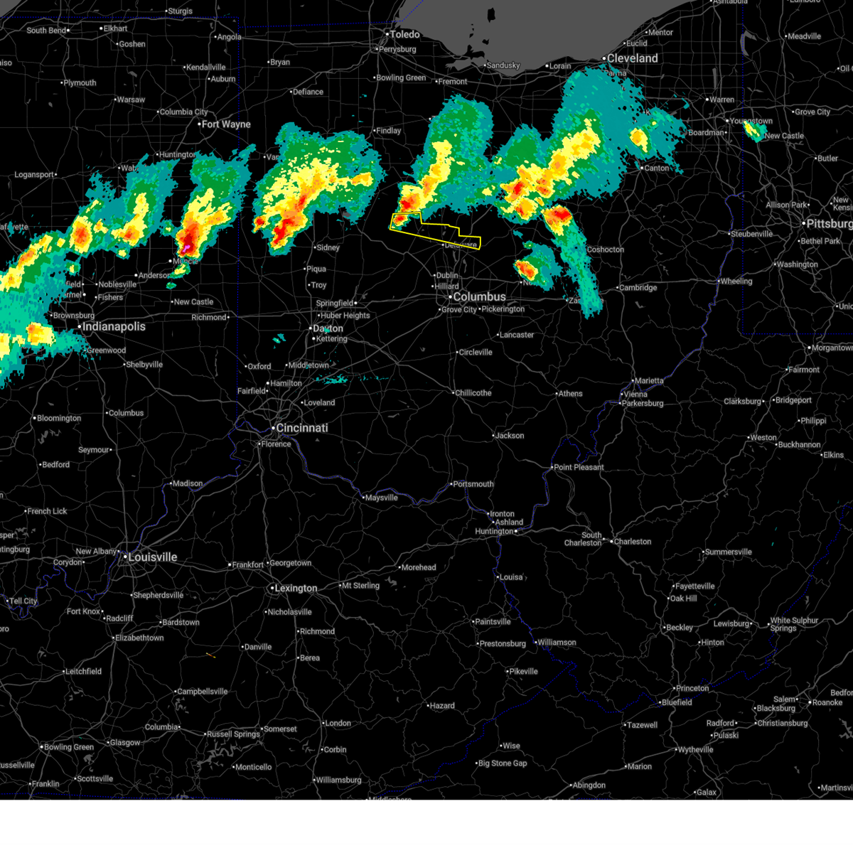
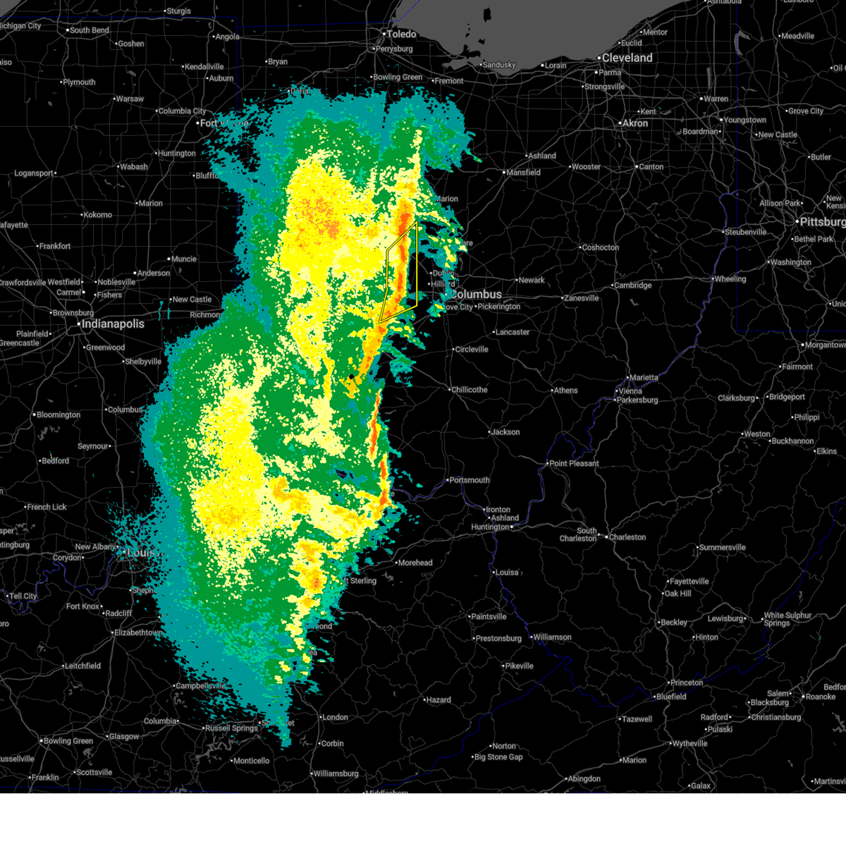
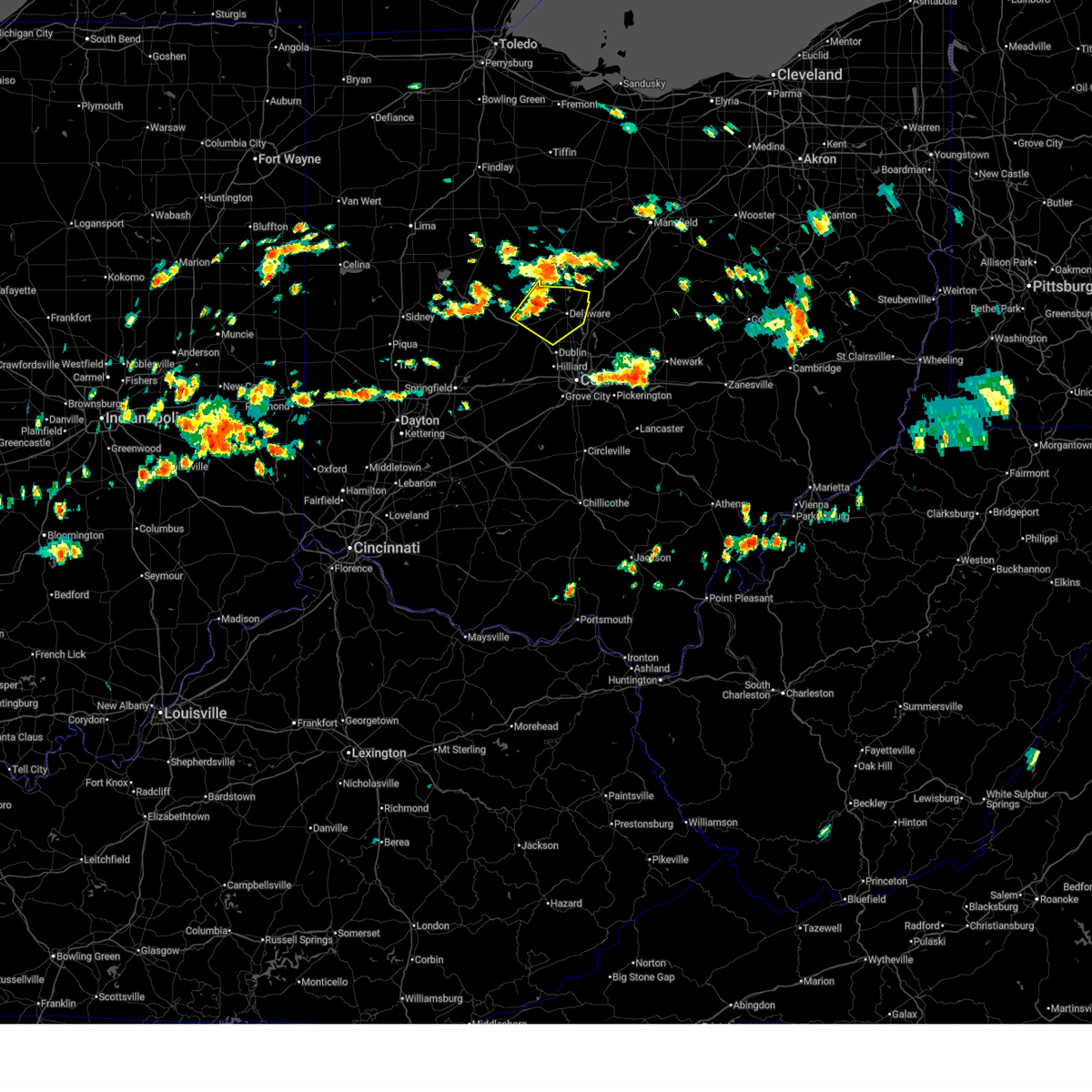
The Richwood, OH area has had 1 report of on-the-ground hail by trained spotters, and has been under severe weather warnings 13 times during the past 12 months. Doppler radar has detected hail at or near Richwood, OH on 38 occasions.
| Name: | Richwood, OH |
| Where Located: | 35.6 miles NNW of Columbus, OH |
| Map: | Google Map for Richwood, OH |
| Population: | 2229 |
| Housing Units: | 969 |
| More Info: | Search Google for Richwood, OH |
5
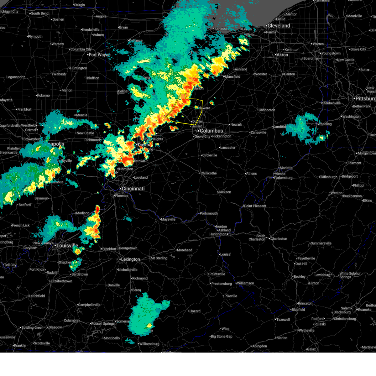
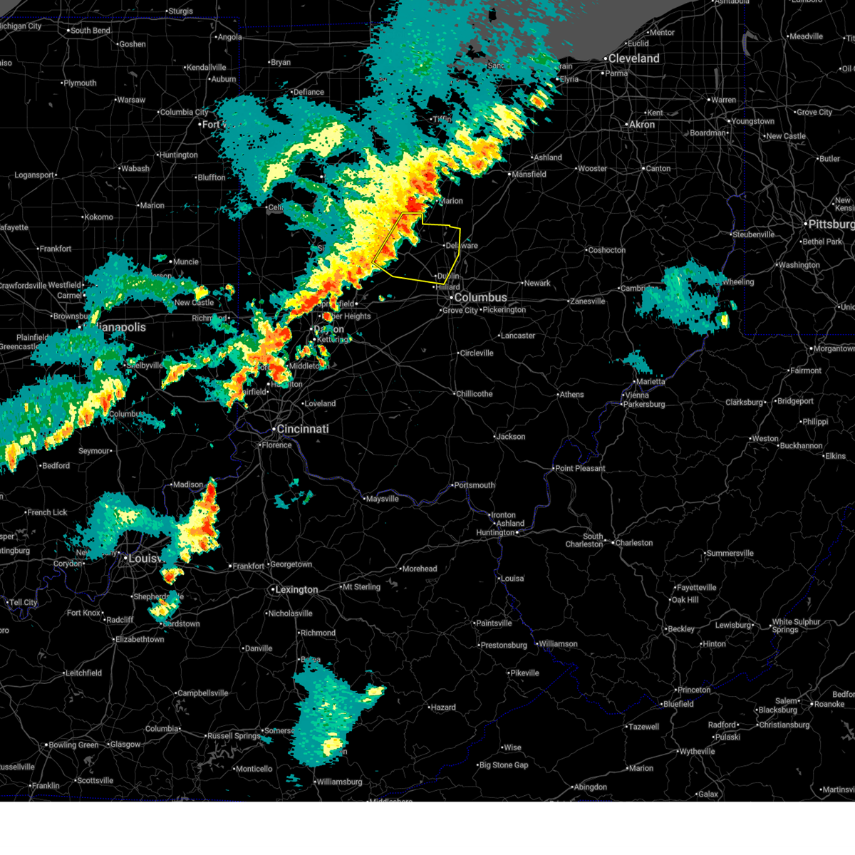
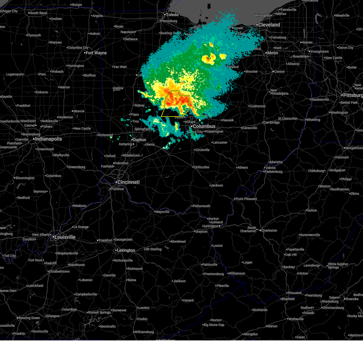
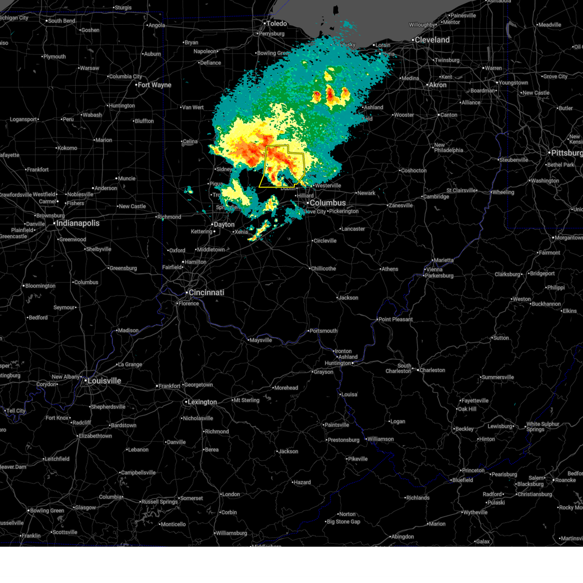
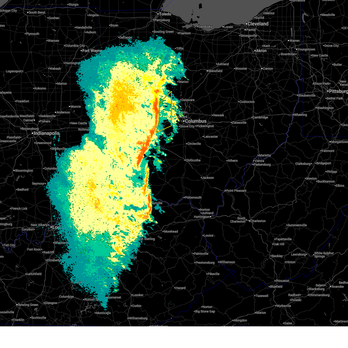
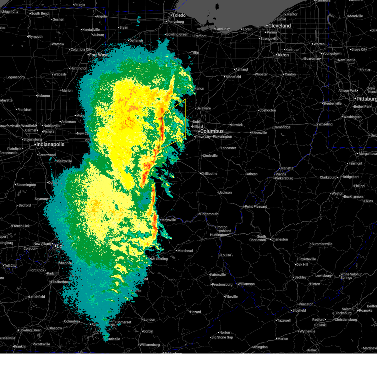
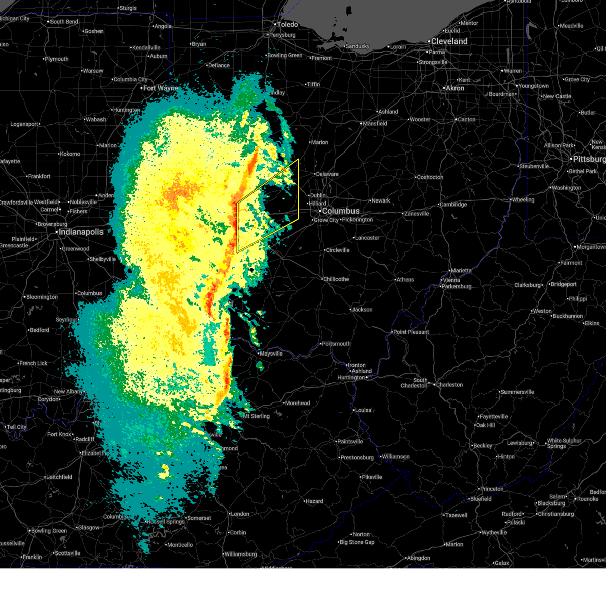
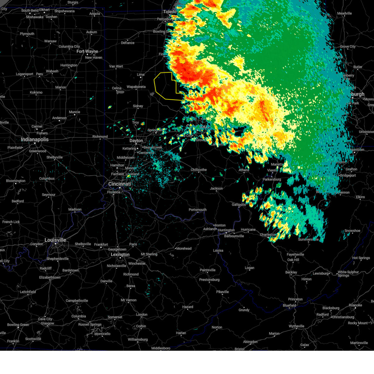
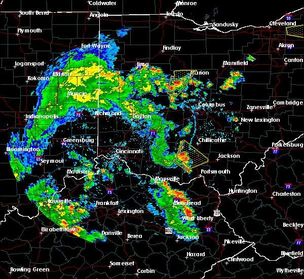
The Top Recent Hail Date for Richwood, OH is Wednesday, April 17, 2024 (3rd out of 38)

Hail and Wind Damage Spotted near Richwood, OH
| Date / Time | Report Details |
|---|---|
| 5/19/2026 8:01 PM EDT |
 At 801 pm edt, a severe thunderstorm was located over marysville, moving east at 30 mph (radar indicated). Hazards include 60 mph wind gusts. Expect damage to trees and power lines. Locations impacted include, dublin, delaware, upper arlington, hilliard, marysville, worthington, powell, plain city, richwood, north lewisburg, ashley, new california, radnor, milford center, shawnee hills, ostrander, woodstock, magnetic springs, and unionville center. At 801 pm edt, a severe thunderstorm was located over marysville, moving east at 30 mph (radar indicated). Hazards include 60 mph wind gusts. Expect damage to trees and power lines. Locations impacted include, dublin, delaware, upper arlington, hilliard, marysville, worthington, powell, plain city, richwood, north lewisburg, ashley, new california, radnor, milford center, shawnee hills, ostrander, woodstock, magnetic springs, and unionville center.
|
| 5/19/2026 7:49 PM EDT |
 Svriln the national weather service in wilmington has issued a * severe thunderstorm warning for, northeastern champaign county in west central ohio, northwestern franklin county in central ohio, southeastern logan county in west central ohio, delaware county in central ohio, union county in central ohio, northeastern madison county in central ohio, * until 830 pm edt. * at 748 pm edt, a severe thunderstorm was located 7 miles southwest of richwood, moving southeast at 30 mph (radar indicated). Hazards include 60 mph wind gusts. expect damage to trees and power lines Svriln the national weather service in wilmington has issued a * severe thunderstorm warning for, northeastern champaign county in west central ohio, northwestern franklin county in central ohio, southeastern logan county in west central ohio, delaware county in central ohio, union county in central ohio, northeastern madison county in central ohio, * until 830 pm edt. * at 748 pm edt, a severe thunderstorm was located 7 miles southwest of richwood, moving southeast at 30 mph (radar indicated). Hazards include 60 mph wind gusts. expect damage to trees and power lines
|
| 4/14/2026 8:40 PM EDT |
 At 839 pm edt, a severe thunderstorm was located near marysville, moving east at 45 mph (radar indicated). Hazards include 60 mph wind gusts. Expect damage to trees and power lines. Locations impacted include, delaware, marysville, powell, plain city, richwood, north lewisburg, new california, radnor, milford center, shawnee hills, ostrander, woodstock, magnetic springs, unionville center, delaware state park, raymond and broadway. At 839 pm edt, a severe thunderstorm was located near marysville, moving east at 45 mph (radar indicated). Hazards include 60 mph wind gusts. Expect damage to trees and power lines. Locations impacted include, delaware, marysville, powell, plain city, richwood, north lewisburg, new california, radnor, milford center, shawnee hills, ostrander, woodstock, magnetic springs, unionville center, delaware state park, raymond and broadway.
|
| 4/14/2026 8:24 PM EDT |
 Svriln the national weather service in wilmington has issued a * severe thunderstorm warning for, east central champaign county in west central ohio, western delaware county in central ohio, union county in central ohio, * until 915 pm edt. * at 824 pm edt, a severe thunderstorm was located over west mansfield, moving east at 40 mph (radar indicated). Hazards include 60 mph wind gusts. expect damage to trees and power lines Svriln the national weather service in wilmington has issued a * severe thunderstorm warning for, east central champaign county in west central ohio, western delaware county in central ohio, union county in central ohio, * until 915 pm edt. * at 824 pm edt, a severe thunderstorm was located over west mansfield, moving east at 40 mph (radar indicated). Hazards include 60 mph wind gusts. expect damage to trees and power lines
|
| 3/26/2026 8:27 PM EDT | Poles down on boundary road. time estimated from rada in union county OH, 3.3 miles ESE of Richwood, OH |
| 3/26/2026 8:20 PM EDT | Utility pole down on 12000 sanders road. time estimated from rada in union county OH, 5.1 miles S of Richwood, OH |
| 3/22/2026 9:48 PM EDT |
 At 948 pm edt, severe thunderstorms were located along a line extending from near richwood to near northridge, moving southeast at 45 mph (radar indicated). Hazards include 60 mph wind gusts and quarter size hail. Minor hail damage to vehicles is possible. expect wind damage to trees and power lines. locations impacted include, dublin, delaware, marysville, london, powell, plain city, west jefferson, richwood, mechanicsburg, north lewisburg, ashley, west mansfield, choctaw lake, new california, radnor, milford center, shawnee hills, ostrander, lafayette, and woodstock. This includes i-70 in ohio between mile markers 74 and 84. At 948 pm edt, severe thunderstorms were located along a line extending from near richwood to near northridge, moving southeast at 45 mph (radar indicated). Hazards include 60 mph wind gusts and quarter size hail. Minor hail damage to vehicles is possible. expect wind damage to trees and power lines. locations impacted include, dublin, delaware, marysville, london, powell, plain city, west jefferson, richwood, mechanicsburg, north lewisburg, ashley, west mansfield, choctaw lake, new california, radnor, milford center, shawnee hills, ostrander, lafayette, and woodstock. This includes i-70 in ohio between mile markers 74 and 84.
|
| 3/22/2026 9:38 PM EDT |
 Svriln the national weather service in wilmington has issued a * severe thunderstorm warning for, eastern champaign county in west central ohio, southeastern logan county in west central ohio, western delaware county in central ohio, northeastern clark county in west central ohio, union county in central ohio, northeastern madison county in central ohio, * until 1030 pm edt. * at 937 pm edt, severe thunderstorms were located along a line extending from 6 miles north of west mansfield to near st. paris, moving southeast at 40 mph (trained weather spotters). Hazards include 60 mph wind gusts and quarter size hail. Minor hail damage to vehicles is possible. Expect wind damage to trees and power lines. Svriln the national weather service in wilmington has issued a * severe thunderstorm warning for, eastern champaign county in west central ohio, southeastern logan county in west central ohio, western delaware county in central ohio, northeastern clark county in west central ohio, union county in central ohio, northeastern madison county in central ohio, * until 1030 pm edt. * at 937 pm edt, severe thunderstorms were located along a line extending from 6 miles north of west mansfield to near st. paris, moving southeast at 40 mph (trained weather spotters). Hazards include 60 mph wind gusts and quarter size hail. Minor hail damage to vehicles is possible. Expect wind damage to trees and power lines.
|
| 3/22/2026 8:55 PM EDT |
 Svriln the national weather service in wilmington has issued a * severe thunderstorm warning for, northern delaware county in central ohio, northern union county in central ohio, * until 930 pm edt. * at 855 pm edt, a severe thunderstorm was located near richwood, moving east at 65 mph (radar indicated). Hazards include quarter size hail. minor damage to vehicles is possible Svriln the national weather service in wilmington has issued a * severe thunderstorm warning for, northern delaware county in central ohio, northern union county in central ohio, * until 930 pm edt. * at 855 pm edt, a severe thunderstorm was located near richwood, moving east at 65 mph (radar indicated). Hazards include quarter size hail. minor damage to vehicles is possible
|
| 3/16/2026 2:24 AM EDT |
 The storms which prompted the warning have weakened below severe limits and no longer pose an immediate threat to life or property. therefore, the warning will be allowed to expire. however, gusty winds are still possible with these thunderstorms. a severe thunderstorm watch remains in effect until 400 am edt for central ohio. please report previous wind damage or hail to the national weather service by going to our website at weather.gov/iln and submitting your report via social media. The storms which prompted the warning have weakened below severe limits and no longer pose an immediate threat to life or property. therefore, the warning will be allowed to expire. however, gusty winds are still possible with these thunderstorms. a severe thunderstorm watch remains in effect until 400 am edt for central ohio. please report previous wind damage or hail to the national weather service by going to our website at weather.gov/iln and submitting your report via social media.
|
| 3/16/2026 2:16 AM EDT |
 the severe thunderstorm warning has been cancelled and is no longer in effect the severe thunderstorm warning has been cancelled and is no longer in effect
|
| 3/16/2026 2:16 AM EDT |
 At 216 am edt, severe thunderstorms were located along a line extending from 6 miles northeast of north lewisburg to near mechanicsburg to 6 miles east of south charleston, moving northeast at 60 mph (radar indicated). Hazards include 60 mph wind gusts. Expect damage to trees and power lines. locations impacted include, marysville, london, jefferson, plain city, west jefferson, richwood, choctaw lake, milford center, lafayette, magnetic springs, unionville center, newport, interstate 70 at us route 42, lilly chapel, state route 29 at state route 38, rosedale, state route 4 at state route 161, resaca, pharisburg, and chuckery. This includes i-70 in ohio between mile markers 71 and 85. At 216 am edt, severe thunderstorms were located along a line extending from 6 miles northeast of north lewisburg to near mechanicsburg to 6 miles east of south charleston, moving northeast at 60 mph (radar indicated). Hazards include 60 mph wind gusts. Expect damage to trees and power lines. locations impacted include, marysville, london, jefferson, plain city, west jefferson, richwood, choctaw lake, milford center, lafayette, magnetic springs, unionville center, newport, interstate 70 at us route 42, lilly chapel, state route 29 at state route 38, rosedale, state route 4 at state route 161, resaca, pharisburg, and chuckery. This includes i-70 in ohio between mile markers 71 and 85.
|
| 3/16/2026 2:07 AM EDT |
 At 207 am edt, severe thunderstorms were located along a line extending from near north lewisburg to near south charleston, moving northeast at 55 mph (radar indicated). Hazards include 60 mph wind gusts. Expect damage to trees and power lines. locations impacted include, springfield, marysville, urbana, london, jefferson, plain city, west jefferson, richwood, south charleston, mechanicsburg, north lewisburg, choctaw lake, harmony, lisbon, brighton, milford center, lafayette, south vienna, woodstock, and catawba. This includes i-70 in ohio between mile markers 58 and 85. At 207 am edt, severe thunderstorms were located along a line extending from near north lewisburg to near south charleston, moving northeast at 55 mph (radar indicated). Hazards include 60 mph wind gusts. Expect damage to trees and power lines. locations impacted include, springfield, marysville, urbana, london, jefferson, plain city, west jefferson, richwood, south charleston, mechanicsburg, north lewisburg, choctaw lake, harmony, lisbon, brighton, milford center, lafayette, south vienna, woodstock, and catawba. This includes i-70 in ohio between mile markers 58 and 85.
|
| 3/16/2026 1:48 AM EDT |
 Svriln the national weather service in wilmington has issued a * severe thunderstorm warning for, southeastern champaign county in west central ohio, southeastern logan county in west central ohio, central greene county in west central ohio, clark county in west central ohio, western union county in central ohio, madison county in central ohio, * until 230 am edt. * at 147 am edt, severe thunderstorms were located along a line extending from 7 miles southeast of st. paris to wilberforce, moving northeast at 60 mph (radar indicated. at 145 am, a 58 mph gust was reported at xenia greene county airport). Hazards include 60 mph wind gusts. expect damage to trees and power lines Svriln the national weather service in wilmington has issued a * severe thunderstorm warning for, southeastern champaign county in west central ohio, southeastern logan county in west central ohio, central greene county in west central ohio, clark county in west central ohio, western union county in central ohio, madison county in central ohio, * until 230 am edt. * at 147 am edt, severe thunderstorms were located along a line extending from 7 miles southeast of st. paris to wilberforce, moving northeast at 60 mph (radar indicated. at 145 am, a 58 mph gust was reported at xenia greene county airport). Hazards include 60 mph wind gusts. expect damage to trees and power lines
|
| 6/25/2025 1:53 PM EDT |
 Svriln the national weather service in wilmington has issued a * severe thunderstorm warning for, western delaware county in central ohio, eastern union county in central ohio, * until 230 pm edt. * at 152 pm edt, a severe thunderstorm was located near richwood, moving east at 15 mph (radar indicated). Hazards include 60 mph wind gusts. expect damage to trees and power lines Svriln the national weather service in wilmington has issued a * severe thunderstorm warning for, western delaware county in central ohio, eastern union county in central ohio, * until 230 pm edt. * at 152 pm edt, a severe thunderstorm was located near richwood, moving east at 15 mph (radar indicated). Hazards include 60 mph wind gusts. expect damage to trees and power lines
|
| 6/18/2025 7:18 PM EDT |
 Svriln the national weather service in wilmington has issued a * severe thunderstorm warning for, east central champaign county in west central ohio, western delaware county in central ohio, union county in central ohio, * until 800 pm edt. * at 717 pm edt, severe thunderstorms were located along a line extending from 8 miles south of kenton to 6 miles north of north lewisburg to near mechanicsburg, moving east at 50 mph (radar indicated). Hazards include 60 mph wind gusts. expect damage to trees and power lines Svriln the national weather service in wilmington has issued a * severe thunderstorm warning for, east central champaign county in west central ohio, western delaware county in central ohio, union county in central ohio, * until 800 pm edt. * at 717 pm edt, severe thunderstorms were located along a line extending from 8 miles south of kenton to 6 miles north of north lewisburg to near mechanicsburg, moving east at 50 mph (radar indicated). Hazards include 60 mph wind gusts. expect damage to trees and power lines
|
| 5/16/2025 9:55 PM EDT |
 the severe thunderstorm warning has been cancelled and is no longer in effect the severe thunderstorm warning has been cancelled and is no longer in effect
|
| 5/16/2025 9:55 PM EDT |
 At 954 pm edt, severe thunderstorms were located along a line extending from near prospect to near mount sterling, moving east at 45 mph (radar indicated). Hazards include 60 mph wind gusts. Expect damage to trees and power lines. locations impacted include, port columbus airport, alum creek state park, dublin, gahanna, upper arlington, sunbury, clintonville, westerville, warrensburg, center village, worthington, kilbourne, hilliard, new california, grandview heights, whitehall, commercial point, orient, amity, and lilly chapel. this includes the following interstates, i-70 in ohio between mile markers 82 and 110. I-71 in ohio between mile markers 89 and 138. At 954 pm edt, severe thunderstorms were located along a line extending from near prospect to near mount sterling, moving east at 45 mph (radar indicated). Hazards include 60 mph wind gusts. Expect damage to trees and power lines. locations impacted include, port columbus airport, alum creek state park, dublin, gahanna, upper arlington, sunbury, clintonville, westerville, warrensburg, center village, worthington, kilbourne, hilliard, new california, grandview heights, whitehall, commercial point, orient, amity, and lilly chapel. this includes the following interstates, i-70 in ohio between mile markers 82 and 110. I-71 in ohio between mile markers 89 and 138.
|
| 5/16/2025 9:26 PM EDT |
 Svriln the national weather service in wilmington has issued a * severe thunderstorm warning for, eastern champaign county in west central ohio, franklin county in central ohio, southeastern logan county in west central ohio, northern pickaway county in central ohio, delaware county in central ohio, eastern clark county in west central ohio, union county in central ohio, madison county in central ohio, * until 1030 pm edt. * at 926 pm edt, severe thunderstorms were located along a line extending from near west mansfield to near south charleston, moving east at 50 mph (radar indicated). Hazards include 60 mph wind gusts. expect damage to trees and power lines Svriln the national weather service in wilmington has issued a * severe thunderstorm warning for, eastern champaign county in west central ohio, franklin county in central ohio, southeastern logan county in west central ohio, northern pickaway county in central ohio, delaware county in central ohio, eastern clark county in west central ohio, union county in central ohio, madison county in central ohio, * until 1030 pm edt. * at 926 pm edt, severe thunderstorms were located along a line extending from near west mansfield to near south charleston, moving east at 50 mph (radar indicated). Hazards include 60 mph wind gusts. expect damage to trees and power lines
|
| 6/5/2024 8:49 PM EDT |
 Toriln the national weather service in wilmington has issued a * tornado warning for, northwestern delaware county in central ohio, northeastern union county in central ohio, * until 915 pm edt. * at 848 pm edt, a severe thunderstorm capable of producing a tornado was located over richwood, moving east at 25 mph (radar indicated rotation). Hazards include tornado. Flying debris will be dangerous to those caught without shelter. mobile homes will be damaged or destroyed. damage to roofs, windows, and vehicles will occur. Tree damage is likely. Toriln the national weather service in wilmington has issued a * tornado warning for, northwestern delaware county in central ohio, northeastern union county in central ohio, * until 915 pm edt. * at 848 pm edt, a severe thunderstorm capable of producing a tornado was located over richwood, moving east at 25 mph (radar indicated rotation). Hazards include tornado. Flying debris will be dangerous to those caught without shelter. mobile homes will be damaged or destroyed. damage to roofs, windows, and vehicles will occur. Tree damage is likely.
|
| 4/17/2024 4:14 PM EDT |
 the severe thunderstorm warning has been cancelled and is no longer in effect the severe thunderstorm warning has been cancelled and is no longer in effect
|
| 4/17/2024 4:14 PM EDT |
 At 414 pm edt, a severe thunderstorm was located over richwood, moving east at 55 mph (radar indicated). Hazards include 60 mph wind gusts and quarter size hail. Minor hail damage to vehicles is possible. expect wind damage to trees and power lines. Locations impacted include, delaware, richwood, ashley, radnor, magnetic springs, raymond, delaware state park, broadway, warrensburg, pharisburg, somersville, leonardsburg, kilbourne, essex, and state route 257 at us route 36. At 414 pm edt, a severe thunderstorm was located over richwood, moving east at 55 mph (radar indicated). Hazards include 60 mph wind gusts and quarter size hail. Minor hail damage to vehicles is possible. expect wind damage to trees and power lines. Locations impacted include, delaware, richwood, ashley, radnor, magnetic springs, raymond, delaware state park, broadway, warrensburg, pharisburg, somersville, leonardsburg, kilbourne, essex, and state route 257 at us route 36.
|
| 4/17/2024 4:04 PM EDT |
 Svriln the national weather service in wilmington has issued a * severe thunderstorm warning for, eastern logan county in west central ohio, northwestern delaware county in central ohio, northern union county in central ohio, * until 445 pm edt. * at 403 pm edt, a severe thunderstorm was located over west mansfield, moving east at 50 mph (radar indicated). Hazards include 60 mph wind gusts and quarter size hail. Minor hail damage to vehicles is possible. Expect wind damage to trees and power lines. Svriln the national weather service in wilmington has issued a * severe thunderstorm warning for, eastern logan county in west central ohio, northwestern delaware county in central ohio, northern union county in central ohio, * until 445 pm edt. * at 403 pm edt, a severe thunderstorm was located over west mansfield, moving east at 50 mph (radar indicated). Hazards include 60 mph wind gusts and quarter size hail. Minor hail damage to vehicles is possible. Expect wind damage to trees and power lines.
|
| 3/14/2024 8:42 PM EDT |
 At 842 pm edt, a severe thunderstorm with strong rotation was located 5 miles north of marysville, moving southeast at 35 mph. a tornado is occurring or imminent (radar indicated rotation). Hazards include tornado and half dollar size hail. Flying debris will be dangerous to those caught without shelter. mobile homes will be damaged or destroyed. damage to roofs, windows, and vehicles will occur. tree damage is likely. Locations impacted include, delaware, marysville, richwood, radnor, ostrander, magnetic springs, bellepoint, broadway, warrensburg, pharisburg, somersville, state route 257 at us route 36, new dover, and raymond. At 842 pm edt, a severe thunderstorm with strong rotation was located 5 miles north of marysville, moving southeast at 35 mph. a tornado is occurring or imminent (radar indicated rotation). Hazards include tornado and half dollar size hail. Flying debris will be dangerous to those caught without shelter. mobile homes will be damaged or destroyed. damage to roofs, windows, and vehicles will occur. tree damage is likely. Locations impacted include, delaware, marysville, richwood, radnor, ostrander, magnetic springs, bellepoint, broadway, warrensburg, pharisburg, somersville, state route 257 at us route 36, new dover, and raymond.
|
| 3/14/2024 8:32 PM EDT |
 At 831 pm edt, a severe thunderstorm with strong rotation was located near raymond, moving east at 40 mph. a tornado is occurring or imminent (radar indicated rotation). Hazards include tornado and half dollar size hail. Flying debris will be dangerous to those caught without shelter. mobile homes will be damaged or destroyed. damage to roofs, windows, and vehicles will occur. tree damage is likely. Locations impacted include, delaware, marysville, richwood, radnor, ostrander, magnetic springs, raymond, byhalia, bellepoint, broadway, warrensburg, pharisburg, somersville, state route 257 at us route 36, and new dover. At 831 pm edt, a severe thunderstorm with strong rotation was located near raymond, moving east at 40 mph. a tornado is occurring or imminent (radar indicated rotation). Hazards include tornado and half dollar size hail. Flying debris will be dangerous to those caught without shelter. mobile homes will be damaged or destroyed. damage to roofs, windows, and vehicles will occur. tree damage is likely. Locations impacted include, delaware, marysville, richwood, radnor, ostrander, magnetic springs, raymond, byhalia, bellepoint, broadway, warrensburg, pharisburg, somersville, state route 257 at us route 36, and new dover.
|
| 3/14/2024 8:32 PM EDT |
 the tornado warning has been cancelled and is no longer in effect the tornado warning has been cancelled and is no longer in effect
|
| 3/14/2024 8:23 PM EDT |
 Toriln the national weather service in wilmington has issued a * tornado warning for, northeastern logan county in west central ohio, northwestern delaware county in central ohio, northern union county in central ohio, * until 900 pm edt. * at 823 pm edt, a severe thunderstorm capable of producing a tornado was located near west mansfield, moving east at 40 mph (radar indicated rotation). Hazards include tornado and half dollar size hail. Flying debris will be dangerous to those caught without shelter. mobile homes will be damaged or destroyed. damage to roofs, windows, and vehicles will occur. Tree damage is likely. Toriln the national weather service in wilmington has issued a * tornado warning for, northeastern logan county in west central ohio, northwestern delaware county in central ohio, northern union county in central ohio, * until 900 pm edt. * at 823 pm edt, a severe thunderstorm capable of producing a tornado was located near west mansfield, moving east at 40 mph (radar indicated rotation). Hazards include tornado and half dollar size hail. Flying debris will be dangerous to those caught without shelter. mobile homes will be damaged or destroyed. damage to roofs, windows, and vehicles will occur. Tree damage is likely.
|
| 8/24/2023 2:51 AM EDT |
 At 250 am edt, a severe thunderstorm was located near richwood, moving south at 35 mph (radar indicated). Hazards include 60 mph wind gusts. Expect damage to trees and power lines. locations impacted include, dublin, delaware, marysville, plain city, richwood, north lewisburg, west mansfield, new california, radnor, milford center, shawnee hills, ostrander, woodstock, magnetic springs, unionville center, valley hi, cable, raymond, delaware state park, and new jerusalem. hail threat, radar indicated max hail size, <. 75 in wind threat, radar indicated max wind gust, 60 mph. At 250 am edt, a severe thunderstorm was located near richwood, moving south at 35 mph (radar indicated). Hazards include 60 mph wind gusts. Expect damage to trees and power lines. locations impacted include, dublin, delaware, marysville, plain city, richwood, north lewisburg, west mansfield, new california, radnor, milford center, shawnee hills, ostrander, woodstock, magnetic springs, unionville center, valley hi, cable, raymond, delaware state park, and new jerusalem. hail threat, radar indicated max hail size, <. 75 in wind threat, radar indicated max wind gust, 60 mph.
|
| 8/24/2023 2:38 AM EDT |
 At 238 am edt, a severe thunderstorm was located near richwood, moving south at 30 mph (radar indicated). Hazards include 60 mph wind gusts. expect damage to trees and power lines At 238 am edt, a severe thunderstorm was located near richwood, moving south at 30 mph (radar indicated). Hazards include 60 mph wind gusts. expect damage to trees and power lines
|
| 8/24/2023 2:33 AM EDT |
 At 233 am edt, a severe thunderstorm was located near la rue, moving south at 30 mph (radar indicated). Hazards include 60 mph wind gusts. Expect damage to trees and power lines. locations impacted include, kenton, richwood, forest, dunkirk, alger, belle center, blanchard, mount victory, rushsylvania, mcguffey, ridgeway, patterson, dola, grant, silver creek, jumbo, huntersville, byhalia, pfeiffer, and walton. hail threat, radar indicated max hail size, <. 75 in wind threat, radar indicated max wind gust, 60 mph. At 233 am edt, a severe thunderstorm was located near la rue, moving south at 30 mph (radar indicated). Hazards include 60 mph wind gusts. Expect damage to trees and power lines. locations impacted include, kenton, richwood, forest, dunkirk, alger, belle center, blanchard, mount victory, rushsylvania, mcguffey, ridgeway, patterson, dola, grant, silver creek, jumbo, huntersville, byhalia, pfeiffer, and walton. hail threat, radar indicated max hail size, <. 75 in wind threat, radar indicated max wind gust, 60 mph.
|
| 8/24/2023 2:18 AM EDT |
 At 218 am edt, a severe thunderstorm was located near la rue, moving south at 30 mph (radar indicated). Hazards include 60 mph wind gusts. Expect damage to trees and power lines. locations impacted include, kenton, ada, richwood, forest, dunkirk, alger, belle center, blanchard, mount victory, rushsylvania, mcguffey, ridgeway, patterson, dola, huntersville, pfeiffer, big springs, essex, grant, and silver creek. hail threat, radar indicated max hail size, <. 75 in wind threat, radar indicated max wind gust, 60 mph. At 218 am edt, a severe thunderstorm was located near la rue, moving south at 30 mph (radar indicated). Hazards include 60 mph wind gusts. Expect damage to trees and power lines. locations impacted include, kenton, ada, richwood, forest, dunkirk, alger, belle center, blanchard, mount victory, rushsylvania, mcguffey, ridgeway, patterson, dola, huntersville, pfeiffer, big springs, essex, grant, and silver creek. hail threat, radar indicated max hail size, <. 75 in wind threat, radar indicated max wind gust, 60 mph.
|
| 8/24/2023 2:01 AM EDT |
 At 201 am edt, a severe thunderstorm was located near upper sandusky, moving southwest at 20 mph (radar indicated). Hazards include 60 mph wind gusts. expect damage to trees and power lines At 201 am edt, a severe thunderstorm was located near upper sandusky, moving southwest at 20 mph (radar indicated). Hazards include 60 mph wind gusts. expect damage to trees and power lines
|
| 7/24/2023 5:55 PM EDT | Pole down in the richwood are in union county OH, 2.3 miles S of Richwood, OH |
| 7/24/2023 5:03 PM EDT |
 At 502 pm edt, a severe thunderstorm was located over richwood, moving east at 10 mph (radar indicated). Hazards include quarter size hail. Minor damage to vehicles is possible. locations impacted include, richwood. hail threat, radar indicated max hail size, 1. 00 in wind threat, radar indicated max wind gust, <50 mph. At 502 pm edt, a severe thunderstorm was located over richwood, moving east at 10 mph (radar indicated). Hazards include quarter size hail. Minor damage to vehicles is possible. locations impacted include, richwood. hail threat, radar indicated max hail size, 1. 00 in wind threat, radar indicated max wind gust, <50 mph.
|
| 7/24/2023 4:52 PM EDT |
 At 452 pm edt, a severe thunderstorm was located over richwood, moving east at 5 mph (radar indicated). Hazards include quarter size hail. minor damage to vehicles is possible At 452 pm edt, a severe thunderstorm was located over richwood, moving east at 5 mph (radar indicated). Hazards include quarter size hail. minor damage to vehicles is possible
|
| 7/20/2023 8:04 PM EDT |
 At 804 pm edt, a severe thunderstorm was located near marysville, moving southeast at 55 mph (radar indicated). Hazards include 70 mph wind gusts and penny size hail. Expect considerable tree damage. damage is likely to mobile homes, roofs, and outbuildings. locations impacted include, columbus, dublin, delaware, upper arlington, hilliard, marysville, worthington, powell, sunbury, plain city, richwood, new california, polaris, radnor, shawnee hills, ostrander, riverlea, magnetic springs, unionville center and alum creek state park. this includes i-71 in ohio between mile markers 122 and 134. thunderstorm damage threat, considerable hail threat, radar indicated max hail size, 0. 75 in wind threat, radar indicated max wind gust, 70 mph. At 804 pm edt, a severe thunderstorm was located near marysville, moving southeast at 55 mph (radar indicated). Hazards include 70 mph wind gusts and penny size hail. Expect considerable tree damage. damage is likely to mobile homes, roofs, and outbuildings. locations impacted include, columbus, dublin, delaware, upper arlington, hilliard, marysville, worthington, powell, sunbury, plain city, richwood, new california, polaris, radnor, shawnee hills, ostrander, riverlea, magnetic springs, unionville center and alum creek state park. this includes i-71 in ohio between mile markers 122 and 134. thunderstorm damage threat, considerable hail threat, radar indicated max hail size, 0. 75 in wind threat, radar indicated max wind gust, 70 mph.
|
| 7/20/2023 7:57 PM EDT |
 At 757 pm edt, a severe thunderstorm was located near west mansfield, moving southeast at 55 mph (radar indicated). Hazards include 60 mph wind gusts and penny size hail. expect damage to trees and power lines At 757 pm edt, a severe thunderstorm was located near west mansfield, moving southeast at 55 mph (radar indicated). Hazards include 60 mph wind gusts and penny size hail. expect damage to trees and power lines
|
| 7/20/2023 7:54 PM EDT | Multiple trees down. time estimated from rada in union county OH, 5.4 miles ENE of Richwood, OH |
| 7/23/2022 11:25 AM EDT |
 At 1125 am edt, severe thunderstorms were located along a line extending from 6 miles south of richwood to south charleston, moving east at 55 mph (radar indicated). Hazards include 60 mph wind gusts and penny size hail. Expect damage to trees and power lines. locations impacted include, columbus, springfield, dublin, delaware, hilliard, marysville, london, jefferson, powell, plain city, west jefferson, richwood, south charleston, mechanicsburg, ashley, choctaw lake, new california, lake darby, harmony and lisbon. this includes i-70 in ohio between mile markers 54 and 91. hail threat, radar indicated max hail size, 0. 75 in wind threat, radar indicated max wind gust, 60 mph. At 1125 am edt, severe thunderstorms were located along a line extending from 6 miles south of richwood to south charleston, moving east at 55 mph (radar indicated). Hazards include 60 mph wind gusts and penny size hail. Expect damage to trees and power lines. locations impacted include, columbus, springfield, dublin, delaware, hilliard, marysville, london, jefferson, powell, plain city, west jefferson, richwood, south charleston, mechanicsburg, ashley, choctaw lake, new california, lake darby, harmony and lisbon. this includes i-70 in ohio between mile markers 54 and 91. hail threat, radar indicated max hail size, 0. 75 in wind threat, radar indicated max wind gust, 60 mph.
|
| 7/23/2022 11:13 AM EDT |
 At 1112 am edt, severe thunderstorms were located along a line extending from west mansfield to springfield, moving east at 40 mph (radar indicated). Hazards include 60 mph wind gusts and penny size hail. expect damage to trees and power lines At 1112 am edt, severe thunderstorms were located along a line extending from west mansfield to springfield, moving east at 40 mph (radar indicated). Hazards include 60 mph wind gusts and penny size hail. expect damage to trees and power lines
|
| 6/14/2022 3:52 AM EDT |
 At 351 am edt, a severe thunderstorm was located near dunkirk, moving southeast at 45 mph (radar indicated). Hazards include 60 mph wind gusts and quarter size hail. Minor hail damage to vehicles is possible. Expect wind damage to trees and power lines. At 351 am edt, a severe thunderstorm was located near dunkirk, moving southeast at 45 mph (radar indicated). Hazards include 60 mph wind gusts and quarter size hail. Minor hail damage to vehicles is possible. Expect wind damage to trees and power lines.
|
| 6/14/2022 12:43 AM EDT |
 The severe thunderstorm warning for eastern champaign county in west central ohio and union counties in central ohio will expire at 1245 am edt, the storm which prompted the warning has moved out of the area. therefore, the warning will be allowed to expire. however gusty winds and heavy rain are still possible with this thunderstorm. a severe thunderstorm watch remains in effect until 300 am edt for central and west central ohio. please report previous wind damage or hail to the national weather service by going to our website at weather.gov/iln and submitting your report via social media. The severe thunderstorm warning for eastern champaign county in west central ohio and union counties in central ohio will expire at 1245 am edt, the storm which prompted the warning has moved out of the area. therefore, the warning will be allowed to expire. however gusty winds and heavy rain are still possible with this thunderstorm. a severe thunderstorm watch remains in effect until 300 am edt for central and west central ohio. please report previous wind damage or hail to the national weather service by going to our website at weather.gov/iln and submitting your report via social media.
|
| 6/14/2022 12:39 AM EDT |
 At 1238 am edt, a severe thunderstorm was located near plain city, moving southeast at 45 mph (radar indicated). Hazards include 70 mph wind gusts and nickel size hail. Expect considerable tree damage. damage is likely to mobile homes, roofs, and outbuildings. locations impacted include, marysville, urbana, richwood, mechanicsburg, north lewisburg, milford center, woodstock, mutual, cable, raymond, byhalia, broadway, state route 4 at state route 161, powhattan, pharisburg, mingo, pottersburg, catawba station, somersville and kennard. thunderstorm damage threat, considerable hail threat, radar indicated max hail size, 0. 88 in wind threat, radar indicated max wind gust, 70 mph. At 1238 am edt, a severe thunderstorm was located near plain city, moving southeast at 45 mph (radar indicated). Hazards include 70 mph wind gusts and nickel size hail. Expect considerable tree damage. damage is likely to mobile homes, roofs, and outbuildings. locations impacted include, marysville, urbana, richwood, mechanicsburg, north lewisburg, milford center, woodstock, mutual, cable, raymond, byhalia, broadway, state route 4 at state route 161, powhattan, pharisburg, mingo, pottersburg, catawba station, somersville and kennard. thunderstorm damage threat, considerable hail threat, radar indicated max hail size, 0. 88 in wind threat, radar indicated max wind gust, 70 mph.
|
| 6/14/2022 12:24 AM EDT |
 At 1224 am edt, a severe thunderstorm was located near north lewisburg, moving southeast at 45 mph (radar indicated). Hazards include 70 mph wind gusts and nickel size hail. Expect considerable tree damage. damage is likely to mobile homes, roofs, and outbuildings. locations impacted include, marysville, bellefontaine, urbana, richwood, st. paris, west liberty, mechanicsburg, north lewisburg, west mansfield, milford center, rushsylvania, ridgeway, woodstock, valley hi, zanesfield, mutual, cable, thackery, raymond and westville. thunderstorm damage threat, considerable hail threat, radar indicated max hail size, 0. 88 in wind threat, radar indicated max wind gust, 70 mph. At 1224 am edt, a severe thunderstorm was located near north lewisburg, moving southeast at 45 mph (radar indicated). Hazards include 70 mph wind gusts and nickel size hail. Expect considerable tree damage. damage is likely to mobile homes, roofs, and outbuildings. locations impacted include, marysville, bellefontaine, urbana, richwood, st. paris, west liberty, mechanicsburg, north lewisburg, west mansfield, milford center, rushsylvania, ridgeway, woodstock, valley hi, zanesfield, mutual, cable, thackery, raymond and westville. thunderstorm damage threat, considerable hail threat, radar indicated max hail size, 0. 88 in wind threat, radar indicated max wind gust, 70 mph.
|
| 6/14/2022 12:13 AM EDT |
 At 1213 am edt, a severe thunderstorm was located near west liberty, moving southeast at 45 mph (radar indicated). Hazards include 70 mph wind gusts and nickel size hail. Expect considerable tree damage. damage is likely to mobile homes, roofs, and outbuildings. locations impacted include, marysville, bellefontaine, urbana, kenton, richwood, st. paris, west liberty, mechanicsburg, north lewisburg, de graff, west mansfield, northwood, milford center, quincy, mount victory, rushsylvania, ridgeway, woodstock, valley hi and zanesfield. thunderstorm damage threat, considerable hail threat, radar indicated max hail size, 0. 88 in wind threat, radar indicated max wind gust, 70 mph. At 1213 am edt, a severe thunderstorm was located near west liberty, moving southeast at 45 mph (radar indicated). Hazards include 70 mph wind gusts and nickel size hail. Expect considerable tree damage. damage is likely to mobile homes, roofs, and outbuildings. locations impacted include, marysville, bellefontaine, urbana, kenton, richwood, st. paris, west liberty, mechanicsburg, north lewisburg, de graff, west mansfield, northwood, milford center, quincy, mount victory, rushsylvania, ridgeway, woodstock, valley hi and zanesfield. thunderstorm damage threat, considerable hail threat, radar indicated max hail size, 0. 88 in wind threat, radar indicated max wind gust, 70 mph.
|
| 6/14/2022 12:03 AM EDT |
 At 1203 am edt, a severe thunderstorm was located near west liberty, moving southeast at 45 mph (radar indicated). Hazards include 70 mph wind gusts and nickel size hail. Expect considerable tree damage. damage is likely to mobile homes, roofs, and outbuildings. locations impacted include, marysville, sidney, bellefontaine, urbana, kenton, richwood, st. paris, newport, west liberty, mechanicsburg, north lewisburg, de graff, west mansfield, hardin, northwood, milford center, quincy, mount victory, rushsylvania and ridgeway. this includes i-75 in ohio between mile markers 85 and 93. thunderstorm damage threat, considerable hail threat, radar indicated max hail size, 0. 88 in wind threat, radar indicated max wind gust, 70 mph. At 1203 am edt, a severe thunderstorm was located near west liberty, moving southeast at 45 mph (radar indicated). Hazards include 70 mph wind gusts and nickel size hail. Expect considerable tree damage. damage is likely to mobile homes, roofs, and outbuildings. locations impacted include, marysville, sidney, bellefontaine, urbana, kenton, richwood, st. paris, newport, west liberty, mechanicsburg, north lewisburg, de graff, west mansfield, hardin, northwood, milford center, quincy, mount victory, rushsylvania and ridgeway. this includes i-75 in ohio between mile markers 85 and 93. thunderstorm damage threat, considerable hail threat, radar indicated max hail size, 0. 88 in wind threat, radar indicated max wind gust, 70 mph.
|
| 6/13/2022 11:49 PM EDT | At 1149 pm edt, a severe thunderstorm was located near jackson center, moving southeast at 45 mph (radar indicated). Hazards include 70 mph wind gusts and penny size hail. Expect considerable tree damage. Damage is likely to mobile homes, roofs, and outbuildings. |
| 6/13/2022 11:24 PM EDT |
 At 1123 pm edt, a severe thunderstorm was located near ashley, moving southeast at 50 mph (radar indicated). Hazards include 70 mph wind gusts and penny size hail. Expect considerable tree damage. damage is likely to mobile homes, roofs, and outbuildings. locations impacted include, dublin, westerville, delaware, kenton, powell, sunbury, richwood, ashley, polaris, radnor, shawnee hills, galena, ostrander, mount victory, ridgeway, magnetic springs, alum creek state park, delaware state park, olive green and pfeiffer. this includes i-71 in ohio between mile markers 122 and 138. thunderstorm damage threat, considerable hail threat, radar indicated max hail size, 0. 75 in wind threat, radar indicated max wind gust, 70 mph. At 1123 pm edt, a severe thunderstorm was located near ashley, moving southeast at 50 mph (radar indicated). Hazards include 70 mph wind gusts and penny size hail. Expect considerable tree damage. damage is likely to mobile homes, roofs, and outbuildings. locations impacted include, dublin, westerville, delaware, kenton, powell, sunbury, richwood, ashley, polaris, radnor, shawnee hills, galena, ostrander, mount victory, ridgeway, magnetic springs, alum creek state park, delaware state park, olive green and pfeiffer. this includes i-71 in ohio between mile markers 122 and 138. thunderstorm damage threat, considerable hail threat, radar indicated max hail size, 0. 75 in wind threat, radar indicated max wind gust, 70 mph.
|
| 6/13/2022 11:12 PM EDT |
 At 1111 pm edt, a severe thunderstorm was located near prospect, moving southeast at 50 mph (radar indicated). Hazards include 70 mph wind gusts and penny size hail. Expect considerable tree damage. Damage is likely to mobile homes, roofs, and outbuildings. At 1111 pm edt, a severe thunderstorm was located near prospect, moving southeast at 50 mph (radar indicated). Hazards include 70 mph wind gusts and penny size hail. Expect considerable tree damage. Damage is likely to mobile homes, roofs, and outbuildings.
|
| 8/11/2021 4:39 PM EDT |
 At 438 pm edt, a severe thunderstorm was located near marysville, moving east at 35 mph (radar indicated). Hazards include 60 mph wind gusts. Expect damage to trees and power lines. locations impacted include, marysville, delaware, powell, richwood, ashley, radnor, milford center, shawnee hills, ostrander, magnetic springs, alum creek state park, raymond, delaware state park, broadway, warrensburg, pottersburg, kilbourne, essex and lewis center. this includes i-71 in ohio between mile markers 123 and 139. hail threat, radar indicated max hail size, <. 75 in wind threat, radar indicated max wind gust, 60 mph. At 438 pm edt, a severe thunderstorm was located near marysville, moving east at 35 mph (radar indicated). Hazards include 60 mph wind gusts. Expect damage to trees and power lines. locations impacted include, marysville, delaware, powell, richwood, ashley, radnor, milford center, shawnee hills, ostrander, magnetic springs, alum creek state park, raymond, delaware state park, broadway, warrensburg, pottersburg, kilbourne, essex and lewis center. this includes i-71 in ohio between mile markers 123 and 139. hail threat, radar indicated max hail size, <. 75 in wind threat, radar indicated max wind gust, 60 mph.
|
| 8/11/2021 4:29 PM EDT | Trees and powerlines were blown down... primarily in the northern portion of the count in union county OH, 5.4 miles ENE of Richwood, OH |
| 8/11/2021 4:24 PM EDT |
 At 423 pm edt, a severe thunderstorm was located near west mansfield, moving east at 45 mph (radar indicated). Hazards include 60 mph wind gusts. expect damage to trees and power lines At 423 pm edt, a severe thunderstorm was located near west mansfield, moving east at 45 mph (radar indicated). Hazards include 60 mph wind gusts. expect damage to trees and power lines
|
| 4/9/2021 5:55 PM EDT | Several power poles downed on boundary road. time of event estimated from rada in union county OH, 3.3 miles ESE of Richwood, OH |
| 11/15/2020 11:45 AM EST |
 At 1144 am est, severe thunderstorms were located along a line extending from la rue to near plain city to 6 miles southeast of south charleston, moving east at 40 mph (radar indicated). Hazards include 60 mph wind gusts. Expect damage to trees and power lines. locations impacted include, columbus, dublin, westerville, reynoldsburg, grove city, delaware, upper arlington, gahanna, hilliard, marysville, worthington, bexley, london, jefferson, powell, canal winchester, groveport, sunbury, plain city and west jefferson. this includes the following interstates, i-70 in ohio between mile markers 71 and 111. I-71 in ohio between mile markers 76 and 138. At 1144 am est, severe thunderstorms were located along a line extending from la rue to near plain city to 6 miles southeast of south charleston, moving east at 40 mph (radar indicated). Hazards include 60 mph wind gusts. Expect damage to trees and power lines. locations impacted include, columbus, dublin, westerville, reynoldsburg, grove city, delaware, upper arlington, gahanna, hilliard, marysville, worthington, bexley, london, jefferson, powell, canal winchester, groveport, sunbury, plain city and west jefferson. this includes the following interstates, i-70 in ohio between mile markers 71 and 111. I-71 in ohio between mile markers 76 and 138.
|
| 11/15/2020 11:34 AM EST |
 At 1133 am est, severe thunderstorms were located along a line extending from 6 miles southwest of la rue to near mechanicsburg to cedarville, moving east at 40 mph (radar indicated). Hazards include 60 mph wind gusts. expect damage to trees and power lines At 1133 am est, severe thunderstorms were located along a line extending from 6 miles southwest of la rue to near mechanicsburg to cedarville, moving east at 40 mph (radar indicated). Hazards include 60 mph wind gusts. expect damage to trees and power lines
|
| 9/7/2020 4:57 PM EDT |
 The severe thunderstorm warning for eastern logan county in west central ohio, northwestern delaware and northern union counties in central ohio will expire at 500 pm edt, the severe thunderstorm which prompted the warning has moved out of logan county, but another severe thunderstorm warning remains in effect for union and delaware counties until 545 pm edt. please report previous wind damage or hail to the national weather service by going to our website at weather.gov/iln and submitting your report via social media. The severe thunderstorm warning for eastern logan county in west central ohio, northwestern delaware and northern union counties in central ohio will expire at 500 pm edt, the severe thunderstorm which prompted the warning has moved out of logan county, but another severe thunderstorm warning remains in effect for union and delaware counties until 545 pm edt. please report previous wind damage or hail to the national weather service by going to our website at weather.gov/iln and submitting your report via social media.
|
| 9/7/2020 4:54 PM EDT |
 At 454 pm edt, a severe thunderstorm was located near marysville, moving east at 40 mph (radar indicated). Hazards include 60 mph wind gusts. expect damage to trees and power lines At 454 pm edt, a severe thunderstorm was located near marysville, moving east at 40 mph (radar indicated). Hazards include 60 mph wind gusts. expect damage to trees and power lines
|
| 9/7/2020 4:36 PM EDT |
 At 436 pm edt, a severe thunderstorm was located near west mansfield, moving east at 35 mph (radar indicated). Hazards include 60 mph wind gusts and quarter size hail. Minor hail damage to vehicles is possible. expect wind damage to trees and power lines. Locations impacted include, marysville, bellefontaine, richwood, west mansfield, northwood, ostrander, rushsylvania, ridgeway, magnetic springs, valley hi, zanesfield, raymond, new jerusalem, pickrelltown, byhalia, broadway, middleburg, warrensburg, pharisburg and somersville. At 436 pm edt, a severe thunderstorm was located near west mansfield, moving east at 35 mph (radar indicated). Hazards include 60 mph wind gusts and quarter size hail. Minor hail damage to vehicles is possible. expect wind damage to trees and power lines. Locations impacted include, marysville, bellefontaine, richwood, west mansfield, northwood, ostrander, rushsylvania, ridgeway, magnetic springs, valley hi, zanesfield, raymond, new jerusalem, pickrelltown, byhalia, broadway, middleburg, warrensburg, pharisburg and somersville.
|
| 9/7/2020 4:20 PM EDT |
 At 420 pm edt, a severe thunderstorm was located near bellefontaine, moving east at 35 mph (radar indicated). Hazards include 60 mph wind gusts and half dollar size hail. Minor hail damage to vehicles is possible. Expect wind damage to trees and power lines. At 420 pm edt, a severe thunderstorm was located near bellefontaine, moving east at 35 mph (radar indicated). Hazards include 60 mph wind gusts and half dollar size hail. Minor hail damage to vehicles is possible. Expect wind damage to trees and power lines.
|
| 8/28/2020 1:30 PM EDT |
 At 130 pm edt, severe thunderstorms were located along a line extending from 6 miles south of kenton to near richwood, moving northeast at 30 mph (radar indicated). Hazards include 60 mph wind gusts. Expect damage to trees and power lines. Locations impacted include, kenton, richwood, forest, mount victory, ridgeway, patterson, grant, silver creek, byhalia, pfeiffer, hepburn, mentzer, big springs and essex. At 130 pm edt, severe thunderstorms were located along a line extending from 6 miles south of kenton to near richwood, moving northeast at 30 mph (radar indicated). Hazards include 60 mph wind gusts. Expect damage to trees and power lines. Locations impacted include, kenton, richwood, forest, mount victory, ridgeway, patterson, grant, silver creek, byhalia, pfeiffer, hepburn, mentzer, big springs and essex.
|
| 8/28/2020 1:11 PM EDT |
 At 111 pm edt, severe thunderstorms were located along a line extending from near belle center to near west mansfield, moving northeast at 30 mph (radar indicated). Hazards include 60 mph wind gusts and penny size hail. expect damage to trees and power lines At 111 pm edt, severe thunderstorms were located along a line extending from near belle center to near west mansfield, moving northeast at 30 mph (radar indicated). Hazards include 60 mph wind gusts and penny size hail. expect damage to trees and power lines
|
| 7/10/2020 2:28 PM EDT | Report of a tree down and wires down in richwood are in union county OH, 0.3 miles SE of Richwood, OH |
| 6/21/2020 5:39 PM EDT |
 At 538 pm edt, a severe thunderstorm was located near richwood, moving north at 40 mph (radar indicated). Hazards include 60 mph wind gusts. Expect damage to trees and power lines. Locations impacted include, richwood, essex, somersville and byhalia. At 538 pm edt, a severe thunderstorm was located near richwood, moving north at 40 mph (radar indicated). Hazards include 60 mph wind gusts. Expect damage to trees and power lines. Locations impacted include, richwood, essex, somersville and byhalia.
|
| 6/21/2020 5:29 PM EDT | A tree was downed and a power pole was snapped along bethlehem-claibourne road. time estimated from rada in union county OH, 2.9 miles NNE of Richwood, OH |
| 6/21/2020 5:24 PM EDT |
 At 524 pm edt, a severe thunderstorm was located near marysville, moving north at 20 mph (radar indicated). Hazards include 60 mph wind gusts. expect damage to trees and power lines At 524 pm edt, a severe thunderstorm was located near marysville, moving north at 20 mph (radar indicated). Hazards include 60 mph wind gusts. expect damage to trees and power lines
|
| 6/10/2020 5:58 PM EDT |
 The severe thunderstorm warning for north central madison and union counties in central ohio will expire at 600 pm edt, the severe thunderstorm which prompted the warning has moved out of the warned area. therefore, the warning will be allowed to expire. a separate severe thunderstorm warning remains in effect for eastern madison county until 615 pm. a severe thunderstorm watch remains in effect until 1000 pm edt for central and west central ohio. please report previous wind damage or hail to the national weather service by going to our website at weather.gov/iln and submitting your report via social media. The severe thunderstorm warning for north central madison and union counties in central ohio will expire at 600 pm edt, the severe thunderstorm which prompted the warning has moved out of the warned area. therefore, the warning will be allowed to expire. a separate severe thunderstorm warning remains in effect for eastern madison county until 615 pm. a severe thunderstorm watch remains in effect until 1000 pm edt for central and west central ohio. please report previous wind damage or hail to the national weather service by going to our website at weather.gov/iln and submitting your report via social media.
|
| 6/10/2020 5:40 PM EDT |
 At 539 pm edt, a severe thunderstorm was located near marysville, moving northeast at 35 mph (radar indicated). Hazards include 70 mph wind gusts. Expect considerable tree damage. damage is likely to mobile homes, roofs, and outbuildings. Locations impacted include, marysville, richwood, milford center, magnetic springs, unionville center, raymond, broadway, rosedale, state route 4 at state route 161, pharisburg, watkins, pottersburg, somersville, chuckery, essex and new dover. At 539 pm edt, a severe thunderstorm was located near marysville, moving northeast at 35 mph (radar indicated). Hazards include 70 mph wind gusts. Expect considerable tree damage. damage is likely to mobile homes, roofs, and outbuildings. Locations impacted include, marysville, richwood, milford center, magnetic springs, unionville center, raymond, broadway, rosedale, state route 4 at state route 161, pharisburg, watkins, pottersburg, somersville, chuckery, essex and new dover.
|
| 6/10/2020 5:34 PM EDT |
 At 534 pm edt, a severe thunderstorm was located near north lewisburg, moving northeast at 35 mph (radar indicated). Hazards include 60 mph wind gusts. Expect damage to trees and power lines. Locations impacted include, marysville, richwood, mechanicsburg, north lewisburg, milford center, woodstock, magnetic springs, unionville center, raymond, broadway, rosedale, state route 4 at state route 161, pharisburg, watkins, pottersburg, somersville, chuckery, essex and new dover. At 534 pm edt, a severe thunderstorm was located near north lewisburg, moving northeast at 35 mph (radar indicated). Hazards include 60 mph wind gusts. Expect damage to trees and power lines. Locations impacted include, marysville, richwood, mechanicsburg, north lewisburg, milford center, woodstock, magnetic springs, unionville center, raymond, broadway, rosedale, state route 4 at state route 161, pharisburg, watkins, pottersburg, somersville, chuckery, essex and new dover.
|
| 6/10/2020 5:13 PM EDT |
 At 513 pm edt, a severe thunderstorm was located near urbana, moving northeast at 35 mph (radar indicated). Hazards include 60 mph wind gusts. expect damage to trees and power lines At 513 pm edt, a severe thunderstorm was located near urbana, moving northeast at 35 mph (radar indicated). Hazards include 60 mph wind gusts. expect damage to trees and power lines
|
| 5/14/2020 5:26 PM EDT |
 At 526 pm edt, severe thunderstorms were located along a line extending from 6 miles west of richwood to near marysville to near south charleston, moving east at 55 mph (radar indicated). Hazards include 60 mph wind gusts. expect damage to trees and power lines At 526 pm edt, severe thunderstorms were located along a line extending from 6 miles west of richwood to near marysville to near south charleston, moving east at 55 mph (radar indicated). Hazards include 60 mph wind gusts. expect damage to trees and power lines
|
| 4/8/2020 2:02 AM EDT |
 At 201 am edt, a severe thunderstorm was located near new california, moving east at 70 mph (radar indicated). Hazards include 60 mph wind gusts and penny size hail. Expect damage to trees and power lines. Locations impacted include, dublin, delaware, marysville, powell, plain city, richwood, west liberty, north lewisburg, new california, radnor, milford center, shawnee hills, ostrander, woodstock, magnetic springs, unionville center, valley hi, zanesfield, cable and us route 33 at us route 42. At 201 am edt, a severe thunderstorm was located near new california, moving east at 70 mph (radar indicated). Hazards include 60 mph wind gusts and penny size hail. Expect damage to trees and power lines. Locations impacted include, dublin, delaware, marysville, powell, plain city, richwood, west liberty, north lewisburg, new california, radnor, milford center, shawnee hills, ostrander, woodstock, magnetic springs, unionville center, valley hi, zanesfield, cable and us route 33 at us route 42.
|
| 4/8/2020 1:44 AM EDT |
 At 144 am edt, a severe thunderstorm was located near bellefontaine, moving east at 55 mph (radar indicated). Hazards include 60 mph wind gusts and penny size hail. expect damage to trees and power lines At 144 am edt, a severe thunderstorm was located near bellefontaine, moving east at 55 mph (radar indicated). Hazards include 60 mph wind gusts and penny size hail. expect damage to trees and power lines
|
| 3/28/2020 7:37 PM EDT |
 At 737 pm edt, a severe thunderstorm was located near west mansfield, moving east at 45 mph (radar indicated). Hazards include quarter size hail. Minor damage to vehicles is possible. Locations impacted include, marysville, richwood, west mansfield, magnetic springs, valley hi, zanesfield, raymond, new jerusalem, pickrelltown, byhalia, broadway, middleburg, pharisburg, pottersburg, somersville, essex and east liberty. At 737 pm edt, a severe thunderstorm was located near west mansfield, moving east at 45 mph (radar indicated). Hazards include quarter size hail. Minor damage to vehicles is possible. Locations impacted include, marysville, richwood, west mansfield, magnetic springs, valley hi, zanesfield, raymond, new jerusalem, pickrelltown, byhalia, broadway, middleburg, pharisburg, pottersburg, somersville, essex and east liberty.
|
| 3/28/2020 7:22 PM EDT |
 At 722 pm edt, a severe thunderstorm was located over bellefontaine, moving east at 55 mph (radar indicated). Hazards include quarter size hail. minor damage to vehicles is possible At 722 pm edt, a severe thunderstorm was located over bellefontaine, moving east at 55 mph (radar indicated). Hazards include quarter size hail. minor damage to vehicles is possible
|
| 7/16/2019 5:32 PM EDT |
 At 532 pm edt, severe thunderstorms were located along a line extending from 6 miles southwest of la rue to near marysville, moving northeast at 40 mph (radar indicated). Hazards include 60 mph wind gusts. Expect damage to trees and power lines. Locations impacted include, marysville, richwood, west mansfield, mount victory, ridgeway, magnetic springs, raymond, byhalia, broadway, pfeiffer, hepburn, pharisburg, mentzer, somersville, big springs, essex and new dover. At 532 pm edt, severe thunderstorms were located along a line extending from 6 miles southwest of la rue to near marysville, moving northeast at 40 mph (radar indicated). Hazards include 60 mph wind gusts. Expect damage to trees and power lines. Locations impacted include, marysville, richwood, west mansfield, mount victory, ridgeway, magnetic springs, raymond, byhalia, broadway, pfeiffer, hepburn, pharisburg, mentzer, somersville, big springs, essex and new dover.
|
| 7/16/2019 5:30 PM EDT | A tree was downed onto osborne road near state route 739. time estimated by rada in union county OH, 7.1 miles ESE of Richwood, OH |
| 7/16/2019 5:08 PM EDT |
 At 508 pm edt, severe thunderstorms were located along a line extending from near bellefontaine to near north lewisburg, moving northeast at 40 mph (radar indicated). Hazards include 60 mph wind gusts. expect damage to trees and power lines At 508 pm edt, severe thunderstorms were located along a line extending from near bellefontaine to near north lewisburg, moving northeast at 40 mph (radar indicated). Hazards include 60 mph wind gusts. expect damage to trees and power lines
|
| 7/2/2019 5:52 PM EDT |
 The severe thunderstorm warning for northwestern delaware and northeastern union counties in central ohio will expire at 600 pm edt, the storm which prompted the warning has weakened below severe limits, and no longer poses an immediate threat to life or property. therefore, the warning will be allowed to expire. however gusty winds and heavy rain are still possible with this thunderstorm. please report previous wind damage or hail to the national weather service by going to our website at weather.gov/iln and submitting your report via social media. The severe thunderstorm warning for northwestern delaware and northeastern union counties in central ohio will expire at 600 pm edt, the storm which prompted the warning has weakened below severe limits, and no longer poses an immediate threat to life or property. therefore, the warning will be allowed to expire. however gusty winds and heavy rain are still possible with this thunderstorm. please report previous wind damage or hail to the national weather service by going to our website at weather.gov/iln and submitting your report via social media.
|
| 7/2/2019 5:43 PM EDT |
 At 543 pm edt, a severe thunderstorm was located near prospect, moving southeast at 25 mph (radar indicated). Hazards include 60 mph wind gusts and quarter size hail. Minor hail damage to vehicles is possible. expect wind damage to trees and power lines. Locations impacted include, richwood, radnor, magnetic springs, warrensburg, pharisburg and delaware state park. At 543 pm edt, a severe thunderstorm was located near prospect, moving southeast at 25 mph (radar indicated). Hazards include 60 mph wind gusts and quarter size hail. Minor hail damage to vehicles is possible. expect wind damage to trees and power lines. Locations impacted include, richwood, radnor, magnetic springs, warrensburg, pharisburg and delaware state park.
|
| 7/2/2019 5:31 PM EDT |
 At 531 pm edt, a severe thunderstorm was located over richwood, moving southeast at 25 mph (radar indicated). Hazards include 60 mph wind gusts and quarter size hail. Minor hail damage to vehicles is possible. expect wind damage to trees and power lines. Locations impacted include, richwood, radnor, magnetic springs, warrensburg, pharisburg, delaware state park, somersville, byhalia and essex. At 531 pm edt, a severe thunderstorm was located over richwood, moving southeast at 25 mph (radar indicated). Hazards include 60 mph wind gusts and quarter size hail. Minor hail damage to vehicles is possible. expect wind damage to trees and power lines. Locations impacted include, richwood, radnor, magnetic springs, warrensburg, pharisburg, delaware state park, somersville, byhalia and essex.
|
| 7/2/2019 5:28 PM EDT | Several large branches dow in union county OH, 0.3 miles SE of Richwood, OH |
| 7/2/2019 5:22 PM EDT |
 At 522 pm edt, a severe thunderstorm was located over richwood, moving southeast at 25 mph (radar indicated). Hazards include 60 mph wind gusts and quarter size hail. Minor hail damage to vehicles is possible. Expect wind damage to trees and power lines. At 522 pm edt, a severe thunderstorm was located over richwood, moving southeast at 25 mph (radar indicated). Hazards include 60 mph wind gusts and quarter size hail. Minor hail damage to vehicles is possible. Expect wind damage to trees and power lines.
|
| 5/27/2019 11:15 PM EDT |
 At 1115 pm edt, a severe thunderstorm capable of producing a tornado was located near marysville, moving east at 25 mph (radar indicated rotation). Hazards include tornado and quarter size hail. Flying debris will be dangerous to those caught without shelter. mobile homes will be damaged or destroyed. damage to roofs, windows, and vehicles will occur. tree damage is likely. Locations impacted include, delaware, marysville, richwood, radnor, ostrander, magnetic springs, raymond, bellepoint, broadway, warrensburg, pharisburg, pottersburg, new dover and state route 257 at us route 36. At 1115 pm edt, a severe thunderstorm capable of producing a tornado was located near marysville, moving east at 25 mph (radar indicated rotation). Hazards include tornado and quarter size hail. Flying debris will be dangerous to those caught without shelter. mobile homes will be damaged or destroyed. damage to roofs, windows, and vehicles will occur. tree damage is likely. Locations impacted include, delaware, marysville, richwood, radnor, ostrander, magnetic springs, raymond, bellepoint, broadway, warrensburg, pharisburg, pottersburg, new dover and state route 257 at us route 36.
|
| 5/27/2019 11:08 PM EDT |
 At 1108 pm edt, a severe thunderstorm capable of producing a tornado was located near north lewisburg, moving east at 25 mph (radar indicated rotation). Hazards include tornado and quarter size hail. Flying debris will be dangerous to those caught without shelter. mobile homes will be damaged or destroyed. damage to roofs, windows, and vehicles will occur. Tree damage is likely. At 1108 pm edt, a severe thunderstorm capable of producing a tornado was located near north lewisburg, moving east at 25 mph (radar indicated rotation). Hazards include tornado and quarter size hail. Flying debris will be dangerous to those caught without shelter. mobile homes will be damaged or destroyed. damage to roofs, windows, and vehicles will occur. Tree damage is likely.
|
| 5/26/2019 7:08 AM EDT |
 At 708 am edt, a severe thunderstorm was located near prospect, moving east at 50 mph (radar indicated). Hazards include 60 mph wind gusts. expect damage to trees and power lines At 708 am edt, a severe thunderstorm was located near prospect, moving east at 50 mph (radar indicated). Hazards include 60 mph wind gusts. expect damage to trees and power lines
|
| 4/14/2019 4:01 PM EDT |
 At 401 pm edt, a severe thunderstorm was located near richwood, moving northeast at 40 mph (radar indicated). Hazards include 60 mph wind gusts and penny size hail. Expect damage to trees and power lines. locations impacted include, richwood, byhalia, essex and somersville. A tornado watch remains in effect until 900 pm edt for central ohio. At 401 pm edt, a severe thunderstorm was located near richwood, moving northeast at 40 mph (radar indicated). Hazards include 60 mph wind gusts and penny size hail. Expect damage to trees and power lines. locations impacted include, richwood, byhalia, essex and somersville. A tornado watch remains in effect until 900 pm edt for central ohio.
|
| 4/14/2019 3:52 PM EDT |
 At 352 pm edt, a severe thunderstorm was located over west mansfield, moving northeast at 45 mph (radar indicated). Hazards include 60 mph wind gusts and penny size hail. expect damage to trees and power lines At 352 pm edt, a severe thunderstorm was located over west mansfield, moving northeast at 45 mph (radar indicated). Hazards include 60 mph wind gusts and penny size hail. expect damage to trees and power lines
|
| 6/16/2018 6:41 PM EDT |
 At 641 pm edt, a severe thunderstorm was located near richwood, moving southeast at 15 mph (radar indicated). Hazards include 60 mph wind gusts and half dollar size hail. Minor hail damage to vehicles is possible. expect wind damage to trees and power lines. Locations impacted include, richwood, radnor, ostrander, magnetic springs, warrensburg, pharisburg, watkins, broadway and new dover. At 641 pm edt, a severe thunderstorm was located near richwood, moving southeast at 15 mph (radar indicated). Hazards include 60 mph wind gusts and half dollar size hail. Minor hail damage to vehicles is possible. expect wind damage to trees and power lines. Locations impacted include, richwood, radnor, ostrander, magnetic springs, warrensburg, pharisburg, watkins, broadway and new dover.
|
| 6/16/2018 6:33 PM EDT |
 At 632 pm edt, a severe thunderstorm was located near richwood, moving southeast at 15 mph (radar indicated). Hazards include 60 mph wind gusts and quarter size hail. Minor hail damage to vehicles is possible. Expect wind damage to trees and power lines. At 632 pm edt, a severe thunderstorm was located near richwood, moving southeast at 15 mph (radar indicated). Hazards include 60 mph wind gusts and quarter size hail. Minor hail damage to vehicles is possible. Expect wind damage to trees and power lines.
|
| 6/8/2018 3:46 PM EDT |
 At 346 pm edt, a severe thunderstorm was located over richwood, moving southeast at 25 mph (radar indicated). Hazards include 60 mph wind gusts and quarter size hail. Minor hail damage to vehicles is possible. Expect wind damage to trees and power lines. At 346 pm edt, a severe thunderstorm was located over richwood, moving southeast at 25 mph (radar indicated). Hazards include 60 mph wind gusts and quarter size hail. Minor hail damage to vehicles is possible. Expect wind damage to trees and power lines.
|
| 5/21/2018 8:26 PM EDT |
 At 810 pm edt, a severe thunderstorm was located over richwood, moving east at 25 mph (radar indicated). Hazards include 60 mph wind gusts. Expect damage to trees and power lines. locations impacted include, delaware, richwood, ashley, radnor, magnetic springs, delaware state park, broadway, warrensburg, pharisburg, somersville, leonardsburg, kilbourne and essex. This includes i-71 in ohio between mile markers 136 and 138. At 810 pm edt, a severe thunderstorm was located over richwood, moving east at 25 mph (radar indicated). Hazards include 60 mph wind gusts. Expect damage to trees and power lines. locations impacted include, delaware, richwood, ashley, radnor, magnetic springs, delaware state park, broadway, warrensburg, pharisburg, somersville, leonardsburg, kilbourne and essex. This includes i-71 in ohio between mile markers 136 and 138.
|
| 5/21/2018 8:10 PM EDT |
 At 810 pm edt, a severe thunderstorm was located over richwood, moving east at 25 mph (radar indicated). Hazards include 60 mph wind gusts. Expect damage to trees and power lines. locations impacted include, delaware, richwood, ashley, radnor, magnetic springs, delaware state park, broadway, warrensburg, pharisburg, somersville, leonardsburg, kilbourne and essex. This includes i-71 in ohio between mile markers 136 and 138. At 810 pm edt, a severe thunderstorm was located over richwood, moving east at 25 mph (radar indicated). Hazards include 60 mph wind gusts. Expect damage to trees and power lines. locations impacted include, delaware, richwood, ashley, radnor, magnetic springs, delaware state park, broadway, warrensburg, pharisburg, somersville, leonardsburg, kilbourne and essex. This includes i-71 in ohio between mile markers 136 and 138.
|
| 5/21/2018 7:55 PM EDT |
 At 755 pm edt, a severe thunderstorm was located near richwood, moving east at 35 mph (radar indicated). Hazards include 60 mph wind gusts. expect damage to trees and power lines At 755 pm edt, a severe thunderstorm was located near richwood, moving east at 35 mph (radar indicated). Hazards include 60 mph wind gusts. expect damage to trees and power lines
|
| 5/4/2018 3:25 PM EDT |
 The severe thunderstorm warning for northern delaware and northeastern union counties in central ohio will expire at 330 pm edt, the severe thunderstorm which prompted the warning has weakened. therefore, the warning will be allowed to expire. however gusty winds are still possible with this thunderstorm. please report previous wind damage or hail to the national weather service by going to our website at weather.gov/iln and submitting your report via social media. The severe thunderstorm warning for northern delaware and northeastern union counties in central ohio will expire at 330 pm edt, the severe thunderstorm which prompted the warning has weakened. therefore, the warning will be allowed to expire. however gusty winds are still possible with this thunderstorm. please report previous wind damage or hail to the national weather service by going to our website at weather.gov/iln and submitting your report via social media.
|
| 5/4/2018 3:15 PM EDT |
 At 315 pm edt, a severe thunderstorm was located near richwood, moving east at 40 mph (radar indicated). Hazards include 60 mph wind gusts. Expect damage to trees and power lines. locations impacted include, delaware, richwood, ashley, radnor, magnetic springs, warrensburg, pharisburg, delaware state park, leonardsburg, olive green and kilbourne. This includes i-71 in ohio between mile markers 134 and 138. At 315 pm edt, a severe thunderstorm was located near richwood, moving east at 40 mph (radar indicated). Hazards include 60 mph wind gusts. Expect damage to trees and power lines. locations impacted include, delaware, richwood, ashley, radnor, magnetic springs, warrensburg, pharisburg, delaware state park, leonardsburg, olive green and kilbourne. This includes i-71 in ohio between mile markers 134 and 138.
|
| 5/4/2018 3:01 PM EDT |
 A severe thunderstorm warning remains in effect until 330 pm edt for northern delaware and northern union counties in central ohio. at 301 pm edt, a severe thunderstorm was located near richwood, moving east at 55 mph. hazard. 60 mph wind gusts. source. Radar indicated. A severe thunderstorm warning remains in effect until 330 pm edt for northern delaware and northern union counties in central ohio. at 301 pm edt, a severe thunderstorm was located near richwood, moving east at 55 mph. hazard. 60 mph wind gusts. source. Radar indicated.
|
| 5/4/2018 2:45 PM EDT |
 The national weather service in wilmington has issued a * severe thunderstorm warning for. eastern logan county in west central ohio. northern delaware county in central ohio. northern union county in central ohio. Until 330 pm edt. The national weather service in wilmington has issued a * severe thunderstorm warning for. eastern logan county in west central ohio. northern delaware county in central ohio. northern union county in central ohio. Until 330 pm edt.
|
| 5/4/2018 2:45 PM EDT |
 At 245 pm edt, a severe thunderstorm was located near bellefontaine, moving east at 55 mph (radar indicated). Hazards include 60 mph wind gusts. expect damage to trees and power lines At 245 pm edt, a severe thunderstorm was located near bellefontaine, moving east at 55 mph (radar indicated). Hazards include 60 mph wind gusts. expect damage to trees and power lines
|
| 11/18/2017 5:23 PM EST |
 At 523 pm est, a severe thunderstorm was located 7 miles northeast of marysville, moving east at 45 mph (radar indicated). Hazards include 60 mph wind gusts. Expect damage to trees and power lines. locations impacted include, delaware, marysville, sunbury, richwood, ashley, radnor, galena, ostrander, magnetic springs, interstate 71 at us route 36/state route 37, alum creek state park, delaware state park, stratford, bellepoint, warrensburg, pharisburg, leonardsburg, state route 229 at us route 23, kilbourne and new dover. This includes i-71 in ohio between mile markers 125 and 136. At 523 pm est, a severe thunderstorm was located 7 miles northeast of marysville, moving east at 45 mph (radar indicated). Hazards include 60 mph wind gusts. Expect damage to trees and power lines. locations impacted include, delaware, marysville, sunbury, richwood, ashley, radnor, galena, ostrander, magnetic springs, interstate 71 at us route 36/state route 37, alum creek state park, delaware state park, stratford, bellepoint, warrensburg, pharisburg, leonardsburg, state route 229 at us route 23, kilbourne and new dover. This includes i-71 in ohio between mile markers 125 and 136.
|
| 11/18/2017 5:16 PM EST |
 At 516 pm est, a severe thunderstorm was located near marysville, moving east at 50 mph (radar indicated). Hazards include 60 mph wind gusts. expect damage to trees and power lines At 516 pm est, a severe thunderstorm was located near marysville, moving east at 50 mph (radar indicated). Hazards include 60 mph wind gusts. expect damage to trees and power lines
|
| 6/4/2017 3:54 PM EDT | Large tree downed in richwood area. time estimated by rada in union county OH, 0.3 miles SE of Richwood, OH |
| 5/1/2017 8:45 AM EDT |
 At 845 am edt, a severe thunderstorm was located near marysville, moving northeast at 50 mph (radar indicated). Hazards include 60 mph wind gusts. expect damage to roofs, siding, and trees At 845 am edt, a severe thunderstorm was located near marysville, moving northeast at 50 mph (radar indicated). Hazards include 60 mph wind gusts. expect damage to roofs, siding, and trees
|
| 5/1/2017 8:41 AM EDT |
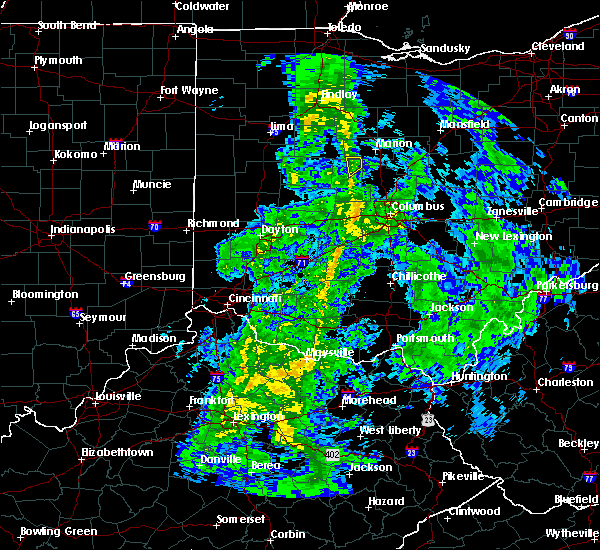 At 841 am edt, a severe thunderstorm was located near richwood, moving northeast at 50 mph (radar indicated). Hazards include 60 mph wind gusts. Expect damage to roofs, siding, and trees. Locations impacted include, richwood and essex. At 841 am edt, a severe thunderstorm was located near richwood, moving northeast at 50 mph (radar indicated). Hazards include 60 mph wind gusts. Expect damage to roofs, siding, and trees. Locations impacted include, richwood and essex.
|
| 5/1/2017 8:35 AM EDT |
 At 835 am edt, a severe thunderstorm was located near richwood, moving northeast at 45 mph (radar indicated). Hazards include 60 mph wind gusts. Expect damage to roofs, siding, and trees. Locations impacted include, richwood, broadway, essex and somersville. At 835 am edt, a severe thunderstorm was located near richwood, moving northeast at 45 mph (radar indicated). Hazards include 60 mph wind gusts. Expect damage to roofs, siding, and trees. Locations impacted include, richwood, broadway, essex and somersville.
|
| 5/1/2017 8:28 AM EDT |
 At 828 am edt, a severe thunderstorm was located near west mansfield, moving northeast at 50 mph (radar indicated). Hazards include 60 mph wind gusts. expect damage to roofs, siding, and trees At 828 am edt, a severe thunderstorm was located near west mansfield, moving northeast at 50 mph (radar indicated). Hazards include 60 mph wind gusts. expect damage to roofs, siding, and trees
|
| 6/23/2016 1:35 AM EDT | 1 tree down across roa in union county OH, 8.2 miles E of Richwood, OH |
| 6/23/2016 1:06 AM EDT |
 At 105 am edt, a severe thunderstorm was located near delaware, moving east at 30 mph (radar indicated). Hazards include 60 mph wind gusts and quarter size hail. Hail damage to vehicles is expected. expect wind damage to roofs, siding, and trees. locations impacted include, columbus, westerville, delaware, marysville, powell, sunbury, richwood, ashley, polaris, new albany, radnor, galena, ostrander, magnetic springs, warrensburg, essex, kilbourne, leonardsburg, stratford and new dover. A tornado watch remains in effect until 500 am edt for central ohio. At 105 am edt, a severe thunderstorm was located near delaware, moving east at 30 mph (radar indicated). Hazards include 60 mph wind gusts and quarter size hail. Hail damage to vehicles is expected. expect wind damage to roofs, siding, and trees. locations impacted include, columbus, westerville, delaware, marysville, powell, sunbury, richwood, ashley, polaris, new albany, radnor, galena, ostrander, magnetic springs, warrensburg, essex, kilbourne, leonardsburg, stratford and new dover. A tornado watch remains in effect until 500 am edt for central ohio.
|
| 6/23/2016 12:46 AM EDT |
 At 1246 am edt, a severe thunderstorm was located near delaware, moving southeast at 30 mph (radar indicated). Hazards include 60 mph wind gusts and quarter size hail. Hail damage to vehicles is expected. Expect wind damage to roofs, siding, and trees. At 1246 am edt, a severe thunderstorm was located near delaware, moving southeast at 30 mph (radar indicated). Hazards include 60 mph wind gusts and quarter size hail. Hail damage to vehicles is expected. Expect wind damage to roofs, siding, and trees.
|
| 5/1/2016 3:35 PM EDT |
 At 335 pm edt, a severe thunderstorm was located near richwood, moving east at 25 mph (radar indicated). Hazards include 60 mph wind gusts and quarter size hail. Hail damage to vehicles is expected. expect wind damage to roofs, siding, and trees. Locations impacted include, delaware, marysville, sunbury, richwood, ashley, radnor, galena, ostrander, magnetic springs, bellepoint, warrensburg, delaware state park, alum creek state park, kilbourne, leonardsburg, stratford, olive green, new dover, interstate 71 at us route 36/state route 37 and state route 257 at us route 36. At 335 pm edt, a severe thunderstorm was located near richwood, moving east at 25 mph (radar indicated). Hazards include 60 mph wind gusts and quarter size hail. Hail damage to vehicles is expected. expect wind damage to roofs, siding, and trees. Locations impacted include, delaware, marysville, sunbury, richwood, ashley, radnor, galena, ostrander, magnetic springs, bellepoint, warrensburg, delaware state park, alum creek state park, kilbourne, leonardsburg, stratford, olive green, new dover, interstate 71 at us route 36/state route 37 and state route 257 at us route 36.
|
| 5/1/2016 3:19 PM EDT |
 At 319 pm edt, a severe thunderstorm was located near west mansfield, moving east at 25 mph (radar indicated). Hazards include 60 mph wind gusts and quarter size hail. Hail damage to vehicles is expected. Expect wind damage to roofs, siding, and trees. At 319 pm edt, a severe thunderstorm was located near west mansfield, moving east at 25 mph (radar indicated). Hazards include 60 mph wind gusts and quarter size hail. Hail damage to vehicles is expected. Expect wind damage to roofs, siding, and trees.
|
| 5/1/2016 3:04 PM EDT |
 At 304 pm edt, a severe thunderstorm was located near west mansfield, moving east at 45 mph (radar indicated). Hazards include 60 mph wind gusts and quarter size hail. Hail damage to vehicles is expected. expect wind damage to roofs, siding, and trees. Locations impacted include, delaware, marysville, richwood, west mansfield, radnor, ostrander, magnetic springs, bellepoint, somersville, warrensburg, middleburg, raymond, new dover, east liberty, state route 257 at us route 36, broadway, byhalia and pharisburg. At 304 pm edt, a severe thunderstorm was located near west mansfield, moving east at 45 mph (radar indicated). Hazards include 60 mph wind gusts and quarter size hail. Hail damage to vehicles is expected. expect wind damage to roofs, siding, and trees. Locations impacted include, delaware, marysville, richwood, west mansfield, radnor, ostrander, magnetic springs, bellepoint, somersville, warrensburg, middleburg, raymond, new dover, east liberty, state route 257 at us route 36, broadway, byhalia and pharisburg.
|
| 5/1/2016 2:52 PM EDT |
 At 251 pm edt, a severe thunderstorm was located near west mansfield, moving east at 50 mph (radar indicated). Hazards include 60 mph wind gusts and quarter size hail. Hail damage to vehicles is expected. Expect wind damage to roofs, siding, and trees. At 251 pm edt, a severe thunderstorm was located near west mansfield, moving east at 50 mph (radar indicated). Hazards include 60 mph wind gusts and quarter size hail. Hail damage to vehicles is expected. Expect wind damage to roofs, siding, and trees.
|
| 12/23/2015 6:41 PM EST | The severe thunderstorm warning for union and northeastern madison counties in central ohio will expire at 645 pm est, the storms which prompted the warning have weakened below severe limits. therefore the warning will be allowed to expire. gusty winds to 50 mph are still possible with these storms. please report previous wind damage or hail to the national weather service by going to our website at weather.gov/iln and submit your report via social media. |
| 12/23/2015 6:32 PM EST | At 631 pm est, radar indicated severe thunderstorms located along a line extending from near richwood to near plain city, moving northeast at 55 mph. storm hazards include, winds to 60 mph, locations impacted include, dublin, marysville, plain city, richwood, milford center, magnetic springs, unionville center, somersville, us route 33 at us route 42, new dover, chuckery, broadway, watkins and pharisburg. |
| 12/23/2015 6:24 PM EST | Severe thunderstorm warning remains in effect for union and northeastern madison counties in central ohio until 645 pm est. at 624 pm est. radar indicated severe thunderstorms located along a line extending from near west mansfield to near mechanicsburg. moving northeast at 55 mph. Storm hazards include. |
| 12/23/2015 6:09 PM EST | At 609 pm est, radar indicated severe thunderstorms located along a line extending from near west liberty to 7 miles northeast of springfield, moving northeast at 55 mph. storm hazards include, winds to 60 mph, locations impacted include, dublin, marysville, urbana, plain city, richwood, west liberty, mechanicsburg, north lewisburg, milford center, woodstock, catawba, magnetic springs, unionville center, valley hi, mutual, middleburg, powhattan, essex, new dover and pottersburg. |
| 12/23/2015 5:59 PM EST | At 559 pm est, radar indicated severe thunderstorms located along a line extending from 6 miles southwest of west liberty to near springfield, moving northeast at 55 mph. storm hazards include, winds to 60 mph,. |
| 9/4/2015 4:29 PM EDT |
 At 429 pm edt, radar indicated severe thunderstorms located along a line extending from 6 miles northeast of marysville to lake darby, moving east at 25 mph. storm hazards include, winds to 60 mph, quarter size hail, locations impacted include, columbus, dublin, grove city, delaware, upper arlington, hilliard, marysville, worthington, jefferson, powell, plain city, west jefferson, richwood, lake darby, ohio state university, grandview heights, radnor, urbancrest, shawnee hills and ostrander. this includes the following interstates, i-70 in ohio between mile markers 81 and 100. i-71 in ohio between mile markers 101 and 108, and near mile marker 113. At 429 pm edt, radar indicated severe thunderstorms located along a line extending from 6 miles northeast of marysville to lake darby, moving east at 25 mph. storm hazards include, winds to 60 mph, quarter size hail, locations impacted include, columbus, dublin, grove city, delaware, upper arlington, hilliard, marysville, worthington, jefferson, powell, plain city, west jefferson, richwood, lake darby, ohio state university, grandview heights, radnor, urbancrest, shawnee hills and ostrander. this includes the following interstates, i-70 in ohio between mile markers 81 and 100. i-71 in ohio between mile markers 101 and 108, and near mile marker 113.
|
| 9/4/2015 4:20 PM EDT |
 At 420 pm edt, radar indicated severe thunderstorms located along a line extending from 6 miles south of richwood to near hilliard, moving east at 30 mph. storm hazards include, winds to 60 mph, quarter size hail,. At 420 pm edt, radar indicated severe thunderstorms located along a line extending from 6 miles south of richwood to near hilliard, moving east at 30 mph. storm hazards include, winds to 60 mph, quarter size hail,.
|
| 7/14/2015 1:29 PM EDT |
 At 128 pm edt, radar indicated severe thunderstorms located along a line extending from near waldo to 8 miles east of marysville, moving southeast at 55 mph. storm hazards include, winds to 60 mph, penny size hail, locations impacted include, delaware, marysville, richwood, radnor, ostrander, magnetic springs, bellepoint, warrensburg, delaware state park, leonardsburg, raymond, stratford, new dover, state route 257 at us route 36, broadway, watkins, pharisburg and somersville. At 128 pm edt, radar indicated severe thunderstorms located along a line extending from near waldo to 8 miles east of marysville, moving southeast at 55 mph. storm hazards include, winds to 60 mph, penny size hail, locations impacted include, delaware, marysville, richwood, radnor, ostrander, magnetic springs, bellepoint, warrensburg, delaware state park, leonardsburg, raymond, stratford, new dover, state route 257 at us route 36, broadway, watkins, pharisburg and somersville.
|
| 7/14/2015 1:10 PM EDT |
 At 110 pm edt, radar indicated severe thunderstorms located along a line extending from la rue to west mansfield, moving southeast at 50 mph. storm hazards include, winds to 60 mph, penny size hail,. At 110 pm edt, radar indicated severe thunderstorms located along a line extending from la rue to west mansfield, moving southeast at 50 mph. storm hazards include, winds to 60 mph, penny size hail,.
|
| 6/18/2015 7:12 PM EDT | At 710 pm edt, radar indicated a severe thunderstorm located near richwood, moving east at 60 mph. storm hazards include, winds to 60 mph, very heavy rain which may cause minor flooding,. |
| 5/27/2015 6:55 PM EDT | At 654 pm edt, radar indicated that the severe thunderstorm had weakened. this storm was located near pottersburg, moving east at 30 mph. storm hazards include, quarter size hail, locations impacted include, marysville. in addition, pottersburg, raymond, broadway, new dover, pharisburg and watkins are near the path of this storm. |
| 5/27/2015 6:41 PM EDT | At 642 pm edt, radar indicated a severe thunderstorm located near mingo, moving east at 30 mph. storm hazards include, quarter size hail,. |
| 7/27/2014 1:25 PM EDT | Large tree down at state route 4 and hoskins rd. time estimated from rada in union county OH, 2.4 miles WNW of Richwood, OH |
| 7/27/2014 1:18 PM EDT | A few trees down in price cemetery. time estimated from rada in union county OH, 5.3 miles SSE of Richwood, OH |
| 7/27/2014 12:55 PM EDT | Quarter sized hail reported 3.3 miles SE of Richwood, OH, large hail and tree limbs down near 739 northwest of richwood. |
| 11/17/2013 6:53 PM EST | Roof off a barn on boundary road near the marion county line. time approximate in union county OH, 2.3 miles S of Richwood, OH |
| 6/13/2013 1:00 AM EDT | Roof blown off home in union county OH, 4.1 miles SSE of Richwood, OH |
Hail Maps for Richwood, OH


Connect with Interactive Hail Maps