

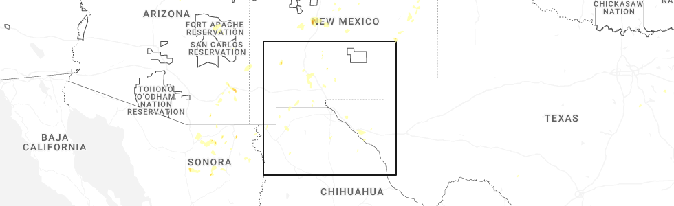
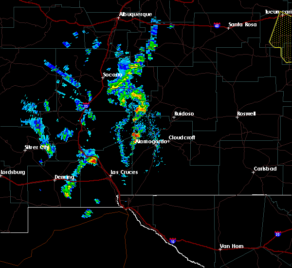
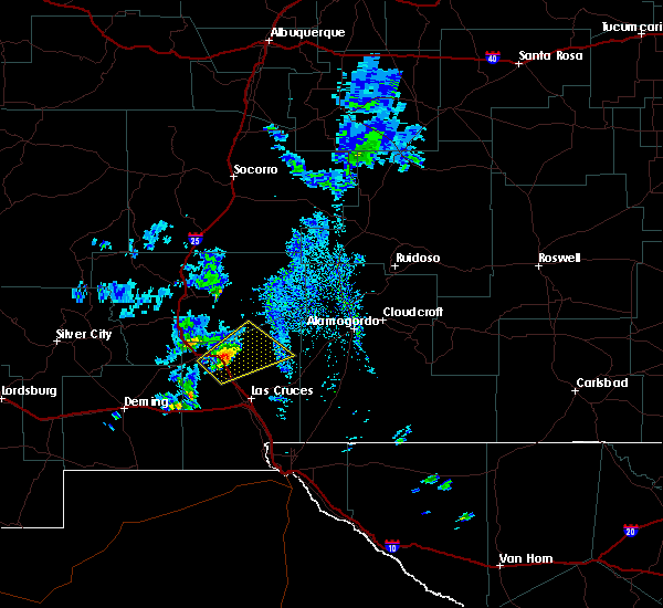
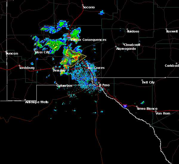
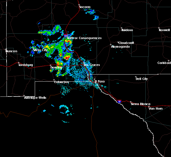
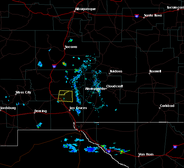
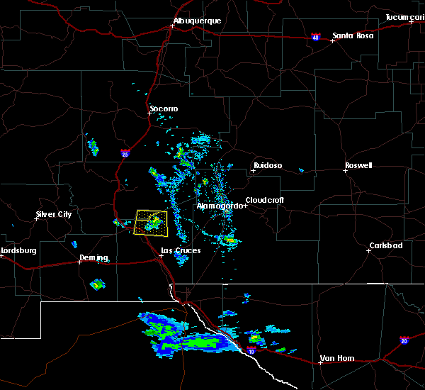
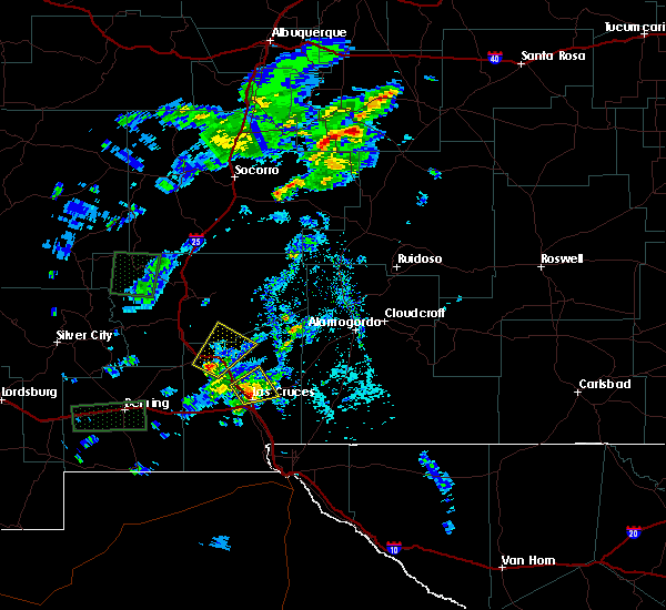
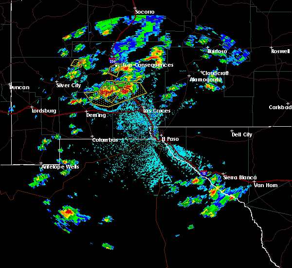
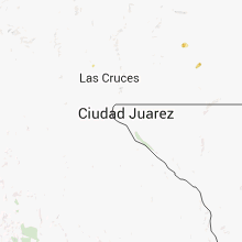
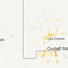
Hail Map for Rincon, NM
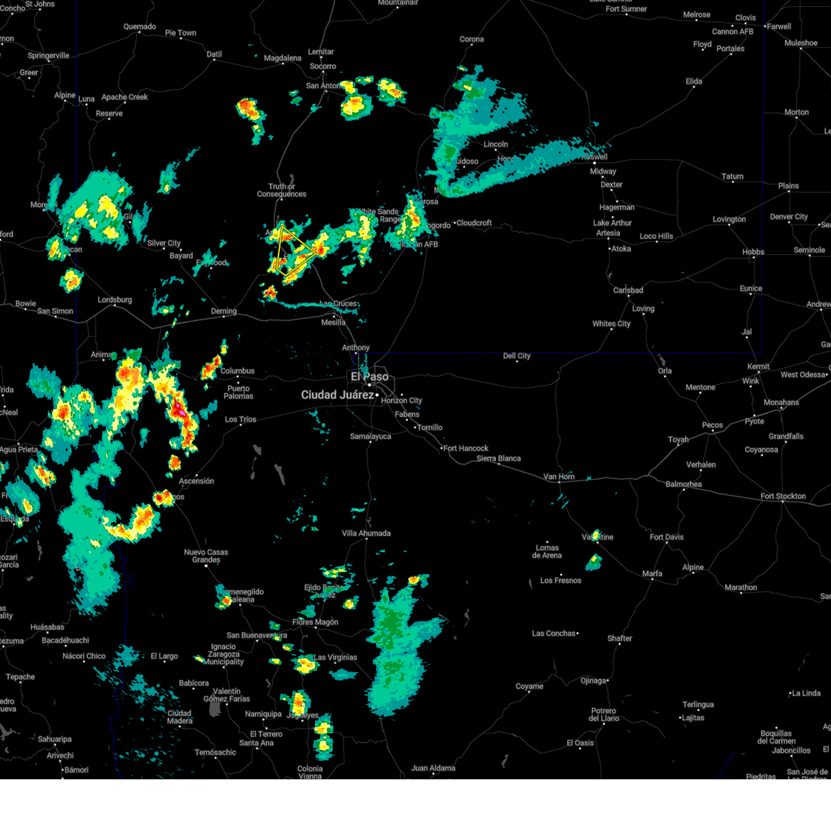
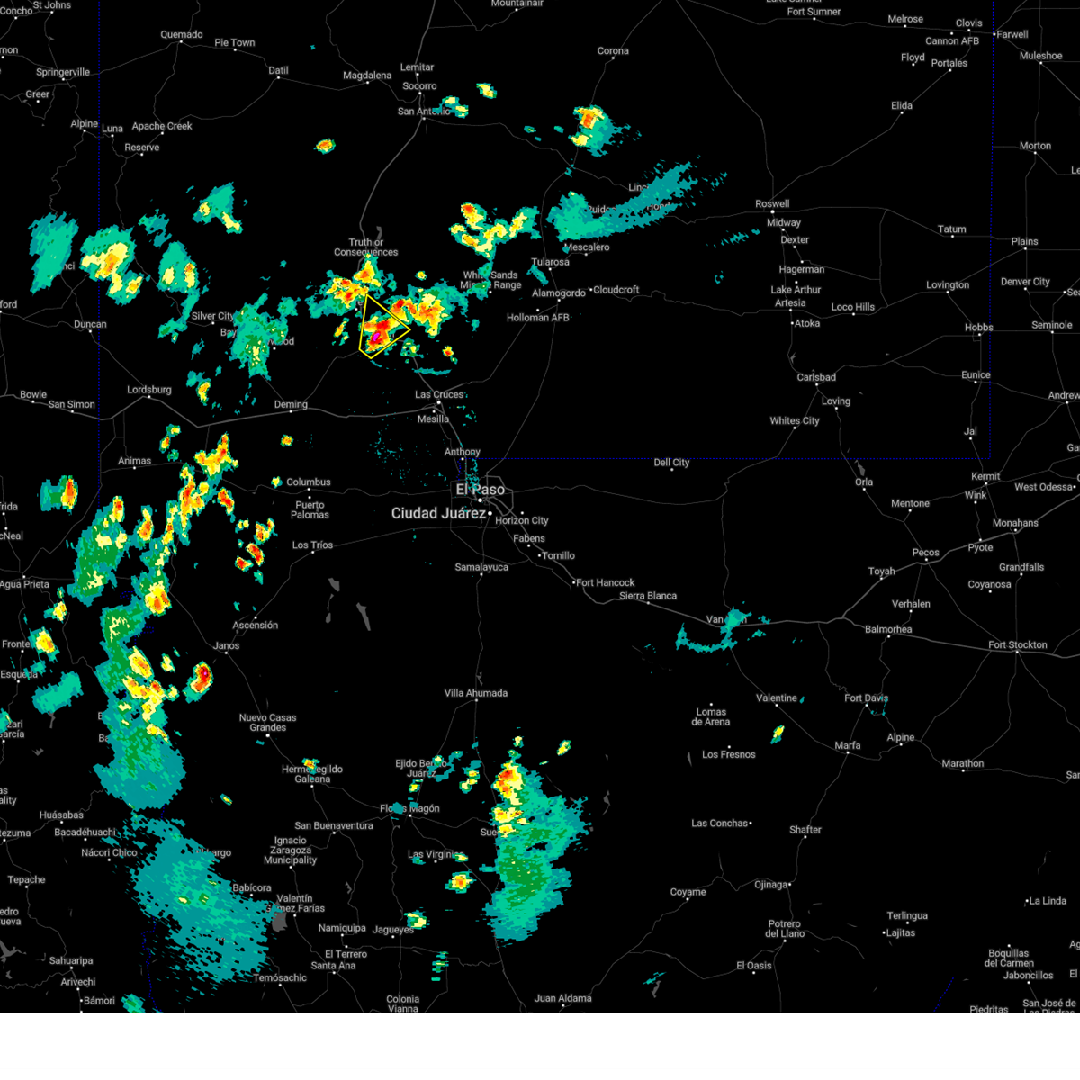
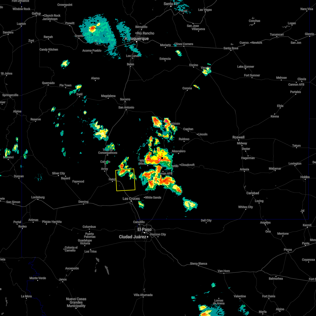
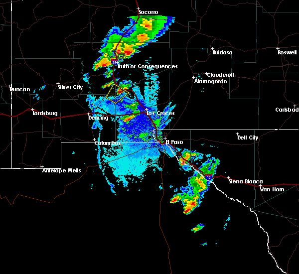
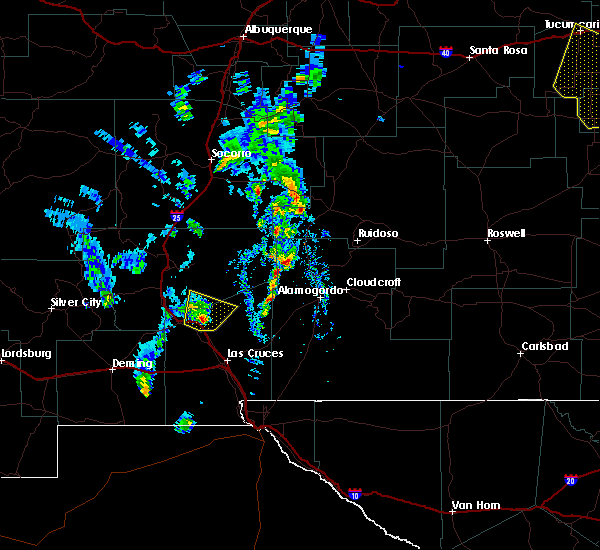
The Rincon, NM area has had 1 report of on-the-ground hail by trained spotters, and has been under severe weather warnings 1 time during the past 12 months. Doppler radar has detected hail at or near Rincon, NM on 18 occasions, including 1 occasion during the past year.
| Name: | Rincon, NM |
| Where Located: | 70.5 miles E of Silver City, NM |
| Map: | Google Map for Rincon, NM |
| Population: | 271 |
| Housing Units: | 103 |
| More Info: | Search Google for Rincon, NM |
1
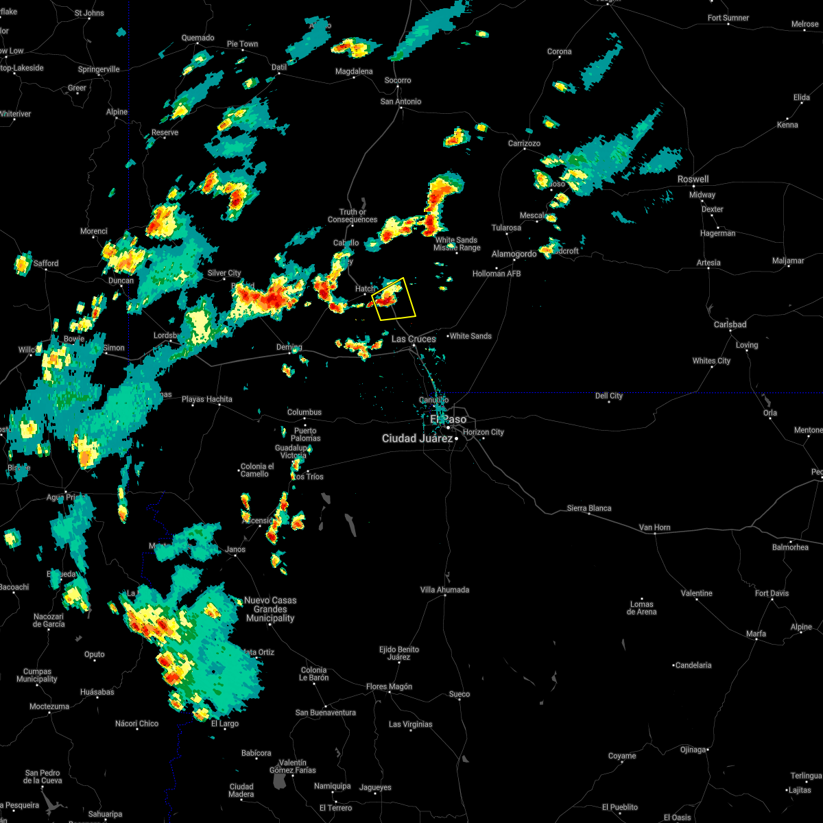
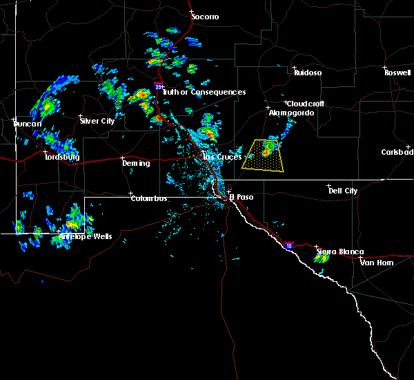
The Top Recent Hail Date for Rincon, NM is Sunday, July 13, 2025 (2nd out of 18)
Hail and Wind Damage Spotted near Rincon, NM
| Date / Time | Report Details |
|---|---|
| 7/13/2025 5:22 PM MDT |
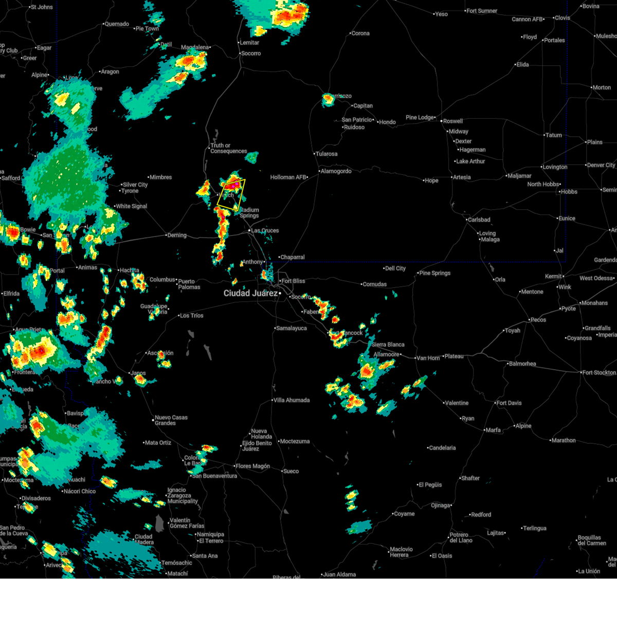 Svrepz the national weather service in el paso has issued a * severe thunderstorm warning for, south central sierra county in south central new mexico, northwestern dona ana county in south central new mexico, * until 615 pm mdt. * at 522 pm mdt, a severe thunderstorm was located 4 miles east of rincon, moving south at 25 mph (radar indicated). Hazards include 70 mph wind gusts and half dollar size hail. Hail damage to vehicles is expected. expect considerable tree damage. Wind damage is also likely to mobile homes, roofs, and outbuildings. Svrepz the national weather service in el paso has issued a * severe thunderstorm warning for, south central sierra county in south central new mexico, northwestern dona ana county in south central new mexico, * until 615 pm mdt. * at 522 pm mdt, a severe thunderstorm was located 4 miles east of rincon, moving south at 25 mph (radar indicated). Hazards include 70 mph wind gusts and half dollar size hail. Hail damage to vehicles is expected. expect considerable tree damage. Wind damage is also likely to mobile homes, roofs, and outbuildings.
|
| 7/15/2023 5:55 PM MDT |
 The severe thunderstorm warning for south central sierra and northwestern dona ana counties will expire at 600 pm mdt, the storm which prompted the warning has weakened below severe limits, and no longer poses an immediate threat to life or property. therefore, the warning will be allowed to expire. however heavy rain is still possible with this thunderstorm. The severe thunderstorm warning for south central sierra and northwestern dona ana counties will expire at 600 pm mdt, the storm which prompted the warning has weakened below severe limits, and no longer poses an immediate threat to life or property. therefore, the warning will be allowed to expire. however heavy rain is still possible with this thunderstorm.
|
| 7/15/2023 5:16 PM MDT |
 At 515 pm mdt, a severe thunderstorm was located over salem, moving northeast at 20 mph (radar indicated). Hazards include 60 mph wind gusts and half dollar size hail. Hail damage to vehicles is expected. Expect wind damage to roofs, siding, and trees. At 515 pm mdt, a severe thunderstorm was located over salem, moving northeast at 20 mph (radar indicated). Hazards include 60 mph wind gusts and half dollar size hail. Hail damage to vehicles is expected. Expect wind damage to roofs, siding, and trees.
|
| 10/16/2022 2:30 PM MDT | Quarter sized hail reported 14.2 miles NW of Rincon, NM, military meteorologist reported quarter sized hail at i-25 mile marker 21. interstate covered with hail from mile marker 20 to mile marker 25. |
| 9/26/2021 4:43 PM MDT |
 The severe thunderstorm warning for west central dona ana county will expire at 445 pm mdt, the storm which prompted the warning has moved out of the area. therefore, the warning will be allowed to expire. The severe thunderstorm warning for west central dona ana county will expire at 445 pm mdt, the storm which prompted the warning has moved out of the area. therefore, the warning will be allowed to expire.
|
| 9/26/2021 4:10 PM MDT |
 At 409 pm mdt, a severe thunderstorm was located 4 miles west of radium springs, moving northeast at 35 mph (radar indicated). Hazards include golf ball size hail and 60 mph wind gusts. People and animals outdoors will be injured. expect hail damage to roofs, siding, windows, and vehicles. expect wind damage to roofs, siding, and trees. locations impacted include, leasburg, rincon, las cruces, radium springs, dona ana, east mesa, portions of jornada experimental range, hill, northeast las cruces, corralitos, fort selden state historic site and leasburg dam state park. this includes the following highways, interstate 25 in new mexico near mile marker 1, and between mile markers 7 and 34. highway 70 in new mexico between mile markers 153 and 157. thunderstorm damage threat, considerable hail threat, radar indicated max hail size, 1. 75 in wind threat, radar indicated max wind gust, 60 mph. At 409 pm mdt, a severe thunderstorm was located 4 miles west of radium springs, moving northeast at 35 mph (radar indicated). Hazards include golf ball size hail and 60 mph wind gusts. People and animals outdoors will be injured. expect hail damage to roofs, siding, windows, and vehicles. expect wind damage to roofs, siding, and trees. locations impacted include, leasburg, rincon, las cruces, radium springs, dona ana, east mesa, portions of jornada experimental range, hill, northeast las cruces, corralitos, fort selden state historic site and leasburg dam state park. this includes the following highways, interstate 25 in new mexico near mile marker 1, and between mile markers 7 and 34. highway 70 in new mexico between mile markers 153 and 157. thunderstorm damage threat, considerable hail threat, radar indicated max hail size, 1. 75 in wind threat, radar indicated max wind gust, 60 mph.
|
| 9/26/2021 3:54 PM MDT |
 At 354 pm mdt, a severe thunderstorm was located 14 miles southwest of radium springs, moving northeast at 35 mph (radar indicated). Hazards include 60 mph wind gusts and quarter size hail. Hail damage to vehicles is expected. Expect wind damage to roofs, siding, and trees. At 354 pm mdt, a severe thunderstorm was located 14 miles southwest of radium springs, moving northeast at 35 mph (radar indicated). Hazards include 60 mph wind gusts and quarter size hail. Hail damage to vehicles is expected. Expect wind damage to roofs, siding, and trees.
|
| 8/23/2021 4:17 PM MDT |
 At 417 pm mdt, a severe thunderstorm was located 6 miles southeast of rincon, moving east at 5 mph (radar indicated). Hazards include 60 mph wind gusts and half dollar size hail. Hail damage to vehicles is expected. Expect wind damage to roofs, siding, and trees. At 417 pm mdt, a severe thunderstorm was located 6 miles southeast of rincon, moving east at 5 mph (radar indicated). Hazards include 60 mph wind gusts and half dollar size hail. Hail damage to vehicles is expected. Expect wind damage to roofs, siding, and trees.
|
| 7/11/2021 8:37 PM MDT |
 The severe thunderstorm warning for south central sierra and northwestern dona ana counties will expire at 845 pm mdt, the storm which prompted the warning has weakened below severe limits, and has exited the warned area. therefore, the warning will be allowed to expire. a severe thunderstorm watch remains in effect until 1000 pm mdt for south central new mexico. The severe thunderstorm warning for south central sierra and northwestern dona ana counties will expire at 845 pm mdt, the storm which prompted the warning has weakened below severe limits, and has exited the warned area. therefore, the warning will be allowed to expire. a severe thunderstorm watch remains in effect until 1000 pm mdt for south central new mexico.
|
| 7/11/2021 8:28 PM MDT |
 At 828 pm mdt, a severe thunderstorm was located 7 miles south of hatch, moving south at 40 mph (radar indicated). Hazards include 60 mph wind gusts and quarter size hail. Hail damage to vehicles is expected. Expect wind damage to roofs, siding, and trees. At 828 pm mdt, a severe thunderstorm was located 7 miles south of hatch, moving south at 40 mph (radar indicated). Hazards include 60 mph wind gusts and quarter size hail. Hail damage to vehicles is expected. Expect wind damage to roofs, siding, and trees.
|
| 7/11/2021 7:57 PM MDT |
 At 757 pm mdt, a severe thunderstorm was located 6 miles northeast of salem, moving south at 25 mph (radar indicated). Hazards include 60 mph wind gusts and half dollar size hail. Hail damage to vehicles is expected. Expect wind damage to roofs, siding, and trees. At 757 pm mdt, a severe thunderstorm was located 6 miles northeast of salem, moving south at 25 mph (radar indicated). Hazards include 60 mph wind gusts and half dollar size hail. Hail damage to vehicles is expected. Expect wind damage to roofs, siding, and trees.
|
| 7/11/2021 6:13 PM MDT |
 At 612 pm mdt, a severe thunderstorm was located 6 miles southeast of upham, moving south at 25 mph (radar indicated). Hazards include golf ball size hail and 60 mph wind gusts. People and animals outdoors will be injured. expect hail damage to roofs, siding, windows, and vehicles. Expect wind damage to roofs, siding, and trees. At 612 pm mdt, a severe thunderstorm was located 6 miles southeast of upham, moving south at 25 mph (radar indicated). Hazards include golf ball size hail and 60 mph wind gusts. People and animals outdoors will be injured. expect hail damage to roofs, siding, windows, and vehicles. Expect wind damage to roofs, siding, and trees.
|
| 3/18/2020 10:43 PM MDT |
 At 1041 pm mdt, severe thunderstorms were approaching the las cruces area and surrounding locations, moving northeast at 50 mph (radar indicated). Hazards include 60 mph wind gusts and penny size hail. expect damage to roofs, siding, and trees At 1041 pm mdt, severe thunderstorms were approaching the las cruces area and surrounding locations, moving northeast at 50 mph (radar indicated). Hazards include 60 mph wind gusts and penny size hail. expect damage to roofs, siding, and trees
|
| 9/26/2017 7:38 PM MDT |
 At 738 pm mdt, a severe thunderstorm was located over placitas in dona ana county, or near hatch, moving northeast at 15 mph (radar indicated). Hazards include 60 mph wind gusts and quarter size hail. Hail damage to vehicles is expected. Expect wind damage to roofs, siding, and trees. At 738 pm mdt, a severe thunderstorm was located over placitas in dona ana county, or near hatch, moving northeast at 15 mph (radar indicated). Hazards include 60 mph wind gusts and quarter size hail. Hail damage to vehicles is expected. Expect wind damage to roofs, siding, and trees.
|
| 11/4/2016 4:14 PM MDT |
 At 414 pm mdt, a severe thunderstorm was located 8 miles southeast of nutt, moving northeast at 20 mph (radar indicated). Hazards include 60 mph wind gusts and quarter size hail. Hail damage to vehicles is expected. Expect wind damage to roofs, siding, and trees. At 414 pm mdt, a severe thunderstorm was located 8 miles southeast of nutt, moving northeast at 20 mph (radar indicated). Hazards include 60 mph wind gusts and quarter size hail. Hail damage to vehicles is expected. Expect wind damage to roofs, siding, and trees.
|
| 10/21/2015 11:11 AM MDT |
 At 1111 am mdt, a severe thunderstorm was located 5 miles east of rincon, or 10 miles east of hatch, moving northeast at 25 mph (radar indicated). Hazards include ping pong ball size hail and 60 mph wind gusts. People and animals outdoors will be injured. expect hail damage to roofs, siding, windows and vehicles. expect wind damage to roofs, siding and trees. Locations impacted include, upham, rincon. At 1111 am mdt, a severe thunderstorm was located 5 miles east of rincon, or 10 miles east of hatch, moving northeast at 25 mph (radar indicated). Hazards include ping pong ball size hail and 60 mph wind gusts. People and animals outdoors will be injured. expect hail damage to roofs, siding, windows and vehicles. expect wind damage to roofs, siding and trees. Locations impacted include, upham, rincon.
|
| 10/21/2015 10:54 AM MDT |
 At 1054 am mdt, a severe thunderstorm was located 6 miles south of rincon, or 8 miles southeast of hatch, moving northeast at 25 mph (radar indicated). Hazards include 60 mph wind gusts and quarter size hail. Hail damage to vehicles is expected. Expect wind damage to roofs, siding and trees. At 1054 am mdt, a severe thunderstorm was located 6 miles south of rincon, or 8 miles southeast of hatch, moving northeast at 25 mph (radar indicated). Hazards include 60 mph wind gusts and quarter size hail. Hail damage to vehicles is expected. Expect wind damage to roofs, siding and trees.
|
| 10/7/2015 8:19 AM MDT |
 At 816 am mdt, a severe thunderstorm continues was located near rincon moving northeast at 15 to 20 mph (radar indicated). Hazards include 60 mph wind gusts and quarter size hail. Hail damage to vehicles is expected. Expect wind damage to roofs, siding and trees. At 816 am mdt, a severe thunderstorm continues was located near rincon moving northeast at 15 to 20 mph (radar indicated). Hazards include 60 mph wind gusts and quarter size hail. Hail damage to vehicles is expected. Expect wind damage to roofs, siding and trees.
|
| 10/7/2015 7:48 AM MDT |
 At 746 am mdt, a severe thunderstorm was located just south of hatch continues to move northeast at 15-20 mph (radar indicated). Hazards include 60 mph wind gusts and quarter size hail. Hail damage to vehicles is expected. expect wind damage to roofs, siding and trees. Locations impacted include, hatch, garfield, uvas valley, derry, placitas in dona ana county, salem, rincon. At 746 am mdt, a severe thunderstorm was located just south of hatch continues to move northeast at 15-20 mph (radar indicated). Hazards include 60 mph wind gusts and quarter size hail. Hail damage to vehicles is expected. expect wind damage to roofs, siding and trees. Locations impacted include, hatch, garfield, uvas valley, derry, placitas in dona ana county, salem, rincon.
|
| 10/7/2015 7:20 AM MDT |
 At 718 am mdt, a severe thunderstorm was located 6 miles southeast of uvas valley, or 14 miles southwest of hatch moving northeast around 20 mph stationary (radar indicated). Hazards include 60 mph wind gusts and quarter size hail. Hail damage to vehicles is expected. Expect wind damage to roofs, siding and trees. At 718 am mdt, a severe thunderstorm was located 6 miles southeast of uvas valley, or 14 miles southwest of hatch moving northeast around 20 mph stationary (radar indicated). Hazards include 60 mph wind gusts and quarter size hail. Hail damage to vehicles is expected. Expect wind damage to roofs, siding and trees.
|
| 9/11/2015 5:54 PM MDT |
 The severe thunderstorm warning for north central dona ana and southeastern sierra counties will expire at 600 pm mdt, the storm which prompted the warning has weakened below severe limits, and no longer poses an immediate threat to life or property. therefore the warning will be allowed to expire. The severe thunderstorm warning for north central dona ana and southeastern sierra counties will expire at 600 pm mdt, the storm which prompted the warning has weakened below severe limits, and no longer poses an immediate threat to life or property. therefore the warning will be allowed to expire.
|
| 9/11/2015 5:19 PM MDT |
 At 518 pm mdt, a severe thunderstorm was located 8 miles north of jornada range, or 21 miles north of leasburg, moving south at 15 mph (radar indicated). Hazards include 60 mph wind gusts and penny size hail. Expect damage to roofs. Siding and trees. At 518 pm mdt, a severe thunderstorm was located 8 miles north of jornada range, or 21 miles north of leasburg, moving south at 15 mph (radar indicated). Hazards include 60 mph wind gusts and penny size hail. Expect damage to roofs. Siding and trees.
|
| 7/10/2015 3:01 PM MDT |
 At 301 pm mdt, a severe thunderstorm was located near rincon, or 6 miles east of hatch, moving northeast at 35 mph (radar indicated). Hazards include 60 mph wind gusts and nickel size hail. Expect damage to roofs. Siding and trees. At 301 pm mdt, a severe thunderstorm was located near rincon, or 6 miles east of hatch, moving northeast at 35 mph (radar indicated). Hazards include 60 mph wind gusts and nickel size hail. Expect damage to roofs. Siding and trees.
|
| 7/7/2015 3:13 PM MDT |
 At 311 pm mdt, severe thunderstorms were located along a line extending from near rincon to 6 miles northeast of uvas valley to 10 miles west of nutt, moving east at 20 mph. the strongest storms were located just south of hatch, near rodey, and in the vicinity of the macho springs wind farm (radar indicated). Hazards include 70 mph wind gusts and quarter size hail. Hail damage to vehicles is expected. expect considerable tree damage. wind damage is also likely to mobile homes, roofs and outbuildings. Locations impacted include, hatch, rodey, macho springs, uvas valley, jornada range, nutt, rincon, salem. At 311 pm mdt, severe thunderstorms were located along a line extending from near rincon to 6 miles northeast of uvas valley to 10 miles west of nutt, moving east at 20 mph. the strongest storms were located just south of hatch, near rodey, and in the vicinity of the macho springs wind farm (radar indicated). Hazards include 70 mph wind gusts and quarter size hail. Hail damage to vehicles is expected. expect considerable tree damage. wind damage is also likely to mobile homes, roofs and outbuildings. Locations impacted include, hatch, rodey, macho springs, uvas valley, jornada range, nutt, rincon, salem.
|
| 7/7/2015 2:51 PM MDT |
 At 250 pm mdt, severe thunderstorms were located along a line extending from rincon to near nutt to 8 miles east of faywood, moving east at 20 mph (radar indicated). Hazards include 60 mph wind gusts and quarter size hail. Hail damage to vehicles is expected. Expect wind damage to roofs, siding and trees. At 250 pm mdt, severe thunderstorms were located along a line extending from rincon to near nutt to 8 miles east of faywood, moving east at 20 mph (radar indicated). Hazards include 60 mph wind gusts and quarter size hail. Hail damage to vehicles is expected. Expect wind damage to roofs, siding and trees.
|
| 6/22/2015 6:36 PM MDT |
 At 635 pm mdt, doppler radar indicated a severe thunderstorm capable of producing damaging winds in excess of 60 mph. this storm was located near rincon, or 11 miles east of hatch, and moving southwest at 15 mph. nickel size hail may also accompany the damaging winds. At 635 pm mdt, doppler radar indicated a severe thunderstorm capable of producing damaging winds in excess of 60 mph. this storm was located near rincon, or 11 miles east of hatch, and moving southwest at 15 mph. nickel size hail may also accompany the damaging winds.
|
| 6/17/2015 7:33 PM MDT |
 At 732 pm mdt, doppler radar indicated a severe thunderstorm capable of producing quarter size hail and damaging winds in excess of 60 mph. this storm was located over salem, or near hatch, and moving southeast at 15 mph. At 732 pm mdt, doppler radar indicated a severe thunderstorm capable of producing quarter size hail and damaging winds in excess of 60 mph. this storm was located over salem, or near hatch, and moving southeast at 15 mph.
|
Hail Maps for Rincon, NM


Connect with Interactive Hail Maps