

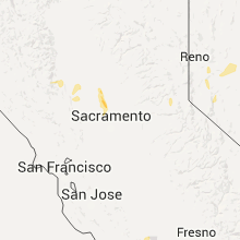
Hail Map for Rio Oso, CA
The Rio Oso, CA area has had 0 reports of on-the-ground hail by trained spotters, and has been under severe weather warnings 0 times during the past 12 months. Doppler radar has detected hail at or near Rio Oso, CA on 1 occasion.
| Name: | Rio Oso, CA |
| Where Located: | 22.5 miles NW of Citrus Heights, CA |
| Map: | Google Map for Rio Oso, CA |
| Population: | 356 |
| Housing Units: | 140 |
| More Info: | Search Google for Rio Oso, CA |
5
The Top Recent Hail Date for Rio Oso, CA is Thursday, May 5, 2016 (1st out of 1)

Hail and Wind Damage Spotted near Rio Oso, CA
| Date / Time | Report Details |
|---|---|
| 1/10/2023 4:10 AM PST |
 The severe thunderstorm warning for southeastern yolo, southeastern sutter, north central sacramento, northeastern solano, southwestern placer and southwestern yuba counties will expire at 415 am pst, the storm which prompted the warning has moved out of the area. therefore, the warning will be allowed to expire. The severe thunderstorm warning for southeastern yolo, southeastern sutter, north central sacramento, northeastern solano, southwestern placer and southwestern yuba counties will expire at 415 am pst, the storm which prompted the warning has moved out of the area. therefore, the warning will be allowed to expire.
|
| 1/10/2023 3:28 AM PST |
 At 327 am pst, a severe thunderstorm was located near freeport, or 9 miles southeast of davis, moving northeast at 55 mph (radar indicated). Hazards include 70 mph wind gusts. Expect considerable tree damage. damage is likely to mobile homes, roofs, and outbuildings. Torrential rain and flooding of roadways, and small hail will also accompany the storm. At 327 am pst, a severe thunderstorm was located near freeport, or 9 miles southeast of davis, moving northeast at 55 mph (radar indicated). Hazards include 70 mph wind gusts. Expect considerable tree damage. damage is likely to mobile homes, roofs, and outbuildings. Torrential rain and flooding of roadways, and small hail will also accompany the storm.
|
Hail Maps for Rio Oso, CA
Connect with Interactive Hail Maps