

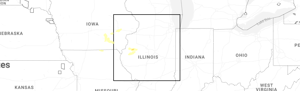
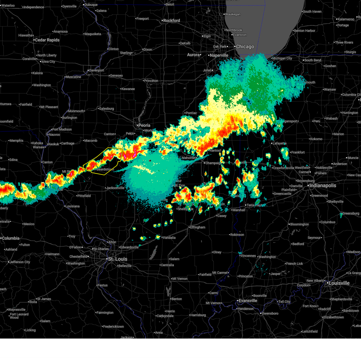
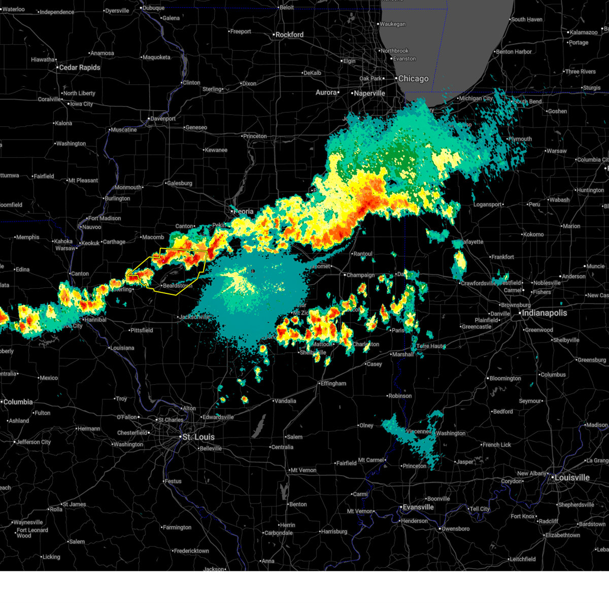
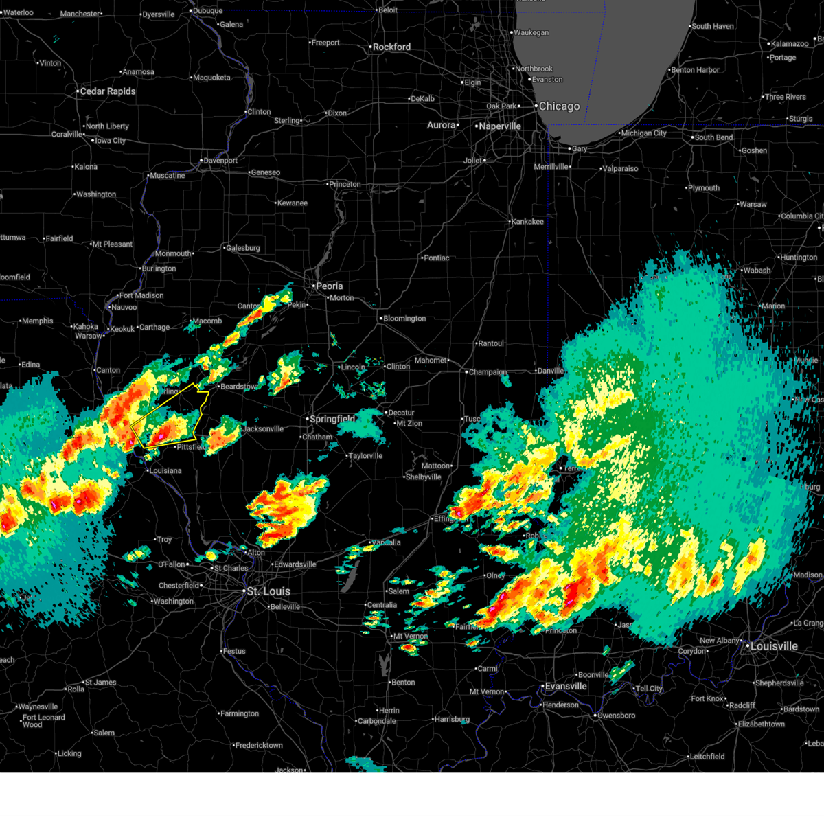
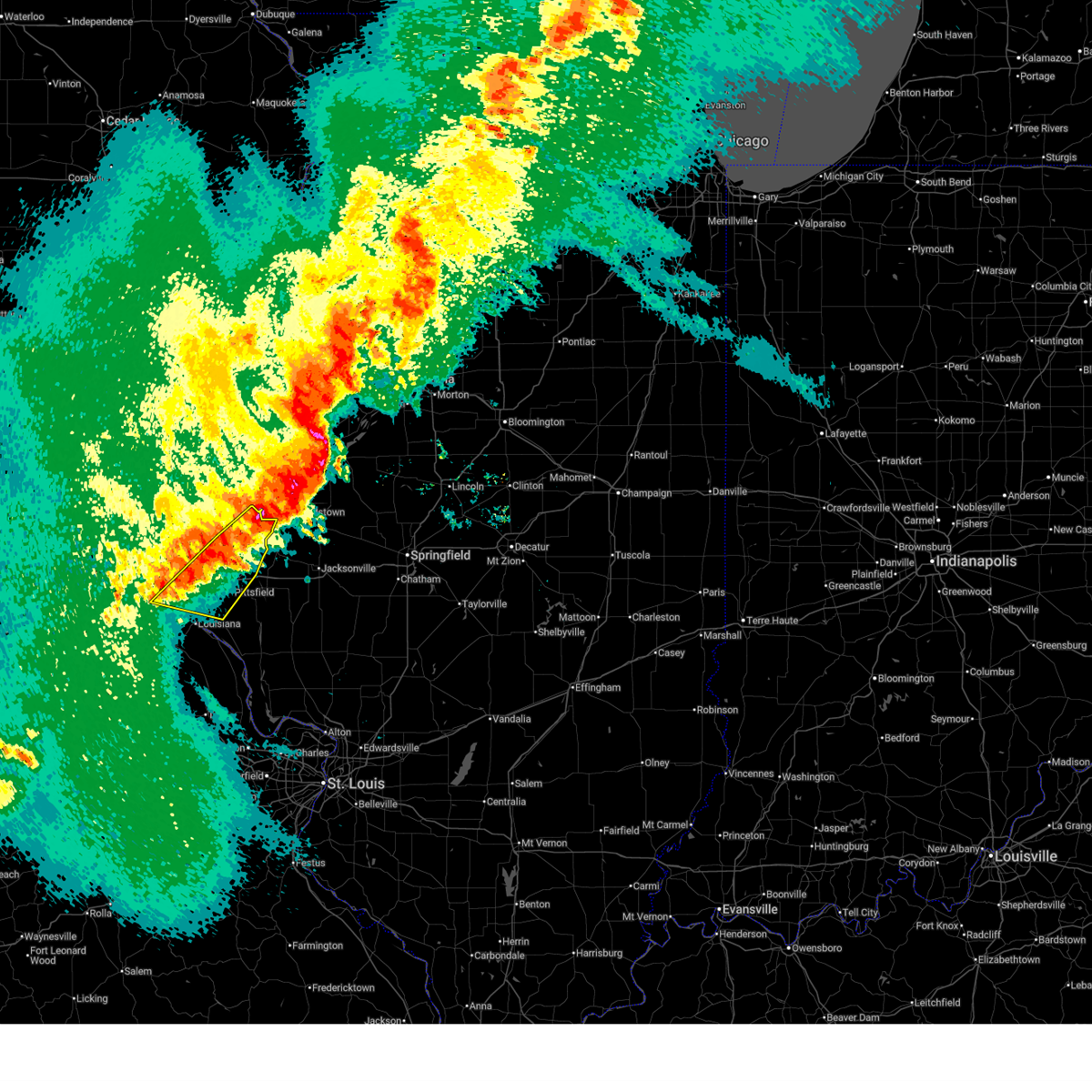
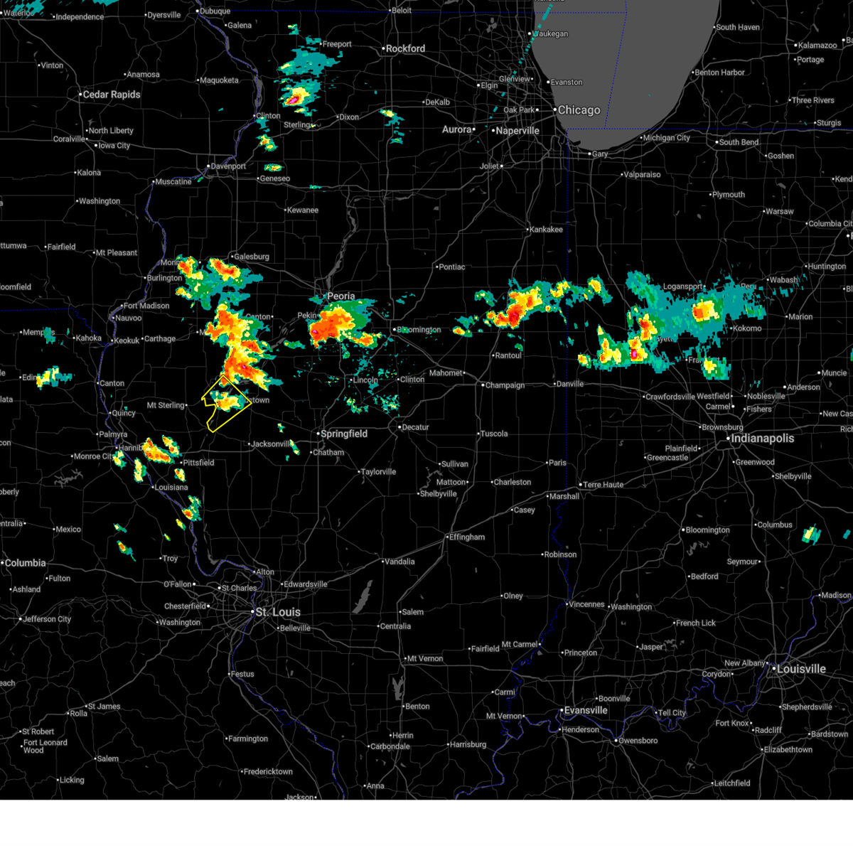
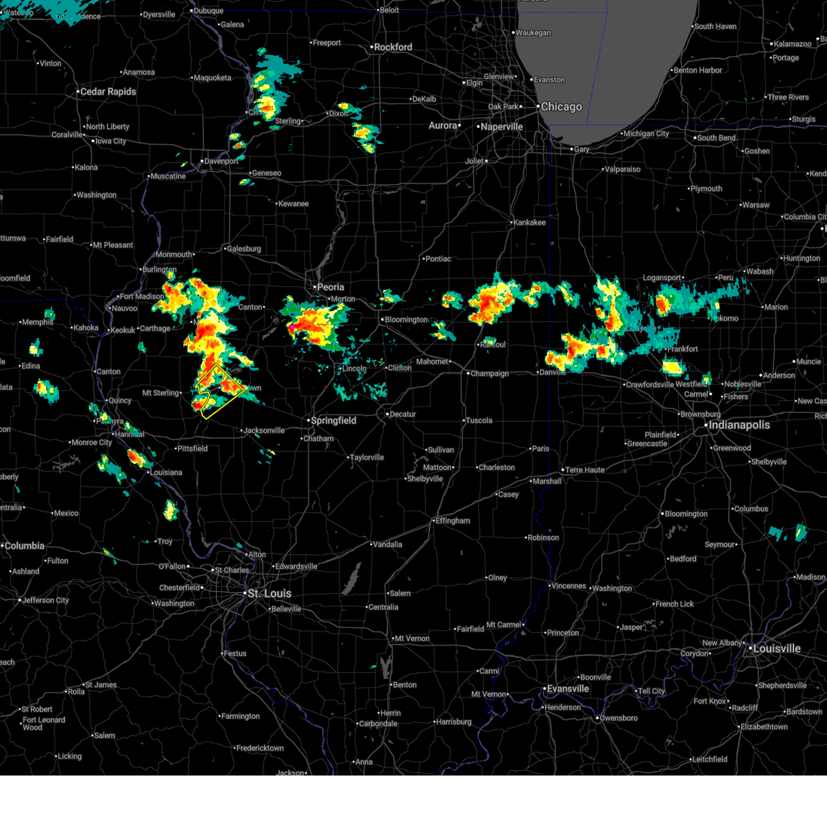
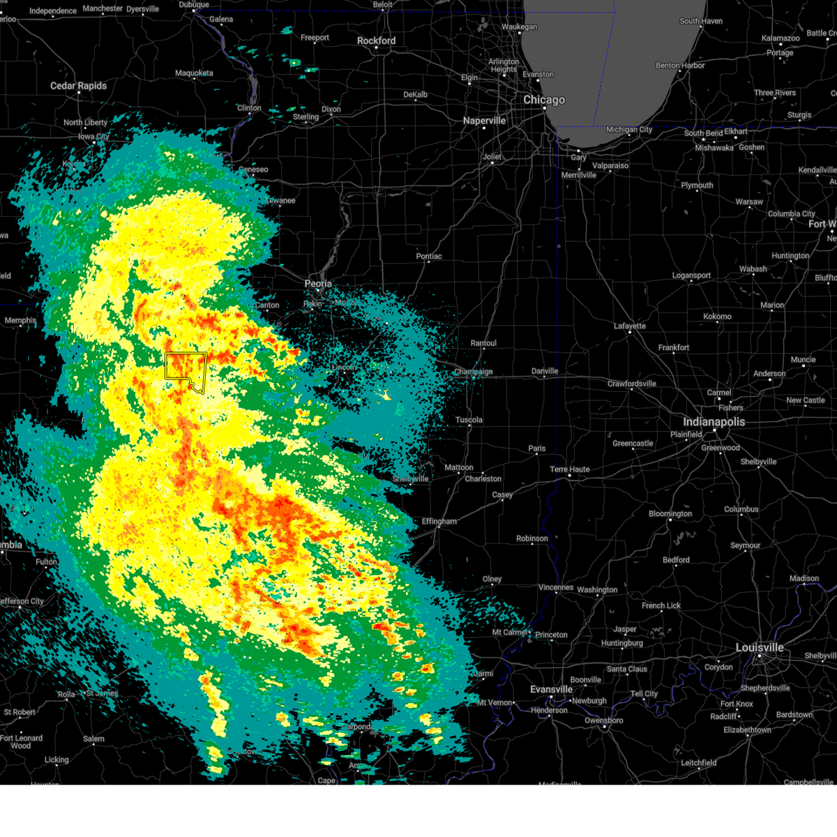
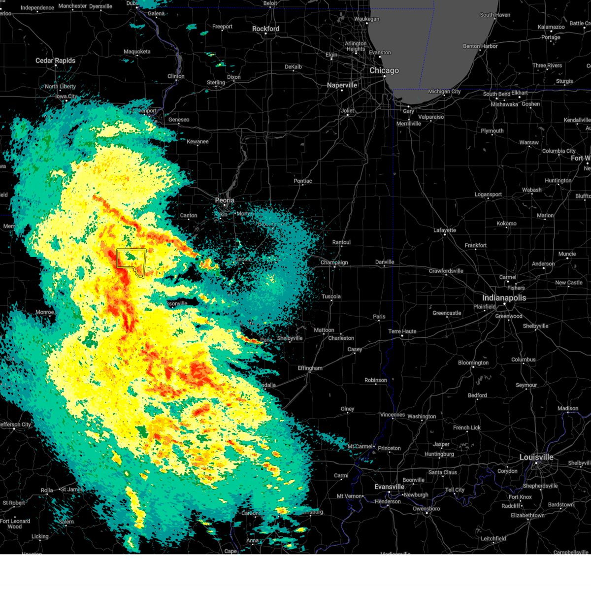
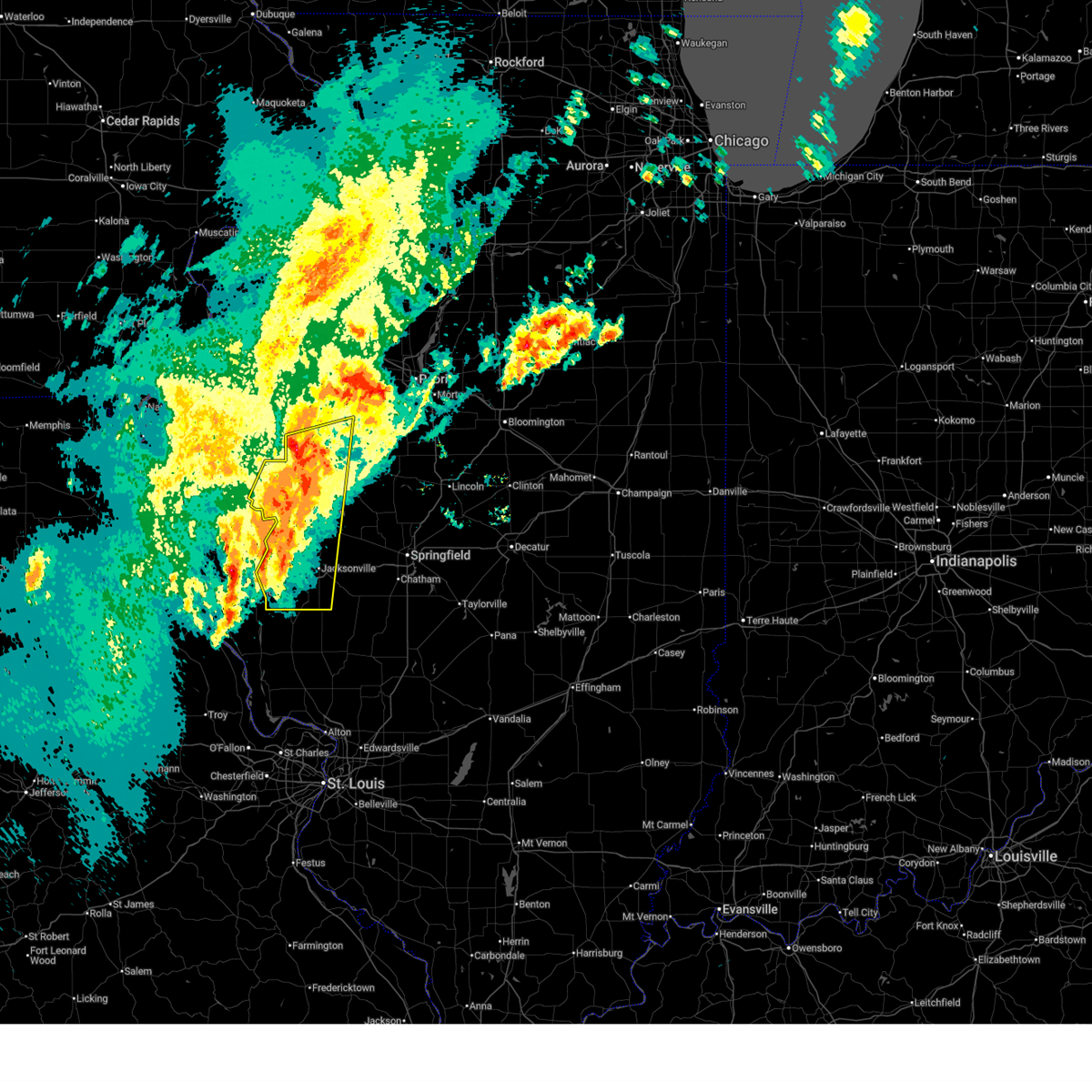
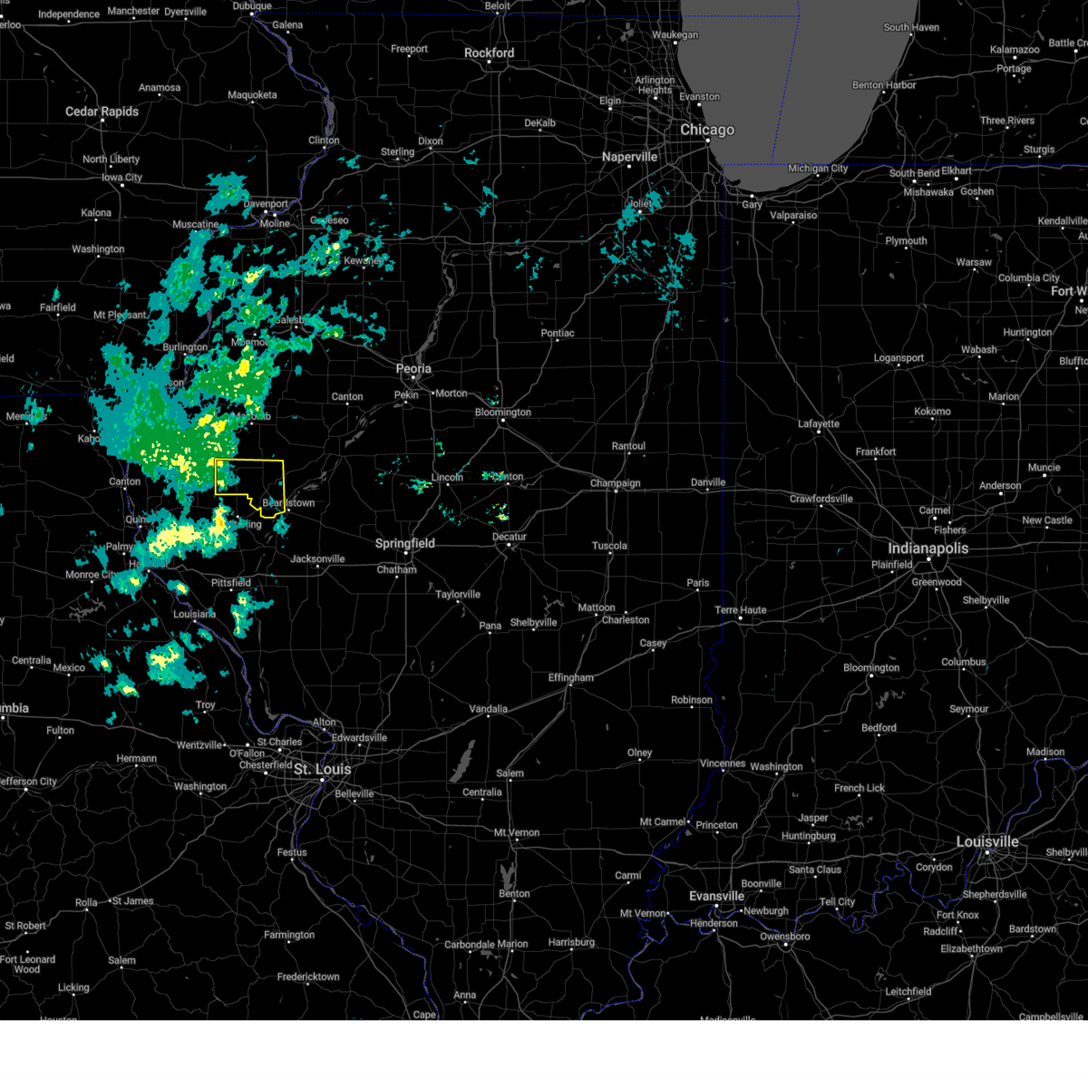
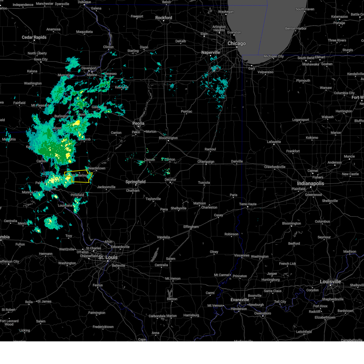
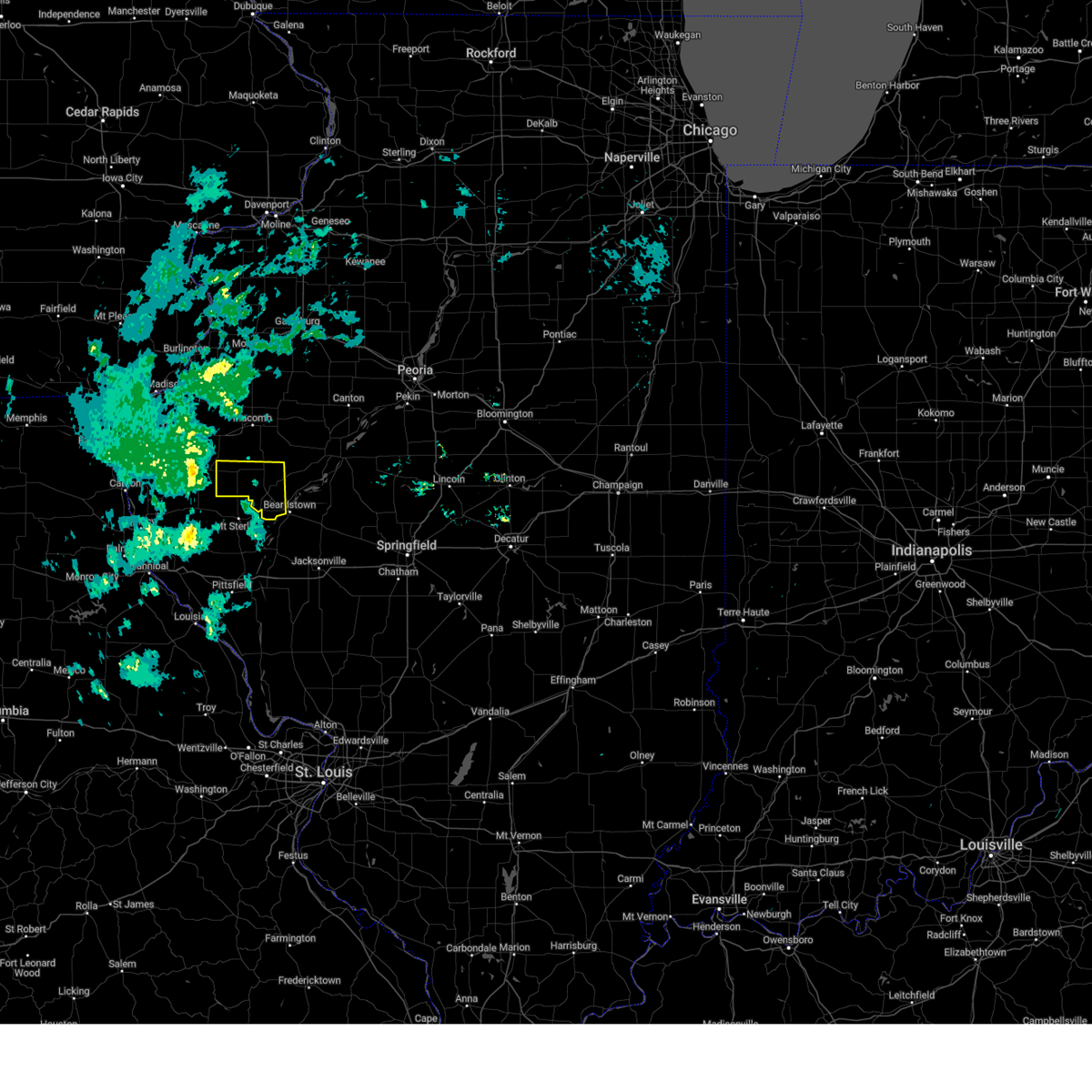
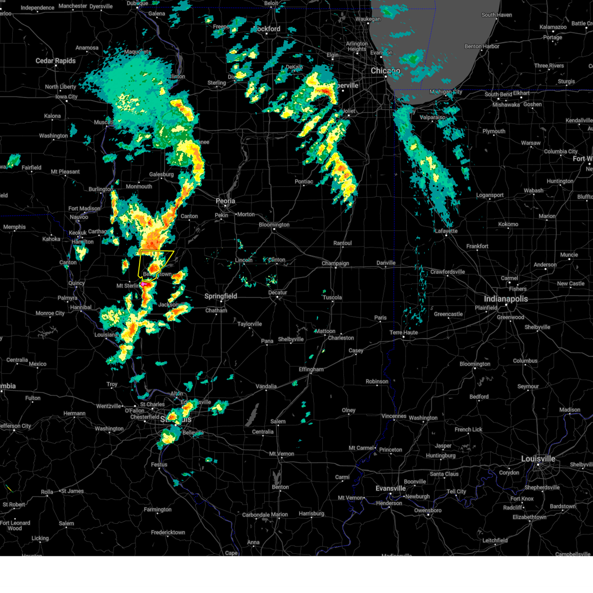
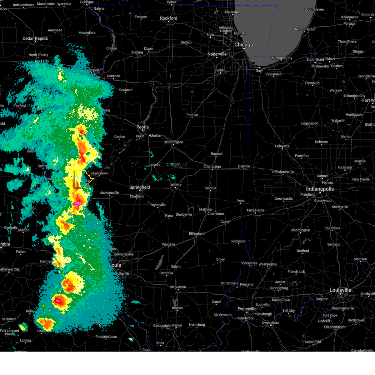
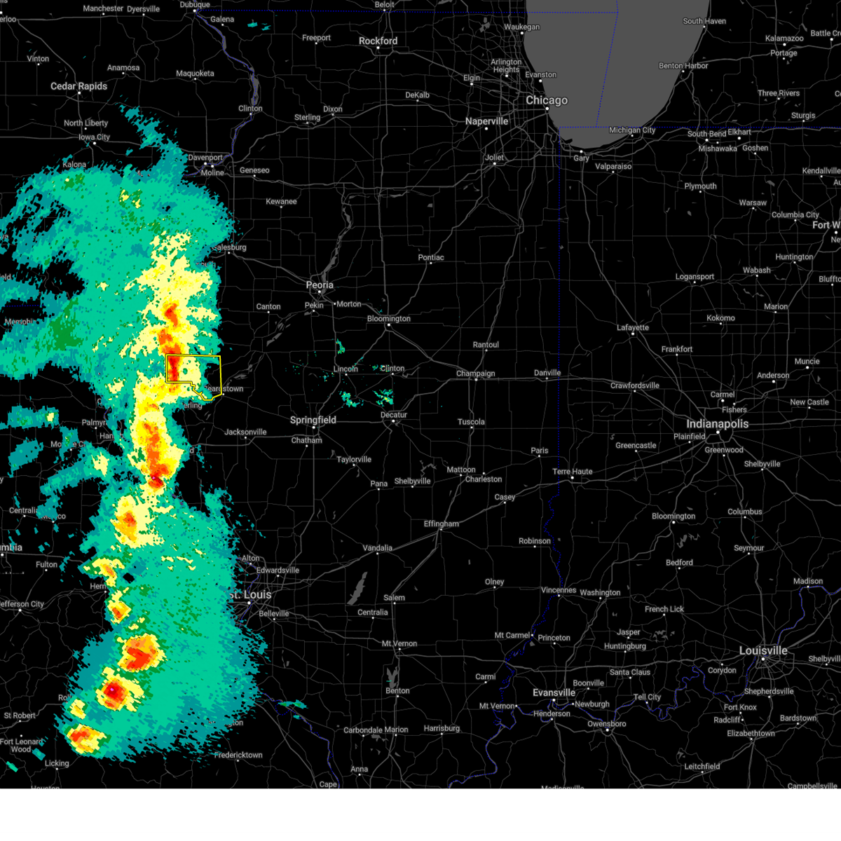
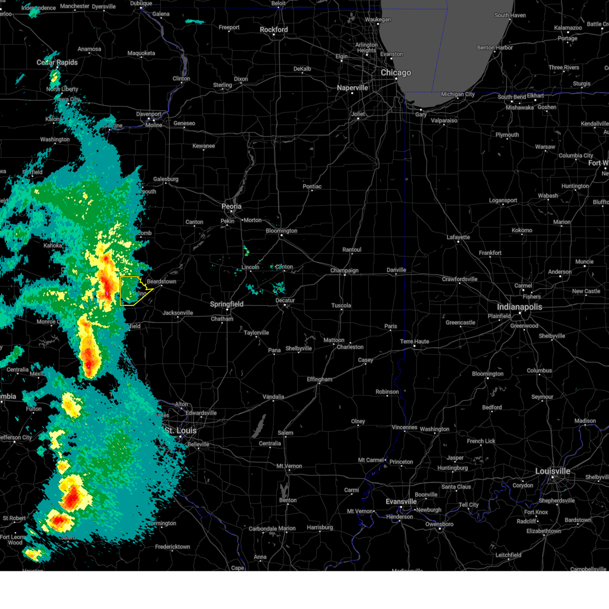
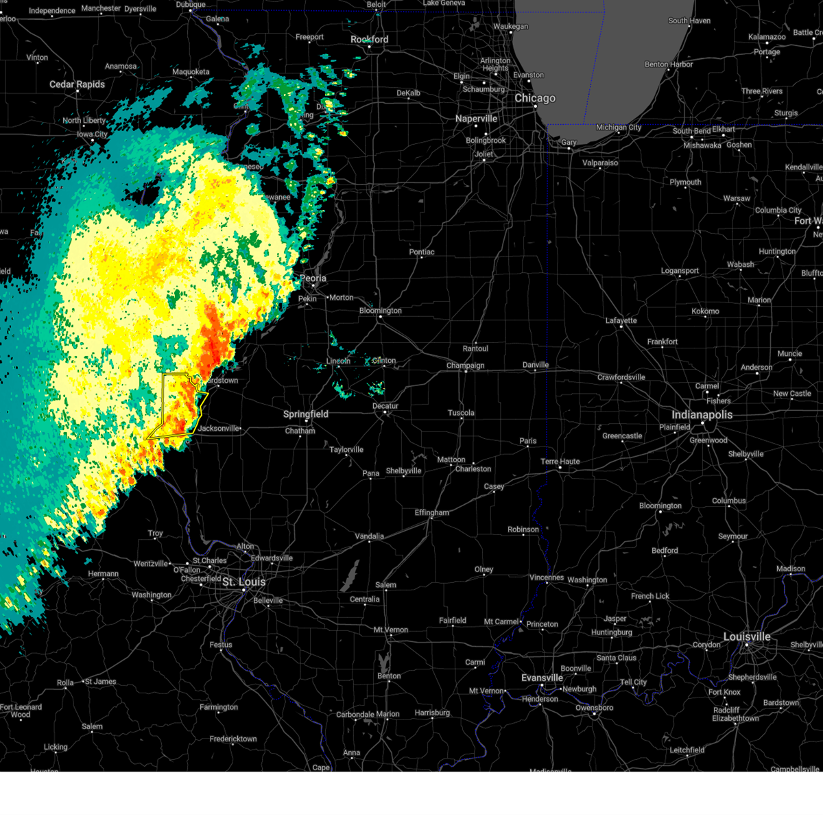
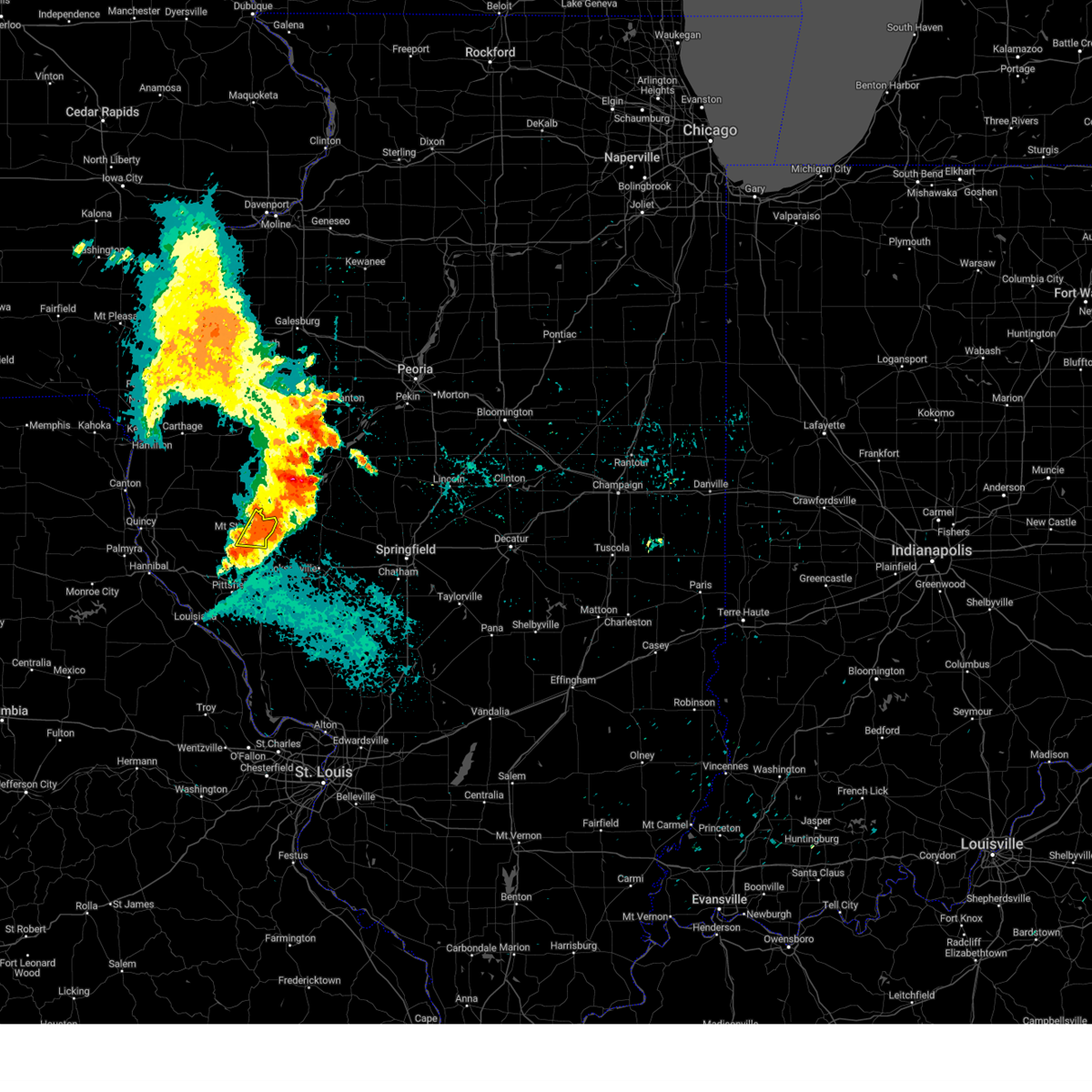
Hail Map for Ripley, IL
The Ripley, IL area has had 0 reports of on-the-ground hail by trained spotters, and has been under severe weather warnings 14 times during the past 12 months. Doppler radar has detected hail at or near Ripley, IL on 73 occasions, including 5 occasions during the past year.
| Name: | Ripley, IL |
| Where Located: | 63.4 miles ESE of Kahoka, MO |
| Map: | Google Map for Ripley, IL |
| Population: | 86 |
| Housing Units: | 49 |
| More Info: | Search Google for Ripley, IL |
2
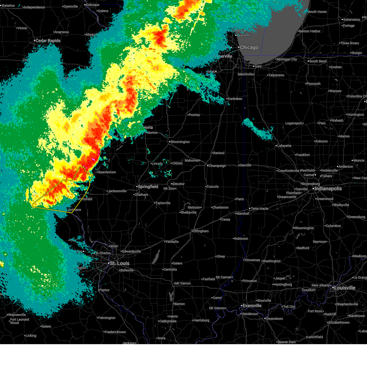
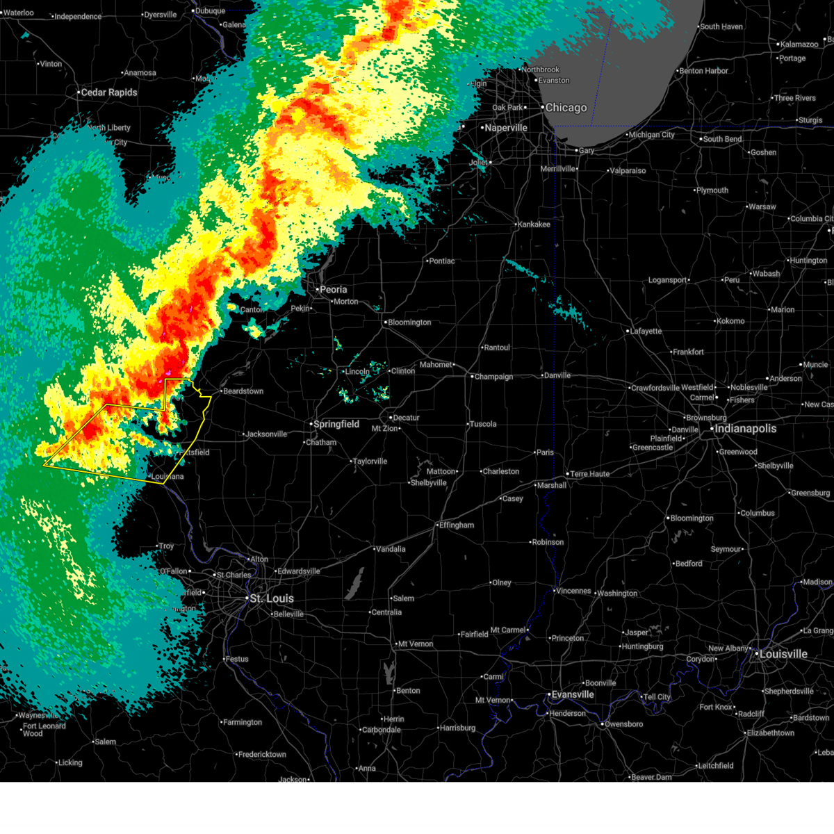
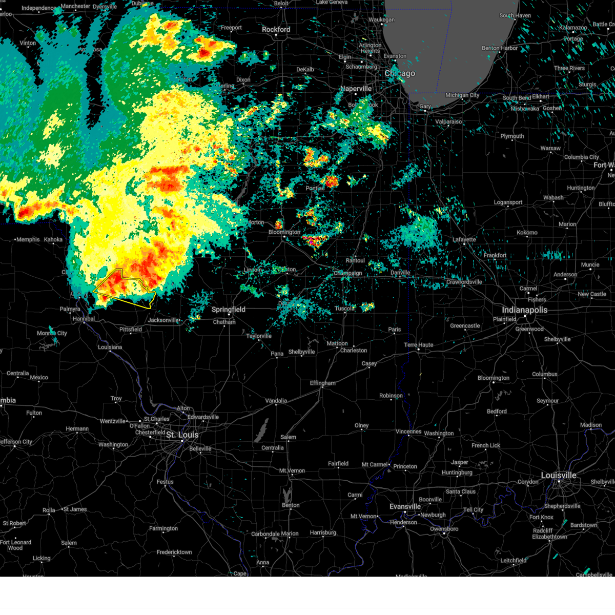
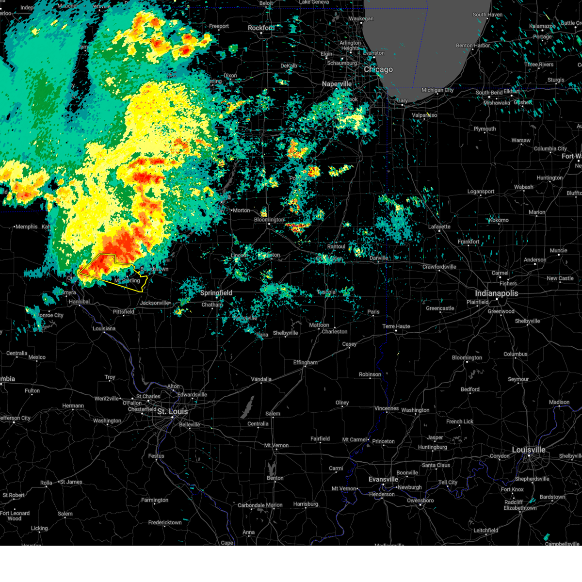
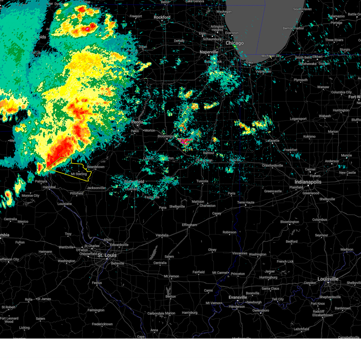
The Top Recent Hail Date for Ripley, IL is Wednesday, June 17, 2026 (11th out of 73)
Hail and Wind Damage Spotted near Ripley, IL
| Date / Time | Report Details |
|---|---|
| 6/17/2026 9:19 AM CDT |
 the severe thunderstorm warning has been cancelled and is no longer in effect the severe thunderstorm warning has been cancelled and is no longer in effect
|
| 6/17/2026 9:19 AM CDT |
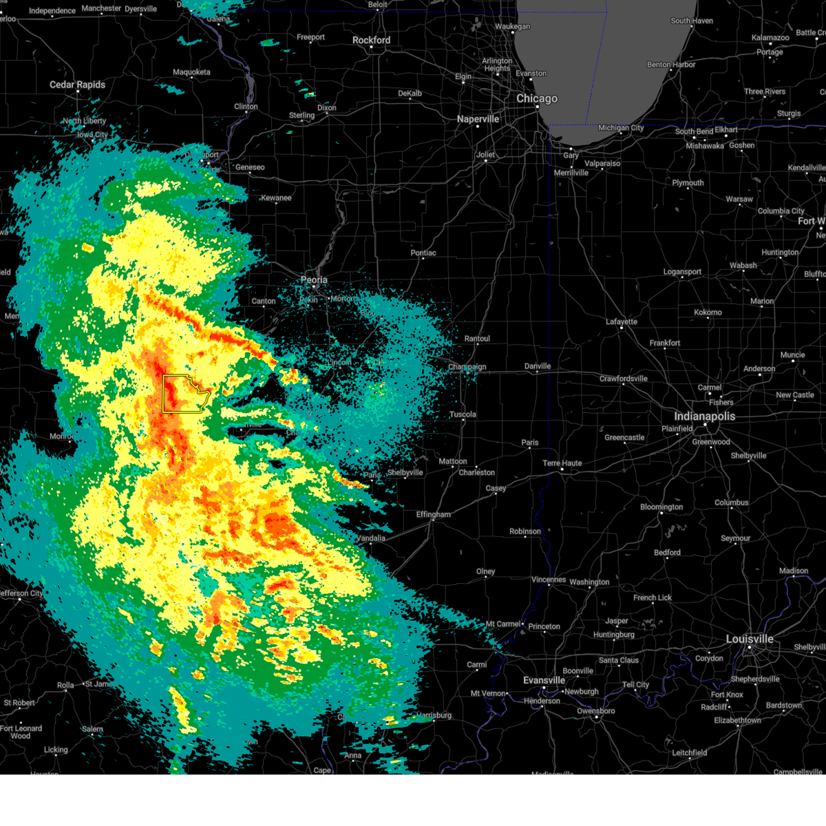
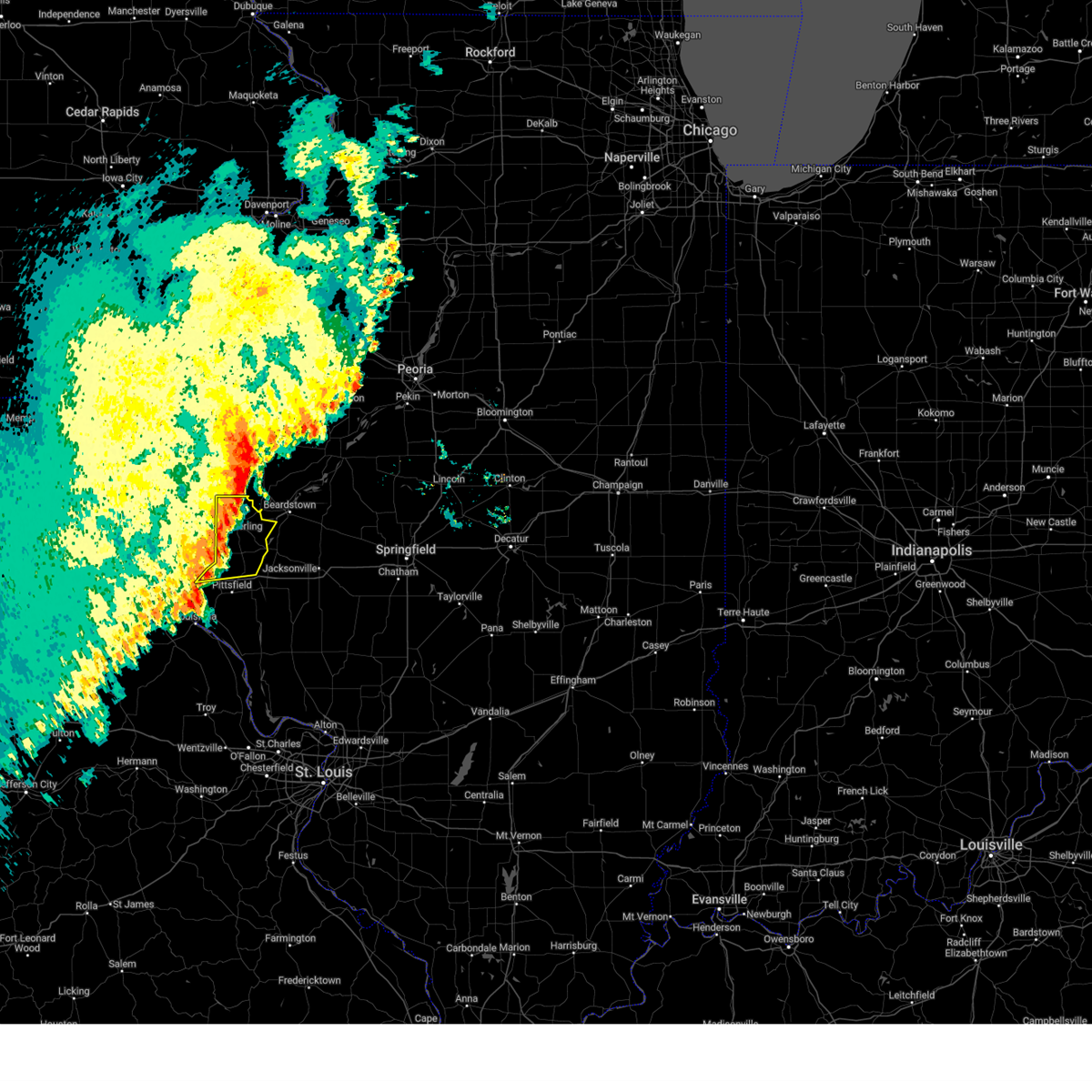
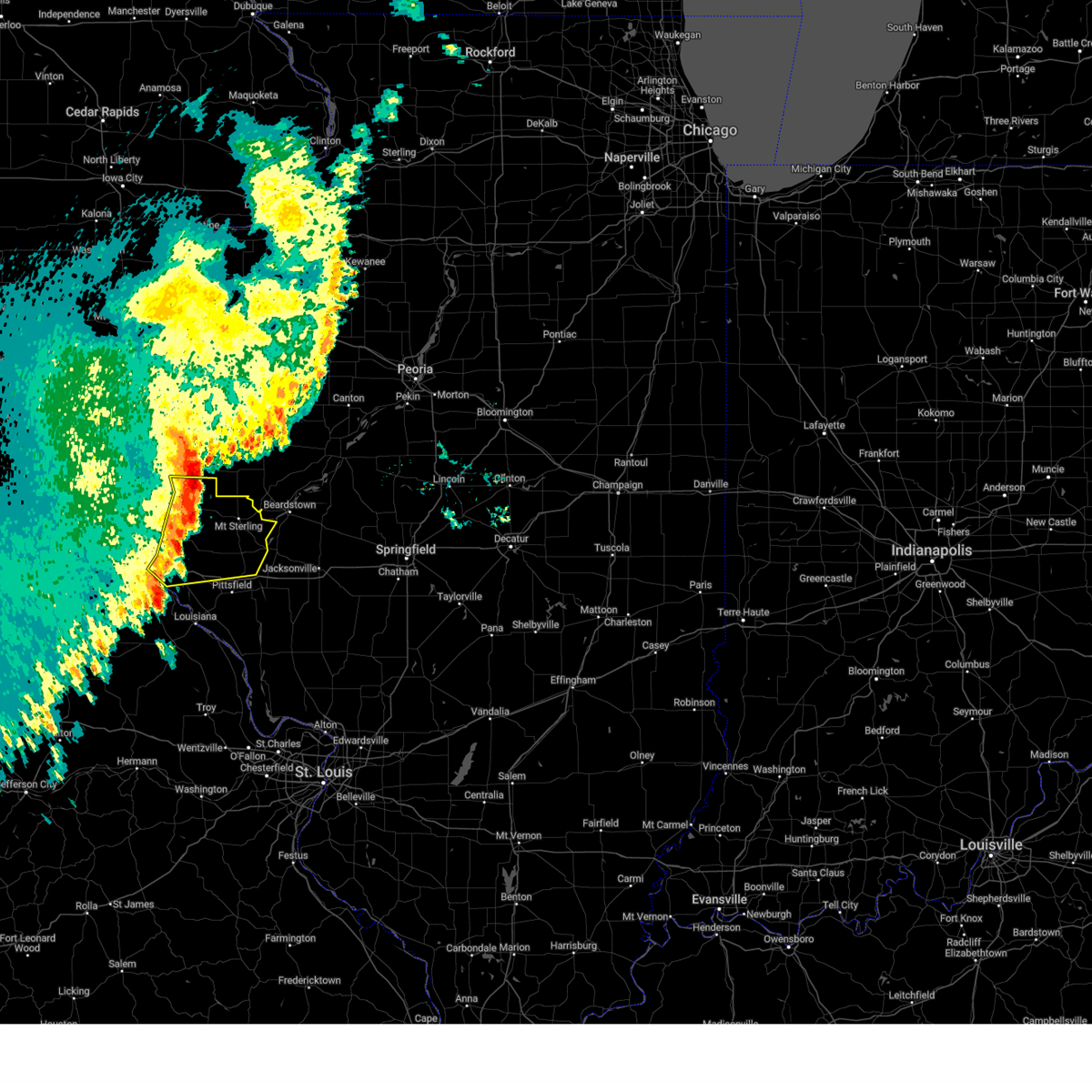
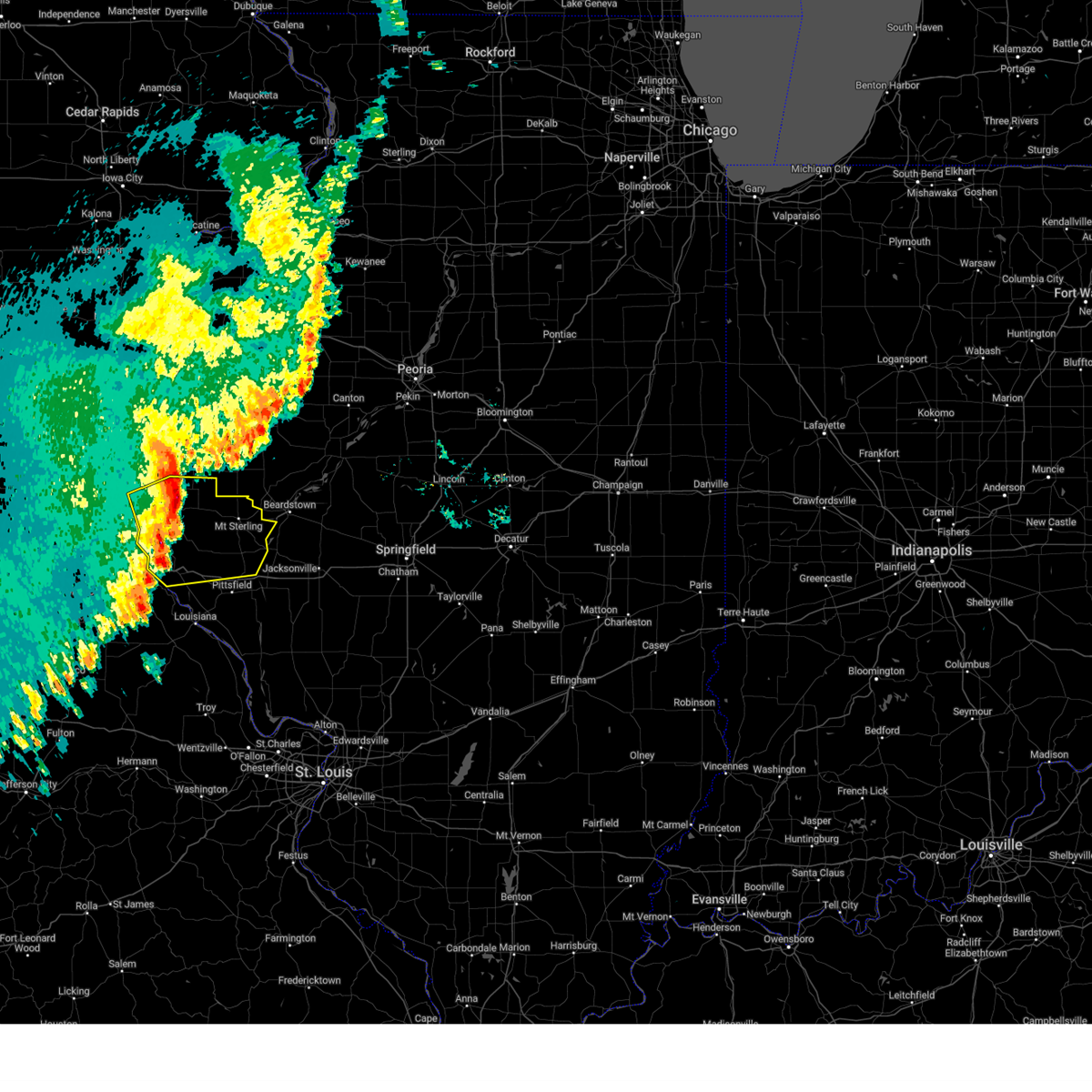
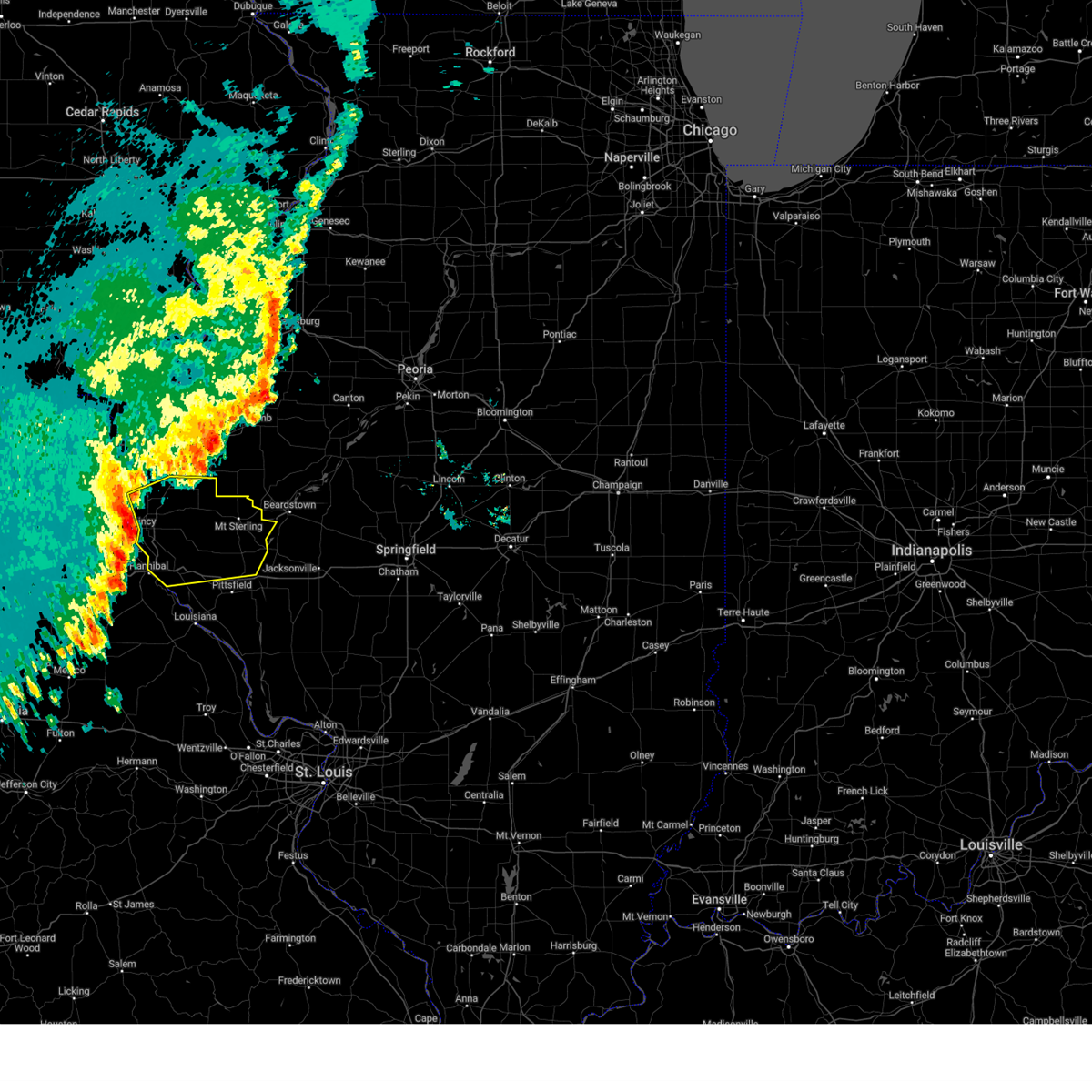
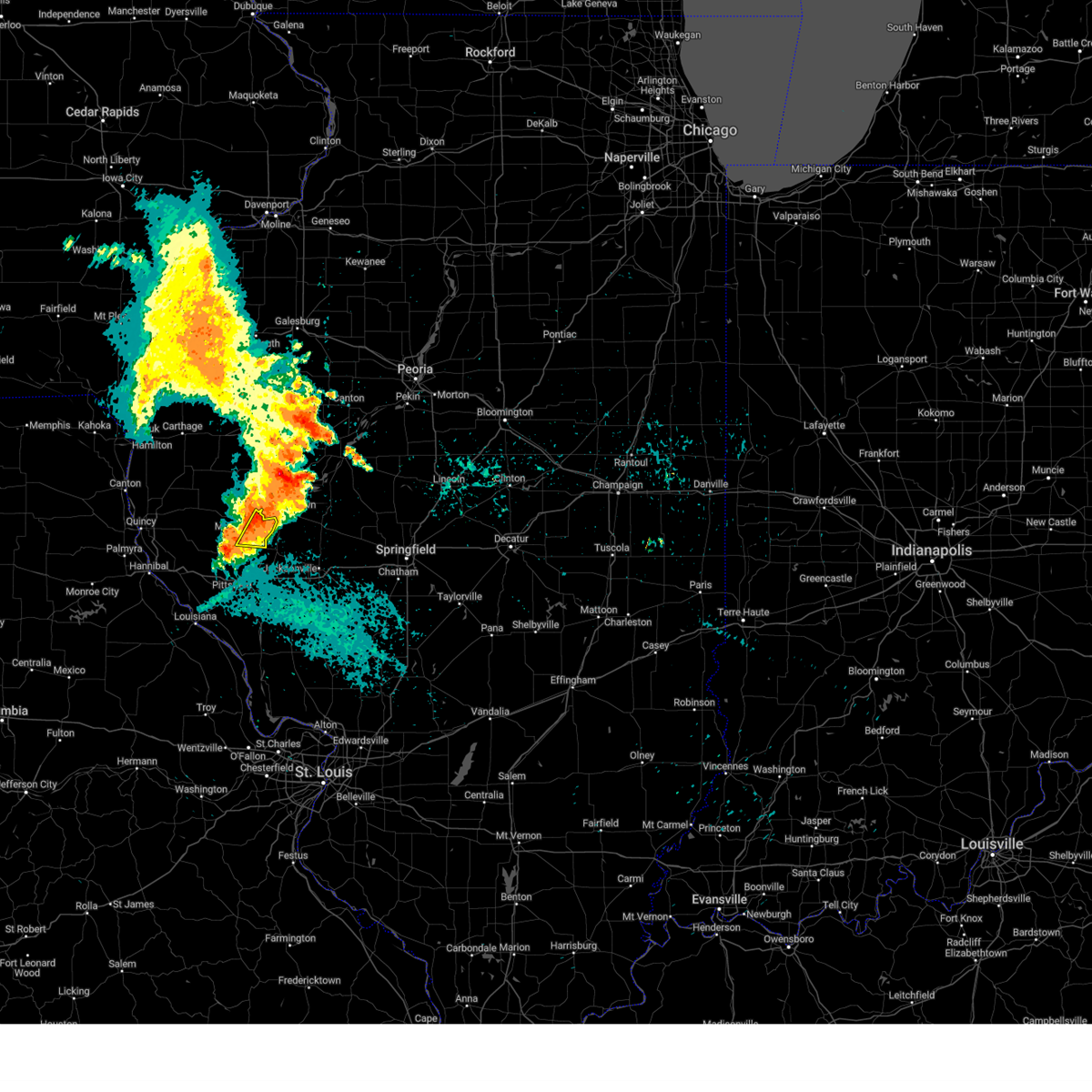
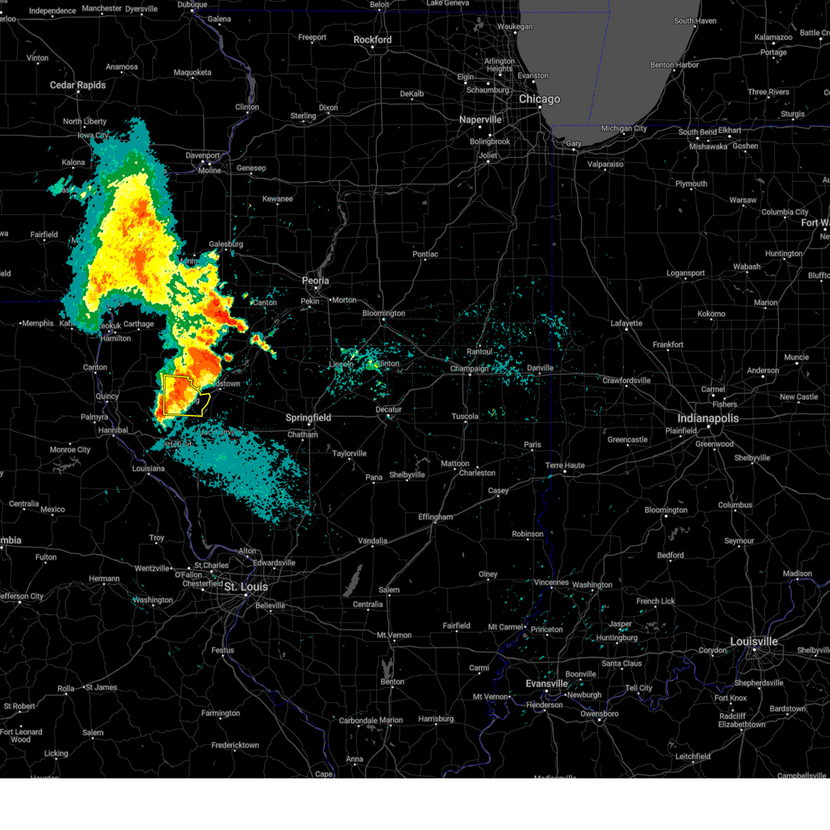
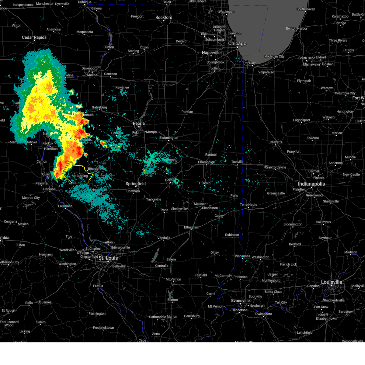
 At 919 am cdt, a severe thunderstorm was located near buckhorn, or 17 miles east of quincy regional airport, moving east at 40 mph (radar indicated). Hazards include 60 mph wind gusts and quarter size hail. Hail damage to vehicles is expected. expect wind damage to roofs, siding, and trees. Locations impacted include, fishhook, mound station, buckhorn, mount sterling, perry, versailles, chambersburg, ripley, coopertown and la grange. At 919 am cdt, a severe thunderstorm was located near buckhorn, or 17 miles east of quincy regional airport, moving east at 40 mph (radar indicated). Hazards include 60 mph wind gusts and quarter size hail. Hail damage to vehicles is expected. expect wind damage to roofs, siding, and trees. Locations impacted include, fishhook, mound station, buckhorn, mount sterling, perry, versailles, chambersburg, ripley, coopertown and la grange.
|
| 6/17/2026 9:12 AM CDT |
 At 912 am cdt, a severe thunderstorm was located 8 miles south of clayton, or 12 miles east of quincy regional airport, moving east at 40 mph (radar indicated). Hazards include 60 mph wind gusts and quarter size hail. Hail damage to vehicles is expected. expect wind damage to roofs, siding, and trees. locations impacted include, kingston, beverly, clayton, kellerville, fishhook, mound station, buckhorn, mount sterling, perry, versailles, chambersburg, ripley, coopertown and la grange. This includes the following state parks, siloam springs state park. At 912 am cdt, a severe thunderstorm was located 8 miles south of clayton, or 12 miles east of quincy regional airport, moving east at 40 mph (radar indicated). Hazards include 60 mph wind gusts and quarter size hail. Hail damage to vehicles is expected. expect wind damage to roofs, siding, and trees. locations impacted include, kingston, beverly, clayton, kellerville, fishhook, mound station, buckhorn, mount sterling, perry, versailles, chambersburg, ripley, coopertown and la grange. This includes the following state parks, siloam springs state park.
|
| 6/17/2026 9:01 AM CDT |
 Svrlsx the national weather service in st louis has issued a * severe thunderstorm warning for, southeastern adams county in west central illinois, brown county in west central illinois, northeastern pike county in west central illinois, * until 1000 am cdt. * at 901 am cdt, a severe thunderstorm was located near quincy regional airport, moving east at 45 mph (radar indicated). Hazards include 60 mph wind gusts and quarter size hail. Hail damage to vehicles is expected. Expect wind damage to roofs, siding, and trees. Svrlsx the national weather service in st louis has issued a * severe thunderstorm warning for, southeastern adams county in west central illinois, brown county in west central illinois, northeastern pike county in west central illinois, * until 1000 am cdt. * at 901 am cdt, a severe thunderstorm was located near quincy regional airport, moving east at 45 mph (radar indicated). Hazards include 60 mph wind gusts and quarter size hail. Hail damage to vehicles is expected. Expect wind damage to roofs, siding, and trees.
|
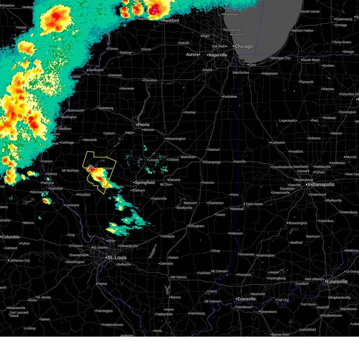
| 5/4/2026 10:25 PM CDT |
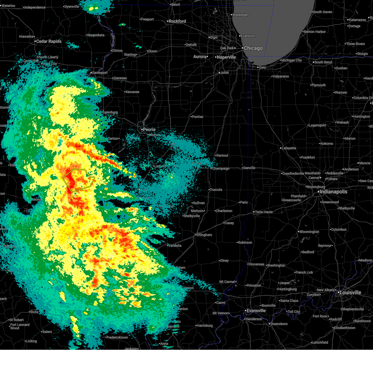
 At 1025 pm cdt, severe thunderstorms were located along a line extending from near havana to near bath to near beardstown, moving east at 45 mph (radar indicated). Hazards include 60 mph wind gusts and quarter size hail. Hail damage to vehicles is expected. expect wind damage to roofs, siding, and trees. these severe storms will be near, beardstown, bluff springs, chandlerville, and kilbourne around 1030 pm cdt. virginia around 1040 pm cdt. Other locations impacted by these severe thunderstorms include topeka, frederick, bluff city, chatauqua park, snicarte, ripley, and duncan mills. At 1025 pm cdt, severe thunderstorms were located along a line extending from near havana to near bath to near beardstown, moving east at 45 mph (radar indicated). Hazards include 60 mph wind gusts and quarter size hail. Hail damage to vehicles is expected. expect wind damage to roofs, siding, and trees. these severe storms will be near, beardstown, bluff springs, chandlerville, and kilbourne around 1030 pm cdt. virginia around 1040 pm cdt. Other locations impacted by these severe thunderstorms include topeka, frederick, bluff city, chatauqua park, snicarte, ripley, and duncan mills.
|
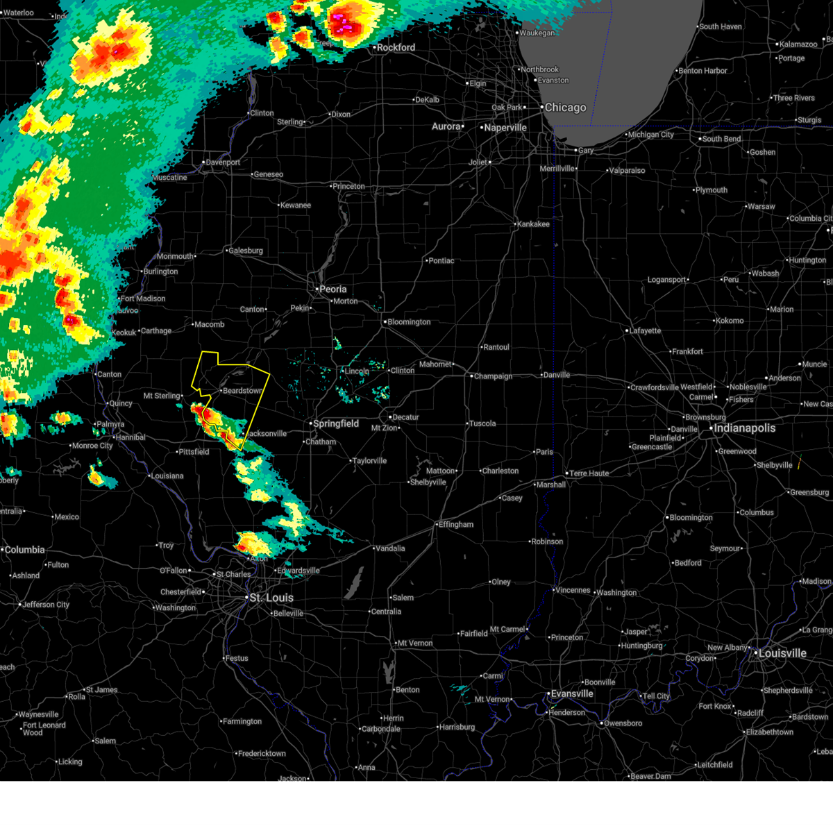
| 5/4/2026 10:10 PM CDT |
 Svrilx the national weather service in lincoln has issued a * severe thunderstorm warning for, southwestern fulton county in west central illinois, central cass county in west central illinois, schuyler county in west central illinois, southwestern mason county in central illinois, * until 1045 pm cdt. * at 1010 pm cdt, severe thunderstorms were located along a line extending from near ipava to near astoria to near mount sterling, moving east at 40 mph (radar indicated). Hazards include 60 mph wind gusts and quarter size hail. Hail damage to vehicles is expected. expect wind damage to roofs, siding, and trees. severe thunderstorms will be near, rushville and browning around 1015 pm cdt. beardstown, havana, and bath around 1020 pm cdt. bluff springs and kilbourne around 1030 pm cdt. Other locations in the path of these severe thunderstorms include chandlerville. Svrilx the national weather service in lincoln has issued a * severe thunderstorm warning for, southwestern fulton county in west central illinois, central cass county in west central illinois, schuyler county in west central illinois, southwestern mason county in central illinois, * until 1045 pm cdt. * at 1010 pm cdt, severe thunderstorms were located along a line extending from near ipava to near astoria to near mount sterling, moving east at 40 mph (radar indicated). Hazards include 60 mph wind gusts and quarter size hail. Hail damage to vehicles is expected. expect wind damage to roofs, siding, and trees. severe thunderstorms will be near, rushville and browning around 1015 pm cdt. beardstown, havana, and bath around 1020 pm cdt. bluff springs and kilbourne around 1030 pm cdt. Other locations in the path of these severe thunderstorms include chandlerville.
|
| 4/27/2026 4:20 PM CDT |
 Svrlsx the national weather service in st louis has issued a * severe thunderstorm warning for, southeastern adams county in west central illinois, southern brown county in west central illinois, northern pike county in west central illinois, * until 515 pm cdt. * at 420 pm cdt, a severe thunderstorm was located over barry, or 14 miles northwest of pittsfield, moving east at 50 mph (radar indicated). Hazards include 60 mph wind gusts and quarter size hail. Hail damage to vehicles is expected. Expect wind damage to roofs, siding, and trees. Svrlsx the national weather service in st louis has issued a * severe thunderstorm warning for, southeastern adams county in west central illinois, southern brown county in west central illinois, northern pike county in west central illinois, * until 515 pm cdt. * at 420 pm cdt, a severe thunderstorm was located over barry, or 14 miles northwest of pittsfield, moving east at 50 mph (radar indicated). Hazards include 60 mph wind gusts and quarter size hail. Hail damage to vehicles is expected. Expect wind damage to roofs, siding, and trees.
|
| 4/17/2026 7:59 PM CDT |
 At 759 pm cdt, severe thunderstorms were located along a line from 28 miles northeast of mount sterling to near frankford, or along a line from 47 miles northeast of pittsfield to 12 miles southeast of hannibal, moving east at 45 mph (radar indicated). Hazards include 60 mph wind gusts and quarter size hail. Hail damage to vehicles is expected. expect wind damage to roofs, siding, and trees. locations impacted include, mount sterling, buckhorn, beverly, kinderhook, ripley, fishhook, barry, versailles, new canton, baylis, la grange, perry, new salem, chambersburg, el dara, griggsville, valley city, pittsfield, atlas and martinsburg. this includes the following state parks, siloam springs state park. This includes interstate 72 between exits 20 and 35. At 759 pm cdt, severe thunderstorms were located along a line from 28 miles northeast of mount sterling to near frankford, or along a line from 47 miles northeast of pittsfield to 12 miles southeast of hannibal, moving east at 45 mph (radar indicated). Hazards include 60 mph wind gusts and quarter size hail. Hail damage to vehicles is expected. expect wind damage to roofs, siding, and trees. locations impacted include, mount sterling, buckhorn, beverly, kinderhook, ripley, fishhook, barry, versailles, new canton, baylis, la grange, perry, new salem, chambersburg, el dara, griggsville, valley city, pittsfield, atlas and martinsburg. this includes the following state parks, siloam springs state park. This includes interstate 72 between exits 20 and 35.
|
| 4/17/2026 7:47 PM CDT |
 At 747 pm cdt, severe thunderstorms were located along a line from 21 miles northeast of mount sterling to over new london, or along a line from 42 miles east of quincy regional airport to 10 miles south of hannibal, moving east at 45 mph (radar indicated). Hazards include 70 mph wind gusts and quarter size hail. Hail damage to vehicles is expected. expect considerable tree damage. wind damage is also likely to mobile homes, roofs, and outbuildings. locations impacted include, payson, hannibal, liberty, spaulding, center, mount sterling, kingston, hull, buckhorn, new london, beverly, barry, frankford, versailles, la grange, griggsville, pittsfield, atlas, louisiana and pike. this includes the following state parks, siloam springs state park. This includes interstate 72 between exits 4 and 35. At 747 pm cdt, severe thunderstorms were located along a line from 21 miles northeast of mount sterling to over new london, or along a line from 42 miles east of quincy regional airport to 10 miles south of hannibal, moving east at 45 mph (radar indicated). Hazards include 70 mph wind gusts and quarter size hail. Hail damage to vehicles is expected. expect considerable tree damage. wind damage is also likely to mobile homes, roofs, and outbuildings. locations impacted include, payson, hannibal, liberty, spaulding, center, mount sterling, kingston, hull, buckhorn, new london, beverly, barry, frankford, versailles, la grange, griggsville, pittsfield, atlas, louisiana and pike. this includes the following state parks, siloam springs state park. This includes interstate 72 between exits 4 and 35.
|
| 4/17/2026 7:21 PM CDT |
 Svrlsx the national weather service in st louis has issued a * severe thunderstorm warning for, southern adams county in west central illinois, brown county in west central illinois, pike county in west central illinois, eastern marion county in northeastern missouri, northeastern monroe county in northeastern missouri, northwestern pike county in northeastern missouri, ralls county in northeastern missouri, * until 815 pm cdt. * at 721 pm cdt, severe thunderstorms were located along a line from 14 miles north of mount sterling to near monroe city, or along a line from 27 miles northeast of quincy regional airport to near monroe city, moving east at 45 mph (radar indicated). Hazards include 70 mph wind gusts and quarter size hail. Hail damage to vehicles is expected. expect considerable tree damage. Wind damage is also likely to mobile homes, roofs, and outbuildings. Svrlsx the national weather service in st louis has issued a * severe thunderstorm warning for, southern adams county in west central illinois, brown county in west central illinois, pike county in west central illinois, eastern marion county in northeastern missouri, northeastern monroe county in northeastern missouri, northwestern pike county in northeastern missouri, ralls county in northeastern missouri, * until 815 pm cdt. * at 721 pm cdt, severe thunderstorms were located along a line from 14 miles north of mount sterling to near monroe city, or along a line from 27 miles northeast of quincy regional airport to near monroe city, moving east at 45 mph (radar indicated). Hazards include 70 mph wind gusts and quarter size hail. Hail damage to vehicles is expected. expect considerable tree damage. Wind damage is also likely to mobile homes, roofs, and outbuildings.
|
| 4/17/2026 4:50 PM CDT |
 At 449 pm cdt, severe thunderstorms were located along a line extending from 6 miles west of beardstown to near literberry, moving north at 50 mph (emergency management). Hazards include ping pong ball size hail and 60 mph wind gusts. People and animals outdoors will be injured. expect hail damage to roofs, siding, windows, and vehicles. expect wind damage to roofs, siding, and trees. these severe storms will be near, beardstown, rushville, virginia, and bluff springs around 455 pm cdt. browning around 500 pm cdt. chandlerville around 505 pm cdt. other locations impacted by these severe thunderstorms include frederick, bluff city, lynnville, jacksonville municipal airport, concord, ray, snicarte, ripley, and philadelphia. This includes interstate 72 between mile markers 59 and 65. At 449 pm cdt, severe thunderstorms were located along a line extending from 6 miles west of beardstown to near literberry, moving north at 50 mph (emergency management). Hazards include ping pong ball size hail and 60 mph wind gusts. People and animals outdoors will be injured. expect hail damage to roofs, siding, windows, and vehicles. expect wind damage to roofs, siding, and trees. these severe storms will be near, beardstown, rushville, virginia, and bluff springs around 455 pm cdt. browning around 500 pm cdt. chandlerville around 505 pm cdt. other locations impacted by these severe thunderstorms include frederick, bluff city, lynnville, jacksonville municipal airport, concord, ray, snicarte, ripley, and philadelphia. This includes interstate 72 between mile markers 59 and 65.
|
| 4/17/2026 4:45 PM CDT |
 Svrilx the national weather service in lincoln has issued a * severe thunderstorm warning for, cass county in west central illinois, central schuyler county in west central illinois, southwestern mason county in central illinois, northwestern morgan county in west central illinois, * until 530 pm cdt. * at 444 pm cdt, severe thunderstorms were located along a line extending from 8 miles west of beardstown to near jacksonville, moving northeast at 70 mph (emergency management. at 424 pm, wind damage was reported near winchester). Hazards include 60 mph wind gusts and quarter size hail. Hail damage to vehicles is expected. expect wind damage to roofs, siding, and trees. severe thunderstorms will be near, beardstown, rushville, virginia, bluff springs, arenzville, and literberry around 450 pm cdt. browning around 455 pm cdt. chandlerville around 500 pm cdt. This includes interstate 72 between mile markers 59 and 65. Svrilx the national weather service in lincoln has issued a * severe thunderstorm warning for, cass county in west central illinois, central schuyler county in west central illinois, southwestern mason county in central illinois, northwestern morgan county in west central illinois, * until 530 pm cdt. * at 444 pm cdt, severe thunderstorms were located along a line extending from 8 miles west of beardstown to near jacksonville, moving northeast at 70 mph (emergency management. at 424 pm, wind damage was reported near winchester). Hazards include 60 mph wind gusts and quarter size hail. Hail damage to vehicles is expected. expect wind damage to roofs, siding, and trees. severe thunderstorms will be near, beardstown, rushville, virginia, bluff springs, arenzville, and literberry around 450 pm cdt. browning around 455 pm cdt. chandlerville around 500 pm cdt. This includes interstate 72 between mile markers 59 and 65.
|
| 4/3/2026 5:46 PM CDT |
 the severe thunderstorm warning has been cancelled and is no longer in effect the severe thunderstorm warning has been cancelled and is no longer in effect
|
| 4/3/2026 5:24 PM CDT |
 Svrilx the national weather service in lincoln has issued a * severe thunderstorm warning for, western cass county in west central illinois, south central schuyler county in west central illinois, northwestern morgan county in west central illinois, * until 630 pm cdt. * at 524 pm cdt, a severe thunderstorm was located near meredosia, or 13 miles southwest of beardstown, moving northeast at 25 mph (radar indicated). Hazards include 60 mph wind gusts and quarter size hail. Hail damage to vehicles is expected. Expect wind damage to roofs, siding, and trees. Svrilx the national weather service in lincoln has issued a * severe thunderstorm warning for, western cass county in west central illinois, south central schuyler county in west central illinois, northwestern morgan county in west central illinois, * until 630 pm cdt. * at 524 pm cdt, a severe thunderstorm was located near meredosia, or 13 miles southwest of beardstown, moving northeast at 25 mph (radar indicated). Hazards include 60 mph wind gusts and quarter size hail. Hail damage to vehicles is expected. Expect wind damage to roofs, siding, and trees.
|
| 5/19/2025 11:59 PM CDT |
 the severe thunderstorm warning has been cancelled and is no longer in effect the severe thunderstorm warning has been cancelled and is no longer in effect
|
| 5/19/2025 11:53 PM CDT |
 the severe thunderstorm warning has been cancelled and is no longer in effect the severe thunderstorm warning has been cancelled and is no longer in effect
|
| 5/19/2025 11:36 PM CDT |
 Svrilx the national weather service in lincoln has issued a * severe thunderstorm warning for, western schuyler county in west central illinois, * until 1215 am cdt. * at 1136 pm cdt, a severe thunderstorm was located near mount sterling, or 16 miles southwest of rushville, moving northeast at 30 mph (radar indicated). Hazards include 60 mph wind gusts. expect damage to roofs, siding, and trees Svrilx the national weather service in lincoln has issued a * severe thunderstorm warning for, western schuyler county in west central illinois, * until 1215 am cdt. * at 1136 pm cdt, a severe thunderstorm was located near mount sterling, or 16 miles southwest of rushville, moving northeast at 30 mph (radar indicated). Hazards include 60 mph wind gusts. expect damage to roofs, siding, and trees
|
| 5/19/2025 11:31 PM CDT |
 the severe thunderstorm warning has been cancelled and is no longer in effect the severe thunderstorm warning has been cancelled and is no longer in effect
|
| 5/19/2025 11:31 PM CDT |
 At 1131 pm cdt, a severe thunderstorm was located over mount sterling, or 21 miles east of quincy regional airport, moving northeast at 35 mph (radar indicated). Hazards include 60 mph wind gusts. Expect damage to roofs, siding, and trees. Locations impacted include, mount sterling, buckhorn, la grange, versailles, mound station, ripley and coopertown. At 1131 pm cdt, a severe thunderstorm was located over mount sterling, or 21 miles east of quincy regional airport, moving northeast at 35 mph (radar indicated). Hazards include 60 mph wind gusts. Expect damage to roofs, siding, and trees. Locations impacted include, mount sterling, buckhorn, la grange, versailles, mound station, ripley and coopertown.
|
| 5/19/2025 11:21 PM CDT |
 At 1121 pm cdt, a severe thunderstorm was located over buckhorn, or 17 miles east of quincy regional airport, moving northeast at 35 mph (radar indicated). Hazards include 60 mph wind gusts. Expect damage to roofs, siding, and trees. locations impacted include, mount sterling, clayton, buckhorn, la grange, versailles, mound station, ripley, kellerville, fishhook and coopertown. This includes the following state parks, siloam springs state park. At 1121 pm cdt, a severe thunderstorm was located over buckhorn, or 17 miles east of quincy regional airport, moving northeast at 35 mph (radar indicated). Hazards include 60 mph wind gusts. Expect damage to roofs, siding, and trees. locations impacted include, mount sterling, clayton, buckhorn, la grange, versailles, mound station, ripley, kellerville, fishhook and coopertown. This includes the following state parks, siloam springs state park.
|
| 5/19/2025 10:56 PM CDT |
 Svrlsx the national weather service in st louis has issued a * severe thunderstorm warning for, southeastern adams county in west central illinois, brown county in west central illinois, north central pike county in west central illinois, * until 1215 am cdt. * at 1056 pm cdt, a severe thunderstorm was located 7 miles west of beverly, or 9 miles southeast of quincy regional airport, moving northeast at 25 mph (radar indicated). Hazards include 60 mph wind gusts. expect damage to roofs, siding, and trees Svrlsx the national weather service in st louis has issued a * severe thunderstorm warning for, southeastern adams county in west central illinois, brown county in west central illinois, north central pike county in west central illinois, * until 1215 am cdt. * at 1056 pm cdt, a severe thunderstorm was located 7 miles west of beverly, or 9 miles southeast of quincy regional airport, moving northeast at 25 mph (radar indicated). Hazards include 60 mph wind gusts. expect damage to roofs, siding, and trees
|
| 4/20/2025 7:36 PM CDT |
 the severe thunderstorm warning has been cancelled and is no longer in effect the severe thunderstorm warning has been cancelled and is no longer in effect
|
| 4/20/2025 7:29 PM CDT |
 Svrilx the national weather service in lincoln has issued a * severe thunderstorm warning for, western menard county in central illinois, northeastern scott county in west central illinois, west central christian county in central illinois, western fulton county in west central illinois, western sangamon county in central illinois, cass county in west central illinois, schuyler county in west central illinois, southwestern mason county in central illinois, * until 800 pm cdt. * at 728 pm cdt, severe thunderstorms were located along a line extending from 7 miles east of augusta to near beardstown to near carrollton, moving northeast at 65 mph (radar indicated). Hazards include 70 mph wind gusts. Expect considerable tree damage. damage is likely to mobile homes, roofs, and outbuildings. severe thunderstorms will be near, astoria, littleton, arenzville, browning, and bluff springs around 735 pm cdt. virginia and vermont around 740 pm cdt. bath, chandlerville, and ipava around 745 pm cdt. other locations in the path of these severe thunderstorms include havana and lewistown. this includes the following highways, interstate 55 between mile markers 77 and 94. Interstate 72 between mile markers 55 and 58, and between mile markers 81 and 100. Svrilx the national weather service in lincoln has issued a * severe thunderstorm warning for, western menard county in central illinois, northeastern scott county in west central illinois, west central christian county in central illinois, western fulton county in west central illinois, western sangamon county in central illinois, cass county in west central illinois, schuyler county in west central illinois, southwestern mason county in central illinois, * until 800 pm cdt. * at 728 pm cdt, severe thunderstorms were located along a line extending from 7 miles east of augusta to near beardstown to near carrollton, moving northeast at 65 mph (radar indicated). Hazards include 70 mph wind gusts. Expect considerable tree damage. damage is likely to mobile homes, roofs, and outbuildings. severe thunderstorms will be near, astoria, littleton, arenzville, browning, and bluff springs around 735 pm cdt. virginia and vermont around 740 pm cdt. bath, chandlerville, and ipava around 745 pm cdt. other locations in the path of these severe thunderstorms include havana and lewistown. this includes the following highways, interstate 55 between mile markers 77 and 94. Interstate 72 between mile markers 55 and 58, and between mile markers 81 and 100.
|
| 4/20/2025 7:25 PM CDT |
 The storms which prompted the warning have moved out of the area. therefore, the warning will be allowed to expire. however, gusty winds are still possible with these thunderstorms. a tornado watch remains in effect until 1100 pm cdt for portions of southwest and west central illinois. The storms which prompted the warning have moved out of the area. therefore, the warning will be allowed to expire. however, gusty winds are still possible with these thunderstorms. a tornado watch remains in effect until 1100 pm cdt for portions of southwest and west central illinois.
|
| 4/20/2025 7:04 PM CDT |
 At 704 pm cdt, severe thunderstorms were located along a line from over beverly to near belleview, or along a line from 16 miles southeast of quincy regional airport to 10 miles north of elsberry, moving northeast at 50 mph (trained spotters reported. at 6:50 pm power poles were blown down near hull, il). Hazards include 70 mph wind gusts and quarter size hail. Hail damage to vehicles is expected. expect considerable tree damage. wind damage is also likely to mobile homes, roofs, and outbuildings. other locations impacted by the severe thunderstorm include martinsburg, new salem, baylis, nebo, mozier, independence, hamburg, time, fishhook and michael. This includes interstate 72 between exits 31 and 35. At 704 pm cdt, severe thunderstorms were located along a line from over beverly to near belleview, or along a line from 16 miles southeast of quincy regional airport to 10 miles north of elsberry, moving northeast at 50 mph (trained spotters reported. at 6:50 pm power poles were blown down near hull, il). Hazards include 70 mph wind gusts and quarter size hail. Hail damage to vehicles is expected. expect considerable tree damage. wind damage is also likely to mobile homes, roofs, and outbuildings. other locations impacted by the severe thunderstorm include martinsburg, new salem, baylis, nebo, mozier, independence, hamburg, time, fishhook and michael. This includes interstate 72 between exits 31 and 35.
|
| 4/20/2025 6:27 PM CDT |
 Svrlsx the national weather service in st louis has issued a * severe thunderstorm warning for, northwestern calhoun county in southwestern illinois, brown county in west central illinois, pike county in west central illinois, * until 730 pm cdt. * at 627 pm cdt, severe thunderstorms were located along a line from near center to 6 miles southwest of eolia, or along a line from 12 miles south of hannibal to 11 miles southeast of bowling green, moving northeast at 60 mph (radar indicated). Hazards include 70 mph wind gusts and quarter size hail. Hail damage to vehicles is expected. expect considerable tree damage. wind damage is also likely to mobile homes, roofs, and outbuildings. this severe thunderstorm will be near, pike around 635 pm cdt. other locations impacted by the severe thunderstorm include rockport, summer hill, hull, new canton, new hartford, el dara, kinderhook, seehorn, mozier and martinsburg. This includes interstate 72 between exits 10 and 35. Svrlsx the national weather service in st louis has issued a * severe thunderstorm warning for, northwestern calhoun county in southwestern illinois, brown county in west central illinois, pike county in west central illinois, * until 730 pm cdt. * at 627 pm cdt, severe thunderstorms were located along a line from near center to 6 miles southwest of eolia, or along a line from 12 miles south of hannibal to 11 miles southeast of bowling green, moving northeast at 60 mph (radar indicated). Hazards include 70 mph wind gusts and quarter size hail. Hail damage to vehicles is expected. expect considerable tree damage. wind damage is also likely to mobile homes, roofs, and outbuildings. this severe thunderstorm will be near, pike around 635 pm cdt. other locations impacted by the severe thunderstorm include rockport, summer hill, hull, new canton, new hartford, el dara, kinderhook, seehorn, mozier and martinsburg. This includes interstate 72 between exits 10 and 35.
|
| 4/2/2025 9:33 AM CDT |
 Svrilx the national weather service in lincoln has issued a * severe thunderstorm warning for, scott county in west central illinois, southern fulton county in west central illinois, cass county in west central illinois, central schuyler county in west central illinois, western mason county in central illinois, morgan county in west central illinois, * until 1000 am cdt. * at 932 am cdt, severe thunderstorms were located along a line extending from 8 miles southeast of buckhorn to near pittsfield, moving northeast at 65 mph (radar indicated). Hazards include 60 mph wind gusts and penny size hail. expect damage to roofs, siding, and trees Svrilx the national weather service in lincoln has issued a * severe thunderstorm warning for, scott county in west central illinois, southern fulton county in west central illinois, cass county in west central illinois, central schuyler county in west central illinois, western mason county in central illinois, morgan county in west central illinois, * until 1000 am cdt. * at 932 am cdt, severe thunderstorms were located along a line extending from 8 miles southeast of buckhorn to near pittsfield, moving northeast at 65 mph (radar indicated). Hazards include 60 mph wind gusts and penny size hail. expect damage to roofs, siding, and trees
|
| 3/21/2025 8:59 PM CDT |
 The storm which prompted the warning has moved out of the area. therefore, the warning will be allowed to expire. however, gusty winds are still possible. remember, a severe thunderstorm warning still remains in effect for eastern schuyler county until 930 pm cdt. The storm which prompted the warning has moved out of the area. therefore, the warning will be allowed to expire. however, gusty winds are still possible. remember, a severe thunderstorm warning still remains in effect for eastern schuyler county until 930 pm cdt.
|
| 3/21/2025 8:50 PM CDT |
 The storm which prompted the warning has moved out of the area. therefore, the warning will be allowed to expire. The storm which prompted the warning has moved out of the area. therefore, the warning will be allowed to expire.
|
| 3/21/2025 8:35 PM CDT |
 At 835 pm cdt, a severe thunderstorm was located 5 miles south of mount sterling, or 21 miles north of pittsfield, moving east at 55 mph (emergency management reported). Hazards include 60 mph wind gusts. Expect damage to roofs, siding, and trees. Locations impacted include, mount sterling, buckhorn, la grange, versailles, mound station, ripley and coopertown. At 835 pm cdt, a severe thunderstorm was located 5 miles south of mount sterling, or 21 miles north of pittsfield, moving east at 55 mph (emergency management reported). Hazards include 60 mph wind gusts. Expect damage to roofs, siding, and trees. Locations impacted include, mount sterling, buckhorn, la grange, versailles, mound station, ripley and coopertown.
|
| 3/21/2025 8:35 PM CDT |
 the severe thunderstorm warning has been cancelled and is no longer in effect the severe thunderstorm warning has been cancelled and is no longer in effect
|
| 3/21/2025 8:30 PM CDT |
 At 830 pm cdt, a severe thunderstorm was located near littleton, or 9 miles northwest of rushville, moving east at 55 mph (radar indicated). Hazards include 60 mph wind gusts. Expect damage to roofs, siding, and trees. this severe storm will be near, littleton and rushville around 835 pm cdt. Other locations impacted by this severe thunderstorm include camden, huntsville, ray, weinberg king state park, and ripley. At 830 pm cdt, a severe thunderstorm was located near littleton, or 9 miles northwest of rushville, moving east at 55 mph (radar indicated). Hazards include 60 mph wind gusts. Expect damage to roofs, siding, and trees. this severe storm will be near, littleton and rushville around 835 pm cdt. Other locations impacted by this severe thunderstorm include camden, huntsville, ray, weinberg king state park, and ripley.
|
| 3/21/2025 8:21 PM CDT |
 Svrlsx the national weather service in st louis has issued a * severe thunderstorm warning for, east central adams county in west central illinois, brown county in west central illinois, * until 900 pm cdt. * at 821 pm cdt, a severe thunderstorm was located 8 miles south of clayton, or 12 miles east of quincy regional airport, moving east at 55 mph (broadcast media reported). Hazards include 60 mph wind gusts. expect damage to roofs, siding, and trees Svrlsx the national weather service in st louis has issued a * severe thunderstorm warning for, east central adams county in west central illinois, brown county in west central illinois, * until 900 pm cdt. * at 821 pm cdt, a severe thunderstorm was located 8 miles south of clayton, or 12 miles east of quincy regional airport, moving east at 55 mph (broadcast media reported). Hazards include 60 mph wind gusts. expect damage to roofs, siding, and trees
|
| 3/21/2025 8:17 PM CDT |
 Svrilx the national weather service in lincoln has issued a * severe thunderstorm warning for, schuyler county in west central illinois, * until 900 pm cdt. * at 817 pm cdt, a severe thunderstorm was located over augusta, or 18 miles southeast of carthage, moving east at 55 mph (radar indicated). Hazards include 60 mph wind gusts. Expect damage to roofs, siding, and trees. This severe thunderstorm will be near, littleton and rushville around 835 pm cdt. Svrilx the national weather service in lincoln has issued a * severe thunderstorm warning for, schuyler county in west central illinois, * until 900 pm cdt. * at 817 pm cdt, a severe thunderstorm was located over augusta, or 18 miles southeast of carthage, moving east at 55 mph (radar indicated). Hazards include 60 mph wind gusts. Expect damage to roofs, siding, and trees. This severe thunderstorm will be near, littleton and rushville around 835 pm cdt.
|
| 3/19/2025 2:01 PM CDT |
 Svrilx the national weather service in lincoln has issued a * severe thunderstorm warning for, southwestern fulton county in west central illinois, central schuyler county in west central illinois, * until 230 pm cdt. * at 200 pm cdt, a severe thunderstorm was located 8 miles west of beardstown, moving northeast at 55 mph (radar indicated). Hazards include 60 mph wind gusts and quarter size hail. Hail damage to vehicles is expected. expect wind damage to roofs, siding, and trees. this severe thunderstorm will be near, rushville around 205 pm cdt. Astoria around 220 pm cdt. Svrilx the national weather service in lincoln has issued a * severe thunderstorm warning for, southwestern fulton county in west central illinois, central schuyler county in west central illinois, * until 230 pm cdt. * at 200 pm cdt, a severe thunderstorm was located 8 miles west of beardstown, moving northeast at 55 mph (radar indicated). Hazards include 60 mph wind gusts and quarter size hail. Hail damage to vehicles is expected. expect wind damage to roofs, siding, and trees. this severe thunderstorm will be near, rushville around 205 pm cdt. Astoria around 220 pm cdt.
|
| 3/14/2025 8:43 PM CDT |
 Svrlsx the national weather service in st louis has issued a * severe thunderstorm warning for, brown county in west central illinois, * until 915 pm cdt. * at 843 pm cdt, a severe thunderstorm was located over buckhorn, or 20 miles east of quincy regional airport, moving northeast at 60 mph (radar indicated). Hazards include 60 mph wind gusts and small hail. Expect damage to roofs, siding, and trees. this severe thunderstorm will be near, buckhorn around 845 pm cdt. mount sterling around 850 pm cdt. Other locations impacted by the severe thunderstorm include mound station, ripley and coopertown. Svrlsx the national weather service in st louis has issued a * severe thunderstorm warning for, brown county in west central illinois, * until 915 pm cdt. * at 843 pm cdt, a severe thunderstorm was located over buckhorn, or 20 miles east of quincy regional airport, moving northeast at 60 mph (radar indicated). Hazards include 60 mph wind gusts and small hail. Expect damage to roofs, siding, and trees. this severe thunderstorm will be near, buckhorn around 845 pm cdt. mount sterling around 850 pm cdt. Other locations impacted by the severe thunderstorm include mound station, ripley and coopertown.
|
| 3/14/2025 8:34 PM CDT |
 At 834 pm cdt, severe thunderstorms were located along a line extending from fandon to 7 miles west of littleton to near mount sterling, moving northeast at 70 mph (radar indicated). Hazards include 70 mph wind gusts and quarter size hail. Hail damage to vehicles is expected. expect considerable tree damage. wind damage is also likely to mobile homes, roofs, and outbuildings. these severe storms will be near, littleton around 840 pm cdt. rushville around 845 pm cdt. Other locations impacted by these severe thunderstorms include camden, huntsville, ray, weinberg king state park, and ripley. At 834 pm cdt, severe thunderstorms were located along a line extending from fandon to 7 miles west of littleton to near mount sterling, moving northeast at 70 mph (radar indicated). Hazards include 70 mph wind gusts and quarter size hail. Hail damage to vehicles is expected. expect considerable tree damage. wind damage is also likely to mobile homes, roofs, and outbuildings. these severe storms will be near, littleton around 840 pm cdt. rushville around 845 pm cdt. Other locations impacted by these severe thunderstorms include camden, huntsville, ray, weinberg king state park, and ripley.
|
| 3/14/2025 8:14 PM CDT |
 Svrlsx the national weather service in st louis has issued a * severe thunderstorm warning for, brown county in west central illinois, * until 845 pm cdt. * at 814 pm cdt, severe thunderstorms were located along a line from near golden to near beverly, or along a line from 19 miles northeast of quincy regional airport to 12 miles southeast of quincy regional airport, moving northeast at 65 mph (radar indicated). Hazards include 70 mph wind gusts and quarter size hail. Hail damage to vehicles is expected. expect considerable tree damage. wind damage is also likely to mobile homes, roofs, and outbuildings. this severe thunderstorm will be near, buckhorn around 820 pm cdt. Other locations impacted by the severe thunderstorm include mound station. Svrlsx the national weather service in st louis has issued a * severe thunderstorm warning for, brown county in west central illinois, * until 845 pm cdt. * at 814 pm cdt, severe thunderstorms were located along a line from near golden to near beverly, or along a line from 19 miles northeast of quincy regional airport to 12 miles southeast of quincy regional airport, moving northeast at 65 mph (radar indicated). Hazards include 70 mph wind gusts and quarter size hail. Hail damage to vehicles is expected. expect considerable tree damage. wind damage is also likely to mobile homes, roofs, and outbuildings. this severe thunderstorm will be near, buckhorn around 820 pm cdt. Other locations impacted by the severe thunderstorm include mound station.
|
| 3/14/2025 8:08 PM CDT |
 Svrilx the national weather service in lincoln has issued a * severe thunderstorm warning for, schuyler county in west central illinois, * until 900 pm cdt. * at 808 pm cdt, severe thunderstorms were located along a line extending from near bowen to near camp point to near beverly, moving northeast at 70 mph (radar indicated). Hazards include 70 mph wind gusts and quarter size hail. Hail damage to vehicles is expected. expect considerable tree damage. wind damage is also likely to mobile homes, roofs, and outbuildings. severe thunderstorms will be near, littleton around 835 pm cdt. Other locations impacted by these severe thunderstorms include camden, huntsville, ray, weinberg king state park, and ripley. Svrilx the national weather service in lincoln has issued a * severe thunderstorm warning for, schuyler county in west central illinois, * until 900 pm cdt. * at 808 pm cdt, severe thunderstorms were located along a line extending from near bowen to near camp point to near beverly, moving northeast at 70 mph (radar indicated). Hazards include 70 mph wind gusts and quarter size hail. Hail damage to vehicles is expected. expect considerable tree damage. wind damage is also likely to mobile homes, roofs, and outbuildings. severe thunderstorms will be near, littleton around 835 pm cdt. Other locations impacted by these severe thunderstorms include camden, huntsville, ray, weinberg king state park, and ripley.
|
| 10/31/2024 12:31 AM CDT |
 The storms which prompted the warning have weakened below severe limits, and no longer pose an immediate threat to life or property. therefore, the warning has been allowed to expire. to report severe weather, contact your nearest law enforcement agency. they will send your report to the national weather service office. The storms which prompted the warning have weakened below severe limits, and no longer pose an immediate threat to life or property. therefore, the warning has been allowed to expire. to report severe weather, contact your nearest law enforcement agency. they will send your report to the national weather service office.
|
| 10/31/2024 12:16 AM CDT |
 the severe thunderstorm warning has been cancelled and is no longer in effect the severe thunderstorm warning has been cancelled and is no longer in effect
|
| 10/31/2024 12:16 AM CDT |
 At 1216 am cdt, severe thunderstorms were located along a line from 22 miles north of mount sterling to over mount sterling, or along a line from 34 miles northeast of quincy regional airport to 22 miles east of quincy regional airport, moving east at 50 mph (radar indicated). Hazards include 60 mph wind gusts and small hail. Expect damage to roofs, siding, and trees. Locations impacted include, mount sterling, griggsville, buckhorn, la grange, versailles, perry, baylis, chambersburg, new salem, mound station, ripley, valley city, fishhook and coopertown. At 1216 am cdt, severe thunderstorms were located along a line from 22 miles north of mount sterling to over mount sterling, or along a line from 34 miles northeast of quincy regional airport to 22 miles east of quincy regional airport, moving east at 50 mph (radar indicated). Hazards include 60 mph wind gusts and small hail. Expect damage to roofs, siding, and trees. Locations impacted include, mount sterling, griggsville, buckhorn, la grange, versailles, perry, baylis, chambersburg, new salem, mound station, ripley, valley city, fishhook and coopertown.
|
| 10/30/2024 11:53 PM CDT |
 At 1153 pm cdt, severe thunderstorms were located along a line from 8 miles northwest of golden to 7 miles southeast of quincy regional airport, or along a line from 19 miles north of quincy regional airport to 7 miles southeast of quincy regional airport, moving east at 50 mph (public reported). Hazards include 70 mph wind gusts. Expect considerable tree damage. damage is likely to mobile homes, roofs, and outbuildings. locations impacted include, hannibal, quincy regional airport, mount sterling, barry, griggsville, camp point, payson, clayton, golden, fall creek, beverly, buckhorn, adams, la grange, kingston, burton, liberty, versailles, hull and richfield. this includes the following state parks, siloam springs state park. this includes the following highways, interstate 72 between exits 4 and 20. Interstate 172 near exit 2. At 1153 pm cdt, severe thunderstorms were located along a line from 8 miles northwest of golden to 7 miles southeast of quincy regional airport, or along a line from 19 miles north of quincy regional airport to 7 miles southeast of quincy regional airport, moving east at 50 mph (public reported). Hazards include 70 mph wind gusts. Expect considerable tree damage. damage is likely to mobile homes, roofs, and outbuildings. locations impacted include, hannibal, quincy regional airport, mount sterling, barry, griggsville, camp point, payson, clayton, golden, fall creek, beverly, buckhorn, adams, la grange, kingston, burton, liberty, versailles, hull and richfield. this includes the following state parks, siloam springs state park. this includes the following highways, interstate 72 between exits 4 and 20. Interstate 172 near exit 2.
|
| 10/30/2024 11:48 PM CDT |
 At 1148 pm cdt, severe thunderstorms were located along a line from 8 miles northwest of golden to 6 miles south of quincy regional airport, or along a line from 17 miles north of quincy regional airport to 6 miles south of quincy regional airport, moving east at 55 mph (automated observing station at quincy (kuin) reported a wind gust of 81 mph). Hazards include 70 mph wind gusts. Expect considerable tree damage. damage is likely to mobile homes, roofs, and outbuildings. locations impacted include, quincy, hannibal, quincy regional airport, mount sterling, barry, griggsville, camp point, payson, mendon, clayton, golden, fall creek, beverly, buckhorn, adams, la grange, kingston, burton, ursa and liberty. this includes the following state parks, siloam springs state park. this includes the following highways, interstate 72 between exits 4 and 20. Interstate 172 between exits 2 and 19. At 1148 pm cdt, severe thunderstorms were located along a line from 8 miles northwest of golden to 6 miles south of quincy regional airport, or along a line from 17 miles north of quincy regional airport to 6 miles south of quincy regional airport, moving east at 55 mph (automated observing station at quincy (kuin) reported a wind gust of 81 mph). Hazards include 70 mph wind gusts. Expect considerable tree damage. damage is likely to mobile homes, roofs, and outbuildings. locations impacted include, quincy, hannibal, quincy regional airport, mount sterling, barry, griggsville, camp point, payson, mendon, clayton, golden, fall creek, beverly, buckhorn, adams, la grange, kingston, burton, ursa and liberty. this includes the following state parks, siloam springs state park. this includes the following highways, interstate 72 between exits 4 and 20. Interstate 172 between exits 2 and 19.
|
| 10/30/2024 11:25 PM CDT |
 Svrlsx the national weather service in st louis has issued a * severe thunderstorm warning for, adams county in west central illinois, brown county in west central illinois, northern pike county in west central illinois, * until 1230 am cdt. * at 1125 pm cdt, severe thunderstorms were located along a line from over la grange to near palmyra, or along a line from near canton to near palmyra, moving east at 60 mph (radar indicated). Hazards include 60 mph wind gusts. expect damage to roofs, siding, and trees Svrlsx the national weather service in st louis has issued a * severe thunderstorm warning for, adams county in west central illinois, brown county in west central illinois, northern pike county in west central illinois, * until 1230 am cdt. * at 1125 pm cdt, severe thunderstorms were located along a line from over la grange to near palmyra, or along a line from near canton to near palmyra, moving east at 60 mph (radar indicated). Hazards include 60 mph wind gusts. expect damage to roofs, siding, and trees
|
| 7/31/2024 6:43 AM CDT |
 At 643 am cdt, severe thunderstorms were located along a line extending from 6 miles northeast of mount sterling to near buckhorn, moving east at 40 mph (radar indicated). Hazards include 60 mph wind gusts and nickel size hail. Expect damage to roofs, siding, and trees. Locations impacted include, mount sterling, camp point, clayton, golden, buckhorn, la grange, versailles, coatsburg, mound station, columbus, ripley, la prairie, paloma, kellerville, coopertown, and chatton. At 643 am cdt, severe thunderstorms were located along a line extending from 6 miles northeast of mount sterling to near buckhorn, moving east at 40 mph (radar indicated). Hazards include 60 mph wind gusts and nickel size hail. Expect damage to roofs, siding, and trees. Locations impacted include, mount sterling, camp point, clayton, golden, buckhorn, la grange, versailles, coatsburg, mound station, columbus, ripley, la prairie, paloma, kellerville, coopertown, and chatton.
|
| 7/31/2024 6:32 AM CDT |
 At 631 am cdt, severe thunderstorms were located along a line extending from 7 miles northeast of clayton to near quincy regional airport, moving southeast at 35 mph (radar indicated). Hazards include 60 mph wind gusts and nickel size hail. Expect damage to roofs, siding, and trees. locations impacted include, mount sterling, camp point, clayton, golden, buckhorn, la grange, versailles, coatsburg, mound station, columbus, ripley, la prairie, paloma, fowler, kellerville, coopertown, and chatton. This includes interstate 172 near exit 19. At 631 am cdt, severe thunderstorms were located along a line extending from 7 miles northeast of clayton to near quincy regional airport, moving southeast at 35 mph (radar indicated). Hazards include 60 mph wind gusts and nickel size hail. Expect damage to roofs, siding, and trees. locations impacted include, mount sterling, camp point, clayton, golden, buckhorn, la grange, versailles, coatsburg, mound station, columbus, ripley, la prairie, paloma, fowler, kellerville, coopertown, and chatton. This includes interstate 172 near exit 19.
|
| 7/31/2024 6:12 AM CDT |
 Svrlsx the national weather service in st louis has issued a * severe thunderstorm warning for, northern adams county in west central illinois, brown county in west central illinois, * until 700 am cdt. * at 611 am cdt, severe thunderstorms were located along a line extending from augusta to near quincy, moving east at 40 mph (radar indicated). Hazards include 60 mph wind gusts and nickel size hail. expect damage to roofs, siding, and trees Svrlsx the national weather service in st louis has issued a * severe thunderstorm warning for, northern adams county in west central illinois, brown county in west central illinois, * until 700 am cdt. * at 611 am cdt, severe thunderstorms were located along a line extending from augusta to near quincy, moving east at 40 mph (radar indicated). Hazards include 60 mph wind gusts and nickel size hail. expect damage to roofs, siding, and trees
|
| 7/30/2024 6:57 AM CDT |
 The storm which prompted the warning has weakened below severe limits, and has exited the warned area. therefore, the warning will be allowed to expire. The storm which prompted the warning has weakened below severe limits, and has exited the warned area. therefore, the warning will be allowed to expire.
|
| 7/30/2024 6:53 AM CDT |
 At 652 am cdt, a severe thunderstorm was located near chapin, moving southeast at 50 mph (radar indicated). Hazards include 60 mph wind gusts. Expect damage to roofs, siding, and trees. Locations impacted include, la grange, versailles, ripley, and coopertown. At 652 am cdt, a severe thunderstorm was located near chapin, moving southeast at 50 mph (radar indicated). Hazards include 60 mph wind gusts. Expect damage to roofs, siding, and trees. Locations impacted include, la grange, versailles, ripley, and coopertown.
|
| 7/30/2024 6:41 AM CDT |
 the severe thunderstorm warning has been cancelled and is no longer in effect the severe thunderstorm warning has been cancelled and is no longer in effect
|
| 7/30/2024 6:41 AM CDT |
 At 641 am cdt, a severe thunderstorm was located 7 miles southeast of mount sterling, moving southeast at 50 mph (radar indicated). Hazards include 60 mph wind gusts. Expect damage to roofs, siding, and trees. Locations impacted include, mount sterling, buckhorn, la grange, versailles, mound station, ripley, and coopertown. At 641 am cdt, a severe thunderstorm was located 7 miles southeast of mount sterling, moving southeast at 50 mph (radar indicated). Hazards include 60 mph wind gusts. Expect damage to roofs, siding, and trees. Locations impacted include, mount sterling, buckhorn, la grange, versailles, mound station, ripley, and coopertown.
|
| 7/30/2024 6:20 AM CDT |
 Svrlsx the national weather service in st louis has issued a * severe thunderstorm warning for, northeastern adams county in west central illinois, brown county in west central illinois, * until 700 am cdt. * at 620 am cdt, a severe thunderstorm was located over clayton, moving southeast at 45 mph (radar indicated). Hazards include 60 mph wind gusts. expect damage to roofs, siding, and trees Svrlsx the national weather service in st louis has issued a * severe thunderstorm warning for, northeastern adams county in west central illinois, brown county in west central illinois, * until 700 am cdt. * at 620 am cdt, a severe thunderstorm was located over clayton, moving southeast at 45 mph (radar indicated). Hazards include 60 mph wind gusts. expect damage to roofs, siding, and trees
|
| 7/7/2024 5:56 PM CDT |
 The storms which prompted the warning have weakened below severe limits, and no longer pose an immediate threat to life or property. therefore, the warning will be allowed to expire. however, gusty winds are still possible with these thunderstorms. The storms which prompted the warning have weakened below severe limits, and no longer pose an immediate threat to life or property. therefore, the warning will be allowed to expire. however, gusty winds are still possible with these thunderstorms.
|
| 7/7/2024 5:38 PM CDT |
 the severe thunderstorm warning has been cancelled and is no longer in effect the severe thunderstorm warning has been cancelled and is no longer in effect
|
| 7/7/2024 5:38 PM CDT |
 At 538 pm cdt, severe thunderstorms were located along a line extending from 10 miles southeast of augusta to mount sterling to near buckhorn, moving east at 30 mph (radar indicated). Hazards include 60 mph wind gusts. Expect damage to roofs, siding, and trees. These severe thunderstorms will remain over mainly rural areas of brown county, including the following locations, versailles, coopertown, mound station, la grange, and ripley. At 538 pm cdt, severe thunderstorms were located along a line extending from 10 miles southeast of augusta to mount sterling to near buckhorn, moving east at 30 mph (radar indicated). Hazards include 60 mph wind gusts. Expect damage to roofs, siding, and trees. These severe thunderstorms will remain over mainly rural areas of brown county, including the following locations, versailles, coopertown, mound station, la grange, and ripley.
|
| 7/7/2024 5:08 PM CDT |
 Svrlsx the national weather service in st louis has issued a * severe thunderstorm warning for, eastern adams county in west central illinois, brown county in west central illinois, * until 600 pm cdt. * at 508 pm cdt, severe thunderstorms were located along a line extending from near golden to near camp point to 6 miles east of payson, moving east at 30 mph (radar indicated). Hazards include 60 mph wind gusts and quarter size hail. Hail damage to vehicles is expected. expect wind damage to roofs, siding, and trees. severe thunderstorms will be near, clayton and golden around 515 pm cdt. buckhorn around 525 pm cdt. other locations in the path of these severe thunderstorms include mount sterling. This also includes siloam springs state park. Svrlsx the national weather service in st louis has issued a * severe thunderstorm warning for, eastern adams county in west central illinois, brown county in west central illinois, * until 600 pm cdt. * at 508 pm cdt, severe thunderstorms were located along a line extending from near golden to near camp point to 6 miles east of payson, moving east at 30 mph (radar indicated). Hazards include 60 mph wind gusts and quarter size hail. Hail damage to vehicles is expected. expect wind damage to roofs, siding, and trees. severe thunderstorms will be near, clayton and golden around 515 pm cdt. buckhorn around 525 pm cdt. other locations in the path of these severe thunderstorms include mount sterling. This also includes siloam springs state park.
|
| 6/13/2024 7:01 PM CDT |
 the severe thunderstorm warning has been cancelled and is no longer in effect the severe thunderstorm warning has been cancelled and is no longer in effect
|
| 6/13/2024 6:38 PM CDT |
 the severe thunderstorm warning has been cancelled and is no longer in effect the severe thunderstorm warning has been cancelled and is no longer in effect
|
| 6/13/2024 6:38 PM CDT |
 At 638 pm cdt, severe thunderstorms were located along a line extending from near clayton to buckhorn to 8 miles northeast of beverly, moving east at 45 mph (trained weather spotters). Hazards include 60 mph wind gusts and quarter size hail. Hail damage to vehicles is expected. expect wind damage to roofs, siding, and trees. Locations impacted include, mount sterling, buckhorn, la grange, versailles, mound station, ripley, and coopertown. At 638 pm cdt, severe thunderstorms were located along a line extending from near clayton to buckhorn to 8 miles northeast of beverly, moving east at 45 mph (trained weather spotters). Hazards include 60 mph wind gusts and quarter size hail. Hail damage to vehicles is expected. expect wind damage to roofs, siding, and trees. Locations impacted include, mount sterling, buckhorn, la grange, versailles, mound station, ripley, and coopertown.
|
| 6/13/2024 6:38 PM CDT |
 Svrilx the national weather service in lincoln has issued a * severe thunderstorm warning for, southwestern cass county in west central illinois, south central schuyler county in west central illinois, northwestern morgan county in west central illinois, * until 730 pm cdt. * at 637 pm cdt, a severe thunderstorm was located near mount sterling, or 12 miles southwest of rushville, moving east at 45 mph (radar indicated). Hazards include 60 mph wind gusts and quarter size hail. Hail damage to vehicles is expected. expect wind damage to roofs, siding, and trees. this severe thunderstorm will be near, arenzville around 650 pm cdt. bluff springs around 655 pm cdt. Other locations in the path of this severe thunderstorm include virginia. Svrilx the national weather service in lincoln has issued a * severe thunderstorm warning for, southwestern cass county in west central illinois, south central schuyler county in west central illinois, northwestern morgan county in west central illinois, * until 730 pm cdt. * at 637 pm cdt, a severe thunderstorm was located near mount sterling, or 12 miles southwest of rushville, moving east at 45 mph (radar indicated). Hazards include 60 mph wind gusts and quarter size hail. Hail damage to vehicles is expected. expect wind damage to roofs, siding, and trees. this severe thunderstorm will be near, arenzville around 650 pm cdt. bluff springs around 655 pm cdt. Other locations in the path of this severe thunderstorm include virginia.
|
| 6/13/2024 6:16 PM CDT |
 Svrilx the national weather service in lincoln has issued a * severe thunderstorm warning for, fulton county in west central illinois, southern knox county in west central illinois, schuyler county in west central illinois, western mason county in central illinois, southwestern peoria county in central illinois, * until 700 pm cdt. * at 615 pm cdt, severe thunderstorms were located along a line extending from near st. augustine to near augusta, moving east at 45 mph (radar indicated). Hazards include 60 mph wind gusts and quarter size hail. Hail damage to vehicles is expected. expect wind damage to roofs, siding, and trees. severe thunderstorms will be near, avon and st. augustine around 620 pm cdt. london mills around 625 pm cdt. littleton around 630 pm cdt. fairview around 635 pm cdt. other locations in the path of these severe thunderstorms include rushville, farmington, cuba, vermont, ipava, canton, astoria, lewistown, trivoli, st. David and browning. Svrilx the national weather service in lincoln has issued a * severe thunderstorm warning for, fulton county in west central illinois, southern knox county in west central illinois, schuyler county in west central illinois, western mason county in central illinois, southwestern peoria county in central illinois, * until 700 pm cdt. * at 615 pm cdt, severe thunderstorms were located along a line extending from near st. augustine to near augusta, moving east at 45 mph (radar indicated). Hazards include 60 mph wind gusts and quarter size hail. Hail damage to vehicles is expected. expect wind damage to roofs, siding, and trees. severe thunderstorms will be near, avon and st. augustine around 620 pm cdt. london mills around 625 pm cdt. littleton around 630 pm cdt. fairview around 635 pm cdt. other locations in the path of these severe thunderstorms include rushville, farmington, cuba, vermont, ipava, canton, astoria, lewistown, trivoli, st. David and browning.
|
| 6/13/2024 6:12 PM CDT |
 Svrlsx the national weather service in st louis has issued a * severe thunderstorm warning for, southeastern adams county in west central illinois, brown county in west central illinois, * until 715 pm cdt. * at 612 pm cdt, severe thunderstorms were located along a line extending from near mendon to quincy regional airport to near payson, moving east at 35 mph (trained weather spotters reported tree limbs down in quincy). Hazards include 60 mph wind gusts and penny size hail. expect damage to roofs, siding, and trees Svrlsx the national weather service in st louis has issued a * severe thunderstorm warning for, southeastern adams county in west central illinois, brown county in west central illinois, * until 715 pm cdt. * at 612 pm cdt, severe thunderstorms were located along a line extending from near mendon to quincy regional airport to near payson, moving east at 35 mph (trained weather spotters reported tree limbs down in quincy). Hazards include 60 mph wind gusts and penny size hail. expect damage to roofs, siding, and trees
|
| 5/4/2024 3:42 PM CDT |
 The storm which prompted the warning has weakened below severe limits, and has exited the warned area. therefore, the warning will be allowed to expire. The storm which prompted the warning has weakened below severe limits, and has exited the warned area. therefore, the warning will be allowed to expire.
|
| 5/4/2024 3:22 PM CDT |
 Svrlsx the national weather service in st louis has issued a * severe thunderstorm warning for, central brown county in west central illinois, * until 345 pm cdt. * at 321 pm cdt, a severe thunderstorm was located over mount sterling, moving east at 20 mph (radar indicated). Hazards include 60 mph wind gusts and quarter size hail. Hail damage to vehicles is expected. Expect wind damage to roofs, siding, and trees. Svrlsx the national weather service in st louis has issued a * severe thunderstorm warning for, central brown county in west central illinois, * until 345 pm cdt. * at 321 pm cdt, a severe thunderstorm was located over mount sterling, moving east at 20 mph (radar indicated). Hazards include 60 mph wind gusts and quarter size hail. Hail damage to vehicles is expected. Expect wind damage to roofs, siding, and trees.
|
| 8/6/2023 3:27 PM CDT |
 At 327 pm cdt, a severe thunderstorm capable of producing a tornado was located over mount sterling, moving east at 20 mph (radar indicated rotation). Hazards include tornado. Flying debris will be dangerous to those caught without shelter. mobile homes will be damaged or destroyed. damage to roofs, windows, and vehicles will occur. tree damage is likely. This tornadic thunderstorm will remain over mainly rural areas of northeastern brown county, including the following locations, la grange, coopertown, and ripley. At 327 pm cdt, a severe thunderstorm capable of producing a tornado was located over mount sterling, moving east at 20 mph (radar indicated rotation). Hazards include tornado. Flying debris will be dangerous to those caught without shelter. mobile homes will be damaged or destroyed. damage to roofs, windows, and vehicles will occur. tree damage is likely. This tornadic thunderstorm will remain over mainly rural areas of northeastern brown county, including the following locations, la grange, coopertown, and ripley.
|
| 7/14/2023 4:57 PM CDT |
 The severe thunderstorm warning for southeastern brown county will expire at 500 pm cdt, the storm which prompted the warning has moved out of the area. therefore, the warning will be allowed to expire. The severe thunderstorm warning for southeastern brown county will expire at 500 pm cdt, the storm which prompted the warning has moved out of the area. therefore, the warning will be allowed to expire.
|
| 7/14/2023 4:41 PM CDT |
 At 441 pm cdt, a severe thunderstorm was located near meredosia, moving northeast at 20 mph (radar indicated). Hazards include 60 mph wind gusts and quarter size hail. Hail damage to vehicles is expected. expect wind damage to roofs, siding, and trees. this severe thunderstorm will remain over mainly rural areas of southeastern brown county, including the following locations, versailles, coopertown, ripley, and la grange. hail threat, radar indicated max hail size, 1. 00 in wind threat, radar indicated max wind gust, 60 mph. At 441 pm cdt, a severe thunderstorm was located near meredosia, moving northeast at 20 mph (radar indicated). Hazards include 60 mph wind gusts and quarter size hail. Hail damage to vehicles is expected. expect wind damage to roofs, siding, and trees. this severe thunderstorm will remain over mainly rural areas of southeastern brown county, including the following locations, versailles, coopertown, ripley, and la grange. hail threat, radar indicated max hail size, 1. 00 in wind threat, radar indicated max wind gust, 60 mph.
|
| 7/5/2023 1:29 PM CDT |
 At 129 pm cdt, a severe thunderstorm was located near mount sterling, moving northeast at 10 mph (radar indicated). Hazards include 60 mph wind gusts and quarter size hail. Hail damage to vehicles is expected. Expect wind damage to roofs, siding, and trees. At 129 pm cdt, a severe thunderstorm was located near mount sterling, moving northeast at 10 mph (radar indicated). Hazards include 60 mph wind gusts and quarter size hail. Hail damage to vehicles is expected. Expect wind damage to roofs, siding, and trees.
|
| 7/1/2023 3:26 AM CDT |
 The severe thunderstorm warning for western cass, central schuyler and northwestern morgan counties will expire at 330 am cdt, the storm which prompted the warning has weakened below severe limits, and no longer poses an immediate threat to life or property. therefore, the warning will be allowed to expire. however small hail, gusty winds and heavy rain are still possible with this thunderstorm. The severe thunderstorm warning for western cass, central schuyler and northwestern morgan counties will expire at 330 am cdt, the storm which prompted the warning has weakened below severe limits, and no longer poses an immediate threat to life or property. therefore, the warning will be allowed to expire. however small hail, gusty winds and heavy rain are still possible with this thunderstorm.
|
| 7/1/2023 3:22 AM CDT |
 At 321 am cdt, a severe thunderstorm was located near rushville, moving east at 55 mph (radar indicated). Hazards include 60 mph wind gusts and nickel size hail. Expect damage to roofs, siding, and trees. locations impacted include, beardstown, rushville, meredosia, bluff springs, arenzville, littleton, frederick, camden, ripley and ray. hail threat, radar indicated max hail size, 0. 88 in wind threat, radar indicated max wind gust, 60 mph. At 321 am cdt, a severe thunderstorm was located near rushville, moving east at 55 mph (radar indicated). Hazards include 60 mph wind gusts and nickel size hail. Expect damage to roofs, siding, and trees. locations impacted include, beardstown, rushville, meredosia, bluff springs, arenzville, littleton, frederick, camden, ripley and ray. hail threat, radar indicated max hail size, 0. 88 in wind threat, radar indicated max wind gust, 60 mph.
|
| 7/1/2023 3:16 AM CDT |
 At 316 am cdt, a severe thunderstorm was located near mount sterling, moving east at 55 mph (public). Hazards include 60 mph wind gusts. Expect damage to roofs, siding, and trees. locations impacted include, mount sterling, buckhorn, la grange, versailles, chambersburg, mound station, ripley, and coopertown. hail threat, observed max hail size, <. 75 in wind threat, radar indicated max wind gust, 60 mph. At 316 am cdt, a severe thunderstorm was located near mount sterling, moving east at 55 mph (public). Hazards include 60 mph wind gusts. Expect damage to roofs, siding, and trees. locations impacted include, mount sterling, buckhorn, la grange, versailles, chambersburg, mound station, ripley, and coopertown. hail threat, observed max hail size, <. 75 in wind threat, radar indicated max wind gust, 60 mph.
|
| 7/1/2023 3:12 AM CDT |
 At 311 am cdt, a severe thunderstorm was located over mount sterling, moving east at 55 mph. this storm has a history of producing strong winds (public). Hazards include 60 mph wind gusts. Expect damage to roofs, siding, and trees. locations impacted include, mount sterling, buckhorn, la grange, versailles, chambersburg, mound station, ripley, fishhook, and coopertown. hail threat, observed max hail size, <. 75 in wind threat, radar indicated max wind gust, 60 mph. At 311 am cdt, a severe thunderstorm was located over mount sterling, moving east at 55 mph. this storm has a history of producing strong winds (public). Hazards include 60 mph wind gusts. Expect damage to roofs, siding, and trees. locations impacted include, mount sterling, buckhorn, la grange, versailles, chambersburg, mound station, ripley, fishhook, and coopertown. hail threat, observed max hail size, <. 75 in wind threat, radar indicated max wind gust, 60 mph.
|
| 7/1/2023 3:05 AM CDT |
 At 304 am cdt, a severe thunderstorm was located near buckhorn, or 16 miles east of quincy regional airport, moving east at 55 mph (radar indicated). Hazards include 60 mph wind gusts and nickel size hail. expect damage to roofs, siding, and trees At 304 am cdt, a severe thunderstorm was located near buckhorn, or 16 miles east of quincy regional airport, moving east at 55 mph (radar indicated). Hazards include 60 mph wind gusts and nickel size hail. expect damage to roofs, siding, and trees
|
| 7/1/2023 3:02 AM CDT |
 At 301 am cdt, a severe thunderstorm was located near buckhorn, moving east at 50 mph. this storm has a history of producing 62 mph wind gusts at the quincy airport (public). Hazards include 60 mph wind gusts. Expect damage to roofs, siding, and trees. locations impacted include, mount sterling, camp point, clayton, beverly, buckhorn, la grange, kingston, liberty, versailles, richfield, chambersburg, coatsburg, mound station, columbus, ripley, kellerville, fishhook, and coopertown. this also includes siloam springs state park. hail threat, observed max hail size, <. 75 in wind threat, radar indicated max wind gust, 60 mph. At 301 am cdt, a severe thunderstorm was located near buckhorn, moving east at 50 mph. this storm has a history of producing 62 mph wind gusts at the quincy airport (public). Hazards include 60 mph wind gusts. Expect damage to roofs, siding, and trees. locations impacted include, mount sterling, camp point, clayton, beverly, buckhorn, la grange, kingston, liberty, versailles, richfield, chambersburg, coatsburg, mound station, columbus, ripley, kellerville, fishhook, and coopertown. this also includes siloam springs state park. hail threat, observed max hail size, <. 75 in wind threat, radar indicated max wind gust, 60 mph.
|
| 7/1/2023 2:53 AM CDT |
 At 253 am cdt, a severe thunderstorm was located 7 miles south of camp point, moving east at 55 mph (radar indicated). Hazards include 60 mph wind gusts. expect damage to roofs, siding, and trees At 253 am cdt, a severe thunderstorm was located 7 miles south of camp point, moving east at 55 mph (radar indicated). Hazards include 60 mph wind gusts. expect damage to roofs, siding, and trees
|
| 6/29/2023 11:52 AM CDT |
 The severe thunderstorm warning for eastern brown county will expire at noon cdt, the storms which prompted the warning have moved out of the area. therefore, the warning will be allowed to expire. The severe thunderstorm warning for eastern brown county will expire at noon cdt, the storms which prompted the warning have moved out of the area. therefore, the warning will be allowed to expire.
|
| 6/29/2023 11:40 AM CDT |
 At 1140 am cdt, severe thunderstorms were located along a line extending from near rushville to near meredosia to griggsville, moving east at 50 mph (radar indicated). Hazards include 60 mph wind gusts and quarter size hail. Hail damage to vehicles is expected. expect wind damage to roofs, siding, and trees. locations impacted include, mount sterling, la grange, versailles, ripley, and coopertown. hail threat, radar indicated max hail size, 1. 00 in wind threat, radar indicated max wind gust, 60 mph. At 1140 am cdt, severe thunderstorms were located along a line extending from near rushville to near meredosia to griggsville, moving east at 50 mph (radar indicated). Hazards include 60 mph wind gusts and quarter size hail. Hail damage to vehicles is expected. expect wind damage to roofs, siding, and trees. locations impacted include, mount sterling, la grange, versailles, ripley, and coopertown. hail threat, radar indicated max hail size, 1. 00 in wind threat, radar indicated max wind gust, 60 mph.
|
| 6/29/2023 11:31 AM CDT |
 At 1131 am cdt, severe thunderstorms were located along a line extending from near rushville to near mount sterling to 7 miles west of griggsville, moving east at 60 mph (radar indicated). Hazards include 60 mph wind gusts and quarter size hail. Hail damage to vehicles is expected. expect wind damage to roofs, siding, and trees. locations impacted include, mount sterling, beverly, buckhorn, la grange, kingston, versailles, mound station, ripley, coopertown, and kellerville. this also includes siloam springs state park. hail threat, radar indicated max hail size, 1. 00 in wind threat, radar indicated max wind gust, 60 mph. At 1131 am cdt, severe thunderstorms were located along a line extending from near rushville to near mount sterling to 7 miles west of griggsville, moving east at 60 mph (radar indicated). Hazards include 60 mph wind gusts and quarter size hail. Hail damage to vehicles is expected. expect wind damage to roofs, siding, and trees. locations impacted include, mount sterling, beverly, buckhorn, la grange, kingston, versailles, mound station, ripley, coopertown, and kellerville. this also includes siloam springs state park. hail threat, radar indicated max hail size, 1. 00 in wind threat, radar indicated max wind gust, 60 mph.
|
| 6/29/2023 11:23 AM CDT |
 At 1123 am cdt, severe thunderstorms were located along a line extending from near vermont to near rushville, moving east at 50 mph (radar indicated). Hazards include 60 mph wind gusts and quarter size hail. Hail damage to vehicles is expected. expect wind damage to roofs, siding, and trees. locations impacted include, astoria and browning. hail threat, radar indicated max hail size, 1. 00 in wind threat, radar indicated max wind gust, 60 mph. At 1123 am cdt, severe thunderstorms were located along a line extending from near vermont to near rushville, moving east at 50 mph (radar indicated). Hazards include 60 mph wind gusts and quarter size hail. Hail damage to vehicles is expected. expect wind damage to roofs, siding, and trees. locations impacted include, astoria and browning. hail threat, radar indicated max hail size, 1. 00 in wind threat, radar indicated max wind gust, 60 mph.
|
| 6/29/2023 11:22 AM CDT |
 The severe thunderstorm warning for adams and brown counties will expire at 1130 am cdt, the storms which prompted the warning have moved out of the warned area. therefore, the warning will be allowed to expire. a severe thunderstorm watch remains in effect until 100 pm cdt for west central illinois, and northeastern missouri. remember, a severe thunderstorm warning still remains in effect for eastern adams county and brown county until 1200 pm cdt. The severe thunderstorm warning for adams and brown counties will expire at 1130 am cdt, the storms which prompted the warning have moved out of the warned area. therefore, the warning will be allowed to expire. a severe thunderstorm watch remains in effect until 100 pm cdt for west central illinois, and northeastern missouri. remember, a severe thunderstorm warning still remains in effect for eastern adams county and brown county until 1200 pm cdt.
|
| 6/29/2023 11:20 AM CDT |
 At 1120 am cdt, severe thunderstorms were located along a line extending from 9 miles southwest of littleton to buckhorn to near barry, moving east at 50 mph (radar indicated). Hazards include 60 mph wind gusts and quarter size hail. Hail damage to vehicles is expected. Expect wind damage to roofs, siding, and trees. At 1120 am cdt, severe thunderstorms were located along a line extending from 9 miles southwest of littleton to buckhorn to near barry, moving east at 50 mph (radar indicated). Hazards include 60 mph wind gusts and quarter size hail. Hail damage to vehicles is expected. Expect wind damage to roofs, siding, and trees.
|
| 6/29/2023 10:58 AM CDT |
 At 1057 am cdt, a severe thunderstorm was located near augusta, or 17 miles northwest of rushville, moving east at 70 mph (radar indicated). Hazards include 60 mph wind gusts and quarter size hail. Hail damage to vehicles is expected. expect wind damage to roofs, siding, and trees. this severe thunderstorm will be near, rushville and littleton around 1110 am cdt. other locations in the path of this severe thunderstorm include astoria, vermont and browning. hail threat, radar indicated max hail size, 1. 00 in wind threat, radar indicated max wind gust, 60 mph. At 1057 am cdt, a severe thunderstorm was located near augusta, or 17 miles northwest of rushville, moving east at 70 mph (radar indicated). Hazards include 60 mph wind gusts and quarter size hail. Hail damage to vehicles is expected. expect wind damage to roofs, siding, and trees. this severe thunderstorm will be near, rushville and littleton around 1110 am cdt. other locations in the path of this severe thunderstorm include astoria, vermont and browning. hail threat, radar indicated max hail size, 1. 00 in wind threat, radar indicated max wind gust, 60 mph.
|
| 6/29/2023 10:51 AM CDT |
 At 1051 am cdt, severe thunderstorms were located along a line extending from near west point to near quincy to near palmyra, moving east at 50 mph (radar indicated). Hazards include 60 mph wind gusts and quarter size hail. Hail damage to vehicles is expected. Expect wind damage to roofs, siding, and trees. At 1051 am cdt, severe thunderstorms were located along a line extending from near west point to near quincy to near palmyra, moving east at 50 mph (radar indicated). Hazards include 60 mph wind gusts and quarter size hail. Hail damage to vehicles is expected. Expect wind damage to roofs, siding, and trees.
|
| 5/7/2023 9:26 PM CDT |
 The severe thunderstorm warning for schuyler county will expire at 930 pm cdt, the storm which prompted the warning has weakened below severe limits, and no longer poses an immediate threat to life or property. therefore, the warning will be allowed to expire. a severe thunderstorm watch remains in effect until 1100 pm cdt for central and west central illinois. The severe thunderstorm warning for schuyler county will expire at 930 pm cdt, the storm which prompted the warning has weakened below severe limits, and no longer poses an immediate threat to life or property. therefore, the warning will be allowed to expire. a severe thunderstorm watch remains in effect until 1100 pm cdt for central and west central illinois.
|
| 5/7/2023 8:37 PM CDT |
 At 837 pm cdt, a severe thunderstorm was located near littleton, or 13 miles northwest of rushville, moving southeast at 30 mph (radar indicated). Hazards include 60 mph wind gusts. Expect damage to roofs, siding, and trees. this severe thunderstorm will be near, littleton around 845 pm cdt. other locations in the path of this severe thunderstorm include rushville. hail threat, radar indicated max hail size, <. 75 in wind threat, radar indicated max wind gust, 60 mph. At 837 pm cdt, a severe thunderstorm was located near littleton, or 13 miles northwest of rushville, moving southeast at 30 mph (radar indicated). Hazards include 60 mph wind gusts. Expect damage to roofs, siding, and trees. this severe thunderstorm will be near, littleton around 845 pm cdt. other locations in the path of this severe thunderstorm include rushville. hail threat, radar indicated max hail size, <. 75 in wind threat, radar indicated max wind gust, 60 mph.
|
| 5/7/2023 7:49 PM CDT |
 At 749 pm cdt, a severe thunderstorm was located near beardstown, moving east at 30 mph (radar indicated). Hazards include quarter size hail. Damage to vehicles is expected. locations impacted include, beardstown, browning, frederick and ripley. hail threat, radar indicated max hail size, 1. 00 in wind threat, radar indicated max wind gust, <50 mph. At 749 pm cdt, a severe thunderstorm was located near beardstown, moving east at 30 mph (radar indicated). Hazards include quarter size hail. Damage to vehicles is expected. locations impacted include, beardstown, browning, frederick and ripley. hail threat, radar indicated max hail size, 1. 00 in wind threat, radar indicated max wind gust, <50 mph.
|
| 5/7/2023 7:27 PM CDT |
 At 727 pm cdt, a severe thunderstorm was located near mount sterling, or 9 miles southwest of rushville, moving east at 30 mph (radar indicated). Hazards include ping pong ball size hail. People and animals outdoors will be injured. Expect damage to roofs, siding, windows, and vehicles. At 727 pm cdt, a severe thunderstorm was located near mount sterling, or 9 miles southwest of rushville, moving east at 30 mph (radar indicated). Hazards include ping pong ball size hail. People and animals outdoors will be injured. Expect damage to roofs, siding, windows, and vehicles.
|
| 5/7/2023 7:22 PM CDT |
 At 722 pm cdt, a severe thunderstorm was located near mount sterling, moving northeast at 30 mph (radar indicated). Hazards include ping pong ball size hail and 60 mph wind gusts. People and animals outdoors will be injured. expect hail damage to roofs, siding, windows, and vehicles. Expect wind damage to roofs, siding, and trees. At 722 pm cdt, a severe thunderstorm was located near mount sterling, moving northeast at 30 mph (radar indicated). Hazards include ping pong ball size hail and 60 mph wind gusts. People and animals outdoors will be injured. expect hail damage to roofs, siding, windows, and vehicles. Expect wind damage to roofs, siding, and trees.
|
| 5/7/2023 7:21 PM CDT |
 At 721 pm cdt, a severe thunderstorm was located near mount sterling, moving northeast at 30 mph (radar indicated). Hazards include 60 mph wind gusts and quarter size hail. Hail damage to vehicles is expected. Expect wind damage to roofs, siding, and trees. At 721 pm cdt, a severe thunderstorm was located near mount sterling, moving northeast at 30 mph (radar indicated). Hazards include 60 mph wind gusts and quarter size hail. Hail damage to vehicles is expected. Expect wind damage to roofs, siding, and trees.
|
| 5/6/2023 11:58 PM CDT |
 At 1157 pm cdt, a severe thunderstorm was located over bluff springs, or near beardstown, moving east at 45 mph. another severe storm was located 5 miles northwest of beardstown, also moving east at 45 mph (radar indicated). Hazards include 60 mph wind gusts and quarter size hail. Hail damage to vehicles is expected. expect wind damage to roofs, siding, and trees. this severe thunderstorm will be near, virginia around 1210 am cdt. chandlerville around 1215 am cdt. other locations in the path of this severe thunderstorm include ashland. hail threat, radar indicated max hail size, 1. 00 in wind threat, radar indicated max wind gust, 60 mph. At 1157 pm cdt, a severe thunderstorm was located over bluff springs, or near beardstown, moving east at 45 mph. another severe storm was located 5 miles northwest of beardstown, also moving east at 45 mph (radar indicated). Hazards include 60 mph wind gusts and quarter size hail. Hail damage to vehicles is expected. expect wind damage to roofs, siding, and trees. this severe thunderstorm will be near, virginia around 1210 am cdt. chandlerville around 1215 am cdt. other locations in the path of this severe thunderstorm include ashland. hail threat, radar indicated max hail size, 1. 00 in wind threat, radar indicated max wind gust, 60 mph.
|
| 4/15/2023 6:23 PM CDT |
 At 623 pm cdt, a severe thunderstorm was located near littleton, or near rushville, moving northeast at 35 mph (radar indicated). Hazards include 60 mph wind gusts and quarter size hail. Hail damage to vehicles is expected. expect wind damage to roofs, siding, and trees. this severe thunderstorm will remain over mainly rural areas of schuyler county, including the following locations, frederick, ray, ripley and camden. hail threat, radar indicated max hail size, 1. 00 in wind threat, radar indicated max wind gust, 60 mph. At 623 pm cdt, a severe thunderstorm was located near littleton, or near rushville, moving northeast at 35 mph (radar indicated). Hazards include 60 mph wind gusts and quarter size hail. Hail damage to vehicles is expected. expect wind damage to roofs, siding, and trees. this severe thunderstorm will remain over mainly rural areas of schuyler county, including the following locations, frederick, ray, ripley and camden. hail threat, radar indicated max hail size, 1. 00 in wind threat, radar indicated max wind gust, 60 mph.
|
| 4/15/2023 6:09 PM CDT |
 At 609 pm cdt, a severe thunderstorm was located 7 miles north of mount sterling, or 9 miles west of rushville, moving northeast at 40 mph (radar indicated). Hazards include 60 mph wind gusts and quarter size hail. Hail damage to vehicles is expected. expect wind damage to roofs, siding, and trees. this severe thunderstorm will be near, rushville and littleton around 625 pm cdt. hail threat, radar indicated max hail size, 1. 00 in wind threat, radar indicated max wind gust, 60 mph. At 609 pm cdt, a severe thunderstorm was located 7 miles north of mount sterling, or 9 miles west of rushville, moving northeast at 40 mph (radar indicated). Hazards include 60 mph wind gusts and quarter size hail. Hail damage to vehicles is expected. expect wind damage to roofs, siding, and trees. this severe thunderstorm will be near, rushville and littleton around 625 pm cdt. hail threat, radar indicated max hail size, 1. 00 in wind threat, radar indicated max wind gust, 60 mph.
|
| 4/4/2023 5:56 PM CDT |
 At 556 pm cdt, a severe thunderstorm was located near rushville, moving northeast at 50 mph (radar indicated). Hazards include 60 mph wind gusts and half dollar size hail. Hail damage to vehicles is expected. expect wind damage to roofs, siding, and trees. this severe thunderstorm will be near, beardstown around 600 pm cdt. browning around 610 pm cdt. astoria around 615 pm cdt. other locations in the path of this severe thunderstorm include bath. hail threat, radar indicated max hail size, 1. 25 in wind threat, radar indicated max wind gust, 60 mph. At 556 pm cdt, a severe thunderstorm was located near rushville, moving northeast at 50 mph (radar indicated). Hazards include 60 mph wind gusts and half dollar size hail. Hail damage to vehicles is expected. expect wind damage to roofs, siding, and trees. this severe thunderstorm will be near, beardstown around 600 pm cdt. browning around 610 pm cdt. astoria around 615 pm cdt. other locations in the path of this severe thunderstorm include bath. hail threat, radar indicated max hail size, 1. 25 in wind threat, radar indicated max wind gust, 60 mph.
|
| 4/4/2023 5:45 PM CDT |
 At 545 pm cdt, a severe thunderstorm was located near mount sterling, or 12 miles southwest of rushville, moving northeast at 50 mph (radar indicated). Hazards include 60 mph wind gusts and half dollar size hail. Hail damage to vehicles is expected. expect wind damage to roofs, siding, and trees. locations impacted include, beardstown, rushville, bluff springs, browning, frederick and ray. hail threat, radar indicated max hail size, 1. 25 in wind threat, radar indicated max wind gust, 60 mph. At 545 pm cdt, a severe thunderstorm was located near mount sterling, or 12 miles southwest of rushville, moving northeast at 50 mph (radar indicated). Hazards include 60 mph wind gusts and half dollar size hail. Hail damage to vehicles is expected. expect wind damage to roofs, siding, and trees. locations impacted include, beardstown, rushville, bluff springs, browning, frederick and ray. hail threat, radar indicated max hail size, 1. 25 in wind threat, radar indicated max wind gust, 60 mph.
|
| 4/4/2023 5:43 PM CDT |
 At 543 pm cdt, a severe thunderstorm was located near mount sterling, moving northeast at 50 mph (radar indicated). Hazards include 60 mph wind gusts and half dollar size hail. Hail damage to vehicles is expected. expect wind damage to roofs, siding, and trees. this severe thunderstorm will remain over mainly rural areas of central brown county, including the following locations, versailles, coopertown, la grange and ripley. hail threat, radar indicated max hail size, 1. 25 in wind threat, radar indicated max wind gust, 60 mph. At 543 pm cdt, a severe thunderstorm was located near mount sterling, moving northeast at 50 mph (radar indicated). Hazards include 60 mph wind gusts and half dollar size hail. Hail damage to vehicles is expected. expect wind damage to roofs, siding, and trees. this severe thunderstorm will remain over mainly rural areas of central brown county, including the following locations, versailles, coopertown, la grange and ripley. hail threat, radar indicated max hail size, 1. 25 in wind threat, radar indicated max wind gust, 60 mph.
|
| 4/4/2023 5:34 PM CDT |
 At 534 pm cdt, a severe thunderstorm was located near buckhorn, or 17 miles north of pittsfield, moving northeast at 50 mph (radar indicated). Hazards include 60 mph wind gusts and quarter size hail. Hail damage to vehicles is expected. Expect wind damage to roofs, siding, and trees. At 534 pm cdt, a severe thunderstorm was located near buckhorn, or 17 miles north of pittsfield, moving northeast at 50 mph (radar indicated). Hazards include 60 mph wind gusts and quarter size hail. Hail damage to vehicles is expected. Expect wind damage to roofs, siding, and trees.
|
| 4/4/2023 5:32 PM CDT |
 At 532 pm cdt, a severe thunderstorm was located near buckhorn, moving northeast at 55 mph (radar indicated). Hazards include ping pong ball size hail and 60 mph wind gusts. People and animals outdoors will be injured. expect hail damage to roofs, siding, windows, and vehicles. expect wind damage to roofs, siding, and trees. this severe storm will be near, buckhorn around 535 pm cdt. mount sterling around 540 pm cdt. hail threat, radar indicated max hail size, 1. 50 in wind threat, radar indicated max wind gust, 60 mph. At 532 pm cdt, a severe thunderstorm was located near buckhorn, moving northeast at 55 mph (radar indicated). Hazards include ping pong ball size hail and 60 mph wind gusts. People and animals outdoors will be injured. expect hail damage to roofs, siding, windows, and vehicles. expect wind damage to roofs, siding, and trees. this severe storm will be near, buckhorn around 535 pm cdt. mount sterling around 540 pm cdt. hail threat, radar indicated max hail size, 1. 50 in wind threat, radar indicated max wind gust, 60 mph.
|
| 4/4/2023 5:24 PM CDT |
 At 524 pm cdt, a severe thunderstorm was located over beverly, moving northeast at 55 mph (radar indicated). Hazards include 60 mph wind gusts and quarter size hail. Hail damage to vehicles is expected. expect wind damage to roofs, siding, and trees. this severe thunderstorm will be near, buckhorn around 535 pm cdt. other locations in the path of this severe thunderstorm include mount sterling. this also includes siloam springs state park. hail threat, radar indicated max hail size, 1. 00 in wind threat, radar indicated max wind gust, 60 mph. At 524 pm cdt, a severe thunderstorm was located over beverly, moving northeast at 55 mph (radar indicated). Hazards include 60 mph wind gusts and quarter size hail. Hail damage to vehicles is expected. expect wind damage to roofs, siding, and trees. this severe thunderstorm will be near, buckhorn around 535 pm cdt. other locations in the path of this severe thunderstorm include mount sterling. this also includes siloam springs state park. hail threat, radar indicated max hail size, 1. 00 in wind threat, radar indicated max wind gust, 60 mph.
|
| 6/17/2022 3:48 AM CDT |
 At 347 am cdt, a severe thunderstorm was located over browning, or 7 miles north of beardstown, moving east at 30 mph (radar indicated. at 345 am, quarter size hail was reported in rushville). Hazards include 60 mph wind gusts and quarter size hail. Hail damage to vehicles is expected. expect wind damage to roofs, siding, and trees. locations impacted include, chandlerville. hail threat, observed max hail size, 1. 00 in wind threat, radar indicated max wind gust, 60 mph. At 347 am cdt, a severe thunderstorm was located over browning, or 7 miles north of beardstown, moving east at 30 mph (radar indicated. at 345 am, quarter size hail was reported in rushville). Hazards include 60 mph wind gusts and quarter size hail. Hail damage to vehicles is expected. expect wind damage to roofs, siding, and trees. locations impacted include, chandlerville. hail threat, observed max hail size, 1. 00 in wind threat, radar indicated max wind gust, 60 mph.
|
| 6/17/2022 3:27 AM CDT |
 At 327 am cdt, a severe thunderstorm was located over rushville, moving east at 30 mph (radar indicated). Hazards include 60 mph wind gusts and quarter size hail. Hail damage to vehicles is expected. expect wind damage to roofs, siding, and trees. this severe thunderstorm will be near, beardstown around 340 am cdt. other locations in the path of this severe thunderstorm include browning and chandlerville. hail threat, radar indicated max hail size, 1. 00 in wind threat, radar indicated max wind gust, 60 mph. At 327 am cdt, a severe thunderstorm was located over rushville, moving east at 30 mph (radar indicated). Hazards include 60 mph wind gusts and quarter size hail. Hail damage to vehicles is expected. expect wind damage to roofs, siding, and trees. this severe thunderstorm will be near, beardstown around 340 am cdt. other locations in the path of this severe thunderstorm include browning and chandlerville. hail threat, radar indicated max hail size, 1. 00 in wind threat, radar indicated max wind gust, 60 mph.
|
| 5/25/2022 6:21 PM CDT |
 At 620 pm cdt, a severe thunderstorm was located over mount sterling, moving north at 40 mph (radar indicated). Hazards include 60 mph wind gusts. Expect damage to roofs, siding, and trees. this severe thunderstorm will remain over mainly rural areas of brown county, including the following locations, coopertown, mound station, ripley and versailles. hail threat, radar indicated max hail size, <. 75 in wind threat, radar indicated max wind gust, 60 mph. At 620 pm cdt, a severe thunderstorm was located over mount sterling, moving north at 40 mph (radar indicated). Hazards include 60 mph wind gusts. Expect damage to roofs, siding, and trees. this severe thunderstorm will remain over mainly rural areas of brown county, including the following locations, coopertown, mound station, ripley and versailles. hail threat, radar indicated max hail size, <. 75 in wind threat, radar indicated max wind gust, 60 mph.
|
| 5/25/2022 6:12 PM CDT |
 At 612 pm cdt, a severe thunderstorm was located over buckhorn, moving north at 45 mph (radar indicated). Hazards include 60 mph wind gusts. Expect damage to roofs, siding, and trees. this severe thunderstorm will be near, mount sterling around 620 pm cdt. hail threat, radar indicated max hail size, <. 75 in wind threat, radar indicated max wind gust, 60 mph. At 612 pm cdt, a severe thunderstorm was located over buckhorn, moving north at 45 mph (radar indicated). Hazards include 60 mph wind gusts. Expect damage to roofs, siding, and trees. this severe thunderstorm will be near, mount sterling around 620 pm cdt. hail threat, radar indicated max hail size, <. 75 in wind threat, radar indicated max wind gust, 60 mph.
|
| 12/15/2021 10:24 PM CST |
 The severe thunderstorm warning for northwestern calhoun county in southwestern illinois, pike and brown counties in west central illinois, northwestern lincoln, northeastern montgomery counties in east central missouri and pike counties in northeastern missouri will expire at 1030 pm cst, the storms which prompted the warning have weakened below severe limits, and no longer pose an immediate threat to life or property. therefore, the warning will be allowed to expire. however gusty winds are still possible with these thunderstorms. a severe thunderstorm watch remains in effect until midnight cst for southwestern and west central illinois, and northeastern and east central missouri. The severe thunderstorm warning for northwestern calhoun county in southwestern illinois, pike and brown counties in west central illinois, northwestern lincoln, northeastern montgomery counties in east central missouri and pike counties in northeastern missouri will expire at 1030 pm cst, the storms which prompted the warning have weakened below severe limits, and no longer pose an immediate threat to life or property. therefore, the warning will be allowed to expire. however gusty winds are still possible with these thunderstorms. a severe thunderstorm watch remains in effect until midnight cst for southwestern and west central illinois, and northeastern and east central missouri.
|
| 8/23/2021 1:08 PM CDT | At 108 pm cdt, a severe thunderstorm was located near rushville, moving southeast at 15 mph (radar indicated). Hazards include 60 mph wind gusts and quarter size hail. Hail damage to vehicles is expected. Expect wind damage to roofs, siding, and trees. |
| 8/8/2021 3:24 PM CDT |
 At 324 pm cdt, a severe thunderstorm was located near buckhorn, moving northeast at 35 mph (radar indicated). Hazards include 60 mph wind gusts and penny size hail. Expect damage to roofs, siding, and trees. locations impacted include, mount sterling. hail threat, radar indicated max hail size, 0. 75 in wind threat, radar indicated max wind gust, 60 mph. At 324 pm cdt, a severe thunderstorm was located near buckhorn, moving northeast at 35 mph (radar indicated). Hazards include 60 mph wind gusts and penny size hail. Expect damage to roofs, siding, and trees. locations impacted include, mount sterling. hail threat, radar indicated max hail size, 0. 75 in wind threat, radar indicated max wind gust, 60 mph.
|
| 8/8/2021 2:54 PM CDT |
 At 254 pm cdt, a severe thunderstorm was located over barry, moving northeast at 35 mph (radar indicated). Hazards include 60 mph wind gusts and quarter size hail. Hail damage to vehicles is expected. expect wind damage to roofs, siding, and trees. this severe thunderstorm will be near, beverly around 305 pm cdt. other locations in the path of this severe thunderstorm include buckhorn and mount sterling. this includes interstate 72 near exit 20. this also includes siloam springs state park. hail threat, radar indicated max hail size, 1. 00 in wind threat, radar indicated max wind gust, 60 mph. At 254 pm cdt, a severe thunderstorm was located over barry, moving northeast at 35 mph (radar indicated). Hazards include 60 mph wind gusts and quarter size hail. Hail damage to vehicles is expected. expect wind damage to roofs, siding, and trees. this severe thunderstorm will be near, beverly around 305 pm cdt. other locations in the path of this severe thunderstorm include buckhorn and mount sterling. this includes interstate 72 near exit 20. this also includes siloam springs state park. hail threat, radar indicated max hail size, 1. 00 in wind threat, radar indicated max wind gust, 60 mph.
|
| 7/9/2021 9:02 PM CDT |
 At 902 pm cdt, a severe thunderstorm was located over buckhorn, moving south at 30 mph (trained weather spotters reported golf ball size hail in mt. sterling). Hazards include tennis ball size hail and 60 mph wind gusts. People and animals outdoors will be injured. expect hail damage to roofs, siding, windows, and vehicles. expect wind damage to roofs, siding, and trees. This severe thunderstorm will remain over mainly rural areas of brown county, including the following locations, versailles, coopertown, mound station, la grange and ripley. At 902 pm cdt, a severe thunderstorm was located over buckhorn, moving south at 30 mph (trained weather spotters reported golf ball size hail in mt. sterling). Hazards include tennis ball size hail and 60 mph wind gusts. People and animals outdoors will be injured. expect hail damage to roofs, siding, windows, and vehicles. expect wind damage to roofs, siding, and trees. This severe thunderstorm will remain over mainly rural areas of brown county, including the following locations, versailles, coopertown, mound station, la grange and ripley.
|
| 7/9/2021 8:55 PM CDT |
 The severe thunderstorm warning for western schuyler county will expire at 900 pm cdt, the storm which prompted the warning has moved out of the area. therefore, the warning will be allowed to expire. a tornado watch remains in effect until 200 am cdt for west central illinois. to report severe weather, contact your nearest law enforcement agency. they will relay your report to the national weather service lincoln. The severe thunderstorm warning for western schuyler county will expire at 900 pm cdt, the storm which prompted the warning has moved out of the area. therefore, the warning will be allowed to expire. a tornado watch remains in effect until 200 am cdt for west central illinois. to report severe weather, contact your nearest law enforcement agency. they will relay your report to the national weather service lincoln.
|
| 7/9/2021 8:45 PM CDT |
 At 844 pm cdt, a severe thunderstorm was located 8 miles north of mount sterling, or 11 miles west of rushville, moving south at 25 mph. this is a very dangerous storm (trained weather spotters). Hazards include baseball size hail and 60 mph wind gusts. People and animals outdoors will be severely injured. expect shattered windows, extensive damage to roofs, siding, and vehicles. Locations impacted include, huntsville, camden, ripley and weinberg king state park. At 844 pm cdt, a severe thunderstorm was located 8 miles north of mount sterling, or 11 miles west of rushville, moving south at 25 mph. this is a very dangerous storm (trained weather spotters). Hazards include baseball size hail and 60 mph wind gusts. People and animals outdoors will be severely injured. expect shattered windows, extensive damage to roofs, siding, and vehicles. Locations impacted include, huntsville, camden, ripley and weinberg king state park.
|
| 7/9/2021 8:43 PM CDT |
 At 842 pm cdt, a severe thunderstorm was located near mount sterling, moving southeast at 30 mph (trained weather spotters). Hazards include tennis ball size hail and 60 mph wind gusts. People and animals outdoors will be injured. expect hail damage to roofs, siding, windows, and vehicles. expect wind damage to roofs, siding, and trees. this severe thunderstorm will be near, mount sterling around 850 pm cdt. Buckhorn around 855 pm cdt. At 842 pm cdt, a severe thunderstorm was located near mount sterling, moving southeast at 30 mph (trained weather spotters). Hazards include tennis ball size hail and 60 mph wind gusts. People and animals outdoors will be injured. expect hail damage to roofs, siding, windows, and vehicles. expect wind damage to roofs, siding, and trees. this severe thunderstorm will be near, mount sterling around 850 pm cdt. Buckhorn around 855 pm cdt.
|
| 7/9/2021 8:32 PM CDT |
 At 831 pm cdt, a severe thunderstorm was located 8 miles west of rushville, moving southeast at 35 mph. this is a very dangerous storm (trained weather spotters. at 820 pm cdt a trained weather spotter reported baseball sized hail just east of plymouth). Hazards include baseball size hail. People and animals outdoors will be severely injured. expect shattered windows, extensive damage to roofs, siding, and vehicles. Locations impacted include, rushville, littleton, huntsville, camden, ripley, weinberg king state park and ray. At 831 pm cdt, a severe thunderstorm was located 8 miles west of rushville, moving southeast at 35 mph. this is a very dangerous storm (trained weather spotters. at 820 pm cdt a trained weather spotter reported baseball sized hail just east of plymouth). Hazards include baseball size hail. People and animals outdoors will be severely injured. expect shattered windows, extensive damage to roofs, siding, and vehicles. Locations impacted include, rushville, littleton, huntsville, camden, ripley, weinberg king state park and ray.
|
| 7/9/2021 8:27 PM CDT |
 At 827 pm cdt, a severe thunderstorm was located near augusta, moving southeast at 35 mph (trained weather spotters). Hazards include two inch hail and 60 mph wind gusts. People and animals outdoors will be injured. expect hail damage to roofs, siding, windows, and vehicles. expect wind damage to roofs, siding, and trees. locations impacted include, mount sterling, camp point, clayton, golden, buckhorn, la grange, versailles, mound station, ripley, la prairie, kellerville, coopertown and chatton. This also includes siloam springs state park. At 827 pm cdt, a severe thunderstorm was located near augusta, moving southeast at 35 mph (trained weather spotters). Hazards include two inch hail and 60 mph wind gusts. People and animals outdoors will be injured. expect hail damage to roofs, siding, windows, and vehicles. expect wind damage to roofs, siding, and trees. locations impacted include, mount sterling, camp point, clayton, golden, buckhorn, la grange, versailles, mound station, ripley, la prairie, kellerville, coopertown and chatton. This also includes siloam springs state park.
|
| 7/9/2021 8:22 PM CDT |
 At 822 pm cdt, a severe thunderstorm was located 8 miles west of littleton, or 12 miles northwest of rushville, moving southeast at 35 mph (radar indicated). Hazards include two inch hail and 60 mph wind gusts. People and animals outdoors will be injured. expect hail damage to roofs, siding, windows, and vehicles. expect wind damage to roofs, siding, and trees. Locations impacted include, rushville, littleton, huntsville, camden, ripley, weinberg king state park and ray. At 822 pm cdt, a severe thunderstorm was located 8 miles west of littleton, or 12 miles northwest of rushville, moving southeast at 35 mph (radar indicated). Hazards include two inch hail and 60 mph wind gusts. People and animals outdoors will be injured. expect hail damage to roofs, siding, windows, and vehicles. expect wind damage to roofs, siding, and trees. Locations impacted include, rushville, littleton, huntsville, camden, ripley, weinberg king state park and ray.
|
| 7/9/2021 8:07 PM CDT |
 At 806 pm cdt, a severe thunderstorm was located near colmar, moving southeast at 40 mph (trained weather spotters). Hazards include two inch hail and 60 mph wind gusts. People and animals outdoors will be injured. expect hail damage to roofs, siding, windows, and vehicles. Expect wind damage to roofs, siding, and trees. At 806 pm cdt, a severe thunderstorm was located near colmar, moving southeast at 40 mph (trained weather spotters). Hazards include two inch hail and 60 mph wind gusts. People and animals outdoors will be injured. expect hail damage to roofs, siding, windows, and vehicles. Expect wind damage to roofs, siding, and trees.
|
| 7/9/2021 8:03 PM CDT |
 At 803 pm cdt, a severe thunderstorm was located over colmar, or 12 miles southwest of macomb, moving southeast at 35 mph (trained weather spotters). Hazards include 60 mph wind gusts and half dollar size hail. Hail damage to vehicles is expected. Expect wind damage to roofs, siding, and trees. At 803 pm cdt, a severe thunderstorm was located over colmar, or 12 miles southwest of macomb, moving southeast at 35 mph (trained weather spotters). Hazards include 60 mph wind gusts and half dollar size hail. Hail damage to vehicles is expected. Expect wind damage to roofs, siding, and trees.
|
| 6/25/2021 12:57 AM CDT |
 At 1257 am cdt, severe thunderstorms were located along a line extending from 7 miles southwest of littleton to 8 miles east of pleasant hill to near hawk point, moving east at 40 mph (radar indicated). Hazards include 60 mph wind gusts. expect damage to roofs, siding, and trees At 1257 am cdt, severe thunderstorms were located along a line extending from 7 miles southwest of littleton to 8 miles east of pleasant hill to near hawk point, moving east at 40 mph (radar indicated). Hazards include 60 mph wind gusts. expect damage to roofs, siding, and trees
|
| 6/25/2021 12:46 AM CDT |
 At 1246 am cdt, severe thunderstorms were located along a line extending from 9 miles north of mount sterling to near griggsville to near eolia to 6 miles north of hawk point, moving east at 40 mph (radar indicated). Hazards include 60 mph wind gusts. Expect damage to roofs, siding, and trees. locations impacted include, pittsfield, griggsville, elsberry and belleview. this also includes siloam springs state park. This includes interstate 72 between exits 20 and 35. At 1246 am cdt, severe thunderstorms were located along a line extending from 9 miles north of mount sterling to near griggsville to near eolia to 6 miles north of hawk point, moving east at 40 mph (radar indicated). Hazards include 60 mph wind gusts. Expect damage to roofs, siding, and trees. locations impacted include, pittsfield, griggsville, elsberry and belleview. this also includes siloam springs state park. This includes interstate 72 between exits 20 and 35.
|
| 6/25/2021 12:17 AM CDT |
 At 1216 am cdt, severe thunderstorms were located along a line extending from near mendon to 6 miles southeast of fall creek to near curryville to near martinsburg, moving east at 65 mph (radar indicated). Hazards include 60 mph wind gusts. Expect damage to roofs, siding, and trees. severe thunderstorms will be near, mendon around 1220 am cdt. bowling green, barry and camp point around 1225 am cdt. golden, beverly and tarrants around 1230 am cdt. other locations in the path of these severe thunderstorms include griggsville, clarksville, pleasant hill, eolia, belleview and elsberry. this includes the following highways, interstate 172 near exit 2, and between exits 14 and 19. interstate 72 between exits 4 and 35. This also includes siloam springs state park. At 1216 am cdt, severe thunderstorms were located along a line extending from near mendon to 6 miles southeast of fall creek to near curryville to near martinsburg, moving east at 65 mph (radar indicated). Hazards include 60 mph wind gusts. Expect damage to roofs, siding, and trees. severe thunderstorms will be near, mendon around 1220 am cdt. bowling green, barry and camp point around 1225 am cdt. golden, beverly and tarrants around 1230 am cdt. other locations in the path of these severe thunderstorms include griggsville, clarksville, pleasant hill, eolia, belleview and elsberry. this includes the following highways, interstate 172 near exit 2, and between exits 14 and 19. interstate 72 between exits 4 and 35. This also includes siloam springs state park.
|
| 5/3/2021 4:21 PM CDT |
 At 421 pm cdt, a severe thunderstorm was located near mount sterling, moving east at 45 mph (radar indicated). Hazards include golf ball size hail and 60 mph wind gusts. People and animals outdoors will be injured. expect hail damage to roofs, siding, windows, and vehicles. expect wind damage to roofs, siding, and trees. Locations impacted include, la grange, versailles, ripley and coopertown. At 421 pm cdt, a severe thunderstorm was located near mount sterling, moving east at 45 mph (radar indicated). Hazards include golf ball size hail and 60 mph wind gusts. People and animals outdoors will be injured. expect hail damage to roofs, siding, windows, and vehicles. expect wind damage to roofs, siding, and trees. Locations impacted include, la grange, versailles, ripley and coopertown.
|
| 5/3/2021 4:16 PM CDT |
 At 415 pm cdt, a severe thunderstorm was located over mount sterling, or 12 miles southwest of rushville, moving east at 30 mph (trained weather spotters). Hazards include 60 mph wind gusts and half dollar size hail. Hail damage to vehicles is expected. expect wind damage to roofs, siding, and trees. Locations impacted include, beardstown, meredosia, bluff springs, arenzville, frederick and concord. At 415 pm cdt, a severe thunderstorm was located over mount sterling, or 12 miles southwest of rushville, moving east at 30 mph (trained weather spotters). Hazards include 60 mph wind gusts and half dollar size hail. Hail damage to vehicles is expected. expect wind damage to roofs, siding, and trees. Locations impacted include, beardstown, meredosia, bluff springs, arenzville, frederick and concord.
|
| 5/3/2021 4:13 PM CDT |
 At 412 pm cdt, a severe thunderstorm was located over buckhorn, moving east at 45 mph (radar indicated). Hazards include 60 mph wind gusts and half dollar size hail. Hail damage to vehicles is expected. Expect wind damage to roofs, siding, and trees. At 412 pm cdt, a severe thunderstorm was located over buckhorn, moving east at 45 mph (radar indicated). Hazards include 60 mph wind gusts and half dollar size hail. Hail damage to vehicles is expected. Expect wind damage to roofs, siding, and trees.
|
| 5/3/2021 4:05 PM CDT |
 At 405 pm cdt, a severe thunderstorm was located over buckhorn, moving east at 45 mph (radar indicated). Hazards include 60 mph wind gusts and half dollar size hail. Hail damage to vehicles is expected. expect wind damage to roofs, siding, and trees. Locations impacted include, mount sterling, buckhorn, la grange, versailles, mound station, ripley and coopertown. At 405 pm cdt, a severe thunderstorm was located over buckhorn, moving east at 45 mph (radar indicated). Hazards include 60 mph wind gusts and half dollar size hail. Hail damage to vehicles is expected. expect wind damage to roofs, siding, and trees. Locations impacted include, mount sterling, buckhorn, la grange, versailles, mound station, ripley and coopertown.
|
| 5/3/2021 3:59 PM CDT |
 At 358 pm cdt, a severe thunderstorm was located near buckhorn, or 16 miles east of quincy regional airport, moving east at 25 mph (radar indicated). Hazards include 60 mph wind gusts and half dollar size hail. Hail damage to vehicles is expected. Expect wind damage to roofs, siding, and trees. At 358 pm cdt, a severe thunderstorm was located near buckhorn, or 16 miles east of quincy regional airport, moving east at 25 mph (radar indicated). Hazards include 60 mph wind gusts and half dollar size hail. Hail damage to vehicles is expected. Expect wind damage to roofs, siding, and trees.
|
| 5/3/2021 3:59 PM CDT |
 At 359 pm cdt, a severe thunderstorm was located near buckhorn, moving east at 45 mph (radar indicated). Hazards include 60 mph wind gusts and half dollar size hail. Hail damage to vehicles is expected. expect wind damage to roofs, siding, and trees. locations impacted include, mount sterling, clayton, buckhorn, la grange, versailles, mound station, ripley, coopertown and kellerville. This also includes siloam springs state park. At 359 pm cdt, a severe thunderstorm was located near buckhorn, moving east at 45 mph (radar indicated). Hazards include 60 mph wind gusts and half dollar size hail. Hail damage to vehicles is expected. expect wind damage to roofs, siding, and trees. locations impacted include, mount sterling, clayton, buckhorn, la grange, versailles, mound station, ripley, coopertown and kellerville. This also includes siloam springs state park.
|
| 5/3/2021 3:50 PM CDT |
 At 350 pm cdt, a severe thunderstorm was located near clayton, moving east at 45 mph (public reported tree damage between clayton and camp point). Hazards include 60 mph wind gusts and half dollar size hail. Hail damage to vehicles is expected. expect wind damage to roofs, siding, and trees. locations impacted include, mount sterling, camp point, clayton, buckhorn, la grange, liberty, versailles, mound station, ripley, coopertown and kellerville. This also includes siloam springs state park. At 350 pm cdt, a severe thunderstorm was located near clayton, moving east at 45 mph (public reported tree damage between clayton and camp point). Hazards include 60 mph wind gusts and half dollar size hail. Hail damage to vehicles is expected. expect wind damage to roofs, siding, and trees. locations impacted include, mount sterling, camp point, clayton, buckhorn, la grange, liberty, versailles, mound station, ripley, coopertown and kellerville. This also includes siloam springs state park.
|
| 5/3/2021 3:39 PM CDT |
 At 338 pm cdt, a severe thunderstorm was located near clayton, moving east at 55 mph (trained weather spotters reported nearly half dollar size hail 3 miles southwest of coatsburg). Hazards include 60 mph wind gusts and half dollar size hail. Hail damage to vehicles is expected. expect wind damage to roofs, siding, and trees. locations impacted include, mount sterling, camp point, clayton, buckhorn, la grange, liberty, versailles, mound station, ripley, coopertown and kellerville. This also includes siloam springs state park. At 338 pm cdt, a severe thunderstorm was located near clayton, moving east at 55 mph (trained weather spotters reported nearly half dollar size hail 3 miles southwest of coatsburg). Hazards include 60 mph wind gusts and half dollar size hail. Hail damage to vehicles is expected. expect wind damage to roofs, siding, and trees. locations impacted include, mount sterling, camp point, clayton, buckhorn, la grange, liberty, versailles, mound station, ripley, coopertown and kellerville. This also includes siloam springs state park.
|
| 5/3/2021 3:27 PM CDT |
 At 327 pm cdt, a severe thunderstorm was located near quincy regional airport, moving east at 45 mph (radar indicated). Hazards include 60 mph wind gusts and quarter size hail. Hail damage to vehicles is expected. Expect wind damage to roofs, siding, and trees. At 327 pm cdt, a severe thunderstorm was located near quincy regional airport, moving east at 45 mph (radar indicated). Hazards include 60 mph wind gusts and quarter size hail. Hail damage to vehicles is expected. Expect wind damage to roofs, siding, and trees.
|
| 4/7/2021 6:50 PM CDT |
 At 650 pm cdt, severe thunderstorms were located along a line extending from burnside to near augusta to near beverly, moving northeast at 50 mph (radar indicated). Hazards include 60 mph wind gusts and penny size hail. Expect damage to roofs, siding, and trees. Locations impacted include, mount sterling, camp point, clayton, golden, loraine, woodville, mound station, ripley, la prairie, coopertown and chatton. At 650 pm cdt, severe thunderstorms were located along a line extending from burnside to near augusta to near beverly, moving northeast at 50 mph (radar indicated). Hazards include 60 mph wind gusts and penny size hail. Expect damage to roofs, siding, and trees. Locations impacted include, mount sterling, camp point, clayton, golden, loraine, woodville, mound station, ripley, la prairie, coopertown and chatton.
|
| 4/7/2021 6:38 PM CDT |
 At 638 pm cdt, severe thunderstorms were located along a line extending from near carthage to near clayton to near barry, moving northeast at 45 mph (radar indicated). Hazards include 60 mph wind gusts and penny size hail. expect damage to roofs, siding, and trees At 638 pm cdt, severe thunderstorms were located along a line extending from near carthage to near clayton to near barry, moving northeast at 45 mph (radar indicated). Hazards include 60 mph wind gusts and penny size hail. expect damage to roofs, siding, and trees
|
| 4/7/2021 6:34 PM CDT |
 At 633 pm cdt, severe thunderstorms were located along a line extending from west point to near beverly, moving east at 30 mph (radar indicated). Hazards include 60 mph wind gusts and penny size hail. expect damage to roofs, siding, and trees At 633 pm cdt, severe thunderstorms were located along a line extending from west point to near beverly, moving east at 30 mph (radar indicated). Hazards include 60 mph wind gusts and penny size hail. expect damage to roofs, siding, and trees
|
| 11/10/2020 2:44 PM CST |
 At 243 pm cst, severe thunderstorms were located along a line extending from near vermont to near naples, moving northeast at 75 mph (radar indicated). Hazards include 60 mph wind gusts. expect damage to roofs, siding, and trees At 243 pm cst, severe thunderstorms were located along a line extending from near vermont to near naples, moving northeast at 75 mph (radar indicated). Hazards include 60 mph wind gusts. expect damage to roofs, siding, and trees
|
| 11/10/2020 2:30 PM CST |
 At 229 pm cst, severe thunderstorms were located along a line extending from near adair to near pittsfield, moving northeast at 60 mph (radar indicated). Hazards include 60 mph wind gusts. Expect damage to roofs, siding, and trees. Locations impacted include, mount sterling, griggsville, buckhorn, la grange, versailles, perry, baylis, chambersburg, new salem, mound station, ripley, fishhook and coopertown. At 229 pm cst, severe thunderstorms were located along a line extending from near adair to near pittsfield, moving northeast at 60 mph (radar indicated). Hazards include 60 mph wind gusts. Expect damage to roofs, siding, and trees. Locations impacted include, mount sterling, griggsville, buckhorn, la grange, versailles, perry, baylis, chambersburg, new salem, mound station, ripley, fishhook and coopertown.
|
| 11/10/2020 2:18 PM CST |
 At 216 pm cst, severe thunderstorms were located along a line extending from near industry to near atlas, moving northeast at 60 mph (law enforcement reported 12 inch diameter tree across the road 1 to 2 miles south of hannibal, missouri. a semi-truck flipped over along i-172 in adams county, illinois). Hazards include 60 mph wind gusts. Expect damage to roofs, siding, and trees. locations impacted include, mount sterling, barry, griggsville, clayton, beverly, buckhorn, la grange, kingston, versailles, richfield, perry, new canton, kinderhook, baylis, chambersburg, new salem, mound station, ripley, kellerville and fishhook. this also includes siloam springs state park. This includes interstate 72 near exit 20. At 216 pm cst, severe thunderstorms were located along a line extending from near industry to near atlas, moving northeast at 60 mph (law enforcement reported 12 inch diameter tree across the road 1 to 2 miles south of hannibal, missouri. a semi-truck flipped over along i-172 in adams county, illinois). Hazards include 60 mph wind gusts. Expect damage to roofs, siding, and trees. locations impacted include, mount sterling, barry, griggsville, clayton, beverly, buckhorn, la grange, kingston, versailles, richfield, perry, new canton, kinderhook, baylis, chambersburg, new salem, mound station, ripley, kellerville and fishhook. this also includes siloam springs state park. This includes interstate 72 near exit 20.
|
| 11/10/2020 2:03 PM CST |
 At 202 pm cst, severe thunderstorms were located along a line extending from near augusta to 6 miles east of frankford, moving northeast at 55 mph (radar indicated). Hazards include 60 mph wind gusts. Expect damage to roofs, siding, and trees. locations impacted include, mount sterling, barry, griggsville, camp point, clayton, golden, beverly, buckhorn, la grange, kingston, liberty, versailles, richfield, perry, new canton, kinderhook, baylis, chambersburg, new salem and mound station. this also includes siloam springs state park. This includes interstate 72 near exit 20. At 202 pm cst, severe thunderstorms were located along a line extending from near augusta to 6 miles east of frankford, moving northeast at 55 mph (radar indicated). Hazards include 60 mph wind gusts. Expect damage to roofs, siding, and trees. locations impacted include, mount sterling, barry, griggsville, camp point, clayton, golden, beverly, buckhorn, la grange, kingston, liberty, versailles, richfield, perry, new canton, kinderhook, baylis, chambersburg, new salem and mound station. this also includes siloam springs state park. This includes interstate 72 near exit 20.
|
| 11/10/2020 1:45 PM CST |
 At 145 pm cst, severe thunderstorms were located along a line extending from near golden to near vandalia, moving northeast at 60 mph (radar indicated). Hazards include 60 mph wind gusts. expect damage to roofs, siding, and trees At 145 pm cst, severe thunderstorms were located along a line extending from near golden to near vandalia, moving northeast at 60 mph (radar indicated). Hazards include 60 mph wind gusts. expect damage to roofs, siding, and trees
|
| 6/3/2020 2:47 PM CDT |
 At 247 pm cdt, a severe thunderstorm was located over clayton, moving southeast at 35 mph (radar indicated). Hazards include 60 mph wind gusts and penny size hail. expect damage to roofs, siding, and trees At 247 pm cdt, a severe thunderstorm was located over clayton, moving southeast at 35 mph (radar indicated). Hazards include 60 mph wind gusts and penny size hail. expect damage to roofs, siding, and trees
|
| 4/8/2020 4:43 PM CDT |
 At 443 pm cdt, a severe thunderstorm was located over quincy regional airport, moving east at 40 mph (reported at quincy regional airport). Hazards include 60 mph wind gusts and penny size hail. expect damage to roofs, siding, and trees At 443 pm cdt, a severe thunderstorm was located over quincy regional airport, moving east at 40 mph (reported at quincy regional airport). Hazards include 60 mph wind gusts and penny size hail. expect damage to roofs, siding, and trees
|
| 11/26/2019 11:25 PM CST |
 The severe thunderstorm warning for brown county will expire at 1130 pm cst, the storms which prompted the warning have weakened below severe limits, and have exited the warned area. therefore, the warning will be allowed to expire. a tornado watch remains in effect until 300 am cst for west central illinois. The severe thunderstorm warning for brown county will expire at 1130 pm cst, the storms which prompted the warning have weakened below severe limits, and have exited the warned area. therefore, the warning will be allowed to expire. a tornado watch remains in effect until 300 am cst for west central illinois.
|
| 11/26/2019 11:10 PM CST |
 At 1109 pm cst, severe thunderstorms were located along a line extending from 10 miles northeast of clayton to mount sterling to near buckhorn, moving east at 45 mph (radar indicated). Hazards include 60 mph wind gusts. Expect damage to roofs, siding, and trees. Locations impacted include, mount sterling, buckhorn, la grange, versailles, mound station, ripley and coopertown. At 1109 pm cst, severe thunderstorms were located along a line extending from 10 miles northeast of clayton to mount sterling to near buckhorn, moving east at 45 mph (radar indicated). Hazards include 60 mph wind gusts. Expect damage to roofs, siding, and trees. Locations impacted include, mount sterling, buckhorn, la grange, versailles, mound station, ripley and coopertown.
|
| 11/26/2019 10:55 PM CST |
 At 1054 pm cst, severe thunderstorms were located along a line extending from golden to near clayton to near beverly, moving east at 40 mph (radar indicated). Hazards include 60 mph wind gusts and penny size hail. expect damage to roofs, siding, and trees At 1054 pm cst, severe thunderstorms were located along a line extending from golden to near clayton to near beverly, moving east at 40 mph (radar indicated). Hazards include 60 mph wind gusts and penny size hail. expect damage to roofs, siding, and trees
|
| 9/27/2019 10:38 PM CDT |
 At 1037 pm cdt, severe thunderstorms were located along a line extending from 6 miles north of mount sterling to near payson, moving east at 50 mph (radar indicated). Hazards include 60 mph wind gusts and penny size hail. Expect damage to roofs, siding, and trees. locations impacted include, quincy regional airport, mount sterling, camp point, payson, clayton, beverly, buckhorn, adams, la grange, kingston, burton, liberty, versailles, richfield, perry, plainville, chambersburg, mound station, columbus and ripley. This also includes siloam springs state park. At 1037 pm cdt, severe thunderstorms were located along a line extending from 6 miles north of mount sterling to near payson, moving east at 50 mph (radar indicated). Hazards include 60 mph wind gusts and penny size hail. Expect damage to roofs, siding, and trees. locations impacted include, quincy regional airport, mount sterling, camp point, payson, clayton, beverly, buckhorn, adams, la grange, kingston, burton, liberty, versailles, richfield, perry, plainville, chambersburg, mound station, columbus and ripley. This also includes siloam springs state park.
|
| 9/27/2019 10:26 PM CDT |
 At 1026 pm cdt, severe thunderstorms were located along a line extending from near golden to near quincy, moving east at 50 mph (radar indicated). Hazards include 60 mph wind gusts and quarter size hail. Hail damage to vehicles is expected. expect wind damage to roofs, siding, and trees. locations impacted include, quincy, hannibal, palmyra, quincy regional airport, mount sterling, barry, griggsville, camp point, payson, clayton, golden, fall creek, beverly, buckhorn, adams, la grange, kingston, burton, liberty and versailles. this also includes siloam springs state park. this includes the following highways, interstate 172 between exits 2 and 19. Interstate 72 between exits 4 and 20. At 1026 pm cdt, severe thunderstorms were located along a line extending from near golden to near quincy, moving east at 50 mph (radar indicated). Hazards include 60 mph wind gusts and quarter size hail. Hail damage to vehicles is expected. expect wind damage to roofs, siding, and trees. locations impacted include, quincy, hannibal, palmyra, quincy regional airport, mount sterling, barry, griggsville, camp point, payson, clayton, golden, fall creek, beverly, buckhorn, adams, la grange, kingston, burton, liberty and versailles. this also includes siloam springs state park. this includes the following highways, interstate 172 between exits 2 and 19. Interstate 72 between exits 4 and 20.
|
| 9/27/2019 10:14 PM CDT |
 At 1014 pm cdt, severe thunderstorms were located along a line extending from near camp point to near palmyra, moving east at 55 mph (radar indicated). Hazards include 60 mph wind gusts and quarter size hail. Hail damage to vehicles is expected. Expect wind damage to roofs, siding, and trees. At 1014 pm cdt, severe thunderstorms were located along a line extending from near camp point to near palmyra, moving east at 55 mph (radar indicated). Hazards include 60 mph wind gusts and quarter size hail. Hail damage to vehicles is expected. Expect wind damage to roofs, siding, and trees.
|
| 8/20/2019 9:48 AM CDT |
 At 948 am cdt, severe thunderstorms were located along a line extending from bluff springs to near new london, moving southeast at 35 mph (radar indicated). Hazards include 60 mph wind gusts and quarter size hail. Hail damage to vehicles is expected. expect wind damage to roofs, siding, and trees. locations impacted include, hannibal, quincy regional airport, mount sterling, barry, camp point, payson, new london, clayton, golden, fall creek, beverly, buckhorn, adams, la grange, kingston, burton, liberty, versailles, hull and richfield. this also includes siloam springs state park. this includes the following highways, interstate 172 near exit 2. Interstate 72 between exits 4 and 20. At 948 am cdt, severe thunderstorms were located along a line extending from bluff springs to near new london, moving southeast at 35 mph (radar indicated). Hazards include 60 mph wind gusts and quarter size hail. Hail damage to vehicles is expected. expect wind damage to roofs, siding, and trees. locations impacted include, hannibal, quincy regional airport, mount sterling, barry, camp point, payson, new london, clayton, golden, fall creek, beverly, buckhorn, adams, la grange, kingston, burton, liberty, versailles, hull and richfield. this also includes siloam springs state park. this includes the following highways, interstate 172 near exit 2. Interstate 72 between exits 4 and 20.
|
| 8/20/2019 9:32 AM CDT |
 At 931 am cdt, severe thunderstorms were located along a line extending from near rushville to near rensselaer, moving southeast at 35 mph (law enforcement). Hazards include 60 mph wind gusts and quarter size hail. Hail damage to vehicles is expected. expect wind damage to roofs, siding, and trees. locations impacted include, quincy, hannibal, palmyra, monroe city, quincy regional airport, mount sterling, barry, camp point, payson, new london, mendon, clayton, golden, fall creek, beverly, rensselaer, buckhorn, spaulding, adams and la grange. this also includes siloam springs state park. this includes the following highways, interstate 172 between exits 2 and 19. Interstate 72 between exits 4 and 20. At 931 am cdt, severe thunderstorms were located along a line extending from near rushville to near rensselaer, moving southeast at 35 mph (law enforcement). Hazards include 60 mph wind gusts and quarter size hail. Hail damage to vehicles is expected. expect wind damage to roofs, siding, and trees. locations impacted include, quincy, hannibal, palmyra, monroe city, quincy regional airport, mount sterling, barry, camp point, payson, new london, mendon, clayton, golden, fall creek, beverly, rensselaer, buckhorn, spaulding, adams and la grange. this also includes siloam springs state park. this includes the following highways, interstate 172 between exits 2 and 19. Interstate 72 between exits 4 and 20.
|
| 8/20/2019 9:19 AM CDT |
 At 853 am cdt, severe thunderstorms were located along a line extending from near fandon to near philadelphia, moving southeast at 35 mph (radar indicated). Hazards include 60 mph wind gusts and quarter size hail. Hail damage to vehicles is expected. Expect wind damage to roofs, siding, and trees. At 853 am cdt, severe thunderstorms were located along a line extending from near fandon to near philadelphia, moving southeast at 35 mph (radar indicated). Hazards include 60 mph wind gusts and quarter size hail. Hail damage to vehicles is expected. Expect wind damage to roofs, siding, and trees.
|
| 8/20/2019 8:54 AM CDT |
 At 853 am cdt, severe thunderstorms were located along a line extending from near fandon to near philadelphia, moving southeast at 35 mph (radar indicated). Hazards include 60 mph wind gusts and quarter size hail. Hail damage to vehicles is expected. Expect wind damage to roofs, siding, and trees. At 853 am cdt, severe thunderstorms were located along a line extending from near fandon to near philadelphia, moving southeast at 35 mph (radar indicated). Hazards include 60 mph wind gusts and quarter size hail. Hail damage to vehicles is expected. Expect wind damage to roofs, siding, and trees.
|
| 7/17/2019 4:13 PM CDT |
 At 413 pm cdt, severe thunderstorms were located along a line extending from 6 miles east of mount sterling to near griggsville to spaulding, moving southeast at 55 mph (law enforcement reported power outages and tree damage in hannibal). Hazards include 60 mph wind gusts and penny size hail. Expect damage to roofs, siding, and trees. locations impacted include, hannibal, bowling green, pittsfield, louisiana, white hall, carrollton, mount sterling, roodhouse, barry, griggsville, greenfield, new london, hardin, pleasant hill, atlas, eolia, clarksville, athensville, frankford and pike. This includes interstate 72 between exits 10 and 35. At 413 pm cdt, severe thunderstorms were located along a line extending from 6 miles east of mount sterling to near griggsville to spaulding, moving southeast at 55 mph (law enforcement reported power outages and tree damage in hannibal). Hazards include 60 mph wind gusts and penny size hail. Expect damage to roofs, siding, and trees. locations impacted include, hannibal, bowling green, pittsfield, louisiana, white hall, carrollton, mount sterling, roodhouse, barry, griggsville, greenfield, new london, hardin, pleasant hill, atlas, eolia, clarksville, athensville, frankford and pike. This includes interstate 72 between exits 10 and 35.
|
| 7/17/2019 4:11 PM CDT |
 At 411 pm cdt, severe thunderstorms were located along a line extending from 6 miles east of mount sterling to near griggsville to spaulding, moving southeast at 55 mph (radar indicated). Hazards include 60 mph wind gusts and penny size hail. expect damage to roofs, siding, and trees At 411 pm cdt, severe thunderstorms were located along a line extending from 6 miles east of mount sterling to near griggsville to spaulding, moving southeast at 55 mph (radar indicated). Hazards include 60 mph wind gusts and penny size hail. expect damage to roofs, siding, and trees
|
| 7/17/2019 3:56 PM CDT |
 At 356 pm cdt, severe thunderstorms were located along a line extending from near golden to 6 miles north of beverly to payson, moving southeast at 40 mph (radar indicated). Hazards include 60 mph wind gusts and nickel size hail. Expect damage to roofs, siding, and trees. locations impacted include, quincy, pittsfield, quincy regional airport, mount sterling, barry, griggsville, camp point, payson, clayton, golden, fall creek, beverly, buckhorn, adams, la grange, kingston, burton, liberty, versailles and hull. this also includes siloam springs state park. this includes the following highways, interstate 172 between exits 2 and 15. Interstate 72 between exits 4 and 35. At 356 pm cdt, severe thunderstorms were located along a line extending from near golden to 6 miles north of beverly to payson, moving southeast at 40 mph (radar indicated). Hazards include 60 mph wind gusts and nickel size hail. Expect damage to roofs, siding, and trees. locations impacted include, quincy, pittsfield, quincy regional airport, mount sterling, barry, griggsville, camp point, payson, clayton, golden, fall creek, beverly, buckhorn, adams, la grange, kingston, burton, liberty, versailles and hull. this also includes siloam springs state park. this includes the following highways, interstate 172 between exits 2 and 15. Interstate 72 between exits 4 and 35.
|
| 7/17/2019 3:36 PM CDT |
 At 336 pm cdt, severe thunderstorms were located along a line extending from near bowen to near mendon to near quincy, moving southeast at 40 mph (radar indicated). Hazards include 60 mph wind gusts and penny size hail. expect damage to roofs, siding, and trees At 336 pm cdt, severe thunderstorms were located along a line extending from near bowen to near mendon to near quincy, moving southeast at 40 mph (radar indicated). Hazards include 60 mph wind gusts and penny size hail. expect damage to roofs, siding, and trees
|
| 6/28/2019 2:20 PM CDT |
 At 220 pm cdt, severe thunderstorms were located along a line extending from near mount sterling to 9 miles northwest of meredosia to near buckhorn to near beverly, moving southeast at 15 mph (radar indicated). Hazards include 60 mph wind gusts. Expect damage to roofs, siding, and trees. Locations impacted include, griggsville, naples, la grange, versailles, perry, chambersburg, ripley, fishhook and coopertown. At 220 pm cdt, severe thunderstorms were located along a line extending from near mount sterling to 9 miles northwest of meredosia to near buckhorn to near beverly, moving southeast at 15 mph (radar indicated). Hazards include 60 mph wind gusts. Expect damage to roofs, siding, and trees. Locations impacted include, griggsville, naples, la grange, versailles, perry, chambersburg, ripley, fishhook and coopertown.
|
| 6/28/2019 2:05 PM CDT |
 At 205 pm cdt, severe thunderstorms were located along a line extending from 9 miles southwest of rushville to near mount sterling to buckhorn to near beverly, moving southeast at 15 mph (radar indicated). Hazards include 60 mph wind gusts and penny size hail. expect damage to roofs, siding, and trees At 205 pm cdt, severe thunderstorms were located along a line extending from 9 miles southwest of rushville to near mount sterling to buckhorn to near beverly, moving southeast at 15 mph (radar indicated). Hazards include 60 mph wind gusts and penny size hail. expect damage to roofs, siding, and trees
|
| 6/21/2019 11:05 AM CDT |
 At 1105 am cdt, severe thunderstorms were located along a line extending from 7 miles north of griggsville to 9 miles west of winchester to near belleview, moving east at 60 mph (trained weather spotters reported 60 mph wind gusts and quarter size hail in pittsfield). Hazards include 60 mph wind gusts and quarter size hail. Hail damage to vehicles is expected. expect wind damage to roofs, siding, and trees. locations impacted include, pittsfield, mount sterling, griggsville, buckhorn, belleview, la grange, independence, bedford, montezuma, versailles, perry, nebo, kampsville, milton, baylis, chambersburg, pearl, new salem, hamburg and ripley. this also includes siloam springs state park. This includes interstate 72 between exits 31 and 35. At 1105 am cdt, severe thunderstorms were located along a line extending from 7 miles north of griggsville to 9 miles west of winchester to near belleview, moving east at 60 mph (trained weather spotters reported 60 mph wind gusts and quarter size hail in pittsfield). Hazards include 60 mph wind gusts and quarter size hail. Hail damage to vehicles is expected. expect wind damage to roofs, siding, and trees. locations impacted include, pittsfield, mount sterling, griggsville, buckhorn, belleview, la grange, independence, bedford, montezuma, versailles, perry, nebo, kampsville, milton, baylis, chambersburg, pearl, new salem, hamburg and ripley. this also includes siloam springs state park. This includes interstate 72 between exits 31 and 35.
|
| 6/21/2019 10:48 AM CDT |
 At 1048 am cdt, severe thunderstorms were located along a line extending from near beverly to near pittsfield to near clarksville, moving east at 45 mph (trained weather spotters reported trees and power lines down in new canton, illinois and hannibal, missouri). Hazards include 60 mph wind gusts and nickel size hail. Expect damage to roofs, siding, and trees. locations impacted include, pittsfield, louisiana, mount sterling, barry, griggsville, pleasant hill, atlas, eolia, clarksville, beverly, pike, buckhorn, belleview, la grange, kingston, independence, bedford, montezuma, versailles and martinsburg. this also includes siloam springs state park. This includes interstate 72 between exits 20 and 35. At 1048 am cdt, severe thunderstorms were located along a line extending from near beverly to near pittsfield to near clarksville, moving east at 45 mph (trained weather spotters reported trees and power lines down in new canton, illinois and hannibal, missouri). Hazards include 60 mph wind gusts and nickel size hail. Expect damage to roofs, siding, and trees. locations impacted include, pittsfield, louisiana, mount sterling, barry, griggsville, pleasant hill, atlas, eolia, clarksville, beverly, pike, buckhorn, belleview, la grange, kingston, independence, bedford, montezuma, versailles and martinsburg. this also includes siloam springs state park. This includes interstate 72 between exits 20 and 35.
|
| 6/21/2019 10:35 AM CDT |
 At 1035 am cdt, severe thunderstorms capable of producing a tornado were located along a line extending from 6 miles southeast of payson to near tarrants, moving east at 45 mph (radar indicated rotation). Hazards include tornado. Flying debris will be dangerous to those caught without shelter. mobile homes will be damaged or destroyed. damage to roofs, windows, and vehicles will occur. tree damage is likely. these dangerous storms will be near, barry around 1040 am cdt. beverly around 1045 am cdt. atlas around 1050 am cdt. pleasant hill around 1055 am cdt. buckhorn around 1100 am cdt. other locations impacted by these tornadic storms include nebo, detroit, martinsburg, la grange, kingston, time, chambersburg, new hartford, perry and kinderhook. this also includes siloam springs state park. This includes interstate 72 between exits 20 and 35. At 1035 am cdt, severe thunderstorms capable of producing a tornado were located along a line extending from 6 miles southeast of payson to near tarrants, moving east at 45 mph (radar indicated rotation). Hazards include tornado. Flying debris will be dangerous to those caught without shelter. mobile homes will be damaged or destroyed. damage to roofs, windows, and vehicles will occur. tree damage is likely. these dangerous storms will be near, barry around 1040 am cdt. beverly around 1045 am cdt. atlas around 1050 am cdt. pleasant hill around 1055 am cdt. buckhorn around 1100 am cdt. other locations impacted by these tornadic storms include nebo, detroit, martinsburg, la grange, kingston, time, chambersburg, new hartford, perry and kinderhook. this also includes siloam springs state park. This includes interstate 72 between exits 20 and 35.
|
| 6/21/2019 10:27 AM CDT |
 At 1027 am cdt, severe thunderstorms were located along a line extending from near fall creek to 9 miles northeast of frankford to near curryville, moving east at 55 mph (radar indicated). Hazards include 60 mph wind gusts and nickel size hail. expect damage to roofs, siding, and trees At 1027 am cdt, severe thunderstorms were located along a line extending from near fall creek to 9 miles northeast of frankford to near curryville, moving east at 55 mph (radar indicated). Hazards include 60 mph wind gusts and nickel size hail. expect damage to roofs, siding, and trees
|
| 6/5/2019 3:42 PM CDT |
 The severe thunderstorm warning for brown county will expire at 345 pm cdt, the storms which prompted the warning have weakened below severe limits, and no longer pose an immediate threat to life or property. therefore, the warning will be allowed to expire. however gusty winds are still possible with these thunderstorms. a severe thunderstorm watch remains in effect until 1000 pm cdt for west central illinois. The severe thunderstorm warning for brown county will expire at 345 pm cdt, the storms which prompted the warning have weakened below severe limits, and no longer pose an immediate threat to life or property. therefore, the warning will be allowed to expire. however gusty winds are still possible with these thunderstorms. a severe thunderstorm watch remains in effect until 1000 pm cdt for west central illinois.
|
| 6/5/2019 3:32 PM CDT |
 At 331 pm cdt, severe thunderstorms were located along a line extending from 6 miles west of arenzville to near mount sterling to buckhorn, moving southeast at 10 mph (radar indicated). Hazards include 60 mph wind gusts and quarter size hail. Hail damage to vehicles is expected. expect wind damage to roofs, siding, and trees. Locations impacted include, mount sterling, buckhorn, la grange, versailles, mound station, ripley and coopertown. At 331 pm cdt, severe thunderstorms were located along a line extending from 6 miles west of arenzville to near mount sterling to buckhorn, moving southeast at 10 mph (radar indicated). Hazards include 60 mph wind gusts and quarter size hail. Hail damage to vehicles is expected. expect wind damage to roofs, siding, and trees. Locations impacted include, mount sterling, buckhorn, la grange, versailles, mound station, ripley and coopertown.
|
| 6/5/2019 3:13 PM CDT |
 At 312 pm cdt, severe thunderstorms were located along a line extending from near beardstown to near mount sterling to near buckhorn, moving southeast at 15 mph (radar indicated). Hazards include 60 mph wind gusts and quarter size hail. Hail damage to vehicles is expected. expect wind damage to roofs, siding, and trees. Locations impacted include, mount sterling, buckhorn, la grange, versailles, mound station, ripley and coopertown. At 312 pm cdt, severe thunderstorms were located along a line extending from near beardstown to near mount sterling to near buckhorn, moving southeast at 15 mph (radar indicated). Hazards include 60 mph wind gusts and quarter size hail. Hail damage to vehicles is expected. expect wind damage to roofs, siding, and trees. Locations impacted include, mount sterling, buckhorn, la grange, versailles, mound station, ripley and coopertown.
|
| 6/5/2019 3:02 PM CDT |
 At 302 pm cdt, severe thunderstorms were located along a line extending from 6 miles west of beardstown to near clayton, moving southeast at 10 mph (radar indicated). Hazards include 60 mph wind gusts and quarter size hail. Hail damage to vehicles is expected. Expect wind damage to roofs, siding, and trees. At 302 pm cdt, severe thunderstorms were located along a line extending from 6 miles west of beardstown to near clayton, moving southeast at 10 mph (radar indicated). Hazards include 60 mph wind gusts and quarter size hail. Hail damage to vehicles is expected. Expect wind damage to roofs, siding, and trees.
|
| 6/5/2019 2:47 PM CDT |
 At 230 pm cdt, a severe thunderstorm was located near beardstown. other severe storms were located 5 miles south of snicarte and near camden. all storms were moving slowly east at 15 mph (radar indicated). Hazards include 60 mph wind gusts and quarter size hail. Hail damage to vehicles is expected. expect wind damage to roofs, siding, and trees. Locations impacted include, beardstown, rushville, bluff springs, browning, frederick, huntsville, camden, ripley and snicarte. At 230 pm cdt, a severe thunderstorm was located near beardstown. other severe storms were located 5 miles south of snicarte and near camden. all storms were moving slowly east at 15 mph (radar indicated). Hazards include 60 mph wind gusts and quarter size hail. Hail damage to vehicles is expected. expect wind damage to roofs, siding, and trees. Locations impacted include, beardstown, rushville, bluff springs, browning, frederick, huntsville, camden, ripley and snicarte.
|
| 6/5/2019 2:32 PM CDT |
 At 230 pm cdt, a severe thunderstorm was located near beardstown. other severe storms were located 5 miles south of snicarte and near camden. all storms were moving slowly east at 15 mph (radar indicated). Hazards include 60 mph wind gusts and quarter size hail. Hail damage to vehicles is expected. expect wind damage to roofs, siding, and trees. Locations impacted include, beardstown, rushville, bluff springs, browning, frederick, huntsville, camden, ripley and snicarte. At 230 pm cdt, a severe thunderstorm was located near beardstown. other severe storms were located 5 miles south of snicarte and near camden. all storms were moving slowly east at 15 mph (radar indicated). Hazards include 60 mph wind gusts and quarter size hail. Hail damage to vehicles is expected. expect wind damage to roofs, siding, and trees. Locations impacted include, beardstown, rushville, bluff springs, browning, frederick, huntsville, camden, ripley and snicarte.
|
| 6/5/2019 2:11 PM CDT |
 At 210 pm cdt, a severe thunderstorm was located 8 miles southwest of littleton, or 10 miles west of rushville, moving east at 40 mph (radar indicated). Hazards include 60 mph wind gusts and quarter size hail. Hail damage to vehicles is expected. Expect wind damage to roofs, siding, and trees. At 210 pm cdt, a severe thunderstorm was located 8 miles southwest of littleton, or 10 miles west of rushville, moving east at 40 mph (radar indicated). Hazards include 60 mph wind gusts and quarter size hail. Hail damage to vehicles is expected. Expect wind damage to roofs, siding, and trees.
|
| 5/25/2019 11:07 PM CDT |
 At 1106 pm cdt, severe thunderstorms were located along a line extending from 6 miles southwest of vermont to near mount sterling, moving east at 45 mph (radar indicated). Hazards include 60 mph wind gusts. expect damage to roofs, siding, and trees At 1106 pm cdt, severe thunderstorms were located along a line extending from 6 miles southwest of vermont to near mount sterling, moving east at 45 mph (radar indicated). Hazards include 60 mph wind gusts. expect damage to roofs, siding, and trees
|
| 5/25/2019 10:51 PM CDT |
 At 1051 pm cdt, severe thunderstorms were located along a line extending from 7 miles east of golden to near quincy regional airport, moving east at 40 mph (radar indicated). Hazards include 60 mph wind gusts and penny size hail. expect damage to roofs, siding, and trees At 1051 pm cdt, severe thunderstorms were located along a line extending from 7 miles east of golden to near quincy regional airport, moving east at 40 mph (radar indicated). Hazards include 60 mph wind gusts and penny size hail. expect damage to roofs, siding, and trees
|
| 5/22/2019 11:06 PM CDT |
 At 1106 pm cdt, a severe thunderstorm was located 7 miles northwest of griggsville, moving east at 35 mph (radar indicated). Hazards include 70 mph wind gusts and quarter size hail. Hail damage to vehicles is expected. expect considerable tree damage. wind damage is also likely to mobile homes, roofs, and outbuildings. Locations impacted include, mount sterling, griggsville, buckhorn, la grange, versailles, perry, baylis, chambersburg, new salem, ripley, fishhook and coopertown. At 1106 pm cdt, a severe thunderstorm was located 7 miles northwest of griggsville, moving east at 35 mph (radar indicated). Hazards include 70 mph wind gusts and quarter size hail. Hail damage to vehicles is expected. expect considerable tree damage. wind damage is also likely to mobile homes, roofs, and outbuildings. Locations impacted include, mount sterling, griggsville, buckhorn, la grange, versailles, perry, baylis, chambersburg, new salem, ripley, fishhook and coopertown.
|
| 5/22/2019 10:38 PM CDT |
 At 1037 pm cdt, a severe thunderstorm was located near barry, moving northeast at 45 mph (radar indicated). Hazards include 70 mph wind gusts and half dollar size hail. Hail damage to vehicles is expected. expect considerable tree damage. Wind damage is also likely to mobile homes, roofs, and outbuildings. At 1037 pm cdt, a severe thunderstorm was located near barry, moving northeast at 45 mph (radar indicated). Hazards include 70 mph wind gusts and half dollar size hail. Hail damage to vehicles is expected. expect considerable tree damage. Wind damage is also likely to mobile homes, roofs, and outbuildings.
|
| 5/22/2019 9:39 PM CDT |
 At 939 pm cdt, a severe thunderstorm capable of producing a tornado was located near rushville, moving east at 40 mph (radar indicated rotation). Hazards include tornado and quarter size hail. Flying debris will be dangerous to those caught without shelter. mobile homes will be damaged or destroyed. damage to roofs, windows, and vehicles will occur. tree damage is likely. this dangerous storm will be near, rushville around 950 pm cdt. Other locations impacted by this tornadic thunderstorm include ripley and frederick. At 939 pm cdt, a severe thunderstorm capable of producing a tornado was located near rushville, moving east at 40 mph (radar indicated rotation). Hazards include tornado and quarter size hail. Flying debris will be dangerous to those caught without shelter. mobile homes will be damaged or destroyed. damage to roofs, windows, and vehicles will occur. tree damage is likely. this dangerous storm will be near, rushville around 950 pm cdt. Other locations impacted by this tornadic thunderstorm include ripley and frederick.
|
| 5/22/2019 9:28 PM CDT |
 At 928 pm cdt, a severe thunderstorm capable of producing a tornado was located near mount sterling, or 13 miles west of rushville, moving east at 40 mph (radar indicated rotation). Hazards include tornado and ping pong ball size hail. Flying debris will be dangerous to those caught without shelter. mobile homes will be damaged or destroyed. damage to roofs, windows, and vehicles will occur. tree damage is likely. this dangerous storm will be near, rushville around 950 pm cdt. Other locations impacted by this tornadic thunderstorm include camden, ripley and frederick. At 928 pm cdt, a severe thunderstorm capable of producing a tornado was located near mount sterling, or 13 miles west of rushville, moving east at 40 mph (radar indicated rotation). Hazards include tornado and ping pong ball size hail. Flying debris will be dangerous to those caught without shelter. mobile homes will be damaged or destroyed. damage to roofs, windows, and vehicles will occur. tree damage is likely. this dangerous storm will be near, rushville around 950 pm cdt. Other locations impacted by this tornadic thunderstorm include camden, ripley and frederick.
|
| 5/22/2019 9:13 PM CDT |
 At 913 pm cdt, a severe thunderstorm capable of producing a tornado was located over clayton, or 12 miles northeast of quincy regional airport, moving east at 40 mph (radar indicated rotation). Hazards include tornado and golf ball size hail. Flying debris will be dangerous to those caught without shelter. mobile homes will be damaged or destroyed. damage to roofs, windows, and vehicles will occur. tree damage is likely. This tornadic thunderstorm will remain over mainly rural areas of western schuyler county, including the following locations, camden, huntsville and ripley. At 913 pm cdt, a severe thunderstorm capable of producing a tornado was located over clayton, or 12 miles northeast of quincy regional airport, moving east at 40 mph (radar indicated rotation). Hazards include tornado and golf ball size hail. Flying debris will be dangerous to those caught without shelter. mobile homes will be damaged or destroyed. damage to roofs, windows, and vehicles will occur. tree damage is likely. This tornadic thunderstorm will remain over mainly rural areas of western schuyler county, including the following locations, camden, huntsville and ripley.
|
| 8/28/2018 9:26 PM CDT |
 At 925 pm cdt, a severe thunderstorm was located over golden, or 14 miles northeast of quincy regional airport, moving east at 50 mph (radar indicated). Hazards include 60 mph wind gusts and penny size hail. expect damage to roofs, siding, and trees At 925 pm cdt, a severe thunderstorm was located over golden, or 14 miles northeast of quincy regional airport, moving east at 50 mph (radar indicated). Hazards include 60 mph wind gusts and penny size hail. expect damage to roofs, siding, and trees
|
| 6/28/2018 3:51 PM CDT |
 At 350 pm cdt, severe thunderstorms were located along a line extending from rushville to near griggsville to near shelbina, moving southeast at 40 mph (trained weather spotters. a 57 mph wind gust was reported at the quincy airport at 308 pm cdt). Hazards include 60 mph wind gusts and nickel size hail. Expect damage to roofs, siding, and trees. locations impacted include, hannibal, pittsfield, palmyra, monroe city, shelbina, paris, quincy regional airport, warren, mount sterling, barry, griggsville, payson, new london, clayton, atlas, shelbyville, fall creek, center, beverly and frankford. this also includes mark twain lake recreational area and siloam springs state park. this includes the following highways, interstate 172 near exit 2. Interstate 72 between exits 4 and 35. At 350 pm cdt, severe thunderstorms were located along a line extending from rushville to near griggsville to near shelbina, moving southeast at 40 mph (trained weather spotters. a 57 mph wind gust was reported at the quincy airport at 308 pm cdt). Hazards include 60 mph wind gusts and nickel size hail. Expect damage to roofs, siding, and trees. locations impacted include, hannibal, pittsfield, palmyra, monroe city, shelbina, paris, quincy regional airport, warren, mount sterling, barry, griggsville, payson, new london, clayton, atlas, shelbyville, fall creek, center, beverly and frankford. this also includes mark twain lake recreational area and siloam springs state park. this includes the following highways, interstate 172 near exit 2. Interstate 72 between exits 4 and 35.
|
| 6/28/2018 3:33 PM CDT |
 At 305 pm cdt, severe thunderstorms were located along a line extending from near la harpe to near bowen to near mendon, moving east at 50 mph (radar indicated). Hazards include 70 mph wind gusts. Expect considerable tree damage. Damage is likely to mobile homes, roofs, and outbuildings. At 305 pm cdt, severe thunderstorms were located along a line extending from near la harpe to near bowen to near mendon, moving east at 50 mph (radar indicated). Hazards include 70 mph wind gusts. Expect considerable tree damage. Damage is likely to mobile homes, roofs, and outbuildings.
|
| 6/28/2018 3:21 PM CDT |
 The national weather service in st louis has issued a * severe thunderstorm warning for. pike county in west central illinois. adams county in west central illinois. brown county in west central illinois. Ralls county in northeastern missouri. The national weather service in st louis has issued a * severe thunderstorm warning for. pike county in west central illinois. adams county in west central illinois. brown county in west central illinois. Ralls county in northeastern missouri.
|
| 6/28/2018 3:21 PM CDT |
 At 320 pm cdt, severe thunderstorms were located along a line extending from near colmar to 6 miles south of camp point to 9 miles north of clarence, moving southeast at 55 mph (trained weather spotters. a 57 mph wind gust was reported at the quincy airport at 308 pm cdt). Hazards include 60 mph wind gusts and nickel size hail. expect damage to roofs, siding, and trees At 320 pm cdt, severe thunderstorms were located along a line extending from near colmar to 6 miles south of camp point to 9 miles north of clarence, moving southeast at 55 mph (trained weather spotters. a 57 mph wind gust was reported at the quincy airport at 308 pm cdt). Hazards include 60 mph wind gusts and nickel size hail. expect damage to roofs, siding, and trees
|
| 6/28/2018 3:06 PM CDT |
 At 305 pm cdt, severe thunderstorms were located along a line extending from near la harpe to near bowen to near mendon, moving east at 50 mph (radar indicated). Hazards include 70 mph wind gusts. Expect considerable tree damage. Damage is likely to mobile homes, roofs, and outbuildings. At 305 pm cdt, severe thunderstorms were located along a line extending from near la harpe to near bowen to near mendon, moving east at 50 mph (radar indicated). Hazards include 70 mph wind gusts. Expect considerable tree damage. Damage is likely to mobile homes, roofs, and outbuildings.
|
| 6/14/2018 2:19 PM CDT |
 At 219 pm cdt, a severe thunderstorm was located over mount sterling, moving southeast at 25 mph (radar indicated). Hazards include 60 mph wind gusts and quarter size hail. Hail damage to vehicles is expected. expect wind damage to roofs, siding, and trees. Locations impacted include, mount sterling, buckhorn, la grange, versailles, mound station, ripley and coopertown. At 219 pm cdt, a severe thunderstorm was located over mount sterling, moving southeast at 25 mph (radar indicated). Hazards include 60 mph wind gusts and quarter size hail. Hail damage to vehicles is expected. expect wind damage to roofs, siding, and trees. Locations impacted include, mount sterling, buckhorn, la grange, versailles, mound station, ripley and coopertown.
|
| 6/14/2018 2:03 PM CDT |
 At 202 pm cdt, a severe thunderstorm was located near clayton, moving southeast at 40 mph (radar indicated). Hazards include 60 mph wind gusts and quarter size hail. Hail damage to vehicles is expected. Expect wind damage to roofs, siding, and trees. At 202 pm cdt, a severe thunderstorm was located near clayton, moving southeast at 40 mph (radar indicated). Hazards include 60 mph wind gusts and quarter size hail. Hail damage to vehicles is expected. Expect wind damage to roofs, siding, and trees.
|
| 6/10/2018 5:32 PM CDT |
 At 531 pm cdt, a severe thunderstorm was located over buckhorn, moving east at 20 mph (radar indicated). Hazards include 60 mph wind gusts and quarter size hail. Hail damage to vehicles is expected. expect wind damage to roofs, siding, and trees. Locations impacted include, mount sterling, buckhorn, la grange, versailles, mound station, ripley and coopertown. At 531 pm cdt, a severe thunderstorm was located over buckhorn, moving east at 20 mph (radar indicated). Hazards include 60 mph wind gusts and quarter size hail. Hail damage to vehicles is expected. expect wind damage to roofs, siding, and trees. Locations impacted include, mount sterling, buckhorn, la grange, versailles, mound station, ripley and coopertown.
|
| 6/10/2018 5:15 PM CDT |
 At 515 pm cdt, a severe thunderstorm was located near clayton, moving east at 25 mph (radar indicated). Hazards include 60 mph wind gusts and quarter size hail. Hail damage to vehicles is expected. Expect wind damage to roofs, siding, and trees. At 515 pm cdt, a severe thunderstorm was located near clayton, moving east at 25 mph (radar indicated). Hazards include 60 mph wind gusts and quarter size hail. Hail damage to vehicles is expected. Expect wind damage to roofs, siding, and trees.
|
| 5/26/2018 5:28 PM CDT |
 At 527 pm cdt, severe thunderstorms were located along a line extending from near mendon to near mount sterling, moving southeast at 30 mph (radar indicated). Hazards include 60 mph wind gusts and quarter size hail. Hail damage to vehicles is expected. Expect wind damage to roofs, siding, and trees. At 527 pm cdt, severe thunderstorms were located along a line extending from near mendon to near mount sterling, moving southeast at 30 mph (radar indicated). Hazards include 60 mph wind gusts and quarter size hail. Hail damage to vehicles is expected. Expect wind damage to roofs, siding, and trees.
|
| 5/14/2018 6:20 PM CDT |
 At 619 pm cdt, severe thunderstorms were located along a line extending from near beardstown to near jacksonville, moving northeast at 45 mph (trained weather spotters). Hazards include 60 mph wind gusts. Expect damage to roofs, siding, and trees. Locations impacted include, mount sterling, buckhorn, la grange, versailles, perry, chambersburg, ripley and coopertown. At 619 pm cdt, severe thunderstorms were located along a line extending from near beardstown to near jacksonville, moving northeast at 45 mph (trained weather spotters). Hazards include 60 mph wind gusts. Expect damage to roofs, siding, and trees. Locations impacted include, mount sterling, buckhorn, la grange, versailles, perry, chambersburg, ripley and coopertown.
|
| 5/14/2018 6:02 PM CDT |
 At 602 pm cdt, severe thunderstorms were located along a line extending from near mount sterling to near exeter, moving northeast at 45 mph (trained weather spotters). Hazards include 60 mph wind gusts. Expect damage to roofs, siding, and trees. locations impacted include, pittsfield, mount sterling, griggsville, buckhorn, la grange, versailles, perry, milton, chambersburg, pearl, new salem, mound station, ripley, detroit, florence, time, valley city, fishhook and coopertown. This includes interstate 72 between exits 31 and 35. At 602 pm cdt, severe thunderstorms were located along a line extending from near mount sterling to near exeter, moving northeast at 45 mph (trained weather spotters). Hazards include 60 mph wind gusts. Expect damage to roofs, siding, and trees. locations impacted include, pittsfield, mount sterling, griggsville, buckhorn, la grange, versailles, perry, milton, chambersburg, pearl, new salem, mound station, ripley, detroit, florence, time, valley city, fishhook and coopertown. This includes interstate 72 between exits 31 and 35.
|
| 5/14/2018 5:42 PM CDT |
 At 541 pm cdt, severe thunderstorms were located along a line extending from 6 miles southwest of buckhorn to near pittsfield, moving northeast at 45 mph (trained weather spotters). Hazards include 60 mph wind gusts. Expect damage to roofs, siding, and trees. locations impacted include, pittsfield, quincy regional airport, mount sterling, barry, griggsville, payson, pleasant hill, clayton, atlas, fall creek, beverly, pike, buckhorn, adams, la grange, kingston, independence, liberty, versailles and hull. this also includes siloam springs state park. this includes the following highways, interstate 172 near exit 2. Interstate 72 between exits 4 and 35. At 541 pm cdt, severe thunderstorms were located along a line extending from 6 miles southwest of buckhorn to near pittsfield, moving northeast at 45 mph (trained weather spotters). Hazards include 60 mph wind gusts. Expect damage to roofs, siding, and trees. locations impacted include, pittsfield, quincy regional airport, mount sterling, barry, griggsville, payson, pleasant hill, clayton, atlas, fall creek, beverly, pike, buckhorn, adams, la grange, kingston, independence, liberty, versailles and hull. this also includes siloam springs state park. this includes the following highways, interstate 172 near exit 2. Interstate 72 between exits 4 and 35.
|
| 5/14/2018 5:15 PM CDT |
 At 515 pm cdt, severe thunderstorms were located along a line extending from near payson to louisiana, moving northeast at 45 mph (trained weather spotters). Hazards include 70 mph wind gusts. Expect considerable tree damage. Damage is likely to mobile homes, roofs, and outbuildings. At 515 pm cdt, severe thunderstorms were located along a line extending from near payson to louisiana, moving northeast at 45 mph (trained weather spotters). Hazards include 70 mph wind gusts. Expect considerable tree damage. Damage is likely to mobile homes, roofs, and outbuildings.
|
| 6/17/2017 9:39 PM CDT |
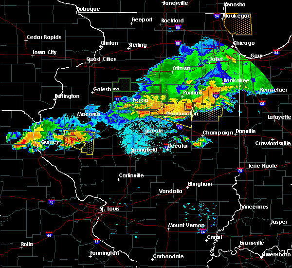 At 939 pm cdt, a severe thunderstorm was located over mount sterling, moving southeast at 30 mph (radar indicated). Hazards include 60 mph wind gusts and quarter size hail. Hail damage to vehicles is expected. expect wind damage to roofs, siding, and trees. Locations impacted include, mount sterling, la grange, versailles, mound station, ripley and coopertown. At 939 pm cdt, a severe thunderstorm was located over mount sterling, moving southeast at 30 mph (radar indicated). Hazards include 60 mph wind gusts and quarter size hail. Hail damage to vehicles is expected. expect wind damage to roofs, siding, and trees. Locations impacted include, mount sterling, la grange, versailles, mound station, ripley and coopertown.
|
| 6/17/2017 9:20 PM CDT |
 At 920 pm cdt, a severe thunderstorm was located near clayton, moving east at 20 mph (radar indicated). Hazards include 60 mph wind gusts and quarter size hail. Hail damage to vehicles is expected. Expect wind damage to roofs, siding, and trees. At 920 pm cdt, a severe thunderstorm was located near clayton, moving east at 20 mph (radar indicated). Hazards include 60 mph wind gusts and quarter size hail. Hail damage to vehicles is expected. Expect wind damage to roofs, siding, and trees.
|
| 6/14/2017 5:35 PM CDT |
 At 535 pm cdt, a severe thunderstorm was located over rushville, moving east at 25 mph (radar indicated). Hazards include 60 mph wind gusts and quarter size hail. Hail damage to vehicles is expected. expect wind damage to roofs, siding, and trees. Locations impacted include, beardstown, rushville, virginia, astoria, bluff springs, chandlerville, arenzville, bath, littleton, browning, frederick, ripley, bluff city, ray, snicarte and marbletown. At 535 pm cdt, a severe thunderstorm was located over rushville, moving east at 25 mph (radar indicated). Hazards include 60 mph wind gusts and quarter size hail. Hail damage to vehicles is expected. expect wind damage to roofs, siding, and trees. Locations impacted include, beardstown, rushville, virginia, astoria, bluff springs, chandlerville, arenzville, bath, littleton, browning, frederick, ripley, bluff city, ray, snicarte and marbletown.
|
| 6/14/2017 5:18 PM CDT |
 At 518 pm cdt, a severe thunderstorm was located near rushville, moving east at 30 mph (radar indicated). Hazards include 60 mph wind gusts and quarter size hail. Hail damage to vehicles is expected. Expect wind damage to roofs, siding, and trees. At 518 pm cdt, a severe thunderstorm was located near rushville, moving east at 30 mph (radar indicated). Hazards include 60 mph wind gusts and quarter size hail. Hail damage to vehicles is expected. Expect wind damage to roofs, siding, and trees.
|
| 6/14/2017 2:34 PM CDT |
 At 233 pm cdt, a severe thunderstorm was located near browning, or near beardstown, moving east at 45 mph (radar indicated). Hazards include 60 mph wind gusts. Expect damage to roofs, siding, and trees. Locations impacted include, beardstown, virginia, ashland, astoria, bluff springs, chandlerville, arenzville, bath, kilbourne, browning, philadelphia, frederick, newmansville, bluff city, snicarte and marbletown. At 233 pm cdt, a severe thunderstorm was located near browning, or near beardstown, moving east at 45 mph (radar indicated). Hazards include 60 mph wind gusts. Expect damage to roofs, siding, and trees. Locations impacted include, beardstown, virginia, ashland, astoria, bluff springs, chandlerville, arenzville, bath, kilbourne, browning, philadelphia, frederick, newmansville, bluff city, snicarte and marbletown.
|
| 6/14/2017 2:23 PM CDT |
 At 200 pm cdt, a severe thunderstorm was located 7 miles west of rushville, moving east at 45 mph (radar indicated). Hazards include 60 mph wind gusts and quarter size hail. Hail damage to vehicles is expected. Expect wind damage to roofs, siding, and trees. At 200 pm cdt, a severe thunderstorm was located 7 miles west of rushville, moving east at 45 mph (radar indicated). Hazards include 60 mph wind gusts and quarter size hail. Hail damage to vehicles is expected. Expect wind damage to roofs, siding, and trees.
|
| 6/14/2017 2:04 PM CDT |
 At 203 pm cdt, a severe thunderstorm was located over buckhorn, moving east at 30 mph (radar indicated). Hazards include 60 mph wind gusts and nickel size hail. expect damage to roofs, siding, and trees At 203 pm cdt, a severe thunderstorm was located over buckhorn, moving east at 30 mph (radar indicated). Hazards include 60 mph wind gusts and nickel size hail. expect damage to roofs, siding, and trees
|
| 6/14/2017 2:01 PM CDT |
 At 200 pm cdt, a severe thunderstorm was located 7 miles west of rushville, moving east at 45 mph (radar indicated). Hazards include 60 mph wind gusts and quarter size hail. Hail damage to vehicles is expected. Expect wind damage to roofs, siding, and trees. At 200 pm cdt, a severe thunderstorm was located 7 miles west of rushville, moving east at 45 mph (radar indicated). Hazards include 60 mph wind gusts and quarter size hail. Hail damage to vehicles is expected. Expect wind damage to roofs, siding, and trees.
|
| 3/6/2017 11:10 PM CST |
 The severe thunderstorm warning for northern pike, adams and brown counties in west central illinois will expire at 1115 pm cst, the storms which prompted the warning have weakened below severe limits, and no longer poses an immediate threat to life or property. therefore, the warning will be allowed to expire. however gusty winds are still possible with these thunderstorms. a tornado watch remains in effect until 400 am cst for west central illinois, and northeastern missouri. The severe thunderstorm warning for northern pike, adams and brown counties in west central illinois will expire at 1115 pm cst, the storms which prompted the warning have weakened below severe limits, and no longer poses an immediate threat to life or property. therefore, the warning will be allowed to expire. however gusty winds are still possible with these thunderstorms. a tornado watch remains in effect until 400 am cst for west central illinois, and northeastern missouri.
|
| 3/6/2017 10:49 PM CST |
 At 1048 pm cst, severe thunderstorms were located along a line extending from 7 miles northwest of colmar to camp point to near payson, moving east at 65 mph (trained weather spotters. a 60 mph wind gust was reported at the quincy airport). Hazards include 60 mph wind gusts and quarter size hail. Hail damage to vehicles is expected. expect wind damage to roofs, siding, and trees. locations impacted include, quincy, pittsfield, quincy regional airport, mount sterling, barry, griggsville, camp point, payson, mendon, clayton, golden, fall creek, beverly, buckhorn, adams, la grange, kingston, burton, ursa and liberty. this also includes siloam springs state park. this includes the following highways, interstate 172 between exits 2 and 19. interstate 72 between exits 4 and 35. A tornado watch remains in effect until 400 am cst for west central illinois, and northeastern missouri. At 1048 pm cst, severe thunderstorms were located along a line extending from 7 miles northwest of colmar to camp point to near payson, moving east at 65 mph (trained weather spotters. a 60 mph wind gust was reported at the quincy airport). Hazards include 60 mph wind gusts and quarter size hail. Hail damage to vehicles is expected. expect wind damage to roofs, siding, and trees. locations impacted include, quincy, pittsfield, quincy regional airport, mount sterling, barry, griggsville, camp point, payson, mendon, clayton, golden, fall creek, beverly, buckhorn, adams, la grange, kingston, burton, ursa and liberty. this also includes siloam springs state park. this includes the following highways, interstate 172 between exits 2 and 19. interstate 72 between exits 4 and 35. A tornado watch remains in effect until 400 am cst for west central illinois, and northeastern missouri.
|
| 3/6/2017 10:20 PM CST |
 At 1020 pm cst, severe thunderstorms were located along a line extending from near alexandria to maywood to near monroe city, moving east at 65 mph (radar indicated). Hazards include 60 mph wind gusts and quarter size hail. Hail damage to vehicles is expected. Expect wind damage to roofs, siding, and trees. At 1020 pm cst, severe thunderstorms were located along a line extending from near alexandria to maywood to near monroe city, moving east at 65 mph (radar indicated). Hazards include 60 mph wind gusts and quarter size hail. Hail damage to vehicles is expected. Expect wind damage to roofs, siding, and trees.
|
| 2/28/2017 9:29 PM CST |
 At 929 pm cst, a severe thunderstorm capable of producing a tornado was located 7 miles southeast of mount sterling, or 13 miles southwest of beardstown, moving east at 60 mph (radar indicated rotation). Hazards include tornado and quarter size hail. Flying debris will be dangerous to those caught without shelter. mobile homes will be damaged or destroyed. damage to roofs, windows, and vehicles will occur. tree damage is likely. this dangerous storm will be near, beardstown and bluff springs around 945 pm cst. virginia around 955 pm cst. Other locations impacted by this tornadic thunderstorm include frederick and ripley. At 929 pm cst, a severe thunderstorm capable of producing a tornado was located 7 miles southeast of mount sterling, or 13 miles southwest of beardstown, moving east at 60 mph (radar indicated rotation). Hazards include tornado and quarter size hail. Flying debris will be dangerous to those caught without shelter. mobile homes will be damaged or destroyed. damage to roofs, windows, and vehicles will occur. tree damage is likely. this dangerous storm will be near, beardstown and bluff springs around 945 pm cst. virginia around 955 pm cst. Other locations impacted by this tornadic thunderstorm include frederick and ripley.
|
| 2/28/2017 9:07 PM CST |
 At 907 pm cst, a severe thunderstorm was located near beverly, moving east at 55 mph (radar indicated). Hazards include 60 mph wind gusts and quarter size hail. Hail damage to vehicles is expected. Expect wind damage to roofs, siding, and trees. At 907 pm cst, a severe thunderstorm was located near beverly, moving east at 55 mph (radar indicated). Hazards include 60 mph wind gusts and quarter size hail. Hail damage to vehicles is expected. Expect wind damage to roofs, siding, and trees.
|
| 8/25/2016 1:02 AM CDT |
 At 102 am cdt, a severe thunderstorm was located near browning, or near rushville, moving east at 30 mph (radar indicated). Hazards include 60 mph wind gusts and nickel size hail. Expect damage to roofs. siding. and trees. Locations impacted include, beardstown, havana, rushville, astoria, bluff springs, chandlerville, bath, kilbourne, littleton, browning, oakford, frederick, bluff city, chatauqua park, snicarte, marbletown and ray. At 102 am cdt, a severe thunderstorm was located near browning, or near rushville, moving east at 30 mph (radar indicated). Hazards include 60 mph wind gusts and nickel size hail. Expect damage to roofs. siding. and trees. Locations impacted include, beardstown, havana, rushville, astoria, bluff springs, chandlerville, bath, kilbourne, littleton, browning, oakford, frederick, bluff city, chatauqua park, snicarte, marbletown and ray.
|
| 8/25/2016 12:40 AM CDT |
 At 1240 am cdt, a severe thunderstorm was located near rushville, moving east at 30 mph (radar indicated). Hazards include 60 mph wind gusts. Expect damage to roofs. siding. And trees. At 1240 am cdt, a severe thunderstorm was located near rushville, moving east at 30 mph (radar indicated). Hazards include 60 mph wind gusts. Expect damage to roofs. siding. And trees.
|
| 7/19/2016 6:39 PM CDT | The severe thunderstorm warning for northeastern pike and brown counties in west central illinois will expire at 645 pm cdt, the storms which prompted the warning have weakened below severe limits, and have exited the warned area. therefore the warning will be allowed to expire. a severe thunderstorm watch remains in effect until 800 pm cdt for west central illinois. |
| 7/19/2016 6:23 PM CDT |
 At 623 pm cdt, severe thunderstorms were located along a line extending from near industry to rushville to 7 miles east of mount sterling, moving east at 45 mph (radar indicated). Hazards include 60 mph wind gusts. Expect damage to roofs. siding. and trees. Locations impacted include, rushville, littleton, huntsville, camden, ripley, weinberg king state park, doddsville and ray. At 623 pm cdt, severe thunderstorms were located along a line extending from near industry to rushville to 7 miles east of mount sterling, moving east at 45 mph (radar indicated). Hazards include 60 mph wind gusts. Expect damage to roofs. siding. and trees. Locations impacted include, rushville, littleton, huntsville, camden, ripley, weinberg king state park, doddsville and ray.
|
| 7/19/2016 6:20 PM CDT |
 At 620 pm cdt, severe thunderstorms were located along a line extending from near littleton to near naples, moving east at 50 mph (radar indicated). Hazards include 60 mph wind gusts. Expect damage to roofs. siding. and trees. Locations impacted include, mount sterling, buckhorn, la grange, versailles, perry, chambersburg, mound station, ripley, fishhook and coopertown. At 620 pm cdt, severe thunderstorms were located along a line extending from near littleton to near naples, moving east at 50 mph (radar indicated). Hazards include 60 mph wind gusts. Expect damage to roofs. siding. and trees. Locations impacted include, mount sterling, buckhorn, la grange, versailles, perry, chambersburg, mound station, ripley, fishhook and coopertown.
|
| 7/19/2016 6:01 PM CDT |
 At 600 pm cdt, severe thunderstorms were located along a line extending from near augusta to near beverly, moving east at 50 mph (quincy asos reported a peak wind gust of 62 mph with this line of storms). Hazards include 60 mph wind gusts. Expect damage to roofs. siding. And trees. At 600 pm cdt, severe thunderstorms were located along a line extending from near augusta to near beverly, moving east at 50 mph (quincy asos reported a peak wind gust of 62 mph with this line of storms). Hazards include 60 mph wind gusts. Expect damage to roofs. siding. And trees.
|
| 7/19/2016 5:58 PM CDT |
 At 558 pm cdt, severe thunderstorms were located along a line extending from augusta to 6 miles east of golden to near clayton, moving east at 45 mph (radar indicated). Hazards include 60 mph wind gusts. Expect damage to roofs. siding. And trees. At 558 pm cdt, severe thunderstorms were located along a line extending from augusta to 6 miles east of golden to near clayton, moving east at 45 mph (radar indicated). Hazards include 60 mph wind gusts. Expect damage to roofs. siding. And trees.
|
| 7/13/2016 3:21 PM CDT |
 At 320 pm cdt, severe thunderstorms were located along a line extending from industry to beardstown, moving east at 55 mph (radar indicated). Hazards include 60 mph wind gusts. Expect damage to roofs. siding. and trees. Locations impacted include, beardstown, rushville, lewistown, astoria, vermont, chandlerville, ipava, bath, littleton, browning, table grove, bernadotte, smithfield, frederick, marietta, ellisville, ripley, bluff city, snicarte and marbletown. At 320 pm cdt, severe thunderstorms were located along a line extending from industry to beardstown, moving east at 55 mph (radar indicated). Hazards include 60 mph wind gusts. Expect damage to roofs. siding. and trees. Locations impacted include, beardstown, rushville, lewistown, astoria, vermont, chandlerville, ipava, bath, littleton, browning, table grove, bernadotte, smithfield, frederick, marietta, ellisville, ripley, bluff city, snicarte and marbletown.
|
| 7/13/2016 3:05 PM CDT |
 At 305 pm cdt, a severe thunderstorm was located near mount sterling, moving east at 40 mph (trained weather spotters). Hazards include 60 mph wind gusts. Expect damage to roofs. siding. and trees. Locations impacted include, mount sterling, buckhorn, la grange, versailles, perry, chambersburg, ripley and coopertown. At 305 pm cdt, a severe thunderstorm was located near mount sterling, moving east at 40 mph (trained weather spotters). Hazards include 60 mph wind gusts. Expect damage to roofs. siding. and trees. Locations impacted include, mount sterling, buckhorn, la grange, versailles, perry, chambersburg, ripley and coopertown.
|
| 7/13/2016 2:58 PM CDT |
 At 257 pm cdt, severe thunderstorms were located along a line extending from near bowen to near buckhorn, moving east at 45 mph (radar indicated). Hazards include 60 mph wind gusts and penny size hail. Expect damage to roofs. siding. And trees. At 257 pm cdt, severe thunderstorms were located along a line extending from near bowen to near buckhorn, moving east at 45 mph (radar indicated). Hazards include 60 mph wind gusts and penny size hail. Expect damage to roofs. siding. And trees.
|
| 7/13/2016 2:46 PM CDT |
 At 245 pm cdt, a severe thunderstorm was located near camp point, moving east at 35 mph (trained weather spotters. large tree limbs down). Hazards include 60 mph wind gusts. Expect damage to roofs. siding. and trees. locations impacted include, quincy, mount sterling, camp point, payson, mendon, clayton, golden, fall creek, beverly, buckhorn, adams, la grange, kingston, burton, ursa, liberty, versailles, richfield, perry and loraine. this also includes siloam springs state park. This includes interstate 172 between exits 2 and 19. At 245 pm cdt, a severe thunderstorm was located near camp point, moving east at 35 mph (trained weather spotters. large tree limbs down). Hazards include 60 mph wind gusts. Expect damage to roofs. siding. and trees. locations impacted include, quincy, mount sterling, camp point, payson, mendon, clayton, golden, fall creek, beverly, buckhorn, adams, la grange, kingston, burton, ursa, liberty, versailles, richfield, perry and loraine. this also includes siloam springs state park. This includes interstate 172 between exits 2 and 19.
|
| 7/13/2016 2:21 PM CDT |
 At 221 pm cdt, a severe thunderstorm was located near payson, moving east at 35 mph (radar indicated). Hazards include 60 mph wind gusts. Expect damage to roofs. siding. And trees. At 221 pm cdt, a severe thunderstorm was located near payson, moving east at 35 mph (radar indicated). Hazards include 60 mph wind gusts. Expect damage to roofs. siding. And trees.
|
| 7/7/2016 9:12 AM CDT | The severe thunderstorm warning for schuyler county will expire at 915 am cdt, the storms which prompted the warning have weakened below severe limits. therefore, the warning will be allowed to expire. however gusty winds and heavy rain are still possible with these thunderstorms. to report severe weather, contact your nearest law enforcement agency. they will relay your report to the national weather service lincoln. |
| 7/7/2016 9:00 AM CDT |
 At 900 am cdt, severe thunderstorms were located along a line extending from near industry to rushville, moving east at 35 mph (radar indicated). Hazards include 60 mph wind gusts. Expect damage to roofs. siding. and trees. Locations impacted include, beardstown, rushville, littleton, frederick, ripley and ray. At 900 am cdt, severe thunderstorms were located along a line extending from near industry to rushville, moving east at 35 mph (radar indicated). Hazards include 60 mph wind gusts. Expect damage to roofs. siding. and trees. Locations impacted include, beardstown, rushville, littleton, frederick, ripley and ray.
|
| 7/7/2016 8:56 AM CDT | The severe thunderstorm warning for northeastern pike, eastern adams and brown counties in west central illinois will expire at 900 am cdt, the storms which prompted the warning have moved out of the area. therefore the warning will be allowed to expire. however gusty winds are still possible with these thunderstorms. a severe thunderstorm watch remains in effect until 100 pm cdt for west central illinois. |
| 7/7/2016 8:43 AM CDT |
 At 843 am cdt, severe thunderstorms were located along a line extending from near augusta to mount sterling, moving east at 35 mph (trained weather spotters. the storms have a history of producing wind gusts of 50 to 60 mph across adams county). Hazards include 60 mph wind gusts and penny size hail. Expect damage to roofs. siding. and trees. Locations impacted include, beardstown, rushville, littleton, frederick, huntsville, camden, ripley, weinberg king state park and ray. At 843 am cdt, severe thunderstorms were located along a line extending from near augusta to mount sterling, moving east at 35 mph (trained weather spotters. the storms have a history of producing wind gusts of 50 to 60 mph across adams county). Hazards include 60 mph wind gusts and penny size hail. Expect damage to roofs. siding. and trees. Locations impacted include, beardstown, rushville, littleton, frederick, huntsville, camden, ripley, weinberg king state park and ray.
|
| 7/7/2016 8:26 AM CDT |
 At 826 am cdt, severe thunderstorms were located along a line extending from 7 miles northeast of clayton to 6 miles northwest of pittsfield, moving east at 40 mph (trained weather spotters). Hazards include 60 mph wind gusts and penny size hail. Expect damage to roofs. siding. And trees. At 826 am cdt, severe thunderstorms were located along a line extending from 7 miles northeast of clayton to 6 miles northwest of pittsfield, moving east at 40 mph (trained weather spotters). Hazards include 60 mph wind gusts and penny size hail. Expect damage to roofs. siding. And trees.
|
| 7/7/2016 8:26 AM CDT |
 At 825 am cdt, severe thunderstorms were located along a line extending from bowen to near clayton, moving east at 35 mph (radar indicated. at 811 am...a 58 mph wind gust was reported at the quincy airport). Hazards include 70 mph wind gusts and penny size hail. Expect considerable tree damage. Damage is likely to mobile homes, roofs, and outbuildings. At 825 am cdt, severe thunderstorms were located along a line extending from bowen to near clayton, moving east at 35 mph (radar indicated. at 811 am...a 58 mph wind gust was reported at the quincy airport). Hazards include 70 mph wind gusts and penny size hail. Expect considerable tree damage. Damage is likely to mobile homes, roofs, and outbuildings.
|
| 7/7/2016 8:07 AM CDT |
 At 807 am cdt, severe thunderstorms were located along a line extending from west point to 7 miles west of barry, moving east at 50 mph (radar indicated). Hazards include 60 mph wind gusts and penny size hail. Expect damage to roofs. siding. and trees. locations impacted include, quincy, mount sterling, barry, griggsville, camp point, payson, mendon, clayton, golden, fall creek, beverly, buckhorn, adams, la grange, kingston, burton, ursa, liberty, versailles and hull. this also includes siloam springs state park. this includes the following highways, interstate 172 between exits 2 and 19. Interstate 72 between exits 4 and 35. At 807 am cdt, severe thunderstorms were located along a line extending from west point to 7 miles west of barry, moving east at 50 mph (radar indicated). Hazards include 60 mph wind gusts and penny size hail. Expect damage to roofs. siding. and trees. locations impacted include, quincy, mount sterling, barry, griggsville, camp point, payson, mendon, clayton, golden, fall creek, beverly, buckhorn, adams, la grange, kingston, burton, ursa, liberty, versailles and hull. this also includes siloam springs state park. this includes the following highways, interstate 172 between exits 2 and 19. Interstate 72 between exits 4 and 35.
|
| 7/7/2016 7:43 AM CDT |
 At 743 am cdt, severe thunderstorms were located along a line extending from 7 miles north of canton to near rensselaer, moving east at 45 mph (radar indicated). Hazards include 60 mph wind gusts and penny size hail. Expect damage to roofs. siding. and trees. locations impacted include, quincy, mount sterling, barry, griggsville, camp point, payson, mendon, clayton, golden, fall creek, beverly, buckhorn, adams, la grange, kingston, burton, ursa, liberty, versailles and hull. this also includes siloam springs state park. this includes the following highways, interstate 172 between exits 2 and 19. Interstate 72 between exits 4 and 35. At 743 am cdt, severe thunderstorms were located along a line extending from 7 miles north of canton to near rensselaer, moving east at 45 mph (radar indicated). Hazards include 60 mph wind gusts and penny size hail. Expect damage to roofs. siding. and trees. locations impacted include, quincy, mount sterling, barry, griggsville, camp point, payson, mendon, clayton, golden, fall creek, beverly, buckhorn, adams, la grange, kingston, burton, ursa, liberty, versailles and hull. this also includes siloam springs state park. this includes the following highways, interstate 172 between exits 2 and 19. Interstate 72 between exits 4 and 35.
|
| 7/7/2016 7:32 AM CDT |
 At 732 am cdt, severe thunderstorms were located along a line extending from 8 miles south of wayland to near rensselaer, moving east at 75 mph (radar indicated). Hazards include 60 mph wind gusts and penny size hail. Expect damage to roofs. siding. And trees. At 732 am cdt, severe thunderstorms were located along a line extending from 8 miles south of wayland to near rensselaer, moving east at 75 mph (radar indicated). Hazards include 60 mph wind gusts and penny size hail. Expect damage to roofs. siding. And trees.
|
| 5/11/2016 8:28 PM CDT |
 At 827 pm cdt, a severe thunderstorm was located near mount sterling, moving northeast at 40 mph (radar indicated). Hazards include quarter size hail. damage to vehicles is expected At 827 pm cdt, a severe thunderstorm was located near mount sterling, moving northeast at 40 mph (radar indicated). Hazards include quarter size hail. damage to vehicles is expected
|
| 4/27/2016 9:45 PM CDT |
 At 944 pm cdt, a severe thunderstorm was located over mendon, moving east at 35 mph (radar indicated). Hazards include 60 mph wind gusts and quarter size hail. Hail damage to vehicles is expected. Expect wind damage to roofs, siding, and trees. At 944 pm cdt, a severe thunderstorm was located over mendon, moving east at 35 mph (radar indicated). Hazards include 60 mph wind gusts and quarter size hail. Hail damage to vehicles is expected. Expect wind damage to roofs, siding, and trees.
|
| 12/23/2015 4:23 PM CST | The severe thunderstorm warning for northwestern brown county will expire at 430 pm cst, the storm which prompted the warning will move out of the area by 430 pm. therefore the warning will be allowed to expire. a tornado watch remains in effect until 800 pm cst for west central illinois. to report severe weather, contact your nearest law enforcement agency. they will relay your report to the national weather service st louis. |
| 12/23/2015 4:09 PM CST | A severe thunderstorm warning remains in effect until 430 pm cst for northwestern brown county. at 408 pm cst. a severe thunderstorm was located near mount sterling. moving northeast at 55 mph. hazard. 60 mph wind gusts and nickel size hail. source. Radar indicated. |
| 12/23/2015 3:59 PM CST | At 359 pm cst, severe thunderstorms were located along a line extending from 5 miles northeast of augusta to 7 miles southwest of clayton, moving northeast at 50 mph (trained weather spotters). Hazards include 70 mph wind gusts and quarter size hail. Hail damage to vehicles is expected. expect considerable tree damage. wind damage is also likely to mobile homes, roofs and outbuildings. locations impacted include, rushville, littleton, huntsville, camden, ripley, weinberg king state park and ray. A tornado watch remains in effect until 800 pm cst for west central illinois. |
| 12/23/2015 3:52 PM CST | At 351 pm cst, a severe thunderstorm was located 9 miles northwest of beverly, moving northeast at 45 mph (radar indicated). Hazards include 60 mph wind gusts and quarter size hail. Hail damage to vehicles is expected. Expect wind damage to roofs, siding and trees. |
| 12/23/2015 3:52 PM CST | At 351 pm cst, a severe thunderstorm was located 9 miles northwest of beverly, moving northeast at 45 mph (radar indicated). Hazards include 60 mph wind gusts and quarter size hail. Hail damage to vehicles is expected. Expect wind damage to roofs, siding and trees. |
| 12/23/2015 3:44 PM CST | At 344 pm cst, a severe thunderstorm was located near camp point, or 19 miles northeast of quincy, moving northeast at 50 mph (radar indicated). Hazards include 60 mph wind gusts. Expect damage to roofs. Siding and trees. |
| 7/13/2015 6:58 PM CDT |
 At 657 pm cdt, severe thunderstorms were located along a line extending from 7 miles northwest of meredosia to near griggsville, moving east at 55 mph (trained weather spotters). Hazards include 70 mph wind gusts. Expect considerable tree damage. damage is likely to mobile homes, roofs and outbuildings. locations impacted include, mount sterling, barry, griggsville, beverly, buckhorn, la grange, versailles, perry, baylis, chambersburg, new salem, mound station, ripley, florence, valley city, fishhook, kellerville and coopertown. this warning also includes siloam springs state park. This includes interstate 72 between exits 20 and 35. At 657 pm cdt, severe thunderstorms were located along a line extending from 7 miles northwest of meredosia to near griggsville, moving east at 55 mph (trained weather spotters). Hazards include 70 mph wind gusts. Expect considerable tree damage. damage is likely to mobile homes, roofs and outbuildings. locations impacted include, mount sterling, barry, griggsville, beverly, buckhorn, la grange, versailles, perry, baylis, chambersburg, new salem, mound station, ripley, florence, valley city, fishhook, kellerville and coopertown. this warning also includes siloam springs state park. This includes interstate 72 between exits 20 and 35.
|
| 7/13/2015 6:47 PM CDT |
 At 646 pm cdt, a large severe thunderstorm was located along a line extending from near mount sterling to 7 miles west of griggsville, moving east at 55 mph (trained weather spotters). Hazards include 70 mph wind gusts. Expect considerable tree damage. damage is likely to mobile homes, roofs and outbuildings. locations impacted include, mount sterling, barry, griggsville, camp point, payson, clayton, beverly, buckhorn, adams, la grange, kingston, liberty, versailles, hull, richfield, perry, plainville, kinderhook, baylis and chambersburg. this warning also includes siloam springs state park. This includes interstate 72 between exits 10 and 35. At 646 pm cdt, a large severe thunderstorm was located along a line extending from near mount sterling to 7 miles west of griggsville, moving east at 55 mph (trained weather spotters). Hazards include 70 mph wind gusts. Expect considerable tree damage. damage is likely to mobile homes, roofs and outbuildings. locations impacted include, mount sterling, barry, griggsville, camp point, payson, clayton, beverly, buckhorn, adams, la grange, kingston, liberty, versailles, hull, richfield, perry, plainville, kinderhook, baylis and chambersburg. this warning also includes siloam springs state park. This includes interstate 72 between exits 10 and 35.
|
| 7/13/2015 6:37 PM CDT |
 At 636 pm cdt, a severe thunderstorm was located near buckhorn, moving east at 55 mph (trained weather spotters). Hazards include 70 mph wind gusts. Expect considerable tree damage. damage is likely to mobile homes, roofs and outbuildings. locations impacted include, mount sterling, barry, griggsville, camp point, payson, clayton, golden, fall creek, beverly, buckhorn, adams, la grange, kingston, burton, liberty, versailles, hull, richfield, perry and loraine. this warning also includes siloam springs state park. this includes the following highways, interstate 172 near exit 2. Interstate 72 between exits 4 and 35. At 636 pm cdt, a severe thunderstorm was located near buckhorn, moving east at 55 mph (trained weather spotters). Hazards include 70 mph wind gusts. Expect considerable tree damage. damage is likely to mobile homes, roofs and outbuildings. locations impacted include, mount sterling, barry, griggsville, camp point, payson, clayton, golden, fall creek, beverly, buckhorn, adams, la grange, kingston, burton, liberty, versailles, hull, richfield, perry and loraine. this warning also includes siloam springs state park. this includes the following highways, interstate 172 near exit 2. Interstate 72 between exits 4 and 35.
|
| 7/13/2015 6:20 PM CDT |
 At 620 pm cdt, a severe thunderstorm was located near camp point, moving east at 60 mph (trained weather spotters). Hazards include 70 mph wind gusts. Expect considerable tree damage. Damage is likely to mobile homes, roofs and outbuildings. At 620 pm cdt, a severe thunderstorm was located near camp point, moving east at 60 mph (trained weather spotters). Hazards include 70 mph wind gusts. Expect considerable tree damage. Damage is likely to mobile homes, roofs and outbuildings.
|
| 7/11/2015 6:39 PM CDT |
 At 639 pm cdt, a severe thunderstorm was located 8 miles east of mount sterling, moving southeast at 25 mph (radar indicated). Hazards include 60 mph wind gusts and quarter size hail. Hail damage to vehicles is expected. Expect wind damage to roofs, siding and trees. At 639 pm cdt, a severe thunderstorm was located 8 miles east of mount sterling, moving southeast at 25 mph (radar indicated). Hazards include 60 mph wind gusts and quarter size hail. Hail damage to vehicles is expected. Expect wind damage to roofs, siding and trees.
|
| 7/11/2015 5:49 PM CDT |
 At 549 pm cdt, a severe thunderstorm was located 5 miles west of brooklyn, or 17 miles west of rushville, moving southeast at 35 mph (radar indicated). Hazards include 60 mph wind gusts and quarter size hail. Hail damage to vehicles is expected. expect wind damage to roofs, siding and trees. Locations impacted include, rushville, brooklyn, littleton, huntsville, camden and weinberg king state park. At 549 pm cdt, a severe thunderstorm was located 5 miles west of brooklyn, or 17 miles west of rushville, moving southeast at 35 mph (radar indicated). Hazards include 60 mph wind gusts and quarter size hail. Hail damage to vehicles is expected. expect wind damage to roofs, siding and trees. Locations impacted include, rushville, brooklyn, littleton, huntsville, camden and weinberg king state park.
|
| 7/11/2015 5:36 PM CDT |
 At 535 pm cdt, a severe thunderstorm was located 12 miles west of brooklyn, or 24 miles northwest of rushville, moving southeast at 40 mph (radar indicated). Hazards include 60 mph wind gusts and quarter size hail. Hail damage to vehicles is expected. Expect wind damage to roofs, siding and trees. At 535 pm cdt, a severe thunderstorm was located 12 miles west of brooklyn, or 24 miles northwest of rushville, moving southeast at 40 mph (radar indicated). Hazards include 60 mph wind gusts and quarter size hail. Hail damage to vehicles is expected. Expect wind damage to roofs, siding and trees.
|
| 7/11/2015 1:38 PM CDT |
 At 138 pm cdt, a severe thunderstorm was located near buckhorn, moving east at 35 mph (radar indicated). Hazards include 60 mph wind gusts and quarter size hail. Hail damage to vehicles is expected. expect wind damage to roofs, siding and trees. locations impacted include, mount sterling, clayton, buckhorn, la grange, versailles, mound station, ripley, kellerville and coopertown. This warning also includes siloam springs state park. At 138 pm cdt, a severe thunderstorm was located near buckhorn, moving east at 35 mph (radar indicated). Hazards include 60 mph wind gusts and quarter size hail. Hail damage to vehicles is expected. expect wind damage to roofs, siding and trees. locations impacted include, mount sterling, clayton, buckhorn, la grange, versailles, mound station, ripley, kellerville and coopertown. This warning also includes siloam springs state park.
|
| 7/11/2015 1:07 PM CDT |
 At 106 pm cdt, a severe thunderstorm was located near camp point, moving east at 35 mph (radar indicated). Hazards include 60 mph wind gusts and quarter size hail. Hail damage to vehicles is expected. Expect wind damage to roofs, siding and trees. At 106 pm cdt, a severe thunderstorm was located near camp point, moving east at 35 mph (radar indicated). Hazards include 60 mph wind gusts and quarter size hail. Hail damage to vehicles is expected. Expect wind damage to roofs, siding and trees.
|
| 6/22/2015 9:25 PM CDT |
 The severe thunderstorm warning for brown and east central adams counties will expire at 930 pm cdt, the storm which prompted the warning has weakened below severe limits, and no longer poses an immediate threat to life or property. however, gusty winds are still possible with this thunderstorm. in addition, strong thunderstorms may redevelop, and a severe thunderstorm watch remains in effect until midnight. The severe thunderstorm warning for brown and east central adams counties will expire at 930 pm cdt, the storm which prompted the warning has weakened below severe limits, and no longer poses an immediate threat to life or property. however, gusty winds are still possible with this thunderstorm. in addition, strong thunderstorms may redevelop, and a severe thunderstorm watch remains in effect until midnight.
|
| 6/22/2015 9:15 PM CDT |
 At 915 pm cdt, severe thunderstorms were located along a line extending from 4 miles southwest of rushville to 6 miles southwest of beardstown to 5 miles west of meredosia, moving east at 55 mph (trained weather spotters). Hazards include 60 mph wind gusts. Expect damage to roofs. siding and trees. locations impacted include, jacksonville, beardstown, rushville, virginia, ashland, meredosia, chapin, arenzville, jacksonville municipal airport, literberry, philadelphia, frederick, concord, camden and prentice. this includes interstate 72 between mile markers 71 and 79. A tornado watch remains in effect until 1100 pm cdt for west central illinois. At 915 pm cdt, severe thunderstorms were located along a line extending from 4 miles southwest of rushville to 6 miles southwest of beardstown to 5 miles west of meredosia, moving east at 55 mph (trained weather spotters). Hazards include 60 mph wind gusts. Expect damage to roofs. siding and trees. locations impacted include, jacksonville, beardstown, rushville, virginia, ashland, meredosia, chapin, arenzville, jacksonville municipal airport, literberry, philadelphia, frederick, concord, camden and prentice. this includes interstate 72 between mile markers 71 and 79. A tornado watch remains in effect until 1100 pm cdt for west central illinois.
|
| 6/22/2015 8:54 PM CDT |
 At 854 pm cdt, a severe thunderstorm was located 12 miles southwest of brooklyn, or 16 miles west of rushville, moving east at 60 mph (trained weather spotters). Hazards include 70 mph wind gusts. Expect considerable tree damage. Damage is likely to mobile homes, roofs and outbuildings. At 854 pm cdt, a severe thunderstorm was located 12 miles southwest of brooklyn, or 16 miles west of rushville, moving east at 60 mph (trained weather spotters). Hazards include 70 mph wind gusts. Expect considerable tree damage. Damage is likely to mobile homes, roofs and outbuildings.
|
| 6/22/2015 8:52 PM CDT |
 At 849 pm cdt, a severe thunderstorm was located near golden, and moving east at 55 mph (trained weather spotters reported 60 mph wind gusts near lorraine and storm damage in mendon). Hazards include 60 mph wind gusts. Expect damage to roofs. Siding and trees. At 849 pm cdt, a severe thunderstorm was located near golden, and moving east at 55 mph (trained weather spotters reported 60 mph wind gusts near lorraine and storm damage in mendon). Hazards include 60 mph wind gusts. Expect damage to roofs. Siding and trees.
|
| 6/20/2015 9:50 PM CDT |
 The severe thunderstorm warning for northern shelby, northern marion, southern lewis, southern knox, brown and central adams counties will expire at 1000 pm cdt, the line of storms which prompted the warning has weakened below severe limits, and no longer poses an immediate threat to life or property. however, gusty winds and heavy rain are still possible with these thunderstorms. in addition, strong thunderstorms may redevelop, and a tornado watch remains in effect until 11 pm. The severe thunderstorm warning for northern shelby, northern marion, southern lewis, southern knox, brown and central adams counties will expire at 1000 pm cdt, the line of storms which prompted the warning has weakened below severe limits, and no longer poses an immediate threat to life or property. however, gusty winds and heavy rain are still possible with these thunderstorms. in addition, strong thunderstorms may redevelop, and a tornado watch remains in effect until 11 pm.
|
| 6/20/2015 8:55 PM CDT |
 At 853 pm cdt, severe thunderstorms were located along a line extending from vermont to 5 miles southwest of west point to green city, and moving southeast at 25 mph (radar indicated). Hazards include 60 mph wind gusts. Expect damage to roofs. Siding and trees. At 853 pm cdt, severe thunderstorms were located along a line extending from vermont to 5 miles southwest of west point to green city, and moving southeast at 25 mph (radar indicated). Hazards include 60 mph wind gusts. Expect damage to roofs. Siding and trees.
|
| 6/7/2015 7:57 PM CDT | At 756 pm cdt, a severe thunderstorm was located near rushville, moving east at 45 mph (radar indicated). Hazards include 60 mph wind gusts. Expect damage to roofs. siding and trees. Locations impacted include, rushville, brooklyn, littleton, frederick, huntsville, browning, camden and weinberg king state park. |
| 6/7/2015 7:29 PM CDT | At 729 pm cdt, a severe thunderstorm was located 11 miles west of brooklyn, or 23 miles west of rushville, moving east at 50 mph (radar indicated). Hazards include 60 mph wind gusts. Expect damage to roofs. Siding and trees. |
Hail Maps for Ripley, IL


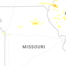


Connect with Interactive Hail Maps