

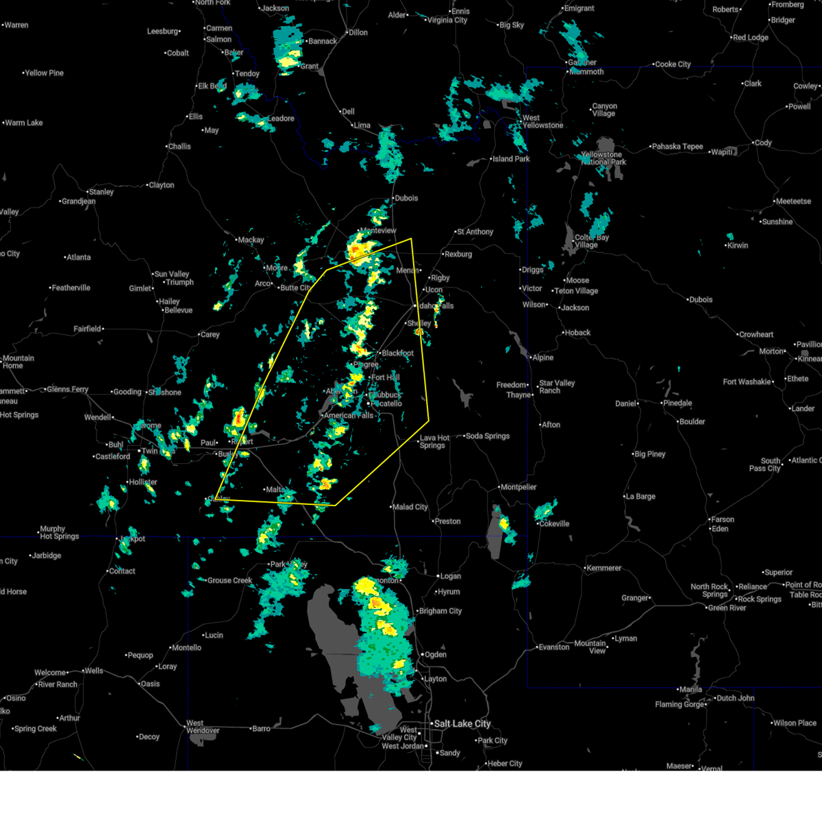
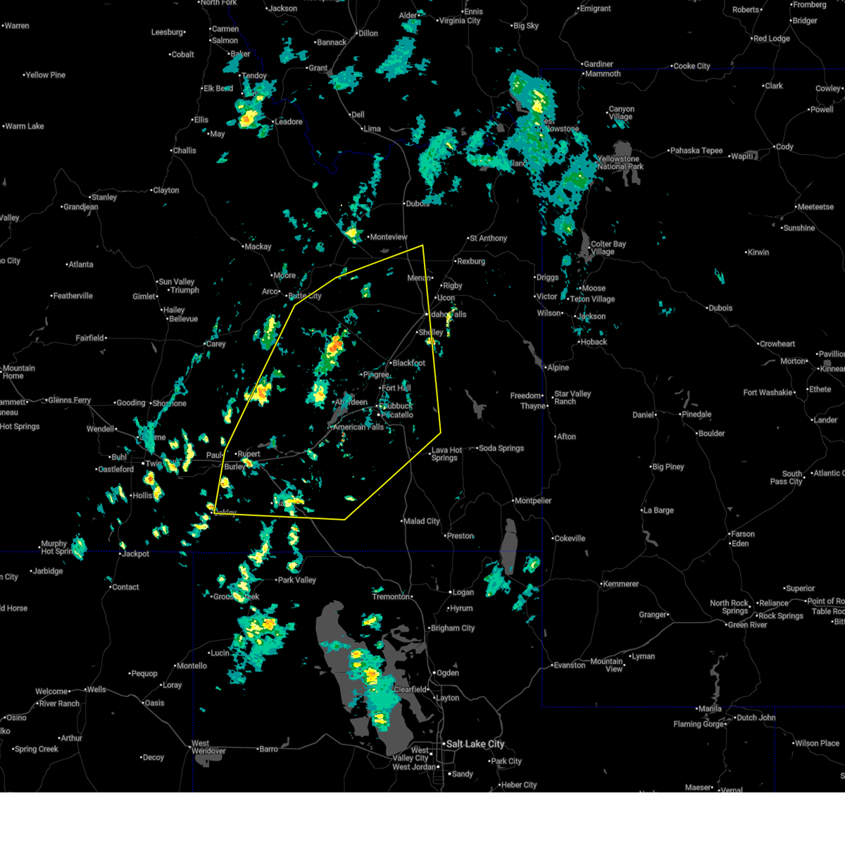
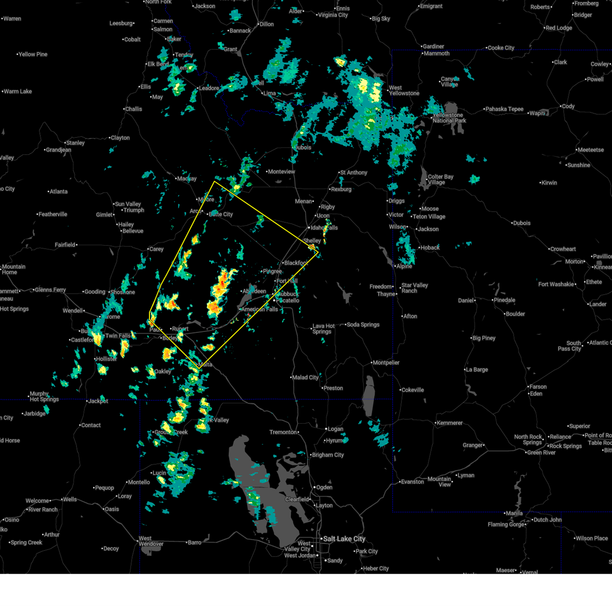
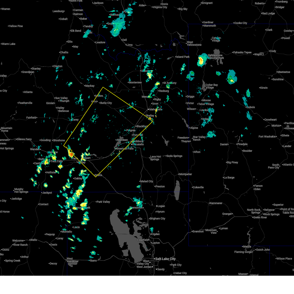
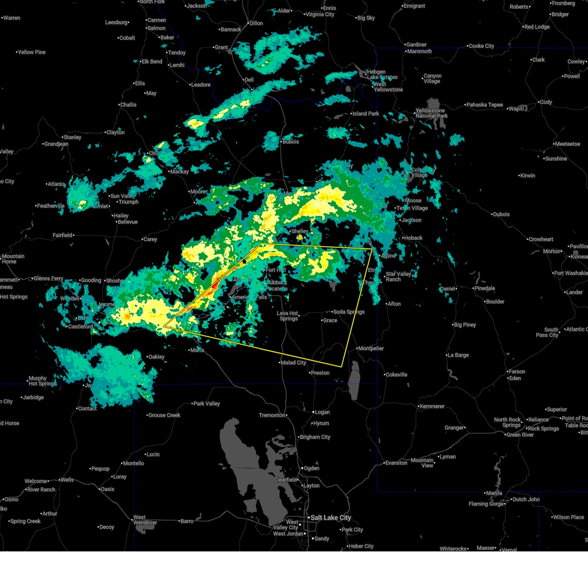
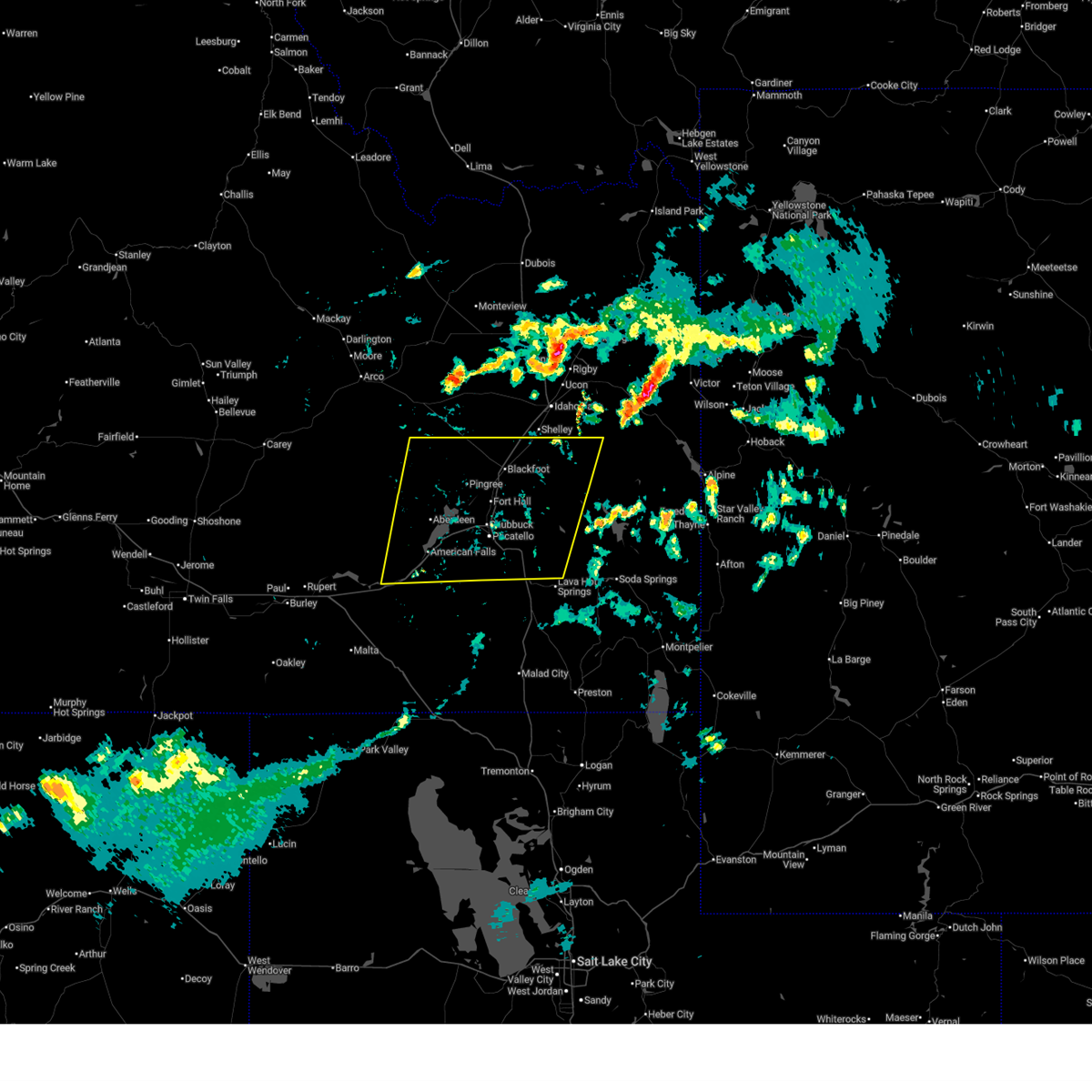
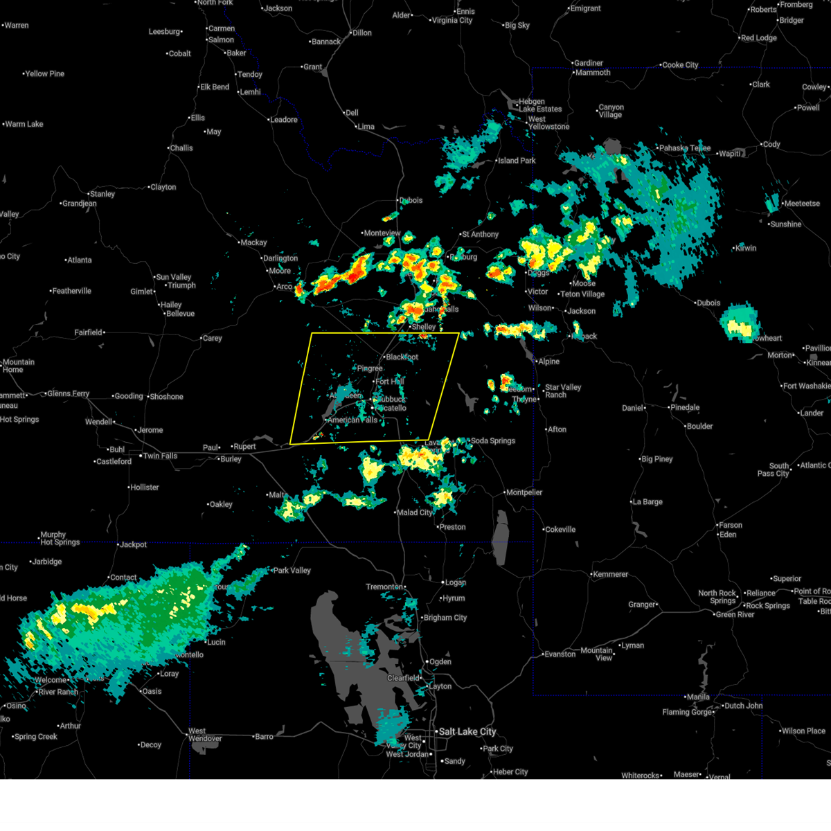
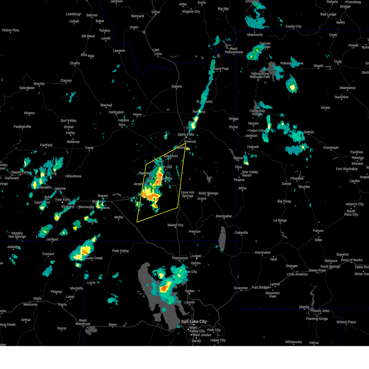
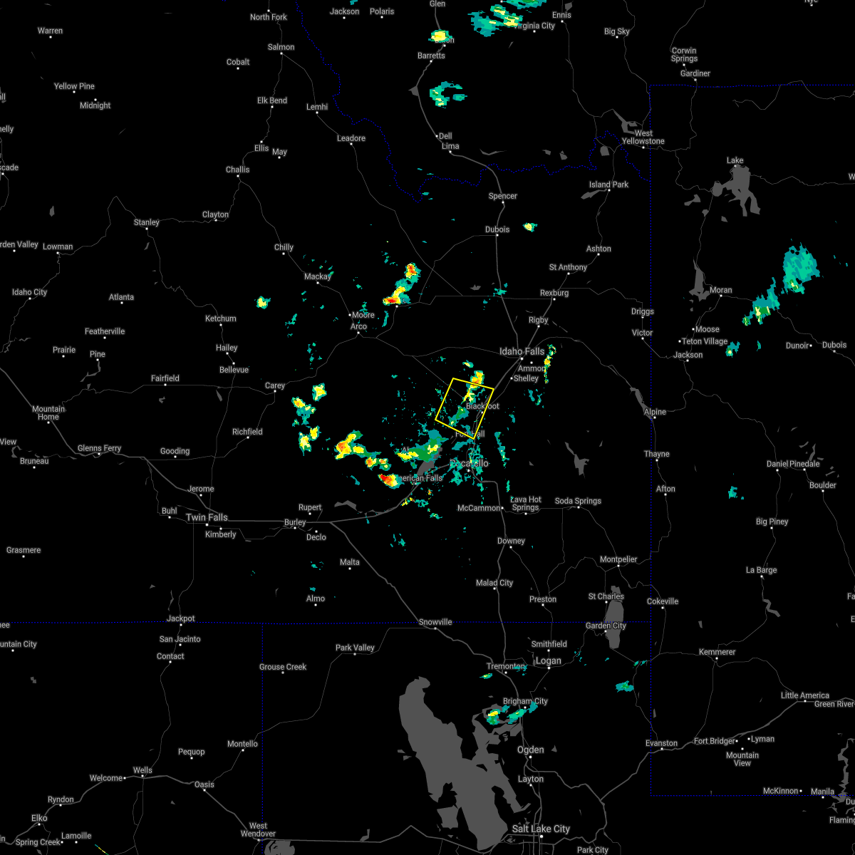
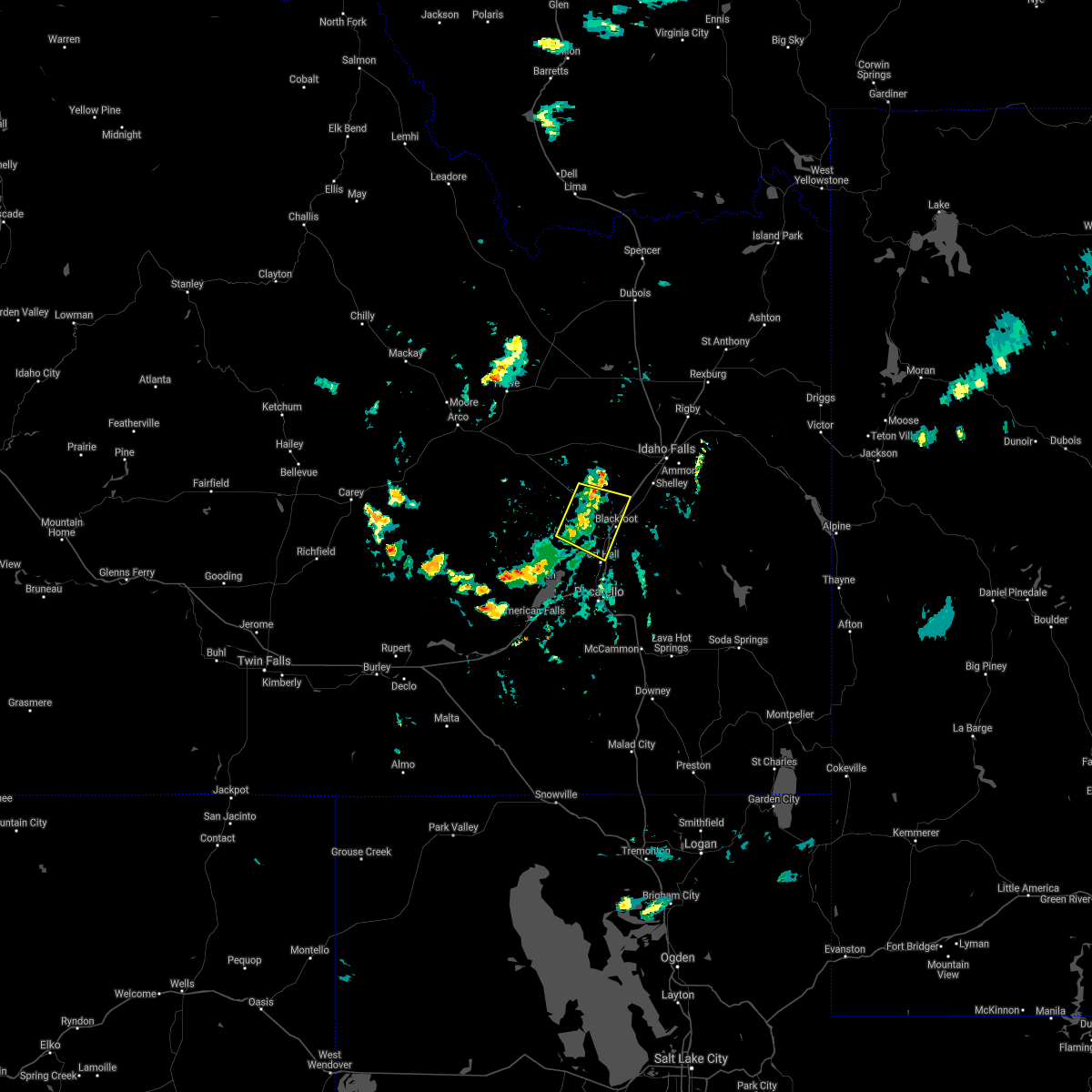
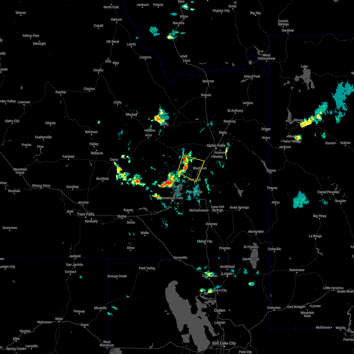
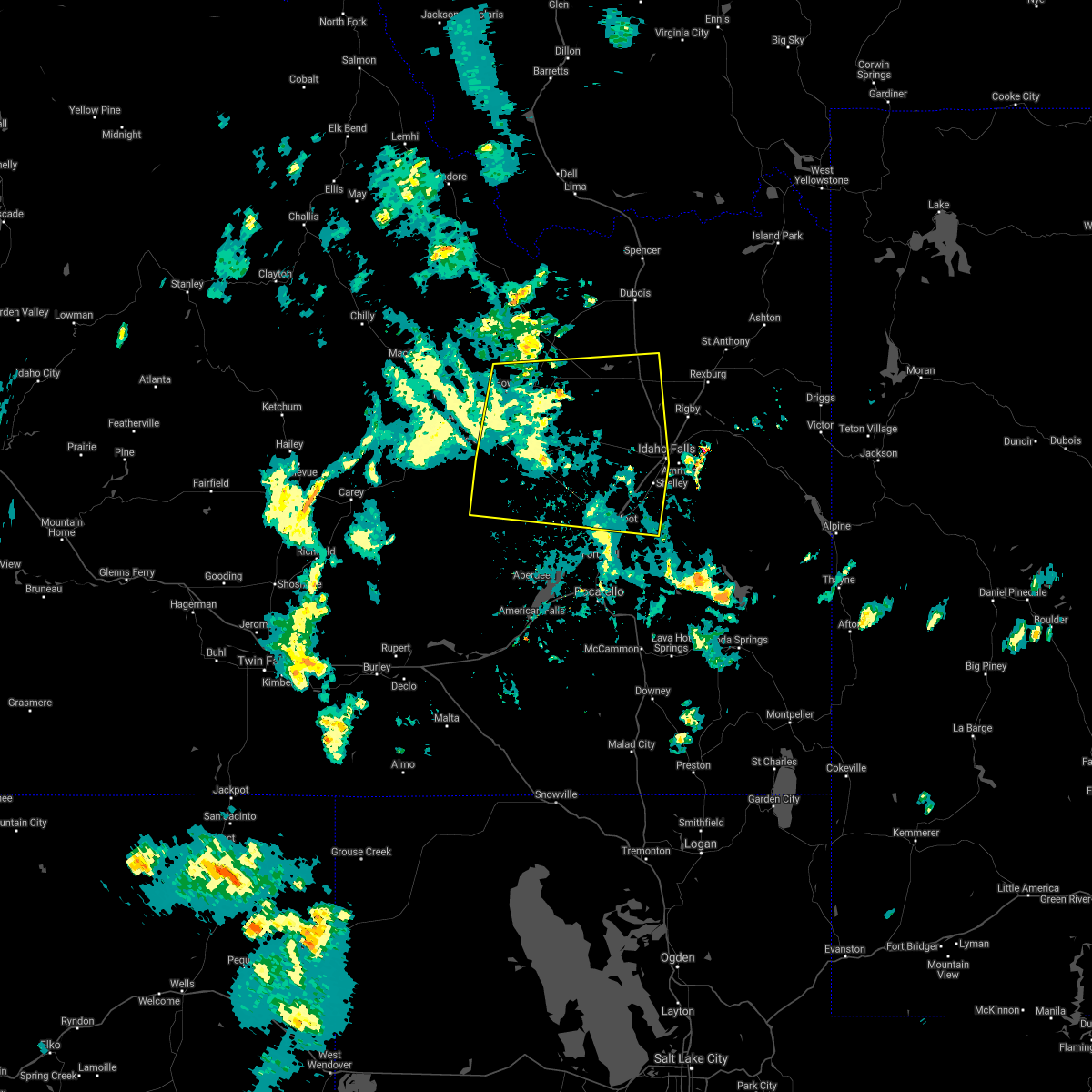
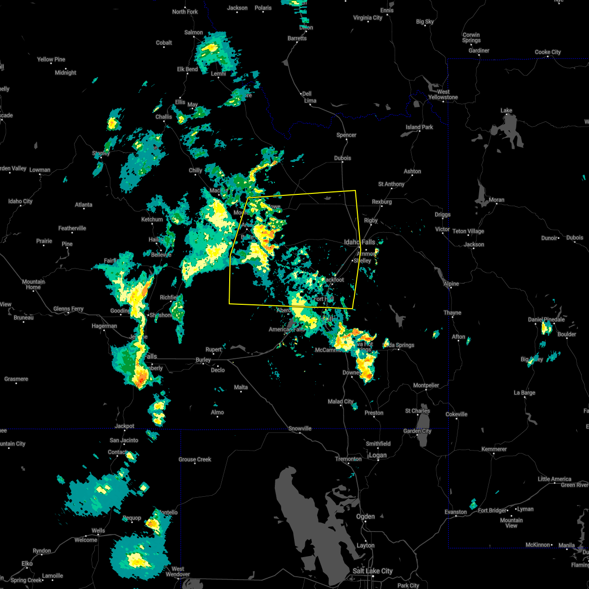
Hail Map for Riverside, ID
The Riverside, ID area has had 0 reports of on-the-ground hail by trained spotters, and has been under severe weather warnings 7 times during the past 12 months. Doppler radar has detected hail at or near Riverside, ID on 15 occasions.
| Name: | Riverside, ID |
| Where Located: | 28.7 miles SW of Idaho Falls, ID |
| Map: | Google Map for Riverside, ID |
| Population: | 838 |
| Housing Units: | 265 |
| More Info: | Search Google for Riverside, ID |
0
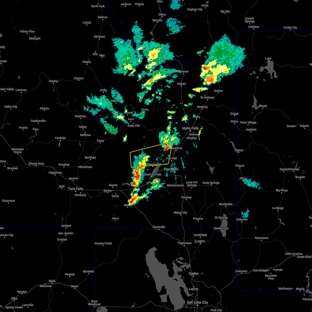
The Top Recent Hail Date for Riverside, ID is Sunday, August 18, 2024 (7th out of 15)

Hail and Wind Damage Spotted near Riverside, ID
| Date / Time | Report Details |
|---|---|
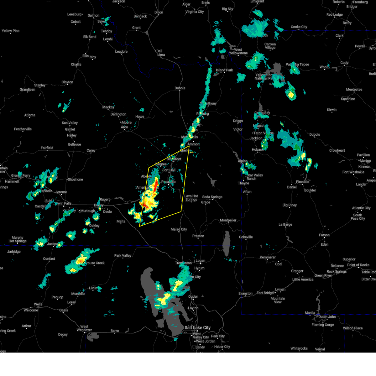
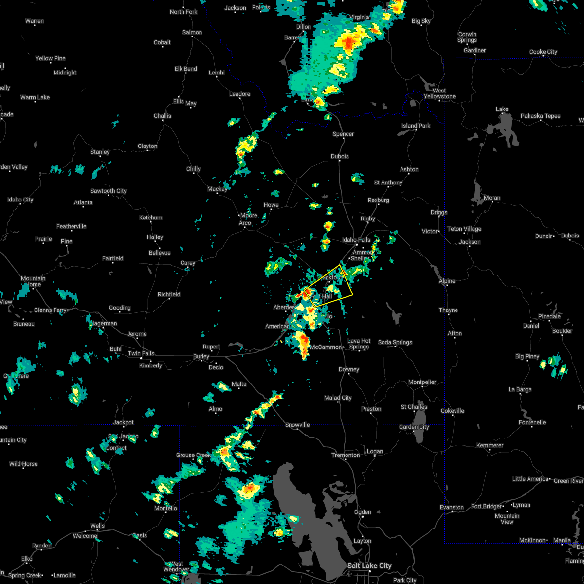
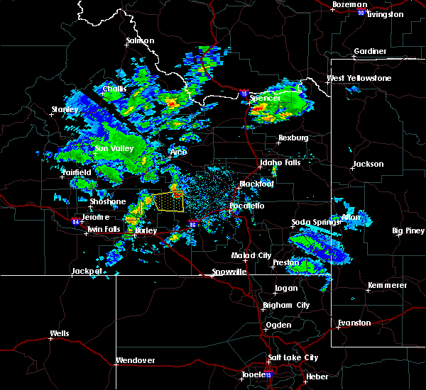
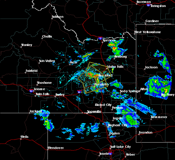
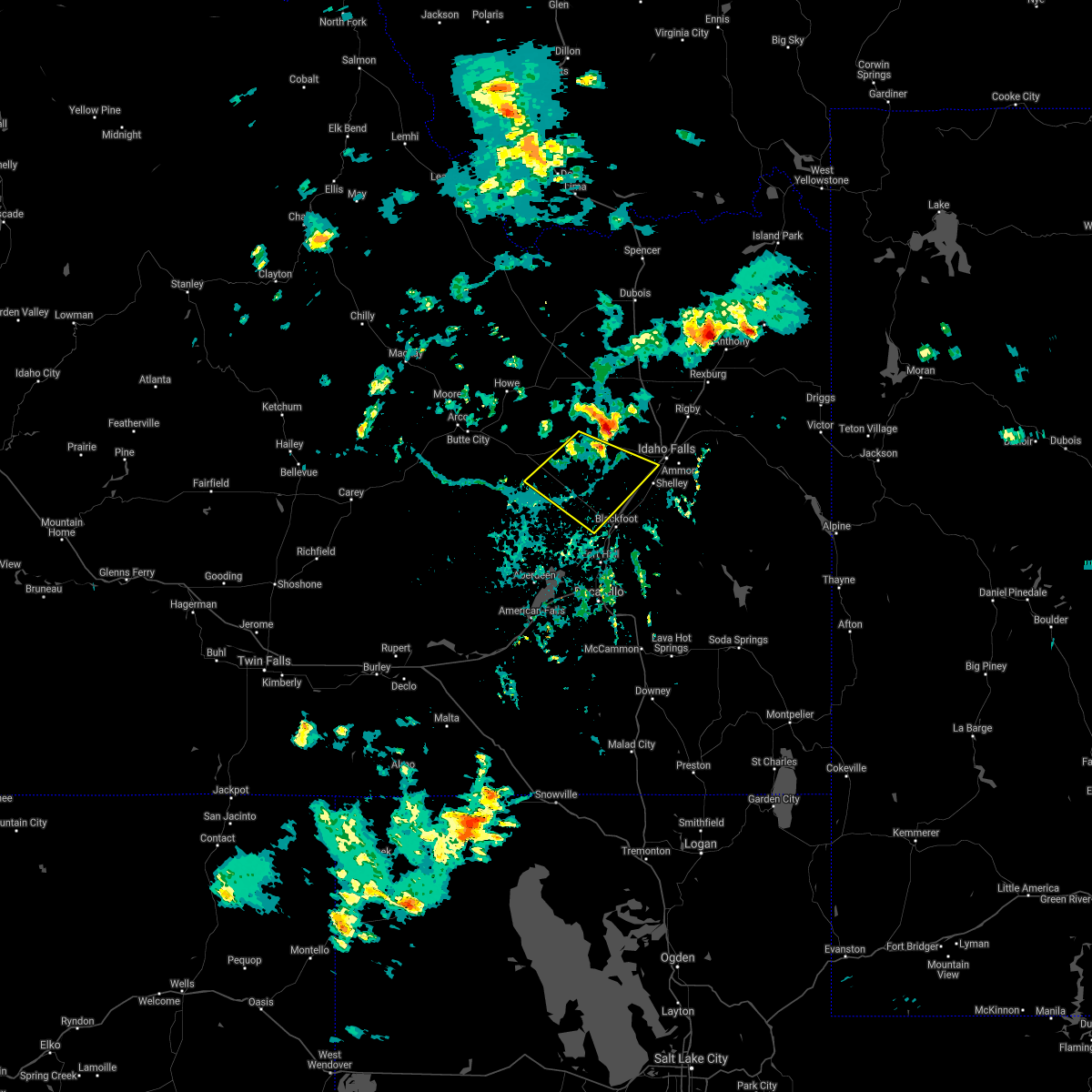
| 5/13/2026 3:15 PM MDT |
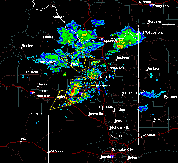
 At 312 pm mdt, the leading edge of severe thunderstorms and associated outflow was located from near mud lake to hear juniper, moving northeast at 55 mph. another line of severe thunderstorms and associated outflow extended the south of end craters of the moon to near elba, also moving northeast at 55 mph (radar indicated and mesonet observations. multiple observations over 60 mph have been reported). Hazards include 70 mph wind gusts. Expect considerable tree damage. damage is likely to mobile homes, roofs, and outbuildings. Locations impacted include, idaho falls, pocatello, blackfoot, american falls, mccammon, malta, lake walcott, neeley, chesterfield reservoir, goshen, american falls reservoir, chubbuck, shelley, aberdeen, inkom, roberts, firth, declo, rockland, and albion. At 312 pm mdt, the leading edge of severe thunderstorms and associated outflow was located from near mud lake to hear juniper, moving northeast at 55 mph. another line of severe thunderstorms and associated outflow extended the south of end craters of the moon to near elba, also moving northeast at 55 mph (radar indicated and mesonet observations. multiple observations over 60 mph have been reported). Hazards include 70 mph wind gusts. Expect considerable tree damage. damage is likely to mobile homes, roofs, and outbuildings. Locations impacted include, idaho falls, pocatello, blackfoot, american falls, mccammon, malta, lake walcott, neeley, chesterfield reservoir, goshen, american falls reservoir, chubbuck, shelley, aberdeen, inkom, roberts, firth, declo, rockland, and albion.
|
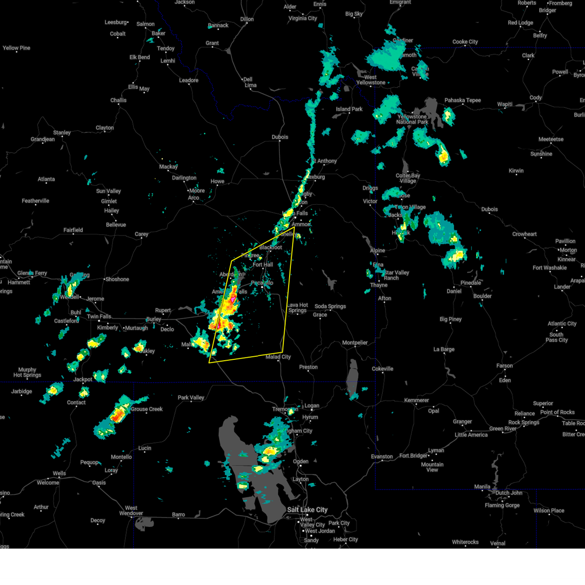
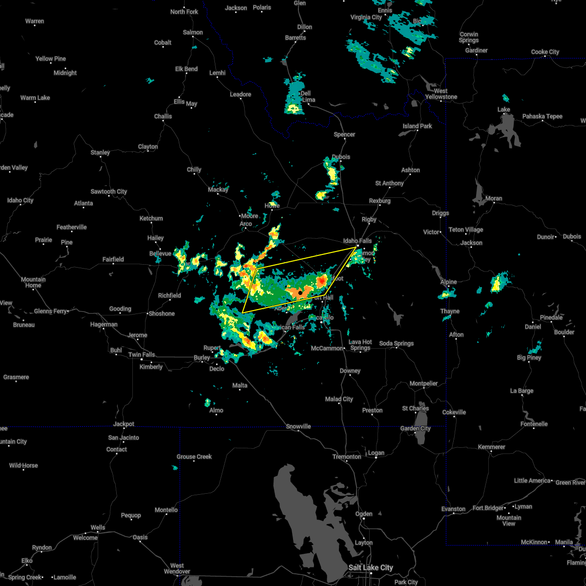
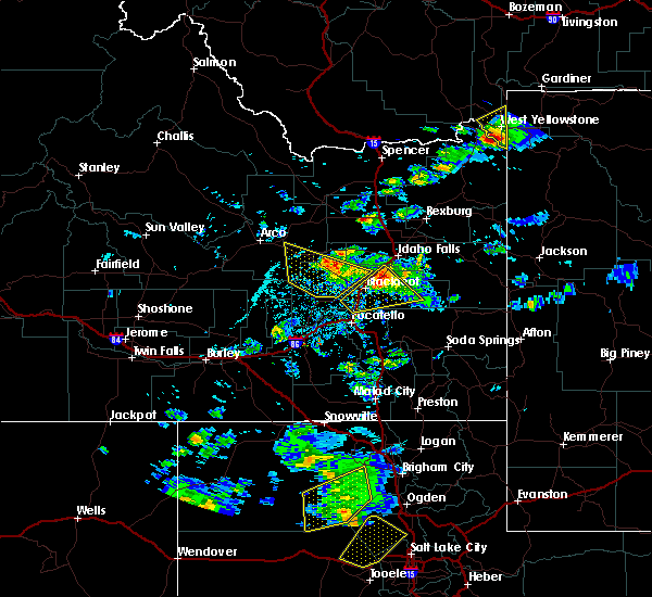
| 5/13/2026 2:43 PM MDT |
 Svrpih the national weather service in pocatello has issued a * severe thunderstorm warning for, southeastern blaine county in central idaho, northwestern caribou county in southeastern idaho, northwestern oneida county in southeastern idaho, southwestern jefferson county in southeastern idaho, bannock county in southeastern idaho, southeastern butte county in southeastern idaho, power county in southeastern idaho, northwestern bonneville county in southeastern idaho, bingham county in southeastern idaho, northeastern cassia county in southeastern idaho, southeastern minidoka county in south central idaho, * until 345 pm mdt. * at 240 pm mdt, a line of severe thunderstorms and associated outflow extends from near atomic city to sublett. another line of severe thunderstorms and associated outflow extends from near arco to near oakley , moving northeast at 50 mph (radar indicated and mesonet observations. multiple reports of gusts over 60 mph have been reported). Hazards include 70 mph wind gusts. Expect considerable tree damage. Damage is likely to mobile homes, roofs, and outbuildings. Svrpih the national weather service in pocatello has issued a * severe thunderstorm warning for, southeastern blaine county in central idaho, northwestern caribou county in southeastern idaho, northwestern oneida county in southeastern idaho, southwestern jefferson county in southeastern idaho, bannock county in southeastern idaho, southeastern butte county in southeastern idaho, power county in southeastern idaho, northwestern bonneville county in southeastern idaho, bingham county in southeastern idaho, northeastern cassia county in southeastern idaho, southeastern minidoka county in south central idaho, * until 345 pm mdt. * at 240 pm mdt, a line of severe thunderstorms and associated outflow extends from near atomic city to sublett. another line of severe thunderstorms and associated outflow extends from near arco to near oakley , moving northeast at 50 mph (radar indicated and mesonet observations. multiple reports of gusts over 60 mph have been reported). Hazards include 70 mph wind gusts. Expect considerable tree damage. Damage is likely to mobile homes, roofs, and outbuildings.
|
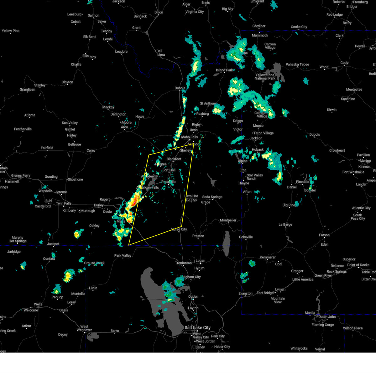
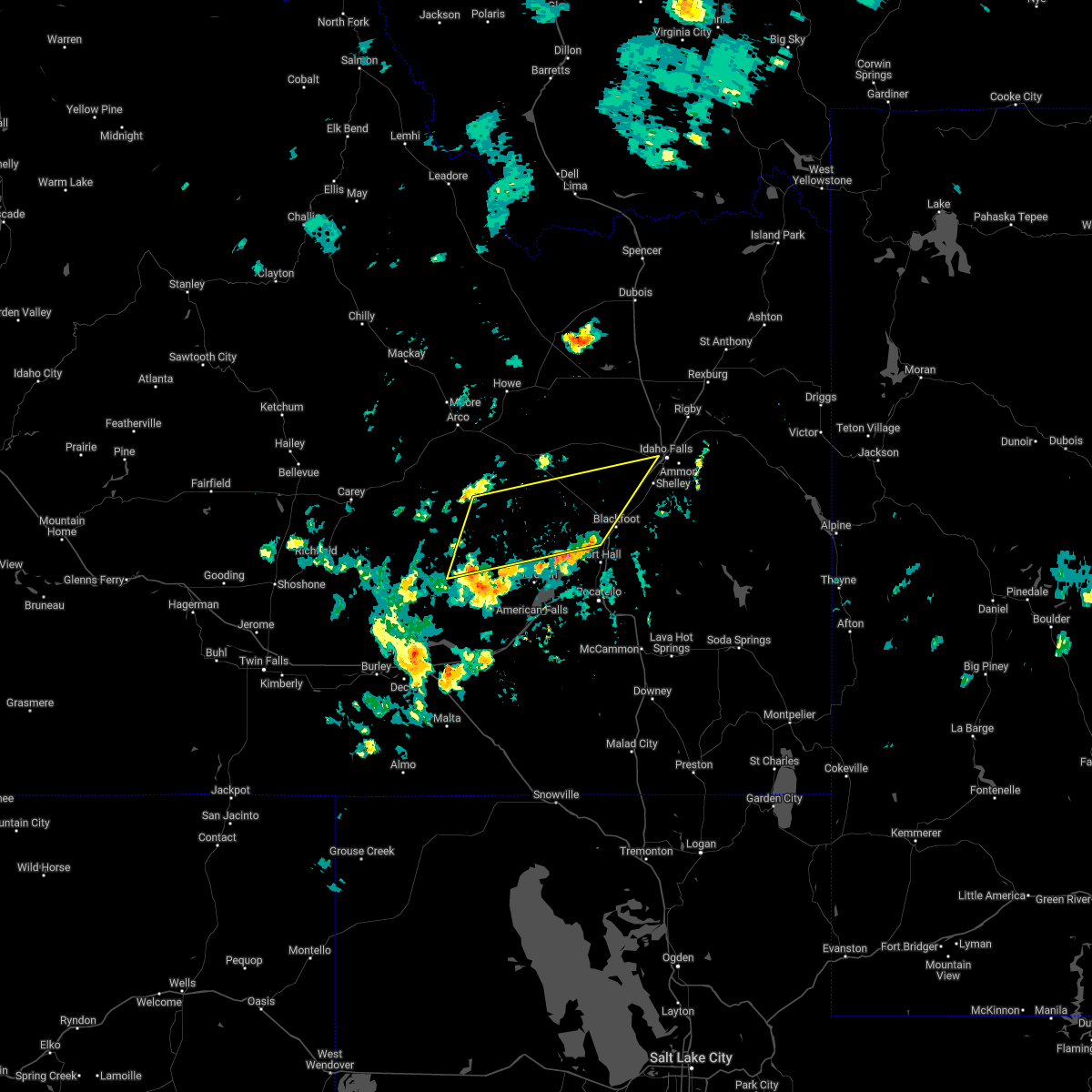
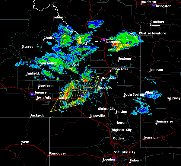
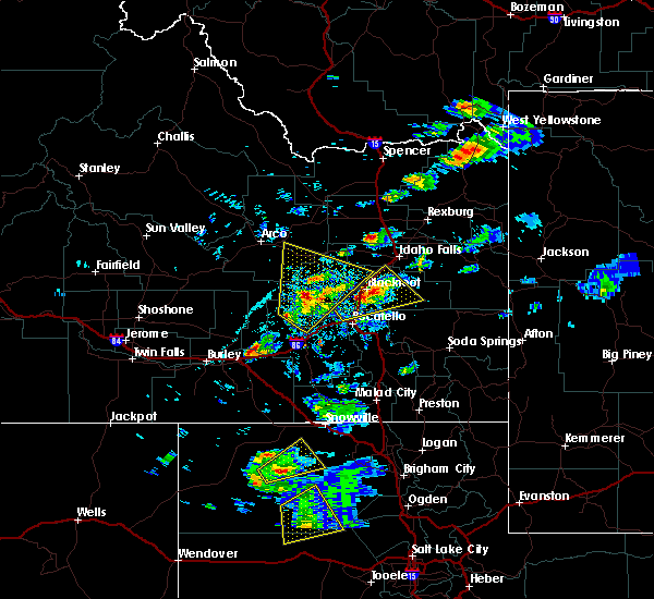
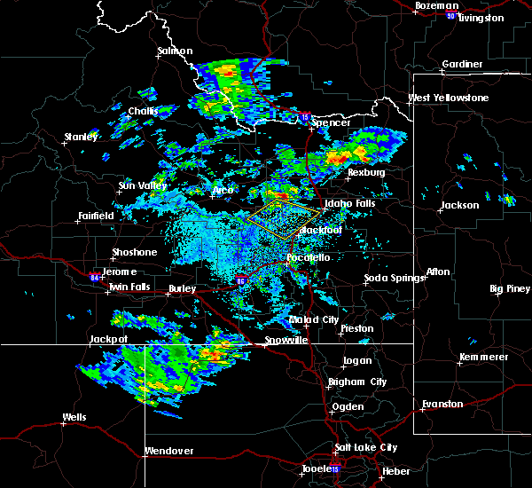
| 5/13/2026 2:27 PM MDT |
 At 225 pm mdt, the leading of severe thunderstorms extend from near howe to coldwater, moving northeast at 60 mph (radar indicated and mesonet observations. multiple gusts of 60-70 mph have been observed). Hazards include 70 mph wind gusts. Expect considerable tree damage. damage is likely to mobile homes, roofs, and outbuildings. Locations impacted include, western pocatello, blackfoot, rupert, american falls, arco, malta, lake walcott, neeley, goshen, american falls reservoir, chubbuck, shelley, aberdeen, paul, firth, declo, minidoka, atomic city, southeast inl, and pingree. At 225 pm mdt, the leading of severe thunderstorms extend from near howe to coldwater, moving northeast at 60 mph (radar indicated and mesonet observations. multiple gusts of 60-70 mph have been observed). Hazards include 70 mph wind gusts. Expect considerable tree damage. damage is likely to mobile homes, roofs, and outbuildings. Locations impacted include, western pocatello, blackfoot, rupert, american falls, arco, malta, lake walcott, neeley, goshen, american falls reservoir, chubbuck, shelley, aberdeen, paul, firth, declo, minidoka, atomic city, southeast inl, and pingree.
|
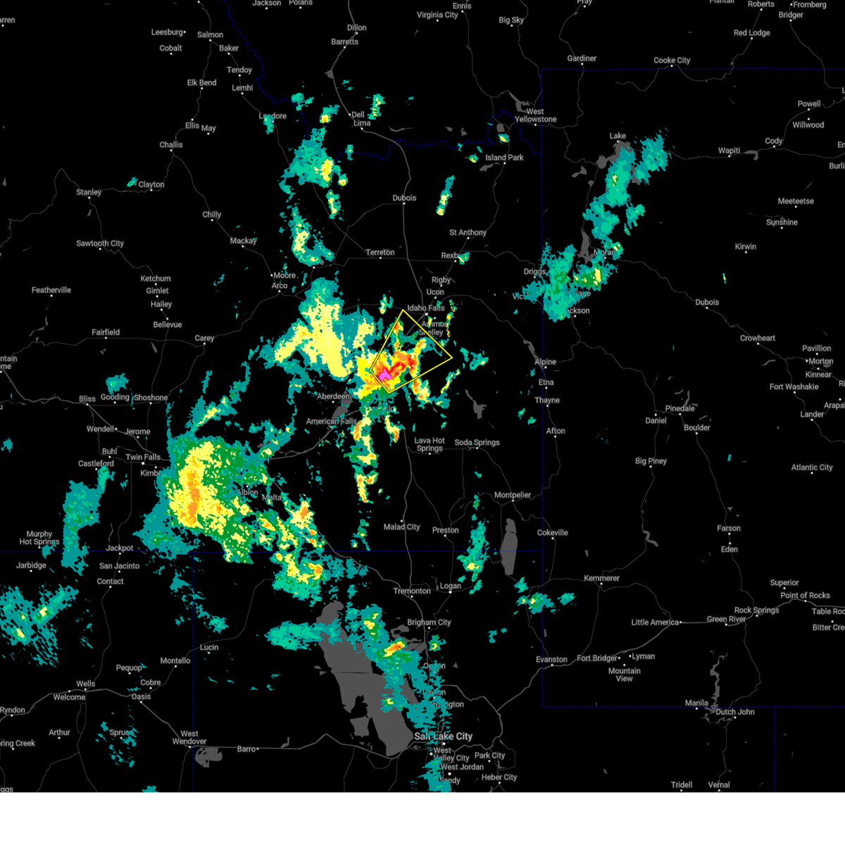
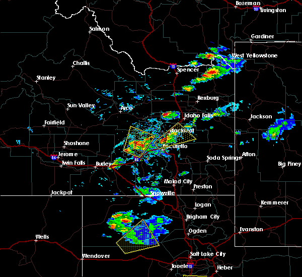
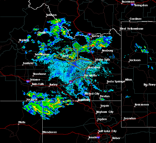
| 5/13/2026 1:46 PM MDT |
 Svrpih the national weather service in pocatello has issued a * severe thunderstorm warning for, southeastern blaine county in central idaho, southwestern jefferson county in southeastern idaho, northwestern bannock county in southeastern idaho, southeastern butte county in southeastern idaho, eastern lincoln county in south central idaho, northern power county in southeastern idaho, western bonneville county in southeastern idaho, bingham county in southeastern idaho, northeastern cassia county in southeastern idaho, minidoka county in south central idaho, * until 245 pm mdt. * at 143 pm mdt, the leading edge of severe thunderstorms extends from near malta to near dietrich, moving northeast at 60 mph (radar indicated and mesonet observations. the mesonet site at minidoka reported gusts to 60 mph). Hazards include 70 mph wind gusts. Expect considerable tree damage. Damage is likely to mobile homes, roofs, and outbuildings. Svrpih the national weather service in pocatello has issued a * severe thunderstorm warning for, southeastern blaine county in central idaho, southwestern jefferson county in southeastern idaho, northwestern bannock county in southeastern idaho, southeastern butte county in southeastern idaho, eastern lincoln county in south central idaho, northern power county in southeastern idaho, western bonneville county in southeastern idaho, bingham county in southeastern idaho, northeastern cassia county in southeastern idaho, minidoka county in south central idaho, * until 245 pm mdt. * at 143 pm mdt, the leading edge of severe thunderstorms extends from near malta to near dietrich, moving northeast at 60 mph (radar indicated and mesonet observations. the mesonet site at minidoka reported gusts to 60 mph). Hazards include 70 mph wind gusts. Expect considerable tree damage. Damage is likely to mobile homes, roofs, and outbuildings.
|
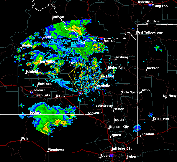
| 4/12/2026 2:57 PM MDT |
 Svrpih the national weather service in pocatello has issued a * severe thunderstorm warning for, southwestern jefferson county in southeastern idaho, northwestern bannock county in southeastern idaho, east central butte county in southeastern idaho, northwestern bonneville county in southeastern idaho, southwestern clark county in southeastern idaho, central bingham county in southeastern idaho, * until 330 pm mdt. * at 256 pm mdt, severe thunderstorm outflow was located along a line extending from near central inl to 8 miles northeast of taber to near fort hall putnam lodge, moving northeast at 55 mph (radar indicated). Hazards include 60 mph wind gusts. expect damage to roofs, siding, and trees Svrpih the national weather service in pocatello has issued a * severe thunderstorm warning for, southwestern jefferson county in southeastern idaho, northwestern bannock county in southeastern idaho, east central butte county in southeastern idaho, northwestern bonneville county in southeastern idaho, southwestern clark county in southeastern idaho, central bingham county in southeastern idaho, * until 330 pm mdt. * at 256 pm mdt, severe thunderstorm outflow was located along a line extending from near central inl to 8 miles northeast of taber to near fort hall putnam lodge, moving northeast at 55 mph (radar indicated). Hazards include 60 mph wind gusts. expect damage to roofs, siding, and trees
|
| 4/12/2026 2:28 PM MDT |
 Svrpih the national weather service in pocatello has issued a * severe thunderstorm warning for, eastern blaine county in central idaho, western caribou county in southeastern idaho, northwestern bannock county in southeastern idaho, northeastern power county in southeastern idaho, southwestern bingham county in southeastern idaho, * until 300 pm mdt. * at 228 pm mdt, severe thunderstorm outflow was located along a line extending from 16 miles southwest of atomic city to american falls reservoir to near fort hall bannock creek lodge, moving east at 50 mph (radar indicated). Hazards include 60 mph wind gusts. expect damage to roofs, siding, and trees Svrpih the national weather service in pocatello has issued a * severe thunderstorm warning for, eastern blaine county in central idaho, western caribou county in southeastern idaho, northwestern bannock county in southeastern idaho, northeastern power county in southeastern idaho, southwestern bingham county in southeastern idaho, * until 300 pm mdt. * at 228 pm mdt, severe thunderstorm outflow was located along a line extending from 16 miles southwest of atomic city to american falls reservoir to near fort hall bannock creek lodge, moving east at 50 mph (radar indicated). Hazards include 60 mph wind gusts. expect damage to roofs, siding, and trees
|
| 12/17/2025 9:52 AM MST |
 Svrpih the national weather service in pocatello has issued a * severe thunderstorm warning for, southeastern blaine county in central idaho, caribou county in southeastern idaho, northeastern oneida county in southeastern idaho, bannock county in southeastern idaho, power county in southeastern idaho, southeastern bonneville county in southeastern idaho, northern franklin county in southeastern idaho, northwestern bear lake county in southeastern idaho, southern bingham county in southeastern idaho, northeastern cassia county in southeastern idaho, * until 1045 am mst. * at 950 am mst, a line of severe thunderstorms was located from near blackfoot to raft river, moving east at 70 mph (radar indicated). Hazards include 80 mph wind gusts. Flying debris will be dangerous to those caught without shelter. mobile homes will be heavily damaged. expect considerable damage to roofs, windows, and vehicles. Extensive tree damage and power outages are likely. Svrpih the national weather service in pocatello has issued a * severe thunderstorm warning for, southeastern blaine county in central idaho, caribou county in southeastern idaho, northeastern oneida county in southeastern idaho, bannock county in southeastern idaho, power county in southeastern idaho, southeastern bonneville county in southeastern idaho, northern franklin county in southeastern idaho, northwestern bear lake county in southeastern idaho, southern bingham county in southeastern idaho, northeastern cassia county in southeastern idaho, * until 1045 am mst. * at 950 am mst, a line of severe thunderstorms was located from near blackfoot to raft river, moving east at 70 mph (radar indicated). Hazards include 80 mph wind gusts. Flying debris will be dangerous to those caught without shelter. mobile homes will be heavily damaged. expect considerable damage to roofs, windows, and vehicles. Extensive tree damage and power outages are likely.
|
| 7/15/2025 7:12 PM MDT |
 The storms which prompted the warning have weakened below severe limits, and have exited the warned area. therefore, the warning will be allowed to expire. however, gusty winds are still possible with these thunderstorms. The storms which prompted the warning have weakened below severe limits, and have exited the warned area. therefore, the warning will be allowed to expire. however, gusty winds are still possible with these thunderstorms.
|
| 7/15/2025 6:25 PM MDT |
 Svrpih the national weather service in pocatello has issued a * severe thunderstorm warning for, southeastern blaine county in central idaho, northwestern caribou county in southeastern idaho, northern bannock county in southeastern idaho, southeastern butte county in southeastern idaho, central power county in southeastern idaho, central bonneville county in southeastern idaho, bingham county in southeastern idaho, * until 715 pm mdt. * at 625 pm mdt, severe thunderstorms were located along a line extending from 8 miles west of aberdeen to fort hall mount putnam, moving northeast at 35 mph (radar indicated). Hazards include 70 mph wind gusts. Expect considerable tree damage. Damage is likely to mobile homes, roofs, and outbuildings. Svrpih the national weather service in pocatello has issued a * severe thunderstorm warning for, southeastern blaine county in central idaho, northwestern caribou county in southeastern idaho, northern bannock county in southeastern idaho, southeastern butte county in southeastern idaho, central power county in southeastern idaho, central bonneville county in southeastern idaho, bingham county in southeastern idaho, * until 715 pm mdt. * at 625 pm mdt, severe thunderstorms were located along a line extending from 8 miles west of aberdeen to fort hall mount putnam, moving northeast at 35 mph (radar indicated). Hazards include 70 mph wind gusts. Expect considerable tree damage. Damage is likely to mobile homes, roofs, and outbuildings.
|
| 5/11/2025 1:14 PM MDT |
 The storm which prompted the warning has weakened below severe limits, and no longer poses an immediate threat to life or property. therefore, the warning will be allowed to expire. however, gusty winds and heavy rain are still possible with these thunderstorms. a severe thunderstorm watch remains in effect until 800 pm mdt for southeastern idaho. The storm which prompted the warning has weakened below severe limits, and no longer poses an immediate threat to life or property. therefore, the warning will be allowed to expire. however, gusty winds and heavy rain are still possible with these thunderstorms. a severe thunderstorm watch remains in effect until 800 pm mdt for southeastern idaho.
|
| 5/11/2025 1:04 PM MDT |
 At 102 pm mdt, a line of severe thunderstorms was located from near springfield to roy moving northeast at 35 mph (trained weather spotters. a gust to 59 mph was reported at connor summit). Hazards include 60 mph wind gusts. Expect damage to roofs, siding, and trees. Locations impacted include, sterling, aberdeen, rose, rockland, mink creek pass, hawkins reservoir, mccammon, american falls, basalt, arbon, shelley, inkom, fort hall bannock creek lodge, pingree, american falls reservoir, pocatello airport, fort hall putnam lodge, fort hall buffalo lodge, pauline, and pocatello. At 102 pm mdt, a line of severe thunderstorms was located from near springfield to roy moving northeast at 35 mph (trained weather spotters. a gust to 59 mph was reported at connor summit). Hazards include 60 mph wind gusts. Expect damage to roofs, siding, and trees. Locations impacted include, sterling, aberdeen, rose, rockland, mink creek pass, hawkins reservoir, mccammon, american falls, basalt, arbon, shelley, inkom, fort hall bannock creek lodge, pingree, american falls reservoir, pocatello airport, fort hall putnam lodge, fort hall buffalo lodge, pauline, and pocatello.
|
| 5/11/2025 12:51 PM MDT |
 At 1249 pm mdt, a line of severe thunderstorms extended from aberdeen to near sweetzer summit, moving northeast at 35 mph (radar indicated and mesonet observations. this storm has a history of producing gusts to near 60 mph). Hazards include 60 mph wind gusts and penny size hail. Expect damage to roofs, siding, and trees. Locations impacted include, sterling, aberdeen, rose, rockland, mink creek pass, sweetzer summit, hawkins reservoir, mccammon, arimo, american falls, basalt, arbon, sublett reservoir, shelley, malad pass, inkom, fort hall bannock creek lodge, pingree, american falls reservoir, and pocatello airport. At 1249 pm mdt, a line of severe thunderstorms extended from aberdeen to near sweetzer summit, moving northeast at 35 mph (radar indicated and mesonet observations. this storm has a history of producing gusts to near 60 mph). Hazards include 60 mph wind gusts and penny size hail. Expect damage to roofs, siding, and trees. Locations impacted include, sterling, aberdeen, rose, rockland, mink creek pass, sweetzer summit, hawkins reservoir, mccammon, arimo, american falls, basalt, arbon, sublett reservoir, shelley, malad pass, inkom, fort hall bannock creek lodge, pingree, american falls reservoir, and pocatello airport.
|
| 5/11/2025 12:51 PM MDT |
 the severe thunderstorm warning has been cancelled and is no longer in effect the severe thunderstorm warning has been cancelled and is no longer in effect
|
| 5/11/2025 12:27 PM MDT |
 Svrpih the national weather service in pocatello has issued a * severe thunderstorm warning for, northwestern caribou county in southeastern idaho, central oneida county in southeastern idaho, bannock county in southeastern idaho, power county in southeastern idaho, central bonneville county in southeastern idaho, central bingham county in southeastern idaho, southeastern cassia county in southeastern idaho, * until 115 pm mdt. * at 1225 pm mdt, a line of severe thunderstorms extended from near city of rocks to near aberdeen, moving northeast at 45 mph (radar indicated and mesonet observations. a gust to 59 mph was reported at connor summit). Hazards include 60 mph wind gusts. expect damage to roofs, siding, and trees Svrpih the national weather service in pocatello has issued a * severe thunderstorm warning for, northwestern caribou county in southeastern idaho, central oneida county in southeastern idaho, bannock county in southeastern idaho, power county in southeastern idaho, central bonneville county in southeastern idaho, central bingham county in southeastern idaho, southeastern cassia county in southeastern idaho, * until 115 pm mdt. * at 1225 pm mdt, a line of severe thunderstorms extended from near city of rocks to near aberdeen, moving northeast at 45 mph (radar indicated and mesonet observations. a gust to 59 mph was reported at connor summit). Hazards include 60 mph wind gusts. expect damage to roofs, siding, and trees
|
| 9/15/2024 10:10 PM MDT |
 Svrpih the national weather service in pocatello has issued a * severe thunderstorm warning for, central bingham county in southeastern idaho, * until 1100 pm mdt. * at 1010 pm mdt, a severe thunderstorm was located over blackfoot, moving northeast at 30 mph (radar indicated). Hazards include 60 mph wind gusts. expect damage to roofs, siding, and trees Svrpih the national weather service in pocatello has issued a * severe thunderstorm warning for, central bingham county in southeastern idaho, * until 1100 pm mdt. * at 1010 pm mdt, a severe thunderstorm was located over blackfoot, moving northeast at 30 mph (radar indicated). Hazards include 60 mph wind gusts. expect damage to roofs, siding, and trees
|
| 8/15/2024 5:13 PM MDT |
 The storms which prompted the warning have weakened below severe limits, and no longer pose an immediate threat to life or property. therefore, the warning will be allowed to expire. however, small hail and gusty winds are still possible with these thunderstorms. The storms which prompted the warning have weakened below severe limits, and no longer pose an immediate threat to life or property. therefore, the warning will be allowed to expire. however, small hail and gusty winds are still possible with these thunderstorms.
|
| 8/15/2024 4:25 PM MDT |
 Svrpih the national weather service in pocatello has issued a * severe thunderstorm warning for, southeastern blaine county in central idaho, northwestern caribou county in southeastern idaho, north central oneida county in southeastern idaho, bannock county in southeastern idaho, southeastern butte county in southeastern idaho, power county in southeastern idaho, west central bonneville county in southeastern idaho, bingham county in southeastern idaho, northeastern cassia county in southeastern idaho, * until 515 pm mdt. * at 423 pm mdt, severe thunderstorms were located along a line extending from 6 miles northwest of springfield to near fort hall mount putnam, moving northeast at 45 mph (radar indicated). Hazards include 60 mph wind gusts and penny size hail. expect damage to roofs, siding, and trees Svrpih the national weather service in pocatello has issued a * severe thunderstorm warning for, southeastern blaine county in central idaho, northwestern caribou county in southeastern idaho, north central oneida county in southeastern idaho, bannock county in southeastern idaho, southeastern butte county in southeastern idaho, power county in southeastern idaho, west central bonneville county in southeastern idaho, bingham county in southeastern idaho, northeastern cassia county in southeastern idaho, * until 515 pm mdt. * at 423 pm mdt, severe thunderstorms were located along a line extending from 6 miles northwest of springfield to near fort hall mount putnam, moving northeast at 45 mph (radar indicated). Hazards include 60 mph wind gusts and penny size hail. expect damage to roofs, siding, and trees
|
| 5/13/2024 5:59 PM MDT |
 At 558 pm mdt, severe thunderstorms were located along a line extending from rockford to chubbuck to 14 miles west of virginia, moving east at 45 mph (radar indicated). Hazards include 60 mph wind gusts. Expect damage to roofs, siding, and trees. Locations impacted include, pocatello, blackfoot, american falls, mccammon, american falls reservoir, chubbuck, aberdeen, inkom, downey, arimo, rockland, rose, fort hall bannock creek lodge, pingree, pocatello airport, fort hall putnam lodge, fort hall buffalo lodge, fort hall eagle lodge, fort hall lincoln creek lodge, and taber. At 558 pm mdt, severe thunderstorms were located along a line extending from rockford to chubbuck to 14 miles west of virginia, moving east at 45 mph (radar indicated). Hazards include 60 mph wind gusts. Expect damage to roofs, siding, and trees. Locations impacted include, pocatello, blackfoot, american falls, mccammon, american falls reservoir, chubbuck, aberdeen, inkom, downey, arimo, rockland, rose, fort hall bannock creek lodge, pingree, pocatello airport, fort hall putnam lodge, fort hall buffalo lodge, fort hall eagle lodge, fort hall lincoln creek lodge, and taber.
|
| 5/13/2024 5:59 PM MDT |
 the severe thunderstorm warning has been cancelled and is no longer in effect the severe thunderstorm warning has been cancelled and is no longer in effect
|
| 5/13/2024 5:19 PM MDT |
 Svrpih the national weather service in pocatello has issued a * severe thunderstorm warning for, southeastern blaine county in central idaho, central oneida county in southeastern idaho, bannock county in southeastern idaho, power county in southeastern idaho, southwestern bingham county in southeastern idaho, * until 615 pm mdt. * at 518 pm mdt, severe thunderstorms were located along a line extending from 13 miles northwest of aberdeen to near neeley to 13 miles south of rockland, moving east at 45 mph (radar indicated). Hazards include 60 mph wind gusts. expect damage to roofs, siding, and trees Svrpih the national weather service in pocatello has issued a * severe thunderstorm warning for, southeastern blaine county in central idaho, central oneida county in southeastern idaho, bannock county in southeastern idaho, power county in southeastern idaho, southwestern bingham county in southeastern idaho, * until 615 pm mdt. * at 518 pm mdt, severe thunderstorms were located along a line extending from 13 miles northwest of aberdeen to near neeley to 13 miles south of rockland, moving east at 45 mph (radar indicated). Hazards include 60 mph wind gusts. expect damage to roofs, siding, and trees
|
| 7/23/2023 6:43 PM MDT |
 At 642 pm mdt, strong outflow winds from thunderstorms were located along a line extending from near taber to 10 miles south of goshen, moving north at 40 mph (radar indicated). Hazards include 60 mph wind gusts. expect damage to roofs, siding, and trees At 642 pm mdt, strong outflow winds from thunderstorms were located along a line extending from near taber to 10 miles south of goshen, moving north at 40 mph (radar indicated). Hazards include 60 mph wind gusts. expect damage to roofs, siding, and trees
|
| 5/23/2023 5:44 PM MDT |
 At 544 pm mdt, a severe thunderstorm was located over blackfoot, moving northeast at 30 mph (radar indicated). Hazards include 60 mph wind gusts and quarter size hail. Hail damage to vehicles is expected. Expect wind damage to roofs, siding, and trees. At 544 pm mdt, a severe thunderstorm was located over blackfoot, moving northeast at 30 mph (radar indicated). Hazards include 60 mph wind gusts and quarter size hail. Hail damage to vehicles is expected. Expect wind damage to roofs, siding, and trees.
|
| 5/23/2023 5:21 PM MDT |
 At 520 pm mdt, a severe thunderstorm was located over fort hall eagle lodge, or 7 miles southwest of blackfoot, moving northeast at 30 mph (radar indicated). Hazards include 60 mph wind gusts and quarter size hail. Hail damage to vehicles is expected. expect wind damage to roofs, siding, and trees. locations impacted include, western pocatello, blackfoot, eastern american falls reservoir, chubbuck, fort hall buffalo lodge, fort hall townsite, rockford, moreland, fort hall eagle lodge, pingree, fort hall putnam lodge and groveland. hail threat, radar indicated max hail size, 1. 00 in wind threat, radar indicated max wind gust, 60 mph. At 520 pm mdt, a severe thunderstorm was located over fort hall eagle lodge, or 7 miles southwest of blackfoot, moving northeast at 30 mph (radar indicated). Hazards include 60 mph wind gusts and quarter size hail. Hail damage to vehicles is expected. expect wind damage to roofs, siding, and trees. locations impacted include, western pocatello, blackfoot, eastern american falls reservoir, chubbuck, fort hall buffalo lodge, fort hall townsite, rockford, moreland, fort hall eagle lodge, pingree, fort hall putnam lodge and groveland. hail threat, radar indicated max hail size, 1. 00 in wind threat, radar indicated max wind gust, 60 mph.
|
| 5/23/2023 4:56 PM MDT |
 At 456 pm mdt, a severe thunderstorm was located over northeastern american falls reservoir, moving northeast at 30 mph (radar indicated). Hazards include 60 mph wind gusts and nickel size hail. expect damage to roofs, siding, and trees At 456 pm mdt, a severe thunderstorm was located over northeastern american falls reservoir, moving northeast at 30 mph (radar indicated). Hazards include 60 mph wind gusts and nickel size hail. expect damage to roofs, siding, and trees
|
| 7/13/2022 4:15 PM MDT |
 At 415 pm mdt, a severe thunderstorm was located over fort hall eagle lodge, or 8 miles southwest of blackfoot, moving northeast at 30 mph (radar indicated). Hazards include 60 mph wind gusts. expect damage to roofs, siding, and trees At 415 pm mdt, a severe thunderstorm was located over fort hall eagle lodge, or 8 miles southwest of blackfoot, moving northeast at 30 mph (radar indicated). Hazards include 60 mph wind gusts. expect damage to roofs, siding, and trees
|
| 7/2/2022 5:19 PM MDT |
 At 519 pm mdt, severe thunderstorms were located along a line extending from 7 miles southeast of southeast inl to 7 miles west of shelley to near fort hall lincoln creek lodge, moving northeast at 30 mph (radar indicated). Hazards include 60 mph wind gusts and penny size hail. Expect damage to roofs, siding, and trees. locations impacted include, idaho falls, blackfoot, rigby, ririe reservoir, lorenzo, goshen, ammon, shelley, iona, ucon, menan, ririe, roberts, firth, lewisville, atomic city, rose, fort hall eagle lodge, fort hall lincoln creek lodge and taber. hail threat, radar indicated max hail size, 0. 75 in wind threat, radar indicated max wind gust, 60 mph. At 519 pm mdt, severe thunderstorms were located along a line extending from 7 miles southeast of southeast inl to 7 miles west of shelley to near fort hall lincoln creek lodge, moving northeast at 30 mph (radar indicated). Hazards include 60 mph wind gusts and penny size hail. Expect damage to roofs, siding, and trees. locations impacted include, idaho falls, blackfoot, rigby, ririe reservoir, lorenzo, goshen, ammon, shelley, iona, ucon, menan, ririe, roberts, firth, lewisville, atomic city, rose, fort hall eagle lodge, fort hall lincoln creek lodge and taber. hail threat, radar indicated max hail size, 0. 75 in wind threat, radar indicated max wind gust, 60 mph.
|
| 7/2/2022 4:54 PM MDT |
 At 453 pm mdt, severe thunderstorms were located along a line extending from near atomic city to 6 miles north of moreland to fort hall eagle lodge, moving northeast at 30 mph (radar indicated). Hazards include 60 mph wind gusts and penny size hail. expect damage to roofs, siding, and trees At 453 pm mdt, severe thunderstorms were located along a line extending from near atomic city to 6 miles north of moreland to fort hall eagle lodge, moving northeast at 30 mph (radar indicated). Hazards include 60 mph wind gusts and penny size hail. expect damage to roofs, siding, and trees
|
| 7/2/2022 4:27 PM MDT |
 At 427 pm mdt, severe thunderstorms were located along a line extending from near rose to 21 miles northwest of aberdeen, moving east at 30 mph (radar indicated). Hazards include 60 mph wind gusts. expect damage to roofs, siding, and trees At 427 pm mdt, severe thunderstorms were located along a line extending from near rose to 21 miles northwest of aberdeen, moving east at 30 mph (radar indicated). Hazards include 60 mph wind gusts. expect damage to roofs, siding, and trees
|
| 7/2/2022 4:16 PM MDT |
 At 416 pm mdt, severe thunderstorms were located along a line extending from near moreland to 21 miles northwest of aberdeen, moving northeast at 30 mph (radar indicated). Hazards include 60 mph wind gusts. Expect damage to roofs, siding, and trees. locations impacted include, blackfoot, springfield, rockford, moreland, rose, pingree, taber, groveland, coxs well airport and bear trap airport. hail threat, radar indicated max hail size, <. 75 in wind threat, radar indicated max wind gust, 60 mph. At 416 pm mdt, severe thunderstorms were located along a line extending from near moreland to 21 miles northwest of aberdeen, moving northeast at 30 mph (radar indicated). Hazards include 60 mph wind gusts. Expect damage to roofs, siding, and trees. locations impacted include, blackfoot, springfield, rockford, moreland, rose, pingree, taber, groveland, coxs well airport and bear trap airport. hail threat, radar indicated max hail size, <. 75 in wind threat, radar indicated max wind gust, 60 mph.
|
| 7/2/2022 4:00 PM MDT |
 At 400 pm mdt, severe thunderstorms were located along a line extending from near rockford to 21 miles west of aberdeen, moving northeast at 30 mph (radar indicated). Hazards include 60 mph wind gusts. expect damage to roofs, siding, and trees At 400 pm mdt, severe thunderstorms were located along a line extending from near rockford to 21 miles west of aberdeen, moving northeast at 30 mph (radar indicated). Hazards include 60 mph wind gusts. expect damage to roofs, siding, and trees
|
| 5/2/2022 6:18 PM MDT |
 At 617 pm mdt, severe thunderstorms were located along a line extending from 7 miles southwest of northwest inl to near rockford to near fort hall bannock peak, moving northeast at 40 mph (radar indicated). Hazards include 60 mph wind gusts. Expect damage to roofs, siding, and trees. locations impacted include, idaho falls, pocatello, blackfoot, american falls, arco, american falls reservoir, terreton, goshen, chubbuck, shelley, aberdeen, roberts, firth, mud lake, atomic city, rose, southeast inl, southwest inl, fort hall bannock creek lodge and pingree. hail threat, radar indicated max hail size, <. 75 in wind threat, radar indicated max wind gust, 60 mph. At 617 pm mdt, severe thunderstorms were located along a line extending from 7 miles southwest of northwest inl to near rockford to near fort hall bannock peak, moving northeast at 40 mph (radar indicated). Hazards include 60 mph wind gusts. Expect damage to roofs, siding, and trees. locations impacted include, idaho falls, pocatello, blackfoot, american falls, arco, american falls reservoir, terreton, goshen, chubbuck, shelley, aberdeen, roberts, firth, mud lake, atomic city, rose, southeast inl, southwest inl, fort hall bannock creek lodge and pingree. hail threat, radar indicated max hail size, <. 75 in wind threat, radar indicated max wind gust, 60 mph.
|
| 5/2/2022 5:59 PM MDT |
 At 559 pm mdt, severe thunderstorms were located along a line extending from 12 miles southwest of northwest inl to near pingree to near fort hall bannock peak, moving east at 40 mph (radar indicated). Hazards include 70 mph wind gusts and penny size hail. Expect considerable tree damage. Damage is likely to mobile homes, roofs, and outbuildings. At 559 pm mdt, severe thunderstorms were located along a line extending from 12 miles southwest of northwest inl to near pingree to near fort hall bannock peak, moving east at 40 mph (radar indicated). Hazards include 70 mph wind gusts and penny size hail. Expect considerable tree damage. Damage is likely to mobile homes, roofs, and outbuildings.
|
| 5/2/2022 5:48 PM MDT |
 At 547 pm mdt, severe thunderstorms were located along a line extending from near darlington to 7 miles northwest of central inl to 9 miles northwest of springfield to rockland, moving east at 40 mph (radar indicated). Hazards include 70 mph wind gusts and penny size hail. Expect considerable tree damage. damage is likely to mobile homes, roofs, and outbuildings. locations impacted include, pocatello, american falls, arco, mackay, lake walcott, american falls reservoir, grouse, neeley, chubbuck, aberdeen, rockland, minidoka, atomic city, darlington, southeast inl, southwest inl, fort hall bannock creek lodge, pingree, pocatello airport and cold water rest area. thunderstorm damage threat, considerable hail threat, radar indicated max hail size, 0. 75 in wind threat, observed max wind gust, 70 mph. At 547 pm mdt, severe thunderstorms were located along a line extending from near darlington to 7 miles northwest of central inl to 9 miles northwest of springfield to rockland, moving east at 40 mph (radar indicated). Hazards include 70 mph wind gusts and penny size hail. Expect considerable tree damage. damage is likely to mobile homes, roofs, and outbuildings. locations impacted include, pocatello, american falls, arco, mackay, lake walcott, american falls reservoir, grouse, neeley, chubbuck, aberdeen, rockland, minidoka, atomic city, darlington, southeast inl, southwest inl, fort hall bannock creek lodge, pingree, pocatello airport and cold water rest area. thunderstorm damage threat, considerable hail threat, radar indicated max hail size, 0. 75 in wind threat, observed max wind gust, 70 mph.
|
| 5/2/2022 5:33 PM MDT |
 At 533 pm mdt, severe thunderstorms were located along a line extending from near darlington to 7 miles northwest of southwest inl to 13 miles west of springfield to near rockland, moving east at 40 mph (radar indicated). Hazards include 70 mph wind gusts and penny size hail. Expect considerable tree damage. Damage is likely to mobile homes, roofs, and outbuildings. At 533 pm mdt, severe thunderstorms were located along a line extending from near darlington to 7 miles northwest of southwest inl to 13 miles west of springfield to near rockland, moving east at 40 mph (radar indicated). Hazards include 70 mph wind gusts and penny size hail. Expect considerable tree damage. Damage is likely to mobile homes, roofs, and outbuildings.
|
| 8/5/2021 6:56 PM MDT |
 At 653 pm mdt, severe thunderstorms were located along a line extending from 7 miles northeast of darlington to near southeast idaho national laboratory to 6 miles southeast of fort hall lincoln creek lodge, moving northeast at 40 mph (surface weather stations). Hazards include 55 to 65 mph wind gusts. multiple wind gusts of 55 to 65 mph have been recorded from arco across the idaho national laboratory. Expect damage to roofs, siding, and trees. Locations impacted include, idaho falls, blackfoot, terreton, goshen, ammon, shelley, firth, mud lake, atomic city, rose, southeast inl, southwest inl, fort hall lincoln creek lodge, central inl, taber, northwest inl, moreland, bone, groveland and basalt. At 653 pm mdt, severe thunderstorms were located along a line extending from 7 miles northeast of darlington to near southeast idaho national laboratory to 6 miles southeast of fort hall lincoln creek lodge, moving northeast at 40 mph (surface weather stations). Hazards include 55 to 65 mph wind gusts. multiple wind gusts of 55 to 65 mph have been recorded from arco across the idaho national laboratory. Expect damage to roofs, siding, and trees. Locations impacted include, idaho falls, blackfoot, terreton, goshen, ammon, shelley, firth, mud lake, atomic city, rose, southeast inl, southwest inl, fort hall lincoln creek lodge, central inl, taber, northwest inl, moreland, bone, groveland and basalt.
|
| 8/5/2021 6:38 PM MDT |
 At 637 pm mdt, severe thunderstorms were located along a line extending from near darlington to near southeast inl to fort hall putnam lodge, moving northeast at 30 mph (radar indicated). Hazards include 60 mph wind gusts. multiple wind gusts of 55 to 65 mph have been recorded along this line. expect damage to roofs, siding, and trees At 637 pm mdt, severe thunderstorms were located along a line extending from near darlington to near southeast inl to fort hall putnam lodge, moving northeast at 30 mph (radar indicated). Hazards include 60 mph wind gusts. multiple wind gusts of 55 to 65 mph have been recorded along this line. expect damage to roofs, siding, and trees
|
| 8/2/2021 7:14 PM MDT |
 At 711 pm mdt, a severe thunderstorm was located near portneuf gap, or 9 miles southeast of pocatello, moving southeast at 25 mph (radar indicated up to 60 mph. recorded observation of 49 mph). Hazards include gusts of 45 mph with gusts up to 60 mph wind. Expect damage to roofs, siding, and trees. Locations impacted include, pocatello, blackfoot, american falls, american falls reservoir, chubbuck, firth, fort hall buffalo lodge, rose, fort hall eagle lodge, fort hall lincoln creek lodge, fort hall townsite, fort hall bannock creek lodge, pocatello airport, fort hall putnam lodge, groveland, wapello and trail creek campground. At 711 pm mdt, a severe thunderstorm was located near portneuf gap, or 9 miles southeast of pocatello, moving southeast at 25 mph (radar indicated up to 60 mph. recorded observation of 49 mph). Hazards include gusts of 45 mph with gusts up to 60 mph wind. Expect damage to roofs, siding, and trees. Locations impacted include, pocatello, blackfoot, american falls, american falls reservoir, chubbuck, firth, fort hall buffalo lodge, rose, fort hall eagle lodge, fort hall lincoln creek lodge, fort hall townsite, fort hall bannock creek lodge, pocatello airport, fort hall putnam lodge, groveland, wapello and trail creek campground.
|
| 8/2/2021 6:54 PM MDT |
 At 654 pm mdt, a severe thunderstorm was located over pocatello airport, or near pocatello, moving southeast at 55 mph (radar indicated). Hazards include 60 mph wind gusts. expect damage to roofs, siding, and trees At 654 pm mdt, a severe thunderstorm was located over pocatello airport, or near pocatello, moving southeast at 55 mph (radar indicated). Hazards include 60 mph wind gusts. expect damage to roofs, siding, and trees
|
| 7/17/2021 4:03 PM MDT |
 At 402 pm mdt, a severe thunderstorm was located near springfield, or 9 miles northeast of american falls reservoir, moving north at 15 mph (radar indicated). Hazards include 60 mph wind gusts. Expect damage to roofs, siding, and trees. Locations impacted include, western pocatello, american falls, american falls reservoir, chubbuck, aberdeen, fort hall buffalo lodge, fort hall eagle lodge, fort hall townsite, springfield, rockford, moreland, pingree, pocatello airport and sterling. At 402 pm mdt, a severe thunderstorm was located near springfield, or 9 miles northeast of american falls reservoir, moving north at 15 mph (radar indicated). Hazards include 60 mph wind gusts. Expect damage to roofs, siding, and trees. Locations impacted include, western pocatello, american falls, american falls reservoir, chubbuck, aberdeen, fort hall buffalo lodge, fort hall eagle lodge, fort hall townsite, springfield, rockford, moreland, pingree, pocatello airport and sterling.
|
| 7/17/2021 3:42 PM MDT |
 At 341 pm mdt, a severe thunderstorm was located over northeastern american falls reservoir, moving north at 25 mph (radar indicated). Hazards include 60 mph wind gusts. expect damage to roofs, siding, and trees At 341 pm mdt, a severe thunderstorm was located over northeastern american falls reservoir, moving north at 25 mph (radar indicated). Hazards include 60 mph wind gusts. expect damage to roofs, siding, and trees
|
| 7/5/2021 6:08 PM MDT |
 The severe thunderstorm warning for west central bingham county will expire at 615 pm mdt, the storm which prompted the warning has weakened below severe limits, and no longer poses an immediate threat to life or property. therefore, the warning will be allowed to expire. however gusty winds of 35 to 45 mph are still possible with this thunderstorm. The severe thunderstorm warning for west central bingham county will expire at 615 pm mdt, the storm which prompted the warning has weakened below severe limits, and no longer poses an immediate threat to life or property. therefore, the warning will be allowed to expire. however gusty winds of 35 to 45 mph are still possible with this thunderstorm.
|
| 7/5/2021 5:57 PM MDT |
 At 557 pm mdt, a severe thunderstorm was located over moreland, or near blackfoot, moving east at 25 mph (radar indicated). Hazards include 60 mph wind gusts and pea size hail. Expect damage to roofs, siding, and trees. Locations impacted include, blackfoot, rockford, moreland, rose, fort hall eagle lodge, pingree and groveland. At 557 pm mdt, a severe thunderstorm was located over moreland, or near blackfoot, moving east at 25 mph (radar indicated). Hazards include 60 mph wind gusts and pea size hail. Expect damage to roofs, siding, and trees. Locations impacted include, blackfoot, rockford, moreland, rose, fort hall eagle lodge, pingree and groveland.
|
| 7/5/2021 5:40 PM MDT |
 At 539 pm mdt, a severe thunderstorm was located near rockford, or 12 miles west of blackfoot, moving east at 25 mph (radar and weather station indicated. a wind gust to 60 mph was measured in taber). Hazards include 60 mph wind gusts and penny size hail. expect damage to roofs, siding, and trees At 539 pm mdt, a severe thunderstorm was located near rockford, or 12 miles west of blackfoot, moving east at 25 mph (radar and weather station indicated. a wind gust to 60 mph was measured in taber). Hazards include 60 mph wind gusts and penny size hail. expect damage to roofs, siding, and trees
|
| 5/16/2021 6:54 PM MDT |
 At 652 pm mdt, very strong winds associated with thunderstorm outflows were located along a line extending from near chubbuck to 10 miles southwest of burley, moving north at 35 mph (trained weather spotters). Hazards include 60 mph wind gusts. Expect damage to roofs, siding, and trees. Blowing dust may suddenly reduce visibility to near zero. At 652 pm mdt, very strong winds associated with thunderstorm outflows were located along a line extending from near chubbuck to 10 miles southwest of burley, moving north at 35 mph (trained weather spotters). Hazards include 60 mph wind gusts. Expect damage to roofs, siding, and trees. Blowing dust may suddenly reduce visibility to near zero.
|
| 8/25/2020 5:33 PM MDT |
 At 532 pm mdt, severe thunderstorms were located along a line extending from near northwest inl to 10 miles southeast of southeast inl to near pingree, moving east at 50 mph (mesonet observations. these storms have a history of producing wind gusts up to 70 mph!). Hazards include 70 mph wind gusts. Expect considerable tree damage. damage is likely to mobile homes, roofs, and outbuildings. Locations impacted include, idaho falls, blackfoot, terreton, goshen, shelley, roberts, firth, mud lake, hamer, atomic city, rose, southeast inl, southwest inl, fort hall lincoln creek lodge, central inl, taber, northwest inl, moreland, rockford and groveland. At 532 pm mdt, severe thunderstorms were located along a line extending from near northwest inl to 10 miles southeast of southeast inl to near pingree, moving east at 50 mph (mesonet observations. these storms have a history of producing wind gusts up to 70 mph!). Hazards include 70 mph wind gusts. Expect considerable tree damage. damage is likely to mobile homes, roofs, and outbuildings. Locations impacted include, idaho falls, blackfoot, terreton, goshen, shelley, roberts, firth, mud lake, hamer, atomic city, rose, southeast inl, southwest inl, fort hall lincoln creek lodge, central inl, taber, northwest inl, moreland, rockford and groveland.
|
| 8/25/2020 5:22 PM MDT |
 At 521 pm mdt, severe thunderstorms were located along a line extending from near northwest inl to 6 miles east of atomic city to 6 miles west of springfield, moving east at 45 mph (mesonet observations and radar. these storms have a history of producing winds near 60 mph). Hazards include 60 mph wind gusts. Expect damage to roofs, siding, and trees. Locations impacted include, idaho falls, blackfoot, arco, terreton, goshen, shelley, roberts, firth, mud lake, hamer, atomic city, rose, inl complex, pingree, fort hall eagle lodge, fort hall lincoln creek lodge, and taber. At 521 pm mdt, severe thunderstorms were located along a line extending from near northwest inl to 6 miles east of atomic city to 6 miles west of springfield, moving east at 45 mph (mesonet observations and radar. these storms have a history of producing winds near 60 mph). Hazards include 60 mph wind gusts. Expect damage to roofs, siding, and trees. Locations impacted include, idaho falls, blackfoot, arco, terreton, goshen, shelley, roberts, firth, mud lake, hamer, atomic city, rose, inl complex, pingree, fort hall eagle lodge, fort hall lincoln creek lodge, and taber.
|
| 8/25/2020 5:09 PM MDT |
 At 508 pm mdt, severe thunderstorms were located along a line extending from 10 miles west of northwest inl to near atomic city to 14 miles northwest of aberdeen, moving east at 45 mph (radar indicated). Hazards include 60 mph wind gusts. expect damage to roofs, siding, and trees At 508 pm mdt, severe thunderstorms were located along a line extending from 10 miles west of northwest inl to near atomic city to 14 miles northwest of aberdeen, moving east at 45 mph (radar indicated). Hazards include 60 mph wind gusts. expect damage to roofs, siding, and trees
|
| 8/25/2020 4:57 PM MDT |
 The severe thunderstorm warning for northwestern bannock, northern power and southwestern bingham counties will expire at 500 pm mdt, the storms which prompted the warning have weakened below severe limits, and no longer pose an immediate threat to life or property. therefore, the warning will be allowed to expire. however gusty winds are still possible with these thunderstorms. the line of thunderstorms can still re-strengthen and will bear watching as it progresses to the northeast. The severe thunderstorm warning for northwestern bannock, northern power and southwestern bingham counties will expire at 500 pm mdt, the storms which prompted the warning have weakened below severe limits, and no longer pose an immediate threat to life or property. therefore, the warning will be allowed to expire. however gusty winds are still possible with these thunderstorms. the line of thunderstorms can still re-strengthen and will bear watching as it progresses to the northeast.
|
| 8/25/2020 4:52 PM MDT |
 At 450 pm mdt, severe thunderstorms were located along a line extending from 6 miles northeast of arco to 15 miles southwest of southwest inl to 22 miles west of aberdeen, moving east at 55 mph (radar indicated. at 430 pm, 58 mph winds were reported at tom cat summit and craters of the moon). Hazards include 60 mph wind gusts. Expect damage to roofs, siding, and trees. Locations impacted include, arco, atomic city, craters of the moon, central inl, taber, southeast inl, southwest inl, springfield, rockford, moreland, pingree, butte city, east butte, big southern butte, coxs well airport and sterling. At 450 pm mdt, severe thunderstorms were located along a line extending from 6 miles northeast of arco to 15 miles southwest of southwest inl to 22 miles west of aberdeen, moving east at 55 mph (radar indicated. at 430 pm, 58 mph winds were reported at tom cat summit and craters of the moon). Hazards include 60 mph wind gusts. Expect damage to roofs, siding, and trees. Locations impacted include, arco, atomic city, craters of the moon, central inl, taber, southeast inl, southwest inl, springfield, rockford, moreland, pingree, butte city, east butte, big southern butte, coxs well airport and sterling.
|
| 8/25/2020 4:37 PM MDT |
 At 436 pm mdt, severe thunderstorms were located along a line extending from 7 miles east of grouse to 10 miles southeast of craters of the moon to 20 miles north of minidoka, moving east at 55 mph (radar indicated). Hazards include 60 mph wind gusts. expect damage to roofs, siding, and trees At 436 pm mdt, severe thunderstorms were located along a line extending from 7 miles east of grouse to 10 miles southeast of craters of the moon to 20 miles north of minidoka, moving east at 55 mph (radar indicated). Hazards include 60 mph wind gusts. expect damage to roofs, siding, and trees
|
| 8/25/2020 4:37 PM MDT |
 At 437 pm mdt, severe thunderstorms were located along a line extending from 9 miles northwest of aberdeen to near american falls reservoir, moving northeast at 45 mph (radar indicated). Hazards include 60 mph wind gusts. expect damage to roofs, siding, and trees At 437 pm mdt, severe thunderstorms were located along a line extending from 9 miles northwest of aberdeen to near american falls reservoir, moving northeast at 45 mph (radar indicated). Hazards include 60 mph wind gusts. expect damage to roofs, siding, and trees
|
| 5/30/2020 7:38 PM MDT |
 At 738 pm mdt, a severe thunderstorm was located near fort hall bannock creek lodge, or 9 miles southwest of pocatello, moving north at 40 mph (radar indicated). Hazards include 60 mph wind gusts. expect damage to roofs, siding, and trees At 738 pm mdt, a severe thunderstorm was located near fort hall bannock creek lodge, or 9 miles southwest of pocatello, moving north at 40 mph (radar indicated). Hazards include 60 mph wind gusts. expect damage to roofs, siding, and trees
|
| 4/30/2020 5:57 PM MDT |
 The severe thunderstorm warning for east central blaine, northwestern bannock, northwestern power and southwestern bingham counties will expire at 600 pm mdt, the storm which prompted the warning has moved out of the area. therefore, the warning will be allowed to expire. however gusty winds are still possible with this thunderstorm and other thunderstorms in the region. The severe thunderstorm warning for east central blaine, northwestern bannock, northwestern power and southwestern bingham counties will expire at 600 pm mdt, the storm which prompted the warning has moved out of the area. therefore, the warning will be allowed to expire. however gusty winds are still possible with this thunderstorm and other thunderstorms in the region.
|
| 4/30/2020 5:55 PM MDT |
 At 554 pm mdt, a severe thunderstorm was located over rockford, or 11 miles west of blackfoot, moving east at 50 mph (radar indicated). Hazards include 60 mph wind gusts. expect damage to roofs, siding, and trees At 554 pm mdt, a severe thunderstorm was located over rockford, or 11 miles west of blackfoot, moving east at 50 mph (radar indicated). Hazards include 60 mph wind gusts. expect damage to roofs, siding, and trees
|
| 4/30/2020 5:40 PM MDT |
 At 540 pm mdt, a severe thunderstorm was located 7 miles northwest of springfield, or 16 miles north of american falls reservoir, moving east at 50 mph (radar indicated). Hazards include 60 mph wind gusts. Expect damage to roofs, siding, and trees. Locations impacted include, eastern american falls reservoir, moreland, springfield, pingree, rockford and sterling. At 540 pm mdt, a severe thunderstorm was located 7 miles northwest of springfield, or 16 miles north of american falls reservoir, moving east at 50 mph (radar indicated). Hazards include 60 mph wind gusts. Expect damage to roofs, siding, and trees. Locations impacted include, eastern american falls reservoir, moreland, springfield, pingree, rockford and sterling.
|
| 4/30/2020 5:17 PM MDT |
 At 516 pm mdt, a severe thunderstorm was located 19 miles northwest of aberdeen, or 25 miles northwest of american falls reservoir, moving east at 50 mph (radar indicated). Hazards include 60 mph wind gusts. expect damage to roofs, siding, and trees At 516 pm mdt, a severe thunderstorm was located 19 miles northwest of aberdeen, or 25 miles northwest of american falls reservoir, moving east at 50 mph (radar indicated). Hazards include 60 mph wind gusts. expect damage to roofs, siding, and trees
|
| 6/6/2019 7:53 PM MDT |
 At 752 pm mdt, severe thunderstorms were located along a line extending from taber to near rose to fort hall putnam lodge, moving northeast at 35 mph (winds were radar indicated. dime size hail was reported in moreland). Hazards include 60 mph wind gusts. hail up to dime size. expect damage to roofs, siding, and trees At 752 pm mdt, severe thunderstorms were located along a line extending from taber to near rose to fort hall putnam lodge, moving northeast at 35 mph (winds were radar indicated. dime size hail was reported in moreland). Hazards include 60 mph wind gusts. hail up to dime size. expect damage to roofs, siding, and trees
|
| 6/6/2019 7:48 PM MDT |
 At 747 pm mdt, severe thunderstorms were located along a line extending from near taber to near fort hall eagle lodge to near portneuf gap, moving northeast at 40 mph (radar indicated). Hazards include 60 mph wind gusts. Expect damage to roofs, siding, and trees. Locations impacted include, pocatello, blackfoot, american falls reservoir, chubbuck, aberdeen, firth, rose, fort hall bannock creek lodge, pingree, pocatello airport, fort hall putnam lodge, fort hall buffalo lodge, fort hall eagle lodge, fort hall lincoln creek lodge, taber, portneuf gap, fort hall townsite, springfield, rockford and moreland. At 747 pm mdt, severe thunderstorms were located along a line extending from near taber to near fort hall eagle lodge to near portneuf gap, moving northeast at 40 mph (radar indicated). Hazards include 60 mph wind gusts. Expect damage to roofs, siding, and trees. Locations impacted include, pocatello, blackfoot, american falls reservoir, chubbuck, aberdeen, firth, rose, fort hall bannock creek lodge, pingree, pocatello airport, fort hall putnam lodge, fort hall buffalo lodge, fort hall eagle lodge, fort hall lincoln creek lodge, taber, portneuf gap, fort hall townsite, springfield, rockford and moreland.
|
| 6/6/2019 7:40 PM MDT |
 At 738 pm mdt, severe thunderstorms were located along a line extending from 10 miles southwest of taber to near fort hall buffalo lodge to 6 miles west of portneuf gap, moving northeast at 30 mph (radar indicated. winds of 52 mph were reported at the pocatello regional airport). Hazards include 60 mph wind gusts. Expect damage to roofs, siding, and trees. Locations impacted include, pocatello, blackfoot, american falls reservoir, chubbuck, aberdeen, firth, rose, fort hall bannock creek lodge, pingree, pocatello airport, fort hall putnam lodge, fort hall buffalo lodge, fort hall eagle lodge, fort hall lincoln creek lodge, taber, portneuf gap, fort hall townsite, springfield, rockford and moreland. At 738 pm mdt, severe thunderstorms were located along a line extending from 10 miles southwest of taber to near fort hall buffalo lodge to 6 miles west of portneuf gap, moving northeast at 30 mph (radar indicated. winds of 52 mph were reported at the pocatello regional airport). Hazards include 60 mph wind gusts. Expect damage to roofs, siding, and trees. Locations impacted include, pocatello, blackfoot, american falls reservoir, chubbuck, aberdeen, firth, rose, fort hall bannock creek lodge, pingree, pocatello airport, fort hall putnam lodge, fort hall buffalo lodge, fort hall eagle lodge, fort hall lincoln creek lodge, taber, portneuf gap, fort hall townsite, springfield, rockford and moreland.
|
| 6/6/2019 7:22 PM MDT |
 At 721 pm mdt, severe thunderstorms were located along a line extending from 11 miles northwest of aberdeen to american falls reservoir to near fort hall bannock peak, moving northeast at 45 mph (radar indicated). Hazards include 60 mph wind gusts. expect damage to roofs, siding, and trees At 721 pm mdt, severe thunderstorms were located along a line extending from 11 miles northwest of aberdeen to american falls reservoir to near fort hall bannock peak, moving northeast at 45 mph (radar indicated). Hazards include 60 mph wind gusts. expect damage to roofs, siding, and trees
|
| 6/6/2019 4:40 PM MDT |
 The severe thunderstorm warning for north central bannock and central bingham counties will expire at 445 pm mdt, the storm which prompted the warning has weakened below severe limits, and no longer poses an immediate threat to life or property. therefore, the warning will be allowed to expire. a severe thunderstorm watch remains in effect until 1100 pm mdt for southeastern idaho. The severe thunderstorm warning for north central bannock and central bingham counties will expire at 445 pm mdt, the storm which prompted the warning has weakened below severe limits, and no longer poses an immediate threat to life or property. therefore, the warning will be allowed to expire. a severe thunderstorm watch remains in effect until 1100 pm mdt for southeastern idaho.
|
| 6/6/2019 4:11 PM MDT |
 At 410 pm mdt, a severe thunderstorm was located 8 miles northwest of springfield or 16 miles north of american falls reservoir, moving northeast at 40 mph. other storms near taber and west of aberdeen may become severe at any time (radar indicated). Hazards include 60 mph wind gusts and quarter size hail. Hail damage to vehicles is expected. expect wind damage to roofs, siding, and trees. Locations impacted include, western american falls reservoir, aberdeen, atomic city, springfield, rockford, moreland, pingree, central inl, taber, southwest inl, sterling and big southern butte. At 410 pm mdt, a severe thunderstorm was located 8 miles northwest of springfield or 16 miles north of american falls reservoir, moving northeast at 40 mph. other storms near taber and west of aberdeen may become severe at any time (radar indicated). Hazards include 60 mph wind gusts and quarter size hail. Hail damage to vehicles is expected. expect wind damage to roofs, siding, and trees. Locations impacted include, western american falls reservoir, aberdeen, atomic city, springfield, rockford, moreland, pingree, central inl, taber, southwest inl, sterling and big southern butte.
|
| 6/6/2019 4:11 PM MDT |
 At 411 pm mdt, a severe thunderstorm was located near fort hall putnam lodge or 8 miles south of blackfoot, moving northeast at 25 mph (radar indicated). Hazards include 60 mph wind gusts and penny size hail. Expect damage to roofs, siding, and trees. Locations impacted include, blackfoot, goshen, shelley, firth, rose, fort hall eagle lodge, fort hall lincoln creek lodge, fort hall townsite, fort hall putnam lodge, groveland, basalt, trail creek campground and wapello. At 411 pm mdt, a severe thunderstorm was located near fort hall putnam lodge or 8 miles south of blackfoot, moving northeast at 25 mph (radar indicated). Hazards include 60 mph wind gusts and penny size hail. Expect damage to roofs, siding, and trees. Locations impacted include, blackfoot, goshen, shelley, firth, rose, fort hall eagle lodge, fort hall lincoln creek lodge, fort hall townsite, fort hall putnam lodge, groveland, basalt, trail creek campground and wapello.
|
| 6/6/2019 3:58 PM MDT |
 At 356 pm mdt, a severe thunderstorm was located 7 miles north of aberdeen or 11 miles northwest of american falls reservoir, moving northeast at 50 mph. a second severe storm was located just north of springfield (radar indicated). Hazards include 60 mph wind gusts and quarter size hail. Hail damage to vehicles is expected. Expect wind damage to roofs, siding, and trees. At 356 pm mdt, a severe thunderstorm was located 7 miles north of aberdeen or 11 miles northwest of american falls reservoir, moving northeast at 50 mph. a second severe storm was located just north of springfield (radar indicated). Hazards include 60 mph wind gusts and quarter size hail. Hail damage to vehicles is expected. Expect wind damage to roofs, siding, and trees.
|
| 6/6/2019 3:53 PM MDT |
 At 353 pm mdt, a severe thunderstorm was located over fort hall townsite or 10 miles north of pocatello, moving northeast at 25 mph (radar indicated). Hazards include 60 mph wind gusts and penny size hail. expect damage to roofs, siding, and trees At 353 pm mdt, a severe thunderstorm was located over fort hall townsite or 10 miles north of pocatello, moving northeast at 25 mph (radar indicated). Hazards include 60 mph wind gusts and penny size hail. expect damage to roofs, siding, and trees
|
| 8/1/2018 5:25 PM MDT |
 The severe thunderstorm warning for west central bonneville and northwestern bingham counties will expire at 530 pm mdt, the storms which prompted the warning have weakened below severe limits, and no longer pose an immediate threat to life or property. therefore, the warning will be allowed to expire. however gusty winds are still possible with these thunderstorms. The severe thunderstorm warning for west central bonneville and northwestern bingham counties will expire at 530 pm mdt, the storms which prompted the warning have weakened below severe limits, and no longer pose an immediate threat to life or property. therefore, the warning will be allowed to expire. however gusty winds are still possible with these thunderstorms.
|
| 8/1/2018 5:07 PM MDT |
 At 507 pm mdt, severe thunderstorms were located along a line extending from 13 miles northwest of shelley to near taber, moving southeast at 30 mph (radar indicated). Hazards include 60 mph wind gusts. Expect damage to roofs, siding, and trees. Locations impacted include, atomic city, moreland, taber and east butte. At 507 pm mdt, severe thunderstorms were located along a line extending from 13 miles northwest of shelley to near taber, moving southeast at 30 mph (radar indicated). Hazards include 60 mph wind gusts. Expect damage to roofs, siding, and trees. Locations impacted include, atomic city, moreland, taber and east butte.
|
| 8/1/2018 4:44 PM MDT |
 At 444 pm mdt, severe thunderstorms were located along a line extending from 7 miles east of southeast inl to near atomic city, moving southeast at 30 mph (radar indicated). Hazards include 60 mph wind gusts. expect damage to roofs, siding, and trees At 444 pm mdt, severe thunderstorms were located along a line extending from 7 miles east of southeast inl to near atomic city, moving southeast at 30 mph (radar indicated). Hazards include 60 mph wind gusts. expect damage to roofs, siding, and trees
|
| 10/30/2016 8:35 PM MDT |
 At 835 pm mdt, doppler radar indicated severe thunderstorms capable of producing damaging winds in excess of 60 mph. these storms were located along a line extending from 6 miles southeast of southeast inl to 6 miles north of pocatello airport, moving northeast at 40 mph. locations impacted include, idaho falls, pocatello, blackfoot, american falls, american falls reservoir, neeley, chubbuck, shelley, aberdeen, roberts, firth, atomic city, fort hall buffalo lodge, springfield, fort hall lincoln creek lodge, taber, rockford, pingree, fort hall putnam lodge and rose. At 835 pm mdt, doppler radar indicated severe thunderstorms capable of producing damaging winds in excess of 60 mph. these storms were located along a line extending from 6 miles southeast of southeast inl to 6 miles north of pocatello airport, moving northeast at 40 mph. locations impacted include, idaho falls, pocatello, blackfoot, american falls, american falls reservoir, neeley, chubbuck, shelley, aberdeen, roberts, firth, atomic city, fort hall buffalo lodge, springfield, fort hall lincoln creek lodge, taber, rockford, pingree, fort hall putnam lodge and rose.
|
| 10/30/2016 8:12 PM MDT |
 At 812 pm mdt, doppler radar indicated a line of severe thunderstorms capable of producing damaging winds in excess of 60 mph. these storms were located along a line extending from near atomic city to near aberdeen, and moving northeast at 40 mph. At 812 pm mdt, doppler radar indicated a line of severe thunderstorms capable of producing damaging winds in excess of 60 mph. these storms were located along a line extending from near atomic city to near aberdeen, and moving northeast at 40 mph.
|
| 10/30/2016 7:53 PM MDT |
 At 752 pm mdt, doppler radar indicated severe thunderstorms capable of producing damaging winds in excess of 60 mph. these storms were located along a line extending from 13 miles east of craters of the moon to 17 miles west of aberdeen to 8 miles northwest of cold water rest area, moving northeast at 50 mph. locations impacted include, american falls, lake walcott, american falls reservoir, neeley, aberdeen, atomic city, southwest inl, fort hall buffalo lodge, springfield, monteview, taber, rockford, pingree, pocatello airport, northwest inl, fort hall townsite, central inl, southeast inl, moreland and fort hall eagle lodge. At 752 pm mdt, doppler radar indicated severe thunderstorms capable of producing damaging winds in excess of 60 mph. these storms were located along a line extending from 13 miles east of craters of the moon to 17 miles west of aberdeen to 8 miles northwest of cold water rest area, moving northeast at 50 mph. locations impacted include, american falls, lake walcott, american falls reservoir, neeley, aberdeen, atomic city, southwest inl, fort hall buffalo lodge, springfield, monteview, taber, rockford, pingree, pocatello airport, northwest inl, fort hall townsite, central inl, southeast inl, moreland and fort hall eagle lodge.
|
| 10/30/2016 7:31 PM MDT |
 At 730 pm mdt, doppler radar indicated a line of severe thunderstorms capable of producing damaging winds in excess of 60 mph. these storms were located along a line extending from 12 miles south of craters of the moon to 11 miles northeast of minidoka to near lake walcott, and moving northeast at 65 mph. At 730 pm mdt, doppler radar indicated a line of severe thunderstorms capable of producing damaging winds in excess of 60 mph. these storms were located along a line extending from 12 miles south of craters of the moon to 11 miles northeast of minidoka to near lake walcott, and moving northeast at 65 mph.
|
| 6/30/2016 4:23 PM MDT |
 The severe thunderstorm warning for western bingham, northern power, east central blaine, northwestern bannock, southeastern butte and western bonneville counties will expire at 430 pm mdt, storms and outflow winds have weakened and therefore the warning will expire. gusts of 40 to 50 mph are ongoing with some blowing dust possible. The severe thunderstorm warning for western bingham, northern power, east central blaine, northwestern bannock, southeastern butte and western bonneville counties will expire at 430 pm mdt, storms and outflow winds have weakened and therefore the warning will expire. gusts of 40 to 50 mph are ongoing with some blowing dust possible.
|
| 6/30/2016 4:06 PM MDT |
 At 404 pm mdt, doppler radar and mesonet observations indicated severe thunderstorms capable of producing damaging winds in excess of 60 mph. the leading edge of these outflow winds were located along a line extending from 9 miles southeast of southeast inl to 11 miles southwest of taber to 24 miles northwest of aberdeen, moving southeast at 25 mph. locations impacted include, blackfoot, american falls reservoir, aberdeen, firth, atomic city, southwest inl, fort hall buffalo lodge, springfield, central inl, taber, rockford, moreland, pingree, rose, fort hall eagle lodge, groveland, big southern butte, wapello, coxs well airport and sterling. At 404 pm mdt, doppler radar and mesonet observations indicated severe thunderstorms capable of producing damaging winds in excess of 60 mph. the leading edge of these outflow winds were located along a line extending from 9 miles southeast of southeast inl to 11 miles southwest of taber to 24 miles northwest of aberdeen, moving southeast at 25 mph. locations impacted include, blackfoot, american falls reservoir, aberdeen, firth, atomic city, southwest inl, fort hall buffalo lodge, springfield, central inl, taber, rockford, moreland, pingree, rose, fort hall eagle lodge, groveland, big southern butte, wapello, coxs well airport and sterling.
|
| 6/30/2016 3:42 PM MDT |
 At 340 pm mdt, doppler radar indicated a line of severe thunderstorms capable of producing damaging winds in excess of 60 mph. the leading edge of outflow winds from these storms was located along a line extending from near southeast inl to 9 miles southwest of atomic city to 16 miles southeast of craters of the moon, and moving southeast at 35 mph. these storms have a history of producing 60 mph winds and minor wind damage in arco. At 340 pm mdt, doppler radar indicated a line of severe thunderstorms capable of producing damaging winds in excess of 60 mph. the leading edge of outflow winds from these storms was located along a line extending from near southeast inl to 9 miles southwest of atomic city to 16 miles southeast of craters of the moon, and moving southeast at 35 mph. these storms have a history of producing 60 mph winds and minor wind damage in arco.
|
| 8/29/2015 5:31 PM MDT |
 At 530 pm mdt, doppler radar indicated a severe thunderstorm capable of producing damaging winds in excess of 60 mph. this storm was located north of springfield moving northeast at 30 mph. At 530 pm mdt, doppler radar indicated a severe thunderstorm capable of producing damaging winds in excess of 60 mph. this storm was located north of springfield moving northeast at 30 mph.
|
| 8/29/2015 5:06 PM MDT |
 At 503 pm mdt, doppler radar indicated a severe thunderstorm capable of producing damaging winds in excess of 60 mph. this storm was located near aberdeen, or 9 miles northwest of american falls reservoir. this storm is moving northeast at 30 mph. At 503 pm mdt, doppler radar indicated a severe thunderstorm capable of producing damaging winds in excess of 60 mph. this storm was located near aberdeen, or 9 miles northwest of american falls reservoir. this storm is moving northeast at 30 mph.
|
| 8/14/2015 10:25 PM MDT |
 The severe thunderstorm warning for central bingham, north central bannock, northwestern caribou and west central bonneville counties will expire at 1030 pm mdt, the storms which prompted the warning have weakened below severe limits, and no longer poses an immediate threat to life or property. therefore the warning will be allowed to expire. however gusty winds and locally heavy rain are still possible with these thunderstorms. The severe thunderstorm warning for central bingham, north central bannock, northwestern caribou and west central bonneville counties will expire at 1030 pm mdt, the storms which prompted the warning have weakened below severe limits, and no longer poses an immediate threat to life or property. therefore the warning will be allowed to expire. however gusty winds and locally heavy rain are still possible with these thunderstorms.
|
| 8/14/2015 10:17 PM MDT |
 At 1016 pm mdt, doppler radar indicated a line of dying thunderstorms capable of producing damaging winds in excess of 60 mph. these storms were located along a line extending from near moreland to near fort hall lincoln creek lodge to fort hall mount putnam, moving northeast at 40 mph. locations impacted include, blackfoot, goshen, shelley, firth, fort hall buffalo lodge, fort hall lincoln creek lodge, fort hall townsite, fort hall mount putnam, bone, rockford, moreland, pingree, fort hall putnam lodge, rose, fort hall eagle lodge, groveland, basalt, trail creek campground and wapello. At 1016 pm mdt, doppler radar indicated a line of dying thunderstorms capable of producing damaging winds in excess of 60 mph. these storms were located along a line extending from near moreland to near fort hall lincoln creek lodge to fort hall mount putnam, moving northeast at 40 mph. locations impacted include, blackfoot, goshen, shelley, firth, fort hall buffalo lodge, fort hall lincoln creek lodge, fort hall townsite, fort hall mount putnam, bone, rockford, moreland, pingree, fort hall putnam lodge, rose, fort hall eagle lodge, groveland, basalt, trail creek campground and wapello.
|
| 8/14/2015 10:02 PM MDT |
 At 1001 pm mdt, doppler radar indicated a line of dying thunderstorms capable of producing damaging winds in excess of 60 mph. these storms were located along a line extending from rockford to fort hall eagle lodge to near portneuf gap, moving northeast at 40 mph. locations impacted include, southern idaho falls, pocatello, blackfoot, american falls reservoir, goshen, chubbuck, shelley, firth, fort hall buffalo lodge, springfield, fort hall lincoln creek lodge, rockford, pingree, fort hall putnam lodge, rose, pocatello airport, fort hall townsite, fort hall mount putnam, bone and moreland. At 1001 pm mdt, doppler radar indicated a line of dying thunderstorms capable of producing damaging winds in excess of 60 mph. these storms were located along a line extending from rockford to fort hall eagle lodge to near portneuf gap, moving northeast at 40 mph. locations impacted include, southern idaho falls, pocatello, blackfoot, american falls reservoir, goshen, chubbuck, shelley, firth, fort hall buffalo lodge, springfield, fort hall lincoln creek lodge, rockford, pingree, fort hall putnam lodge, rose, pocatello airport, fort hall townsite, fort hall mount putnam, bone and moreland.
|
| 8/14/2015 9:48 PM MDT |
 At 947 pm mdt, doppler radar indicated a line of dying thunderstorms capable of producing damaging winds in excess of 60 mph. these storms were located along a line extending from near springfield to near fort hall buffalo lodge to near pocatello, and moving northeast at 45 mph. 57 mph winds were just reported at the pocatello airport. At 947 pm mdt, doppler radar indicated a line of dying thunderstorms capable of producing damaging winds in excess of 60 mph. these storms were located along a line extending from near springfield to near fort hall buffalo lodge to near pocatello, and moving northeast at 45 mph. 57 mph winds were just reported at the pocatello airport.
|
| 8/14/2015 6:23 PM MDT |
 At 622 pm mdt, doppler radar indicated a severe thunderstorm capable of producing damaging winds in excess of 60 mph. this storm was located 13 miles northwest of aberdeen, or 18 miles northwest of american falls reservoir. this storm was nearly stationary, but strong winds continue to move through the rockford and moreland area. locations impacted include, american falls reservoir, aberdeen, atomic city, taber, rockford, moreland, pingree, springfield, big southern butte, east butte and sterling. At 622 pm mdt, doppler radar indicated a severe thunderstorm capable of producing damaging winds in excess of 60 mph. this storm was located 13 miles northwest of aberdeen, or 18 miles northwest of american falls reservoir. this storm was nearly stationary, but strong winds continue to move through the rockford and moreland area. locations impacted include, american falls reservoir, aberdeen, atomic city, taber, rockford, moreland, pingree, springfield, big southern butte, east butte and sterling.
|
| 8/14/2015 5:58 PM MDT |
 At 557 pm mdt, doppler radar indicated a severe thunderstorm capable of producing damaging winds in excess of 60 mph. this storm was located 13 miles northwest of aberdeen, or 18 miles northwest of american falls reservoir. this storm was nearly stationary. At 557 pm mdt, doppler radar indicated a severe thunderstorm capable of producing damaging winds in excess of 60 mph. this storm was located 13 miles northwest of aberdeen, or 18 miles northwest of american falls reservoir. this storm was nearly stationary.
|
| 8/5/2015 2:55 PM MDT |
 At 254 pm mdt, doppler radar indicated a line of severe thunderstorms capable of producing damaging winds in excess of 60 mph. these storms were located along a line extending from 9 miles southwest of roberts to bone to 9 miles north of chesterfield reservoir, moving northeast at 55 mph. locations impacted include, idaho falls, rexburg, blackfoot, rigby, swan valley, terreton, goshen, lorenzo, ririe reservoir, wayan, northern palisades reservoir, northern blackfoot reservoir, ammon, shelley, iona, sugar city, ucon, menan, ririe and roberts. At 254 pm mdt, doppler radar indicated a line of severe thunderstorms capable of producing damaging winds in excess of 60 mph. these storms were located along a line extending from 9 miles southwest of roberts to bone to 9 miles north of chesterfield reservoir, moving northeast at 55 mph. locations impacted include, idaho falls, rexburg, blackfoot, rigby, swan valley, terreton, goshen, lorenzo, ririe reservoir, wayan, northern palisades reservoir, northern blackfoot reservoir, ammon, shelley, iona, sugar city, ucon, menan, ririe and roberts.
|
| 8/5/2015 2:42 PM MDT |
 At 240 pm mdt, doppler radar and area observations indicated a line of severe thunderstorms capable of producing damaging winds in excess of 60 mph. these storms were located along a line extending from 8 miles east of southeast inl to near goshen to near fort hall mount putnam, and moving east at 55 mph. At 240 pm mdt, doppler radar and area observations indicated a line of severe thunderstorms capable of producing damaging winds in excess of 60 mph. these storms were located along a line extending from 8 miles east of southeast inl to near goshen to near fort hall mount putnam, and moving east at 55 mph.
|
| 8/5/2015 2:26 PM MDT |
 At 225 pm mdt, doppler radar indicated a line of severe thunderstorms capable of producing damaging winds in excess of 60 mph. these storms were located along a line extending from 6 miles south of southeast inl to near rose to near fort hall townsite, moving northeast at 55 mph. in addition, at 310pm, 64 mph winds were reported at the taber inl site. . locations impacted include, idaho falls, western pocatello, blackfoot, american falls reservoir, goshen, chubbuck, ammon, shelley, aberdeen, firth, atomic city, fort hall buffalo lodge, springfield, fort hall lincoln creek lodge, taber, rockford, pingree, fort hall putnam lodge, rose and pocatello airport. At 225 pm mdt, doppler radar indicated a line of severe thunderstorms capable of producing damaging winds in excess of 60 mph. these storms were located along a line extending from 6 miles south of southeast inl to near rose to near fort hall townsite, moving northeast at 55 mph. in addition, at 310pm, 64 mph winds were reported at the taber inl site. . locations impacted include, idaho falls, western pocatello, blackfoot, american falls reservoir, goshen, chubbuck, ammon, shelley, aberdeen, firth, atomic city, fort hall buffalo lodge, springfield, fort hall lincoln creek lodge, taber, rockford, pingree, fort hall putnam lodge, rose and pocatello airport.
|
| 8/5/2015 2:18 PM MDT |
 At 216 pm mdt, doppler radar indicated a line of severe thunderstorms capable of producing damaging winds in excess up to 70 mph. these storms were located along a line extending from near atomic city to near moreland to near pocatello airport, moving northeast at 55 mph. in addition, at 3pm, 63 mph winds were reported on top of big southern butte. winds across the valley floor are ranging 45 to 55mph. locations impacted include, idaho falls, western pocatello, blackfoot, american falls reservoir, goshen, chubbuck, ammon, shelley, aberdeen, firth, atomic city, fort hall buffalo lodge, springfield, fort hall lincoln creek lodge, taber, rockford, pingree, fort hall putnam lodge, rose and pocatello airport. At 216 pm mdt, doppler radar indicated a line of severe thunderstorms capable of producing damaging winds in excess up to 70 mph. these storms were located along a line extending from near atomic city to near moreland to near pocatello airport, moving northeast at 55 mph. in addition, at 3pm, 63 mph winds were reported on top of big southern butte. winds across the valley floor are ranging 45 to 55mph. locations impacted include, idaho falls, western pocatello, blackfoot, american falls reservoir, goshen, chubbuck, ammon, shelley, aberdeen, firth, atomic city, fort hall buffalo lodge, springfield, fort hall lincoln creek lodge, taber, rockford, pingree, fort hall putnam lodge, rose and pocatello airport.
|
| 8/5/2015 1:57 PM MDT |
 At 156 pm mdt, doppler radar indicated a line of severe thunderstorms capable of producing winds in excess of 70 mph. these storms were located along a line extending from 8 miles south of southwest inl to near springfield to near american falls, and moving east at 55 mph. At 156 pm mdt, doppler radar indicated a line of severe thunderstorms capable of producing winds in excess of 70 mph. these storms were located along a line extending from 8 miles south of southwest inl to near springfield to near american falls, and moving east at 55 mph.
|
| 8/5/2015 1:44 PM MDT |
 A severe thunderstorm warning remains in effect until 200 pm mdt for bingham. southwestern jefferson. northwestern bannock. southeastern blaine. northeastern cassia. southeastern butte. western bonneville. power and eastern minidoka counties. at 143 pm mdt. Doppler radar indicated a line of severe thunderstorms capable of producing destructive winds in excess of 70. A severe thunderstorm warning remains in effect until 200 pm mdt for bingham. southwestern jefferson. northwestern bannock. southeastern blaine. northeastern cassia. southeastern butte. western bonneville. power and eastern minidoka counties. at 143 pm mdt. Doppler radar indicated a line of severe thunderstorms capable of producing destructive winds in excess of 70.
|
| 8/5/2015 1:44 PM MDT |
 At 143 pm mdt, doppler radar indicated a line of severe thunderstorms capable of producing destructive winds in excess of 70 mph. these storms were located along a line extending from 18 miles south of southwest inl to 9 miles west of springfield to 10 miles north of cold water rest area, moving east at 50 mph. locations impacted include, pocatello, blackfoot, american falls, lake walcott, american falls reservoir, neeley, chubbuck, aberdeen, rockland, minidoka, atomic city, fort hall buffalo lodge, springfield, fort hall bannock peak, rockford, pingree, fort hall bannock creek lodge and rose. At 143 pm mdt, doppler radar indicated a line of severe thunderstorms capable of producing destructive winds in excess of 70 mph. these storms were located along a line extending from 18 miles south of southwest inl to 9 miles west of springfield to 10 miles north of cold water rest area, moving east at 50 mph. locations impacted include, pocatello, blackfoot, american falls, lake walcott, american falls reservoir, neeley, chubbuck, aberdeen, rockland, minidoka, atomic city, fort hall buffalo lodge, springfield, fort hall bannock peak, rockford, pingree, fort hall bannock creek lodge and rose.
|
| 8/5/2015 1:30 PM MDT |
 At 129 pm mdt, doppler radar indicated a line of severe thunderstorms capable of producing winds in excess of 70 mph. these storms were located along a line extending from 19 miles southeast of craters of the moon to 14 miles northwest of aberdeen to near lake walcott, moving northeast at 45 mph. locations impacted include, pocatello, blackfoot, rupert, american falls, lake walcott, american falls reservoir, neeley, chubbuck, aberdeen, rockland, minidoka, atomic city, fort hall buffalo lodge, springfield, fort hall bannock peak, taber, rockford, pingree, fort hall bannock creek lodge and rose. At 129 pm mdt, doppler radar indicated a line of severe thunderstorms capable of producing winds in excess of 70 mph. these storms were located along a line extending from 19 miles southeast of craters of the moon to 14 miles northwest of aberdeen to near lake walcott, moving northeast at 45 mph. locations impacted include, pocatello, blackfoot, rupert, american falls, lake walcott, american falls reservoir, neeley, chubbuck, aberdeen, rockland, minidoka, atomic city, fort hall buffalo lodge, springfield, fort hall bannock peak, taber, rockford, pingree, fort hall bannock creek lodge and rose.
|
| 8/5/2015 1:16 PM MDT |
 At 115 pm mdt, doppler radar indicated a line of severe thunderstorms capable of producing damaging winds in excess of 60 mph. these storms were located along a line extending from 20 miles south of craters of the moon to 18 miles northeast of minidoka to 6 miles west of lake walcott, and moving northeast at 45 mph. At 115 pm mdt, doppler radar indicated a line of severe thunderstorms capable of producing damaging winds in excess of 60 mph. these storms were located along a line extending from 20 miles south of craters of the moon to 18 miles northeast of minidoka to 6 miles west of lake walcott, and moving northeast at 45 mph.
|
| 7/15/2015 5:28 PM MDT |
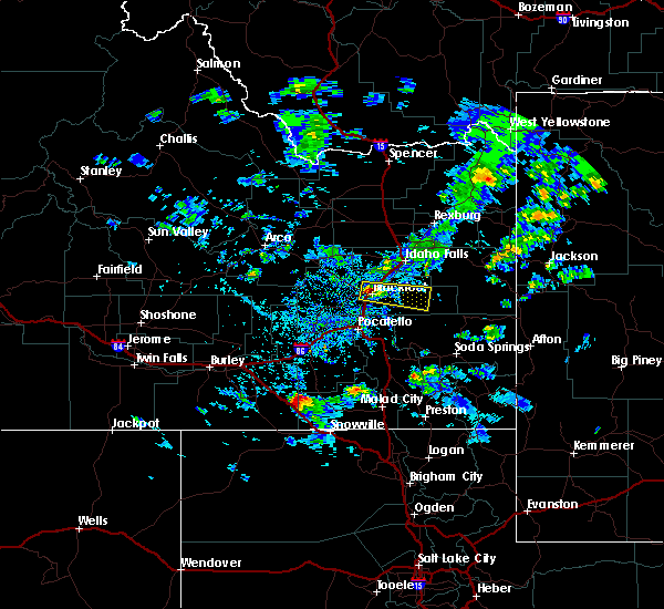 At 527 pm mdt, doppler radar indicated a severe thunderstorm capable of producing quarter size hail or larger. this storm was located over rose, or over blackfoot, and moving east at 25 mph. At 527 pm mdt, doppler radar indicated a severe thunderstorm capable of producing quarter size hail or larger. this storm was located over rose, or over blackfoot, and moving east at 25 mph.
|
| 6/15/2015 7:13 PM MDT |
 At 711 pm mdt, doppler radar indicated a severe thunderstorm capable of producing quarter size hail. this storm was located near fort hall putnam lodge, or 7 miles southeast of blackfoot, moving northeast at 45 mph. locations impacted include, fort hall buffalo lodge, blackfoot, moreland, fort hall putnam lodge, fort hall lincoln creek lodge, fort hall, rose, fort hall eagle lodge, groveland and wapello. At 711 pm mdt, doppler radar indicated a severe thunderstorm capable of producing quarter size hail. this storm was located near fort hall putnam lodge, or 7 miles southeast of blackfoot, moving northeast at 45 mph. locations impacted include, fort hall buffalo lodge, blackfoot, moreland, fort hall putnam lodge, fort hall lincoln creek lodge, fort hall, rose, fort hall eagle lodge, groveland and wapello.
|
| 6/15/2015 6:54 PM MDT |
 At 652 pm mdt, doppler radar indicated a severe thunderstorm capable of producing half dollar size hail and damaging winds in excess of 60 mph. this storm was located from over pocatello west southwest to near american falls, moving northeast at 45 mph. one inch hail has occurred at the pocatello airport! locations impacted include, pocatello, blackfoot, american falls, chubbuck, aberdeen, fort hall buffalo lodge, springfield, fort hall lincoln creek lodge, fort hall, taber, rockford, fort hall putnam lodge, fort hall bannock creek lodge, rose, fort hall eagle lodge and groveland. At 652 pm mdt, doppler radar indicated a severe thunderstorm capable of producing half dollar size hail and damaging winds in excess of 60 mph. this storm was located from over pocatello west southwest to near american falls, moving northeast at 45 mph. one inch hail has occurred at the pocatello airport! locations impacted include, pocatello, blackfoot, american falls, chubbuck, aberdeen, fort hall buffalo lodge, springfield, fort hall lincoln creek lodge, fort hall, taber, rockford, fort hall putnam lodge, fort hall bannock creek lodge, rose, fort hall eagle lodge and groveland.
|
| 6/15/2015 6:42 PM MDT |
 At 641 pm mdt, doppler radar indicated a severe thunderstorm capable of producing half dollar size hail and damaging winds in excess of 60 mph. this storm was located near fort hall bannock creek lodge, or over the arbon valley, and moving northeast at 45 mph. At 641 pm mdt, doppler radar indicated a severe thunderstorm capable of producing half dollar size hail and damaging winds in excess of 60 mph. this storm was located near fort hall bannock creek lodge, or over the arbon valley, and moving northeast at 45 mph.
|
| 6/15/2015 6:41 PM MDT |
 The severe thunderstorm warning for southwestern bingham, bannock, southeastern blaine, northwestern caribou, western bonneville and northern power counties will expire at 645 pm mdt, the storms which prompted the warning have moved out of the area. therefore the warning will be allowed to expire. The severe thunderstorm warning for southwestern bingham, bannock, southeastern blaine, northwestern caribou, western bonneville and northern power counties will expire at 645 pm mdt, the storms which prompted the warning have moved out of the area. therefore the warning will be allowed to expire.
|
| 6/15/2015 6:17 PM MDT |
 At 617 pm mdt, doppler radar indicated a line of severe thunderstorms capable of producing half dollar size hail. these storms were located along a line extending from 9 miles northwest of springfield to near lava hot springs, moving northeast at 20 mph. locations impacted include, pocatello, blackfoot, mccammon, lava hot springs, chesterfield reservoir, american falls reservoir, chubbuck, aberdeen, inkom, arimo, fort hall buffalo lodge, chesterfield, springfield, fort hall lincoln creek lodge, taber, rockford, pingree, fort hall putnam lodge, fort hall bannock creek lodge and rose. At 617 pm mdt, doppler radar indicated a line of severe thunderstorms capable of producing half dollar size hail. these storms were located along a line extending from 9 miles northwest of springfield to near lava hot springs, moving northeast at 20 mph. locations impacted include, pocatello, blackfoot, mccammon, lava hot springs, chesterfield reservoir, american falls reservoir, chubbuck, aberdeen, inkom, arimo, fort hall buffalo lodge, chesterfield, springfield, fort hall lincoln creek lodge, taber, rockford, pingree, fort hall putnam lodge, fort hall bannock creek lodge and rose.
|
| 6/15/2015 5:45 PM MDT |
 At 543 pm mdt, doppler radar indicated a line of severe thunderstorms capable of producing half dollar size hail. these storms were located along a line extending from 12 miles west of aberdeen to 8 miles west of virginia. these storms were moving northeast at 15 mph. At 543 pm mdt, doppler radar indicated a line of severe thunderstorms capable of producing half dollar size hail. these storms were located along a line extending from 12 miles west of aberdeen to 8 miles west of virginia. these storms were moving northeast at 15 mph.
|
| 6/1/2015 4:20 PM MDT | At 420 pm mdt, doppler radar indicated a line of severe thunderstorms capable of producing half dollar size hail and damaging winds in excess of 60 mph. these storms were located along a line extending from near moreland to near rose to near fort hall lincoln creek lodge, moving north at 50 mph. locations impacted include, idaho falls, blackfoot, goshen, ammon, shelley, iona, firth, fort hall lincoln creek lodge, rose, groveland, basalt, wapello and osgood. |
| 6/1/2015 4:10 PM MDT | At 409 pm mdt, doppler radar indicated a line of severe thunderstorms capable of producing half dollar size hail and damaging winds in excess of 60 mph. these storms were located along a line extending from near moreland to near rose to near fort hall lincoln creek lodge, and moving northeast at 40 mph. |
| 6/1/2015 4:00 PM MDT | Power was out as of 4pm. part of larger power outages in blackfoot and nearby areas. 1350 people affected at one poin in bingham county ID, 0.8 miles SE of Riverside, ID |
| 6/1/2015 3:30 PM MDT | 50mph winds along with 8in by 8ft branch blown dow in bingham county ID, 0.8 miles SE of Riverside, ID |
| 5/30/2015 5:30 PM MDT | 10" diameter by 15ft long cottonwood branch was blown dow in bingham county ID, 0.8 miles SE of Riverside, ID |
| 5/30/2015 5:20 PM MDT | At 520 pm mdt, doppler radar indicated a line of severe thunderstorms capable of producing damaging winds in excess of 60 mph. these storms were located along a line extending from near moreland to near fort hall buffalo lodge, and moving east at 40 mph. |
| 5/30/2015 4:53 PM MDT | At 453 pm mdt, doppler radar indicated a line of severe thunderstorms capable of producing damaging winds in excess of 60 mph. these storms were located along a line extending from 14 miles northwest of springfield to near aberdeen, and moving east at 40 mph. * severe thunderstorms will be near, springfield around 510 pm mdt. pingree around 515 pm mdt. rockford around 525 pm mdt. fort hall eagle lodge and moreland around 530 pm mdt. other locations impacted by these severe thunderstorms include sterling. |
| 5/27/2015 4:08 PM MDT | The severe thunderstorm warning for central bingham county will expire at 415 pm mdt, the storm which prompted the warning has weakened below severe limits, and no longer poses an immediate threat to life or property. therefore the warning will be allowed to expire. |
| 5/27/2015 3:46 PM MDT | At 345 pm mdt, doppler radar indicated a severe thunderstorm capable of producing quarter size hail and damaging winds in excess of 60 mph. this storm was located over rockford, or 7 miles west of blackfoot, moving east at 25 mph. locations impacted include, blackfoot, rockford, moreland, rose and groveland. |
| 5/27/2015 3:24 PM MDT | At 323 pm mdt, doppler radar indicated a severe thunderstorm capable of producing quarter size hail and damaging winds in excess of 60 mph. this storm was located over rockford, or 10 miles west of blackfoot, and moving northeast at 25 mph. |
| 8/12/2013 2:15 PM MDT | Numerous tree limbs around 1/2in diameter were all over the yard. report based on local wind observation in bingham county ID, 0.8 miles SE of Riverside, ID |
Hail Maps for Riverside, ID


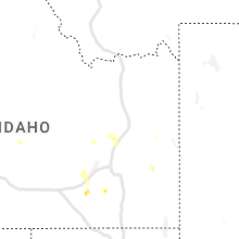


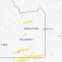


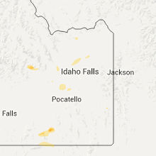


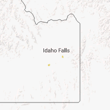
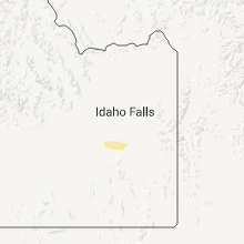

Connect with Interactive Hail Maps