

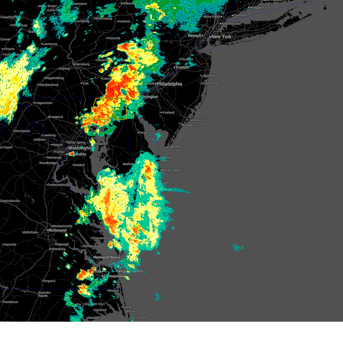
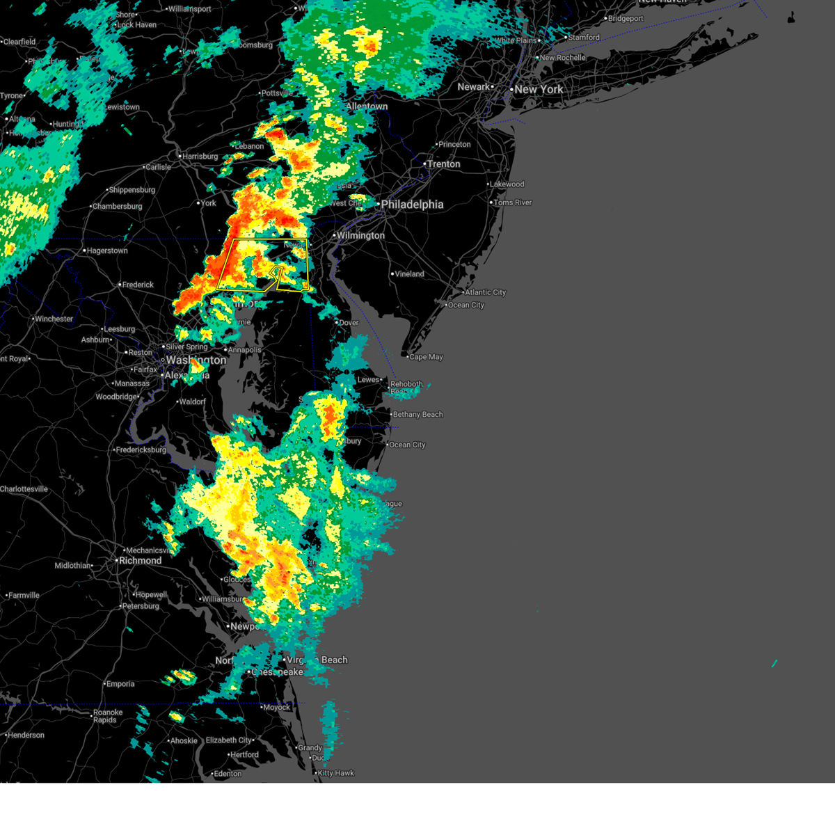
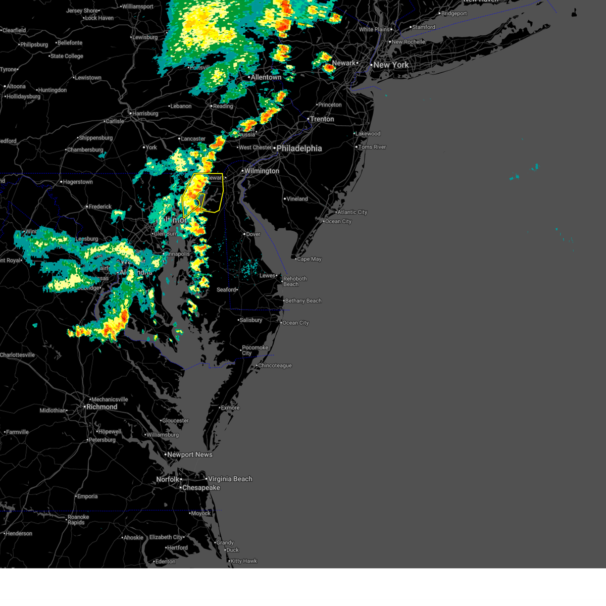
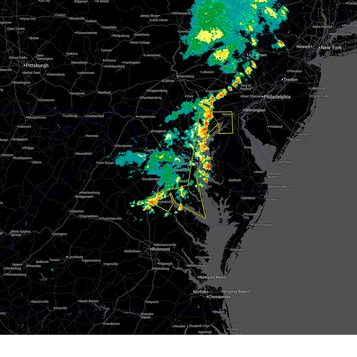
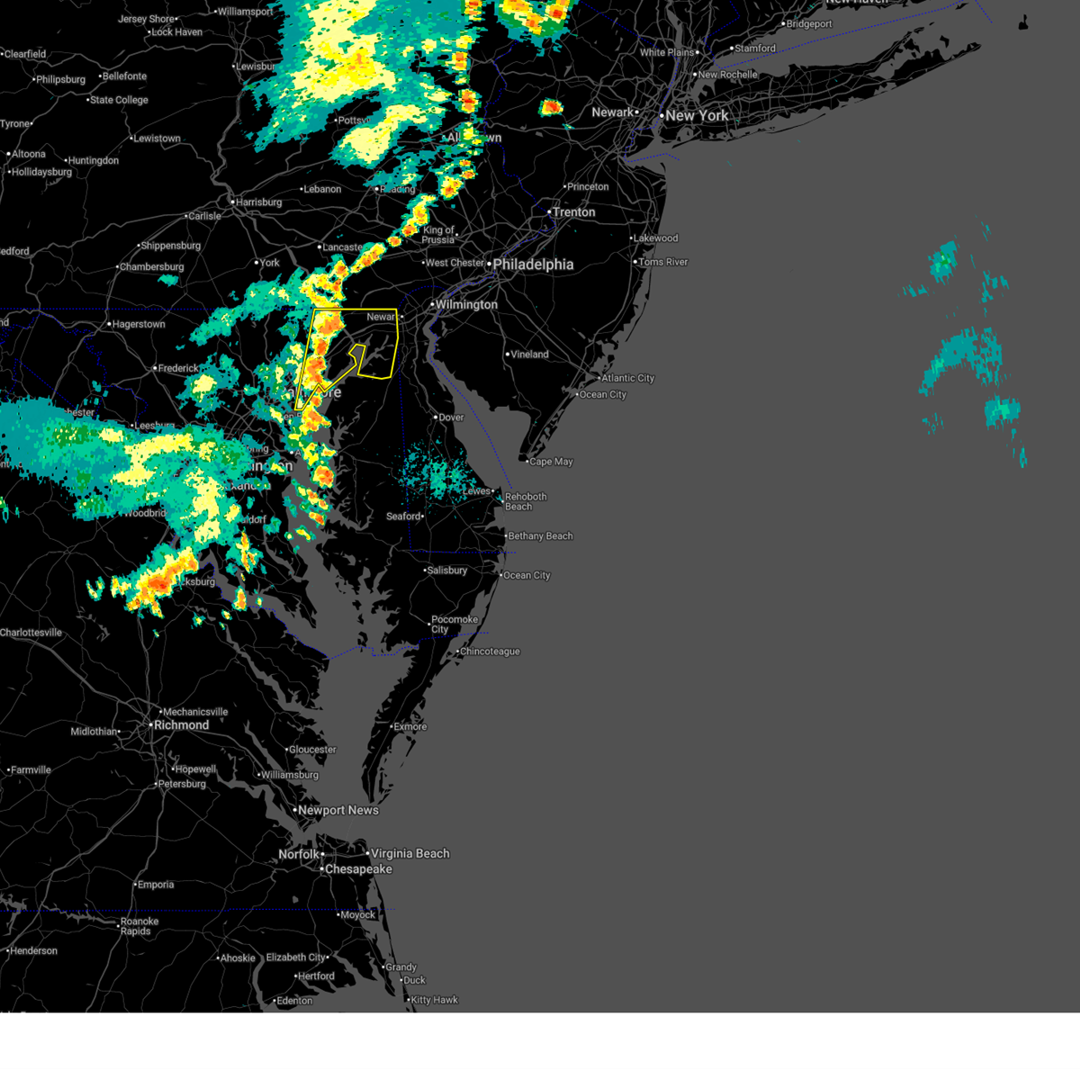
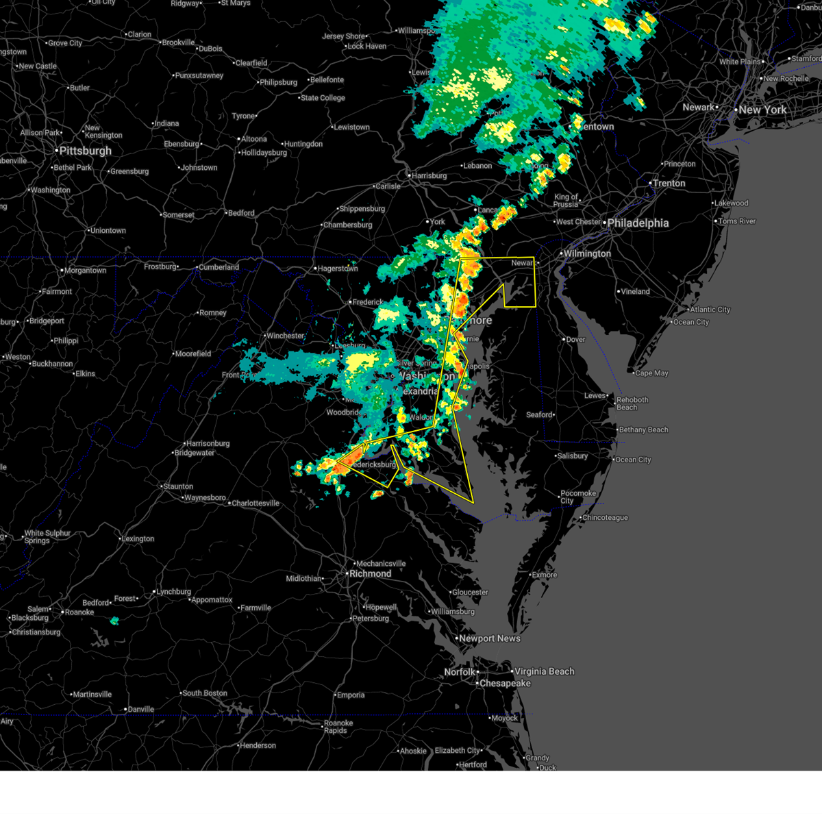
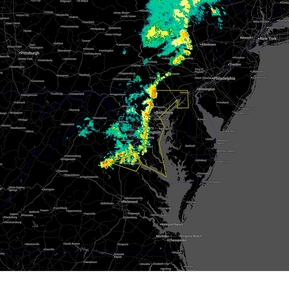
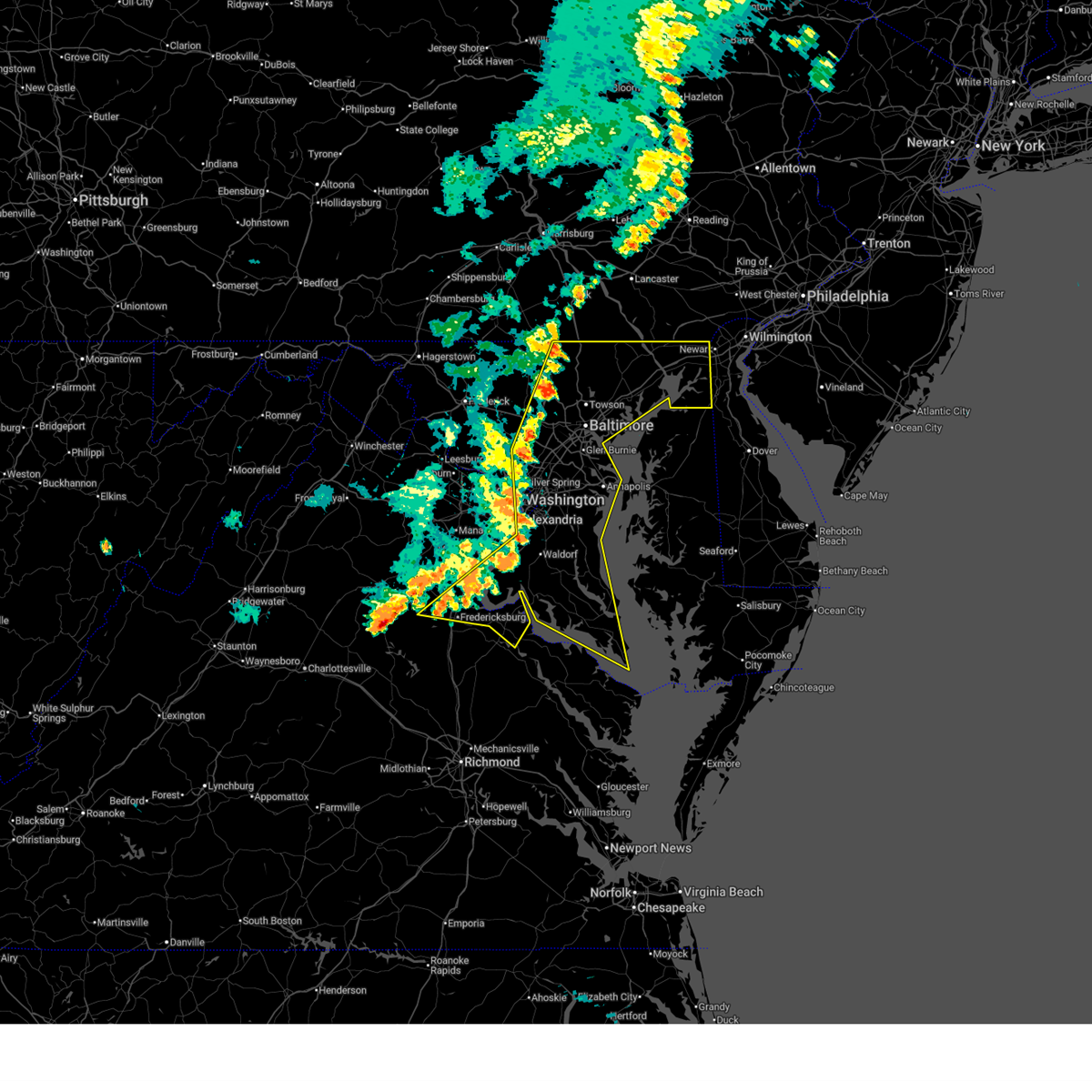
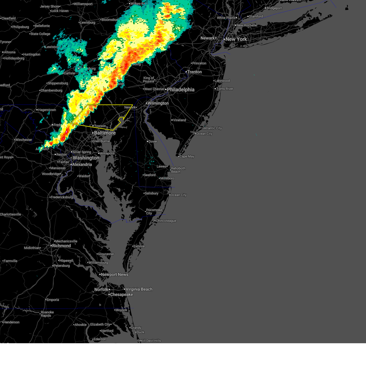
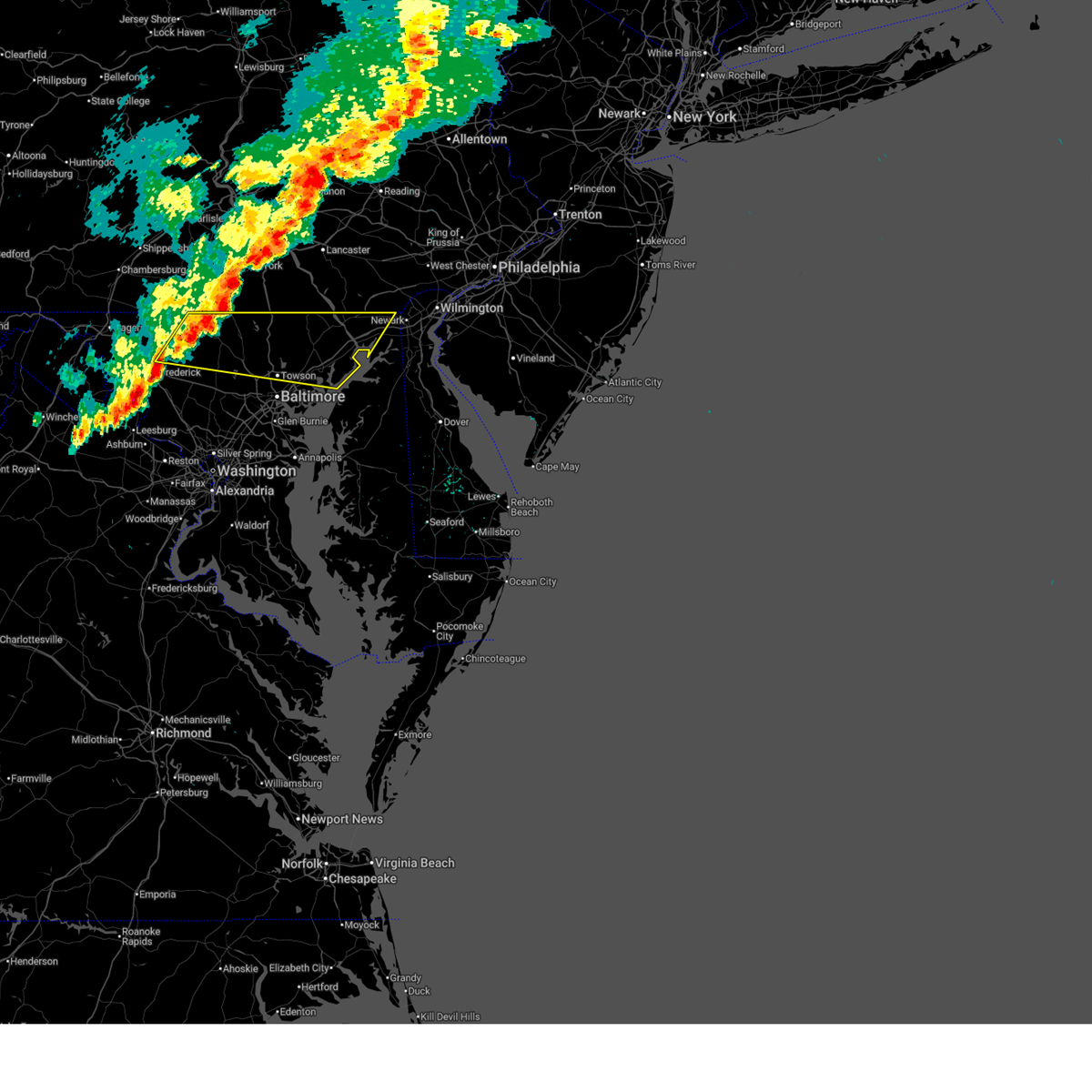
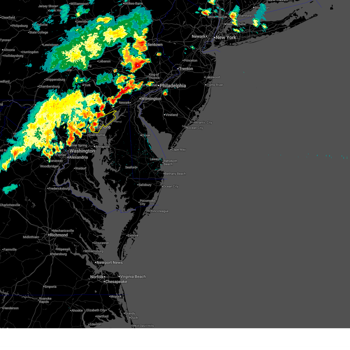
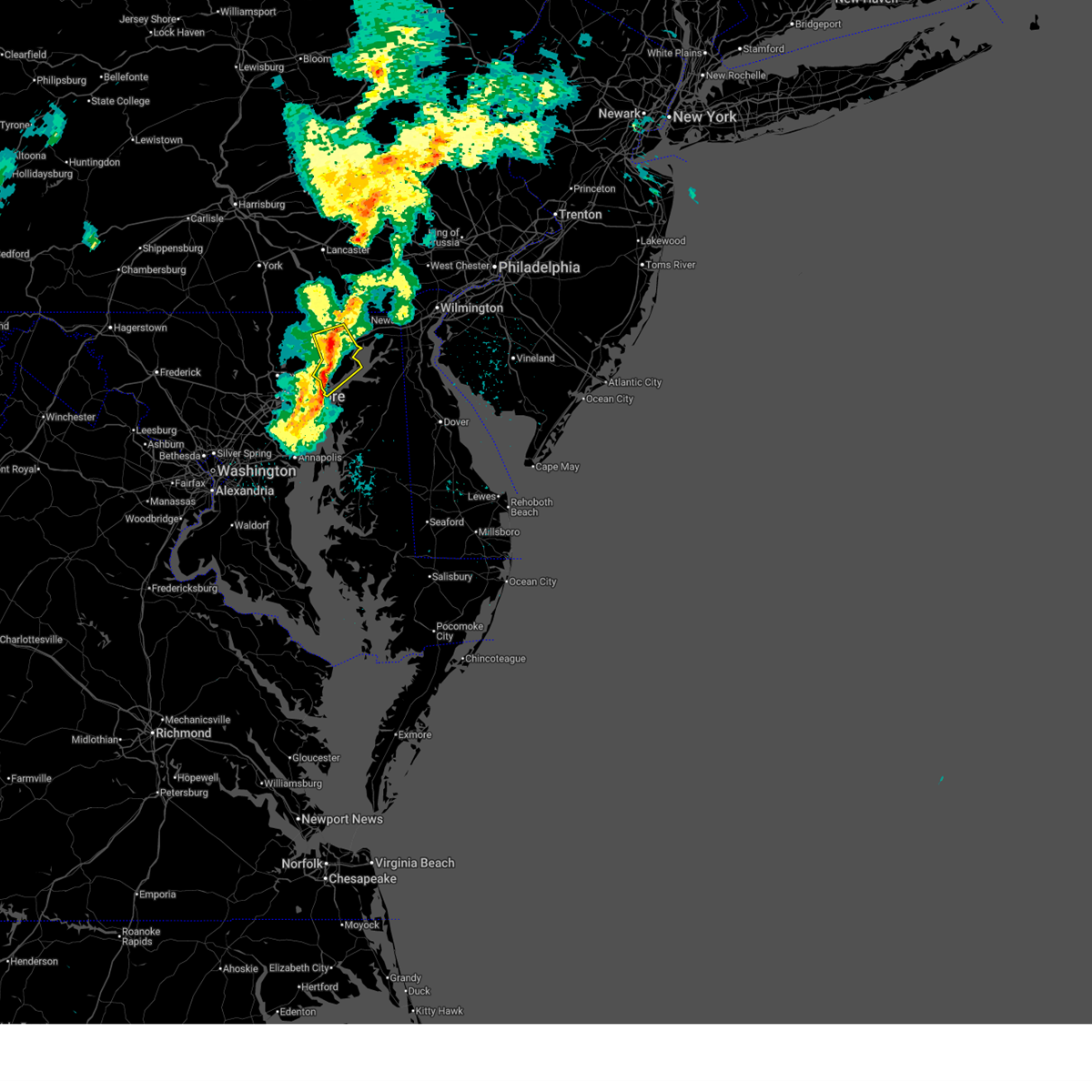
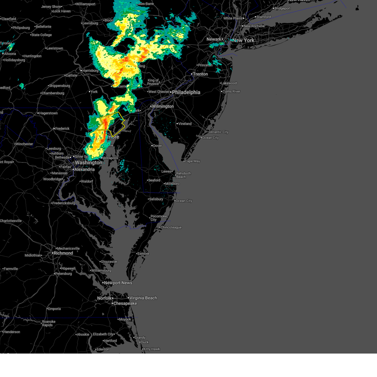
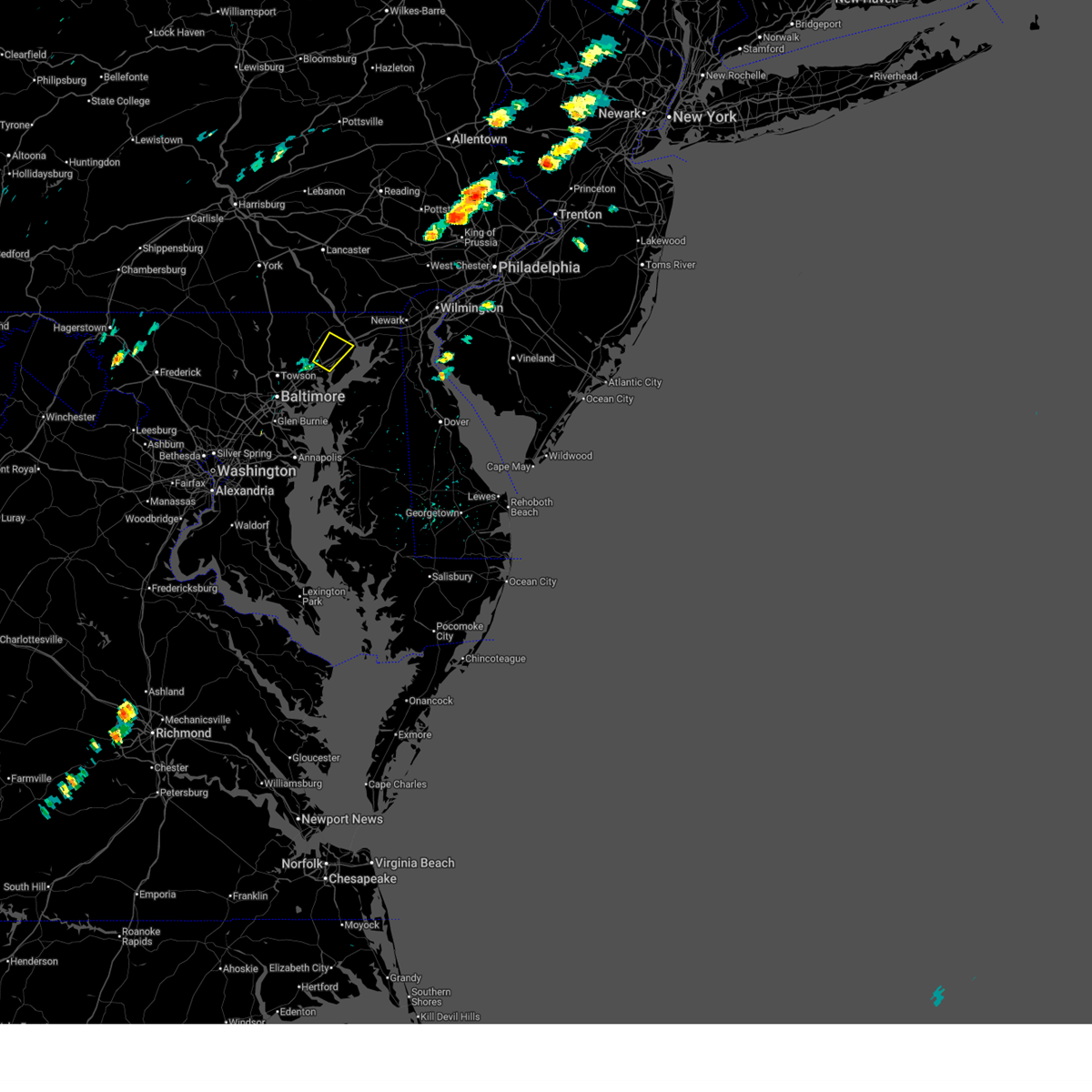
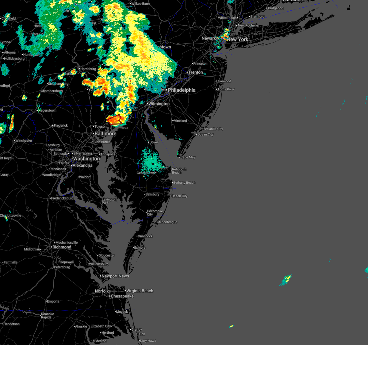
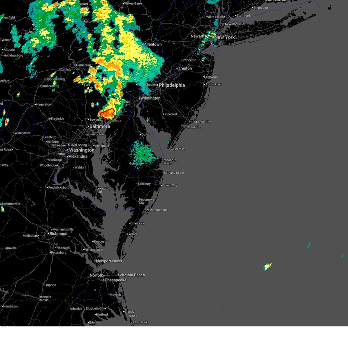
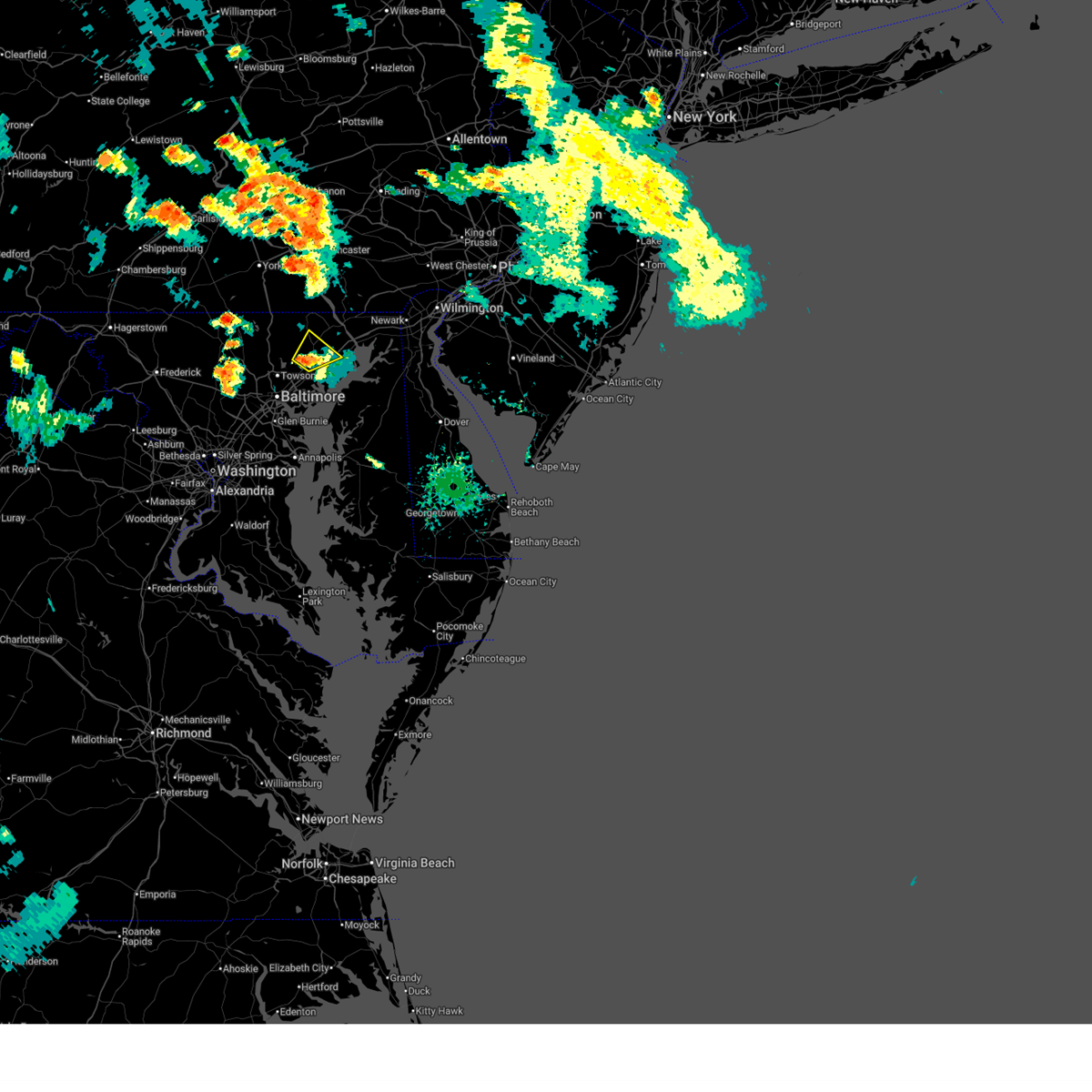
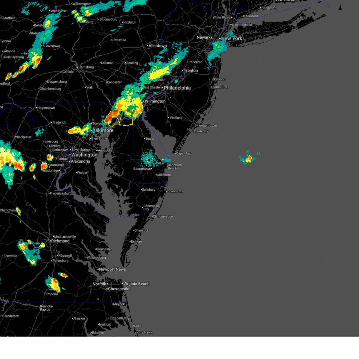
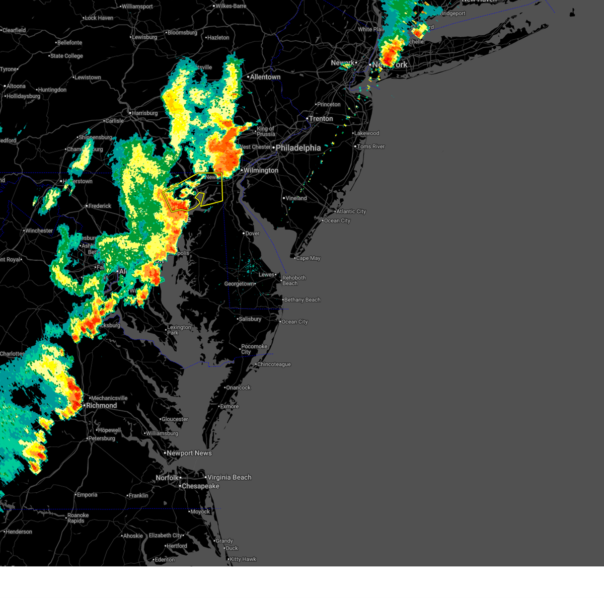
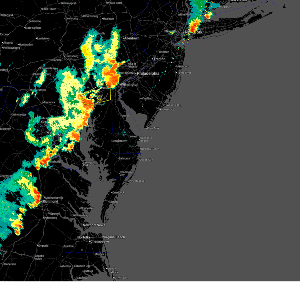
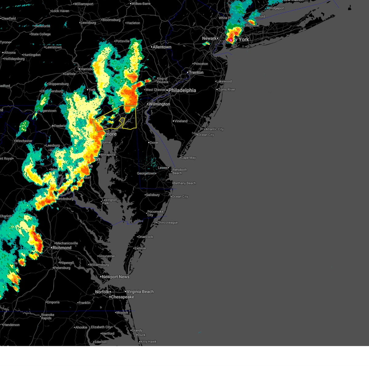
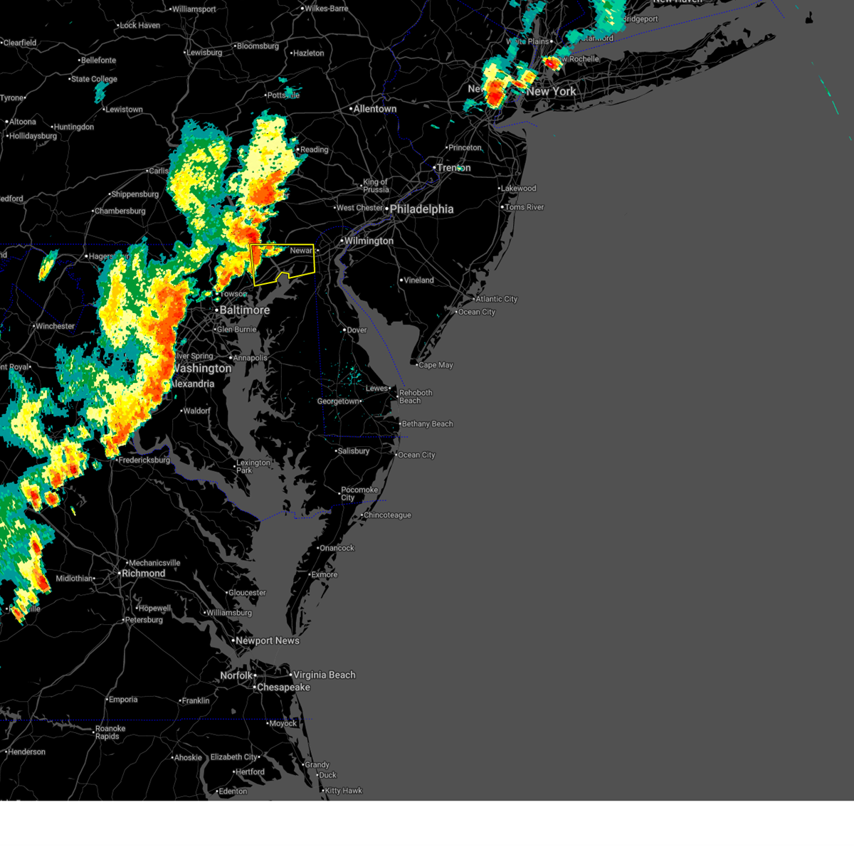
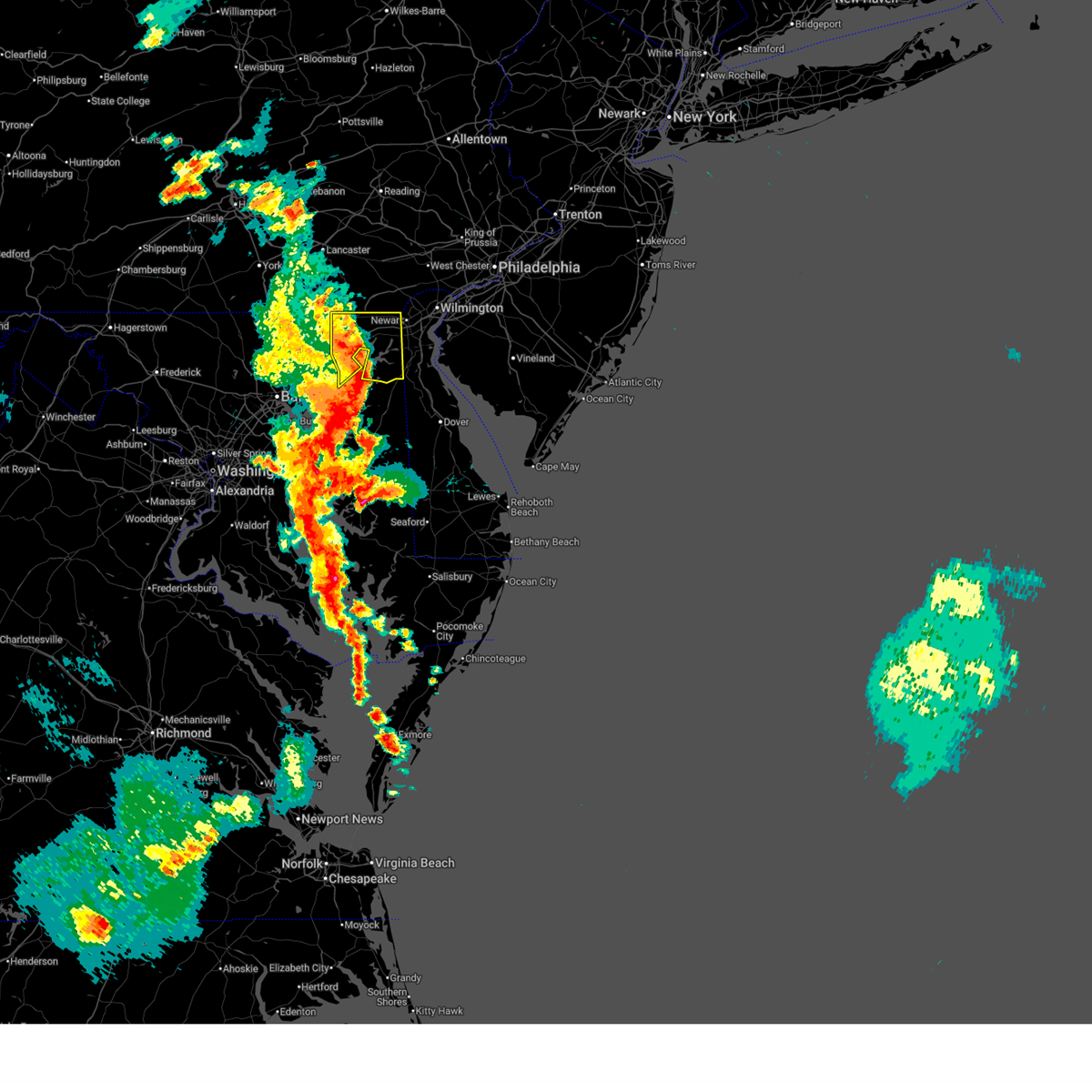
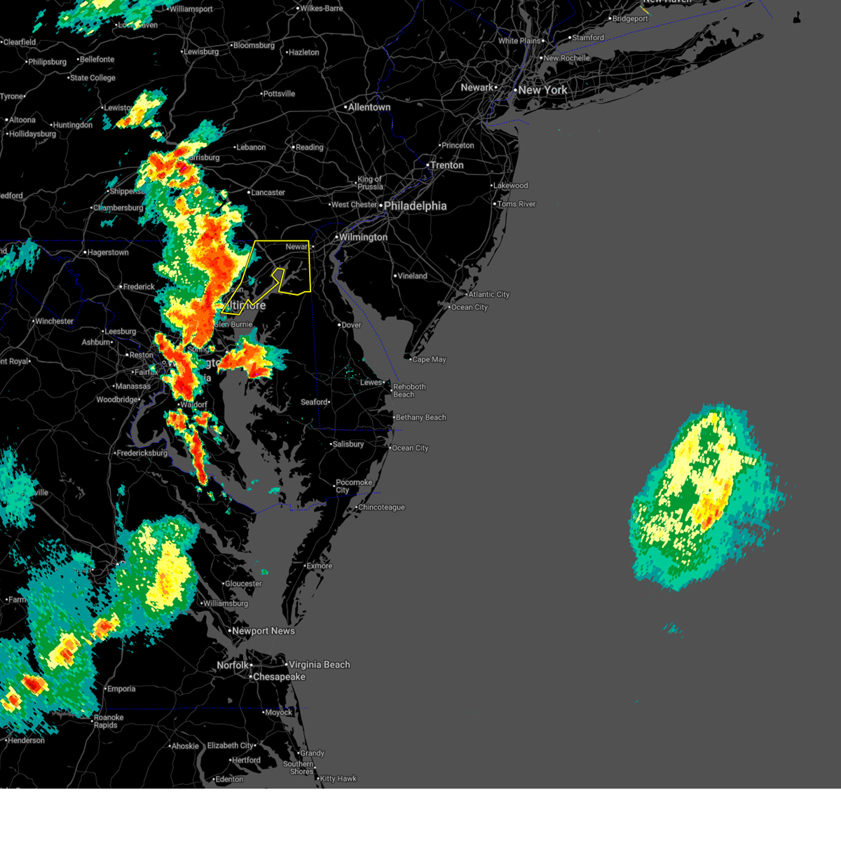
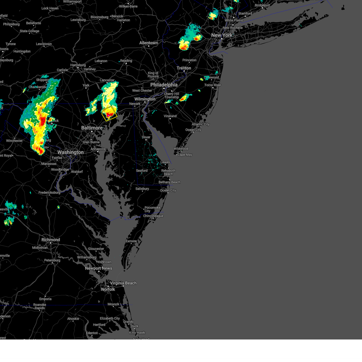
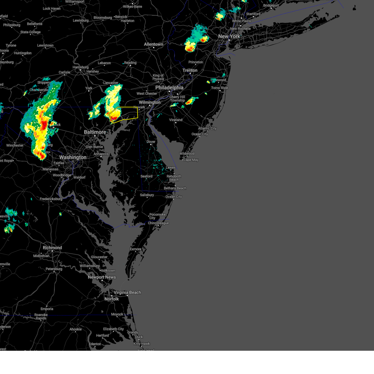
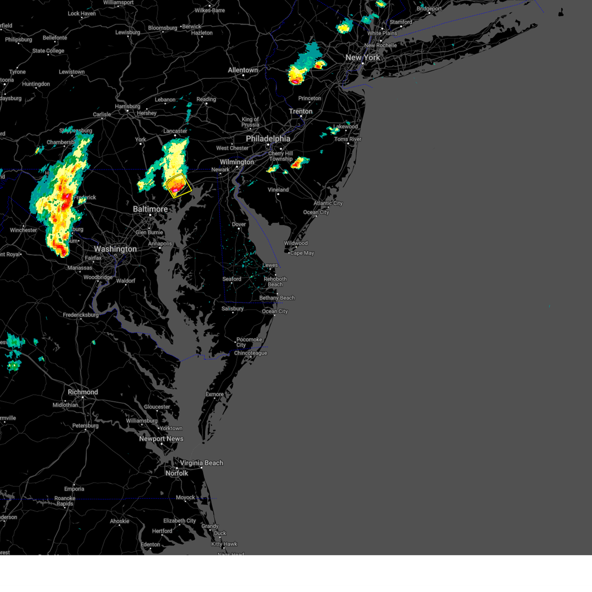
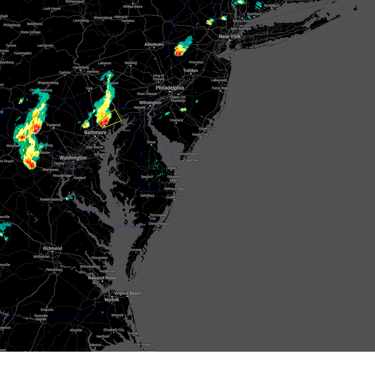
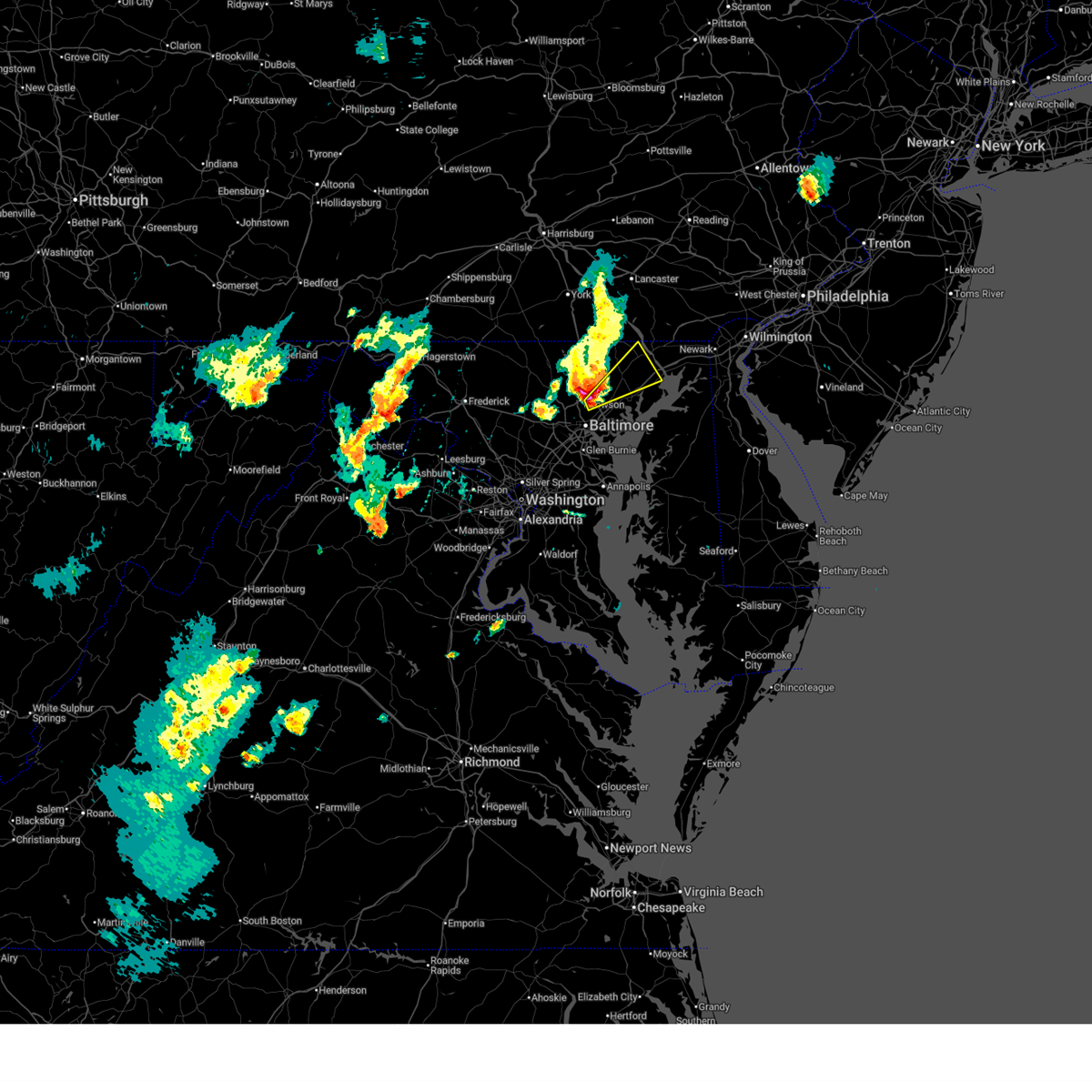
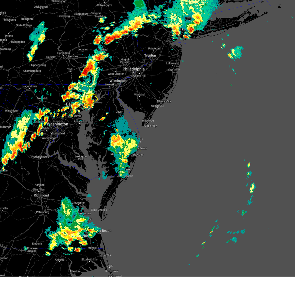
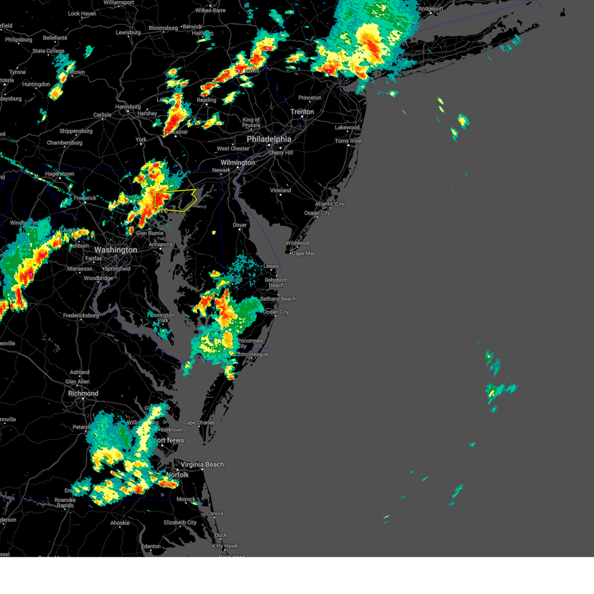
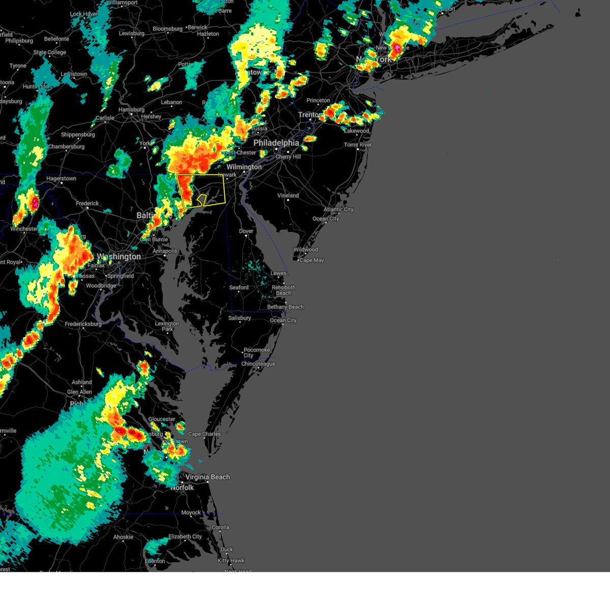
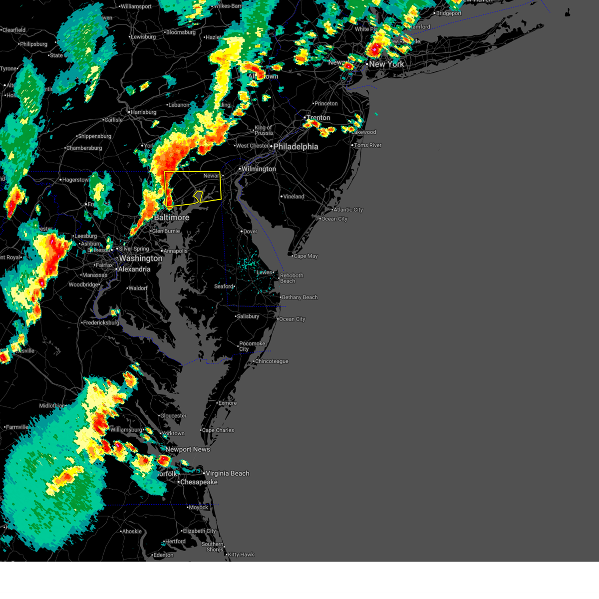
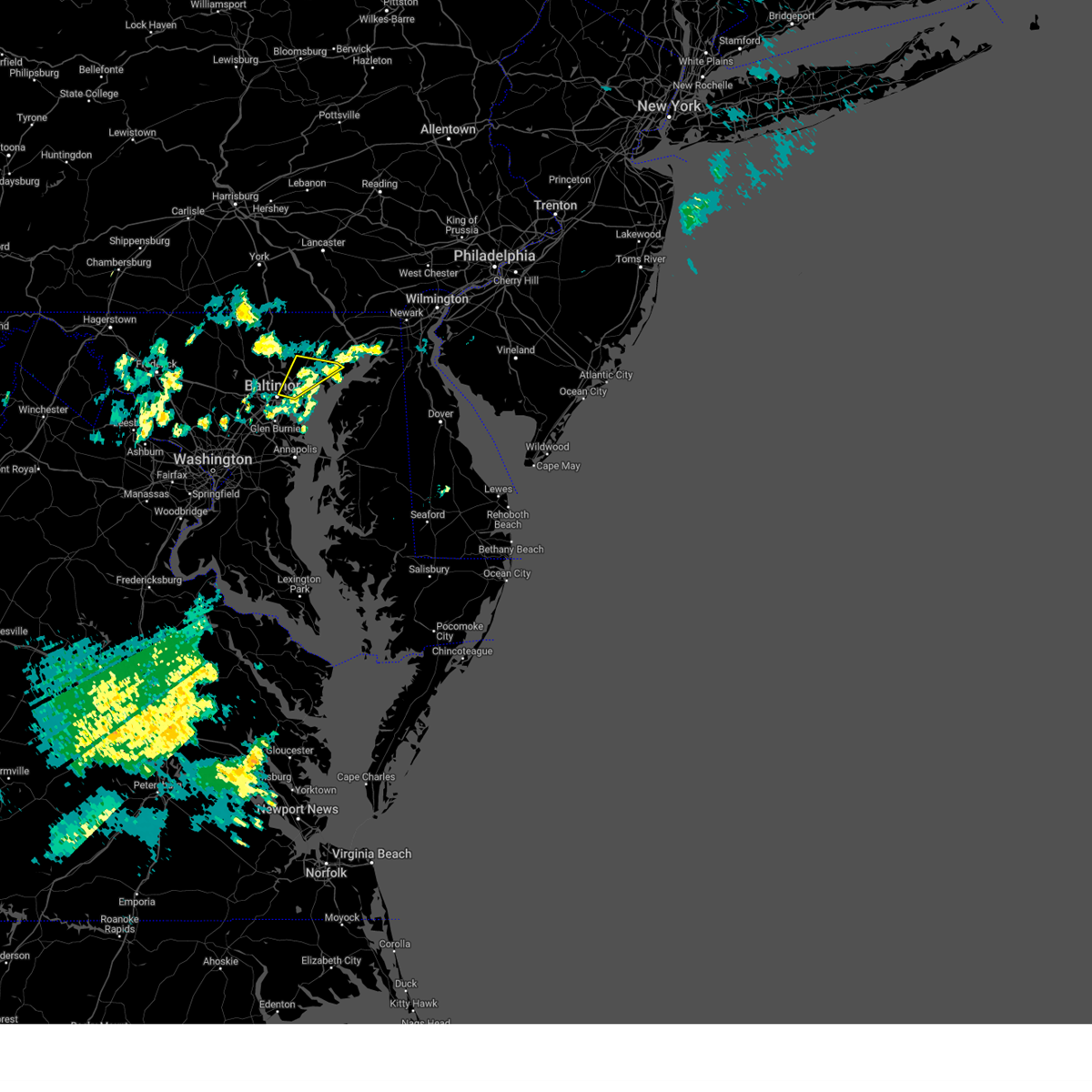
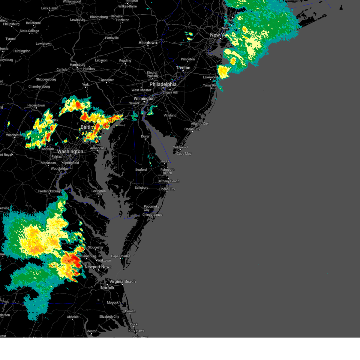
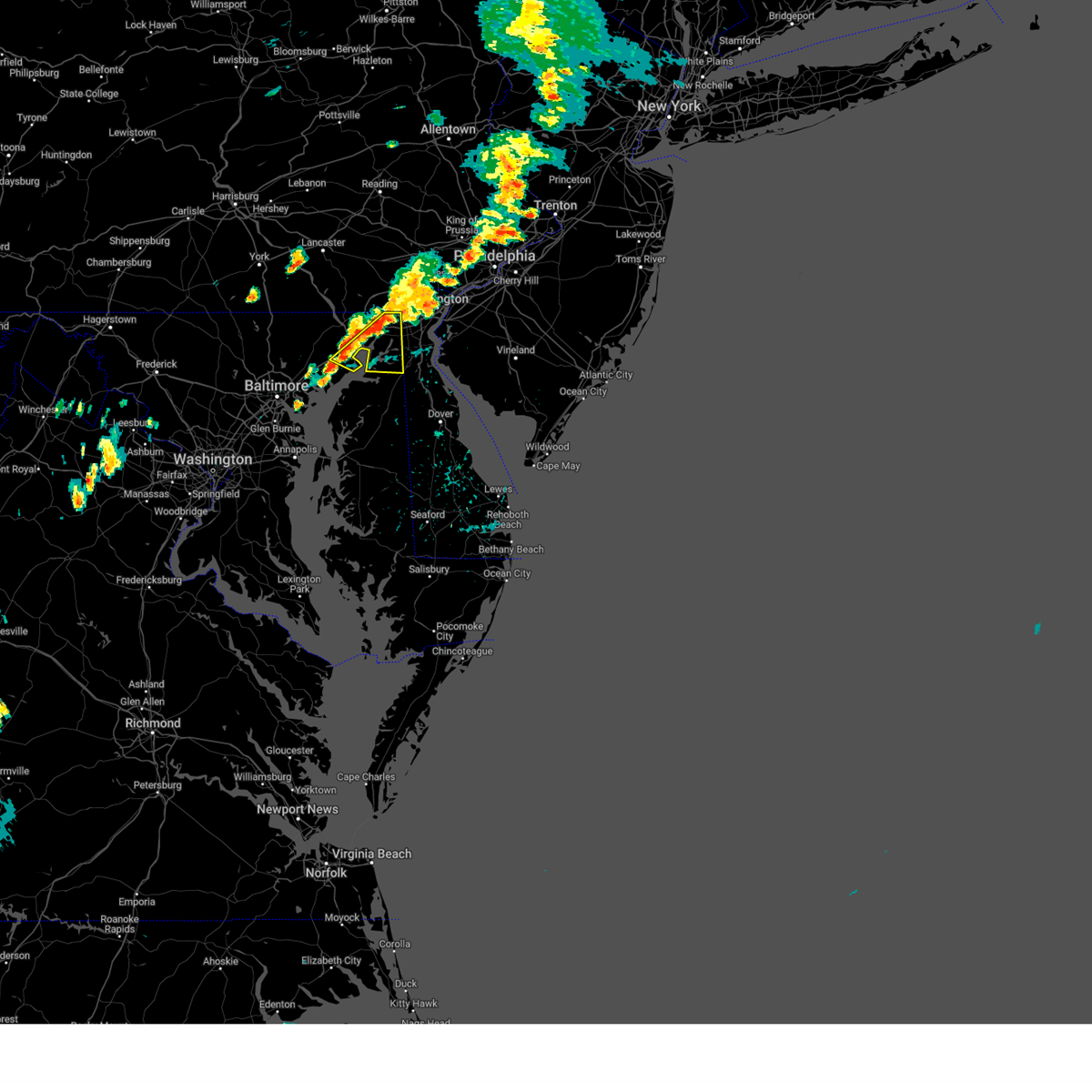
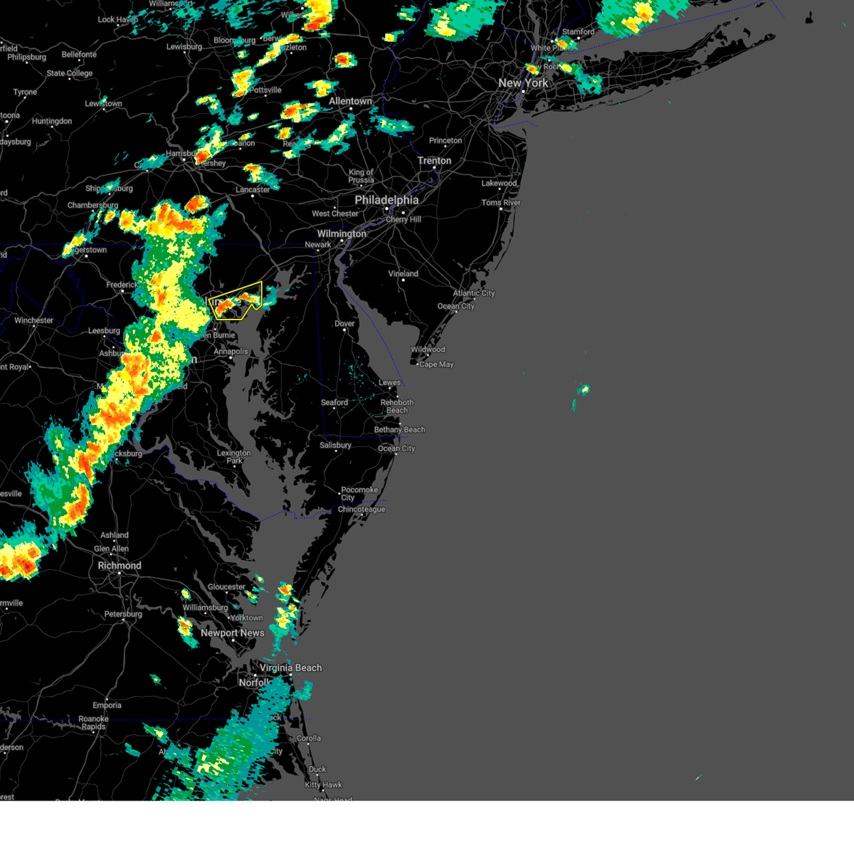
Hail Map for Riverside, MD
The Riverside, MD area has had 0 reports of on-the-ground hail by trained spotters, and has been under severe weather warnings 23 times during the past 12 months. Doppler radar has detected hail at or near Riverside, MD on 48 occasions, including 2 occasions during the past year.
| Name: | Riverside, MD |
| Where Located: | 23.4 miles ENE of Baltimore, MD |
| Map: | Google Map for Riverside, MD |
| Population: | 6425 |
| Housing Units: | 2579 |
| More Info: | Search Google for Riverside, MD |
0
The Top Recent Hail Date for Riverside, MD is Thursday, July 31, 2025 (27th out of 48)

Hail and Wind Damage Spotted near Riverside, MD
| Date / Time | Report Details |
|---|---|
| 6/14/2026 9:56 PM EDT |
 The storms which prompted the warning have weakened below severe limits, and no longer pose an immediate threat to life or property. therefore, the warning will be allowed to expire. however, gusty winds and heavy rain are still possible with these thunderstorms. a severe thunderstorm watch remains in effect until 1100 pm edt for northern and northeastern maryland. The storms which prompted the warning have weakened below severe limits, and no longer pose an immediate threat to life or property. therefore, the warning will be allowed to expire. however, gusty winds and heavy rain are still possible with these thunderstorms. a severe thunderstorm watch remains in effect until 1100 pm edt for northern and northeastern maryland.
|
| 6/14/2026 9:36 PM EDT |
 Svrlwx the national weather service in sterling virginia has issued a * severe thunderstorm warning for, harford county in northern maryland, east central baltimore county in northern maryland, cecil county in northeastern maryland, * until 1000 pm edt. * at 936 pm edt, severe thunderstorms were located along a line extending from near conowingo to baltimore, moving east at 45 mph (radar indicated). Hazards include 60 mph wind gusts. Damaging winds will cause some trees and large branches to fall. this could injure those outdoors, as well as damage homes and vehicles. roadways may become blocked by downed trees. localized power outages are possible. Unsecured light objects may become projectiles. Svrlwx the national weather service in sterling virginia has issued a * severe thunderstorm warning for, harford county in northern maryland, east central baltimore county in northern maryland, cecil county in northeastern maryland, * until 1000 pm edt. * at 936 pm edt, severe thunderstorms were located along a line extending from near conowingo to baltimore, moving east at 45 mph (radar indicated). Hazards include 60 mph wind gusts. Damaging winds will cause some trees and large branches to fall. this could injure those outdoors, as well as damage homes and vehicles. roadways may become blocked by downed trees. localized power outages are possible. Unsecured light objects may become projectiles.
|
| 6/11/2026 9:45 PM EDT |
 At 944 pm edt, severe thunderstorms were located along a line extending from rising sun to aberdeen to near newtown, moving east at 25 mph (radar indicated). Hazards include 60 mph wind gusts. Damaging winds will cause some trees and large branches to fall. this could injure those outdoors, as well as damage homes and vehicles. roadways may become blocked by downed trees. localized power outages are possible. unsecured light objects may become projectiles. Locations impacted include, newark, elkton, aberdeen, havre de grace, aberdeen proving ground, calvert, riverside, north east, rising sun, perryman, charlestown, cecilton, zion, blake, barksdale, west nottingham, octoraro, brantwood, fair hill, and glen westover. At 944 pm edt, severe thunderstorms were located along a line extending from rising sun to aberdeen to near newtown, moving east at 25 mph (radar indicated). Hazards include 60 mph wind gusts. Damaging winds will cause some trees and large branches to fall. this could injure those outdoors, as well as damage homes and vehicles. roadways may become blocked by downed trees. localized power outages are possible. unsecured light objects may become projectiles. Locations impacted include, newark, elkton, aberdeen, havre de grace, aberdeen proving ground, calvert, riverside, north east, rising sun, perryman, charlestown, cecilton, zion, blake, barksdale, west nottingham, octoraro, brantwood, fair hill, and glen westover.
|
| 6/11/2026 9:23 PM EDT |
 The storms which prompted the warning have weakened below severe limits, and no longer pose an immediate threat to life or property. therefore, the warning will be allowed to expire in most of the warned area. an additional warning will be issued for harford and cecil counties. a severe thunderstorm watch remains in effect until 1000 pm edt for central and northern maryland. a severe thunderstorm watch also remains in effect until midnight edt for southern and northeastern maryland, and central and northern virginia. to report severe weather, contact your nearest law enforcement agency. they will relay your report to the national weather service sterling virginia. The storms which prompted the warning have weakened below severe limits, and no longer pose an immediate threat to life or property. therefore, the warning will be allowed to expire in most of the warned area. an additional warning will be issued for harford and cecil counties. a severe thunderstorm watch remains in effect until 1000 pm edt for central and northern maryland. a severe thunderstorm watch also remains in effect until midnight edt for southern and northeastern maryland, and central and northern virginia. to report severe weather, contact your nearest law enforcement agency. they will relay your report to the national weather service sterling virginia.
|
| 6/11/2026 9:22 PM EDT |
 Svrlwx the national weather service in sterling virginia has issued a * severe thunderstorm warning for, harford county in northern maryland, southeastern baltimore county in northern maryland, cecil county in northeastern maryland, * until 1000 pm edt. * at 922 pm edt, severe thunderstorms were located along a line extending from near delta to near bowleys quarters, moving east at 35 mph (radar indicated). Hazards include 60 mph wind gusts. Damaging winds will cause some trees and large branches to fall. this could injure those outdoors, as well as damage homes and vehicles. roadways may become blocked by downed trees. localized power outages are possible. Unsecured light objects may become projectiles. Svrlwx the national weather service in sterling virginia has issued a * severe thunderstorm warning for, harford county in northern maryland, southeastern baltimore county in northern maryland, cecil county in northeastern maryland, * until 1000 pm edt. * at 922 pm edt, severe thunderstorms were located along a line extending from near delta to near bowleys quarters, moving east at 35 mph (radar indicated). Hazards include 60 mph wind gusts. Damaging winds will cause some trees and large branches to fall. this could injure those outdoors, as well as damage homes and vehicles. roadways may become blocked by downed trees. localized power outages are possible. Unsecured light objects may become projectiles.
|
| 6/11/2026 9:12 PM EDT |
 At 911 pm edt, severe thunderstorms were located along a line extending from near havre de grace to near rock hall to near romancoke to near taylors island to coles point, moving east at 40 mph (emergency management). Hazards include 60 mph wind gusts. Damaging winds will cause some trees and large branches to fall. this could injure those outdoors, as well as damage homes and vehicles. roadways may become blocked by downed trees. localized power outages are possible. unsecured light objects may become projectiles. Locations impacted include, baltimore, annapolis, middle river, fredericksburg, elkton, aberdeen, havre de grace, riviera beach, lexington park, chesapeake ranch estates, mayo, shady side, chesapeake beach, deale, naval academy, king george, leonardtown, dahlgren, prince frederick, and aberdeen proving ground. At 911 pm edt, severe thunderstorms were located along a line extending from near havre de grace to near rock hall to near romancoke to near taylors island to coles point, moving east at 40 mph (emergency management). Hazards include 60 mph wind gusts. Damaging winds will cause some trees and large branches to fall. this could injure those outdoors, as well as damage homes and vehicles. roadways may become blocked by downed trees. localized power outages are possible. unsecured light objects may become projectiles. Locations impacted include, baltimore, annapolis, middle river, fredericksburg, elkton, aberdeen, havre de grace, riviera beach, lexington park, chesapeake ranch estates, mayo, shady side, chesapeake beach, deale, naval academy, king george, leonardtown, dahlgren, prince frederick, and aberdeen proving ground.
|
| 6/11/2026 8:45 PM EDT |
 At 844 pm edt, severe thunderstorms were located along a line extending from near jarrettsville to pasadena to crofton to 6 miles northwest of prince frederick to near colonial beach, moving east at 40 mph (emergency management has reported many instances of trees down with this line of storms). Hazards include 60 mph wind gusts. Damaging winds will cause some trees and large branches to fall. this could injure those outdoors, as well as damage homes and vehicles. roadways may become blocked by downed trees. localized power outages are possible. unsecured light objects may become projectiles. Locations impacted include, baltimore, stafford, waldorf, bowie, severn, annapolis, clinton, pikesville, crofton, middle river, fredericksburg, cockeysville, elkridge, elkton, aberdeen, havre de grace, riviera beach, lexington park, largo, and chesapeake ranch estates. At 844 pm edt, severe thunderstorms were located along a line extending from near jarrettsville to pasadena to crofton to 6 miles northwest of prince frederick to near colonial beach, moving east at 40 mph (emergency management has reported many instances of trees down with this line of storms). Hazards include 60 mph wind gusts. Damaging winds will cause some trees and large branches to fall. this could injure those outdoors, as well as damage homes and vehicles. roadways may become blocked by downed trees. localized power outages are possible. unsecured light objects may become projectiles. Locations impacted include, baltimore, stafford, waldorf, bowie, severn, annapolis, clinton, pikesville, crofton, middle river, fredericksburg, cockeysville, elkridge, elkton, aberdeen, havre de grace, riviera beach, lexington park, largo, and chesapeake ranch estates.
|
| 6/11/2026 8:29 PM EDT |
 Svrlwx the national weather service in sterling virginia has issued a * severe thunderstorm warning for, the district of columbia, baltimore city in northern maryland, st. marys county in southern maryland, howard county in central maryland, southeastern montgomery county in central maryland, calvert county in southern maryland, baltimore county in northern maryland, prince georges county in central maryland, eastern carroll county in north central maryland, anne arundel county in central maryland, harford county in northern maryland, cecil county in northeastern maryland, charles county in southern maryland, stafford county in northern virginia, the city of fredericksburg in central virginia, southeastern fairfax county in northern virginia, southeastern culpeper county in northern virginia, southeastern prince william county in northern virginia, king george county in central virginia, southeastern arlington county in northern virginia, the eastern city of alexandria in northern virginia, northeastern spotsylvania county in central virginia, * until 930 pm edt. * at 827 pm edt, severe thunderstorms were located along a line extending from near shrewsbury to elkridge to near beltsville to near waldorf to near dahlgren, moving east at 40 mph (emergency management has reported many instances of trees down with this line of storms). Hazards include 60 mph wind gusts. Damaging winds will cause some trees and large branches to fall. this could injure those outdoors, as well as damage homes and vehicles. roadways may become blocked by downed trees. localized power outages are possible. Unsecured light objects may become projectiles. Svrlwx the national weather service in sterling virginia has issued a * severe thunderstorm warning for, the district of columbia, baltimore city in northern maryland, st. marys county in southern maryland, howard county in central maryland, southeastern montgomery county in central maryland, calvert county in southern maryland, baltimore county in northern maryland, prince georges county in central maryland, eastern carroll county in north central maryland, anne arundel county in central maryland, harford county in northern maryland, cecil county in northeastern maryland, charles county in southern maryland, stafford county in northern virginia, the city of fredericksburg in central virginia, southeastern fairfax county in northern virginia, southeastern culpeper county in northern virginia, southeastern prince william county in northern virginia, king george county in central virginia, southeastern arlington county in northern virginia, the eastern city of alexandria in northern virginia, northeastern spotsylvania county in central virginia, * until 930 pm edt. * at 827 pm edt, severe thunderstorms were located along a line extending from near shrewsbury to elkridge to near beltsville to near waldorf to near dahlgren, moving east at 40 mph (emergency management has reported many instances of trees down with this line of storms). Hazards include 60 mph wind gusts. Damaging winds will cause some trees and large branches to fall. this could injure those outdoors, as well as damage homes and vehicles. roadways may become blocked by downed trees. localized power outages are possible. Unsecured light objects may become projectiles.
|
| 6/6/2026 6:22 PM EDT |
 At 622 pm edt, severe thunderstorms were located along a line extending from near delta to near cockeysville to randallstown, moving east at 55 mph (radar indicated). Hazards include 60 mph wind gusts. Damaging winds will cause some trees and large branches to fall. this could injure those outdoors, as well as damage homes and vehicles. roadways may become blocked by downed trees. localized power outages are possible. unsecured light objects may become projectiles. Locations impacted include, pikesville, cockeysville, aberdeen, havre de grace, aberdeen proving ground, calvert, towson, bel air south, parkville, owings mills, bel air north, eldersburg, carney, perry hall, reisterstown, rossville, mays chapel, timonium, white marsh, and fallston. At 622 pm edt, severe thunderstorms were located along a line extending from near delta to near cockeysville to randallstown, moving east at 55 mph (radar indicated). Hazards include 60 mph wind gusts. Damaging winds will cause some trees and large branches to fall. this could injure those outdoors, as well as damage homes and vehicles. roadways may become blocked by downed trees. localized power outages are possible. unsecured light objects may become projectiles. Locations impacted include, pikesville, cockeysville, aberdeen, havre de grace, aberdeen proving ground, calvert, towson, bel air south, parkville, owings mills, bel air north, eldersburg, carney, perry hall, reisterstown, rossville, mays chapel, timonium, white marsh, and fallston.
|
| 6/6/2026 5:51 PM EDT |
 Svrlwx the national weather service in sterling virginia has issued a * severe thunderstorm warning for, carroll county in north central maryland, harford county in northern maryland, northeastern frederick county in north central maryland, baltimore county in northern maryland, northwestern cecil county in northeastern maryland, * until 645 pm edt. * at 551 pm edt, severe thunderstorms were located along a line extending from codorus to near westminster to linganore-bartonsville, moving east at 55 mph (radar indicated). Hazards include 70 mph wind gusts. Damaging winds will cause some trees and large branches to fall. this could injure those outdoors, as well as damage homes and vehicles. roadways may become blocked by downed trees. localized power outages are possible. Unsecured light objects may become projectiles. Svrlwx the national weather service in sterling virginia has issued a * severe thunderstorm warning for, carroll county in north central maryland, harford county in northern maryland, northeastern frederick county in north central maryland, baltimore county in northern maryland, northwestern cecil county in northeastern maryland, * until 645 pm edt. * at 551 pm edt, severe thunderstorms were located along a line extending from codorus to near westminster to linganore-bartonsville, moving east at 55 mph (radar indicated). Hazards include 70 mph wind gusts. Damaging winds will cause some trees and large branches to fall. this could injure those outdoors, as well as damage homes and vehicles. roadways may become blocked by downed trees. localized power outages are possible. Unsecured light objects may become projectiles.
|
| 5/20/2026 4:55 PM EDT |
 Svrlwx the national weather service in sterling virginia has issued a * severe thunderstorm warning for, southeastern harford county in northern maryland, southeastern baltimore county in northern maryland, central cecil county in northeastern maryland, * until 530 pm edt. * at 455 pm edt, a severe thunderstorm was located over back river, moving east at 30 mph (radar indicated). Hazards include 60 mph wind gusts and quarter size hail. Damaging winds will cause some trees and large branches to fall. this could injure those outdoors, as well as damage homes and vehicles. roadways may become blocked by downed trees. localized power outages are possible. Unsecured light objects may become projectiles. Svrlwx the national weather service in sterling virginia has issued a * severe thunderstorm warning for, southeastern harford county in northern maryland, southeastern baltimore county in northern maryland, central cecil county in northeastern maryland, * until 530 pm edt. * at 455 pm edt, a severe thunderstorm was located over back river, moving east at 30 mph (radar indicated). Hazards include 60 mph wind gusts and quarter size hail. Damaging winds will cause some trees and large branches to fall. this could injure those outdoors, as well as damage homes and vehicles. roadways may become blocked by downed trees. localized power outages are possible. Unsecured light objects may become projectiles.
|
| 3/11/2026 7:52 PM EDT |
 At 752 pm edt, a severe thunderstorm was located over aberdeen, moving east at 60 mph (radar indicated). Hazards include 60 mph wind gusts. Damaging winds will cause some trees and large branches to fall. this could injure those outdoors, as well as damage homes and vehicles. roadways may become blocked by downed trees. localized power outages are possible. unsecured light objects may become projectiles. Locations impacted include, aberdeen, havre de grace, aberdeen proving ground, bel air south, bel air north, riverside, perryman, edgewood, joppatowne, darlington, churchville, carsins, magnolia, harford furnace, abingdon, belcamp, and hickory. At 752 pm edt, a severe thunderstorm was located over aberdeen, moving east at 60 mph (radar indicated). Hazards include 60 mph wind gusts. Damaging winds will cause some trees and large branches to fall. this could injure those outdoors, as well as damage homes and vehicles. roadways may become blocked by downed trees. localized power outages are possible. unsecured light objects may become projectiles. Locations impacted include, aberdeen, havre de grace, aberdeen proving ground, bel air south, bel air north, riverside, perryman, edgewood, joppatowne, darlington, churchville, carsins, magnolia, harford furnace, abingdon, belcamp, and hickory.
|
| 3/11/2026 7:46 PM EDT |
 At 746 pm edt, a severe thunderstorm was located over bel air south, or 8 miles west of aberdeen, moving east at 50 mph (radar indicated). Hazards include 60 mph wind gusts. Damaging winds will cause some trees and large branches to fall. this could injure those outdoors, as well as damage homes and vehicles. roadways may become blocked by downed trees. localized power outages are possible. unsecured light objects may become projectiles. Locations impacted include, aberdeen, havre de grace, aberdeen proving ground, towson, bel air south, parkville, bel air north, carney, perry hall, white marsh, fallston, riverside, hampton, kingsville, pleasant hills, jarrettsville, perryman, edgewood, joppatowne, and darlington. At 746 pm edt, a severe thunderstorm was located over bel air south, or 8 miles west of aberdeen, moving east at 50 mph (radar indicated). Hazards include 60 mph wind gusts. Damaging winds will cause some trees and large branches to fall. this could injure those outdoors, as well as damage homes and vehicles. roadways may become blocked by downed trees. localized power outages are possible. unsecured light objects may become projectiles. Locations impacted include, aberdeen, havre de grace, aberdeen proving ground, towson, bel air south, parkville, bel air north, carney, perry hall, white marsh, fallston, riverside, hampton, kingsville, pleasant hills, jarrettsville, perryman, edgewood, joppatowne, and darlington.
|
| 3/11/2026 7:37 PM EDT |
 Svrlwx the national weather service in sterling virginia has issued a * severe thunderstorm warning for, harford county in northern maryland, east central baltimore county in northern maryland, * until 815 pm edt. * at 737 pm edt, a severe thunderstorm was located near kingsville, or near cockeysville, moving east at 55 mph (radar indicated). Hazards include 60 mph wind gusts. Damaging winds will cause some trees and large branches to fall. this could injure those outdoors, as well as damage homes and vehicles. roadways may become blocked by downed trees. localized power outages are possible. Unsecured light objects may become projectiles. Svrlwx the national weather service in sterling virginia has issued a * severe thunderstorm warning for, harford county in northern maryland, east central baltimore county in northern maryland, * until 815 pm edt. * at 737 pm edt, a severe thunderstorm was located near kingsville, or near cockeysville, moving east at 55 mph (radar indicated). Hazards include 60 mph wind gusts. Damaging winds will cause some trees and large branches to fall. this could injure those outdoors, as well as damage homes and vehicles. roadways may become blocked by downed trees. localized power outages are possible. Unsecured light objects may become projectiles.
|
| 12/19/2025 2:15 PM EST |
 the severe thunderstorm warning has been cancelled and is no longer in effect the severe thunderstorm warning has been cancelled and is no longer in effect
|
| 12/19/2025 1:42 PM EST |
 Svrlwx the national weather service in sterling virginia has issued a * severe thunderstorm warning for, eastern harford county in northern maryland, cecil county in northeastern maryland, * until 245 pm est. * at 141 pm est, showers with damaging winds were located over woodlawn, or near havre de grace, moving east at 55 mph (trained weather spotters and radar). Hazards include 60 mph wind gusts. Damaging winds will cause some trees and large branches to fall. this could injure those outdoors, as well as damage homes and vehicles. roadways may become blocked by downed trees. localized power outages are possible. Unsecured light objects may become projectiles. Svrlwx the national weather service in sterling virginia has issued a * severe thunderstorm warning for, eastern harford county in northern maryland, cecil county in northeastern maryland, * until 245 pm est. * at 141 pm est, showers with damaging winds were located over woodlawn, or near havre de grace, moving east at 55 mph (trained weather spotters and radar). Hazards include 60 mph wind gusts. Damaging winds will cause some trees and large branches to fall. this could injure those outdoors, as well as damage homes and vehicles. roadways may become blocked by downed trees. localized power outages are possible. Unsecured light objects may become projectiles.
|
| 11/5/2025 10:34 PM EST | The storms which prompted the warning have moved out of the area. therefore, the warning has been allowed to expire. to report severe weather, contact your nearest law enforcement agency. they will relay your report to the national weather service sterling virginia. |
| 11/5/2025 9:50 PM EST | Svrlwx the national weather service in sterling virginia has issued a * severe thunderstorm warning for, baltimore city in northern maryland, central harford county in northern maryland, southern baltimore county in northern maryland, cecil county in northeastern maryland, * until 1030 pm est. * at 950 pm est, severe thunderstorms were located along a line extending from zion to pleasant hills to milford mill, moving east at 70 mph (radar indicated and observed wind). Hazards include 60 mph wind gusts. Damaging winds will cause some trees and large branches to fall. this could injure those outdoors, as well as damage homes and vehicles. roadways may become blocked by downed trees. localized power outages are possible. Unsecured light objects may become projectiles. |
| 9/6/2025 3:04 PM EDT |
 At 304 pm edt, a severe thunderstorm was located over riverside, or near aberdeen, moving northeast at 25 mph (radar indicated). Hazards include 60 mph wind gusts and quarter size hail. Damaging winds will cause some trees and large branches to fall. this could injure those outdoors, as well as damage homes and vehicles. roadways may become blocked by downed trees. localized power outages are possible. unsecured light objects may become projectiles. Locations impacted include, aberdeen, havre de grace, bel air south, bel air north, riverside, perryman, edgewood, churchville, harford furnace, abingdon, carsins, and belcamp. At 304 pm edt, a severe thunderstorm was located over riverside, or near aberdeen, moving northeast at 25 mph (radar indicated). Hazards include 60 mph wind gusts and quarter size hail. Damaging winds will cause some trees and large branches to fall. this could injure those outdoors, as well as damage homes and vehicles. roadways may become blocked by downed trees. localized power outages are possible. unsecured light objects may become projectiles. Locations impacted include, aberdeen, havre de grace, bel air south, bel air north, riverside, perryman, edgewood, churchville, harford furnace, abingdon, carsins, and belcamp.
|
| 9/6/2025 3:04 PM EDT |
 the severe thunderstorm warning has been cancelled and is no longer in effect the severe thunderstorm warning has been cancelled and is no longer in effect
|
| 9/6/2025 2:47 PM EDT |
 Svrlwx the national weather service in sterling virginia has issued a * severe thunderstorm warning for, central harford county in northern maryland, eastern baltimore county in northern maryland, * until 315 pm edt. * at 247 pm edt, a severe thunderstorm was located near bel air south, or 8 miles southwest of aberdeen, moving northeast at 35 mph (radar indicated). Hazards include 60 mph wind gusts and quarter size hail. Damaging winds will cause some trees and large branches to fall. this could injure those outdoors, as well as damage homes and vehicles. roadways may become blocked by downed trees. localized power outages are possible. Unsecured light objects may become projectiles. Svrlwx the national weather service in sterling virginia has issued a * severe thunderstorm warning for, central harford county in northern maryland, eastern baltimore county in northern maryland, * until 315 pm edt. * at 247 pm edt, a severe thunderstorm was located near bel air south, or 8 miles southwest of aberdeen, moving northeast at 35 mph (radar indicated). Hazards include 60 mph wind gusts and quarter size hail. Damaging winds will cause some trees and large branches to fall. this could injure those outdoors, as well as damage homes and vehicles. roadways may become blocked by downed trees. localized power outages are possible. Unsecured light objects may become projectiles.
|
| 7/8/2025 5:28 PM EDT |
 Svrlwx the national weather service in sterling virginia has issued a * severe thunderstorm warning for, eastern harford county in northern maryland, southeastern baltimore county in northern maryland, cecil county in northeastern maryland, * until 645 pm edt. * at 527 pm edt, a severe thunderstorm was located over bel air south, or near aberdeen, moving east at 20 mph (radar indicated). Hazards include 60 mph wind gusts. Damaging winds will cause some trees and large branches to fall. this could injure those outdoors, as well as damage homes and vehicles. roadways may become blocked by downed trees. localized power outages are possible. Unsecured light objects may become projectiles. Svrlwx the national weather service in sterling virginia has issued a * severe thunderstorm warning for, eastern harford county in northern maryland, southeastern baltimore county in northern maryland, cecil county in northeastern maryland, * until 645 pm edt. * at 527 pm edt, a severe thunderstorm was located over bel air south, or near aberdeen, moving east at 20 mph (radar indicated). Hazards include 60 mph wind gusts. Damaging winds will cause some trees and large branches to fall. this could injure those outdoors, as well as damage homes and vehicles. roadways may become blocked by downed trees. localized power outages are possible. Unsecured light objects may become projectiles.
|
| 7/8/2025 5:07 PM EDT |
 Svrlwx the national weather service in sterling virginia has issued a * severe thunderstorm warning for, eastern baltimore city in northern maryland, central harford county in northern maryland, east central baltimore county in northern maryland, * until 530 pm edt. * at 507 pm edt, a severe thunderstorm was located over perry hall, or near middle river, moving east at 20 mph (radar indicated). Hazards include 60 mph wind gusts. Damaging winds will cause some trees and large branches to fall. this could injure those outdoors, as well as damage homes and vehicles. roadways may become blocked by downed trees. localized power outages are possible. Unsecured light objects may become projectiles. Svrlwx the national weather service in sterling virginia has issued a * severe thunderstorm warning for, eastern baltimore city in northern maryland, central harford county in northern maryland, east central baltimore county in northern maryland, * until 530 pm edt. * at 507 pm edt, a severe thunderstorm was located over perry hall, or near middle river, moving east at 20 mph (radar indicated). Hazards include 60 mph wind gusts. Damaging winds will cause some trees and large branches to fall. this could injure those outdoors, as well as damage homes and vehicles. roadways may become blocked by downed trees. localized power outages are possible. Unsecured light objects may become projectiles.
|
| 6/30/2025 8:40 PM EDT |
 The storm which prompted the warning has weakened below severe limits, and no longer appears capable of producing a tornado. therefore, the warning will be allowed to expire. however, heavy rain is still possible with this thunderstorm. The storm which prompted the warning has weakened below severe limits, and no longer appears capable of producing a tornado. therefore, the warning will be allowed to expire. however, heavy rain is still possible with this thunderstorm.
|
| 6/30/2025 8:24 PM EDT |
 At 824 pm edt, a severe thunderstorm capable of producing a tornado was located over riverside, or near aberdeen, moving northeast at 15 mph (radar indicated rotation). Hazards include tornado and quarter size hail. For those in the direct path of a tornado touchdown, flying debris will be dangerous to those caught without shelter. damage to roofs, siding, and windows may occur. mobile homes may be damaged or destroyed. tree damage is likely. this dangerous storm will be near, aberdeen, aberdeen proving ground, riverside, and perryman around 830 pm edt. Other locations impacted by this tornadic thunderstorm include harford furnace, abingdon, carsins, belcamp, and edgewood. At 824 pm edt, a severe thunderstorm capable of producing a tornado was located over riverside, or near aberdeen, moving northeast at 15 mph (radar indicated rotation). Hazards include tornado and quarter size hail. For those in the direct path of a tornado touchdown, flying debris will be dangerous to those caught without shelter. damage to roofs, siding, and windows may occur. mobile homes may be damaged or destroyed. tree damage is likely. this dangerous storm will be near, aberdeen, aberdeen proving ground, riverside, and perryman around 830 pm edt. Other locations impacted by this tornadic thunderstorm include harford furnace, abingdon, carsins, belcamp, and edgewood.
|
| 6/30/2025 8:14 PM EDT |
 Torlwx the national weather service in sterling virginia has issued a * tornado warning for, east central harford county in northern maryland, * until 845 pm edt. * at 814 pm edt, a severe thunderstorm capable of producing a tornado was located near riverside, or 7 miles southwest of aberdeen, moving east at 20 mph (radar indicated rotation). Hazards include tornado and quarter size hail. For those in the direct path of a tornado touchdown, flying debris will be dangerous to those caught without shelter. damage to roofs, siding, and windows may occur. mobile homes may be damaged or destroyed. tree damage is likely. this dangerous storm will be near, aberdeen, havre de grace, aberdeen proving ground, riverside, and perryman around 820 pm edt. Other locations impacted by this tornadic thunderstorm include edgewood, harford furnace, abingdon, joppa, carsins, belcamp, and joppatowne. Torlwx the national weather service in sterling virginia has issued a * tornado warning for, east central harford county in northern maryland, * until 845 pm edt. * at 814 pm edt, a severe thunderstorm capable of producing a tornado was located near riverside, or 7 miles southwest of aberdeen, moving east at 20 mph (radar indicated rotation). Hazards include tornado and quarter size hail. For those in the direct path of a tornado touchdown, flying debris will be dangerous to those caught without shelter. damage to roofs, siding, and windows may occur. mobile homes may be damaged or destroyed. tree damage is likely. this dangerous storm will be near, aberdeen, havre de grace, aberdeen proving ground, riverside, and perryman around 820 pm edt. Other locations impacted by this tornadic thunderstorm include edgewood, harford furnace, abingdon, joppa, carsins, belcamp, and joppatowne.
|
| 6/30/2025 8:00 PM EDT |
 At 800 pm edt, a severe thunderstorm capable of producing a tornado was located over pleasant hills, or 9 miles north of middle river, moving east at 10 mph (radar indicated rotation). Hazards include tornado and quarter size hail. For those in the direct path of a tornado touchdown, flying debris will be dangerous to those caught without shelter. damage to roofs, siding, and windows may occur. mobile homes may be damaged or destroyed. tree damage is likely. this dangerous storm will be near, bel air south and pleasant hills around 805 pm edt. Other locations impacted by this tornadic thunderstorm include benson, harford furnace, abingdon, upper falls, belcamp, joppatowne, and edgewood. At 800 pm edt, a severe thunderstorm capable of producing a tornado was located over pleasant hills, or 9 miles north of middle river, moving east at 10 mph (radar indicated rotation). Hazards include tornado and quarter size hail. For those in the direct path of a tornado touchdown, flying debris will be dangerous to those caught without shelter. damage to roofs, siding, and windows may occur. mobile homes may be damaged or destroyed. tree damage is likely. this dangerous storm will be near, bel air south and pleasant hills around 805 pm edt. Other locations impacted by this tornadic thunderstorm include benson, harford furnace, abingdon, upper falls, belcamp, joppatowne, and edgewood.
|
| 6/30/2025 7:51 PM EDT |
 At 751 pm edt, a severe thunderstorm capable of producing a tornado was located over pleasant hills, or 9 miles west of aberdeen, moving east at 15 mph (radar indicated rotation). Hazards include tornado. For those in the direct path of a tornado touchdown, flying debris will be dangerous to those caught without shelter. damage to roofs, siding, and windows may occur. mobile homes may be damaged or destroyed. tree damage is likely. this dangerous storm will be near, bel air south, bel air north, riverside, and perryman around 755 pm edt. Other locations impacted by this tornadic thunderstorm include benson, harford furnace, abingdon, upper falls, belcamp, joppatowne, and edgewood. At 751 pm edt, a severe thunderstorm capable of producing a tornado was located over pleasant hills, or 9 miles west of aberdeen, moving east at 15 mph (radar indicated rotation). Hazards include tornado. For those in the direct path of a tornado touchdown, flying debris will be dangerous to those caught without shelter. damage to roofs, siding, and windows may occur. mobile homes may be damaged or destroyed. tree damage is likely. this dangerous storm will be near, bel air south, bel air north, riverside, and perryman around 755 pm edt. Other locations impacted by this tornadic thunderstorm include benson, harford furnace, abingdon, upper falls, belcamp, joppatowne, and edgewood.
|
| 6/30/2025 7:39 PM EDT |
 Torlwx the national weather service in sterling virginia has issued a * tornado warning for, central harford county in northern maryland, east central baltimore county in northern maryland, * until 815 pm edt. * at 739 pm edt, a severe thunderstorm capable of producing a tornado was located over kingsville, or 8 miles north of middle river, moving east at 15 mph (radar indicated rotation). Hazards include tornado. For those in the direct path of a tornado touchdown, flying debris will be dangerous to those caught without shelter. damage to roofs, siding, and windows may occur. mobile homes may be damaged or destroyed. tree damage is likely. this dangerous storm will be near, bel air south, bel air north, riverside, pleasant hills, and perryman around 745 pm edt. Other locations impacted by this tornadic thunderstorm include fork, benson, joppatowne, harford furnace, abingdon, joppa, upper falls, gunpowder, belcamp, and bradshaw. Torlwx the national weather service in sterling virginia has issued a * tornado warning for, central harford county in northern maryland, east central baltimore county in northern maryland, * until 815 pm edt. * at 739 pm edt, a severe thunderstorm capable of producing a tornado was located over kingsville, or 8 miles north of middle river, moving east at 15 mph (radar indicated rotation). Hazards include tornado. For those in the direct path of a tornado touchdown, flying debris will be dangerous to those caught without shelter. damage to roofs, siding, and windows may occur. mobile homes may be damaged or destroyed. tree damage is likely. this dangerous storm will be near, bel air south, bel air north, riverside, pleasant hills, and perryman around 745 pm edt. Other locations impacted by this tornadic thunderstorm include fork, benson, joppatowne, harford furnace, abingdon, joppa, upper falls, gunpowder, belcamp, and bradshaw.
|
| 6/30/2025 6:35 PM EDT |
 The storm which prompted the warning has weakened below severe limits, and no longer poses an immediate threat to life or property. therefore, the warning has been allowed to expire. to report severe weather, contact your nearest law enforcement agency. they will relay your report to the national weather service sterling virginia. The storm which prompted the warning has weakened below severe limits, and no longer poses an immediate threat to life or property. therefore, the warning has been allowed to expire. to report severe weather, contact your nearest law enforcement agency. they will relay your report to the national weather service sterling virginia.
|
| 6/30/2025 6:15 PM EDT |
 At 615 pm edt, a severe thunderstorm was located over pleasant hills, or 11 miles north of middle river, moving northeast at 5 mph (radar indicated). Hazards include 60 mph wind gusts. Damaging winds will cause some trees and large branches to fall. this could injure those outdoors, as well as damage homes and vehicles. roadways may become blocked by downed trees. localized power outages are possible. unsecured light objects may become projectiles. Locations impacted include, aberdeen, bel air south, bel air north, fallston, riverside, kingsville, pleasant hills, perryman, edgewood, benson, forest hill, bynum, harford furnace, abingdon, and hickory. At 615 pm edt, a severe thunderstorm was located over pleasant hills, or 11 miles north of middle river, moving northeast at 5 mph (radar indicated). Hazards include 60 mph wind gusts. Damaging winds will cause some trees and large branches to fall. this could injure those outdoors, as well as damage homes and vehicles. roadways may become blocked by downed trees. localized power outages are possible. unsecured light objects may become projectiles. Locations impacted include, aberdeen, bel air south, bel air north, fallston, riverside, kingsville, pleasant hills, perryman, edgewood, benson, forest hill, bynum, harford furnace, abingdon, and hickory.
|
| 6/30/2025 6:00 PM EDT |
 Svrlwx the national weather service in sterling virginia has issued a * severe thunderstorm warning for, central harford county in northern maryland, east central baltimore county in northern maryland, * until 630 pm edt. * at 600 pm edt, a severe thunderstorm was located over pleasant hills, or 10 miles north of middle river, moving northeast at 5 mph (radar indicated). Hazards include 60 mph wind gusts. Damaging winds will cause some trees and large branches to fall. this could injure those outdoors, as well as damage homes and vehicles. roadways may become blocked by downed trees. localized power outages are possible. Unsecured light objects may become projectiles. Svrlwx the national weather service in sterling virginia has issued a * severe thunderstorm warning for, central harford county in northern maryland, east central baltimore county in northern maryland, * until 630 pm edt. * at 600 pm edt, a severe thunderstorm was located over pleasant hills, or 10 miles north of middle river, moving northeast at 5 mph (radar indicated). Hazards include 60 mph wind gusts. Damaging winds will cause some trees and large branches to fall. this could injure those outdoors, as well as damage homes and vehicles. roadways may become blocked by downed trees. localized power outages are possible. Unsecured light objects may become projectiles.
|
| 6/26/2025 8:06 PM EDT |
 Svrlwx the national weather service in sterling virginia has issued a * severe thunderstorm warning for, southeastern harford county in northern maryland, southeastern cecil county in northeastern maryland, * until 900 pm edt. * at 805 pm edt, a severe thunderstorm was located over perryman, or over aberdeen, moving southeast at 15 mph (radar indicated). Hazards include 60 mph wind gusts. Damaging winds will cause some trees and large branches to fall. this could injure those outdoors, as well as damage homes and vehicles. roadways may become blocked by downed trees. localized power outages are possible. Unsecured light objects may become projectiles. Svrlwx the national weather service in sterling virginia has issued a * severe thunderstorm warning for, southeastern harford county in northern maryland, southeastern cecil county in northeastern maryland, * until 900 pm edt. * at 805 pm edt, a severe thunderstorm was located over perryman, or over aberdeen, moving southeast at 15 mph (radar indicated). Hazards include 60 mph wind gusts. Damaging winds will cause some trees and large branches to fall. this could injure those outdoors, as well as damage homes and vehicles. roadways may become blocked by downed trees. localized power outages are possible. Unsecured light objects may become projectiles.
|
| 6/19/2025 5:12 PM EDT |
 At 512 pm edt, a severe thunderstorm was located near bel air south, or 9 miles southwest of aberdeen, moving east at 40 mph (emergency management reports a history of downed trees with this line of storms). Hazards include 60 mph wind gusts. Damaging winds will cause some trees and large branches to fall. this could injure those outdoors, as well as damage homes and vehicles. roadways may become blocked by downed trees. localized power outages are possible. unsecured light objects may become projectiles. Locations impacted include, elkton, aberdeen, havre de grace, aberdeen proving ground, calvert, bel air south, bel air north, fallston, riverside, kingsville, north east, pleasant hills, rising sun, perryman, charlestown, blake, west nottingham, bay view, lombard, and richardsmere. At 512 pm edt, a severe thunderstorm was located near bel air south, or 9 miles southwest of aberdeen, moving east at 40 mph (emergency management reports a history of downed trees with this line of storms). Hazards include 60 mph wind gusts. Damaging winds will cause some trees and large branches to fall. this could injure those outdoors, as well as damage homes and vehicles. roadways may become blocked by downed trees. localized power outages are possible. unsecured light objects may become projectiles. Locations impacted include, elkton, aberdeen, havre de grace, aberdeen proving ground, calvert, bel air south, bel air north, fallston, riverside, kingsville, north east, pleasant hills, rising sun, perryman, charlestown, blake, west nottingham, bay view, lombard, and richardsmere.
|
| 6/19/2025 5:12 PM EDT |
 the severe thunderstorm warning has been cancelled and is no longer in effect the severe thunderstorm warning has been cancelled and is no longer in effect
|
| 6/19/2025 4:59 PM EDT |
 Svrlwx the national weather service in sterling virginia has issued a * severe thunderstorm warning for, northeastern baltimore city in northern maryland, harford county in northern maryland, east central baltimore county in northern maryland, cecil county in northeastern maryland, * until 615 pm edt. * at 459 pm edt, a severe thunderstorm was located over perry hall, or near middle river, moving east at 35 mph (emergency management reports a history of downed trees with this line of storms). Hazards include 60 mph wind gusts. Damaging winds will cause some trees and large branches to fall. this could injure those outdoors, as well as damage homes and vehicles. roadways may become blocked by downed trees. localized power outages are possible. Unsecured light objects may become projectiles. Svrlwx the national weather service in sterling virginia has issued a * severe thunderstorm warning for, northeastern baltimore city in northern maryland, harford county in northern maryland, east central baltimore county in northern maryland, cecil county in northeastern maryland, * until 615 pm edt. * at 459 pm edt, a severe thunderstorm was located over perry hall, or near middle river, moving east at 35 mph (emergency management reports a history of downed trees with this line of storms). Hazards include 60 mph wind gusts. Damaging winds will cause some trees and large branches to fall. this could injure those outdoors, as well as damage homes and vehicles. roadways may become blocked by downed trees. localized power outages are possible. Unsecured light objects may become projectiles.
|
| 6/19/2025 4:25 PM EDT |
 Svrlwx the national weather service in sterling virginia has issued a * severe thunderstorm warning for, northeastern harford county in northern maryland, cecil county in northeastern maryland, * until 515 pm edt. * at 425 pm edt, a severe thunderstorm was located near conowingo, or 11 miles northwest of havre de grace, moving east at 40 mph (radar indicated). Hazards include 60 mph wind gusts. Damaging winds will cause some trees and large branches to fall. this could injure those outdoors, as well as damage homes and vehicles. roadways may become blocked by downed trees. localized power outages are possible. Unsecured light objects may become projectiles. Svrlwx the national weather service in sterling virginia has issued a * severe thunderstorm warning for, northeastern harford county in northern maryland, cecil county in northeastern maryland, * until 515 pm edt. * at 425 pm edt, a severe thunderstorm was located near conowingo, or 11 miles northwest of havre de grace, moving east at 40 mph (radar indicated). Hazards include 60 mph wind gusts. Damaging winds will cause some trees and large branches to fall. this could injure those outdoors, as well as damage homes and vehicles. roadways may become blocked by downed trees. localized power outages are possible. Unsecured light objects may become projectiles.
|
| 5/16/2025 6:27 PM EDT |
 At 626 pm edt, severe thunderstorms were located along a line extending from near octoraro to near aberdeen proving ground to betterton, moving east at 45 mph (law enforcement). Hazards include 70 mph wind gusts and nickel size hail. Damaging winds will cause some trees and large branches to fall. this could injure those outdoors, as well as damage homes and vehicles. roadways may become blocked by downed trees. localized power outages are possible. unsecured light objects may become projectiles. Locations impacted include, warwick, zion, chesapeake city, blake, aberdeen, churchville, barksdale, darlington, carsins, bohemias mills, west nottingham, octoraro, brantwood, port deposit, fair hill, glen westover, bay view, charlestown, cecilton, and perryville. At 626 pm edt, severe thunderstorms were located along a line extending from near octoraro to near aberdeen proving ground to betterton, moving east at 45 mph (law enforcement). Hazards include 70 mph wind gusts and nickel size hail. Damaging winds will cause some trees and large branches to fall. this could injure those outdoors, as well as damage homes and vehicles. roadways may become blocked by downed trees. localized power outages are possible. unsecured light objects may become projectiles. Locations impacted include, warwick, zion, chesapeake city, blake, aberdeen, churchville, barksdale, darlington, carsins, bohemias mills, west nottingham, octoraro, brantwood, port deposit, fair hill, glen westover, bay view, charlestown, cecilton, and perryville.
|
| 5/16/2025 6:27 PM EDT |
 the severe thunderstorm warning has been cancelled and is no longer in effect the severe thunderstorm warning has been cancelled and is no longer in effect
|
| 5/16/2025 5:51 PM EDT |
 Svrlwx the national weather service in sterling virginia has issued a * severe thunderstorm warning for, southeastern baltimore city in northern maryland, eastern harford county in northern maryland, southeastern baltimore county in northern maryland, cecil county in northeastern maryland, * until 645 pm edt. * at 551 pm edt, severe thunderstorms were located along a line extending from near jarrettsville to near fallston to near baltimore, moving east at 45 mph (radar indicated). Hazards include 70 mph wind gusts and ping pong ball size hail. Damaging winds will cause some trees and large branches to fall. this could injure those outdoors, as well as damage homes and vehicles. roadways may become blocked by downed trees. localized power outages are possible. Unsecured light objects may become projectiles. Svrlwx the national weather service in sterling virginia has issued a * severe thunderstorm warning for, southeastern baltimore city in northern maryland, eastern harford county in northern maryland, southeastern baltimore county in northern maryland, cecil county in northeastern maryland, * until 645 pm edt. * at 551 pm edt, severe thunderstorms were located along a line extending from near jarrettsville to near fallston to near baltimore, moving east at 45 mph (radar indicated). Hazards include 70 mph wind gusts and ping pong ball size hail. Damaging winds will cause some trees and large branches to fall. this could injure those outdoors, as well as damage homes and vehicles. roadways may become blocked by downed trees. localized power outages are possible. Unsecured light objects may become projectiles.
|
| 5/3/2025 5:44 PM EDT |
 The storm which prompted the warning has moved out of the area. therefore, the warning will be allowed to expire. a severe thunderstorm watch remains in effect until 1000 pm edt for northern maryland. to report severe weather, contact your nearest law enforcement agency. they will relay your report to the national weather service sterling virginia. The storm which prompted the warning has moved out of the area. therefore, the warning will be allowed to expire. a severe thunderstorm watch remains in effect until 1000 pm edt for northern maryland. to report severe weather, contact your nearest law enforcement agency. they will relay your report to the national weather service sterling virginia.
|
| 5/3/2025 5:41 PM EDT |
 Svrlwx the national weather service in sterling virginia has issued a * severe thunderstorm warning for, northeastern harford county in northern maryland, cecil county in northeastern maryland, * until 645 pm edt. * at 540 pm edt, a severe thunderstorm was located near aberdeen, moving northeast at 30 mph (radar indicated). Hazards include 60 mph wind gusts and quarter size hail. Damaging winds will cause some trees and large branches to fall. this could injure those outdoors, as well as damage homes and vehicles. roadways may become blocked by downed trees. localized power outages are possible. Unsecured light objects may become projectiles. Svrlwx the national weather service in sterling virginia has issued a * severe thunderstorm warning for, northeastern harford county in northern maryland, cecil county in northeastern maryland, * until 645 pm edt. * at 540 pm edt, a severe thunderstorm was located near aberdeen, moving northeast at 30 mph (radar indicated). Hazards include 60 mph wind gusts and quarter size hail. Damaging winds will cause some trees and large branches to fall. this could injure those outdoors, as well as damage homes and vehicles. roadways may become blocked by downed trees. localized power outages are possible. Unsecured light objects may become projectiles.
|
| 5/3/2025 5:34 PM EDT |
 At 533 pm edt, a severe thunderstorm was located near aberdeen, moving northeast at 30 mph (radar indicated). Hazards include two inch hail and 60 mph wind gusts. Expect wind damage to trees and power lines. hail is large enough to dent and damage vehicles. some hail damage to roofs, siding, and windows is possible. Locations impacted include, aberdeen, churchville, bel air south, darlington, carsins, scarboro, forest hill, bynum, harford furnace, bel air north, hickory, riverside, abingdon, havre de grace, perryman, and edgewood. At 533 pm edt, a severe thunderstorm was located near aberdeen, moving northeast at 30 mph (radar indicated). Hazards include two inch hail and 60 mph wind gusts. Expect wind damage to trees and power lines. hail is large enough to dent and damage vehicles. some hail damage to roofs, siding, and windows is possible. Locations impacted include, aberdeen, churchville, bel air south, darlington, carsins, scarboro, forest hill, bynum, harford furnace, bel air north, hickory, riverside, abingdon, havre de grace, perryman, and edgewood.
|
| 5/3/2025 5:34 PM EDT |
 the severe thunderstorm warning has been cancelled and is no longer in effect the severe thunderstorm warning has been cancelled and is no longer in effect
|
| 5/3/2025 5:16 PM EDT |
 At 516 pm edt, a severe thunderstorm was located over pleasant hills, or 10 miles north of middle river, moving northeast at 30 mph (radar indicated). Hazards include two inch hail and 60 mph wind gusts. Expect wind damage to trees and power lines. hail is large enough to dent and damage vehicles. some hail damage to roofs, siding, and windows is possible. Locations impacted include, glen arm, fork, benson, aberdeen, churchville, baldwin, pleasant hills, long green, bel air south, darlington, carsins, scarboro, hydes, kingsville, forest hill, bynum, harford furnace, fallston, bel air north, and upper falls. At 516 pm edt, a severe thunderstorm was located over pleasant hills, or 10 miles north of middle river, moving northeast at 30 mph (radar indicated). Hazards include two inch hail and 60 mph wind gusts. Expect wind damage to trees and power lines. hail is large enough to dent and damage vehicles. some hail damage to roofs, siding, and windows is possible. Locations impacted include, glen arm, fork, benson, aberdeen, churchville, baldwin, pleasant hills, long green, bel air south, darlington, carsins, scarboro, hydes, kingsville, forest hill, bynum, harford furnace, fallston, bel air north, and upper falls.
|
| 5/3/2025 5:04 PM EDT |
 Svrlwx the national weather service in sterling virginia has issued a * severe thunderstorm warning for, central harford county in northern maryland, east central baltimore county in northern maryland, * until 545 pm edt. * at 504 pm edt, a severe thunderstorm was located over carney, or near cockeysville, moving northeast at 35 mph (radar indicated). Hazards include 60 mph wind gusts and quarter size hail. Damaging winds will cause some trees and large branches to fall. this could injure those outdoors, as well as damage homes and vehicles. roadways may become blocked by downed trees. localized power outages are possible. Unsecured light objects may become projectiles. Svrlwx the national weather service in sterling virginia has issued a * severe thunderstorm warning for, central harford county in northern maryland, east central baltimore county in northern maryland, * until 545 pm edt. * at 504 pm edt, a severe thunderstorm was located over carney, or near cockeysville, moving northeast at 35 mph (radar indicated). Hazards include 60 mph wind gusts and quarter size hail. Damaging winds will cause some trees and large branches to fall. this could injure those outdoors, as well as damage homes and vehicles. roadways may become blocked by downed trees. localized power outages are possible. Unsecured light objects may become projectiles.
|
| 8/18/2024 8:39 PM EDT |
 The storm which prompted the warning has weakened below severe limits, and no longer poses an immediate threat to life or property. therefore, the warning will be allowed to expire. however, heavy rain is still possible with this thunderstorm. a severe thunderstorm watch remains in effect until 1000 pm edt for northern maryland. to report severe weather, contact your nearest law enforcement agency. they will relay your report to the national weather service sterling virginia. The storm which prompted the warning has weakened below severe limits, and no longer poses an immediate threat to life or property. therefore, the warning will be allowed to expire. however, heavy rain is still possible with this thunderstorm. a severe thunderstorm watch remains in effect until 1000 pm edt for northern maryland. to report severe weather, contact your nearest law enforcement agency. they will relay your report to the national weather service sterling virginia.
|
| 8/18/2024 8:25 PM EDT |
 At 824 pm edt, a severe thunderstorm was located near riverside, or 8 miles southwest of aberdeen, moving east at 25 mph (radar indicated). Hazards include 60 mph wind gusts. Damaging winds will cause some trees and large branches to fall. this could injure those outdoors, as well as damage homes and vehicles. roadways may become blocked by downed trees. localized power outages are possible. unsecured light objects may become projectiles. Locations impacted include, aberdeen, havre de grace, aberdeen proving ground, bel air south, riverside, perryman, edgewood, joppatowne, magnolia, harford furnace, abingdon, joppa, and belcamp. At 824 pm edt, a severe thunderstorm was located near riverside, or 8 miles southwest of aberdeen, moving east at 25 mph (radar indicated). Hazards include 60 mph wind gusts. Damaging winds will cause some trees and large branches to fall. this could injure those outdoors, as well as damage homes and vehicles. roadways may become blocked by downed trees. localized power outages are possible. unsecured light objects may become projectiles. Locations impacted include, aberdeen, havre de grace, aberdeen proving ground, bel air south, riverside, perryman, edgewood, joppatowne, magnolia, harford furnace, abingdon, joppa, and belcamp.
|
| 8/18/2024 8:25 PM EDT |
 the severe thunderstorm warning has been cancelled and is no longer in effect the severe thunderstorm warning has been cancelled and is no longer in effect
|
| 8/18/2024 7:58 PM EDT |
 Svrlwx the national weather service in sterling virginia has issued a * severe thunderstorm warning for, southern harford county in northern maryland, east central baltimore county in northern maryland, * until 845 pm edt. * at 758 pm edt, a severe thunderstorm was located over perry hall, or near middle river, moving east at 30 mph (radar indicated). Hazards include 60 mph wind gusts and quarter size hail. Damaging winds will cause some trees and large branches to fall. this could injure those outdoors, as well as damage homes and vehicles. roadways may become blocked by downed trees. localized power outages are possible. Unsecured light objects may become projectiles. Svrlwx the national weather service in sterling virginia has issued a * severe thunderstorm warning for, southern harford county in northern maryland, east central baltimore county in northern maryland, * until 845 pm edt. * at 758 pm edt, a severe thunderstorm was located over perry hall, or near middle river, moving east at 30 mph (radar indicated). Hazards include 60 mph wind gusts and quarter size hail. Damaging winds will cause some trees and large branches to fall. this could injure those outdoors, as well as damage homes and vehicles. roadways may become blocked by downed trees. localized power outages are possible. Unsecured light objects may become projectiles.
|
| 8/3/2024 5:44 PM EDT |
 At 544 pm edt, severe thunderstorms were located along a line extending from near wakefield to near perryman, moving east at 25 mph (radar indicated). Hazards include 60 mph wind gusts. Damaging winds will cause some trees and large branches to fall. this could injure those outdoors, as well as damage homes and vehicles. roadways may become blocked by downed trees. localized power outages are possible. unsecured light objects may become projectiles. Locations impacted include, elkton, aberdeen, havre de grace, aberdeen proving ground, calvert, bel air south, bel air north, riverside, north east, rising sun, perryman, charlestown, zion, blake, barksdale, bohemias mills, west nottingham, octoraro, brantwood, and fair hill. At 544 pm edt, severe thunderstorms were located along a line extending from near wakefield to near perryman, moving east at 25 mph (radar indicated). Hazards include 60 mph wind gusts. Damaging winds will cause some trees and large branches to fall. this could injure those outdoors, as well as damage homes and vehicles. roadways may become blocked by downed trees. localized power outages are possible. unsecured light objects may become projectiles. Locations impacted include, elkton, aberdeen, havre de grace, aberdeen proving ground, calvert, bel air south, bel air north, riverside, north east, rising sun, perryman, charlestown, zion, blake, barksdale, bohemias mills, west nottingham, octoraro, brantwood, and fair hill.
|
| 8/3/2024 5:44 PM EDT |
 the severe thunderstorm warning has been cancelled and is no longer in effect the severe thunderstorm warning has been cancelled and is no longer in effect
|
| 8/3/2024 5:22 PM EDT |
 Svrlwx the national weather service in sterling virginia has issued a * severe thunderstorm warning for, harford county in northern maryland, cecil county in northeastern maryland, east central baltimore county in northern maryland, * until 615 pm edt. * at 521 pm edt, severe thunderstorms were located along a line extending from near sunnyburn to near kingsville, moving east at 35 mph (radar indicated). Hazards include 60 mph wind gusts. Damaging winds will cause some trees and large branches to fall. this could injure those outdoors, as well as damage homes and vehicles. roadways may become blocked by downed trees. localized power outages are possible. Unsecured light objects may become projectiles. Svrlwx the national weather service in sterling virginia has issued a * severe thunderstorm warning for, harford county in northern maryland, cecil county in northeastern maryland, east central baltimore county in northern maryland, * until 615 pm edt. * at 521 pm edt, severe thunderstorms were located along a line extending from near sunnyburn to near kingsville, moving east at 35 mph (radar indicated). Hazards include 60 mph wind gusts. Damaging winds will cause some trees and large branches to fall. this could injure those outdoors, as well as damage homes and vehicles. roadways may become blocked by downed trees. localized power outages are possible. Unsecured light objects may become projectiles.
|
| 8/2/2024 8:12 PM EDT |
 The storms which prompted the warning have weakened below severe limits, and no longer pose an immediate threat to life or property. therefore, the warning will be allowed to expire. to report severe weather, contact your nearest law enforcement agency. they will relay your report to the national weather service sterling virginia. The storms which prompted the warning have weakened below severe limits, and no longer pose an immediate threat to life or property. therefore, the warning will be allowed to expire. to report severe weather, contact your nearest law enforcement agency. they will relay your report to the national weather service sterling virginia.
|
| 8/2/2024 8:00 PM EDT |
 At 800 pm edt, severe thunderstorms were located along a line extending from parkville to essex, moving east at 30 mph (radar indicated). Hazards include 60 mph wind gusts. Damaging winds will cause some trees and large branches to fall. this could injure those outdoors, as well as damage homes and vehicles. roadways may become blocked by downed trees. localized power outages are possible. unsecured light objects may become projectiles. Locations impacted include, baltimore, middle river, dundalk, bel air south, essex, parkville, carney, perry hall, rosedale, rossville, white marsh, bowleys quarters, riverside, kingsville, pleasant hills, perryman, edgewood, joppatowne, nottingham, and glen arm. At 800 pm edt, severe thunderstorms were located along a line extending from parkville to essex, moving east at 30 mph (radar indicated). Hazards include 60 mph wind gusts. Damaging winds will cause some trees and large branches to fall. this could injure those outdoors, as well as damage homes and vehicles. roadways may become blocked by downed trees. localized power outages are possible. unsecured light objects may become projectiles. Locations impacted include, baltimore, middle river, dundalk, bel air south, essex, parkville, carney, perry hall, rosedale, rossville, white marsh, bowleys quarters, riverside, kingsville, pleasant hills, perryman, edgewood, joppatowne, nottingham, and glen arm.
|
| 8/2/2024 7:48 PM EDT |
 At 748 pm edt, severe thunderstorms were located along a line extending from owings mills to dundalk, moving northeast at 15 mph (radar indicated). Hazards include 60 mph wind gusts and quarter size hail. Damaging winds will cause some trees and large branches to fall. this could injure those outdoors, as well as damage homes and vehicles. roadways may become blocked by downed trees. localized power outages are possible. unsecured light objects may become projectiles. Locations impacted include, baltimore, pikesville, middle river, cockeysville, dundalk, towson, bel air south, essex, randallstown, parkville, owings mills, carney, milford mill, perry hall, lochearn, rosedale, rossville, mays chapel, timonium, and white marsh. At 748 pm edt, severe thunderstorms were located along a line extending from owings mills to dundalk, moving northeast at 15 mph (radar indicated). Hazards include 60 mph wind gusts and quarter size hail. Damaging winds will cause some trees and large branches to fall. this could injure those outdoors, as well as damage homes and vehicles. roadways may become blocked by downed trees. localized power outages are possible. unsecured light objects may become projectiles. Locations impacted include, baltimore, pikesville, middle river, cockeysville, dundalk, towson, bel air south, essex, randallstown, parkville, owings mills, carney, milford mill, perry hall, lochearn, rosedale, rossville, mays chapel, timonium, and white marsh.
|
| 8/2/2024 7:48 PM EDT |
 the severe thunderstorm warning has been cancelled and is no longer in effect the severe thunderstorm warning has been cancelled and is no longer in effect
|
| 8/2/2024 7:26 PM EDT |
 Svrlwx the national weather service in sterling virginia has issued a * severe thunderstorm warning for, southeastern carroll county in north central maryland, baltimore city in northern maryland, northeastern howard county in central maryland, southeastern harford county in northern maryland, central baltimore county in northern maryland, * until 815 pm edt. * at 726 pm edt, severe thunderstorms were located along a line extending from near owings mills to essex, moving northeast at 25 mph (radar indicated). Hazards include 60 mph wind gusts and quarter size hail. Damaging winds will cause some trees and large branches to fall. this could injure those outdoors, as well as damage homes and vehicles. roadways may become blocked by downed trees. localized power outages are possible. Unsecured light objects may become projectiles. Svrlwx the national weather service in sterling virginia has issued a * severe thunderstorm warning for, southeastern carroll county in north central maryland, baltimore city in northern maryland, northeastern howard county in central maryland, southeastern harford county in northern maryland, central baltimore county in northern maryland, * until 815 pm edt. * at 726 pm edt, severe thunderstorms were located along a line extending from near owings mills to essex, moving northeast at 25 mph (radar indicated). Hazards include 60 mph wind gusts and quarter size hail. Damaging winds will cause some trees and large branches to fall. this could injure those outdoors, as well as damage homes and vehicles. roadways may become blocked by downed trees. localized power outages are possible. Unsecured light objects may become projectiles.
|
| 8/2/2024 5:03 PM EDT |
 At 503 pm edt, a severe thunderstorm was located over aberdeen, moving east at 15 mph (radar indicated). Hazards include 70 mph wind gusts. Damaging winds will cause some trees and large branches to fall. this could injure those outdoors, as well as damage homes and vehicles. roadways may become blocked by downed trees. localized power outages are possible. unsecured light objects may become projectiles. Locations impacted include, newark, elkton, aberdeen, havre de grace, aberdeen proving ground, riverside, north east, perryman, charlestown, warwick, zion, barksdale, bohemias mills, brantwood, fair hill, glen westover, bay view, andora, pleasant hill, and cherry hill. At 503 pm edt, a severe thunderstorm was located over aberdeen, moving east at 15 mph (radar indicated). Hazards include 70 mph wind gusts. Damaging winds will cause some trees and large branches to fall. this could injure those outdoors, as well as damage homes and vehicles. roadways may become blocked by downed trees. localized power outages are possible. unsecured light objects may become projectiles. Locations impacted include, newark, elkton, aberdeen, havre de grace, aberdeen proving ground, riverside, north east, perryman, charlestown, warwick, zion, barksdale, bohemias mills, brantwood, fair hill, glen westover, bay view, andora, pleasant hill, and cherry hill.
|
| 8/2/2024 4:51 PM EDT |
 Svrlwx the national weather service in sterling virginia has issued a * severe thunderstorm warning for, east central harford county in northern maryland, cecil county in northeastern maryland, * until 600 pm edt. * at 450 pm edt, a severe thunderstorm was located over aberdeen, moving east at 15 mph (radar indicated). Hazards include 60 mph wind gusts. Damaging winds will cause some trees and large branches to fall. this could injure those outdoors, as well as damage homes and vehicles. roadways may become blocked by downed trees. localized power outages are possible. Unsecured light objects may become projectiles. Svrlwx the national weather service in sterling virginia has issued a * severe thunderstorm warning for, east central harford county in northern maryland, cecil county in northeastern maryland, * until 600 pm edt. * at 450 pm edt, a severe thunderstorm was located over aberdeen, moving east at 15 mph (radar indicated). Hazards include 60 mph wind gusts. Damaging winds will cause some trees and large branches to fall. this could injure those outdoors, as well as damage homes and vehicles. roadways may become blocked by downed trees. localized power outages are possible. Unsecured light objects may become projectiles.
|
| 7/17/2024 6:30 PM EDT |
 The storm which prompted the warning has weakened below severe limits, and no longer poses an immediate threat to life or property. therefore, the warning has been allowed to expire. however, gusty winds and heavy rain are still possible with this thunderstorm. a severe thunderstorm watch remains in effect until 1000 pm edt for northern maryland. The storm which prompted the warning has weakened below severe limits, and no longer poses an immediate threat to life or property. therefore, the warning has been allowed to expire. however, gusty winds and heavy rain are still possible with this thunderstorm. a severe thunderstorm watch remains in effect until 1000 pm edt for northern maryland.
|
| 7/17/2024 6:21 PM EDT |
 At 621 pm edt, a severe thunderstorm was located near bowleys quarters, or 7 miles east of middle river, moving east at 30 mph (radar indicated). Hazards include 60 mph wind gusts and quarter size hail. Damaging winds will cause some trees and large branches to fall. this could injure those outdoors, as well as damage homes and vehicles. roadways may become blocked by downed trees. localized power outages are possible. unsecured light objects may become projectiles. Locations impacted include, baltimore, middle river, back river, dundalk, towson, bel air south, essex, parkville, carney, perry hall, rosedale, rossville, white marsh, bowleys quarters, riverside, kingsville, perryman, edgewood, joppatowne, and edgemere. At 621 pm edt, a severe thunderstorm was located near bowleys quarters, or 7 miles east of middle river, moving east at 30 mph (radar indicated). Hazards include 60 mph wind gusts and quarter size hail. Damaging winds will cause some trees and large branches to fall. this could injure those outdoors, as well as damage homes and vehicles. roadways may become blocked by downed trees. localized power outages are possible. unsecured light objects may become projectiles. Locations impacted include, baltimore, middle river, back river, dundalk, towson, bel air south, essex, parkville, carney, perry hall, rosedale, rossville, white marsh, bowleys quarters, riverside, kingsville, perryman, edgewood, joppatowne, and edgemere.
|
| 7/17/2024 6:04 PM EDT |
 At 604 pm edt, a severe thunderstorm was located over middle river, moving east at 30 mph (radar indicated). Hazards include 70 mph wind gusts and quarter size hail. Damaging winds will cause some trees and large branches to fall. this could injure those outdoors, as well as damage homes and vehicles. roadways may become blocked by downed trees. localized power outages are possible. unsecured light objects may become projectiles. Locations impacted include, baltimore, middle river, back river, dundalk, towson, bel air south, essex, parkville, carney, perry hall, rosedale, rossville, white marsh, bowleys quarters, riverside, kingsville, perryman, edgewood, joppatowne, and edgemere. At 604 pm edt, a severe thunderstorm was located over middle river, moving east at 30 mph (radar indicated). Hazards include 70 mph wind gusts and quarter size hail. Damaging winds will cause some trees and large branches to fall. this could injure those outdoors, as well as damage homes and vehicles. roadways may become blocked by downed trees. localized power outages are possible. unsecured light objects may become projectiles. Locations impacted include, baltimore, middle river, back river, dundalk, towson, bel air south, essex, parkville, carney, perry hall, rosedale, rossville, white marsh, bowleys quarters, riverside, kingsville, perryman, edgewood, joppatowne, and edgemere.
|
| 7/17/2024 5:56 PM EDT |
 Svrlwx the national weather service in sterling virginia has issued a * severe thunderstorm warning for, baltimore city in northern maryland, south central harford county in northern maryland, southeastern baltimore county in northern maryland, * until 630 pm edt. * at 556 pm edt, a severe thunderstorm was located over rosedale, or near baltimore, moving east at 30 mph (radar indicated). Hazards include 60 mph wind gusts and quarter size hail. Damaging winds will cause some trees and large branches to fall. this could injure those outdoors, as well as damage homes and vehicles. roadways may become blocked by downed trees. localized power outages are possible. Unsecured light objects may become projectiles. Svrlwx the national weather service in sterling virginia has issued a * severe thunderstorm warning for, baltimore city in northern maryland, south central harford county in northern maryland, southeastern baltimore county in northern maryland, * until 630 pm edt. * at 556 pm edt, a severe thunderstorm was located over rosedale, or near baltimore, moving east at 30 mph (radar indicated). Hazards include 60 mph wind gusts and quarter size hail. Damaging winds will cause some trees and large branches to fall. this could injure those outdoors, as well as damage homes and vehicles. roadways may become blocked by downed trees. localized power outages are possible. Unsecured light objects may become projectiles.
|
| 7/16/2024 10:04 PM EDT |
 Svrlwx the national weather service in sterling virginia has issued a * severe thunderstorm warning for, eastern harford county in northern maryland, cecil county in northeastern maryland, east central baltimore county in northern maryland, * until 1045 pm edt. * at 1004 pm edt, severe thunderstorms were located along a line extending from north east to aberdeen proving ground to near bowleys quarters, moving east at 25 mph (radar indicated). Hazards include 60 mph wind gusts. Damaging winds will cause some trees and large branches to fall. this could injure those outdoors, as well as damage homes and vehicles. roadways may become blocked by downed trees. localized power outages are possible. Unsecured light objects may become projectiles. Svrlwx the national weather service in sterling virginia has issued a * severe thunderstorm warning for, eastern harford county in northern maryland, cecil county in northeastern maryland, east central baltimore county in northern maryland, * until 1045 pm edt. * at 1004 pm edt, severe thunderstorms were located along a line extending from north east to aberdeen proving ground to near bowleys quarters, moving east at 25 mph (radar indicated). Hazards include 60 mph wind gusts. Damaging winds will cause some trees and large branches to fall. this could injure those outdoors, as well as damage homes and vehicles. roadways may become blocked by downed trees. localized power outages are possible. Unsecured light objects may become projectiles.
|
| 7/16/2024 8:58 PM EDT |
 Svrlwx the national weather service in sterling virginia has issued a * severe thunderstorm warning for, northeastern harford county in northern maryland, cecil county in northeastern maryland, * until 1000 pm edt. * at 858 pm edt, severe thunderstorms were located along a line extending from kemblesville to near aberdeen, moving east at 25 mph (radar indicated). Hazards include 60 mph wind gusts. Damaging winds will cause some trees and large branches to fall. this could injure those outdoors, as well as damage homes and vehicles. roadways may become blocked by downed trees. localized power outages are possible. Unsecured light objects may become projectiles. Svrlwx the national weather service in sterling virginia has issued a * severe thunderstorm warning for, northeastern harford county in northern maryland, cecil county in northeastern maryland, * until 1000 pm edt. * at 858 pm edt, severe thunderstorms were located along a line extending from kemblesville to near aberdeen, moving east at 25 mph (radar indicated). Hazards include 60 mph wind gusts. Damaging winds will cause some trees and large branches to fall. this could injure those outdoors, as well as damage homes and vehicles. roadways may become blocked by downed trees. localized power outages are possible. Unsecured light objects may become projectiles.
|
| 7/14/2024 5:10 PM EDT |
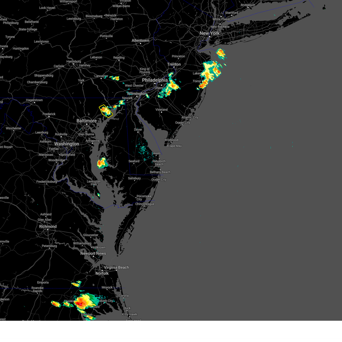 The storm which prompted the warning has weakened below severe limits, and no longer poses an immediate threat to life or property. therefore, the warning will be allowed to expire. however, gusty winds and heavy rain are still possible with this thunderstorm. to report severe weather, contact your nearest law enforcement agency. they will relay your report to the national weather service sterling virginia. The storm which prompted the warning has weakened below severe limits, and no longer poses an immediate threat to life or property. therefore, the warning will be allowed to expire. however, gusty winds and heavy rain are still possible with this thunderstorm. to report severe weather, contact your nearest law enforcement agency. they will relay your report to the national weather service sterling virginia.
|
| 7/14/2024 5:00 PM EDT |
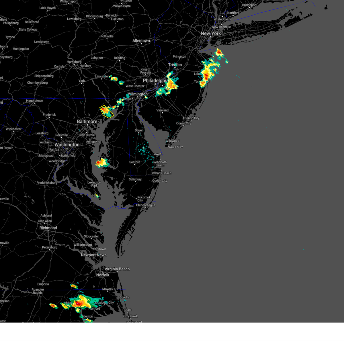 At 500 pm edt, a severe thunderstorm was located over aberdeen, moving southeast at 10 mph (radar indicated). Hazards include 60 mph wind gusts. Damaging winds will cause some trees and large branches to fall. this could injure those outdoors, as well as damage homes and vehicles. roadways may become blocked by downed trees. localized power outages are possible. unsecured light objects may become projectiles. Locations impacted include, aberdeen, aberdeen proving ground, bel air south, bel air north, riverside, perryman, churchville, harford furnace, carsins, belcamp, and abingdon. At 500 pm edt, a severe thunderstorm was located over aberdeen, moving southeast at 10 mph (radar indicated). Hazards include 60 mph wind gusts. Damaging winds will cause some trees and large branches to fall. this could injure those outdoors, as well as damage homes and vehicles. roadways may become blocked by downed trees. localized power outages are possible. unsecured light objects may become projectiles. Locations impacted include, aberdeen, aberdeen proving ground, bel air south, bel air north, riverside, perryman, churchville, harford furnace, carsins, belcamp, and abingdon.
|
| 7/14/2024 4:31 PM EDT |
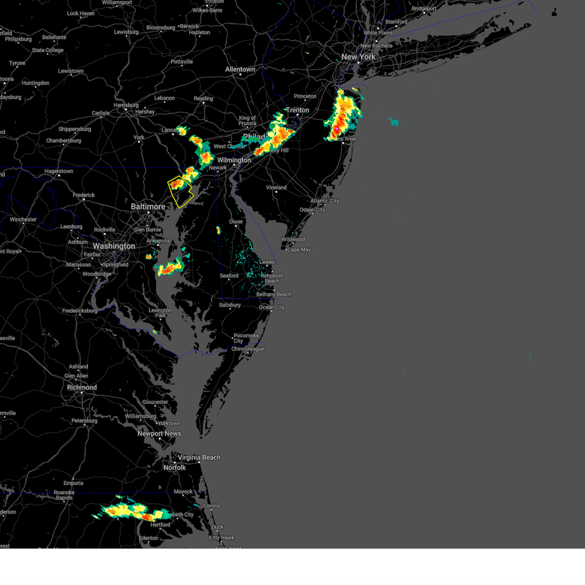 Svrlwx the national weather service in sterling virginia has issued a * severe thunderstorm warning for, eastern harford county in northern maryland, * until 515 pm edt. * at 430 pm edt, a severe thunderstorm was located near bel air south, or near aberdeen, moving southeast at 10 mph (radar indicated). Hazards include 60 mph wind gusts. Damaging winds will cause some trees and large branches to fall. this could injure those outdoors, as well as damage homes and vehicles. roadways may become blocked by downed trees. localized power outages are possible. Unsecured light objects may become projectiles. Svrlwx the national weather service in sterling virginia has issued a * severe thunderstorm warning for, eastern harford county in northern maryland, * until 515 pm edt. * at 430 pm edt, a severe thunderstorm was located near bel air south, or near aberdeen, moving southeast at 10 mph (radar indicated). Hazards include 60 mph wind gusts. Damaging winds will cause some trees and large branches to fall. this could injure those outdoors, as well as damage homes and vehicles. roadways may become blocked by downed trees. localized power outages are possible. Unsecured light objects may become projectiles.
|
| 6/30/2024 7:14 PM EDT |
 Svrlwx the national weather service in sterling virginia has issued a * severe thunderstorm warning for, harford county in northern maryland, northwestern cecil county in northeastern maryland, * until 745 pm edt. * at 714 pm edt, a severe thunderstorm was located near jarrettsville, or 16 miles northwest of aberdeen, moving southeast at 25 mph (radar indicated). Hazards include 60 mph wind gusts. Damaging winds will cause some trees and large branches to fall. this could injure those outdoors, as well as damage homes and vehicles. roadways may become blocked by downed trees. localized power outages are possible. Unsecured light objects may become projectiles. Svrlwx the national weather service in sterling virginia has issued a * severe thunderstorm warning for, harford county in northern maryland, northwestern cecil county in northeastern maryland, * until 745 pm edt. * at 714 pm edt, a severe thunderstorm was located near jarrettsville, or 16 miles northwest of aberdeen, moving southeast at 25 mph (radar indicated). Hazards include 60 mph wind gusts. Damaging winds will cause some trees and large branches to fall. this could injure those outdoors, as well as damage homes and vehicles. roadways may become blocked by downed trees. localized power outages are possible. Unsecured light objects may become projectiles.
|
| 6/26/2024 11:08 PM EDT |
 The storm which prompted the warning has weakened below severe limits, and has exited the warned area. therefore, the warning will be allowed to expire. however, heavy rain is still possible with this thunderstorm. a severe thunderstorm watch remains in effect until midnight edt for northern maryland. The storm which prompted the warning has weakened below severe limits, and has exited the warned area. therefore, the warning will be allowed to expire. however, heavy rain is still possible with this thunderstorm. a severe thunderstorm watch remains in effect until midnight edt for northern maryland.
|
| 6/26/2024 10:59 PM EDT |
 At 1059 pm edt, a severe thunderstorm was located over bel air south, or 9 miles west of aberdeen, moving northeast at 30 mph (radar indicated). Hazards include 60 mph wind gusts. Damaging winds will cause some trees and large branches to fall. this could injure those outdoors, as well as damage homes and vehicles. roadways may become blocked by downed trees. localized power outages are possible. unsecured light objects may become projectiles. Locations impacted include, bel air south, riverside, kingsville, pleasant hills, perryman, edgewood, joppatowne, churchville, bradshaw, harford furnace, abingdon, joppa, upper falls, gunpowder, and belcamp. At 1059 pm edt, a severe thunderstorm was located over bel air south, or 9 miles west of aberdeen, moving northeast at 30 mph (radar indicated). Hazards include 60 mph wind gusts. Damaging winds will cause some trees and large branches to fall. this could injure those outdoors, as well as damage homes and vehicles. roadways may become blocked by downed trees. localized power outages are possible. unsecured light objects may become projectiles. Locations impacted include, bel air south, riverside, kingsville, pleasant hills, perryman, edgewood, joppatowne, churchville, bradshaw, harford furnace, abingdon, joppa, upper falls, gunpowder, and belcamp.
|
| 6/26/2024 10:44 PM EDT |
 Svrlwx the national weather service in sterling virginia has issued a * severe thunderstorm warning for, central harford county in northern maryland, east central baltimore county in northern maryland, * until 1115 pm edt. * at 1044 pm edt, a severe thunderstorm was located over perry hall, or near middle river, moving northeast at 35 mph (radar indicated). Hazards include 60 mph wind gusts. Damaging winds will cause some trees and large branches to fall. this could injure those outdoors, as well as damage homes and vehicles. roadways may become blocked by downed trees. localized power outages are possible. Unsecured light objects may become projectiles. Svrlwx the national weather service in sterling virginia has issued a * severe thunderstorm warning for, central harford county in northern maryland, east central baltimore county in northern maryland, * until 1115 pm edt. * at 1044 pm edt, a severe thunderstorm was located over perry hall, or near middle river, moving northeast at 35 mph (radar indicated). Hazards include 60 mph wind gusts. Damaging winds will cause some trees and large branches to fall. this could injure those outdoors, as well as damage homes and vehicles. roadways may become blocked by downed trees. localized power outages are possible. Unsecured light objects may become projectiles.
|
| 6/5/2024 8:29 PM EDT |
 the tornado warning has been cancelled and is no longer in effect the tornado warning has been cancelled and is no longer in effect
|
| 6/5/2024 8:29 PM EDT |
 At 829 pm edt, a severe thunderstorm capable of producing a tornado was located near riverside, or 8 miles southwest of aberdeen, moving northeast at 20 mph (radar indicated rotation). Hazards include tornado. For those in the direct path of a tornado touchdown, flying debris will be dangerous to those caught without shelter. damage to roofs, siding, and windows may occur. mobile homes may be damaged or destroyed. tree damage is likely. this dangerous storm will be near, aberdeen, aberdeen proving ground, bel air south, riverside, and perryman around 835 pm edt. Other locations impacted by this tornadic thunderstorm include edgewood, joppatowne, harford furnace, abingdon, joppa, carsins, magnolia, and belcamp. At 829 pm edt, a severe thunderstorm capable of producing a tornado was located near riverside, or 8 miles southwest of aberdeen, moving northeast at 20 mph (radar indicated rotation). Hazards include tornado. For those in the direct path of a tornado touchdown, flying debris will be dangerous to those caught without shelter. damage to roofs, siding, and windows may occur. mobile homes may be damaged or destroyed. tree damage is likely. this dangerous storm will be near, aberdeen, aberdeen proving ground, bel air south, riverside, and perryman around 835 pm edt. Other locations impacted by this tornadic thunderstorm include edgewood, joppatowne, harford furnace, abingdon, joppa, carsins, magnolia, and belcamp.
|
| 6/5/2024 8:13 PM EDT |
 Torlwx the national weather service in sterling virginia has issued a * tornado warning for, southeastern harford county in northern maryland, east central baltimore county in northern maryland, * until 845 pm edt. * at 813 pm edt, a severe thunderstorm capable of producing a tornado was located near kingsville, or near middle river, moving northeast at 20 mph (radar indicated rotation). Hazards include tornado. For those in the direct path of a tornado touchdown, flying debris will be dangerous to those caught without shelter. damage to roofs, siding, and windows may occur. mobile homes may be damaged or destroyed. tree damage is likely. this dangerous storm will be near, bel air south, riverside, pleasant hills, and perryman around 820 pm edt. Other locations impacted by this tornadic thunderstorm include edgewood, joppatowne, harford furnace, abingdon, joppa, upper falls, carsins, magnolia, gunpowder, and chase. Torlwx the national weather service in sterling virginia has issued a * tornado warning for, southeastern harford county in northern maryland, east central baltimore county in northern maryland, * until 845 pm edt. * at 813 pm edt, a severe thunderstorm capable of producing a tornado was located near kingsville, or near middle river, moving northeast at 20 mph (radar indicated rotation). Hazards include tornado. For those in the direct path of a tornado touchdown, flying debris will be dangerous to those caught without shelter. damage to roofs, siding, and windows may occur. mobile homes may be damaged or destroyed. tree damage is likely. this dangerous storm will be near, bel air south, riverside, pleasant hills, and perryman around 820 pm edt. Other locations impacted by this tornadic thunderstorm include edgewood, joppatowne, harford furnace, abingdon, joppa, upper falls, carsins, magnolia, gunpowder, and chase.
|
| 9/13/2023 12:22 AM EDT |
 The tornado warning for central harford and east central baltimore counties will expire at 1230 am edt, the storm which prompted the warning has weakened below severe limits, and no longer appears capable of producing a tornado. therefore, the warning will be allowed to expire. The tornado warning for central harford and east central baltimore counties will expire at 1230 am edt, the storm which prompted the warning has weakened below severe limits, and no longer appears capable of producing a tornado. therefore, the warning will be allowed to expire.
|
| 9/13/2023 12:12 AM EDT |
 At 1212 am edt, a severe thunderstorm capable of producing a tornado was located over pleasant hills, or 9 miles west of aberdeen, moving northeast at 20 mph (radar indicated rotation). Hazards include tornado. For those in the direct path of a tornado touchdown, flying debris will be dangerous to those caught without shelter. damage to roofs, siding, and windows may occur. mobile homes may be damaged or destroyed. tree damage is likely. this dangerous storm will be near, bel air south, riverside, pleasant hills, and perryman around 1215 am edt. Other locations impacted by this tornadic thunderstorm include harford furnace, abingdon, joppa, belcamp, bradshaw, joppatowne, and edgewood. At 1212 am edt, a severe thunderstorm capable of producing a tornado was located over pleasant hills, or 9 miles west of aberdeen, moving northeast at 20 mph (radar indicated rotation). Hazards include tornado. For those in the direct path of a tornado touchdown, flying debris will be dangerous to those caught without shelter. damage to roofs, siding, and windows may occur. mobile homes may be damaged or destroyed. tree damage is likely. this dangerous storm will be near, bel air south, riverside, pleasant hills, and perryman around 1215 am edt. Other locations impacted by this tornadic thunderstorm include harford furnace, abingdon, joppa, belcamp, bradshaw, joppatowne, and edgewood.
|
| 9/12/2023 11:56 PM EDT |
 At 1155 pm edt, a severe thunderstorm capable of producing a tornado was located over perry hall, or near middle river, moving northeast at 20 mph (radar indicated rotation). Hazards include tornado and quarter size hail. For those in the direct path of a tornado touchdown, flying debris will be dangerous to those caught without shelter. damage to roofs, siding, and windows may occur. mobile homes may be damaged or destroyed. tree damage is likely. this dangerous storm will be near, bel air south, bel air north, fallston, kingsville, and pleasant hills around 1200 am edt. riverside and perryman around 1205 am edt. Other locations impacted by this tornadic thunderstorm include nottingham, edgewood, fork, benson, magnolia, bradshaw, bynum, joppatowne, abingdon, and joppa. At 1155 pm edt, a severe thunderstorm capable of producing a tornado was located over perry hall, or near middle river, moving northeast at 20 mph (radar indicated rotation). Hazards include tornado and quarter size hail. For those in the direct path of a tornado touchdown, flying debris will be dangerous to those caught without shelter. damage to roofs, siding, and windows may occur. mobile homes may be damaged or destroyed. tree damage is likely. this dangerous storm will be near, bel air south, bel air north, fallston, kingsville, and pleasant hills around 1200 am edt. riverside and perryman around 1205 am edt. Other locations impacted by this tornadic thunderstorm include nottingham, edgewood, fork, benson, magnolia, bradshaw, bynum, joppatowne, abingdon, and joppa.
|
| 8/7/2023 5:35 PM EDT |
 At 534 pm edt, severe thunderstorms were located along a line extending from delta to pleasant hills to rosedale, moving east at 45 mph (radar indicated). Hazards include 60 mph wind gusts. Damaging winds will cause some trees and large branches to fall. this could injure those outdoors, as well as damage homes and vehicles. roadways may become blocked by downed trees. localized power outages are possible. Unsecured light objects may become projectiles. At 534 pm edt, severe thunderstorms were located along a line extending from delta to pleasant hills to rosedale, moving east at 45 mph (radar indicated). Hazards include 60 mph wind gusts. Damaging winds will cause some trees and large branches to fall. this could injure those outdoors, as well as damage homes and vehicles. roadways may become blocked by downed trees. localized power outages are possible. Unsecured light objects may become projectiles.
|
| 8/7/2023 5:30 PM EDT |
 At 529 pm edt, severe thunderstorms were located along a line extending from near jarrettsville to rosedale to laurel, moving east at 50 mph (radar indicated). Hazards include 60 mph wind gusts. Damaging winds will cause some trees and large branches to fall. this could injure those outdoors, as well as damage homes and vehicles. roadways may become blocked by downed trees. localized power outages are possible. unsecured light objects may become projectiles. locations impacted include, baltimore, pikesville, middle river, cockeysville, aberdeen, millers island, north point state park, sparrows point, back river, ellicott city, dundalk, towson, bel air south, catonsville, essex, woodlawn, randallstown, parkville, bel air north and carney. hail threat, radar indicated max hail size, <. 75 in wind threat, radar indicated max wind gust, 60 mph. At 529 pm edt, severe thunderstorms were located along a line extending from near jarrettsville to rosedale to laurel, moving east at 50 mph (radar indicated). Hazards include 60 mph wind gusts. Damaging winds will cause some trees and large branches to fall. this could injure those outdoors, as well as damage homes and vehicles. roadways may become blocked by downed trees. localized power outages are possible. unsecured light objects may become projectiles. locations impacted include, baltimore, pikesville, middle river, cockeysville, aberdeen, millers island, north point state park, sparrows point, back river, ellicott city, dundalk, towson, bel air south, catonsville, essex, woodlawn, randallstown, parkville, bel air north and carney. hail threat, radar indicated max hail size, <. 75 in wind threat, radar indicated max wind gust, 60 mph.
|
| 8/7/2023 5:06 PM EDT |
 At 505 pm edt, severe thunderstorms were located along a line extending from hampstead to near ellicott city to near north potomac, moving east at 55 mph (radar indicated). Hazards include 60 mph wind gusts. Damaging winds will cause some trees and large branches to fall. this could injure those outdoors, as well as damage homes and vehicles. roadways may become blocked by downed trees. localized power outages are possible. Unsecured light objects may become projectiles. At 505 pm edt, severe thunderstorms were located along a line extending from hampstead to near ellicott city to near north potomac, moving east at 55 mph (radar indicated). Hazards include 60 mph wind gusts. Damaging winds will cause some trees and large branches to fall. this could injure those outdoors, as well as damage homes and vehicles. roadways may become blocked by downed trees. localized power outages are possible. Unsecured light objects may become projectiles.
|
| 7/29/2023 5:09 PM EDT |
 At 509 pm edt, severe thunderstorms were located along a line extending from near north east to near charlestown to near bowleys quarters, moving east at 20 mph (radar indicated). Hazards include 70 mph wind gusts and quarter size hail. Damaging winds will cause some trees and large branches to fall. this could injure those outdoors, as well as damage homes and vehicles. roadways may become blocked by downed trees. localized power outages are possible. unsecured light objects may become projectiles. locations impacted include, middle river, elkton, aberdeen, havre de grace, aberdeen proving ground, bel air south, essex, bowleys quarters, riverside, north east, perryman, charlestown, cecilton, warwick, barksdale, bohemias mills, brantwood, glen westover, andora and cherry hill. thunderstorm damage threat, considerable hail threat, radar indicated max hail size, 1. 00 in wind threat, radar indicated max wind gust, 70 mph. At 509 pm edt, severe thunderstorms were located along a line extending from near north east to near charlestown to near bowleys quarters, moving east at 20 mph (radar indicated). Hazards include 70 mph wind gusts and quarter size hail. Damaging winds will cause some trees and large branches to fall. this could injure those outdoors, as well as damage homes and vehicles. roadways may become blocked by downed trees. localized power outages are possible. unsecured light objects may become projectiles. locations impacted include, middle river, elkton, aberdeen, havre de grace, aberdeen proving ground, bel air south, essex, bowleys quarters, riverside, north east, perryman, charlestown, cecilton, warwick, barksdale, bohemias mills, brantwood, glen westover, andora and cherry hill. thunderstorm damage threat, considerable hail threat, radar indicated max hail size, 1. 00 in wind threat, radar indicated max wind gust, 70 mph.
|
| 7/29/2023 4:52 PM EDT |
 At 451 pm edt, severe thunderstorms were located along a line extending from octoraro to aberdeen proving ground to middle river, moving east at 40 mph (radar indicated). Hazards include 60 mph wind gusts and quarter size hail. Damaging winds will cause some trees and large branches to fall. this could injure those outdoors, as well as damage homes and vehicles. roadways may become blocked by downed trees. localized power outages are possible. unsecured light objects may become projectiles. locations impacted include, baltimore, middle river, elkton, aberdeen, havre de grace, aberdeen proving ground, calvert, dundalk, towson, bel air south, essex, parkville, bel air north, carney, perry hall, rosedale, rossville, timonium, white marsh and bowleys quarters. hail threat, radar indicated max hail size, 1. 00 in wind threat, radar indicated max wind gust, 60 mph. At 451 pm edt, severe thunderstorms were located along a line extending from octoraro to aberdeen proving ground to middle river, moving east at 40 mph (radar indicated). Hazards include 60 mph wind gusts and quarter size hail. Damaging winds will cause some trees and large branches to fall. this could injure those outdoors, as well as damage homes and vehicles. roadways may become blocked by downed trees. localized power outages are possible. unsecured light objects may become projectiles. locations impacted include, baltimore, middle river, elkton, aberdeen, havre de grace, aberdeen proving ground, calvert, dundalk, towson, bel air south, essex, parkville, bel air north, carney, perry hall, rosedale, rossville, timonium, white marsh and bowleys quarters. hail threat, radar indicated max hail size, 1. 00 in wind threat, radar indicated max wind gust, 60 mph.
|
| 7/29/2023 4:30 PM EDT |
 At 430 pm edt, severe thunderstorms were located along a line extending from near jarrettsville to near fallston to milford mill, moving east at 20 mph (radar indicated). Hazards include 60 mph wind gusts and quarter size hail. Damaging winds will cause some trees and large branches to fall. this could injure those outdoors, as well as damage homes and vehicles. roadways may become blocked by downed trees. localized power outages are possible. Unsecured light objects may become projectiles. At 430 pm edt, severe thunderstorms were located along a line extending from near jarrettsville to near fallston to milford mill, moving east at 20 mph (radar indicated). Hazards include 60 mph wind gusts and quarter size hail. Damaging winds will cause some trees and large branches to fall. this could injure those outdoors, as well as damage homes and vehicles. roadways may become blocked by downed trees. localized power outages are possible. Unsecured light objects may become projectiles.
|
| 7/28/2023 8:17 PM EDT |
 At 817 pm edt, severe thunderstorms were located along a line extending from rising sun to near havre de grace to near perryman, moving east at 35 mph (radar indicated). Hazards include 70 mph wind gusts and quarter size hail. Damaging winds will cause some trees and large branches to fall. this could injure those outdoors, as well as damage homes and vehicles. roadways may become blocked by downed trees. localized power outages are possible. unsecured light objects may become projectiles. locations impacted include, elkton, aberdeen, havre de grace, aberdeen proving ground, calvert, riverside, north east, rising sun, perryman, charlestown, cecilton, warwick, zion, blake, barksdale, bohemias mills, west nottingham, octoraro, brantwood and fair hill. thunderstorm damage threat, considerable hail threat, radar indicated max hail size, 1. 00 in wind threat, radar indicated max wind gust, 70 mph. At 817 pm edt, severe thunderstorms were located along a line extending from rising sun to near havre de grace to near perryman, moving east at 35 mph (radar indicated). Hazards include 70 mph wind gusts and quarter size hail. Damaging winds will cause some trees and large branches to fall. this could injure those outdoors, as well as damage homes and vehicles. roadways may become blocked by downed trees. localized power outages are possible. unsecured light objects may become projectiles. locations impacted include, elkton, aberdeen, havre de grace, aberdeen proving ground, calvert, riverside, north east, rising sun, perryman, charlestown, cecilton, warwick, zion, blake, barksdale, bohemias mills, west nottingham, octoraro, brantwood and fair hill. thunderstorm damage threat, considerable hail threat, radar indicated max hail size, 1. 00 in wind threat, radar indicated max wind gust, 70 mph.
|
| 7/28/2023 7:41 PM EDT |
 At 740 pm edt, severe thunderstorms were located along a line extending from near delta to kingsville to baltimore, moving east at 35 mph (radar indicated). Hazards include 70 mph wind gusts and quarter size hail. Damaging winds will cause some trees and large branches to fall. this could injure those outdoors, as well as damage homes and vehicles. roadways may become blocked by downed trees. localized power outages are possible. Unsecured light objects may become projectiles. At 740 pm edt, severe thunderstorms were located along a line extending from near delta to kingsville to baltimore, moving east at 35 mph (radar indicated). Hazards include 70 mph wind gusts and quarter size hail. Damaging winds will cause some trees and large branches to fall. this could injure those outdoors, as well as damage homes and vehicles. roadways may become blocked by downed trees. localized power outages are possible. Unsecured light objects may become projectiles.
|
| 7/3/2023 8:07 PM EDT |
 At 807 pm edt, a severe thunderstorm was located over perryman, or near aberdeen, moving east at 25 mph (radar indicated). Hazards include 60 mph wind gusts. Damaging winds will cause some trees and large branches to fall. this could injure those outdoors, as well as damage homes and vehicles. roadways may become blocked by downed trees. localized power outages are possible. Unsecured light objects may become projectiles. At 807 pm edt, a severe thunderstorm was located over perryman, or near aberdeen, moving east at 25 mph (radar indicated). Hazards include 60 mph wind gusts. Damaging winds will cause some trees and large branches to fall. this could injure those outdoors, as well as damage homes and vehicles. roadways may become blocked by downed trees. localized power outages are possible. Unsecured light objects may become projectiles.
|
| 6/27/2023 4:07 PM EDT |
 The severe thunderstorm warning for central harford and east central baltimore counties and northeastern baltimore city will expire at 415 pm edt, the storms which prompted the warning have weakened below severe limits, and no longer pose an immediate threat to life or property. therefore, the warning will be allowed to expire. however gusty winds and heavy rain are still possible with these thunderstorms. to report severe weather, contact your nearest law enforcement agency. they will relay your report to the national weather service sterling virginia. The severe thunderstorm warning for central harford and east central baltimore counties and northeastern baltimore city will expire at 415 pm edt, the storms which prompted the warning have weakened below severe limits, and no longer pose an immediate threat to life or property. therefore, the warning will be allowed to expire. however gusty winds and heavy rain are still possible with these thunderstorms. to report severe weather, contact your nearest law enforcement agency. they will relay your report to the national weather service sterling virginia.
|
| 6/27/2023 3:45 PM EDT |
 At 344 pm edt, severe thunderstorms were located along a line extending from near fallston to carney, moving east at 10 mph (trained weather spotter reported quarter size fullerton). Hazards include 60 mph wind gusts and quarter size hail. Damaging winds will cause some trees and large branches to fall. this could injure those outdoors, as well as damage homes and vehicles. roadways may become blocked by downed trees. localized power outages are possible. unsecured light objects may become projectiles. locations impacted include, baltimore, aberdeen, towson, bel air south, parkville, bel air north, carney, perry hall, rosedale, rossville, timonium, white marsh, fallston, riverside, hampton, kingsville, pleasant hills, jarrettsville, perryman and lutherville-timonium. hail threat, observed max hail size, 1. 00 in wind threat, radar indicated max wind gust, 60 mph. At 344 pm edt, severe thunderstorms were located along a line extending from near fallston to carney, moving east at 10 mph (trained weather spotter reported quarter size fullerton). Hazards include 60 mph wind gusts and quarter size hail. Damaging winds will cause some trees and large branches to fall. this could injure those outdoors, as well as damage homes and vehicles. roadways may become blocked by downed trees. localized power outages are possible. unsecured light objects may become projectiles. locations impacted include, baltimore, aberdeen, towson, bel air south, parkville, bel air north, carney, perry hall, rosedale, rossville, timonium, white marsh, fallston, riverside, hampton, kingsville, pleasant hills, jarrettsville, perryman and lutherville-timonium. hail threat, observed max hail size, 1. 00 in wind threat, radar indicated max wind gust, 60 mph.
|
| 6/27/2023 3:30 PM EDT |
 At 330 pm edt, severe thunderstorms were located along a line extending from near fallston to parkville, moving east at 10 mph (radar indicated). Hazards include 60 mph wind gusts and quarter size hail. Damaging winds will cause some trees and large branches to fall. this could injure those outdoors, as well as damage homes and vehicles. roadways may become blocked by downed trees. localized power outages are possible. Unsecured light objects may become projectiles. At 330 pm edt, severe thunderstorms were located along a line extending from near fallston to parkville, moving east at 10 mph (radar indicated). Hazards include 60 mph wind gusts and quarter size hail. Damaging winds will cause some trees and large branches to fall. this could injure those outdoors, as well as damage homes and vehicles. roadways may become blocked by downed trees. localized power outages are possible. Unsecured light objects may become projectiles.
|
| 6/26/2023 7:04 PM EDT |
 At 704 pm edt, a severe thunderstorm was located over perry hall, or near middle river, moving east at 25 mph (radar indicated). Hazards include 60 mph wind gusts and quarter size hail. Damaging winds will cause some trees and large branches to fall. this could injure those outdoors, as well as damage homes and vehicles. roadways may become blocked by downed trees. localized power outages are possible. Unsecured light objects may become projectiles. At 704 pm edt, a severe thunderstorm was located over perry hall, or near middle river, moving east at 25 mph (radar indicated). Hazards include 60 mph wind gusts and quarter size hail. Damaging winds will cause some trees and large branches to fall. this could injure those outdoors, as well as damage homes and vehicles. roadways may become blocked by downed trees. localized power outages are possible. Unsecured light objects may become projectiles.
|
| 4/22/2023 3:13 PM EDT |
 At 312 pm edt, severe thunderstorms were located along a line extending from 7 miles south of railroad to carney to arnold, moving northeast at 45 mph (radar indicated). Hazards include 60 mph wind gusts. Damaging winds will cause some trees and large branches to fall. this could injure those outdoors, as well as damage homes and vehicles. roadways may become blocked by downed trees. localized power outages are possible. unsecured light objects may become projectiles. locations impacted include, baltimore, pikesville, middle river, cockeysville, millers island, north point state park, sparrows point, back river, dundalk, towson, bel air south, essex, parkville, bel air north, carney, perry hall, rosedale, rossville, mays chapel and timonium. hail threat, radar indicated max hail size, <. 75 in wind threat, radar indicated max wind gust, 60 mph. At 312 pm edt, severe thunderstorms were located along a line extending from 7 miles south of railroad to carney to arnold, moving northeast at 45 mph (radar indicated). Hazards include 60 mph wind gusts. Damaging winds will cause some trees and large branches to fall. this could injure those outdoors, as well as damage homes and vehicles. roadways may become blocked by downed trees. localized power outages are possible. unsecured light objects may become projectiles. locations impacted include, baltimore, pikesville, middle river, cockeysville, millers island, north point state park, sparrows point, back river, dundalk, towson, bel air south, essex, parkville, bel air north, carney, perry hall, rosedale, rossville, mays chapel and timonium. hail threat, radar indicated max hail size, <. 75 in wind threat, radar indicated max wind gust, 60 mph.
|
| 4/22/2023 2:47 PM EDT |
 At 247 pm edt, severe thunderstorms were located along a line extending from near reisterstown to elkridge to near upper marlboro, moving northeast at 45 mph (radar indicated). Hazards include 60 mph wind gusts. Damaging winds will cause some trees and large branches to fall. this could injure those outdoors, as well as damage homes and vehicles. roadways may become blocked by downed trees. localized power outages are possible. Unsecured light objects may become projectiles. At 247 pm edt, severe thunderstorms were located along a line extending from near reisterstown to elkridge to near upper marlboro, moving northeast at 45 mph (radar indicated). Hazards include 60 mph wind gusts. Damaging winds will cause some trees and large branches to fall. this could injure those outdoors, as well as damage homes and vehicles. roadways may become blocked by downed trees. localized power outages are possible. Unsecured light objects may become projectiles.
|
| 4/1/2023 6:46 PM EDT |
 At 645 pm edt, severe thunderstorms were located along a line extending from fair hill to riverside, moving east at 55 mph (radar indicated). Hazards include 60 mph wind gusts and quarter size hail. Damaging winds will cause some trees and large branches to fall. this could injure those outdoors, as well as damage homes and vehicles. roadways may become blocked by downed trees. localized power outages are possible. unsecured light objects may become projectiles. Locations impacted include, newark, elkton, aberdeen, havre de grace, aberdeen proving ground, calvert, bel air south, riverside, north east, pleasant hills, perryman, charlestown, zion, blake, barksdale, bohemias mills, west nottingham, brantwood, fair hill and glen westover. At 645 pm edt, severe thunderstorms were located along a line extending from fair hill to riverside, moving east at 55 mph (radar indicated). Hazards include 60 mph wind gusts and quarter size hail. Damaging winds will cause some trees and large branches to fall. this could injure those outdoors, as well as damage homes and vehicles. roadways may become blocked by downed trees. localized power outages are possible. unsecured light objects may become projectiles. Locations impacted include, newark, elkton, aberdeen, havre de grace, aberdeen proving ground, calvert, bel air south, riverside, north east, pleasant hills, perryman, charlestown, zion, blake, barksdale, bohemias mills, west nottingham, brantwood, fair hill and glen westover.
|
| 4/1/2023 6:27 PM EDT |
 At 626 pm edt, severe thunderstorms were located along a line extending from richardsmere to fallston, moving east at 55 mph (radar indicated). Hazards include 60 mph wind gusts and quarter size hail. Damaging winds will cause some trees and large branches to fall. this could injure those outdoors, as well as damage homes and vehicles. roadways may become blocked by downed trees. localized power outages are possible. Unsecured light objects may become projectiles. At 626 pm edt, severe thunderstorms were located along a line extending from richardsmere to fallston, moving east at 55 mph (radar indicated). Hazards include 60 mph wind gusts and quarter size hail. Damaging winds will cause some trees and large branches to fall. this could injure those outdoors, as well as damage homes and vehicles. roadways may become blocked by downed trees. localized power outages are possible. Unsecured light objects may become projectiles.
|
| 2/21/2023 1:35 PM EST |
 At 135 pm est, a severe thunderstorm was located over randallstown, or near pikesville, moving east at 65 mph (radar indicated). Hazards include 60 mph wind gusts and quarter size hail. Damaging winds will cause some trees and large branches to fall. this could injure those outdoors, as well as damage homes and vehicles. roadways may become blocked by downed trees. localized power outages are possible. Unsecured light objects may become projectiles. At 135 pm est, a severe thunderstorm was located over randallstown, or near pikesville, moving east at 65 mph (radar indicated). Hazards include 60 mph wind gusts and quarter size hail. Damaging winds will cause some trees and large branches to fall. this could injure those outdoors, as well as damage homes and vehicles. roadways may become blocked by downed trees. localized power outages are possible. Unsecured light objects may become projectiles.
|
| 7/18/2022 5:42 PM EDT |
 The severe thunderstorm warning for eastern harford and central cecil counties will expire at 545 pm edt, the storms which prompted the warning have moved out of the area. therefore, the warning will be allowed to expire. a severe thunderstorm watch remains in effect until 1000 pm edt for northern and northeastern maryland. The severe thunderstorm warning for eastern harford and central cecil counties will expire at 545 pm edt, the storms which prompted the warning have moved out of the area. therefore, the warning will be allowed to expire. a severe thunderstorm watch remains in effect until 1000 pm edt for northern and northeastern maryland.
|
| 7/18/2022 5:17 PM EDT |
 At 517 pm edt, severe thunderstorms were located along a line extending from near aberdeen to near newtown, moving east at 35 mph (radar indicated). Hazards include 60 mph wind gusts. Damaging winds will cause some trees and large branches to fall. this could injure those outdoors, as well as damage homes and vehicles. roadways may become blocked by downed trees. localized power outages are possible. unsecured light objects may become projectiles. locations impacted include, aberdeen, havre de grace, aberdeen proving ground, bel air south, bel air north, riverside, perryman, charlestown, woodlawn, farmington, edgewood, perryville, port deposit, churchville, carsins, harford furnace, abingdon and belcamp. hail threat, radar indicated max hail size, <. 75 in wind threat, radar indicated max wind gust, 60 mph. At 517 pm edt, severe thunderstorms were located along a line extending from near aberdeen to near newtown, moving east at 35 mph (radar indicated). Hazards include 60 mph wind gusts. Damaging winds will cause some trees and large branches to fall. this could injure those outdoors, as well as damage homes and vehicles. roadways may become blocked by downed trees. localized power outages are possible. unsecured light objects may become projectiles. locations impacted include, aberdeen, havre de grace, aberdeen proving ground, bel air south, bel air north, riverside, perryman, charlestown, woodlawn, farmington, edgewood, perryville, port deposit, churchville, carsins, harford furnace, abingdon and belcamp. hail threat, radar indicated max hail size, <. 75 in wind threat, radar indicated max wind gust, 60 mph.
|
| 7/18/2022 4:56 PM EDT |
 At 456 pm edt, severe thunderstorms were located along a line extending from pleasant hills to back river, moving east at 35 mph (radar indicated). Hazards include 60 mph wind gusts. Damaging winds will cause some trees and large branches to fall. this could injure those outdoors, as well as damage homes and vehicles. roadways may become blocked by downed trees. localized power outages are possible. Unsecured light objects may become projectiles. At 456 pm edt, severe thunderstorms were located along a line extending from pleasant hills to back river, moving east at 35 mph (radar indicated). Hazards include 60 mph wind gusts. Damaging winds will cause some trees and large branches to fall. this could injure those outdoors, as well as damage homes and vehicles. roadways may become blocked by downed trees. localized power outages are possible. Unsecured light objects may become projectiles.
|
| 7/18/2022 4:41 PM EDT |
 At 441 pm edt, severe thunderstorms were located along a line extending from 7 miles south of shrewsbury to near fallston to carney, moving northeast at 35 mph (radar indicated). Hazards include 60 mph wind gusts. Damaging winds will cause some trees and large branches to fall. this could injure those outdoors, as well as damage homes and vehicles. roadways may become blocked by downed trees. localized power outages are possible. unsecured light objects may become projectiles. Locations impacted include, baltimore, cockeysville, towson, bel air south, parkville, bel air north, carney, perry hall, mays chapel, timonium, fallston, riverside, hampton, kingsville, pleasant hills, jarrettsville, perryman, lutherville-timonium, edgewood and joppatowne. At 441 pm edt, severe thunderstorms were located along a line extending from 7 miles south of shrewsbury to near fallston to carney, moving northeast at 35 mph (radar indicated). Hazards include 60 mph wind gusts. Damaging winds will cause some trees and large branches to fall. this could injure those outdoors, as well as damage homes and vehicles. roadways may become blocked by downed trees. localized power outages are possible. unsecured light objects may become projectiles. Locations impacted include, baltimore, cockeysville, towson, bel air south, parkville, bel air north, carney, perry hall, mays chapel, timonium, fallston, riverside, hampton, kingsville, pleasant hills, jarrettsville, perryman, lutherville-timonium, edgewood and joppatowne.
|
| 7/18/2022 4:22 PM EDT |
 At 422 pm edt, severe thunderstorms were located along a line extending from hampstead to near reisterstown to near pikesville, moving northeast at 35 mph (radar indicated). Hazards include 60 mph wind gusts. Damaging winds will cause some trees and large branches to fall. this could injure those outdoors, as well as damage homes and vehicles. roadways may become blocked by downed trees. localized power outages are possible. Unsecured light objects may become projectiles. At 422 pm edt, severe thunderstorms were located along a line extending from hampstead to near reisterstown to near pikesville, moving northeast at 35 mph (radar indicated). Hazards include 60 mph wind gusts. Damaging winds will cause some trees and large branches to fall. this could injure those outdoors, as well as damage homes and vehicles. roadways may become blocked by downed trees. localized power outages are possible. Unsecured light objects may become projectiles.
|
| 7/12/2022 5:11 PM EDT |
 At 510 pm edt, a severe thunderstorm was located over riverside, or near aberdeen, moving east at 45 mph (radar indicated). Hazards include 70 mph wind gusts and ping pong ball size hail. Damaging winds will cause some trees and large branches to fall. this could injure those outdoors, as well as damage homes and vehicles. roadways may become blocked by downed trees. localized power outages are possible. unsecured light objects may become projectiles. locations impacted include, elkton, aberdeen, havre de grace, aberdeen proving ground, calvert, riverside, north east, rising sun, perryman, charlestown, cecilton, warwick, zion, barksdale, bohemias mills, west nottingham, octoraro, brantwood, fair hill and glen westover. thunderstorm damage threat, considerable hail threat, radar indicated max hail size, 1. 50 in wind threat, radar indicated max wind gust, 70 mph. At 510 pm edt, a severe thunderstorm was located over riverside, or near aberdeen, moving east at 45 mph (radar indicated). Hazards include 70 mph wind gusts and ping pong ball size hail. Damaging winds will cause some trees and large branches to fall. this could injure those outdoors, as well as damage homes and vehicles. roadways may become blocked by downed trees. localized power outages are possible. unsecured light objects may become projectiles. locations impacted include, elkton, aberdeen, havre de grace, aberdeen proving ground, calvert, riverside, north east, rising sun, perryman, charlestown, cecilton, warwick, zion, barksdale, bohemias mills, west nottingham, octoraro, brantwood, fair hill and glen westover. thunderstorm damage threat, considerable hail threat, radar indicated max hail size, 1. 50 in wind threat, radar indicated max wind gust, 70 mph.
|
| 7/12/2022 5:06 PM EDT |
 At 506 pm edt, a severe thunderstorm was located over bel air south, or 8 miles west of aberdeen, moving east at 45 mph (radar indicated). Hazards include 60 mph wind gusts and quarter size hail. Damaging winds will cause some trees and large branches to fall. this could injure those outdoors, as well as damage homes and vehicles. roadways may become blocked by downed trees. localized power outages are possible. unsecured light objects may become projectiles. locations impacted include, elkton, aberdeen, havre de grace, aberdeen proving ground, calvert, bel air south, bel air north, riverside, north east, rising sun, perryman, charlestown, cecilton, blake, bohemias mills, west nottingham, bay view, lombard, richardsmere and woodlawn. hail threat, radar indicated max hail size, 1. 00 in wind threat, radar indicated max wind gust, 60 mph. At 506 pm edt, a severe thunderstorm was located over bel air south, or 8 miles west of aberdeen, moving east at 45 mph (radar indicated). Hazards include 60 mph wind gusts and quarter size hail. Damaging winds will cause some trees and large branches to fall. this could injure those outdoors, as well as damage homes and vehicles. roadways may become blocked by downed trees. localized power outages are possible. unsecured light objects may become projectiles. locations impacted include, elkton, aberdeen, havre de grace, aberdeen proving ground, calvert, bel air south, bel air north, riverside, north east, rising sun, perryman, charlestown, cecilton, blake, bohemias mills, west nottingham, bay view, lombard, richardsmere and woodlawn. hail threat, radar indicated max hail size, 1. 00 in wind threat, radar indicated max wind gust, 60 mph.
|
| 7/12/2022 4:50 PM EDT |
 At 450 pm edt, a severe thunderstorm was located near cockeysville, moving east at 50 mph (radar indicated). Hazards include 60 mph wind gusts and quarter size hail. Damaging winds will cause some trees and large branches to fall. this could injure those outdoors, as well as damage homes and vehicles. roadways may become blocked by downed trees. localized power outages are possible. Unsecured light objects may become projectiles. At 450 pm edt, a severe thunderstorm was located near cockeysville, moving east at 50 mph (radar indicated). Hazards include 60 mph wind gusts and quarter size hail. Damaging winds will cause some trees and large branches to fall. this could injure those outdoors, as well as damage homes and vehicles. roadways may become blocked by downed trees. localized power outages are possible. Unsecured light objects may become projectiles.
|
| 5/27/2022 1:35 PM EDT |
 At 135 pm edt, severe thunderstorms were located along a line extending from stewartstown to bel air north to near kingsville, moving northeast at 40 mph (radar indicated). Hazards include 60 mph wind gusts. Damaging winds will cause some trees and large branches to fall. this could injure those outdoors, as well as damage homes and vehicles. roadways may become blocked by downed trees. localized power outages are possible. unsecured light objects may become projectiles. Locations impacted include, aberdeen, havre de grace, aberdeen proving ground, bel air south, bel air north, fallston, riverside, kingsville, pleasant hills, jarrettsville, perryman, edgewood, joppatowne, pylesville, darlington, cardiff, churchville, norrisville, carsins and bradshaw. At 135 pm edt, severe thunderstorms were located along a line extending from stewartstown to bel air north to near kingsville, moving northeast at 40 mph (radar indicated). Hazards include 60 mph wind gusts. Damaging winds will cause some trees and large branches to fall. this could injure those outdoors, as well as damage homes and vehicles. roadways may become blocked by downed trees. localized power outages are possible. unsecured light objects may become projectiles. Locations impacted include, aberdeen, havre de grace, aberdeen proving ground, bel air south, bel air north, fallston, riverside, kingsville, pleasant hills, jarrettsville, perryman, edgewood, joppatowne, pylesville, darlington, cardiff, churchville, norrisville, carsins and bradshaw.
|
| 5/27/2022 1:15 PM EDT |
 At 115 pm edt, severe thunderstorms were located along a line extending from near railroad to near cockeysville to rosedale, moving northeast at 35 mph (radar indicated). Hazards include 60 mph wind gusts. Damaging winds will cause some trees and large branches to fall. this could injure those outdoors, as well as damage homes and vehicles. roadways may become blocked by downed trees. localized power outages are possible. Unsecured light objects may become projectiles. At 115 pm edt, severe thunderstorms were located along a line extending from near railroad to near cockeysville to rosedale, moving northeast at 35 mph (radar indicated). Hazards include 60 mph wind gusts. Damaging winds will cause some trees and large branches to fall. this could injure those outdoors, as well as damage homes and vehicles. roadways may become blocked by downed trees. localized power outages are possible. Unsecured light objects may become projectiles.
|
| 5/22/2022 6:16 PM EDT |
 At 616 pm edt, severe thunderstorms were located along a line extending from glen westover to near newtown, moving east at 30 mph (radar indicated). Hazards include 60 mph wind gusts and quarter size hail. Damaging winds will cause some trees and large branches to fall. this could injure those outdoors, as well as damage homes and vehicles. roadways may become blocked by downed trees. localized power outages are possible. Unsecured light objects may become projectiles. At 616 pm edt, severe thunderstorms were located along a line extending from glen westover to near newtown, moving east at 30 mph (radar indicated). Hazards include 60 mph wind gusts and quarter size hail. Damaging winds will cause some trees and large branches to fall. this could injure those outdoors, as well as damage homes and vehicles. roadways may become blocked by downed trees. localized power outages are possible. Unsecured light objects may become projectiles.
|
| 5/22/2022 6:06 PM EDT |
 At 605 pm edt, severe thunderstorms were located along a line extending from pleasant hill to fort smallwood state park, moving east at 25 mph (radar indicated). Hazards include 60 mph wind gusts and quarter size hail. Damaging winds will cause some trees and large branches to fall. this could injure those outdoors, as well as damage homes and vehicles. roadways may become blocked by downed trees. localized power outages are possible. unsecured light objects may become projectiles. locations impacted include, newark, middle river, elkton, aberdeen, havre de grace, riviera beach, aberdeen proving ground, fort smallwood state park, millers island, north point state park, sparrows point, back river, calvert, dundalk, bel air south, essex, pasadena, bowleys quarters, riverside and north east. hail threat, radar indicated max hail size, 1. 00 in wind threat, radar indicated max wind gust, 60 mph. At 605 pm edt, severe thunderstorms were located along a line extending from pleasant hill to fort smallwood state park, moving east at 25 mph (radar indicated). Hazards include 60 mph wind gusts and quarter size hail. Damaging winds will cause some trees and large branches to fall. this could injure those outdoors, as well as damage homes and vehicles. roadways may become blocked by downed trees. localized power outages are possible. unsecured light objects may become projectiles. locations impacted include, newark, middle river, elkton, aberdeen, havre de grace, riviera beach, aberdeen proving ground, fort smallwood state park, millers island, north point state park, sparrows point, back river, calvert, dundalk, bel air south, essex, pasadena, bowleys quarters, riverside and north east. hail threat, radar indicated max hail size, 1. 00 in wind threat, radar indicated max wind gust, 60 mph.
|
| 5/22/2022 5:52 PM EDT |
 At 552 pm edt, severe thunderstorms were located along a line extending from farmington to pasadena, moving east at 25 mph (radar indicated). Hazards include 60 mph wind gusts. Damaging winds will cause some trees and large branches to fall. this could injure those outdoors, as well as damage homes and vehicles. roadways may become blocked by downed trees. localized power outages are possible. unsecured light objects may become projectiles. locations impacted include, baltimore, newark, middle river, elkton, aberdeen, havre de grace, riviera beach, aberdeen proving ground, fort smallwood state park, millers island, north point state park, sparrows point, back river, calvert, glen burnie, dundalk, bel air south, essex, parkville and bel air north. hail threat, radar indicated max hail size, <. 75 in wind threat, radar indicated max wind gust, 60 mph. At 552 pm edt, severe thunderstorms were located along a line extending from farmington to pasadena, moving east at 25 mph (radar indicated). Hazards include 60 mph wind gusts. Damaging winds will cause some trees and large branches to fall. this could injure those outdoors, as well as damage homes and vehicles. roadways may become blocked by downed trees. localized power outages are possible. unsecured light objects may become projectiles. locations impacted include, baltimore, newark, middle river, elkton, aberdeen, havre de grace, riviera beach, aberdeen proving ground, fort smallwood state park, millers island, north point state park, sparrows point, back river, calvert, glen burnie, dundalk, bel air south, essex, parkville and bel air north. hail threat, radar indicated max hail size, <. 75 in wind threat, radar indicated max wind gust, 60 mph.
|
| 5/22/2022 5:36 PM EDT |
 At 536 pm edt, severe thunderstorms were located along a line extending from richardsmere to baltimore-washington airport, moving east at 25 mph (radar indicated). Hazards include 60 mph wind gusts. Damaging winds will cause some trees and large branches to fall. this could injure those outdoors, as well as damage homes and vehicles. roadways may become blocked by downed trees. localized power outages are possible. Unsecured light objects may become projectiles. At 536 pm edt, severe thunderstorms were located along a line extending from richardsmere to baltimore-washington airport, moving east at 25 mph (radar indicated). Hazards include 60 mph wind gusts. Damaging winds will cause some trees and large branches to fall. this could injure those outdoors, as well as damage homes and vehicles. roadways may become blocked by downed trees. localized power outages are possible. Unsecured light objects may become projectiles.
|
| 10/25/2021 6:35 PM EDT |
 At 635 pm edt, severe thunderstorms were located along a line extending from perryman to near aberdeen proving ground to warwick, moving north at 40 mph (radar indicated). Hazards include 60 mph wind gusts. Damaging winds will cause some trees and large branches to fall. this could injure those outdoors, as well as damage homes and vehicles. roadways may become blocked by downed trees. localized power outages are possible. Unsecured light objects may become projectiles. At 635 pm edt, severe thunderstorms were located along a line extending from perryman to near aberdeen proving ground to warwick, moving north at 40 mph (radar indicated). Hazards include 60 mph wind gusts. Damaging winds will cause some trees and large branches to fall. this could injure those outdoors, as well as damage homes and vehicles. roadways may become blocked by downed trees. localized power outages are possible. Unsecured light objects may become projectiles.
|
| 9/23/2021 9:47 AM EDT |
 At 946 am edt, severe thunderstorms were located along a line extending from near holtwood to near kennedyville, moving east at 25 mph (radar indicated). Hazards include 60 mph wind gusts. Damaging winds will cause some trees and large branches to fall. this could injure those outdoors, as well as damage homes and vehicles. roadways may become blocked by downed trees. localized power outages are possible. unsecured light objects may become projectiles. locations impacted include, elkton, aberdeen, havre de grace, aberdeen proving ground, calvert, north east, rising sun, perryman, charlestown, cecilton, warwick, zion, blake, barksdale, bohemias mills, west nottingham, octoraro, brantwood, fair hill and glen westover. hail threat, radar indicated max hail size, <. 75 in wind threat, radar indicated max wind gust, 60 mph. At 946 am edt, severe thunderstorms were located along a line extending from near holtwood to near kennedyville, moving east at 25 mph (radar indicated). Hazards include 60 mph wind gusts. Damaging winds will cause some trees and large branches to fall. this could injure those outdoors, as well as damage homes and vehicles. roadways may become blocked by downed trees. localized power outages are possible. unsecured light objects may become projectiles. locations impacted include, elkton, aberdeen, havre de grace, aberdeen proving ground, calvert, north east, rising sun, perryman, charlestown, cecilton, warwick, zion, blake, barksdale, bohemias mills, west nottingham, octoraro, brantwood, fair hill and glen westover. hail threat, radar indicated max hail size, <. 75 in wind threat, radar indicated max wind gust, 60 mph.
|
| 9/23/2021 9:27 AM EDT |
 At 927 am edt, severe thunderstorms were located along a line extending from delta to near chestertown, moving northeast at 25 mph (radar indicated). Hazards include 60 mph wind gusts. Damaging winds will cause some trees and large branches to fall. this could injure those outdoors, as well as damage homes and vehicles. roadways may become blocked by downed trees. localized power outages are possible. Unsecured light objects may become projectiles. At 927 am edt, severe thunderstorms were located along a line extending from delta to near chestertown, moving northeast at 25 mph (radar indicated). Hazards include 60 mph wind gusts. Damaging winds will cause some trees and large branches to fall. this could injure those outdoors, as well as damage homes and vehicles. roadways may become blocked by downed trees. localized power outages are possible. Unsecured light objects may become projectiles.
|
| 9/15/2021 10:00 PM EDT |
 At 959 pm edt, severe thunderstorms were located along a line extending from wakefield to near bel air south, moving east at 30 mph (radar indicated). Hazards include 60 mph wind gusts. Damaging winds will cause some trees and large branches to fall. this could injure those outdoors, as well as damage homes and vehicles. roadways may become blocked by downed trees. localized power outages are possible. unsecured light objects may become projectiles. locations impacted include, aberdeen, havre de grace, aberdeen proving ground, calvert, bel air south, bel air north, riverside, kingsville, north east, pleasant hills, rising sun, perryman, charlestown, zion, blake, west nottingham, octoraro, fair hill, bay view and lombard. hail threat, radar indicated max hail size, <. 75 in wind threat, radar indicated max wind gust, 60 mph. At 959 pm edt, severe thunderstorms were located along a line extending from wakefield to near bel air south, moving east at 30 mph (radar indicated). Hazards include 60 mph wind gusts. Damaging winds will cause some trees and large branches to fall. this could injure those outdoors, as well as damage homes and vehicles. roadways may become blocked by downed trees. localized power outages are possible. unsecured light objects may become projectiles. locations impacted include, aberdeen, havre de grace, aberdeen proving ground, calvert, bel air south, bel air north, riverside, kingsville, north east, pleasant hills, rising sun, perryman, charlestown, zion, blake, west nottingham, octoraro, fair hill, bay view and lombard. hail threat, radar indicated max hail size, <. 75 in wind threat, radar indicated max wind gust, 60 mph.
|
| 9/15/2021 9:38 PM EDT |
 At 938 pm edt, severe thunderstorms were located along a line extending from delta to fallston, moving east at 25 mph (radar indicated). Hazards include 60 mph wind gusts. Damaging winds will cause some trees and large branches to fall. this could injure those outdoors, as well as damage homes and vehicles. roadways may become blocked by downed trees. localized power outages are possible. Unsecured light objects may become projectiles. At 938 pm edt, severe thunderstorms were located along a line extending from delta to fallston, moving east at 25 mph (radar indicated). Hazards include 60 mph wind gusts. Damaging winds will cause some trees and large branches to fall. this could injure those outdoors, as well as damage homes and vehicles. roadways may become blocked by downed trees. localized power outages are possible. Unsecured light objects may become projectiles.
|
| 9/9/2021 12:50 AM EDT |
 The severe thunderstorm warning for northeastern harford and northwestern cecil counties will expire at 100 am edt, the storm which prompted the warning has moved out of the area. therefore, the warning will be allowed to expire. The severe thunderstorm warning for northeastern harford and northwestern cecil counties will expire at 100 am edt, the storm which prompted the warning has moved out of the area. therefore, the warning will be allowed to expire.
|
| 9/9/2021 12:30 AM EDT |
 At 1229 am edt, a severe thunderstorm was located near bel air south, or near aberdeen, moving northeast at 30 mph (radar indicated). Hazards include 60 mph wind gusts. Damaging winds will cause some trees and large branches to fall. this could injure those outdoors, as well as damage homes and vehicles. roadways may become blocked by downed trees. localized power outages are possible. unsecured light objects may become projectiles. locations impacted include, aberdeen, havre de grace, aberdeen proving ground, calvert, bel air south, bel air north, riverside, north east, rising sun, perryman, zion, west nottingham, octoraro, bay view, richardsmere, woodlawn, conowingo, rock springs, farmington and edgewood. hail threat, radar indicated max hail size, <. 75 in wind threat, radar indicated max wind gust, 60 mph. At 1229 am edt, a severe thunderstorm was located near bel air south, or near aberdeen, moving northeast at 30 mph (radar indicated). Hazards include 60 mph wind gusts. Damaging winds will cause some trees and large branches to fall. this could injure those outdoors, as well as damage homes and vehicles. roadways may become blocked by downed trees. localized power outages are possible. unsecured light objects may become projectiles. locations impacted include, aberdeen, havre de grace, aberdeen proving ground, calvert, bel air south, bel air north, riverside, north east, rising sun, perryman, zion, west nottingham, octoraro, bay view, richardsmere, woodlawn, conowingo, rock springs, farmington and edgewood. hail threat, radar indicated max hail size, <. 75 in wind threat, radar indicated max wind gust, 60 mph.
|
| 9/9/2021 12:17 AM EDT |
 At 1217 am edt, a severe thunderstorm was located over pleasant hills, or 11 miles west of aberdeen, moving northeast at 25 mph (radar indicated). Hazards include 60 mph wind gusts. Damaging winds will cause some trees and large branches to fall. this could injure those outdoors, as well as damage homes and vehicles. roadways may become blocked by downed trees. localized power outages are possible. Unsecured light objects may become projectiles. At 1217 am edt, a severe thunderstorm was located over pleasant hills, or 11 miles west of aberdeen, moving northeast at 25 mph (radar indicated). Hazards include 60 mph wind gusts. Damaging winds will cause some trees and large branches to fall. this could injure those outdoors, as well as damage homes and vehicles. roadways may become blocked by downed trees. localized power outages are possible. Unsecured light objects may become projectiles.
|
| 9/1/2021 3:37 PM EDT |
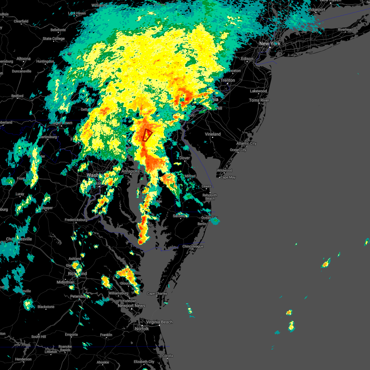 The tornado warning for east central harford county will expire at 345 pm edt, the storm which prompted the warning has weakened below severe limits, and no longer appears capable of producing a tornado. therefore, the warning will be allowed to expire. a tornado watch remains in effect until 700 pm edt for northern maryland. The tornado warning for east central harford county will expire at 345 pm edt, the storm which prompted the warning has weakened below severe limits, and no longer appears capable of producing a tornado. therefore, the warning will be allowed to expire. a tornado watch remains in effect until 700 pm edt for northern maryland.
|
| 9/1/2021 3:28 PM EDT |
 At 328 pm edt, a severe thunderstorm capable of producing a tornado was located over perryman, or over aberdeen, moving northeast at 40 mph (radar indicated rotation). Hazards include tornado. For those in the direct path of a tornado touchdown, flying debris will be dangerous to those caught without shelter. damage to roofs, siding, and windows may occur. mobile homes may be damaged or destroyed. tree damage is likely. this dangerous storm will be near, havre de grace around 340 pm edt. Other locations impacted by this tornadic thunderstorm include carsins, belcamp and edgewood. At 328 pm edt, a severe thunderstorm capable of producing a tornado was located over perryman, or over aberdeen, moving northeast at 40 mph (radar indicated rotation). Hazards include tornado. For those in the direct path of a tornado touchdown, flying debris will be dangerous to those caught without shelter. damage to roofs, siding, and windows may occur. mobile homes may be damaged or destroyed. tree damage is likely. this dangerous storm will be near, havre de grace around 340 pm edt. Other locations impacted by this tornadic thunderstorm include carsins, belcamp and edgewood.
|
| 9/1/2021 3:17 PM EDT |
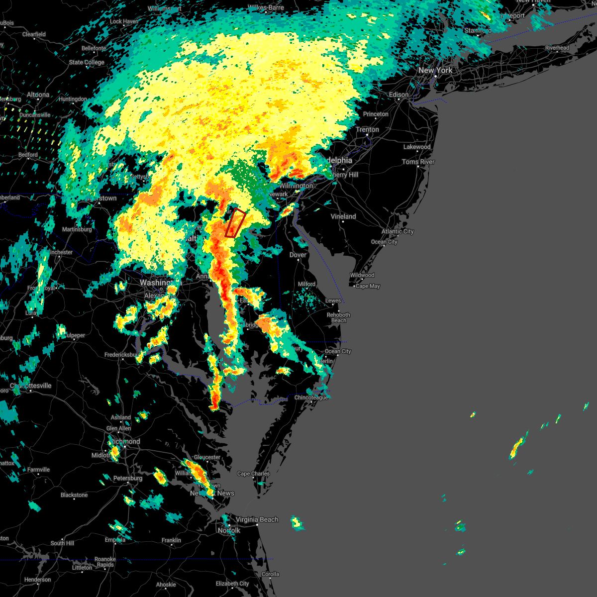 At 316 pm edt, a severe thunderstorm capable of producing a tornado was located near perryman, or 9 miles east of middle river, moving northeast at 40 mph (radar indicated rotation). Hazards include tornado. For those in the direct path of a tornado touchdown, flying debris will be dangerous to those caught without shelter. damage to roofs, siding, and windows may occur. mobile homes may be damaged or destroyed. tree damage is likely. this dangerous storm will be near, riverside and perryman around 330 pm edt. aberdeen and aberdeen proving ground around 335 pm edt. havre de grace around 340 pm edt. Other locations impacted by this tornadic thunderstorm include harford furnace, edgewood, abingdon, carsins and belcamp. At 316 pm edt, a severe thunderstorm capable of producing a tornado was located near perryman, or 9 miles east of middle river, moving northeast at 40 mph (radar indicated rotation). Hazards include tornado. For those in the direct path of a tornado touchdown, flying debris will be dangerous to those caught without shelter. damage to roofs, siding, and windows may occur. mobile homes may be damaged or destroyed. tree damage is likely. this dangerous storm will be near, riverside and perryman around 330 pm edt. aberdeen and aberdeen proving ground around 335 pm edt. havre de grace around 340 pm edt. Other locations impacted by this tornadic thunderstorm include harford furnace, edgewood, abingdon, carsins and belcamp.
|
| 8/13/2021 5:20 PM EDT |
 At 520 pm edt, severe thunderstorms were located along a line extending from near parkville to near brooklyn park, moving east at 20 mph (radar indicated). Hazards include 60 mph wind gusts and quarter size hail. Damaging winds will cause some trees and large branches to fall. this could injure those outdoors, as well as damage homes and vehicles. roadways may become blocked by downed trees. localized power outages are possible. Unsecured light objects may become projectiles. At 520 pm edt, severe thunderstorms were located along a line extending from near parkville to near brooklyn park, moving east at 20 mph (radar indicated). Hazards include 60 mph wind gusts and quarter size hail. Damaging winds will cause some trees and large branches to fall. this could injure those outdoors, as well as damage homes and vehicles. roadways may become blocked by downed trees. localized power outages are possible. Unsecured light objects may become projectiles.
|
| 8/11/2021 6:17 PM EDT | Tree down near the intersection of churchcreek road and riverside parkway in harford county MD, 0.6 miles SE of Riverside, MD |
| 8/11/2021 6:14 PM EDT |
 At 614 pm edt, a severe thunderstorm was located over perryman, or near aberdeen, moving east at 20 mph (radar indicated). Hazards include 60 mph wind gusts. Damaging winds will cause some trees and large branches to fall. this could injure those outdoors, as well as damage homes and vehicles. roadways may become blocked by downed trees. localized power outages are possible. Unsecured light objects may become projectiles. At 614 pm edt, a severe thunderstorm was located over perryman, or near aberdeen, moving east at 20 mph (radar indicated). Hazards include 60 mph wind gusts. Damaging winds will cause some trees and large branches to fall. this could injure those outdoors, as well as damage homes and vehicles. roadways may become blocked by downed trees. localized power outages are possible. Unsecured light objects may become projectiles.
|
| 8/11/2021 5:57 PM EDT |
 At 556 pm edt, severe thunderstorms were located along a line extending from near pleasant hills to glen burnie, moving southeast at 15 mph (radar indicated). Hazards include 60 mph wind gusts and quarter size hail. Damaging winds will cause some trees and large branches to fall. this could injure those outdoors, as well as damage homes and vehicles. roadways may become blocked by downed trees. localized power outages are possible. unsecured light objects may become projectiles. locations impacted include, baltimore, severn, middle river, aberdeen, havre de grace, riviera beach, aberdeen proving ground, baltimore-washington airport, fort smallwood state park, gibson island, sillery bay, bodkin point, millers island, north point state park, magothy river, sparrows point, dobbins island, pinehurst, back river and glen burnie. hail threat, radar indicated max hail size, 1. 00 in wind threat, radar indicated max wind gust, 60 mph. At 556 pm edt, severe thunderstorms were located along a line extending from near pleasant hills to glen burnie, moving southeast at 15 mph (radar indicated). Hazards include 60 mph wind gusts and quarter size hail. Damaging winds will cause some trees and large branches to fall. this could injure those outdoors, as well as damage homes and vehicles. roadways may become blocked by downed trees. localized power outages are possible. unsecured light objects may become projectiles. locations impacted include, baltimore, severn, middle river, aberdeen, havre de grace, riviera beach, aberdeen proving ground, baltimore-washington airport, fort smallwood state park, gibson island, sillery bay, bodkin point, millers island, north point state park, magothy river, sparrows point, dobbins island, pinehurst, back river and glen burnie. hail threat, radar indicated max hail size, 1. 00 in wind threat, radar indicated max wind gust, 60 mph.
|
| 8/11/2021 5:32 PM EDT |
 At 532 pm edt, severe thunderstorms were located along a line extending from near fallston to near baltimore-washington airport, moving southeast at 15 mph (radar indicated). Hazards include 60 mph wind gusts and quarter size hail. Damaging winds will cause some trees and large branches to fall. this could injure those outdoors, as well as damage homes and vehicles. roadways may become blocked by downed trees. localized power outages are possible. Unsecured light objects may become projectiles. At 532 pm edt, severe thunderstorms were located along a line extending from near fallston to near baltimore-washington airport, moving southeast at 15 mph (radar indicated). Hazards include 60 mph wind gusts and quarter size hail. Damaging winds will cause some trees and large branches to fall. this could injure those outdoors, as well as damage homes and vehicles. roadways may become blocked by downed trees. localized power outages are possible. Unsecured light objects may become projectiles.
|
| 8/10/2021 6:55 PM EDT |
 At 655 pm edt, severe thunderstorms were located along a line extending from near jarrettsville to kingsville, moving east at 20 mph (radar indicated). Hazards include 60 mph wind gusts. Damaging winds will cause some trees and large branches to fall. this could injure those outdoors, as well as damage homes and vehicles. roadways may become blocked by downed trees. localized power outages are possible. Unsecured light objects may become projectiles. At 655 pm edt, severe thunderstorms were located along a line extending from near jarrettsville to kingsville, moving east at 20 mph (radar indicated). Hazards include 60 mph wind gusts. Damaging winds will cause some trees and large branches to fall. this could injure those outdoors, as well as damage homes and vehicles. roadways may become blocked by downed trees. localized power outages are possible. Unsecured light objects may become projectiles.
|
| 7/17/2021 3:21 PM EDT |
 The severe thunderstorm warning for central harford and east central baltimore counties and northeastern baltimore city will expire at 330 pm edt, the storms which prompted the warning have moved out of the area. therefore, the warning will be allowed to expire. a severe thunderstorm watch remains in effect until 1100 pm edt for northern maryland. The severe thunderstorm warning for central harford and east central baltimore counties and northeastern baltimore city will expire at 330 pm edt, the storms which prompted the warning have moved out of the area. therefore, the warning will be allowed to expire. a severe thunderstorm watch remains in effect until 1100 pm edt for northern maryland.
|
| 7/17/2021 3:17 PM EDT |
 At 317 pm edt, severe thunderstorms were located along a line extending from near bel air north to white marsh, moving east at 15 mph (radar indicated). Hazards include 60 mph wind gusts and quarter size hail. Damaging winds will cause some trees and large branches to fall. this could injure those outdoors, as well as damage homes and vehicles. roadways may become blocked by downed trees. localized power outages are possible. unsecured light objects may become projectiles. Locations impacted include, baltimore, towson, bel air south, parkville, carney, perry hall, white marsh, riverside, hampton, kingsville, pleasant hills, perryman, edgewood, joppatowne, glen arm, fork, bradshaw, abingdon, loch raven village and joppa. At 317 pm edt, severe thunderstorms were located along a line extending from near bel air north to white marsh, moving east at 15 mph (radar indicated). Hazards include 60 mph wind gusts and quarter size hail. Damaging winds will cause some trees and large branches to fall. this could injure those outdoors, as well as damage homes and vehicles. roadways may become blocked by downed trees. localized power outages are possible. unsecured light objects may become projectiles. Locations impacted include, baltimore, towson, bel air south, parkville, carney, perry hall, white marsh, riverside, hampton, kingsville, pleasant hills, perryman, edgewood, joppatowne, glen arm, fork, bradshaw, abingdon, loch raven village and joppa.
|
| 7/17/2021 2:57 PM EDT |
 At 257 pm edt, severe thunderstorms were located along a line extending from near fallston to near parkville, moving east at 10 mph (radar indicated). Hazards include 60 mph wind gusts and quarter size hail. Damaging winds will cause some trees and large branches to fall. this could injure those outdoors, as well as damage homes and vehicles. roadways may become blocked by downed trees. localized power outages are possible. unsecured light objects may become projectiles. Locations impacted include, baltimore, towson, bel air south, parkville, bel air north, carney, perry hall, white marsh, fallston, riverside, hampton, kingsville, pleasant hills, jarrettsville, perryman, edgewood, joppatowne, darlington, glen arm and fork. At 257 pm edt, severe thunderstorms were located along a line extending from near fallston to near parkville, moving east at 10 mph (radar indicated). Hazards include 60 mph wind gusts and quarter size hail. Damaging winds will cause some trees and large branches to fall. this could injure those outdoors, as well as damage homes and vehicles. roadways may become blocked by downed trees. localized power outages are possible. unsecured light objects may become projectiles. Locations impacted include, baltimore, towson, bel air south, parkville, bel air north, carney, perry hall, white marsh, fallston, riverside, hampton, kingsville, pleasant hills, jarrettsville, perryman, edgewood, joppatowne, darlington, glen arm and fork.
|
| 7/17/2021 2:40 PM EDT |
 At 239 pm edt, severe thunderstorms were located along a line extending from near jarrettsville to carney, moving east at 15 mph (radar indicated). Hazards include 60 mph wind gusts and quarter size hail. Damaging winds will cause some trees and large branches to fall. this could injure those outdoors, as well as damage homes and vehicles. roadways may become blocked by downed trees. localized power outages are possible. Unsecured light objects may become projectiles. At 239 pm edt, severe thunderstorms were located along a line extending from near jarrettsville to carney, moving east at 15 mph (radar indicated). Hazards include 60 mph wind gusts and quarter size hail. Damaging winds will cause some trees and large branches to fall. this could injure those outdoors, as well as damage homes and vehicles. roadways may become blocked by downed trees. localized power outages are possible. Unsecured light objects may become projectiles.
|
| 7/12/2021 8:07 PM EDT |
 The severe thunderstorm warning for southeastern harford and northeastern cecil counties will expire at 815 pm edt, the storms which prompted the warning have weakened below severe limits, and no longer pose an immediate threat to life or property. therefore, the warning will be allowed to expire. a severe thunderstorm watch remains in effect until 1100 pm edt for northern and northeastern maryland. The severe thunderstorm warning for southeastern harford and northeastern cecil counties will expire at 815 pm edt, the storms which prompted the warning have weakened below severe limits, and no longer pose an immediate threat to life or property. therefore, the warning will be allowed to expire. a severe thunderstorm watch remains in effect until 1100 pm edt for northern and northeastern maryland.
|
| 7/12/2021 7:58 PM EDT |
 At 758 pm edt, severe thunderstorms were located along a line extending from blake to near bel air south, moving east at 10 mph (radar indicated). Hazards include 60 mph wind gusts and quarter size hail. Damaging winds will cause some trees and large branches to fall. this could injure those outdoors, as well as damage homes and vehicles. roadways may become blocked by downed trees. localized power outages are possible. unsecured light objects may become projectiles. Locations impacted include, elkton, aberdeen, havre de grace, aberdeen proving ground, calvert, bel air south, riverside, kingsville, north east, pleasant hills, perryman, charlestown, zion, blake, barksdale, fair hill, glen westover, bay view, lombard and woodlawn. At 758 pm edt, severe thunderstorms were located along a line extending from blake to near bel air south, moving east at 10 mph (radar indicated). Hazards include 60 mph wind gusts and quarter size hail. Damaging winds will cause some trees and large branches to fall. this could injure those outdoors, as well as damage homes and vehicles. roadways may become blocked by downed trees. localized power outages are possible. unsecured light objects may become projectiles. Locations impacted include, elkton, aberdeen, havre de grace, aberdeen proving ground, calvert, bel air south, riverside, kingsville, north east, pleasant hills, perryman, charlestown, zion, blake, barksdale, fair hill, glen westover, bay view, lombard and woodlawn.
|
| 7/12/2021 7:56 PM EDT |
 The severe thunderstorm warning for central harford, northwestern cecil and eastern baltimore counties will expire at 800 pm edt, the storms which prompted the warning have moved out of the area. therefore, the warning will be allowed to expire. a severe thunderstorm watch remains in effect until 1100 pm edt for northern and northeastern maryland. The severe thunderstorm warning for central harford, northwestern cecil and eastern baltimore counties will expire at 800 pm edt, the storms which prompted the warning have moved out of the area. therefore, the warning will be allowed to expire. a severe thunderstorm watch remains in effect until 1100 pm edt for northern and northeastern maryland.
|
| 7/12/2021 7:46 PM EDT |
 At 746 pm edt, severe thunderstorms were located along a line extending from calvert to near bel air south to pleasant hills, moving east at 15 mph (radar indicated). Hazards include 60 mph wind gusts and quarter size hail. Damaging winds will cause some trees and large branches to fall. this could injure those outdoors, as well as damage homes and vehicles. roadways may become blocked by downed trees. localized power outages are possible. unsecured light objects may become projectiles. Locations impacted include, aberdeen, bel air south, bel air north, fallston, riverside, kingsville, pleasant hills, rising sun, richardsmere, woodlawn, west nottingham, octoraro, conowingo, rock springs, farmington, port deposit, darlington, benson, churchville and carsins. At 746 pm edt, severe thunderstorms were located along a line extending from calvert to near bel air south to pleasant hills, moving east at 15 mph (radar indicated). Hazards include 60 mph wind gusts and quarter size hail. Damaging winds will cause some trees and large branches to fall. this could injure those outdoors, as well as damage homes and vehicles. roadways may become blocked by downed trees. localized power outages are possible. unsecured light objects may become projectiles. Locations impacted include, aberdeen, bel air south, bel air north, fallston, riverside, kingsville, pleasant hills, rising sun, richardsmere, woodlawn, west nottingham, octoraro, conowingo, rock springs, farmington, port deposit, darlington, benson, churchville and carsins.
|
| 7/12/2021 7:26 PM EDT |
 At 726 pm edt, severe thunderstorms were located along a line extending from richardsmere to bel air north to 8 miles west of jarrettsville, moving northeast at 5 mph (radar indicated). Hazards include 60 mph wind gusts and quarter size hail. Damaging winds will cause some trees and large branches to fall. this could injure those outdoors, as well as damage homes and vehicles. roadways may become blocked by downed trees. localized power outages are possible. unsecured light objects may become projectiles. Locations impacted include, aberdeen, bel air south, bel air north, fallston, riverside, kingsville, pleasant hills, jarrettsville, rising sun, west nottingham, octoraro, richardsmere, woodlawn, conowingo, rock springs, farmington, pylesville, port deposit, darlington and fork. At 726 pm edt, severe thunderstorms were located along a line extending from richardsmere to bel air north to 8 miles west of jarrettsville, moving northeast at 5 mph (radar indicated). Hazards include 60 mph wind gusts and quarter size hail. Damaging winds will cause some trees and large branches to fall. this could injure those outdoors, as well as damage homes and vehicles. roadways may become blocked by downed trees. localized power outages are possible. unsecured light objects may become projectiles. Locations impacted include, aberdeen, bel air south, bel air north, fallston, riverside, kingsville, pleasant hills, jarrettsville, rising sun, west nottingham, octoraro, richardsmere, woodlawn, conowingo, rock springs, farmington, pylesville, port deposit, darlington and fork.
|
| 7/12/2021 7:23 PM EDT |
 At 723 pm edt, severe thunderstorms were located along a line extending from rising sun to pleasant hills, moving east at 10 mph (radar indicated). Hazards include 60 mph wind gusts and quarter size hail. Damaging winds will cause some trees and large branches to fall. this could injure those outdoors, as well as damage homes and vehicles. roadways may become blocked by downed trees. localized power outages are possible. Unsecured light objects may become projectiles. At 723 pm edt, severe thunderstorms were located along a line extending from rising sun to pleasant hills, moving east at 10 mph (radar indicated). Hazards include 60 mph wind gusts and quarter size hail. Damaging winds will cause some trees and large branches to fall. this could injure those outdoors, as well as damage homes and vehicles. roadways may become blocked by downed trees. localized power outages are possible. Unsecured light objects may become projectiles.
|
| 7/12/2021 7:08 PM EDT |
 At 707 pm edt, severe thunderstorms were located along a line extending from rock springs to fallston to 8 miles north of cockeysville, moving northeast at 5 mph (radar indicated). Hazards include 60 mph wind gusts and quarter size hail. Damaging winds will cause some trees and large branches to fall. this could injure those outdoors, as well as damage homes and vehicles. roadways may become blocked by downed trees. localized power outages are possible. Unsecured light objects may become projectiles. At 707 pm edt, severe thunderstorms were located along a line extending from rock springs to fallston to 8 miles north of cockeysville, moving northeast at 5 mph (radar indicated). Hazards include 60 mph wind gusts and quarter size hail. Damaging winds will cause some trees and large branches to fall. this could injure those outdoors, as well as damage homes and vehicles. roadways may become blocked by downed trees. localized power outages are possible. Unsecured light objects may become projectiles.
|
| 7/1/2021 3:50 PM EDT |
 At 349 pm edt, severe thunderstorms were located along a line extending from near bel air south to near perryman to 6 miles east of bowleys quarters, moving east at 30 mph (radar indicated). Hazards include 60 mph wind gusts. Damaging winds will cause some trees and large branches to fall. this could injure those outdoors, as well as damage homes and vehicles. roadways may become blocked by downed trees. localized power outages are possible. unsecured light objects may become projectiles. Locations impacted include, aberdeen, havre de grace, aberdeen proving ground, bel air south, riverside, perryman, edgewood, churchville, harford furnace, abingdon, carsins and belcamp. At 349 pm edt, severe thunderstorms were located along a line extending from near bel air south to near perryman to 6 miles east of bowleys quarters, moving east at 30 mph (radar indicated). Hazards include 60 mph wind gusts. Damaging winds will cause some trees and large branches to fall. this could injure those outdoors, as well as damage homes and vehicles. roadways may become blocked by downed trees. localized power outages are possible. unsecured light objects may become projectiles. Locations impacted include, aberdeen, havre de grace, aberdeen proving ground, bel air south, riverside, perryman, edgewood, churchville, harford furnace, abingdon, carsins and belcamp.
|
| 7/1/2021 3:26 PM EDT |
 At 326 pm edt, severe thunderstorms were located along a line extending from near fallston to near white marsh to essex, moving east at 50 mph (radar indicated). Hazards include 60 mph wind gusts. Damaging winds will cause some trees and large branches to fall. this could injure those outdoors, as well as damage homes and vehicles. roadways may become blocked by downed trees. localized power outages are possible. Unsecured light objects may become projectiles. At 326 pm edt, severe thunderstorms were located along a line extending from near fallston to near white marsh to essex, moving east at 50 mph (radar indicated). Hazards include 60 mph wind gusts. Damaging winds will cause some trees and large branches to fall. this could injure those outdoors, as well as damage homes and vehicles. roadways may become blocked by downed trees. localized power outages are possible. Unsecured light objects may become projectiles.
|
| 6/21/2021 6:51 PM EDT |
 At 650 pm edt, severe thunderstorms were located along a line extending from richardsmere to perryman, moving east at 40 mph (radar indicated). Hazards include 60 mph wind gusts. Damaging winds will cause some trees and large branches to fall. this could injure those outdoors, as well as damage homes and vehicles. roadways may become blocked by downed trees. localized power outages are possible. Unsecured light objects may become projectiles. At 650 pm edt, severe thunderstorms were located along a line extending from richardsmere to perryman, moving east at 40 mph (radar indicated). Hazards include 60 mph wind gusts. Damaging winds will cause some trees and large branches to fall. this could injure those outdoors, as well as damage homes and vehicles. roadways may become blocked by downed trees. localized power outages are possible. Unsecured light objects may become projectiles.
|
| 6/3/2021 7:04 PM EDT |
 At 704 pm edt, a severe thunderstorm was located near bel air south, or near aberdeen, moving northeast at 20 mph (radar indicated). Hazards include 60 mph wind gusts. Damaging winds will cause some trees and large branches to fall. this could injure those outdoors, as well as damage homes and vehicles. roadways may become blocked by downed trees. localized power outages are possible. unsecured light objects may become projectiles. Locations impacted include, bel air south, bel air north, riverside, harford furnace and churchville. At 704 pm edt, a severe thunderstorm was located near bel air south, or near aberdeen, moving northeast at 20 mph (radar indicated). Hazards include 60 mph wind gusts. Damaging winds will cause some trees and large branches to fall. this could injure those outdoors, as well as damage homes and vehicles. roadways may become blocked by downed trees. localized power outages are possible. unsecured light objects may become projectiles. Locations impacted include, bel air south, bel air north, riverside, harford furnace and churchville.
|
| 6/3/2021 6:36 PM EDT |
 At 636 pm edt, a severe thunderstorm was located over kingsville, or 8 miles north of middle river, moving northeast at 20 mph (radar indicated). Hazards include 60 mph wind gusts and quarter size hail. Damaging winds will cause some trees and large branches to fall. this could injure those outdoors, as well as damage homes and vehicles. roadways may become blocked by downed trees. localized power outages are possible. Unsecured light objects may become projectiles. At 636 pm edt, a severe thunderstorm was located over kingsville, or 8 miles north of middle river, moving northeast at 20 mph (radar indicated). Hazards include 60 mph wind gusts and quarter size hail. Damaging winds will cause some trees and large branches to fall. this could injure those outdoors, as well as damage homes and vehicles. roadways may become blocked by downed trees. localized power outages are possible. Unsecured light objects may become projectiles.
|
| 6/3/2021 5:47 PM EDT |
 At 547 pm edt, severe thunderstorms were located along a line extending from near west nottingham to aberdeen to near riverside, moving east at 25 mph (radar indicated). Hazards include 60 mph wind gusts. Damaging winds will cause some trees and large branches to fall. this could injure those outdoors, as well as damage homes and vehicles. roadways may become blocked by downed trees. localized power outages are possible. unsecured light objects may become projectiles. Locations impacted include, aberdeen, havre de grace, aberdeen proving ground, calvert, bel air south, bel air north, white marsh, riverside, kingsville, north east, pleasant hills, rising sun, perryman, charlestown, zion, blake, west nottingham, octoraro, fair hill and bay view. At 547 pm edt, severe thunderstorms were located along a line extending from near west nottingham to aberdeen to near riverside, moving east at 25 mph (radar indicated). Hazards include 60 mph wind gusts. Damaging winds will cause some trees and large branches to fall. this could injure those outdoors, as well as damage homes and vehicles. roadways may become blocked by downed trees. localized power outages are possible. unsecured light objects may become projectiles. Locations impacted include, aberdeen, havre de grace, aberdeen proving ground, calvert, bel air south, bel air north, white marsh, riverside, kingsville, north east, pleasant hills, rising sun, perryman, charlestown, zion, blake, west nottingham, octoraro, fair hill and bay view.
|
| 6/3/2021 5:26 PM EDT |
 At 525 pm edt, severe thunderstorms were located along a line extending from near octoraro to near bel air south to kingsville, moving east at 25 mph (radar indicated). Hazards include 60 mph wind gusts and quarter size hail. Damaging winds will cause some trees and large branches to fall. this could injure those outdoors, as well as damage homes and vehicles. roadways may become blocked by downed trees. localized power outages are possible. Unsecured light objects may become projectiles. At 525 pm edt, severe thunderstorms were located along a line extending from near octoraro to near bel air south to kingsville, moving east at 25 mph (radar indicated). Hazards include 60 mph wind gusts and quarter size hail. Damaging winds will cause some trees and large branches to fall. this could injure those outdoors, as well as damage homes and vehicles. roadways may become blocked by downed trees. localized power outages are possible. Unsecured light objects may become projectiles.
|
| 5/26/2021 6:17 PM EDT |
 At 617 pm edt, a severe thunderstorm was located near bel air south, or near aberdeen, moving northeast at 25 mph (radar indicated). Hazards include 60 mph wind gusts. Damaging winds will cause some trees and large branches to fall. this could injure those outdoors, as well as damage homes and vehicles. roadways may become blocked by downed trees. localized power outages are possible. Unsecured light objects may become projectiles. At 617 pm edt, a severe thunderstorm was located near bel air south, or near aberdeen, moving northeast at 25 mph (radar indicated). Hazards include 60 mph wind gusts. Damaging winds will cause some trees and large branches to fall. this could injure those outdoors, as well as damage homes and vehicles. roadways may become blocked by downed trees. localized power outages are possible. Unsecured light objects may become projectiles.
|
| 3/28/2021 6:07 PM EDT |
 At 607 pm edt, severe thunderstorms were located along a line extending from near aberdeen to near bowleys quarters, moving east at 55 mph (radar indicated). Hazards include 60 mph wind gusts. Damaging winds will cause some trees and large branches to fall. this could injure those outdoors, as well as damage homes and vehicles. roadways may become blocked by downed trees. localized power outages are possible. unsecured light objects may become projectiles. Locations impacted include, baltimore, middle river, aberdeen, havre de grace, aberdeen proving ground, north point state park, sparrows point, back river, millers island, dundalk, bel air south, essex, bel air north, pasadena, rosedale, white marsh, bowleys quarters, riverside, kingsville and pleasant hills. At 607 pm edt, severe thunderstorms were located along a line extending from near aberdeen to near bowleys quarters, moving east at 55 mph (radar indicated). Hazards include 60 mph wind gusts. Damaging winds will cause some trees and large branches to fall. this could injure those outdoors, as well as damage homes and vehicles. roadways may become blocked by downed trees. localized power outages are possible. unsecured light objects may become projectiles. Locations impacted include, baltimore, middle river, aberdeen, havre de grace, aberdeen proving ground, north point state park, sparrows point, back river, millers island, dundalk, bel air south, essex, bel air north, pasadena, rosedale, white marsh, bowleys quarters, riverside, kingsville and pleasant hills.
|
| 3/28/2021 5:56 PM EDT |
 At 555 pm edt, severe thunderstorms with a history of producing wind damage and measured wind gusts to near 60 mph were located along a line extending from near bel air north to rosedale, moving east at 55 mph (radar indicated and observed wind). Hazards include 60 mph wind gusts. Damaging winds will cause some trees and large branches to fall. this could injure those outdoors, as well as damage homes and vehicles. roadways may become blocked by downed trees. localized power outages are possible. unsecured light objects may become projectiles. Locations impacted include, baltimore, middle river, aberdeen, havre de grace, aberdeen proving ground, millers island, north point state park, sparrows point, back river, dundalk, towson, bel air south, essex, parkville, bel air north, carney, perry hall, pasadena, rosedale and rossville. At 555 pm edt, severe thunderstorms with a history of producing wind damage and measured wind gusts to near 60 mph were located along a line extending from near bel air north to rosedale, moving east at 55 mph (radar indicated and observed wind). Hazards include 60 mph wind gusts. Damaging winds will cause some trees and large branches to fall. this could injure those outdoors, as well as damage homes and vehicles. roadways may become blocked by downed trees. localized power outages are possible. unsecured light objects may become projectiles. Locations impacted include, baltimore, middle river, aberdeen, havre de grace, aberdeen proving ground, millers island, north point state park, sparrows point, back river, dundalk, towson, bel air south, essex, parkville, bel air north, carney, perry hall, pasadena, rosedale and rossville.
|
| 3/28/2021 5:37 PM EDT |
 At 535 pm edt, severe thunderstorms with a history of producing wind damage and measured wind gusts to near 60 mph were located along a line extending from near cockeysville to ellicott city, moving east at 55 mph (radar indicated). Hazards include 60 mph wind gusts. Damaging winds will cause some trees and large branches to fall. this could injure those outdoors, as well as damage homes and vehicles. roadways may become blocked by downed trees. localized power outages are possible. Unsecured light objects may become projectiles. At 535 pm edt, severe thunderstorms with a history of producing wind damage and measured wind gusts to near 60 mph were located along a line extending from near cockeysville to ellicott city, moving east at 55 mph (radar indicated). Hazards include 60 mph wind gusts. Damaging winds will cause some trees and large branches to fall. this could injure those outdoors, as well as damage homes and vehicles. roadways may become blocked by downed trees. localized power outages are possible. Unsecured light objects may become projectiles.
|
| 11/30/2020 2:22 PM EST |
 At 222 pm est, a severe thunderstorm was located over riverside, or near aberdeen, moving northeast at 45 mph (radar indicated). Hazards include 60 mph wind gusts. Damaging winds will cause some trees and large branches to fall. this could injure those outdoors, as well as damage homes and vehicles. roadways may become blocked by downed trees. localized power outages are possible. Unsecured light objects may become projectiles. At 222 pm est, a severe thunderstorm was located over riverside, or near aberdeen, moving northeast at 45 mph (radar indicated). Hazards include 60 mph wind gusts. Damaging winds will cause some trees and large branches to fall. this could injure those outdoors, as well as damage homes and vehicles. roadways may become blocked by downed trees. localized power outages are possible. Unsecured light objects may become projectiles.
|
| 11/15/2020 7:58 PM EST |
 The severe thunderstorm warning for northwestern anne arundel, southeastern harford and southeastern baltimore counties and southeastern baltimore city will expire at 800 pm est, the storms which prompted the warning have moved out of the area. therefore, the warning will be allowed to expire. a severe thunderstorm watch remains in effect until 1100 pm est for central, northern and northeastern maryland. The severe thunderstorm warning for northwestern anne arundel, southeastern harford and southeastern baltimore counties and southeastern baltimore city will expire at 800 pm est, the storms which prompted the warning have moved out of the area. therefore, the warning will be allowed to expire. a severe thunderstorm watch remains in effect until 1100 pm est for central, northern and northeastern maryland.
|
| 11/15/2020 7:38 PM EST |
 At 737 pm est, severe thunderstorms were located along a line extending from north east to near bowleys quarters to south gate, moving southeast at 40 mph (radar indicated). Hazards include 60 mph wind gusts. Damaging winds will cause some trees and large branches to fall. this could injure those outdoors, as well as damage homes and vehicles. roadways may become blocked by downed trees. localized power outages are possible. unsecured light objects may become projectiles. Locations impacted include, baltimore, severn, middle river, aberdeen, havre de grace, riviera beach, aberdeen proving ground, north point state park, sparrows point, fort smallwood state park, back river, millers island, glen burnie, dundalk, essex, severna park, odenton, pasadena, lake shore and ferndale. At 737 pm est, severe thunderstorms were located along a line extending from north east to near bowleys quarters to south gate, moving southeast at 40 mph (radar indicated). Hazards include 60 mph wind gusts. Damaging winds will cause some trees and large branches to fall. this could injure those outdoors, as well as damage homes and vehicles. roadways may become blocked by downed trees. localized power outages are possible. unsecured light objects may become projectiles. Locations impacted include, baltimore, severn, middle river, aberdeen, havre de grace, riviera beach, aberdeen proving ground, north point state park, sparrows point, fort smallwood state park, back river, millers island, glen burnie, dundalk, essex, severna park, odenton, pasadena, lake shore and ferndale.
|
| 11/15/2020 7:17 PM EST |
 At 716 pm est, severe thunderstorms were located along a line extending from rock springs to white marsh to savage-guilford, moving southeast at 40 mph (radar indicated). Hazards include 60 mph wind gusts. Damaging winds will cause some trees and large branches to fall. this could injure those outdoors, as well as damage homes and vehicles. roadways may become blocked by downed trees. localized power outages are possible. unsecured light objects may become projectiles. Locations impacted include, baltimore, columbia, severn, middle river, elkridge, aberdeen, havre de grace, riviera beach, aberdeen proving ground, baltimore-washington airport, fort smallwood state park, millers island, north point state park, sparrows point, back river, glen burnie, dundalk, towson, bel air south and catonsville. At 716 pm est, severe thunderstorms were located along a line extending from rock springs to white marsh to savage-guilford, moving southeast at 40 mph (radar indicated). Hazards include 60 mph wind gusts. Damaging winds will cause some trees and large branches to fall. this could injure those outdoors, as well as damage homes and vehicles. roadways may become blocked by downed trees. localized power outages are possible. unsecured light objects may become projectiles. Locations impacted include, baltimore, columbia, severn, middle river, elkridge, aberdeen, havre de grace, riviera beach, aberdeen proving ground, baltimore-washington airport, fort smallwood state park, millers island, north point state park, sparrows point, back river, glen burnie, dundalk, towson, bel air south and catonsville.
|
| 11/15/2020 7:00 PM EST |
 At 700 pm est, severe thunderstorms were located along a line extending from near delta to cockeysville to near ellicott city, moving east at 40 mph (radar indicated). Hazards include 60 mph wind gusts. Damaging winds will cause some trees and large branches to fall. this could injure those outdoors, as well as damage homes and vehicles. roadways may become blocked by downed trees. localized power outages are possible. unsecured light objects may become projectiles. Locations impacted include, baltimore, columbia, severn, pikesville, middle river, cockeysville, elkridge, aberdeen, havre de grace, riviera beach, aberdeen proving ground, baltimore-washington airport, fort smallwood state park, millers island, north point state park, sparrows point, back river, historic ellicott city, glen burnie and ellicott city. At 700 pm est, severe thunderstorms were located along a line extending from near delta to cockeysville to near ellicott city, moving east at 40 mph (radar indicated). Hazards include 60 mph wind gusts. Damaging winds will cause some trees and large branches to fall. this could injure those outdoors, as well as damage homes and vehicles. roadways may become blocked by downed trees. localized power outages are possible. unsecured light objects may become projectiles. Locations impacted include, baltimore, columbia, severn, pikesville, middle river, cockeysville, elkridge, aberdeen, havre de grace, riviera beach, aberdeen proving ground, baltimore-washington airport, fort smallwood state park, millers island, north point state park, sparrows point, back river, historic ellicott city, glen burnie and ellicott city.
|
| 11/15/2020 6:28 PM EST |
 At 628 pm est, severe thunderstorms were located along a line extending from glen rock to near westminster to green valley, moving east at 30 mph (radar indicated). Hazards include 60 mph wind gusts. Damaging winds will cause some trees and large branches to fall. this could injure those outdoors, as well as damage homes and vehicles. roadways may become blocked by downed trees. localized power outages are possible. Unsecured light objects may become projectiles. At 628 pm est, severe thunderstorms were located along a line extending from glen rock to near westminster to green valley, moving east at 30 mph (radar indicated). Hazards include 60 mph wind gusts. Damaging winds will cause some trees and large branches to fall. this could injure those outdoors, as well as damage homes and vehicles. roadways may become blocked by downed trees. localized power outages are possible. Unsecured light objects may become projectiles.
|
| 8/28/2020 4:43 PM EDT |
 The severe thunderstorm warning for central harford and east central baltimore counties will expire at 445 pm edt, the storms which prompted the warning have weakened below severe limits, and have exited the warned area. therefore, the warning will be allowed to expire. a severe thunderstorm watch remains in effect until 800 pm edt for northern maryland. The severe thunderstorm warning for central harford and east central baltimore counties will expire at 445 pm edt, the storms which prompted the warning have weakened below severe limits, and have exited the warned area. therefore, the warning will be allowed to expire. a severe thunderstorm watch remains in effect until 800 pm edt for northern maryland.
|
| 8/28/2020 4:23 PM EDT |
 At 423 pm edt, severe thunderstorms were located along a line extending from homeville to near octoraro to pleasant hills, moving east at 35 mph (radar indicated). Hazards include 60 mph wind gusts. Damaging winds will cause some trees and large branches to fall. this could injure those outdoors, as well as damage homes and vehicles. roadways may become blocked by downed trees. localized power outages are possible. unsecured light objects may become projectiles. Locations impacted include, aberdeen, havre de grace, aberdeen proving ground, bel air south, bel air north, fallston, riverside, kingsville, pleasant hills, perryman, edgewood, joppatowne, darlington, fork, churchville, carsins, forest hill, abingdon, hickory and benson. At 423 pm edt, severe thunderstorms were located along a line extending from homeville to near octoraro to pleasant hills, moving east at 35 mph (radar indicated). Hazards include 60 mph wind gusts. Damaging winds will cause some trees and large branches to fall. this could injure those outdoors, as well as damage homes and vehicles. roadways may become blocked by downed trees. localized power outages are possible. unsecured light objects may become projectiles. Locations impacted include, aberdeen, havre de grace, aberdeen proving ground, bel air south, bel air north, fallston, riverside, kingsville, pleasant hills, perryman, edgewood, joppatowne, darlington, fork, churchville, carsins, forest hill, abingdon, hickory and benson.
|
| 8/28/2020 4:02 PM EDT |
 At 402 pm edt, severe thunderstorms were located along a line extending from near quarryville to near jarrettsville to near cockeysville, moving east at 35 mph (radar indicated). Hazards include 60 mph wind gusts. Damaging winds will cause some trees and large branches to fall. this could injure those outdoors, as well as damage homes and vehicles. roadways may become blocked by downed trees. localized power outages are possible. Unsecured light objects may become projectiles. At 402 pm edt, severe thunderstorms were located along a line extending from near quarryville to near jarrettsville to near cockeysville, moving east at 35 mph (radar indicated). Hazards include 60 mph wind gusts. Damaging winds will cause some trees and large branches to fall. this could injure those outdoors, as well as damage homes and vehicles. roadways may become blocked by downed trees. localized power outages are possible. Unsecured light objects may become projectiles.
|
| 8/7/2020 6:25 PM EDT |
 At 625 pm edt, a severe thunderstorm was located over aberdeen proving ground, moving east at 20 mph (radar indicated). Hazards include 60 mph wind gusts. Damaging winds will cause some trees and large branches to fall. this could injure those outdoors, as well as damage homes and vehicles. roadways may become blocked by downed trees. localized power outages are possible. unsecured light objects may become projectiles. Locations impacted include, aberdeen, havre de grace, aberdeen proving ground, bel air south, riverside, perryman, edgewood, churchville, harford furnace, abingdon, carsins and belcamp. At 625 pm edt, a severe thunderstorm was located over aberdeen proving ground, moving east at 20 mph (radar indicated). Hazards include 60 mph wind gusts. Damaging winds will cause some trees and large branches to fall. this could injure those outdoors, as well as damage homes and vehicles. roadways may become blocked by downed trees. localized power outages are possible. unsecured light objects may become projectiles. Locations impacted include, aberdeen, havre de grace, aberdeen proving ground, bel air south, riverside, perryman, edgewood, churchville, harford furnace, abingdon, carsins and belcamp.
|
| 8/7/2020 6:04 PM EDT |
 At 603 pm edt, a severe thunderstorm was located over riverside, or near aberdeen, moving east at 15 mph (radar indicated). Hazards include 60 mph wind gusts. Damaging winds will cause some trees and large branches to fall. this could injure those outdoors, as well as damage homes and vehicles. roadways may become blocked by downed trees. localized power outages are possible. Unsecured light objects may become projectiles. At 603 pm edt, a severe thunderstorm was located over riverside, or near aberdeen, moving east at 15 mph (radar indicated). Hazards include 60 mph wind gusts. Damaging winds will cause some trees and large branches to fall. this could injure those outdoors, as well as damage homes and vehicles. roadways may become blocked by downed trees. localized power outages are possible. Unsecured light objects may become projectiles.
|
| 8/4/2020 9:26 AM EDT |
 At 926 am edt, a severe thunderstorm capable of producing a tornado was located over aberdeen proving ground, moving northwest at 20 mph (radar indicated rotation). Hazards include tornado. For those in the direct path of a tornado touchdown, flying debris will be dangerous to those caught without shelter. damage to roofs, siding, and windows may occur. mobile homes may be damaged or destroyed. Tree damage is likely. At 926 am edt, a severe thunderstorm capable of producing a tornado was located over aberdeen proving ground, moving northwest at 20 mph (radar indicated rotation). Hazards include tornado. For those in the direct path of a tornado touchdown, flying debris will be dangerous to those caught without shelter. damage to roofs, siding, and windows may occur. mobile homes may be damaged or destroyed. Tree damage is likely.
|
| 7/30/2020 9:38 PM EDT |
 At 938 pm edt, severe thunderstorms were located along a line extending from near kingsville to near perryman, moving northeast at 30 mph (radar indicated). Hazards include 60 mph wind gusts. Damaging winds will cause some trees and large branches to fall. this could injure those outdoors, as well as damage homes and vehicles. roadways may become blocked by downed trees. localized power outages are possible. unsecured light objects may become projectiles. Locations impacted include, aberdeen, aberdeen proving ground, bel air south, riverside, perryman, edgewood, harford furnace, abingdon and belcamp. At 938 pm edt, severe thunderstorms were located along a line extending from near kingsville to near perryman, moving northeast at 30 mph (radar indicated). Hazards include 60 mph wind gusts. Damaging winds will cause some trees and large branches to fall. this could injure those outdoors, as well as damage homes and vehicles. roadways may become blocked by downed trees. localized power outages are possible. unsecured light objects may become projectiles. Locations impacted include, aberdeen, aberdeen proving ground, bel air south, riverside, perryman, edgewood, harford furnace, abingdon and belcamp.
|
| 7/30/2020 9:24 PM EDT |
 At 924 pm edt, severe thunderstorms were located along a line extending from carney to near bowleys quarters, moving northeast at 30 mph (radar indicated). Hazards include 60 mph wind gusts. Damaging winds will cause some trees and large branches to fall. this could injure those outdoors, as well as damage homes and vehicles. roadways may become blocked by downed trees. localized power outages are possible. unsecured light objects may become projectiles. Locations impacted include, middle river, aberdeen, aberdeen proving ground, towson, bel air south, parkville, bel air north, carney, perry hall, rossville, white marsh, fallston, bowleys quarters, riverside, hampton, kingsville, pleasant hills, jarrettsville, perryman and edgewood. At 924 pm edt, severe thunderstorms were located along a line extending from carney to near bowleys quarters, moving northeast at 30 mph (radar indicated). Hazards include 60 mph wind gusts. Damaging winds will cause some trees and large branches to fall. this could injure those outdoors, as well as damage homes and vehicles. roadways may become blocked by downed trees. localized power outages are possible. unsecured light objects may become projectiles. Locations impacted include, middle river, aberdeen, aberdeen proving ground, towson, bel air south, parkville, bel air north, carney, perry hall, rossville, white marsh, fallston, bowleys quarters, riverside, hampton, kingsville, pleasant hills, jarrettsville, perryman and edgewood.
|
| 7/30/2020 9:08 PM EDT |
 At 908 pm edt, severe thunderstorms were located along a line extending from baltimore to millers island, moving northeast at 30 mph (radar indicated). Hazards include 60 mph wind gusts. Damaging winds will cause some trees and large branches to fall. this could injure those outdoors, as well as damage homes and vehicles. roadways may become blocked by downed trees. localized power outages are possible. Unsecured light objects may become projectiles. At 908 pm edt, severe thunderstorms were located along a line extending from baltimore to millers island, moving northeast at 30 mph (radar indicated). Hazards include 60 mph wind gusts. Damaging winds will cause some trees and large branches to fall. this could injure those outdoors, as well as damage homes and vehicles. roadways may become blocked by downed trees. localized power outages are possible. Unsecured light objects may become projectiles.
|
| 7/22/2020 5:21 PM EDT |
 The severe thunderstorm warning for central harford and southeastern baltimore counties and baltimore city will expire at 530 pm edt, the storms which prompted the warning are exiting the warned area. therefore, the warning will be allowed to expire. however heavy rain is still possible with these thunderstorms. a severe thunderstorm watch remains in effect until 700 pm edt for central and northern maryland. to report severe weather, contact your nearest law enforcement agency. they will relay your report to the national weather service sterling virginia. The severe thunderstorm warning for central harford and southeastern baltimore counties and baltimore city will expire at 530 pm edt, the storms which prompted the warning are exiting the warned area. therefore, the warning will be allowed to expire. however heavy rain is still possible with these thunderstorms. a severe thunderstorm watch remains in effect until 700 pm edt for central and northern maryland. to report severe weather, contact your nearest law enforcement agency. they will relay your report to the national weather service sterling virginia.
|
| 7/22/2020 5:10 PM EDT |
 At 510 pm edt, severe thunderstorms were located along a line extending from near bel air south to near baltimore, moving east at 15 mph (radar indicated). Hazards include damaging wind gusts up to 65 mph and isolated large hail up to quarter size. Damaging winds will cause some trees and large branches to fall. this could injure those outdoors, as well as damage homes and vehicles. roadways may become blocked by downed trees. localized power outages are possible. unsecured light objects may become projectiles. Locations impacted include, baltimore, middle river, aberdeen, havre de grace, aberdeen proving ground, millers island, north point state park, sparrows point, back river, dundalk, towson, bel air south, essex, parkville, bel air north, carney, perry hall, rosedale, rossville and brooklyn park. At 510 pm edt, severe thunderstorms were located along a line extending from near bel air south to near baltimore, moving east at 15 mph (radar indicated). Hazards include damaging wind gusts up to 65 mph and isolated large hail up to quarter size. Damaging winds will cause some trees and large branches to fall. this could injure those outdoors, as well as damage homes and vehicles. roadways may become blocked by downed trees. localized power outages are possible. unsecured light objects may become projectiles. Locations impacted include, baltimore, middle river, aberdeen, havre de grace, aberdeen proving ground, millers island, north point state park, sparrows point, back river, dundalk, towson, bel air south, essex, parkville, bel air north, carney, perry hall, rosedale, rossville and brooklyn park.
|
| 7/22/2020 4:52 PM EDT |
 At 451 pm edt, severe thunderstorms were located along a line extending from pleasant hills to baltimore, moving east at 15 mph (radar indicated). Hazards include damaging wind gusts up to 65 mph and isolated hail up to quarter size. Damaging winds will cause some trees and large branches to fall. this could injure those outdoors, as well as damage homes and vehicles. roadways may become blocked by downed trees. localized power outages are possible. Unsecured light objects may become projectiles. At 451 pm edt, severe thunderstorms were located along a line extending from pleasant hills to baltimore, moving east at 15 mph (radar indicated). Hazards include damaging wind gusts up to 65 mph and isolated hail up to quarter size. Damaging winds will cause some trees and large branches to fall. this could injure those outdoors, as well as damage homes and vehicles. roadways may become blocked by downed trees. localized power outages are possible. Unsecured light objects may become projectiles.
|
| 7/22/2020 4:46 PM EDT |
 At 420 pm edt, developing severe thunderstorms were located along a line extending from near bel air north to towson to near elkridge, moving east at 15 mph (radar indicated). Hazards include 60 mph wind gusts. Damaging winds will cause some trees and large branches to fall. this could injure those outdoors, as well as damage homes and vehicles. roadways may become blocked by downed trees. localized power outages are possible. Unsecured light objects may become projectiles. At 420 pm edt, developing severe thunderstorms were located along a line extending from near bel air north to towson to near elkridge, moving east at 15 mph (radar indicated). Hazards include 60 mph wind gusts. Damaging winds will cause some trees and large branches to fall. this could injure those outdoors, as well as damage homes and vehicles. roadways may become blocked by downed trees. localized power outages are possible. Unsecured light objects may become projectiles.
|
| 7/22/2020 4:21 PM EDT |
 At 420 pm edt, developing severe thunderstorms were located along a line extending from near bel air north to towson to near elkridge, moving east at 15 mph (radar indicated). Hazards include 60 mph wind gusts. Damaging winds will cause some trees and large branches to fall. this could injure those outdoors, as well as damage homes and vehicles. roadways may become blocked by downed trees. localized power outages are possible. Unsecured light objects may become projectiles. At 420 pm edt, developing severe thunderstorms were located along a line extending from near bel air north to towson to near elkridge, moving east at 15 mph (radar indicated). Hazards include 60 mph wind gusts. Damaging winds will cause some trees and large branches to fall. this could injure those outdoors, as well as damage homes and vehicles. roadways may become blocked by downed trees. localized power outages are possible. Unsecured light objects may become projectiles.
|
| 7/5/2020 3:42 PM EDT |
 At 259 pm edt, a severe thunderstorm was located over riverside, or near aberdeen, and is nearly stationary (radar indicated). Hazards include 60 mph wind gusts and quarter size hail. Damaging winds will cause some trees and large branches to fall. this could injure those outdoors, as well as damage homes and vehicles. roadways may become blocked by downed trees. localized power outages are possible. Unsecured light objects may become projectiles. At 259 pm edt, a severe thunderstorm was located over riverside, or near aberdeen, and is nearly stationary (radar indicated). Hazards include 60 mph wind gusts and quarter size hail. Damaging winds will cause some trees and large branches to fall. this could injure those outdoors, as well as damage homes and vehicles. roadways may become blocked by downed trees. localized power outages are possible. Unsecured light objects may become projectiles.
|
| 7/5/2020 3:00 PM EDT |
 At 259 pm edt, a severe thunderstorm was located over riverside, or near aberdeen, and is nearly stationary (radar indicated). Hazards include 60 mph wind gusts and quarter size hail. Damaging winds will cause some trees and large branches to fall. this could injure those outdoors, as well as damage homes and vehicles. roadways may become blocked by downed trees. localized power outages are possible. Unsecured light objects may become projectiles. At 259 pm edt, a severe thunderstorm was located over riverside, or near aberdeen, and is nearly stationary (radar indicated). Hazards include 60 mph wind gusts and quarter size hail. Damaging winds will cause some trees and large branches to fall. this could injure those outdoors, as well as damage homes and vehicles. roadways may become blocked by downed trees. localized power outages are possible. Unsecured light objects may become projectiles.
|
| 7/5/2020 2:57 PM EDT |
 At 214 pm edt, a severe thunderstorm was located over aberdeen proving ground, moving southeast at 5 mph (radar indicated). Hazards include 60 mph wind gusts and quarter size hail. Damaging winds will cause some trees and large branches to fall. this could injure those outdoors, as well as damage homes and vehicles. roadways may become blocked by downed trees. localized power outages are possible. Unsecured light objects may become projectiles. At 214 pm edt, a severe thunderstorm was located over aberdeen proving ground, moving southeast at 5 mph (radar indicated). Hazards include 60 mph wind gusts and quarter size hail. Damaging winds will cause some trees and large branches to fall. this could injure those outdoors, as well as damage homes and vehicles. roadways may become blocked by downed trees. localized power outages are possible. Unsecured light objects may become projectiles.
|
| 7/5/2020 2:14 PM EDT |
 At 214 pm edt, a severe thunderstorm was located over aberdeen proving ground, moving southeast at 5 mph (radar indicated). Hazards include 60 mph wind gusts and quarter size hail. Damaging winds will cause some trees and large branches to fall. this could injure those outdoors, as well as damage homes and vehicles. roadways may become blocked by downed trees. localized power outages are possible. Unsecured light objects may become projectiles. At 214 pm edt, a severe thunderstorm was located over aberdeen proving ground, moving southeast at 5 mph (radar indicated). Hazards include 60 mph wind gusts and quarter size hail. Damaging winds will cause some trees and large branches to fall. this could injure those outdoors, as well as damage homes and vehicles. roadways may become blocked by downed trees. localized power outages are possible. Unsecured light objects may become projectiles.
|
| 6/28/2020 5:58 PM EDT |
 At 558 pm edt, a severe thunderstorm was located over bel air south, or near aberdeen, moving southeast at 20 mph (radar indicated). Hazards include 60 mph wind gusts. Damaging winds will cause some trees and large branches to fall. this could injure those outdoors, as well as damage homes and vehicles. roadways may become blocked by downed trees. localized power outages are possible. unsecured light objects may become projectiles. Locations impacted include, aberdeen, aberdeen proving ground, bel air south, bel air north, riverside, perryman, edgewood, bynum, harford furnace, abingdon, carsins and belcamp. At 558 pm edt, a severe thunderstorm was located over bel air south, or near aberdeen, moving southeast at 20 mph (radar indicated). Hazards include 60 mph wind gusts. Damaging winds will cause some trees and large branches to fall. this could injure those outdoors, as well as damage homes and vehicles. roadways may become blocked by downed trees. localized power outages are possible. unsecured light objects may become projectiles. Locations impacted include, aberdeen, aberdeen proving ground, bel air south, bel air north, riverside, perryman, edgewood, bynum, harford furnace, abingdon, carsins and belcamp.
|
| 6/28/2020 5:33 PM EDT |
 At 533 pm edt, a severe thunderstorm was located over bel air north, or 12 miles west of aberdeen, moving southeast at 20 mph (radar indicated). Hazards include 60 mph wind gusts and quarter size hail. Damaging winds will cause some trees and large branches to fall. this could injure those outdoors, as well as damage homes and vehicles. roadways may become blocked by downed trees. localized power outages are possible. Unsecured light objects may become projectiles. At 533 pm edt, a severe thunderstorm was located over bel air north, or 12 miles west of aberdeen, moving southeast at 20 mph (radar indicated). Hazards include 60 mph wind gusts and quarter size hail. Damaging winds will cause some trees and large branches to fall. this could injure those outdoors, as well as damage homes and vehicles. roadways may become blocked by downed trees. localized power outages are possible. Unsecured light objects may become projectiles.
|
| 6/23/2020 7:10 PM EDT |
 At 709 pm edt, a severe thunderstorm was located over hampton, or near cockeysville, moving northeast at 25 mph (radar indicated). Hazards include 60 mph wind gusts and quarter size hail. Damaging winds will cause some trees and large branches to fall. this could injure those outdoors, as well as damage homes and vehicles. roadways may become blocked by downed trees. localized power outages are possible. unsecured light objects may become projectiles. Locations impacted include, cockeysville, bel air south, parkville, bel air north, carney, perry hall, timonium, white marsh, fallston, riverside, hampton, kingsville, pleasant hills, jarrettsville, lutherville-timonium, edgewood, joppatowne, pylesville, glen arm and fork. At 709 pm edt, a severe thunderstorm was located over hampton, or near cockeysville, moving northeast at 25 mph (radar indicated). Hazards include 60 mph wind gusts and quarter size hail. Damaging winds will cause some trees and large branches to fall. this could injure those outdoors, as well as damage homes and vehicles. roadways may become blocked by downed trees. localized power outages are possible. unsecured light objects may become projectiles. Locations impacted include, cockeysville, bel air south, parkville, bel air north, carney, perry hall, timonium, white marsh, fallston, riverside, hampton, kingsville, pleasant hills, jarrettsville, lutherville-timonium, edgewood, joppatowne, pylesville, glen arm and fork.
|
| 6/23/2020 6:59 PM EDT |
 The national weather service in sterling virginia has issued a * severe thunderstorm warning for. northeastern baltimore city in northern maryland. northwestern harford county in northern maryland. central baltimore county in northern maryland. Until 745 pm edt. The national weather service in sterling virginia has issued a * severe thunderstorm warning for. northeastern baltimore city in northern maryland. northwestern harford county in northern maryland. central baltimore county in northern maryland. Until 745 pm edt.
|
| 4/13/2020 3:11 PM EDT |
 The severe thunderstorm warning for eastern harford and southeastern baltimore counties will expire at 315 pm edt, the storms which prompted the warning have moved out of the area. therefore, the warning will be allowed to expire. a tornado watch remains in effect until 600 pm edt for northern maryland. to report severe weather, contact your nearest law enforcement agency. they will relay your report to the national weather service sterling virginia. The severe thunderstorm warning for eastern harford and southeastern baltimore counties will expire at 315 pm edt, the storms which prompted the warning have moved out of the area. therefore, the warning will be allowed to expire. a tornado watch remains in effect until 600 pm edt for northern maryland. to report severe weather, contact your nearest law enforcement agency. they will relay your report to the national weather service sterling virginia.
|
| 4/13/2020 2:59 PM EDT |
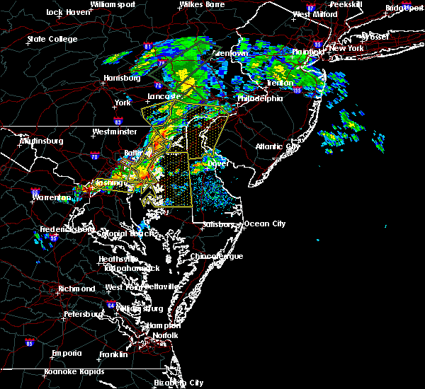 At 227 pm edt, severe thunderstorms were located along a line extending from near delta to baltimore, moving east at 50 mph (radar indicated). Hazards include 60 mph wind gusts. Damaging winds will cause some trees and large branches to fall. this could injure those outdoors, as well as damage homes and vehicles. roadways may become blocked by downed trees. localized power outages are possible. Unsecured light objects may become projectiles. At 227 pm edt, severe thunderstorms were located along a line extending from near delta to baltimore, moving east at 50 mph (radar indicated). Hazards include 60 mph wind gusts. Damaging winds will cause some trees and large branches to fall. this could injure those outdoors, as well as damage homes and vehicles. roadways may become blocked by downed trees. localized power outages are possible. Unsecured light objects may become projectiles.
|
| 4/13/2020 2:27 PM EDT |
 At 227 pm edt, severe thunderstorms were located along a line extending from near delta to baltimore, moving east at 50 mph (radar indicated). Hazards include 60 mph wind gusts. Damaging winds will cause some trees and large branches to fall. this could injure those outdoors, as well as damage homes and vehicles. roadways may become blocked by downed trees. localized power outages are possible. Unsecured light objects may become projectiles. At 227 pm edt, severe thunderstorms were located along a line extending from near delta to baltimore, moving east at 50 mph (radar indicated). Hazards include 60 mph wind gusts. Damaging winds will cause some trees and large branches to fall. this could injure those outdoors, as well as damage homes and vehicles. roadways may become blocked by downed trees. localized power outages are possible. Unsecured light objects may become projectiles.
|
| 4/9/2020 11:21 PM EDT |
 At 1120 pm edt, severe thunderstorms were located along a line extending from smithville to near sunnyburn to near manchester, moving southeast at 55 mph (radar indicated). Hazards include 60 mph wind gusts. Damaging winds will cause some trees and large branches to fall. this could injure those outdoors, as well as damage homes and vehicles. roadways may become blocked by downed trees. localized power outages are possible. Unsecured light objects may become projectiles. At 1120 pm edt, severe thunderstorms were located along a line extending from smithville to near sunnyburn to near manchester, moving southeast at 55 mph (radar indicated). Hazards include 60 mph wind gusts. Damaging winds will cause some trees and large branches to fall. this could injure those outdoors, as well as damage homes and vehicles. roadways may become blocked by downed trees. localized power outages are possible. Unsecured light objects may become projectiles.
|
| 4/9/2020 12:51 PM EDT |
 At 1251 pm edt, severe thunderstorms were located along a line extending from near conowingo to carney, moving east at 65 mph (radar indicated). Hazards include 60 mph wind gusts. Damaging winds will cause some trees and large branches to fall. this could injure those outdoors, as well as damage homes and vehicles. roadways may become blocked by downed trees. localized power outages are possible. unsecured light objects may become projectiles. Locations impacted include, middle river, aberdeen, havre de grace, aberdeen proving ground, towson, bel air south, parkville, bel air north, carney, perry hall, rossville, white marsh, fallston, riverside, hampton, kingsville, pleasant hills, jarrettsville, perryman and edgewood. At 1251 pm edt, severe thunderstorms were located along a line extending from near conowingo to carney, moving east at 65 mph (radar indicated). Hazards include 60 mph wind gusts. Damaging winds will cause some trees and large branches to fall. this could injure those outdoors, as well as damage homes and vehicles. roadways may become blocked by downed trees. localized power outages are possible. unsecured light objects may become projectiles. Locations impacted include, middle river, aberdeen, havre de grace, aberdeen proving ground, towson, bel air south, parkville, bel air north, carney, perry hall, rossville, white marsh, fallston, riverside, hampton, kingsville, pleasant hills, jarrettsville, perryman and edgewood.
|
| 4/9/2020 12:24 PM EDT |
 At 1224 pm edt, severe thunderstorms were located along a line extending from near railroad to near mount airy, moving east at 65 mph (radar indicated). Hazards include 60 mph wind gusts. Damaging winds will cause some trees and large branches to fall. this could injure those outdoors, as well as damage homes and vehicles. roadways may become blocked by downed trees. localized power outages are possible. Unsecured light objects may become projectiles. At 1224 pm edt, severe thunderstorms were located along a line extending from near railroad to near mount airy, moving east at 65 mph (radar indicated). Hazards include 60 mph wind gusts. Damaging winds will cause some trees and large branches to fall. this could injure those outdoors, as well as damage homes and vehicles. roadways may become blocked by downed trees. localized power outages are possible. Unsecured light objects may become projectiles.
|
| 4/8/2020 12:59 AM EDT |
 At 1251 am edt, a severe thunderstorm was located near bel air north, or 13 miles northwest of aberdeen, moving east at 35 mph (radar indicated). Hazards include quarter size hail. some hail damage to agriculture is expected At 1251 am edt, a severe thunderstorm was located near bel air north, or 13 miles northwest of aberdeen, moving east at 35 mph (radar indicated). Hazards include quarter size hail. some hail damage to agriculture is expected
|
| 4/8/2020 12:52 AM EDT |
 At 1251 am edt, a severe thunderstorm was located near bel air north, or 13 miles northwest of aberdeen, moving east at 35 mph (radar indicated). Hazards include quarter size hail. some hail damage to agriculture is expected At 1251 am edt, a severe thunderstorm was located near bel air north, or 13 miles northwest of aberdeen, moving east at 35 mph (radar indicated). Hazards include quarter size hail. some hail damage to agriculture is expected
|
| 3/3/2020 11:49 PM EST |
 At 1148 pm est, severe thunderstorms were located along a line extending from lutherville-timonium to near laurel, moving east at 60 mph (radar indicated). Hazards include 60 mph wind gusts. Damaging winds will cause some trees and large branches to fall. this could injure those outdoors, as well as damage homes and vehicles. roadways may become blocked by downed trees. localized power outages are possible. Unsecured light objects may become projectiles. At 1148 pm est, severe thunderstorms were located along a line extending from lutherville-timonium to near laurel, moving east at 60 mph (radar indicated). Hazards include 60 mph wind gusts. Damaging winds will cause some trees and large branches to fall. this could injure those outdoors, as well as damage homes and vehicles. roadways may become blocked by downed trees. localized power outages are possible. Unsecured light objects may become projectiles.
|
| 10/31/2019 10:31 PM EDT |
 At 1030 pm edt, severe thunderstorms were located along a line extending from near rock springs to near riverside, moving northeast at 50 mph (radar indicated). Hazards include 60 mph wind gusts. Damaging winds will cause some trees and large branches to fall. this could injure those outdoors, as well as damage homes and vehicles. roadways may become blocked by downed trees. localized power outages are possible. unsecured light objects may become projectiles. Locations impacted include, middle river, aberdeen, havre de grace, aberdeen proving ground, bel air south, bel air north, perry hall, rosedale, rossville, white marsh, fallston, bowleys quarters, riverside, kingsville, pleasant hills, jarrettsville, perryman, edgewood, joppatowne and pylesville. At 1030 pm edt, severe thunderstorms were located along a line extending from near rock springs to near riverside, moving northeast at 50 mph (radar indicated). Hazards include 60 mph wind gusts. Damaging winds will cause some trees and large branches to fall. this could injure those outdoors, as well as damage homes and vehicles. roadways may become blocked by downed trees. localized power outages are possible. unsecured light objects may become projectiles. Locations impacted include, middle river, aberdeen, havre de grace, aberdeen proving ground, bel air south, bel air north, perry hall, rosedale, rossville, white marsh, fallston, bowleys quarters, riverside, kingsville, pleasant hills, jarrettsville, perryman, edgewood, joppatowne and pylesville.
|
| 10/31/2019 10:14 PM EDT |
 At 1013 pm edt, severe thunderstorms were located along a line extending from near delta to white marsh, moving northeast at 65 mph (radar indicated). Hazards include 60 mph wind gusts. Damaging winds will cause some trees and large branches to fall. this could injure those outdoors, as well as damage homes and vehicles. roadways may become blocked by downed trees. localized power outages are possible. Unsecured light objects may become projectiles. At 1013 pm edt, severe thunderstorms were located along a line extending from near delta to white marsh, moving northeast at 65 mph (radar indicated). Hazards include 60 mph wind gusts. Damaging winds will cause some trees and large branches to fall. this could injure those outdoors, as well as damage homes and vehicles. roadways may become blocked by downed trees. localized power outages are possible. Unsecured light objects may become projectiles.
|
| 8/22/2019 8:35 PM EDT | Several large trees down in the abingdon are in harford county MD, 1.1 miles NNE of Riverside, MD |
| 8/22/2019 8:27 PM EDT |
 At 827 pm edt, severe thunderstorms were located along a line extending from riverside to baltimore, moving east at 30 mph (radar indicated). Hazards include 60 mph wind gusts. Damaging winds will cause some trees and large branches to fall. this could injure those outdoors, as well as damage homes and vehicles. roadways may become blocked by downed trees. localized power outages are possible. unsecured light objects may become projectiles. Locations impacted include, baltimore, pikesville, middle river, aberdeen, aberdeen proving ground, back river, dundalk, towson, bel air south, essex, parkville, carney, milford mill, perry hall, lochearn, rosedale, rossville, white marsh, bowleys quarters and riverside. At 827 pm edt, severe thunderstorms were located along a line extending from riverside to baltimore, moving east at 30 mph (radar indicated). Hazards include 60 mph wind gusts. Damaging winds will cause some trees and large branches to fall. this could injure those outdoors, as well as damage homes and vehicles. roadways may become blocked by downed trees. localized power outages are possible. unsecured light objects may become projectiles. Locations impacted include, baltimore, pikesville, middle river, aberdeen, aberdeen proving ground, back river, dundalk, towson, bel air south, essex, parkville, carney, milford mill, perry hall, lochearn, rosedale, rossville, white marsh, bowleys quarters and riverside.
|
| 8/22/2019 7:57 PM EDT |
 The national weather service in sterling virginia has issued a * severe thunderstorm warning for. northern baltimore city in northern maryland. southern harford county in northern maryland. southern baltimore county in northern maryland. Until 900 pm edt. The national weather service in sterling virginia has issued a * severe thunderstorm warning for. northern baltimore city in northern maryland. southern harford county in northern maryland. southern baltimore county in northern maryland. Until 900 pm edt.
|
| 8/18/2019 11:10 PM EDT |
 At 1052 pm edt, a severe thunderstorm was located over kingsville, or 9 miles north of middle river, moving southeast at 15 mph (radar indicated). Hazards include 60 mph wind gusts and quarter size hail. Damaging winds will cause some trees and large branches to fall. this could injure those outdoors, as well as damage homes and vehicles. roadways may become blocked by downed trees. localized power outages are possible. unsecured light objects may become projectiles. Locations impacted include, middle river, dundalk, bel air south, essex, parkville, bel air north, carney, perry hall, rosedale, rossville, white marsh, fallston, bowleys quarters, riverside, kingsville, pleasant hills, jarrettsville, perryman, edgewood and joppatowne. At 1052 pm edt, a severe thunderstorm was located over kingsville, or 9 miles north of middle river, moving southeast at 15 mph (radar indicated). Hazards include 60 mph wind gusts and quarter size hail. Damaging winds will cause some trees and large branches to fall. this could injure those outdoors, as well as damage homes and vehicles. roadways may become blocked by downed trees. localized power outages are possible. unsecured light objects may become projectiles. Locations impacted include, middle river, dundalk, bel air south, essex, parkville, bel air north, carney, perry hall, rosedale, rossville, white marsh, fallston, bowleys quarters, riverside, kingsville, pleasant hills, jarrettsville, perryman, edgewood and joppatowne.
|
| 8/18/2019 10:52 PM EDT |
 At 1052 pm edt, a severe thunderstorm was located over kingsville, or 9 miles north of middle river, moving southeast at 15 mph (radar indicated). Hazards include 60 mph wind gusts and quarter size hail. Damaging winds will cause some trees and large branches to fall. this could injure those outdoors, as well as damage homes and vehicles. roadways may become blocked by downed trees. localized power outages are possible. unsecured light objects may become projectiles. Locations impacted include, middle river, dundalk, bel air south, essex, parkville, bel air north, carney, perry hall, rosedale, rossville, white marsh, fallston, bowleys quarters, riverside, kingsville, pleasant hills, jarrettsville, perryman, edgewood and joppatowne. At 1052 pm edt, a severe thunderstorm was located over kingsville, or 9 miles north of middle river, moving southeast at 15 mph (radar indicated). Hazards include 60 mph wind gusts and quarter size hail. Damaging winds will cause some trees and large branches to fall. this could injure those outdoors, as well as damage homes and vehicles. roadways may become blocked by downed trees. localized power outages are possible. unsecured light objects may become projectiles. Locations impacted include, middle river, dundalk, bel air south, essex, parkville, bel air north, carney, perry hall, rosedale, rossville, white marsh, fallston, bowleys quarters, riverside, kingsville, pleasant hills, jarrettsville, perryman, edgewood and joppatowne.
|
| 8/18/2019 10:22 PM EDT |
 At 1022 pm edt, a severe thunderstorm was located near jarrettsville, or 7 miles northeast of cockeysville, moving southeast at 15 mph (radar indicated). Hazards include 60 mph wind gusts and quarter size hail. Damaging winds will cause some trees and large branches to fall. this could injure those outdoors, as well as damage homes and vehicles. roadways may become blocked by downed trees. localized power outages are possible. Unsecured light objects may become projectiles. At 1022 pm edt, a severe thunderstorm was located near jarrettsville, or 7 miles northeast of cockeysville, moving southeast at 15 mph (radar indicated). Hazards include 60 mph wind gusts and quarter size hail. Damaging winds will cause some trees and large branches to fall. this could injure those outdoors, as well as damage homes and vehicles. roadways may become blocked by downed trees. localized power outages are possible. Unsecured light objects may become projectiles.
|
| 8/17/2019 2:32 PM EDT |
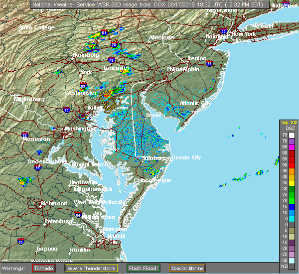 At 207 pm edt, a severe thunderstorm was located near bel air north, or 7 miles northwest of aberdeen, moving southeast at 35 mph (radar indicated). Hazards include 60 mph wind gusts and quarter size hail. Damaging winds will cause some trees and large branches to fall. this could injure those outdoors, as well as damage homes and vehicles. roadways may become blocked by downed trees. localized power outages are possible. Unsecured light objects may become projectiles. At 207 pm edt, a severe thunderstorm was located near bel air north, or 7 miles northwest of aberdeen, moving southeast at 35 mph (radar indicated). Hazards include 60 mph wind gusts and quarter size hail. Damaging winds will cause some trees and large branches to fall. this could injure those outdoors, as well as damage homes and vehicles. roadways may become blocked by downed trees. localized power outages are possible. Unsecured light objects may become projectiles.
|
| 8/17/2019 2:08 PM EDT |
 At 207 pm edt, a severe thunderstorm was located near bel air north, or 7 miles northwest of aberdeen, moving southeast at 35 mph (radar indicated). Hazards include 60 mph wind gusts and quarter size hail. Damaging winds will cause some trees and large branches to fall. this could injure those outdoors, as well as damage homes and vehicles. roadways may become blocked by downed trees. localized power outages are possible. Unsecured light objects may become projectiles. At 207 pm edt, a severe thunderstorm was located near bel air north, or 7 miles northwest of aberdeen, moving southeast at 35 mph (radar indicated). Hazards include 60 mph wind gusts and quarter size hail. Damaging winds will cause some trees and large branches to fall. this could injure those outdoors, as well as damage homes and vehicles. roadways may become blocked by downed trees. localized power outages are possible. Unsecured light objects may become projectiles.
|
| 8/7/2019 4:18 PM EDT |
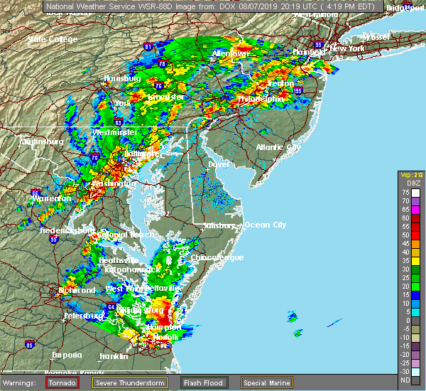 At 417 pm edt, severe thunderstorms were located along a line extending from aberdeen proving ground to millers island, moving east at 25 mph (radar indicated). Hazards include 60 mph wind gusts and quarter size hail. Damaging winds will cause some trees and large branches to fall. this could injure those outdoors, as well as damage homes and vehicles. roadways may become blocked by downed trees. localized power outages are possible. unsecured light objects may become projectiles. Locations impacted include, middle river, aberdeen, havre de grace, aberdeen proving ground, north point state park, back river, millers island, essex, bowleys quarters, riverside, perryman, edgewood, joppatowne, edgemere, magnolia, chase, martin state airport and belcamp. At 417 pm edt, severe thunderstorms were located along a line extending from aberdeen proving ground to millers island, moving east at 25 mph (radar indicated). Hazards include 60 mph wind gusts and quarter size hail. Damaging winds will cause some trees and large branches to fall. this could injure those outdoors, as well as damage homes and vehicles. roadways may become blocked by downed trees. localized power outages are possible. unsecured light objects may become projectiles. Locations impacted include, middle river, aberdeen, havre de grace, aberdeen proving ground, north point state park, back river, millers island, essex, bowleys quarters, riverside, perryman, edgewood, joppatowne, edgemere, magnolia, chase, martin state airport and belcamp.
|
| 8/7/2019 4:00 PM EDT |
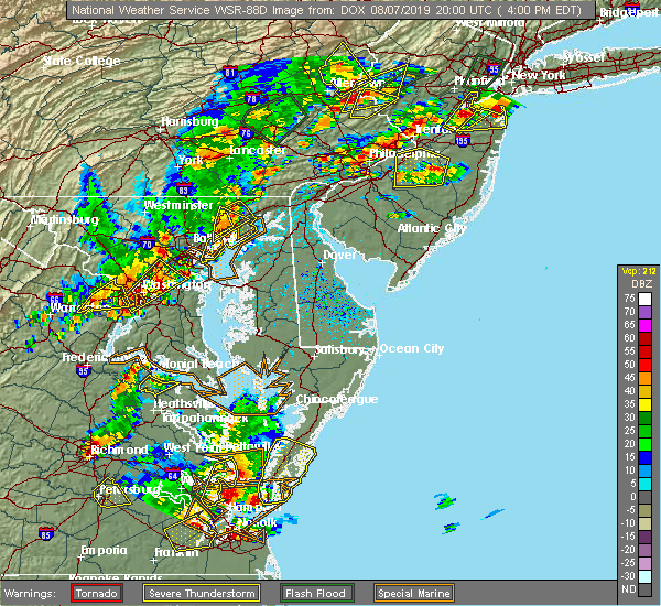 At 359 pm edt, severe thunderstorms were located along a line extending from near octoraro to near bowleys quarters, moving northeast at 30 mph (radar indicated). Hazards include 60 mph wind gusts and quarter size hail. Damaging winds will cause some trees and large branches to fall. this could injure those outdoors, as well as damage homes and vehicles. roadways may become blocked by downed trees. localized power outages are possible. unsecured light objects may become projectiles. Locations impacted include, middle river, aberdeen, havre de grace, aberdeen proving ground, north point state park, back river, millers island, essex, bowleys quarters, riverside, perryman, edgewood, joppatowne, edgemere, darlington, churchville, carsins, magnolia, chase and martin state airport. At 359 pm edt, severe thunderstorms were located along a line extending from near octoraro to near bowleys quarters, moving northeast at 30 mph (radar indicated). Hazards include 60 mph wind gusts and quarter size hail. Damaging winds will cause some trees and large branches to fall. this could injure those outdoors, as well as damage homes and vehicles. roadways may become blocked by downed trees. localized power outages are possible. unsecured light objects may become projectiles. Locations impacted include, middle river, aberdeen, havre de grace, aberdeen proving ground, north point state park, back river, millers island, essex, bowleys quarters, riverside, perryman, edgewood, joppatowne, edgemere, darlington, churchville, carsins, magnolia, chase and martin state airport.
|
| 8/7/2019 3:58 PM EDT |
 The severe thunderstorm warning for central harford and east central baltimore counties will expire at 400 pm edt, the storm which prompted the warning has weakened below severe limits, and no longer poses an immediate threat to life or property. therefore, the warning will be allowed to expire. a severe thunderstorm watch remains in effect until 800 pm edt for northern maryland. The severe thunderstorm warning for central harford and east central baltimore counties will expire at 400 pm edt, the storm which prompted the warning has weakened below severe limits, and no longer poses an immediate threat to life or property. therefore, the warning will be allowed to expire. a severe thunderstorm watch remains in effect until 800 pm edt for northern maryland.
|
| 8/7/2019 3:50 PM EDT | Tree down near intersection of stockett square and declaration cour in harford county MD, 0.6 miles SE of Riverside, MD |
| 8/7/2019 3:48 PM EDT |
 At 348 pm edt, a severe thunderstorm was located over bel air north, or 10 miles west of aberdeen, moving northeast at 30 mph (radar indicated). Hazards include 60 mph wind gusts and quarter size hail. Damaging winds will cause some trees and large branches to fall. this could injure those outdoors, as well as damage homes and vehicles. roadways may become blocked by downed trees. localized power outages are possible. unsecured light objects may become projectiles. Locations impacted include, middle river, aberdeen, havre de grace, bel air south, bel air north, fallston, riverside, kingsville, pleasant hills, perryman, edgewood, joppatowne, churchville, carsins, bradshaw, abingdon, joppa, upper falls, gunpowder and hickory. At 348 pm edt, a severe thunderstorm was located over bel air north, or 10 miles west of aberdeen, moving northeast at 30 mph (radar indicated). Hazards include 60 mph wind gusts and quarter size hail. Damaging winds will cause some trees and large branches to fall. this could injure those outdoors, as well as damage homes and vehicles. roadways may become blocked by downed trees. localized power outages are possible. unsecured light objects may become projectiles. Locations impacted include, middle river, aberdeen, havre de grace, bel air south, bel air north, fallston, riverside, kingsville, pleasant hills, perryman, edgewood, joppatowne, churchville, carsins, bradshaw, abingdon, joppa, upper falls, gunpowder and hickory.
|
| 8/7/2019 3:44 PM EDT |
 At 344 pm edt, severe thunderstorms were located along a line extending from near bel air north to back river, moving northeast at 30 mph (radar indicated). Hazards include 60 mph wind gusts and quarter size hail. Damaging winds will cause some trees and large branches to fall. this could injure those outdoors, as well as damage homes and vehicles. roadways may become blocked by downed trees. localized power outages are possible. Unsecured light objects may become projectiles. At 344 pm edt, severe thunderstorms were located along a line extending from near bel air north to back river, moving northeast at 30 mph (radar indicated). Hazards include 60 mph wind gusts and quarter size hail. Damaging winds will cause some trees and large branches to fall. this could injure those outdoors, as well as damage homes and vehicles. roadways may become blocked by downed trees. localized power outages are possible. Unsecured light objects may become projectiles.
|
| 8/7/2019 3:30 PM EDT |
 At 330 pm edt, a severe thunderstorm was located over kingsville, or 9 miles east of cockeysville, moving northeast at 30 mph (radar indicated). Hazards include 60 mph wind gusts and quarter size hail. Damaging winds will cause some trees and large branches to fall. this could injure those outdoors, as well as damage homes and vehicles. roadways may become blocked by downed trees. localized power outages are possible. unsecured light objects may become projectiles. Locations impacted include, middle river, aberdeen, havre de grace, bel air south, bel air north, carney, perry hall, rossville, white marsh, fallston, riverside, hampton, kingsville, pleasant hills, perryman, lutherville-timonium, edgewood, joppatowne, nottingham and glen arm. At 330 pm edt, a severe thunderstorm was located over kingsville, or 9 miles east of cockeysville, moving northeast at 30 mph (radar indicated). Hazards include 60 mph wind gusts and quarter size hail. Damaging winds will cause some trees and large branches to fall. this could injure those outdoors, as well as damage homes and vehicles. roadways may become blocked by downed trees. localized power outages are possible. unsecured light objects may become projectiles. Locations impacted include, middle river, aberdeen, havre de grace, bel air south, bel air north, carney, perry hall, rossville, white marsh, fallston, riverside, hampton, kingsville, pleasant hills, perryman, lutherville-timonium, edgewood, joppatowne, nottingham and glen arm.
|
| 8/7/2019 3:14 PM EDT |
 At 314 pm edt, a severe thunderstorm was located over parkville, or near baltimore, moving northeast at 30 mph (radar indicated). Hazards include 60 mph wind gusts and quarter size hail. Damaging winds will cause some trees and large branches to fall. this could injure those outdoors, as well as damage homes and vehicles. roadways may become blocked by downed trees. localized power outages are possible. Unsecured light objects may become projectiles. At 314 pm edt, a severe thunderstorm was located over parkville, or near baltimore, moving northeast at 30 mph (radar indicated). Hazards include 60 mph wind gusts and quarter size hail. Damaging winds will cause some trees and large branches to fall. this could injure those outdoors, as well as damage homes and vehicles. roadways may become blocked by downed trees. localized power outages are possible. Unsecured light objects may become projectiles.
|
| 8/1/2019 5:04 PM EDT |
 At 504 pm edt, a severe thunderstorm was located near bel air south, or 7 miles west of aberdeen, moving south at 5 mph (radar indicated). Hazards include 60 mph wind gusts. Damaging winds will cause some trees and large branches to fall. this could injure those outdoors, as well as damage homes and vehicles. roadways may become blocked by downed trees. localized power outages are possible. unsecured light objects may become projectiles. Locations impacted include, aberdeen, bel air south, bel air north, fallston, riverside, pleasant hills, jarrettsville, perryman, benson, churchville, carsins, forest hill, chrome hill, bynum, harford furnace, rocks, hickory and belcamp. At 504 pm edt, a severe thunderstorm was located near bel air south, or 7 miles west of aberdeen, moving south at 5 mph (radar indicated). Hazards include 60 mph wind gusts. Damaging winds will cause some trees and large branches to fall. this could injure those outdoors, as well as damage homes and vehicles. roadways may become blocked by downed trees. localized power outages are possible. unsecured light objects may become projectiles. Locations impacted include, aberdeen, bel air south, bel air north, fallston, riverside, pleasant hills, jarrettsville, perryman, benson, churchville, carsins, forest hill, chrome hill, bynum, harford furnace, rocks, hickory and belcamp.
|
| 8/1/2019 4:47 PM EDT |
 At 447 pm edt, a severe thunderstorm was located near bel air north, or 8 miles northwest of aberdeen, moving south at 5 mph (radar indicated). Hazards include 60 mph wind gusts. Damaging winds will cause some trees and large branches to fall. this could injure those outdoors, as well as damage homes and vehicles. roadways may become blocked by downed trees. localized power outages are possible. Unsecured light objects may become projectiles. At 447 pm edt, a severe thunderstorm was located near bel air north, or 8 miles northwest of aberdeen, moving south at 5 mph (radar indicated). Hazards include 60 mph wind gusts. Damaging winds will cause some trees and large branches to fall. this could injure those outdoors, as well as damage homes and vehicles. roadways may become blocked by downed trees. localized power outages are possible. Unsecured light objects may become projectiles.
|
| 8/1/2019 4:39 PM EDT |
 The severe thunderstorm warning for northeastern harford county will expire at 445 pm edt, the storm which prompted the warning has weakened below severe limits, and no longer poses an immediate threat to life or property. therefore, the warning will be allowed to expire. however gusty winds and small hail are still possible with this thunderstorm. The severe thunderstorm warning for northeastern harford county will expire at 445 pm edt, the storm which prompted the warning has weakened below severe limits, and no longer poses an immediate threat to life or property. therefore, the warning will be allowed to expire. however gusty winds and small hail are still possible with this thunderstorm.
|
| 8/1/2019 4:24 PM EDT |
 At 422 pm edt, a severe thunderstorm was located near delta, or 11 miles northwest of havre de grace, moving south at 15 mph. new thunderstorm development is also occurring further west toward pylesville and north of scarboro, this storm is moving south at 15 mph and will likely become severe by 430 pm edt (radar indicated). Hazards include 60 mph wind gusts and quarter size hail. Damaging winds will cause some trees and large branches to fall. this could injure those outdoors, as well as damage homes and vehicles. roadways may become blocked by downed trees. localized power outages are possible. unsecured light objects may become projectiles. Locations impacted include, aberdeen, havre de grace, bel air south, bel air north, pylesville, darlington, cardiff, churchville, carsins, scarboro, bynum, harford furnace, street, hickory and whiteford. At 422 pm edt, a severe thunderstorm was located near delta, or 11 miles northwest of havre de grace, moving south at 15 mph. new thunderstorm development is also occurring further west toward pylesville and north of scarboro, this storm is moving south at 15 mph and will likely become severe by 430 pm edt (radar indicated). Hazards include 60 mph wind gusts and quarter size hail. Damaging winds will cause some trees and large branches to fall. this could injure those outdoors, as well as damage homes and vehicles. roadways may become blocked by downed trees. localized power outages are possible. unsecured light objects may become projectiles. Locations impacted include, aberdeen, havre de grace, bel air south, bel air north, pylesville, darlington, cardiff, churchville, carsins, scarboro, bynum, harford furnace, street, hickory and whiteford.
|
| 8/1/2019 4:00 PM EDT |
 At 400 pm edt, a severe thunderstorm was located near wakefield, or 15 miles northwest of havre de grace, moving southeast at 10 mph (radar indicated). Hazards include 60 mph wind gusts and quarter size hail. Damaging winds will cause some trees and large branches to fall. this could injure those outdoors, as well as damage homes and vehicles. roadways may become blocked by downed trees. localized power outages are possible. Unsecured light objects may become projectiles. At 400 pm edt, a severe thunderstorm was located near wakefield, or 15 miles northwest of havre de grace, moving southeast at 10 mph (radar indicated). Hazards include 60 mph wind gusts and quarter size hail. Damaging winds will cause some trees and large branches to fall. this could injure those outdoors, as well as damage homes and vehicles. roadways may become blocked by downed trees. localized power outages are possible. Unsecured light objects may become projectiles.
|
| 7/22/2019 4:37 PM EDT |
 At 437 pm edt, severe thunderstorms were located along a line extending from aberdeen to near newtown, moving east at 45 mph (radar indicated). Hazards include 60 mph wind gusts. Damaging winds will cause some trees and large branches to fall. this could injure those outdoors, as well as damage homes and vehicles. roadways may become blocked by downed trees. localized power outages are possible. unsecured light objects may become projectiles. Locations impacted include, aberdeen, aberdeen proving ground, riverside, perryman, edgewood and belcamp. At 437 pm edt, severe thunderstorms were located along a line extending from aberdeen to near newtown, moving east at 45 mph (radar indicated). Hazards include 60 mph wind gusts. Damaging winds will cause some trees and large branches to fall. this could injure those outdoors, as well as damage homes and vehicles. roadways may become blocked by downed trees. localized power outages are possible. unsecured light objects may become projectiles. Locations impacted include, aberdeen, aberdeen proving ground, riverside, perryman, edgewood and belcamp.
|
| 7/22/2019 4:24 PM EDT |
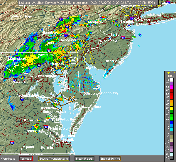 A severe thunderstorm warning remains in effect until 500 pm edt for southeastern harford county. at 424 pm edt, severe thunderstorms were located along a line extending from near riverside to 6 miles east of bowleys quarters, moving east at 50 mph. hazard. 60 mph wind gusts. A severe thunderstorm warning remains in effect until 500 pm edt for southeastern harford county. at 424 pm edt, severe thunderstorms were located along a line extending from near riverside to 6 miles east of bowleys quarters, moving east at 50 mph. hazard. 60 mph wind gusts.
|
| 7/22/2019 4:23 PM EDT |
 At 422 pm edt, severe thunderstorms with a history of producing wind damage were located along a line extending from near holtwood to near conowingo to 6 miles northeast of bel air north to bel air south, moving northeast at 50 mph (radar indicated). Hazards include 60 mph wind gusts. Damaging winds will cause some trees and large branches to fall. this could injure those outdoors, as well as damage homes and vehicles. roadways may become blocked by downed trees. localized power outages are possible. unsecured light objects may become projectiles. Locations impacted include, aberdeen, havre de grace, bel air south, bel air north, riverside, kingsville, pleasant hills, edgewood, joppatowne, darlington, cardiff, benson, churchville, carsins, scarboro, bradshaw, bynum, harford furnace, abingdon and joppa. At 422 pm edt, severe thunderstorms with a history of producing wind damage were located along a line extending from near holtwood to near conowingo to 6 miles northeast of bel air north to bel air south, moving northeast at 50 mph (radar indicated). Hazards include 60 mph wind gusts. Damaging winds will cause some trees and large branches to fall. this could injure those outdoors, as well as damage homes and vehicles. roadways may become blocked by downed trees. localized power outages are possible. unsecured light objects may become projectiles. Locations impacted include, aberdeen, havre de grace, bel air south, bel air north, riverside, kingsville, pleasant hills, edgewood, joppatowne, darlington, cardiff, benson, churchville, carsins, scarboro, bradshaw, bynum, harford furnace, abingdon and joppa.
|
| 7/22/2019 4:13 PM EDT |
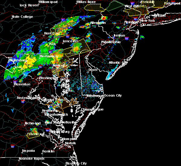 At 413 pm edt, severe thunderstorms were located along a line extending from white marsh to millers island, moving east at 50 mph (radar indicated). Hazards include 60 mph wind gusts. Damaging winds will cause some trees and large branches to fall. this could injure those outdoors, as well as damage homes and vehicles. roadways may become blocked by downed trees. localized power outages are possible. Unsecured light objects may become projectiles. At 413 pm edt, severe thunderstorms were located along a line extending from white marsh to millers island, moving east at 50 mph (radar indicated). Hazards include 60 mph wind gusts. Damaging winds will cause some trees and large branches to fall. this could injure those outdoors, as well as damage homes and vehicles. roadways may become blocked by downed trees. localized power outages are possible. Unsecured light objects may become projectiles.
|
| 7/22/2019 4:10 PM EDT |
 At 410 pm edt, severe thunderstorms with a history of producing wind damage were located along a line extending from 6 miles east of stewartstown to near bel air north to near fallston to near kingsville, moving northeast at 50 mph (radar indicated). Hazards include 70 mph wind gusts. Damaging winds will cause some trees and large branches to fall. this could injure those outdoors, as well as damage homes and vehicles. roadways may become blocked by downed trees. localized power outages are possible. unsecured light objects may become projectiles. Locations impacted include, aberdeen, havre de grace, bel air south, bel air north, perry hall, white marsh, fallston, riverside, kingsville, pleasant hills, jarrettsville, perryman, edgewood, joppatowne, pylesville, darlington, fork, cardiff, churchville and norrisville. At 410 pm edt, severe thunderstorms with a history of producing wind damage were located along a line extending from 6 miles east of stewartstown to near bel air north to near fallston to near kingsville, moving northeast at 50 mph (radar indicated). Hazards include 70 mph wind gusts. Damaging winds will cause some trees and large branches to fall. this could injure those outdoors, as well as damage homes and vehicles. roadways may become blocked by downed trees. localized power outages are possible. unsecured light objects may become projectiles. Locations impacted include, aberdeen, havre de grace, bel air south, bel air north, perry hall, white marsh, fallston, riverside, kingsville, pleasant hills, jarrettsville, perryman, edgewood, joppatowne, pylesville, darlington, fork, cardiff, churchville and norrisville.
|
| 7/22/2019 4:05 PM EDT |
 At 404 pm edt, severe thunderstorms with a history of producing wind damage were located along a line extending from near stewartstown to near jarrettsville to near fallston to carney, moving northeast at 60 mph (radar indicated). Hazards include 60 to 75 mph wind gusts. Damaging winds will cause some trees and large branches to fall. this could injure those outdoors, as well as damage homes and vehicles. roadways may become blocked by downed trees. localized power outages are possible. unsecured light objects may become projectiles. Locations impacted include, cockeysville, aberdeen, havre de grace, towson, bel air south, parkville, bel air north, carney, perry hall, timonium, white marsh, fallston, riverside, hampton, kingsville, pleasant hills, jarrettsville, perryman, lutherville-timonium and edgewood. At 404 pm edt, severe thunderstorms with a history of producing wind damage were located along a line extending from near stewartstown to near jarrettsville to near fallston to carney, moving northeast at 60 mph (radar indicated). Hazards include 60 to 75 mph wind gusts. Damaging winds will cause some trees and large branches to fall. this could injure those outdoors, as well as damage homes and vehicles. roadways may become blocked by downed trees. localized power outages are possible. unsecured light objects may become projectiles. Locations impacted include, cockeysville, aberdeen, havre de grace, towson, bel air south, parkville, bel air north, carney, perry hall, timonium, white marsh, fallston, riverside, hampton, kingsville, pleasant hills, jarrettsville, perryman, lutherville-timonium and edgewood.
|
| 7/22/2019 3:56 PM EDT |
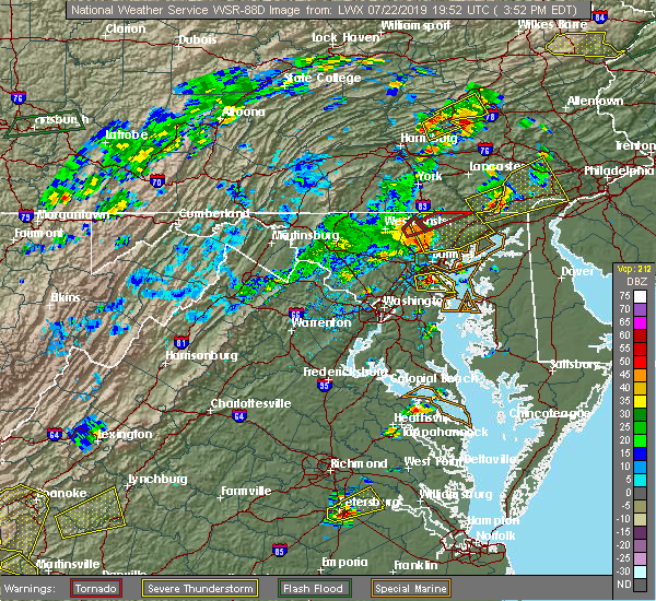 At 356 pm edt, severe thunderstorms with a history of producing wind damage were located along a line extending from hampstead to near reisterstown, moving northeast at 50 mph (radar indicated). Hazards include 60 to 75 mph wind gusts. Damaging winds will cause some trees and large branches to fall. this could injure those outdoors, as well as damage homes and vehicles. roadways may become blocked by downed trees. localized power outages are possible. unsecured light objects may become projectiles. Locations impacted include, pikesville, cockeysville, aberdeen, havre de grace, towson, bel air south, parkville, bel air north, carney, perry hall, mays chapel, timonium, white marsh, fallston, riverside, hampton, kingsville, pleasant hills, jarrettsville and perryman. At 356 pm edt, severe thunderstorms with a history of producing wind damage were located along a line extending from hampstead to near reisterstown, moving northeast at 50 mph (radar indicated). Hazards include 60 to 75 mph wind gusts. Damaging winds will cause some trees and large branches to fall. this could injure those outdoors, as well as damage homes and vehicles. roadways may become blocked by downed trees. localized power outages are possible. unsecured light objects may become projectiles. Locations impacted include, pikesville, cockeysville, aberdeen, havre de grace, towson, bel air south, parkville, bel air north, carney, perry hall, mays chapel, timonium, white marsh, fallston, riverside, hampton, kingsville, pleasant hills, jarrettsville and perryman.
|
| 7/22/2019 3:47 PM EDT |
 At 347 pm edt, severe thunderstorms with a history of producing wind damage and measured wind gusts to nearly 60 mph were located along a line extending from near westminster to near oakland, moving northeast at 50 mph (radar indicated). Hazards include 60 to 75 mph wind gusts. Damaging winds will cause some trees and large branches to fall. this could injure those outdoors, as well as damage homes and vehicles. roadways may become blocked by downed trees. localized power outages are possible. unsecured light objects may become projectiles. Locations impacted include, pikesville, cockeysville, aberdeen, havre de grace, towson, bel air south, randallstown, parkville, owings mills, bel air north, carney, milford mill, perry hall, reisterstown, lochearn, mays chapel, timonium, white marsh, fallston and riverside. At 347 pm edt, severe thunderstorms with a history of producing wind damage and measured wind gusts to nearly 60 mph were located along a line extending from near westminster to near oakland, moving northeast at 50 mph (radar indicated). Hazards include 60 to 75 mph wind gusts. Damaging winds will cause some trees and large branches to fall. this could injure those outdoors, as well as damage homes and vehicles. roadways may become blocked by downed trees. localized power outages are possible. unsecured light objects may become projectiles. Locations impacted include, pikesville, cockeysville, aberdeen, havre de grace, towson, bel air south, randallstown, parkville, owings mills, bel air north, carney, milford mill, perry hall, reisterstown, lochearn, mays chapel, timonium, white marsh, fallston and riverside.
|
| 7/22/2019 3:37 PM EDT |
 At 336 pm edt, severe thunderstorms with a history of producing wind damage and measured wind gusts to near 60 mph were located along a line extending from westminster to sykesville, moving northeast at 50 mph. these are dangerous storms! (radar indicated). Hazards include 60 to 80 mph wind gusts. Damaging winds will cause some trees and large branches to fall. this could injure those outdoors, as well as damage homes and vehicles. roadways may become blocked by downed trees. localized power outages are possible. unsecured light objects may become projectiles. Locations impacted include, pikesville, cockeysville, westminster, aberdeen, havre de grace, towson, bel air south, randallstown, parkville, owings mills, bel air north, eldersburg, carney, milford mill, perry hall, reisterstown, lochearn, mays chapel, timonium and white marsh. At 336 pm edt, severe thunderstorms with a history of producing wind damage and measured wind gusts to near 60 mph were located along a line extending from westminster to sykesville, moving northeast at 50 mph. these are dangerous storms! (radar indicated). Hazards include 60 to 80 mph wind gusts. Damaging winds will cause some trees and large branches to fall. this could injure those outdoors, as well as damage homes and vehicles. roadways may become blocked by downed trees. localized power outages are possible. unsecured light objects may become projectiles. Locations impacted include, pikesville, cockeysville, westminster, aberdeen, havre de grace, towson, bel air south, randallstown, parkville, owings mills, bel air north, eldersburg, carney, milford mill, perry hall, reisterstown, lochearn, mays chapel, timonium and white marsh.
|
| 7/22/2019 3:23 PM EDT |
 At 322 pm edt, severe thunderstorms with a history of producing wind damage and measured wind gusts to nearly 60 mph were located along a line extending from 9 miles northeast of new market to near mount airy, moving northeast at 50 mph (radar indicated). Hazards include 60 to 75 mph wind gusts. Damaging winds will cause some trees and large branches to fall. this could injure those outdoors, as well as damage homes and vehicles. roadways may become blocked by downed trees. localized power outages are possible. Unsecured light objects may become projectiles. At 322 pm edt, severe thunderstorms with a history of producing wind damage and measured wind gusts to nearly 60 mph were located along a line extending from 9 miles northeast of new market to near mount airy, moving northeast at 50 mph (radar indicated). Hazards include 60 to 75 mph wind gusts. Damaging winds will cause some trees and large branches to fall. this could injure those outdoors, as well as damage homes and vehicles. roadways may become blocked by downed trees. localized power outages are possible. Unsecured light objects may become projectiles.
|
| 7/17/2019 6:36 PM EDT |
 At 636 pm edt, severe thunderstorms were located along a line extending from near sunnyburn to near octoraro to perryman, moving northeast at 35 mph (radar indicated). Hazards include 60 mph wind gusts. Damaging winds will cause some trees and large branches to fall. this could injure those outdoors, as well as damage homes and vehicles. roadways may become blocked by downed trees. localized power outages are possible. unsecured light objects may become projectiles. Locations impacted include, aberdeen, havre de grace, aberdeen proving ground, bel air south, bel air north, riverside, perryman, edgewood, pylesville, darlington, cardiff, churchville, carsins, scarboro, harford furnace, abingdon, belcamp and whiteford. At 636 pm edt, severe thunderstorms were located along a line extending from near sunnyburn to near octoraro to perryman, moving northeast at 35 mph (radar indicated). Hazards include 60 mph wind gusts. Damaging winds will cause some trees and large branches to fall. this could injure those outdoors, as well as damage homes and vehicles. roadways may become blocked by downed trees. localized power outages are possible. unsecured light objects may become projectiles. Locations impacted include, aberdeen, havre de grace, aberdeen proving ground, bel air south, bel air north, riverside, perryman, edgewood, pylesville, darlington, cardiff, churchville, carsins, scarboro, harford furnace, abingdon, belcamp and whiteford.
|
| 7/17/2019 6:31 PM EDT |
 At 631 pm edt, severe thunderstorms were located along a line extending from near delta to 6 miles southwest of octoraro to near perryman, moving east at 40 mph (radar indicated). Hazards include 60 mph wind gusts. Damaging winds will cause some trees and large branches to fall. this could injure those outdoors, as well as damage homes and vehicles. roadways may become blocked by downed trees. localized power outages are possible. Unsecured light objects may become projectiles. At 631 pm edt, severe thunderstorms were located along a line extending from near delta to 6 miles southwest of octoraro to near perryman, moving east at 40 mph (radar indicated). Hazards include 60 mph wind gusts. Damaging winds will cause some trees and large branches to fall. this could injure those outdoors, as well as damage homes and vehicles. roadways may become blocked by downed trees. localized power outages are possible. Unsecured light objects may become projectiles.
|
| 7/17/2019 6:20 PM EDT |
 At 620 pm edt, severe thunderstorms were located along a line extending from near stewartstown to near jarrettsville to near kingsville, moving northeast at 40 mph (radar indicated). Hazards include 60 mph wind gusts. Damaging winds will cause some trees and large branches to fall. this could injure those outdoors, as well as damage homes and vehicles. roadways may become blocked by downed trees. localized power outages are possible. unsecured light objects may become projectiles. Locations impacted include, baltimore, cockeysville, aberdeen, havre de grace, aberdeen proving ground, towson, bel air south, parkville, bel air north, carney, perry hall, rossville, timonium, white marsh, fallston, riverside, hampton, kingsville, pleasant hills and jarrettsville. At 620 pm edt, severe thunderstorms were located along a line extending from near stewartstown to near jarrettsville to near kingsville, moving northeast at 40 mph (radar indicated). Hazards include 60 mph wind gusts. Damaging winds will cause some trees and large branches to fall. this could injure those outdoors, as well as damage homes and vehicles. roadways may become blocked by downed trees. localized power outages are possible. unsecured light objects may become projectiles. Locations impacted include, baltimore, cockeysville, aberdeen, havre de grace, aberdeen proving ground, towson, bel air south, parkville, bel air north, carney, perry hall, rossville, timonium, white marsh, fallston, riverside, hampton, kingsville, pleasant hills and jarrettsville.
|
| 7/17/2019 5:46 PM EDT |
 At 546 pm edt, severe thunderstorms were located along a line extending from near gamber to owings mills to woodlawn, moving northeast at 35 mph (radar indicated). Hazards include 60 mph wind gusts. Damaging winds will cause some trees and large branches to fall. this could injure those outdoors, as well as damage homes and vehicles. roadways may become blocked by downed trees. localized power outages are possible. Unsecured light objects may become projectiles. At 546 pm edt, severe thunderstorms were located along a line extending from near gamber to owings mills to woodlawn, moving northeast at 35 mph (radar indicated). Hazards include 60 mph wind gusts. Damaging winds will cause some trees and large branches to fall. this could injure those outdoors, as well as damage homes and vehicles. roadways may become blocked by downed trees. localized power outages are possible. Unsecured light objects may become projectiles.
|
| 7/11/2019 5:24 PM EDT |
 At 447 pm edt, a severe thunderstorm was located over perry hall, or near middle river, moving east at 20 mph (radar indicated). Hazards include 60 mph wind gusts. Damaging winds will cause some trees and large branches to fall. this could injure those outdoors, as well as damage homes and vehicles. roadways may become blocked by downed trees. localized power outages are possible. Unsecured light objects may become projectiles. At 447 pm edt, a severe thunderstorm was located over perry hall, or near middle river, moving east at 20 mph (radar indicated). Hazards include 60 mph wind gusts. Damaging winds will cause some trees and large branches to fall. this could injure those outdoors, as well as damage homes and vehicles. roadways may become blocked by downed trees. localized power outages are possible. Unsecured light objects may become projectiles.
|
| 7/11/2019 5:18 PM EDT |
 At 447 pm edt, a severe thunderstorm was located over perry hall, or near middle river, moving east at 20 mph (radar indicated). Hazards include 60 mph wind gusts. Damaging winds will cause some trees and large branches to fall. this could injure those outdoors, as well as damage homes and vehicles. roadways may become blocked by downed trees. localized power outages are possible. Unsecured light objects may become projectiles. At 447 pm edt, a severe thunderstorm was located over perry hall, or near middle river, moving east at 20 mph (radar indicated). Hazards include 60 mph wind gusts. Damaging winds will cause some trees and large branches to fall. this could injure those outdoors, as well as damage homes and vehicles. roadways may become blocked by downed trees. localized power outages are possible. Unsecured light objects may become projectiles.
|
| 7/11/2019 4:47 PM EDT |
 The national weather service in sterling virginia has issued a * severe thunderstorm warning for. central harford county in northern maryland. east central baltimore county in northern maryland. until 530 pm edt. At 447 pm edt, a severe thunderstorm was located over perry hall,. The national weather service in sterling virginia has issued a * severe thunderstorm warning for. central harford county in northern maryland. east central baltimore county in northern maryland. until 530 pm edt. At 447 pm edt, a severe thunderstorm was located over perry hall,.
|
| 7/11/2019 4:26 PM EDT |
 At 425 pm edt, a severe thunderstorm was located near bel air south, or 8 miles southwest of aberdeen, moving northeast at 15 mph (radar indicated). Hazards include 60 mph wind gusts. Damaging winds will cause some trees and large branches to fall. this could injure those outdoors, as well as damage homes and vehicles. roadways may become blocked by downed trees. localized power outages are possible. unsecured light objects may become projectiles. Locations impacted include, aberdeen, bel air south, riverside, pleasant hills, perryman, edgewood, joppatowne, churchville, magnolia, harford furnace, abingdon, joppa and belcamp. At 425 pm edt, a severe thunderstorm was located near bel air south, or 8 miles southwest of aberdeen, moving northeast at 15 mph (radar indicated). Hazards include 60 mph wind gusts. Damaging winds will cause some trees and large branches to fall. this could injure those outdoors, as well as damage homes and vehicles. roadways may become blocked by downed trees. localized power outages are possible. unsecured light objects may become projectiles. Locations impacted include, aberdeen, bel air south, riverside, pleasant hills, perryman, edgewood, joppatowne, churchville, magnolia, harford furnace, abingdon, joppa and belcamp.
|
| 7/11/2019 3:57 PM EDT |
 At 356 pm edt, a severe thunderstorm was located over kingsville, or near middle river, moving northeast at 15 mph (radar indicated). Hazards include 60 mph wind gusts. Damaging winds will cause some trees and large branches to fall. this could injure those outdoors, as well as damage homes and vehicles. roadways may become blocked by downed trees. localized power outages are possible. Unsecured light objects may become projectiles. At 356 pm edt, a severe thunderstorm was located over kingsville, or near middle river, moving northeast at 15 mph (radar indicated). Hazards include 60 mph wind gusts. Damaging winds will cause some trees and large branches to fall. this could injure those outdoors, as well as damage homes and vehicles. roadways may become blocked by downed trees. localized power outages are possible. Unsecured light objects may become projectiles.
|
| 7/2/2019 8:21 PM EDT |
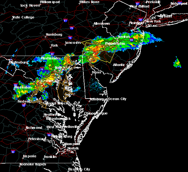 At 821 pm edt, severe thunderstorms were located along a line extending from conowingo to near aberdeen, moving east at 30 mph (radar indicated). Hazards include 60 mph wind gusts. Damaging winds will cause some trees and large branches to fall. this could injure those outdoors, as well as damage homes and vehicles. roadways may become blocked by downed trees. localized power outages are possible. unsecured light objects may become projectiles. Locations impacted include, aberdeen, havre de grace, aberdeen proving ground, riverside, perryman, darlington, churchville and carsins. At 821 pm edt, severe thunderstorms were located along a line extending from conowingo to near aberdeen, moving east at 30 mph (radar indicated). Hazards include 60 mph wind gusts. Damaging winds will cause some trees and large branches to fall. this could injure those outdoors, as well as damage homes and vehicles. roadways may become blocked by downed trees. localized power outages are possible. unsecured light objects may become projectiles. Locations impacted include, aberdeen, havre de grace, aberdeen proving ground, riverside, perryman, darlington, churchville and carsins.
|
| 7/2/2019 7:56 PM EDT |
 At 755 pm edt, severe thunderstorms were located along a line extending from near delta to bel air north to fallston, moving east at 35 mph (radar indicated). Hazards include 60 mph wind gusts. Damaging winds will cause some trees and large branches to fall. this could injure those outdoors, as well as damage homes and vehicles. roadways may become blocked by downed trees. localized power outages are possible. unsecured light objects may become projectiles. Locations impacted include, aberdeen, havre de grace, aberdeen proving ground, bel air south, bel air north, fallston, riverside, pleasant hills, jarrettsville, perryman, pylesville, darlington, cardiff, churchville, carsins, forest hill, street, hickory, whiteford and benson. At 755 pm edt, severe thunderstorms were located along a line extending from near delta to bel air north to fallston, moving east at 35 mph (radar indicated). Hazards include 60 mph wind gusts. Damaging winds will cause some trees and large branches to fall. this could injure those outdoors, as well as damage homes and vehicles. roadways may become blocked by downed trees. localized power outages are possible. unsecured light objects may become projectiles. Locations impacted include, aberdeen, havre de grace, aberdeen proving ground, bel air south, bel air north, fallston, riverside, pleasant hills, jarrettsville, perryman, pylesville, darlington, cardiff, churchville, carsins, forest hill, street, hickory, whiteford and benson.
|
| 7/2/2019 7:45 PM EDT |
 At 745 pm edt, severe thunderstorms were located along a line extending from near stewartstown to near fallston to near cockeysville, moving east at 35 mph (radar indicated). Hazards include 60 mph wind gusts and quarter size hail. Damaging winds will cause some trees and large branches to fall. this could injure those outdoors, as well as damage homes and vehicles. roadways may become blocked by downed trees. localized power outages are possible. Unsecured light objects may become projectiles. At 745 pm edt, severe thunderstorms were located along a line extending from near stewartstown to near fallston to near cockeysville, moving east at 35 mph (radar indicated). Hazards include 60 mph wind gusts and quarter size hail. Damaging winds will cause some trees and large branches to fall. this could injure those outdoors, as well as damage homes and vehicles. roadways may become blocked by downed trees. localized power outages are possible. Unsecured light objects may become projectiles.
|
| 6/29/2019 11:56 PM EDT |
 At 1156 pm edt, severe thunderstorms were located along a line extending from near bel air south to near bowleys quarters, moving east at 35 mph (radar indicated). Hazards include 60 mph wind gusts. Damaging winds will cause some trees and large branches to fall. this could injure those outdoors, as well as damage homes and vehicles. roadways may become blocked by downed trees. localized power outages are possible. unsecured light objects may become projectiles. Locations impacted include, aberdeen, havre de grace, aberdeen proving ground, bel air south, bel air north, riverside, kingsville, pleasant hills, perryman, edgewood, joppatowne, churchville, carsins, magnolia, harford furnace, abingdon, joppa and belcamp. At 1156 pm edt, severe thunderstorms were located along a line extending from near bel air south to near bowleys quarters, moving east at 35 mph (radar indicated). Hazards include 60 mph wind gusts. Damaging winds will cause some trees and large branches to fall. this could injure those outdoors, as well as damage homes and vehicles. roadways may become blocked by downed trees. localized power outages are possible. unsecured light objects may become projectiles. Locations impacted include, aberdeen, havre de grace, aberdeen proving ground, bel air south, bel air north, riverside, kingsville, pleasant hills, perryman, edgewood, joppatowne, churchville, carsins, magnolia, harford furnace, abingdon, joppa and belcamp.
|
| 6/29/2019 11:40 PM EDT |
 At 1139 pm edt, severe thunderstorms were located along a line extending from fallston to rosedale, moving east at 35 mph (radar indicated). Hazards include 60 mph wind gusts. Damaging winds will cause some trees and large branches to fall. this could injure those outdoors, as well as damage homes and vehicles. roadways may become blocked by downed trees. localized power outages are possible. Unsecured light objects may become projectiles. At 1139 pm edt, severe thunderstorms were located along a line extending from fallston to rosedale, moving east at 35 mph (radar indicated). Hazards include 60 mph wind gusts. Damaging winds will cause some trees and large branches to fall. this could injure those outdoors, as well as damage homes and vehicles. roadways may become blocked by downed trees. localized power outages are possible. Unsecured light objects may become projectiles.
|
| 6/29/2019 4:15 PM EDT |
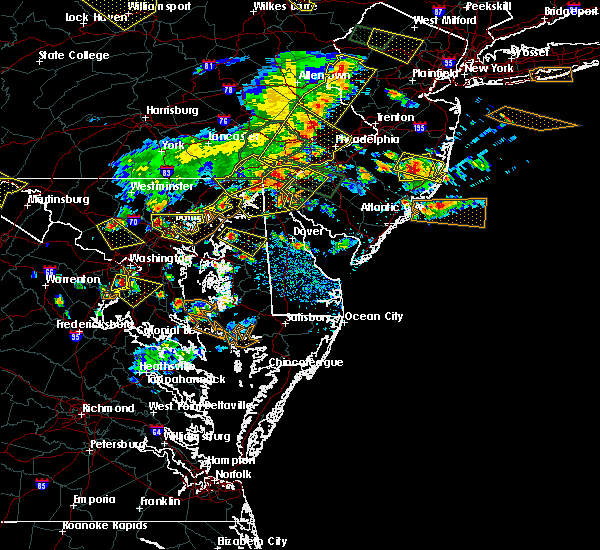 At 415 pm edt, severe thunderstorms were located along a line extending from west nottingham to aberdeen, moving east at 30 mph (radar indicated). Hazards include 60 mph wind gusts. Damaging winds will cause some trees and large branches to fall. this could injure those outdoors, as well as damage homes and vehicles. roadways may become blocked by downed trees. localized power outages are possible. unsecured light objects may become projectiles. Locations impacted include, aberdeen, havre de grace, aberdeen proving ground, riverside, perryman, edgewood, abingdon and belcamp. At 415 pm edt, severe thunderstorms were located along a line extending from west nottingham to aberdeen, moving east at 30 mph (radar indicated). Hazards include 60 mph wind gusts. Damaging winds will cause some trees and large branches to fall. this could injure those outdoors, as well as damage homes and vehicles. roadways may become blocked by downed trees. localized power outages are possible. unsecured light objects may become projectiles. Locations impacted include, aberdeen, havre de grace, aberdeen proving ground, riverside, perryman, edgewood, abingdon and belcamp.
|
| 6/29/2019 4:02 PM EDT |
 At 402 pm edt, severe thunderstorms were located along a line extending from conowingo to near riverside, moving east at 30 mph (radar indicated). Hazards include 60 mph wind gusts. Damaging winds will cause some trees and large branches to fall. this could injure those outdoors, as well as damage homes and vehicles. roadways may become blocked by downed trees. localized power outages are possible. unsecured light objects may become projectiles. Locations impacted include, aberdeen, havre de grace, aberdeen proving ground, bel air south, bel air north, fallston, riverside, pleasant hills, perryman, edgewood, darlington, benson, churchville, carsins, scarboro, bynum, harford furnace, abingdon, hickory and belcamp. At 402 pm edt, severe thunderstorms were located along a line extending from conowingo to near riverside, moving east at 30 mph (radar indicated). Hazards include 60 mph wind gusts. Damaging winds will cause some trees and large branches to fall. this could injure those outdoors, as well as damage homes and vehicles. roadways may become blocked by downed trees. localized power outages are possible. unsecured light objects may become projectiles. Locations impacted include, aberdeen, havre de grace, aberdeen proving ground, bel air south, bel air north, fallston, riverside, pleasant hills, perryman, edgewood, darlington, benson, churchville, carsins, scarboro, bynum, harford furnace, abingdon, hickory and belcamp.
|
| 6/29/2019 3:48 PM EDT |
 At 348 pm edt, severe thunderstorms were located along a line extending from near delta to bel air north, moving east at 30 mph (radar indicated). Hazards include 60 mph wind gusts. Damaging winds will cause some trees and large branches to fall. this could injure those outdoors, as well as damage homes and vehicles. roadways may become blocked by downed trees. localized power outages are possible. Unsecured light objects may become projectiles. At 348 pm edt, severe thunderstorms were located along a line extending from near delta to bel air north, moving east at 30 mph (radar indicated). Hazards include 60 mph wind gusts. Damaging winds will cause some trees and large branches to fall. this could injure those outdoors, as well as damage homes and vehicles. roadways may become blocked by downed trees. localized power outages are possible. Unsecured light objects may become projectiles.
|
| 6/13/2019 6:48 PM EDT |
 At 648 pm edt, severe thunderstorms were located along a line extending from near wakefield to near aberdeen to near riverside, moving east at 35 mph (radar indicated). Hazards include 60 mph wind gusts. Damaging winds will cause some trees and large branches to fall. this could injure those outdoors, as well as damage homes and vehicles. roadways may become blocked by downed trees. localized power outages are possible. unsecured light objects may become projectiles. Locations impacted include, baltimore, aberdeen, havre de grace, aberdeen proving ground, towson, bel air south, parkville, bel air north, carney, perry hall, rosedale, rossville, timonium, white marsh, fallston, riverside, hampton, kingsville, pleasant hills and perryman. At 648 pm edt, severe thunderstorms were located along a line extending from near wakefield to near aberdeen to near riverside, moving east at 35 mph (radar indicated). Hazards include 60 mph wind gusts. Damaging winds will cause some trees and large branches to fall. this could injure those outdoors, as well as damage homes and vehicles. roadways may become blocked by downed trees. localized power outages are possible. unsecured light objects may become projectiles. Locations impacted include, baltimore, aberdeen, havre de grace, aberdeen proving ground, towson, bel air south, parkville, bel air north, carney, perry hall, rosedale, rossville, timonium, white marsh, fallston, riverside, hampton, kingsville, pleasant hills and perryman.
|
| 6/13/2019 6:21 PM EDT |
 At 621 pm edt, severe thunderstorms were located along a line extending from near stewartstown to near perry hall to near parkville, moving east at 35 mph (radar indicated). Hazards include 60 mph wind gusts. Damaging winds will cause some trees and large branches to fall. this could injure those outdoors, as well as damage homes and vehicles. roadways may become blocked by downed trees. localized power outages are possible. Unsecured light objects may become projectiles. At 621 pm edt, severe thunderstorms were located along a line extending from near stewartstown to near perry hall to near parkville, moving east at 35 mph (radar indicated). Hazards include 60 mph wind gusts. Damaging winds will cause some trees and large branches to fall. this could injure those outdoors, as well as damage homes and vehicles. roadways may become blocked by downed trees. localized power outages are possible. Unsecured light objects may become projectiles.
|
| 6/2/2019 5:39 PM EDT |
 The national weather service in sterling virginia has issued a * severe thunderstorm warning for. southeastern harford county in northern maryland. until 630 pm edt. At 539 pm edt, a severe thunderstorm was located near bel air south, or near aberdeen, moving east at 25 mph. The national weather service in sterling virginia has issued a * severe thunderstorm warning for. southeastern harford county in northern maryland. until 630 pm edt. At 539 pm edt, a severe thunderstorm was located near bel air south, or near aberdeen, moving east at 25 mph.
|
| 5/29/2019 6:51 PM EDT |
 The severe thunderstorm warning for northeastern harford county will expire at 700 pm edt, the storm which prompted the warning has weakened below severe limits, and has exited the warned area. therefore, the warning will be allowed to expire. The severe thunderstorm warning for northeastern harford county will expire at 700 pm edt, the storm which prompted the warning has weakened below severe limits, and has exited the warned area. therefore, the warning will be allowed to expire.
|
| 5/29/2019 6:41 PM EDT |
 At 618 pm edt, a severe thunderstorm was located near jarrettsville, or 15 miles south of red lion, moving east at 45 mph (radar indicated). Hazards include 60 mph wind gusts and quarter size hail. Damaging winds will cause some trees and large branches to fall. this could injure those outdoors, as well as damage homes and vehicles. roadways may become blocked by downed trees. localized power outages are possible. Unsecured light objects may become projectiles. At 618 pm edt, a severe thunderstorm was located near jarrettsville, or 15 miles south of red lion, moving east at 45 mph (radar indicated). Hazards include 60 mph wind gusts and quarter size hail. Damaging winds will cause some trees and large branches to fall. this could injure those outdoors, as well as damage homes and vehicles. roadways may become blocked by downed trees. localized power outages are possible. Unsecured light objects may become projectiles.
|
| 5/29/2019 6:22 PM EDT |
 The severe thunderstorm warning for harford and northeastern baltimore counties and northeastern baltimore city will expire at 630 pm edt, the storm which prompted the warning has moved out of the area. therefore, the warning will be allowed to expire. The severe thunderstorm warning for harford and northeastern baltimore counties and northeastern baltimore city will expire at 630 pm edt, the storm which prompted the warning has moved out of the area. therefore, the warning will be allowed to expire.
|
| 5/29/2019 6:18 PM EDT |
 At 618 pm edt, a severe thunderstorm was located near jarrettsville, or 15 miles south of red lion, moving east at 45 mph (radar indicated). Hazards include 60 mph wind gusts and quarter size hail. Damaging winds will cause some trees and large branches to fall. this could injure those outdoors, as well as damage homes and vehicles. roadways may become blocked by downed trees. localized power outages are possible. Unsecured light objects may become projectiles. At 618 pm edt, a severe thunderstorm was located near jarrettsville, or 15 miles south of red lion, moving east at 45 mph (radar indicated). Hazards include 60 mph wind gusts and quarter size hail. Damaging winds will cause some trees and large branches to fall. this could injure those outdoors, as well as damage homes and vehicles. roadways may become blocked by downed trees. localized power outages are possible. Unsecured light objects may become projectiles.
|
| 5/29/2019 5:55 PM EDT |
 At 555 pm edt, a severe thunderstorm was located over rossville, or near middle river, moving east at 40 mph (radar indicated). Hazards include two inch hail and 70 mph wind gusts. Expect wind damage to trees and power lines. hail is large enough to dent and damage vehicles. some hail damage to roofs, siding, and windows is possible. Locations impacted include, middle river, aberdeen, havre de grace, aberdeen proving ground, bel air south, parkville, bel air north, carney, perry hall, rosedale, rossville, white marsh, fallston, riverside, hampton, kingsville, pleasant hills, jarrettsville, perryman and edgewood. At 555 pm edt, a severe thunderstorm was located over rossville, or near middle river, moving east at 40 mph (radar indicated). Hazards include two inch hail and 70 mph wind gusts. Expect wind damage to trees and power lines. hail is large enough to dent and damage vehicles. some hail damage to roofs, siding, and windows is possible. Locations impacted include, middle river, aberdeen, havre de grace, aberdeen proving ground, bel air south, parkville, bel air north, carney, perry hall, rosedale, rossville, white marsh, fallston, riverside, hampton, kingsville, pleasant hills, jarrettsville, perryman and edgewood.
|
| 5/29/2019 5:38 PM EDT |
 At 538 pm edt, a severe thunderstorm was located over lochearn, or over pikesville, moving east at 40 mph (radar indicated). Hazards include 60 mph wind gusts and half dollar size hail. Damaging winds will cause some trees and large branches to fall. this could injure those outdoors, as well as damage homes and vehicles. roadways may become blocked by downed trees. localized power outages are possible. Unsecured light objects may become projectiles. At 538 pm edt, a severe thunderstorm was located over lochearn, or over pikesville, moving east at 40 mph (radar indicated). Hazards include 60 mph wind gusts and half dollar size hail. Damaging winds will cause some trees and large branches to fall. this could injure those outdoors, as well as damage homes and vehicles. roadways may become blocked by downed trees. localized power outages are possible. Unsecured light objects may become projectiles.
|
| 5/26/2019 9:04 PM EDT |
 At 904 pm edt, a severe thunderstorm was located near perryman, or 7 miles southwest of aberdeen proving ground, moving southeast at 30 mph (radar indicated). Hazards include two inch hail and 60 mph wind gusts. Expect wind damage to trees and power lines. hail is large enough to dent and damage vehicles. some hail damage to roofs, siding, and windows is possible. Locations impacted include, aberdeen proving ground, riverside, perryman, edgewood, joppatowne, harford furnace, abingdon, magnolia and belcamp. At 904 pm edt, a severe thunderstorm was located near perryman, or 7 miles southwest of aberdeen proving ground, moving southeast at 30 mph (radar indicated). Hazards include two inch hail and 60 mph wind gusts. Expect wind damage to trees and power lines. hail is large enough to dent and damage vehicles. some hail damage to roofs, siding, and windows is possible. Locations impacted include, aberdeen proving ground, riverside, perryman, edgewood, joppatowne, harford furnace, abingdon, magnolia and belcamp.
|
| 5/26/2019 8:46 PM EDT |
 At 846 pm edt, a severe thunderstorm was located near pleasant hills, or 8 miles northeast of middle river, moving east at 40 mph (radar indicated). Hazards include 60 mph wind gusts and quarter size hail. Damaging winds will cause some trees and large branches to fall. this could injure those outdoors, as well as damage homes and vehicles. roadways may become blocked by downed trees. localized power outages are possible. Unsecured light objects may become projectiles. At 846 pm edt, a severe thunderstorm was located near pleasant hills, or 8 miles northeast of middle river, moving east at 40 mph (radar indicated). Hazards include 60 mph wind gusts and quarter size hail. Damaging winds will cause some trees and large branches to fall. this could injure those outdoors, as well as damage homes and vehicles. roadways may become blocked by downed trees. localized power outages are possible. Unsecured light objects may become projectiles.
|
| 4/26/2019 4:06 PM EDT |
 At 406 pm edt, severe thunderstorms were located along a line extending from wakefield to riverside, moving northeast at 40 mph (radar indicated). Hazards include 60 mph wind gusts. Damaging winds will cause some trees and large branches to fall. this could injure those outdoors, as well as damage homes and vehicles. roadways may become blocked by downed trees. localized power outages are possible. unsecured light objects may become projectiles. Locations impacted include, aberdeen, havre de grace, aberdeen proving ground, bel air south, bel air north, riverside, perryman, edgewood, joppatowne, darlington, cardiff, churchville, carsins, magnolia, scarboro, harford furnace, abingdon, joppa, hickory and belcamp. At 406 pm edt, severe thunderstorms were located along a line extending from wakefield to riverside, moving northeast at 40 mph (radar indicated). Hazards include 60 mph wind gusts. Damaging winds will cause some trees and large branches to fall. this could injure those outdoors, as well as damage homes and vehicles. roadways may become blocked by downed trees. localized power outages are possible. unsecured light objects may become projectiles. Locations impacted include, aberdeen, havre de grace, aberdeen proving ground, bel air south, bel air north, riverside, perryman, edgewood, joppatowne, darlington, cardiff, churchville, carsins, magnolia, scarboro, harford furnace, abingdon, joppa, hickory and belcamp.
|
| 4/26/2019 3:50 PM EDT |
 At 350 pm edt, severe thunderstorms were located along a line extending from delta to near white marsh, moving east at 30 mph (radar indicated). Hazards include 60 mph wind gusts. Damaging winds will cause some trees and large branches to fall. this could injure those outdoors, as well as damage homes and vehicles. roadways may become blocked by downed trees. localized power outages are possible. unsecured light objects may become projectiles. Locations impacted include, aberdeen, havre de grace, aberdeen proving ground, bel air south, parkville, bel air north, carney, perry hall, rossville, white marsh, fallston, riverside, hampton, kingsville, pleasant hills, jarrettsville, perryman, edgewood, joppatowne and pylesville. At 350 pm edt, severe thunderstorms were located along a line extending from delta to near white marsh, moving east at 30 mph (radar indicated). Hazards include 60 mph wind gusts. Damaging winds will cause some trees and large branches to fall. this could injure those outdoors, as well as damage homes and vehicles. roadways may become blocked by downed trees. localized power outages are possible. unsecured light objects may become projectiles. Locations impacted include, aberdeen, havre de grace, aberdeen proving ground, bel air south, parkville, bel air north, carney, perry hall, rossville, white marsh, fallston, riverside, hampton, kingsville, pleasant hills, jarrettsville, perryman, edgewood, joppatowne and pylesville.
|
| 4/26/2019 3:08 PM EDT |
 At 308 pm edt, severe thunderstorms were located along a line extending from near railroad to pikesville, moving northeast at 40 mph (radar indicated). Hazards include 60 mph wind gusts. Damaging winds will cause some trees and large branches to fall. this could injure those outdoors, as well as damage homes and vehicles. roadways may become blocked by downed trees. localized power outages are possible. Unsecured light objects may become projectiles. At 308 pm edt, severe thunderstorms were located along a line extending from near railroad to pikesville, moving northeast at 40 mph (radar indicated). Hazards include 60 mph wind gusts. Damaging winds will cause some trees and large branches to fall. this could injure those outdoors, as well as damage homes and vehicles. roadways may become blocked by downed trees. localized power outages are possible. Unsecured light objects may become projectiles.
|
| 4/15/2019 2:52 AM EDT |
 At 252 am edt, severe thunderstorms were located along a line extending from fallston to kingsville, moving northeast at 65 mph (radar indicated). Hazards include 60 mph wind gusts. Damaging winds will cause some trees and large branches to fall. this could injure those outdoors, as well as damage homes and vehicles. roadways may become blocked by downed trees. localized power outages are possible. Unsecured light objects may become projectiles. At 252 am edt, severe thunderstorms were located along a line extending from fallston to kingsville, moving northeast at 65 mph (radar indicated). Hazards include 60 mph wind gusts. Damaging winds will cause some trees and large branches to fall. this could injure those outdoors, as well as damage homes and vehicles. roadways may become blocked by downed trees. localized power outages are possible. Unsecured light objects may become projectiles.
|
| 4/15/2019 2:33 AM EDT |
 At 233 am edt, severe thunderstorms were located along a line extending from near gamber to randallstown, moving east at 70 mph (radar indicated). Hazards include 60 mph wind gusts. Damaging winds will cause some trees and large branches to fall. this could injure those outdoors, as well as damage homes and vehicles. roadways may become blocked by downed trees. localized power outages are possible. unsecured light objects may become projectiles. Locations impacted include, baltimore, pikesville, cockeysville, aberdeen, havre de grace, aberdeen proving ground, towson, bel air south, parkville, bel air north, carney, perry hall, rossville, mays chapel, timonium, white marsh, fallston, riverside, hampton and kingsville. At 233 am edt, severe thunderstorms were located along a line extending from near gamber to randallstown, moving east at 70 mph (radar indicated). Hazards include 60 mph wind gusts. Damaging winds will cause some trees and large branches to fall. this could injure those outdoors, as well as damage homes and vehicles. roadways may become blocked by downed trees. localized power outages are possible. unsecured light objects may become projectiles. Locations impacted include, baltimore, pikesville, cockeysville, aberdeen, havre de grace, aberdeen proving ground, towson, bel air south, parkville, bel air north, carney, perry hall, rossville, mays chapel, timonium, white marsh, fallston, riverside, hampton and kingsville.
|
| 4/15/2019 2:01 AM EDT |
 At 200 am edt, severe thunderstorms were located along a line extending from 6 miles east of stewartstown to mays chapel, moving northeast at 55 mph (radar indicated). Hazards include 60 mph wind gusts. Damaging winds will cause some trees and large branches to fall. this could injure those outdoors, as well as damage homes and vehicles. roadways may become blocked by downed trees. localized power outages are possible. Unsecured light objects may become projectiles. At 200 am edt, severe thunderstorms were located along a line extending from 6 miles east of stewartstown to mays chapel, moving northeast at 55 mph (radar indicated). Hazards include 60 mph wind gusts. Damaging winds will cause some trees and large branches to fall. this could injure those outdoors, as well as damage homes and vehicles. roadways may become blocked by downed trees. localized power outages are possible. Unsecured light objects may become projectiles.
|
| 11/2/2018 10:17 PM EDT |
 At 1017 pm edt, severe thunderstorms were located along a line extending from wakefield to near octoraro to near perryman, moving northeast at 45 mph (radar indicated). Hazards include 60 mph wind gusts. Damaging winds will cause some trees and large branches to fall. this could injure those outdoors, as well as damage homes and vehicles. roadways may become blocked by downed trees. localized power outages are possible. unsecured light objects may become projectiles. Locations impacted include, aberdeen, havre de grace, aberdeen proving ground, bel air south, bel air north, riverside, perryman, edgewood, darlington, cardiff, churchville, carsins, scarboro, harford furnace, abingdon and belcamp. At 1017 pm edt, severe thunderstorms were located along a line extending from wakefield to near octoraro to near perryman, moving northeast at 45 mph (radar indicated). Hazards include 60 mph wind gusts. Damaging winds will cause some trees and large branches to fall. this could injure those outdoors, as well as damage homes and vehicles. roadways may become blocked by downed trees. localized power outages are possible. unsecured light objects may become projectiles. Locations impacted include, aberdeen, havre de grace, aberdeen proving ground, bel air south, bel air north, riverside, perryman, edgewood, darlington, cardiff, churchville, carsins, scarboro, harford furnace, abingdon and belcamp.
|
| 11/2/2018 10:04 PM EDT |
 At 1003 pm edt, a severe thunderstorm was located near riverside, or 8 miles southwest of aberdeen, moving northeast at 50 mph (radar indicated). Hazards include 60 mph wind gusts. Damaging winds will cause some trees and large branches to fall. this could injure those outdoors, as well as damage homes and vehicles. roadways may become blocked by downed trees. localized power outages are possible. unsecured light objects may become projectiles. Locations impacted include, aberdeen, aberdeen proving ground, bel air south, bel air north, fallston, riverside, kingsville, pleasant hills, perryman, edgewood, joppatowne, benson, magnolia, chase, bradshaw, harford furnace, abingdon, joppa, upper falls and gunpowder. At 1003 pm edt, a severe thunderstorm was located near riverside, or 8 miles southwest of aberdeen, moving northeast at 50 mph (radar indicated). Hazards include 60 mph wind gusts. Damaging winds will cause some trees and large branches to fall. this could injure those outdoors, as well as damage homes and vehicles. roadways may become blocked by downed trees. localized power outages are possible. unsecured light objects may become projectiles. Locations impacted include, aberdeen, aberdeen proving ground, bel air south, bel air north, fallston, riverside, kingsville, pleasant hills, perryman, edgewood, joppatowne, benson, magnolia, chase, bradshaw, harford furnace, abingdon, joppa, upper falls and gunpowder.
|
| 11/2/2018 10:03 PM EDT |
 At 1002 pm edt, severe thunderstorms were located along a line extending from delta to bel air north to near kingsville, moving northeast at 40 mph (radar indicated). Hazards include 60 mph wind gusts. Damaging winds will cause some trees and large branches to fall. this could injure those outdoors, as well as damage homes and vehicles. roadways may become blocked by downed trees. localized power outages are possible. Unsecured light objects may become projectiles. At 1002 pm edt, severe thunderstorms were located along a line extending from delta to bel air north to near kingsville, moving northeast at 40 mph (radar indicated). Hazards include 60 mph wind gusts. Damaging winds will cause some trees and large branches to fall. this could injure those outdoors, as well as damage homes and vehicles. roadways may become blocked by downed trees. localized power outages are possible. Unsecured light objects may become projectiles.
|
| 11/2/2018 9:53 PM EDT |
 At 952 pm edt, a severe thunderstorm was located over middle river, moving northeast at 50 mph (radar indicated). Hazards include 60 mph wind gusts. Damaging winds will cause some trees and large branches to fall. this could injure those outdoors, as well as damage homes and vehicles. roadways may become blocked by downed trees. localized power outages are possible. unsecured light objects may become projectiles. Locations impacted include, baltimore, middle river, aberdeen, aberdeen proving ground, back river, sparrows point, dundalk, towson, bel air south, essex, parkville, bel air north, carney, perry hall, rosedale, rossville, white marsh, fallston, bowleys quarters and riverside. At 952 pm edt, a severe thunderstorm was located over middle river, moving northeast at 50 mph (radar indicated). Hazards include 60 mph wind gusts. Damaging winds will cause some trees and large branches to fall. this could injure those outdoors, as well as damage homes and vehicles. roadways may become blocked by downed trees. localized power outages are possible. unsecured light objects may become projectiles. Locations impacted include, baltimore, middle river, aberdeen, aberdeen proving ground, back river, sparrows point, dundalk, towson, bel air south, essex, parkville, bel air north, carney, perry hall, rosedale, rossville, white marsh, fallston, bowleys quarters and riverside.
|
| 11/2/2018 9:44 PM EDT |
 At 943 pm edt, a severe thunderstorm was located near dundalk, or near baltimore, moving northeast at 50 mph (radar indicated). Hazards include 60 mph wind gusts. Damaging winds will cause some trees and large branches to fall. this could injure those outdoors, as well as damage homes and vehicles. roadways may become blocked by downed trees. localized power outages are possible. Unsecured light objects may become projectiles. At 943 pm edt, a severe thunderstorm was located near dundalk, or near baltimore, moving northeast at 50 mph (radar indicated). Hazards include 60 mph wind gusts. Damaging winds will cause some trees and large branches to fall. this could injure those outdoors, as well as damage homes and vehicles. roadways may become blocked by downed trees. localized power outages are possible. Unsecured light objects may become projectiles.
|
| 9/26/2018 7:29 PM EDT |
 At 729 pm edt, severe thunderstorms were located along a line extending from rock springs to near bel air south, moving east at 25 mph (radar indicated). Hazards include 60 mph wind gusts. Damaging winds will cause some trees and large branches to fall. this could injure those outdoors, as well as damage homes and vehicles. roadways may become blocked by downed trees. localized power outages are possible. unsecured light objects may become projectiles. Locations impacted include, aberdeen, havre de grace, aberdeen proving ground, bel air south, bel air north, riverside, pleasant hills, perryman, edgewood, joppatowne, darlington, churchville, carsins, magnolia, scarboro, harford furnace, abingdon, joppa, belcamp and hickory. At 729 pm edt, severe thunderstorms were located along a line extending from rock springs to near bel air south, moving east at 25 mph (radar indicated). Hazards include 60 mph wind gusts. Damaging winds will cause some trees and large branches to fall. this could injure those outdoors, as well as damage homes and vehicles. roadways may become blocked by downed trees. localized power outages are possible. unsecured light objects may become projectiles. Locations impacted include, aberdeen, havre de grace, aberdeen proving ground, bel air south, bel air north, riverside, pleasant hills, perryman, edgewood, joppatowne, darlington, churchville, carsins, magnolia, scarboro, harford furnace, abingdon, joppa, belcamp and hickory.
|
| 9/26/2018 7:04 PM EDT |
 At 704 pm edt, severe thunderstorms were located along a line extending from delta to near kingsville, moving east at 25 mph (radar indicated). Hazards include 60 mph wind gusts. Damaging winds will cause some trees and large branches to fall. this could injure those outdoors, as well as damage homes and vehicles. roadways may become blocked by downed trees. localized power outages are possible. unsecured light objects may become projectiles. Locations impacted include, cockeysville, aberdeen, havre de grace, aberdeen proving ground, bel air south, bel air north, perry hall, mays chapel, timonium, fallston, riverside, hampton, kingsville, pleasant hills, jarrettsville, perryman, lutherville-timonium, edgewood, joppatowne and lutherville. At 704 pm edt, severe thunderstorms were located along a line extending from delta to near kingsville, moving east at 25 mph (radar indicated). Hazards include 60 mph wind gusts. Damaging winds will cause some trees and large branches to fall. this could injure those outdoors, as well as damage homes and vehicles. roadways may become blocked by downed trees. localized power outages are possible. unsecured light objects may become projectiles. Locations impacted include, cockeysville, aberdeen, havre de grace, aberdeen proving ground, bel air south, bel air north, perry hall, mays chapel, timonium, fallston, riverside, hampton, kingsville, pleasant hills, jarrettsville, perryman, lutherville-timonium, edgewood, joppatowne and lutherville.
|
| 9/26/2018 6:55 PM EDT |
 At 655 pm edt, severe thunderstorms were located along a line extending from near delta to near timonium, moving east at 25 mph (radar indicated). Hazards include 60 mph wind gusts. Damaging winds will cause some trees and large branches to fall. this could injure those outdoors, as well as damage homes and vehicles. roadways may become blocked by downed trees. localized power outages are possible. Unsecured light objects may become projectiles. At 655 pm edt, severe thunderstorms were located along a line extending from near delta to near timonium, moving east at 25 mph (radar indicated). Hazards include 60 mph wind gusts. Damaging winds will cause some trees and large branches to fall. this could injure those outdoors, as well as damage homes and vehicles. roadways may become blocked by downed trees. localized power outages are possible. Unsecured light objects may become projectiles.
|
| 8/13/2018 6:49 PM EDT |
 At 649 pm edt, severe thunderstorms were located along a line extending from bel air south to near newtown, moving northeast at 30 mph (radar indicated). Hazards include 60 mph wind gusts. Damaging winds will cause some trees and large branches to fall. this could injure those outdoors, as well as damage homes and vehicles. roadways may become blocked by downed trees. localized power outages are possible. unsecured light objects may become projectiles. Locations impacted include, aberdeen, havre de grace, aberdeen proving ground, bel air south, bel air north, riverside, kingsville, pleasant hills, perryman, edgewood, joppatowne, benson, churchville, carsins, magnolia, harford furnace, abingdon, joppa and belcamp. At 649 pm edt, severe thunderstorms were located along a line extending from bel air south to near newtown, moving northeast at 30 mph (radar indicated). Hazards include 60 mph wind gusts. Damaging winds will cause some trees and large branches to fall. this could injure those outdoors, as well as damage homes and vehicles. roadways may become blocked by downed trees. localized power outages are possible. unsecured light objects may become projectiles. Locations impacted include, aberdeen, havre de grace, aberdeen proving ground, bel air south, bel air north, riverside, kingsville, pleasant hills, perryman, edgewood, joppatowne, benson, churchville, carsins, magnolia, harford furnace, abingdon, joppa and belcamp.
|
| 8/13/2018 6:20 PM EDT |
 At 620 pm edt, severe thunderstorms were located along a line extending from perry hall to back river, moving northeast at 30 mph (radar indicated). Hazards include 60 mph wind gusts. Damaging winds will cause some trees and large branches to fall. this could injure those outdoors, as well as damage homes and vehicles. roadways may become blocked by downed trees. localized power outages are possible. Unsecured light objects may become projectiles. At 620 pm edt, severe thunderstorms were located along a line extending from perry hall to back river, moving northeast at 30 mph (radar indicated). Hazards include 60 mph wind gusts. Damaging winds will cause some trees and large branches to fall. this could injure those outdoors, as well as damage homes and vehicles. roadways may become blocked by downed trees. localized power outages are possible. Unsecured light objects may become projectiles.
|
| 8/8/2018 10:46 PM EDT |
 At 1046 pm edt, a severe thunderstorm was located over bel air north, or 10 miles west of aberdeen, moving east at 40 mph (radar indicated). Hazards include 60 mph wind gusts. Damaging winds will cause some trees and large branches to fall. this could injure those outdoors, as well as damage homes and vehicles. roadways may become blocked by downed trees. localized power outages are possible. Unsecured light objects may become projectiles. At 1046 pm edt, a severe thunderstorm was located over bel air north, or 10 miles west of aberdeen, moving east at 40 mph (radar indicated). Hazards include 60 mph wind gusts. Damaging winds will cause some trees and large branches to fall. this could injure those outdoors, as well as damage homes and vehicles. roadways may become blocked by downed trees. localized power outages are possible. Unsecured light objects may become projectiles.
|
| 8/1/2018 10:42 PM EDT |
 At 1041 pm edt, severe thunderstorms were located along a line extending from delta to white marsh, moving east at 25 mph (radar indicated). Hazards include 60 mph wind gusts. Damaging winds will cause some trees and large branches to fall. this could injure those outdoors, as well as damage homes and vehicles. roadways may become blocked by downed trees. localized power outages are possible. unsecured light objects may become projectiles. Locations impacted include, baltimore, middle river, cockeysville, aberdeen, havre de grace, aberdeen proving ground, towson, bel air south, parkville, bel air north, carney, perry hall, rosedale, rossville, timonium, white marsh, fallston, bowleys quarters, riverside and hampton. At 1041 pm edt, severe thunderstorms were located along a line extending from delta to white marsh, moving east at 25 mph (radar indicated). Hazards include 60 mph wind gusts. Damaging winds will cause some trees and large branches to fall. this could injure those outdoors, as well as damage homes and vehicles. roadways may become blocked by downed trees. localized power outages are possible. unsecured light objects may become projectiles. Locations impacted include, baltimore, middle river, cockeysville, aberdeen, havre de grace, aberdeen proving ground, towson, bel air south, parkville, bel air north, carney, perry hall, rosedale, rossville, timonium, white marsh, fallston, bowleys quarters, riverside and hampton.
|
| 8/1/2018 10:19 PM EDT |
 At 1018 pm edt, severe thunderstorms were located along a line extending from 6 miles southeast of stewartstown to towson, moving east at 25 mph (radar indicated). Hazards include 60 mph wind gusts. Damaging winds will cause some trees and large branches to fall. this could injure those outdoors, as well as damage homes and vehicles. roadways may become blocked by downed trees. localized power outages are possible. Unsecured light objects may become projectiles. At 1018 pm edt, severe thunderstorms were located along a line extending from 6 miles southeast of stewartstown to towson, moving east at 25 mph (radar indicated). Hazards include 60 mph wind gusts. Damaging winds will cause some trees and large branches to fall. this could injure those outdoors, as well as damage homes and vehicles. roadways may become blocked by downed trees. localized power outages are possible. Unsecured light objects may become projectiles.
|
| 7/27/2018 6:07 PM EDT |
 At 605 pm edt, a severe thunderstorm was located near aberdeen, moving northeast at 35 mph. additional thunderstorms over baltimore city were also headed northeast into baltimore county (radar indicated). Hazards include 60 mph wind gusts. Damaging winds will cause some trees and large branches to fall. this could injure those outdoors, as well as damage homes and vehicles. roadways may become blocked by downed trees. localized power outages are possible. unsecured light objects may become projectiles. Locations impacted include, baltimore, middle river, cockeysville, aberdeen, havre de grace, aberdeen proving ground, towson, bel air south, essex, parkville, bel air north, carney, perry hall, rosedale, rossville, mays chapel, timonium, white marsh, fallston and bowleys quarters. At 605 pm edt, a severe thunderstorm was located near aberdeen, moving northeast at 35 mph. additional thunderstorms over baltimore city were also headed northeast into baltimore county (radar indicated). Hazards include 60 mph wind gusts. Damaging winds will cause some trees and large branches to fall. this could injure those outdoors, as well as damage homes and vehicles. roadways may become blocked by downed trees. localized power outages are possible. unsecured light objects may become projectiles. Locations impacted include, baltimore, middle river, cockeysville, aberdeen, havre de grace, aberdeen proving ground, towson, bel air south, essex, parkville, bel air north, carney, perry hall, rosedale, rossville, mays chapel, timonium, white marsh, fallston and bowleys quarters.
|
| 7/27/2018 6:04 PM EDT | Tree down in the 1000 block of hookers mill roa in harford county MD, 1.6 miles ESE of Riverside, MD |
| 7/27/2018 6:01 PM EDT | Tree down near the intersection of belcamp road and sanford cour in harford county MD, 0.6 miles SE of Riverside, MD |
| 7/27/2018 5:52 PM EDT |
 At 550 pm edt, a severe thunderstorm was located over kingsville, or 8 miles north of middle river, moving northeast at 30 mph (radar indicated). Hazards include 60 mph wind gusts and quarter size hail. Damaging winds will cause some trees and large branches to fall. this could injure those outdoors, as well as damage homes and vehicles. roadways may become blocked by downed trees. localized power outages are possible. unsecured light objects may become projectiles. Locations impacted include, baltimore, middle river, cockeysville, aberdeen, havre de grace, aberdeen proving ground, towson, bel air south, essex, parkville, bel air north, carney, perry hall, rosedale, rossville, mays chapel, timonium, white marsh, fallston and bowleys quarters. At 550 pm edt, a severe thunderstorm was located over kingsville, or 8 miles north of middle river, moving northeast at 30 mph (radar indicated). Hazards include 60 mph wind gusts and quarter size hail. Damaging winds will cause some trees and large branches to fall. this could injure those outdoors, as well as damage homes and vehicles. roadways may become blocked by downed trees. localized power outages are possible. unsecured light objects may become projectiles. Locations impacted include, baltimore, middle river, cockeysville, aberdeen, havre de grace, aberdeen proving ground, towson, bel air south, essex, parkville, bel air north, carney, perry hall, rosedale, rossville, mays chapel, timonium, white marsh, fallston and bowleys quarters.
|
| 7/27/2018 5:38 PM EDT |
 At 538 pm edt, a severe thunderstorm was located over carney, or 7 miles southeast of cockeysville, moving northeast at 25 mph (radar indicated). Hazards include 70 mph wind gusts and half dollar size hail. Damaging winds will cause some trees and large branches to fall. this could injure those outdoors, as well as damage homes and vehicles. roadways may become blocked by downed trees. localized power outages are possible. Unsecured light objects may become projectiles. At 538 pm edt, a severe thunderstorm was located over carney, or 7 miles southeast of cockeysville, moving northeast at 25 mph (radar indicated). Hazards include 70 mph wind gusts and half dollar size hail. Damaging winds will cause some trees and large branches to fall. this could injure those outdoors, as well as damage homes and vehicles. roadways may become blocked by downed trees. localized power outages are possible. Unsecured light objects may become projectiles.
|
| 7/17/2018 2:55 PM EDT |
 At 254 pm edt, a severe thunderstorm was located near bel air south, or near aberdeen, moving northeast at 20 mph (radar indicated). Hazards include 60 mph wind gusts. Damaging winds will cause some trees and large branches to fall. this could injure those outdoors, as well as damage homes and vehicles. roadways may become blocked by downed trees. localized power outages are possible. Unsecured light objects may become projectiles. At 254 pm edt, a severe thunderstorm was located near bel air south, or near aberdeen, moving northeast at 20 mph (radar indicated). Hazards include 60 mph wind gusts. Damaging winds will cause some trees and large branches to fall. this could injure those outdoors, as well as damage homes and vehicles. roadways may become blocked by downed trees. localized power outages are possible. Unsecured light objects may become projectiles.
|
| 7/17/2018 2:47 PM EDT | Tree down on wires in harford county MD, 1.6 miles ESE of Riverside, MD |
| 7/3/2018 9:50 PM EDT |
 The severe thunderstorm warning for southeastern harford county will expire at 1000 pm edt, the storm which prompted the warning has weakened below severe limits, and no longer pose an immediate threat to life or property. therefore the warning will be allowed to expire. to report severe weather or flooding, contact your nearest law enforcement agency. they will relay your report to the national weather service sterling virginia. The severe thunderstorm warning for southeastern harford county will expire at 1000 pm edt, the storm which prompted the warning has weakened below severe limits, and no longer pose an immediate threat to life or property. therefore the warning will be allowed to expire. to report severe weather or flooding, contact your nearest law enforcement agency. they will relay your report to the national weather service sterling virginia.
|
| 7/3/2018 9:23 PM EDT |
 At 923 pm edt, a severe thunderstorm was located over perryman, or near aberdeen proving ground, moving south at 10 mph (radar indicated). Hazards include 60 mph wind gusts. Damaging winds will cause some trees and large branches to fall. this could injure those outdoors, as well as damage homes and vehicles. roadways may become blocked by downed trees. localized power outages are possible. unsecured light objects may become projectiles. Locations impacted include, aberdeen, bel air south, riverside, perryman, edgewood, harford furnace, abingdon and belcamp. At 923 pm edt, a severe thunderstorm was located over perryman, or near aberdeen proving ground, moving south at 10 mph (radar indicated). Hazards include 60 mph wind gusts. Damaging winds will cause some trees and large branches to fall. this could injure those outdoors, as well as damage homes and vehicles. roadways may become blocked by downed trees. localized power outages are possible. unsecured light objects may become projectiles. Locations impacted include, aberdeen, bel air south, riverside, perryman, edgewood, harford furnace, abingdon and belcamp.
|
| 7/3/2018 8:55 PM EDT |
 The national weather service in sterling virginia has issued a * severe thunderstorm warning for. southeastern harford county in northern maryland. until 1000 pm edt. At 854 pm edt, a severe thunderstorm was located near riverside, or near aberdeen, moving south at 15 mph. The national weather service in sterling virginia has issued a * severe thunderstorm warning for. southeastern harford county in northern maryland. until 1000 pm edt. At 854 pm edt, a severe thunderstorm was located near riverside, or near aberdeen, moving south at 15 mph.
|
| 5/15/2018 7:25 PM EDT |
 At 724 pm edt, severe thunderstorms were located along a line extending from near aberdeen proving ground to near point of rocks, moving south at 20 mph (radar indicated). Hazards include 60 mph wind gusts and quarter size hail. Damaging winds will cause some trees and large branches to fall. this could injure those outdoors, as well as damage homes and vehicles. roadways may become blocked by downed trees. localized power outages are possible. unsecured light objects may become projectiles. Locations impacted include, baltimore, columbia, germantown, frederick, pikesville, middle river, cockeysville, damascus, aberdeen, havre de grace, aberdeen proving ground, harry grove stadium, back river, ellicott city, dundalk, towson, bel air south, catonsville, essex and woodlawn. At 724 pm edt, severe thunderstorms were located along a line extending from near aberdeen proving ground to near point of rocks, moving south at 20 mph (radar indicated). Hazards include 60 mph wind gusts and quarter size hail. Damaging winds will cause some trees and large branches to fall. this could injure those outdoors, as well as damage homes and vehicles. roadways may become blocked by downed trees. localized power outages are possible. unsecured light objects may become projectiles. Locations impacted include, baltimore, columbia, germantown, frederick, pikesville, middle river, cockeysville, damascus, aberdeen, havre de grace, aberdeen proving ground, harry grove stadium, back river, ellicott city, dundalk, towson, bel air south, catonsville, essex and woodlawn.
|
| 5/15/2018 6:55 PM EDT |
 At 655 pm edt, severe thunderstorms were located along a line extending from havre de grace to near brunswick, moving south at 20 mph (radar indicated). Hazards include 60 mph wind gusts and quarter size hail. Damaging winds will cause some trees and large branches to fall. this could injure those outdoors, as well as damage homes and vehicles. roadways may become blocked by downed trees. localized power outages are possible. Unsecured light objects may become projectiles. At 655 pm edt, severe thunderstorms were located along a line extending from havre de grace to near brunswick, moving south at 20 mph (radar indicated). Hazards include 60 mph wind gusts and quarter size hail. Damaging winds will cause some trees and large branches to fall. this could injure those outdoors, as well as damage homes and vehicles. roadways may become blocked by downed trees. localized power outages are possible. Unsecured light objects may become projectiles.
|
| 5/12/2018 8:14 PM EDT |
 At 814 pm edt, severe thunderstorms were located along a line extending from near octoraro to pumphrey, moving southeast at 30 mph (radar indicated). Hazards include 60 mph wind gusts and quarter size hail. Damaging winds will cause some trees and large branches to fall. this could injure those outdoors, as well as damage homes and vehicles. roadways may become blocked by downed trees. localized power outages are possible. unsecured light objects may become projectiles. locations impacted include, baltimore, middle river, aberdeen, havre de grace, aberdeen proving ground, north point state park, sparrows point, back river, millers island, dundalk, bel air south, essex, parkville, bel air north, carney, perry hall, rosedale, rossville, brooklyn park and white marsh. A tornado watch remains in effect until 100 am edt for central and northern maryland. At 814 pm edt, severe thunderstorms were located along a line extending from near octoraro to pumphrey, moving southeast at 30 mph (radar indicated). Hazards include 60 mph wind gusts and quarter size hail. Damaging winds will cause some trees and large branches to fall. this could injure those outdoors, as well as damage homes and vehicles. roadways may become blocked by downed trees. localized power outages are possible. unsecured light objects may become projectiles. locations impacted include, baltimore, middle river, aberdeen, havre de grace, aberdeen proving ground, north point state park, sparrows point, back river, millers island, dundalk, bel air south, essex, parkville, bel air north, carney, perry hall, rosedale, rossville, brooklyn park and white marsh. A tornado watch remains in effect until 100 am edt for central and northern maryland.
|
| 5/12/2018 8:07 PM EDT |
 At 806 pm edt, severe thunderstorms were located along a line extending from near octoraro to pumphrey, moving southeast at 30 mph (radar indicated). Hazards include 60 mph wind gusts and quarter size hail. Damaging winds will cause some trees and large branches to fall. this could injure those outdoors, as well as damage homes and vehicles. roadways may become blocked by downed trees. localized power outages are possible. unsecured light objects may become projectiles. locations impacted include, baltimore, pikesville, middle river, cockeysville, aberdeen, havre de grace, aberdeen proving ground, millers island, north point state park, sparrows point, back river, dundalk, towson, bel air south, catonsville, essex, woodlawn, parkville, bel air north and carney. A tornado watch remains in effect until 100 am edt for central and northern maryland. At 806 pm edt, severe thunderstorms were located along a line extending from near octoraro to pumphrey, moving southeast at 30 mph (radar indicated). Hazards include 60 mph wind gusts and quarter size hail. Damaging winds will cause some trees and large branches to fall. this could injure those outdoors, as well as damage homes and vehicles. roadways may become blocked by downed trees. localized power outages are possible. unsecured light objects may become projectiles. locations impacted include, baltimore, pikesville, middle river, cockeysville, aberdeen, havre de grace, aberdeen proving ground, millers island, north point state park, sparrows point, back river, dundalk, towson, bel air south, catonsville, essex, woodlawn, parkville, bel air north and carney. A tornado watch remains in effect until 100 am edt for central and northern maryland.
|
| 5/12/2018 7:57 PM EDT |
 At 756 pm edt, severe thunderstorms were located along a line extending from near delta to catonsville, moving southeast at 30 mph (radar indicated. this storm has a history of producing large hail. the most intense portion of the storm is heading into downtown baltimore city). Hazards include damaging wind gusts of 60 to 75 mph wind gusts and quarter to golf ball size hail. Damaging winds will cause some trees and large branches to fall. this could injure those outdoors, as well as damage homes and vehicles. roadways may become blocked by downed trees. localized power outages are possible. unsecured light objects may become projectiles. locations impacted include, baltimore, pikesville, middle river, cockeysville, aberdeen, havre de grace, aberdeen proving ground, millers island, north point state park, sparrows point, back river, ellicott city, dundalk, towson, bel air south, catonsville, essex, woodlawn, randallstown and parkville. A tornado watch remains in effect until 100 am edt for central and northern maryland. At 756 pm edt, severe thunderstorms were located along a line extending from near delta to catonsville, moving southeast at 30 mph (radar indicated. this storm has a history of producing large hail. the most intense portion of the storm is heading into downtown baltimore city). Hazards include damaging wind gusts of 60 to 75 mph wind gusts and quarter to golf ball size hail. Damaging winds will cause some trees and large branches to fall. this could injure those outdoors, as well as damage homes and vehicles. roadways may become blocked by downed trees. localized power outages are possible. unsecured light objects may become projectiles. locations impacted include, baltimore, pikesville, middle river, cockeysville, aberdeen, havre de grace, aberdeen proving ground, millers island, north point state park, sparrows point, back river, ellicott city, dundalk, towson, bel air south, catonsville, essex, woodlawn, randallstown and parkville. A tornado watch remains in effect until 100 am edt for central and northern maryland.
|
| 5/12/2018 7:44 PM EDT |
 At 743 pm edt, severe thunderstorms were located along a line extending from near delta to near ellicott city, moving southeast at 30 mph (radar indicated. these storms have a history of producing large hail). Hazards include quarter to golf ball size hail and 60 mph wind gusts. Damaging winds will cause some trees and large branches to fall. this could injure those outdoors, as well as damage homes and vehicles. roadways may become blocked by downed trees. localized power outages are possible. Unsecured light objects may become projectiles. At 743 pm edt, severe thunderstorms were located along a line extending from near delta to near ellicott city, moving southeast at 30 mph (radar indicated. these storms have a history of producing large hail). Hazards include quarter to golf ball size hail and 60 mph wind gusts. Damaging winds will cause some trees and large branches to fall. this could injure those outdoors, as well as damage homes and vehicles. roadways may become blocked by downed trees. localized power outages are possible. Unsecured light objects may become projectiles.
|
| 8/18/2017 6:36 PM EDT |
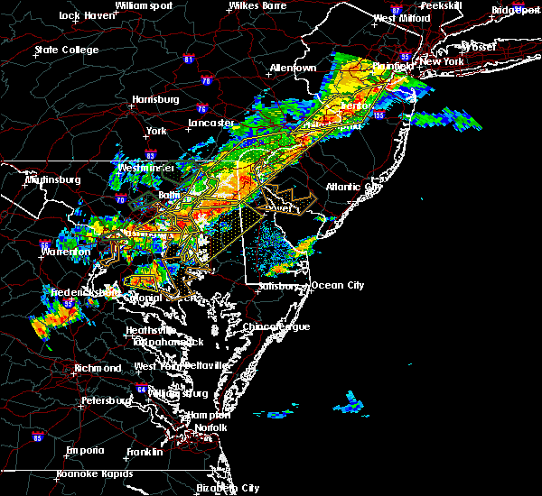 The severe thunderstorm warning for southeastern harford and southeastern baltimore counties will expire at 645 pm edt, the storms which prompted the warning have moved out of the area. therefore the warning will be allowed to expire. a severe thunderstorm watch remains in effect until 900 pm edt for northern maryland. The severe thunderstorm warning for southeastern harford and southeastern baltimore counties will expire at 645 pm edt, the storms which prompted the warning have moved out of the area. therefore the warning will be allowed to expire. a severe thunderstorm watch remains in effect until 900 pm edt for northern maryland.
|
| 8/18/2017 6:23 PM EDT |
 At 623 pm edt, severe thunderstorms were located along a line extending from near charlestown to near newtown to fort smallwood state park, moving east at 20 mph (radar indicated). Hazards include 60 mph wind gusts. Damaging winds will cause some trees and large branches to fall. this could injure those outdoors, as well as damage homes and vehicles. roadways may become blocked by downed trees. localized power outages are possible. unsecured light objects may become projectiles. Locations impacted include, aberdeen, havre de grace, aberdeen proving ground, north point state park, sparrows point, millers island, back river, dundalk, essex, bowleys quarters, riverside, perryman, edgewood, edgemere, fort howard and belcamp. At 623 pm edt, severe thunderstorms were located along a line extending from near charlestown to near newtown to fort smallwood state park, moving east at 20 mph (radar indicated). Hazards include 60 mph wind gusts. Damaging winds will cause some trees and large branches to fall. this could injure those outdoors, as well as damage homes and vehicles. roadways may become blocked by downed trees. localized power outages are possible. unsecured light objects may become projectiles. Locations impacted include, aberdeen, havre de grace, aberdeen proving ground, north point state park, sparrows point, millers island, back river, dundalk, essex, bowleys quarters, riverside, perryman, edgewood, edgemere, fort howard and belcamp.
|
| 8/18/2017 5:47 PM EDT |
 At 546 pm edt, severe thunderstorms were located along a line extending from near aberdeen to near middle river to arbutus, moving east at 25 mph (radar indicated). Hazards include 60 mph wind gusts and quarter size hail. Damaging winds will cause some trees and large branches to fall. this could injure those outdoors, as well as damage homes and vehicles. roadways may become blocked by downed trees. localized power outages are possible. unsecured light objects may become projectiles. Locations impacted include, baltimore, middle river, aberdeen, havre de grace, aberdeen proving ground, north point state park, sparrows point, back river, millers island, glen burnie, dundalk, bel air south, essex, bel air north, pasadena, rosedale, ferndale, brooklyn park, white marsh and bowleys quarters. At 546 pm edt, severe thunderstorms were located along a line extending from near aberdeen to near middle river to arbutus, moving east at 25 mph (radar indicated). Hazards include 60 mph wind gusts and quarter size hail. Damaging winds will cause some trees and large branches to fall. this could injure those outdoors, as well as damage homes and vehicles. roadways may become blocked by downed trees. localized power outages are possible. unsecured light objects may become projectiles. Locations impacted include, baltimore, middle river, aberdeen, havre de grace, aberdeen proving ground, north point state park, sparrows point, back river, millers island, glen burnie, dundalk, bel air south, essex, bel air north, pasadena, rosedale, ferndale, brooklyn park, white marsh and bowleys quarters.
|
| 8/18/2017 5:34 PM EDT |
 At 534 pm edt, severe thunderstorms were located along a line extending from near bel air north to arbutus, moving east at 25 mph (radar indicated). Hazards include 60 mph wind gusts and quarter size hail. Damaging winds will cause some trees and large branches to fall. this could injure those outdoors, as well as damage homes and vehicles. roadways may become blocked by downed trees. localized power outages are possible. unsecured light objects may become projectiles. Locations impacted include, baltimore, columbia, middle river, elkridge, aberdeen, havre de grace, aberdeen proving ground, millers island, north point state park, sparrows point, back river, glen burnie, dundalk, towson, bel air south, catonsville, essex, parkville, bel air north and carney. At 534 pm edt, severe thunderstorms were located along a line extending from near bel air north to arbutus, moving east at 25 mph (radar indicated). Hazards include 60 mph wind gusts and quarter size hail. Damaging winds will cause some trees and large branches to fall. this could injure those outdoors, as well as damage homes and vehicles. roadways may become blocked by downed trees. localized power outages are possible. unsecured light objects may become projectiles. Locations impacted include, baltimore, columbia, middle river, elkridge, aberdeen, havre de grace, aberdeen proving ground, millers island, north point state park, sparrows point, back river, glen burnie, dundalk, towson, bel air south, catonsville, essex, parkville, bel air north and carney.
|
| 8/18/2017 5:23 PM EDT |
 At 523 pm edt, a severe thunderstorm was located near bel air north, or 9 miles northwest of aberdeen, moving east at 25 mph (radar indicated). Hazards include 60 mph wind gusts and quarter size hail. Damaging winds will cause some trees and large branches to fall. this could injure those outdoors, as well as damage homes and vehicles. roadways may become blocked by downed trees. localized power outages are possible. unsecured light objects may become projectiles. Locations impacted include, aberdeen, havre de grace, aberdeen proving ground, bel air south, bel air north, fallston, riverside, pleasant hills, jarrettsville, perryman, darlington, benson, churchville, baldwin, carsins, scarboro, forest hill, bynum, harford furnace and jacksonville. At 523 pm edt, a severe thunderstorm was located near bel air north, or 9 miles northwest of aberdeen, moving east at 25 mph (radar indicated). Hazards include 60 mph wind gusts and quarter size hail. Damaging winds will cause some trees and large branches to fall. this could injure those outdoors, as well as damage homes and vehicles. roadways may become blocked by downed trees. localized power outages are possible. unsecured light objects may become projectiles. Locations impacted include, aberdeen, havre de grace, aberdeen proving ground, bel air south, bel air north, fallston, riverside, pleasant hills, jarrettsville, perryman, darlington, benson, churchville, baldwin, carsins, scarboro, forest hill, bynum, harford furnace and jacksonville.
|
| 8/18/2017 5:15 PM EDT |
 At 514 pm edt, severe thunderstorms were located along a line extending from mount vernon to near cockeysville, moving east at 20 mph (radar indicated). Hazards include 60 mph wind gusts. Damaging winds will cause some trees and large branches to fall. this could injure those outdoors, as well as damage homes and vehicles. roadways may become blocked by downed trees. localized power outages are possible. unsecured light objects may become projectiles. Locations impacted include, aberdeen, havre de grace, aberdeen proving ground, bel air south, bel air north, fallston, riverside, pleasant hills, jarrettsville, perryman, pylesville, darlington, cardiff, churchville, carsins, forest hill, street, jacksonville, hickory and whiteford. At 514 pm edt, severe thunderstorms were located along a line extending from mount vernon to near cockeysville, moving east at 20 mph (radar indicated). Hazards include 60 mph wind gusts. Damaging winds will cause some trees and large branches to fall. this could injure those outdoors, as well as damage homes and vehicles. roadways may become blocked by downed trees. localized power outages are possible. unsecured light objects may become projectiles. Locations impacted include, aberdeen, havre de grace, aberdeen proving ground, bel air south, bel air north, fallston, riverside, pleasant hills, jarrettsville, perryman, pylesville, darlington, cardiff, churchville, carsins, forest hill, street, jacksonville, hickory and whiteford.
|
| 8/18/2017 5:14 PM EDT |
 At 513 pm edt, severe thunderstorms were located along a line extending from cockeysville to catonsville, moving east at 20 mph (radar indicated). Hazards include 60 mph wind gusts. Damaging winds will cause some trees and large branches to fall. this could injure those outdoors, as well as damage homes and vehicles. roadways may become blocked by downed trees. localized power outages are possible. Unsecured light objects may become projectiles. At 513 pm edt, severe thunderstorms were located along a line extending from cockeysville to catonsville, moving east at 20 mph (radar indicated). Hazards include 60 mph wind gusts. Damaging winds will cause some trees and large branches to fall. this could injure those outdoors, as well as damage homes and vehicles. roadways may become blocked by downed trees. localized power outages are possible. Unsecured light objects may become projectiles.
|
| 8/18/2017 4:49 PM EDT |
 At 448 pm edt, severe thunderstorms were located along a line extending from near holtwood to near cockeysville, moving east at 35 mph (radar indicated). Hazards include 60 mph wind gusts. Damaging winds will cause some trees and large branches to fall. this could injure those outdoors, as well as damage homes and vehicles. roadways may become blocked by downed trees. localized power outages are possible. unsecured light objects may become projectiles. Locations impacted include, aberdeen, havre de grace, aberdeen proving ground, bel air south, bel air north, fallston, riverside, pleasant hills, jarrettsville, perryman, pylesville, darlington, cardiff, churchville, carsins, forest hill, phoenix, street, jacksonville and butler. At 448 pm edt, severe thunderstorms were located along a line extending from near holtwood to near cockeysville, moving east at 35 mph (radar indicated). Hazards include 60 mph wind gusts. Damaging winds will cause some trees and large branches to fall. this could injure those outdoors, as well as damage homes and vehicles. roadways may become blocked by downed trees. localized power outages are possible. unsecured light objects may become projectiles. Locations impacted include, aberdeen, havre de grace, aberdeen proving ground, bel air south, bel air north, fallston, riverside, pleasant hills, jarrettsville, perryman, pylesville, darlington, cardiff, churchville, carsins, forest hill, phoenix, street, jacksonville and butler.
|
| 8/18/2017 4:35 PM EDT |
 At 435 pm edt, severe thunderstorms were located along a line extending from near sunnyburn to 7 miles northwest of cockeysville, moving east at 35 mph (radar indicated). Hazards include 60 mph wind gusts. Damaging winds will cause some trees and large branches to fall. this could injure those outdoors, as well as damage homes and vehicles. roadways may become blocked by downed trees. localized power outages are possible. Unsecured light objects may become projectiles. At 435 pm edt, severe thunderstorms were located along a line extending from near sunnyburn to 7 miles northwest of cockeysville, moving east at 35 mph (radar indicated). Hazards include 60 mph wind gusts. Damaging winds will cause some trees and large branches to fall. this could injure those outdoors, as well as damage homes and vehicles. roadways may become blocked by downed trees. localized power outages are possible. Unsecured light objects may become projectiles.
|
| 8/2/2017 4:35 PM EDT |
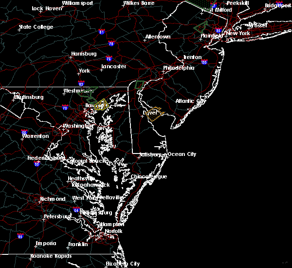 The severe thunderstorm warning for southeastern harford and east central baltimore counties will expire at 445 pm edt, the storm which prompted the warning has weakened below severe limits, and no longer pose an immediate threat to life or property. therefore the warning will be allowed to expire. however gusty winds and heavy rain are still possible with this thunderstorm. The severe thunderstorm warning for southeastern harford and east central baltimore counties will expire at 445 pm edt, the storm which prompted the warning has weakened below severe limits, and no longer pose an immediate threat to life or property. therefore the warning will be allowed to expire. however gusty winds and heavy rain are still possible with this thunderstorm.
|
| 8/2/2017 4:14 PM EDT |
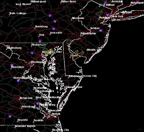 At 414 pm edt, a severe thunderstorm was located near bowleys quarters, or near middle river, moving northeast at 15 mph (radar indicated). Hazards include 60 mph wind gusts and quarter size hail. Damaging winds will cause some trees and large branches to fall. this could injure those outdoors, as well as damage homes and vehicles. roadways may become blocked by downed trees. localized power outages are possible. unsecured light objects may become projectiles. Locations impacted include, middle river, bowleys quarters, riverside, perryman, edgewood, joppatowne, abingdon, magnolia, chase and belcamp. At 414 pm edt, a severe thunderstorm was located near bowleys quarters, or near middle river, moving northeast at 15 mph (radar indicated). Hazards include 60 mph wind gusts and quarter size hail. Damaging winds will cause some trees and large branches to fall. this could injure those outdoors, as well as damage homes and vehicles. roadways may become blocked by downed trees. localized power outages are possible. unsecured light objects may become projectiles. Locations impacted include, middle river, bowleys quarters, riverside, perryman, edgewood, joppatowne, abingdon, magnolia, chase and belcamp.
|
| 8/2/2017 3:56 PM EDT |
 At 356 pm edt, a severe thunderstorm was located over bowleys quarters, or over middle river, moving northeast at 15 mph (radar indicated). Hazards include 60 mph wind gusts and quarter size hail. Damaging winds will cause some trees and large branches to fall. this could injure those outdoors, as well as damage homes and vehicles. roadways may become blocked by downed trees. localized power outages are possible. Unsecured light objects may become projectiles. At 356 pm edt, a severe thunderstorm was located over bowleys quarters, or over middle river, moving northeast at 15 mph (radar indicated). Hazards include 60 mph wind gusts and quarter size hail. Damaging winds will cause some trees and large branches to fall. this could injure those outdoors, as well as damage homes and vehicles. roadways may become blocked by downed trees. localized power outages are possible. Unsecured light objects may become projectiles.
|
| 8/2/2017 1:23 PM EDT |
 At 122 pm edt, a severe thunderstorm was located over bel air south, or 8 miles west of aberdeen, moving northeast at 10 mph (radar indicated). Hazards include 60 mph wind gusts and quarter size hail. Damaging winds will cause some trees and large branches to fall. this could injure those outdoors, as well as damage homes and vehicles. roadways may become blocked by downed trees. localized power outages are possible. unsecured light objects may become projectiles. Locations impacted include, bel air south, bel air north, perry hall, fallston, riverside, kingsville, pleasant hills, edgewood, joppatowne, glen arm, fork, benson, baldwin, hydes, bradshaw, abingdon, joppa, upper falls and gunpowder. At 122 pm edt, a severe thunderstorm was located over bel air south, or 8 miles west of aberdeen, moving northeast at 10 mph (radar indicated). Hazards include 60 mph wind gusts and quarter size hail. Damaging winds will cause some trees and large branches to fall. this could injure those outdoors, as well as damage homes and vehicles. roadways may become blocked by downed trees. localized power outages are possible. unsecured light objects may become projectiles. Locations impacted include, bel air south, bel air north, perry hall, fallston, riverside, kingsville, pleasant hills, edgewood, joppatowne, glen arm, fork, benson, baldwin, hydes, bradshaw, abingdon, joppa, upper falls and gunpowder.
|
| 8/2/2017 12:55 PM EDT |
 At 1255 pm edt, a severe thunderstorm was located over kingsville, or 8 miles north of middle river, moving northeast at 10 mph (radar indicated). Hazards include 60 mph wind gusts and quarter size hail. Damaging winds will cause some trees and large branches to fall. this could injure those outdoors, as well as damage homes and vehicles. roadways may become blocked by downed trees. localized power outages are possible. Unsecured light objects may become projectiles. At 1255 pm edt, a severe thunderstorm was located over kingsville, or 8 miles north of middle river, moving northeast at 10 mph (radar indicated). Hazards include 60 mph wind gusts and quarter size hail. Damaging winds will cause some trees and large branches to fall. this could injure those outdoors, as well as damage homes and vehicles. roadways may become blocked by downed trees. localized power outages are possible. Unsecured light objects may become projectiles.
|
| 7/24/2017 8:35 PM EDT |
 The severe thunderstorm warning for east central harford county will expire at 845 pm edt, the storm which prompted the warning has moved out of the area. therefore the warning will be allowed to expire. however gusty winds are still possible with this thunderstorm. to report severe weather, contact your nearest law enforcement agency. they will relay your report to the national weather service sterling virginia. The severe thunderstorm warning for east central harford county will expire at 845 pm edt, the storm which prompted the warning has moved out of the area. therefore the warning will be allowed to expire. however gusty winds are still possible with this thunderstorm. to report severe weather, contact your nearest law enforcement agency. they will relay your report to the national weather service sterling virginia.
|
| 7/24/2017 8:22 PM EDT |
 At 822 pm edt, a severe thunderstorm was located over havre de grace, moving east at 25 mph (radar indicated). Hazards include 60 mph wind gusts and quarter size hail. Damaging winds will cause some trees and large branches to fall. this could injure those outdoors, as well as damage homes and vehicles. roadways may become blocked by downed trees. localized power outages are possible. unsecured light objects may become projectiles. Locations impacted include, aberdeen, havre de grace, aberdeen proving ground, bel air south, riverside, perryman, churchville, harford furnace and carsins. At 822 pm edt, a severe thunderstorm was located over havre de grace, moving east at 25 mph (radar indicated). Hazards include 60 mph wind gusts and quarter size hail. Damaging winds will cause some trees and large branches to fall. this could injure those outdoors, as well as damage homes and vehicles. roadways may become blocked by downed trees. localized power outages are possible. unsecured light objects may become projectiles. Locations impacted include, aberdeen, havre de grace, aberdeen proving ground, bel air south, riverside, perryman, churchville, harford furnace and carsins.
|
| 7/24/2017 8:09 PM EDT |
 The national weather service in sterling virginia has issued a * severe thunderstorm warning for. east central harford county in northern maryland. Until 845 pm edt * at 808 pm edt, a severe thunderstorm was located over aberdeen, moving east at 30 mph. The national weather service in sterling virginia has issued a * severe thunderstorm warning for. east central harford county in northern maryland. Until 845 pm edt * at 808 pm edt, a severe thunderstorm was located over aberdeen, moving east at 30 mph.
|
| 7/24/2017 7:54 PM EDT |
 At 754 pm edt, a severe thunderstorm was located near bel air north, or 7 miles west of aberdeen, moving east at 30 mph (radar indicated). Hazards include 60 mph wind gusts and quarter size hail. Damaging winds will cause some trees and large branches to fall. this could injure those outdoors, as well as damage homes and vehicles. roadways may become blocked by downed trees. localized power outages are possible. unsecured light objects may become projectiles. Locations impacted include, aberdeen, havre de grace, aberdeen proving ground, bel air south, bel air north, fallston, riverside, pleasant hills, jarrettsville, perryman, pylesville, darlington, benson, churchville, carsins, scarboro, forest hill, bynum, chrome hill and harford furnace. At 754 pm edt, a severe thunderstorm was located near bel air north, or 7 miles west of aberdeen, moving east at 30 mph (radar indicated). Hazards include 60 mph wind gusts and quarter size hail. Damaging winds will cause some trees and large branches to fall. this could injure those outdoors, as well as damage homes and vehicles. roadways may become blocked by downed trees. localized power outages are possible. unsecured light objects may become projectiles. Locations impacted include, aberdeen, havre de grace, aberdeen proving ground, bel air south, bel air north, fallston, riverside, pleasant hills, jarrettsville, perryman, pylesville, darlington, benson, churchville, carsins, scarboro, forest hill, bynum, chrome hill and harford furnace.
|
| 7/24/2017 7:43 PM EDT |
 At 743 pm edt, a severe thunderstorm was located near bel air north, or 12 miles northwest of aberdeen, moving east at 30 mph (radar indicated). Hazards include 60 mph wind gusts and quarter size hail. Damaging winds will cause some trees and large branches to fall. this could injure those outdoors, as well as damage homes and vehicles. roadways may become blocked by downed trees. localized power outages are possible. unsecured light objects may become projectiles. Locations impacted include, aberdeen, havre de grace, aberdeen proving ground, bel air south, bel air north, fallston, riverside, pleasant hills, jarrettsville, perryman, pylesville, darlington, cardiff, churchville, norrisville, carsins, forest hill, street, whiteford and hickory. At 743 pm edt, a severe thunderstorm was located near bel air north, or 12 miles northwest of aberdeen, moving east at 30 mph (radar indicated). Hazards include 60 mph wind gusts and quarter size hail. Damaging winds will cause some trees and large branches to fall. this could injure those outdoors, as well as damage homes and vehicles. roadways may become blocked by downed trees. localized power outages are possible. unsecured light objects may become projectiles. Locations impacted include, aberdeen, havre de grace, aberdeen proving ground, bel air south, bel air north, fallston, riverside, pleasant hills, jarrettsville, perryman, pylesville, darlington, cardiff, churchville, norrisville, carsins, forest hill, street, whiteford and hickory.
|
| 7/24/2017 7:27 PM EDT |
 At 727 pm edt, a severe thunderstorm was located over jarrettsville, or 11 miles northeast of cockeysville, moving east at 35 mph (radar indicated). Hazards include 60 mph wind gusts. Damaging winds will cause some trees and large branches to fall. this could injure those outdoors, as well as damage homes and vehicles. roadways may become blocked by downed trees. localized power outages are possible. Unsecured light objects may become projectiles. At 727 pm edt, a severe thunderstorm was located over jarrettsville, or 11 miles northeast of cockeysville, moving east at 35 mph (radar indicated). Hazards include 60 mph wind gusts. Damaging winds will cause some trees and large branches to fall. this could injure those outdoors, as well as damage homes and vehicles. roadways may become blocked by downed trees. localized power outages are possible. Unsecured light objects may become projectiles.
|
| 4/6/2017 2:48 PM EDT |
 At 247 pm edt, severe thunderstorms were located along a line extending from near cockeysville to near riverside to near langford, moving northeast at 50 mph (radar indicated). Hazards include 60 mph wind gusts. Damaging winds will cause some trees and large branches to fall. this could injure those outdoors, as well as damage homes and vehicles. roadways may become blocked by downed trees. localized power outages are possible. Unsecured light objects may become projectiles. At 247 pm edt, severe thunderstorms were located along a line extending from near cockeysville to near riverside to near langford, moving northeast at 50 mph (radar indicated). Hazards include 60 mph wind gusts. Damaging winds will cause some trees and large branches to fall. this could injure those outdoors, as well as damage homes and vehicles. roadways may become blocked by downed trees. localized power outages are possible. Unsecured light objects may become projectiles.
|
| 3/1/2017 2:25 PM EST |
 At 225 pm est, severe thunderstorms were located along a line extending from near wakefield to aberdeen to rock hall, moving east at 60 mph (radar indicated). Hazards include 60 mph wind gusts. Damaging winds will cause some trees and large branches to fall. this could injure those outdoors, as well as damage homes and vehicles. roadways may become blocked by downed trees. localized power outages are possible. unsecured light objects may become projectiles. Locations impacted include, aberdeen, havre de grace, aberdeen proving ground, bel air south, bel air north, fallston, riverside, kingsville, pleasant hills, perryman, edgewood, joppatowne, darlington, churchville, carsins, forest hill, abingdon, joppa, hickory and benson. At 225 pm est, severe thunderstorms were located along a line extending from near wakefield to aberdeen to rock hall, moving east at 60 mph (radar indicated). Hazards include 60 mph wind gusts. Damaging winds will cause some trees and large branches to fall. this could injure those outdoors, as well as damage homes and vehicles. roadways may become blocked by downed trees. localized power outages are possible. unsecured light objects may become projectiles. Locations impacted include, aberdeen, havre de grace, aberdeen proving ground, bel air south, bel air north, fallston, riverside, kingsville, pleasant hills, perryman, edgewood, joppatowne, darlington, churchville, carsins, forest hill, abingdon, joppa, hickory and benson.
|
| 3/1/2017 2:19 PM EST |
 At 219 pm est, severe thunderstorms were located along a line extending from holtwood to near riverside to near rock hall, moving east at 60 mph (radar indicated). Hazards include 60 mph wind gusts. Damaging winds will cause some trees and large branches to fall. this could injure those outdoors, as well as damage homes and vehicles. roadways may become blocked by downed trees. localized power outages are possible. unsecured light objects may become projectiles. Locations impacted include, aberdeen, havre de grace, aberdeen proving ground, bel air south, bel air north, perry hall, white marsh, fallston, riverside, kingsville, pleasant hills, jarrettsville, perryman, edgewood, joppatowne, pylesville, darlington, glen arm, fork and cardiff. At 219 pm est, severe thunderstorms were located along a line extending from holtwood to near riverside to near rock hall, moving east at 60 mph (radar indicated). Hazards include 60 mph wind gusts. Damaging winds will cause some trees and large branches to fall. this could injure those outdoors, as well as damage homes and vehicles. roadways may become blocked by downed trees. localized power outages are possible. unsecured light objects may become projectiles. Locations impacted include, aberdeen, havre de grace, aberdeen proving ground, bel air south, bel air north, perry hall, white marsh, fallston, riverside, kingsville, pleasant hills, jarrettsville, perryman, edgewood, joppatowne, pylesville, darlington, glen arm, fork and cardiff.
|
| 3/1/2017 2:12 PM EST |
 At 211 pm est, severe thunderstorms were located along a line extending from near sunnyburn to pleasant hills to bodkin point, moving east at 55 mph (radar indicated). Hazards include 60 mph wind gusts. Damaging winds will cause some trees and large branches to fall. this could injure those outdoors, as well as damage homes and vehicles. roadways may become blocked by downed trees. localized power outages are possible. unsecured light objects may become projectiles. Locations impacted include, middle river, cockeysville, aberdeen, havre de grace, aberdeen proving ground, fort smallwood state park, gibson island, bodkin point, sillery bay, millers island, north point state park, sparrows point, pinehurst, back river, dundalk, bel air south, essex, parkville, bel air north and carney. At 211 pm est, severe thunderstorms were located along a line extending from near sunnyburn to pleasant hills to bodkin point, moving east at 55 mph (radar indicated). Hazards include 60 mph wind gusts. Damaging winds will cause some trees and large branches to fall. this could injure those outdoors, as well as damage homes and vehicles. roadways may become blocked by downed trees. localized power outages are possible. unsecured light objects may become projectiles. Locations impacted include, middle river, cockeysville, aberdeen, havre de grace, aberdeen proving ground, fort smallwood state park, gibson island, bodkin point, sillery bay, millers island, north point state park, sparrows point, pinehurst, back river, dundalk, bel air south, essex, parkville, bel air north and carney.
|
| 3/1/2017 2:05 PM EST |
 At 204 pm est, severe thunderstorms were located along a line extending from near delta to near kingsville to lake shore, moving east at 60 mph (radar indicated). Hazards include 60 mph wind gusts. Damaging winds will cause some trees and large branches to fall. this could injure those outdoors, as well as damage homes and vehicles. roadways may become blocked by downed trees. localized power outages are possible. unsecured light objects may become projectiles. Locations impacted include, baltimore, severn, pikesville, middle river, cockeysville, aberdeen, havre de grace, riviera beach, aberdeen proving ground, baltimore-washington airport, fort smallwood state park, gibson island, sillery bay, millers island, north point state park, sparrows point, pinehurst, bodkin point, back river and glen burnie. At 204 pm est, severe thunderstorms were located along a line extending from near delta to near kingsville to lake shore, moving east at 60 mph (radar indicated). Hazards include 60 mph wind gusts. Damaging winds will cause some trees and large branches to fall. this could injure those outdoors, as well as damage homes and vehicles. roadways may become blocked by downed trees. localized power outages are possible. unsecured light objects may become projectiles. Locations impacted include, baltimore, severn, pikesville, middle river, cockeysville, aberdeen, havre de grace, riviera beach, aberdeen proving ground, baltimore-washington airport, fort smallwood state park, gibson island, sillery bay, millers island, north point state park, sparrows point, pinehurst, bodkin point, back river and glen burnie.
|
| 3/1/2017 1:47 PM EST |
 At 147 pm est, severe thunderstorms were located along a line extending from near stewartstown to towson to near fort meade, moving east at 60 mph (radar indicated). Hazards include 60 mph wind gusts. Damaging winds will cause some trees and large branches to fall. this could injure those outdoors, as well as damage homes and vehicles. roadways may become blocked by downed trees. localized power outages are possible. Unsecured light objects may become projectiles. At 147 pm est, severe thunderstorms were located along a line extending from near stewartstown to towson to near fort meade, moving east at 60 mph (radar indicated). Hazards include 60 mph wind gusts. Damaging winds will cause some trees and large branches to fall. this could injure those outdoors, as well as damage homes and vehicles. roadways may become blocked by downed trees. localized power outages are possible. Unsecured light objects may become projectiles.
|
| 2/25/2017 3:43 PM EST |
 At 342 pm est, a severe thunderstorm was located near bel air north, or 7 miles northwest of aberdeen, moving northeast at 55 mph (radar indicated). Hazards include 60 mph wind gusts and half dollar size hail. Damaging winds will cause some trees and large branches to fall. this could injure those outdoors, as well as damage homes and vehicles. roadways may become blocked by downed trees. localized power outages are possible. unsecured light objects may become projectiles. Locations impacted include, aberdeen, havre de grace, aberdeen proving ground, bel air south, bel air north, fallston, riverside, kingsville, pleasant hills, perryman, edgewood, joppatowne, pylesville, darlington, cardiff, churchville, carsins, forest hill, abingdon and street. At 342 pm est, a severe thunderstorm was located near bel air north, or 7 miles northwest of aberdeen, moving northeast at 55 mph (radar indicated). Hazards include 60 mph wind gusts and half dollar size hail. Damaging winds will cause some trees and large branches to fall. this could injure those outdoors, as well as damage homes and vehicles. roadways may become blocked by downed trees. localized power outages are possible. unsecured light objects may become projectiles. Locations impacted include, aberdeen, havre de grace, aberdeen proving ground, bel air south, bel air north, fallston, riverside, kingsville, pleasant hills, perryman, edgewood, joppatowne, pylesville, darlington, cardiff, churchville, carsins, forest hill, abingdon and street.
|
| 2/25/2017 3:24 PM EST |
 At 324 pm est, a severe thunderstorm was located over rossville, or near middle river, moving northeast at 55 mph (radar indicated). Hazards include 60 mph wind gusts and half dollar size hail. Damaging winds will cause some trees and large branches to fall. this could injure those outdoors, as well as damage homes and vehicles. roadways may become blocked by downed trees. localized power outages are possible. Unsecured light objects may become projectiles. At 324 pm est, a severe thunderstorm was located over rossville, or near middle river, moving northeast at 55 mph (radar indicated). Hazards include 60 mph wind gusts and half dollar size hail. Damaging winds will cause some trees and large branches to fall. this could injure those outdoors, as well as damage homes and vehicles. roadways may become blocked by downed trees. localized power outages are possible. Unsecured light objects may become projectiles.
|
| 2/12/2017 11:24 PM EST |
 The severe thunderstorm warning for northern anne arundel, southeastern howard, harford and southeastern baltimore counties and baltimore city will expire at 1130 pm est, the storms which prompted the warning have moved out of the area. therefore the warning will be allowed to expire. to report severe weather, contact your nearest law enforcement agency. they will relay your report to the national weather service sterling virginia. remember, a severe thunderstorm warning still remains in effect for southern anne arundel county until 11:45 pm. The severe thunderstorm warning for northern anne arundel, southeastern howard, harford and southeastern baltimore counties and baltimore city will expire at 1130 pm est, the storms which prompted the warning have moved out of the area. therefore the warning will be allowed to expire. to report severe weather, contact your nearest law enforcement agency. they will relay your report to the national weather service sterling virginia. remember, a severe thunderstorm warning still remains in effect for southern anne arundel county until 11:45 pm.
|
| 2/12/2017 11:08 PM EST |
 At 1108 pm est, severe thunderstorms were located along a line extending from near bel air north to near columbia, moving east at 55 mph (radar indicated). Hazards include 60 mph wind gusts. Damaging winds will cause some trees and large branches to fall. this could injure those outdoors, as well as damage homes and vehicles. roadways may become blocked by downed trees. localized power outages are possible. unsecured light objects may become projectiles. Locations impacted include, baltimore, columbia, severn, pikesville, middle river, cockeysville, elkridge, aberdeen, havre de grace, riviera beach, aberdeen proving ground, baltimore-washington airport, fort smallwood state park, gibson island, sillery bay, millers island, north point state park, sparrows point, pinehurst and bodkin point. At 1108 pm est, severe thunderstorms were located along a line extending from near bel air north to near columbia, moving east at 55 mph (radar indicated). Hazards include 60 mph wind gusts. Damaging winds will cause some trees and large branches to fall. this could injure those outdoors, as well as damage homes and vehicles. roadways may become blocked by downed trees. localized power outages are possible. unsecured light objects may become projectiles. Locations impacted include, baltimore, columbia, severn, pikesville, middle river, cockeysville, elkridge, aberdeen, havre de grace, riviera beach, aberdeen proving ground, baltimore-washington airport, fort smallwood state park, gibson island, sillery bay, millers island, north point state park, sparrows point, pinehurst and bodkin point.
|
| 2/12/2017 10:47 PM EST |
 At 1046 pm est, severe thunderstorms were located along a line extending from near hampstead to near damascus, moving east at 55 mph (radar indicated). Hazards include 60 mph wind gusts. Damaging winds will cause some trees and large branches to fall. this could injure those outdoors, as well as damage homes and vehicles. roadways may become blocked by downed trees. localized power outages are possible. unsecured light objects may become projectiles. Locations impacted include, baltimore, columbia, germantown, severn, olney, pikesville, middle river, cockeysville, elkridge, damascus, aberdeen, havre de grace, riviera beach, aberdeen proving ground, baltimore-washington airport, fort smallwood state park, gibson island, sillery bay, millers island and north point state park. At 1046 pm est, severe thunderstorms were located along a line extending from near hampstead to near damascus, moving east at 55 mph (radar indicated). Hazards include 60 mph wind gusts. Damaging winds will cause some trees and large branches to fall. this could injure those outdoors, as well as damage homes and vehicles. roadways may become blocked by downed trees. localized power outages are possible. unsecured light objects may become projectiles. Locations impacted include, baltimore, columbia, germantown, severn, olney, pikesville, middle river, cockeysville, elkridge, damascus, aberdeen, havre de grace, riviera beach, aberdeen proving ground, baltimore-washington airport, fort smallwood state park, gibson island, sillery bay, millers island and north point state park.
|
| 2/12/2017 10:29 PM EST |
 At 1029 pm est, severe thunderstorms were located along a line extending from near littlestown to near point of rocks, moving east at 55 mph (radar indicated). Hazards include 60 mph wind gusts. Damaging winds will cause some trees and large branches to fall. this could injure those outdoors, as well as damage homes and vehicles. roadways may become blocked by downed trees. localized power outages are possible. Unsecured light objects may become projectiles. At 1029 pm est, severe thunderstorms were located along a line extending from near littlestown to near point of rocks, moving east at 55 mph (radar indicated). Hazards include 60 mph wind gusts. Damaging winds will cause some trees and large branches to fall. this could injure those outdoors, as well as damage homes and vehicles. roadways may become blocked by downed trees. localized power outages are possible. Unsecured light objects may become projectiles.
|
| 8/31/2016 11:46 PM EDT |
 At 1145 pm edt, a severe thunderstorm was located over bel air north, or 10 miles west of aberdeen, moving southeast at 15 mph (radar indicated). Hazards include 60 mph wind gusts. Damaging winds will cause some trees and large branches to fall. this could injure those outdoors, as well as damage homes and vehicles. roadways may become blocked by downed trees. localized power outages are possible. unsecured light objects may become projectiles. Locations impacted include, aberdeen, havre de grace, aberdeen proving ground, bel air south, bel air north, fallston, riverside, pleasant hills, perryman, edgewood, joppatowne, abingdon, harford furnace, benson, carsins, bynum, belcamp, hickory and churchville. At 1145 pm edt, a severe thunderstorm was located over bel air north, or 10 miles west of aberdeen, moving southeast at 15 mph (radar indicated). Hazards include 60 mph wind gusts. Damaging winds will cause some trees and large branches to fall. this could injure those outdoors, as well as damage homes and vehicles. roadways may become blocked by downed trees. localized power outages are possible. unsecured light objects may become projectiles. Locations impacted include, aberdeen, havre de grace, aberdeen proving ground, bel air south, bel air north, fallston, riverside, pleasant hills, perryman, edgewood, joppatowne, abingdon, harford furnace, benson, carsins, bynum, belcamp, hickory and churchville.
|
| 8/31/2016 11:27 PM EDT |
 At 1127 pm edt, a severe thunderstorm was located over fallston, or 11 miles northeast of cockeysville, moving southeast at 15 mph (radar indicated). Hazards include 60 mph wind gusts. Damaging winds will cause some trees and large branches to fall. this could injure those outdoors, as well as damage homes and vehicles. roadways may become blocked by downed trees. localized power outages are possible. Unsecured light objects may become projectiles. At 1127 pm edt, a severe thunderstorm was located over fallston, or 11 miles northeast of cockeysville, moving southeast at 15 mph (radar indicated). Hazards include 60 mph wind gusts. Damaging winds will cause some trees and large branches to fall. this could injure those outdoors, as well as damage homes and vehicles. roadways may become blocked by downed trees. localized power outages are possible. Unsecured light objects may become projectiles.
|
| 8/16/2016 5:58 PM EDT |
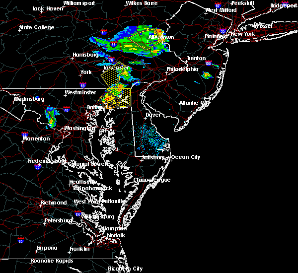 At 558 pm edt, a severe thunderstorm was located over aberdeen, moving east at 15 mph (radar indicated). Hazards include 60 mph wind gusts and quarter size hail. Damaging winds will cause some trees and large branches to fall. this could injure those outdoors, as well as damage homes and vehicles. roadways may become blocked by downed trees. localized power outages are possible. Unsecured light objects may become projectiles. At 558 pm edt, a severe thunderstorm was located over aberdeen, moving east at 15 mph (radar indicated). Hazards include 60 mph wind gusts and quarter size hail. Damaging winds will cause some trees and large branches to fall. this could injure those outdoors, as well as damage homes and vehicles. roadways may become blocked by downed trees. localized power outages are possible. Unsecured light objects may become projectiles.
|
| 8/16/2016 5:42 PM EDT |
 At 542 pm edt, a severe thunderstorm was located over bel air south, or near aberdeen, moving east at 20 mph (radar indicated). Hazards include 60 mph wind gusts and quarter size hail. Damaging winds will cause some trees and large branches to fall. this could injure those outdoors, as well as damage homes and vehicles. roadways may become blocked by downed trees. localized power outages are possible. unsecured light objects may become projectiles. Locations impacted include, aberdeen, havre de grace, aberdeen proving ground, bel air south, bel air north, riverside, pleasant hills, perryman, carsins, harford furnace, churchville and benson. At 542 pm edt, a severe thunderstorm was located over bel air south, or near aberdeen, moving east at 20 mph (radar indicated). Hazards include 60 mph wind gusts and quarter size hail. Damaging winds will cause some trees and large branches to fall. this could injure those outdoors, as well as damage homes and vehicles. roadways may become blocked by downed trees. localized power outages are possible. unsecured light objects may become projectiles. Locations impacted include, aberdeen, havre de grace, aberdeen proving ground, bel air south, bel air north, riverside, pleasant hills, perryman, carsins, harford furnace, churchville and benson.
|
| 8/16/2016 5:14 PM EDT |
 At 514 pm edt, a severe thunderstorm was located over bel air north, or 9 miles west of aberdeen, moving east at 25 mph (radar indicated). Hazards include 60 mph wind gusts and quarter size hail. Damaging winds will cause some trees and large branches to fall. this could injure those outdoors, as well as damage homes and vehicles. roadways may become blocked by downed trees. localized power outages are possible. Unsecured light objects may become projectiles. At 514 pm edt, a severe thunderstorm was located over bel air north, or 9 miles west of aberdeen, moving east at 25 mph (radar indicated). Hazards include 60 mph wind gusts and quarter size hail. Damaging winds will cause some trees and large branches to fall. this could injure those outdoors, as well as damage homes and vehicles. roadways may become blocked by downed trees. localized power outages are possible. Unsecured light objects may become projectiles.
|
| 8/14/2016 9:37 PM EDT |
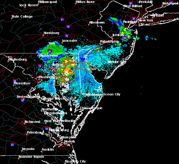 The severe thunderstorm warning for southeastern harford county will expire at 945 pm edt, the storm which prompted the warning has moved out of the area. therefore the warning will be allowed to expire. however gusty winds are still possible with this thunderstorm. The severe thunderstorm warning for southeastern harford county will expire at 945 pm edt, the storm which prompted the warning has moved out of the area. therefore the warning will be allowed to expire. however gusty winds are still possible with this thunderstorm.
|
| 8/14/2016 9:27 PM EDT |
 At 927 pm edt, a severe thunderstorm was located over aberdeen proving ground, moving east at 35 mph (radar indicated). Hazards include 60 mph wind gusts. Damaging winds will cause some trees and large branches to fall. this could injure those outdoors, as well as damage homes and vehicles. roadways may become blocked by downed trees. localized power outages are possible. unsecured light objects may become projectiles. Locations impacted include, aberdeen, havre de grace, aberdeen proving ground, riverside, perryman and carsins. At 927 pm edt, a severe thunderstorm was located over aberdeen proving ground, moving east at 35 mph (radar indicated). Hazards include 60 mph wind gusts. Damaging winds will cause some trees and large branches to fall. this could injure those outdoors, as well as damage homes and vehicles. roadways may become blocked by downed trees. localized power outages are possible. unsecured light objects may become projectiles. Locations impacted include, aberdeen, havre de grace, aberdeen proving ground, riverside, perryman and carsins.
|
| 8/14/2016 9:17 PM EDT |
 At 916 pm edt, severe thunderstorms were located along a line extending from near aberdeen to rock hall to rhode river, moving east at 50 mph (radar indicated). Hazards include 60 mph wind gusts. Damaging winds will cause some trees and large branches to fall. this could injure those outdoors, as well as damage homes and vehicles. roadways may become blocked by downed trees. localized power outages are possible. unsecured light objects may become projectiles. Locations impacted include, aberdeen, havre de grace, aberdeen proving ground, bel air south, bel air north, fallston, riverside, kingsville, pleasant hills, perryman, edgewood, joppatowne, abingdon, magnolia, harford furnace, benson, joppa, carsins and belcamp. At 916 pm edt, severe thunderstorms were located along a line extending from near aberdeen to rock hall to rhode river, moving east at 50 mph (radar indicated). Hazards include 60 mph wind gusts. Damaging winds will cause some trees and large branches to fall. this could injure those outdoors, as well as damage homes and vehicles. roadways may become blocked by downed trees. localized power outages are possible. unsecured light objects may become projectiles. Locations impacted include, aberdeen, havre de grace, aberdeen proving ground, bel air south, bel air north, fallston, riverside, kingsville, pleasant hills, perryman, edgewood, joppatowne, abingdon, magnolia, harford furnace, benson, joppa, carsins and belcamp.
|
| 8/14/2016 9:03 PM EDT |
 At 903 pm edt, severe thunderstorms were located along a line extending from pleasant hills to near bowleys quarters, moving east at 45 mph (observed wind gust). Hazards include 60 mph wind gusts. Damaging winds will cause some trees and large branches to fall. this could injure those outdoors, as well as damage homes and vehicles. roadways may become blocked by downed trees. localized power outages are possible. Unsecured light objects may become projectiles. At 903 pm edt, severe thunderstorms were located along a line extending from pleasant hills to near bowleys quarters, moving east at 45 mph (observed wind gust). Hazards include 60 mph wind gusts. Damaging winds will cause some trees and large branches to fall. this could injure those outdoors, as well as damage homes and vehicles. roadways may become blocked by downed trees. localized power outages are possible. Unsecured light objects may become projectiles.
|
| 7/28/2016 3:35 PM EDT |
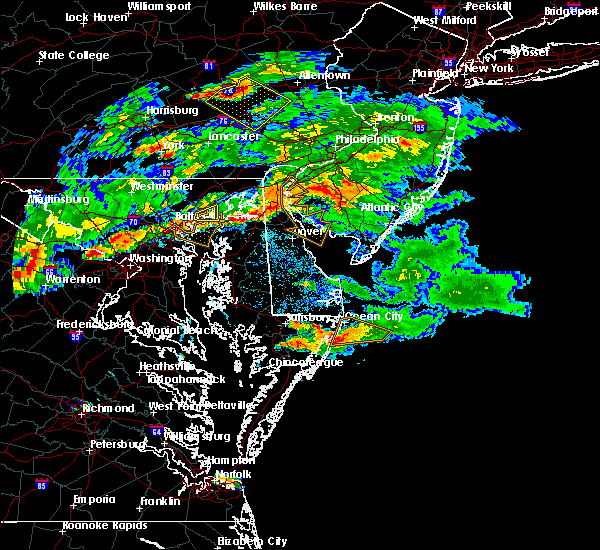 The severe thunderstorm warning for northeastern baltimore and southwestern harford counties will expire at 345 pm edt, the storm which prompted the warning has moved out of the area. therefore the warning will be allowed to expire at 345 pm. a severe thunderstorm watch remains in effect until midnight edt for northern maryland. The severe thunderstorm warning for northeastern baltimore and southwestern harford counties will expire at 345 pm edt, the storm which prompted the warning has moved out of the area. therefore the warning will be allowed to expire at 345 pm. a severe thunderstorm watch remains in effect until midnight edt for northern maryland.
|
| 7/28/2016 3:23 PM EDT |
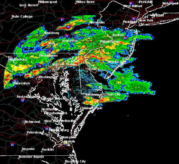 At 322 pm edt, a severe thunderstorm was located near bowleys quarters, or near middle river, moving east at 10 mph (radar indicated). Hazards include 60 mph wind gusts. Damaging winds will cause some trees and large branches to fall. this could injure those outdoors, as well as damage homes and vehicles. roadways may become blocked by downed trees. localized power outages are possible. unsecured light objects may become projectiles. Locations impacted include, middle river, perryman, edgewood, joppatowne, chase, magnolia and belcamp. At 322 pm edt, a severe thunderstorm was located near bowleys quarters, or near middle river, moving east at 10 mph (radar indicated). Hazards include 60 mph wind gusts. Damaging winds will cause some trees and large branches to fall. this could injure those outdoors, as well as damage homes and vehicles. roadways may become blocked by downed trees. localized power outages are possible. unsecured light objects may become projectiles. Locations impacted include, middle river, perryman, edgewood, joppatowne, chase, magnolia and belcamp.
|
| 7/28/2016 2:58 PM EDT |
 At 257 pm edt, a severe thunderstorm was located near white marsh, or near middle river, moving east at 10 mph (radar indicated). Hazards include 60 mph wind gusts. Damaging winds will cause some trees and large branches to fall. this could injure those outdoors, as well as damage homes and vehicles. roadways may become blocked by downed trees. localized power outages are possible. Unsecured light objects may become projectiles. At 257 pm edt, a severe thunderstorm was located near white marsh, or near middle river, moving east at 10 mph (radar indicated). Hazards include 60 mph wind gusts. Damaging winds will cause some trees and large branches to fall. this could injure those outdoors, as well as damage homes and vehicles. roadways may become blocked by downed trees. localized power outages are possible. Unsecured light objects may become projectiles.
|
| 7/23/2016 6:35 PM EDT |
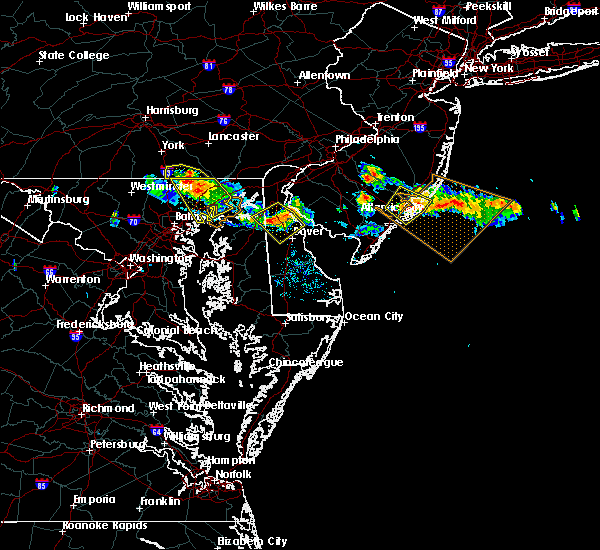 The severe thunderstorm warning for northeastern baltimore and harford counties will expire at 645 pm edt, the storms which prompted the warning have weakened below severe limits, and no longer poses a threat to life or property. therefore the warning will be allowed to expire. however gusty winds are still possible with these thunderstorms. The severe thunderstorm warning for northeastern baltimore and harford counties will expire at 645 pm edt, the storms which prompted the warning have weakened below severe limits, and no longer poses a threat to life or property. therefore the warning will be allowed to expire. however gusty winds are still possible with these thunderstorms.
|
| 7/23/2016 6:28 PM EDT |
 At 626 pm edt, severe thunderstorms were located along a line extending from near jarrettsville to near bel air north to 6 miles west of octoraro, moving southeast at 30 mph. winds estimated to gust between 50 and 60 mph were reported near norrisville around 615 pm (radar indicated). Hazards include 60 mph wind gusts and quarter size hail. Damaging winds will cause some trees and large branches to fall. this could injure those outdoors, as well as damage homes and vehicles. roadways may become blocked by downed trees. localized power outages are possible. Locations impacted include, middle river, aberdeen, havre de grace, bel air south, bel air north, white marsh, fallston, riverside, kingsville, pleasant hills, jarrettsville, joppatowne, pylesville, and darlington. At 626 pm edt, severe thunderstorms were located along a line extending from near jarrettsville to near bel air north to 6 miles west of octoraro, moving southeast at 30 mph. winds estimated to gust between 50 and 60 mph were reported near norrisville around 615 pm (radar indicated). Hazards include 60 mph wind gusts and quarter size hail. Damaging winds will cause some trees and large branches to fall. this could injure those outdoors, as well as damage homes and vehicles. roadways may become blocked by downed trees. localized power outages are possible. Locations impacted include, middle river, aberdeen, havre de grace, bel air south, bel air north, white marsh, fallston, riverside, kingsville, pleasant hills, jarrettsville, joppatowne, pylesville, and darlington.
|
| 7/23/2016 6:05 PM EDT |
 At 603 pm edt, severe thunderstorms were located along a line extending from stewartstown to near delta, moving southeast at 25 mph. winds of 35 to 45 mph are in an outflow gust front moving 10 miles ahead of the main thunderstorms (radar indicated). Hazards include 60 mph wind gusts and quarter size hail. Damaging winds will cause some trees and large branches to fall. this could injure those outdoors, as well as damage homes and vehicles. roadways may become blocked by downed trees. localized power outages are possible. Locations impacted include, middle river, aberdeen, havre de grace, bel air south, bel air north, fallston, riverside, kingsville, pleasant hills, jarrettsville, edgewood, joppatowne, pylesville, and darlington. At 603 pm edt, severe thunderstorms were located along a line extending from stewartstown to near delta, moving southeast at 25 mph. winds of 35 to 45 mph are in an outflow gust front moving 10 miles ahead of the main thunderstorms (radar indicated). Hazards include 60 mph wind gusts and quarter size hail. Damaging winds will cause some trees and large branches to fall. this could injure those outdoors, as well as damage homes and vehicles. roadways may become blocked by downed trees. localized power outages are possible. Locations impacted include, middle river, aberdeen, havre de grace, bel air south, bel air north, fallston, riverside, kingsville, pleasant hills, jarrettsville, edgewood, joppatowne, pylesville, and darlington.
|
| 7/23/2016 5:42 PM EDT |
 At 542 pm edt, severe thunderstorms were located along a line extending from near glen rock to near brogue, moving southeast at 25 mph (radar indicated). Hazards include 60 mph wind gusts and quarter size hail. Damaging winds will cause some trees and large branches to fall. this could injure those outdoors, as well as damage homes and vehicles. roadways may become blocked by downed trees. Localized power outages are possible. At 542 pm edt, severe thunderstorms were located along a line extending from near glen rock to near brogue, moving southeast at 25 mph (radar indicated). Hazards include 60 mph wind gusts and quarter size hail. Damaging winds will cause some trees and large branches to fall. this could injure those outdoors, as well as damage homes and vehicles. roadways may become blocked by downed trees. Localized power outages are possible.
|
| 6/28/2016 6:02 PM EDT |
 At 602 pm edt, a severe thunderstorm was located 7 miles south of stewartstown, or 11 miles north of cockeysville, moving southeast at 20 mph (radar indicated). Hazards include 60 mph wind gusts and quarter size hail. Damaging winds will cause some trees and large branches to fall. this could injure those outdoors, as well as damage homes and vehicles. roadways may become blocked by downed trees. Locations impacted include, middle river, aberdeen, havre de grace, aberdeen proving ground, bel air south, essex, bel air north, carney, perry hall, rossville, white marsh, fallston, bowleys quarters, riverside, kingsville, pleasant hills, jarrettsville, perryman, edgewood and joppatowne. At 602 pm edt, a severe thunderstorm was located 7 miles south of stewartstown, or 11 miles north of cockeysville, moving southeast at 20 mph (radar indicated). Hazards include 60 mph wind gusts and quarter size hail. Damaging winds will cause some trees and large branches to fall. this could injure those outdoors, as well as damage homes and vehicles. roadways may become blocked by downed trees. Locations impacted include, middle river, aberdeen, havre de grace, aberdeen proving ground, bel air south, essex, bel air north, carney, perry hall, rossville, white marsh, fallston, bowleys quarters, riverside, kingsville, pleasant hills, jarrettsville, perryman, edgewood and joppatowne.
|
| 6/28/2016 5:49 PM EDT |
 At 549 pm edt, a severe thunderstorm was located near railroad, or 13 miles north of cockeysville, moving southeast at 20 mph (radar indicated). Hazards include 60 mph wind gusts and quarter size hail. Damaging winds will cause some trees and large branches to fall. this could injure those outdoors, as well as damage homes and vehicles. roadways may become blocked by downed trees. localized power outages are possible. Unsecured light objects may become projectiles. At 549 pm edt, a severe thunderstorm was located near railroad, or 13 miles north of cockeysville, moving southeast at 20 mph (radar indicated). Hazards include 60 mph wind gusts and quarter size hail. Damaging winds will cause some trees and large branches to fall. this could injure those outdoors, as well as damage homes and vehicles. roadways may become blocked by downed trees. localized power outages are possible. Unsecured light objects may become projectiles.
|
| 6/8/2016 11:10 AM EDT |
 At 1109 am edt, showers with damaging winds were located along a line extending from near rock springs to near kingsville to near dundalk, moving east at 55 mph (radar indicated). Hazards include 60 mph wind gusts. Damaging winds will cause some trees and large branches to fall. this could injure those outdoors, as well as damage homes and vehicles. roadways may become blocked by downed trees. localized power outages are possible. unsecured light objects may become projectiles. Locations impacted include, baltimore, middle river, aberdeen, havre de grace, aberdeen proving ground, back river, north point state park, millers island, sparrows point, dundalk, towson, bel air south, essex, parkville, bel air north, carney, perry hall, arbutus, rosedale and rossville. At 1109 am edt, showers with damaging winds were located along a line extending from near rock springs to near kingsville to near dundalk, moving east at 55 mph (radar indicated). Hazards include 60 mph wind gusts. Damaging winds will cause some trees and large branches to fall. this could injure those outdoors, as well as damage homes and vehicles. roadways may become blocked by downed trees. localized power outages are possible. unsecured light objects may become projectiles. Locations impacted include, baltimore, middle river, aberdeen, havre de grace, aberdeen proving ground, back river, north point state park, millers island, sparrows point, dundalk, towson, bel air south, essex, parkville, bel air north, carney, perry hall, arbutus, rosedale and rossville.
|
| 6/8/2016 10:50 AM EDT |
 At 1048 am edt, showers with damaging wind gusts were located along a line extending from near delta to near mays chapel to near sykesville, moving east at 60 mph (radar indicated). Hazards include 60 mph wind gusts. Damaging winds will cause some trees and large branches to fall. this could injure those outdoors, as well as damage homes and vehicles. roadways may become blocked by downed trees. localized power outages are possible. unsecured light objects may become projectiles. Locations impacted include, baltimore, pikesville, middle river, cockeysville, aberdeen, havre de grace, aberdeen proving ground, back river, millers island, north point state park, sparrows point, ellicott city, dundalk, towson, bel air south, catonsville, essex, woodlawn, randallstown and parkville. At 1048 am edt, showers with damaging wind gusts were located along a line extending from near delta to near mays chapel to near sykesville, moving east at 60 mph (radar indicated). Hazards include 60 mph wind gusts. Damaging winds will cause some trees and large branches to fall. this could injure those outdoors, as well as damage homes and vehicles. roadways may become blocked by downed trees. localized power outages are possible. unsecured light objects may become projectiles. Locations impacted include, baltimore, pikesville, middle river, cockeysville, aberdeen, havre de grace, aberdeen proving ground, back river, millers island, north point state park, sparrows point, ellicott city, dundalk, towson, bel air south, catonsville, essex, woodlawn, randallstown and parkville.
|
| 6/8/2016 10:28 AM EDT |
 At 1027 am edt, strong showers with damaging winds were located along a line extending from near manchester to near westminster to near new market, moving southeast at 35 mph (radar indicated). Hazards include 60 mph wind gusts. Damaging winds will cause some trees and large branches to fall. this could injure those outdoors, as well as damage homes and vehicles. roadways may become blocked by downed trees. localized power outages are possible. Unsecured light objects may become projectiles. At 1027 am edt, strong showers with damaging winds were located along a line extending from near manchester to near westminster to near new market, moving southeast at 35 mph (radar indicated). Hazards include 60 mph wind gusts. Damaging winds will cause some trees and large branches to fall. this could injure those outdoors, as well as damage homes and vehicles. roadways may become blocked by downed trees. localized power outages are possible. Unsecured light objects may become projectiles.
|
| 6/5/2016 5:08 PM EDT |
 The severe thunderstorm warning for baltimore, northwestern anne arundel, southeastern howard and southern harford counties and baltimore city will expire at 515 pm edt, the storms which prompted the warning have weakened, and no longer pose an immediate threat to life or property. therefore the warning will be allowed to expire. however gusty winds and heavy rain are still possible with these thunderstorms. a severe thunderstorm watch remains in effect until 1000 pm edt for northern maryland. The severe thunderstorm warning for baltimore, northwestern anne arundel, southeastern howard and southern harford counties and baltimore city will expire at 515 pm edt, the storms which prompted the warning have weakened, and no longer pose an immediate threat to life or property. therefore the warning will be allowed to expire. however gusty winds and heavy rain are still possible with these thunderstorms. a severe thunderstorm watch remains in effect until 1000 pm edt for northern maryland.
|
| 6/5/2016 5:00 PM EDT |
 At 500 pm edt, severe thunderstorms were located along a line extending from rising sun to riverside to arbutus, moving east at 40 mph (radar indicated). Hazards include 60 mph wind gusts. Damaging winds will cause some trees and large branches to fall. this could injure those outdoors, as well as damage homes and vehicles. roadways may become blocked by downed trees. localized power outages are possible. unsecured light objects may become projectiles. Locations impacted include, baltimore, columbia, severn, middle river, elkridge, aberdeen, havre de grace, riviera beach, aberdeen proving ground, fort smallwood state park, baltimore-washington airport, sparrows point, back river, north point state park, millers island, glen burnie, ellicott city, dundalk, towson and bel air south. At 500 pm edt, severe thunderstorms were located along a line extending from rising sun to riverside to arbutus, moving east at 40 mph (radar indicated). Hazards include 60 mph wind gusts. Damaging winds will cause some trees and large branches to fall. this could injure those outdoors, as well as damage homes and vehicles. roadways may become blocked by downed trees. localized power outages are possible. unsecured light objects may become projectiles. Locations impacted include, baltimore, columbia, severn, middle river, elkridge, aberdeen, havre de grace, riviera beach, aberdeen proving ground, fort smallwood state park, baltimore-washington airport, sparrows point, back river, north point state park, millers island, glen burnie, ellicott city, dundalk, towson and bel air south.
|
| 6/5/2016 4:43 PM EDT |
 At 442 pm edt, severe thunderstorms were located along a line extending from delta to near hampton to 6 miles west of columbia, moving east at 35 mph (radar indicated). Hazards include 60 mph wind gusts. Damaging winds will cause some trees and large branches to fall. this could injure those outdoors, as well as damage homes and vehicles. roadways may become blocked by downed trees. localized power outages are possible. unsecured light objects may become projectiles. Locations impacted include, baltimore, columbia, severn, pikesville, middle river, cockeysville, elkridge, aberdeen, havre de grace, riviera beach, aberdeen proving ground, fort smallwood state park, back river, millers island, baltimore-washington airport, sparrows point, north point state park, glen burnie, ellicott city and dundalk. At 442 pm edt, severe thunderstorms were located along a line extending from delta to near hampton to 6 miles west of columbia, moving east at 35 mph (radar indicated). Hazards include 60 mph wind gusts. Damaging winds will cause some trees and large branches to fall. this could injure those outdoors, as well as damage homes and vehicles. roadways may become blocked by downed trees. localized power outages are possible. unsecured light objects may become projectiles. Locations impacted include, baltimore, columbia, severn, pikesville, middle river, cockeysville, elkridge, aberdeen, havre de grace, riviera beach, aberdeen proving ground, fort smallwood state park, back river, millers island, baltimore-washington airport, sparrows point, north point state park, glen burnie, ellicott city and dundalk.
|
| 6/5/2016 4:22 PM EDT |
 At 422 pm edt, severe thunderstorms were located along a line extending from near stewartstown to near cockeysville to near montgomery village, moving east at 50 mph (radar indicated). Hazards include 60 mph wind gusts. Damaging winds will cause some trees and large branches to fall. this could injure those outdoors, as well as damage homes and vehicles. roadways may become blocked by downed trees. localized power outages are possible. Unsecured light objects may become projectiles. At 422 pm edt, severe thunderstorms were located along a line extending from near stewartstown to near cockeysville to near montgomery village, moving east at 50 mph (radar indicated). Hazards include 60 mph wind gusts. Damaging winds will cause some trees and large branches to fall. this could injure those outdoors, as well as damage homes and vehicles. roadways may become blocked by downed trees. localized power outages are possible. Unsecured light objects may become projectiles.
|
| 2/24/2016 6:39 PM EST |
 At 638 pm est, trained weather spotters reported a line of severe thunderstorms producing damaging winds in excess of 60 mph. these storms were located along a line extending from near stewartstown to fells point, and moving east at 55 mph. At 638 pm est, trained weather spotters reported a line of severe thunderstorms producing damaging winds in excess of 60 mph. these storms were located along a line extending from near stewartstown to fells point, and moving east at 55 mph.
|
| 2/24/2016 6:24 PM EST |
 At 623 pm est, doppler radar indicated a line of severe thunderstorms capable of producing damaging winds in excess of 60 mph. these storms were located along a line extending from 6 miles northeast of manchester to near catonsville, moving east at 45 mph. locations impacted include, baltimore, aberdeen, bel air, union square, guilford, howard park, baltimore inner harbor, locust point, camden yards, roland park, fallstaff, cockeysville, pikesville, gwynns falls, middle river, clifton park, columbia, hampstead, manchester and oakland. a tornado watch remains in effect until 1100 pm est for northern maryland. At 623 pm est, doppler radar indicated a line of severe thunderstorms capable of producing damaging winds in excess of 60 mph. these storms were located along a line extending from 6 miles northeast of manchester to near catonsville, moving east at 45 mph. locations impacted include, baltimore, aberdeen, bel air, union square, guilford, howard park, baltimore inner harbor, locust point, camden yards, roland park, fallstaff, cockeysville, pikesville, gwynns falls, middle river, clifton park, columbia, hampstead, manchester and oakland. a tornado watch remains in effect until 1100 pm est for northern maryland.
|
| 2/24/2016 5:54 PM EST |
 At 554 pm est, doppler radar indicated a line of severe thunderstorms capable of producing damaging winds in excess of 60 mph. these storms were located along a line extending from near littlestown to montgomery village, moving east at 50 mph. locations impacted include, baltimore, rockville, gaithersburg, westminster, aberdeen, bel air, union square, guilford, howard park, olney, baltimore inner harbor, damascus, locust point, camden yards, germantown, gwynns falls, clifton park, roland park, fallstaff and cockeysville. a tornado watch remains in effect until 1100 pm est for northern maryland. At 554 pm est, doppler radar indicated a line of severe thunderstorms capable of producing damaging winds in excess of 60 mph. these storms were located along a line extending from near littlestown to montgomery village, moving east at 50 mph. locations impacted include, baltimore, rockville, gaithersburg, westminster, aberdeen, bel air, union square, guilford, howard park, olney, baltimore inner harbor, damascus, locust point, camden yards, germantown, gwynns falls, clifton park, roland park, fallstaff and cockeysville. a tornado watch remains in effect until 1100 pm est for northern maryland.
|
| 2/24/2016 5:46 PM EST |
 At 545 pm est, doppler radar indicated a line of severe thunderstorms capable of producing damaging winds in excess of 60 mph. these storms were located along a line extending from near littlestown to near damascus, and moving northeast at 50 mph. At 545 pm est, doppler radar indicated a line of severe thunderstorms capable of producing damaging winds in excess of 60 mph. these storms were located along a line extending from near littlestown to near damascus, and moving northeast at 50 mph.
|
| 8/24/2015 8:03 PM EDT |
 At 802 pm edt, doppler radar indicated a severe thunderstorm capable of producing damaging winds in excess of 60 mph. this storm was located near bowleys quarters, or near middle river, moving east at 20 mph. locations impacted include, aberdeen, back river, middle river, rossville, white marsh, essex, riverside, bowleys quarters, perry hall, dundalk, carney, perryman, bel air south, kingsville, rosedale, pleasant hills, edgewood, glen arm, harford furnace and chase. At 802 pm edt, doppler radar indicated a severe thunderstorm capable of producing damaging winds in excess of 60 mph. this storm was located near bowleys quarters, or near middle river, moving east at 20 mph. locations impacted include, aberdeen, back river, middle river, rossville, white marsh, essex, riverside, bowleys quarters, perry hall, dundalk, carney, perryman, bel air south, kingsville, rosedale, pleasant hills, edgewood, glen arm, harford furnace and chase.
|
| 8/24/2015 7:38 PM EDT |
 At 738 pm edt, doppler radar indicated a severe thunderstorm capable of producing damaging winds in excess of 60 mph. this storm was located over rossville, or near clifton park, and moving east at 20 mph. At 738 pm edt, doppler radar indicated a severe thunderstorm capable of producing damaging winds in excess of 60 mph. this storm was located over rossville, or near clifton park, and moving east at 20 mph.
|
| 8/4/2015 5:22 AM EDT |
 At 522 am edt, doppler radar indicated a severe thunderstorm capable of producing quarter size hail and damaging winds in excess of 60 mph. this storm was located over sparrows point, moving east at 45 mph. locations impacted include, baltimore, aberdeen, severn, union square, guilford, howard park, bodkin point, baltimore inner harbor, pinehurst, sillery bay, back river, camden yards, roland park, fallstaff, fells point, pikesville, gibson island, gwynns falls, baltimore-washington airport and clifton park. At 522 am edt, doppler radar indicated a severe thunderstorm capable of producing quarter size hail and damaging winds in excess of 60 mph. this storm was located over sparrows point, moving east at 45 mph. locations impacted include, baltimore, aberdeen, severn, union square, guilford, howard park, bodkin point, baltimore inner harbor, pinehurst, sillery bay, back river, camden yards, roland park, fallstaff, fells point, pikesville, gibson island, gwynns falls, baltimore-washington airport and clifton park.
|
| 8/4/2015 4:49 AM EDT |
 At 449 am edt, doppler radar indicated a severe thunderstorm capable of producing quarter size hail and damaging winds in excess of 60 mph. this storm was located near olney, and moving east at 45 mph. At 449 am edt, doppler radar indicated a severe thunderstorm capable of producing quarter size hail and damaging winds in excess of 60 mph. this storm was located near olney, and moving east at 45 mph.
|
| 7/9/2015 7:05 PM EDT |
 At 705 pm edt, doppler radar indicated a line of severe thunderstorms capable of producing damaging winds in excess of 60 mph. these storms were located along a line extending from conowingo to near bel air south, moving east at 40 mph. locations impacted include, aberdeen, bel air, perryman, riverside, bel air south, bel air north, abingdon, harford furnace, darlington, carsins, belcamp, churchville and edgewood. a tornado watch remains in effect until 900 pm edt for northern maryland. At 705 pm edt, doppler radar indicated a line of severe thunderstorms capable of producing damaging winds in excess of 60 mph. these storms were located along a line extending from conowingo to near bel air south, moving east at 40 mph. locations impacted include, aberdeen, bel air, perryman, riverside, bel air south, bel air north, abingdon, harford furnace, darlington, carsins, belcamp, churchville and edgewood. a tornado watch remains in effect until 900 pm edt for northern maryland.
|
| 7/9/2015 6:55 PM EDT |
 At 654 pm edt, doppler radar indicated a line of severe thunderstorms capable of producing damaging winds in excess of 60 mph. these storms were located along a line extending from delta to kingsville, and moving east at 40 mph. At 654 pm edt, doppler radar indicated a line of severe thunderstorms capable of producing damaging winds in excess of 60 mph. these storms were located along a line extending from delta to kingsville, and moving east at 40 mph.
|
| 7/9/2015 6:44 PM EDT |
 At 642 pm edt, doppler radar indicated a line of severe thunderstorms capable of producing damaging winds in excess of 60 mph. these storms were located along a line extending from near jarrettsville to cockeysville, moving east at 35 mph. locations impacted include, aberdeen, bel air, cockeysville, riverside, fallston, perryman, bel air south, jarrettsville, kingsville, bel air north, pleasant hills, perry hall, lutherville-timonium, hampton, carney, edgewood, long green, harford furnace, hydes and phoenix. a tornado watch remains in effect until 900 pm edt for northern maryland. At 642 pm edt, doppler radar indicated a line of severe thunderstorms capable of producing damaging winds in excess of 60 mph. these storms were located along a line extending from near jarrettsville to cockeysville, moving east at 35 mph. locations impacted include, aberdeen, bel air, cockeysville, riverside, fallston, perryman, bel air south, jarrettsville, kingsville, bel air north, pleasant hills, perry hall, lutherville-timonium, hampton, carney, edgewood, long green, harford furnace, hydes and phoenix. a tornado watch remains in effect until 900 pm edt for northern maryland.
|
| 7/9/2015 6:24 PM EDT |
 The national weather service in sterling virginia has issued a * severe thunderstorm warning for. northern baltimore county in northern maryland. harford county in northern maryland. until 700 pm edt * at 624 pm edt. Doppler radar indicated a severe thunderstorm. The national weather service in sterling virginia has issued a * severe thunderstorm warning for. northern baltimore county in northern maryland. harford county in northern maryland. until 700 pm edt * at 624 pm edt. Doppler radar indicated a severe thunderstorm.
|
| 7/1/2015 1:45 AM EDT |
 At 145 am edt, doppler radar indicated a severe thunderstorm capable of producing quarter size hail and damaging winds in excess of 60 mph. this storm was located over aberdeen, moving north at 35 mph. locations impacted include, aberdeen, bel air, riverside, fallston, perryman, bel air south, kingsville, bel air north, pleasant hills, jarrettsville, perry hall, edgewood, street, glen arm, harford furnace, hydes, chrome hill, fork, bynum and scarboro. At 145 am edt, doppler radar indicated a severe thunderstorm capable of producing quarter size hail and damaging winds in excess of 60 mph. this storm was located over aberdeen, moving north at 35 mph. locations impacted include, aberdeen, bel air, riverside, fallston, perryman, bel air south, kingsville, bel air north, pleasant hills, jarrettsville, perry hall, edgewood, street, glen arm, harford furnace, hydes, chrome hill, fork, bynum and scarboro.
|
| 7/1/2015 1:37 AM EDT |
 At 137 am edt, doppler radar indicated a severe thunderstorm capable of producing quarter size hail and damaging winds in excess of 60 mph. this storm was located over perryman, or over aberdeen, and moving north at 35 mph. At 137 am edt, doppler radar indicated a severe thunderstorm capable of producing quarter size hail and damaging winds in excess of 60 mph. this storm was located over perryman, or over aberdeen, and moving north at 35 mph.
|
| 6/30/2015 2:28 PM EDT |
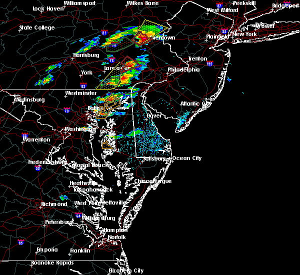 At 227 pm edt, doppler radar indicated a severe thunderstorm capable of producing damaging winds in excess of 60 mph. this storm was located over aberdeen, moving northeast at 20 mph. locations impacted include, aberdeen, perryman, riverside and carsins. At 227 pm edt, doppler radar indicated a severe thunderstorm capable of producing damaging winds in excess of 60 mph. this storm was located over aberdeen, moving northeast at 20 mph. locations impacted include, aberdeen, perryman, riverside and carsins.
|
| 6/30/2015 2:15 PM EDT |
 At 214 pm edt, doppler radar indicated a severe thunderstorm capable of producing damaging winds in excess of 60 mph. this storm was located over riverside, or near aberdeen, and moving northeast at 20 mph. At 214 pm edt, doppler radar indicated a severe thunderstorm capable of producing damaging winds in excess of 60 mph. this storm was located over riverside, or near aberdeen, and moving northeast at 20 mph.
|
| 6/23/2015 6:32 PM EDT |
 At 632 pm edt, doppler radar indicated a line of severe thunderstorms capable of producing half dollar size hail and destructive winds in excess of 60 mph. these storms were located along a line extending from near hollywood beach to clifton park, moving southeast at 20 mph. locations impacted include, baltimore, aberdeen, bel air, union square, guilford, howard park, baltimore inner harbor, back river, locust point, camden yards, roland park, fallstaff, fells point, pikesville, gwynns falls, middle river, baltimore-washington airport, clifton park, north point state park and sparrows point. At 632 pm edt, doppler radar indicated a line of severe thunderstorms capable of producing half dollar size hail and destructive winds in excess of 60 mph. these storms were located along a line extending from near hollywood beach to clifton park, moving southeast at 20 mph. locations impacted include, baltimore, aberdeen, bel air, union square, guilford, howard park, baltimore inner harbor, back river, locust point, camden yards, roland park, fallstaff, fells point, pikesville, gwynns falls, middle river, baltimore-washington airport, clifton park, north point state park and sparrows point.
|
| 6/23/2015 6:14 PM EDT |
 At 613 pm edt, doppler radar indicated a line of severe thunderstorms capable of producing half dollar size hail and destructive winds in excess of 70 mph. these storms were located along a line extending from near charlestown to howard park, and moving southeast at 20 mph. At 613 pm edt, doppler radar indicated a line of severe thunderstorms capable of producing half dollar size hail and destructive winds in excess of 70 mph. these storms were located along a line extending from near charlestown to howard park, and moving southeast at 20 mph.
|
| 6/23/2015 6:05 PM EDT |
 At 605 pm edt, doppler radar indicated a line of severe thunderstorms capable of producing large damaging hail up to golf ball size and destructive winds in excess of 70 mph. these storms were located along a line extending from near north east to howard park, moving southeast at 30 mph. locations impacted include, baltimore, aberdeen, bel air, union square, guilford, howard park, baltimore inner harbor, back river, locust point, camden yards, roland park, fallstaff, cockeysville, fells point, pikesville, gwynns falls, middle river, clifton park, sparrows point and north point state park. At 605 pm edt, doppler radar indicated a line of severe thunderstorms capable of producing large damaging hail up to golf ball size and destructive winds in excess of 70 mph. these storms were located along a line extending from near north east to howard park, moving southeast at 30 mph. locations impacted include, baltimore, aberdeen, bel air, union square, guilford, howard park, baltimore inner harbor, back river, locust point, camden yards, roland park, fallstaff, cockeysville, fells point, pikesville, gwynns falls, middle river, clifton park, sparrows point and north point state park.
|
| 6/23/2015 5:45 PM EDT |
 At 544 pm edt, doppler radar indicated a line of severe thunderstorms capable of producing large damaging hail up to golf ball size and destructive winds in excess of 70 mph. these storms were located along a line extending from woodlawn to randallstown, and moving southeast at 30 mph. At 544 pm edt, doppler radar indicated a line of severe thunderstorms capable of producing large damaging hail up to golf ball size and destructive winds in excess of 70 mph. these storms were located along a line extending from woodlawn to randallstown, and moving southeast at 30 mph.
|
| 6/23/2015 5:30 PM EDT |
 At 529 pm edt, doppler radar indicated a line of severe thunderstorms capable of producing half dollar size hail and destructive winds in excess of 70 mph. these storms were located along a line extending from delta to hampton, moving east at 40 mph. locations impacted include, aberdeen, bel air, cockeysville, riverside, reisterstown, fallston, carney, perryman, bel air south, hampton, jarrettsville, white marsh, perry hall, mays chapel, kingsville, bel air north, lutherville-timonium, pleasant hills, timonium and owings mills. At 529 pm edt, doppler radar indicated a line of severe thunderstorms capable of producing half dollar size hail and destructive winds in excess of 70 mph. these storms were located along a line extending from delta to hampton, moving east at 40 mph. locations impacted include, aberdeen, bel air, cockeysville, riverside, reisterstown, fallston, carney, perryman, bel air south, hampton, jarrettsville, white marsh, perry hall, mays chapel, kingsville, bel air north, lutherville-timonium, pleasant hills, timonium and owings mills.
|
| 6/23/2015 5:11 PM EDT |
 At 511 pm edt, doppler radar indicated a line of severe thunderstorms capable of producing quarter size hail and damaging winds in excess of 60 mph. these storms were located along a line extending from near stewartstown to near reisterstown, and moving east at 40 mph. At 511 pm edt, doppler radar indicated a line of severe thunderstorms capable of producing quarter size hail and damaging winds in excess of 60 mph. these storms were located along a line extending from near stewartstown to near reisterstown, and moving east at 40 mph.
|
| 6/20/2015 9:37 PM EDT |
 At 936 pm edt, doppler radar indicated a line of severe thunderstorms capable of producing damaging winds in excess of 60 mph. these storms were located along a line extending from fallston to near bel air south to near middle river, and moving east at 45 mph. At 936 pm edt, doppler radar indicated a line of severe thunderstorms capable of producing damaging winds in excess of 60 mph. these storms were located along a line extending from fallston to near bel air south to near middle river, and moving east at 45 mph.
|
| 6/20/2015 9:29 PM EDT |
 At 928 pm edt, emergency management reported a line of severe thunderstorms producing damaging winds in excess of 60 mph. these storms were located along a line extending from fallston to near kingsville to millers island, moving northeast at 30 mph. locations impacted include, aberdeen, bel air, back river, north point state park, middle river, millers island, rossville, white marsh, essex, riverside, bowleys quarters, perry hall, fallston, carney, perryman, bel air south, kingsville, bel air north, pleasant hills and hampton. At 928 pm edt, emergency management reported a line of severe thunderstorms producing damaging winds in excess of 60 mph. these storms were located along a line extending from fallston to near kingsville to millers island, moving northeast at 30 mph. locations impacted include, aberdeen, bel air, back river, north point state park, middle river, millers island, rossville, white marsh, essex, riverside, bowleys quarters, perry hall, fallston, carney, perryman, bel air south, kingsville, bel air north, pleasant hills and hampton.
|
| 6/20/2015 9:08 PM EDT |
 At 908 pm edt, doppler radar indicated a line of severe thunderstorms capable of producing damaging winds in excess of 60 mph. these storms were located along a line extending from roland park to near locust point to millersville, and moving northeast at 40 mph. At 908 pm edt, doppler radar indicated a line of severe thunderstorms capable of producing damaging winds in excess of 60 mph. these storms were located along a line extending from roland park to near locust point to millersville, and moving northeast at 40 mph.
|
| 6/8/2015 8:47 PM EDT | At 847 pm edt, doppler radar indicated a line of severe thunderstorms capable of producing damaging winds in excess of 60 mph. these storms were located along a line extending from woodlawn to near newtown to fells point, moving east at 25 mph. locations impacted include, aberdeen, bel air, middle river, back river, north point state park, millers island, essex, riverside, fallston, carney, perryman, bel air south, rosedale, rossville, white marsh, bowleys quarters, perry hall, dundalk, kingsville and bel air north. |
| 6/8/2015 8:07 PM EDT | At 807 pm edt, doppler radar indicated a line of severe thunderstorms capable of producing damaging winds in excess of 60 mph. these storms were located along a line extending from near delta to carney to ellicott city, and moving east at 25 mph. |
| 6/8/2015 7:51 PM EDT | At 751 pm edt, doppler radar indicated a line of severe thunderstorms capable of producing damaging winds in excess of 60 mph. these storms were located along a line extending from near delta to perry hall, and moving east at 45 mph. |
| 4/20/2015 9:24 PM EDT | At 923 pm edt, doppler radar indicated a line of severe thunderstorms capable of producing damaging winds in excess of 60 mph. these storms were located along a line extending from rosedale to near rock hall, moving northeast at 40 mph. locations impacted include, baltimore, aberdeen, bel air, severn, fells point, turners station, m and t stadium, fort smallwood state park, armistead gardens, john hopkins university, middle river, baltimore-washington airport, baltimore inner harbor, riviera beach, josephine lee, sparrows point, back river, eastpoint, camden yards and north point state park. a tornado watch remains in effect until 1000 pm edt for northern maryland. |
| 4/20/2015 9:06 PM EDT | At 905 pm edt, doppler radar indicated a line of severe thunderstorms capable of producing damaging winds in excess of 60 mph. these storms were located along a line extending from beechfield to arnold, moving northeast at 30 mph. locations impacted include, baltimore, aberdeen, bel air, morgan state university, severn, fells point, woodring, turners station, m and t stadium, fort smallwood state park, armistead gardens, john hopkins university, middle river, baltimore-washington airport, clifton park, baltimore inner harbor, riviera beach, josephine lee, sparrows point and back river. a tornado watch remains in effect until 1000 pm edt for northern maryland. |
| 4/20/2015 8:52 PM EDT | At 851 pm edt, doppler radar indicated a line of severe thunderstorms capable of producing damaging winds in excess of 60 mph. these storms were located along a line extending from mays chapel to baltimore inner harbor to near severn, and moving northeast at 85 mph. |
| 8/13/2013 6:00 PM EDT | Downed tree in harford county MD, 2.5 miles S of Riverside, MD |
| 6/29/2012 11:57 PM EDT | Tree down blocking road in harford county MD, 0.6 miles SE of Riverside, MD |
| 6/29/2012 11:49 PM EDT | Tree down onto townhouse along pearson place in harford county MD, 0.3 miles NNW of Riverside, MD |
| 1/1/0001 12:00 AM | Over a dozen large trees uprooted and damaged. powerlines down nearb in harford county MD, 0.7 miles WNW of Riverside, MD |
Hail Maps for Riverside, MD


Connect with Interactive Hail Maps