

Hail Map for Riverton, MN
The Riverton, MN area has had 0 reports of on-the-ground hail by trained spotters, and has been under severe weather warnings 16 times during the past 12 months. Doppler radar has detected hail at or near Riverton, MN on 53 occasions, including 3 occasions during the past year.
| Name: | Riverton, MN |
| Where Located: | 80.1 miles SSE of Bemidji, MN |
| Map: | Google Map for Riverton, MN |
| Population: | 117 |
| Housing Units: | 61 |
| More Info: | Search Google for Riverton, MN |
1
The Top Recent Hail Date for Riverton, MN is Friday, September 12, 2025 (21st out of 53)
Hail and Wind Damage Spotted near Riverton, MN
| Date / Time | Report Details |
|---|---|
| 6/10/2026 3:48 AM CDT |
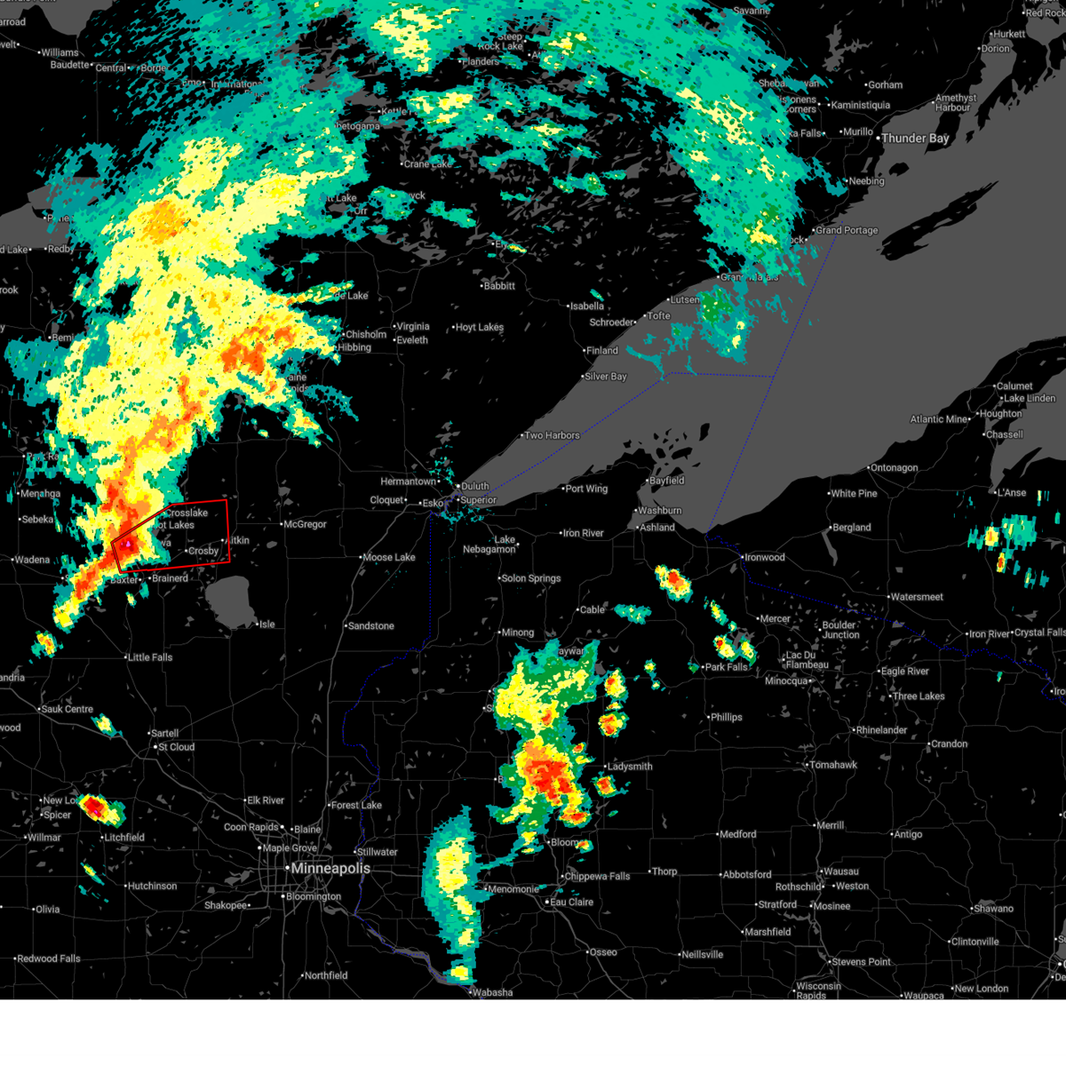
 At 348 am cdt, severe thunderstorms were located along a line extending from near backus to near breezy point to near vineland, moving northeast at 50 mph (radar indicated). Hazards include 60 mph wind gusts. Expect damage to roofs, siding, and trees. Locations impacted include, crosby, crosslake, emily, deerwood, fifty lakes, cuyuna, backus, wabedo, outing, woman lake and longville. At 348 am cdt, severe thunderstorms were located along a line extending from near backus to near breezy point to near vineland, moving northeast at 50 mph (radar indicated). Hazards include 60 mph wind gusts. Expect damage to roofs, siding, and trees. Locations impacted include, crosby, crosslake, emily, deerwood, fifty lakes, cuyuna, backus, wabedo, outing, woman lake and longville.
|
| 6/10/2026 3:02 AM CDT |
 Svrdlh the national weather service in duluth mn has issued a * severe thunderstorm warning for, cass county in north central minnesota, crow wing county in east central minnesota, * until 400 am cdt. * at 302 am cdt, severe thunderstorms were located along a line extending from near deer creek to 7 miles southwest of motley to near holdingford, moving northeast at 55 mph (radar indicated). Hazards include 60 mph wind gusts. Expect damage to roofs, siding, and trees. severe thunderstorms will be near, pillager and fort ripley around 315 am cdt. baxter, gull lake, crow wing state park, and leader around 320 am cdt. Other locations in the path of these severe thunderstorms include poplar, saint mathias, brainerd, pequot lakes, nisswa, breezy point, merrifield, south long lake, pine river, upper south long lake, crosslake, ironton, fifty lakes, backus, crosby, deerwood, cuyuna, hackensack, garrison and cuyuna country state park. Svrdlh the national weather service in duluth mn has issued a * severe thunderstorm warning for, cass county in north central minnesota, crow wing county in east central minnesota, * until 400 am cdt. * at 302 am cdt, severe thunderstorms were located along a line extending from near deer creek to 7 miles southwest of motley to near holdingford, moving northeast at 55 mph (radar indicated). Hazards include 60 mph wind gusts. Expect damage to roofs, siding, and trees. severe thunderstorms will be near, pillager and fort ripley around 315 am cdt. baxter, gull lake, crow wing state park, and leader around 320 am cdt. Other locations in the path of these severe thunderstorms include poplar, saint mathias, brainerd, pequot lakes, nisswa, breezy point, merrifield, south long lake, pine river, upper south long lake, crosslake, ironton, fifty lakes, backus, crosby, deerwood, cuyuna, hackensack, garrison and cuyuna country state park.
|
| 5/26/2026 4:40 PM CDT |
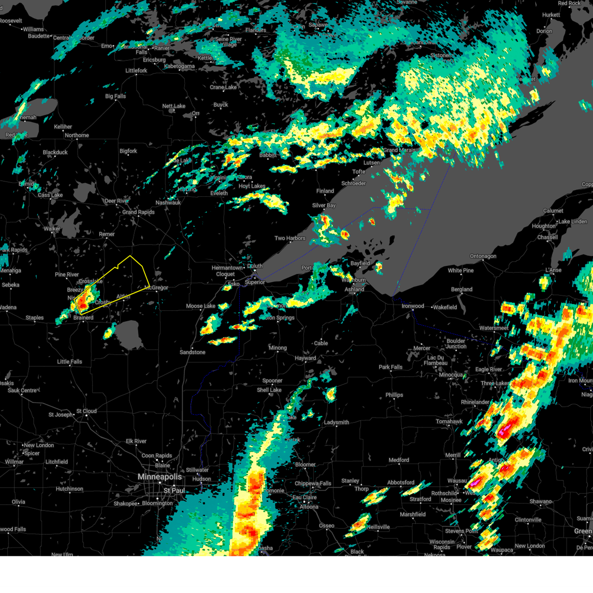
 At 440 pm cdt, a severe thunderstorm was located near brainerd, and is nearly stationary (radar indicated). Hazards include 60 mph wind gusts and quarter size hail. Hail damage to vehicles is expected. expect wind damage to roofs, siding, and trees. This severe thunderstorm will remain over mainly rural areas of central crow wing county, including the following locations, riverton, legionville, woodrow, and trommald. At 440 pm cdt, a severe thunderstorm was located near brainerd, and is nearly stationary (radar indicated). Hazards include 60 mph wind gusts and quarter size hail. Hail damage to vehicles is expected. expect wind damage to roofs, siding, and trees. This severe thunderstorm will remain over mainly rural areas of central crow wing county, including the following locations, riverton, legionville, woodrow, and trommald.
|
| 5/26/2026 4:02 PM CDT |
 Svrdlh the national weather service in duluth mn has issued a * severe thunderstorm warning for, southeastern crow wing county in east central minnesota, * until 500 pm cdt. * at 402 pm cdt, a severe thunderstorm was located near merrifield, or near brainerd, and is nearly stationary (radar indicated). Hazards include 60 mph wind gusts and quarter size hail. Hail damage to vehicles is expected. expect wind damage to roofs, siding, and trees. This severe thunderstorm will be near, brainerd around 405 pm cdt. Svrdlh the national weather service in duluth mn has issued a * severe thunderstorm warning for, southeastern crow wing county in east central minnesota, * until 500 pm cdt. * at 402 pm cdt, a severe thunderstorm was located near merrifield, or near brainerd, and is nearly stationary (radar indicated). Hazards include 60 mph wind gusts and quarter size hail. Hail damage to vehicles is expected. expect wind damage to roofs, siding, and trees. This severe thunderstorm will be near, brainerd around 405 pm cdt.
|
| 9/12/2025 11:46 AM CDT | the severe thunderstorm warning has been cancelled and is no longer in effect |
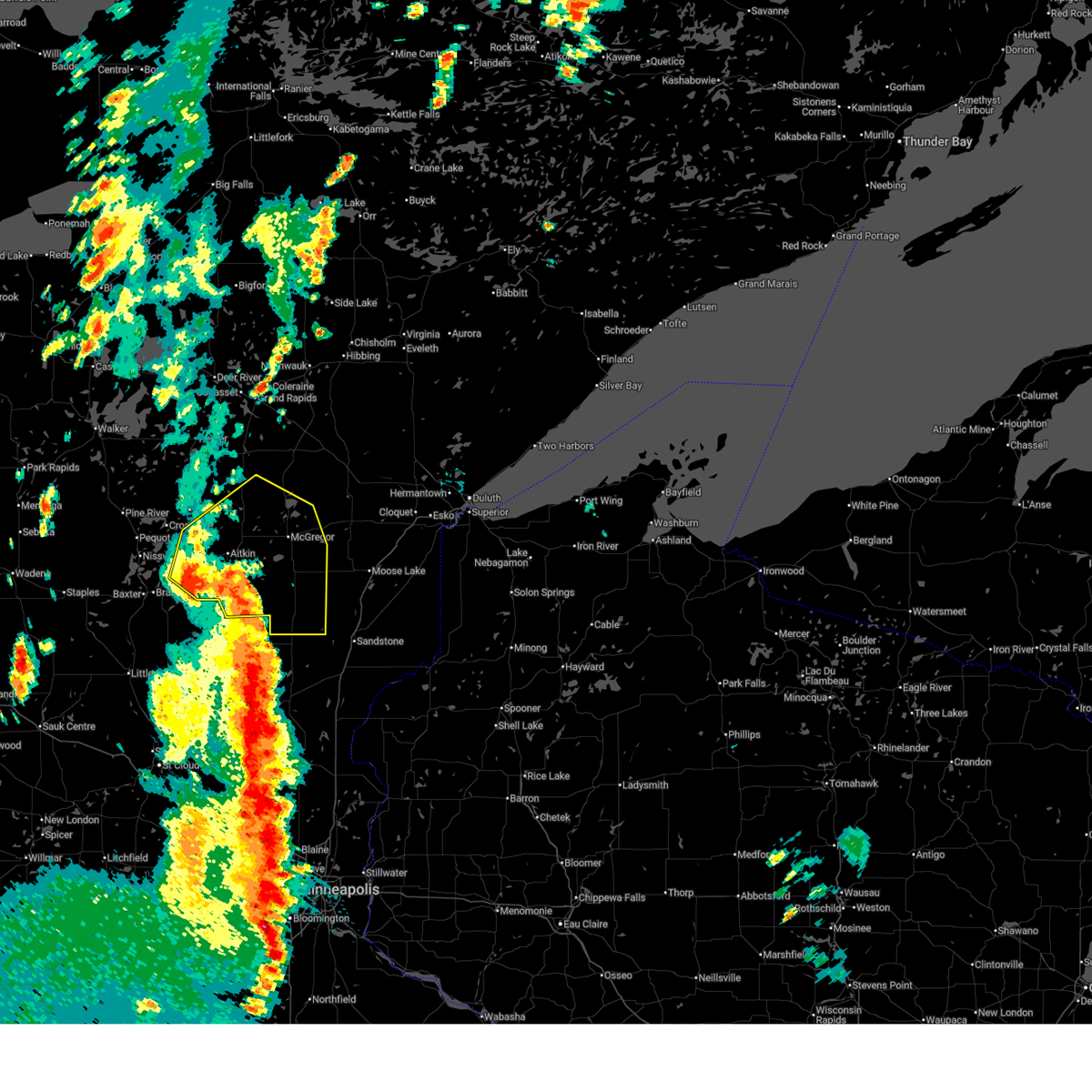
| 9/12/2025 11:46 AM CDT | At 1145 am cdt, a severe thunderstorm was located near south long lake, or near brainerd, moving east at 25 mph (radar indicated). Hazards include 60 mph wind gusts and quarter size hail. Hail damage to vehicles is expected. expect wind damage to roofs, siding, and trees. Locations impacted include, south long lake, upper south long lake, mille lacs lake and garrison. |
| 9/12/2025 11:24 AM CDT | Svrdlh the national weather service in duluth mn has issued a * severe thunderstorm warning for, southwestern aitkin county in east central minnesota, southern cass county in north central minnesota, southern crow wing county in east central minnesota, * until 1230 pm cdt. * at 1123 am cdt, a severe thunderstorm was located over baxter, or near brainerd, moving east at 25 mph (radar indicated). Hazards include 60 mph wind gusts and quarter size hail. Hail damage to vehicles is expected. expect wind damage to roofs, siding, and trees. this severe thunderstorm will be near, brainerd and baxter around 1130 am cdt. south long lake around 1140 am cdt. Other locations in the path of this severe thunderstorm include upper south long lake, mille lacs lake and garrison. |
| 9/12/2025 10:59 AM CDT | At 1059 am cdt, a severe thunderstorm was located near gull lake, or 9 miles west of brainerd, moving east at 20 mph (radar indicated). Hazards include 60 mph wind gusts and quarter size hail. Hail damage to vehicles is expected. expect wind damage to roofs, siding, and trees. Locations impacted include, baxter, gull lake and brainerd. |
| 9/12/2025 10:29 AM CDT | Svrdlh the national weather service in duluth mn has issued a * severe thunderstorm warning for, southwestern cass county in north central minnesota, southern crow wing county in east central minnesota, * until 1130 am cdt. * at 1029 am cdt, a severe thunderstorm was located near motley, or 20 miles west of brainerd, moving east at 20 mph (radar indicated). Hazards include 60 mph wind gusts and quarter size hail. Hail damage to vehicles is expected. expect wind damage to roofs, siding, and trees. this severe thunderstorm will be near, gull lake around 1045 am cdt. Other locations in the path of this severe thunderstorm include pillager, baxter and brainerd. |
| 7/27/2025 7:40 AM CDT |
 The storms which prompted the warning have moved out of the area. therefore, the warning will be allowed to expire. The storms which prompted the warning have moved out of the area. therefore, the warning will be allowed to expire.
|
| 7/27/2025 7:31 AM CDT |
 At 731 am cdt, severe thunderstorms were located along a line extending from near crosslake to near breezy point to near gull lake, moving east at 30 mph (radar indicated). Hazards include 60 mph wind gusts and quarter size hail. Hail damage to vehicles is expected. expect wind damage to roofs, siding, and trees. Locations impacted include, crosby, breezy point, crosslake, emily, ironton, fifty lakes, cuyuna, cuyuna country state park, swatara, mission, wolford, riverton, trommald, little pine, manhattan beach, lake roosevelt, upper mission lake, esquagamah lake, white elk lake, and haypoint. At 731 am cdt, severe thunderstorms were located along a line extending from near crosslake to near breezy point to near gull lake, moving east at 30 mph (radar indicated). Hazards include 60 mph wind gusts and quarter size hail. Hail damage to vehicles is expected. expect wind damage to roofs, siding, and trees. Locations impacted include, crosby, breezy point, crosslake, emily, ironton, fifty lakes, cuyuna, cuyuna country state park, swatara, mission, wolford, riverton, trommald, little pine, manhattan beach, lake roosevelt, upper mission lake, esquagamah lake, white elk lake, and haypoint.
|
| 7/27/2025 7:25 AM CDT |
 At 725 am cdt, severe thunderstorms were located along a line extending from near crosslake to near nisswa to near pillager, moving east at 30 mph (radar indicated). Hazards include 60 mph wind gusts and quarter size hail. Hail damage to vehicles is expected. expect wind damage to roofs, siding, and trees. Locations impacted include, crosby, breezy point, pequot lakes, crosslake, emily, ironton, fifty lakes, cuyuna, outing, cuyuna country state park, swatara, mission, wolford, riverton, trommald, little pine, manhattan beach, lake roosevelt, lower hay lake, and upper mission lake. At 725 am cdt, severe thunderstorms were located along a line extending from near crosslake to near nisswa to near pillager, moving east at 30 mph (radar indicated). Hazards include 60 mph wind gusts and quarter size hail. Hail damage to vehicles is expected. expect wind damage to roofs, siding, and trees. Locations impacted include, crosby, breezy point, pequot lakes, crosslake, emily, ironton, fifty lakes, cuyuna, outing, cuyuna country state park, swatara, mission, wolford, riverton, trommald, little pine, manhattan beach, lake roosevelt, lower hay lake, and upper mission lake.
|
| 7/27/2025 7:16 AM CDT |
 At 716 am cdt, severe thunderstorms were located along a line extending from 6 miles east of pine river to near nisswa to near pillager, moving east at 30 mph (radar indicated). Hazards include 60 mph wind gusts and quarter size hail. Hail damage to vehicles is expected. expect wind damage to roofs, siding, and trees. Locations impacted include, breezy point, pequot lakes, crosslake, nisswa, fifty lakes, gull lake, baxter, merrifield, emily, brainerd, crosby, ironton, cuyuna country state park and cuyuna. At 716 am cdt, severe thunderstorms were located along a line extending from 6 miles east of pine river to near nisswa to near pillager, moving east at 30 mph (radar indicated). Hazards include 60 mph wind gusts and quarter size hail. Hail damage to vehicles is expected. expect wind damage to roofs, siding, and trees. Locations impacted include, breezy point, pequot lakes, crosslake, nisswa, fifty lakes, gull lake, baxter, merrifield, emily, brainerd, crosby, ironton, cuyuna country state park and cuyuna.
|
| 7/27/2025 6:50 AM CDT |
 Svrdlh the national weather service in duluth mn has issued a * severe thunderstorm warning for, northwestern aitkin county in east central minnesota, southern cass county in north central minnesota, crow wing county in east central minnesota, * until 745 am cdt. * at 650 am cdt, severe thunderstorms were located along a line extending from near pine river to 6 miles northwest of gull lake to near motley, moving east at 30 mph (radar indicated). Hazards include 60 mph wind gusts and quarter size hail. Hail damage to vehicles is expected. expect wind damage to roofs, siding, and trees. severe thunderstorms will be near, pequot lakes, nisswa, pine river, and gull lake around 655 am cdt. breezy point around 700 am cdt. crosslake, pillager, and fifty lakes around 710 am cdt. Other locations in the path of these severe thunderstorms include baxter, merrifield, emily and brainerd. Svrdlh the national weather service in duluth mn has issued a * severe thunderstorm warning for, northwestern aitkin county in east central minnesota, southern cass county in north central minnesota, crow wing county in east central minnesota, * until 745 am cdt. * at 650 am cdt, severe thunderstorms were located along a line extending from near pine river to 6 miles northwest of gull lake to near motley, moving east at 30 mph (radar indicated). Hazards include 60 mph wind gusts and quarter size hail. Hail damage to vehicles is expected. expect wind damage to roofs, siding, and trees. severe thunderstorms will be near, pequot lakes, nisswa, pine river, and gull lake around 655 am cdt. breezy point around 700 am cdt. crosslake, pillager, and fifty lakes around 710 am cdt. Other locations in the path of these severe thunderstorms include baxter, merrifield, emily and brainerd.
|
| 7/22/2025 2:20 PM CDT |
 At 220 pm cdt, a severe thunderstorm was located near breezy point, or 14 miles north of brainerd, moving east at 30 mph (radar indicated). Hazards include 60 mph wind gusts and quarter size hail. Hail damage to vehicles is expected. expect wind damage to roofs, siding, and trees. this severe storm will be near, breezy point around 225 pm cdt. Other locations in the path of this severe thunderstorm include cuyuna, crosby and aitkin. At 220 pm cdt, a severe thunderstorm was located near breezy point, or 14 miles north of brainerd, moving east at 30 mph (radar indicated). Hazards include 60 mph wind gusts and quarter size hail. Hail damage to vehicles is expected. expect wind damage to roofs, siding, and trees. this severe storm will be near, breezy point around 225 pm cdt. Other locations in the path of this severe thunderstorm include cuyuna, crosby and aitkin.
|
| 7/22/2025 2:12 PM CDT |
 Svrdlh the national weather service in duluth mn has issued a * severe thunderstorm warning for, central aitkin county in east central minnesota, northern crow wing county in east central minnesota, * until 315 pm cdt. * at 212 pm cdt, a severe thunderstorm was located over breezy point, or 16 miles north of brainerd, moving east at 35 mph (radar indicated). Hazards include ping pong ball size hail and 60 mph wind gusts. People and animals outdoors will be injured. expect hail damage to roofs, siding, windows, and vehicles. expect wind damage to roofs, siding, and trees. This severe thunderstorm will be near, breezy point and crosslake around 215 pm cdt. Svrdlh the national weather service in duluth mn has issued a * severe thunderstorm warning for, central aitkin county in east central minnesota, northern crow wing county in east central minnesota, * until 315 pm cdt. * at 212 pm cdt, a severe thunderstorm was located over breezy point, or 16 miles north of brainerd, moving east at 35 mph (radar indicated). Hazards include ping pong ball size hail and 60 mph wind gusts. People and animals outdoors will be injured. expect hail damage to roofs, siding, windows, and vehicles. expect wind damage to roofs, siding, and trees. This severe thunderstorm will be near, breezy point and crosslake around 215 pm cdt.
|
| 6/23/2025 2:11 AM CDT |
 Svrdlh the national weather service in duluth mn has issued a * severe thunderstorm warning for, southeastern itasca county in north central minnesota, aitkin county in east central minnesota, east central cass county in north central minnesota, crow wing county in east central minnesota, * until 315 am cdt. * at 210 am cdt, severe thunderstorms were located along a line extending from near pine river to near cuyuna country state park to near garrison, moving northeast at 50 mph (brainerd airport reported a 56 mph wind gust). Hazards include 60 mph wind gusts and quarter size hail. Hail damage to vehicles is expected. expect wind damage to roofs, siding, and trees. severe thunderstorms will be near, mille lacs lake, crosby, crosslake, emily, deerwood, fifty lakes, cuyuna, and garrison around 215 am cdt. aitkin around 220 am cdt. outing around 225 am cdt. Other locations in the path of these severe thunderstorms include remer, palisade, swatara, hill city, mcgregor, big sandy lake, libby, savanna portage state park, grand rapids, cohasset, jacobson and pokegama lake. Svrdlh the national weather service in duluth mn has issued a * severe thunderstorm warning for, southeastern itasca county in north central minnesota, aitkin county in east central minnesota, east central cass county in north central minnesota, crow wing county in east central minnesota, * until 315 am cdt. * at 210 am cdt, severe thunderstorms were located along a line extending from near pine river to near cuyuna country state park to near garrison, moving northeast at 50 mph (brainerd airport reported a 56 mph wind gust). Hazards include 60 mph wind gusts and quarter size hail. Hail damage to vehicles is expected. expect wind damage to roofs, siding, and trees. severe thunderstorms will be near, mille lacs lake, crosby, crosslake, emily, deerwood, fifty lakes, cuyuna, and garrison around 215 am cdt. aitkin around 220 am cdt. outing around 225 am cdt. Other locations in the path of these severe thunderstorms include remer, palisade, swatara, hill city, mcgregor, big sandy lake, libby, savanna portage state park, grand rapids, cohasset, jacobson and pokegama lake.
|
| 6/21/2025 2:40 AM CDT |
 the severe thunderstorm warning has been cancelled and is no longer in effect the severe thunderstorm warning has been cancelled and is no longer in effect
|
| 6/21/2025 2:40 AM CDT |
 At 240 am cdt, severe thunderstorms were located along a line extending from cotton to near cromwell to near upper south long lake, moving east at 55 mph (radar indicated). Hazards include 70 mph wind gusts and penny size hail. Expect considerable tree damage. damage is likely to mobile homes, roofs, and outbuildings. Locations impacted include, duluth, superior, brainerd, cloquet, big sandy lake, mille lacs lake, hermantown, baxter, proctor, crosby, aitkin, scanlon, carlton, hill city, mahtowa, barnum, ironton, deerwood, floodwood, and wrenshall. At 240 am cdt, severe thunderstorms were located along a line extending from cotton to near cromwell to near upper south long lake, moving east at 55 mph (radar indicated). Hazards include 70 mph wind gusts and penny size hail. Expect considerable tree damage. damage is likely to mobile homes, roofs, and outbuildings. Locations impacted include, duluth, superior, brainerd, cloquet, big sandy lake, mille lacs lake, hermantown, baxter, proctor, crosby, aitkin, scanlon, carlton, hill city, mahtowa, barnum, ironton, deerwood, floodwood, and wrenshall.
|
| 6/21/2025 2:30 AM CDT |
 At 230 am cdt, severe thunderstorms were located along a line extending from 6 miles west of cotton to near tamarack to near brainerd, moving east at 55 mph (radar indicated). Hazards include 70 mph wind gusts and penny size hail. Expect considerable tree damage. damage is likely to mobile homes, roofs, and outbuildings. Locations impacted include, mille lacs lake, mcgregor, tamarack, mille lacs band east lake area, fond du lac band brookston area, cromwell, brookston, canyon, fond du lac band sawyer area, malmo, cloquet, saginaw, fond du lac band cloquet area, island lake, boulder lake, hermantown, mahtowa, kettle river, pike lake near duluth, duluth, scanlon, carlton, barnum, thomson, city of rice lake, jay cooke state park, proctor, moose lake, wrenshall and superior. At 230 am cdt, severe thunderstorms were located along a line extending from 6 miles west of cotton to near tamarack to near brainerd, moving east at 55 mph (radar indicated). Hazards include 70 mph wind gusts and penny size hail. Expect considerable tree damage. damage is likely to mobile homes, roofs, and outbuildings. Locations impacted include, mille lacs lake, mcgregor, tamarack, mille lacs band east lake area, fond du lac band brookston area, cromwell, brookston, canyon, fond du lac band sawyer area, malmo, cloquet, saginaw, fond du lac band cloquet area, island lake, boulder lake, hermantown, mahtowa, kettle river, pike lake near duluth, duluth, scanlon, carlton, barnum, thomson, city of rice lake, jay cooke state park, proctor, moose lake, wrenshall and superior.
|
| 6/21/2025 1:59 AM CDT |
 Svrdlh the national weather service in duluth mn has issued a * severe thunderstorm warning for, southeastern itasca county in north central minnesota, aitkin county in east central minnesota, southern cass county in north central minnesota, northern pine county in east central minnesota, southern st. louis county in northeastern minnesota, carlton county in northeastern minnesota, crow wing county in east central minnesota, southwestern lake county in northeastern minnesota, * until 300 am cdt. * at 159 am cdt, severe thunderstorms were located along a line extending from near pengilly to 6 miles south of swatara to near staples airport, moving east at 55 mph (radar indicated). Hazards include 70 mph wind gusts and penny size hail. Expect considerable tree damage. damage is likely to mobile homes, roofs, and outbuildings. severe thunderstorms will be near, breezy point, pequot lakes, crosslake, nisswa, gull lake, jacobson, and merrifield around 205 am cdt. brainerd, baxter, crosby, ironton, cuyuna, palisade, and cuyuna country state park around 210 am cdt. big sandy lake, deerwood, libby, and savanna portage state park around 215 am cdt. Other locations in the path of these severe thunderstorms include aitkin, floodwood, mcgregor, meadowlands, upper south long lake, tamarack, mille lacs lake, garrison, mille lacs band east lake area, fond du lac band brookston area, cromwell, brookston, canyon and fond du lac band sawyer area. Svrdlh the national weather service in duluth mn has issued a * severe thunderstorm warning for, southeastern itasca county in north central minnesota, aitkin county in east central minnesota, southern cass county in north central minnesota, northern pine county in east central minnesota, southern st. louis county in northeastern minnesota, carlton county in northeastern minnesota, crow wing county in east central minnesota, southwestern lake county in northeastern minnesota, * until 300 am cdt. * at 159 am cdt, severe thunderstorms were located along a line extending from near pengilly to 6 miles south of swatara to near staples airport, moving east at 55 mph (radar indicated). Hazards include 70 mph wind gusts and penny size hail. Expect considerable tree damage. damage is likely to mobile homes, roofs, and outbuildings. severe thunderstorms will be near, breezy point, pequot lakes, crosslake, nisswa, gull lake, jacobson, and merrifield around 205 am cdt. brainerd, baxter, crosby, ironton, cuyuna, palisade, and cuyuna country state park around 210 am cdt. big sandy lake, deerwood, libby, and savanna portage state park around 215 am cdt. Other locations in the path of these severe thunderstorms include aitkin, floodwood, mcgregor, meadowlands, upper south long lake, tamarack, mille lacs lake, garrison, mille lacs band east lake area, fond du lac band brookston area, cromwell, brookston, canyon and fond du lac band sawyer area.
|
| 6/21/2025 1:20 AM CDT |
 Svrdlh the national weather service in duluth mn has issued a * severe thunderstorm warning for, southeastern itasca county in north central minnesota, northern aitkin county in east central minnesota, central cass county in north central minnesota, southwestern st. louis county in northeastern minnesota, northern crow wing county in east central minnesota, * until 200 am cdt. * at 120 am cdt, severe thunderstorms were located along a line extending from near longville to backus to 7 miles south of huntersville, moving east at 75 mph (radar indicated). Hazards include 70 mph wind gusts and penny size hail. Expect considerable tree damage. damage is likely to mobile homes, roofs, and outbuildings. severe thunderstorms will be near, wabedo, backus, longville, and woman lake around 125 am cdt. pine river and remer around 130 am cdt. fifty lakes around 135 am cdt. crosslake, emily, and outing around 140 am cdt. Other locations in the path of these severe thunderstorms include hill city and swatara. Svrdlh the national weather service in duluth mn has issued a * severe thunderstorm warning for, southeastern itasca county in north central minnesota, northern aitkin county in east central minnesota, central cass county in north central minnesota, southwestern st. louis county in northeastern minnesota, northern crow wing county in east central minnesota, * until 200 am cdt. * at 120 am cdt, severe thunderstorms were located along a line extending from near longville to backus to 7 miles south of huntersville, moving east at 75 mph (radar indicated). Hazards include 70 mph wind gusts and penny size hail. Expect considerable tree damage. damage is likely to mobile homes, roofs, and outbuildings. severe thunderstorms will be near, wabedo, backus, longville, and woman lake around 125 am cdt. pine river and remer around 130 am cdt. fifty lakes around 135 am cdt. crosslake, emily, and outing around 140 am cdt. Other locations in the path of these severe thunderstorms include hill city and swatara.
|
| 6/16/2025 5:11 PM CDT |
 At 509 pm cdt, a large and extremely dangerous tornado was located over cuyuna country state park, or 11 miles northeast of brainerd, moving east at 30 mph. this is a particularly dangerous situation. take cover now! (radar indicated rotation). Hazards include damaging tornado. You are in a life-threatening situation. flying debris may be deadly to those caught without shelter. mobile homes will be destroyed. considerable damage to homes, businesses, and vehicles is likely and complete destruction is possible. Locations impacted include, crosby, aitkin, ironton, deerwood, cuyuna, cuyuna country state park, cedar lake, wolford, riverton, trommald, ripple lake, upper mission lake, pine knoll, and lower mission lake. At 509 pm cdt, a large and extremely dangerous tornado was located over cuyuna country state park, or 11 miles northeast of brainerd, moving east at 30 mph. this is a particularly dangerous situation. take cover now! (radar indicated rotation). Hazards include damaging tornado. You are in a life-threatening situation. flying debris may be deadly to those caught without shelter. mobile homes will be destroyed. considerable damage to homes, businesses, and vehicles is likely and complete destruction is possible. Locations impacted include, crosby, aitkin, ironton, deerwood, cuyuna, cuyuna country state park, cedar lake, wolford, riverton, trommald, ripple lake, upper mission lake, pine knoll, and lower mission lake.
|
| 6/16/2025 5:07 PM CDT |
 Tordlh the national weather service in duluth mn has issued a * tornado warning for, southern aitkin county in east central minnesota, southeastern crow wing county in east central minnesota, * until 545 pm cdt. * at 506 pm cdt, a severe thunderstorm capable of producing a tornado was located near upper south long lake, or near brainerd, moving east at 45 mph (radar indicated rotation). Hazards include tornado and ping pong ball size hail. Flying debris will be dangerous to those caught without shelter. mobile homes will be damaged or destroyed. damage to roofs, windows, and vehicles will occur. Tree damage is likely. Tordlh the national weather service in duluth mn has issued a * tornado warning for, southern aitkin county in east central minnesota, southeastern crow wing county in east central minnesota, * until 545 pm cdt. * at 506 pm cdt, a severe thunderstorm capable of producing a tornado was located near upper south long lake, or near brainerd, moving east at 45 mph (radar indicated rotation). Hazards include tornado and ping pong ball size hail. Flying debris will be dangerous to those caught without shelter. mobile homes will be damaged or destroyed. damage to roofs, windows, and vehicles will occur. Tree damage is likely.
|
| 6/16/2025 5:00 PM CDT |
 At 459 pm cdt, a confirmed large and extremely dangerous tornado was located over merrifield, or 9 miles north of brainerd, moving east at 35 mph. this is a particularly dangerous situation. take cover now! (weather spotters confirmed tornado 1 or 2 miles west of north long lake at 443 pm). Hazards include damaging tornado. You are in a life-threatening situation. flying debris may be deadly to those caught without shelter. mobile homes will be destroyed. considerable damage to homes, businesses, and vehicles is likely and complete destruction is possible. Locations impacted include, crosby, breezy point, aitkin, pequot lakes, crosslake, nisswa, ironton, deerwood, cuyuna, cuyuna country state park, merrifield, cedar lake, mission, wolford, riverton, trommald, legionville, north long lake, ripple lake, and upper mission lake. At 459 pm cdt, a confirmed large and extremely dangerous tornado was located over merrifield, or 9 miles north of brainerd, moving east at 35 mph. this is a particularly dangerous situation. take cover now! (weather spotters confirmed tornado 1 or 2 miles west of north long lake at 443 pm). Hazards include damaging tornado. You are in a life-threatening situation. flying debris may be deadly to those caught without shelter. mobile homes will be destroyed. considerable damage to homes, businesses, and vehicles is likely and complete destruction is possible. Locations impacted include, crosby, breezy point, aitkin, pequot lakes, crosslake, nisswa, ironton, deerwood, cuyuna, cuyuna country state park, merrifield, cedar lake, mission, wolford, riverton, trommald, legionville, north long lake, ripple lake, and upper mission lake.
|
| 6/16/2025 5:00 PM CDT |
 the tornado warning has been cancelled and is no longer in effect the tornado warning has been cancelled and is no longer in effect
|
| 6/16/2025 4:46 PM CDT |
 At 445 pm cdt, a confirmed large and extremely dangerous tornado was located over nisswa, or 9 miles northwest of brainerd, moving east at 35 mph. this is a particularly dangerous situation. take cover now! (weather spotters confirmed tornado 1 or 2 miles west of north long lake at 443 pm). Hazards include damaging tornado. You are in a life-threatening situation. flying debris may be deadly to those caught without shelter. mobile homes will be destroyed. considerable damage to homes, businesses, and vehicles is likely and complete destruction is possible. Locations impacted include, crosby, breezy point, aitkin, pequot lakes, crosslake, nisswa, ironton, deerwood, cuyuna, cuyuna country state park, gull lake, merrifield, cedar lake, lake shore, east gull lake, mission, wolford, riverton, trommald, and legionville. At 445 pm cdt, a confirmed large and extremely dangerous tornado was located over nisswa, or 9 miles northwest of brainerd, moving east at 35 mph. this is a particularly dangerous situation. take cover now! (weather spotters confirmed tornado 1 or 2 miles west of north long lake at 443 pm). Hazards include damaging tornado. You are in a life-threatening situation. flying debris may be deadly to those caught without shelter. mobile homes will be destroyed. considerable damage to homes, businesses, and vehicles is likely and complete destruction is possible. Locations impacted include, crosby, breezy point, aitkin, pequot lakes, crosslake, nisswa, ironton, deerwood, cuyuna, cuyuna country state park, gull lake, merrifield, cedar lake, lake shore, east gull lake, mission, wolford, riverton, trommald, and legionville.
|
| 6/16/2025 4:40 PM CDT |
 Tordlh the national weather service in duluth mn has issued a * tornado warning for, west central aitkin county in east central minnesota, south central cass county in north central minnesota, central crow wing county in east central minnesota, * until 530 pm cdt. * at 439 pm cdt, a confirmed tornado was located over gull lake, or 10 miles northwest of brainerd, moving east at 40 mph (weather spotters confirmed tornado northwest of gull lake at 436 pm cdt). Hazards include damaging tornado and golf ball size hail. Flying debris will be dangerous to those caught without shelter. mobile homes will be damaged or destroyed. damage to roofs, windows, and vehicles will occur. Tree damage is likely. Tordlh the national weather service in duluth mn has issued a * tornado warning for, west central aitkin county in east central minnesota, south central cass county in north central minnesota, central crow wing county in east central minnesota, * until 530 pm cdt. * at 439 pm cdt, a confirmed tornado was located over gull lake, or 10 miles northwest of brainerd, moving east at 40 mph (weather spotters confirmed tornado northwest of gull lake at 436 pm cdt). Hazards include damaging tornado and golf ball size hail. Flying debris will be dangerous to those caught without shelter. mobile homes will be damaged or destroyed. damage to roofs, windows, and vehicles will occur. Tree damage is likely.
|
| 4/28/2025 7:00 PM CDT |
 Svrdlh the national weather service in duluth mn has issued a * severe thunderstorm warning for, northwestern aitkin county in east central minnesota, northern crow wing county in east central minnesota, * until 745 pm cdt. * at 659 pm cdt, a severe thunderstorm was located near merrifield, or 11 miles north of brainerd, moving northeast at 45 mph (radar indicated). Hazards include half dollar size hail. Damage to vehicles is expected. This severe thunderstorm will be near, crosslake around 710 pm cdt. Svrdlh the national weather service in duluth mn has issued a * severe thunderstorm warning for, northwestern aitkin county in east central minnesota, northern crow wing county in east central minnesota, * until 745 pm cdt. * at 659 pm cdt, a severe thunderstorm was located near merrifield, or 11 miles north of brainerd, moving northeast at 45 mph (radar indicated). Hazards include half dollar size hail. Damage to vehicles is expected. This severe thunderstorm will be near, crosslake around 710 pm cdt.
|
| 8/29/2024 4:24 PM CDT |
 At 424 pm cdt, severe thunderstorms were located along a line extending from south long lake to 9 miles southwest of onamia, moving northeast at 40 mph (radar indicated). Hazards include 60 mph wind gusts. Expect damage to roofs, siding, and trees. Locations impacted include, mille lacs lake, deerwood, aitkin, malmo, mcgrath, palisade, mille lacs band east lake area, mcgregor, big sandy lake, tamarack and libby. At 424 pm cdt, severe thunderstorms were located along a line extending from south long lake to 9 miles southwest of onamia, moving northeast at 40 mph (radar indicated). Hazards include 60 mph wind gusts. Expect damage to roofs, siding, and trees. Locations impacted include, mille lacs lake, deerwood, aitkin, malmo, mcgrath, palisade, mille lacs band east lake area, mcgregor, big sandy lake, tamarack and libby.
|
| 8/29/2024 4:10 PM CDT |
 At 410 pm cdt, severe thunderstorms were located along a line extending from upper south long lake to near onamia, moving northeast at 40 mph (radar indicated). Hazards include 60 mph wind gusts. Expect damage to roofs, siding, and trees. these severe storms will be near, mille lacs lake, garrison, and upper south long lake around 415 pm cdt. Other locations in the path of these severe thunderstorms include deerwood, aitkin, malmo, mcgrath, palisade, mille lacs band east lake area, mcgregor, big sandy lake, tamarack, libby and savanna portage state park. At 410 pm cdt, severe thunderstorms were located along a line extending from upper south long lake to near onamia, moving northeast at 40 mph (radar indicated). Hazards include 60 mph wind gusts. Expect damage to roofs, siding, and trees. these severe storms will be near, mille lacs lake, garrison, and upper south long lake around 415 pm cdt. Other locations in the path of these severe thunderstorms include deerwood, aitkin, malmo, mcgrath, palisade, mille lacs band east lake area, mcgregor, big sandy lake, tamarack, libby and savanna portage state park.
|
| 8/29/2024 3:56 PM CDT |
 At 356 pm cdt, severe thunderstorms were located along a line extending from near saint mathias to 11 miles east of pierz, moving northeast at 40 mph (radar indicated). Hazards include 60 mph wind gusts and quarter size hail. Hail damage to vehicles is expected. expect wind damage to roofs, siding, and trees. these severe storms will be near, south long lake around 400 pm cdt. upper south long lake around 405 pm cdt. Other locations in the path of these severe thunderstorms include mille lacs lake, garrison, deerwood, aitkin, malmo, mcgrath, mcgregor, palisade and mille lacs band east lake area. At 356 pm cdt, severe thunderstorms were located along a line extending from near saint mathias to 11 miles east of pierz, moving northeast at 40 mph (radar indicated). Hazards include 60 mph wind gusts and quarter size hail. Hail damage to vehicles is expected. expect wind damage to roofs, siding, and trees. these severe storms will be near, south long lake around 400 pm cdt. upper south long lake around 405 pm cdt. Other locations in the path of these severe thunderstorms include mille lacs lake, garrison, deerwood, aitkin, malmo, mcgrath, mcgregor, palisade and mille lacs band east lake area.
|
| 8/29/2024 3:56 PM CDT |
 the severe thunderstorm warning has been cancelled and is no longer in effect the severe thunderstorm warning has been cancelled and is no longer in effect
|
| 8/29/2024 3:45 PM CDT |
 Svrdlh the national weather service in duluth mn has issued a * severe thunderstorm warning for, aitkin county in east central minnesota, southern cass county in north central minnesota, crow wing county in east central minnesota, * until 500 pm cdt. * at 344 pm cdt, severe thunderstorms were located along a line extending from near fort ripley to 9 miles southeast of pierz, moving northeast at 40 mph (radar indicated). Hazards include 60 mph wind gusts and quarter size hail. Hail damage to vehicles is expected. expect wind damage to roofs, siding, and trees. severe thunderstorms will be near, saint mathias around 350 pm cdt. south long lake around 355 pm cdt. upper south long lake around 400 pm cdt. Other locations in the path of these severe thunderstorms include mille lacs lake, garrison, deerwood, aitkin, malmo and mcgrath. Svrdlh the national weather service in duluth mn has issued a * severe thunderstorm warning for, aitkin county in east central minnesota, southern cass county in north central minnesota, crow wing county in east central minnesota, * until 500 pm cdt. * at 344 pm cdt, severe thunderstorms were located along a line extending from near fort ripley to 9 miles southeast of pierz, moving northeast at 40 mph (radar indicated). Hazards include 60 mph wind gusts and quarter size hail. Hail damage to vehicles is expected. expect wind damage to roofs, siding, and trees. severe thunderstorms will be near, saint mathias around 350 pm cdt. south long lake around 355 pm cdt. upper south long lake around 400 pm cdt. Other locations in the path of these severe thunderstorms include mille lacs lake, garrison, deerwood, aitkin, malmo and mcgrath.
|
| 8/3/2024 7:03 PM CDT |
 At 703 pm cdt, severe thunderstorms were located along a line extending from 7 miles east of outing to 7 miles north of cuyuna to near pillager, moving east at 35 mph (radar indicated). Hazards include 60 mph wind gusts and half dollar size hail. Hail damage to vehicles is expected. expect wind damage to roofs, siding, and trees. Locations impacted include, brainerd, baxter, crosby, ironton, deerwood, cuyuna, cuyuna country state park, crow wing state park, aitkin, saint mathias, south long lake, palisade, upper south long lake, garrison, big sandy lake and mille lacs lake. At 703 pm cdt, severe thunderstorms were located along a line extending from 7 miles east of outing to 7 miles north of cuyuna to near pillager, moving east at 35 mph (radar indicated). Hazards include 60 mph wind gusts and half dollar size hail. Hail damage to vehicles is expected. expect wind damage to roofs, siding, and trees. Locations impacted include, brainerd, baxter, crosby, ironton, deerwood, cuyuna, cuyuna country state park, crow wing state park, aitkin, saint mathias, south long lake, palisade, upper south long lake, garrison, big sandy lake and mille lacs lake.
|
| 8/3/2024 6:41 PM CDT |
 Svrdlh the national weather service in duluth mn has issued a * severe thunderstorm warning for, northwestern aitkin county in east central minnesota, southern cass county in north central minnesota, crow wing county in east central minnesota, * until 730 pm cdt. * at 641 pm cdt, severe thunderstorms were located along a line extending from near outing to near crosslake to near motley, moving east at 35 mph (radar indicated). Hazards include 60 mph wind gusts and half dollar size hail. Hail damage to vehicles is expected. expect wind damage to roofs, siding, and trees. severe thunderstorms will be near, breezy point, pequot lakes, crosslake, nisswa, emily, pillager, fifty lakes, gull lake, and outing around 645 pm cdt. brainerd, baxter, and merrifield around 655 pm cdt. ironton and crow wing state park around 700 pm cdt. Other locations in the path of these severe thunderstorms include crosby, cuyuna, cuyuna country state park, deerwood, saint mathias, aitkin, south long lake and upper south long lake. Svrdlh the national weather service in duluth mn has issued a * severe thunderstorm warning for, northwestern aitkin county in east central minnesota, southern cass county in north central minnesota, crow wing county in east central minnesota, * until 730 pm cdt. * at 641 pm cdt, severe thunderstorms were located along a line extending from near outing to near crosslake to near motley, moving east at 35 mph (radar indicated). Hazards include 60 mph wind gusts and half dollar size hail. Hail damage to vehicles is expected. expect wind damage to roofs, siding, and trees. severe thunderstorms will be near, breezy point, pequot lakes, crosslake, nisswa, emily, pillager, fifty lakes, gull lake, and outing around 645 pm cdt. brainerd, baxter, and merrifield around 655 pm cdt. ironton and crow wing state park around 700 pm cdt. Other locations in the path of these severe thunderstorms include crosby, cuyuna, cuyuna country state park, deerwood, saint mathias, aitkin, south long lake and upper south long lake.
|
| 7/31/2024 4:03 PM CDT |
 At 402 pm cdt, severe thunderstorms were located along a line extending from near emily to near vineland, moving east at 25 mph (emergency management reported tree down on power lines near emily). Hazards include 60 mph wind gusts and penny size hail. Expect damage to roofs, siding, and trees. Locations impacted include, mille lacs lake, big sandy lake, crosby, aitkin, crosslake, emily, ironton, deerwood, mcgregor, fifty lakes, malmo, cuyuna, garrison, palisade, mcgrath, upper south long lake, mille lacs band east lake area, cuyuna country state park, cedar lake, and bay lake. At 402 pm cdt, severe thunderstorms were located along a line extending from near emily to near vineland, moving east at 25 mph (emergency management reported tree down on power lines near emily). Hazards include 60 mph wind gusts and penny size hail. Expect damage to roofs, siding, and trees. Locations impacted include, mille lacs lake, big sandy lake, crosby, aitkin, crosslake, emily, ironton, deerwood, mcgregor, fifty lakes, malmo, cuyuna, garrison, palisade, mcgrath, upper south long lake, mille lacs band east lake area, cuyuna country state park, cedar lake, and bay lake.
|
| 7/31/2024 3:58 PM CDT |
 the severe thunderstorm warning has been cancelled and is no longer in effect the severe thunderstorm warning has been cancelled and is no longer in effect
|
| 7/31/2024 3:58 PM CDT |
 At 358 pm cdt, severe thunderstorms were located along a line extending from near emily to near vineland, moving east at 25 mph (radar indicated). Hazards include 60 mph wind gusts and penny size hail. Expect damage to roofs, siding, and trees. Locations impacted include, mille lacs lake, aitkin, malmo, palisade, mcgrath, mcgregor and mille lacs band east lake area. At 358 pm cdt, severe thunderstorms were located along a line extending from near emily to near vineland, moving east at 25 mph (radar indicated). Hazards include 60 mph wind gusts and penny size hail. Expect damage to roofs, siding, and trees. Locations impacted include, mille lacs lake, aitkin, malmo, palisade, mcgrath, mcgregor and mille lacs band east lake area.
|
| 7/31/2024 3:40 PM CDT |
 Svrdlh the national weather service in duluth mn has issued a * severe thunderstorm warning for, aitkin county in east central minnesota, east central cass county in north central minnesota, crow wing county in east central minnesota, * until 445 pm cdt. * at 340 pm cdt, severe thunderstorms were located along a line extending from near fifty lakes to near vineland, moving east at 25 mph (radar indicated). Hazards include 60 mph wind gusts and quarter size hail. Hail damage to vehicles is expected. expect wind damage to roofs, siding, and trees. severe thunderstorms will be near, mille lacs lake, crosby, emily, deerwood, fifty lakes, cuyuna, and garrison around 345 pm cdt. outing around 350 pm cdt. aitkin around 355 pm cdt. Other locations in the path of these severe thunderstorms include malmo and palisade. Svrdlh the national weather service in duluth mn has issued a * severe thunderstorm warning for, aitkin county in east central minnesota, east central cass county in north central minnesota, crow wing county in east central minnesota, * until 445 pm cdt. * at 340 pm cdt, severe thunderstorms were located along a line extending from near fifty lakes to near vineland, moving east at 25 mph (radar indicated). Hazards include 60 mph wind gusts and quarter size hail. Hail damage to vehicles is expected. expect wind damage to roofs, siding, and trees. severe thunderstorms will be near, mille lacs lake, crosby, emily, deerwood, fifty lakes, cuyuna, and garrison around 345 pm cdt. outing around 350 pm cdt. aitkin around 355 pm cdt. Other locations in the path of these severe thunderstorms include malmo and palisade.
|
| 7/31/2024 3:33 PM CDT |
 At 332 pm cdt, severe thunderstorms were located along a line extending from 7 miles north of laporte to near emily to near upper south long lake, moving northeast at 50 mph (radar indicated). Hazards include 60 mph wind gusts and quarter size hail. Hail damage to vehicles is expected. expect wind damage to roofs, siding, and trees. Locations impacted include, crosby, emily, ironton, deerwood, cuyuna, longville, outing, leech lake, federal dam and boy river. At 332 pm cdt, severe thunderstorms were located along a line extending from 7 miles north of laporte to near emily to near upper south long lake, moving northeast at 50 mph (radar indicated). Hazards include 60 mph wind gusts and quarter size hail. Hail damage to vehicles is expected. expect wind damage to roofs, siding, and trees. Locations impacted include, crosby, emily, ironton, deerwood, cuyuna, longville, outing, leech lake, federal dam and boy river.
|
| 7/31/2024 2:45 PM CDT |
 Svrdlh the national weather service in duluth mn has issued a * severe thunderstorm warning for, cass county in north central minnesota, crow wing county in east central minnesota, * until 345 pm cdt. * at 245 pm cdt, severe thunderstorms were located along a line extending from near pine point to near motley to 6 miles northwest of flensburg, moving northeast at 50 mph (radar indicated). Hazards include 60 mph wind gusts. Expect damage to roofs, siding, and trees. severe thunderstorms will be near, pillager, poplar, gull lake, and leader around 250 pm cdt. baxter, pequot lakes, nisswa, fort ripley, and crow wing state park around 300 pm cdt. brainerd, breezy point, pine river, and saint mathias around 305 pm cdt. Other locations in the path of these severe thunderstorms include backus, merrifield, crosslake, hackensack, walker, fifty lakes, leech lake, south long lake, crosby, emily, ironton, cuyuna country state park, upper south long lake, woman lake, wabedo, cuyuna and longville. Svrdlh the national weather service in duluth mn has issued a * severe thunderstorm warning for, cass county in north central minnesota, crow wing county in east central minnesota, * until 345 pm cdt. * at 245 pm cdt, severe thunderstorms were located along a line extending from near pine point to near motley to 6 miles northwest of flensburg, moving northeast at 50 mph (radar indicated). Hazards include 60 mph wind gusts. Expect damage to roofs, siding, and trees. severe thunderstorms will be near, pillager, poplar, gull lake, and leader around 250 pm cdt. baxter, pequot lakes, nisswa, fort ripley, and crow wing state park around 300 pm cdt. brainerd, breezy point, pine river, and saint mathias around 305 pm cdt. Other locations in the path of these severe thunderstorms include backus, merrifield, crosslake, hackensack, walker, fifty lakes, leech lake, south long lake, crosby, emily, ironton, cuyuna country state park, upper south long lake, woman lake, wabedo, cuyuna and longville.
|
| 6/12/2024 7:27 PM CDT |
 Svrdlh the national weather service in duluth mn has issued a * severe thunderstorm warning for, aitkin county in east central minnesota, northwestern pine county in east central minnesota, southwestern carlton county in northeastern minnesota, northern crow wing county in east central minnesota, * until 815 pm cdt. * at 726 pm cdt, severe thunderstorms were located along a line extending from 8 miles southwest of kettle river to near malmo to near merrifield, moving east at 45 mph (radar indicated). Hazards include two inch hail and 60 mph wind gusts. People and animals outdoors will be injured. expect hail damage to roofs, siding, windows, and vehicles. expect wind damage to roofs, siding, and trees. severe thunderstorms will be near, crosby, ironton, deerwood, cuyuna, and cuyuna country state park around 730 pm cdt. moose lake around 735 pm cdt. willow river and moose lake state park around 740 pm cdt. Other locations in the path of these severe thunderstorms include rutledge, bruno and banning state park. Svrdlh the national weather service in duluth mn has issued a * severe thunderstorm warning for, aitkin county in east central minnesota, northwestern pine county in east central minnesota, southwestern carlton county in northeastern minnesota, northern crow wing county in east central minnesota, * until 815 pm cdt. * at 726 pm cdt, severe thunderstorms were located along a line extending from 8 miles southwest of kettle river to near malmo to near merrifield, moving east at 45 mph (radar indicated). Hazards include two inch hail and 60 mph wind gusts. People and animals outdoors will be injured. expect hail damage to roofs, siding, windows, and vehicles. expect wind damage to roofs, siding, and trees. severe thunderstorms will be near, crosby, ironton, deerwood, cuyuna, and cuyuna country state park around 730 pm cdt. moose lake around 735 pm cdt. willow river and moose lake state park around 740 pm cdt. Other locations in the path of these severe thunderstorms include rutledge, bruno and banning state park.
|
| 6/12/2024 7:17 PM CDT |
 At 717 pm cdt, severe thunderstorms were located along a line extending from 8 miles north of malmo to 7 miles north of cuyuna country state park, moving southeast at 30 mph (radar indicated). Hazards include golf ball size hail and 70 mph wind gusts. People and animals outdoors will be injured. expect hail damage to roofs, siding, windows, and vehicles. expect considerable tree damage. wind damage is also likely to mobile homes, roofs, and outbuildings. Locations impacted include, mission, crosby, aitkin, deerwood and cuyuna. At 717 pm cdt, severe thunderstorms were located along a line extending from 8 miles north of malmo to 7 miles north of cuyuna country state park, moving southeast at 30 mph (radar indicated). Hazards include golf ball size hail and 70 mph wind gusts. People and animals outdoors will be injured. expect hail damage to roofs, siding, windows, and vehicles. expect considerable tree damage. wind damage is also likely to mobile homes, roofs, and outbuildings. Locations impacted include, mission, crosby, aitkin, deerwood and cuyuna.
|
| 6/12/2024 6:50 PM CDT |
 At 649 pm cdt, a severe thunderstorm was located near cuyuna, or 19 miles northwest of mille lacs lake, moving southeast at 35 mph (radar indicated). Hazards include tennis ball size hail and 70 mph wind gusts. People and animals outdoors will be injured. expect hail damage to roofs, siding, windows, and vehicles. expect considerable tree damage. wind damage is also likely to mobile homes, roofs, and outbuildings. this severe storm will be near, deerwood and cuyuna around 655 pm cdt. Other locations in the path of this severe thunderstorm include aitkin, mille lacs lake and malmo. At 649 pm cdt, a severe thunderstorm was located near cuyuna, or 19 miles northwest of mille lacs lake, moving southeast at 35 mph (radar indicated). Hazards include tennis ball size hail and 70 mph wind gusts. People and animals outdoors will be injured. expect hail damage to roofs, siding, windows, and vehicles. expect considerable tree damage. wind damage is also likely to mobile homes, roofs, and outbuildings. this severe storm will be near, deerwood and cuyuna around 655 pm cdt. Other locations in the path of this severe thunderstorm include aitkin, mille lacs lake and malmo.
|
| 6/12/2024 6:40 PM CDT |
 Tordlh the national weather service in duluth mn has issued a * tornado warning for, southwestern aitkin county in east central minnesota, eastern crow wing county in east central minnesota, * until 715 pm cdt. * at 639 pm cdt, a severe thunderstorm capable of producing a tornado was located near cuyuna country state park, or 16 miles northeast of brainerd, moving southeast at 35 mph (radar indicated rotation. emergency managers in cross lake reported a rotating wall cloud). Hazards include tornado and tennis ball size hail. Flying debris will be dangerous to those caught without shelter. mobile homes will be damaged or destroyed. damage to roofs, windows, and vehicles will occur. tree damage is likely. This dangerous storm will be near, crosby, ironton, deerwood, cuyuna, and cuyuna country state park around 645 pm cdt. Tordlh the national weather service in duluth mn has issued a * tornado warning for, southwestern aitkin county in east central minnesota, eastern crow wing county in east central minnesota, * until 715 pm cdt. * at 639 pm cdt, a severe thunderstorm capable of producing a tornado was located near cuyuna country state park, or 16 miles northeast of brainerd, moving southeast at 35 mph (radar indicated rotation. emergency managers in cross lake reported a rotating wall cloud). Hazards include tornado and tennis ball size hail. Flying debris will be dangerous to those caught without shelter. mobile homes will be damaged or destroyed. damage to roofs, windows, and vehicles will occur. tree damage is likely. This dangerous storm will be near, crosby, ironton, deerwood, cuyuna, and cuyuna country state park around 645 pm cdt.
|
| 6/12/2024 6:39 PM CDT |
 Svrdlh the national weather service in duluth mn has issued a * severe thunderstorm warning for, southwestern aitkin county in east central minnesota, eastern crow wing county in east central minnesota, * until 730 pm cdt. * at 638 pm cdt, a severe thunderstorm was located near crosslake, or 19 miles northeast of brainerd, moving southeast at 35 mph (trained weather spotters). Hazards include tennis ball size hail and 70 mph wind gusts. People and animals outdoors will be injured. expect hail damage to roofs, siding, windows, and vehicles. expect considerable tree damage. wind damage is also likely to mobile homes, roofs, and outbuildings. this severe thunderstorm will be near, cuyuna around 645 pm cdt. deerwood around 655 pm cdt. Other locations in the path of this severe thunderstorm include aitkin and mille lacs lake. Svrdlh the national weather service in duluth mn has issued a * severe thunderstorm warning for, southwestern aitkin county in east central minnesota, eastern crow wing county in east central minnesota, * until 730 pm cdt. * at 638 pm cdt, a severe thunderstorm was located near crosslake, or 19 miles northeast of brainerd, moving southeast at 35 mph (trained weather spotters). Hazards include tennis ball size hail and 70 mph wind gusts. People and animals outdoors will be injured. expect hail damage to roofs, siding, windows, and vehicles. expect considerable tree damage. wind damage is also likely to mobile homes, roofs, and outbuildings. this severe thunderstorm will be near, cuyuna around 645 pm cdt. deerwood around 655 pm cdt. Other locations in the path of this severe thunderstorm include aitkin and mille lacs lake.
|
| 6/12/2024 6:31 PM CDT |
 the tornado warning has been cancelled and is no longer in effect the tornado warning has been cancelled and is no longer in effect
|
| 6/12/2024 6:31 PM CDT |
 At 631 pm cdt, a confirmed tornado was located over cuyuna, or 16 miles northeast of brainerd, moving southeast at 55 mph (emergency management reported rotating wall cloud near cross lake). Hazards include damaging tornado and ping pong ball size hail. Flying debris will be dangerous to those caught without shelter. mobile homes will be damaged or destroyed. damage to roofs, windows, and vehicles will occur. tree damage is likely. This tornado will be near, crosby, deerwood, and cuyuna around 635 pm cdt. At 631 pm cdt, a confirmed tornado was located over cuyuna, or 16 miles northeast of brainerd, moving southeast at 55 mph (emergency management reported rotating wall cloud near cross lake). Hazards include damaging tornado and ping pong ball size hail. Flying debris will be dangerous to those caught without shelter. mobile homes will be damaged or destroyed. damage to roofs, windows, and vehicles will occur. tree damage is likely. This tornado will be near, crosby, deerwood, and cuyuna around 635 pm cdt.
|
| 6/12/2024 6:17 PM CDT |
 Tordlh the national weather service in duluth mn has issued a * tornado warning for, west central aitkin county in east central minnesota, southern cass county in north central minnesota, central crow wing county in east central minnesota, * until 645 pm cdt. * at 617 pm cdt, a severe thunderstorm capable of producing a tornado was located over breezy point, or 18 miles north of brainerd, moving southeast at 55 mph (weather spotters reported funnel cloud near jenkins). Hazards include tornado and ping pong ball size hail. Flying debris will be dangerous to those caught without shelter. mobile homes will be damaged or destroyed. damage to roofs, windows, and vehicles will occur. tree damage is likely. this dangerous storm will be near, breezy point and crosslake around 620 pm cdt. crosby and cuyuna around 625 pm cdt. Ironton, deerwood, and cuyuna country state park around 630 pm cdt. Tordlh the national weather service in duluth mn has issued a * tornado warning for, west central aitkin county in east central minnesota, southern cass county in north central minnesota, central crow wing county in east central minnesota, * until 645 pm cdt. * at 617 pm cdt, a severe thunderstorm capable of producing a tornado was located over breezy point, or 18 miles north of brainerd, moving southeast at 55 mph (weather spotters reported funnel cloud near jenkins). Hazards include tornado and ping pong ball size hail. Flying debris will be dangerous to those caught without shelter. mobile homes will be damaged or destroyed. damage to roofs, windows, and vehicles will occur. tree damage is likely. this dangerous storm will be near, breezy point and crosslake around 620 pm cdt. crosby and cuyuna around 625 pm cdt. Ironton, deerwood, and cuyuna country state park around 630 pm cdt.
|
| 9/5/2023 4:45 PM CDT |
 At 445 pm cdt, a severe thunderstorm was located over merrifield, or near brainerd, moving northeast at 30 mph (radar indicated). Hazards include 60 mph wind gusts and half dollar size hail. Hail damage to vehicles is expected. expect wind damage to roofs, siding, and trees. this severe storm will be near, merrifield around 450 pm cdt. other locations in the path of this severe thunderstorm include nisswa, ironton, crosby, cuyuna, breezy point, fifty lakes and emily. hail threat, radar indicated max hail size, 1. 25 in wind threat, radar indicated max wind gust, 60 mph. At 445 pm cdt, a severe thunderstorm was located over merrifield, or near brainerd, moving northeast at 30 mph (radar indicated). Hazards include 60 mph wind gusts and half dollar size hail. Hail damage to vehicles is expected. expect wind damage to roofs, siding, and trees. this severe storm will be near, merrifield around 450 pm cdt. other locations in the path of this severe thunderstorm include nisswa, ironton, crosby, cuyuna, breezy point, fifty lakes and emily. hail threat, radar indicated max hail size, 1. 25 in wind threat, radar indicated max wind gust, 60 mph.
|
| 9/5/2023 4:34 PM CDT |
 At 434 pm cdt, a severe thunderstorm was located over brainerd, moving northeast at 25 mph (radar indicated). Hazards include 60 mph wind gusts and half dollar size hail. Hail damage to vehicles is expected. expect wind damage to roofs, siding, and trees. this severe thunderstorm will be near, merrifield around 450 pm cdt. other locations in the path of this severe thunderstorm include nisswa, ironton, crosby, cuyuna, breezy point and fifty lakes. hail threat, radar indicated max hail size, 1. 25 in wind threat, radar indicated max wind gust, 60 mph. At 434 pm cdt, a severe thunderstorm was located over brainerd, moving northeast at 25 mph (radar indicated). Hazards include 60 mph wind gusts and half dollar size hail. Hail damage to vehicles is expected. expect wind damage to roofs, siding, and trees. this severe thunderstorm will be near, merrifield around 450 pm cdt. other locations in the path of this severe thunderstorm include nisswa, ironton, crosby, cuyuna, breezy point and fifty lakes. hail threat, radar indicated max hail size, 1. 25 in wind threat, radar indicated max wind gust, 60 mph.
|
| 7/10/2022 10:37 AM CDT |
 At 1036 am cdt, severe thunderstorms were located along a line extending from 8 miles southeast of turtle river, to 6 miles south of leech lake, to poplar, moving east at 55 mph (radar indicated). Hazards include 60 mph wind gusts and quarter size hail. Hail damage to vehicles is expected. expect wind damage to roofs, siding, and trees. locations impacted include, woman lake, longville, leech lake, boy river, gull lake, pequot lakes, nisswa, breezy point, crosslake, fifty lakes, remer and lake winnibigoshish. hail threat, radar indicated max hail size, 1. 00 in wind threat, radar indicated max wind gust, 60 mph. At 1036 am cdt, severe thunderstorms were located along a line extending from 8 miles southeast of turtle river, to 6 miles south of leech lake, to poplar, moving east at 55 mph (radar indicated). Hazards include 60 mph wind gusts and quarter size hail. Hail damage to vehicles is expected. expect wind damage to roofs, siding, and trees. locations impacted include, woman lake, longville, leech lake, boy river, gull lake, pequot lakes, nisswa, breezy point, crosslake, fifty lakes, remer and lake winnibigoshish. hail threat, radar indicated max hail size, 1. 00 in wind threat, radar indicated max wind gust, 60 mph.
|
| 7/10/2022 10:17 AM CDT |
 At 1017 am cdt, severe thunderstorms were located along a line extending from near bemidji, to near akeley, to near sebeka, moving east at 55 mph (radar indicated). Hazards include 60 mph wind gusts and quarter size hail. Hail damage to vehicles is expected. expect wind damage to roofs, siding, and trees. severe thunderstorms will be near, walker around 1025 am cdt. poplar around 1030 am cdt. leader around 1035 am cdt. other locations in the path of these severe thunderstorms include woman lake, longville, leech lake, boy river, gull lake, pequot lakes, nisswa, breezy point, remer and lake winnibigoshish. hail threat, radar indicated max hail size, 1. 00 in wind threat, radar indicated max wind gust, 60 mph. At 1017 am cdt, severe thunderstorms were located along a line extending from near bemidji, to near akeley, to near sebeka, moving east at 55 mph (radar indicated). Hazards include 60 mph wind gusts and quarter size hail. Hail damage to vehicles is expected. expect wind damage to roofs, siding, and trees. severe thunderstorms will be near, walker around 1025 am cdt. poplar around 1030 am cdt. leader around 1035 am cdt. other locations in the path of these severe thunderstorms include woman lake, longville, leech lake, boy river, gull lake, pequot lakes, nisswa, breezy point, remer and lake winnibigoshish. hail threat, radar indicated max hail size, 1. 00 in wind threat, radar indicated max wind gust, 60 mph.
|
| 6/24/2022 11:26 PM CDT |
 At 1126 pm cdt, severe thunderstorms were located along a line extending from 6 miles west of remer, to 7 miles east of longville, to near wabedo, to 6 miles west of pequot lakes, moving east at 45 mph (radar indicated). Hazards include 70 mph wind gusts and quarter size hail. Hail damage to vehicles is expected. expect considerable tree damage. wind damage is also likely to mobile homes, roofs, and outbuildings. severe thunderstorms will be near, emily, remer and outing around 1135 pm cdt. breezy point around 1140 pm cdt. swatara around 1150 pm cdt. hill city and ironton around 1155 pm cdt. crosby, deerwood and cuyuna around 1200 am cdt. palisade around 1205 am cdt. aitkin, libby and jacobson around 1215 am cdt. big sandy lake around 1220 am cdt. Other locations impacted by these severe thunderstorms include lake roosevelt, waukenabo, lower hay lake, pheasant lake, cedar lake, lake ada, ripple lake, cuyuna country state park, upper mission lake and waldeck. At 1126 pm cdt, severe thunderstorms were located along a line extending from 6 miles west of remer, to 7 miles east of longville, to near wabedo, to 6 miles west of pequot lakes, moving east at 45 mph (radar indicated). Hazards include 70 mph wind gusts and quarter size hail. Hail damage to vehicles is expected. expect considerable tree damage. wind damage is also likely to mobile homes, roofs, and outbuildings. severe thunderstorms will be near, emily, remer and outing around 1135 pm cdt. breezy point around 1140 pm cdt. swatara around 1150 pm cdt. hill city and ironton around 1155 pm cdt. crosby, deerwood and cuyuna around 1200 am cdt. palisade around 1205 am cdt. aitkin, libby and jacobson around 1215 am cdt. big sandy lake around 1220 am cdt. Other locations impacted by these severe thunderstorms include lake roosevelt, waukenabo, lower hay lake, pheasant lake, cedar lake, lake ada, ripple lake, cuyuna country state park, upper mission lake and waldeck.
|
| 6/24/2022 11:15 PM CDT |
 At 1115 pm cdt, severe thunderstorms were located along a line extending from 6 miles east of leech lake, to woman lake, to near pine river, to near poplar, moving east at 45 mph (radar indicated). Hazards include 70 mph wind gusts and quarter size hail. Hail damage to vehicles is expected. expect considerable tree damage. wind damage is also likely to mobile homes, roofs, and outbuildings. these severe storms will be near, longville and woman lake around 1120 pm cdt. wabedo around 1125 pm cdt. crosslake, fifty lakes and gull lake around 1135 pm cdt. pequot lakes and nisswa around 1140 pm cdt. breezy point, emily and merrifield around 1145 pm cdt. outing around 1150 pm cdt. swatara around 1155 pm cdt. crosby, hill city and ironton around 1200 am cdt. Other locations impacted by these severe thunderstorms include lake roosevelt, waukenabo, legionville, lower hay lake, pheasant lake, cedar lake, north long lake, lake ada, riverton and cuyuna country state park. At 1115 pm cdt, severe thunderstorms were located along a line extending from 6 miles east of leech lake, to woman lake, to near pine river, to near poplar, moving east at 45 mph (radar indicated). Hazards include 70 mph wind gusts and quarter size hail. Hail damage to vehicles is expected. expect considerable tree damage. wind damage is also likely to mobile homes, roofs, and outbuildings. these severe storms will be near, longville and woman lake around 1120 pm cdt. wabedo around 1125 pm cdt. crosslake, fifty lakes and gull lake around 1135 pm cdt. pequot lakes and nisswa around 1140 pm cdt. breezy point, emily and merrifield around 1145 pm cdt. outing around 1150 pm cdt. swatara around 1155 pm cdt. crosby, hill city and ironton around 1200 am cdt. Other locations impacted by these severe thunderstorms include lake roosevelt, waukenabo, legionville, lower hay lake, pheasant lake, cedar lake, north long lake, lake ada, riverton and cuyuna country state park.
|
| 6/24/2022 11:04 PM CDT |
 At 1104 pm cdt, severe thunderstorms were located along a line extending from near walker, to near hackensack, to 7 miles northeast of poplar, to 8 miles north of staples airport, moving east at 55 mph (radar indicated). Hazards include 70 mph wind gusts and quarter size hail. Hail damage to vehicles is expected. expect considerable tree damage. wind damage is also likely to mobile homes, roofs, and outbuildings. these severe storms will be near, pine river and woman lake around 1115 pm cdt. wabedo and longville around 1120 pm cdt. pequot lakes, crosslake and nisswa around 1125 pm cdt. breezy point, fifty lakes and gull lake around 1130 pm cdt. baxter, emily and outing around 1135 pm cdt. brainerd, crosby, cuyuna and merrifield around 1140 pm cdt. swatara and south long lake around 1145 pm cdt. hill city, ironton and upper south long lake around 1150 pm cdt. Other locations impacted by these severe thunderstorms include waukenabo, lower hay lake, pheasant lake, cedar lake, trommald, ten mile lake, lake shore, barrows, brevik and laura lake. At 1104 pm cdt, severe thunderstorms were located along a line extending from near walker, to near hackensack, to 7 miles northeast of poplar, to 8 miles north of staples airport, moving east at 55 mph (radar indicated). Hazards include 70 mph wind gusts and quarter size hail. Hail damage to vehicles is expected. expect considerable tree damage. wind damage is also likely to mobile homes, roofs, and outbuildings. these severe storms will be near, pine river and woman lake around 1115 pm cdt. wabedo and longville around 1120 pm cdt. pequot lakes, crosslake and nisswa around 1125 pm cdt. breezy point, fifty lakes and gull lake around 1130 pm cdt. baxter, emily and outing around 1135 pm cdt. brainerd, crosby, cuyuna and merrifield around 1140 pm cdt. swatara and south long lake around 1145 pm cdt. hill city, ironton and upper south long lake around 1150 pm cdt. Other locations impacted by these severe thunderstorms include waukenabo, lower hay lake, pheasant lake, cedar lake, trommald, ten mile lake, lake shore, barrows, brevik and laura lake.
|
| 6/24/2022 10:56 PM CDT |
 At 1056 pm cdt, severe thunderstorms were located along a line extending from walker, to 6 miles west of hackensack, to 7 miles northwest of poplar, to 6 miles northeast of wadena, moving east at 45 mph (radar indicated). Hazards include 70 mph wind gusts and quarter size hail. Hail damage to vehicles is expected. expect considerable tree damage. wind damage is also likely to mobile homes, roofs, and outbuildings. these severe storms will be near, walker and poplar around 1100 pm cdt. hackensack and backus around 1105 pm cdt. pine river and woman lake around 1115 pm cdt. longville and leader around 1120 pm cdt. pequot lakes, wabedo and gull lake around 1125 pm cdt. breezy point, crosslake, nisswa and fifty lakes around 1130 pm cdt. pillager and merrifield around 1135 pm cdt. emily and outing around 1140 pm cdt. Other locations impacted by these severe thunderstorms include waukenabo, lower hay lake, pheasant lake, cedar lake, trommald, ten mile lake, lake shore, barrows, brevik and laura lake. At 1056 pm cdt, severe thunderstorms were located along a line extending from walker, to 6 miles west of hackensack, to 7 miles northwest of poplar, to 6 miles northeast of wadena, moving east at 45 mph (radar indicated). Hazards include 70 mph wind gusts and quarter size hail. Hail damage to vehicles is expected. expect considerable tree damage. wind damage is also likely to mobile homes, roofs, and outbuildings. these severe storms will be near, walker and poplar around 1100 pm cdt. hackensack and backus around 1105 pm cdt. pine river and woman lake around 1115 pm cdt. longville and leader around 1120 pm cdt. pequot lakes, wabedo and gull lake around 1125 pm cdt. breezy point, crosslake, nisswa and fifty lakes around 1130 pm cdt. pillager and merrifield around 1135 pm cdt. emily and outing around 1140 pm cdt. Other locations impacted by these severe thunderstorms include waukenabo, lower hay lake, pheasant lake, cedar lake, trommald, ten mile lake, lake shore, barrows, brevik and laura lake.
|
| 6/24/2022 10:41 PM CDT |
 At 1039 pm cdt, severe thunderstorms were located along a line extending from 7 miles southwest of laporte, to near nevis, to near menahga, to near new york mills, moving east at 50 mph (radar indicated. a wind gust of 61 mph was reported in park rapids at 1032 pm). Hazards include 70 mph wind gusts and quarter size hail. Hail damage to vehicles is expected. expect considerable tree damage. wind damage is also likely to mobile homes, roofs, and outbuildings. these severe storms will be near, walker around 1055 pm cdt. hackensack and poplar around 1100 pm cdt. backus around 1105 pm cdt. pine river and woman lake around 1115 pm cdt. wabedo, longville, leader and gull lake around 1120 pm cdt. pequot lakes, crosslake and nisswa around 1125 pm cdt. breezy point and fifty lakes around 1130 pm cdt. emily, pillager, outing and merrifield around 1135 pm cdt. Other locations impacted by these severe thunderstorms include waukenabo, lower hay lake, pheasant lake, cedar lake, trommald, ten mile lake, lake shore, barrows, brevik and laura lake. At 1039 pm cdt, severe thunderstorms were located along a line extending from 7 miles southwest of laporte, to near nevis, to near menahga, to near new york mills, moving east at 50 mph (radar indicated. a wind gust of 61 mph was reported in park rapids at 1032 pm). Hazards include 70 mph wind gusts and quarter size hail. Hail damage to vehicles is expected. expect considerable tree damage. wind damage is also likely to mobile homes, roofs, and outbuildings. these severe storms will be near, walker around 1055 pm cdt. hackensack and poplar around 1100 pm cdt. backus around 1105 pm cdt. pine river and woman lake around 1115 pm cdt. wabedo, longville, leader and gull lake around 1120 pm cdt. pequot lakes, crosslake and nisswa around 1125 pm cdt. breezy point and fifty lakes around 1130 pm cdt. emily, pillager, outing and merrifield around 1135 pm cdt. Other locations impacted by these severe thunderstorms include waukenabo, lower hay lake, pheasant lake, cedar lake, trommald, ten mile lake, lake shore, barrows, brevik and laura lake.
|
| 6/24/2022 10:26 PM CDT |
 At 1025 pm cdt, severe thunderstorms were located along a line extending from near lake george, to near park rapids, to 6 miles west of menahga, to perham, moving east at 50 mph (radar indicated). Hazards include 70 mph wind gusts and quarter size hail. Hail damage to vehicles is expected. expect considerable tree damage. wind damage is also likely to mobile homes, roofs, and outbuildings. severe thunderstorms will be near, walker around 1050 pm cdt. hackensack around 1055 pm cdt. poplar around 1100 pm cdt. backus and leader around 1105 pm cdt. longville and woman lake around 1110 pm cdt. pine river and wabedo around 1115 pm cdt. pequot lakes and gull lake around 1120 pm cdt. breezy point, crosslake, nisswa and fifty lakes around 1125 pm cdt. Other locations impacted by these severe thunderstorms include waukenabo, lower hay lake, pheasant lake, cedar lake, trommald, ten mile lake, lake shore, barrows, brevik and laura lake. At 1025 pm cdt, severe thunderstorms were located along a line extending from near lake george, to near park rapids, to 6 miles west of menahga, to perham, moving east at 50 mph (radar indicated). Hazards include 70 mph wind gusts and quarter size hail. Hail damage to vehicles is expected. expect considerable tree damage. wind damage is also likely to mobile homes, roofs, and outbuildings. severe thunderstorms will be near, walker around 1050 pm cdt. hackensack around 1055 pm cdt. poplar around 1100 pm cdt. backus and leader around 1105 pm cdt. longville and woman lake around 1110 pm cdt. pine river and wabedo around 1115 pm cdt. pequot lakes and gull lake around 1120 pm cdt. breezy point, crosslake, nisswa and fifty lakes around 1125 pm cdt. Other locations impacted by these severe thunderstorms include waukenabo, lower hay lake, pheasant lake, cedar lake, trommald, ten mile lake, lake shore, barrows, brevik and laura lake.
|
| 6/23/2022 6:58 PM CDT |
 At 658 pm cdt, a severe thunderstorm was located over south long lake, or near brainerd, moving east at 15 mph (public). Hazards include two inch hail. People and animals outdoors will be injured. expect damage to roofs, siding, windows, and vehicles. locations impacted include, upper south long lake, deerwood and garrison. thunderstorm damage threat, considerable hail threat, radar indicated max hail size, 2. 00 in wind threat, radar indicated max wind gust, <50 mph. At 658 pm cdt, a severe thunderstorm was located over south long lake, or near brainerd, moving east at 15 mph (public). Hazards include two inch hail. People and animals outdoors will be injured. expect damage to roofs, siding, windows, and vehicles. locations impacted include, upper south long lake, deerwood and garrison. thunderstorm damage threat, considerable hail threat, radar indicated max hail size, 2. 00 in wind threat, radar indicated max wind gust, <50 mph.
|
| 6/23/2022 6:44 PM CDT |
 At 644 pm cdt, a severe thunderstorm was located near saint mathias, or near brainerd, moving east at 15 mph (radar indicated). Hazards include golf ball size hail. People and animals outdoors will be injured. expect damage to roofs, siding, windows, and vehicles. this severe thunderstorm will be near, brainerd around 700 pm cdt. other locations in the path of this severe thunderstorm include south long lake, upper south long lake and garrison. thunderstorm damage threat, considerable hail threat, radar indicated max hail size, 1. 75 in wind threat, radar indicated max wind gust, <50 mph. At 644 pm cdt, a severe thunderstorm was located near saint mathias, or near brainerd, moving east at 15 mph (radar indicated). Hazards include golf ball size hail. People and animals outdoors will be injured. expect damage to roofs, siding, windows, and vehicles. this severe thunderstorm will be near, brainerd around 700 pm cdt. other locations in the path of this severe thunderstorm include south long lake, upper south long lake and garrison. thunderstorm damage threat, considerable hail threat, radar indicated max hail size, 1. 75 in wind threat, radar indicated max wind gust, <50 mph.
|
| 6/23/2022 6:27 PM CDT |
 At 627 pm cdt, a severe thunderstorm was located near ironton, or 8 miles northeast of brainerd, moving east at 25 mph (public). Hazards include quarter size hail. Damage to vehicles is expected. locations impacted include, crosby, ironton, cuyuna, riverton, trommald, and cuyuna country state park. hail threat, radar indicated max hail size, 1. 00 in wind threat, radar indicated max wind gust, <50 mph. At 627 pm cdt, a severe thunderstorm was located near ironton, or 8 miles northeast of brainerd, moving east at 25 mph (public). Hazards include quarter size hail. Damage to vehicles is expected. locations impacted include, crosby, ironton, cuyuna, riverton, trommald, and cuyuna country state park. hail threat, radar indicated max hail size, 1. 00 in wind threat, radar indicated max wind gust, <50 mph.
|
| 6/23/2022 6:20 PM CDT |
 At 619 pm cdt, a severe thunderstorm was located over merrifield, or near brainerd, moving east at 25 mph (public). Hazards include 60 mph wind gusts and half dollar size hail. Hail damage to vehicles is expected. expect wind damage to roofs, siding, and trees. locations impacted include, ironton, crosby and cuyuna. hail threat, radar indicated max hail size, 1. 25 in wind threat, radar indicated max wind gust, 60 mph. At 619 pm cdt, a severe thunderstorm was located over merrifield, or near brainerd, moving east at 25 mph (public). Hazards include 60 mph wind gusts and half dollar size hail. Hail damage to vehicles is expected. expect wind damage to roofs, siding, and trees. locations impacted include, ironton, crosby and cuyuna. hail threat, radar indicated max hail size, 1. 25 in wind threat, radar indicated max wind gust, 60 mph.
|
| 6/23/2022 6:06 PM CDT |
 At 606 pm cdt, a severe thunderstorm was located near gull lake, or near brainerd, moving east at 25 mph (radar indicated). Hazards include ping pong ball size hail and 60 mph wind gusts. People and animals outdoors will be injured. expect hail damage to roofs, siding, windows, and vehicles. expect wind damage to roofs, siding, and trees. this severe thunderstorm will be near, brainerd around 615 pm cdt. merrifield around 620 pm cdt. other locations in the path of this severe thunderstorm include ironton, crosby and cuyuna. hail threat, radar indicated max hail size, 1. 50 in wind threat, radar indicated max wind gust, 60 mph. At 606 pm cdt, a severe thunderstorm was located near gull lake, or near brainerd, moving east at 25 mph (radar indicated). Hazards include ping pong ball size hail and 60 mph wind gusts. People and animals outdoors will be injured. expect hail damage to roofs, siding, windows, and vehicles. expect wind damage to roofs, siding, and trees. this severe thunderstorm will be near, brainerd around 615 pm cdt. merrifield around 620 pm cdt. other locations in the path of this severe thunderstorm include ironton, crosby and cuyuna. hail threat, radar indicated max hail size, 1. 50 in wind threat, radar indicated max wind gust, 60 mph.
|
| 6/20/2022 8:14 PM CDT |
 At 813 pm cdt, a severe thunderstorm was located over ironton, or 14 miles northeast of brainerd, moving northeast at 50 mph. trained spotters have reported widespread wind damage as the storm moved through brainerd (trained weather spotters). Hazards include 70 mph wind gusts and penny size hail. Expect considerable tree damage. damage is likely to mobile homes, roofs, and outbuildings. this severe thunderstorm will be near, swatara around 850 pm cdt. hill city around 855 pm cdt. other locations impacted by this severe thunderstorm include lake roosevelt, waukenabo, wolford, cedar lake, washburn lake, little pine, riverton, cuyuna country state park, upper mission lake and white elk lake. thunderstorm damage threat, considerable hail threat, radar indicated max hail size, 0. 75 in wind threat, radar indicated max wind gust, 70 mph. At 813 pm cdt, a severe thunderstorm was located over ironton, or 14 miles northeast of brainerd, moving northeast at 50 mph. trained spotters have reported widespread wind damage as the storm moved through brainerd (trained weather spotters). Hazards include 70 mph wind gusts and penny size hail. Expect considerable tree damage. damage is likely to mobile homes, roofs, and outbuildings. this severe thunderstorm will be near, swatara around 850 pm cdt. hill city around 855 pm cdt. other locations impacted by this severe thunderstorm include lake roosevelt, waukenabo, wolford, cedar lake, washburn lake, little pine, riverton, cuyuna country state park, upper mission lake and white elk lake. thunderstorm damage threat, considerable hail threat, radar indicated max hail size, 0. 75 in wind threat, radar indicated max wind gust, 70 mph.
|
| 6/20/2022 8:07 PM CDT |
 At 805 pm cdt, a severe thunderstorm was located near merrifield, or 7 miles northeast of brainerd, moving northeast at 45 mph. around 8 pm cdt, a trained spotter in baxter has reported trees down, along with a measured wind gust of 70 mph in brainerd (trained weather spotters). Hazards include 70 mph wind gusts and quarter size hail. Hail damage to vehicles is expected. expect considerable tree damage. wind damage is also likely to mobile homes, roofs, and outbuildings. this severe storm will be near, crosby, ironton and deerwood around 815 pm cdt. cuyuna around 820 pm cdt. other locations impacted by this severe thunderstorm include sylvan, legionville, wolford, cedar lake, north long lake, riverton, crow wing state park, cuyuna country state park, upper mission lake and lake hubert. thunderstorm damage threat, considerable hail threat, radar indicated max hail size, 1. 00 in wind threat, radar indicated max wind gust, 70 mph. At 805 pm cdt, a severe thunderstorm was located near merrifield, or 7 miles northeast of brainerd, moving northeast at 45 mph. around 8 pm cdt, a trained spotter in baxter has reported trees down, along with a measured wind gust of 70 mph in brainerd (trained weather spotters). Hazards include 70 mph wind gusts and quarter size hail. Hail damage to vehicles is expected. expect considerable tree damage. wind damage is also likely to mobile homes, roofs, and outbuildings. this severe storm will be near, crosby, ironton and deerwood around 815 pm cdt. cuyuna around 820 pm cdt. other locations impacted by this severe thunderstorm include sylvan, legionville, wolford, cedar lake, north long lake, riverton, crow wing state park, cuyuna country state park, upper mission lake and lake hubert. thunderstorm damage threat, considerable hail threat, radar indicated max hail size, 1. 00 in wind threat, radar indicated max wind gust, 70 mph.
|
| 6/20/2022 8:00 PM CDT |
 At 758 pm cdt, a severe thunderstorm was located over brainerd, moving northeast at 50 mph. at 756 pm cdt, a trained spotter south of brainerd was reporting power flashes and dumpsters being blown around (trained weather spotters). Hazards include ping pong ball size hail and 60 mph wind gusts. People and animals outdoors will be injured. expect hail damage to roofs, siding, windows, and vehicles. expect wind damage to roofs, siding, and trees. this severe storm will be near, merrifield around 805 pm cdt. crosby, ironton and deerwood around 815 pm cdt. cuyuna around 820 pm cdt. other locations impacted by this severe thunderstorm include sylvan, legionville, wolford, cedar lake, north long lake, riverton, crow wing state park, cuyuna country state park, upper mission lake and lake hubert. hail threat, radar indicated max hail size, 1. 50 in wind threat, radar indicated max wind gust, 60 mph. At 758 pm cdt, a severe thunderstorm was located over brainerd, moving northeast at 50 mph. at 756 pm cdt, a trained spotter south of brainerd was reporting power flashes and dumpsters being blown around (trained weather spotters). Hazards include ping pong ball size hail and 60 mph wind gusts. People and animals outdoors will be injured. expect hail damage to roofs, siding, windows, and vehicles. expect wind damage to roofs, siding, and trees. this severe storm will be near, merrifield around 805 pm cdt. crosby, ironton and deerwood around 815 pm cdt. cuyuna around 820 pm cdt. other locations impacted by this severe thunderstorm include sylvan, legionville, wolford, cedar lake, north long lake, riverton, crow wing state park, cuyuna country state park, upper mission lake and lake hubert. hail threat, radar indicated max hail size, 1. 50 in wind threat, radar indicated max wind gust, 60 mph.
|
| 6/20/2022 7:40 PM CDT |
 At 740 pm cdt, a severe thunderstorm was located over fort ripley, or 13 miles north of little falls, moving northeast at 45 mph (radar indicated). Hazards include ping pong ball size hail and 60 mph wind gusts. People and animals outdoors will be injured. expect hail damage to roofs, siding, windows, and vehicles. expect wind damage to roofs, siding, and trees. this severe thunderstorm will be near, saint mathias around 750 pm cdt. baxter around 800 pm cdt. brainerd, south long lake and upper south long lake around 805 pm cdt. merrifield around 810 pm cdt. crosby, ironton and deerwood around 820 pm cdt. cuyuna around 825 pm cdt. other locations impacted by this severe thunderstorm include sylvan, legionville, wolford, cedar lake, north long lake, riverton, crow wing state park, cuyuna country state park, upper mission lake and lake hubert. hail threat, radar indicated max hail size, 1. 50 in wind threat, radar indicated max wind gust, 60 mph. At 740 pm cdt, a severe thunderstorm was located over fort ripley, or 13 miles north of little falls, moving northeast at 45 mph (radar indicated). Hazards include ping pong ball size hail and 60 mph wind gusts. People and animals outdoors will be injured. expect hail damage to roofs, siding, windows, and vehicles. expect wind damage to roofs, siding, and trees. this severe thunderstorm will be near, saint mathias around 750 pm cdt. baxter around 800 pm cdt. brainerd, south long lake and upper south long lake around 805 pm cdt. merrifield around 810 pm cdt. crosby, ironton and deerwood around 820 pm cdt. cuyuna around 825 pm cdt. other locations impacted by this severe thunderstorm include sylvan, legionville, wolford, cedar lake, north long lake, riverton, crow wing state park, cuyuna country state park, upper mission lake and lake hubert. hail threat, radar indicated max hail size, 1. 50 in wind threat, radar indicated max wind gust, 60 mph.
|
| 5/30/2022 6:41 PM CDT |
 At 641 pm cdt, a severe thunderstorm was located over upper south long lake, or 8 miles east of brainerd, moving northeast at 70 mph (radar indicated). Hazards include 70 mph wind gusts and ping pong ball size hail. People and animals outdoors will be injured. expect hail damage to roofs, siding, windows, and vehicles. expect considerable tree damage. wind damage is also likely to mobile homes, roofs, and outbuildings. this severe thunderstorm will be near, crosby, ironton and deerwood around 650 pm cdt. cuyuna around 655 pm cdt. Aitkin around 700 pm cdt. At 641 pm cdt, a severe thunderstorm was located over upper south long lake, or 8 miles east of brainerd, moving northeast at 70 mph (radar indicated). Hazards include 70 mph wind gusts and ping pong ball size hail. People and animals outdoors will be injured. expect hail damage to roofs, siding, windows, and vehicles. expect considerable tree damage. wind damage is also likely to mobile homes, roofs, and outbuildings. this severe thunderstorm will be near, crosby, ironton and deerwood around 650 pm cdt. cuyuna around 655 pm cdt. Aitkin around 700 pm cdt.
|
| 5/30/2022 6:12 PM CDT |
 At 611 pm cdt, severe thunderstorms were located along a line extending from near woman lake, to near upper south long lake, moving northeast at 50 mph (radar indicated. at 602 pm several trees down near breezy point). Hazards include 70 mph wind gusts and quarter size hail. Hail damage to vehicles is expected. expect considerable tree damage. wind damage is also likely to mobile homes, roofs, and outbuildings. these severe storms will be near, woman lake around 615 pm cdt. wabedo and longville around 620 pm cdt. Other locations in the path of these severe thunderstorms include crosby, deerwood, cuyuna, boy river and aitkin. At 611 pm cdt, severe thunderstorms were located along a line extending from near woman lake, to near upper south long lake, moving northeast at 50 mph (radar indicated. at 602 pm several trees down near breezy point). Hazards include 70 mph wind gusts and quarter size hail. Hail damage to vehicles is expected. expect considerable tree damage. wind damage is also likely to mobile homes, roofs, and outbuildings. these severe storms will be near, woman lake around 615 pm cdt. wabedo and longville around 620 pm cdt. Other locations in the path of these severe thunderstorms include crosby, deerwood, cuyuna, boy river and aitkin.
|
| 5/30/2022 6:00 PM CDT |
 At 559 pm cdt, severe thunderstorms were located along a line extending from near backus, to near saint mathias, moving northeast at 50 mph (radar indicated. at 555 pm tree damage was reported in lake shore). Hazards include 70 mph wind gusts and quarter size hail. Hail damage to vehicles is expected. expect considerable tree damage. wind damage is also likely to mobile homes, roofs, and outbuildings. these severe storms will be near, wabedo and woman lake around 615 pm cdt. Other locations in the path of these severe thunderstorms include ironton, longville, crosby, deerwood, cuyuna, aitkin and boy river. At 559 pm cdt, severe thunderstorms were located along a line extending from near backus, to near saint mathias, moving northeast at 50 mph (radar indicated. at 555 pm tree damage was reported in lake shore). Hazards include 70 mph wind gusts and quarter size hail. Hail damage to vehicles is expected. expect considerable tree damage. wind damage is also likely to mobile homes, roofs, and outbuildings. these severe storms will be near, wabedo and woman lake around 615 pm cdt. Other locations in the path of these severe thunderstorms include ironton, longville, crosby, deerwood, cuyuna, aitkin and boy river.
|
| 5/30/2022 5:55 PM CDT |
 At 555 pm cdt, severe thunderstorms were located along a line extending from backus, to saint mathias, moving northeast at 50 mph (radar indicated). Hazards include 70 mph wind gusts and quarter size hail. Hail damage to vehicles is expected. expect considerable tree damage. wind damage is also likely to mobile homes, roofs, and outbuildings. severe thunderstorms will be near, backus around 600 pm cdt. upper south long lake around 610 pm cdt. wabedo, longville and woman lake around 615 pm cdt. Other locations in the path of these severe thunderstorms include crosby, ironton, deerwood, cuyuna, aitkin and boy river. At 555 pm cdt, severe thunderstorms were located along a line extending from backus, to saint mathias, moving northeast at 50 mph (radar indicated). Hazards include 70 mph wind gusts and quarter size hail. Hail damage to vehicles is expected. expect considerable tree damage. wind damage is also likely to mobile homes, roofs, and outbuildings. severe thunderstorms will be near, backus around 600 pm cdt. upper south long lake around 610 pm cdt. wabedo, longville and woman lake around 615 pm cdt. Other locations in the path of these severe thunderstorms include crosby, ironton, deerwood, cuyuna, aitkin and boy river.
|
| 5/30/2022 5:05 AM CDT |
 At 505 am cdt, severe thunderstorms were located along a line extending from near motley, to 7 miles southeast of south long lake, to near bock, moving northeast at 75 mph (radar indicated). Hazards include 70 mph wind gusts and quarter size hail. Hail damage to vehicles is expected. expect considerable tree damage. wind damage is also likely to mobile homes, roofs, and outbuildings. severe thunderstorms will be near, upper south long lake and south long lake around 510 am cdt. garrison around 515 am cdt. deerwood around 520 am cdt. pequot lakes and pine river around 525 am cdt. other locations in the path of these severe thunderstorms include aitkin, mcgrath, wabedo, palisade, woman lake and longville. thunderstorm damage threat, considerable hail threat, radar indicated max hail size, 1. 00 in wind threat, radar indicated max wind gust, 70 mph. At 505 am cdt, severe thunderstorms were located along a line extending from near motley, to 7 miles southeast of south long lake, to near bock, moving northeast at 75 mph (radar indicated). Hazards include 70 mph wind gusts and quarter size hail. Hail damage to vehicles is expected. expect considerable tree damage. wind damage is also likely to mobile homes, roofs, and outbuildings. severe thunderstorms will be near, upper south long lake and south long lake around 510 am cdt. garrison around 515 am cdt. deerwood around 520 am cdt. pequot lakes and pine river around 525 am cdt. other locations in the path of these severe thunderstorms include aitkin, mcgrath, wabedo, palisade, woman lake and longville. thunderstorm damage threat, considerable hail threat, radar indicated max hail size, 1. 00 in wind threat, radar indicated max wind gust, 70 mph.
|
| 5/12/2022 8:32 PM CDT |
 At 832 pm cdt, severe thunderstorms were located along a line extending from near backus, to near deerwood, to near milaca, moving northeast at 65 mph (radar indicated). Hazards include 70 mph wind gusts and quarter size hail. Hail damage to vehicles is expected. expect considerable tree damage. wind damage is also likely to mobile homes, roofs, and outbuildings. Locations impacted include, deerwood, aitkin, wabedo, woman lake, longville, palisade, boy river, leech lake, big sandy lake, libby, zemple, ball club, days high landing, deer river and jacobson. At 832 pm cdt, severe thunderstorms were located along a line extending from near backus, to near deerwood, to near milaca, moving northeast at 65 mph (radar indicated). Hazards include 70 mph wind gusts and quarter size hail. Hail damage to vehicles is expected. expect considerable tree damage. wind damage is also likely to mobile homes, roofs, and outbuildings. Locations impacted include, deerwood, aitkin, wabedo, woman lake, longville, palisade, boy river, leech lake, big sandy lake, libby, zemple, ball club, days high landing, deer river and jacobson.
|
| 5/12/2022 8:09 PM CDT |
 At 809 pm cdt, severe thunderstorms were located along a line extending from near poplar, to 7 miles southeast of saint mathias, to near clear lake, moving northeast at 65 mph (radar indicated). Hazards include 70 mph wind gusts and quarter size hail. Hail damage to vehicles is expected. expect considerable tree damage. wind damage is also likely to mobile homes, roofs, and outbuildings. severe thunderstorms will be near, south long lake around 815 pm cdt. upper south long lake around 820 pm cdt. garrison around 825 pm cdt. Other locations in the path of these severe thunderstorms include deerwood, backus, hackensack, aitkin, wabedo, woman lake, longville and leech lake. At 809 pm cdt, severe thunderstorms were located along a line extending from near poplar, to 7 miles southeast of saint mathias, to near clear lake, moving northeast at 65 mph (radar indicated). Hazards include 70 mph wind gusts and quarter size hail. Hail damage to vehicles is expected. expect considerable tree damage. wind damage is also likely to mobile homes, roofs, and outbuildings. severe thunderstorms will be near, south long lake around 815 pm cdt. upper south long lake around 820 pm cdt. garrison around 825 pm cdt. Other locations in the path of these severe thunderstorms include deerwood, backus, hackensack, aitkin, wabedo, woman lake, longville and leech lake.
|
| 5/12/2022 7:39 PM CDT |
 At 739 pm cdt, severe thunderstorms were located along a line extending from near bertha, to grey eagle, to near litchfield, moving northeast at 80 mph (radar indicated). Hazards include 70 mph wind gusts. Expect considerable tree damage. Damage is likely to mobile homes, roofs, and outbuildings. At 739 pm cdt, severe thunderstorms were located along a line extending from near bertha, to grey eagle, to near litchfield, moving northeast at 80 mph (radar indicated). Hazards include 70 mph wind gusts. Expect considerable tree damage. Damage is likely to mobile homes, roofs, and outbuildings.
|
| 5/12/2022 3:19 PM CDT |
 At 318 pm cdt, severe thunderstorms were located along a line extending from near meadowlands, to 7 miles northeast of leader, moving northeast at 40 mph (radar indicated). Hazards include 60 mph wind gusts and quarter size hail. Hail damage to vehicles is expected. expect wind damage to roofs, siding, and trees. severe thunderstorms will be near, meadowlands around 325 pm cdt. pequot lakes, nisswa and pine river around 335 pm cdt. other locations in the path of these severe thunderstorms include canyon, breezy point, crosslake, cotton, fifty lakes, emily and outing. hail threat, radar indicated max hail size, 1. 00 in wind threat, radar indicated max wind gust, 60 mph. At 318 pm cdt, severe thunderstorms were located along a line extending from near meadowlands, to 7 miles northeast of leader, moving northeast at 40 mph (radar indicated). Hazards include 60 mph wind gusts and quarter size hail. Hail damage to vehicles is expected. expect wind damage to roofs, siding, and trees. severe thunderstorms will be near, meadowlands around 325 pm cdt. pequot lakes, nisswa and pine river around 335 pm cdt. other locations in the path of these severe thunderstorms include canyon, breezy point, crosslake, cotton, fifty lakes, emily and outing. hail threat, radar indicated max hail size, 1. 00 in wind threat, radar indicated max wind gust, 60 mph.
|
| 9/16/2021 6:03 PM CDT |
 At 603 pm cdt, a severe thunderstorm was located near upper south long lake, or near brainerd, moving northeast at 45 mph (radar indicated). Hazards include quarter size hail. Damage to vehicles is expected. this severe thunderstorm will be near, crosby and ironton around 615 pm cdt. deerwood and cuyuna around 620 pm cdt. other locations in the path of this severe thunderstorm include aitkin. hail threat, radar indicated max hail size, 1. 00 in wind threat, radar indicated max wind gust, <50 mph. At 603 pm cdt, a severe thunderstorm was located near upper south long lake, or near brainerd, moving northeast at 45 mph (radar indicated). Hazards include quarter size hail. Damage to vehicles is expected. this severe thunderstorm will be near, crosby and ironton around 615 pm cdt. deerwood and cuyuna around 620 pm cdt. other locations in the path of this severe thunderstorm include aitkin. hail threat, radar indicated max hail size, 1. 00 in wind threat, radar indicated max wind gust, <50 mph.
|
| 8/14/2020 5:29 PM CDT |
 At 528 pm cdt, severe thunderstorms were located along a line extending from near pequot lakes, to breezy point, to near nisswa, to near merrifield, moving northeast at 45 mph (radar indicated). Hazards include 60 mph wind gusts. expect damage to roofs, siding, and trees At 528 pm cdt, severe thunderstorms were located along a line extending from near pequot lakes, to breezy point, to near nisswa, to near merrifield, moving northeast at 45 mph (radar indicated). Hazards include 60 mph wind gusts. expect damage to roofs, siding, and trees
|
| 8/14/2020 2:02 AM CDT |
 At 201 am cdt, severe thunderstorms were located along a line extending from near longville, to near breezy point, to near pillager, moving east at 45 mph (radar indicated). Hazards include 60 mph wind gusts and quarter size hail. Hail damage to vehicles is expected. expect wind damage to roofs, siding, and trees. Locations impacted include, brainerd, baxter, breezy point, pequot lakes, crosslake, nisswa, pine river, emily, pillager, fifty lakes, remer, wabedo, backus, poplar, longville, boy river, outing, gull lake, leader, and merrifield. At 201 am cdt, severe thunderstorms were located along a line extending from near longville, to near breezy point, to near pillager, moving east at 45 mph (radar indicated). Hazards include 60 mph wind gusts and quarter size hail. Hail damage to vehicles is expected. expect wind damage to roofs, siding, and trees. Locations impacted include, brainerd, baxter, breezy point, pequot lakes, crosslake, nisswa, pine river, emily, pillager, fifty lakes, remer, wabedo, backus, poplar, longville, boy river, outing, gull lake, leader, and merrifield.
|
| 8/14/2020 1:52 AM CDT |
 At 151 am cdt, severe thunderstorms were located along a line extending from near woman lake, to near pequot lakes, to near pillager, moving east at 45 mph (radar indicated). Hazards include 60 mph wind gusts and quarter size hail. Hail damage to vehicles is expected. expect wind damage to roofs, siding, and trees. Locations impacted include, brainerd, baxter, breezy point, pequot lakes, crosslake, nisswa, pine river, emily, pillager, fifty lakes, remer, wabedo, hackensack, backus, poplar, longville, boy river, outing, gull lake, and leader. At 151 am cdt, severe thunderstorms were located along a line extending from near woman lake, to near pequot lakes, to near pillager, moving east at 45 mph (radar indicated). Hazards include 60 mph wind gusts and quarter size hail. Hail damage to vehicles is expected. expect wind damage to roofs, siding, and trees. Locations impacted include, brainerd, baxter, breezy point, pequot lakes, crosslake, nisswa, pine river, emily, pillager, fifty lakes, remer, wabedo, hackensack, backus, poplar, longville, boy river, outing, gull lake, and leader.
|
| 8/14/2020 1:32 AM CDT |
 At 132 am cdt, severe thunderstorms were located along a line extending from near hackensack, to 6 miles northeast of poplar, to staples, moving east at 45 mph (radar indicated). Hazards include 60 mph wind gusts and half dollar size hail. Hail damage to vehicles is expected. expect wind damage to roofs, siding, and trees. Locations impacted include, brainerd, walker, baxter, breezy point, pequot lakes, crosslake, nisswa, pine river, emily, pillager, fifty lakes, remer, wabedo, hackensack, backus, poplar, longville, boy river, outing, and leech lake. At 132 am cdt, severe thunderstorms were located along a line extending from near hackensack, to 6 miles northeast of poplar, to staples, moving east at 45 mph (radar indicated). Hazards include 60 mph wind gusts and half dollar size hail. Hail damage to vehicles is expected. expect wind damage to roofs, siding, and trees. Locations impacted include, brainerd, walker, baxter, breezy point, pequot lakes, crosslake, nisswa, pine river, emily, pillager, fifty lakes, remer, wabedo, hackensack, backus, poplar, longville, boy river, outing, and leech lake.
|
| 8/14/2020 1:11 AM CDT |
 At 111 am cdt, severe thunderstorms were located along a line extending from near nevis, to 6 miles south of huntersville, to near hewitt, moving east at 45 mph (radar indicated). Hazards include 60 mph wind gusts and half dollar size hail. Hail damage to vehicles is expected. Expect wind damage to roofs, siding, and trees. At 111 am cdt, severe thunderstorms were located along a line extending from near nevis, to 6 miles south of huntersville, to near hewitt, moving east at 45 mph (radar indicated). Hazards include 60 mph wind gusts and half dollar size hail. Hail damage to vehicles is expected. Expect wind damage to roofs, siding, and trees.
|
| 7/17/2020 10:35 PM CDT |
 At 1034 pm cdt, severe thunderstorms were located along a line extending from 7 miles northeast of remer, to near hill city, to near swatara, to 6 miles north of cuyuna, to near pillager, moving east at 30 mph. these are very dangerous storms (radar indicated). Hazards include 80 mph wind gusts and nickel size hail. Flying debris will be dangerous to those caught without shelter. mobile homes will be heavily damaged. expect considerable damage to roofs, windows, and vehicles. extensive tree damage and power outages are likely. Locations impacted include, brainerd, grand rapids, big sandy lake, mille lacs lake, baxter, cohasset, crosby, breezy point, aitkin, pequot lakes, crosslake, nisswa, coleraine, emily, swan river, hill city, ironton, deerwood, pillager, and fifty lakes. At 1034 pm cdt, severe thunderstorms were located along a line extending from 7 miles northeast of remer, to near hill city, to near swatara, to 6 miles north of cuyuna, to near pillager, moving east at 30 mph. these are very dangerous storms (radar indicated). Hazards include 80 mph wind gusts and nickel size hail. Flying debris will be dangerous to those caught without shelter. mobile homes will be heavily damaged. expect considerable damage to roofs, windows, and vehicles. extensive tree damage and power outages are likely. Locations impacted include, brainerd, grand rapids, big sandy lake, mille lacs lake, baxter, cohasset, crosby, breezy point, aitkin, pequot lakes, crosslake, nisswa, coleraine, emily, swan river, hill city, ironton, deerwood, pillager, and fifty lakes.
|
| 7/17/2020 10:09 PM CDT |
 At 1008 pm cdt, severe thunderstorms were located along a line extending from near boy river, to near remer, to near outing, to breezy point, to near staples, moving east at 30 mph. these are very dangerous storms (radar indicated). Hazards include 80 mph wind gusts and nickel size hail. Flying debris will be dangerous to those caught without shelter. mobile homes will be heavily damaged. expect considerable damage to roofs, windows, and vehicles. Extensive tree damage and power outages are likely. At 1008 pm cdt, severe thunderstorms were located along a line extending from near boy river, to near remer, to near outing, to breezy point, to near staples, moving east at 30 mph. these are very dangerous storms (radar indicated). Hazards include 80 mph wind gusts and nickel size hail. Flying debris will be dangerous to those caught without shelter. mobile homes will be heavily damaged. expect considerable damage to roofs, windows, and vehicles. Extensive tree damage and power outages are likely.
|
| 7/17/2020 9:56 PM CDT |
 At 956 pm cdt, a severe thunderstorm was located near leader, or 17 miles northwest of brainerd, moving east at 30 mph (radar indicated). Hazards include 70 mph wind gusts and quarter size hail. Hail damage to vehicles is expected. expect considerable tree damage. wind damage is also likely to mobile homes, roofs, and outbuildings. Locations impacted include, brainerd, baxter, pequot lakes, nisswa, pillager, poplar, leader, gull lake, merrifield, sylvan, lake shore, east gull lake, riverton, trommald, woodrow, legionville, north long lake, crow wing state park, lake hubert, and barrows. At 956 pm cdt, a severe thunderstorm was located near leader, or 17 miles northwest of brainerd, moving east at 30 mph (radar indicated). Hazards include 70 mph wind gusts and quarter size hail. Hail damage to vehicles is expected. expect considerable tree damage. wind damage is also likely to mobile homes, roofs, and outbuildings. Locations impacted include, brainerd, baxter, pequot lakes, nisswa, pillager, poplar, leader, gull lake, merrifield, sylvan, lake shore, east gull lake, riverton, trommald, woodrow, legionville, north long lake, crow wing state park, lake hubert, and barrows.
|
| 7/17/2020 9:52 PM CDT |
 At 952 pm cdt, severe thunderstorms were located along a line extending from 7 miles east of boy river, to near remer, to near outing, to near nisswa, moving east at 35 mph. some branches two miles west of jenkins were reported down. these are very dangerous storms (law enforcement). Hazards include 80 mph wind gusts and quarter size hail. Flying debris will be dangerous to those caught without shelter. mobile homes will be heavily damaged. expect considerable damage to roofs, windows, and vehicles. extensive tree damage and power outages are likely. Locations impacted include, grand rapids, big sandy lake, cohasset, crosby, breezy point, aitkin, pequot lakes, crosslake, nisswa, coleraine, pine river, emily, hill city, ironton, deerwood, fifty lakes, remer, wabedo, cuyuna, and hackensack. At 952 pm cdt, severe thunderstorms were located along a line extending from 7 miles east of boy river, to near remer, to near outing, to near nisswa, moving east at 35 mph. some branches two miles west of jenkins were reported down. these are very dangerous storms (law enforcement). Hazards include 80 mph wind gusts and quarter size hail. Flying debris will be dangerous to those caught without shelter. mobile homes will be heavily damaged. expect considerable damage to roofs, windows, and vehicles. extensive tree damage and power outages are likely. Locations impacted include, grand rapids, big sandy lake, cohasset, crosby, breezy point, aitkin, pequot lakes, crosslake, nisswa, coleraine, pine river, emily, hill city, ironton, deerwood, fifty lakes, remer, wabedo, cuyuna, and hackensack.
|
| 7/17/2020 9:50 PM CDT |
 At 949 pm cdt, severe thunderstorms were located along a line extending from 6 miles east of boy river, to near remer, to near outing, to near nisswa, moving east at 35 mph. some branches two miles west of jenkins were reported down (law enforcement). Hazards include 70 mph wind gusts and quarter size hail. Hail damage to vehicles is expected. expect considerable tree damage. wind damage is also likely to mobile homes, roofs, and outbuildings. Locations impacted include, grand rapids, big sandy lake, cohasset, crosby, breezy point, aitkin, pequot lakes, crosslake, nisswa, coleraine, pine river, emily, hill city, ironton, deerwood, fifty lakes, remer, wabedo, cuyuna, and hackensack. At 949 pm cdt, severe thunderstorms were located along a line extending from 6 miles east of boy river, to near remer, to near outing, to near nisswa, moving east at 35 mph. some branches two miles west of jenkins were reported down (law enforcement). Hazards include 70 mph wind gusts and quarter size hail. Hail damage to vehicles is expected. expect considerable tree damage. wind damage is also likely to mobile homes, roofs, and outbuildings. Locations impacted include, grand rapids, big sandy lake, cohasset, crosby, breezy point, aitkin, pequot lakes, crosslake, nisswa, coleraine, pine river, emily, hill city, ironton, deerwood, fifty lakes, remer, wabedo, cuyuna, and hackensack.
|
| 7/17/2020 9:26 PM CDT |
 At 926 pm cdt, a severe thunderstorm was located 7 miles southwest of poplar, or 33 miles west of brainerd, moving east at 30 mph (radar indicated). Hazards include 70 mph wind gusts and nickel size hail. Expect considerable tree damage. Damage is likely to mobile homes, roofs, and outbuildings. At 926 pm cdt, a severe thunderstorm was located 7 miles southwest of poplar, or 33 miles west of brainerd, moving east at 30 mph (radar indicated). Hazards include 70 mph wind gusts and nickel size hail. Expect considerable tree damage. Damage is likely to mobile homes, roofs, and outbuildings.
|
| 7/17/2020 9:21 PM CDT |
 The national weather service in duluth mn has issued a * severe thunderstorm warning for. south central itasca county in north central minnesota. northwestern aitkin county in east central minnesota. cass county in north central minnesota. Crow wing county in east central minnesota. The national weather service in duluth mn has issued a * severe thunderstorm warning for. south central itasca county in north central minnesota. northwestern aitkin county in east central minnesota. cass county in north central minnesota. Crow wing county in east central minnesota.
|
| 7/9/2020 2:42 AM CDT |
 At 242 am cdt, severe thunderstorms were located along a line extending from near libby, to near mcgregor, to 6 miles south of deerwood, moving east at 45 mph (radar indicated). Hazards include 70 mph wind gusts and nickel size hail. Expect considerable tree damage. Damage is likely to mobile homes, roofs, and outbuildings. At 242 am cdt, severe thunderstorms were located along a line extending from near libby, to near mcgregor, to 6 miles south of deerwood, moving east at 45 mph (radar indicated). Hazards include 70 mph wind gusts and nickel size hail. Expect considerable tree damage. Damage is likely to mobile homes, roofs, and outbuildings.
|
| 7/8/2020 8:23 PM CDT |
 The severe thunderstorm warning for central crow wing county will expire at 830 pm cdt, the storms which prompted the warning have weakened below severe limits, and no longer pose an immediate threat to life or property. therefore, the warning will be allowed to expire. however heavy rain is still possible with these thunderstorms. a severe thunderstorm watch remains in effect until midnight cdt for north central and east central minnesota. The severe thunderstorm warning for central crow wing county will expire at 830 pm cdt, the storms which prompted the warning have weakened below severe limits, and no longer pose an immediate threat to life or property. therefore, the warning will be allowed to expire. however heavy rain is still possible with these thunderstorms. a severe thunderstorm watch remains in effect until midnight cdt for north central and east central minnesota.
|
| 7/8/2020 8:09 PM CDT |
 At 809 pm cdt, severe thunderstorms were located along a line extending from baxter, to near deerwood, moving east at 30 mph (radar indicated). Hazards include 60 mph wind gusts and quarter size hail. Hail damage to vehicles is expected. expect wind damage to roofs, siding, and trees. Locations impacted include, brainerd, baxter, crosby, nisswa, ironton, deerwood, cuyuna, garrison, upper south long lake, south long lake, merrifield, bay lake, wolford, riverton, trommald, woodrow, legionville, north long lake, cuyuna country state park, and barrows. At 809 pm cdt, severe thunderstorms were located along a line extending from baxter, to near deerwood, moving east at 30 mph (radar indicated). Hazards include 60 mph wind gusts and quarter size hail. Hail damage to vehicles is expected. expect wind damage to roofs, siding, and trees. Locations impacted include, brainerd, baxter, crosby, nisswa, ironton, deerwood, cuyuna, garrison, upper south long lake, south long lake, merrifield, bay lake, wolford, riverton, trommald, woodrow, legionville, north long lake, cuyuna country state park, and barrows.
|
| 7/8/2020 7:44 PM CDT |
 At 744 pm cdt, a severe thunderstorm was located near brainerd, moving east at 30 mph (radar indicated). Hazards include golf ball size hail and 60 mph wind gusts. People and animals outdoors will be injured. expect hail damage to roofs, siding, windows, and vehicles. Expect wind damage to roofs, siding, and trees. At 744 pm cdt, a severe thunderstorm was located near brainerd, moving east at 30 mph (radar indicated). Hazards include golf ball size hail and 60 mph wind gusts. People and animals outdoors will be injured. expect hail damage to roofs, siding, windows, and vehicles. Expect wind damage to roofs, siding, and trees.
|
| 7/8/2020 7:35 PM CDT |
 At 735 pm cdt, severe thunderstorms were located along a line extending from near pillager, to brainerd, moving east at 20 mph (radar indicated). Hazards include ping pong ball size hail and 60 mph wind gusts. People and animals outdoors will be injured. expect hail damage to roofs, siding, windows, and vehicles. expect wind damage to roofs, siding, and trees. Locations impacted include, brainerd, baxter, crosby, nisswa, ironton, deerwood, pillager, cuyuna, gull lake, merrifield, sylvan, lake shore, east gull lake, riverton, trommald, woodrow, legionville, north long lake, crow wing state park, and cuyuna country state park. At 735 pm cdt, severe thunderstorms were located along a line extending from near pillager, to brainerd, moving east at 20 mph (radar indicated). Hazards include ping pong ball size hail and 60 mph wind gusts. People and animals outdoors will be injured. expect hail damage to roofs, siding, windows, and vehicles. expect wind damage to roofs, siding, and trees. Locations impacted include, brainerd, baxter, crosby, nisswa, ironton, deerwood, pillager, cuyuna, gull lake, merrifield, sylvan, lake shore, east gull lake, riverton, trommald, woodrow, legionville, north long lake, crow wing state park, and cuyuna country state park.
|
| 7/8/2020 7:07 PM CDT |
 At 658 pm cdt, severe thunderstorms were located along a line extending from 7 miles southwest of motley, to near pillager, moving northeast at 20 mph (radar indicated). Hazards include 60 mph wind gusts and half dollar size hail. Hail damage to vehicles is expected. Expect wind damage to roofs, siding, and trees. At 658 pm cdt, severe thunderstorms were located along a line extending from 7 miles southwest of motley, to near pillager, moving northeast at 20 mph (radar indicated). Hazards include 60 mph wind gusts and half dollar size hail. Hail damage to vehicles is expected. Expect wind damage to roofs, siding, and trees.
|
| 7/8/2020 6:58 PM CDT |
 At 658 pm cdt, severe thunderstorms were located along a line extending from 7 miles southwest of motley, to near pillager, moving northeast at 20 mph (radar indicated). Hazards include 60 mph wind gusts and half dollar size hail. Hail damage to vehicles is expected. Expect wind damage to roofs, siding, and trees. At 658 pm cdt, severe thunderstorms were located along a line extending from 7 miles southwest of motley, to near pillager, moving northeast at 20 mph (radar indicated). Hazards include 60 mph wind gusts and half dollar size hail. Hail damage to vehicles is expected. Expect wind damage to roofs, siding, and trees.
|
| 7/8/2020 6:30 AM CDT |
 At 629 am cdt, severe thunderstorms were located along a line extending from near backus, to gull lake, to near camp ripley, moving east at 35 mph (radar indicated). Hazards include 70 mph wind gusts. Expect considerable tree damage. damage is likely to mobile homes, roofs, and outbuildings. Locations impacted include, brainerd, baxter, crosby, breezy point, pequot lakes, crosslake, nisswa, pine river, ironton, deerwood, pillager, fifty lakes, cuyuna, fort ripley, upper south long lake, gull lake, leader, south long lake, merrifield, and saint mathias. At 629 am cdt, severe thunderstorms were located along a line extending from near backus, to gull lake, to near camp ripley, moving east at 35 mph (radar indicated). Hazards include 70 mph wind gusts. Expect considerable tree damage. damage is likely to mobile homes, roofs, and outbuildings. Locations impacted include, brainerd, baxter, crosby, breezy point, pequot lakes, crosslake, nisswa, pine river, ironton, deerwood, pillager, fifty lakes, cuyuna, fort ripley, upper south long lake, gull lake, leader, south long lake, merrifield, and saint mathias.
|
| 7/8/2020 6:14 AM CDT |
 At 614 am cdt, severe thunderstorms were located along a line extending from 9 miles southwest of backus, to 6 miles west of gull lake, to near randall, moving east at 40 mph (radar indicated). Hazards include 70 mph wind gusts. Expect considerable tree damage. Damage is likely to mobile homes, roofs, and outbuildings. At 614 am cdt, severe thunderstorms were located along a line extending from 9 miles southwest of backus, to 6 miles west of gull lake, to near randall, moving east at 40 mph (radar indicated). Hazards include 70 mph wind gusts. Expect considerable tree damage. Damage is likely to mobile homes, roofs, and outbuildings.
|
| 4/7/2020 4:51 AM CDT |
 The severe thunderstorm warning for southern cass county will expire at 500 am cdt, the storm which prompted the warning has weakened below severe limits, and no longer poses an immediate threat to life or property. therefore, the warning will be allowed to expire. The severe thunderstorm warning for southern cass county will expire at 500 am cdt, the storm which prompted the warning has weakened below severe limits, and no longer poses an immediate threat to life or property. therefore, the warning will be allowed to expire.
|
| 4/7/2020 4:40 AM CDT |
 At 438 am cdt, a severe thunderstorm was located near baxter, or near brainerd, moving east at 45 mph (radar indicated). Hazards include quarter size hail. Damage to vehicles is expected. locations impacted include, brainerd, baxter, upper south long lake, south long lake, saint mathias, sylvan, east gull lake, st. Mathias, riverton, woodrow, crow wing state park, lennox, barrows, and shephard. At 438 am cdt, a severe thunderstorm was located near baxter, or near brainerd, moving east at 45 mph (radar indicated). Hazards include quarter size hail. Damage to vehicles is expected. locations impacted include, brainerd, baxter, upper south long lake, south long lake, saint mathias, sylvan, east gull lake, st. Mathias, riverton, woodrow, crow wing state park, lennox, barrows, and shephard.
|
| 4/7/2020 4:15 AM CDT |
 At 413 am cdt, a severe thunderstorm was located near staples airport, or 31 miles west of brainerd, moving east at 35 mph. another strong storm was located near motley and moving east at 35 mph (radar indicated). Hazards include quarter size hail. damage to vehicles is expected At 413 am cdt, a severe thunderstorm was located near staples airport, or 31 miles west of brainerd, moving east at 35 mph. another strong storm was located near motley and moving east at 35 mph (radar indicated). Hazards include quarter size hail. damage to vehicles is expected
|
| 9/5/2019 8:30 AM CDT |
 At 829 am cdt, a severe thunderstorm was located over merrifield, or 9 miles north of brainerd, moving east-southeast at 40 mph. spotters reported three-quarter inch diameter hail two miles northwest of nisswa (radar indicated). Hazards include 60 mph wind gusts and quarter size hail. Hail damage to vehicles is expected. expect wind damage to roofs, siding, and trees. Locations impacted include, crosby, ironton, deerwood, cuyuna, merrifield, bay lake, wolford, riverton, trommald, woodrow, legionville, cuyuna country state park, upper mission lake, edward lake, and lower mission lake. At 829 am cdt, a severe thunderstorm was located over merrifield, or 9 miles north of brainerd, moving east-southeast at 40 mph. spotters reported three-quarter inch diameter hail two miles northwest of nisswa (radar indicated). Hazards include 60 mph wind gusts and quarter size hail. Hail damage to vehicles is expected. expect wind damage to roofs, siding, and trees. Locations impacted include, crosby, ironton, deerwood, cuyuna, merrifield, bay lake, wolford, riverton, trommald, woodrow, legionville, cuyuna country state park, upper mission lake, edward lake, and lower mission lake.
|
| 9/5/2019 8:23 AM CDT |
 At 822 am cdt, a severe thunderstorm was located near nisswa, or 10 miles north of brainerd, moving east at 45 mph (radar indicated). Hazards include 60 mph wind gusts and quarter size hail. Hail damage to vehicles is expected. expect wind damage to roofs, siding, and trees. Locations impacted include, crosby, breezy point, pequot lakes, nisswa, ironton, deerwood, cuyuna, merrifield, gull lake, bay lake, wolford, riverton, trommald, woodrow, legionville, north long lake, cuyuna country state park, upper mission lake, lake hubert, and edward lake. At 822 am cdt, a severe thunderstorm was located near nisswa, or 10 miles north of brainerd, moving east at 45 mph (radar indicated). Hazards include 60 mph wind gusts and quarter size hail. Hail damage to vehicles is expected. expect wind damage to roofs, siding, and trees. Locations impacted include, crosby, breezy point, pequot lakes, nisswa, ironton, deerwood, cuyuna, merrifield, gull lake, bay lake, wolford, riverton, trommald, woodrow, legionville, north long lake, cuyuna country state park, upper mission lake, lake hubert, and edward lake.
|
| 9/5/2019 8:13 AM CDT |
 At 813 am cdt, a severe thunderstorm was located near pequot lakes, or 17 miles northwest of brainerd, moving east at 40 mph (radar indicated). Hazards include 60 mph wind gusts and quarter size hail. Hail damage to vehicles is expected. Expect wind damage to roofs, siding, and trees. At 813 am cdt, a severe thunderstorm was located near pequot lakes, or 17 miles northwest of brainerd, moving east at 40 mph (radar indicated). Hazards include 60 mph wind gusts and quarter size hail. Hail damage to vehicles is expected. Expect wind damage to roofs, siding, and trees.
|
| 8/20/2019 7:14 AM CDT |
 At 714 am cdt, a severe thunderstorm was located near saint mathias, or 11 miles south of brainerd, moving southeast at 40 mph (radar indicated). Hazards include 60 mph wind gusts and quarter size hail. Hail damage to vehicles is expected. expect wind damage to roofs, siding, and trees. locations impacted include, brainerd, mille lacs lake, baxter, garrison, fort ripley, upper south long lake, south long lake, merrifield, saint mathias, st. Mathias, camp lake, riverton, woodrow, legionville, crow wing state park, lennox, barrows, pine center, shephard, and erskin lake. At 714 am cdt, a severe thunderstorm was located near saint mathias, or 11 miles south of brainerd, moving southeast at 40 mph (radar indicated). Hazards include 60 mph wind gusts and quarter size hail. Hail damage to vehicles is expected. expect wind damage to roofs, siding, and trees. locations impacted include, brainerd, mille lacs lake, baxter, garrison, fort ripley, upper south long lake, south long lake, merrifield, saint mathias, st. Mathias, camp lake, riverton, woodrow, legionville, crow wing state park, lennox, barrows, pine center, shephard, and erskin lake.
|
| 8/20/2019 6:53 AM CDT |
 The national weather service in duluth mn has issued a * severe thunderstorm warning for. southwestern aitkin county in east central minnesota. southern cass county in north central minnesota. southern crow wing county in east central minnesota. Until 730 am cdt. The national weather service in duluth mn has issued a * severe thunderstorm warning for. southwestern aitkin county in east central minnesota. southern cass county in north central minnesota. southern crow wing county in east central minnesota. Until 730 am cdt.
|
| 8/20/2019 6:39 AM CDT |
 At 639 am cdt, a severe thunderstorm was located near pequot lakes, or 19 miles northwest of brainerd, moving southeast at 30 mph (radar indicated). Hazards include 60 mph wind gusts and quarter size hail. Hail damage to vehicles is expected. expect wind damage to roofs, siding, and trees. Locations impacted include, brainerd, baxter, crosby, breezy point, pequot lakes, crosslake, nisswa, pine river, ironton, pillager, poplar, fort ripley, leader, gull lake, merrifield, saint mathias, sylvan, lake shore, east gull lake, and mission. At 639 am cdt, a severe thunderstorm was located near pequot lakes, or 19 miles northwest of brainerd, moving southeast at 30 mph (radar indicated). Hazards include 60 mph wind gusts and quarter size hail. Hail damage to vehicles is expected. expect wind damage to roofs, siding, and trees. Locations impacted include, brainerd, baxter, crosby, breezy point, pequot lakes, crosslake, nisswa, pine river, ironton, pillager, poplar, fort ripley, leader, gull lake, merrifield, saint mathias, sylvan, lake shore, east gull lake, and mission.
|
| 8/20/2019 6:27 AM CDT |
 The national weather service in duluth mn has issued a * severe thunderstorm warning for. southwestern cass county in north central minnesota. northwestern crow wing county in east central minnesota. until 700 am cdt. At 626 am cdt, a severe thunderstorm was located near poplar, or. The national weather service in duluth mn has issued a * severe thunderstorm warning for. southwestern cass county in north central minnesota. northwestern crow wing county in east central minnesota. until 700 am cdt. At 626 am cdt, a severe thunderstorm was located near poplar, or.
|
| 7/14/2019 7:10 PM CDT |
 The severe thunderstorm warning for southeastern crow wing county will expire at 715 pm cdt, the storm which prompted the warning has weakened below severe limits, and no longer poses an immediate threat to life or property. therefore, the warning will be allowed to expire. however heavy rain is still possible with additional thunderstorms this evening and flooding is possible. a severe thunderstorm watch remains in effect until midnight cdt for east central minnesota. to report severe weather, contact your nearest law enforcement agency. they will relay your report to the national weather service duluth mn. The severe thunderstorm warning for southeastern crow wing county will expire at 715 pm cdt, the storm which prompted the warning has weakened below severe limits, and no longer poses an immediate threat to life or property. therefore, the warning will be allowed to expire. however heavy rain is still possible with additional thunderstorms this evening and flooding is possible. a severe thunderstorm watch remains in effect until midnight cdt for east central minnesota. to report severe weather, contact your nearest law enforcement agency. they will relay your report to the national weather service duluth mn.
|
| 7/14/2019 6:55 PM CDT |
 At 655 pm cdt, a severe thunderstorm was located near merrifield, or near brainerd, moving east at 15 mph (radar indicated). Hazards include 60 mph wind gusts and penny size hail. Expect damage to roofs, siding, and trees. Locations impacted include, crosby, ironton, deerwood, cuyuna, upper south long lake, merrifield, bay lake, riverton, trommald, woodrow, and cuyuna country state park. At 655 pm cdt, a severe thunderstorm was located near merrifield, or near brainerd, moving east at 15 mph (radar indicated). Hazards include 60 mph wind gusts and penny size hail. Expect damage to roofs, siding, and trees. Locations impacted include, crosby, ironton, deerwood, cuyuna, upper south long lake, merrifield, bay lake, riverton, trommald, woodrow, and cuyuna country state park.
|
| 7/14/2019 6:38 PM CDT |
 At 638 pm cdt, a severe thunderstorm was located near brainerd, moving east at 15 mph (radar indicated). Hazards include 60 mph wind gusts and quarter size hail. Hail damage to vehicles is expected. Expect wind damage to roofs, siding, and trees. At 638 pm cdt, a severe thunderstorm was located near brainerd, moving east at 15 mph (radar indicated). Hazards include 60 mph wind gusts and quarter size hail. Hail damage to vehicles is expected. Expect wind damage to roofs, siding, and trees.
|
| 6/30/2019 5:05 AM CDT |
 The national weather service in duluth mn has issued a * severe thunderstorm warning for. southwestern aitkin county in east central minnesota. southeastern crow wing county in east central minnesota. until 530 am cdt. At 504 am cdt, a severe thunderstorm was located over cuyuna, or 16. The national weather service in duluth mn has issued a * severe thunderstorm warning for. southwestern aitkin county in east central minnesota. southeastern crow wing county in east central minnesota. until 530 am cdt. At 504 am cdt, a severe thunderstorm was located over cuyuna, or 16.
|
| 9/14/2018 8:30 PM CDT |
 At 830 pm cdt, a severe thunderstorm was located over crosby, or 14 miles northeast of brainerd, moving east at 30 mph (trained weather spotters reported gold ball sized hail in ironton). Hazards include golf ball size hail. People and animals outdoors will be injured. Expect damage to roofs, siding, windows, and vehicles. At 830 pm cdt, a severe thunderstorm was located over crosby, or 14 miles northeast of brainerd, moving east at 30 mph (trained weather spotters reported gold ball sized hail in ironton). Hazards include golf ball size hail. People and animals outdoors will be injured. Expect damage to roofs, siding, windows, and vehicles.
|
| 9/14/2018 8:20 PM CDT |
 At 820 pm cdt, a severe thunderstorm was located over ironton, or 11 miles northeast of brainerd, moving east at 30 mph (radar indicated). Hazards include quarter size hail. Damage to vehicles is expected. Locations impacted include, brainerd, mille lacs lake, crosby, aitkin, ironton, deerwood, cuyuna, garrison, cedar lake, bay lake, wolford, riverton, trommald, woodrow, cuyuna country state park, upper mission lake, farm island lake, and lower mission lake. At 820 pm cdt, a severe thunderstorm was located over ironton, or 11 miles northeast of brainerd, moving east at 30 mph (radar indicated). Hazards include quarter size hail. Damage to vehicles is expected. Locations impacted include, brainerd, mille lacs lake, crosby, aitkin, ironton, deerwood, cuyuna, garrison, cedar lake, bay lake, wolford, riverton, trommald, woodrow, cuyuna country state park, upper mission lake, farm island lake, and lower mission lake.
|
| 9/14/2018 8:03 PM CDT |
 At 803 pm cdt, a severe thunderstorm was located over merrifield, or 9 miles north of brainerd, moving east at 30 mph (radar indicated). Hazards include half dollar size hail. damage to vehicles is expected At 803 pm cdt, a severe thunderstorm was located over merrifield, or 9 miles north of brainerd, moving east at 30 mph (radar indicated). Hazards include half dollar size hail. damage to vehicles is expected
|
| 9/2/2018 7:11 AM CDT |
 The severe thunderstorm warning for southwestern aitkin and crow wing counties will expire at 715 am cdt, the storms which prompted the warning have weakened below severe limits, and no longer pose an immediate threat to life or property. therefore, the warning will be allowed to expire. however gusty winds and small hail are still possible with these thunderstorms. The severe thunderstorm warning for southwestern aitkin and crow wing counties will expire at 715 am cdt, the storms which prompted the warning have weakened below severe limits, and no longer pose an immediate threat to life or property. therefore, the warning will be allowed to expire. however gusty winds and small hail are still possible with these thunderstorms.
|
| 9/2/2018 6:47 AM CDT |
 At 646 am cdt, severe thunderstorms were located along a line extending from near pine river, to near brainerd, moving east at 35 mph (radar indicated). Hazards include 60 mph wind gusts and quarter size hail. Hail damage to vehicles is expected. Expect wind damage to roofs, siding, and trees. At 646 am cdt, severe thunderstorms were located along a line extending from near pine river, to near brainerd, moving east at 35 mph (radar indicated). Hazards include 60 mph wind gusts and quarter size hail. Hail damage to vehicles is expected. Expect wind damage to roofs, siding, and trees.
|
| 8/31/2018 6:44 PM CDT |
 At 644 pm cdt, a large severe thunderstorm was located over crosslake, or 21 miles north of brainerd, moving east at 45 mph (radar indicated). Hazards include 70 mph wind gusts and half dollar size hail. Hail damage to vehicles is expected. expect considerable tree damage. Wind damage is also likely to mobile homes, roofs, and outbuildings. At 644 pm cdt, a large severe thunderstorm was located over crosslake, or 21 miles north of brainerd, moving east at 45 mph (radar indicated). Hazards include 70 mph wind gusts and half dollar size hail. Hail damage to vehicles is expected. expect considerable tree damage. Wind damage is also likely to mobile homes, roofs, and outbuildings.
|
| 7/12/2018 3:03 AM CDT |
 At 303 am cdt, severe thunderstorms were located along a line extending from 6 miles southeast of tamarack, to near deerwood, to near pillager, moving southeast at 20 mph (radar indicated). Hazards include 60 mph wind gusts. Expect damage to roofs, siding, and trees. Locations impacted include, brainerd, mille lacs lake, big sandy lake, baxter, crosby, aitkin, nisswa, ironton, deerwood, pillager, mcgregor, malmo, cuyuna, garrison, kettle river, tamarack, fort ripley, upper south long lake, gull lake, and south long lake. At 303 am cdt, severe thunderstorms were located along a line extending from 6 miles southeast of tamarack, to near deerwood, to near pillager, moving southeast at 20 mph (radar indicated). Hazards include 60 mph wind gusts. Expect damage to roofs, siding, and trees. Locations impacted include, brainerd, mille lacs lake, big sandy lake, baxter, crosby, aitkin, nisswa, ironton, deerwood, pillager, mcgregor, malmo, cuyuna, garrison, kettle river, tamarack, fort ripley, upper south long lake, gull lake, and south long lake.
|
| 7/12/2018 2:41 AM CDT |
 At 240 am cdt, severe thunderstorms were located along a line extending from near palisade, to near deerwood, to 6 miles south of leader, moving east at 25 mph. other strong storms were occurring ahead of this line (radar indicated). Hazards include 60 mph wind gusts and penny size hail. expect damage to roofs, siding, and trees At 240 am cdt, severe thunderstorms were located along a line extending from near palisade, to near deerwood, to 6 miles south of leader, moving east at 25 mph. other strong storms were occurring ahead of this line (radar indicated). Hazards include 60 mph wind gusts and penny size hail. expect damage to roofs, siding, and trees
|
| 7/12/2018 2:25 AM CDT |
 At 224 am cdt, severe thunderstorms were located along a line extending from near palisade, to near cuyuna, to leader, moving east at 20 mph (radar indicated). Hazards include 60 mph wind gusts and quarter size hail. Hail damage to vehicles is expected. expect wind damage to roofs, siding, and trees. Locations impacted include, crosby, breezy point, aitkin, pequot lakes, crosslake, nisswa, pine river, emily, ironton, deerwood, fifty lakes, cuyuna, poplar, palisade, outing, gull lake, leader, merrifield, cedar lake, and lake shore. At 224 am cdt, severe thunderstorms were located along a line extending from near palisade, to near cuyuna, to leader, moving east at 20 mph (radar indicated). Hazards include 60 mph wind gusts and quarter size hail. Hail damage to vehicles is expected. expect wind damage to roofs, siding, and trees. Locations impacted include, crosby, breezy point, aitkin, pequot lakes, crosslake, nisswa, pine river, emily, ironton, deerwood, fifty lakes, cuyuna, poplar, palisade, outing, gull lake, leader, merrifield, cedar lake, and lake shore.
|
| 7/12/2018 1:56 AM CDT |
 At 156 am cdt, severe thunderstorms were located along a line extending from outing, to near breezy point, to 7 miles southwest of poplar, moving east at 20 mph (radar indicated). Hazards include 60 mph wind gusts and quarter size hail. Hail damage to vehicles is expected. Expect wind damage to roofs, siding, and trees. At 156 am cdt, severe thunderstorms were located along a line extending from outing, to near breezy point, to 7 miles southwest of poplar, moving east at 20 mph (radar indicated). Hazards include 60 mph wind gusts and quarter size hail. Hail damage to vehicles is expected. Expect wind damage to roofs, siding, and trees.
|
| 7/4/2018 7:41 AM CDT |
 The severe thunderstorm warning for cass and crow wing counties will expire at 745 am cdt, the storms which prompted the warning have weakened below severe limits, and no longer pose an immediate threat to life or property. therefore, the warning will be allowed to expire. however gusty winds and heavy rain are still possible with these thunderstorms. The severe thunderstorm warning for cass and crow wing counties will expire at 745 am cdt, the storms which prompted the warning have weakened below severe limits, and no longer pose an immediate threat to life or property. therefore, the warning will be allowed to expire. however gusty winds and heavy rain are still possible with these thunderstorms.
|
| 7/4/2018 7:25 AM CDT |
 At 707 am cdt, severe thunderstorms were located along a line extending from leech lake, to 7 miles south of motley, moving east at 35 mph (radar indicated). Hazards include 60 mph wind gusts and quarter size hail. Hail damage to vehicles is expected. expect wind damage to roofs, siding, and trees. Locations impacted include, brainerd, walker, baxter, crosby, breezy point, pequot lakes, crosslake, nisswa, pine river, emily, ironton, deerwood, pillager, fifty lakes, remer, wabedo, cuyuna, hackensack, backus, and poplar. At 707 am cdt, severe thunderstorms were located along a line extending from leech lake, to 7 miles south of motley, moving east at 35 mph (radar indicated). Hazards include 60 mph wind gusts and quarter size hail. Hail damage to vehicles is expected. expect wind damage to roofs, siding, and trees. Locations impacted include, brainerd, walker, baxter, crosby, breezy point, pequot lakes, crosslake, nisswa, pine river, emily, ironton, deerwood, pillager, fifty lakes, remer, wabedo, cuyuna, hackensack, backus, and poplar.
|
| 7/4/2018 7:07 AM CDT |
 At 707 am cdt, severe thunderstorms were located along a line extending from leech lake, to 7 miles south of motley, moving east at 35 mph (radar indicated). Hazards include 60 mph wind gusts and quarter size hail. Hail damage to vehicles is expected. expect wind damage to roofs, siding, and trees. Locations impacted include, brainerd, walker, baxter, crosby, breezy point, pequot lakes, crosslake, nisswa, pine river, emily, ironton, deerwood, pillager, fifty lakes, remer, wabedo, cuyuna, hackensack, backus, and poplar. At 707 am cdt, severe thunderstorms were located along a line extending from leech lake, to 7 miles south of motley, moving east at 35 mph (radar indicated). Hazards include 60 mph wind gusts and quarter size hail. Hail damage to vehicles is expected. expect wind damage to roofs, siding, and trees. Locations impacted include, brainerd, walker, baxter, crosby, breezy point, pequot lakes, crosslake, nisswa, pine river, emily, ironton, deerwood, pillager, fifty lakes, remer, wabedo, cuyuna, hackensack, backus, and poplar.
|
| 7/4/2018 6:55 AM CDT |
 At 655 am cdt, severe thunderstorms were located along a line extending from near walker, to 8 miles southwest of motley, moving east at 35 mph (radar indicated). Hazards include 60 mph wind gusts and quarter size hail. Hail damage to vehicles is expected. Expect wind damage to roofs, siding, and trees. At 655 am cdt, severe thunderstorms were located along a line extending from near walker, to 8 miles southwest of motley, moving east at 35 mph (radar indicated). Hazards include 60 mph wind gusts and quarter size hail. Hail damage to vehicles is expected. Expect wind damage to roofs, siding, and trees.
|
| 6/30/2018 1:54 AM CDT |
 At 154 am cdt, severe thunderstorms were located along a line extending from 9 miles southeast of emily, to near vineland, moving east at 50 mph (radar indicated). Hazards include 60 mph wind gusts and quarter size hail. Hail damage to vehicles is expected. expect wind damage to roofs, siding, and trees. these severe storms will be near, palisade around 210 am cdt. big sandy lake, mcgregor and libby around 220 am cdt. mcgrath around 225 am cdt. tamarack around 230 am cdt. Other locations impacted by these severe thunderstorms include waukenabo, arthyde, cedar lake, camp lake, sheshebee, riverton, ripple lake, cuyuna country state park, dads corner, and glory. At 154 am cdt, severe thunderstorms were located along a line extending from 9 miles southeast of emily, to near vineland, moving east at 50 mph (radar indicated). Hazards include 60 mph wind gusts and quarter size hail. Hail damage to vehicles is expected. expect wind damage to roofs, siding, and trees. these severe storms will be near, palisade around 210 am cdt. big sandy lake, mcgregor and libby around 220 am cdt. mcgrath around 225 am cdt. tamarack around 230 am cdt. Other locations impacted by these severe thunderstorms include waukenabo, arthyde, cedar lake, camp lake, sheshebee, riverton, ripple lake, cuyuna country state park, dads corner, and glory.
|
| 6/30/2018 1:41 AM CDT |
 At 141 am cdt, severe thunderstorms were located along a line extending from near crosslake, to near lastrup, moving east at 50 mph (radar indicated). Hazards include 60 mph wind gusts and quarter size hail. Hail damage to vehicles is expected. expect wind damage to roofs, siding, and trees. severe thunderstorms will be near, cuyuna around 145 am cdt. aitkin around 200 am cdt. palisade around 210 am cdt. big sandy lake, mcgregor and libby around 220 am cdt. tamarack around 230 am cdt. Other locations impacted by these severe thunderstorms include waukenabo, arthyde, cedar lake, camp lake, sheshebee, riverton, ripple lake, cuyuna country state park, dads corner, and glory. At 141 am cdt, severe thunderstorms were located along a line extending from near crosslake, to near lastrup, moving east at 50 mph (radar indicated). Hazards include 60 mph wind gusts and quarter size hail. Hail damage to vehicles is expected. expect wind damage to roofs, siding, and trees. severe thunderstorms will be near, cuyuna around 145 am cdt. aitkin around 200 am cdt. palisade around 210 am cdt. big sandy lake, mcgregor and libby around 220 am cdt. tamarack around 230 am cdt. Other locations impacted by these severe thunderstorms include waukenabo, arthyde, cedar lake, camp lake, sheshebee, riverton, ripple lake, cuyuna country state park, dads corner, and glory.
|
| 6/17/2018 1:34 PM CDT |
 At 134 pm cdt, severe thunderstorms were located along a line extending from near deerwood, to near mille lacs lake, moving east at 40 mph (radar indicated). Hazards include 70 mph wind gusts and quarter size hail. Hail damage to vehicles is expected. expect considerable tree damage. wind damage is also likely to mobile homes, roofs, and outbuildings. locations impacted include, mille lacs lake, crosby, aitkin, ironton, deerwood, cuyuna, garrison, upper south long lake, south long lake, cedar lake, bay lake, wolford, wealthwood, riverton, trommald, woodrow, ripple lake, cuyuna country state park, glory, and farm island lake. A tornado watch remains in effect until 900 pm cdt for east central minnesota. At 134 pm cdt, severe thunderstorms were located along a line extending from near deerwood, to near mille lacs lake, moving east at 40 mph (radar indicated). Hazards include 70 mph wind gusts and quarter size hail. Hail damage to vehicles is expected. expect considerable tree damage. wind damage is also likely to mobile homes, roofs, and outbuildings. locations impacted include, mille lacs lake, crosby, aitkin, ironton, deerwood, cuyuna, garrison, upper south long lake, south long lake, cedar lake, bay lake, wolford, wealthwood, riverton, trommald, woodrow, ripple lake, cuyuna country state park, glory, and farm island lake. A tornado watch remains in effect until 900 pm cdt for east central minnesota.
|
| 6/17/2018 1:22 PM CDT |
 At 121 pm cdt, severe thunderstorms were located along a line extending from near ironton, to near garrison, moving east at 45 mph (radar indicated). Hazards include 70 mph wind gusts and quarter size hail. Hail damage to vehicles is expected. expect considerable tree damage. wind damage is also likely to mobile homes, roofs, and outbuildings. locations impacted include, brainerd, mille lacs lake, baxter, crosby, aitkin, ironton, deerwood, cuyuna, garrison, upper south long lake, south long lake, merrifield, cedar lake, bay lake, wolford, wealthwood, camp lake, riverton, trommald, and woodrow. A tornado watch remains in effect until 900 pm cdt for east central minnesota. At 121 pm cdt, severe thunderstorms were located along a line extending from near ironton, to near garrison, moving east at 45 mph (radar indicated). Hazards include 70 mph wind gusts and quarter size hail. Hail damage to vehicles is expected. expect considerable tree damage. wind damage is also likely to mobile homes, roofs, and outbuildings. locations impacted include, brainerd, mille lacs lake, baxter, crosby, aitkin, ironton, deerwood, cuyuna, garrison, upper south long lake, south long lake, merrifield, cedar lake, bay lake, wolford, wealthwood, camp lake, riverton, trommald, and woodrow. A tornado watch remains in effect until 900 pm cdt for east central minnesota.
|
| 6/17/2018 1:09 PM CDT |
 At 108 pm cdt, severe thunderstorms were located along a line extending from near brainerd, to 6 miles south of south long lake, moving east at 40 mph (radar indicated). Hazards include 70 mph wind gusts and quarter size hail. Hail damage to vehicles is expected. expect considerable tree damage. Wind damage is also likely to mobile homes, roofs, and outbuildings. At 108 pm cdt, severe thunderstorms were located along a line extending from near brainerd, to 6 miles south of south long lake, moving east at 40 mph (radar indicated). Hazards include 70 mph wind gusts and quarter size hail. Hail damage to vehicles is expected. expect considerable tree damage. Wind damage is also likely to mobile homes, roofs, and outbuildings.
|
| 5/24/2018 1:09 AM CDT |
 At 108 am cdt, a severe thunderstorm was located near ironton, or 12 miles northeast of brainerd, moving northeast at 10 mph (radar indicated). Hazards include 60 mph wind gusts and quarter size hail. Hail damage to vehicles is expected. expect wind damage to roofs, siding, and trees. Locations impacted include, crosby, crosslake, ironton, deerwood, cuyuna, mission, wolford, riverton, trommald, cuyuna country state park, upper mission lake, edward lake, and lower mission lake. At 108 am cdt, a severe thunderstorm was located near ironton, or 12 miles northeast of brainerd, moving northeast at 10 mph (radar indicated). Hazards include 60 mph wind gusts and quarter size hail. Hail damage to vehicles is expected. expect wind damage to roofs, siding, and trees. Locations impacted include, crosby, crosslake, ironton, deerwood, cuyuna, mission, wolford, riverton, trommald, cuyuna country state park, upper mission lake, edward lake, and lower mission lake.
|
| 5/24/2018 12:57 AM CDT |
 The national weather service in duluth mn has issued a * severe thunderstorm warning for. central crow wing county in east central minnesota. Until 130 am cdt * at 1257 am cdt, a severe thunderstorm was located near ironton, or 11 miles northeast of brainerd, moving northeast at 15 mph. The national weather service in duluth mn has issued a * severe thunderstorm warning for. central crow wing county in east central minnesota. Until 130 am cdt * at 1257 am cdt, a severe thunderstorm was located near ironton, or 11 miles northeast of brainerd, moving northeast at 15 mph.
|
| 9/24/2017 4:37 PM CDT |
 At 437 pm cdt, severe thunderstorms were located along a line extending from near cuyuna, to near garrison, moving northeast at 50 mph (radar indicated). Hazards include 60 mph wind gusts and quarter size hail. Hail damage to vehicles is expected. expect wind damage to roofs, siding, and trees. Locations impacted include, brainerd, mille lacs lake, crosby, aitkin, crosslake, emily, ironton, deerwood, mcgregor, cuyuna, garrison, palisade, merrifield, upper south long lake, cedar lake, bay lake, mission, glen, wolford, and waukenabo. At 437 pm cdt, severe thunderstorms were located along a line extending from near cuyuna, to near garrison, moving northeast at 50 mph (radar indicated). Hazards include 60 mph wind gusts and quarter size hail. Hail damage to vehicles is expected. expect wind damage to roofs, siding, and trees. Locations impacted include, brainerd, mille lacs lake, crosby, aitkin, crosslake, emily, ironton, deerwood, mcgregor, cuyuna, garrison, palisade, merrifield, upper south long lake, cedar lake, bay lake, mission, glen, wolford, and waukenabo.
|
| 9/24/2017 4:27 PM CDT |
 At 427 pm cdt, severe thunderstorms were located along a line extending from near merrifield, to 6 miles southwest of garrison, moving northeast at 50 mph (radar indicated). Hazards include 60 mph wind gusts and quarter size hail. Hail damage to vehicles is expected. Expect wind damage to roofs, siding, and trees. At 427 pm cdt, severe thunderstorms were located along a line extending from near merrifield, to 6 miles southwest of garrison, moving northeast at 50 mph (radar indicated). Hazards include 60 mph wind gusts and quarter size hail. Hail damage to vehicles is expected. Expect wind damage to roofs, siding, and trees.
|
| 9/22/2017 5:29 AM CDT |
 At 527 am cdt, a severe thunderstorm was located over fort ripley, or 13 miles southwest of brainerd, moving northeast at 35 mph (radar indicated). Hazards include 60 mph wind gusts and quarter size hail. a trained spotter in fort ripley reported hail slightly smaller than 1 inch in diameter at 525 am. Hail damage to vehicles is expected. Expect wind damage to roofs, siding, and trees. At 527 am cdt, a severe thunderstorm was located over fort ripley, or 13 miles southwest of brainerd, moving northeast at 35 mph (radar indicated). Hazards include 60 mph wind gusts and quarter size hail. a trained spotter in fort ripley reported hail slightly smaller than 1 inch in diameter at 525 am. Hail damage to vehicles is expected. Expect wind damage to roofs, siding, and trees.
|
| 9/22/2017 5:21 AM CDT |
 At 520 am cdt, severe thunderstorms were located along a line extending from pine river, to near cuyuna, to near deerwood, to mille lacs lake, moving northeast at 30 mph (radar indicated). Hazards include 70 mph wind gusts and half dollar size hail. Hail damage to vehicles is expected. expect considerable tree damage. wind damage is also likely to mobile homes, roofs, and outbuildings. Locations impacted include, mille lacs lake, crosby, breezy point, aitkin, pequot lakes, crosslake, nisswa, pine river, emily, ironton, deerwood, fifty lakes, malmo, cuyuna, garrison, cedar lake, bay lake, mission, glen, and jenkins. At 520 am cdt, severe thunderstorms were located along a line extending from pine river, to near cuyuna, to near deerwood, to mille lacs lake, moving northeast at 30 mph (radar indicated). Hazards include 70 mph wind gusts and half dollar size hail. Hail damage to vehicles is expected. expect considerable tree damage. wind damage is also likely to mobile homes, roofs, and outbuildings. Locations impacted include, mille lacs lake, crosby, breezy point, aitkin, pequot lakes, crosslake, nisswa, pine river, emily, ironton, deerwood, fifty lakes, malmo, cuyuna, garrison, cedar lake, bay lake, mission, glen, and jenkins.
|
| 9/22/2017 5:10 AM CDT |
 At 509 am cdt, severe thunderstorms were located along a line extending from 7 miles southwest of pine river, to near ironton, to 6 miles south of deerwood, to near vineland, moving northeast at 40 mph (radar indicated. a 53 mph wind gust was recorded at the brainerd airport associated with these thunderstorms). Hazards include 70 mph wind gusts and ping pong ball size hail. People and animals outdoors will be injured. expect hail damage to roofs, siding, windows, and vehicles. expect considerable tree damage. wind damage is also likely to mobile homes, roofs, and outbuildings. Locations impacted include, brainerd, mille lacs lake, crosby, breezy point, aitkin, pequot lakes, crosslake, nisswa, pine river, emily, ironton, deerwood, fifty lakes, malmo, cuyuna, garrison, upper south long lake, gull lake, merrifield, and south long lake. At 509 am cdt, severe thunderstorms were located along a line extending from 7 miles southwest of pine river, to near ironton, to 6 miles south of deerwood, to near vineland, moving northeast at 40 mph (radar indicated. a 53 mph wind gust was recorded at the brainerd airport associated with these thunderstorms). Hazards include 70 mph wind gusts and ping pong ball size hail. People and animals outdoors will be injured. expect hail damage to roofs, siding, windows, and vehicles. expect considerable tree damage. wind damage is also likely to mobile homes, roofs, and outbuildings. Locations impacted include, brainerd, mille lacs lake, crosby, breezy point, aitkin, pequot lakes, crosslake, nisswa, pine river, emily, ironton, deerwood, fifty lakes, malmo, cuyuna, garrison, upper south long lake, gull lake, merrifield, and south long lake.
|
| 9/22/2017 4:58 AM CDT |
 At 457 am cdt, severe thunderstorms were located along a line extending from 6 miles northeast of leader, to near merrifield, to near upper south long lake, to 7 miles west of vineland, moving northeast at 40 mph (radar indicated). Hazards include 70 mph wind gusts and ping pong ball size hail. People and animals outdoors will be injured. expect hail damage to roofs, siding, windows, and vehicles. expect considerable tree damage. wind damage is also likely to mobile homes, roofs, and outbuildings. Locations impacted include, brainerd, mille lacs lake, baxter, crosby, breezy point, aitkin, pequot lakes, crosslake, nisswa, pine river, emily, ironton, deerwood, fifty lakes, malmo, cuyuna, garrison, upper south long lake, gull lake, and leader. At 457 am cdt, severe thunderstorms were located along a line extending from 6 miles northeast of leader, to near merrifield, to near upper south long lake, to 7 miles west of vineland, moving northeast at 40 mph (radar indicated). Hazards include 70 mph wind gusts and ping pong ball size hail. People and animals outdoors will be injured. expect hail damage to roofs, siding, windows, and vehicles. expect considerable tree damage. wind damage is also likely to mobile homes, roofs, and outbuildings. Locations impacted include, brainerd, mille lacs lake, baxter, crosby, breezy point, aitkin, pequot lakes, crosslake, nisswa, pine river, emily, ironton, deerwood, fifty lakes, malmo, cuyuna, garrison, upper south long lake, gull lake, and leader.
|
| 9/22/2017 4:48 AM CDT |
 At 448 am cdt, severe thunderstorms were located along a line extending from near motley, to baxter, to 8 miles south of south long lake, moving northeast at 30 mph (radar indicated). Hazards include 70 mph wind gusts and ping pong ball size hail. People and animals outdoors will be injured. expect hail damage to roofs, siding, windows, and vehicles. expect considerable tree damage. Wind damage is also likely to mobile homes, roofs, and outbuildings. At 448 am cdt, severe thunderstorms were located along a line extending from near motley, to baxter, to 8 miles south of south long lake, moving northeast at 30 mph (radar indicated). Hazards include 70 mph wind gusts and ping pong ball size hail. People and animals outdoors will be injured. expect hail damage to roofs, siding, windows, and vehicles. expect considerable tree damage. Wind damage is also likely to mobile homes, roofs, and outbuildings.
|
| 9/20/2017 1:51 AM CDT |
 At 151 am cdt, severe thunderstorms were located along a line extending from wabedo, to near cuyuna, to 7 miles west of vineland, moving northeast at 70 mph (radar indicated). Hazards include 70 mph wind gusts and penny size hail. Expect considerable tree damage. damage is likely to mobile homes, roofs, and outbuildings. Locations impacted include, brainerd, mille lacs lake, baxter, crosby, breezy point, aitkin, pequot lakes, crosslake, nisswa, emily, ironton, deerwood, fifty lakes, malmo, cuyuna, garrison, mcgrath, outing, upper south long lake, and south long lake. At 151 am cdt, severe thunderstorms were located along a line extending from wabedo, to near cuyuna, to 7 miles west of vineland, moving northeast at 70 mph (radar indicated). Hazards include 70 mph wind gusts and penny size hail. Expect considerable tree damage. damage is likely to mobile homes, roofs, and outbuildings. Locations impacted include, brainerd, mille lacs lake, baxter, crosby, breezy point, aitkin, pequot lakes, crosslake, nisswa, emily, ironton, deerwood, fifty lakes, malmo, cuyuna, garrison, mcgrath, outing, upper south long lake, and south long lake.
|
| 9/20/2017 1:42 AM CDT |
 At 142 am cdt, severe thunderstorms were located along a line extending from 7 miles northeast of pine river, to near merrifield, to near lastrup, moving northeast at 70 mph (radar indicated). Hazards include 70 mph wind gusts and penny size hail. Expect considerable tree damage. damage is likely to mobile homes, roofs, and outbuildings. Locations impacted include, brainerd, mille lacs lake, baxter, crosby, breezy point, aitkin, pequot lakes, crosslake, nisswa, pine river, emily, ironton, deerwood, fifty lakes, malmo, cuyuna, backus, garrison, mcgrath, and fort ripley. At 142 am cdt, severe thunderstorms were located along a line extending from 7 miles northeast of pine river, to near merrifield, to near lastrup, moving northeast at 70 mph (radar indicated). Hazards include 70 mph wind gusts and penny size hail. Expect considerable tree damage. damage is likely to mobile homes, roofs, and outbuildings. Locations impacted include, brainerd, mille lacs lake, baxter, crosby, breezy point, aitkin, pequot lakes, crosslake, nisswa, pine river, emily, ironton, deerwood, fifty lakes, malmo, cuyuna, backus, garrison, mcgrath, and fort ripley.
|
| 9/20/2017 1:34 AM CDT |
 At 134 am cdt, severe thunderstorms were located along a line extending from near pine river, to brainerd, to near lastrup, moving northeast at 65 mph (radar indicated). Hazards include 70 mph wind gusts and penny size hail. Expect considerable tree damage. damage is likely to mobile homes, roofs, and outbuildings. Locations impacted include, brainerd, mille lacs lake, baxter, crosby, breezy point, aitkin, pequot lakes, crosslake, nisswa, pine river, emily, ironton, deerwood, pillager, fifty lakes, malmo, cuyuna, backus, garrison, and mcgrath. At 134 am cdt, severe thunderstorms were located along a line extending from near pine river, to brainerd, to near lastrup, moving northeast at 65 mph (radar indicated). Hazards include 70 mph wind gusts and penny size hail. Expect considerable tree damage. damage is likely to mobile homes, roofs, and outbuildings. Locations impacted include, brainerd, mille lacs lake, baxter, crosby, breezy point, aitkin, pequot lakes, crosslake, nisswa, pine river, emily, ironton, deerwood, pillager, fifty lakes, malmo, cuyuna, backus, garrison, and mcgrath.
|
| 9/20/2017 1:21 AM CDT |
 At 119 am cdt, severe thunderstorms were located along a line extending from near staples airport, to fort ripley, to 10 miles southeast of pierz, moving northeast at 70 mph. these are very dangerous storms (radar indicated. several reports of severe wind gusts from observation sites have also been reported with this line of storms). Hazards include 80 mph wind gusts and penny size hail. Flying debris will be dangerous to those caught without shelter. mobile homes will be heavily damaged. expect considerable damage to roofs, windows, and vehicles. Extensive tree damage and power outages are likely. At 119 am cdt, severe thunderstorms were located along a line extending from near staples airport, to fort ripley, to 10 miles southeast of pierz, moving northeast at 70 mph. these are very dangerous storms (radar indicated. several reports of severe wind gusts from observation sites have also been reported with this line of storms). Hazards include 80 mph wind gusts and penny size hail. Flying debris will be dangerous to those caught without shelter. mobile homes will be heavily damaged. expect considerable damage to roofs, windows, and vehicles. Extensive tree damage and power outages are likely.
|
| 8/18/2017 4:10 PM CDT |
 The severe thunderstorm warning for central crow wing county will expire at 415 pm cdt, the storm which prompted the warning has weakened below severe limits, and no longer poses an immediate threat to life or property. therefore, the warning will be allowed to expire. however small hail and gusty winds are still possible with this thunderstorm. The severe thunderstorm warning for central crow wing county will expire at 415 pm cdt, the storm which prompted the warning has weakened below severe limits, and no longer poses an immediate threat to life or property. therefore, the warning will be allowed to expire. however small hail and gusty winds are still possible with this thunderstorm.
|
| 8/18/2017 3:49 PM CDT |
 At 348 pm cdt, severe thunderstorms were located along a line extending from near merrifield, to near brainerd, moving northeast at 15 mph (radar indicated). Hazards include 60 mph wind gusts and quarter size hail. Hail damage to vehicles is expected. expect wind damage to roofs, siding, and trees. Locations impacted include, brainerd, crosby, breezy point, crosslake, ironton, deerwood, fifty lakes, cuyuna, merrifield, mission, wolford, riverton, trommald, woodrow, legionville, cuyuna country state park, upper mission lake, edward lake, and lower mission lake. At 348 pm cdt, severe thunderstorms were located along a line extending from near merrifield, to near brainerd, moving northeast at 15 mph (radar indicated). Hazards include 60 mph wind gusts and quarter size hail. Hail damage to vehicles is expected. expect wind damage to roofs, siding, and trees. Locations impacted include, brainerd, crosby, breezy point, crosslake, ironton, deerwood, fifty lakes, cuyuna, merrifield, mission, wolford, riverton, trommald, woodrow, legionville, cuyuna country state park, upper mission lake, edward lake, and lower mission lake.
|
| 8/18/2017 3:43 PM CDT |
 At 343 pm cdt, a severe thunderstorm was located over merrifield, or 7 miles north of brainerd, moving northeast at 25 mph (radar indicated). Hazards include 60 mph wind gusts and quarter size hail. Hail damage to vehicles is expected. Expect wind damage to roofs, siding, and trees. At 343 pm cdt, a severe thunderstorm was located over merrifield, or 7 miles north of brainerd, moving northeast at 25 mph (radar indicated). Hazards include 60 mph wind gusts and quarter size hail. Hail damage to vehicles is expected. Expect wind damage to roofs, siding, and trees.
|
| 7/21/2017 7:20 PM CDT |
 At 719 pm cdt, a severe thunderstorm was located over ironton, or 12 miles northeast of brainerd, moving southeast at 40 mph (radar indicated). Hazards include 60 mph wind gusts and quarter size hail. Hail damage to vehicles is expected. expect wind damage to roofs, siding, and trees. this severe storm will be near, deerwood around 730 pm cdt. Other locations impacted by this severe thunderstorm include legionville, lower hay lake, wolford, north long lake, little pine, riverton, cuyuna country state park, upper mission lake, lake hubert, and trommald. At 719 pm cdt, a severe thunderstorm was located over ironton, or 12 miles northeast of brainerd, moving southeast at 40 mph (radar indicated). Hazards include 60 mph wind gusts and quarter size hail. Hail damage to vehicles is expected. expect wind damage to roofs, siding, and trees. this severe storm will be near, deerwood around 730 pm cdt. Other locations impacted by this severe thunderstorm include legionville, lower hay lake, wolford, north long lake, little pine, riverton, cuyuna country state park, upper mission lake, lake hubert, and trommald.
|
| 7/21/2017 7:04 PM CDT |
 At 704 pm cdt, a severe thunderstorm was located over breezy point, or 16 miles north of brainerd, moving southeast at 35 mph (radar indicated). Hazards include 60 mph wind gusts and quarter size hail. Hail damage to vehicles is expected. expect wind damage to roofs, siding, and trees. this severe storm will be near, merrifield around 715 pm cdt. cuyuna around 720 pm cdt. crosby and ironton around 725 pm cdt. deerwood around 730 pm cdt. Other locations impacted by this severe thunderstorm include legionville, lower hay lake, wolford, north long lake, little pine, riverton, cuyuna country state park, upper mission lake, lake hubert, and trommald. At 704 pm cdt, a severe thunderstorm was located over breezy point, or 16 miles north of brainerd, moving southeast at 35 mph (radar indicated). Hazards include 60 mph wind gusts and quarter size hail. Hail damage to vehicles is expected. expect wind damage to roofs, siding, and trees. this severe storm will be near, merrifield around 715 pm cdt. cuyuna around 720 pm cdt. crosby and ironton around 725 pm cdt. deerwood around 730 pm cdt. Other locations impacted by this severe thunderstorm include legionville, lower hay lake, wolford, north long lake, little pine, riverton, cuyuna country state park, upper mission lake, lake hubert, and trommald.
|
| 7/21/2017 6:50 PM CDT |
 At 649 pm cdt, a severe thunderstorm was located near pequot lakes, or 23 miles north of brainerd, moving southeast at 40 mph (radar indicated). Hazards include 60 mph wind gusts, quarter size hail, and localized flooding is possible. Hail damage to vehicles is expected. expect wind damage to roofs, siding, and trees. this severe thunderstorm will be near, crosslake and fifty lakes around 655 pm cdt. breezy point and nisswa around 700 pm cdt. merrifield around 715 pm cdt. brainerd, crosby, ironton and cuyuna around 720 pm cdt. deerwood around 725 pm cdt. Other locations impacted by this severe thunderstorm include lake roosevelt, legionville, lower hay lake, north long lake, lake ada, riverton, cuyuna country state park, upper mission lake, trommald, and lake shore. At 649 pm cdt, a severe thunderstorm was located near pequot lakes, or 23 miles north of brainerd, moving southeast at 40 mph (radar indicated). Hazards include 60 mph wind gusts, quarter size hail, and localized flooding is possible. Hail damage to vehicles is expected. expect wind damage to roofs, siding, and trees. this severe thunderstorm will be near, crosslake and fifty lakes around 655 pm cdt. breezy point and nisswa around 700 pm cdt. merrifield around 715 pm cdt. brainerd, crosby, ironton and cuyuna around 720 pm cdt. deerwood around 725 pm cdt. Other locations impacted by this severe thunderstorm include lake roosevelt, legionville, lower hay lake, north long lake, lake ada, riverton, cuyuna country state park, upper mission lake, trommald, and lake shore.
|
| 7/17/2017 5:53 PM CDT |
 At 552 pm cdt, severe thunderstorms were located along a line extending from 6 miles southeast of emily, to near garrison, moving east at 35 mph (radar indicated). Hazards include 70 mph wind gusts and quarter size hail. Hail damage to vehicles is expected. expect considerable tree damage. wind damage is also likely to mobile homes, roofs, and outbuildings. These severe thunderstorms will remain over mainly rural areas of southeastern crow wing county, including the following locations: barrows, wolford, riverton, cuyuna country state park, mission, upper mission lake, bay lake, lower mission lake, woodrow and trommald. At 552 pm cdt, severe thunderstorms were located along a line extending from 6 miles southeast of emily, to near garrison, moving east at 35 mph (radar indicated). Hazards include 70 mph wind gusts and quarter size hail. Hail damage to vehicles is expected. expect considerable tree damage. wind damage is also likely to mobile homes, roofs, and outbuildings. These severe thunderstorms will remain over mainly rural areas of southeastern crow wing county, including the following locations: barrows, wolford, riverton, cuyuna country state park, mission, upper mission lake, bay lake, lower mission lake, woodrow and trommald.
|
| 7/17/2017 5:42 PM CDT |
 At 541 pm cdt, severe thunderstorms were located along a line extending from near emily, to near upper south long lake, moving east at 40 mph (radar indicated). Hazards include 70 mph wind gusts and quarter size hail. Hail damage to vehicles is expected. expect considerable tree damage. wind damage is also likely to mobile homes, roofs, and outbuildings. these severe storms will be near, deerwood around 545 pm cdt. garrison around 550 pm cdt. Other locations impacted by these severe thunderstorms include legionville, lower hay lake, wolford, north long lake, riverton, cuyuna country state park, upper mission lake, lake hubert, trommald, and barrows. At 541 pm cdt, severe thunderstorms were located along a line extending from near emily, to near upper south long lake, moving east at 40 mph (radar indicated). Hazards include 70 mph wind gusts and quarter size hail. Hail damage to vehicles is expected. expect considerable tree damage. wind damage is also likely to mobile homes, roofs, and outbuildings. these severe storms will be near, deerwood around 545 pm cdt. garrison around 550 pm cdt. Other locations impacted by these severe thunderstorms include legionville, lower hay lake, wolford, north long lake, riverton, cuyuna country state park, upper mission lake, lake hubert, trommald, and barrows.
|
| 7/17/2017 5:34 PM CDT |
 At 533 pm cdt, severe thunderstorms were located along a line extending from near crosslake, to upper south long lake, moving east at 40 mph (radar indicated). Hazards include 70 mph wind gusts and half dollar size hail. Hail damage to vehicles is expected. expect considerable tree damage. wind damage is also likely to mobile homes, roofs, and outbuildings. severe thunderstorms will be near, emily around 540 pm cdt. deerwood and garrison around 550 pm cdt. Other locations impacted by these severe thunderstorms include legionville, lower hay lake, wolford, north long lake, riverton, cuyuna country state park, upper mission lake, lake hubert, trommald, and barrows. At 533 pm cdt, severe thunderstorms were located along a line extending from near crosslake, to upper south long lake, moving east at 40 mph (radar indicated). Hazards include 70 mph wind gusts and half dollar size hail. Hail damage to vehicles is expected. expect considerable tree damage. wind damage is also likely to mobile homes, roofs, and outbuildings. severe thunderstorms will be near, emily around 540 pm cdt. deerwood and garrison around 550 pm cdt. Other locations impacted by these severe thunderstorms include legionville, lower hay lake, wolford, north long lake, riverton, cuyuna country state park, upper mission lake, lake hubert, trommald, and barrows.
|
| 7/17/2017 5:26 PM CDT |
 At 525 pm cdt, severe thunderstorms were located along a line extending from near crosslake, to near brainerd, moving east at 35 mph (radar indicated). Hazards include 70 mph wind gusts and half dollar size hail. Hail damage to vehicles is expected. expect considerable tree damage. wind damage is also likely to mobile homes, roofs, and outbuildings. these severe storms will be near, crosslake and fifty lakes around 530 pm cdt. south long lake around 535 pm cdt. upper south long lake around 540 pm cdt. emily, deerwood and garrison around 545 pm cdt. Other locations impacted by these severe thunderstorms include legionville, lower hay lake, wolford, north long lake, riverton, cuyuna country state park, upper mission lake, lake hubert, trommald, and jenkins. At 525 pm cdt, severe thunderstorms were located along a line extending from near crosslake, to near brainerd, moving east at 35 mph (radar indicated). Hazards include 70 mph wind gusts and half dollar size hail. Hail damage to vehicles is expected. expect considerable tree damage. wind damage is also likely to mobile homes, roofs, and outbuildings. these severe storms will be near, crosslake and fifty lakes around 530 pm cdt. south long lake around 535 pm cdt. upper south long lake around 540 pm cdt. emily, deerwood and garrison around 545 pm cdt. Other locations impacted by these severe thunderstorms include legionville, lower hay lake, wolford, north long lake, riverton, cuyuna country state park, upper mission lake, lake hubert, trommald, and jenkins.
|
| 7/17/2017 5:20 PM CDT |
 At 519 pm cdt, severe thunderstorms were located along a line extending from near pine river, to baxter, moving east at 35 mph (radar indicated). Hazards include 60 mph wind gusts and quarter size hail. Hail damage to vehicles is expected. expect wind damage to roofs, siding, and trees. these severe storms will be near, breezy point around 525 pm cdt. brainerd, crosslake, fifty lakes and merrifield around 530 pm cdt. upper south long lake and south long lake around 540 pm cdt. emily, ironton, deerwood and garrison around 545 pm cdt. a spotter had reported a tree snapped in half in nisswa with this line of thunderstorms. Other locations impacted by these severe thunderstorms include legionville, lower hay lake, wolford, north long lake, riverton, cuyuna country state park, upper mission lake, lake hubert, trommald, and jenkins. At 519 pm cdt, severe thunderstorms were located along a line extending from near pine river, to baxter, moving east at 35 mph (radar indicated). Hazards include 60 mph wind gusts and quarter size hail. Hail damage to vehicles is expected. expect wind damage to roofs, siding, and trees. these severe storms will be near, breezy point around 525 pm cdt. brainerd, crosslake, fifty lakes and merrifield around 530 pm cdt. upper south long lake and south long lake around 540 pm cdt. emily, ironton, deerwood and garrison around 545 pm cdt. a spotter had reported a tree snapped in half in nisswa with this line of thunderstorms. Other locations impacted by these severe thunderstorms include legionville, lower hay lake, wolford, north long lake, riverton, cuyuna country state park, upper mission lake, lake hubert, trommald, and jenkins.
|
| 7/17/2017 5:05 PM CDT |
 At 504 pm cdt, severe thunderstorms were located along a line extending from near pine river, to near pillager, moving east at 35 mph (radar indicated). Hazards include 60 mph wind gusts and quarter size hail. Hail damage to vehicles is expected. expect wind damage to roofs, siding, and trees. severe thunderstorms will be near, pequot lakes around 515 pm cdt. breezy point around 520 pm cdt. baxter and crosslake around 525 pm cdt. fifty lakes around 530 pm cdt. brainerd and merrifield around 535 pm cdt. south long lake around 540 pm cdt. emily, ironton, deerwood and upper south long lake around 545 pm cdt. Other locations impacted by these severe thunderstorms include legionville, lower hay lake, wolford, north long lake, riverton, cuyuna country state park, upper mission lake, lake hubert, trommald, and jenkins. At 504 pm cdt, severe thunderstorms were located along a line extending from near pine river, to near pillager, moving east at 35 mph (radar indicated). Hazards include 60 mph wind gusts and quarter size hail. Hail damage to vehicles is expected. expect wind damage to roofs, siding, and trees. severe thunderstorms will be near, pequot lakes around 515 pm cdt. breezy point around 520 pm cdt. baxter and crosslake around 525 pm cdt. fifty lakes around 530 pm cdt. brainerd and merrifield around 535 pm cdt. south long lake around 540 pm cdt. emily, ironton, deerwood and upper south long lake around 545 pm cdt. Other locations impacted by these severe thunderstorms include legionville, lower hay lake, wolford, north long lake, riverton, cuyuna country state park, upper mission lake, lake hubert, trommald, and jenkins.
|
| 7/6/2017 4:00 AM CDT |
 At 400 am cdt, severe thunderstorms were located along a line extending from near remer, to near emily, to near south long lake, moving east at 50 mph (radar indicated). Hazards include 60 mph wind gusts and penny size hail. expect damage to roofs, siding, and trees At 400 am cdt, severe thunderstorms were located along a line extending from near remer, to near emily, to near south long lake, moving east at 50 mph (radar indicated). Hazards include 60 mph wind gusts and penny size hail. expect damage to roofs, siding, and trees
|
| 8/4/2016 3:28 AM CDT |
 At 327 am cdt, severe thunderstorms were located along a line extending from near cuyuna, to 8 miles south of south long lake, moving east at 45 mph. these are very dangerous storms (radar indicated. at 306 am a 73 mph wind gust was observed northwest of brainerd). Hazards include 80 mph wind gusts and penny size hail. Flying debris will be dangerous to those caught without shelter. mobile homes will be heavily damaged. expect considerable damage to roofs, windows, and vehicles. Extensive tree damage and power outages are likely. At 327 am cdt, severe thunderstorms were located along a line extending from near cuyuna, to 8 miles south of south long lake, moving east at 45 mph. these are very dangerous storms (radar indicated. at 306 am a 73 mph wind gust was observed northwest of brainerd). Hazards include 80 mph wind gusts and penny size hail. Flying debris will be dangerous to those caught without shelter. mobile homes will be heavily damaged. expect considerable damage to roofs, windows, and vehicles. Extensive tree damage and power outages are likely.
|
| 8/4/2016 3:13 AM CDT |
 At 312 am cdt, severe thunderstorms were located along a line extending from near fifty lakes, to near saint mathias, moving east at 40 mph (radar indicated). Hazards include 70 mph wind gusts and penny size hail. Expect considerable tree damage. damage is likely to mobile homes, roofs, and outbuildings. Locations impacted include, brainerd, baxter, crosby, breezy point, aitkin, pequot lakes, crosslake, nisswa, emily, ironton, deerwood, fifty lakes, cuyuna, garrison, fort ripley, merrifield, south long lake, gull lake, saint mathias and upper south long lake. At 312 am cdt, severe thunderstorms were located along a line extending from near fifty lakes, to near saint mathias, moving east at 40 mph (radar indicated). Hazards include 70 mph wind gusts and penny size hail. Expect considerable tree damage. damage is likely to mobile homes, roofs, and outbuildings. Locations impacted include, brainerd, baxter, crosby, breezy point, aitkin, pequot lakes, crosslake, nisswa, emily, ironton, deerwood, fifty lakes, cuyuna, garrison, fort ripley, merrifield, south long lake, gull lake, saint mathias and upper south long lake.
|
| 8/4/2016 3:01 AM CDT |
 At 301 am cdt, severe thunderstorms were located along a line extending from near pine river, to near pillager, moving east at 40 mph (radar indicated). Hazards include 60 mph wind gusts and penny size hail. Expect damage to roofs. siding. And trees. At 301 am cdt, severe thunderstorms were located along a line extending from near pine river, to near pillager, moving east at 40 mph (radar indicated). Hazards include 60 mph wind gusts and penny size hail. Expect damage to roofs. siding. And trees.
|
| 7/24/2016 12:18 AM CDT |
 At 1217 am cdt, a severe thunderstorm was located near merrifield, or over the brainerd airport, moving east at 40 mph (radar indicated). Hazards include 60 mph wind gusts and nickel size hail. Expect damage to roofs. siding. and trees. Locations impacted include, brainerd, baxter, crosby, nisswa, ironton, deerwood, cuyuna, garrison, merrifield, upper south long lake, south long lake, gull lake, bay lake, wolford, riverton, trommald, woodrow, edward lake, lower mission lake and cuyuna country state park. At 1217 am cdt, a severe thunderstorm was located near merrifield, or over the brainerd airport, moving east at 40 mph (radar indicated). Hazards include 60 mph wind gusts and nickel size hail. Expect damage to roofs. siding. and trees. Locations impacted include, brainerd, baxter, crosby, nisswa, ironton, deerwood, cuyuna, garrison, merrifield, upper south long lake, south long lake, gull lake, bay lake, wolford, riverton, trommald, woodrow, edward lake, lower mission lake and cuyuna country state park.
|
| 7/24/2016 12:03 AM CDT |
 At 1203 am cdt, a severe thunderstorm was located near gull lake, or near brainerd, moving east at 45 mph (radar indicated). Hazards include 60 mph wind gusts and nickel size hail. Expect damage to roofs. siding. And trees. At 1203 am cdt, a severe thunderstorm was located near gull lake, or near brainerd, moving east at 45 mph (radar indicated). Hazards include 60 mph wind gusts and nickel size hail. Expect damage to roofs. siding. And trees.
|
| 7/21/2016 2:40 AM CDT |
 At 239 am cdt, severe thunderstorms were located along a line extending from near libby, to wahkon, moving east at 50 mph (trained weather spotters). Hazards include 70 mph wind gusts and quarter size hail. Hail damage to vehicles is expected. expect considerable tree damage. wind damage is also likely to mobile homes, roofs, and outbuildings. these severe storms will be near, big sandy lake and libby around 245 am cdt. mcgrath around 255 am cdt. sandstone and rutledge around 315 am cdt. Other locations impacted by these severe thunderstorms include glen, pine center, wealthwood, gun lake, mission, automba, arthyde, ripple lake, glory and lower mission lake. At 239 am cdt, severe thunderstorms were located along a line extending from near libby, to wahkon, moving east at 50 mph (trained weather spotters). Hazards include 70 mph wind gusts and quarter size hail. Hail damage to vehicles is expected. expect considerable tree damage. wind damage is also likely to mobile homes, roofs, and outbuildings. these severe storms will be near, big sandy lake and libby around 245 am cdt. mcgrath around 255 am cdt. sandstone and rutledge around 315 am cdt. Other locations impacted by these severe thunderstorms include glen, pine center, wealthwood, gun lake, mission, automba, arthyde, ripple lake, glory and lower mission lake.
|
| 7/21/2016 2:26 AM CDT |
 At 224 am cdt, severe thunderstorms were located along a line extending from 6 miles southeast of swatara, to near onamia, moving east at 45 mph (trained weather spotters reported damaging winds with numerous trees down in the pine river and emily areas). Hazards include 70 mph wind gusts and quarter size hail. Hail damage to vehicles is expected. expect considerable tree damage. wind damage is also likely to mobile homes, roofs, and outbuildings. these severe storms will be near, palisade and aitkin around 230 am cdt. libby around 240 am cdt. big sandy lake around 245 am cdt. mcgrath around 255 am cdt. sandstone and rutledge around 315 am cdt. Other locations impacted by these severe thunderstorms include glen, pine center, edward lake, wealthwood, gun lake, mission, automba, arthyde, swanburg and ripple lake. At 224 am cdt, severe thunderstorms were located along a line extending from 6 miles southeast of swatara, to near onamia, moving east at 45 mph (trained weather spotters reported damaging winds with numerous trees down in the pine river and emily areas). Hazards include 70 mph wind gusts and quarter size hail. Hail damage to vehicles is expected. expect considerable tree damage. wind damage is also likely to mobile homes, roofs, and outbuildings. these severe storms will be near, palisade and aitkin around 230 am cdt. libby around 240 am cdt. big sandy lake around 245 am cdt. mcgrath around 255 am cdt. sandstone and rutledge around 315 am cdt. Other locations impacted by these severe thunderstorms include glen, pine center, edward lake, wealthwood, gun lake, mission, automba, arthyde, swanburg and ripple lake.
|
| 7/21/2016 2:14 AM CDT |
 At 211 am cdt, severe thunderstorms were located along a line extending from 7 miles southwest of swatara, to 8 miles northeast of lastrup, moving east at 50 mph (trained weather spotters). Hazards include 70 mph wind gusts and quarter size hail. Hail damage to vehicles is expected. expect considerable tree damage. wind damage is also likely to mobile homes, roofs, and outbuildings. severe thunderstorms will be near, palisade and aitkin around 230 am cdt. big sandy lake and mcgregor around 240 am cdt. mcgrath around 250 am cdt. sandstone and rutledge around 315 am cdt. Other locations impacted by these severe thunderstorms include glen, pine center, edward lake, wealthwood, gun lake, mission, automba, arthyde, swanburg and ripple lake. At 211 am cdt, severe thunderstorms were located along a line extending from 7 miles southwest of swatara, to 8 miles northeast of lastrup, moving east at 50 mph (trained weather spotters). Hazards include 70 mph wind gusts and quarter size hail. Hail damage to vehicles is expected. expect considerable tree damage. wind damage is also likely to mobile homes, roofs, and outbuildings. severe thunderstorms will be near, palisade and aitkin around 230 am cdt. big sandy lake and mcgregor around 240 am cdt. mcgrath around 250 am cdt. sandstone and rutledge around 315 am cdt. Other locations impacted by these severe thunderstorms include glen, pine center, edward lake, wealthwood, gun lake, mission, automba, arthyde, swanburg and ripple lake.
|
| 7/21/2016 2:06 AM CDT |
 At 206 am cdt, severe thunderstorms were located along a line extending from near emily, to near lastrup, moving east at 55 mph (trained weather spotters). Hazards include 70 mph wind gusts and quarter size hail. Hail damage to vehicles is expected. expect considerable tree damage. wind damage is also likely to mobile homes, roofs, and outbuildings. These severe thunderstorms will remain over mainly rural areas of southern cass, southern aitkin and crow wing counties, including the following locations: glen, pine center, east gull lake, edward lake, wealthwood, gun lake, lennox, chickamaw beach, mission and swanburg. At 206 am cdt, severe thunderstorms were located along a line extending from near emily, to near lastrup, moving east at 55 mph (trained weather spotters). Hazards include 70 mph wind gusts and quarter size hail. Hail damage to vehicles is expected. expect considerable tree damage. wind damage is also likely to mobile homes, roofs, and outbuildings. These severe thunderstorms will remain over mainly rural areas of southern cass, southern aitkin and crow wing counties, including the following locations: glen, pine center, east gull lake, edward lake, wealthwood, gun lake, lennox, chickamaw beach, mission and swanburg.
|
| 7/21/2016 1:46 AM CDT |
 At 145 am cdt, severe thunderstorms were located along a line extending from 7 miles west of fifty lakes, to near pillager, moving east at 50 mph (emergency management). Hazards include 70 mph wind gusts and quarter size hail. Hail damage to vehicles is expected. expect considerable tree damage. wind damage is also likely to mobile homes, roofs, and outbuildings. these severe storms will be near, breezy point, crosslake and fifty lakes around 150 am cdt. saint mathias around 155 am cdt. brainerd and emily around 200 am cdt. south long lake and upper south long lake around 205 am cdt. garrison around 215 am cdt. Other locations impacted by these severe thunderstorms include glen, pine center, east gull lake, edward lake, wealthwood, gun lake, lennox, chickamaw beach, mission and swanburg. At 145 am cdt, severe thunderstorms were located along a line extending from 7 miles west of fifty lakes, to near pillager, moving east at 50 mph (emergency management). Hazards include 70 mph wind gusts and quarter size hail. Hail damage to vehicles is expected. expect considerable tree damage. wind damage is also likely to mobile homes, roofs, and outbuildings. these severe storms will be near, breezy point, crosslake and fifty lakes around 150 am cdt. saint mathias around 155 am cdt. brainerd and emily around 200 am cdt. south long lake and upper south long lake around 205 am cdt. garrison around 215 am cdt. Other locations impacted by these severe thunderstorms include glen, pine center, east gull lake, edward lake, wealthwood, gun lake, lennox, chickamaw beach, mission and swanburg.
|
| 7/21/2016 1:34 AM CDT |
 At 132 am cdt, severe thunderstorms were located along a line extending from backus, to near motley, moving east at 80 mph (emergency management). Hazards include 70 mph wind gusts and quarter size hail. Hail damage to vehicles is expected. expect considerable tree damage. wind damage is also likely to mobile homes, roofs, and outbuildings. severe thunderstorms will be near, baxter, breezy point, crosslake, fifty lakes, fort ripley and brainerd around 145 am cdt. emily and saint mathias around 150 am cdt. garrison around 205 am cdt. palisade around 210 am cdt. big sandy lake, mcgregor and libby around 215 am cdt. Other locations impacted by these severe thunderstorms include glen, pine center, east gull lake, edward lake, wealthwood, gun lake, lennox, chickamaw beach, mission and swanburg. At 132 am cdt, severe thunderstorms were located along a line extending from backus, to near motley, moving east at 80 mph (emergency management). Hazards include 70 mph wind gusts and quarter size hail. Hail damage to vehicles is expected. expect considerable tree damage. wind damage is also likely to mobile homes, roofs, and outbuildings. severe thunderstorms will be near, baxter, breezy point, crosslake, fifty lakes, fort ripley and brainerd around 145 am cdt. emily and saint mathias around 150 am cdt. garrison around 205 am cdt. palisade around 210 am cdt. big sandy lake, mcgregor and libby around 215 am cdt. Other locations impacted by these severe thunderstorms include glen, pine center, east gull lake, edward lake, wealthwood, gun lake, lennox, chickamaw beach, mission and swanburg.
|
| 7/11/2016 3:52 AM CDT |
 At 350 am cdt, severe thunderstorms were located along a line extending from 6 miles southeast of remer to near cuyuna to 7 miles south of south long lake, moving east at 40 mph. these are very dangerous storms. hail has been falling in brainerd with these storms. the largest has been ping pong ball size (trained weather spotters). Hazards include 80 mph wind gusts and ping pong ball size hail. Flying debris will be dangerous to those caught without shelter. mobile homes will be heavily damaged. expect considerable damage to roofs, windows, and vehicles. extensive tree damage and power outages are likely. these severe storms will be near, aitkin, hill city and swatara around 400 am cdt. Other locations impacted by these severe thunderstorms include glen, pine center, east gull lake, edward lake, wealthwood, gun lake, washburn lake, lennox, mission and swanburg. At 350 am cdt, severe thunderstorms were located along a line extending from 6 miles southeast of remer to near cuyuna to 7 miles south of south long lake, moving east at 40 mph. these are very dangerous storms. hail has been falling in brainerd with these storms. the largest has been ping pong ball size (trained weather spotters). Hazards include 80 mph wind gusts and ping pong ball size hail. Flying debris will be dangerous to those caught without shelter. mobile homes will be heavily damaged. expect considerable damage to roofs, windows, and vehicles. extensive tree damage and power outages are likely. these severe storms will be near, aitkin, hill city and swatara around 400 am cdt. Other locations impacted by these severe thunderstorms include glen, pine center, east gull lake, edward lake, wealthwood, gun lake, washburn lake, lennox, mission and swanburg.
|
| 7/11/2016 3:28 AM CDT |
 At 325 am cdt, severe thunderstorms were located along a line extending from 7 miles southwest of boy river to near breezy point to pillager, moving east at 45 mph. these are very dangerous storms (radar indicated). Hazards include 80 mph wind gusts and quarter size hail. Flying debris will be dangerous to those caught without shelter. mobile homes will be heavily damaged. expect considerable damage to roofs, windows, and vehicles. extensive tree damage and power outages are likely. these severe storms will be near, crosslake and longville around 330 am cdt. brainerd and crosby around 345 am cdt. remer and cuyuna around 350 am cdt. aitkin and garrison around 400 am cdt. Other locations impacted by these severe thunderstorms include glen, fifty lakes, pine center, east gull lake, edward lake, wealthwood, washburn lake, lennox, chickamaw beach and mission. At 325 am cdt, severe thunderstorms were located along a line extending from 7 miles southwest of boy river to near breezy point to pillager, moving east at 45 mph. these are very dangerous storms (radar indicated). Hazards include 80 mph wind gusts and quarter size hail. Flying debris will be dangerous to those caught without shelter. mobile homes will be heavily damaged. expect considerable damage to roofs, windows, and vehicles. extensive tree damage and power outages are likely. these severe storms will be near, crosslake and longville around 330 am cdt. brainerd and crosby around 345 am cdt. remer and cuyuna around 350 am cdt. aitkin and garrison around 400 am cdt. Other locations impacted by these severe thunderstorms include glen, fifty lakes, pine center, east gull lake, edward lake, wealthwood, washburn lake, lennox, chickamaw beach and mission.
|
| 7/11/2016 3:12 AM CDT |
 At 311 am cdt, severe thunderstorms were located along a line extending from near walker to near pine river to 7 miles southwest of motley, moving southeast at 55 mph. these are very dangerous storms (radar indicated). Hazards include 80 mph wind gusts and quarter size hail. Flying debris will be dangerous to those caught without shelter. mobile homes will be heavily damaged. expect considerable damage to roofs, windows, and vehicles. extensive tree damage and power outages are likely. these severe storms will be near, pine river around 315 am cdt. breezy point, pequot lakes, nisswa and gull lake around 320 am cdt. wabedo, longville, fort ripley and merrifield around 330 am cdt. ironton around 335 am cdt. crosby, deerwood, remer and cuyuna around 340 am cdt. emily and outing around 345 am cdt. garrison around 350 am cdt. Other locations impacted by these severe thunderstorms include glen, pine center, east gull lake, wealthwood, washburn lake, lennox, chickamaw beach and mission. At 311 am cdt, severe thunderstorms were located along a line extending from near walker to near pine river to 7 miles southwest of motley, moving southeast at 55 mph. these are very dangerous storms (radar indicated). Hazards include 80 mph wind gusts and quarter size hail. Flying debris will be dangerous to those caught without shelter. mobile homes will be heavily damaged. expect considerable damage to roofs, windows, and vehicles. extensive tree damage and power outages are likely. these severe storms will be near, pine river around 315 am cdt. breezy point, pequot lakes, nisswa and gull lake around 320 am cdt. wabedo, longville, fort ripley and merrifield around 330 am cdt. ironton around 335 am cdt. crosby, deerwood, remer and cuyuna around 340 am cdt. emily and outing around 345 am cdt. garrison around 350 am cdt. Other locations impacted by these severe thunderstorms include glen, pine center, east gull lake, wealthwood, washburn lake, lennox, chickamaw beach and mission.
|
| 7/11/2016 2:57 AM CDT |
 At 254 am cdt, severe thunderstorms were located along a line extending from near laporte to 6 miles east of poplar to 6 miles northeast of clarissa, moving southeast at 85 mph. these are very dangerous storms (radar indicated). Hazards include 80 mph wind gusts and quarter size hail. Flying debris will be dangerous to those caught without shelter. mobile homes will be heavily damaged. expect considerable damage to roofs, windows, and vehicles. extensive tree damage and power outages are likely. severe thunderstorms will be near, breezy point, pequot lakes, nisswa and gull lake around 305 am cdt. brainerd, baxter, longville, fort ripley and merrifield around 310 am cdt. crosby, ironton, deerwood, cuyuna at 315 am cdt. remer around 320 am cdt. emily, garrison and outing around 325 am cdt. mille lacs lake, hill city, malmo and swatara around 330 am cdt. palisade around 340 am cdt. other locations impacted by these severe thunderstorms include glen, pine center, east gull lake. Chickamaw beach and mission. At 254 am cdt, severe thunderstorms were located along a line extending from near laporte to 6 miles east of poplar to 6 miles northeast of clarissa, moving southeast at 85 mph. these are very dangerous storms (radar indicated). Hazards include 80 mph wind gusts and quarter size hail. Flying debris will be dangerous to those caught without shelter. mobile homes will be heavily damaged. expect considerable damage to roofs, windows, and vehicles. extensive tree damage and power outages are likely. severe thunderstorms will be near, breezy point, pequot lakes, nisswa and gull lake around 305 am cdt. brainerd, baxter, longville, fort ripley and merrifield around 310 am cdt. crosby, ironton, deerwood, cuyuna at 315 am cdt. remer around 320 am cdt. emily, garrison and outing around 325 am cdt. mille lacs lake, hill city, malmo and swatara around 330 am cdt. palisade around 340 am cdt. other locations impacted by these severe thunderstorms include glen, pine center, east gull lake. Chickamaw beach and mission.
|
| 6/19/2016 7:05 PM CDT |
 At 703 pm cdt, a severe thunderstorm capable of producing a tornado was located over cuyuna, or 16 miles northeast of brainerd, moving east at 50 mph (weather spotters reported a funnel cloud near merrifield and emergency managers reported a tornado at around 630 pm). Hazards include tornado and softball size hail. Flying debris will be dangerous to those caught without shelter. mobile homes will be damaged or destroyed. damage to roofs, windows, and vehicles will occur. tree damage is likely. this dangerous storm will be near, aitkin around 720 pm cdt. Other locations impacted by this tornadic thunderstorm include cuyuna country state park, upper mission lake, glen, woodrow, hassman, edward lake, rossburg, gun lake, mission and farm island lake. At 703 pm cdt, a severe thunderstorm capable of producing a tornado was located over cuyuna, or 16 miles northeast of brainerd, moving east at 50 mph (weather spotters reported a funnel cloud near merrifield and emergency managers reported a tornado at around 630 pm). Hazards include tornado and softball size hail. Flying debris will be dangerous to those caught without shelter. mobile homes will be damaged or destroyed. damage to roofs, windows, and vehicles will occur. tree damage is likely. this dangerous storm will be near, aitkin around 720 pm cdt. Other locations impacted by this tornadic thunderstorm include cuyuna country state park, upper mission lake, glen, woodrow, hassman, edward lake, rossburg, gun lake, mission and farm island lake.
|
| 6/19/2016 6:55 PM CDT |
 At 653 pm cdt, a tornado was located near merrifield, or 11 miles north of brainerd, moving east at 55 mph (emergency management confirmed tornado at 630 pm 8 miles north of staples. softball size hail was also reported with this storm). Hazards include damaging tornado and softball size hail. Flying debris will be dangerous to those caught without shelter. mobile homes will be damaged or destroyed. damage to roofs, windows, and vehicles will occur. tree damage is likely. the tornado will be near, crosby and cuyuna around 700 pm cdt. deerwood around 705 pm cdt. aitkin around 715 pm cdt. Other locations impacted by this tornadic thunderstorm include cuyuna country state park, upper mission lake, glen, woodrow, hassman, edward lake, rossburg, gun lake, mission and farm island lake. At 653 pm cdt, a tornado was located near merrifield, or 11 miles north of brainerd, moving east at 55 mph (emergency management confirmed tornado at 630 pm 8 miles north of staples. softball size hail was also reported with this storm). Hazards include damaging tornado and softball size hail. Flying debris will be dangerous to those caught without shelter. mobile homes will be damaged or destroyed. damage to roofs, windows, and vehicles will occur. tree damage is likely. the tornado will be near, crosby and cuyuna around 700 pm cdt. deerwood around 705 pm cdt. aitkin around 715 pm cdt. Other locations impacted by this tornadic thunderstorm include cuyuna country state park, upper mission lake, glen, woodrow, hassman, edward lake, rossburg, gun lake, mission and farm island lake.
|
| 5/31/2016 1:35 AM CDT |
 At 134 am cdt, a severe thunderstorm was located near brainerd, moving northeast at 20 mph (radar indicated). Hazards include quarter size hail. Damage to vehicles is expected. this severe thunderstorm will be near, crosby, ironton, deerwood and cuyuna around 200 am cdt. Other locations impacted by this severe thunderstorm include cuyuna country state park, upper mission lake, woodrow, north long lake, edward lake, wolford, lower mission lake, trommald, mission and legionville. At 134 am cdt, a severe thunderstorm was located near brainerd, moving northeast at 20 mph (radar indicated). Hazards include quarter size hail. Damage to vehicles is expected. this severe thunderstorm will be near, crosby, ironton, deerwood and cuyuna around 200 am cdt. Other locations impacted by this severe thunderstorm include cuyuna country state park, upper mission lake, woodrow, north long lake, edward lake, wolford, lower mission lake, trommald, mission and legionville.
|
| 8/22/2015 6:31 PM CDT |
 At 630 pm cdt, severe thunderstorms were located along a line extending from nisswa to near fort ripley, moving northeast at 40 mph (radar indicated). Hazards include 60 mph wind gusts and penny size hail. Expect damage to roofs. siding and trees. these severe storms will be near, pequot lakes, nisswa and merrifield around 635 pm cdt. breezy point around 640 pm cdt. brainerd, cuyuna country state park, crosby, ironton, south long lake and upper south long lake around 645 pm cdt. other locations impacted by these severe thunderstorms include upper mission lake, woodrow, east gull lake, edward lake, shephard, lennox, sylvan, mission, riverton and lake shore. A tornado watch remains in effect until midnight cdt for northeastern minnesota. At 630 pm cdt, severe thunderstorms were located along a line extending from nisswa to near fort ripley, moving northeast at 40 mph (radar indicated). Hazards include 60 mph wind gusts and penny size hail. Expect damage to roofs. siding and trees. these severe storms will be near, pequot lakes, nisswa and merrifield around 635 pm cdt. breezy point around 640 pm cdt. brainerd, cuyuna country state park, crosby, ironton, south long lake and upper south long lake around 645 pm cdt. other locations impacted by these severe thunderstorms include upper mission lake, woodrow, east gull lake, edward lake, shephard, lennox, sylvan, mission, riverton and lake shore. A tornado watch remains in effect until midnight cdt for northeastern minnesota.
|
| 8/22/2015 6:20 PM CDT |
 At 620 pm cdt, severe thunderstorms were located along a line extending from near gull lake to near fort ripley, moving east at 35 mph (radar indicated). Hazards include 60 mph wind gusts and penny size hail. Expect damage to roofs. siding and trees. severe thunderstorms will be near, crow wing state park, baxter and gull lake around 630 pm cdt. brainerd, nisswa and saint mathias around 635 pm cdt. merrifield around 640 pm cdt. cuyuna country state park, crosby, breezy point, ironton, south long lake and upper south long lake around 645 pm cdt. other locations impacted by these severe thunderstorms include upper mission lake, woodrow, east gull lake, edward lake, shephard, lennox, sylvan, mission, riverton and lake shore. A tornado watch remains in effect until midnight cdt for northeastern minnesota. At 620 pm cdt, severe thunderstorms were located along a line extending from near gull lake to near fort ripley, moving east at 35 mph (radar indicated). Hazards include 60 mph wind gusts and penny size hail. Expect damage to roofs. siding and trees. severe thunderstorms will be near, crow wing state park, baxter and gull lake around 630 pm cdt. brainerd, nisswa and saint mathias around 635 pm cdt. merrifield around 640 pm cdt. cuyuna country state park, crosby, breezy point, ironton, south long lake and upper south long lake around 645 pm cdt. other locations impacted by these severe thunderstorms include upper mission lake, woodrow, east gull lake, edward lake, shephard, lennox, sylvan, mission, riverton and lake shore. A tornado watch remains in effect until midnight cdt for northeastern minnesota.
|
| 8/16/2015 1:47 AM CDT |
 At 145 am cdt, severe thunderstorms were located along a line extending from swatara to near garrison, moving east at 45 mph (law enforcement reported a tree was blown down near pillager). Hazards include 60 mph wind gusts and quarter size hail. Hail damage to vehicles is expected. expect wind damage to roofs, siding and trees. these severe storms will be near, swatara around 150 am cdt. mille lacs lake, malmo and libby around 210 am cdt. savanna portage state park around 215 am cdt. Other locations impacted by these severe thunderstorms include bain, glen, woodrow, edward lake, sheshebee, wealthwood, gun lake, washburn lake, lake roosevelt and mission. At 145 am cdt, severe thunderstorms were located along a line extending from swatara to near garrison, moving east at 45 mph (law enforcement reported a tree was blown down near pillager). Hazards include 60 mph wind gusts and quarter size hail. Hail damage to vehicles is expected. expect wind damage to roofs, siding and trees. these severe storms will be near, swatara around 150 am cdt. mille lacs lake, malmo and libby around 210 am cdt. savanna portage state park around 215 am cdt. Other locations impacted by these severe thunderstorms include bain, glen, woodrow, edward lake, sheshebee, wealthwood, gun lake, washburn lake, lake roosevelt and mission.
|
| 8/16/2015 1:30 AM CDT |
 At 130 am cdt, severe thunderstorms were located along a line extending from 7 miles northeast of outing to south long lake, moving east at 45 mph (radar indicated). Hazards include 60 mph wind gusts and quarter size hail. Hail damage to vehicles is expected. expect wind damage to roofs, siding and trees. severe thunderstorms will be near, garrison and swatara around 145 am cdt. hill city around 150 am cdt. mille lacs lake, malmo and libby around 205 am cdt. savanna portage state park around 215 am cdt. Other locations impacted by these severe thunderstorms include glen, pine center, east gull lake, edward lake, wealthwood, gun lake, washburn lake, lennox, mission and swanburg. At 130 am cdt, severe thunderstorms were located along a line extending from 7 miles northeast of outing to south long lake, moving east at 45 mph (radar indicated). Hazards include 60 mph wind gusts and quarter size hail. Hail damage to vehicles is expected. expect wind damage to roofs, siding and trees. severe thunderstorms will be near, garrison and swatara around 145 am cdt. hill city around 150 am cdt. mille lacs lake, malmo and libby around 205 am cdt. savanna portage state park around 215 am cdt. Other locations impacted by these severe thunderstorms include glen, pine center, east gull lake, edward lake, wealthwood, gun lake, washburn lake, lennox, mission and swanburg.
|
| 8/8/2015 7:07 AM CDT |
 At 707 am cdt, a severe thunderstorm was located over ironton, or over cuyuna country state park, moving east at 15 mph (radar indicated). Hazards include 60 mph wind gusts and quarter size hail. Hail damage to vehicles is expected. expect wind damage to roofs, siding and trees. Locations impacted include, cuyuna country state park, crosby, aitkin, ironton, deerwood, cuyuna, garrison, cedar lake, bay lake, wolford, riverton, trommald and upper mission lake. At 707 am cdt, a severe thunderstorm was located over ironton, or over cuyuna country state park, moving east at 15 mph (radar indicated). Hazards include 60 mph wind gusts and quarter size hail. Hail damage to vehicles is expected. expect wind damage to roofs, siding and trees. Locations impacted include, cuyuna country state park, crosby, aitkin, ironton, deerwood, cuyuna, garrison, cedar lake, bay lake, wolford, riverton, trommald and upper mission lake.
|
| 7/24/2015 2:35 AM CDT |
 At 234 am cdt, severe thunderstorms were located along a line extending from near federal dam to near pillager, moving east at 40 mph (radar indicated). Hazards include 60 mph wind gusts and penny size hail. Expect damage to roofs. siding and trees. these severe storms will be near, crow wing state park and federal dam around 240 am cdt. brainerd and boy river around 245 am cdt. other locations impacted by these severe thunderstorms include east gull lake, edward lake, washburn lake, lennox, chickamaw beach, mission, swanburg, esterdy, lower mission lake and mud lake. This includes northern lights casino and white oak casino. At 234 am cdt, severe thunderstorms were located along a line extending from near federal dam to near pillager, moving east at 40 mph (radar indicated). Hazards include 60 mph wind gusts and penny size hail. Expect damage to roofs. siding and trees. these severe storms will be near, crow wing state park and federal dam around 240 am cdt. brainerd and boy river around 245 am cdt. other locations impacted by these severe thunderstorms include east gull lake, edward lake, washburn lake, lennox, chickamaw beach, mission, swanburg, esterdy, lower mission lake and mud lake. This includes northern lights casino and white oak casino.
|
| 7/24/2015 2:21 AM CDT |
 At 221 am cdt, severe thunderstorms were located along a line extending from near leech lake to near pillager, moving east at 40 mph (radar indicated). Hazards include 60 mph wind gusts and penny size hail. Expect damage to roofs. siding and trees. severe thunderstorms will be near, federal dam around 230 am cdt. crow wing state park and leech lake around 235 am cdt. baxter and boy river around 240 am cdt. brainerd and south long lake around 245 am cdt. other locations impacted by these severe thunderstorms include east gull lake, edward lake, washburn lake, lennox, chickamaw beach, mission, swanburg, esterdy, lower mission lake and mud lake. This includes northern lights casino and white oak casino. At 221 am cdt, severe thunderstorms were located along a line extending from near leech lake to near pillager, moving east at 40 mph (radar indicated). Hazards include 60 mph wind gusts and penny size hail. Expect damage to roofs. siding and trees. severe thunderstorms will be near, federal dam around 230 am cdt. crow wing state park and leech lake around 235 am cdt. baxter and boy river around 240 am cdt. brainerd and south long lake around 245 am cdt. other locations impacted by these severe thunderstorms include east gull lake, edward lake, washburn lake, lennox, chickamaw beach, mission, swanburg, esterdy, lower mission lake and mud lake. This includes northern lights casino and white oak casino.
|
| 7/12/2015 7:56 PM CDT |
 The severe thunderstorm warning for southern cass and southwestern crow wing counties will expire at 800 pm cdt, the storm which prompted the warning has weakened below severe limits, and no longer pose an immediate threat to life or property. therefore the warning will be allowed to expire. however gusty winds and heavy rain are still possible with this thunderstorm. a tornado watch remains in effect until 100 am cdt for northeastern minnesota. The severe thunderstorm warning for southern cass and southwestern crow wing counties will expire at 800 pm cdt, the storm which prompted the warning has weakened below severe limits, and no longer pose an immediate threat to life or property. therefore the warning will be allowed to expire. however gusty winds and heavy rain are still possible with this thunderstorm. a tornado watch remains in effect until 100 am cdt for northeastern minnesota.
|
| 7/12/2015 7:43 PM CDT |
 At 740 pm cdt, a severe thunderstorm was located near brainerd, moving east at 30 mph (trained weather spotters. at 735 pm numerous trees were reported down near brainerd). Hazards include 60 mph wind gusts and quarter size hail. Hail damage to vehicles is expected. expect wind damage to roofs, siding and trees. locations impacted include, brainerd, baxter, nisswa, gull lake, merrifield, upper south long lake, south long lake, sylvan, east gull lake, lake shore, riverton, trommald, woodrow, north long lake, lake hubert and legionville. A tornado watch remains in effect until 100 am cdt for northeastern minnesota. At 740 pm cdt, a severe thunderstorm was located near brainerd, moving east at 30 mph (trained weather spotters. at 735 pm numerous trees were reported down near brainerd). Hazards include 60 mph wind gusts and quarter size hail. Hail damage to vehicles is expected. expect wind damage to roofs, siding and trees. locations impacted include, brainerd, baxter, nisswa, gull lake, merrifield, upper south long lake, south long lake, sylvan, east gull lake, lake shore, riverton, trommald, woodrow, north long lake, lake hubert and legionville. A tornado watch remains in effect until 100 am cdt for northeastern minnesota.
|
| 7/12/2015 7:33 PM CDT |
 At 732 pm cdt, a severe thunderstorm was located over gull lake, or 7 miles northwest of brainerd, moving east at 30 mph (trained weather spotters). Hazards include 60 mph wind gusts and quarter size hail. Hail damage to vehicles is expected. Expect wind damage to roofs, siding and trees. At 732 pm cdt, a severe thunderstorm was located over gull lake, or 7 miles northwest of brainerd, moving east at 30 mph (trained weather spotters). Hazards include 60 mph wind gusts and quarter size hail. Hail damage to vehicles is expected. Expect wind damage to roofs, siding and trees.
|
| 9/20/2014 4:23 PM CDT | Trees down blocking roadway. delayed report. time estimated by rada in crow wing county MN, 2 miles NE of Riverton, MN |
Hail Maps for Riverton, MN
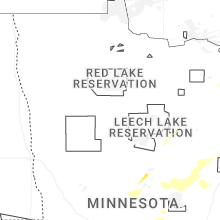

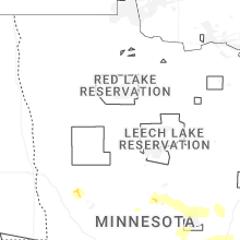


Connect with Interactive Hail Maps