

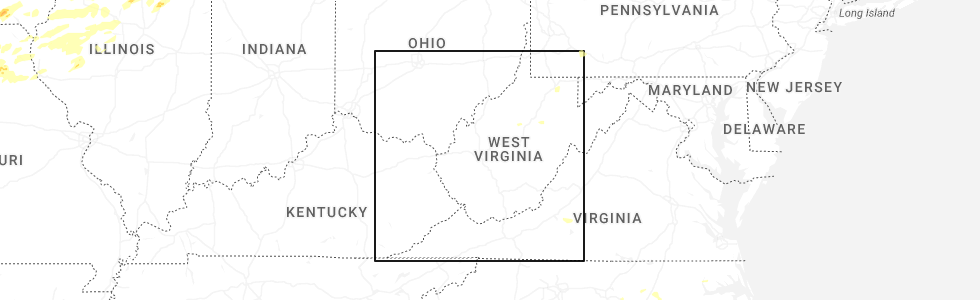
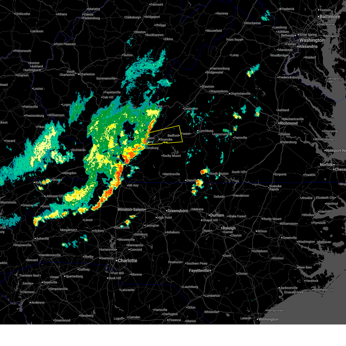
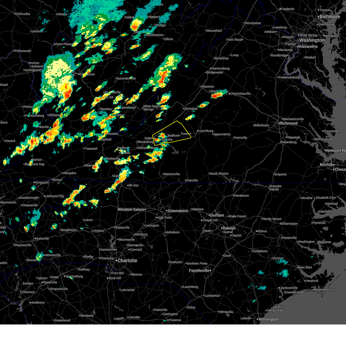
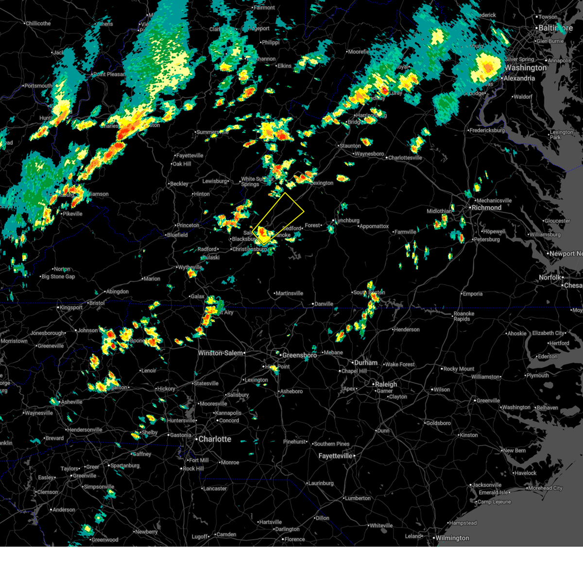
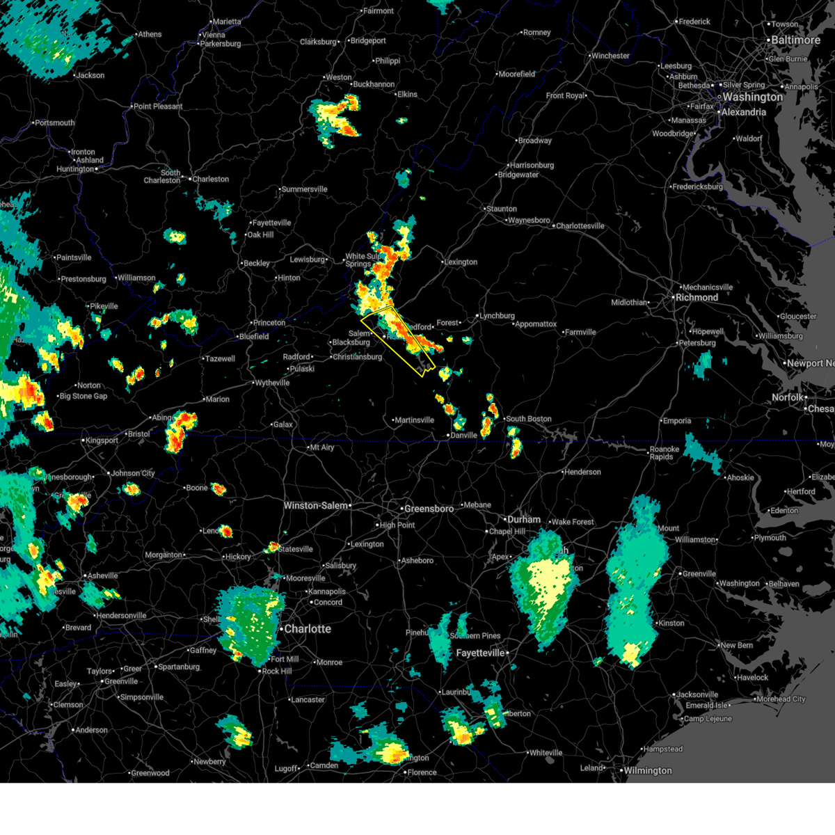
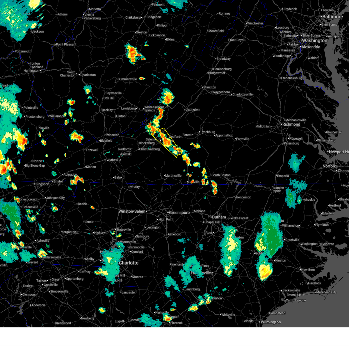
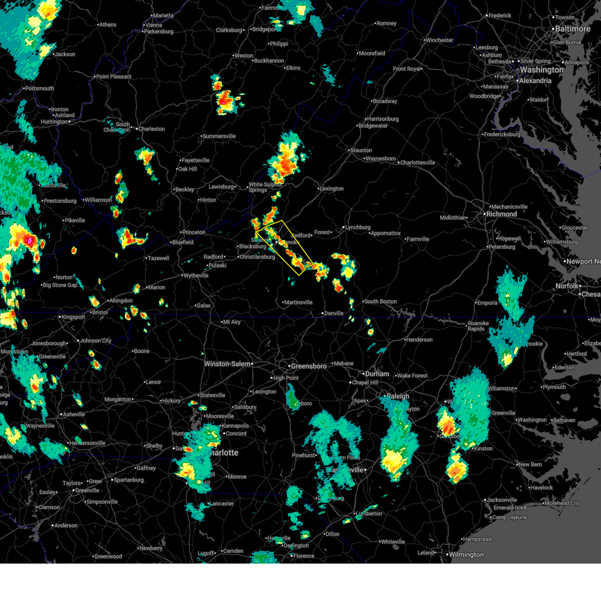
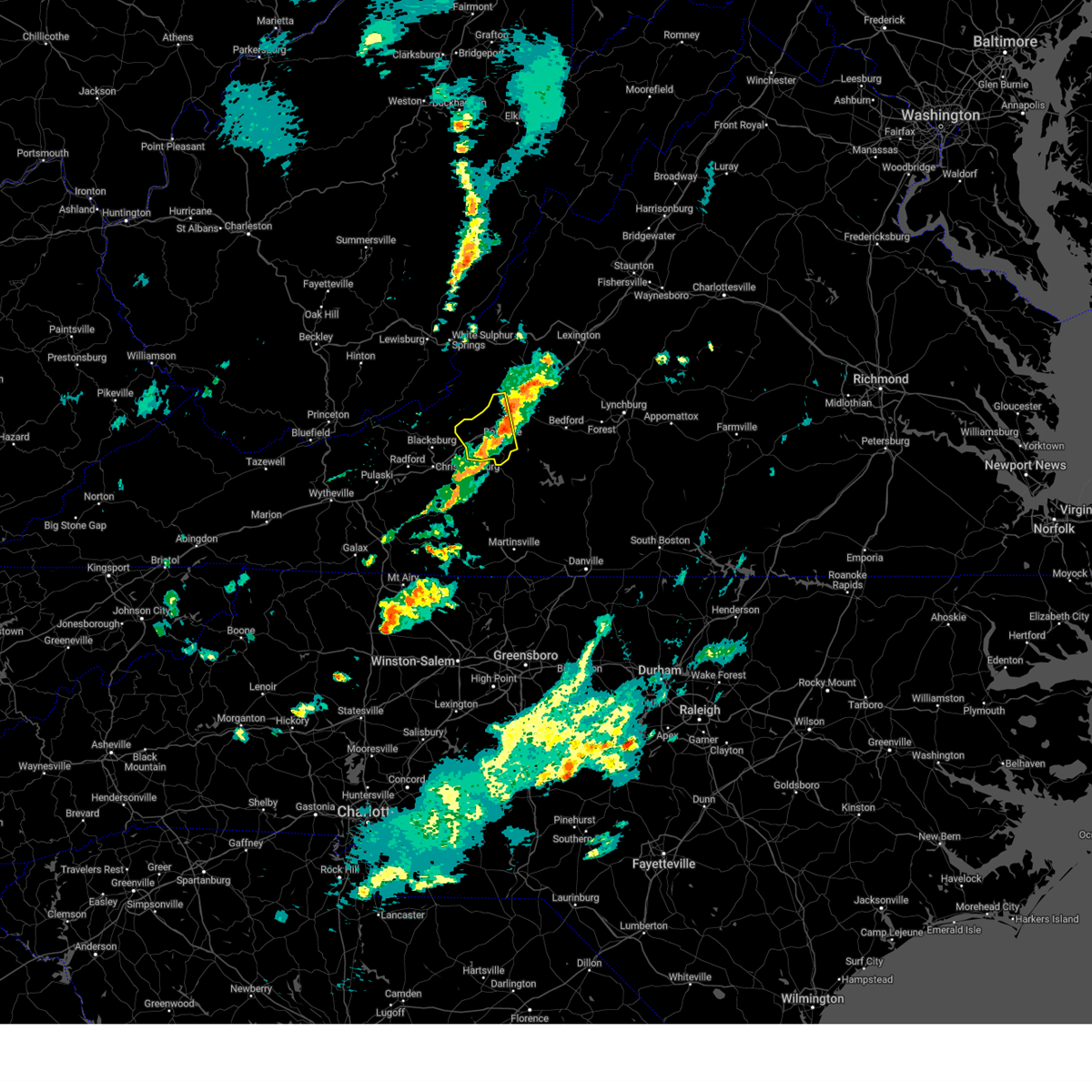
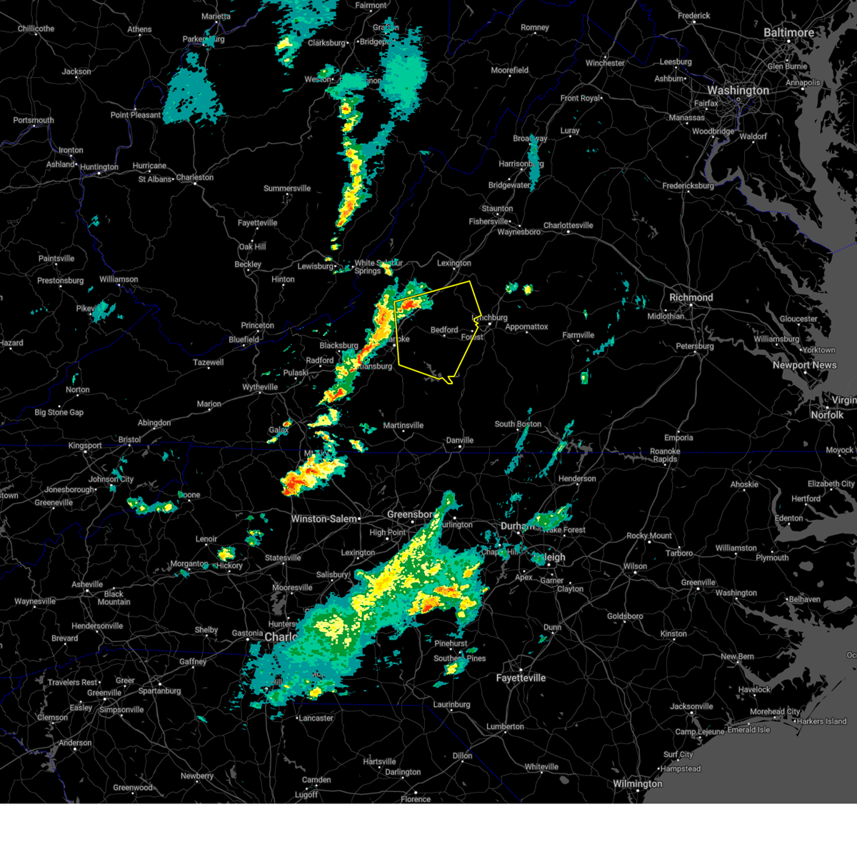
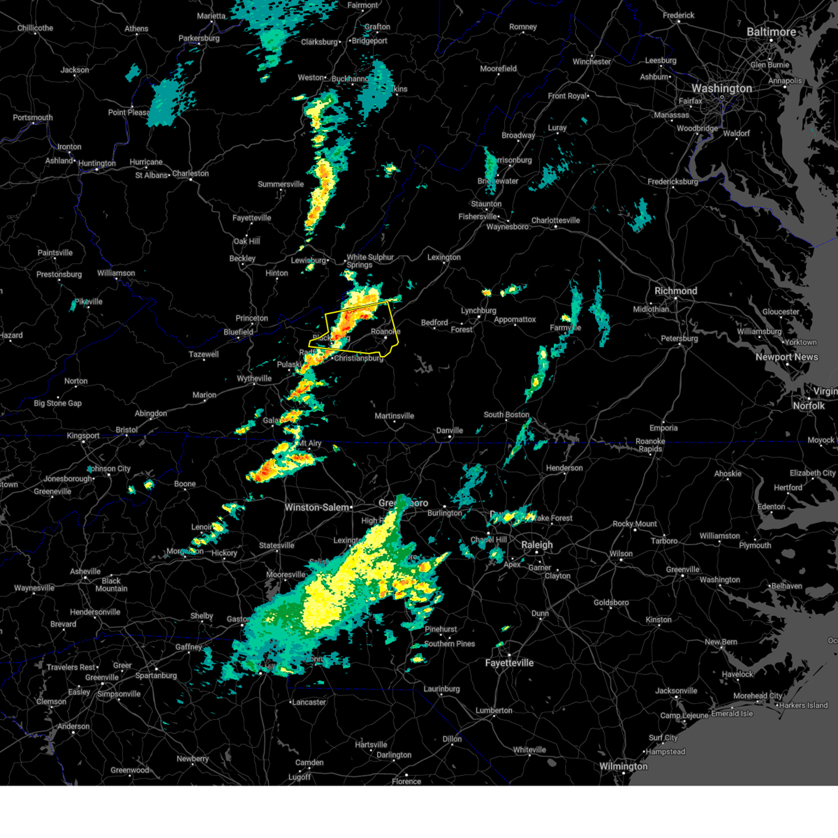
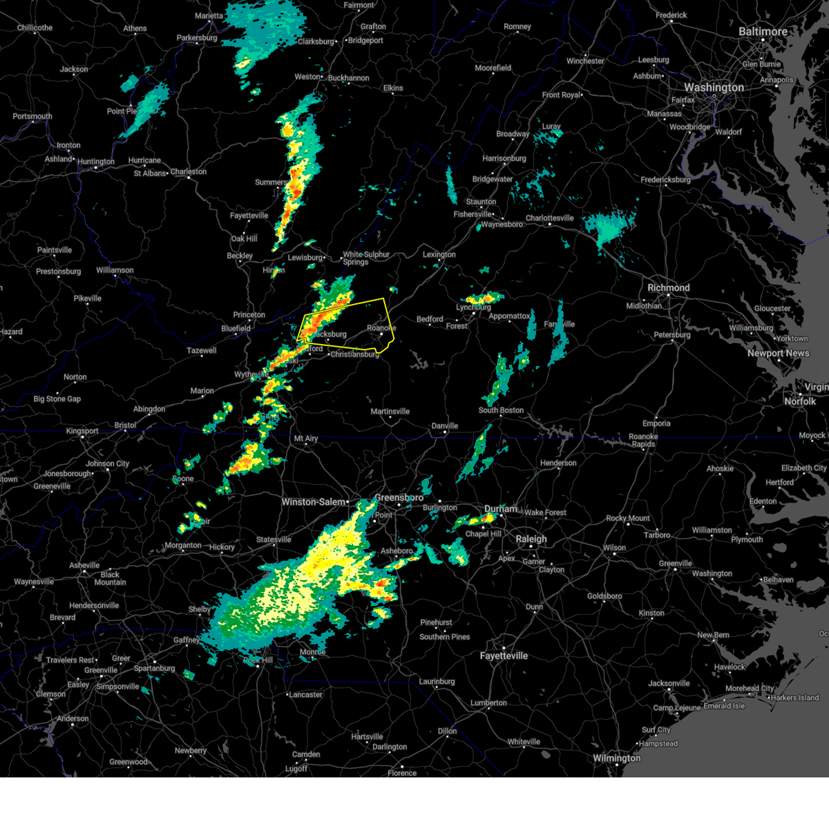
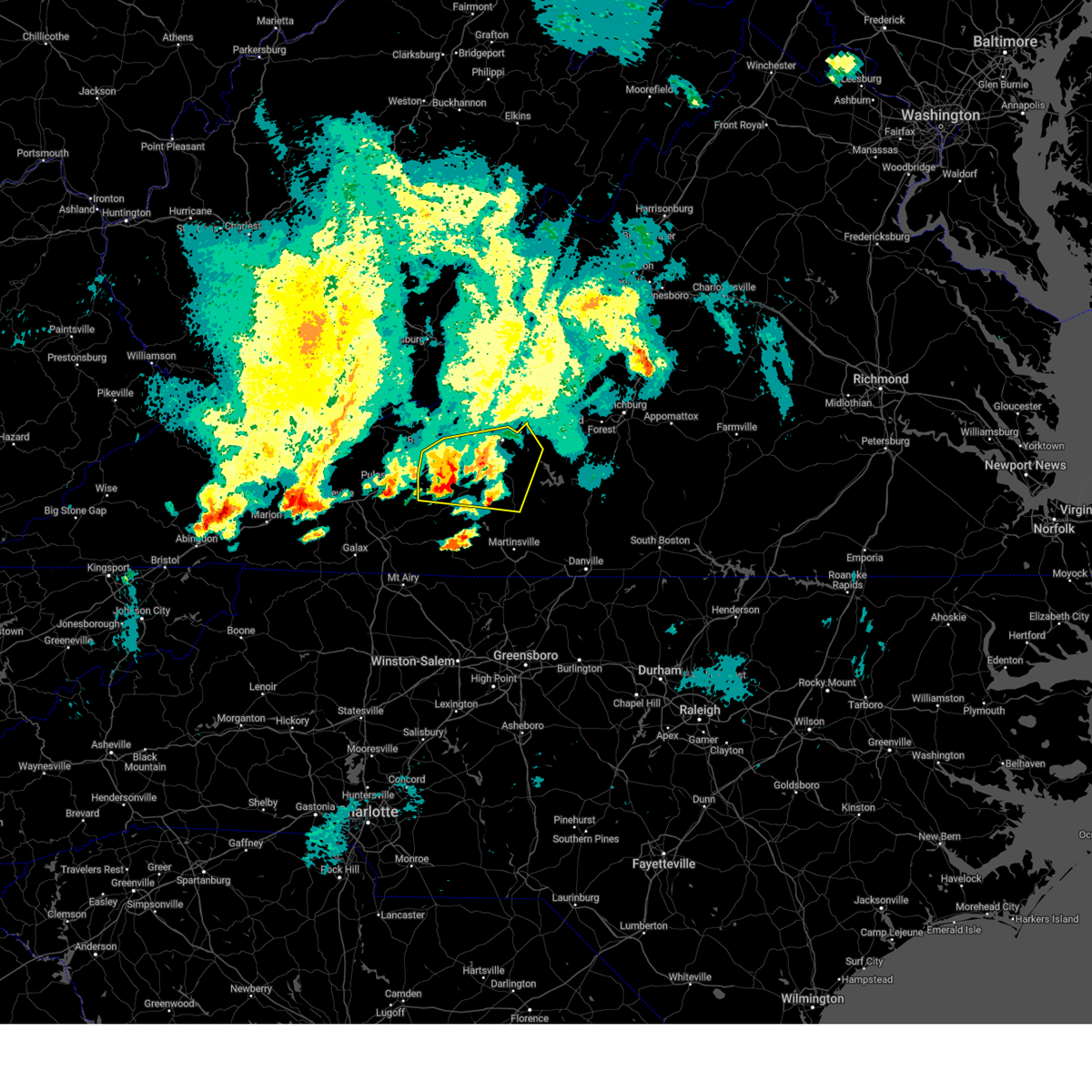
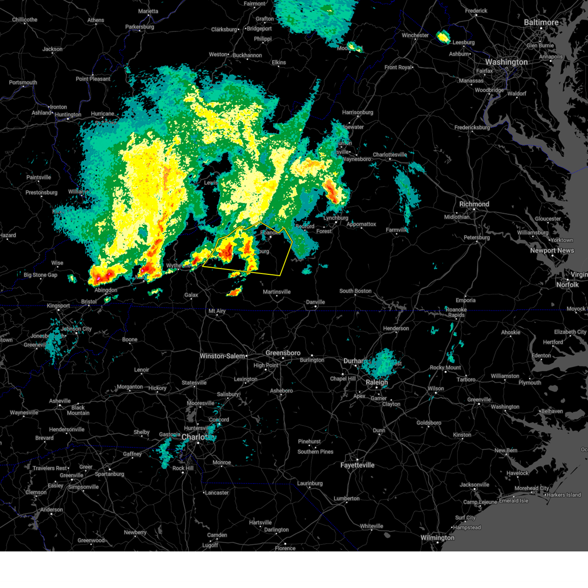
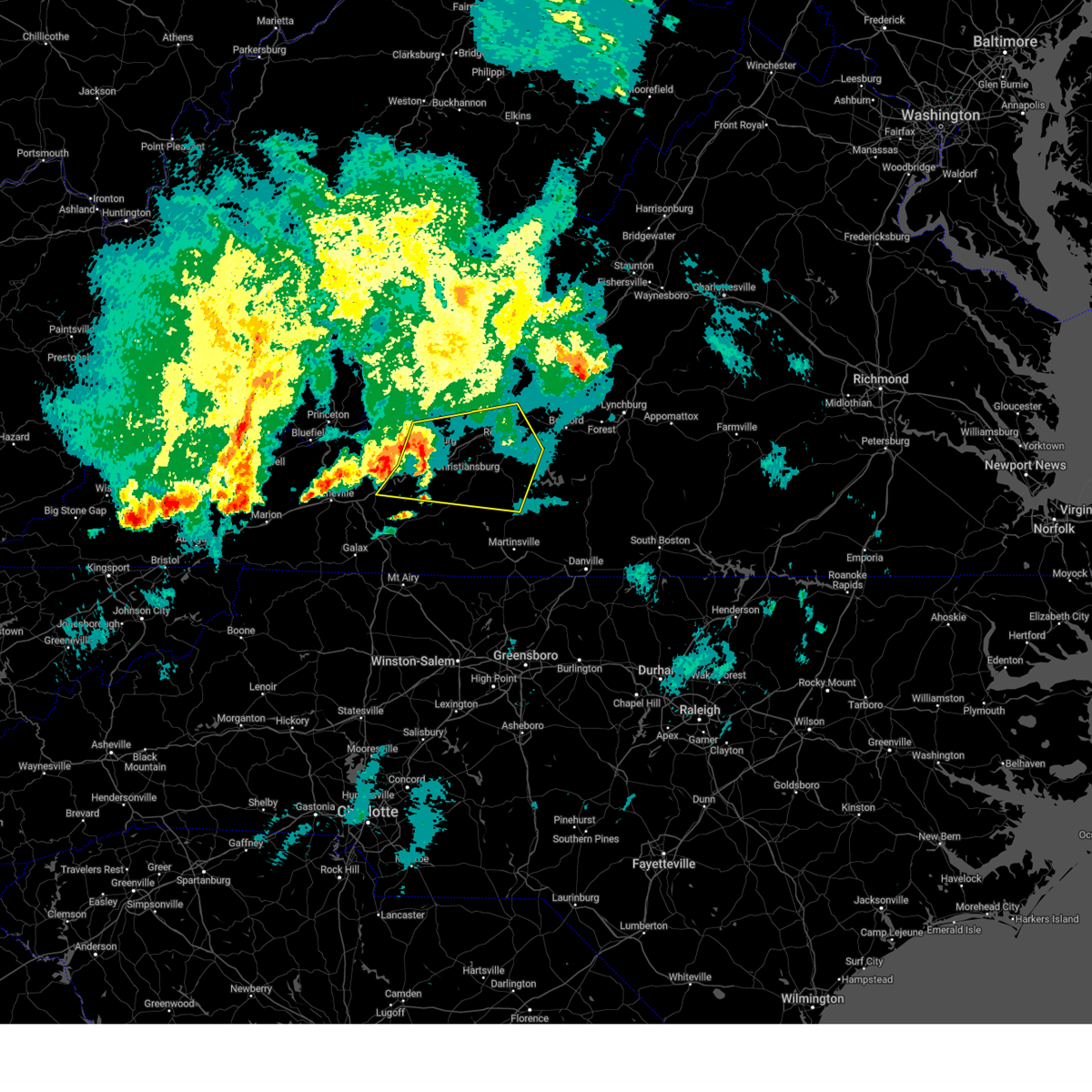
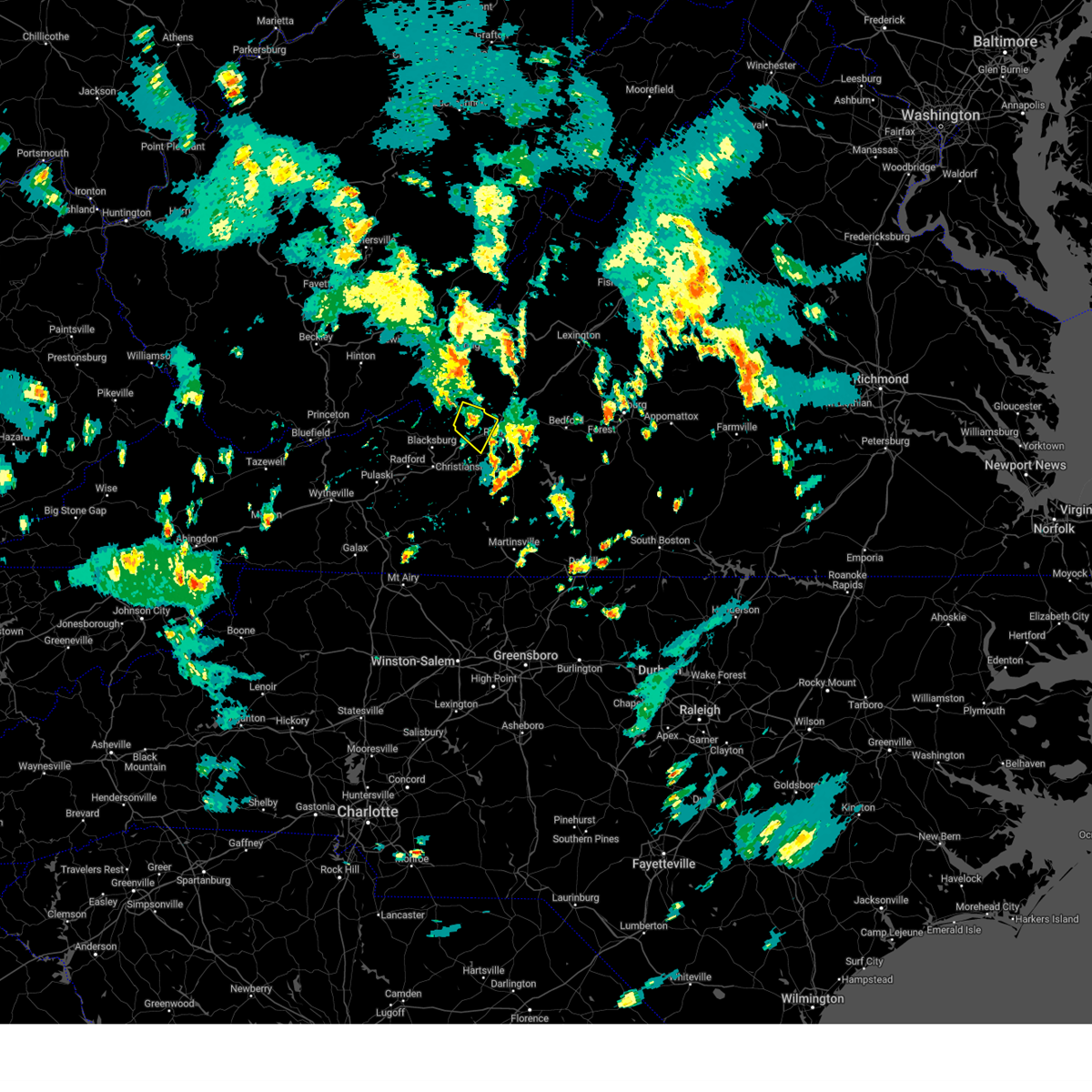
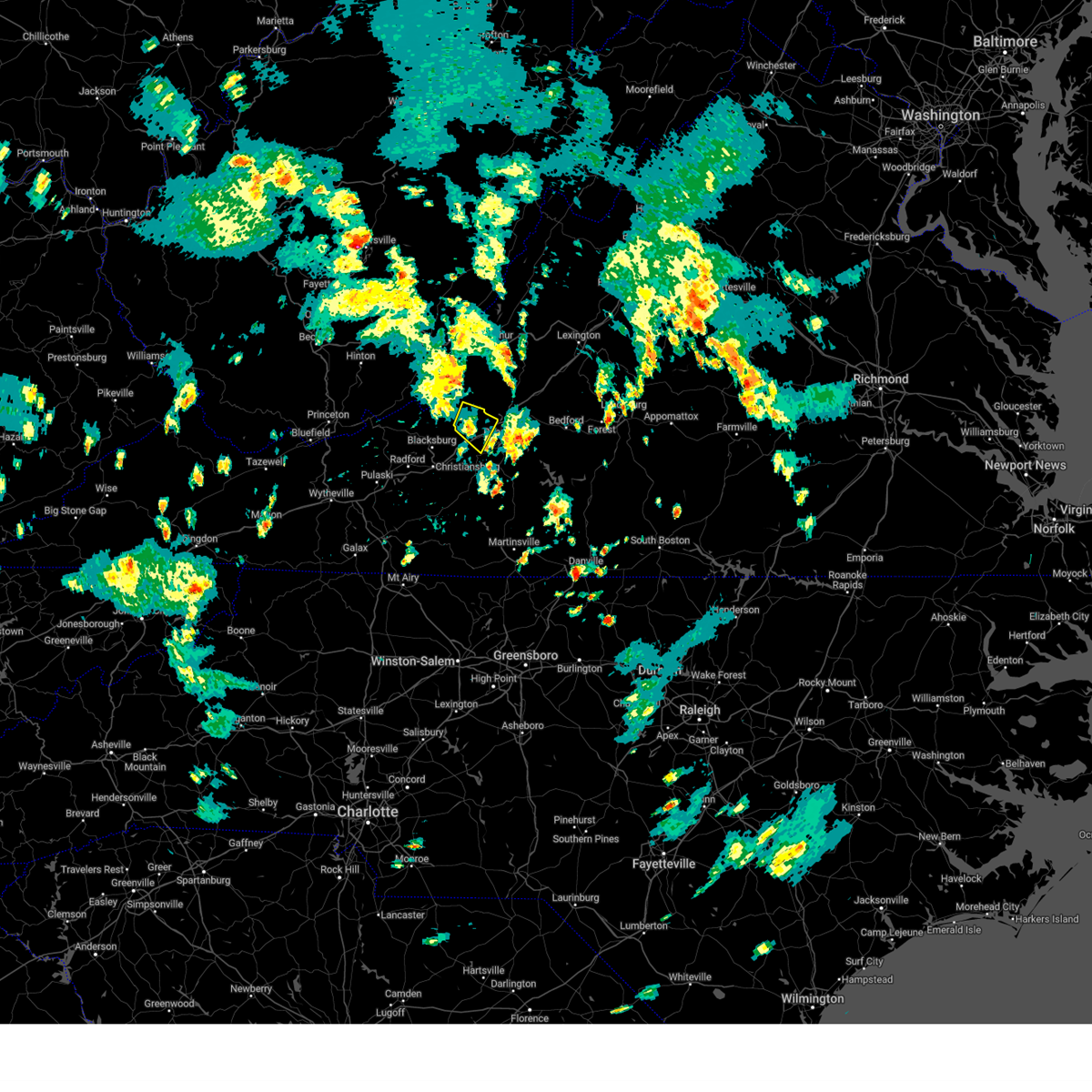
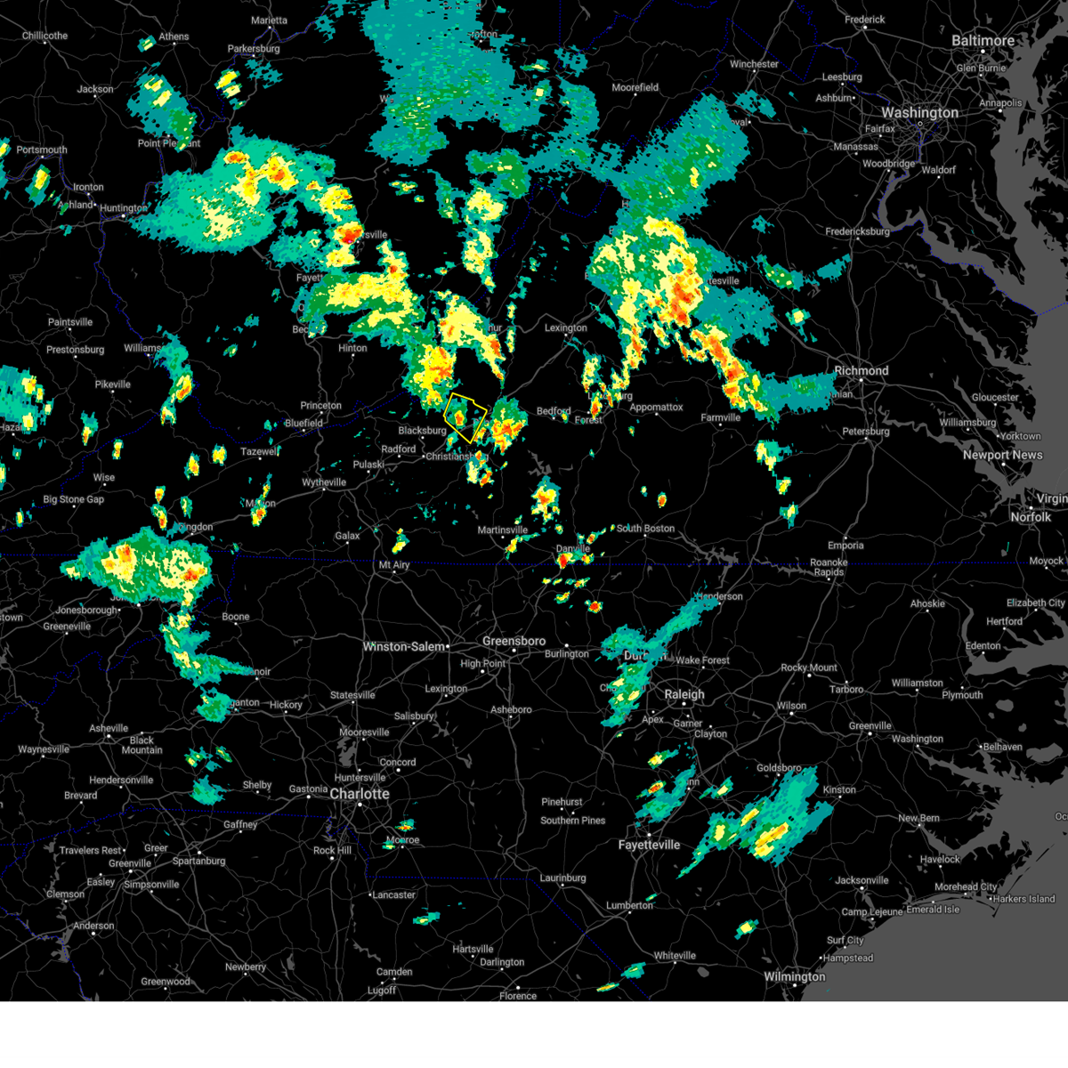
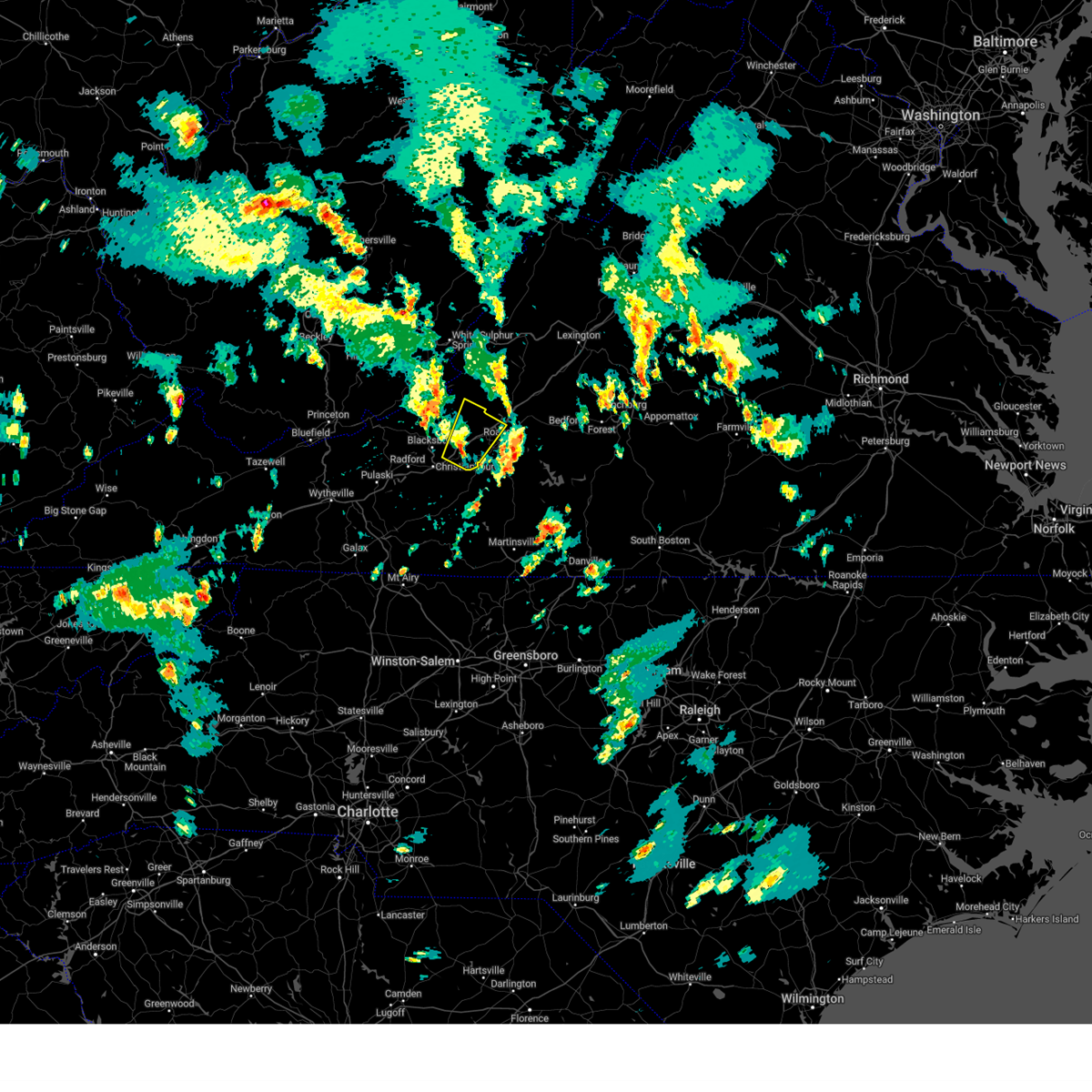
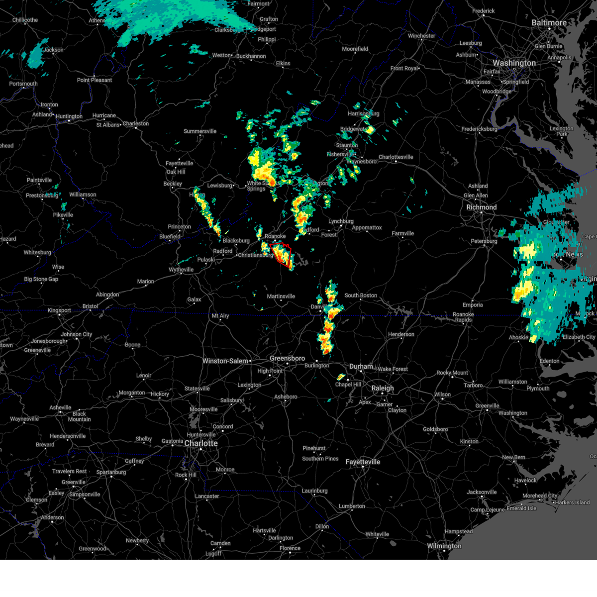
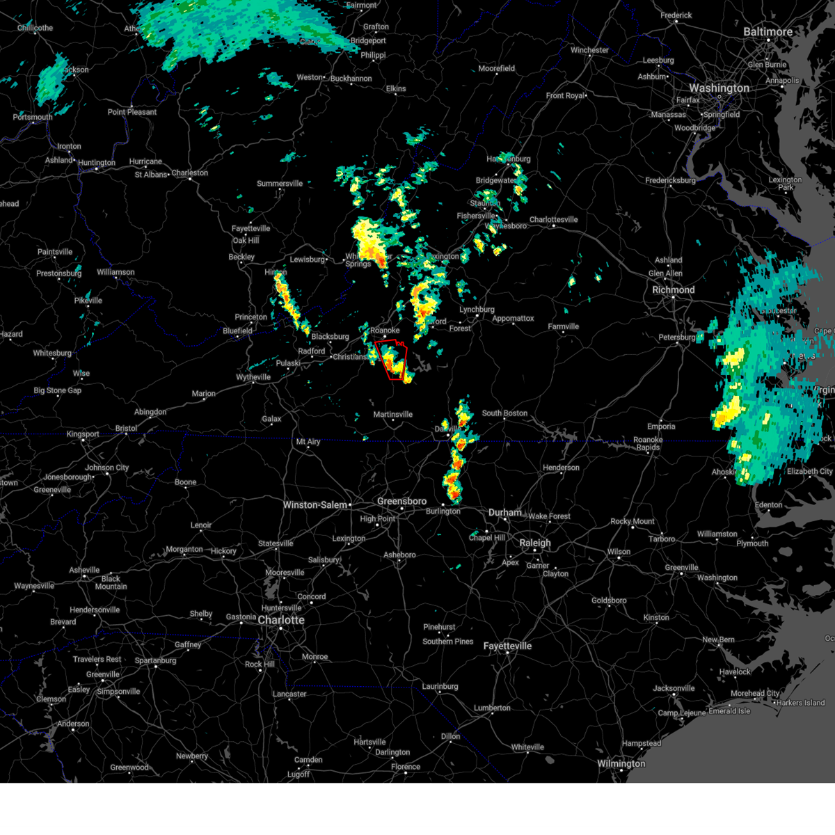
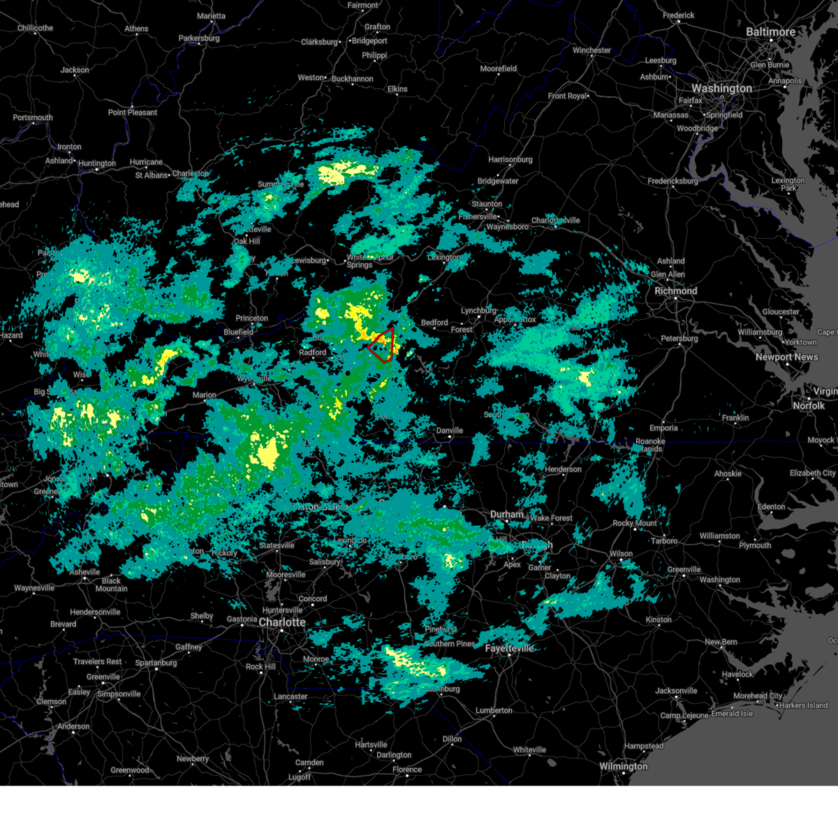
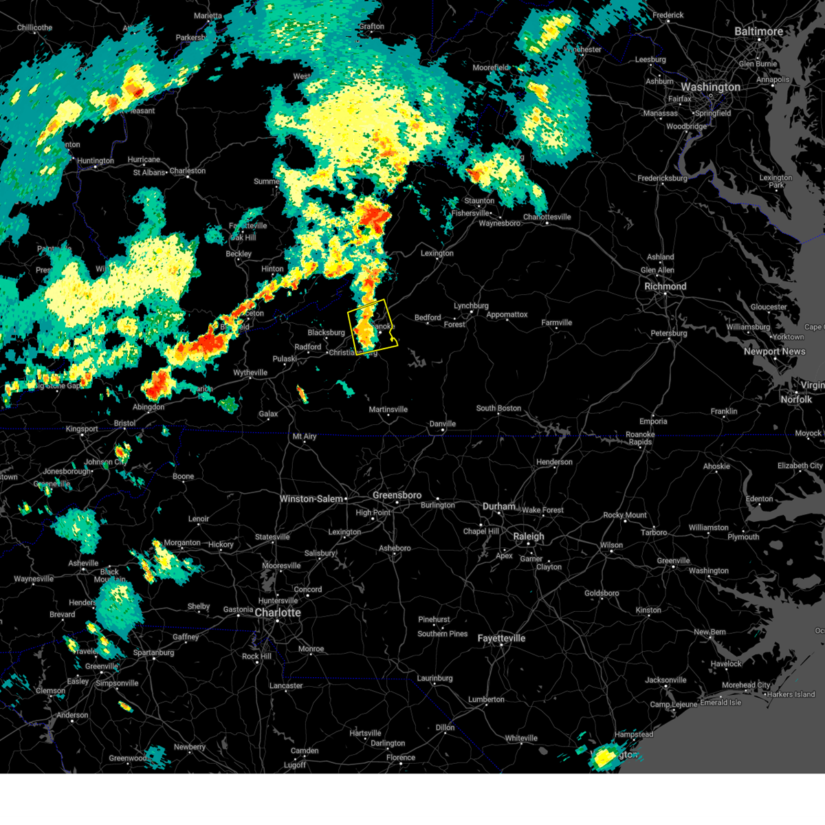
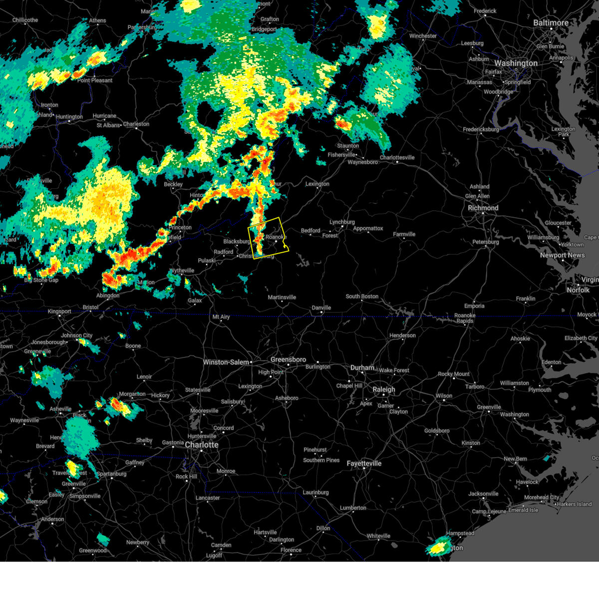
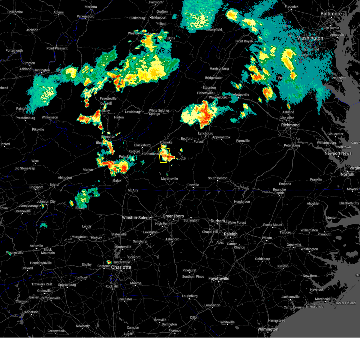
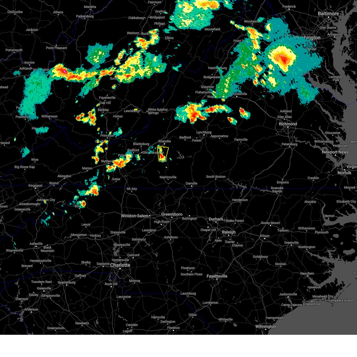
Hail Map for Roanoke, VA
The Roanoke, VA area has had 47 reports of on-the-ground hail by trained spotters, and has been under severe weather warnings 27 times during the past 12 months. Doppler radar has detected hail at or near Roanoke, VA on 79 occasions, including 7 occasions during the past year.
| Name: | Roanoke, VA |
| Where Located: | 1.5 miles WNW of Roanoke, VA |
| Map: | Google Map for Roanoke, VA |
| Population: | 97032 |
| Housing Units: | 47453 |
| More Info: | Search Google for Roanoke, VA |
0
The Top Recent Hail Date for Roanoke, VA is Thursday, June 11, 2026 (79th out of 79)
Hail and Wind Damage Spotted near Roanoke, VA
| Date / Time | Report Details |
|---|---|
| 6/22/2026 5:15 PM EDT |
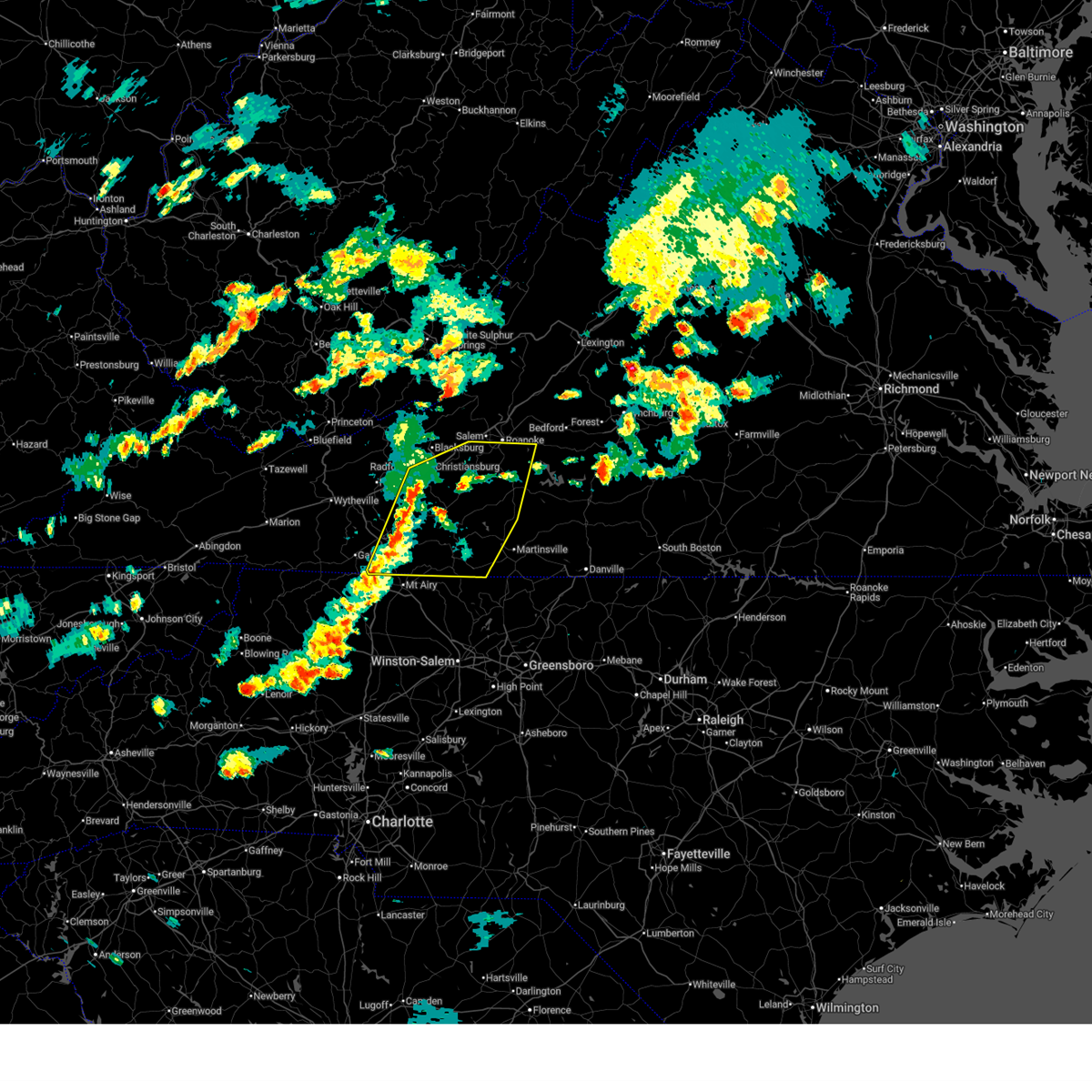 Svrrnk the national weather service in blacksburg has issued a * severe thunderstorm warning for, southern roanoke county in west central virginia, southeastern pulaski county in southwestern virginia, the central city of radford in southwestern virginia, floyd county in southwestern virginia, the southern city of roanoke in west central virginia, west central bedford county in south central virginia, carroll county in southwestern virginia, western henry county in south central virginia, franklin county in west central virginia, patrick county in southwestern virginia, southern montgomery county in southwestern virginia, * until 615 pm edt. * at 514 pm edt, severe thunderstorms were located along a line extending from near christiansburg to near dugspur to lambsburg, moving northeast at 45 mph (radar indicated). Hazards include 60 mph wind gusts. expect damage to roofs, siding, and trees Svrrnk the national weather service in blacksburg has issued a * severe thunderstorm warning for, southern roanoke county in west central virginia, southeastern pulaski county in southwestern virginia, the central city of radford in southwestern virginia, floyd county in southwestern virginia, the southern city of roanoke in west central virginia, west central bedford county in south central virginia, carroll county in southwestern virginia, western henry county in south central virginia, franklin county in west central virginia, patrick county in southwestern virginia, southern montgomery county in southwestern virginia, * until 615 pm edt. * at 514 pm edt, severe thunderstorms were located along a line extending from near christiansburg to near dugspur to lambsburg, moving northeast at 45 mph (radar indicated). Hazards include 60 mph wind gusts. expect damage to roofs, siding, and trees
|
| 6/18/2026 9:54 AM EDT | Winds from strong showers blew a tree down on whistler drive near the intersection with old mill roa in roanoke county VA, 8.6 miles NE of Roanoke, VA |
| 6/12/2026 6:29 PM EDT | Tree downed by thunderstorm winds onto a power line on 15th street n in city of roanoke county VA, 2.8 miles WSW of Roanoke, VA |
| 6/12/2026 6:29 PM EDT | Large tree downed by thunderstorm winds... blocking the entire road... and hit a nearby power pol in city of roanoke county VA, 2.6 miles W of Roanoke, VA |
| 6/12/2026 6:26 PM EDT | Power line downed by thunderstorm winds caught a nearby tree on fire on hollyhock road n in city of roanoke county VA, 3.1 miles SSW of Roanoke, VA |
| 6/12/2026 6:24 PM EDT |
 At 623 pm edt, severe thunderstorms were located along a line extending from near fincastle to near shawsville, moving east at 35 mph (radar indicated). Hazards include 60 mph wind gusts and quarter size hail. Hail damage to vehicles is expected. expect wind damage to roofs, siding, and trees. Locations impacted include, roanoke, blacksburg, salem, christiansburg, radford, vinton, and troutville. At 623 pm edt, severe thunderstorms were located along a line extending from near fincastle to near shawsville, moving east at 35 mph (radar indicated). Hazards include 60 mph wind gusts and quarter size hail. Hail damage to vehicles is expected. expect wind damage to roofs, siding, and trees. Locations impacted include, roanoke, blacksburg, salem, christiansburg, radford, vinton, and troutville.
|
| 6/12/2026 6:18 PM EDT | Tree downed by thunderstorm winds onto a power lin in city of roanoke county VA, 3.4 miles SSW of Roanoke, VA |
| 6/12/2026 5:41 PM EDT |
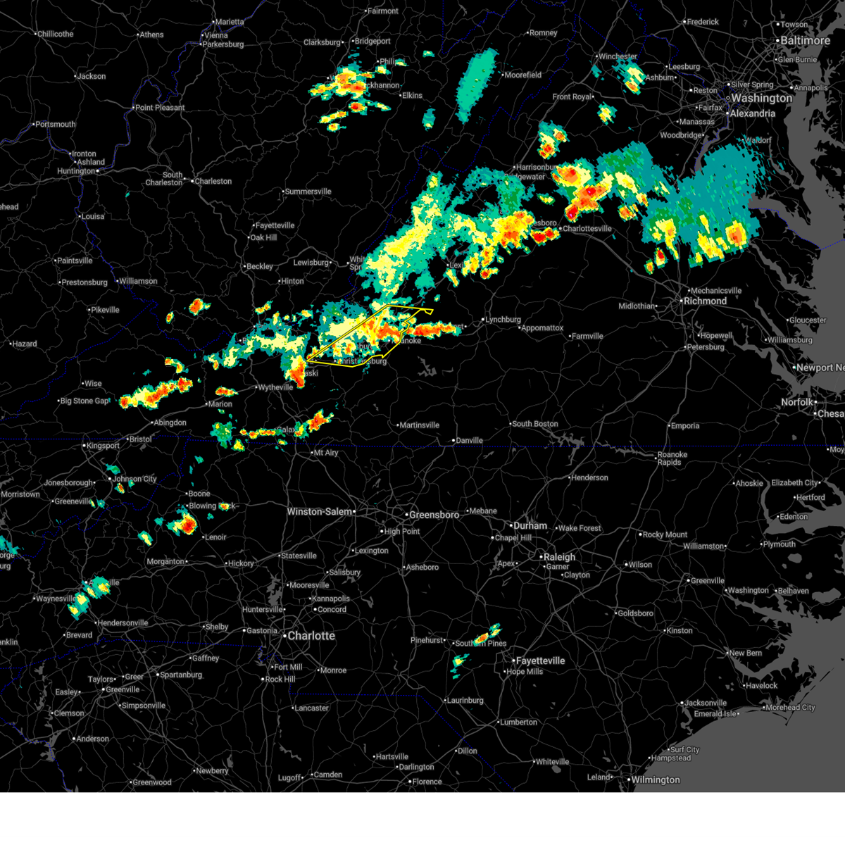
 Svrrnk the national weather service in blacksburg has issued a * severe thunderstorm warning for, roanoke county in west central virginia, northeastern pulaski county in southwestern virginia, southeastern giles county in southwestern virginia, southern craig county in southwestern virginia, the northern city of radford in southwestern virginia, the city of salem in west central virginia, the city of roanoke in west central virginia, southern botetourt county in west central virginia, montgomery county in southwestern virginia, * until 645 pm edt. * at 541 pm edt, severe thunderstorms were located along a line extending from near craig springs to poplar hill, moving east at 35 mph (radar indicated). Hazards include 60 mph wind gusts and quarter size hail. Hail damage to vehicles is expected. Expect wind damage to roofs, siding, and trees. Svrrnk the national weather service in blacksburg has issued a * severe thunderstorm warning for, roanoke county in west central virginia, northeastern pulaski county in southwestern virginia, southeastern giles county in southwestern virginia, southern craig county in southwestern virginia, the northern city of radford in southwestern virginia, the city of salem in west central virginia, the city of roanoke in west central virginia, southern botetourt county in west central virginia, montgomery county in southwestern virginia, * until 645 pm edt. * at 541 pm edt, severe thunderstorms were located along a line extending from near craig springs to poplar hill, moving east at 35 mph (radar indicated). Hazards include 60 mph wind gusts and quarter size hail. Hail damage to vehicles is expected. Expect wind damage to roofs, siding, and trees.
|
| 5/20/2026 6:00 PM EDT | Scoreboard at cave spring middle school blown down by thunderstorm winds. report via social medi in roanoke county VA, 5.4 miles NNE of Roanoke, VA |
| 4/1/2026 5:42 PM EDT |
 Svrrnk the national weather service in blacksburg has issued a * severe thunderstorm warning for, northeastern roanoke county in west central virginia, south central rockbridge county in west central virginia, the northeastern city of roanoke in west central virginia, northern bedford county in south central virginia, southern botetourt county in west central virginia, * until 645 pm edt. * at 542 pm edt, a severe thunderstorm was located over cloverdale, or near troutville, moving east at 35 mph (radar indicated). Hazards include 60 mph wind gusts and quarter size hail. Hail damage to vehicles is expected. Expect wind damage to roofs, siding, and trees. Svrrnk the national weather service in blacksburg has issued a * severe thunderstorm warning for, northeastern roanoke county in west central virginia, south central rockbridge county in west central virginia, the northeastern city of roanoke in west central virginia, northern bedford county in south central virginia, southern botetourt county in west central virginia, * until 645 pm edt. * at 542 pm edt, a severe thunderstorm was located over cloverdale, or near troutville, moving east at 35 mph (radar indicated). Hazards include 60 mph wind gusts and quarter size hail. Hail damage to vehicles is expected. Expect wind damage to roofs, siding, and trees.
|
| 9/4/2025 3:15 PM EDT |
 Svrrnk the national weather service in blacksburg has issued a * severe thunderstorm warning for, southeastern roanoke county in west central virginia, the city of buena vista in west central virginia, the city of lexington in west central virginia, southern rockbridge county in west central virginia, campbell county in central virginia, northern pittsylvania county in south central virginia, the southeastern city of roanoke in west central virginia, bedford county in south central virginia, central botetourt county in west central virginia, amherst county in central virginia, the city of lynchburg in central virginia, franklin county in west central virginia, * until 415 pm edt. * at 314 pm edt, severe thunderstorms were located along a line extending from collierstown to near chamblissburg to near ferrum, moving east at 30 mph (radar indicated). Hazards include 60 mph wind gusts. expect damage to roofs, siding, and trees Svrrnk the national weather service in blacksburg has issued a * severe thunderstorm warning for, southeastern roanoke county in west central virginia, the city of buena vista in west central virginia, the city of lexington in west central virginia, southern rockbridge county in west central virginia, campbell county in central virginia, northern pittsylvania county in south central virginia, the southeastern city of roanoke in west central virginia, bedford county in south central virginia, central botetourt county in west central virginia, amherst county in central virginia, the city of lynchburg in central virginia, franklin county in west central virginia, * until 415 pm edt. * at 314 pm edt, severe thunderstorms were located along a line extending from collierstown to near chamblissburg to near ferrum, moving east at 30 mph (radar indicated). Hazards include 60 mph wind gusts. expect damage to roofs, siding, and trees
|
| 9/4/2025 2:57 PM EDT | Power lines down on dell avenue near its intersection with ceylon street ne. time estimated from rada in city of roanoke county VA, 3.8 miles WSW of Roanoke, VA |
| 9/4/2025 2:55 PM EDT | Power line down near the intersection of herberger road nw and peters creek road nw. time estimated from rada in city of roanoke county VA, 2.9 miles SE of Roanoke, VA |
| 9/4/2025 2:55 PM EDT | Power lines down along stewart avenu in city of roanoke county VA, 2.6 miles W of Roanoke, VA |
| 9/4/2025 2:54 PM EDT | Power line down along sunrise avenu in city of roanoke county VA, 1.9 miles SSW of Roanoke, VA |
| 9/4/2025 2:51 PM EDT |
 At 251 pm edt, a severe thunderstorm was located over roanoke, moving east at 40 mph (radar indicated). Hazards include 60 mph wind gusts. Expect damage to roofs, siding, and trees. Locations impacted include, roanoke, salem, vinton, bedford, troutville, stewartsville, and montvale. At 251 pm edt, a severe thunderstorm was located over roanoke, moving east at 40 mph (radar indicated). Hazards include 60 mph wind gusts. Expect damage to roofs, siding, and trees. Locations impacted include, roanoke, salem, vinton, bedford, troutville, stewartsville, and montvale.
|
| 9/4/2025 2:51 PM EDT |
 the severe thunderstorm warning has been cancelled and is no longer in effect the severe thunderstorm warning has been cancelled and is no longer in effect
|
| 9/4/2025 2:49 PM EDT | Power lines downed on noble avenue ne near the intersection with courtland road ne. time estimated from rada in city of roanoke county VA, 1.8 miles WSW of Roanoke, VA |
| 9/4/2025 2:38 PM EDT |
 the severe thunderstorm warning has been cancelled and is no longer in effect the severe thunderstorm warning has been cancelled and is no longer in effect
|
| 9/4/2025 2:38 PM EDT |
 At 238 pm edt, a severe thunderstorm was located near pilot, moving east at 35 mph (radar indicated). Hazards include 60 mph wind gusts. Expect damage to roofs, siding, and trees. Locations impacted include, christiansburg, rocky mount, floyd, boones mill, pilot, copper hill, and shawsville. At 238 pm edt, a severe thunderstorm was located near pilot, moving east at 35 mph (radar indicated). Hazards include 60 mph wind gusts. Expect damage to roofs, siding, and trees. Locations impacted include, christiansburg, rocky mount, floyd, boones mill, pilot, copper hill, and shawsville.
|
| 9/4/2025 2:37 PM EDT |
 Svrrnk the national weather service in blacksburg has issued a * severe thunderstorm warning for, roanoke county in west central virginia, the city of salem in west central virginia, the city of roanoke in west central virginia, northwestern bedford county in south central virginia, southern botetourt county in west central virginia, northeastern montgomery county in southwestern virginia, * until 315 pm edt. * at 237 pm edt, a severe thunderstorm was located over glenvar, or near salem, moving east at 40 mph (radar indicated). Hazards include 60 mph wind gusts. expect damage to roofs, siding, and trees Svrrnk the national weather service in blacksburg has issued a * severe thunderstorm warning for, roanoke county in west central virginia, the city of salem in west central virginia, the city of roanoke in west central virginia, northwestern bedford county in south central virginia, southern botetourt county in west central virginia, northeastern montgomery county in southwestern virginia, * until 315 pm edt. * at 237 pm edt, a severe thunderstorm was located over glenvar, or near salem, moving east at 40 mph (radar indicated). Hazards include 60 mph wind gusts. expect damage to roofs, siding, and trees
|
| 9/4/2025 2:15 PM EDT |
 Svrrnk the national weather service in blacksburg has issued a * severe thunderstorm warning for, southern roanoke county in west central virginia, pulaski county in southwestern virginia, the city of radford in southwestern virginia, floyd county in southwestern virginia, east central wythe county in southwestern virginia, northeastern carroll county in southwestern virginia, western franklin county in west central virginia, southern montgomery county in southwestern virginia, * until 315 pm edt. * at 215 pm edt, a severe thunderstorm was located over claytor lake state park, or near dublin, moving east at 35 mph (radar indicated). Hazards include 60 mph wind gusts. expect damage to roofs, siding, and trees Svrrnk the national weather service in blacksburg has issued a * severe thunderstorm warning for, southern roanoke county in west central virginia, pulaski county in southwestern virginia, the city of radford in southwestern virginia, floyd county in southwestern virginia, east central wythe county in southwestern virginia, northeastern carroll county in southwestern virginia, western franklin county in west central virginia, southern montgomery county in southwestern virginia, * until 315 pm edt. * at 215 pm edt, a severe thunderstorm was located over claytor lake state park, or near dublin, moving east at 35 mph (radar indicated). Hazards include 60 mph wind gusts. expect damage to roofs, siding, and trees
|
| 7/31/2025 3:39 PM EDT |
 Svrrnk the national weather service in blacksburg has issued a * severe thunderstorm warning for, northeastern roanoke county in west central virginia, western bedford county in south central virginia, southeastern botetourt county in west central virginia, * until 415 pm edt. * at 338 pm edt, a severe thunderstorm was located over laymantown, or near troutville, moving east at 25 mph (radar indicated). Hazards include 60 mph wind gusts. expect damage to roofs, siding, and trees Svrrnk the national weather service in blacksburg has issued a * severe thunderstorm warning for, northeastern roanoke county in west central virginia, western bedford county in south central virginia, southeastern botetourt county in west central virginia, * until 415 pm edt. * at 338 pm edt, a severe thunderstorm was located over laymantown, or near troutville, moving east at 25 mph (radar indicated). Hazards include 60 mph wind gusts. expect damage to roofs, siding, and trees
|
| 7/18/2025 3:28 PM EDT |
 Svrrnk the national weather service in blacksburg has issued a * severe thunderstorm warning for, northeastern roanoke county in west central virginia, the northeastern city of roanoke in west central virginia, southwestern bedford county in south central virginia, south central botetourt county in west central virginia, * until 415 pm edt. * at 328 pm edt, a severe thunderstorm was located over laymantown, or near vinton, moving east at 15 mph (radar indicated). Hazards include 60 mph wind gusts. expect damage to roofs, siding, and trees Svrrnk the national weather service in blacksburg has issued a * severe thunderstorm warning for, northeastern roanoke county in west central virginia, the northeastern city of roanoke in west central virginia, southwestern bedford county in south central virginia, south central botetourt county in west central virginia, * until 415 pm edt. * at 328 pm edt, a severe thunderstorm was located over laymantown, or near vinton, moving east at 15 mph (radar indicated). Hazards include 60 mph wind gusts. expect damage to roofs, siding, and trees
|
| 7/13/2025 7:56 PM EDT | Tree and large branches and limbs downed by thunderstorm winds in the 6300 block of jubal early highwa in franklin county VA, 7.7 miles NW of Roanoke, VA |
| 7/13/2025 7:23 PM EDT |
 Svrrnk the national weather service in blacksburg has issued a * severe thunderstorm warning for, southeastern roanoke county in west central virginia, northwestern pittsylvania county in south central virginia, southwestern bedford county in south central virginia, northeastern franklin county in west central virginia, * until 830 pm edt. * at 722 pm edt, a severe thunderstorm was located near burnt chimney, or 8 miles south of stewartsville, moving east at 10 mph (radar indicated). Hazards include 60 mph wind gusts. expect damage to roofs, siding, and trees Svrrnk the national weather service in blacksburg has issued a * severe thunderstorm warning for, southeastern roanoke county in west central virginia, northwestern pittsylvania county in south central virginia, southwestern bedford county in south central virginia, northeastern franklin county in west central virginia, * until 830 pm edt. * at 722 pm edt, a severe thunderstorm was located near burnt chimney, or 8 miles south of stewartsville, moving east at 10 mph (radar indicated). Hazards include 60 mph wind gusts. expect damage to roofs, siding, and trees
|
| 7/13/2025 7:16 PM EDT | Tree down across jubal early highway in hardy of franklin count in franklin county VA, 8.5 miles NW of Roanoke, VA |
| 7/13/2025 7:00 PM EDT | A large tree was blown down near the 6500 block of jubal early highway by thunderstorm wind in franklin county VA, 8.5 miles NW of Roanoke, VA |
| 7/13/2025 6:32 PM EDT | Tree down across hollins roa in roanoke county VA, 4.8 miles SSW of Roanoke, VA |
| 7/9/2025 1:22 PM EDT |
 Svrrnk the national weather service in blacksburg has issued a * severe thunderstorm warning for, eastern roanoke county in west central virginia, the city of salem in west central virginia, the city of roanoke in west central virginia, central bedford county in south central virginia, southern botetourt county in west central virginia, * until 230 pm edt. * at 122 pm edt, severe thunderstorms were located along a line extending from near laymantown to near cave spring, moving east at 30 mph (radar indicated). Hazards include 60 mph wind gusts and quarter size hail. Hail damage to vehicles is expected. Expect wind damage to roofs, siding, and trees. Svrrnk the national weather service in blacksburg has issued a * severe thunderstorm warning for, eastern roanoke county in west central virginia, the city of salem in west central virginia, the city of roanoke in west central virginia, central bedford county in south central virginia, southern botetourt county in west central virginia, * until 230 pm edt. * at 122 pm edt, severe thunderstorms were located along a line extending from near laymantown to near cave spring, moving east at 30 mph (radar indicated). Hazards include 60 mph wind gusts and quarter size hail. Hail damage to vehicles is expected. Expect wind damage to roofs, siding, and trees.
|
| 7/9/2025 12:59 PM EDT | Thunderstorm winds blew multiple power lines down near the intersection of 29th street and avenham avenu in city of roanoke county VA, 2.6 miles N of Roanoke, VA |
| 7/8/2025 8:16 PM EDT |
 Svrrnk the national weather service in blacksburg has issued a * severe thunderstorm warning for, northeastern roanoke county in west central virginia, the city of salem in west central virginia, the city of roanoke in west central virginia, west central bedford county in south central virginia, southwestern botetourt county in west central virginia, * until 915 pm edt. * at 816 pm edt, a severe thunderstorm was located over roanoke, moving northeast at 15 mph (radar indicated). Hazards include 60 mph wind gusts and quarter size hail. Hail damage to vehicles is expected. Expect wind damage to roofs, siding, and trees. Svrrnk the national weather service in blacksburg has issued a * severe thunderstorm warning for, northeastern roanoke county in west central virginia, the city of salem in west central virginia, the city of roanoke in west central virginia, west central bedford county in south central virginia, southwestern botetourt county in west central virginia, * until 915 pm edt. * at 816 pm edt, a severe thunderstorm was located over roanoke, moving northeast at 15 mph (radar indicated). Hazards include 60 mph wind gusts and quarter size hail. Hail damage to vehicles is expected. Expect wind damage to roofs, siding, and trees.
|
| 7/1/2025 3:41 PM EDT |
 the severe thunderstorm warning has been cancelled and is no longer in effect the severe thunderstorm warning has been cancelled and is no longer in effect
|
| 7/1/2025 3:30 PM EDT |
 the severe thunderstorm warning has been cancelled and is no longer in effect the severe thunderstorm warning has been cancelled and is no longer in effect
|
| 7/1/2025 3:30 PM EDT |
 At 330 pm edt, a severe thunderstorm was located over troutville, moving northeast at 25 mph (radar indicated). Hazards include 60 mph wind gusts. Expect damage to roofs, siding, and trees. Locations impacted include, roanoke, vinton, buchanan, troutville, montvale, eagle rock, and fincastle. At 330 pm edt, a severe thunderstorm was located over troutville, moving northeast at 25 mph (radar indicated). Hazards include 60 mph wind gusts. Expect damage to roofs, siding, and trees. Locations impacted include, roanoke, vinton, buchanan, troutville, montvale, eagle rock, and fincastle.
|
| 7/1/2025 3:02 PM EDT |
 Svrrnk the national weather service in blacksburg has issued a * severe thunderstorm warning for, central roanoke county in west central virginia, the city of salem in west central virginia, the city of roanoke in west central virginia, northwestern bedford county in south central virginia, southern botetourt county in west central virginia, * until 400 pm edt. * at 302 pm edt, a severe thunderstorm was located over salem, moving northeast at 25 mph (radar indicated). Hazards include 60 mph wind gusts. expect damage to roofs, siding, and trees Svrrnk the national weather service in blacksburg has issued a * severe thunderstorm warning for, central roanoke county in west central virginia, the city of salem in west central virginia, the city of roanoke in west central virginia, northwestern bedford county in south central virginia, southern botetourt county in west central virginia, * until 400 pm edt. * at 302 pm edt, a severe thunderstorm was located over salem, moving northeast at 25 mph (radar indicated). Hazards include 60 mph wind gusts. expect damage to roofs, siding, and trees
|
| 6/28/2025 8:21 PM EDT |
 The storm which prompted the warning has weakened below severe limits, and no longer poses an immediate threat to life or property. therefore, the warning will be allowed to expire. however, gusty winds and heavy rain are still possible with this thunderstorm. The storm which prompted the warning has weakened below severe limits, and no longer poses an immediate threat to life or property. therefore, the warning will be allowed to expire. however, gusty winds and heavy rain are still possible with this thunderstorm.
|
| 6/28/2025 8:12 PM EDT |
 the severe thunderstorm warning has been cancelled and is no longer in effect the severe thunderstorm warning has been cancelled and is no longer in effect
|
| 6/28/2025 8:12 PM EDT |
 At 811 pm edt, a severe thunderstorm was located over hollins, or near roanoke, moving east at 10 mph (radar indicated). Hazards include 60 mph wind gusts. Expect damage to roofs, siding, and trees. Locations impacted include, roanoke, salem, vinton, troutville, nace, laymantown, and daleville. At 811 pm edt, a severe thunderstorm was located over hollins, or near roanoke, moving east at 10 mph (radar indicated). Hazards include 60 mph wind gusts. Expect damage to roofs, siding, and trees. Locations impacted include, roanoke, salem, vinton, troutville, nace, laymantown, and daleville.
|
| 6/28/2025 7:58 PM EDT | A 73 mph gust was measured at the roanoke-blacksburg regional airpor in city of roanoke county VA, 3.8 miles S of Roanoke, VA |
| 6/28/2025 7:46 PM EDT | Power lines down in the 4000 block of kentucky avenue. time estimated from rada in city of roanoke county VA, 2.4 miles SE of Roanoke, VA |
| 6/28/2025 7:41 PM EDT |
 Svrrnk the national weather service in blacksburg has issued a * severe thunderstorm warning for, northeastern roanoke county in west central virginia, southeastern craig county in southwestern virginia, the city of salem in west central virginia, the city of roanoke in west central virginia, southwestern botetourt county in west central virginia, * until 830 pm edt. * at 741 pm edt, a severe thunderstorm was located near catawba, moving east at 15 mph (radar indicated). Hazards include 60 mph wind gusts. expect damage to roofs, siding, and trees Svrrnk the national weather service in blacksburg has issued a * severe thunderstorm warning for, northeastern roanoke county in west central virginia, southeastern craig county in southwestern virginia, the city of salem in west central virginia, the city of roanoke in west central virginia, southwestern botetourt county in west central virginia, * until 830 pm edt. * at 741 pm edt, a severe thunderstorm was located near catawba, moving east at 15 mph (radar indicated). Hazards include 60 mph wind gusts. expect damage to roofs, siding, and trees
|
| 6/27/2025 8:13 PM EDT |
 The storm which prompted the warning has moved out of the area. therefore, the warning will be allowed to expire. however, gusty winds are still possible with this thunderstorm. remember, a severe thunderstorm warning still remains in effect for western bedford and southern botetourt counties until 9:15 pm edt!. The storm which prompted the warning has moved out of the area. therefore, the warning will be allowed to expire. however, gusty winds are still possible with this thunderstorm. remember, a severe thunderstorm warning still remains in effect for western bedford and southern botetourt counties until 9:15 pm edt!.
|
| 6/27/2025 7:46 PM EDT |
 At 746 pm edt, a severe thunderstorm was located over vinton, moving northwest at 20 mph (radar indicated). Hazards include 60 mph wind gusts. Expect damage to roofs, siding, and trees. Locations impacted include, roanoke, salem, vinton, troutville, stewartsville, moneta, and catawba. At 746 pm edt, a severe thunderstorm was located over vinton, moving northwest at 20 mph (radar indicated). Hazards include 60 mph wind gusts. Expect damage to roofs, siding, and trees. Locations impacted include, roanoke, salem, vinton, troutville, stewartsville, moneta, and catawba.
|
| 6/27/2025 7:36 PM EDT | Tree downed by thunderstorm winds on shadwell drive near tinker cree in roanoke county VA, 5.5 miles SSW of Roanoke, VA |
| 6/27/2025 7:20 PM EDT |
 Svrrnk the national weather service in blacksburg has issued a * severe thunderstorm warning for, central roanoke county in west central virginia, the city of salem in west central virginia, the city of roanoke in west central virginia, southwestern bedford county in south central virginia, southwestern botetourt county in west central virginia, northeastern franklin county in west central virginia, * until 815 pm edt. * at 719 pm edt, a severe thunderstorm was located near northwest smith mountain lake, or near stewartsville, moving northwest at 20 mph (radar indicated). Hazards include 60 mph wind gusts and quarter size hail. Hail damage to vehicles is expected. Expect wind damage to roofs, siding, and trees. Svrrnk the national weather service in blacksburg has issued a * severe thunderstorm warning for, central roanoke county in west central virginia, the city of salem in west central virginia, the city of roanoke in west central virginia, southwestern bedford county in south central virginia, southwestern botetourt county in west central virginia, northeastern franklin county in west central virginia, * until 815 pm edt. * at 719 pm edt, a severe thunderstorm was located near northwest smith mountain lake, or near stewartsville, moving northwest at 20 mph (radar indicated). Hazards include 60 mph wind gusts and quarter size hail. Hail damage to vehicles is expected. Expect wind damage to roofs, siding, and trees.
|
| 5/30/2025 3:40 PM EDT | Powerlines down on morehead av in city of roanoke county VA, 2.8 miles WNW of Roanoke, VA |
| 5/30/2025 3:37 PM EDT |
 At 337 pm edt, a severe thunderstorm was located over cave spring, or over salem, moving east at 35 mph (radar indicated). Hazards include 60 mph wind gusts. Expect damage to roofs, siding, and trees. Locations impacted include, roanoke, salem, vinton, catawba, glenvar, daleville, and hollins. At 337 pm edt, a severe thunderstorm was located over cave spring, or over salem, moving east at 35 mph (radar indicated). Hazards include 60 mph wind gusts. Expect damage to roofs, siding, and trees. Locations impacted include, roanoke, salem, vinton, catawba, glenvar, daleville, and hollins.
|
| 5/30/2025 3:37 PM EDT |
 the severe thunderstorm warning has been cancelled and is no longer in effect the severe thunderstorm warning has been cancelled and is no longer in effect
|
| 5/30/2025 3:35 PM EDT | Tree snapped on larkview circl in city of roanoke county VA, 2.1 miles ENE of Roanoke, VA |
| 5/30/2025 3:28 PM EDT |
 Svrrnk the national weather service in blacksburg has issued a * severe thunderstorm warning for, east central roanoke county in west central virginia, southwestern rockbridge county in west central virginia, the northeastern city of roanoke in west central virginia, bedford county in south central virginia, southern botetourt county in west central virginia, west central amherst county in central virginia, northeastern franklin county in west central virginia, * until 445 pm edt. * at 328 pm edt, a severe thunderstorm was located over springwood, or near buchanan, moving east at 20 mph (radar indicated). Hazards include 60 mph wind gusts. expect damage to roofs, siding, and trees Svrrnk the national weather service in blacksburg has issued a * severe thunderstorm warning for, east central roanoke county in west central virginia, southwestern rockbridge county in west central virginia, the northeastern city of roanoke in west central virginia, bedford county in south central virginia, southern botetourt county in west central virginia, west central amherst county in central virginia, northeastern franklin county in west central virginia, * until 445 pm edt. * at 328 pm edt, a severe thunderstorm was located over springwood, or near buchanan, moving east at 20 mph (radar indicated). Hazards include 60 mph wind gusts. expect damage to roofs, siding, and trees
|
| 5/30/2025 3:08 PM EDT |
 the severe thunderstorm warning has been cancelled and is no longer in effect the severe thunderstorm warning has been cancelled and is no longer in effect
|
| 5/30/2025 3:08 PM EDT |
 At 308 pm edt, a severe thunderstorm was located over mc donalds mill, or 7 miles northeast of blacksburg, moving east at 35 mph (radar indicated). Hazards include 60 mph wind gusts. Expect damage to roofs, siding, and trees. Locations impacted include, roanoke, blacksburg, salem, vinton, sinking creek, catawba, and shawsville. At 308 pm edt, a severe thunderstorm was located over mc donalds mill, or 7 miles northeast of blacksburg, moving east at 35 mph (radar indicated). Hazards include 60 mph wind gusts. Expect damage to roofs, siding, and trees. Locations impacted include, roanoke, blacksburg, salem, vinton, sinking creek, catawba, and shawsville.
|
| 5/30/2025 2:46 PM EDT |
 Svrrnk the national weather service in blacksburg has issued a * severe thunderstorm warning for, roanoke county in west central virginia, southeastern giles county in southwestern virginia, southern craig county in southwestern virginia, the city of salem in west central virginia, the city of roanoke in west central virginia, southwestern botetourt county in west central virginia, northern montgomery county in southwestern virginia, * until 345 pm edt. * at 246 pm edt, a severe thunderstorm was located over newport, moving east at 35 mph (radar indicated). Hazards include 60 mph wind gusts. expect damage to roofs, siding, and trees Svrrnk the national weather service in blacksburg has issued a * severe thunderstorm warning for, roanoke county in west central virginia, southeastern giles county in southwestern virginia, southern craig county in southwestern virginia, the city of salem in west central virginia, the city of roanoke in west central virginia, southwestern botetourt county in west central virginia, northern montgomery county in southwestern virginia, * until 345 pm edt. * at 246 pm edt, a severe thunderstorm was located over newport, moving east at 35 mph (radar indicated). Hazards include 60 mph wind gusts. expect damage to roofs, siding, and trees
|
| 5/16/2025 3:30 PM EDT |
 At 330 pm edt, a severe thunderstorm was located over crockett springs, or near shawsville, moving east at 50 mph (radar indicated). Hazards include 70 mph wind gusts and quarter size hail. Hail damage to vehicles is expected. expect considerable tree damage. wind damage is also likely to mobile homes, roofs, and outbuildings. Locations impacted include, roanoke, blacksburg, salem, christiansburg, vinton, rocky mount, and boones mill. At 330 pm edt, a severe thunderstorm was located over crockett springs, or near shawsville, moving east at 50 mph (radar indicated). Hazards include 70 mph wind gusts and quarter size hail. Hail damage to vehicles is expected. expect considerable tree damage. wind damage is also likely to mobile homes, roofs, and outbuildings. Locations impacted include, roanoke, blacksburg, salem, christiansburg, vinton, rocky mount, and boones mill.
|
| 5/16/2025 3:30 PM EDT |
 the severe thunderstorm warning has been cancelled and is no longer in effect the severe thunderstorm warning has been cancelled and is no longer in effect
|
| 5/16/2025 3:22 PM EDT |
 At 321 pm edt, a severe thunderstorm was located near christiansburg, moving east at 55 mph (mesonet observation). Hazards include 70 mph wind gusts and quarter size hail. Hail damage to vehicles is expected. expect considerable tree damage. wind damage is also likely to mobile homes, roofs, and outbuildings. Locations impacted include, roanoke, blacksburg, salem, christiansburg, radford, vinton, and rocky mount. At 321 pm edt, a severe thunderstorm was located near christiansburg, moving east at 55 mph (mesonet observation). Hazards include 70 mph wind gusts and quarter size hail. Hail damage to vehicles is expected. expect considerable tree damage. wind damage is also likely to mobile homes, roofs, and outbuildings. Locations impacted include, roanoke, blacksburg, salem, christiansburg, radford, vinton, and rocky mount.
|
| 5/16/2025 3:22 PM EDT |
 the severe thunderstorm warning has been cancelled and is no longer in effect the severe thunderstorm warning has been cancelled and is no longer in effect
|
| 5/16/2025 3:05 PM EDT |
 Svrrnk the national weather service in blacksburg has issued a * severe thunderstorm warning for, roanoke county in west central virginia, northeastern pulaski county in southwestern virginia, east central giles county in southwestern virginia, southern craig county in southwestern virginia, the city of radford in southwestern virginia, the city of salem in west central virginia, northern floyd county in southwestern virginia, the city of roanoke in west central virginia, west central bedford county in south central virginia, southwestern botetourt county in west central virginia, central franklin county in west central virginia, montgomery county in southwestern virginia, * until 400 pm edt. * at 305 pm edt, severe thunderstorms were located along a line extending from huffman to near christiansburg to near copper valley, moving east at 40 mph (radar indicated). Hazards include 60 mph wind gusts and quarter size hail. Hail damage to vehicles is expected. Expect wind damage to roofs, siding, and trees. Svrrnk the national weather service in blacksburg has issued a * severe thunderstorm warning for, roanoke county in west central virginia, northeastern pulaski county in southwestern virginia, east central giles county in southwestern virginia, southern craig county in southwestern virginia, the city of radford in southwestern virginia, the city of salem in west central virginia, northern floyd county in southwestern virginia, the city of roanoke in west central virginia, west central bedford county in south central virginia, southwestern botetourt county in west central virginia, central franklin county in west central virginia, montgomery county in southwestern virginia, * until 400 pm edt. * at 305 pm edt, severe thunderstorms were located along a line extending from huffman to near christiansburg to near copper valley, moving east at 40 mph (radar indicated). Hazards include 60 mph wind gusts and quarter size hail. Hail damage to vehicles is expected. Expect wind damage to roofs, siding, and trees.
|
| 5/13/2025 5:39 PM EDT |
 The storm which prompted the warning has weakened below severe limits, and no longer poses an immediate threat to life or property. therefore, the warning will be allowed to expire. The storm which prompted the warning has weakened below severe limits, and no longer poses an immediate threat to life or property. therefore, the warning will be allowed to expire.
|
| 5/13/2025 5:30 PM EDT |
 At 529 pm edt, a severe thunderstorm was located over glenvar, or near salem, moving north at 15 mph (radar indicated). Hazards include quarter size hail. Damage to vehicles is expected. Locations impacted include, salem, catawba, abbott, glenvar, and bradshaw. At 529 pm edt, a severe thunderstorm was located over glenvar, or near salem, moving north at 15 mph (radar indicated). Hazards include quarter size hail. Damage to vehicles is expected. Locations impacted include, salem, catawba, abbott, glenvar, and bradshaw.
|
| 5/13/2025 5:30 PM EDT |
 the severe thunderstorm warning has been cancelled and is no longer in effect the severe thunderstorm warning has been cancelled and is no longer in effect
|
| 5/13/2025 5:08 PM EDT |
 Svrrnk the national weather service in blacksburg has issued a * severe thunderstorm warning for, roanoke county in west central virginia, southeastern craig county in southwestern virginia, the city of salem in west central virginia, the northwestern city of roanoke in west central virginia, northeastern montgomery county in southwestern virginia, * until 545 pm edt. * at 507 pm edt, a severe thunderstorm was located over elliston-lafayette, or over shawsville, moving northeast at 15 mph (radar indicated). Hazards include quarter size hail. damage to vehicles is expected Svrrnk the national weather service in blacksburg has issued a * severe thunderstorm warning for, roanoke county in west central virginia, southeastern craig county in southwestern virginia, the city of salem in west central virginia, the northwestern city of roanoke in west central virginia, northeastern montgomery county in southwestern virginia, * until 545 pm edt. * at 507 pm edt, a severe thunderstorm was located over elliston-lafayette, or over shawsville, moving northeast at 15 mph (radar indicated). Hazards include quarter size hail. damage to vehicles is expected
|
| 9/27/2024 4:37 PM EDT |
 At 437 pm edt, a severe thunderstorm capable of producing a tornado was located over burnt chimney, or near boones mill, moving north at 30 mph (radar indicated rotation). Hazards include tornado. Flying debris will be dangerous to those caught without shelter. mobile homes will be damaged or destroyed. damage to roofs, windows, and vehicles will occur. tree damage is likely. Locations impacted include, roanoke, burnt chimney, wirtz, roanoke mountain, and cave spring. At 437 pm edt, a severe thunderstorm capable of producing a tornado was located over burnt chimney, or near boones mill, moving north at 30 mph (radar indicated rotation). Hazards include tornado. Flying debris will be dangerous to those caught without shelter. mobile homes will be damaged or destroyed. damage to roofs, windows, and vehicles will occur. tree damage is likely. Locations impacted include, roanoke, burnt chimney, wirtz, roanoke mountain, and cave spring.
|
| 9/27/2024 4:27 PM EDT |
 Torrnk the national weather service in blacksburg has issued a * tornado warning for, southeastern roanoke county in west central virginia, the south central city of roanoke in west central virginia, north central franklin county in west central virginia, * until 500 pm edt. * at 427 pm edt, a severe thunderstorm capable of producing a tornado was located over rocky mount, moving north at 35 mph (radar indicated rotation). Hazards include tornado. Flying debris will be dangerous to those caught without shelter. mobile homes will be damaged or destroyed. damage to roofs, windows, and vehicles will occur. Tree damage is likely. Torrnk the national weather service in blacksburg has issued a * tornado warning for, southeastern roanoke county in west central virginia, the south central city of roanoke in west central virginia, north central franklin county in west central virginia, * until 500 pm edt. * at 427 pm edt, a severe thunderstorm capable of producing a tornado was located over rocky mount, moving north at 35 mph (radar indicated rotation). Hazards include tornado. Flying debris will be dangerous to those caught without shelter. mobile homes will be damaged or destroyed. damage to roofs, windows, and vehicles will occur. Tree damage is likely.
|
| 9/26/2024 11:17 PM EDT |
 the tornado warning has been cancelled and is no longer in effect the tornado warning has been cancelled and is no longer in effect
|
| 9/26/2024 11:00 PM EDT |
 At 1100 pm edt, a severe thunderstorm capable of producing a tornado was located over boones mill, moving northwest at 25 mph (radar indicated rotation). Hazards include tornado. Flying debris will be dangerous to those caught without shelter. mobile homes will be damaged or destroyed. damage to roofs, windows, and vehicles will occur. tree damage is likely. Locations impacted include, roanoke, vinton, boones mill, poages mill, cave spring, and roanoke mountain. At 1100 pm edt, a severe thunderstorm capable of producing a tornado was located over boones mill, moving northwest at 25 mph (radar indicated rotation). Hazards include tornado. Flying debris will be dangerous to those caught without shelter. mobile homes will be damaged or destroyed. damage to roofs, windows, and vehicles will occur. tree damage is likely. Locations impacted include, roanoke, vinton, boones mill, poages mill, cave spring, and roanoke mountain.
|
| 9/26/2024 10:48 PM EDT |
 Torrnk the national weather service in blacksburg has issued a * tornado warning for, southeastern roanoke county in west central virginia, the city of roanoke in west central virginia, north central franklin county in west central virginia, * until 1130 pm edt. * at 1048 pm edt, a severe thunderstorm capable of producing a tornado was located over wirtz, or near rocky mount, moving northwest at 25 mph (radar indicated rotation). Hazards include tornado. Flying debris will be dangerous to those caught without shelter. mobile homes will be damaged or destroyed. damage to roofs, windows, and vehicles will occur. Tree damage is likely. Torrnk the national weather service in blacksburg has issued a * tornado warning for, southeastern roanoke county in west central virginia, the city of roanoke in west central virginia, north central franklin county in west central virginia, * until 1130 pm edt. * at 1048 pm edt, a severe thunderstorm capable of producing a tornado was located over wirtz, or near rocky mount, moving northwest at 25 mph (radar indicated rotation). Hazards include tornado. Flying debris will be dangerous to those caught without shelter. mobile homes will be damaged or destroyed. damage to roofs, windows, and vehicles will occur. Tree damage is likely.
|
| 9/25/2024 9:24 PM EDT |
 the severe thunderstorm warning has been cancelled and is no longer in effect the severe thunderstorm warning has been cancelled and is no longer in effect
|
| 9/25/2024 8:39 PM EDT |
 Svrrnk the national weather service in blacksburg has issued a * severe thunderstorm warning for, roanoke county in west central virginia, the city of salem in west central virginia, northeastern floyd county in southwestern virginia, the city of roanoke in west central virginia, west central bedford county in south central virginia, southwestern botetourt county in west central virginia, northeastern patrick county in southwestern virginia, franklin county in west central virginia, eastern montgomery county in southwestern virginia, * until 945 pm edt. * at 838 pm edt, severe thunderstorms were located along a line extending from near burnt chimney to near ferrum to endicott, moving north at 40 mph (radar indicated). Hazards include 60 mph wind gusts and quarter size hail. Hail damage to vehicles is expected. Expect wind damage to roofs, siding, and trees. Svrrnk the national weather service in blacksburg has issued a * severe thunderstorm warning for, roanoke county in west central virginia, the city of salem in west central virginia, northeastern floyd county in southwestern virginia, the city of roanoke in west central virginia, west central bedford county in south central virginia, southwestern botetourt county in west central virginia, northeastern patrick county in southwestern virginia, franklin county in west central virginia, eastern montgomery county in southwestern virginia, * until 945 pm edt. * at 838 pm edt, severe thunderstorms were located along a line extending from near burnt chimney to near ferrum to endicott, moving north at 40 mph (radar indicated). Hazards include 60 mph wind gusts and quarter size hail. Hail damage to vehicles is expected. Expect wind damage to roofs, siding, and trees.
|
| 8/31/2024 8:10 PM EDT |
 Svrrnk the national weather service in blacksburg has issued a * severe thunderstorm warning for, southeastern roanoke county in west central virginia, southwestern campbell county in central virginia, central pittsylvania county in south central virginia, the southeastern city of roanoke in west central virginia, southwestern bedford county in south central virginia, northeastern henry county in south central virginia, franklin county in west central virginia, * until 915 pm edt. * at 810 pm edt, a severe thunderstorm was located near wirtz, or near boones mill, moving southeast at 25 mph (radar indicated). Hazards include 60 mph wind gusts. expect damage to roofs, siding, and trees Svrrnk the national weather service in blacksburg has issued a * severe thunderstorm warning for, southeastern roanoke county in west central virginia, southwestern campbell county in central virginia, central pittsylvania county in south central virginia, the southeastern city of roanoke in west central virginia, southwestern bedford county in south central virginia, northeastern henry county in south central virginia, franklin county in west central virginia, * until 915 pm edt. * at 810 pm edt, a severe thunderstorm was located near wirtz, or near boones mill, moving southeast at 25 mph (radar indicated). Hazards include 60 mph wind gusts. expect damage to roofs, siding, and trees
|
| 8/31/2024 5:26 PM EDT |
 The storm which prompted the warning has moved out of the area. therefore, the warning will be allowed to expire. a severe thunderstorm watch remains in effect until 700 pm edt for south central, southwestern and west central virginia, and southeastern west virginia. remember, a severe thunderstorm warning still remains in effect for northern roanoke county and southern botetourt county. The storm which prompted the warning has moved out of the area. therefore, the warning will be allowed to expire. a severe thunderstorm watch remains in effect until 700 pm edt for south central, southwestern and west central virginia, and southeastern west virginia. remember, a severe thunderstorm warning still remains in effect for northern roanoke county and southern botetourt county.
|
| 8/31/2024 5:25 PM EDT |
 Svrrnk the national weather service in blacksburg has issued a * severe thunderstorm warning for, northeastern roanoke county in west central virginia, the northern city of roanoke in west central virginia, northwestern bedford county in south central virginia, southern botetourt county in west central virginia, * until 630 pm edt. * at 525 pm edt, a severe thunderstorm was located over hollins, or near roanoke, moving east at 20 mph (radar indicated). Hazards include 60 mph wind gusts. expect damage to roofs, siding, and trees Svrrnk the national weather service in blacksburg has issued a * severe thunderstorm warning for, northeastern roanoke county in west central virginia, the northern city of roanoke in west central virginia, northwestern bedford county in south central virginia, southern botetourt county in west central virginia, * until 630 pm edt. * at 525 pm edt, a severe thunderstorm was located over hollins, or near roanoke, moving east at 20 mph (radar indicated). Hazards include 60 mph wind gusts. expect damage to roofs, siding, and trees
|
| 8/31/2024 5:04 PM EDT |
 the severe thunderstorm warning has been cancelled and is no longer in effect the severe thunderstorm warning has been cancelled and is no longer in effect
|
| 8/31/2024 5:04 PM EDT |
 At 504 pm edt, a severe thunderstorm was located over salem, moving east at 10 mph (radar indicated). Hazards include 60 mph wind gusts. Expect damage to roofs, siding, and trees. locations impacted include, roanoke, salem, vinton, troutville, catawba, bent mountain, and hollins. This includes the following locations the salem fairgrounds and roanoke regional airport. At 504 pm edt, a severe thunderstorm was located over salem, moving east at 10 mph (radar indicated). Hazards include 60 mph wind gusts. Expect damage to roofs, siding, and trees. locations impacted include, roanoke, salem, vinton, troutville, catawba, bent mountain, and hollins. This includes the following locations the salem fairgrounds and roanoke regional airport.
|
| 8/31/2024 4:35 PM EDT |
 Svrrnk the national weather service in blacksburg has issued a * severe thunderstorm warning for, roanoke county in west central virginia, southeastern craig county in southwestern virginia, the city of salem in west central virginia, the city of roanoke in west central virginia, southwestern botetourt county in west central virginia, northwestern franklin county in west central virginia, northeastern montgomery county in southwestern virginia, * until 530 pm edt. * at 435 pm edt, a severe thunderstorm was located over glenvar, or near salem, moving east at 10 mph (radar indicated). Hazards include 60 mph wind gusts and quarter size hail. Hail damage to vehicles is expected. Expect wind damage to roofs, siding, and trees. Svrrnk the national weather service in blacksburg has issued a * severe thunderstorm warning for, roanoke county in west central virginia, southeastern craig county in southwestern virginia, the city of salem in west central virginia, the city of roanoke in west central virginia, southwestern botetourt county in west central virginia, northwestern franklin county in west central virginia, northeastern montgomery county in southwestern virginia, * until 530 pm edt. * at 435 pm edt, a severe thunderstorm was located over glenvar, or near salem, moving east at 10 mph (radar indicated). Hazards include 60 mph wind gusts and quarter size hail. Hail damage to vehicles is expected. Expect wind damage to roofs, siding, and trees.
|
| 8/29/2024 7:50 PM EDT |
 the severe thunderstorm warning has been cancelled and is no longer in effect the severe thunderstorm warning has been cancelled and is no longer in effect
|
| 8/29/2024 7:27 PM EDT | Tree down on power line along winnbrook driv in roanoke county VA, 5.2 miles ENE of Roanoke, VA |
| 8/29/2024 7:10 PM EDT |
 Svrrnk the national weather service in blacksburg has issued a * severe thunderstorm warning for, southeastern roanoke county in west central virginia, north central franklin county in west central virginia, * until 815 pm edt. * at 710 pm edt, a severe thunderstorm was located near boones mill, moving north at 15 mph (radar indicated). Hazards include 60 mph wind gusts and quarter size hail. Hail damage to vehicles is expected. Expect wind damage to roofs, siding, and trees. Svrrnk the national weather service in blacksburg has issued a * severe thunderstorm warning for, southeastern roanoke county in west central virginia, north central franklin county in west central virginia, * until 815 pm edt. * at 710 pm edt, a severe thunderstorm was located near boones mill, moving north at 15 mph (radar indicated). Hazards include 60 mph wind gusts and quarter size hail. Hail damage to vehicles is expected. Expect wind damage to roofs, siding, and trees.
|
| 8/8/2024 9:47 AM EDT | The city of roanoke reported that power lines were down in the 2700 block of mansfield street northeas in city of roanoke county VA, 2.6 miles SW of Roanoke, VA |
| 7/5/2024 5:30 PM EDT |
 The storm which prompted the warning has weakened below severe limits, and has exited the warned area. therefore, the warning has been allowed to expire. however, heavy rain is still possible with this thunderstorm. a severe thunderstorm watch remains in effect until 700 pm edt for southeastern west virginia. The storm which prompted the warning has weakened below severe limits, and has exited the warned area. therefore, the warning has been allowed to expire. however, heavy rain is still possible with this thunderstorm. a severe thunderstorm watch remains in effect until 700 pm edt for southeastern west virginia.
|
| 7/5/2024 5:12 PM EDT |
 At 512 pm edt, a severe thunderstorm was located near daleville, or near catawba, moving northeast at 30 mph (radar indicated). Hazards include 60 mph wind gusts. Expect damage to roofs, siding, and trees. locations impacted include, salem, buchanan, troutville, eagle rock, fincastle, lithia, and hollins. This includes the following location roanoke regional airport. At 512 pm edt, a severe thunderstorm was located near daleville, or near catawba, moving northeast at 30 mph (radar indicated). Hazards include 60 mph wind gusts. Expect damage to roofs, siding, and trees. locations impacted include, salem, buchanan, troutville, eagle rock, fincastle, lithia, and hollins. This includes the following location roanoke regional airport.
|
| 7/5/2024 5:12 PM EDT |
 the severe thunderstorm warning has been cancelled and is no longer in effect the severe thunderstorm warning has been cancelled and is no longer in effect
|
| 7/5/2024 4:46 PM EDT | Thunderstorm winds blew down a tre in roanoke county VA, 3.7 miles S of Roanoke, VA |
| 7/5/2024 4:46 PM EDT |
 Svrrnk the national weather service in blacksburg has issued a * severe thunderstorm warning for, northern roanoke county in west central virginia, the city of salem in west central virginia, the northwestern part of the city of roanoke in west central virginia, northwestern bedford county in south central virginia, botetourt county in west central virginia, * until 530 pm edt. * at 446 pm edt, a severe thunderstorm was located over salem, moving northeast at 35 mph (radar indicated). Hazards include 60 mph wind gusts. expect damage to roofs, siding, and trees Svrrnk the national weather service in blacksburg has issued a * severe thunderstorm warning for, northern roanoke county in west central virginia, the city of salem in west central virginia, the northwestern part of the city of roanoke in west central virginia, northwestern bedford county in south central virginia, botetourt county in west central virginia, * until 530 pm edt. * at 446 pm edt, a severe thunderstorm was located over salem, moving northeast at 35 mph (radar indicated). Hazards include 60 mph wind gusts. expect damage to roofs, siding, and trees
|
| 7/5/2024 4:17 PM EDT | Thunderstorm winds blew down tree down on forest hill driv in city of roanoke county VA, 2.2 miles SW of Roanoke, VA |
| 7/5/2024 4:12 PM EDT | Thunderstorm winds took down several limbs... at least 6 inches in diameter on yeager avenue n in city of roanoke county VA, 3.5 miles WSW of Roanoke, VA |
| 7/5/2024 4:11 PM EDT | Thunderstorm winds blew down at least one tree on whittle street n in city of roanoke county VA, 3.1 miles SW of Roanoke, VA |
| 7/5/2024 4:11 PM EDT | Thunderstorm winds blew at least one tree down on fleming avenu in city of roanoke county VA, 2.8 miles SSW of Roanoke, VA |
| 5/26/2024 6:31 PM EDT | Thunderstorm winds blew down multiple trees near the intersection of old mountain road and ashburn roa in roanoke county VA, 4.5 miles SW of Roanoke, VA |
| 5/26/2024 6:29 PM EDT | The city of roanoke 911 center reported that a power lines was down at the intersection of persinger road southwest and colonial avenue southwest. incident time estaimt in city of roanoke county VA, 1.8 miles N of Roanoke, VA |
| 5/26/2024 6:27 PM EDT | Extensive damage was observed to metal buildings and a silo at an asphalt plant in the downtown roanoke area in the 2600 block of roanoke avenue sw. a portion of a buil in city of roanoke county VA, 1.3 miles ENE of Roanoke, VA |
| 5/26/2024 6:25 PM EDT | The city of roanoke 911 center reported that a power line was down at the intersection of oliver road northeast and mapleton avenue northeast just north of downtown roa in city of roanoke county VA, 2.8 miles SSW of Roanoke, VA |
| 5/26/2024 6:25 PM EDT | Thunderstorm winds blew a speed limit sign and another highway sign off their posts along interstate 58 in city of roanoke county VA, 1.3 miles SW of Roanoke, VA |
| 5/26/2024 6:24 PM EDT |
 Svrrnk the national weather service in blacksburg has issued a * severe thunderstorm warning for, eastern roanoke county in west central virginia, campbell county in central virginia, the southeastern city of salem in west central virginia, northern pittsylvania county in south central virginia, the city of roanoke in west central virginia, bedford county in south central virginia, southeastern amherst county in central virginia, the city of lynchburg in central virginia, franklin county in west central virginia, * until 730 pm edt. * at 624 pm edt, severe thunderstorms were located along a line extending from hollins to near boones mill to endicott, moving east at 45 mph (radar indicated). Hazards include 60 mph wind gusts. expect damage to roofs, siding, and trees Svrrnk the national weather service in blacksburg has issued a * severe thunderstorm warning for, eastern roanoke county in west central virginia, campbell county in central virginia, the southeastern city of salem in west central virginia, northern pittsylvania county in south central virginia, the city of roanoke in west central virginia, bedford county in south central virginia, southeastern amherst county in central virginia, the city of lynchburg in central virginia, franklin county in west central virginia, * until 730 pm edt. * at 624 pm edt, severe thunderstorms were located along a line extending from hollins to near boones mill to endicott, moving east at 45 mph (radar indicated). Hazards include 60 mph wind gusts. expect damage to roofs, siding, and trees
|
| 5/26/2024 6:23 PM EDT | The city of roanoke 911 center reported that a power lines was down at the intersection of forest hill avenue northwest and spring hollow avenue northwest... just north in city of roanoke county VA, 1.8 miles WSW of Roanoke, VA |
| 5/26/2024 6:21 PM EDT | The city of roanoke reported that a power line was down in the 3600 block of shenandoah avenue northwest just west of downtown roanoke. incident time estimated from rad in city of roanoke county VA, 1.8 miles E of Roanoke, VA |
| 5/26/2024 6:17 PM EDT | Dozens of trees and power lines were blown down by thunderstorm winds across the city of roanok in city of roanoke county VA, 0.5 miles WSW of Roanoke, VA |
| 5/26/2024 6:01 PM EDT |
 the severe thunderstorm warning has been cancelled and is no longer in effect the severe thunderstorm warning has been cancelled and is no longer in effect
|
| 5/26/2024 6:01 PM EDT |
 At 600 pm edt, severe thunderstorms were located along a line extending from maggie to near christiansburg to willis, moving east at 50 mph (radar indicated). Hazards include 70 mph wind gusts and quarter size hail. Hail damage to vehicles is expected. expect considerable tree damage. wind damage is also likely to mobile homes, roofs, and outbuildings. locations impacted include, roanoke, blacksburg, salem, christiansburg, radford, vinton, and rocky mount. This includes the following locations virginia tech, the salem fairgrounds, and roanoke regional airport. At 600 pm edt, severe thunderstorms were located along a line extending from maggie to near christiansburg to willis, moving east at 50 mph (radar indicated). Hazards include 70 mph wind gusts and quarter size hail. Hail damage to vehicles is expected. expect considerable tree damage. wind damage is also likely to mobile homes, roofs, and outbuildings. locations impacted include, roanoke, blacksburg, salem, christiansburg, radford, vinton, and rocky mount. This includes the following locations virginia tech, the salem fairgrounds, and roanoke regional airport.
|
| 5/26/2024 5:35 PM EDT |
 Svrrnk the national weather service in blacksburg has issued a * severe thunderstorm warning for, pulaski county in southwestern virginia, giles county in southwestern virginia, craig county in southwestern virginia, the city of radford in southwestern virginia, the city of salem in west central virginia, floyd county in southwestern virginia, northeastern carroll county in southwestern virginia, southwestern botetourt county in west central virginia, roanoke county in west central virginia, the city of roanoke in west central virginia, east central wythe county in southwestern virginia, western franklin county in west central virginia, montgomery county in southwestern virginia, * until 630 pm edt. * at 534 pm edt, severe thunderstorms were located along a line extending from pearisburg to near dublin to near ennice, moving east at 50 mph (radar indicated). Hazards include 70 mph wind gusts and quarter size hail. Hail damage to vehicles is expected. expect considerable tree damage. Wind damage is also likely to mobile homes, roofs, and outbuildings. Svrrnk the national weather service in blacksburg has issued a * severe thunderstorm warning for, pulaski county in southwestern virginia, giles county in southwestern virginia, craig county in southwestern virginia, the city of radford in southwestern virginia, the city of salem in west central virginia, floyd county in southwestern virginia, northeastern carroll county in southwestern virginia, southwestern botetourt county in west central virginia, roanoke county in west central virginia, the city of roanoke in west central virginia, east central wythe county in southwestern virginia, western franklin county in west central virginia, montgomery county in southwestern virginia, * until 630 pm edt. * at 534 pm edt, severe thunderstorms were located along a line extending from pearisburg to near dublin to near ennice, moving east at 50 mph (radar indicated). Hazards include 70 mph wind gusts and quarter size hail. Hail damage to vehicles is expected. expect considerable tree damage. Wind damage is also likely to mobile homes, roofs, and outbuildings.
|
| 5/22/2024 5:21 PM EDT |
 The storm which prompted the warning has weakened below severe limits, and no longer poses an immediate threat to life or property. therefore, the warning will be allowed to expire. The storm which prompted the warning has weakened below severe limits, and no longer poses an immediate threat to life or property. therefore, the warning will be allowed to expire.
|
| 5/22/2024 5:01 PM EDT |
 At 500 pm edt, a severe thunderstorm was located near glenvar, or near catawba, moving northeast at 15 mph (radar indicated). Hazards include golf ball size hail and 60 mph wind gusts. People and animals outdoors will be injured. expect hail damage to roofs, siding, windows, and vehicles. expect wind damage to roofs, siding, and trees. locations impacted include, roanoke, salem, catawba, glenvar, bradshaw, cave spring, and hollins. This includes the following locations the salem fairgrounds and roanoke regional airport. At 500 pm edt, a severe thunderstorm was located near glenvar, or near catawba, moving northeast at 15 mph (radar indicated). Hazards include golf ball size hail and 60 mph wind gusts. People and animals outdoors will be injured. expect hail damage to roofs, siding, windows, and vehicles. expect wind damage to roofs, siding, and trees. locations impacted include, roanoke, salem, catawba, glenvar, bradshaw, cave spring, and hollins. This includes the following locations the salem fairgrounds and roanoke regional airport.
|
| 5/22/2024 4:54 PM EDT |
 the severe thunderstorm warning has been cancelled and is no longer in effect the severe thunderstorm warning has been cancelled and is no longer in effect
|
| 5/22/2024 4:54 PM EDT |
 At 454 pm edt, a severe thunderstorm was located near glenvar, or near catawba, moving northeast at 20 mph (radar indicated). Hazards include 60 mph wind gusts and half dollar size hail. Hail damage to vehicles is expected. expect wind damage to roofs, siding, and trees. locations impacted include, roanoke, salem, catawba, glenvar, bradshaw, cave spring, and hollins. This includes the following locations the salem fairgrounds and roanoke regional airport. At 454 pm edt, a severe thunderstorm was located near glenvar, or near catawba, moving northeast at 20 mph (radar indicated). Hazards include 60 mph wind gusts and half dollar size hail. Hail damage to vehicles is expected. expect wind damage to roofs, siding, and trees. locations impacted include, roanoke, salem, catawba, glenvar, bradshaw, cave spring, and hollins. This includes the following locations the salem fairgrounds and roanoke regional airport.
|
| 5/22/2024 4:36 PM EDT |
 Svrrnk the national weather service in blacksburg has issued a * severe thunderstorm warning for, northwestern roanoke county in west central virginia, the city of salem in west central virginia, the western city of roanoke in west central virginia, northeastern montgomery county in southwestern virginia, * until 530 pm edt. * at 436 pm edt, a severe thunderstorm was located near elliston-lafayette, or near shawsville, moving northeast at 15 mph (radar indicated). Hazards include 60 mph wind gusts and quarter size hail. Hail damage to vehicles is expected. Expect wind damage to roofs, siding, and trees. Svrrnk the national weather service in blacksburg has issued a * severe thunderstorm warning for, northwestern roanoke county in west central virginia, the city of salem in west central virginia, the western city of roanoke in west central virginia, northeastern montgomery county in southwestern virginia, * until 530 pm edt. * at 436 pm edt, a severe thunderstorm was located near elliston-lafayette, or near shawsville, moving northeast at 15 mph (radar indicated). Hazards include 60 mph wind gusts and quarter size hail. Hail damage to vehicles is expected. Expect wind damage to roofs, siding, and trees.
|
| 4/11/2024 9:41 PM EDT | Power lines down at the intersection of round hill road and clarendon avenue nw in roanok in city of roanoke county VA, 2.5 miles SSW of Roanoke, VA |
| 2/28/2024 1:55 PM EST |
 The storm which prompted the warning has weakened below severe limits, and no longer poses an immediate threat to life or property. therefore, the warning will be allowed to expire. The storm which prompted the warning has weakened below severe limits, and no longer poses an immediate threat to life or property. therefore, the warning will be allowed to expire.
|
| 2/28/2024 1:36 PM EST |
 At 135 pm est, a severe thunderstorm was located near glenvar, or near salem, moving east at 65 mph (radar indicated). Hazards include 60 mph wind gusts. Expect damage to roofs, siding, and trees. locations impacted include, roanoke, blacksburg, salem, christiansburg, vinton, boones mill, and shawsville. This includes the following locations virginia tech, the salem fairgrounds, and roanoke regional airport. At 135 pm est, a severe thunderstorm was located near glenvar, or near salem, moving east at 65 mph (radar indicated). Hazards include 60 mph wind gusts. Expect damage to roofs, siding, and trees. locations impacted include, roanoke, blacksburg, salem, christiansburg, vinton, boones mill, and shawsville. This includes the following locations virginia tech, the salem fairgrounds, and roanoke regional airport.
|
| 2/28/2024 1:12 PM EST |
 Svrrnk the national weather service in blacksburg has issued a * severe thunderstorm warning for, roanoke county in west central virginia, northeastern pulaski county in southwestern virginia, southeastern giles county in southwestern virginia, southwestern craig county in southwestern virginia, the city of radford in southwestern virginia, the city of salem in west central virginia, the city of roanoke in west central virginia, northwestern franklin county in west central virginia, montgomery county in southwestern virginia, * until 200 pm est. * at 112 pm est, a severe thunderstorm was located near mc coy, or near newport, moving east at 65 mph (radar indicated). Hazards include 60 mph wind gusts. expect damage to roofs, siding, and trees Svrrnk the national weather service in blacksburg has issued a * severe thunderstorm warning for, roanoke county in west central virginia, northeastern pulaski county in southwestern virginia, southeastern giles county in southwestern virginia, southwestern craig county in southwestern virginia, the city of radford in southwestern virginia, the city of salem in west central virginia, the city of roanoke in west central virginia, northwestern franklin county in west central virginia, montgomery county in southwestern virginia, * until 200 pm est. * at 112 pm est, a severe thunderstorm was located near mc coy, or near newport, moving east at 65 mph (radar indicated). Hazards include 60 mph wind gusts. expect damage to roofs, siding, and trees
|
| 9/7/2023 5:14 PM EDT |
 The severe thunderstorm warning for eastern roanoke, west central bedford, southwestern botetourt and north central franklin counties, the city of salem and the city of roanoke will expire at 515 pm edt, the storm which prompted the warning has weakened below severe limits, and no longer poses an immediate threat to life or property. therefore, the warning will be allowed to expire. The severe thunderstorm warning for eastern roanoke, west central bedford, southwestern botetourt and north central franklin counties, the city of salem and the city of roanoke will expire at 515 pm edt, the storm which prompted the warning has weakened below severe limits, and no longer poses an immediate threat to life or property. therefore, the warning will be allowed to expire.
|
| 9/7/2023 5:00 PM EDT |
 At 500 pm edt, a severe thunderstorm was located over cloverdale, or near vinton, moving northeast at 20 mph (radar indicated). Hazards include 60 mph wind gusts and quarter size hail. Hail damage to vehicles is expected. expect wind damage to roofs, siding, and trees. locations impacted include, roanoke, salem, vinton, troutville, stewartsville, hollins, and laymantown. this includes the following locations the salem fairgrounds and roanoke regional airport. hail threat, radar indicated max hail size, 1. 00 in wind threat, radar indicated max wind gust, 60 mph. At 500 pm edt, a severe thunderstorm was located over cloverdale, or near vinton, moving northeast at 20 mph (radar indicated). Hazards include 60 mph wind gusts and quarter size hail. Hail damage to vehicles is expected. expect wind damage to roofs, siding, and trees. locations impacted include, roanoke, salem, vinton, troutville, stewartsville, hollins, and laymantown. this includes the following locations the salem fairgrounds and roanoke regional airport. hail threat, radar indicated max hail size, 1. 00 in wind threat, radar indicated max wind gust, 60 mph.
|
| 9/7/2023 4:50 PM EDT | Quarter sized hail reported 4.4 miles S of Roanoke, VA |
| 9/7/2023 4:45 PM EDT | Very large tree snapped near base and caused minor damage to an outdoor dec in roanoke county VA, 5.2 miles NNE of Roanoke, VA |
| 9/7/2023 4:41 PM EDT |
 At 441 pm edt, a severe thunderstorm was located over salem, moving northeast at 15 mph (radar indicated). Hazards include 60 mph wind gusts and quarter size hail. Hail damage to vehicles is expected. expect wind damage to roofs, siding, and trees. locations impacted include, roanoke, salem, vinton, troutville, stewartsville, bent mountain, and hollins. this includes the following locations the salem fairgrounds and roanoke regional airport. hail threat, radar indicated max hail size, 1. 00 in wind threat, radar indicated max wind gust, 60 mph. At 441 pm edt, a severe thunderstorm was located over salem, moving northeast at 15 mph (radar indicated). Hazards include 60 mph wind gusts and quarter size hail. Hail damage to vehicles is expected. expect wind damage to roofs, siding, and trees. locations impacted include, roanoke, salem, vinton, troutville, stewartsville, bent mountain, and hollins. this includes the following locations the salem fairgrounds and roanoke regional airport. hail threat, radar indicated max hail size, 1. 00 in wind threat, radar indicated max wind gust, 60 mph.
|
| 9/7/2023 4:22 PM EDT |
 At 421 pm edt, a severe thunderstorm was located near glenvar, or near salem, moving northeast at 15 mph (radar indicated). Hazards include 60 mph wind gusts and quarter size hail. Hail damage to vehicles is expected. Expect wind damage to roofs, siding, and trees. At 421 pm edt, a severe thunderstorm was located near glenvar, or near salem, moving northeast at 15 mph (radar indicated). Hazards include 60 mph wind gusts and quarter size hail. Hail damage to vehicles is expected. Expect wind damage to roofs, siding, and trees.
|
| 8/6/2023 2:00 PM EDT | Tree down on a power line along hartland road. power line wires were down and arcin in city of roanoke county VA, 2.6 miles NNE of Roanoke, VA |
| 7/29/2023 4:56 PM EDT | Thunderstorm winds blew down one tree along the 600 block of riverland roa in city of roanoke county VA, 2.3 miles WNW of Roanoke, VA |
| 7/28/2023 6:42 PM EDT |
 The severe thunderstorm warning for east central craig, floyd, northwestern bedford, carroll, northwestern henry, patrick and franklin counties and the city of galax will expire at 645 pm edt, the storms which prompted the warning have moved out of the area. therefore, the warning will be allowed to expire. a severe thunderstorm watch remains in effect until 1100 pm edt for southwestern and west central virginia, and southeastern west virginia. The severe thunderstorm warning for east central craig, floyd, northwestern bedford, carroll, northwestern henry, patrick and franklin counties and the city of galax will expire at 645 pm edt, the storms which prompted the warning have moved out of the area. therefore, the warning will be allowed to expire. a severe thunderstorm watch remains in effect until 1100 pm edt for southwestern and west central virginia, and southeastern west virginia.
|
| 7/28/2023 6:35 PM EDT |
 At 634 pm edt, severe thunderstorms were located along a line extending from near montvale to near ferrum to near charity to rocky knob recreation area, moving southwest at 10 mph (radar indicated). Hazards include 60 mph wind gusts. Expect damage to roofs, siding, and trees. locations impacted include, roanoke, salem, vinton, galax, bedford, rocky mount, and hillsville. this includes the following locations the salem fairgrounds, the national d-day memorial, and roanoke regional airport. hail threat, radar indicated max hail size, <. 75 in wind threat, radar indicated max wind gust, 60 mph. At 634 pm edt, severe thunderstorms were located along a line extending from near montvale to near ferrum to near charity to rocky knob recreation area, moving southwest at 10 mph (radar indicated). Hazards include 60 mph wind gusts. Expect damage to roofs, siding, and trees. locations impacted include, roanoke, salem, vinton, galax, bedford, rocky mount, and hillsville. this includes the following locations the salem fairgrounds, the national d-day memorial, and roanoke regional airport. hail threat, radar indicated max hail size, <. 75 in wind threat, radar indicated max wind gust, 60 mph.
|
| 7/28/2023 5:52 PM EDT | Storm damage reported in city of roanoke county VA, 3.8 miles S of Roanoke, VA |
| 7/28/2023 5:33 PM EDT |
 At 533 pm edt, severe thunderstorms were located along a line extending from new castle to near crockett springs to near claytor lake state park to allisonia, moving east at 50 mph (radar indicated). Hazards include 60 mph wind gusts. expect damage to roofs, siding, and trees At 533 pm edt, severe thunderstorms were located along a line extending from new castle to near crockett springs to near claytor lake state park to allisonia, moving east at 50 mph (radar indicated). Hazards include 60 mph wind gusts. expect damage to roofs, siding, and trees
|
| 7/23/2023 6:38 PM EDT |
 The severe thunderstorm warning for central roanoke , the city of salem and the western city of roanoke will expire at 645 pm edt, the storm which prompted the warning has weakened below severe limits, and no longer poses an immediate threat to life or property. therefore, the warning will be allowed to expire. however heavy rain is still possible with this thunderstorm. The severe thunderstorm warning for central roanoke , the city of salem and the western city of roanoke will expire at 645 pm edt, the storm which prompted the warning has weakened below severe limits, and no longer poses an immediate threat to life or property. therefore, the warning will be allowed to expire. however heavy rain is still possible with this thunderstorm.
|
| 7/23/2023 6:27 PM EDT | Tree dow in city of roanoke county VA, 2.4 miles E of Roanoke, VA |
| 7/23/2023 6:25 PM EDT |
 At 624 pm edt, a severe thunderstorm was located over vinton, moving east at 15 mph (radar indicated). Hazards include 60 mph wind gusts and quarter size hail. Hail damage to vehicles is expected. expect wind damage to roofs, siding, and trees. locations impacted include, roanoke, salem, hollins, and cave spring. this includes the following locations the salem fairgrounds and roanoke regional airport. hail threat, radar indicated max hail size, 1. 00 in wind threat, radar indicated max wind gust, 60 mph. At 624 pm edt, a severe thunderstorm was located over vinton, moving east at 15 mph (radar indicated). Hazards include 60 mph wind gusts and quarter size hail. Hail damage to vehicles is expected. expect wind damage to roofs, siding, and trees. locations impacted include, roanoke, salem, hollins, and cave spring. this includes the following locations the salem fairgrounds and roanoke regional airport. hail threat, radar indicated max hail size, 1. 00 in wind threat, radar indicated max wind gust, 60 mph.
|
| 7/23/2023 6:14 PM EDT |
 At 614 pm edt, a severe thunderstorm was located over stewartsville, moving northeast at 15 mph (radar indicated). Hazards include 60 mph wind gusts and quarter size hail. Hail damage to vehicles is expected. Expect wind damage to roofs, siding, and trees. At 614 pm edt, a severe thunderstorm was located over stewartsville, moving northeast at 15 mph (radar indicated). Hazards include 60 mph wind gusts and quarter size hail. Hail damage to vehicles is expected. Expect wind damage to roofs, siding, and trees.
|
| 7/23/2023 6:07 PM EDT |
 At 607 pm edt, a severe thunderstorm was located over roanoke, moving east at 10 mph (radar indicated). Hazards include 60 mph wind gusts and quarter size hail. Hail damage to vehicles is expected. expect wind damage to roofs, siding, and trees. locations impacted include, roanoke, salem, hollins, poages mill, cave spring, and glenvar. this includes the following locations the salem fairgrounds and roanoke regional airport. hail threat, radar indicated max hail size, 1. 00 in wind threat, radar indicated max wind gust, 60 mph. At 607 pm edt, a severe thunderstorm was located over roanoke, moving east at 10 mph (radar indicated). Hazards include 60 mph wind gusts and quarter size hail. Hail damage to vehicles is expected. expect wind damage to roofs, siding, and trees. locations impacted include, roanoke, salem, hollins, poages mill, cave spring, and glenvar. this includes the following locations the salem fairgrounds and roanoke regional airport. hail threat, radar indicated max hail size, 1. 00 in wind threat, radar indicated max wind gust, 60 mph.
|
| 7/23/2023 6:02 PM EDT | Tree dow in city of roanoke county VA, 2.3 miles WNW of Roanoke, VA |
| 7/23/2023 6:01 PM EDT | Powerlines dow in city of roanoke county VA, 3.4 miles WNW of Roanoke, VA |
| 7/23/2023 5:56 PM EDT | Powerlines dow in city of roanoke county VA, 2.6 miles W of Roanoke, VA |
| 7/23/2023 5:54 PM EDT |
 At 553 pm edt, a severe thunderstorm was located over vinton, and is nearly stationary (radar indicated). Hazards include 60 mph wind gusts. Expect damage to roofs, siding, and trees. locations impacted include, roanoke, vinton, stewartsville, roanoke mountain, cave spring, and hollins. hail threat, radar indicated max hail size, <. 75 in wind threat, radar indicated max wind gust, 60 mph. At 553 pm edt, a severe thunderstorm was located over vinton, and is nearly stationary (radar indicated). Hazards include 60 mph wind gusts. Expect damage to roofs, siding, and trees. locations impacted include, roanoke, vinton, stewartsville, roanoke mountain, cave spring, and hollins. hail threat, radar indicated max hail size, <. 75 in wind threat, radar indicated max wind gust, 60 mph.
|
| 7/23/2023 5:50 PM EDT |
 At 549 pm edt, a severe thunderstorm was located over salem, moving east at 10 mph (radar indicated). Hazards include 60 mph wind gusts and quarter size hail. Hail damage to vehicles is expected. Expect wind damage to roofs, siding, and trees. At 549 pm edt, a severe thunderstorm was located over salem, moving east at 10 mph (radar indicated). Hazards include 60 mph wind gusts and quarter size hail. Hail damage to vehicles is expected. Expect wind damage to roofs, siding, and trees.
|
| 7/23/2023 5:43 PM EDT | Powerlines down. basement floodin in city of roanoke county VA, 2.3 miles WNW of Roanoke, VA |
| 7/23/2023 5:41 PM EDT | Powerlines dow in city of roanoke county VA, 1.5 miles NW of Roanoke, VA |
| 7/23/2023 5:22 PM EDT |
 At 522 pm edt, a severe thunderstorm was located over vinton, and is nearly stationary (radar indicated). Hazards include 60 mph wind gusts. expect damage to roofs, siding, and trees At 522 pm edt, a severe thunderstorm was located over vinton, and is nearly stationary (radar indicated). Hazards include 60 mph wind gusts. expect damage to roofs, siding, and trees
|
| 7/23/2023 5:21 PM EDT | Tree dow in city of roanoke county VA, 2.3 miles WNW of Roanoke, VA |
| 7/23/2023 5:19 PM EDT | Tree fell on car. powerline also dow in city of roanoke county VA, 2.1 miles WNW of Roanoke, VA |
| 7/23/2023 5:16 PM EDT | Powerlines dow in city of roanoke county VA, 2.3 miles WNW of Roanoke, VA |
| 7/23/2023 5:15 PM EDT | Tree down across powerlin in city of roanoke county VA, 3.2 miles NW of Roanoke, VA |
| 7/23/2023 5:15 PM EDT | Tree and powerline dow in city of roanoke county VA, 3.4 miles WNW of Roanoke, VA |
| 7/20/2023 6:37 PM EDT | Tree down. time estimated from rada in roanoke county VA, 5.7 miles SSW of Roanoke, VA |
| 7/17/2023 8:39 PM EDT |
 The severe thunderstorm warning for roanoke, southwestern botetourt and northwestern franklin counties, the city of salem and the city of roanoke will expire at 845 pm edt, the storms which prompted the warning have moved out of the area. therefore, the warning will be allowed to expire. The severe thunderstorm warning for roanoke, southwestern botetourt and northwestern franklin counties, the city of salem and the city of roanoke will expire at 845 pm edt, the storms which prompted the warning have moved out of the area. therefore, the warning will be allowed to expire.
|
| 7/17/2023 8:26 PM EDT |
 At 825 pm edt, severe thunderstorms were located along a line extending from near daleville to roanoke to near callaway, moving east at 30 mph (radar indicated). Hazards include 60 mph wind gusts. Expect damage to roofs, siding, and trees. locations impacted include, roanoke, salem, vinton, troutville, catawba, bent mountain, and fincastle. this includes the following locations the salem fairgrounds and roanoke regional airport. hail threat, radar indicated max hail size, <. 75 in wind threat, radar indicated max wind gust, 60 mph. At 825 pm edt, severe thunderstorms were located along a line extending from near daleville to roanoke to near callaway, moving east at 30 mph (radar indicated). Hazards include 60 mph wind gusts. Expect damage to roofs, siding, and trees. locations impacted include, roanoke, salem, vinton, troutville, catawba, bent mountain, and fincastle. this includes the following locations the salem fairgrounds and roanoke regional airport. hail threat, radar indicated max hail size, <. 75 in wind threat, radar indicated max wind gust, 60 mph.
|
| 7/17/2023 7:59 PM EDT |
 At 759 pm edt, severe thunderstorms were located along a line extending from near craig springs to near bradshaw to crockett springs, moving east at 30 mph (radar indicated). Hazards include 60 mph wind gusts. Expect damage to roofs, siding, and trees. locations impacted include, roanoke, salem, christiansburg, vinton, troutville, new castle, and pilot. this includes the following locations the salem fairgrounds and roanoke regional airport. hail threat, radar indicated max hail size, <. 75 in wind threat, radar indicated max wind gust, 60 mph. At 759 pm edt, severe thunderstorms were located along a line extending from near craig springs to near bradshaw to crockett springs, moving east at 30 mph (radar indicated). Hazards include 60 mph wind gusts. Expect damage to roofs, siding, and trees. locations impacted include, roanoke, salem, christiansburg, vinton, troutville, new castle, and pilot. this includes the following locations the salem fairgrounds and roanoke regional airport. hail threat, radar indicated max hail size, <. 75 in wind threat, radar indicated max wind gust, 60 mph.
|
| 7/17/2023 7:35 PM EDT |
 At 735 pm edt, severe thunderstorms were located along a line extending from waiteville to near blacksburg to radford, moving east at 30 mph (radar indicated). Hazards include 60 mph wind gusts. expect damage to roofs, siding, and trees At 735 pm edt, severe thunderstorms were located along a line extending from waiteville to near blacksburg to radford, moving east at 30 mph (radar indicated). Hazards include 60 mph wind gusts. expect damage to roofs, siding, and trees
|
| 7/15/2023 2:32 PM EDT | Thunderstorm winds blew down one tree on barnaget roa in roanoke county VA, 5.2 miles SW of Roanoke, VA |
| 7/15/2023 2:31 PM EDT |
 At 231 pm edt, a severe thunderstorm was located over vinton, moving northeast at 15 mph (radar indicated). Hazards include 60 mph wind gusts. expect damage to roofs, siding, and trees At 231 pm edt, a severe thunderstorm was located over vinton, moving northeast at 15 mph (radar indicated). Hazards include 60 mph wind gusts. expect damage to roofs, siding, and trees
|
| 7/15/2023 2:20 PM EDT | One tree blown down by thunderstorm winds near the 5900 block of old mountain roa in roanoke county VA, 5.1 miles SSW of Roanoke, VA |
| 7/14/2023 5:25 PM EDT |
 The severe thunderstorm warning for eastern roanoke, west central bedford, south central botetourt and north central franklin counties and the city of roanoke will expire at 530 pm edt, the storm which prompted the warning has weakened below severe limits, and no longer poses an immediate threat to life or property. therefore, the warning will be allowed to expire. however gusty winds and heavy rain are still possible with this thunderstorm. The severe thunderstorm warning for eastern roanoke, west central bedford, south central botetourt and north central franklin counties and the city of roanoke will expire at 530 pm edt, the storm which prompted the warning has weakened below severe limits, and no longer poses an immediate threat to life or property. therefore, the warning will be allowed to expire. however gusty winds and heavy rain are still possible with this thunderstorm.
|
| 7/14/2023 5:03 PM EDT |
 At 503 pm edt, a severe thunderstorm was located over vinton, moving southeast at 15 mph (radar indicated). Hazards include 60 mph wind gusts and quarter size hail. Hail damage to vehicles is expected. expect wind damage to roofs, siding, and trees. locations impacted include, roanoke, vinton, troutville, boones mill, stewartsville, montvale, and hollins. hail threat, radar indicated max hail size, 1. 00 in wind threat, radar indicated max wind gust, 60 mph. At 503 pm edt, a severe thunderstorm was located over vinton, moving southeast at 15 mph (radar indicated). Hazards include 60 mph wind gusts and quarter size hail. Hail damage to vehicles is expected. expect wind damage to roofs, siding, and trees. locations impacted include, roanoke, vinton, troutville, boones mill, stewartsville, montvale, and hollins. hail threat, radar indicated max hail size, 1. 00 in wind threat, radar indicated max wind gust, 60 mph.
|
| 7/14/2023 5:00 PM EDT | One large tree limb was broken of in roanoke county VA, 5.3 miles WSW of Roanoke, VA |
| 7/14/2023 4:42 PM EDT |
 At 442 pm edt, a severe thunderstorm was located over hollins, or near roanoke, moving southeast at 20 mph (radar indicated). Hazards include 60 mph wind gusts and quarter size hail. Hail damage to vehicles is expected. Expect wind damage to roofs, siding, and trees. At 442 pm edt, a severe thunderstorm was located over hollins, or near roanoke, moving southeast at 20 mph (radar indicated). Hazards include 60 mph wind gusts and quarter size hail. Hail damage to vehicles is expected. Expect wind damage to roofs, siding, and trees.
|
| 4/1/2023 4:45 PM EDT | Tree snapped in two and down across woodland road southeast in the 2100 block of the road. the downed tree also brought down power lines as wel in city of roanoke county VA, 3.6 miles WNW of Roanoke, VA |
| 4/1/2023 4:45 PM EDT | Tree and power lines down in the 1000 block of silverwood road northwes in city of roanoke county VA, 2.9 miles SE of Roanoke, VA |
| 4/1/2023 4:37 PM EDT | Power lines down in the 2600 block of churchill road northwes in city of roanoke county VA, 2.3 miles S of Roanoke, VA |
| 4/1/2023 4:29 PM EDT | Power lines down in the 100 block of laconia avenue northeas in city of roanoke county VA, 1.8 miles WSW of Roanoke, VA |
| 4/1/2023 4:29 PM EDT | Power line down in backyard of private residence in the 3200 block of forest park boulevard northwest. power line wires were down in the tree in city of roanoke county VA, 1.8 miles SSE of Roanoke, VA |
| 4/1/2023 3:46 PM EDT | Power lines down at the intersection of clearfield avenue southwest and colonial avenue souhwes in city of roanoke county VA, 1.8 miles N of Roanoke, VA |
| 4/1/2023 3:46 PM EDT | Power lines down at the intersection of clearfield avenue southwest and colonial avenue souhwes in city of roanoke county VA, 1.8 miles N of Roanoke, VA |
| 11/11/2022 12:37 PM EST |
 The tornado warning for east central roanoke, west central bedford, southern botetourt and northern franklin counties and the city of roanoke will expire at 1245 pm est, the storm which prompted the warning has weakened below severe limits, and no longer appears capable of producing a tornado. therefore, the warning will be allowed to expire. a tornado watch remains in effect until 300 pm est for south central virginia. The tornado warning for east central roanoke, west central bedford, southern botetourt and northern franklin counties and the city of roanoke will expire at 1245 pm est, the storm which prompted the warning has weakened below severe limits, and no longer appears capable of producing a tornado. therefore, the warning will be allowed to expire. a tornado watch remains in effect until 300 pm est for south central virginia.
|
| 11/11/2022 12:24 PM EST |
 At 1223 pm est, a severe thunderstorm capable of producing a tornado was located near roanoke mountain, or near boones mill, moving north at 40 mph (radar indicated rotation). Hazards include tornado. Flying debris will be dangerous to those caught without shelter. mobile homes will be damaged or destroyed. damage to roofs, windows, and vehicles will occur. Tree damage is likely. At 1223 pm est, a severe thunderstorm capable of producing a tornado was located near roanoke mountain, or near boones mill, moving north at 40 mph (radar indicated rotation). Hazards include tornado. Flying debris will be dangerous to those caught without shelter. mobile homes will be damaged or destroyed. damage to roofs, windows, and vehicles will occur. Tree damage is likely.
|
| 8/9/2022 6:16 PM EDT |
 At 613 pm edt, a severe thunderstorm was located over cloverdale, or near vinton, moving east at 10 mph (radar indicated). Hazards include 60 mph wind gusts and quarter size hail. frequent lightning. torrential rainfall. Hail damage to vehicles is expected. expect wind damage to roofs, siding, and trees. frequent lightning may lead to power outages and downed trees. excessive rainfall may lead to flooding of streets and small streams. locations impacted include, roanoke, vinton, stewartsville, montvale, laymantown, hollins, and blue ridge. hail threat, radar indicated max hail size, 1. 00 in wind threat, radar indicated max wind gust, 60 mph. At 613 pm edt, a severe thunderstorm was located over cloverdale, or near vinton, moving east at 10 mph (radar indicated). Hazards include 60 mph wind gusts and quarter size hail. frequent lightning. torrential rainfall. Hail damage to vehicles is expected. expect wind damage to roofs, siding, and trees. frequent lightning may lead to power outages and downed trees. excessive rainfall may lead to flooding of streets and small streams. locations impacted include, roanoke, vinton, stewartsville, montvale, laymantown, hollins, and blue ridge. hail threat, radar indicated max hail size, 1. 00 in wind threat, radar indicated max wind gust, 60 mph.
|
| 8/9/2022 6:15 PM EDT | Tree fell across roa in roanoke county VA, 5.2 miles SW of Roanoke, VA |
| 8/9/2022 6:13 PM EDT | Tree fell across powerline and the roa in roanoke county VA, 4.8 miles SW of Roanoke, VA |
| 8/9/2022 6:10 PM EDT | Quarter sized hail reported 4.8 miles SW of Roanoke, VA, nickel to quarter size hail observed at the waning point. power went out briefly. frequent lightning also observed. aep indicates upwards of 2000 customers without powe |
| 8/9/2022 6:08 PM EDT | Powerlines down. tree blown against powerlin in roanoke county VA, 3.8 miles SSW of Roanoke, VA |
| 8/9/2022 6:04 PM EDT |
 At 603 pm edt, a severe thunderstorm was located over cloverdale, or near vinton, moving east at 10 mph (radar indicated). Hazards include 60 mph wind gusts and quarter size hail. Hail damage to vehicles is expected. Expect wind damage to roofs, siding, and trees. At 603 pm edt, a severe thunderstorm was located over cloverdale, or near vinton, moving east at 10 mph (radar indicated). Hazards include 60 mph wind gusts and quarter size hail. Hail damage to vehicles is expected. Expect wind damage to roofs, siding, and trees.
|
| 8/5/2022 6:48 PM EDT |
 At 648 pm edt, severe thunderstorms were located along a line extending from buchanan to stewartsville, moving east at 20 mph (radar indicated). Hazards include 60 mph wind gusts. Expect damage to roofs, siding, and trees. locations impacted include, roanoke, vinton, buchanan, troutville, stewartsville, montvale, and lithia. hail threat, radar indicated max hail size, <. 75 in wind threat, radar indicated max wind gust, 60 mph. At 648 pm edt, severe thunderstorms were located along a line extending from buchanan to stewartsville, moving east at 20 mph (radar indicated). Hazards include 60 mph wind gusts. Expect damage to roofs, siding, and trees. locations impacted include, roanoke, vinton, buchanan, troutville, stewartsville, montvale, and lithia. hail threat, radar indicated max hail size, <. 75 in wind threat, radar indicated max wind gust, 60 mph.
|
| 8/5/2022 6:24 PM EDT |
 At 624 pm edt, severe thunderstorms were located along a line extending from near springwood to near cave spring, moving east at 20 mph (radar indicated). Hazards include 60 mph wind gusts. expect damage to roofs, siding, and trees At 624 pm edt, severe thunderstorms were located along a line extending from near springwood to near cave spring, moving east at 20 mph (radar indicated). Hazards include 60 mph wind gusts. expect damage to roofs, siding, and trees
|
| 7/25/2022 1:41 PM EDT |
 At 139 pm edt, a severe thunderstorm was located over crockett springs, or near shawsville, moving east at 35 mph. this storm has a history of creating wind gusts in excess of 45 mph (radar indicated). Hazards include 60 mph wind gusts. expect damage to roofs, siding, and trees At 139 pm edt, a severe thunderstorm was located over crockett springs, or near shawsville, moving east at 35 mph. this storm has a history of creating wind gusts in excess of 45 mph (radar indicated). Hazards include 60 mph wind gusts. expect damage to roofs, siding, and trees
|
| 7/18/2022 5:35 PM EDT | One tree down across the roadway due to thunderstorm winds near the intersection of gus w nicks boulevard and orange avenu in city of roanoke county VA, 3.3 miles WSW of Roanoke, VA |
| 7/17/2022 3:06 PM EDT |
 At 306 pm edt, a severe thunderstorm was located over salem, moving northeast at 10 mph (radar indicated). Hazards include 60 mph wind gusts and quarter size hail. Hail damage to vehicles is expected. Expect wind damage to roofs, siding, and trees. At 306 pm edt, a severe thunderstorm was located over salem, moving northeast at 10 mph (radar indicated). Hazards include 60 mph wind gusts and quarter size hail. Hail damage to vehicles is expected. Expect wind damage to roofs, siding, and trees.
|
| 7/12/2022 8:26 PM EDT |
 The severe thunderstorm warning for roanoke, northeastern pulaski, southeastern craig, southwestern rockbridge, southern botetourt and montgomery counties, the city of radford, the city of salem and the city of roanoke will expire at 830 pm edt, the storms which prompted the warning have moved out of the area. therefore, the warning will be allowed to expire. however gusty winds and heavy rain are still possible with these thunderstorms. a severe thunderstorm watch remains in effect until 1000 pm edt for central, south central, southwestern and west central virginia, and southeastern west virginia. The severe thunderstorm warning for roanoke, northeastern pulaski, southeastern craig, southwestern rockbridge, southern botetourt and montgomery counties, the city of radford, the city of salem and the city of roanoke will expire at 830 pm edt, the storms which prompted the warning have moved out of the area. therefore, the warning will be allowed to expire. however gusty winds and heavy rain are still possible with these thunderstorms. a severe thunderstorm watch remains in effect until 1000 pm edt for central, south central, southwestern and west central virginia, and southeastern west virginia.
|
| 7/12/2022 8:23 PM EDT | Tree down on yellow mountain r in roanoke county VA, 5.3 miles NNW of Roanoke, VA |
| 7/12/2022 8:21 PM EDT |
 At 821 pm edt, severe thunderstorms were located along a line extending from stewartsville to near pilot, moving southeast at 25 mph (radar indicated). Hazards include 60 mph wind gusts and quarter size hail. Hail damage to vehicles is expected. Expect wind damage to roofs, siding, and trees. At 821 pm edt, severe thunderstorms were located along a line extending from stewartsville to near pilot, moving southeast at 25 mph (radar indicated). Hazards include 60 mph wind gusts and quarter size hail. Hail damage to vehicles is expected. Expect wind damage to roofs, siding, and trees.
|
| 7/12/2022 8:16 PM EDT |
 At 815 pm edt, severe thunderstorms were located along a line extending from near blue ridge to christiansburg, moving east at 35 mph (radar indicated). Hazards include 60 mph wind gusts and quarter size hail. Hail damage to vehicles is expected. expect wind damage to roofs, siding, and trees. locations impacted include, roanoke, blacksburg, salem, christiansburg, radford, vinton, and buchanan. hail threat, radar indicated max hail size, 1. 00 in wind threat, radar indicated max wind gust, 60 mph. At 815 pm edt, severe thunderstorms were located along a line extending from near blue ridge to christiansburg, moving east at 35 mph (radar indicated). Hazards include 60 mph wind gusts and quarter size hail. Hail damage to vehicles is expected. expect wind damage to roofs, siding, and trees. locations impacted include, roanoke, blacksburg, salem, christiansburg, radford, vinton, and buchanan. hail threat, radar indicated max hail size, 1. 00 in wind threat, radar indicated max wind gust, 60 mph.
|
| 7/12/2022 8:07 PM EDT | Tree down on grandin r in city of roanoke county VA, 2.6 miles NE of Roanoke, VA |
| 7/12/2022 8:07 PM EDT | Tree down on wendover r in roanoke county VA, 4.4 miles S of Roanoke, VA |
| 7/12/2022 8:07 PM EDT | Tree down on darby r in roanoke county VA, 3.7 miles S of Roanoke, VA |
| 7/12/2022 8:01 PM EDT |
 At 800 pm edt, severe thunderstorms were located along a line extending from near nace to walton, moving southeast at 30 mph (radar indicated). Hazards include 60 mph wind gusts and quarter size hail. Hail damage to vehicles is expected. expect wind damage to roofs, siding, and trees. locations impacted include, roanoke, blacksburg, salem, christiansburg, radford, pulaski, and vinton. hail threat, radar indicated max hail size, 1. 00 in wind threat, radar indicated max wind gust, 60 mph. At 800 pm edt, severe thunderstorms were located along a line extending from near nace to walton, moving southeast at 30 mph (radar indicated). Hazards include 60 mph wind gusts and quarter size hail. Hail damage to vehicles is expected. expect wind damage to roofs, siding, and trees. locations impacted include, roanoke, blacksburg, salem, christiansburg, radford, pulaski, and vinton. hail threat, radar indicated max hail size, 1. 00 in wind threat, radar indicated max wind gust, 60 mph.
|
| 7/12/2022 7:59 PM EDT | Tree down on lock haven driv in roanoke county VA, 4.7 miles SSE of Roanoke, VA |
| 7/12/2022 7:59 PM EDT | Tree down on wipledale avenu in roanoke county VA, 4.2 miles SE of Roanoke, VA |
| 7/12/2022 7:59 PM EDT | Multiple trees down near ridgewood farms. time estimated by rada in roanoke county VA, 4.2 miles ENE of Roanoke, VA |
| 7/12/2022 7:29 PM EDT |
 At 729 pm edt, severe thunderstorms were located along a line extending from eagle rock to oakvale, moving southeast at 20 mph (radar indicated). Hazards include 60 mph wind gusts and quarter size hail. Hail damage to vehicles is expected. Expect wind damage to roofs, siding, and trees. At 729 pm edt, severe thunderstorms were located along a line extending from eagle rock to oakvale, moving southeast at 20 mph (radar indicated). Hazards include 60 mph wind gusts and quarter size hail. Hail damage to vehicles is expected. Expect wind damage to roofs, siding, and trees.
|
| 7/6/2022 8:24 PM EDT |
 At 824 pm edt, a severe thunderstorm was located over roanoke, moving southeast at 15 mph (radar indicated). Hazards include 60 mph wind gusts. Expect damage to roofs, siding, and trees. locations impacted include, roanoke, salem, vinton, troutville, stewartsville, montvale, and hollins. this includes the following locations the salem fairgrounds and roanoke regional airport. hail threat, radar indicated max hail size, <. 75 in wind threat, radar indicated max wind gust, 60 mph. At 824 pm edt, a severe thunderstorm was located over roanoke, moving southeast at 15 mph (radar indicated). Hazards include 60 mph wind gusts. Expect damage to roofs, siding, and trees. locations impacted include, roanoke, salem, vinton, troutville, stewartsville, montvale, and hollins. this includes the following locations the salem fairgrounds and roanoke regional airport. hail threat, radar indicated max hail size, <. 75 in wind threat, radar indicated max wind gust, 60 mph.
|
| 7/6/2022 8:13 PM EDT |
 At 813 pm edt, a severe thunderstorm was located over roanoke, moving southeast at 20 mph (radar indicated). Hazards include 60 mph wind gusts and nickel size hail. Expect damage to roofs, siding, and trees. locations impacted include, roanoke, salem, vinton, troutville, stewartsville, montvale, and catawba. this includes the following locations the salem fairgrounds and roanoke regional airport. hail threat, radar indicated max hail size, 0. 88 in wind threat, radar indicated max wind gust, 60 mph. At 813 pm edt, a severe thunderstorm was located over roanoke, moving southeast at 20 mph (radar indicated). Hazards include 60 mph wind gusts and nickel size hail. Expect damage to roofs, siding, and trees. locations impacted include, roanoke, salem, vinton, troutville, stewartsville, montvale, and catawba. this includes the following locations the salem fairgrounds and roanoke regional airport. hail threat, radar indicated max hail size, 0. 88 in wind threat, radar indicated max wind gust, 60 mph.
|
| 7/6/2022 7:46 PM EDT |
 At 746 pm edt, a severe thunderstorm was located over new castle, moving southeast at 15 mph (radar indicated). Hazards include 60 mph wind gusts and quarter size hail. Hail damage to vehicles is expected. Expect wind damage to roofs, siding, and trees. At 746 pm edt, a severe thunderstorm was located over new castle, moving southeast at 15 mph (radar indicated). Hazards include 60 mph wind gusts and quarter size hail. Hail damage to vehicles is expected. Expect wind damage to roofs, siding, and trees.
|
| 7/2/2022 4:10 PM EDT |
 At 409 pm edt, a severe thunderstorm was located over laymantown, or near stewartsville, moving east at 15 mph (radar indicated). Hazards include 60 mph wind gusts and quarter size hail. Hail damage to vehicles is expected. expect wind damage to roofs, siding, and trees. locations impacted include, vinton, stewartsville, chamblissburg, thaxton, cloverdale, laymantown, and blue ridge. hail threat, radar indicated max hail size, 1. 00 in wind threat, radar indicated max wind gust, 60 mph. At 409 pm edt, a severe thunderstorm was located over laymantown, or near stewartsville, moving east at 15 mph (radar indicated). Hazards include 60 mph wind gusts and quarter size hail. Hail damage to vehicles is expected. expect wind damage to roofs, siding, and trees. locations impacted include, vinton, stewartsville, chamblissburg, thaxton, cloverdale, laymantown, and blue ridge. hail threat, radar indicated max hail size, 1. 00 in wind threat, radar indicated max wind gust, 60 mph.
|
| 7/2/2022 4:05 PM EDT | Several trees down on edon driv in city of roanoke county VA, 2.3 miles S of Roanoke, VA |
| 7/2/2022 3:58 PM EDT |
 At 358 pm edt, a severe thunderstorm was located over vinton, moving east at 15 mph (radar indicated). Hazards include 60 mph wind gusts and quarter size hail. Hail damage to vehicles is expected. expect wind damage to roofs, siding, and trees. locations impacted include, roanoke, vinton, boones mill, stewartsville, bent mountain, burnt chimney, and hollins. hail threat, radar indicated max hail size, 1. 00 in wind threat, radar indicated max wind gust, 60 mph. At 358 pm edt, a severe thunderstorm was located over vinton, moving east at 15 mph (radar indicated). Hazards include 60 mph wind gusts and quarter size hail. Hail damage to vehicles is expected. expect wind damage to roofs, siding, and trees. locations impacted include, roanoke, vinton, boones mill, stewartsville, bent mountain, burnt chimney, and hollins. hail threat, radar indicated max hail size, 1. 00 in wind threat, radar indicated max wind gust, 60 mph.
|
| 7/2/2022 3:39 PM EDT |
 At 338 pm edt, a severe thunderstorm was located over cave spring, or over roanoke, moving east at 15 mph (radar indicated). Hazards include 60 mph wind gusts and quarter size hail. Hail damage to vehicles is expected. Expect wind damage to roofs, siding, and trees. At 338 pm edt, a severe thunderstorm was located over cave spring, or over roanoke, moving east at 15 mph (radar indicated). Hazards include 60 mph wind gusts and quarter size hail. Hail damage to vehicles is expected. Expect wind damage to roofs, siding, and trees.
|
| 6/17/2022 4:15 PM EDT |
 At 413 pm edt, severe thunderstorms were located along a line extending from vesuvius to near wirtz to near indian valley, moving southeast at 50 mph (radar indicated). Hazards include 70 mph wind gusts. Expect considerable tree damage. Damage is likely to mobile homes, roofs, and outbuildings. At 413 pm edt, severe thunderstorms were located along a line extending from vesuvius to near wirtz to near indian valley, moving southeast at 50 mph (radar indicated). Hazards include 70 mph wind gusts. Expect considerable tree damage. Damage is likely to mobile homes, roofs, and outbuildings.
|
| 6/17/2022 1:48 AM EDT |
 At 147 am edt, a severe thunderstorm was located over huffman, or near newport, moving southeast at 30 mph (radar indicated). Hazards include 60 mph wind gusts. Expect damage to roofs, siding, and trees. locations impacted include, roanoke, blacksburg, salem, christiansburg, pembroke, boones mill, and newport. this includes the following locations virginia tech and the salem fairgrounds. hail threat, radar indicated max hail size, <. 75 in wind threat, radar indicated max wind gust, 60 mph. At 147 am edt, a severe thunderstorm was located over huffman, or near newport, moving southeast at 30 mph (radar indicated). Hazards include 60 mph wind gusts. Expect damage to roofs, siding, and trees. locations impacted include, roanoke, blacksburg, salem, christiansburg, pembroke, boones mill, and newport. this includes the following locations virginia tech and the salem fairgrounds. hail threat, radar indicated max hail size, <. 75 in wind threat, radar indicated max wind gust, 60 mph.
|
| 6/17/2022 1:37 AM EDT |
 The severe thunderstorm warning for eastern roanoke, west central bedford, southwestern botetourt and north central franklin counties and the city of roanoke will expire at 145 am edt, the storm which prompted the warning has weakened below severe limits, and has exited the warned area. therefore, the warning will be allowed to expire. however gusty winds and heavy rain are still possible with this thunderstorm. The severe thunderstorm warning for eastern roanoke, west central bedford, southwestern botetourt and north central franklin counties and the city of roanoke will expire at 145 am edt, the storm which prompted the warning has weakened below severe limits, and has exited the warned area. therefore, the warning will be allowed to expire. however gusty winds and heavy rain are still possible with this thunderstorm.
|
| 6/17/2022 1:23 AM EDT |
 At 123 am edt, a severe thunderstorm was located near northwest smith mountain lake, or near stewartsville, moving southeast at 30 mph (radar indicated). Hazards include 70 mph wind gusts and half dollar size hail. Hail damage to vehicles is expected. expect considerable tree damage. wind damage is also likely to mobile homes, roofs, and outbuildings. locations impacted include, roanoke, vinton, troutville, stewartsville, montvale, hollins, and northwest smith mountain lake. this includes the following location roanoke regional airport. thunderstorm damage threat, considerable hail threat, radar indicated max hail size, 1. 25 in wind threat, radar indicated max wind gust, 70 mph. At 123 am edt, a severe thunderstorm was located near northwest smith mountain lake, or near stewartsville, moving southeast at 30 mph (radar indicated). Hazards include 70 mph wind gusts and half dollar size hail. Hail damage to vehicles is expected. expect considerable tree damage. wind damage is also likely to mobile homes, roofs, and outbuildings. locations impacted include, roanoke, vinton, troutville, stewartsville, montvale, hollins, and northwest smith mountain lake. this includes the following location roanoke regional airport. thunderstorm damage threat, considerable hail threat, radar indicated max hail size, 1. 25 in wind threat, radar indicated max wind gust, 70 mph.
|
| 6/17/2022 1:11 AM EDT | Tree dow in roanoke county VA, 5.7 miles SSW of Roanoke, VA |
| 6/17/2022 1:00 AM EDT |
 At 100 am edt, a severe thunderstorm was located over catawba, moving southeast at 25 mph (radar indicated). Hazards include 60 mph wind gusts. expect damage to roofs, siding, and trees At 100 am edt, a severe thunderstorm was located over catawba, moving southeast at 25 mph (radar indicated). Hazards include 60 mph wind gusts. expect damage to roofs, siding, and trees
|
| 6/17/2022 12:57 AM EDT | Tree down at shadwell drive and waterfall driv in roanoke county VA, 5.5 miles SSW of Roanoke, VA |
| 6/17/2022 12:52 AM EDT |
 At 1251 am edt, a severe thunderstorm was located near vinton, moving southeast at 15 mph (radar indicated). Hazards include 60 mph wind gusts and half dollar size hail. Hail damage to vehicles is expected. expect wind damage to roofs, siding, and trees. locations impacted include, roanoke, vinton, troutville, stewartsville, montvale, hollins, and northwest smith mountain lake. this includes the following location roanoke regional airport. hail threat, radar indicated max hail size, 1. 25 in wind threat, radar indicated max wind gust, 60 mph. At 1251 am edt, a severe thunderstorm was located near vinton, moving southeast at 15 mph (radar indicated). Hazards include 60 mph wind gusts and half dollar size hail. Hail damage to vehicles is expected. expect wind damage to roofs, siding, and trees. locations impacted include, roanoke, vinton, troutville, stewartsville, montvale, hollins, and northwest smith mountain lake. this includes the following location roanoke regional airport. hail threat, radar indicated max hail size, 1. 25 in wind threat, radar indicated max wind gust, 60 mph.
|
| 6/17/2022 12:38 AM EDT |
 At 1238 am edt, a severe thunderstorm was located over cloverdale, or near vinton, moving southeast at 20 mph (radar indicated). Hazards include 60 mph wind gusts and quarter size hail. Hail damage to vehicles is expected. Expect wind damage to roofs, siding, and trees. At 1238 am edt, a severe thunderstorm was located over cloverdale, or near vinton, moving southeast at 20 mph (radar indicated). Hazards include 60 mph wind gusts and quarter size hail. Hail damage to vehicles is expected. Expect wind damage to roofs, siding, and trees.
|
| 6/14/2022 12:36 AM EDT |
 The severe thunderstorm warning for roanoke, east central pulaski, southeastern craig, northeastern floyd, bedford, botetourt, franklin and montgomery counties, the city of radford, the city of salem and the city of roanoke will expire at 1245 am edt, the storms which prompted the warning have weakened below severe limits, and no longer pose an immediate threat to life or property. therefore, the warning will be allowed to expire. however gusty winds are still possible with these thunderstorms. The severe thunderstorm warning for roanoke, east central pulaski, southeastern craig, northeastern floyd, bedford, botetourt, franklin and montgomery counties, the city of radford, the city of salem and the city of roanoke will expire at 1245 am edt, the storms which prompted the warning have weakened below severe limits, and no longer pose an immediate threat to life or property. therefore, the warning will be allowed to expire. however gusty winds are still possible with these thunderstorms.
|
| 6/14/2022 12:15 AM EDT |
 At 1214 am edt, severe thunderstorms were located along a line extending from near bent mountain to fairfield, moving southeast at 45 mph (radar indicated). Hazards include 60 mph wind gusts. Expect damage to roofs, siding, and trees. locations impacted include, roanoke, blacksburg, salem, christiansburg, radford, vinton, and bedford. this includes the following locations virginia tech, the salem fairgrounds, the national d-day memorial, and roanoke regional airport. hail threat, radar indicated max hail size, <. 75 in wind threat, radar indicated max wind gust, 60 mph. At 1214 am edt, severe thunderstorms were located along a line extending from near bent mountain to fairfield, moving southeast at 45 mph (radar indicated). Hazards include 60 mph wind gusts. Expect damage to roofs, siding, and trees. locations impacted include, roanoke, blacksburg, salem, christiansburg, radford, vinton, and bedford. this includes the following locations virginia tech, the salem fairgrounds, the national d-day memorial, and roanoke regional airport. hail threat, radar indicated max hail size, <. 75 in wind threat, radar indicated max wind gust, 60 mph.
|
| 6/13/2022 11:55 PM EDT |
 At 1155 pm edt, severe thunderstorms were located along a line extending from near shawsville to goshen, moving southeast at 45 mph (radar indicated). Hazards include 60 mph wind gusts. Expect damage to roofs, siding, and trees. locations impacted include, roanoke, blacksburg, salem, christiansburg, radford, vinton, and lexington. this includes the following locations virginia tech, vmi, the salem fairgrounds, the national d-day memorial, and roanoke regional airport. hail threat, radar indicated max hail size, <. 75 in wind threat, radar indicated max wind gust, 60 mph. At 1155 pm edt, severe thunderstorms were located along a line extending from near shawsville to goshen, moving southeast at 45 mph (radar indicated). Hazards include 60 mph wind gusts. Expect damage to roofs, siding, and trees. locations impacted include, roanoke, blacksburg, salem, christiansburg, radford, vinton, and lexington. this includes the following locations virginia tech, vmi, the salem fairgrounds, the national d-day memorial, and roanoke regional airport. hail threat, radar indicated max hail size, <. 75 in wind threat, radar indicated max wind gust, 60 mph.
|
| 6/13/2022 11:41 PM EDT |
 At 1140 pm edt, severe thunderstorms were located along a line extending from blacksburg to near millboro, moving southeast at 40 mph (radar indicated). Hazards include 70 mph wind gusts. Expect considerable tree damage. Damage is likely to mobile homes, roofs, and outbuildings. At 1140 pm edt, severe thunderstorms were located along a line extending from blacksburg to near millboro, moving southeast at 40 mph (radar indicated). Hazards include 70 mph wind gusts. Expect considerable tree damage. Damage is likely to mobile homes, roofs, and outbuildings.
|
| 6/2/2022 8:32 PM EDT |
 At 831 pm edt, severe thunderstorms were located along a line extending from near cave spring to near poages mill to near glenvar, moving east at 25 mph (radar indicated). Hazards include 60 mph wind gusts. Expect damage to roofs, siding, and trees. locations impacted include, salem. this includes the following location the salem fairgrounds. hail threat, radar indicated max hail size, <. 75 in wind threat, radar indicated max wind gust, 60 mph. At 831 pm edt, severe thunderstorms were located along a line extending from near cave spring to near poages mill to near glenvar, moving east at 25 mph (radar indicated). Hazards include 60 mph wind gusts. Expect damage to roofs, siding, and trees. locations impacted include, salem. this includes the following location the salem fairgrounds. hail threat, radar indicated max hail size, <. 75 in wind threat, radar indicated max wind gust, 60 mph.
|
| 6/2/2022 8:21 PM EDT |
 At 820 pm edt, severe thunderstorms were located along a line extending from near salem to glenvar to near elliston-lafayette, moving east at 25 mph (radar indicated). Hazards include 60 mph wind gusts. expect damage to roofs, siding, and trees At 820 pm edt, severe thunderstorms were located along a line extending from near salem to glenvar to near elliston-lafayette, moving east at 25 mph (radar indicated). Hazards include 60 mph wind gusts. expect damage to roofs, siding, and trees
|
| 5/27/2022 4:45 PM EDT | Large tree limb dow in roanoke county VA, 6.1 miles SW of Roanoke, VA |
| 5/27/2022 4:45 PM EDT |
 At 444 pm edt, a severe thunderstorm was located over laymantown, or near troutville, moving northeast at 35 mph (radar indicated). Hazards include 60 mph wind gusts and quarter size hail. Hail damage to vehicles is expected. Expect wind damage to roofs, siding, and trees. At 444 pm edt, a severe thunderstorm was located over laymantown, or near troutville, moving northeast at 35 mph (radar indicated). Hazards include 60 mph wind gusts and quarter size hail. Hail damage to vehicles is expected. Expect wind damage to roofs, siding, and trees.
|
| 5/3/2022 3:47 PM EDT |
 At 346 pm edt, a severe thunderstorm was located over boones mill, moving east at 15 mph (radar indicated). Hazards include 60 mph wind gusts and quarter size hail. Hail damage to vehicles is expected. expect wind damage to roofs, siding, and trees. locations impacted include, boones mill, stewartsville, chamblissburg, burnt chimney, western smith mountain lake, northwest smith mountain lake, and goodview. hail threat, radar indicated max hail size, 1. 00 in wind threat, radar indicated max wind gust, 60 mph. At 346 pm edt, a severe thunderstorm was located over boones mill, moving east at 15 mph (radar indicated). Hazards include 60 mph wind gusts and quarter size hail. Hail damage to vehicles is expected. expect wind damage to roofs, siding, and trees. locations impacted include, boones mill, stewartsville, chamblissburg, burnt chimney, western smith mountain lake, northwest smith mountain lake, and goodview. hail threat, radar indicated max hail size, 1. 00 in wind threat, radar indicated max wind gust, 60 mph.
|
| 5/3/2022 3:32 PM EDT |
 At 332 pm edt, a severe thunderstorm was located near boones mill, moving east at 15 mph (radar indicated). Hazards include 60 mph wind gusts and quarter size hail. Hail damage to vehicles is expected. Expect wind damage to roofs, siding, and trees. At 332 pm edt, a severe thunderstorm was located near boones mill, moving east at 15 mph (radar indicated). Hazards include 60 mph wind gusts and quarter size hail. Hail damage to vehicles is expected. Expect wind damage to roofs, siding, and trees.
|
| 8/13/2021 1:19 PM EDT |
 At 117 pm edt, a severe thunderstorm was located over salem, moving east at 20 mph (radar indicated. at 12:50 pm marble size hail was reported by broadcast media via a viewer in the glenvar area). Hazards include 60 mph wind gusts. Expect damage to roofs, siding, and trees. locations impacted include, roanoke, salem, vinton, troutville, glenvar, laymantown, and hollins. this includes the following locations the salem fairgrounds and roanoke regional airport. hail threat, radar indicated max hail size, <. 75 in wind threat, radar indicated max wind gust, 60 mph. At 117 pm edt, a severe thunderstorm was located over salem, moving east at 20 mph (radar indicated. at 12:50 pm marble size hail was reported by broadcast media via a viewer in the glenvar area). Hazards include 60 mph wind gusts. Expect damage to roofs, siding, and trees. locations impacted include, roanoke, salem, vinton, troutville, glenvar, laymantown, and hollins. this includes the following locations the salem fairgrounds and roanoke regional airport. hail threat, radar indicated max hail size, <. 75 in wind threat, radar indicated max wind gust, 60 mph.
|
| 8/13/2021 12:56 PM EDT | One large tree was blown down by thunderstorm winds... partially blocking stayman roa in botetourt county VA, 6.3 miles SW of Roanoke, VA |
| 8/13/2021 12:42 PM EDT | A large tree was blown down by thunderstorm winds along crutchfield stree in roanoke county VA, 5.5 miles SSW of Roanoke, VA |
| 8/13/2021 12:40 PM EDT |
 At 1240 pm edt, a severe thunderstorm was located over glenvar, or near salem, moving east at 5 mph (radar indicated). Hazards include 60 mph wind gusts. expect damage to roofs, siding, and trees At 1240 pm edt, a severe thunderstorm was located over glenvar, or near salem, moving east at 5 mph (radar indicated). Hazards include 60 mph wind gusts. expect damage to roofs, siding, and trees
|
| 8/12/2021 1:42 PM EDT |
 At 141 pm edt, a severe thunderstorm was located over cave spring, or near roanoke, moving southeast at 15 mph (radar indicated). Hazards include 60 mph wind gusts. Expect damage to roofs, siding, and trees. locations impacted include, roanoke, salem, vinton, boones mill, stewartsville, bent mountain, and poages mill. this includes the following locations the salem fairgrounds and roanoke regional airport. hail threat, radar indicated max hail size, <. 75 in wind threat, radar indicated max wind gust, 60 mph. At 141 pm edt, a severe thunderstorm was located over cave spring, or near roanoke, moving southeast at 15 mph (radar indicated). Hazards include 60 mph wind gusts. Expect damage to roofs, siding, and trees. locations impacted include, roanoke, salem, vinton, boones mill, stewartsville, bent mountain, and poages mill. this includes the following locations the salem fairgrounds and roanoke regional airport. hail threat, radar indicated max hail size, <. 75 in wind threat, radar indicated max wind gust, 60 mph.
|
| 8/12/2021 1:17 PM EDT |
 At 117 pm edt, a severe thunderstorm was located near poages mill, or near salem, moving southeast at 15 mph (radar indicated). Hazards include 60 mph wind gusts. expect damage to roofs, siding, and trees At 117 pm edt, a severe thunderstorm was located near poages mill, or near salem, moving southeast at 15 mph (radar indicated). Hazards include 60 mph wind gusts. expect damage to roofs, siding, and trees
|
| 8/11/2021 3:08 PM EDT |
 The severe thunderstorm warning for eastern roanoke, west central bedford, southwestern botetourt and north central franklin counties, the city of salem and the city of roanoke will expire at 315 pm edt, the storm which prompted the warning has weakened below severe limits, and no longer poses an immediate threat to life or property. therefore, the warning will be allowed to expire. a severe thunderstorm watch remains in effect until 900 pm edt for central, south central, southwestern and west central virginia. The severe thunderstorm warning for eastern roanoke, west central bedford, southwestern botetourt and north central franklin counties, the city of salem and the city of roanoke will expire at 315 pm edt, the storm which prompted the warning has weakened below severe limits, and no longer poses an immediate threat to life or property. therefore, the warning will be allowed to expire. a severe thunderstorm watch remains in effect until 900 pm edt for central, south central, southwestern and west central virginia.
|
| 8/11/2021 2:39 PM EDT |
 At 239 pm edt, a severe thunderstorm was located over salem, moving east at 15 mph (radar indicated). Hazards include 60 mph wind gusts and quarter size hail. Hail damage to vehicles is expected. expect wind damage to roofs, siding, and trees. locations impacted include, roanoke, salem, vinton, troutville, stewartsville, montvale, and burnt chimney. this includes the following locations the salem fairgrounds and roanoke regional airport. hail threat, radar indicated max hail size, 1. 00 in wind threat, radar indicated max wind gust, 60 mph. At 239 pm edt, a severe thunderstorm was located over salem, moving east at 15 mph (radar indicated). Hazards include 60 mph wind gusts and quarter size hail. Hail damage to vehicles is expected. expect wind damage to roofs, siding, and trees. locations impacted include, roanoke, salem, vinton, troutville, stewartsville, montvale, and burnt chimney. this includes the following locations the salem fairgrounds and roanoke regional airport. hail threat, radar indicated max hail size, 1. 00 in wind threat, radar indicated max wind gust, 60 mph.
|
| 8/11/2021 2:27 PM EDT |
 At 227 pm edt, a severe thunderstorm was located over glenvar, or near salem, moving east at 15 mph (radar indicated). Hazards include 60 mph wind gusts and quarter size hail. Hail damage to vehicles is expected. expect wind damage to roofs, siding, and trees. locations impacted include, roanoke, salem, vinton, troutville, stewartsville, montvale, and catawba. this includes the following locations the salem fairgrounds and roanoke regional airport. hail threat, radar indicated max hail size, 1. 00 in wind threat, radar indicated max wind gust, 60 mph. At 227 pm edt, a severe thunderstorm was located over glenvar, or near salem, moving east at 15 mph (radar indicated). Hazards include 60 mph wind gusts and quarter size hail. Hail damage to vehicles is expected. expect wind damage to roofs, siding, and trees. locations impacted include, roanoke, salem, vinton, troutville, stewartsville, montvale, and catawba. this includes the following locations the salem fairgrounds and roanoke regional airport. hail threat, radar indicated max hail size, 1. 00 in wind threat, radar indicated max wind gust, 60 mph.
|
| 8/11/2021 2:16 PM EDT |
 At 216 pm edt, a severe thunderstorm was located over bradshaw, or 7 miles west of salem, moving east at 15 mph (radar indicated). Hazards include 60 mph wind gusts and quarter size hail. Hail damage to vehicles is expected. Expect wind damage to roofs, siding, and trees. At 216 pm edt, a severe thunderstorm was located over bradshaw, or 7 miles west of salem, moving east at 15 mph (radar indicated). Hazards include 60 mph wind gusts and quarter size hail. Hail damage to vehicles is expected. Expect wind damage to roofs, siding, and trees.
|
| 7/26/2021 7:57 PM EDT |
 At 754 pm edt, a severe thunderstorm was located over roanoke mountain, or near roanoke, moving south at 15 mph (radar indicated). Hazards include 60 mph wind gusts. Expect damage to roofs, siding, and trees. Locations impacted include, vinton, and stewartsville. At 754 pm edt, a severe thunderstorm was located over roanoke mountain, or near roanoke, moving south at 15 mph (radar indicated). Hazards include 60 mph wind gusts. Expect damage to roofs, siding, and trees. Locations impacted include, vinton, and stewartsville.
|
| 7/26/2021 7:43 PM EDT |
 At 743 pm edt, a severe thunderstorm was located over vinton, moving south at 15 mph (radar indicated). Hazards include 60 mph wind gusts. Expect damage to roofs, siding, and trees. Locations impacted include, roanoke, vinton, stewartsville, montvale, laymantown, blue ridge, and roanoke mountain. At 743 pm edt, a severe thunderstorm was located over vinton, moving south at 15 mph (radar indicated). Hazards include 60 mph wind gusts. Expect damage to roofs, siding, and trees. Locations impacted include, roanoke, vinton, stewartsville, montvale, laymantown, blue ridge, and roanoke mountain.
|
| 7/26/2021 7:34 PM EDT |
 At 732 pm edt, a severe thunderstorm was located near hollins, or near vinton, moving south at 15 mph (radar indicated). Hazards include 60 mph wind gusts. Expect damage to roofs, siding, and trees. locations impacted include, roanoke, vinton, troutville, stewartsville, montvale, hollins, and nace. This includes the following location roanoke regional airport. At 732 pm edt, a severe thunderstorm was located near hollins, or near vinton, moving south at 15 mph (radar indicated). Hazards include 60 mph wind gusts. Expect damage to roofs, siding, and trees. locations impacted include, roanoke, vinton, troutville, stewartsville, montvale, hollins, and nace. This includes the following location roanoke regional airport.
|
| 7/26/2021 7:24 PM EDT |
 At 722 pm edt, a severe thunderstorm was located near daleville and hollins, moving southwest at 15 mph (radar indicated). Hazards include 60 mph wind gusts. expect damage to roofs, siding, and trees At 722 pm edt, a severe thunderstorm was located near daleville and hollins, moving southwest at 15 mph (radar indicated). Hazards include 60 mph wind gusts. expect damage to roofs, siding, and trees
|
| 7/26/2021 2:58 PM EDT | Thunderstorm winds blew down a power line at the intersection of fifth street and highland avenu in city of roanoke county VA, 1.9 miles NW of Roanoke, VA |
| 7/26/2021 2:42 PM EDT |
 At 233 pm edt, severe thunderstorms were located along a line extending from near nace to hollins to near salem, moving southeast at 25 mph (radar indicated). Hazards include 60 mph wind gusts. Expect damage to roofs, siding, and trees. locations impacted include, roanoke, salem, vinton, troutville, montvale, hollins, and nace. This includes the following locations the salem fairgrounds and roanoke regional airport. At 233 pm edt, severe thunderstorms were located along a line extending from near nace to hollins to near salem, moving southeast at 25 mph (radar indicated). Hazards include 60 mph wind gusts. Expect damage to roofs, siding, and trees. locations impacted include, roanoke, salem, vinton, troutville, montvale, hollins, and nace. This includes the following locations the salem fairgrounds and roanoke regional airport.
|
| 7/26/2021 2:41 PM EDT | Tree down on coachman drive. reported by wdbj-t in roanoke county VA, 5.2 miles SW of Roanoke, VA |
| 7/26/2021 2:34 PM EDT |
 At 233 pm edt, severe thunderstorms were located along a line extending from near nace to hollins to near salem, moving southeast at 25 mph (radar indicated). Hazards include 60 mph wind gusts. Expect damage to roofs, siding, and trees. locations impacted include, roanoke, salem, vinton, troutville, montvale, hollins, and nace. This includes the following locations the salem fairgrounds and roanoke regional airport. At 233 pm edt, severe thunderstorms were located along a line extending from near nace to hollins to near salem, moving southeast at 25 mph (radar indicated). Hazards include 60 mph wind gusts. Expect damage to roofs, siding, and trees. locations impacted include, roanoke, salem, vinton, troutville, montvale, hollins, and nace. This includes the following locations the salem fairgrounds and roanoke regional airport.
|
| 7/26/2021 2:20 PM EDT |
 At 219 pm edt, a severe thunderstorm was located near hollins, or near catawba, moving southeast at 25 mph (radar indicated). Hazards include 60 mph wind gusts. Expect damage to roofs, siding, and trees. locations impacted include, roanoke, salem, vinton, troutville, montvale, catawba, and hollins. This includes the following locations the salem fairgrounds and roanoke regional airport. At 219 pm edt, a severe thunderstorm was located near hollins, or near catawba, moving southeast at 25 mph (radar indicated). Hazards include 60 mph wind gusts. Expect damage to roofs, siding, and trees. locations impacted include, roanoke, salem, vinton, troutville, montvale, catawba, and hollins. This includes the following locations the salem fairgrounds and roanoke regional airport.
|
| 7/26/2021 2:07 PM EDT |
 At 206 pm edt, a severe thunderstorm was located near catawba, moving southeast at 40 mph (radar indicated). Hazards include 60 mph wind gusts. expect damage to roofs, siding, and trees At 206 pm edt, a severe thunderstorm was located near catawba, moving southeast at 40 mph (radar indicated). Hazards include 60 mph wind gusts. expect damage to roofs, siding, and trees
|
| 7/26/2021 2:07 PM EDT |
 At 205 pm edt, a severe thunderstorm was located over catawba, moving southeast at 40 mph (radar indicated). Hazards include 60 mph wind gusts. expect damage to roofs, siding, and trees At 205 pm edt, a severe thunderstorm was located over catawba, moving southeast at 40 mph (radar indicated). Hazards include 60 mph wind gusts. expect damage to roofs, siding, and trees
|
| 7/26/2021 1:23 PM EDT |
 At 122 pm edt, a severe thunderstorm was located near stewartsville, moving southeast at 15 mph (radar indicated). Hazards include 60 mph wind gusts and quarter size hail. Hail damage to vehicles is expected. expect wind damage to roofs, siding, and trees. locations impacted include, vinton, bedford, stewartsville, huddleston, moneta, penhook, and montvale. This includes the following location the national d-day memorial. At 122 pm edt, a severe thunderstorm was located near stewartsville, moving southeast at 15 mph (radar indicated). Hazards include 60 mph wind gusts and quarter size hail. Hail damage to vehicles is expected. expect wind damage to roofs, siding, and trees. locations impacted include, vinton, bedford, stewartsville, huddleston, moneta, penhook, and montvale. This includes the following location the national d-day memorial.
|
| 7/26/2021 1:14 PM EDT | Large tree limb down on power lines along west ruritan road. time estimated by rada in roanoke county VA, 4.8 miles WSW of Roanoke, VA |
| 7/26/2021 1:07 PM EDT |
 At 107 pm edt, a severe thunderstorm was located near laymantown, or near vinton, moving southeast at 15 mph (radar indicated). Hazards include 60 mph wind gusts and quarter size hail. Hail damage to vehicles is expected. Expect wind damage to roofs, siding, and trees. At 107 pm edt, a severe thunderstorm was located near laymantown, or near vinton, moving southeast at 15 mph (radar indicated). Hazards include 60 mph wind gusts and quarter size hail. Hail damage to vehicles is expected. Expect wind damage to roofs, siding, and trees.
|
| 6/13/2021 9:07 PM EDT |
 The severe thunderstorm warning for roanoke, northwestern pittsylvania, southwestern bedford and central franklin counties, the city of salem and the city of roanoke will expire at 915 pm edt, the storms which prompted the warning have moved out of the area. therefore, the warning will be allowed to expire. a severe thunderstorm watch remains in effect until 1000 pm edt for southwestern virginia. when it is safe to do so, please send your reports of hail of any size, as well as reports of any wind damage, including downed trees or large limbs, to the national weather service by calling toll free at 1, 8 6 6, 2 1 5, 4 3 2 4. reports and pictures can also be shared on the national weather service blacksburg facebook page and on twitter. The severe thunderstorm warning for roanoke, northwestern pittsylvania, southwestern bedford and central franklin counties, the city of salem and the city of roanoke will expire at 915 pm edt, the storms which prompted the warning have moved out of the area. therefore, the warning will be allowed to expire. a severe thunderstorm watch remains in effect until 1000 pm edt for southwestern virginia. when it is safe to do so, please send your reports of hail of any size, as well as reports of any wind damage, including downed trees or large limbs, to the national weather service by calling toll free at 1, 8 6 6, 2 1 5, 4 3 2 4. reports and pictures can also be shared on the national weather service blacksburg facebook page and on twitter.
|
| 6/13/2021 8:44 PM EDT |
 At 843 pm edt, severe thunderstorms were located along a line extending from copper hill to near rocky mount to penhook, moving south at 25 mph (radar indicated). Hazards include 60 mph wind gusts. Expect damage to roofs, siding, and trees. locations impacted include, roanoke, salem, vinton, rocky mount, boones mill, bent mountain, and penhook. This includes the following location the salem fairgrounds. At 843 pm edt, severe thunderstorms were located along a line extending from copper hill to near rocky mount to penhook, moving south at 25 mph (radar indicated). Hazards include 60 mph wind gusts. Expect damage to roofs, siding, and trees. locations impacted include, roanoke, salem, vinton, rocky mount, boones mill, bent mountain, and penhook. This includes the following location the salem fairgrounds.
|
| 6/13/2021 8:13 PM EDT |
 The severe thunderstorm warning for central roanoke, west central campbell, southern bedford, southwestern botetourt and northeastern franklin counties, the city of salem and the city of roanoke will expire at 815 pm edt, the storms which prompted the warning have moved out of the northern portions of the warned area. therefore, the warning will be allowed to expire. remember, a new severe thunderstorm warning still remains in effect for roanoke county, the city of roanoke, the city of salem, northern franklin county, and southern bedford county. a severe thunderstorm watch remains in effect until 1000 pm edt for southwestern and west central virginia, and southeastern west virginia. when it is safe to do so, please send your reports of hail of any size, as well as reports of any wind damage, including downed trees or large limbs, to the national weather service by calling toll free at 1, 8 6 6, 2 1 5, 4 3 2 4. reports and pictures can also be shared on the national weather service blacksburg facebook page and on twitter. The severe thunderstorm warning for central roanoke, west central campbell, southern bedford, southwestern botetourt and northeastern franklin counties, the city of salem and the city of roanoke will expire at 815 pm edt, the storms which prompted the warning have moved out of the northern portions of the warned area. therefore, the warning will be allowed to expire. remember, a new severe thunderstorm warning still remains in effect for roanoke county, the city of roanoke, the city of salem, northern franklin county, and southern bedford county. a severe thunderstorm watch remains in effect until 1000 pm edt for southwestern and west central virginia, and southeastern west virginia. when it is safe to do so, please send your reports of hail of any size, as well as reports of any wind damage, including downed trees or large limbs, to the national weather service by calling toll free at 1, 8 6 6, 2 1 5, 4 3 2 4. reports and pictures can also be shared on the national weather service blacksburg facebook page and on twitter.
|
| 6/13/2021 8:09 PM EDT |
 At 809 pm edt, severe thunderstorms were located along a line extending from near salem to near burnt chimney to near moneta, moving south at 25 mph (radar indicated). Hazards include 60 mph wind gusts and quarter size hail. Hail damage to vehicles is expected. Expect wind damage to roofs, siding, and trees. At 809 pm edt, severe thunderstorms were located along a line extending from near salem to near burnt chimney to near moneta, moving south at 25 mph (radar indicated). Hazards include 60 mph wind gusts and quarter size hail. Hail damage to vehicles is expected. Expect wind damage to roofs, siding, and trees.
|
| 6/13/2021 8:07 PM EDT | Quarter sized hail reported 4 miles NW of Roanoke, VA |
| 6/13/2021 8:03 PM EDT | Quarter sized hail reported 4.4 miles NNW of Roanoke, VA |
| 6/13/2021 7:55 PM EDT |
 At 755 pm edt, severe thunderstorms were located along a line extending from near evington to near moneta to near salem, moving south at 10 mph (radar indicated). Hazards include 60 mph wind gusts and quarter size hail. Hail damage to vehicles is expected. expect wind damage to roofs, siding, and trees. locations impacted include, roanoke, salem, vinton, bedford, altavista, stewartsville, and huddleston. This includes the following locations the salem fairgrounds, the national d-day memorial, and roanoke regional airport. At 755 pm edt, severe thunderstorms were located along a line extending from near evington to near moneta to near salem, moving south at 10 mph (radar indicated). Hazards include 60 mph wind gusts and quarter size hail. Hail damage to vehicles is expected. expect wind damage to roofs, siding, and trees. locations impacted include, roanoke, salem, vinton, bedford, altavista, stewartsville, and huddleston. This includes the following locations the salem fairgrounds, the national d-day memorial, and roanoke regional airport.
|
| 6/13/2021 7:51 PM EDT | Trees and powerlines down across roanoke cit in city of roanoke county VA, 1.6 miles WNW of Roanoke, VA |
| 6/13/2021 7:49 PM EDT | One tree down on 13th street n in city of roanoke county VA, 2.8 miles WSW of Roanoke, VA |
| 6/13/2021 7:13 PM EDT |
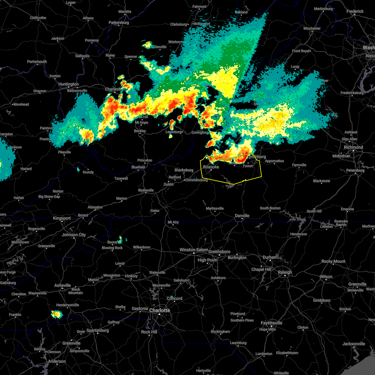 At 712 pm edt, severe thunderstorms were located along a line extending from near boonsboro to thaxton to near catawba, moving south at 35 mph (radar indicated). Hazards include 60 mph wind gusts and quarter size hail. Hail damage to vehicles is expected. Expect wind damage to roofs, siding, and trees. At 712 pm edt, severe thunderstorms were located along a line extending from near boonsboro to thaxton to near catawba, moving south at 35 mph (radar indicated). Hazards include 60 mph wind gusts and quarter size hail. Hail damage to vehicles is expected. Expect wind damage to roofs, siding, and trees.
|
| 6/10/2021 2:18 PM EDT |
 At 217 pm edt, severe thunderstorms were located along a line extending from near fincastle to near vinton to near bent mountain, moving east at 15 mph (radar indicated). Hazards include 60 mph wind gusts and quarter size hail. Hail damage to vehicles is expected. expect wind damage to roofs, siding, and trees. locations impacted include, roanoke, vinton, bedford, buchanan, troutville, boones mill, and stewartsville. This includes the following locations the national d-day memorial and roanoke regional airport. At 217 pm edt, severe thunderstorms were located along a line extending from near fincastle to near vinton to near bent mountain, moving east at 15 mph (radar indicated). Hazards include 60 mph wind gusts and quarter size hail. Hail damage to vehicles is expected. expect wind damage to roofs, siding, and trees. locations impacted include, roanoke, vinton, bedford, buchanan, troutville, boones mill, and stewartsville. This includes the following locations the national d-day memorial and roanoke regional airport.
|
| 6/10/2021 1:53 PM EDT |
 At 152 pm edt, severe thunderstorms were located along a line extending from near oriskany to near roanoke to near copper hill, moving east at 15 mph (radar indicated). Hazards include 60 mph wind gusts and quarter size hail. Hail damage to vehicles is expected. Expect wind damage to roofs, siding, and trees. At 152 pm edt, severe thunderstorms were located along a line extending from near oriskany to near roanoke to near copper hill, moving east at 15 mph (radar indicated). Hazards include 60 mph wind gusts and quarter size hail. Hail damage to vehicles is expected. Expect wind damage to roofs, siding, and trees.
|
| 6/8/2021 5:44 PM EDT |
 At 543 pm edt, a severe thunderstorm was located over hollins, or over roanoke, moving east at 25 mph (radar indicated). Hazards include 60 mph wind gusts and quarter size hail. Hail damage to vehicles is expected. expect wind damage to roofs, siding, and trees. locations impacted include, roanoke, salem, vinton, catawba, glenvar, hollins, and poages mill. This includes the following locations the salem fairgrounds and roanoke regional airport. At 543 pm edt, a severe thunderstorm was located over hollins, or over roanoke, moving east at 25 mph (radar indicated). Hazards include 60 mph wind gusts and quarter size hail. Hail damage to vehicles is expected. expect wind damage to roofs, siding, and trees. locations impacted include, roanoke, salem, vinton, catawba, glenvar, hollins, and poages mill. This includes the following locations the salem fairgrounds and roanoke regional airport.
|
| 6/8/2021 5:23 PM EDT |
 At 523 pm edt, a severe thunderstorm was located over salem, moving east at 25 mph (radar indicated). Hazards include 60 mph wind gusts and quarter size hail. Hail damage to vehicles is expected. expect wind damage to roofs, siding, and trees. locations impacted include, roanoke, salem, vinton, catawba, shawsville, mc donalds mill, and hollins. This includes the following locations the salem fairgrounds and roanoke regional airport. At 523 pm edt, a severe thunderstorm was located over salem, moving east at 25 mph (radar indicated). Hazards include 60 mph wind gusts and quarter size hail. Hail damage to vehicles is expected. expect wind damage to roofs, siding, and trees. locations impacted include, roanoke, salem, vinton, catawba, shawsville, mc donalds mill, and hollins. This includes the following locations the salem fairgrounds and roanoke regional airport.
|
| 6/8/2021 5:08 PM EDT |
 At 508 pm edt, a severe thunderstorm was located over elliston-lafayette, or near shawsville, moving east at 25 mph (radar indicated). Hazards include 60 mph wind gusts. expect damage to roofs, siding, and trees At 508 pm edt, a severe thunderstorm was located over elliston-lafayette, or near shawsville, moving east at 25 mph (radar indicated). Hazards include 60 mph wind gusts. expect damage to roofs, siding, and trees
|
| 5/4/2021 2:40 PM EDT |
 At 240 pm edt, a severe thunderstorm was located over cave spring, or near roanoke, moving northeast at 40 mph (radar indicated). Hazards include 60 mph wind gusts and quarter size hail. Hail damage to vehicles is expected. expect wind damage to roofs, siding, and trees. locations impacted include, roanoke, salem, vinton, troutville, boones mill, stewartsville, and moneta. This includes the following locations the salem fairgrounds and roanoke regional airport. At 240 pm edt, a severe thunderstorm was located over cave spring, or near roanoke, moving northeast at 40 mph (radar indicated). Hazards include 60 mph wind gusts and quarter size hail. Hail damage to vehicles is expected. expect wind damage to roofs, siding, and trees. locations impacted include, roanoke, salem, vinton, troutville, boones mill, stewartsville, and moneta. This includes the following locations the salem fairgrounds and roanoke regional airport.
|
| 5/4/2021 2:39 PM EDT | Tree down atop mill mountai in city of roanoke county VA, 2.4 miles NW of Roanoke, VA |
| 5/4/2021 2:37 PM EDT | One tree down along lakeview circle n in roanoke county VA, 4.4 miles S of Roanoke, VA |
| 5/4/2021 2:34 PM EDT | A tree was blown down at the intersection of brandon ave and canterbury road s in city of roanoke county VA, 1.2 miles N of Roanoke, VA |
| 5/4/2021 2:33 PM EDT | Winds blew large limbs down in the 1900 block of greenwood roa in city of roanoke county VA, 1.3 miles NNE of Roanoke, VA |
| 5/4/2021 2:33 PM EDT | A tree was blown down at the intersection of 13th street sw and patterson av in city of roanoke county VA, 0.6 miles NW of Roanoke, VA |
| 5/4/2021 2:33 PM EDT | 3-inch tree limbs broken. power poles broke in city of roanoke county VA, 2.2 miles NE of Roanoke, VA |
| 5/4/2021 2:32 PM EDT | A tree was blown down at the intersection of angus road and guernsey lan in city of roanoke county VA, 2.9 miles SE of Roanoke, VA |
| 5/4/2021 2:31 PM EDT | Tree down at the intersection of westside blvd nw and salem turnpik in city of roanoke county VA, 2.5 miles ESE of Roanoke, VA |
| 5/4/2021 2:22 PM EDT |
 At 222 pm edt, a severe thunderstorm was located over shawsville, moving northeast at 30 mph (radar indicated). Hazards include 60 mph wind gusts and quarter size hail. Hail damage to vehicles is expected. Expect wind damage to roofs, siding, and trees. At 222 pm edt, a severe thunderstorm was located over shawsville, moving northeast at 30 mph (radar indicated). Hazards include 60 mph wind gusts and quarter size hail. Hail damage to vehicles is expected. Expect wind damage to roofs, siding, and trees.
|
| 3/27/2021 3:24 PM EDT |
 At 323 pm edt, severe thunderstorms were located along a line extending from roanoke mountain to stanleytown to germanton, moving east at 55 mph (radar indicated). Hazards include 60 mph wind gusts. Expect damage to roofs, siding, and trees. locations impacted include, eden, martinsville, rocky mount, mayodan, madison, walnut cove, and stoneville. This includes the following locations the martinsville speedway and martinsville airport. At 323 pm edt, severe thunderstorms were located along a line extending from roanoke mountain to stanleytown to germanton, moving east at 55 mph (radar indicated). Hazards include 60 mph wind gusts. Expect damage to roofs, siding, and trees. locations impacted include, eden, martinsville, rocky mount, mayodan, madison, walnut cove, and stoneville. This includes the following locations the martinsville speedway and martinsville airport.
|
| 3/27/2021 3:06 PM EDT |
 At 305 pm edt, severe thunderstorms were located along a line extending from terrys fork to near stuart to near courtney, moving east at 50 mph (radar indicated). Hazards include 60 mph wind gusts. Expect damage to roofs, siding, and trees. locations impacted include, christiansburg, eden, martinsville, mount airy, rocky mount, elkin, and fairview. This includes the following locations the martinsville speedway and martinsville airport. At 305 pm edt, severe thunderstorms were located along a line extending from terrys fork to near stuart to near courtney, moving east at 50 mph (radar indicated). Hazards include 60 mph wind gusts. Expect damage to roofs, siding, and trees. locations impacted include, christiansburg, eden, martinsville, mount airy, rocky mount, elkin, and fairview. This includes the following locations the martinsville speedway and martinsville airport.
|
| 3/27/2021 2:56 PM EDT |
 At 256 pm edt, severe thunderstorms were located along a line extending from near pilot to ararat to near buck shoals, moving east at 50 mph (radar indicated). Hazards include 60 mph wind gusts. expect damage to roofs, siding, and trees At 256 pm edt, severe thunderstorms were located along a line extending from near pilot to ararat to near buck shoals, moving east at 50 mph (radar indicated). Hazards include 60 mph wind gusts. expect damage to roofs, siding, and trees
|
| 7/21/2020 11:38 PM EDT |
 The severe thunderstorm warning for east central roanoke, west central bedford and north central franklin counties will expire at 1145 pm edt, the storms which prompted the warning have weakened below severe limits, and no longer pose an immediate threat to life or property. therefore, the warning will be allowed to expire. small hail was reported in roanoke and in goodview. a large tree branch was blown down by thunderstorm winds in the hollins area. when it is safe to do so, please send your reports of hail of any size, as well as reports of any wind damage, including downed trees or large limbs, to the national weather service by calling toll free at 1, 8 6 6, 2 1 5, 4 3 2 4. reports and pictures can also be shared on the national weather service blacksburg facebook page and on twitter. The severe thunderstorm warning for east central roanoke, west central bedford and north central franklin counties will expire at 1145 pm edt, the storms which prompted the warning have weakened below severe limits, and no longer pose an immediate threat to life or property. therefore, the warning will be allowed to expire. small hail was reported in roanoke and in goodview. a large tree branch was blown down by thunderstorm winds in the hollins area. when it is safe to do so, please send your reports of hail of any size, as well as reports of any wind damage, including downed trees or large limbs, to the national weather service by calling toll free at 1, 8 6 6, 2 1 5, 4 3 2 4. reports and pictures can also be shared on the national weather service blacksburg facebook page and on twitter.
|
| 7/21/2020 11:07 PM EDT |
 At 1105 pm edt, severe thunderstorms were located along a line extending from laymantown to near vinton to near stewartsville to near roanoke mountain, moving east at 10 mph (radar indicated). Hazards include 60 mph wind gusts and quarter size hail. Hail damage to vehicles is expected. expect wind damage to roofs, siding, and trees. Locations impacted include, vinton, stewartsville, montvale, chamblissburg, and goodview. At 1105 pm edt, severe thunderstorms were located along a line extending from laymantown to near vinton to near stewartsville to near roanoke mountain, moving east at 10 mph (radar indicated). Hazards include 60 mph wind gusts and quarter size hail. Hail damage to vehicles is expected. expect wind damage to roofs, siding, and trees. Locations impacted include, vinton, stewartsville, montvale, chamblissburg, and goodview.
|
| 7/21/2020 10:47 PM EDT | A large tree branch was blown down near the intersection of summerdean ave and estes st. time estimated from rada in roanoke county VA, 5.3 miles SSW of Roanoke, VA |
| 7/21/2020 10:46 PM EDT |
 At 1046 pm edt, severe thunderstorms were located along a line extending from cloverdale to near hollins to vinton to roanoke mountain, moving east at 15 mph (radar indicated). Hazards include 60 mph wind gusts and quarter size hail. Hail damage to vehicles is expected. Expect wind damage to roofs, siding, and trees. At 1046 pm edt, severe thunderstorms were located along a line extending from cloverdale to near hollins to vinton to roanoke mountain, moving east at 15 mph (radar indicated). Hazards include 60 mph wind gusts and quarter size hail. Hail damage to vehicles is expected. Expect wind damage to roofs, siding, and trees.
|
| 7/21/2020 3:40 PM EDT |
 At 338 pm edt, a severe thunderstorm was located between roanoke city and boones mill, moving very slowly to the northeast at 10 to 15 mph. downburst winds are possible from this thunderstorm (radar indicated). Hazards include 60 mph wind gusts and quarter size hail. Hail damage to vehicles is expected. expect wind damage to roofs, siding, and trees. Locations impacted include, roanoke, vinton, troutville, boones mill, stewartsville, montvale, and moneta. At 338 pm edt, a severe thunderstorm was located between roanoke city and boones mill, moving very slowly to the northeast at 10 to 15 mph. downburst winds are possible from this thunderstorm (radar indicated). Hazards include 60 mph wind gusts and quarter size hail. Hail damage to vehicles is expected. expect wind damage to roofs, siding, and trees. Locations impacted include, roanoke, vinton, troutville, boones mill, stewartsville, montvale, and moneta.
|
| 7/21/2020 3:22 PM EDT |
 At 322 pm edt, a severe thunderstorm was located over cave spring, or near boones mill, moving northeast at 15 mph (radar indicated). Hazards include 60 mph wind gusts and quarter size hail. Hail damage to vehicles is expected. Expect wind damage to roofs, siding, and trees. At 322 pm edt, a severe thunderstorm was located over cave spring, or near boones mill, moving northeast at 15 mph (radar indicated). Hazards include 60 mph wind gusts and quarter size hail. Hail damage to vehicles is expected. Expect wind damage to roofs, siding, and trees.
|
| 6/4/2020 2:57 PM EDT |
 The severe thunderstorm warning for southeastern roanoke and west central bedford counties will expire at 300 pm edt, the storms which prompted the warning remain severe but have moved north and out of the area. therefore, this warning will be allowed to expire. when it is safe to do so, please send your reports of hail of any size, as well as reports of any wind damage, including downed trees or large limbs, to the national weather service by calling toll free at 1, 8 6 6, 2 1 5, 4 3 2 4. reports and pictures can also be shared on the national weather service blacksburg facebook page and on twitter. The severe thunderstorm warning for southeastern roanoke and west central bedford counties will expire at 300 pm edt, the storms which prompted the warning remain severe but have moved north and out of the area. therefore, this warning will be allowed to expire. when it is safe to do so, please send your reports of hail of any size, as well as reports of any wind damage, including downed trees or large limbs, to the national weather service by calling toll free at 1, 8 6 6, 2 1 5, 4 3 2 4. reports and pictures can also be shared on the national weather service blacksburg facebook page and on twitter.
|
| 6/4/2020 2:43 PM EDT |
 At 243 pm edt, severe thunderstorms extended from blue ridge to near chamblissburg, moving northeast at 25 mph (radar indicated). Hazards include 60 mph wind gusts and quarter size hail. Hail damage to vehicles is expected. Expect wind damage to roofs, siding, and trees. At 243 pm edt, severe thunderstorms extended from blue ridge to near chamblissburg, moving northeast at 25 mph (radar indicated). Hazards include 60 mph wind gusts and quarter size hail. Hail damage to vehicles is expected. Expect wind damage to roofs, siding, and trees.
|
| 6/4/2020 2:14 PM EDT |
 At 214 pm edt, a severe thunderstorm was located over roanoke mountain, or near vinton, moving northeast at 20 mph (radar indicated). Hazards include 60 mph wind gusts and quarter size hail. Hail damage to vehicles is expected. Expect wind damage to roofs, siding, and trees. At 214 pm edt, a severe thunderstorm was located over roanoke mountain, or near vinton, moving northeast at 20 mph (radar indicated). Hazards include 60 mph wind gusts and quarter size hail. Hail damage to vehicles is expected. Expect wind damage to roofs, siding, and trees.
|
| 4/8/2020 4:50 PM EDT |
 The severe thunderstorm warning for southeastern roanoke and northwestern franklin counties will expire at 500 pm edt, the storm which prompted the warning has moved out of the area. therefore, the warning will be allowed to expire. a severe thunderstorm watch remains in effect until 800 pm edt for south central, southwestern and west central virginia. when it is safe to do so, please send your reports of hail of any size, as well as reports of any wind damage, including downed trees or large limbs, to the national weather service by calling toll free at 1, 8 6 6, 2 1 5, 4 3 2 4. reports and pictures can also be shared on the national weather service blacksburg facebook page and on twitter. The severe thunderstorm warning for southeastern roanoke and northwestern franklin counties will expire at 500 pm edt, the storm which prompted the warning has moved out of the area. therefore, the warning will be allowed to expire. a severe thunderstorm watch remains in effect until 800 pm edt for south central, southwestern and west central virginia. when it is safe to do so, please send your reports of hail of any size, as well as reports of any wind damage, including downed trees or large limbs, to the national weather service by calling toll free at 1, 8 6 6, 2 1 5, 4 3 2 4. reports and pictures can also be shared on the national weather service blacksburg facebook page and on twitter.
|
| 4/8/2020 4:36 PM EDT |
 At 435 pm edt, a severe thunderstorm was located near wirtz, or near rocky mount, moving southeast at 35 mph (radar indicated). Hazards include 60 mph wind gusts and quarter size hail. Hail damage to vehicles is expected. expect wind damage to roofs, siding, and trees. Locations impacted include, boones mill, callaway, roanoke mountain, and cave spring. At 435 pm edt, a severe thunderstorm was located near wirtz, or near rocky mount, moving southeast at 35 mph (radar indicated). Hazards include 60 mph wind gusts and quarter size hail. Hail damage to vehicles is expected. expect wind damage to roofs, siding, and trees. Locations impacted include, boones mill, callaway, roanoke mountain, and cave spring.
|
| 4/8/2020 4:25 PM EDT |
 At 424 pm edt, a severe thunderstorm was located near boones mill, moving southeast at 35 mph. another storm was located near cave spring, moving southeast at 35 mph (radar indicated). Hazards include 60 mph wind gusts and quarter size hail. Hail damage to vehicles is expected. expect wind damage to roofs, siding, and trees. locations impacted include, roanoke, salem, vinton, boones mill, copper hill, bent mountain, and check. This includes the following locations the salem fairgrounds and roanoke regional airport. At 424 pm edt, a severe thunderstorm was located near boones mill, moving southeast at 35 mph. another storm was located near cave spring, moving southeast at 35 mph (radar indicated). Hazards include 60 mph wind gusts and quarter size hail. Hail damage to vehicles is expected. expect wind damage to roofs, siding, and trees. locations impacted include, roanoke, salem, vinton, boones mill, copper hill, bent mountain, and check. This includes the following locations the salem fairgrounds and roanoke regional airport.
|
| 4/8/2020 4:02 PM EDT |
 At 402 pm edt, a severe thunderstorm was located over elliston-lafayette, or near shawsville, moving southeast at 35 mph (radar indicated). Hazards include ping pong ball size hail and 60 mph wind gusts. People and animals outdoors will be injured. expect hail damage to roofs, siding, windows, and vehicles. Expect wind damage to roofs, siding, and trees. At 402 pm edt, a severe thunderstorm was located over elliston-lafayette, or near shawsville, moving southeast at 35 mph (radar indicated). Hazards include ping pong ball size hail and 60 mph wind gusts. People and animals outdoors will be injured. expect hail damage to roofs, siding, windows, and vehicles. Expect wind damage to roofs, siding, and trees.
|
| 1/11/2020 10:18 PM EST | Storm damage reported in city of roanoke county VA, 3.2 miles N of Roanoke, VA |
| 1/11/2020 10:14 PM EST | Tree blown down along electric road. time estimated from rada in roanoke county VA, 3.2 miles N of Roanoke, VA |
| 1/11/2020 10:14 PM EST |
 At 1013 pm est, severe thunderstorms were located along a line extending from natural bridge to near roanoke mountain, moving east at 60 mph (radar indicated). Hazards include 60 mph wind gusts. Expect damage to roofs, siding, and trees. locations impacted include, roanoke, salem, vinton, buchanan, troutville, stewartsville, and montvale. This includes the following locations the salem fairgrounds and roanoke regional airport. At 1013 pm est, severe thunderstorms were located along a line extending from natural bridge to near roanoke mountain, moving east at 60 mph (radar indicated). Hazards include 60 mph wind gusts. Expect damage to roofs, siding, and trees. locations impacted include, roanoke, salem, vinton, buchanan, troutville, stewartsville, and montvale. This includes the following locations the salem fairgrounds and roanoke regional airport.
|
| 1/11/2020 9:55 PM EST |
 At 954 pm est, severe thunderstorms were located along a line extending from near monterey to near sedalia, moving northeast at 60 mph (radar indicated). Hazards include 60 mph wind gusts. Expect damage to roofs, siding, and trees. locations impacted include, roanoke, salem, vinton, clifton forge, buchanan, troutville, and stewartsville. This includes the following locations the salem fairgrounds and roanoke regional airport. At 954 pm est, severe thunderstorms were located along a line extending from near monterey to near sedalia, moving northeast at 60 mph (radar indicated). Hazards include 60 mph wind gusts. Expect damage to roofs, siding, and trees. locations impacted include, roanoke, salem, vinton, clifton forge, buchanan, troutville, and stewartsville. This includes the following locations the salem fairgrounds and roanoke regional airport.
|
| 1/11/2020 9:43 PM EST |
 At 942 pm est, severe thunderstorms were located along a line extending from near huffman to near courtney, moving northeast at 50 mph (radar indicated). Hazards include 70 mph wind gusts. Expect considerable tree damage. Damage is likely to mobile homes, roofs, and outbuildings. At 942 pm est, severe thunderstorms were located along a line extending from near huffman to near courtney, moving northeast at 50 mph (radar indicated). Hazards include 70 mph wind gusts. Expect considerable tree damage. Damage is likely to mobile homes, roofs, and outbuildings.
|
| 1/11/2020 9:26 PM EST |
 At 926 pm est, severe thunderstorms were located along a line extending from 7 miles east of marlinton to near vinton, moving northeast at 60 mph (radar indicated). Hazards include 60 mph wind gusts. expect damage to roofs, siding, and trees At 926 pm est, severe thunderstorms were located along a line extending from 7 miles east of marlinton to near vinton, moving northeast at 60 mph (radar indicated). Hazards include 60 mph wind gusts. expect damage to roofs, siding, and trees
|
| 9/30/2019 4:38 PM EDT |
 At 438 pm edt, a severe thunderstorm was located over catawba, moving south at 15 mph (radar indicated). Hazards include 60 mph wind gusts and quarter size hail. Hail damage to vehicles is expected. expect wind damage to roofs, siding, and trees. locations impacted include, roanoke, salem, vinton, catawba, abbott, glenvar, and hollins. This includes the following locations the salem fairgrounds and roanoke regional airport. At 438 pm edt, a severe thunderstorm was located over catawba, moving south at 15 mph (radar indicated). Hazards include 60 mph wind gusts and quarter size hail. Hail damage to vehicles is expected. expect wind damage to roofs, siding, and trees. locations impacted include, roanoke, salem, vinton, catawba, abbott, glenvar, and hollins. This includes the following locations the salem fairgrounds and roanoke regional airport.
|
| 9/30/2019 4:08 PM EDT |
 At 408 pm edt, a severe thunderstorm was located over new castle, moving south at 15 mph (radar indicated). Hazards include 60 mph wind gusts and quarter size hail. Hail damage to vehicles is expected. Expect wind damage to roofs, siding, and trees. At 408 pm edt, a severe thunderstorm was located over new castle, moving south at 15 mph (radar indicated). Hazards include 60 mph wind gusts and quarter size hail. Hail damage to vehicles is expected. Expect wind damage to roofs, siding, and trees.
|
| 9/28/2019 2:49 PM EDT |
 At 249 pm edt, severe thunderstorms extended from vinton to near boones mill, moving southeast at 15 mph (radar indicated). Hazards include 60 mph wind gusts and quarter size hail. Hail damage to vehicles is expected. expect wind damage to roofs, siding, and trees. Locations impacted include, vinton, boones mill, stewartsville, moneta, and burnt chimney. At 249 pm edt, severe thunderstorms extended from vinton to near boones mill, moving southeast at 15 mph (radar indicated). Hazards include 60 mph wind gusts and quarter size hail. Hail damage to vehicles is expected. expect wind damage to roofs, siding, and trees. Locations impacted include, vinton, boones mill, stewartsville, moneta, and burnt chimney.
|
| 9/28/2019 2:41 PM EDT | Tree down at the intersection of garden city boulevard se and bandy road. time estimated from rada in city of roanoke county VA, 3.6 miles NW of Roanoke, VA |
| 9/28/2019 2:38 PM EDT | Tree fell onto utility lines in the 2500 block of avenham avenue and got tangled. time estimated from rada in city of roanoke county VA, 2.1 miles NNW of Roanoke, VA |
| 9/28/2019 2:29 PM EDT |
 At 229 pm edt, severe thunderstorms were located along a line extending from hollins to poages mill, moving southeast at 15 mph (radar indicated). Hazards include 60 mph wind gusts and quarter size hail. Hail damage to vehicles is expected. Expect wind damage to roofs, siding, and trees. At 229 pm edt, severe thunderstorms were located along a line extending from hollins to poages mill, moving southeast at 15 mph (radar indicated). Hazards include 60 mph wind gusts and quarter size hail. Hail damage to vehicles is expected. Expect wind damage to roofs, siding, and trees.
|
| 9/28/2019 1:56 PM EDT |
 At 155 pm edt, a severe thunderstorm was located near hollins, moving southeast at 10 mph (radar indicated). Hazards include 60 mph wind gusts and half dollar size hail. Hail damage to vehicles is expected. expect wind damage to roofs, siding, and trees. locations impacted include, roanoke, salem, vinton, catawba, and laymantown. This includes the following locations the salem fairgrounds and roanoke regional airport. At 155 pm edt, a severe thunderstorm was located near hollins, moving southeast at 10 mph (radar indicated). Hazards include 60 mph wind gusts and half dollar size hail. Hail damage to vehicles is expected. expect wind damage to roofs, siding, and trees. locations impacted include, roanoke, salem, vinton, catawba, and laymantown. This includes the following locations the salem fairgrounds and roanoke regional airport.
|
| 9/28/2019 1:41 PM EDT |
 At 141 pm edt, a severe thunderstorm was located over catawba, moving southeast at 10 mph (radar indicated). Hazards include 60 mph wind gusts and quarter size hail. Hail damage to vehicles is expected. Expect wind damage to roofs, siding, and trees. At 141 pm edt, a severe thunderstorm was located over catawba, moving southeast at 10 mph (radar indicated). Hazards include 60 mph wind gusts and quarter size hail. Hail damage to vehicles is expected. Expect wind damage to roofs, siding, and trees.
|
| 8/22/2019 2:30 PM EDT |
 At 230 pm edt, severe thunderstorms were located along a line extending from arcadia to vinton to near terrys fork, moving east at 25 mph (radar indicated). Hazards include 60 mph wind gusts. Expect damage to roofs, siding, and trees. locations impacted include, roanoke, salem, vinton, bedford, and rocky mount. This includes the following locations the salem fairgrounds, the national d-day memorial, and roanoke regional airport. At 230 pm edt, severe thunderstorms were located along a line extending from arcadia to vinton to near terrys fork, moving east at 25 mph (radar indicated). Hazards include 60 mph wind gusts. Expect damage to roofs, siding, and trees. locations impacted include, roanoke, salem, vinton, bedford, and rocky mount. This includes the following locations the salem fairgrounds, the national d-day memorial, and roanoke regional airport.
|
| 8/22/2019 2:15 PM EDT | Tree limbs down in the hollins area. timing estimated by rada in roanoke county VA, 5.2 miles S of Roanoke, VA |
| 8/22/2019 1:48 PM EDT |
 At 148 pm edt, severe thunderstorms were located along a line extending from near oriskany to near glenvar to childress, moving east at 20 mph (radar indicated). Hazards include 60 mph wind gusts. expect damage to roofs, siding, and trees At 148 pm edt, severe thunderstorms were located along a line extending from near oriskany to near glenvar to childress, moving east at 20 mph (radar indicated). Hazards include 60 mph wind gusts. expect damage to roofs, siding, and trees
|
| 8/15/2019 7:06 PM EDT |
 At 706 pm edt, a severe thunderstorm was located over stewartsville, moving southeast at 5 mph (radar indicated). Hazards include 60 mph wind gusts and quarter size hail. Hail damage to vehicles is expected. expect wind damage to roofs, siding, and trees. Locations impacted include, vinton, stewartsville, goodview, and chamblissburg. At 706 pm edt, a severe thunderstorm was located over stewartsville, moving southeast at 5 mph (radar indicated). Hazards include 60 mph wind gusts and quarter size hail. Hail damage to vehicles is expected. expect wind damage to roofs, siding, and trees. Locations impacted include, vinton, stewartsville, goodview, and chamblissburg.
|
| 8/15/2019 6:44 PM EDT |
 The national weather service in blacksburg has issued a * severe thunderstorm warning for. east central roanoke county in west central virginia. west central bedford county in south central virginia. south central botetourt county in west central virginia. Until 745 pm edt. The national weather service in blacksburg has issued a * severe thunderstorm warning for. east central roanoke county in west central virginia. west central bedford county in south central virginia. south central botetourt county in west central virginia. Until 745 pm edt.
|
| 8/2/2019 8:40 AM EDT | Hen Egg sized hail reported 2.2 miles NE of Roanoke, VA, photos of 2 inch diameter hailstones relayed from the grandin court section of roanoke city. |
| 8/1/2019 3:58 PM EDT |
 At 348 pm edt, a severe thunderstorm was located near salem, moving east at 10 mph. this storm has a history of creating large, damaging hail (trained weather spotters). Hazards include ping pong ball size hail and 60 mph wind gusts. People and animals outdoors will be injured. expect hail damage to roofs, siding, windows, and vehicles. expect wind damage to roofs, siding, and trees. locations impacted include, roanoke, salem, vinton, catawba, and hollins. This includes the following locations the salem fairgrounds and roanoke regional airport. At 348 pm edt, a severe thunderstorm was located near salem, moving east at 10 mph. this storm has a history of creating large, damaging hail (trained weather spotters). Hazards include ping pong ball size hail and 60 mph wind gusts. People and animals outdoors will be injured. expect hail damage to roofs, siding, windows, and vehicles. expect wind damage to roofs, siding, and trees. locations impacted include, roanoke, salem, vinton, catawba, and hollins. This includes the following locations the salem fairgrounds and roanoke regional airport.
|
| 8/1/2019 3:49 PM EDT |
 At 335 pm edt, a severe thunderstorm was located over roanoke, moving northeast at 15 mph. up to half dollar size hail was reported near cave spring at 3:30 pm edt (public). Hazards include 60 mph wind gusts and half dollar size hail. Hail damage to vehicles is expected. expect wind damage to roofs, siding, and trees. locations impacted include, roanoke, salem, vinton, catawba, and hollins. This includes the following locations the salem fairgrounds and roanoke regional airport. At 335 pm edt, a severe thunderstorm was located over roanoke, moving northeast at 15 mph. up to half dollar size hail was reported near cave spring at 3:30 pm edt (public). Hazards include 60 mph wind gusts and half dollar size hail. Hail damage to vehicles is expected. expect wind damage to roofs, siding, and trees. locations impacted include, roanoke, salem, vinton, catawba, and hollins. This includes the following locations the salem fairgrounds and roanoke regional airport.
|
| 8/1/2019 3:36 PM EDT |
 At 335 pm edt, a severe thunderstorm was located over roanoke, moving northeast at 15 mph. up to half dollar size hail was reported near cave spring at 3:30 pm edt (public). Hazards include 60 mph wind gusts and half dollar size hail. Hail damage to vehicles is expected. expect wind damage to roofs, siding, and trees. locations impacted include, roanoke, salem, vinton, catawba, and hollins. This includes the following locations the salem fairgrounds and roanoke regional airport. At 335 pm edt, a severe thunderstorm was located over roanoke, moving northeast at 15 mph. up to half dollar size hail was reported near cave spring at 3:30 pm edt (public). Hazards include 60 mph wind gusts and half dollar size hail. Hail damage to vehicles is expected. expect wind damage to roofs, siding, and trees. locations impacted include, roanoke, salem, vinton, catawba, and hollins. This includes the following locations the salem fairgrounds and roanoke regional airport.
|
| 8/1/2019 3:35 PM EDT | Golf Ball sized hail reported 2.6 miles NNE of Roanoke, VA |
| 8/1/2019 3:35 PM EDT | Golf Ball sized hail reported 1.8 miles N of Roanoke, VA, quarter to golf ball size hail reported in southwest roanoke. |
| 8/1/2019 3:35 PM EDT | Half Dollar sized hail reported 0.8 miles ENE of Roanoke, VA |
| 8/1/2019 3:30 PM EDT | Quarter sized hail reported 1.3 miles NNE of Roanoke, VA, quarter size hail reported at raleigh court. |
| 8/1/2019 3:28 PM EDT | Half Dollar sized hail reported 4 miles NE of Roanoke, VA, hail up to half dollar size at cave spring post office. |
| 8/1/2019 3:20 PM EDT | Quarter sized hail reported 3.9 miles NE of Roanoke, VA |
| 8/1/2019 3:03 PM EDT |
 The national weather service in blacksburg has issued a * severe thunderstorm warning for. roanoke county in west central virginia. the city of salem in west central virginia. the city of roanoke in west central virginia. Northwestern franklin county in west central virginia. The national weather service in blacksburg has issued a * severe thunderstorm warning for. roanoke county in west central virginia. the city of salem in west central virginia. the city of roanoke in west central virginia. Northwestern franklin county in west central virginia.
|
| 7/31/2019 5:09 PM EDT | Tree down blocking the webster road near the intersection of park drive. time estimated from rada in botetourt county VA, 8.6 miles SW of Roanoke, VA |
| 7/22/2019 4:43 PM EDT |
 The severe thunderstorm warning for roanoke , the city of salem and the city of roanoke will expire at 445 pm edt, the storms which prompted the warning have moved out of the area. therefore, the warning will be allowed to expire. however heavy rain is still possible with these thunderstorms. when it is safe to do so, please send your reports of hail of any size, as well as reports of any wind damage, including downed trees or large limbs, to the national weather service by calling toll free at 1, 8 6 6, 2 1 5, 4 3 2 4. reports and pictures can also be shared on the national weather service blacksburg facebook page and on twitter. The severe thunderstorm warning for roanoke , the city of salem and the city of roanoke will expire at 445 pm edt, the storms which prompted the warning have moved out of the area. therefore, the warning will be allowed to expire. however heavy rain is still possible with these thunderstorms. when it is safe to do so, please send your reports of hail of any size, as well as reports of any wind damage, including downed trees or large limbs, to the national weather service by calling toll free at 1, 8 6 6, 2 1 5, 4 3 2 4. reports and pictures can also be shared on the national weather service blacksburg facebook page and on twitter.
|
| 7/22/2019 4:23 PM EDT |
 At 422 pm edt, severe thunderstorms were located along a line extending from hollins to near boones mill, moving east at 35 mph (radar indicated). Hazards include 60 mph wind gusts. Expect damage to roofs, siding, and trees. locations impacted include, roanoke, salem, vinton, catawba, and bent mountain. This includes the following locations the salem fairgrounds and roanoke regional airport. At 422 pm edt, severe thunderstorms were located along a line extending from hollins to near boones mill, moving east at 35 mph (radar indicated). Hazards include 60 mph wind gusts. Expect damage to roofs, siding, and trees. locations impacted include, roanoke, salem, vinton, catawba, and bent mountain. This includes the following locations the salem fairgrounds and roanoke regional airport.
|
| 7/22/2019 4:15 PM EDT | A number of trees down on gala drive in the bonsack are in botetourt county VA, 6.5 miles SW of Roanoke, VA |
| 7/22/2019 4:14 PM EDT | Large tree branch down on belle ave northeast in roanoke. event time radar-estimate in city of roanoke county VA, 4.4 miles WSW of Roanoke, VA |
| 7/22/2019 4:14 PM EDT | Large tree limb disconnected utility lines near the intersection of russell avenue and rolfe stree in city of roanoke county VA, 0.8 miles ENE of Roanoke, VA |
| 7/22/2019 4:13 PM EDT |
 At 413 pm edt, severe thunderstorms were located along a line extending from near abbott to near glenvar to terrys fork, moving northeast at 15 mph (radar indicated). Hazards include 60 mph wind gusts. Expect damage to roofs, siding, and trees. locations impacted include, roanoke, salem, vinton, boones mill, and copper hill. This includes the following locations the salem fairgrounds and roanoke regional airport. At 413 pm edt, severe thunderstorms were located along a line extending from near abbott to near glenvar to terrys fork, moving northeast at 15 mph (radar indicated). Hazards include 60 mph wind gusts. Expect damage to roofs, siding, and trees. locations impacted include, roanoke, salem, vinton, boones mill, and copper hill. This includes the following locations the salem fairgrounds and roanoke regional airport.
|
| 7/22/2019 4:10 PM EDT | Tree down on a power line near william fleming high school on ferncliff avenue. time estimated from rada in city of roanoke county VA, 2.6 miles SSE of Roanoke, VA |
| 7/22/2019 3:49 PM EDT |
 At 348 pm edt, severe thunderstorms were located along a line extending from near sinking creek to near shawsville to near pilot, moving northeast at 15 mph (radar indicated). Hazards include 60 mph wind gusts. expect damage to roofs, siding, and trees At 348 pm edt, severe thunderstorms were located along a line extending from near sinking creek to near shawsville to near pilot, moving northeast at 15 mph (radar indicated). Hazards include 60 mph wind gusts. expect damage to roofs, siding, and trees
|
| 7/21/2019 2:31 PM EDT | Wfxr in roanoke relayed a report of a large tree down at the corner of dent drive and carefree lane in roanok in roanoke county VA, 4.4 miles S of Roanoke, VA |
| 7/21/2019 1:53 PM EDT |
 The severe thunderstorm warning for northeastern roanoke, west central bedford and south central botetourt counties and the city of roanoke will expire at 200 pm edt, the storm which prompted the warning has moved out of the area. therefore, the warning will be allowed to expire. however gusty winds and heavy rain are still possible with this thunderstorm. when it is safe to do so, please send your reports of hail of any size, as well as reports of any wind damage, including downed trees or large limbs, to the national weather service by calling toll free at 1, 8 6 6, 2 1 5, 4 3 2 4. reports and pictures can also be shared on the national weather service blacksburg facebook page and on twitter. The severe thunderstorm warning for northeastern roanoke, west central bedford and south central botetourt counties and the city of roanoke will expire at 200 pm edt, the storm which prompted the warning has moved out of the area. therefore, the warning will be allowed to expire. however gusty winds and heavy rain are still possible with this thunderstorm. when it is safe to do so, please send your reports of hail of any size, as well as reports of any wind damage, including downed trees or large limbs, to the national weather service by calling toll free at 1, 8 6 6, 2 1 5, 4 3 2 4. reports and pictures can also be shared on the national weather service blacksburg facebook page and on twitter.
|
| 7/21/2019 1:33 PM EDT |
 At 131 pm edt, a severe thunderstorm was located over laymantown, moving northeast at 10 mph. a spotter reported tree damage with this storm around 1:30 pm edt in the area of hollins. nickel size hail has also been reported near the roanoke airport (trained weather spotters). Hazards include 60 mph wind gusts. Expect damage to roofs, siding, and trees. locations impacted include, roanoke, vinton, troutville, stewartsville, and montvale. This includes the following location roanoke regional airport. At 131 pm edt, a severe thunderstorm was located over laymantown, moving northeast at 10 mph. a spotter reported tree damage with this storm around 1:30 pm edt in the area of hollins. nickel size hail has also been reported near the roanoke airport (trained weather spotters). Hazards include 60 mph wind gusts. Expect damage to roofs, siding, and trees. locations impacted include, roanoke, vinton, troutville, stewartsville, and montvale. This includes the following location roanoke regional airport.
|
| 7/21/2019 1:27 PM EDT | Large branch down at the corner of liberty rd and hollins r in city of roanoke county VA, 1.9 miles SSW of Roanoke, VA |
| 7/21/2019 1:26 PM EDT | Quarter sized hail reported 5.6 miles SW of Roanoke, VA, quarter size hail and one large tree down on forest oak dr. |
| 7/21/2019 1:21 PM EDT |
 At 120 pm edt, a severe thunderstorm was located over vinton, moving northeast at 10 mph (radar indicated). Hazards include 60 mph wind gusts. expect damage to roofs, siding, and trees At 120 pm edt, a severe thunderstorm was located over vinton, moving northeast at 10 mph (radar indicated). Hazards include 60 mph wind gusts. expect damage to roofs, siding, and trees
|
| 7/5/2019 5:44 PM EDT |
 At 542 pm edt, a severe thunderstorm was located near natural well, and is nearly stationary (radar indicated). Hazards include 60 mph wind gusts and quarter size hail. Hail damage to vehicles is expected. expect wind damage to roofs, siding, and trees. torrential rainfall is also occurring with this storm, and may cause localized flooding. locations impacted include, roanoke, salem, vinton, catawba, and glenvar. This includes the following locations the salem fairgrounds and roanoke regional airport. At 542 pm edt, a severe thunderstorm was located near natural well, and is nearly stationary (radar indicated). Hazards include 60 mph wind gusts and quarter size hail. Hail damage to vehicles is expected. expect wind damage to roofs, siding, and trees. torrential rainfall is also occurring with this storm, and may cause localized flooding. locations impacted include, roanoke, salem, vinton, catawba, and glenvar. This includes the following locations the salem fairgrounds and roanoke regional airport.
|
| 7/5/2019 5:17 PM EDT |
 At 517 pm edt, a severe thunderstorm was located over glenvar, moving east at 15 mph (radar indicated). Hazards include 60 mph wind gusts and quarter size hail. Hail damage to vehicles is expected. expect wind damage to roofs, siding, and trees. Torrential rainfall is also occurring with this storm, and may cause localized flooding. At 517 pm edt, a severe thunderstorm was located over glenvar, moving east at 15 mph (radar indicated). Hazards include 60 mph wind gusts and quarter size hail. Hail damage to vehicles is expected. expect wind damage to roofs, siding, and trees. Torrential rainfall is also occurring with this storm, and may cause localized flooding.
|
| 6/10/2019 5:15 PM EDT | Tree down - penn forest roa in roanoke county VA, 4.3 miles NNE of Roanoke, VA |
| 6/2/2019 7:39 PM EDT | Corrects previous tstm wnd dmg report from 2 ne stewartsville. tree down on cars on underhill ave. no injuries reported. time estimated by rada in roanoke county VA, 3.4 miles WNW of Roanoke, VA |
| 6/2/2019 7:32 PM EDT | Tree down on 13th street. time estimated by rada in city of roanoke county VA, 0.5 miles WSW of Roanoke, VA |
| 6/2/2019 7:32 PM EDT | An area of paneling torn off of the roanoke times building in downtown roanoke. it was indicated there was already some missing before the storm occurred. time estimate in city of roanoke county VA, 1.6 miles WNW of Roanoke, VA |
| 5/31/2019 4:47 PM EDT | Golf Ball sized hail reported 4 miles NE of Roanoke, VA, broadcast media relayed report of golf ball hail in cave spring. |
| 5/31/2019 4:45 PM EDT | Quarter sized hail reported 4.8 miles NNE of Roanoke, VA, public called in and reported quarter size hail on starkey road. timing estimated on radar. |
| 5/31/2019 4:44 PM EDT | Quarter sized hail reported 4.6 miles N of Roanoke, VA, public reported one inch hail 3 miles east southeast of cave springs. timing estimated by radar. |
| 5/31/2019 4:42 PM EDT | Golf Ball sized hail reported 4 miles NE of Roanoke, VA, corrects previous hail report from cave spring. broadcast media relayed report of golf ball hail in cave spring. |
| 5/31/2019 4:39 PM EDT |
 The national weather service in blacksburg has issued a * severe thunderstorm warning for. southern roanoke county in west central virginia. northwestern pittsylvania county in south central virginia. southern city of roanoke in west central virginia. bedford county in south central virginia. Southeastern. The national weather service in blacksburg has issued a * severe thunderstorm warning for. southern roanoke county in west central virginia. northwestern pittsylvania county in south central virginia. southern city of roanoke in west central virginia. bedford county in south central virginia. Southeastern.
|
| 5/31/2019 4:30 PM EDT |
 At 430 pm edt, severe thunderstorms were located along a line extending from near paint bank to bradshaw, moving east at 40 mph (radar indicated). Hazards include 60 mph wind gusts and quarter size hail. Hail damage to vehicles is expected. expect wind damage to roofs, siding, and trees. locations impacted include, roanoke, salem, vinton, troutville, and new castle. This includes the following locations the salem fairgrounds and roanoke regional airport. At 430 pm edt, severe thunderstorms were located along a line extending from near paint bank to bradshaw, moving east at 40 mph (radar indicated). Hazards include 60 mph wind gusts and quarter size hail. Hail damage to vehicles is expected. expect wind damage to roofs, siding, and trees. locations impacted include, roanoke, salem, vinton, troutville, and new castle. This includes the following locations the salem fairgrounds and roanoke regional airport.
|
| 5/31/2019 4:14 PM EDT |
 At 414 pm edt, severe thunderstorms were located along a line extending from near gap mills to near mc donalds mill, moving east at 40 mph (radar indicated). Hazards include 60 mph wind gusts and quarter size hail. Hail damage to vehicles is expected. expect wind damage to roofs, siding, and trees. locations impacted include, roanoke, blacksburg, salem, vinton, and troutville. This includes the following locations virginia tech, the salem fairgrounds, and roanoke regional airport. At 414 pm edt, severe thunderstorms were located along a line extending from near gap mills to near mc donalds mill, moving east at 40 mph (radar indicated). Hazards include 60 mph wind gusts and quarter size hail. Hail damage to vehicles is expected. expect wind damage to roofs, siding, and trees. locations impacted include, roanoke, blacksburg, salem, vinton, and troutville. This includes the following locations virginia tech, the salem fairgrounds, and roanoke regional airport.
|
| 5/31/2019 3:45 PM EDT |
 At 345 pm edt, severe thunderstorms were located along a line extending from near zenith to walton, moving east at 40 mph (radar indicated). Hazards include 60 mph wind gusts and quarter size hail. Hail damage to vehicles is expected. Expect wind damage to roofs, siding, and trees. At 345 pm edt, severe thunderstorms were located along a line extending from near zenith to walton, moving east at 40 mph (radar indicated). Hazards include 60 mph wind gusts and quarter size hail. Hail damage to vehicles is expected. Expect wind damage to roofs, siding, and trees.
|
| 5/29/2019 5:16 PM EDT | Tree down on whittaker av in city of roanoke county VA, 2.6 miles SW of Roanoke, VA |
| 5/29/2019 5:16 PM EDT | Tree down on lindbergh ln. time estimated by rada in city of roanoke county VA, 3.1 miles SW of Roanoke, VA |
| 5/29/2019 5:06 PM EDT | Trees down on multiple cars along surrey avenu in city of roanoke county VA, 2.9 miles SE of Roanoke, VA |
| 5/26/2019 10:39 PM EDT |
 The severe thunderstorm warning for roanoke, southeastern pulaski, east central giles, southern craig, floyd, northeastern carroll and montgomery counties, the city of salem and the city of roanoke will expire at 1045 pm edt, the storms which prompted the warning have weakened below severe limits, and no longer pose an immediate threat to life or property. therefore, the warning will be allowed to expire. when it is safe to do so, please send your reports of hail of any size, as well as reports of any wind damage, including downed trees or large limbs, to the national weather service by calling toll free at 1, 8 6 6, 2 1 5, 4 3 2 4. reports and pictures can also be shared on the national weather service blacksburg facebook page and on twitter. The severe thunderstorm warning for roanoke, southeastern pulaski, east central giles, southern craig, floyd, northeastern carroll and montgomery counties, the city of salem and the city of roanoke will expire at 1045 pm edt, the storms which prompted the warning have weakened below severe limits, and no longer pose an immediate threat to life or property. therefore, the warning will be allowed to expire. when it is safe to do so, please send your reports of hail of any size, as well as reports of any wind damage, including downed trees or large limbs, to the national weather service by calling toll free at 1, 8 6 6, 2 1 5, 4 3 2 4. reports and pictures can also be shared on the national weather service blacksburg facebook page and on twitter.
|
| 5/26/2019 10:33 PM EDT |
 At 1032 pm edt, severe thunderstorms were located along a line extending from near new castle to catawba to crockett springs to near gladesboro, moving east at 55 mph (radar indicated). Hazards include 60 mph wind gusts. Expect damage to roofs, siding, and trees. locations impacted include, roanoke, blacksburg, salem, christiansburg, and vinton. This includes the following locations virginia tech, the salem fairgrounds, and roanoke regional airport. At 1032 pm edt, severe thunderstorms were located along a line extending from near new castle to catawba to crockett springs to near gladesboro, moving east at 55 mph (radar indicated). Hazards include 60 mph wind gusts. Expect damage to roofs, siding, and trees. locations impacted include, roanoke, blacksburg, salem, christiansburg, and vinton. This includes the following locations virginia tech, the salem fairgrounds, and roanoke regional airport.
|
| 5/26/2019 10:13 PM EDT |
 At 1012 pm edt, severe thunderstorms were located along a line extending from laurel branch to near maggie to fairlawn to near byllesby, moving east at 60 mph (radar indicated). Hazards include 60 mph wind gusts. expect damage to roofs, siding, and trees At 1012 pm edt, severe thunderstorms were located along a line extending from laurel branch to near maggie to fairlawn to near byllesby, moving east at 60 mph (radar indicated). Hazards include 60 mph wind gusts. expect damage to roofs, siding, and trees
|
| 4/14/2019 11:47 PM EDT |
 At 1147 pm edt, severe thunderstorms were located along a line extending from near glen wilton to near callaway, moving east at 40 mph (radar indicated). Hazards include 60 mph wind gusts. Expect damage to roofs, siding, and trees. locations impacted include, roanoke, salem, vinton, rocky mount, and clifton forge. this includes the following locations the salem fairgrounds and roanoke regional airport. A tornado watch remains in effect until 500 am edt for central, south central, southwestern and west central virginia. At 1147 pm edt, severe thunderstorms were located along a line extending from near glen wilton to near callaway, moving east at 40 mph (radar indicated). Hazards include 60 mph wind gusts. Expect damage to roofs, siding, and trees. locations impacted include, roanoke, salem, vinton, rocky mount, and clifton forge. this includes the following locations the salem fairgrounds and roanoke regional airport. A tornado watch remains in effect until 500 am edt for central, south central, southwestern and west central virginia.
|
| 4/14/2019 11:09 PM EDT |
 At 1108 pm edt, severe thunderstorms were located along a line extending from near jordan mines to near childress, moving east at 40 mph (radar indicated). Hazards include 60 mph wind gusts. expect damage to roofs, siding, and trees At 1108 pm edt, severe thunderstorms were located along a line extending from near jordan mines to near childress, moving east at 40 mph (radar indicated). Hazards include 60 mph wind gusts. expect damage to roofs, siding, and trees
|
| 4/14/2019 6:29 PM EDT |
 At 629 pm edt, a severe thunderstorm was located over roanoke mountain, moving northeast at 55 mph (radar indicated). Hazards include 60 mph wind gusts. expect damage to roofs, siding, and trees At 629 pm edt, a severe thunderstorm was located over roanoke mountain, moving northeast at 55 mph (radar indicated). Hazards include 60 mph wind gusts. expect damage to roofs, siding, and trees
|
| 4/8/2019 3:58 PM EDT |
 At 358 pm edt, severe thunderstorms were located along a line extending from near hollins to vinton, moving east at 35 mph (radar indicated). Hazards include 70 mph wind gusts and quarter size hail. Hail damage to vehicles is expected. expect considerable tree damage. Wind damage is also likely to mobile homes, roofs, and outbuildings. At 358 pm edt, severe thunderstorms were located along a line extending from near hollins to vinton, moving east at 35 mph (radar indicated). Hazards include 70 mph wind gusts and quarter size hail. Hail damage to vehicles is expected. expect considerable tree damage. Wind damage is also likely to mobile homes, roofs, and outbuildings.
|
| 4/8/2019 3:46 PM EDT |
 At 346 pm edt, severe thunderstorms were located along a line extending from near hollins to crockett springs, moving east at 40 mph (radar indicated). Hazards include 60 mph wind gusts and quarter size hail. Hail damage to vehicles is expected. expect wind damage to roofs, siding, and trees. locations impacted include, roanoke, salem, vinton, troutville, and boones mill. This includes the following locations the salem fairgrounds and roanoke regional airport. At 346 pm edt, severe thunderstorms were located along a line extending from near hollins to crockett springs, moving east at 40 mph (radar indicated). Hazards include 60 mph wind gusts and quarter size hail. Hail damage to vehicles is expected. expect wind damage to roofs, siding, and trees. locations impacted include, roanoke, salem, vinton, troutville, and boones mill. This includes the following locations the salem fairgrounds and roanoke regional airport.
|
| 4/8/2019 3:45 PM EDT | Power line down on bernard drive. time from rada in roanoke county VA, 4.1 miles NNE of Roanoke, VA |
| 4/8/2019 3:42 PM EDT |
 At 341 pm edt, severe thunderstorms were located along a line extending from salem to near terrys fork, moving east at 40 mph (radar indicated). Hazards include 60 mph wind gusts and quarter size hail. Hail damage to vehicles is expected. Expect wind damage to roofs, siding, and trees. At 341 pm edt, severe thunderstorms were located along a line extending from salem to near terrys fork, moving east at 40 mph (radar indicated). Hazards include 60 mph wind gusts and quarter size hail. Hail damage to vehicles is expected. Expect wind damage to roofs, siding, and trees.
|
| 4/8/2019 3:21 PM EDT |
 At 320 pm edt, severe thunderstorms were located along a line extending from near elliston-lafayette to copper valley, moving east at 40 mph (radar indicated). Hazards include 60 mph wind gusts and quarter size hail. Hail damage to vehicles is expected. Expect wind damage to roofs, siding, and trees. At 320 pm edt, severe thunderstorms were located along a line extending from near elliston-lafayette to copper valley, moving east at 40 mph (radar indicated). Hazards include 60 mph wind gusts and quarter size hail. Hail damage to vehicles is expected. Expect wind damage to roofs, siding, and trees.
|
| 8/13/2018 5:43 PM EDT |
 The severe thunderstorm warning for southeastern roanoke, southwestern bedford and northeastern franklin counties will expire at 545 pm edt, the storm which prompted the warning has weakened below severe limits, and no longer poses an immediate threat to life or property. therefore, the warning will be allowed to expire. when it is safe to do so, please send your reports of hail of any size, as well as reports of any wind damage, including downed trees or large limbs, to the national weather service by calling toll free at 1, 8 6 6, 2 1 5, 4 3 2 4. reports and pictures can also be shared on the national weather service blacksburg facebook page and on twitter. The severe thunderstorm warning for southeastern roanoke, southwestern bedford and northeastern franklin counties will expire at 545 pm edt, the storm which prompted the warning has weakened below severe limits, and no longer poses an immediate threat to life or property. therefore, the warning will be allowed to expire. when it is safe to do so, please send your reports of hail of any size, as well as reports of any wind damage, including downed trees or large limbs, to the national weather service by calling toll free at 1, 8 6 6, 2 1 5, 4 3 2 4. reports and pictures can also be shared on the national weather service blacksburg facebook page and on twitter.
|
| 8/13/2018 4:50 PM EDT |
 At 450 pm edt, a severe thunderstorm was located over stewartsville, moving southeast at 15 mph (radar indicated). Hazards include 60 mph wind gusts and quarter size hail. Hail damage to vehicles is expected. expect wind damage to roofs, siding, and trees. Locations impacted include, vinton, stewartsville, moneta, burnt chimney, and northwest smith mountain lake. At 450 pm edt, a severe thunderstorm was located over stewartsville, moving southeast at 15 mph (radar indicated). Hazards include 60 mph wind gusts and quarter size hail. Hail damage to vehicles is expected. expect wind damage to roofs, siding, and trees. Locations impacted include, vinton, stewartsville, moneta, burnt chimney, and northwest smith mountain lake.
|
| 8/13/2018 4:40 PM EDT |
 At 440 pm edt, a severe thunderstorm was located over stewartsville, moving southeast at 15 mph (radar indicated). Hazards include 60 mph wind gusts and quarter size hail. Hail damage to vehicles is expected. Expect wind damage to roofs, siding, and trees. At 440 pm edt, a severe thunderstorm was located over stewartsville, moving southeast at 15 mph (radar indicated). Hazards include 60 mph wind gusts and quarter size hail. Hail damage to vehicles is expected. Expect wind damage to roofs, siding, and trees.
|
| 8/12/2018 2:07 PM EDT |
 At 206 pm edt, a severe thunderstorm was located over elliston-lafayette, moving east at 20 mph (radar indicated). Hazards include 60 mph wind gusts and quarter size hail. Hail damage to vehicles is expected. Expect wind damage to roofs, siding, and trees. At 206 pm edt, a severe thunderstorm was located over elliston-lafayette, moving east at 20 mph (radar indicated). Hazards include 60 mph wind gusts and quarter size hail. Hail damage to vehicles is expected. Expect wind damage to roofs, siding, and trees.
|
| 8/12/2018 2:00 PM EDT | Two large trees down and blocking ran-lynn drive in roanoke county VA, 6.1 miles NE of Roanoke, VA |
| 8/7/2018 5:06 PM EDT |
 At 435 pm edt, a severe thunderstorm was located over bent mountain, moving east at 15 mph (radar indicated). Hazards include 60 mph wind gusts. Expect damage to roofs, siding, and trees. locations impacted include, roanoke, salem, vinton, rocky mount, and boones mill. This includes the following location the salem fairgrounds. At 435 pm edt, a severe thunderstorm was located over bent mountain, moving east at 15 mph (radar indicated). Hazards include 60 mph wind gusts. Expect damage to roofs, siding, and trees. locations impacted include, roanoke, salem, vinton, rocky mount, and boones mill. This includes the following location the salem fairgrounds.
|
| 8/7/2018 4:35 PM EDT |
 At 435 pm edt, a severe thunderstorm was located over bent mountain, moving east at 15 mph (radar indicated). Hazards include 60 mph wind gusts. Expect damage to roofs, siding, and trees. locations impacted include, roanoke, salem, vinton, rocky mount, and boones mill. This includes the following location the salem fairgrounds. At 435 pm edt, a severe thunderstorm was located over bent mountain, moving east at 15 mph (radar indicated). Hazards include 60 mph wind gusts. Expect damage to roofs, siding, and trees. locations impacted include, roanoke, salem, vinton, rocky mount, and boones mill. This includes the following location the salem fairgrounds.
|
| 8/7/2018 4:12 PM EDT |
 At 412 pm edt, a severe thunderstorm was located over elliston-lafayette, moving east at 15 mph (radar indicated). Hazards include 60 mph wind gusts and quarter size hail. Hail damage to vehicles is expected. Expect wind damage to roofs, siding, and trees. At 412 pm edt, a severe thunderstorm was located over elliston-lafayette, moving east at 15 mph (radar indicated). Hazards include 60 mph wind gusts and quarter size hail. Hail damage to vehicles is expected. Expect wind damage to roofs, siding, and trees.
|
| 7/15/2018 6:08 PM EDT |
 At 607 pm edt, a severe thunderstorm was located over bent mountain, moving northeast at 15 mph (radar indicated). Hazards include 60 mph wind gusts and quarter size hail. Hail damage to vehicles is expected. expect wind damage to roofs, siding, and trees. locations impacted include, roanoke, salem, vinton, bent mountain, and glenvar. This includes the following locations the salem fairgrounds and roanoke regional airport. At 607 pm edt, a severe thunderstorm was located over bent mountain, moving northeast at 15 mph (radar indicated). Hazards include 60 mph wind gusts and quarter size hail. Hail damage to vehicles is expected. expect wind damage to roofs, siding, and trees. locations impacted include, roanoke, salem, vinton, bent mountain, and glenvar. This includes the following locations the salem fairgrounds and roanoke regional airport.
|
| 7/15/2018 5:48 PM EDT |
 At 547 pm edt, a severe thunderstorm was located near bent mountain, moving northeast at 15 mph and will combine with another storm to the west of the city of salem (radar indicated). Hazards include 60 mph wind gusts and quarter size hail. Hail damage to vehicles is expected. Expect wind damage to roofs, siding, and trees. At 547 pm edt, a severe thunderstorm was located near bent mountain, moving northeast at 15 mph and will combine with another storm to the west of the city of salem (radar indicated). Hazards include 60 mph wind gusts and quarter size hail. Hail damage to vehicles is expected. Expect wind damage to roofs, siding, and trees.
|
| 7/6/2018 2:12 AM EDT |
 The severe thunderstorm warning for roanoke, the city of salem, and the city of roanoke will expire at 215 am edt, the storms which prompted the warning have weakened below severe limits, and no longer pose an immediate threat to life or property. therefore, the warning will be allowed to expire. however heavy rain is still possible with these thunderstorms, especially in the cave spring and southern parts of roanoke city for another 15-30 minutes. when it is safe to do so, please send your reports of hail of any size, as well as reports of any wind damage, including downed trees or large limbs, to the national weather service by calling toll free at 1, 8 6 6, 2 1 5, 4 3 2 4. reports and pictures can also be shared on the national weather service blacksburg facebook page and on twitter. The severe thunderstorm warning for roanoke, the city of salem, and the city of roanoke will expire at 215 am edt, the storms which prompted the warning have weakened below severe limits, and no longer pose an immediate threat to life or property. therefore, the warning will be allowed to expire. however heavy rain is still possible with these thunderstorms, especially in the cave spring and southern parts of roanoke city for another 15-30 minutes. when it is safe to do so, please send your reports of hail of any size, as well as reports of any wind damage, including downed trees or large limbs, to the national weather service by calling toll free at 1, 8 6 6, 2 1 5, 4 3 2 4. reports and pictures can also be shared on the national weather service blacksburg facebook page and on twitter.
|
| 7/6/2018 1:54 AM EDT |
 At 153 am edt, severe thunderstorms were located along a line extending from near roanoke to near bent mountain, and were drifting slowly southeast (radar indicated). Hazards include 60 mph wind gusts. Expect damage to roofs, siding, and trees. locations impacted include, roanoke, salem, vinton, bent mountain, and glenvar. This includes the following locations the salem fairgrounds and roanoke regional airport. At 153 am edt, severe thunderstorms were located along a line extending from near roanoke to near bent mountain, and were drifting slowly southeast (radar indicated). Hazards include 60 mph wind gusts. Expect damage to roofs, siding, and trees. locations impacted include, roanoke, salem, vinton, bent mountain, and glenvar. This includes the following locations the salem fairgrounds and roanoke regional airport.
|
| 7/6/2018 1:29 AM EDT |
 At 129 am edt, severe thunderstorms were located along a line extending from near catawba to elliston-lafayette, moving southeast at 10 mph (radar indicated). Hazards include 60 mph wind gusts. expect damage to roofs, siding, and trees At 129 am edt, severe thunderstorms were located along a line extending from near catawba to elliston-lafayette, moving southeast at 10 mph (radar indicated). Hazards include 60 mph wind gusts. expect damage to roofs, siding, and trees
|
| 6/22/2018 3:30 PM EDT |
 At 329 pm edt, a severe thunderstorm was located over salem, moving east at 15 mph (radar indicated). Hazards include 60 mph wind gusts. Expect damage to roofs, siding, and trees. locations impacted include, roanoke, salem, and hollins. This includes the following locations the salem fairgrounds and roanoke regional airport. At 329 pm edt, a severe thunderstorm was located over salem, moving east at 15 mph (radar indicated). Hazards include 60 mph wind gusts. Expect damage to roofs, siding, and trees. locations impacted include, roanoke, salem, and hollins. This includes the following locations the salem fairgrounds and roanoke regional airport.
|
| 6/22/2018 3:14 PM EDT |
 At 313 pm edt, a severe thunderstorm was located over glenvar, moving east at 15 mph (radar indicated). Hazards include 60 mph wind gusts. expect damage to roofs, siding, and trees At 313 pm edt, a severe thunderstorm was located over glenvar, moving east at 15 mph (radar indicated). Hazards include 60 mph wind gusts. expect damage to roofs, siding, and trees
|
| 6/9/2018 6:05 PM EDT |
 The severe thunderstorm warning for eastern roanoke, east central craig, west central bedford and southwestern botetourt counties and the city of roanoke will expire at 615 pm edt, the storm which prompted the warning has weakened below severe limits, and no longer poses an immediate threat to life or property. therefore, the warning will be allowed to expire. however heavy rain is still possible with this thunderstorm. when it is safe to do so, please send your reports of hail of any size, as well as reports of any wind damage, including downed trees or large limbs, to the national weather service by calling toll free at 1, 8 6 6, 2 1 5, 4 3 2 4. reports and pictures can also be shared on the national weather service blacksburg facebook page and on twitter. The severe thunderstorm warning for eastern roanoke, east central craig, west central bedford and southwestern botetourt counties and the city of roanoke will expire at 615 pm edt, the storm which prompted the warning has weakened below severe limits, and no longer poses an immediate threat to life or property. therefore, the warning will be allowed to expire. however heavy rain is still possible with this thunderstorm. when it is safe to do so, please send your reports of hail of any size, as well as reports of any wind damage, including downed trees or large limbs, to the national weather service by calling toll free at 1, 8 6 6, 2 1 5, 4 3 2 4. reports and pictures can also be shared on the national weather service blacksburg facebook page and on twitter.
|
| 6/9/2018 5:30 PM EDT |
 At 529 pm edt, a severe thunderstorm was located near daleville, moving southeast at 10 mph (radar indicated). Hazards include 60 mph wind gusts and quarter size hail. Hail damage to vehicles is expected. expect wind damage to roofs, siding, and trees. locations impacted include, roanoke, vinton, troutville, new castle, and stewartsville. This includes the following location roanoke regional airport. At 529 pm edt, a severe thunderstorm was located near daleville, moving southeast at 10 mph (radar indicated). Hazards include 60 mph wind gusts and quarter size hail. Hail damage to vehicles is expected. expect wind damage to roofs, siding, and trees. locations impacted include, roanoke, vinton, troutville, new castle, and stewartsville. This includes the following location roanoke regional airport.
|
| 6/9/2018 5:15 PM EDT |
 At 515 pm edt, a severe thunderstorm was located near new castle, moving southeast at 15 mph (radar indicated). Hazards include 60 mph wind gusts and quarter size hail. Hail damage to vehicles is expected. Expect wind damage to roofs, siding, and trees. At 515 pm edt, a severe thunderstorm was located near new castle, moving southeast at 15 mph (radar indicated). Hazards include 60 mph wind gusts and quarter size hail. Hail damage to vehicles is expected. Expect wind damage to roofs, siding, and trees.
|
| 5/15/2018 4:10 PM EDT |
 The severe thunderstorm warning for northeastern roanoke, southwestern bedford, southwestern botetourt and northeastern franklin counties, the city of salem and the city of roanoke will expire at 415 pm edt, the storm which prompted the warning has weakened below severe limits, and no longer poses an immediate threat to life or property. therefore, the warning will be allowed to expire. however heavy rain is still possible with this thunderstorm. when it is safe to do so, please send your reports of hail of any size, as well as reports of any wind damage, including downed trees or large limbs, to the national weather service by calling toll free at 1, 8 6 6, 2 1 5, 4 3 2 4. reports and pictures can also be shared on the national weather service blacksburg facebook page and on twitter. The severe thunderstorm warning for northeastern roanoke, southwestern bedford, southwestern botetourt and northeastern franklin counties, the city of salem and the city of roanoke will expire at 415 pm edt, the storm which prompted the warning has weakened below severe limits, and no longer poses an immediate threat to life or property. therefore, the warning will be allowed to expire. however heavy rain is still possible with this thunderstorm. when it is safe to do so, please send your reports of hail of any size, as well as reports of any wind damage, including downed trees or large limbs, to the national weather service by calling toll free at 1, 8 6 6, 2 1 5, 4 3 2 4. reports and pictures can also be shared on the national weather service blacksburg facebook page and on twitter.
|
| 5/15/2018 3:45 PM EDT |
 At 343 pm edt, a severe thunderstorm was located near blue ridge, moving east at 15 mph (trained weather spotters). Hazards include quarter size hail. Damage to vehicles is expected. locations impacted include, roanoke, salem, vinton, bedford, and troutville. This includes the following locations the salem fairgrounds and roanoke regional airport. At 343 pm edt, a severe thunderstorm was located near blue ridge, moving east at 15 mph (trained weather spotters). Hazards include quarter size hail. Damage to vehicles is expected. locations impacted include, roanoke, salem, vinton, bedford, and troutville. This includes the following locations the salem fairgrounds and roanoke regional airport.
|
| 5/15/2018 3:11 PM EDT |
 At 311 pm edt, a severe thunderstorm was located over cloverdale, moving east at 15 mph (radar indicated). Hazards include 60 mph wind gusts and quarter size hail. Hail damage to vehicles is expected. Expect wind damage to roofs, siding, and trees. At 311 pm edt, a severe thunderstorm was located over cloverdale, moving east at 15 mph (radar indicated). Hazards include 60 mph wind gusts and quarter size hail. Hail damage to vehicles is expected. Expect wind damage to roofs, siding, and trees.
|
| 5/15/2018 3:10 PM EDT | Quarter sized hail reported 4.7 miles SSE of Roanoke, VA, quarter size hail reported at i81/i581 |
| 4/15/2018 5:57 PM EDT |
 At 557 pm edt, severe thunderstorms were located along a line extending from fincastle to western smith mountain lake, moving northeast at 55 mph (radar indicated). Hazards include 60 mph wind gusts and quarter size hail. Hail damage to vehicles is expected. expect wind damage to roofs, siding, and trees. locations impacted include, roanoke, vinton, bedford, rocky mount, and buchanan. this includes the following location the national d-day memorial. A tornado watch remains in effect until 1100 pm edt for north central north carolina, and central, south central, southwestern and west central virginia. At 557 pm edt, severe thunderstorms were located along a line extending from fincastle to western smith mountain lake, moving northeast at 55 mph (radar indicated). Hazards include 60 mph wind gusts and quarter size hail. Hail damage to vehicles is expected. expect wind damage to roofs, siding, and trees. locations impacted include, roanoke, vinton, bedford, rocky mount, and buchanan. this includes the following location the national d-day memorial. A tornado watch remains in effect until 1100 pm edt for north central north carolina, and central, south central, southwestern and west central virginia.
|
| 4/15/2018 5:39 PM EDT |
 At 539 pm edt, severe thunderstorms were located along a line extending from near cave spring to sydnorsville, moving north at 50 mph (radar indicated). Hazards include 60 mph wind gusts and quarter size hail. Hail damage to vehicles is expected. expect wind damage to roofs, siding, and trees. locations impacted include, roanoke, salem, martinsville, vinton, and bedford. this includes the following locations the martinsville speedway, the salem fairgrounds, the national d-day memorial, martinsville airport, and roanoke regional airport. A tornado watch remains in effect until 1100 pm edt for north central north carolina, and central, south central, southwestern and west central virginia. At 539 pm edt, severe thunderstorms were located along a line extending from near cave spring to sydnorsville, moving north at 50 mph (radar indicated). Hazards include 60 mph wind gusts and quarter size hail. Hail damage to vehicles is expected. expect wind damage to roofs, siding, and trees. locations impacted include, roanoke, salem, martinsville, vinton, and bedford. this includes the following locations the martinsville speedway, the salem fairgrounds, the national d-day memorial, martinsville airport, and roanoke regional airport. A tornado watch remains in effect until 1100 pm edt for north central north carolina, and central, south central, southwestern and west central virginia.
|
| 4/15/2018 5:28 PM EDT |
 At 528 pm edt, severe thunderstorms were located along a line extending from near bent mountain to figsboro, moving northeast at 50 mph (radar indicated). Hazards include 60 mph wind gusts and quarter size hail. Hail damage to vehicles is expected. expect wind damage to roofs, siding, and trees. locations impacted include, roanoke, salem, martinsville, vinton, and bedford. this includes the following locations the martinsville speedway, the salem fairgrounds, the national d-day memorial, martinsville airport, and roanoke regional airport. A tornado watch remains in effect until 1100 pm edt for north central north carolina, and central, south central, southwestern and west central virginia. At 528 pm edt, severe thunderstorms were located along a line extending from near bent mountain to figsboro, moving northeast at 50 mph (radar indicated). Hazards include 60 mph wind gusts and quarter size hail. Hail damage to vehicles is expected. expect wind damage to roofs, siding, and trees. locations impacted include, roanoke, salem, martinsville, vinton, and bedford. this includes the following locations the martinsville speedway, the salem fairgrounds, the national d-day memorial, martinsville airport, and roanoke regional airport. A tornado watch remains in effect until 1100 pm edt for north central north carolina, and central, south central, southwestern and west central virginia.
|
| 4/15/2018 5:12 PM EDT |
 At 511 pm edt, severe thunderstorms were located along a line extending from near endicott to near price, moving north at 60 mph (radar indicated). Hazards include 60 mph wind gusts and quarter size hail. Hail damage to vehicles is expected. Expect wind damage to roofs, siding, and trees. At 511 pm edt, severe thunderstorms were located along a line extending from near endicott to near price, moving north at 60 mph (radar indicated). Hazards include 60 mph wind gusts and quarter size hail. Hail damage to vehicles is expected. Expect wind damage to roofs, siding, and trees.
|
| 4/15/2018 3:57 PM EDT |
 At 356 pm edt, a severe thunderstorm was located near copper valley, moving north at 60 mph (radar indicated). Hazards include 60 mph wind gusts and quarter size hail. Hail damage to vehicles is expected. Expect wind damage to roofs, siding, and trees. At 356 pm edt, a severe thunderstorm was located near copper valley, moving north at 60 mph (radar indicated). Hazards include 60 mph wind gusts and quarter size hail. Hail damage to vehicles is expected. Expect wind damage to roofs, siding, and trees.
|
| 10/23/2017 7:40 PM EDT |
 At 740 pm edt, severe thunderstorms were located along a line extending from near hollins to near northwest smith mountain lake to near burnt chimney, moving northeast at 70 mph (radar indicated). Hazards include 60 mph wind gusts and quarter size hail. Hail damage to vehicles is expected. Expect wind damage to roofs, siding, and trees. At 740 pm edt, severe thunderstorms were located along a line extending from near hollins to near northwest smith mountain lake to near burnt chimney, moving northeast at 70 mph (radar indicated). Hazards include 60 mph wind gusts and quarter size hail. Hail damage to vehicles is expected. Expect wind damage to roofs, siding, and trees.
|
| 7/18/2017 5:21 PM EDT |
 At 457 pm edt, a severe thunderstorm was located near roanoke mountain, moving south at 10 mph (radar indicated). Hazards include 60 mph wind gusts and quarter size hail. Hail damage to vehicles is expected. expect wind damage to roofs, siding, and trees. Locations impacted include, roanoke, vinton, rocky mount, boones mill, and stewartsville. At 457 pm edt, a severe thunderstorm was located near roanoke mountain, moving south at 10 mph (radar indicated). Hazards include 60 mph wind gusts and quarter size hail. Hail damage to vehicles is expected. expect wind damage to roofs, siding, and trees. Locations impacted include, roanoke, vinton, rocky mount, boones mill, and stewartsville.
|
| 7/18/2017 4:58 PM EDT |
 At 433 pm edt, a severe thunderstorm was located near vinton, moving south at 25 mph (radar indicated). Hazards include 60 mph wind gusts and quarter size hail. Hail damage to vehicles is expected. expect wind damage to roofs, siding, and trees. Locations impacted include, roanoke, vinton, rocky mount, boones mill, and stewartsville. At 433 pm edt, a severe thunderstorm was located near vinton, moving south at 25 mph (radar indicated). Hazards include 60 mph wind gusts and quarter size hail. Hail damage to vehicles is expected. expect wind damage to roofs, siding, and trees. Locations impacted include, roanoke, vinton, rocky mount, boones mill, and stewartsville.
|
| 7/18/2017 4:34 PM EDT |
 At 433 pm edt, a severe thunderstorm was located near vinton, moving south at 25 mph (radar indicated). Hazards include 60 mph wind gusts and quarter size hail. Hail damage to vehicles is expected. expect wind damage to roofs, siding, and trees. Locations impacted include, roanoke, vinton, rocky mount, boones mill, and stewartsville. At 433 pm edt, a severe thunderstorm was located near vinton, moving south at 25 mph (radar indicated). Hazards include 60 mph wind gusts and quarter size hail. Hail damage to vehicles is expected. expect wind damage to roofs, siding, and trees. Locations impacted include, roanoke, vinton, rocky mount, boones mill, and stewartsville.
|
| 7/18/2017 4:28 PM EDT |
 At 427 pm edt, a severe thunderstorm was located over stewartsville, moving south at 25 mph (radar indicated). Hazards include 60 mph wind gusts and quarter size hail. Hail damage to vehicles is expected. Expect wind damage to roofs, siding, and trees. At 427 pm edt, a severe thunderstorm was located over stewartsville, moving south at 25 mph (radar indicated). Hazards include 60 mph wind gusts and quarter size hail. Hail damage to vehicles is expected. Expect wind damage to roofs, siding, and trees.
|
| 6/15/2017 6:52 PM EDT |
 The severe thunderstorm warning for eastern roanoke and the city of roanoke will expire at 700 pm edt, the storm which prompted the warning has weakened below severe limits, and is exited the warned area. therefore, the warning will be allowed to expire. when it is safe to do so, please send your reports of hail of any size, as well as reports of any wind damage, including downed trees or large limbs, to the national weather service by calling toll free at 1, 8 6 6, 2 1 5, 4 3 2 4. reports and pictures can also be shared on the national weather service blacksburg facebook page and on twitter. The severe thunderstorm warning for eastern roanoke and the city of roanoke will expire at 700 pm edt, the storm which prompted the warning has weakened below severe limits, and is exited the warned area. therefore, the warning will be allowed to expire. when it is safe to do so, please send your reports of hail of any size, as well as reports of any wind damage, including downed trees or large limbs, to the national weather service by calling toll free at 1, 8 6 6, 2 1 5, 4 3 2 4. reports and pictures can also be shared on the national weather service blacksburg facebook page and on twitter.
|
| 6/15/2017 6:30 PM EDT |
 At 630 pm edt, a severe thunderstorm was located over roanoke mountain, moving east at 15 mph (radar indicated). Hazards include 60 mph wind gusts and quarter size hail. Hail damage to vehicles is expected. expect wind damage to roofs, siding, and trees. Locations impacted include, roanoke, salem, vinton, hollins, and cave spring. At 630 pm edt, a severe thunderstorm was located over roanoke mountain, moving east at 15 mph (radar indicated). Hazards include 60 mph wind gusts and quarter size hail. Hail damage to vehicles is expected. expect wind damage to roofs, siding, and trees. Locations impacted include, roanoke, salem, vinton, hollins, and cave spring.
|
| 6/15/2017 6:22 PM EDT | Thunderstorm winds downed a powerpole within the community of cave spring knocking out powe in roanoke county VA, 4.6 miles NNE of Roanoke, VA |
| 6/15/2017 6:17 PM EDT | 54kt reported at kro in city of roanoke county VA, 3.8 miles S of Roanoke, VA |
| 6/15/2017 5:48 PM EDT |
 At 545 pm edt, a two severe thunderstorms were located northwest and southeast of roanoke. these two strong storms will likely merge over the county and city of roanoke in the next hour (radar indicated). Hazards include 60 mph wind gusts and quarter size hail. Hail damage to vehicles is expected. Expect wind damage to roofs, siding, and trees. At 545 pm edt, a two severe thunderstorms were located northwest and southeast of roanoke. these two strong storms will likely merge over the county and city of roanoke in the next hour (radar indicated). Hazards include 60 mph wind gusts and quarter size hail. Hail damage to vehicles is expected. Expect wind damage to roofs, siding, and trees.
|
| 6/13/2017 3:12 PM EDT |
 At 311 pm edt, severe thunderstorms were located along a line extending from nace to near blue ridge to near vinton, moving northeast at 15 mph (radar indicated). Hazards include 60 mph wind gusts. Expect damage to roofs, siding, and trees. Locations impacted include, troutville, montvale, stewartsville, nace, and laymantown. At 311 pm edt, severe thunderstorms were located along a line extending from nace to near blue ridge to near vinton, moving northeast at 15 mph (radar indicated). Hazards include 60 mph wind gusts. Expect damage to roofs, siding, and trees. Locations impacted include, troutville, montvale, stewartsville, nace, and laymantown.
|
| 6/13/2017 3:00 PM EDT |
 At 300 pm edt, severe thunderstorms were located along a line extending from troutville to near blue ridge to near vinton, moving northeast at 30 mph (radar indicated). Hazards include 60 mph wind gusts. Expect damage to roofs, siding, and trees. Locations impacted include, roanoke, vinton, troutville, montvale, and stewartsville. At 300 pm edt, severe thunderstorms were located along a line extending from troutville to near blue ridge to near vinton, moving northeast at 30 mph (radar indicated). Hazards include 60 mph wind gusts. Expect damage to roofs, siding, and trees. Locations impacted include, roanoke, vinton, troutville, montvale, and stewartsville.
|
| 6/13/2017 2:48 PM EDT | Quarter sized hail reported 3.6 miles NW of Roanoke, VA |
| 6/13/2017 2:42 PM EDT | Tree down on wayne st ne. time radar estimate in city of roanoke county VA, 2.2 miles WSW of Roanoke, VA |
| 6/13/2017 2:42 PM EDT | Tree down on dale ave. time radar estimate in city of roanoke county VA, 3.2 miles W of Roanoke, VA |
| 6/13/2017 2:42 PM EDT | Tree down on riverland rd se. time radar estimate in city of roanoke county VA, 2.7 miles NW of Roanoke, VA |
| 6/13/2017 2:36 PM EDT |
 At 236 pm edt, a severe thunderstorm was located over roanoke, moving northeast at 15 mph (radar indicated). Hazards include 60 mph wind gusts and quarter size hail. Hail damage to vehicles is expected. Expect wind damage to roofs, siding, and trees. At 236 pm edt, a severe thunderstorm was located over roanoke, moving northeast at 15 mph (radar indicated). Hazards include 60 mph wind gusts and quarter size hail. Hail damage to vehicles is expected. Expect wind damage to roofs, siding, and trees.
|
| 5/20/2017 4:28 PM EDT | Tree down on coaling road in botetourt county VA, 8 miles SW of Roanoke, VA |
| 4/15/2017 2:28 PM EDT |
 The severe thunderstorm warning for northeastern roanoke, southwestern botetourt and west central bedford counties, the southeastern city of salem and the city of roanoke will expire at 230 pm edt, the storm which prompted the warning has weakened below severe limits, and no longer poses an immediate threat to life or property. therefore the warning will be allowed to expire. however small hail and gusty winds are still possible with this thunderstorm. when it is safe to do so, please send your reports of hail of any size, as well as reports of any wind damage, including downed trees or large limbs, to the national weather service by calling toll free at 1, 8 6 6, 2 1 5, 4 3 2 4. reports and pictures can also be shared on the national weather service blacksburg facebook page and on twitter. The severe thunderstorm warning for northeastern roanoke, southwestern botetourt and west central bedford counties, the southeastern city of salem and the city of roanoke will expire at 230 pm edt, the storm which prompted the warning has weakened below severe limits, and no longer poses an immediate threat to life or property. therefore the warning will be allowed to expire. however small hail and gusty winds are still possible with this thunderstorm. when it is safe to do so, please send your reports of hail of any size, as well as reports of any wind damage, including downed trees or large limbs, to the national weather service by calling toll free at 1, 8 6 6, 2 1 5, 4 3 2 4. reports and pictures can also be shared on the national weather service blacksburg facebook page and on twitter.
|
| 4/15/2017 2:13 PM EDT |
 At 212 pm edt, a severe thunderstorm was located near vinton, moving east at 25 mph (radar indicated). Hazards include 60 mph wind gusts and quarter size hail. hail up to nickel size has been reported by the general public in the city of salem. Hail damage to vehicles is expected. expect wind damage to roofs, siding, and trees. locations impacted include, roanoke, salem, vinton, montvale, and stewartsville. This includes the following location roanoke regional airport. At 212 pm edt, a severe thunderstorm was located near vinton, moving east at 25 mph (radar indicated). Hazards include 60 mph wind gusts and quarter size hail. hail up to nickel size has been reported by the general public in the city of salem. Hail damage to vehicles is expected. expect wind damage to roofs, siding, and trees. locations impacted include, roanoke, salem, vinton, montvale, and stewartsville. This includes the following location roanoke regional airport.
|
| 4/15/2017 2:07 PM EDT | Tree down on power line resulting in power outages along windsor avenu in city of roanoke county VA, 1.3 miles NNE of Roanoke, VA |
| 4/15/2017 2:06 PM EDT | Tree down on power lines along garstland dr nw in city of roanoke county VA, 2.4 miles SE of Roanoke, VA |
| 4/15/2017 1:51 PM EDT |
 At 151 pm edt, a severe thunderstorm was located over salem, moving east at 20 mph (radar indicated). Hazards include 60 mph wind gusts and quarter size hail. Hail damage to vehicles is expected. Expect wind damage to roofs, siding, and trees. At 151 pm edt, a severe thunderstorm was located over salem, moving east at 20 mph (radar indicated). Hazards include 60 mph wind gusts and quarter size hail. Hail damage to vehicles is expected. Expect wind damage to roofs, siding, and trees.
|
| 3/1/2017 12:26 PM EST |
 At 1225 pm est, severe thunderstorms were located along a line extending from montvale to boones mill to near callaway, moving east at 60 mph (radar indicated). Hazards include 60 mph wind gusts. Expect damage to roofs, siding, and trees. Locations impacted include, roanoke, vinton, rocky mount, floyd, and boones mill. At 1225 pm est, severe thunderstorms were located along a line extending from montvale to boones mill to near callaway, moving east at 60 mph (radar indicated). Hazards include 60 mph wind gusts. Expect damage to roofs, siding, and trees. Locations impacted include, roanoke, vinton, rocky mount, floyd, and boones mill.
|
| 3/1/2017 12:16 PM EST | Large tree down in 5300 block of eden avenue. took out a fence but missed the house. time esimated by rada in roanoke county VA, 4.8 miles NNE of Roanoke, VA |
| 3/1/2017 12:16 PM EST | A light pole fell on a car near valley view mall. time estimated by rada in city of roanoke county VA, 0.5 miles WSW of Roanoke, VA |
| 3/1/2017 12:15 PM EST |
 At 1215 pm est, severe thunderstorms were located along a line extending from troutville to near bent mountain to near terrys fork, moving east at 60 mph (radar indicated). Hazards include 60 mph wind gusts. Expect damage to roofs, siding, and trees. locations impacted include, roanoke, salem, vinton, rocky mount, and floyd. This includes the following locations the salem fairgrounds and roanoke regional airport. At 1215 pm est, severe thunderstorms were located along a line extending from troutville to near bent mountain to near terrys fork, moving east at 60 mph (radar indicated). Hazards include 60 mph wind gusts. Expect damage to roofs, siding, and trees. locations impacted include, roanoke, salem, vinton, rocky mount, and floyd. This includes the following locations the salem fairgrounds and roanoke regional airport.
|
| 3/1/2017 12:14 PM EST | Gust recorded at the roanoke airpor in roanoke county VA, 3.8 miles S of Roanoke, VA |
| 3/1/2017 12:00 PM EST |
 At 1159 am est, severe thunderstorms were located along a line extending from abbott to near christiansburg to graysontown, moving east at 60 mph (radar indicated). Hazards include 60 mph wind gusts. expect damage to roofs, siding, and trees At 1159 am est, severe thunderstorms were located along a line extending from abbott to near christiansburg to graysontown, moving east at 60 mph (radar indicated). Hazards include 60 mph wind gusts. expect damage to roofs, siding, and trees
|
| 9/30/2016 9:01 AM EDT |
 At 901 am edt, a severe thunderstorm was located near roanoke mountain, moving north at 25 mph (radar indicated). Hazards include 60 mph wind gusts and quarter size hail. Hail damage to vehicles is expected. expect wind damage to roofs, siding, and trees. Locations impacted include, rocky mount, boones mill, sydnorsville, ferrum, and copper hill. At 901 am edt, a severe thunderstorm was located near roanoke mountain, moving north at 25 mph (radar indicated). Hazards include 60 mph wind gusts and quarter size hail. Hail damage to vehicles is expected. expect wind damage to roofs, siding, and trees. Locations impacted include, rocky mount, boones mill, sydnorsville, ferrum, and copper hill.
|
| 9/30/2016 8:47 AM EDT |
 At 846 am edt, a severe thunderstorm was located near rocky mount, moving north at 35 mph (radar indicated). Hazards include 60 mph wind gusts and quarter size hail. Hail damage to vehicles is expected. Expect wind damage to roofs, siding, and trees. At 846 am edt, a severe thunderstorm was located near rocky mount, moving north at 35 mph (radar indicated). Hazards include 60 mph wind gusts and quarter size hail. Hail damage to vehicles is expected. Expect wind damage to roofs, siding, and trees.
|
| 9/29/2016 6:20 PM EDT |
 At 620 pm edt, a severe thunderstorm was located over chamblissburg, moving northeast at 15 mph (radar indicated). Hazards include 60 mph wind gusts and half dollar size hail. Hail damage to vehicles is expected. Expect wind damage to roofs, siding, and trees. At 620 pm edt, a severe thunderstorm was located over chamblissburg, moving northeast at 15 mph (radar indicated). Hazards include 60 mph wind gusts and half dollar size hail. Hail damage to vehicles is expected. Expect wind damage to roofs, siding, and trees.
|
| 9/29/2016 6:10 PM EDT | Half Dollar sized hail reported 7.5 miles NW of Roanoke, VA |
| 9/29/2016 5:54 PM EDT |
 At 553 pm edt, a severe thunderstorm was located near stewartsville, moving northeast at 25 mph (radar indicated). Hazards include 60 mph wind gusts and half dollar size hail. Hail damage to vehicles is expected. expect wind damage to roofs, siding, and trees. Locations impacted include, roanoke, vinton, rocky mount, boones mill, and stewartsville. At 553 pm edt, a severe thunderstorm was located near stewartsville, moving northeast at 25 mph (radar indicated). Hazards include 60 mph wind gusts and half dollar size hail. Hail damage to vehicles is expected. expect wind damage to roofs, siding, and trees. Locations impacted include, roanoke, vinton, rocky mount, boones mill, and stewartsville.
|
| 9/29/2016 5:18 PM EDT |
 At 518 pm edt, a severe thunderstorm was located over wirtz, moving northeast at 20 mph (radar indicated). Hazards include quarter size hail. damage to vehicles is expected At 518 pm edt, a severe thunderstorm was located over wirtz, moving northeast at 20 mph (radar indicated). Hazards include quarter size hail. damage to vehicles is expected
|
| 9/28/2016 8:07 PM EDT |
 At 806 pm edt, a severe thunderstorm was located over stewartsville, moving northeast at 15 mph (radar indicated). Hazards include quarter size hail. damage to vehicles is expected At 806 pm edt, a severe thunderstorm was located over stewartsville, moving northeast at 15 mph (radar indicated). Hazards include quarter size hail. damage to vehicles is expected
|
| 9/28/2016 4:47 PM EDT |
 At 446 pm edt, severe thunderstorms were located along a line extending from troutville to vinton to roanoke, moving east at 25 mph (radar indicated). Hazards include 60 mph wind gusts and quarter size hail. Hail damage to vehicles is expected. expect wind damage to roofs, siding, and trees. locations impacted include, roanoke, vinton, troutville, daleville, and cloverdale. This includes the following location roanoke regional airport. At 446 pm edt, severe thunderstorms were located along a line extending from troutville to vinton to roanoke, moving east at 25 mph (radar indicated). Hazards include 60 mph wind gusts and quarter size hail. Hail damage to vehicles is expected. expect wind damage to roofs, siding, and trees. locations impacted include, roanoke, vinton, troutville, daleville, and cloverdale. This includes the following location roanoke regional airport.
|
| 9/28/2016 4:45 PM EDT | A few trees and powerlines were blown down on webster roa in botetourt county VA, 7.8 miles SW of Roanoke, VA |
| 9/28/2016 4:08 PM EDT |
 At 407 pm edt, severe thunderstorms were located along a line extending from catawba to glenvar to elliston-lafayette, moving northeast at 25 mph (radar indicated). Hazards include 60 mph wind gusts and quarter size hail. Hail damage to vehicles is expected. Expect wind damage to roofs, siding, and trees. At 407 pm edt, severe thunderstorms were located along a line extending from catawba to glenvar to elliston-lafayette, moving northeast at 25 mph (radar indicated). Hazards include 60 mph wind gusts and quarter size hail. Hail damage to vehicles is expected. Expect wind damage to roofs, siding, and trees.
|
| 8/31/2016 5:53 PM EDT |
 The severe thunderstorm warning for roanoke , the city of salem and the city of roanoke will expire at 600 pm edt, the storm which prompted the warning has weakened below severe limits, and no longer poses an immediate threat to life or property. therefore the warning will be allowed to expire. however heavy rain is still possible with this thunderstorm. when it is safe to do so, please send your reports of hail of any size, as well as reports of any wind damage, including downed trees or large limbs, to the national weather service by calling toll free at 1, 8 6 6, 2 1 5, 4 3 2 4. reports and pictures can also be shared on the national weather service blacksburg facebook page and on twitter. The severe thunderstorm warning for roanoke , the city of salem and the city of roanoke will expire at 600 pm edt, the storm which prompted the warning has weakened below severe limits, and no longer poses an immediate threat to life or property. therefore the warning will be allowed to expire. however heavy rain is still possible with this thunderstorm. when it is safe to do so, please send your reports of hail of any size, as well as reports of any wind damage, including downed trees or large limbs, to the national weather service by calling toll free at 1, 8 6 6, 2 1 5, 4 3 2 4. reports and pictures can also be shared on the national weather service blacksburg facebook page and on twitter.
|
| 8/31/2016 5:28 PM EDT |
 At 525 pm edt, a severe thunderstorm was located over salem, moving northeast at 15 mph (radar indicated). Hazards include 60 mph wind gusts and quarter size hail. Hail damage to vehicles is expected. expect wind damage to roofs, siding, and trees. locations impacted include, roanoke, salem, vinton, bent mountain, and catawba. This includes the following locations the salem fairgrounds and roanoke regional airport. At 525 pm edt, a severe thunderstorm was located over salem, moving northeast at 15 mph (radar indicated). Hazards include 60 mph wind gusts and quarter size hail. Hail damage to vehicles is expected. expect wind damage to roofs, siding, and trees. locations impacted include, roanoke, salem, vinton, bent mountain, and catawba. This includes the following locations the salem fairgrounds and roanoke regional airport.
|
| 8/31/2016 5:13 PM EDT |
 At 513 pm edt, a severe thunderstorm was located over glenvar, moving northeast at 15 mph (radar indicated). Hazards include 60 mph wind gusts and quarter size hail. Hail damage to vehicles is expected. Expect wind damage to roofs, siding, and trees. At 513 pm edt, a severe thunderstorm was located over glenvar, moving northeast at 15 mph (radar indicated). Hazards include 60 mph wind gusts and quarter size hail. Hail damage to vehicles is expected. Expect wind damage to roofs, siding, and trees.
|
| 8/15/2016 1:53 PM EDT | Seven trees down in the western portion of the city of roanoke...time estimated from radar in city of roanoke county VA, 1.6 miles SE of Roanoke, VA |
| 8/15/2016 1:45 PM EDT | Several trees down on norway avenue in city of roanoke county VA, 1.8 miles E of Roanoke, VA |
| 7/31/2016 5:41 PM EDT |
 At 541 pm edt, a severe thunderstorm was located over roanoke, moving southeast at 15 mph (radar indicated). Hazards include 60 mph wind gusts. Expect damage to roofs. siding. and trees. locations impacted include, roanoke, vinton, troutville, stewartsville, and montvale. This includes the following location roanoke regional airport. At 541 pm edt, a severe thunderstorm was located over roanoke, moving southeast at 15 mph (radar indicated). Hazards include 60 mph wind gusts. Expect damage to roofs. siding. and trees. locations impacted include, roanoke, vinton, troutville, stewartsville, and montvale. This includes the following location roanoke regional airport.
|
| 7/31/2016 5:35 PM EDT | Multiple trees down on patterson near 12th st blocking road. time radar estimate in city of roanoke county VA, 0.6 miles NW of Roanoke, VA |
| 7/31/2016 5:33 PM EDT |
 At 532 pm edt, a severe thunderstorm was located over roanoke, moving southeast at 15 mph (radar indicated). Hazards include 60 mph wind gusts. Expect damage to roofs. siding. And trees. At 532 pm edt, a severe thunderstorm was located over roanoke, moving southeast at 15 mph (radar indicated). Hazards include 60 mph wind gusts. Expect damage to roofs. siding. And trees.
|
| 7/31/2016 5:18 PM EDT | Tree blocking loch haven dr. time radar estimate in roanoke county VA, 4.7 miles SSE of Roanoke, VA |
| 7/28/2016 9:42 PM EDT |
 At 942 pm edt, severe thunderstorms were located along a line extending from new castle to near catawba to elliston-lafayette, moving east at 40 mph (radar indicated). Hazards include 60 mph wind gusts. Expect damage to roofs. siding. and trees. locations impacted include, roanoke, salem, vinton, troutville, and new castle. This includes the following locations the salem fairgrounds and roanoke regional airport. At 942 pm edt, severe thunderstorms were located along a line extending from new castle to near catawba to elliston-lafayette, moving east at 40 mph (radar indicated). Hazards include 60 mph wind gusts. Expect damage to roofs. siding. and trees. locations impacted include, roanoke, salem, vinton, troutville, and new castle. This includes the following locations the salem fairgrounds and roanoke regional airport.
|
| 7/28/2016 9:29 PM EDT |
 At 929 pm edt, severe thunderstorms were located along a line extending from near paint bank to near mc donalds mill to near christiansburg, moving east at 35 mph (radar indicated). Hazards include 60 mph wind gusts. Expect damage to roofs. siding. and trees. locations impacted include, roanoke, blacksburg, salem, christiansburg, and vinton. This includes the following locations virginia tech, the salem fairgrounds, and roanoke regional airport. At 929 pm edt, severe thunderstorms were located along a line extending from near paint bank to near mc donalds mill to near christiansburg, moving east at 35 mph (radar indicated). Hazards include 60 mph wind gusts. Expect damage to roofs. siding. and trees. locations impacted include, roanoke, blacksburg, salem, christiansburg, and vinton. This includes the following locations virginia tech, the salem fairgrounds, and roanoke regional airport.
|
| 7/28/2016 9:19 PM EDT |
 At 919 pm edt, severe thunderstorms were located along a line extending from moncove lake state park to near blacksburg to near walton, moving east at 35 mph (radar indicated). Hazards include 60 mph wind gusts. Expect damage to roofs. siding. And trees. At 919 pm edt, severe thunderstorms were located along a line extending from moncove lake state park to near blacksburg to near walton, moving east at 35 mph (radar indicated). Hazards include 60 mph wind gusts. Expect damage to roofs. siding. And trees.
|
| 7/27/2016 2:54 PM EDT |
 The severe thunderstorm warning for southeastern roanoke and the southeastern city of roanoke will expire at 300 pm edt, the storm which prompted the warning has weakened below severe limits, and has exited the warned area. therefore the warning will be allowed to expire. however, heavy rain is still possible with this thunderstorm. when it is safe to do so, please send your reports of hail of any size, as well as any reports of wind damage, including downed trees or large limbs, to the national weather service by calling toll free at 1, 8 6 6, 2 1 5, 4 3 2 4. reports and pictures can also be shared on the national weather service blacksburg facebook page and on twitter. The severe thunderstorm warning for southeastern roanoke and the southeastern city of roanoke will expire at 300 pm edt, the storm which prompted the warning has weakened below severe limits, and has exited the warned area. therefore the warning will be allowed to expire. however, heavy rain is still possible with this thunderstorm. when it is safe to do so, please send your reports of hail of any size, as well as any reports of wind damage, including downed trees or large limbs, to the national weather service by calling toll free at 1, 8 6 6, 2 1 5, 4 3 2 4. reports and pictures can also be shared on the national weather service blacksburg facebook page and on twitter.
|
| 7/27/2016 2:50 PM EDT |
 At 249 pm edt, a severe thunderstorm was located near roanoke mountain, moving east at 20 mph (trained weather spotters). Hazards include 60 mph wind gusts and penny size hail. Expect damage to roofs. siding. and trees. Locations impacted include, roanoke, vinton, roanoke mountain, and cave spring. At 249 pm edt, a severe thunderstorm was located near roanoke mountain, moving east at 20 mph (trained weather spotters). Hazards include 60 mph wind gusts and penny size hail. Expect damage to roofs. siding. and trees. Locations impacted include, roanoke, vinton, roanoke mountain, and cave spring.
|
| 7/27/2016 2:38 PM EDT |
 At 237 pm edt, a severe thunderstorm was located over roanoke mountain, moving east at 20 mph (trained weather spotters). Hazards include 60 mph wind gusts and penny size hail. Expect damage to roofs. siding. and trees. Locations impacted include, roanoke, vinton, cave spring, roanoke mountain, and poages mill. At 237 pm edt, a severe thunderstorm was located over roanoke mountain, moving east at 20 mph (trained weather spotters). Hazards include 60 mph wind gusts and penny size hail. Expect damage to roofs. siding. and trees. Locations impacted include, roanoke, vinton, cave spring, roanoke mountain, and poages mill.
|
| 7/27/2016 2:24 PM EDT |
 At 223 pm edt, a severe thunderstorm with a history of producing wind damage was located over cave spring, moving east at 20 mph (trained weather spotters). Hazards include 60 mph wind gusts and penny size hail. Expect damage to roofs. siding. and trees. locations impacted include, roanoke, salem, vinton, cave spring, and roanoke mountain. This includes the following location the salem fairgrounds. At 223 pm edt, a severe thunderstorm with a history of producing wind damage was located over cave spring, moving east at 20 mph (trained weather spotters). Hazards include 60 mph wind gusts and penny size hail. Expect damage to roofs. siding. and trees. locations impacted include, roanoke, salem, vinton, cave spring, and roanoke mountain. This includes the following location the salem fairgrounds.
|
| 7/27/2016 2:10 PM EDT |
 At 209 pm edt, a severe thunderstorm was located over salem, moving east at 20 mph (radar indicated). Hazards include 60 mph wind gusts. Expect damage to roofs. siding. And trees. At 209 pm edt, a severe thunderstorm was located over salem, moving east at 20 mph (radar indicated). Hazards include 60 mph wind gusts. Expect damage to roofs. siding. And trees.
|
| 7/8/2016 5:19 PM EDT |
 At 517 pm edt, severe thunderstorms were located along a line extending from near eagle rock to near blue ridge to roanoke mountain, moving east at 40 mph (radar indicated. at 508 pm...a wind gust to 60 mph was reported the roanoke airport). Hazards include 60 mph wind gusts. Expect damage to roofs. siding. and trees. locations impacted include, roanoke, vinton, bedford, altavista, and buchanan. This includes the national d day memorial and roanoke regional airport. At 517 pm edt, severe thunderstorms were located along a line extending from near eagle rock to near blue ridge to roanoke mountain, moving east at 40 mph (radar indicated. at 508 pm...a wind gust to 60 mph was reported the roanoke airport). Hazards include 60 mph wind gusts. Expect damage to roofs. siding. and trees. locations impacted include, roanoke, vinton, bedford, altavista, and buchanan. This includes the national d day memorial and roanoke regional airport.
|
| 7/8/2016 5:10 PM EDT | Thunderstorm winds blew down a large tree branch on nover avenue. report from wfxr-t in roanoke county VA, 4.4 miles S of Roanoke, VA |
| 7/8/2016 5:09 PM EDT | Trees snapped and blown down on olsen road. report from wfxr-t in roanoke county VA, 5.1 miles S of Roanoke, VA |
| 7/8/2016 5:08 PM EDT | 60 mph gust measured at roanoke regional airport in city of roanoke county VA, 3.8 miles S of Roanoke, VA |
| 7/8/2016 4:57 PM EDT |
 At 456 pm edt, severe thunderstorms were located along a line extending from jordan mines to near new castle to glenvar, moving east at 40 mph (radar indicated). Hazards include 60 mph wind gusts. Expect damage to roofs. siding. And trees. At 456 pm edt, severe thunderstorms were located along a line extending from jordan mines to near new castle to glenvar, moving east at 40 mph (radar indicated). Hazards include 60 mph wind gusts. Expect damage to roofs. siding. And trees.
|
| 6/23/2016 9:24 AM EDT | Tree down on hunting hills blvd near rte 220. time radar estimate in city of roanoke county VA, 3.9 miles N of Roanoke, VA |
| 6/23/2016 9:20 AM EDT |
 At 919 am edt, severe thunderstorms were located along a line extending from near peaks of otter summit to near montvale to bent mountain, moving southeast at 50 mph. the primary threat for continued wind damage at this time is primarily in eastern roanoke county (radar indicated). Hazards include 60 mph wind gusts. Expect damage to roofs. siding. and trees. locations impacted include, roanoke, salem, vinton, lexington, and buena vista. This includes the following locations vmi, the salem fairgrounds, and roanoke regional airport. At 919 am edt, severe thunderstorms were located along a line extending from near peaks of otter summit to near montvale to bent mountain, moving southeast at 50 mph. the primary threat for continued wind damage at this time is primarily in eastern roanoke county (radar indicated). Hazards include 60 mph wind gusts. Expect damage to roofs. siding. and trees. locations impacted include, roanoke, salem, vinton, lexington, and buena vista. This includes the following locations vmi, the salem fairgrounds, and roanoke regional airport.
|
| 6/23/2016 9:12 AM EDT | Tree down blocking road at 1600 block of templeton. time radar estimate in city of roanoke county VA, 2.8 miles WSW of Roanoke, VA |
| 6/23/2016 8:50 AM EDT |
 At 850 am edt, severe thunderstorms were located along a line extending from near nimrod hall to oriskany to maggie, moving southeast at 65 mph (radar indicated). Hazards include 60 mph wind gusts. Expect damage to roofs. siding. And trees. At 850 am edt, severe thunderstorms were located along a line extending from near nimrod hall to oriskany to maggie, moving southeast at 65 mph (radar indicated). Hazards include 60 mph wind gusts. Expect damage to roofs. siding. And trees.
|
| 6/16/2016 9:48 PM EDT |
 At 948 pm edt, severe thunderstorms were located along a line extending from near vinton to near bent mountain to near childress, moving southeast at 40 mph (radar indicated). Hazards include 60 mph wind gusts and quarter size hail. Hail damage to vehicles is expected. Expect wind damage to roofs, siding, and trees. At 948 pm edt, severe thunderstorms were located along a line extending from near vinton to near bent mountain to near childress, moving southeast at 40 mph (radar indicated). Hazards include 60 mph wind gusts and quarter size hail. Hail damage to vehicles is expected. Expect wind damage to roofs, siding, and trees.
|
| 6/15/2016 6:25 PM EDT | Trained spotter reports multiple branches greater than 6 inches in diameter down along manning road in northeast roanok in city of roanoke county VA, 3.5 miles WSW of Roanoke, VA |
| 6/15/2016 6:19 PM EDT |
 At 619 pm edt, severe thunderstorms were located along a line extending from near oriskany to hollins to poages mill, moving east at 35 mph (radar indicated). Hazards include 60 mph wind gusts and quarter size hail. Hail damage to vehicles is expected. expect wind damage to roofs, siding, and trees. locations impacted include, roanoke, salem, vinton, troutville, and new castle. This includes the salem fairgrounds and roanoke regional airport. At 619 pm edt, severe thunderstorms were located along a line extending from near oriskany to hollins to poages mill, moving east at 35 mph (radar indicated). Hazards include 60 mph wind gusts and quarter size hail. Hail damage to vehicles is expected. expect wind damage to roofs, siding, and trees. locations impacted include, roanoke, salem, vinton, troutville, and new castle. This includes the salem fairgrounds and roanoke regional airport.
|
| 6/15/2016 6:11 PM EDT | 911 call center reports multiple powerlines down along dalewood avenue in roanoke cit in city of roanoke county VA, 3.7 miles SE of Roanoke, VA |
| 6/15/2016 6:08 PM EDT |
 At 607 pm edt, severe thunderstorms were located along a line extending from near new castle to near catawba to near elliston- lafayette, moving east at 35 mph. minor wind damage to trees have been reported with this storm (radar indicated and spotter confirmed). Hazards include 60 mph wind gusts and quarter size hail. Hail damage to vehicles is expected. expect wind damage to roofs, siding, and trees. locations impacted include, roanoke, salem, vinton, troutville, and new castle. This includes the salem fairgrounds and roanoke regional airport. At 607 pm edt, severe thunderstorms were located along a line extending from near new castle to near catawba to near elliston- lafayette, moving east at 35 mph. minor wind damage to trees have been reported with this storm (radar indicated and spotter confirmed). Hazards include 60 mph wind gusts and quarter size hail. Hail damage to vehicles is expected. expect wind damage to roofs, siding, and trees. locations impacted include, roanoke, salem, vinton, troutville, and new castle. This includes the salem fairgrounds and roanoke regional airport.
|
| 6/15/2016 5:51 PM EDT |
 At 550 pm edt, severe thunderstorms were located along a line extending from near craig springs to near bradshaw to near shawsville, moving east at 35 mph (radar indicated). Hazards include 60 mph wind gusts and quarter size hail. Hail damage to vehicles is expected. Expect wind damage to roofs, siding, and trees. At 550 pm edt, severe thunderstorms were located along a line extending from near craig springs to near bradshaw to near shawsville, moving east at 35 mph (radar indicated). Hazards include 60 mph wind gusts and quarter size hail. Hail damage to vehicles is expected. Expect wind damage to roofs, siding, and trees.
|
| 5/12/2016 4:27 PM EDT | The severe thunderstorm warning for northeastern roanoke, southern botetourt and southwestern bedford counties, the city of salem and the city of roanoke will expire at 430 pm edt, the storm which prompted the warning has weakened below severe limits, and no longer poses an immediate threat to life or property. therefore the warning will be allowed to expire. however heavy rain is still possible with this thunderstorm. when it is safe to do so, please send your reports of hail of any size, as well as any reports of wind damage, including downed trees or large limbs, to the national weather service by calling toll free at 1, 8 6 6, 2 1 5, 4 3 2 4. reports and pictures can also be shared on the national weather service blacksburg facebook page and on twitter. |
| 5/12/2016 4:09 PM EDT |
 At 407 pm edt, a severe thunderstorm was located near vinton, moving east at 15 mph (radar indicated). Hazards include 60 mph wind gusts and quarter size hail. Hail damage to vehicles is expected. expect wind damage to roofs, siding, and trees. locations impacted include, roanoke, salem, vinton, troutville, and stewartsville. This includes the salem fairgrounds and roanoke regional airport. At 407 pm edt, a severe thunderstorm was located near vinton, moving east at 15 mph (radar indicated). Hazards include 60 mph wind gusts and quarter size hail. Hail damage to vehicles is expected. expect wind damage to roofs, siding, and trees. locations impacted include, roanoke, salem, vinton, troutville, and stewartsville. This includes the salem fairgrounds and roanoke regional airport.
|
| 5/12/2016 4:07 PM EDT |
 At 407 pm edt, a severe thunderstorm was located near vinton, moving east at 15 mph (radar indicated). Hazards include 60 mph wind gusts and quarter size hail. Hail damage to vehicles is expected. expect wind damage to roofs, siding, and trees. locations impacted include, roanoke, salem, vinton, troutville, and stewartsville. This includes the salem fairgrounds and roanoke regional airport. At 407 pm edt, a severe thunderstorm was located near vinton, moving east at 15 mph (radar indicated). Hazards include 60 mph wind gusts and quarter size hail. Hail damage to vehicles is expected. expect wind damage to roofs, siding, and trees. locations impacted include, roanoke, salem, vinton, troutville, and stewartsville. This includes the salem fairgrounds and roanoke regional airport.
|
| 5/12/2016 3:32 PM EDT | Large tree limbs down. penny sized hail as wel in roanoke county VA, 4.4 miles SSE of Roanoke, VA |
| 5/12/2016 3:32 PM EDT |
 At 332 pm edt, a severe thunderstorm was located near hollins, moving east at 15 mph (radar indicated). Hazards include 60 mph wind gusts and quarter size hail. Hail damage to vehicles is expected. Expect wind damage to roofs, siding, and trees. At 332 pm edt, a severe thunderstorm was located near hollins, moving east at 15 mph (radar indicated). Hazards include 60 mph wind gusts and quarter size hail. Hail damage to vehicles is expected. Expect wind damage to roofs, siding, and trees.
|
| 5/12/2016 3:30 PM EDT | Half Dollar sized hail reported 5.3 miles SSE of Roanoke, VA |
| 5/11/2016 4:52 PM EDT |
 The severe thunderstorm warning for northwestern pittsylvania, southeastern roanoke, northeastern franklin and southwestern bedford counties will expire at 500 pm edt, the storm which prompted the warning has moved out of the area. therefore the warning will be allowed to expire. when it is safe to do so, please send your reports of hail of any size, as well as any reports of wind damage, including downed trees or large limbs, to the national weather service by calling toll free at 1, 8 6 6, 2 1 5, 4 3 2 4. reports and pictures can also be shared on the national weather service blacksburg facebook page and on twitter. The severe thunderstorm warning for northwestern pittsylvania, southeastern roanoke, northeastern franklin and southwestern bedford counties will expire at 500 pm edt, the storm which prompted the warning has moved out of the area. therefore the warning will be allowed to expire. when it is safe to do so, please send your reports of hail of any size, as well as any reports of wind damage, including downed trees or large limbs, to the national weather service by calling toll free at 1, 8 6 6, 2 1 5, 4 3 2 4. reports and pictures can also be shared on the national weather service blacksburg facebook page and on twitter.
|
| 5/11/2016 4:22 PM EDT |
 The severe thunderstorm warning for east central roanoke and southwestern bedford counties and the city of roanoke will expire at 430 pm edt, the storm which prompted the warning has weakened below severe limits, and has exited the warned area. therefore the warning will be allowed to expire. when it is safe to do so, please send your reports of hail of any size, as well as any reports of wind damage, including downed trees or large limbs, to the national weather service by calling toll free at 1, 8 6 6, 2 1 5, 4 3 2 4. reports and pictures can also be shared on the national weather service blacksburg facebook page and on twitter. The severe thunderstorm warning for east central roanoke and southwestern bedford counties and the city of roanoke will expire at 430 pm edt, the storm which prompted the warning has weakened below severe limits, and has exited the warned area. therefore the warning will be allowed to expire. when it is safe to do so, please send your reports of hail of any size, as well as any reports of wind damage, including downed trees or large limbs, to the national weather service by calling toll free at 1, 8 6 6, 2 1 5, 4 3 2 4. reports and pictures can also be shared on the national weather service blacksburg facebook page and on twitter.
|
| 5/11/2016 4:19 PM EDT |
 At 419 pm edt, a severe thunderstorm was located over westlake corner, moving southeast at 20 mph (radar indicated). Hazards include 60 mph wind gusts and quarter size hail. Hail damage to vehicles is expected. expect wind damage to roofs, siding, and trees. Locations impacted include, moneta, huddleston, penhook, north shore, and northwest smith mountain lake. At 419 pm edt, a severe thunderstorm was located over westlake corner, moving southeast at 20 mph (radar indicated). Hazards include 60 mph wind gusts and quarter size hail. Hail damage to vehicles is expected. expect wind damage to roofs, siding, and trees. Locations impacted include, moneta, huddleston, penhook, north shore, and northwest smith mountain lake.
|
| 5/11/2016 4:12 PM EDT |
 At 411 pm edt, a severe thunderstorm was located over chamblissburg, moving southeast at 20 mph (radar indicated). Hazards include 60 mph wind gusts and quarter size hail. Hail damage to vehicles is expected. expect wind damage to roofs, siding, and trees. Locations impacted include, roanoke, vinton, stewartsville, moneta, and chamblissburg. At 411 pm edt, a severe thunderstorm was located over chamblissburg, moving southeast at 20 mph (radar indicated). Hazards include 60 mph wind gusts and quarter size hail. Hail damage to vehicles is expected. expect wind damage to roofs, siding, and trees. Locations impacted include, roanoke, vinton, stewartsville, moneta, and chamblissburg.
|
| 5/11/2016 3:58 PM EDT |
 At 358 pm edt, a severe thunderstorm was located near roanoke mountain, moving southeast at 20 mph (radar indicated). Hazards include 60 mph wind gusts and quarter size hail. Hail damage to vehicles is expected. Expect wind damage to roofs, siding, and trees. At 358 pm edt, a severe thunderstorm was located near roanoke mountain, moving southeast at 20 mph (radar indicated). Hazards include 60 mph wind gusts and quarter size hail. Hail damage to vehicles is expected. Expect wind damage to roofs, siding, and trees.
|
| 5/11/2016 3:53 PM EDT |
 At 352 pm edt, a severe thunderstorm was located over vinton, moving southeast at 20 mph (radar indicated). Hazards include 60 mph wind gusts and quarter size hail. Hail damage to vehicles is expected. expect wind damage to roofs, siding, and trees. locations impacted include, roanoke, vinton, stewartsville, moneta, and goodview. This includes roanoke regional airport. At 352 pm edt, a severe thunderstorm was located over vinton, moving southeast at 20 mph (radar indicated). Hazards include 60 mph wind gusts and quarter size hail. Hail damage to vehicles is expected. expect wind damage to roofs, siding, and trees. locations impacted include, roanoke, vinton, stewartsville, moneta, and goodview. This includes roanoke regional airport.
|
| 5/11/2016 3:50 PM EDT | Twelve inch oak tree knocked over in franklin county VA, 7.7 miles NW of Roanoke, VA |
| 5/11/2016 3:43 PM EDT | Quarter sized hail reported 2.6 miles SW of Roanoke, VA |
| 5/11/2016 3:36 PM EDT | Trees down along williamson r in city of roanoke county VA, 2.2 miles SW of Roanoke, VA |
| 5/11/2016 3:29 PM EDT |
 At 329 pm edt, a severe thunderstorm was located over hollins, moving southeast at 20 mph (radar indicated). Hazards include 60 mph wind gusts and quarter size hail. Hail damage to vehicles is expected. Expect wind damage to roofs, siding, and trees. At 329 pm edt, a severe thunderstorm was located over hollins, moving southeast at 20 mph (radar indicated). Hazards include 60 mph wind gusts and quarter size hail. Hail damage to vehicles is expected. Expect wind damage to roofs, siding, and trees.
|
| 9/4/2015 5:41 PM EDT |
 At 541 pm edt, a severe thunderstorm was located over copper hill, moving southwest at 35 mph (radar indicated). Hazards include 60 mph wind gusts and quarter size hail. Hail damage to vehicles is expected. expect wind damage to roofs, siding and trees. locations impacted include, roanoke, salem, christiansburg, floyd, and boones mill. This includes the salem fairgrounds. At 541 pm edt, a severe thunderstorm was located over copper hill, moving southwest at 35 mph (radar indicated). Hazards include 60 mph wind gusts and quarter size hail. Hail damage to vehicles is expected. expect wind damage to roofs, siding and trees. locations impacted include, roanoke, salem, christiansburg, floyd, and boones mill. This includes the salem fairgrounds.
|
| 9/4/2015 5:39 PM EDT |
 The severe thunderstorm warning for central roanoke, north central franklin, southern botetourt and northwestern bedford counties, the city of salem and the city of roanoke will expire at 545 pm edt, the storm which prompted the warning has moved out of the area. therefore the warning will be allowed to expire. when it is safe to do so, please send your reports of hail of any size, as well as any reports of wind damage, including downed trees or large limbs, to the national weather service by calling toll free at 1, 8 6 6, 2 1 5, 4 3 2 4. reports and pictures can also be shared on the national weather service blacksburg facebook page and on twitter. The severe thunderstorm warning for central roanoke, north central franklin, southern botetourt and northwestern bedford counties, the city of salem and the city of roanoke will expire at 545 pm edt, the storm which prompted the warning has moved out of the area. therefore the warning will be allowed to expire. when it is safe to do so, please send your reports of hail of any size, as well as any reports of wind damage, including downed trees or large limbs, to the national weather service by calling toll free at 1, 8 6 6, 2 1 5, 4 3 2 4. reports and pictures can also be shared on the national weather service blacksburg facebook page and on twitter.
|
| 9/4/2015 5:35 PM EDT | Power lines down on salem ave in city of roanoke county VA, 1.6 miles WNW of Roanoke, VA |
| 9/4/2015 5:25 PM EDT | Tree down on a house. ramada road in vinto in roanoke county VA, 4.9 miles W of Roanoke, VA |
| 9/4/2015 5:21 PM EDT | Quarter sized hail reported 3.2 miles N of Roanoke, VA, quarter size hail on electric road |
| 9/4/2015 5:20 PM EDT |
 At 520 pm edt, a severe thunderstorm was located over laymantown, moving southwest at 30 mph (radar indicated). Hazards include 60 mph wind gusts and quarter size hail. Hail damage to vehicles is expected. expect wind damage to roofs, siding and trees. locations impacted include, roanoke, salem, vinton, buchanan, and troutville. This includes the salem fairgrounds and roanoke regional airport. At 520 pm edt, a severe thunderstorm was located over laymantown, moving southwest at 30 mph (radar indicated). Hazards include 60 mph wind gusts and quarter size hail. Hail damage to vehicles is expected. expect wind damage to roofs, siding and trees. locations impacted include, roanoke, salem, vinton, buchanan, and troutville. This includes the salem fairgrounds and roanoke regional airport.
|
| 9/4/2015 5:18 PM EDT | Quarter sized hail reported 5.2 miles NE of Roanoke, VA |
| 9/4/2015 5:11 PM EDT |
 At 510 pm edt, a severe thunderstorm was located over blue ridge, moving southwest at 20 mph (radar indicated). Hazards include 60 mph wind gusts and quarter size hail. Hail damage to vehicles is expected. expect wind damage to roofs, siding and trees. locations impacted include, roanoke, salem, vinton, buchanan, and troutville. This includes the salem fairgrounds and roanoke regional airport. At 510 pm edt, a severe thunderstorm was located over blue ridge, moving southwest at 20 mph (radar indicated). Hazards include 60 mph wind gusts and quarter size hail. Hail damage to vehicles is expected. expect wind damage to roofs, siding and trees. locations impacted include, roanoke, salem, vinton, buchanan, and troutville. This includes the salem fairgrounds and roanoke regional airport.
|
| 9/4/2015 5:10 PM EDT | Quarter sized hail reported 2.1 miles ENE of Roanoke, VA, quarter size hail on brandon road |
| 9/4/2015 5:07 PM EDT | Quarter sized hail reported 3 miles NE of Roanoke, VA, public reports hail of quarter sized along mud lick road near roanoke... va. |
| 9/4/2015 5:04 PM EDT |
 At 504 pm edt, a severe thunderstorm was located over cave spring, moving southwest at 30 mph (radar indicated). Hazards include 60 mph wind gusts and quarter size hail. Hail damage to vehicles is expected. Expect wind damage to roofs, siding and trees. At 504 pm edt, a severe thunderstorm was located over cave spring, moving southwest at 30 mph (radar indicated). Hazards include 60 mph wind gusts and quarter size hail. Hail damage to vehicles is expected. Expect wind damage to roofs, siding and trees.
|
| 9/4/2015 4:56 PM EDT |
 At 455 pm edt, a severe thunderstorm was located over lithia, moving southwest at 30 mph. a second thunderstorm was located over roanoke moving southwest at 25 mph (radar indicated). Hazards include 60 mph wind gusts and quarter size hail. Hail damage to vehicles is expected. expect wind damage to roofs, siding and trees. locations impacted include, roanoke, salem, vinton, buchanan, and troutville. This includes the salem fairgrounds and roanoke regional airport. At 455 pm edt, a severe thunderstorm was located over lithia, moving southwest at 30 mph. a second thunderstorm was located over roanoke moving southwest at 25 mph (radar indicated). Hazards include 60 mph wind gusts and quarter size hail. Hail damage to vehicles is expected. expect wind damage to roofs, siding and trees. locations impacted include, roanoke, salem, vinton, buchanan, and troutville. This includes the salem fairgrounds and roanoke regional airport.
|
| 9/4/2015 4:41 PM EDT |
 At 441 pm edt, a severe thunderstorm was located over buchanan, moving southwest at 30 mph (radar indicated). Hazards include 60 mph wind gusts and quarter size hail. Hail damage to vehicles is expected. Expect wind damage to roofs, siding and trees. At 441 pm edt, a severe thunderstorm was located over buchanan, moving southwest at 30 mph (radar indicated). Hazards include 60 mph wind gusts and quarter size hail. Hail damage to vehicles is expected. Expect wind damage to roofs, siding and trees.
|
| 8/16/2015 5:00 PM EDT | Large tree limb down in countryside park in city of roanoke county VA, 2.6 miles SSE of Roanoke, VA |
| 8/11/2015 2:12 PM EDT |
 At 211 pm edt, a severe thunderstorm was located over vinton, moving east at 30 mph (radar indicated). Hazards include 60 mph wind gusts and penny size hail. Expect damage to roofs. siding and trees. locations impacted include, roanoke, vinton, bedford, stewartsville, and moneta. This includes the national d day memorial. At 211 pm edt, a severe thunderstorm was located over vinton, moving east at 30 mph (radar indicated). Hazards include 60 mph wind gusts and penny size hail. Expect damage to roofs. siding and trees. locations impacted include, roanoke, vinton, bedford, stewartsville, and moneta. This includes the national d day memorial.
|
| 8/11/2015 2:08 PM EDT | One tree down at the intersection of prospect road and j p fishburn parkway in city of roanoke county VA, 2.9 miles NNW of Roanoke, VA |
| 8/11/2015 2:06 PM EDT | One tree down at the intersection of franklin road and wonju street in city of roanoke county VA, 1.9 miles NNW of Roanoke, VA |
| 8/11/2015 1:58 PM EDT |
 At 158 pm edt, a severe thunderstorm was located over roanoke, moving east at 30 mph (radar indicated). Hazards include 60 mph wind gusts and quarter size hail. Hail damage to vehicles is expected. Expect wind damage to roofs, siding and trees. At 158 pm edt, a severe thunderstorm was located over roanoke, moving east at 30 mph (radar indicated). Hazards include 60 mph wind gusts and quarter size hail. Hail damage to vehicles is expected. Expect wind damage to roofs, siding and trees.
|
| 7/14/2015 9:22 PM EDT |
 At 921 pm edt, severe thunderstorms were located along a line extending from sedalia to near northwest smith mountain lake, moving southeast at 25 mph (radar indicated). Hazards include 60 mph wind gusts and quarter size hail. Hail damage to vehicles is expected. expect wind damage to roofs, siding and trees. locations impacted include, roanoke, lynchburg, vinton, bedford, and stewartsville. This includes the following locations liberty university, the national d day memorial, and lynchburg airport. At 921 pm edt, severe thunderstorms were located along a line extending from sedalia to near northwest smith mountain lake, moving southeast at 25 mph (radar indicated). Hazards include 60 mph wind gusts and quarter size hail. Hail damage to vehicles is expected. expect wind damage to roofs, siding and trees. locations impacted include, roanoke, lynchburg, vinton, bedford, and stewartsville. This includes the following locations liberty university, the national d day memorial, and lynchburg airport.
|
| 7/14/2015 9:01 PM EDT |
 At 900 pm edt, severe thunderstorms were located along a line extending from near arcadia to near stewartsville, moving southeast at 20 mph (radar indicated). Hazards include 60 mph wind gusts and quarter size hail. Hail damage to vehicles is expected. Expect wind damage to roofs, siding and trees. At 900 pm edt, severe thunderstorms were located along a line extending from near arcadia to near stewartsville, moving southeast at 20 mph (radar indicated). Hazards include 60 mph wind gusts and quarter size hail. Hail damage to vehicles is expected. Expect wind damage to roofs, siding and trees.
|
| 7/13/2015 8:18 PM EDT |
 At 816 pm edt, severe thunderstorms were located along a line extending from near vinton to near roanoke mountain, moving east at 25 mph (radar indicated). Hazards include 60 mph wind gusts. Expect damage to roofs. siding and trees. Locations impacted include, roanoke, vinton, and roanoke mountain. At 816 pm edt, severe thunderstorms were located along a line extending from near vinton to near roanoke mountain, moving east at 25 mph (radar indicated). Hazards include 60 mph wind gusts. Expect damage to roofs. siding and trees. Locations impacted include, roanoke, vinton, and roanoke mountain.
|
| 7/13/2015 7:52 PM EDT | Several trees down in the city of roanoke...including 9th street and murray...jamison avenue...12th street....montrose street...tazewell street...and 6th avenue. time e in city of roanoke county VA, 0.5 miles WSW of Roanoke, VA |
| 7/13/2015 7:50 PM EDT |
 At 750 pm edt, severe thunderstorms were located along a line extending from near hollins to bent mountain, moving east at 45 mph (radar indicated). Hazards include 60 mph wind gusts and quarter size hail. Hail damage to vehicles is expected. expect wind damage to roofs, siding and trees. locations impacted include, roanoke, salem, vinton, bent mountain, and salem city. This includes the salem fairgrounds and roanoke regional airport. At 750 pm edt, severe thunderstorms were located along a line extending from near hollins to bent mountain, moving east at 45 mph (radar indicated). Hazards include 60 mph wind gusts and quarter size hail. Hail damage to vehicles is expected. expect wind damage to roofs, siding and trees. locations impacted include, roanoke, salem, vinton, bent mountain, and salem city. This includes the salem fairgrounds and roanoke regional airport.
|
| 7/13/2015 7:30 PM EDT |
 At 728 pm edt, a line of severe thunderstorms extended from near catawba to elliston, moving east at 35 mph (radar indicated). Hazards include 60 mph wind gusts and quarter size hail. Hail damage to vehicles is expected. Expect wind damage to roofs, siding and trees. At 728 pm edt, a line of severe thunderstorms extended from near catawba to elliston, moving east at 35 mph (radar indicated). Hazards include 60 mph wind gusts and quarter size hail. Hail damage to vehicles is expected. Expect wind damage to roofs, siding and trees.
|
| 6/30/2015 11:00 PM EDT |
 A severe thunderstorm warning remains in effect until 1115 pm edt for northeastern roanoke. southwestern rockbridge. botetourt and northwestern bedford counties. the northeastern city of salem and the city of roanoke. at 1059 pm edt. Severe thunderstorms were located along a line extending from near oriskany to near daleville to near roanoke. A severe thunderstorm warning remains in effect until 1115 pm edt for northeastern roanoke. southwestern rockbridge. botetourt and northwestern bedford counties. the northeastern city of salem and the city of roanoke. at 1059 pm edt. Severe thunderstorms were located along a line extending from near oriskany to near daleville to near roanoke.
|
| 6/30/2015 10:54 PM EDT | 3 large trees down at the oak grove community reported by wdbj. time from rada in city of roanoke county VA, 3.9 miles ENE of Roanoke, VA |
| 6/30/2015 10:49 PM EDT |
 At 1048 pm edt, severe thunderstorms were located along a line extending from near oriskany to near catawba to near glenvar, moving east at 45 mph (radar indicated). Hazards include 60 mph wind gusts and quarter size hail. Hail damage to vehicles is expected. expect wind damage to roofs, siding and trees. locations impacted include, roanoke, salem, vinton, buchanan, and troutville. This includes the salem fairgrounds and roanoke regional airport. At 1048 pm edt, severe thunderstorms were located along a line extending from near oriskany to near catawba to near glenvar, moving east at 45 mph (radar indicated). Hazards include 60 mph wind gusts and quarter size hail. Hail damage to vehicles is expected. expect wind damage to roofs, siding and trees. locations impacted include, roanoke, salem, vinton, buchanan, and troutville. This includes the salem fairgrounds and roanoke regional airport.
|
| 6/30/2015 10:22 PM EDT |
 At 1021 pm edt, severe thunderstorms were located along a line extending from near paint bank to near simmonsville to near blacksburg, moving east at 40 mph (radar indicated). Hazards include 60 mph wind gusts and quarter size hail. Hail damage to vehicles is expected. Expect wind damage to roofs, siding and trees. At 1021 pm edt, severe thunderstorms were located along a line extending from near paint bank to near simmonsville to near blacksburg, moving east at 40 mph (radar indicated). Hazards include 60 mph wind gusts and quarter size hail. Hail damage to vehicles is expected. Expect wind damage to roofs, siding and trees.
|
| 6/21/2015 6:07 PM EDT |
 The severe thunderstorm warning for roanoke, east central giles, northwestern franklin and central montgomery counties, the city of salem and the city of roanoke will expire at 615 pm edt, the storm which prompted the warning has moved out of the area. therefore the warning will be allowed to expire. a severe thunderstorm watch remains in effect until 800 pm edt for southwestern virginia and southeastern west virginia. when it is safe to do so, please send your reports of hail of any size, as well as any reports of wind damage, including downed trees or large limbs, to the national weather service by calling toll free at 1, 8 6 6, 2 1 5, 4 3 2 4. reports and pictures can also be shared on the national weather service blacksburg facebook page and on twitter. The severe thunderstorm warning for roanoke, east central giles, northwestern franklin and central montgomery counties, the city of salem and the city of roanoke will expire at 615 pm edt, the storm which prompted the warning has moved out of the area. therefore the warning will be allowed to expire. a severe thunderstorm watch remains in effect until 800 pm edt for southwestern virginia and southeastern west virginia. when it is safe to do so, please send your reports of hail of any size, as well as any reports of wind damage, including downed trees or large limbs, to the national weather service by calling toll free at 1, 8 6 6, 2 1 5, 4 3 2 4. reports and pictures can also be shared on the national weather service blacksburg facebook page and on twitter.
|
| 6/21/2015 5:56 PM EDT |
 At 555 pm edt, a severe thunderstorm was located over burnt chimney, moving east at 25 mph (radar indicated). Hazards include 60 mph wind gusts and quarter size hail. Hail damage to vehicles is expected. Expect wind damage to roofs, siding and trees. At 555 pm edt, a severe thunderstorm was located over burnt chimney, moving east at 25 mph (radar indicated). Hazards include 60 mph wind gusts and quarter size hail. Hail damage to vehicles is expected. Expect wind damage to roofs, siding and trees.
|
| 6/21/2015 5:37 PM EDT |
 At 536 pm edt, a severe thunderstorm was located over salem, moving east at 25 mph (radar indicated). Hazards include 60 mph wind gusts and quarter size hail. Hail damage to vehicles is expected. expect wind damage to roofs, siding and trees. locations impacted include, roanoke, blacksburg, salem, christiansburg, and vinton. This includes the following locations virginia tech, the salem fairgrounds, and roanoke regional airport. At 536 pm edt, a severe thunderstorm was located over salem, moving east at 25 mph (radar indicated). Hazards include 60 mph wind gusts and quarter size hail. Hail damage to vehicles is expected. expect wind damage to roofs, siding and trees. locations impacted include, roanoke, blacksburg, salem, christiansburg, and vinton. This includes the following locations virginia tech, the salem fairgrounds, and roanoke regional airport.
|
| 6/21/2015 5:14 PM EDT |
 At 514 pm edt, a severe thunderstorm was located over bradshaw, moving east at 25 mph (radar indicated). Hazards include 60 mph wind gusts and quarter size hail. Hail damage to vehicles is expected. Expect wind damage to roofs, siding and trees. At 514 pm edt, a severe thunderstorm was located over bradshaw, moving east at 25 mph (radar indicated). Hazards include 60 mph wind gusts and quarter size hail. Hail damage to vehicles is expected. Expect wind damage to roofs, siding and trees.
|
| 6/18/2015 5:13 PM EDT | Storm damage reported in roanoke county VA, 3.8 miles S of Roanoke, VA |
| 6/17/2015 5:25 PM EDT |
 The severe thunderstorm warning for southeastern roanoke county and the city of roanoke will expire at 530 pm edt, the severe thunderstorm which prompted the warning has weakened. therefore the warning will be allowed to expire. when it is safe to do so, please send your reports of hail of any size, as well as any reports of wind damage, including downed trees or large limbs, to the national weather service by calling toll free at 1, 8 6 6, 2 1 5, 4 3 2 4. reports and pictures can also be shared on the national weather service blacksburg facebook page and on twitter. The severe thunderstorm warning for southeastern roanoke county and the city of roanoke will expire at 530 pm edt, the severe thunderstorm which prompted the warning has weakened. therefore the warning will be allowed to expire. when it is safe to do so, please send your reports of hail of any size, as well as any reports of wind damage, including downed trees or large limbs, to the national weather service by calling toll free at 1, 8 6 6, 2 1 5, 4 3 2 4. reports and pictures can also be shared on the national weather service blacksburg facebook page and on twitter.
|
| 6/17/2015 5:01 PM EDT |
 At 500 pm edt, a severe thunderstorm was located over roanoke, moving southeast at 15 mph (radar indicated). Hazards include 60 mph wind gusts. Expect damage to roofs. siding and trees. Locations impacted include, roanoke, vinton, roanoke mountain, cloverdale, and cave spring. At 500 pm edt, a severe thunderstorm was located over roanoke, moving southeast at 15 mph (radar indicated). Hazards include 60 mph wind gusts. Expect damage to roofs. siding and trees. Locations impacted include, roanoke, vinton, roanoke mountain, cloverdale, and cave spring.
|
| 6/17/2015 5:00 PM EDT | Tree down and some damage to home and fence on dunkirk ave in city of roanoke county VA, 3.8 miles WSW of Roanoke, VA |
| 6/17/2015 4:56 PM EDT | Tree down near eastgate and yeager ave in city of roanoke county VA, 2.8 miles WSW of Roanoke, VA |
| 6/17/2015 4:52 PM EDT | 3 trees snapped along baldwin ave in roanoke cit in roanoke county VA, 2.6 miles W of Roanoke, VA |
| 6/17/2015 4:28 PM EDT |
 At 428 pm edt, a severe thunderstorm was located over salem, moving southeast at 15 mph (radar indicated). Hazards include 60 mph wind gusts. Expect damage to roofs. Siding and trees. At 428 pm edt, a severe thunderstorm was located over salem, moving southeast at 15 mph (radar indicated). Hazards include 60 mph wind gusts. Expect damage to roofs. Siding and trees.
|
| 6/1/2015 2:20 PM EDT | Quarter sized hail reported 5.8 miles NW of Roanoke, VA, pitzer road |
| 6/1/2015 2:13 PM EDT | At 213 pm edt, a severe thunderstorm was located over roanoke mountain, moving northeast at 25 mph (radar indicated). Hazards include 70 mph wind gusts. Expect considerable tree damage. Damage is likely to mobile homes, roofs and outbuildings. |
| 6/20/2014 6:35 PM EDT | One large tree down off of stoneridge r in city of roanoke county VA, 2.6 miles N of Roanoke, VA |
| 7/16/2013 6:35 PM EDT | Quarter sized hail reported 4.4 miles S of Roanoke, VA, peters creek rd. also estimated winds of 60mph. |
| 7/16/2013 6:30 PM EDT | Storm damage reported in city of roanoke county VA, 0.5 miles WSW of Roanoke, VA |
| 7/16/2013 6:30 PM EDT | Multiple trees down on plantation road in city of roanoke county VA, 0.5 miles WSW of Roanoke, VA |
| 6/26/2013 3:00 PM EDT | Scattered reports of trees/wires down in roanoke in city of roanoke county VA, 0.5 miles WSW of Roanoke, VA |
| 6/26/2013 2:57 PM EDT | Wind gust to 71mph measured at the airport in city of roanoke county VA, 0.5 miles WSW of Roanoke, VA |
| 6/13/2013 2:38 PM EDT | Tree down on yellow mountain rd. winds estimated over 60 mph in city of roanoke county VA, 0.5 miles WSW of Roanoke, VA |
| 6/13/2013 2:36 PM EDT | Large tree down and power pole snapped at walnut ave and ivy street in city of roanoke county VA, 0.5 miles WSW of Roanoke, VA |
| 6/13/2013 2:35 PM EDT | Large limbs down on montgomery av in city of roanoke county VA, 0.5 miles WSW of Roanoke, VA |
| 6/13/2013 2:30 PM EDT | Two trees down beavers creek rd in city of roanoke county VA, 0.5 miles WSW of Roanoke, VA |
| 6/13/2013 2:28 PM EDT | Storm damage reported in roanoke county VA, 3.8 miles S of Roanoke, VA |
| 8/1/2012 6:56 PM EDT | Quarter sized hail reported 1.6 miles WNW of Roanoke, VA, quarter size hail on 3rd street sw across from the city court house |
| 8/1/2012 6:48 PM EDT | Quarter sized hail reported 4.8 miles NNE of Roanoke, VA, quarter size hail on pine court road |
| 8/1/2012 6:45 PM EDT | Golf Ball sized hail reported 2.2 miles NE of Roanoke, VA, golf ball size hail on livingston road |
| 8/1/2012 6:38 PM EDT | Golf Ball sized hail reported 2.4 miles SE of Roanoke, VA, golf ball size hail on virginia ave |
| 8/1/2012 6:35 PM EDT | Golf Ball sized hail reported 3.8 miles S of Roanoke, VA, golf ball size hail on peters creek road |
| 8/1/2012 6:32 PM EDT | Quarter sized hail reported 2.4 miles SSE of Roanoke, VA, quarter size hail reported at the wdbj studio. |
| 8/1/2012 6:25 PM EDT | Quarter sized hail reported 3.8 miles SE of Roanoke, VA, hail ranged from dime size to quarter size on green ridge road |
| 8/1/2012 6:25 PM EDT | Golf Ball sized hail reported 4.7 miles SE of Roanoke, VA, golf ball size hail reported |
| 8/1/2012 6:20 PM EDT | Quarter sized hail reported 4.7 miles SE of Roanoke, VA, hail ranging from dime to quarter size near glen cove elementary school. |
| 7/27/2012 3:37 PM EDT | Tree down near howbert ave and main street in city of roanoke county VA, 1.2 miles NNW of Roanoke, VA |
| 7/4/2012 7:20 PM EDT | One tree down on bandy road in city of roanoke county VA, 3.6 miles NW of Roanoke, VA |
| 7/4/2012 7:15 PM EDT | Quarter sized hail reported 3.6 miles WNW of Roanoke, VA, redwood road |
| 6/29/2012 9:26 PM EDT | Two large trees down on 1615 windsor ave in city of roanoke county VA, 0.5 miles WSW of Roanoke, VA |
| 6/29/2012 9:22 PM EDT | Roof damage at highland ave and 9th stree in city of roanoke county VA, 0.5 miles WSW of Roanoke, VA |
| 6/29/2012 9:15 PM EDT | Tree down on kane stree in city of roanoke county VA, 0.5 miles WSW of Roanoke, VA |
| 6/29/2012 9:10 PM EDT | Three 1-2 ft diameter trees snapped 2-3 feet above the groun in roanoke county VA, 4.9 miles W of Roanoke, VA |
| 6/29/2012 9:08 PM EDT | Wind gust measured at the roanoke regional airport in city of roanoke county VA, 3.7 miles S of Roanoke, VA |
| 6/29/2012 9:05 PM EDT | The wind gust was measured on home weather equipmen in city of roanoke county VA, 1.2 miles N of Roanoke, VA |
| 6/29/2012 9:05 PM EDT | Several trees were blown down along north lake driv in roanoke county VA, 4.4 miles SSE of Roanoke, VA |
| 6/29/2012 9:00 PM EDT | Three trees down on 1600-1800 block of patterson ave. in roanok in city of roanoke county VA, 0.6 miles NW of Roanoke, VA |
| 6/29/2012 8:56 PM EDT | Hundreds of trees were blown down across roanoke county as well as numerous power lines down. in the southeast portion of roanoke county an uprooted tree flipped a mobi in roanoke county VA, 4 miles NW of Roanoke, VA |
| 6/18/2012 1:42 PM EDT | Tree down on valley view blvd in city of roanoke county VA, 1.7 miles SSW of Roanoke, VA |
| 6/18/2012 1:42 PM EDT | Tree down on carlos drive in roanoke county VA, 4.5 miles SW of Roanoke, VA |
| 6/12/2012 8:10 PM EDT | 3000 customers without power in south roanoke. dispatch reported eight trees down in south roanoke. locations of downed trees were...nottingham road....27th and richeli in city of roanoke county VA, 2.7 miles NNW of Roanoke, VA |
| 6/12/2012 8:10 PM EDT | 3000 customers without power in south roanoke. tree across intersection of 27th street and richelieu avenue. large limbs were downed across powerlines at the intersecti in city of roanoke county VA, 2.7 miles NNW of Roanoke, VA |
| 9/2/2011 4:38 PM EDT | Quarter sized hail reported 1.2 miles N of Roanoke, VA, quarter size hail and a large limb down on windsor avenue. |
| 9/2/2011 4:25 PM EDT | Quarter sized hail reported 2.4 miles SSE of Roanoke, VA |
| 9/2/2011 4:24 PM EDT | Quarter sized hail reported 4.5 miles SSW of Roanoke, VA |
| 1/1/0001 12:00 AM | 3 to 4 in limbs down in city of roanoke county VA, 1.7 miles SSW of Roanoke, VA |
| 1/1/0001 12:00 AM | Quarter sized hail reported 0.9 miles S of Roanoke, VA |
| 1/1/0001 12:00 AM | Many trees down 5 inches in diamete in city of roanoke county VA, 2.5 miles N of Roanoke, VA |
| 1/1/0001 12:00 AM | Tree down on rosalind ave in city of roanoke county VA, 2.1 miles NNW of Roanoke, VA |
| 1/1/0001 12:00 AM | Tree down on avon road in city of roanoke county VA, 1.3 miles NNE of Roanoke, VA |
| 1/1/0001 12:00 AM | Tree down on ashby st in city of roanoke county VA, 2.8 miles NNE of Roanoke, VA |
| 1/1/0001 12:00 AM | Tree down on power line on timberlane ave in roanoke county VA, 2.8 miles NNE of Roanoke, VA |
| 1/1/0001 12:00 AM | Oak tree down in city of roanoke county VA, 0.5 miles WSW of Roanoke, VA |
| 1/1/0001 12:00 AM | Storm damage reported in city of roanoke county VA, 3 miles S of Roanoke, VA |
| 1/1/0001 12:00 AM | Tree down on state route 822 in city of roanoke county VA, 3.1 miles WSW of Roanoke, VA |
| 1/1/0001 12:00 AM | One tree down near valley view mal in city of roanoke county VA, 2.3 miles S of Roanoke, VA |
| 1/1/0001 12:00 AM | Tree down on plantation roa in city of roanoke county VA, 2.6 miles SW of Roanoke, VA |
| 1/1/0001 12:00 AM | At roanoke memorial hospital in city of roanoke county VA, 1.9 miles NW of Roanoke, VA |
| 1/1/0001 12:00 AM | Storm damage reported in city of roanoke county VA, 0.5 miles WSW of Roanoke, VA |
| 1/1/0001 12:00 AM | Storm damage reported in city of roanoke county VA, 3 miles S of Roanoke, VA |
| 1/1/0001 12:00 AM | Quarter sized hail reported 4.4 miles S of Roanoke, VA |
| 1/1/0001 12:00 AM | Storm damage reported in city of roanoke county VA, 3 miles S of Roanoke, VA |
| 1/1/0001 12:00 AM | Thunderstorm winds moved around four to five small airplanes at the roanoke regional airport with at least two damaged. one small plane was flipped over by the wind in city of roanoke county VA, 3 miles S of Roanoke, VA |
| 1/1/0001 12:00 AM | Large limbs were blown down in the 5400 block of north lake driv in roanoke county VA, 4.4 miles SSE of Roanoke, VA |
| 1/1/0001 12:00 AM | A tree was blown down at the intersection of northside high school road and peters creek roa in roanoke county VA, 3.2 miles SSE of Roanoke, VA |
| 1/1/0001 12:00 AM | Storm damage reported in roanoke county VA, 3.8 miles S of Roanoke, VA |
| 1/1/0001 12:00 AM | Storm damage reported in roanoke county VA, 3.8 miles S of Roanoke, VA |
| 6/21/2011 5:15 PM EDT | Trees down in road in city of roanoke county VA, 1.6 miles WNW of Roanoke, VA |
| 6/21/2011 5:15 PM EDT | Quarter sized hail reported 1.6 miles WNW of Roanoke, VA |
| 6/21/2011 4:56 PM EDT | Quarter sized hail reported 2.4 miles NW of Roanoke, VA, hail observed at the roanoke hospital. |
| 1/1/0001 12:00 AM | 62 mph wind gust measured at the roanoke regional airpor in city of roanoke county VA, 3.8 miles S of Roanoke, VA |
| 1/1/0001 12:00 AM | A tree fell bringing doen a power pole and power lines at 700 orange ave n in city of roanoke county VA, 2.1 miles W of Roanoke, VA |
| 1/1/0001 12:00 AM | A few small trees down near highlane ave s in city of roanoke county VA, 2.3 miles WNW of Roanoke, VA |
| 1/1/0001 12:00 AM | Quarter sized hail reported 3.4 miles SSW of Roanoke, VA |
| 1/1/0001 12:00 AM | Quarter sized hail reported 5.1 miles S of Roanoke, VA, hail began 652 pm and fell intermittently through 700 pm. |
| 1/1/0001 12:00 AM | Quarter sized hail reported 0.5 miles WSW of Roanoke, VA, 1 inch hail is falling in downtown roanoke. |
| 1/1/0001 12:00 AM | Part of roof and deck blown down at the highland farms apartments in city of roanoke county VA, 3.1 miles SSE of Roanoke, VA |
| 1/1/0001 12:00 AM | Roanoke city manager reports several trees blown down across northwest roanok in city of roanoke county VA, 1.8 miles SSE of Roanoke, VA |
Hail Maps for Roanoke, VA
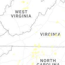
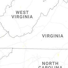
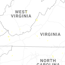
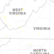
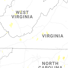
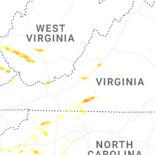


Connect with Interactive Hail Maps