

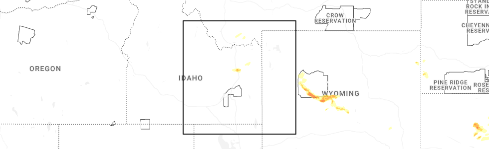
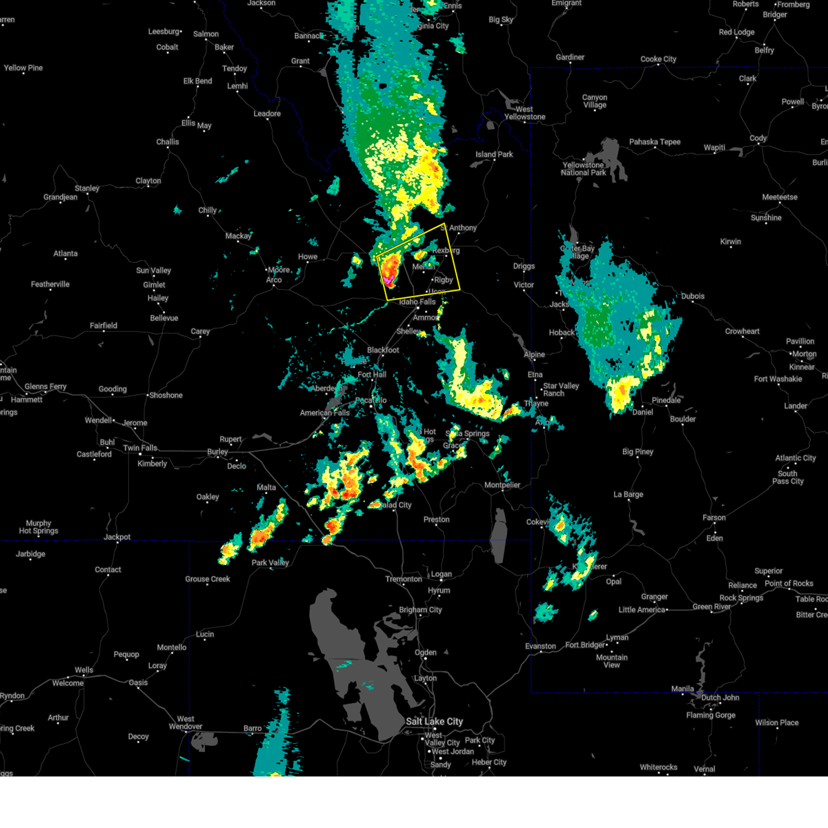
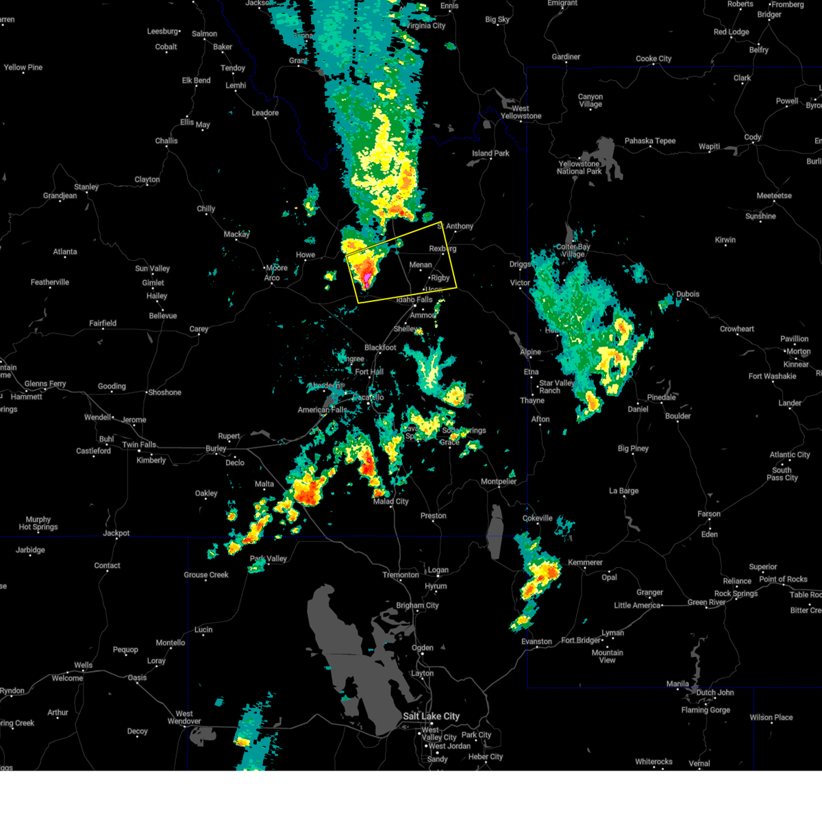
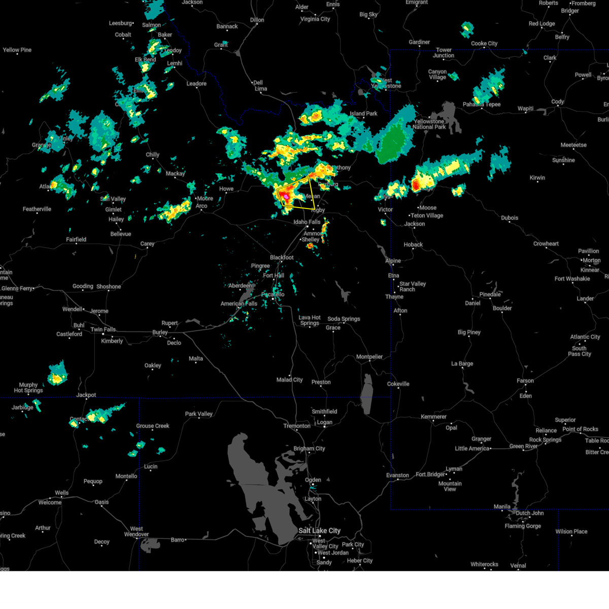
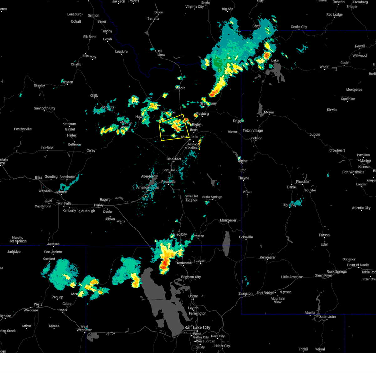
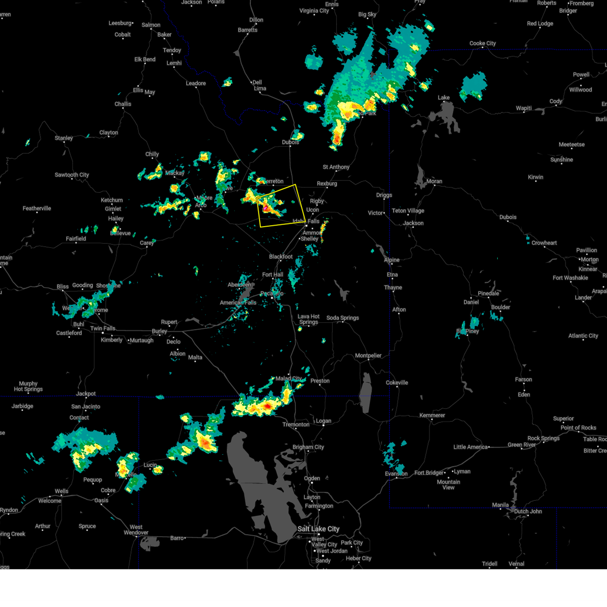
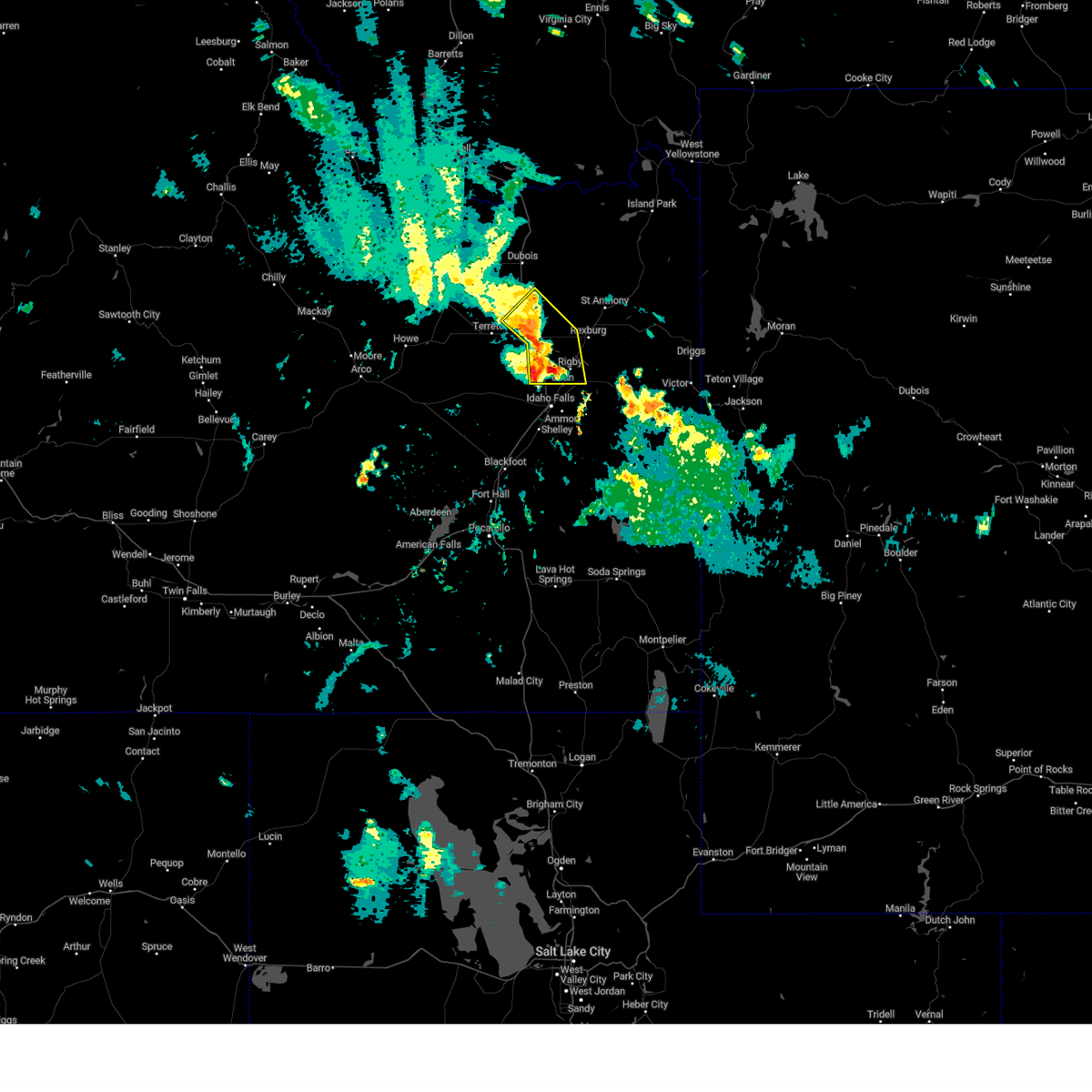
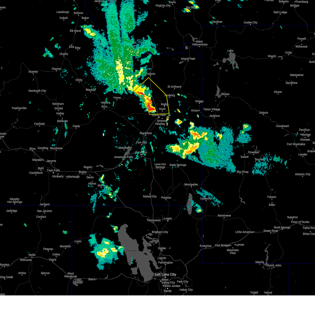
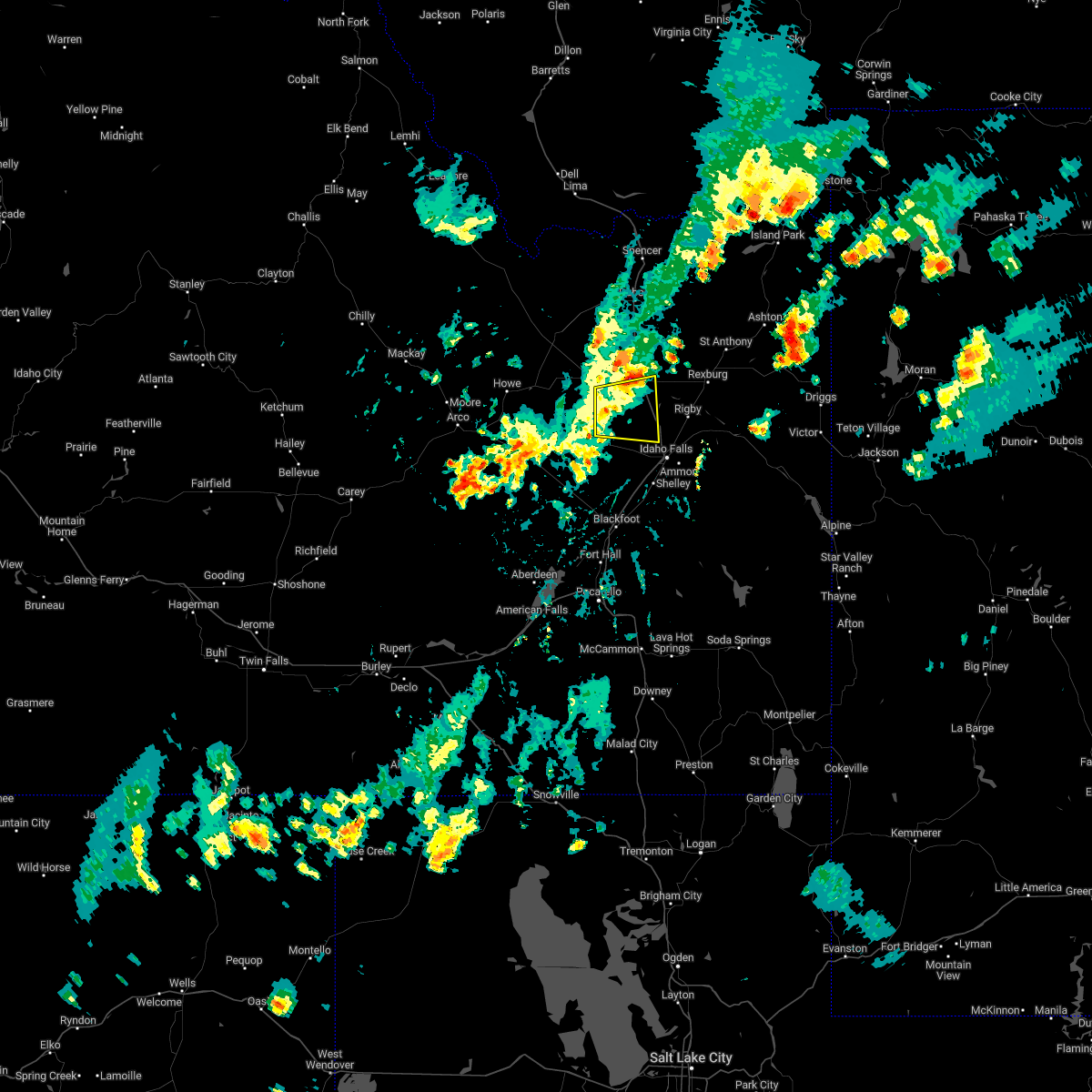
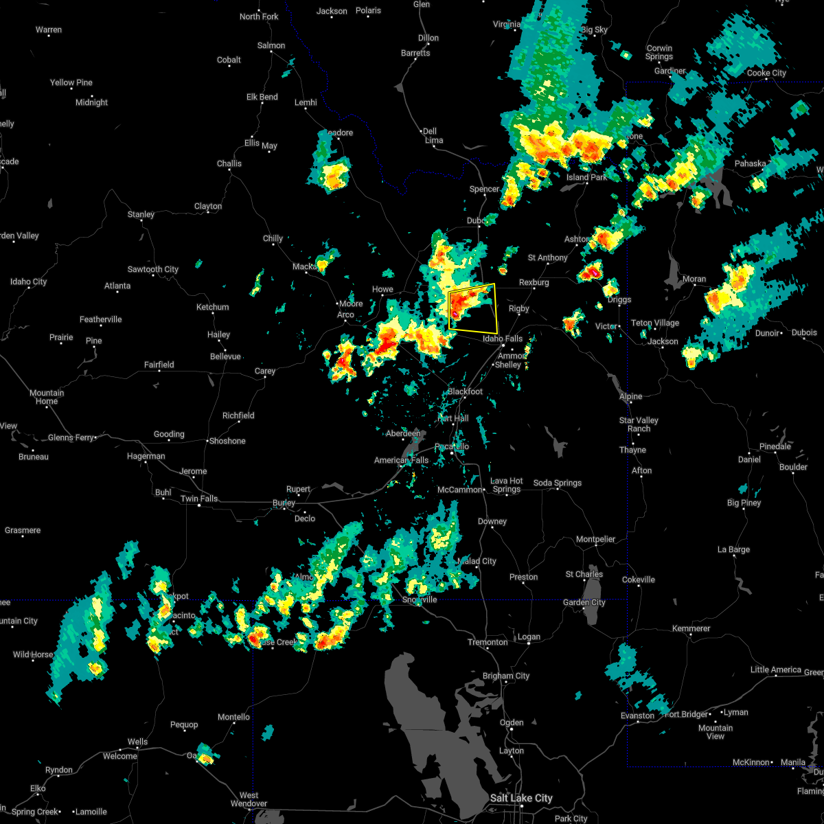
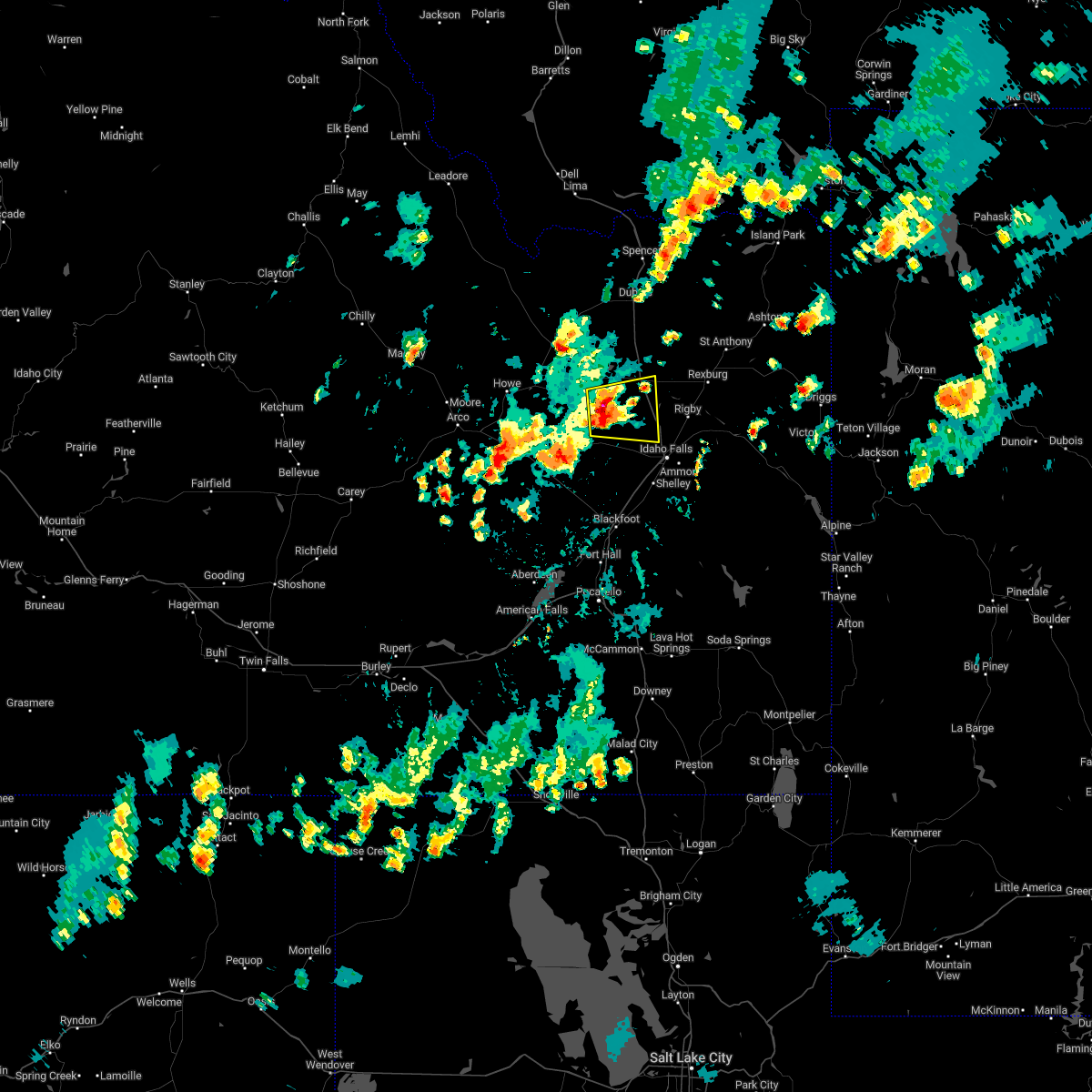
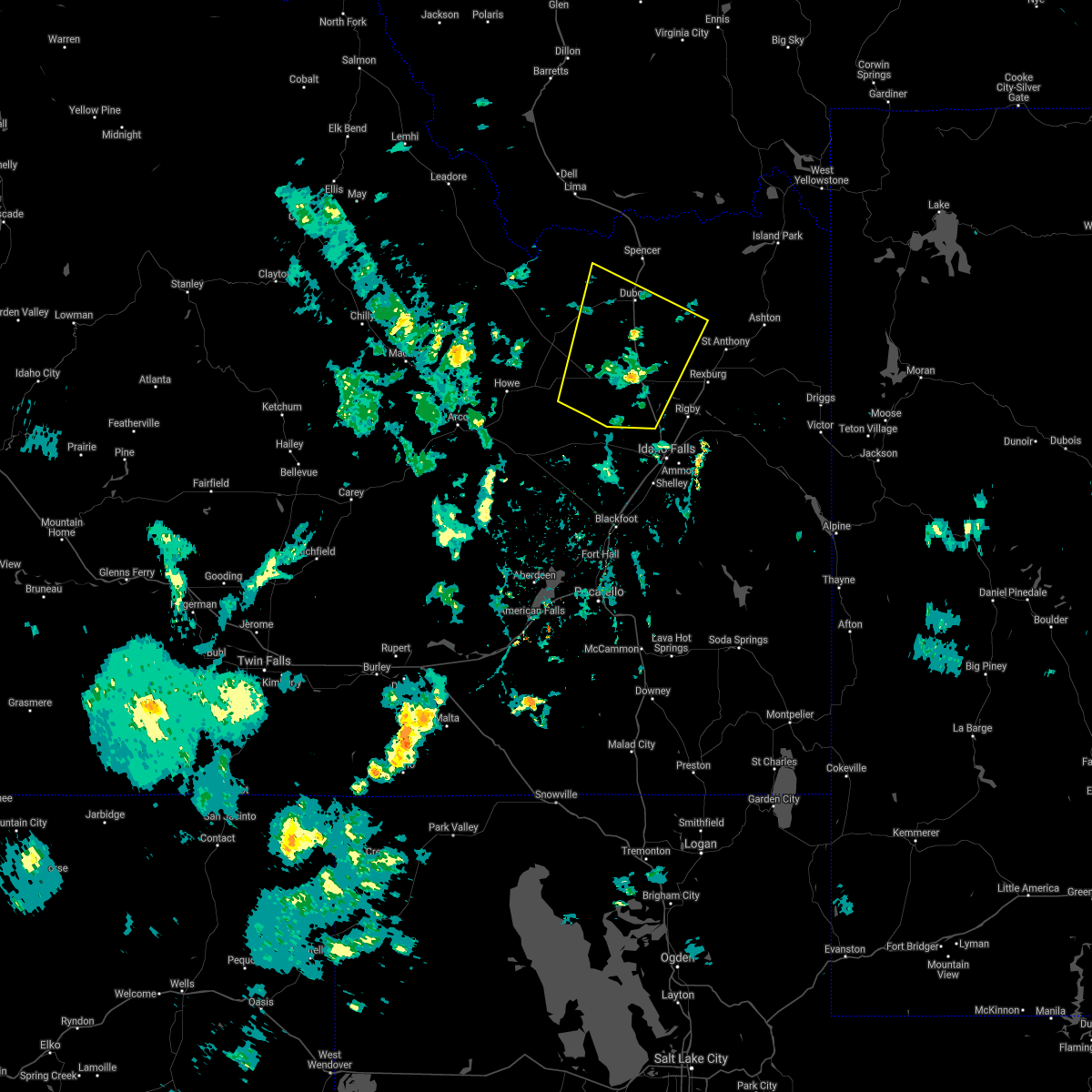
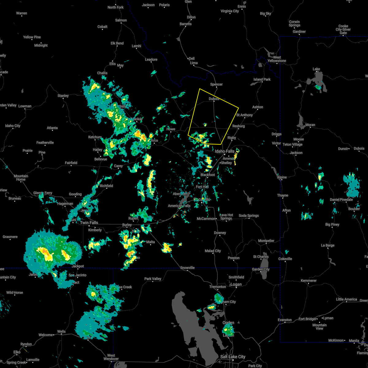
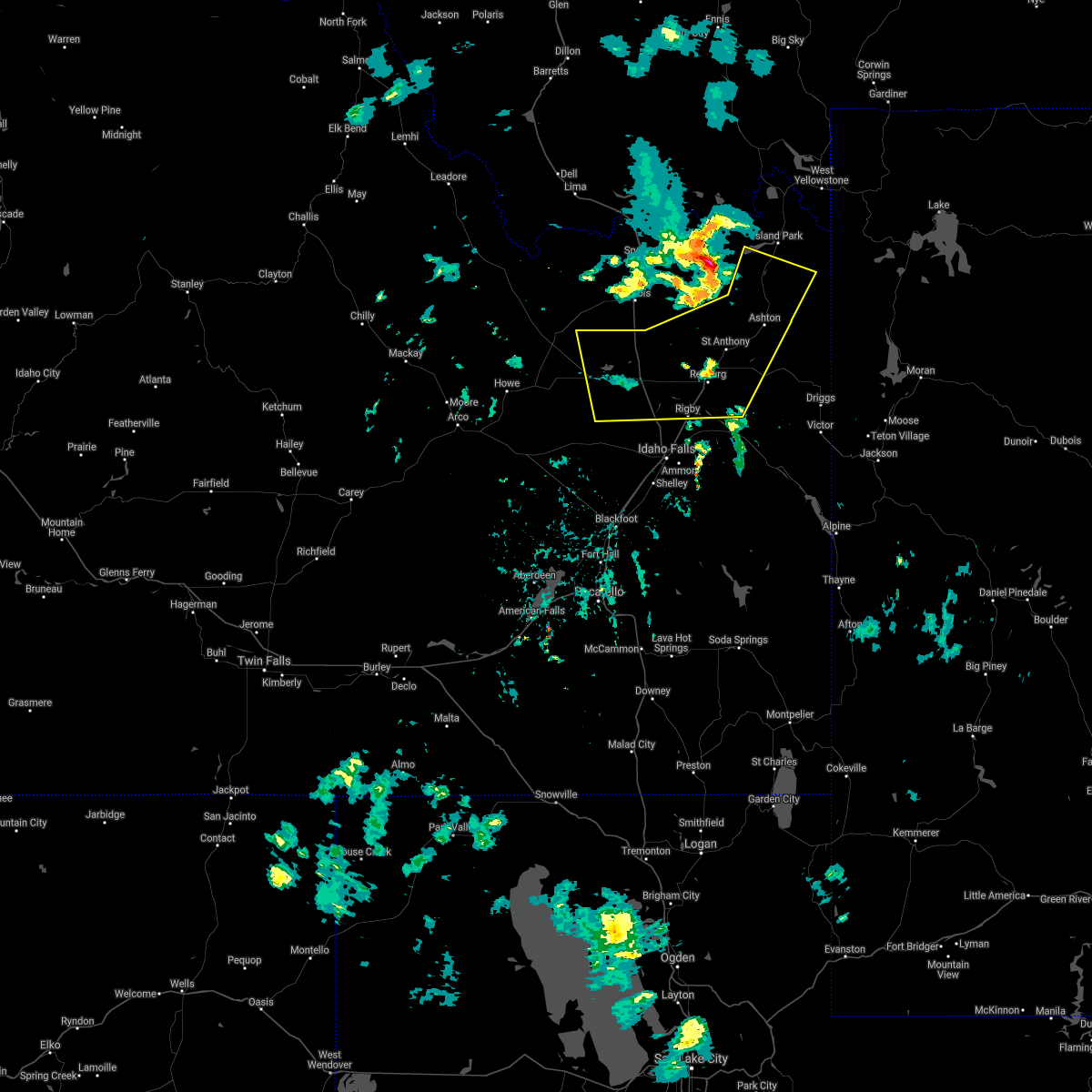
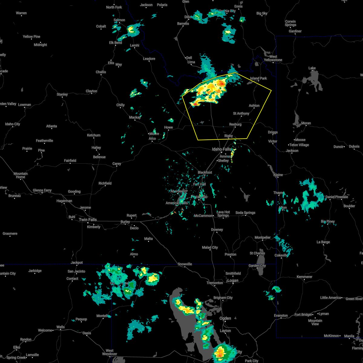
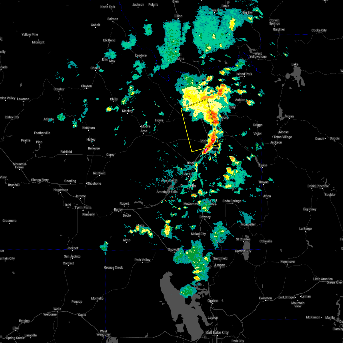
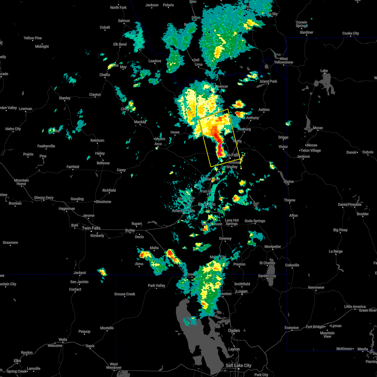
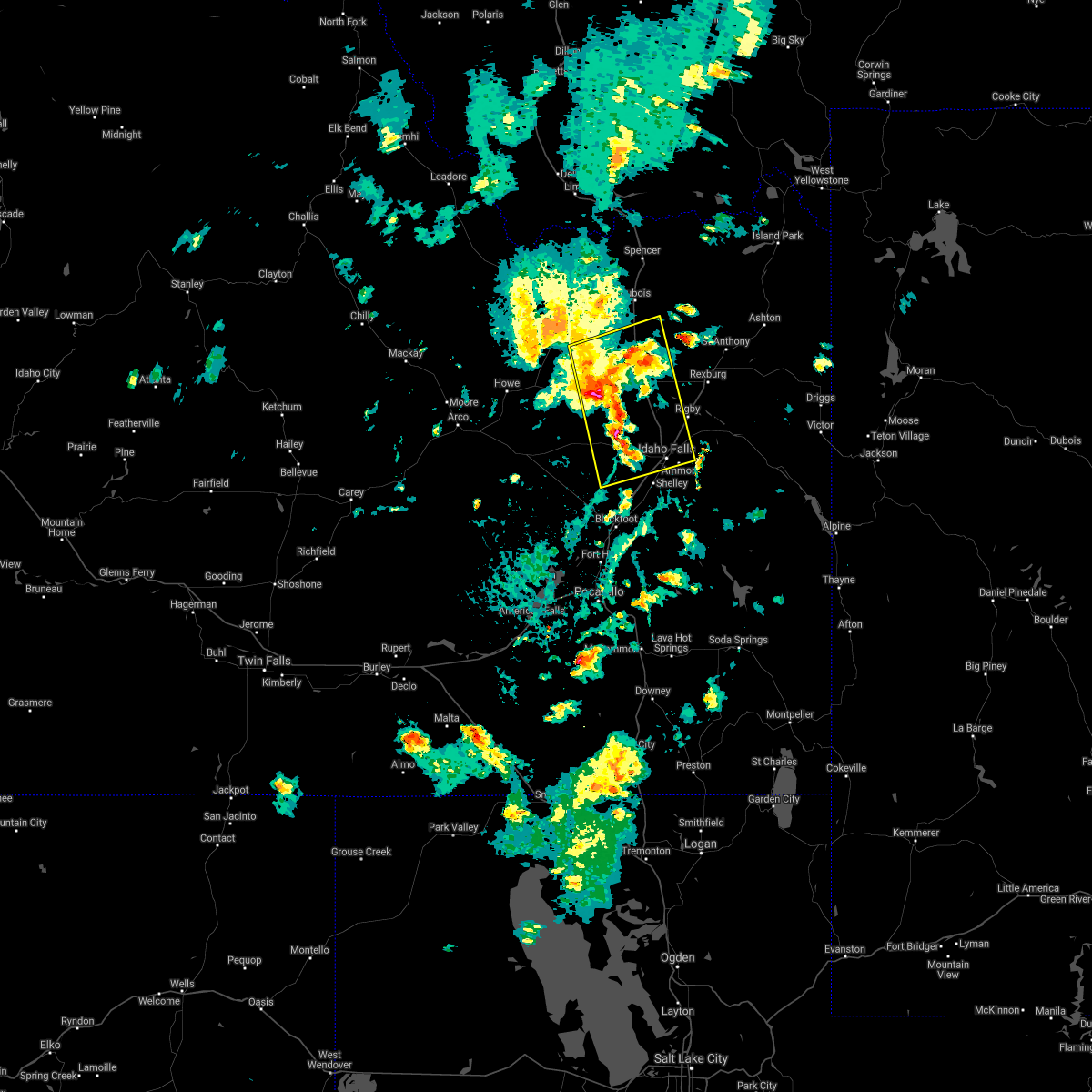
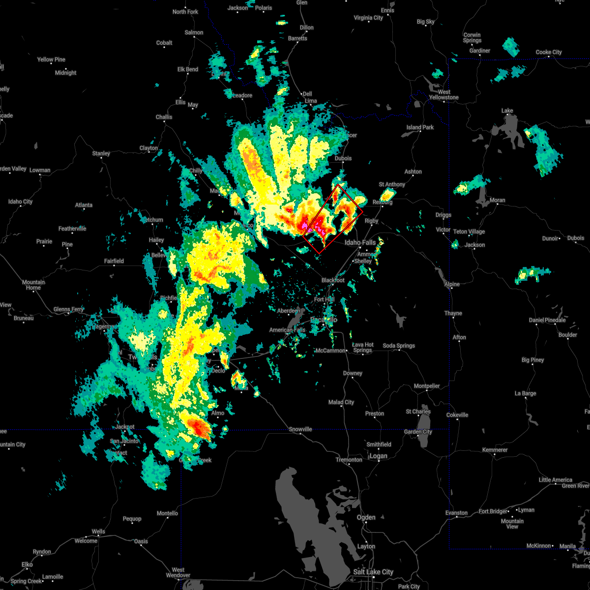
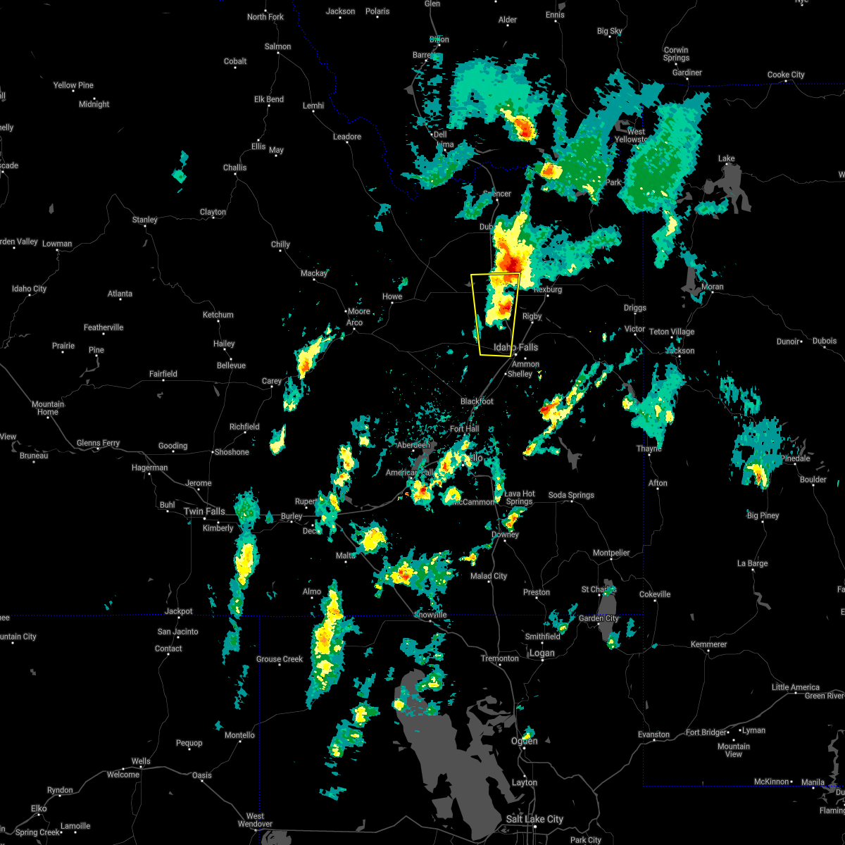
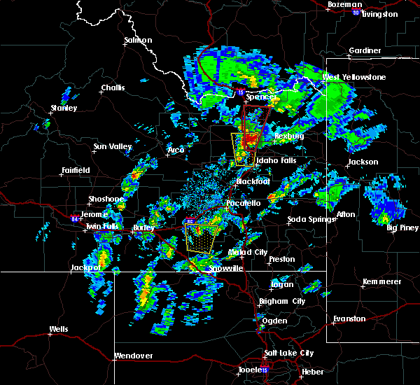
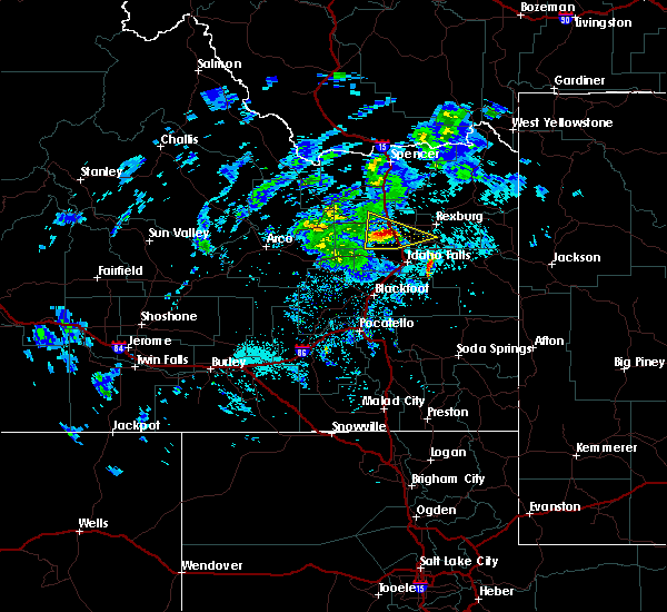
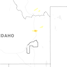
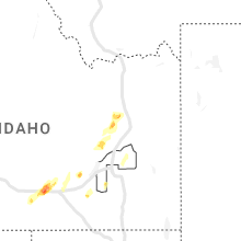
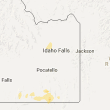
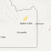
Hail Map for Roberts, ID
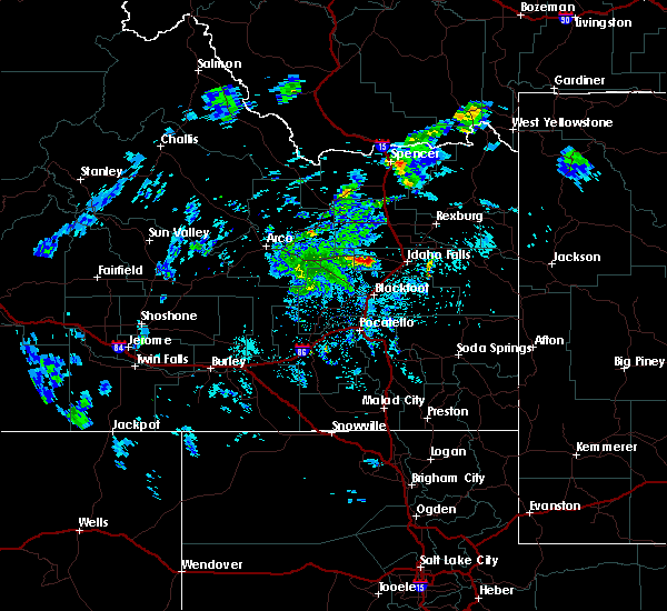
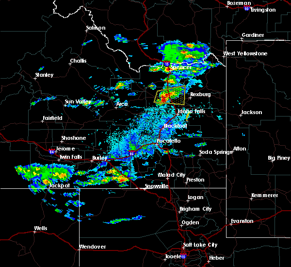
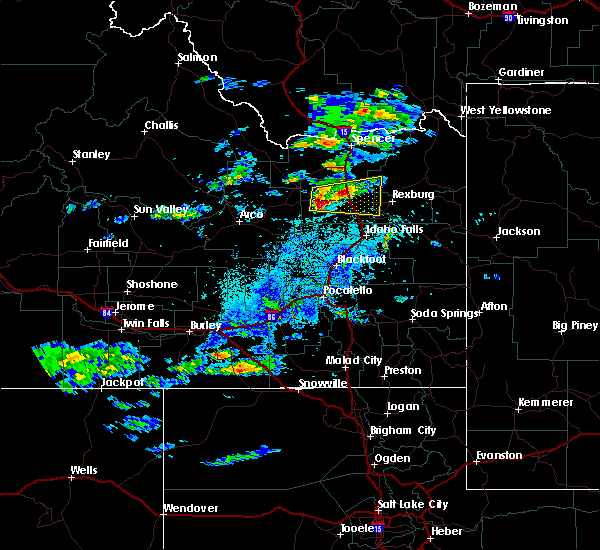
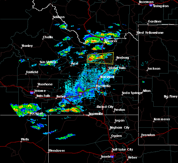
The Roberts, ID area has had 5 reports of on-the-ground hail by trained spotters, and has been under severe weather warnings 6 times during the past 12 months. Doppler radar has detected hail at or near Roberts, ID on 13 occasions, including 1 occasion during the past year.
| Name: | Roberts, ID |
| Where Located: | 16.4 miles NNW of Idaho Falls, ID |
| Map: | Google Map for Roberts, ID |
| Population: | 580 |
| Housing Units: | 192 |
| More Info: | Search Google for Roberts, ID |
3
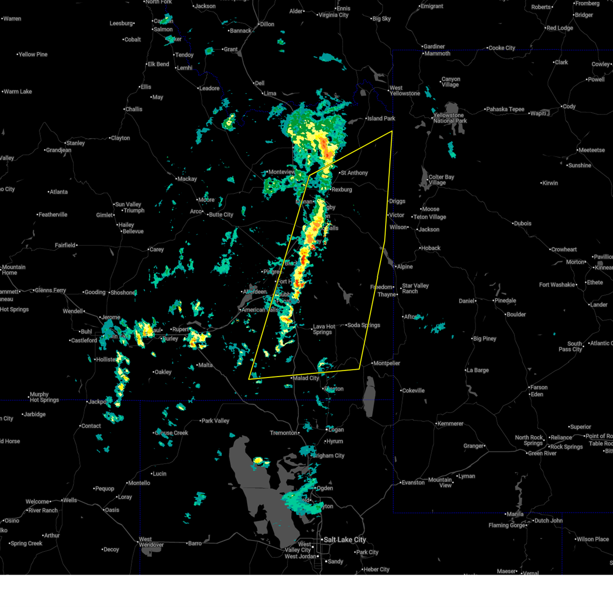
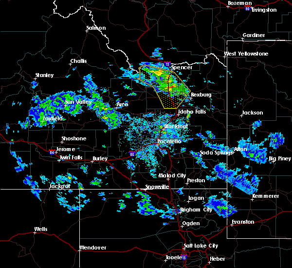
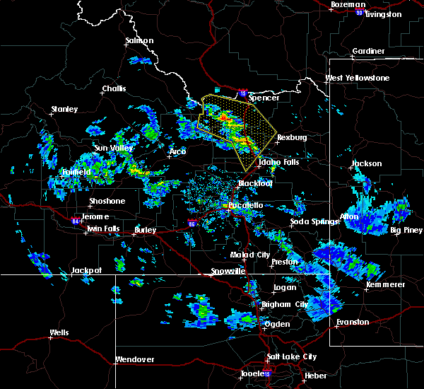
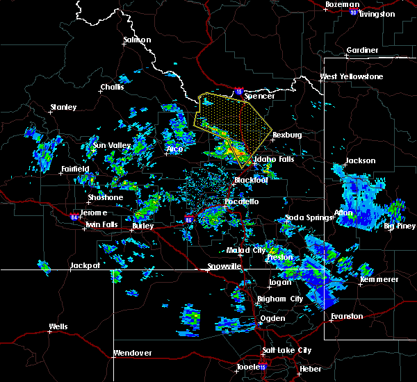
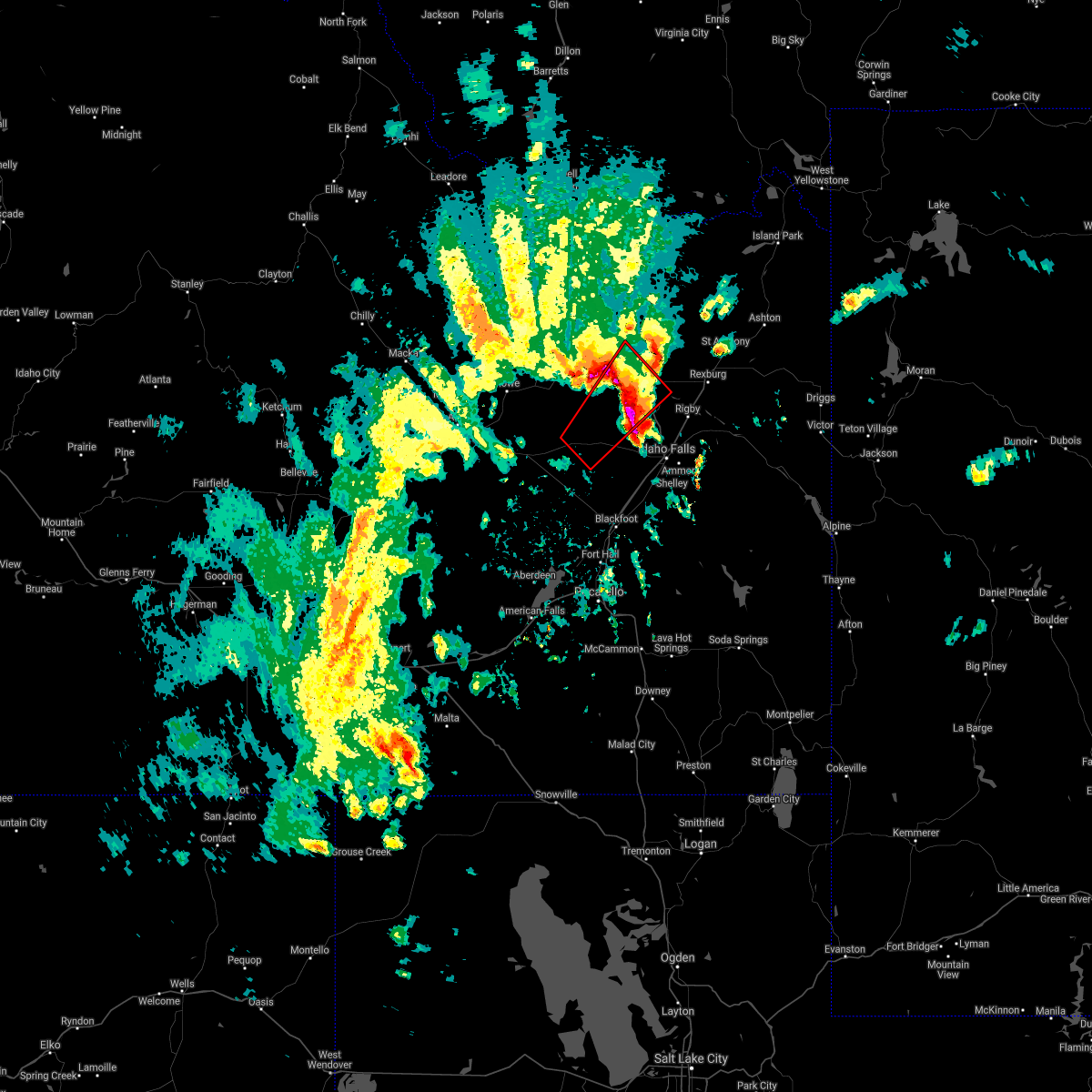
The Top Recent Hail Date for Roberts, ID is Tuesday, July 15, 2025 (4th out of 13)
Hail and Wind Damage Spotted near Roberts, ID
| Date / Time | Report Details |
|---|---|
| 5/13/2026 4:09 PM MDT | Power outage in jefferson county ID, 0.1 miles ENE of Roberts, ID |
| 5/13/2026 3:59 PM MDT |
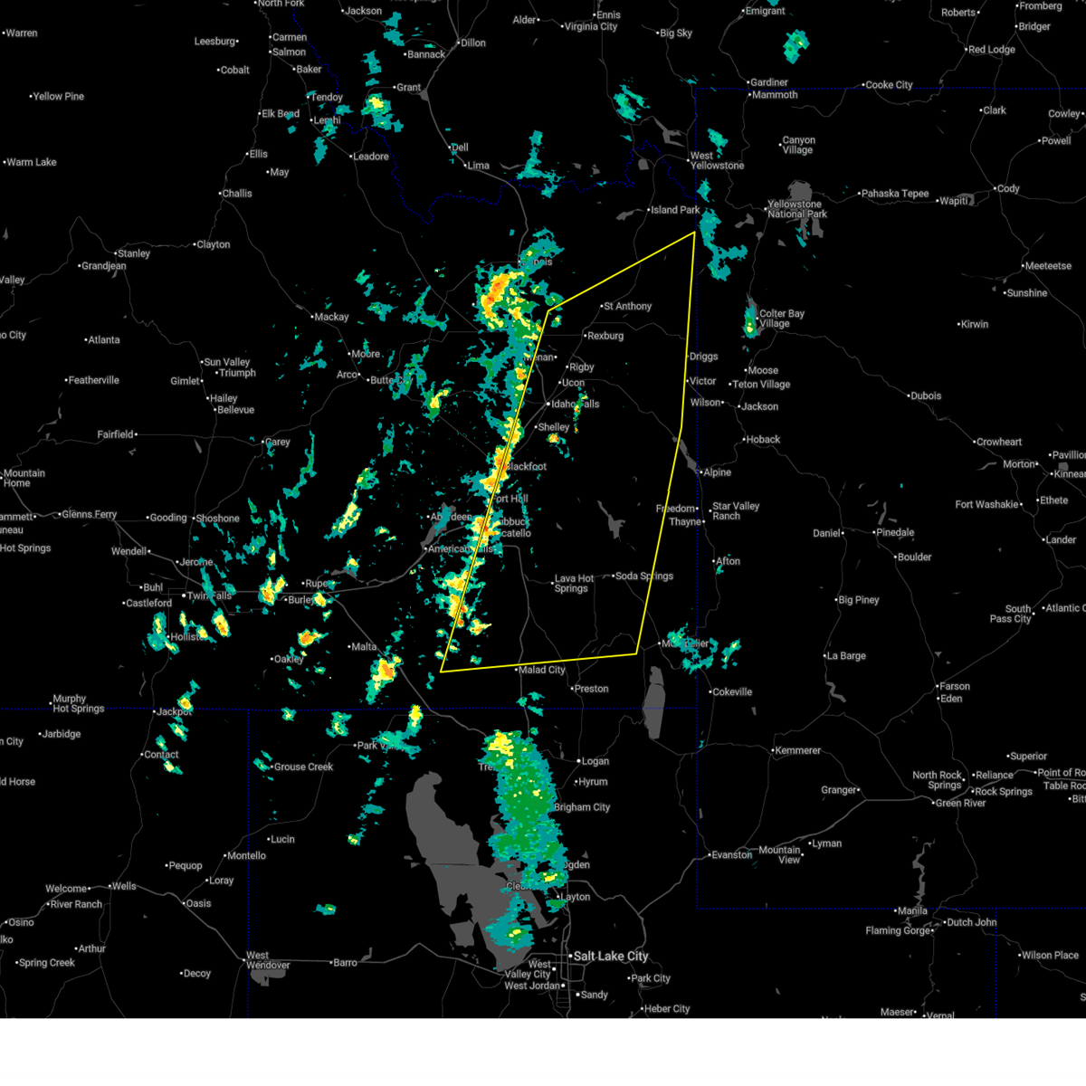
 At 357 pm mdt, a line of severe thunderstorms and associated outflow extends from near saint anthony to bone to near holbrook, moving northeast at 55 mph (radar indicated and mesonet observations. multiple reports of gusts over 60 mph have been reported at times along this line). Hazards include 70 mph wind gusts. Expect considerable tree damage. damage is likely to mobile homes, roofs, and outbuildings. Locations impacted include, idaho falls, pocatello, rexburg, blackfoot, rigby, soda springs, ashton, mccammon, lava hot springs, swan valley, felt, swanlake, ririe reservoir, chesterfield reservoir, goshen, blackfoot reservoir, wayan, marysville, lorenzo, and northern palisades reservoir. At 357 pm mdt, a line of severe thunderstorms and associated outflow extends from near saint anthony to bone to near holbrook, moving northeast at 55 mph (radar indicated and mesonet observations. multiple reports of gusts over 60 mph have been reported at times along this line). Hazards include 70 mph wind gusts. Expect considerable tree damage. damage is likely to mobile homes, roofs, and outbuildings. Locations impacted include, idaho falls, pocatello, rexburg, blackfoot, rigby, soda springs, ashton, mccammon, lava hot springs, swan valley, felt, swanlake, ririe reservoir, chesterfield reservoir, goshen, blackfoot reservoir, wayan, marysville, lorenzo, and northern palisades reservoir.
|
| 5/13/2026 3:30 PM MDT | Mesonet station rob 1 n robert in jefferson county ID, 1.3 miles S of Roberts, ID |
| 5/13/2026 3:30 PM MDT |
 Svrpih the national weather service in pocatello has issued a * severe thunderstorm warning for, teton county in eastern idaho, caribou county in southeastern idaho, southeastern fremont county in southeastern idaho, central oneida county in southeastern idaho, eastern jefferson county in southeastern idaho, bannock county in southeastern idaho, southeastern power county in southeastern idaho, bonneville county in southeastern idaho, madison county in southeastern idaho, northern franklin county in southeastern idaho, northwestern bear lake county in southeastern idaho, southeastern bingham county in southeastern idaho, * until 415 pm mdt. * at 328 pm mdt, a line of severe thunderstorms and associated outflow extends from hamer to near holbrook, moving east northeast at 50 mph (radar indicated and mesonet observations. multiple reports of gusts over 60 mph have been reported, along with blowing dust). Hazards include 70 mph wind gusts. Expect considerable tree damage. Damage is likely to mobile homes, roofs, and outbuildings. Svrpih the national weather service in pocatello has issued a * severe thunderstorm warning for, teton county in eastern idaho, caribou county in southeastern idaho, southeastern fremont county in southeastern idaho, central oneida county in southeastern idaho, eastern jefferson county in southeastern idaho, bannock county in southeastern idaho, southeastern power county in southeastern idaho, bonneville county in southeastern idaho, madison county in southeastern idaho, northern franklin county in southeastern idaho, northwestern bear lake county in southeastern idaho, southeastern bingham county in southeastern idaho, * until 415 pm mdt. * at 328 pm mdt, a line of severe thunderstorms and associated outflow extends from hamer to near holbrook, moving east northeast at 50 mph (radar indicated and mesonet observations. multiple reports of gusts over 60 mph have been reported, along with blowing dust). Hazards include 70 mph wind gusts. Expect considerable tree damage. Damage is likely to mobile homes, roofs, and outbuildings.
|
| 5/13/2026 3:17 PM MDT | Power outage in jefferson county ID, 7.1 miles NE of Roberts, ID |
| 5/13/2026 3:15 PM MDT |
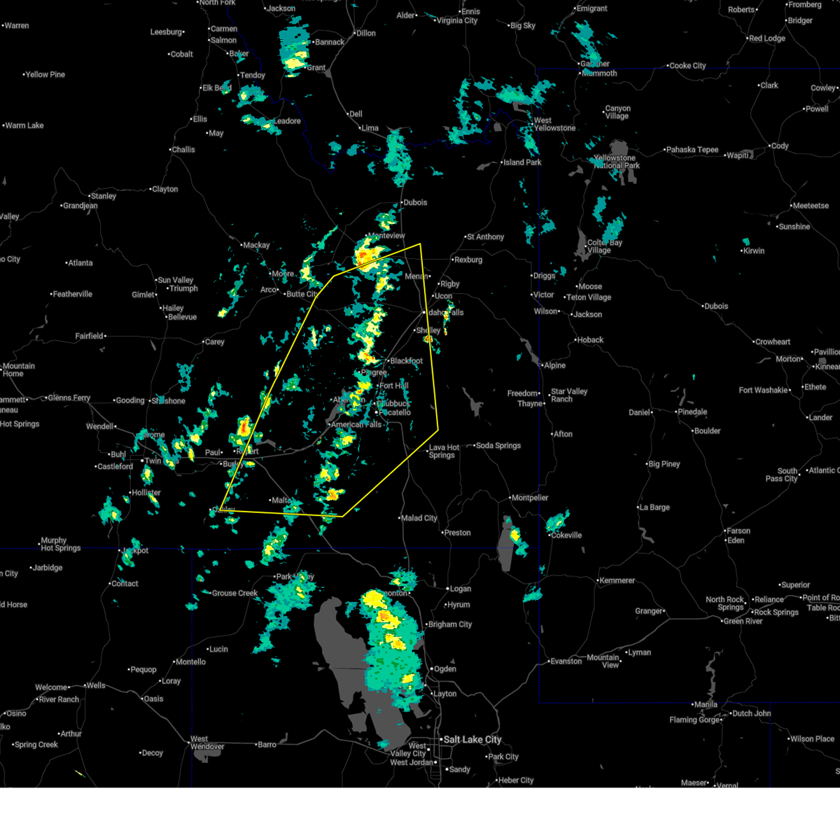 At 312 pm mdt, the leading edge of severe thunderstorms and associated outflow was located from near mud lake to hear juniper, moving northeast at 55 mph. another line of severe thunderstorms and associated outflow extended the south of end craters of the moon to near elba, also moving northeast at 55 mph (radar indicated and mesonet observations. multiple observations over 60 mph have been reported). Hazards include 70 mph wind gusts. Expect considerable tree damage. damage is likely to mobile homes, roofs, and outbuildings. Locations impacted include, idaho falls, pocatello, blackfoot, american falls, mccammon, malta, lake walcott, neeley, chesterfield reservoir, goshen, american falls reservoir, chubbuck, shelley, aberdeen, inkom, roberts, firth, declo, rockland, and albion. At 312 pm mdt, the leading edge of severe thunderstorms and associated outflow was located from near mud lake to hear juniper, moving northeast at 55 mph. another line of severe thunderstorms and associated outflow extended the south of end craters of the moon to near elba, also moving northeast at 55 mph (radar indicated and mesonet observations. multiple observations over 60 mph have been reported). Hazards include 70 mph wind gusts. Expect considerable tree damage. damage is likely to mobile homes, roofs, and outbuildings. Locations impacted include, idaho falls, pocatello, blackfoot, american falls, mccammon, malta, lake walcott, neeley, chesterfield reservoir, goshen, american falls reservoir, chubbuck, shelley, aberdeen, inkom, roberts, firth, declo, rockland, and albion.
|
| 5/13/2026 3:14 PM MDT | Power outage in jefferson county ID, 5.1 miles E of Roberts, ID |
| 5/13/2026 2:43 PM MDT |
 Svrpih the national weather service in pocatello has issued a * severe thunderstorm warning for, southeastern blaine county in central idaho, northwestern caribou county in southeastern idaho, northwestern oneida county in southeastern idaho, southwestern jefferson county in southeastern idaho, bannock county in southeastern idaho, southeastern butte county in southeastern idaho, power county in southeastern idaho, northwestern bonneville county in southeastern idaho, bingham county in southeastern idaho, northeastern cassia county in southeastern idaho, southeastern minidoka county in south central idaho, * until 345 pm mdt. * at 240 pm mdt, a line of severe thunderstorms and associated outflow extends from near atomic city to sublett. another line of severe thunderstorms and associated outflow extends from near arco to near oakley , moving northeast at 50 mph (radar indicated and mesonet observations. multiple reports of gusts over 60 mph have been reported). Hazards include 70 mph wind gusts. Expect considerable tree damage. Damage is likely to mobile homes, roofs, and outbuildings. Svrpih the national weather service in pocatello has issued a * severe thunderstorm warning for, southeastern blaine county in central idaho, northwestern caribou county in southeastern idaho, northwestern oneida county in southeastern idaho, southwestern jefferson county in southeastern idaho, bannock county in southeastern idaho, southeastern butte county in southeastern idaho, power county in southeastern idaho, northwestern bonneville county in southeastern idaho, bingham county in southeastern idaho, northeastern cassia county in southeastern idaho, southeastern minidoka county in south central idaho, * until 345 pm mdt. * at 240 pm mdt, a line of severe thunderstorms and associated outflow extends from near atomic city to sublett. another line of severe thunderstorms and associated outflow extends from near arco to near oakley , moving northeast at 50 mph (radar indicated and mesonet observations. multiple reports of gusts over 60 mph have been reported). Hazards include 70 mph wind gusts. Expect considerable tree damage. Damage is likely to mobile homes, roofs, and outbuildings.
|
| 5/13/2026 1:28 PM MDT |
 Svrpih the national weather service in pocatello has issued a * severe thunderstorm warning for, fremont county in southeastern idaho, jefferson county in southeastern idaho, northwestern bonneville county in southeastern idaho, northwestern madison county in southeastern idaho, eastern clark county in southeastern idaho, * until 230 pm mdt. * at 125 pm mdt, severe thunderstorms extend from near osgood to mud lake, moving northeast at 50 mph (radar indicated and mesonet observations). Hazards include 70 mph wind gusts. Expect considerable tree damage. Damage is likely to mobile homes, roofs, and outbuildings. Svrpih the national weather service in pocatello has issued a * severe thunderstorm warning for, fremont county in southeastern idaho, jefferson county in southeastern idaho, northwestern bonneville county in southeastern idaho, northwestern madison county in southeastern idaho, eastern clark county in southeastern idaho, * until 230 pm mdt. * at 125 pm mdt, severe thunderstorms extend from near osgood to mud lake, moving northeast at 50 mph (radar indicated and mesonet observations). Hazards include 70 mph wind gusts. Expect considerable tree damage. Damage is likely to mobile homes, roofs, and outbuildings.
|
| 4/12/2026 2:57 PM MDT |
 Svrpih the national weather service in pocatello has issued a * severe thunderstorm warning for, southwestern jefferson county in southeastern idaho, northwestern bannock county in southeastern idaho, east central butte county in southeastern idaho, northwestern bonneville county in southeastern idaho, southwestern clark county in southeastern idaho, central bingham county in southeastern idaho, * until 330 pm mdt. * at 256 pm mdt, severe thunderstorm outflow was located along a line extending from near central inl to 8 miles northeast of taber to near fort hall putnam lodge, moving northeast at 55 mph (radar indicated). Hazards include 60 mph wind gusts. expect damage to roofs, siding, and trees Svrpih the national weather service in pocatello has issued a * severe thunderstorm warning for, southwestern jefferson county in southeastern idaho, northwestern bannock county in southeastern idaho, east central butte county in southeastern idaho, northwestern bonneville county in southeastern idaho, southwestern clark county in southeastern idaho, central bingham county in southeastern idaho, * until 330 pm mdt. * at 256 pm mdt, severe thunderstorm outflow was located along a line extending from near central inl to 8 miles northeast of taber to near fort hall putnam lodge, moving northeast at 55 mph (radar indicated). Hazards include 60 mph wind gusts. expect damage to roofs, siding, and trees
|
| 8/13/2024 3:59 PM MDT |
 The storm which prompted the warning has weakened below severe limits, and no longer poses an immediate threat to life or property. therefore, the warning will be allowed to expire. however, small hail and gusty winds are still possible with this thunderstorm. to report severe weather, contact your nearest law enforcement agency. they will relay your report to the national weather service pocatello. The storm which prompted the warning has weakened below severe limits, and no longer poses an immediate threat to life or property. therefore, the warning will be allowed to expire. however, small hail and gusty winds are still possible with this thunderstorm. to report severe weather, contact your nearest law enforcement agency. they will relay your report to the national weather service pocatello.
|
| 8/13/2024 3:42 PM MDT |
 At 341 pm mdt, a severe thunderstorm was located over menan, or near rigby, moving east at 30 mph (radar indicated). Hazards include 60 mph wind gusts and half dollar size hail. Hail damage to vehicles is expected. expect wind damage to roofs, siding, and trees. Locations impacted include, rexburg, rigby, lorenzo, ucon, menan, ririe, roberts, lewisville, archer, egin, plano, sage junction, thornton, southern saint anthony sand dunes, and heise. At 341 pm mdt, a severe thunderstorm was located over menan, or near rigby, moving east at 30 mph (radar indicated). Hazards include 60 mph wind gusts and half dollar size hail. Hail damage to vehicles is expected. expect wind damage to roofs, siding, and trees. Locations impacted include, rexburg, rigby, lorenzo, ucon, menan, ririe, roberts, lewisville, archer, egin, plano, sage junction, thornton, southern saint anthony sand dunes, and heise.
|
| 8/13/2024 3:41 PM MDT | Rocky mountain power reports power outage in the area due to thunderstorm wind in jefferson county ID, 8.4 miles NE of Roberts, ID |
| 8/13/2024 3:20 PM MDT |
 the severe thunderstorm warning has been cancelled and is no longer in effect the severe thunderstorm warning has been cancelled and is no longer in effect
|
| 8/13/2024 3:20 PM MDT |
 At 320 pm mdt, a severe thunderstorm was located near roberts, or 14 miles west of rigby, moving east at 30 mph (radar indicated). Hazards include 60 mph wind gusts and half dollar size hail. Hail damage to vehicles is expected. expect wind damage to roofs, siding, and trees. Locations impacted include, rexburg, rigby, lorenzo, ucon, menan, ririe, roberts, lewisville, archer, egin, plano, sage junction, osgood, thornton, southern saint anthony sand dunes, and heise. At 320 pm mdt, a severe thunderstorm was located near roberts, or 14 miles west of rigby, moving east at 30 mph (radar indicated). Hazards include 60 mph wind gusts and half dollar size hail. Hail damage to vehicles is expected. expect wind damage to roofs, siding, and trees. Locations impacted include, rexburg, rigby, lorenzo, ucon, menan, ririe, roberts, lewisville, archer, egin, plano, sage junction, osgood, thornton, southern saint anthony sand dunes, and heise.
|
| 8/13/2024 2:56 PM MDT |
 Svrpih the national weather service in pocatello has issued a * severe thunderstorm warning for, southwestern fremont county in southeastern idaho, jefferson county in southeastern idaho, northwestern bonneville county in southeastern idaho, western madison county in southeastern idaho, northwestern bingham county in southeastern idaho, * until 400 pm mdt. * at 254 pm mdt, a severe thunderstorm was located 9 miles south of terreton, moving east at 35 mph (radar indicated). Hazards include ping pong ball size hail and 60 mph wind gusts. People and animals outdoors will be injured. expect hail damage to roofs, siding, windows, and vehicles. Expect wind damage to roofs, siding, and trees. Svrpih the national weather service in pocatello has issued a * severe thunderstorm warning for, southwestern fremont county in southeastern idaho, jefferson county in southeastern idaho, northwestern bonneville county in southeastern idaho, western madison county in southeastern idaho, northwestern bingham county in southeastern idaho, * until 400 pm mdt. * at 254 pm mdt, a severe thunderstorm was located 9 miles south of terreton, moving east at 35 mph (radar indicated). Hazards include ping pong ball size hail and 60 mph wind gusts. People and animals outdoors will be injured. expect hail damage to roofs, siding, windows, and vehicles. Expect wind damage to roofs, siding, and trees.
|
| 7/1/2024 3:43 PM MDT |
 Svrpih the national weather service in pocatello has issued a * severe thunderstorm warning for, south central jefferson county in southeastern idaho, western madison county in southeastern idaho, * until 415 pm mdt. * at 342 pm mdt, a severe thunderstorm was located 7 miles west of roberts, or 10 miles southeast of terreton, moving east at 25 mph (radar indicated). Hazards include 60 mph wind gusts and half dollar size hail. Hail damage to vehicles is expected. Expect wind damage to roofs, siding, and trees. Svrpih the national weather service in pocatello has issued a * severe thunderstorm warning for, south central jefferson county in southeastern idaho, western madison county in southeastern idaho, * until 415 pm mdt. * at 342 pm mdt, a severe thunderstorm was located 7 miles west of roberts, or 10 miles southeast of terreton, moving east at 25 mph (radar indicated). Hazards include 60 mph wind gusts and half dollar size hail. Hail damage to vehicles is expected. Expect wind damage to roofs, siding, and trees.
|
| 9/13/2023 3:12 PM MDT |
 The severe thunderstorm warning for southwestern jefferson, northwestern bonneville and northwestern bingham counties will expire at 315 pm mdt, the storm which prompted the warning has weakened below severe limits, and no longer poses an immediate threat to life or property. therefore, the warning will be allowed to expire. however, gusty winds are still possible with this thunderstorm. The severe thunderstorm warning for southwestern jefferson, northwestern bonneville and northwestern bingham counties will expire at 315 pm mdt, the storm which prompted the warning has weakened below severe limits, and no longer poses an immediate threat to life or property. therefore, the warning will be allowed to expire. however, gusty winds are still possible with this thunderstorm.
|
| 9/13/2023 3:03 PM MDT |
 At 303 pm mdt, a severe thunderstorm was located 11 miles south of terreton, moving east at 15 mph (radar indicated). Hazards include 60 mph wind gusts and nickel size hail. Expect damage to roofs, siding, and trees. locations impacted include, roberts, osgood, kettle butte, and sage junction. hail threat, radar indicated max hail size, 0. 88 in wind threat, radar indicated max wind gust, 60 mph. At 303 pm mdt, a severe thunderstorm was located 11 miles south of terreton, moving east at 15 mph (radar indicated). Hazards include 60 mph wind gusts and nickel size hail. Expect damage to roofs, siding, and trees. locations impacted include, roberts, osgood, kettle butte, and sage junction. hail threat, radar indicated max hail size, 0. 88 in wind threat, radar indicated max wind gust, 60 mph.
|
| 9/13/2023 2:44 PM MDT |
 At 243 pm mdt, a severe thunderstorm was located 8 miles northeast of southeast inl, or 12 miles south of terreton, moving east at 15 mph (radar indicated). Hazards include 60 mph wind gusts and nickel size hail. expect damage to roofs, siding, and trees At 243 pm mdt, a severe thunderstorm was located 8 miles northeast of southeast inl, or 12 miles south of terreton, moving east at 15 mph (radar indicated). Hazards include 60 mph wind gusts and nickel size hail. expect damage to roofs, siding, and trees
|
| 8/29/2023 7:45 PM MDT | Mesonet station rob 1 n robert in jefferson county ID, 1.3 miles S of Roberts, ID |
| 6/23/2023 3:15 PM MDT |
 At 314 pm mdt, severe thunderstorms were located along a line extending from 6 miles west of hamer to 7 miles north of roberts to near ucon, moving east at 25 mph (radar indicated). Hazards include 60 mph wind gusts. Expect damage to roofs, siding, and trees. locations impacted include, rigby, lorenzo, menan, roberts, lewisville, hamer and sage junction. hail threat, radar indicated max hail size, <. 75 in wind threat, radar indicated max wind gust, 60 mph. At 314 pm mdt, severe thunderstorms were located along a line extending from 6 miles west of hamer to 7 miles north of roberts to near ucon, moving east at 25 mph (radar indicated). Hazards include 60 mph wind gusts. Expect damage to roofs, siding, and trees. locations impacted include, rigby, lorenzo, menan, roberts, lewisville, hamer and sage junction. hail threat, radar indicated max hail size, <. 75 in wind threat, radar indicated max wind gust, 60 mph.
|
| 6/23/2023 2:54 PM MDT |
 At 253 pm mdt, severe thunderstorms were located along a line extending from near monteview to 9 miles east of terreton to 8 miles south of roberts, moving east at 25 mph (radar indicated). Hazards include 60 mph wind gusts and half dollar size hail. Hail damage to vehicles is expected. Expect wind damage to roofs, siding, and trees. At 253 pm mdt, severe thunderstorms were located along a line extending from near monteview to 9 miles east of terreton to 8 miles south of roberts, moving east at 25 mph (radar indicated). Hazards include 60 mph wind gusts and half dollar size hail. Hail damage to vehicles is expected. Expect wind damage to roofs, siding, and trees.
|
| 8/13/2022 4:52 PM MDT |
 The severe thunderstorm warning for southwestern jefferson and northwestern bonneville counties will expire at 500 pm mdt, the storm which prompted the warning has weakened below severe limits, and has exited the warned area. therefore, the warning will be allowed to expire. however gusty winds are still possible with this thunderstorm. The severe thunderstorm warning for southwestern jefferson and northwestern bonneville counties will expire at 500 pm mdt, the storm which prompted the warning has weakened below severe limits, and has exited the warned area. therefore, the warning will be allowed to expire. however gusty winds are still possible with this thunderstorm.
|
| 8/13/2022 4:34 PM MDT |
 At 434 pm mdt, a severe thunderstorm was located 9 miles west of roberts, or 10 miles southeast of terreton, moving east at 10 mph (radar indicated). Hazards include 60 mph wind gusts and quarter size hail. Hail damage to vehicles is expected. expect wind damage to roofs, siding, and trees. locations impacted include, roberts, osgood, kettle butte and sage junction. hail threat, radar indicated max hail size, 1. 00 in wind threat, radar indicated max wind gust, 60 mph. At 434 pm mdt, a severe thunderstorm was located 9 miles west of roberts, or 10 miles southeast of terreton, moving east at 10 mph (radar indicated). Hazards include 60 mph wind gusts and quarter size hail. Hail damage to vehicles is expected. expect wind damage to roofs, siding, and trees. locations impacted include, roberts, osgood, kettle butte and sage junction. hail threat, radar indicated max hail size, 1. 00 in wind threat, radar indicated max wind gust, 60 mph.
|
| 8/13/2022 4:15 PM MDT |
 At 415 pm mdt, a severe thunderstorm was located 9 miles south of terreton, moving east at 10 mph (radar indicated). Hazards include 60 mph wind gusts and quarter size hail. Hail damage to vehicles is expected. Expect wind damage to roofs, siding, and trees. At 415 pm mdt, a severe thunderstorm was located 9 miles south of terreton, moving east at 10 mph (radar indicated). Hazards include 60 mph wind gusts and quarter size hail. Hail damage to vehicles is expected. Expect wind damage to roofs, siding, and trees.
|
| 7/2/2022 6:05 PM MDT |
 At 604 pm mdt, severe thunderstorms were located along a line extending from 14 miles northeast of mackay to 13 miles northwest of dubois to near chester, moving north at 50 mph (radar indicated). Hazards include 70 mph wind gusts and penny size hail. Expect considerable tree damage. damage is likely to mobile homes, roofs, and outbuildings. locations impacted include, northern idaho falls, rexburg, rigby, ashton, dubois, ririe reservoir, terreton, marysville, lorenzo, ammon, iona, sugar city, ucon, menan, teton, ririe, roberts, lewisville, mud lake and parker. thunderstorm damage threat, considerable hail threat, observed max hail size, 0. 75 in wind threat, observed max wind gust, 70 mph. At 604 pm mdt, severe thunderstorms were located along a line extending from 14 miles northeast of mackay to 13 miles northwest of dubois to near chester, moving north at 50 mph (radar indicated). Hazards include 70 mph wind gusts and penny size hail. Expect considerable tree damage. damage is likely to mobile homes, roofs, and outbuildings. locations impacted include, northern idaho falls, rexburg, rigby, ashton, dubois, ririe reservoir, terreton, marysville, lorenzo, ammon, iona, sugar city, ucon, menan, teton, ririe, roberts, lewisville, mud lake and parker. thunderstorm damage threat, considerable hail threat, observed max hail size, 0. 75 in wind threat, observed max wind gust, 70 mph.
|
| 7/2/2022 5:29 PM MDT |
 At 529 pm mdt, severe thunderstorms were located along a line extending from near arco to mud lake to 8 miles east of ririe, moving north at 50 mph (radar indicated). Hazards include 70 mph wind gusts and penny size hail. Expect considerable tree damage. Damage is likely to mobile homes, roofs, and outbuildings. At 529 pm mdt, severe thunderstorms were located along a line extending from near arco to mud lake to 8 miles east of ririe, moving north at 50 mph (radar indicated). Hazards include 70 mph wind gusts and penny size hail. Expect considerable tree damage. Damage is likely to mobile homes, roofs, and outbuildings.
|
| 7/2/2022 5:19 PM MDT |
 At 519 pm mdt, severe thunderstorms were located along a line extending from 7 miles southeast of southeast inl to 7 miles west of shelley to near fort hall lincoln creek lodge, moving northeast at 30 mph (radar indicated). Hazards include 60 mph wind gusts and penny size hail. Expect damage to roofs, siding, and trees. locations impacted include, idaho falls, blackfoot, rigby, ririe reservoir, lorenzo, goshen, ammon, shelley, iona, ucon, menan, ririe, roberts, firth, lewisville, atomic city, rose, fort hall eagle lodge, fort hall lincoln creek lodge and taber. hail threat, radar indicated max hail size, 0. 75 in wind threat, radar indicated max wind gust, 60 mph. At 519 pm mdt, severe thunderstorms were located along a line extending from 7 miles southeast of southeast inl to 7 miles west of shelley to near fort hall lincoln creek lodge, moving northeast at 30 mph (radar indicated). Hazards include 60 mph wind gusts and penny size hail. Expect damage to roofs, siding, and trees. locations impacted include, idaho falls, blackfoot, rigby, ririe reservoir, lorenzo, goshen, ammon, shelley, iona, ucon, menan, ririe, roberts, firth, lewisville, atomic city, rose, fort hall eagle lodge, fort hall lincoln creek lodge and taber. hail threat, radar indicated max hail size, 0. 75 in wind threat, radar indicated max wind gust, 60 mph.
|
| 7/2/2022 4:54 PM MDT |
 At 453 pm mdt, severe thunderstorms were located along a line extending from near atomic city to 6 miles north of moreland to fort hall eagle lodge, moving northeast at 30 mph (radar indicated). Hazards include 60 mph wind gusts and penny size hail. expect damage to roofs, siding, and trees At 453 pm mdt, severe thunderstorms were located along a line extending from near atomic city to 6 miles north of moreland to fort hall eagle lodge, moving northeast at 30 mph (radar indicated). Hazards include 60 mph wind gusts and penny size hail. expect damage to roofs, siding, and trees
|
| 5/2/2022 6:18 PM MDT |
 At 617 pm mdt, severe thunderstorms were located along a line extending from 7 miles southwest of northwest inl to near rockford to near fort hall bannock peak, moving northeast at 40 mph (radar indicated). Hazards include 60 mph wind gusts. Expect damage to roofs, siding, and trees. locations impacted include, idaho falls, pocatello, blackfoot, american falls, arco, american falls reservoir, terreton, goshen, chubbuck, shelley, aberdeen, roberts, firth, mud lake, atomic city, rose, southeast inl, southwest inl, fort hall bannock creek lodge and pingree. hail threat, radar indicated max hail size, <. 75 in wind threat, radar indicated max wind gust, 60 mph. At 617 pm mdt, severe thunderstorms were located along a line extending from 7 miles southwest of northwest inl to near rockford to near fort hall bannock peak, moving northeast at 40 mph (radar indicated). Hazards include 60 mph wind gusts. Expect damage to roofs, siding, and trees. locations impacted include, idaho falls, pocatello, blackfoot, american falls, arco, american falls reservoir, terreton, goshen, chubbuck, shelley, aberdeen, roberts, firth, mud lake, atomic city, rose, southeast inl, southwest inl, fort hall bannock creek lodge and pingree. hail threat, radar indicated max hail size, <. 75 in wind threat, radar indicated max wind gust, 60 mph.
|
| 5/2/2022 5:59 PM MDT |
 At 559 pm mdt, severe thunderstorms were located along a line extending from 12 miles southwest of northwest inl to near pingree to near fort hall bannock peak, moving east at 40 mph (radar indicated). Hazards include 70 mph wind gusts and penny size hail. Expect considerable tree damage. Damage is likely to mobile homes, roofs, and outbuildings. At 559 pm mdt, severe thunderstorms were located along a line extending from 12 miles southwest of northwest inl to near pingree to near fort hall bannock peak, moving east at 40 mph (radar indicated). Hazards include 70 mph wind gusts and penny size hail. Expect considerable tree damage. Damage is likely to mobile homes, roofs, and outbuildings.
|
| 9/10/2021 4:50 PM MDT | Mesonet station rob 1 n robert in jefferson county ID, 1.3 miles S of Roberts, ID |
| 9/10/2021 4:16 PM MDT |
 At 415 pm mdt, severe thunderstorms were located along a line extending from near monteview to 6 miles southeast of hamer, moving north at 60 mph (radar indicated). Hazards include 60 mph wind gusts. Expect damage to roofs, siding, and trees. locations impacted include, dubois, terreton, roberts, mud lake, hamer, monteview, small, sage junction and southern saint anthony sand dunes. hail threat, radar indicated max hail size, <. 75 in wind threat, observed max wind gust, 60 mph. At 415 pm mdt, severe thunderstorms were located along a line extending from near monteview to 6 miles southeast of hamer, moving north at 60 mph (radar indicated). Hazards include 60 mph wind gusts. Expect damage to roofs, siding, and trees. locations impacted include, dubois, terreton, roberts, mud lake, hamer, monteview, small, sage junction and southern saint anthony sand dunes. hail threat, radar indicated max hail size, <. 75 in wind threat, observed max wind gust, 60 mph.
|
| 9/10/2021 4:00 PM MDT |
 At 400 pm mdt, severe thunderstorms were located along a line extending from 6 miles southwest of mud lake to 7 miles southwest of roberts, moving north at 55 mph (radar indicated). Hazards include 60 mph wind gusts. expect damage to roofs, siding, and trees At 400 pm mdt, severe thunderstorms were located along a line extending from 6 miles southwest of mud lake to 7 miles southwest of roberts, moving north at 55 mph (radar indicated). Hazards include 60 mph wind gusts. expect damage to roofs, siding, and trees
|
| 8/5/2021 10:58 PM MDT | Powerlines dow in jefferson county ID, 2.1 miles SE of Roberts, ID |
| 8/5/2021 7:30 PM MDT | Mesonet station rob - roberts. thunderstorm outflow wind in jefferson county ID, 1.3 miles S of Roberts, ID |
| 7/15/2021 7:10 PM MDT |
 At 709 pm mdt, severe thunderstorms were located along a line extending from 8 miles south of island park reservoir to sugar city to near terreton, moving southeast at 35 mph (radar indicated). Hazards include 60 mph wind gusts. Expect damage to roofs, siding, and trees. locations impacted include, rexburg, rigby, ashton, terreton, marysville, lorenzo, sugar city, menan, teton, roberts, lewisville, mud lake, parker, hamer, archer, egin, st anthony, monteview, plano and chester. hail threat, radar indicated max hail size, <. 75 in wind threat, radar indicated max wind gust, 60 mph. At 709 pm mdt, severe thunderstorms were located along a line extending from 8 miles south of island park reservoir to sugar city to near terreton, moving southeast at 35 mph (radar indicated). Hazards include 60 mph wind gusts. Expect damage to roofs, siding, and trees. locations impacted include, rexburg, rigby, ashton, terreton, marysville, lorenzo, sugar city, menan, teton, roberts, lewisville, mud lake, parker, hamer, archer, egin, st anthony, monteview, plano and chester. hail threat, radar indicated max hail size, <. 75 in wind threat, radar indicated max wind gust, 60 mph.
|
| 7/15/2021 6:44 PM MDT |
 At 642 pm mdt, severe thunderstorms were located along a line extending from near kilgore to 10 miles northeast of hamer to 7 miles northwest of monteview, moving southeast at 40 mph (mesonet. at 630 pm, 64mph winds were reported at the china point mesonet station). Hazards include 70 mph wind gusts. Expect considerable tree damage. Damage is likely to mobile homes, roofs, and outbuildings. At 642 pm mdt, severe thunderstorms were located along a line extending from near kilgore to 10 miles northeast of hamer to 7 miles northwest of monteview, moving southeast at 40 mph (mesonet. at 630 pm, 64mph winds were reported at the china point mesonet station). Hazards include 70 mph wind gusts. Expect considerable tree damage. Damage is likely to mobile homes, roofs, and outbuildings.
|
| 9/19/2020 5:21 PM MDT |
 At 503 pm mdt, severe thunderstorms were located along a line extending from hamer to near rose, moving northeast at 20 mph (radar indicated). Hazards include 70 mph wind gusts and quarter size hail. Hail damage to vehicles is expected. expect considerable tree damage. Wind damage is also likely to mobile homes, roofs, and outbuildings. At 503 pm mdt, severe thunderstorms were located along a line extending from hamer to near rose, moving northeast at 20 mph (radar indicated). Hazards include 70 mph wind gusts and quarter size hail. Hail damage to vehicles is expected. expect considerable tree damage. Wind damage is also likely to mobile homes, roofs, and outbuildings.
|
| 9/19/2020 5:11 PM MDT |
 The severe thunderstorm warning for southwestern fremont, jefferson, northwestern bonneville, west central madison, south central clark and central bingham counties will expire at 515 pm mdt, the storms which prompted the warning have moved out of the area. therefore, the warning will be allowed to expire. remember, a severe thunderstorm warning still remains in effect for eastern jefferson and western bonneville counties. The severe thunderstorm warning for southwestern fremont, jefferson, northwestern bonneville, west central madison, south central clark and central bingham counties will expire at 515 pm mdt, the storms which prompted the warning have moved out of the area. therefore, the warning will be allowed to expire. remember, a severe thunderstorm warning still remains in effect for eastern jefferson and western bonneville counties.
|
| 9/19/2020 5:04 PM MDT |
 At 503 pm mdt, severe thunderstorms were located along a line extending from hamer to near rose, moving northeast at 20 mph (radar indicated). Hazards include 70 mph wind gusts and quarter size hail. Hail damage to vehicles is expected. expect considerable tree damage. Wind damage is also likely to mobile homes, roofs, and outbuildings. At 503 pm mdt, severe thunderstorms were located along a line extending from hamer to near rose, moving northeast at 20 mph (radar indicated). Hazards include 70 mph wind gusts and quarter size hail. Hail damage to vehicles is expected. expect considerable tree damage. Wind damage is also likely to mobile homes, roofs, and outbuildings.
|
| 9/19/2020 4:41 PM MDT |
 At 440 pm mdt, severe thunderstorms were located along a line extending from 6 miles east of monteview to 9 miles west of shelley, moving east at 30 mph. wind gusts of 66 mph have been observed at the itd site kettle butte (radar indicated). Hazards include 70 mph wind gusts and quarter size hail. Hail damage to vehicles is expected. expect considerable tree damage. wind damage is also likely to mobile homes, roofs, and outbuildings. Locations impacted include, idaho falls, terreton, ammon, iona, ucon, menan, roberts, lewisville, mud lake, hamer, monteview, sage junction, osgood and kettle butte. At 440 pm mdt, severe thunderstorms were located along a line extending from 6 miles east of monteview to 9 miles west of shelley, moving east at 30 mph. wind gusts of 66 mph have been observed at the itd site kettle butte (radar indicated). Hazards include 70 mph wind gusts and quarter size hail. Hail damage to vehicles is expected. expect considerable tree damage. wind damage is also likely to mobile homes, roofs, and outbuildings. Locations impacted include, idaho falls, terreton, ammon, iona, ucon, menan, roberts, lewisville, mud lake, hamer, monteview, sage junction, osgood and kettle butte.
|
| 9/19/2020 4:29 PM MDT |
 The national weather service in pocatello has issued a * severe thunderstorm warning for. southwestern fremont county in southeastern idaho. jefferson county in southeastern idaho. northwestern bonneville county in southeastern idaho. West central madison county in southeastern idaho. The national weather service in pocatello has issued a * severe thunderstorm warning for. southwestern fremont county in southeastern idaho. jefferson county in southeastern idaho. northwestern bonneville county in southeastern idaho. West central madison county in southeastern idaho.
|
| 8/26/2020 10:06 PM MDT |
 The severe thunderstorm warning for south central jefferson, northwestern bonneville and central bingham counties will expire at 1015 pm mdt, the storm which prompted the warning has weakened below severe limits, and no longer poses an immediate threat to life or property. therefore, the warning will be allowed to expire. however gusty winds, heavy rain, frequent lightning and small hail are still likely with this thunderstorm. The severe thunderstorm warning for south central jefferson, northwestern bonneville and central bingham counties will expire at 1015 pm mdt, the storm which prompted the warning has weakened below severe limits, and no longer poses an immediate threat to life or property. therefore, the warning will be allowed to expire. however gusty winds, heavy rain, frequent lightning and small hail are still likely with this thunderstorm.
|
| 8/26/2020 9:43 PM MDT |
 At 943 pm mdt, a severe thunderstorm was located 7 miles west of idaho falls, moving east at 35 mph (radar indicated). Hazards include 60 mph wind gusts and quarter size hail. Hail damage to vehicles is expected. expect wind damage to roofs, siding, and trees. Locations impacted include, idaho falls, ammon, shelley, iona, ucon, menan, roberts, lewisville, osgood and kettle butte. At 943 pm mdt, a severe thunderstorm was located 7 miles west of idaho falls, moving east at 35 mph (radar indicated). Hazards include 60 mph wind gusts and quarter size hail. Hail damage to vehicles is expected. expect wind damage to roofs, siding, and trees. Locations impacted include, idaho falls, ammon, shelley, iona, ucon, menan, roberts, lewisville, osgood and kettle butte.
|
| 8/26/2020 9:26 PM MDT |
 At 925 pm mdt, a severe thunderstorm was located 14 miles northwest of shelley, or 17 miles west of idaho falls, moving east at 35 mph (radar indicated and confirmed by surface observations. a 64 mph wind gust was recorded at telegraph hill itd site at 915 pm mdt). Hazards include 60 mph wind gusts and quarter size hail. Hail damage to vehicles is expected. Expect wind damage to roofs, siding, and trees. At 925 pm mdt, a severe thunderstorm was located 14 miles northwest of shelley, or 17 miles west of idaho falls, moving east at 35 mph (radar indicated and confirmed by surface observations. a 64 mph wind gust was recorded at telegraph hill itd site at 915 pm mdt). Hazards include 60 mph wind gusts and quarter size hail. Hail damage to vehicles is expected. Expect wind damage to roofs, siding, and trees.
|
| 8/25/2020 5:54 PM MDT |
 At 552 pm mdt, severe thunderstorms were located along a line extending from 7 miles west of hamer to 12 miles northwest of shelley to near rose, moving east at 50 mph (mesonet observations and radar indicated. these storms have a history of producing wind gusts up to 70 mph!). Hazards include 60 to 70 mph wind gusts. Expect considerable tree damage. Damage is likely to mobile homes, roofs, and outbuildings. At 552 pm mdt, severe thunderstorms were located along a line extending from 7 miles west of hamer to 12 miles northwest of shelley to near rose, moving east at 50 mph (mesonet observations and radar indicated. these storms have a history of producing wind gusts up to 70 mph!). Hazards include 60 to 70 mph wind gusts. Expect considerable tree damage. Damage is likely to mobile homes, roofs, and outbuildings.
|
| 8/25/2020 5:44 PM MDT |
 At 543 pm mdt, severe thunderstorms are located along a line extending from near monteview to 14 miles southeast of southeast inl to near rockford, moving east at 35 mph (mesonet observations. these storms have a history of producing winds up to 70 mph!). Hazards include 70 mph wind gusts. Expect considerable tree damage. damage is likely to mobile homes, roofs, and outbuildings. Locations impacted include, idaho falls, blackfoot, terreton, goshen, shelley, roberts, firth, mud lake, hamer, atomic city, rose, inl complex, taber, moreland, groveland, basalt, east butte and sage junction. At 543 pm mdt, severe thunderstorms are located along a line extending from near monteview to 14 miles southeast of southeast inl to near rockford, moving east at 35 mph (mesonet observations. these storms have a history of producing winds up to 70 mph!). Hazards include 70 mph wind gusts. Expect considerable tree damage. damage is likely to mobile homes, roofs, and outbuildings. Locations impacted include, idaho falls, blackfoot, terreton, goshen, shelley, roberts, firth, mud lake, hamer, atomic city, rose, inl complex, taber, moreland, groveland, basalt, east butte and sage junction.
|
| 8/25/2020 5:33 PM MDT |
 At 532 pm mdt, severe thunderstorms were located along a line extending from near northwest inl to 10 miles southeast of southeast inl to near pingree, moving east at 50 mph (mesonet observations. these storms have a history of producing wind gusts up to 70 mph!). Hazards include 70 mph wind gusts. Expect considerable tree damage. damage is likely to mobile homes, roofs, and outbuildings. Locations impacted include, idaho falls, blackfoot, terreton, goshen, shelley, roberts, firth, mud lake, hamer, atomic city, rose, southeast inl, southwest inl, fort hall lincoln creek lodge, central inl, taber, northwest inl, moreland, rockford and groveland. At 532 pm mdt, severe thunderstorms were located along a line extending from near northwest inl to 10 miles southeast of southeast inl to near pingree, moving east at 50 mph (mesonet observations. these storms have a history of producing wind gusts up to 70 mph!). Hazards include 70 mph wind gusts. Expect considerable tree damage. damage is likely to mobile homes, roofs, and outbuildings. Locations impacted include, idaho falls, blackfoot, terreton, goshen, shelley, roberts, firth, mud lake, hamer, atomic city, rose, southeast inl, southwest inl, fort hall lincoln creek lodge, central inl, taber, northwest inl, moreland, rockford and groveland.
|
| 8/25/2020 5:22 PM MDT |
 At 521 pm mdt, severe thunderstorms were located along a line extending from near northwest inl to 6 miles east of atomic city to 6 miles west of springfield, moving east at 45 mph (mesonet observations and radar. these storms have a history of producing winds near 60 mph). Hazards include 60 mph wind gusts. Expect damage to roofs, siding, and trees. Locations impacted include, idaho falls, blackfoot, arco, terreton, goshen, shelley, roberts, firth, mud lake, hamer, atomic city, rose, inl complex, pingree, fort hall eagle lodge, fort hall lincoln creek lodge, and taber. At 521 pm mdt, severe thunderstorms were located along a line extending from near northwest inl to 6 miles east of atomic city to 6 miles west of springfield, moving east at 45 mph (mesonet observations and radar. these storms have a history of producing winds near 60 mph). Hazards include 60 mph wind gusts. Expect damage to roofs, siding, and trees. Locations impacted include, idaho falls, blackfoot, arco, terreton, goshen, shelley, roberts, firth, mud lake, hamer, atomic city, rose, inl complex, pingree, fort hall eagle lodge, fort hall lincoln creek lodge, and taber.
|
| 8/25/2020 5:09 PM MDT |
 At 508 pm mdt, severe thunderstorms were located along a line extending from 10 miles west of northwest inl to near atomic city to 14 miles northwest of aberdeen, moving east at 45 mph (radar indicated). Hazards include 60 mph wind gusts. expect damage to roofs, siding, and trees At 508 pm mdt, severe thunderstorms were located along a line extending from 10 miles west of northwest inl to near atomic city to 14 miles northwest of aberdeen, moving east at 45 mph (radar indicated). Hazards include 60 mph wind gusts. expect damage to roofs, siding, and trees
|
| 5/30/2020 9:41 PM MDT |
 The severe thunderstorm warning for southwestern fremont, central jefferson, northwestern madison, bonneville and central clark counties will expire at 945 pm mdt, the storms which prompted the warning have weakened below severe limits, and no longer pose an immediate threat to life or property. therefore, the warning will be allowed to expire. however gusty winds are still possible with these thunderstorms. The severe thunderstorm warning for southwestern fremont, central jefferson, northwestern madison, bonneville and central clark counties will expire at 945 pm mdt, the storms which prompted the warning have weakened below severe limits, and no longer pose an immediate threat to life or property. therefore, the warning will be allowed to expire. however gusty winds are still possible with these thunderstorms.
|
| 5/30/2020 9:23 PM MDT |
 At 922 pm mdt, severe thunderstorms were located along a line extending from 20 miles northwest of monteview to 9 miles northwest of hamer to near roberts, moving north at 35 mph (radar indicated). Hazards include 60 mph wind gusts. Expect damage to roofs, siding, and trees. Locations impacted include, dubois, menan, roberts, lewisville, hamer, spencer, plano, egin, southern saint anthony sand dunes, edie school, small and sage junction. At 922 pm mdt, severe thunderstorms were located along a line extending from 20 miles northwest of monteview to 9 miles northwest of hamer to near roberts, moving north at 35 mph (radar indicated). Hazards include 60 mph wind gusts. Expect damage to roofs, siding, and trees. Locations impacted include, dubois, menan, roberts, lewisville, hamer, spencer, plano, egin, southern saint anthony sand dunes, edie school, small and sage junction.
|
| 5/30/2020 9:15 PM MDT | Mesonet station rob robert in jefferson county ID, 1.3 miles S of Roberts, ID |
| 5/30/2020 9:04 PM MDT |
 At 903 pm mdt, severe thunderstorms were located along a line extending from 14 miles north of northwest inl to near terreton to 10 miles northwest of idaho falls, moving north at 35 mph (radar indicated). Hazards include 60 mph wind gusts. expect damage to roofs, siding, and trees At 903 pm mdt, severe thunderstorms were located along a line extending from 14 miles north of northwest inl to near terreton to 10 miles northwest of idaho falls, moving north at 35 mph (radar indicated). Hazards include 60 mph wind gusts. expect damage to roofs, siding, and trees
|
| 6/6/2019 8:41 PM MDT |
 At 841 pm mdt, severe thunderstorms were located along a line extending from 6 miles east of terreton to archer to near ririe reservoir, moving northeast at 50 mph (radar indicated. 57 mph winds were reported at the idaho falls airport). Hazards include 60 mph wind gusts. Expect damage to roofs, siding, and trees. Locations impacted include, northern idaho falls, rexburg, rigby, ririe reservoir, lorenzo, ammon, iona, sugar city, ucon, menan, teton, ririe, roberts, lewisville, parker, hamer, drummond, archer, egin and st anthony. At 841 pm mdt, severe thunderstorms were located along a line extending from 6 miles east of terreton to archer to near ririe reservoir, moving northeast at 50 mph (radar indicated. 57 mph winds were reported at the idaho falls airport). Hazards include 60 mph wind gusts. Expect damage to roofs, siding, and trees. Locations impacted include, northern idaho falls, rexburg, rigby, ririe reservoir, lorenzo, ammon, iona, sugar city, ucon, menan, teton, ririe, roberts, lewisville, parker, hamer, drummond, archer, egin and st anthony.
|
| 6/6/2019 8:26 PM MDT |
 At 825 pm mdt, severe thunderstorms and associated outflow winds were located along a line extending from 7 miles south of terreton to near ucon to 7 miles southeast of ammon, moving northeast at 50 mph (radar indicated). Hazards include 60 mph wind gusts. expect damage to roofs, siding, and trees At 825 pm mdt, severe thunderstorms and associated outflow winds were located along a line extending from 7 miles south of terreton to near ucon to 7 miles southeast of ammon, moving northeast at 50 mph (radar indicated). Hazards include 60 mph wind gusts. expect damage to roofs, siding, and trees
|
| 7/25/2018 4:08 PM MDT |
 The severe thunderstorm warning for west central teton, southeastern jefferson, northwestern bonneville, southern madison and northeastern bingham counties will expire at 415 pm mdt, the storm which prompted the warning has weakened below severe limits, and has exited the warned area. therefore, the warning will be allowed to expire. The severe thunderstorm warning for west central teton, southeastern jefferson, northwestern bonneville, southern madison and northeastern bingham counties will expire at 415 pm mdt, the storm which prompted the warning has weakened below severe limits, and has exited the warned area. therefore, the warning will be allowed to expire.
|
| 7/25/2018 3:44 PM MDT |
 At 343 pm mdt, a severe thunderstorm was located near ucon or 7 miles north of idaho falls, moving east at 15 mph (measured wind speed at idaho falls airport). Hazards include 60 mph wind gusts. Expect damage to roofs, siding, and trees. Locations impacted include, idaho falls, rigby, ririe reservoir, lorenzo, ammon, iona, ucon, menan, ririe, roberts, lewisville, archer, osgood and heise. At 343 pm mdt, a severe thunderstorm was located near ucon or 7 miles north of idaho falls, moving east at 15 mph (measured wind speed at idaho falls airport). Hazards include 60 mph wind gusts. Expect damage to roofs, siding, and trees. Locations impacted include, idaho falls, rigby, ririe reservoir, lorenzo, ammon, iona, ucon, menan, ririe, roberts, lewisville, archer, osgood and heise.
|
| 7/25/2018 3:27 PM MDT |
 At 326 pm mdt, a severe thunderstorm was located 7 miles south of roberts or 9 miles northwest of idaho falls, moving east at 15 mph (radar indicated). Hazards include 60 mph wind gusts. expect damage to roofs, siding, and trees At 326 pm mdt, a severe thunderstorm was located 7 miles south of roberts or 9 miles northwest of idaho falls, moving east at 15 mph (radar indicated). Hazards include 60 mph wind gusts. expect damage to roofs, siding, and trees
|
| 5/31/2018 5:15 PM MDT |
 At 514 pm mdt, a line of severe thunderstorms was located from north of roberts to just south of idaho falls, moving east at 35 mph (trained weather spotters. this storm has a history of producing large hail and winds to 50 mph or higher). Hazards include ping pong ball size hail and 60 mph wind gusts. People and animals outdoors will be injured. expect hail damage to roofs, siding, windows, and vehicles. Expect wind damage to roofs, siding, and trees. At 514 pm mdt, a line of severe thunderstorms was located from north of roberts to just south of idaho falls, moving east at 35 mph (trained weather spotters. this storm has a history of producing large hail and winds to 50 mph or higher). Hazards include ping pong ball size hail and 60 mph wind gusts. People and animals outdoors will be injured. expect hail damage to roofs, siding, windows, and vehicles. Expect wind damage to roofs, siding, and trees.
|
| 5/31/2018 5:11 PM MDT | Half Dollar sized hail reported 0.6 miles SSE of Roberts, ID |
| 5/31/2018 5:10 PM MDT | Quarter sized hail reported 0.1 miles ENE of Roberts, ID, accompanied with 50 mph winds as well. |
| 5/31/2018 5:01 PM MDT |
 At 500 pm mdt, a severe thunderstorm capable of producing a tornado was located near roberts or 10 miles west of rigby, moving east at 45 mph (radar indicated rotation. this storm has a history of producing one or more tornadoes). Hazards include tornado and quarter size hail. Flying debris will be dangerous to those caught without shelter. mobile homes will be damaged or destroyed. damage to roofs, windows, and vehicles will occur. tree damage is likely. this dangerous storm will be near, ucon, menan and lewisville around 510 pm mdt. rigby and lorenzo around 515 pm mdt. Other locations impacted by this tornadic thunderstorm include osgood and thornton. At 500 pm mdt, a severe thunderstorm capable of producing a tornado was located near roberts or 10 miles west of rigby, moving east at 45 mph (radar indicated rotation. this storm has a history of producing one or more tornadoes). Hazards include tornado and quarter size hail. Flying debris will be dangerous to those caught without shelter. mobile homes will be damaged or destroyed. damage to roofs, windows, and vehicles will occur. tree damage is likely. this dangerous storm will be near, ucon, menan and lewisville around 510 pm mdt. rigby and lorenzo around 515 pm mdt. Other locations impacted by this tornadic thunderstorm include osgood and thornton.
|
| 5/31/2018 4:56 PM MDT |
 The tornado warning for western jefferson, northwestern bonneville and northwestern bingham counties will expire at 500 pm mdt, the tornado threat has diminished and the tornado warning will be allowed to expire. however, large hail and damaging winds remain likely and a severe thunderstorm warning remains in effect for the area until 530 pm mdt. a severe thunderstorm watch remains in effect until 800 pm mdt for southeastern idaho. The tornado warning for western jefferson, northwestern bonneville and northwestern bingham counties will expire at 500 pm mdt, the tornado threat has diminished and the tornado warning will be allowed to expire. however, large hail and damaging winds remain likely and a severe thunderstorm warning remains in effect for the area until 530 pm mdt. a severe thunderstorm watch remains in effect until 800 pm mdt for southeastern idaho.
|
| 5/31/2018 4:46 PM MDT |
 At 444 pm mdt, a confirmed tornado was located 12 miles southwest of roberts or 14 miles northwest of idaho falls, moving northeast at 40 mph (weather spotters confirmed tornado). Hazards include damaging tornado and quarter size hail. Flying debris will be dangerous to those caught without shelter. mobile homes will be damaged or destroyed. damage to roofs, windows, and vehicles will occur. tree damage is likely. the tornado will be near, roberts around 505 pm mdt. ucon and lewisville around 510 pm mdt. rigby, lorenzo and menan around 515 pm mdt. Other locations impacted by this tornadic thunderstorm include osgood, thornton and kettle butte. At 444 pm mdt, a confirmed tornado was located 12 miles southwest of roberts or 14 miles northwest of idaho falls, moving northeast at 40 mph (weather spotters confirmed tornado). Hazards include damaging tornado and quarter size hail. Flying debris will be dangerous to those caught without shelter. mobile homes will be damaged or destroyed. damage to roofs, windows, and vehicles will occur. tree damage is likely. the tornado will be near, roberts around 505 pm mdt. ucon and lewisville around 510 pm mdt. rigby, lorenzo and menan around 515 pm mdt. Other locations impacted by this tornadic thunderstorm include osgood, thornton and kettle butte.
|
| 5/31/2018 4:45 PM MDT | Quarter sized hail reported 0.1 miles ENE of Roberts, ID |
| 5/31/2018 4:31 PM MDT |
 At 429 pm mdt, a confirmed tornado was located 7 miles east of southeast inl or 16 miles south of terreton, moving northeast at 50 mph (nws employee confirmed tornado). Hazards include damaging tornado and quarter size hail. Flying debris will be dangerous to those caught without shelter. mobile homes will be damaged or destroyed. damage to roofs, windows, and vehicles will occur. tree damage is likely. and trained spotter * the tornado will be near, terreton around 450 pm mdt. hamer around 500 pm mdt. Other locations impacted by this tornadic thunderstorm include sage junction and kettle butte. At 429 pm mdt, a confirmed tornado was located 7 miles east of southeast inl or 16 miles south of terreton, moving northeast at 50 mph (nws employee confirmed tornado). Hazards include damaging tornado and quarter size hail. Flying debris will be dangerous to those caught without shelter. mobile homes will be damaged or destroyed. damage to roofs, windows, and vehicles will occur. tree damage is likely. and trained spotter * the tornado will be near, terreton around 450 pm mdt. hamer around 500 pm mdt. Other locations impacted by this tornadic thunderstorm include sage junction and kettle butte.
|
| 6/12/2017 11:23 AM MDT | Quarter sized hail reported 0.1 miles ENE of Roberts, ID, time estimated based on radar. shared with east idaho news on facebook. |
| 10/30/2016 9:41 PM MDT |
 The severe thunderstorm warning for northwestern bonneville, south central fremont, southeastern bingham, western madison, southeastern jefferson, north central bannock and northwestern caribou counties will expire at 945 pm mdt, the storms which prompted the warning have weakened below severe limits and exited the warned area. therefore the warning will be allowed to expire. The severe thunderstorm warning for northwestern bonneville, south central fremont, southeastern bingham, western madison, southeastern jefferson, north central bannock and northwestern caribou counties will expire at 945 pm mdt, the storms which prompted the warning have weakened below severe limits and exited the warned area. therefore the warning will be allowed to expire.
|
| 10/30/2016 9:20 PM MDT |
 At 919 pm mdt, doppler radar indicated severe thunderstorms capable of producing damaging winds in excess of 60 mph. these storms were located along a line extending from lorenzo to 11 miles southwest of bone, moving northeast at 35 mph. locations impacted include, idaho falls, rexburg, rigby, ririe reservoir, goshen, lorenzo, ammon, shelley, iona, sugar city, ucon, menan, teton, ririe, roberts, firth, lewisville, parker, egin and fort hall lincoln creek lodge. At 919 pm mdt, doppler radar indicated severe thunderstorms capable of producing damaging winds in excess of 60 mph. these storms were located along a line extending from lorenzo to 11 miles southwest of bone, moving northeast at 35 mph. locations impacted include, idaho falls, rexburg, rigby, ririe reservoir, goshen, lorenzo, ammon, shelley, iona, sugar city, ucon, menan, teton, ririe, roberts, firth, lewisville, parker, egin and fort hall lincoln creek lodge.
|
| 10/30/2016 8:58 PM MDT |
 At 858 pm mdt, doppler radar indicated a line of severe thunderstorms capable of producing damaging winds in excess of 60 mph. these storms were located along a line extending from 8 miles south of roberts to near fort hall putnam lodge, and moving northeast at 25 mph. At 858 pm mdt, doppler radar indicated a line of severe thunderstorms capable of producing damaging winds in excess of 60 mph. these storms were located along a line extending from 8 miles south of roberts to near fort hall putnam lodge, and moving northeast at 25 mph.
|
| 10/30/2016 8:35 PM MDT |
 At 835 pm mdt, doppler radar indicated severe thunderstorms capable of producing damaging winds in excess of 60 mph. these storms were located along a line extending from 6 miles southeast of southeast inl to 6 miles north of pocatello airport, moving northeast at 40 mph. locations impacted include, idaho falls, pocatello, blackfoot, american falls, american falls reservoir, neeley, chubbuck, shelley, aberdeen, roberts, firth, atomic city, fort hall buffalo lodge, springfield, fort hall lincoln creek lodge, taber, rockford, pingree, fort hall putnam lodge and rose. At 835 pm mdt, doppler radar indicated severe thunderstorms capable of producing damaging winds in excess of 60 mph. these storms were located along a line extending from 6 miles southeast of southeast inl to 6 miles north of pocatello airport, moving northeast at 40 mph. locations impacted include, idaho falls, pocatello, blackfoot, american falls, american falls reservoir, neeley, chubbuck, shelley, aberdeen, roberts, firth, atomic city, fort hall buffalo lodge, springfield, fort hall lincoln creek lodge, taber, rockford, pingree, fort hall putnam lodge and rose.
|
| 10/30/2016 8:12 PM MDT |
 At 812 pm mdt, doppler radar indicated a line of severe thunderstorms capable of producing damaging winds in excess of 60 mph. these storms were located along a line extending from near atomic city to near aberdeen, and moving northeast at 40 mph. At 812 pm mdt, doppler radar indicated a line of severe thunderstorms capable of producing damaging winds in excess of 60 mph. these storms were located along a line extending from near atomic city to near aberdeen, and moving northeast at 40 mph.
|
| 10/2/2016 5:28 PM MDT |
 The severe thunderstorm warning for northwestern bonneville and central jefferson counties will expire at 530 pm mdt, the storm which prompted the warning has moved out of the warning area. therefore the warning will be allowed to expire. to report severe weather, contact your nearest law enforcement agency. they will relay your report to the national weather service pocatello. remember, a tornado warning still remains in effect for northern jefferson county, southwest fremont county, and southeast clark county through 600 pm mdt. The severe thunderstorm warning for northwestern bonneville and central jefferson counties will expire at 530 pm mdt, the storm which prompted the warning has moved out of the warning area. therefore the warning will be allowed to expire. to report severe weather, contact your nearest law enforcement agency. they will relay your report to the national weather service pocatello. remember, a tornado warning still remains in effect for northern jefferson county, southwest fremont county, and southeast clark county through 600 pm mdt.
|
| 10/2/2016 5:25 PM MDT | Quarter sized hail reported 0.1 miles ENE of Roberts, ID |
| 10/2/2016 5:11 PM MDT |
 At 510 pm mdt, trained weather spotters reported a funnel cloud near roberts, or 12 miles west of lorenzo. a tornado may develop at any time. doppler radar showed this dangerous storm moving north at 35 mph. At 510 pm mdt, trained weather spotters reported a funnel cloud near roberts, or 12 miles west of lorenzo. a tornado may develop at any time. doppler radar showed this dangerous storm moving north at 35 mph.
|
| 10/2/2016 5:00 PM MDT |
 At 458 pm mdt, doppler radar indicated a severe thunderstorm capable of producing quarter size hail and damaging winds in excess of 60 mph. this storm was located near roberts, or 13 miles northwest of idaho falls, moving north at 35 mph. locations impacted include, idaho falls, roberts, hamer, osgood and sage junction. At 458 pm mdt, doppler radar indicated a severe thunderstorm capable of producing quarter size hail and damaging winds in excess of 60 mph. this storm was located near roberts, or 13 miles northwest of idaho falls, moving north at 35 mph. locations impacted include, idaho falls, roberts, hamer, osgood and sage junction.
|
| 10/2/2016 4:39 PM MDT |
 At 438 pm mdt, doppler radar indicated a severe thunderstorm capable of producing quarter size hail and damaging winds in excess of 60 mph. this storm was located 7 miles northwest of shelley, or 8 miles west of idaho falls, and moving north at 35 mph. At 438 pm mdt, doppler radar indicated a severe thunderstorm capable of producing quarter size hail and damaging winds in excess of 60 mph. this storm was located 7 miles northwest of shelley, or 8 miles west of idaho falls, and moving north at 35 mph.
|
| 7/9/2016 11:27 PM MDT | The severe thunderstorm warning for southeastern jefferson, west central madison and northern bonneville counties will expire at 1130 pm mdt, the storm which prompted the warning has moved out of the area. therefore the warning will be allowed to expire. however gusty winds are still possible with this thunderstorm. |
| 7/9/2016 11:05 PM MDT | Roberts arl sit in jefferson county ID, 1.3 miles S of Roberts, ID |
| 7/9/2016 10:59 PM MDT |
 At 1058 pm mdt, doppler radar indicated a severe thunderstorm capable of producing quarter size hail and damaging winds in excess of 60 mph. this storm was located near roberts, or 14 miles west of rigby, moving northeast at 40 mph. locations impacted include, rigby, lorenzo, mud lake, menan, roberts, lewisville, archer and sage junction. At 1058 pm mdt, doppler radar indicated a severe thunderstorm capable of producing quarter size hail and damaging winds in excess of 60 mph. this storm was located near roberts, or 14 miles west of rigby, moving northeast at 40 mph. locations impacted include, rigby, lorenzo, mud lake, menan, roberts, lewisville, archer and sage junction.
|
| 7/9/2016 10:40 PM MDT |
 At 1039 pm mdt, doppler radar indicated a severe thunderstorm capable of producing quarter size hail and damaging winds in excess of 60 mph. this storm was located 14 miles northwest of shelley, or 15 miles west of idaho falls, and moving northeast at 40 mph. At 1039 pm mdt, doppler radar indicated a severe thunderstorm capable of producing quarter size hail and damaging winds in excess of 60 mph. this storm was located 14 miles northwest of shelley, or 15 miles west of idaho falls, and moving northeast at 40 mph.
|
| 6/30/2016 3:52 PM MDT |
 At 350 pm mdt, doppler radar indicated severe thunderstorms capable of producing damaging winds in excess of 60 mph. the leading edge of these winds was located along a line extending from mud lake to 10 miles south of terreton to near southeast inl, moving southeast at 35 mph. locations impacted include, idaho falls, terreton, menan, roberts, lewisville, mud lake, northwest inl, southeast inl, howe, osgood, kettle butte and sage junction. At 350 pm mdt, doppler radar indicated severe thunderstorms capable of producing damaging winds in excess of 60 mph. the leading edge of these winds was located along a line extending from mud lake to 10 miles south of terreton to near southeast inl, moving southeast at 35 mph. locations impacted include, idaho falls, terreton, menan, roberts, lewisville, mud lake, northwest inl, southeast inl, howe, osgood, kettle butte and sage junction.
|
| 6/30/2016 3:24 PM MDT |
 At 323 pm mdt, doppler radar indicated a line of severe thunderstorms capable of producing damaging winds in excess of 60 mph. the leading edge of these winds was located along a line extending from northwest inl to 11 miles northwest of southeast inl to 15 miles northeast of arco, and moving southeast at 55 mph. At 323 pm mdt, doppler radar indicated a line of severe thunderstorms capable of producing damaging winds in excess of 60 mph. the leading edge of these winds was located along a line extending from northwest inl to 11 miles northwest of southeast inl to 15 miles northeast of arco, and moving southeast at 55 mph.
|
| 8/14/2015 7:28 PM MDT |
 At 727 pm mdt, doppler radar indicated a line of severe thunderstorms capable of producing damaging winds in excess of 60 mph. these storms were located along a line extending from 6 miles northwest of kilgore to 11 miles southeast of idmon to 12 miles southeast of teton to near wayan, moving northeast at 55 mph. in addition, multiple reports of 55 to 60 mph winds reported earlier near interstate 15. also, tree limbs were reported down along the salem highway a few minutes ago. locations impacted include, rexburg, rigby, driggs, ashton, dubois, swan valley, felt, marysville, lorenzo, henrys lake, ririe reservoir, wayan, idmon, palisades reservoir, blackfoot reservoir, ammon, victor, iona, sugar city and ucon. At 727 pm mdt, doppler radar indicated a line of severe thunderstorms capable of producing damaging winds in excess of 60 mph. these storms were located along a line extending from 6 miles northwest of kilgore to 11 miles southeast of idmon to 12 miles southeast of teton to near wayan, moving northeast at 55 mph. in addition, multiple reports of 55 to 60 mph winds reported earlier near interstate 15. also, tree limbs were reported down along the salem highway a few minutes ago. locations impacted include, rexburg, rigby, driggs, ashton, dubois, swan valley, felt, marysville, lorenzo, henrys lake, ririe reservoir, wayan, idmon, palisades reservoir, blackfoot reservoir, ammon, victor, iona, sugar city and ucon.
|
| 8/14/2015 7:11 PM MDT |
 At 711 pm mdt, doppler radar indicated a line of severe thunderstorms capable of producing damaging winds in excess of 60 mph. these storms were located along a line extending from spencer to 12 miles east of dubois to near archer to near blackfoot reservoir, and moving northeast at 55 mph. 60 mph winds were recently reported at sage junction. At 711 pm mdt, doppler radar indicated a line of severe thunderstorms capable of producing damaging winds in excess of 60 mph. these storms were located along a line extending from spencer to 12 miles east of dubois to near archer to near blackfoot reservoir, and moving northeast at 55 mph. 60 mph winds were recently reported at sage junction.
|
| 8/5/2015 3:24 PM MDT |
 At 324 pm mdt, doppler radar indicated a line of severe thunderstorms capable of producing quarter size hail and damaging winds in excess of 60 mph. these storms were located along a line extending from 6 miles southwest of hamer to archer to 12 miles west of swan valley, and moving northeast at 45 mph. At 324 pm mdt, doppler radar indicated a line of severe thunderstorms capable of producing quarter size hail and damaging winds in excess of 60 mph. these storms were located along a line extending from 6 miles southwest of hamer to archer to 12 miles west of swan valley, and moving northeast at 45 mph.
|
| 8/5/2015 3:12 PM MDT |
 At 310 pm mdt, doppler radar indicated a line of severe thunderstorms capable of producing damaging winds in excess of 60 mph. these storms were located along a line extending from near menan to 11 miles northeast of bone to 15 miles northwest of blackfoot reservoir, moving northeast at 55 mph. in addition, 70 to 73 mph winds were reported on top of kettle butte. winds on the valley floor have been reported up to 65 mph recently. locations impacted include, idaho falls, rexburg, rigby, swan valley, ririe reservoir, wayan, goshen, lorenzo, northern palisades reservoir, northern blackfoot reservoir, ammon, shelley, iona, sugar city, ucon, menan, ririe, roberts, firth and lewisville. At 310 pm mdt, doppler radar indicated a line of severe thunderstorms capable of producing damaging winds in excess of 60 mph. these storms were located along a line extending from near menan to 11 miles northeast of bone to 15 miles northwest of blackfoot reservoir, moving northeast at 55 mph. in addition, 70 to 73 mph winds were reported on top of kettle butte. winds on the valley floor have been reported up to 65 mph recently. locations impacted include, idaho falls, rexburg, rigby, swan valley, ririe reservoir, wayan, goshen, lorenzo, northern palisades reservoir, northern blackfoot reservoir, ammon, shelley, iona, sugar city, ucon, menan, ririe, roberts, firth and lewisville.
|
| 8/5/2015 2:55 PM MDT |
 At 254 pm mdt, doppler radar indicated a line of severe thunderstorms capable of producing damaging winds in excess of 60 mph. these storms were located along a line extending from 9 miles southwest of roberts to bone to 9 miles north of chesterfield reservoir, moving northeast at 55 mph. locations impacted include, idaho falls, rexburg, blackfoot, rigby, swan valley, terreton, goshen, lorenzo, ririe reservoir, wayan, northern palisades reservoir, northern blackfoot reservoir, ammon, shelley, iona, sugar city, ucon, menan, ririe and roberts. At 254 pm mdt, doppler radar indicated a line of severe thunderstorms capable of producing damaging winds in excess of 60 mph. these storms were located along a line extending from 9 miles southwest of roberts to bone to 9 miles north of chesterfield reservoir, moving northeast at 55 mph. locations impacted include, idaho falls, rexburg, blackfoot, rigby, swan valley, terreton, goshen, lorenzo, ririe reservoir, wayan, northern palisades reservoir, northern blackfoot reservoir, ammon, shelley, iona, sugar city, ucon, menan, ririe and roberts.
|
| 8/5/2015 2:42 PM MDT |
 At 240 pm mdt, doppler radar and area observations indicated a line of severe thunderstorms capable of producing damaging winds in excess of 60 mph. these storms were located along a line extending from 8 miles east of southeast inl to near goshen to near fort hall mount putnam, and moving east at 55 mph. At 240 pm mdt, doppler radar and area observations indicated a line of severe thunderstorms capable of producing damaging winds in excess of 60 mph. these storms were located along a line extending from 8 miles east of southeast inl to near goshen to near fort hall mount putnam, and moving east at 55 mph.
|
| 8/4/2015 4:15 PM MDT | Measured at the roberts inl mesonet sit in jefferson county ID, 1.3 miles S of Roberts, ID |
| 8/4/2015 3:59 PM MDT |
 At 343 pm mdt, doppler radar indicated a severe thunderstorm capable of producing quarter size hail and damaging winds in excess of 60 mph. this storm was located over hamer, or 10 miles northeast of terreton, moving east at 20 mph. a second severe storm was located south of mud lake. locations impacted include, terreton, menan, roberts, lewisville, mud lake, hamer, monteview, plano, sage junction and southern saint anthony sand dunes. At 343 pm mdt, doppler radar indicated a severe thunderstorm capable of producing quarter size hail and damaging winds in excess of 60 mph. this storm was located over hamer, or 10 miles northeast of terreton, moving east at 20 mph. a second severe storm was located south of mud lake. locations impacted include, terreton, menan, roberts, lewisville, mud lake, hamer, monteview, plano, sage junction and southern saint anthony sand dunes.
|
| 8/4/2015 3:44 PM MDT |
 At 343 pm mdt, doppler radar indicated a severe thunderstorm capable of producing quarter size hail and damaging winds in excess of 60 mph. this storm was located over hamer, or 10 miles northeast of terreton, moving east at 20 mph. a second severe storm was located south of mud lake. locations impacted include, terreton, menan, roberts, lewisville, mud lake, hamer, monteview, plano, sage junction and southern saint anthony sand dunes. At 343 pm mdt, doppler radar indicated a severe thunderstorm capable of producing quarter size hail and damaging winds in excess of 60 mph. this storm was located over hamer, or 10 miles northeast of terreton, moving east at 20 mph. a second severe storm was located south of mud lake. locations impacted include, terreton, menan, roberts, lewisville, mud lake, hamer, monteview, plano, sage junction and southern saint anthony sand dunes.
|
| 8/4/2015 3:26 PM MDT |
 At 324 pm mdt, doppler radar indicated a severe thunderstorm capable of producing quarter size hail and damaging winds in excess of 60 mph. this storm was located near terreton, and moving east at 20 mph. a second severe storm was location over the northwest side of inl. At 324 pm mdt, doppler radar indicated a severe thunderstorm capable of producing quarter size hail and damaging winds in excess of 60 mph. this storm was located near terreton, and moving east at 20 mph. a second severe storm was location over the northwest side of inl.
|
| 5/31/2015 10:12 PM MDT | The severe thunderstorm warning for eastern jefferson, southern fremont, northeastern bonneville, madison and teton counties will expire at 1015 pm mdt, this warning has been replaced with a new severe thunderstorm warning in effect until 1045 pm. |
| 5/31/2015 9:58 PM MDT | At 956 pm mdt, doppler radar indicated the leading edge of outflow winds in excess of 60 mph, extending from 12 miles west of ashton reservoir to 6 miles southeast of chester to 8 miles north of swan valley, moving northeast at 50 mph. up to half inch hail may also be falling from near swan valley to south of newdale. locations impacted include, rexburg, rigby, driggs, ashton, swan valley, felt, ririe reservoir, marysville, lorenzo, victor, sugar city, ucon, menan, teton, ririe, roberts, lewisville, parker, tetonia and drummond. |
| 5/31/2015 9:42 PM MDT | The severe thunderstorm warning for northeastern bingham, jefferson, south central fremont, northwestern bonneville, madison and west central teton counties will expire at 945 pm mdt, this warning has been replaced with a new severe thunderstorm warning in effect until 1015 pm. |
| 5/31/2015 9:39 PM MDT | At 937 pm mdt, doppler radar indicated outflow winds from thunderstorms capable of producing damaging winds in excess of 60 mph. these storms were located along a line extending from 7 miles north of roberts to near archer to 7 miles west of swan valley, and moving northeast at 45 mph. quarter size hail may also be falling with this just west of swan valley. |
| 5/31/2015 9:26 PM MDT | At 923 pm mdt, radar and local observations show the leading edge of outflow winds from thunderstorms producing winds of 60 to 70 mph. these storms were located along a line extending from 11 miles south of terreton to lewisville to near ririe reservoir, moving northeast at 30 mph. in addition, at 922 pm, 66 mph winds were reported at idaho falls airport! locations impacted include, idaho falls, rexburg, rigby, terreton, ririe reservoir, lorenzo, mud lake, ammon, iona, sugar city, ucon, menan, teton, ririe, roberts, lewisville, parker, hamer, egin and plano. |
| 5/31/2015 9:04 PM MDT | At 903 pm mdt, doppler radar indicated the leading edge of outflow winds from thunderstorms, capable of producing damaging winds in excess of 60 mph. these storms were located along a line extending from 10 miles east of southeast inl to 6 miles south of roberts to near ammon, and moving northeast at 25 mph. |
| 9/7/2014 5:25 PM MDT | Measured at the roberts arl mesonet sit in jefferson county ID, 0.1 miles ENE of Roberts, ID |
Hail Maps for Roberts, ID


Connect with Interactive Hail Maps