

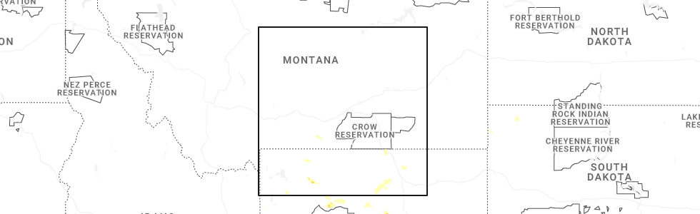
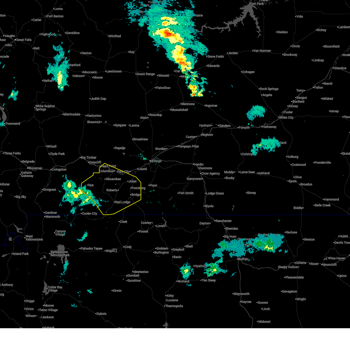
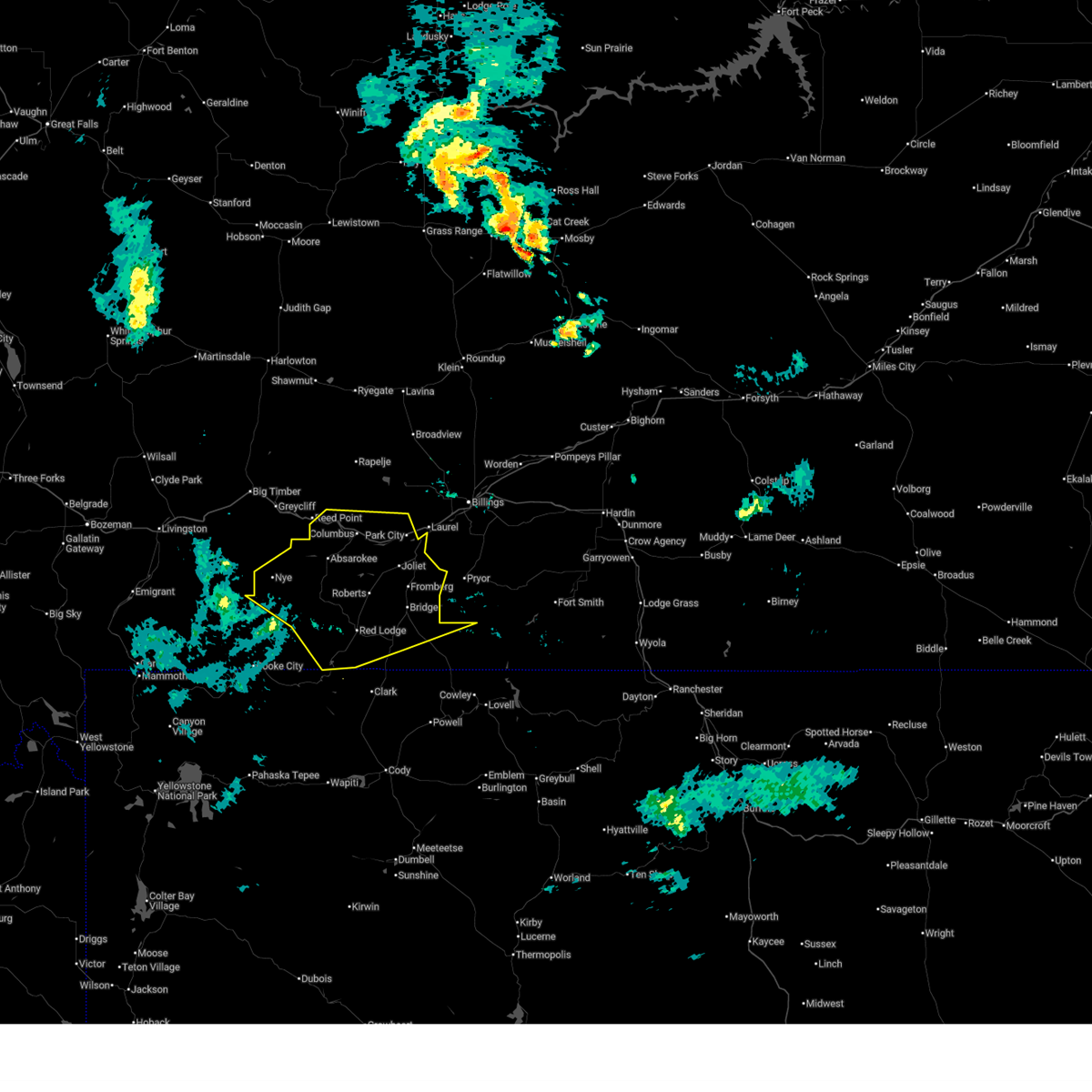
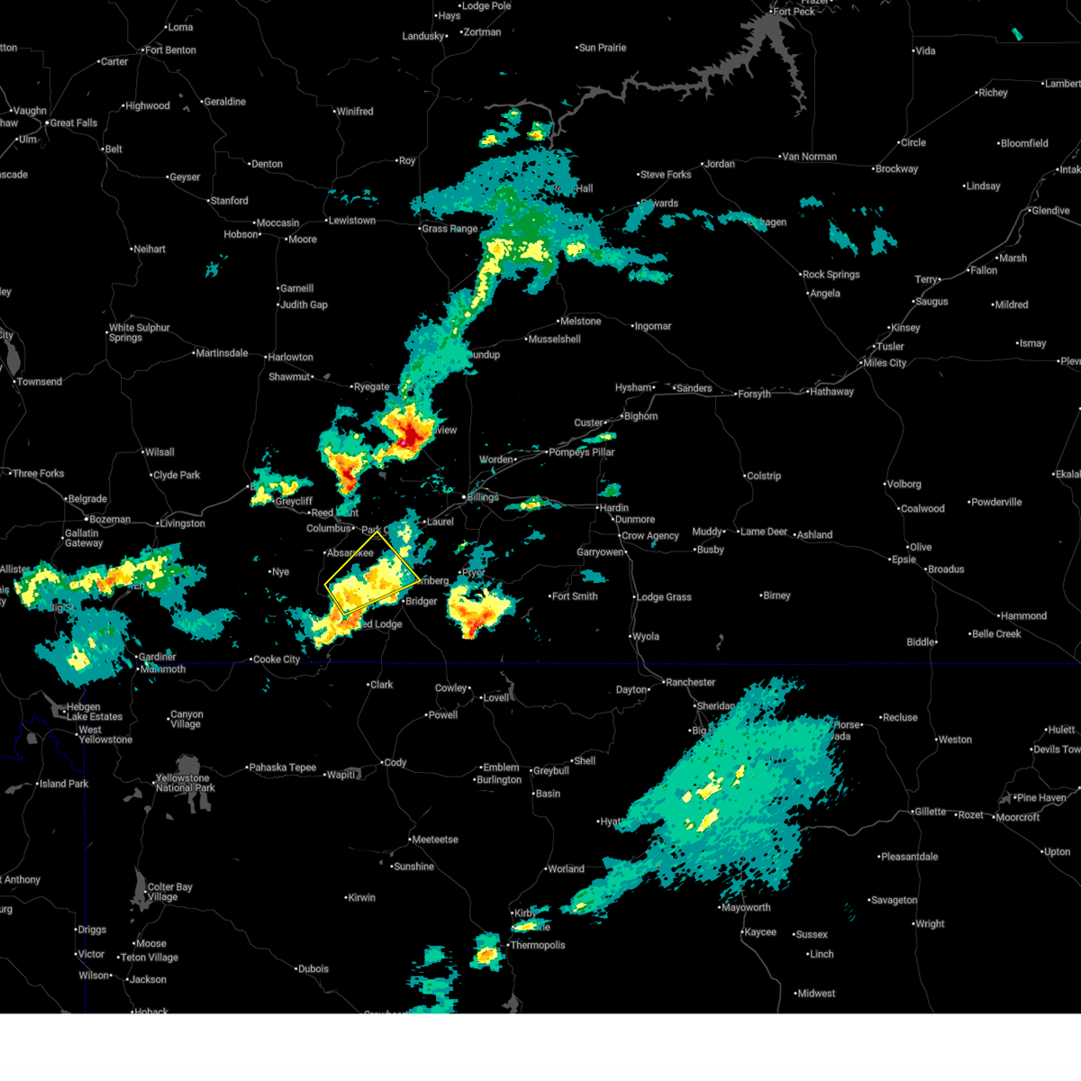
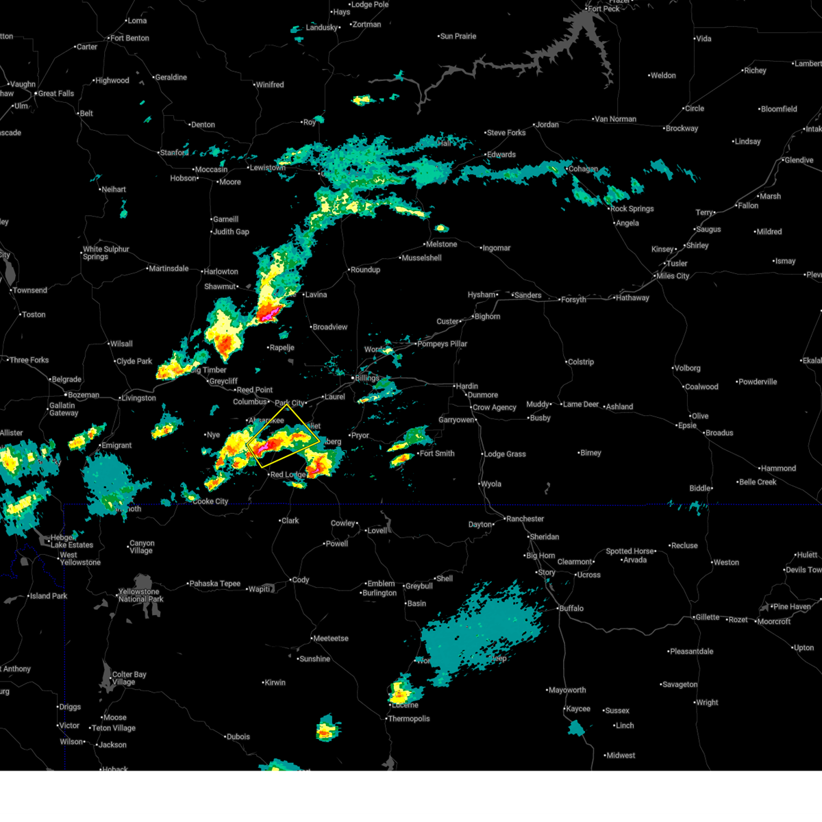
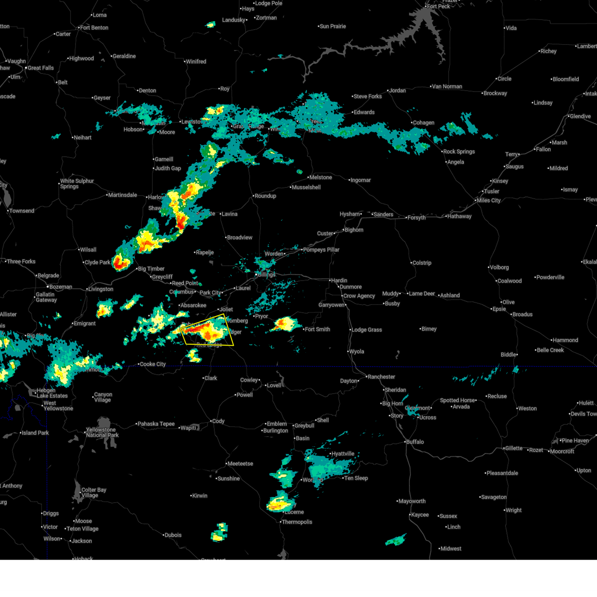
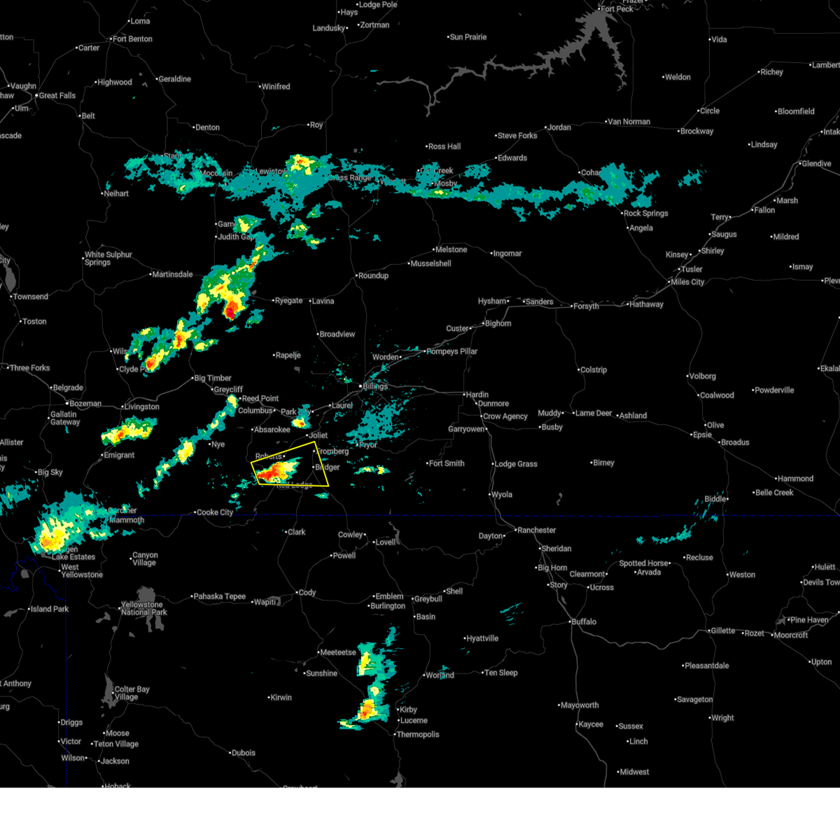
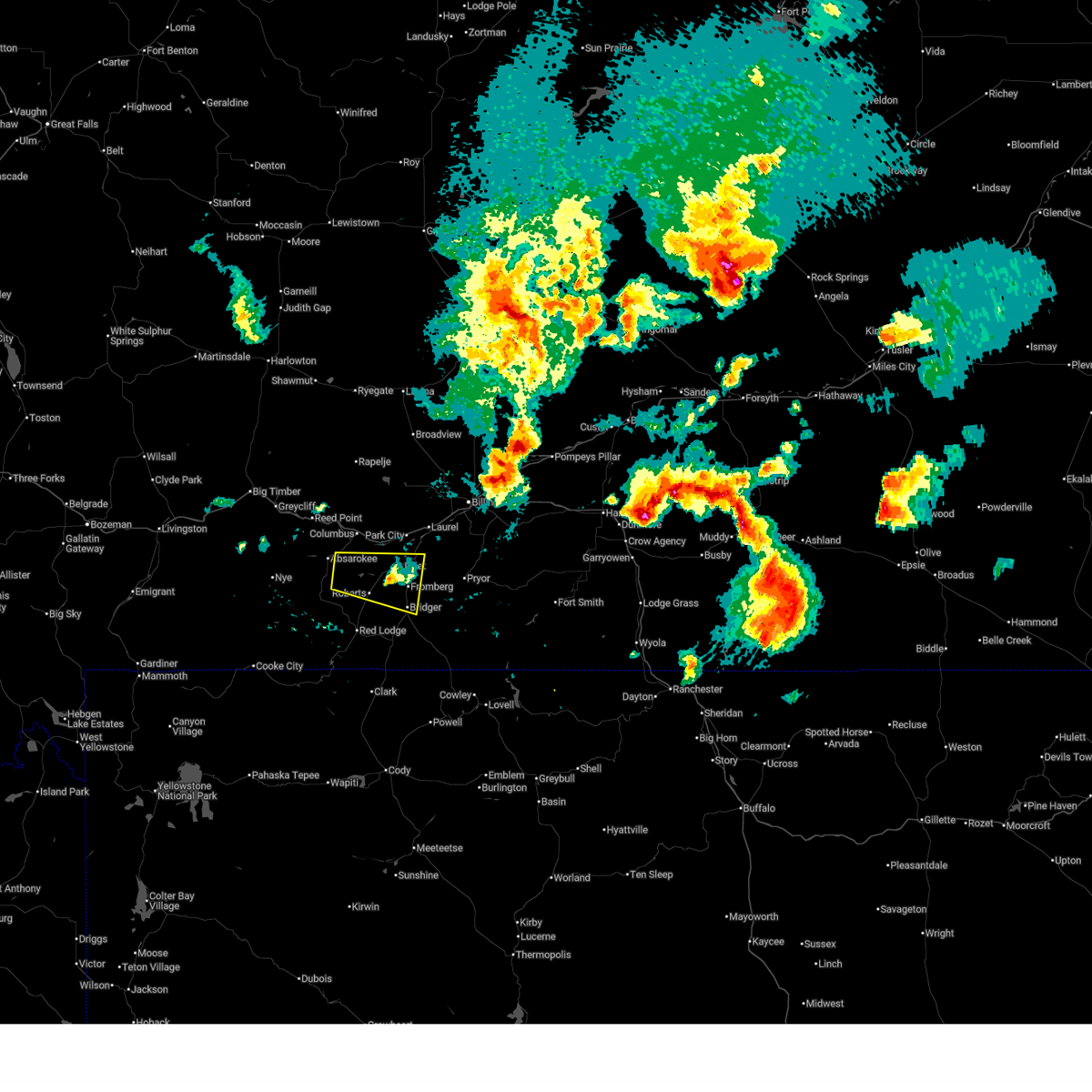
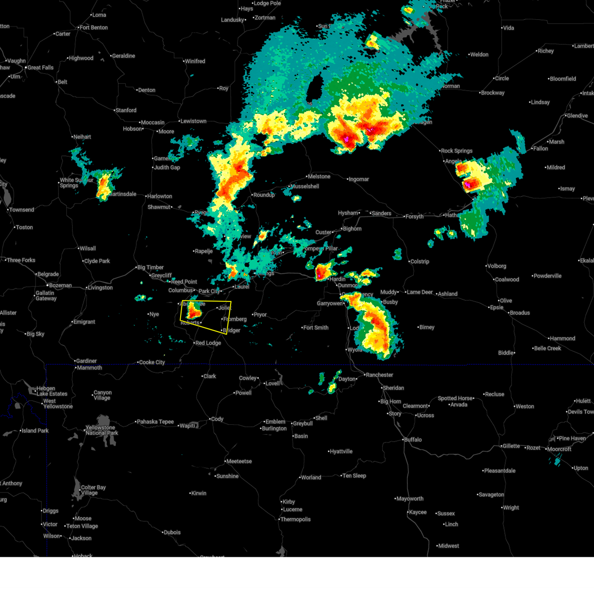
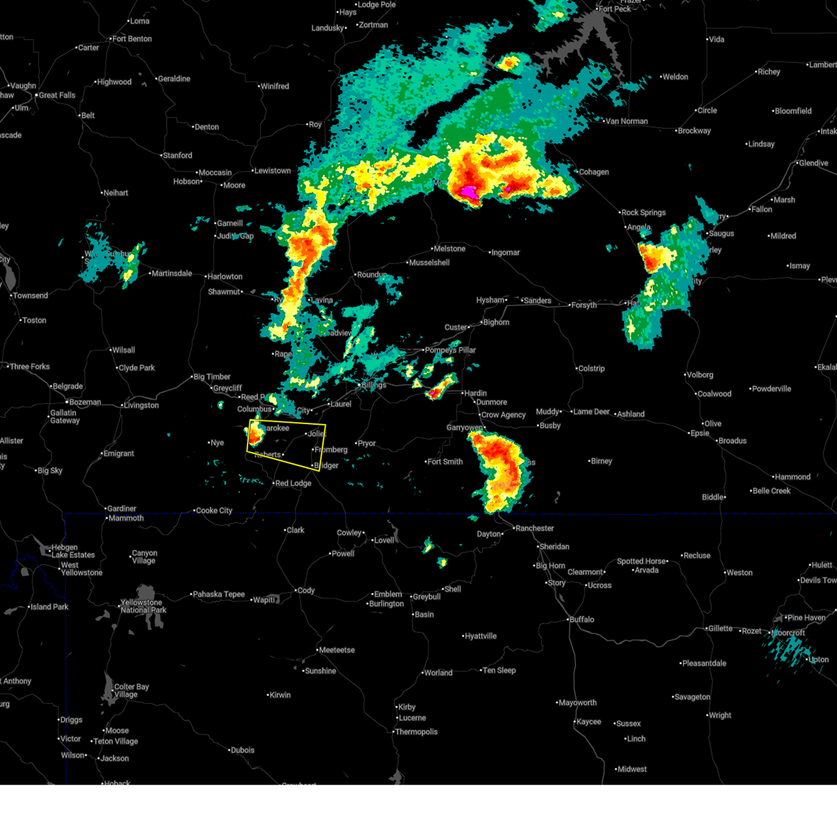
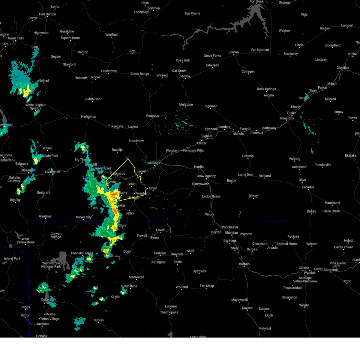
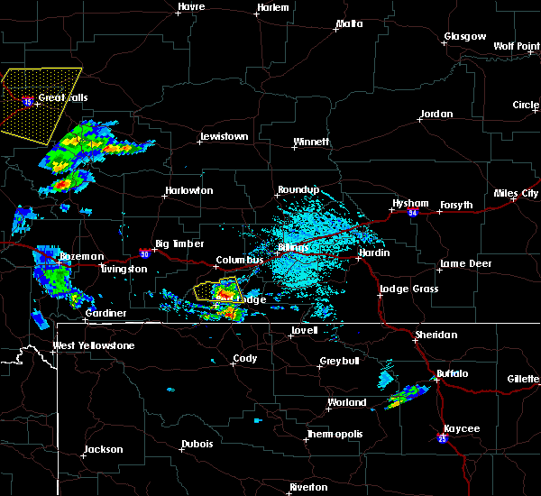
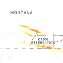
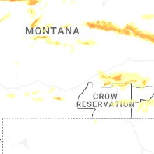
Hail Map for Roberts, MT
The Roberts, MT area has had 6 reports of on-the-ground hail by trained spotters, and has been under severe weather warnings 2 times during the past 12 months. Doppler radar has detected hail at or near Roberts, MT on 35 occasions, including 1 occasion during the past year.
| Name: | Roberts, MT |
| Where Located: | 44.5 miles SW of Billings, MT |
| Map: | Google Map for Roberts, MT |
| Population: | 361 |
| Housing Units: | 212 |
| More Info: | Search Google for Roberts, MT |
0
The Top Recent Hail Date for Roberts, MT is Wednesday, July 30, 2025 (35th out of 35)
Hail and Wind Damage Spotted near Roberts, MT
| Date / Time | Report Details |
|---|---|
| 5/13/2026 6:43 PM MDT |
 At 643 pm mdt, severe thunderstorms were located along a line from 25 miles south of big timber to 7 miles southwest of red lodge, moving northeast at 20 mph (radar indicated). Hazards include 60 mph wind gusts. Expect damage to roofs, siding, and trees. Locations impacted include, red lodge, columbus, bridger, joliet, fromberg, absarokee, bearcreek, cooney reservoir state park, fox, roberts, luther, roscoe, washoe, fishtail, boyd, belfry, alpine, dean, edgar and rockvale. At 643 pm mdt, severe thunderstorms were located along a line from 25 miles south of big timber to 7 miles southwest of red lodge, moving northeast at 20 mph (radar indicated). Hazards include 60 mph wind gusts. Expect damage to roofs, siding, and trees. Locations impacted include, red lodge, columbus, bridger, joliet, fromberg, absarokee, bearcreek, cooney reservoir state park, fox, roberts, luther, roscoe, washoe, fishtail, boyd, belfry, alpine, dean, edgar and rockvale.
|
| 5/13/2026 6:17 PM MDT |
 Svrbyz the national weather service in billings has issued a * severe thunderstorm warning for, carbon county in south central montana, southern stillwater county in south central montana, * until 715 pm mdt. * at 617 pm mdt, severe thunderstorms were located along a line from 27 miles south of big timber to 10 miles southwest of red lodge, moving northeast at 45 mph (radar indicated). Hazards include 60 mph wind gusts. expect damage to roofs, siding, and trees Svrbyz the national weather service in billings has issued a * severe thunderstorm warning for, carbon county in south central montana, southern stillwater county in south central montana, * until 715 pm mdt. * at 617 pm mdt, severe thunderstorms were located along a line from 27 miles south of big timber to 10 miles southwest of red lodge, moving northeast at 45 mph (radar indicated). Hazards include 60 mph wind gusts. expect damage to roofs, siding, and trees
|
| 6/16/2025 4:17 PM MDT |
 At 417 pm mdt, a severe thunderstorm was located 9 miles southwest of joliet, or 16 miles south of columbus, moving northeast at 15 mph (radar indicated. this storm is weakening, but does have a history of producing one inch hail). Hazards include quarter size hail. Damage to vehicles is expected. Locations impacted include, joliet, fromberg, roberts, cooney reservoir state park, boyd and fox. At 417 pm mdt, a severe thunderstorm was located 9 miles southwest of joliet, or 16 miles south of columbus, moving northeast at 15 mph (radar indicated. this storm is weakening, but does have a history of producing one inch hail). Hazards include quarter size hail. Damage to vehicles is expected. Locations impacted include, joliet, fromberg, roberts, cooney reservoir state park, boyd and fox.
|
| 6/16/2025 3:43 PM MDT |
 Svrbyz the national weather service in billings has issued a * severe thunderstorm warning for, central carbon county in south central montana, east central stillwater county in south central montana, * until 430 pm mdt. * at 343 pm mdt, a severe thunderstorm was located 11 miles north of red lodge, moving northeast at 15 mph (radar indicated). Hazards include 60 mph wind gusts and half dollar size hail. Hail damage to vehicles is expected. Expect wind damage to roofs, siding, and trees. Svrbyz the national weather service in billings has issued a * severe thunderstorm warning for, central carbon county in south central montana, east central stillwater county in south central montana, * until 430 pm mdt. * at 343 pm mdt, a severe thunderstorm was located 11 miles north of red lodge, moving northeast at 15 mph (radar indicated). Hazards include 60 mph wind gusts and half dollar size hail. Hail damage to vehicles is expected. Expect wind damage to roofs, siding, and trees.
|
| 6/16/2025 3:18 PM MDT |
 At 318 pm mdt, a severe thunderstorm was located 9 miles northeast of red lodge, moving east at 20 mph (public reported one inch hail with this storm). Hazards include 60 mph wind gusts and quarter size hail. Hail damage to vehicles is expected. expect wind damage to roofs, siding, and trees. Locations impacted include, red lodge, bridger, fromberg, roberts and fox. At 318 pm mdt, a severe thunderstorm was located 9 miles northeast of red lodge, moving east at 20 mph (public reported one inch hail with this storm). Hazards include 60 mph wind gusts and quarter size hail. Hail damage to vehicles is expected. expect wind damage to roofs, siding, and trees. Locations impacted include, red lodge, bridger, fromberg, roberts and fox.
|
| 6/16/2025 2:59 PM MDT |
 Svrbyz the national weather service in billings has issued a * severe thunderstorm warning for, central carbon county in south central montana, * until 345 pm mdt. * at 259 pm mdt, a severe thunderstorm was located near red lodge, moving east at 20 mph (radar indicated). Hazards include 60 mph wind gusts and quarter size hail. Hail damage to vehicles is expected. Expect wind damage to roofs, siding, and trees. Svrbyz the national weather service in billings has issued a * severe thunderstorm warning for, central carbon county in south central montana, * until 345 pm mdt. * at 259 pm mdt, a severe thunderstorm was located near red lodge, moving east at 20 mph (radar indicated). Hazards include 60 mph wind gusts and quarter size hail. Hail damage to vehicles is expected. Expect wind damage to roofs, siding, and trees.
|
| 6/15/2025 8:52 PM MDT |
 The storm which prompted the warning has weakened below severe limits, and no longer poses an immediate threat to life or property. therefore, the warning will be allowed to expire. a severe thunderstorm watch remains in effect until 1100 pm mdt sunday for a portion of south central montana. The storm which prompted the warning has weakened below severe limits, and no longer poses an immediate threat to life or property. therefore, the warning will be allowed to expire. a severe thunderstorm watch remains in effect until 1100 pm mdt sunday for a portion of south central montana.
|
| 6/15/2025 8:14 PM MDT |
 At 814 pm mdt, a severe thunderstorm was located 9 miles southeast of absarokee, or 14 miles south of columbus, moving east at 25 mph (radar indicated). Hazards include golf ball size hail and 60 mph wind gusts. People and animals outdoors will be injured. expect hail damage to roofs, siding, windows, and vehicles. expect wind damage to roofs, siding, and trees. Locations impacted include, bridger, joliet, fromberg, boyd, roberts, cooney reservoir state park, edgar and rockvale. At 814 pm mdt, a severe thunderstorm was located 9 miles southeast of absarokee, or 14 miles south of columbus, moving east at 25 mph (radar indicated). Hazards include golf ball size hail and 60 mph wind gusts. People and animals outdoors will be injured. expect hail damage to roofs, siding, windows, and vehicles. expect wind damage to roofs, siding, and trees. Locations impacted include, bridger, joliet, fromberg, boyd, roberts, cooney reservoir state park, edgar and rockvale.
|
| 6/15/2025 8:04 PM MDT |
 Svrbyz the national weather service in billings has issued a * severe thunderstorm warning for, northwestern carbon county in south central montana, central stillwater county in south central montana, * until 900 pm mdt. * at 804 pm mdt, a severe thunderstorm was located 7 miles south of absarokee, or 15 miles southwest of columbus, moving east at 25 mph (radar indicated). Hazards include 60 mph wind gusts and half dollar size hail. Hail damage to vehicles is expected. Expect wind damage to roofs, siding, and trees. Svrbyz the national weather service in billings has issued a * severe thunderstorm warning for, northwestern carbon county in south central montana, central stillwater county in south central montana, * until 900 pm mdt. * at 804 pm mdt, a severe thunderstorm was located 7 miles south of absarokee, or 15 miles southwest of columbus, moving east at 25 mph (radar indicated). Hazards include 60 mph wind gusts and half dollar size hail. Hail damage to vehicles is expected. Expect wind damage to roofs, siding, and trees.
|
| 6/13/2025 6:48 PM MDT | Ping Pong Ball sized hail reported 2.6 miles NNE of Roberts, MT |
| 6/13/2025 6:45 PM MDT | Ping Pong Ball sized hail reported 2.6 miles NNE of Roberts, MT |
| 9/3/2024 2:58 PM MDT |
 Svrbyz the national weather service in billings has issued a * severe thunderstorm warning for, east central stillwater county in south central montana, north central carbon county in south central montana, * until 330 pm mdt. * at 257 pm mdt, a severe thunderstorm was located 8 miles west of joliet, or 11 miles southeast of columbus, moving northeast at 50 mph (radar indicated). Hazards include 60 mph wind gusts. expect damage to roofs, siding, and trees Svrbyz the national weather service in billings has issued a * severe thunderstorm warning for, east central stillwater county in south central montana, north central carbon county in south central montana, * until 330 pm mdt. * at 257 pm mdt, a severe thunderstorm was located 8 miles west of joliet, or 11 miles southeast of columbus, moving northeast at 50 mph (radar indicated). Hazards include 60 mph wind gusts. expect damage to roofs, siding, and trees
|
| 7/28/2023 7:10 PM MDT |
 At 709 pm mdt, a severe thunderstorm was located 11 miles southeast of absarokee, or 14 miles north of red lodge, moving east at 20 mph (radar indicated). Hazards include 60 mph wind gusts and quarter size hail. Hail damage to vehicles is expected. Expect wind damage to roofs, siding, and trees. At 709 pm mdt, a severe thunderstorm was located 11 miles southeast of absarokee, or 14 miles north of red lodge, moving east at 20 mph (radar indicated). Hazards include 60 mph wind gusts and quarter size hail. Hail damage to vehicles is expected. Expect wind damage to roofs, siding, and trees.
|
| 7/2/2023 8:00 PM MDT | Quarter sized hail reported 3.4 miles SW of Roberts, MT, pea to quarter size |
| 9/7/2022 4:02 PM MDT |
 At 401 pm mdt, a severe thunderstorm was located over joliet, or 16 miles southeast of columbus, moving east at 40 mph (radar indicated). Hazards include 60 mph wind gusts. expect damage to roofs, siding, and trees At 401 pm mdt, a severe thunderstorm was located over joliet, or 16 miles southeast of columbus, moving east at 40 mph (radar indicated). Hazards include 60 mph wind gusts. expect damage to roofs, siding, and trees
|
| 7/7/2021 6:35 PM MDT |
 At 634 pm mdt, severe thunderstorms were located along a line extending from 24 miles north of deadmans basin reservoir to 9 miles southeast of ryegate to 10 miles east of columbus to 12 miles north of red lodge, moving east at 50 mph (radar indicated). Hazards include 60 mph wind gusts. penny size hail is possible with the strongest storms along this line. expect damage to roofs, siding, and trees At 634 pm mdt, severe thunderstorms were located along a line extending from 24 miles north of deadmans basin reservoir to 9 miles southeast of ryegate to 10 miles east of columbus to 12 miles north of red lodge, moving east at 50 mph (radar indicated). Hazards include 60 mph wind gusts. penny size hail is possible with the strongest storms along this line. expect damage to roofs, siding, and trees
|
| 7/23/2020 5:42 PM MDT |
 At 523 pm mdt, severe thunderstorms were located along a line extending from 8 miles northeast of ryegate to 6 miles west of joliet, moving east at 50 mph (radar indicated). Hazards include 60 mph wind gusts. a wind gust of 61 mph was reported at the big timber airport at 4:40 pm mdt. Expect damage to roofs, siding, and trees. Locations impacted include, columbus, bridger, joliet, fromberg, ryegate, deadmans basin reservoir, absarokee, lavina, franklin, reed point, halfbreed lake wildlife, edgar, fishtail, boyd, shawmut, hailstone wildlife refuge, roberts, molt, cooney reservoir state park and park city. At 523 pm mdt, severe thunderstorms were located along a line extending from 8 miles northeast of ryegate to 6 miles west of joliet, moving east at 50 mph (radar indicated). Hazards include 60 mph wind gusts. a wind gust of 61 mph was reported at the big timber airport at 4:40 pm mdt. Expect damage to roofs, siding, and trees. Locations impacted include, columbus, bridger, joliet, fromberg, ryegate, deadmans basin reservoir, absarokee, lavina, franklin, reed point, halfbreed lake wildlife, edgar, fishtail, boyd, shawmut, hailstone wildlife refuge, roberts, molt, cooney reservoir state park and park city.
|
| 7/23/2020 5:24 PM MDT |
 At 523 pm mdt, severe thunderstorms were located along a line extending from 8 miles northeast of ryegate to 6 miles west of joliet, moving east at 50 mph (radar indicated). Hazards include 60 mph wind gusts. a wind gust of 61 mph was reported at the big timber airport at 4:40 pm mdt. Expect damage to roofs, siding, and trees. Locations impacted include, columbus, bridger, joliet, fromberg, ryegate, deadmans basin reservoir, absarokee, lavina, franklin, reed point, halfbreed lake wildlife, edgar, fishtail, boyd, shawmut, hailstone wildlife refuge, roberts, molt, cooney reservoir state park and park city. At 523 pm mdt, severe thunderstorms were located along a line extending from 8 miles northeast of ryegate to 6 miles west of joliet, moving east at 50 mph (radar indicated). Hazards include 60 mph wind gusts. a wind gust of 61 mph was reported at the big timber airport at 4:40 pm mdt. Expect damage to roofs, siding, and trees. Locations impacted include, columbus, bridger, joliet, fromberg, ryegate, deadmans basin reservoir, absarokee, lavina, franklin, reed point, halfbreed lake wildlife, edgar, fishtail, boyd, shawmut, hailstone wildlife refuge, roberts, molt, cooney reservoir state park and park city.
|
| 7/23/2020 5:10 PM MDT |
 At 508 pm mdt, severe thunderstorms were located along a line extending from near deadmans basin reservoir to near absarokee, moving east at 50 mph (radar indicated. a wind gust of 61 mph was reported at the big timber airport at 4:40 pm mdt). Hazards include 60 mph wind gusts. expect damage to roofs, siding, and trees At 508 pm mdt, severe thunderstorms were located along a line extending from near deadmans basin reservoir to near absarokee, moving east at 50 mph (radar indicated. a wind gust of 61 mph was reported at the big timber airport at 4:40 pm mdt). Hazards include 60 mph wind gusts. expect damage to roofs, siding, and trees
|
| 8/10/2019 4:23 PM MDT |
 At 422 pm mdt, a severe thunderstorm was located near bridger, or 11 miles northeast of red lodge, moving east at 20 mph (radar indicated). Hazards include 60 mph wind gusts and quarter size hail. Hail damage to vehicles is expected. expect wind damage to roofs, siding, and trees. Locations impacted include, bridger, fromberg, edgar and roberts. At 422 pm mdt, a severe thunderstorm was located near bridger, or 11 miles northeast of red lodge, moving east at 20 mph (radar indicated). Hazards include 60 mph wind gusts and quarter size hail. Hail damage to vehicles is expected. expect wind damage to roofs, siding, and trees. Locations impacted include, bridger, fromberg, edgar and roberts.
|
| 8/10/2019 4:10 PM MDT | Quarter sized hail reported 3.1 miles N of Roberts, MT |
| 8/10/2019 4:02 PM MDT |
 At 401 pm mdt, a severe thunderstorm was located near red lodge, moving east at 20 mph (radar indicated). Hazards include 60 mph wind gusts and quarter size hail. Hail damage to vehicles is expected. Expect wind damage to roofs, siding, and trees. At 401 pm mdt, a severe thunderstorm was located near red lodge, moving east at 20 mph (radar indicated). Hazards include 60 mph wind gusts and quarter size hail. Hail damage to vehicles is expected. Expect wind damage to roofs, siding, and trees.
|
| 7/6/2019 5:33 PM MDT |
 At 532 pm mdt, a severe thunderstorm was located 7 miles northeast of red lodge, moving southeast at 20 mph (radar indicated). Hazards include 60 mph wind gusts and quarter size hail. Hail damage to vehicles is expected. Locations impacted include, roberts and fox. At 532 pm mdt, a severe thunderstorm was located 7 miles northeast of red lodge, moving southeast at 20 mph (radar indicated). Hazards include 60 mph wind gusts and quarter size hail. Hail damage to vehicles is expected. Locations impacted include, roberts and fox.
|
| 7/6/2019 5:00 PM MDT |
 At 459 pm mdt, a severe thunderstorm was located 12 miles south of absarokee, or 12 miles northwest of red lodge, moving east at 20 mph (trained weather spotters). Hazards include 60 mph wind gusts and quarter size hail. hail damage to vehicles is expected At 459 pm mdt, a severe thunderstorm was located 12 miles south of absarokee, or 12 miles northwest of red lodge, moving east at 20 mph (trained weather spotters). Hazards include 60 mph wind gusts and quarter size hail. hail damage to vehicles is expected
|
| 7/1/2019 5:45 PM MDT | Quarter sized hail reported 1.1 miles SSW of Roberts, MT |
| 7/1/2019 5:42 PM MDT |
 At 542 pm mdt, a severe thunderstorm was located 11 miles west of bridger, or 11 miles northeast of red lodge, moving east at 20 mph (radar indicated). Hazards include 60 mph wind gusts and quarter size hail. Hail damage to vehicles is expected. expect wind damage to roofs, siding, and trees. Locations impacted include, bridger, fromberg, pryor and roberts. At 542 pm mdt, a severe thunderstorm was located 11 miles west of bridger, or 11 miles northeast of red lodge, moving east at 20 mph (radar indicated). Hazards include 60 mph wind gusts and quarter size hail. Hail damage to vehicles is expected. expect wind damage to roofs, siding, and trees. Locations impacted include, bridger, fromberg, pryor and roberts.
|
| 7/1/2019 5:17 PM MDT |
 At 517 pm mdt, a severe thunderstorm was located 11 miles north of red lodge, moving east at 30 mph (radar indicated). Hazards include 60 mph wind gusts and quarter size hail. Hail damage to vehicles is expected. Expect wind damage to roofs, siding, and trees. At 517 pm mdt, a severe thunderstorm was located 11 miles north of red lodge, moving east at 30 mph (radar indicated). Hazards include 60 mph wind gusts and quarter size hail. Hail damage to vehicles is expected. Expect wind damage to roofs, siding, and trees.
|
| 5/26/2019 5:09 PM MDT |
 At 441 pm mdt, a thunderstorm located 9 miles west of joliet, or 10 miles south of columbus, moving northeast at 15 mph. storm is headed directly at cooney reservoir state park. Hazards include 60 mph wind gusts and quarter size hail. Hail damage to vehicles is expected. expect wind damage to roofs, siding, and trees. Locations impacted include, joliet, cooney reservoir state park, roberts, rockvale, boyd and silesia. At 441 pm mdt, a thunderstorm located 9 miles west of joliet, or 10 miles south of columbus, moving northeast at 15 mph. storm is headed directly at cooney reservoir state park. Hazards include 60 mph wind gusts and quarter size hail. Hail damage to vehicles is expected. expect wind damage to roofs, siding, and trees. Locations impacted include, joliet, cooney reservoir state park, roberts, rockvale, boyd and silesia.
|
| 5/26/2019 4:44 PM MDT |
 At 441 pm mdt, a thunderstorm located 9 miles west of joliet, or 10 miles south of columbus, moving northeast at 15 mph. storm is headed directly at cooney reservoir state park. Hazards include 60 mph wind gusts and quarter size hail. Hail damage to vehicles is expected. expect wind damage to roofs, siding, and trees. Locations impacted include, joliet, cooney reservoir state park, roberts, rockvale, boyd and silesia. At 441 pm mdt, a thunderstorm located 9 miles west of joliet, or 10 miles south of columbus, moving northeast at 15 mph. storm is headed directly at cooney reservoir state park. Hazards include 60 mph wind gusts and quarter size hail. Hail damage to vehicles is expected. expect wind damage to roofs, siding, and trees. Locations impacted include, joliet, cooney reservoir state park, roberts, rockvale, boyd and silesia.
|
| 5/26/2019 4:09 PM MDT |
 At 408 pm mdt, a severe thunderstorm was located 10 miles southeast of absarokee, or 14 miles north of red lodge, moving northeast at 15 mph toward cooney reservoir state park. Hazards include 60 mph wind gusts and quarter size hail. Hail damage to vehicles is expected. Expect wind damage to roofs, siding, and trees. At 408 pm mdt, a severe thunderstorm was located 10 miles southeast of absarokee, or 14 miles north of red lodge, moving northeast at 15 mph toward cooney reservoir state park. Hazards include 60 mph wind gusts and quarter size hail. Hail damage to vehicles is expected. Expect wind damage to roofs, siding, and trees.
|
| 7/28/2018 6:41 PM MDT |
 At 614 pm mdt, a severe thunderstorm was located near joliet, or 17 miles northeast of red lodge, moving southeast at 30 mph (radar indicated). Hazards include 60 mph wind gusts and quarter size hail. Hail damage to vehicles is expected. expect wind damage to roofs, siding, and trees. Locations impacted include, joliet, fromberg, cooney reservoir state park, edgar, rockvale, boyd, roberts, fox and silesia. At 614 pm mdt, a severe thunderstorm was located near joliet, or 17 miles northeast of red lodge, moving southeast at 30 mph (radar indicated). Hazards include 60 mph wind gusts and quarter size hail. Hail damage to vehicles is expected. expect wind damage to roofs, siding, and trees. Locations impacted include, joliet, fromberg, cooney reservoir state park, edgar, rockvale, boyd, roberts, fox and silesia.
|
| 7/28/2018 6:15 PM MDT |
 At 614 pm mdt, a severe thunderstorm was located near joliet, or 17 miles northeast of red lodge, moving southeast at 30 mph (radar indicated). Hazards include 60 mph wind gusts and quarter size hail. Hail damage to vehicles is expected. expect wind damage to roofs, siding, and trees. Locations impacted include, joliet, fromberg, cooney reservoir state park, edgar, rockvale, boyd, roberts, fox and silesia. At 614 pm mdt, a severe thunderstorm was located near joliet, or 17 miles northeast of red lodge, moving southeast at 30 mph (radar indicated). Hazards include 60 mph wind gusts and quarter size hail. Hail damage to vehicles is expected. expect wind damage to roofs, siding, and trees. Locations impacted include, joliet, fromberg, cooney reservoir state park, edgar, rockvale, boyd, roberts, fox and silesia.
|
| 7/28/2018 5:43 PM MDT |
 At 542 pm mdt, a severe thunderstorm was located near columbus, moving southeast at 30 mph (trained weather spotters). Hazards include 60 mph wind gusts and half dollar size hail. Hail damage to vehicles is expected. Expect wind damage to roofs, siding, and trees. At 542 pm mdt, a severe thunderstorm was located near columbus, moving southeast at 30 mph (trained weather spotters). Hazards include 60 mph wind gusts and half dollar size hail. Hail damage to vehicles is expected. Expect wind damage to roofs, siding, and trees.
|
| 7/28/2018 5:29 PM MDT |
 At 528 pm mdt, a severe thunderstorm was located near columbus, moving southeast at 35 mph (trained weather spotters). Hazards include 60 mph wind gusts and half dollar size hail. Hail damage to vehicles is expected. expect wind damage to roofs, siding, and trees. Locations impacted include, columbus, joliet, fromberg, absarokee, reed point, edgar, fishtail, boyd, roberts, silesia, cooney reservoir state park, park city and rockvale. At 528 pm mdt, a severe thunderstorm was located near columbus, moving southeast at 35 mph (trained weather spotters). Hazards include 60 mph wind gusts and half dollar size hail. Hail damage to vehicles is expected. expect wind damage to roofs, siding, and trees. Locations impacted include, columbus, joliet, fromberg, absarokee, reed point, edgar, fishtail, boyd, roberts, silesia, cooney reservoir state park, park city and rockvale.
|
| 7/28/2018 5:02 PM MDT |
 At 501 pm mdt, a severe thunderstorm was located 17 miles northwest of columbus, moving southeast at 45 mph. another strong thunderstorm was located north of columbus (radar indicated). Hazards include 60 mph wind gusts and quarter size hail. Hail damage to vehicles is expected. Expect wind damage to roofs, siding, and trees. At 501 pm mdt, a severe thunderstorm was located 17 miles northwest of columbus, moving southeast at 45 mph. another strong thunderstorm was located north of columbus (radar indicated). Hazards include 60 mph wind gusts and quarter size hail. Hail damage to vehicles is expected. Expect wind damage to roofs, siding, and trees.
|
| 7/27/2018 4:51 PM MDT |
 At 450 pm mdt, a severe thunderstorm was located over joliet, or 15 miles southeast of columbus, moving southeast at 35 mph (trained weather spotters). Hazards include two inch hail and 60 mph wind gusts. People and animals outdoors will be injured. expect hail damage to roofs, siding, windows, and vehicles. expect wind damage to roofs, siding, and trees. Locations impacted include, joliet, fromberg, cooney reservoir state park, edgar, rockvale, boyd, roberts and silesia. At 450 pm mdt, a severe thunderstorm was located over joliet, or 15 miles southeast of columbus, moving southeast at 35 mph (trained weather spotters). Hazards include two inch hail and 60 mph wind gusts. People and animals outdoors will be injured. expect hail damage to roofs, siding, windows, and vehicles. expect wind damage to roofs, siding, and trees. Locations impacted include, joliet, fromberg, cooney reservoir state park, edgar, rockvale, boyd, roberts and silesia.
|
| 7/27/2018 4:27 PM MDT |
 At 426 pm mdt, a severe thunderstorm was located over columbus, moving southeast at 35 mph (trained weather spotters). Hazards include ping pong ball size hail and 60 mph wind gusts. People and animals outdoors will be injured. expect hail damage to roofs, siding, windows, and vehicles. Expect wind damage to roofs, siding, and trees. At 426 pm mdt, a severe thunderstorm was located over columbus, moving southeast at 35 mph (trained weather spotters). Hazards include ping pong ball size hail and 60 mph wind gusts. People and animals outdoors will be injured. expect hail damage to roofs, siding, windows, and vehicles. Expect wind damage to roofs, siding, and trees.
|
| 7/26/2018 5:48 PM MDT |
 At 547 pm mdt, a severe thunderstorm was located over bridger, or 16 miles northeast of red lodge, moving southeast at 40 mph (trained weather spotters. this storm has a history of producing golfball hail and wind gusts near 60 mph). Hazards include golf ball size hail and 60 mph wind gusts. People and animals outdoors will be injured. expect hail damage to roofs, siding, windows, and vehicles. expect wind damage to roofs, siding, and trees. Locations impacted include, bridger, joliet, fromberg, warren, edgar, belfry, boyd and roberts. At 547 pm mdt, a severe thunderstorm was located over bridger, or 16 miles northeast of red lodge, moving southeast at 40 mph (trained weather spotters. this storm has a history of producing golfball hail and wind gusts near 60 mph). Hazards include golf ball size hail and 60 mph wind gusts. People and animals outdoors will be injured. expect hail damage to roofs, siding, windows, and vehicles. expect wind damage to roofs, siding, and trees. Locations impacted include, bridger, joliet, fromberg, warren, edgar, belfry, boyd and roberts.
|
| 7/26/2018 5:33 PM MDT |
 At 532 pm mdt, a severe thunderstorm was located 7 miles west of fromberg, or 15 miles northeast of red lodge, moving southeast at 40 mph (trained weather spotters. golfball hail was reported 7 miles south of columbus with this storm). Hazards include golf ball size hail and 60 mph wind gusts. People and animals outdoors will be injured. expect hail damage to roofs, siding, windows, and vehicles. Expect wind damage to roofs, siding, and trees. At 532 pm mdt, a severe thunderstorm was located 7 miles west of fromberg, or 15 miles northeast of red lodge, moving southeast at 40 mph (trained weather spotters. golfball hail was reported 7 miles south of columbus with this storm). Hazards include golf ball size hail and 60 mph wind gusts. People and animals outdoors will be injured. expect hail damage to roofs, siding, windows, and vehicles. Expect wind damage to roofs, siding, and trees.
|
| 7/26/2018 5:11 PM MDT |
 At 509 pm mdt, a severe thunderstorm was located near columbus, moving southeast at 40 mph (trained weather spotters reported golfball hail near reed point with this storm). Hazards include golf ball size hail and 60 mph wind gusts. People and animals outdoors will be injured. expect hail damage to roofs, siding, windows, and vehicles. expect wind damage to roofs, siding, and trees. Locations impacted include, columbus, joliet, absarokee, cooney reservoir state park, edgar, rockvale, boyd and roberts. At 509 pm mdt, a severe thunderstorm was located near columbus, moving southeast at 40 mph (trained weather spotters reported golfball hail near reed point with this storm). Hazards include golf ball size hail and 60 mph wind gusts. People and animals outdoors will be injured. expect hail damage to roofs, siding, windows, and vehicles. expect wind damage to roofs, siding, and trees. Locations impacted include, columbus, joliet, absarokee, cooney reservoir state park, edgar, rockvale, boyd and roberts.
|
| 7/26/2018 4:50 PM MDT |
 At 449 pm mdt, a severe thunderstorm was located 15 miles northwest of columbus, moving southeast at 35 mph (trained weather spotters. golfball hail reported north of reed point). Hazards include golf ball size hail and 60 mph wind gusts. People and animals outdoors will be injured. expect hail damage to roofs, siding, windows, and vehicles. Expect wind damage to roofs, siding, and trees. At 449 pm mdt, a severe thunderstorm was located 15 miles northwest of columbus, moving southeast at 35 mph (trained weather spotters. golfball hail reported north of reed point). Hazards include golf ball size hail and 60 mph wind gusts. People and animals outdoors will be injured. expect hail damage to roofs, siding, windows, and vehicles. Expect wind damage to roofs, siding, and trees.
|
| 5/31/2018 4:38 PM MDT |
 At 436 pm mdt, a severe thunderstorm was located near joliet, or 16 miles southeast of columbus, moving north at 30 mph. 60 mph winds expected to impact the joliet and boyd areas along 212 in the next 10 to 15 minutes (radar indicated). Hazards include 60 mph wind gusts and quarter size hail. Hail damage to vehicles is expected. expect wind damage to roofs, siding, and trees. Locations impacted include, joliet, fromberg, edgar, park city, rockvale, boyd and silesia. At 436 pm mdt, a severe thunderstorm was located near joliet, or 16 miles southeast of columbus, moving north at 30 mph. 60 mph winds expected to impact the joliet and boyd areas along 212 in the next 10 to 15 minutes (radar indicated). Hazards include 60 mph wind gusts and quarter size hail. Hail damage to vehicles is expected. expect wind damage to roofs, siding, and trees. Locations impacted include, joliet, fromberg, edgar, park city, rockvale, boyd and silesia.
|
| 5/31/2018 4:31 PM MDT |
 At 431 pm mdt, a severe thunderstorm was located 9 miles southwest of joliet, or 14 miles northeast of red lodge, moving north at 30 mph (radar indicated). Hazards include 60 mph wind gusts and quarter size hail. Hail damage to vehicles is expected. expect wind damage to roofs, siding, and trees. Locations impacted include, columbus, bridger, joliet, fromberg, cooney reservoir state park, edgar, park city, rockvale, boyd, roberts and silesia. At 431 pm mdt, a severe thunderstorm was located 9 miles southwest of joliet, or 14 miles northeast of red lodge, moving north at 30 mph (radar indicated). Hazards include 60 mph wind gusts and quarter size hail. Hail damage to vehicles is expected. expect wind damage to roofs, siding, and trees. Locations impacted include, columbus, bridger, joliet, fromberg, cooney reservoir state park, edgar, park city, rockvale, boyd, roberts and silesia.
|
| 5/31/2018 4:16 PM MDT |
 At 416 pm mdt, a severe thunderstorm was located 7 miles northeast of red lodge, moving north at 30 mph (radar indicated). Hazards include 60 mph wind gusts and quarter size hail. Hail damage to vehicles is expected. Expect wind damage to roofs, siding, and trees. At 416 pm mdt, a severe thunderstorm was located 7 miles northeast of red lodge, moving north at 30 mph (radar indicated). Hazards include 60 mph wind gusts and quarter size hail. Hail damage to vehicles is expected. Expect wind damage to roofs, siding, and trees.
|
| 5/22/2018 9:38 PM MDT |
 The severe thunderstorm warning for north central carbon county will expire at 945 pm mdt, the storm which prompted the warning has weakened below severe limits, and no longer poses an immediate threat to life or property. therefore, the warning will be allowed to expire. however small hail and heavy rain are still possible with this thunderstorm. The severe thunderstorm warning for north central carbon county will expire at 945 pm mdt, the storm which prompted the warning has weakened below severe limits, and no longer poses an immediate threat to life or property. therefore, the warning will be allowed to expire. however small hail and heavy rain are still possible with this thunderstorm.
|
| 5/22/2018 9:14 PM MDT |
 At 913 pm mdt, a severe thunderstorm was located near joliet, or 12 miles southeast of columbus, moving northeast at 5 mph (radar indicated). Hazards include quarter size hail and torrential rain. Damage to vehicles is expected. Locations impacted include, joliet and boyd. At 913 pm mdt, a severe thunderstorm was located near joliet, or 12 miles southeast of columbus, moving northeast at 5 mph (radar indicated). Hazards include quarter size hail and torrential rain. Damage to vehicles is expected. Locations impacted include, joliet and boyd.
|
| 5/22/2018 8:51 PM MDT |
 At 850 pm mdt, a severe thunderstorm was located near joliet, or 16 miles southeast of columbus, and is nearly stationary (radar indicated). Hazards include quarter size hail, and torrential rain. damage to vehicles is expected At 850 pm mdt, a severe thunderstorm was located near joliet, or 16 miles southeast of columbus, and is nearly stationary (radar indicated). Hazards include quarter size hail, and torrential rain. damage to vehicles is expected
|
| 8/1/2017 9:38 PM MDT |
 The severe thunderstorm warning for western big horn and southeastern carbon counties will expire at 945 pm mdt, the storm which prompted the warning has weakened below severe limits, and no longer poses an immediate threat to life or property. therefore the warning has been cancelled. however small hail, gusty winds and heavy rain are still possible with this thunderstorm. The severe thunderstorm warning for western big horn and southeastern carbon counties will expire at 945 pm mdt, the storm which prompted the warning has weakened below severe limits, and no longer poses an immediate threat to life or property. therefore the warning has been cancelled. however small hail, gusty winds and heavy rain are still possible with this thunderstorm.
|
| 8/1/2017 9:12 PM MDT |
 At 909 pm mdt, a severe thunderstorm was located near bridger, or 10 miles east of red lodge, moving southeast at 30 mph (radar indicated). Hazards include 60 mph wind gusts and quarter size hail. Hail damage to vehicles is expected. expect wind damage to roofs, siding, and trees. Locations impacted include, red lodge, bridger, fromberg, bearcreek, cooney reservoir state park, warren, belfry, washoe, roberts and fox. At 909 pm mdt, a severe thunderstorm was located near bridger, or 10 miles east of red lodge, moving southeast at 30 mph (radar indicated). Hazards include 60 mph wind gusts and quarter size hail. Hail damage to vehicles is expected. expect wind damage to roofs, siding, and trees. Locations impacted include, red lodge, bridger, fromberg, bearcreek, cooney reservoir state park, warren, belfry, washoe, roberts and fox.
|
| 8/1/2017 8:47 PM MDT |
 At 846 pm mdt, a severe thunderstorm was located near roberts, or 11 miles north of red lodge, moving southeast at 30 mph (radar indicated). Hazards include 60 mph wind gusts and quarter size hail. Hail damage to vehicles is expected. Expect wind damage to roofs, siding, and trees. At 846 pm mdt, a severe thunderstorm was located near roberts, or 11 miles north of red lodge, moving southeast at 30 mph (radar indicated). Hazards include 60 mph wind gusts and quarter size hail. Hail damage to vehicles is expected. Expect wind damage to roofs, siding, and trees.
|
| 7/16/2017 3:53 PM MDT |
 The severe thunderstorm warning for stillwater, central carbon, yellowstone and central sweet grass counties will expire at 400 pm mdt, winds have weakened below severe limits over the past half hour along the outflow boundary, and are moving out of the warned area. therefore, the warning will be allowed to expire. however, gusty winds of 30 to 45 mph will remain possible through 430 pm mdt across this area. The severe thunderstorm warning for stillwater, central carbon, yellowstone and central sweet grass counties will expire at 400 pm mdt, winds have weakened below severe limits over the past half hour along the outflow boundary, and are moving out of the warned area. therefore, the warning will be allowed to expire. however, gusty winds of 30 to 45 mph will remain possible through 430 pm mdt across this area.
|
| 7/16/2017 3:20 PM MDT |
 At 316 pm mdt, a severe thunderstorm was located 5 miles east of billings, moving east at 40 mph. other severe storms extended southwest to the nye area (billings airport). Hazards include 60 mph wind gusts. Expect damage to roofs, siding, and trees. Locations impacted include, billings, columbus, laurel, joliet, fromberg, lockwood, worden, huntley, shepherd, billings heights, billings west end, absarokee, ballantine, broadview, reed point, halfbreed lake wildlife, pompeys pillar, edgar, silesia and cooney reservoir state park. At 316 pm mdt, a severe thunderstorm was located 5 miles east of billings, moving east at 40 mph. other severe storms extended southwest to the nye area (billings airport). Hazards include 60 mph wind gusts. Expect damage to roofs, siding, and trees. Locations impacted include, billings, columbus, laurel, joliet, fromberg, lockwood, worden, huntley, shepherd, billings heights, billings west end, absarokee, ballantine, broadview, reed point, halfbreed lake wildlife, pompeys pillar, edgar, silesia and cooney reservoir state park.
|
| 7/16/2017 2:58 PM MDT |
 At 255 pm mdt, severe thunderstorms were located 9 miles northwest of billings west end, to 15 miles south of fishtail. these storms were moving east at 40 mph. this replaces the warning previously in effect for this area (radar indicated). Hazards include 60 mph wind gusts and half-inch hail. expect damage to roofs, siding, and trees At 255 pm mdt, severe thunderstorms were located 9 miles northwest of billings west end, to 15 miles south of fishtail. these storms were moving east at 40 mph. this replaces the warning previously in effect for this area (radar indicated). Hazards include 60 mph wind gusts and half-inch hail. expect damage to roofs, siding, and trees
|
| 6/12/2017 6:25 PM MDT |
 At 624 pm mdt, a severe thunderstorm was located near bridger, or 14 miles northeast of red lodge, moving north at 35 mph (radar indicated). Hazards include 60 mph wind gusts and quarter size hail. Hail damage to vehicles is expected. Expect wind damage to roofs, siding, and trees. At 624 pm mdt, a severe thunderstorm was located near bridger, or 14 miles northeast of red lodge, moving north at 35 mph (radar indicated). Hazards include 60 mph wind gusts and quarter size hail. Hail damage to vehicles is expected. Expect wind damage to roofs, siding, and trees.
|
| 6/12/2017 5:47 PM MDT |
 At 547 pm mdt, a severe thunderstorm was located near elk basin, or 17 miles southeast of red lodge, moving north at 30 mph (radar indicated). Hazards include 70 mph wind gusts and half dollar size hail. Hail damage to vehicles is expected. expect considerable tree damage. wind damage is also likely to mobile homes, roofs, and outbuildings. Locations impacted include, red lodge, bridger, bearcreek, belfry, fox and washoe. At 547 pm mdt, a severe thunderstorm was located near elk basin, or 17 miles southeast of red lodge, moving north at 30 mph (radar indicated). Hazards include 70 mph wind gusts and half dollar size hail. Hail damage to vehicles is expected. expect considerable tree damage. wind damage is also likely to mobile homes, roofs, and outbuildings. Locations impacted include, red lodge, bridger, bearcreek, belfry, fox and washoe.
|
| 6/12/2017 5:35 PM MDT |
 At 534 pm mdt, a severe thunderstorm was located near elk basin, or 18 miles northwest of powell, moving north at 30 mph (radar indicated). Hazards include 70 mph wind gusts and half dollar size hail. Hail damage to vehicles is expected. expect considerable tree damage. Wind damage is also likely to mobile homes, roofs, and outbuildings. At 534 pm mdt, a severe thunderstorm was located near elk basin, or 18 miles northwest of powell, moving north at 30 mph (radar indicated). Hazards include 70 mph wind gusts and half dollar size hail. Hail damage to vehicles is expected. expect considerable tree damage. Wind damage is also likely to mobile homes, roofs, and outbuildings.
|
| 5/21/2016 2:01 PM MDT | The national weather service in billings has issued a * severe thunderstorm warning for. east central stillwater county in south central montana. north central carbon county in south central montana. until 300 pm mdt * at 200 pm mdt. A cluster of severe thunderstorms was located near. |
| 6/1/2015 5:20 PM MDT | At 520 pm mdt, a severe thunderstorm was located 7 miles north of red lodge, moving northeast at 20 mph (public). Hazards include 60 mph wind gusts and half dollar size hail. Hail damage to vehicles is expected. expect wind damage to roofs, siding and trees. Locations impacted include, red lodge, joliet, fromberg, silesia, rockvale, edgar, fox, roberts and boyd. |
| 6/1/2015 5:07 PM MDT | At 506 pm mdt, a severe thunderstorm was located 8 miles north of red lodge, moving northeast at 55 mph (radar indicated). Hazards include 60 mph wind gusts and quarter size hail. Hail damage to vehicles is expected. Expect wind damage to roofs, siding and trees. |
| 1/1/0001 12:00 AM | Quarter sized hail reported 9.4 miles SSW of Roberts, MT, mostly dime to nickel sized...also 0.5 inches of rain |
Hail Maps for Roberts, MT


Connect with Interactive Hail Maps