

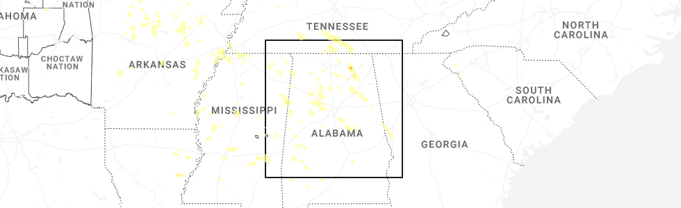
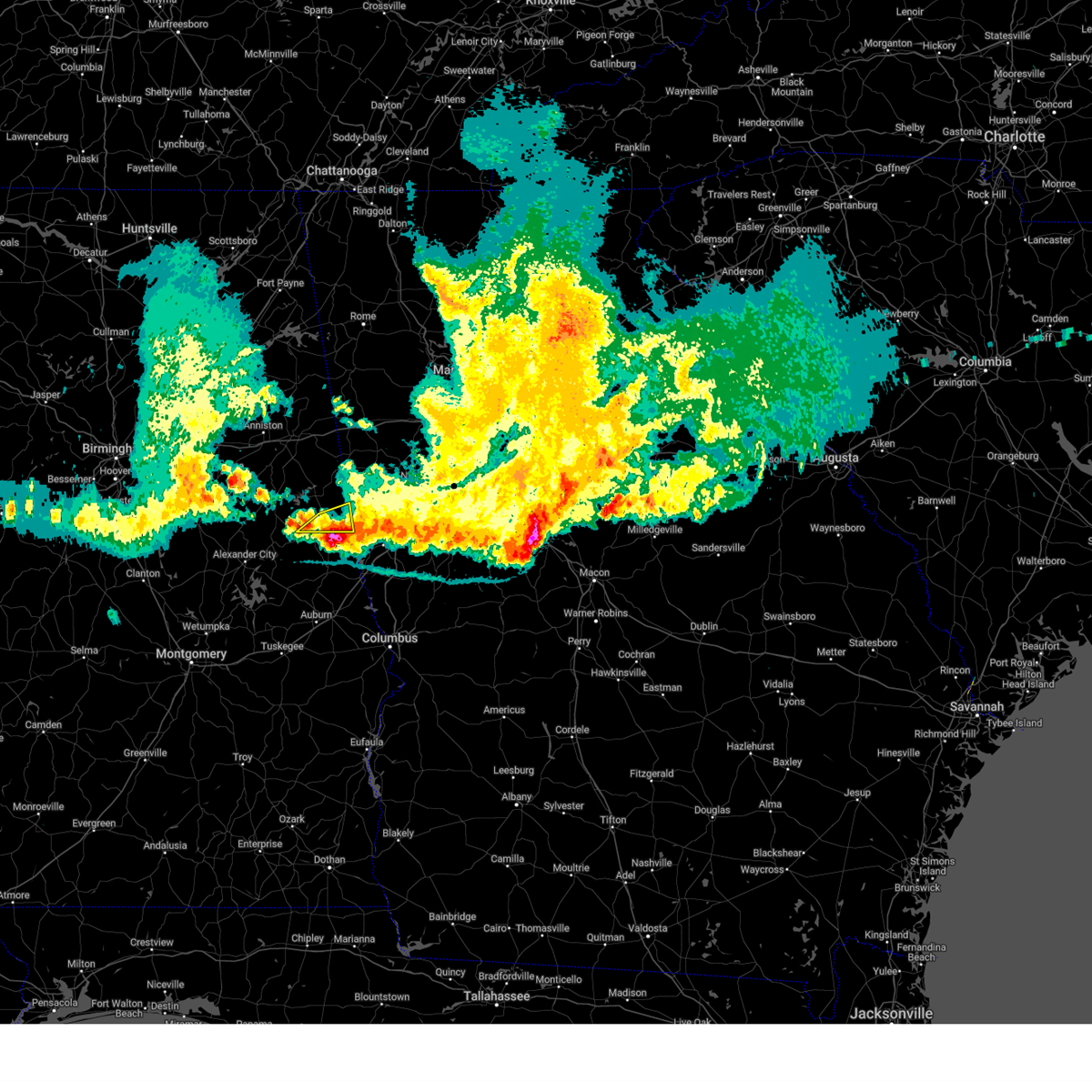
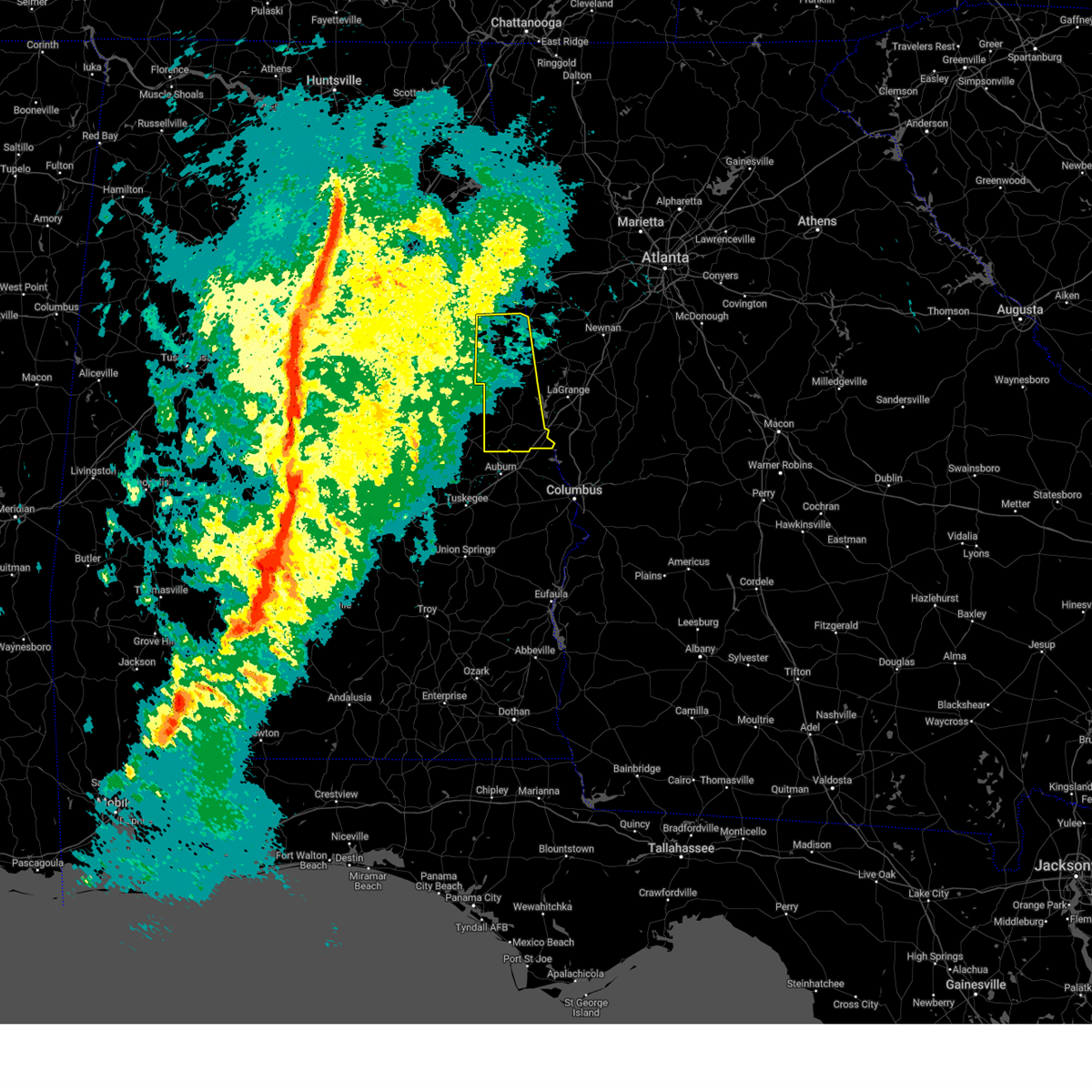
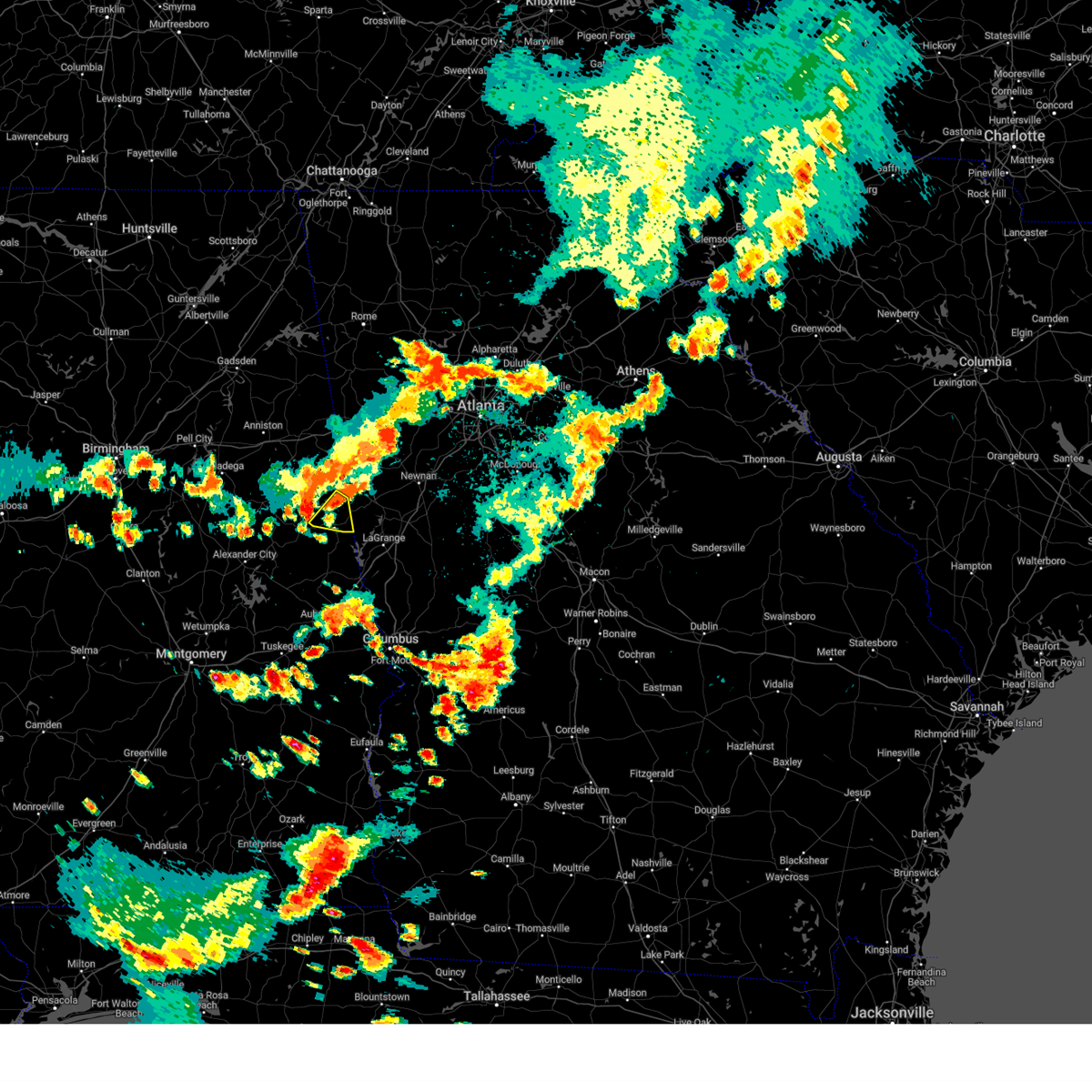
Hail Map for Rock Mills, AL
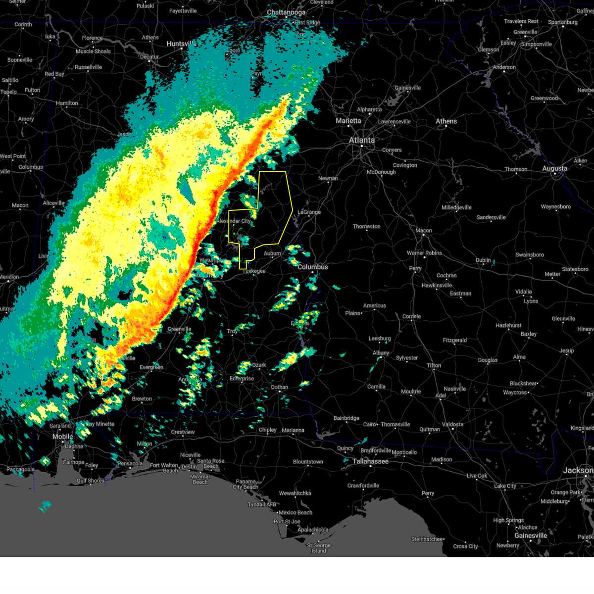
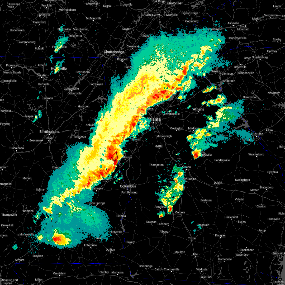
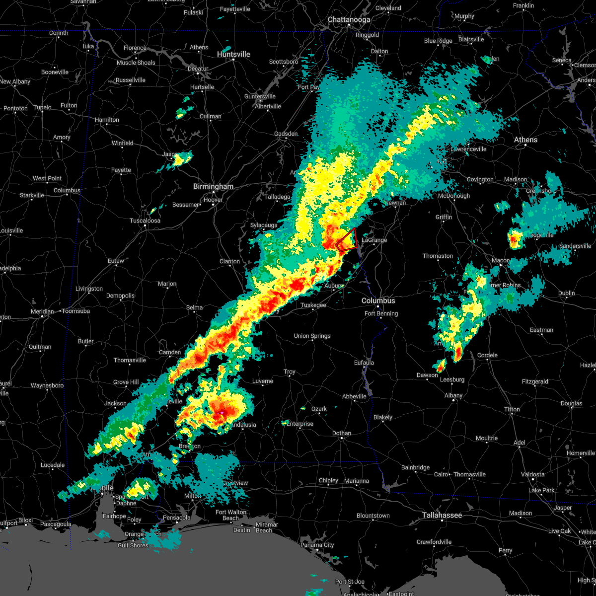
The Rock Mills, AL area has had 0 reports of on-the-ground hail by trained spotters, and has been under severe weather warnings 1 time during the past 12 months. Doppler radar has detected hail at or near Rock Mills, AL on 49 occasions, including 1 occasion during the past year.
| Name: | Rock Mills, AL |
| Where Located: | 39.3 miles NNE of Auburn, AL |
| Map: | Google Map for Rock Mills, AL |
| Population: | 600 |
| Housing Units: | 296 |
| More Info: | Search Google for Rock Mills, AL |
1
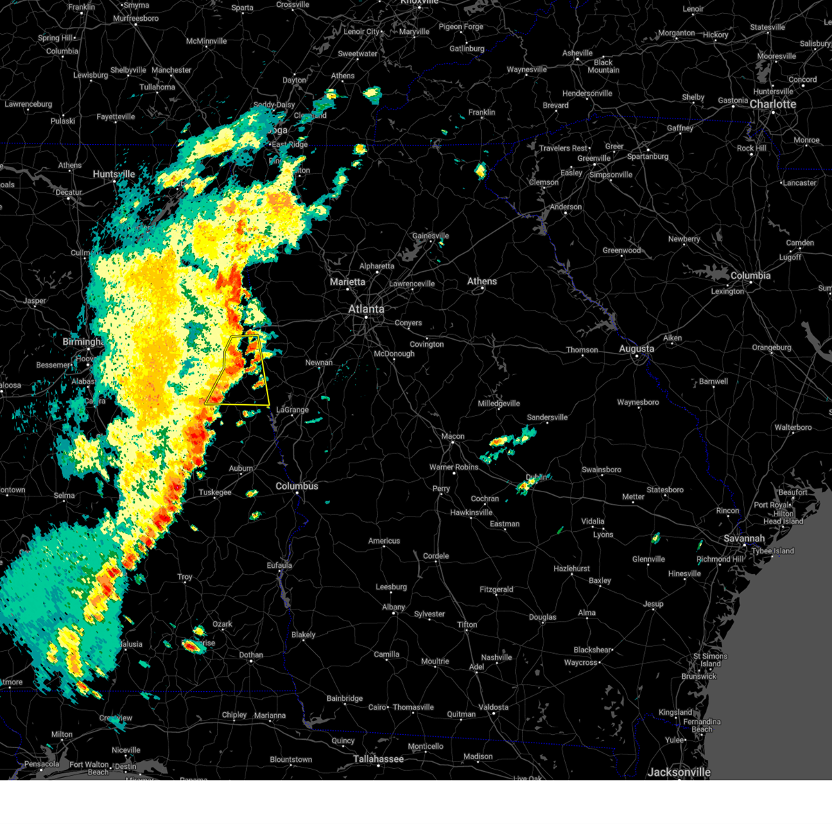
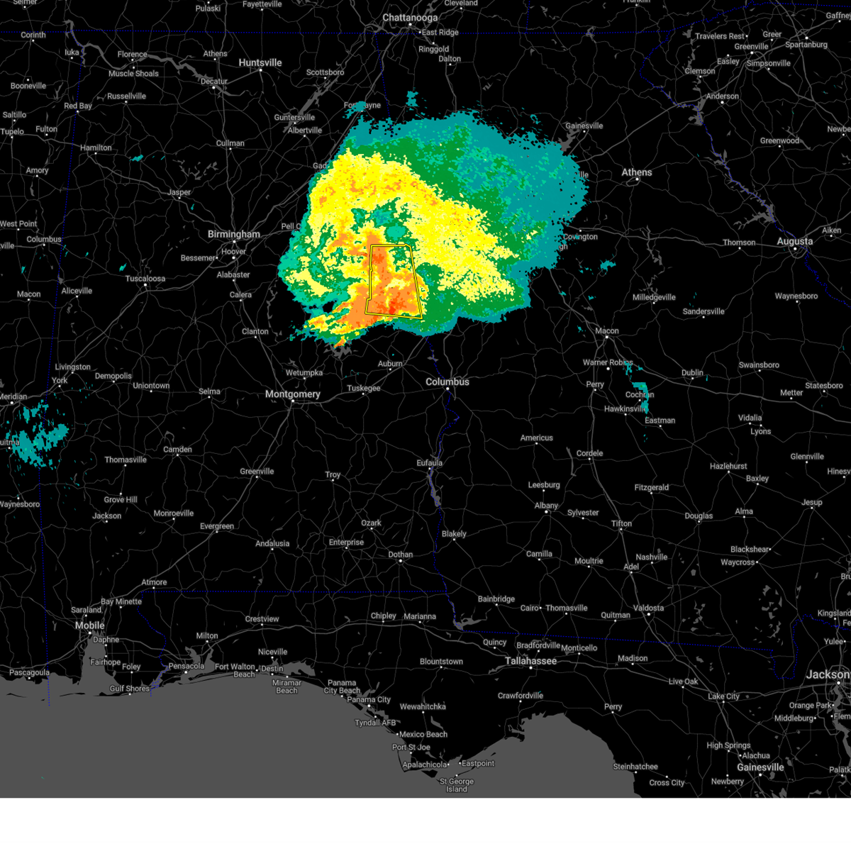
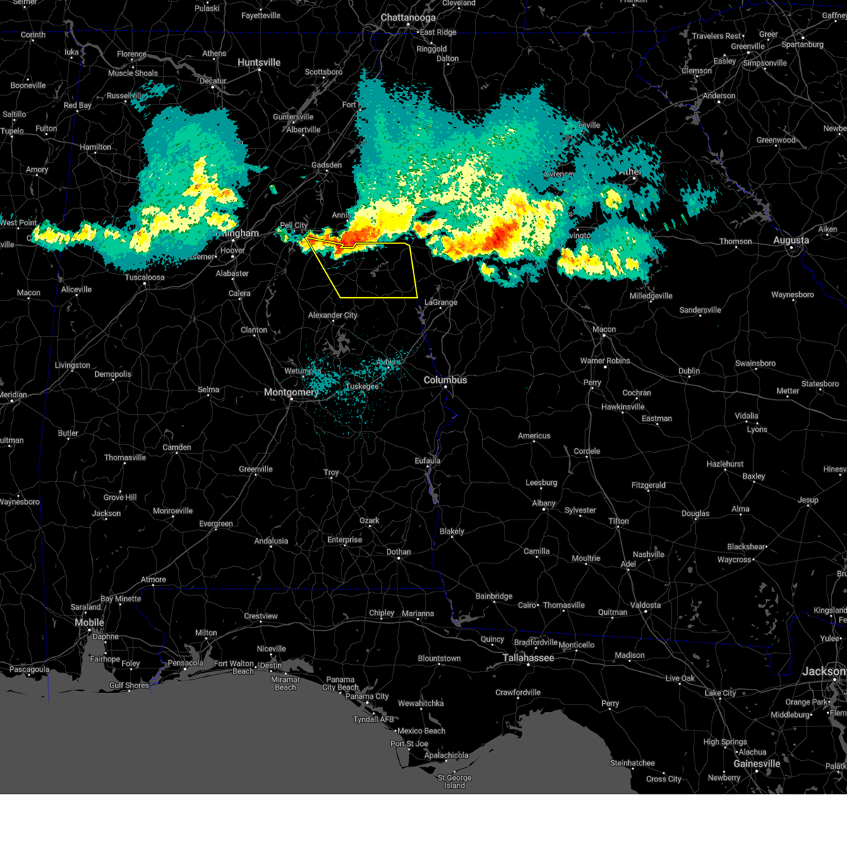
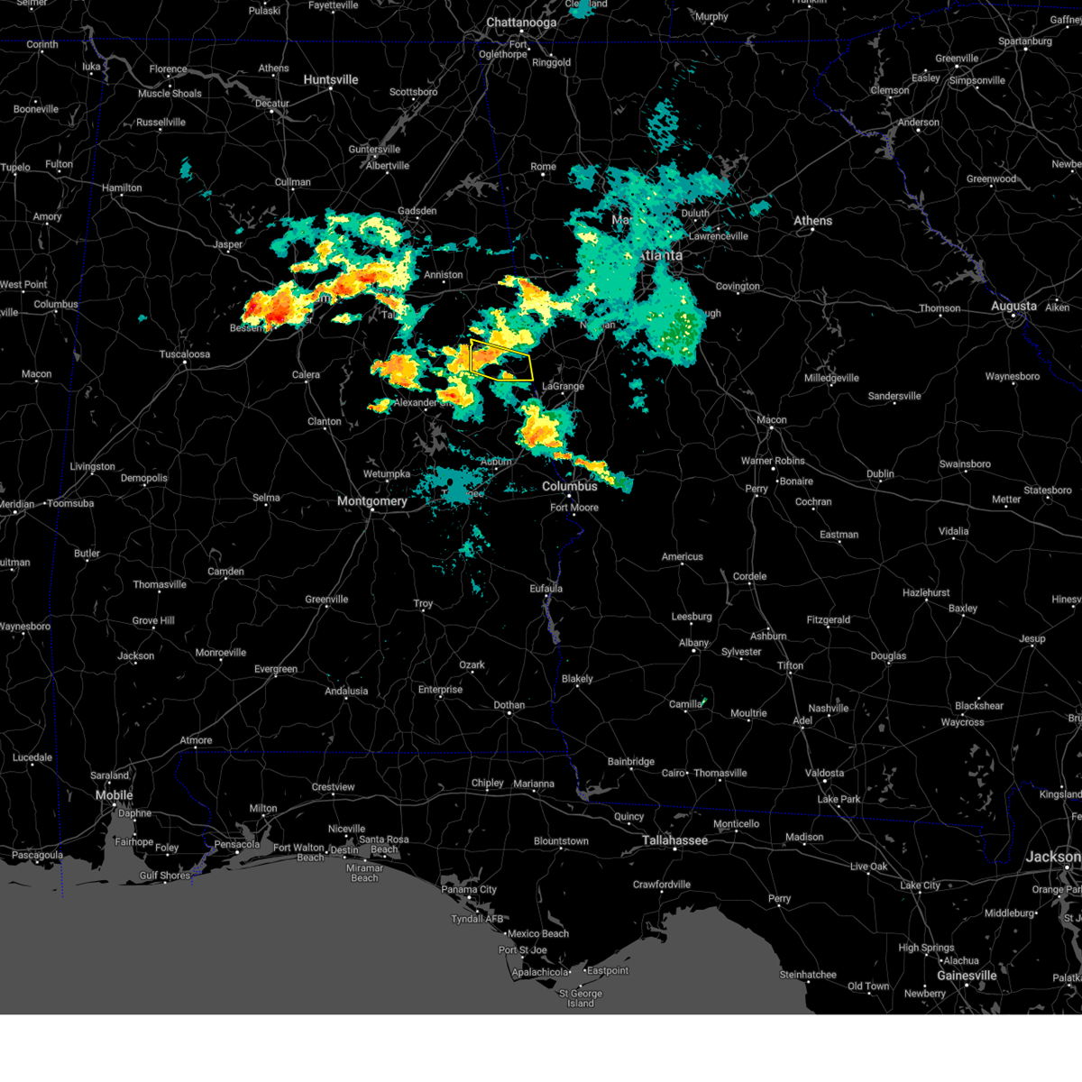
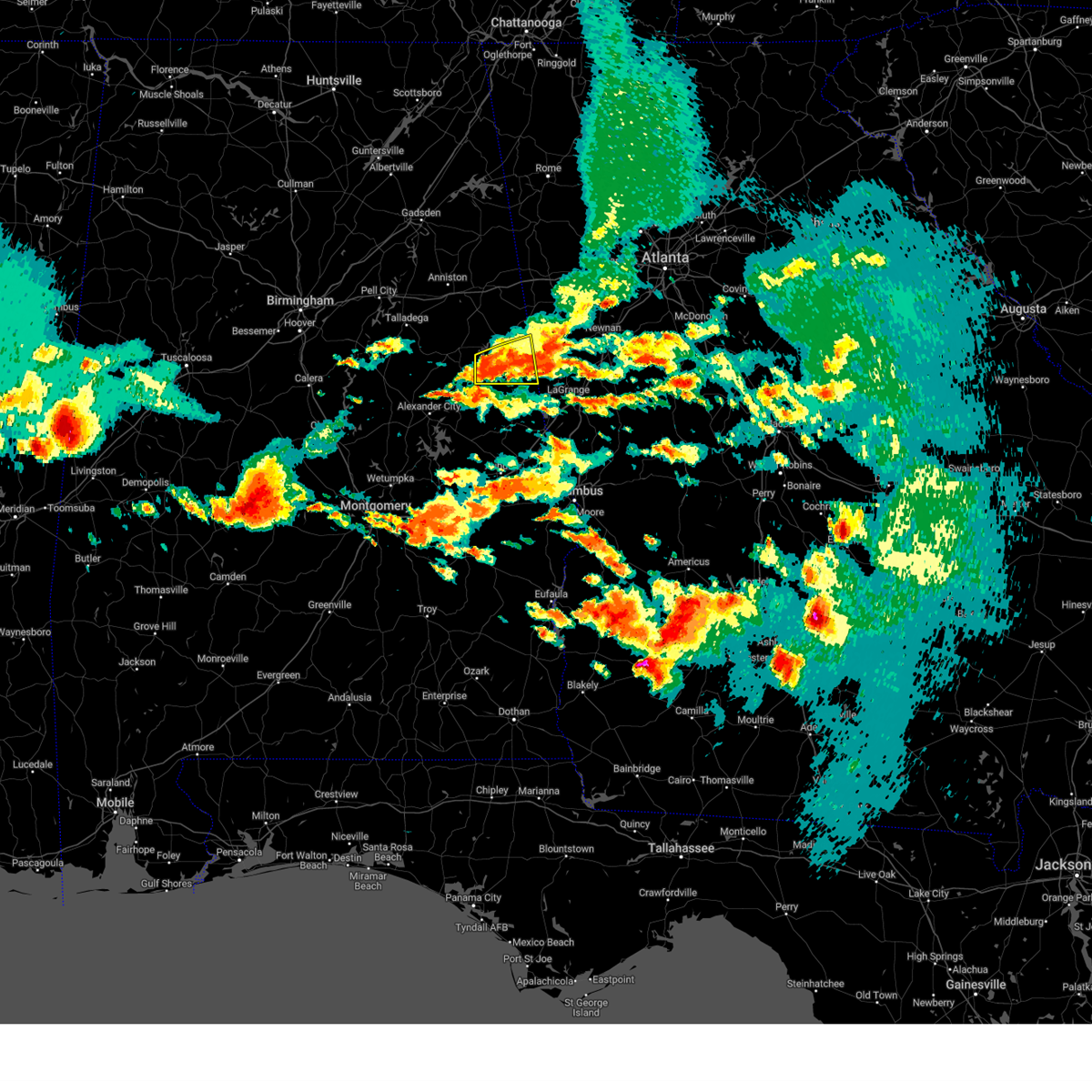
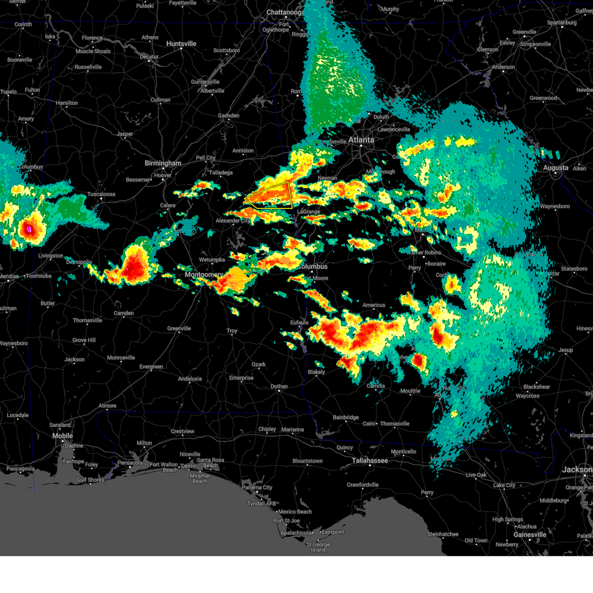
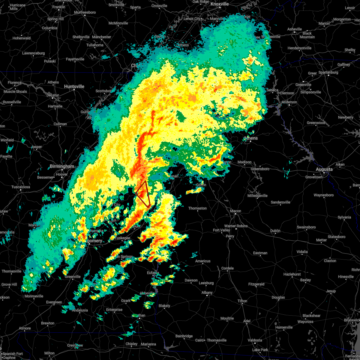
The Top Recent Hail Date for Rock Mills, AL is Monday, June 1, 2026 (8th out of 49)
Hail and Wind Damage Spotted near Rock Mills, AL
| Date / Time | Report Details |
|---|---|
| 6/1/2026 3:19 PM CDT |
 Svrbmx the national weather service in birmingham has issued a * severe thunderstorm warning for, randolph county in east central alabama, * until 400 pm cdt. * at 319 pm cdt, a severe thunderstorm was located over corinth, or 12 miles north of lake wedowee, moving southeast at 45 mph (radar indicated). Hazards include 60 mph wind gusts and quarter size hail. Hail damage to vehicles is expected. Expect wind damage to roofs, siding, and trees. Svrbmx the national weather service in birmingham has issued a * severe thunderstorm warning for, randolph county in east central alabama, * until 400 pm cdt. * at 319 pm cdt, a severe thunderstorm was located over corinth, or 12 miles north of lake wedowee, moving southeast at 45 mph (radar indicated). Hazards include 60 mph wind gusts and quarter size hail. Hail damage to vehicles is expected. Expect wind damage to roofs, siding, and trees.
|
| 6/8/2025 5:20 AM CDT |
 The storm which prompted the warning has moved out of the area. therefore, the warning will be allowed to expire. however, gusty winds are still possible with this thunderstorm. The storm which prompted the warning has moved out of the area. therefore, the warning will be allowed to expire. however, gusty winds are still possible with this thunderstorm.
|
| 6/8/2025 4:49 AM CDT |
 Svrbmx the national weather service in birmingham has issued a * severe thunderstorm warning for, randolph county in east central alabama, * until 530 am cdt. * at 449 am cdt, a severe thunderstorm was located near lake wedowee, moving east at 40 mph (radar indicated). Hazards include 60 mph wind gusts and nickel size hail. expect damage to roofs, siding, and trees Svrbmx the national weather service in birmingham has issued a * severe thunderstorm warning for, randolph county in east central alabama, * until 530 am cdt. * at 449 am cdt, a severe thunderstorm was located near lake wedowee, moving east at 40 mph (radar indicated). Hazards include 60 mph wind gusts and nickel size hail. expect damage to roofs, siding, and trees
|
| 5/27/2025 1:23 PM CDT |
 the severe thunderstorm warning has been cancelled and is no longer in effect the severe thunderstorm warning has been cancelled and is no longer in effect
|
| 5/27/2025 1:23 PM CDT |
 At 122 pm cdt, severe thunderstorms were located along a line extending from near abernathy to near ephesus to near abanda, moving east at 45 mph (radar indicated). Hazards include 60 mph wind gusts. Expect damage to roofs, siding, and trees. Locations impacted include, roanoke, wedowee, wadley, ranburne, woodland, crystal lake, graham, dickert, newell, napoleon, tennant, rock mills, big springs, paran, roanoke municipal airport, and rock stand. At 122 pm cdt, severe thunderstorms were located along a line extending from near abernathy to near ephesus to near abanda, moving east at 45 mph (radar indicated). Hazards include 60 mph wind gusts. Expect damage to roofs, siding, and trees. Locations impacted include, roanoke, wedowee, wadley, ranburne, woodland, crystal lake, graham, dickert, newell, napoleon, tennant, rock mills, big springs, paran, roanoke municipal airport, and rock stand.
|
| 5/27/2025 1:08 PM CDT |
 At 108 pm cdt, severe thunderstorms were located along a line extending from near abernathy to near woodland to near sparkling springs, moving east at 45 mph (radar indicated). Hazards include 60 mph wind gusts. Expect damage to roofs, siding, and trees. locations impacted include, roanoke, wedowee, lake wedowee, wadley, ranburne, woodland, malone, morrison cross roads, corinth, fosters cross roads, crystal lake, graham, dickert, newell, r. l. Harris dam, tennant, trickem, lake cleburne, rock mills, and micaville. At 108 pm cdt, severe thunderstorms were located along a line extending from near abernathy to near woodland to near sparkling springs, moving east at 45 mph (radar indicated). Hazards include 60 mph wind gusts. Expect damage to roofs, siding, and trees. locations impacted include, roanoke, wedowee, lake wedowee, wadley, ranburne, woodland, malone, morrison cross roads, corinth, fosters cross roads, crystal lake, graham, dickert, newell, r. l. Harris dam, tennant, trickem, lake cleburne, rock mills, and micaville.
|
| 5/27/2025 12:49 PM CDT |
 At 1249 pm cdt, severe thunderstorms were located along a line extending from near delta to near barfield to near goldville, moving east at 45 mph (radar indicated). Hazards include 60 mph wind gusts. Expect damage to roofs, siding, and trees. locations impacted include, roanoke, lineville, ashland, wedowee, lake wedowee, wadley, ranburne, woodland, malone, morrison cross roads, barfield, corinth, fosters cross roads, delta, crystal lake, graham, dickert, newell, r. l. Harris dam, and tennant. At 1249 pm cdt, severe thunderstorms were located along a line extending from near delta to near barfield to near goldville, moving east at 45 mph (radar indicated). Hazards include 60 mph wind gusts. Expect damage to roofs, siding, and trees. locations impacted include, roanoke, lineville, ashland, wedowee, lake wedowee, wadley, ranburne, woodland, malone, morrison cross roads, barfield, corinth, fosters cross roads, delta, crystal lake, graham, dickert, newell, r. l. Harris dam, and tennant.
|
| 5/27/2025 12:33 PM CDT |
 Svrbmx the national weather service in birmingham has issued a * severe thunderstorm warning for, randolph county in east central alabama, southern cleburne county in east central alabama, clay county in east central alabama, * until 130 pm cdt. * at 1232 pm cdt, severe thunderstorms were located along a line extending from near mount cheaha to near ashland to 6 miles northeast of goodwater, moving east at 45 mph (radar indicated). Hazards include 60 mph wind gusts. expect damage to roofs, siding, and trees Svrbmx the national weather service in birmingham has issued a * severe thunderstorm warning for, randolph county in east central alabama, southern cleburne county in east central alabama, clay county in east central alabama, * until 130 pm cdt. * at 1232 pm cdt, severe thunderstorms were located along a line extending from near mount cheaha to near ashland to 6 miles northeast of goodwater, moving east at 45 mph (radar indicated). Hazards include 60 mph wind gusts. expect damage to roofs, siding, and trees
|
| 5/18/2025 8:06 AM CDT |
 The storms which prompted the warning have moved out of the area. therefore, the warning will be allowed to expire. a severe thunderstorm watch remains in effect until noon cdt for east central alabama. The storms which prompted the warning have moved out of the area. therefore, the warning will be allowed to expire. a severe thunderstorm watch remains in effect until noon cdt for east central alabama.
|
| 5/18/2025 7:54 AM CDT |
 At 753 am cdt, severe thunderstorms were located along a line extending from corinth to near wedowee to near trammel crossroads, moving east at 70 mph (radar indicated). Hazards include 60 mph wind gusts and quarter size hail. Hail damage to vehicles is expected. expect wind damage to roofs, siding, and trees. locations impacted include, malone, graham, dickert, lake wedowee, post oak forks, morrison cross roads, newell, r. l. Harris dam, roanoke, woodland, tennant, amity park, abanda, rock mills, standing rock, big springs, welch, roanoke municipal airport, corinth, and wadley. At 753 am cdt, severe thunderstorms were located along a line extending from corinth to near wedowee to near trammel crossroads, moving east at 70 mph (radar indicated). Hazards include 60 mph wind gusts and quarter size hail. Hail damage to vehicles is expected. expect wind damage to roofs, siding, and trees. locations impacted include, malone, graham, dickert, lake wedowee, post oak forks, morrison cross roads, newell, r. l. Harris dam, roanoke, woodland, tennant, amity park, abanda, rock mills, standing rock, big springs, welch, roanoke municipal airport, corinth, and wadley.
|
| 5/18/2025 7:54 AM CDT |
 the severe thunderstorm warning has been cancelled and is no longer in effect the severe thunderstorm warning has been cancelled and is no longer in effect
|
| 5/18/2025 7:35 AM CDT |
 At 734 am cdt, severe thunderstorms were located along a line extending from near munford to ashland to near hillabee creek, moving east at 70 mph (radar indicated). Hazards include 60 mph wind gusts and quarter size hail. Hail damage to vehicles is expected. expect wind damage to roofs, siding, and trees. Locations impacted include, graham, cleveland crossroads, dickert, goodwater, tennant, roanoke municipal airport, corinth, lineville, mellow valley, gunthertown, grant town, hollis crossroads, white plains, state line park, five points, chandler springs, chalafinnee, stroud, crystal lake, and roselle. At 734 am cdt, severe thunderstorms were located along a line extending from near munford to ashland to near hillabee creek, moving east at 70 mph (radar indicated). Hazards include 60 mph wind gusts and quarter size hail. Hail damage to vehicles is expected. expect wind damage to roofs, siding, and trees. Locations impacted include, graham, cleveland crossroads, dickert, goodwater, tennant, roanoke municipal airport, corinth, lineville, mellow valley, gunthertown, grant town, hollis crossroads, white plains, state line park, five points, chandler springs, chalafinnee, stroud, crystal lake, and roselle.
|
| 5/18/2025 7:35 AM CDT |
 the severe thunderstorm warning has been cancelled and is no longer in effect the severe thunderstorm warning has been cancelled and is no longer in effect
|
| 5/18/2025 7:14 AM CDT |
 Svrbmx the national weather service in birmingham has issued a * severe thunderstorm warning for, central talladega county in east central alabama, randolph county in east central alabama, southeastern st. clair county in central alabama, northern tallapoosa county in east central alabama, northern chambers county in east central alabama, southern cleburne county in east central alabama, northeastern coosa county in east central alabama, clay county in east central alabama, * until 815 am cdt. * at 714 am cdt, severe thunderstorms were located along a line extending from near logan martin lake to near winterboro to near stewartville, moving east at 70 mph (radar indicated). Hazards include 70 mph wind gusts and quarter size hail. Hail damage to vehicles is expected. expect considerable tree damage. Wind damage is also likely to mobile homes, roofs, and outbuildings. Svrbmx the national weather service in birmingham has issued a * severe thunderstorm warning for, central talladega county in east central alabama, randolph county in east central alabama, southeastern st. clair county in central alabama, northern tallapoosa county in east central alabama, northern chambers county in east central alabama, southern cleburne county in east central alabama, northeastern coosa county in east central alabama, clay county in east central alabama, * until 815 am cdt. * at 714 am cdt, severe thunderstorms were located along a line extending from near logan martin lake to near winterboro to near stewartville, moving east at 70 mph (radar indicated). Hazards include 70 mph wind gusts and quarter size hail. Hail damage to vehicles is expected. expect considerable tree damage. Wind damage is also likely to mobile homes, roofs, and outbuildings.
|
| 5/2/2025 8:00 PM CDT |
 At 800 pm cdt, severe thunderstorms were located along a line extending from mount zion to near woodland to near goldville, moving east at 25 mph (radar indicated). Hazards include 60 mph wind gusts and nickel size hail. Expect damage to roofs, siding, and trees. locations impacted include, malone, graham, dickert, lake wedowee, morrison cross roads, newell, cragford, r. l. Harris dam, roanoke, ofelia, woodland, napoleon, tennant, wedowee, rock mills, crystal lake, big springs, motley, ranburne, and paran. At 800 pm cdt, severe thunderstorms were located along a line extending from mount zion to near woodland to near goldville, moving east at 25 mph (radar indicated). Hazards include 60 mph wind gusts and nickel size hail. Expect damage to roofs, siding, and trees. locations impacted include, malone, graham, dickert, lake wedowee, morrison cross roads, newell, cragford, r. l. Harris dam, roanoke, ofelia, woodland, napoleon, tennant, wedowee, rock mills, crystal lake, big springs, motley, ranburne, and paran.
|
| 5/2/2025 7:33 PM CDT |
 At 732 pm cdt, severe thunderstorms were located along a line extending from near mars hills to delta to near goodwater, moving east at 35 mph (radar indicated). Hazards include 60 mph wind gusts and nickel size hail. Expect damage to roofs, siding, and trees. locations impacted include, malone, graham, cleveland crossroads, dickert, lake wedowee, morrison cross roads, newell, barfield, r. l. Harris dam, roanoke, woodland, tennant, edwardsville, trickem, lake cleburne, heflin, rock mills, micaville, big springs, and motley. At 732 pm cdt, severe thunderstorms were located along a line extending from near mars hills to delta to near goodwater, moving east at 35 mph (radar indicated). Hazards include 60 mph wind gusts and nickel size hail. Expect damage to roofs, siding, and trees. locations impacted include, malone, graham, cleveland crossroads, dickert, lake wedowee, morrison cross roads, newell, barfield, r. l. Harris dam, roanoke, woodland, tennant, edwardsville, trickem, lake cleburne, heflin, rock mills, micaville, big springs, and motley.
|
| 5/2/2025 7:33 PM CDT |
 the severe thunderstorm warning has been cancelled and is no longer in effect the severe thunderstorm warning has been cancelled and is no longer in effect
|
| 5/2/2025 7:16 PM CDT |
 At 716 pm cdt, severe thunderstorms were located along a line extending from mars hills to near mount cheaha to talladega springs, moving east at 35 mph (radar indicated). Hazards include 60 mph wind gusts and quarter size hail. Hail damage to vehicles is expected. expect wind damage to roofs, siding, and trees. Locations impacted include, graham, cleveland crossroads, dickert, anniston, gantts quarry, coleman lake and campground, choccolocco, tennant, trickem, lake cleburne, heflin, varnons, liberty hill, oak level, hobson city, roanoke municipal airport, corinth, lineville, mellow valley, and mignon. At 716 pm cdt, severe thunderstorms were located along a line extending from mars hills to near mount cheaha to talladega springs, moving east at 35 mph (radar indicated). Hazards include 60 mph wind gusts and quarter size hail. Hail damage to vehicles is expected. expect wind damage to roofs, siding, and trees. Locations impacted include, graham, cleveland crossroads, dickert, anniston, gantts quarry, coleman lake and campground, choccolocco, tennant, trickem, lake cleburne, heflin, varnons, liberty hill, oak level, hobson city, roanoke municipal airport, corinth, lineville, mellow valley, and mignon.
|
| 5/2/2025 6:48 PM CDT |
 Svrbmx the national weather service in birmingham has issued a * severe thunderstorm warning for, talladega county in east central alabama, randolph county in east central alabama, calhoun county in east central alabama, cleburne county in east central alabama, clay county in east central alabama, * until 815 pm cdt. * at 647 pm cdt, severe thunderstorms were located along a line extending from near mars hills to near mount cheaha to near winterboro to bon air to near wilsonville, moving east at 45 mph (radar indicated). Hazards include 60 mph wind gusts and quarter size hail. Hail damage to vehicles is expected. Expect wind damage to roofs, siding, and trees. Svrbmx the national weather service in birmingham has issued a * severe thunderstorm warning for, talladega county in east central alabama, randolph county in east central alabama, calhoun county in east central alabama, cleburne county in east central alabama, clay county in east central alabama, * until 815 pm cdt. * at 647 pm cdt, severe thunderstorms were located along a line extending from near mars hills to near mount cheaha to near winterboro to bon air to near wilsonville, moving east at 45 mph (radar indicated). Hazards include 60 mph wind gusts and quarter size hail. Hail damage to vehicles is expected. Expect wind damage to roofs, siding, and trees.
|
| 4/10/2025 9:25 PM CDT |
 the severe thunderstorm warning has been cancelled and is no longer in effect the severe thunderstorm warning has been cancelled and is no longer in effect
|
| 4/10/2025 9:11 PM CDT |
 At 910 pm cdt, a severe thunderstorm was located over roanoke, moving southeast at 45 mph (radar indicated). Hazards include 60 mph wind gusts and half dollar size hail. Hail damage to vehicles is expected. expect wind damage to roofs, siding, and trees. Locations impacted include, dickert, rock mills, crystal lake, paran, roanoke municipal airport, roanoke, wadley, and rock stand. At 910 pm cdt, a severe thunderstorm was located over roanoke, moving southeast at 45 mph (radar indicated). Hazards include 60 mph wind gusts and half dollar size hail. Hail damage to vehicles is expected. expect wind damage to roofs, siding, and trees. Locations impacted include, dickert, rock mills, crystal lake, paran, roanoke municipal airport, roanoke, wadley, and rock stand.
|
| 4/10/2025 8:55 PM CDT |
 the severe thunderstorm warning has been cancelled and is no longer in effect the severe thunderstorm warning has been cancelled and is no longer in effect
|
| 4/10/2025 8:55 PM CDT |
 At 855 pm cdt, a severe thunderstorm was located near wedowee, moving southeast at 45 mph (radar indicated). Hazards include 60 mph wind gusts and half dollar size hail. Hail damage to vehicles is expected. expect wind damage to roofs, siding, and trees. locations impacted include, malone, dickert, lake wedowee, r. l. Harris dam, roanoke, ofelia, woodland, napoleon, tennant, wedowee, rock mills, crystal lake, big springs, paran, roanoke municipal airport, wadley, and rock stand. At 855 pm cdt, a severe thunderstorm was located near wedowee, moving southeast at 45 mph (radar indicated). Hazards include 60 mph wind gusts and half dollar size hail. Hail damage to vehicles is expected. expect wind damage to roofs, siding, and trees. locations impacted include, malone, dickert, lake wedowee, r. l. Harris dam, roanoke, ofelia, woodland, napoleon, tennant, wedowee, rock mills, crystal lake, big springs, paran, roanoke municipal airport, wadley, and rock stand.
|
| 4/10/2025 8:41 PM CDT |
 At 841 pm cdt, a severe thunderstorm was located near lake wedowee, moving southeast at 45 mph (radar indicated). Hazards include 60 mph wind gusts and nickel size hail. Expect damage to roofs, siding, and trees. locations impacted include, malone, graham, dickert, lake wedowee, morrison cross roads, newell, barfield, r. l. Harris dam, roanoke, woodland, tennant, rock mills, big springs, motley, roanoke municipal airport, corinth, lineville, wadley, mellow valley, and cragford. At 841 pm cdt, a severe thunderstorm was located near lake wedowee, moving southeast at 45 mph (radar indicated). Hazards include 60 mph wind gusts and nickel size hail. Expect damage to roofs, siding, and trees. locations impacted include, malone, graham, dickert, lake wedowee, morrison cross roads, newell, barfield, r. l. Harris dam, roanoke, woodland, tennant, rock mills, big springs, motley, roanoke municipal airport, corinth, lineville, wadley, mellow valley, and cragford.
|
| 4/10/2025 8:41 PM CDT |
 the severe thunderstorm warning has been cancelled and is no longer in effect the severe thunderstorm warning has been cancelled and is no longer in effect
|
| 4/10/2025 8:29 PM CDT |
 At 829 pm cdt, a severe thunderstorm was located over delta, or 11 miles southeast of oxford, moving southeast at 45 mph (radar indicated). Hazards include 60 mph wind gusts and nickel size hail. Expect damage to roofs, siding, and trees. locations impacted include, malone, graham, dickert, lake wedowee, morrison cross roads, newell, barfield, r. l. Harris dam, roanoke, woodland, tennant, camp mac, rock mills, micaville, ironaton, big springs, motley, roanoke municipal airport, corinth, and lineville. At 829 pm cdt, a severe thunderstorm was located over delta, or 11 miles southeast of oxford, moving southeast at 45 mph (radar indicated). Hazards include 60 mph wind gusts and nickel size hail. Expect damage to roofs, siding, and trees. locations impacted include, malone, graham, dickert, lake wedowee, morrison cross roads, newell, barfield, r. l. Harris dam, roanoke, woodland, tennant, camp mac, rock mills, micaville, ironaton, big springs, motley, roanoke municipal airport, corinth, and lineville.
|
| 4/10/2025 8:08 PM CDT |
 Svrbmx the national weather service in birmingham has issued a * severe thunderstorm warning for, east central talladega county in east central alabama, randolph county in east central alabama, clay county in east central alabama, * until 945 pm cdt. * at 807 pm cdt, a severe thunderstorm was located over bynum, or near cobb town, moving southeast at 45 mph (radar indicated). Hazards include 60 mph wind gusts and quarter size hail. Hail damage to vehicles is expected. Expect wind damage to roofs, siding, and trees. Svrbmx the national weather service in birmingham has issued a * severe thunderstorm warning for, east central talladega county in east central alabama, randolph county in east central alabama, clay county in east central alabama, * until 945 pm cdt. * at 807 pm cdt, a severe thunderstorm was located over bynum, or near cobb town, moving southeast at 45 mph (radar indicated). Hazards include 60 mph wind gusts and quarter size hail. Hail damage to vehicles is expected. Expect wind damage to roofs, siding, and trees.
|
| 3/15/2025 11:04 PM CDT |
 Torbmx the national weather service in birmingham has issued a * tornado warning for, southern randolph county in east central alabama, northwestern chambers county in east central alabama, * until midnight cdt. * at 1104 pm cdt, a severe thunderstorm capable of producing a tornado was located near new site, or 11 miles north of dadeville, moving northeast at 50 mph (radar indicated rotation). Hazards include tornado. Flying debris will be dangerous to those caught without shelter. mobile homes will be damaged or destroyed. damage to roofs, windows, and vehicles will occur. Tree damage is likely. Torbmx the national weather service in birmingham has issued a * tornado warning for, southern randolph county in east central alabama, northwestern chambers county in east central alabama, * until midnight cdt. * at 1104 pm cdt, a severe thunderstorm capable of producing a tornado was located near new site, or 11 miles north of dadeville, moving northeast at 50 mph (radar indicated rotation). Hazards include tornado. Flying debris will be dangerous to those caught without shelter. mobile homes will be damaged or destroyed. damage to roofs, windows, and vehicles will occur. Tree damage is likely.
|
| 3/4/2025 11:51 PM CST |
 The storms which prompted the warning have moved out of the area. therefore, the warning will be allowed to expire. however, gusty winds are still possible with these thunderstorms. a severe thunderstorm watch remains in effect until 300 am cst for east central alabama. The storms which prompted the warning have moved out of the area. therefore, the warning will be allowed to expire. however, gusty winds are still possible with these thunderstorms. a severe thunderstorm watch remains in effect until 300 am cst for east central alabama.
|
| 3/4/2025 10:43 PM CST |
 Svrbmx the national weather service in birmingham has issued a * severe thunderstorm warning for, randolph county in east central alabama, chambers county in east central alabama, * until midnight cst. * at 1042 pm cst, severe thunderstorms were located along a line extending from mount cheaha to near still waters resort, moving east at 40 mph (radar indicated). Hazards include 60 mph wind gusts. expect damage to roofs, siding, and trees Svrbmx the national weather service in birmingham has issued a * severe thunderstorm warning for, randolph county in east central alabama, chambers county in east central alabama, * until midnight cst. * at 1042 pm cst, severe thunderstorms were located along a line extending from mount cheaha to near still waters resort, moving east at 40 mph (radar indicated). Hazards include 60 mph wind gusts. expect damage to roofs, siding, and trees
|
| 2/16/2025 3:04 AM CST |
 the severe thunderstorm warning has been cancelled and is no longer in effect the severe thunderstorm warning has been cancelled and is no longer in effect
|
| 2/16/2025 3:04 AM CST |
 At 304 am cst, severe thunderstorms were located along a line extending from roopville to near welch to near notasulga, moving east at 55 mph (radar indicated). Hazards include 70 mph wind gusts. Expect considerable tree damage. damage is likely to mobile homes, roofs, and outbuildings. Locations impacted include, roanoke, lafayette, stroud, la fayette, waverly, five points, fredonia, post oak forks, sturkie, standing rock, oak bowery, welch, buffalo, west chambers, white plains, and rock mills. At 304 am cst, severe thunderstorms were located along a line extending from roopville to near welch to near notasulga, moving east at 55 mph (radar indicated). Hazards include 70 mph wind gusts. Expect considerable tree damage. damage is likely to mobile homes, roofs, and outbuildings. Locations impacted include, roanoke, lafayette, stroud, la fayette, waverly, five points, fredonia, post oak forks, sturkie, standing rock, oak bowery, welch, buffalo, west chambers, white plains, and rock mills.
|
| 2/16/2025 2:53 AM CST |
 At 253 am cst, severe thunderstorms were located along a line extending from near ranburne to near abanda to near liberty city, moving east at 55 mph (radar indicated). Hazards include 70 mph wind gusts. Expect considerable tree damage. damage is likely to mobile homes, roofs, and outbuildings. Locations impacted include, roanoke, tallassee, dadeville, camp hill, wedowee, stroud, lafayette, la fayette, jacksons' gap, wadley, woodland, waverly, five points, sturkie, trammel crossroads, buffalo, liberty city, tallapoosa city, crystal lake, and oak bowery. At 253 am cst, severe thunderstorms were located along a line extending from near ranburne to near abanda to near liberty city, moving east at 55 mph (radar indicated). Hazards include 70 mph wind gusts. Expect considerable tree damage. damage is likely to mobile homes, roofs, and outbuildings. Locations impacted include, roanoke, tallassee, dadeville, camp hill, wedowee, stroud, lafayette, la fayette, jacksons' gap, wadley, woodland, waverly, five points, sturkie, trammel crossroads, buffalo, liberty city, tallapoosa city, crystal lake, and oak bowery.
|
| 2/16/2025 2:32 AM CST |
 At 232 am cst, severe thunderstorms were located along a line extending from corinth to near goldville to near emerald mountain, moving east at 65 mph (radar indicated). Hazards include 70 mph wind gusts. Expect considerable tree damage. damage is likely to mobile homes, roofs, and outbuildings. Locations impacted include, alexander city, roanoke, tallassee, dadeville, camp hill, wedowee, stroud, lake wedowee, lafayette, la fayette, jacksons' gap, new site, wadley, woodland, waverly, five points, goldville, sturkie, trammel crossroads, and corinth. At 232 am cst, severe thunderstorms were located along a line extending from corinth to near goldville to near emerald mountain, moving east at 65 mph (radar indicated). Hazards include 70 mph wind gusts. Expect considerable tree damage. damage is likely to mobile homes, roofs, and outbuildings. Locations impacted include, alexander city, roanoke, tallassee, dadeville, camp hill, wedowee, stroud, lake wedowee, lafayette, la fayette, jacksons' gap, new site, wadley, woodland, waverly, five points, goldville, sturkie, trammel crossroads, and corinth.
|
| 2/16/2025 2:14 AM CST |
 Svrbmx the national weather service in birmingham has issued a * severe thunderstorm warning for, randolph county in east central alabama, tallapoosa county in east central alabama, chambers county in east central alabama, * until 330 am cst. * at 214 am cst, severe thunderstorms were located along a line extending from near mount cheaha to parkdale to near deatsville, moving east at 55 mph (radar indicated). Hazards include 70 mph wind gusts. Expect considerable tree damage. Damage is likely to mobile homes, roofs, and outbuildings. Svrbmx the national weather service in birmingham has issued a * severe thunderstorm warning for, randolph county in east central alabama, tallapoosa county in east central alabama, chambers county in east central alabama, * until 330 am cst. * at 214 am cst, severe thunderstorms were located along a line extending from near mount cheaha to parkdale to near deatsville, moving east at 55 mph (radar indicated). Hazards include 70 mph wind gusts. Expect considerable tree damage. Damage is likely to mobile homes, roofs, and outbuildings.
|
| 5/9/2024 10:23 AM CDT |
 At 1021 am cdt, severe thunderstorms were located along a line extending from near woodland to near sparkling springs to near hillabee creek, moving southeast at 35 mph (radar indicated). Hazards include 60 mph wind gusts and quarter size hail. Hail damage to vehicles is expected. expect wind damage to roofs, siding, and trees. Locations impacted include, roanoke, wedowee, wadley, malone, crystal lake, cleveland crossroads, dickert, hollins, napoleon, tennant, rock mills, big springs, motley, roselle, roanoke municipal airport, mellow valley, rock stand, and paran. At 1021 am cdt, severe thunderstorms were located along a line extending from near woodland to near sparkling springs to near hillabee creek, moving southeast at 35 mph (radar indicated). Hazards include 60 mph wind gusts and quarter size hail. Hail damage to vehicles is expected. expect wind damage to roofs, siding, and trees. Locations impacted include, roanoke, wedowee, wadley, malone, crystal lake, cleveland crossroads, dickert, hollins, napoleon, tennant, rock mills, big springs, motley, roselle, roanoke municipal airport, mellow valley, rock stand, and paran.
|
| 5/9/2024 10:23 AM CDT |
 the severe thunderstorm warning has been cancelled and is no longer in effect the severe thunderstorm warning has been cancelled and is no longer in effect
|
| 5/9/2024 10:01 AM CDT |
 At 1000 am cdt, severe thunderstorms were located along a line extending from 8 miles southeast of heflin to near fosters cross roads to near ashland, moving southeast at 45 mph (radar indicated). Hazards include 60 mph wind gusts and quarter size hail. Hail damage to vehicles is expected. expect wind damage to roofs, siding, and trees. locations impacted include, roanoke, lineville, ashland, wedowee, lake wedowee, wadley, ranburne, woodland, malone, morrison cross roads, barfield, corinth, fosters cross roads, delta, crystal lake, graham, cleveland crossroads, dickert, newell, and r. l. Harris dam. At 1000 am cdt, severe thunderstorms were located along a line extending from 8 miles southeast of heflin to near fosters cross roads to near ashland, moving southeast at 45 mph (radar indicated). Hazards include 60 mph wind gusts and quarter size hail. Hail damage to vehicles is expected. expect wind damage to roofs, siding, and trees. locations impacted include, roanoke, lineville, ashland, wedowee, lake wedowee, wadley, ranburne, woodland, malone, morrison cross roads, barfield, corinth, fosters cross roads, delta, crystal lake, graham, cleveland crossroads, dickert, newell, and r. l. Harris dam.
|
| 5/9/2024 9:46 AM CDT |
 Svrbmx the national weather service in birmingham has issued a * severe thunderstorm warning for, randolph county in east central alabama, cleburne county in east central alabama, clay county in east central alabama, * until 1045 am cdt. * at 946 am cdt, severe thunderstorms were located along a line extending from near heflin to near delta to near waldo, moving southeast at 40 mph (radar indicated). Hazards include 60 mph wind gusts and quarter size hail. Hail damage to vehicles is expected. Expect wind damage to roofs, siding, and trees. Svrbmx the national weather service in birmingham has issued a * severe thunderstorm warning for, randolph county in east central alabama, cleburne county in east central alabama, clay county in east central alabama, * until 1045 am cdt. * at 946 am cdt, severe thunderstorms were located along a line extending from near heflin to near delta to near waldo, moving southeast at 40 mph (radar indicated). Hazards include 60 mph wind gusts and quarter size hail. Hail damage to vehicles is expected. Expect wind damage to roofs, siding, and trees.
|
| 8/14/2023 5:24 PM CDT |
 At 523 pm cdt, severe thunderstorms were located along a line extending from 8 miles northeast of roanoke to near abanda to trammel crossroads, moving east at 20 mph (radar indicated). Hazards include 60 mph wind gusts. Expect damage to roofs, siding, and trees. locations impacted include, roanoke, stroud, wadley, five points, fredonia, post oak forks, veasey creek park, amity park, abanda, standing rock, crystal lake, welch, penton, trammel crossroads, sparkling springs, dickert, white plains, rock mills, stroud creek and paran. hail threat, radar indicated max hail size, <. 75 in wind threat, radar indicated max wind gust, 60 mph. At 523 pm cdt, severe thunderstorms were located along a line extending from 8 miles northeast of roanoke to near abanda to trammel crossroads, moving east at 20 mph (radar indicated). Hazards include 60 mph wind gusts. Expect damage to roofs, siding, and trees. locations impacted include, roanoke, stroud, wadley, five points, fredonia, post oak forks, veasey creek park, amity park, abanda, standing rock, crystal lake, welch, penton, trammel crossroads, sparkling springs, dickert, white plains, rock mills, stroud creek and paran. hail threat, radar indicated max hail size, <. 75 in wind threat, radar indicated max wind gust, 60 mph.
|
| 8/14/2023 5:03 PM CDT |
 At 503 pm cdt, severe thunderstorms were located along a line extending from near crystal lake to wadley to 6 miles southwest of sparkling springs, moving east at 20 mph (radar indicated). Hazards include 60 mph wind gusts. expect damage to roofs, siding, and trees At 503 pm cdt, severe thunderstorms were located along a line extending from near crystal lake to wadley to 6 miles southwest of sparkling springs, moving east at 20 mph (radar indicated). Hazards include 60 mph wind gusts. expect damage to roofs, siding, and trees
|
| 8/12/2023 5:23 PM CDT |
 At 523 pm cdt, a severe thunderstorm was located over roanoke, moving southeast at 20 mph (radar indicated). Hazards include 60 mph wind gusts. Expect damage to roofs, siding, and trees. locations impacted include, roanoke, crystal lake, dickert, rock mills, big springs, paran, roanoke municipal airport, rock stand and napoleon. hail threat, radar indicated max hail size, <. 75 in wind threat, radar indicated max wind gust, 60 mph. At 523 pm cdt, a severe thunderstorm was located over roanoke, moving southeast at 20 mph (radar indicated). Hazards include 60 mph wind gusts. Expect damage to roofs, siding, and trees. locations impacted include, roanoke, crystal lake, dickert, rock mills, big springs, paran, roanoke municipal airport, rock stand and napoleon. hail threat, radar indicated max hail size, <. 75 in wind threat, radar indicated max wind gust, 60 mph.
|
| 8/12/2023 5:01 PM CDT |
 At 501 pm cdt, severe thunderstorms were located along a line extending from near ranburne to near malone, moving east at 15 mph (radar indicated). Hazards include 60 mph wind gusts. expect damage to roofs, siding, and trees At 501 pm cdt, severe thunderstorms were located along a line extending from near ranburne to near malone, moving east at 15 mph (radar indicated). Hazards include 60 mph wind gusts. expect damage to roofs, siding, and trees
|
| 8/9/2023 8:55 PM CDT |
 The severe thunderstorm warning for southeastern randolph county will expire at 900 pm cdt, the storm which prompted the warning has weakened below severe limits, and has exited the warned area. therefore, the warning will be allowed to expire. a severe thunderstorm watch remains in effect until 1100 pm cdt for east central alabama. The severe thunderstorm warning for southeastern randolph county will expire at 900 pm cdt, the storm which prompted the warning has weakened below severe limits, and has exited the warned area. therefore, the warning will be allowed to expire. a severe thunderstorm watch remains in effect until 1100 pm cdt for east central alabama.
|
| 8/9/2023 8:35 PM CDT |
 At 835 pm cdt, a severe thunderstorm was located near roanoke, moving southeast at 30 mph (radar indicated). Hazards include 60 mph wind gusts and quarter size hail. Hail damage to vehicles is expected. expect wind damage to roofs, siding, and trees. locations impacted include, roanoke, wedowee, crystal lake, tennant, dickert, rock mills, paran, roanoke municipal airport and rock stand. hail threat, radar indicated max hail size, 1. 00 in wind threat, radar indicated max wind gust, 60 mph. At 835 pm cdt, a severe thunderstorm was located near roanoke, moving southeast at 30 mph (radar indicated). Hazards include 60 mph wind gusts and quarter size hail. Hail damage to vehicles is expected. expect wind damage to roofs, siding, and trees. locations impacted include, roanoke, wedowee, crystal lake, tennant, dickert, rock mills, paran, roanoke municipal airport and rock stand. hail threat, radar indicated max hail size, 1. 00 in wind threat, radar indicated max wind gust, 60 mph.
|
| 8/9/2023 8:16 PM CDT |
 At 816 pm cdt, a severe thunderstorm was located near wedowee, moving southeast at 30 mph (radar indicated). Hazards include 60 mph wind gusts and half dollar size hail. Hail damage to vehicles is expected. Expect wind damage to roofs, siding, and trees. At 816 pm cdt, a severe thunderstorm was located near wedowee, moving southeast at 30 mph (radar indicated). Hazards include 60 mph wind gusts and half dollar size hail. Hail damage to vehicles is expected. Expect wind damage to roofs, siding, and trees.
|
| 8/6/2023 4:28 PM CDT |
 At 428 pm cdt, severe thunderstorms were located along a line extending from near mars hills to near ranburne to new site, moving east at 25 mph (radar indicated). Hazards include 60 mph wind gusts. Expect damage to roofs, siding, and trees. locations impacted include, roanoke, wedowee, lake wedowee, wadley, ranburne, fruithurst, woodland, malone, morrison cross roads, corinth, muscadine, abernathy, fosters cross roads, crystal lake, mars hills, graham, dickert, newell, r. l. harris dam and coleman lake and campground. hail threat, radar indicated max hail size, <. 75 in wind threat, radar indicated max wind gust, 60 mph. At 428 pm cdt, severe thunderstorms were located along a line extending from near mars hills to near ranburne to new site, moving east at 25 mph (radar indicated). Hazards include 60 mph wind gusts. Expect damage to roofs, siding, and trees. locations impacted include, roanoke, wedowee, lake wedowee, wadley, ranburne, fruithurst, woodland, malone, morrison cross roads, corinth, muscadine, abernathy, fosters cross roads, crystal lake, mars hills, graham, dickert, newell, r. l. harris dam and coleman lake and campground. hail threat, radar indicated max hail size, <. 75 in wind threat, radar indicated max wind gust, 60 mph.
|
| 8/6/2023 4:11 PM CDT |
 At 411 pm cdt, severe thunderstorms were located along a line extending from 7 miles north of mars hills to near ranburne to near hillabee creek, moving east at 35 mph (radar indicated). Hazards include 60 mph wind gusts. Expect damage to roofs, siding, and trees. locations impacted include, roanoke, wedowee, lake wedowee, wadley, ranburne, fruithurst, woodland, malone, morrison cross roads, corinth, muscadine, abernathy, fosters cross roads, crystal lake, mars hills, graham, dickert, newell, r. l. harris dam and coleman lake and campground. hail threat, radar indicated max hail size, <. 75 in wind threat, radar indicated max wind gust, 60 mph. At 411 pm cdt, severe thunderstorms were located along a line extending from 7 miles north of mars hills to near ranburne to near hillabee creek, moving east at 35 mph (radar indicated). Hazards include 60 mph wind gusts. Expect damage to roofs, siding, and trees. locations impacted include, roanoke, wedowee, lake wedowee, wadley, ranburne, fruithurst, woodland, malone, morrison cross roads, corinth, muscadine, abernathy, fosters cross roads, crystal lake, mars hills, graham, dickert, newell, r. l. harris dam and coleman lake and campground. hail threat, radar indicated max hail size, <. 75 in wind threat, radar indicated max wind gust, 60 mph.
|
| 8/6/2023 3:56 PM CDT |
 At 356 pm cdt, severe thunderstorms were located along a line extending from near pleasant gap to near corinth to goodwater, moving east at 35 mph (radar indicated). Hazards include 60 mph wind gusts. expect damage to roofs, siding, and trees At 356 pm cdt, severe thunderstorms were located along a line extending from near pleasant gap to near corinth to goodwater, moving east at 35 mph (radar indicated). Hazards include 60 mph wind gusts. expect damage to roofs, siding, and trees
|
| 6/30/2023 2:32 PM CDT |
 At 232 pm cdt, severe thunderstorms were located along a line extending from near goldville to near buffalo to near lakeview, moving south at 40 mph (radar indicated). Hazards include 60 mph wind gusts and quarter size hail. Hail damage to vehicles is expected. Expect wind damage to roofs, siding, and trees. At 232 pm cdt, severe thunderstorms were located along a line extending from near goldville to near buffalo to near lakeview, moving south at 40 mph (radar indicated). Hazards include 60 mph wind gusts and quarter size hail. Hail damage to vehicles is expected. Expect wind damage to roofs, siding, and trees.
|
| 6/25/2023 6:20 PM CDT |
 At 620 pm cdt, severe thunderstorms were located along a line extending from 7 miles west of franklin to 7 miles northwest of ashland, moving south at 40 mph (radar indicated). Hazards include 60 mph wind gusts and quarter size hail. Hail damage to vehicles is expected. expect wind damage to roofs, siding, and trees. locations impacted include, roanoke, lineville, ashland, wedowee, lake wedowee, wadley, malone, barfield, crystal lake, dickert, cragford, r. l. harris dam, ofelia, napoleon, tennant, rock mills, big springs, motley, paran and roanoke municipal airport. hail threat, radar indicated max hail size, 1. 00 in wind threat, radar indicated max wind gust, 60 mph. At 620 pm cdt, severe thunderstorms were located along a line extending from 7 miles west of franklin to 7 miles northwest of ashland, moving south at 40 mph (radar indicated). Hazards include 60 mph wind gusts and quarter size hail. Hail damage to vehicles is expected. expect wind damage to roofs, siding, and trees. locations impacted include, roanoke, lineville, ashland, wedowee, lake wedowee, wadley, malone, barfield, crystal lake, dickert, cragford, r. l. harris dam, ofelia, napoleon, tennant, rock mills, big springs, motley, paran and roanoke municipal airport. hail threat, radar indicated max hail size, 1. 00 in wind threat, radar indicated max wind gust, 60 mph.
|
| 6/25/2023 6:09 PM CDT |
 At 609 pm cdt, severe thunderstorms were located along a line extending from ephesus to near waldo, moving south at 35 mph (radar indicated). Hazards include 60 mph wind gusts and quarter size hail. Hail damage to vehicles is expected. expect wind damage to roofs, siding, and trees. locations impacted include, roanoke, lineville, ashland, wedowee, lake wedowee, wadley, woodland, malone, morrison cross roads, barfield, corinth, fosters cross roads, delta, crystal lake, graham, dickert, newell, r. l. harris dam, tennant and rock mills. hail threat, radar indicated max hail size, 1. 00 in wind threat, radar indicated max wind gust, 60 mph. At 609 pm cdt, severe thunderstorms were located along a line extending from ephesus to near waldo, moving south at 35 mph (radar indicated). Hazards include 60 mph wind gusts and quarter size hail. Hail damage to vehicles is expected. expect wind damage to roofs, siding, and trees. locations impacted include, roanoke, lineville, ashland, wedowee, lake wedowee, wadley, woodland, malone, morrison cross roads, barfield, corinth, fosters cross roads, delta, crystal lake, graham, dickert, newell, r. l. harris dam, tennant and rock mills. hail threat, radar indicated max hail size, 1. 00 in wind threat, radar indicated max wind gust, 60 mph.
|
| 6/25/2023 6:07 PM CDT |
 At 607 pm cdt, severe thunderstorms were located along a line extending from ephesus to near waldo, moving south at 30 mph (radar indicated). Hazards include 60 mph wind gusts and quarter size hail. Hail damage to vehicles is expected. expect wind damage to roofs, siding, and trees. locations impacted include, roanoke, lineville, ashland, wedowee, lake wedowee, wadley, waldo, woodland, malone, morrison cross roads, barfield, corinth, fosters cross roads, delta, crystal lake, graham, dickert, newell, r. l. harris dam and tennant. hail threat, radar indicated max hail size, 1. 00 in wind threat, radar indicated max wind gust, 60 mph. At 607 pm cdt, severe thunderstorms were located along a line extending from ephesus to near waldo, moving south at 30 mph (radar indicated). Hazards include 60 mph wind gusts and quarter size hail. Hail damage to vehicles is expected. expect wind damage to roofs, siding, and trees. locations impacted include, roanoke, lineville, ashland, wedowee, lake wedowee, wadley, waldo, woodland, malone, morrison cross roads, barfield, corinth, fosters cross roads, delta, crystal lake, graham, dickert, newell, r. l. harris dam and tennant. hail threat, radar indicated max hail size, 1. 00 in wind threat, radar indicated max wind gust, 60 mph.
|
| 6/25/2023 5:54 PM CDT |
 At 554 pm cdt, severe thunderstorms were located along a line extending from near ephesus to near alpine bay resort, moving south at 30 mph (radar indicated). Hazards include 60 mph wind gusts and quarter size hail. Hail damage to vehicles is expected. expect wind damage to roofs, siding, and trees. locations impacted include, talladega, roanoke, lineville, ashland, wedowee, lake wedowee, wadley, waldo, woodland, malone, morrison cross roads, barfield, corinth, fosters cross roads, delta, crystal lake, graham, cleveland crossroads, dickert and newell. hail threat, radar indicated max hail size, 1. 00 in wind threat, radar indicated max wind gust, 60 mph. At 554 pm cdt, severe thunderstorms were located along a line extending from near ephesus to near alpine bay resort, moving south at 30 mph (radar indicated). Hazards include 60 mph wind gusts and quarter size hail. Hail damage to vehicles is expected. expect wind damage to roofs, siding, and trees. locations impacted include, talladega, roanoke, lineville, ashland, wedowee, lake wedowee, wadley, waldo, woodland, malone, morrison cross roads, barfield, corinth, fosters cross roads, delta, crystal lake, graham, cleveland crossroads, dickert and newell. hail threat, radar indicated max hail size, 1. 00 in wind threat, radar indicated max wind gust, 60 mph.
|
| 6/25/2023 5:37 PM CDT |
 At 537 pm cdt, severe thunderstorms were located along a line extending from near ranburne to near lincoln, moving south at 35 mph (radar indicated). Hazards include 60 mph wind gusts and quarter size hail. Hail damage to vehicles is expected. Expect wind damage to roofs, siding, and trees. At 537 pm cdt, severe thunderstorms were located along a line extending from near ranburne to near lincoln, moving south at 35 mph (radar indicated). Hazards include 60 mph wind gusts and quarter size hail. Hail damage to vehicles is expected. Expect wind damage to roofs, siding, and trees.
|
| 6/14/2023 3:16 PM CDT |
 At 316 pm cdt, severe thunderstorms were located along a line extending from near centralhatchee to 7 miles north of standing rock to abanda, moving southeast at 60 mph (emergency management). Hazards include 60 mph wind gusts and quarter size hail. Hail damage to vehicles is expected. expect wind damage to roofs, siding, and trees. locations impacted include, roanoke, wedowee, wadley, malone, crystal lake, dickert, r. l. harris dam, napoleon, tennant, rock mills, big springs, paran, roanoke municipal airport and rock stand. hail threat, radar indicated max hail size, 1. 00 in wind threat, radar indicated max wind gust, 60 mph. At 316 pm cdt, severe thunderstorms were located along a line extending from near centralhatchee to 7 miles north of standing rock to abanda, moving southeast at 60 mph (emergency management). Hazards include 60 mph wind gusts and quarter size hail. Hail damage to vehicles is expected. expect wind damage to roofs, siding, and trees. locations impacted include, roanoke, wedowee, wadley, malone, crystal lake, dickert, r. l. harris dam, napoleon, tennant, rock mills, big springs, paran, roanoke municipal airport and rock stand. hail threat, radar indicated max hail size, 1. 00 in wind threat, radar indicated max wind gust, 60 mph.
|
| 6/14/2023 3:10 PM CDT |
 At 310 pm cdt, severe thunderstorms were located along a line extending from roopville to near crystal lake to wadley, moving southeast at 60 mph (emergency management). Hazards include 60 mph wind gusts and quarter size hail. Hail damage to vehicles is expected. expect wind damage to roofs, siding, and trees. locations impacted include, roanoke, wedowee, wadley, malone, crystal lake, dickert, cragford, r. l. harris dam, napoleon, tennant, rock mills, big springs, motley, paran, roanoke municipal airport, mellow valley and rock stand. hail threat, radar indicated max hail size, 1. 00 in wind threat, radar indicated max wind gust, 60 mph. At 310 pm cdt, severe thunderstorms were located along a line extending from roopville to near crystal lake to wadley, moving southeast at 60 mph (emergency management). Hazards include 60 mph wind gusts and quarter size hail. Hail damage to vehicles is expected. expect wind damage to roofs, siding, and trees. locations impacted include, roanoke, wedowee, wadley, malone, crystal lake, dickert, cragford, r. l. harris dam, napoleon, tennant, rock mills, big springs, motley, paran, roanoke municipal airport, mellow valley and rock stand. hail threat, radar indicated max hail size, 1. 00 in wind threat, radar indicated max wind gust, 60 mph.
|
| 6/14/2023 3:01 PM CDT |
 At 301 pm cdt, severe thunderstorms were located along a line extending from near bowdon to near wedowee to 7 miles west of malone, moving southeast at 60 mph (emergency management). Hazards include 60 mph wind gusts and quarter size hail. Hail damage to vehicles is expected. expect wind damage to roofs, siding, and trees. locations impacted include, roanoke, lineville, ashland, wedowee, lake wedowee, wadley, woodland, malone, morrison cross roads, barfield, fosters cross roads, crystal lake, graham, dickert, newell, r. l. harris dam, tennant, rock mills, big springs and motley. hail threat, radar indicated max hail size, 1. 00 in wind threat, radar indicated max wind gust, 60 mph. At 301 pm cdt, severe thunderstorms were located along a line extending from near bowdon to near wedowee to 7 miles west of malone, moving southeast at 60 mph (emergency management). Hazards include 60 mph wind gusts and quarter size hail. Hail damage to vehicles is expected. expect wind damage to roofs, siding, and trees. locations impacted include, roanoke, lineville, ashland, wedowee, lake wedowee, wadley, woodland, malone, morrison cross roads, barfield, fosters cross roads, crystal lake, graham, dickert, newell, r. l. harris dam, tennant, rock mills, big springs and motley. hail threat, radar indicated max hail size, 1. 00 in wind threat, radar indicated max wind gust, 60 mph.
|
| 6/14/2023 2:51 PM CDT |
 At 251 pm cdt, severe thunderstorms were located along a line extending from near ranburne to near lake wedowee to ashland, moving southeast at 60 mph (emergency management). Hazards include 60 mph wind gusts and quarter size hail. Hail damage to vehicles is expected. expect wind damage to roofs, siding, and trees. locations impacted include, roanoke, heflin, lineville, ashland, wedowee, lake wedowee, wadley, ranburne, woodland, malone, morrison cross roads, barfield, corinth, fosters cross roads, delta, crystal lake, graham, dickert, newell and r. l. harris dam. hail threat, radar indicated max hail size, 1. 00 in wind threat, radar indicated max wind gust, 60 mph. At 251 pm cdt, severe thunderstorms were located along a line extending from near ranburne to near lake wedowee to ashland, moving southeast at 60 mph (emergency management). Hazards include 60 mph wind gusts and quarter size hail. Hail damage to vehicles is expected. expect wind damage to roofs, siding, and trees. locations impacted include, roanoke, heflin, lineville, ashland, wedowee, lake wedowee, wadley, ranburne, woodland, malone, morrison cross roads, barfield, corinth, fosters cross roads, delta, crystal lake, graham, dickert, newell and r. l. harris dam. hail threat, radar indicated max hail size, 1. 00 in wind threat, radar indicated max wind gust, 60 mph.
|
| 6/14/2023 2:28 PM CDT |
 At 228 pm cdt, severe thunderstorms were located along a line extending from near weaver to near munford to near alpine, moving southeast at 60 mph (emergency management). Hazards include 60 mph wind gusts and quarter size hail. Hail damage to vehicles is expected. Expect wind damage to roofs, siding, and trees. At 228 pm cdt, severe thunderstorms were located along a line extending from near weaver to near munford to near alpine, moving southeast at 60 mph (emergency management). Hazards include 60 mph wind gusts and quarter size hail. Hail damage to vehicles is expected. Expect wind damage to roofs, siding, and trees.
|
| 3/26/2023 10:35 PM CDT |
 At 1035 pm cdt, severe thunderstorms were located along a line extending from near dadeville to near still waters resort to liverpool, moving east at 55 mph (radar indicated). Hazards include 60 mph wind gusts. Expect damage to roofs, siding, and trees. locations impacted include, auburn, opelika, alexander city, tuskegee, valley, lanett, roanoke, dadeville, camp hill, notasulga, smiths, stroud, milstead, lafayette, smiths station, la fayette, jacksons` gap, new site, wadley and shorter. hail threat, radar indicated max hail size, <. 75 in wind threat, radar indicated max wind gust, 60 mph. At 1035 pm cdt, severe thunderstorms were located along a line extending from near dadeville to near still waters resort to liverpool, moving east at 55 mph (radar indicated). Hazards include 60 mph wind gusts. Expect damage to roofs, siding, and trees. locations impacted include, auburn, opelika, alexander city, tuskegee, valley, lanett, roanoke, dadeville, camp hill, notasulga, smiths, stroud, milstead, lafayette, smiths station, la fayette, jacksons` gap, new site, wadley and shorter. hail threat, radar indicated max hail size, <. 75 in wind threat, radar indicated max wind gust, 60 mph.
|
| 3/26/2023 10:09 PM CDT |
 At 1008 pm cdt, severe thunderstorms were located along a line extending from near nixburg to martin dam to near shorter, moving east at 60 mph (radar indicated). Hazards include 60 mph wind gusts. expect damage to roofs, siding, and trees At 1008 pm cdt, severe thunderstorms were located along a line extending from near nixburg to martin dam to near shorter, moving east at 60 mph (radar indicated). Hazards include 60 mph wind gusts. expect damage to roofs, siding, and trees
|
| 3/26/2023 7:50 PM CDT |
 The severe thunderstorm warning for southeastern randolph and north central chambers counties will expire at 800 pm cdt, the storm which prompted the warning has moved out of the area. therefore, the warning will be allowed to expire. a tornado watch remains in effect until 100 am cdt for east central alabama. The severe thunderstorm warning for southeastern randolph and north central chambers counties will expire at 800 pm cdt, the storm which prompted the warning has moved out of the area. therefore, the warning will be allowed to expire. a tornado watch remains in effect until 100 am cdt for east central alabama.
|
| 3/26/2023 7:40 PM CDT |
 At 740 pm cdt, a severe thunderstorm was located over roanoke, moving northeast at 35 mph (radar indicated). Hazards include golf ball size hail and 60 mph wind gusts. People and animals outdoors will be injured. expect hail damage to roofs, siding, windows, and vehicles. expect wind damage to roofs, siding, and trees. locations impacted include, roanoke, post oak forks, standing rock, welch, rock mills, big springs, paran and roanoke municipal airport. thunderstorm damage threat, considerable hail threat, radar indicated max hail size, 1. 75 in wind threat, radar indicated max wind gust, 60 mph. At 740 pm cdt, a severe thunderstorm was located over roanoke, moving northeast at 35 mph (radar indicated). Hazards include golf ball size hail and 60 mph wind gusts. People and animals outdoors will be injured. expect hail damage to roofs, siding, windows, and vehicles. expect wind damage to roofs, siding, and trees. locations impacted include, roanoke, post oak forks, standing rock, welch, rock mills, big springs, paran and roanoke municipal airport. thunderstorm damage threat, considerable hail threat, radar indicated max hail size, 1. 75 in wind threat, radar indicated max wind gust, 60 mph.
|
| 3/26/2023 7:22 PM CDT |
 At 722 pm cdt, a severe thunderstorm was located near penton, or near stroud, moving northeast at 35 mph (radar indicated). Hazards include 60 mph wind gusts and quarter size hail. Hail damage to vehicles is expected. expect wind damage to roofs, siding, and trees. locations impacted include, roanoke, stroud, five points, fredonia, post oak forks, standing rock, crystal lake, welch, penton, buffalo, dickert, white plains, rock mills, big springs, paran, roanoke municipal airport and rock stand. hail threat, radar indicated max hail size, 1. 00 in wind threat, radar indicated max wind gust, 60 mph. At 722 pm cdt, a severe thunderstorm was located near penton, or near stroud, moving northeast at 35 mph (radar indicated). Hazards include 60 mph wind gusts and quarter size hail. Hail damage to vehicles is expected. expect wind damage to roofs, siding, and trees. locations impacted include, roanoke, stroud, five points, fredonia, post oak forks, standing rock, crystal lake, welch, penton, buffalo, dickert, white plains, rock mills, big springs, paran, roanoke municipal airport and rock stand. hail threat, radar indicated max hail size, 1. 00 in wind threat, radar indicated max wind gust, 60 mph.
|
| 3/26/2023 7:05 PM CDT |
 At 705 pm cdt, a severe thunderstorm was located over ridge grove, or 8 miles west of lafayette, moving northeast at 35 mph (radar indicated). Hazards include golf ball size hail and 60 mph wind gusts. People and animals outdoors will be injured. expect hail damage to roofs, siding, windows, and vehicles. Expect wind damage to roofs, siding, and trees. At 705 pm cdt, a severe thunderstorm was located over ridge grove, or 8 miles west of lafayette, moving northeast at 35 mph (radar indicated). Hazards include golf ball size hail and 60 mph wind gusts. People and animals outdoors will be injured. expect hail damage to roofs, siding, windows, and vehicles. Expect wind damage to roofs, siding, and trees.
|
| 3/26/2023 4:18 AM CDT |
 At 418 am cdt, severe thunderstorms were located along a line extending from sparkling springs to penton, moving northeast at 45 mph (radar indicated). Hazards include 60 mph wind gusts and quarter size hail. Hail damage to vehicles is expected. expect wind damage to roofs, siding, and trees. locations impacted include, roanoke, stroud, wadley, five points, post oak forks, abanda, standing rock, crystal lake, welch, penton, sparkling springs, dickert, white plains, rock mills, big springs, stroud creek, paran, roanoke municipal airport and rock stand. hail threat, radar indicated max hail size, 1. 00 in wind threat, radar indicated max wind gust, 60 mph. At 418 am cdt, severe thunderstorms were located along a line extending from sparkling springs to penton, moving northeast at 45 mph (radar indicated). Hazards include 60 mph wind gusts and quarter size hail. Hail damage to vehicles is expected. expect wind damage to roofs, siding, and trees. locations impacted include, roanoke, stroud, wadley, five points, post oak forks, abanda, standing rock, crystal lake, welch, penton, sparkling springs, dickert, white plains, rock mills, big springs, stroud creek, paran, roanoke municipal airport and rock stand. hail threat, radar indicated max hail size, 1. 00 in wind threat, radar indicated max wind gust, 60 mph.
|
| 3/26/2023 4:04 AM CDT |
 At 403 am cdt, severe thunderstorms were located along a line extending from near new site to near ridge grove, moving northeast at 45 mph (radar indicated). Hazards include 60 mph wind gusts and half dollar size hail. Hail damage to vehicles is expected. Expect wind damage to roofs, siding, and trees. At 403 am cdt, severe thunderstorms were located along a line extending from near new site to near ridge grove, moving northeast at 45 mph (radar indicated). Hazards include 60 mph wind gusts and half dollar size hail. Hail damage to vehicles is expected. Expect wind damage to roofs, siding, and trees.
|
| 1/12/2023 2:20 PM CST |
 At 220 pm cst, a confirmed large and extremely dangerous tornado was located over standing rock, or near stroud, moving northeast at 55 mph. this is a particularly dangerous situation. take cover now! (radar confirmed tornado). Hazards include damaging tornado. You are in a life-threatening situation. flying debris may be deadly to those caught without shelter. mobile homes will be destroyed. considerable damage to homes, businesses, and vehicles is likely and complete destruction is possible. Locations impacted include, stroud, standing rock, welch, post oak forks and rock mills. At 220 pm cst, a confirmed large and extremely dangerous tornado was located over standing rock, or near stroud, moving northeast at 55 mph. this is a particularly dangerous situation. take cover now! (radar confirmed tornado). Hazards include damaging tornado. You are in a life-threatening situation. flying debris may be deadly to those caught without shelter. mobile homes will be destroyed. considerable damage to homes, businesses, and vehicles is likely and complete destruction is possible. Locations impacted include, stroud, standing rock, welch, post oak forks and rock mills.
|
| 1/12/2023 2:19 PM CST |
 At 219 pm cst, a confirmed tornado was located over post oak forks, or over stroud, moving northeast at 55 mph (radar confirmed tornado). Hazards include damaging tornado and ping pong ball size hail. Flying debris will be dangerous to those caught without shelter. mobile homes will be damaged or destroyed. damage to roofs, windows, and vehicles will occur. tree damage is likely. Locations impacted include, stroud, standing rock, welch, post oak forks and rock mills. At 219 pm cst, a confirmed tornado was located over post oak forks, or over stroud, moving northeast at 55 mph (radar confirmed tornado). Hazards include damaging tornado and ping pong ball size hail. Flying debris will be dangerous to those caught without shelter. mobile homes will be damaged or destroyed. damage to roofs, windows, and vehicles will occur. tree damage is likely. Locations impacted include, stroud, standing rock, welch, post oak forks and rock mills.
|
| 1/12/2023 2:11 PM CST |
 At 211 pm cst, a severe thunderstorm capable of producing a tornado was located over five points, or near stroud, moving northeast at 60 mph (radar indicated rotation). Hazards include tornado and ping pong ball size hail. Flying debris will be dangerous to those caught without shelter. mobile homes will be damaged or destroyed. damage to roofs, windows, and vehicles will occur. tree damage is likely. Locations impacted include, roanoke, stroud, five points, post oak forks, standing rock, welch, rock mills, stroud creek and white plains. At 211 pm cst, a severe thunderstorm capable of producing a tornado was located over five points, or near stroud, moving northeast at 60 mph (radar indicated rotation). Hazards include tornado and ping pong ball size hail. Flying debris will be dangerous to those caught without shelter. mobile homes will be damaged or destroyed. damage to roofs, windows, and vehicles will occur. tree damage is likely. Locations impacted include, roanoke, stroud, five points, post oak forks, standing rock, welch, rock mills, stroud creek and white plains.
|
| 1/12/2023 1:57 PM CST |
 At 156 pm cst, a tornado producing storm was located 7 miles west of trammel crossroads, or 10 miles northeast of dadeville, moving east at 55 mph (radar confirmed tornado). Hazards include damaging tornado and ping pong ball size hail. Flying debris will be dangerous to those caught without shelter. mobile homes will be damaged or destroyed. damage to roofs, windows, and vehicles will occur. Tree damage is likely. At 156 pm cst, a tornado producing storm was located 7 miles west of trammel crossroads, or 10 miles northeast of dadeville, moving east at 55 mph (radar confirmed tornado). Hazards include damaging tornado and ping pong ball size hail. Flying debris will be dangerous to those caught without shelter. mobile homes will be damaged or destroyed. damage to roofs, windows, and vehicles will occur. Tree damage is likely.
|
| 1/4/2023 3:41 AM CST |
 At 341 am cst, severe thunderstorms were located along a line extending from near woodland to 7 miles northeast of roanoke to denson, moving northeast at 60 mph (radar indicated). Hazards include 60 mph wind gusts. Expect damage to roofs, siding, and trees. Locations impacted include, roanoke, wedowee, stroud, la fayette, woodland, lakeview, five points, post oak forks, denson, amity park, standing rock, welch, buffalo, fredonia, veasey creek park, crystal lake, huguley, graham, dickert and southern harbor. At 341 am cst, severe thunderstorms were located along a line extending from near woodland to 7 miles northeast of roanoke to denson, moving northeast at 60 mph (radar indicated). Hazards include 60 mph wind gusts. Expect damage to roofs, siding, and trees. Locations impacted include, roanoke, wedowee, stroud, la fayette, woodland, lakeview, five points, post oak forks, denson, amity park, standing rock, welch, buffalo, fredonia, veasey creek park, crystal lake, huguley, graham, dickert and southern harbor.
|
| 1/4/2023 3:19 AM CST |
 At 319 am cst, severe thunderstorms were located along a line extending from 6 miles northeast of goldville to near sparkling springs to near waverly, moving northeast at 65 mph (radar indicated). Hazards include 60 mph wind gusts. expect damage to roofs, siding, and trees At 319 am cst, severe thunderstorms were located along a line extending from 6 miles northeast of goldville to near sparkling springs to near waverly, moving northeast at 65 mph (radar indicated). Hazards include 60 mph wind gusts. expect damage to roofs, siding, and trees
|
| 1/3/2023 3:48 PM CST |
 At 348 pm cst, a severe squall line capable of producing both tornadoes and extensive straight line wind damage was located along a line extending from near crystal lake to 7 miles northeast of standing rock, moving northeast at 45 mph (radar indicated rotation). Hazards include tornado. Flying debris will be dangerous to those caught without shelter. mobile homes will be damaged or destroyed. damage to roofs, windows, and vehicles will occur. tree damage is likely. Locations impacted include, roanoke, crystal lake, big springs, paran, roanoke municipal airport and rock mills. At 348 pm cst, a severe squall line capable of producing both tornadoes and extensive straight line wind damage was located along a line extending from near crystal lake to 7 miles northeast of standing rock, moving northeast at 45 mph (radar indicated rotation). Hazards include tornado. Flying debris will be dangerous to those caught without shelter. mobile homes will be damaged or destroyed. damage to roofs, windows, and vehicles will occur. tree damage is likely. Locations impacted include, roanoke, crystal lake, big springs, paran, roanoke municipal airport and rock mills.
|
| 1/3/2023 3:43 PM CST |
 At 343 pm cst, a severe squall line capable of producing both tornadoes and extensive straight line wind damage was located along a line extending from crystal lake to near standing rock, moving northeast at 45 mph (radar indicated rotation). Hazards include tornado. Flying debris will be dangerous to those caught without shelter. mobile homes will be damaged or destroyed. damage to roofs, windows, and vehicles will occur. tree damage is likely. Locations impacted include, roanoke, stroud, fredonia, post oak forks, veasey creek park, amity park, standing rock, crystal lake, welch, state line park, rocky point, rock mills, big springs, stroud creek, paran and roanoke municipal airport. At 343 pm cst, a severe squall line capable of producing both tornadoes and extensive straight line wind damage was located along a line extending from crystal lake to near standing rock, moving northeast at 45 mph (radar indicated rotation). Hazards include tornado. Flying debris will be dangerous to those caught without shelter. mobile homes will be damaged or destroyed. damage to roofs, windows, and vehicles will occur. tree damage is likely. Locations impacted include, roanoke, stroud, fredonia, post oak forks, veasey creek park, amity park, standing rock, crystal lake, welch, state line park, rocky point, rock mills, big springs, stroud creek, paran and roanoke municipal airport.
|
| 1/3/2023 3:28 PM CST |
 At 328 pm cst, severe thunderstorms capable of producing both tornadoes and extensive straight line wind damage were located along a line extending from abanda to near fredonia, moving northeast at 45 mph (radar indicated rotation). Hazards include tornado. Flying debris will be dangerous to those caught without shelter. mobile homes will be damaged or destroyed. damage to roofs, windows, and vehicles will occur. Tree damage is likely. At 328 pm cst, severe thunderstorms capable of producing both tornadoes and extensive straight line wind damage were located along a line extending from abanda to near fredonia, moving northeast at 45 mph (radar indicated rotation). Hazards include tornado. Flying debris will be dangerous to those caught without shelter. mobile homes will be damaged or destroyed. damage to roofs, windows, and vehicles will occur. Tree damage is likely.
|
| 6/15/2022 7:33 PM CDT |
 At 733 pm cdt, severe thunderstorms were located along a line extending from 6 miles south of woodland to five points to near waverly, moving southwest at 20 mph (radar indicated). Hazards include 60 mph wind gusts and penny size hail. Expect damage to roofs, siding, and trees. locations impacted include, roanoke, wedowee, lafayette, stroud, la fayette, wadley, woodland, waverly, five points, malone, post oak forks, denson, sturkie, abanda, standing rock, welch, trammel crossroads, ridge grove, buffalo and chambers county lake. hail threat, radar indicated max hail size, 0. 75 in wind threat, radar indicated max wind gust, 60 mph. At 733 pm cdt, severe thunderstorms were located along a line extending from 6 miles south of woodland to five points to near waverly, moving southwest at 20 mph (radar indicated). Hazards include 60 mph wind gusts and penny size hail. Expect damage to roofs, siding, and trees. locations impacted include, roanoke, wedowee, lafayette, stroud, la fayette, wadley, woodland, waverly, five points, malone, post oak forks, denson, sturkie, abanda, standing rock, welch, trammel crossroads, ridge grove, buffalo and chambers county lake. hail threat, radar indicated max hail size, 0. 75 in wind threat, radar indicated max wind gust, 60 mph.
|
| 6/15/2022 7:09 PM CDT |
 At 709 pm cdt, severe thunderstorms were located along a line extending from near ephesus to amity park, moving west at 20 mph (radar indicated). Hazards include 60 mph wind gusts and quarter size hail. Hail damage to vehicles is expected. Expect wind damage to roofs, siding, and trees. At 709 pm cdt, severe thunderstorms were located along a line extending from near ephesus to amity park, moving west at 20 mph (radar indicated). Hazards include 60 mph wind gusts and quarter size hail. Hail damage to vehicles is expected. Expect wind damage to roofs, siding, and trees.
|
| 2/3/2022 5:52 PM CST |
 At 552 pm cst, severe thunderstorms were located along a line extending from near hillabee creek to near camp hill to near waverly to near tysonville, moving northeast at 50 mph (radar indicated). Hazards include 60 mph wind gusts. expect damage to roofs, siding, and trees At 552 pm cst, severe thunderstorms were located along a line extending from near hillabee creek to near camp hill to near waverly to near tysonville, moving northeast at 50 mph (radar indicated). Hazards include 60 mph wind gusts. expect damage to roofs, siding, and trees
|
| 4/24/2021 7:30 PM CDT |
 At 730 pm cdt, severe thunderstorms were located along a line extending from 9 miles south of ephesus to welch to trammel crossroads, moving east at 55 mph (radar indicated). Hazards include 60 mph wind gusts and nickel size hail. Expect damage to roofs, siding, and trees. Locations impacted include, roanoke, stroud, fredonia, post oak forks, veasey creek park, amity park, standing rock, crystal lake, welch, penton, dickert, rocky point, rock mills, big springs, stroud creek, paran and roanoke municipal airport. At 730 pm cdt, severe thunderstorms were located along a line extending from 9 miles south of ephesus to welch to trammel crossroads, moving east at 55 mph (radar indicated). Hazards include 60 mph wind gusts and nickel size hail. Expect damage to roofs, siding, and trees. Locations impacted include, roanoke, stroud, fredonia, post oak forks, veasey creek park, amity park, standing rock, crystal lake, welch, penton, dickert, rocky point, rock mills, big springs, stroud creek, paran and roanoke municipal airport.
|
| 4/24/2021 7:15 PM CDT |
 At 715 pm cdt, severe thunderstorms were located along a line extending from near ephesus to abanda to near new site, moving southeast at 40 mph (radar indicated). Hazards include 70 mph wind gusts and quarter size hail. Hail damage to vehicles is expected. expect considerable tree damage. wind damage is also likely to mobile homes, roofs, and outbuildings. Locations impacted include, roanoke, wedowee, stroud, new site, wadley, woodland, malone, post oak forks, amity park, abanda, standing rock, welch, fredonia, veasey creek park, crystal lake, penton, sparkling springs, daviston, dickert and tennant. At 715 pm cdt, severe thunderstorms were located along a line extending from near ephesus to abanda to near new site, moving southeast at 40 mph (radar indicated). Hazards include 70 mph wind gusts and quarter size hail. Hail damage to vehicles is expected. expect considerable tree damage. wind damage is also likely to mobile homes, roofs, and outbuildings. Locations impacted include, roanoke, wedowee, stroud, new site, wadley, woodland, malone, post oak forks, amity park, abanda, standing rock, welch, fredonia, veasey creek park, crystal lake, penton, sparkling springs, daviston, dickert and tennant.
|
| 4/24/2021 7:06 PM CDT |
 At 705 pm cdt, severe thunderstorms were located along a line extending from near ephesus to near lake wedowee to new site, moving east at 55 mph (radar indicated). Hazards include 70 mph wind gusts and penny size hail. Expect considerable tree damage. damage is likely to mobile homes, roofs, and outbuildings. Locations impacted include, roanoke, wedowee, lake wedowee, stroud, new site, wadley, woodland, goldville, malone, post oak forks, amity park, abanda, standing rock, welch, fredonia, veasey creek park, crystal lake, penton, sparkling springs and morrison cross roads. At 705 pm cdt, severe thunderstorms were located along a line extending from near ephesus to near lake wedowee to new site, moving east at 55 mph (radar indicated). Hazards include 70 mph wind gusts and penny size hail. Expect considerable tree damage. damage is likely to mobile homes, roofs, and outbuildings. Locations impacted include, roanoke, wedowee, lake wedowee, stroud, new site, wadley, woodland, goldville, malone, post oak forks, amity park, abanda, standing rock, welch, fredonia, veasey creek park, crystal lake, penton, sparkling springs and morrison cross roads.
|
| 4/24/2021 7:03 PM CDT |
 At 703 pm cdt, severe thunderstorms were located along a line extending from near ephesus to near lake wedowee to new site, moving east at 55 mph (radar indicated). Hazards include 60 mph wind gusts and penny size hail. Expect damage to roofs, siding, and trees. Locations impacted include, roanoke, wedowee, lake wedowee, stroud, new site, wadley, woodland, goldville, malone, post oak forks, morrison cross roads, amity park, abanda, standing rock, welch, fredonia, veasey creek park, crystal lake, penton and sparkling springs. At 703 pm cdt, severe thunderstorms were located along a line extending from near ephesus to near lake wedowee to new site, moving east at 55 mph (radar indicated). Hazards include 60 mph wind gusts and penny size hail. Expect damage to roofs, siding, and trees. Locations impacted include, roanoke, wedowee, lake wedowee, stroud, new site, wadley, woodland, goldville, malone, post oak forks, morrison cross roads, amity park, abanda, standing rock, welch, fredonia, veasey creek park, crystal lake, penton and sparkling springs.
|
| 4/24/2021 6:48 PM CDT |
 At 647 pm cdt, severe thunderstorms were located along a line extending from near ranburne to ashland to goodwater, moving east at 50 mph (radar indicated). Hazards include 60 mph wind gusts and penny size hail. expect damage to roofs, siding, and trees At 647 pm cdt, severe thunderstorms were located along a line extending from near ranburne to ashland to goodwater, moving east at 50 mph (radar indicated). Hazards include 60 mph wind gusts and penny size hail. expect damage to roofs, siding, and trees
|
| 3/25/2021 10:37 PM CDT |
 The tornado warning for southeastern randolph county will expire at 1045 pm cdt, the storm which prompted the warning has moved out of the area. therefore, the warning will be allowed to expire. a tornado watch remains in effect until 100 am cdt for east central alabama. The tornado warning for southeastern randolph county will expire at 1045 pm cdt, the storm which prompted the warning has moved out of the area. therefore, the warning will be allowed to expire. a tornado watch remains in effect until 100 am cdt for east central alabama.
|
| 3/25/2021 10:31 PM CDT |
 At 1031 pm cdt, a confirmed large and extremely dangerous tornado was located near crystal lake, or near roanoke, moving east at 45 mph. this is a particularly dangerous situation. take cover now! (radar confirmed tornado). Hazards include damaging tornado. You are in a life-threatening situation. flying debris may be deadly to those caught without shelter. mobile homes will be destroyed. considerable damage to homes, businesses, and vehicles is likely and complete destruction is possible. Locations impacted include, roanoke, big springs, paran and rock mills. At 1031 pm cdt, a confirmed large and extremely dangerous tornado was located near crystal lake, or near roanoke, moving east at 45 mph. this is a particularly dangerous situation. take cover now! (radar confirmed tornado). Hazards include damaging tornado. You are in a life-threatening situation. flying debris may be deadly to those caught without shelter. mobile homes will be destroyed. considerable damage to homes, businesses, and vehicles is likely and complete destruction is possible. Locations impacted include, roanoke, big springs, paran and rock mills.
|
| 3/25/2021 10:23 PM CDT |
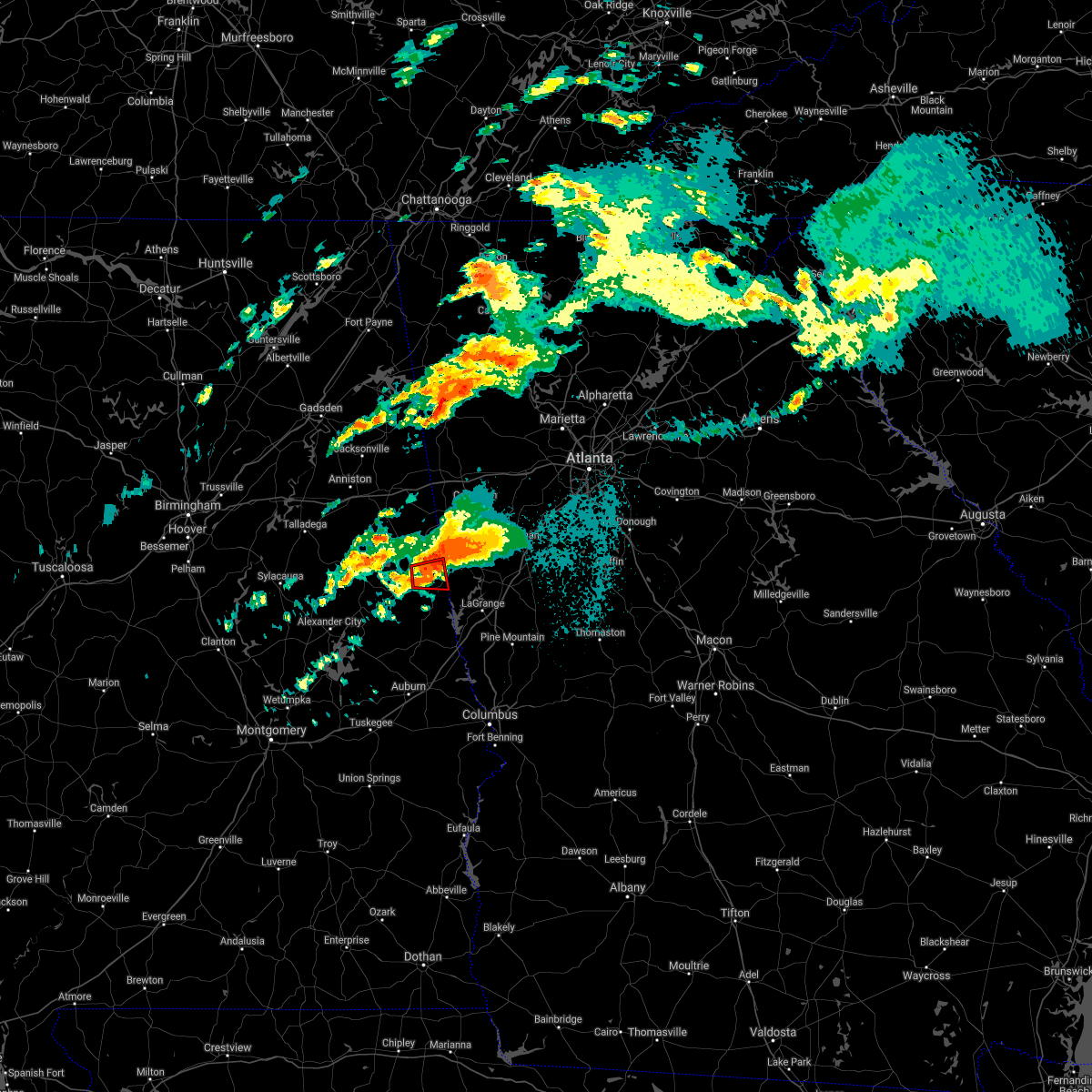 At 1023 pm cdt, a confirmed large and extremely dangerous tornado was located over crystal lake, or near roanoke, moving east at 45 mph. this is a particularly dangerous situation. take cover now! (radar confirmed tornado). Hazards include damaging tornado. You are in a life-threatening situation. flying debris may be deadly to those caught without shelter. mobile homes will be destroyed. considerable damage to homes, businesses, and vehicles is likely and complete destruction is possible. Locations impacted include, roanoke, crystal lake, big springs, paran, rock mills and rock stand. At 1023 pm cdt, a confirmed large and extremely dangerous tornado was located over crystal lake, or near roanoke, moving east at 45 mph. this is a particularly dangerous situation. take cover now! (radar confirmed tornado). Hazards include damaging tornado. You are in a life-threatening situation. flying debris may be deadly to those caught without shelter. mobile homes will be destroyed. considerable damage to homes, businesses, and vehicles is likely and complete destruction is possible. Locations impacted include, roanoke, crystal lake, big springs, paran, rock mills and rock stand.
|
| 3/25/2021 10:15 PM CDT |
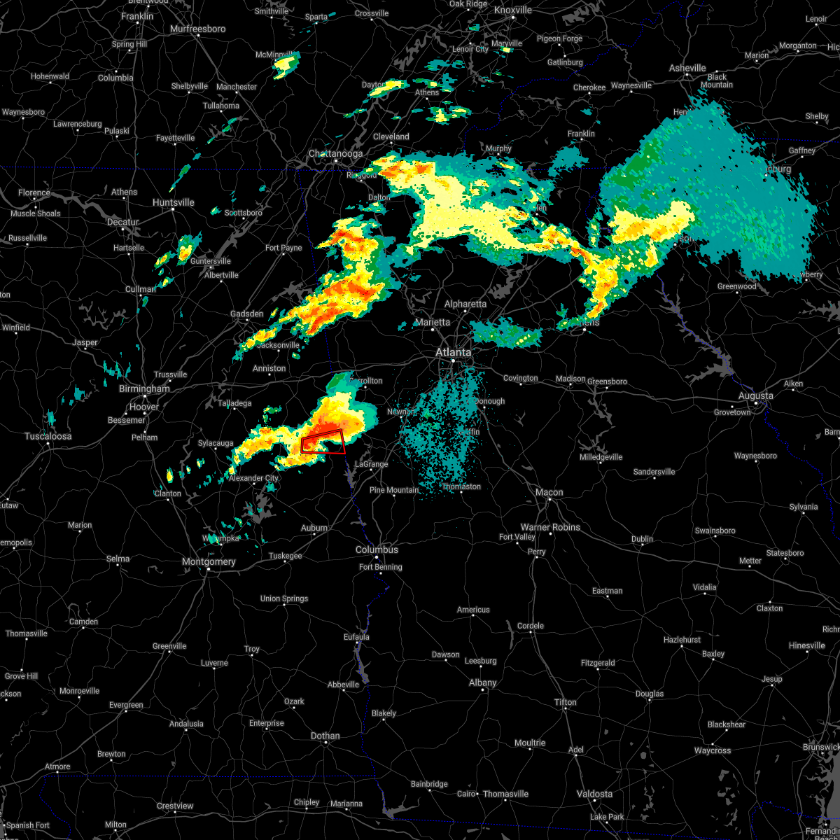 At 1015 pm cdt, a confirmed large and extremely dangerous tornado was located near corinth, or 7 miles south of wedowee, moving northeast at 50 mph. this is a particularly dangerous situation. take cover now! (radar confirmed tornado). Hazards include damaging tornado. You are in a life-threatening situation. flying debris may be deadly to those caught without shelter. mobile homes will be destroyed. considerable damage to homes, businesses, and vehicles is likely and complete destruction is possible. Locations impacted include, roanoke, crystal lake, big springs, paran, rock mills and rock stand. At 1015 pm cdt, a confirmed large and extremely dangerous tornado was located near corinth, or 7 miles south of wedowee, moving northeast at 50 mph. this is a particularly dangerous situation. take cover now! (radar confirmed tornado). Hazards include damaging tornado. You are in a life-threatening situation. flying debris may be deadly to those caught without shelter. mobile homes will be destroyed. considerable damage to homes, businesses, and vehicles is likely and complete destruction is possible. Locations impacted include, roanoke, crystal lake, big springs, paran, rock mills and rock stand.
|
| 3/25/2021 10:07 PM CDT |
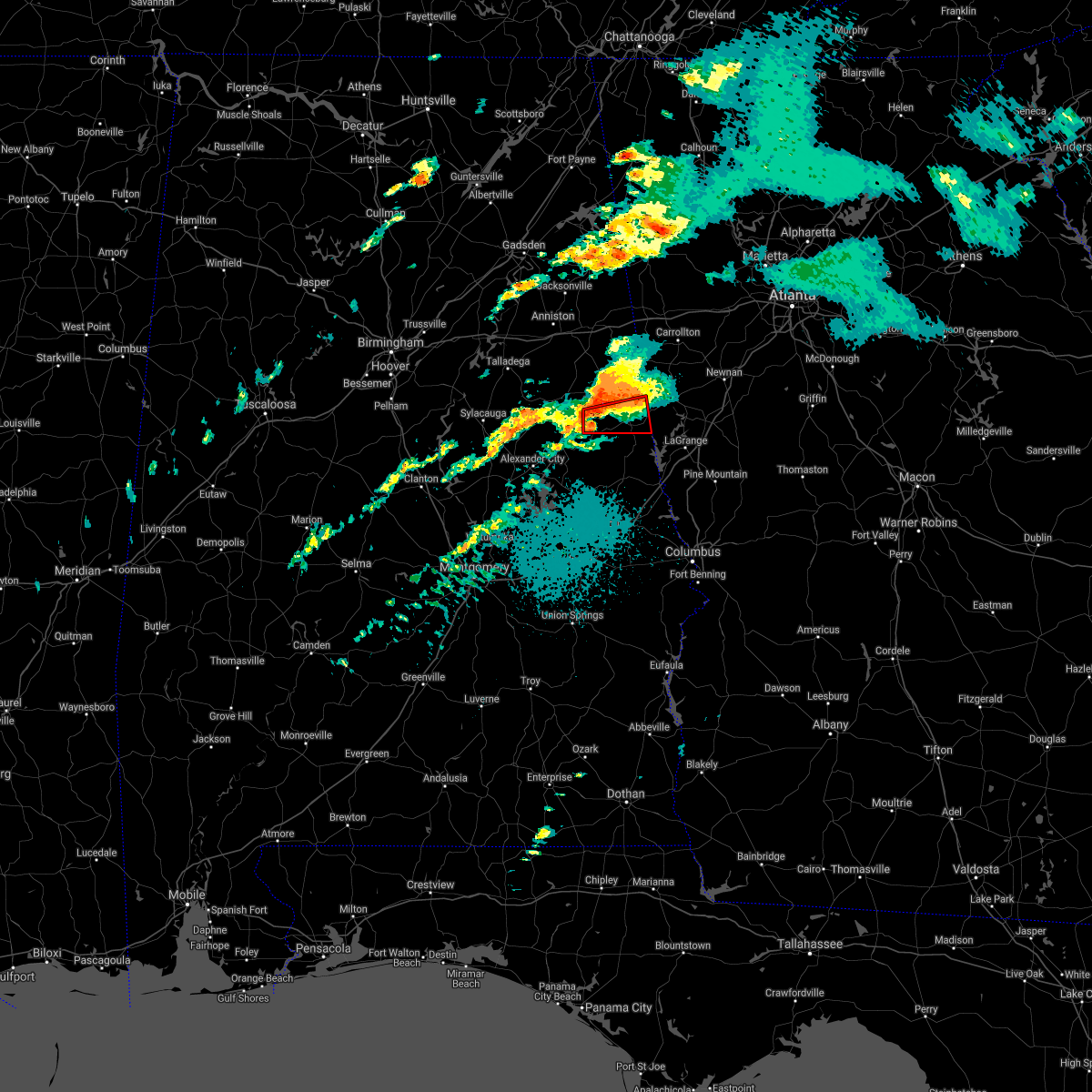 At 1006 pm cdt, a confirmed large and extremely dangerous tornado was located over wadley, or 10 miles south of lake wedowee, moving east at 60 mph. this is a particularly dangerous situation. take cover now! (radar confirmed tornado). Hazards include damaging tornado. You are in a life-threatening situation. flying debris may be deadly to those caught without shelter. mobile homes will be destroyed. considerable damage to homes, businesses, and vehicles is likely and complete destruction is possible. Locations impacted include, roanoke, wadley, malone, crystal lake, dickert, rock mills, big springs, roanoke municipal airport and rock stand. At 1006 pm cdt, a confirmed large and extremely dangerous tornado was located over wadley, or 10 miles south of lake wedowee, moving east at 60 mph. this is a particularly dangerous situation. take cover now! (radar confirmed tornado). Hazards include damaging tornado. You are in a life-threatening situation. flying debris may be deadly to those caught without shelter. mobile homes will be destroyed. considerable damage to homes, businesses, and vehicles is likely and complete destruction is possible. Locations impacted include, roanoke, wadley, malone, crystal lake, dickert, rock mills, big springs, roanoke municipal airport and rock stand.
|
| 3/25/2021 10:02 PM CDT |
 At 1002 pm cdt, a confirmed large and extremely dangerous tornado was located near wadley, or 10 miles south of lake wedowee, moving east at 55 mph. this is a particularly dangerous situation. take cover now! (radar confirmed tornado). Hazards include damaging tornado. You are in a life-threatening situation. flying debris may be deadly to those caught without shelter. mobile homes will be destroyed. considerable damage to homes, businesses, and vehicles is likely and complete destruction is possible. Locations impacted include, roanoke, wadley, malone, crystal lake, dickert, rock mills, big springs, motley, roanoke municipal airport and rock stand. At 1002 pm cdt, a confirmed large and extremely dangerous tornado was located near wadley, or 10 miles south of lake wedowee, moving east at 55 mph. this is a particularly dangerous situation. take cover now! (radar confirmed tornado). Hazards include damaging tornado. You are in a life-threatening situation. flying debris may be deadly to those caught without shelter. mobile homes will be destroyed. considerable damage to homes, businesses, and vehicles is likely and complete destruction is possible. Locations impacted include, roanoke, wadley, malone, crystal lake, dickert, rock mills, big springs, motley, roanoke municipal airport and rock stand.
|
| 3/25/2021 9:58 PM CDT |
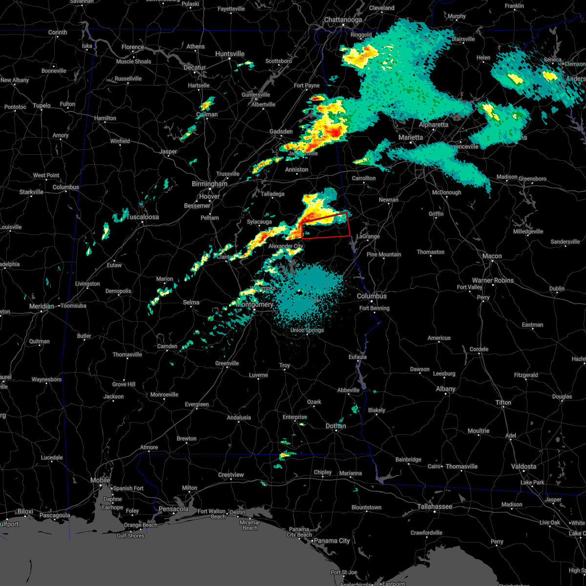 At 958 pm cdt, a confirmed tornado was located near sparkling springs, or 13 miles south of lake wedowee, moving east at 60 mph (radar confirmed tornado). Hazards include damaging tornado and quarter size hail. Flying debris will be dangerous to those caught without shelter. mobile homes will be damaged or destroyed. damage to roofs, windows, and vehicles will occur. tree damage is likely. Locations impacted include, roanoke, wadley, malone, abanda, standing rock, crystal lake, welch, sparkling springs, daviston, dickert, rock mills, big springs, motley, paran, roanoke municipal airport, mellow valley and rock stand. At 958 pm cdt, a confirmed tornado was located near sparkling springs, or 13 miles south of lake wedowee, moving east at 60 mph (radar confirmed tornado). Hazards include damaging tornado and quarter size hail. Flying debris will be dangerous to those caught without shelter. mobile homes will be damaged or destroyed. damage to roofs, windows, and vehicles will occur. tree damage is likely. Locations impacted include, roanoke, wadley, malone, abanda, standing rock, crystal lake, welch, sparkling springs, daviston, dickert, rock mills, big springs, motley, paran, roanoke municipal airport, mellow valley and rock stand.
|
| 3/25/2021 9:51 PM CDT |
 At 950 pm cdt, a severe thunderstorm capable of producing a tornado was located over goldville, or 12 miles northeast of alexander city, moving east at 60 mph (radar indicated rotation). Hazards include tornado and quarter size hail. Flying debris will be dangerous to those caught without shelter. mobile homes will be damaged or destroyed. damage to roofs, windows, and vehicles will occur. Tree damage is likely. At 950 pm cdt, a severe thunderstorm capable of producing a tornado was located over goldville, or 12 miles northeast of alexander city, moving east at 60 mph (radar indicated rotation). Hazards include tornado and quarter size hail. Flying debris will be dangerous to those caught without shelter. mobile homes will be damaged or destroyed. damage to roofs, windows, and vehicles will occur. Tree damage is likely.
|
| 3/31/2020 9:06 AM CDT |
 At 905 am cdt, severe thunderstorms were located along a line extending from near mount cheaha to near ashland to near goodwater, moving east at 60 mph (radar indicated). Hazards include 60 mph wind gusts. expect damage to roofs, siding, and trees At 905 am cdt, severe thunderstorms were located along a line extending from near mount cheaha to near ashland to near goodwater, moving east at 60 mph (radar indicated). Hazards include 60 mph wind gusts. expect damage to roofs, siding, and trees
|
| 1/11/2020 3:34 PM CST |
 At 334 pm cst, severe thunderstorms were located along a line extending from near mount zion to near penton, moving east at 50 mph (radar indicated). Hazards include 60 mph wind gusts. Expect damage to roofs, siding, and trees. Locations impacted include, roanoke, wedowee, woodland, crystal lake, graham, dickert, newell, napoleon, tennant, rock mills, big springs, paran, roanoke municipal airport and rock stand. At 334 pm cst, severe thunderstorms were located along a line extending from near mount zion to near penton, moving east at 50 mph (radar indicated). Hazards include 60 mph wind gusts. Expect damage to roofs, siding, and trees. Locations impacted include, roanoke, wedowee, woodland, crystal lake, graham, dickert, newell, napoleon, tennant, rock mills, big springs, paran, roanoke municipal airport and rock stand.
|
| 1/11/2020 3:16 PM CST |
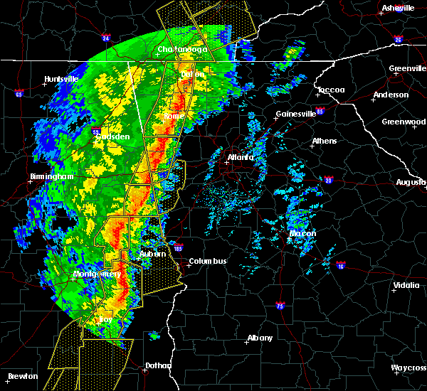 At 316 pm cst, severe thunderstorms were located along a line extending from near bowdon to near trammel crossroads, moving east at 45 mph (radar indicated). Hazards include 60 mph wind gusts. Expect damage to roofs, siding, and trees. locations impacted include, roanoke, wedowee, lake wedowee, wadley, woodland, malone, morrison cross roads, fosters cross roads, crystal lake, corinth, graham, dickert, newell, r. l. Harris dam, ofelia, napoleon, tennant, rock mills, big springs and paran. At 316 pm cst, severe thunderstorms were located along a line extending from near bowdon to near trammel crossroads, moving east at 45 mph (radar indicated). Hazards include 60 mph wind gusts. Expect damage to roofs, siding, and trees. locations impacted include, roanoke, wedowee, lake wedowee, wadley, woodland, malone, morrison cross roads, fosters cross roads, crystal lake, corinth, graham, dickert, newell, r. l. Harris dam, ofelia, napoleon, tennant, rock mills, big springs and paran.
|
| 1/11/2020 2:48 PM CST |
 At 248 pm cst, severe thunderstorms were located along a line extending from near delta to near alexander city, moving east at 45 mph (radar indicated). Hazards include 60 mph wind gusts. expect damage to roofs, siding, and trees At 248 pm cst, severe thunderstorms were located along a line extending from near delta to near alexander city, moving east at 45 mph (radar indicated). Hazards include 60 mph wind gusts. expect damage to roofs, siding, and trees
|
| 7/21/2018 5:28 PM CDT |
 At 528 pm cdt, severe thunderstorms were located along a line extending from near roanoke to near trammel crossroads to near beans mill, moving east at 25 mph (radar indicated). Hazards include ping pong ball size hail and 60 mph wind gusts. People and animals outdoors will be injured. expect hail damage to roofs, siding, windows, and vehicles. Expect wind damage to roofs, siding, and trees. At 528 pm cdt, severe thunderstorms were located along a line extending from near roanoke to near trammel crossroads to near beans mill, moving east at 25 mph (radar indicated). Hazards include ping pong ball size hail and 60 mph wind gusts. People and animals outdoors will be injured. expect hail damage to roofs, siding, windows, and vehicles. Expect wind damage to roofs, siding, and trees.
|
| 7/21/2018 5:10 PM CDT |
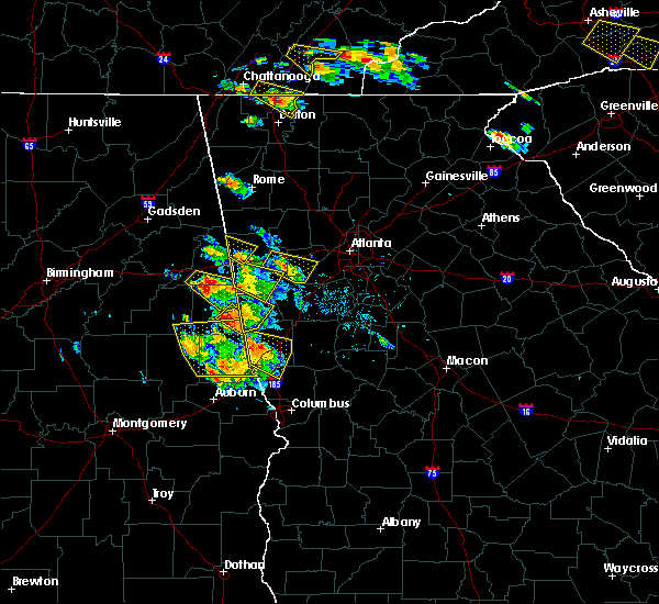 At 510 pm cdt, a severe thunderstorm was located near crystal lake, or near roanoke, moving southeast at 30 mph (radar indicated). Hazards include tennis ball size hail and 60 mph wind gusts. People and animals outdoors will be injured. expect hail damage to roofs, siding, windows, and vehicles. expect wind damage to roofs, siding, and trees. Locations impacted include, roanoke, big springs, paran, rock mills, rock stand and napoleon. At 510 pm cdt, a severe thunderstorm was located near crystal lake, or near roanoke, moving southeast at 30 mph (radar indicated). Hazards include tennis ball size hail and 60 mph wind gusts. People and animals outdoors will be injured. expect hail damage to roofs, siding, windows, and vehicles. expect wind damage to roofs, siding, and trees. Locations impacted include, roanoke, big springs, paran, rock mills, rock stand and napoleon.
|
| 7/21/2018 5:05 PM CDT |
 At 505 pm cdt, severe thunderstorms were located along a line extending from 6 miles east of new site to amity park, moving east at 35 mph (radar indicated). Hazards include 60 mph wind gusts and quarter size hail. Hail damage to vehicles is expected. expect wind damage to roofs, siding, and trees. Locations impacted include, valley, lanett, roanoke, lafayette, stroud, la fayette, wadley, lakeview, cusseta, malone, post oak forks, denson, river view, amity park, sturkie, abanda, standing rock, welch, trammel crossroads and ridge grove. At 505 pm cdt, severe thunderstorms were located along a line extending from 6 miles east of new site to amity park, moving east at 35 mph (radar indicated). Hazards include 60 mph wind gusts and quarter size hail. Hail damage to vehicles is expected. expect wind damage to roofs, siding, and trees. Locations impacted include, valley, lanett, roanoke, lafayette, stroud, la fayette, wadley, lakeview, cusseta, malone, post oak forks, denson, river view, amity park, sturkie, abanda, standing rock, welch, trammel crossroads and ridge grove.
|
| 7/21/2018 4:44 PM CDT |
 At 444 pm cdt, severe thunderstorms were located along a line extending from near goldville to buffalo, moving east at 40 mph (radar indicated). Hazards include ping pong ball size hail and 60 mph wind gusts. People and animals outdoors will be injured. expect hail damage to roofs, siding, windows, and vehicles. Expect wind damage to roofs, siding, and trees. At 444 pm cdt, severe thunderstorms were located along a line extending from near goldville to buffalo, moving east at 40 mph (radar indicated). Hazards include ping pong ball size hail and 60 mph wind gusts. People and animals outdoors will be injured. expect hail damage to roofs, siding, windows, and vehicles. Expect wind damage to roofs, siding, and trees.
|
| 7/21/2018 4:41 PM CDT |
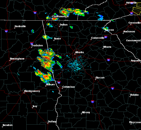 The national weather service in birmingham has issued a * severe thunderstorm warning for. central randolph county in east central alabama. until 530 pm cdt. At 441 pm cdt, a severe thunderstorm was located over morrison cross roads, or 7 miles north of wedowee, moving southeast at 30. The national weather service in birmingham has issued a * severe thunderstorm warning for. central randolph county in east central alabama. until 530 pm cdt. At 441 pm cdt, a severe thunderstorm was located over morrison cross roads, or 7 miles north of wedowee, moving southeast at 30.
|
| 6/28/2018 2:29 PM CDT |
 At 229 pm cdt, severe thunderstorms were located along a line extending from near trussville to near coosa island to delta, moving south at 50 mph (radar indicated). Hazards include 60 to 70 mph wind gusts. Expect considerable tree damage. Damage is likely to mobile homes, roofs, and outbuildings. At 229 pm cdt, severe thunderstorms were located along a line extending from near trussville to near coosa island to delta, moving south at 50 mph (radar indicated). Hazards include 60 to 70 mph wind gusts. Expect considerable tree damage. Damage is likely to mobile homes, roofs, and outbuildings.
|
| 12/20/2017 10:42 AM CST |
 At 1042 am cst, a severe thunderstorm capable of producing a tornado was located over crystal lake, or over roanoke, moving east at 40 mph (radar indicated rotation). Hazards include tornado. Flying debris will be dangerous to those caught without shelter. mobile homes will be damaged or destroyed. damage to roofs, windows, and vehicles will occur. tree damage is likely. Locations impacted include, roanoke, crystal lake, rock mills and roanoke municipal airport. At 1042 am cst, a severe thunderstorm capable of producing a tornado was located over crystal lake, or over roanoke, moving east at 40 mph (radar indicated rotation). Hazards include tornado. Flying debris will be dangerous to those caught without shelter. mobile homes will be damaged or destroyed. damage to roofs, windows, and vehicles will occur. tree damage is likely. Locations impacted include, roanoke, crystal lake, rock mills and roanoke municipal airport.
|
| 12/20/2017 10:38 AM CST |
 At 1038 am cst, a severe thunderstorm capable of producing a tornado was located over crystal lake, or near roanoke, moving east at 40 mph (radar indicated rotation). Hazards include tornado. Flying debris will be dangerous to those caught without shelter. mobile homes will be damaged or destroyed. damage to roofs, windows, and vehicles will occur. Tree damage is likely. At 1038 am cst, a severe thunderstorm capable of producing a tornado was located over crystal lake, or near roanoke, moving east at 40 mph (radar indicated rotation). Hazards include tornado. Flying debris will be dangerous to those caught without shelter. mobile homes will be damaged or destroyed. damage to roofs, windows, and vehicles will occur. Tree damage is likely.
|
| 6/15/2017 5:20 PM CDT |
 At 520 pm cdt, severe thunderstorms were located along a line extending from near standing rock to near franklin, moving southeast at 50 mph (radar indicated). Hazards include 60 mph wind gusts. these storms have a history of knocking down trees. Expect damage to roofs, siding, and trees. Locations impacted include, alexander city, roanoke, tallassee, dadeville, camp hill, jacksons` gap, wadley, waverly, malone, reeves airport, jacksons gap, tallapoosa city, crystal lake, still waters resort, daviston, dickert, tennant, dare park, rock mills and horseshoe bend. At 520 pm cdt, severe thunderstorms were located along a line extending from near standing rock to near franklin, moving southeast at 50 mph (radar indicated). Hazards include 60 mph wind gusts. these storms have a history of knocking down trees. Expect damage to roofs, siding, and trees. Locations impacted include, alexander city, roanoke, tallassee, dadeville, camp hill, jacksons` gap, wadley, waverly, malone, reeves airport, jacksons gap, tallapoosa city, crystal lake, still waters resort, daviston, dickert, tennant, dare park, rock mills and horseshoe bend.
|
| 6/15/2017 4:59 PM CDT |
 At 459 pm cdt, severe thunderstorms were located along a line extending from near ephesus to near eclectic, moving southeast at 50 mph (radar indicated). Hazards include 60 mph wind gusts. trees have been reported blown down by these storms. Expect damage to roofs, siding, and trees. Locations impacted include, alexander city, roanoke, tallassee, dadeville, lineville, ashland, camp hill, wedowee, rockford, equality, lake wedowee, jacksons` gap, new site, wadley, woodland, waverly, goldville, corinth, jacksons gap and hillabee creek. At 459 pm cdt, severe thunderstorms were located along a line extending from near ephesus to near eclectic, moving southeast at 50 mph (radar indicated). Hazards include 60 mph wind gusts. trees have been reported blown down by these storms. Expect damage to roofs, siding, and trees. Locations impacted include, alexander city, roanoke, tallassee, dadeville, lineville, ashland, camp hill, wedowee, rockford, equality, lake wedowee, jacksons` gap, new site, wadley, woodland, waverly, goldville, corinth, jacksons gap and hillabee creek.
|
| 6/15/2017 4:49 PM CDT |
 At 449 pm cdt, severe thunderstorms were located along a line extending from near ephesus to near dexter, moving east at 50 mph (radar indicated). Hazards include 60 mph wind gusts. Expect damage to roofs, siding, and trees. Locations impacted include, alexander city, sylacauga, roanoke, tallassee, dadeville, lineville, ashland, goodwater, camp hill, wedowee, rockford, kellyton, equality, stewartville, lake wedowee, weogufka, jacksons` gap, new site, wadley and waldo. At 449 pm cdt, severe thunderstorms were located along a line extending from near ephesus to near dexter, moving east at 50 mph (radar indicated). Hazards include 60 mph wind gusts. Expect damage to roofs, siding, and trees. Locations impacted include, alexander city, sylacauga, roanoke, tallassee, dadeville, lineville, ashland, goodwater, camp hill, wedowee, rockford, kellyton, equality, stewartville, lake wedowee, weogufka, jacksons` gap, new site, wadley and waldo.
|
| 6/15/2017 4:36 PM CDT |
 At 436 pm cdt, severe thunderstorms were located along a line extending from near bowdon to dexter, moving southeast at 40 mph (radar indicated). Hazards include 60 mph wind gusts. trees continue to be blown down by these storms. Expect damage to roofs, siding, and trees. Locations impacted include, alexander city, roanoke, tallassee, heflin, dadeville, lineville, ashland, goodwater, camp hill, wedowee, rockford, kellyton, weogufka, equality, stewartville, lake wedowee, jacksons` gap, new site, wadley and ranburne. At 436 pm cdt, severe thunderstorms were located along a line extending from near bowdon to dexter, moving southeast at 40 mph (radar indicated). Hazards include 60 mph wind gusts. trees continue to be blown down by these storms. Expect damage to roofs, siding, and trees. Locations impacted include, alexander city, roanoke, tallassee, heflin, dadeville, lineville, ashland, goodwater, camp hill, wedowee, rockford, kellyton, weogufka, equality, stewartville, lake wedowee, jacksons` gap, new site, wadley and ranburne.
|
| 6/15/2017 4:12 PM CDT |
 At 411 pm cdt, severe thunderstorms were located along a line extending from near mars hills to near booth, moving southeast at 50 mph (radar indicated). Hazards include 60 mph wind gusts. trees have been reported blown down by these storms. expect damage to roofs, siding, and trees At 411 pm cdt, severe thunderstorms were located along a line extending from near mars hills to near booth, moving southeast at 50 mph (radar indicated). Hazards include 60 mph wind gusts. trees have been reported blown down by these storms. expect damage to roofs, siding, and trees
|
| 4/5/2017 6:23 AM CDT |
 At 623 am cdt, a severe thunderstorm was located over lake wedowee, moving east at 40 mph (radar indicated). Hazards include golf ball size hail and 60 mph wind gusts. People and animals outdoors will be injured. expect hail damage to roofs, siding, windows, and vehicles. expect wind damage to roofs, siding, and trees. locations impacted include, roanoke, lineville, wedowee, lake wedowee, wadley, woodland, malone, morrison cross roads, barfield, fosters cross roads, crystal lake, graham, dickert, newell, r. l. Harris dam, tennant, rock mills, big springs, roanoke municipal airport and mellow valley. At 623 am cdt, a severe thunderstorm was located over lake wedowee, moving east at 40 mph (radar indicated). Hazards include golf ball size hail and 60 mph wind gusts. People and animals outdoors will be injured. expect hail damage to roofs, siding, windows, and vehicles. expect wind damage to roofs, siding, and trees. locations impacted include, roanoke, lineville, wedowee, lake wedowee, wadley, woodland, malone, morrison cross roads, barfield, fosters cross roads, crystal lake, graham, dickert, newell, r. l. Harris dam, tennant, rock mills, big springs, roanoke municipal airport and mellow valley.
|
| 4/5/2017 6:02 AM CDT |
 At 602 am cdt, a severe thunderstorm was located near ashland, moving east at 40 mph (radar indicated). Hazards include 60 mph wind gusts and half dollar size hail. Hail damage to vehicles is expected. Expect wind damage to roofs, siding, and trees. At 602 am cdt, a severe thunderstorm was located near ashland, moving east at 40 mph (radar indicated). Hazards include 60 mph wind gusts and half dollar size hail. Hail damage to vehicles is expected. Expect wind damage to roofs, siding, and trees.
|
| 1/22/2017 2:30 PM CST |
 At 228 pm cst, severe thunderstorms were located along a line extending from 7 miles southwest of franklin to near hamilton to near upatoi, moving east at 65 mph (radar indicated). Hazards include 60 mph wind gusts and quarter size hail. Hail damage to vehicles is expected. expect wind damage to roofs, siding, and trees. locations impacted include, opelika, valley, lanett, roanoke, lafayette, smiths, stroud, smiths station, la fayette, wadley, red level, lakeview, cusseta, beans mill, welch, crystal lake, penton, huguley, fairfax and chambers county lake. A tornado watch remains in effect until 700 pm cst for southeastern and east central alabama. At 228 pm cst, severe thunderstorms were located along a line extending from 7 miles southwest of franklin to near hamilton to near upatoi, moving east at 65 mph (radar indicated). Hazards include 60 mph wind gusts and quarter size hail. Hail damage to vehicles is expected. expect wind damage to roofs, siding, and trees. locations impacted include, opelika, valley, lanett, roanoke, lafayette, smiths, stroud, smiths station, la fayette, wadley, red level, lakeview, cusseta, beans mill, welch, crystal lake, penton, huguley, fairfax and chambers county lake. A tornado watch remains in effect until 700 pm cst for southeastern and east central alabama.
|
| 1/22/2017 1:41 PM CST |
 At 140 pm cst, severe thunderstorms were located along a line extending from near kellyton to near notasulga to near tuskegee national forest, moving east at 65 mph (radar indicated). Hazards include 60 mph wind gusts and quarter size hail. Hail damage to vehicles is expected. Expect wind damage to roofs, siding, and trees. At 140 pm cst, severe thunderstorms were located along a line extending from near kellyton to near notasulga to near tuskegee national forest, moving east at 65 mph (radar indicated). Hazards include 60 mph wind gusts and quarter size hail. Hail damage to vehicles is expected. Expect wind damage to roofs, siding, and trees.
|
| 6/17/2016 4:21 PM CDT |
 At 421 pm cdt, severe thunderstorms were located along a line extending from near parkdale to near barfield to red level, moving south at 25 mph (radar indicated). Hazards include 60 mph wind gusts. Expect damage to roofs. siding. And trees. At 421 pm cdt, severe thunderstorms were located along a line extending from near parkdale to near barfield to red level, moving south at 25 mph (radar indicated). Hazards include 60 mph wind gusts. Expect damage to roofs. siding. And trees.
|
| 6/17/2016 4:05 PM CDT |
 At 405 pm cdt, severe thunderstorms were located along a line extending from near childersburg to near ashland to standing rock, moving south at 25 mph (radar indicated). Hazards include 60 mph wind gusts. Expect damage to roofs. siding. and trees. Locations impacted include, talladega, sylacauga, roanoke, childersburg, lineville, ashland, wedowee, talladega springs, lake wedowee, harpersville, wadley, waldo, woodland, sycamore, alpine, winterboro, fayetteville, delta, crystal lake and fosters cross roads. At 405 pm cdt, severe thunderstorms were located along a line extending from near childersburg to near ashland to standing rock, moving south at 25 mph (radar indicated). Hazards include 60 mph wind gusts. Expect damage to roofs. siding. and trees. Locations impacted include, talladega, sylacauga, roanoke, childersburg, lineville, ashland, wedowee, talladega springs, lake wedowee, harpersville, wadley, waldo, woodland, sycamore, alpine, winterboro, fayetteville, delta, crystal lake and fosters cross roads.
|
| 6/17/2016 3:53 PM CDT |
 At 352 pm cdt, severe thunderstorms were located along a line extending from childersburg to near ashland to near roanoke, moving south at 40 mph (radar indicated). Hazards include 60 mph wind gusts. Expect damage to roofs. siding. and trees. Locations impacted include, talladega, sylacauga, roanoke, childersburg, lineville, ashland, wedowee, talladega springs, lake wedowee, harpersville, wadley, waldo, woodland, sycamore, alpine, winterboro, fayetteville, delta, crystal lake and fosters cross roads. At 352 pm cdt, severe thunderstorms were located along a line extending from childersburg to near ashland to near roanoke, moving south at 40 mph (radar indicated). Hazards include 60 mph wind gusts. Expect damage to roofs. siding. and trees. Locations impacted include, talladega, sylacauga, roanoke, childersburg, lineville, ashland, wedowee, talladega springs, lake wedowee, harpersville, wadley, waldo, woodland, sycamore, alpine, winterboro, fayetteville, delta, crystal lake and fosters cross roads.
|
| 6/17/2016 3:46 PM CDT |
 At 346 pm cdt, severe thunderstorms were located along a line extending from near westover to near grant town to near ephesus, moving southeast at 25 mph (radar indicated). Hazards include 60 mph wind gusts. Expect damage to roofs. siding. and trees. Locations impacted include, oxford, talladega, sylacauga, roanoke, childersburg, lineville, ashland, wedowee, talladega springs, lake wedowee, vincent, harpersville, munford, wadley, waldo, woodland, morrison cross roads, sycamore, alpine bay resort and alpine. At 346 pm cdt, severe thunderstorms were located along a line extending from near westover to near grant town to near ephesus, moving southeast at 25 mph (radar indicated). Hazards include 60 mph wind gusts. Expect damage to roofs. siding. and trees. Locations impacted include, oxford, talladega, sylacauga, roanoke, childersburg, lineville, ashland, wedowee, talladega springs, lake wedowee, vincent, harpersville, munford, wadley, waldo, woodland, morrison cross roads, sycamore, alpine bay resort and alpine.
|
| 6/17/2016 3:37 PM CDT |
 At 337 pm cdt, severe thunderstorms were located along a line extending from logan martin dam to near grant town to near ephesus, moving southeast at 30 mph (radar indicated). Hazards include 60 mph wind gusts. Expect damage to roofs. siding. and trees. Locations impacted include, oxford, talladega, sylacauga, pell city, roanoke, childersburg, lineville, ashland, wedowee, talladega springs, lake wedowee, lincoln, vincent, harpersville, munford, wadley, waldo, woodland, morrison cross roads and talladega superspeedway. At 337 pm cdt, severe thunderstorms were located along a line extending from logan martin dam to near grant town to near ephesus, moving southeast at 30 mph (radar indicated). Hazards include 60 mph wind gusts. Expect damage to roofs. siding. and trees. Locations impacted include, oxford, talladega, sylacauga, pell city, roanoke, childersburg, lineville, ashland, wedowee, talladega springs, lake wedowee, lincoln, vincent, harpersville, munford, wadley, waldo, woodland, morrison cross roads and talladega superspeedway.
|
| 6/17/2016 3:25 PM CDT |
 At 325 pm cdt, severe thunderstorms were located along a line extending from near moody to grant town to ephesus, moving south at 30 mph (radar indicated). Hazards include 60 mph wind gusts. Expect damage to roofs. siding. and trees. Locations impacted include, anniston, oxford, talladega, sylacauga, pell city, leeds, moody, roanoke, childersburg, odenville, lineville, ashland, wedowee, talladega springs, west end-cobb town, cobb town, lake wedowee, lincoln, margaret and argo. At 325 pm cdt, severe thunderstorms were located along a line extending from near moody to grant town to ephesus, moving south at 30 mph (radar indicated). Hazards include 60 mph wind gusts. Expect damage to roofs. siding. and trees. Locations impacted include, anniston, oxford, talladega, sylacauga, pell city, leeds, moody, roanoke, childersburg, odenville, lineville, ashland, wedowee, talladega springs, west end-cobb town, cobb town, lake wedowee, lincoln, margaret and argo.
|
| 6/17/2016 2:59 PM CDT |
 At 259 pm cdt, severe thunderstorms were located along a line extending from near dallas to near bowdon, moving south at 35 mph (radar indicated). Hazards include 70 mph wind gusts and quarter size hail. Hail damage to vehicles is expected. expect considerable tree damage. Wind damage is also likely to mobile homes, roofs, and outbuildings. At 259 pm cdt, severe thunderstorms were located along a line extending from near dallas to near bowdon, moving south at 35 mph (radar indicated). Hazards include 70 mph wind gusts and quarter size hail. Hail damage to vehicles is expected. expect considerable tree damage. Wind damage is also likely to mobile homes, roofs, and outbuildings.
|
| 8/10/2015 7:16 PM CDT |
 At 716 pm cdt, severe thunderstorms were located along a line extending from near ranburne to near woodland to wedowee to lake wedowee, moving southeast at 30 mph (radar indicated). Hazards include 60 mph wind gusts. Expect damage to roofs. siding and trees. Locations impacted include, roanoke, wedowee, lake wedowee, ranburne, woodland, morrison cross roads, barfield, crystal lake, fosters cross roads, corinth, tennant, rock mills, big springs, napoleon, trickem, ofelia, rock stand, graham, newell and micaville. At 716 pm cdt, severe thunderstorms were located along a line extending from near ranburne to near woodland to wedowee to lake wedowee, moving southeast at 30 mph (radar indicated). Hazards include 60 mph wind gusts. Expect damage to roofs. siding and trees. Locations impacted include, roanoke, wedowee, lake wedowee, ranburne, woodland, morrison cross roads, barfield, crystal lake, fosters cross roads, corinth, tennant, rock mills, big springs, napoleon, trickem, ofelia, rock stand, graham, newell and micaville.
|
| 8/10/2015 6:59 PM CDT |
 At 659 pm cdt, severe thunderstorms were located along a line extending from near ranburne to morrison cross roads to fosters cross roads to near delta, moving southeast at 30 mph (radar indicated). Hazards include 60 mph wind gusts. Expect damage to roofs. siding and trees. Locations impacted include, roanoke, heflin, wedowee, lake wedowee, ranburne, woodland, morrison cross roads, delta, crystal lake, fosters cross roads, barfield, abernathy, corinth, napoleon, hollis crossroads, rock stand, newell, tennant, rock mills and chalafinnee. At 659 pm cdt, severe thunderstorms were located along a line extending from near ranburne to morrison cross roads to fosters cross roads to near delta, moving southeast at 30 mph (radar indicated). Hazards include 60 mph wind gusts. Expect damage to roofs. siding and trees. Locations impacted include, roanoke, heflin, wedowee, lake wedowee, ranburne, woodland, morrison cross roads, delta, crystal lake, fosters cross roads, barfield, abernathy, corinth, napoleon, hollis crossroads, rock stand, newell, tennant, rock mills and chalafinnee.
|
| 8/10/2015 6:47 PM CDT |
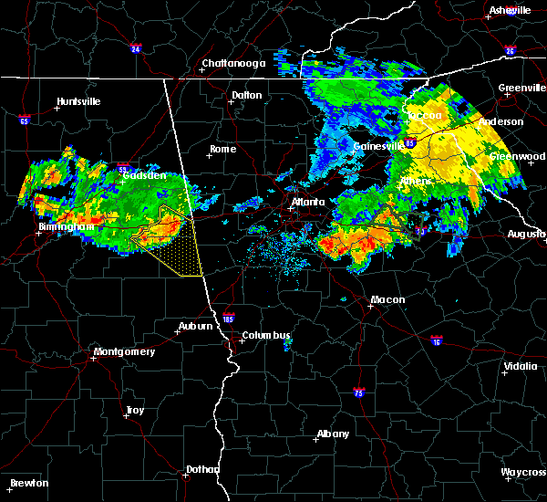 At 646 pm cdt, severe thunderstorms were located along a line extending from near edwardsville to near fosters cross roads to near delta to near mount cheaha, moving southeast at 35 mph (radar indicated). Hazards include 60 mph wind gusts. Expect damage to roofs. siding and trees. Locations impacted include, roanoke, heflin, wedowee, lake wedowee, ranburne, edwardsville, woodland, morrison cross roads, delta, crystal lake, fosters cross roads, barfield, abernathy, mount cheaha, corinth, napoleon, hollis crossroads, rock stand, newell and sweetwater lake. At 646 pm cdt, severe thunderstorms were located along a line extending from near edwardsville to near fosters cross roads to near delta to near mount cheaha, moving southeast at 35 mph (radar indicated). Hazards include 60 mph wind gusts. Expect damage to roofs. siding and trees. Locations impacted include, roanoke, heflin, wedowee, lake wedowee, ranburne, edwardsville, woodland, morrison cross roads, delta, crystal lake, fosters cross roads, barfield, abernathy, mount cheaha, corinth, napoleon, hollis crossroads, rock stand, newell and sweetwater lake.
|
| 8/10/2015 6:30 PM CDT |
 At 629 pm cdt, severe thunderstorms were located along a line extending from near heflin to 7 miles east of oxford lake to near oxford to anniston regional airport, moving southeast at 35 mph (radar indicated). Hazards include 60 mph wind gusts. Expect damage to roofs. Siding and trees. At 629 pm cdt, severe thunderstorms were located along a line extending from near heflin to 7 miles east of oxford lake to near oxford to anniston regional airport, moving southeast at 35 mph (radar indicated). Hazards include 60 mph wind gusts. Expect damage to roofs. Siding and trees.
|
| 7/22/2015 4:17 PM CDT |
 At 417 pm cdt, a severe thunderstorm was located over malone, or near lake wedowee, moving east at 30 mph (radar indicated). Hazards include 60 mph wind gusts. Expect damage to roofs. siding and trees. locations impacted include, roanoke, lineville, ashland, wedowee, lake wedowee, wadley, malone, crystal lake, paran, motley, tennant, rock mills, r. l. Harris dam, big springs, dickert, cragford, ofelia, rock stand, roanoke municipal airport and mellow valley. At 417 pm cdt, a severe thunderstorm was located over malone, or near lake wedowee, moving east at 30 mph (radar indicated). Hazards include 60 mph wind gusts. Expect damage to roofs. siding and trees. locations impacted include, roanoke, lineville, ashland, wedowee, lake wedowee, wadley, malone, crystal lake, paran, motley, tennant, rock mills, r. l. Harris dam, big springs, dickert, cragford, ofelia, rock stand, roanoke municipal airport and mellow valley.
|
| 7/22/2015 4:03 PM CDT |
 At 403 pm cdt, a severe thunderstorm was located near lineville, moving east at 30 mph (radar indicated). Hazards include 60 mph wind gusts. Expect damage to roofs. Siding and trees. At 403 pm cdt, a severe thunderstorm was located near lineville, moving east at 30 mph (radar indicated). Hazards include 60 mph wind gusts. Expect damage to roofs. Siding and trees.
|
| 7/4/2015 12:31 AM CDT |
 At 1231 am cdt, severe thunderstorms were located along a line extending from near crystal lake to stroud to lakeview, moving east at 60 mph (radar indicated). Hazards include 60 mph wind gusts. Expect damage to roofs. siding and trees. Locations impacted include, valley, lanett, roanoke, stroud, lakeview, post oak forks, welch, standing rock, denson, crystal lake, amity park, huguley, fredonia, veasey creek park, paran, rock mills, stroud creek, i 85 welcome center at lanett, dickert and lanett municipal airport. At 1231 am cdt, severe thunderstorms were located along a line extending from near crystal lake to stroud to lakeview, moving east at 60 mph (radar indicated). Hazards include 60 mph wind gusts. Expect damage to roofs. siding and trees. Locations impacted include, valley, lanett, roanoke, stroud, lakeview, post oak forks, welch, standing rock, denson, crystal lake, amity park, huguley, fredonia, veasey creek park, paran, rock mills, stroud creek, i 85 welcome center at lanett, dickert and lanett municipal airport.
|
| 7/4/2015 12:13 AM CDT |
 At 1213 am cdt, severe thunderstorms were located along a line extending from near malone to near sparkling springs to near sturkie, moving east at 60 mph (radar indicated). Hazards include 60 mph wind gusts. Expect damage to roofs. Siding and trees. At 1213 am cdt, severe thunderstorms were located along a line extending from near malone to near sparkling springs to near sturkie, moving east at 60 mph (radar indicated). Hazards include 60 mph wind gusts. Expect damage to roofs. Siding and trees.
|
| 6/24/2015 6:20 PM CDT |
 At 620 pm cdt, a severe thunderstorm was located near crystal lake, or near roanoke, moving southwest at 15 mph (radar indicated). Hazards include 60 mph wind gusts and quarter size hail. Hail damage to vehicles is expected. Expect wind damage to roofs, siding and trees. At 620 pm cdt, a severe thunderstorm was located near crystal lake, or near roanoke, moving southwest at 15 mph (radar indicated). Hazards include 60 mph wind gusts and quarter size hail. Hail damage to vehicles is expected. Expect wind damage to roofs, siding and trees.
|
| 3/31/2015 5:26 PM CDT | The national weather service in birmingham has issued a * severe thunderstorm warning for. southern randolph county in east central alabama. until 600 pm cdt * at 525 pm cdt. a severe thunderstorm was located near corinth. or 7 miles south of wedowee. Moving east at 30 mph. |
| 6/17/2013 6:00 PM CDT | Tree down along hwy 22 between rock mills and the ga stateline. time estimated from rada in randolph county AL, 2.7 miles S of Rock Mills, AL |
| 6/13/2013 8:48 PM CDT | Large tree down at highway 22 and county road 3 in randolph county AL, 0.1 miles NE of Rock Mills, AL |
| 1/30/2013 11:48 AM CST | Trees down along county road 3 in randolph county AL, 5.5 miles S of Rock Mills, AL |
| 1/1/0001 12:00 AM | A tree was blown down near rock mills on highway 75. a power line was also knocked down in rock mill in randolph county AL, 0.1 miles NE of Rock Mills, AL |
Hail Maps for Rock Mills, AL
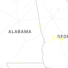
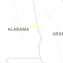


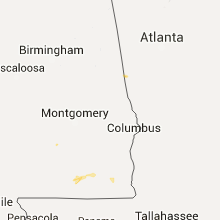


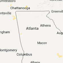


Connect with Interactive Hail Maps