

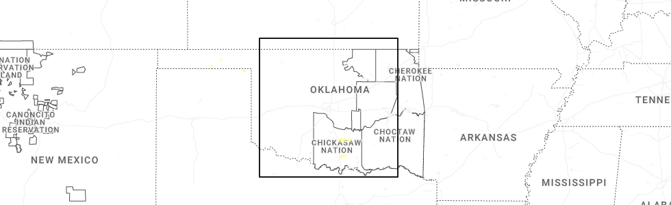
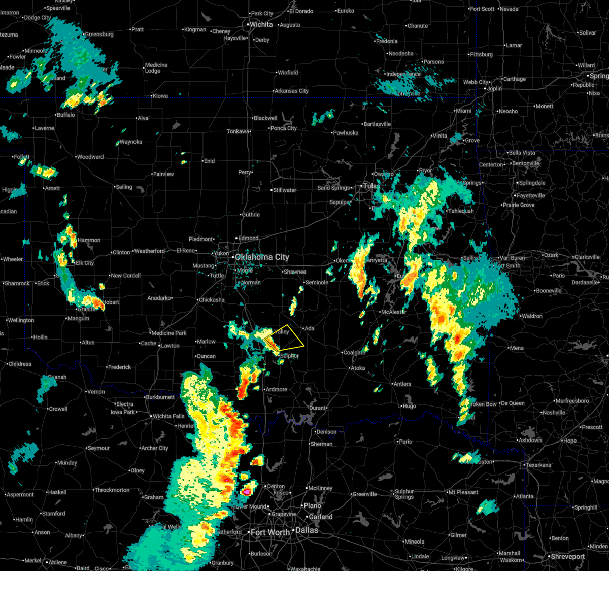
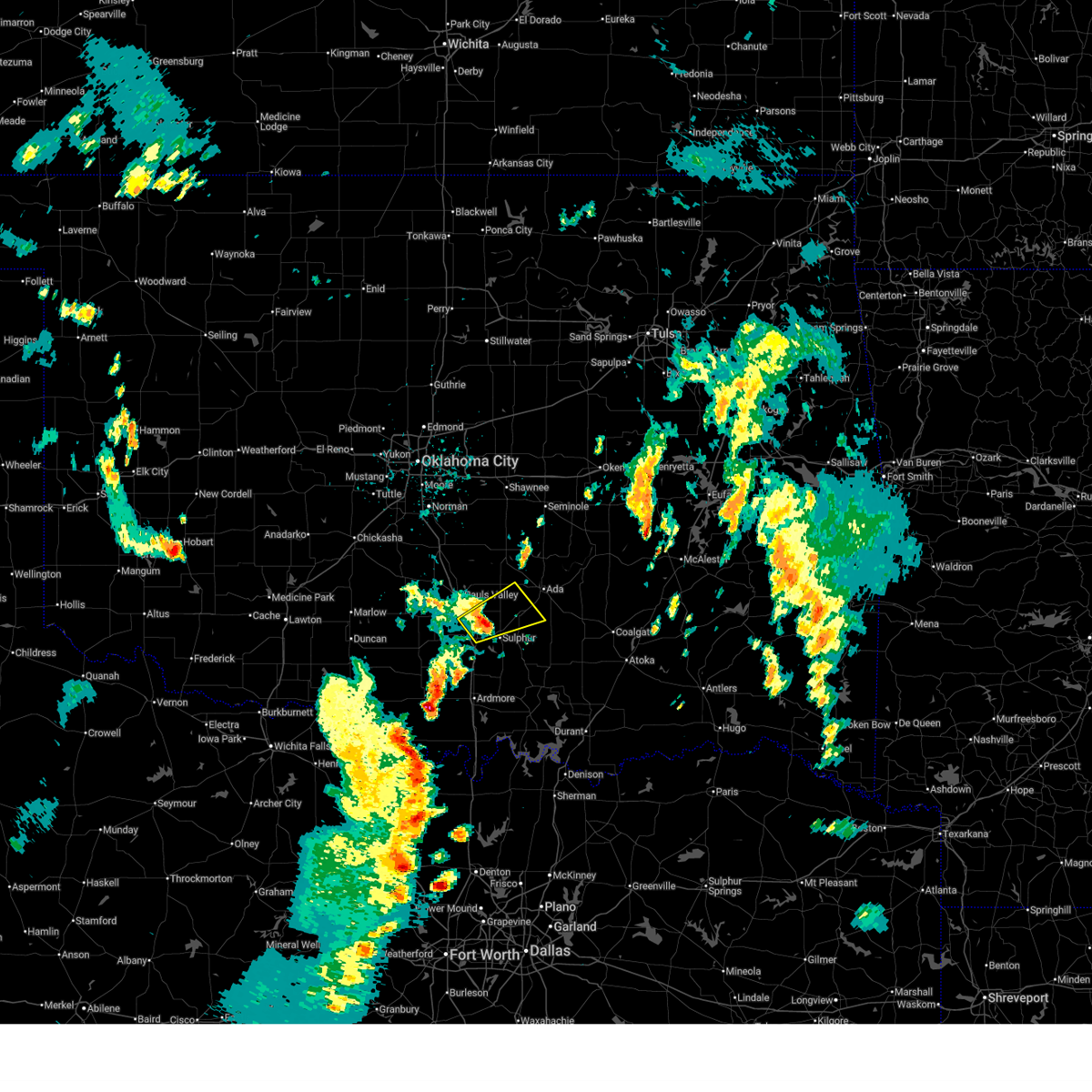
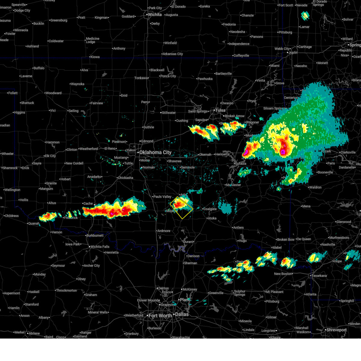
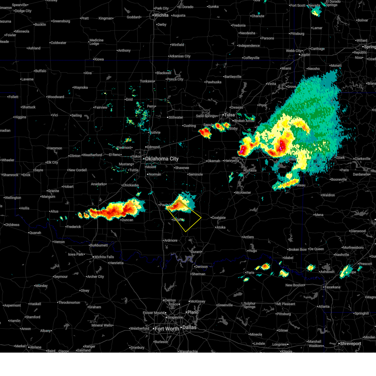
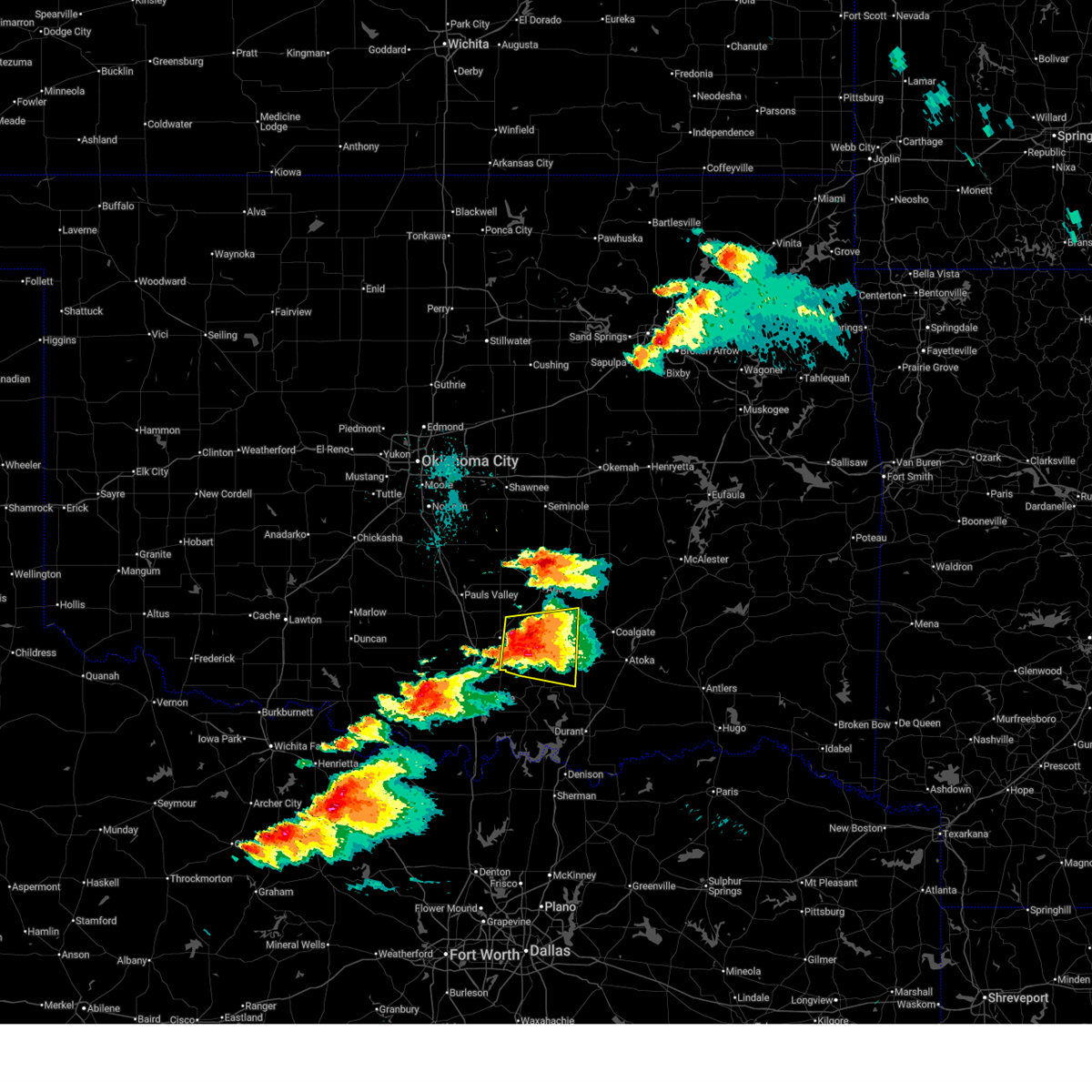
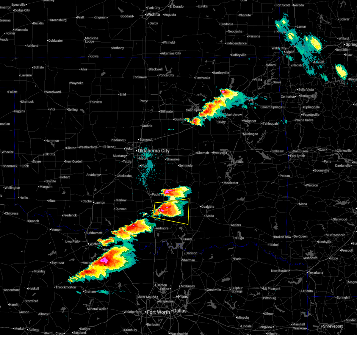
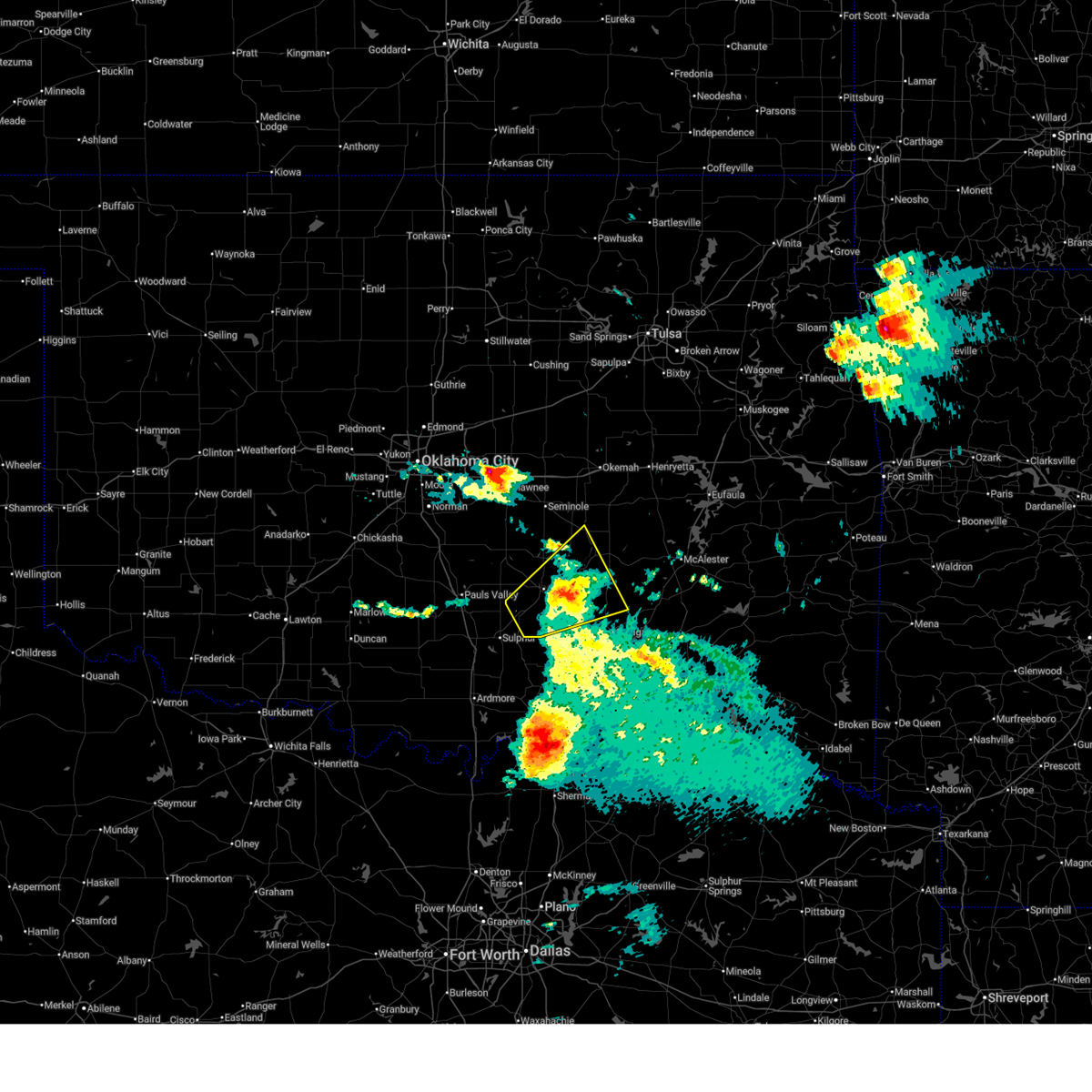
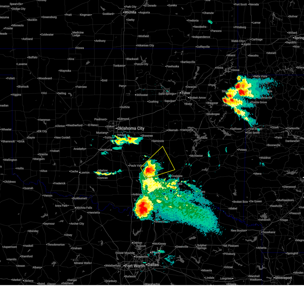
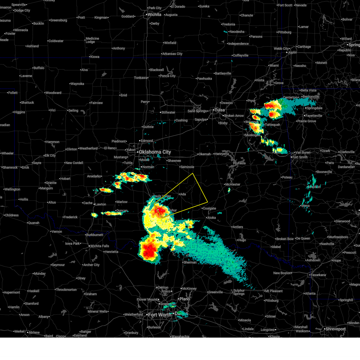
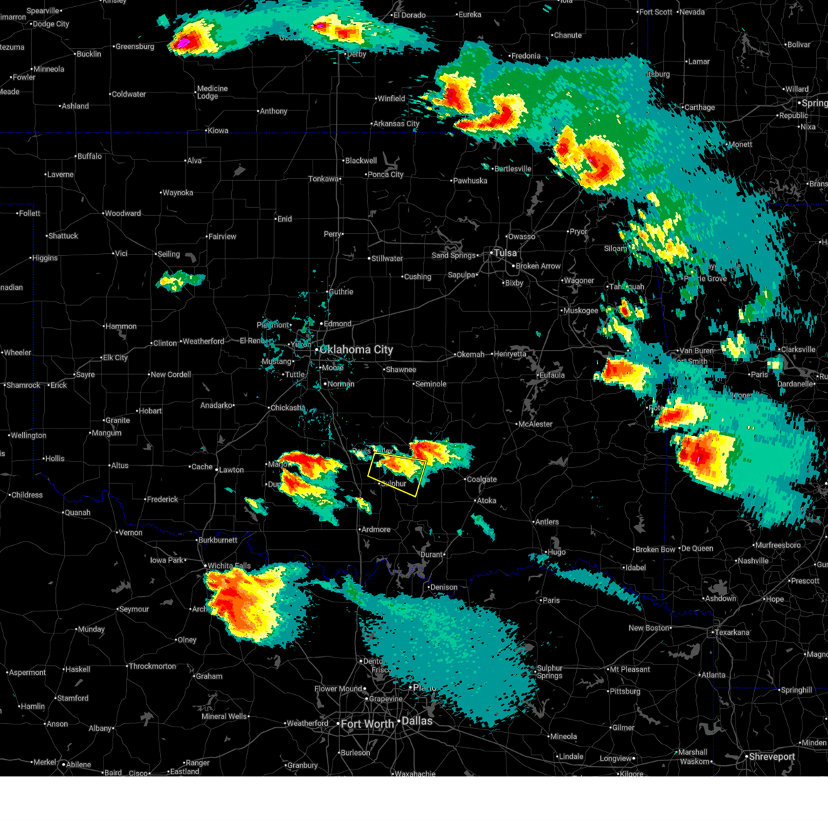
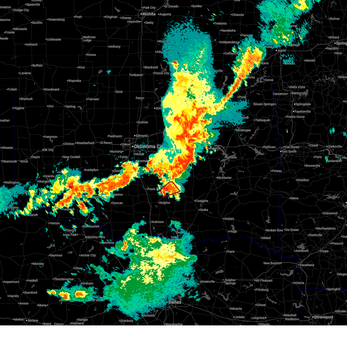
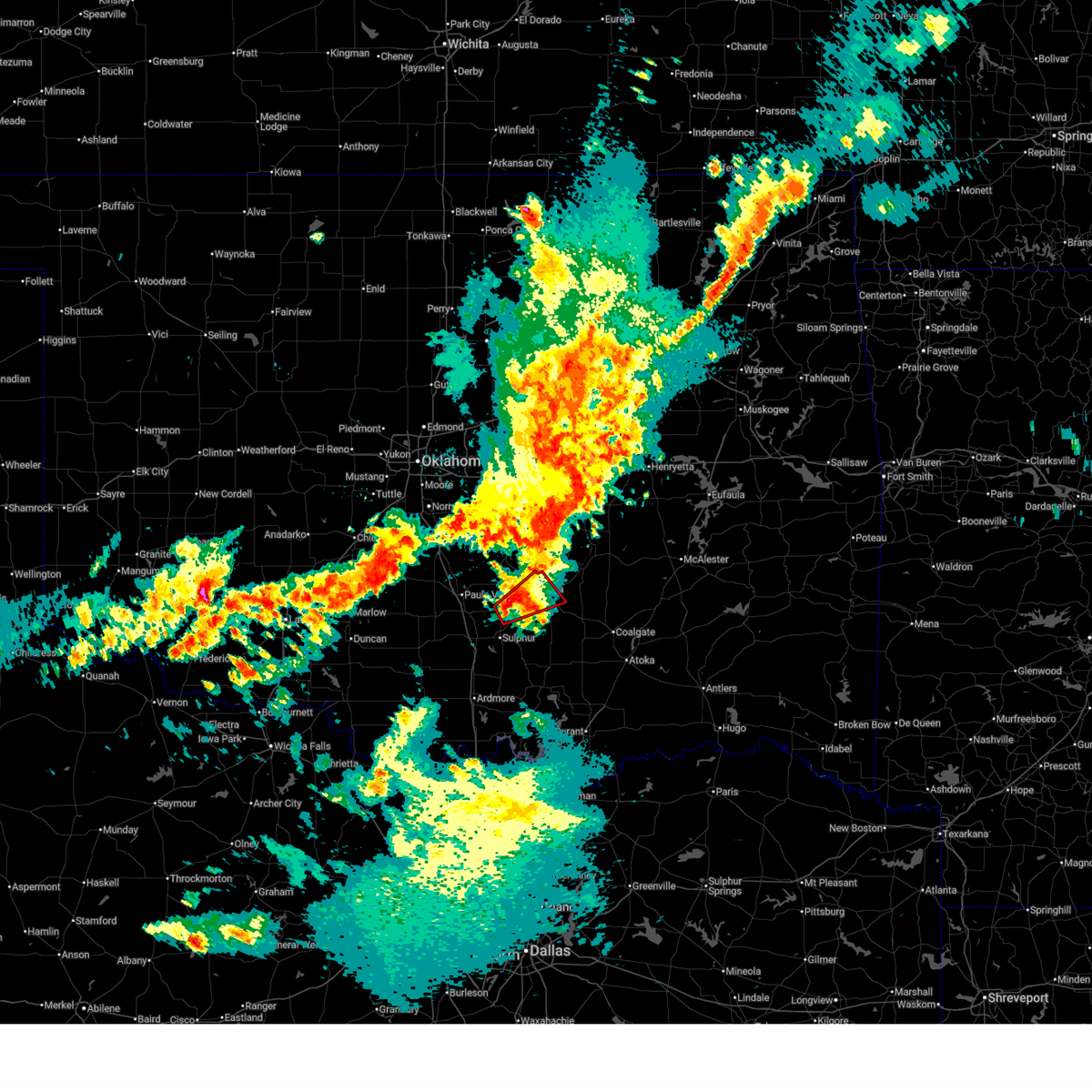
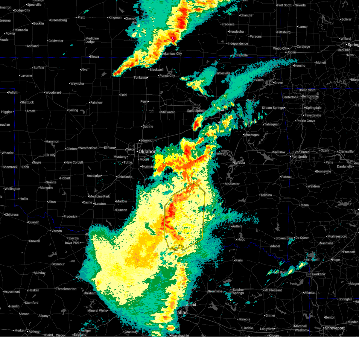
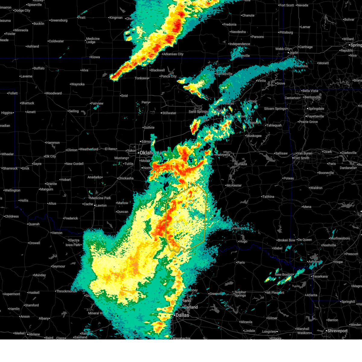
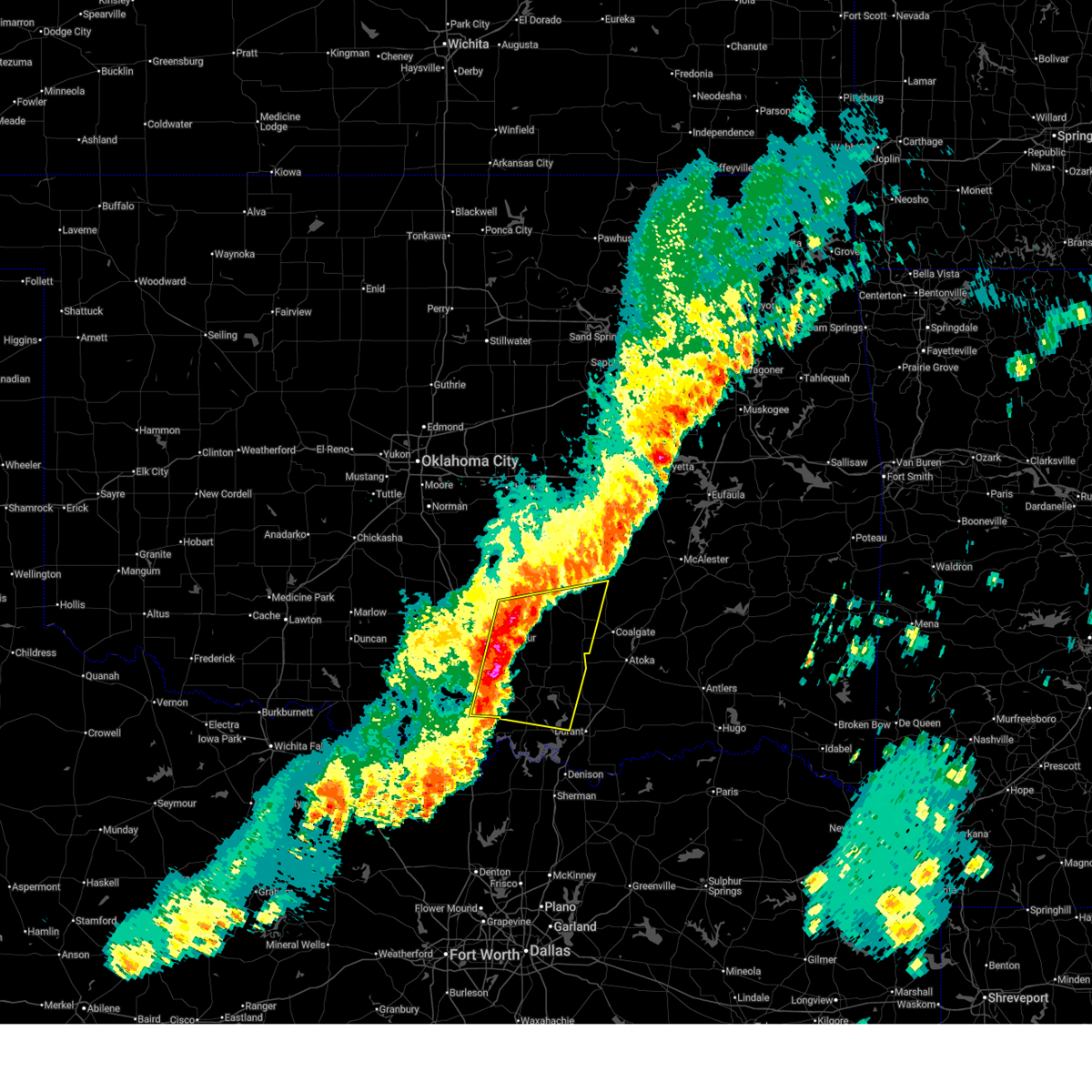
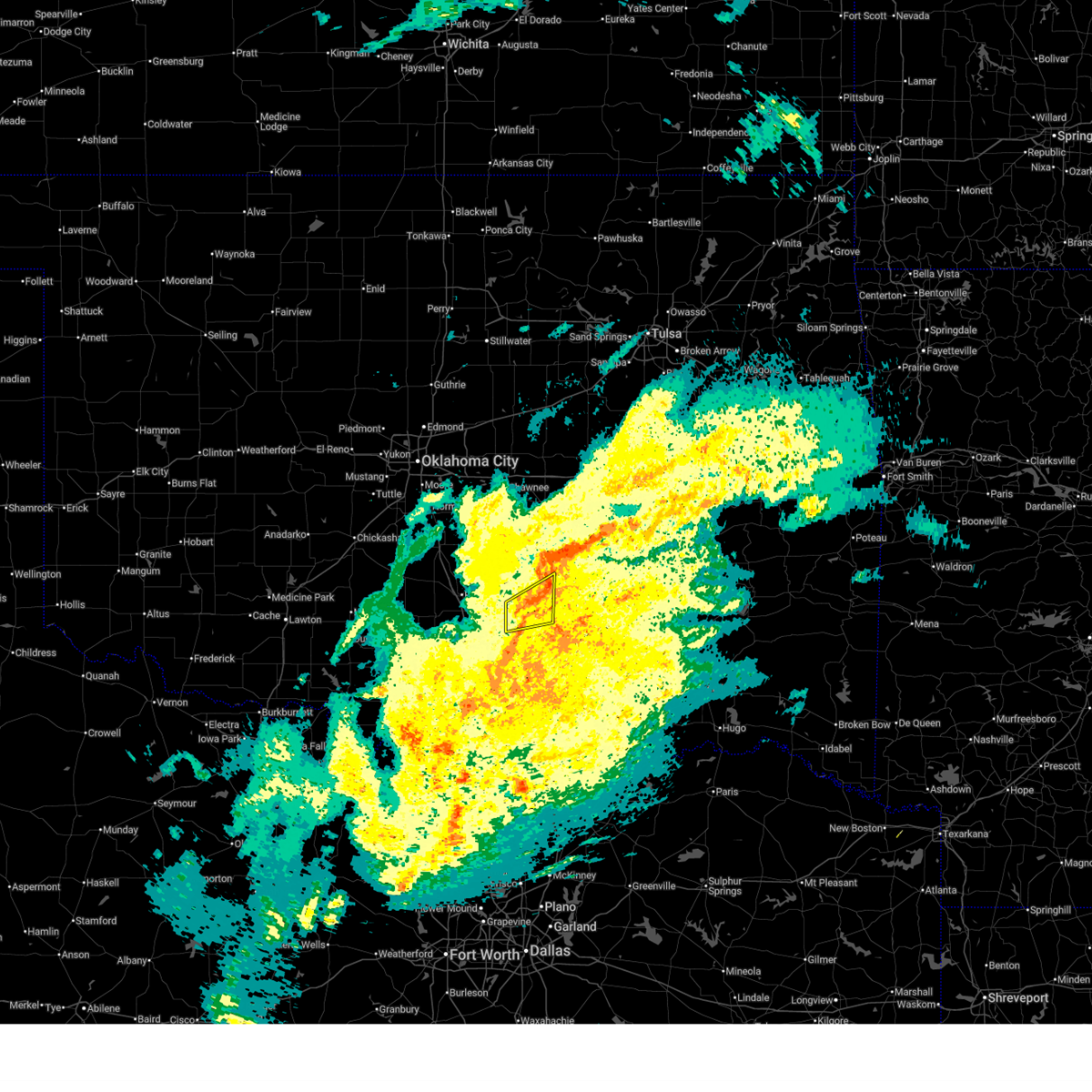
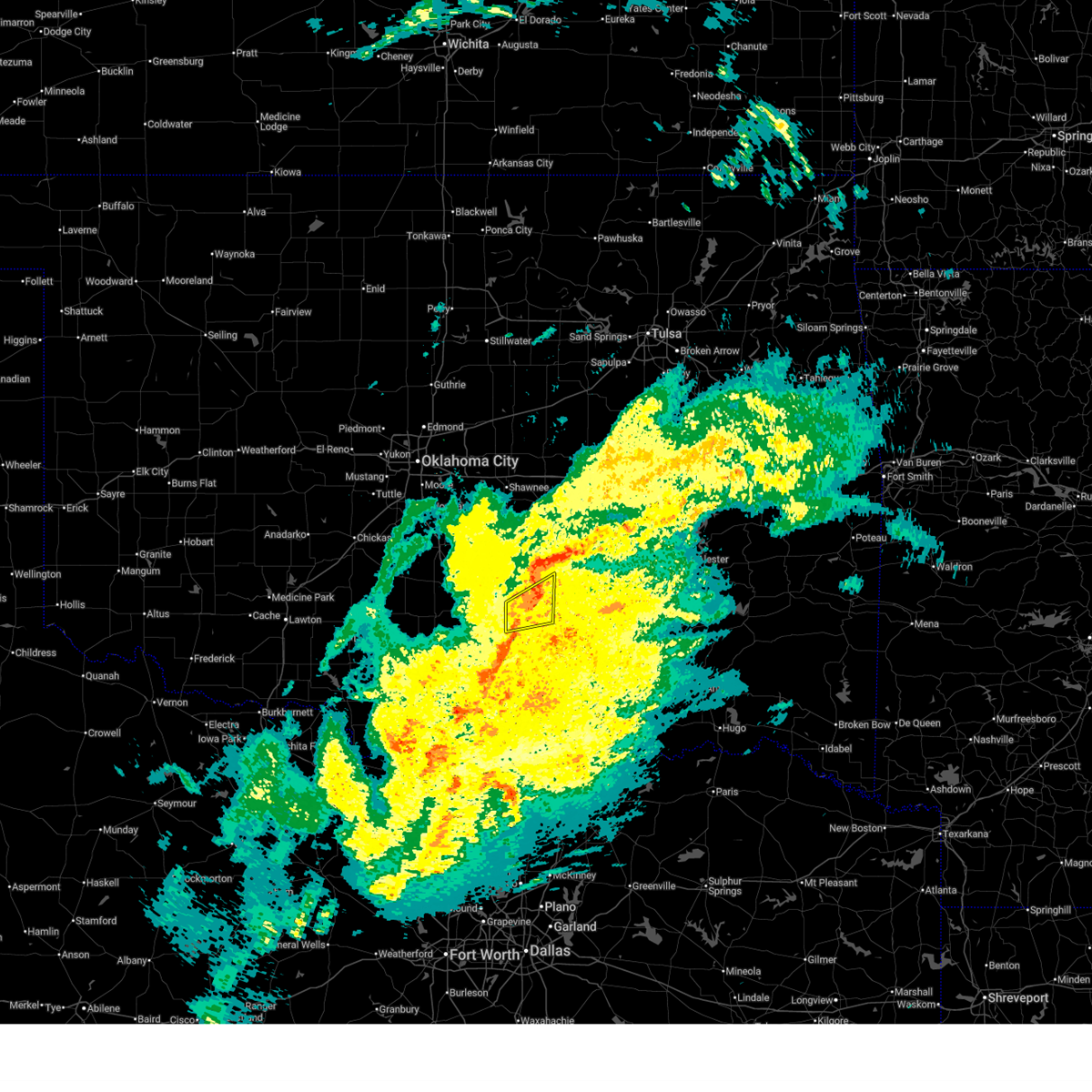
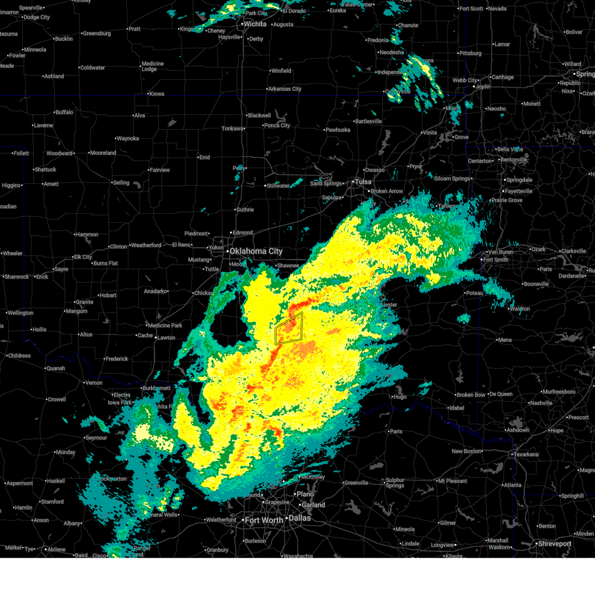
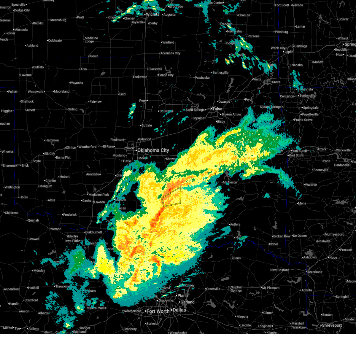
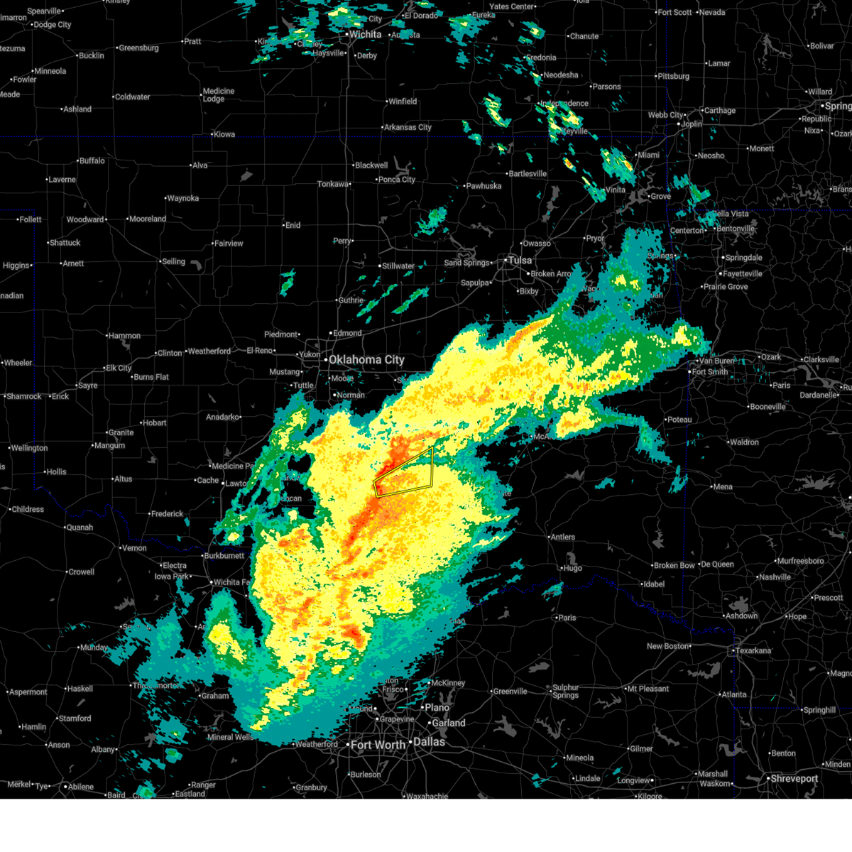
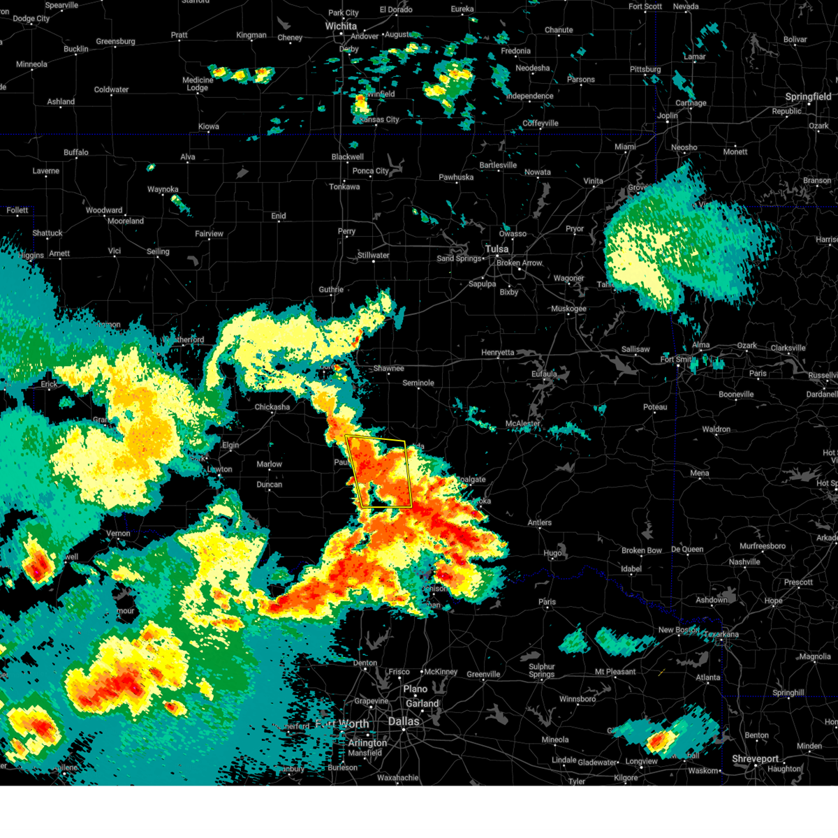
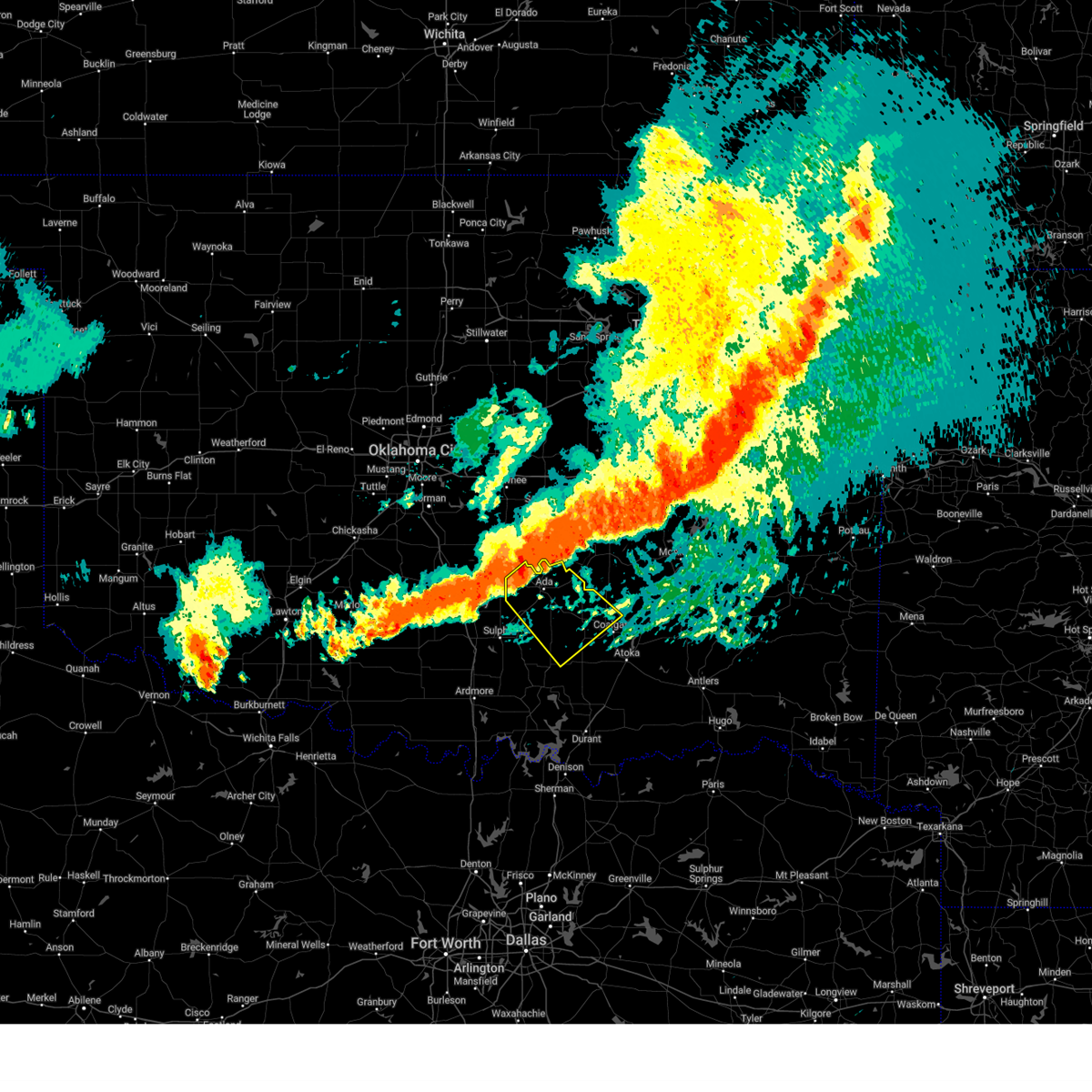
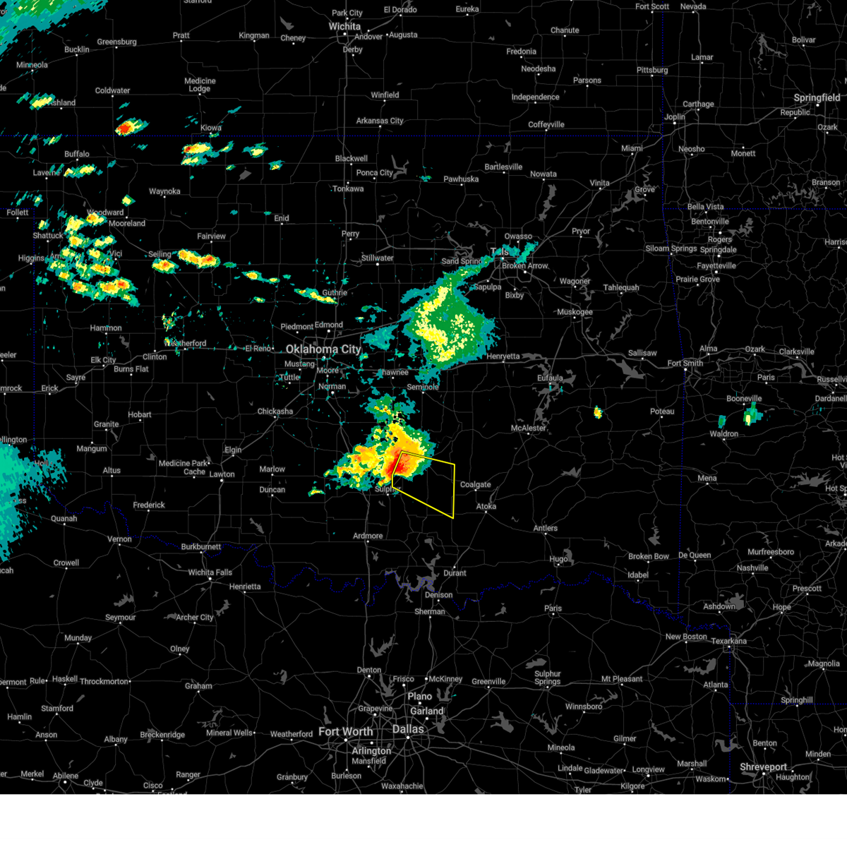
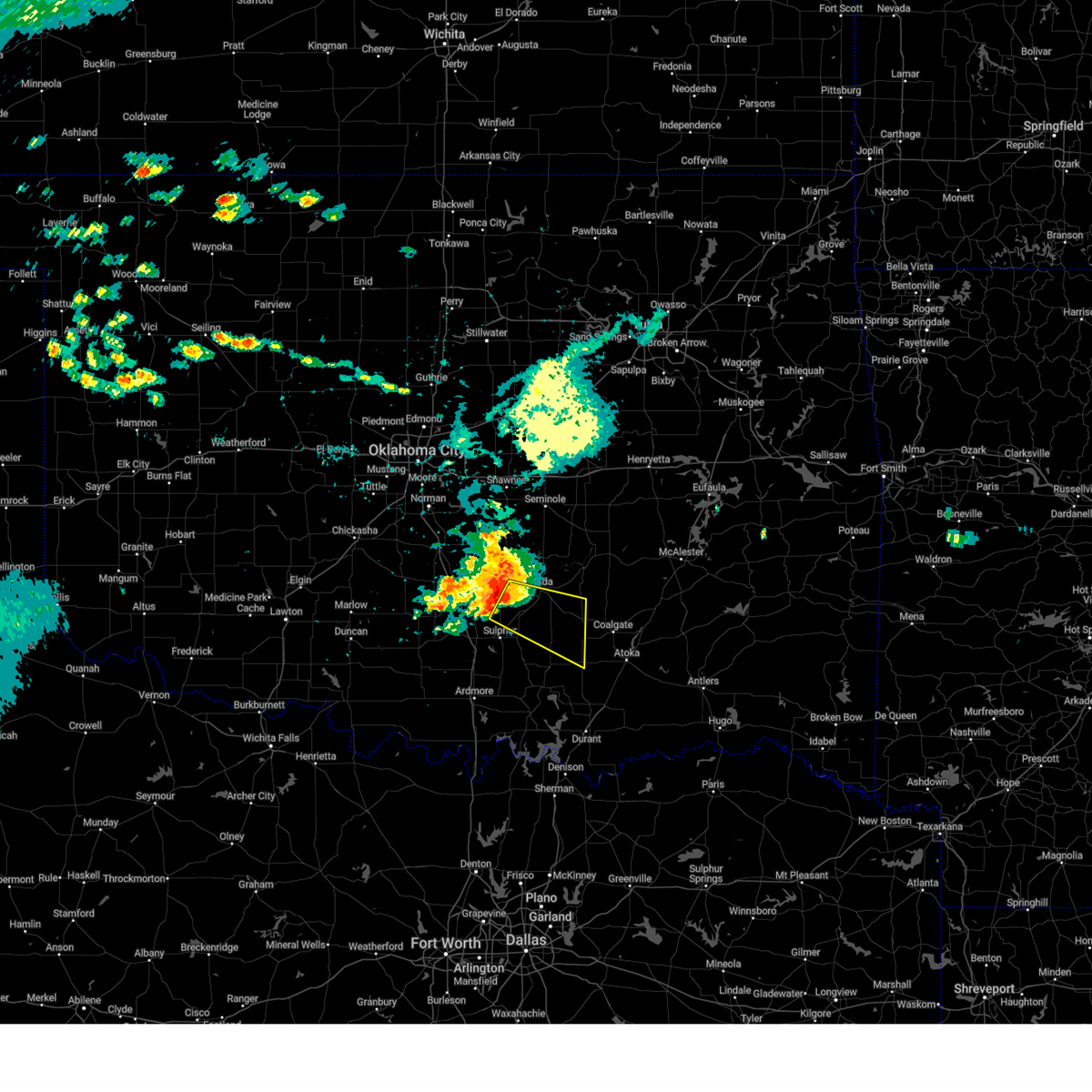
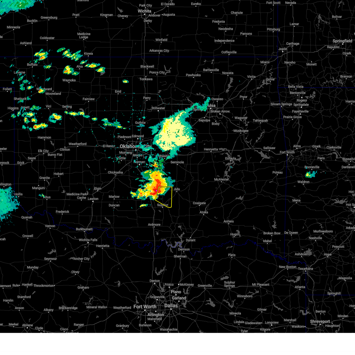
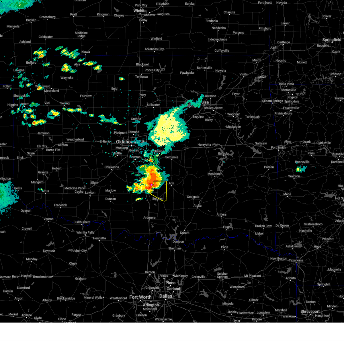
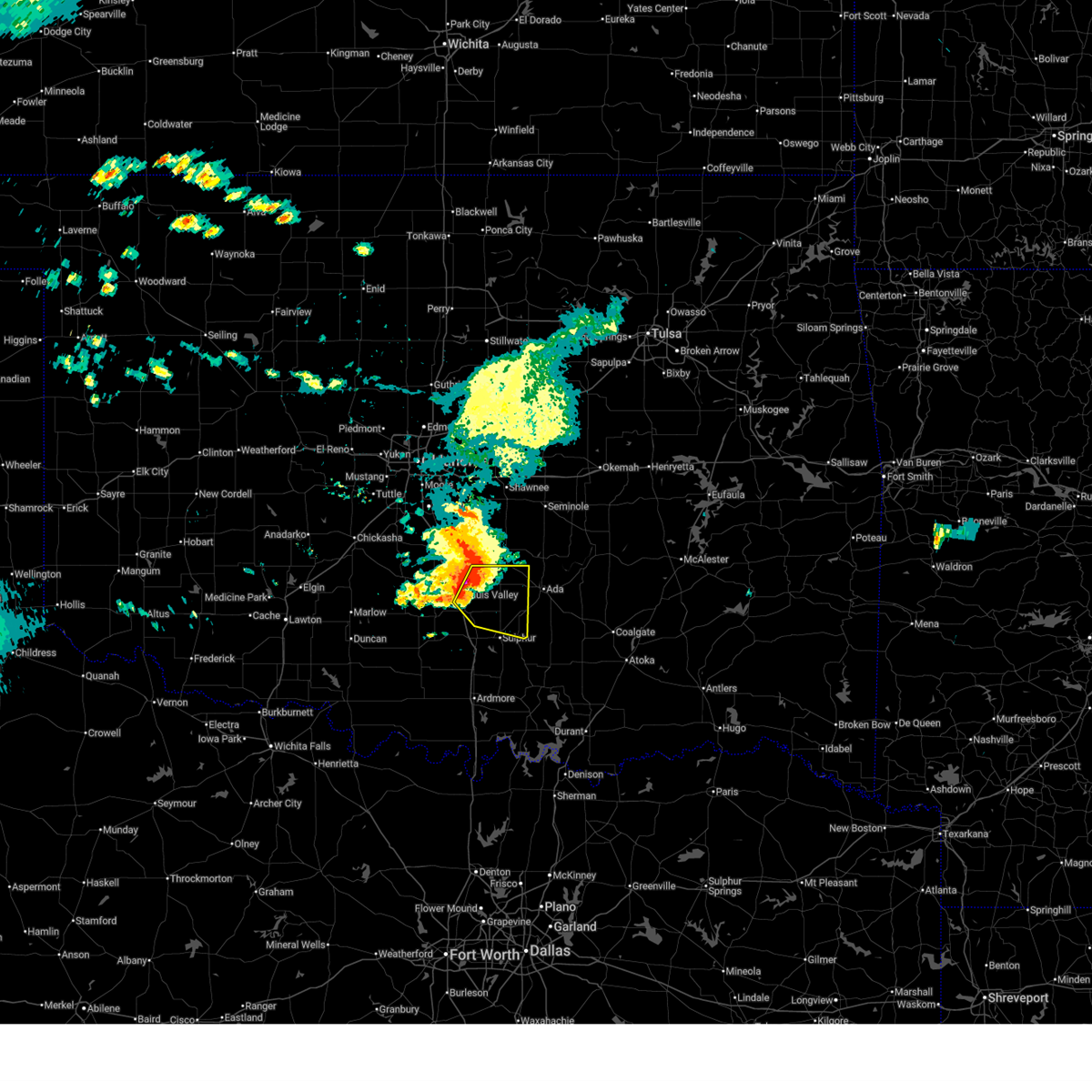
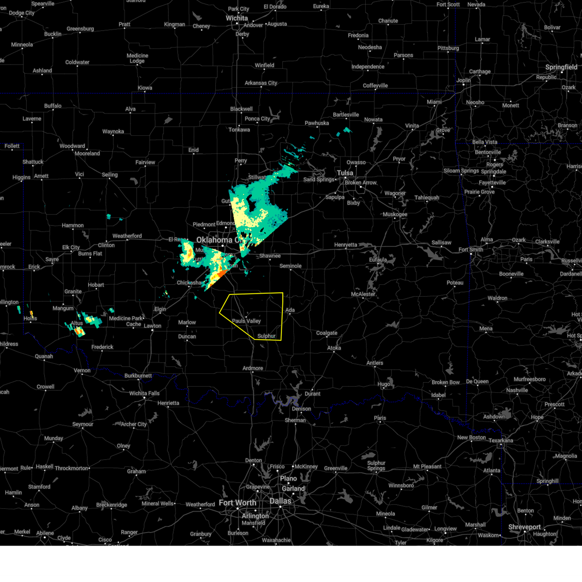
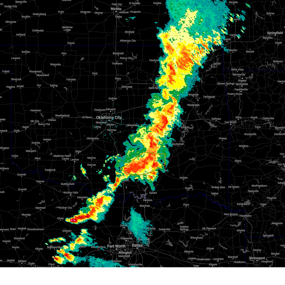
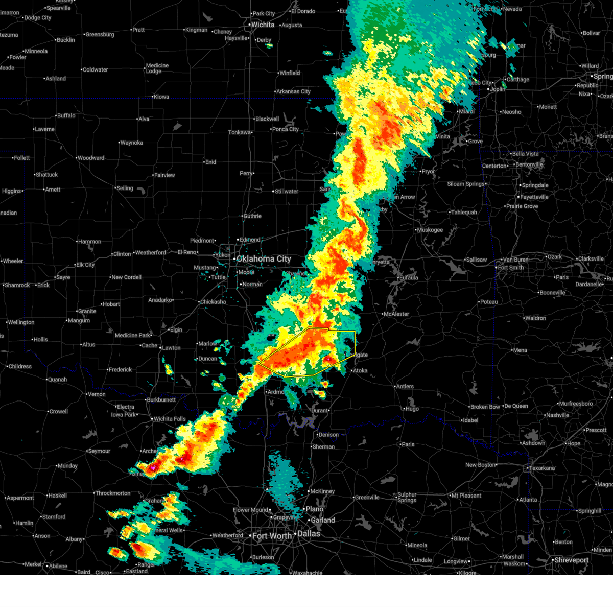
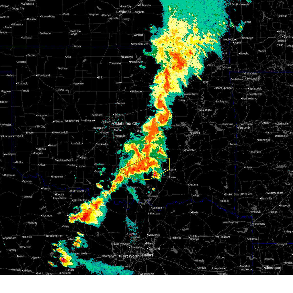
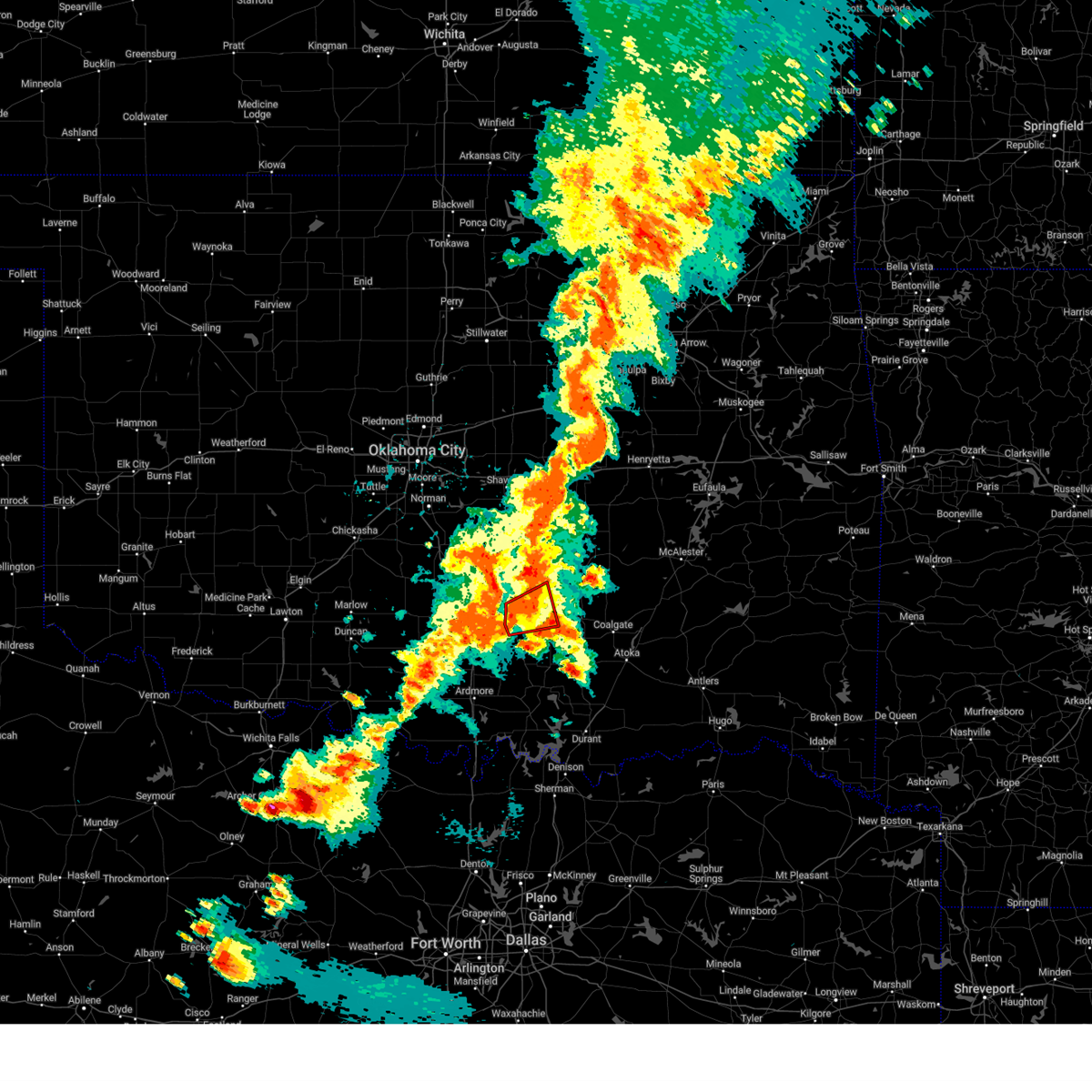
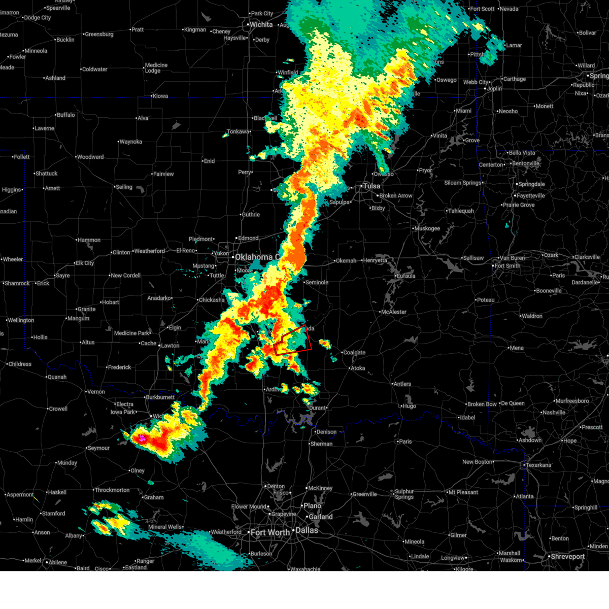
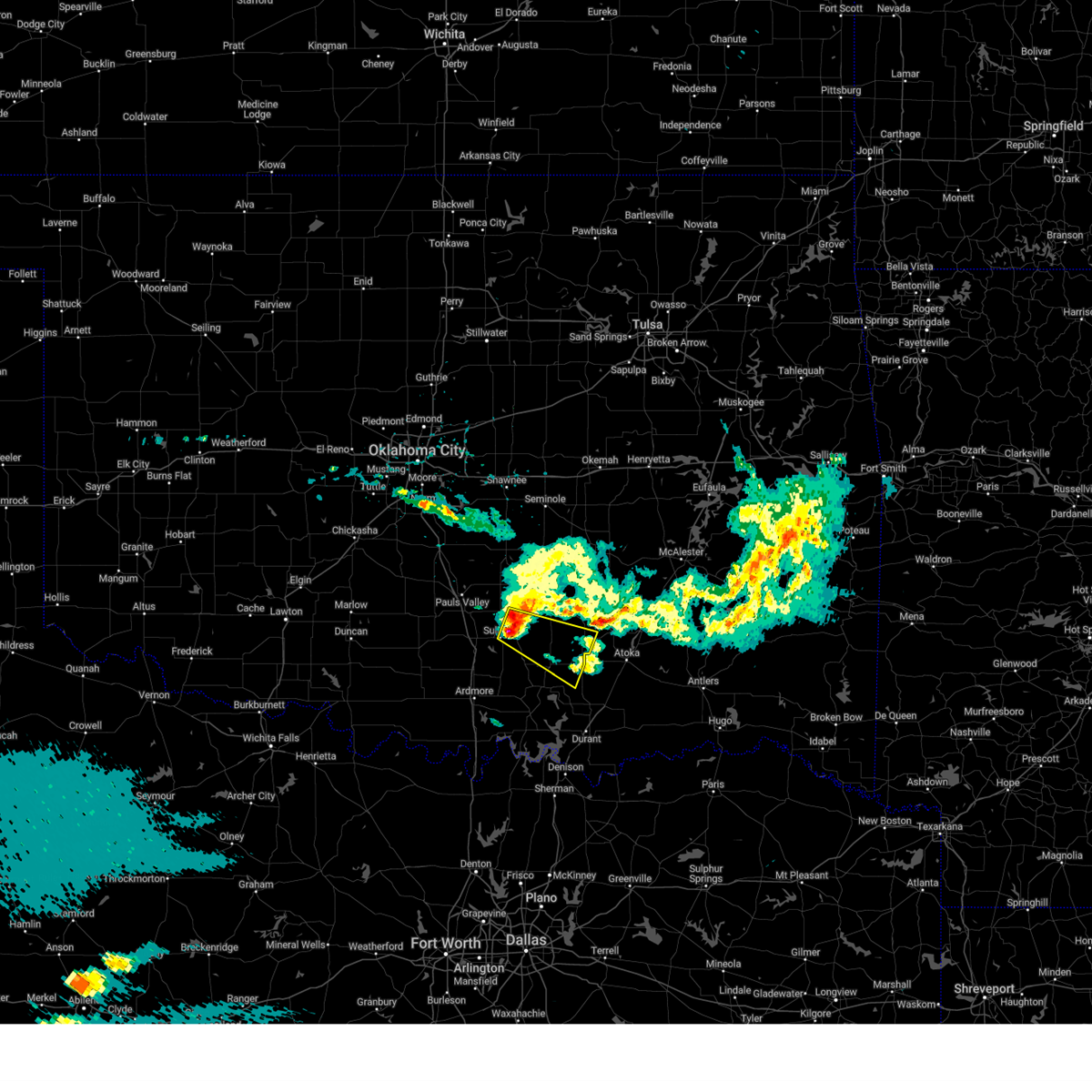
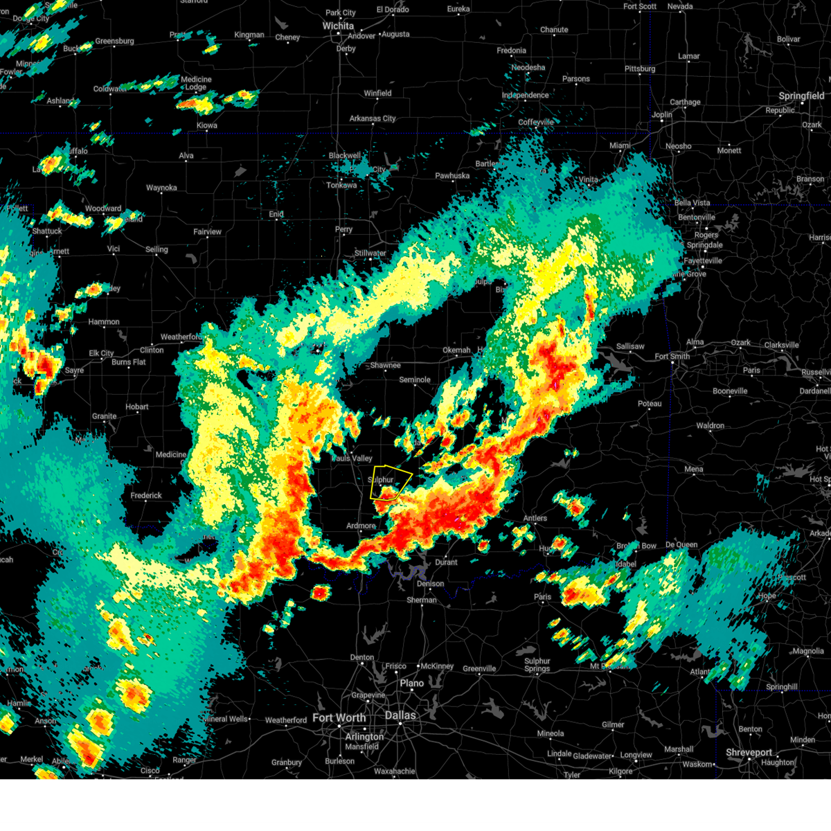
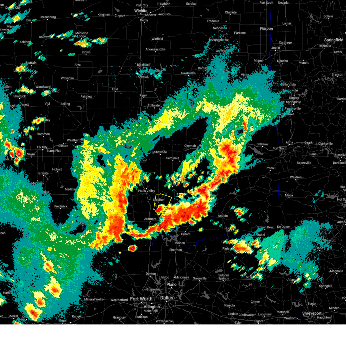
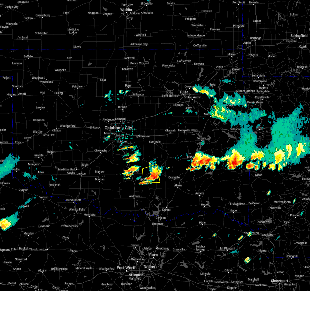
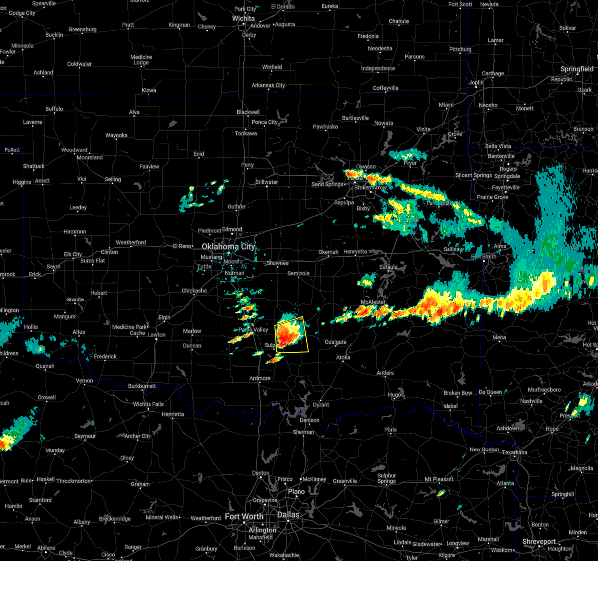
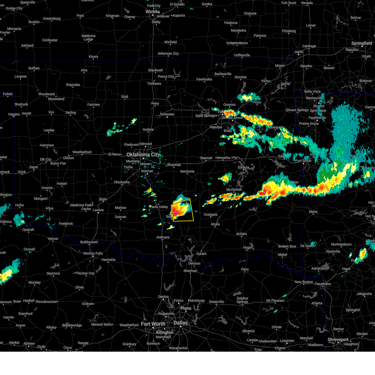
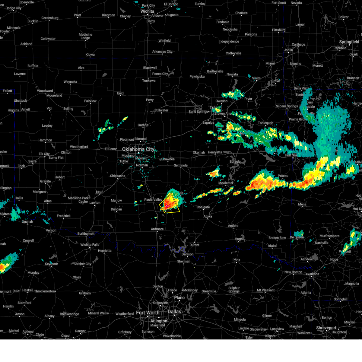
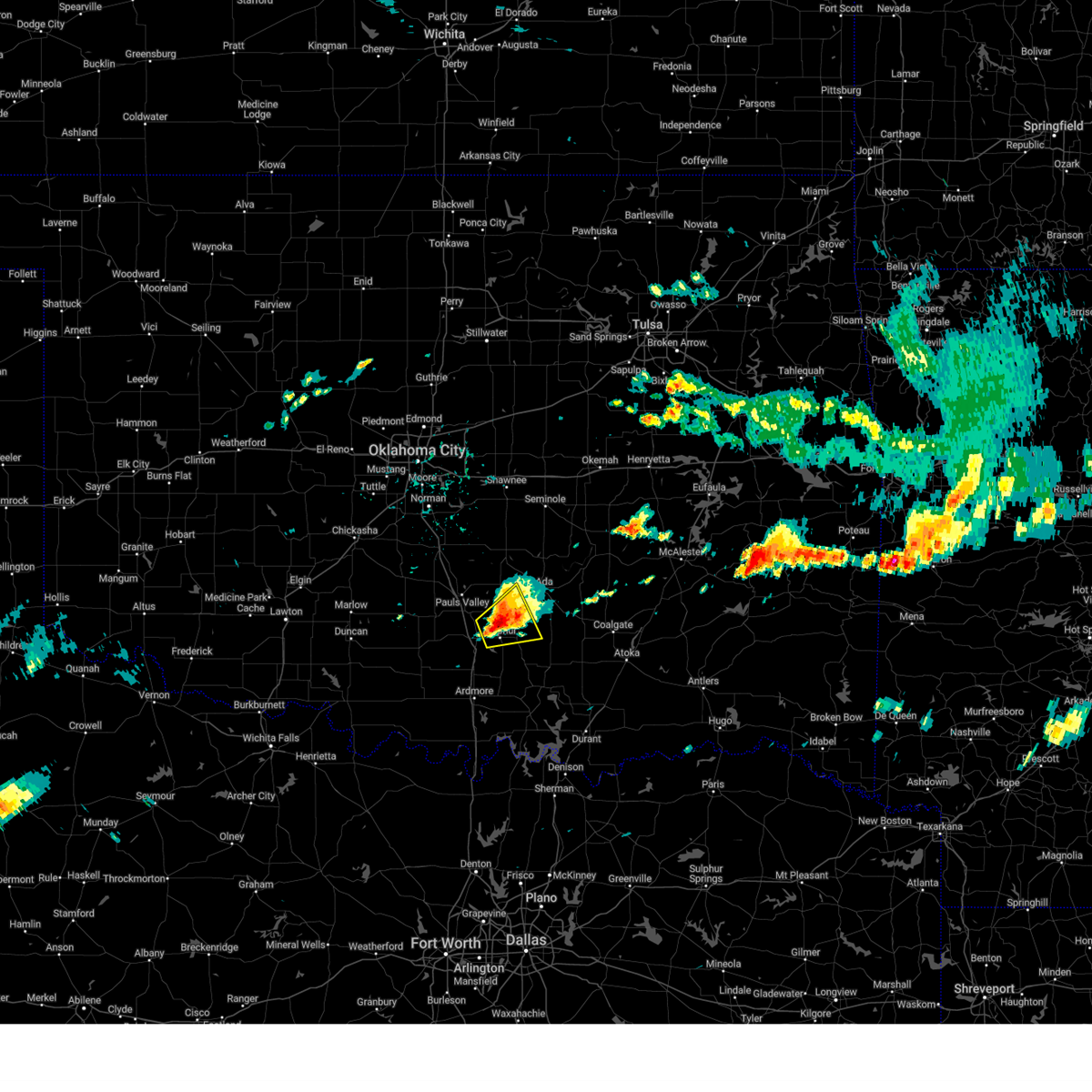
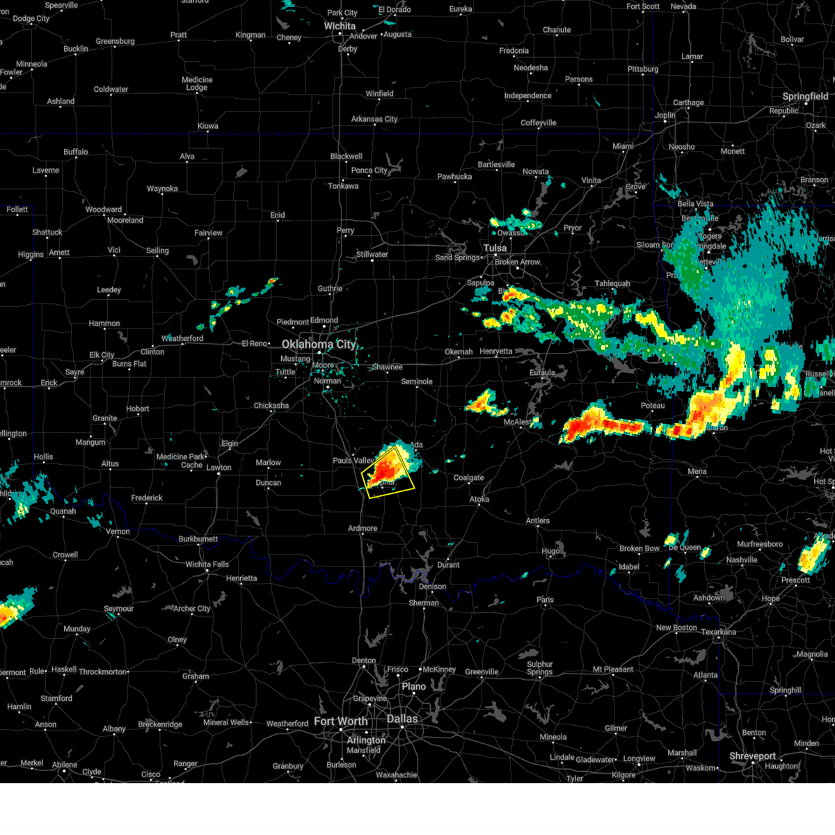
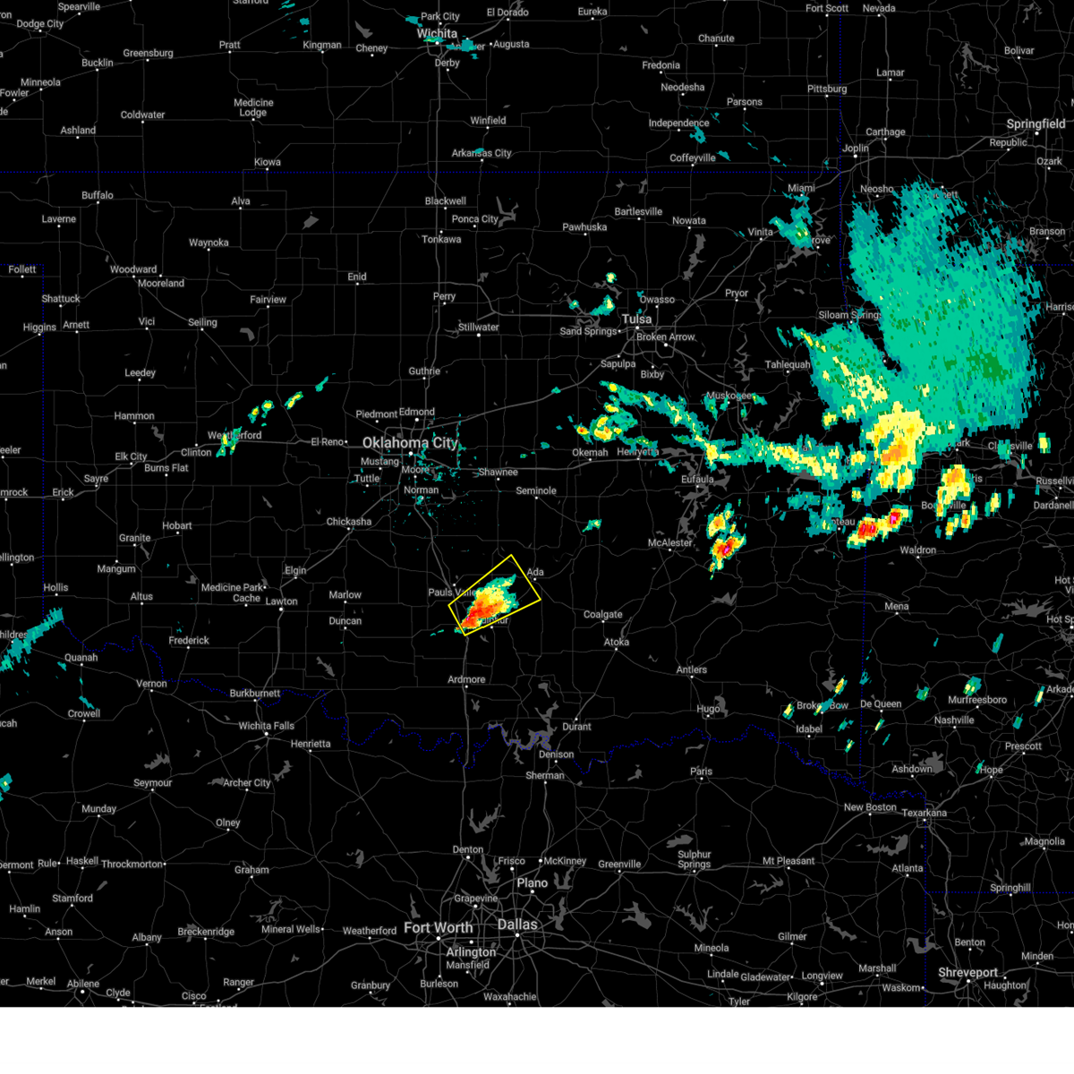
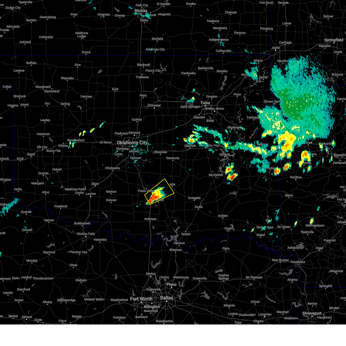
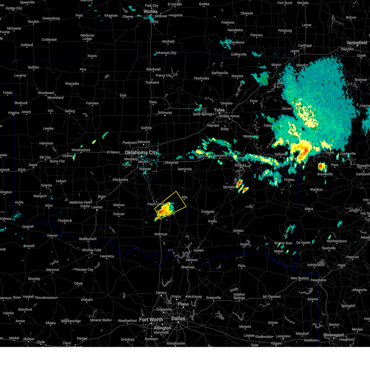
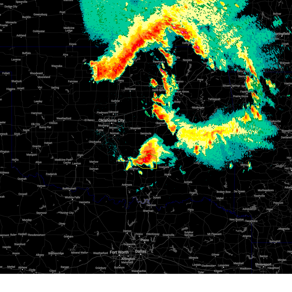
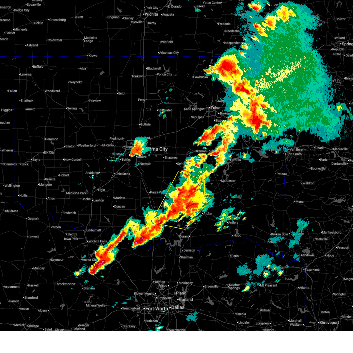
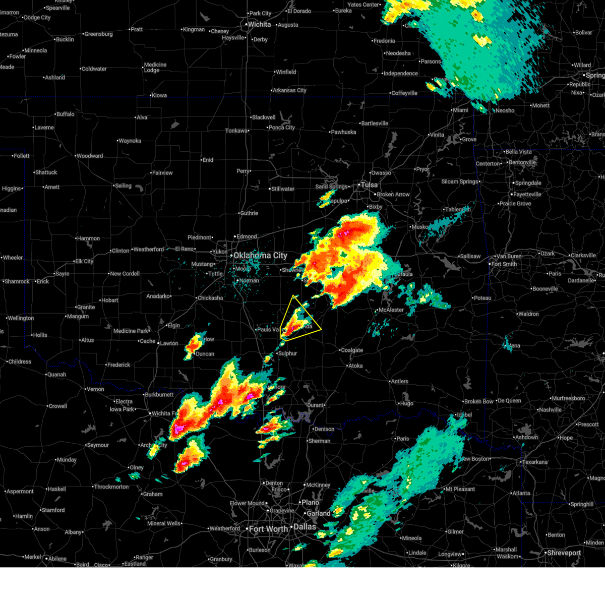
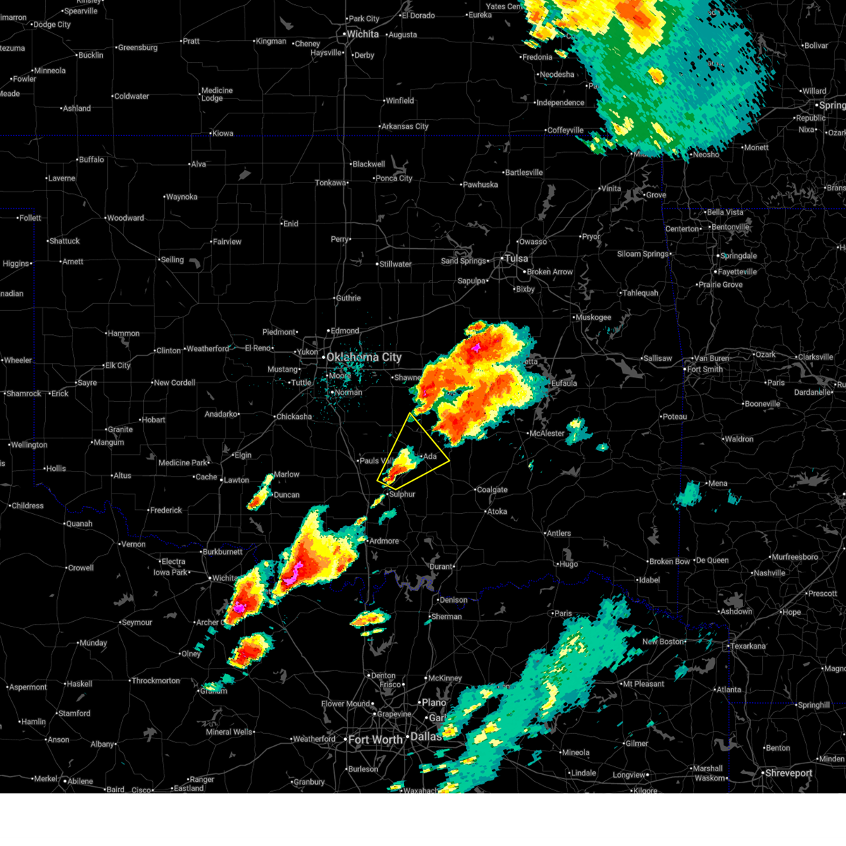
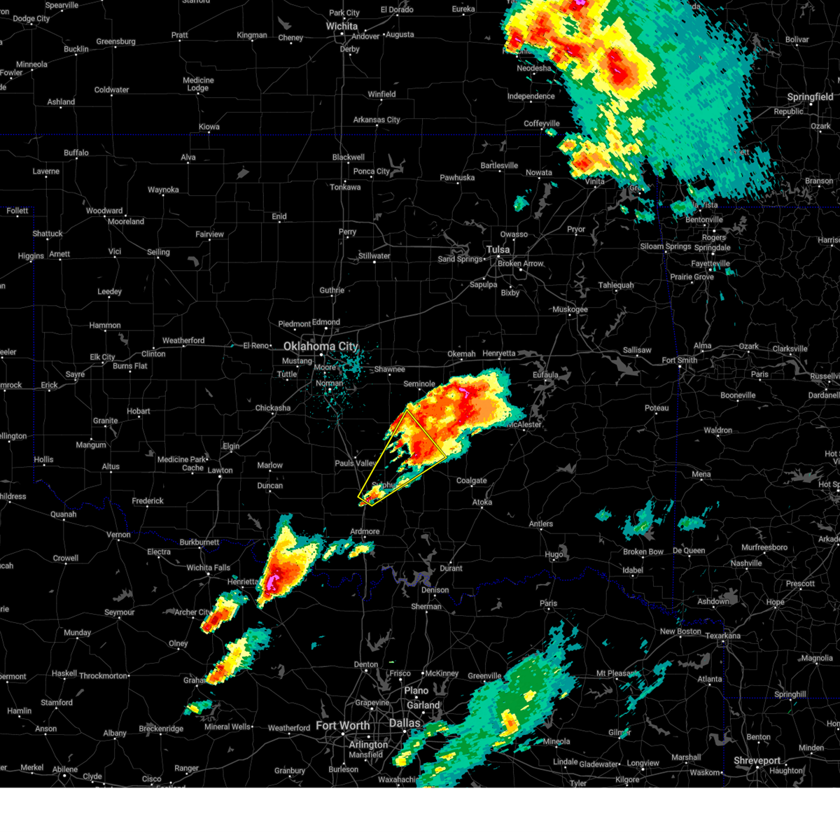
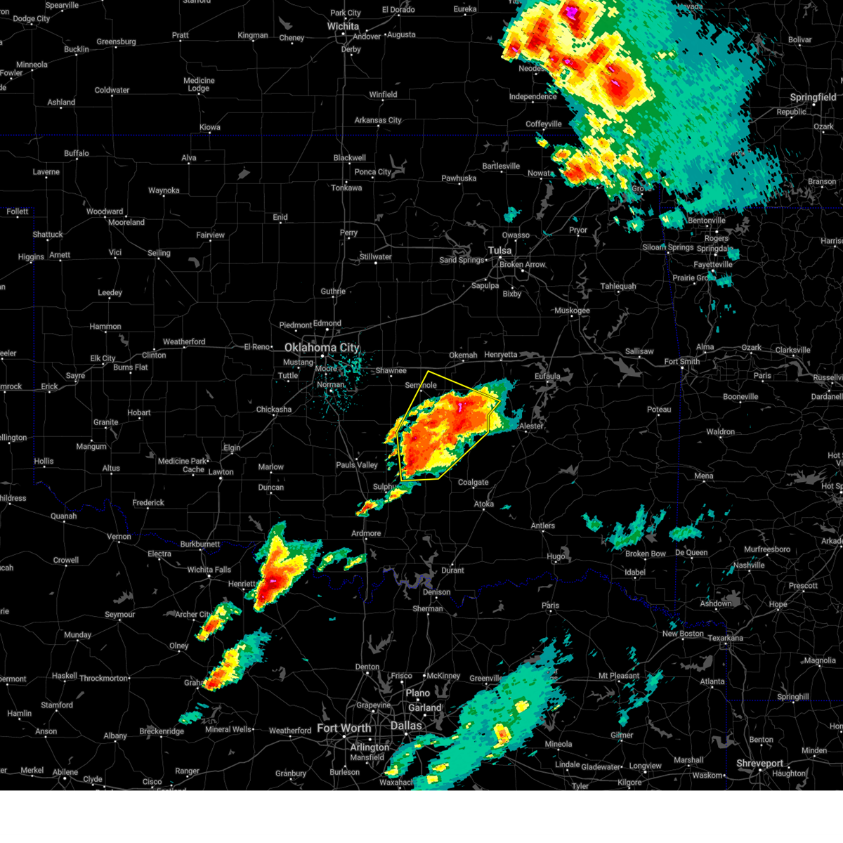
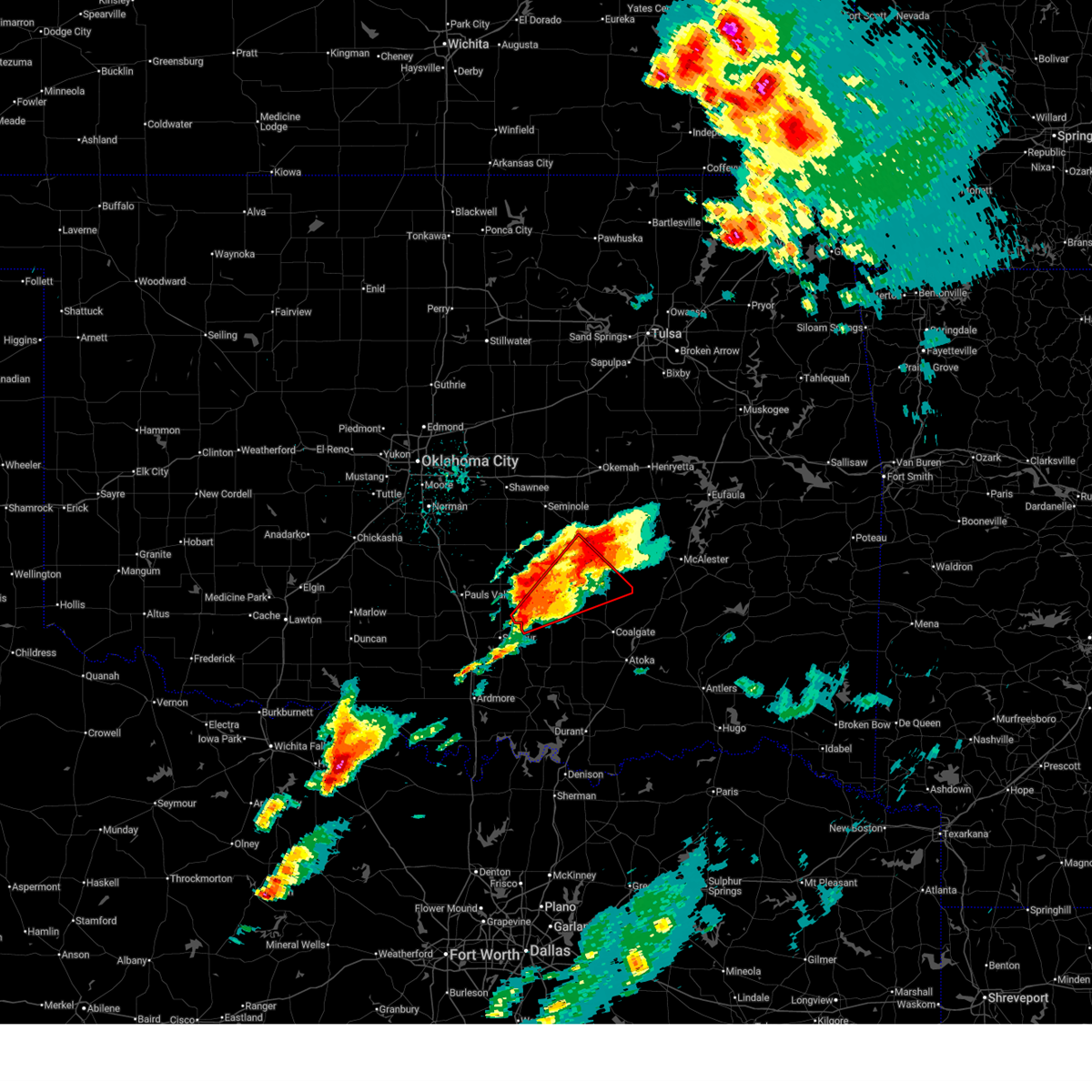
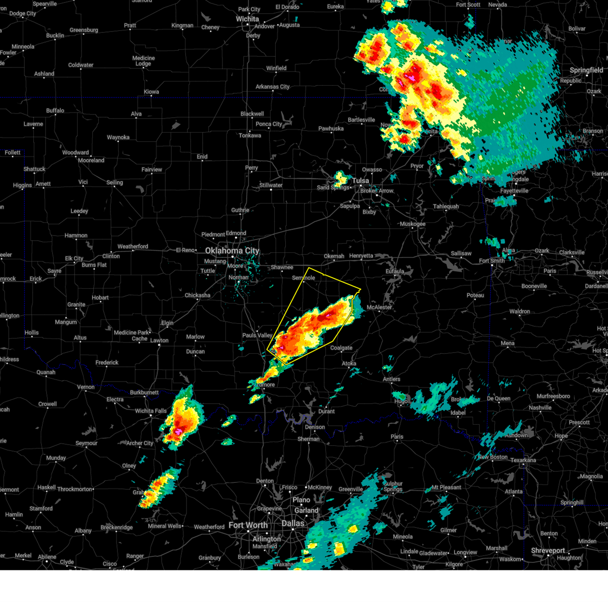
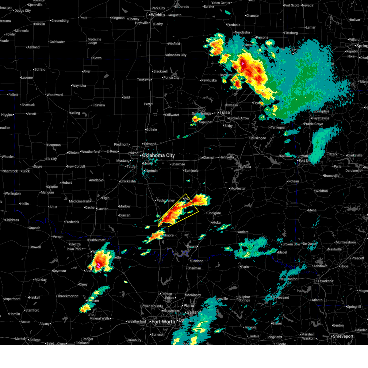
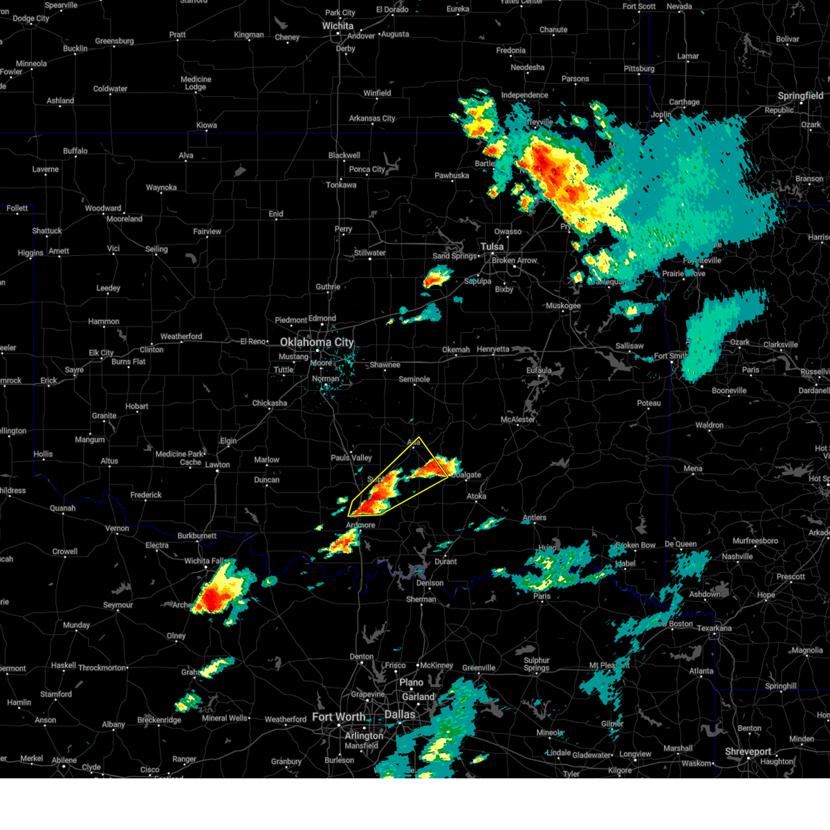
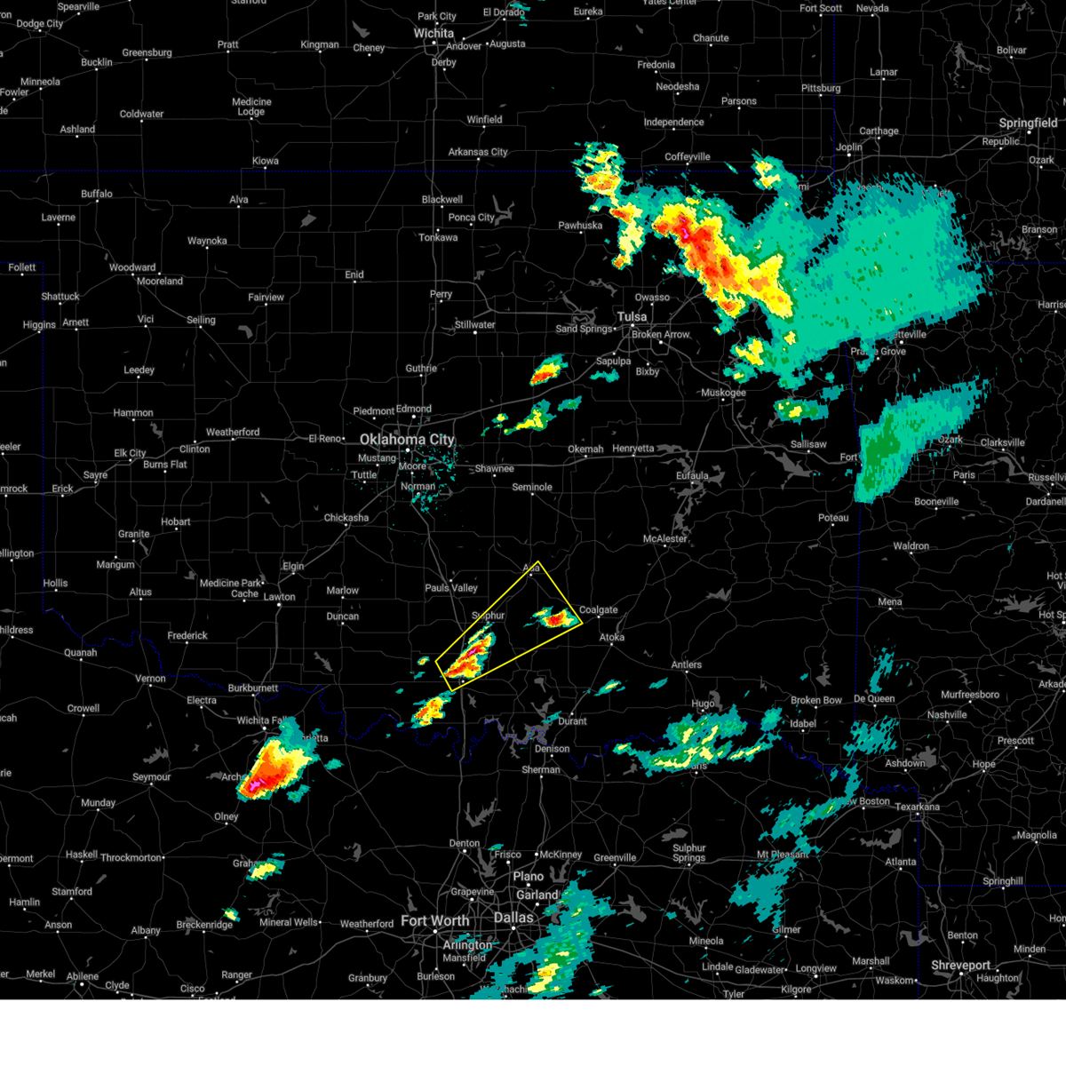
Hail Map for Roff, OK
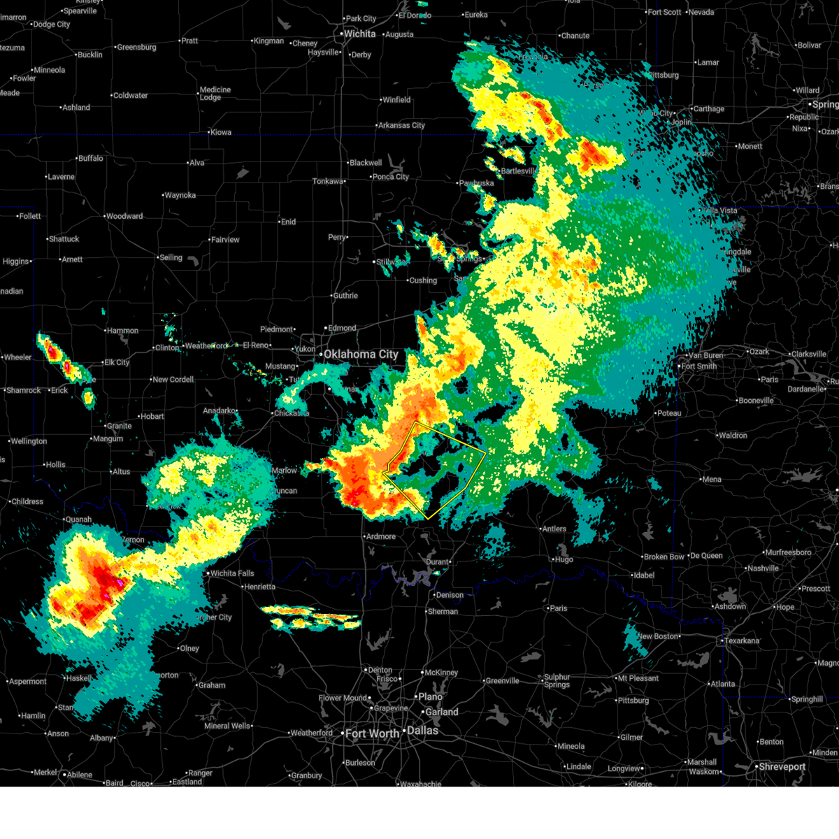
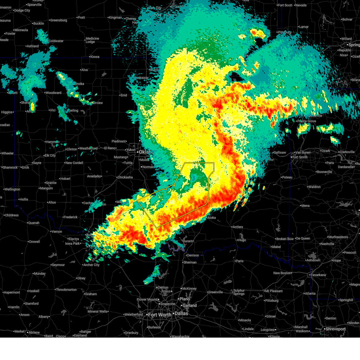
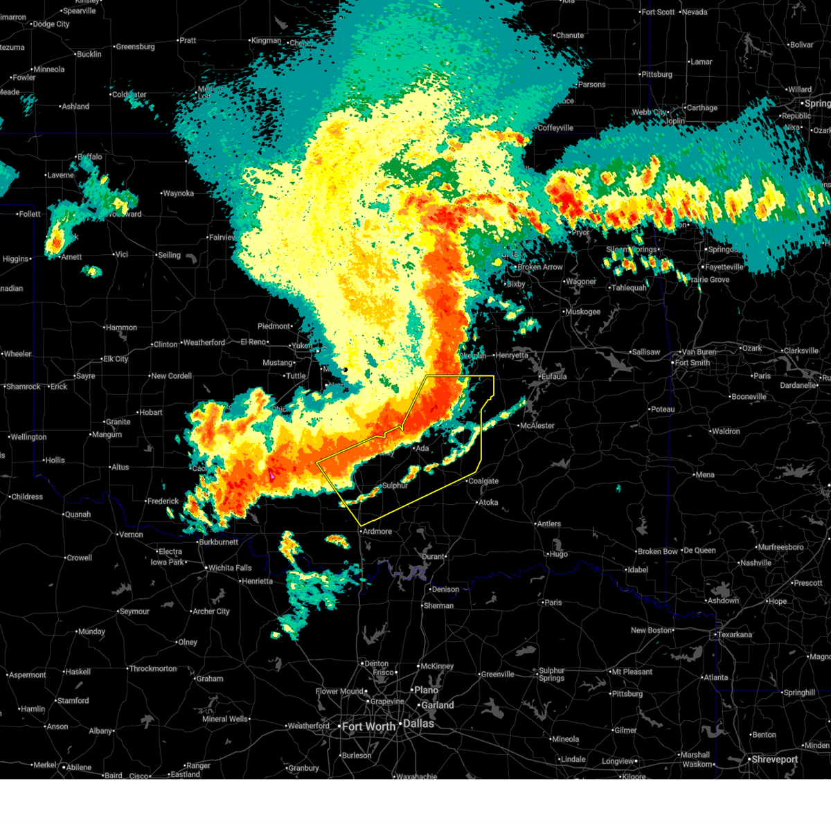
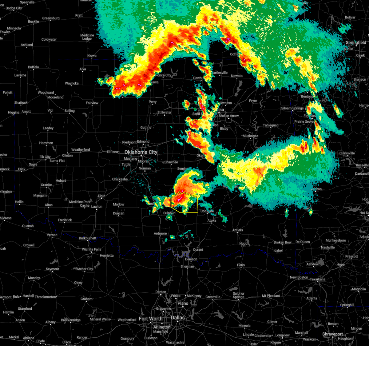
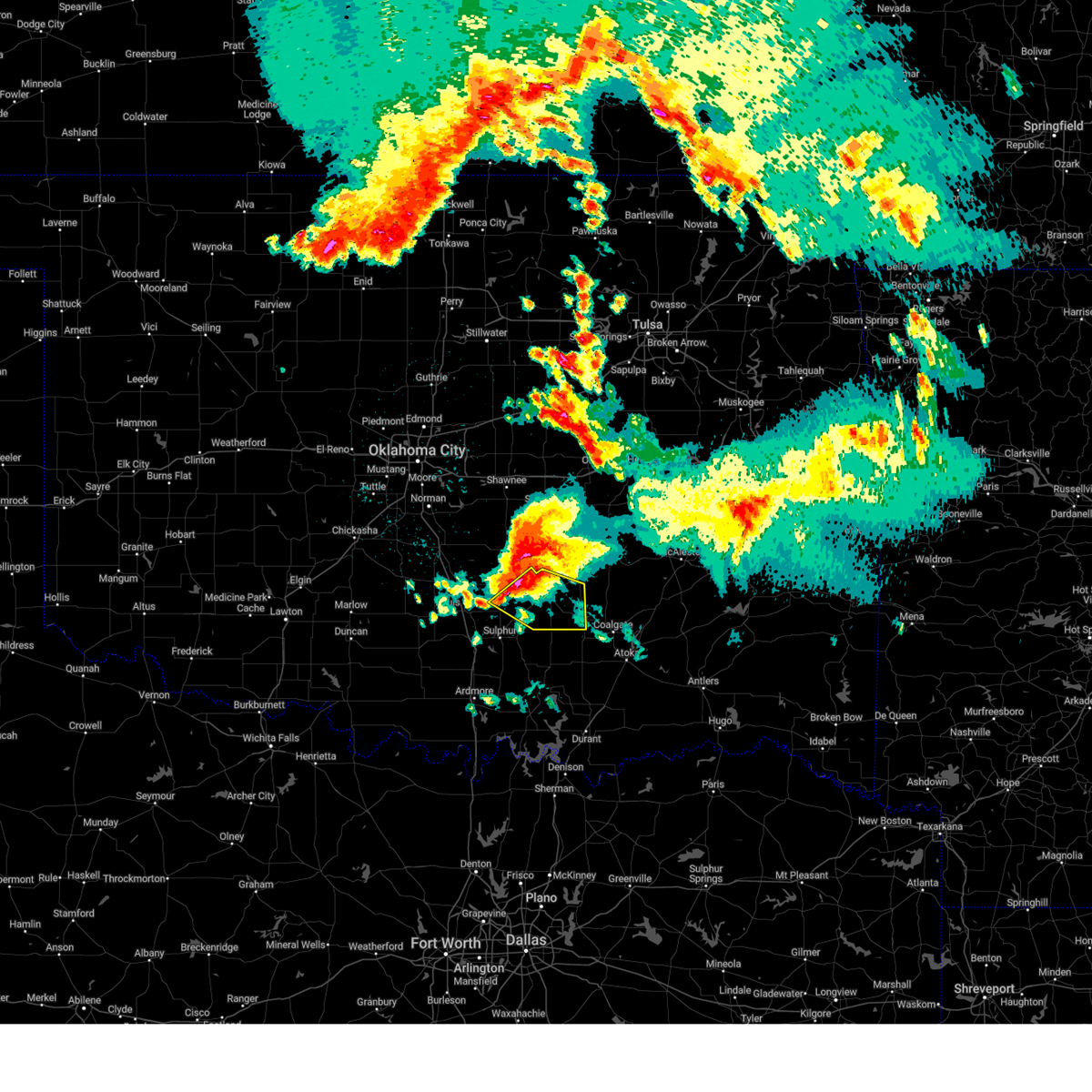
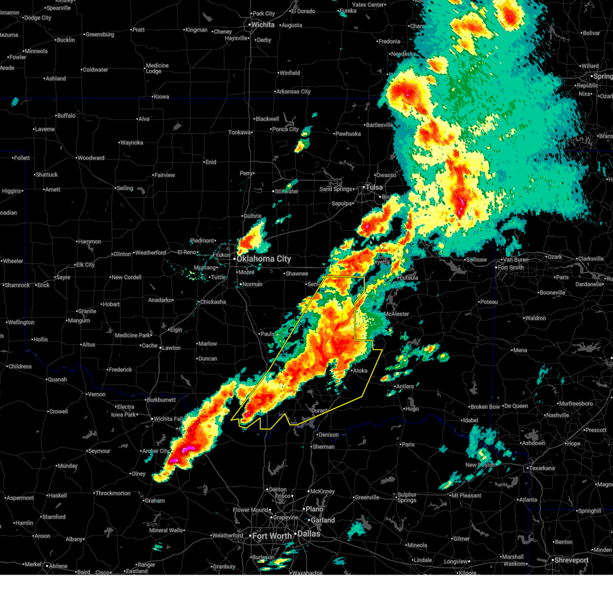
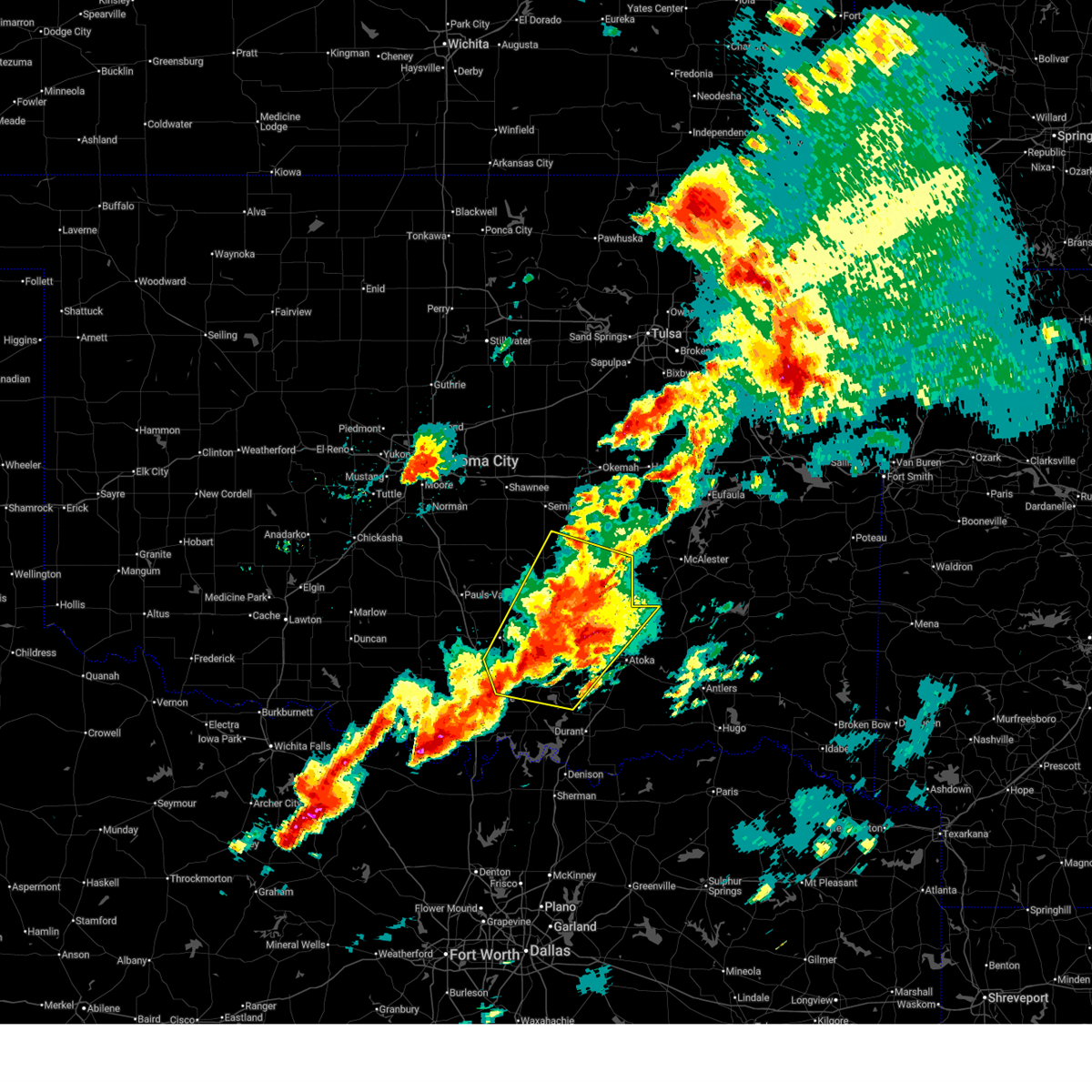
The Roff, OK area has had 9 reports of on-the-ground hail by trained spotters, and has been under severe weather warnings 27 times during the past 12 months. Doppler radar has detected hail at or near Roff, OK on 82 occasions, including 6 occasions during the past year.
| Name: | Roff, OK |
| Where Located: | 44 miles WNW of Atoka, OK |
| Map: | Google Map for Roff, OK |
| Population: | 725 |
| Housing Units: | 314 |
| More Info: | Search Google for Roff, OK |
2
The Top Recent Hail Date for Roff, OK is Sunday, May 10, 2026 (26th out of 82)
Hail and Wind Damage Spotted near Roff, OK
| Date / Time | Report Details |
|---|---|
| 6/23/2026 3:15 PM CDT | Vehicle submerged with a water rescu in pontotoc county OK, 12.4 miles WNW of Roff, OK |
| 6/23/2026 3:12 PM CDT |
 Svroun the national weather service in norman has issued a * severe thunderstorm warning for, northeastern johnston county in southeastern oklahoma, coal county in southeastern oklahoma, southwestern seminole county in east central oklahoma, pontotoc county in east central oklahoma, northeastern murray county in southern oklahoma, southwestern hughes county in southeastern oklahoma, * until 345 pm cdt. * at 312 pm cdt, severe thunderstorms were located along a line extending from near francis to 5 miles northeast of fitzhugh to near sulphur, moving southeast at 45 mph (radar indicated). Hazards include 60 mph wind gusts. expect damage to roofs, siding, and trees Svroun the national weather service in norman has issued a * severe thunderstorm warning for, northeastern johnston county in southeastern oklahoma, coal county in southeastern oklahoma, southwestern seminole county in east central oklahoma, pontotoc county in east central oklahoma, northeastern murray county in southern oklahoma, southwestern hughes county in southeastern oklahoma, * until 345 pm cdt. * at 312 pm cdt, severe thunderstorms were located along a line extending from near francis to 5 miles northeast of fitzhugh to near sulphur, moving southeast at 45 mph (radar indicated). Hazards include 60 mph wind gusts. expect damage to roofs, siding, and trees
|
| 6/22/2026 4:09 AM CDT |
 The storms which prompted the warning have moved out of the area. therefore, the warning will be allowed to expire. The storms which prompted the warning have moved out of the area. therefore, the warning will be allowed to expire.
|
| 6/22/2026 3:12 AM CDT |
 Svroun the national weather service in norman has issued a * severe thunderstorm warning for, northwestern johnston county in southeastern oklahoma, central garvin county in southern oklahoma, coal county in southeastern oklahoma, southern seminole county in east central oklahoma, northeastern carter county in southern oklahoma, pontotoc county in east central oklahoma, murray county in southern oklahoma, hughes county in southeastern oklahoma, * until 415 am cdt. * at 312 am cdt, severe thunderstorms were located along a line extending from 6 miles north of yeager to near francis to near katie, moving southeast at 35 mph (radar indicated). Hazards include 70 mph wind gusts and quarter size hail. Hail damage to vehicles is expected. expect considerable tree damage. Wind damage is also likely to mobile homes, roofs, and outbuildings. Svroun the national weather service in norman has issued a * severe thunderstorm warning for, northwestern johnston county in southeastern oklahoma, central garvin county in southern oklahoma, coal county in southeastern oklahoma, southern seminole county in east central oklahoma, northeastern carter county in southern oklahoma, pontotoc county in east central oklahoma, murray county in southern oklahoma, hughes county in southeastern oklahoma, * until 415 am cdt. * at 312 am cdt, severe thunderstorms were located along a line extending from 6 miles north of yeager to near francis to near katie, moving southeast at 35 mph (radar indicated). Hazards include 70 mph wind gusts and quarter size hail. Hail damage to vehicles is expected. expect considerable tree damage. Wind damage is also likely to mobile homes, roofs, and outbuildings.
|
| 6/6/2026 5:03 PM CDT |
 At 503 pm cdt, a severe thunderstorm was located 7 miles north of sulphur, moving east at 20 mph (radar indicated). Hazards include 60 mph wind gusts. Expect damage to roofs, siding, and trees. Locations impacted include, roff, fitzhugh, and vanoss. At 503 pm cdt, a severe thunderstorm was located 7 miles north of sulphur, moving east at 20 mph (radar indicated). Hazards include 60 mph wind gusts. Expect damage to roofs, siding, and trees. Locations impacted include, roff, fitzhugh, and vanoss.
|
| 6/6/2026 4:48 PM CDT |
 Svroun the national weather service in norman has issued a * severe thunderstorm warning for, southeastern garvin county in southern oklahoma, southwestern pontotoc county in east central oklahoma, northeastern murray county in southern oklahoma, * until 530 pm cdt. * at 447 pm cdt, a severe thunderstorm was located 6 miles northeast of davis, moving northeast at 20 mph (radar indicated). Hazards include 60 mph wind gusts. expect damage to roofs, siding, and trees Svroun the national weather service in norman has issued a * severe thunderstorm warning for, southeastern garvin county in southern oklahoma, southwestern pontotoc county in east central oklahoma, northeastern murray county in southern oklahoma, * until 530 pm cdt. * at 447 pm cdt, a severe thunderstorm was located 6 miles northeast of davis, moving northeast at 20 mph (radar indicated). Hazards include 60 mph wind gusts. expect damage to roofs, siding, and trees
|
| 5/8/2026 8:49 PM CDT |
 At 848 pm cdt, a severe thunderstorm was located near fittstown, moving southeast at 35 mph (radar indicated). Hazards include 60 mph wind gusts and penny size hail. Expect damage to roofs, siding, and trees. Locations impacted include, roff, fitzhugh, connerville, pontotoc, fittstown, and jesse. At 848 pm cdt, a severe thunderstorm was located near fittstown, moving southeast at 35 mph (radar indicated). Hazards include 60 mph wind gusts and penny size hail. Expect damage to roofs, siding, and trees. Locations impacted include, roff, fitzhugh, connerville, pontotoc, fittstown, and jesse.
|
| 5/8/2026 8:23 PM CDT |
 Svroun the national weather service in norman has issued a * severe thunderstorm warning for, northwestern johnston county in southeastern oklahoma, east central garvin county in southern oklahoma, west central coal county in southeastern oklahoma, southern pontotoc county in east central oklahoma, northeastern murray county in southern oklahoma, * until 915 pm cdt. * at 823 pm cdt, a severe thunderstorm was located 5 miles northwest of roff, moving southeast at 35 mph (radar indicated). Hazards include 60 mph wind gusts and quarter size hail. Hail damage to vehicles is expected. Expect wind damage to roofs, siding, and trees. Svroun the national weather service in norman has issued a * severe thunderstorm warning for, northwestern johnston county in southeastern oklahoma, east central garvin county in southern oklahoma, west central coal county in southeastern oklahoma, southern pontotoc county in east central oklahoma, northeastern murray county in southern oklahoma, * until 915 pm cdt. * at 823 pm cdt, a severe thunderstorm was located 5 miles northwest of roff, moving southeast at 35 mph (radar indicated). Hazards include 60 mph wind gusts and quarter size hail. Hail damage to vehicles is expected. Expect wind damage to roofs, siding, and trees.
|
| 4/28/2026 2:50 PM CDT |
 At 250 pm cdt, a severe thunderstorm was located near scullin, moving east at 25 mph (radar indicated). Hazards include golf ball size hail and 70 mph wind gusts. People and animals outdoors will be injured. expect hail damage to roofs, siding, windows, and vehicles. expect considerable tree damage. wind damage is also likely to mobile homes, roofs, and outbuildings. Locations impacted include, roff, stonewall, mill creek, bromide, hickory, connerville, scullin, pontotoc, fittstown, fillmore, reagan, and jesse. At 250 pm cdt, a severe thunderstorm was located near scullin, moving east at 25 mph (radar indicated). Hazards include golf ball size hail and 70 mph wind gusts. People and animals outdoors will be injured. expect hail damage to roofs, siding, windows, and vehicles. expect considerable tree damage. wind damage is also likely to mobile homes, roofs, and outbuildings. Locations impacted include, roff, stonewall, mill creek, bromide, hickory, connerville, scullin, pontotoc, fittstown, fillmore, reagan, and jesse.
|
| 4/28/2026 2:30 PM CDT |
 Svroun the national weather service in norman has issued a * severe thunderstorm warning for, northern johnston county in southeastern oklahoma, southwestern coal county in southeastern oklahoma, east central carter county in southern oklahoma, southern pontotoc county in east central oklahoma, murray county in southern oklahoma, * until 315 pm cdt. * at 230 pm cdt, a severe thunderstorm was located near sulphur, moving east at 25 mph (radar indicated). Hazards include two inch hail and 70 mph wind gusts. People and animals outdoors will be injured. expect hail damage to roofs, siding, windows, and vehicles. expect considerable tree damage. Wind damage is also likely to mobile homes, roofs, and outbuildings. Svroun the national weather service in norman has issued a * severe thunderstorm warning for, northern johnston county in southeastern oklahoma, southwestern coal county in southeastern oklahoma, east central carter county in southern oklahoma, southern pontotoc county in east central oklahoma, murray county in southern oklahoma, * until 315 pm cdt. * at 230 pm cdt, a severe thunderstorm was located near sulphur, moving east at 25 mph (radar indicated). Hazards include two inch hail and 70 mph wind gusts. People and animals outdoors will be injured. expect hail damage to roofs, siding, windows, and vehicles. expect considerable tree damage. Wind damage is also likely to mobile homes, roofs, and outbuildings.
|
| 4/28/2026 10:20 AM CDT |
 The storm which prompted the warning has weakened below severe limits, therefore the warning will be allowed to expire. The storm which prompted the warning has weakened below severe limits, therefore the warning will be allowed to expire.
|
| 4/28/2026 10:07 AM CDT |
 At 1007 am cdt, a severe thunderstorm was located 5 miles southeast of ada, moving northeast at 50 mph (radar indicated). Hazards include 60 mph wind gusts and quarter size hail. Hail damage to vehicles is expected. expect wind damage to roofs, siding, and trees. Locations impacted include, ada, holdenville, byng, allen, roff, stonewall, tupelo, francis, fitzhugh, sasakwa, gerty, centrahoma, atwood, fittstown, spaulding, and jesse. At 1007 am cdt, a severe thunderstorm was located 5 miles southeast of ada, moving northeast at 50 mph (radar indicated). Hazards include 60 mph wind gusts and quarter size hail. Hail damage to vehicles is expected. expect wind damage to roofs, siding, and trees. Locations impacted include, ada, holdenville, byng, allen, roff, stonewall, tupelo, francis, fitzhugh, sasakwa, gerty, centrahoma, atwood, fittstown, spaulding, and jesse.
|
| 4/28/2026 9:38 AM CDT |
 Svroun the national weather service in norman has issued a * severe thunderstorm warning for, northwestern johnston county in southeastern oklahoma, east central garvin county in southern oklahoma, northern coal county in southeastern oklahoma, southeastern seminole county in east central oklahoma, pontotoc county in east central oklahoma, eastern murray county in southern oklahoma, southwestern hughes county in southeastern oklahoma, * until 1030 am cdt. * at 937 am cdt, a severe thunderstorm was located near sulphur, moving northeast at 60 mph (radar indicated). Hazards include ping pong ball size hail and 60 mph wind gusts. People and animals outdoors will be injured. expect hail damage to roofs, siding, windows, and vehicles. Expect wind damage to roofs, siding, and trees. Svroun the national weather service in norman has issued a * severe thunderstorm warning for, northwestern johnston county in southeastern oklahoma, east central garvin county in southern oklahoma, northern coal county in southeastern oklahoma, southeastern seminole county in east central oklahoma, pontotoc county in east central oklahoma, eastern murray county in southern oklahoma, southwestern hughes county in southeastern oklahoma, * until 1030 am cdt. * at 937 am cdt, a severe thunderstorm was located near sulphur, moving northeast at 60 mph (radar indicated). Hazards include ping pong ball size hail and 60 mph wind gusts. People and animals outdoors will be injured. expect hail damage to roofs, siding, windows, and vehicles. Expect wind damage to roofs, siding, and trees.
|
| 4/25/2026 8:09 PM CDT |
 Toroun the national weather service in norman has issued a * tornado warning for, east central garvin county in southern oklahoma, southwestern pontotoc county in east central oklahoma, northeastern murray county in southern oklahoma, * until 900 pm cdt. * at 809 pm cdt, a severe thunderstorm capable of producing a tornado was located 6 miles east of wynnewood, moving southeast at 15 mph (radar indicated rotation). Hazards include tornado and quarter size hail. Flying debris will be dangerous to those caught without shelter. mobile homes will be damaged or destroyed. damage to roofs, windows, and vehicles will occur. Tree damage is likely. Toroun the national weather service in norman has issued a * tornado warning for, east central garvin county in southern oklahoma, southwestern pontotoc county in east central oklahoma, northeastern murray county in southern oklahoma, * until 900 pm cdt. * at 809 pm cdt, a severe thunderstorm capable of producing a tornado was located 6 miles east of wynnewood, moving southeast at 15 mph (radar indicated rotation). Hazards include tornado and quarter size hail. Flying debris will be dangerous to those caught without shelter. mobile homes will be damaged or destroyed. damage to roofs, windows, and vehicles will occur. Tree damage is likely.
|
| 4/25/2026 7:38 PM CDT |
 Toroun the national weather service in norman has issued a * tornado warning for, north central johnston county in southeastern oklahoma, southern pontotoc county in east central oklahoma, east central murray county in southern oklahoma, * until 830 pm cdt. * at 738 pm cdt, a severe thunderstorm capable of producing a tornado was located near roff, moving southeast at 10 mph (radar indicated rotation). Hazards include tornado and half dollar size hail. Flying debris will be dangerous to those caught without shelter. mobile homes will be damaged or destroyed. damage to roofs, windows, and vehicles will occur. Tree damage is likely. Toroun the national weather service in norman has issued a * tornado warning for, north central johnston county in southeastern oklahoma, southern pontotoc county in east central oklahoma, east central murray county in southern oklahoma, * until 830 pm cdt. * at 738 pm cdt, a severe thunderstorm capable of producing a tornado was located near roff, moving southeast at 10 mph (radar indicated rotation). Hazards include tornado and half dollar size hail. Flying debris will be dangerous to those caught without shelter. mobile homes will be damaged or destroyed. damage to roofs, windows, and vehicles will occur. Tree damage is likely.
|
| 4/25/2026 6:56 PM CDT |
 Toroun the national weather service in norman has issued a * tornado warning for, north central johnston county in southeastern oklahoma, east central garvin county in southern oklahoma, southwestern pontotoc county in east central oklahoma, northeastern murray county in southern oklahoma, * until 745 pm cdt. * at 656 pm cdt, a severe thunderstorm capable of producing a tornado was located 6 miles west of roff, moving east at 20 mph (radar indicated rotation). Hazards include tornado and golf ball size hail. Flying debris will be dangerous to those caught without shelter. mobile homes will be damaged or destroyed. damage to roofs, windows, and vehicles will occur. Tree damage is likely. Toroun the national weather service in norman has issued a * tornado warning for, north central johnston county in southeastern oklahoma, east central garvin county in southern oklahoma, southwestern pontotoc county in east central oklahoma, northeastern murray county in southern oklahoma, * until 745 pm cdt. * at 656 pm cdt, a severe thunderstorm capable of producing a tornado was located 6 miles west of roff, moving east at 20 mph (radar indicated rotation). Hazards include tornado and golf ball size hail. Flying debris will be dangerous to those caught without shelter. mobile homes will be damaged or destroyed. damage to roofs, windows, and vehicles will occur. Tree damage is likely.
|
| 4/25/2026 6:53 PM CDT |
 Svroun the national weather service in norman has issued a * severe thunderstorm warning for, north central johnston county in southeastern oklahoma, east central garvin county in southern oklahoma, southwestern pontotoc county in east central oklahoma, northeastern murray county in southern oklahoma, * until 745 pm cdt. * at 652 pm cdt, a severe thunderstorm was located 6 miles west of roff, moving east at 20 mph (radar indicated). Hazards include 60 mph wind gusts and quarter size hail. Hail damage to vehicles is expected. Expect wind damage to roofs, siding, and trees. Svroun the national weather service in norman has issued a * severe thunderstorm warning for, north central johnston county in southeastern oklahoma, east central garvin county in southern oklahoma, southwestern pontotoc county in east central oklahoma, northeastern murray county in southern oklahoma, * until 745 pm cdt. * at 652 pm cdt, a severe thunderstorm was located 6 miles west of roff, moving east at 20 mph (radar indicated). Hazards include 60 mph wind gusts and quarter size hail. Hail damage to vehicles is expected. Expect wind damage to roofs, siding, and trees.
|
| 4/3/2026 10:45 PM CDT |
 At 1045 pm cdt, a severe thunderstorm capable of producing a tornado was located near fitzhugh, moving northeast at 30 mph (radar indicated rotation). Hazards include tornado. Flying debris will be dangerous to those caught without shelter. mobile homes will be damaged or destroyed. damage to roofs, windows, and vehicles will occur. tree damage is likely. Locations impacted include, ada, byng, roff, fitzhugh, and vanoss. At 1045 pm cdt, a severe thunderstorm capable of producing a tornado was located near fitzhugh, moving northeast at 30 mph (radar indicated rotation). Hazards include tornado. Flying debris will be dangerous to those caught without shelter. mobile homes will be damaged or destroyed. damage to roofs, windows, and vehicles will occur. tree damage is likely. Locations impacted include, ada, byng, roff, fitzhugh, and vanoss.
|
| 4/3/2026 10:45 PM CDT |
 the tornado warning has been cancelled and is no longer in effect the tornado warning has been cancelled and is no longer in effect
|
| 4/3/2026 10:27 PM CDT |
 Toroun the national weather service in norman has issued a * tornado warning for, east central garvin county in southern oklahoma, northwestern pontotoc county in east central oklahoma, northeastern murray county in southern oklahoma, * until 1100 pm cdt. * at 1026 pm cdt, a severe thunderstorm capable of producing a tornado was located 4 miles northwest of roff, moving northeast at 30 mph (radar indicated rotation). Hazards include tornado. Flying debris will be dangerous to those caught without shelter. mobile homes will be damaged or destroyed. damage to roofs, windows, and vehicles will occur. Tree damage is likely. Toroun the national weather service in norman has issued a * tornado warning for, east central garvin county in southern oklahoma, northwestern pontotoc county in east central oklahoma, northeastern murray county in southern oklahoma, * until 1100 pm cdt. * at 1026 pm cdt, a severe thunderstorm capable of producing a tornado was located 4 miles northwest of roff, moving northeast at 30 mph (radar indicated rotation). Hazards include tornado. Flying debris will be dangerous to those caught without shelter. mobile homes will be damaged or destroyed. damage to roofs, windows, and vehicles will occur. Tree damage is likely.
|
| 3/10/2026 10:18 PM CDT |
 At 1018 pm cdt, severe thunderstorms were located along a line extending from 3 miles southwest of mill creek to near tishomingo to 4 miles southwest of mead, moving northeast at 55 mph (radar indicated). Hazards include 70 mph wind gusts. Expect considerable tree damage. damage is likely to mobile homes, roofs, and outbuildings. Locations impacted include, ada, durant, sulphur, madill, tishomingo, coalgate, kingston, dickson, caddo, allen, mannsville, roff, ravia, stonewall, wapanucka, lehigh, silo, tupelo, mill creek, and milburn. At 1018 pm cdt, severe thunderstorms were located along a line extending from 3 miles southwest of mill creek to near tishomingo to 4 miles southwest of mead, moving northeast at 55 mph (radar indicated). Hazards include 70 mph wind gusts. Expect considerable tree damage. damage is likely to mobile homes, roofs, and outbuildings. Locations impacted include, ada, durant, sulphur, madill, tishomingo, coalgate, kingston, dickson, caddo, allen, mannsville, roff, ravia, stonewall, wapanucka, lehigh, silo, tupelo, mill creek, and milburn.
|
| 3/10/2026 10:07 PM CDT |
 Svroun the national weather service in norman has issued a * severe thunderstorm warning for, johnston county in southeastern oklahoma, northwestern bryan county in southeastern oklahoma, coal county in southeastern oklahoma, east central carter county in southern oklahoma, pontotoc county in east central oklahoma, marshall county in southeastern oklahoma, southwestern atoka county in southeastern oklahoma, eastern murray county in southern oklahoma, southwestern hughes county in southeastern oklahoma, * until 1045 pm cdt. * at 1007 pm cdt, severe thunderstorms were located along a line extending from near fitzhugh to 6 miles south of mill creek to near willis, moving northeast at 60 mph (emergency management). Hazards include 70 mph wind gusts. Expect considerable tree damage. Damage is likely to mobile homes, roofs, and outbuildings. Svroun the national weather service in norman has issued a * severe thunderstorm warning for, johnston county in southeastern oklahoma, northwestern bryan county in southeastern oklahoma, coal county in southeastern oklahoma, east central carter county in southern oklahoma, pontotoc county in east central oklahoma, marshall county in southeastern oklahoma, southwestern atoka county in southeastern oklahoma, eastern murray county in southern oklahoma, southwestern hughes county in southeastern oklahoma, * until 1045 pm cdt. * at 1007 pm cdt, severe thunderstorms were located along a line extending from near fitzhugh to 6 miles south of mill creek to near willis, moving northeast at 60 mph (emergency management). Hazards include 70 mph wind gusts. Expect considerable tree damage. Damage is likely to mobile homes, roofs, and outbuildings.
|
| 3/7/2026 3:14 AM CST |
 Svroun the national weather service in norman has issued a * severe thunderstorm warning for, johnston county in southeastern oklahoma, east central garvin county in southern oklahoma, northwestern bryan county in southeastern oklahoma, western coal county in southeastern oklahoma, southeastern carter county in southern oklahoma, southern pontotoc county in east central oklahoma, northern marshall county in southeastern oklahoma, eastern murray county in southern oklahoma, south central hughes county in southeastern oklahoma, * until 400 am cst. * at 313 am cst, severe thunderstorms were located along a line extending from near roff to near lake murray, moving east at 40 mph (radar indicated). Hazards include 60 mph wind gusts and quarter size hail. Hail damage to vehicles is expected. Expect wind damage to roofs, siding, and trees. Svroun the national weather service in norman has issued a * severe thunderstorm warning for, johnston county in southeastern oklahoma, east central garvin county in southern oklahoma, northwestern bryan county in southeastern oklahoma, western coal county in southeastern oklahoma, southeastern carter county in southern oklahoma, southern pontotoc county in east central oklahoma, northern marshall county in southeastern oklahoma, eastern murray county in southern oklahoma, south central hughes county in southeastern oklahoma, * until 400 am cst. * at 313 am cst, severe thunderstorms were located along a line extending from near roff to near lake murray, moving east at 40 mph (radar indicated). Hazards include 60 mph wind gusts and quarter size hail. Hail damage to vehicles is expected. Expect wind damage to roofs, siding, and trees.
|
| 2/14/2026 8:25 AM CST |
 The storm which prompted the warning has weakened below severe limits, therefore the warning will be allowed to expire. however, gusty winds and heavy rain are still possible with this thunderstorm. The storm which prompted the warning has weakened below severe limits, therefore the warning will be allowed to expire. however, gusty winds and heavy rain are still possible with this thunderstorm.
|
| 2/14/2026 8:15 AM CST |
 At 815 am cst, a severe thunderstorm was located near roff, moving northeast at 30 mph (radar indicated). Hazards include 60 mph wind gusts. Expect damage to roofs, siding, and trees. Locations impacted include, ada, roff, fitzhugh, hickory, and fittstown. At 815 am cst, a severe thunderstorm was located near roff, moving northeast at 30 mph (radar indicated). Hazards include 60 mph wind gusts. Expect damage to roofs, siding, and trees. Locations impacted include, ada, roff, fitzhugh, hickory, and fittstown.
|
| 2/14/2026 8:15 AM CST |
 the severe thunderstorm warning has been cancelled and is no longer in effect the severe thunderstorm warning has been cancelled and is no longer in effect
|
| 2/14/2026 8:07 AM CST |
 At 807 am cst, a severe thunderstorm was located near roff, moving northeast at 30 mph (radar indicated). Hazards include 60 mph wind gusts. Expect damage to roofs, siding, and trees. Locations impacted include, ada, roff, fitzhugh, hickory, and fittstown. At 807 am cst, a severe thunderstorm was located near roff, moving northeast at 30 mph (radar indicated). Hazards include 60 mph wind gusts. Expect damage to roofs, siding, and trees. Locations impacted include, ada, roff, fitzhugh, hickory, and fittstown.
|
| 2/14/2026 7:49 AM CST |
 Svroun the national weather service in norman has issued a * severe thunderstorm warning for, east central garvin county in southern oklahoma, western pontotoc county in east central oklahoma, northeastern murray county in southern oklahoma, * until 830 am cst. * at 749 am cst, a severe thunderstorm was located 5 miles northwest of sulphur, moving northeast at 30 mph (radar indicated). Hazards include 60 mph wind gusts. expect damage to roofs, siding, and trees Svroun the national weather service in norman has issued a * severe thunderstorm warning for, east central garvin county in southern oklahoma, western pontotoc county in east central oklahoma, northeastern murray county in southern oklahoma, * until 830 am cst. * at 749 am cst, a severe thunderstorm was located 5 miles northwest of sulphur, moving northeast at 30 mph (radar indicated). Hazards include 60 mph wind gusts. expect damage to roofs, siding, and trees
|
| 6/8/2025 8:59 PM CDT |
 Svroun the national weather service in norman has issued a * severe thunderstorm warning for, northwestern johnston county in southeastern oklahoma, eastern garvin county in southern oklahoma, southwestern pontotoc county in east central oklahoma, murray county in southern oklahoma, southeastern mcclain county in central oklahoma, * until 930 pm cdt. * at 859 pm cdt, severe thunderstorms were located along a line extending from near pauls valley to near turner falls, moving east at 20 mph (radar indicated). Hazards include 60 mph wind gusts and penny size hail. expect damage to roofs, siding, and trees Svroun the national weather service in norman has issued a * severe thunderstorm warning for, northwestern johnston county in southeastern oklahoma, eastern garvin county in southern oklahoma, southwestern pontotoc county in east central oklahoma, murray county in southern oklahoma, southeastern mcclain county in central oklahoma, * until 930 pm cdt. * at 859 pm cdt, severe thunderstorms were located along a line extending from near pauls valley to near turner falls, moving east at 20 mph (radar indicated). Hazards include 60 mph wind gusts and penny size hail. expect damage to roofs, siding, and trees
|
| 6/6/2025 6:22 AM CDT |
 Svroun the national weather service in norman has issued a * severe thunderstorm warning for, northeastern johnston county in southeastern oklahoma, northwestern coal county in southeastern oklahoma, pontotoc county in east central oklahoma, * until 715 am cdt. * at 622 am cdt, a severe thunderstorm was located near vanoss, or near ada, moving southeast at 40 mph (radar indicated). Hazards include 65 mph wind gusts and penny size hail. Expect damage to roofs, siding, and trees. this severe thunderstorm will be near, ada and fitzhugh around 630 am cdt. fittstown around 635 am cdt. clarita around 655 am cdt. Other locations impacted by this severe thunderstorm include jesse. Svroun the national weather service in norman has issued a * severe thunderstorm warning for, northeastern johnston county in southeastern oklahoma, northwestern coal county in southeastern oklahoma, pontotoc county in east central oklahoma, * until 715 am cdt. * at 622 am cdt, a severe thunderstorm was located near vanoss, or near ada, moving southeast at 40 mph (radar indicated). Hazards include 65 mph wind gusts and penny size hail. Expect damage to roofs, siding, and trees. this severe thunderstorm will be near, ada and fitzhugh around 630 am cdt. fittstown around 635 am cdt. clarita around 655 am cdt. Other locations impacted by this severe thunderstorm include jesse.
|
| 6/5/2025 7:11 PM CDT |
 the severe thunderstorm warning has been cancelled and is no longer in effect the severe thunderstorm warning has been cancelled and is no longer in effect
|
| 6/5/2025 7:11 PM CDT |
 At 709 pm cdt, a severe thunderstorm was located over roff, or 11 miles northeast of sulphur, moving southeast at 25 mph (radar indicated). Hazards include 60 mph wind gusts and quarter size hail. Hail damage to vehicles is expected. expect wind damage to roofs, siding, and trees. this severe storm will be near, fittstown around 735 pm cdt. Other locations impacted by this severe thunderstorm include jesse. At 709 pm cdt, a severe thunderstorm was located over roff, or 11 miles northeast of sulphur, moving southeast at 25 mph (radar indicated). Hazards include 60 mph wind gusts and quarter size hail. Hail damage to vehicles is expected. expect wind damage to roofs, siding, and trees. this severe storm will be near, fittstown around 735 pm cdt. Other locations impacted by this severe thunderstorm include jesse.
|
| 6/5/2025 6:57 PM CDT |
 Svroun the national weather service in norman has issued a * severe thunderstorm warning for, northeastern johnston county in southeastern oklahoma, east central garvin county in southern oklahoma, western coal county in southeastern oklahoma, pontotoc county in east central oklahoma, northeastern murray county in southern oklahoma, * until 800 pm cdt. * at 655 pm cdt, a severe thunderstorm was located near roff, or 10 miles northeast of sulphur, moving southeast at 30 mph (trained weather spotters). Hazards include 70 mph wind gusts and ping pong ball size hail. People and animals outdoors will be injured. expect hail damage to roofs, siding, windows, and vehicles. expect considerable tree damage. wind damage is also likely to mobile homes, roofs, and outbuildings. this severe thunderstorm will be near, roff and fitzhugh around 700 pm cdt. pontotoc around 730 pm cdt. clarita around 750 pm cdt. Other locations impacted by this severe thunderstorm include jesse. Svroun the national weather service in norman has issued a * severe thunderstorm warning for, northeastern johnston county in southeastern oklahoma, east central garvin county in southern oklahoma, western coal county in southeastern oklahoma, pontotoc county in east central oklahoma, northeastern murray county in southern oklahoma, * until 800 pm cdt. * at 655 pm cdt, a severe thunderstorm was located near roff, or 10 miles northeast of sulphur, moving southeast at 30 mph (trained weather spotters). Hazards include 70 mph wind gusts and ping pong ball size hail. People and animals outdoors will be injured. expect hail damage to roofs, siding, windows, and vehicles. expect considerable tree damage. wind damage is also likely to mobile homes, roofs, and outbuildings. this severe thunderstorm will be near, roff and fitzhugh around 700 pm cdt. pontotoc around 730 pm cdt. clarita around 750 pm cdt. Other locations impacted by this severe thunderstorm include jesse.
|
| 6/5/2025 6:51 PM CDT |
 the severe thunderstorm warning has been cancelled and is no longer in effect the severe thunderstorm warning has been cancelled and is no longer in effect
|
| 6/5/2025 6:51 PM CDT |
 At 647 pm cdt, a severe thunderstorm was located near roff, or 9 miles north of sulphur, moving southeast at 30 mph (trained weather spotters). Hazards include two inch hail and 70 mph wind gusts. People and animals outdoors will be injured. expect hail damage to roofs, siding, windows, and vehicles. expect considerable tree damage. wind damage is also likely to mobile homes, roofs, and outbuildings. this severe storm will be near, roff around 655 pm cdt. Hickory around 700 pm cdt. At 647 pm cdt, a severe thunderstorm was located near roff, or 9 miles north of sulphur, moving southeast at 30 mph (trained weather spotters). Hazards include two inch hail and 70 mph wind gusts. People and animals outdoors will be injured. expect hail damage to roofs, siding, windows, and vehicles. expect considerable tree damage. wind damage is also likely to mobile homes, roofs, and outbuildings. this severe storm will be near, roff around 655 pm cdt. Hickory around 700 pm cdt.
|
| 6/5/2025 6:37 PM CDT |
 At 633 pm cdt, a severe thunderstorm was located near wynnewood, or 9 miles east of pauls valley, moving southeast at 35 mph (trained weather spotters). Hazards include two inch hail and 70 mph wind gusts. People and animals outdoors will be injured. expect hail damage to roofs, siding, windows, and vehicles. expect considerable tree damage. wind damage is also likely to mobile homes, roofs, and outbuildings. this severe storm will be near, roff around 650 pm cdt. Hickory and fitzhugh around 700 pm cdt. At 633 pm cdt, a severe thunderstorm was located near wynnewood, or 9 miles east of pauls valley, moving southeast at 35 mph (trained weather spotters). Hazards include two inch hail and 70 mph wind gusts. People and animals outdoors will be injured. expect hail damage to roofs, siding, windows, and vehicles. expect considerable tree damage. wind damage is also likely to mobile homes, roofs, and outbuildings. this severe storm will be near, roff around 650 pm cdt. Hickory and fitzhugh around 700 pm cdt.
|
| 6/5/2025 6:37 PM CDT |
 the severe thunderstorm warning has been cancelled and is no longer in effect the severe thunderstorm warning has been cancelled and is no longer in effect
|
| 6/5/2025 6:18 PM CDT | At 617 pm cdt, a severe thunderstorm was located over pauls valley, moving southeast at 35 mph (trained weather spotters). Hazards include two inch hail and 70 mph wind gusts. People and animals outdoors will be injured. expect hail damage to roofs, siding, windows, and vehicles. expect considerable tree damage. wind damage is also likely to mobile homes, roofs, and outbuildings. this severe storm will be near, roff around 645 pm cdt. fitzhugh around 650 pm cdt. Other locations impacted by this severe thunderstorm include whitebead. |
| 6/5/2025 5:59 PM CDT |
 Svroun the national weather service in norman has issued a * severe thunderstorm warning for, garvin county in southern oklahoma, southeastern cleveland county in central oklahoma, western pontotoc county in east central oklahoma, northeastern murray county in southern oklahoma, southwestern pottawatomie county in central oklahoma, southeastern mcclain county in central oklahoma, * until 700 pm cdt. * at 558 pm cdt, a severe thunderstorm was located over maysville, or 10 miles northwest of pauls valley, moving east at 40 mph (radar indicated). Hazards include two inch hail and 65 mph wind gusts. People and animals outdoors will be injured. expect hail damage to roofs, siding, windows, and vehicles. expect wind damage to roofs, siding, and trees. this severe thunderstorm will be near, pauls valley around 605 pm cdt. wynnewood around 625 pm cdt. roff around 645 pm cdt. hickory around 650 pm cdt. Other locations impacted by this severe thunderstorm include whitebead. Svroun the national weather service in norman has issued a * severe thunderstorm warning for, garvin county in southern oklahoma, southeastern cleveland county in central oklahoma, western pontotoc county in east central oklahoma, northeastern murray county in southern oklahoma, southwestern pottawatomie county in central oklahoma, southeastern mcclain county in central oklahoma, * until 700 pm cdt. * at 558 pm cdt, a severe thunderstorm was located over maysville, or 10 miles northwest of pauls valley, moving east at 40 mph (radar indicated). Hazards include two inch hail and 65 mph wind gusts. People and animals outdoors will be injured. expect hail damage to roofs, siding, windows, and vehicles. expect wind damage to roofs, siding, and trees. this severe thunderstorm will be near, pauls valley around 605 pm cdt. wynnewood around 625 pm cdt. roff around 645 pm cdt. hickory around 650 pm cdt. Other locations impacted by this severe thunderstorm include whitebead.
|
| 6/3/2025 7:37 PM CDT |
 At 736 pm cdt, severe thunderstorms were located along a line extending from 5 miles south of gerty to 4 miles southwest of tupelo to near dougherty, moving east at 15 mph (there was a 64 mph wind gust at the fittstown mesonet site). Hazards include 60 mph wind gusts. Expect damage to roofs, siding, and trees. Locations in or near the path include, pontotoc, fittstown, clarita, tupelo, dougherty, coalgate, jesse, stonewall, olney, lake of the arbuckles, reagan, phillips, sulphur, fitzhugh, centrahoma, turner falls, bromide, davis, connerville, mill creek,. At 736 pm cdt, severe thunderstorms were located along a line extending from 5 miles south of gerty to 4 miles southwest of tupelo to near dougherty, moving east at 15 mph (there was a 64 mph wind gust at the fittstown mesonet site). Hazards include 60 mph wind gusts. Expect damage to roofs, siding, and trees. Locations in or near the path include, pontotoc, fittstown, clarita, tupelo, dougherty, coalgate, jesse, stonewall, olney, lake of the arbuckles, reagan, phillips, sulphur, fitzhugh, centrahoma, turner falls, bromide, davis, connerville, mill creek,.
|
| 6/3/2025 7:25 PM CDT | Fittstown (fitt) mesone in pontotoc county OK, 8.8 miles NW of Roff, OK |
| 6/3/2025 7:22 PM CDT |
 At 722 pm cdt, severe thunderstorms were located along a line extending from 6 miles southwest of gerty to 5 miles southwest of tupelo to near dougherty, moving east at 20 mph (radar indicated). Hazards include 60 mph wind gusts. Expect damage to roofs, siding, and trees. Locations in or near the path include, pontotoc, fittstown, clarita, tupelo, dougherty, coalgate, jesse, stonewall, olney, lake of the arbuckles, reagan, phillips, sulphur, fitzhugh, centrahoma, turner falls, bromide, davis, connerville, mill creek,. At 722 pm cdt, severe thunderstorms were located along a line extending from 6 miles southwest of gerty to 5 miles southwest of tupelo to near dougherty, moving east at 20 mph (radar indicated). Hazards include 60 mph wind gusts. Expect damage to roofs, siding, and trees. Locations in or near the path include, pontotoc, fittstown, clarita, tupelo, dougherty, coalgate, jesse, stonewall, olney, lake of the arbuckles, reagan, phillips, sulphur, fitzhugh, centrahoma, turner falls, bromide, davis, connerville, mill creek,.
|
| 6/3/2025 7:22 PM CDT |
 the severe thunderstorm warning has been cancelled and is no longer in effect the severe thunderstorm warning has been cancelled and is no longer in effect
|
| 6/3/2025 7:11 PM CDT |
 Svroun the national weather service in norman has issued a * severe thunderstorm warning for, northern johnston county in southeastern oklahoma, southeastern garvin county in southern oklahoma, coal county in southeastern oklahoma, southern pontotoc county in east central oklahoma, murray county in southern oklahoma, * until 800 pm cdt. * at 711 pm cdt, severe thunderstorms were located along a line extending from 2 miles northwest of centrahoma to 2 miles southeast of turner falls, moving east at 25 mph (radar indicated). Hazards include 60 mph wind gusts. Expect damage to roofs, siding, and trees. Locations in or near the path include, pontotoc, fittstown, clarita, tupelo, dougherty, coalgate, jesse, stonewall, olney, lake of the arbuckles, reagan, phillips, sulphur, fitzhugh, centrahoma, turner falls, bromide, davis, connerville, mill creek,. Svroun the national weather service in norman has issued a * severe thunderstorm warning for, northern johnston county in southeastern oklahoma, southeastern garvin county in southern oklahoma, coal county in southeastern oklahoma, southern pontotoc county in east central oklahoma, murray county in southern oklahoma, * until 800 pm cdt. * at 711 pm cdt, severe thunderstorms were located along a line extending from 2 miles northwest of centrahoma to 2 miles southeast of turner falls, moving east at 25 mph (radar indicated). Hazards include 60 mph wind gusts. Expect damage to roofs, siding, and trees. Locations in or near the path include, pontotoc, fittstown, clarita, tupelo, dougherty, coalgate, jesse, stonewall, olney, lake of the arbuckles, reagan, phillips, sulphur, fitzhugh, centrahoma, turner falls, bromide, davis, connerville, mill creek,.
|
| 6/3/2025 7:05 PM CDT | Damage to barns and trees near cr 1650 and cr 3430 west of rof in pontotoc county OK, 3.4 miles E of Roff, OK |
| 6/3/2025 6:53 PM CDT |
 At 653 pm cdt, a severe thunderstorm capable of producing a tornado was located 3 miles southwest of roff, moving east at 25 mph (radar indicated rotation). Hazards include tornado. Flying debris will be dangerous to those caught without shelter. mobile homes will be damaged or destroyed. damage to roofs, windows, and vehicles will occur. tree damage is likely. Locations in or near the path include, roff, fittstown, fitzhugh, ada, hickory,. At 653 pm cdt, a severe thunderstorm capable of producing a tornado was located 3 miles southwest of roff, moving east at 25 mph (radar indicated rotation). Hazards include tornado. Flying debris will be dangerous to those caught without shelter. mobile homes will be damaged or destroyed. damage to roofs, windows, and vehicles will occur. tree damage is likely. Locations in or near the path include, roff, fittstown, fitzhugh, ada, hickory,.
|
| 6/3/2025 6:25 PM CDT |
 Toroun the national weather service in norman has issued a * tornado warning for, southwestern pontotoc county in east central oklahoma, northeastern murray county in southern oklahoma, * until 715 pm cdt. * at 625 pm cdt, a severe thunderstorm capable of producing a tornado was located 5 miles north of sulphur, moving northeast at 25 mph (radar indicated rotation). Hazards include tornado. Flying debris will be dangerous to those caught without shelter. mobile homes will be damaged or destroyed. damage to roofs, windows, and vehicles will occur. tree damage is likely. Locations in or near the path include, roff, fittstown, fitzhugh, ada, hickory, sulphur,. Toroun the national weather service in norman has issued a * tornado warning for, southwestern pontotoc county in east central oklahoma, northeastern murray county in southern oklahoma, * until 715 pm cdt. * at 625 pm cdt, a severe thunderstorm capable of producing a tornado was located 5 miles north of sulphur, moving northeast at 25 mph (radar indicated rotation). Hazards include tornado. Flying debris will be dangerous to those caught without shelter. mobile homes will be damaged or destroyed. damage to roofs, windows, and vehicles will occur. tree damage is likely. Locations in or near the path include, roff, fittstown, fitzhugh, ada, hickory, sulphur,.
|
| 5/29/2025 7:21 PM CDT |
 Svroun the national weather service in norman has issued a * severe thunderstorm warning for, northern johnston county in southeastern oklahoma, southwestern coal county in southeastern oklahoma, southwestern pontotoc county in east central oklahoma, northeastern murray county in southern oklahoma, * until 745 pm cdt. * at 720 pm cdt, a severe thunderstorm was located near scullin, moving east at 55 mph (radar indicated). Hazards include quarter size hail. damage to vehicles is expected Svroun the national weather service in norman has issued a * severe thunderstorm warning for, northern johnston county in southeastern oklahoma, southwestern coal county in southeastern oklahoma, southwestern pontotoc county in east central oklahoma, northeastern murray county in southern oklahoma, * until 745 pm cdt. * at 720 pm cdt, a severe thunderstorm was located near scullin, moving east at 55 mph (radar indicated). Hazards include quarter size hail. damage to vehicles is expected
|
| 5/25/2025 11:07 PM CDT |
 At 1107 pm cdt, a severe thunderstorm was located near lake of the arbuckles, moving north at 15 mph (radar indicated). Hazards include golf ball size hail and 60 mph wind gusts. People and animals outdoors will be injured. expect hail damage to roofs, siding, windows, and vehicles. expect wind damage to roofs, siding, and trees. Locations impacted include, sulphur, roff, hickory, scullin, and lake of the arbuckles. At 1107 pm cdt, a severe thunderstorm was located near lake of the arbuckles, moving north at 15 mph (radar indicated). Hazards include golf ball size hail and 60 mph wind gusts. People and animals outdoors will be injured. expect hail damage to roofs, siding, windows, and vehicles. expect wind damage to roofs, siding, and trees. Locations impacted include, sulphur, roff, hickory, scullin, and lake of the arbuckles.
|
| 5/25/2025 10:58 PM CDT |
 Svroun the national weather service in norman has issued a * severe thunderstorm warning for, northwestern johnston county in southeastern oklahoma, southwestern pontotoc county in east central oklahoma, eastern murray county in southern oklahoma, * until 1130 pm cdt. * at 1057 pm cdt, a severe thunderstorm was located 5 miles east of lake of the arbuckles, moving north at 15 mph (radar indicated). Hazards include 60 mph wind gusts and quarter size hail. Hail damage to vehicles is expected. Expect wind damage to roofs, siding, and trees. Svroun the national weather service in norman has issued a * severe thunderstorm warning for, northwestern johnston county in southeastern oklahoma, southwestern pontotoc county in east central oklahoma, eastern murray county in southern oklahoma, * until 1130 pm cdt. * at 1057 pm cdt, a severe thunderstorm was located 5 miles east of lake of the arbuckles, moving north at 15 mph (radar indicated). Hazards include 60 mph wind gusts and quarter size hail. Hail damage to vehicles is expected. Expect wind damage to roofs, siding, and trees.
|
| 5/25/2025 3:34 PM CDT |
 the severe thunderstorm warning has been cancelled and is no longer in effect the severe thunderstorm warning has been cancelled and is no longer in effect
|
| 5/25/2025 3:05 PM CDT |
 At 305 pm cdt, a severe thunderstorm was located near hickory, moving east at 15 mph (trained weather spotters). Hazards include 60 mph wind gusts and quarter size hail. Hail damage to vehicles is expected. expect wind damage to roofs, siding, and trees. Locations impacted include, ada, roff, fitzhugh, hickory, scullin, pontotoc, fittstown, and vanoss. At 305 pm cdt, a severe thunderstorm was located near hickory, moving east at 15 mph (trained weather spotters). Hazards include 60 mph wind gusts and quarter size hail. Hail damage to vehicles is expected. expect wind damage to roofs, siding, and trees. Locations impacted include, ada, roff, fitzhugh, hickory, scullin, pontotoc, fittstown, and vanoss.
|
| 5/25/2025 3:04 PM CDT | Quarter sized hail reported 2.8 miles S of Roff, OK |
| 5/25/2025 3:00 PM CDT |
 Svroun the national weather service in norman has issued a * severe thunderstorm warning for, north central johnston county in southeastern oklahoma, east central garvin county in southern oklahoma, southwestern pontotoc county in east central oklahoma, northeastern murray county in southern oklahoma, * until 345 pm cdt. * at 300 pm cdt, a severe thunderstorm was located near hickory, moving east at 15 mph (radar indicated). Hazards include 60 mph wind gusts and half dollar size hail. Hail damage to vehicles is expected. Expect wind damage to roofs, siding, and trees. Svroun the national weather service in norman has issued a * severe thunderstorm warning for, north central johnston county in southeastern oklahoma, east central garvin county in southern oklahoma, southwestern pontotoc county in east central oklahoma, northeastern murray county in southern oklahoma, * until 345 pm cdt. * at 300 pm cdt, a severe thunderstorm was located near hickory, moving east at 15 mph (radar indicated). Hazards include 60 mph wind gusts and half dollar size hail. Hail damage to vehicles is expected. Expect wind damage to roofs, siding, and trees.
|
| 5/25/2025 2:53 PM CDT |
 At 253 pm cdt, a severe thunderstorm was located 4 miles northwest of hickory, moving east at 10 mph (radar indicated). Hazards include golf ball size hail and 60 mph wind gusts. People and animals outdoors will be injured. expect hail damage to roofs, siding, windows, and vehicles. expect wind damage to roofs, siding, and trees. Locations impacted include, sulphur, roff, fitzhugh, hickory, scullin, and vanoss. At 253 pm cdt, a severe thunderstorm was located 4 miles northwest of hickory, moving east at 10 mph (radar indicated). Hazards include golf ball size hail and 60 mph wind gusts. People and animals outdoors will be injured. expect hail damage to roofs, siding, windows, and vehicles. expect wind damage to roofs, siding, and trees. Locations impacted include, sulphur, roff, fitzhugh, hickory, scullin, and vanoss.
|
| 5/25/2025 2:45 PM CDT |
 At 245 pm cdt, a severe thunderstorm was located 5 miles north of sulphur, moving east at 10 mph (radar indicated). Hazards include tennis ball size hail and 60 mph wind gusts. People and animals outdoors will be injured. expect hail damage to roofs, siding, windows, and vehicles. expect wind damage to roofs, siding, and trees. Locations impacted include, sulphur, roff, fitzhugh, hickory, scullin, and vanoss. At 245 pm cdt, a severe thunderstorm was located 5 miles north of sulphur, moving east at 10 mph (radar indicated). Hazards include tennis ball size hail and 60 mph wind gusts. People and animals outdoors will be injured. expect hail damage to roofs, siding, windows, and vehicles. expect wind damage to roofs, siding, and trees. Locations impacted include, sulphur, roff, fitzhugh, hickory, scullin, and vanoss.
|
| 5/25/2025 2:38 PM CDT |
 At 238 pm cdt, a severe thunderstorm was located 4 miles north of sulphur, moving east at 10 mph (radar indicated). Hazards include two inch hail and 60 mph wind gusts. People and animals outdoors will be injured. expect hail damage to roofs, siding, windows, and vehicles. expect wind damage to roofs, siding, and trees. Locations impacted include, sulphur, roff, fitzhugh, hickory, scullin, vanoss, and lake of the arbuckles. At 238 pm cdt, a severe thunderstorm was located 4 miles north of sulphur, moving east at 10 mph (radar indicated). Hazards include two inch hail and 60 mph wind gusts. People and animals outdoors will be injured. expect hail damage to roofs, siding, windows, and vehicles. expect wind damage to roofs, siding, and trees. Locations impacted include, sulphur, roff, fitzhugh, hickory, scullin, vanoss, and lake of the arbuckles.
|
| 5/25/2025 2:29 PM CDT |
 Svroun the national weather service in norman has issued a * severe thunderstorm warning for, northwestern johnston county in southeastern oklahoma, east central garvin county in southern oklahoma, southwestern pontotoc county in east central oklahoma, northeastern murray county in southern oklahoma, * until 315 pm cdt. * at 228 pm cdt, a severe thunderstorm was located 5 miles north of sulphur, moving northeast at 10 mph (radar indicated). Hazards include golf ball size hail and 60 mph wind gusts. People and animals outdoors will be injured. expect hail damage to roofs, siding, windows, and vehicles. Expect wind damage to roofs, siding, and trees. Svroun the national weather service in norman has issued a * severe thunderstorm warning for, northwestern johnston county in southeastern oklahoma, east central garvin county in southern oklahoma, southwestern pontotoc county in east central oklahoma, northeastern murray county in southern oklahoma, * until 315 pm cdt. * at 228 pm cdt, a severe thunderstorm was located 5 miles north of sulphur, moving northeast at 10 mph (radar indicated). Hazards include golf ball size hail and 60 mph wind gusts. People and animals outdoors will be injured. expect hail damage to roofs, siding, windows, and vehicles. Expect wind damage to roofs, siding, and trees.
|
| 5/25/2025 1:58 PM CDT |
 At 158 pm cdt, a severe thunderstorm was located 4 miles northeast of davis, moving northeast at 25 mph (radar indicated). Hazards include golf ball size hail and 60 mph wind gusts. People and animals outdoors will be injured. expect hail damage to roofs, siding, windows, and vehicles. expect wind damage to roofs, siding, and trees. Locations impacted include, sulphur, davis, wynnewood, stratford, roff, fitzhugh, and vanoss. At 158 pm cdt, a severe thunderstorm was located 4 miles northeast of davis, moving northeast at 25 mph (radar indicated). Hazards include golf ball size hail and 60 mph wind gusts. People and animals outdoors will be injured. expect hail damage to roofs, siding, windows, and vehicles. expect wind damage to roofs, siding, and trees. Locations impacted include, sulphur, davis, wynnewood, stratford, roff, fitzhugh, and vanoss.
|
| 5/25/2025 1:51 PM CDT |
 At 151 pm cdt, a severe thunderstorm was located 4 miles southeast of wynnewood, moving northeast at 15 mph (radar indicated). Hazards include two inch hail and 60 mph wind gusts. People and animals outdoors will be injured. expect hail damage to roofs, siding, windows, and vehicles. expect wind damage to roofs, siding, and trees. Locations impacted include, sulphur, davis, wynnewood, stratford, roff, fitzhugh, and vanoss. At 151 pm cdt, a severe thunderstorm was located 4 miles southeast of wynnewood, moving northeast at 15 mph (radar indicated). Hazards include two inch hail and 60 mph wind gusts. People and animals outdoors will be injured. expect hail damage to roofs, siding, windows, and vehicles. expect wind damage to roofs, siding, and trees. Locations impacted include, sulphur, davis, wynnewood, stratford, roff, fitzhugh, and vanoss.
|
| 5/25/2025 1:43 PM CDT |
 Svroun the national weather service in norman has issued a * severe thunderstorm warning for, southeastern garvin county in southern oklahoma, western pontotoc county in east central oklahoma, northeastern murray county in southern oklahoma, * until 230 pm cdt. * at 143 pm cdt, a severe thunderstorm was located 4 miles south of wynnewood, moving northeast at 25 mph (radar indicated). Hazards include 60 mph wind gusts and half dollar size hail. Hail damage to vehicles is expected. Expect wind damage to roofs, siding, and trees. Svroun the national weather service in norman has issued a * severe thunderstorm warning for, southeastern garvin county in southern oklahoma, western pontotoc county in east central oklahoma, northeastern murray county in southern oklahoma, * until 230 pm cdt. * at 143 pm cdt, a severe thunderstorm was located 4 miles south of wynnewood, moving northeast at 25 mph (radar indicated). Hazards include 60 mph wind gusts and half dollar size hail. Hail damage to vehicles is expected. Expect wind damage to roofs, siding, and trees.
|
| 5/24/2025 4:36 AM CDT |
 At 435 am cdt, severe thunderstorms were located along a line extending from 6 miles southwest of allen to 5 miles southeast of ada to near roff, moving east at 20 mph. these are destructive storms for ada and fitzhugh (emergency management reported a 77 mph wind gust in ada). Hazards include 80 mph wind gusts and baseball size hail. Flying debris will be dangerous to those caught without shelter. mobile homes will be heavily damaged. expect considerable damage to roofs, windows, and vehicles. extensive tree damage and power outages are likely. Locations impacted include, ada, roff, stonewall, tupelo, fitzhugh, fittstown, and jesse. At 435 am cdt, severe thunderstorms were located along a line extending from 6 miles southwest of allen to 5 miles southeast of ada to near roff, moving east at 20 mph. these are destructive storms for ada and fitzhugh (emergency management reported a 77 mph wind gust in ada). Hazards include 80 mph wind gusts and baseball size hail. Flying debris will be dangerous to those caught without shelter. mobile homes will be heavily damaged. expect considerable damage to roofs, windows, and vehicles. extensive tree damage and power outages are likely. Locations impacted include, ada, roff, stonewall, tupelo, fitzhugh, fittstown, and jesse.
|
| 5/24/2025 4:24 AM CDT |
 At 422 am cdt, severe thunderstorms were located along a line extending from 4 miles southeast of francis to near ada to 4 miles northwest of roff, moving east at 25 mph. these are destructive storms for ada and fitzhugh (radar indicated). Hazards include baseball size hail and 60 mph wind gusts. People and animals outdoors will be severely injured. expect shattered windows, extensive damage to roofs, siding, and vehicles. Locations impacted include, ada, byng, roff, stonewall, tupelo, fitzhugh, fittstown, vanoss, and jesse. At 422 am cdt, severe thunderstorms were located along a line extending from 4 miles southeast of francis to near ada to 4 miles northwest of roff, moving east at 25 mph. these are destructive storms for ada and fitzhugh (radar indicated). Hazards include baseball size hail and 60 mph wind gusts. People and animals outdoors will be severely injured. expect shattered windows, extensive damage to roofs, siding, and vehicles. Locations impacted include, ada, byng, roff, stonewall, tupelo, fitzhugh, fittstown, vanoss, and jesse.
|
| 5/24/2025 4:24 AM CDT |
 the severe thunderstorm warning has been cancelled and is no longer in effect the severe thunderstorm warning has been cancelled and is no longer in effect
|
| 5/24/2025 4:10 AM CDT |
 Svroun the national weather service in norman has issued a * severe thunderstorm warning for, east central garvin county in southern oklahoma, west central coal county in southeastern oklahoma, pontotoc county in east central oklahoma, * until 500 am cdt. * at 409 am cdt, severe thunderstorms were located along a line extending from near byng to 5 miles west of ada to 6 miles southwest of stratford, moving east at 20 mph. these are destructive storms for ada (radar indicated). Hazards include baseball size hail and 60 mph wind gusts. People and animals outdoors will be severely injured. Expect shattered windows, extensive damage to roofs, siding, and vehicles. Svroun the national weather service in norman has issued a * severe thunderstorm warning for, east central garvin county in southern oklahoma, west central coal county in southeastern oklahoma, pontotoc county in east central oklahoma, * until 500 am cdt. * at 409 am cdt, severe thunderstorms were located along a line extending from near byng to 5 miles west of ada to 6 miles southwest of stratford, moving east at 20 mph. these are destructive storms for ada (radar indicated). Hazards include baseball size hail and 60 mph wind gusts. People and animals outdoors will be severely injured. Expect shattered windows, extensive damage to roofs, siding, and vehicles.
|
| 5/19/2025 5:11 PM CDT |
 Svroun the national weather service in norman has issued a * severe thunderstorm warning for, johnston county in southeastern oklahoma, northwestern bryan county in southeastern oklahoma, love county in southern oklahoma, coal county in southeastern oklahoma, southeastern seminole county in east central oklahoma, southeastern carter county in southern oklahoma, pontotoc county in east central oklahoma, marshall county in southeastern oklahoma, atoka county in southeastern oklahoma, eastern murray county in southern oklahoma, hughes county in southeastern oklahoma, * until 600 pm cdt. * at 511 pm cdt, severe thunderstorms were located along a line extending from 4 miles west of haywood to near coleman to 3 miles northeast of burneyville, moving northeast at 45 mph (radar indicated). Hazards include 70 mph wind gusts and quarter size hail. Hail damage to vehicles is expected. expect considerable tree damage. Wind damage is also likely to mobile homes, roofs, and outbuildings. Svroun the national weather service in norman has issued a * severe thunderstorm warning for, johnston county in southeastern oklahoma, northwestern bryan county in southeastern oklahoma, love county in southern oklahoma, coal county in southeastern oklahoma, southeastern seminole county in east central oklahoma, southeastern carter county in southern oklahoma, pontotoc county in east central oklahoma, marshall county in southeastern oklahoma, atoka county in southeastern oklahoma, eastern murray county in southern oklahoma, hughes county in southeastern oklahoma, * until 600 pm cdt. * at 511 pm cdt, severe thunderstorms were located along a line extending from 4 miles west of haywood to near coleman to 3 miles northeast of burneyville, moving northeast at 45 mph (radar indicated). Hazards include 70 mph wind gusts and quarter size hail. Hail damage to vehicles is expected. expect considerable tree damage. Wind damage is also likely to mobile homes, roofs, and outbuildings.
|
| 5/19/2025 4:52 PM CDT |
 the severe thunderstorm warning has been cancelled and is no longer in effect the severe thunderstorm warning has been cancelled and is no longer in effect
|
| 5/19/2025 4:52 PM CDT |
 At 451 pm cdt, a severe thunderstorm was located near stonewall, moving northeast at 40 mph. this is a destructive storm for johnston, pontotoc and coal counties (trained weather spotters). Hazards include 80 mph wind gusts and half dollar size hail. Flying debris will be dangerous to those caught without shelter. mobile homes will be heavily damaged. expect considerable damage to roofs, windows, and vehicles. extensive tree damage and power outages are likely. Locations impacted include, ada, sulphur, tishomingo, coalgate, dickson, byng, allen, mannsville, roff, ravia, stonewall, wapanucka, lehigh, tupelo, mill creek, milburn, francis, calvin, fitzhugh, and dougherty. At 451 pm cdt, a severe thunderstorm was located near stonewall, moving northeast at 40 mph. this is a destructive storm for johnston, pontotoc and coal counties (trained weather spotters). Hazards include 80 mph wind gusts and half dollar size hail. Flying debris will be dangerous to those caught without shelter. mobile homes will be heavily damaged. expect considerable damage to roofs, windows, and vehicles. extensive tree damage and power outages are likely. Locations impacted include, ada, sulphur, tishomingo, coalgate, dickson, byng, allen, mannsville, roff, ravia, stonewall, wapanucka, lehigh, tupelo, mill creek, milburn, francis, calvin, fitzhugh, and dougherty.
|
| 5/19/2025 4:40 PM CDT | Measured at ok mesonet sit in pontotoc county OK, 9.2 miles NW of Roff, OK |
| 5/19/2025 4:36 PM CDT |
 Svroun the national weather service in norman has issued a * severe thunderstorm warning for, johnston county in southeastern oklahoma, east central garvin county in southern oklahoma, coal county in southeastern oklahoma, southern seminole county in east central oklahoma, east central carter county in southern oklahoma, pontotoc county in east central oklahoma, northeastern marshall county in southeastern oklahoma, northwestern atoka county in southeastern oklahoma, eastern murray county in southern oklahoma, south central pottawatomie county in central oklahoma, southern hughes county in southeastern oklahoma, * until 515 pm cdt. * at 436 pm cdt, a severe thunderstorm was located near pontotoc, moving north at 40 mph (radar indicated). Hazards include 60 mph wind gusts and quarter size hail. Hail damage to vehicles is expected. Expect wind damage to roofs, siding, and trees. Svroun the national weather service in norman has issued a * severe thunderstorm warning for, johnston county in southeastern oklahoma, east central garvin county in southern oklahoma, coal county in southeastern oklahoma, southern seminole county in east central oklahoma, east central carter county in southern oklahoma, pontotoc county in east central oklahoma, northeastern marshall county in southeastern oklahoma, northwestern atoka county in southeastern oklahoma, eastern murray county in southern oklahoma, south central pottawatomie county in central oklahoma, southern hughes county in southeastern oklahoma, * until 515 pm cdt. * at 436 pm cdt, a severe thunderstorm was located near pontotoc, moving north at 40 mph (radar indicated). Hazards include 60 mph wind gusts and quarter size hail. Hail damage to vehicles is expected. Expect wind damage to roofs, siding, and trees.
|
| 5/19/2025 3:31 PM CDT |
 the severe thunderstorm warning has been cancelled and is no longer in effect the severe thunderstorm warning has been cancelled and is no longer in effect
|
| 5/19/2025 3:31 PM CDT |
 At 331 pm cdt, a severe thunderstorm was located 4 miles east of vanoss, moving northeast at 45 mph (radar indicated). Hazards include ping pong ball size hail and 60 mph wind gusts. People and animals outdoors will be injured. expect hail damage to roofs, siding, windows, and vehicles. expect wind damage to roofs, siding, and trees. Locations impacted include, ada, konawa, byng, roff, francis, fitzhugh, and vanoss. At 331 pm cdt, a severe thunderstorm was located 4 miles east of vanoss, moving northeast at 45 mph (radar indicated). Hazards include ping pong ball size hail and 60 mph wind gusts. People and animals outdoors will be injured. expect hail damage to roofs, siding, windows, and vehicles. expect wind damage to roofs, siding, and trees. Locations impacted include, ada, konawa, byng, roff, francis, fitzhugh, and vanoss.
|
| 5/19/2025 3:23 PM CDT |
 At 322 pm cdt, a severe thunderstorm was located near roff, moving northeast at 40 mph (radar indicated). Hazards include 60 mph wind gusts and quarter size hail. Hail damage to vehicles is expected. expect wind damage to roofs, siding, and trees. Locations impacted include, ada, konawa, byng, roff, francis, fitzhugh, hickory, and vanoss. At 322 pm cdt, a severe thunderstorm was located near roff, moving northeast at 40 mph (radar indicated). Hazards include 60 mph wind gusts and quarter size hail. Hail damage to vehicles is expected. expect wind damage to roofs, siding, and trees. Locations impacted include, ada, konawa, byng, roff, francis, fitzhugh, hickory, and vanoss.
|
| 5/19/2025 3:00 PM CDT |
 Svroun the national weather service in norman has issued a * severe thunderstorm warning for, southeastern garvin county in southern oklahoma, southwestern seminole county in east central oklahoma, pontotoc county in east central oklahoma, central murray county in southern oklahoma, south central pottawatomie county in central oklahoma, * until 345 pm cdt. * at 300 pm cdt, a severe thunderstorm was located near davis, moving northeast at 50 mph (radar indicated). Hazards include 60 mph wind gusts and quarter size hail. Hail damage to vehicles is expected. Expect wind damage to roofs, siding, and trees. Svroun the national weather service in norman has issued a * severe thunderstorm warning for, southeastern garvin county in southern oklahoma, southwestern seminole county in east central oklahoma, pontotoc county in east central oklahoma, central murray county in southern oklahoma, south central pottawatomie county in central oklahoma, * until 345 pm cdt. * at 300 pm cdt, a severe thunderstorm was located near davis, moving northeast at 50 mph (radar indicated). Hazards include 60 mph wind gusts and quarter size hail. Hail damage to vehicles is expected. Expect wind damage to roofs, siding, and trees.
|
| 5/19/2025 2:50 PM CDT |
 the severe thunderstorm warning has been cancelled and is no longer in effect the severe thunderstorm warning has been cancelled and is no longer in effect
|
| 5/19/2025 2:50 PM CDT |
 At 250 pm cdt, a severe thunderstorm was located 5 miles northeast of horntown, moving northeast at 70 mph (radar indicated). Hazards include two inch hail and 60 mph wind gusts. People and animals outdoors will be injured. expect hail damage to roofs, siding, windows, and vehicles. expect wind damage to roofs, siding, and trees. Locations impacted include, ada, seminole, holdenville, wewoka, konawa, wetumka, byng, allen, roff, stonewall, bowlegs, francis, calvin, fitzhugh, lamar, sasakwa, gerty, horntown, yeager, and atwood. At 250 pm cdt, a severe thunderstorm was located 5 miles northeast of horntown, moving northeast at 70 mph (radar indicated). Hazards include two inch hail and 60 mph wind gusts. People and animals outdoors will be injured. expect hail damage to roofs, siding, windows, and vehicles. expect wind damage to roofs, siding, and trees. Locations impacted include, ada, seminole, holdenville, wewoka, konawa, wetumka, byng, allen, roff, stonewall, bowlegs, francis, calvin, fitzhugh, lamar, sasakwa, gerty, horntown, yeager, and atwood.
|
| 5/19/2025 2:45 PM CDT |
 Toroun the national weather service in norman has issued a * tornado warning for, northern coal county in southeastern oklahoma, southeastern seminole county in east central oklahoma, pontotoc county in east central oklahoma, southwestern hughes county in southeastern oklahoma, * until 330 pm cdt. * at 245 pm cdt, a severe thunderstorm capable of producing a tornado was located near fitzhugh, moving northeast at 45 mph (radar indicated rotation). Hazards include tornado and golf ball size hail. Flying debris will be dangerous to those caught without shelter. mobile homes will be damaged or destroyed. damage to roofs, windows, and vehicles will occur. Tree damage is likely. Toroun the national weather service in norman has issued a * tornado warning for, northern coal county in southeastern oklahoma, southeastern seminole county in east central oklahoma, pontotoc county in east central oklahoma, southwestern hughes county in southeastern oklahoma, * until 330 pm cdt. * at 245 pm cdt, a severe thunderstorm capable of producing a tornado was located near fitzhugh, moving northeast at 45 mph (radar indicated rotation). Hazards include tornado and golf ball size hail. Flying debris will be dangerous to those caught without shelter. mobile homes will be damaged or destroyed. damage to roofs, windows, and vehicles will occur. Tree damage is likely.
|
| 5/19/2025 2:33 PM CDT |
 At 233 pm cdt, a severe thunderstorm was located near allen, moving northeast at 50 mph (trained weather spotters). Hazards include golf ball size hail and 60 mph wind gusts. People and animals outdoors will be injured. expect hail damage to roofs, siding, windows, and vehicles. expect wind damage to roofs, siding, and trees. Locations impacted include, ada, seminole, holdenville, sulphur, wewoka, stratford, konawa, wetumka, byng, allen, roff, stonewall, bowlegs, tupelo, francis, calvin, fitzhugh, lamar, sasakwa, and gerty. At 233 pm cdt, a severe thunderstorm was located near allen, moving northeast at 50 mph (trained weather spotters). Hazards include golf ball size hail and 60 mph wind gusts. People and animals outdoors will be injured. expect hail damage to roofs, siding, windows, and vehicles. expect wind damage to roofs, siding, and trees. Locations impacted include, ada, seminole, holdenville, sulphur, wewoka, stratford, konawa, wetumka, byng, allen, roff, stonewall, bowlegs, tupelo, francis, calvin, fitzhugh, lamar, sasakwa, and gerty.
|
| 5/19/2025 2:21 PM CDT |
 Svroun the national weather service in norman has issued a * severe thunderstorm warning for, northwestern johnston county in southeastern oklahoma, southeastern garvin county in southern oklahoma, northwestern coal county in southeastern oklahoma, seminole county in east central oklahoma, pontotoc county in east central oklahoma, murray county in southern oklahoma, south central pottawatomie county in central oklahoma, hughes county in southeastern oklahoma, * until 300 pm cdt. * at 220 pm cdt, a severe thunderstorm was located over roff, moving northeast at 55 mph (trained weather spotters). Hazards include golf ball size hail and 60 mph wind gusts. People and animals outdoors will be injured. expect hail damage to roofs, siding, windows, and vehicles. Expect wind damage to roofs, siding, and trees. Svroun the national weather service in norman has issued a * severe thunderstorm warning for, northwestern johnston county in southeastern oklahoma, southeastern garvin county in southern oklahoma, northwestern coal county in southeastern oklahoma, seminole county in east central oklahoma, pontotoc county in east central oklahoma, murray county in southern oklahoma, south central pottawatomie county in central oklahoma, hughes county in southeastern oklahoma, * until 300 pm cdt. * at 220 pm cdt, a severe thunderstorm was located over roff, moving northeast at 55 mph (trained weather spotters). Hazards include golf ball size hail and 60 mph wind gusts. People and animals outdoors will be injured. expect hail damage to roofs, siding, windows, and vehicles. Expect wind damage to roofs, siding, and trees.
|
| 5/19/2025 2:14 PM CDT |
 At 214 pm cdt, a severe thunderstorm was located near scullin, moving northeast at 55 mph (emergency management reported golf-ball-sized hail near sulphur). Hazards include golf ball size hail and 60 mph wind gusts. People and animals outdoors will be injured. expect hail damage to roofs, siding, windows, and vehicles. expect wind damage to roofs, siding, and trees. Locations impacted include, ada, sulphur, roff, springer, stonewall, tupelo, mill creek, fitzhugh, dougherty, hickory, pontotoc, fittstown, lake of the arbuckles, turner falls, scullin, and jesse. At 214 pm cdt, a severe thunderstorm was located near scullin, moving northeast at 55 mph (emergency management reported golf-ball-sized hail near sulphur). Hazards include golf ball size hail and 60 mph wind gusts. People and animals outdoors will be injured. expect hail damage to roofs, siding, windows, and vehicles. expect wind damage to roofs, siding, and trees. Locations impacted include, ada, sulphur, roff, springer, stonewall, tupelo, mill creek, fitzhugh, dougherty, hickory, pontotoc, fittstown, lake of the arbuckles, turner falls, scullin, and jesse.
|
| 5/19/2025 2:09 PM CDT |
 At 209 pm cdt, a severe thunderstorm was located near sulphur, moving northeast at 65 mph (radar indicated). Hazards include 60 mph wind gusts and half dollar size hail. Hail damage to vehicles is expected. expect wind damage to roofs, siding, and trees. Locations impacted include, ada, sulphur, roff, springer, stonewall, tupelo, mill creek, fitzhugh, dougherty, gene autry, hickory, pontotoc, fittstown, lake of the arbuckles, turner falls, connerville, scullin, and jesse. At 209 pm cdt, a severe thunderstorm was located near sulphur, moving northeast at 65 mph (radar indicated). Hazards include 60 mph wind gusts and half dollar size hail. Hail damage to vehicles is expected. expect wind damage to roofs, siding, and trees. Locations impacted include, ada, sulphur, roff, springer, stonewall, tupelo, mill creek, fitzhugh, dougherty, gene autry, hickory, pontotoc, fittstown, lake of the arbuckles, turner falls, connerville, scullin, and jesse.
|
| 5/19/2025 1:56 PM CDT |
 Svroun the national weather service in norman has issued a * severe thunderstorm warning for, northern johnston county in southeastern oklahoma, southwestern coal county in southeastern oklahoma, southeastern carter county in southern oklahoma, southern pontotoc county in east central oklahoma, eastern murray county in southern oklahoma, * until 245 pm cdt. * at 156 pm cdt, a severe thunderstorm was located near gene autry, moving northeast at 55 mph (radar indicated). Hazards include ping pong ball size hail and 60 mph wind gusts. People and animals outdoors will be injured. expect hail damage to roofs, siding, windows, and vehicles. Expect wind damage to roofs, siding, and trees. Svroun the national weather service in norman has issued a * severe thunderstorm warning for, northern johnston county in southeastern oklahoma, southwestern coal county in southeastern oklahoma, southeastern carter county in southern oklahoma, southern pontotoc county in east central oklahoma, eastern murray county in southern oklahoma, * until 245 pm cdt. * at 156 pm cdt, a severe thunderstorm was located near gene autry, moving northeast at 55 mph (radar indicated). Hazards include ping pong ball size hail and 60 mph wind gusts. People and animals outdoors will be injured. expect hail damage to roofs, siding, windows, and vehicles. Expect wind damage to roofs, siding, and trees.
|
| 4/19/2025 9:46 PM CDT |
 Toroun the national weather service in norman has issued a * tornado warning for, central pontotoc county in east central oklahoma, * until 1030 pm cdt. * at 946 pm cdt, a severe thunderstorm capable of producing a tornado was located near fitzhugh, moving northeast at 15 mph (radar indicated rotation). Hazards include tornado and golf ball size hail. Flying debris will be dangerous to those caught without shelter. mobile homes will be damaged or destroyed. damage to roofs, windows, and vehicles will occur. Tree damage is likely. Toroun the national weather service in norman has issued a * tornado warning for, central pontotoc county in east central oklahoma, * until 1030 pm cdt. * at 946 pm cdt, a severe thunderstorm capable of producing a tornado was located near fitzhugh, moving northeast at 15 mph (radar indicated rotation). Hazards include tornado and golf ball size hail. Flying debris will be dangerous to those caught without shelter. mobile homes will be damaged or destroyed. damage to roofs, windows, and vehicles will occur. Tree damage is likely.
|
| 4/19/2025 9:46 PM CDT |
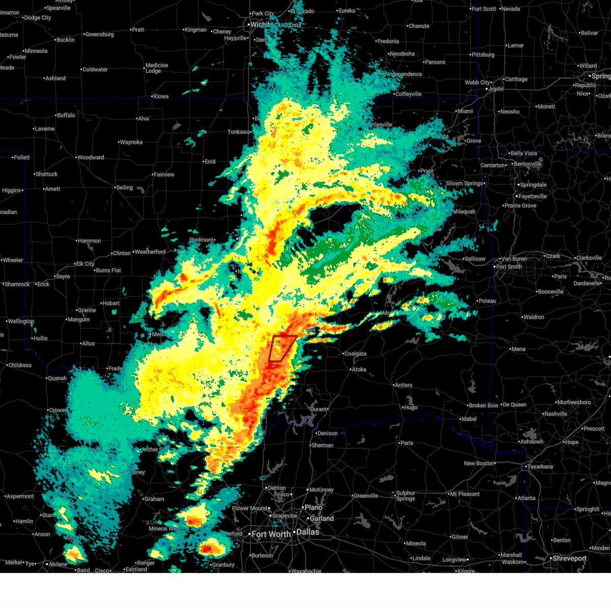 the tornado warning has been cancelled and is no longer in effect the tornado warning has been cancelled and is no longer in effect
|
| 4/19/2025 9:21 PM CDT |
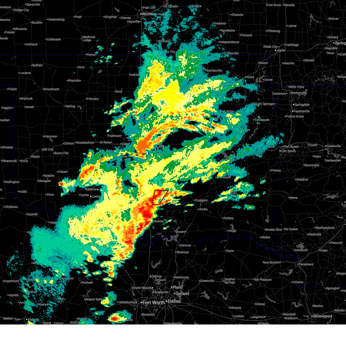 Toroun the national weather service in norman has issued a * tornado warning for, east central garvin county in southern oklahoma, west central pontotoc county in east central oklahoma, northeastern murray county in southern oklahoma, * until 1000 pm cdt. * at 921 pm cdt, a severe thunderstorm capable of producing a tornado was located near sulphur, moving northeast at 15 mph (radar indicated rotation). Hazards include tornado and quarter size hail. Flying debris will be dangerous to those caught without shelter. mobile homes will be damaged or destroyed. damage to roofs, windows, and vehicles will occur. Tree damage is likely. Toroun the national weather service in norman has issued a * tornado warning for, east central garvin county in southern oklahoma, west central pontotoc county in east central oklahoma, northeastern murray county in southern oklahoma, * until 1000 pm cdt. * at 921 pm cdt, a severe thunderstorm capable of producing a tornado was located near sulphur, moving northeast at 15 mph (radar indicated rotation). Hazards include tornado and quarter size hail. Flying debris will be dangerous to those caught without shelter. mobile homes will be damaged or destroyed. damage to roofs, windows, and vehicles will occur. Tree damage is likely.
|
| 4/19/2025 9:16 PM CDT |
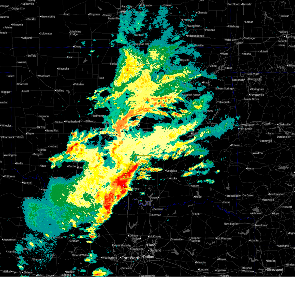 Svroun the national weather service in norman has issued a * severe thunderstorm warning for, northwestern johnston county in southeastern oklahoma, eastern garvin county in southern oklahoma, southwestern pontotoc county in east central oklahoma, murray county in southern oklahoma, * until 1000 pm cdt. * at 915 pm cdt, severe thunderstorms were located along a line extending from near vanoss to near dougherty, moving northeast at 15 mph (radar indicated). Hazards include 60 mph wind gusts and quarter size hail. Hail damage to vehicles is expected. Expect wind damage to roofs, siding, and trees. Svroun the national weather service in norman has issued a * severe thunderstorm warning for, northwestern johnston county in southeastern oklahoma, eastern garvin county in southern oklahoma, southwestern pontotoc county in east central oklahoma, murray county in southern oklahoma, * until 1000 pm cdt. * at 915 pm cdt, severe thunderstorms were located along a line extending from near vanoss to near dougherty, moving northeast at 15 mph (radar indicated). Hazards include 60 mph wind gusts and quarter size hail. Hail damage to vehicles is expected. Expect wind damage to roofs, siding, and trees.
|
| 4/5/2025 3:47 AM CDT |
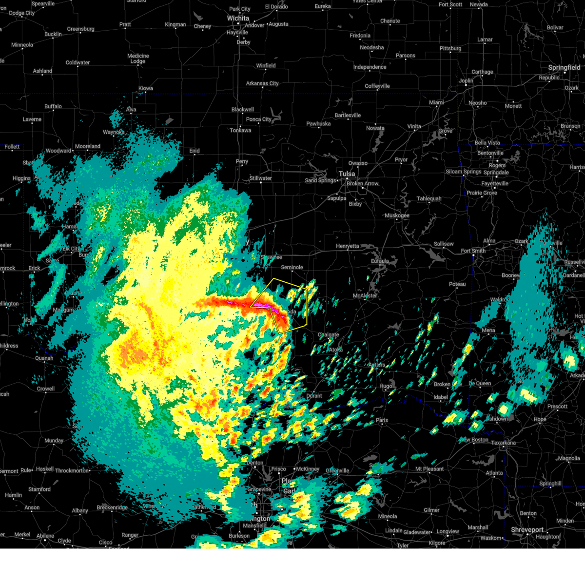 the severe thunderstorm warning has been cancelled and is no longer in effect the severe thunderstorm warning has been cancelled and is no longer in effect
|
| 4/5/2025 3:47 AM CDT |
 At 346 am cdt, a severe thunderstorm was located 5 miles north of vanoss, moving northeast at 55 mph (public). Hazards include golf ball size hail and 60 mph wind gusts. People and animals outdoors will be injured. expect hail damage to roofs, siding, windows, and vehicles. expect wind damage to roofs, siding, and trees. locations impacted include, byars, francis, sasakwa, wanette, vanoss, konawa, asher, roff, st. Louis, fitzhugh, byng, and ada. At 346 am cdt, a severe thunderstorm was located 5 miles north of vanoss, moving northeast at 55 mph (public). Hazards include golf ball size hail and 60 mph wind gusts. People and animals outdoors will be injured. expect hail damage to roofs, siding, windows, and vehicles. expect wind damage to roofs, siding, and trees. locations impacted include, byars, francis, sasakwa, wanette, vanoss, konawa, asher, roff, st. Louis, fitzhugh, byng, and ada.
|
| 4/5/2025 3:35 AM CDT |
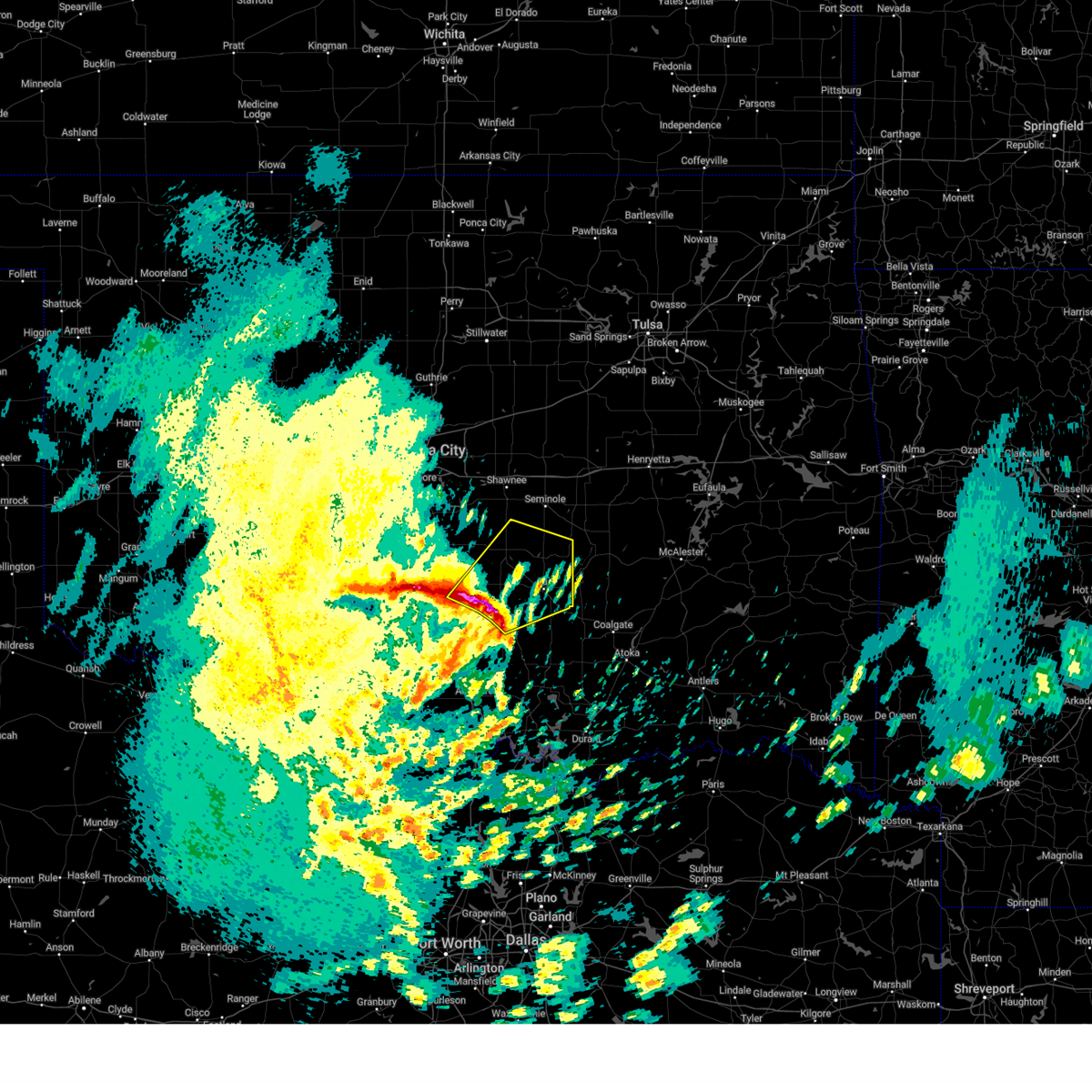 At 335 am cdt, a severe thunderstorm was located 6 miles south of stratford, moving northeast at 55 mph (radar indicated). Hazards include golf ball size hail and 60 mph wind gusts. People and animals outdoors will be injured. expect hail damage to roofs, siding, windows, and vehicles. expect wind damage to roofs, siding, and trees. locations impacted include, wanette, pauls valley, vanoss, stratford, konawa, asher, fitzhugh, byng, byars, francis, sasakwa, roff, st. Louis, ada, and hickory. At 335 am cdt, a severe thunderstorm was located 6 miles south of stratford, moving northeast at 55 mph (radar indicated). Hazards include golf ball size hail and 60 mph wind gusts. People and animals outdoors will be injured. expect hail damage to roofs, siding, windows, and vehicles. expect wind damage to roofs, siding, and trees. locations impacted include, wanette, pauls valley, vanoss, stratford, konawa, asher, fitzhugh, byng, byars, francis, sasakwa, roff, st. Louis, ada, and hickory.
|
| 4/5/2025 3:23 AM CDT |
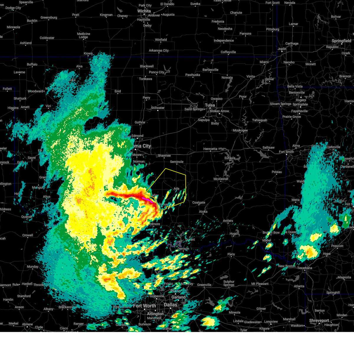 Svroun the national weather service in norman has issued a * severe thunderstorm warning for, northeastern garvin county in southern oklahoma, southern seminole county in east central oklahoma, pontotoc county in east central oklahoma, northeastern murray county in southern oklahoma, southwestern pottawatomie county in central oklahoma, southeastern mcclain county in central oklahoma, * until 415 am cdt. * at 323 am cdt, a severe thunderstorm was located 4 miles northwest of davis, moving northeast at 55 mph (radar indicated). Hazards include golf ball size hail and 60 mph wind gusts. People and animals outdoors will be injured. expect hail damage to roofs, siding, windows, and vehicles. Expect wind damage to roofs, siding, and trees. Svroun the national weather service in norman has issued a * severe thunderstorm warning for, northeastern garvin county in southern oklahoma, southern seminole county in east central oklahoma, pontotoc county in east central oklahoma, northeastern murray county in southern oklahoma, southwestern pottawatomie county in central oklahoma, southeastern mcclain county in central oklahoma, * until 415 am cdt. * at 323 am cdt, a severe thunderstorm was located 4 miles northwest of davis, moving northeast at 55 mph (radar indicated). Hazards include golf ball size hail and 60 mph wind gusts. People and animals outdoors will be injured. expect hail damage to roofs, siding, windows, and vehicles. Expect wind damage to roofs, siding, and trees.
|
| 4/4/2025 5:29 AM CDT |
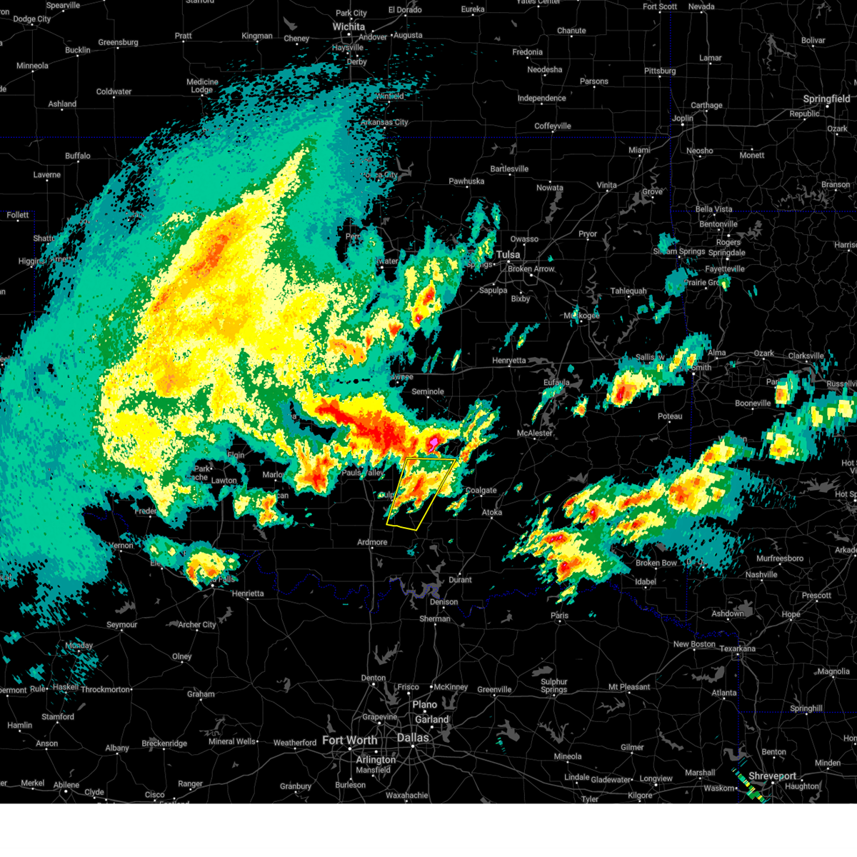 The storm that moved from mill creek into southern pontotoc county has weakened below severe limits, therefore the warning will be allowed to expire for murray, johnston and southern pontotoc counties. however, a severe thunderstorm warning still remains in effect for northern pontotoc county until 6 am. The storm that moved from mill creek into southern pontotoc county has weakened below severe limits, therefore the warning will be allowed to expire for murray, johnston and southern pontotoc counties. however, a severe thunderstorm warning still remains in effect for northern pontotoc county until 6 am.
|
| 4/4/2025 5:05 AM CDT |
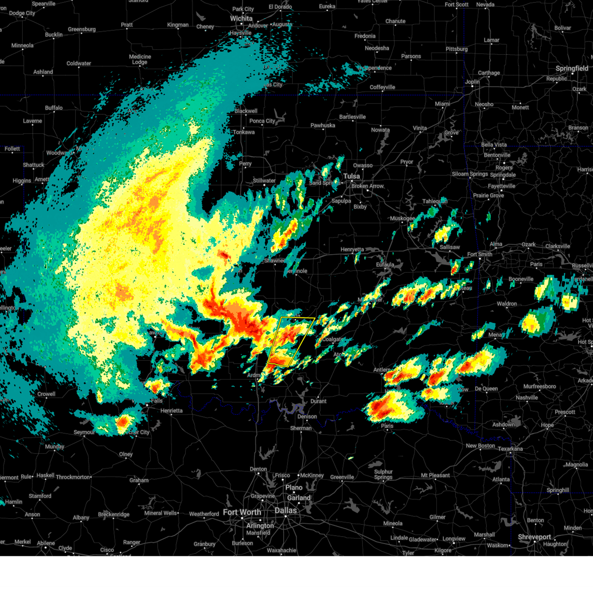 Svroun the national weather service in norman has issued a * severe thunderstorm warning for, northwestern johnston county in southeastern oklahoma, southern pontotoc county in east central oklahoma, eastern murray county in southern oklahoma, * until 530 am cdt. * at 505 am cdt, a severe thunderstorm was located near mill creek, moving northeast at 60 mph (radar indicated). Hazards include 60 mph wind gusts and quarter size hail. Hail damage to vehicles is expected. Expect wind damage to roofs, siding, and trees. Svroun the national weather service in norman has issued a * severe thunderstorm warning for, northwestern johnston county in southeastern oklahoma, southern pontotoc county in east central oklahoma, eastern murray county in southern oklahoma, * until 530 am cdt. * at 505 am cdt, a severe thunderstorm was located near mill creek, moving northeast at 60 mph (radar indicated). Hazards include 60 mph wind gusts and quarter size hail. Hail damage to vehicles is expected. Expect wind damage to roofs, siding, and trees.
|
| 4/3/2025 8:49 AM CDT |
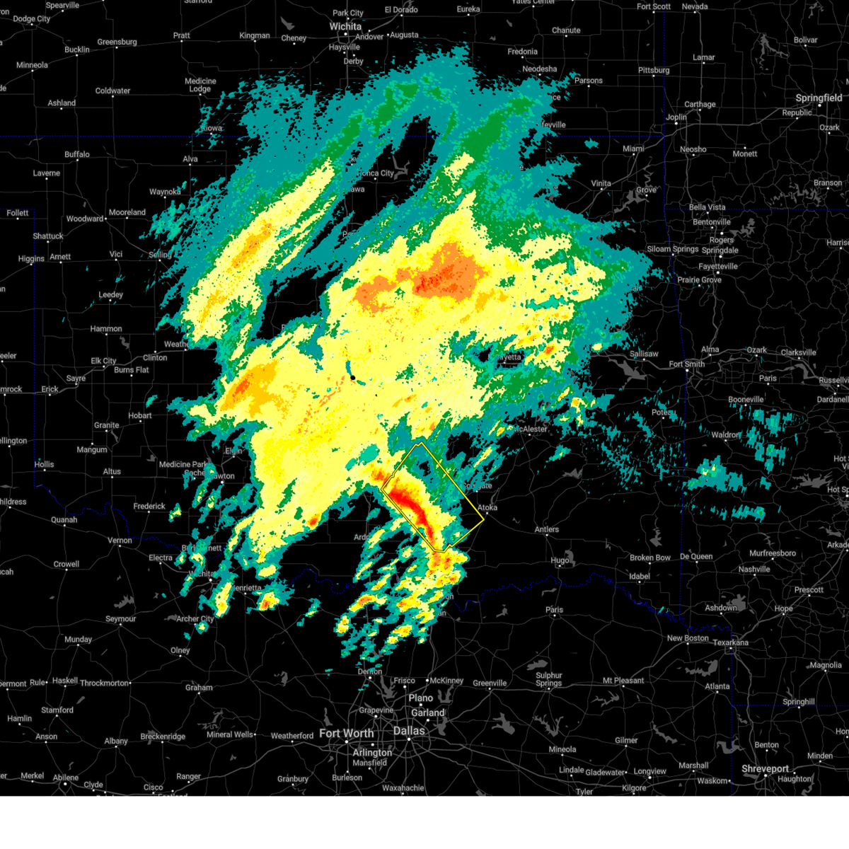 the severe thunderstorm warning has been cancelled and is no longer in effect the severe thunderstorm warning has been cancelled and is no longer in effect
|
| 4/3/2025 8:49 AM CDT |
 At 848 am cdt, severe thunderstorms were located along a line extending from 3 miles west of scullin to 3 miles southwest of connerville to 4 miles south of milburn, moving northeast at 75 mph (radar indicated). Hazards include 60 mph wind gusts and quarter size hail. Hail damage to vehicles is expected. expect wind damage to roofs, siding, and trees. Locations impacted include, clarita, jesse, stonewall, olney, fillmore, reagan, sulphur, fitzhugh, wapanucka, connerville, scullin, boggy depot park, hickory, tishomingo, pontotoc, fittstown, tupelo, bromide, mill creek, and milburn. At 848 am cdt, severe thunderstorms were located along a line extending from 3 miles west of scullin to 3 miles southwest of connerville to 4 miles south of milburn, moving northeast at 75 mph (radar indicated). Hazards include 60 mph wind gusts and quarter size hail. Hail damage to vehicles is expected. expect wind damage to roofs, siding, and trees. Locations impacted include, clarita, jesse, stonewall, olney, fillmore, reagan, sulphur, fitzhugh, wapanucka, connerville, scullin, boggy depot park, hickory, tishomingo, pontotoc, fittstown, tupelo, bromide, mill creek, and milburn.
|
| 4/3/2025 8:36 AM CDT |
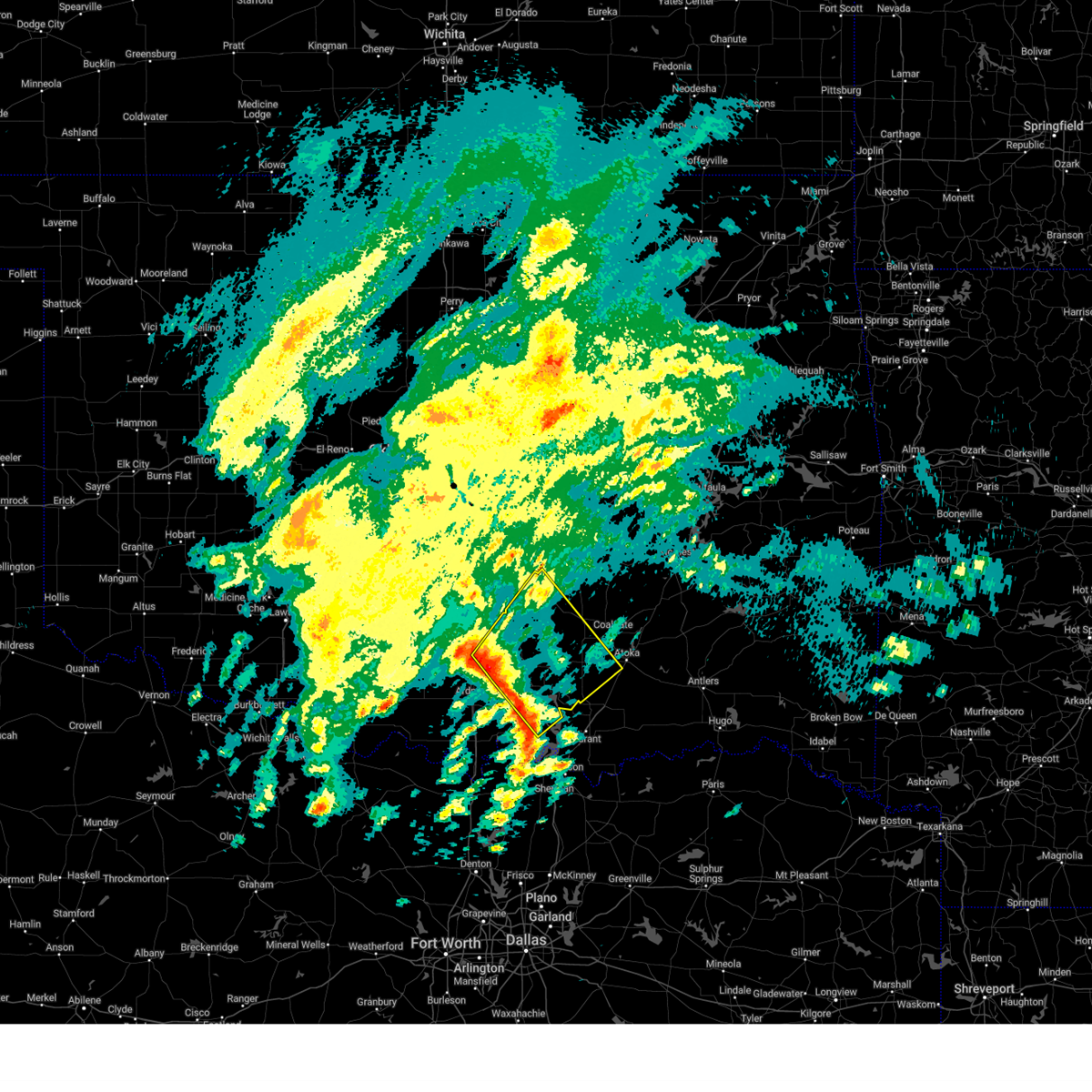 Svroun the national weather service in norman has issued a * severe thunderstorm warning for, johnston county in southeastern oklahoma, southwestern coal county in southeastern oklahoma, east central carter county in southern oklahoma, pontotoc county in east central oklahoma, northeastern marshall county in southeastern oklahoma, west central atoka county in southeastern oklahoma, eastern murray county in southern oklahoma, * until 900 am cdt. * at 835 am cdt, severe thunderstorms were located along a line extending from near dougherty to near kingston, moving northeast at 65 mph. winds of 72 mph were measured near burneyville and 63 mph were measured near lebanon with these storms (radar indicated). Hazards include 60 mph wind gusts and quarter size hail. Hail damage to vehicles is expected. Expect wind damage to roofs, siding, and trees. Svroun the national weather service in norman has issued a * severe thunderstorm warning for, johnston county in southeastern oklahoma, southwestern coal county in southeastern oklahoma, east central carter county in southern oklahoma, pontotoc county in east central oklahoma, northeastern marshall county in southeastern oklahoma, west central atoka county in southeastern oklahoma, eastern murray county in southern oklahoma, * until 900 am cdt. * at 835 am cdt, severe thunderstorms were located along a line extending from near dougherty to near kingston, moving northeast at 65 mph. winds of 72 mph were measured near burneyville and 63 mph were measured near lebanon with these storms (radar indicated). Hazards include 60 mph wind gusts and quarter size hail. Hail damage to vehicles is expected. Expect wind damage to roofs, siding, and trees.
|
| 4/2/2025 7:13 AM CDT |
 At 711 am cdt, severe thunderstorms were located along a line extending from 3 miles southwest of henryetta to 6 miles south of dustin to near calvin to 3 miles south of allen to near stonewall to 5 miles northwest of pontotoc, moving east at 55 mph. dime to nickel size hail has been reported near ada (radar indicated). Hazards include 60 mph wind gusts and quarter size hail. Hail damage to vehicles is expected. expect wind damage to roofs, siding, and trees. Locations impacted include, horntown, wetumka, atwood, dustin, jesse, stonewall, sulphur, fitzhugh, scullin, francis, sasakwa, hickory, wewoka, spaulding, gerty, pontotoc, fittstown, yeager, tupelo, and allen. At 711 am cdt, severe thunderstorms were located along a line extending from 3 miles southwest of henryetta to 6 miles south of dustin to near calvin to 3 miles south of allen to near stonewall to 5 miles northwest of pontotoc, moving east at 55 mph. dime to nickel size hail has been reported near ada (radar indicated). Hazards include 60 mph wind gusts and quarter size hail. Hail damage to vehicles is expected. expect wind damage to roofs, siding, and trees. Locations impacted include, horntown, wetumka, atwood, dustin, jesse, stonewall, sulphur, fitzhugh, scullin, francis, sasakwa, hickory, wewoka, spaulding, gerty, pontotoc, fittstown, yeager, tupelo, and allen.
|
| 4/2/2025 7:13 AM CDT |
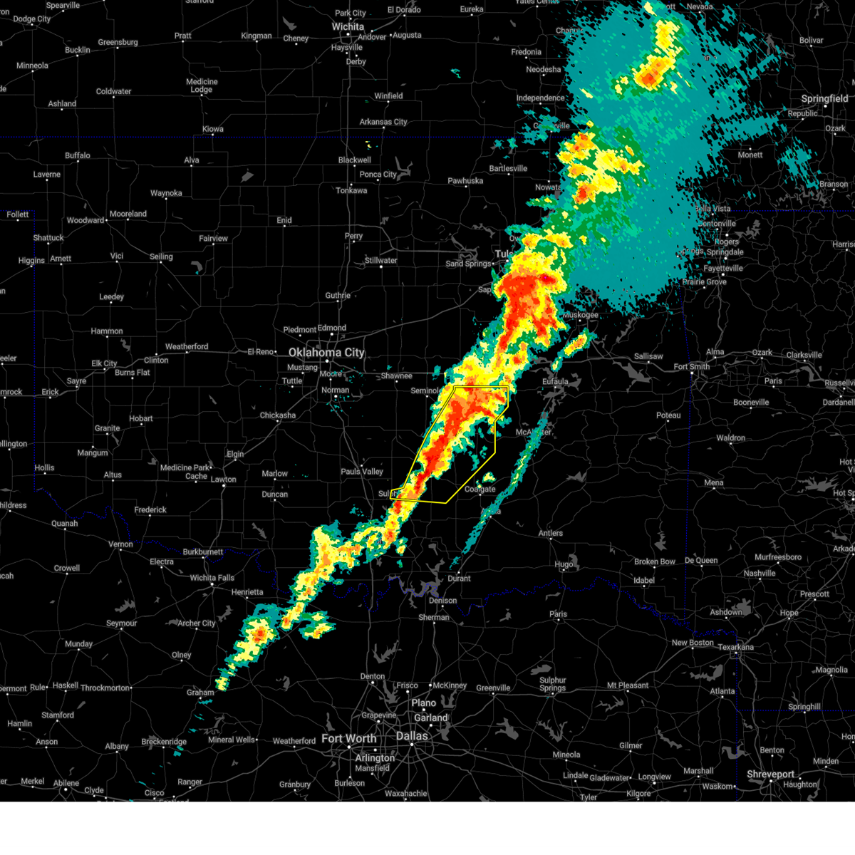 the severe thunderstorm warning has been cancelled and is no longer in effect the severe thunderstorm warning has been cancelled and is no longer in effect
|
| 4/2/2025 7:00 AM CDT | At 700 am cdt, severe thunderstorms were located along a line extending from near clearview to 4 miles south of wetumka to 4 miles west of atwood to 3 miles south of francis to near fitzhugh to near scullin, moving east at 55 mph (radar indicated). Hazards include 60 mph wind gusts and quarter size hail. Hail damage to vehicles is expected. expect wind damage to roofs, siding, and trees. Locations impacted include, horntown, wetumka, atwood, dustin, jesse, stonewall, konawa, bowlegs, sulphur, fitzhugh, scullin, francis, sasakwa, lima, seminole, hickory, wewoka, spaulding, gerty, and pontotoc. |
| 4/2/2025 7:00 AM CDT | the severe thunderstorm warning has been cancelled and is no longer in effect |
| 4/2/2025 6:39 AM CDT |
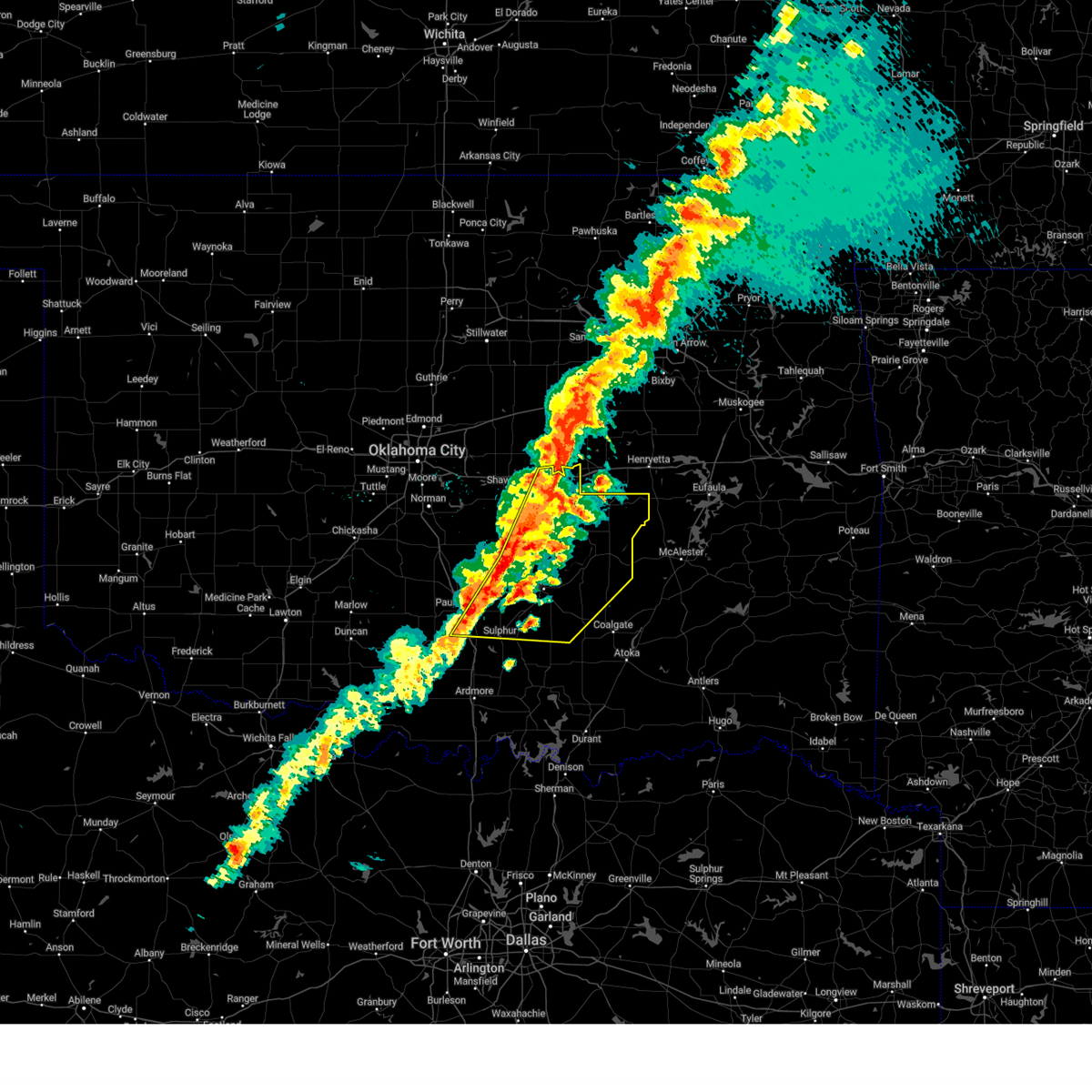 Svroun the national weather service in norman has issued a * severe thunderstorm warning for, north central johnston county in southeastern oklahoma, eastern garvin county in southern oklahoma, northwestern coal county in southeastern oklahoma, seminole county in east central oklahoma, pontotoc county in east central oklahoma, northeastern murray county in southern oklahoma, eastern pottawatomie county in central oklahoma, hughes county in southeastern oklahoma, southeastern mcclain county in central oklahoma, * until 730 am cdt. * at 639 am cdt, severe thunderstorms were located along a line extending from near boley to 4 miles northwest of wewoka to 3 miles east of konawa to 5 miles northeast of vanoss to 8 miles east of wynnewood to near davis, moving east at 55 mph (radar indicated). Hazards include 60 mph wind gusts and quarter size hail. Hail damage to vehicles is expected. Expect wind damage to roofs, siding, and trees. Svroun the national weather service in norman has issued a * severe thunderstorm warning for, north central johnston county in southeastern oklahoma, eastern garvin county in southern oklahoma, northwestern coal county in southeastern oklahoma, seminole county in east central oklahoma, pontotoc county in east central oklahoma, northeastern murray county in southern oklahoma, eastern pottawatomie county in central oklahoma, hughes county in southeastern oklahoma, southeastern mcclain county in central oklahoma, * until 730 am cdt. * at 639 am cdt, severe thunderstorms were located along a line extending from near boley to 4 miles northwest of wewoka to 3 miles east of konawa to 5 miles northeast of vanoss to 8 miles east of wynnewood to near davis, moving east at 55 mph (radar indicated). Hazards include 60 mph wind gusts and quarter size hail. Hail damage to vehicles is expected. Expect wind damage to roofs, siding, and trees.
|
| 3/4/2025 5:12 AM CST |
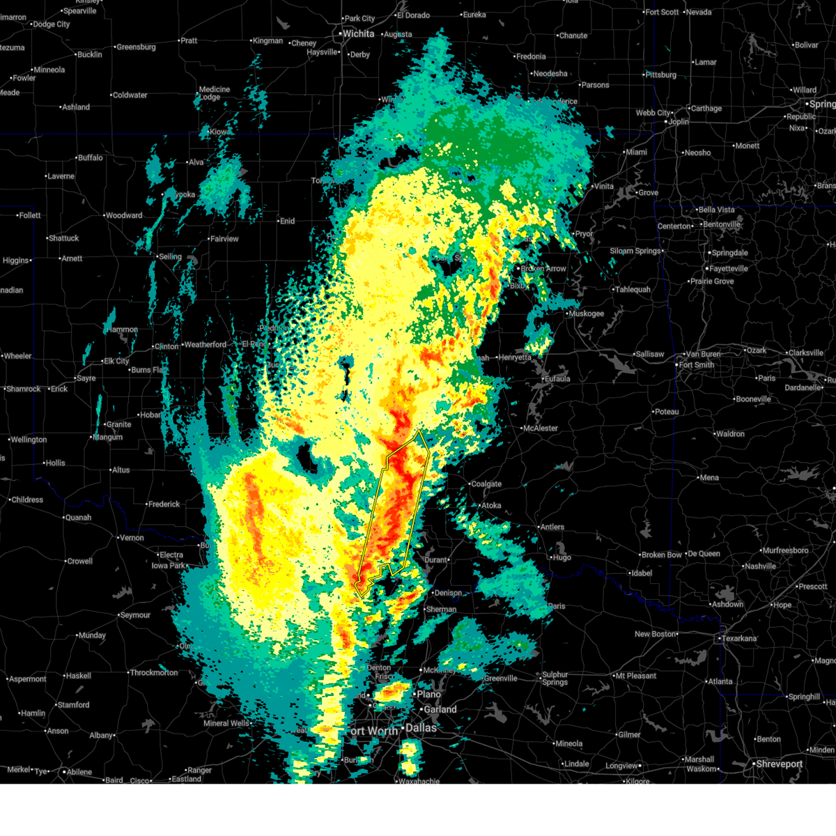 At 511 am cst, severe thunderstorms were located along a line extending from 5 miles west of ada to near fittstown to 3 miles south of marietta, moving northeast at 60 mph (radar indicated). Hazards include 60 mph wind gusts and penny size hail. Expect damage to roofs, siding, and trees. Locations impacted include, oakland, reagan, sulphur, fitzhugh, scullin, mannsville, madill, thackerville, hickory, dickson, fittstown, gene autry, lake of the arbuckles, lake murray, ravia, byng, lebanon, mill creek, marietta, and russett. At 511 am cst, severe thunderstorms were located along a line extending from 5 miles west of ada to near fittstown to 3 miles south of marietta, moving northeast at 60 mph (radar indicated). Hazards include 60 mph wind gusts and penny size hail. Expect damage to roofs, siding, and trees. Locations impacted include, oakland, reagan, sulphur, fitzhugh, scullin, mannsville, madill, thackerville, hickory, dickson, fittstown, gene autry, lake of the arbuckles, lake murray, ravia, byng, lebanon, mill creek, marietta, and russett.
|
| 3/4/2025 5:12 AM CST |
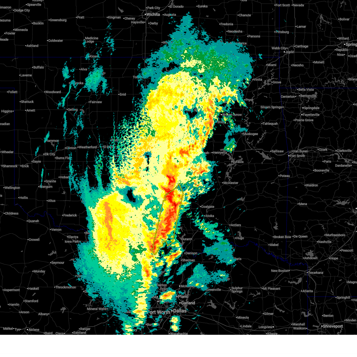 the severe thunderstorm warning has been cancelled and is no longer in effect the severe thunderstorm warning has been cancelled and is no longer in effect
|
| 3/4/2025 5:10 AM CST | Storm damage reported in pontotoc county OK, 8.9 miles WNW of Roff, OK |
| 3/4/2025 5:05 AM CST | Storm damage reported in pontotoc county OK, 8.5 miles WNW of Roff, OK |
| 3/4/2025 4:42 AM CST |
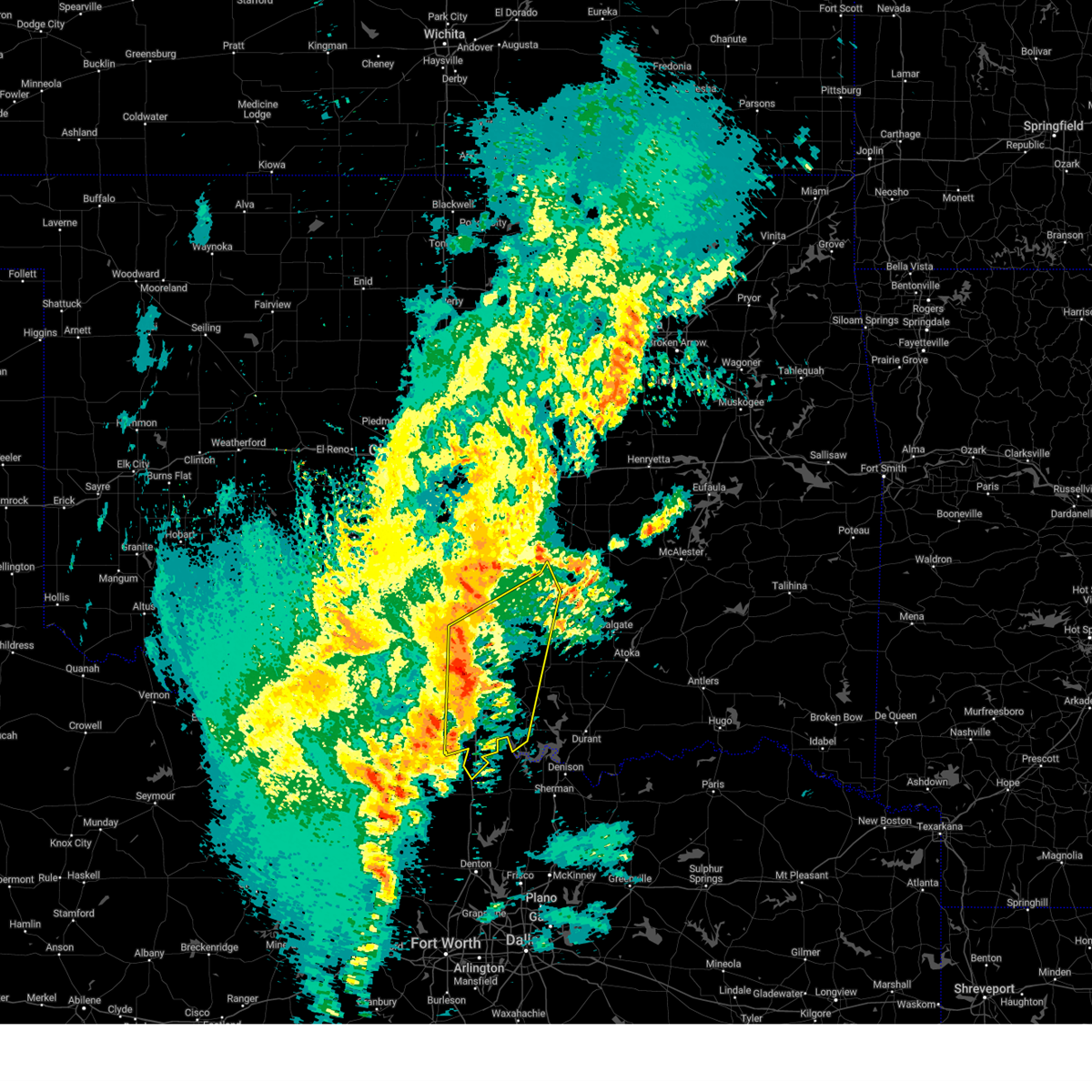 Svroun the national weather service in norman has issued a * severe thunderstorm warning for, western johnston county in southeastern oklahoma, southeastern garvin county in southern oklahoma, love county in southern oklahoma, southeastern carter county in southern oklahoma, western pontotoc county in east central oklahoma, western marshall county in southeastern oklahoma, murray county in southern oklahoma, * until 530 am cst. * at 440 am cst, severe thunderstorms were located along a line extending from near davis to near gene autry to near marietta, moving northeast at 60 mph (radar indicated). Hazards include 60 mph wind gusts and penny size hail. expect damage to roofs, siding, and trees Svroun the national weather service in norman has issued a * severe thunderstorm warning for, western johnston county in southeastern oklahoma, southeastern garvin county in southern oklahoma, love county in southern oklahoma, southeastern carter county in southern oklahoma, western pontotoc county in east central oklahoma, western marshall county in southeastern oklahoma, murray county in southern oklahoma, * until 530 am cst. * at 440 am cst, severe thunderstorms were located along a line extending from near davis to near gene autry to near marietta, moving northeast at 60 mph (radar indicated). Hazards include 60 mph wind gusts and penny size hail. expect damage to roofs, siding, and trees
|
| 11/3/2024 4:22 PM CST |
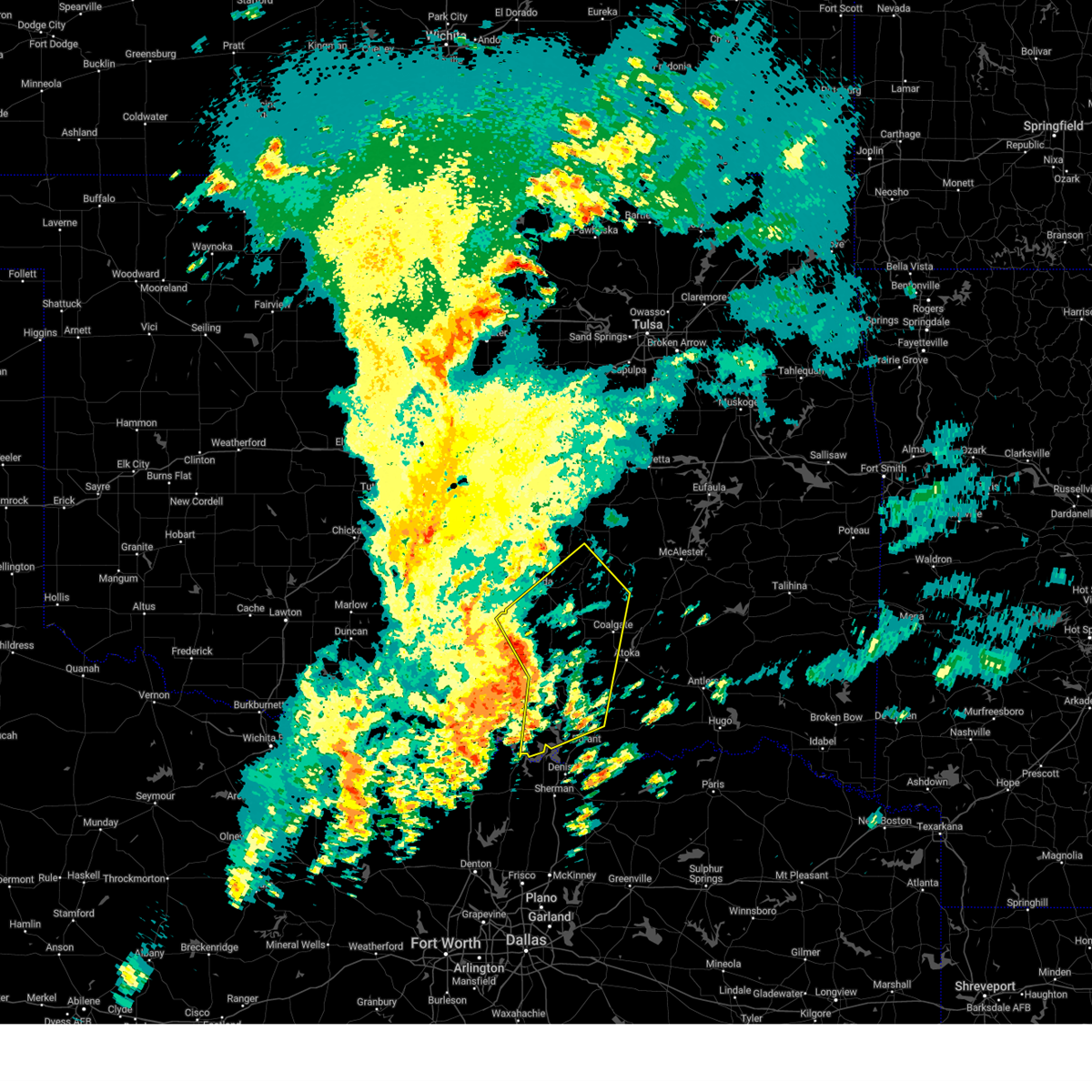 Svroun the national weather service in norman has issued a * severe thunderstorm warning for, johnston county in southeastern oklahoma, northwestern bryan county in southeastern oklahoma, coal county in southeastern oklahoma, southeastern seminole county in east central oklahoma, pontotoc county in east central oklahoma, marshall county in southeastern oklahoma, southwestern atoka county in southeastern oklahoma, northeastern murray county in southern oklahoma, southwestern hughes county in southeastern oklahoma, * until 500 pm cst. * at 422 pm cst, severe thunderstorms were located along a line extending from near roff to 3 miles northeast of reagan to 3 miles south of madill, moving northeast at 50 mph (radar indicated). Hazards include 60 mph wind gusts and quarter size hail. Hail damage to vehicles is expected. Expect wind damage to roofs, siding, and trees. Svroun the national weather service in norman has issued a * severe thunderstorm warning for, johnston county in southeastern oklahoma, northwestern bryan county in southeastern oklahoma, coal county in southeastern oklahoma, southeastern seminole county in east central oklahoma, pontotoc county in east central oklahoma, marshall county in southeastern oklahoma, southwestern atoka county in southeastern oklahoma, northeastern murray county in southern oklahoma, southwestern hughes county in southeastern oklahoma, * until 500 pm cst. * at 422 pm cst, severe thunderstorms were located along a line extending from near roff to 3 miles northeast of reagan to 3 miles south of madill, moving northeast at 50 mph (radar indicated). Hazards include 60 mph wind gusts and quarter size hail. Hail damage to vehicles is expected. Expect wind damage to roofs, siding, and trees.
|
| 11/3/2024 3:25 AM CST |
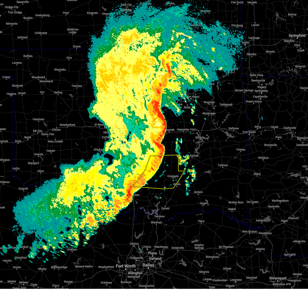 Svroun the national weather service in norman has issued a * severe thunderstorm warning for, northern johnston county in southeastern oklahoma, coal county in southeastern oklahoma, southern seminole county in east central oklahoma, pontotoc county in east central oklahoma, northwestern atoka county in southeastern oklahoma, eastern murray county in southern oklahoma, southern hughes county in southeastern oklahoma, * until 415 am cst. * at 324 am cst, severe thunderstorms were located along a line extending from 5 miles west of atwood to 4 miles southwest of allen to near stonewall to 5 miles west of connerville to 5 miles southwest of mill creek, moving east at 40 mph (radar indicated). Hazards include 60 mph wind gusts and penny size hail. expect damage to roofs, siding, and trees Svroun the national weather service in norman has issued a * severe thunderstorm warning for, northern johnston county in southeastern oklahoma, coal county in southeastern oklahoma, southern seminole county in east central oklahoma, pontotoc county in east central oklahoma, northwestern atoka county in southeastern oklahoma, eastern murray county in southern oklahoma, southern hughes county in southeastern oklahoma, * until 415 am cst. * at 324 am cst, severe thunderstorms were located along a line extending from 5 miles west of atwood to 4 miles southwest of allen to near stonewall to 5 miles west of connerville to 5 miles southwest of mill creek, moving east at 40 mph (radar indicated). Hazards include 60 mph wind gusts and penny size hail. expect damage to roofs, siding, and trees
|
| 11/3/2024 2:42 AM CST |
 Svroun the national weather service in norman has issued a * severe thunderstorm warning for, northern johnston county in southeastern oklahoma, eastern garvin county in southern oklahoma, western coal county in southeastern oklahoma, southern seminole county in east central oklahoma, pontotoc county in east central oklahoma, murray county in southern oklahoma, southwestern pottawatomie county in central oklahoma, southwestern hughes county in southeastern oklahoma, southeastern mcclain county in central oklahoma, * until 330 am cst. * at 242 am cst, severe thunderstorms were located along a line extending from 5 miles southwest of tribbey to near wynnewood to 4 miles northeast of milo, moving east at 55 mph (radar indicated). Hazards include 70 mph wind gusts and nickel size hail. Expect considerable tree damage. Damage is likely to mobile homes, roofs, and outbuildings. Svroun the national weather service in norman has issued a * severe thunderstorm warning for, northern johnston county in southeastern oklahoma, eastern garvin county in southern oklahoma, western coal county in southeastern oklahoma, southern seminole county in east central oklahoma, pontotoc county in east central oklahoma, murray county in southern oklahoma, southwestern pottawatomie county in central oklahoma, southwestern hughes county in southeastern oklahoma, southeastern mcclain county in central oklahoma, * until 330 am cst. * at 242 am cst, severe thunderstorms were located along a line extending from 5 miles southwest of tribbey to near wynnewood to 4 miles northeast of milo, moving east at 55 mph (radar indicated). Hazards include 70 mph wind gusts and nickel size hail. Expect considerable tree damage. Damage is likely to mobile homes, roofs, and outbuildings.
|
| 8/17/2024 7:44 AM CDT |
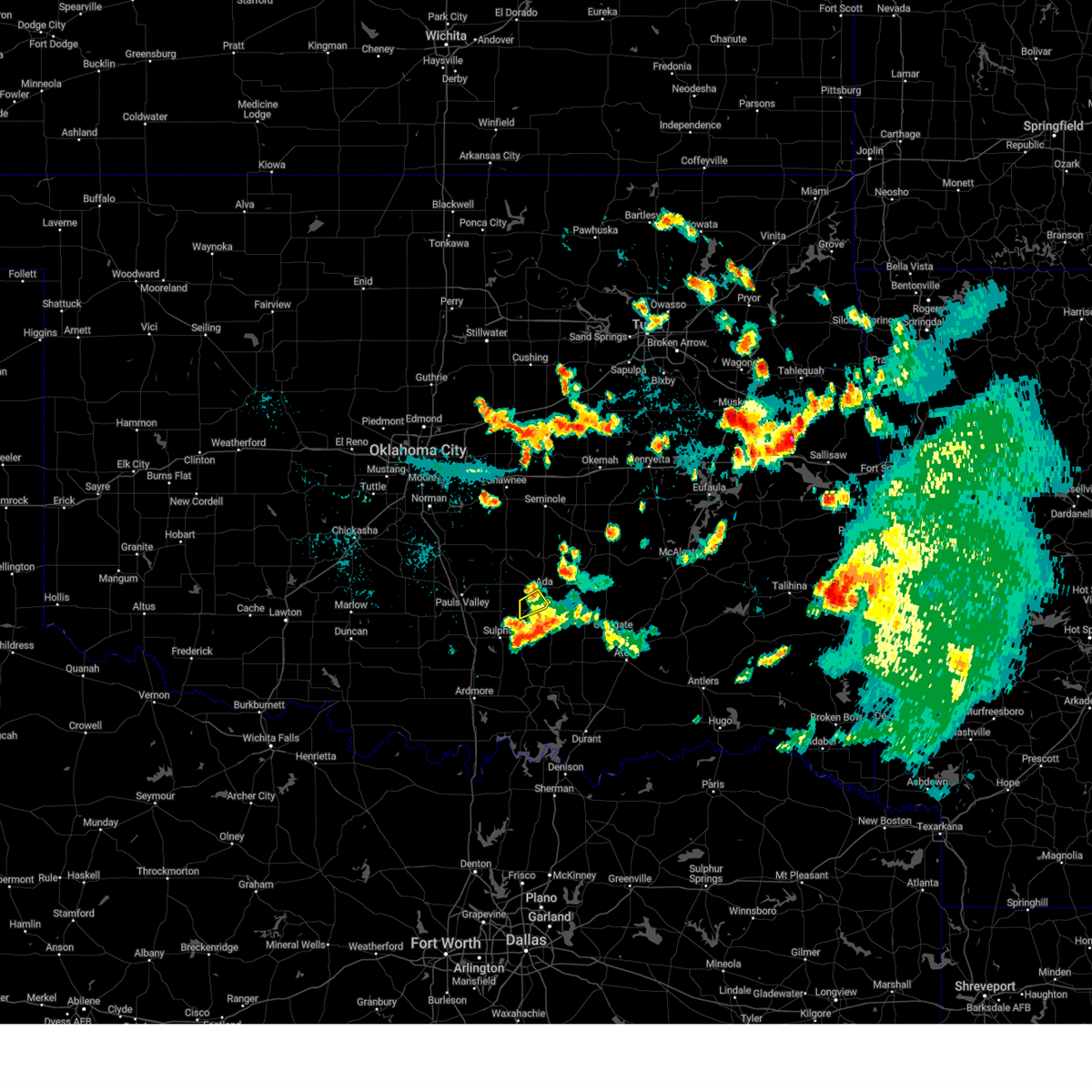 The storm which prompted the warning has weakened below severe limits, therefore the warning will be allowed to expire. however, gusty winds are still possible with this thunderstorm. The storm which prompted the warning has weakened below severe limits, therefore the warning will be allowed to expire. however, gusty winds are still possible with this thunderstorm.
|
| 8/17/2024 7:37 AM CDT |
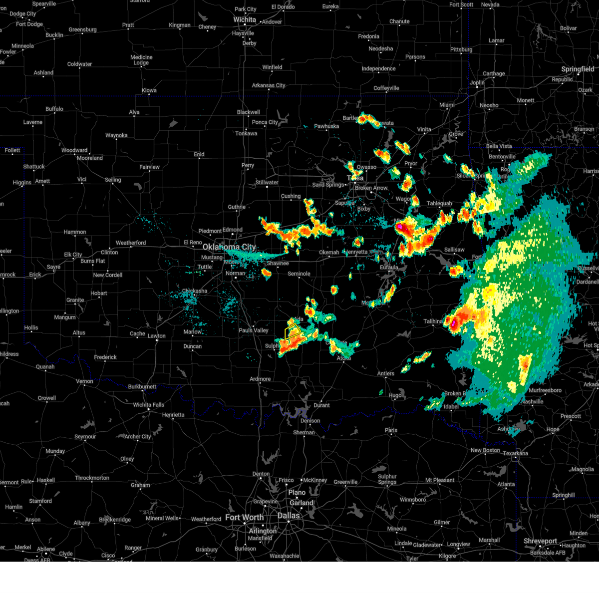 At 736 am cdt, a severe thunderstorm was located near fitzhugh, moving southeast at 20 mph (radar indicated). Hazards include 60 mph wind gusts. Expect damage to roofs, siding, and trees. Locations impacted include, roff and fitzhugh. At 736 am cdt, a severe thunderstorm was located near fitzhugh, moving southeast at 20 mph (radar indicated). Hazards include 60 mph wind gusts. Expect damage to roofs, siding, and trees. Locations impacted include, roff and fitzhugh.
|
| 8/17/2024 7:27 AM CDT |
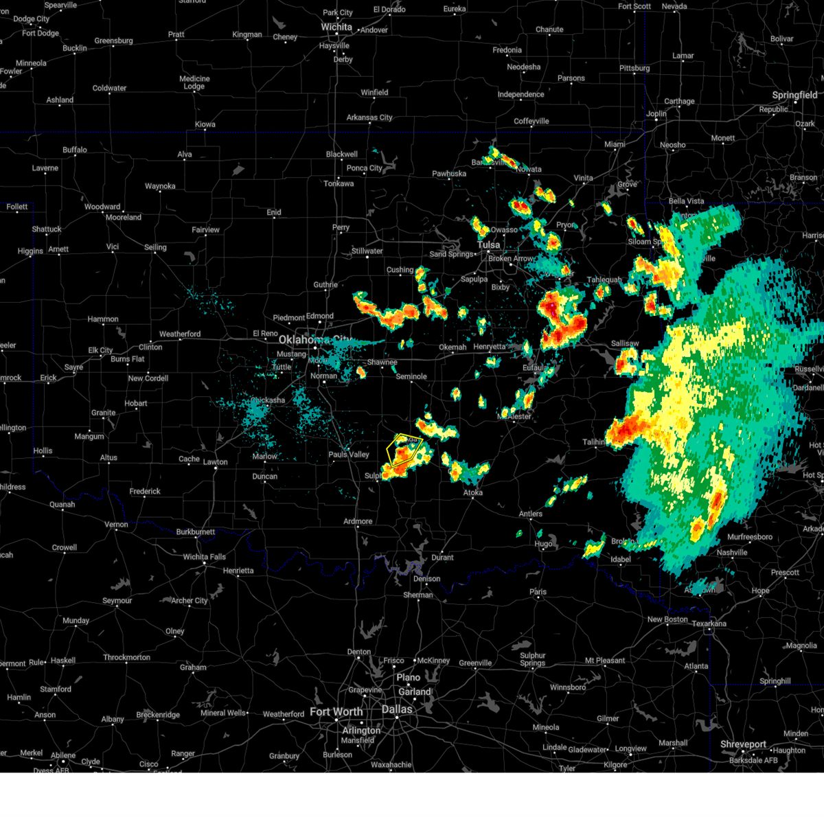 At 727 am cdt, a severe thunderstorm was located 4 miles north of fitzhugh, moving southeast at 10 mph (radar indicated). Hazards include 60 mph wind gusts and penny size hail. Expect damage to roofs, siding, and trees. Locations impacted include, ada, roff, and fitzhugh. At 727 am cdt, a severe thunderstorm was located 4 miles north of fitzhugh, moving southeast at 10 mph (radar indicated). Hazards include 60 mph wind gusts and penny size hail. Expect damage to roofs, siding, and trees. Locations impacted include, ada, roff, and fitzhugh.
|
| 8/17/2024 7:12 AM CDT |
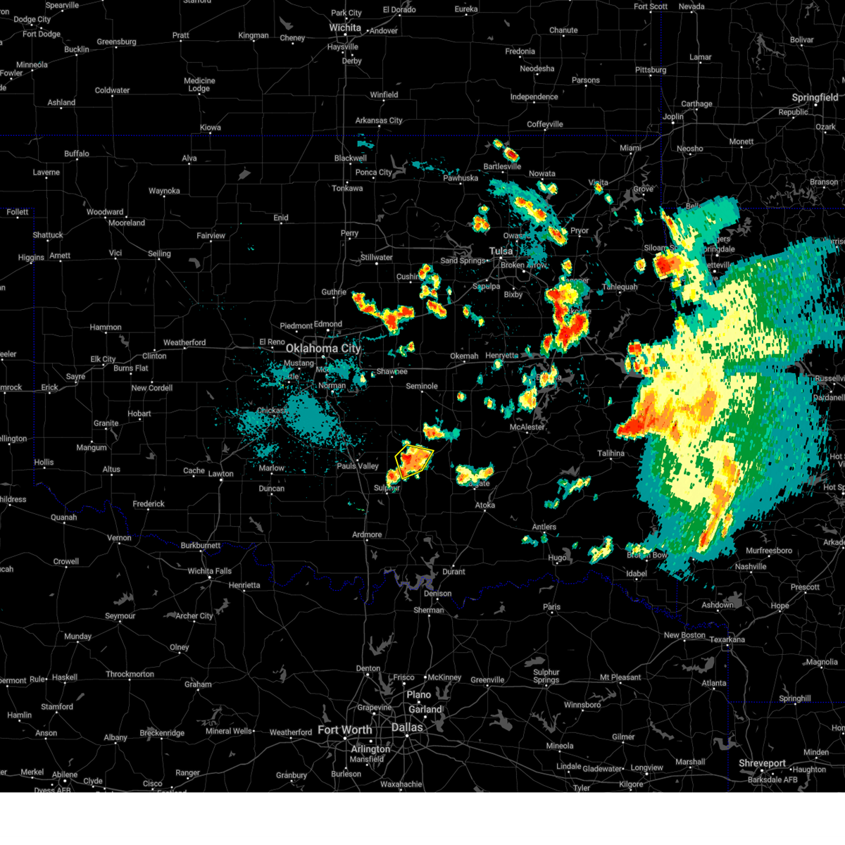 Svroun the national weather service in norman has issued a * severe thunderstorm warning for, west central pontotoc county in east central oklahoma, * until 745 am cdt. * at 712 am cdt, a severe thunderstorm was located near vanoss, moving southeast at 10 mph (radar indicated). Hazards include 60 mph wind gusts and nickel size hail. expect damage to roofs, siding, and trees Svroun the national weather service in norman has issued a * severe thunderstorm warning for, west central pontotoc county in east central oklahoma, * until 745 am cdt. * at 712 am cdt, a severe thunderstorm was located near vanoss, moving southeast at 10 mph (radar indicated). Hazards include 60 mph wind gusts and nickel size hail. expect damage to roofs, siding, and trees
|
| 7/7/2024 11:38 AM CDT |
 The storms which prompted the warning have weakened below severe limits, therefore the warning will be allowed to expire. however, gusty winds and heavy rain are still possible with these thunderstorms. The storms which prompted the warning have weakened below severe limits, therefore the warning will be allowed to expire. however, gusty winds and heavy rain are still possible with these thunderstorms.
|
| 7/7/2024 11:22 AM CDT |
 At 1122 am cdt, severe thunderstorms were located along a line extending from 3 miles north of allen to 4 miles northwest of fittstown, moving east at 30 mph (radar indicated). Hazards include 60 mph wind gusts and quarter size hail. Hail damage to vehicles is expected. expect wind damage to roofs, siding, and trees. Locations impacted include, ada, byng, allen, roff, stonewall, tupelo, francis, calvin, fitzhugh, sasakwa, gerty, atwood, fittstown, and jesse. At 1122 am cdt, severe thunderstorms were located along a line extending from 3 miles north of allen to 4 miles northwest of fittstown, moving east at 30 mph (radar indicated). Hazards include 60 mph wind gusts and quarter size hail. Hail damage to vehicles is expected. expect wind damage to roofs, siding, and trees. Locations impacted include, ada, byng, allen, roff, stonewall, tupelo, francis, calvin, fitzhugh, sasakwa, gerty, atwood, fittstown, and jesse.
|
| 7/7/2024 11:02 AM CDT |
 Svroun the national weather service in norman has issued a * severe thunderstorm warning for, northwestern coal county in southeastern oklahoma, southern seminole county in east central oklahoma, pontotoc county in east central oklahoma, southwestern hughes county in southeastern oklahoma, * until 1145 am cdt. * at 1102 am cdt, severe thunderstorms were located along a line extending from 3 miles north of francis to near roff, moving east at 35 mph (radar indicated). Hazards include 60 mph wind gusts and quarter size hail. Hail damage to vehicles is expected. Expect wind damage to roofs, siding, and trees. Svroun the national weather service in norman has issued a * severe thunderstorm warning for, northwestern coal county in southeastern oklahoma, southern seminole county in east central oklahoma, pontotoc county in east central oklahoma, southwestern hughes county in southeastern oklahoma, * until 1145 am cdt. * at 1102 am cdt, severe thunderstorms were located along a line extending from 3 miles north of francis to near roff, moving east at 35 mph (radar indicated). Hazards include 60 mph wind gusts and quarter size hail. Hail damage to vehicles is expected. Expect wind damage to roofs, siding, and trees.
|
| 6/4/2024 10:44 PM CDT |
 The storms which prompted the warning are still strong, but have weakened to below severe limits. therefore, the warning will be allowed to expire. however, gusty winds and heavy rain are still possible with these thunderstorms. The storms which prompted the warning are still strong, but have weakened to below severe limits. therefore, the warning will be allowed to expire. however, gusty winds and heavy rain are still possible with these thunderstorms.
|
| 6/4/2024 10:34 PM CDT |
 the severe thunderstorm warning has been cancelled and is no longer in effect the severe thunderstorm warning has been cancelled and is no longer in effect
|
| 6/4/2024 10:34 PM CDT |
 At 1033 pm cdt, the leading edge of winds from severe thunderstorms was located along a line extending from near little to 4 miles southeast of seminole to near byng to 8 miles west of roff, moving southeast at 40 mph (radar indicated). Hazards include 60 mph wind gusts and quarter size hail. Hail damage to vehicles is expected. expect wind damage to roofs, siding, and trees. Locations impacted include, ada, seminole, wewoka, stratford, konawa, byng, maud, roff, bowlegs, francis, cromwell, fitzhugh, sasakwa, vanoss, little, lima, and centerview. At 1033 pm cdt, the leading edge of winds from severe thunderstorms was located along a line extending from near little to 4 miles southeast of seminole to near byng to 8 miles west of roff, moving southeast at 40 mph (radar indicated). Hazards include 60 mph wind gusts and quarter size hail. Hail damage to vehicles is expected. expect wind damage to roofs, siding, and trees. Locations impacted include, ada, seminole, wewoka, stratford, konawa, byng, maud, roff, bowlegs, francis, cromwell, fitzhugh, sasakwa, vanoss, little, lima, and centerview.
|
| 6/4/2024 10:12 PM CDT |
 At 1011 pm cdt, the leading edge of winds from severe thunderstorms was located along a line extending from near little to near asher to near pauls valley, moving southeast at 45 mph (radar indicated). Hazards include 60 mph wind gusts and quarter size hail. Hail damage to vehicles is expected. expect wind damage to roofs, siding, and trees. Locations impacted include, shawnee, ada, seminole, tecumseh, pauls valley, wewoka, stratford, konawa, byng, maud, roff, earlsboro, paoli, bowlegs, asher, wanette, francis, cromwell, byars, and johnson. At 1011 pm cdt, the leading edge of winds from severe thunderstorms was located along a line extending from near little to near asher to near pauls valley, moving southeast at 45 mph (radar indicated). Hazards include 60 mph wind gusts and quarter size hail. Hail damage to vehicles is expected. expect wind damage to roofs, siding, and trees. Locations impacted include, shawnee, ada, seminole, tecumseh, pauls valley, wewoka, stratford, konawa, byng, maud, roff, earlsboro, paoli, bowlegs, asher, wanette, francis, cromwell, byars, and johnson.
|
| 6/4/2024 10:12 PM CDT |
 the severe thunderstorm warning has been cancelled and is no longer in effect the severe thunderstorm warning has been cancelled and is no longer in effect
|
| 6/4/2024 9:57 PM CDT |
 Svroun the national weather service in norman has issued a * severe thunderstorm warning for, northeastern garvin county in southern oklahoma, seminole county in east central oklahoma, southeastern cleveland county in central oklahoma, western pontotoc county in east central oklahoma, pottawatomie county in central oklahoma, southeastern mcclain county in central oklahoma, * until 1045 pm cdt. * at 957 pm cdt, severe thunderstorms were located along a line extending from johnson to shawnee to tribbey to rosedale, moving southeast at 40 mph (radar indicated). Hazards include 60 mph wind gusts and quarter size hail. Hail damage to vehicles is expected. Expect wind damage to roofs, siding, and trees. Svroun the national weather service in norman has issued a * severe thunderstorm warning for, northeastern garvin county in southern oklahoma, seminole county in east central oklahoma, southeastern cleveland county in central oklahoma, western pontotoc county in east central oklahoma, pottawatomie county in central oklahoma, southeastern mcclain county in central oklahoma, * until 1045 pm cdt. * at 957 pm cdt, severe thunderstorms were located along a line extending from johnson to shawnee to tribbey to rosedale, moving southeast at 40 mph (radar indicated). Hazards include 60 mph wind gusts and quarter size hail. Hail damage to vehicles is expected. Expect wind damage to roofs, siding, and trees.
|
| 6/4/2024 3:26 AM CDT |
 At 325 am cdt, severe thunderstorms were located along a line extending from near ashland to 3 miles north of bromide to 4 miles east of gene autry, moving southeast at 50 mph (radar indicated). Hazards include 60 mph wind gusts and quarter size hail. Hail damage to vehicles is expected. expect wind damage to roofs, siding, and trees. Locations impacted include, ada, durant, sulphur, madill, atoka, tishomingo, davis, coalgate, kingston, dickson, colbert, caddo, mannsville, roff, ravia, stonewall, wapanucka, stringtown, lehigh, and silo. At 325 am cdt, severe thunderstorms were located along a line extending from near ashland to 3 miles north of bromide to 4 miles east of gene autry, moving southeast at 50 mph (radar indicated). Hazards include 60 mph wind gusts and quarter size hail. Hail damage to vehicles is expected. expect wind damage to roofs, siding, and trees. Locations impacted include, ada, durant, sulphur, madill, atoka, tishomingo, davis, coalgate, kingston, dickson, colbert, caddo, mannsville, roff, ravia, stonewall, wapanucka, stringtown, lehigh, and silo.
|
| 6/4/2024 3:04 AM CDT |
 Svroun the national weather service in norman has issued a * severe thunderstorm warning for, johnston county in southeastern oklahoma, northwestern bryan county in southeastern oklahoma, coal county in southeastern oklahoma, east central carter county in southern oklahoma, southern pontotoc county in east central oklahoma, marshall county in southeastern oklahoma, atoka county in southeastern oklahoma, eastern murray county in southern oklahoma, southwestern hughes county in southeastern oklahoma, * until 345 am cdt. * at 304 am cdt, severe thunderstorms were located along a line extending from 7 miles south of allen to near lake of the arbuckles, moving southeast at 45 mph (radar indicated). Hazards include 60 mph wind gusts and quarter size hail. Hail damage to vehicles is expected. Expect wind damage to roofs, siding, and trees. Svroun the national weather service in norman has issued a * severe thunderstorm warning for, johnston county in southeastern oklahoma, northwestern bryan county in southeastern oklahoma, coal county in southeastern oklahoma, east central carter county in southern oklahoma, southern pontotoc county in east central oklahoma, marshall county in southeastern oklahoma, atoka county in southeastern oklahoma, eastern murray county in southern oklahoma, southwestern hughes county in southeastern oklahoma, * until 345 am cdt. * at 304 am cdt, severe thunderstorms were located along a line extending from 7 miles south of allen to near lake of the arbuckles, moving southeast at 45 mph (radar indicated). Hazards include 60 mph wind gusts and quarter size hail. Hail damage to vehicles is expected. Expect wind damage to roofs, siding, and trees.
|
| 6/4/2024 2:37 AM CDT |
 Svroun the national weather service in norman has issued a * severe thunderstorm warning for, northern johnston county in southeastern oklahoma, southeastern garvin county in southern oklahoma, coal county in southeastern oklahoma, southern seminole county in east central oklahoma, northeastern carter county in southern oklahoma, pontotoc county in east central oklahoma, north central atoka county in southeastern oklahoma, murray county in southern oklahoma, south central pottawatomie county in central oklahoma, southwestern hughes county in southeastern oklahoma, southeastern mcclain county in central oklahoma, * until 315 am cdt. * at 237 am cdt, severe thunderstorms were located along a line extending from 7 miles northwest of sasakwa to 3 miles south of foster, moving southeast at 45 mph (radar indicated). Hazards include 60 mph wind gusts and quarter size hail. Hail damage to vehicles is expected. Expect wind damage to roofs, siding, and trees. Svroun the national weather service in norman has issued a * severe thunderstorm warning for, northern johnston county in southeastern oklahoma, southeastern garvin county in southern oklahoma, coal county in southeastern oklahoma, southern seminole county in east central oklahoma, northeastern carter county in southern oklahoma, pontotoc county in east central oklahoma, north central atoka county in southeastern oklahoma, murray county in southern oklahoma, south central pottawatomie county in central oklahoma, southwestern hughes county in southeastern oklahoma, southeastern mcclain county in central oklahoma, * until 315 am cdt. * at 237 am cdt, severe thunderstorms were located along a line extending from 7 miles northwest of sasakwa to 3 miles south of foster, moving southeast at 45 mph (radar indicated). Hazards include 60 mph wind gusts and quarter size hail. Hail damage to vehicles is expected. Expect wind damage to roofs, siding, and trees.
|
| 6/2/2024 3:21 PM CDT |
 The storms which prompted the warning have weakened below severe limits, therefore the warning will be allowed to expire. however, gusty winds and heavy rain are still possible with these thunderstorms. The storms which prompted the warning have weakened below severe limits, therefore the warning will be allowed to expire. however, gusty winds and heavy rain are still possible with these thunderstorms.
|
| 6/2/2024 2:39 PM CDT |
 Svroun the national weather service in norman has issued a * severe thunderstorm warning for, northern johnston county in southeastern oklahoma, east central carter county in southern oklahoma, southern pontotoc county in east central oklahoma, murray county in southern oklahoma, * until 330 pm cdt. * at 239 pm cdt, severe thunderstorms were located along a line extending from 4 miles northeast of davis to 4 miles southeast of dougherty to near gene autry, moving east at 30 mph (radar indicated). Hazards include 60 mph wind gusts and quarter size hail. Hail damage to vehicles is expected. Expect wind damage to roofs, siding, and trees. Svroun the national weather service in norman has issued a * severe thunderstorm warning for, northern johnston county in southeastern oklahoma, east central carter county in southern oklahoma, southern pontotoc county in east central oklahoma, murray county in southern oklahoma, * until 330 pm cdt. * at 239 pm cdt, severe thunderstorms were located along a line extending from 4 miles northeast of davis to 4 miles southeast of dougherty to near gene autry, moving east at 30 mph (radar indicated). Hazards include 60 mph wind gusts and quarter size hail. Hail damage to vehicles is expected. Expect wind damage to roofs, siding, and trees.
|
| 5/24/2024 1:23 AM CDT |
 the severe thunderstorm warning has been cancelled and is no longer in effect the severe thunderstorm warning has been cancelled and is no longer in effect
|
| 5/24/2024 1:23 AM CDT |
 At 122 am cdt, severe thunderstorms were located along a line extending from 3 miles northeast of hickory to 4 miles northeast of mill creek to 5 miles east of gene autry to near springer, moving east at 40 mph (radar indicated). Hazards include 60 mph wind gusts and quarter size hail. Hail damage to vehicles is expected. expect wind damage to roofs, siding, and trees. Locations impacted include, sulphur, roff, springer, mill creek, dougherty, gene autry, hickory, scullin, lake of the arbuckles, reagan, and turner falls. At 122 am cdt, severe thunderstorms were located along a line extending from 3 miles northeast of hickory to 4 miles northeast of mill creek to 5 miles east of gene autry to near springer, moving east at 40 mph (radar indicated). Hazards include 60 mph wind gusts and quarter size hail. Hail damage to vehicles is expected. expect wind damage to roofs, siding, and trees. Locations impacted include, sulphur, roff, springer, mill creek, dougherty, gene autry, hickory, scullin, lake of the arbuckles, reagan, and turner falls.
|
| 5/24/2024 12:54 AM CDT |
 Svroun the national weather service in norman has issued a * severe thunderstorm warning for, northwestern johnston county in southeastern oklahoma, southeastern garvin county in southern oklahoma, central carter county in southern oklahoma, southwestern pontotoc county in east central oklahoma, murray county in southern oklahoma, * until 145 am cdt. * at 1254 am cdt, severe thunderstorms were located along a line extending from near wynnewood to 3 miles north of davis to 4 miles southwest of turner falls to near graham, moving east at 35 mph (radar indicated). Hazards include 60 mph wind gusts and quarter size hail. Hail damage to vehicles is expected. Expect wind damage to roofs, siding, and trees. Svroun the national weather service in norman has issued a * severe thunderstorm warning for, northwestern johnston county in southeastern oklahoma, southeastern garvin county in southern oklahoma, central carter county in southern oklahoma, southwestern pontotoc county in east central oklahoma, murray county in southern oklahoma, * until 145 am cdt. * at 1254 am cdt, severe thunderstorms were located along a line extending from near wynnewood to 3 miles north of davis to 4 miles southwest of turner falls to near graham, moving east at 35 mph (radar indicated). Hazards include 60 mph wind gusts and quarter size hail. Hail damage to vehicles is expected. Expect wind damage to roofs, siding, and trees.
|
| 5/23/2024 2:54 AM CDT |
 The storm which prompted the warning has weakened below severe limits, and has exited the warned area. therefore, the warning will be allowed to expire. however, gusty winds are still possible with this thunderstorm. remember, a severe thunderstorm warning still remains in effect for southern portions of pontotoc and western coal counties until 330 am. The storm which prompted the warning has weakened below severe limits, and has exited the warned area. therefore, the warning will be allowed to expire. however, gusty winds are still possible with this thunderstorm. remember, a severe thunderstorm warning still remains in effect for southern portions of pontotoc and western coal counties until 330 am.
|
| 5/23/2024 2:13 AM CDT |
 Svroun the national weather service in norman has issued a * severe thunderstorm warning for, northwestern coal county in southeastern oklahoma, pontotoc county in east central oklahoma, * until 300 am cdt. * at 213 am cdt, a severe thunderstorm was located near hickory, moving northeast at 35 mph (radar indicated). Hazards include half dollar size hail. damage to vehicles is expected Svroun the national weather service in norman has issued a * severe thunderstorm warning for, northwestern coal county in southeastern oklahoma, pontotoc county in east central oklahoma, * until 300 am cdt. * at 213 am cdt, a severe thunderstorm was located near hickory, moving northeast at 35 mph (radar indicated). Hazards include half dollar size hail. damage to vehicles is expected
|
| 5/22/2024 9:56 AM CDT |
 At 955 am cdt, a severe thunderstorm was located near roff, moving east at 45 mph (radar indicated). Hazards include golf ball size hail and 60 mph wind gusts. People and animals outdoors will be injured. expect hail damage to roofs, siding, windows, and vehicles. expect wind damage to roofs, siding, and trees. Locations impacted include, ada, roff, stonewall, tupelo, mill creek, fitzhugh, bromide, hickory, pontotoc, fittstown, clarita, vanoss, reagan, connerville, scullin, and jesse. At 955 am cdt, a severe thunderstorm was located near roff, moving east at 45 mph (radar indicated). Hazards include golf ball size hail and 60 mph wind gusts. People and animals outdoors will be injured. expect hail damage to roofs, siding, windows, and vehicles. expect wind damage to roofs, siding, and trees. Locations impacted include, ada, roff, stonewall, tupelo, mill creek, fitzhugh, bromide, hickory, pontotoc, fittstown, clarita, vanoss, reagan, connerville, scullin, and jesse.
|
| 5/22/2024 9:56 AM CDT |
 the severe thunderstorm warning has been cancelled and is no longer in effect the severe thunderstorm warning has been cancelled and is no longer in effect
|
| 5/22/2024 9:39 AM CDT |
 At 939 am cdt, a severe thunderstorm was located 5 miles north of sulphur, moving east at 45 mph (radar indicated). Hazards include golf ball size hail and 60 mph wind gusts. People and animals outdoors will be injured. expect hail damage to roofs, siding, windows, and vehicles. expect wind damage to roofs, siding, and trees. Locations impacted include, ada, sulphur, davis, wynnewood, stratford, byng, roff, stonewall, tupelo, mill creek, francis, fitzhugh, dougherty, bromide, hickory, clarita, reagan, turner falls, connerville, and scullin. At 939 am cdt, a severe thunderstorm was located 5 miles north of sulphur, moving east at 45 mph (radar indicated). Hazards include golf ball size hail and 60 mph wind gusts. People and animals outdoors will be injured. expect hail damage to roofs, siding, windows, and vehicles. expect wind damage to roofs, siding, and trees. Locations impacted include, ada, sulphur, davis, wynnewood, stratford, byng, roff, stonewall, tupelo, mill creek, francis, fitzhugh, dougherty, bromide, hickory, clarita, reagan, turner falls, connerville, and scullin.
|
| 5/22/2024 9:27 AM CDT |
 Svroun the national weather service in norman has issued a * severe thunderstorm warning for, northern johnston county in southeastern oklahoma, eastern garvin county in southern oklahoma, southwestern coal county in southeastern oklahoma, south central seminole county in east central oklahoma, east central carter county in southern oklahoma, pontotoc county in east central oklahoma, murray county in southern oklahoma, * until 1015 am cdt. * at 927 am cdt, a severe thunderstorm was located 4 miles south of wynnewood, moving east at 45 mph (radar indicated). Hazards include 60 mph wind gusts and half dollar size hail. Hail damage to vehicles is expected. Expect wind damage to roofs, siding, and trees. Svroun the national weather service in norman has issued a * severe thunderstorm warning for, northern johnston county in southeastern oklahoma, eastern garvin county in southern oklahoma, southwestern coal county in southeastern oklahoma, south central seminole county in east central oklahoma, east central carter county in southern oklahoma, pontotoc county in east central oklahoma, murray county in southern oklahoma, * until 1015 am cdt. * at 927 am cdt, a severe thunderstorm was located 4 miles south of wynnewood, moving east at 45 mph (radar indicated). Hazards include 60 mph wind gusts and half dollar size hail. Hail damage to vehicles is expected. Expect wind damage to roofs, siding, and trees.
|
| 4/28/2024 12:52 AM CDT |
 At 1251 am cdt, the leading edge of severe thunderstorms were located along a line extending from 3 miles northwest of ashland to 4 miles west of marietta, moving northeast at 35 mph (radar indicated). Hazards include 60 mph wind gusts and penny size hail. Expect damage to roofs, siding, and trees. Locations impacted include, ardmore, ada, sulphur, madill, atoka, tishomingo, marietta, coalgate, lone grove, wilson, kingston, dickson, allen, mannsville, roff, springer, ravia, stonewall, thackerville, and wapanucka. At 1251 am cdt, the leading edge of severe thunderstorms were located along a line extending from 3 miles northwest of ashland to 4 miles west of marietta, moving northeast at 35 mph (radar indicated). Hazards include 60 mph wind gusts and penny size hail. Expect damage to roofs, siding, and trees. Locations impacted include, ardmore, ada, sulphur, madill, atoka, tishomingo, marietta, coalgate, lone grove, wilson, kingston, dickson, allen, mannsville, roff, springer, ravia, stonewall, thackerville, and wapanucka.
|
| 4/28/2024 12:46 AM CDT |
 Svroun the national weather service in norman has issued a * severe thunderstorm warning for, johnston county in southeastern oklahoma, northwestern bryan county in southeastern oklahoma, love county in southern oklahoma, coal county in southeastern oklahoma, carter county in southern oklahoma, pontotoc county in east central oklahoma, marshall county in southeastern oklahoma, central atoka county in southeastern oklahoma, eastern murray county in southern oklahoma, southern hughes county in southeastern oklahoma, * until 130 am cdt. * at 1246 am cdt, severe thunderstorms were located along a line extending from 5 miles northwest of ashland to 5 miles northeast of burneyville, moving east at 75 mph (radar indicated). Hazards include 60 mph wind gusts and penny size hail. expect damage to roofs, siding, and trees Svroun the national weather service in norman has issued a * severe thunderstorm warning for, johnston county in southeastern oklahoma, northwestern bryan county in southeastern oklahoma, love county in southern oklahoma, coal county in southeastern oklahoma, carter county in southern oklahoma, pontotoc county in east central oklahoma, marshall county in southeastern oklahoma, central atoka county in southeastern oklahoma, eastern murray county in southern oklahoma, southern hughes county in southeastern oklahoma, * until 130 am cdt. * at 1246 am cdt, severe thunderstorms were located along a line extending from 5 miles northwest of ashland to 5 miles northeast of burneyville, moving east at 75 mph (radar indicated). Hazards include 60 mph wind gusts and penny size hail. expect damage to roofs, siding, and trees
|
| 4/27/2024 11:22 PM CDT |
 Toroun the national weather service in norman has issued a * tornado warning for, northwestern johnston county in southeastern oklahoma, pontotoc county in east central oklahoma, northeastern murray county in southern oklahoma, * until 1145 pm cdt. * at 1121 pm cdt, a severe thunderstorm capable of producing a tornado was located near scullin and hickory, moving northeast at 50 mph (radar indicated rotation). Hazards include tornado and quarter size hail. Flying debris will be dangerous to those caught without shelter. mobile homes will be damaged or destroyed. damage to roofs, windows, and vehicles will occur. Tree damage is likely. Toroun the national weather service in norman has issued a * tornado warning for, northwestern johnston county in southeastern oklahoma, pontotoc county in east central oklahoma, northeastern murray county in southern oklahoma, * until 1145 pm cdt. * at 1121 pm cdt, a severe thunderstorm capable of producing a tornado was located near scullin and hickory, moving northeast at 50 mph (radar indicated rotation). Hazards include tornado and quarter size hail. Flying debris will be dangerous to those caught without shelter. mobile homes will be damaged or destroyed. damage to roofs, windows, and vehicles will occur. Tree damage is likely.
|
| 4/27/2024 10:38 PM CDT |
 Toroun the national weather service in norman has issued a * tornado warning for, east central garvin county in southern oklahoma, southwestern pontotoc county in east central oklahoma, central murray county in southern oklahoma, * until 1100 pm cdt. * at 1035 pm cdt, a severe thunderstorm capable of producing a tornado was located over dougherty, moving northeast at 40 mph. this is another tornado that will move toward lake of the arbuckles, sulphur and falls creek (radar indicated rotation). Hazards include tornado and quarter size hail. Flying debris will be dangerous to those caught without shelter. mobile homes will be damaged or destroyed. damage to roofs, windows, and vehicles will occur. Tree damage is likely. Toroun the national weather service in norman has issued a * tornado warning for, east central garvin county in southern oklahoma, southwestern pontotoc county in east central oklahoma, central murray county in southern oklahoma, * until 1100 pm cdt. * at 1035 pm cdt, a severe thunderstorm capable of producing a tornado was located over dougherty, moving northeast at 40 mph. this is another tornado that will move toward lake of the arbuckles, sulphur and falls creek (radar indicated rotation). Hazards include tornado and quarter size hail. Flying debris will be dangerous to those caught without shelter. mobile homes will be damaged or destroyed. damage to roofs, windows, and vehicles will occur. Tree damage is likely.
|
| 4/27/2024 10:33 PM CDT |
 At 1032 pm cdt, a confirmed large and extremely dangerous tornado was located 3 miles northeast of sulphur, moving north at 50 mph. another tornado was located 6 miles west of hickory. this is a particularly dangerous situation. take cover now! (radar confirmed tornado). Hazards include damaging tornado. You are in a life-threatening situation. flying debris may be deadly to those caught without shelter. mobile homes will be destroyed. considerable damage to homes, businesses, and vehicles is likely and complete destruction is possible. Locations impacted include, stratford, roff, and vanoss. At 1032 pm cdt, a confirmed large and extremely dangerous tornado was located 3 miles northeast of sulphur, moving north at 50 mph. another tornado was located 6 miles west of hickory. this is a particularly dangerous situation. take cover now! (radar confirmed tornado). Hazards include damaging tornado. You are in a life-threatening situation. flying debris may be deadly to those caught without shelter. mobile homes will be destroyed. considerable damage to homes, businesses, and vehicles is likely and complete destruction is possible. Locations impacted include, stratford, roff, and vanoss.
|
| 4/27/2024 10:27 PM CDT |
 At 1027 pm cdt, a confirmed tornado was located near sulphur, moving northeast at 40 mph. people in sulphur need to take shelter now! (radar confirmed tornado). Hazards include damaging tornado and quarter size hail. Flying debris will be dangerous to those caught without shelter. mobile homes will be damaged or destroyed. damage to roofs, windows, and vehicles will occur. tree damage is likely. Locations impacted include, sulphur, stratford, roff, and vanoss. At 1027 pm cdt, a confirmed tornado was located near sulphur, moving northeast at 40 mph. people in sulphur need to take shelter now! (radar confirmed tornado). Hazards include damaging tornado and quarter size hail. Flying debris will be dangerous to those caught without shelter. mobile homes will be damaged or destroyed. damage to roofs, windows, and vehicles will occur. tree damage is likely. Locations impacted include, sulphur, stratford, roff, and vanoss.
|
| 4/27/2024 10:20 PM CDT |
 Toroun the national weather service in norman has issued a * tornado warning for, northeastern garvin county in southern oklahoma, west central pontotoc county in east central oklahoma, central murray county in southern oklahoma, * until 1045 pm cdt. * at 1019 pm cdt, a severe thunderstorm capable of producing a tornado was located near lake of the arbuckles, moving north at 40 mph (radar indicated rotation). Hazards include tornado and golf ball size hail. Flying debris will be dangerous to those caught without shelter. mobile homes will be damaged or destroyed. damage to roofs, windows, and vehicles will occur. Tree damage is likely. Toroun the national weather service in norman has issued a * tornado warning for, northeastern garvin county in southern oklahoma, west central pontotoc county in east central oklahoma, central murray county in southern oklahoma, * until 1045 pm cdt. * at 1019 pm cdt, a severe thunderstorm capable of producing a tornado was located near lake of the arbuckles, moving north at 40 mph (radar indicated rotation). Hazards include tornado and golf ball size hail. Flying debris will be dangerous to those caught without shelter. mobile homes will be damaged or destroyed. damage to roofs, windows, and vehicles will occur. Tree damage is likely.
|
| 4/26/2024 5:42 AM CDT |
 Svroun the national weather service in norman has issued a * severe thunderstorm warning for, northeastern johnston county in southeastern oklahoma, coal county in southeastern oklahoma, pontotoc county in east central oklahoma, southwestern hughes county in southeastern oklahoma, * until 630 am cdt. * at 542 am cdt, severe thunderstorms were located along a line extending from 3 miles southeast of vanoss to 4 miles northeast of mill creek, moving east at 40 mph (radar indicated). Hazards include 60 mph wind gusts and nickel size hail. expect damage to roofs, siding, and trees Svroun the national weather service in norman has issued a * severe thunderstorm warning for, northeastern johnston county in southeastern oklahoma, coal county in southeastern oklahoma, pontotoc county in east central oklahoma, southwestern hughes county in southeastern oklahoma, * until 630 am cdt. * at 542 am cdt, severe thunderstorms were located along a line extending from 3 miles southeast of vanoss to 4 miles northeast of mill creek, moving east at 40 mph (radar indicated). Hazards include 60 mph wind gusts and nickel size hail. expect damage to roofs, siding, and trees
|
| 4/26/2024 4:58 AM CDT |
 Svroun the national weather service in norman has issued a * severe thunderstorm warning for, northwestern johnston county in southeastern oklahoma, southeastern garvin county in southern oklahoma, central carter county in southern oklahoma, southwestern pontotoc county in east central oklahoma, murray county in southern oklahoma, * until 545 am cdt. * at 458 am cdt, a severe thunderstorm was located 4 miles northeast of milo, moving northeast at 50 mph (radar indicated). Hazards include 60 mph wind gusts and nickel size hail. expect damage to roofs, siding, and trees Svroun the national weather service in norman has issued a * severe thunderstorm warning for, northwestern johnston county in southeastern oklahoma, southeastern garvin county in southern oklahoma, central carter county in southern oklahoma, southwestern pontotoc county in east central oklahoma, murray county in southern oklahoma, * until 545 am cdt. * at 458 am cdt, a severe thunderstorm was located 4 miles northeast of milo, moving northeast at 50 mph (radar indicated). Hazards include 60 mph wind gusts and nickel size hail. expect damage to roofs, siding, and trees
|
| 4/1/2024 10:57 PM CDT |
 The storms which prompted the warning have weakened below severe limits, therefore the warning will be allowed to expire. however, small hail and gusty winds are still possible with these thunderstorms. The storms which prompted the warning have weakened below severe limits, therefore the warning will be allowed to expire. however, small hail and gusty winds are still possible with these thunderstorms.
|
| 4/1/2024 10:46 PM CDT |
 At 1046 pm cdt, severe thunderstorms were located along a line extending from 4 miles southeast of st. louis to 3 miles south of ada to near mill creek, moving east at 50 mph (radar indicated). Hazards include 60 mph wind gusts and quarter size hail. Hail damage to vehicles is expected. expect wind damage to roofs, siding, and trees. locations impacted include, ada, sulphur, konawa, byng, roff, stonewall, asher, mill creek, francis, fitzhugh, dougherty, st. Louis, sasakwa, hickory, pontotoc, fittstown, vanoss, lake of the arbuckles, reagan, and connerville. At 1046 pm cdt, severe thunderstorms were located along a line extending from 4 miles southeast of st. louis to 3 miles south of ada to near mill creek, moving east at 50 mph (radar indicated). Hazards include 60 mph wind gusts and quarter size hail. Hail damage to vehicles is expected. expect wind damage to roofs, siding, and trees. locations impacted include, ada, sulphur, konawa, byng, roff, stonewall, asher, mill creek, francis, fitzhugh, dougherty, st. Louis, sasakwa, hickory, pontotoc, fittstown, vanoss, lake of the arbuckles, reagan, and connerville.
|
| 4/1/2024 10:46 PM CDT |
 the severe thunderstorm warning has been cancelled and is no longer in effect the severe thunderstorm warning has been cancelled and is no longer in effect
|
| 4/1/2024 10:36 PM CDT |
 At 1035 pm cdt, severe thunderstorms were located along a line extending from near asher to near fitzhugh to 3 miles southeast of dougherty, moving east at 50 mph (radar indicated). Hazards include 60 mph wind gusts and quarter size hail. Hail damage to vehicles is expected. expect wind damage to roofs, siding, and trees. locations impacted include, ada, sulphur, davis, stratford, konawa, byng, roff, springer, stonewall, asher, wanette, mill creek, francis, byars, fitzhugh, dougherty, st. Louis, sasakwa, hickory, and reagan. At 1035 pm cdt, severe thunderstorms were located along a line extending from near asher to near fitzhugh to 3 miles southeast of dougherty, moving east at 50 mph (radar indicated). Hazards include 60 mph wind gusts and quarter size hail. Hail damage to vehicles is expected. expect wind damage to roofs, siding, and trees. locations impacted include, ada, sulphur, davis, stratford, konawa, byng, roff, springer, stonewall, asher, wanette, mill creek, francis, byars, fitzhugh, dougherty, st. Louis, sasakwa, hickory, and reagan.
|
| 4/1/2024 10:18 PM CDT |
 Svroun the national weather service in norman has issued a * severe thunderstorm warning for, northwestern johnston county in southeastern oklahoma, eastern garvin county in southern oklahoma, southwestern seminole county in east central oklahoma, central carter county in southern oklahoma, pontotoc county in east central oklahoma, murray county in southern oklahoma, southwestern pottawatomie county in central oklahoma, southeastern mcclain county in central oklahoma, * until 1100 pm cdt. * at 1017 pm cdt, severe thunderstorms were located along a line extending from 6 miles north of rosedale to 7 miles southwest of stratford to 5 miles southwest of turner falls, moving east at 50 mph (radar indicated). Hazards include 60 mph wind gusts and quarter size hail. Hail damage to vehicles is expected. Expect wind damage to roofs, siding, and trees. Svroun the national weather service in norman has issued a * severe thunderstorm warning for, northwestern johnston county in southeastern oklahoma, eastern garvin county in southern oklahoma, southwestern seminole county in east central oklahoma, central carter county in southern oklahoma, pontotoc county in east central oklahoma, murray county in southern oklahoma, southwestern pottawatomie county in central oklahoma, southeastern mcclain county in central oklahoma, * until 1100 pm cdt. * at 1017 pm cdt, severe thunderstorms were located along a line extending from 6 miles north of rosedale to 7 miles southwest of stratford to 5 miles southwest of turner falls, moving east at 50 mph (radar indicated). Hazards include 60 mph wind gusts and quarter size hail. Hail damage to vehicles is expected. Expect wind damage to roofs, siding, and trees.
|
| 3/14/2024 2:27 PM CDT |
 The storm which prompted the warning has weakened below severe limits, therefore the warning will be allowed to expire. however, small hail is still possible with this thunderstorm. The storm which prompted the warning has weakened below severe limits, therefore the warning will be allowed to expire. however, small hail is still possible with this thunderstorm.
|
| 3/14/2024 2:18 PM CDT |
 the severe thunderstorm warning has been cancelled and is no longer in effect the severe thunderstorm warning has been cancelled and is no longer in effect
|
| 3/14/2024 2:18 PM CDT |
 At 218 pm cdt, a severe thunderstorm was located over fitzhugh, moving northeast at 40 mph (radar indicated). Hazards include 60 mph wind gusts and quarter size hail. Hail damage to vehicles is expected. expect wind damage to roofs, siding, and trees. Locations impacted include, roff and fitzhugh. At 218 pm cdt, a severe thunderstorm was located over fitzhugh, moving northeast at 40 mph (radar indicated). Hazards include 60 mph wind gusts and quarter size hail. Hail damage to vehicles is expected. expect wind damage to roofs, siding, and trees. Locations impacted include, roff and fitzhugh.
|
| 3/14/2024 2:07 PM CDT |
 At 206 pm cdt, a severe thunderstorm was located near hickory, moving northeast at 35 mph (radar indicated). Hazards include 60 mph wind gusts and quarter size hail. Hail damage to vehicles is expected. expect wind damage to roofs, siding, and trees. Locations impacted include, sulphur, roff, fitzhugh, and hickory. At 206 pm cdt, a severe thunderstorm was located near hickory, moving northeast at 35 mph (radar indicated). Hazards include 60 mph wind gusts and quarter size hail. Hail damage to vehicles is expected. expect wind damage to roofs, siding, and trees. Locations impacted include, sulphur, roff, fitzhugh, and hickory.
|
| 3/14/2024 2:07 PM CDT |
 the severe thunderstorm warning has been cancelled and is no longer in effect the severe thunderstorm warning has been cancelled and is no longer in effect
|
| 3/14/2024 1:55 PM CDT |
 At 154 pm cdt, a severe thunderstorm was located near sulphur, moving northeast at 35 mph (radar indicated). Hazards include golf ball size hail and 70 mph wind gusts. People and animals outdoors will be injured. expect hail damage to roofs, siding, windows, and vehicles. expect considerable tree damage. wind damage is also likely to mobile homes, roofs, and outbuildings. Locations impacted include, sulphur, roff, fitzhugh, hickory, scullin, and lake of the arbuckles. At 154 pm cdt, a severe thunderstorm was located near sulphur, moving northeast at 35 mph (radar indicated). Hazards include golf ball size hail and 70 mph wind gusts. People and animals outdoors will be injured. expect hail damage to roofs, siding, windows, and vehicles. expect considerable tree damage. wind damage is also likely to mobile homes, roofs, and outbuildings. Locations impacted include, sulphur, roff, fitzhugh, hickory, scullin, and lake of the arbuckles.
|
| 3/14/2024 1:41 PM CDT |
 Svroun the national weather service in norman has issued a * severe thunderstorm warning for, northwestern johnston county in southeastern oklahoma, southwestern pontotoc county in east central oklahoma, eastern murray county in southern oklahoma, * until 230 pm cdt. * at 140 pm cdt, a severe thunderstorm was located near davis, moving northeast at 35 mph (law enforcement). Hazards include golf ball size hail and 70 mph wind gusts. People and animals outdoors will be injured. expect hail damage to roofs, siding, windows, and vehicles. expect considerable tree damage. Wind damage is also likely to mobile homes, roofs, and outbuildings. Svroun the national weather service in norman has issued a * severe thunderstorm warning for, northwestern johnston county in southeastern oklahoma, southwestern pontotoc county in east central oklahoma, eastern murray county in southern oklahoma, * until 230 pm cdt. * at 140 pm cdt, a severe thunderstorm was located near davis, moving northeast at 35 mph (law enforcement). Hazards include golf ball size hail and 70 mph wind gusts. People and animals outdoors will be injured. expect hail damage to roofs, siding, windows, and vehicles. expect considerable tree damage. Wind damage is also likely to mobile homes, roofs, and outbuildings.
|
| 7/11/2023 4:43 AM CDT |
 At 443 am cdt, a severe thunderstorm was located 6 miles northeast of mill creek, moving east at 30 mph (radar indicated). Hazards include 60 mph wind gusts. Expect damage to roofs, siding, and trees. locations impacted include, roff, fitzhugh, hickory, connerville, scullin, pontotoc, and fittstown. hail threat, radar indicated max hail size, <. 75 in wind threat, radar indicated max wind gust, 60 mph. At 443 am cdt, a severe thunderstorm was located 6 miles northeast of mill creek, moving east at 30 mph (radar indicated). Hazards include 60 mph wind gusts. Expect damage to roofs, siding, and trees. locations impacted include, roff, fitzhugh, hickory, connerville, scullin, pontotoc, and fittstown. hail threat, radar indicated max hail size, <. 75 in wind threat, radar indicated max wind gust, 60 mph.
|
| 7/11/2023 4:22 AM CDT |
 At 422 am cdt, a severe thunderstorm was located near sulphur, moving east at 30 mph (radar indicated). Hazards include 60 mph wind gusts. expect damage to roofs, siding, and trees At 422 am cdt, a severe thunderstorm was located near sulphur, moving east at 30 mph (radar indicated). Hazards include 60 mph wind gusts. expect damage to roofs, siding, and trees
|
| 7/11/2023 2:47 AM CDT |
 At 247 am cdt, a severe thunderstorm was located near davis, moving northeast at 20 mph (radar indicated). Hazards include 60 mph wind gusts and half dollar size hail. Hail damage to vehicles is expected. Expect wind damage to roofs, siding, and trees. At 247 am cdt, a severe thunderstorm was located near davis, moving northeast at 20 mph (radar indicated). Hazards include 60 mph wind gusts and half dollar size hail. Hail damage to vehicles is expected. Expect wind damage to roofs, siding, and trees.
|
| 7/9/2023 5:48 AM CDT |
 At 548 am cdt, severe thunderstorms were located along a line extending from 3 miles southeast of tribbey to 6 miles south of asher to near scullin, moving east at 35 mph (radar indicated). Hazards include 60 mph wind gusts. expect damage to roofs, siding, and trees At 548 am cdt, severe thunderstorms were located along a line extending from 3 miles southeast of tribbey to 6 miles south of asher to near scullin, moving east at 35 mph (radar indicated). Hazards include 60 mph wind gusts. expect damage to roofs, siding, and trees
|
| 7/9/2023 5:38 AM CDT |
 At 537 am cdt, severe thunderstorms were located along a line extending from near macomb to near wanette to 6 miles east of wynnewood to 3 miles west of sulphur, moving east at 30 mph (radar indicated). Hazards include 60 mph wind gusts. Expect damage to roofs, siding, and trees. locations impacted include, pauls valley, sulphur, davis, wynnewood, stratford, konawa, maud, roff, paoli, bowlegs, asher, tribbey, wanette, byars, st. louis, etowah, rosedale, brooksville, macomb, and vanoss. hail threat, radar indicated max hail size, <. 75 in wind threat, radar indicated max wind gust, 60 mph. At 537 am cdt, severe thunderstorms were located along a line extending from near macomb to near wanette to 6 miles east of wynnewood to 3 miles west of sulphur, moving east at 30 mph (radar indicated). Hazards include 60 mph wind gusts. Expect damage to roofs, siding, and trees. locations impacted include, pauls valley, sulphur, davis, wynnewood, stratford, konawa, maud, roff, paoli, bowlegs, asher, tribbey, wanette, byars, st. louis, etowah, rosedale, brooksville, macomb, and vanoss. hail threat, radar indicated max hail size, <. 75 in wind threat, radar indicated max wind gust, 60 mph.
|
| 7/9/2023 5:23 AM CDT |
 At 523 am cdt, severe thunderstorms were located along a line extending from near etowah to 3 miles east of rosedale to 3 miles north of wynnewood to 4 miles northwest of davis, moving east at 35 mph (radar indicated). Hazards include 60 mph wind gusts. Expect damage to roofs, siding, and trees. locations impacted include, pauls valley, sulphur, davis, wynnewood, stratford, konawa, maud, roff, wayne, paoli, bowlegs, asher, tribbey, wanette, katie, byars, st. louis, etowah, rosedale, and macomb. hail threat, radar indicated max hail size, <. 75 in wind threat, radar indicated max wind gust, 60 mph. At 523 am cdt, severe thunderstorms were located along a line extending from near etowah to 3 miles east of rosedale to 3 miles north of wynnewood to 4 miles northwest of davis, moving east at 35 mph (radar indicated). Hazards include 60 mph wind gusts. Expect damage to roofs, siding, and trees. locations impacted include, pauls valley, sulphur, davis, wynnewood, stratford, konawa, maud, roff, wayne, paoli, bowlegs, asher, tribbey, wanette, katie, byars, st. louis, etowah, rosedale, and macomb. hail threat, radar indicated max hail size, <. 75 in wind threat, radar indicated max wind gust, 60 mph.
|
| 7/9/2023 5:00 AM CDT |
 At 500 am cdt, severe thunderstorms were located along a line extending from near tribbey to near foster, moving east at 35 mph (radar indicated). Hazards include 60 mph wind gusts. expect damage to roofs, siding, and trees At 500 am cdt, severe thunderstorms were located along a line extending from near tribbey to near foster, moving east at 35 mph (radar indicated). Hazards include 60 mph wind gusts. expect damage to roofs, siding, and trees
|
| 7/7/2023 9:14 AM CDT |
 At 913 am cdt, severe thunderstorms were located along a line extending from 3 miles southeast of konawa to near wynnewood, moving east at 40 mph (radar indicated). Hazards include 60 mph wind gusts. expect damage to roofs, siding, and trees At 913 am cdt, severe thunderstorms were located along a line extending from 3 miles southeast of konawa to near wynnewood, moving east at 40 mph (radar indicated). Hazards include 60 mph wind gusts. expect damage to roofs, siding, and trees
|
| 6/23/2023 2:24 PM CDT |
 At 223 pm cdt, severe thunderstorms were located along a line extending from near cromwell to near holdenville to 4 miles north of stonewall to 5 miles east of hickory, moving southeast at 50 mph (trained spotter reported 60 mph wind gusts 2 miles northeast of ada). Hazards include 60 mph wind gusts and penny size hail. expect damage to roofs, siding, and trees At 223 pm cdt, severe thunderstorms were located along a line extending from near cromwell to near holdenville to 4 miles north of stonewall to 5 miles east of hickory, moving southeast at 50 mph (trained spotter reported 60 mph wind gusts 2 miles northeast of ada). Hazards include 60 mph wind gusts and penny size hail. expect damage to roofs, siding, and trees
|
| 6/15/2023 10:40 PM CDT | Storm damage reported in pontotoc county OK, 8.9 miles WNW of Roff, OK |
| 6/12/2023 8:26 AM CDT |
 At 825 am cdt, severe thunderstorms were located along a line extending from 3 miles northeast of hickory to near mill creek to near ardmore, moving southeast at 45 mph. the storm with the greatest hail threat is located near gene autry (radar indicated). Hazards include two inch hail and 60 mph wind gusts. People and animals outdoors will be injured. expect hail damage to roofs, siding, windows, and vehicles. Expect wind damage to roofs, siding, and trees. At 825 am cdt, severe thunderstorms were located along a line extending from 3 miles northeast of hickory to near mill creek to near ardmore, moving southeast at 45 mph. the storm with the greatest hail threat is located near gene autry (radar indicated). Hazards include two inch hail and 60 mph wind gusts. People and animals outdoors will be injured. expect hail damage to roofs, siding, windows, and vehicles. Expect wind damage to roofs, siding, and trees.
|
| 6/12/2023 8:20 AM CDT |
 At 820 am cdt, a severe thunderstorm was located near gene autry, moving east at 50 mph (radar indicated). Hazards include two inch hail and 60 mph wind gusts. People and animals outdoors will be injured. expect hail damage to roofs, siding, windows, and vehicles. expect wind damage to roofs, siding, and trees. locations impacted include, sulphur, davis, wynnewood, dickson, mannsville, roff, springer, mill creek, fitzhugh, dougherty, gene autry, hickory, lake of the arbuckles, turner falls, and scullin. thunderstorm damage threat, considerable hail threat, radar indicated max hail size, 2. 00 in wind threat, radar indicated max wind gust, 60 mph. At 820 am cdt, a severe thunderstorm was located near gene autry, moving east at 50 mph (radar indicated). Hazards include two inch hail and 60 mph wind gusts. People and animals outdoors will be injured. expect hail damage to roofs, siding, windows, and vehicles. expect wind damage to roofs, siding, and trees. locations impacted include, sulphur, davis, wynnewood, dickson, mannsville, roff, springer, mill creek, fitzhugh, dougherty, gene autry, hickory, lake of the arbuckles, turner falls, and scullin. thunderstorm damage threat, considerable hail threat, radar indicated max hail size, 2. 00 in wind threat, radar indicated max wind gust, 60 mph.
|
| 6/12/2023 8:09 AM CDT |
 At 809 am cdt, a severe thunderstorm was located near springer, moving east at 55 mph (radar indicated). Hazards include two inch hail and 60 mph wind gusts. People and animals outdoors will be injured. expect hail damage to roofs, siding, windows, and vehicles. expect wind damage to roofs, siding, and trees. locations impacted include, pauls valley, sulphur, davis, wynnewood, dickson, mannsville, roff, springer, mill creek, fitzhugh, dougherty, gene autry, hickory, lake of the arbuckles, turner falls, scullin, milo, and vanoss. thunderstorm damage threat, considerable hail threat, radar indicated max hail size, 2. 00 in wind threat, radar indicated max wind gust, 60 mph. At 809 am cdt, a severe thunderstorm was located near springer, moving east at 55 mph (radar indicated). Hazards include two inch hail and 60 mph wind gusts. People and animals outdoors will be injured. expect hail damage to roofs, siding, windows, and vehicles. expect wind damage to roofs, siding, and trees. locations impacted include, pauls valley, sulphur, davis, wynnewood, dickson, mannsville, roff, springer, mill creek, fitzhugh, dougherty, gene autry, hickory, lake of the arbuckles, turner falls, scullin, milo, and vanoss. thunderstorm damage threat, considerable hail threat, radar indicated max hail size, 2. 00 in wind threat, radar indicated max wind gust, 60 mph.
|
| 6/12/2023 7:50 AM CDT |
 At 749 am cdt, a severe thunderstorm was located near hennepin, moving east at 50 mph. another severe thunderstorm was located near maysville (radar indicated). Hazards include two inch hail and 60 mph wind gusts. People and animals outdoors will be injured. expect hail damage to roofs, siding, windows, and vehicles. Expect wind damage to roofs, siding, and trees. At 749 am cdt, a severe thunderstorm was located near hennepin, moving east at 50 mph. another severe thunderstorm was located near maysville (radar indicated). Hazards include two inch hail and 60 mph wind gusts. People and animals outdoors will be injured. expect hail damage to roofs, siding, windows, and vehicles. Expect wind damage to roofs, siding, and trees.
|
| 3/16/2023 4:05 PM CDT | Storm damage reported in pontotoc county OK, 9.2 miles NW of Roff, OK |
| 3/16/2023 3:58 PM CDT | Quarter sized hail reported 2.2 miles SE of Roff, OK |
| 3/16/2023 3:56 PM CDT | Half Dollar sized hail reported 2.7 miles N of Roff, OK |
| 3/16/2023 3:51 PM CDT |
 At 351 pm cdt, a severe thunderstorm was located near roff, moving east at 50 mph (emergency management reported golf ball size hail northwest of sulphur). Hazards include golf ball size hail and 60 mph wind gusts. People and animals outdoors will be injured. expect hail damage to roofs, siding, windows, and vehicles. Expect wind damage to roofs, siding, and trees. At 351 pm cdt, a severe thunderstorm was located near roff, moving east at 50 mph (emergency management reported golf ball size hail northwest of sulphur). Hazards include golf ball size hail and 60 mph wind gusts. People and animals outdoors will be injured. expect hail damage to roofs, siding, windows, and vehicles. Expect wind damage to roofs, siding, and trees.
|
| 3/16/2023 3:46 PM CDT |
 At 345 pm cdt, a severe thunderstorm was located 5 miles west of roff, moving east at 50 mph (emergency management reported golf ball size hail northwest of sulphur). Hazards include golf ball size hail and 60 mph wind gusts. People and animals outdoors will be injured. expect hail damage to roofs, siding, windows, and vehicles. expect wind damage to roofs, siding, and trees. locations impacted include, sulphur, roff, fitzhugh, hickory and scullin. thunderstorm damage threat, considerable hail threat, observed max hail size, 1. 75 in wind threat, radar indicated max wind gust, 60 mph. At 345 pm cdt, a severe thunderstorm was located 5 miles west of roff, moving east at 50 mph (emergency management reported golf ball size hail northwest of sulphur). Hazards include golf ball size hail and 60 mph wind gusts. People and animals outdoors will be injured. expect hail damage to roofs, siding, windows, and vehicles. expect wind damage to roofs, siding, and trees. locations impacted include, sulphur, roff, fitzhugh, hickory and scullin. thunderstorm damage threat, considerable hail threat, observed max hail size, 1. 75 in wind threat, radar indicated max wind gust, 60 mph.
|
| 3/16/2023 3:35 PM CDT |
 At 334 pm cdt, a severe thunderstorm was located 4 miles southeast of wynnewood, moving east at 40 mph (emergency management reported golf ball size hail near davis). Hazards include golf ball size hail and 60 mph wind gusts. People and animals outdoors will be injured. expect hail damage to roofs, siding, windows, and vehicles. expect wind damage to roofs, siding, and trees. locations impacted include, sulphur, davis, wynnewood, roff, fitzhugh, hickory and scullin. thunderstorm damage threat, considerable hail threat, observed max hail size, 1. 75 in wind threat, radar indicated max wind gust, 60 mph. At 334 pm cdt, a severe thunderstorm was located 4 miles southeast of wynnewood, moving east at 40 mph (emergency management reported golf ball size hail near davis). Hazards include golf ball size hail and 60 mph wind gusts. People and animals outdoors will be injured. expect hail damage to roofs, siding, windows, and vehicles. expect wind damage to roofs, siding, and trees. locations impacted include, sulphur, davis, wynnewood, roff, fitzhugh, hickory and scullin. thunderstorm damage threat, considerable hail threat, observed max hail size, 1. 75 in wind threat, radar indicated max wind gust, 60 mph.
|
| 3/16/2023 3:30 PM CDT | Hen Egg sized hail reported 8.7 miles W of Roff, OK |
| 3/16/2023 3:24 PM CDT |
 At 324 pm cdt, severe thunderstorms were located along a line extending from near pauls valley to near wynnewood to 6 miles west of davis, moving east at 50 mph (radar indicated). Hazards include 60 mph wind gusts and half dollar size hail. Hail damage to vehicles is expected. expect wind damage to roofs, siding, and trees. locations impacted include, pauls valley, sulphur, davis, wynnewood, stratford, roff, katie, fitzhugh, hickory, hennepin, scullin and vanoss. hail threat, radar indicated max hail size, 1. 25 in wind threat, radar indicated max wind gust, 60 mph. At 324 pm cdt, severe thunderstorms were located along a line extending from near pauls valley to near wynnewood to 6 miles west of davis, moving east at 50 mph (radar indicated). Hazards include 60 mph wind gusts and half dollar size hail. Hail damage to vehicles is expected. expect wind damage to roofs, siding, and trees. locations impacted include, pauls valley, sulphur, davis, wynnewood, stratford, roff, katie, fitzhugh, hickory, hennepin, scullin and vanoss. hail threat, radar indicated max hail size, 1. 25 in wind threat, radar indicated max wind gust, 60 mph.
|
| 3/16/2023 3:09 PM CDT |
 At 309 pm cdt, severe thunderstorms were located along a line extending from 3 miles south of antioch to near elmore city to near tatums, moving east at 50 mph (radar indicated). Hazards include 60 mph wind gusts and half dollar size hail. Hail damage to vehicles is expected. Expect wind damage to roofs, siding, and trees. At 309 pm cdt, severe thunderstorms were located along a line extending from 3 miles south of antioch to near elmore city to near tatums, moving east at 50 mph (radar indicated). Hazards include 60 mph wind gusts and half dollar size hail. Hail damage to vehicles is expected. Expect wind damage to roofs, siding, and trees.
|
| 2/26/2023 10:25 PM CST | Storm damage reported in pontotoc county OK, 9.2 miles NW of Roff, OK |
| 2/26/2023 10:00 PM CST |
 At 959 pm cst, severe thunderstorms were located along a line extending from near wanette to 5 miles north of davis to near milo, moving east at 70 mph (radar indicated). Hazards include 70 mph wind gusts and ping pong ball size hail. People and animals outdoors will be injured. expect hail damage to roofs, siding, windows, and vehicles. expect considerable tree damage. wind damage is also likely to mobile homes, roofs, and outbuildings. locations impacted include, ardmore, ada, pauls valley, sulphur, davis, lone grove, healdton, wynnewood, stratford, byng, allen, roff, springer, elmore city, paoli, ravia, stonewall, katie, mill creek and francis. thunderstorm damage threat, considerable hail threat, radar indicated max hail size, 1. 50 in wind threat, radar indicated max wind gust, 70 mph. At 959 pm cst, severe thunderstorms were located along a line extending from near wanette to 5 miles north of davis to near milo, moving east at 70 mph (radar indicated). Hazards include 70 mph wind gusts and ping pong ball size hail. People and animals outdoors will be injured. expect hail damage to roofs, siding, windows, and vehicles. expect considerable tree damage. wind damage is also likely to mobile homes, roofs, and outbuildings. locations impacted include, ardmore, ada, pauls valley, sulphur, davis, lone grove, healdton, wynnewood, stratford, byng, allen, roff, springer, elmore city, paoli, ravia, stonewall, katie, mill creek and francis. thunderstorm damage threat, considerable hail threat, radar indicated max hail size, 1. 50 in wind threat, radar indicated max wind gust, 70 mph.
|
| 2/26/2023 9:54 PM CST |
 At 954 pm cst, severe thunderstorms were located along a line extending from 4 miles northeast of rosedale to 5 miles southwest of wynnewood to 3 miles south of graham, moving east at 70 mph (radar indicated). Hazards include 70 mph wind gusts and nickel size hail. Expect considerable tree damage. damage is likely to mobile homes, roofs, and outbuildings. locations impacted include, ardmore, ada, pauls valley, sulphur, davis, lone grove, healdton, wynnewood, stratford, byng, allen, roff, springer, elmore city, paoli, ravia, stonewall, katie, mill creek and francis. thunderstorm damage threat, considerable hail threat, radar indicated max hail size, 0. 88 in wind threat, radar indicated max wind gust, 70 mph. At 954 pm cst, severe thunderstorms were located along a line extending from 4 miles northeast of rosedale to 5 miles southwest of wynnewood to 3 miles south of graham, moving east at 70 mph (radar indicated). Hazards include 70 mph wind gusts and nickel size hail. Expect considerable tree damage. damage is likely to mobile homes, roofs, and outbuildings. locations impacted include, ardmore, ada, pauls valley, sulphur, davis, lone grove, healdton, wynnewood, stratford, byng, allen, roff, springer, elmore city, paoli, ravia, stonewall, katie, mill creek and francis. thunderstorm damage threat, considerable hail threat, radar indicated max hail size, 0. 88 in wind threat, radar indicated max wind gust, 70 mph.
|
| 2/26/2023 9:31 PM CST |
 At 931 pm cst, severe thunderstorms were located along a line extending from near criner to 6 miles north of velma to 5 miles east of addington, moving east at 70 mph (radar indicated). Hazards include 70 mph wind gusts and nickel size hail. Expect considerable tree damage. Damage is likely to mobile homes, roofs, and outbuildings. At 931 pm cst, severe thunderstorms were located along a line extending from near criner to 6 miles north of velma to 5 miles east of addington, moving east at 70 mph (radar indicated). Hazards include 70 mph wind gusts and nickel size hail. Expect considerable tree damage. Damage is likely to mobile homes, roofs, and outbuildings.
|
| 2/15/2023 10:03 PM CST |
 At 1003 pm cst, severe thunderstorms were located along a line extending from 4 miles northwest of fittstown to near reagan, moving east at 50 mph (radar indicated). Hazards include 60 mph wind gusts and quarter size hail. Hail damage to vehicles is expected. expect wind damage to roofs, siding, and trees. Locations impacted include, ada, roff, stonewall, mill creek, fitzhugh, connerville, pontotoc, fittstown, reagan and jesse. At 1003 pm cst, severe thunderstorms were located along a line extending from 4 miles northwest of fittstown to near reagan, moving east at 50 mph (radar indicated). Hazards include 60 mph wind gusts and quarter size hail. Hail damage to vehicles is expected. expect wind damage to roofs, siding, and trees. Locations impacted include, ada, roff, stonewall, mill creek, fitzhugh, connerville, pontotoc, fittstown, reagan and jesse.
|
| 2/15/2023 9:51 PM CST |
 At 951 pm cst, severe thunderstorms were located along a line extending from 5 miles west of roff to near gene autry, moving northeast at 35 mph (radar indicated). Hazards include 60 mph wind gusts and quarter size hail. Hail damage to vehicles is expected. expect wind damage to roofs, siding, and trees. Locations impacted include, ada, sulphur, roff, stonewall, mill creek, fitzhugh, hickory, pontotoc, fittstown, reagan, connerville, scullin, lake of the arbuckles and jesse. At 951 pm cst, severe thunderstorms were located along a line extending from 5 miles west of roff to near gene autry, moving northeast at 35 mph (radar indicated). Hazards include 60 mph wind gusts and quarter size hail. Hail damage to vehicles is expected. expect wind damage to roofs, siding, and trees. Locations impacted include, ada, sulphur, roff, stonewall, mill creek, fitzhugh, hickory, pontotoc, fittstown, reagan, connerville, scullin, lake of the arbuckles and jesse.
|
| 2/15/2023 9:46 PM CST |
 At 945 pm cst, severe thunderstorms were located along a line extending from 6 miles north of sulphur to near gene autry, moving northeast at 35 mph (emergency management reported quarter size hail east of springer). Hazards include 60 mph wind gusts and quarter size hail. Hail damage to vehicles is expected. Expect wind damage to roofs, siding, and trees. At 945 pm cst, severe thunderstorms were located along a line extending from 6 miles north of sulphur to near gene autry, moving northeast at 35 mph (emergency management reported quarter size hail east of springer). Hazards include 60 mph wind gusts and quarter size hail. Hail damage to vehicles is expected. Expect wind damage to roofs, siding, and trees.
|
| 2/15/2023 8:42 PM CST |
 The tornado warning for northwestern johnston. southwestern pontotoc and northeastern murray counties will expire at 845 pm cst. the tornado threat has diminished and the tornado warning has been cancelled. However, large hail and damaging winds remain likely and a severe thunderstorm warning remains in effect for the area. The tornado warning for northwestern johnston. southwestern pontotoc and northeastern murray counties will expire at 845 pm cst. the tornado threat has diminished and the tornado warning has been cancelled. However, large hail and damaging winds remain likely and a severe thunderstorm warning remains in effect for the area.
|
| 2/15/2023 8:40 PM CST |
 At 840 pm cst, a severe thunderstorm was located over hickory, moving east at 40 mph (radar indicated). Hazards include 60 mph wind gusts and quarter size hail. Hail damage to vehicles is expected. Expect wind damage to roofs, siding, and trees. At 840 pm cst, a severe thunderstorm was located over hickory, moving east at 40 mph (radar indicated). Hazards include 60 mph wind gusts and quarter size hail. Hail damage to vehicles is expected. Expect wind damage to roofs, siding, and trees.
|
| 2/15/2023 8:35 PM CST |
 At 831 pm cst, a severe thunderstorm capable of producing a tornado was located near sulphur, moving east at 35 mph (radar indicated rotation). Hazards include tornado and ping pong ball size hail. Flying debris will be dangerous to those caught without shelter. mobile homes will be damaged or destroyed. damage to roofs, windows, and vehicles will occur. tree damage is likely. Locations impacted include, sulphur, davis, roff, hickory, scullin and lake of the arbuckles. At 831 pm cst, a severe thunderstorm capable of producing a tornado was located near sulphur, moving east at 35 mph (radar indicated rotation). Hazards include tornado and ping pong ball size hail. Flying debris will be dangerous to those caught without shelter. mobile homes will be damaged or destroyed. damage to roofs, windows, and vehicles will occur. tree damage is likely. Locations impacted include, sulphur, davis, roff, hickory, scullin and lake of the arbuckles.
|
| 2/15/2023 8:19 PM CST |
 At 819 pm cst, a severe thunderstorm capable of producing a tornado was located near turner falls, moving east at 35 mph (radar indicated rotation). Hazards include tornado and ping pong ball size hail. Flying debris will be dangerous to those caught without shelter. mobile homes will be damaged or destroyed. damage to roofs, windows, and vehicles will occur. tree damage is likely. locations impacted include, sulphur, davis, roff, dougherty, hickory, scullin, lake of the arbuckles and turner falls. This includes interstate 35 between mile markers 47 and 58. At 819 pm cst, a severe thunderstorm capable of producing a tornado was located near turner falls, moving east at 35 mph (radar indicated rotation). Hazards include tornado and ping pong ball size hail. Flying debris will be dangerous to those caught without shelter. mobile homes will be damaged or destroyed. damage to roofs, windows, and vehicles will occur. tree damage is likely. locations impacted include, sulphur, davis, roff, dougherty, hickory, scullin, lake of the arbuckles and turner falls. This includes interstate 35 between mile markers 47 and 58.
|
| 2/15/2023 8:07 PM CST |
 At 807 pm cst, a severe thunderstorm capable of producing a tornado was located 7 miles east of pooleville, moving east at 35 mph (radar indicated rotation). Hazards include tornado and ping pong ball size hail. Flying debris will be dangerous to those caught without shelter. mobile homes will be damaged or destroyed. damage to roofs, windows, and vehicles will occur. Tree damage is likely. At 807 pm cst, a severe thunderstorm capable of producing a tornado was located 7 miles east of pooleville, moving east at 35 mph (radar indicated rotation). Hazards include tornado and ping pong ball size hail. Flying debris will be dangerous to those caught without shelter. mobile homes will be damaged or destroyed. damage to roofs, windows, and vehicles will occur. Tree damage is likely.
|
| 2/15/2023 7:52 PM CST |
 At 752 pm cst, a severe thunderstorm was located 5 miles southeast of wynnewood, moving northeast at 30 mph (radar indicated). Hazards include 70 mph wind gusts and half dollar size hail. Hail damage to vehicles is expected. expect considerable tree damage. wind damage is also likely to mobile homes, roofs, and outbuildings. Locations impacted include, wynnewood, stratford, roff, fitzhugh and vanoss. At 752 pm cst, a severe thunderstorm was located 5 miles southeast of wynnewood, moving northeast at 30 mph (radar indicated). Hazards include 70 mph wind gusts and half dollar size hail. Hail damage to vehicles is expected. expect considerable tree damage. wind damage is also likely to mobile homes, roofs, and outbuildings. Locations impacted include, wynnewood, stratford, roff, fitzhugh and vanoss.
|
| 2/15/2023 7:44 PM CST |
 At 744 pm cst, a severe thunderstorm was located 4 miles south of wynnewood, moving northeast at 30 mph (radar indicated). Hazards include 70 mph wind gusts and quarter size hail. Hail damage to vehicles is expected. expect considerable tree damage. wind damage is also likely to mobile homes, roofs, and outbuildings. Locations impacted include, davis, wynnewood, stratford, roff, fitzhugh and vanoss. At 744 pm cst, a severe thunderstorm was located 4 miles south of wynnewood, moving northeast at 30 mph (radar indicated). Hazards include 70 mph wind gusts and quarter size hail. Hail damage to vehicles is expected. expect considerable tree damage. wind damage is also likely to mobile homes, roofs, and outbuildings. Locations impacted include, davis, wynnewood, stratford, roff, fitzhugh and vanoss.
|
| 2/15/2023 7:42 PM CST |
 At 742 pm cst, a severe thunderstorm was located 5 miles south of wynnewood, moving northeast at 30 mph (radar indicated). Hazards include 60 mph wind gusts and quarter size hail. Hail damage to vehicles is expected. Expect wind damage to roofs, siding, and trees. At 742 pm cst, a severe thunderstorm was located 5 miles south of wynnewood, moving northeast at 30 mph (radar indicated). Hazards include 60 mph wind gusts and quarter size hail. Hail damage to vehicles is expected. Expect wind damage to roofs, siding, and trees.
|
| 12/13/2022 6:32 AM CST |
 At 632 am cst, a severe thunderstorm capable of producing a tornado was located 4 miles northwest of roff, moving northeast at 40 mph (radar indicated rotation). Hazards include tornado and quarter size hail. Flying debris will be dangerous to those caught without shelter. mobile homes will be damaged or destroyed. damage to roofs, windows, and vehicles will occur. tree damage is likely. Locations impacted include, ada, byng, roff, fitzhugh and vanoss. At 632 am cst, a severe thunderstorm capable of producing a tornado was located 4 miles northwest of roff, moving northeast at 40 mph (radar indicated rotation). Hazards include tornado and quarter size hail. Flying debris will be dangerous to those caught without shelter. mobile homes will be damaged or destroyed. damage to roofs, windows, and vehicles will occur. tree damage is likely. Locations impacted include, ada, byng, roff, fitzhugh and vanoss.
|
| 12/13/2022 6:21 AM CST |
 At 621 am cst, a severe thunderstorm capable of producing a tornado was located 5 miles north of sulphur, moving northeast at 50 mph (radar indicated rotation). Hazards include tornado and quarter size hail. Flying debris will be dangerous to those caught without shelter. mobile homes will be damaged or destroyed. damage to roofs, windows, and vehicles will occur. Tree damage is likely. At 621 am cst, a severe thunderstorm capable of producing a tornado was located 5 miles north of sulphur, moving northeast at 50 mph (radar indicated rotation). Hazards include tornado and quarter size hail. Flying debris will be dangerous to those caught without shelter. mobile homes will be damaged or destroyed. damage to roofs, windows, and vehicles will occur. Tree damage is likely.
|
| 10/24/2022 10:40 AM CDT |
 At 1040 am cdt, severe thunderstorms were located along a line extending from near vanoss to near scullin to 6 miles southwest of mill creek to 3 miles west of mannsville, moving northeast at 40 mph (radar indicated). Hazards include 60 mph wind gusts. expect damage to roofs, siding, and trees At 1040 am cdt, severe thunderstorms were located along a line extending from near vanoss to near scullin to 6 miles southwest of mill creek to 3 miles west of mannsville, moving northeast at 40 mph (radar indicated). Hazards include 60 mph wind gusts. expect damage to roofs, siding, and trees
|
| 10/15/2022 7:54 PM CDT |
 The severe thunderstorm warning for northwestern johnston, southwestern pontotoc and eastern murray counties will expire at 800 pm cdt, the storm which prompted the warning has weakened below severe limits, therefore the warning will be allowed to expire. however small hail is still possible with this thunderstorm. The severe thunderstorm warning for northwestern johnston, southwestern pontotoc and eastern murray counties will expire at 800 pm cdt, the storm which prompted the warning has weakened below severe limits, therefore the warning will be allowed to expire. however small hail is still possible with this thunderstorm.
|
| 10/15/2022 7:41 PM CDT |
 At 740 pm cdt, a severe thunderstorm was located near lake of the arbuckles, moving northeast at 35 mph (radar indicated). Hazards include 60 mph wind gusts and half dollar size hail. Hail damage to vehicles is expected. expect wind damage to roofs, siding, and trees. locations impacted include, sulphur, roff, mill creek, dougherty, hickory, connerville, scullin, pontotoc and lake of the arbuckles. hail threat, radar indicated max hail size, 1. 25 in wind threat, radar indicated max wind gust, 60 mph. At 740 pm cdt, a severe thunderstorm was located near lake of the arbuckles, moving northeast at 35 mph (radar indicated). Hazards include 60 mph wind gusts and half dollar size hail. Hail damage to vehicles is expected. expect wind damage to roofs, siding, and trees. locations impacted include, sulphur, roff, mill creek, dougherty, hickory, connerville, scullin, pontotoc and lake of the arbuckles. hail threat, radar indicated max hail size, 1. 25 in wind threat, radar indicated max wind gust, 60 mph.
|
| 10/15/2022 7:22 PM CDT |
 At 721 pm cdt, a severe thunderstorm was located near gene autry, moving northeast at 35 mph (radar indicated). Hazards include golf ball size hail and 60 mph wind gusts. People and animals outdoors will be injured. expect hail damage to roofs, siding, windows, and vehicles. expect wind damage to roofs, siding, and trees. locations impacted include, sulphur, roff, springer, mill creek, dougherty, gene autry, hickory, connerville, scullin, pontotoc, lake of the arbuckles and turner falls. thunderstorm damage threat, considerable hail threat, radar indicated max hail size, 1. 75 in wind threat, radar indicated max wind gust, 60 mph. At 721 pm cdt, a severe thunderstorm was located near gene autry, moving northeast at 35 mph (radar indicated). Hazards include golf ball size hail and 60 mph wind gusts. People and animals outdoors will be injured. expect hail damage to roofs, siding, windows, and vehicles. expect wind damage to roofs, siding, and trees. locations impacted include, sulphur, roff, springer, mill creek, dougherty, gene autry, hickory, connerville, scullin, pontotoc, lake of the arbuckles and turner falls. thunderstorm damage threat, considerable hail threat, radar indicated max hail size, 1. 75 in wind threat, radar indicated max wind gust, 60 mph.
|
| 10/15/2022 7:17 PM CDT |
 At 717 pm cdt, a severe thunderstorm was located near springer, moving northeast at 35 mph (radar indicated). Hazards include 60 mph wind gusts and half dollar size hail. Hail damage to vehicles is expected. Expect wind damage to roofs, siding, and trees. At 717 pm cdt, a severe thunderstorm was located near springer, moving northeast at 35 mph (radar indicated). Hazards include 60 mph wind gusts and half dollar size hail. Hail damage to vehicles is expected. Expect wind damage to roofs, siding, and trees.
|
| 9/2/2022 6:06 PM CDT |
 The severe thunderstorm warning for northwestern johnston, southwestern pontotoc and northeastern murray counties will expire at 615 pm cdt, the storm which prompted the warning has weakened below severe limits, therefore the warning will be allowed to expire. however small hail, gusty winds and heavy rain are still possible with this thunderstorm. The severe thunderstorm warning for northwestern johnston, southwestern pontotoc and northeastern murray counties will expire at 615 pm cdt, the storm which prompted the warning has weakened below severe limits, therefore the warning will be allowed to expire. however small hail, gusty winds and heavy rain are still possible with this thunderstorm.
|
| 9/2/2022 5:30 PM CDT |
 At 530 pm cdt, a severe thunderstorm was located 4 miles east of hickory, moving west at 10 mph (radar indicated). Hazards include 60 mph wind gusts and quarter size hail. Hail damage to vehicles is expected. Expect wind damage to roofs, siding, and trees. At 530 pm cdt, a severe thunderstorm was located 4 miles east of hickory, moving west at 10 mph (radar indicated). Hazards include 60 mph wind gusts and quarter size hail. Hail damage to vehicles is expected. Expect wind damage to roofs, siding, and trees.
|
| 7/8/2022 6:20 PM CDT | Storm damage reported in pontotoc county OK, 8.2 miles WNW of Roff, OK |
| 6/10/2022 3:20 AM CDT |
 The severe thunderstorm warning for western johnston, eastern garvin, southwestern seminole, southeastern carter, southeastern cleveland, western pontotoc, murray, southwestern pottawatomie and southeastern mcclain counties will expire at 330 am cdt, the storms which prompted the warning have weakened below severe limits, therefore the warning will be allowed to expire. however gusty winds are still possible with these thunderstorms. The severe thunderstorm warning for western johnston, eastern garvin, southwestern seminole, southeastern carter, southeastern cleveland, western pontotoc, murray, southwestern pottawatomie and southeastern mcclain counties will expire at 330 am cdt, the storms which prompted the warning have weakened below severe limits, therefore the warning will be allowed to expire. however gusty winds are still possible with these thunderstorms.
|
| 6/10/2022 2:50 AM CDT |
 At 250 am cdt, severe thunderstorms were located along a line extending from near norman to 3 miles southwest of rosedale to 5 miles south of wynnewood to 3 miles northwest of turner falls to near lone grove, moving east at 35 mph (radar indicated). Hazards include 60 mph wind gusts. expect damage to roofs, siding, and trees At 250 am cdt, severe thunderstorms were located along a line extending from near norman to 3 miles southwest of rosedale to 5 miles south of wynnewood to 3 miles northwest of turner falls to near lone grove, moving east at 35 mph (radar indicated). Hazards include 60 mph wind gusts. expect damage to roofs, siding, and trees
|
| 6/8/2022 9:58 AM CDT |
 At 958 am cdt, severe thunderstorms were located along a line extending from 4 miles west of roff to near sugden, moving east at 45 mph (radar indicated). Hazards include 60 mph wind gusts and quarter size hail. Hail damage to vehicles is expected. Expect wind damage to roofs, siding, and trees. At 958 am cdt, severe thunderstorms were located along a line extending from 4 miles west of roff to near sugden, moving east at 45 mph (radar indicated). Hazards include 60 mph wind gusts and quarter size hail. Hail damage to vehicles is expected. Expect wind damage to roofs, siding, and trees.
|
| 6/7/2022 8:50 AM CDT | 71 mph wind gust at fittstown mesonet sit in pontotoc county OK, 9.2 miles NW of Roff, OK |
| 6/7/2022 8:44 AM CDT |
 At 842 am cdt, severe thunderstorms were located along a line extending from 4 miles west of stonewall to 3 miles northwest of pontotoc to near mill creek, moving southeast at 60 mph. these are destructive storms for mill creek, pontotoc, and connerville (radar indicated). Hazards include 80 mph wind gusts and quarter size hail. Flying debris will be dangerous to those caught without shelter. mobile homes will be heavily damaged. expect considerable damage to roofs, windows, and vehicles. extensive tree damage and power outages are likely. locations impacted include, ada, sulphur, atoka, tishomingo, coalgate, roff, ravia, stonewall, wapanucka, lehigh, tupelo, mill creek, milburn, fitzhugh, bromide, centrahoma, hickory, clarita, olney and fillmore. thunderstorm damage threat, destructive hail threat, radar indicated max hail size, 1. 00 in wind threat, radar indicated max wind gust, 80 mph. At 842 am cdt, severe thunderstorms were located along a line extending from 4 miles west of stonewall to 3 miles northwest of pontotoc to near mill creek, moving southeast at 60 mph. these are destructive storms for mill creek, pontotoc, and connerville (radar indicated). Hazards include 80 mph wind gusts and quarter size hail. Flying debris will be dangerous to those caught without shelter. mobile homes will be heavily damaged. expect considerable damage to roofs, windows, and vehicles. extensive tree damage and power outages are likely. locations impacted include, ada, sulphur, atoka, tishomingo, coalgate, roff, ravia, stonewall, wapanucka, lehigh, tupelo, mill creek, milburn, fitzhugh, bromide, centrahoma, hickory, clarita, olney and fillmore. thunderstorm damage threat, destructive hail threat, radar indicated max hail size, 1. 00 in wind threat, radar indicated max wind gust, 80 mph.
|
| 6/7/2022 8:35 AM CDT |
 At 834 am cdt, severe thunderstorms were located along a line extending from 3 miles southwest of ada to 4 miles southeast of roff to 3 miles east of lake of the arbuckles, moving southeast at 60 mph. these are destructive storms for pontotoc, fittstown, and jesse (radar indicated). Hazards include 80 mph wind gusts and quarter size hail. Flying debris will be dangerous to those caught without shelter. mobile homes will be heavily damaged. expect considerable damage to roofs, windows, and vehicles. Extensive tree damage and power outages are likely. At 834 am cdt, severe thunderstorms were located along a line extending from 3 miles southwest of ada to 4 miles southeast of roff to 3 miles east of lake of the arbuckles, moving southeast at 60 mph. these are destructive storms for pontotoc, fittstown, and jesse (radar indicated). Hazards include 80 mph wind gusts and quarter size hail. Flying debris will be dangerous to those caught without shelter. mobile homes will be heavily damaged. expect considerable damage to roofs, windows, and vehicles. Extensive tree damage and power outages are likely.
|
| 6/7/2022 8:18 AM CDT |
 At 817 am cdt, severe thunderstorms were located along a line extending from 5 miles southwest of stratford to 3 miles east of wynnewood to 3 miles northeast of katie, moving southeast at 45 mph. these are destructive storms for near and to the east of wynnewood (radar indicated). Hazards include 80 mph wind gusts and quarter size hail. Flying debris will be dangerous to those caught without shelter. mobile homes will be heavily damaged. expect considerable damage to roofs, windows, and vehicles. Extensive tree damage and power outages are likely. At 817 am cdt, severe thunderstorms were located along a line extending from 5 miles southwest of stratford to 3 miles east of wynnewood to 3 miles northeast of katie, moving southeast at 45 mph. these are destructive storms for near and to the east of wynnewood (radar indicated). Hazards include 80 mph wind gusts and quarter size hail. Flying debris will be dangerous to those caught without shelter. mobile homes will be heavily damaged. expect considerable damage to roofs, windows, and vehicles. Extensive tree damage and power outages are likely.
|
| 6/7/2022 8:04 AM CDT |
 At 803 am cdt, severe thunderstorms were located along a line extending from 7 miles south of etowah to near rosedale to 4 miles northeast of antioch, moving east at 40 mph. these are destructive storms for locations near byars and stratford (the washington mesonet measured an 82 mph wind gust earlier). Hazards include 80 mph wind gusts and quarter size hail. Flying debris will be dangerous to those caught without shelter. mobile homes will be heavily damaged. expect considerable damage to roofs, windows, and vehicles. Extensive tree damage and power outages are likely. At 803 am cdt, severe thunderstorms were located along a line extending from 7 miles south of etowah to near rosedale to 4 miles northeast of antioch, moving east at 40 mph. these are destructive storms for locations near byars and stratford (the washington mesonet measured an 82 mph wind gust earlier). Hazards include 80 mph wind gusts and quarter size hail. Flying debris will be dangerous to those caught without shelter. mobile homes will be heavily damaged. expect considerable damage to roofs, windows, and vehicles. Extensive tree damage and power outages are likely.
|
| 6/7/2022 7:23 AM CDT |
 At 723 am cdt, a severe thunderstorm was located near vanoss, moving east at 35 mph (trained weather spotters reported golf ball size hail southeast of stratford). Hazards include golf ball size hail and 60 mph wind gusts. People and animals outdoors will be injured. expect hail damage to roofs, siding, windows, and vehicles. expect wind damage to roofs, siding, and trees. locations impacted include, ada, stratford, roff, stonewall, fitzhugh, fittstown, vanoss and jesse. thunderstorm damage threat, considerable hail threat, observed max hail size, 1. 75 in wind threat, radar indicated max wind gust, 60 mph. At 723 am cdt, a severe thunderstorm was located near vanoss, moving east at 35 mph (trained weather spotters reported golf ball size hail southeast of stratford). Hazards include golf ball size hail and 60 mph wind gusts. People and animals outdoors will be injured. expect hail damage to roofs, siding, windows, and vehicles. expect wind damage to roofs, siding, and trees. locations impacted include, ada, stratford, roff, stonewall, fitzhugh, fittstown, vanoss and jesse. thunderstorm damage threat, considerable hail threat, observed max hail size, 1. 75 in wind threat, radar indicated max wind gust, 60 mph.
|
| 6/7/2022 7:15 AM CDT |
 At 715 am cdt, a severe thunderstorm was located near vanoss, moving east at 35 mph (radar indicated). Hazards include 60 mph wind gusts and half dollar size hail. Hail damage to vehicles is expected. Expect wind damage to roofs, siding, and trees. At 715 am cdt, a severe thunderstorm was located near vanoss, moving east at 35 mph (radar indicated). Hazards include 60 mph wind gusts and half dollar size hail. Hail damage to vehicles is expected. Expect wind damage to roofs, siding, and trees.
|
| 6/5/2022 11:30 AM CDT |
 At 1130 am cdt, a severe thunderstorm was located near fitzhugh, moving southeast at 35 mph (radar indicated). Hazards include 60 mph wind gusts and quarter size hail. Hail damage to vehicles is expected. expect wind damage to roofs, siding, and trees. locations impacted include, ada, roff, stonewall, fitzhugh and fittstown. hail threat, radar indicated max hail size, 1. 00 in wind threat, radar indicated max wind gust, 60 mph. At 1130 am cdt, a severe thunderstorm was located near fitzhugh, moving southeast at 35 mph (radar indicated). Hazards include 60 mph wind gusts and quarter size hail. Hail damage to vehicles is expected. expect wind damage to roofs, siding, and trees. locations impacted include, ada, roff, stonewall, fitzhugh and fittstown. hail threat, radar indicated max hail size, 1. 00 in wind threat, radar indicated max wind gust, 60 mph.
|
| 6/5/2022 11:12 AM CDT |
 At 1112 am cdt, a severe thunderstorm was located near vanoss, moving southeast at 35 mph (radar indicated). Hazards include 60 mph wind gusts and quarter size hail. Hail damage to vehicles is expected. Expect wind damage to roofs, siding, and trees. At 1112 am cdt, a severe thunderstorm was located near vanoss, moving southeast at 35 mph (radar indicated). Hazards include 60 mph wind gusts and quarter size hail. Hail damage to vehicles is expected. Expect wind damage to roofs, siding, and trees.
|
| 5/15/2022 7:09 PM CDT |
 At 709 pm cdt, a severe thunderstorm was located near hickory, moving southeast at 25 mph (radar indicated). Hazards include 60 mph wind gusts and half dollar size hail. Hail damage to vehicles is expected. Expect wind damage to roofs, siding, and trees. At 709 pm cdt, a severe thunderstorm was located near hickory, moving southeast at 25 mph (radar indicated). Hazards include 60 mph wind gusts and half dollar size hail. Hail damage to vehicles is expected. Expect wind damage to roofs, siding, and trees.
|
| 5/2/2022 9:13 PM CDT |
 At 913 pm cdt, severe thunderstorms were located along a line extending from near calvin to near hickory, moving east at 30 mph (radar indicated). Hazards include 60 mph wind gusts and quarter size hail. Hail damage to vehicles is expected. Expect wind damage to roofs, siding, and trees. At 913 pm cdt, severe thunderstorms were located along a line extending from near calvin to near hickory, moving east at 30 mph (radar indicated). Hazards include 60 mph wind gusts and quarter size hail. Hail damage to vehicles is expected. Expect wind damage to roofs, siding, and trees.
|
| 5/2/2022 9:07 PM CDT |
 At 907 pm cdt, severe thunderstorms were located along a line extending from near roff to 3 miles west of graham to 6 miles southeast of randlett, moving southeast at 30 mph (radar indicated). Hazards include 60 mph wind gusts and quarter size hail. Hail damage to vehicles is expected. expect wind damage to roofs, siding, and trees. locations impacted include, sulphur, davis, waurika, lone grove, healdton, wynnewood, wilson, comanche, ringling, temple, ryan, roff, springer, petrolia, velma, byers, dean, randlett, katie and dougherty. hail threat, radar indicated max hail size, 1. 00 in wind threat, radar indicated max wind gust, 60 mph. At 907 pm cdt, severe thunderstorms were located along a line extending from near roff to 3 miles west of graham to 6 miles southeast of randlett, moving southeast at 30 mph (radar indicated). Hazards include 60 mph wind gusts and quarter size hail. Hail damage to vehicles is expected. expect wind damage to roofs, siding, and trees. locations impacted include, sulphur, davis, waurika, lone grove, healdton, wynnewood, wilson, comanche, ringling, temple, ryan, roff, springer, petrolia, velma, byers, dean, randlett, katie and dougherty. hail threat, radar indicated max hail size, 1. 00 in wind threat, radar indicated max wind gust, 60 mph.
|
| 5/2/2022 8:50 PM CDT |
 At 850 pm cdt, severe thunderstorms were located along a line extending from 5 miles southwest of vanoss to near ratliff city to near randlett, moving southeast at 30 mph (radar indicated). Hazards include ping pong ball size hail and 60 mph wind gusts. People and animals outdoors will be injured. expect hail damage to roofs, siding, windows, and vehicles. Expect wind damage to roofs, siding, and trees. At 850 pm cdt, severe thunderstorms were located along a line extending from 5 miles southwest of vanoss to near ratliff city to near randlett, moving southeast at 30 mph (radar indicated). Hazards include ping pong ball size hail and 60 mph wind gusts. People and animals outdoors will be injured. expect hail damage to roofs, siding, windows, and vehicles. Expect wind damage to roofs, siding, and trees.
|
| 5/2/2022 8:39 PM CDT |
 At 839 pm cdt, severe thunderstorms were located along a line extending from 3 miles west of stratford to 6 miles southwest of foster to 5 miles east of walters, moving southeast at 20 mph (radar indicated). Hazards include ping pong ball size hail and 60 mph wind gusts. People and animals outdoors will be injured. expect hail damage to roofs, siding, windows, and vehicles. expect wind damage to roofs, siding, and trees. locations impacted include, duncan, pauls valley, marlow, walters, wynnewood, comanche, stratford, bray, temple, roff, elmore city, velma, paoli, katie, fitzhugh, foster, tatums, ratliff city, corum and pooleville. hail threat, radar indicated max hail size, 1. 50 in wind threat, radar indicated max wind gust, 60 mph. At 839 pm cdt, severe thunderstorms were located along a line extending from 3 miles west of stratford to 6 miles southwest of foster to 5 miles east of walters, moving southeast at 20 mph (radar indicated). Hazards include ping pong ball size hail and 60 mph wind gusts. People and animals outdoors will be injured. expect hail damage to roofs, siding, windows, and vehicles. expect wind damage to roofs, siding, and trees. locations impacted include, duncan, pauls valley, marlow, walters, wynnewood, comanche, stratford, bray, temple, roff, elmore city, velma, paoli, katie, fitzhugh, foster, tatums, ratliff city, corum and pooleville. hail threat, radar indicated max hail size, 1. 50 in wind threat, radar indicated max wind gust, 60 mph.
|
| 5/2/2022 8:21 PM CDT |
 At 821 pm cdt, severe thunderstorms were located along a line extending from near byars to 6 miles west of foster to 7 miles east of geronimo, moving southeast at 20 mph (radar indicated). Hazards include ping pong ball size hail and 60 mph wind gusts. People and animals outdoors will be injured. expect hail damage to roofs, siding, windows, and vehicles. Expect wind damage to roofs, siding, and trees. At 821 pm cdt, severe thunderstorms were located along a line extending from near byars to 6 miles west of foster to 7 miles east of geronimo, moving southeast at 20 mph (radar indicated). Hazards include ping pong ball size hail and 60 mph wind gusts. People and animals outdoors will be injured. expect hail damage to roofs, siding, windows, and vehicles. Expect wind damage to roofs, siding, and trees.
|
| 4/24/2022 2:24 AM CDT |
 The severe thunderstorm warning for northeastern garvin and west central pontotoc counties will expire at 230 am cdt, the storms which prompted the warning have weakened below severe limits, therefore the warning will be allowed to expire. however gusty winds and heavy rain are still possible with these thunderstorms. The severe thunderstorm warning for northeastern garvin and west central pontotoc counties will expire at 230 am cdt, the storms which prompted the warning have weakened below severe limits, therefore the warning will be allowed to expire. however gusty winds and heavy rain are still possible with these thunderstorms.
|
| 4/24/2022 2:06 AM CDT |
 At 205 am cdt, severe thunderstorms were located along a line extending from near byars to 3 miles northeast of pauls valley to 9 miles southeast of paoli to near wynnewood, moving east at 40 mph (radar indicated). Hazards include 60 mph wind gusts and quarter size hail. accumulating small hail is also possible. Hail damage to vehicles is expected. expect wind damage to roofs, siding, and trees. locations impacted include, pauls valley, wynnewood, stratford, paoli and vanoss. hail threat, radar indicated max hail size, 1. 00 in wind threat, radar indicated max wind gust, 60 mph. At 205 am cdt, severe thunderstorms were located along a line extending from near byars to 3 miles northeast of pauls valley to 9 miles southeast of paoli to near wynnewood, moving east at 40 mph (radar indicated). Hazards include 60 mph wind gusts and quarter size hail. accumulating small hail is also possible. Hail damage to vehicles is expected. expect wind damage to roofs, siding, and trees. locations impacted include, pauls valley, wynnewood, stratford, paoli and vanoss. hail threat, radar indicated max hail size, 1. 00 in wind threat, radar indicated max wind gust, 60 mph.
|
| 4/24/2022 1:49 AM CDT |
 At 148 am cdt, severe thunderstorms were located along a line extending from near paoli to 3 miles south of maysville to near antioch to near foster, moving east at 40 mph (radar indicated). Hazards include 60 mph wind gusts and quarter size hail. accumulating small hail is also possible. Hail damage to vehicles is expected. Expect wind damage to roofs, siding, and trees. At 148 am cdt, severe thunderstorms were located along a line extending from near paoli to 3 miles south of maysville to near antioch to near foster, moving east at 40 mph (radar indicated). Hazards include 60 mph wind gusts and quarter size hail. accumulating small hail is also possible. Hail damage to vehicles is expected. Expect wind damage to roofs, siding, and trees.
|
| 3/17/2022 8:23 PM CDT |
 At 822 pm cdt, severe thunderstorms were located along a line extending from near scullin to 5 miles east of vanoss to 6 miles south of konawa, moving northeast at 35 mph (radar indicated). Hazards include 60 mph wind gusts and quarter size hail. Hail damage to vehicles is expected. expect wind damage to roofs, siding, and trees. locations impacted include, ada, roff, fitzhugh, hickory, scullin, fittstown and vanoss. hail threat, radar indicated max hail size, 1. 00 in wind threat, radar indicated max wind gust, 60 mph. At 822 pm cdt, severe thunderstorms were located along a line extending from near scullin to 5 miles east of vanoss to 6 miles south of konawa, moving northeast at 35 mph (radar indicated). Hazards include 60 mph wind gusts and quarter size hail. Hail damage to vehicles is expected. expect wind damage to roofs, siding, and trees. locations impacted include, ada, roff, fitzhugh, hickory, scullin, fittstown and vanoss. hail threat, radar indicated max hail size, 1. 00 in wind threat, radar indicated max wind gust, 60 mph.
|
| 3/17/2022 8:04 PM CDT |
 At 804 pm cdt, severe thunderstorms were located along a line extending from 4 miles east of lake of the arbuckles to 3 miles south of stratford, moving northeast at 25 mph (radar indicated). Hazards include 60 mph wind gusts and quarter size hail. Hail damage to vehicles is expected. Expect wind damage to roofs, siding, and trees. At 804 pm cdt, severe thunderstorms were located along a line extending from 4 miles east of lake of the arbuckles to 3 miles south of stratford, moving northeast at 25 mph (radar indicated). Hazards include 60 mph wind gusts and quarter size hail. Hail damage to vehicles is expected. Expect wind damage to roofs, siding, and trees.
|
| 12/17/2021 7:09 PM CST |
 The severe thunderstorm warning for northwestern johnston, southwestern pontotoc and eastern murray counties will expire at 715 pm cst, the storm which prompted the warning has weakened below severe limits, therefore the warning will be allowed to expire. however gusty winds and heavy rain are still possible with this thunderstorm. The severe thunderstorm warning for northwestern johnston, southwestern pontotoc and eastern murray counties will expire at 715 pm cst, the storm which prompted the warning has weakened below severe limits, therefore the warning will be allowed to expire. however gusty winds and heavy rain are still possible with this thunderstorm.
|
| 12/17/2021 6:54 PM CST |
 At 654 pm cst, a severe thunderstorm was located 4 miles southeast of sulphur, moving northeast at 40 mph (radar indicated). Hazards include 60 mph wind gusts and quarter size hail. Hail damage to vehicles is expected. expect wind damage to roofs, siding, and trees. locations impacted include, sulphur, roff, mill creek, fitzhugh, dougherty, hickory, connerville, scullin, pontotoc, fittstown and lake of the arbuckles. hail threat, radar indicated max hail size, 1. 00 in wind threat, radar indicated max wind gust, 60 mph. At 654 pm cst, a severe thunderstorm was located 4 miles southeast of sulphur, moving northeast at 40 mph (radar indicated). Hazards include 60 mph wind gusts and quarter size hail. Hail damage to vehicles is expected. expect wind damage to roofs, siding, and trees. locations impacted include, sulphur, roff, mill creek, fitzhugh, dougherty, hickory, connerville, scullin, pontotoc, fittstown and lake of the arbuckles. hail threat, radar indicated max hail size, 1. 00 in wind threat, radar indicated max wind gust, 60 mph.
|
| 12/17/2021 6:30 PM CST |
 At 630 pm cst, a severe thunderstorm was located 4 miles northwest of springer, moving northeast at 40 mph (radar indicated). Hazards include 60 mph wind gusts and quarter size hail. Hail damage to vehicles is expected. Expect wind damage to roofs, siding, and trees. At 630 pm cst, a severe thunderstorm was located 4 miles northwest of springer, moving northeast at 40 mph (radar indicated). Hazards include 60 mph wind gusts and quarter size hail. Hail damage to vehicles is expected. Expect wind damage to roofs, siding, and trees.
|
| 12/17/2021 5:44 PM CST |
 At 544 pm cst, a severe thunderstorm was located near roff, moving east at 30 mph (radar indicated). Hazards include 60 mph wind gusts and quarter size hail. Hail damage to vehicles is expected. expect wind damage to roofs, siding, and trees. locations impacted include, ada, roff, fitzhugh, hickory, scullin and fittstown. hail threat, radar indicated max hail size, 1. 00 in wind threat, radar indicated max wind gust, 60 mph. At 544 pm cst, a severe thunderstorm was located near roff, moving east at 30 mph (radar indicated). Hazards include 60 mph wind gusts and quarter size hail. Hail damage to vehicles is expected. expect wind damage to roofs, siding, and trees. locations impacted include, ada, roff, fitzhugh, hickory, scullin and fittstown. hail threat, radar indicated max hail size, 1. 00 in wind threat, radar indicated max wind gust, 60 mph.
|
| 12/17/2021 5:14 PM CST |
 At 514 pm cst, a severe thunderstorm was located 5 miles northwest of sulphur, moving east at 35 mph (radar indicated). Hazards include 60 mph wind gusts and quarter size hail. Hail damage to vehicles is expected. Expect wind damage to roofs, siding, and trees. At 514 pm cst, a severe thunderstorm was located 5 miles northwest of sulphur, moving east at 35 mph (radar indicated). Hazards include 60 mph wind gusts and quarter size hail. Hail damage to vehicles is expected. Expect wind damage to roofs, siding, and trees.
|
| 10/27/2021 1:08 AM CDT |
 At 108 am cdt, severe thunderstorms were located along a line extending from near lake mcmurtry to 5 miles south of wellston to 5 miles east of wynnewood, moving east at 40 mph (radar indicated). Hazards include 70 mph wind gusts. Expect considerable tree damage. damage is likely to mobile homes, roofs, and outbuildings. Locations impacted include, southeastern oklahoma city, eastern norman, stillwater, shawnee, ada, cushing, seminole, tecumseh, pauls valley, chandler, harrah, mcloud, perkins, stroud, prague, wynnewood, pink, langston, stratford and konawa. At 108 am cdt, severe thunderstorms were located along a line extending from near lake mcmurtry to 5 miles south of wellston to 5 miles east of wynnewood, moving east at 40 mph (radar indicated). Hazards include 70 mph wind gusts. Expect considerable tree damage. damage is likely to mobile homes, roofs, and outbuildings. Locations impacted include, southeastern oklahoma city, eastern norman, stillwater, shawnee, ada, cushing, seminole, tecumseh, pauls valley, chandler, harrah, mcloud, perkins, stroud, prague, wynnewood, pink, langston, stratford and konawa.
|
| 10/27/2021 12:43 AM CDT |
 At 1242 am cdt, severe thunderstorms were located along a line extending from 4 miles southeast of marshall to near oklahoma city to 4 miles east of antioch, moving east at 45 mph (radar indicated). Hazards include 70 mph wind gusts and penny size hail. Expect considerable tree damage. Damage is likely to mobile homes, roofs, and outbuildings. At 1242 am cdt, severe thunderstorms were located along a line extending from 4 miles southeast of marshall to near oklahoma city to 4 miles east of antioch, moving east at 45 mph (radar indicated). Hazards include 70 mph wind gusts and penny size hail. Expect considerable tree damage. Damage is likely to mobile homes, roofs, and outbuildings.
|
| 10/10/2021 9:34 PM CDT |
 At 933 pm cdt, severe thunderstorms were located along a line extending from 4 miles southwest of byng to near fittstown to near ravia, moving east at 45 mph (radar indicated). Hazards include 60 mph wind gusts and quarter size hail. Hail damage to vehicles is expected. expect wind damage to roofs, siding, and trees. locations impacted include, ada, sulphur, byng, roff, stonewall, tupelo, francis, fitzhugh, sasakwa, hickory, fittstown and vanoss. hail threat, radar indicated max hail size, 1. 00 in wind threat, radar indicated max wind gust, 60 mph. At 933 pm cdt, severe thunderstorms were located along a line extending from 4 miles southwest of byng to near fittstown to near ravia, moving east at 45 mph (radar indicated). Hazards include 60 mph wind gusts and quarter size hail. Hail damage to vehicles is expected. expect wind damage to roofs, siding, and trees. locations impacted include, ada, sulphur, byng, roff, stonewall, tupelo, francis, fitzhugh, sasakwa, hickory, fittstown and vanoss. hail threat, radar indicated max hail size, 1. 00 in wind threat, radar indicated max wind gust, 60 mph.
|
| 10/10/2021 8:59 PM CDT |
 At 859 pm cdt, severe thunderstorms were located along a line extending from 5 miles northeast of pauls valley to near davis to 3 miles northwest of ardmore, moving east at 45 mph (radar indicated). Hazards include 60 mph wind gusts and quarter size hail. Hail damage to vehicles is expected. Expect wind damage to roofs, siding, and trees. At 859 pm cdt, severe thunderstorms were located along a line extending from 5 miles northeast of pauls valley to near davis to 3 miles northwest of ardmore, moving east at 45 mph (radar indicated). Hazards include 60 mph wind gusts and quarter size hail. Hail damage to vehicles is expected. Expect wind damage to roofs, siding, and trees.
|
| 7/10/2021 11:31 PM CDT |
 At 1130 pm cdt, severe thunderstorms were located along a line extending from 6 miles southwest of allen to near stonewall to near roff, moving southeast at 35 mph. these are very dangerous storms (radar indicated). Hazards include 80 mph wind gusts and quarter size hail. Flying debris will be dangerous to those caught without shelter. mobile homes will be heavily damaged. expect considerable damage to roofs, windows, and vehicles. extensive tree damage and power outages are likely. Locations impacted include, ada, coalgate, allen, roff, stonewall, tupelo, fitzhugh, bromide, centrahoma, pontotoc, fittstown, clarita, olney, connerville, phillips and jesse. At 1130 pm cdt, severe thunderstorms were located along a line extending from 6 miles southwest of allen to near stonewall to near roff, moving southeast at 35 mph. these are very dangerous storms (radar indicated). Hazards include 80 mph wind gusts and quarter size hail. Flying debris will be dangerous to those caught without shelter. mobile homes will be heavily damaged. expect considerable damage to roofs, windows, and vehicles. extensive tree damage and power outages are likely. Locations impacted include, ada, coalgate, allen, roff, stonewall, tupelo, fitzhugh, bromide, centrahoma, pontotoc, fittstown, clarita, olney, connerville, phillips and jesse.
|
| 7/10/2021 11:22 PM CDT |
 At 1122 pm cdt, severe thunderstorms were located along a line extending from 4 miles southeast of francis to near ada to 3 miles north of roff, moving southeast at 35 mph (radar indicated). Hazards include 70 mph wind gusts and quarter size hail. Hail damage to vehicles is expected. expect considerable tree damage. wind damage is also likely to mobile homes, roofs, and outbuildings. Locations impacted include, ada, coalgate, byng, allen, roff, stonewall, tupelo, francis, fitzhugh, bromide, centrahoma, pontotoc, fittstown, clarita, olney, connerville, phillips and jesse. At 1122 pm cdt, severe thunderstorms were located along a line extending from 4 miles southeast of francis to near ada to 3 miles north of roff, moving southeast at 35 mph (radar indicated). Hazards include 70 mph wind gusts and quarter size hail. Hail damage to vehicles is expected. expect considerable tree damage. wind damage is also likely to mobile homes, roofs, and outbuildings. Locations impacted include, ada, coalgate, byng, allen, roff, stonewall, tupelo, francis, fitzhugh, bromide, centrahoma, pontotoc, fittstown, clarita, olney, connerville, phillips and jesse.
|
| 7/10/2021 11:15 PM CDT |
 At 1115 pm cdt, severe thunderstorms were located along a line extending from near francis to near ada to 3 miles south of vanoss, moving southeast at 35 mph (radar indicated). Hazards include 60 mph wind gusts and quarter size hail. Hail damage to vehicles is expected. Expect wind damage to roofs, siding, and trees. At 1115 pm cdt, severe thunderstorms were located along a line extending from near francis to near ada to 3 miles south of vanoss, moving southeast at 35 mph (radar indicated). Hazards include 60 mph wind gusts and quarter size hail. Hail damage to vehicles is expected. Expect wind damage to roofs, siding, and trees.
|
| 5/3/2021 7:34 PM CDT |
 At 734 pm cdt, a severe thunderstorm was located 7 miles west of roff, moving north at 35 mph (radar indicated). Hazards include quarter size hail. Damage to vehicles is expected. Locations impacted include, sulphur, davis, stratford, roff, fitzhugh, hickory, vanoss and lake of the arbuckles. At 734 pm cdt, a severe thunderstorm was located 7 miles west of roff, moving north at 35 mph (radar indicated). Hazards include quarter size hail. Damage to vehicles is expected. Locations impacted include, sulphur, davis, stratford, roff, fitzhugh, hickory, vanoss and lake of the arbuckles.
|
| 5/3/2021 7:13 PM CDT |
 At 713 pm cdt, a severe thunderstorm was located near sulphur, moving north at 35 mph (radar indicated). Hazards include 60 mph wind gusts and quarter size hail. Hail damage to vehicles is expected. Expect wind damage to roofs, siding, and trees. At 713 pm cdt, a severe thunderstorm was located near sulphur, moving north at 35 mph (radar indicated). Hazards include 60 mph wind gusts and quarter size hail. Hail damage to vehicles is expected. Expect wind damage to roofs, siding, and trees.
|
| 5/3/2021 6:02 PM CDT |
 At 601 pm cdt, severe thunderstorms were located along a line extending from near fitzhugh to 4 miles northeast of mill creek, moving northeast at 20 mph (radar indicated). Hazards include 60 mph wind gusts and quarter size hail. Hail damage to vehicles is expected. Expect wind damage to roofs, siding, and trees. At 601 pm cdt, severe thunderstorms were located along a line extending from near fitzhugh to 4 miles northeast of mill creek, moving northeast at 20 mph (radar indicated). Hazards include 60 mph wind gusts and quarter size hail. Hail damage to vehicles is expected. Expect wind damage to roofs, siding, and trees.
|
| 4/9/2021 7:51 PM CDT |
 At 751 pm cdt, severe thunderstorms were located along a line extending from near wewoka to near ada to 3 miles west of hickory, moving east at 30 mph (radar indicated). Hazards include golf ball size hail and 70 mph wind gusts. People and animals outdoors will be injured. expect hail damage to roofs, siding, windows, and vehicles. expect considerable tree damage. Wind damage is also likely to mobile homes, roofs, and outbuildings. At 751 pm cdt, severe thunderstorms were located along a line extending from near wewoka to near ada to 3 miles west of hickory, moving east at 30 mph (radar indicated). Hazards include golf ball size hail and 70 mph wind gusts. People and animals outdoors will be injured. expect hail damage to roofs, siding, windows, and vehicles. expect considerable tree damage. Wind damage is also likely to mobile homes, roofs, and outbuildings.
|
| 4/9/2021 7:47 PM CDT |
 At 747 pm cdt, severe thunderstorms were located along a line extending from 5 miles northwest of sasakwa to 6 miles west of ada to near vanoss, moving southeast at 35 mph (radar indicated). Hazards include golf ball size hail and 60 mph wind gusts. People and animals outdoors will be injured. expect hail damage to roofs, siding, windows, and vehicles. expect wind damage to roofs, siding, and trees. Locations impacted include, ada, stratford, konawa, byng, roff, francis, fitzhugh, sasakwa and vanoss. At 747 pm cdt, severe thunderstorms were located along a line extending from 5 miles northwest of sasakwa to 6 miles west of ada to near vanoss, moving southeast at 35 mph (radar indicated). Hazards include golf ball size hail and 60 mph wind gusts. People and animals outdoors will be injured. expect hail damage to roofs, siding, windows, and vehicles. expect wind damage to roofs, siding, and trees. Locations impacted include, ada, stratford, konawa, byng, roff, francis, fitzhugh, sasakwa and vanoss.
|
| 4/9/2021 7:27 PM CDT |
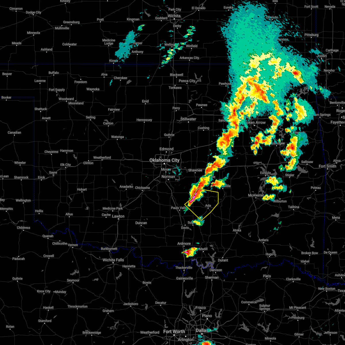 At 726 pm cdt, severe thunderstorms were located along a line extending from 4 miles east of asher to 7 miles east of byars to 3 miles west of stratford, moving southeast at 35 mph (radar indicated). Hazards include two inch hail and 60 mph wind gusts. People and animals outdoors will be injured. expect hail damage to roofs, siding, windows, and vehicles. Expect wind damage to roofs, siding, and trees. At 726 pm cdt, severe thunderstorms were located along a line extending from 4 miles east of asher to 7 miles east of byars to 3 miles west of stratford, moving southeast at 35 mph (radar indicated). Hazards include two inch hail and 60 mph wind gusts. People and animals outdoors will be injured. expect hail damage to roofs, siding, windows, and vehicles. Expect wind damage to roofs, siding, and trees.
|
| 7/30/2020 7:23 PM CDT |
 At 722 pm cdt, severe thunderstorms were located along a line extending from 3 miles south of centrahoma to near pontotoc to 4 miles northwest of mannsville, moving southeast at 20 mph. these are very dangerous storms (radar indicated). Hazards include 80 mph wind gusts and nickel size hail. the strongest wind will arrive ahead of the heavy rainfall. Flying debris will be dangerous to those caught without shelter. mobile homes will be heavily damaged. expect considerable damage to roofs, windows, and vehicles. extensive tree damage and power outages are likely. Locations impacted include, madill, tishomingo, coalgate, dickson, mannsville, roff, ravia, stonewall, wapanucka, lehigh, tupelo, mill creek, milburn, fitzhugh, bromide, gene autry, centrahoma, hickory, clarita and olney. At 722 pm cdt, severe thunderstorms were located along a line extending from 3 miles south of centrahoma to near pontotoc to 4 miles northwest of mannsville, moving southeast at 20 mph. these are very dangerous storms (radar indicated). Hazards include 80 mph wind gusts and nickel size hail. the strongest wind will arrive ahead of the heavy rainfall. Flying debris will be dangerous to those caught without shelter. mobile homes will be heavily damaged. expect considerable damage to roofs, windows, and vehicles. extensive tree damage and power outages are likely. Locations impacted include, madill, tishomingo, coalgate, dickson, mannsville, roff, ravia, stonewall, wapanucka, lehigh, tupelo, mill creek, milburn, fitzhugh, bromide, gene autry, centrahoma, hickory, clarita and olney.
|
| 7/30/2020 7:15 PM CDT | Mesonet repor in pontotoc county OK, 9.2 miles NW of Roff, OK |
| 7/30/2020 7:06 PM CDT |
 At 706 pm cdt, severe thunderstorms were located along a line extending from near tupelo to 5 miles west of pontotoc to near gene autry, moving southeast at 20 mph. these are very dangerous storms (radar indicated). Hazards include 80 mph wind gusts and nickel size hail. Flying debris will be dangerous to those caught without shelter. mobile homes will be heavily damaged. expect considerable damage to roofs, windows, and vehicles. Extensive tree damage and power outages are likely. At 706 pm cdt, severe thunderstorms were located along a line extending from near tupelo to 5 miles west of pontotoc to near gene autry, moving southeast at 20 mph. these are very dangerous storms (radar indicated). Hazards include 80 mph wind gusts and nickel size hail. Flying debris will be dangerous to those caught without shelter. mobile homes will be heavily damaged. expect considerable damage to roofs, windows, and vehicles. Extensive tree damage and power outages are likely.
|
| 7/30/2020 7:05 PM CDT | Mesonet station fitt fittstow in pontotoc county OK, 8.8 miles NW of Roff, OK |
| 7/30/2020 6:58 PM CDT |
 At 657 pm cdt, severe thunderstorms were located along a line extending from near sulphur to near ringling to near jolly, moving southeast at 35 mph (radar indicated). Hazards include 70 mph wind gusts and quarter size hail. Hail damage to vehicles is expected. expect considerable tree damage. wind damage is also likely to mobile homes, roofs, and outbuildings. locations impacted include, ardmore, burkburnett, pauls valley, sulphur, henrietta, davis, walters, waurika, lone grove, healdton, wynnewood, wilson, comanche, grandfield, ringling, temple, ryan, roff, springer and elmore city. this includes the following highways, interstate 35 between mile markers 35 and 70. Interstate 44 between mile markers 0 and 18. At 657 pm cdt, severe thunderstorms were located along a line extending from near sulphur to near ringling to near jolly, moving southeast at 35 mph (radar indicated). Hazards include 70 mph wind gusts and quarter size hail. Hail damage to vehicles is expected. expect considerable tree damage. wind damage is also likely to mobile homes, roofs, and outbuildings. locations impacted include, ardmore, burkburnett, pauls valley, sulphur, henrietta, davis, walters, waurika, lone grove, healdton, wynnewood, wilson, comanche, grandfield, ringling, temple, ryan, roff, springer and elmore city. this includes the following highways, interstate 35 between mile markers 35 and 70. Interstate 44 between mile markers 0 and 18.
|
| 7/30/2020 6:56 PM CDT |
 At 656 pm cdt, severe thunderstorms were located along a line extending from near kiowa to 4 miles east of hickory, moving southeast at 15 mph (radar indicated). Hazards include 60 mph wind gusts and quarter size hail. Hail damage to vehicles is expected. Expect wind damage to roofs, siding, and trees. At 656 pm cdt, severe thunderstorms were located along a line extending from near kiowa to 4 miles east of hickory, moving southeast at 15 mph (radar indicated). Hazards include 60 mph wind gusts and quarter size hail. Hail damage to vehicles is expected. Expect wind damage to roofs, siding, and trees.
|
| 7/30/2020 6:27 PM CDT |
 At 627 pm cdt, severe thunderstorms were located along a line extending from 7 miles northeast of wynnewood to 4 miles northwest of loco to 4 miles east of burkburnett, moving southeast at 35 mph (radar indicated). Hazards include 60 mph wind gusts and quarter size hail. Hail damage to vehicles is expected. Expect wind damage to roofs, siding, and trees. At 627 pm cdt, severe thunderstorms were located along a line extending from 7 miles northeast of wynnewood to 4 miles northwest of loco to 4 miles east of burkburnett, moving southeast at 35 mph (radar indicated). Hazards include 60 mph wind gusts and quarter size hail. Hail damage to vehicles is expected. Expect wind damage to roofs, siding, and trees.
|
| 7/12/2020 1:40 AM CDT |
 At 139 am cdt, severe thunderstorms were located along a line extending from 9 miles northeast of stringtown to near bromide to near dickson, moving southeast at 50 mph (radar indicated). Hazards include 70 mph wind gusts and quarter size hail. Hail damage to vehicles is expected. expect considerable tree damage. wind damage is also likely to mobile homes, roofs, and outbuildings. Locations impacted include, ardmore, ada, durant, sulphur, madill, atoka, tishomingo, coalgate, kingston, dickson, colbert, caddo, mannsville, roff, springer, bokchito, ravia, stonewall, wapanucka and stringtown. At 139 am cdt, severe thunderstorms were located along a line extending from 9 miles northeast of stringtown to near bromide to near dickson, moving southeast at 50 mph (radar indicated). Hazards include 70 mph wind gusts and quarter size hail. Hail damage to vehicles is expected. expect considerable tree damage. wind damage is also likely to mobile homes, roofs, and outbuildings. Locations impacted include, ardmore, ada, durant, sulphur, madill, atoka, tishomingo, coalgate, kingston, dickson, colbert, caddo, mannsville, roff, springer, bokchito, ravia, stonewall, wapanucka and stringtown.
|
| 7/12/2020 1:20 AM CDT |
 At 120 am cdt, severe thunderstorms were located along a line extending from 4 miles southwest of calvin to 4 miles north of pontotoc to 3 miles northwest of springer, moving southeast at 50 mph (radar indicated). Hazards include 70 mph wind gusts and quarter size hail. Hail damage to vehicles is expected. expect considerable tree damage. Wind damage is also likely to mobile homes, roofs, and outbuildings. At 120 am cdt, severe thunderstorms were located along a line extending from 4 miles southwest of calvin to 4 miles north of pontotoc to 3 miles northwest of springer, moving southeast at 50 mph (radar indicated). Hazards include 70 mph wind gusts and quarter size hail. Hail damage to vehicles is expected. expect considerable tree damage. Wind damage is also likely to mobile homes, roofs, and outbuildings.
|
| 7/12/2020 1:00 AM CDT |
 At 1259 am cdt, severe thunderstorms were located along a line extending from 4 miles east of bowlegs to near ada to near davis, moving southeast at 55 mph. these are very dangerous storms (radar indicated). Hazards include 80 mph wind gusts. Flying debris will be dangerous to those caught without shelter. mobile homes will be heavily damaged. expect considerable damage to roofs, windows, and vehicles. extensive tree damage and power outages are likely. Locations impacted include, shawnee, ada, seminole, tecumseh, pauls valley, holdenville, sulphur, davis, wewoka, wynnewood, stratford, konawa, byng, maud, allen, mannsville, roff, elmore city, earlsboro and ravia. At 1259 am cdt, severe thunderstorms were located along a line extending from 4 miles east of bowlegs to near ada to near davis, moving southeast at 55 mph. these are very dangerous storms (radar indicated). Hazards include 80 mph wind gusts. Flying debris will be dangerous to those caught without shelter. mobile homes will be heavily damaged. expect considerable damage to roofs, windows, and vehicles. extensive tree damage and power outages are likely. Locations impacted include, shawnee, ada, seminole, tecumseh, pauls valley, holdenville, sulphur, davis, wewoka, wynnewood, stratford, konawa, byng, maud, allen, mannsville, roff, elmore city, earlsboro and ravia.
|
| 7/12/2020 12:41 AM CDT |
 At 1241 am cdt, severe thunderstorms were located along a line extending from near earlsboro to 5 miles northeast of stratford to 4 miles northeast of katie, moving southeast at 55 mph. these are very dangerous storms (radar indicated). Hazards include 80 mph wind gusts. Flying debris will be dangerous to those caught without shelter. mobile homes will be heavily damaged. expect considerable damage to roofs, windows, and vehicles. Extensive tree damage and power outages are likely. At 1241 am cdt, severe thunderstorms were located along a line extending from near earlsboro to 5 miles northeast of stratford to 4 miles northeast of katie, moving southeast at 55 mph. these are very dangerous storms (radar indicated). Hazards include 80 mph wind gusts. Flying debris will be dangerous to those caught without shelter. mobile homes will be heavily damaged. expect considerable damage to roofs, windows, and vehicles. Extensive tree damage and power outages are likely.
|
| 5/24/2020 1:55 AM CDT |
 The severe thunderstorm warning for northwestern johnston, eastern garvin, southeastern cleveland, western pontotoc, murray, southwestern pottawatomie and southeastern mcclain counties will expire at 200 am cdt, the storms which prompted the warning have weakened below severe limits, therefore the warning will be allowed to expire. however gusty winds are still possible with these thunderstorms. The severe thunderstorm warning for northwestern johnston, eastern garvin, southeastern cleveland, western pontotoc, murray, southwestern pottawatomie and southeastern mcclain counties will expire at 200 am cdt, the storms which prompted the warning have weakened below severe limits, therefore the warning will be allowed to expire. however gusty winds are still possible with these thunderstorms.
|
| 5/24/2020 1:29 AM CDT |
 At 129 am cdt, severe thunderstorms were located along a line extending from near rosedale to 3 miles west of davis, moving east at 35 mph (radar indicated). Hazards include 60 mph wind gusts and penny size hail. Expect damage to roofs, siding, and trees. Locations impacted include, pauls valley, sulphur, davis, wynnewood, stratford, roff, paoli, asher, wanette, mill creek, byars, fitzhugh, dougherty, hickory, rosedale, vanoss, lake of the arbuckles, turner falls and scullin. At 129 am cdt, severe thunderstorms were located along a line extending from near rosedale to 3 miles west of davis, moving east at 35 mph (radar indicated). Hazards include 60 mph wind gusts and penny size hail. Expect damage to roofs, siding, and trees. Locations impacted include, pauls valley, sulphur, davis, wynnewood, stratford, roff, paoli, asher, wanette, mill creek, byars, fitzhugh, dougherty, hickory, rosedale, vanoss, lake of the arbuckles, turner falls and scullin.
|
| 5/24/2020 1:14 AM CDT |
 At 114 am cdt, severe thunderstorms were located along a line extending from near wayne to near hennepin, moving east at 35 mph (radar indicated). Hazards include 60 mph wind gusts and quarter size hail. Hail damage to vehicles is expected. Expect wind damage to roofs, siding, and trees. At 114 am cdt, severe thunderstorms were located along a line extending from near wayne to near hennepin, moving east at 35 mph (radar indicated). Hazards include 60 mph wind gusts and quarter size hail. Hail damage to vehicles is expected. Expect wind damage to roofs, siding, and trees.
|
| 5/22/2020 6:41 AM CDT |
 At 641 am cdt, a severe thunderstorm was located 4 miles northeast of hennepin, moving east at 25 mph (radar indicated). Hazards include 60 mph wind gusts and quarter size hail. Hail damage to vehicles is expected. Expect wind damage to roofs, siding, and trees. At 641 am cdt, a severe thunderstorm was located 4 miles northeast of hennepin, moving east at 25 mph (radar indicated). Hazards include 60 mph wind gusts and quarter size hail. Hail damage to vehicles is expected. Expect wind damage to roofs, siding, and trees.
|
| 5/8/2020 2:28 AM CDT |
 At 228 am cdt, severe thunderstorms were located along a line extending from 4 miles west of clarita to near reagan to 3 miles northwest of gene autry, moving southeast at 65 mph (radar indicated). Hazards include 60 mph wind gusts and quarter size hail. Hail damage to vehicles is expected. expect wind damage to roofs, siding, and trees. Locations impacted include, sulphur, tishomingo, davis, mannsville, roff, springer, ravia, wapanucka, mill creek, milburn, fitzhugh, dougherty, bromide, gene autry, tatums, hickory, fillmore, reagan, turner falls and connerville. At 228 am cdt, severe thunderstorms were located along a line extending from 4 miles west of clarita to near reagan to 3 miles northwest of gene autry, moving southeast at 65 mph (radar indicated). Hazards include 60 mph wind gusts and quarter size hail. Hail damage to vehicles is expected. expect wind damage to roofs, siding, and trees. Locations impacted include, sulphur, tishomingo, davis, mannsville, roff, springer, ravia, wapanucka, mill creek, milburn, fitzhugh, dougherty, bromide, gene autry, tatums, hickory, fillmore, reagan, turner falls and connerville.
|
| 5/8/2020 2:02 AM CDT |
 At 201 am cdt, severe thunderstorms were located along a line extending from 4 miles west of stratford to 7 miles east of katie, moving southeast at 60 mph (radar indicated). Hazards include ping pong ball size hail and 60 mph wind gusts. People and animals outdoors will be injured. expect hail damage to roofs, siding, windows, and vehicles. Expect wind damage to roofs, siding, and trees. At 201 am cdt, severe thunderstorms were located along a line extending from 4 miles west of stratford to 7 miles east of katie, moving southeast at 60 mph (radar indicated). Hazards include ping pong ball size hail and 60 mph wind gusts. People and animals outdoors will be injured. expect hail damage to roofs, siding, windows, and vehicles. Expect wind damage to roofs, siding, and trees.
|
| 5/8/2020 1:58 AM CDT |
 At 158 am cdt, severe thunderstorms were located along a line extending from 3 miles southeast of bowlegs to near byng to 3 miles east of vanoss, moving east at 60 mph (radar indicated). Hazards include 70 mph wind gusts and quarter size hail. Hail damage to vehicles is expected. expect considerable tree damage. Wind damage is also likely to mobile homes, roofs, and outbuildings. At 158 am cdt, severe thunderstorms were located along a line extending from 3 miles southeast of bowlegs to near byng to 3 miles east of vanoss, moving east at 60 mph (radar indicated). Hazards include 70 mph wind gusts and quarter size hail. Hail damage to vehicles is expected. expect considerable tree damage. Wind damage is also likely to mobile homes, roofs, and outbuildings.
|
| 5/4/2020 7:45 PM CDT | Storm damage reported in pontotoc county OK, 9.2 miles NW of Roff, OK |
| 5/4/2020 7:45 PM CDT |
 At 745 pm cdt, a severe thunderstorm was located 5 miles west of fittstown, moving southeast at 35 mph (radar indicated). Hazards include two inch hail and 60 mph wind gusts. People and animals outdoors will be injured. expect hail damage to roofs, siding, windows, and vehicles. expect wind damage to roofs, siding, and trees. Locations impacted include, roff, stonewall, fitzhugh, hickory, connerville, scullin, pontotoc, fittstown and jesse. At 745 pm cdt, a severe thunderstorm was located 5 miles west of fittstown, moving southeast at 35 mph (radar indicated). Hazards include two inch hail and 60 mph wind gusts. People and animals outdoors will be injured. expect hail damage to roofs, siding, windows, and vehicles. expect wind damage to roofs, siding, and trees. Locations impacted include, roff, stonewall, fitzhugh, hickory, connerville, scullin, pontotoc, fittstown and jesse.
|
| 5/4/2020 7:35 PM CDT | Quarter sized hail reported 0.1 miles SW of Roff, OK |
| 5/4/2020 7:25 PM CDT |
 At 725 pm cdt, a severe thunderstorm was located near vanoss, moving southeast at 30 mph (radar indicated). Hazards include golf ball size hail and 60 mph wind gusts. People and animals outdoors will be injured. expect hail damage to roofs, siding, windows, and vehicles. Expect wind damage to roofs, siding, and trees. At 725 pm cdt, a severe thunderstorm was located near vanoss, moving southeast at 30 mph (radar indicated). Hazards include golf ball size hail and 60 mph wind gusts. People and animals outdoors will be injured. expect hail damage to roofs, siding, windows, and vehicles. Expect wind damage to roofs, siding, and trees.
|
| 5/4/2020 7:19 PM CDT |
 At 718 pm cdt, severe thunderstorms were located along a line extending from near stratford to near wynnewood to near tatums, moving southeast at 15 mph (trained weather spotters reported golf ball size hail just east of elmore city). Hazards include up to two inch hail and 60 mph wind gusts. People and animals outdoors will be injured. expect hail damage to roofs, siding, windows, and vehicles. expect wind damage to roofs, siding, and trees. Locations impacted include, sulphur, davis, healdton, wynnewood, stratford, roff, katie, dougherty, tatums, ratliff city, hickory, graham, pooleville, vanoss, lake of the arbuckles, turner falls, hennepin, scullin, milo and fox. At 718 pm cdt, severe thunderstorms were located along a line extending from near stratford to near wynnewood to near tatums, moving southeast at 15 mph (trained weather spotters reported golf ball size hail just east of elmore city). Hazards include up to two inch hail and 60 mph wind gusts. People and animals outdoors will be injured. expect hail damage to roofs, siding, windows, and vehicles. expect wind damage to roofs, siding, and trees. Locations impacted include, sulphur, davis, healdton, wynnewood, stratford, roff, katie, dougherty, tatums, ratliff city, hickory, graham, pooleville, vanoss, lake of the arbuckles, turner falls, hennepin, scullin, milo and fox.
|
| 5/4/2020 7:13 PM CDT |
 At 712 pm cdt, severe thunderstorms were located along a line extending from near stratford to near wynnewood to 4 miles north of tatums, moving southeast at 25 mph (trained weather spotters reported golf ball size hail near elmore city, and earlier near pauls valley). Hazards include golf ball size hail and 60 mph wind gusts. People and animals outdoors will be injured. expect hail damage to roofs, siding, windows, and vehicles. expect wind damage to roofs, siding, and trees. Locations impacted include, pauls valley, sulphur, davis, healdton, wynnewood, stratford, roff, elmore city, katie, dougherty, tatums, ratliff city, hickory, graham, pooleville, vanoss, lake of the arbuckles, turner falls, hennepin and scullin. At 712 pm cdt, severe thunderstorms were located along a line extending from near stratford to near wynnewood to 4 miles north of tatums, moving southeast at 25 mph (trained weather spotters reported golf ball size hail near elmore city, and earlier near pauls valley). Hazards include golf ball size hail and 60 mph wind gusts. People and animals outdoors will be injured. expect hail damage to roofs, siding, windows, and vehicles. expect wind damage to roofs, siding, and trees. Locations impacted include, pauls valley, sulphur, davis, healdton, wynnewood, stratford, roff, elmore city, katie, dougherty, tatums, ratliff city, hickory, graham, pooleville, vanoss, lake of the arbuckles, turner falls, hennepin and scullin.
|
| 5/4/2020 6:57 PM CDT |
 At 657 pm cdt, severe thunderstorms were located along a line extending from 3 miles northwest of stratford to near pauls valley to near foster, moving southeast at 20 mph (radar indicated). Hazards include golf ball size hail and 60 mph wind gusts. People and animals outdoors will be injured. expect hail damage to roofs, siding, windows, and vehicles. Expect wind damage to roofs, siding, and trees. At 657 pm cdt, severe thunderstorms were located along a line extending from 3 miles northwest of stratford to near pauls valley to near foster, moving southeast at 20 mph (radar indicated). Hazards include golf ball size hail and 60 mph wind gusts. People and animals outdoors will be injured. expect hail damage to roofs, siding, windows, and vehicles. Expect wind damage to roofs, siding, and trees.
|
| 5/4/2020 6:53 PM CDT |
 At 653 pm cdt, a severe thunderstorm was located 5 miles southwest of byars, moving southeast at 15 mph (trained weather spotters reported golf ball size hail in pauls valley). Hazards include golf ball size hail and 60 mph wind gusts. People and animals outdoors will be injured. expect hail damage to roofs, siding, windows, and vehicles. expect wind damage to roofs, siding, and trees. Locations impacted include, pauls valley, wynnewood, stratford, roff, paoli and byars. At 653 pm cdt, a severe thunderstorm was located 5 miles southwest of byars, moving southeast at 15 mph (trained weather spotters reported golf ball size hail in pauls valley). Hazards include golf ball size hail and 60 mph wind gusts. People and animals outdoors will be injured. expect hail damage to roofs, siding, windows, and vehicles. expect wind damage to roofs, siding, and trees. Locations impacted include, pauls valley, wynnewood, stratford, roff, paoli and byars.
|
| 5/4/2020 6:38 PM CDT |
 At 637 pm cdt, severe thunderstorms were located along a line extending from 6 miles north of vanoss to 3 miles northeast of paoli, moving southeast at 20 mph (radar indicated). Hazards include up to two inch hail and 60 mph wind gusts. People and animals outdoors will be injured. expect hail damage to roofs, siding, windows, and vehicles. expect wind damage to roofs, siding, and trees. Locations impacted include, ada, pauls valley, wynnewood, stratford, konawa, byng, roff, paoli, stonewall, asher, wanette, francis, byars, fitzhugh, rosedale and vanoss. At 637 pm cdt, severe thunderstorms were located along a line extending from 6 miles north of vanoss to 3 miles northeast of paoli, moving southeast at 20 mph (radar indicated). Hazards include up to two inch hail and 60 mph wind gusts. People and animals outdoors will be injured. expect hail damage to roofs, siding, windows, and vehicles. expect wind damage to roofs, siding, and trees. Locations impacted include, ada, pauls valley, wynnewood, stratford, konawa, byng, roff, paoli, stonewall, asher, wanette, francis, byars, fitzhugh, rosedale and vanoss.
|
| 5/4/2020 6:23 PM CDT |
 At 622 pm cdt, severe thunderstorms were located along a line extending from near asher to near wayne, moving southeast at 15 mph (radar indicated). Hazards include two inch hail and 60 mph wind gusts. People and animals outdoors will be injured. expect hail damage to roofs, siding, windows, and vehicles. expect wind damage to roofs, siding, and trees. locations impacted include, ada, pauls valley, wynnewood, stratford, konawa, byng, roff, paoli, stonewall, asher, wanette, francis, byars, fitzhugh, st. Louis, rosedale, vanoss and trousdale. At 622 pm cdt, severe thunderstorms were located along a line extending from near asher to near wayne, moving southeast at 15 mph (radar indicated). Hazards include two inch hail and 60 mph wind gusts. People and animals outdoors will be injured. expect hail damage to roofs, siding, windows, and vehicles. expect wind damage to roofs, siding, and trees. locations impacted include, ada, pauls valley, wynnewood, stratford, konawa, byng, roff, paoli, stonewall, asher, wanette, francis, byars, fitzhugh, st. Louis, rosedale, vanoss and trousdale.
|
| 5/4/2020 6:08 PM CDT |
 At 608 pm cdt, a severe thunderstorm was located 4 miles northwest of wanette, moving southeast at 20 mph (radar indicated). Hazards include two inch hail and 60 mph wind gusts. People and animals outdoors will be injured. expect hail damage to roofs, siding, windows, and vehicles. Expect wind damage to roofs, siding, and trees. At 608 pm cdt, a severe thunderstorm was located 4 miles northwest of wanette, moving southeast at 20 mph (radar indicated). Hazards include two inch hail and 60 mph wind gusts. People and animals outdoors will be injured. expect hail damage to roofs, siding, windows, and vehicles. Expect wind damage to roofs, siding, and trees.
|
| 4/22/2020 4:55 PM CDT |
 At 455 pm cdt, a severe thunderstorm capable of producing a tornado was located near fitzhugh, moving east at 40 mph (radar indicated rotation). Hazards include tornado and ping pong ball size hail. Flying debris will be dangerous to those caught without shelter. mobile homes will be damaged or destroyed. damage to roofs, windows, and vehicles will occur. Tree damage is likely. At 455 pm cdt, a severe thunderstorm capable of producing a tornado was located near fitzhugh, moving east at 40 mph (radar indicated rotation). Hazards include tornado and ping pong ball size hail. Flying debris will be dangerous to those caught without shelter. mobile homes will be damaged or destroyed. damage to roofs, windows, and vehicles will occur. Tree damage is likely.
|
| 4/22/2020 4:49 PM CDT |
 At 449 pm cdt, a severe thunderstorm was located near vanoss, moving east at 45 mph (radar indicated). Hazards include ping pong ball size hail and 60 mph wind gusts. People and animals outdoors will be injured. expect hail damage to roofs, siding, windows, and vehicles. expect wind damage to roofs, siding, and trees. Locations impacted include, stratford, roff and vanoss. At 449 pm cdt, a severe thunderstorm was located near vanoss, moving east at 45 mph (radar indicated). Hazards include ping pong ball size hail and 60 mph wind gusts. People and animals outdoors will be injured. expect hail damage to roofs, siding, windows, and vehicles. expect wind damage to roofs, siding, and trees. Locations impacted include, stratford, roff and vanoss.
|
| 4/22/2020 4:47 PM CDT |
 At 447 pm cdt, a severe thunderstorm capable of producing a tornado was located 5 miles west of roff, moving east at 40 mph (radar indicated rotation). Hazards include tornado and ping pong ball size hail. Flying debris will be dangerous to those caught without shelter. mobile homes will be damaged or destroyed. damage to roofs, windows, and vehicles will occur. tree damage is likely. Locations impacted include, roff and fitzhugh. At 447 pm cdt, a severe thunderstorm capable of producing a tornado was located 5 miles west of roff, moving east at 40 mph (radar indicated rotation). Hazards include tornado and ping pong ball size hail. Flying debris will be dangerous to those caught without shelter. mobile homes will be damaged or destroyed. damage to roofs, windows, and vehicles will occur. tree damage is likely. Locations impacted include, roff and fitzhugh.
|
| 4/22/2020 4:35 PM CDT |
 At 434 pm cdt, a severe thunderstorm capable of producing a tornado was located 4 miles east of wynnewood, moving east at 40 mph (radar indicated rotation). Hazards include tornado and golf ball size hail. Flying debris will be dangerous to those caught without shelter. mobile homes will be damaged or destroyed. damage to roofs, windows, and vehicles will occur. tree damage is likely. Locations impacted include, roff, fitzhugh and vanoss. At 434 pm cdt, a severe thunderstorm capable of producing a tornado was located 4 miles east of wynnewood, moving east at 40 mph (radar indicated rotation). Hazards include tornado and golf ball size hail. Flying debris will be dangerous to those caught without shelter. mobile homes will be damaged or destroyed. damage to roofs, windows, and vehicles will occur. tree damage is likely. Locations impacted include, roff, fitzhugh and vanoss.
|
| 4/22/2020 4:27 PM CDT |
 At 426 pm cdt, a severe thunderstorm capable of producing a tornado was located northwest of wynnewood, moving east at 40 mph (radar indicated rotation). Hazards include tornado and golf ball size hail. Flying debris will be dangerous to those caught without shelter. mobile homes will be damaged or destroyed. damage to roofs, windows, and vehicles will occur. tree damage is likely. locations impacted include, pauls valley, wynnewood, roff, fitzhugh and vanoss. This includes interstate 35 between mile markers 64 and 73. At 426 pm cdt, a severe thunderstorm capable of producing a tornado was located northwest of wynnewood, moving east at 40 mph (radar indicated rotation). Hazards include tornado and golf ball size hail. Flying debris will be dangerous to those caught without shelter. mobile homes will be damaged or destroyed. damage to roofs, windows, and vehicles will occur. tree damage is likely. locations impacted include, pauls valley, wynnewood, roff, fitzhugh and vanoss. This includes interstate 35 between mile markers 64 and 73.
|
| 4/22/2020 4:17 PM CDT |
 At 417 pm cdt, a severe thunderstorm capable of producing a tornado was located 6 miles southeast of antioch, moving east at 40 mph (radar indicated rotation). Hazards include tornado and golf ball size hail. Flying debris will be dangerous to those caught without shelter. mobile homes will be damaged or destroyed. damage to roofs, windows, and vehicles will occur. Tree damage is likely. At 417 pm cdt, a severe thunderstorm capable of producing a tornado was located 6 miles southeast of antioch, moving east at 40 mph (radar indicated rotation). Hazards include tornado and golf ball size hail. Flying debris will be dangerous to those caught without shelter. mobile homes will be damaged or destroyed. damage to roofs, windows, and vehicles will occur. Tree damage is likely.
|
| 4/22/2020 4:13 PM CDT |
 At 413 pm cdt, a severe thunderstorm was located near antioch, moving east at 40 mph (radar indicated). Hazards include golf ball size hail and 60 mph wind gusts. People and animals outdoors will be injured. expect hail damage to roofs, siding, windows, and vehicles. Expect wind damage to roofs, siding, and trees. At 413 pm cdt, a severe thunderstorm was located near antioch, moving east at 40 mph (radar indicated). Hazards include golf ball size hail and 60 mph wind gusts. People and animals outdoors will be injured. expect hail damage to roofs, siding, windows, and vehicles. Expect wind damage to roofs, siding, and trees.
|
| 4/12/2020 3:53 PM CDT |
 At 353 pm cdt, a severe thunderstorm was located near hickory, moving east at 20 mph (radar indicated). Hazards include 60 mph wind gusts and quarter size hail. Hail damage to vehicles is expected. expect wind damage to roofs, siding, and trees. Locations impacted include, sulphur, roff, hickory and scullin. At 353 pm cdt, a severe thunderstorm was located near hickory, moving east at 20 mph (radar indicated). Hazards include 60 mph wind gusts and quarter size hail. Hail damage to vehicles is expected. expect wind damage to roofs, siding, and trees. Locations impacted include, sulphur, roff, hickory and scullin.
|
| 4/12/2020 3:30 PM CDT |
 At 330 pm cdt, a severe thunderstorm was located 7 miles east of wynnewood, moving east at 20 mph (radar indicated). Hazards include 60 mph wind gusts and quarter size hail. Hail damage to vehicles is expected. Expect wind damage to roofs, siding, and trees. At 330 pm cdt, a severe thunderstorm was located 7 miles east of wynnewood, moving east at 20 mph (radar indicated). Hazards include 60 mph wind gusts and quarter size hail. Hail damage to vehicles is expected. Expect wind damage to roofs, siding, and trees.
|
| 4/11/2020 3:55 PM CDT |
 At 355 pm cdt, a severe thunderstorm was located near wynnewood, moving east at 50 mph (radar indicated). Hazards include 60 mph wind gusts and quarter size hail. Hail damage to vehicles is expected. Expect wind damage to roofs, siding, and trees. At 355 pm cdt, a severe thunderstorm was located near wynnewood, moving east at 50 mph (radar indicated). Hazards include 60 mph wind gusts and quarter size hail. Hail damage to vehicles is expected. Expect wind damage to roofs, siding, and trees.
|
| 10/20/2019 11:14 PM CDT |
 At 1114 pm cdt, severe thunderstorms were located along a line extending from 5 miles northeast of konawa to near sulphur, moving east at 45 mph (radar indicated). Hazards include 60 mph wind gusts and quarter size hail. Hail damage to vehicles is expected. expect wind damage to roofs, siding, and trees. Locations impacted include, ada, sulphur, wewoka, konawa, byng, roff, francis, fitzhugh, hickory, scullin, vanoss and lake of the arbuckles. At 1114 pm cdt, severe thunderstorms were located along a line extending from 5 miles northeast of konawa to near sulphur, moving east at 45 mph (radar indicated). Hazards include 60 mph wind gusts and quarter size hail. Hail damage to vehicles is expected. expect wind damage to roofs, siding, and trees. Locations impacted include, ada, sulphur, wewoka, konawa, byng, roff, francis, fitzhugh, hickory, scullin, vanoss and lake of the arbuckles.
|
| 10/20/2019 11:03 PM CDT |
 At 1102 pm cdt, severe thunderstorms were located along a line extending from 5 miles northwest of konawa to near turner falls, moving east at 45 mph (radar indicated). Hazards include 60 mph wind gusts and quarter size hail. Hail damage to vehicles is expected. expect wind damage to roofs, siding, and trees. locations impacted include, ada, sulphur, davis, wewoka, stratford, konawa, byng, roff, asher, francis, fitzhugh, st. Louis, hickory, vanoss, scullin, lake of the arbuckles and turner falls. At 1102 pm cdt, severe thunderstorms were located along a line extending from 5 miles northwest of konawa to near turner falls, moving east at 45 mph (radar indicated). Hazards include 60 mph wind gusts and quarter size hail. Hail damage to vehicles is expected. expect wind damage to roofs, siding, and trees. locations impacted include, ada, sulphur, davis, wewoka, stratford, konawa, byng, roff, asher, francis, fitzhugh, st. Louis, hickory, vanoss, scullin, lake of the arbuckles and turner falls.
|
| 10/20/2019 10:44 PM CDT |
 At 1044 pm cdt, severe thunderstorms were located along a line extending from near wanette to near pooleville, moving east at 45 mph (radar indicated). Hazards include 60 mph wind gusts and quarter size hail. Hail damage to vehicles is expected. Expect wind damage to roofs, siding, and trees. At 1044 pm cdt, severe thunderstorms were located along a line extending from near wanette to near pooleville, moving east at 45 mph (radar indicated). Hazards include 60 mph wind gusts and quarter size hail. Hail damage to vehicles is expected. Expect wind damage to roofs, siding, and trees.
|
| 10/20/2019 10:16 PM CDT |
 At 1016 pm cdt, severe thunderstorms were located along a line extending from 4 miles southeast of little to 3 miles northwest of byng to 7 miles southwest of stratford, moving east at 55 mph (radar indicated). Hazards include 70 mph wind gusts and ping pong ball size hail. People and animals outdoors will be injured. expect hail damage to roofs, siding, windows, and vehicles. expect considerable tree damage. wind damage is also likely to mobile homes, roofs, and outbuildings. locations impacted include, ada, seminole, pauls valley, holdenville, wewoka, wynnewood, stratford, konawa, wetumka, byng, maud, allen, roff, bowlegs, francis, cromwell, byars, fitzhugh, st. Louis and sasakwa. At 1016 pm cdt, severe thunderstorms were located along a line extending from 4 miles southeast of little to 3 miles northwest of byng to 7 miles southwest of stratford, moving east at 55 mph (radar indicated). Hazards include 70 mph wind gusts and ping pong ball size hail. People and animals outdoors will be injured. expect hail damage to roofs, siding, windows, and vehicles. expect considerable tree damage. wind damage is also likely to mobile homes, roofs, and outbuildings. locations impacted include, ada, seminole, pauls valley, holdenville, wewoka, wynnewood, stratford, konawa, wetumka, byng, maud, allen, roff, bowlegs, francis, cromwell, byars, fitzhugh, st. Louis and sasakwa.
|
| 10/20/2019 9:59 PM CDT |
 At 959 pm cdt, severe thunderstorms were located along a line extending from 5 miles southeast of tecumseh to near stratford to near wynnewood, moving east at 55 mph (radar indicated). Hazards include 70 mph wind gusts and quarter size hail. Hail damage to vehicles is expected. expect considerable tree damage. Wind damage is also likely to mobile homes, roofs, and outbuildings. At 959 pm cdt, severe thunderstorms were located along a line extending from 5 miles southeast of tecumseh to near stratford to near wynnewood, moving east at 55 mph (radar indicated). Hazards include 70 mph wind gusts and quarter size hail. Hail damage to vehicles is expected. expect considerable tree damage. Wind damage is also likely to mobile homes, roofs, and outbuildings.
|
| 6/19/2019 2:43 AM CDT |
 At 242 am cdt, severe thunderstorms were located along a line extending from 3 miles southeast of sasakwa to 4 miles north of centrahoma to near wapanucka, moving east at 55 mph. this line of thunderstorms is producing widespread wind damage, including damage to homes. take shelter now away from windows in an interior room away from windows! these are very dangerous storms (public). Hazards include 80 mph wind gusts and penny size hail. Flying debris will be dangerous to those caught without shelter. mobile homes will be heavily damaged. expect considerable damage to roofs, windows, and vehicles. extensive tree damage and power outages are likely. Locations impacted include, ada, atoka, coalgate, konawa, byng, allen, stonewall, wapanucka, stringtown, lehigh, tupelo, mill creek, francis, calvin, fitzhugh, stuart, bromide, lamar, sasakwa and gerty. At 242 am cdt, severe thunderstorms were located along a line extending from 3 miles southeast of sasakwa to 4 miles north of centrahoma to near wapanucka, moving east at 55 mph. this line of thunderstorms is producing widespread wind damage, including damage to homes. take shelter now away from windows in an interior room away from windows! these are very dangerous storms (public). Hazards include 80 mph wind gusts and penny size hail. Flying debris will be dangerous to those caught without shelter. mobile homes will be heavily damaged. expect considerable damage to roofs, windows, and vehicles. extensive tree damage and power outages are likely. Locations impacted include, ada, atoka, coalgate, konawa, byng, allen, stonewall, wapanucka, stringtown, lehigh, tupelo, mill creek, francis, calvin, fitzhugh, stuart, bromide, lamar, sasakwa and gerty.
|
| 6/19/2019 2:30 AM CDT | Storm damage reported in pontotoc county OK, 8.9 miles WNW of Roff, OK |
| 6/19/2019 2:28 AM CDT |
 At 227 am cdt, severe thunderstorms were located along a line extending from near byng to near stonewall to 4 miles south of connerville, moving east at 70 mph. emergency management reported a roof was blown off a home 2 miles north of vanoss at 215 am. these are very dangerous storms (public). Hazards include 80 mph wind gusts and penny size hail. Flying debris will be dangerous to those caught without shelter. mobile homes will be heavily damaged. expect considerable damage to roofs, windows, and vehicles. extensive tree damage and power outages are likely. Locations impacted include, ada, sulphur, atoka, coalgate, stratford, konawa, byng, allen, roff, paoli, stonewall, wapanucka, stringtown, lehigh, tupelo, mill creek, francis, calvin, byars and fitzhugh. At 227 am cdt, severe thunderstorms were located along a line extending from near byng to near stonewall to 4 miles south of connerville, moving east at 70 mph. emergency management reported a roof was blown off a home 2 miles north of vanoss at 215 am. these are very dangerous storms (public). Hazards include 80 mph wind gusts and penny size hail. Flying debris will be dangerous to those caught without shelter. mobile homes will be heavily damaged. expect considerable damage to roofs, windows, and vehicles. extensive tree damage and power outages are likely. Locations impacted include, ada, sulphur, atoka, coalgate, stratford, konawa, byng, allen, roff, paoli, stonewall, wapanucka, stringtown, lehigh, tupelo, mill creek, francis, calvin, byars and fitzhugh.
|
| 6/19/2019 2:13 AM CDT | Power pole snappe in pontotoc county OK, 5.6 miles S of Roff, OK |
| 6/19/2019 2:13 AM CDT | Trees in power lines and power poles snapped. 9th and park av in pontotoc county OK, 0.1 miles SW of Roff, OK |
| 6/19/2019 2:11 AM CDT |
 At 210 am cdt, severe thunderstorms were located along a line extending from near byars to near roff to near lake of the arbuckles, moving east at 55 mph (radar indicated. a 69 mph wind gust occurred in pauls valley). Hazards include 70 mph wind gusts and penny size hail. Expect considerable tree damage. Damage is likely to mobile homes, roofs, and outbuildings. At 210 am cdt, severe thunderstorms were located along a line extending from near byars to near roff to near lake of the arbuckles, moving east at 55 mph (radar indicated. a 69 mph wind gust occurred in pauls valley). Hazards include 70 mph wind gusts and penny size hail. Expect considerable tree damage. Damage is likely to mobile homes, roofs, and outbuildings.
|
| 6/19/2019 2:03 AM CDT |
 At 202 am cdt, severe thunderstorms were located along a line extending from near paoli to near wynnewood to near turner falls, moving east at 60 mph (radar indicated). Hazards include 60 mph wind gusts and penny size hail. Expect damage to roofs, siding, and trees. Locations impacted include, pauls valley, sulphur, davis, lindsay, wynnewood, stratford, maysville, roff, springer, elmore city, paoli, katie, mill creek, byars, fitzhugh, dougherty, hickory, rosedale, turner falls and scullin. At 202 am cdt, severe thunderstorms were located along a line extending from near paoli to near wynnewood to near turner falls, moving east at 60 mph (radar indicated). Hazards include 60 mph wind gusts and penny size hail. Expect damage to roofs, siding, and trees. Locations impacted include, pauls valley, sulphur, davis, lindsay, wynnewood, stratford, maysville, roff, springer, elmore city, paoli, katie, mill creek, byars, fitzhugh, dougherty, hickory, rosedale, turner falls and scullin.
|
| 6/19/2019 1:35 AM CDT |
 At 135 am cdt, severe thunderstorms were located along a line extending from 8 miles north of bray to near ratliff city, moving east at 60 mph (radar indicated). Hazards include 60 mph wind gusts and penny size hail. expect damage to roofs, siding, and trees At 135 am cdt, severe thunderstorms were located along a line extending from 8 miles north of bray to near ratliff city, moving east at 60 mph (radar indicated). Hazards include 60 mph wind gusts and penny size hail. expect damage to roofs, siding, and trees
|
| 6/15/2019 11:55 PM CDT |
 At 1155 pm cdt, severe thunderstorms were located along a line extending from 4 miles south of macomb to 6 miles east of wynnewood to near grady, moving east at 45 mph (radar indicated). Hazards include 60 mph wind gusts. expect damage to roofs, siding, and trees At 1155 pm cdt, severe thunderstorms were located along a line extending from 4 miles south of macomb to 6 miles east of wynnewood to near grady, moving east at 45 mph (radar indicated). Hazards include 60 mph wind gusts. expect damage to roofs, siding, and trees
|
| 6/9/2019 10:52 AM CDT |
 At 1052 am cdt, severe thunderstorms were located along a line extending from 4 miles southwest of vanoss to 4 miles northeast of davis to 4 miles southeast of velma, moving southeast at 50 mph (radar indicated). Hazards include 70 mph wind gusts and quarter size hail. Hail damage to vehicles is expected. expect considerable tree damage. Wind damage is also likely to mobile homes, roofs, and outbuildings. At 1052 am cdt, severe thunderstorms were located along a line extending from 4 miles southwest of vanoss to 4 miles northeast of davis to 4 miles southeast of velma, moving southeast at 50 mph (radar indicated). Hazards include 70 mph wind gusts and quarter size hail. Hail damage to vehicles is expected. expect considerable tree damage. Wind damage is also likely to mobile homes, roofs, and outbuildings.
|
| 6/9/2019 10:39 AM CDT |
 At 1038 am cdt, severe thunderstorms were located along a line extending from near fitzhugh to near davis to 6 miles east of loco, moving southeast at 50 mph (radar indicated). Hazards include 70 mph wind gusts and quarter size hail. Hail damage to vehicles is expected. expect considerable tree damage. wind damage is also likely to mobile homes, roofs, and outbuildings. Locations impacted include, pauls valley, sulphur, davis, wynnewood, stratford, roff, springer, elmore city, velma, katie, mill creek, fitzhugh, dougherty, foster, tatums, ratliff city, hickory, graham, turner falls and scullin. At 1038 am cdt, severe thunderstorms were located along a line extending from near fitzhugh to near davis to 6 miles east of loco, moving southeast at 50 mph (radar indicated). Hazards include 70 mph wind gusts and quarter size hail. Hail damage to vehicles is expected. expect considerable tree damage. wind damage is also likely to mobile homes, roofs, and outbuildings. Locations impacted include, pauls valley, sulphur, davis, wynnewood, stratford, roff, springer, elmore city, velma, katie, mill creek, fitzhugh, dougherty, foster, tatums, ratliff city, hickory, graham, turner falls and scullin.
|
| 6/9/2019 10:17 AM CDT |
 The national weather service in norman has issued a * severe thunderstorm warning for. northwestern johnston county in southeastern oklahoma. southeastern garvin county in southern oklahoma. eastern stephens county in southern oklahoma. Northern carter county in southern oklahoma. The national weather service in norman has issued a * severe thunderstorm warning for. northwestern johnston county in southeastern oklahoma. southeastern garvin county in southern oklahoma. eastern stephens county in southern oklahoma. Northern carter county in southern oklahoma.
|
| 5/28/2019 10:42 PM CDT |
 At 1042 pm cdt, a severe thunderstorm was located near wynnewood, moving east at 30 mph. another severe storm was located over stratford moving east northeast at 35 mph (radar indicated). Hazards include golf ball size hail and 70 mph wind gusts. People and animals outdoors will be injured. expect hail damage to roofs, siding, windows, and vehicles. expect considerable tree damage. Wind damage is also likely to mobile homes, roofs, and outbuildings. At 1042 pm cdt, a severe thunderstorm was located near wynnewood, moving east at 30 mph. another severe storm was located over stratford moving east northeast at 35 mph (radar indicated). Hazards include golf ball size hail and 70 mph wind gusts. People and animals outdoors will be injured. expect hail damage to roofs, siding, windows, and vehicles. expect considerable tree damage. Wind damage is also likely to mobile homes, roofs, and outbuildings.
|
| 5/18/2019 10:04 AM CDT |
 At 1003 am cdt, severe thunderstorms were located along a line extending from 4 miles east of vanoss to 3 miles southeast of scullin to 5 miles southwest of mill creek, moving northeast at 40 mph (radar indicated). Hazards include 70 mph wind gusts. Expect considerable tree damage. damage is likely to mobile homes, roofs, and outbuildings. Locations impacted include, ada, byng, roff, mill creek, fitzhugh, hickory, connerville, scullin, pontotoc, fittstown, reagan and jesse. At 1003 am cdt, severe thunderstorms were located along a line extending from 4 miles east of vanoss to 3 miles southeast of scullin to 5 miles southwest of mill creek, moving northeast at 40 mph (radar indicated). Hazards include 70 mph wind gusts. Expect considerable tree damage. damage is likely to mobile homes, roofs, and outbuildings. Locations impacted include, ada, byng, roff, mill creek, fitzhugh, hickory, connerville, scullin, pontotoc, fittstown, reagan and jesse.
|
| 5/18/2019 9:50 AM CDT |
 At 946 am cdt, severe thunderstorms were located along a line extending from 6 miles east of wynnewood to 3 miles southeast of lake of the arbuckles to 3 miles south of springer, moving northeast at 40 mph (radar indicated). Hazards include 60 mph wind gusts and penny size hail. expect damage to roofs, siding, and trees At 946 am cdt, severe thunderstorms were located along a line extending from 6 miles east of wynnewood to 3 miles southeast of lake of the arbuckles to 3 miles south of springer, moving northeast at 40 mph (radar indicated). Hazards include 60 mph wind gusts and penny size hail. expect damage to roofs, siding, and trees
|
| 5/18/2019 9:46 AM CDT |
 At 946 am cdt, severe thunderstorms were located along a line extending from 6 miles east of wynnewood to 3 miles southeast of lake of the arbuckles to 3 miles south of springer, moving northeast at 40 mph (radar indicated). Hazards include 60 mph wind gusts and penny size hail. expect damage to roofs, siding, and trees At 946 am cdt, severe thunderstorms were located along a line extending from 6 miles east of wynnewood to 3 miles southeast of lake of the arbuckles to 3 miles south of springer, moving northeast at 40 mph (radar indicated). Hazards include 60 mph wind gusts and penny size hail. expect damage to roofs, siding, and trees
|
| 5/1/2019 5:23 PM CDT |
 At 523 pm cdt, severe thunderstorms were located along a line extending from 5 miles west of connerville to near tishomingo to near kingston, moving northeast at 30 mph (radar indicated). Hazards include 60 mph wind gusts and quarter size hail. Hail damage to vehicles is expected. Expect wind damage to roofs, siding, and trees. At 523 pm cdt, severe thunderstorms were located along a line extending from 5 miles west of connerville to near tishomingo to near kingston, moving northeast at 30 mph (radar indicated). Hazards include 60 mph wind gusts and quarter size hail. Hail damage to vehicles is expected. Expect wind damage to roofs, siding, and trees.
|
| 4/18/2019 6:56 PM CDT |
 At 655 pm cdt, severe thunderstorms were located along a line extending from near roff to near sulphur to 3 miles northeast of springer, moving southeast at 35 mph (radar indicated). Hazards include 60 mph wind gusts. expect damage to roofs, siding, and trees At 655 pm cdt, severe thunderstorms were located along a line extending from near roff to near sulphur to 3 miles northeast of springer, moving southeast at 35 mph (radar indicated). Hazards include 60 mph wind gusts. expect damage to roofs, siding, and trees
|
| 12/26/2018 8:40 PM CST |
 At 840 pm cst, severe thunderstorms were located along a line extending from 3 miles east of st. louis to 3 miles east of konawa to near ada to 5 miles west of pontotoc, moving northeast at 50 mph (radar indicated). Hazards include 60 mph wind gusts. expect damage to roofs, siding, and trees At 840 pm cst, severe thunderstorms were located along a line extending from 3 miles east of st. louis to 3 miles east of konawa to near ada to 5 miles west of pontotoc, moving northeast at 50 mph (radar indicated). Hazards include 60 mph wind gusts. expect damage to roofs, siding, and trees
|
| 11/30/2018 8:35 PM CST |
 At 834 pm cst, severe thunderstorms were located along a line extending from near turner falls to near ardmore, moving northeast at 60 mph. winds of 55 mph were reported at the emergency operations center in ardmore (radar indicated). Hazards include 60 mph wind gusts and quarter size hail. Hail damage to vehicles is expected. Expect wind damage to roofs, siding, and trees. At 834 pm cst, severe thunderstorms were located along a line extending from near turner falls to near ardmore, moving northeast at 60 mph. winds of 55 mph were reported at the emergency operations center in ardmore (radar indicated). Hazards include 60 mph wind gusts and quarter size hail. Hail damage to vehicles is expected. Expect wind damage to roofs, siding, and trees.
|
| 10/9/2018 8:34 AM CDT |
 At 834 am cdt, severe thunderstorms were located along a line extending from near byars to near sulphur to 3 miles south of madill, moving northeast at 45 mph (radar indicated). Hazards include 70 mph wind gusts. Expect considerable tree damage. damage is likely to mobile homes, roofs, and outbuildings. locations impacted include, ardmore, pauls valley, sulphur, madill, tishomingo, davis, wynnewood, kingston, stratford, dickson, mannsville, roff, springer, ravia, mill creek, milburn, byars, fitzhugh, dougherty and gene autry. This includes interstate 35 between mile markers 48 and 54. At 834 am cdt, severe thunderstorms were located along a line extending from near byars to near sulphur to 3 miles south of madill, moving northeast at 45 mph (radar indicated). Hazards include 70 mph wind gusts. Expect considerable tree damage. damage is likely to mobile homes, roofs, and outbuildings. locations impacted include, ardmore, pauls valley, sulphur, madill, tishomingo, davis, wynnewood, kingston, stratford, dickson, mannsville, roff, springer, ravia, mill creek, milburn, byars, fitzhugh, dougherty and gene autry. This includes interstate 35 between mile markers 48 and 54.
|
| 10/9/2018 8:18 AM CDT |
 At 817 am cdt, severe thunderstorms were located along a line extending from near paoli to near lebanon, moving northeast at 40 mph (law enforcement). Hazards include 70 mph wind gusts. Expect considerable tree damage. Damage is likely to mobile homes, roofs, and outbuildings. At 817 am cdt, severe thunderstorms were located along a line extending from near paoli to near lebanon, moving northeast at 40 mph (law enforcement). Hazards include 70 mph wind gusts. Expect considerable tree damage. Damage is likely to mobile homes, roofs, and outbuildings.
|
| 8/17/2018 7:59 PM CDT |
 At 759 pm cdt, a severe thunderstorm was located near roff, moving south at 5 mph (radar indicated). Hazards include 60 mph wind gusts and quarter size hail. Hail damage to vehicles is expected. Expect wind damage to roofs, siding, and trees. At 759 pm cdt, a severe thunderstorm was located near roff, moving south at 5 mph (radar indicated). Hazards include 60 mph wind gusts and quarter size hail. Hail damage to vehicles is expected. Expect wind damage to roofs, siding, and trees.
|
| 8/17/2018 7:18 PM CDT |
 At 718 pm cdt, severe thunderstorms were located along a line extending from near vanoss to 7 miles northeast of wynnewood to 5 miles west of pauls valley, moving east at 15 mph (radar indicated). Hazards include 60 mph wind gusts and quarter size hail. Hail damage to vehicles is expected. Expect wind damage to roofs, siding, and trees. At 718 pm cdt, severe thunderstorms were located along a line extending from near vanoss to 7 miles northeast of wynnewood to 5 miles west of pauls valley, moving east at 15 mph (radar indicated). Hazards include 60 mph wind gusts and quarter size hail. Hail damage to vehicles is expected. Expect wind damage to roofs, siding, and trees.
|
| 7/12/2018 4:00 PM CDT |
 At 400 pm cdt, a severe thunderstorm was located 4 miles west of fittstown, moving northwest at 10 mph (radar indicated). Hazards include 60 mph wind gusts and quarter size hail. Hail damage to vehicles is expected. Expect wind damage to roofs, siding, and trees. At 400 pm cdt, a severe thunderstorm was located 4 miles west of fittstown, moving northwest at 10 mph (radar indicated). Hazards include 60 mph wind gusts and quarter size hail. Hail damage to vehicles is expected. Expect wind damage to roofs, siding, and trees.
|
| 6/25/2018 4:02 AM CDT |
 At 401 am cdt, severe thunderstorms were located along a line extending from near asher to near stratford to near wynnewood, moving east at 50 mph (radar indicated). Hazards include 60 mph wind gusts. Expect damage to roofs, siding, and trees. locations impacted include, ada, pauls valley, wynnewood, stratford, konawa, byng, roff, elmore city, paoli, asher, wanette, francis, byars, fitzhugh, sasakwa, hickory, vanoss, antioch and whitebead. This includes interstate 35 between mile markers 62 and 78. At 401 am cdt, severe thunderstorms were located along a line extending from near asher to near stratford to near wynnewood, moving east at 50 mph (radar indicated). Hazards include 60 mph wind gusts. Expect damage to roofs, siding, and trees. locations impacted include, ada, pauls valley, wynnewood, stratford, konawa, byng, roff, elmore city, paoli, asher, wanette, francis, byars, fitzhugh, sasakwa, hickory, vanoss, antioch and whitebead. This includes interstate 35 between mile markers 62 and 78.
|
| 6/25/2018 3:41 AM CDT |
 At 340 am cdt, severe thunderstorms were located along a line extending from 5 miles north of rosedale to near paoli to 4 miles north of foster, moving east at 50 mph (radar indicated). Hazards include 60 mph wind gusts and penny size hail. expect damage to roofs, siding, and trees At 340 am cdt, severe thunderstorms were located along a line extending from 5 miles north of rosedale to near paoli to 4 miles north of foster, moving east at 50 mph (radar indicated). Hazards include 60 mph wind gusts and penny size hail. expect damage to roofs, siding, and trees
|
| 6/23/2018 12:28 AM CDT |
 At 1228 am cdt, severe thunderstorms were located along a line extending from 4 miles west of scipio to near stonewall to 4 miles southwest of lone grove, moving southeast at 40 mph (radar indicated). Hazards include 60 mph wind gusts. expect damage to roofs, siding, and trees At 1228 am cdt, severe thunderstorms were located along a line extending from 4 miles west of scipio to near stonewall to 4 miles southwest of lone grove, moving southeast at 40 mph (radar indicated). Hazards include 60 mph wind gusts. expect damage to roofs, siding, and trees
|
| 6/22/2018 11:44 PM CDT |
 At 1144 pm cdt, severe thunderstorms were located along a line extending from 4 miles southeast of prague to 8 miles south of lindsay, moving southeast at 40 mph (radar indicated). Hazards include 60 mph wind gusts. expect damage to roofs, siding, and trees At 1144 pm cdt, severe thunderstorms were located along a line extending from 4 miles southeast of prague to 8 miles south of lindsay, moving southeast at 40 mph (radar indicated). Hazards include 60 mph wind gusts. expect damage to roofs, siding, and trees
|
| 5/15/2018 3:19 PM CDT |
 At 318 pm cdt, a severe thunderstorm was located near connerville, moving southeast at 25 mph. other severe storms extended southeast toward mill creek and dickson (radar indicated). Hazards include 70 mph wind gusts and ping pong ball size hail. People and animals outdoors will be injured. expect hail damage to roofs, siding, windows, and vehicles. expect considerable tree damage. wind damage is also likely to mobile homes, roofs, and outbuildings. Locations impacted include, dickson, roff, mill creek, connerville, pontotoc and reagan. At 318 pm cdt, a severe thunderstorm was located near connerville, moving southeast at 25 mph. other severe storms extended southeast toward mill creek and dickson (radar indicated). Hazards include 70 mph wind gusts and ping pong ball size hail. People and animals outdoors will be injured. expect hail damage to roofs, siding, windows, and vehicles. expect considerable tree damage. wind damage is also likely to mobile homes, roofs, and outbuildings. Locations impacted include, dickson, roff, mill creek, connerville, pontotoc and reagan.
|
| 5/15/2018 2:56 PM CDT |
 At 254 pm cdt, a severe thunderstorm was located over scullin, moving southeast at 25 mph. this storm is capable of producing golf ball size hail and 70 mph wind gusts. another severe storm was located over lake of the arbuckles that is capable of producing quarter size hail and 60 mph winds (radar indicated). Hazards include golf ball size hail and 70 mph wind gusts. People and animals outdoors will be injured. expect hail damage to roofs, siding, windows, and vehicles. expect considerable tree damage. Wind damage is also likely to mobile homes, roofs, and outbuildings. At 254 pm cdt, a severe thunderstorm was located over scullin, moving southeast at 25 mph. this storm is capable of producing golf ball size hail and 70 mph wind gusts. another severe storm was located over lake of the arbuckles that is capable of producing quarter size hail and 60 mph winds (radar indicated). Hazards include golf ball size hail and 70 mph wind gusts. People and animals outdoors will be injured. expect hail damage to roofs, siding, windows, and vehicles. expect considerable tree damage. Wind damage is also likely to mobile homes, roofs, and outbuildings.
|
| 5/15/2018 2:27 PM CDT |
 At 226 pm cdt, a severe thunderstorm was located 3 miles east of wynnewood. this storm is capable of producing golf ball size hail and wind gusts of 70 mph. this was part of a line of strong to severe thunderstorms were located along a line extending east of wynnewood to 4 miles northwest of turner falls. these storms are moving southeast at 25 mph (radar indicated). Hazards include golf ball size hail and 70 mph wind gusts. People and animals outdoors will be injured. expect hail damage to roofs, siding, windows, and vehicles. expect considerable tree damage. wind damage is also likely to mobile homes, roofs, and outbuildings. Locations impacted include, pauls valley, sulphur, davis, wynnewood, dickson, roff, springer, dougherty, gene autry, hickory, lake of the arbuckles, turner falls, hennepin and scullin. At 226 pm cdt, a severe thunderstorm was located 3 miles east of wynnewood. this storm is capable of producing golf ball size hail and wind gusts of 70 mph. this was part of a line of strong to severe thunderstorms were located along a line extending east of wynnewood to 4 miles northwest of turner falls. these storms are moving southeast at 25 mph (radar indicated). Hazards include golf ball size hail and 70 mph wind gusts. People and animals outdoors will be injured. expect hail damage to roofs, siding, windows, and vehicles. expect considerable tree damage. wind damage is also likely to mobile homes, roofs, and outbuildings. Locations impacted include, pauls valley, sulphur, davis, wynnewood, dickson, roff, springer, dougherty, gene autry, hickory, lake of the arbuckles, turner falls, hennepin and scullin.
|
| 5/15/2018 2:15 PM CDT |
 At 213 pm cdt, severe thunderstorms were located along a line extending from pauls valley to near hennepin, moving southeast at 25 mph. winds of 64 mph were measured at the pauls valley airport. hail larger to the size of golfballs also now is likely, especially from pauls valley to wynnewood (radar indicated). Hazards include golf ball size hail and 70 mph wind gusts. People and animals outdoors will be injured. expect hail damage to roofs, siding, windows, and vehicles. expect considerable tree damage. wind damage is also likely to mobile homes, roofs, and outbuildings. Locations impacted include, pauls valley, sulphur, davis, wynnewood, dickson, roff, springer, katie, dougherty, gene autry, hickory, lake of the arbuckles, turner falls, hennepin and scullin. At 213 pm cdt, severe thunderstorms were located along a line extending from pauls valley to near hennepin, moving southeast at 25 mph. winds of 64 mph were measured at the pauls valley airport. hail larger to the size of golfballs also now is likely, especially from pauls valley to wynnewood (radar indicated). Hazards include golf ball size hail and 70 mph wind gusts. People and animals outdoors will be injured. expect hail damage to roofs, siding, windows, and vehicles. expect considerable tree damage. wind damage is also likely to mobile homes, roofs, and outbuildings. Locations impacted include, pauls valley, sulphur, davis, wynnewood, dickson, roff, springer, katie, dougherty, gene autry, hickory, lake of the arbuckles, turner falls, hennepin and scullin.
|
| 5/15/2018 2:10 PM CDT |
 At 209 pm cdt, severe thunderstorms were located along a line extending from 4 miles north of wynnewood to 4 miles east of hennepin, moving southeast at 25 mph (radar indicated). Hazards include 60 mph wind gusts and half dollar size hail. Hail damage to vehicles is expected. Expect wind damage to roofs, siding, and trees. At 209 pm cdt, severe thunderstorms were located along a line extending from 4 miles north of wynnewood to 4 miles east of hennepin, moving southeast at 25 mph (radar indicated). Hazards include 60 mph wind gusts and half dollar size hail. Hail damage to vehicles is expected. Expect wind damage to roofs, siding, and trees.
|
| 4/13/2018 2:34 PM CDT |
 At 234 pm cdt, a severe thunderstorm was located 5 miles west of mill creek, moving northeast at 45 mph (trained weather spotters). Hazards include golf ball size hail and 70 mph wind gusts. People and animals outdoors will be injured. expect hail damage to roofs, siding, windows, and vehicles. expect considerable tree damage. wind damage is also likely to mobile homes, roofs, and outbuildings. Locations impacted include, ardmore, sulphur, dickson, roff, mill creek, fitzhugh, dougherty, gene autry, hickory, lake of the arbuckles, reagan, scullin and northwestern lake murray. At 234 pm cdt, a severe thunderstorm was located 5 miles west of mill creek, moving northeast at 45 mph (trained weather spotters). Hazards include golf ball size hail and 70 mph wind gusts. People and animals outdoors will be injured. expect hail damage to roofs, siding, windows, and vehicles. expect considerable tree damage. wind damage is also likely to mobile homes, roofs, and outbuildings. Locations impacted include, ardmore, sulphur, dickson, roff, mill creek, fitzhugh, dougherty, gene autry, hickory, lake of the arbuckles, reagan, scullin and northwestern lake murray.
|
| 4/13/2018 2:13 PM CDT |
 At 213 pm cdt, a severe thunderstorm was located near ardmore, moving northeast at 45 mph (trained weather spotters). Hazards include 60 mph wind gusts and half dollar size hail. Hail damage to vehicles is expected. Expect wind damage to roofs, siding, and trees. At 213 pm cdt, a severe thunderstorm was located near ardmore, moving northeast at 45 mph (trained weather spotters). Hazards include 60 mph wind gusts and half dollar size hail. Hail damage to vehicles is expected. Expect wind damage to roofs, siding, and trees.
|
| 3/26/2018 10:33 PM CDT |
 At 1032 pm cdt, a severe thunderstorm was located near fitzhugh, moving east at 45 mph (radar indicated). Hazards include 60 mph wind gusts. Expect damage to roofs, siding, and trees. Locations impacted include, ada, roff, stonewall, fitzhugh, hickory, fittstown and jesse. At 1032 pm cdt, a severe thunderstorm was located near fitzhugh, moving east at 45 mph (radar indicated). Hazards include 60 mph wind gusts. Expect damage to roofs, siding, and trees. Locations impacted include, ada, roff, stonewall, fitzhugh, hickory, fittstown and jesse.
|
| 3/26/2018 10:25 PM CDT |
 At 1024 pm cdt, a severe thunderstorm was located near roff, moving east at 40 mph (radar indicated). Hazards include 60 mph wind gusts. Expect damage to roofs, siding, and trees. Locations impacted include, ada, sulphur, roff, stonewall, fitzhugh, hickory, scullin, fittstown and jesse. At 1024 pm cdt, a severe thunderstorm was located near roff, moving east at 40 mph (radar indicated). Hazards include 60 mph wind gusts. Expect damage to roofs, siding, and trees. Locations impacted include, ada, sulphur, roff, stonewall, fitzhugh, hickory, scullin, fittstown and jesse.
|
| 3/26/2018 10:18 PM CDT |
 At 1018 pm cdt, a severe thunderstorm was located 4 miles north of sulphur, moving east at 45 mph (radar indicated). Hazards include 60 mph wind gusts and penny size hail. expect damage to roofs, siding, and trees At 1018 pm cdt, a severe thunderstorm was located 4 miles north of sulphur, moving east at 45 mph (radar indicated). Hazards include 60 mph wind gusts and penny size hail. expect damage to roofs, siding, and trees
|
| 10/21/2017 10:42 PM CDT |
 The severe thunderstorm warning for northeastern garvin, southern seminole and pontotoc counties will expire at 1045 pm cdt, the storms which prompted the warning have weakened below severe limits, therefore the warning will be allowed to expire. however gusty winds are still possible with these thunderstorms. The severe thunderstorm warning for northeastern garvin, southern seminole and pontotoc counties will expire at 1045 pm cdt, the storms which prompted the warning have weakened below severe limits, therefore the warning will be allowed to expire. however gusty winds are still possible with these thunderstorms.
|
| 10/21/2017 9:55 PM CDT |
 At 955 pm cdt, severe thunderstorms were located along a line extending from 6 miles southwest of konawa to 7 miles west of roff, moving east at 40 mph (radar indicated). Hazards include 60 mph wind gusts. expect damage to roofs, siding, and trees At 955 pm cdt, severe thunderstorms were located along a line extending from 6 miles southwest of konawa to 7 miles west of roff, moving east at 40 mph (radar indicated). Hazards include 60 mph wind gusts. expect damage to roofs, siding, and trees
|
| 7/4/2017 12:09 AM CDT |
 The severe thunderstorm warning for north central johnston, coal, pontotoc and hughes counties will expire at 1215 am cdt, the storms which prompted the warning have weakened below severe limits, and no longer pose an immediate threat to life or property. therefore the warning will be allowed to expire. however heavy rain is still possible with these thunderstorms. The severe thunderstorm warning for north central johnston, coal, pontotoc and hughes counties will expire at 1215 am cdt, the storms which prompted the warning have weakened below severe limits, and no longer pose an immediate threat to life or property. therefore the warning will be allowed to expire. however heavy rain is still possible with these thunderstorms.
|
| 7/4/2017 12:00 AM CDT |
 At 1200 am cdt, severe thunderstorms were located along a line extending from near lamar to 4 miles west of stuart to near centrahoma to 3 miles east of connerville, moving southeast at 30 mph (radar indicated). Hazards include 60 mph wind gusts. Expect damage to roofs, siding, and trees. Locations impacted include, ada, holdenville, coalgate, wetumka, byng, allen, roff, stonewall, dustin, tupelo, francis, calvin, fitzhugh, stuart, lamar, gerty, horntown, centrahoma, yeager and atwood. At 1200 am cdt, severe thunderstorms were located along a line extending from near lamar to 4 miles west of stuart to near centrahoma to 3 miles east of connerville, moving southeast at 30 mph (radar indicated). Hazards include 60 mph wind gusts. Expect damage to roofs, siding, and trees. Locations impacted include, ada, holdenville, coalgate, wetumka, byng, allen, roff, stonewall, dustin, tupelo, francis, calvin, fitzhugh, stuart, lamar, gerty, horntown, centrahoma, yeager and atwood.
|
| 7/3/2017 11:06 PM CDT |
 At 1106 pm cdt, severe thunderstorms were located along a line extending from 3 miles north of cromwell to 3 miles north of wewoka to near byng to near vanoss, moving southeast at 30 mph (radar indicated). Hazards include 60 mph wind gusts and penny size hail. expect damage to roofs, siding, and trees At 1106 pm cdt, severe thunderstorms were located along a line extending from 3 miles north of cromwell to 3 miles north of wewoka to near byng to near vanoss, moving southeast at 30 mph (radar indicated). Hazards include 60 mph wind gusts and penny size hail. expect damage to roofs, siding, and trees
|
| 7/2/2017 7:48 PM CDT |
 At 748 pm cdt, a severe thunderstorm was located 5 miles east of hickory, moving east at 55 mph (radar indicated). Hazards include 70 mph wind gusts and quarter size hail. Hail damage to vehicles is expected. expect considerable tree damage. wind damage is also likely to mobile homes, roofs, and outbuildings. Locations impacted include, ada, sulphur, davis, roff, fitzhugh, hickory, scullin, fittstown and lake of the arbuckles. At 748 pm cdt, a severe thunderstorm was located 5 miles east of hickory, moving east at 55 mph (radar indicated). Hazards include 70 mph wind gusts and quarter size hail. Hail damage to vehicles is expected. expect considerable tree damage. wind damage is also likely to mobile homes, roofs, and outbuildings. Locations impacted include, ada, sulphur, davis, roff, fitzhugh, hickory, scullin, fittstown and lake of the arbuckles.
|
| 7/2/2017 7:38 PM CDT |
 At 738 pm cdt, a severe thunderstorm was located near hickory, moving east at 30 mph (radar indicated). Hazards include 70 mph wind gusts and quarter size hail. Hail damage to vehicles is expected. expect considerable tree damage. wind damage is also likely to mobile homes, roofs, and outbuildings. locations impacted include, ada, sulphur, davis, wynnewood, roff, fitzhugh, hickory, scullin, fittstown and lake of the arbuckles. This includes interstate 35 between mile markers 56 and 62. At 738 pm cdt, a severe thunderstorm was located near hickory, moving east at 30 mph (radar indicated). Hazards include 70 mph wind gusts and quarter size hail. Hail damage to vehicles is expected. expect considerable tree damage. wind damage is also likely to mobile homes, roofs, and outbuildings. locations impacted include, ada, sulphur, davis, wynnewood, roff, fitzhugh, hickory, scullin, fittstown and lake of the arbuckles. This includes interstate 35 between mile markers 56 and 62.
|
| 7/2/2017 7:27 PM CDT |
 At 727 pm cdt, a severe thunderstorm was located 4 miles northwest of hickory, moving east at 45 mph (radar indicated). Hazards include 60 mph wind gusts and quarter size hail. Hail damage to vehicles is expected. Expect wind damage to roofs, siding, and trees. At 727 pm cdt, a severe thunderstorm was located 4 miles northwest of hickory, moving east at 45 mph (radar indicated). Hazards include 60 mph wind gusts and quarter size hail. Hail damage to vehicles is expected. Expect wind damage to roofs, siding, and trees.
|
| 7/2/2017 5:42 PM CDT |
 At 542 pm cdt, severe thunderstorms were located along a line extending from 5 miles south of stuart to 3 miles northwest of clarita to 3 miles northwest of pontotoc, moving east-northeast at 35 mph (radar indicated). Hazards include 70 mph wind gusts and penny size hail. Expect considerable tree damage. Damage is likely to mobile homes, roofs, and outbuildings. At 542 pm cdt, severe thunderstorms were located along a line extending from 5 miles south of stuart to 3 miles northwest of clarita to 3 miles northwest of pontotoc, moving east-northeast at 35 mph (radar indicated). Hazards include 70 mph wind gusts and penny size hail. Expect considerable tree damage. Damage is likely to mobile homes, roofs, and outbuildings.
|
| 7/2/2017 4:22 PM CDT |
 At 422 pm cdt, severe thunderstorms were located along a line extending from near scullin to 5 miles southwest of mill creek, moving northeast at 35 mph (radar indicated). Hazards include 70 mph wind gusts and half dollar size hail. Hail damage to vehicles is expected. expect considerable tree damage. Wind damage is also likely to mobile homes, roofs, and outbuildings. At 422 pm cdt, severe thunderstorms were located along a line extending from near scullin to 5 miles southwest of mill creek, moving northeast at 35 mph (radar indicated). Hazards include 70 mph wind gusts and half dollar size hail. Hail damage to vehicles is expected. expect considerable tree damage. Wind damage is also likely to mobile homes, roofs, and outbuildings.
|
| 5/28/2017 2:12 AM CDT |
 At 211 am cdt, a severe thunderstorm was located 5 miles northwest of roff, moving east at 40 mph (radar indicated). Hazards include quarter size hail. Damage to vehicles is expected. Locations impacted include, roff, fitzhugh, hickory, scullin, fittstown, vanoss and jesse. At 211 am cdt, a severe thunderstorm was located 5 miles northwest of roff, moving east at 40 mph (radar indicated). Hazards include quarter size hail. Damage to vehicles is expected. Locations impacted include, roff, fitzhugh, hickory, scullin, fittstown, vanoss and jesse.
|
| 5/28/2017 2:05 AM CDT |
 At 205 am cdt, a severe thunderstorm was located 6 miles south of stratford, moving southeast at 35 mph (radar indicated). Hazards include ping pong ball size hail and 60 mph wind gusts. People and animals outdoors will be injured. expect hail damage to roofs, siding, windows, and vehicles. expect wind damage to roofs, siding, and trees. Locations impacted include, stratford, roff, fitzhugh, hickory, scullin, fittstown and jesse. At 205 am cdt, a severe thunderstorm was located 6 miles south of stratford, moving southeast at 35 mph (radar indicated). Hazards include ping pong ball size hail and 60 mph wind gusts. People and animals outdoors will be injured. expect hail damage to roofs, siding, windows, and vehicles. expect wind damage to roofs, siding, and trees. Locations impacted include, stratford, roff, fitzhugh, hickory, scullin, fittstown and jesse.
|
| 5/28/2017 1:57 AM CDT |
 At 156 am cdt, a severe thunderstorm was located 7 miles northeast of wynnewood, moving east at 40 mph (radar indicated). Hazards include two inch hail and 60 mph wind gusts. People and animals outdoors will be injured. expect hail damage to roofs, siding, windows, and vehicles. Expect wind damage to roofs, siding, and trees. At 156 am cdt, a severe thunderstorm was located 7 miles northeast of wynnewood, moving east at 40 mph (radar indicated). Hazards include two inch hail and 60 mph wind gusts. People and animals outdoors will be injured. expect hail damage to roofs, siding, windows, and vehicles. Expect wind damage to roofs, siding, and trees.
|
| 5/27/2017 10:35 PM CDT | Storm damage reported in pontotoc county OK, 9.3 miles WNW of Roff, OK |
| 5/27/2017 10:24 PM CDT |
 At 1024 pm cdt, a severe thunderstorm was located near hickory, moving east at 40 mph (radar indicated). Hazards include tennis ball size hail and 60 mph wind gusts. People and animals outdoors will be injured. expect hail damage to roofs, siding, windows, and vehicles. Expect wind damage to roofs, siding, and trees. At 1024 pm cdt, a severe thunderstorm was located near hickory, moving east at 40 mph (radar indicated). Hazards include tennis ball size hail and 60 mph wind gusts. People and animals outdoors will be injured. expect hail damage to roofs, siding, windows, and vehicles. Expect wind damage to roofs, siding, and trees.
|
| 5/27/2017 7:47 PM CDT |
 At 747 pm cdt, a severe thunderstorm was located near scullin, moving northeast at 25 mph (radar indicated). Hazards include 60 mph wind gusts and half dollar size hail. Hail damage to vehicles is expected. expect wind damage to roofs, siding, and trees. Locations impacted include, sulphur, roff, fitzhugh, hickory, scullin, pontotoc, fittstown and lake of the arbuckles. At 747 pm cdt, a severe thunderstorm was located near scullin, moving northeast at 25 mph (radar indicated). Hazards include 60 mph wind gusts and half dollar size hail. Hail damage to vehicles is expected. expect wind damage to roofs, siding, and trees. Locations impacted include, sulphur, roff, fitzhugh, hickory, scullin, pontotoc, fittstown and lake of the arbuckles.
|
| 5/27/2017 7:41 PM CDT |
 At 740 pm cdt, a severe thunderstorm was located near sulphur, moving northeast at 25 mph (radar indicated). Hazards include golf ball size hail and 60 mph wind gusts. People and animals outdoors will be injured. expect hail damage to roofs, siding, windows, and vehicles. Expect wind damage to roofs, siding, and trees. At 740 pm cdt, a severe thunderstorm was located near sulphur, moving northeast at 25 mph (radar indicated). Hazards include golf ball size hail and 60 mph wind gusts. People and animals outdoors will be injured. expect hail damage to roofs, siding, windows, and vehicles. Expect wind damage to roofs, siding, and trees.
|
| 5/19/2017 11:29 PM CDT |
 At 1129 pm cdt, a severe thunderstorm was located near mill creek, moving northeast at 35 mph (radar indicated). Hazards include 60 mph wind gusts and quarter size hail. Hail damage to vehicles is expected. Expect wind damage to roofs, siding, and trees. At 1129 pm cdt, a severe thunderstorm was located near mill creek, moving northeast at 35 mph (radar indicated). Hazards include 60 mph wind gusts and quarter size hail. Hail damage to vehicles is expected. Expect wind damage to roofs, siding, and trees.
|
| 5/19/2017 11:13 PM CDT |
 At 1112 pm cdt, a severe thunderstorm capable of producing a tornado was located over hickory, moving northeast at 55 mph (radar indicated rotation). Hazards include tornado and half dollar size hail. Flying debris will be dangerous to those caught without shelter. mobile homes will be damaged or destroyed. damage to roofs, windows, and vehicles will occur. tree damage is likely. Locations impacted include, roff, fitzhugh, hickory and scullin. At 1112 pm cdt, a severe thunderstorm capable of producing a tornado was located over hickory, moving northeast at 55 mph (radar indicated rotation). Hazards include tornado and half dollar size hail. Flying debris will be dangerous to those caught without shelter. mobile homes will be damaged or destroyed. damage to roofs, windows, and vehicles will occur. tree damage is likely. Locations impacted include, roff, fitzhugh, hickory and scullin.
|
| 5/19/2017 11:04 PM CDT |
 At 1104 pm cdt, a severe thunderstorm capable of producing a tornado was located near sulphur, moving northeast at 35 mph (radar indicated rotation). Hazards include tornado and ping pong ball size hail. Flying debris will be dangerous to those caught without shelter. mobile homes will be damaged or destroyed. damage to roofs, windows, and vehicles will occur. tree damage is likely. Locations impacted include, sulphur, davis, roff, fitzhugh, hickory, scullin and lake of the arbuckles. At 1104 pm cdt, a severe thunderstorm capable of producing a tornado was located near sulphur, moving northeast at 35 mph (radar indicated rotation). Hazards include tornado and ping pong ball size hail. Flying debris will be dangerous to those caught without shelter. mobile homes will be damaged or destroyed. damage to roofs, windows, and vehicles will occur. tree damage is likely. Locations impacted include, sulphur, davis, roff, fitzhugh, hickory, scullin and lake of the arbuckles.
|
| 5/19/2017 10:58 PM CDT |
 At 1057 pm cdt, a severe thunderstorm capable of producing a tornado was located near davis, moving northeast at 35 mph (radar indicated rotation). Hazards include tornado and ping pong ball size hail. Flying debris will be dangerous to those caught without shelter. mobile homes will be damaged or destroyed. damage to roofs, windows, and vehicles will occur. Tree damage is likely. At 1057 pm cdt, a severe thunderstorm capable of producing a tornado was located near davis, moving northeast at 35 mph (radar indicated rotation). Hazards include tornado and ping pong ball size hail. Flying debris will be dangerous to those caught without shelter. mobile homes will be damaged or destroyed. damage to roofs, windows, and vehicles will occur. Tree damage is likely.
|
| 5/19/2017 10:55 PM CDT |
 At 1055 pm cdt, a severe thunderstorm was located near davis, moving northeast at 45 mph (radar indicated). Hazards include ping pong ball size hail and 60 mph wind gusts. People and animals outdoors will be injured. expect hail damage to roofs, siding, windows, and vehicles. Expect wind damage to roofs, siding, and trees. At 1055 pm cdt, a severe thunderstorm was located near davis, moving northeast at 45 mph (radar indicated). Hazards include ping pong ball size hail and 60 mph wind gusts. People and animals outdoors will be injured. expect hail damage to roofs, siding, windows, and vehicles. Expect wind damage to roofs, siding, and trees.
|
| 5/19/2017 9:44 PM CDT |
 At 944 pm cdt, severe thunderstorms were located along a line extending from 3 miles southwest of fittstown to near mill creek to near mannsville, moving northeast at 40 mph (radar indicated). Hazards include ping pong ball size hail and 60 mph wind gusts. People and animals outdoors will be injured. expect hail damage to roofs, siding, windows, and vehicles. Expect wind damage to roofs, siding, and trees. At 944 pm cdt, severe thunderstorms were located along a line extending from 3 miles southwest of fittstown to near mill creek to near mannsville, moving northeast at 40 mph (radar indicated). Hazards include ping pong ball size hail and 60 mph wind gusts. People and animals outdoors will be injured. expect hail damage to roofs, siding, windows, and vehicles. Expect wind damage to roofs, siding, and trees.
|
| 5/19/2017 9:09 PM CDT |
 At 909 pm cdt, severe thunderstorms were located along a line extending from 5 miles southeast of fitzhugh to 3 miles southwest of mill creek to 3 miles southwest of mannsville, moving northeast at 20 mph (radar indicated). Hazards include ping pong ball size hail and 60 mph wind gusts. People and animals outdoors will be injured. expect hail damage to roofs, siding, windows, and vehicles. Expect wind damage to roofs, siding, and trees. At 909 pm cdt, severe thunderstorms were located along a line extending from 5 miles southeast of fitzhugh to 3 miles southwest of mill creek to 3 miles southwest of mannsville, moving northeast at 20 mph (radar indicated). Hazards include ping pong ball size hail and 60 mph wind gusts. People and animals outdoors will be injured. expect hail damage to roofs, siding, windows, and vehicles. Expect wind damage to roofs, siding, and trees.
|
| 5/19/2017 8:40 PM CDT | Ping Pong Ball sized hail reported 0.1 miles SW of Roff, OK |
| 5/19/2017 8:28 PM CDT |
 At 828 pm cdt, severe thunderstorms were located along a line extending from near roff to 3 miles south of sulphur to near gene autry, moving northeast at 40 mph (radar indicated). Hazards include 60 mph wind gusts and half dollar size hail. Hail damage to vehicles is expected. Expect wind damage to roofs, siding, and trees. At 828 pm cdt, severe thunderstorms were located along a line extending from near roff to 3 miles south of sulphur to near gene autry, moving northeast at 40 mph (radar indicated). Hazards include 60 mph wind gusts and half dollar size hail. Hail damage to vehicles is expected. Expect wind damage to roofs, siding, and trees.
|
| 5/19/2017 8:03 PM CDT |
 At 802 pm cdt, a severe thunderstorm was located 4 miles northwest of sulphur, moving northeast at 30 mph (radar indicated). Hazards include golf ball size hail and 60 mph wind gusts. People and animals outdoors will be injured. expect hail damage to roofs, siding, windows, and vehicles. Expect wind damage to roofs, siding, and trees. At 802 pm cdt, a severe thunderstorm was located 4 miles northwest of sulphur, moving northeast at 30 mph (radar indicated). Hazards include golf ball size hail and 60 mph wind gusts. People and animals outdoors will be injured. expect hail damage to roofs, siding, windows, and vehicles. Expect wind damage to roofs, siding, and trees.
|
| 5/19/2017 7:38 PM CDT |
 At 737 pm cdt, severe thunderstorms were located along a line extending from 3 miles west of cromwell to 4 miles north of wewoka to 8 miles southeast of bowlegs to 4 miles west of sasakwa to near byng to 3 miles southeast of vanoss, moving northeast at 35 mph (radar indicated). Hazards include 70 mph wind gusts and quarter size hail. Hail damage to vehicles is expected. expect considerable tree damage. wind damage is also likely to mobile homes, roofs, and outbuildings. locations impacted include, ada, seminole, holdenville, wewoka, konawa, wetumka, byng, allen, roff, bowlegs, dustin, francis, calvin, cromwell, fitzhugh, stuart, lamar, sasakwa, gerty and horntown. This includes interstate 40 between mile markers 204 and 213. At 737 pm cdt, severe thunderstorms were located along a line extending from 3 miles west of cromwell to 4 miles north of wewoka to 8 miles southeast of bowlegs to 4 miles west of sasakwa to near byng to 3 miles southeast of vanoss, moving northeast at 35 mph (radar indicated). Hazards include 70 mph wind gusts and quarter size hail. Hail damage to vehicles is expected. expect considerable tree damage. wind damage is also likely to mobile homes, roofs, and outbuildings. locations impacted include, ada, seminole, holdenville, wewoka, konawa, wetumka, byng, allen, roff, bowlegs, dustin, francis, calvin, cromwell, fitzhugh, stuart, lamar, sasakwa, gerty and horntown. This includes interstate 40 between mile markers 204 and 213.
|
| 5/19/2017 7:11 PM CDT |
 At 710 pm cdt, severe thunderstorms were located along a line extending from near little to near bowlegs to 8 miles northwest of sasakwa to 3 miles northwest of francis to 3 miles west of ada to 4 miles northwest of roff, moving northeast at 30 mph (radar indicated). Hazards include 70 mph wind gusts and quarter size hail. Hail damage to vehicles is expected. expect considerable tree damage. Wind damage is also likely to mobile homes, roofs, and outbuildings. At 710 pm cdt, severe thunderstorms were located along a line extending from near little to near bowlegs to 8 miles northwest of sasakwa to 3 miles northwest of francis to 3 miles west of ada to 4 miles northwest of roff, moving northeast at 30 mph (radar indicated). Hazards include 70 mph wind gusts and quarter size hail. Hail damage to vehicles is expected. expect considerable tree damage. Wind damage is also likely to mobile homes, roofs, and outbuildings.
|
| 5/19/2017 7:00 PM CDT |
 At 700 pm cdt, severe thunderstorms were located along a line extending from near johnson to near earlsboro to 3 miles south of maud to near konawa to 4 miles west of byng to near vanoss, moving east at 20 mph (radar indicated). Hazards include 70 mph wind gusts and half dollar size hail. Hail damage to vehicles is expected. expect considerable tree damage. wind damage is also likely to mobile homes, roofs, and outbuildings. locations impacted include, shawnee, ada, seminole, tecumseh, holdenville, wewoka, prague, wynnewood, stratford, konawa, byng, meeker, maud, allen, roff, earlsboro, bowlegs, asher, francis and cromwell. This includes interstate 40 between mile markers 179 and 213. At 700 pm cdt, severe thunderstorms were located along a line extending from near johnson to near earlsboro to 3 miles south of maud to near konawa to 4 miles west of byng to near vanoss, moving east at 20 mph (radar indicated). Hazards include 70 mph wind gusts and half dollar size hail. Hail damage to vehicles is expected. expect considerable tree damage. wind damage is also likely to mobile homes, roofs, and outbuildings. locations impacted include, shawnee, ada, seminole, tecumseh, holdenville, wewoka, prague, wynnewood, stratford, konawa, byng, meeker, maud, allen, roff, earlsboro, bowlegs, asher, francis and cromwell. This includes interstate 40 between mile markers 179 and 213.
|
| 5/19/2017 6:47 PM CDT |
 At 647 pm cdt, severe thunderstorms were located along a line extending from near prague to 3 miles east of shawnee to 3 miles north of maud to 3 miles north of konawa to 7 miles west of byng to 6 miles west of ada to 4 miles southeast of vanoss, moving east at 40 mph (radar indicated). Hazards include 70 mph wind gusts and half dollar size hail. Hail damage to vehicles is expected. expect considerable tree damage. wind damage is also likely to mobile homes, roofs, and outbuildings. locations impacted include, shawnee, ada, seminole, tecumseh, holdenville, wewoka, prague, wynnewood, stratford, konawa, byng, meeker, maud, allen, roff, earlsboro, bowlegs, asher, tribbey and wanette. this includes the following highways, interstate 35 between mile markers 56 and 66. Interstate 40 between mile markers 178 and 213. At 647 pm cdt, severe thunderstorms were located along a line extending from near prague to 3 miles east of shawnee to 3 miles north of maud to 3 miles north of konawa to 7 miles west of byng to 6 miles west of ada to 4 miles southeast of vanoss, moving east at 40 mph (radar indicated). Hazards include 70 mph wind gusts and half dollar size hail. Hail damage to vehicles is expected. expect considerable tree damage. wind damage is also likely to mobile homes, roofs, and outbuildings. locations impacted include, shawnee, ada, seminole, tecumseh, holdenville, wewoka, prague, wynnewood, stratford, konawa, byng, meeker, maud, allen, roff, earlsboro, bowlegs, asher, tribbey and wanette. this includes the following highways, interstate 35 between mile markers 56 and 66. Interstate 40 between mile markers 178 and 213.
|
| 5/19/2017 6:30 PM CDT |
 At 630 pm cdt, severe thunderstorms were located along a line extending from 4 miles south of prague to 4 miles northwest of brooksville to 4 miles southeast of macomb to 5 miles south of asher to near stratford to 6 miles west of roff, moving northeast at 55 mph (radar indicated). Hazards include 60 mph wind gusts and half dollar size hail. Hail damage to vehicles is expected. expect wind damage to roofs, siding, and trees. locations impacted include, shawnee, ada, seminole, tecumseh, holdenville, sulphur, davis, wewoka, prague, wynnewood, pink, stratford, konawa, byng, meeker, maud, allen, roff, earlsboro and stonewall. this includes the following highways, interstate 35 between mile markers 50 and 66. Interstate 40 between mile markers 175 and 213. At 630 pm cdt, severe thunderstorms were located along a line extending from 4 miles south of prague to 4 miles northwest of brooksville to 4 miles southeast of macomb to 5 miles south of asher to near stratford to 6 miles west of roff, moving northeast at 55 mph (radar indicated). Hazards include 60 mph wind gusts and half dollar size hail. Hail damage to vehicles is expected. expect wind damage to roofs, siding, and trees. locations impacted include, shawnee, ada, seminole, tecumseh, holdenville, sulphur, davis, wewoka, prague, wynnewood, pink, stratford, konawa, byng, meeker, maud, allen, roff, earlsboro and stonewall. this includes the following highways, interstate 35 between mile markers 50 and 66. Interstate 40 between mile markers 175 and 213.
|
| 5/19/2017 6:12 PM CDT |
 At 612 pm cdt, severe thunderstorms were located along a line extending from near etowah to 4 miles northeast of rosedale to 6 miles southwest of byars to near wynnewood to 3 miles north of davis, moving northeast at 45 mph (radar indicated). Hazards include golf ball size hail and 60 mph wind gusts. People and animals outdoors will be injured. expect hail damage to roofs, siding, windows, and vehicles. Expect wind damage to roofs, siding, and trees. At 612 pm cdt, severe thunderstorms were located along a line extending from near etowah to 4 miles northeast of rosedale to 6 miles southwest of byars to near wynnewood to 3 miles north of davis, moving northeast at 45 mph (radar indicated). Hazards include golf ball size hail and 60 mph wind gusts. People and animals outdoors will be injured. expect hail damage to roofs, siding, windows, and vehicles. Expect wind damage to roofs, siding, and trees.
|
| 5/19/2017 5:58 PM CDT |
 A severe thunderstorm warning remains in effect until 615 pm cdt for garvin. northwestern pontotoc. northwestern carter. southeastern cleveland. murray. southwestern pottawatomie and southeastern mcclain counties. At 558 pm cdt, severe thunderstorms were located along a line extending from near slaughterville to 3 miles southeast of lexington. A severe thunderstorm warning remains in effect until 615 pm cdt for garvin. northwestern pontotoc. northwestern carter. southeastern cleveland. murray. southwestern pottawatomie and southeastern mcclain counties. At 558 pm cdt, severe thunderstorms were located along a line extending from near slaughterville to 3 miles southeast of lexington.
|
| 5/19/2017 5:38 PM CDT |
 At 538 pm cdt, severe thunderstorms were located along a line extending from near washington to near wayne to 3 miles southwest of paoli to near katie to near tatums to 5 miles northeast of loco to 11 miles northwest of ringling, moving east at 50 mph (radar indicated). Hazards include 70 mph wind gusts and half dollar size hail. Hail damage to vehicles is expected. expect considerable tree damage. wind damage is also likely to mobile homes, roofs, and outbuildings. locations impacted include, southeastern norman, ardmore, tecumseh, pauls valley, purcell, sulphur, davis, noble, lone grove, slaughterville, lindsay, healdton, wynnewood, lexington, pink, goldsby, wilson, stratford, maysville and ringling. This includes interstate 35 between mile markers 35 and 104. At 538 pm cdt, severe thunderstorms were located along a line extending from near washington to near wayne to 3 miles southwest of paoli to near katie to near tatums to 5 miles northeast of loco to 11 miles northwest of ringling, moving east at 50 mph (radar indicated). Hazards include 70 mph wind gusts and half dollar size hail. Hail damage to vehicles is expected. expect considerable tree damage. wind damage is also likely to mobile homes, roofs, and outbuildings. locations impacted include, southeastern norman, ardmore, tecumseh, pauls valley, purcell, sulphur, davis, noble, lone grove, slaughterville, lindsay, healdton, wynnewood, lexington, pink, goldsby, wilson, stratford, maysville and ringling. This includes interstate 35 between mile markers 35 and 104.
|
| 5/19/2017 5:22 PM CDT |
 At 522 pm cdt, severe thunderstorms were located along a line extending from 3 miles west of lindsay to 10 miles south of bradley to 7 miles west of foster to near velma to near loco to 8 miles east of addington to near sugden, moving east at 45 mph (radar indicated). Hazards include 70 mph wind gusts and half dollar size hail. Hail damage to vehicles is expected. expect considerable tree damage. Wind damage is also likely to mobile homes, roofs, and outbuildings. At 522 pm cdt, severe thunderstorms were located along a line extending from 3 miles west of lindsay to 10 miles south of bradley to 7 miles west of foster to near velma to near loco to 8 miles east of addington to near sugden, moving east at 45 mph (radar indicated). Hazards include 70 mph wind gusts and half dollar size hail. Hail damage to vehicles is expected. expect considerable tree damage. Wind damage is also likely to mobile homes, roofs, and outbuildings.
|
| 5/18/2017 9:07 PM CDT |
 A severe thunderstorm warning remains in effect until 945 pm cdt for northern johnston. northeastern garvin. western coal. pontotoc. northeastern murray and southwestern hughes counties. At 907 pm cdt, severe thunderstorms were located along a line extending from 4 miles south of konawa to 3 miles northwest of fittstown to near reagan, moving northeast at 55 mph. A severe thunderstorm warning remains in effect until 945 pm cdt for northern johnston. northeastern garvin. western coal. pontotoc. northeastern murray and southwestern hughes counties. At 907 pm cdt, severe thunderstorms were located along a line extending from 4 miles south of konawa to 3 miles northwest of fittstown to near reagan, moving northeast at 55 mph.
|
| 5/18/2017 8:53 PM CDT |
 At 852 pm cdt, severe thunderstorms were located along a line extending from near stratford to near hickory to 5 miles northeast of gene autry, moving northeast at 50 mph (radar indicated). Hazards include 70 mph wind gusts and half dollar size hail. Hail damage to vehicles is expected. expect considerable tree damage. Wind damage is also likely to mobile homes, roofs, and outbuildings. At 852 pm cdt, severe thunderstorms were located along a line extending from near stratford to near hickory to 5 miles northeast of gene autry, moving northeast at 50 mph (radar indicated). Hazards include 70 mph wind gusts and half dollar size hail. Hail damage to vehicles is expected. expect considerable tree damage. Wind damage is also likely to mobile homes, roofs, and outbuildings.
|
| 5/18/2017 8:12 PM CDT |
 At 811 pm cdt, severe thunderstorms were located along a line extending from 3 miles east of antioch to 5 miles north of milo to 5 miles southeast of ringling to near sugden, moving northeast at 40 mph (radar indicated). Hazards include 70 mph wind gusts and ping pong ball size hail. People and animals outdoors will be injured. expect hail damage to roofs, siding, windows, and vehicles. expect considerable tree damage. Wind damage is also likely to mobile homes, roofs, and outbuildings. At 811 pm cdt, severe thunderstorms were located along a line extending from 3 miles east of antioch to 5 miles north of milo to 5 miles southeast of ringling to near sugden, moving northeast at 40 mph (radar indicated). Hazards include 70 mph wind gusts and ping pong ball size hail. People and animals outdoors will be injured. expect hail damage to roofs, siding, windows, and vehicles. expect considerable tree damage. Wind damage is also likely to mobile homes, roofs, and outbuildings.
|
| 5/17/2017 2:09 AM CDT |
 At 208 am cdt, severe thunderstorms were located along a line extending from 4 miles southwest of tribbey to 3 miles southeast of byars to 5 miles north of sulphur, moving northeast at 60 mph (radar indicated). Hazards include 60 mph wind gusts and quarter size hail. Hail damage to vehicles is expected. expect wind damage to roofs, siding, and trees. locations impacted include, ada, wynnewood, stratford, konawa, byng, maud, roff, asher, tribbey, wanette, byars, fitzhugh, st. Louis, rosedale, macomb, vanoss, harjo and trousdale. At 208 am cdt, severe thunderstorms were located along a line extending from 4 miles southwest of tribbey to 3 miles southeast of byars to 5 miles north of sulphur, moving northeast at 60 mph (radar indicated). Hazards include 60 mph wind gusts and quarter size hail. Hail damage to vehicles is expected. expect wind damage to roofs, siding, and trees. locations impacted include, ada, wynnewood, stratford, konawa, byng, maud, roff, asher, tribbey, wanette, byars, fitzhugh, st. Louis, rosedale, macomb, vanoss, harjo and trousdale.
|
| 5/17/2017 1:57 AM CDT |
 At 157 am cdt, severe thunderstorms were located along a line extending from 4 miles east of lexington to 5 miles northeast of pauls valley to 4 miles northwest of davis, moving northeast at 60 mph (radar indicated). Hazards include 60 mph wind gusts and quarter size hail. Hail damage to vehicles is expected. expect wind damage to roofs, siding, and trees. locations impacted include, ada, pauls valley, purcell, wynnewood, lexington, stratford, konawa, byng, maud, roff, wayne, paoli, asher, tribbey, wanette, byars, fitzhugh, st. louis, rosedale and macomb. This includes interstate 35 between mile markers 56 and 92. At 157 am cdt, severe thunderstorms were located along a line extending from 4 miles east of lexington to 5 miles northeast of pauls valley to 4 miles northwest of davis, moving northeast at 60 mph (radar indicated). Hazards include 60 mph wind gusts and quarter size hail. Hail damage to vehicles is expected. expect wind damage to roofs, siding, and trees. locations impacted include, ada, pauls valley, purcell, wynnewood, lexington, stratford, konawa, byng, maud, roff, wayne, paoli, asher, tribbey, wanette, byars, fitzhugh, st. louis, rosedale and macomb. This includes interstate 35 between mile markers 56 and 92.
|
| 5/17/2017 1:43 AM CDT |
 At 143 am cdt, severe thunderstorms were located along a line extending from 6 miles southeast of criner to 4 miles southeast of antioch to near hennepin, moving northeast at 60 mph (radar indicated). Hazards include 60 mph wind gusts and quarter size hail. Hail damage to vehicles is expected. Expect wind damage to roofs, siding, and trees. At 143 am cdt, severe thunderstorms were located along a line extending from 6 miles southeast of criner to 4 miles southeast of antioch to near hennepin, moving northeast at 60 mph (radar indicated). Hazards include 60 mph wind gusts and quarter size hail. Hail damage to vehicles is expected. Expect wind damage to roofs, siding, and trees.
|
| 4/25/2017 11:45 PM CDT |
 At 1145 pm cdt, a severe thunderstorm was located near ada, moving east at 30 mph (trained weather spotters). Hazards include golf ball size hail. People and animals outdoors will be injured. Expect damage to roofs, siding, windows, and vehicles. At 1145 pm cdt, a severe thunderstorm was located near ada, moving east at 30 mph (trained weather spotters). Hazards include golf ball size hail. People and animals outdoors will be injured. Expect damage to roofs, siding, windows, and vehicles.
|
| 3/26/2017 7:09 PM CDT |
 At 709 pm cdt, a severe thunderstorm was located 4 miles west of springer, moving northeast at 60 mph (radar indicated). Hazards include two inch hail and 60 mph wind gusts. People and animals outdoors will be injured. expect hail damage to roofs, siding, windows, and vehicles. expect wind damage to roofs, siding, and trees. locations impacted include, sulphur, davis, lone grove, healdton, roff, springer, dougherty, hickory, graham, pooleville, lake of the arbuckles, turner falls, hennepin, scullin and milo. This includes interstate 35 between mile markers 36 and 61. At 709 pm cdt, a severe thunderstorm was located 4 miles west of springer, moving northeast at 60 mph (radar indicated). Hazards include two inch hail and 60 mph wind gusts. People and animals outdoors will be injured. expect hail damage to roofs, siding, windows, and vehicles. expect wind damage to roofs, siding, and trees. locations impacted include, sulphur, davis, lone grove, healdton, roff, springer, dougherty, hickory, graham, pooleville, lake of the arbuckles, turner falls, hennepin, scullin and milo. This includes interstate 35 between mile markers 36 and 61.
|
| 3/26/2017 7:04 PM CDT |
 At 703 pm cdt, a severe thunderstorm was located 4 miles north of lone grove, moving northeast at 65 mph (radar indicated). Hazards include ping pong ball size hail and 60 mph wind gusts. People and animals outdoors will be injured. expect hail damage to roofs, siding, windows, and vehicles. Expect wind damage to roofs, siding, and trees. At 703 pm cdt, a severe thunderstorm was located 4 miles north of lone grove, moving northeast at 65 mph (radar indicated). Hazards include ping pong ball size hail and 60 mph wind gusts. People and animals outdoors will be injured. expect hail damage to roofs, siding, windows, and vehicles. Expect wind damage to roofs, siding, and trees.
|
| 3/26/2017 6:02 PM CDT |
 At 602 pm cdt, a severe thunderstorm was located 4 miles east of wynnewood, moving northeast at 20 mph (radar indicated). Hazards include 60 mph wind gusts and half dollar size hail. Hail damage to vehicles is expected. Expect wind damage to roofs, siding, and trees. At 602 pm cdt, a severe thunderstorm was located 4 miles east of wynnewood, moving northeast at 20 mph (radar indicated). Hazards include 60 mph wind gusts and half dollar size hail. Hail damage to vehicles is expected. Expect wind damage to roofs, siding, and trees.
|
| 10/26/2016 5:21 PM CDT |
 At 521 pm cdt, a severe thunderstorm was located near roff, moving south at 20 mph (emergency management). Hazards include 70 mph wind gusts and half dollar size hail. Hail damage to vehicles is expected. expect considerable tree damage. wind damage is also likely to mobile homes, roofs, and outbuildings. Locations impacted include, roff, fitzhugh and hickory. At 521 pm cdt, a severe thunderstorm was located near roff, moving south at 20 mph (emergency management). Hazards include 70 mph wind gusts and half dollar size hail. Hail damage to vehicles is expected. expect considerable tree damage. wind damage is also likely to mobile homes, roofs, and outbuildings. Locations impacted include, roff, fitzhugh and hickory.
|
| 10/26/2016 5:12 PM CDT |
 At 512 pm cdt, a severe thunderstorm was located 5 miles northwest of roff, moving south at 15 mph (emergency management). Hazards include 60 mph wind gusts and half dollar size hail. Hail damage to vehicles is expected. expect wind damage to roofs, siding, and trees. Locations impacted include, stratford, roff, fitzhugh, hickory and vanoss. At 512 pm cdt, a severe thunderstorm was located 5 miles northwest of roff, moving south at 15 mph (emergency management). Hazards include 60 mph wind gusts and half dollar size hail. Hail damage to vehicles is expected. expect wind damage to roofs, siding, and trees. Locations impacted include, stratford, roff, fitzhugh, hickory and vanoss.
|
| 10/26/2016 4:52 PM CDT |
 At 452 pm cdt, a severe thunderstorm was located over vanoss, moving southeast at 20 mph (emergency management has reported quarter size hail and wind gusts near 60 mph with this storm). Hazards include 60 mph wind gusts and quarter size hail. Hail damage to vehicles is expected. Expect wind damage to roofs, siding, and trees. At 452 pm cdt, a severe thunderstorm was located over vanoss, moving southeast at 20 mph (emergency management has reported quarter size hail and wind gusts near 60 mph with this storm). Hazards include 60 mph wind gusts and quarter size hail. Hail damage to vehicles is expected. Expect wind damage to roofs, siding, and trees.
|
| 9/17/2016 6:50 PM CDT |
 At 649 pm cdt, severe thunderstorms were located along a line extending from 7 miles north of sasakwa to near ada to near scullin, moving east at 40 mph (radar indicated). Hazards include 60 mph wind gusts. Expect damage to roofs. siding. and trees. Locations impacted include, ada, holdenville, sulphur, byng, roff, stonewall, francis, fitzhugh, sasakwa, hickory, fittstown, scullin and spaulding. At 649 pm cdt, severe thunderstorms were located along a line extending from 7 miles north of sasakwa to near ada to near scullin, moving east at 40 mph (radar indicated). Hazards include 60 mph wind gusts. Expect damage to roofs. siding. and trees. Locations impacted include, ada, holdenville, sulphur, byng, roff, stonewall, francis, fitzhugh, sasakwa, hickory, fittstown, scullin and spaulding.
|
| 9/17/2016 6:43 PM CDT |
 At 642 pm cdt, severe thunderstorms were located along a line extending from 6 miles northeast of konawa to near hickory, moving east at 30 mph (radar indicated). Hazards include 60 mph wind gusts and penny size hail. Expect damage to roofs. siding. and trees. Locations impacted include, ada, holdenville, sulphur, konawa, byng, roff, stonewall, francis, fitzhugh, sasakwa, hickory, fittstown, scullin and spaulding. At 642 pm cdt, severe thunderstorms were located along a line extending from 6 miles northeast of konawa to near hickory, moving east at 30 mph (radar indicated). Hazards include 60 mph wind gusts and penny size hail. Expect damage to roofs. siding. and trees. Locations impacted include, ada, holdenville, sulphur, konawa, byng, roff, stonewall, francis, fitzhugh, sasakwa, hickory, fittstown, scullin and spaulding.
|
| 9/17/2016 6:34 PM CDT |
 At 633 pm cdt, severe thunderstorms were located along a line extending from 3 miles southeast of st. louis to 5 miles northwest of sulphur, moving east at 30 mph (radar indicated). Hazards include 60 mph wind gusts and nickel size hail. Expect damage to roofs. siding. and trees. locations impacted include, sulphur, stratford, roff, st. Louis and vanoss. At 633 pm cdt, severe thunderstorms were located along a line extending from 3 miles southeast of st. louis to 5 miles northwest of sulphur, moving east at 30 mph (radar indicated). Hazards include 60 mph wind gusts and nickel size hail. Expect damage to roofs. siding. and trees. locations impacted include, sulphur, stratford, roff, st. Louis and vanoss.
|
| 9/17/2016 6:29 PM CDT |
 At 628 pm cdt, severe thunderstorms were located along a line extending from 4 miles south of maud to 7 miles west of roff, moving east at 35 mph (radar indicated). Hazards include 60 mph wind gusts and nickel size hail. Expect damage to roofs. siding. And trees. At 628 pm cdt, severe thunderstorms were located along a line extending from 4 miles south of maud to 7 miles west of roff, moving east at 35 mph (radar indicated). Hazards include 60 mph wind gusts and nickel size hail. Expect damage to roofs. siding. And trees.
|
| 9/17/2016 6:20 PM CDT |
 At 619 pm cdt, severe thunderstorms were located along a line extending from near st. louis to 7 miles northeast of wynnewood, moving east at 30 mph (radar indicated). Hazards include 60 mph wind gusts and quarter size hail. Hail damage to vehicles is expected. expect wind damage to roofs, siding, and trees. locations impacted include, sulphur, wynnewood, stratford, roff, asher, wanette, byars, st. Louis, vanoss and trousdale. At 619 pm cdt, severe thunderstorms were located along a line extending from near st. louis to 7 miles northeast of wynnewood, moving east at 30 mph (radar indicated). Hazards include 60 mph wind gusts and quarter size hail. Hail damage to vehicles is expected. expect wind damage to roofs, siding, and trees. locations impacted include, sulphur, wynnewood, stratford, roff, asher, wanette, byars, st. Louis, vanoss and trousdale.
|
| 9/17/2016 6:01 PM CDT |
 At 600 pm cdt, severe thunderstorms were located along a line extending from 6 miles southwest of tribbey to near pauls valley, moving east at 25 mph (radar indicated). Hazards include 60 mph wind gusts and nickel size hail. Expect damage to roofs. siding. And trees. At 600 pm cdt, severe thunderstorms were located along a line extending from 6 miles southwest of tribbey to near pauls valley, moving east at 25 mph (radar indicated). Hazards include 60 mph wind gusts and nickel size hail. Expect damage to roofs. siding. And trees.
|
| 5/27/2016 8:42 PM CDT |
 At 842 pm cdt, severe thunderstorms were located along a line extending from 5 miles northeast of milo to near mill creek to 6 miles west of connerville to 4 miles southwest of fittstown, moving southeast at 25 mph (radar indicated). Hazards include 60 mph wind gusts and half dollar size hail. Hail damage to vehicles is expected. expect wind damage to roofs, siding, and trees. locations impacted include, sulphur, davis, roff, springer, tupelo, mill creek, dougherty, bromide, centrahoma, hickory, reagan, clarita, milo, fittstown, lake of the arbuckles, pontotoc, scullin, turner falls, olney and connerville. This includes interstate 35 between mile markers 41 and 58. At 842 pm cdt, severe thunderstorms were located along a line extending from 5 miles northeast of milo to near mill creek to 6 miles west of connerville to 4 miles southwest of fittstown, moving southeast at 25 mph (radar indicated). Hazards include 60 mph wind gusts and half dollar size hail. Hail damage to vehicles is expected. expect wind damage to roofs, siding, and trees. locations impacted include, sulphur, davis, roff, springer, tupelo, mill creek, dougherty, bromide, centrahoma, hickory, reagan, clarita, milo, fittstown, lake of the arbuckles, pontotoc, scullin, turner falls, olney and connerville. This includes interstate 35 between mile markers 41 and 58.
|
| 5/27/2016 8:21 PM CDT |
 At 821 pm cdt, severe thunderstorms were located along a line extending from near pooleville to near sulphur to near scullin to 4 miles southeast of fitzhugh, moving east at 30 mph (radar indicated). Hazards include golf ball size hail and 60 mph wind gusts. People and animals outdoors will be injured. expect hail damage to roofs, siding, windows, and vehicles. Expect wind damage to roofs, siding, and trees. At 821 pm cdt, severe thunderstorms were located along a line extending from near pooleville to near sulphur to near scullin to 4 miles southeast of fitzhugh, moving east at 30 mph (radar indicated). Hazards include golf ball size hail and 60 mph wind gusts. People and animals outdoors will be injured. expect hail damage to roofs, siding, windows, and vehicles. Expect wind damage to roofs, siding, and trees.
|
| 5/27/2016 8:09 PM CDT |
 At 809 pm cdt, a severe thunderstorm was located near sulphur, moving east at 20 mph (radar indicated). Hazards include two inch hail and 60 mph wind gusts. People and animals outdoors will be injured. expect hail damage to roofs, siding, windows, and vehicles. expect wind damage to roofs, siding, and trees. locations impacted include, sulphur, davis, roff, hickory, scullin and lake of the arbuckles. This includes interstate 35 between mile markers 51 and 55. At 809 pm cdt, a severe thunderstorm was located near sulphur, moving east at 20 mph (radar indicated). Hazards include two inch hail and 60 mph wind gusts. People and animals outdoors will be injured. expect hail damage to roofs, siding, windows, and vehicles. expect wind damage to roofs, siding, and trees. locations impacted include, sulphur, davis, roff, hickory, scullin and lake of the arbuckles. This includes interstate 35 between mile markers 51 and 55.
|
| 5/27/2016 8:07 PM CDT |
 At 806 pm cdt, a severe thunderstorm was located near davis, moving east at 15 mph (radar indicated). Hazards include 60 mph wind gusts and quarter size hail. Hail damage to vehicles is expected. expect wind damage to roofs, siding, and trees. locations impacted include, sulphur, davis, roff, hickory, scullin and lake of the arbuckles. This includes interstate 35 between mile markers 51 and 55. At 806 pm cdt, a severe thunderstorm was located near davis, moving east at 15 mph (radar indicated). Hazards include 60 mph wind gusts and quarter size hail. Hail damage to vehicles is expected. expect wind damage to roofs, siding, and trees. locations impacted include, sulphur, davis, roff, hickory, scullin and lake of the arbuckles. This includes interstate 35 between mile markers 51 and 55.
|
| 5/27/2016 7:51 PM CDT |
 At 750 pm cdt, a severe thunderstorm was located near davis, moving east at 15 mph (radar indicated). Hazards include ping pong ball size hail and 60 mph wind gusts. People and animals outdoors will be injured. expect hail damage to roofs, siding, windows, and vehicles. expect wind damage to roofs, siding, and trees. locations impacted include, sulphur, davis, roff, hickory, scullin and lake of the arbuckles. This includes interstate 35 between mile markers 51 and 59. At 750 pm cdt, a severe thunderstorm was located near davis, moving east at 15 mph (radar indicated). Hazards include ping pong ball size hail and 60 mph wind gusts. People and animals outdoors will be injured. expect hail damage to roofs, siding, windows, and vehicles. expect wind damage to roofs, siding, and trees. locations impacted include, sulphur, davis, roff, hickory, scullin and lake of the arbuckles. This includes interstate 35 between mile markers 51 and 59.
|
| 5/27/2016 7:44 PM CDT |
 At 744 pm cdt, a severe thunderstorm was located near davis, moving northeast at 15 mph (radar indicated). Hazards include 60 mph wind gusts and quarter size hail. Hail damage to vehicles is expected. Expect wind damage to roofs, siding, and trees. At 744 pm cdt, a severe thunderstorm was located near davis, moving northeast at 15 mph (radar indicated). Hazards include 60 mph wind gusts and quarter size hail. Hail damage to vehicles is expected. Expect wind damage to roofs, siding, and trees.
|
| 5/12/2016 1:43 AM CDT |
 At 142 am cdt, severe thunderstorms were located along a line extending from 4 miles northwest of lamar to 4 miles east of francis to 3 miles southwest of vanoss, moving east at 30 mph (radar indicated). Hazards include ping pong ball size hail and 60 mph wind gusts. People and animals outdoors will be injured. expect hail damage to roofs, siding, windows, and vehicles. Expect wind damage to roofs, siding, and trees. At 142 am cdt, severe thunderstorms were located along a line extending from 4 miles northwest of lamar to 4 miles east of francis to 3 miles southwest of vanoss, moving east at 30 mph (radar indicated). Hazards include ping pong ball size hail and 60 mph wind gusts. People and animals outdoors will be injured. expect hail damage to roofs, siding, windows, and vehicles. Expect wind damage to roofs, siding, and trees.
|
| 5/9/2016 5:12 PM CDT |
 Tornado emergency for the hickory and roff areas, the national weather service in norman has issued a * tornado warning for, southwestern pontotoc county in east central oklahoma, northeastern murray county in southern oklahoma, * until 545 pm cdt * at 511 pm cdt, a confirmed large and destructive tornado was observed near hickory, moving east at 25 mph. tornado emergency for the hickory and roff areas. this is a particularly dangerous situation. take cover now! (weather spotters confirmed tornado). Hazards include deadly tornado. You are in a life-threatening situation. flying debris may be deadly to those caught without shelter. mobile homes will be destroyed. Considerable damage to homes, businesses, and vehicles is likely and complete destruction is possible. Tornado emergency for the hickory and roff areas, the national weather service in norman has issued a * tornado warning for, southwestern pontotoc county in east central oklahoma, northeastern murray county in southern oklahoma, * until 545 pm cdt * at 511 pm cdt, a confirmed large and destructive tornado was observed near hickory, moving east at 25 mph. tornado emergency for the hickory and roff areas. this is a particularly dangerous situation. take cover now! (weather spotters confirmed tornado). Hazards include deadly tornado. You are in a life-threatening situation. flying debris may be deadly to those caught without shelter. mobile homes will be destroyed. Considerable damage to homes, businesses, and vehicles is likely and complete destruction is possible.
|
| 5/9/2016 4:55 PM CDT |
 At 454 pm cdt, a confirmed large and destructive tornado was located 4 miles northwest of sulphur, moving east at 25 mph. tornado emergency for the hickory and roff areas. this is a particularly dangerous situation. take cover now! (weather spotters confirmed tornado). Hazards include deadly tornado. You are in a life-threatening situation. flying debris may be deadly to those caught without shelter. mobile homes will be destroyed. considerable damage to homes, businesses, and vehicles is likely and complete destruction is possible. Locations impacted include, sulphur, roff, fitzhugh, hickory and scullin. At 454 pm cdt, a confirmed large and destructive tornado was located 4 miles northwest of sulphur, moving east at 25 mph. tornado emergency for the hickory and roff areas. this is a particularly dangerous situation. take cover now! (weather spotters confirmed tornado). Hazards include deadly tornado. You are in a life-threatening situation. flying debris may be deadly to those caught without shelter. mobile homes will be destroyed. considerable damage to homes, businesses, and vehicles is likely and complete destruction is possible. Locations impacted include, sulphur, roff, fitzhugh, hickory and scullin.
|
| 5/9/2016 4:52 PM CDT |
 At 451 pm cdt, a confirmed large and extremely dangerous tornado was located 5 miles northwest of sulphur, moving east at 25 mph. this is a particularly dangerous situation. take cover now! (weather spotters confirmed tornado). Hazards include damaging tornado. You are in a life-threatening situation. flying debris may be deadly to those caught without shelter. mobile homes will be destroyed. Considerable damage to homes, businesses, and vehicles is likely and complete destruction is possible. At 451 pm cdt, a confirmed large and extremely dangerous tornado was located 5 miles northwest of sulphur, moving east at 25 mph. this is a particularly dangerous situation. take cover now! (weather spotters confirmed tornado). Hazards include damaging tornado. You are in a life-threatening situation. flying debris may be deadly to those caught without shelter. mobile homes will be destroyed. Considerable damage to homes, businesses, and vehicles is likely and complete destruction is possible.
|
| 4/29/2016 6:30 PM CDT |
 At 630 pm cdt, severe thunderstorms were located along a line extending from near konawa to near lake of the arbuckles, moving northeast at 40 mph (radar indicated). Hazards include 70 mph wind gusts and quarter size hail. Hail damage to vehicles is expected. expect considerable tree damage. Wind damage is also likely to mobile homes, roofs, and outbuildings. At 630 pm cdt, severe thunderstorms were located along a line extending from near konawa to near lake of the arbuckles, moving northeast at 40 mph (radar indicated). Hazards include 70 mph wind gusts and quarter size hail. Hail damage to vehicles is expected. expect considerable tree damage. Wind damage is also likely to mobile homes, roofs, and outbuildings.
|
| 4/29/2016 6:09 PM CDT |
 At 609 pm cdt, a severe thunderstorm was located 8 miles south of stratford, moving east at 35 mph. this is a very dangerous storm (radar indicated). Hazards include baseball size hail and 70 mph wind gusts. People and animals outdoors will be severely injured. expect shattered windows, extensive damage to roofs, siding, and vehicles. locations impacted include, ada, pauls valley, wynnewood, stratford, roff, byars, fitzhugh and vanoss. This includes interstate 35 between mile markers 58 and 70. At 609 pm cdt, a severe thunderstorm was located 8 miles south of stratford, moving east at 35 mph. this is a very dangerous storm (radar indicated). Hazards include baseball size hail and 70 mph wind gusts. People and animals outdoors will be severely injured. expect shattered windows, extensive damage to roofs, siding, and vehicles. locations impacted include, ada, pauls valley, wynnewood, stratford, roff, byars, fitzhugh and vanoss. This includes interstate 35 between mile markers 58 and 70.
|
| 4/29/2016 5:57 PM CDT |
 At 556 pm cdt, a severe thunderstorm was located near wynnewood, moving east at 50 mph (radar indicated). Hazards include 70 mph wind gusts and ping pong ball size hail. People and animals outdoors will be injured. expect hail damage to roofs, siding, windows, and vehicles. expect considerable tree damage. wind damage is also likely to mobile homes, roofs, and outbuildings. locations impacted include, ada, pauls valley, wynnewood, stratford, roff, byars, fitzhugh, vanoss and whitebead. This includes interstate 35 between mile markers 58 and 75. At 556 pm cdt, a severe thunderstorm was located near wynnewood, moving east at 50 mph (radar indicated). Hazards include 70 mph wind gusts and ping pong ball size hail. People and animals outdoors will be injured. expect hail damage to roofs, siding, windows, and vehicles. expect considerable tree damage. wind damage is also likely to mobile homes, roofs, and outbuildings. locations impacted include, ada, pauls valley, wynnewood, stratford, roff, byars, fitzhugh, vanoss and whitebead. This includes interstate 35 between mile markers 58 and 75.
|
| 4/29/2016 5:45 PM CDT |
 At 545 pm cdt, a severe thunderstorm was located 4 miles northeast of katie, moving east at 45 mph (radar indicated). Hazards include 60 mph wind gusts and half dollar size hail. Hail damage to vehicles is expected. Expect wind damage to roofs, siding, and trees. At 545 pm cdt, a severe thunderstorm was located 4 miles northeast of katie, moving east at 45 mph (radar indicated). Hazards include 60 mph wind gusts and half dollar size hail. Hail damage to vehicles is expected. Expect wind damage to roofs, siding, and trees.
|
| 4/26/2016 8:56 PM CDT |
 At 854 pm cdt, severe thunderstorms were located along a line extending from 3 miles southeast of lindsay to near tatums to 4 miles east of wilson to near burneyville, moving east at 50 to 60 mph. other severe storms will move into southern oklahoma from north texas near thackerville and marietta (radar indicated). Hazards include 65 to 70 mph wind gusts and half dollar size hail. Hail damage to vehicles is expected. expect considerable tree damage. Wind damage is also likely to mobile homes, roofs, and outbuildings. At 854 pm cdt, severe thunderstorms were located along a line extending from 3 miles southeast of lindsay to near tatums to 4 miles east of wilson to near burneyville, moving east at 50 to 60 mph. other severe storms will move into southern oklahoma from north texas near thackerville and marietta (radar indicated). Hazards include 65 to 70 mph wind gusts and half dollar size hail. Hail damage to vehicles is expected. expect considerable tree damage. Wind damage is also likely to mobile homes, roofs, and outbuildings.
|
| 4/11/2016 12:46 AM CDT |
 At 1246 am cdt, severe thunderstorms were located along a line extending from near bowlegs to near lake of the arbuckles to 3 miles south of wilson, moving east at 50 mph (radar indicated). Hazards include 70 mph wind gusts and half dollar size hail. Hail damage to vehicles is expected. expect considerable tree damage. Wind damage is also likely to mobile homes, roofs, and outbuildings. At 1246 am cdt, severe thunderstorms were located along a line extending from near bowlegs to near lake of the arbuckles to 3 miles south of wilson, moving east at 50 mph (radar indicated). Hazards include 70 mph wind gusts and half dollar size hail. Hail damage to vehicles is expected. expect considerable tree damage. Wind damage is also likely to mobile homes, roofs, and outbuildings.
|
| 4/11/2016 12:34 AM CDT |
 At 1234 am cdt, severe thunderstorms were located along a line extending from near asher to near davis to near wilson to near oscar, moving southeast at 40 mph (radar indicated). Hazards include 70 mph wind gusts and half dollar size hail. Hail damage to vehicles is expected. expect considerable tree damage. wind damage is also likely to mobile homes, roofs, and outbuildings. locations impacted include, ardmore, pauls valley, sulphur, davis, waurika, lone grove, healdton, wynnewood, wilson, stratford, konawa, dickson, ringling, ryan, roff, springer, elmore city, wayne, velma and paoli. This includes interstate 35 between mile markers 21 and 83. At 1234 am cdt, severe thunderstorms were located along a line extending from near asher to near davis to near wilson to near oscar, moving southeast at 40 mph (radar indicated). Hazards include 70 mph wind gusts and half dollar size hail. Hail damage to vehicles is expected. expect considerable tree damage. wind damage is also likely to mobile homes, roofs, and outbuildings. locations impacted include, ardmore, pauls valley, sulphur, davis, waurika, lone grove, healdton, wynnewood, wilson, stratford, konawa, dickson, ringling, ryan, roff, springer, elmore city, wayne, velma and paoli. This includes interstate 35 between mile markers 21 and 83.
|
| 4/10/2016 11:59 PM CDT |
 At 1158 pm cdt, severe thunderstorms were located along a line extending from near washington to 6 miles northwest of foster to 5 miles west of loco to 5 miles southwest of sugden, moving southeast at 45 mph (radar indicated). Hazards include 70 mph wind gusts and ping pong ball size hail. People and animals outdoors will be injured. expect hail damage to roofs, siding, windows, and vehicles. expect considerable tree damage. Wind damage is also likely to mobile homes, roofs, and outbuildings. At 1158 pm cdt, severe thunderstorms were located along a line extending from near washington to 6 miles northwest of foster to 5 miles west of loco to 5 miles southwest of sugden, moving southeast at 45 mph (radar indicated). Hazards include 70 mph wind gusts and ping pong ball size hail. People and animals outdoors will be injured. expect hail damage to roofs, siding, windows, and vehicles. expect considerable tree damage. Wind damage is also likely to mobile homes, roofs, and outbuildings.
|
| 3/30/2016 4:50 PM CDT |
 The severe thunderstorm warning for west central pontotoc, north central murray and east central garvin counties will expire at 500 pm cdt, the storm which prompted the warning has weakened below severe limits, and no longer pose an immediate threat to life or property. therefore the warning will be allowed to expire. however gusty winds are still possible with this thunderstorm. The severe thunderstorm warning for west central pontotoc, north central murray and east central garvin counties will expire at 500 pm cdt, the storm which prompted the warning has weakened below severe limits, and no longer pose an immediate threat to life or property. therefore the warning will be allowed to expire. however gusty winds are still possible with this thunderstorm.
|
| 3/30/2016 4:47 PM CDT |
 At 447 pm cdt, a severe thunderstorm was located 7 miles north of sulphur, moving northeast at 30 mph (radar indicated). Hazards include 60 mph wind gusts and quarter size hail. Hail damage to vehicles is expected. expect wind damage to roofs, siding, and trees. Locations impacted include, roff. At 447 pm cdt, a severe thunderstorm was located 7 miles north of sulphur, moving northeast at 30 mph (radar indicated). Hazards include 60 mph wind gusts and quarter size hail. Hail damage to vehicles is expected. expect wind damage to roofs, siding, and trees. Locations impacted include, roff.
|
| 3/30/2016 4:32 PM CDT |
 At 432 pm cdt, a severe thunderstorm was located 6 miles east of wynnewood, moving northeast at 40 mph (radar indicated). Hazards include 60 mph wind gusts and quarter size hail. Hail damage to vehicles is expected. expect wind damage to roofs, siding, and trees. Locations impacted include, stratford, roff and vanoss. At 432 pm cdt, a severe thunderstorm was located 6 miles east of wynnewood, moving northeast at 40 mph (radar indicated). Hazards include 60 mph wind gusts and quarter size hail. Hail damage to vehicles is expected. expect wind damage to roofs, siding, and trees. Locations impacted include, stratford, roff and vanoss.
|
| 3/30/2016 4:21 PM CDT |
 At 420 pm cdt, a severe thunderstorm was located near wynnewood, moving northeast at 30 mph (radar indicated). Hazards include ping pong ball size hail and 60 mph wind gusts. People and animals outdoors will be injured. expect hail damage to roofs, siding, windows, and vehicles. expect wind damage to roofs, siding, and trees. locations impacted include, davis, wynnewood, stratford, roff and vanoss. This includes interstate 35 between mile markers 56 and 67. At 420 pm cdt, a severe thunderstorm was located near wynnewood, moving northeast at 30 mph (radar indicated). Hazards include ping pong ball size hail and 60 mph wind gusts. People and animals outdoors will be injured. expect hail damage to roofs, siding, windows, and vehicles. expect wind damage to roofs, siding, and trees. locations impacted include, davis, wynnewood, stratford, roff and vanoss. This includes interstate 35 between mile markers 56 and 67.
|
| 3/30/2016 4:13 PM CDT |
 At 412 pm cdt, a severe thunderstorm was located 4 miles east of katie, moving northeast at 25 mph (radar indicated). Hazards include ping pong ball size hail and 60 mph wind gusts. People and animals outdoors will be injured. expect hail damage to roofs, siding, windows, and vehicles. Expect wind damage to roofs, siding, and trees. At 412 pm cdt, a severe thunderstorm was located 4 miles east of katie, moving northeast at 25 mph (radar indicated). Hazards include ping pong ball size hail and 60 mph wind gusts. People and animals outdoors will be injured. expect hail damage to roofs, siding, windows, and vehicles. Expect wind damage to roofs, siding, and trees.
|
| 3/1/2016 12:58 AM CST |
 At 1257 am cst, severe thunderstorms were located along a line extending from near fitzhugh to 4 miles east of hickory to 3 miles south of scullin, moving east at 40 mph (radar indicated). Hazards include golf ball size hail and 60 mph wind gusts. People and animals outdoors will be injured. expect hail damage to roofs, siding, windows, and vehicles. expect wind damage to roofs, siding, and trees. Locations impacted include, ada, roff, stonewall, mill creek, fitzhugh, hickory, scullin, fittstown, pontotoc, connerville, reagan and jesse. At 1257 am cst, severe thunderstorms were located along a line extending from near fitzhugh to 4 miles east of hickory to 3 miles south of scullin, moving east at 40 mph (radar indicated). Hazards include golf ball size hail and 60 mph wind gusts. People and animals outdoors will be injured. expect hail damage to roofs, siding, windows, and vehicles. expect wind damage to roofs, siding, and trees. Locations impacted include, ada, roff, stonewall, mill creek, fitzhugh, hickory, scullin, fittstown, pontotoc, connerville, reagan and jesse.
|
| 3/1/2016 12:42 AM CST |
 At 1241 am cst, severe thunderstorms were located along a line extending from 7 miles west of roff to 3 miles north of sulphur to near lake of the arbuckles, moving east at 45 mph (radar indicated). Hazards include quarter size hail. Damage to vehicles is expected. locations impacted include, ada, sulphur, davis, roff, stonewall, mill creek, fitzhugh, dougherty, hickory, fittstown, lake of the arbuckles, pontotoc, scullin, connerville, reagan, turner falls and jesse. This includes interstate 35 between mile markers 47 and 51. At 1241 am cst, severe thunderstorms were located along a line extending from 7 miles west of roff to 3 miles north of sulphur to near lake of the arbuckles, moving east at 45 mph (radar indicated). Hazards include quarter size hail. Damage to vehicles is expected. locations impacted include, ada, sulphur, davis, roff, stonewall, mill creek, fitzhugh, dougherty, hickory, fittstown, lake of the arbuckles, pontotoc, scullin, connerville, reagan, turner falls and jesse. This includes interstate 35 between mile markers 47 and 51.
|
| 3/1/2016 12:23 AM CST |
 At 1223 am cst, severe thunderstorms were located along a line extending from near wynnewood to 6 miles east of hennepin, moving east at 40 mph (radar indicated). Hazards include half dollar size hail. damage to vehicles is expected At 1223 am cst, severe thunderstorms were located along a line extending from near wynnewood to 6 miles east of hennepin, moving east at 40 mph (radar indicated). Hazards include half dollar size hail. damage to vehicles is expected
|
| 11/5/2015 2:21 PM CST |
 At 220 pm cst, severe thunderstorms were located along a line extending from near vanoss to near fitzhugh to near mill creek, moving northeast at 65 mph (radar indicated). Hazards include 70 mph wind gusts and nickel size hail. Expect considerable tree damage. damage is likely to mobile homes, roofs and outbuildings. Locations impacted include, sulphur, stratford, roff, mill creek, fitzhugh, dougherty, hickory, scullin, vanoss and lake of the arbuckles. At 220 pm cst, severe thunderstorms were located along a line extending from near vanoss to near fitzhugh to near mill creek, moving northeast at 65 mph (radar indicated). Hazards include 70 mph wind gusts and nickel size hail. Expect considerable tree damage. damage is likely to mobile homes, roofs and outbuildings. Locations impacted include, sulphur, stratford, roff, mill creek, fitzhugh, dougherty, hickory, scullin, vanoss and lake of the arbuckles.
|
| 11/5/2015 2:08 PM CST |
 At 207 pm cst, severe thunderstorms were located along a line extending from 3 miles northeast of wynnewood to 4 miles northwest of sulphur to 3 miles east of springer, moving northeast at 60 mph (radar indicated). Hazards include 70 mph wind gusts and quarter size hail. Hail damage to vehicles is expected. expect considerable tree damage. wind damage is also likely to mobile homes, roofs and outbuildings. Locations impacted include, pauls valley, sulphur, davis, wynnewood, stratford, roff, springer, mill creek, fitzhugh, dougherty, hickory, lake of the arbuckles, scullin, turner falls and vanoss. At 207 pm cst, severe thunderstorms were located along a line extending from 3 miles northeast of wynnewood to 4 miles northwest of sulphur to 3 miles east of springer, moving northeast at 60 mph (radar indicated). Hazards include 70 mph wind gusts and quarter size hail. Hail damage to vehicles is expected. expect considerable tree damage. wind damage is also likely to mobile homes, roofs and outbuildings. Locations impacted include, pauls valley, sulphur, davis, wynnewood, stratford, roff, springer, mill creek, fitzhugh, dougherty, hickory, lake of the arbuckles, scullin, turner falls and vanoss.
|
| 11/5/2015 1:58 PM CST |
 At 158 pm cst, severe thunderstorms were located along a line extending from 5 miles southwest of wynnewood to 3 miles southwest of davis to 5 miles northeast of lone grove, moving northeast at 60 mph (radar indicated). Hazards include 70 mph wind gusts and half dollar size hail. Hail damage to vehicles is expected. expect considerable tree damage. Wind damage is also likely to mobile homes, roofs and outbuildings. At 158 pm cst, severe thunderstorms were located along a line extending from 5 miles southwest of wynnewood to 3 miles southwest of davis to 5 miles northeast of lone grove, moving northeast at 60 mph (radar indicated). Hazards include 70 mph wind gusts and half dollar size hail. Hail damage to vehicles is expected. expect considerable tree damage. Wind damage is also likely to mobile homes, roofs and outbuildings.
|
| 5/28/2015 9:42 PM CDT | At 940 pm cdt, a severe thunderstorm was located near dickson, moving north at 45 mph (radar indicated). Hazards include 60 mph wind gusts and quarter size hail. Hail damage to vehicles is expected. Expect wind damage to roofs, siding and trees. |
| 5/25/2015 3:28 PM CDT | At 326 pm cdt, severe thunderstorms were located along a line extending from 4 miles east of tushka to near antioch, and south to near durant. these storms were moving northeast at 30 to 40 mph (radar indicated). Hazards include 60 mph wind gusts and nickel size hail. Expect damage to roofs. Siding and trees. |
| 5/25/2015 2:45 PM CDT | At 245 pm cdt, severe thunderstorms were located along a line extending from near marlow to near gene autry to 8 miles southeast of lane, moving northeast at 95 mph (radar indicated). Hazards include 70 mph wind gusts and ping pong ball size hail. People and animals outdoors will be injured. expect hail damage to roofs, siding, windows and vehicles. expect considerable tree damage. Wind damage is also likely to mobile homes, roofs and outbuildings. |
| 5/19/2015 8:12 PM CDT | At 812 pm cdt, a severe thunderstorm was located near sulphur, moving east at 20 mph (radar indicated). Hazards include 60 mph wind gusts and nickel size hail. Expect damage to roofs. Siding and trees. |
| 5/19/2015 7:35 PM CDT | At 735 pm cdt, a severe thunderstorm was located 4 miles north of davis, moving east at 30 mph (radar indicated). Hazards include 60 mph wind gusts and quarter size hail. Hail damage to vehicles is expected. Expect wind damage to roofs, siding and trees. |
| 5/16/2015 11:33 PM CDT | At 1131 pm cdt, severe thunderstorms were located along a line extending from 5 miles southeast of ada to 3 miles east of pontotoc to 4 miles east of burneyville, moving east at 50 mph (radar indicated). Hazards include 60 mph wind gusts and quarter size hail. Hail damage to vehicles is expected. Expect wind damage to roofs, siding and trees. |
| 5/16/2015 10:43 PM CDT | At 1043 pm cdt, severe thunderstorms were located along a line extending from 3 miles north of vanoss to near sulphur to near grady, moving east at 35 mph (radar indicated). Hazards include 60 mph wind gusts and half dollar size hail. Hail damage to vehicles is expected. Expect wind damage to roofs, siding and trees. |
| 5/16/2015 10:25 PM CDT | At 1024 pm cdt, severe thunderstorms were located along a line extending from 3 miles east of paoli to near dougherty to 5 miles west of oscar, moving northeast at 60 mph (radar indicated). Hazards include 60 mph wind gusts and quarter size hail. Hail damage to vehicles is expected. expect wind damage to roofs, siding and trees. locations impacted include, ardmore, ada, pauls valley, sulphur, davis, waurika, lone grove, healdton, wynnewood, wilson, stratford, maysville, dickson, byng, ringling, allen, ryan, roff, springer and paoli. 1. 00in. |
| 5/16/2015 9:59 PM CDT | At 959 pm cdt, severe thunderstorms were located along a line extending from 3 miles northeast of paoli to near healdton to 7 miles southeast of petrolia, moving northeast at 65 mph (radar indicated). Hazards include ping pong ball size hail and 60 mph wind gusts. People and animals outdoors will be injured. expect hail damage to roofs, siding, windows and vehicles. Expect wind damage to roofs, siding and trees. |
| 5/16/2015 9:59 PM CDT | At 959 pm cdt, severe thunderstorms were located along a line extending from 3 miles northeast of paoli to near healdton to 7 miles southeast of petrolia, moving northeast at 65 mph (radar indicated). Hazards include ping pong ball size hail and 60 mph wind gusts. People and animals outdoors will be injured. expect hail damage to roofs, siding, windows and vehicles. Expect wind damage to roofs, siding and trees. |
| 5/9/2015 11:17 PM CDT | At 1117 pm cdt, a severe thunderstorm was located 5 miles southwest of fittstown, moving east at 35 mph (radar indicated). Hazards include 60 mph wind gusts and quarter size hail. Hail damage to vehicles is expected. expect wind damage to roofs, siding and trees. locations impacted include, stonewall, fittstown, pontotoc and jesse. 1. 00in. |
| 5/9/2015 10:58 PM CDT | At 1057 pm cdt, a severe thunderstorm was located near scullin, moving east at 25 mph (radar indicated). Hazards include 60 mph wind gusts and quarter size hail. Hail damage to vehicles is expected. expect wind damage to roofs, siding and trees. locations impacted include, roff, stonewall, hickory, scullin, fittstown, pontotoc, connerville and jesse. 1. 00in. |
| 5/9/2015 10:41 PM CDT | At 1041 pm cdt, a severe thunderstorm was located over sulphur, moving east at 25 mph (radar indicated). Hazards include 60 mph wind gusts and quarter size hail. Hail damage to vehicles is expected. Expect wind damage to roofs, siding and trees. |
| 5/9/2015 9:55 PM CDT | At 955 pm cdt, severe thunderstorms were located along a line extending from 5 miles southwest of byng to 4 miles northeast of fitzhugh to 4 miles east of roff, moving east at 35 mph (radar indicated). Hazards include 60 mph wind gusts and quarter size hail. Hail damage to vehicles is expected. expect wind damage to roofs, siding and trees. locations impacted include, ada, byng, allen, roff, stonewall, francis, fitzhugh, hickory, fittstown, vanoss and jesse. 1. 00in. |
| 5/9/2015 9:23 PM CDT | At 923 pm cdt, a severe thunderstorm was located 6 miles south of stratford, moving east at 40 mph (radar indicated). Hazards include 60 mph wind gusts and quarter size hail. Hail damage to vehicles is expected. Expect wind damage to roofs, siding and trees. |
| 5/8/2015 8:30 PM CDT | At 829 pm cdt, a severe thunderstorm was located 4 miles east of vanoss, moving east at 50 mph. this is a very dangerous storm (radar indicated). Hazards include 80 mph wind gusts and quarter size hail. Flying debris will be dangerous to those caught without shelter. mobile homes will be heavily damaged. expect considerable damage to roofs, windows and vehicles. Extensive tree damage and power outages are likely. |
| 5/8/2015 8:20 PM CDT | At 819 pm cdt, severe thunderstorms were located along a line extending from 5 miles southeast of tribbey to near stratford to 4 miles northwest of sulphur to 4 miles southwest of turner falls to near wilson to near rubottom, moving east at 40 mph (radar indicated). Hazards include 60 mph wind gusts and quarter size hail. Hail damage to vehicles is expected. expect wind damage to roofs, siding and trees. locations impacted include, ardmore, pauls valley, sulphur, davis, marietta, lone grove, healdton, wynnewood, wilson, stratford, dickson, mannsville, roff, springer, paoli, thackerville, asher, tribbey, wanette and katie. 1. 00in. |
| 5/8/2015 8:12 PM CDT | At 811 pm cdt, severe thunderstorms were located along a line extending from 6 miles north of rosedale to 7 miles south of byars to near davis to 5 miles northeast of milo to near wilson to near rubottom, moving east at 40 mph (radar indicated). Hazards include 60 mph wind gusts and quarter size hail. Hail damage to vehicles is expected. expect wind damage to roofs, siding and trees. locations impacted include, ardmore, pauls valley, purcell, sulphur, davis, marietta, noble, lone grove, slaughterville, healdton, wynnewood, lexington, wilson, stratford, maysville, dickson, mannsville, roff, springer and elmore city. 1. 00in. |
| 5/8/2015 7:49 PM CDT | At 749 pm cdt, severe thunderstorms were located along a line extending from 4 miles south of washington to 3 miles northeast of antioch to 3 miles west of hennepin to near graham to near ringling to near oscar, moving east at 45 mph (radar indicated). Hazards include 60 mph wind gusts and quarter size hail. Hail damage to vehicles is expected. Expect wind damage to roofs, siding and trees. |
| 4/1/2015 12:49 AM CDT | A severe thunderstorm warning remains in effect until 115 am cdt for northeastern murray. southwestern pontotoc and east central garvin counties. at 1249 am cdt. severe thunderstorms were located along a line extending from 4 miles southwest of vanoss to 3 miles west of roff to near hickory. Moving east at 20 mph. |
| 4/1/2015 12:40 AM CDT | The national weather service in norman has issued a * severe thunderstorm warning for. northeastern murray county in southern oklahoma. southwestern pontotoc county in east central oklahoma. northeastern garvin county in southern oklahoma. Until 115 am cdt. |
| 3/25/2015 10:02 PM CDT | A severe thunderstorm warning remains in effect until 1045 pm cdt for northern johnston. southern pontotoc and coal counties. at 1000 pm cdt. a severe thunderstorm extended from roff to 4 miles northeast of mill creek. moving east at 45 mph. the strongest part of the storm will move toward fittstown. hazard. Golf ball size hail and 60 mph wind gusts. |
| 3/25/2015 9:42 PM CDT | The national weather service in norman has issued a * severe thunderstorm warning for. northern johnston county in southeastern oklahoma. eastern murray county in southern oklahoma. southern pontotoc county in east central oklahoma. Coal county in southeastern oklahoma. |
| 3/25/2015 9:24 PM CDT | A severe thunderstorm warning remains in effect until 1015 pm cdt for southeastern seminole. southern hughes. pontotoc and northern coal counties. at 922 pm cdt. a severe thunderstorm was located near sasakwa and also 3 miles south of vanoss. both moving southeast at 40 mph. The strongest storm was located near sasakwa. |
| 3/25/2015 9:11 PM CDT | The national weather service in norman has issued a * severe thunderstorm warning for. southern seminole county in east central oklahoma. southern hughes county in southeastern oklahoma. pontotoc county in east central oklahoma. South central pottawatomie county in central oklahoma. |
| 4/27/2013 12:40 AM CDT | Quarter sized hail reported 2.2 miles E of Roff, OK |
| 1/1/0001 12:00 AM | Grapefruit sized hail reported 0.1 miles SW of Roff, OK |
| 1/1/0001 12:00 AM | Quarter sized hail reported 2.3 miles SW of Roff, OK |
Hail Maps for Roff, OK
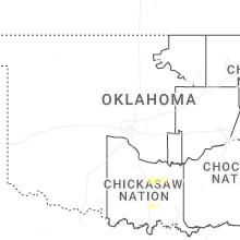

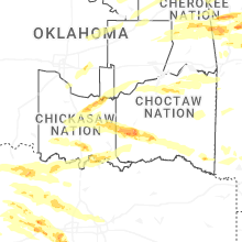
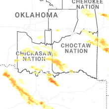
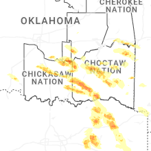
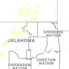

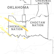
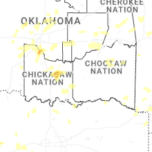


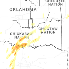
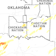
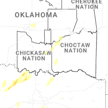
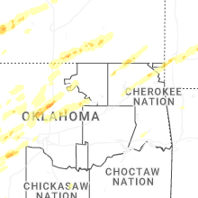


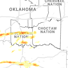


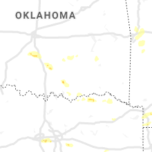


Connect with Interactive Hail Maps