

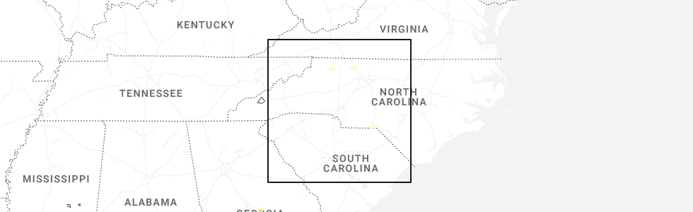
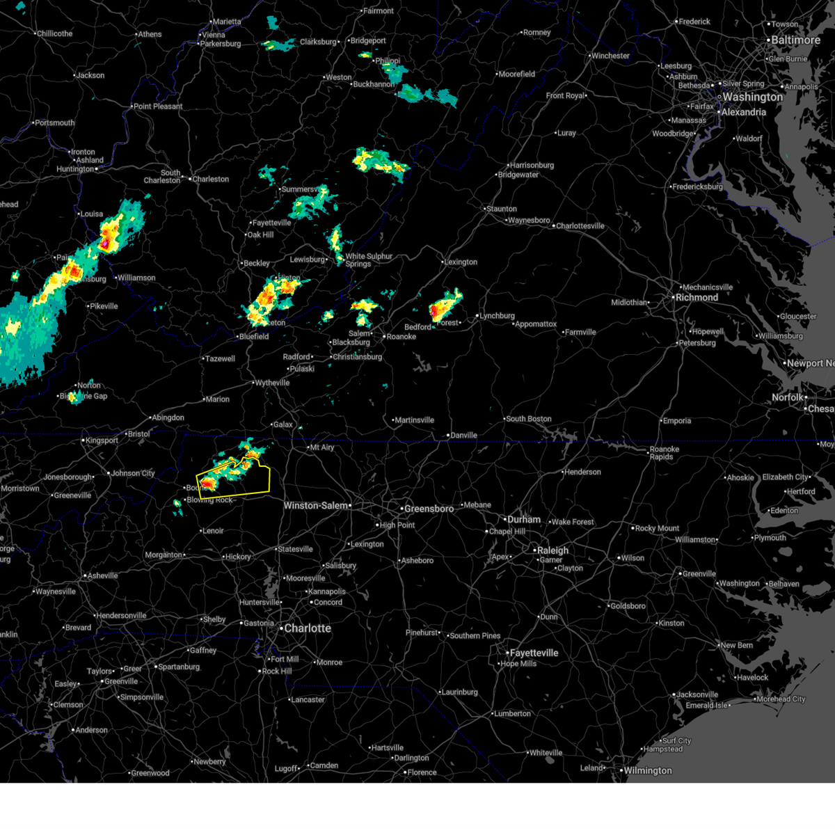
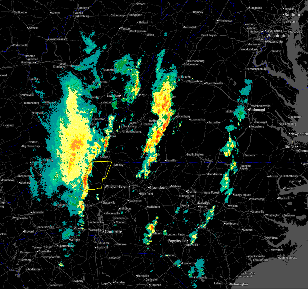
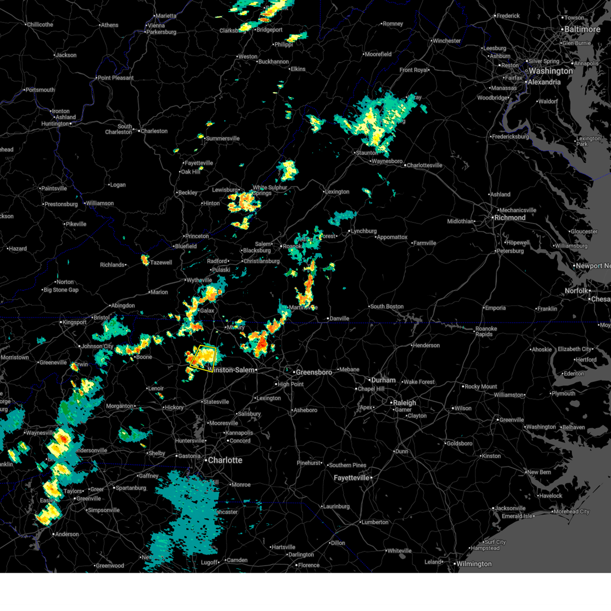
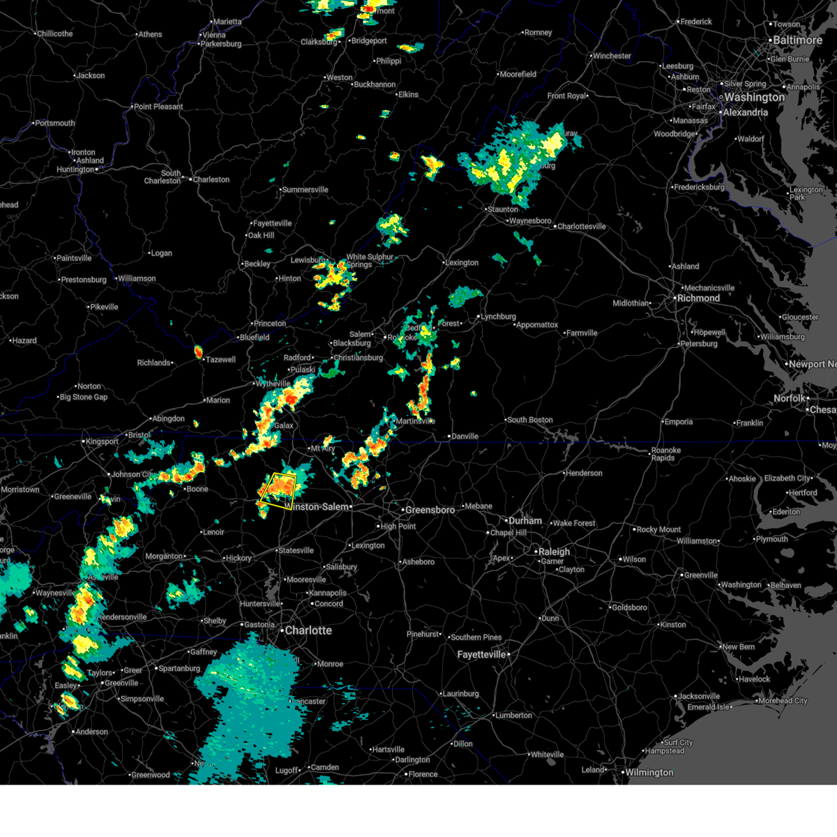
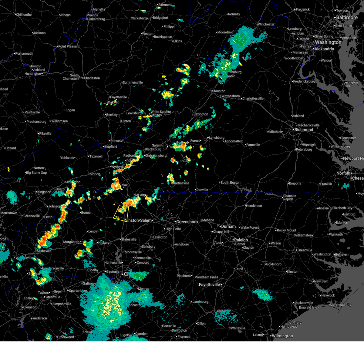
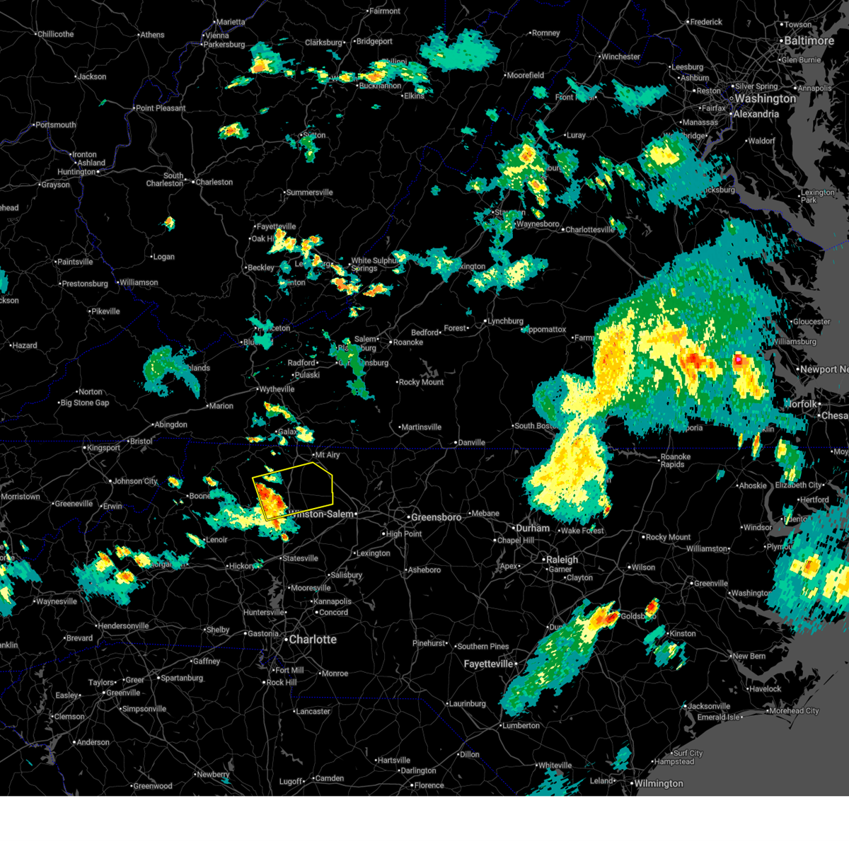
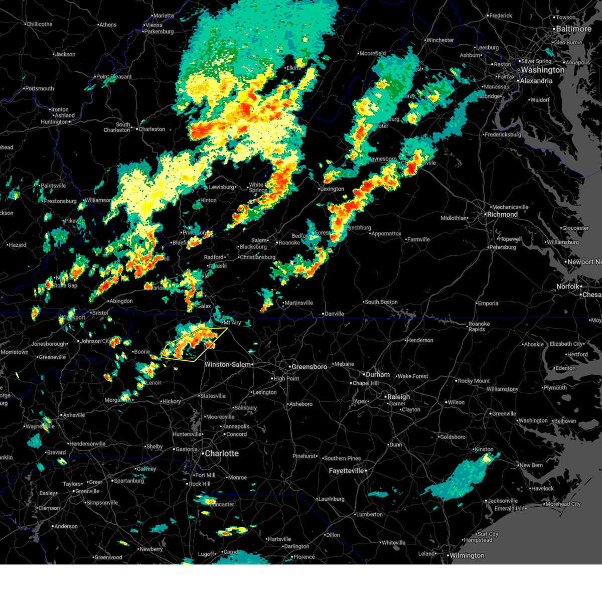
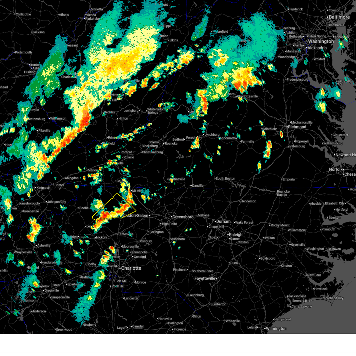
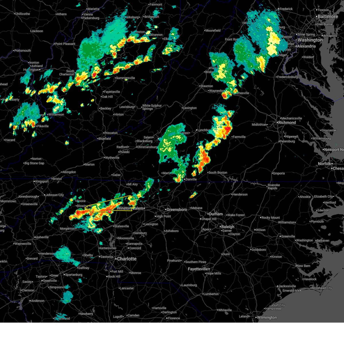
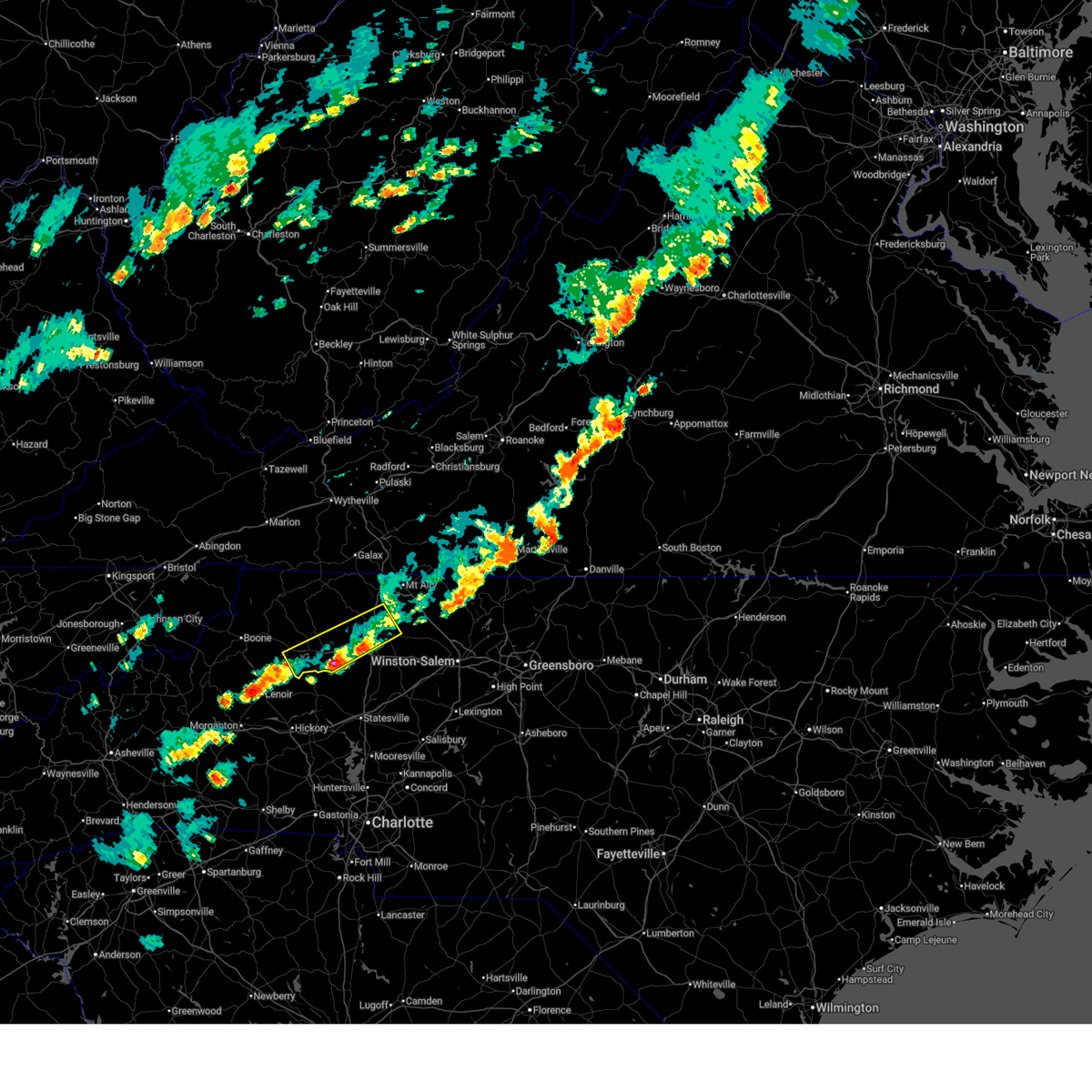
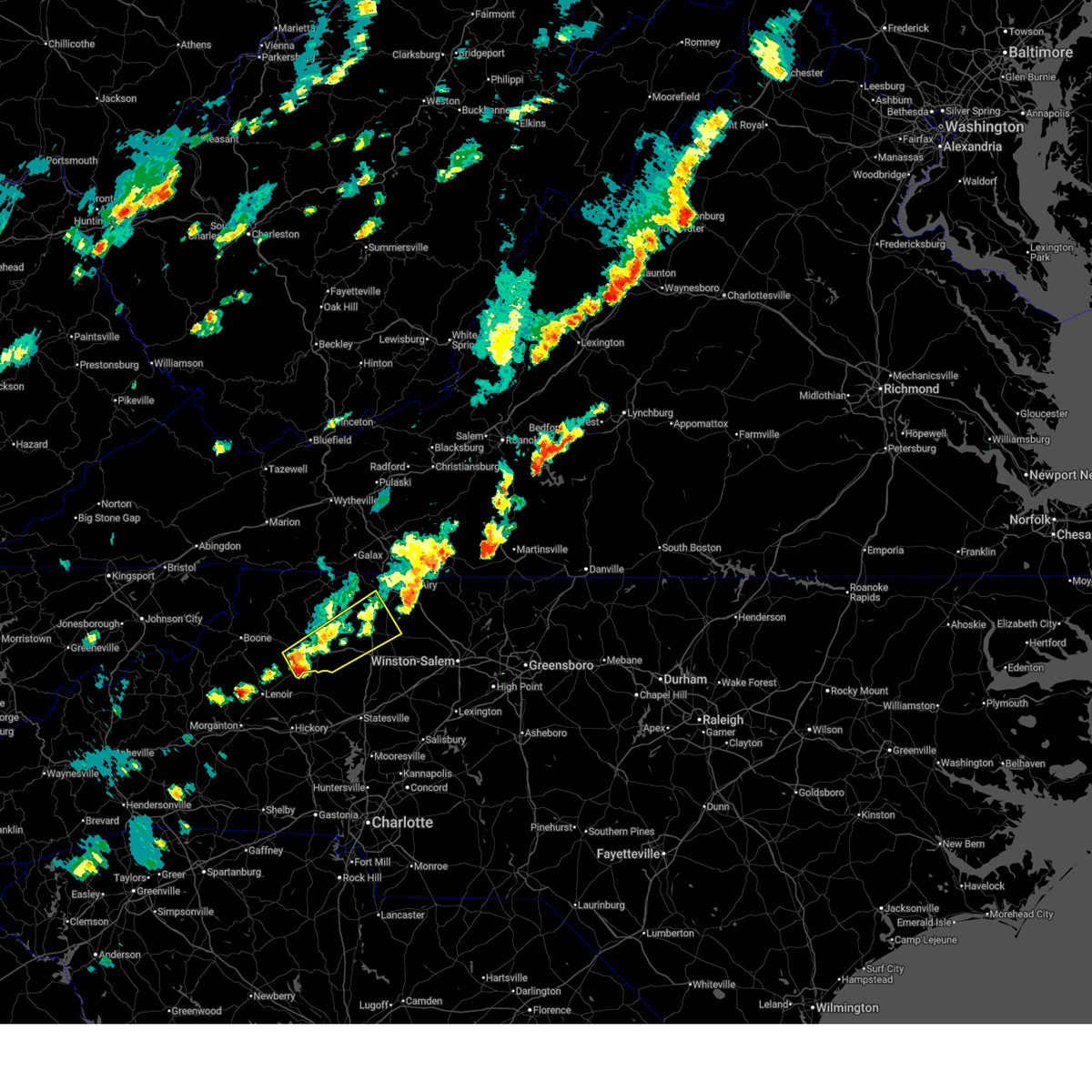
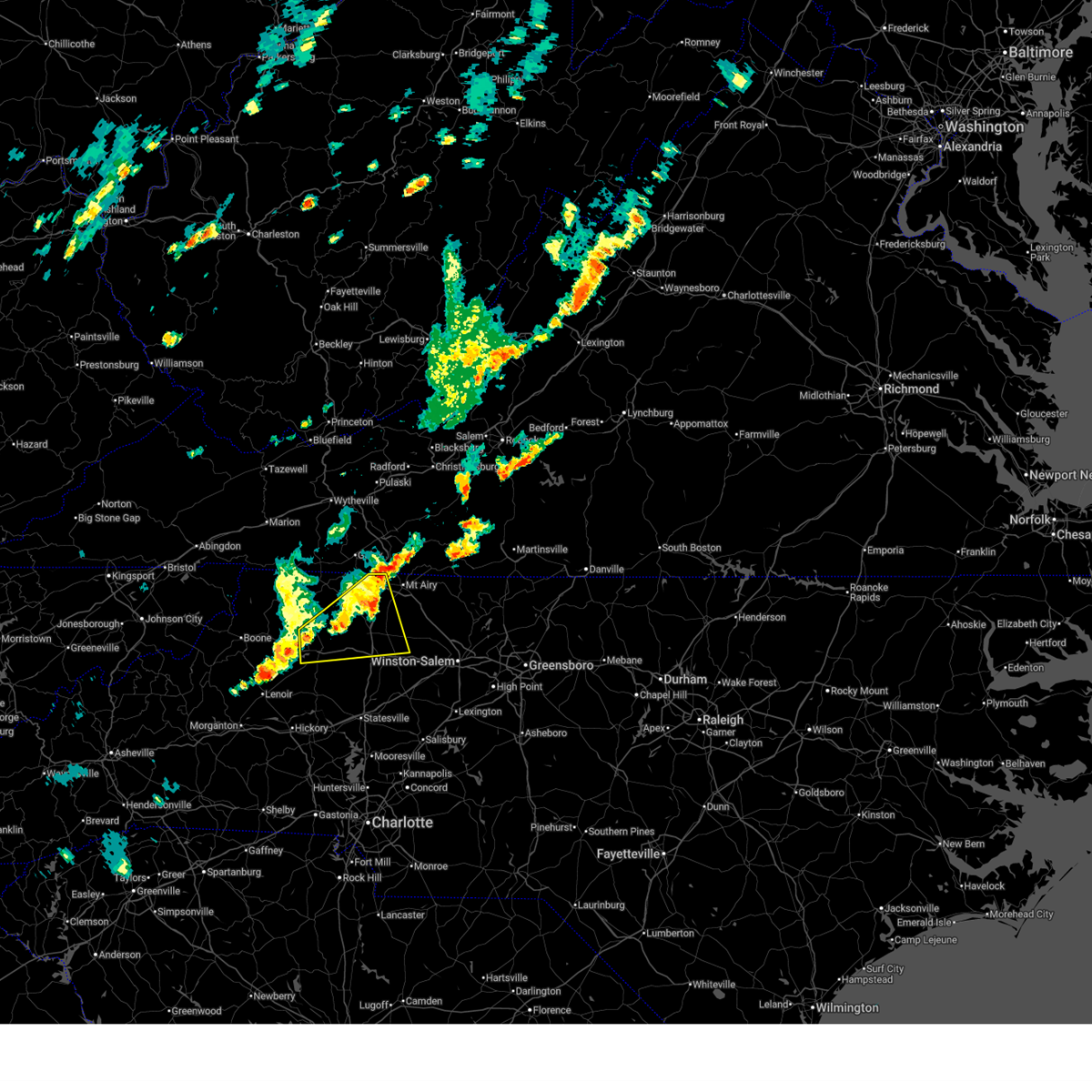
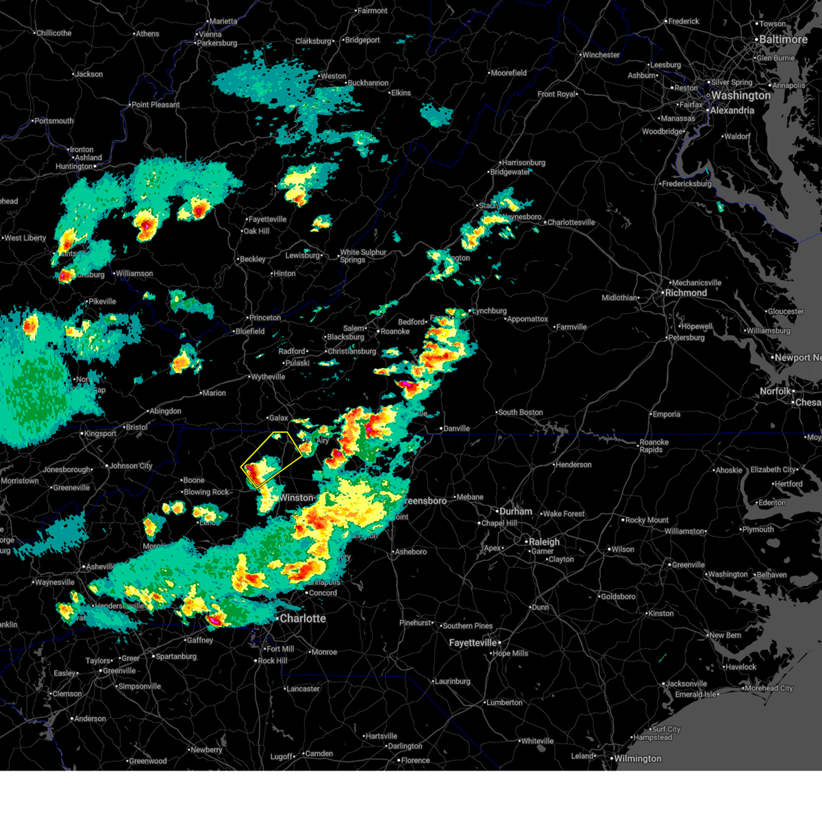
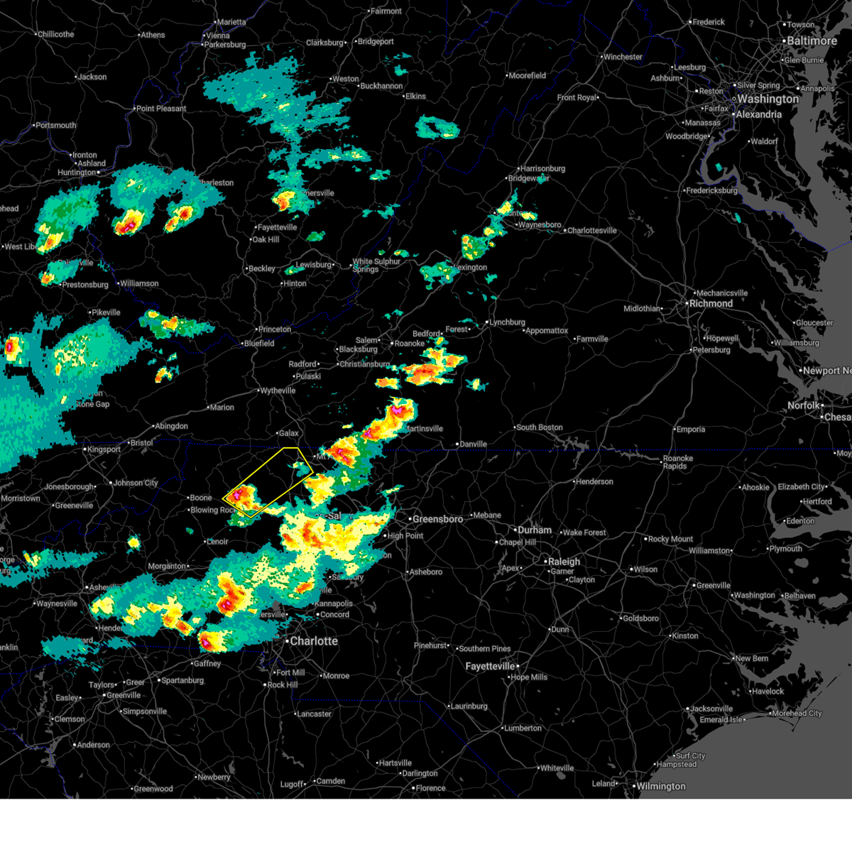
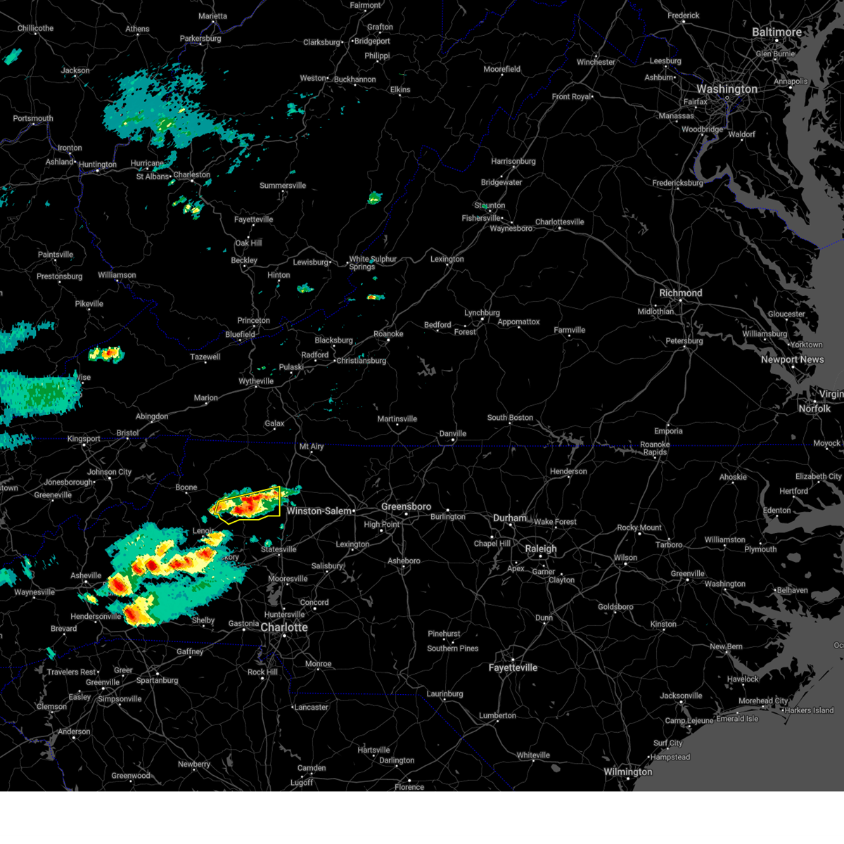
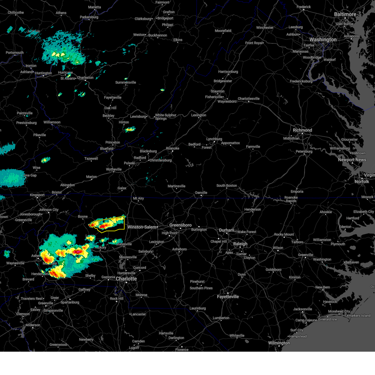
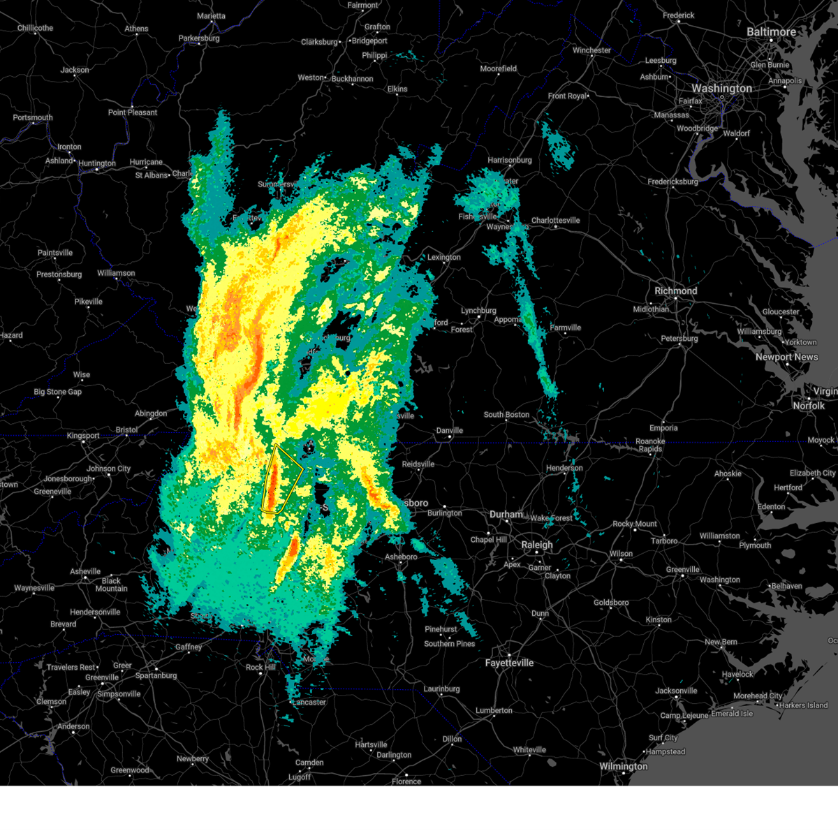
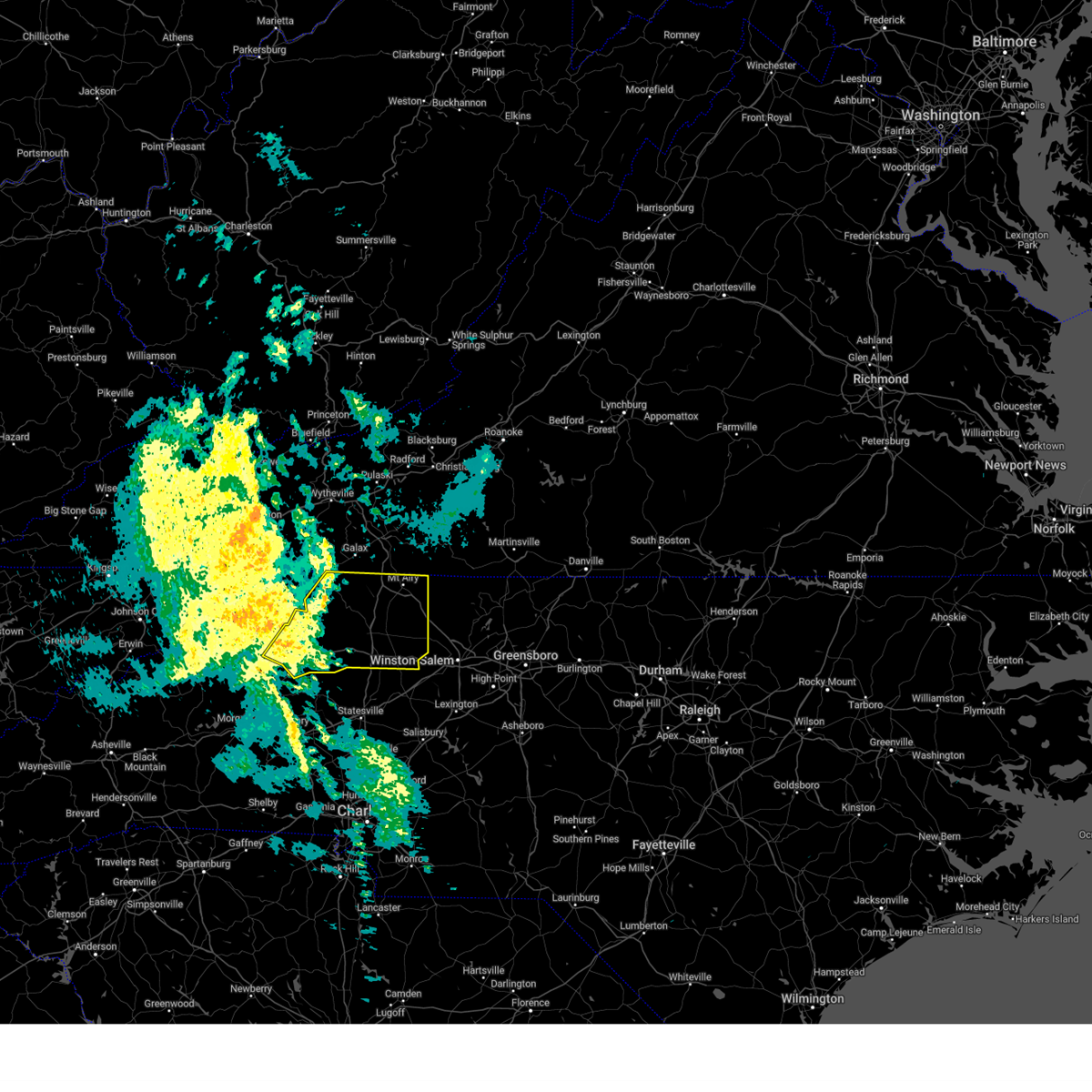
Hail Map for Ronda, NC
The Ronda, NC area has had 9 reports of on-the-ground hail by trained spotters, and has been under severe weather warnings 16 times during the past 12 months. Doppler radar has detected hail at or near Ronda, NC on 36 occasions, including 1 occasion during the past year.
| Name: | Ronda, NC |
| Where Located: | 69.1 miles N of Charlotte, NC |
| Map: | Google Map for Ronda, NC |
| Population: | 417 |
| Housing Units: | 205 |
| More Info: | Search Google for Ronda, NC |
0
The Top Recent Hail Date for Ronda, NC is Thursday, June 18, 2026 (13th out of 36)
Hail and Wind Damage Spotted near Ronda, NC
| Date / Time | Report Details |
|---|---|
| 6/22/2026 5:44 PM EDT |
 At 544 pm edt, severe thunderstorms were located along a line extending from near ararat to boonville to near love valley, moving east at 30 mph (radar indicated). Hazards include 60 mph wind gusts. Expect damage to roofs, siding, and trees. Locations impacted include, mount airy, elkin, fairview, flat rock, yadkinville, jonesville, and dobson. At 544 pm edt, severe thunderstorms were located along a line extending from near ararat to boonville to near love valley, moving east at 30 mph (radar indicated). Hazards include 60 mph wind gusts. Expect damage to roofs, siding, and trees. Locations impacted include, mount airy, elkin, fairview, flat rock, yadkinville, jonesville, and dobson.
|
| 6/22/2026 5:08 PM EDT |
 Svrrnk the national weather service in blacksburg has issued a * severe thunderstorm warning for, eastern alleghany county in northwestern north carolina, surry county in northwestern north carolina, wilkes county in northwestern north carolina, yadkin county in northwestern north carolina, * until 615 pm edt. * at 507 pm edt, severe thunderstorms were located along a line extending from near lambsburg to near roaring river to boomer, moving east at 30 mph (radar indicated). Hazards include 60 mph wind gusts. expect damage to roofs, siding, and trees Svrrnk the national weather service in blacksburg has issued a * severe thunderstorm warning for, eastern alleghany county in northwestern north carolina, surry county in northwestern north carolina, wilkes county in northwestern north carolina, yadkin county in northwestern north carolina, * until 615 pm edt. * at 507 pm edt, severe thunderstorms were located along a line extending from near lambsburg to near roaring river to boomer, moving east at 30 mph (radar indicated). Hazards include 60 mph wind gusts. expect damage to roofs, siding, and trees
|
| 4/1/2026 2:49 PM EDT |
 At 249 pm edt, a severe thunderstorm was located over wilbar, moving east at 15 mph (radar indicated). Hazards include 60 mph wind gusts and quarter size hail. Hail damage to vehicles is expected. expect wind damage to roofs, siding, and trees. Locations impacted include, north wilkesboro, ronda, traphill, wilbar, mc grady, mulberry, and stone mountain state park. At 249 pm edt, a severe thunderstorm was located over wilbar, moving east at 15 mph (radar indicated). Hazards include 60 mph wind gusts and quarter size hail. Hail damage to vehicles is expected. expect wind damage to roofs, siding, and trees. Locations impacted include, north wilkesboro, ronda, traphill, wilbar, mc grady, mulberry, and stone mountain state park.
|
| 4/1/2026 2:49 PM EDT |
 the severe thunderstorm warning has been cancelled and is no longer in effect the severe thunderstorm warning has been cancelled and is no longer in effect
|
| 4/1/2026 2:19 PM EDT |
 Svrrnk the national weather service in blacksburg has issued a * severe thunderstorm warning for, central wilkes county in northwestern north carolina, southeastern watauga county in northwestern north carolina, southeastern ashe county in northwestern north carolina, * until 315 pm edt. * at 218 pm edt, a severe thunderstorm was located over cascade falls, or over deep gap, moving east at 15 mph (radar indicated). Hazards include 60 mph wind gusts and quarter size hail. Hail damage to vehicles is expected. Expect wind damage to roofs, siding, and trees. Svrrnk the national weather service in blacksburg has issued a * severe thunderstorm warning for, central wilkes county in northwestern north carolina, southeastern watauga county in northwestern north carolina, southeastern ashe county in northwestern north carolina, * until 315 pm edt. * at 218 pm edt, a severe thunderstorm was located over cascade falls, or over deep gap, moving east at 15 mph (radar indicated). Hazards include 60 mph wind gusts and quarter size hail. Hail damage to vehicles is expected. Expect wind damage to roofs, siding, and trees.
|
| 3/16/2026 9:27 AM EDT |
 Svrrnk the national weather service in blacksburg has issued a * severe thunderstorm warning for, surry county in northwestern north carolina, western stokes county in north central north carolina, southeastern wilkes county in northwestern north carolina, yadkin county in northwestern north carolina, floyd county in southwestern virginia, carroll county in southwestern virginia, patrick county in southwestern virginia, * until 1030 am edt. * at 926 am edt, severe thunderstorms were located along a line extending from near fancy gap to near buck shoals, moving east at 30 mph (radar indicated). Hazards include 60 mph wind gusts. expect damage to roofs, siding, and trees Svrrnk the national weather service in blacksburg has issued a * severe thunderstorm warning for, surry county in northwestern north carolina, western stokes county in north central north carolina, southeastern wilkes county in northwestern north carolina, yadkin county in northwestern north carolina, floyd county in southwestern virginia, carroll county in southwestern virginia, patrick county in southwestern virginia, * until 1030 am edt. * at 926 am edt, severe thunderstorms were located along a line extending from near fancy gap to near buck shoals, moving east at 30 mph (radar indicated). Hazards include 60 mph wind gusts. expect damage to roofs, siding, and trees
|
| 3/16/2026 9:15 AM EDT |
 At 915 am edt, severe thunderstorms were located along a line extending from cumberland knob to near roaring river, moving east at 35 mph (radar indicated). Hazards include 60 mph wind gusts. Expect damage to roofs, siding, and trees. Locations impacted include, elkin, dobson, ronda, traphill, ennice, mountain park, and bottom. At 915 am edt, severe thunderstorms were located along a line extending from cumberland knob to near roaring river, moving east at 35 mph (radar indicated). Hazards include 60 mph wind gusts. Expect damage to roofs, siding, and trees. Locations impacted include, elkin, dobson, ronda, traphill, ennice, mountain park, and bottom.
|
| 3/16/2026 9:00 AM EDT |
 At 859 am edt, severe thunderstorms were located along a line extending from near ennice to wilkesboro, moving east at 35 mph (radar indicated). Hazards include 60 mph wind gusts. Expect damage to roofs, siding, and trees. Locations impacted include, north wilkesboro, elkin, wilkesboro, sparta, dobson, ronda, and traphill. At 859 am edt, severe thunderstorms were located along a line extending from near ennice to wilkesboro, moving east at 35 mph (radar indicated). Hazards include 60 mph wind gusts. Expect damage to roofs, siding, and trees. Locations impacted include, north wilkesboro, elkin, wilkesboro, sparta, dobson, ronda, and traphill.
|
| 3/16/2026 9:00 AM EDT |
 the severe thunderstorm warning has been cancelled and is no longer in effect the severe thunderstorm warning has been cancelled and is no longer in effect
|
| 3/16/2026 8:35 AM EDT |
 Svrrnk the national weather service in blacksburg has issued a * severe thunderstorm warning for, alleghany county in northwestern north carolina, western surry county in northwestern north carolina, wilkes county in northwestern north carolina, eastern ashe county in northwestern north carolina, * until 930 am edt. * at 835 am edt, severe thunderstorms were located along a line extending from scottville to near maple springs, moving east at 40 mph (radar indicated). Hazards include 60 mph wind gusts. expect damage to roofs, siding, and trees Svrrnk the national weather service in blacksburg has issued a * severe thunderstorm warning for, alleghany county in northwestern north carolina, western surry county in northwestern north carolina, wilkes county in northwestern north carolina, eastern ashe county in northwestern north carolina, * until 930 am edt. * at 835 am edt, severe thunderstorms were located along a line extending from scottville to near maple springs, moving east at 40 mph (radar indicated). Hazards include 60 mph wind gusts. expect damage to roofs, siding, and trees
|
| 9/4/2025 3:44 PM EDT |
 The storm which prompted the warning has weakened below severe limits, and no longer poses an immediate threat to life or property. therefore, the warning will be allowed to expire. however, gusty winds and heavy rain are still possible with this thunderstorm. remember, a severe thunderstorm warning still remains in effect for southeastern surry county until 430 pm edt!. The storm which prompted the warning has weakened below severe limits, and no longer poses an immediate threat to life or property. therefore, the warning will be allowed to expire. however, gusty winds and heavy rain are still possible with this thunderstorm. remember, a severe thunderstorm warning still remains in effect for southeastern surry county until 430 pm edt!.
|
| 9/4/2025 2:49 PM EDT |
 Svrrnk the national weather service in blacksburg has issued a * severe thunderstorm warning for, southeastern surry county in northwestern north carolina, southeastern wilkes county in northwestern north carolina, yadkin county in northwestern north carolina, * until 345 pm edt. * at 249 pm edt, a severe thunderstorm was located near north wilkesboro, moving east at 30 mph (radar indicated). Hazards include 60 mph wind gusts and quarter size hail. Hail damage to vehicles is expected. Expect wind damage to roofs, siding, and trees. Svrrnk the national weather service in blacksburg has issued a * severe thunderstorm warning for, southeastern surry county in northwestern north carolina, southeastern wilkes county in northwestern north carolina, yadkin county in northwestern north carolina, * until 345 pm edt. * at 249 pm edt, a severe thunderstorm was located near north wilkesboro, moving east at 30 mph (radar indicated). Hazards include 60 mph wind gusts and quarter size hail. Hail damage to vehicles is expected. Expect wind damage to roofs, siding, and trees.
|
| 7/29/2025 7:51 PM EDT |
 The storm which prompted the warning has weakened below severe limits, and no longer poses an immediate threat to life or property. therefore, the warning will be allowed to expire. however, gusty winds are still possible with this thunderstorm. The storm which prompted the warning has weakened below severe limits, and no longer poses an immediate threat to life or property. therefore, the warning will be allowed to expire. however, gusty winds are still possible with this thunderstorm.
|
| 7/29/2025 7:38 PM EDT |
 At 736 pm edt, a severe thunderstorm was located over jonesville, moving southwest at 10 mph (law enforcement). Hazards include 60 mph wind gusts. Expect damage to roofs, siding, and trees. Locations impacted include, elkin, jonesville, ronda, buck shoals, benham, pleasant hill, and state road. At 736 pm edt, a severe thunderstorm was located over jonesville, moving southwest at 10 mph (law enforcement). Hazards include 60 mph wind gusts. Expect damage to roofs, siding, and trees. Locations impacted include, elkin, jonesville, ronda, buck shoals, benham, pleasant hill, and state road.
|
| 7/29/2025 7:01 PM EDT |
 Svrrnk the national weather service in blacksburg has issued a * severe thunderstorm warning for, southwestern surry county in northwestern north carolina, east central wilkes county in northwestern north carolina, western yadkin county in northwestern north carolina, * until 800 pm edt. * at 701 pm edt, a severe thunderstorm was located over elkin, moving south at 10 mph (radar indicated). Hazards include 60 mph wind gusts. expect damage to roofs, siding, and trees Svrrnk the national weather service in blacksburg has issued a * severe thunderstorm warning for, southwestern surry county in northwestern north carolina, east central wilkes county in northwestern north carolina, western yadkin county in northwestern north carolina, * until 800 pm edt. * at 701 pm edt, a severe thunderstorm was located over elkin, moving south at 10 mph (radar indicated). Hazards include 60 mph wind gusts. expect damage to roofs, siding, and trees
|
| 7/18/2025 8:07 PM EDT |
 Svrrnk the national weather service in blacksburg has issued a * severe thunderstorm warning for, southern surry county in northwestern north carolina, eastern wilkes county in northwestern north carolina, yadkin county in northwestern north carolina, * until 900 pm edt. * at 806 pm edt, a severe thunderstorm was located over arlington, or over jonesville, moving northeast at 20 mph (radar indicated). Hazards include 60 mph wind gusts and quarter size hail. Hail damage to vehicles is expected. Expect wind damage to roofs, siding, and trees. Svrrnk the national weather service in blacksburg has issued a * severe thunderstorm warning for, southern surry county in northwestern north carolina, eastern wilkes county in northwestern north carolina, yadkin county in northwestern north carolina, * until 900 pm edt. * at 806 pm edt, a severe thunderstorm was located over arlington, or over jonesville, moving northeast at 20 mph (radar indicated). Hazards include 60 mph wind gusts and quarter size hail. Hail damage to vehicles is expected. Expect wind damage to roofs, siding, and trees.
|
| 7/9/2025 3:30 PM EDT |
 the severe thunderstorm warning has been cancelled and is no longer in effect the severe thunderstorm warning has been cancelled and is no longer in effect
|
| 7/9/2025 3:30 PM EDT |
 At 329 pm edt, severe thunderstorms were located along a line extending from near dobson to fairplains, moving southeast at 10 mph (radar indicated). Hazards include 60 mph wind gusts. Expect damage to roofs, siding, and trees. Locations impacted include, north wilkesboro, elkin, wilkesboro, fairview, jonesville, dobson, and ronda. At 329 pm edt, severe thunderstorms were located along a line extending from near dobson to fairplains, moving southeast at 10 mph (radar indicated). Hazards include 60 mph wind gusts. Expect damage to roofs, siding, and trees. Locations impacted include, north wilkesboro, elkin, wilkesboro, fairview, jonesville, dobson, and ronda.
|
| 7/9/2025 3:03 PM EDT |
 Svrrnk the national weather service in blacksburg has issued a * severe thunderstorm warning for, southeastern alleghany county in northwestern north carolina, southern surry county in northwestern north carolina, northeastern wilkes county in northwestern north carolina, northwestern yadkin county in northwestern north carolina, * until 345 pm edt. * at 302 pm edt, severe thunderstorms were located along a line extending from near mountain park to millers creek, moving east at 25 mph (radar indicated). Hazards include 60 mph wind gusts and quarter size hail. Hail damage to vehicles is expected. Expect wind damage to roofs, siding, and trees. Svrrnk the national weather service in blacksburg has issued a * severe thunderstorm warning for, southeastern alleghany county in northwestern north carolina, southern surry county in northwestern north carolina, northeastern wilkes county in northwestern north carolina, northwestern yadkin county in northwestern north carolina, * until 345 pm edt. * at 302 pm edt, severe thunderstorms were located along a line extending from near mountain park to millers creek, moving east at 25 mph (radar indicated). Hazards include 60 mph wind gusts and quarter size hail. Hail damage to vehicles is expected. Expect wind damage to roofs, siding, and trees.
|
| 7/1/2025 6:12 PM EDT |
 The storm which prompted the warning has moved out of the area. therefore, the warning will be allowed to expire. The storm which prompted the warning has moved out of the area. therefore, the warning will be allowed to expire.
|
| 7/1/2025 5:40 PM EDT |
 At 540 pm edt, a severe thunderstorm was located over roaring river, or over ronda, moving northeast at 30 mph (radar indicated). Hazards include 60 mph wind gusts. Expect damage to roofs, siding, and trees. Locations impacted include, north wilkesboro, elkin, wilkesboro, fairview, yadkinville, jonesville, and boonville. At 540 pm edt, a severe thunderstorm was located over roaring river, or over ronda, moving northeast at 30 mph (radar indicated). Hazards include 60 mph wind gusts. Expect damage to roofs, siding, and trees. Locations impacted include, north wilkesboro, elkin, wilkesboro, fairview, yadkinville, jonesville, and boonville.
|
| 7/1/2025 5:19 PM EDT |
 Svrrnk the national weather service in blacksburg has issued a * severe thunderstorm warning for, southwestern surry county in northwestern north carolina, wilkes county in northwestern north carolina, yadkin county in northwestern north carolina, * until 615 pm edt. * at 519 pm edt, a severe thunderstorm was located near moravian falls, or near wilkesboro, moving northeast at 20 mph (radar indicated). Hazards include 60 mph wind gusts. expect damage to roofs, siding, and trees Svrrnk the national weather service in blacksburg has issued a * severe thunderstorm warning for, southwestern surry county in northwestern north carolina, wilkes county in northwestern north carolina, yadkin county in northwestern north carolina, * until 615 pm edt. * at 519 pm edt, a severe thunderstorm was located near moravian falls, or near wilkesboro, moving northeast at 20 mph (radar indicated). Hazards include 60 mph wind gusts. expect damage to roofs, siding, and trees
|
| 6/19/2025 4:00 PM EDT |
 Svrrnk the national weather service in blacksburg has issued a * severe thunderstorm warning for, southeastern surry county in northwestern north carolina, southern wilkes county in northwestern north carolina, yadkin county in northwestern north carolina, * until 500 pm edt. * at 400 pm edt, severe thunderstorms were located along a line extending from enon to 6 miles south of darby, moving east at 35 mph (radar indicated). Hazards include 60 mph wind gusts and quarter size hail. Hail damage to vehicles is expected. Expect wind damage to roofs, siding, and trees. Svrrnk the national weather service in blacksburg has issued a * severe thunderstorm warning for, southeastern surry county in northwestern north carolina, southern wilkes county in northwestern north carolina, yadkin county in northwestern north carolina, * until 500 pm edt. * at 400 pm edt, severe thunderstorms were located along a line extending from enon to 6 miles south of darby, moving east at 35 mph (radar indicated). Hazards include 60 mph wind gusts and quarter size hail. Hail damage to vehicles is expected. Expect wind damage to roofs, siding, and trees.
|
| 6/19/2025 3:00 PM EDT |
 At 259 pm edt, a severe thunderstorm was located over windy gap, or 8 miles southeast of north wilkesboro, moving northeast at 35 mph (radar indicated). Hazards include 60 mph wind gusts and quarter size hail. Hail damage to vehicles is expected. expect wind damage to roofs, siding, and trees. Locations impacted include, north wilkesboro, elkin, wilkesboro, fairview, jonesville, boonville, and ronda. At 259 pm edt, a severe thunderstorm was located over windy gap, or 8 miles southeast of north wilkesboro, moving northeast at 35 mph (radar indicated). Hazards include 60 mph wind gusts and quarter size hail. Hail damage to vehicles is expected. expect wind damage to roofs, siding, and trees. Locations impacted include, north wilkesboro, elkin, wilkesboro, fairview, jonesville, boonville, and ronda.
|
| 6/19/2025 2:20 PM EDT |
 Svrrnk the national weather service in blacksburg has issued a * severe thunderstorm warning for, southwestern surry county in northwestern north carolina, southeastern wilkes county in northwestern north carolina, northwestern yadkin county in northwestern north carolina, * until 315 pm edt. * at 219 pm edt, a severe thunderstorm was located over wilkesboro reservoir, or over boomer, moving northeast at 30 mph (radar indicated). Hazards include 60 mph wind gusts. expect damage to roofs, siding, and trees Svrrnk the national weather service in blacksburg has issued a * severe thunderstorm warning for, southwestern surry county in northwestern north carolina, southeastern wilkes county in northwestern north carolina, northwestern yadkin county in northwestern north carolina, * until 315 pm edt. * at 219 pm edt, a severe thunderstorm was located over wilkesboro reservoir, or over boomer, moving northeast at 30 mph (radar indicated). Hazards include 60 mph wind gusts. expect damage to roofs, siding, and trees
|
| 6/19/2025 1:56 PM EDT |
 At 155 pm edt, a severe thunderstorm was located over mountain park, moving east at 30 mph (radar indicated). Hazards include 60 mph wind gusts and quarter size hail. Hail damage to vehicles is expected. expect wind damage to roofs, siding, and trees. Locations impacted include, north wilkesboro, elkin, wilkesboro, fairview, yadkinville, jonesville, and dobson. At 155 pm edt, a severe thunderstorm was located over mountain park, moving east at 30 mph (radar indicated). Hazards include 60 mph wind gusts and quarter size hail. Hail damage to vehicles is expected. expect wind damage to roofs, siding, and trees. Locations impacted include, north wilkesboro, elkin, wilkesboro, fairview, yadkinville, jonesville, and dobson.
|
| 6/19/2025 1:22 PM EDT |
 Svrrnk the national weather service in blacksburg has issued a * severe thunderstorm warning for, southern alleghany county in northwestern north carolina, western surry county in northwestern north carolina, wilkes county in northwestern north carolina, northwestern yadkin county in northwestern north carolina, * until 215 pm edt. * at 122 pm edt, a severe thunderstorm was located near dockery, or near mc grady, moving east at 30 mph (radar indicated). Hazards include 60 mph wind gusts and quarter size hail. Hail damage to vehicles is expected. Expect wind damage to roofs, siding, and trees. Svrrnk the national weather service in blacksburg has issued a * severe thunderstorm warning for, southern alleghany county in northwestern north carolina, western surry county in northwestern north carolina, wilkes county in northwestern north carolina, northwestern yadkin county in northwestern north carolina, * until 215 pm edt. * at 122 pm edt, a severe thunderstorm was located near dockery, or near mc grady, moving east at 30 mph (radar indicated). Hazards include 60 mph wind gusts and quarter size hail. Hail damage to vehicles is expected. Expect wind damage to roofs, siding, and trees.
|
| 6/14/2025 1:26 PM EDT |
 Svrrnk the national weather service in blacksburg has issued a * severe thunderstorm warning for, surry county in northwestern north carolina, eastern wilkes county in northwestern north carolina, yadkin county in northwestern north carolina, * until 230 pm edt. * at 124 pm edt, a severe thunderstorm was located over pleasant hill, or over ronda, moving east at 25 mph (radar indicated). Hazards include 60 mph wind gusts. expect damage to roofs, siding, and trees Svrrnk the national weather service in blacksburg has issued a * severe thunderstorm warning for, surry county in northwestern north carolina, eastern wilkes county in northwestern north carolina, yadkin county in northwestern north carolina, * until 230 pm edt. * at 124 pm edt, a severe thunderstorm was located over pleasant hill, or over ronda, moving east at 25 mph (radar indicated). Hazards include 60 mph wind gusts. expect damage to roofs, siding, and trees
|
| 5/8/2025 7:18 PM EDT |
 the severe thunderstorm warning has been cancelled and is no longer in effect the severe thunderstorm warning has been cancelled and is no longer in effect
|
| 5/8/2025 7:06 PM EDT |
 At 706 pm edt, a severe thunderstorm was located near traphill, moving northeast at 25 mph (radar indicated). Hazards include 60 mph wind gusts and quarter size hail. Hail damage to vehicles is expected. expect wind damage to roofs, siding, and trees. Locations impacted include, elkin, fairview, dobson, ronda, traphill, mountain park, and bottom. At 706 pm edt, a severe thunderstorm was located near traphill, moving northeast at 25 mph (radar indicated). Hazards include 60 mph wind gusts and quarter size hail. Hail damage to vehicles is expected. expect wind damage to roofs, siding, and trees. Locations impacted include, elkin, fairview, dobson, ronda, traphill, mountain park, and bottom.
|
| 5/8/2025 6:41 PM EDT |
 Svrrnk the national weather service in blacksburg has issued a * severe thunderstorm warning for, southeastern alleghany county in northwestern north carolina, western surry county in northwestern north carolina, eastern wilkes county in northwestern north carolina, * until 745 pm edt. * at 641 pm edt, a severe thunderstorm was located over halls mills, or near mc grady, moving northeast at 25 mph (radar indicated). Hazards include 60 mph wind gusts and half dollar size hail. Hail damage to vehicles is expected. Expect wind damage to roofs, siding, and trees. Svrrnk the national weather service in blacksburg has issued a * severe thunderstorm warning for, southeastern alleghany county in northwestern north carolina, western surry county in northwestern north carolina, eastern wilkes county in northwestern north carolina, * until 745 pm edt. * at 641 pm edt, a severe thunderstorm was located over halls mills, or near mc grady, moving northeast at 25 mph (radar indicated). Hazards include 60 mph wind gusts and half dollar size hail. Hail damage to vehicles is expected. Expect wind damage to roofs, siding, and trees.
|
| 5/8/2025 5:18 PM EDT | Quarter sized hail reported 4.9 miles N of Ronda, NC, time estimated from radar. |
| 5/8/2025 4:56 PM EDT |
 At 455 pm edt, a severe thunderstorm was located over moravian falls, or near wilkesboro, moving southeast at 10 mph (radar indicated). Hazards include 60 mph wind gusts and quarter size hail. Hail damage to vehicles is expected. expect wind damage to roofs, siding, and trees. Locations impacted include, north wilkesboro, wilkesboro, ronda, boomer, windy gap, wilkesboro reservoir, and buck. At 455 pm edt, a severe thunderstorm was located over moravian falls, or near wilkesboro, moving southeast at 10 mph (radar indicated). Hazards include 60 mph wind gusts and quarter size hail. Hail damage to vehicles is expected. expect wind damage to roofs, siding, and trees. Locations impacted include, north wilkesboro, wilkesboro, ronda, boomer, windy gap, wilkesboro reservoir, and buck.
|
| 5/8/2025 4:32 PM EDT |
 Svrrnk the national weather service in blacksburg has issued a * severe thunderstorm warning for, southern wilkes county in northwestern north carolina, * until 530 pm edt. * at 432 pm edt, a severe thunderstorm was located over boomer, moving east at 15 mph (radar indicated). Hazards include 60 mph wind gusts and quarter size hail. Hail damage to vehicles is expected. Expect wind damage to roofs, siding, and trees. Svrrnk the national weather service in blacksburg has issued a * severe thunderstorm warning for, southern wilkes county in northwestern north carolina, * until 530 pm edt. * at 432 pm edt, a severe thunderstorm was located over boomer, moving east at 15 mph (radar indicated). Hazards include 60 mph wind gusts and quarter size hail. Hail damage to vehicles is expected. Expect wind damage to roofs, siding, and trees.
|
| 3/5/2025 7:59 AM EST |
 The storms which prompted the warning have moved out of the area. therefore, the warning will be allowed to expire. however, gusty winds are still possible with these thunderstorms. a tornado watch remains in effect until 100 pm est for north central north carolina. remember, another severe thunderstorm warning still remains in effect for surry county and yadkin county until 830 am est. The storms which prompted the warning have moved out of the area. therefore, the warning will be allowed to expire. however, gusty winds are still possible with these thunderstorms. a tornado watch remains in effect until 100 pm est for north central north carolina. remember, another severe thunderstorm warning still remains in effect for surry county and yadkin county until 830 am est.
|
| 3/5/2025 7:43 AM EST |
 the severe thunderstorm warning has been cancelled and is no longer in effect the severe thunderstorm warning has been cancelled and is no longer in effect
|
| 3/5/2025 7:43 AM EST |
 At 743 am est, severe thunderstorms were located along a line extending from near roaring gap to near buck shoals, moving northeast at 50 mph (radar indicated). Hazards include 60 mph wind gusts. Expect damage to roofs, siding, and trees. Locations impacted include, elkin, fairview, jonesville, dobson, ronda, mountain park, and windy gap. At 743 am est, severe thunderstorms were located along a line extending from near roaring gap to near buck shoals, moving northeast at 50 mph (radar indicated). Hazards include 60 mph wind gusts. Expect damage to roofs, siding, and trees. Locations impacted include, elkin, fairview, jonesville, dobson, ronda, mountain park, and windy gap.
|
| 3/5/2025 7:28 AM EST |
 Svrrnk the national weather service in blacksburg has issued a * severe thunderstorm warning for, southeastern alleghany county in northwestern north carolina, western surry county in northwestern north carolina, eastern wilkes county in northwestern north carolina, northwestern yadkin county in northwestern north carolina, * until 800 am est. * at 728 am est, severe thunderstorms were located along a line extending from dockery to 6 miles southeast of moravian falls, moving northeast at 60 mph (radar indicated). Hazards include 60 mph wind gusts. expect damage to roofs, siding, and trees Svrrnk the national weather service in blacksburg has issued a * severe thunderstorm warning for, southeastern alleghany county in northwestern north carolina, western surry county in northwestern north carolina, eastern wilkes county in northwestern north carolina, northwestern yadkin county in northwestern north carolina, * until 800 am est. * at 728 am est, severe thunderstorms were located along a line extending from dockery to 6 miles southeast of moravian falls, moving northeast at 60 mph (radar indicated). Hazards include 60 mph wind gusts. expect damage to roofs, siding, and trees
|
| 12/29/2024 10:30 AM EST |
 The storms which prompted the warning have weakened below severe limits, and no longer pose an immediate threat to life or property. therefore, the warning has been allowed to expire. however, gusty winds and heavy rain are still possible with these thunderstorms. a severe thunderstorm watch remains in effect until 500 pm est for north central and northwestern north carolina. The storms which prompted the warning have weakened below severe limits, and no longer pose an immediate threat to life or property. therefore, the warning has been allowed to expire. however, gusty winds and heavy rain are still possible with these thunderstorms. a severe thunderstorm watch remains in effect until 500 pm est for north central and northwestern north carolina.
|
| 12/29/2024 10:04 AM EST |
 At 1004 am est, severe thunderstorms were located along a line extending from twin oaks to near cleveland, moving northeast at 40 mph (radar indicated). Hazards include 60 mph wind gusts. Expect damage to roofs, siding, and trees. Locations impacted include, mount airy, north wilkesboro, elkin, fairview, flat rock, yadkinville, and jonesville. At 1004 am est, severe thunderstorms were located along a line extending from twin oaks to near cleveland, moving northeast at 40 mph (radar indicated). Hazards include 60 mph wind gusts. Expect damage to roofs, siding, and trees. Locations impacted include, mount airy, north wilkesboro, elkin, fairview, flat rock, yadkinville, and jonesville.
|
| 12/29/2024 9:25 AM EST |
 Svrrnk the national weather service in blacksburg has issued a * severe thunderstorm warning for, alleghany county in northwestern north carolina, surry county in northwestern north carolina, wilkes county in northwestern north carolina, yadkin county in northwestern north carolina, * until 1030 am est. * at 923 am est, severe thunderstorms were located along a line extending from near darby to near stanley, moving northeast at 50 mph (radar indicated). Hazards include 70 mph wind gusts. Expect considerable tree damage. Damage is likely to mobile homes, roofs, and outbuildings. Svrrnk the national weather service in blacksburg has issued a * severe thunderstorm warning for, alleghany county in northwestern north carolina, surry county in northwestern north carolina, wilkes county in northwestern north carolina, yadkin county in northwestern north carolina, * until 1030 am est. * at 923 am est, severe thunderstorms were located along a line extending from near darby to near stanley, moving northeast at 50 mph (radar indicated). Hazards include 70 mph wind gusts. Expect considerable tree damage. Damage is likely to mobile homes, roofs, and outbuildings.
|
| 8/30/2024 6:59 PM EDT |
 Svrrnk the national weather service in blacksburg has issued a * severe thunderstorm warning for, central wilkes county in northwestern north carolina, southwestern yadkin county in northwestern north carolina, * until 800 pm edt. * at 658 pm edt, severe thunderstorms were located along a line extending from halls mills to near swancreek to near buck shoals, and are nearly stationary (radar indicated). Hazards include 60 mph wind gusts and quarter size hail. Hail damage to vehicles is expected. Expect wind damage to roofs, siding, and trees. Svrrnk the national weather service in blacksburg has issued a * severe thunderstorm warning for, central wilkes county in northwestern north carolina, southwestern yadkin county in northwestern north carolina, * until 800 pm edt. * at 658 pm edt, severe thunderstorms were located along a line extending from halls mills to near swancreek to near buck shoals, and are nearly stationary (radar indicated). Hazards include 60 mph wind gusts and quarter size hail. Hail damage to vehicles is expected. Expect wind damage to roofs, siding, and trees.
|
| 8/30/2024 6:14 PM EDT | Tree down along byrd roa in wilkes county NC, 5.5 miles SSE of Ronda, NC |
| 8/30/2024 6:10 PM EDT |
 Svrrnk the national weather service in blacksburg has issued a * severe thunderstorm warning for, southeastern alleghany county in northwestern north carolina, southwestern surry county in northwestern north carolina, eastern wilkes county in northwestern north carolina, northwestern yadkin county in northwestern north carolina, * until 700 pm edt. * at 610 pm edt, a severe thunderstorm was located over roaring river, or over ronda, moving southeast at 5 mph (radar indicated). Hazards include 60 mph wind gusts and quarter size hail. Hail damage to vehicles is expected. Expect wind damage to roofs, siding, and trees. Svrrnk the national weather service in blacksburg has issued a * severe thunderstorm warning for, southeastern alleghany county in northwestern north carolina, southwestern surry county in northwestern north carolina, eastern wilkes county in northwestern north carolina, northwestern yadkin county in northwestern north carolina, * until 700 pm edt. * at 610 pm edt, a severe thunderstorm was located over roaring river, or over ronda, moving southeast at 5 mph (radar indicated). Hazards include 60 mph wind gusts and quarter size hail. Hail damage to vehicles is expected. Expect wind damage to roofs, siding, and trees.
|
| 7/16/2024 2:57 PM EDT |
 The storm which prompted the warning has moved out of the area. therefore, the warning will be allowed to expire. however, heavy rain is still possible with this thunderstorm. remember, a severe thunderstorm warning still remains in effect for surry county until 330 pm edt. The storm which prompted the warning has moved out of the area. therefore, the warning will be allowed to expire. however, heavy rain is still possible with this thunderstorm. remember, a severe thunderstorm warning still remains in effect for surry county until 330 pm edt.
|
| 7/16/2024 2:27 PM EDT |
 the severe thunderstorm warning has been cancelled and is no longer in effect the severe thunderstorm warning has been cancelled and is no longer in effect
|
| 7/16/2024 2:27 PM EDT |
 At 226 pm edt, a severe thunderstorm was located over hays, or near north wilkesboro, moving east at 20 mph (radar indicated). Hazards include 60 mph wind gusts and quarter size hail. Hail damage to vehicles is expected. expect wind damage to roofs, siding, and trees. Locations impacted include, north wilkesboro, elkin, jonesville, ronda, traphill, mc grady, and mountain park. At 226 pm edt, a severe thunderstorm was located over hays, or near north wilkesboro, moving east at 20 mph (radar indicated). Hazards include 60 mph wind gusts and quarter size hail. Hail damage to vehicles is expected. expect wind damage to roofs, siding, and trees. Locations impacted include, north wilkesboro, elkin, jonesville, ronda, traphill, mc grady, and mountain park.
|
| 7/16/2024 2:07 PM EDT |
 At 206 pm edt, a severe thunderstorm was located near wilbar, moving east at 15 mph (radar indicated). Hazards include 60 mph wind gusts and quarter size hail. Hail damage to vehicles is expected. expect wind damage to roofs, siding, and trees. Locations impacted include, north wilkesboro, elkin, jonesville, ronda, traphill, mc grady, and wilbar. At 206 pm edt, a severe thunderstorm was located near wilbar, moving east at 15 mph (radar indicated). Hazards include 60 mph wind gusts and quarter size hail. Hail damage to vehicles is expected. expect wind damage to roofs, siding, and trees. Locations impacted include, north wilkesboro, elkin, jonesville, ronda, traphill, mc grady, and wilbar.
|
| 7/16/2024 1:55 PM EDT |
 Svrrnk the national weather service in blacksburg has issued a * severe thunderstorm warning for, southeastern alleghany county in northwestern north carolina, southwestern surry county in northwestern north carolina, central wilkes county in northwestern north carolina, southeastern ashe county in northwestern north carolina, west central yadkin county in northwestern north carolina, * until 300 pm edt. * at 155 pm edt, a severe thunderstorm was located over wilbar, moving east at 20 mph (radar indicated). Hazards include 60 mph wind gusts and half dollar size hail. Hail damage to vehicles is expected. Expect wind damage to roofs, siding, and trees. Svrrnk the national weather service in blacksburg has issued a * severe thunderstorm warning for, southeastern alleghany county in northwestern north carolina, southwestern surry county in northwestern north carolina, central wilkes county in northwestern north carolina, southeastern ashe county in northwestern north carolina, west central yadkin county in northwestern north carolina, * until 300 pm edt. * at 155 pm edt, a severe thunderstorm was located over wilbar, moving east at 20 mph (radar indicated). Hazards include 60 mph wind gusts and half dollar size hail. Hail damage to vehicles is expected. Expect wind damage to roofs, siding, and trees.
|
| 5/7/2024 6:00 PM EDT |
 the severe thunderstorm warning has been cancelled and is no longer in effect the severe thunderstorm warning has been cancelled and is no longer in effect
|
| 5/7/2024 5:54 PM EDT |
 At 553 pm edt, severe thunderstorms were located along a line extending from near roaring river to 8 miles south of boomer to taylorsville, moving southeast at 30 mph (radar indicated). Hazards include 60 mph wind gusts and quarter size hail. Hail damage to vehicles is expected. expect wind damage to roofs, siding, and trees. Locations impacted include, ronda, windy gap, clingman, roaring river, and pleasant hill. At 553 pm edt, severe thunderstorms were located along a line extending from near roaring river to 8 miles south of boomer to taylorsville, moving southeast at 30 mph (radar indicated). Hazards include 60 mph wind gusts and quarter size hail. Hail damage to vehicles is expected. expect wind damage to roofs, siding, and trees. Locations impacted include, ronda, windy gap, clingman, roaring river, and pleasant hill.
|
| 5/7/2024 5:41 PM EDT |
 At 540 pm edt, severe thunderstorms were located along a line extending from near wilkes county airport to near boomer to near taylorsville, moving heast at 15 mph (radar indicated). Hazards include 60 mph wind gusts and quarter size hail. Hail damage to vehicles is expected. expect wind damage to roofs, siding, and trees. Locations impacted include, north wilkesboro, wilkesboro, ronda, boomer, windy gap, fairplains, and cricket. At 540 pm edt, severe thunderstorms were located along a line extending from near wilkes county airport to near boomer to near taylorsville, moving heast at 15 mph (radar indicated). Hazards include 60 mph wind gusts and quarter size hail. Hail damage to vehicles is expected. expect wind damage to roofs, siding, and trees. Locations impacted include, north wilkesboro, wilkesboro, ronda, boomer, windy gap, fairplains, and cricket.
|
| 5/7/2024 5:28 PM EDT |
 Svrrnk the national weather service in blacksburg has issued a * severe thunderstorm warning for, southeastern wilkes county in northwestern north carolina, * until 615 pm edt. * at 528 pm edt, severe thunderstorms were located along a line extending from wilkesboro to near taylorsville, moving east at 20 mph (radar indicated). Hazards include 60 mph wind gusts and quarter size hail. Hail damage to vehicles is expected. Expect wind damage to roofs, siding, and trees. Svrrnk the national weather service in blacksburg has issued a * severe thunderstorm warning for, southeastern wilkes county in northwestern north carolina, * until 615 pm edt. * at 528 pm edt, severe thunderstorms were located along a line extending from wilkesboro to near taylorsville, moving east at 20 mph (radar indicated). Hazards include 60 mph wind gusts and quarter size hail. Hail damage to vehicles is expected. Expect wind damage to roofs, siding, and trees.
|
| 4/11/2024 7:33 PM EDT |
 Svrrnk the national weather service in blacksburg has issued a * severe thunderstorm warning for, eastern alleghany county in northwestern north carolina, surry county in northwestern north carolina, western stokes county in north central north carolina, northeastern wilkes county in northwestern north carolina, yadkin county in northwestern north carolina, south central carroll county in southwestern virginia, southeastern grayson county in southwestern virginia, southwestern patrick county in southwestern virginia, * until 830 pm edt. * at 733 pm edt, severe thunderstorms were located along a line extending from low gap to near burch to near buck shoals, moving northeast at 40 mph (radar indicated). Hazards include 60 mph wind gusts. expect damage to roofs, siding, and trees Svrrnk the national weather service in blacksburg has issued a * severe thunderstorm warning for, eastern alleghany county in northwestern north carolina, surry county in northwestern north carolina, western stokes county in north central north carolina, northeastern wilkes county in northwestern north carolina, yadkin county in northwestern north carolina, south central carroll county in southwestern virginia, southeastern grayson county in southwestern virginia, southwestern patrick county in southwestern virginia, * until 830 pm edt. * at 733 pm edt, severe thunderstorms were located along a line extending from low gap to near burch to near buck shoals, moving northeast at 40 mph (radar indicated). Hazards include 60 mph wind gusts. expect damage to roofs, siding, and trees
|
| 4/11/2024 7:32 PM EDT |
 The storm which prompted the warning has moved out of the area. therefore, the warning has been allowed to expire. a tornado watch remains in effect until 1100 pm edt for north central and northwestern north carolina, and southwestern virginia. The storm which prompted the warning has moved out of the area. therefore, the warning has been allowed to expire. a tornado watch remains in effect until 1100 pm edt for north central and northwestern north carolina, and southwestern virginia.
|
| 4/11/2024 7:17 PM EDT |
 Torrnk the national weather service in blacksburg has issued a * tornado warning for, southern surry county in northwestern north carolina, east central wilkes county in northwestern north carolina, northwestern yadkin county in northwestern north carolina, * until 745 pm edt. * at 716 pm edt, a tornado producing storm was located over ronda, moving northeast at 45 mph (radar confirmed tornado). Hazards include damaging tornado. Flying debris will be dangerous to those caught without shelter. mobile homes will be damaged or destroyed. damage to roofs, windows, and vehicles will occur. Tree damage is likely. Torrnk the national weather service in blacksburg has issued a * tornado warning for, southern surry county in northwestern north carolina, east central wilkes county in northwestern north carolina, northwestern yadkin county in northwestern north carolina, * until 745 pm edt. * at 716 pm edt, a tornado producing storm was located over ronda, moving northeast at 45 mph (radar confirmed tornado). Hazards include damaging tornado. Flying debris will be dangerous to those caught without shelter. mobile homes will be damaged or destroyed. damage to roofs, windows, and vehicles will occur. Tree damage is likely.
|
| 4/11/2024 7:13 PM EDT |
 At 713 pm edt, a confirmed tornado was located over roaring river, or over ronda, moving northeast at 35 mph (radar confirmed tornado). Hazards include damaging tornado. Flying debris will be dangerous to those caught without shelter. mobile homes will be damaged or destroyed. damage to roofs, windows, and vehicles will occur. tree damage is likely. Locations impacted include, elkin, jonesville, ronda, pleasant hill, clingman, arlington, and swancreek. At 713 pm edt, a confirmed tornado was located over roaring river, or over ronda, moving northeast at 35 mph (radar confirmed tornado). Hazards include damaging tornado. Flying debris will be dangerous to those caught without shelter. mobile homes will be damaged or destroyed. damage to roofs, windows, and vehicles will occur. tree damage is likely. Locations impacted include, elkin, jonesville, ronda, pleasant hill, clingman, arlington, and swancreek.
|
| 4/11/2024 7:06 PM EDT |
 At 706 pm edt, a severe thunderstorm capable of producing a tornado was located near windy gap, or near ronda, moving northeast at 35 mph (radar indicated rotation). Hazards include tornado. Flying debris will be dangerous to those caught without shelter. mobile homes will be damaged or destroyed. damage to roofs, windows, and vehicles will occur. tree damage is likely. Locations impacted include, elkin, jonesville, ronda, windy gap, pleasant hill, clingman, and arlington. At 706 pm edt, a severe thunderstorm capable of producing a tornado was located near windy gap, or near ronda, moving northeast at 35 mph (radar indicated rotation). Hazards include tornado. Flying debris will be dangerous to those caught without shelter. mobile homes will be damaged or destroyed. damage to roofs, windows, and vehicles will occur. tree damage is likely. Locations impacted include, elkin, jonesville, ronda, windy gap, pleasant hill, clingman, and arlington.
|
| 4/11/2024 7:00 PM EDT |
 At 700 pm edt, a severe thunderstorm was located over hays, or near traphill, moving northeast at 55 mph (radar indicated). Hazards include 60 mph wind gusts. Expect damage to roofs, siding, and trees. Locations impacted include, north wilkesboro, elkin, wilkesboro, jonesville, sparta, ronda, and traphill. At 700 pm edt, a severe thunderstorm was located over hays, or near traphill, moving northeast at 55 mph (radar indicated). Hazards include 60 mph wind gusts. Expect damage to roofs, siding, and trees. Locations impacted include, north wilkesboro, elkin, wilkesboro, jonesville, sparta, ronda, and traphill.
|
| 4/11/2024 7:00 PM EDT |
 the severe thunderstorm warning has been cancelled and is no longer in effect the severe thunderstorm warning has been cancelled and is no longer in effect
|
| 4/11/2024 6:59 PM EDT |
 Torrnk the national weather service in blacksburg has issued a * tornado warning for, south central surry county in northwestern north carolina, southeastern wilkes county in northwestern north carolina, northwestern yadkin county in northwestern north carolina, * until 730 pm edt. * at 659 pm edt, a severe thunderstorm capable of producing a tornado was located near windy gap, or 7 miles southeast of north wilkesboro, moving northeast at 35 mph (radar indicated rotation). Hazards include tornado. Flying debris will be dangerous to those caught without shelter. mobile homes will be damaged or destroyed. damage to roofs, windows, and vehicles will occur. Tree damage is likely. Torrnk the national weather service in blacksburg has issued a * tornado warning for, south central surry county in northwestern north carolina, southeastern wilkes county in northwestern north carolina, northwestern yadkin county in northwestern north carolina, * until 730 pm edt. * at 659 pm edt, a severe thunderstorm capable of producing a tornado was located near windy gap, or 7 miles southeast of north wilkesboro, moving northeast at 35 mph (radar indicated rotation). Hazards include tornado. Flying debris will be dangerous to those caught without shelter. mobile homes will be damaged or destroyed. damage to roofs, windows, and vehicles will occur. Tree damage is likely.
|
| 4/11/2024 6:34 PM EDT |
 Svrrnk the national weather service in blacksburg has issued a * severe thunderstorm warning for, southern alleghany county in northwestern north carolina, southwestern surry county in northwestern north carolina, wilkes county in northwestern north carolina, southeastern watauga county in northwestern north carolina, southeastern ashe county in northwestern north carolina, northwestern yadkin county in northwestern north carolina, * until 730 pm edt. * at 634 pm edt, a severe thunderstorm was located near boomer, moving northeast at 55 mph (radar indicated). Hazards include 60 mph wind gusts. expect damage to roofs, siding, and trees Svrrnk the national weather service in blacksburg has issued a * severe thunderstorm warning for, southern alleghany county in northwestern north carolina, southwestern surry county in northwestern north carolina, wilkes county in northwestern north carolina, southeastern watauga county in northwestern north carolina, southeastern ashe county in northwestern north carolina, northwestern yadkin county in northwestern north carolina, * until 730 pm edt. * at 634 pm edt, a severe thunderstorm was located near boomer, moving northeast at 55 mph (radar indicated). Hazards include 60 mph wind gusts. expect damage to roofs, siding, and trees
|
| 9/13/2023 3:16 PM EDT |
 At 315 pm edt, severe thunderstorms were located along a line extending from burch to near roaring river, moving east at 15 mph (radar indicated). Hazards include 60 mph wind gusts and quarter size hail. Hail damage to vehicles is expected. expect wind damage to roofs, siding, and trees. locations impacted include, elkin, fairview, yadkinville, jonesville, boonville, ronda, and nebo. hail threat, radar indicated max hail size, 1. 00 in wind threat, radar indicated max wind gust, 60 mph. At 315 pm edt, severe thunderstorms were located along a line extending from burch to near roaring river, moving east at 15 mph (radar indicated). Hazards include 60 mph wind gusts and quarter size hail. Hail damage to vehicles is expected. expect wind damage to roofs, siding, and trees. locations impacted include, elkin, fairview, yadkinville, jonesville, boonville, ronda, and nebo. hail threat, radar indicated max hail size, 1. 00 in wind threat, radar indicated max wind gust, 60 mph.
|
| 9/13/2023 2:53 PM EDT |
 At 253 pm edt, severe thunderstorms were located along a line extending from state road to wilkes county airport, moving east at 15 mph (radar indicated). Hazards include 60 mph wind gusts and quarter size hail. Hail damage to vehicles is expected. Expect wind damage to roofs, siding, and trees. At 253 pm edt, severe thunderstorms were located along a line extending from state road to wilkes county airport, moving east at 15 mph (radar indicated). Hazards include 60 mph wind gusts and quarter size hail. Hail damage to vehicles is expected. Expect wind damage to roofs, siding, and trees.
|
| 9/7/2023 9:03 PM EDT |
 At 902 pm edt, a severe thunderstorm was located over roaring river, or near ronda, moving northeast at 20 mph (radar indicated). Hazards include 60 mph wind gusts and quarter size hail. Hail damage to vehicles is expected. expect wind damage to roofs, siding, and trees. locations impacted include, north wilkesboro, elkin, wilkesboro, jonesville, ronda, traphill, and mountain park. hail threat, radar indicated max hail size, 1. 00 in wind threat, radar indicated max wind gust, 60 mph. At 902 pm edt, a severe thunderstorm was located over roaring river, or near ronda, moving northeast at 20 mph (radar indicated). Hazards include 60 mph wind gusts and quarter size hail. Hail damage to vehicles is expected. expect wind damage to roofs, siding, and trees. locations impacted include, north wilkesboro, elkin, wilkesboro, jonesville, ronda, traphill, and mountain park. hail threat, radar indicated max hail size, 1. 00 in wind threat, radar indicated max wind gust, 60 mph.
|
| 9/7/2023 8:59 PM EDT |
 At 859 pm edt, a severe thunderstorm was located over arlington, or over jonesville, moving northeast at 15 mph (radar indicated). Hazards include 60 mph wind gusts and quarter size hail. Hail damage to vehicles is expected. Expect wind damage to roofs, siding, and trees. At 859 pm edt, a severe thunderstorm was located over arlington, or over jonesville, moving northeast at 15 mph (radar indicated). Hazards include 60 mph wind gusts and quarter size hail. Hail damage to vehicles is expected. Expect wind damage to roofs, siding, and trees.
|
| 9/7/2023 8:40 PM EDT |
 At 838 pm edt, severe thunderstorms were located along a line extending from near mc grady to roaring gap to ronda, moving northeast at 25 mph (radar indicated). Hazards include 60 mph wind gusts and quarter size hail. Hail damage to vehicles is expected. expect wind damage to roofs, siding, and trees. locations impacted include, north wilkesboro, elkin, wilkesboro, jonesville, ronda, traphill, and mc grady. hail threat, radar indicated max hail size, 1. 00 in wind threat, radar indicated max wind gust, 60 mph. At 838 pm edt, severe thunderstorms were located along a line extending from near mc grady to roaring gap to ronda, moving northeast at 25 mph (radar indicated). Hazards include 60 mph wind gusts and quarter size hail. Hail damage to vehicles is expected. expect wind damage to roofs, siding, and trees. locations impacted include, north wilkesboro, elkin, wilkesboro, jonesville, ronda, traphill, and mc grady. hail threat, radar indicated max hail size, 1. 00 in wind threat, radar indicated max wind gust, 60 mph.
|
| 9/7/2023 8:19 PM EDT |
 At 819 pm edt, severe thunderstorms were located along a line extending from wilbar to hays to near clingman, moving north at 15 mph (radar indicated). Hazards include 60 mph wind gusts and quarter size hail. Hail damage to vehicles is expected. Expect wind damage to roofs, siding, and trees. At 819 pm edt, severe thunderstorms were located along a line extending from wilbar to hays to near clingman, moving north at 15 mph (radar indicated). Hazards include 60 mph wind gusts and quarter size hail. Hail damage to vehicles is expected. Expect wind damage to roofs, siding, and trees.
|
| 8/15/2023 2:51 AM EDT |
 The severe thunderstorm warning for eastern wilkes county will expire at 300 am edt, the storm which prompted the warning has moved out of the area. therefore, the warning will be allowed to expire. a severe thunderstorm watch remains in effect until 400 am edt for northwestern north carolina, and southwestern virginia. The severe thunderstorm warning for eastern wilkes county will expire at 300 am edt, the storm which prompted the warning has moved out of the area. therefore, the warning will be allowed to expire. a severe thunderstorm watch remains in effect until 400 am edt for northwestern north carolina, and southwestern virginia.
|
| 8/15/2023 2:32 AM EDT |
 At 232 am edt, a severe thunderstorm was located over pleasant hill, or near elkin, moving east at 30 mph (radar indicated). Hazards include 60 mph wind gusts and quarter size hail. Hail damage to vehicles is expected. expect wind damage to roofs, siding, and trees. Locations impacted include, ronda, traphill, windy gap, pleasant hill, clingman, benham, and roaring river. At 232 am edt, a severe thunderstorm was located over pleasant hill, or near elkin, moving east at 30 mph (radar indicated). Hazards include 60 mph wind gusts and quarter size hail. Hail damage to vehicles is expected. expect wind damage to roofs, siding, and trees. Locations impacted include, ronda, traphill, windy gap, pleasant hill, clingman, benham, and roaring river.
|
| 8/15/2023 2:31 AM EDT |
 At 230 am edt, a severe thunderstorm was located over pleasant hill, or near ronda, moving east at 30 mph (radar indicated). Hazards include 60 mph wind gusts and quarter size hail. Hail damage to vehicles is expected. Expect wind damage to roofs, siding, and trees. At 230 am edt, a severe thunderstorm was located over pleasant hill, or near ronda, moving east at 30 mph (radar indicated). Hazards include 60 mph wind gusts and quarter size hail. Hail damage to vehicles is expected. Expect wind damage to roofs, siding, and trees.
|
| 8/15/2023 2:16 AM EDT |
 At 216 am edt, severe thunderstorms were located along a line extending from near stone mountain state park to near wilkes county airport to near moravian falls, moving northeast at 35 mph (radar indicated). Hazards include 60 mph wind gusts and quarter size hail. Hail damage to vehicles is expected. expect wind damage to roofs, siding, and trees. Locations impacted include, north wilkesboro, wilkesboro, ronda, traphill, windy gap, mulberry, and stone mountain state park. At 216 am edt, severe thunderstorms were located along a line extending from near stone mountain state park to near wilkes county airport to near moravian falls, moving northeast at 35 mph (radar indicated). Hazards include 60 mph wind gusts and quarter size hail. Hail damage to vehicles is expected. expect wind damage to roofs, siding, and trees. Locations impacted include, north wilkesboro, wilkesboro, ronda, traphill, windy gap, mulberry, and stone mountain state park.
|
| 8/15/2023 1:58 AM EDT |
 At 158 am edt, severe thunderstorms were located along a line extending from mc grady to buck to near elkville, moving east at 35 mph (radar indicated). Hazards include 60 mph wind gusts. expect damage to roofs, siding, and trees At 158 am edt, severe thunderstorms were located along a line extending from mc grady to buck to near elkville, moving east at 35 mph (radar indicated). Hazards include 60 mph wind gusts. expect damage to roofs, siding, and trees
|
| 7/29/2023 7:36 PM EDT |
 The severe thunderstorm warning for southern surry, east central wilkes and yadkin counties will expire at 745 pm edt, the storms which prompted the warning have moved out of the area. therefore, the warning will be allowed to expire. a severe thunderstorm watch remains in effect until 1000 pm edt for north central and northwestern north carolina, and southwestern virginia. The severe thunderstorm warning for southern surry, east central wilkes and yadkin counties will expire at 745 pm edt, the storms which prompted the warning have moved out of the area. therefore, the warning will be allowed to expire. a severe thunderstorm watch remains in effect until 1000 pm edt for north central and northwestern north carolina, and southwestern virginia.
|
| 7/29/2023 7:17 PM EDT |
 At 717 pm edt, severe thunderstorms were located along a line extending from near east bend to buck shoals, moving southeast at 30 mph (radar indicated). Hazards include 60 mph wind gusts. Expect damage to roofs, siding, and trees. locations impacted include, elkin, yadkinville, jonesville, boonville, east bend, ronda, and nebo. hail threat, radar indicated max hail size, <. 75 in wind threat, radar indicated max wind gust, 60 mph. At 717 pm edt, severe thunderstorms were located along a line extending from near east bend to buck shoals, moving southeast at 30 mph (radar indicated). Hazards include 60 mph wind gusts. Expect damage to roofs, siding, and trees. locations impacted include, elkin, yadkinville, jonesville, boonville, east bend, ronda, and nebo. hail threat, radar indicated max hail size, <. 75 in wind threat, radar indicated max wind gust, 60 mph.
|
| 7/29/2023 6:37 PM EDT |
 At 637 pm edt, severe thunderstorms were located along a line extending from fairview to mulberry, moving southeast at 30 mph (radar indicated). Hazards include 60 mph wind gusts. expect damage to roofs, siding, and trees At 637 pm edt, severe thunderstorms were located along a line extending from fairview to mulberry, moving southeast at 30 mph (radar indicated). Hazards include 60 mph wind gusts. expect damage to roofs, siding, and trees
|
| 7/8/2023 8:26 PM EDT | Tree and power lines down along somers roa in wilkes county NC, 5.6 miles N of Ronda, NC |
| 7/8/2023 8:19 PM EDT | Tree down at 2500 block of wilkes yadkin roa in wilkes county NC, 4.6 miles NNE of Ronda, NC |
| 7/8/2023 8:13 PM EDT |
 At 811 pm edt, severe thunderstorms were located along a line extending from jonesville to windy gap, moving southeast at 20 mph (radar indicated). Hazards include 60 mph wind gusts. very heavy rainfall. dangerous cloud- to-ground lightning. Expect damage to roofs, siding, and trees. Flooding possible in low-lying and flood prone areas. At 811 pm edt, severe thunderstorms were located along a line extending from jonesville to windy gap, moving southeast at 20 mph (radar indicated). Hazards include 60 mph wind gusts. very heavy rainfall. dangerous cloud- to-ground lightning. Expect damage to roofs, siding, and trees. Flooding possible in low-lying and flood prone areas.
|
| 6/26/2023 6:58 PM EDT |
 At 658 pm edt, a severe thunderstorm was located over buck shoals, or near jonesville, moving east at 20 mph (radar indicated). Hazards include 60 mph wind gusts and quarter size hail. Hail damage to vehicles is expected. expect wind damage to roofs, siding, and trees. locations impacted include, yadkinville, jonesville, boonville, east bend, ronda, windy gap, and nebo. hail threat, radar indicated max hail size, 1. 00 in wind threat, radar indicated max wind gust, 60 mph. At 658 pm edt, a severe thunderstorm was located over buck shoals, or near jonesville, moving east at 20 mph (radar indicated). Hazards include 60 mph wind gusts and quarter size hail. Hail damage to vehicles is expected. expect wind damage to roofs, siding, and trees. locations impacted include, yadkinville, jonesville, boonville, east bend, ronda, windy gap, and nebo. hail threat, radar indicated max hail size, 1. 00 in wind threat, radar indicated max wind gust, 60 mph.
|
| 6/26/2023 6:40 PM EDT | Quarter sized hail reported 4.2 miles N of Ronda, NC |
| 6/26/2023 6:33 PM EDT |
 At 633 pm edt, a severe thunderstorm was located over windy gap, or near ronda, moving east at 35 mph (radar indicated). Hazards include 60 mph wind gusts and quarter size hail. Hail damage to vehicles is expected. Expect wind damage to roofs, siding, and trees. At 633 pm edt, a severe thunderstorm was located over windy gap, or near ronda, moving east at 35 mph (radar indicated). Hazards include 60 mph wind gusts and quarter size hail. Hail damage to vehicles is expected. Expect wind damage to roofs, siding, and trees.
|
| 6/26/2023 5:14 PM EDT |
 At 513 pm edt, a severe thunderstorm was located near windy gap, or near north wilkesboro, moving east at 20 mph (radar indicated). Hazards include 60 mph wind gusts and quarter size hail. Hail damage to vehicles is expected. Expect wind damage to roofs, siding, and trees. At 513 pm edt, a severe thunderstorm was located near windy gap, or near north wilkesboro, moving east at 20 mph (radar indicated). Hazards include 60 mph wind gusts and quarter size hail. Hail damage to vehicles is expected. Expect wind damage to roofs, siding, and trees.
|
| 5/16/2023 8:55 PM EDT |
 The severe thunderstorm warning for eastern surry, stokes, southeastern wilkes, northwestern rockingham and yadkin counties will expire at 900 pm edt, the storms which prompted the warning have weakened below severe limits, and have exited the warned area. therefore, the warning will be allowed to expire. a severe thunderstorm watch remains in effect until 1000 pm edt for north central and northwestern north carolina, and south central, southwestern and west central virginia. The severe thunderstorm warning for eastern surry, stokes, southeastern wilkes, northwestern rockingham and yadkin counties will expire at 900 pm edt, the storms which prompted the warning have weakened below severe limits, and have exited the warned area. therefore, the warning will be allowed to expire. a severe thunderstorm watch remains in effect until 1000 pm edt for north central and northwestern north carolina, and south central, southwestern and west central virginia.
|
| 5/16/2023 8:20 PM EDT |
 At 819 pm edt, severe thunderstorms were located along a line extending from danbury to harmony, moving east at 50 mph (radar indicated). Hazards include 60 mph wind gusts. Expect damage to roofs, siding, and trees. locations impacted include, eden, north wilkesboro, elkin, wilkesboro, fairview, yadkinville, and mayodan. hail threat, radar indicated max hail size, <. 75 in wind threat, radar indicated max wind gust, 60 mph. At 819 pm edt, severe thunderstorms were located along a line extending from danbury to harmony, moving east at 50 mph (radar indicated). Hazards include 60 mph wind gusts. Expect damage to roofs, siding, and trees. locations impacted include, eden, north wilkesboro, elkin, wilkesboro, fairview, yadkinville, and mayodan. hail threat, radar indicated max hail size, <. 75 in wind threat, radar indicated max wind gust, 60 mph.
|
| 5/16/2023 7:56 PM EDT |
 At 755 pm edt, severe thunderstorms were located along a line extending from near flat rock to near windy gap, moving east at 50 mph (radar indicated). Hazards include 60 mph wind gusts. expect damage to roofs, siding, and trees At 755 pm edt, severe thunderstorms were located along a line extending from near flat rock to near windy gap, moving east at 50 mph (radar indicated). Hazards include 60 mph wind gusts. expect damage to roofs, siding, and trees
|
| 5/16/2023 7:23 PM EDT |
 At 722 pm edt, a severe thunderstorm was located over mountain park, moving northeast at 40 mph. Hazards include 60 mph wind gusts and quarter size hail. **! source, radar indicated. Hail damage to vehicles is expected. expect wind damage to roofs, siding, and trees. locations impacted include, elkin, ronda, traphill, mountain park, roaring gap, pleasant hill, and state road. hail threat, radar indicated max hail size, 1. 00 in wind threat, radar indicated max wind gust, 60 mph. At 722 pm edt, a severe thunderstorm was located over mountain park, moving northeast at 40 mph. Hazards include 60 mph wind gusts and quarter size hail. **! source, radar indicated. Hail damage to vehicles is expected. expect wind damage to roofs, siding, and trees. locations impacted include, elkin, ronda, traphill, mountain park, roaring gap, pleasant hill, and state road. hail threat, radar indicated max hail size, 1. 00 in wind threat, radar indicated max wind gust, 60 mph.
|
| 5/16/2023 7:02 PM EDT |
 At 702 pm edt, a severe thunderstorm was located near dockery, or near mc grady, moving northeast at 40 mph (radar indicated). Hazards include 60 mph wind gusts and quarter size hail. Hail damage to vehicles is expected. Expect wind damage to roofs, siding, and trees. At 702 pm edt, a severe thunderstorm was located near dockery, or near mc grady, moving northeast at 40 mph (radar indicated). Hazards include 60 mph wind gusts and quarter size hail. Hail damage to vehicles is expected. Expect wind damage to roofs, siding, and trees.
|
| 4/28/2023 4:50 PM EDT |
 At 449 pm edt, a severe thunderstorm was located over arlington, or over jonesville, moving east at 25 mph (radar indicated). Hazards include 60 mph wind gusts and quarter size hail. Hail damage to vehicles is expected. expect wind damage to roofs, siding, and trees. locations impacted include, elkin, fairview, yadkinville, jonesville, boonville, ronda, and nebo. hail threat, radar indicated max hail size, 1. 00 in wind threat, radar indicated max wind gust, 60 mph. At 449 pm edt, a severe thunderstorm was located over arlington, or over jonesville, moving east at 25 mph (radar indicated). Hazards include 60 mph wind gusts and quarter size hail. Hail damage to vehicles is expected. expect wind damage to roofs, siding, and trees. locations impacted include, elkin, fairview, yadkinville, jonesville, boonville, ronda, and nebo. hail threat, radar indicated max hail size, 1. 00 in wind threat, radar indicated max wind gust, 60 mph.
|
| 4/28/2023 4:35 PM EDT | Storm damage reported in wilkes county NC, 2.1 miles SW of Ronda, NC |
| 4/28/2023 4:31 PM EDT | Thunderstorm winds blew down several trees and the roof of a shed along the 400 block of luffman road. hail up to the size of quarters also fel in wilkes county NC, 2.7 miles S of Ronda, NC |
| 4/28/2023 4:30 PM EDT |
 At 430 pm edt, a severe thunderstorm was located over ronda, moving east at 20 mph (radar indicated). Hazards include 60 mph wind gusts and quarter size hail. Hail damage to vehicles is expected. Expect wind damage to roofs, siding, and trees. At 430 pm edt, a severe thunderstorm was located over ronda, moving east at 20 mph (radar indicated). Hazards include 60 mph wind gusts and quarter size hail. Hail damage to vehicles is expected. Expect wind damage to roofs, siding, and trees.
|
| 3/3/2023 7:06 PM EST |
 The severe thunderstorm warning for eastern wilkes county will expire at 715 pm est, the storm which prompted the warning has weakened below severe limits, and has exited the warned area. therefore, the warning will be allowed to expire. The severe thunderstorm warning for eastern wilkes county will expire at 715 pm est, the storm which prompted the warning has weakened below severe limits, and has exited the warned area. therefore, the warning will be allowed to expire.
|
| 3/3/2023 6:55 PM EST |
 At 654 pm est, a severe thunderstorm was located over wilkes county airport, or near north wilkesboro, moving northeast at 70 mph (radar indicated). Hazards include 60 mph wind gusts. Expect damage to roofs, siding, and trees. locations impacted include, north wilkesboro, wilkesboro, ronda, traphill, wilbar, mc grady, and windy gap. hail threat, radar indicated max hail size, <. 75 in wind threat, radar indicated max wind gust, 60 mph. At 654 pm est, a severe thunderstorm was located over wilkes county airport, or near north wilkesboro, moving northeast at 70 mph (radar indicated). Hazards include 60 mph wind gusts. Expect damage to roofs, siding, and trees. locations impacted include, north wilkesboro, wilkesboro, ronda, traphill, wilbar, mc grady, and windy gap. hail threat, radar indicated max hail size, <. 75 in wind threat, radar indicated max wind gust, 60 mph.
|
| 3/3/2023 6:41 PM EST |
 At 641 pm est, a severe thunderstorm was located near elkville, or 9 miles west of boomer, moving northeast at 70 mph (radar indicated). Hazards include 60 mph wind gusts. expect damage to roofs, siding, and trees At 641 pm est, a severe thunderstorm was located near elkville, or 9 miles west of boomer, moving northeast at 70 mph (radar indicated). Hazards include 60 mph wind gusts. expect damage to roofs, siding, and trees
|
| 7/23/2022 9:55 PM EDT |
 At 955 pm edt, a severe thunderstorm was located over buck shoals, or 7 miles south of jonesville, moving south at 25 mph (radar indicated). Hazards include 60 mph wind gusts and quarter size hail. Hail damage to vehicles is expected. expect wind damage to roofs, siding, and trees. locations impacted include, elkin, yadkinville, jonesville, boonville, ronda, windy gap, and nebo. hail threat, radar indicated max hail size, 1. 00 in wind threat, radar indicated max wind gust, 60 mph. At 955 pm edt, a severe thunderstorm was located over buck shoals, or 7 miles south of jonesville, moving south at 25 mph (radar indicated). Hazards include 60 mph wind gusts and quarter size hail. Hail damage to vehicles is expected. expect wind damage to roofs, siding, and trees. locations impacted include, elkin, yadkinville, jonesville, boonville, ronda, windy gap, and nebo. hail threat, radar indicated max hail size, 1. 00 in wind threat, radar indicated max wind gust, 60 mph.
|
| 7/23/2022 9:44 PM EDT |
 At 943 pm edt, a severe thunderstorm was located over swancreek, or over jonesville, moving south at 25 mph (radar indicated). Hazards include 60 mph wind gusts and quarter size hail. Hail damage to vehicles is expected. Expect wind damage to roofs, siding, and trees. At 943 pm edt, a severe thunderstorm was located over swancreek, or over jonesville, moving south at 25 mph (radar indicated). Hazards include 60 mph wind gusts and quarter size hail. Hail damage to vehicles is expected. Expect wind damage to roofs, siding, and trees.
|
| 7/17/2022 4:00 PM EDT |
 At 400 pm edt, a severe thunderstorm was located near love valley, or 10 miles northeast of taylorsville, moving northeast at 25 mph (radar indicated). Hazards include 60 mph wind gusts and quarter size hail. Hail damage to vehicles is expected. Expect wind damage to roofs, siding, and trees. At 400 pm edt, a severe thunderstorm was located near love valley, or 10 miles northeast of taylorsville, moving northeast at 25 mph (radar indicated). Hazards include 60 mph wind gusts and quarter size hail. Hail damage to vehicles is expected. Expect wind damage to roofs, siding, and trees.
|
| 7/6/2022 6:04 PM EDT |
 At 604 pm edt, severe thunderstorms were located along a line extending from mountain park to near roaring river to near buck, moving southeast at 30 mph (radar indicated). Hazards include 60 mph wind gusts. Expect damage to roofs, siding, and trees. locations impacted include, north wilkesboro, elkin, wilkesboro, fairview, yadkinville, jonesville, and boonville. hail threat, radar indicated max hail size, <. 75 in wind threat, radar indicated max wind gust, 60 mph. At 604 pm edt, severe thunderstorms were located along a line extending from mountain park to near roaring river to near buck, moving southeast at 30 mph (radar indicated). Hazards include 60 mph wind gusts. Expect damage to roofs, siding, and trees. locations impacted include, north wilkesboro, elkin, wilkesboro, fairview, yadkinville, jonesville, and boonville. hail threat, radar indicated max hail size, <. 75 in wind threat, radar indicated max wind gust, 60 mph.
|
| 7/6/2022 5:46 PM EDT |
 At 545 pm edt, severe thunderstorms were located along a line extending from near roaring gap to hays to near millers creek, moving southeast at 40 mph (radar indicated). Hazards include 60 mph wind gusts. expect damage to roofs, siding, and trees At 545 pm edt, severe thunderstorms were located along a line extending from near roaring gap to hays to near millers creek, moving southeast at 40 mph (radar indicated). Hazards include 60 mph wind gusts. expect damage to roofs, siding, and trees
|
| 7/5/2022 6:21 PM EDT |
 The severe thunderstorm warning for southern surry, wilkes and northern yadkin counties will expire at 630 pm edt, the storms which prompted the warning have weakened below severe limits, and have exited the warned area. therefore, the warning will be allowed to expire. The severe thunderstorm warning for southern surry, wilkes and northern yadkin counties will expire at 630 pm edt, the storms which prompted the warning have weakened below severe limits, and have exited the warned area. therefore, the warning will be allowed to expire.
|
| 7/5/2022 6:09 PM EDT |
 At 608 pm edt, severe thunderstorms were located along a line extending from near level cross to near wilkesboro reservoir, moving southeast at 15 mph (radar indicated). Hazards include 60 mph wind gusts and quarter size hail. Hail damage to vehicles is expected. expect wind damage to roofs, siding, and trees. locations impacted include, north wilkesboro, elkin, wilkesboro, fairview, jonesville, dobson, and boonville. hail threat, radar indicated max hail size, 1. 00 in wind threat, radar indicated max wind gust, 60 mph. At 608 pm edt, severe thunderstorms were located along a line extending from near level cross to near wilkesboro reservoir, moving southeast at 15 mph (radar indicated). Hazards include 60 mph wind gusts and quarter size hail. Hail damage to vehicles is expected. expect wind damage to roofs, siding, and trees. locations impacted include, north wilkesboro, elkin, wilkesboro, fairview, jonesville, dobson, and boonville. hail threat, radar indicated max hail size, 1. 00 in wind threat, radar indicated max wind gust, 60 mph.
|
| 7/5/2022 5:32 PM EDT | Numerous trees dow in wilkes county NC, 3.4 miles E of Ronda, NC |
| 7/5/2022 5:13 PM EDT |
 At 513 pm edt, severe thunderstorms were located along a line extending from bottom to deep gap, moving southeast at 15 mph (radar indicated). Hazards include 60 mph wind gusts and quarter size hail. Hail damage to vehicles is expected. Expect wind damage to roofs, siding, and trees. At 513 pm edt, severe thunderstorms were located along a line extending from bottom to deep gap, moving southeast at 15 mph (radar indicated). Hazards include 60 mph wind gusts and quarter size hail. Hail damage to vehicles is expected. Expect wind damage to roofs, siding, and trees.
|
| 7/2/2022 8:27 PM EDT |
 The severe thunderstorm warning for southeastern surry, east central wilkes and yadkin counties will expire at 830 pm edt, the storms which prompted the warning have weakened below severe limits, and no longer pose an immediate threat to life or property. therefore, the warning will be allowed to expire. however gusty winds and heavy rain are still possible with these thunderstorms. The severe thunderstorm warning for southeastern surry, east central wilkes and yadkin counties will expire at 830 pm edt, the storms which prompted the warning have weakened below severe limits, and no longer pose an immediate threat to life or property. therefore, the warning will be allowed to expire. however gusty winds and heavy rain are still possible with these thunderstorms.
|
| 7/2/2022 8:08 PM EDT |
 At 808 pm edt, severe thunderstorms were located along a line extending from siloam to near brooks crossroads, moving southeast at 15 mph (radar indicated). Hazards include 60 mph wind gusts and quarter size hail. Hail damage to vehicles is expected. expect wind damage to roofs, siding, and trees. locations impacted include, elkin, fairview, yadkinville, jonesville, boonville, east bend, and ronda. hail threat, radar indicated max hail size, 1. 00 in wind threat, radar indicated max wind gust, 60 mph. At 808 pm edt, severe thunderstorms were located along a line extending from siloam to near brooks crossroads, moving southeast at 15 mph (radar indicated). Hazards include 60 mph wind gusts and quarter size hail. Hail damage to vehicles is expected. expect wind damage to roofs, siding, and trees. locations impacted include, elkin, fairview, yadkinville, jonesville, boonville, east bend, and ronda. hail threat, radar indicated max hail size, 1. 00 in wind threat, radar indicated max wind gust, 60 mph.
|
| 7/2/2022 7:47 PM EDT |
 At 747 pm edt, severe thunderstorms were located along a line extending from near ararat to near ronda, moving southeast at 15 mph (radar indicated). Hazards include 60 mph wind gusts and quarter size hail. Hail damage to vehicles is expected. expect wind damage to roofs, siding, and trees. locations impacted include, mount airy, elkin, fairview, yadkinville, jonesville, dobson, and pilot mountain. hail threat, radar indicated max hail size, 1. 00 in wind threat, radar indicated max wind gust, 60 mph. At 747 pm edt, severe thunderstorms were located along a line extending from near ararat to near ronda, moving southeast at 15 mph (radar indicated). Hazards include 60 mph wind gusts and quarter size hail. Hail damage to vehicles is expected. expect wind damage to roofs, siding, and trees. locations impacted include, mount airy, elkin, fairview, yadkinville, jonesville, dobson, and pilot mountain. hail threat, radar indicated max hail size, 1. 00 in wind threat, radar indicated max wind gust, 60 mph.
|
| 7/2/2022 7:28 PM EDT |
 At 727 pm edt, severe thunderstorms were located along a line extending from near white plains to near dockery, moving southeast at 15 mph (radar indicated). Hazards include 60 mph wind gusts and quarter size hail. Hail damage to vehicles is expected. Expect wind damage to roofs, siding, and trees. At 727 pm edt, severe thunderstorms were located along a line extending from near white plains to near dockery, moving southeast at 15 mph (radar indicated). Hazards include 60 mph wind gusts and quarter size hail. Hail damage to vehicles is expected. Expect wind damage to roofs, siding, and trees.
|
| 6/17/2022 4:56 PM EDT |
 At 449 pm edt, thunderstorms were located along a line extending from mountain park to 6 miles southwest of boomer, moving east at 45 mph. heavy rain was occurring along the blue ridge parkway with wind gusts of 40 to 50 mph being reported across the higher elevations. the strongest storms were just southeast of wilkesboro where wind gusts of 60 mph and large hail are still possible until 5:15 pm (radar indicated). Hazards include 60 mph wind gusts and quarter size hail. Hail damage to vehicles is expected. expect wind damage to roofs, siding, and trees. locations impacted include, north wilkesboro, wilkesboro, sparta, ronda, traphill, boomer, and mc grady. hail threat, radar indicated max hail size, 1. 00 in wind threat, radar indicated max wind gust, 60 mph. At 449 pm edt, thunderstorms were located along a line extending from mountain park to 6 miles southwest of boomer, moving east at 45 mph. heavy rain was occurring along the blue ridge parkway with wind gusts of 40 to 50 mph being reported across the higher elevations. the strongest storms were just southeast of wilkesboro where wind gusts of 60 mph and large hail are still possible until 5:15 pm (radar indicated). Hazards include 60 mph wind gusts and quarter size hail. Hail damage to vehicles is expected. expect wind damage to roofs, siding, and trees. locations impacted include, north wilkesboro, wilkesboro, sparta, ronda, traphill, boomer, and mc grady. hail threat, radar indicated max hail size, 1. 00 in wind threat, radar indicated max wind gust, 60 mph.
|
| 6/17/2022 4:07 PM EDT |
 At 406 pm edt, severe thunderstorms were located along a line extending from rugby to near peoria, moving east at 40 mph (radar indicated). Hazards include 60 mph wind gusts and quarter size hail. Hail damage to vehicles is expected. Expect wind damage to roofs, siding, and trees. At 406 pm edt, severe thunderstorms were located along a line extending from rugby to near peoria, moving east at 40 mph (radar indicated). Hazards include 60 mph wind gusts and quarter size hail. Hail damage to vehicles is expected. Expect wind damage to roofs, siding, and trees.
|
| 6/16/2022 5:18 PM EDT |
 At 518 pm edt, a severe thunderstorm was located over windy gap, or near ronda, moving east at 20 mph (radar indicated). Hazards include 60 mph wind gusts and penny size hail. Expect damage to roofs, siding, and trees. locations impacted include, north wilkesboro, wilkesboro, jonesville, ronda, windy gap, buck shoals, and lone hickory. hail threat, radar indicated max hail size, 0. 75 in wind threat, radar indicated max wind gust, 60 mph. At 518 pm edt, a severe thunderstorm was located over windy gap, or near ronda, moving east at 20 mph (radar indicated). Hazards include 60 mph wind gusts and penny size hail. Expect damage to roofs, siding, and trees. locations impacted include, north wilkesboro, wilkesboro, jonesville, ronda, windy gap, buck shoals, and lone hickory. hail threat, radar indicated max hail size, 0. 75 in wind threat, radar indicated max wind gust, 60 mph.
|
| 6/16/2022 4:59 PM EDT |
 At 459 pm edt, a severe thunderstorm was located over buck shoals, or 11 miles southeast of ronda, moving southeast at 40 mph (radar indicated). Hazards include 60 mph wind gusts and nickel size hail. Expect damage to roofs, siding, and trees. locations impacted include, north wilkesboro, wilkesboro, jonesville, ronda, windy gap, mulberry, and buck shoals. hail threat, radar indicated max hail size, 0. 88 in wind threat, radar indicated max wind gust, 60 mph. At 459 pm edt, a severe thunderstorm was located over buck shoals, or 11 miles southeast of ronda, moving southeast at 40 mph (radar indicated). Hazards include 60 mph wind gusts and nickel size hail. Expect damage to roofs, siding, and trees. locations impacted include, north wilkesboro, wilkesboro, jonesville, ronda, windy gap, mulberry, and buck shoals. hail threat, radar indicated max hail size, 0. 88 in wind threat, radar indicated max wind gust, 60 mph.
|
| 6/16/2022 4:49 PM EDT | Tree down on cedar forest r in wilkes county NC, 2.9 miles N of Ronda, NC |
| 6/16/2022 4:26 PM EDT |
 At 426 pm edt, a severe thunderstorm was located near swancreek, or near ronda, moving southeast at 15 mph (radar indicated). Hazards include 60 mph wind gusts and quarter size hail. Hail damage to vehicles is expected. Expect wind damage to roofs, siding, and trees. At 426 pm edt, a severe thunderstorm was located near swancreek, or near ronda, moving southeast at 15 mph (radar indicated). Hazards include 60 mph wind gusts and quarter size hail. Hail damage to vehicles is expected. Expect wind damage to roofs, siding, and trees.
|
| 6/14/2022 6:27 AM EDT |
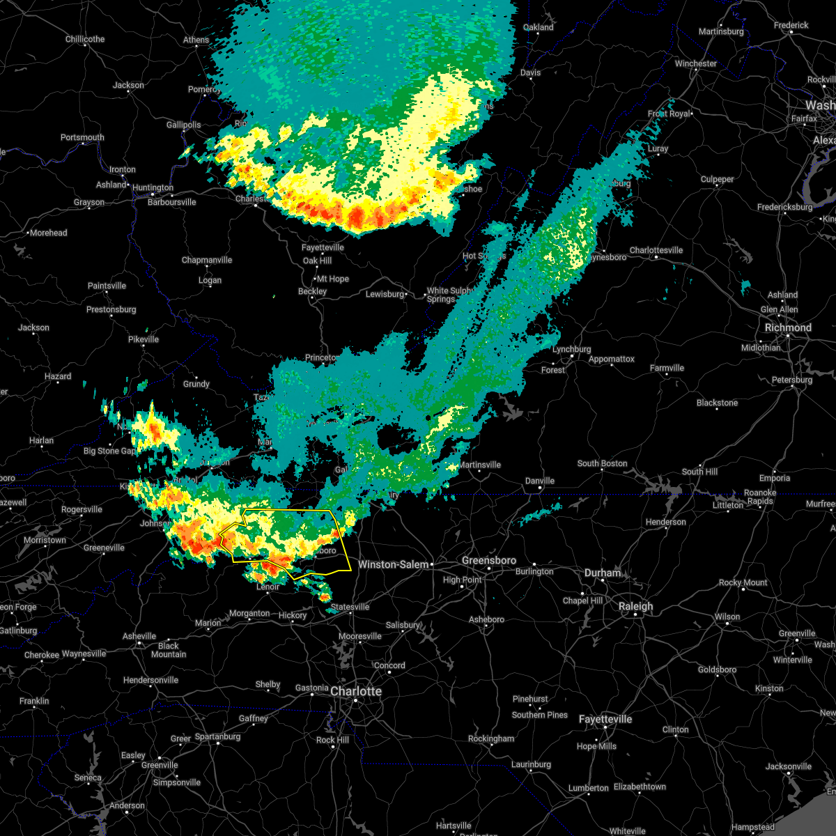 The severe thunderstorm warning for southwestern alleghany, wilkes, watauga and southern ashe counties in northwestern north carolina will expire at 630 am edt, the storm which prompted the warning has weakened below severe limits, and no longer poses an immediate threat to life or property. therefore, the warning will be allowed to expire. however gusty winds and heavy rain are still possible with this thunderstorm. The severe thunderstorm warning for southwestern alleghany, wilkes, watauga and southern ashe counties in northwestern north carolina will expire at 630 am edt, the storm which prompted the warning has weakened below severe limits, and no longer poses an immediate threat to life or property. therefore, the warning will be allowed to expire. however gusty winds and heavy rain are still possible with this thunderstorm.
|
| 6/14/2022 6:09 AM EDT |
 At 609 am edt, a severe thunderstorm was located over maple springs, or near wilbar, moving south at 40 mph (radar indicated). Hazards include 60 mph wind gusts and penny size hail. Expect damage to roofs, siding, and trees. locations impacted include, boone, north wilkesboro, wilkesboro, jefferson, west jefferson, blowing rock, and ronda. this includes the following location appalachian state university. hail threat, radar indicated max hail size, 0. 75 in wind threat, radar indicated max wind gust, 60 mph. At 609 am edt, a severe thunderstorm was located over maple springs, or near wilbar, moving south at 40 mph (radar indicated). Hazards include 60 mph wind gusts and penny size hail. Expect damage to roofs, siding, and trees. locations impacted include, boone, north wilkesboro, wilkesboro, jefferson, west jefferson, blowing rock, and ronda. this includes the following location appalachian state university. hail threat, radar indicated max hail size, 0. 75 in wind threat, radar indicated max wind gust, 60 mph.
|
| 6/14/2022 5:49 AM EDT |
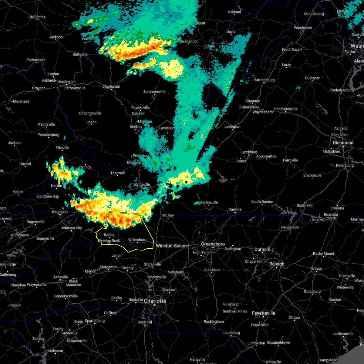 At 548 am edt, a severe thunderstorm was located over jefferson, moving southeast at 55 mph. this storm has a history of causing damage to trees (radar indicated). Hazards include 60 mph wind gusts. expect damage to roofs, siding, and trees At 548 am edt, a severe thunderstorm was located over jefferson, moving southeast at 55 mph. this storm has a history of causing damage to trees (radar indicated). Hazards include 60 mph wind gusts. expect damage to roofs, siding, and trees
|
| 6/2/2022 5:37 PM EDT |
 The severe thunderstorm warning for southwestern surry, eastern wilkes and western yadkin counties will expire at 545 pm edt, the storms which prompted the warning have weakened below severe limits, and no longer pose an immediate threat to life or property. therefore, the warning will be allowed to expire. a severe thunderstorm watch remains in effect until 900 pm edt for north central and northwestern north carolina, and southwestern virginia. The severe thunderstorm warning for southwestern surry, eastern wilkes and western yadkin counties will expire at 545 pm edt, the storms which prompted the warning have weakened below severe limits, and no longer pose an immediate threat to life or property. therefore, the warning will be allowed to expire. a severe thunderstorm watch remains in effect until 900 pm edt for north central and northwestern north carolina, and southwestern virginia.
|
| 6/2/2022 5:18 PM EDT |
 At 518 pm edt, severe thunderstorms were located along a line extending from benham to near windy gap, moving east at 30 mph (radar indicated). Hazards include 60 mph wind gusts and penny size hail. Expect damage to roofs, siding, and trees. locations impacted include, north wilkesboro, elkin, wilkesboro, jonesville, ronda, traphill, and mountain park. hail threat, radar indicated max hail size, 0. 75 in wind threat, radar indicated max wind gust, 60 mph. At 518 pm edt, severe thunderstorms were located along a line extending from benham to near windy gap, moving east at 30 mph (radar indicated). Hazards include 60 mph wind gusts and penny size hail. Expect damage to roofs, siding, and trees. locations impacted include, north wilkesboro, elkin, wilkesboro, jonesville, ronda, traphill, and mountain park. hail threat, radar indicated max hail size, 0. 75 in wind threat, radar indicated max wind gust, 60 mph.
|
| 6/2/2022 5:00 PM EDT |
 At 500 pm edt, severe thunderstorms were located along a line extending from dockery to near moravian falls, moving east at 30 mph (radar indicated). Hazards include 60 mph wind gusts and quarter size hail. Hail damage to vehicles is expected. expect wind damage to roofs, siding, and trees. locations impacted include, north wilkesboro, elkin, wilkesboro, jonesville, ronda, traphill, and boomer. hail threat, radar indicated max hail size, 1. 00 in wind threat, radar indicated max wind gust, 60 mph. At 500 pm edt, severe thunderstorms were located along a line extending from dockery to near moravian falls, moving east at 30 mph (radar indicated). Hazards include 60 mph wind gusts and quarter size hail. Hail damage to vehicles is expected. expect wind damage to roofs, siding, and trees. locations impacted include, north wilkesboro, elkin, wilkesboro, jonesville, ronda, traphill, and boomer. hail threat, radar indicated max hail size, 1. 00 in wind threat, radar indicated max wind gust, 60 mph.
|
| 6/2/2022 3:34 PM EDT |
 At 333 pm edt, a severe thunderstorm was located near windy gap, or 10 miles south of ronda, moving east at 30 mph (radar indicated). Hazards include 60 mph wind gusts and quarter size hail. Hail damage to vehicles is expected. expect wind damage to roofs, siding, and trees. locations impacted include, wilkesboro, windy gap, clingman, and moravian falls. hail threat, radar indicated max hail size, 1. 00 in wind threat, radar indicated max wind gust, 60 mph. At 333 pm edt, a severe thunderstorm was located near windy gap, or 10 miles south of ronda, moving east at 30 mph (radar indicated). Hazards include 60 mph wind gusts and quarter size hail. Hail damage to vehicles is expected. expect wind damage to roofs, siding, and trees. locations impacted include, wilkesboro, windy gap, clingman, and moravian falls. hail threat, radar indicated max hail size, 1. 00 in wind threat, radar indicated max wind gust, 60 mph.
|
| 6/2/2022 3:11 PM EDT |
 At 311 pm edt, a severe thunderstorm was located over moravian falls, or near wilkesboro, moving east at 30 mph (radar indicated). Hazards include 60 mph wind gusts and quarter size hail. Hail damage to vehicles is expected. Expect wind damage to roofs, siding, and trees. At 311 pm edt, a severe thunderstorm was located over moravian falls, or near wilkesboro, moving east at 30 mph (radar indicated). Hazards include 60 mph wind gusts and quarter size hail. Hail damage to vehicles is expected. Expect wind damage to roofs, siding, and trees.
|
| 5/26/2022 8:27 PM EDT | Tree down near intersection of clingman road and old 6 in wilkes county NC, 2.2 miles NNW of Ronda, NC |
| 5/26/2022 8:20 PM EDT |
 At 820 pm edt, a severe thunderstorm was located near love valley, or 12 miles south of ronda, moving northeast at 35 mph (radar indicated). Hazards include 60 mph wind gusts. expect damage to roofs, siding, and trees At 820 pm edt, a severe thunderstorm was located near love valley, or 12 miles south of ronda, moving northeast at 35 mph (radar indicated). Hazards include 60 mph wind gusts. expect damage to roofs, siding, and trees
|
| 5/26/2022 8:06 PM EDT |
 At 806 pm edt, a severe thunderstorm capable of producing a tornado was located over arlington, or over jonesville, moving north at 35 mph (radar indicated rotation). Hazards include tornado. Flying debris will be dangerous to those caught without shelter. mobile homes will be damaged or destroyed. damage to roofs, windows, and vehicles will occur. tree damage is likely. Locations impacted include, elkin, jonesville, boonville, ronda, buck shoals, pleasant hill, and brooks crossroads. At 806 pm edt, a severe thunderstorm capable of producing a tornado was located over arlington, or over jonesville, moving north at 35 mph (radar indicated rotation). Hazards include tornado. Flying debris will be dangerous to those caught without shelter. mobile homes will be damaged or destroyed. damage to roofs, windows, and vehicles will occur. tree damage is likely. Locations impacted include, elkin, jonesville, boonville, ronda, buck shoals, pleasant hill, and brooks crossroads.
|
| 5/26/2022 8:01 PM EDT |
 At 801 pm edt, a severe thunderstorm capable of producing a tornado was located over swancreek, or near jonesville, moving north at 35 mph (radar indicated rotation). Hazards include tornado and quarter size hail. Flying debris will be dangerous to those caught without shelter. mobile homes will be damaged or destroyed. damage to roofs, windows, and vehicles will occur. tree damage is likely. Locations impacted include, elkin, jonesville, boonville, ronda, buck shoals, pleasant hill, and brooks crossroads. At 801 pm edt, a severe thunderstorm capable of producing a tornado was located over swancreek, or near jonesville, moving north at 35 mph (radar indicated rotation). Hazards include tornado and quarter size hail. Flying debris will be dangerous to those caught without shelter. mobile homes will be damaged or destroyed. damage to roofs, windows, and vehicles will occur. tree damage is likely. Locations impacted include, elkin, jonesville, boonville, ronda, buck shoals, pleasant hill, and brooks crossroads.
|
| 5/26/2022 7:51 PM EDT |
 At 751 pm edt, a severe thunderstorm capable of producing a tornado was located near buck shoals, or 9 miles south of ronda, moving north at 35 mph (radar indicated rotation). Hazards include tornado and quarter size hail. Flying debris will be dangerous to those caught without shelter. mobile homes will be damaged or destroyed. damage to roofs, windows, and vehicles will occur. Tree damage is likely. At 751 pm edt, a severe thunderstorm capable of producing a tornado was located near buck shoals, or 9 miles south of ronda, moving north at 35 mph (radar indicated rotation). Hazards include tornado and quarter size hail. Flying debris will be dangerous to those caught without shelter. mobile homes will be damaged or destroyed. damage to roofs, windows, and vehicles will occur. Tree damage is likely.
|
| 5/26/2022 7:26 PM EDT |
 At 725 pm edt, a severe thunderstorm was located near mountain park, moving northeast at 30 mph (radar indicated). Hazards include 60 mph wind gusts and penny size hail. Expect damage to roofs, siding, and trees. Locations impacted include, mount airy, north wilkesboro, elkin, wilkesboro, fairview, flat rock, and jonesville. At 725 pm edt, a severe thunderstorm was located near mountain park, moving northeast at 30 mph (radar indicated). Hazards include 60 mph wind gusts and penny size hail. Expect damage to roofs, siding, and trees. Locations impacted include, mount airy, north wilkesboro, elkin, wilkesboro, fairview, flat rock, and jonesville.
|
| 5/26/2022 7:24 PM EDT |
 At 724 pm edt, a severe thunderstorm capable of producing a tornado was located over swancreek, or near jonesville, moving northeast at 30 mph (radar indicated rotation). Hazards include tornado. Flying debris will be dangerous to those caught without shelter. mobile homes will be damaged or destroyed. damage to roofs, windows, and vehicles will occur. tree damage is likely. Locations impacted include, elkin, fairview, jonesville, boonville, ronda, buck shoals, and crutchfield. At 724 pm edt, a severe thunderstorm capable of producing a tornado was located over swancreek, or near jonesville, moving northeast at 30 mph (radar indicated rotation). Hazards include tornado. Flying debris will be dangerous to those caught without shelter. mobile homes will be damaged or destroyed. damage to roofs, windows, and vehicles will occur. tree damage is likely. Locations impacted include, elkin, fairview, jonesville, boonville, ronda, buck shoals, and crutchfield.
|
| 5/26/2022 7:20 PM EDT | 4 trees down along old highway 42 in wilkes county NC, 4.9 miles N of Ronda, NC |
| 5/26/2022 7:13 PM EDT |
 At 713 pm edt, a severe thunderstorm was located over benham, or near traphill, moving north at 40 mph (radar indicated). Hazards include 60 mph wind gusts and penny size hail. Expect damage to roofs, siding, and trees. Locations impacted include, mount airy, north wilkesboro, elkin, wilkesboro, fairview, flat rock, and jonesville. At 713 pm edt, a severe thunderstorm was located over benham, or near traphill, moving north at 40 mph (radar indicated). Hazards include 60 mph wind gusts and penny size hail. Expect damage to roofs, siding, and trees. Locations impacted include, mount airy, north wilkesboro, elkin, wilkesboro, fairview, flat rock, and jonesville.
|
| 5/26/2022 7:10 PM EDT |
 At 710 pm edt, a severe thunderstorm capable of producing a tornado was located near buck shoals, or 10 miles south of ronda, moving northeast at 35 mph (radar indicated rotation). Hazards include tornado. Flying debris will be dangerous to those caught without shelter. mobile homes will be damaged or destroyed. damage to roofs, windows, and vehicles will occur. Tree damage is likely. At 710 pm edt, a severe thunderstorm capable of producing a tornado was located near buck shoals, or 10 miles south of ronda, moving northeast at 35 mph (radar indicated rotation). Hazards include tornado. Flying debris will be dangerous to those caught without shelter. mobile homes will be damaged or destroyed. damage to roofs, windows, and vehicles will occur. Tree damage is likely.
|
| 5/26/2022 6:46 PM EDT |
 At 645 pm edt, a severe thunderstorm was located near love valley, or 8 miles northeast of taylorsville, moving northeast at 30 mph (radar indicated). Hazards include 70 mph wind gusts and quarter size hail. Hail damage to vehicles is expected. expect considerable tree damage. Wind damage is also likely to mobile homes, roofs, and outbuildings. At 645 pm edt, a severe thunderstorm was located near love valley, or 8 miles northeast of taylorsville, moving northeast at 30 mph (radar indicated). Hazards include 70 mph wind gusts and quarter size hail. Hail damage to vehicles is expected. expect considerable tree damage. Wind damage is also likely to mobile homes, roofs, and outbuildings.
|
| 5/26/2022 6:45 PM EDT | Tree dow in wilkes county NC, 3.5 miles ENE of Ronda, NC |
| 5/26/2022 6:38 PM EDT | Tree down along ruth linney roa in wilkes county NC, 4.4 miles NE of Ronda, NC |
| 5/26/2022 6:33 PM EDT |
 At 633 pm edt, a severe thunderstorm capable of producing a tornado was located over roaring river, or near ronda, moving northeast at 25 mph (radar indicated rotation). Hazards include tornado and quarter size hail. Flying debris will be dangerous to those caught without shelter. mobile homes will be damaged or destroyed. damage to roofs, windows, and vehicles will occur. tree damage is likely. Locations impacted include, north wilkesboro, elkin, wilkesboro, jonesville, boonville, ronda, and windy gap. At 633 pm edt, a severe thunderstorm capable of producing a tornado was located over roaring river, or near ronda, moving northeast at 25 mph (radar indicated rotation). Hazards include tornado and quarter size hail. Flying debris will be dangerous to those caught without shelter. mobile homes will be damaged or destroyed. damage to roofs, windows, and vehicles will occur. tree damage is likely. Locations impacted include, north wilkesboro, elkin, wilkesboro, jonesville, boonville, ronda, and windy gap.
|
| 5/26/2022 6:19 PM EDT |
 At 619 pm edt, a severe thunderstorm capable of producing a tornado was located near moravian falls, or near wilkesboro, moving northeast at 30 mph (radar indicated rotation). Hazards include tornado and quarter size hail. Flying debris will be dangerous to those caught without shelter. mobile homes will be damaged or destroyed. damage to roofs, windows, and vehicles will occur. Tree damage is likely. At 619 pm edt, a severe thunderstorm capable of producing a tornado was located near moravian falls, or near wilkesboro, moving northeast at 30 mph (radar indicated rotation). Hazards include tornado and quarter size hail. Flying debris will be dangerous to those caught without shelter. mobile homes will be damaged or destroyed. damage to roofs, windows, and vehicles will occur. Tree damage is likely.
|
| 5/1/2022 4:09 PM EDT | Quarter sized hail reported 5.2 miles SE of Ronda, NC, reported through social media. time estimated from radar. |
| 5/1/2022 4:02 PM EDT |
 At 401 pm edt, severe thunderstorms were located along a line extending from near mountain park to wilkes county airport, moving east at 30 mph (radar indicated). Hazards include 60 mph wind gusts and quarter size hail. Hail damage to vehicles is expected. expect wind damage to roofs, siding, and trees. locations impacted include, mount airy, north wilkesboro, elkin, fairview, jonesville, dobson, and ronda. hail threat, radar indicated max hail size, 1. 00 in wind threat, radar indicated max wind gust, 60 mph. At 401 pm edt, severe thunderstorms were located along a line extending from near mountain park to wilkes county airport, moving east at 30 mph (radar indicated). Hazards include 60 mph wind gusts and quarter size hail. Hail damage to vehicles is expected. expect wind damage to roofs, siding, and trees. locations impacted include, mount airy, north wilkesboro, elkin, fairview, jonesville, dobson, and ronda. hail threat, radar indicated max hail size, 1. 00 in wind threat, radar indicated max wind gust, 60 mph.
|
| 5/1/2022 3:40 PM EDT |
 At 340 pm edt, severe thunderstorms were located along a line extending from near traphill to near millers creek, moving east at 30 mph (radar indicated). Hazards include 60 mph wind gusts and quarter size hail. Hail damage to vehicles is expected. Expect wind damage to roofs, siding, and trees. At 340 pm edt, severe thunderstorms were located along a line extending from near traphill to near millers creek, moving east at 30 mph (radar indicated). Hazards include 60 mph wind gusts and quarter size hail. Hail damage to vehicles is expected. Expect wind damage to roofs, siding, and trees.
|
| 9/8/2021 3:55 PM EDT |
 The severe thunderstorm warning for east central wilkes county will expire at 400 pm edt, the storm which prompted the warning has weakened below severe limits, and no longer poses an immediate threat to life or property. therefore, the warning will be allowed to expire. however heavy rain is still possible with this thunderstorm. The severe thunderstorm warning for east central wilkes county will expire at 400 pm edt, the storm which prompted the warning has weakened below severe limits, and no longer poses an immediate threat to life or property. therefore, the warning will be allowed to expire. however heavy rain is still possible with this thunderstorm.
|
| 9/8/2021 3:48 PM EDT |
 At 348 pm edt, a severe thunderstorm was located over ronda, moving east at 20 mph (radar indicated). Hazards include 60 mph wind gusts. Expect damage to roofs, siding, and trees. locations impacted include, ronda, pleasant hill, benham, roaring river, and clingman. hail threat, radar indicated max hail size, <. 75 in wind threat, radar indicated max wind gust, 60 mph. At 348 pm edt, a severe thunderstorm was located over ronda, moving east at 20 mph (radar indicated). Hazards include 60 mph wind gusts. Expect damage to roofs, siding, and trees. locations impacted include, ronda, pleasant hill, benham, roaring river, and clingman. hail threat, radar indicated max hail size, <. 75 in wind threat, radar indicated max wind gust, 60 mph.
|
| 9/8/2021 3:34 PM EDT |
 At 334 pm edt, a severe thunderstorm was located over roaring river, or near ronda, moving east at 15 mph (radar indicated). Hazards include 60 mph wind gusts and quarter size hail. Hail damage to vehicles is expected. expect wind damage to roofs, siding, and trees. locations impacted include, ronda, pleasant hill, wilkes county airport, clingman, benham, roaring river, and hays. hail threat, radar indicated max hail size, 1. 00 in wind threat, radar indicated max wind gust, 60 mph. At 334 pm edt, a severe thunderstorm was located over roaring river, or near ronda, moving east at 15 mph (radar indicated). Hazards include 60 mph wind gusts and quarter size hail. Hail damage to vehicles is expected. expect wind damage to roofs, siding, and trees. locations impacted include, ronda, pleasant hill, wilkes county airport, clingman, benham, roaring river, and hays. hail threat, radar indicated max hail size, 1. 00 in wind threat, radar indicated max wind gust, 60 mph.
|
| 9/8/2021 3:16 PM EDT |
 At 315 pm edt, a severe thunderstorm was located over wilkes county airport, or near north wilkesboro, moving east at 20 mph (radar indicated). Hazards include 60 mph wind gusts and quarter size hail. Hail damage to vehicles is expected. expect wind damage to roofs, siding, and trees. locations impacted include, north wilkesboro, ronda, traphill, hays, mulberry, pleasant hill, and wilkes county airport. hail threat, radar indicated max hail size, 1. 00 in wind threat, radar indicated max wind gust, 60 mph. At 315 pm edt, a severe thunderstorm was located over wilkes county airport, or near north wilkesboro, moving east at 20 mph (radar indicated). Hazards include 60 mph wind gusts and quarter size hail. Hail damage to vehicles is expected. expect wind damage to roofs, siding, and trees. locations impacted include, north wilkesboro, ronda, traphill, hays, mulberry, pleasant hill, and wilkes county airport. hail threat, radar indicated max hail size, 1. 00 in wind threat, radar indicated max wind gust, 60 mph.
|
| 9/8/2021 3:04 PM EDT |
 At 304 pm edt, a severe thunderstorm was located near wilkes county airport, or near ronda, moving east at 10 mph (radar indicated). Hazards include 60 mph wind gusts and quarter size hail. Hail damage to vehicles is expected. Expect wind damage to roofs, siding, and trees. At 304 pm edt, a severe thunderstorm was located near wilkes county airport, or near ronda, moving east at 10 mph (radar indicated). Hazards include 60 mph wind gusts and quarter size hail. Hail damage to vehicles is expected. Expect wind damage to roofs, siding, and trees.
|
| 8/17/2021 11:11 PM EDT |
 The tornado warning for southwestern surry, eastern wilkes and northwestern yadkin counties will expire at 1115 pm edt, the storm which prompted the warning has weakened below severe limits, and no longer appears capable of producing a tornado. therefore, the warning will be allowed to expire. a tornado watch remains in effect until 200 am edt for north central and northwestern north carolina, and southwestern virginia. The tornado warning for southwestern surry, eastern wilkes and northwestern yadkin counties will expire at 1115 pm edt, the storm which prompted the warning has weakened below severe limits, and no longer appears capable of producing a tornado. therefore, the warning will be allowed to expire. a tornado watch remains in effect until 200 am edt for north central and northwestern north carolina, and southwestern virginia.
|
| 8/17/2021 10:57 PM EDT |
 At 1046 pm edt, a severe thunderstorm capable of producing a tornado was located near love valley, or 9 miles northeast of taylorsville, moving northeast at 50 mph (radar indicated rotation). Hazards include tornado. Flying debris will be dangerous to those caught without shelter. mobile homes will be damaged or destroyed. damage to roofs, windows, and vehicles will occur. Tree damage is likely. At 1046 pm edt, a severe thunderstorm capable of producing a tornado was located near love valley, or 9 miles northeast of taylorsville, moving northeast at 50 mph (radar indicated rotation). Hazards include tornado. Flying debris will be dangerous to those caught without shelter. mobile homes will be damaged or destroyed. damage to roofs, windows, and vehicles will occur. Tree damage is likely.
|
| 8/17/2021 10:47 PM EDT |
 At 1046 pm edt, a severe thunderstorm capable of producing a tornado was located near love valley, or 9 miles northeast of taylorsville, moving northeast at 50 mph (radar indicated rotation). Hazards include tornado. Flying debris will be dangerous to those caught without shelter. mobile homes will be damaged or destroyed. damage to roofs, windows, and vehicles will occur. Tree damage is likely. At 1046 pm edt, a severe thunderstorm capable of producing a tornado was located near love valley, or 9 miles northeast of taylorsville, moving northeast at 50 mph (radar indicated rotation). Hazards include tornado. Flying debris will be dangerous to those caught without shelter. mobile homes will be damaged or destroyed. damage to roofs, windows, and vehicles will occur. Tree damage is likely.
|
| 8/17/2021 1:19 PM EDT |
 At 118 pm edt, a severe thunderstorm capable of producing a tornado was located over ronda, moving northwest at 25 mph (radar indicated rotation). Hazards include tornado. Flying debris will be dangerous to those caught without shelter. mobile homes will be damaged or destroyed. damage to roofs, windows, and vehicles will occur. Tree damage is likely. At 118 pm edt, a severe thunderstorm capable of producing a tornado was located over ronda, moving northwest at 25 mph (radar indicated rotation). Hazards include tornado. Flying debris will be dangerous to those caught without shelter. mobile homes will be damaged or destroyed. damage to roofs, windows, and vehicles will occur. Tree damage is likely.
|
| 8/17/2021 1:03 PM EDT |
 At 102 pm edt, a confirmed tornado was located over clingman, or near ronda, moving northwest at 25 mph (law enforcement confirmed tornado). Hazards include damaging tornado. Flying debris will be dangerous to those caught without shelter. mobile homes will be damaged or destroyed. damage to roofs, windows, and vehicles will occur. tree damage is likely. Locations impacted include, ronda, clingman, windy gap, and roaring river. At 102 pm edt, a confirmed tornado was located over clingman, or near ronda, moving northwest at 25 mph (law enforcement confirmed tornado). Hazards include damaging tornado. Flying debris will be dangerous to those caught without shelter. mobile homes will be damaged or destroyed. damage to roofs, windows, and vehicles will occur. tree damage is likely. Locations impacted include, ronda, clingman, windy gap, and roaring river.
|
| 8/17/2021 12:49 PM EDT |
 At 1248 pm edt, a confirmed tornado was located near buck shoals, or 11 miles south of ronda, moving northwest at 25 mph (law enforcement confirmed tornado). Hazards include damaging tornado. Flying debris will be dangerous to those caught without shelter. mobile homes will be damaged or destroyed. damage to roofs, windows, and vehicles will occur. tree damage is likely. Locations impacted include, jonesville, ronda, windy gap, buck shoals, clingman, arlington, and swancreek. At 1248 pm edt, a confirmed tornado was located near buck shoals, or 11 miles south of ronda, moving northwest at 25 mph (law enforcement confirmed tornado). Hazards include damaging tornado. Flying debris will be dangerous to those caught without shelter. mobile homes will be damaged or destroyed. damage to roofs, windows, and vehicles will occur. tree damage is likely. Locations impacted include, jonesville, ronda, windy gap, buck shoals, clingman, arlington, and swancreek.
|
| 8/17/2021 12:35 PM EDT |
 At 1234 pm edt, a confirmed tornado was located near harmony, or 14 miles north of statesville, moving northwest at 25 mph (law enforcement confirmed tornado). Hazards include damaging tornado. Flying debris will be dangerous to those caught without shelter. mobile homes will be damaged or destroyed. damage to roofs, windows, and vehicles will occur. Tree damage is likely. At 1234 pm edt, a confirmed tornado was located near harmony, or 14 miles north of statesville, moving northwest at 25 mph (law enforcement confirmed tornado). Hazards include damaging tornado. Flying debris will be dangerous to those caught without shelter. mobile homes will be damaged or destroyed. damage to roofs, windows, and vehicles will occur. Tree damage is likely.
|
| 8/12/2021 3:38 PM EDT |
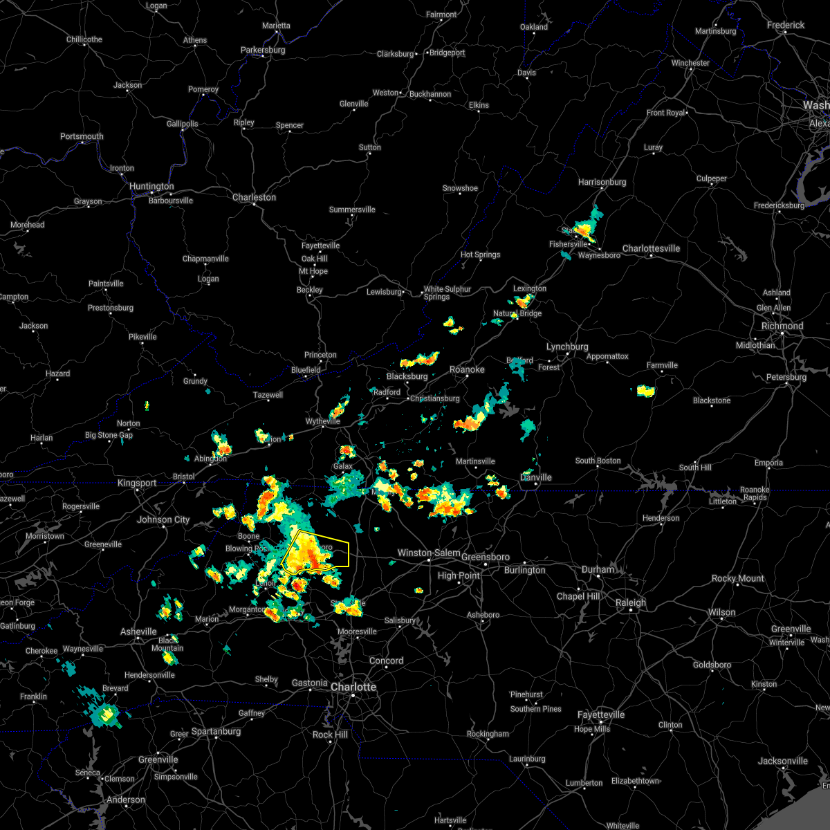 At 337 pm edt, a severe thunderstorm was located near moravian falls, or near wilkesboro, moving southeast at 25 mph (radar indicated). Hazards include 60 mph wind gusts and quarter size hail. Hail damage to vehicles is expected. expect wind damage to roofs, siding, and trees. locations impacted include, north wilkesboro, wilkesboro, ronda, boomer, windy gap, mulberry, and wilkesboro reservoir. hail threat, observed max hail size, 1. 00 in wind threat, radar indicated max wind gust, 60 mph. At 337 pm edt, a severe thunderstorm was located near moravian falls, or near wilkesboro, moving southeast at 25 mph (radar indicated). Hazards include 60 mph wind gusts and quarter size hail. Hail damage to vehicles is expected. expect wind damage to roofs, siding, and trees. locations impacted include, north wilkesboro, wilkesboro, ronda, boomer, windy gap, mulberry, and wilkesboro reservoir. hail threat, observed max hail size, 1. 00 in wind threat, radar indicated max wind gust, 60 mph.
|
| 8/12/2021 3:11 PM EDT |
 At 311 pm edt, a severe thunderstorm was located over wilkesboro reservoir, or near boomer, moving east at 10 mph (radar indicated). Hazards include 60 mph wind gusts and half dollar size hail. Hail damage to vehicles is expected. Expect wind damage to roofs, siding, and trees. At 311 pm edt, a severe thunderstorm was located over wilkesboro reservoir, or near boomer, moving east at 10 mph (radar indicated). Hazards include 60 mph wind gusts and half dollar size hail. Hail damage to vehicles is expected. Expect wind damage to roofs, siding, and trees.
|
| 8/12/2021 3:06 PM EDT |
 The severe thunderstorm warning for central alleghany, western surry, wilkes, southeastern watauga, southeastern ashe and northwestern yadkin counties in northwestern north carolina will expire at 315 pm edt, the storm which prompted the warning has weakened below severe limits, and no longer poses an immediate threat to life or property. therefore, the warning will be allowed to expire. however small hail, gusty winds and heavy rain are still possible with this thunderstorm. The severe thunderstorm warning for central alleghany, western surry, wilkes, southeastern watauga, southeastern ashe and northwestern yadkin counties in northwestern north carolina will expire at 315 pm edt, the storm which prompted the warning has weakened below severe limits, and no longer poses an immediate threat to life or property. therefore, the warning will be allowed to expire. however small hail, gusty winds and heavy rain are still possible with this thunderstorm.
|
| 8/12/2021 2:48 PM EDT |
 At 248 pm edt, a severe thunderstorm was located over mulberry, or near mc grady, moving east at 15 mph (radar indicated). Hazards include 60 mph wind gusts and quarter size hail. Hail damage to vehicles is expected. expect wind damage to roofs, siding, and trees. locations impacted include, boone, north wilkesboro, elkin, wilkesboro, fairview, jonesville, and sparta. this includes the following location appalachian state university. hail threat, radar indicated max hail size, 1. 00 in wind threat, radar indicated max wind gust, 60 mph. At 248 pm edt, a severe thunderstorm was located over mulberry, or near mc grady, moving east at 15 mph (radar indicated). Hazards include 60 mph wind gusts and quarter size hail. Hail damage to vehicles is expected. expect wind damage to roofs, siding, and trees. locations impacted include, boone, north wilkesboro, elkin, wilkesboro, fairview, jonesville, and sparta. this includes the following location appalachian state university. hail threat, radar indicated max hail size, 1. 00 in wind threat, radar indicated max wind gust, 60 mph.
|
| 8/12/2021 2:18 PM EDT |
 At 217 pm edt, a severe thunderstorm was located over wilbar, moving east at 15 mph (radar indicated). Hazards include 60 mph wind gusts and quarter size hail. Hail damage to vehicles is expected. Expect wind damage to roofs, siding, and trees. At 217 pm edt, a severe thunderstorm was located over wilbar, moving east at 15 mph (radar indicated). Hazards include 60 mph wind gusts and quarter size hail. Hail damage to vehicles is expected. Expect wind damage to roofs, siding, and trees.
|
| 8/12/2021 1:59 PM EDT |
 At 158 pm edt, a severe thunderstorm was located near halls mills, or near mc grady, and is nearly stationary (radar indicated). Hazards include 60 mph wind gusts and quarter size hail. Hail damage to vehicles is expected. expect wind damage to roofs, siding, and trees. locations impacted include, north wilkesboro, elkin, wilkesboro, ronda, traphill, mc grady, and mulberry. hail threat, radar indicated max hail size, 1. 00 in wind threat, radar indicated max wind gust, 60 mph. At 158 pm edt, a severe thunderstorm was located near halls mills, or near mc grady, and is nearly stationary (radar indicated). Hazards include 60 mph wind gusts and quarter size hail. Hail damage to vehicles is expected. expect wind damage to roofs, siding, and trees. locations impacted include, north wilkesboro, elkin, wilkesboro, ronda, traphill, mc grady, and mulberry. hail threat, radar indicated max hail size, 1. 00 in wind threat, radar indicated max wind gust, 60 mph.
|
| 8/12/2021 1:35 PM EDT |
 At 135 pm edt, a severe thunderstorm was located near dockery, or near mc grady, moving southeast at 15 mph (radar indicated). Hazards include 60 mph wind gusts and pea size hail. expect damage to roofs, siding, and trees At 135 pm edt, a severe thunderstorm was located near dockery, or near mc grady, moving southeast at 15 mph (radar indicated). Hazards include 60 mph wind gusts and pea size hail. expect damage to roofs, siding, and trees
|
| 8/11/2021 3:35 PM EDT | A half a dozen trees down on and around highway 421 near wilkes-yadkin roa in wilkes county NC, 4.3 miles N of Ronda, NC |
| 8/11/2021 3:27 PM EDT |
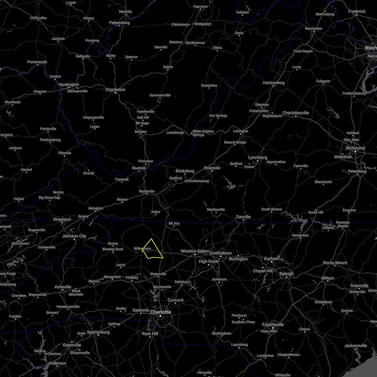 At 326 pm edt, a severe thunderstorm was located near windy gap, or near north wilkesboro, moving northeast at 5 mph (radar indicated). Hazards include 60 mph wind gusts and quarter size hail. Hail damage to vehicles is expected. Expect wind damage to roofs, siding, and trees. At 326 pm edt, a severe thunderstorm was located near windy gap, or near north wilkesboro, moving northeast at 5 mph (radar indicated). Hazards include 60 mph wind gusts and quarter size hail. Hail damage to vehicles is expected. Expect wind damage to roofs, siding, and trees.
|
| 8/11/2021 3:11 PM EDT | Approximately half a dozen trees down around the ronda and roaring river area in wilkes county NC, 2.4 miles ENE of Ronda, NC |
| 8/11/2021 3:03 PM EDT |
 At 303 pm edt, a severe thunderstorm was located near traphill, moving northeast at 15 mph (radar indicated). Hazards include 60 mph wind gusts and quarter size hail. Hail damage to vehicles is expected. expect wind damage to roofs, siding, and trees. locations impacted include, north wilkesboro, elkin, wilkesboro, fairview, jonesville, boonville, and ronda. hail threat, radar indicated max hail size, 1. 00 in wind threat, radar indicated max wind gust, 60 mph. At 303 pm edt, a severe thunderstorm was located near traphill, moving northeast at 15 mph (radar indicated). Hazards include 60 mph wind gusts and quarter size hail. Hail damage to vehicles is expected. expect wind damage to roofs, siding, and trees. locations impacted include, north wilkesboro, elkin, wilkesboro, fairview, jonesville, boonville, and ronda. hail threat, radar indicated max hail size, 1. 00 in wind threat, radar indicated max wind gust, 60 mph.
|
| 8/11/2021 2:38 PM EDT |
 At 238 pm edt, a severe thunderstorm was located over dockery, or near traphill, moving northeast at 15 mph (radar indicated). Hazards include 60 mph wind gusts and quarter size hail. Hail damage to vehicles is expected. expect wind damage to roofs, siding, and trees. locations impacted include, north wilkesboro, elkin, wilkesboro, fairview, jonesville, dobson, and boonville. hail threat, radar indicated max hail size, 1. 00 in wind threat, radar indicated max wind gust, 60 mph. At 238 pm edt, a severe thunderstorm was located over dockery, or near traphill, moving northeast at 15 mph (radar indicated). Hazards include 60 mph wind gusts and quarter size hail. Hail damage to vehicles is expected. expect wind damage to roofs, siding, and trees. locations impacted include, north wilkesboro, elkin, wilkesboro, fairview, jonesville, dobson, and boonville. hail threat, radar indicated max hail size, 1. 00 in wind threat, radar indicated max wind gust, 60 mph.
|
| 8/11/2021 2:25 PM EDT |
 At 225 pm edt, a severe thunderstorm was located over hays, or near north wilkesboro, moving northeast at 15 mph (radar indicated). Hazards include 60 mph wind gusts and quarter size hail. Hail damage to vehicles is expected. Expect wind damage to roofs, siding, and trees. At 225 pm edt, a severe thunderstorm was located over hays, or near north wilkesboro, moving northeast at 15 mph (radar indicated). Hazards include 60 mph wind gusts and quarter size hail. Hail damage to vehicles is expected. Expect wind damage to roofs, siding, and trees.
|
| 8/10/2021 4:02 PM EDT |
 At 401 pm edt, severe thunderstorms were located along a line extending from near meadows to near windy gap, moving southeast at 20 mph (radar indicated). Hazards include 60 mph wind gusts and quarter size hail. Hail damage to vehicles is expected. expect wind damage to roofs, siding, and trees. locations impacted include, elkin, fairview, yadkinville, jonesville, pilot mountain, walnut cove, and boonville. hail threat, radar indicated max hail size, 1. 00 in wind threat, radar indicated max wind gust, 60 mph. At 401 pm edt, severe thunderstorms were located along a line extending from near meadows to near windy gap, moving southeast at 20 mph (radar indicated). Hazards include 60 mph wind gusts and quarter size hail. Hail damage to vehicles is expected. expect wind damage to roofs, siding, and trees. locations impacted include, elkin, fairview, yadkinville, jonesville, pilot mountain, walnut cove, and boonville. hail threat, radar indicated max hail size, 1. 00 in wind threat, radar indicated max wind gust, 60 mph.
|
| 8/10/2021 3:37 PM EDT |
 At 337 pm edt, severe thunderstorms were located along a line extending from danbury to near windy gap, moving southeast at 20 mph (radar indicated). Hazards include 60 mph wind gusts and quarter size hail. Hail damage to vehicles is expected. Expect wind damage to roofs, siding, and trees. At 337 pm edt, severe thunderstorms were located along a line extending from danbury to near windy gap, moving southeast at 20 mph (radar indicated). Hazards include 60 mph wind gusts and quarter size hail. Hail damage to vehicles is expected. Expect wind damage to roofs, siding, and trees.
|
| 7/27/2021 5:26 PM EDT |
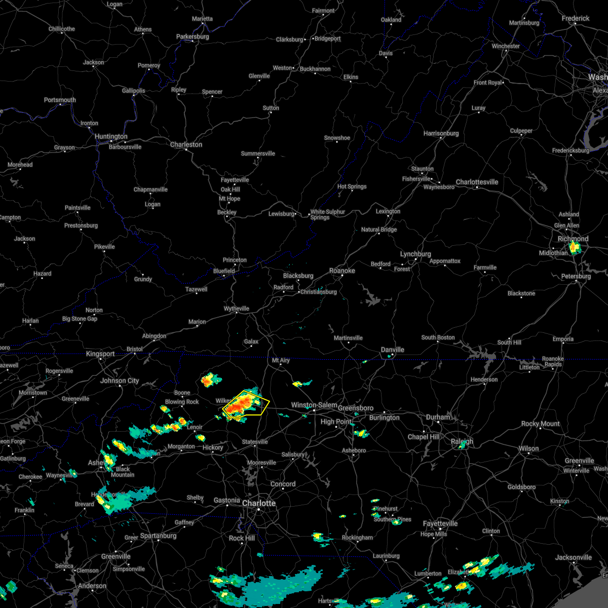 At 526 pm edt, a severe thunderstorm was located near windy gap, or near wilkesboro, moving southeast at 10 mph (radar indicated). Hazards include 60 mph wind gusts and quarter size hail. Hail damage to vehicles is expected. expect wind damage to roofs, siding, and trees. Locations impacted include, north wilkesboro, wilkesboro, ronda, windy gap, buck shoals, brooks crossroads, and clingman. At 526 pm edt, a severe thunderstorm was located near windy gap, or near wilkesboro, moving southeast at 10 mph (radar indicated). Hazards include 60 mph wind gusts and quarter size hail. Hail damage to vehicles is expected. expect wind damage to roofs, siding, and trees. Locations impacted include, north wilkesboro, wilkesboro, ronda, windy gap, buck shoals, brooks crossroads, and clingman.
|
| 7/27/2021 5:10 PM EDT |
 At 509 pm edt, a severe thunderstorm was located near north wilkesboro, moving southeast at 10 mph (radar indicated). Hazards include 60 mph wind gusts and quarter size hail. Hail damage to vehicles is expected. Expect wind damage to roofs, siding, and trees. At 509 pm edt, a severe thunderstorm was located near north wilkesboro, moving southeast at 10 mph (radar indicated). Hazards include 60 mph wind gusts and quarter size hail. Hail damage to vehicles is expected. Expect wind damage to roofs, siding, and trees.
|
| 7/26/2021 1:52 PM EDT |
 At 151 pm edt, severe thunderstorms were located along a line extending from near level cross to near boomer, moving southeast at 30 mph (radar indicated). Hazards include 60 mph wind gusts. Expect damage to roofs, siding, and trees. Locations impacted include, north wilkesboro, elkin, wilkesboro, fairview, yadkinville, jonesville, and dobson. At 151 pm edt, severe thunderstorms were located along a line extending from near level cross to near boomer, moving southeast at 30 mph (radar indicated). Hazards include 60 mph wind gusts. Expect damage to roofs, siding, and trees. Locations impacted include, north wilkesboro, elkin, wilkesboro, fairview, yadkinville, jonesville, and dobson.
|
| 7/26/2021 1:40 PM EDT |
 At 140 pm edt, severe thunderstorms were located along a line extending from dobson to near elkville, moving southeast at 30 mph (radar indicated). Hazards include 60 mph wind gusts. Expect damage to roofs, siding, and trees. Locations impacted include, mount airy, north wilkesboro, elkin, wilkesboro, fairview, yadkinville, and jonesville. At 140 pm edt, severe thunderstorms were located along a line extending from dobson to near elkville, moving southeast at 30 mph (radar indicated). Hazards include 60 mph wind gusts. Expect damage to roofs, siding, and trees. Locations impacted include, mount airy, north wilkesboro, elkin, wilkesboro, fairview, yadkinville, and jonesville.
|
| 7/26/2021 1:24 PM EDT |
 At 124 pm edt, severe thunderstorms were located along a line extending from near bottom to near darby, moving southeast at 30 mph (radar indicated). Hazards include 60 mph wind gusts. expect damage to roofs, siding, and trees At 124 pm edt, severe thunderstorms were located along a line extending from near bottom to near darby, moving southeast at 30 mph (radar indicated). Hazards include 60 mph wind gusts. expect damage to roofs, siding, and trees
|
| 6/21/2021 9:15 PM EDT | Tree down on red white and blue rd in the roaring river are in wilkes county NC, 5.1 miles NE of Ronda, NC |
| 6/21/2021 6:50 PM EDT |
 At 649 pm edt, a severe thunderstorm was located over hays, or near traphill, moving east at 40 mph (radar indicated). Hazards include 60 mph wind gusts and quarter size hail. Hail damage to vehicles is expected. Expect wind damage to roofs, siding, and trees. At 649 pm edt, a severe thunderstorm was located over hays, or near traphill, moving east at 40 mph (radar indicated). Hazards include 60 mph wind gusts and quarter size hail. Hail damage to vehicles is expected. Expect wind damage to roofs, siding, and trees.
|
| 3/27/2021 2:56 PM EDT |
 At 256 pm edt, severe thunderstorms were located along a line extending from near pilot to ararat to near buck shoals, moving east at 50 mph (radar indicated). Hazards include 60 mph wind gusts. expect damage to roofs, siding, and trees At 256 pm edt, severe thunderstorms were located along a line extending from near pilot to ararat to near buck shoals, moving east at 50 mph (radar indicated). Hazards include 60 mph wind gusts. expect damage to roofs, siding, and trees
|
| 3/27/2021 2:30 PM EDT |
 At 230 pm edt, severe thunderstorms were located along a line extending from near kimberling to near baywood to near elkville, moving east at 45 mph (radar indicated). Hazards include 60 mph wind gusts. Expect damage to roofs, siding, and trees. Locations impacted include, pulaski, wytheville, galax, north wilkesboro, wilkesboro, hillsville, and dublin. At 230 pm edt, severe thunderstorms were located along a line extending from near kimberling to near baywood to near elkville, moving east at 45 mph (radar indicated). Hazards include 60 mph wind gusts. Expect damage to roofs, siding, and trees. Locations impacted include, pulaski, wytheville, galax, north wilkesboro, wilkesboro, hillsville, and dublin.
|
| 3/27/2021 2:21 PM EDT |
 At 220 pm edt, severe thunderstorms were located along a line extending from bland to independence to near elkville, moving east at 45 mph (radar indicated). Hazards include 60 mph wind gusts. Expect damage to roofs, siding, and trees. Locations impacted include, pulaski, wytheville, galax, bland, north wilkesboro, wilkesboro, and hillsville. At 220 pm edt, severe thunderstorms were located along a line extending from bland to independence to near elkville, moving east at 45 mph (radar indicated). Hazards include 60 mph wind gusts. Expect damage to roofs, siding, and trees. Locations impacted include, pulaski, wytheville, galax, bland, north wilkesboro, wilkesboro, and hillsville.
|
| 3/27/2021 2:06 PM EDT |
 At 205 pm edt, severe thunderstorms were located along a line extending from near ceres to mouth of wilson to 8 miles northwest of lenoir, moving east at 45 mph (radar indicated). Hazards include 60 mph wind gusts. expect damage to roofs, siding, and trees At 205 pm edt, severe thunderstorms were located along a line extending from near ceres to mouth of wilson to 8 miles northwest of lenoir, moving east at 45 mph (radar indicated). Hazards include 60 mph wind gusts. expect damage to roofs, siding, and trees
|
| 8/6/2020 6:39 PM EDT |
 The severe thunderstorm warning for southern surry, east central wilkes, southwestern stokes and yadkin counties will expire at 645 pm edt, the storm which prompted the warning has weakened below severe limits, and no longer poses an immediate threat to life or property. therefore, the warning will be allowed to expire. however heavy rain is still possible with this thunderstorm. when it is safe to do so, please send your reports of hail of any size, as well as reports of any wind damage, including downed trees or large limbs, to the national weather service by calling toll free at 1, 8 6 6, 2 1 5, 4 3 2 4. reports and pictures can also be shared on the national weather service blacksburg facebook page and on twitter. The severe thunderstorm warning for southern surry, east central wilkes, southwestern stokes and yadkin counties will expire at 645 pm edt, the storm which prompted the warning has weakened below severe limits, and no longer poses an immediate threat to life or property. therefore, the warning will be allowed to expire. however heavy rain is still possible with this thunderstorm. when it is safe to do so, please send your reports of hail of any size, as well as reports of any wind damage, including downed trees or large limbs, to the national weather service by calling toll free at 1, 8 6 6, 2 1 5, 4 3 2 4. reports and pictures can also be shared on the national weather service blacksburg facebook page and on twitter.
|
| 8/6/2020 6:33 PM EDT |
 At 633 pm edt, a severe thunderstorm was located near siloam, or near east bend, moving east at 25 mph (radar indicated). Hazards include 60 mph wind gusts. Expect damage to roofs, siding, and trees. Locations impacted include, elkin, fairview, yadkinville, jonesville, dobson, pilot mountain, and boonville. At 633 pm edt, a severe thunderstorm was located near siloam, or near east bend, moving east at 25 mph (radar indicated). Hazards include 60 mph wind gusts. Expect damage to roofs, siding, and trees. Locations impacted include, elkin, fairview, yadkinville, jonesville, dobson, pilot mountain, and boonville.
|
| 8/6/2020 6:15 PM EDT |
 At 614 pm edt, a severe thunderstorm was located over rockford, or near fairview, moving east at 25 mph (radar indicated). Hazards include 60 mph wind gusts and quarter size hail. Hail damage to vehicles is expected. expect wind damage to roofs, siding, and trees. Locations impacted include, elkin, fairview, yadkinville, jonesville, dobson, pilot mountain, and boonville. At 614 pm edt, a severe thunderstorm was located over rockford, or near fairview, moving east at 25 mph (radar indicated). Hazards include 60 mph wind gusts and quarter size hail. Hail damage to vehicles is expected. expect wind damage to roofs, siding, and trees. Locations impacted include, elkin, fairview, yadkinville, jonesville, dobson, pilot mountain, and boonville.
|
| 8/6/2020 6:04 PM EDT | Numerous trees down in the clingman and roaring river areas. from a little after 6pm to 6:45p in wilkes county NC, 2.9 miles N of Ronda, NC |
| 8/6/2020 5:53 PM EDT |
 At 553 pm edt, a severe thunderstorm was located over burch, or near fairview, moving east at 25 mph (radar indicated). Hazards include 60 mph wind gusts. expect damage to roofs, siding, and trees At 553 pm edt, a severe thunderstorm was located over burch, or near fairview, moving east at 25 mph (radar indicated). Hazards include 60 mph wind gusts. expect damage to roofs, siding, and trees
|
| 7/10/2020 7:44 PM EDT | Trees down in the area of 730 cedar forest rd. and groce r in wilkes county NC, 4.3 miles NW of Ronda, NC |
| 7/10/2020 7:03 PM EDT | Trees down at 720 bethel rd. and armstrong r in wilkes county NC, 1.5 miles NNW of Ronda, NC |
| 7/10/2020 7:00 PM EDT |
 At 700 pm edt, a severe thunderstorm was located over ronda, moving southeast at 10 mph (radar indicated). Hazards include 60 mph wind gusts and quarter size hail. Hail damage to vehicles is expected. Expect wind damage to roofs, siding, and trees. At 700 pm edt, a severe thunderstorm was located over ronda, moving southeast at 10 mph (radar indicated). Hazards include 60 mph wind gusts and quarter size hail. Hail damage to vehicles is expected. Expect wind damage to roofs, siding, and trees.
|
| 4/13/2020 4:27 AM EDT |
 The severe thunderstorm warning for southern surry, southeastern wilkes and yadkin counties will expire at 430 am edt, the storm which prompted the warning has moved out of the area. therefore, the warning will be allowed to expire. when it is safe to do so, please send your reports of hail of any size, as well as reports of any wind damage, including downed trees or large limbs, to the national weather service by calling toll free at 1, 8 6 6, 2 1 5, 4 3 2 4. reports and pictures can also be shared on the national weather service blacksburg facebook page and on twitter. remember, a tornado warning still remains in effect for yadkin county and southeastern surry county until 445 am edt. The severe thunderstorm warning for southern surry, southeastern wilkes and yadkin counties will expire at 430 am edt, the storm which prompted the warning has moved out of the area. therefore, the warning will be allowed to expire. when it is safe to do so, please send your reports of hail of any size, as well as reports of any wind damage, including downed trees or large limbs, to the national weather service by calling toll free at 1, 8 6 6, 2 1 5, 4 3 2 4. reports and pictures can also be shared on the national weather service blacksburg facebook page and on twitter. remember, a tornado warning still remains in effect for yadkin county and southeastern surry county until 445 am edt.
|
| 4/13/2020 4:06 AM EDT |
 At 405 am edt, a severe thunderstorm was located over love valley, or 12 miles east of taylorsville, moving northeast at 65 mph (radar indicated). Hazards include 60 mph wind gusts. expect damage to roofs, siding, and trees At 405 am edt, a severe thunderstorm was located over love valley, or 12 miles east of taylorsville, moving northeast at 65 mph (radar indicated). Hazards include 60 mph wind gusts. expect damage to roofs, siding, and trees
|
| 4/12/2020 11:11 PM EDT | A strong thunderstorm with damaging winds brought a tree down in roaring rive in wilkes county NC, 3.5 miles ENE of Ronda, NC |
| 4/12/2020 11:00 PM EDT |
 At 1100 pm edt, a severe thunderstorm was located near moravian falls, or near wilkesboro, moving northeast at 35 mph (radar indicated). Hazards include 60 mph wind gusts. Expect damage to roofs, siding, and trees. Locations impacted include, north wilkesboro, ronda, windy gap, wilkes county airport, clingman, swancreek, and roaring river. At 1100 pm edt, a severe thunderstorm was located near moravian falls, or near wilkesboro, moving northeast at 35 mph (radar indicated). Hazards include 60 mph wind gusts. Expect damage to roofs, siding, and trees. Locations impacted include, north wilkesboro, ronda, windy gap, wilkes county airport, clingman, swancreek, and roaring river.
|
| 4/12/2020 10:47 PM EDT |
 At 1047 pm edt, a severe thunderstorm was located near taylorsville, moving northeast at 45 mph (radar indicated). Hazards include 60 mph wind gusts. expect damage to roofs, siding, and trees At 1047 pm edt, a severe thunderstorm was located near taylorsville, moving northeast at 45 mph (radar indicated). Hazards include 60 mph wind gusts. expect damage to roofs, siding, and trees
|
| 1/11/2020 9:32 PM EST |
 At 930 pm est, severe thunderstorms were located along a line extending from near eggleston to near boonville, moving northeast at 75 mph (radar indicated). Hazards include 70 mph wind gusts. Expect considerable tree damage. damage is likely to mobile homes, roofs, and outbuildings. Locations impacted include, mount airy, galax, elkin, fairview, flat rock, yadkinville, and hillsville. At 930 pm est, severe thunderstorms were located along a line extending from near eggleston to near boonville, moving northeast at 75 mph (radar indicated). Hazards include 70 mph wind gusts. Expect considerable tree damage. damage is likely to mobile homes, roofs, and outbuildings. Locations impacted include, mount airy, galax, elkin, fairview, flat rock, yadkinville, and hillsville.
|
| 1/11/2020 9:07 PM EST |
 At 907 pm est, severe thunderstorms were located along a line extending from max meadows to near stony point, moving northeast at 75 mph (radar indicated). Hazards include 70 mph wind gusts. Expect considerable tree damage. Damage is likely to mobile homes, roofs, and outbuildings. At 907 pm est, severe thunderstorms were located along a line extending from max meadows to near stony point, moving northeast at 75 mph (radar indicated). Hazards include 70 mph wind gusts. Expect considerable tree damage. Damage is likely to mobile homes, roofs, and outbuildings.
|
| 10/31/2019 4:51 PM EDT |
 At 451 pm edt, severe thunderstorms were located along a line extending from near baywood to near elkville, moving northeast at 25 mph (radar indicated). Hazards include 60 mph wind gusts. expect damage to roofs, siding, and trees At 451 pm edt, severe thunderstorms were located along a line extending from near baywood to near elkville, moving northeast at 25 mph (radar indicated). Hazards include 60 mph wind gusts. expect damage to roofs, siding, and trees
|
| 9/30/2019 4:36 PM EDT |
 The severe thunderstorm warning for northeastern wilkes county will expire at 445 pm edt, the storm which prompted the warning has weakened below severe limits, and no longer poses an immediate threat to life or property. therefore, the warning will be allowed to expire. however, heavy rain is still possible with this thunderstorm. when it is safe to do so, please send your reports of hail of any size, as well as reports of any wind damage, including downed trees or large limbs, to the national weather service by calling toll free at 1, 8 6 6, 2 1 5, 4 3 2 4. reports and pictures can also be shared on the national weather service blacksburg facebook page and on twitter. The severe thunderstorm warning for northeastern wilkes county will expire at 445 pm edt, the storm which prompted the warning has weakened below severe limits, and no longer poses an immediate threat to life or property. therefore, the warning will be allowed to expire. however, heavy rain is still possible with this thunderstorm. when it is safe to do so, please send your reports of hail of any size, as well as reports of any wind damage, including downed trees or large limbs, to the national weather service by calling toll free at 1, 8 6 6, 2 1 5, 4 3 2 4. reports and pictures can also be shared on the national weather service blacksburg facebook page and on twitter.
|
| 9/30/2019 4:23 PM EDT |
 At 423 pm edt, a severe thunderstorm was located near dockery, or near traphill, moving south at 15 mph (radar indicated). Hazards include 60 mph wind gusts and quarter size hail. Hail damage to vehicles is expected. expect wind damage to roofs, siding, and trees. Locations impacted include, north wilkesboro, wilkesboro, ronda, traphill, mc grady, mulberry, and halls mills. At 423 pm edt, a severe thunderstorm was located near dockery, or near traphill, moving south at 15 mph (radar indicated). Hazards include 60 mph wind gusts and quarter size hail. Hail damage to vehicles is expected. expect wind damage to roofs, siding, and trees. Locations impacted include, north wilkesboro, wilkesboro, ronda, traphill, mc grady, mulberry, and halls mills.
|
| 9/30/2019 4:11 PM EDT |
 At 411 pm edt, a severe thunderstorm was located over abshers, or near traphill, moving south at 15 mph (radar indicated). Hazards include 60 mph wind gusts and quarter size hail. Hail damage to vehicles is expected. expect wind damage to roofs, siding, and trees. Locations impacted include, north wilkesboro, wilkesboro, ronda, traphill, mulberry, roaring gap, and stone mountain state park. At 411 pm edt, a severe thunderstorm was located over abshers, or near traphill, moving south at 15 mph (radar indicated). Hazards include 60 mph wind gusts and quarter size hail. Hail damage to vehicles is expected. expect wind damage to roofs, siding, and trees. Locations impacted include, north wilkesboro, wilkesboro, ronda, traphill, mulberry, roaring gap, and stone mountain state park.
|
| 9/30/2019 3:47 PM EDT |
 At 347 pm edt, a severe thunderstorm was located over whitehead, or over sparta, moving south at 15 mph (radar indicated). Hazards include 60 mph wind gusts and quarter size hail. Hail damage to vehicles is expected. Expect wind damage to roofs, siding, and trees. At 347 pm edt, a severe thunderstorm was located over whitehead, or over sparta, moving south at 15 mph (radar indicated). Hazards include 60 mph wind gusts and quarter size hail. Hail damage to vehicles is expected. Expect wind damage to roofs, siding, and trees.
|
| 8/22/2019 2:11 PM EDT |
 The national weather service in blacksburg has issued a * severe thunderstorm warning for. southeastern wilkes county in northwestern north carolina. yadkin county in northwestern north carolina. Until 315 pm edt * at 211 pm edt, a severe thunderstorm was located over windy gap,. The national weather service in blacksburg has issued a * severe thunderstorm warning for. southeastern wilkes county in northwestern north carolina. yadkin county in northwestern north carolina. Until 315 pm edt * at 211 pm edt, a severe thunderstorm was located over windy gap,.
|
| 8/13/2019 3:41 PM EDT |
 At 341 pm edt, severe thunderstorms were located along a line extending from near ararat to 6 miles southeast of moravian falls, moving east at 25 mph (radar indicated). Hazards include 60 mph wind gusts and quarter size hail. Hail damage to vehicles is expected. expect wind damage to roofs, siding, and trees. Locations impacted include, elkin, fairview, yadkinville, jonesville, and boonville. At 341 pm edt, severe thunderstorms were located along a line extending from near ararat to 6 miles southeast of moravian falls, moving east at 25 mph (radar indicated). Hazards include 60 mph wind gusts and quarter size hail. Hail damage to vehicles is expected. expect wind damage to roofs, siding, and trees. Locations impacted include, elkin, fairview, yadkinville, jonesville, and boonville.
|
| 8/13/2019 3:21 PM EDT |
 At 320 pm edt, severe thunderstorms were located along a line extending from near dobson to roaring gap to elkville, moving southeast at 25 mph (radar indicated). Hazards include 60 mph wind gusts and quarter size hail. Hail damage to vehicles is expected. expect wind damage to roofs, siding, and trees. Locations impacted include, north wilkesboro, elkin, wilkesboro, fairview, and yadkinville. At 320 pm edt, severe thunderstorms were located along a line extending from near dobson to roaring gap to elkville, moving southeast at 25 mph (radar indicated). Hazards include 60 mph wind gusts and quarter size hail. Hail damage to vehicles is expected. expect wind damage to roofs, siding, and trees. Locations impacted include, north wilkesboro, elkin, wilkesboro, fairview, and yadkinville.
|
| 8/13/2019 3:20 PM EDT | Multiple trees reported down in ronda... nc. person reporting also said there was hail. timing estimated by rada in wilkes county NC, 0.1 miles NE of Ronda, NC |
| 8/13/2019 2:59 PM EDT |
 The national weather service in blacksburg has issued a * severe thunderstorm warning for. southeastern alleghany county in northwestern north carolina. southern surry county in northwestern north carolina. wilkes county in northwestern north carolina. Southwestern stokes county in north central north carolina. The national weather service in blacksburg has issued a * severe thunderstorm warning for. southeastern alleghany county in northwestern north carolina. southern surry county in northwestern north carolina. wilkes county in northwestern north carolina. Southwestern stokes county in north central north carolina.
|
| 8/10/2019 6:34 PM EDT |
 At 633 pm edt, a severe thunderstorm was located near buck shoals, moving southeast at 20 mph (radar indicated). Hazards include 60 mph wind gusts and quarter size hail. Hail damage to vehicles is expected. expect wind damage to roofs, siding, and trees. Locations impacted include, elkin, yadkinville, jonesville, boonville, and ronda. At 633 pm edt, a severe thunderstorm was located near buck shoals, moving southeast at 20 mph (radar indicated). Hazards include 60 mph wind gusts and quarter size hail. Hail damage to vehicles is expected. expect wind damage to roofs, siding, and trees. Locations impacted include, elkin, yadkinville, jonesville, boonville, and ronda.
|
| 8/10/2019 6:07 PM EDT |
 At 607 pm edt, a severe thunderstorm was located over buck shoals, moving southeast at 20 mph (radar indicated). Hazards include 60 mph wind gusts and quarter size hail. Hail damage to vehicles is expected. Expect wind damage to roofs, siding, and trees. At 607 pm edt, a severe thunderstorm was located over buck shoals, moving southeast at 20 mph (radar indicated). Hazards include 60 mph wind gusts and quarter size hail. Hail damage to vehicles is expected. Expect wind damage to roofs, siding, and trees.
|
| 7/6/2019 1:43 PM EDT |
 At 142 pm edt, severe thunderstorms were located along a line extending from near bottom to brooks crossroads, moving east at 20 mph (radar indicated). Hazards include 60 mph wind gusts and quarter size hail. Hail damage to vehicles is expected. expect wind damage to roofs, siding, and trees. Locations impacted include, mount airy, elkin, fairview, flat rock, and yadkinville. At 142 pm edt, severe thunderstorms were located along a line extending from near bottom to brooks crossroads, moving east at 20 mph (radar indicated). Hazards include 60 mph wind gusts and quarter size hail. Hail damage to vehicles is expected. expect wind damage to roofs, siding, and trees. Locations impacted include, mount airy, elkin, fairview, flat rock, and yadkinville.
|
| 7/6/2019 1:17 PM EDT |
 At 117 pm edt, severe thunderstorms were located along a line extending from near barrett to near windy gap, moving east at 25 mph (radar indicated). Hazards include 60 mph wind gusts and quarter size hail. Hail damage to vehicles is expected. Expect wind damage to roofs, siding, and trees. At 117 pm edt, severe thunderstorms were located along a line extending from near barrett to near windy gap, moving east at 25 mph (radar indicated). Hazards include 60 mph wind gusts and quarter size hail. Hail damage to vehicles is expected. Expect wind damage to roofs, siding, and trees.
|
| 6/20/2019 1:05 PM EDT |
 At 104 pm edt, a severe thunderstorm was located over clingman, moving east at 40 mph (radar indicated). Hazards include 60 mph wind gusts. expect damage to roofs, siding, and trees At 104 pm edt, a severe thunderstorm was located over clingman, moving east at 40 mph (radar indicated). Hazards include 60 mph wind gusts. expect damage to roofs, siding, and trees
|
| 5/3/2019 7:51 PM EDT |
 The severe thunderstorm warning for western surry, eastern wilkes and northwestern yadkin counties will expire at 800 pm edt, the storm which prompted the warning has weakened below severe limits, and no longer poses an immediate threat to life or property. therefore the warning will be allowed to expire. when it is safe to do so, please send your reports of hail of any size, as well as any reports of wind damage, including downed trees or large limbs, to the national weather service by calling toll free at 1, 8 6 6, 2 1 5, 4 3 2 4. reports and pictures can also be shared on the national weather service blacksburg facebook page and on twitter. The severe thunderstorm warning for western surry, eastern wilkes and northwestern yadkin counties will expire at 800 pm edt, the storm which prompted the warning has weakened below severe limits, and no longer poses an immediate threat to life or property. therefore the warning will be allowed to expire. when it is safe to do so, please send your reports of hail of any size, as well as any reports of wind damage, including downed trees or large limbs, to the national weather service by calling toll free at 1, 8 6 6, 2 1 5, 4 3 2 4. reports and pictures can also be shared on the national weather service blacksburg facebook page and on twitter.
|
| 5/3/2019 7:33 PM EDT |
 At 732 pm edt, a severe thunderstorm was located over dobson, moving northeast at 35 mph (radar indicated). Hazards include 60 mph wind gusts and quarter size hail. Hail damage to vehicles is expected. expect wind damage to roofs, siding, and trees. Locations impacted include, elkin, fairview, jonesville, dobson, and boonville. At 732 pm edt, a severe thunderstorm was located over dobson, moving northeast at 35 mph (radar indicated). Hazards include 60 mph wind gusts and quarter size hail. Hail damage to vehicles is expected. expect wind damage to roofs, siding, and trees. Locations impacted include, elkin, fairview, jonesville, dobson, and boonville.
|
| 5/3/2019 7:12 PM EDT |
 At 712 pm edt, a severe thunderstorm was located over benham, moving northeast at 35 mph (radar indicated). Hazards include 60 mph wind gusts and quarter size hail. Hail damage to vehicles is expected. expect wind damage to roofs, siding, and trees. Locations impacted include, north wilkesboro, elkin, wilkesboro, fairview, and jonesville. At 712 pm edt, a severe thunderstorm was located over benham, moving northeast at 35 mph (radar indicated). Hazards include 60 mph wind gusts and quarter size hail. Hail damage to vehicles is expected. expect wind damage to roofs, siding, and trees. Locations impacted include, north wilkesboro, elkin, wilkesboro, fairview, and jonesville.
|
| 5/3/2019 6:54 PM EDT |
 At 653 pm edt, a severe thunderstorm was located over wilkes county airport, moving northeast at 35 mph (radar indicated). Hazards include 60 mph wind gusts and quarter size hail. Hail damage to vehicles is expected. Expect wind damage to roofs, siding, and trees. At 653 pm edt, a severe thunderstorm was located over wilkes county airport, moving northeast at 35 mph (radar indicated). Hazards include 60 mph wind gusts and quarter size hail. Hail damage to vehicles is expected. Expect wind damage to roofs, siding, and trees.
|
| 4/19/2019 4:29 PM EDT |
 At 428 pm edt, a severe thunderstorm was located over traphill, moving northeast at 60 mph (radar indicated). Hazards include 60 mph wind gusts and quarter size hail. Hail damage to vehicles is expected. expect wind damage to roofs, siding, and trees. locations impacted include, elkin, fairview, jonesville, dobson, and boonville. A tornado watch remains in effect until 500 pm edt for north central and northwestern north carolina, and southwestern virginia. At 428 pm edt, a severe thunderstorm was located over traphill, moving northeast at 60 mph (radar indicated). Hazards include 60 mph wind gusts and quarter size hail. Hail damage to vehicles is expected. expect wind damage to roofs, siding, and trees. locations impacted include, elkin, fairview, jonesville, dobson, and boonville. A tornado watch remains in effect until 500 pm edt for north central and northwestern north carolina, and southwestern virginia.
|
| 4/19/2019 4:11 PM EDT |
 At 411 pm edt, a severe thunderstorm was located near wilkesboro, moving northeast at 45 mph (radar indicated). Hazards include 60 mph wind gusts. expect damage to roofs, siding, and trees At 411 pm edt, a severe thunderstorm was located near wilkesboro, moving northeast at 45 mph (radar indicated). Hazards include 60 mph wind gusts. expect damage to roofs, siding, and trees
|
| 4/14/2019 11:19 PM EDT |
 At 1119 pm edt, severe thunderstorms were located along a line extending from near alum ridge to near windy gap, moving east at 25 mph (radar indicated). Hazards include 60 mph wind gusts. Expect damage to roofs, siding, and trees. locations impacted include, mount airy, elkin, fairview, flat rock, and yadkinville. A tornado watch remains in effect until 500 am edt for north central and northwestern north carolina, and south central, southwestern and west central virginia. At 1119 pm edt, severe thunderstorms were located along a line extending from near alum ridge to near windy gap, moving east at 25 mph (radar indicated). Hazards include 60 mph wind gusts. Expect damage to roofs, siding, and trees. locations impacted include, mount airy, elkin, fairview, flat rock, and yadkinville. A tornado watch remains in effect until 500 am edt for north central and northwestern north carolina, and south central, southwestern and west central virginia.
|
| 4/14/2019 10:48 PM EDT |
 At 1047 pm edt, severe thunderstorms were located along a line extending from near allisonia to near moravian falls, moving east at 45 mph (radar indicated). Hazards include 60 mph wind gusts. Expect damage to roofs, siding, and trees. locations impacted include, mount airy, galax, north wilkesboro, elkin, and wilkesboro. A tornado watch remains in effect until 500 am edt for north central and northwestern north carolina, and south central, southwestern and west central virginia. At 1047 pm edt, severe thunderstorms were located along a line extending from near allisonia to near moravian falls, moving east at 45 mph (radar indicated). Hazards include 60 mph wind gusts. Expect damage to roofs, siding, and trees. locations impacted include, mount airy, galax, north wilkesboro, elkin, and wilkesboro. A tornado watch remains in effect until 500 am edt for north central and northwestern north carolina, and south central, southwestern and west central virginia.
|
| 4/14/2019 10:29 PM EDT |
 At 1029 pm edt, severe thunderstorms were located along a line extending from near patterson to near elkville, moving east at 30 mph (radar indicated). Hazards include 60 mph wind gusts. expect damage to roofs, siding, and trees At 1029 pm edt, severe thunderstorms were located along a line extending from near patterson to near elkville, moving east at 30 mph (radar indicated). Hazards include 60 mph wind gusts. expect damage to roofs, siding, and trees
|
| 4/14/2019 4:52 PM EDT |
 At 452 pm edt, a severe thunderstorm capable of producing a tornado was located near benham, moving northeast at 55 mph (radar indicated rotation). Hazards include tornado and quarter size hail. Flying debris will be dangerous to those caught without shelter. mobile homes will be damaged or destroyed. damage to roofs, windows, and vehicles will occur. Tree damage is likely. At 452 pm edt, a severe thunderstorm capable of producing a tornado was located near benham, moving northeast at 55 mph (radar indicated rotation). Hazards include tornado and quarter size hail. Flying debris will be dangerous to those caught without shelter. mobile homes will be damaged or destroyed. damage to roofs, windows, and vehicles will occur. Tree damage is likely.
|
| 4/14/2019 4:48 PM EDT |
 At 448 pm edt, a severe thunderstorm capable of producing a tornado was located near roaring river, moving northeast at 55 mph (radar indicated rotation). Hazards include tornado. Flying debris will be dangerous to those caught without shelter. mobile homes will be damaged or destroyed. damage to roofs, windows, and vehicles will occur. tree damage is likely. Locations impacted include, ronda, hays, mulberry, wilkes county airport, and roaring river. At 448 pm edt, a severe thunderstorm capable of producing a tornado was located near roaring river, moving northeast at 55 mph (radar indicated rotation). Hazards include tornado. Flying debris will be dangerous to those caught without shelter. mobile homes will be damaged or destroyed. damage to roofs, windows, and vehicles will occur. tree damage is likely. Locations impacted include, ronda, hays, mulberry, wilkes county airport, and roaring river.
|
| 4/14/2019 4:39 PM EDT |
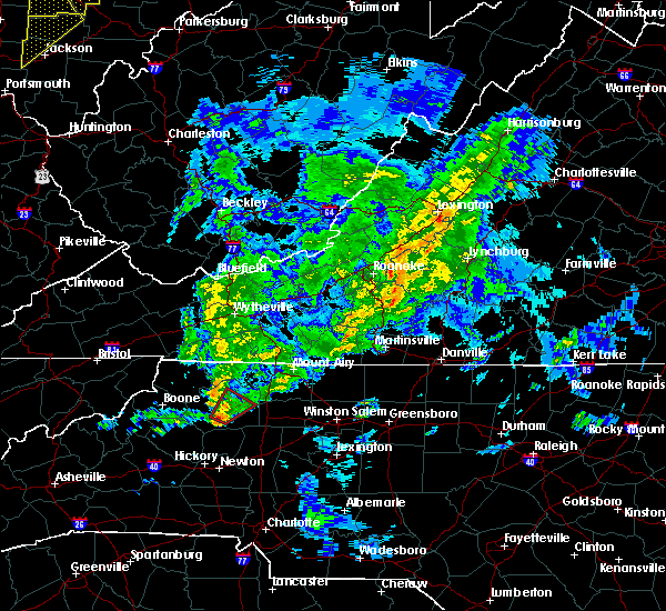 At 439 pm edt, a severe thunderstorm capable of producing a tornado was located over wilkesboro, moving northeast at 55 mph (radar indicated rotation). Hazards include tornado. Flying debris will be dangerous to those caught without shelter. mobile homes will be damaged or destroyed. damage to roofs, windows, and vehicles will occur. tree damage is likely. Locations impacted include, north wilkesboro, wilkesboro, ronda, mulberry, and buck. At 439 pm edt, a severe thunderstorm capable of producing a tornado was located over wilkesboro, moving northeast at 55 mph (radar indicated rotation). Hazards include tornado. Flying debris will be dangerous to those caught without shelter. mobile homes will be damaged or destroyed. damage to roofs, windows, and vehicles will occur. tree damage is likely. Locations impacted include, north wilkesboro, wilkesboro, ronda, mulberry, and buck.
|
| 4/14/2019 4:23 PM EDT |
 At 423 pm edt, a severe thunderstorm capable of producing a tornado was located near elkville, moving northeast at 55 mph (radar indicated rotation). Hazards include tornado. Flying debris will be dangerous to those caught without shelter. mobile homes will be damaged or destroyed. damage to roofs, windows, and vehicles will occur. Tree damage is likely. At 423 pm edt, a severe thunderstorm capable of producing a tornado was located near elkville, moving northeast at 55 mph (radar indicated rotation). Hazards include tornado. Flying debris will be dangerous to those caught without shelter. mobile homes will be damaged or destroyed. damage to roofs, windows, and vehicles will occur. Tree damage is likely.
|
| 8/17/2018 6:09 PM EDT |
 At 552 pm edt, a severe thunderstorm was located near windy gap, moving east at 15 mph (radar indicated). Hazards include 60 mph wind gusts and quarter size hail. Hail damage to vehicles is expected. expect wind damage to roofs, siding, and trees. Locations impacted include, north wilkesboro, wilkesboro, jonesville, ronda, and windy gap. At 552 pm edt, a severe thunderstorm was located near windy gap, moving east at 15 mph (radar indicated). Hazards include 60 mph wind gusts and quarter size hail. Hail damage to vehicles is expected. expect wind damage to roofs, siding, and trees. Locations impacted include, north wilkesboro, wilkesboro, jonesville, ronda, and windy gap.
|
| 8/17/2018 5:52 PM EDT |
 At 552 pm edt, a severe thunderstorm was located near windy gap, moving east at 15 mph (radar indicated). Hazards include 60 mph wind gusts and quarter size hail. Hail damage to vehicles is expected. expect wind damage to roofs, siding, and trees. Locations impacted include, north wilkesboro, wilkesboro, jonesville, ronda, and windy gap. At 552 pm edt, a severe thunderstorm was located near windy gap, moving east at 15 mph (radar indicated). Hazards include 60 mph wind gusts and quarter size hail. Hail damage to vehicles is expected. expect wind damage to roofs, siding, and trees. Locations impacted include, north wilkesboro, wilkesboro, jonesville, ronda, and windy gap.
|
| 8/17/2018 5:29 PM EDT |
 At 529 pm edt, a severe thunderstorm was located over wilkesboro, moving east at 15 mph (radar indicated). Hazards include 60 mph wind gusts and quarter size hail. Hail damage to vehicles is expected. expect wind damage to roofs, siding, and trees. Locations impacted include, north wilkesboro, wilkesboro, jonesville, ronda, and boomer. At 529 pm edt, a severe thunderstorm was located over wilkesboro, moving east at 15 mph (radar indicated). Hazards include 60 mph wind gusts and quarter size hail. Hail damage to vehicles is expected. expect wind damage to roofs, siding, and trees. Locations impacted include, north wilkesboro, wilkesboro, jonesville, ronda, and boomer.
|
| 8/17/2018 5:16 PM EDT |
 At 516 pm edt, a severe thunderstorm was located over buck, moving east at 15 mph (radar indicated). Hazards include 60 mph wind gusts and quarter size hail. Hail damage to vehicles is expected. Expect wind damage to roofs, siding, and trees. At 516 pm edt, a severe thunderstorm was located over buck, moving east at 15 mph (radar indicated). Hazards include 60 mph wind gusts and quarter size hail. Hail damage to vehicles is expected. Expect wind damage to roofs, siding, and trees.
|
| 8/2/2018 6:24 PM EDT |
 At 620 pm edt, several thunderstorms extended from near taylorsville through mocksville to near winston-salem. these storms are moving north at 25 mph. the storms are expected to merge and reach severe levels during the next hour (radar indicated). Hazards include 60 mph wind gusts. expect damage to roofs, siding, and trees At 620 pm edt, several thunderstorms extended from near taylorsville through mocksville to near winston-salem. these storms are moving north at 25 mph. the storms are expected to merge and reach severe levels during the next hour (radar indicated). Hazards include 60 mph wind gusts. expect damage to roofs, siding, and trees
|
| 6/25/2018 5:58 PM EDT |
 At 558 pm edt, severe thunderstorms were located along a line extending from near dockery to north wilkesboro, moving east at 20 mph (radar indicated). Hazards include 60 mph wind gusts and quarter size hail. Hail damage to vehicles is expected. Expect wind damage to roofs, siding, and trees. At 558 pm edt, severe thunderstorms were located along a line extending from near dockery to north wilkesboro, moving east at 20 mph (radar indicated). Hazards include 60 mph wind gusts and quarter size hail. Hail damage to vehicles is expected. Expect wind damage to roofs, siding, and trees.
|
| 6/25/2018 5:28 PM EDT |
 At 528 pm edt, severe thunderstorms were located along a line extending from fairplains to boomer, moving east at 20 mph (radar indicated). Hazards include 60 mph wind gusts and quarter size hail. Hail damage to vehicles is expected. expect wind damage to roofs, siding, and trees. Locations impacted include, north wilkesboro, wilkesboro, ronda, boomer, and wilbar. At 528 pm edt, severe thunderstorms were located along a line extending from fairplains to boomer, moving east at 20 mph (radar indicated). Hazards include 60 mph wind gusts and quarter size hail. Hail damage to vehicles is expected. expect wind damage to roofs, siding, and trees. Locations impacted include, north wilkesboro, wilkesboro, ronda, boomer, and wilbar.
|
| 6/25/2018 4:59 PM EDT |
 At 459 pm edt, severe thunderstorms were located along a line extending from summit to elkville, moving east at 25 mph (radar indicated). Hazards include 60 mph wind gusts and quarter size hail. Hail damage to vehicles is expected. Expect wind damage to roofs, siding, and trees. At 459 pm edt, severe thunderstorms were located along a line extending from summit to elkville, moving east at 25 mph (radar indicated). Hazards include 60 mph wind gusts and quarter size hail. Hail damage to vehicles is expected. Expect wind damage to roofs, siding, and trees.
|
| 6/1/2018 4:40 PM EDT |
 At 439 pm edt, a severe thunderstorm was located over pleasant hill, moving east at 20 mph (radar indicated). Hazards include 60 mph wind gusts. Expect damage to roofs, siding, and trees. Locations impacted include, elkin, fairview, jonesville, ronda, and mountain park. At 439 pm edt, a severe thunderstorm was located over pleasant hill, moving east at 20 mph (radar indicated). Hazards include 60 mph wind gusts. Expect damage to roofs, siding, and trees. Locations impacted include, elkin, fairview, jonesville, ronda, and mountain park.
|
| 6/1/2018 4:27 PM EDT |
 At 426 pm edt, a severe thunderstorm was located over fairview, moving northeast at 20 mph. this storm is weakening, but another storm near ronda moving northeast at 20 mph will become severe, so the warning continues (radar indicated). Hazards include 60 mph wind gusts and quarter size hail. Hail damage to vehicles is expected. expect wind damage to roofs, siding, and trees. Locations impacted include, elkin, fairview, jonesville, ronda, and mountain park. At 426 pm edt, a severe thunderstorm was located over fairview, moving northeast at 20 mph. this storm is weakening, but another storm near ronda moving northeast at 20 mph will become severe, so the warning continues (radar indicated). Hazards include 60 mph wind gusts and quarter size hail. Hail damage to vehicles is expected. expect wind damage to roofs, siding, and trees. Locations impacted include, elkin, fairview, jonesville, ronda, and mountain park.
|
| 6/1/2018 3:55 PM EDT |
 At 354 pm edt, a severe thunderstorm was located over pleasant hill, moving east at 10 mph (radar indicated). Hazards include 60 mph wind gusts and quarter size hail. Hail damage to vehicles is expected. Expect wind damage to roofs, siding, and trees. At 354 pm edt, a severe thunderstorm was located over pleasant hill, moving east at 10 mph (radar indicated). Hazards include 60 mph wind gusts and quarter size hail. Hail damage to vehicles is expected. Expect wind damage to roofs, siding, and trees.
|
| 5/20/2018 4:41 PM EDT | One tree down near the 600 block of dennyville road in wilkes county NC, 6.2 miles NNW of Ronda, NC |
| 5/20/2018 4:22 PM EDT |
 The national weather service in blacksburg has issued a * severe thunderstorm warning for. southwestern surry county in northwestern north carolina. southeastern wilkes county in northwestern north carolina. yadkin county in northwestern north carolina. Until 515 pm edt. The national weather service in blacksburg has issued a * severe thunderstorm warning for. southwestern surry county in northwestern north carolina. southeastern wilkes county in northwestern north carolina. yadkin county in northwestern north carolina. Until 515 pm edt.
|
| 5/10/2018 3:33 PM EDT |
 At 332 pm edt, a severe thunderstorm was located over swancreek, moving east at 45 mph (radar indicated). Hazards include 60 mph wind gusts and quarter size hail. Hail damage to vehicles is expected. expect wind damage to roofs, siding, and trees. Locations impacted include, north wilkesboro, elkin, wilkesboro, yadkinville, and jonesville. At 332 pm edt, a severe thunderstorm was located over swancreek, moving east at 45 mph (radar indicated). Hazards include 60 mph wind gusts and quarter size hail. Hail damage to vehicles is expected. expect wind damage to roofs, siding, and trees. Locations impacted include, north wilkesboro, elkin, wilkesboro, yadkinville, and jonesville.
|
| 5/10/2018 2:58 PM EDT |
 The national weather service in blacksburg has issued a * severe thunderstorm warning for. southeastern surry county in northwestern north carolina. wilkes county in northwestern north carolina. yadkin county in northwestern north carolina. Until 400 pm edt. The national weather service in blacksburg has issued a * severe thunderstorm warning for. southeastern surry county in northwestern north carolina. wilkes county in northwestern north carolina. yadkin county in northwestern north carolina. Until 400 pm edt.
|
| 4/15/2018 3:03 PM EDT |
 At 303 pm edt, a severe thunderstorm was located over clingman, moving northeast at 50 mph (radar indicated). Hazards include 60 mph wind gusts and quarter size hail. Hail damage to vehicles is expected. Expect wind damage to roofs, siding, and trees. At 303 pm edt, a severe thunderstorm was located over clingman, moving northeast at 50 mph (radar indicated). Hazards include 60 mph wind gusts and quarter size hail. Hail damage to vehicles is expected. Expect wind damage to roofs, siding, and trees.
|
| 4/15/2018 2:12 PM EDT |
 At 211 pm edt, a severe thunderstorm was located over swancreek, moving north at 55 mph (radar indicated). Hazards include 60 mph wind gusts and quarter size hail. Hail damage to vehicles is expected. Expect wind damage to roofs, siding, and trees. At 211 pm edt, a severe thunderstorm was located over swancreek, moving north at 55 mph (radar indicated). Hazards include 60 mph wind gusts and quarter size hail. Hail damage to vehicles is expected. Expect wind damage to roofs, siding, and trees.
|
| 10/23/2017 5:23 PM EDT |
 At 523 pm edt, a severe thunderstorm was located near buck shoals, moving north at 30 mph (radar indicated). Hazards include 60 mph wind gusts and quarter size hail. Hail damage to vehicles is expected. Expect wind damage to roofs, siding, and trees. At 523 pm edt, a severe thunderstorm was located near buck shoals, moving north at 30 mph (radar indicated). Hazards include 60 mph wind gusts and quarter size hail. Hail damage to vehicles is expected. Expect wind damage to roofs, siding, and trees.
|
| 9/5/2017 4:51 PM EDT |
 The severe thunderstorm warning for southwestern surry, northeastern wilkes and western yadkin counties will expire at 500 pm edt, the storm which prompted the warning has weakened below severe limits, and no longer poses an immediate threat to life or property. therefore the warning will be allowed to expire. when it is safe to do so, please send your reports of hail of any size, as well as reports of any wind damage, including downed trees or large limbs, to the national weather service by calling toll free at 1, 8 6 6, 2 1 5, 4 3 2 4. reports and pictures can also be shared on the national weather service blacksburg facebook page and on twitter. The severe thunderstorm warning for southwestern surry, northeastern wilkes and western yadkin counties will expire at 500 pm edt, the storm which prompted the warning has weakened below severe limits, and no longer poses an immediate threat to life or property. therefore the warning will be allowed to expire. when it is safe to do so, please send your reports of hail of any size, as well as reports of any wind damage, including downed trees or large limbs, to the national weather service by calling toll free at 1, 8 6 6, 2 1 5, 4 3 2 4. reports and pictures can also be shared on the national weather service blacksburg facebook page and on twitter.
|
| 9/5/2017 4:18 PM EDT |
 At 418 pm edt, a severe thunderstorm was located over ronda, moving east at 25 mph (radar indicated). Hazards include 60 mph wind gusts and quarter size hail. Hail damage to vehicles is expected. expect wind damage to roofs, siding, and trees. Locations impacted include, north wilkesboro, elkin, wilkesboro, fairview, and jonesville. At 418 pm edt, a severe thunderstorm was located over ronda, moving east at 25 mph (radar indicated). Hazards include 60 mph wind gusts and quarter size hail. Hail damage to vehicles is expected. expect wind damage to roofs, siding, and trees. Locations impacted include, north wilkesboro, elkin, wilkesboro, fairview, and jonesville.
|
| 9/5/2017 3:55 PM EDT |
 At 354 pm edt, a severe thunderstorm was located over hays, moving east at 25 mph (radar indicated). Hazards include 60 mph wind gusts and quarter size hail. Hail damage to vehicles is expected. Expect wind damage to roofs, siding, and trees. At 354 pm edt, a severe thunderstorm was located over hays, moving east at 25 mph (radar indicated). Hazards include 60 mph wind gusts and quarter size hail. Hail damage to vehicles is expected. Expect wind damage to roofs, siding, and trees.
|
| 8/17/2017 8:24 PM EDT |
 The severe thunderstorm warning for southeastern wilkes county will expire at 830 pm edt, the storm which prompted the warning has weakened below severe limits, and no longer poses an immediate threat to life or property. therefore the warning will be allowed to expire. very heavy rainfall and occasional cloud-to-ground lightning can still be expected with this thunderstorm. when it is safe to do so, please send your reports of hail of any size, as well as reports of any wind damage, including downed trees or large limbs, to the national weather service by calling toll free at 1, 8 6 6, 2 1 5, 4 3 2 4. reports and pictures can also be shared on the national weather service blacksburg facebook page and on twitter. The severe thunderstorm warning for southeastern wilkes county will expire at 830 pm edt, the storm which prompted the warning has weakened below severe limits, and no longer poses an immediate threat to life or property. therefore the warning will be allowed to expire. very heavy rainfall and occasional cloud-to-ground lightning can still be expected with this thunderstorm. when it is safe to do so, please send your reports of hail of any size, as well as reports of any wind damage, including downed trees or large limbs, to the national weather service by calling toll free at 1, 8 6 6, 2 1 5, 4 3 2 4. reports and pictures can also be shared on the national weather service blacksburg facebook page and on twitter.
|
| 8/17/2017 7:53 PM EDT |
 At 752 pm edt, a severe thunderstorm was located over wilkesboro, moving east at 20 mph (radar indicated). Hazards include 60 mph wind gusts and quarter size hail. Hail damage to vehicles is expected. Expect wind damage to roofs, siding, and trees. At 752 pm edt, a severe thunderstorm was located over wilkesboro, moving east at 20 mph (radar indicated). Hazards include 60 mph wind gusts and quarter size hail. Hail damage to vehicles is expected. Expect wind damage to roofs, siding, and trees.
|
| 5/24/2017 4:32 PM EDT |
 At 431 pm edt, a severe thunderstorm was located over love valley, moving northeast at 20 mph (radar indicated). Hazards include 60 mph wind gusts and quarter size hail. Hail damage to vehicles is expected. Expect wind damage to roofs, siding, and trees. At 431 pm edt, a severe thunderstorm was located over love valley, moving northeast at 20 mph (radar indicated). Hazards include 60 mph wind gusts and quarter size hail. Hail damage to vehicles is expected. Expect wind damage to roofs, siding, and trees.
|
| 5/19/2017 2:39 PM EDT |
 At 239 pm edt, severe thunderstorms were located along a line extending from pipers gap to low gap to abshers, moving northeast at 30 mph (radar indicated). Hazards include 60 mph wind gusts and quarter size hail. Minor damage to vehicles is possible. expect wind damage to trees and power lines. Locations impacted include, mount airy, elkin, fairview, flat rock, and dobson. At 239 pm edt, severe thunderstorms were located along a line extending from pipers gap to low gap to abshers, moving northeast at 30 mph (radar indicated). Hazards include 60 mph wind gusts and quarter size hail. Minor damage to vehicles is possible. expect wind damage to trees and power lines. Locations impacted include, mount airy, elkin, fairview, flat rock, and dobson.
|
| 5/19/2017 2:20 PM EDT |
 At 220 pm edt, severe thunderstorms were located along a line extending from galax to near ennice to near mc grady, moving east at 10 mph (radar indicated). Hazards include 60 mph wind gusts and quarter size hail. Minor damage to vehicles is possible. Expect wind damage to trees and power lines. At 220 pm edt, severe thunderstorms were located along a line extending from galax to near ennice to near mc grady, moving east at 10 mph (radar indicated). Hazards include 60 mph wind gusts and quarter size hail. Minor damage to vehicles is possible. Expect wind damage to trees and power lines.
|
| 5/9/2017 7:25 PM EDT |
 The severe thunderstorm warning for southeastern alleghany, southwestern surry, northeastern wilkes and yadkin counties in northwestern north carolina will expire at 730 pm edt, the storm which prompted the warning has weakened below severe limits, and no longer poses an immediate threat to life or property. therefore the warning will be allowed to expire. however gusty winds are still possible with this thunderstorm. when it is safe to do so, please send your reports of hail of any size, as well as reports of any wind damage, including downed trees or large limbs, to the national weather service by calling toll free at 1, 8 6 6, 2 1 5, 4 3 2 4. reports and pictures can also be shared on the national weather service blacksburg facebook page and on twitter. The severe thunderstorm warning for southeastern alleghany, southwestern surry, northeastern wilkes and yadkin counties in northwestern north carolina will expire at 730 pm edt, the storm which prompted the warning has weakened below severe limits, and no longer poses an immediate threat to life or property. therefore the warning will be allowed to expire. however gusty winds are still possible with this thunderstorm. when it is safe to do so, please send your reports of hail of any size, as well as reports of any wind damage, including downed trees or large limbs, to the national weather service by calling toll free at 1, 8 6 6, 2 1 5, 4 3 2 4. reports and pictures can also be shared on the national weather service blacksburg facebook page and on twitter.
|
| 5/9/2017 6:53 PM EDT |
 At 652 pm edt, a severe thunderstorm was located over ronda, moving southeast at 35 mph (radar indicated). Hazards include 60 mph wind gusts and quarter size hail. Minor damage to vehicles is possible. expect wind damage to trees and power lines. Locations impacted include, elkin, yadkinville, jonesville, boonville, and ronda. At 652 pm edt, a severe thunderstorm was located over ronda, moving southeast at 35 mph (radar indicated). Hazards include 60 mph wind gusts and quarter size hail. Minor damage to vehicles is possible. expect wind damage to trees and power lines. Locations impacted include, elkin, yadkinville, jonesville, boonville, and ronda.
|
| 5/9/2017 6:36 PM EDT |
 At 635 pm edt, a severe thunderstorm was located over abshers, moving southeast at 35 mph (radar indicated). Hazards include 60 mph wind gusts and quarter size hail. Minor damage to vehicles is possible. Expect wind damage to trees and power lines. At 635 pm edt, a severe thunderstorm was located over abshers, moving southeast at 35 mph (radar indicated). Hazards include 60 mph wind gusts and quarter size hail. Minor damage to vehicles is possible. Expect wind damage to trees and power lines.
|
| 9/28/2016 4:40 PM EDT |
 At 440 pm edt, a severe thunderstorm was located over windy gap, moving east at 25 mph (radar indicated). Hazards include 60 mph wind gusts and half dollar size hail. Hail damage to vehicles is expected. expect wind damage to roofs, siding, and trees. Locations impacted include, north wilkesboro, wilkesboro, ronda, benham, and roaring river. At 440 pm edt, a severe thunderstorm was located over windy gap, moving east at 25 mph (radar indicated). Hazards include 60 mph wind gusts and half dollar size hail. Hail damage to vehicles is expected. expect wind damage to roofs, siding, and trees. Locations impacted include, north wilkesboro, wilkesboro, ronda, benham, and roaring river.
|
| 9/28/2016 3:56 PM EDT |
 At 356 pm edt, a severe thunderstorm was located near elkville, moving east at 20 mph (radar indicated). Hazards include 60 mph wind gusts and half dollar size hail. Hail damage to vehicles is expected. Expect wind damage to roofs, siding, and trees. At 356 pm edt, a severe thunderstorm was located near elkville, moving east at 20 mph (radar indicated). Hazards include 60 mph wind gusts and half dollar size hail. Hail damage to vehicles is expected. Expect wind damage to roofs, siding, and trees.
|
| 9/26/2016 4:39 PM EDT |
 The severe thunderstorm warning for western yadkin, southwestern surry and east central wilkes counties will expire at 445 pm edt, the severe thunderstorm which prompted the warning has weakened. therefore, the warning will be allowed to expire. when it is safe to do so, please send your reports of hail of any size, as well as reports of any wind damage, including downed trees or large limbs, to the national weather service by calling toll free at 1, 8 6 6, 2 1 5, 4 3 2 4. reports and pictures can also be shared on the national weather service blacksburg facebook page and on twitter. The severe thunderstorm warning for western yadkin, southwestern surry and east central wilkes counties will expire at 445 pm edt, the severe thunderstorm which prompted the warning has weakened. therefore, the warning will be allowed to expire. when it is safe to do so, please send your reports of hail of any size, as well as reports of any wind damage, including downed trees or large limbs, to the national weather service by calling toll free at 1, 8 6 6, 2 1 5, 4 3 2 4. reports and pictures can also be shared on the national weather service blacksburg facebook page and on twitter.
|
| 9/26/2016 4:25 PM EDT |
 At 425 pm edt, a severe thunderstorm was located over arlington, moving east at 25 mph (radar indicated). Hazards include 60 mph wind gusts. Expect damage to roofs. siding. and trees. Locations impacted include, elkin, fairview, jonesville, boonville, and ronda. At 425 pm edt, a severe thunderstorm was located over arlington, moving east at 25 mph (radar indicated). Hazards include 60 mph wind gusts. Expect damage to roofs. siding. and trees. Locations impacted include, elkin, fairview, jonesville, boonville, and ronda.
|
| 9/26/2016 4:03 PM EDT |
 At 425 pm edt, a severe thunderstorm was located over arlington, moving east at 25 mph (radar indicated). Hazards include 60 mph wind gusts. Expect damage to roofs. siding. and trees. Locations impacted include, elkin, fairview, jonesville, boonville, and ronda. At 425 pm edt, a severe thunderstorm was located over arlington, moving east at 25 mph (radar indicated). Hazards include 60 mph wind gusts. Expect damage to roofs. siding. and trees. Locations impacted include, elkin, fairview, jonesville, boonville, and ronda.
|
| 7/31/2016 3:14 PM EDT |
 At 314 pm edt, a severe thunderstorm was located over swancreek, moving east at 15 mph (radar indicated). Hazards include 60 mph wind gusts. Expect damage to roofs. siding. And trees. At 314 pm edt, a severe thunderstorm was located over swancreek, moving east at 15 mph (radar indicated). Hazards include 60 mph wind gusts. Expect damage to roofs. siding. And trees.
|
| 7/31/2016 3:12 PM EDT | Couple of trees down over somers rd near 421. time radar estimate in wilkes county NC, 4.9 miles N of Ronda, NC |
| 7/27/2016 7:20 PM EDT |
 At 719 pm edt, a severe thunderstorm was located over ronda, and is nearly stationary (radar indicated). Hazards include 60 mph wind gusts and penny size hail. Expect damage to roofs. siding. and trees. Locations impacted include, jonesville, ronda, benham, roaring river, and pleasant hill. At 719 pm edt, a severe thunderstorm was located over ronda, and is nearly stationary (radar indicated). Hazards include 60 mph wind gusts and penny size hail. Expect damage to roofs. siding. and trees. Locations impacted include, jonesville, ronda, benham, roaring river, and pleasant hill.
|
| 7/27/2016 7:09 PM EDT |
 At 709 pm edt, a severe thunderstorm was located over roaring river, and is nearly stationary (radar indicated). Hazards include 60 mph wind gusts and half dollar size hail. Hail damage to vehicles is expected. expect wind damage to roofs, siding, and trees. Locations impacted include, jonesville, boonville, ronda, benham, and roaring river. At 709 pm edt, a severe thunderstorm was located over roaring river, and is nearly stationary (radar indicated). Hazards include 60 mph wind gusts and half dollar size hail. Hail damage to vehicles is expected. expect wind damage to roofs, siding, and trees. Locations impacted include, jonesville, boonville, ronda, benham, and roaring river.
|
| 7/27/2016 6:59 PM EDT |
 At 659 pm edt, a severe thunderstorm was located over roaring river, and is nearly stationary (radar indicated). Hazards include 60 mph wind gusts and half dollar size hail. Hail damage to vehicles is expected. expect wind damage to roofs, siding, and trees. Locations impacted include, north wilkesboro, jonesville, boonville, ronda, and roaring river. At 659 pm edt, a severe thunderstorm was located over roaring river, and is nearly stationary (radar indicated). Hazards include 60 mph wind gusts and half dollar size hail. Hail damage to vehicles is expected. expect wind damage to roofs, siding, and trees. Locations impacted include, north wilkesboro, jonesville, boonville, ronda, and roaring river.
|
| 7/27/2016 6:31 PM EDT |
 At 631 pm edt, a severe thunderstorm was located over roaring river, and is nearly stationary (radar indicated). Hazards include 60 mph wind gusts and half dollar size hail. Hail damage to vehicles is expected. Expect wind damage to roofs, siding, and trees. At 631 pm edt, a severe thunderstorm was located over roaring river, and is nearly stationary (radar indicated). Hazards include 60 mph wind gusts and half dollar size hail. Hail damage to vehicles is expected. Expect wind damage to roofs, siding, and trees.
|
| 7/8/2016 7:21 PM EDT |
 At 720 pm edt, severe thunderstorms were located along a line extending from near doughton park to hays to near moravian falls, moving east at 70 mph (trained weather spotters report excessive wind damage from this line of storms). Hazards include 70 mph wind gusts and quarter size hail. Hail damage to vehicles is expected. expect considerable tree damage. wind damage is also likely to mobile homes, roofs, and outbuildings. Locations impacted include, mount airy, north wilkesboro, elkin, wilkesboro, and fairview. At 720 pm edt, severe thunderstorms were located along a line extending from near doughton park to hays to near moravian falls, moving east at 70 mph (trained weather spotters report excessive wind damage from this line of storms). Hazards include 70 mph wind gusts and quarter size hail. Hail damage to vehicles is expected. expect considerable tree damage. wind damage is also likely to mobile homes, roofs, and outbuildings. Locations impacted include, mount airy, north wilkesboro, elkin, wilkesboro, and fairview.
|
| 7/8/2016 7:06 PM EDT |
 At 704 pm edt, severe thunderstorms were located along a line extending from near lansing to glendale springs to near maple springs, moving east at 70 mph. additional storms capable of hail are located near windy gap and dobson (radar indicated and trained spotter verified). Hazards include 70 mph wind gusts and half dollar size hail. Hail damage to vehicles is expected. expect considerable tree damage. Wind damage is also likely to mobile homes, roofs, and outbuildings. At 704 pm edt, severe thunderstorms were located along a line extending from near lansing to glendale springs to near maple springs, moving east at 70 mph. additional storms capable of hail are located near windy gap and dobson (radar indicated and trained spotter verified). Hazards include 70 mph wind gusts and half dollar size hail. Hail damage to vehicles is expected. expect considerable tree damage. Wind damage is also likely to mobile homes, roofs, and outbuildings.
|
| 6/23/2016 10:26 PM EDT |
 The severe thunderstorm warning for yadkin, surry, stokes, wilkes, watauga, alleghany, ashe, southwestern patrick, southeastern grayson and carroll counties and the city of galax will expire at 1030 pm edt, the storms which prompted the warning have weakened below severe limits, and no longer pose an immediate threat to life or property. therefore the warning will be allowed to expire. however gusty winds and heavy rain are still possible with these thunderstorms. a severe thunderstorm watch remains in effect until 1100 pm edt for north carolina and virginia. The severe thunderstorm warning for yadkin, surry, stokes, wilkes, watauga, alleghany, ashe, southwestern patrick, southeastern grayson and carroll counties and the city of galax will expire at 1030 pm edt, the storms which prompted the warning have weakened below severe limits, and no longer pose an immediate threat to life or property. therefore the warning will be allowed to expire. however gusty winds and heavy rain are still possible with these thunderstorms. a severe thunderstorm watch remains in effect until 1100 pm edt for north carolina and virginia.
|
| 6/23/2016 9:50 PM EDT |
 At 949 pm edt, severe thunderstorms were located along a line extending from near dugspur to stone mountain state park to 7 miles west of mountain city, moving southeast at 50 mph (radar indicated). Hazards include 60 mph wind gusts. Expect damage to roofs. siding. and trees. locations impacted include, boone, mount airy, galax, north wilkesboro, and elkin. This includes appalachian state university. At 949 pm edt, severe thunderstorms were located along a line extending from near dugspur to stone mountain state park to 7 miles west of mountain city, moving southeast at 50 mph (radar indicated). Hazards include 60 mph wind gusts. Expect damage to roofs. siding. and trees. locations impacted include, boone, mount airy, galax, north wilkesboro, and elkin. This includes appalachian state university.
|
| 6/23/2016 9:29 PM EDT |
 At 929 pm edt, severe thunderstorms were located along a line extending from gunton park to mouth of wilson to bristol va, moving southeast at 55 mph (radar indicated). Hazards include 60 mph wind gusts. Expect damage to roofs. siding. And trees. At 929 pm edt, severe thunderstorms were located along a line extending from gunton park to mouth of wilson to bristol va, moving southeast at 55 mph (radar indicated). Hazards include 60 mph wind gusts. Expect damage to roofs. siding. And trees.
|
| 6/16/2016 11:36 PM EDT |
 The severe thunderstorm warning for central yadkin, surry, northeastern wilkes and eastern alleghany counties will expire at 1145 pm edt, the storm which prompted the warning has weakened below severe limits, and no longer poses an immediate threat to life or property. therefore the warning will be allowed to expire. however gusty winds are still possible with this thunderstorm. when it is safe to do so, please send your reports of hail of any size, as well as any reports of wind damage, including downed trees or large limbs, to the national weather service by calling toll free at 1, 8 6 6, 2 1 5, 4 3 2 4. reports and pictures can also be shared on the national weather service blacksburg facebook page and on twitter. The severe thunderstorm warning for central yadkin, surry, northeastern wilkes and eastern alleghany counties will expire at 1145 pm edt, the storm which prompted the warning has weakened below severe limits, and no longer poses an immediate threat to life or property. therefore the warning will be allowed to expire. however gusty winds are still possible with this thunderstorm. when it is safe to do so, please send your reports of hail of any size, as well as any reports of wind damage, including downed trees or large limbs, to the national weather service by calling toll free at 1, 8 6 6, 2 1 5, 4 3 2 4. reports and pictures can also be shared on the national weather service blacksburg facebook page and on twitter.
|
| 6/16/2016 11:15 PM EDT |
 At 1114 pm edt, a cluster of severe thunderstorm was located near mountain park, moving southeast at 35 mph (radar indicated). Hazards include 60 mph wind gusts. Expect damage to roofs. siding. and trees. Locations impacted include, mount airy, north wilkesboro, elkin, fairview, and yadkinville. At 1114 pm edt, a cluster of severe thunderstorm was located near mountain park, moving southeast at 35 mph (radar indicated). Hazards include 60 mph wind gusts. Expect damage to roofs. siding. and trees. Locations impacted include, mount airy, north wilkesboro, elkin, fairview, and yadkinville.
|
| 6/16/2016 10:51 PM EDT |
 At 1049 pm edt, a severe thunderstorm was located over glade valley, moving southeast at 45 mph (radar indicated). Hazards include 60 mph wind gusts. Expect damage to roofs. siding. And trees. At 1049 pm edt, a severe thunderstorm was located over glade valley, moving southeast at 45 mph (radar indicated). Hazards include 60 mph wind gusts. Expect damage to roofs. siding. And trees.
|
| 5/12/2016 4:39 PM EDT |
 The severe thunderstorm warning for western yadkin, southwestern surry and east central wilkes counties will expire at 445 pm edt, the storm which prompted the warning has weakened below severe limits, and no longer poses an immediate threat to life or property. therefore the warning will be allowed to expire. when it is safe to do so, please send your reports of hail of any size, as well as any reports of wind damage, including downed trees or large limbs, to the national weather service by calling toll free at 1, 8 6 6, 2 1 5, 4 3 2 4. reports and pictures can also be shared on the national weather service blacksburg facebook page and on twitter. The severe thunderstorm warning for western yadkin, southwestern surry and east central wilkes counties will expire at 445 pm edt, the storm which prompted the warning has weakened below severe limits, and no longer poses an immediate threat to life or property. therefore the warning will be allowed to expire. when it is safe to do so, please send your reports of hail of any size, as well as any reports of wind damage, including downed trees or large limbs, to the national weather service by calling toll free at 1, 8 6 6, 2 1 5, 4 3 2 4. reports and pictures can also be shared on the national weather service blacksburg facebook page and on twitter.
|
| 5/12/2016 4:19 PM EDT |
 At 418 pm edt, a severe thunderstorm was located over swancreek, moving east at 15 mph (radar indicated). Hazards include 60 mph wind gusts and quarter size hail. Hail damage to vehicles is expected. expect wind damage to roofs, siding, and trees. Locations impacted include, north wilkesboro, elkin, wilkesboro, fairview, and jonesville. At 418 pm edt, a severe thunderstorm was located over swancreek, moving east at 15 mph (radar indicated). Hazards include 60 mph wind gusts and quarter size hail. Hail damage to vehicles is expected. expect wind damage to roofs, siding, and trees. Locations impacted include, north wilkesboro, elkin, wilkesboro, fairview, and jonesville.
|
| 5/12/2016 3:47 PM EDT | Quarter sized hail reported 4 miles E of Ronda, NC, hail up to quarter size on ruritan road |
| 5/12/2016 3:42 PM EDT |
 At 342 pm edt, a severe thunderstorm was located over roaring river, moving east at 15 mph (radar indicated). Hazards include 60 mph wind gusts and quarter size hail. Hail damage to vehicles is expected. Expect wind damage to roofs, siding, and trees. At 342 pm edt, a severe thunderstorm was located over roaring river, moving east at 15 mph (radar indicated). Hazards include 60 mph wind gusts and quarter size hail. Hail damage to vehicles is expected. Expect wind damage to roofs, siding, and trees.
|
| 2/24/2016 12:20 PM EST |
 At 1220 pm est, a severe thunderstorm was located over elkin, moving northeast at 50 mph (radar indicated). Hazards include 60 mph wind gusts. Expect damage to roofs. siding. and trees. Locations impacted include, elkin, jonesville, boonville, ronda, and benham. At 1220 pm est, a severe thunderstorm was located over elkin, moving northeast at 50 mph (radar indicated). Hazards include 60 mph wind gusts. Expect damage to roofs. siding. and trees. Locations impacted include, elkin, jonesville, boonville, ronda, and benham.
|
| 2/24/2016 12:02 PM EST |
 At 1159 am est, a severe thunderstorm was located near windy gap, moving northeast at 35 mph (radar indicated). Hazards include 60 mph wind gusts. Expect damage to roofs. siding. And trees. At 1159 am est, a severe thunderstorm was located near windy gap, moving northeast at 35 mph (radar indicated). Hazards include 60 mph wind gusts. Expect damage to roofs. siding. And trees.
|
| 6/9/2014 5:20 PM EDT | A tree was blown down in the community of roaring rive in wilkes county NC, 3.4 miles E of Ronda, NC |
| 6/9/2014 5:14 PM EDT | Tree down on red white and blue road. time from rada in wilkes county NC, 3.7 miles ENE of Ronda, NC |
| 6/13/2013 3:15 PM EDT | 2 trees down in wilkes county NC, 3.4 miles E of Ronda, NC |
| 9/8/2012 1:38 PM EDT | Power line down along highway 268e in rond in wilkes county NC, 0.1 miles NE of Ronda, NC |
| 7/25/2012 4:24 PM EDT | Trees down in wilkes county NC, 5 miles NNW of Ronda, NC |
| 5/1/2012 4:11 PM EDT | Quarter sized hail reported 4.9 miles N of Ronda, NC, quarter size hail reported by an ambulance traveling on us route 421 south of ronda |
| 1/1/0001 12:00 AM | Tree down on red white and blue roa in wilkes county NC, 4 miles NE of Ronda, NC |
| 1/1/0001 12:00 AM | Tree down on white plains roa in wilkes county NC, 3.4 miles E of Ronda, NC |
| 1/1/0001 12:00 AM | Trees down near roaring rive in wilkes county NC, 4 miles E of Ronda, NC |
| 1/1/0001 12:00 AM | A spotter reported that several large limbs were blown dow in wilkes county NC, 3.5 miles SE of Ronda, NC |
| 1/1/0001 12:00 AM | Two trees down. one on route 268 east and the other on peacock stree in wilkes county NC, 3 miles ENE of Ronda, NC |
| 1/1/0001 12:00 AM | Tree down in wilkes county NC, 3.4 miles E of Ronda, NC |
| 1/1/0001 12:00 AM | Three trees down in the in wilkes county NC, 2.3 miles WNW of Ronda, NC |
| 1/1/0001 12:00 AM | One tree and several tree limbs downed in the ronda are in wilkes county NC, 0.1 miles NE of Ronda, NC |
| 1/1/0001 12:00 AM | Quarter sized hail reported 5 miles SE of Ronda, NC, quarter size hail was observed by austin fire dept volunteers while on byrd |
| 1/1/0001 12:00 AM | Trees down near windy gap roa in wilkes county NC, 7.9 miles NNE of Ronda, NC |
| 1/1/0001 12:00 AM | Trees down near windy gap roa in wilkes county NC, 7.9 miles NNE of Ronda, NC |
| 1/1/0001 12:00 AM | Tree down in wilkes county NC, 0.1 miles NE of Ronda, NC |
| 1/1/0001 12:00 AM | Trees down on clingman roa in wilkes county NC, 4.2 miles N of Ronda, NC |
| 1/1/0001 12:00 AM | Quarter sized hail reported 2.9 miles N of Ronda, NC |
| 5/23/2011 4:07 PM EDT | Golf Ball sized hail reported 5.7 miles NNE of Ronda, NC, exit 276 at hwy 421 |
| 1/1/0001 12:00 AM | Quarter sized hail reported 4 miles E of Ronda, NC, occurred in the town of roaring river |
| 1/1/0001 12:00 AM | A tree was blown dow in wilkes county NC, 4.5 miles NE of Ronda, NC |
| 1/1/0001 12:00 AM | A tree was blown dow in wilkes county NC, 5.4 miles NNE of Ronda, NC |
| 1/1/0001 12:00 AM | A tree was blown dow in wilkes county NC, 3.9 miles NNE of Ronda, NC |
Hail Maps for Ronda, NC
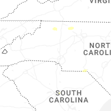


Connect with Interactive Hail Maps