

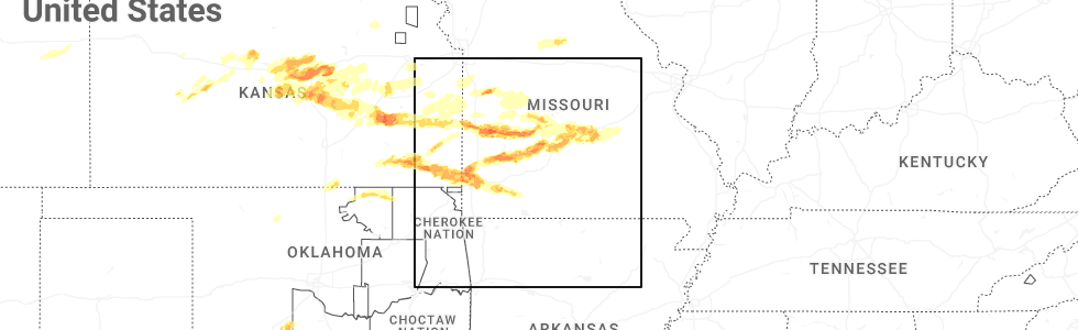
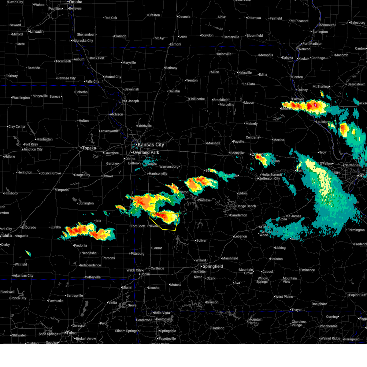
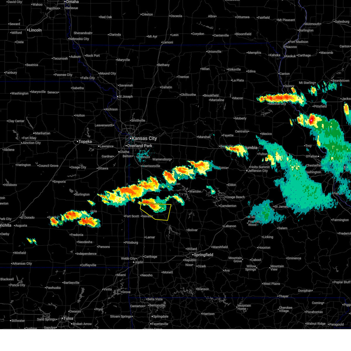
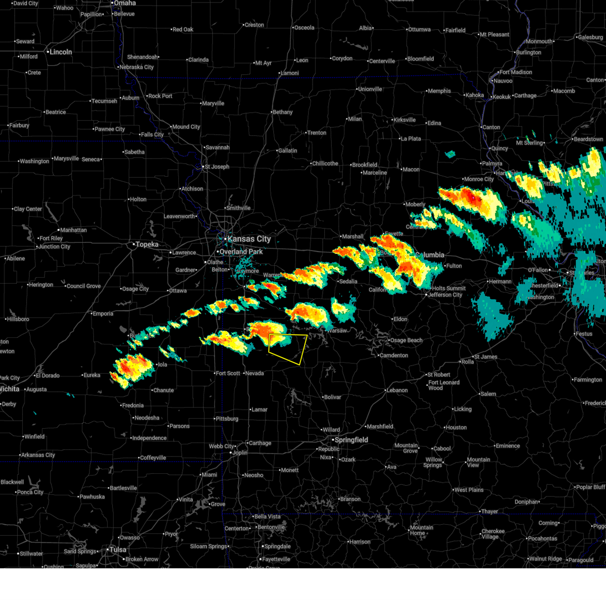
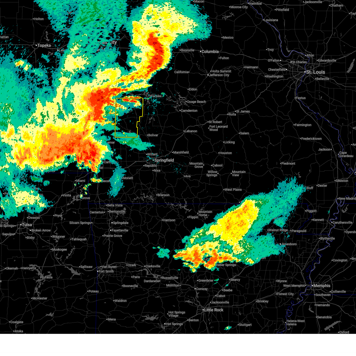
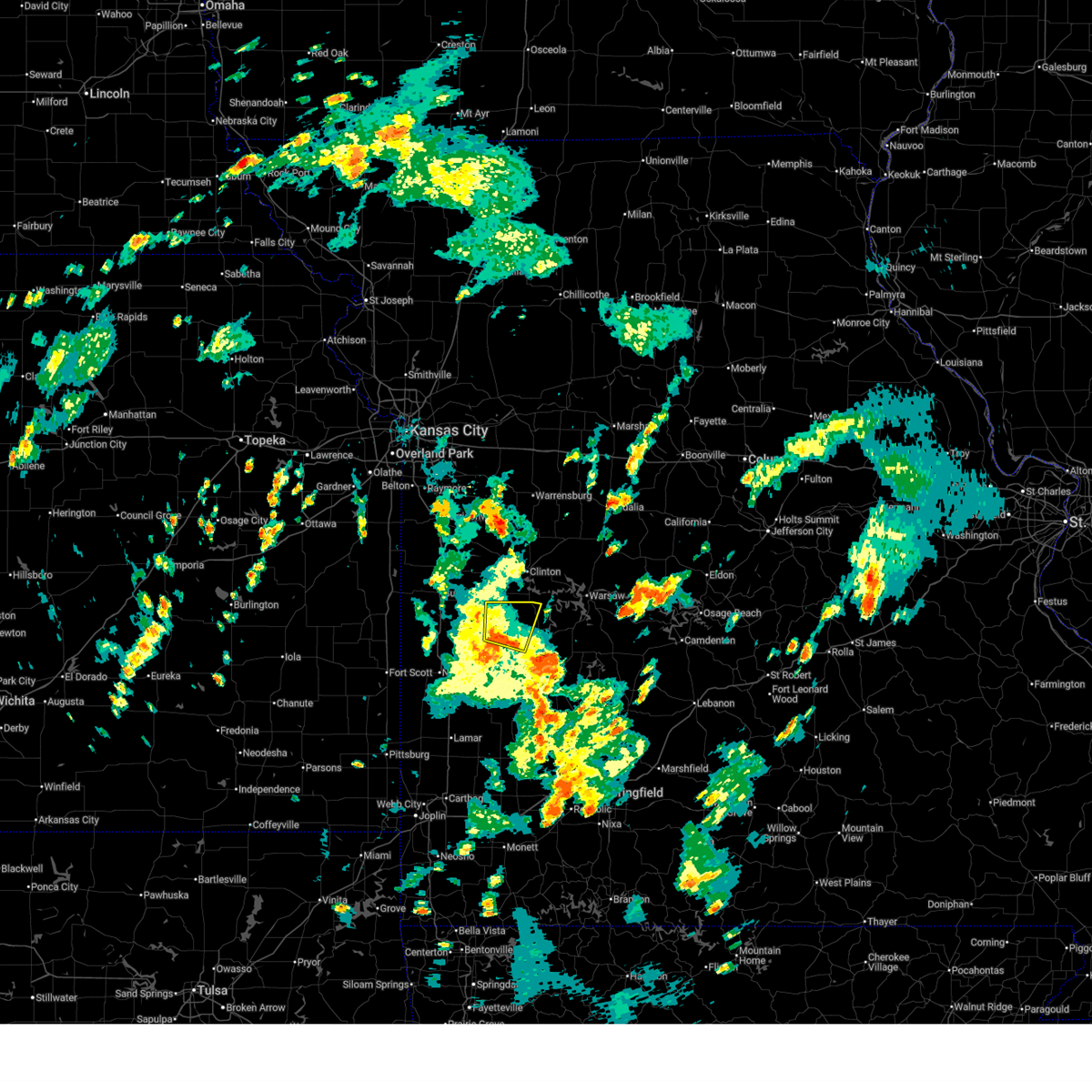
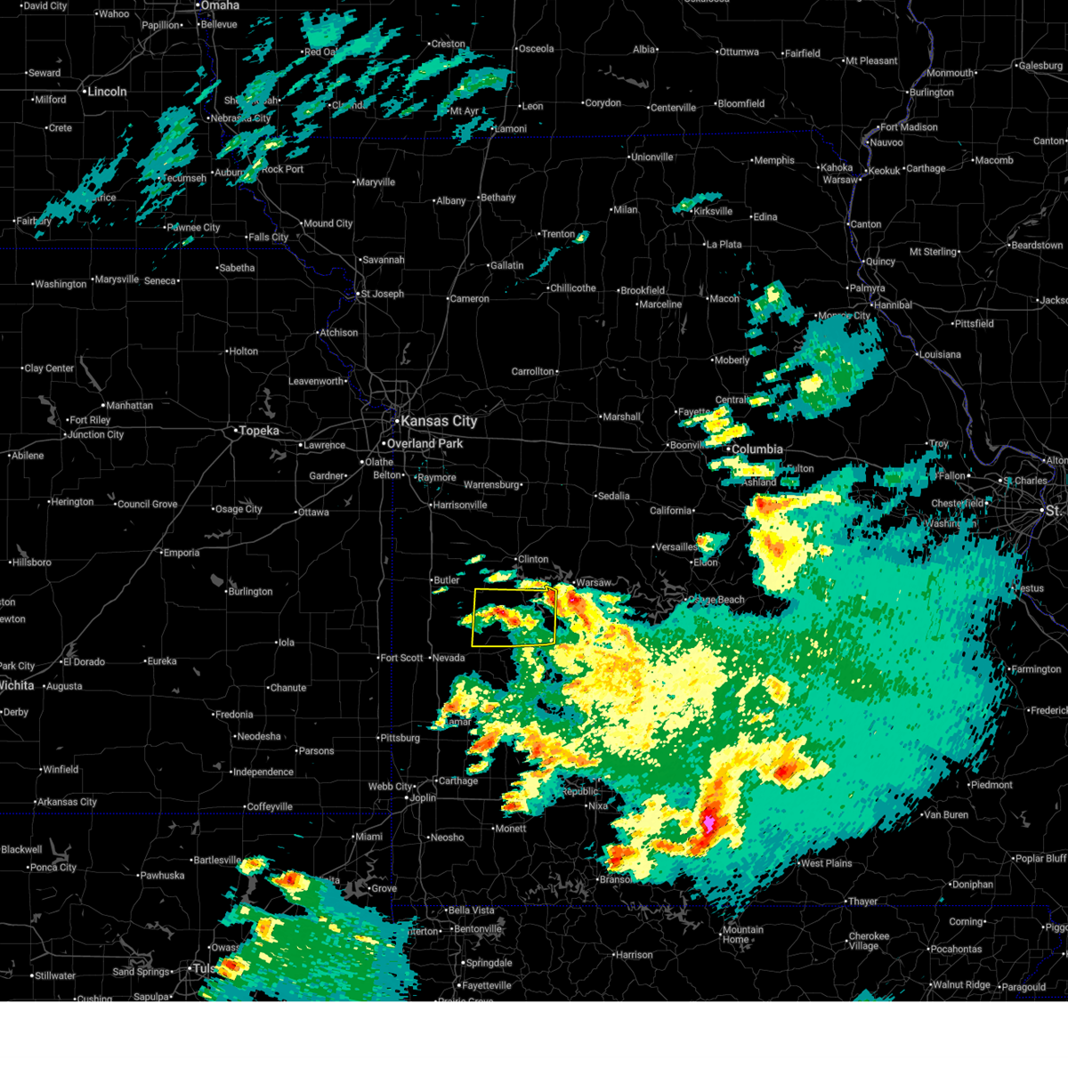
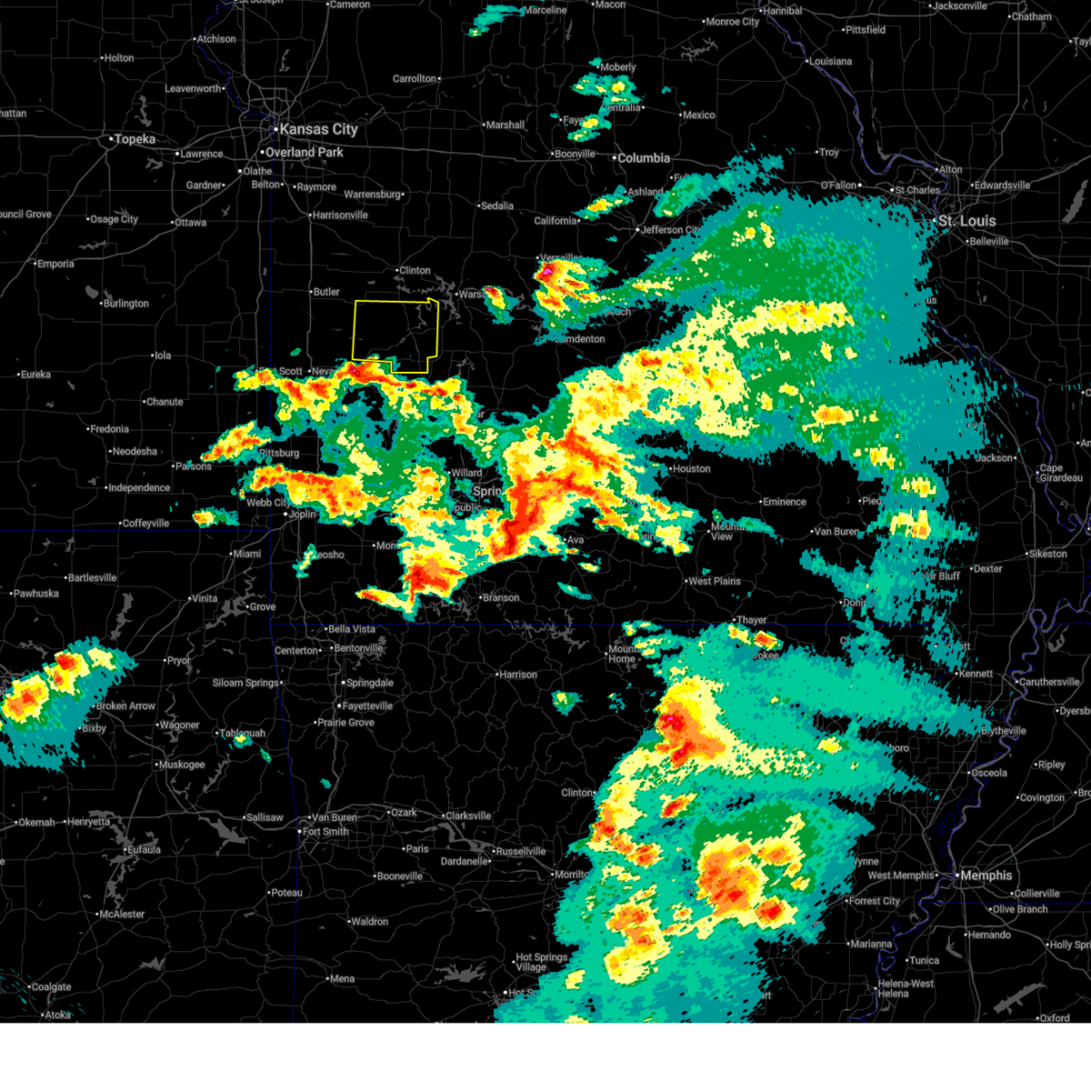
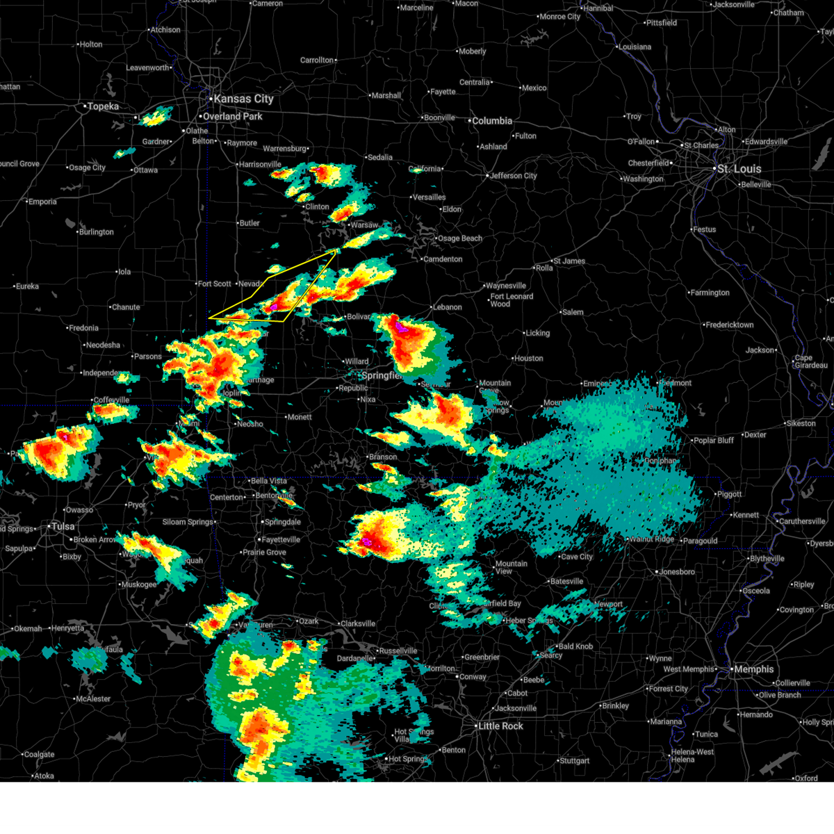
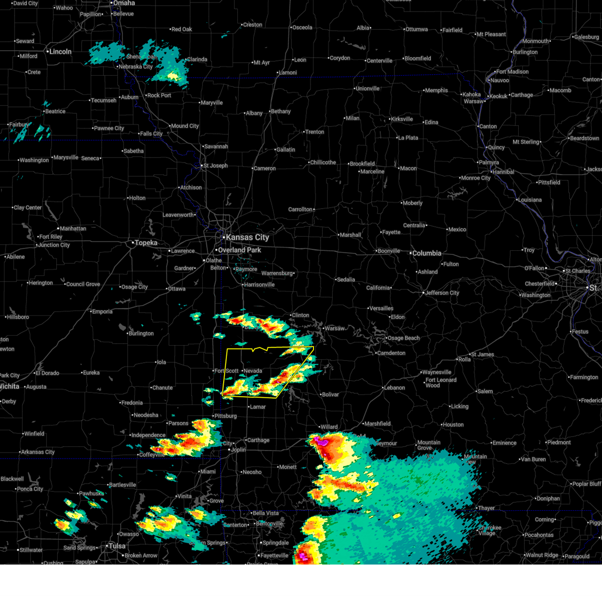
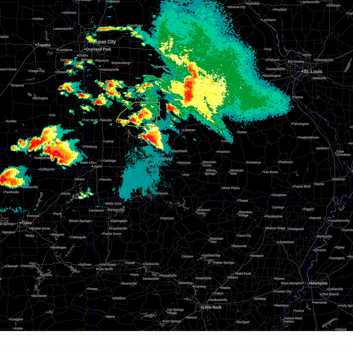
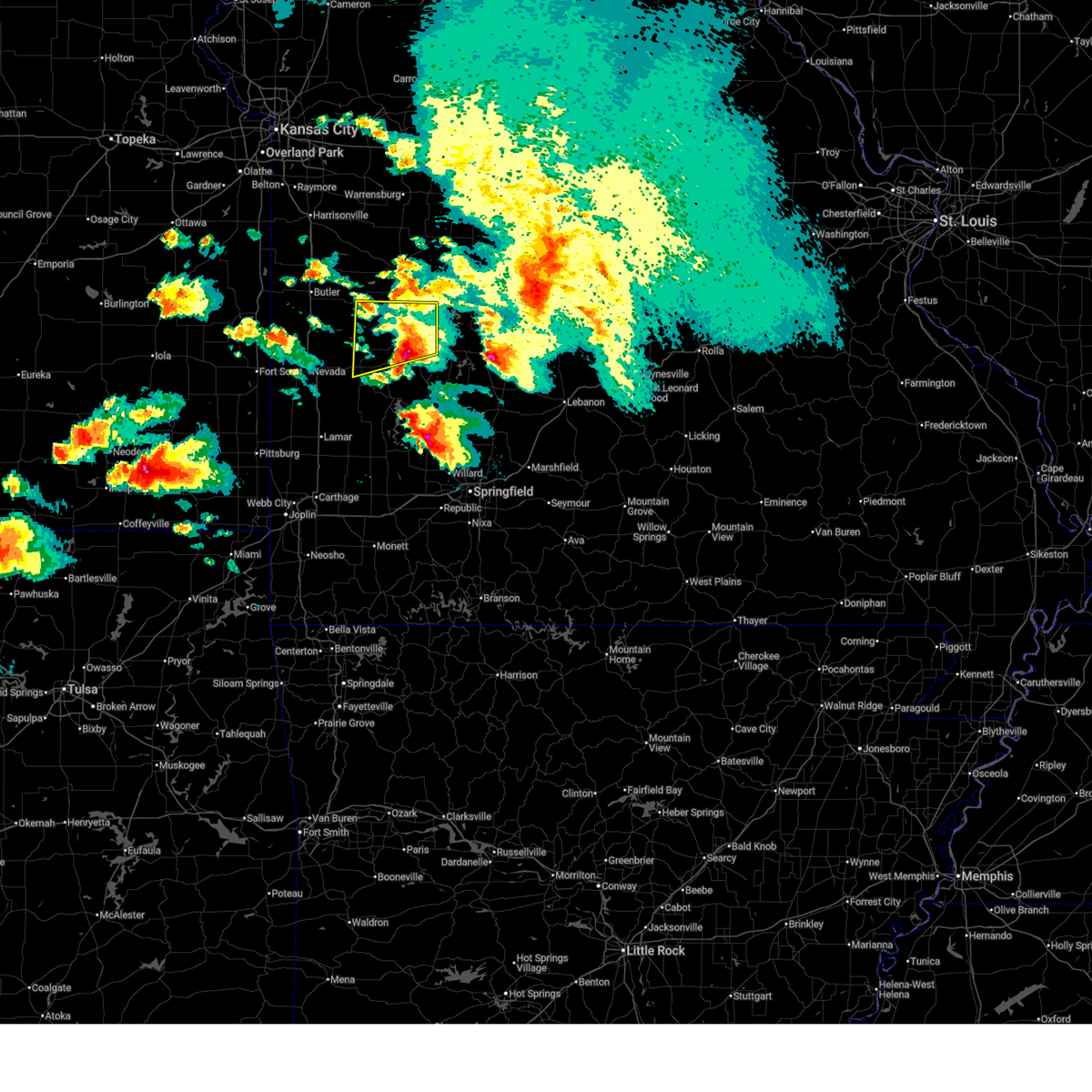
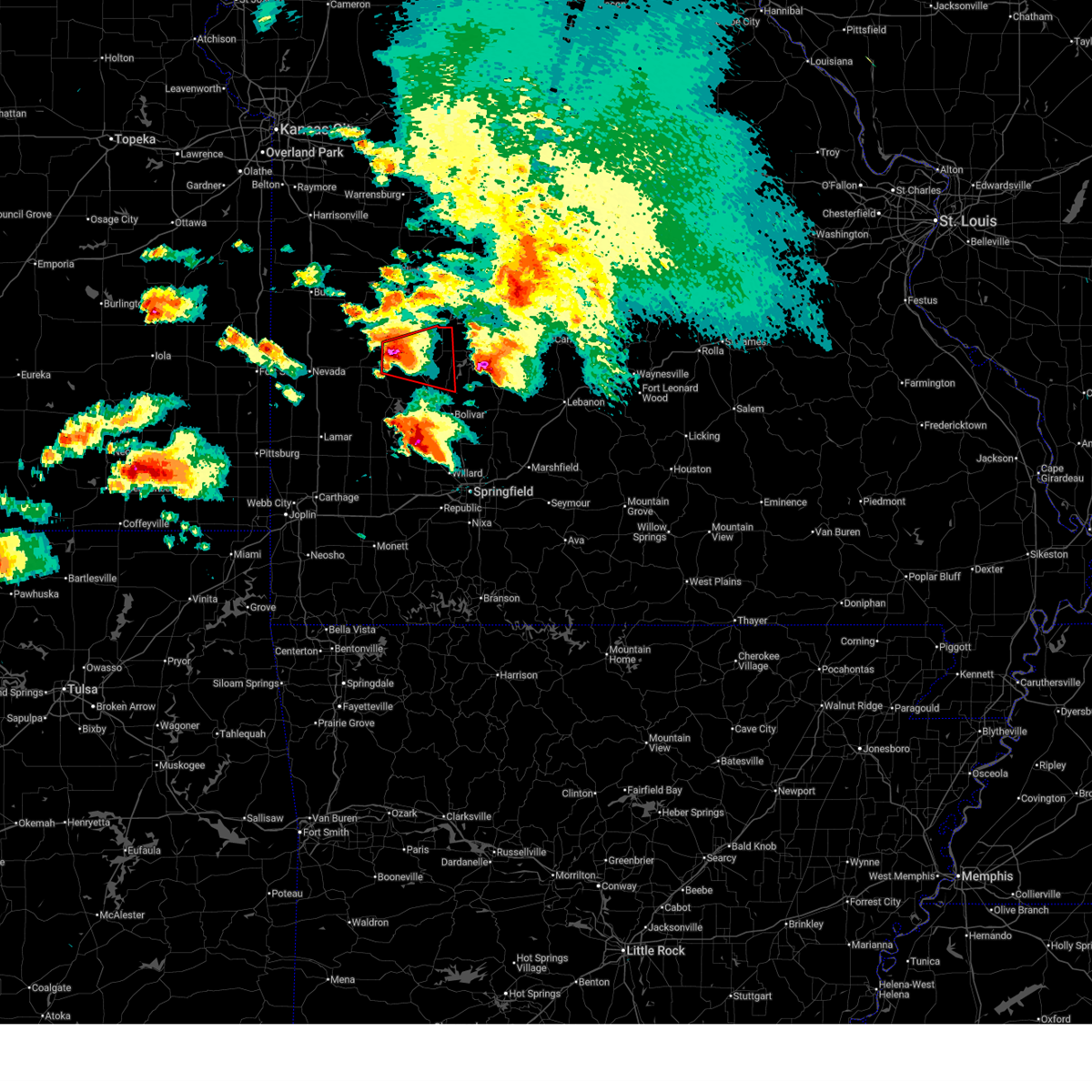
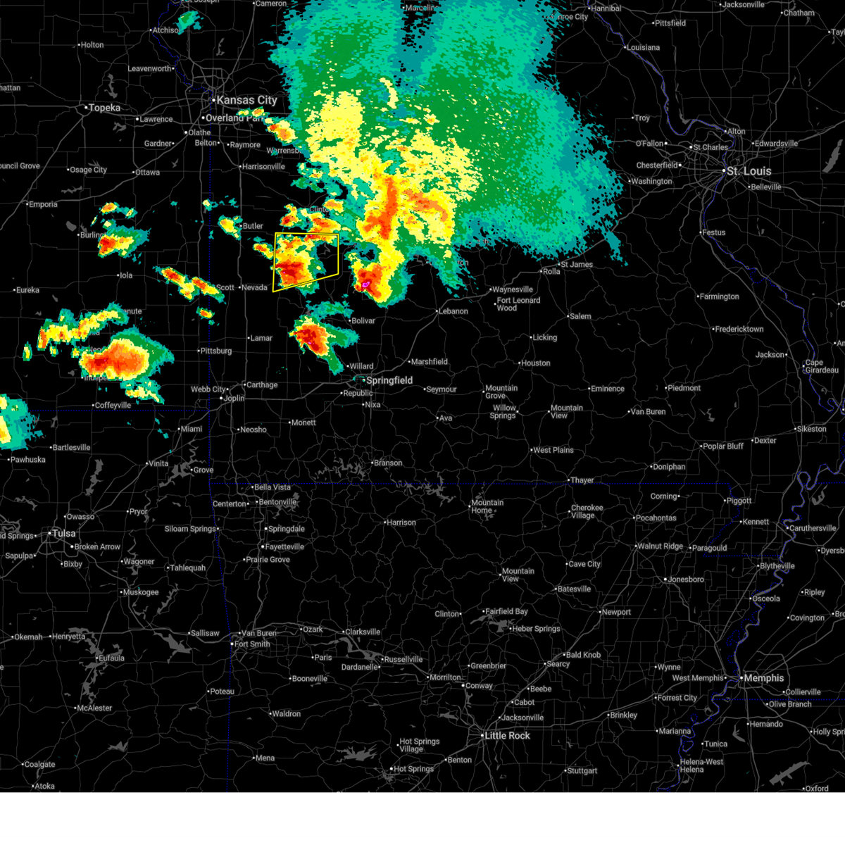
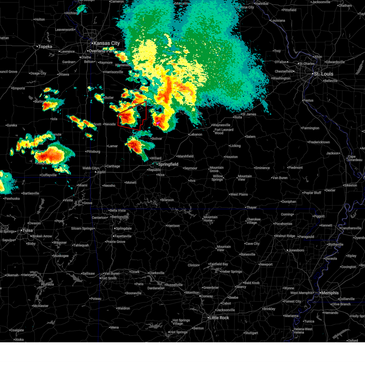
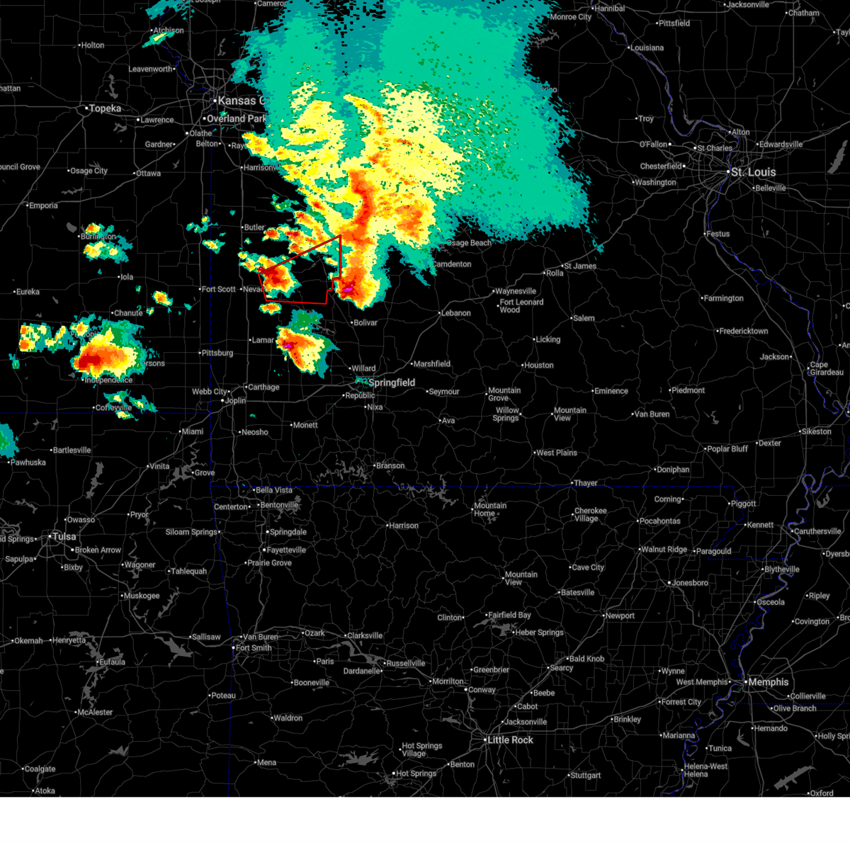
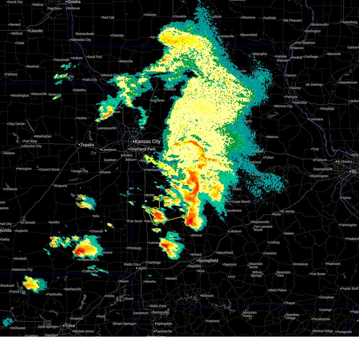
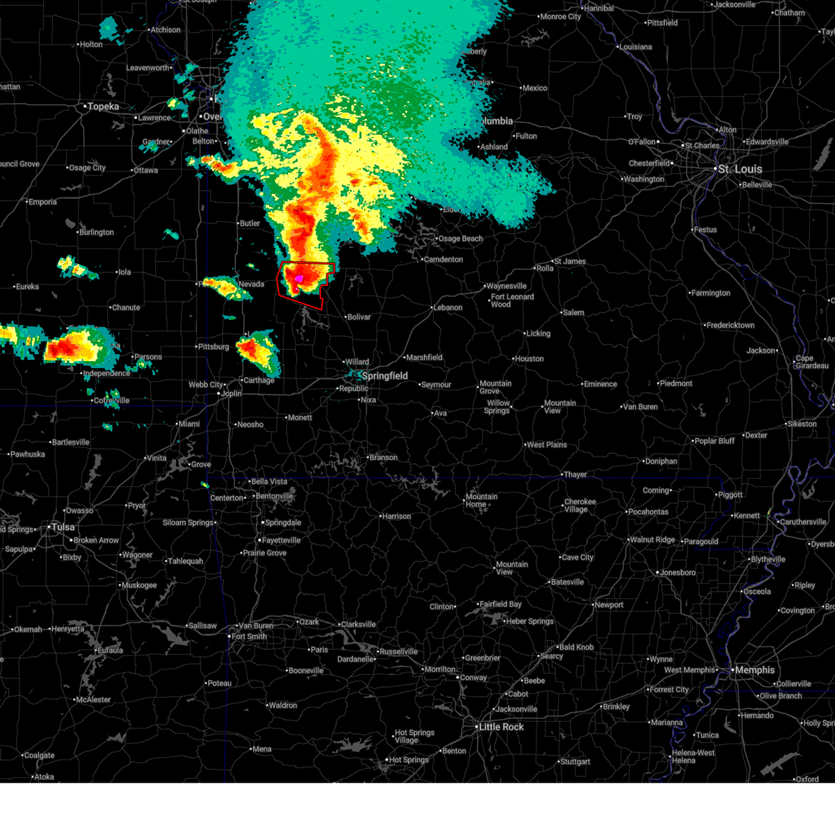
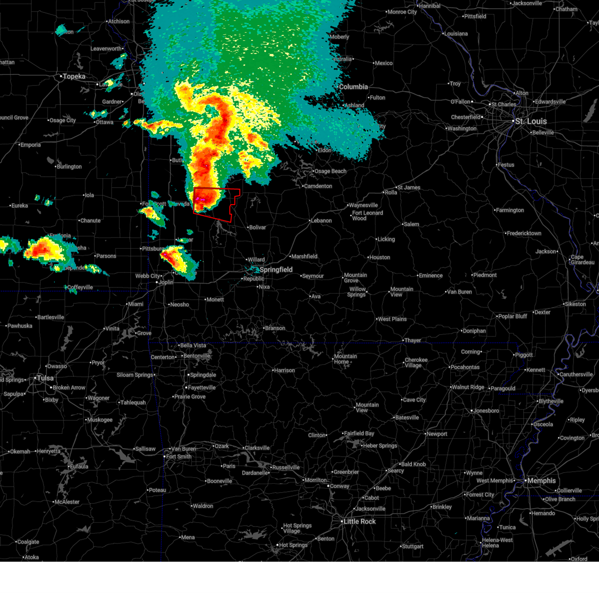
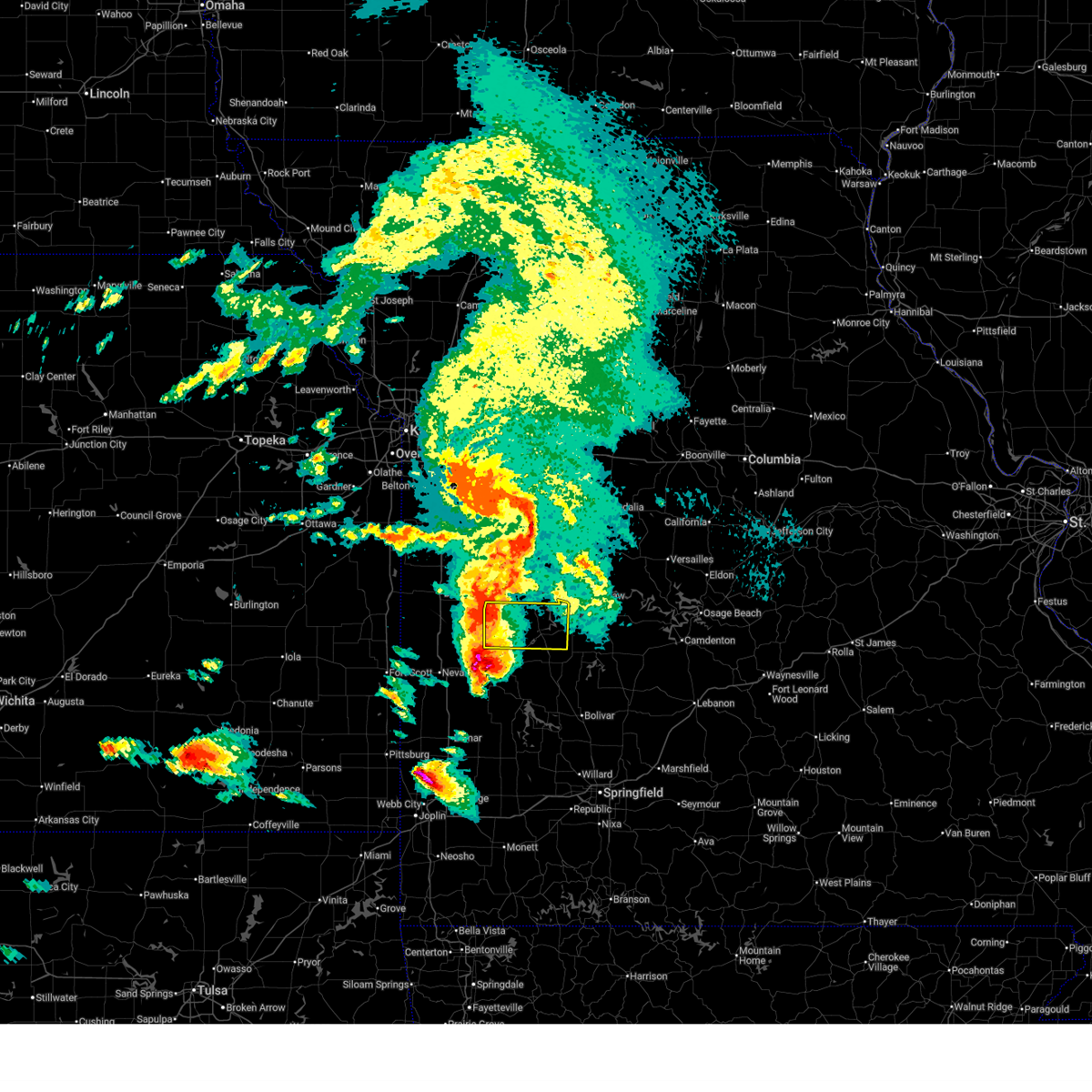
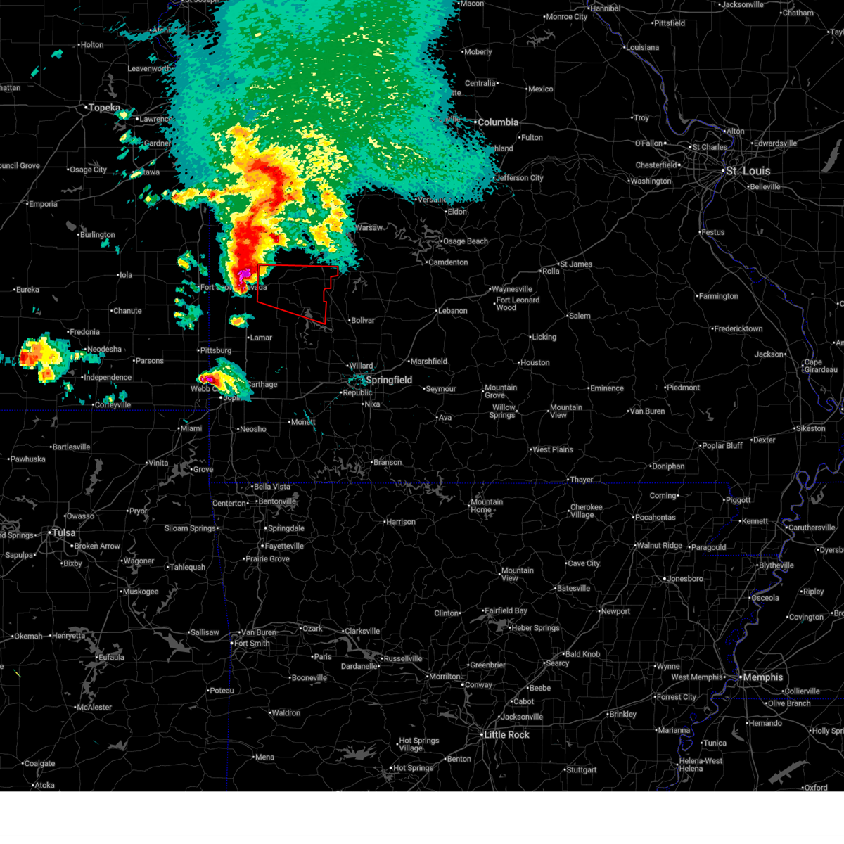
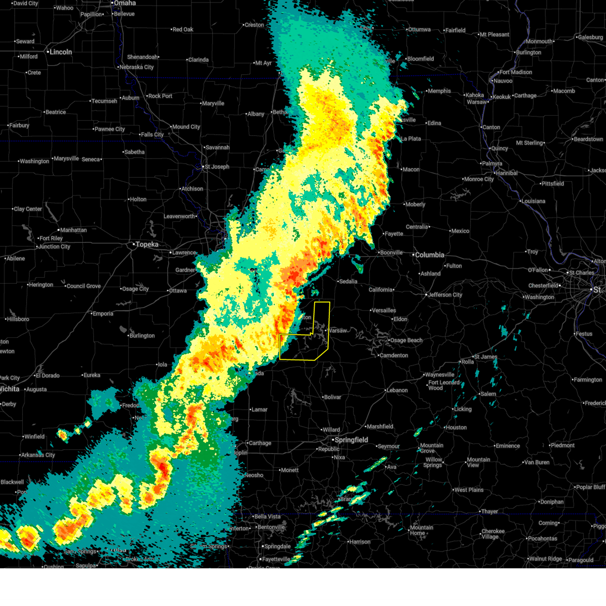
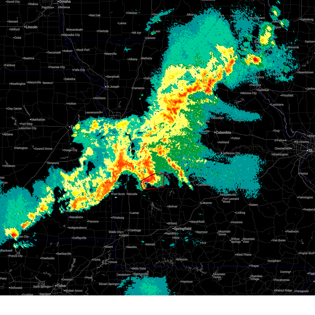
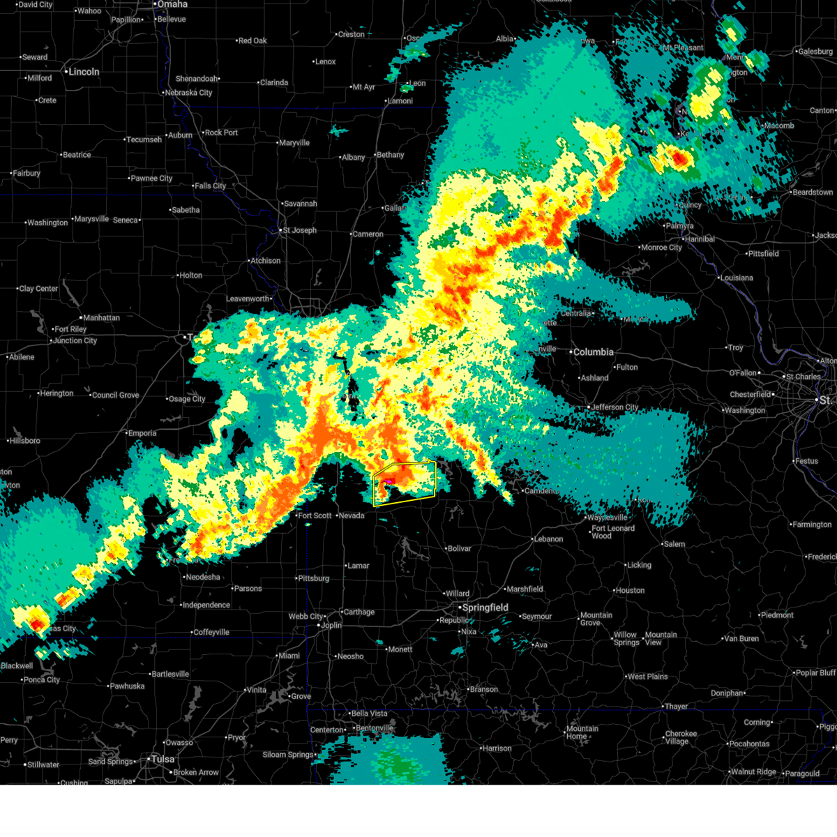
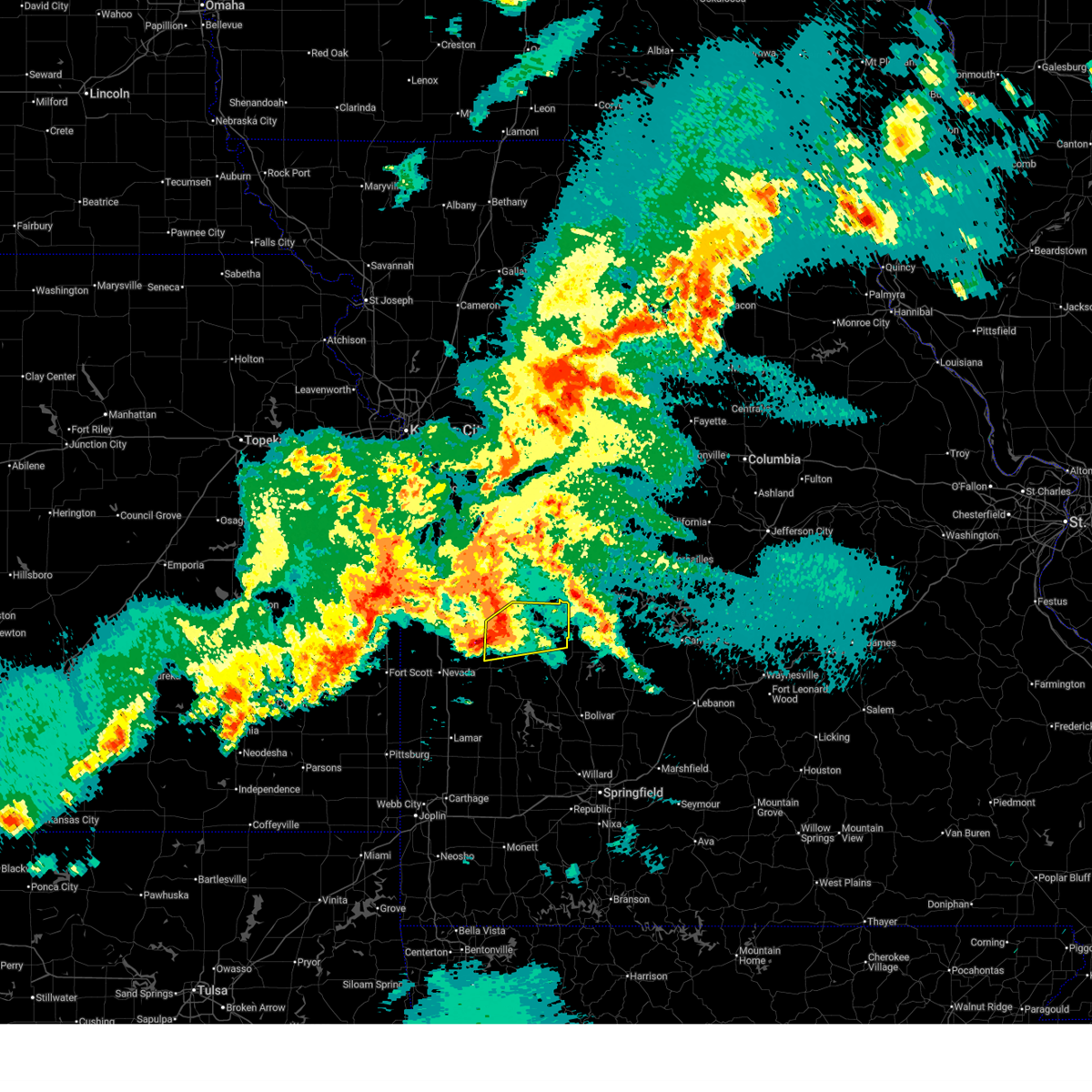
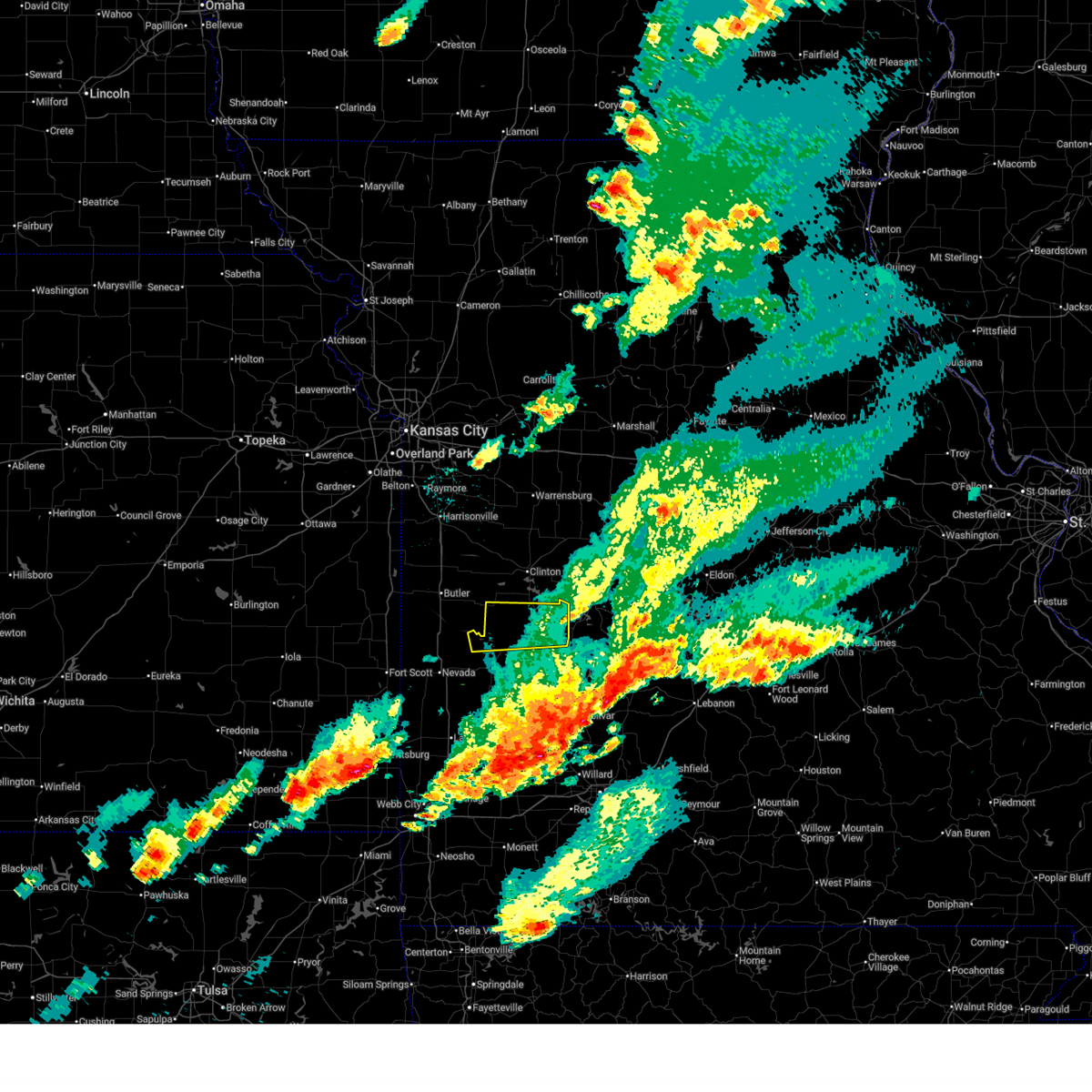
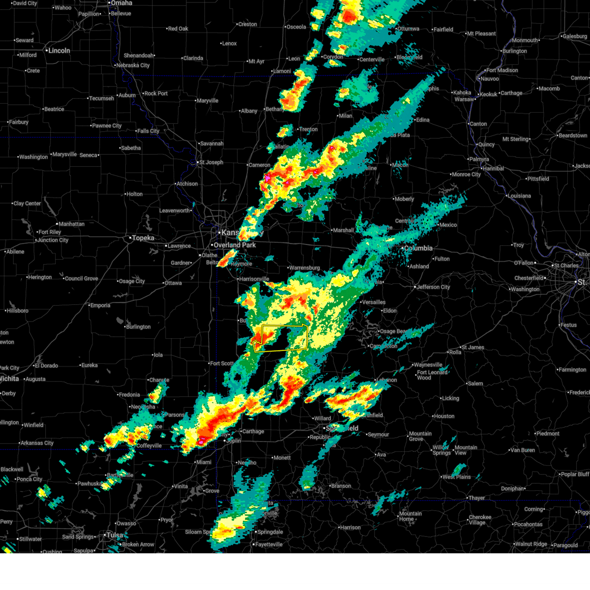
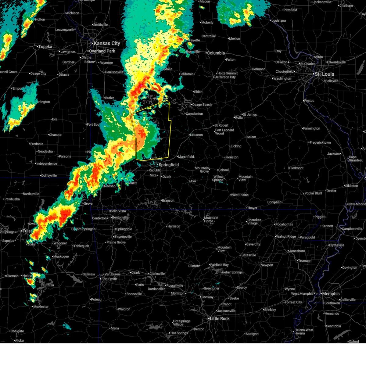
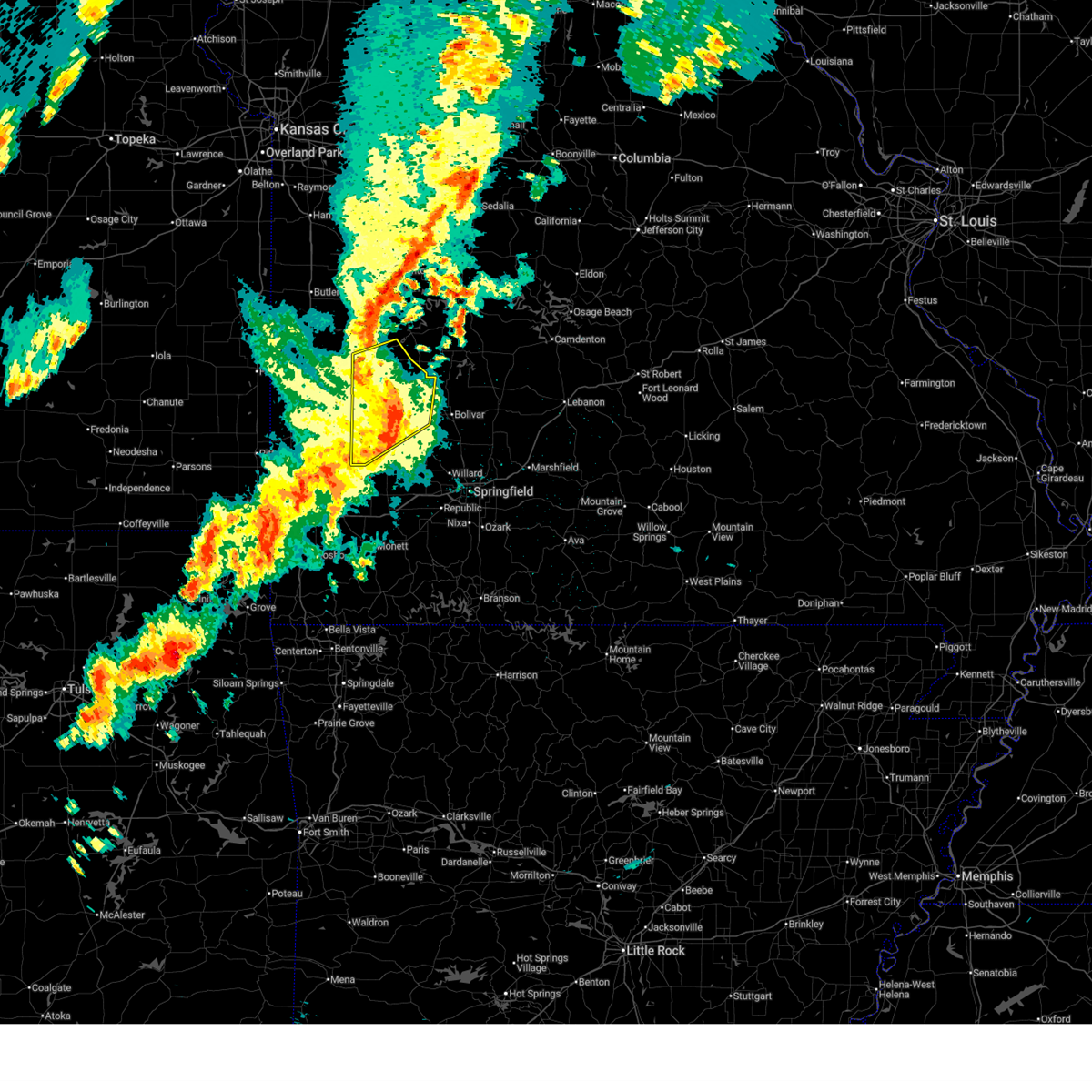
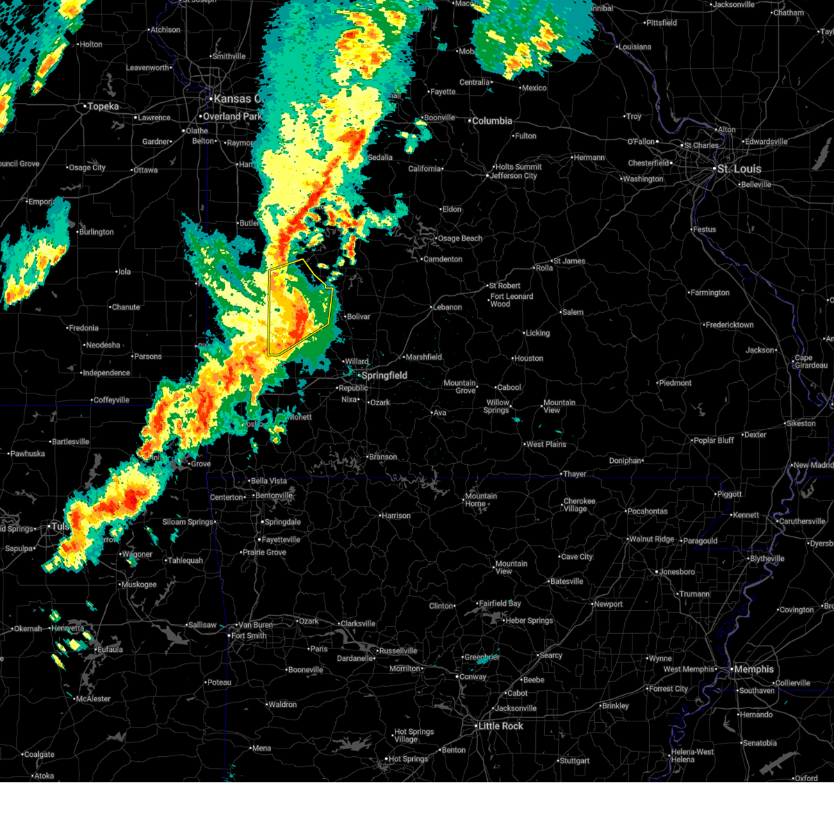
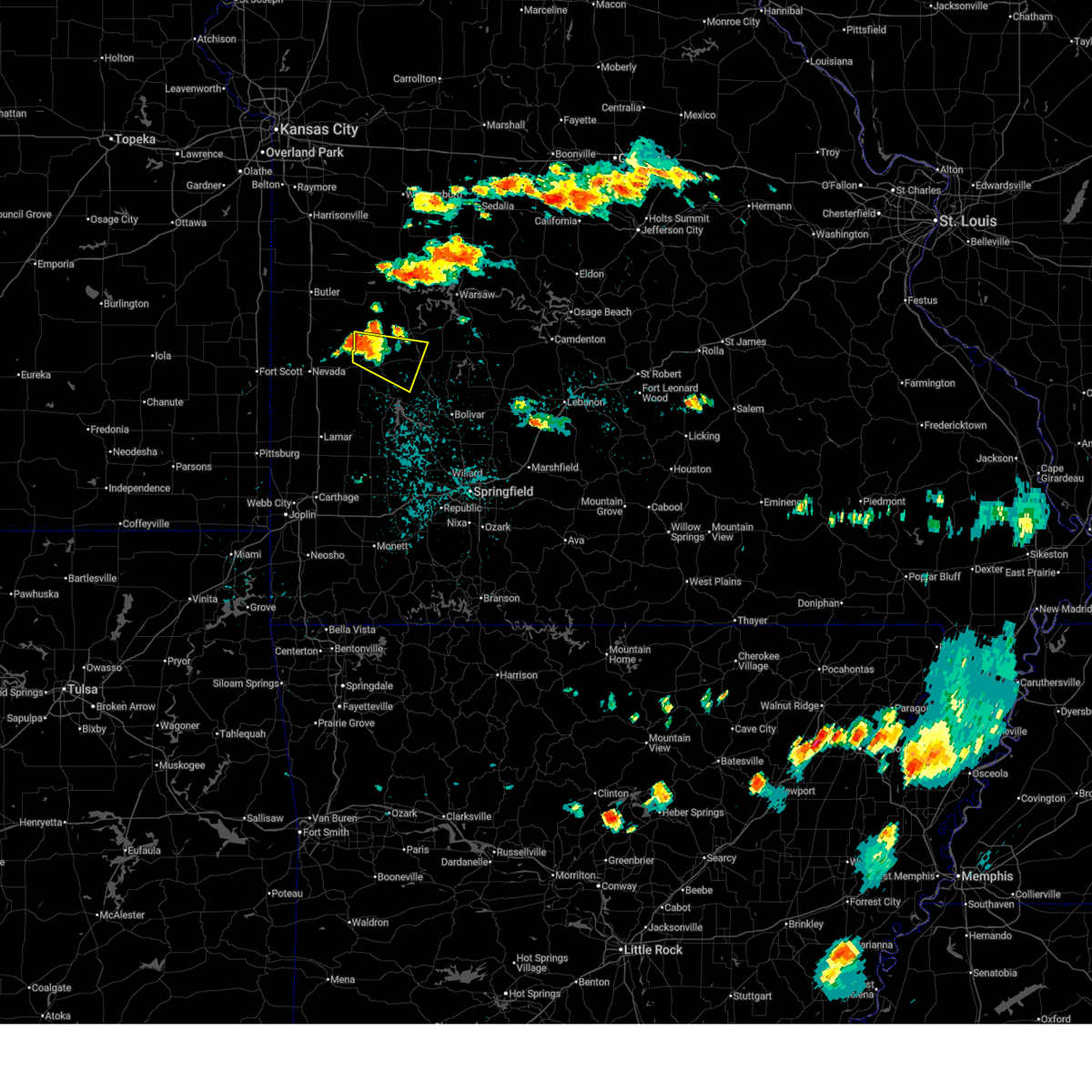
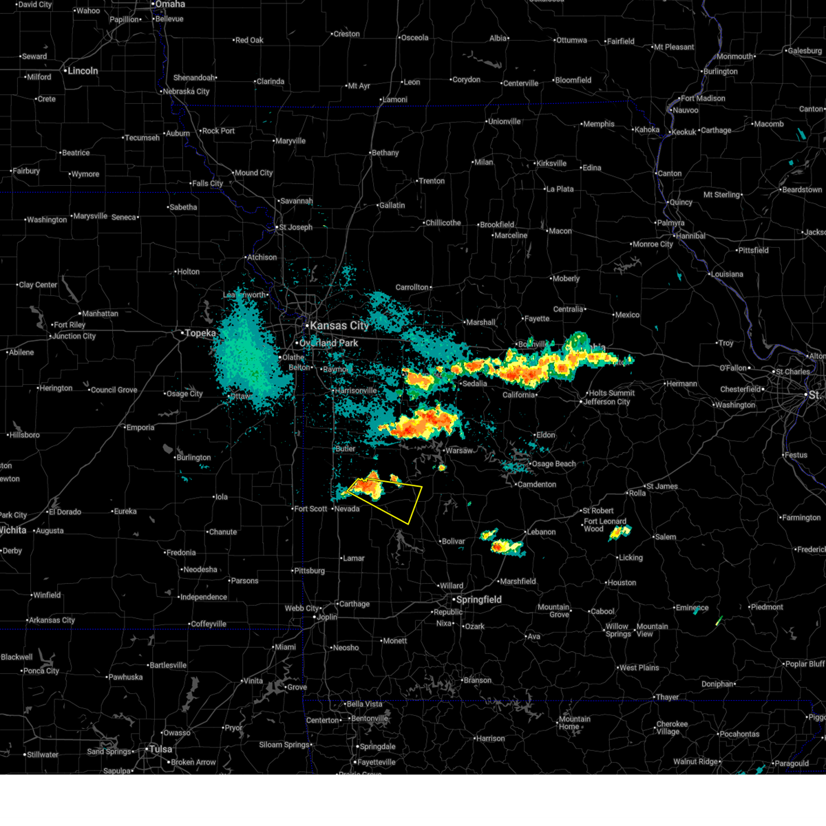
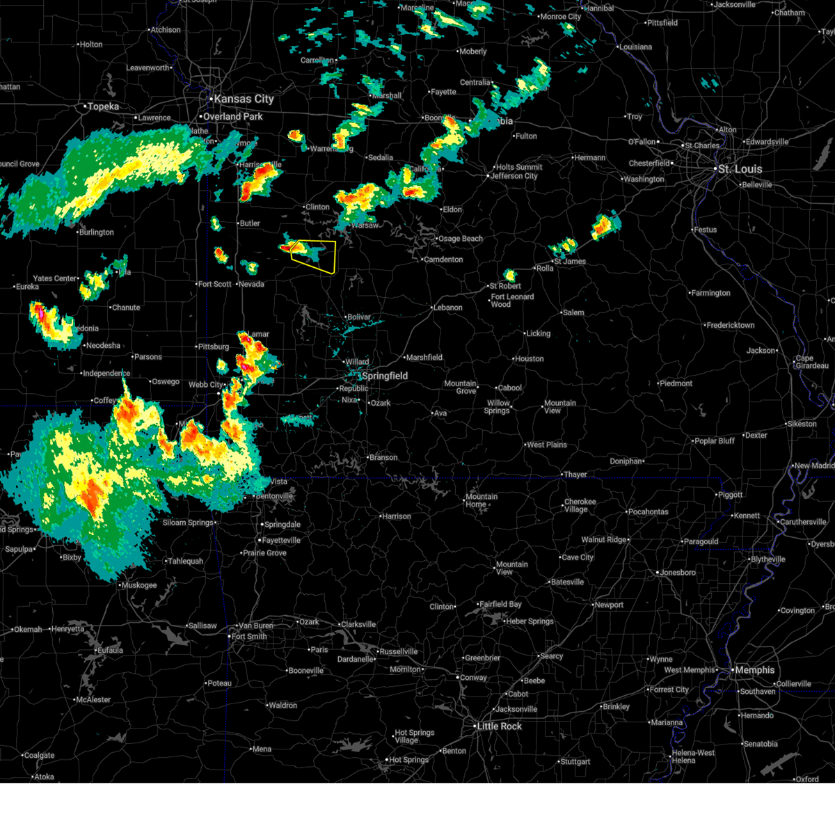
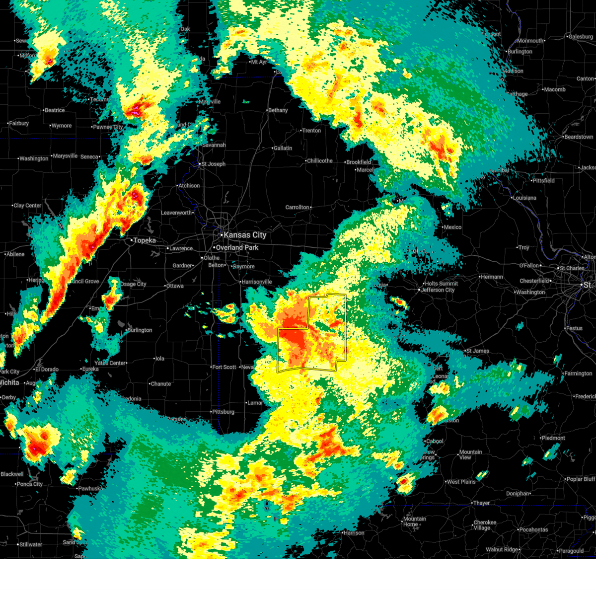
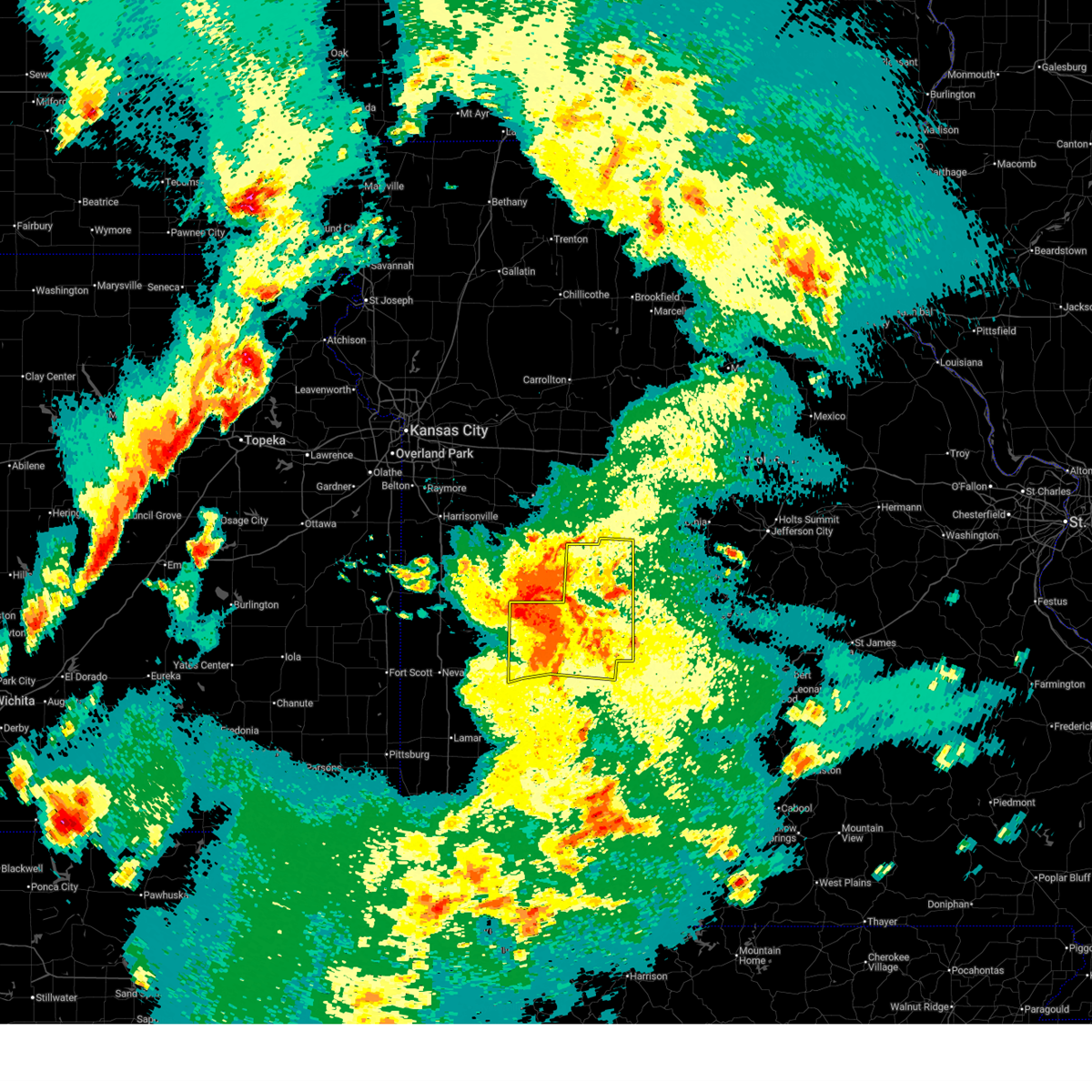
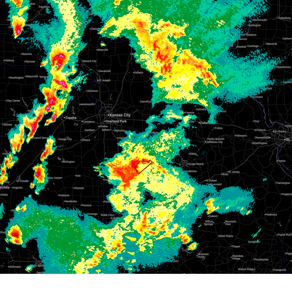
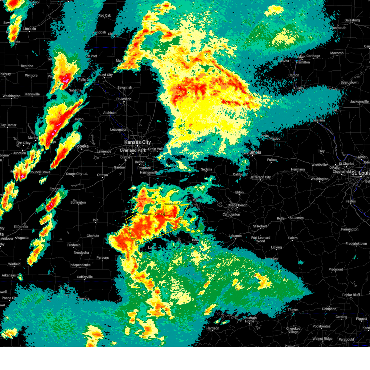
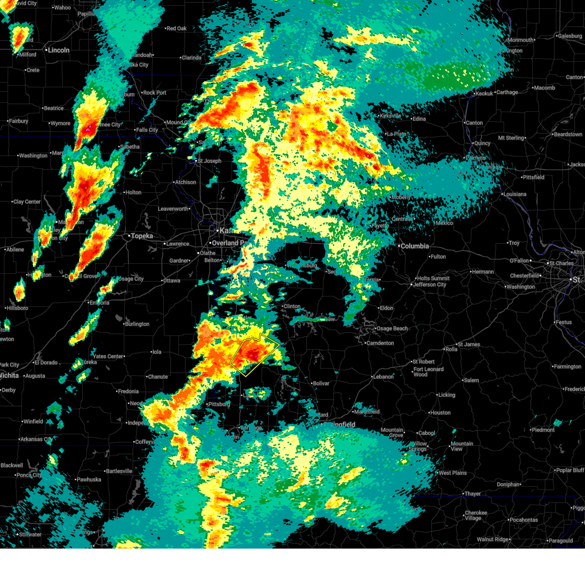
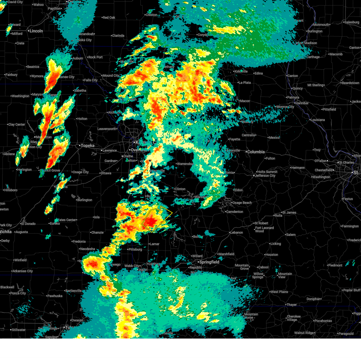
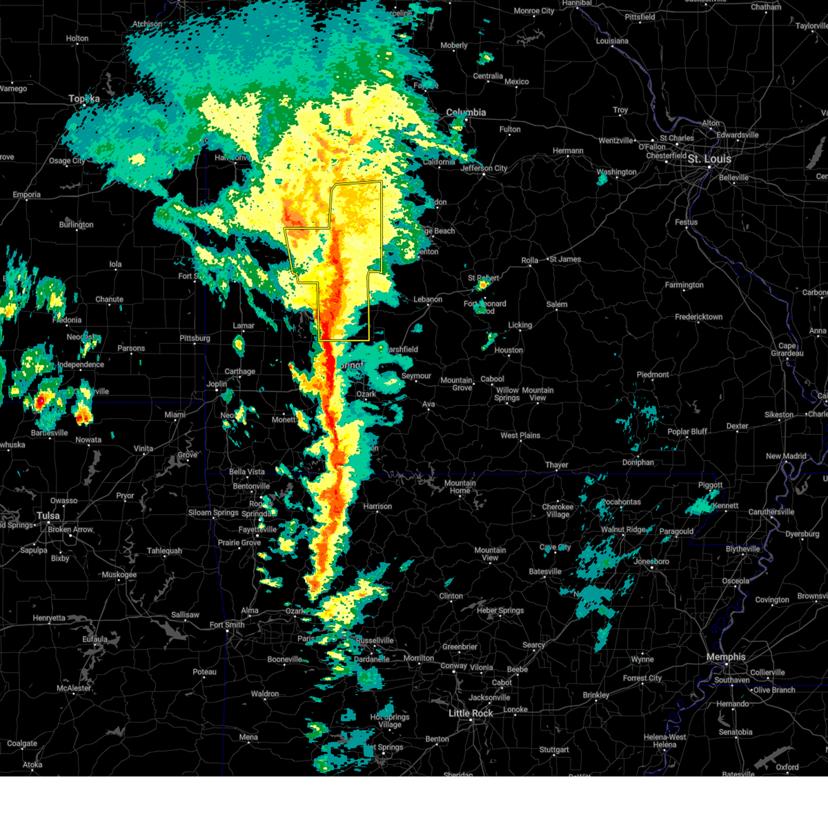
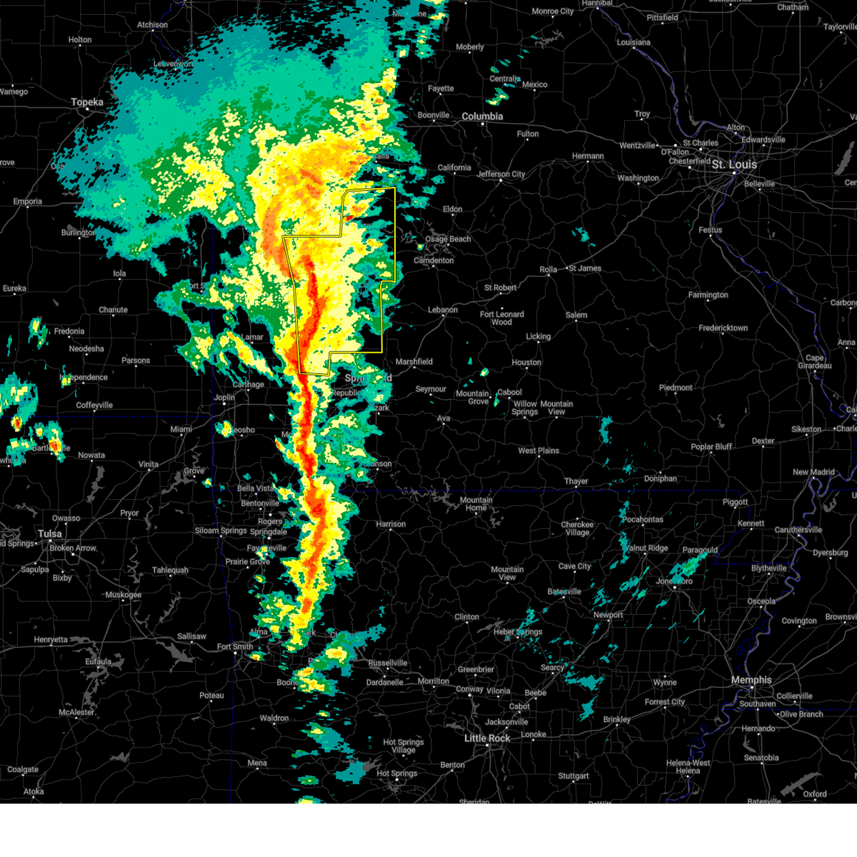
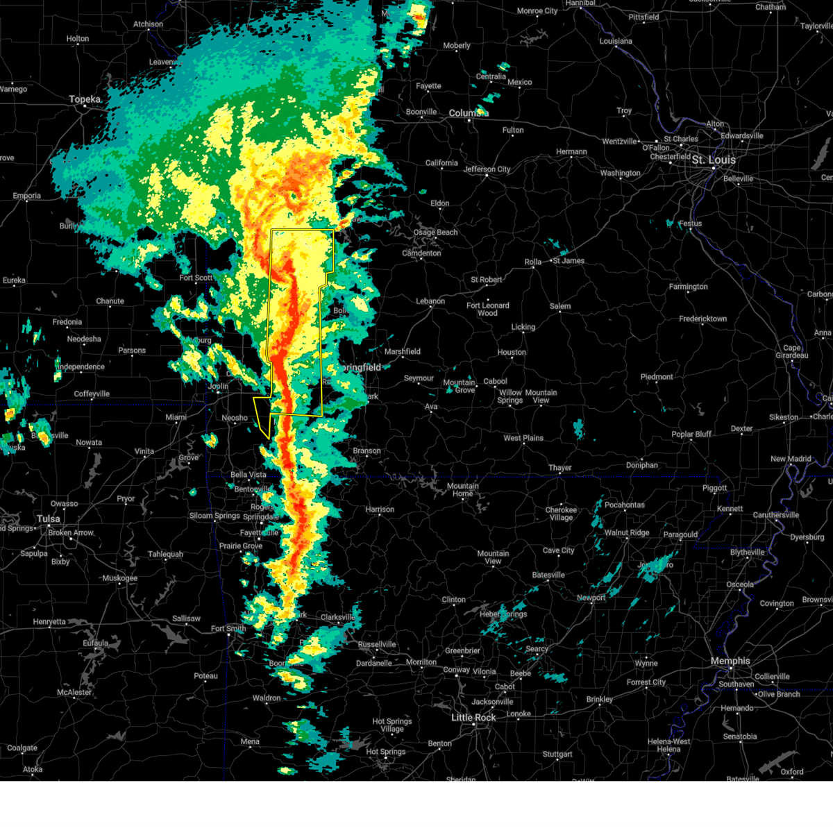
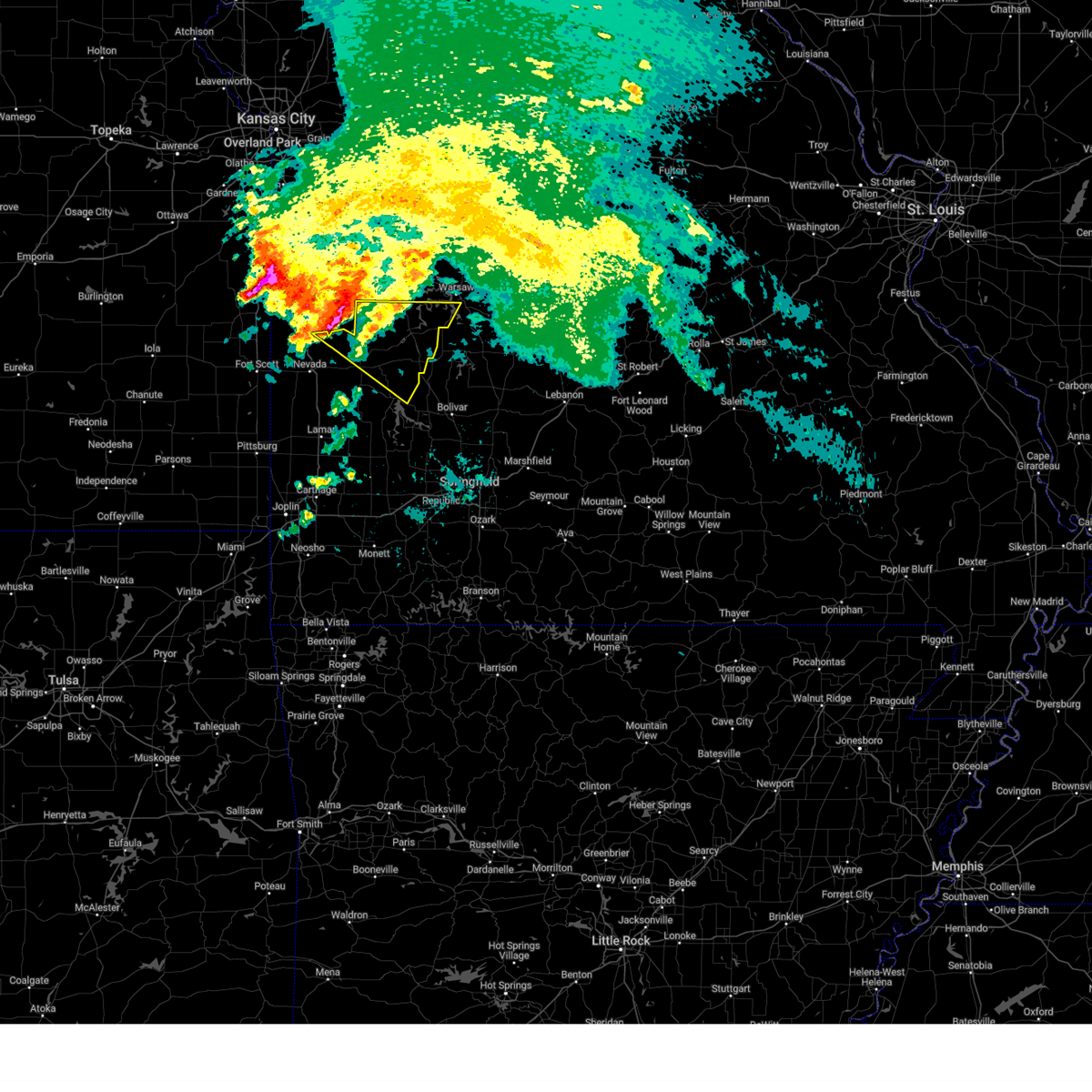
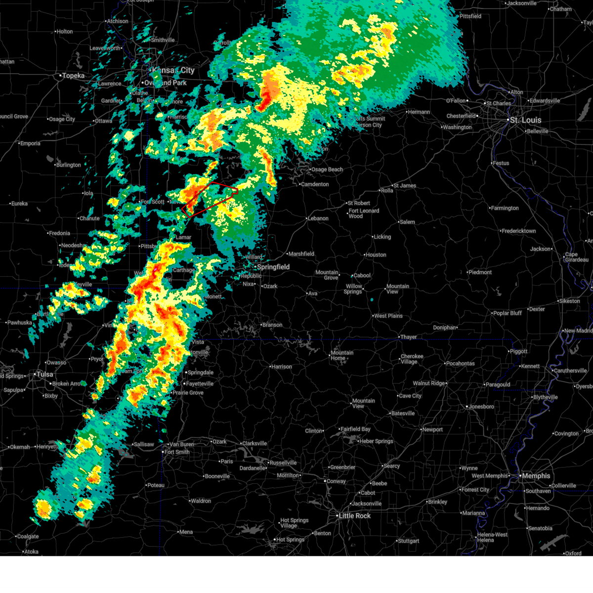
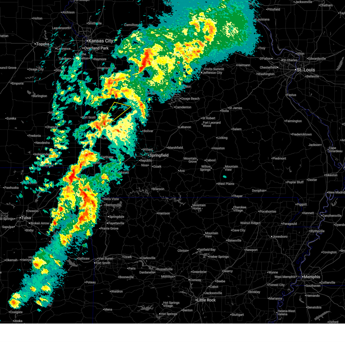
Hail Map for Roscoe, MO
The Roscoe, MO area has had 1 report of on-the-ground hail by trained spotters, and has been under severe weather warnings 45 times during the past 12 months. Doppler radar has detected hail at or near Roscoe, MO on 63 occasions, including 4 occasions during the past year.
| Name: | Roscoe, MO |
| Where Located: | 60.3 miles NNW of Springfield, MO |
| Map: | Google Map for Roscoe, MO |
| Population: | 124 |
| Housing Units: | 81 |
| More Info: | Search Google for Roscoe, MO |
2
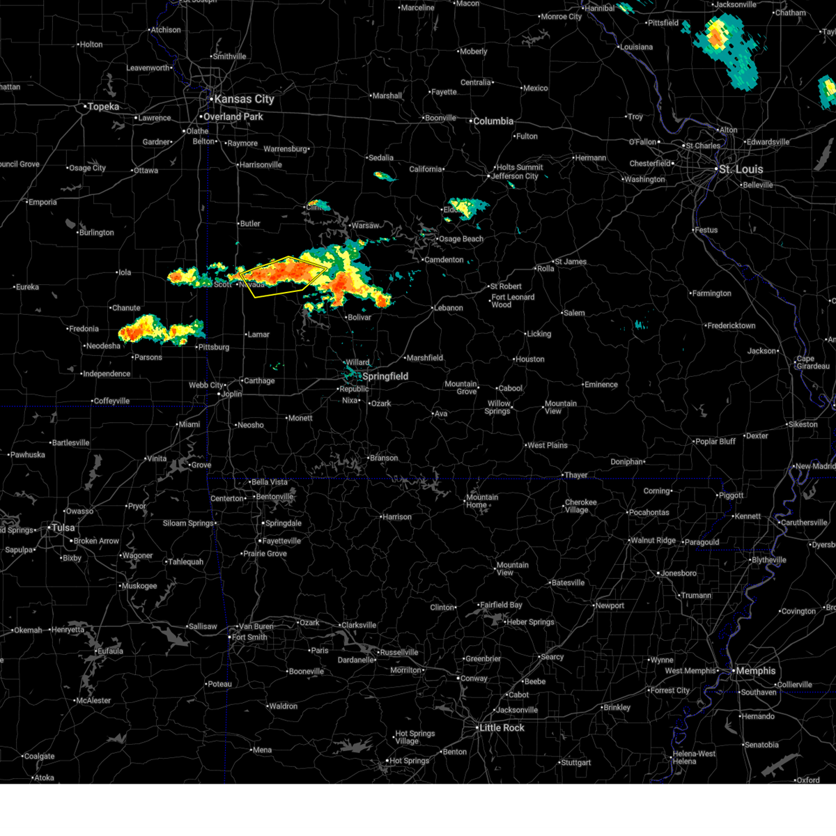
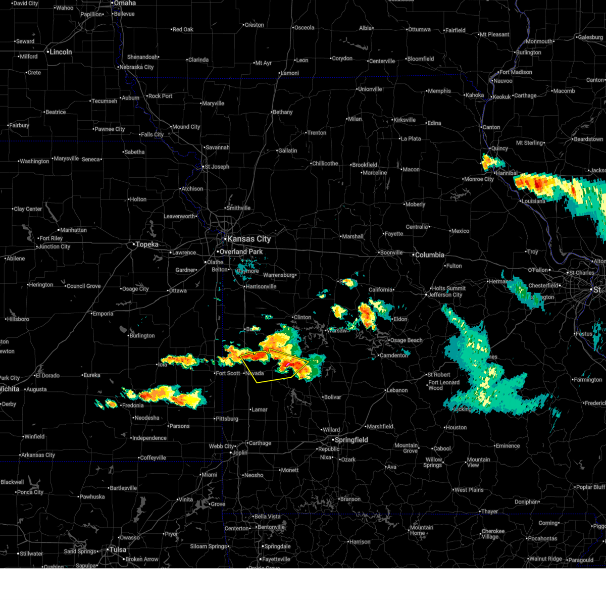
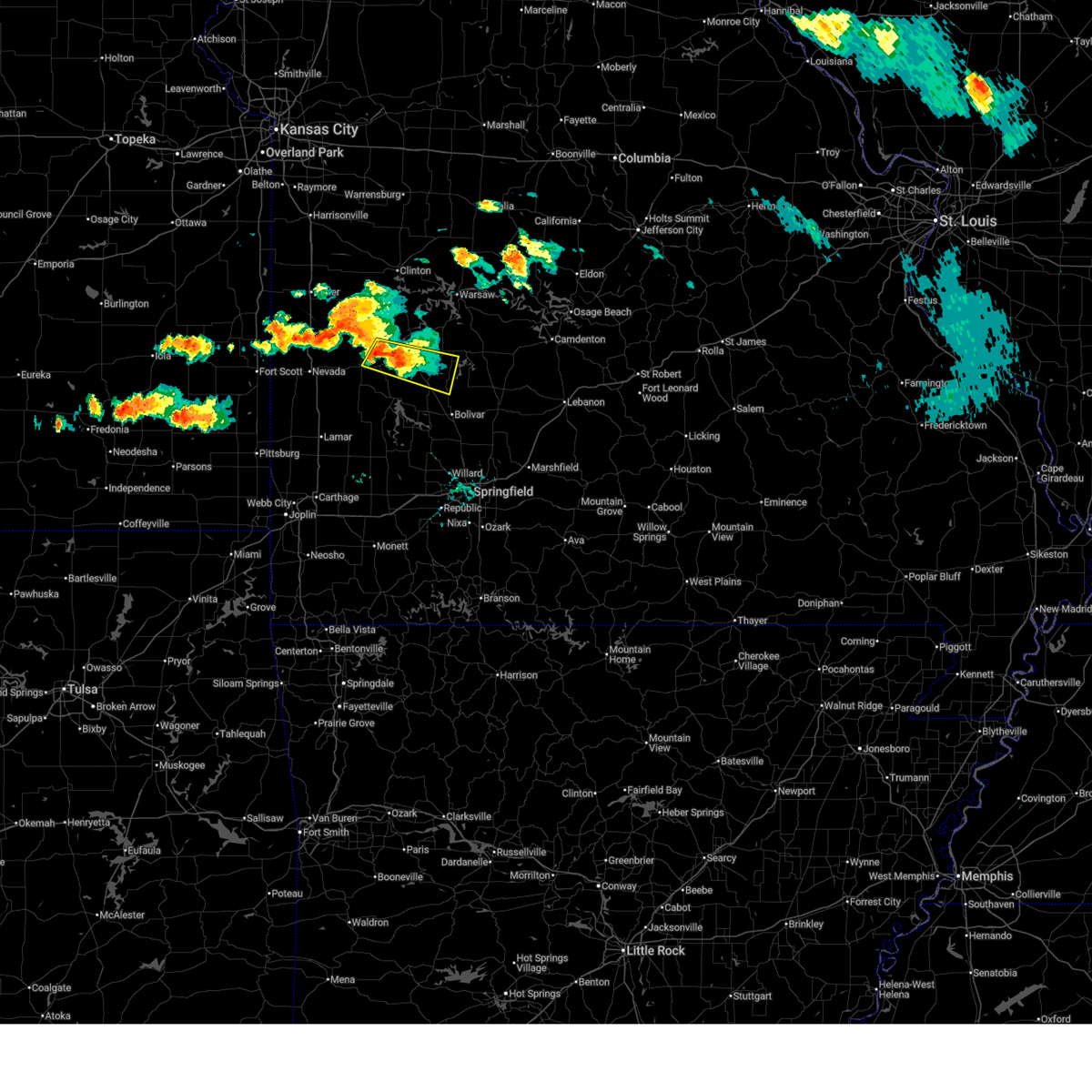
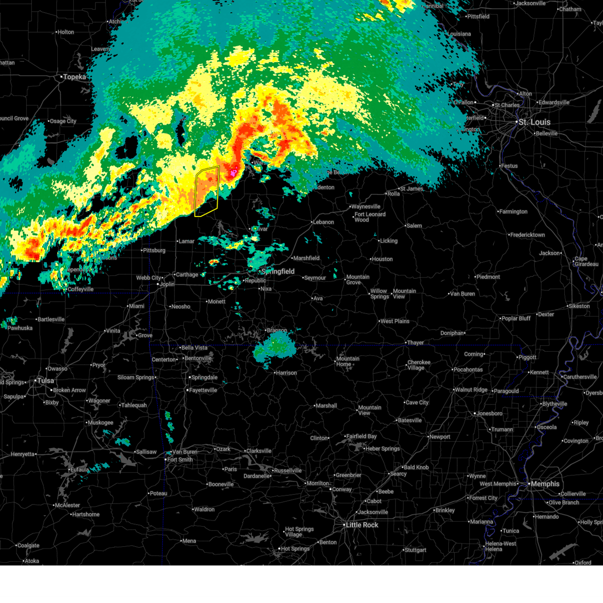
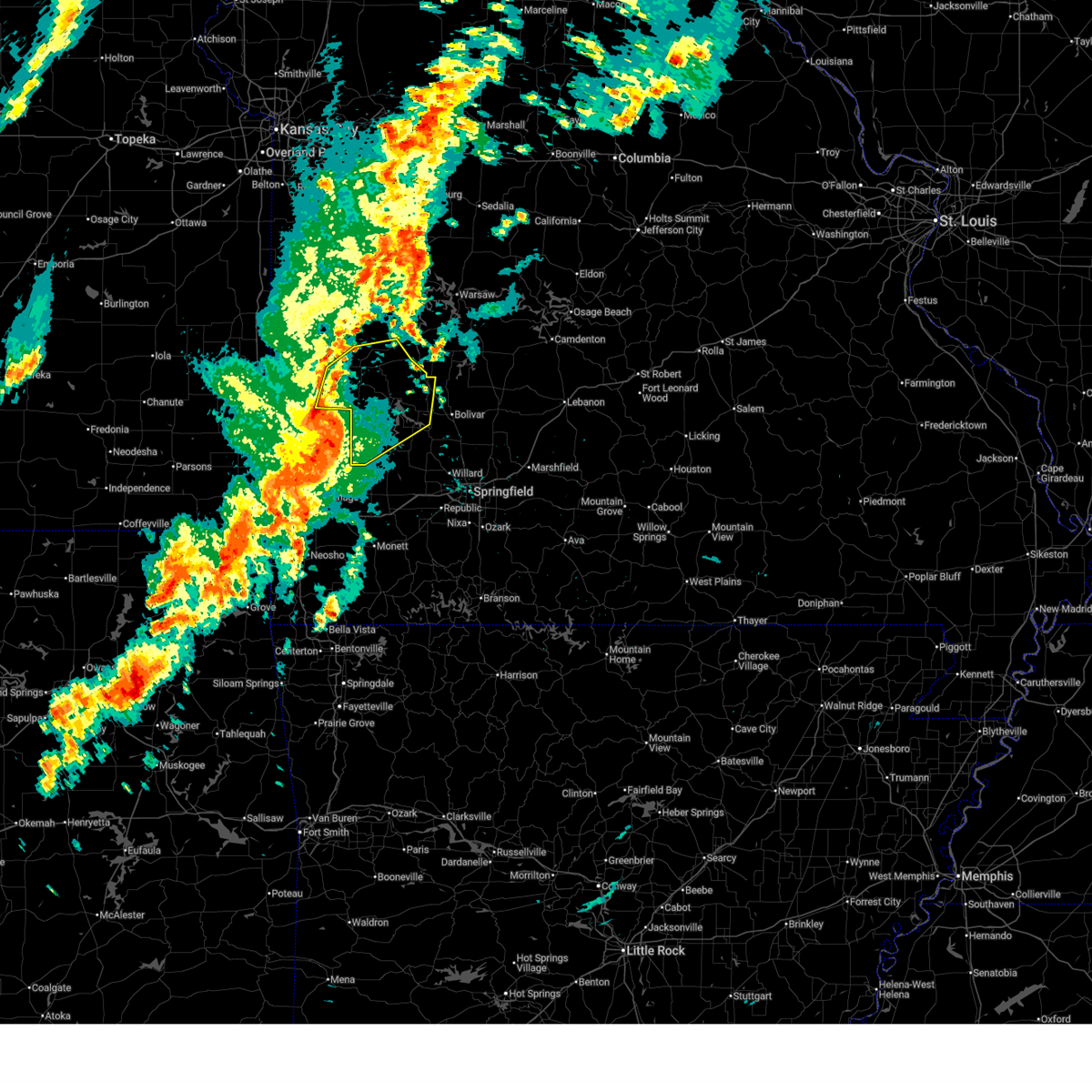
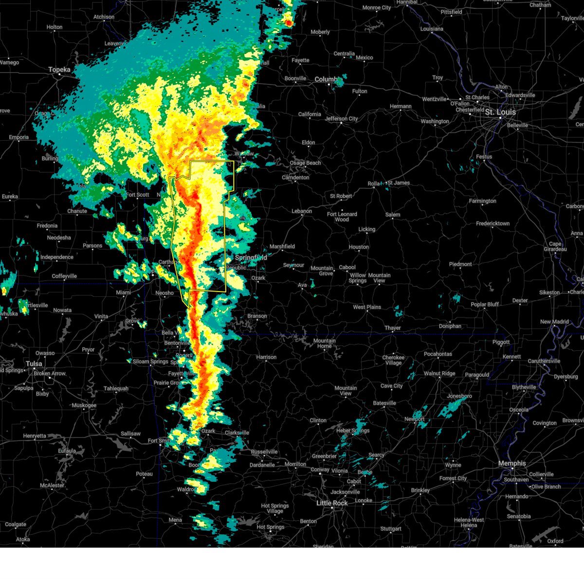
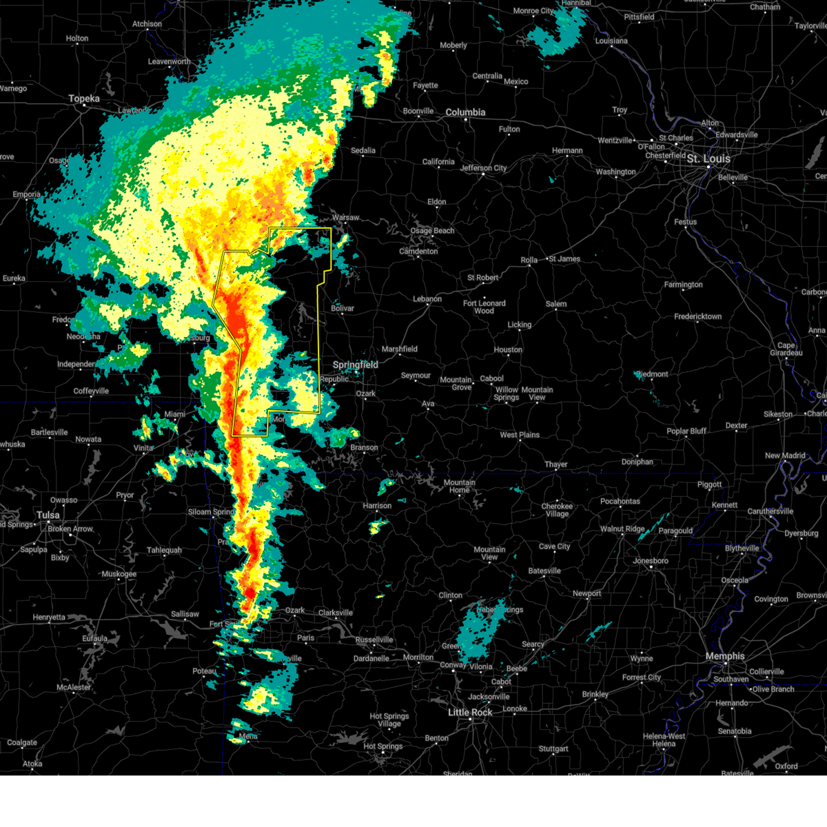
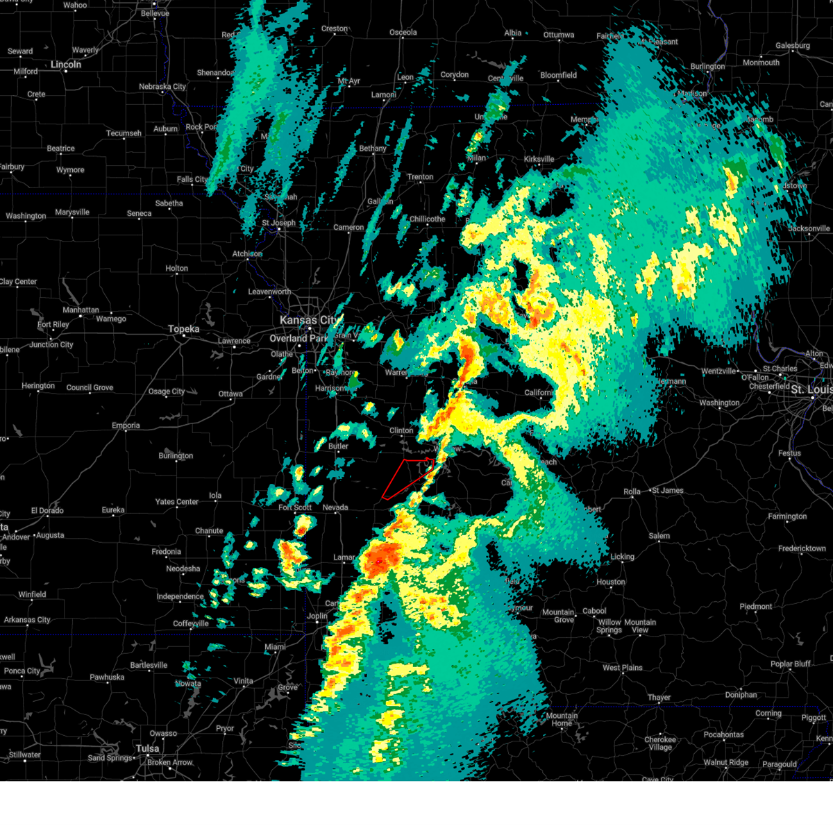
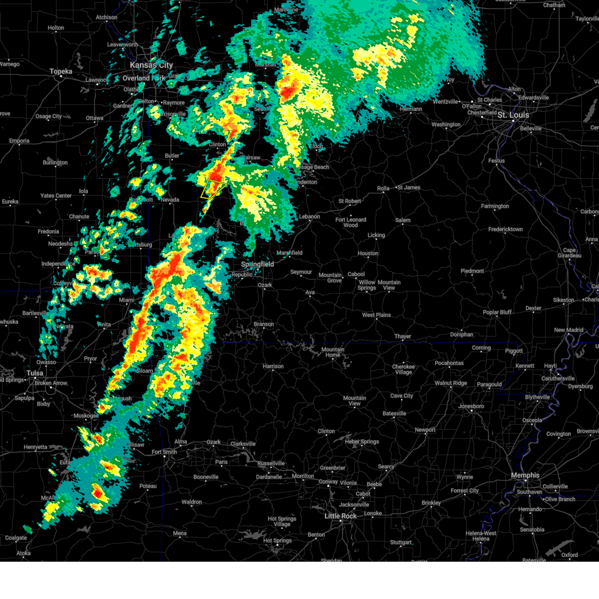
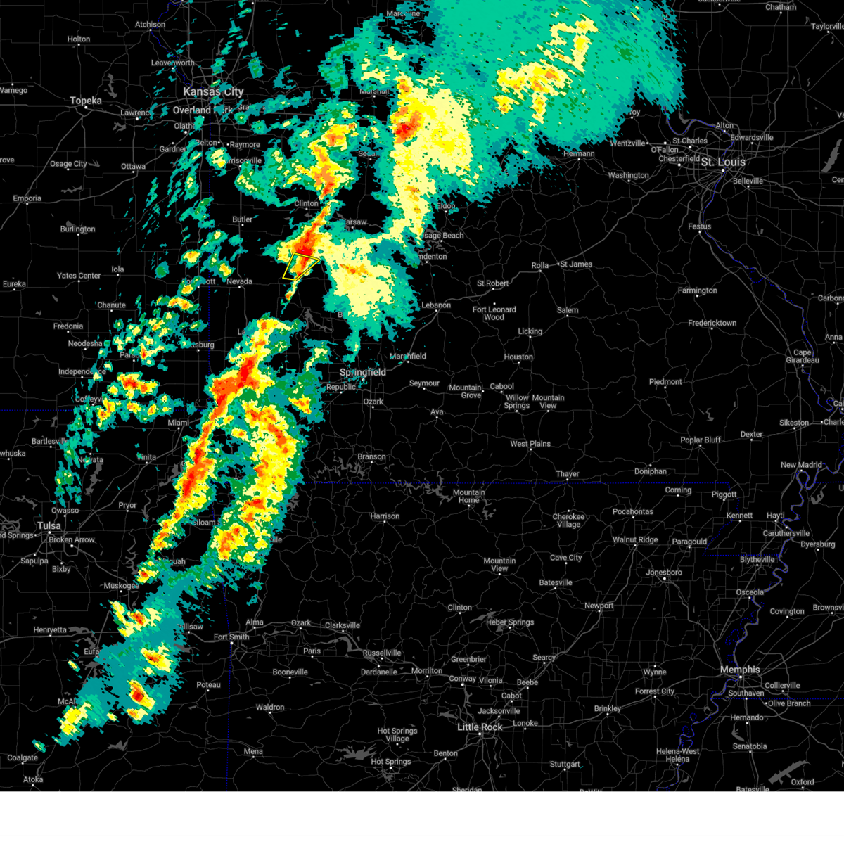
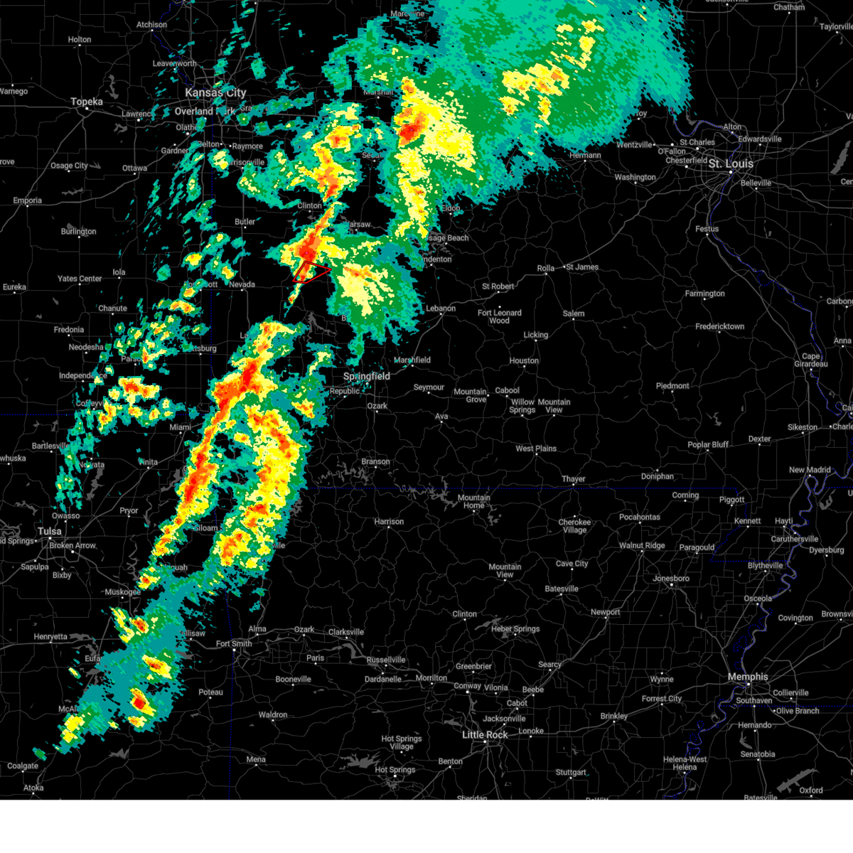
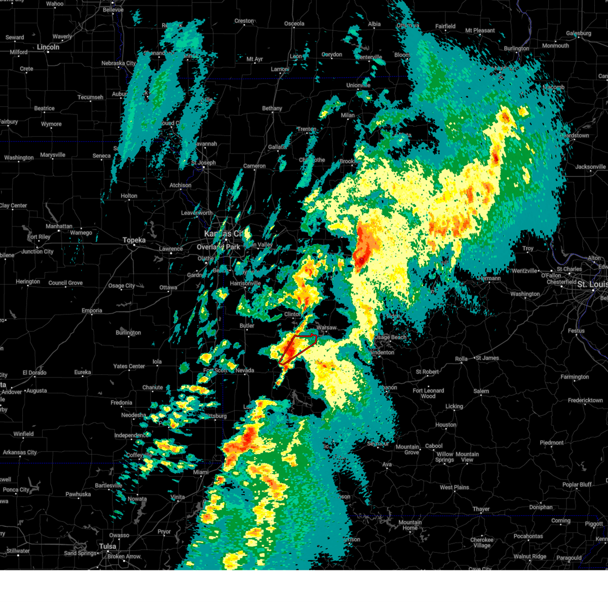
The Top Recent Hail Date for Roscoe, MO is Sunday, April 26, 2026 (3rd out of 63)
Hail and Wind Damage Spotted near Roscoe, MO
| Date / Time | Report Details |
|---|---|
| 6/17/2026 8:27 PM CDT |
 At 827 pm cdt, severe thunderstorms were located along a line extending from 8 miles southwest of osceola to near el dorado springs to near walker, moving east at 30 mph (radar indicated). Hazards include 60 mph wind gusts and quarter size hail. Hail damage to vehicles is expected. expect wind damage to roofs, siding, and trees. Locations impacted include, el dorado springs, walker, roscoe, harwood, cedar springs, and tiffin. At 827 pm cdt, severe thunderstorms were located along a line extending from 8 miles southwest of osceola to near el dorado springs to near walker, moving east at 30 mph (radar indicated). Hazards include 60 mph wind gusts and quarter size hail. Hail damage to vehicles is expected. expect wind damage to roofs, siding, and trees. Locations impacted include, el dorado springs, walker, roscoe, harwood, cedar springs, and tiffin.
|
| 6/17/2026 7:58 PM CDT |
 Svrsgf the national weather service in springfield has issued a * severe thunderstorm warning for, northwestern cedar county in southwestern missouri, southern st. clair county in west central missouri, northeastern vernon county in west central missouri, * until 845 pm cdt. * at 758 pm cdt, severe thunderstorms were located along a line extending from 10 miles north of el dorado springs to near schell city to 7 miles northwest of nevada, moving east at 25 mph (radar indicated). Hazards include 60 mph wind gusts and quarter size hail. Hail damage to vehicles is expected. Expect wind damage to roofs, siding, and trees. Svrsgf the national weather service in springfield has issued a * severe thunderstorm warning for, northwestern cedar county in southwestern missouri, southern st. clair county in west central missouri, northeastern vernon county in west central missouri, * until 845 pm cdt. * at 758 pm cdt, severe thunderstorms were located along a line extending from 10 miles north of el dorado springs to near schell city to 7 miles northwest of nevada, moving east at 25 mph (radar indicated). Hazards include 60 mph wind gusts and quarter size hail. Hail damage to vehicles is expected. Expect wind damage to roofs, siding, and trees.
|
| 6/17/2026 7:48 PM CDT |
 Svrsgf the national weather service in springfield has issued a * severe thunderstorm warning for, southwestern hickory county in central missouri, northeastern cedar county in southwestern missouri, northwestern polk county in southwestern missouri, southern st. clair county in west central missouri, * until 830 pm cdt. * at 748 pm cdt, a severe thunderstorm was located 9 miles east of el dorado springs, moving east at 40 mph (radar indicated). Hazards include 60 mph wind gusts and half dollar size hail. Hail damage to vehicles is expected. Expect wind damage to roofs, siding, and trees. Svrsgf the national weather service in springfield has issued a * severe thunderstorm warning for, southwestern hickory county in central missouri, northeastern cedar county in southwestern missouri, northwestern polk county in southwestern missouri, southern st. clair county in west central missouri, * until 830 pm cdt. * at 748 pm cdt, a severe thunderstorm was located 9 miles east of el dorado springs, moving east at 40 mph (radar indicated). Hazards include 60 mph wind gusts and half dollar size hail. Hail damage to vehicles is expected. Expect wind damage to roofs, siding, and trees.
|
| 6/17/2026 7:07 PM CDT |
 At 706 pm cdt, a severe thunderstorm was located near schell city, or 9 miles north of el dorado springs, moving east at 35 mph (radar indicated). Hazards include ping pong ball size hail and 60 mph wind gusts. People and animals outdoors will be injured. expect hail damage to roofs, siding, windows, and vehicles. expect wind damage to roofs, siding, and trees. Locations impacted include, el dorado springs, walker, schell city, roscoe, harwood, tiffin, taberville, caplinger mills, cedar springs, and monegaw springs. At 706 pm cdt, a severe thunderstorm was located near schell city, or 9 miles north of el dorado springs, moving east at 35 mph (radar indicated). Hazards include ping pong ball size hail and 60 mph wind gusts. People and animals outdoors will be injured. expect hail damage to roofs, siding, windows, and vehicles. expect wind damage to roofs, siding, and trees. Locations impacted include, el dorado springs, walker, schell city, roscoe, harwood, tiffin, taberville, caplinger mills, cedar springs, and monegaw springs.
|
| 6/17/2026 6:50 PM CDT |
 Svrsgf the national weather service in springfield has issued a * severe thunderstorm warning for, northwestern cedar county in southwestern missouri, southwestern st. clair county in west central missouri, northeastern vernon county in west central missouri, * until 730 pm cdt. * at 650 pm cdt, a severe thunderstorm was located near schell city, or 9 miles southeast of rich hill, moving east at 35 mph (radar indicated). Hazards include 60 mph wind gusts and quarter size hail. Hail damage to vehicles is expected. Expect wind damage to roofs, siding, and trees. Svrsgf the national weather service in springfield has issued a * severe thunderstorm warning for, northwestern cedar county in southwestern missouri, southwestern st. clair county in west central missouri, northeastern vernon county in west central missouri, * until 730 pm cdt. * at 650 pm cdt, a severe thunderstorm was located near schell city, or 9 miles southeast of rich hill, moving east at 35 mph (radar indicated). Hazards include 60 mph wind gusts and quarter size hail. Hail damage to vehicles is expected. Expect wind damage to roofs, siding, and trees.
|
| 6/17/2026 5:57 PM CDT |
 Svrsgf the national weather service in springfield has issued a * severe thunderstorm warning for, northern st. clair county in west central missouri, * until 700 pm cdt. * at 557 pm cdt, a severe thunderstorm was located 8 miles west of appleton city, or 9 miles southeast of butler, moving southeast at 30 mph (radar indicated). Hazards include 60 mph wind gusts and quarter size hail. Hail damage to vehicles is expected. Expect wind damage to roofs, siding, and trees. Svrsgf the national weather service in springfield has issued a * severe thunderstorm warning for, northern st. clair county in west central missouri, * until 700 pm cdt. * at 557 pm cdt, a severe thunderstorm was located 8 miles west of appleton city, or 9 miles southeast of butler, moving southeast at 30 mph (radar indicated). Hazards include 60 mph wind gusts and quarter size hail. Hail damage to vehicles is expected. Expect wind damage to roofs, siding, and trees.
|
| 6/13/2026 10:37 PM CDT |
 Svrsgf the national weather service in springfield has issued a * severe thunderstorm warning for, cedar county in southwestern missouri, st. clair county in west central missouri, * until 1130 pm cdt. * at 1036 pm cdt, severe thunderstorms were located along a line extending from near butler to 7 miles southeast of rich hill to 6 miles southwest of nevada, moving east at 45 mph (radar indicated). Hazards include 60 mph wind gusts and penny size hail. expect damage to roofs, siding, and trees Svrsgf the national weather service in springfield has issued a * severe thunderstorm warning for, cedar county in southwestern missouri, st. clair county in west central missouri, * until 1130 pm cdt. * at 1036 pm cdt, severe thunderstorms were located along a line extending from near butler to 7 miles southeast of rich hill to 6 miles southwest of nevada, moving east at 45 mph (radar indicated). Hazards include 60 mph wind gusts and penny size hail. expect damage to roofs, siding, and trees
|
| 6/7/2026 3:39 PM CDT |
 Svrsgf the national weather service in springfield has issued a * severe thunderstorm warning for, northwestern st. clair county in west central missouri, * until 430 pm cdt. * at 339 pm cdt, a severe thunderstorm was located 9 miles southeast of appleton city, or 14 miles north of el dorado springs, moving north at 40 mph (radar indicated). Hazards include 60 mph wind gusts. expect damage to roofs, siding, and trees Svrsgf the national weather service in springfield has issued a * severe thunderstorm warning for, northwestern st. clair county in west central missouri, * until 430 pm cdt. * at 339 pm cdt, a severe thunderstorm was located 9 miles southeast of appleton city, or 14 miles north of el dorado springs, moving north at 40 mph (radar indicated). Hazards include 60 mph wind gusts. expect damage to roofs, siding, and trees
|
| 4/28/2026 3:03 PM CDT |
 the severe thunderstorm warning has been cancelled and is no longer in effect the severe thunderstorm warning has been cancelled and is no longer in effect
|
| 4/28/2026 2:43 PM CDT |
 At 243 pm cdt, a severe thunderstorm was located over osceola, or 19 miles southwest of warsaw, moving northeast at 55 mph (radar indicated). Hazards include 60 mph wind gusts and quarter size hail. Hail damage to vehicles is expected. expect wind damage to roofs, siding, and trees. Locations impacted include, truman lake, appleton city, osceola, lowry city, roscoe, vista, gerster, harper, iconium, tiffin, johnson city, taberville, and monegaw springs. At 243 pm cdt, a severe thunderstorm was located over osceola, or 19 miles southwest of warsaw, moving northeast at 55 mph (radar indicated). Hazards include 60 mph wind gusts and quarter size hail. Hail damage to vehicles is expected. expect wind damage to roofs, siding, and trees. Locations impacted include, truman lake, appleton city, osceola, lowry city, roscoe, vista, gerster, harper, iconium, tiffin, johnson city, taberville, and monegaw springs.
|
| 4/28/2026 2:15 PM CDT |
 Svrsgf the national weather service in springfield has issued a * severe thunderstorm warning for, st. clair county in west central missouri, * until 315 pm cdt. * at 215 pm cdt, a severe thunderstorm was located over el dorado springs, moving northeast at 50 mph (radar indicated). Hazards include golf ball size hail and 60 mph wind gusts. People and animals outdoors will be injured. expect hail damage to roofs, siding, windows, and vehicles. Expect wind damage to roofs, siding, and trees. Svrsgf the national weather service in springfield has issued a * severe thunderstorm warning for, st. clair county in west central missouri, * until 315 pm cdt. * at 215 pm cdt, a severe thunderstorm was located over el dorado springs, moving northeast at 50 mph (radar indicated). Hazards include golf ball size hail and 60 mph wind gusts. People and animals outdoors will be injured. expect hail damage to roofs, siding, windows, and vehicles. Expect wind damage to roofs, siding, and trees.
|
| 4/28/2026 12:19 PM CDT |
 At 1219 pm cdt, a severe thunderstorm was located 9 miles south of el dorado springs, moving northeast at 55 mph (radar indicated). Hazards include golf ball size hail. People and animals outdoors will be injured. expect damage to roofs, siding, windows, and vehicles. Locations impacted include, el dorado springs, sheldon, montevallo, jerico springs, roscoe, vista, milford, olympia, caplinger mills, wagoner, harper, verdella, filley, cedar springs, and hannon. At 1219 pm cdt, a severe thunderstorm was located 9 miles south of el dorado springs, moving northeast at 55 mph (radar indicated). Hazards include golf ball size hail. People and animals outdoors will be injured. expect damage to roofs, siding, windows, and vehicles. Locations impacted include, el dorado springs, sheldon, montevallo, jerico springs, roscoe, vista, milford, olympia, caplinger mills, wagoner, harper, verdella, filley, cedar springs, and hannon.
|
| 4/28/2026 11:46 AM CDT |
 Svrsgf the national weather service in springfield has issued a * severe thunderstorm warning for, northern barton county in southwestern missouri, northwestern cedar county in southwestern missouri, southern st. clair county in west central missouri, vernon county in west central missouri, * until 1230 pm cdt. * at 1146 am cdt, a severe thunderstorm was located near sheldon, or 9 miles north of lamar, moving northeast at 80 mph (radar indicated). Hazards include golf ball size hail. People and animals outdoors will be injured. Expect damage to roofs, siding, windows, and vehicles. Svrsgf the national weather service in springfield has issued a * severe thunderstorm warning for, northern barton county in southwestern missouri, northwestern cedar county in southwestern missouri, southern st. clair county in west central missouri, vernon county in west central missouri, * until 1230 pm cdt. * at 1146 am cdt, a severe thunderstorm was located near sheldon, or 9 miles north of lamar, moving northeast at 80 mph (radar indicated). Hazards include golf ball size hail. People and animals outdoors will be injured. Expect damage to roofs, siding, windows, and vehicles.
|
| 4/26/2026 10:21 PM CDT |
 At 1021 pm cdt, a severe thunderstorm capable of producing a tornado was located over osceola, or 21 miles west of hermitage, moving east at 35 mph (radar indicated rotation). Hazards include tornado and quarter size hail. Flying debris will be dangerous to those caught without shelter. mobile homes will be damaged or destroyed. damage to roofs, windows, and vehicles will occur. tree damage is likely. Locations impacted include, truman lake, osceola, roscoe, vista, gerster, and harper. At 1021 pm cdt, a severe thunderstorm capable of producing a tornado was located over osceola, or 21 miles west of hermitage, moving east at 35 mph (radar indicated rotation). Hazards include tornado and quarter size hail. Flying debris will be dangerous to those caught without shelter. mobile homes will be damaged or destroyed. damage to roofs, windows, and vehicles will occur. tree damage is likely. Locations impacted include, truman lake, osceola, roscoe, vista, gerster, and harper.
|
| 4/26/2026 10:07 PM CDT |
 Torsgf the national weather service in springfield has issued a * tornado warning for, central st. clair county in west central missouri, * until 1045 pm cdt. * at 1006 pm cdt, a severe thunderstorm capable of producing a tornado was located near osceola, or 15 miles northeast of el dorado springs, moving east at 30 mph (radar indicated rotation). Hazards include tornado and quarter size hail. Flying debris will be dangerous to those caught without shelter. mobile homes will be damaged or destroyed. damage to roofs, windows, and vehicles will occur. Tree damage is likely. Torsgf the national weather service in springfield has issued a * tornado warning for, central st. clair county in west central missouri, * until 1045 pm cdt. * at 1006 pm cdt, a severe thunderstorm capable of producing a tornado was located near osceola, or 15 miles northeast of el dorado springs, moving east at 30 mph (radar indicated rotation). Hazards include tornado and quarter size hail. Flying debris will be dangerous to those caught without shelter. mobile homes will be damaged or destroyed. damage to roofs, windows, and vehicles will occur. Tree damage is likely.
|
| 4/26/2026 9:04 PM CDT |
 At 904 pm cdt, a severe thunderstorm was located near weaubleau, or 12 miles southwest of hermitage, moving east at 15 mph (radar indicated). Hazards include golf ball size hail and 60 mph wind gusts. People and animals outdoors will be injured. expect hail damage to roofs, siding, windows, and vehicles. expect wind damage to roofs, siding, and trees. Locations impacted include, pomme de terre lake, truman lake, pomme de terre state park, pittsburg, humansville, osceola, hermitage, weaubleau, wheatland, preston, cross timbers, collins, flemington, roscoe, vista, gerster, quincy, elkton, harper, and fristoe. At 904 pm cdt, a severe thunderstorm was located near weaubleau, or 12 miles southwest of hermitage, moving east at 15 mph (radar indicated). Hazards include golf ball size hail and 60 mph wind gusts. People and animals outdoors will be injured. expect hail damage to roofs, siding, windows, and vehicles. expect wind damage to roofs, siding, and trees. Locations impacted include, pomme de terre lake, truman lake, pomme de terre state park, pittsburg, humansville, osceola, hermitage, weaubleau, wheatland, preston, cross timbers, collins, flemington, roscoe, vista, gerster, quincy, elkton, harper, and fristoe.
|
| 4/26/2026 8:40 PM CDT |
 The tornado threat has diminished and the tornado warning has been cancelled. however, large hail and damaging winds remain likely and a severe thunderstorm warning remains in effect for the area. a tornado watch remains in effect until 200 am cdt for central, southwestern and west central missouri. The tornado threat has diminished and the tornado warning has been cancelled. however, large hail and damaging winds remain likely and a severe thunderstorm warning remains in effect for the area. a tornado watch remains in effect until 200 am cdt for central, southwestern and west central missouri.
|
| 4/26/2026 8:34 PM CDT |
 Svrsgf the national weather service in springfield has issued a * severe thunderstorm warning for, hickory county in central missouri, northern cedar county in southwestern missouri, southwestern benton county in central missouri, northern polk county in southwestern missouri, southeastern st. clair county in west central missouri, * until 915 pm cdt. * at 833 pm cdt, a severe thunderstorm was located over weaubleau, or 11 miles west of hermitage, moving east at 20 mph (radar indicated). Hazards include tennis ball size hail and 60 mph wind gusts. People and animals outdoors will be injured. expect hail damage to roofs, siding, windows, and vehicles. Expect wind damage to roofs, siding, and trees. Svrsgf the national weather service in springfield has issued a * severe thunderstorm warning for, hickory county in central missouri, northern cedar county in southwestern missouri, southwestern benton county in central missouri, northern polk county in southwestern missouri, southeastern st. clair county in west central missouri, * until 915 pm cdt. * at 833 pm cdt, a severe thunderstorm was located over weaubleau, or 11 miles west of hermitage, moving east at 20 mph (radar indicated). Hazards include tennis ball size hail and 60 mph wind gusts. People and animals outdoors will be injured. expect hail damage to roofs, siding, windows, and vehicles. Expect wind damage to roofs, siding, and trees.
|
| 4/26/2026 8:11 PM CDT |
 The severe thunderstorm which prompted the warning has moved out of the warned area. therefore, the warning will be allowed to expire. a tornado watch remains in effect until 200 am cdt for central, southwestern and west central missouri. remember, a tornado warning still remains in effect for southeastern st. clair and northeastern cedar counties. The severe thunderstorm which prompted the warning has moved out of the warned area. therefore, the warning will be allowed to expire. a tornado watch remains in effect until 200 am cdt for central, southwestern and west central missouri. remember, a tornado warning still remains in effect for southeastern st. clair and northeastern cedar counties.
|
| 4/26/2026 7:54 PM CDT |
 Torsgf the national weather service in springfield has issued a * tornado warning for, western hickory county in central missouri, northeastern cedar county in southwestern missouri, northwestern polk county in southwestern missouri, southeastern st. clair county in west central missouri, * until 845 pm cdt. * at 753 pm cdt, a severe thunderstorm capable of producing a tornado was located 10 miles east of el dorado springs, moving east at 25 mph (radar indicated rotation). Hazards include tornado and baseball size hail. Flying debris will be dangerous to those caught without shelter. mobile homes will be damaged or destroyed. damage to roofs, windows, and vehicles will occur. Tree damage is likely. Torsgf the national weather service in springfield has issued a * tornado warning for, western hickory county in central missouri, northeastern cedar county in southwestern missouri, northwestern polk county in southwestern missouri, southeastern st. clair county in west central missouri, * until 845 pm cdt. * at 753 pm cdt, a severe thunderstorm capable of producing a tornado was located 10 miles east of el dorado springs, moving east at 25 mph (radar indicated rotation). Hazards include tornado and baseball size hail. Flying debris will be dangerous to those caught without shelter. mobile homes will be damaged or destroyed. damage to roofs, windows, and vehicles will occur. Tree damage is likely.
|
| 4/26/2026 7:38 PM CDT |
 At 737 pm cdt, a severe thunderstorm was located 9 miles northeast of el dorado springs, moving east at 30 mph (trained weather spotters). Hazards include tennis ball size hail and 60 mph wind gusts. People and animals outdoors will be injured. expect hail damage to roofs, siding, windows, and vehicles. expect wind damage to roofs, siding, and trees. Locations impacted include, truman lake, el dorado springs, appleton city, osceola, lowry city, roscoe, vista, gerster, harper, iconium, tiffin, johnson city, taberville, cedar springs, and monegaw springs. At 737 pm cdt, a severe thunderstorm was located 9 miles northeast of el dorado springs, moving east at 30 mph (trained weather spotters). Hazards include tennis ball size hail and 60 mph wind gusts. People and animals outdoors will be injured. expect hail damage to roofs, siding, windows, and vehicles. expect wind damage to roofs, siding, and trees. Locations impacted include, truman lake, el dorado springs, appleton city, osceola, lowry city, roscoe, vista, gerster, harper, iconium, tiffin, johnson city, taberville, cedar springs, and monegaw springs.
|
| 4/26/2026 7:33 PM CDT |
 At 733 pm cdt, a severe thunderstorm capable of producing a tornado was located 8 miles northeast of el dorado springs, moving east at 40 mph (radar indicated rotation). Hazards include tornado and tennis ball size hail. Flying debris will be dangerous to those caught without shelter. mobile homes will be damaged or destroyed. damage to roofs, windows, and vehicles will occur. tree damage is likely. Locations impacted include, truman lake, el dorado springs, osceola, collins, roscoe, vista, gerster, caplinger mills, harper, iconium, tiffin, taberville, cedar springs, and monegaw springs. At 733 pm cdt, a severe thunderstorm capable of producing a tornado was located 8 miles northeast of el dorado springs, moving east at 40 mph (radar indicated rotation). Hazards include tornado and tennis ball size hail. Flying debris will be dangerous to those caught without shelter. mobile homes will be damaged or destroyed. damage to roofs, windows, and vehicles will occur. tree damage is likely. Locations impacted include, truman lake, el dorado springs, osceola, collins, roscoe, vista, gerster, caplinger mills, harper, iconium, tiffin, taberville, cedar springs, and monegaw springs.
|
| 4/26/2026 7:19 PM CDT |
 Torsgf the national weather service in springfield has issued a * tornado warning for, northern cedar county in southwestern missouri, st. clair county in west central missouri, east central vernon county in west central missouri, * until 800 pm cdt. * at 718 pm cdt, a severe thunderstorm capable of producing a tornado was located over el dorado springs, moving east at 40 mph (radar indicated rotation). Hazards include tornado and golf ball size hail. Flying debris will be dangerous to those caught without shelter. mobile homes will be damaged or destroyed. damage to roofs, windows, and vehicles will occur. Tree damage is likely. Torsgf the national weather service in springfield has issued a * tornado warning for, northern cedar county in southwestern missouri, st. clair county in west central missouri, east central vernon county in west central missouri, * until 800 pm cdt. * at 718 pm cdt, a severe thunderstorm capable of producing a tornado was located over el dorado springs, moving east at 40 mph (radar indicated rotation). Hazards include tornado and golf ball size hail. Flying debris will be dangerous to those caught without shelter. mobile homes will be damaged or destroyed. damage to roofs, windows, and vehicles will occur. Tree damage is likely.
|
| 4/26/2026 7:13 PM CDT |
 Svrsgf the national weather service in springfield has issued a * severe thunderstorm warning for, northwestern cedar county in southwestern missouri, st. clair county in west central missouri, northeastern vernon county in west central missouri, * until 815 pm cdt. * at 712 pm cdt, a severe thunderstorm was located near el dorado springs, moving east at 40 mph (radar indicated). Hazards include 60 mph wind gusts and quarter size hail. Hail damage to vehicles is expected. Expect wind damage to roofs, siding, and trees. Svrsgf the national weather service in springfield has issued a * severe thunderstorm warning for, northwestern cedar county in southwestern missouri, st. clair county in west central missouri, northeastern vernon county in west central missouri, * until 815 pm cdt. * at 712 pm cdt, a severe thunderstorm was located near el dorado springs, moving east at 40 mph (radar indicated). Hazards include 60 mph wind gusts and quarter size hail. Hail damage to vehicles is expected. Expect wind damage to roofs, siding, and trees.
|
| 4/26/2026 6:35 PM CDT |
 At 635 pm cdt, a severe thunderstorm capable of producing a tornado was located 7 miles north of stockton, moving east at 35 mph (radar indicated rotation). Hazards include tornado and baseball size hail. Flying debris will be dangerous to those caught without shelter. mobile homes will be damaged or destroyed. damage to roofs, windows, and vehicles will occur. tree damage is likely. Locations impacted include, el dorado springs, stockton, collins, roscoe, gerster, tiffin, caplinger mills, filley, cedar springs, and arnica. At 635 pm cdt, a severe thunderstorm capable of producing a tornado was located 7 miles north of stockton, moving east at 35 mph (radar indicated rotation). Hazards include tornado and baseball size hail. Flying debris will be dangerous to those caught without shelter. mobile homes will be damaged or destroyed. damage to roofs, windows, and vehicles will occur. tree damage is likely. Locations impacted include, el dorado springs, stockton, collins, roscoe, gerster, tiffin, caplinger mills, filley, cedar springs, and arnica.
|
| 4/26/2026 6:24 PM CDT |
 At 623 pm cdt, a severe thunderstorm capable of producing a tornado was located near el dorado springs, moving east at 40 mph (radar indicated rotation). Hazards include tornado and two inch hail. Flying debris will be dangerous to those caught without shelter. mobile homes will be damaged or destroyed. damage to roofs, windows, and vehicles will occur. tree damage is likely. Locations impacted include, el dorado springs, stockton, collins, roscoe, gerster, tiffin, caplinger mills, filley, cedar springs, and arnica. At 623 pm cdt, a severe thunderstorm capable of producing a tornado was located near el dorado springs, moving east at 40 mph (radar indicated rotation). Hazards include tornado and two inch hail. Flying debris will be dangerous to those caught without shelter. mobile homes will be damaged or destroyed. damage to roofs, windows, and vehicles will occur. tree damage is likely. Locations impacted include, el dorado springs, stockton, collins, roscoe, gerster, tiffin, caplinger mills, filley, cedar springs, and arnica.
|
| 4/26/2026 6:12 PM CDT |
 Svrsgf the national weather service in springfield has issued a * severe thunderstorm warning for, st. clair county in west central missouri, * until 700 pm cdt. * at 612 pm cdt, a severe thunderstorm was located near appleton city, or 18 miles north of el dorado springs, moving east at 45 mph (radar indicated). Hazards include 60 mph wind gusts and quarter size hail. Hail damage to vehicles is expected. Expect wind damage to roofs, siding, and trees. Svrsgf the national weather service in springfield has issued a * severe thunderstorm warning for, st. clair county in west central missouri, * until 700 pm cdt. * at 612 pm cdt, a severe thunderstorm was located near appleton city, or 18 miles north of el dorado springs, moving east at 45 mph (radar indicated). Hazards include 60 mph wind gusts and quarter size hail. Hail damage to vehicles is expected. Expect wind damage to roofs, siding, and trees.
|
| 4/26/2026 6:09 PM CDT |
 Torsgf the national weather service in springfield has issued a * tornado warning for, cedar county in southwestern missouri, southern st. clair county in west central missouri, northeastern vernon county in west central missouri, * until 700 pm cdt. * at 608 pm cdt, a severe thunderstorm capable of producing a tornado was located near el dorado springs, moving east at 40 mph (radar indicated rotation). Hazards include tornado and tennis ball size hail. Flying debris will be dangerous to those caught without shelter. mobile homes will be damaged or destroyed. damage to roofs, windows, and vehicles will occur. Tree damage is likely. Torsgf the national weather service in springfield has issued a * tornado warning for, cedar county in southwestern missouri, southern st. clair county in west central missouri, northeastern vernon county in west central missouri, * until 700 pm cdt. * at 608 pm cdt, a severe thunderstorm capable of producing a tornado was located near el dorado springs, moving east at 40 mph (radar indicated rotation). Hazards include tornado and tennis ball size hail. Flying debris will be dangerous to those caught without shelter. mobile homes will be damaged or destroyed. damage to roofs, windows, and vehicles will occur. Tree damage is likely.
|
| 4/23/2026 11:17 PM CDT |
 Svrsgf the national weather service in springfield has issued a * severe thunderstorm warning for, northwestern hickory county in central missouri, western benton county in central missouri, northeastern st. clair county in west central missouri, * until midnight cdt. * at 1117 pm cdt, severe thunderstorms were located along a line extending from near leeton to near deepwater to near schell city, moving east at 45 mph (radar indicated). Hazards include 60 mph wind gusts and nickel size hail. expect damage to roofs, siding, and trees Svrsgf the national weather service in springfield has issued a * severe thunderstorm warning for, northwestern hickory county in central missouri, western benton county in central missouri, northeastern st. clair county in west central missouri, * until midnight cdt. * at 1117 pm cdt, severe thunderstorms were located along a line extending from near leeton to near deepwater to near schell city, moving east at 45 mph (radar indicated). Hazards include 60 mph wind gusts and nickel size hail. expect damage to roofs, siding, and trees
|
| 4/17/2026 7:19 PM CDT |
 At 719 pm cdt, severe thunderstorms were located along a line extending from near lowry city to near osceola to near el dorado springs, moving east at 60 mph (radar indicated). Hazards include 60 mph wind gusts and quarter size hail. Hail damage to vehicles is expected. expect wind damage to roofs, siding, and trees. Locations impacted include, el dorado springs, roscoe, tiffin, johnson city, taberville, filley, cedar springs, and monegaw springs. At 719 pm cdt, severe thunderstorms were located along a line extending from near lowry city to near osceola to near el dorado springs, moving east at 60 mph (radar indicated). Hazards include 60 mph wind gusts and quarter size hail. Hail damage to vehicles is expected. expect wind damage to roofs, siding, and trees. Locations impacted include, el dorado springs, roscoe, tiffin, johnson city, taberville, filley, cedar springs, and monegaw springs.
|
| 4/17/2026 6:55 PM CDT |
 Svrsgf the national weather service in springfield has issued a * severe thunderstorm warning for, northern hickory county in central missouri, southwestern benton county in central missouri, st. clair county in west central missouri, * until 730 pm cdt. * at 655 pm cdt, a severe thunderstorm was located 7 miles southeast of appleton city, or 17 miles north of el dorado springs, moving east at 60 mph (radar indicated). Hazards include 60 mph wind gusts and quarter size hail. Hail damage to vehicles is expected. Expect wind damage to roofs, siding, and trees. Svrsgf the national weather service in springfield has issued a * severe thunderstorm warning for, northern hickory county in central missouri, southwestern benton county in central missouri, st. clair county in west central missouri, * until 730 pm cdt. * at 655 pm cdt, a severe thunderstorm was located 7 miles southeast of appleton city, or 17 miles north of el dorado springs, moving east at 60 mph (radar indicated). Hazards include 60 mph wind gusts and quarter size hail. Hail damage to vehicles is expected. Expect wind damage to roofs, siding, and trees.
|
| 4/17/2026 6:47 PM CDT |
 Svrsgf the national weather service in springfield has issued a * severe thunderstorm warning for, northwestern cedar county in southwestern missouri, western st. clair county in west central missouri, central vernon county in west central missouri, * until 730 pm cdt. * at 647 pm cdt, severe thunderstorms were located along a line extending from near schell city to near walker to near nevada to 10 miles east of fort scott, moving east at 55 mph (radar indicated). Hazards include 60 mph wind gusts and quarter size hail. Hail damage to vehicles is expected. Expect wind damage to roofs, siding, and trees. Svrsgf the national weather service in springfield has issued a * severe thunderstorm warning for, northwestern cedar county in southwestern missouri, western st. clair county in west central missouri, central vernon county in west central missouri, * until 730 pm cdt. * at 647 pm cdt, severe thunderstorms were located along a line extending from near schell city to near walker to near nevada to 10 miles east of fort scott, moving east at 55 mph (radar indicated). Hazards include 60 mph wind gusts and quarter size hail. Hail damage to vehicles is expected. Expect wind damage to roofs, siding, and trees.
|
| 4/17/2026 6:25 PM CDT |
 At 625 pm cdt, a severe thunderstorm capable of producing a tornado was located 8 miles west of osceola, or 14 miles northeast of el dorado springs, moving northeast at 45 mph (radar indicated rotation). Hazards include tornado and two inch hail. Flying debris will be dangerous to those caught without shelter. mobile homes will be damaged or destroyed. damage to roofs, windows, and vehicles will occur. tree damage is likely. Locations impacted include, truman lake, osceola, lowry city, roscoe, vista, harper, iconium, and monegaw springs. At 625 pm cdt, a severe thunderstorm capable of producing a tornado was located 8 miles west of osceola, or 14 miles northeast of el dorado springs, moving northeast at 45 mph (radar indicated rotation). Hazards include tornado and two inch hail. Flying debris will be dangerous to those caught without shelter. mobile homes will be damaged or destroyed. damage to roofs, windows, and vehicles will occur. tree damage is likely. Locations impacted include, truman lake, osceola, lowry city, roscoe, vista, harper, iconium, and monegaw springs.
|
| 4/17/2026 6:19 PM CDT |
 Torsgf the national weather service in springfield has issued a * tornado warning for, st. clair county in west central missouri, * until 700 pm cdt. * at 619 pm cdt, a severe thunderstorm capable of producing a tornado was located 10 miles east of schell city, or 10 miles northeast of el dorado springs, moving northeast at 45 mph (radar indicated rotation). Hazards include tornado and ping pong ball size hail. Flying debris will be dangerous to those caught without shelter. mobile homes will be damaged or destroyed. damage to roofs, windows, and vehicles will occur. Tree damage is likely. Torsgf the national weather service in springfield has issued a * tornado warning for, st. clair county in west central missouri, * until 700 pm cdt. * at 619 pm cdt, a severe thunderstorm capable of producing a tornado was located 10 miles east of schell city, or 10 miles northeast of el dorado springs, moving northeast at 45 mph (radar indicated rotation). Hazards include tornado and ping pong ball size hail. Flying debris will be dangerous to those caught without shelter. mobile homes will be damaged or destroyed. damage to roofs, windows, and vehicles will occur. Tree damage is likely.
|
| 4/17/2026 6:17 PM CDT |
 At 617 pm cdt, a severe thunderstorm was located 11 miles east of schell city, or 12 miles northeast of el dorado springs, moving northeast at 45 mph (radar indicated). Hazards include ping pong ball size hail and 60 mph wind gusts. People and animals outdoors will be injured. expect hail damage to roofs, siding, windows, and vehicles. expect wind damage to roofs, siding, and trees. Locations impacted include, truman lake, osceola, lowry city, roscoe, vista, tiffin, johnson city, taberville, harper, iconium, and monegaw springs. At 617 pm cdt, a severe thunderstorm was located 11 miles east of schell city, or 12 miles northeast of el dorado springs, moving northeast at 45 mph (radar indicated). Hazards include ping pong ball size hail and 60 mph wind gusts. People and animals outdoors will be injured. expect hail damage to roofs, siding, windows, and vehicles. expect wind damage to roofs, siding, and trees. Locations impacted include, truman lake, osceola, lowry city, roscoe, vista, tiffin, johnson city, taberville, harper, iconium, and monegaw springs.
|
| 4/17/2026 6:11 PM CDT |
 Svrsgf the national weather service in springfield has issued a * severe thunderstorm warning for, st. clair county in west central missouri, * until 700 pm cdt. * at 610 pm cdt, a severe thunderstorm was located near schell city, or 10 miles north of el dorado springs, moving northeast at 45 mph (radar indicated). Hazards include 60 mph wind gusts and quarter size hail. Hail damage to vehicles is expected. Expect wind damage to roofs, siding, and trees. Svrsgf the national weather service in springfield has issued a * severe thunderstorm warning for, st. clair county in west central missouri, * until 700 pm cdt. * at 610 pm cdt, a severe thunderstorm was located near schell city, or 10 miles north of el dorado springs, moving northeast at 45 mph (radar indicated). Hazards include 60 mph wind gusts and quarter size hail. Hail damage to vehicles is expected. Expect wind damage to roofs, siding, and trees.
|
| 4/15/2026 7:06 PM CDT |
 The storm which prompted the warning has weakened below severe limits, and has exited the warned area. therefore, the warning will be allowed to expire. a tornado watch remains in effect until 900 pm cdt for central and west central missouri. The storm which prompted the warning has weakened below severe limits, and has exited the warned area. therefore, the warning will be allowed to expire. a tornado watch remains in effect until 900 pm cdt for central and west central missouri.
|
| 4/15/2026 6:09 PM CDT |
 Svrsgf the national weather service in springfield has issued a * severe thunderstorm warning for, st. clair county in west central missouri, northeastern vernon county in west central missouri, * until 715 pm cdt. * at 609 pm cdt, a severe thunderstorm was located over schell city, or 9 miles north of el dorado springs, moving east at 40 mph (radar indicated). Hazards include 60 mph wind gusts and quarter size hail. Hail damage to vehicles is expected. Expect wind damage to roofs, siding, and trees. Svrsgf the national weather service in springfield has issued a * severe thunderstorm warning for, st. clair county in west central missouri, northeastern vernon county in west central missouri, * until 715 pm cdt. * at 609 pm cdt, a severe thunderstorm was located over schell city, or 9 miles north of el dorado springs, moving east at 40 mph (radar indicated). Hazards include 60 mph wind gusts and quarter size hail. Hail damage to vehicles is expected. Expect wind damage to roofs, siding, and trees.
|
| 3/6/2026 9:09 PM CST |
 Svrsgf the national weather service in springfield has issued a * severe thunderstorm warning for, hickory county in central missouri, western dallas county in southwestern missouri, eastern cedar county in southwestern missouri, southern benton county in central missouri, polk county in southwestern missouri, northern greene county in southwestern missouri, southeastern st. clair county in west central missouri, eastern dade county in southwestern missouri, * until 1000 pm cst. * at 908 pm cst, severe thunderstorms were located along a line extending from 10 miles southwest of osceola to near fair play to 6 miles south of greenfield, moving northeast at 55 mph (radar indicated). Hazards include 60 mph wind gusts and penny size hail. expect damage to roofs, siding, and trees Svrsgf the national weather service in springfield has issued a * severe thunderstorm warning for, hickory county in central missouri, western dallas county in southwestern missouri, eastern cedar county in southwestern missouri, southern benton county in central missouri, polk county in southwestern missouri, northern greene county in southwestern missouri, southeastern st. clair county in west central missouri, eastern dade county in southwestern missouri, * until 1000 pm cst. * at 908 pm cst, severe thunderstorms were located along a line extending from 10 miles southwest of osceola to near fair play to 6 miles south of greenfield, moving northeast at 55 mph (radar indicated). Hazards include 60 mph wind gusts and penny size hail. expect damage to roofs, siding, and trees
|
| 3/6/2026 8:56 PM CST |
 the severe thunderstorm warning has been cancelled and is no longer in effect the severe thunderstorm warning has been cancelled and is no longer in effect
|
| 3/6/2026 8:56 PM CST |
 At 855 pm cst, severe thunderstorms were located along a line extending from 11 miles southeast of el dorado springs to near stockton to near greenfield, moving east at 55 mph (radar indicated). Hazards include 60 mph wind gusts and penny size hail. Expect damage to roofs, siding, and trees. Locations impacted include, stockton lake, stockton state park, el dorado springs, stockton, greenfield, humansville, lockwood, fair play, jerico springs, roscoe, arcola, umber view heights, bearcreek, cane hill, arnica, neola, sylvania, masters, olympia, and caplinger mills. At 855 pm cst, severe thunderstorms were located along a line extending from 11 miles southeast of el dorado springs to near stockton to near greenfield, moving east at 55 mph (radar indicated). Hazards include 60 mph wind gusts and penny size hail. Expect damage to roofs, siding, and trees. Locations impacted include, stockton lake, stockton state park, el dorado springs, stockton, greenfield, humansville, lockwood, fair play, jerico springs, roscoe, arcola, umber view heights, bearcreek, cane hill, arnica, neola, sylvania, masters, olympia, and caplinger mills.
|
| 3/6/2026 8:31 PM CST |
 Svrsgf the national weather service in springfield has issued a * severe thunderstorm warning for, cedar county in southwestern missouri, northwestern polk county in southwestern missouri, southwestern st. clair county in west central missouri, southeastern vernon county in west central missouri, northern dade county in southwestern missouri, * until 915 pm cst. * at 830 pm cst, severe thunderstorms were located along a line extending from near sheldon to 10 miles northeast of lamar to near jasper, moving northeast at 65 mph (radar indicated). Hazards include 70 mph wind gusts and penny size hail. Expect considerable tree damage. Damage is likely to mobile homes, roofs, and outbuildings. Svrsgf the national weather service in springfield has issued a * severe thunderstorm warning for, cedar county in southwestern missouri, northwestern polk county in southwestern missouri, southwestern st. clair county in west central missouri, southeastern vernon county in west central missouri, northern dade county in southwestern missouri, * until 915 pm cst. * at 830 pm cst, severe thunderstorms were located along a line extending from near sheldon to 10 miles northeast of lamar to near jasper, moving northeast at 65 mph (radar indicated). Hazards include 70 mph wind gusts and penny size hail. Expect considerable tree damage. Damage is likely to mobile homes, roofs, and outbuildings.
|
| 1/8/2026 12:02 PM CST |
 the severe thunderstorm warning has been cancelled and is no longer in effect the severe thunderstorm warning has been cancelled and is no longer in effect
|
| 1/8/2026 12:02 PM CST |
 At 1201 pm cst, a severe thunderstorm was located near osceola, or 17 miles southwest of warsaw, moving northeast at 60 mph (radar indicated). Hazards include 60 mph wind gusts and penny size hail. Expect damage to roofs, siding, and trees. Locations impacted include, truman lake, osceola, lowry city, collins, roscoe, vista, and gerster. At 1201 pm cst, a severe thunderstorm was located near osceola, or 17 miles southwest of warsaw, moving northeast at 60 mph (radar indicated). Hazards include 60 mph wind gusts and penny size hail. Expect damage to roofs, siding, and trees. Locations impacted include, truman lake, osceola, lowry city, collins, roscoe, vista, and gerster.
|
| 1/8/2026 11:30 AM CST |
 Svrsgf the national weather service in springfield has issued a * severe thunderstorm warning for, northwestern cedar county in southwestern missouri, st. clair county in west central missouri, * until 1215 pm cst. * at 1130 am cst, a severe thunderstorm was located 7 miles south of el dorado springs, moving northeast at 60 mph (radar indicated). Hazards include 60 mph wind gusts and penny size hail. expect damage to roofs, siding, and trees Svrsgf the national weather service in springfield has issued a * severe thunderstorm warning for, northwestern cedar county in southwestern missouri, st. clair county in west central missouri, * until 1215 pm cst. * at 1130 am cst, a severe thunderstorm was located 7 miles south of el dorado springs, moving northeast at 60 mph (radar indicated). Hazards include 60 mph wind gusts and penny size hail. expect damage to roofs, siding, and trees
|
| 6/18/2025 11:26 PM CDT |
 The storm which prompted the warning has weakened below severe limits, and no longer poses an immediate threat to life or property. therefore, the warning will be allowed to expire. to report severe weather, contact your nearest law enforcement agency. they will relay your report to the national weather service springfield. The storm which prompted the warning has weakened below severe limits, and no longer poses an immediate threat to life or property. therefore, the warning will be allowed to expire. to report severe weather, contact your nearest law enforcement agency. they will relay your report to the national weather service springfield.
|
| 6/18/2025 11:04 PM CDT |
 the severe thunderstorm warning has been cancelled and is no longer in effect the severe thunderstorm warning has been cancelled and is no longer in effect
|
| 6/18/2025 11:04 PM CDT |
 At 1104 pm cdt, a severe thunderstorm was located 7 miles north of el dorado springs, moving east at 30 mph (radar indicated). Hazards include 60 mph wind gusts. Expect damage to roofs, siding, and trees. Locations impacted include, el dorado springs, collins, roscoe, vista, tiffin, taberville, caplinger mills, cedar springs, and arnica. At 1104 pm cdt, a severe thunderstorm was located 7 miles north of el dorado springs, moving east at 30 mph (radar indicated). Hazards include 60 mph wind gusts. Expect damage to roofs, siding, and trees. Locations impacted include, el dorado springs, collins, roscoe, vista, tiffin, taberville, caplinger mills, cedar springs, and arnica.
|
| 6/18/2025 10:51 PM CDT |
 Svrsgf the national weather service in springfield has issued a * severe thunderstorm warning for, northeastern cedar county in southwestern missouri, southern st. clair county in west central missouri, northeastern vernon county in west central missouri, * until 1130 pm cdt. * at 1051 pm cdt, a severe thunderstorm was located over schell city, or 10 miles northwest of el dorado springs, moving east at 30 mph (radar indicated). Hazards include 60 mph wind gusts. expect damage to roofs, siding, and trees Svrsgf the national weather service in springfield has issued a * severe thunderstorm warning for, northeastern cedar county in southwestern missouri, southern st. clair county in west central missouri, northeastern vernon county in west central missouri, * until 1130 pm cdt. * at 1051 pm cdt, a severe thunderstorm was located over schell city, or 10 miles northwest of el dorado springs, moving east at 30 mph (radar indicated). Hazards include 60 mph wind gusts. expect damage to roofs, siding, and trees
|
| 6/8/2025 7:02 PM CDT |
 At 702 pm cdt, a severe thunderstorm was located near lowry city, or 17 miles northeast of el dorado springs, moving east at 30 mph (radar indicated). Hazards include 60 mph wind gusts and quarter size hail. Hail damage to vehicles is expected. expect wind damage to roofs, siding, and trees. Locations impacted include, truman lake, osceola, lowry city, vista, gerster, harper, iconium, and monegaw springs. At 702 pm cdt, a severe thunderstorm was located near lowry city, or 17 miles northeast of el dorado springs, moving east at 30 mph (radar indicated). Hazards include 60 mph wind gusts and quarter size hail. Hail damage to vehicles is expected. expect wind damage to roofs, siding, and trees. Locations impacted include, truman lake, osceola, lowry city, vista, gerster, harper, iconium, and monegaw springs.
|
| 5/19/2025 7:06 PM CDT |
 At 706 pm cdt, severe thunderstorms were located along a line extending from near warsaw to near wheatland to stockton, moving east at 45 mph (radar indicated). Hazards include 70 mph wind gusts and quarter size hail. Hail damage to vehicles is expected. expect considerable tree damage. wind damage is also likely to mobile homes, roofs, and outbuildings. Locations impacted include, pomme de terre lake, truman lake, truman state park, pomme de terre state park, warsaw, pittsburg, lincoln, cole camp, osceola, lowry city, hermitage, weaubleau, wheatland, preston, cross timbers, collins, roscoe, ionia, vista, and gerster. At 706 pm cdt, severe thunderstorms were located along a line extending from near warsaw to near wheatland to stockton, moving east at 45 mph (radar indicated). Hazards include 70 mph wind gusts and quarter size hail. Hail damage to vehicles is expected. expect considerable tree damage. wind damage is also likely to mobile homes, roofs, and outbuildings. Locations impacted include, pomme de terre lake, truman lake, truman state park, pomme de terre state park, warsaw, pittsburg, lincoln, cole camp, osceola, lowry city, hermitage, weaubleau, wheatland, preston, cross timbers, collins, roscoe, ionia, vista, and gerster.
|
| 5/19/2025 7:06 PM CDT |
 the severe thunderstorm warning has been cancelled and is no longer in effect the severe thunderstorm warning has been cancelled and is no longer in effect
|
| 5/19/2025 6:40 PM CDT |
 Svrsgf the national weather service in springfield has issued a * severe thunderstorm warning for, hickory county in central missouri, northern cedar county in southwestern missouri, benton county in central missouri, st. clair county in west central missouri, eastern vernon county in west central missouri, * until 745 pm cdt. * at 640 pm cdt, severe thunderstorms were located along a line extending from near lowry city to 10 miles southwest of osceola to 8 miles east of sheldon, moving east at 45 mph (radar indicated). Hazards include 60 mph wind gusts and quarter size hail. Hail damage to vehicles is expected. Expect wind damage to roofs, siding, and trees. Svrsgf the national weather service in springfield has issued a * severe thunderstorm warning for, hickory county in central missouri, northern cedar county in southwestern missouri, benton county in central missouri, st. clair county in west central missouri, eastern vernon county in west central missouri, * until 745 pm cdt. * at 640 pm cdt, severe thunderstorms were located along a line extending from near lowry city to 10 miles southwest of osceola to 8 miles east of sheldon, moving east at 45 mph (radar indicated). Hazards include 60 mph wind gusts and quarter size hail. Hail damage to vehicles is expected. Expect wind damage to roofs, siding, and trees.
|
| 5/19/2025 6:40 PM CDT |
 Torsgf the national weather service in springfield has issued a * tornado warning for, northeastern st. clair county in west central missouri, * until 715 pm cdt. * at 640 pm cdt, a severe thunderstorm capable of producing a tornado was located 8 miles west of osceola, or 15 miles northeast of el dorado springs, moving northeast at 25 mph (radar indicated rotation). Hazards include tornado and golf ball size hail. Flying debris will be dangerous to those caught without shelter. mobile homes will be damaged or destroyed. damage to roofs, windows, and vehicles will occur. Tree damage is likely. Torsgf the national weather service in springfield has issued a * tornado warning for, northeastern st. clair county in west central missouri, * until 715 pm cdt. * at 640 pm cdt, a severe thunderstorm capable of producing a tornado was located 8 miles west of osceola, or 15 miles northeast of el dorado springs, moving northeast at 25 mph (radar indicated rotation). Hazards include tornado and golf ball size hail. Flying debris will be dangerous to those caught without shelter. mobile homes will be damaged or destroyed. damage to roofs, windows, and vehicles will occur. Tree damage is likely.
|
| 5/19/2025 5:59 PM CDT |
 Svrsgf the national weather service in springfield has issued a * severe thunderstorm warning for, eastern bourbon county in southeastern kansas, northwestern barton county in southwestern missouri, northwestern cedar county in southwestern missouri, st. clair county in west central missouri, vernon county in west central missouri, * until 645 pm cdt. * at 558 pm cdt, a severe thunderstorm was located over nevada, moving northeast at 30 mph (radar indicated). Hazards include 60 mph wind gusts and quarter size hail. Hail damage to vehicles is expected. Expect wind damage to roofs, siding, and trees. Svrsgf the national weather service in springfield has issued a * severe thunderstorm warning for, eastern bourbon county in southeastern kansas, northwestern barton county in southwestern missouri, northwestern cedar county in southwestern missouri, st. clair county in west central missouri, vernon county in west central missouri, * until 645 pm cdt. * at 558 pm cdt, a severe thunderstorm was located over nevada, moving northeast at 30 mph (radar indicated). Hazards include 60 mph wind gusts and quarter size hail. Hail damage to vehicles is expected. Expect wind damage to roofs, siding, and trees.
|
| 5/19/2025 5:30 PM CDT |
 At 530 pm cdt, a severe thunderstorm was located near walker, or 8 miles west of el dorado springs, moving northeast at 25 mph (radar indicated). Hazards include two inch hail and 60 mph wind gusts. People and animals outdoors will be injured. expect hail damage to roofs, siding, windows, and vehicles. expect wind damage to roofs, siding, and trees. locations impacted include, nevada, el dorado springs, walker, schell city, roscoe, milo, harwood, tiffin, and taberville. This includes interstate 49 between mile markers 83 and 95. At 530 pm cdt, a severe thunderstorm was located near walker, or 8 miles west of el dorado springs, moving northeast at 25 mph (radar indicated). Hazards include two inch hail and 60 mph wind gusts. People and animals outdoors will be injured. expect hail damage to roofs, siding, windows, and vehicles. expect wind damage to roofs, siding, and trees. locations impacted include, nevada, el dorado springs, walker, schell city, roscoe, milo, harwood, tiffin, and taberville. This includes interstate 49 between mile markers 83 and 95.
|
| 5/19/2025 5:16 PM CDT |
 Svrsgf the national weather service in springfield has issued a * severe thunderstorm warning for, northwestern cedar county in southwestern missouri, southwestern st. clair county in west central missouri, eastern vernon county in west central missouri, * until 600 pm cdt. * at 515 pm cdt, a severe thunderstorm was located near nevada, moving northeast at 25 mph (radar indicated). Hazards include two inch hail and 60 mph wind gusts. People and animals outdoors will be injured. expect hail damage to roofs, siding, windows, and vehicles. Expect wind damage to roofs, siding, and trees. Svrsgf the national weather service in springfield has issued a * severe thunderstorm warning for, northwestern cedar county in southwestern missouri, southwestern st. clair county in west central missouri, eastern vernon county in west central missouri, * until 600 pm cdt. * at 515 pm cdt, a severe thunderstorm was located near nevada, moving northeast at 25 mph (radar indicated). Hazards include two inch hail and 60 mph wind gusts. People and animals outdoors will be injured. expect hail damage to roofs, siding, windows, and vehicles. Expect wind damage to roofs, siding, and trees.
|
| 4/20/2025 3:48 PM CDT |
 At 348 pm cdt, severe thunderstorms were located along a line extending from 8 miles northwest of warsaw to 10 miles northeast of hermitage to 6 miles north of galena, moving northeast at 55 mph (radar indicated). Hazards include 70 mph wind gusts and quarter size hail. Hail damage to vehicles is expected. expect considerable tree damage. wind damage is also likely to mobile homes, roofs, and outbuildings. Locations impacted include, vista, flemington, palo pinto, pittsburg, truman state park, fristoe, osceola, eudora, racket, lowry city, goodson, morrisville, lincoln, nemo, hastain, wheatland, monegaw springs, whitakerville, aldrich, and warsaw. At 348 pm cdt, severe thunderstorms were located along a line extending from 8 miles northwest of warsaw to 10 miles northeast of hermitage to 6 miles north of galena, moving northeast at 55 mph (radar indicated). Hazards include 70 mph wind gusts and quarter size hail. Hail damage to vehicles is expected. expect considerable tree damage. wind damage is also likely to mobile homes, roofs, and outbuildings. Locations impacted include, vista, flemington, palo pinto, pittsburg, truman state park, fristoe, osceola, eudora, racket, lowry city, goodson, morrisville, lincoln, nemo, hastain, wheatland, monegaw springs, whitakerville, aldrich, and warsaw.
|
| 4/20/2025 3:48 PM CDT |
 the severe thunderstorm warning has been cancelled and is no longer in effect the severe thunderstorm warning has been cancelled and is no longer in effect
|
| 4/20/2025 3:25 PM CDT |
 Svrsgf the national weather service in springfield has issued a * severe thunderstorm warning for, hickory county in central missouri, cedar county in southwestern missouri, benton county in central missouri, polk county in southwestern missouri, st. clair county in west central missouri, eastern dade county in southwestern missouri, * until 430 pm cdt. * at 324 pm cdt, severe thunderstorms were located along a line extending from near lowry city to near weaubleau to 7 miles east of cassville, moving northeast at 55 mph (radar indicated). Hazards include 70 mph wind gusts and quarter size hail. Hail damage to vehicles is expected. expect considerable tree damage. Wind damage is also likely to mobile homes, roofs, and outbuildings. Svrsgf the national weather service in springfield has issued a * severe thunderstorm warning for, hickory county in central missouri, cedar county in southwestern missouri, benton county in central missouri, polk county in southwestern missouri, st. clair county in west central missouri, eastern dade county in southwestern missouri, * until 430 pm cdt. * at 324 pm cdt, severe thunderstorms were located along a line extending from near lowry city to near weaubleau to 7 miles east of cassville, moving northeast at 55 mph (radar indicated). Hazards include 70 mph wind gusts and quarter size hail. Hail damage to vehicles is expected. expect considerable tree damage. Wind damage is also likely to mobile homes, roofs, and outbuildings.
|
| 4/20/2025 3:18 PM CDT |
 the severe thunderstorm warning has been cancelled and is no longer in effect the severe thunderstorm warning has been cancelled and is no longer in effect
|
| 4/20/2025 3:18 PM CDT |
 At 318 pm cdt, severe thunderstorms were located along a line extending from near appleton city to 6 miles south of osceola to near miller, moving northeast at 60 mph (radar indicated). Hazards include 70 mph wind gusts and penny size hail. Expect considerable tree damage. damage is likely to mobile homes, roofs, and outbuildings. locations impacted include, vista, appleton city, cane hill, aurora, umber view heights, osceola, mount vernon, pennsboro, neola, lowry city, freistatt, el dorado springs, monegaw springs, olympia, red oak, marionville, caplinger mills, wagoner, stockton state park, and jerico springs. This includes interstate 44 between mile markers 33 and 58. At 318 pm cdt, severe thunderstorms were located along a line extending from near appleton city to 6 miles south of osceola to near miller, moving northeast at 60 mph (radar indicated). Hazards include 70 mph wind gusts and penny size hail. Expect considerable tree damage. damage is likely to mobile homes, roofs, and outbuildings. locations impacted include, vista, appleton city, cane hill, aurora, umber view heights, osceola, mount vernon, pennsboro, neola, lowry city, freistatt, el dorado springs, monegaw springs, olympia, red oak, marionville, caplinger mills, wagoner, stockton state park, and jerico springs. This includes interstate 44 between mile markers 33 and 58.
|
| 4/20/2025 3:17 PM CDT |
 At 317 pm cdt, severe thunderstorms were located along a line extending from near appleton city to near osceola to near miller, moving northeast at 60 mph (radar indicated). Hazards include 70 mph wind gusts and penny size hail. Expect considerable tree damage. damage is likely to mobile homes, roofs, and outbuildings. locations impacted include, vista, appleton city, cane hill, fairview, aurora, umber view heights, osceola, mount vernon, pennsboro, neola, lowry city, freistatt, el dorado springs, monegaw springs, olympia, red oak, marionville, caplinger mills, wagoner, and stockton state park. This includes interstate 44 between mile markers 33 and 58. At 317 pm cdt, severe thunderstorms were located along a line extending from near appleton city to near osceola to near miller, moving northeast at 60 mph (radar indicated). Hazards include 70 mph wind gusts and penny size hail. Expect considerable tree damage. damage is likely to mobile homes, roofs, and outbuildings. locations impacted include, vista, appleton city, cane hill, fairview, aurora, umber view heights, osceola, mount vernon, pennsboro, neola, lowry city, freistatt, el dorado springs, monegaw springs, olympia, red oak, marionville, caplinger mills, wagoner, and stockton state park. This includes interstate 44 between mile markers 33 and 58.
|
| 4/20/2025 3:17 PM CDT |
 the severe thunderstorm warning has been cancelled and is no longer in effect the severe thunderstorm warning has been cancelled and is no longer in effect
|
| 4/20/2025 3:06 PM CDT |
 At 305 pm cdt, severe thunderstorms were located along a line extending from near schell city to 10 miles north of stockton to 6 miles east of sarcoxie, moving northeast at 60 mph (radar indicated). Hazards include 70 mph wind gusts and penny size hail. Expect considerable tree damage. damage is likely to mobile homes, roofs, and outbuildings. locations impacted include, vista, appleton city, sarcoxie, cane hill, fairview, aurora, umber view heights, osceola, mount vernon, pennsboro, neola, lowry city, freistatt, el dorado springs, monegaw springs, olympia, red oak, marionville, golden city, and walker. This includes interstate 44 between mile markers 24 and 58. At 305 pm cdt, severe thunderstorms were located along a line extending from near schell city to 10 miles north of stockton to 6 miles east of sarcoxie, moving northeast at 60 mph (radar indicated). Hazards include 70 mph wind gusts and penny size hail. Expect considerable tree damage. damage is likely to mobile homes, roofs, and outbuildings. locations impacted include, vista, appleton city, sarcoxie, cane hill, fairview, aurora, umber view heights, osceola, mount vernon, pennsboro, neola, lowry city, freistatt, el dorado springs, monegaw springs, olympia, red oak, marionville, golden city, and walker. This includes interstate 44 between mile markers 24 and 58.
|
| 4/20/2025 2:37 PM CDT |
 Svrsgf the national weather service in springfield has issued a * severe thunderstorm warning for, barton county in southwestern missouri, eastern newton county in southwestern missouri, cedar county in southwestern missouri, lawrence county in southwestern missouri, st. clair county in west central missouri, vernon county in west central missouri, eastern jasper county in southwestern missouri, dade county in southwestern missouri, * until 330 pm cdt. * at 236 pm cdt, severe thunderstorms were located along a line extending from 7 miles northwest of sheldon to 8 miles east of lamar to near goodman, moving northeast at 60 mph (radar indicated). Hazards include 60 mph wind gusts and penny size hail. expect damage to roofs, siding, and trees Svrsgf the national weather service in springfield has issued a * severe thunderstorm warning for, barton county in southwestern missouri, eastern newton county in southwestern missouri, cedar county in southwestern missouri, lawrence county in southwestern missouri, st. clair county in west central missouri, vernon county in west central missouri, eastern jasper county in southwestern missouri, dade county in southwestern missouri, * until 330 pm cdt. * at 236 pm cdt, severe thunderstorms were located along a line extending from 7 miles northwest of sheldon to 8 miles east of lamar to near goodman, moving northeast at 60 mph (radar indicated). Hazards include 60 mph wind gusts and penny size hail. expect damage to roofs, siding, and trees
|
| 4/17/2025 7:45 AM CDT |
 the severe thunderstorm warning has been cancelled and is no longer in effect the severe thunderstorm warning has been cancelled and is no longer in effect
|
| 4/17/2025 7:45 AM CDT |
 At 744 am cdt, a severe thunderstorm was located 7 miles north of stockton, moving southeast at 55 mph (radar indicated). Hazards include 60 mph wind gusts and quarter size hail. Hail damage to vehicles is expected. expect wind damage to roofs, siding, and trees. Locations impacted include, bearcreek, flemington, cane hill, stockton lake, arnica, umber view heights, fair play, el dorado springs, masters, olympia, caplinger mills, wagoner, elkton, stockton state park, jerico springs, collins, tiffin, filley, dunnegan, and cedar springs. At 744 am cdt, a severe thunderstorm was located 7 miles north of stockton, moving southeast at 55 mph (radar indicated). Hazards include 60 mph wind gusts and quarter size hail. Hail damage to vehicles is expected. expect wind damage to roofs, siding, and trees. Locations impacted include, bearcreek, flemington, cane hill, stockton lake, arnica, umber view heights, fair play, el dorado springs, masters, olympia, caplinger mills, wagoner, elkton, stockton state park, jerico springs, collins, tiffin, filley, dunnegan, and cedar springs.
|
| 4/17/2025 7:28 AM CDT |
 Svrsgf the national weather service in springfield has issued a * severe thunderstorm warning for, southwestern hickory county in central missouri, cedar county in southwestern missouri, northwestern polk county in southwestern missouri, southern st. clair county in west central missouri, eastern vernon county in west central missouri, * until 815 am cdt. * at 727 am cdt, a severe thunderstorm was located near el dorado springs, moving southeast at 55 mph (radar indicated). Hazards include 60 mph wind gusts and quarter size hail. Hail damage to vehicles is expected. Expect wind damage to roofs, siding, and trees. Svrsgf the national weather service in springfield has issued a * severe thunderstorm warning for, southwestern hickory county in central missouri, cedar county in southwestern missouri, northwestern polk county in southwestern missouri, southern st. clair county in west central missouri, eastern vernon county in west central missouri, * until 815 am cdt. * at 727 am cdt, a severe thunderstorm was located near el dorado springs, moving southeast at 55 mph (radar indicated). Hazards include 60 mph wind gusts and quarter size hail. Hail damage to vehicles is expected. Expect wind damage to roofs, siding, and trees.
|
| 4/17/2025 6:41 AM CDT |
 Svrsgf the national weather service in springfield has issued a * severe thunderstorm warning for, northern cedar county in southwestern missouri, southwestern benton county in central missouri, st. clair county in west central missouri, northeastern vernon county in west central missouri, * until 730 am cdt. * at 640 am cdt, a severe thunderstorm was located near schell city, or 13 miles east of rich hill, moving east at 50 mph (radar indicated). Hazards include 60 mph wind gusts and quarter size hail. Hail damage to vehicles is expected. Expect wind damage to roofs, siding, and trees. Svrsgf the national weather service in springfield has issued a * severe thunderstorm warning for, northern cedar county in southwestern missouri, southwestern benton county in central missouri, st. clair county in west central missouri, northeastern vernon county in west central missouri, * until 730 am cdt. * at 640 am cdt, a severe thunderstorm was located near schell city, or 13 miles east of rich hill, moving east at 50 mph (radar indicated). Hazards include 60 mph wind gusts and quarter size hail. Hail damage to vehicles is expected. Expect wind damage to roofs, siding, and trees.
|
| 4/2/2025 8:54 AM CDT |
 The storm which prompted the warning has weakened below severe limits, and has exited the warned area. therefore, the warning will be allowed to expire. a tornado watch remains in effect until noon cdt for central and west central missouri. The storm which prompted the warning has weakened below severe limits, and has exited the warned area. therefore, the warning will be allowed to expire. a tornado watch remains in effect until noon cdt for central and west central missouri.
|
| 4/2/2025 8:39 AM CDT |
 the severe thunderstorm warning has been cancelled and is no longer in effect the severe thunderstorm warning has been cancelled and is no longer in effect
|
| 4/2/2025 8:39 AM CDT |
 The storm which prompted the warning has weakened below severe limits, and has exited the warned area. therefore, the warning will be allowed to expire. a tornado watch remains in effect until noon cdt for southwestern and west central missouri. The storm which prompted the warning has weakened below severe limits, and has exited the warned area. therefore, the warning will be allowed to expire. a tornado watch remains in effect until noon cdt for southwestern and west central missouri.
|
| 4/2/2025 8:31 AM CDT |
 the severe thunderstorm warning has been cancelled and is no longer in effect the severe thunderstorm warning has been cancelled and is no longer in effect
|
| 4/2/2025 8:31 AM CDT |
 At 830 am cdt, a severe thunderstorm was located near el dorado springs, moving northeast at 50 mph (radar indicated). Hazards include 60 mph wind gusts and quarter size hail. Hail damage to vehicles is expected. expect wind damage to roofs, siding, and trees. Locations impacted include, roscoe, tiffin, monegaw springs, and osceola. At 830 am cdt, a severe thunderstorm was located near el dorado springs, moving northeast at 50 mph (radar indicated). Hazards include 60 mph wind gusts and quarter size hail. Hail damage to vehicles is expected. expect wind damage to roofs, siding, and trees. Locations impacted include, roscoe, tiffin, monegaw springs, and osceola.
|
| 4/2/2025 8:30 AM CDT |
 At 829 am cdt, a severe thunderstorm capable of producing a tornado was located 7 miles east of el dorado springs, moving northeast at 55 mph (radar indicated rotation). Hazards include tornado and quarter size hail. Flying debris will be dangerous to those caught without shelter. mobile homes will be damaged or destroyed. damage to roofs, windows, and vehicles will occur. tree damage is likely. Locations impacted include, vista and roscoe. At 829 am cdt, a severe thunderstorm capable of producing a tornado was located 7 miles east of el dorado springs, moving northeast at 55 mph (radar indicated rotation). Hazards include tornado and quarter size hail. Flying debris will be dangerous to those caught without shelter. mobile homes will be damaged or destroyed. damage to roofs, windows, and vehicles will occur. tree damage is likely. Locations impacted include, vista and roscoe.
|
| 4/2/2025 8:30 AM CDT |
 the tornado warning has been cancelled and is no longer in effect the tornado warning has been cancelled and is no longer in effect
|
| 4/2/2025 8:28 AM CDT |
 Torsgf the national weather service in springfield has issued a * tornado warning for, northern st. clair county in west central missouri, * until 900 am cdt. * at 827 am cdt, a severe thunderstorm capable of producing a tornado was located 8 miles west of osceola, or 13 miles northeast of el dorado springs, moving northeast at 55 mph (radar indicated rotation). Hazards include tornado and quarter size hail. Flying debris will be dangerous to those caught without shelter. mobile homes will be damaged or destroyed. damage to roofs, windows, and vehicles will occur. Tree damage is likely. Torsgf the national weather service in springfield has issued a * tornado warning for, northern st. clair county in west central missouri, * until 900 am cdt. * at 827 am cdt, a severe thunderstorm capable of producing a tornado was located 8 miles west of osceola, or 13 miles northeast of el dorado springs, moving northeast at 55 mph (radar indicated rotation). Hazards include tornado and quarter size hail. Flying debris will be dangerous to those caught without shelter. mobile homes will be damaged or destroyed. damage to roofs, windows, and vehicles will occur. Tree damage is likely.
|
| 4/2/2025 8:18 AM CDT |
 Torsgf the national weather service in springfield has issued a * tornado warning for, northwestern cedar county in southwestern missouri, southern st. clair county in west central missouri, east central vernon county in west central missouri, * until 845 am cdt. * at 818 am cdt, a severe thunderstorm capable of producing a tornado was located near el dorado springs, moving northeast at 55 mph (radar indicated rotation). Hazards include tornado and quarter size hail. Flying debris will be dangerous to those caught without shelter. mobile homes will be damaged or destroyed. damage to roofs, windows, and vehicles will occur. Tree damage is likely. Torsgf the national weather service in springfield has issued a * tornado warning for, northwestern cedar county in southwestern missouri, southern st. clair county in west central missouri, east central vernon county in west central missouri, * until 845 am cdt. * at 818 am cdt, a severe thunderstorm capable of producing a tornado was located near el dorado springs, moving northeast at 55 mph (radar indicated rotation). Hazards include tornado and quarter size hail. Flying debris will be dangerous to those caught without shelter. mobile homes will be damaged or destroyed. damage to roofs, windows, and vehicles will occur. Tree damage is likely.
|
| 4/2/2025 8:08 AM CDT |
 Svrsgf the national weather service in springfield has issued a * severe thunderstorm warning for, northwestern cedar county in southwestern missouri, southwestern st. clair county in west central missouri, southeastern vernon county in west central missouri, * until 900 am cdt. * at 807 am cdt, a severe thunderstorm was located 7 miles northeast of sheldon, or 11 miles southeast of nevada, moving northeast at 50 mph (radar indicated). Hazards include 60 mph wind gusts and quarter size hail. Hail damage to vehicles is expected. Expect wind damage to roofs, siding, and trees. Svrsgf the national weather service in springfield has issued a * severe thunderstorm warning for, northwestern cedar county in southwestern missouri, southwestern st. clair county in west central missouri, southeastern vernon county in west central missouri, * until 900 am cdt. * at 807 am cdt, a severe thunderstorm was located 7 miles northeast of sheldon, or 11 miles southeast of nevada, moving northeast at 50 mph (radar indicated). Hazards include 60 mph wind gusts and quarter size hail. Hail damage to vehicles is expected. Expect wind damage to roofs, siding, and trees.
|
| 3/30/2025 3:47 AM CDT |
 the severe thunderstorm warning has been cancelled and is no longer in effect the severe thunderstorm warning has been cancelled and is no longer in effect
|
| 3/30/2025 3:36 AM CDT |
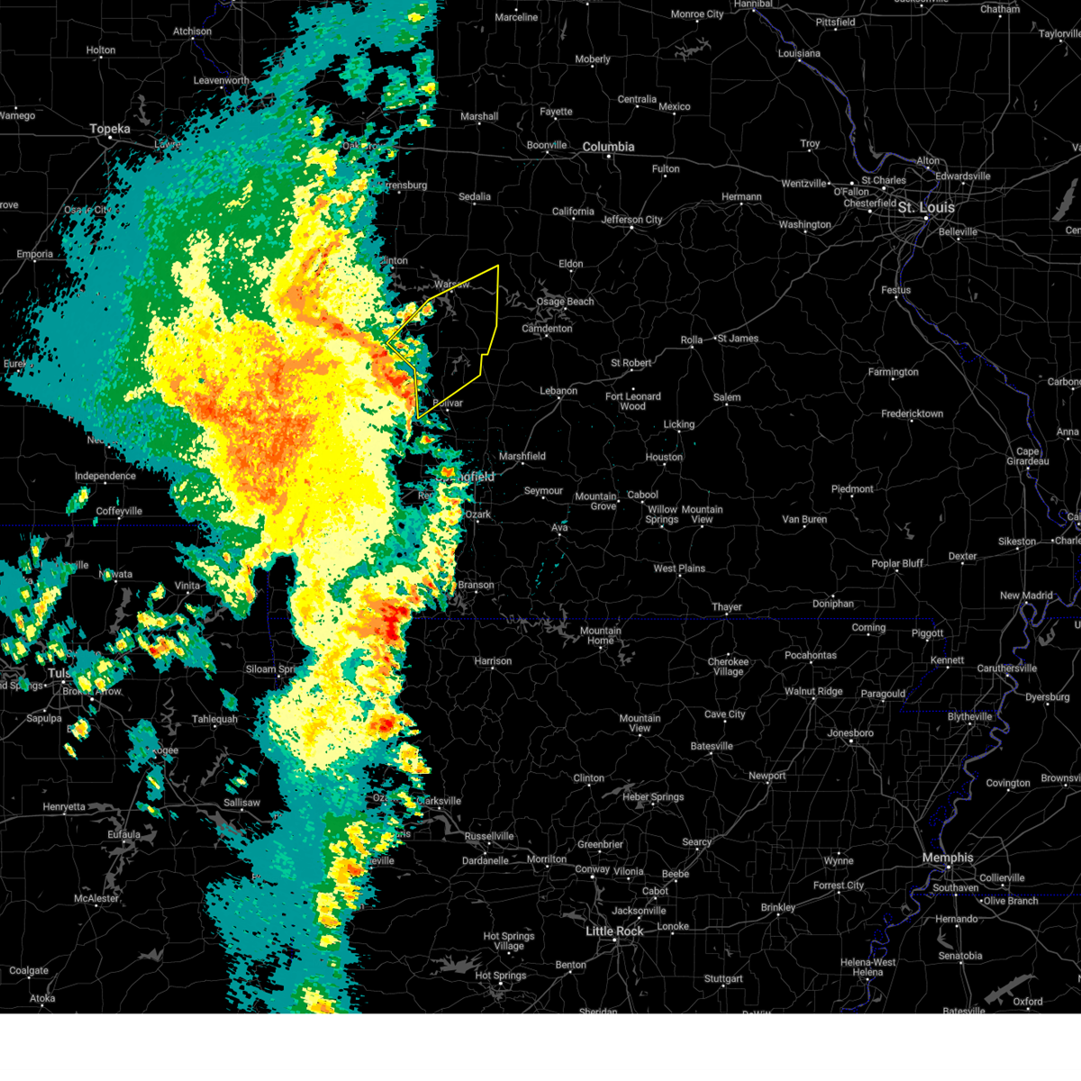 Svrsgf the national weather service in springfield has issued a * severe thunderstorm warning for, hickory county in central missouri, southern benton county in central missouri, northern polk county in southwestern missouri, eastern st. clair county in west central missouri, * until 415 am cdt. * at 335 am cdt, severe thunderstorms were located along a line extending from 6 miles northeast of el dorado springs to near stockton to 6 miles southwest of fair play, moving northeast at 50 mph (radar indicated). Hazards include 60 mph wind gusts. expect damage to roofs, siding, and trees Svrsgf the national weather service in springfield has issued a * severe thunderstorm warning for, hickory county in central missouri, southern benton county in central missouri, northern polk county in southwestern missouri, eastern st. clair county in west central missouri, * until 415 am cdt. * at 335 am cdt, severe thunderstorms were located along a line extending from 6 miles northeast of el dorado springs to near stockton to 6 miles southwest of fair play, moving northeast at 50 mph (radar indicated). Hazards include 60 mph wind gusts. expect damage to roofs, siding, and trees
|
| 3/30/2025 3:30 AM CDT |
 the severe thunderstorm warning has been cancelled and is no longer in effect the severe thunderstorm warning has been cancelled and is no longer in effect
|
| 3/30/2025 3:30 AM CDT |
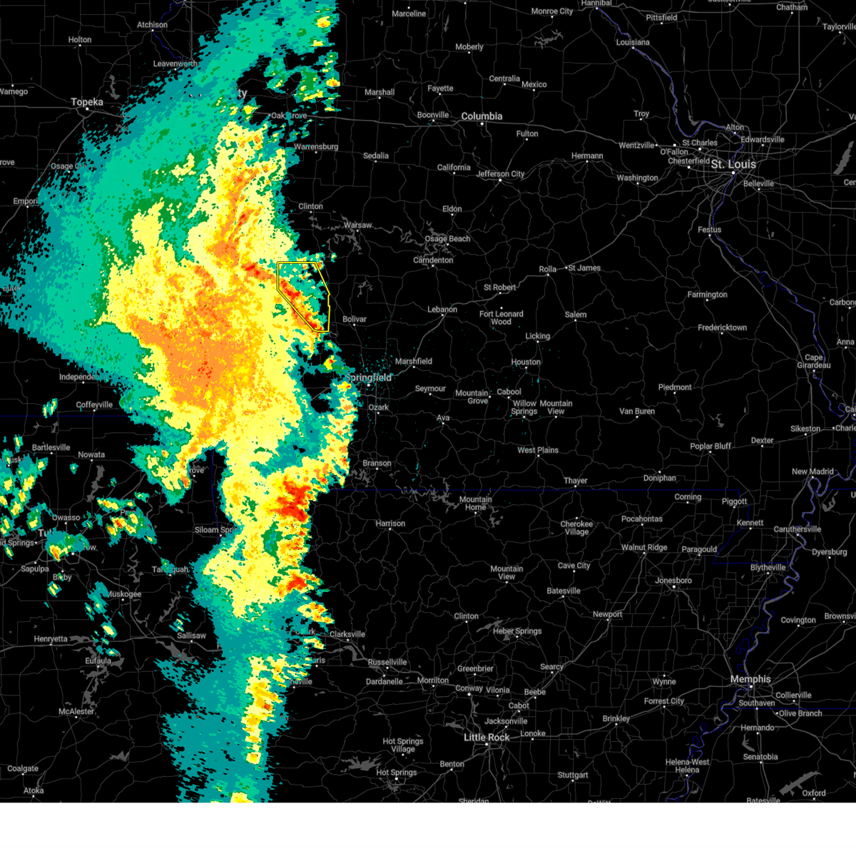 At 329 am cdt, severe thunderstorms were located along a line extending from near schell city to near stockton to 6 miles southwest of fair play, moving northeast at 60 mph (radar indicated). Hazards include 60 mph wind gusts. Expect damage to roofs, siding, and trees. Locations impacted include, bearcreek, masters, caplinger mills, cane hill, stockton state park, stockton lake, arnica, umber view heights, tiffin, taberville, filley, cedar springs, roscoe, el dorado springs, stockton, and monegaw springs. At 329 am cdt, severe thunderstorms were located along a line extending from near schell city to near stockton to 6 miles southwest of fair play, moving northeast at 60 mph (radar indicated). Hazards include 60 mph wind gusts. Expect damage to roofs, siding, and trees. Locations impacted include, bearcreek, masters, caplinger mills, cane hill, stockton state park, stockton lake, arnica, umber view heights, tiffin, taberville, filley, cedar springs, roscoe, el dorado springs, stockton, and monegaw springs.
|
| 3/30/2025 3:01 AM CDT |
 Svrsgf the national weather service in springfield has issued a * severe thunderstorm warning for, cedar county in southwestern missouri, southwestern st. clair county in west central missouri, southeastern vernon county in west central missouri, dade county in southwestern missouri, * until 400 am cdt. * at 301 am cdt, severe thunderstorms were located along a line extending from 7 miles north of liberal to near lamar to near golden city, moving northeast at 50 mph (radar indicated). Hazards include 60 mph wind gusts. expect damage to roofs, siding, and trees Svrsgf the national weather service in springfield has issued a * severe thunderstorm warning for, cedar county in southwestern missouri, southwestern st. clair county in west central missouri, southeastern vernon county in west central missouri, dade county in southwestern missouri, * until 400 am cdt. * at 301 am cdt, severe thunderstorms were located along a line extending from 7 miles north of liberal to near lamar to near golden city, moving northeast at 50 mph (radar indicated). Hazards include 60 mph wind gusts. expect damage to roofs, siding, and trees
|
| 3/22/2025 11:29 PM CDT |
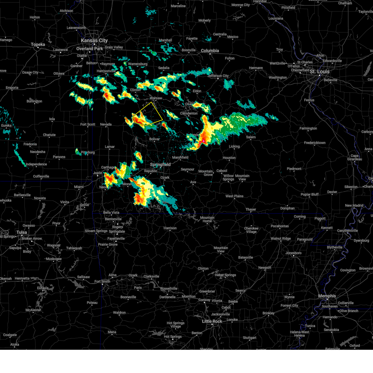 Svrsgf the national weather service in springfield has issued a * severe thunderstorm warning for, northwestern hickory county in central missouri, southwestern benton county in central missouri, southeastern st. clair county in west central missouri, * until 1215 am cdt. * at 1128 pm cdt, a severe thunderstorm was located 8 miles south of osceola, or 16 miles north of stockton, moving northeast at 30 mph (radar indicated). Hazards include ping pong ball size hail and 60 mph wind gusts. People and animals outdoors will be injured. expect hail damage to roofs, siding, windows, and vehicles. Expect wind damage to roofs, siding, and trees. Svrsgf the national weather service in springfield has issued a * severe thunderstorm warning for, northwestern hickory county in central missouri, southwestern benton county in central missouri, southeastern st. clair county in west central missouri, * until 1215 am cdt. * at 1128 pm cdt, a severe thunderstorm was located 8 miles south of osceola, or 16 miles north of stockton, moving northeast at 30 mph (radar indicated). Hazards include ping pong ball size hail and 60 mph wind gusts. People and animals outdoors will be injured. expect hail damage to roofs, siding, windows, and vehicles. Expect wind damage to roofs, siding, and trees.
|
| 3/22/2025 11:22 PM CDT |
 At 1122 pm cdt, a severe thunderstorm was located 7 miles west of weaubleau, or 16 miles northeast of stockton, moving east at 45 mph (radar indicated). Hazards include ping pong ball size hail and 60 mph wind gusts. People and animals outdoors will be injured. expect hail damage to roofs, siding, windows, and vehicles. expect wind damage to roofs, siding, and trees. Locations impacted include, vista, osceola, gerster, collins, roscoe, and truman lake. At 1122 pm cdt, a severe thunderstorm was located 7 miles west of weaubleau, or 16 miles northeast of stockton, moving east at 45 mph (radar indicated). Hazards include ping pong ball size hail and 60 mph wind gusts. People and animals outdoors will be injured. expect hail damage to roofs, siding, windows, and vehicles. expect wind damage to roofs, siding, and trees. Locations impacted include, vista, osceola, gerster, collins, roscoe, and truman lake.
|
| 3/22/2025 11:22 PM CDT |
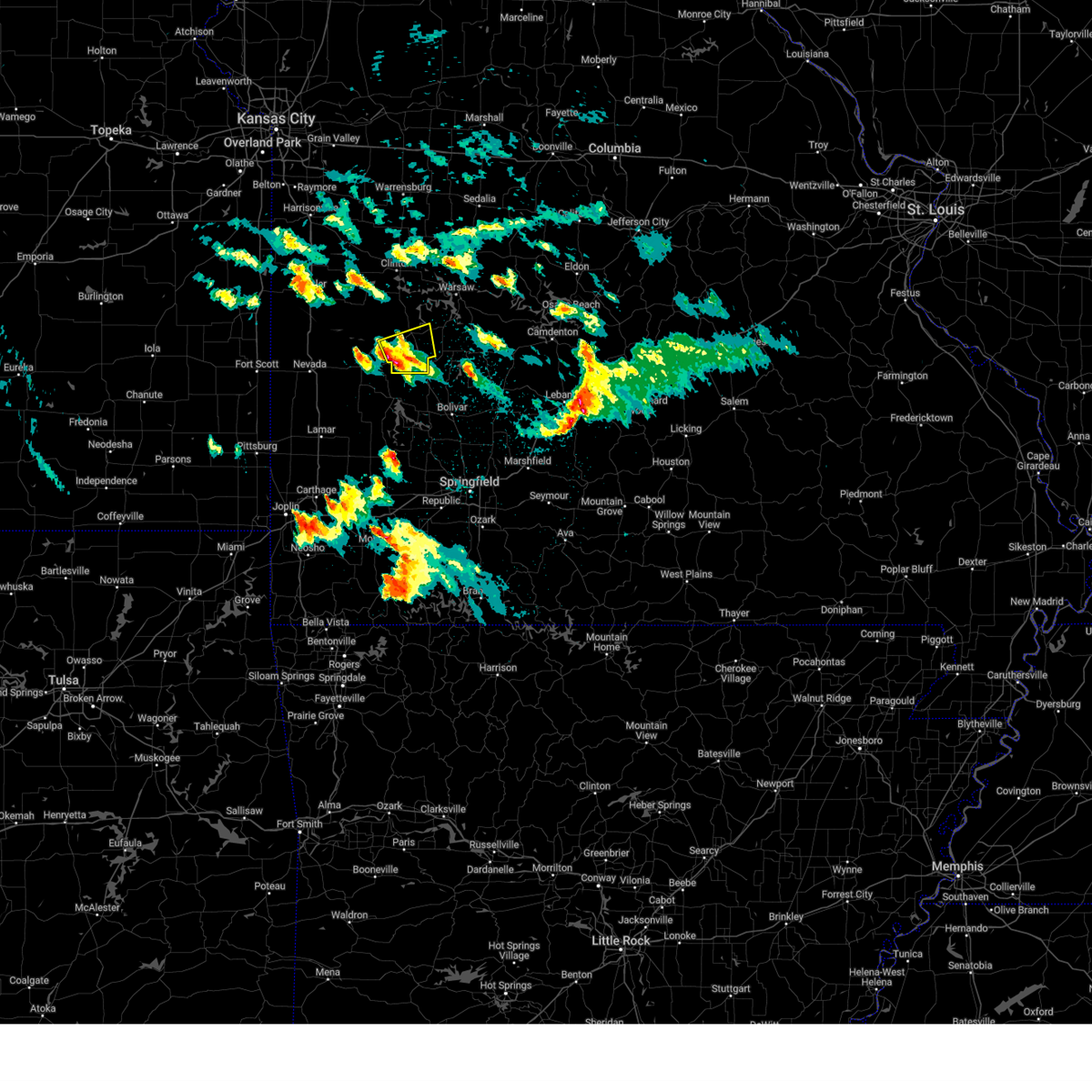 the severe thunderstorm warning has been cancelled and is no longer in effect the severe thunderstorm warning has been cancelled and is no longer in effect
|
| 3/22/2025 11:03 PM CDT |
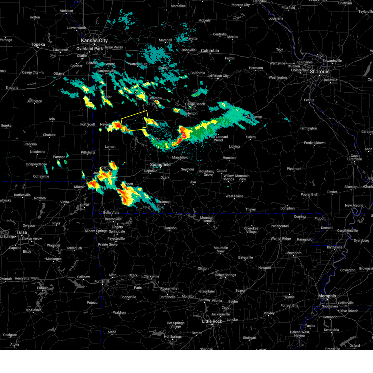 the severe thunderstorm warning has been cancelled and is no longer in effect the severe thunderstorm warning has been cancelled and is no longer in effect
|
| 3/22/2025 11:03 PM CDT |
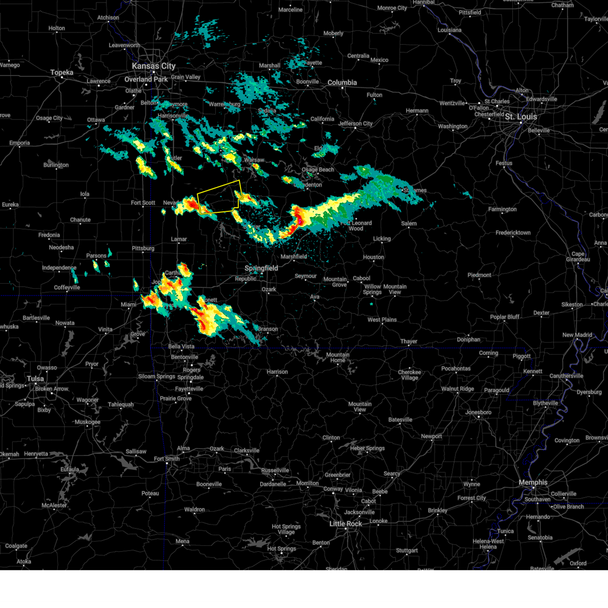 At 1103 pm cdt, a severe thunderstorm was located near el dorado springs, moving east at 45 mph (radar indicated). Hazards include ping pong ball size hail and 60 mph wind gusts. People and animals outdoors will be injured. expect hail damage to roofs, siding, windows, and vehicles. expect wind damage to roofs, siding, and trees. Locations impacted include, vista, osceola, gerster, collins, tiffin, caplinger mills, cedar springs, roscoe, el dorado springs, and truman lake. At 1103 pm cdt, a severe thunderstorm was located near el dorado springs, moving east at 45 mph (radar indicated). Hazards include ping pong ball size hail and 60 mph wind gusts. People and animals outdoors will be injured. expect hail damage to roofs, siding, windows, and vehicles. expect wind damage to roofs, siding, and trees. Locations impacted include, vista, osceola, gerster, collins, tiffin, caplinger mills, cedar springs, roscoe, el dorado springs, and truman lake.
|
| 3/22/2025 10:51 PM CDT |
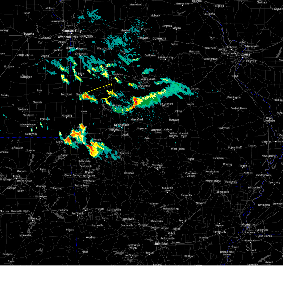 Svrsgf the national weather service in springfield has issued a * severe thunderstorm warning for, northern cedar county in southwestern missouri, southern st. clair county in west central missouri, east central vernon county in west central missouri, * until 1130 pm cdt. * at 1050 pm cdt, a severe thunderstorm was located near el dorado springs, moving east at 45 mph (radar indicated). Hazards include 60 mph wind gusts and quarter size hail. Hail damage to vehicles is expected. Expect wind damage to roofs, siding, and trees. Svrsgf the national weather service in springfield has issued a * severe thunderstorm warning for, northern cedar county in southwestern missouri, southern st. clair county in west central missouri, east central vernon county in west central missouri, * until 1130 pm cdt. * at 1050 pm cdt, a severe thunderstorm was located near el dorado springs, moving east at 45 mph (radar indicated). Hazards include 60 mph wind gusts and quarter size hail. Hail damage to vehicles is expected. Expect wind damage to roofs, siding, and trees.
|
| 3/14/2025 4:43 PM CDT |
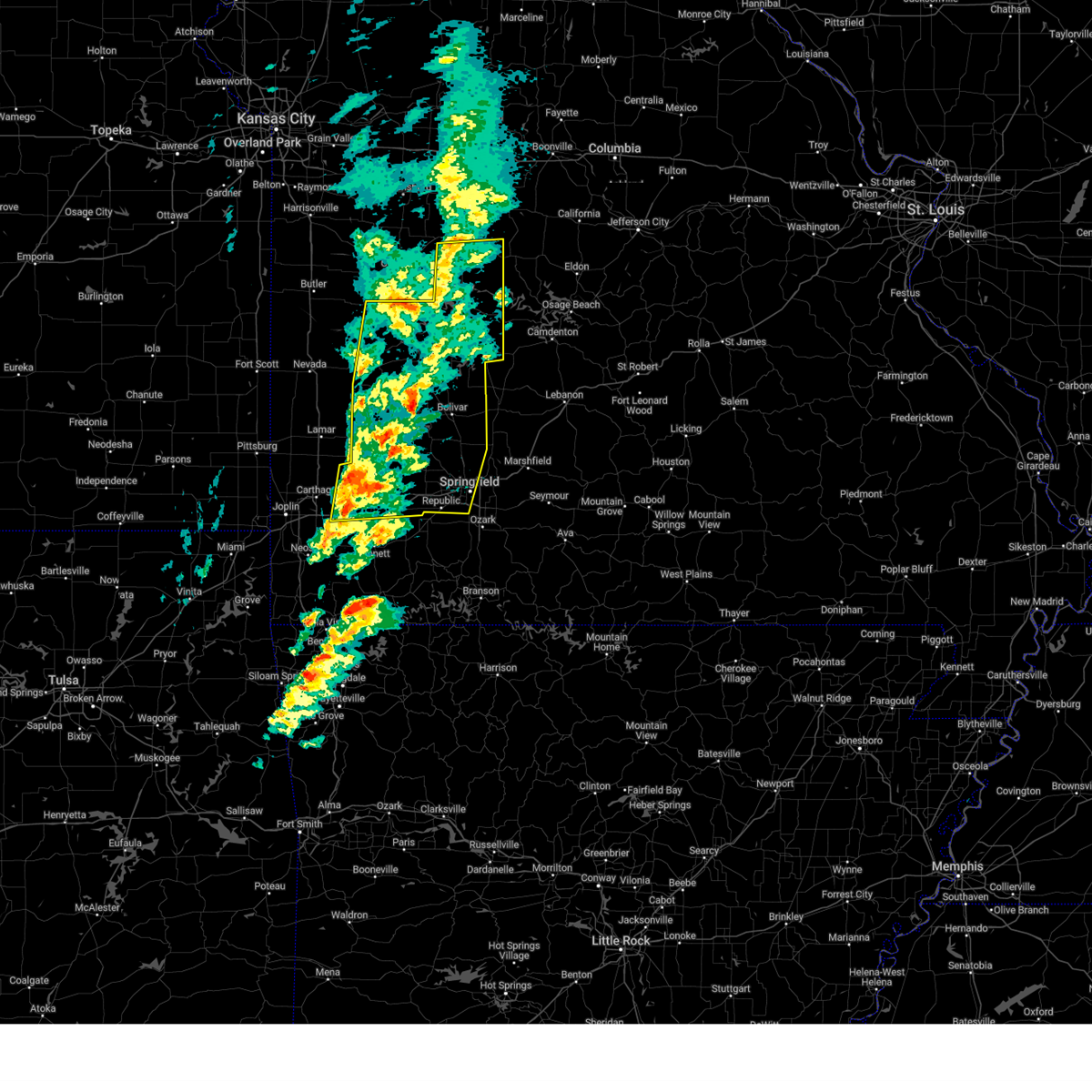 Svrsgf the national weather service in springfield has issued a * severe thunderstorm warning for, hickory county in central missouri, cedar county in southwestern missouri, benton county in central missouri, polk county in southwestern missouri, lawrence county in southwestern missouri, greene county in southwestern missouri, st. clair county in west central missouri, eastern jasper county in southwestern missouri, dade county in southwestern missouri, * until 545 pm cdt. * at 442 pm cdt, a severe thunderstorm was located 9 miles north of greenfield, moving northeast at 70 mph (radar indicated). Hazards include 70 mph wind gusts and quarter size hail. Hail damage to vehicles is expected. expect considerable tree damage. Wind damage is also likely to mobile homes, roofs, and outbuildings. Svrsgf the national weather service in springfield has issued a * severe thunderstorm warning for, hickory county in central missouri, cedar county in southwestern missouri, benton county in central missouri, polk county in southwestern missouri, lawrence county in southwestern missouri, greene county in southwestern missouri, st. clair county in west central missouri, eastern jasper county in southwestern missouri, dade county in southwestern missouri, * until 545 pm cdt. * at 442 pm cdt, a severe thunderstorm was located 9 miles north of greenfield, moving northeast at 70 mph (radar indicated). Hazards include 70 mph wind gusts and quarter size hail. Hail damage to vehicles is expected. expect considerable tree damage. Wind damage is also likely to mobile homes, roofs, and outbuildings.
|
| 3/14/2025 4:31 PM CDT |
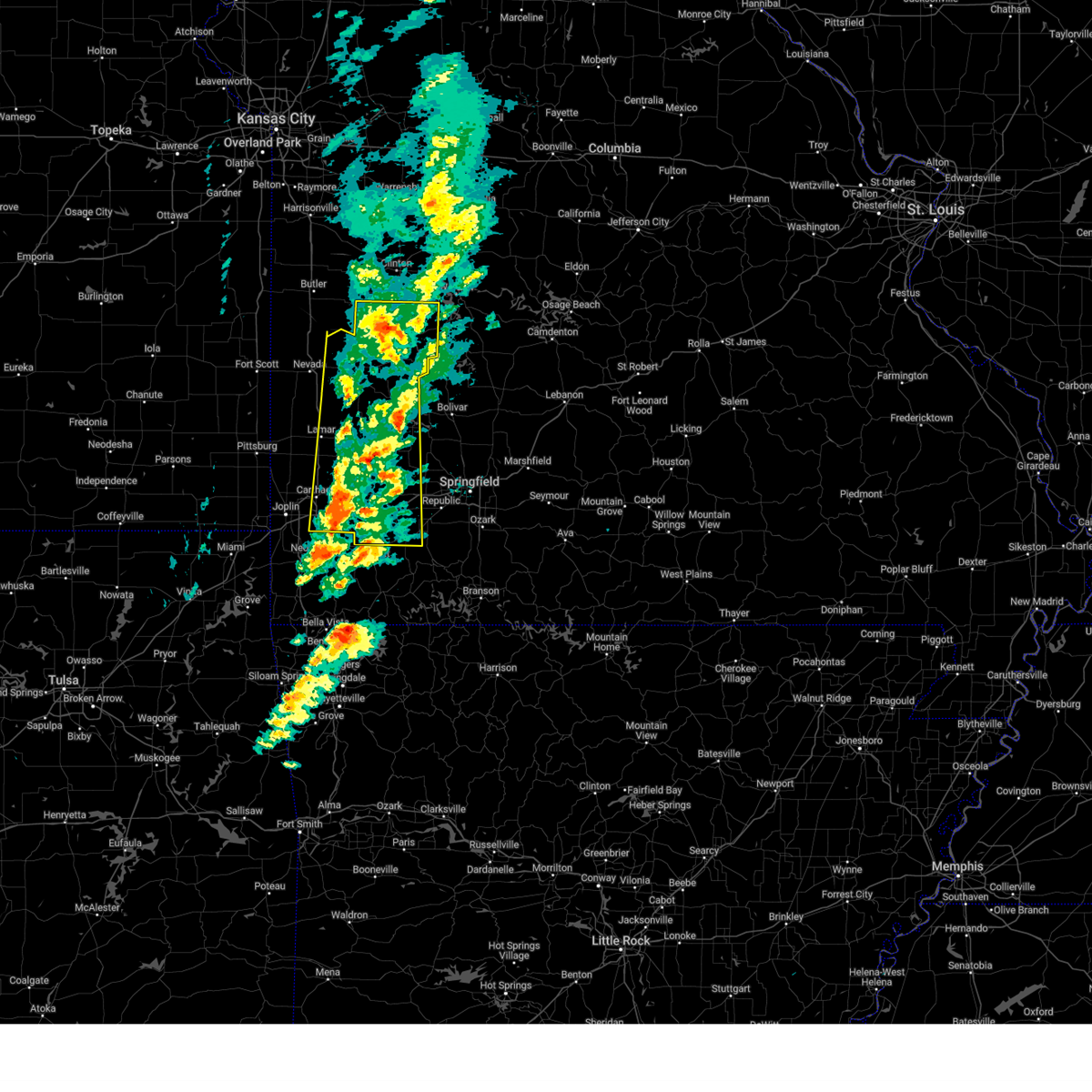 At 429 pm cdt, severe thunderstorms located across southeast kansas and west missouri, moving northeast at 65 mph (emergency management). Hazards include 70 mph wind gusts and quarter size hail. Hail damage to vehicles is expected. expect considerable tree damage. wind damage is also likely to mobile homes, roofs, and outbuildings. locations impacted include, vista, fidelity, appleton city, sarcoxie, cane hill, lamar heights, carthage, aurora, umber view heights, osceola, mount vernon, pennsboro, neola, lowry city, freistatt, el dorado springs, monegaw springs, boston, olympia, and red oak. this includes the following highways, interstate 44 between mile markers 16 and 58. Interstate 49 between mile markers 36 and 71. At 429 pm cdt, severe thunderstorms located across southeast kansas and west missouri, moving northeast at 65 mph (emergency management). Hazards include 70 mph wind gusts and quarter size hail. Hail damage to vehicles is expected. expect considerable tree damage. wind damage is also likely to mobile homes, roofs, and outbuildings. locations impacted include, vista, fidelity, appleton city, sarcoxie, cane hill, lamar heights, carthage, aurora, umber view heights, osceola, mount vernon, pennsboro, neola, lowry city, freistatt, el dorado springs, monegaw springs, boston, olympia, and red oak. this includes the following highways, interstate 44 between mile markers 16 and 58. Interstate 49 between mile markers 36 and 71.
|
| 3/14/2025 4:07 PM CDT |
 At 403 pm cdt, severe thunderstorms located across southeast kansas and west missouri, moving northeast at 60 mph (emergency management. over the past hour, wind gusts up to 60 to 70 mph have been reported, with tree limbs down, across southeast kansas and west missouri). Hazards include 70 mph wind gusts and quarter size hail. Hail damage to vehicles is expected. expect considerable tree damage. wind damage is also likely to mobile homes, roofs, and outbuildings. locations impacted include, fidelity, appleton city, sarcoxie, aurora, osceola, lowry city, milo, boston, olympia, red oak, marionville, caplinger mills, brooklyn heights, kenoma, stotts city, reeds, avilla, sheldon, roscoe, and bearcreek. this includes the following highways, interstate 44 between mile markers 5 and 58. Interstate 49 between mile markers 32 and 103, and between mile markers 106 and 107. At 403 pm cdt, severe thunderstorms located across southeast kansas and west missouri, moving northeast at 60 mph (emergency management. over the past hour, wind gusts up to 60 to 70 mph have been reported, with tree limbs down, across southeast kansas and west missouri). Hazards include 70 mph wind gusts and quarter size hail. Hail damage to vehicles is expected. expect considerable tree damage. wind damage is also likely to mobile homes, roofs, and outbuildings. locations impacted include, fidelity, appleton city, sarcoxie, aurora, osceola, lowry city, milo, boston, olympia, red oak, marionville, caplinger mills, brooklyn heights, kenoma, stotts city, reeds, avilla, sheldon, roscoe, and bearcreek. this includes the following highways, interstate 44 between mile markers 5 and 58. Interstate 49 between mile markers 32 and 103, and between mile markers 106 and 107.
|
| 3/14/2025 4:07 PM CDT |
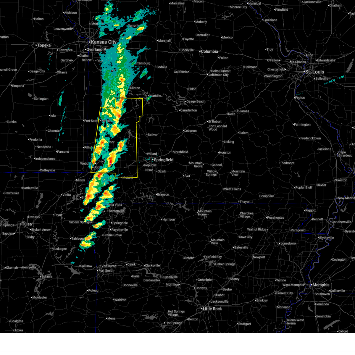 the severe thunderstorm warning has been cancelled and is no longer in effect the severe thunderstorm warning has been cancelled and is no longer in effect
|
| 3/14/2025 3:42 PM CDT |
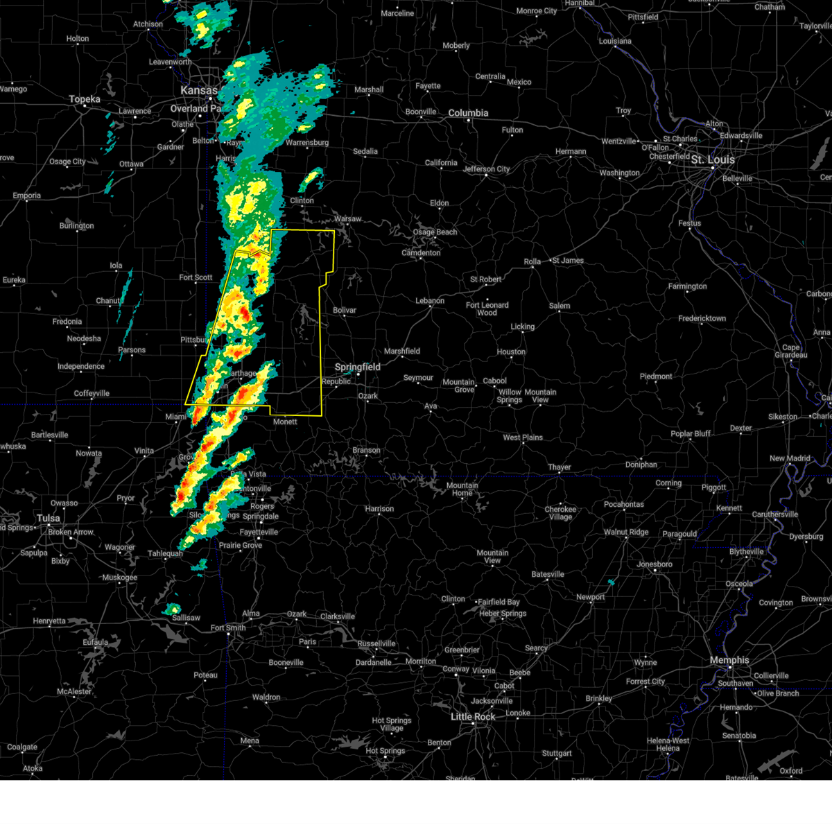 Svrsgf the national weather service in springfield has issued a * severe thunderstorm warning for, eastern cherokee county in southeastern kansas, barton county in southwestern missouri, northern newton county in southwestern missouri, cedar county in southwestern missouri, lawrence county in southwestern missouri, st. clair county in west central missouri, vernon county in west central missouri, jasper county in southwestern missouri, dade county in southwestern missouri, * until 445 pm cdt. * at 341 pm cdt, a severe thunderstorm was located near lamar, moving northeast at 70 mph (radar indicated). Hazards include 70 mph wind gusts and penny size hail. these storms have been reported to down tree limbs with measured gusts up to 60 to 70 mph. Expect considerable tree damage. Damage is likely to mobile homes, roofs, and outbuildings. Svrsgf the national weather service in springfield has issued a * severe thunderstorm warning for, eastern cherokee county in southeastern kansas, barton county in southwestern missouri, northern newton county in southwestern missouri, cedar county in southwestern missouri, lawrence county in southwestern missouri, st. clair county in west central missouri, vernon county in west central missouri, jasper county in southwestern missouri, dade county in southwestern missouri, * until 445 pm cdt. * at 341 pm cdt, a severe thunderstorm was located near lamar, moving northeast at 70 mph (radar indicated). Hazards include 70 mph wind gusts and penny size hail. these storms have been reported to down tree limbs with measured gusts up to 60 to 70 mph. Expect considerable tree damage. Damage is likely to mobile homes, roofs, and outbuildings.
|
| 10/30/2024 9:45 PM CDT |
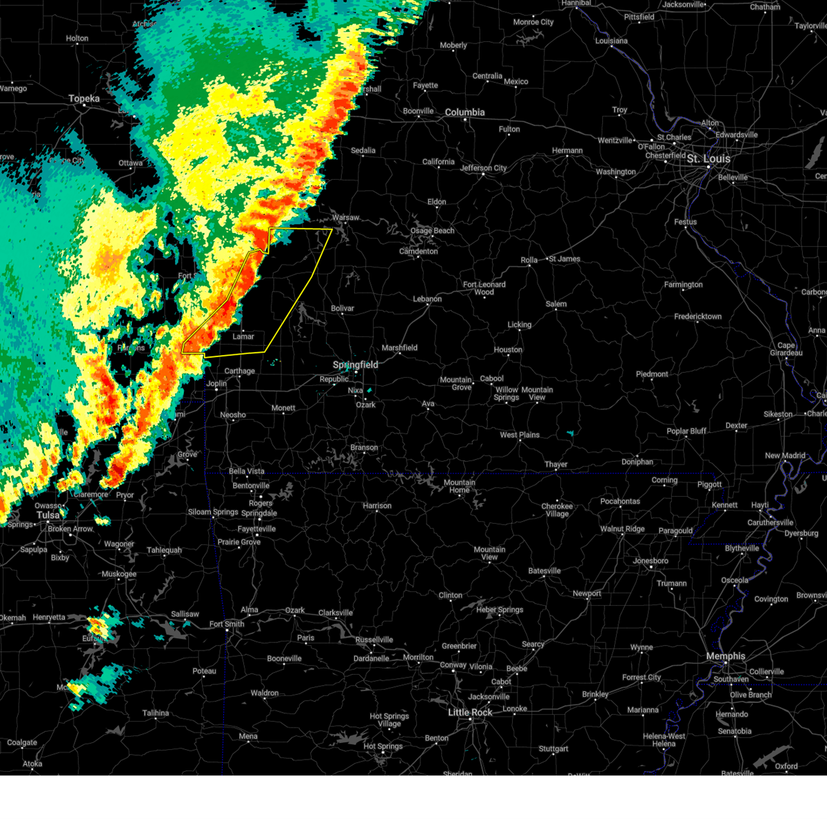 Svrsgf the national weather service in springfield has issued a * severe thunderstorm warning for, southeastern crawford county in southeastern kansas, barton county in southwestern missouri, cedar county in southwestern missouri, st. clair county in west central missouri, eastern vernon county in west central missouri, northwestern jasper county in southwestern missouri, northwestern dade county in southwestern missouri, * until 1015 pm cdt. * at 944 pm cdt, severe thunderstorms were located along a line extending from near montrose to 8 miles south of walker to 8 miles southeast of pittsburg, moving east at 50 mph (radar indicated). Hazards include 60 mph wind gusts and penny size hail. expect damage to roofs, siding, and trees Svrsgf the national weather service in springfield has issued a * severe thunderstorm warning for, southeastern crawford county in southeastern kansas, barton county in southwestern missouri, cedar county in southwestern missouri, st. clair county in west central missouri, eastern vernon county in west central missouri, northwestern jasper county in southwestern missouri, northwestern dade county in southwestern missouri, * until 1015 pm cdt. * at 944 pm cdt, severe thunderstorms were located along a line extending from near montrose to 8 miles south of walker to 8 miles southeast of pittsburg, moving east at 50 mph (radar indicated). Hazards include 60 mph wind gusts and penny size hail. expect damage to roofs, siding, and trees
|
| 6/26/2024 4:31 AM CDT |
 Svrsgf the national weather service in springfield has issued a * severe thunderstorm warning for, bourbon county in southeastern kansas, crawford county in southeastern kansas, southwestern hickory county in central missouri, barton county in southwestern missouri, southwestern dallas county in southwestern missouri, cedar county in southwestern missouri, polk county in southwestern missouri, southern st. clair county in west central missouri, vernon county in west central missouri, northern dade county in southwestern missouri, * until 515 am cdt. * at 431 am cdt, severe thunderstorms were located along a line extending from near weaubleau to near el dorado springs to near bronson, moving southeast at 40 mph (radar indicated). Hazards include 60 mph wind gusts and penny size hail. expect damage to roofs, siding, and trees Svrsgf the national weather service in springfield has issued a * severe thunderstorm warning for, bourbon county in southeastern kansas, crawford county in southeastern kansas, southwestern hickory county in central missouri, barton county in southwestern missouri, southwestern dallas county in southwestern missouri, cedar county in southwestern missouri, polk county in southwestern missouri, southern st. clair county in west central missouri, vernon county in west central missouri, northern dade county in southwestern missouri, * until 515 am cdt. * at 431 am cdt, severe thunderstorms were located along a line extending from near weaubleau to near el dorado springs to near bronson, moving southeast at 40 mph (radar indicated). Hazards include 60 mph wind gusts and penny size hail. expect damage to roofs, siding, and trees
|
| 5/26/2024 4:38 PM CDT |
 At 437 pm cdt, a severe thunderstorm was located near osceola, or 17 miles west of hermitage, moving east at 45 mph (radar indicated). Hazards include golf ball size hail and 60 mph wind gusts. People and animals outdoors will be injured. expect hail damage to roofs, siding, windows, and vehicles. expect wind damage to roofs, siding, and trees. Locations impacted include, truman lake, osceola, collins, roscoe, vista, gerster, harper, and iconium. At 437 pm cdt, a severe thunderstorm was located near osceola, or 17 miles west of hermitage, moving east at 45 mph (radar indicated). Hazards include golf ball size hail and 60 mph wind gusts. People and animals outdoors will be injured. expect hail damage to roofs, siding, windows, and vehicles. expect wind damage to roofs, siding, and trees. Locations impacted include, truman lake, osceola, collins, roscoe, vista, gerster, harper, and iconium.
|
| 5/26/2024 4:21 PM CDT |
 At 419 pm cdt, a severe thunderstorm was located near osceola, or 14 miles northeast of el dorado springs, moving east at 50 mph (radar indicated. at 415 pm, ping pong size hail was reported west of osceola). Hazards include golf ball size hail and 60 mph wind gusts. People and animals outdoors will be injured. expect hail damage to roofs, siding, windows, and vehicles. expect wind damage to roofs, siding, and trees. Locations impacted include, truman lake, appleton city, osceola, lowry city, collins, roscoe, vista, gerster, harper, iconium, tiffin, johnson city, taberville, and monegaw springs. At 419 pm cdt, a severe thunderstorm was located near osceola, or 14 miles northeast of el dorado springs, moving east at 50 mph (radar indicated. at 415 pm, ping pong size hail was reported west of osceola). Hazards include golf ball size hail and 60 mph wind gusts. People and animals outdoors will be injured. expect hail damage to roofs, siding, windows, and vehicles. expect wind damage to roofs, siding, and trees. Locations impacted include, truman lake, appleton city, osceola, lowry city, collins, roscoe, vista, gerster, harper, iconium, tiffin, johnson city, taberville, and monegaw springs.
|
| 5/26/2024 4:01 PM CDT |
 Svrsgf the national weather service in springfield has issued a * severe thunderstorm warning for, st. clair county in west central missouri, * until 500 pm cdt. * at 401 pm cdt, a severe thunderstorm was located 7 miles northeast of schell city, or 14 miles north of el dorado springs, moving east at 35 mph (radar indicated). Hazards include golf ball size hail and 60 mph wind gusts. People and animals outdoors will be injured. expect hail damage to roofs, siding, windows, and vehicles. Expect wind damage to roofs, siding, and trees. Svrsgf the national weather service in springfield has issued a * severe thunderstorm warning for, st. clair county in west central missouri, * until 500 pm cdt. * at 401 pm cdt, a severe thunderstorm was located 7 miles northeast of schell city, or 14 miles north of el dorado springs, moving east at 35 mph (radar indicated). Hazards include golf ball size hail and 60 mph wind gusts. People and animals outdoors will be injured. expect hail damage to roofs, siding, windows, and vehicles. Expect wind damage to roofs, siding, and trees.
|
| 5/21/2024 5:41 PM CDT |
 the severe thunderstorm warning has been cancelled and is no longer in effect the severe thunderstorm warning has been cancelled and is no longer in effect
|
| 5/21/2024 5:41 PM CDT |
 At 541 pm cdt, a severe thunderstorm was located 8 miles southeast of appleton city, or 18 miles north of el dorado springs, moving east at 40 mph (radar indicated). Hazards include 60 mph wind gusts and half dollar size hail. Hail damage to vehicles is expected. expect wind damage to roofs, siding, and trees. Locations impacted include, truman lake, appleton city, osceola, lowry city, roscoe, vista, gerster, harper, iconium, tiffin, johnson city, taberville, and monegaw springs. At 541 pm cdt, a severe thunderstorm was located 8 miles southeast of appleton city, or 18 miles north of el dorado springs, moving east at 40 mph (radar indicated). Hazards include 60 mph wind gusts and half dollar size hail. Hail damage to vehicles is expected. expect wind damage to roofs, siding, and trees. Locations impacted include, truman lake, appleton city, osceola, lowry city, roscoe, vista, gerster, harper, iconium, tiffin, johnson city, taberville, and monegaw springs.
|
| 5/21/2024 5:09 PM CDT |
 Svrsgf the national weather service in springfield has issued a * severe thunderstorm warning for, st. clair county in west central missouri, northeastern vernon county in west central missouri, * until 600 pm cdt. * at 509 pm cdt, a severe thunderstorm was located over schell city, or 11 miles southeast of rich hill, moving east at 65 mph (radar indicated). Hazards include 60 mph wind gusts and half dollar size hail. Hail damage to vehicles is expected. Expect wind damage to roofs, siding, and trees. Svrsgf the national weather service in springfield has issued a * severe thunderstorm warning for, st. clair county in west central missouri, northeastern vernon county in west central missouri, * until 600 pm cdt. * at 509 pm cdt, a severe thunderstorm was located over schell city, or 11 miles southeast of rich hill, moving east at 65 mph (radar indicated). Hazards include 60 mph wind gusts and half dollar size hail. Hail damage to vehicles is expected. Expect wind damage to roofs, siding, and trees.
|
| 5/8/2024 5:26 PM CDT |
 The storm which prompted the warning has weakened below severe limits, and no longer poses an immediate threat to life or property. therefore, the warning will be allowed to expire. a tornado watch remains in effect until 700 pm cdt for southwestern and west central missouri. The storm which prompted the warning has weakened below severe limits, and no longer poses an immediate threat to life or property. therefore, the warning will be allowed to expire. a tornado watch remains in effect until 700 pm cdt for southwestern and west central missouri.
|
| 5/8/2024 5:12 PM CDT |
 At 511 pm cdt, a severe thunderstorm was located 11 miles south of el dorado springs, moving northeast at 25 mph (radar indicated). Hazards include 60 mph wind gusts and quarter size hail. Hail damage to vehicles is expected. expect wind damage to roofs, siding, and trees. Locations impacted include, el dorado springs, roscoe, olympia, tiffin, caplinger mills, filley, cedar springs, monegaw springs, and arnica. At 511 pm cdt, a severe thunderstorm was located 11 miles south of el dorado springs, moving northeast at 25 mph (radar indicated). Hazards include 60 mph wind gusts and quarter size hail. Hail damage to vehicles is expected. expect wind damage to roofs, siding, and trees. Locations impacted include, el dorado springs, roscoe, olympia, tiffin, caplinger mills, filley, cedar springs, monegaw springs, and arnica.
|
| 5/8/2024 5:12 PM CDT |
 the severe thunderstorm warning has been cancelled and is no longer in effect the severe thunderstorm warning has been cancelled and is no longer in effect
|
| 5/8/2024 4:52 PM CDT |
 Svrsgf the national weather service in springfield has issued a * severe thunderstorm warning for, northeastern barton county in southwestern missouri, cedar county in southwestern missouri, southwestern st. clair county in west central missouri, southeastern vernon county in west central missouri, * until 530 pm cdt. * at 452 pm cdt, a severe thunderstorm was located near sheldon, or 10 miles northeast of lamar, moving northeast at 25 mph (radar indicated). Hazards include 60 mph wind gusts and half dollar size hail. Hail damage to vehicles is expected. Expect wind damage to roofs, siding, and trees. Svrsgf the national weather service in springfield has issued a * severe thunderstorm warning for, northeastern barton county in southwestern missouri, cedar county in southwestern missouri, southwestern st. clair county in west central missouri, southeastern vernon county in west central missouri, * until 530 pm cdt. * at 452 pm cdt, a severe thunderstorm was located near sheldon, or 10 miles northeast of lamar, moving northeast at 25 mph (radar indicated). Hazards include 60 mph wind gusts and half dollar size hail. Hail damage to vehicles is expected. Expect wind damage to roofs, siding, and trees.
|
| 5/8/2024 1:44 PM CDT |
 the severe thunderstorm warning has been cancelled and is no longer in effect the severe thunderstorm warning has been cancelled and is no longer in effect
|
| 5/8/2024 1:17 PM CDT |
 Svrsgf the national weather service in springfield has issued a * severe thunderstorm warning for, western st. clair county in west central missouri, northeastern vernon county in west central missouri, * until 200 pm cdt. * at 117 pm cdt, a severe thunderstorm was located over walker, or 10 miles northeast of nevada, moving northeast at 30 mph (radar indicated). Hazards include 60 mph wind gusts and quarter size hail. Hail damage to vehicles is expected. Expect wind damage to roofs, siding, and trees. Svrsgf the national weather service in springfield has issued a * severe thunderstorm warning for, western st. clair county in west central missouri, northeastern vernon county in west central missouri, * until 200 pm cdt. * at 117 pm cdt, a severe thunderstorm was located over walker, or 10 miles northeast of nevada, moving northeast at 30 mph (radar indicated). Hazards include 60 mph wind gusts and quarter size hail. Hail damage to vehicles is expected. Expect wind damage to roofs, siding, and trees.
|
| 5/6/2024 11:48 PM CDT |
 the severe thunderstorm warning has been cancelled and is no longer in effect the severe thunderstorm warning has been cancelled and is no longer in effect
|
| 5/6/2024 11:48 PM CDT |
 At 1148 pm cdt, severe thunderstorms were located along a line extending from near nevada to near jasper to near sarcoxie to near neosho, moving northeast at 60 mph (radar indicated). Hazards include 70 mph wind gusts and penny size hail. Expect considerable tree damage. damage is likely to mobile homes, roofs, and outbuildings. locations impacted include, stockton lake, stockton state park, monett, nevada, aurora, mount vernon, el dorado springs, marionville, stockton, greenfield, pierce city, purdy, lockwood, miller, wheaton, verona, sheldon, butterfield, everton, and montevallo. this includes the following highways, interstate 44 between mile markers 32 and 58. Interstate 49 between mile markers 77 and 99. At 1148 pm cdt, severe thunderstorms were located along a line extending from near nevada to near jasper to near sarcoxie to near neosho, moving northeast at 60 mph (radar indicated). Hazards include 70 mph wind gusts and penny size hail. Expect considerable tree damage. damage is likely to mobile homes, roofs, and outbuildings. locations impacted include, stockton lake, stockton state park, monett, nevada, aurora, mount vernon, el dorado springs, marionville, stockton, greenfield, pierce city, purdy, lockwood, miller, wheaton, verona, sheldon, butterfield, everton, and montevallo. this includes the following highways, interstate 44 between mile markers 32 and 58. Interstate 49 between mile markers 77 and 99.
|
| 5/6/2024 11:36 PM CDT |
 Svrsgf the national weather service in springfield has issued a * severe thunderstorm warning for, southeastern bourbon county in southeastern kansas, cedar county in southwestern missouri, northern barry county in southwestern missouri, lawrence county in southwestern missouri, western st. clair county in west central missouri, vernon county in west central missouri, dade county in southwestern missouri, * until 1230 am cdt. * at 1136 pm cdt, severe thunderstorms were located along a line extending from 7 miles east of fort scott to near alba to near duenweg to seneca, moving northeast at 55 mph (radar indicated). Hazards include 60 mph wind gusts and penny size hail. expect damage to roofs, siding, and trees Svrsgf the national weather service in springfield has issued a * severe thunderstorm warning for, southeastern bourbon county in southeastern kansas, cedar county in southwestern missouri, northern barry county in southwestern missouri, lawrence county in southwestern missouri, western st. clair county in west central missouri, vernon county in west central missouri, dade county in southwestern missouri, * until 1230 am cdt. * at 1136 pm cdt, severe thunderstorms were located along a line extending from 7 miles east of fort scott to near alba to near duenweg to seneca, moving northeast at 55 mph (radar indicated). Hazards include 60 mph wind gusts and penny size hail. expect damage to roofs, siding, and trees
|
| 4/28/2024 3:38 AM CDT |
 Svrsgf the national weather service in springfield has issued a * severe thunderstorm warning for, hickory county in central missouri, eastern cedar county in southwestern missouri, polk county in southwestern missouri, eastern st. clair county in west central missouri, * until 415 am cdt. * at 337 am cdt, severe thunderstorms were located along a line extending from 10 miles southwest of osceola to 6 miles east of stockton to 7 miles north of walnut grove, moving northeast at 45 mph (radar indicated). Hazards include 60 mph wind gusts. expect damage to roofs, siding, and trees Svrsgf the national weather service in springfield has issued a * severe thunderstorm warning for, hickory county in central missouri, eastern cedar county in southwestern missouri, polk county in southwestern missouri, eastern st. clair county in west central missouri, * until 415 am cdt. * at 337 am cdt, severe thunderstorms were located along a line extending from 10 miles southwest of osceola to 6 miles east of stockton to 7 miles north of walnut grove, moving northeast at 45 mph (radar indicated). Hazards include 60 mph wind gusts. expect damage to roofs, siding, and trees
|
| 4/27/2024 11:59 PM CDT |
 the severe thunderstorm warning has been cancelled and is no longer in effect the severe thunderstorm warning has been cancelled and is no longer in effect
|
| 4/27/2024 11:50 PM CDT |
 Svrsgf the national weather service in springfield has issued a * severe thunderstorm warning for, southeastern st. clair county in west central missouri, * until 1230 am cdt. * at 1150 pm cdt, a severe thunderstorm was located 8 miles southwest of osceola, or 14 miles east of el dorado springs, moving east at 30 mph (radar indicated). Hazards include 60 mph wind gusts and quarter size hail. Hail damage to vehicles is expected. Expect wind damage to roofs, siding, and trees. Svrsgf the national weather service in springfield has issued a * severe thunderstorm warning for, southeastern st. clair county in west central missouri, * until 1230 am cdt. * at 1150 pm cdt, a severe thunderstorm was located 8 miles southwest of osceola, or 14 miles east of el dorado springs, moving east at 30 mph (radar indicated). Hazards include 60 mph wind gusts and quarter size hail. Hail damage to vehicles is expected. Expect wind damage to roofs, siding, and trees.
|
| 4/27/2024 11:25 PM CDT |
 The storm which prompted the warning has weakened below severe limits, and no longer poses an immediate threat to life or property. therefore, the warning will be allowed to expire. however, small hail and heavy rain are still possible with this thunderstorm. a tornado watch remains in effect until midnight cdt for southwestern and west central missouri. The storm which prompted the warning has weakened below severe limits, and no longer poses an immediate threat to life or property. therefore, the warning will be allowed to expire. however, small hail and heavy rain are still possible with this thunderstorm. a tornado watch remains in effect until midnight cdt for southwestern and west central missouri.
|
| 4/27/2024 11:13 PM CDT |
 the severe thunderstorm warning has been cancelled and is no longer in effect the severe thunderstorm warning has been cancelled and is no longer in effect
|
| 4/27/2024 11:13 PM CDT |
 At 1113 pm cdt, a severe thunderstorm was located over el dorado springs, moving east at 25 mph (radar indicated). Hazards include 60 mph wind gusts and quarter size hail. Hail damage to vehicles is expected. expect wind damage to roofs, siding, and trees. Locations impacted include, truman lake, el dorado springs, appleton city, osceola, lowry city, collins, roscoe, vista, olympia, caplinger mills, tiffin, johnson city, taberville, filley, cedar springs, and monegaw springs. At 1113 pm cdt, a severe thunderstorm was located over el dorado springs, moving east at 25 mph (radar indicated). Hazards include 60 mph wind gusts and quarter size hail. Hail damage to vehicles is expected. expect wind damage to roofs, siding, and trees. Locations impacted include, truman lake, el dorado springs, appleton city, osceola, lowry city, collins, roscoe, vista, olympia, caplinger mills, tiffin, johnson city, taberville, filley, cedar springs, and monegaw springs.
|
| 4/27/2024 10:59 PM CDT |
 At 1058 pm cdt, a severe thunderstorm was located near walker, or near el dorado springs, moving east at 30 mph (radar indicated). Hazards include 60 mph wind gusts and quarter size hail. Hail damage to vehicles is expected. expect wind damage to roofs, siding, and trees. Locations impacted include, truman lake, el dorado springs, appleton city, osceola, lowry city, montevallo, schell city, collins, roscoe, vista, harwood, olympia, caplinger mills, tiffin, johnson city, taberville, filley, cedar springs, and monegaw springs. At 1058 pm cdt, a severe thunderstorm was located near walker, or near el dorado springs, moving east at 30 mph (radar indicated). Hazards include 60 mph wind gusts and quarter size hail. Hail damage to vehicles is expected. expect wind damage to roofs, siding, and trees. Locations impacted include, truman lake, el dorado springs, appleton city, osceola, lowry city, montevallo, schell city, collins, roscoe, vista, harwood, olympia, caplinger mills, tiffin, johnson city, taberville, filley, cedar springs, and monegaw springs.
|
| 4/27/2024 10:38 PM CDT |
 Svrsgf the national weather service in springfield has issued a * severe thunderstorm warning for, northern cedar county in southwestern missouri, st. clair county in west central missouri, eastern vernon county in west central missouri, * until 1130 pm cdt. * at 1038 pm cdt, a severe thunderstorm was located near nevada, moving east at 30 mph (radar indicated). Hazards include 60 mph wind gusts and quarter size hail. Hail damage to vehicles is expected. Expect wind damage to roofs, siding, and trees. Svrsgf the national weather service in springfield has issued a * severe thunderstorm warning for, northern cedar county in southwestern missouri, st. clair county in west central missouri, eastern vernon county in west central missouri, * until 1130 pm cdt. * at 1038 pm cdt, a severe thunderstorm was located near nevada, moving east at 30 mph (radar indicated). Hazards include 60 mph wind gusts and quarter size hail. Hail damage to vehicles is expected. Expect wind damage to roofs, siding, and trees.
|
| 4/27/2024 10:10 PM CDT |
 the severe thunderstorm warning has been cancelled and is no longer in effect the severe thunderstorm warning has been cancelled and is no longer in effect
|
| 4/27/2024 10:10 PM CDT |
 At 1010 pm cdt, a severe thunderstorm was located 7 miles southwest of nevada, moving east at 40 mph (radar indicated). Hazards include 60 mph wind gusts and quarter size hail. Hail damage to vehicles is expected. expect wind damage to roofs, siding, and trees. locations impacted include, truman lake, nevada, el dorado springs, appleton city, osceola, lowry city, sheldon, montevallo, walker, schell city, bronaugh, collins, moundville, roscoe, richards, milo, deerfield, vista, metz, and harwood. This includes interstate 49 between mile markers 77 and 106. At 1010 pm cdt, a severe thunderstorm was located 7 miles southwest of nevada, moving east at 40 mph (radar indicated). Hazards include 60 mph wind gusts and quarter size hail. Hail damage to vehicles is expected. expect wind damage to roofs, siding, and trees. locations impacted include, truman lake, nevada, el dorado springs, appleton city, osceola, lowry city, sheldon, montevallo, walker, schell city, bronaugh, collins, moundville, roscoe, richards, milo, deerfield, vista, metz, and harwood. This includes interstate 49 between mile markers 77 and 106.
|
| 4/27/2024 9:50 PM CDT |
 Svrsgf the national weather service in springfield has issued a * severe thunderstorm warning for, northwestern barton county in southwestern missouri, northern cedar county in southwestern missouri, st. clair county in west central missouri, vernon county in west central missouri, * until 1045 pm cdt. * at 949 pm cdt, a severe thunderstorm was located near el dorado springs, moving east at 30 mph (radar indicated). Hazards include 60 mph wind gusts and quarter size hail. Hail damage to vehicles is expected. Expect wind damage to roofs, siding, and trees. Svrsgf the national weather service in springfield has issued a * severe thunderstorm warning for, northwestern barton county in southwestern missouri, northern cedar county in southwestern missouri, st. clair county in west central missouri, vernon county in west central missouri, * until 1045 pm cdt. * at 949 pm cdt, a severe thunderstorm was located near el dorado springs, moving east at 30 mph (radar indicated). Hazards include 60 mph wind gusts and quarter size hail. Hail damage to vehicles is expected. Expect wind damage to roofs, siding, and trees.
|
| 4/27/2024 9:09 PM CDT |
 Svrsgf the national weather service in springfield has issued a * severe thunderstorm warning for, st. clair county in west central missouri, northeastern vernon county in west central missouri, * until 1000 pm cdt. * at 909 pm cdt, a severe thunderstorm was located near schell city, or 13 miles north of el dorado springs, moving east at 30 mph (radar indicated). Hazards include 60 mph wind gusts and quarter size hail. Hail damage to vehicles is expected. Expect wind damage to roofs, siding, and trees. Svrsgf the national weather service in springfield has issued a * severe thunderstorm warning for, st. clair county in west central missouri, northeastern vernon county in west central missouri, * until 1000 pm cdt. * at 909 pm cdt, a severe thunderstorm was located near schell city, or 13 miles north of el dorado springs, moving east at 30 mph (radar indicated). Hazards include 60 mph wind gusts and quarter size hail. Hail damage to vehicles is expected. Expect wind damage to roofs, siding, and trees.
|
| 4/1/2024 7:19 PM CDT |
 the severe thunderstorm warning has been cancelled and is no longer in effect the severe thunderstorm warning has been cancelled and is no longer in effect
|
| 4/1/2024 7:05 PM CDT |
 At 704 pm cdt, severe thunderstorms were located along a line extending from near osceola to 6 miles east of stockton to near greenfield, moving east at 50 mph (public. qaurter size hail and tree was reported down near jerico springs). Hazards include 70 mph wind gusts and quarter size hail. Hail damage to vehicles is expected. expect considerable tree damage. wind damage is also likely to mobile homes, roofs, and outbuildings. Locations impacted include, stockton lake, truman lake, stockton state park, el dorado springs, stockton, osceola, jerico springs, collins, roscoe, arcola, vista, umber view heights, gerster, bearcreek, cane hill, arnica, neola, sylvania, monegaw springs, and masters. At 704 pm cdt, severe thunderstorms were located along a line extending from near osceola to 6 miles east of stockton to near greenfield, moving east at 50 mph (public. qaurter size hail and tree was reported down near jerico springs). Hazards include 70 mph wind gusts and quarter size hail. Hail damage to vehicles is expected. expect considerable tree damage. wind damage is also likely to mobile homes, roofs, and outbuildings. Locations impacted include, stockton lake, truman lake, stockton state park, el dorado springs, stockton, osceola, jerico springs, collins, roscoe, arcola, vista, umber view heights, gerster, bearcreek, cane hill, arnica, neola, sylvania, monegaw springs, and masters.
|
| 4/1/2024 6:47 PM CDT |
 the severe thunderstorm warning has been cancelled and is no longer in effect the severe thunderstorm warning has been cancelled and is no longer in effect
|
| 4/1/2024 6:47 PM CDT |
 At 646 pm cdt, severe thunderstorms were located along a line extending from 11 miles southwest of osceola to 8 miles southeast of el dorado springs to near golden city, moving northeast at 60 mph (radar indicated). Hazards include 60 mph wind gusts and quarter size hail. Hail damage to vehicles is expected. expect wind damage to roofs, siding, and trees. Locations impacted include, stockton lake, truman lake, stockton state park, el dorado springs, stockton, osceola, jerico springs, collins, roscoe, arcola, vista, umber view heights, gerster, bearcreek, cane hill, arnica, neola, sylvania, monegaw springs, and masters. At 646 pm cdt, severe thunderstorms were located along a line extending from 11 miles southwest of osceola to 8 miles southeast of el dorado springs to near golden city, moving northeast at 60 mph (radar indicated). Hazards include 60 mph wind gusts and quarter size hail. Hail damage to vehicles is expected. expect wind damage to roofs, siding, and trees. Locations impacted include, stockton lake, truman lake, stockton state park, el dorado springs, stockton, osceola, jerico springs, collins, roscoe, arcola, vista, umber view heights, gerster, bearcreek, cane hill, arnica, neola, sylvania, monegaw springs, and masters.
|
| 4/1/2024 6:38 PM CDT |
 Svrsgf the national weather service in springfield has issued a * severe thunderstorm warning for, eastern barton county in southwestern missouri, cedar county in southwestern missouri, st. clair county in west central missouri, southeastern vernon county in west central missouri, northern dade county in southwestern missouri, * until 730 pm cdt. * at 637 pm cdt, severe thunderstorms were located along a line extending from 9 miles southwest of el dorado springs to 7 miles east of sheldon to lamar, moving northeast at 60 mph (radar indicated). Hazards include 60 mph wind gusts and quarter size hail. Hail damage to vehicles is expected. Expect wind damage to roofs, siding, and trees. Svrsgf the national weather service in springfield has issued a * severe thunderstorm warning for, eastern barton county in southwestern missouri, cedar county in southwestern missouri, st. clair county in west central missouri, southeastern vernon county in west central missouri, northern dade county in southwestern missouri, * until 730 pm cdt. * at 637 pm cdt, severe thunderstorms were located along a line extending from 9 miles southwest of el dorado springs to 7 miles east of sheldon to lamar, moving northeast at 60 mph (radar indicated). Hazards include 60 mph wind gusts and quarter size hail. Hail damage to vehicles is expected. Expect wind damage to roofs, siding, and trees.
|
| 9/23/2023 7:25 PM CDT |
 At 724 pm cdt, a severe thunderstorm capable of producing a tornado was located near osceola, or 17 miles northeast of el dorado springs, moving east at 35 mph (radar indicated rotation). Hazards include tornado. Flying debris will be dangerous to those caught without shelter. mobile homes will be damaged or destroyed. damage to roofs, windows, and vehicles will occur. Tree damage is likely. At 724 pm cdt, a severe thunderstorm capable of producing a tornado was located near osceola, or 17 miles northeast of el dorado springs, moving east at 35 mph (radar indicated rotation). Hazards include tornado. Flying debris will be dangerous to those caught without shelter. mobile homes will be damaged or destroyed. damage to roofs, windows, and vehicles will occur. Tree damage is likely.
|
| 9/23/2023 7:21 PM CDT |
 At 721 pm cdt, severe thunderstorms were located along a line extending from 9 miles southwest of lowry city to 7 miles southwest of osceola to 7 miles southeast of el dorado springs, moving east at 30 mph (radar indicated). Hazards include 60 mph wind gusts and quarter size hail. Hail damage to vehicles is expected. Expect wind damage to roofs, siding, and trees. At 721 pm cdt, severe thunderstorms were located along a line extending from 9 miles southwest of lowry city to 7 miles southwest of osceola to 7 miles southeast of el dorado springs, moving east at 30 mph (radar indicated). Hazards include 60 mph wind gusts and quarter size hail. Hail damage to vehicles is expected. Expect wind damage to roofs, siding, and trees.
|
| 9/23/2023 7:04 PM CDT |
 At 703 pm cdt, a severe thunderstorm capable of producing a tornado was located 10 miles southeast of appleton city, or 14 miles northeast of el dorado springs, moving east at 25 mph (radar indicated rotation). Hazards include tornado and quarter size hail. Flying debris will be dangerous to those caught without shelter. mobile homes will be damaged or destroyed. damage to roofs, windows, and vehicles will occur. Tree damage is likely. At 703 pm cdt, a severe thunderstorm capable of producing a tornado was located 10 miles southeast of appleton city, or 14 miles northeast of el dorado springs, moving east at 25 mph (radar indicated rotation). Hazards include tornado and quarter size hail. Flying debris will be dangerous to those caught without shelter. mobile homes will be damaged or destroyed. damage to roofs, windows, and vehicles will occur. Tree damage is likely.
|
| 9/23/2023 7:02 PM CDT |
 At 702 pm cdt, a severe thunderstorm was located 10 miles southeast of appleton city, or 14 miles north of el dorado springs, moving east at 25 mph (radar indicated). Hazards include 60 mph wind gusts and half dollar size hail. Hail damage to vehicles is expected. expect wind damage to roofs, siding, and trees. locations impacted include, truman lake, appleton city, osceola, lowry city, schell city, roscoe, vista, harwood, gerster, harper, iconium, tiffin, johnson city, taberville and monegaw springs. This includes interstate 49 near mile marker 107. At 702 pm cdt, a severe thunderstorm was located 10 miles southeast of appleton city, or 14 miles north of el dorado springs, moving east at 25 mph (radar indicated). Hazards include 60 mph wind gusts and half dollar size hail. Hail damage to vehicles is expected. expect wind damage to roofs, siding, and trees. locations impacted include, truman lake, appleton city, osceola, lowry city, schell city, roscoe, vista, harwood, gerster, harper, iconium, tiffin, johnson city, taberville and monegaw springs. This includes interstate 49 near mile marker 107.
|
| 9/23/2023 6:56 PM CDT |
 At 654 pm cdt, a severe thunderstorm was located 8 miles northwest of schell city, or 10 miles east of rich hill, moving east at 25 mph (radar indicated). Hazards include 60 mph wind gusts and half dollar size hail. Hail damage to vehicles is expected. Expect wind damage to roofs, siding, and trees. At 654 pm cdt, a severe thunderstorm was located 8 miles northwest of schell city, or 10 miles east of rich hill, moving east at 25 mph (radar indicated). Hazards include 60 mph wind gusts and half dollar size hail. Hail damage to vehicles is expected. Expect wind damage to roofs, siding, and trees.
|
| 9/23/2023 6:28 PM CDT |
 At 628 pm cdt, severe thunderstorms were located along a line extending from near windsor to 6 miles east of deepwater to 7 miles east of schell city, moving east at 25 mph (radar indicated). Hazards include 60 mph wind gusts and quarter size hail. Hail damage to vehicles is expected. expect wind damage to roofs, siding, and trees. locations impacted include, pomme de terre lake, truman lake, truman state park, pomme de terre state park, warsaw, pittsburg, lincoln, appleton city, cole camp, osceola, lowry city, hermitage, weaubleau, wheatland, preston, cross timbers, collins, flemington, roscoe and ionia. hail threat, radar indicated max hail size, 1. 00 in wind threat, radar indicated max wind gust, 60 mph. At 628 pm cdt, severe thunderstorms were located along a line extending from near windsor to 6 miles east of deepwater to 7 miles east of schell city, moving east at 25 mph (radar indicated). Hazards include 60 mph wind gusts and quarter size hail. Hail damage to vehicles is expected. expect wind damage to roofs, siding, and trees. locations impacted include, pomme de terre lake, truman lake, truman state park, pomme de terre state park, warsaw, pittsburg, lincoln, appleton city, cole camp, osceola, lowry city, hermitage, weaubleau, wheatland, preston, cross timbers, collins, flemington, roscoe and ionia. hail threat, radar indicated max hail size, 1. 00 in wind threat, radar indicated max wind gust, 60 mph.
|
| 9/23/2023 6:07 PM CDT |
 At 606 pm cdt, severe thunderstorms were located along a line extending from windsor to near deepwater to 6 miles northwest of appleton city, moving southeast at 35 mph (radar indicated). Hazards include 60 mph wind gusts and quarter size hail. Hail damage to vehicles is expected. Expect wind damage to roofs, siding, and trees. At 606 pm cdt, severe thunderstorms were located along a line extending from windsor to near deepwater to 6 miles northwest of appleton city, moving southeast at 35 mph (radar indicated). Hazards include 60 mph wind gusts and quarter size hail. Hail damage to vehicles is expected. Expect wind damage to roofs, siding, and trees.
|
| 7/30/2023 10:24 PM CDT |
 The severe thunderstorm warning for southern st. clair county will expire at 1030 pm cdt, the storms which prompted the warning have moved out of the area. therefore, the warning will be allowed to expire. however gusty winds are still possible with these thunderstorms. a severe thunderstorm watch remains in effect until 100 am cdt for central, southwestern and west central missouri. The severe thunderstorm warning for southern st. clair county will expire at 1030 pm cdt, the storms which prompted the warning have moved out of the area. therefore, the warning will be allowed to expire. however gusty winds are still possible with these thunderstorms. a severe thunderstorm watch remains in effect until 100 am cdt for central, southwestern and west central missouri.
|
| 7/30/2023 9:57 PM CDT |
 At 957 pm cdt, severe thunderstorms were located along a line extending from 10 miles southwest of warsaw to near osceola to 6 miles northeast of el dorado springs, moving southeast at 35 mph (trained weather spotters). Hazards include 60 mph wind gusts. expect damage to roofs, siding, and trees At 957 pm cdt, severe thunderstorms were located along a line extending from 10 miles southwest of warsaw to near osceola to 6 miles northeast of el dorado springs, moving southeast at 35 mph (trained weather spotters). Hazards include 60 mph wind gusts. expect damage to roofs, siding, and trees
|
| 7/30/2023 9:09 PM CDT |
 At 907 pm cdt, a severe thunderstorm was located near clinton, moving southeast at 55 mph (trained weather spotters). Hazards include 70 mph wind gusts. Expect considerable tree damage. Damage is likely to mobile homes, roofs, and outbuildings. At 907 pm cdt, a severe thunderstorm was located near clinton, moving southeast at 55 mph (trained weather spotters). Hazards include 70 mph wind gusts. Expect considerable tree damage. Damage is likely to mobile homes, roofs, and outbuildings.
|
| 7/24/2023 9:40 AM CDT |
 At 939 am cdt, severe thunderstorms were located along a line extending from near clinton to appleton city to near rich hill, moving southeast at 35 mph (radar indicated). Hazards include 60 mph wind gusts. expect damage to roofs, siding, and trees At 939 am cdt, severe thunderstorms were located along a line extending from near clinton to appleton city to near rich hill, moving southeast at 35 mph (radar indicated). Hazards include 60 mph wind gusts. expect damage to roofs, siding, and trees
|
| 7/17/2023 1:41 PM CDT |
 At 140 pm cdt, a severe thunderstorm was located over lowry city, or 18 miles south of clinton, moving southeast at 25 mph (radar indicated). Hazards include golf ball size hail and 70 mph wind gusts. People and animals outdoors will be injured. expect hail damage to roofs, siding, windows, and vehicles. expect considerable tree damage. wind damage is also likely to mobile homes, roofs, and outbuildings. locations impacted include, truman lake, osceola, lowry city, roscoe, vista, gerster, harper, iconium and monegaw springs. thunderstorm damage threat, considerable hail threat, radar indicated max hail size, 1. 75 in wind threat, radar indicated max wind gust, 70 mph. At 140 pm cdt, a severe thunderstorm was located over lowry city, or 18 miles south of clinton, moving southeast at 25 mph (radar indicated). Hazards include golf ball size hail and 70 mph wind gusts. People and animals outdoors will be injured. expect hail damage to roofs, siding, windows, and vehicles. expect considerable tree damage. wind damage is also likely to mobile homes, roofs, and outbuildings. locations impacted include, truman lake, osceola, lowry city, roscoe, vista, gerster, harper, iconium and monegaw springs. thunderstorm damage threat, considerable hail threat, radar indicated max hail size, 1. 75 in wind threat, radar indicated max wind gust, 70 mph.
|
| 7/17/2023 1:30 PM CDT |
 At 129 pm cdt, a severe thunderstorm was located near lowry city, or 14 miles south of clinton, moving southeast at 20 mph (radar indicated). Hazards include 60 mph wind gusts and half dollar size hail. Hail damage to vehicles is expected. Expect wind damage to roofs, siding, and trees. At 129 pm cdt, a severe thunderstorm was located near lowry city, or 14 miles south of clinton, moving southeast at 20 mph (radar indicated). Hazards include 60 mph wind gusts and half dollar size hail. Hail damage to vehicles is expected. Expect wind damage to roofs, siding, and trees.
|
| 5/9/2023 8:09 PM CDT |
 At 809 pm cdt, severe thunderstorms were located along a line extending from 9 miles south of wheatland to morrisville to aurora to near wheaton, moving southeast at 35 mph (radar indicated). Hazards include 60 mph wind gusts and quarter size hail. Hail damage to vehicles is expected. expect wind damage to roofs, siding, and trees. locations impacted include, stockton lake, pomme de terre lake, stockton state park, monett, mount vernon, granby, stockton, greenfield, pierce city, humansville, miller, verona, fair play, weaubleau, everton, dadeville, stotts city, newtonia, halltown and freistatt. this includes interstate 44 between mile markers 33 and 58. hail threat, radar indicated max hail size, 1. 00 in wind threat, radar indicated max wind gust, 60 mph. At 809 pm cdt, severe thunderstorms were located along a line extending from 9 miles south of wheatland to morrisville to aurora to near wheaton, moving southeast at 35 mph (radar indicated). Hazards include 60 mph wind gusts and quarter size hail. Hail damage to vehicles is expected. expect wind damage to roofs, siding, and trees. locations impacted include, stockton lake, pomme de terre lake, stockton state park, monett, mount vernon, granby, stockton, greenfield, pierce city, humansville, miller, verona, fair play, weaubleau, everton, dadeville, stotts city, newtonia, halltown and freistatt. this includes interstate 44 between mile markers 33 and 58. hail threat, radar indicated max hail size, 1. 00 in wind threat, radar indicated max wind gust, 60 mph.
|
| 5/9/2023 7:29 PM CDT |
 At 729 pm cdt, severe thunderstorms were located along a line extending from near lowry city to 6 miles south of stockton to near sarcoxie to near seneca, moving southeast at 35 mph (radar indicated). Hazards include 60 mph wind gusts and quarter size hail. Hail damage to vehicles is expected. Expect wind damage to roofs, siding, and trees. At 729 pm cdt, severe thunderstorms were located along a line extending from near lowry city to 6 miles south of stockton to near sarcoxie to near seneca, moving southeast at 35 mph (radar indicated). Hazards include 60 mph wind gusts and quarter size hail. Hail damage to vehicles is expected. Expect wind damage to roofs, siding, and trees.
|
| 5/9/2023 6:46 PM CDT |
 At 645 pm cdt, severe thunderstorms were located along a line extending from 7 miles west of montrose to near walker to 6 miles northwest of lamar to cherokee, moving southeast at 45 mph (radar indicated). Hazards include 60 mph wind gusts and quarter size hail. Hail damage to vehicles is expected. Expect wind damage to roofs, siding, and trees. At 645 pm cdt, severe thunderstorms were located along a line extending from 7 miles west of montrose to near walker to 6 miles northwest of lamar to cherokee, moving southeast at 45 mph (radar indicated). Hazards include 60 mph wind gusts and quarter size hail. Hail damage to vehicles is expected. Expect wind damage to roofs, siding, and trees.
|
| 4/5/2023 3:57 AM CDT |
 At 357 am cdt, a severe thunderstorm was located near el dorado springs, moving northeast at 65 mph (radar indicated). Hazards include 60 mph wind gusts and quarter size hail. Hail damage to vehicles is expected. Expect wind damage to roofs, siding, and trees. At 357 am cdt, a severe thunderstorm was located near el dorado springs, moving northeast at 65 mph (radar indicated). Hazards include 60 mph wind gusts and quarter size hail. Hail damage to vehicles is expected. Expect wind damage to roofs, siding, and trees.
|
| 4/5/2023 3:26 AM CDT |
 The severe thunderstorm warning for st. clair county will expire at 330 am cdt, the storm which prompted the warning has weakened below severe limits, and no longer poses an immediate threat to life or property. therefore, the warning will be allowed to expire. a severe thunderstorm watch remains in effect until 1000 am cdt for central, southwestern and west central missouri. The severe thunderstorm warning for st. clair county will expire at 330 am cdt, the storm which prompted the warning has weakened below severe limits, and no longer poses an immediate threat to life or property. therefore, the warning will be allowed to expire. a severe thunderstorm watch remains in effect until 1000 am cdt for central, southwestern and west central missouri.
|
| 4/5/2023 2:36 AM CDT |
 At 236 am cdt, a severe thunderstorm was located over walker, or near nevada, moving northeast at 65 mph (radar indicated). Hazards include 60 mph wind gusts and quarter size hail. Hail damage to vehicles is expected. Expect wind damage to roofs, siding, and trees. At 236 am cdt, a severe thunderstorm was located over walker, or near nevada, moving northeast at 65 mph (radar indicated). Hazards include 60 mph wind gusts and quarter size hail. Hail damage to vehicles is expected. Expect wind damage to roofs, siding, and trees.
|
| 2/27/2023 1:52 AM CST |
 At 152 am cst, severe thunderstorms were located along a line extending from 6 miles west of lowry city to near osceola to 10 miles north of stockton, moving northeast at 65 mph (radar indicated). Hazards include 60 mph wind gusts. Expect damage to roofs, siding, and trees. Locations impacted include, truman lake, osceola, lowry city, collins, roscoe, vista, gerster, harper, iconium and monegaw springs. At 152 am cst, severe thunderstorms were located along a line extending from 6 miles west of lowry city to near osceola to 10 miles north of stockton, moving northeast at 65 mph (radar indicated). Hazards include 60 mph wind gusts. Expect damage to roofs, siding, and trees. Locations impacted include, truman lake, osceola, lowry city, collins, roscoe, vista, gerster, harper, iconium and monegaw springs.
|
| 2/27/2023 1:36 AM CST |
 At 135 am cst, severe thunderstorms were located along a line extending from 6 miles southeast of schell city to 12 miles south of el dorado springs, moving northeast at 60 mph (radar indicated). Hazards include 60 mph wind gusts. expect damage to roofs, siding, and trees At 135 am cst, severe thunderstorms were located along a line extending from 6 miles southeast of schell city to 12 miles south of el dorado springs, moving northeast at 60 mph (radar indicated). Hazards include 60 mph wind gusts. expect damage to roofs, siding, and trees
|
| 10/12/2022 6:41 AM CDT |
 The severe thunderstorm warning for barton, cedar, st. clair, southeastern vernon and northwestern dade counties will expire at 645 am cdt, the storms which prompted the warning have weakened below severe limits, and no longer pose an immediate threat to life or property. therefore, the warning will be allowed to expire. The severe thunderstorm warning for barton, cedar, st. clair, southeastern vernon and northwestern dade counties will expire at 645 am cdt, the storms which prompted the warning have weakened below severe limits, and no longer pose an immediate threat to life or property. therefore, the warning will be allowed to expire.
|
| 10/12/2022 6:08 AM CDT |
 At 607 am cdt, severe thunderstorms were located along a line extending from near schell city to near sheldon to near mulberry, moving east at 45 mph (radar indicated). Hazards include quarter size hail. damage to vehicles is expected At 607 am cdt, severe thunderstorms were located along a line extending from near schell city to near sheldon to near mulberry, moving east at 45 mph (radar indicated). Hazards include quarter size hail. damage to vehicles is expected
|
| 6/26/2022 4:11 AM CDT |
 At 411 am cdt, severe thunderstorms were located along a line extending from 8 miles northeast of el dorado springs to 7 miles northwest of stockton, moving east at 40 mph (radar indicated). Hazards include 60 mph wind gusts. expect damage to roofs, siding, and trees At 411 am cdt, severe thunderstorms were located along a line extending from 8 miles northeast of el dorado springs to 7 miles northwest of stockton, moving east at 40 mph (radar indicated). Hazards include 60 mph wind gusts. expect damage to roofs, siding, and trees
|
| 5/15/2022 10:01 AM CDT | At 1001 am cdt, severe thunderstorms were located along a line extending from 7 miles southwest of lincoln to 8 miles east of osceola to 6 miles east of el dorado springs, moving southeast at 45 mph (radar indicated). Hazards include 60 mph wind gusts and quarter size hail. Hail damage to vehicles is expected. expect wind damage to roofs, siding, and trees. locations impacted include, pomme de terre lake, truman lake, truman state park, pomme de terre state park, el dorado springs, warsaw, stockton, pittsburg, lincoln, cole camp, osceola, lowry city, hermitage, weaubleau, wheatland, preston, cross timbers, collins, roscoe, ionia, hail threat, radar indicated max hail size, 1. 00 in wind threat, radar indicated max wind gust, 60 mph. |
| 5/15/2022 9:31 AM CDT |
 At 931 am cdt, severe thunderstorms were located along a line extending from 7 miles north of clinton to 6 miles southwest of deepwater to near walker, moving east at 45 mph (radar indicated). Hazards include 60 mph wind gusts and quarter size hail. Hail damage to vehicles is expected. expect wind damage to roofs, siding, and trees. locations impacted include, pomme de terre lake, truman lake, truman state park, pomme de terre state park, el dorado springs, warsaw, stockton, pittsburg, lincoln, appleton city, cole camp, osceola, lowry city, hermitage, weaubleau, wheatland, walker, schell city, preston, cross timbers, this includes interstate 49 between mile markers 99 and 107. hail threat, radar indicated max hail size, 1. 00 in wind threat, radar indicated max wind gust, 60 mph. At 931 am cdt, severe thunderstorms were located along a line extending from 7 miles north of clinton to 6 miles southwest of deepwater to near walker, moving east at 45 mph (radar indicated). Hazards include 60 mph wind gusts and quarter size hail. Hail damage to vehicles is expected. expect wind damage to roofs, siding, and trees. locations impacted include, pomme de terre lake, truman lake, truman state park, pomme de terre state park, el dorado springs, warsaw, stockton, pittsburg, lincoln, appleton city, cole camp, osceola, lowry city, hermitage, weaubleau, wheatland, walker, schell city, preston, cross timbers, this includes interstate 49 between mile markers 99 and 107. hail threat, radar indicated max hail size, 1. 00 in wind threat, radar indicated max wind gust, 60 mph.
|
| 5/15/2022 9:18 AM CDT |
 At 917 am cdt, severe thunderstorms were located along a line extending from near chilhowee to montrose to near rich hill, moving southeast at 45 mph (radar indicated). Hazards include 60 mph wind gusts and penny size hail. expect damage to roofs, siding, and trees At 917 am cdt, severe thunderstorms were located along a line extending from near chilhowee to montrose to near rich hill, moving southeast at 45 mph (radar indicated). Hazards include 60 mph wind gusts and penny size hail. expect damage to roofs, siding, and trees
|
| 3/5/2022 7:52 PM CST |
 At 752 pm cst, severe thunderstorms were located along a line extending from near lowry city to near el dorado springs, moving southeast at 30 mph (radar indicated). Hazards include 60 mph wind gusts and quarter size hail. Hail damage to vehicles is expected. expect wind damage to roofs, siding, and trees. locations impacted include, truman lake, osceola, lowry city, roscoe, tiffin, harper, iconium, monegaw springs, hail threat, radar indicated max hail size, 1. 00 in wind threat, radar indicated max wind gust, 60 mph. At 752 pm cst, severe thunderstorms were located along a line extending from near lowry city to near el dorado springs, moving southeast at 30 mph (radar indicated). Hazards include 60 mph wind gusts and quarter size hail. Hail damage to vehicles is expected. expect wind damage to roofs, siding, and trees. locations impacted include, truman lake, osceola, lowry city, roscoe, tiffin, harper, iconium, monegaw springs, hail threat, radar indicated max hail size, 1. 00 in wind threat, radar indicated max wind gust, 60 mph.
|
| 3/5/2022 7:20 PM CST |
 At 720 pm cst, severe thunderstorms were located along a line extending from near clinton to near schell city, moving southeast at 30 mph (radar indicated). Hazards include 60 mph wind gusts and quarter size hail. Hail damage to vehicles is expected. Expect wind damage to roofs, siding, and trees. At 720 pm cst, severe thunderstorms were located along a line extending from near clinton to near schell city, moving southeast at 30 mph (radar indicated). Hazards include 60 mph wind gusts and quarter size hail. Hail damage to vehicles is expected. Expect wind damage to roofs, siding, and trees.
|
| 8/17/2021 5:06 PM CDT |
 The severe thunderstorm warning for southeastern st. clair county will expire at 515 pm cdt, the storm which prompted the warning has weakened below severe limits, and no longer poses an immediate threat to life or property. therefore, the warning will be allowed to expire. however heavy rain is still possible with this thunderstorm. to report severe weather, contact your nearest law enforcement agency. they will relay your report to the national weather service springfield. The severe thunderstorm warning for southeastern st. clair county will expire at 515 pm cdt, the storm which prompted the warning has weakened below severe limits, and no longer poses an immediate threat to life or property. therefore, the warning will be allowed to expire. however heavy rain is still possible with this thunderstorm. to report severe weather, contact your nearest law enforcement agency. they will relay your report to the national weather service springfield.
|
| 8/17/2021 4:28 PM CDT |
 At 428 pm cdt, a severe thunderstorm was located 8 miles south of osceola, or 15 miles east of el dorado springs, moving northeast at 10 mph (radar indicated). Hazards include 60 mph wind gusts and quarter size hail. Hail damage to vehicles is expected. Expect wind damage to roofs, siding, and trees. At 428 pm cdt, a severe thunderstorm was located 8 miles south of osceola, or 15 miles east of el dorado springs, moving northeast at 10 mph (radar indicated). Hazards include 60 mph wind gusts and quarter size hail. Hail damage to vehicles is expected. Expect wind damage to roofs, siding, and trees.
|
| 7/31/2021 4:25 PM CDT |
 At 424 pm cdt, severe thunderstorms were located along a line extending from 7 miles south of appleton city to near osceola, moving southeast at 10 mph (radar indicated). Hazards include 60 mph wind gusts and nickel size hail. Expect damage to roofs, siding, and trees. these severe storms will be near, osceola around 430 pm cdt. Other locations impacted by these severe thunderstorms include truman lake, roscoe, vista, gerster, tiffin, johnson city, taberville and monegaw springs. At 424 pm cdt, severe thunderstorms were located along a line extending from 7 miles south of appleton city to near osceola, moving southeast at 10 mph (radar indicated). Hazards include 60 mph wind gusts and nickel size hail. Expect damage to roofs, siding, and trees. these severe storms will be near, osceola around 430 pm cdt. Other locations impacted by these severe thunderstorms include truman lake, roscoe, vista, gerster, tiffin, johnson city, taberville and monegaw springs.
|
| 7/31/2021 4:07 PM CDT |
 At 407 pm cdt, severe thunderstorms were located along a line extending from 6 miles southeast of appleton city to osceola, moving south at 15 mph (radar indicated). Hazards include 60 mph wind gusts and quarter size hail. Hail damage to vehicles is expected. expect wind damage to roofs, siding, and trees. severe thunderstorms will be near, osceola around 410 pm cdt. Other locations impacted by these severe thunderstorms include truman lake, roscoe, vista, gerster, tiffin, johnson city, taberville and monegaw springs. At 407 pm cdt, severe thunderstorms were located along a line extending from 6 miles southeast of appleton city to osceola, moving south at 15 mph (radar indicated). Hazards include 60 mph wind gusts and quarter size hail. Hail damage to vehicles is expected. expect wind damage to roofs, siding, and trees. severe thunderstorms will be near, osceola around 410 pm cdt. Other locations impacted by these severe thunderstorms include truman lake, roscoe, vista, gerster, tiffin, johnson city, taberville and monegaw springs.
|
| 6/21/2021 1:22 AM CDT |
 At 122 am cdt, severe thunderstorms were located along a line extending from 6 miles southwest of osceola to 12 miles northwest of humansville to 9 miles north of stockton to el dorado springs, moving southeast at 55 mph (radar indicated). Hazards include 60 mph wind gusts and penny size hail. Expect damage to roofs, siding, and trees. Locations impacted include, el dorado springs, collins, roscoe, gerster, caplinger mills, filley, cedar springs,. At 122 am cdt, severe thunderstorms were located along a line extending from 6 miles southwest of osceola to 12 miles northwest of humansville to 9 miles north of stockton to el dorado springs, moving southeast at 55 mph (radar indicated). Hazards include 60 mph wind gusts and penny size hail. Expect damage to roofs, siding, and trees. Locations impacted include, el dorado springs, collins, roscoe, gerster, caplinger mills, filley, cedar springs,.
|
| 6/21/2021 1:07 AM CDT |
 At 107 am cdt, severe thunderstorms were located along a line extending from 10 miles west of osceola to near el dorado springs to walker, moving east at 50 mph (radar indicated). Hazards include 60 mph wind gusts and quarter size hail. Hail damage to vehicles is expected. Expect wind damage to roofs, siding, and trees. At 107 am cdt, severe thunderstorms were located along a line extending from 10 miles west of osceola to near el dorado springs to walker, moving east at 50 mph (radar indicated). Hazards include 60 mph wind gusts and quarter size hail. Hail damage to vehicles is expected. Expect wind damage to roofs, siding, and trees.
|
| 5/27/2021 11:15 AM CDT |
 At 1114 am cdt, severe thunderstorms were located along a line extending from 7 miles south of osceola to 6 miles southeast of el dorado springs, moving east at 45 mph (law enforcement. at 1110 am trees were reported down near el dorado springs with these storms). Hazards include 60 mph wind gusts and quarter size hail. Hail damage to vehicles is expected. Expect wind damage to roofs, siding, and trees. At 1114 am cdt, severe thunderstorms were located along a line extending from 7 miles south of osceola to 6 miles southeast of el dorado springs, moving east at 45 mph (law enforcement. at 1110 am trees were reported down near el dorado springs with these storms). Hazards include 60 mph wind gusts and quarter size hail. Hail damage to vehicles is expected. Expect wind damage to roofs, siding, and trees.
|
| 8/15/2020 9:18 AM CDT |
 At 918 am cdt, a severe thunderstorm was located over lowry city, or 15 miles south of clinton, moving southeast at 40 mph (radar indicated). Hazards include 60 mph wind gusts and quarter size hail. Hail damage to vehicles is expected. expect wind damage to roofs, siding, and trees. Locations impacted include, truman lake, osceola, lowry city, weaubleau, collins, roscoe, vista, gerster, quincy, harper, iconium, johnson city, cedar springs, monegaw springs,. At 918 am cdt, a severe thunderstorm was located over lowry city, or 15 miles south of clinton, moving southeast at 40 mph (radar indicated). Hazards include 60 mph wind gusts and quarter size hail. Hail damage to vehicles is expected. expect wind damage to roofs, siding, and trees. Locations impacted include, truman lake, osceola, lowry city, weaubleau, collins, roscoe, vista, gerster, quincy, harper, iconium, johnson city, cedar springs, monegaw springs,.
|
| 8/15/2020 8:58 AM CDT |
 At 857 am cdt, a severe thunderstorm was located near deepwater, or near clinton, moving south at 40 mph (radar indicated). Hazards include ping pong ball size hail and 60 mph wind gusts. People and animals outdoors will be injured. expect hail damage to roofs, siding, windows, and vehicles. Expect wind damage to roofs, siding, and trees. At 857 am cdt, a severe thunderstorm was located near deepwater, or near clinton, moving south at 40 mph (radar indicated). Hazards include ping pong ball size hail and 60 mph wind gusts. People and animals outdoors will be injured. expect hail damage to roofs, siding, windows, and vehicles. Expect wind damage to roofs, siding, and trees.
|
| 8/11/2020 5:41 PM CDT |
 The severe thunderstorm warning for northwestern cedar and southwestern st. clair counties will expire at 545 pm cdt, the storm which prompted the warning has weakened below severe limits, and no longer poses an immediate threat to life or property. therefore, the warning will be allowed to expire. however small hail, gusty winds and heavy rain are still possible with this thunderstorm. The severe thunderstorm warning for northwestern cedar and southwestern st. clair counties will expire at 545 pm cdt, the storm which prompted the warning has weakened below severe limits, and no longer poses an immediate threat to life or property. therefore, the warning will be allowed to expire. however small hail, gusty winds and heavy rain are still possible with this thunderstorm.
|
| 8/11/2020 5:06 PM CDT |
 The national weather service in springfield has issued a * severe thunderstorm warning for. northwestern cedar county in southwestern missouri. southwestern st. clair county in west central missouri. until 545 pm cdt. At 506 pm cdt, a severe thunderstorm was located near el dorado. The national weather service in springfield has issued a * severe thunderstorm warning for. northwestern cedar county in southwestern missouri. southwestern st. clair county in west central missouri. until 545 pm cdt. At 506 pm cdt, a severe thunderstorm was located near el dorado.
|
| 6/5/2020 4:41 AM CDT |
 At 440 am cdt, severe thunderstorms were located along a line extending from 10 miles north of warrensburg to near chilhowee to 6 miles west of appleton city, moving southeast at 50 mph (radar indicated). Hazards include 60 mph wind gusts and penny size hail. expect damage to roofs, siding, and trees At 440 am cdt, severe thunderstorms were located along a line extending from 10 miles north of warrensburg to near chilhowee to 6 miles west of appleton city, moving southeast at 50 mph (radar indicated). Hazards include 60 mph wind gusts and penny size hail. expect damage to roofs, siding, and trees
|
| 6/4/2020 4:01 AM CDT |
 At 401 am cdt, severe thunderstorms were located along a line extending from 7 miles northeast of osceola to near sheldon to 6 miles north of girard, moving east at 45 mph (radar indicated). Hazards include 60 mph wind gusts and quarter size hail. Hail damage to vehicles is expected. expect wind damage to roofs, siding, and trees. Locations impacted include, truman lake, nevada, el dorado springs, osceola, lowry city, sheldon, montevallo, walker, bronaugh, jerico springs, collins, moundville, roscoe, milo, vista, harwood, gerster, monegaw springs, olympia, caplinger mills, this includes interstate 49 between mile markers 78 and 97. At 401 am cdt, severe thunderstorms were located along a line extending from 7 miles northeast of osceola to near sheldon to 6 miles north of girard, moving east at 45 mph (radar indicated). Hazards include 60 mph wind gusts and quarter size hail. Hail damage to vehicles is expected. expect wind damage to roofs, siding, and trees. Locations impacted include, truman lake, nevada, el dorado springs, osceola, lowry city, sheldon, montevallo, walker, bronaugh, jerico springs, collins, moundville, roscoe, milo, vista, harwood, gerster, monegaw springs, olympia, caplinger mills, this includes interstate 49 between mile markers 78 and 97.
|
| 6/4/2020 3:21 AM CDT |
 At 321 am cdt, severe thunderstorms were located along a line extending from near clinton to near hume to near la harpe, moving southeast at 45 mph (radar indicated). Hazards include 60 mph wind gusts and quarter size hail. Hail damage to vehicles is expected. Expect wind damage to roofs, siding, and trees. At 321 am cdt, severe thunderstorms were located along a line extending from near clinton to near hume to near la harpe, moving southeast at 45 mph (radar indicated). Hazards include 60 mph wind gusts and quarter size hail. Hail damage to vehicles is expected. Expect wind damage to roofs, siding, and trees.
|
| 5/15/2020 1:04 AM CDT |
 At 104 am cdt, severe thunderstorms were located along a line extending from 6 miles southeast of montrose to near el dorado springs to 6 miles south of nevada, moving southeast at 40 mph (radar indicated). Hazards include 60 mph wind gusts. expect damage to roofs, siding, and trees At 104 am cdt, severe thunderstorms were located along a line extending from 6 miles southeast of montrose to near el dorado springs to 6 miles south of nevada, moving southeast at 40 mph (radar indicated). Hazards include 60 mph wind gusts. expect damage to roofs, siding, and trees
|
| 5/4/2020 1:25 PM CDT |
 The severe thunderstorm warning for st. clair county will expire at 130 pm cdt, the storms which prompted the warning have weakened below severe limits, and no longer pose an immediate threat to life or property. therefore, the warning will be allowed to expire. a severe thunderstorm watch remains in effect until 300 pm cdt for central, southwestern and west central missouri. The severe thunderstorm warning for st. clair county will expire at 130 pm cdt, the storms which prompted the warning have weakened below severe limits, and no longer pose an immediate threat to life or property. therefore, the warning will be allowed to expire. a severe thunderstorm watch remains in effect until 300 pm cdt for central, southwestern and west central missouri.
|
| 5/4/2020 1:13 PM CDT |
 At 113 pm cdt, severe thunderstorms were located along a line extending from near warsaw to 7 miles west of weaubleau, moving east at 55 mph (radar indicated). Hazards include 70 mph wind gusts and quarter size hail. Hail damage to vehicles is expected. expect considerable tree damage. wind damage is also likely to mobile homes, roofs, and outbuildings. Locations impacted include, truman lake, osceola, lowry city, collins, roscoe, vista, gerster, tiffin, taberville, harper, iconium, monegaw springs,. At 113 pm cdt, severe thunderstorms were located along a line extending from near warsaw to 7 miles west of weaubleau, moving east at 55 mph (radar indicated). Hazards include 70 mph wind gusts and quarter size hail. Hail damage to vehicles is expected. expect considerable tree damage. wind damage is also likely to mobile homes, roofs, and outbuildings. Locations impacted include, truman lake, osceola, lowry city, collins, roscoe, vista, gerster, tiffin, taberville, harper, iconium, monegaw springs,.
|
| 5/4/2020 1:02 PM CDT |
 At 102 pm cdt, severe thunderstorms were located along a line extending from 8 miles west of warsaw to 9 miles east of el dorado springs, moving east at 55 mph (radar indicated). Hazards include 70 mph wind gusts and quarter size hail. Hail damage to vehicles is expected. expect considerable tree damage. wind damage is also likely to mobile homes, roofs, and outbuildings. Locations impacted include, truman lake, appleton city, osceola, lowry city, schell city, collins, roscoe, vista, harwood, gerster, harper, iconium, tiffin, johnson city, taberville, monegaw springs,. At 102 pm cdt, severe thunderstorms were located along a line extending from 8 miles west of warsaw to 9 miles east of el dorado springs, moving east at 55 mph (radar indicated). Hazards include 70 mph wind gusts and quarter size hail. Hail damage to vehicles is expected. expect considerable tree damage. wind damage is also likely to mobile homes, roofs, and outbuildings. Locations impacted include, truman lake, appleton city, osceola, lowry city, schell city, collins, roscoe, vista, harwood, gerster, harper, iconium, tiffin, johnson city, taberville, monegaw springs,.
|
| 5/4/2020 12:25 PM CDT |
 At 1224 pm cdt, severe thunderstorms were located along a line extending from 9 miles northwest of montrose to 8 miles southwest of rich hill, moving east at 55 mph (radar indicated). Hazards include 70 mph wind gusts and quarter size hail. Hail damage to vehicles is expected. expect considerable tree damage. Wind damage is also likely to mobile homes, roofs, and outbuildings. At 1224 pm cdt, severe thunderstorms were located along a line extending from 9 miles northwest of montrose to 8 miles southwest of rich hill, moving east at 55 mph (radar indicated). Hazards include 70 mph wind gusts and quarter size hail. Hail damage to vehicles is expected. expect considerable tree damage. Wind damage is also likely to mobile homes, roofs, and outbuildings.
|
| 5/3/2020 9:55 AM CDT |
 At 954 am cdt, severe thunderstorms were located along a line extending from near lowry city to near miller, moving east at 45 mph (radar indicated). Hazards include golf ball size hail and 60 to 70 mph wind gusts. People and animals outdoors will be injured. expect hail damage to roofs, siding, windows, and vehicles. expect wind damage to roofs, siding, and trees. Locations impacted include, stockton lake, truman lake, stockton state park, el dorado springs, stockton, greenfield, appleton city, osceola, lockwood, lowry city, everton, dadeville, jerico springs, collins, roscoe, south greenfield, arcola, vista, umber view heights, gerster,. At 954 am cdt, severe thunderstorms were located along a line extending from near lowry city to near miller, moving east at 45 mph (radar indicated). Hazards include golf ball size hail and 60 to 70 mph wind gusts. People and animals outdoors will be injured. expect hail damage to roofs, siding, windows, and vehicles. expect wind damage to roofs, siding, and trees. Locations impacted include, stockton lake, truman lake, stockton state park, el dorado springs, stockton, greenfield, appleton city, osceola, lockwood, lowry city, everton, dadeville, jerico springs, collins, roscoe, south greenfield, arcola, vista, umber view heights, gerster,.
|
| 5/3/2020 9:37 AM CDT |
 At 936 am cdt, severe thunderstorms were located along a line extending from near appleton city to 8 miles south of golden city, moving east at 45 mph (radar indicated). Hazards include golf ball size hail and 60 to 70 mph wind gusts. People and animals outdoors will be injured. expect hail damage to roofs, siding, windows, and vehicles. Expect wind damage to roofs, siding, and trees. At 936 am cdt, severe thunderstorms were located along a line extending from near appleton city to 8 miles south of golden city, moving east at 45 mph (radar indicated). Hazards include golf ball size hail and 60 to 70 mph wind gusts. People and animals outdoors will be injured. expect hail damage to roofs, siding, windows, and vehicles. Expect wind damage to roofs, siding, and trees.
|
| 1/10/2020 2:13 PM CST |
 At 212 pm cst, a severe thunderstorm was located near el dorado springs, moving northeast at 40 mph (law enforcement reporting funnel cloud about 5 miles nw of cedar sprigns). Hazards include 60 mph wind gusts. expect damage to roofs, siding, and trees At 212 pm cst, a severe thunderstorm was located near el dorado springs, moving northeast at 40 mph (law enforcement reporting funnel cloud about 5 miles nw of cedar sprigns). Hazards include 60 mph wind gusts. expect damage to roofs, siding, and trees
|
| 9/28/2019 8:47 PM CDT |
 At 846 pm cdt, a severe thunderstorm was located near osceola, or 19 miles south of clinton, moving northeast at 30 mph (radar indicated). Hazards include 60 mph wind gusts. expect damage to roofs, siding, and trees At 846 pm cdt, a severe thunderstorm was located near osceola, or 19 miles south of clinton, moving northeast at 30 mph (radar indicated). Hazards include 60 mph wind gusts. expect damage to roofs, siding, and trees
|
| 8/26/2019 12:55 PM CDT |
 At 1255 pm cdt, severe thunderstorms were located along a line extending from near montrose to near schell city to nevada, moving southeast at 25 mph (radar indicated). Hazards include 60 mph wind gusts. expect damage to roofs, siding, and trees At 1255 pm cdt, severe thunderstorms were located along a line extending from near montrose to near schell city to nevada, moving southeast at 25 mph (radar indicated). Hazards include 60 mph wind gusts. expect damage to roofs, siding, and trees
|
| 8/26/2019 12:19 PM CDT |
 At 1218 pm cdt, severe thunderstorms were located along a line extending from 8 miles east of adrian to near butler to near prescott, moving southeast at 25 mph (radar indicated). Hazards include 60 mph wind gusts. expect damage to roofs, siding, and trees At 1218 pm cdt, severe thunderstorms were located along a line extending from 8 miles east of adrian to near butler to near prescott, moving southeast at 25 mph (radar indicated). Hazards include 60 mph wind gusts. expect damage to roofs, siding, and trees
|
| 8/21/2019 9:52 PM CDT |
 The severe thunderstorm warning for northwestern cedar. northeastern vernon and southwestern st. clair counties will expire at 1000 pm cdt. the storm which prompted the warning has weakened below severe limits, and no longer poses an immediate threat to life or property. therefore, the warning will be allowed to expire. However gusty. The severe thunderstorm warning for northwestern cedar. northeastern vernon and southwestern st. clair counties will expire at 1000 pm cdt. the storm which prompted the warning has weakened below severe limits, and no longer poses an immediate threat to life or property. therefore, the warning will be allowed to expire. However gusty.
|
| 8/21/2019 9:23 PM CDT |
 At 923 pm cdt, a severe thunderstorm was located near walker, or near el dorado springs, moving northeast at 15 mph (radar indicated). Hazards include 60 mph wind gusts and quarter size hail. Hail damage to vehicles is expected. Expect wind damage to roofs, siding, and trees. At 923 pm cdt, a severe thunderstorm was located near walker, or near el dorado springs, moving northeast at 15 mph (radar indicated). Hazards include 60 mph wind gusts and quarter size hail. Hail damage to vehicles is expected. Expect wind damage to roofs, siding, and trees.
|
| 8/16/2019 1:51 AM CDT |
 At 151 am cdt, severe thunderstorms were located along a line extending from near nevada to near arcadia to near hepler, moving east at 45 mph (radar indicated). Hazards include 70 mph wind gusts and half dollar size hail. Hail damage to vehicles is expected. expect considerable tree damage. Wind damage is also likely to mobile homes, roofs, and outbuildings. At 151 am cdt, severe thunderstorms were located along a line extending from near nevada to near arcadia to near hepler, moving east at 45 mph (radar indicated). Hazards include 70 mph wind gusts and half dollar size hail. Hail damage to vehicles is expected. expect considerable tree damage. Wind damage is also likely to mobile homes, roofs, and outbuildings.
|
| 8/16/2019 1:33 AM CDT |
 At 133 am cdt, severe thunderstorms were located along a line extending from 6 miles southeast of appleton city to near el dorado springs to nevada to 8 miles southwest of uniontown, moving southeast at 50 mph. these are very dangerous storms (radar indicated). Hazards include 80 mph wind gusts and half dollar size hail. Flying debris will be dangerous to those caught without shelter. mobile homes will be heavily damaged. expect considerable damage to roofs, windows, and vehicles. extensive tree damage and power outages are likely. Locations impacted include, nevada, fort scott, el dorado springs, appleton city, osceola, marmaton, sheldon, bronson, montevallo, uniontown, walker, schell city, bronaugh, fulton, redfield, moundville, roscoe, richards, milo, mapleton, this includes interstate 49 between mile markers 77 and 107. At 133 am cdt, severe thunderstorms were located along a line extending from 6 miles southeast of appleton city to near el dorado springs to nevada to 8 miles southwest of uniontown, moving southeast at 50 mph. these are very dangerous storms (radar indicated). Hazards include 80 mph wind gusts and half dollar size hail. Flying debris will be dangerous to those caught without shelter. mobile homes will be heavily damaged. expect considerable damage to roofs, windows, and vehicles. extensive tree damage and power outages are likely. Locations impacted include, nevada, fort scott, el dorado springs, appleton city, osceola, marmaton, sheldon, bronson, montevallo, uniontown, walker, schell city, bronaugh, fulton, redfield, moundville, roscoe, richards, milo, mapleton, this includes interstate 49 between mile markers 77 and 107.
|
| 8/16/2019 1:07 AM CDT |
 At 106 am cdt, severe thunderstorms were located along a line extending from near butler to near rich hill to near fulton to near redfield, moving southeast at 45 mph. these are very dangerous storms (radar indicated). Hazards include 80 mph wind gusts and half dollar size hail. Flying debris will be dangerous to those caught without shelter. mobile homes will be heavily damaged. expect considerable damage to roofs, windows, and vehicles. Extensive tree damage and power outages are likely. At 106 am cdt, severe thunderstorms were located along a line extending from near butler to near rich hill to near fulton to near redfield, moving southeast at 45 mph. these are very dangerous storms (radar indicated). Hazards include 80 mph wind gusts and half dollar size hail. Flying debris will be dangerous to those caught without shelter. mobile homes will be heavily damaged. expect considerable damage to roofs, windows, and vehicles. Extensive tree damage and power outages are likely.
|
| 6/21/2019 12:59 PM CDT |
 At 1258 pm cdt, severe thunderstorms were located along a line extending from near hermitage to 10 miles north of stockton to 6 miles north of sheldon, moving southeast at 20 mph (public). Hazards include 60 mph wind gusts and quarter size hail. instrument observations and the public reported 60 mph gusts with these storms. Hail damage to vehicles is expected. Expect wind damage to roofs, siding, and trees. At 1258 pm cdt, severe thunderstorms were located along a line extending from near hermitage to 10 miles north of stockton to 6 miles north of sheldon, moving southeast at 20 mph (public). Hazards include 60 mph wind gusts and quarter size hail. instrument observations and the public reported 60 mph gusts with these storms. Hail damage to vehicles is expected. Expect wind damage to roofs, siding, and trees.
|
| 6/21/2019 12:33 PM CDT |
 At 1219 pm cdt, severe thunderstorms were located along a line extending from near warsaw to 9 miles southwest of osceola to near arcadia, moving east at 35 mph (radar indicated). Hazards include 60 mph wind gusts and penny size hail. Expect damage to roofs, siding, and trees. Locations impacted include, pomme de terre lake, truman lake, stockton lake, prairie state park, pomme de terre state park, stockton state park, nevada, fort scott, lamar, el dorado springs, frontenac, girard, stockton, arma, pittsburg, appleton city, humansville, osceola, marmaton, liberal, this includes interstate 49 between mile markers 67 and 107. At 1219 pm cdt, severe thunderstorms were located along a line extending from near warsaw to 9 miles southwest of osceola to near arcadia, moving east at 35 mph (radar indicated). Hazards include 60 mph wind gusts and penny size hail. Expect damage to roofs, siding, and trees. Locations impacted include, pomme de terre lake, truman lake, stockton lake, prairie state park, pomme de terre state park, stockton state park, nevada, fort scott, lamar, el dorado springs, frontenac, girard, stockton, arma, pittsburg, appleton city, humansville, osceola, marmaton, liberal, this includes interstate 49 between mile markers 67 and 107.
|
| 6/21/2019 12:20 PM CDT |
 At 1219 pm cdt, severe thunderstorms were located along a line extending from near warsaw to 9 miles southwest of osceola to near arcadia, moving east at 35 mph (radar indicated). Hazards include 60 mph wind gusts and penny size hail. Expect damage to roofs, siding, and trees. Locations impacted include, pomme de terre lake, truman lake, stockton lake, prairie state park, pomme de terre state park, stockton state park, nevada, fort scott, lamar, el dorado springs, frontenac, girard, stockton, arma, pittsburg, appleton city, humansville, osceola, marmaton, liberal, this includes interstate 49 between mile markers 67 and 107. At 1219 pm cdt, severe thunderstorms were located along a line extending from near warsaw to 9 miles southwest of osceola to near arcadia, moving east at 35 mph (radar indicated). Hazards include 60 mph wind gusts and penny size hail. Expect damage to roofs, siding, and trees. Locations impacted include, pomme de terre lake, truman lake, stockton lake, prairie state park, pomme de terre state park, stockton state park, nevada, fort scott, lamar, el dorado springs, frontenac, girard, stockton, arma, pittsburg, appleton city, humansville, osceola, marmaton, liberal, this includes interstate 49 between mile markers 67 and 107.
|
| 6/21/2019 11:56 AM CDT |
 At 1154 am cdt, severe thunderstorms were located along a line extending from near deepwater to near schell city to near redfield, moving east at 35 mph (radar indicated). Hazards include 60 mph wind gusts and penny size hail. expect damage to roofs, siding, and trees At 1154 am cdt, severe thunderstorms were located along a line extending from near deepwater to near schell city to near redfield, moving east at 35 mph (radar indicated). Hazards include 60 mph wind gusts and penny size hail. expect damage to roofs, siding, and trees
|
| 6/21/2019 11:38 AM CDT |
 At 1138 am cdt, severe thunderstorms were located along a line extending from near clinton to 7 miles east of rich hill to near bronson, moving east at 35 mph (radar indicated). Hazards include 60 mph wind gusts and penny size hail. Expect damage to roofs, siding, and trees. Locations impacted include, truman lake, nevada, fort scott, el dorado springs, appleton city, marmaton, lowry city, bronson, uniontown, walker, schell city, fulton, redfield, moundville, roscoe, richards, mapleton, deerfield, metz, harwood, this includes interstate 49 between mile markers 87 and 107. At 1138 am cdt, severe thunderstorms were located along a line extending from near clinton to 7 miles east of rich hill to near bronson, moving east at 35 mph (radar indicated). Hazards include 60 mph wind gusts and penny size hail. Expect damage to roofs, siding, and trees. Locations impacted include, truman lake, nevada, fort scott, el dorado springs, appleton city, marmaton, lowry city, bronson, uniontown, walker, schell city, fulton, redfield, moundville, roscoe, richards, mapleton, deerfield, metz, harwood, this includes interstate 49 between mile markers 87 and 107.
|
| 6/21/2019 11:05 AM CDT |
 At 1104 am cdt, severe thunderstorms were located along a line extending from near archie to near hume to 6 miles southeast of kincaid, moving east at 35 mph (radar indicated). Hazards include 60 mph wind gusts. expect damage to roofs, siding, and trees At 1104 am cdt, severe thunderstorms were located along a line extending from near archie to near hume to 6 miles southeast of kincaid, moving east at 35 mph (radar indicated). Hazards include 60 mph wind gusts. expect damage to roofs, siding, and trees
|
| 5/27/2019 9:02 AM CDT |
 At 900 am cdt, a line of strong to severe thunderstorms were located along a line extending from 7 miles east of el dorado springs to 9 miles north of golden city, moving east at 40 mph. as this line moves east, a second line of severe storms extending from milo to lamar will move back into the warned area (radar indicated). Hazards include 60 mph wind gusts. Expect damage to roofs, siding, and trees. Locations impacted include, stockton lake, stockton state park, el dorado springs, stockton, montevallo, jerico springs, collins, roscoe, vista, umber view heights, milford, gerster, bearcreek, masters, olympia, caplinger mills, wagoner, cane hill, harper, arnica,. At 900 am cdt, a line of strong to severe thunderstorms were located along a line extending from 7 miles east of el dorado springs to 9 miles north of golden city, moving east at 40 mph. as this line moves east, a second line of severe storms extending from milo to lamar will move back into the warned area (radar indicated). Hazards include 60 mph wind gusts. Expect damage to roofs, siding, and trees. Locations impacted include, stockton lake, stockton state park, el dorado springs, stockton, montevallo, jerico springs, collins, roscoe, vista, umber view heights, milford, gerster, bearcreek, masters, olympia, caplinger mills, wagoner, cane hill, harper, arnica,.
|
| 5/27/2019 8:39 AM CDT |
 At 839 am cdt, severe thunderstorms were located along a line extending from el dorado springs to near lamar, moving east at 50 mph (radar indicated). Hazards include 60 mph wind gusts. expect damage to roofs, siding, and trees At 839 am cdt, severe thunderstorms were located along a line extending from el dorado springs to near lamar, moving east at 50 mph (radar indicated). Hazards include 60 mph wind gusts. expect damage to roofs, siding, and trees
|
| 5/22/2019 7:40 PM CDT |
 At 740 pm cdt, a severe thunderstorm was located 7 miles northeast of el dorado springs, moving northeast at 35 mph (radar indicated). Hazards include ping pong ball size hail and 60 mph wind gusts. People and animals outdoors will be injured. expect hail damage to roofs, siding, windows, and vehicles. expect wind damage to roofs, siding, and trees. Locations impacted include, truman lake, osceola, lowry city, roscoe, tiffin, johnson city, taberville, monegaw springs,. At 740 pm cdt, a severe thunderstorm was located 7 miles northeast of el dorado springs, moving northeast at 35 mph (radar indicated). Hazards include ping pong ball size hail and 60 mph wind gusts. People and animals outdoors will be injured. expect hail damage to roofs, siding, windows, and vehicles. expect wind damage to roofs, siding, and trees. Locations impacted include, truman lake, osceola, lowry city, roscoe, tiffin, johnson city, taberville, monegaw springs,.
|
| 5/22/2019 7:26 PM CDT |
 At 726 pm cdt, a severe thunderstorm was located over el dorado springs, moving northeast at 40 mph. additional severe thunderstorms are located over northern st. clair county (radar indicated). Hazards include ping pong ball size hail and 60 mph wind gusts. People and animals outdoors will be injured. expect hail damage to roofs, siding, windows, and vehicles. Expect wind damage to roofs, siding, and trees. At 726 pm cdt, a severe thunderstorm was located over el dorado springs, moving northeast at 40 mph. additional severe thunderstorms are located over northern st. clair county (radar indicated). Hazards include ping pong ball size hail and 60 mph wind gusts. People and animals outdoors will be injured. expect hail damage to roofs, siding, windows, and vehicles. Expect wind damage to roofs, siding, and trees.
|
| 5/20/2019 9:54 PM CDT |
 The severe thunderstorm warning for eastern cedar, eastern st. clair and dade counties will expire at 1000 pm cdt, the storms which prompted the warning have weakened below severe limits, and no longer pose an immediate threat to life or property. therefore, the warning will be allowed to expire. however gusty winds and heavy rain are still possible with these thunderstorms. a tornado watch remains in effect until 100 am cdt for southwestern missouri. a severe thunderstorm watch remains in effect until 400 am cdt for central and west central missouri. The severe thunderstorm warning for eastern cedar, eastern st. clair and dade counties will expire at 1000 pm cdt, the storms which prompted the warning have weakened below severe limits, and no longer pose an immediate threat to life or property. therefore, the warning will be allowed to expire. however gusty winds and heavy rain are still possible with these thunderstorms. a tornado watch remains in effect until 100 am cdt for southwestern missouri. a severe thunderstorm watch remains in effect until 400 am cdt for central and west central missouri.
|
| 5/20/2019 9:41 PM CDT |
 At 941 pm cdt, severe thunderstorms were located along a line extending from near lowry city to near humansville to near fair play to 7 miles northwest of walnut grove to near miller, moving southeast at 35 mph (radar indicated). Hazards include 60 mph wind gusts and quarter size hail. Hail damage to vehicles is expected. expect wind damage to roofs, siding, and trees. Locations impacted include, stockton lake, truman lake, stockton state park, stockton, greenfield, osceola, lockwood, lowry city, everton, dadeville, collins, roscoe, south greenfield, arcola, vista, umber view heights, gerster, bearcreek, cane hill, arnica,. At 941 pm cdt, severe thunderstorms were located along a line extending from near lowry city to near humansville to near fair play to 7 miles northwest of walnut grove to near miller, moving southeast at 35 mph (radar indicated). Hazards include 60 mph wind gusts and quarter size hail. Hail damage to vehicles is expected. expect wind damage to roofs, siding, and trees. Locations impacted include, stockton lake, truman lake, stockton state park, stockton, greenfield, osceola, lockwood, lowry city, everton, dadeville, collins, roscoe, south greenfield, arcola, vista, umber view heights, gerster, bearcreek, cane hill, arnica,.
|
| 5/20/2019 9:23 PM CDT |
 At 922 pm cdt, severe thunderstorms were located along a line extending from 6 miles southeast of montrose to 8 miles southwest of osceola to near stockton to 10 miles north of greenfield to lockwood, moving northeast at 50 mph (radar indicated). Hazards include 70 mph wind gusts and quarter size hail. Hail damage to vehicles is expected. expect considerable tree damage. wind damage is also likely to mobile homes, roofs, and outbuildings. Locations impacted include, stockton lake, truman lake, stockton state park, el dorado springs, stockton, greenfield, appleton city, osceola, lockwood, lowry city, everton, dadeville, collins, roscoe, south greenfield, arcola, vista, umber view heights, gerster, bearcreek,. At 922 pm cdt, severe thunderstorms were located along a line extending from 6 miles southeast of montrose to 8 miles southwest of osceola to near stockton to 10 miles north of greenfield to lockwood, moving northeast at 50 mph (radar indicated). Hazards include 70 mph wind gusts and quarter size hail. Hail damage to vehicles is expected. expect considerable tree damage. wind damage is also likely to mobile homes, roofs, and outbuildings. Locations impacted include, stockton lake, truman lake, stockton state park, el dorado springs, stockton, greenfield, appleton city, osceola, lockwood, lowry city, everton, dadeville, collins, roscoe, south greenfield, arcola, vista, umber view heights, gerster, bearcreek,.
|
| 5/20/2019 8:57 PM CDT |
 At 856 pm cdt, severe thunderstorms were located along a line extending from 7 miles southeast of rich hill to 8 miles south of el dorado springs to 13 miles east of lamar to near golden city, moving northeast at 60 mph (radar indicated). Hazards include 70 mph wind gusts and quarter size hail. Hail damage to vehicles is expected. expect considerable tree damage. Wind damage is also likely to mobile homes, roofs, and outbuildings. At 856 pm cdt, severe thunderstorms were located along a line extending from 7 miles southeast of rich hill to 8 miles south of el dorado springs to 13 miles east of lamar to near golden city, moving northeast at 60 mph (radar indicated). Hazards include 70 mph wind gusts and quarter size hail. Hail damage to vehicles is expected. expect considerable tree damage. Wind damage is also likely to mobile homes, roofs, and outbuildings.
|
| 5/18/2019 3:23 PM CDT |
 At 308 pm cdt, severe thunderstorms were located along a line extending from near appleton city to 11 miles north of stockton, moving northeast at 45 mph (radar indicated). Hazards include 60 mph wind gusts. Expect damage to roofs, siding, and trees. Locations impacted include, truman lake, pomme de terre lake, el dorado springs, appleton city, osceola, lowry city, hermitage, weaubleau, wheatland, collins, roscoe, vista, gerster, olympia, quincy, caplinger mills, harper, iconium, tiffin, johnson city,. At 308 pm cdt, severe thunderstorms were located along a line extending from near appleton city to 11 miles north of stockton, moving northeast at 45 mph (radar indicated). Hazards include 60 mph wind gusts. Expect damage to roofs, siding, and trees. Locations impacted include, truman lake, pomme de terre lake, el dorado springs, appleton city, osceola, lowry city, hermitage, weaubleau, wheatland, collins, roscoe, vista, gerster, olympia, quincy, caplinger mills, harper, iconium, tiffin, johnson city,.
|
| 5/18/2019 3:09 PM CDT |
 At 308 pm cdt, severe thunderstorms were located along a line extending from near appleton city to 11 miles north of stockton, moving northeast at 45 mph (radar indicated). Hazards include 60 mph wind gusts. Expect damage to roofs, siding, and trees. Locations impacted include, truman lake, pomme de terre lake, el dorado springs, appleton city, osceola, lowry city, hermitage, weaubleau, wheatland, collins, roscoe, vista, gerster, olympia, quincy, caplinger mills, harper, iconium, tiffin, johnson city,. At 308 pm cdt, severe thunderstorms were located along a line extending from near appleton city to 11 miles north of stockton, moving northeast at 45 mph (radar indicated). Hazards include 60 mph wind gusts. Expect damage to roofs, siding, and trees. Locations impacted include, truman lake, pomme de terre lake, el dorado springs, appleton city, osceola, lowry city, hermitage, weaubleau, wheatland, collins, roscoe, vista, gerster, olympia, quincy, caplinger mills, harper, iconium, tiffin, johnson city,.
|
| 5/18/2019 2:46 PM CDT |
 At 246 pm cdt, severe thunderstorms were located along a line extending from 6 miles west of schell city to 7 miles south of el dorado springs, moving northeast at 40 mph (radar indicated). Hazards include 60 mph wind gusts and quarter size hail. Hail damage to vehicles is expected. Expect wind damage to roofs, siding, and trees. At 246 pm cdt, severe thunderstorms were located along a line extending from 6 miles west of schell city to 7 miles south of el dorado springs, moving northeast at 40 mph (radar indicated). Hazards include 60 mph wind gusts and quarter size hail. Hail damage to vehicles is expected. Expect wind damage to roofs, siding, and trees.
|
| 5/6/2019 10:42 PM CDT |
 The national weather service in springfield has issued a * severe thunderstorm warning for. western hickory county in central missouri. cedar county in southwestern missouri. eastern st. clair county in west central missouri. Until 1130 pm cdt. The national weather service in springfield has issued a * severe thunderstorm warning for. western hickory county in central missouri. cedar county in southwestern missouri. eastern st. clair county in west central missouri. Until 1130 pm cdt.
|
| 5/6/2019 10:28 PM CDT |
 At 1026 pm cdt, severe thunderstorms were located along a line extending from 7 miles west of lowry city to 11 miles southeast of appleton city to near schell city to near walker, moving southeast at 30 mph (radar indicated. damaging winds of 60 to 70 mph have been reported with these storms). Hazards include 70 mph wind gusts and ping pong ball size hail. People and animals outdoors will be injured. expect hail damage to roofs, siding, windows, and vehicles. expect considerable tree damage. wind damage is also likely to mobile homes, roofs, and outbuildings. Locations impacted include, truman lake, nevada, el dorado springs, osceola, lowry city, montevallo, walker, roscoe, harwood, tiffin, taberville, monegaw springs,. At 1026 pm cdt, severe thunderstorms were located along a line extending from 7 miles west of lowry city to 11 miles southeast of appleton city to near schell city to near walker, moving southeast at 30 mph (radar indicated. damaging winds of 60 to 70 mph have been reported with these storms). Hazards include 70 mph wind gusts and ping pong ball size hail. People and animals outdoors will be injured. expect hail damage to roofs, siding, windows, and vehicles. expect considerable tree damage. wind damage is also likely to mobile homes, roofs, and outbuildings. Locations impacted include, truman lake, nevada, el dorado springs, osceola, lowry city, montevallo, walker, roscoe, harwood, tiffin, taberville, monegaw springs,.
|
| 5/6/2019 10:13 PM CDT |
 At 1013 pm cdt, severe thunderstorms were located along a line extending from appleton city to near nevada, moving southeast at 30 mph (law enforcement). Hazards include 70 mph wind gusts and quarter size hail. Hail damage to vehicles is expected. expect considerable tree damage. Wind damage is also likely to mobile homes, roofs, and outbuildings. At 1013 pm cdt, severe thunderstorms were located along a line extending from appleton city to near nevada, moving southeast at 30 mph (law enforcement). Hazards include 70 mph wind gusts and quarter size hail. Hail damage to vehicles is expected. expect considerable tree damage. Wind damage is also likely to mobile homes, roofs, and outbuildings.
|
| 2/6/2019 8:48 PM CST |
 At 847 pm cst, a severe thunderstorm was located 7 miles southeast of appleton city, or 17 miles north of el dorado springs, moving northeast at 55 mph. nickel size hail has been reported with this storm from nevada to schell city (radar indicated). Hazards include quarter size hail. Damage to vehicles is expected. Locations impacted include, appleton city, lowry city, roscoe, taberville, monegaw springs, johnson city,. At 847 pm cst, a severe thunderstorm was located 7 miles southeast of appleton city, or 17 miles north of el dorado springs, moving northeast at 55 mph. nickel size hail has been reported with this storm from nevada to schell city (radar indicated). Hazards include quarter size hail. Damage to vehicles is expected. Locations impacted include, appleton city, lowry city, roscoe, taberville, monegaw springs, johnson city,.
|
| 2/6/2019 8:31 PM CST |
 At 831 pm cst, a severe thunderstorm was located near schell city, or 8 miles northwest of el dorado springs, moving northeast at 55 mph (radar indicated). Hazards include quarter size hail. damage to vehicles is expected At 831 pm cst, a severe thunderstorm was located near schell city, or 8 miles northwest of el dorado springs, moving northeast at 55 mph (radar indicated). Hazards include quarter size hail. damage to vehicles is expected
|
| 12/1/2018 1:04 AM CST |
 At 104 am cst, severe thunderstorms were located along a line extending from near lowry city to 6 miles northeast of stockton to near everton, moving east at 45 mph (radar indicated). Hazards include 60 mph wind gusts. Expect damage to roofs, siding, and trees. Locations impacted include, stockton lake, truman lake, stockton state park, stockton, osceola, lowry city, everton, dadeville, collins, roscoe, vista, umber view heights, gerster, bearcreek, masters, caplinger mills, cane hill, harper, iconium, arnica, a tornado watch remains in effect until 500 am cst for southwestern missouri. At 104 am cst, severe thunderstorms were located along a line extending from near lowry city to 6 miles northeast of stockton to near everton, moving east at 45 mph (radar indicated). Hazards include 60 mph wind gusts. Expect damage to roofs, siding, and trees. Locations impacted include, stockton lake, truman lake, stockton state park, stockton, osceola, lowry city, everton, dadeville, collins, roscoe, vista, umber view heights, gerster, bearcreek, masters, caplinger mills, cane hill, harper, iconium, arnica, a tornado watch remains in effect until 500 am cst for southwestern missouri.
|
| 12/1/2018 12:43 AM CST |
 At 1243 am cst, severe thunderstorms were located along a line extending from near schell city to 9 miles west of stockton to near miller, moving east at 40 mph (radar indicated). Hazards include 60 mph wind gusts. Expect damage to roofs, siding, and trees. Locations impacted include, stockton lake, truman lake, stockton state park, el dorado springs, stockton, greenfield, appleton city, osceola, lockwood, lowry city, everton, dadeville, jerico springs, collins, roscoe, south greenfield, arcola, vista, umber view heights, gerster, a tornado watch remains in effect until 500 am cst for southwestern and west central missouri. At 1243 am cst, severe thunderstorms were located along a line extending from near schell city to 9 miles west of stockton to near miller, moving east at 40 mph (radar indicated). Hazards include 60 mph wind gusts. Expect damage to roofs, siding, and trees. Locations impacted include, stockton lake, truman lake, stockton state park, el dorado springs, stockton, greenfield, appleton city, osceola, lockwood, lowry city, everton, dadeville, jerico springs, collins, roscoe, south greenfield, arcola, vista, umber view heights, gerster, a tornado watch remains in effect until 500 am cst for southwestern and west central missouri.
|
| 12/1/2018 12:25 AM CST |
 At 1225 am cst, severe thunderstorms were located along a line extending from 6 miles west of schell city to 8 miles east of sheldon to 9 miles northeast of carthage, moving east at 40 mph (radar indicated). Hazards include 60 mph wind gusts. expect damage to roofs, siding, and trees At 1225 am cst, severe thunderstorms were located along a line extending from 6 miles west of schell city to 8 miles east of sheldon to 9 miles northeast of carthage, moving east at 40 mph (radar indicated). Hazards include 60 mph wind gusts. expect damage to roofs, siding, and trees
|
| 8/30/2018 9:26 AM CDT |
 The severe thunderstorm warning for st. clair county will expire at 930 am cdt, the storm which prompted the warning has weakened below severe limits, however additional strong storms had developed to the northeast of caplinger mills and will produce up to nickel size hail as they track eastward over southeast st clair county into the collins area. The severe thunderstorm warning for st. clair county will expire at 930 am cdt, the storm which prompted the warning has weakened below severe limits, however additional strong storms had developed to the northeast of caplinger mills and will produce up to nickel size hail as they track eastward over southeast st clair county into the collins area.
|
| 8/30/2018 8:54 AM CDT |
 At 851 am cdt, a severe thunderstorm was located 7 miles northeast of el dorado springs, moving east at 25 mph. additional strong storms extended northward into the appleton city area (radar indicated). Hazards include 60 mph wind gusts and quarter size hail. Hail damage to vehicles is expected. Expect wind damage to roofs, siding, and trees. At 851 am cdt, a severe thunderstorm was located 7 miles northeast of el dorado springs, moving east at 25 mph. additional strong storms extended northward into the appleton city area (radar indicated). Hazards include 60 mph wind gusts and quarter size hail. Hail damage to vehicles is expected. Expect wind damage to roofs, siding, and trees.
|
| 7/20/2018 3:37 AM CDT |
 The severe thunderstorm warning for st. clair county will expire at 345 am cdt, the storm which prompted the warning has weakened below severe limits, and no longer poses an immediate threat to life or property. therefore, the warning will be allowed to expire. however heavy rain is still possible with this thunderstorm. to report severe weather, contact your nearest law enforcement agency. they will relay your report to the national weather service springfield. The severe thunderstorm warning for st. clair county will expire at 345 am cdt, the storm which prompted the warning has weakened below severe limits, and no longer poses an immediate threat to life or property. therefore, the warning will be allowed to expire. however heavy rain is still possible with this thunderstorm. to report severe weather, contact your nearest law enforcement agency. they will relay your report to the national weather service springfield.
|
| 7/20/2018 3:25 AM CDT |
 At 324 am cdt, a severe thunderstorm was located near osceola, or 16 miles northeast of el dorado springs, moving east at 45 mph (radar indicated). Hazards include quarter size hail. Damage to vehicles is expected. Locations impacted include, truman lake, appleton city, osceola, lowry city, collins, roscoe, vista, gerster, harper, iconium, tiffin, johnson city, taberville, monegaw springs,. At 324 am cdt, a severe thunderstorm was located near osceola, or 16 miles northeast of el dorado springs, moving east at 45 mph (radar indicated). Hazards include quarter size hail. Damage to vehicles is expected. Locations impacted include, truman lake, appleton city, osceola, lowry city, collins, roscoe, vista, gerster, harper, iconium, tiffin, johnson city, taberville, monegaw springs,.
|
| 7/20/2018 3:10 AM CDT |
 At 309 am cdt, a severe thunderstorm was located near schell city, or 13 miles north of el dorado springs, moving east at 35 mph. a second strong to severe storm was located 5 miles south of osceola and also moving east around 35 mph (radar indicated). Hazards include half dollar size hail. Damage to vehicles is expected. Locations impacted include, truman lake, appleton city, osceola, lowry city, schell city, collins, roscoe, vista, gerster, harper, iconium, tiffin, johnson city, taberville, monegaw springs,. At 309 am cdt, a severe thunderstorm was located near schell city, or 13 miles north of el dorado springs, moving east at 35 mph. a second strong to severe storm was located 5 miles south of osceola and also moving east around 35 mph (radar indicated). Hazards include half dollar size hail. Damage to vehicles is expected. Locations impacted include, truman lake, appleton city, osceola, lowry city, schell city, collins, roscoe, vista, gerster, harper, iconium, tiffin, johnson city, taberville, monegaw springs,.
|
| 7/20/2018 2:55 AM CDT |
 At 254 am cdt, a severe thunderstorm was located near schell city, or 14 miles east of rich hill, moving east at 45 mph (radar indicated). Hazards include half dollar size hail. damage to vehicles is expected At 254 am cdt, a severe thunderstorm was located near schell city, or 14 miles east of rich hill, moving east at 45 mph (radar indicated). Hazards include half dollar size hail. damage to vehicles is expected
|
| 7/19/2018 5:39 PM CDT |
 The severe thunderstorm warning for western st. clair county will expire at 545 pm cdt, the storm which prompted the warning has weakened below severe limits, and no longer poses an immediate threat to life or property. therefore, the warning will be allowed to expire. however heavy rain is still possible with this thunderstorm. a severe thunderstorm watch remains in effect until 900 pm cdt for southwestern and west central missouri. The severe thunderstorm warning for western st. clair county will expire at 545 pm cdt, the storm which prompted the warning has weakened below severe limits, and no longer poses an immediate threat to life or property. therefore, the warning will be allowed to expire. however heavy rain is still possible with this thunderstorm. a severe thunderstorm watch remains in effect until 900 pm cdt for southwestern and west central missouri.
|
| 7/19/2018 4:43 PM CDT |
 At 441 pm cdt, a severe thunderstorm was located near montrose, or 13 miles east of butler, moving south at 30 mph (radar indicated). Hazards include 60 mph wind gusts and quarter size hail. Hail damage to vehicles is expected. Expect wind damage to roofs, siding, and trees. At 441 pm cdt, a severe thunderstorm was located near montrose, or 13 miles east of butler, moving south at 30 mph (radar indicated). Hazards include 60 mph wind gusts and quarter size hail. Hail damage to vehicles is expected. Expect wind damage to roofs, siding, and trees.
|
| 7/19/2018 3:47 PM CDT |
 At 347 pm cdt, a severe thunderstorm was located near humansville, or 14 miles northeast of stockton, moving south at 35 mph (radar indicated). Hazards include 60 mph wind gusts and quarter size hail. Hail damage to vehicles is expected. expect wind damage to roofs, siding, and trees. Locations impacted include, stockton lake, stockton state park, stockton, humansville, osceola, fair play, weaubleau, collins, flemington, roscoe, vista, umber view heights, gerster, bearcreek, masters, caplinger mills, cane hill, arnica, dunnegan, monegaw springs,. At 347 pm cdt, a severe thunderstorm was located near humansville, or 14 miles northeast of stockton, moving south at 35 mph (radar indicated). Hazards include 60 mph wind gusts and quarter size hail. Hail damage to vehicles is expected. expect wind damage to roofs, siding, and trees. Locations impacted include, stockton lake, stockton state park, stockton, humansville, osceola, fair play, weaubleau, collins, flemington, roscoe, vista, umber view heights, gerster, bearcreek, masters, caplinger mills, cane hill, arnica, dunnegan, monegaw springs,.
|
| 7/19/2018 3:23 PM CDT |
 At 323 pm cdt, a severe thunderstorm was located over osceola, or 20 miles northeast of el dorado springs, moving south at 35 mph (radar indicated). Hazards include 60 mph wind gusts and quarter size hail. Hail damage to vehicles is expected. Expect wind damage to roofs, siding, and trees. At 323 pm cdt, a severe thunderstorm was located over osceola, or 20 miles northeast of el dorado springs, moving south at 35 mph (radar indicated). Hazards include 60 mph wind gusts and quarter size hail. Hail damage to vehicles is expected. Expect wind damage to roofs, siding, and trees.
|
| 6/26/2018 10:50 PM CDT |
 The severe thunderstorm warning for cedar and southern st. clair counties will expire at 1100 pm cdt, the storms which prompted the warning have weakened below severe limits, and no longer pose an immediate threat to life or property. therefore the warning will be allowed to expire. The severe thunderstorm warning for cedar and southern st. clair counties will expire at 1100 pm cdt, the storms which prompted the warning have weakened below severe limits, and no longer pose an immediate threat to life or property. therefore the warning will be allowed to expire.
|
| 6/26/2018 10:23 PM CDT |
 At 1023 pm cdt, severe thunderstorms were located along a line extending from 8 miles southeast of schell city to near el dorado springs to 11 miles east of sheldon, moving east at 45 mph (radar indicated). Hazards include 60 mph wind gusts. expect damage to roofs, siding, and trees At 1023 pm cdt, severe thunderstorms were located along a line extending from 8 miles southeast of schell city to near el dorado springs to 11 miles east of sheldon, moving east at 45 mph (radar indicated). Hazards include 60 mph wind gusts. expect damage to roofs, siding, and trees
|
| 6/26/2018 3:54 PM CDT |
 The severe thunderstorm warning for cedar and central st. clair counties will expire at 400 pm cdt, the storms which prompted the warning have weakened below severe limits, and no longer pose an immediate threat to life or property. therefore the warning will be allowed to expire. however gusty winds and heavy rain are still possible with these thunderstorms. a severe thunderstorm watch remains in effect until 900 pm cdt for central, southwestern and west central missouri. The severe thunderstorm warning for cedar and central st. clair counties will expire at 400 pm cdt, the storms which prompted the warning have weakened below severe limits, and no longer pose an immediate threat to life or property. therefore the warning will be allowed to expire. however gusty winds and heavy rain are still possible with these thunderstorms. a severe thunderstorm watch remains in effect until 900 pm cdt for central, southwestern and west central missouri.
|
| 6/26/2018 3:39 PM CDT |
 At 339 pm cdt, severe thunderstorms were located along a line extending from near lowry city to 9 miles southwest of el dorado springs, moving east at 55 mph (radar indicated). Hazards include 60 mph wind gusts and quarter size hail. Hail damage to vehicles is expected. expect wind damage to roofs, siding, and trees. Locations impacted include, stockton lake, truman lake, el dorado springs, stockton, osceola, jerico springs, roscoe, vista, olympia, caplinger mills, wagoner, iconium, tiffin, filley, cedar springs, monegaw springs,. At 339 pm cdt, severe thunderstorms were located along a line extending from near lowry city to 9 miles southwest of el dorado springs, moving east at 55 mph (radar indicated). Hazards include 60 mph wind gusts and quarter size hail. Hail damage to vehicles is expected. expect wind damage to roofs, siding, and trees. Locations impacted include, stockton lake, truman lake, el dorado springs, stockton, osceola, jerico springs, roscoe, vista, olympia, caplinger mills, wagoner, iconium, tiffin, filley, cedar springs, monegaw springs,.
|
| 6/26/2018 3:10 PM CDT |
 At 310 pm cdt, severe thunderstorms were located along a line extending from near schell city to near arcadia, moving east at 35 mph (radar indicated). Hazards include 60 mph wind gusts and quarter size hail. Hail damage to vehicles is expected. Expect wind damage to roofs, siding, and trees. At 310 pm cdt, severe thunderstorms were located along a line extending from near schell city to near arcadia, moving east at 35 mph (radar indicated). Hazards include 60 mph wind gusts and quarter size hail. Hail damage to vehicles is expected. Expect wind damage to roofs, siding, and trees.
|
| 6/2/2018 8:27 AM CDT |
 At 826 am cdt, severe thunderstorms were located along a line extending from 6 miles east of el dorado springs to 8 miles west of stockton, moving east at 35 mph (radar indicated). Hazards include 60 mph wind gusts and half dollar size hail. Hail damage to vehicles is expected. Expect wind damage to roofs, siding, and trees. At 826 am cdt, severe thunderstorms were located along a line extending from 6 miles east of el dorado springs to 8 miles west of stockton, moving east at 35 mph (radar indicated). Hazards include 60 mph wind gusts and half dollar size hail. Hail damage to vehicles is expected. Expect wind damage to roofs, siding, and trees.
|
| 5/19/2018 5:55 PM CDT |
 At 555 pm cdt, a severe thunderstorm was located near el dorado springs, moving east at 30 mph (radar indicated). Hazards include 60 mph wind gusts and quarter size hail. Hail damage to vehicles is expected. Expect wind damage to roofs, siding, and trees. At 555 pm cdt, a severe thunderstorm was located near el dorado springs, moving east at 30 mph (radar indicated). Hazards include 60 mph wind gusts and quarter size hail. Hail damage to vehicles is expected. Expect wind damage to roofs, siding, and trees.
|
| 5/2/2018 11:04 PM CDT |
 At 1103 pm cdt, severe thunderstorms were located along a line extending from near warsaw to 8 miles east of osceola to 9 miles west of weaubleau, moving east at 35 mph (radar indicated). Hazards include 60 mph wind gusts and nickel size hail. Expect damage to roofs, siding, and trees. Locations impacted include, truman lake, osceola, lowry city, roscoe, vista, gerster, harper, iconium, monegaw springs,. At 1103 pm cdt, severe thunderstorms were located along a line extending from near warsaw to 8 miles east of osceola to 9 miles west of weaubleau, moving east at 35 mph (radar indicated). Hazards include 60 mph wind gusts and nickel size hail. Expect damage to roofs, siding, and trees. Locations impacted include, truman lake, osceola, lowry city, roscoe, vista, gerster, harper, iconium, monegaw springs,.
|
| 5/2/2018 10:46 PM CDT |
 At 1045 pm cdt, severe thunderstorms were located along a line extending from 6 miles east of deepwater to near lowry city to 7 miles northeast of el dorado springs, moving east at 40 mph (radar indicated). Hazards include 60 mph wind gusts and quarter size hail. Hail damage to vehicles is expected. expect wind damage to roofs, siding, and trees. Locations impacted include, truman lake, osceola, lowry city, roscoe, vista, gerster, johnson city, taberville, harper, iconium, monegaw springs,. At 1045 pm cdt, severe thunderstorms were located along a line extending from 6 miles east of deepwater to near lowry city to 7 miles northeast of el dorado springs, moving east at 40 mph (radar indicated). Hazards include 60 mph wind gusts and quarter size hail. Hail damage to vehicles is expected. expect wind damage to roofs, siding, and trees. Locations impacted include, truman lake, osceola, lowry city, roscoe, vista, gerster, johnson city, taberville, harper, iconium, monegaw springs,.
|
| 5/2/2018 10:19 PM CDT |
 At 1018 pm cdt, severe thunderstorms were located along a line extending from near montrose to 6 miles southwest of appleton city to near walker, moving east at 35 mph (radar indicated). Hazards include 60 mph wind gusts and quarter size hail. Hail damage to vehicles is expected. expect wind damage to roofs, siding, and trees. Locations impacted include, truman lake, appleton city, osceola, lowry city, schell city, roscoe, vista, gerster, harper, iconium, johnson city, taberville, monegaw springs,. At 1018 pm cdt, severe thunderstorms were located along a line extending from near montrose to 6 miles southwest of appleton city to near walker, moving east at 35 mph (radar indicated). Hazards include 60 mph wind gusts and quarter size hail. Hail damage to vehicles is expected. expect wind damage to roofs, siding, and trees. Locations impacted include, truman lake, appleton city, osceola, lowry city, schell city, roscoe, vista, gerster, harper, iconium, johnson city, taberville, monegaw springs,.
|
| 5/2/2018 10:08 PM CDT |
 At 1007 pm cdt, severe thunderstorms were located along a line extending from 10 miles northwest of montrose to 7 miles east of rich hill to 9 miles north of nevada, moving east at 35 mph (radar indicated). Hazards include 60 mph wind gusts and quarter size hail. Hail damage to vehicles is expected. Expect wind damage to roofs, siding, and trees. At 1007 pm cdt, severe thunderstorms were located along a line extending from 10 miles northwest of montrose to 7 miles east of rich hill to 9 miles north of nevada, moving east at 35 mph (radar indicated). Hazards include 60 mph wind gusts and quarter size hail. Hail damage to vehicles is expected. Expect wind damage to roofs, siding, and trees.
|
| 10/21/2017 11:14 PM CDT |
 At 1113 pm cdt, severe thunderstorms were located along a line extending from near deepwater to 8 miles east of el dorado springs, moving east at 45 mph (radar indicated). Hazards include 60 mph wind gusts. Expect damage to roofs, siding, and trees. Locations impacted include, truman lake, el dorado springs, appleton city, humansville, osceola, lowry city, weaubleau, collins, roscoe, vista, gerster, caplinger mills, harper, iconium, tiffin, johnson city, taberville, cedar springs, monegaw springs,. At 1113 pm cdt, severe thunderstorms were located along a line extending from near deepwater to 8 miles east of el dorado springs, moving east at 45 mph (radar indicated). Hazards include 60 mph wind gusts. Expect damage to roofs, siding, and trees. Locations impacted include, truman lake, el dorado springs, appleton city, humansville, osceola, lowry city, weaubleau, collins, roscoe, vista, gerster, caplinger mills, harper, iconium, tiffin, johnson city, taberville, cedar springs, monegaw springs,.
|
| 10/21/2017 10:59 PM CDT |
 At 1058 pm cdt, severe thunderstorms were located along a line extending from appleton city to near el dorado springs, moving east at 45 mph (radar indicated). Hazards include 60 mph wind gusts. Expect damage to roofs, siding, and trees. Locations impacted include, truman lake, el dorado springs, appleton city, humansville, osceola, lowry city, weaubleau, collins, roscoe, vista, gerster, caplinger mills, harper, iconium, tiffin, johnson city, taberville, cedar springs, monegaw springs,. At 1058 pm cdt, severe thunderstorms were located along a line extending from appleton city to near el dorado springs, moving east at 45 mph (radar indicated). Hazards include 60 mph wind gusts. Expect damage to roofs, siding, and trees. Locations impacted include, truman lake, el dorado springs, appleton city, humansville, osceola, lowry city, weaubleau, collins, roscoe, vista, gerster, caplinger mills, harper, iconium, tiffin, johnson city, taberville, cedar springs, monegaw springs,.
|
| 10/21/2017 10:44 PM CDT |
 At 1043 pm cdt, severe thunderstorms were located along a line extending from 8 miles west of appleton city to near walker, moving east at 50 mph (public. near metz on interstate 49...60 to 70 mph wind gusts were reported). Hazards include 70 mph wind gusts and penny size hail. Expect considerable tree damage. damage is likely to mobile homes, roofs, and outbuildings. Locations impacted include, truman lake, nevada, el dorado springs, appleton city, humansville, osceola, lowry city, weaubleau, walker, schell city, collins, roscoe, vista, harwood, gerster, caplinger mills, harper, iconium, tiffin, johnson city, this includes interstate 49 between mile markers 86 and 97. At 1043 pm cdt, severe thunderstorms were located along a line extending from 8 miles west of appleton city to near walker, moving east at 50 mph (public. near metz on interstate 49...60 to 70 mph wind gusts were reported). Hazards include 70 mph wind gusts and penny size hail. Expect considerable tree damage. damage is likely to mobile homes, roofs, and outbuildings. Locations impacted include, truman lake, nevada, el dorado springs, appleton city, humansville, osceola, lowry city, weaubleau, walker, schell city, collins, roscoe, vista, harwood, gerster, caplinger mills, harper, iconium, tiffin, johnson city, this includes interstate 49 between mile markers 86 and 97.
|
| 10/21/2017 10:34 PM CDT |
 At 1033 pm cdt, severe thunderstorms were located along a line extending from near rich hill to near nevada, moving east at 45 mph (law enforcement. recently...60 to 70 mph winds were reported in northern vernon county). Hazards include 60 mph wind gusts and penny size hail. expect damage to roofs, siding, and trees At 1033 pm cdt, severe thunderstorms were located along a line extending from near rich hill to near nevada, moving east at 45 mph (law enforcement. recently...60 to 70 mph winds were reported in northern vernon county). Hazards include 60 mph wind gusts and penny size hail. expect damage to roofs, siding, and trees
|
| 6/17/2017 3:02 AM CDT |
 At 302 am cdt, severe thunderstorms were located along a line extending from near laurie to near macks creek to near urbana to near fair play to 8 miles west of stockton to walker, moving southeast at 55 mph (radar indicated). Hazards include 60 mph wind gusts. Expect damage to roofs, siding, and trees. Locations impacted include, bolivar, lake of the ozarks, pomme de terre lake, stockton lake, truman lake, pomme de terre state park, stockton state park, ha ha tonka state park, bennett spring state park, osage beach, camdenton, el dorado springs, buffalo, versailles, village of four seasons, stockton, pittsburg, cole camp, stover, humansville,. At 302 am cdt, severe thunderstorms were located along a line extending from near laurie to near macks creek to near urbana to near fair play to 8 miles west of stockton to walker, moving southeast at 55 mph (radar indicated). Hazards include 60 mph wind gusts. Expect damage to roofs, siding, and trees. Locations impacted include, bolivar, lake of the ozarks, pomme de terre lake, stockton lake, truman lake, pomme de terre state park, stockton state park, ha ha tonka state park, bennett spring state park, osage beach, camdenton, el dorado springs, buffalo, versailles, village of four seasons, stockton, pittsburg, cole camp, stover, humansville,.
|
| 6/17/2017 2:35 AM CDT |
 At 235 am cdt, severe thunderstorms were located along a line extending from near cole camp to 11 miles east of warsaw to 6 miles northwest of wheatland to 9 miles east of el dorado springs to 6 miles north of walker to near hume, moving southeast at 55 mph (radar indicated). Hazards include 60 mph wind gusts. expect damage to roofs, siding, and trees At 235 am cdt, severe thunderstorms were located along a line extending from near cole camp to 11 miles east of warsaw to 6 miles northwest of wheatland to 9 miles east of el dorado springs to 6 miles north of walker to near hume, moving southeast at 55 mph (radar indicated). Hazards include 60 mph wind gusts. expect damage to roofs, siding, and trees
|
| 6/17/2017 2:27 AM CDT |
 At 226 am cdt, severe thunderstorms were located along a line extending from near la monte to 8 miles south of sedalia to near cole camp to near warsaw to 10 miles east of lowry city to near osceola to near schell city to 8 miles north of walker, moving southeast at 55 mph (radar indicated). Hazards include 60 mph wind gusts. Expect damage to roofs, siding, and trees. Locations impacted include, truman lake, truman state park, warsaw, lincoln, appleton city, cole camp, osceola, lowry city, roscoe, ionia, vista, palo pinto, crockerville, harper, iconium, racket, tiffin, edmonson, mora, johnson city,. At 226 am cdt, severe thunderstorms were located along a line extending from near la monte to 8 miles south of sedalia to near cole camp to near warsaw to 10 miles east of lowry city to near osceola to near schell city to 8 miles north of walker, moving southeast at 55 mph (radar indicated). Hazards include 60 mph wind gusts. Expect damage to roofs, siding, and trees. Locations impacted include, truman lake, truman state park, warsaw, lincoln, appleton city, cole camp, osceola, lowry city, roscoe, ionia, vista, palo pinto, crockerville, harper, iconium, racket, tiffin, edmonson, mora, johnson city,.
|
| 6/17/2017 2:01 AM CDT |
 At 200 am cdt, severe thunderstorms were located along a line extending from near higginsville to near knob noster to whiteman afb to near leeton to near clinton to near montrose to butler to 12 miles southwest of adrian, moving southeast at 45 mph (radar indicated). Hazards include 60 mph wind gusts. expect damage to roofs, siding, and trees At 200 am cdt, severe thunderstorms were located along a line extending from near higginsville to near knob noster to whiteman afb to near leeton to near clinton to near montrose to butler to 12 miles southwest of adrian, moving southeast at 45 mph (radar indicated). Hazards include 60 mph wind gusts. expect damage to roofs, siding, and trees
|
| 5/31/2017 3:30 PM CDT |
 At 329 pm cdt, severe thunderstorms were located along a line extending from near clinton to 9 miles east of schell city to near el dorado springs to 8 miles west of nevada, moving east at 30 mph (radar indicated). Hazards include golf ball size hail and 70 mph wind gusts. People and animals outdoors will be injured. expect hail damage to roofs, siding, windows, and vehicles. expect considerable tree damage. wind damage is also likely to mobile homes, roofs, and outbuildings. Locations impacted include, truman lake, nevada, el dorado springs, appleton city, osceola, lowry city, walker, schell city, collins, roscoe, deerfield, vista, metz, harwood, gerster, horton, caplinger mills, harper, iconium, tiffin,. At 329 pm cdt, severe thunderstorms were located along a line extending from near clinton to 9 miles east of schell city to near el dorado springs to 8 miles west of nevada, moving east at 30 mph (radar indicated). Hazards include golf ball size hail and 70 mph wind gusts. People and animals outdoors will be injured. expect hail damage to roofs, siding, windows, and vehicles. expect considerable tree damage. wind damage is also likely to mobile homes, roofs, and outbuildings. Locations impacted include, truman lake, nevada, el dorado springs, appleton city, osceola, lowry city, walker, schell city, collins, roscoe, deerfield, vista, metz, harwood, gerster, horton, caplinger mills, harper, iconium, tiffin,.
|
| 5/31/2017 3:16 PM CDT |
 At 315 pm cdt, severe thunderstorms were located along a line extending from 6 miles southwest of clinton to near schell city to walker to near fort scott, moving southeast at 35 mph (radar indicated). Hazards include golf ball size hail and 70 mph wind gusts. People and animals outdoors will be injured. expect hail damage to roofs, siding, windows, and vehicles. expect considerable tree damage. wind damage is also likely to mobile homes, roofs, and outbuildings. Locations impacted include, truman lake, nevada, fort scott, el dorado springs, appleton city, osceola, lowry city, walker, schell city, fulton, collins, roscoe, richards, mapleton, deerfield, vista, metz, harwood, gerster, stotesbury,. At 315 pm cdt, severe thunderstorms were located along a line extending from 6 miles southwest of clinton to near schell city to walker to near fort scott, moving southeast at 35 mph (radar indicated). Hazards include golf ball size hail and 70 mph wind gusts. People and animals outdoors will be injured. expect hail damage to roofs, siding, windows, and vehicles. expect considerable tree damage. wind damage is also likely to mobile homes, roofs, and outbuildings. Locations impacted include, truman lake, nevada, fort scott, el dorado springs, appleton city, osceola, lowry city, walker, schell city, fulton, collins, roscoe, richards, mapleton, deerfield, vista, metz, harwood, gerster, stotesbury,.
|
| 5/31/2017 2:59 PM CDT |
 At 258 pm cdt, severe thunderstorms were located along a line extending from 6 miles northwest of montrose to near schell city to near fort scott, moving southeast at 35 mph (public reported 60 mph winds in rich hill). Hazards include golf ball size hail and 70 mph wind gusts. People and animals outdoors will be injured. expect hail damage to roofs, siding, windows, and vehicles. expect wind damage to roofs, siding, and trees. Locations impacted include, truman lake, nevada, fort scott, el dorado springs, appleton city, osceola, lowry city, walker, schell city, fulton, collins, roscoe, richards, mapleton, deerfield, vista, metz, harwood, gerster, stotesbury,. At 258 pm cdt, severe thunderstorms were located along a line extending from 6 miles northwest of montrose to near schell city to near fort scott, moving southeast at 35 mph (public reported 60 mph winds in rich hill). Hazards include golf ball size hail and 70 mph wind gusts. People and animals outdoors will be injured. expect hail damage to roofs, siding, windows, and vehicles. expect wind damage to roofs, siding, and trees. Locations impacted include, truman lake, nevada, fort scott, el dorado springs, appleton city, osceola, lowry city, walker, schell city, fulton, collins, roscoe, richards, mapleton, deerfield, vista, metz, harwood, gerster, stotesbury,.
|
| 5/31/2017 2:44 PM CDT |
 At 243 pm cdt, severe thunderstorms were located along a line extending from 7 miles east of adrian to near butler to 6 miles west of fulton, moving east at 30 mph (radar indicated). Hazards include golf ball size hail and 70 mph wind gusts. People and animals outdoors will be injured. expect hail damage to roofs, siding, windows, and vehicles. expect considerable tree damage. Wind damage is also likely to mobile homes, roofs, and outbuildings. At 243 pm cdt, severe thunderstorms were located along a line extending from 7 miles east of adrian to near butler to 6 miles west of fulton, moving east at 30 mph (radar indicated). Hazards include golf ball size hail and 70 mph wind gusts. People and animals outdoors will be injured. expect hail damage to roofs, siding, windows, and vehicles. expect considerable tree damage. Wind damage is also likely to mobile homes, roofs, and outbuildings.
|
| 5/31/2017 2:03 AM CDT |
 At 202 am cdt, a severe thunderstorm was located near el dorado springs, moving southeast at 20 mph (radar indicated). Hazards include quarter size hail. damage to vehicles is expected At 202 am cdt, a severe thunderstorm was located near el dorado springs, moving southeast at 20 mph (radar indicated). Hazards include quarter size hail. damage to vehicles is expected
|
| 5/30/2017 7:26 PM CDT |
 The severe thunderstorm warning for northwestern cedar and southwestern st. clair counties will expire at 730 pm cdt, the storm which prompted the warning has weakened below severe limits, and no longer poses an immediate threat to life or property. therefore the warning will be allowed to expire. however small hail is still possible with this thunderstorm. The severe thunderstorm warning for northwestern cedar and southwestern st. clair counties will expire at 730 pm cdt, the storm which prompted the warning has weakened below severe limits, and no longer poses an immediate threat to life or property. therefore the warning will be allowed to expire. however small hail is still possible with this thunderstorm.
|
| 5/30/2017 7:03 PM CDT |
 At 703 pm cdt, a severe thunderstorm was located 8 miles northeast of el dorado springs, moving southeast at 30 mph (radar indicated). Hazards include 60 mph wind gusts and quarter size hail. Hail damage to vehicles is expected. expect wind damage to roofs, siding, and trees. Locations impacted include, el dorado springs, roscoe, cedar springs, tiffin, monegaw springs,. At 703 pm cdt, a severe thunderstorm was located 8 miles northeast of el dorado springs, moving southeast at 30 mph (radar indicated). Hazards include 60 mph wind gusts and quarter size hail. Hail damage to vehicles is expected. expect wind damage to roofs, siding, and trees. Locations impacted include, el dorado springs, roscoe, cedar springs, tiffin, monegaw springs,.
|
| 5/30/2017 6:40 PM CDT |
 At 640 pm cdt, a severe thunderstorm was located near schell city, or 13 miles north of el dorado springs, moving southeast at 20 mph (radar indicated). Hazards include 60 mph wind gusts and quarter size hail. Hail damage to vehicles is expected. Expect wind damage to roofs, siding, and trees. At 640 pm cdt, a severe thunderstorm was located near schell city, or 13 miles north of el dorado springs, moving southeast at 20 mph (radar indicated). Hazards include 60 mph wind gusts and quarter size hail. Hail damage to vehicles is expected. Expect wind damage to roofs, siding, and trees.
|
| 5/26/2017 4:20 AM CDT |
 At 419 am cdt, severe thunderstorms were located along a line extending from near osceola to near humansville, moving east at 45 mph (radar indicated). Hazards include ping pong ball size hail. People and animals outdoors will be injured. expect damage to roofs, siding, windows, and vehicles. Locations impacted include, pomme de terre lake, truman lake, pomme de terre state park, warsaw, pittsburg, osceola, lowry city, hermitage, weaubleau, wheatland, preston, cross timbers, collins, roscoe, vista, gerster, quincy, lakeview heights, fristoe, knobby,. At 419 am cdt, severe thunderstorms were located along a line extending from near osceola to near humansville, moving east at 45 mph (radar indicated). Hazards include ping pong ball size hail. People and animals outdoors will be injured. expect damage to roofs, siding, windows, and vehicles. Locations impacted include, pomme de terre lake, truman lake, pomme de terre state park, warsaw, pittsburg, osceola, lowry city, hermitage, weaubleau, wheatland, preston, cross timbers, collins, roscoe, vista, gerster, quincy, lakeview heights, fristoe, knobby,.
|
| 5/26/2017 4:12 AM CDT |
 At 411 am cdt, a severe thunderstorm was located near osceola, or 16 miles northeast of el dorado springs, moving east at 55 mph (radar indicated). Hazards include quarter size hail. damage to vehicles is expected At 411 am cdt, a severe thunderstorm was located near osceola, or 16 miles northeast of el dorado springs, moving east at 55 mph (radar indicated). Hazards include quarter size hail. damage to vehicles is expected
|
| 3/9/2017 1:07 PM CST |
 At 107 pm cst, a severe thunderstorm was located over osceola, or 19 miles northeast of el dorado springs, moving east at 45 mph (radar indicated). Hazards include 60 mph wind gusts and quarter size hail. Hail damage to vehicles is expected. Expect wind damage to roofs, siding, and trees. At 107 pm cst, a severe thunderstorm was located over osceola, or 19 miles northeast of el dorado springs, moving east at 45 mph (radar indicated). Hazards include 60 mph wind gusts and quarter size hail. Hail damage to vehicles is expected. Expect wind damage to roofs, siding, and trees.
|
| 3/9/2017 12:59 PM CST |
 At 1259 pm cst, a severe thunderstorm was located 7 miles southwest of osceola, or 13 miles northeast of el dorado springs, moving east at 45 mph (radar indicated). Hazards include quarter size hail. Damage to vehicles is expected. Locations impacted include, roscoe, vista,. At 1259 pm cst, a severe thunderstorm was located 7 miles southwest of osceola, or 13 miles northeast of el dorado springs, moving east at 45 mph (radar indicated). Hazards include quarter size hail. Damage to vehicles is expected. Locations impacted include, roscoe, vista,.
|
| 3/9/2017 12:53 PM CST |
 At 1253 pm cst, a severe thunderstorm was located 9 miles northeast of el dorado springs, moving east at 50 mph (radar indicated). Hazards include quarter size hail. Damage to vehicles is expected. Locations impacted include, roscoe, vista, tiffin,. At 1253 pm cst, a severe thunderstorm was located 9 miles northeast of el dorado springs, moving east at 50 mph (radar indicated). Hazards include quarter size hail. Damage to vehicles is expected. Locations impacted include, roscoe, vista, tiffin,.
|
| 3/9/2017 12:39 PM CST |
 At 1238 pm cst, a severe thunderstorm was located near el dorado springs, moving east at 45 mph (radar indicated. this storm has a history of producing up to golf ball size hail in nevada missouri). Hazards include quarter size hail. Damage to vehicles is expected. Locations impacted include, el dorado springs, roscoe, vista, caplinger mills, cedar springs, tiffin,. At 1238 pm cst, a severe thunderstorm was located near el dorado springs, moving east at 45 mph (radar indicated. this storm has a history of producing up to golf ball size hail in nevada missouri). Hazards include quarter size hail. Damage to vehicles is expected. Locations impacted include, el dorado springs, roscoe, vista, caplinger mills, cedar springs, tiffin,.
|
| 3/9/2017 12:32 PM CST |
 At 1231 pm cst, a severe thunderstorm was located over el dorado springs, moving east at 45 mph (trained weather spotters. this storm produced quarter to golf ball size hail in the nevada area). Hazards include 60 mph wind gusts and half dollar size hail. Hail damage to vehicles is expected. expect wind damage to roofs, siding, and trees. Locations impacted include, stockton lake, el dorado springs, stockton, roscoe, vista, bearcreek, olympia, tiffin, caplinger mills, filley, cedar springs, arnica,. At 1231 pm cst, a severe thunderstorm was located over el dorado springs, moving east at 45 mph (trained weather spotters. this storm produced quarter to golf ball size hail in the nevada area). Hazards include 60 mph wind gusts and half dollar size hail. Hail damage to vehicles is expected. expect wind damage to roofs, siding, and trees. Locations impacted include, stockton lake, el dorado springs, stockton, roscoe, vista, bearcreek, olympia, tiffin, caplinger mills, filley, cedar springs, arnica,.
|
| 3/9/2017 12:17 PM CST |
 At 1216 pm cst, a severe thunderstorm was located near nevada, moving east at 45 mph (emergency management. half dollar size hail was reported in the city of nevada with this storm). Hazards include ping pong ball size hail and 60 mph wind gusts. People and animals outdoors will be injured. expect hail damage to roofs, siding, windows, and vehicles. Expect wind damage to roofs, siding, and trees. At 1216 pm cst, a severe thunderstorm was located near nevada, moving east at 45 mph (emergency management. half dollar size hail was reported in the city of nevada with this storm). Hazards include ping pong ball size hail and 60 mph wind gusts. People and animals outdoors will be injured. expect hail damage to roofs, siding, windows, and vehicles. Expect wind damage to roofs, siding, and trees.
|
| 3/6/2017 9:40 PM CST |
 At 940 pm cst, a severe thunderstorm capable of producing a tornado was located 10 miles east of schell city, or 12 miles northeast of el dorado springs, moving northeast at 35 mph (radar indicated rotation). Hazards include tornado and quarter size hail. Flying debris will be dangerous to those caught without shelter. mobile homes will be damaged or destroyed. damage to roofs, windows, and vehicles will occur. Tree damage is likely. At 940 pm cst, a severe thunderstorm capable of producing a tornado was located 10 miles east of schell city, or 12 miles northeast of el dorado springs, moving northeast at 35 mph (radar indicated rotation). Hazards include tornado and quarter size hail. Flying debris will be dangerous to those caught without shelter. mobile homes will be damaged or destroyed. damage to roofs, windows, and vehicles will occur. Tree damage is likely.
|
| 3/6/2017 9:19 PM CST |
 At 919 pm cst, a severe thunderstorm was located near appleton city, or 15 miles southwest of clinton, moving east at 60 mph (radar indicated). Hazards include 70 mph wind gusts and quarter size hail. Hail damage to vehicles is expected. expect considerable tree damage. Wind damage is also likely to mobile homes, roofs, and outbuildings. At 919 pm cst, a severe thunderstorm was located near appleton city, or 15 miles southwest of clinton, moving east at 60 mph (radar indicated). Hazards include 70 mph wind gusts and quarter size hail. Hail damage to vehicles is expected. expect considerable tree damage. Wind damage is also likely to mobile homes, roofs, and outbuildings.
|
| 3/1/2017 12:13 AM CST |
 The severe thunderstorm warning for northeastern cedar and eastern st. clair counties will expire at 1215 am cst, the storms which prompted the warning have moved out of the area. therefore the warning will be allowed to expire. however heavy rain is still possible with these thunderstorms. a tornado watch remains in effect until 400 am cst for central, southwestern and west central missouri. The severe thunderstorm warning for northeastern cedar and eastern st. clair counties will expire at 1215 am cst, the storms which prompted the warning have moved out of the area. therefore the warning will be allowed to expire. however heavy rain is still possible with these thunderstorms. a tornado watch remains in effect until 400 am cst for central, southwestern and west central missouri.
|
| 2/28/2017 11:45 PM CST |
 At 1145 pm cst, severe thunderstorms were located along a line extending from 6 miles east of lowry city to 7 miles northwest of stockton, moving east at 25 mph (radar indicated). Hazards include 60 mph wind gusts and quarter size hail. Hail damage to vehicles is expected. expect wind damage to roofs, siding, and trees. these severe thunderstorms will remain over mainly rural areas of northeastern cedar and eastern st. clair counties, including the following locations: truman lake, collins, roscoe, vista, gerster, caplinger mills, cedar springs, harper and iconium. A tornado watch remains in effect until 400 am cst for central, southwestern and west central missouri. At 1145 pm cst, severe thunderstorms were located along a line extending from 6 miles east of lowry city to 7 miles northwest of stockton, moving east at 25 mph (radar indicated). Hazards include 60 mph wind gusts and quarter size hail. Hail damage to vehicles is expected. expect wind damage to roofs, siding, and trees. these severe thunderstorms will remain over mainly rural areas of northeastern cedar and eastern st. clair counties, including the following locations: truman lake, collins, roscoe, vista, gerster, caplinger mills, cedar springs, harper and iconium. A tornado watch remains in effect until 400 am cst for central, southwestern and west central missouri.
|
| 2/28/2017 11:11 PM CST |
 At 1111 pm cst, severe thunderstorms were located along a line extending from near rich hill to near walker to near nevada, moving east at 65 mph (radar indicated). Hazards include 60 mph wind gusts and quarter size hail. Hail damage to vehicles is expected. expect wind damage to roofs, siding, and trees. severe thunderstorms will be near, schell city around 1120 pm cst. el dorado springs around 1125 pm cst. osceola around 1140 pm cst. lowry city around 1145 pm cst. other locations impacted by these severe thunderstorms include truman lake, collins, roscoe, milo, vista, harwood, gerster, caplinger mills, harper and iconium. A tornado watch remains in effect until 400 am cst for central, southwestern and west central missouri. At 1111 pm cst, severe thunderstorms were located along a line extending from near rich hill to near walker to near nevada, moving east at 65 mph (radar indicated). Hazards include 60 mph wind gusts and quarter size hail. Hail damage to vehicles is expected. expect wind damage to roofs, siding, and trees. severe thunderstorms will be near, schell city around 1120 pm cst. el dorado springs around 1125 pm cst. osceola around 1140 pm cst. lowry city around 1145 pm cst. other locations impacted by these severe thunderstorms include truman lake, collins, roscoe, milo, vista, harwood, gerster, caplinger mills, harper and iconium. A tornado watch remains in effect until 400 am cst for central, southwestern and west central missouri.
|
| 7/13/2016 12:31 PM CDT |
 At 1231 pm cdt, severe thunderstorms were located along a line extending from near lowry city to near stockton, moving east at 55 mph (radar indicated). Hazards include 60 mph wind gusts and quarter size hail. Hail damage to vehicles is expected. expect wind damage to roofs, siding, and trees. Locations impacted include, stockton lake, truman lake, stockton state park, el dorado springs, stockton, appleton city, humansville, osceola, lowry city, fair play, weaubleau, jerico springs, collins, flemington, roscoe, aldrich, arcola, vista, umber view heights, gerster,. At 1231 pm cdt, severe thunderstorms were located along a line extending from near lowry city to near stockton, moving east at 55 mph (radar indicated). Hazards include 60 mph wind gusts and quarter size hail. Hail damage to vehicles is expected. expect wind damage to roofs, siding, and trees. Locations impacted include, stockton lake, truman lake, stockton state park, el dorado springs, stockton, appleton city, humansville, osceola, lowry city, fair play, weaubleau, jerico springs, collins, flemington, roscoe, aldrich, arcola, vista, umber view heights, gerster,.
|
| 7/13/2016 12:15 PM CDT |
 At 1215 pm cdt, severe thunderstorms were located along a line extending from near appleton city to 12 miles east of sheldon, moving east at 55 mph (radar indicated). Hazards include 60 mph wind gusts and quarter size hail. Hail damage to vehicles is expected. Expect wind damage to roofs, siding, and trees. At 1215 pm cdt, severe thunderstorms were located along a line extending from near appleton city to 12 miles east of sheldon, moving east at 55 mph (radar indicated). Hazards include 60 mph wind gusts and quarter size hail. Hail damage to vehicles is expected. Expect wind damage to roofs, siding, and trees.
|
| 7/12/2016 7:24 AM CDT |
 The severe thunderstorm warning for northern cedar, st. clair and western benton counties will expire at 730 am cdt, the storms which prompted the warning have weakened below severe limits, and exited the warned area. therefore the warning will be allowed to expire. The severe thunderstorm warning for northern cedar, st. clair and western benton counties will expire at 730 am cdt, the storms which prompted the warning have weakened below severe limits, and exited the warned area. therefore the warning will be allowed to expire.
|
| 7/12/2016 7:10 AM CDT |
 At 709 am cdt, severe thunderstorms were located along a line extending from 6 miles north of lincoln to 10 miles south of el dorado springs, moving east at 50 mph (radar indicated). Hazards include 60 mph wind gusts. Expect damage to roofs. siding. and trees. Locations impacted include, truman lake, truman state park, el dorado springs, warsaw, lincoln, appleton city, osceola, lowry city, collins, roscoe, ionia, vista, gerster, filley, cedar springs, palo pinto, racket, monegaw springs, harper, brandon,. At 709 am cdt, severe thunderstorms were located along a line extending from 6 miles north of lincoln to 10 miles south of el dorado springs, moving east at 50 mph (radar indicated). Hazards include 60 mph wind gusts. Expect damage to roofs. siding. and trees. Locations impacted include, truman lake, truman state park, el dorado springs, warsaw, lincoln, appleton city, osceola, lowry city, collins, roscoe, ionia, vista, gerster, filley, cedar springs, palo pinto, racket, monegaw springs, harper, brandon,.
|
| 7/12/2016 6:47 AM CDT |
 At 646 am cdt, severe thunderstorms were located along a line extending from near clinton to near nevada, moving southeast at 45 mph (radar indicated). Hazards include 60 mph wind gusts. Expect damage to roofs. siding. And trees. At 646 am cdt, severe thunderstorms were located along a line extending from near clinton to near nevada, moving southeast at 45 mph (radar indicated). Hazards include 60 mph wind gusts. Expect damage to roofs. siding. And trees.
|
| 7/7/2016 6:44 AM CDT |
 At 644 am cdt, severe thunderstorms were located along a line extending from 7 miles north of versailles to 12 miles east of warsaw to near lowry city, moving southeast at 55 mph (radar indicated). Hazards include 60 mph wind gusts. Expect damage to roofs. siding. and trees. Locations impacted include, truman lake, lake of the ozarks, truman state park, versailles, village of four seasons, warsaw, lincoln, appleton city, cole camp, stover, osceola, laurie, lowry city, sunrise beach, barnett, syracuse, collins, gravois mills, roscoe, ionia,. At 644 am cdt, severe thunderstorms were located along a line extending from 7 miles north of versailles to 12 miles east of warsaw to near lowry city, moving southeast at 55 mph (radar indicated). Hazards include 60 mph wind gusts. Expect damage to roofs. siding. and trees. Locations impacted include, truman lake, lake of the ozarks, truman state park, versailles, village of four seasons, warsaw, lincoln, appleton city, cole camp, stover, osceola, laurie, lowry city, sunrise beach, barnett, syracuse, collins, gravois mills, roscoe, ionia,.
|
| 7/7/2016 6:06 AM CDT |
 At 605 am cdt, severe thunderstorms were located along a line extending from near marshall to 6 miles north of windsor to 7 miles northeast of butler, moving southeast at 50 mph (radar indicated). Hazards include 60 mph wind gusts. Expect damage to roofs. siding. And trees. At 605 am cdt, severe thunderstorms were located along a line extending from near marshall to 6 miles north of windsor to 7 miles northeast of butler, moving southeast at 50 mph (radar indicated). Hazards include 60 mph wind gusts. Expect damage to roofs. siding. And trees.
|
| 6/16/2016 8:58 PM CDT |
 At 857 pm cdt, a severe thunderstorm was located 9 miles southwest of warsaw, moving south at 25 mph (radar indicated. at 8:50 pm there was a report of trees snapped and large tree branches blown down west of warsaw with this storm). Hazards include 60 mph wind gusts and nickel size hail. Expect damage to roofs. siding. And trees. At 857 pm cdt, a severe thunderstorm was located 9 miles southwest of warsaw, moving south at 25 mph (radar indicated. at 8:50 pm there was a report of trees snapped and large tree branches blown down west of warsaw with this storm). Hazards include 60 mph wind gusts and nickel size hail. Expect damage to roofs. siding. And trees.
|
| 6/15/2016 3:20 AM CDT |
 At 318 am cdt, severe thunderstorms were located along a line extending from 9 miles west of warsaw to near osceola to 12 miles south of lowry city, moving east at 25 mph (trained weather spotters. these storms have a history of downing powerlines and tree limbs). Hazards include 60 mph wind gusts and penny size hail. Expect damage to roofs. siding. and trees. Locations impacted include, pomme de terre lake, truman lake, pomme de terre state park, osceola, lowry city, hermitage, weaubleau, wheatland, preston, cross timbers, collins, roscoe, vista, gerster, fristoe, quincy, monegaw springs, hastain, elkton, harper,. At 318 am cdt, severe thunderstorms were located along a line extending from 9 miles west of warsaw to near osceola to 12 miles south of lowry city, moving east at 25 mph (trained weather spotters. these storms have a history of downing powerlines and tree limbs). Hazards include 60 mph wind gusts and penny size hail. Expect damage to roofs. siding. and trees. Locations impacted include, pomme de terre lake, truman lake, pomme de terre state park, osceola, lowry city, hermitage, weaubleau, wheatland, preston, cross timbers, collins, roscoe, vista, gerster, fristoe, quincy, monegaw springs, hastain, elkton, harper,.
|
| 6/15/2016 3:08 AM CDT |
 At 307 am cdt, severe thunderstorms were located along a line extending from 7 miles northeast of lowry city to near osceola to 11 miles northeast of el dorado springs, moving east at 25 mph (radar indicated). Hazards include 60 mph wind gusts and nickel size hail. Expect damage to roofs. siding. And trees. At 307 am cdt, severe thunderstorms were located along a line extending from 7 miles northeast of lowry city to near osceola to 11 miles northeast of el dorado springs, moving east at 25 mph (radar indicated). Hazards include 60 mph wind gusts and nickel size hail. Expect damage to roofs. siding. And trees.
|
| 5/30/2016 1:27 PM CDT |
 At 127 pm cdt, a severe thunderstorm was located 7 miles southwest of el dorado springs, moving northeast at 20 mph (radar indicated). Hazards include 60 mph wind gusts and quarter size hail. Hail damage to vehicles is expected. Expect wind damage to roofs, siding, and trees. At 127 pm cdt, a severe thunderstorm was located 7 miles southwest of el dorado springs, moving northeast at 20 mph (radar indicated). Hazards include 60 mph wind gusts and quarter size hail. Hail damage to vehicles is expected. Expect wind damage to roofs, siding, and trees.
|
| 5/26/2016 7:24 PM CDT |
 The severe thunderstorm warning for st. clair county will expire at 730 pm cdt, the storms which prompted the warning have weakened below severe limits, and no longer pose an immediate threat to life or property. therefore the warning will be allowed to expire. however small hail is still possible with these thunderstorms. The severe thunderstorm warning for st. clair county will expire at 730 pm cdt, the storms which prompted the warning have weakened below severe limits, and no longer pose an immediate threat to life or property. therefore the warning will be allowed to expire. however small hail is still possible with these thunderstorms.
|
| 5/26/2016 7:02 PM CDT |
 At 701 pm cdt, severe thunderstorms were located along a line extending from 6 miles northeast of schell city to 8 miles southwest of osceola, moving northeast at 45 mph (radar indicated). Hazards include 60 mph wind gusts and quarter size hail. Hail damage to vehicles is expected. Expect wind damage to roofs, siding, and trees. At 701 pm cdt, severe thunderstorms were located along a line extending from 6 miles northeast of schell city to 8 miles southwest of osceola, moving northeast at 45 mph (radar indicated). Hazards include 60 mph wind gusts and quarter size hail. Hail damage to vehicles is expected. Expect wind damage to roofs, siding, and trees.
|
| 4/27/2016 12:44 AM CDT |
 At 1243 am cdt, severe thunderstorms were located along a line extending from 9 miles southeast of butler to near schell city to near el dorado springs to 10 miles northeast of sheldon to 9 miles east of lamar, moving northeast at 40 mph (radar indicated). Hazards include 70 mph wind gusts and quarter size hail. Hail damage to vehicles is expected. expect considerable tree damage. Wind damage is also likely to mobile homes, roofs, and outbuildings. At 1243 am cdt, severe thunderstorms were located along a line extending from 9 miles southeast of butler to near schell city to near el dorado springs to 10 miles northeast of sheldon to 9 miles east of lamar, moving northeast at 40 mph (radar indicated). Hazards include 70 mph wind gusts and quarter size hail. Hail damage to vehicles is expected. expect considerable tree damage. Wind damage is also likely to mobile homes, roofs, and outbuildings.
|
| 9/18/2015 9:59 PM CDT |
 At 958 pm cdt, severe thunderstorms were located along a line extending from el dorado springs to near stockton to 10 miles north of greenfield, moving east at 40 mph (radar indicated). Hazards include 60 mph wind gusts. Expect damage to roofs. siding and trees. Locations impacted include, stockton lake, stockton state park, el dorado springs, stockton, jerico springs, roscoe, arcola, umber view heights, filley, cedar springs, masters, wagoner, bearcreek, arnica, bona, cane hill, caplinger mills, tiffin, olympia, cedarville,. At 958 pm cdt, severe thunderstorms were located along a line extending from el dorado springs to near stockton to 10 miles north of greenfield, moving east at 40 mph (radar indicated). Hazards include 60 mph wind gusts. Expect damage to roofs. siding and trees. Locations impacted include, stockton lake, stockton state park, el dorado springs, stockton, jerico springs, roscoe, arcola, umber view heights, filley, cedar springs, masters, wagoner, bearcreek, arnica, bona, cane hill, caplinger mills, tiffin, olympia, cedarville,.
|
| 9/18/2015 9:46 PM CDT |
 At 946 pm cdt, severe thunderstorms were located along a line extending from near walker to 12 miles east of sheldon to 12 miles north of golden city, moving east at 45 mph (radar indicated). Hazards include 60 mph wind gusts. Expect damage to roofs. siding and trees. Locations impacted include, stockton lake, stockton state park, el dorado springs, stockton, montevallo, walker, jerico springs, roscoe, arcola, umber view heights, harwood, milford, filley, cedar springs, masters, monegaw springs, bearcreek, cane hill, taberville, cedarville,. At 946 pm cdt, severe thunderstorms were located along a line extending from near walker to 12 miles east of sheldon to 12 miles north of golden city, moving east at 45 mph (radar indicated). Hazards include 60 mph wind gusts. Expect damage to roofs. siding and trees. Locations impacted include, stockton lake, stockton state park, el dorado springs, stockton, montevallo, walker, jerico springs, roscoe, arcola, umber view heights, harwood, milford, filley, cedar springs, masters, monegaw springs, bearcreek, cane hill, taberville, cedarville,.
|
| 9/18/2015 9:26 PM CDT |
 At 925 pm cdt, severe thunderstorms were located along a line extending from near nevada to sheldon to lamar, moving east at 35 mph (radar indicated). Hazards include 60 mph wind gusts. Expect damage to roofs. Siding and trees. At 925 pm cdt, severe thunderstorms were located along a line extending from near nevada to sheldon to lamar, moving east at 35 mph (radar indicated). Hazards include 60 mph wind gusts. Expect damage to roofs. Siding and trees.
|
| 8/10/2015 6:13 AM CDT |
 At 613 am cdt, severe thunderstorms were located along a line extending from 8 miles northeast of hermitage to near wheatland to 8 miles southwest of osceola, moving southeast at 30 mph (radar indicated). Hazards include 60 mph wind gusts and nickel size hail. Expect damage to roofs. siding and trees. Locations impacted include, truman lake, osceola, hermitage, wheatland, cross timbers, roscoe, vista, gerster, fristoe, quincy, monegaw springs, harper, tiffin, taberville, edwards,. At 613 am cdt, severe thunderstorms were located along a line extending from 8 miles northeast of hermitage to near wheatland to 8 miles southwest of osceola, moving southeast at 30 mph (radar indicated). Hazards include 60 mph wind gusts and nickel size hail. Expect damage to roofs. siding and trees. Locations impacted include, truman lake, osceola, hermitage, wheatland, cross timbers, roscoe, vista, gerster, fristoe, quincy, monegaw springs, harper, tiffin, taberville, edwards,.
|
| 8/10/2015 5:45 AM CDT |
 At 543 am cdt, severe thunderstorms were located along a line extending from near warsaw to near lowry city to appleton city, moving southeast at 25 mph (radar indicated. at 535 am...the automated weather station in clinton missouri measure a 63 mph wind gust. damaging winds are expected with this line of storms). Hazards include 60 mph wind gusts and nickel size hail. Expect damage to roofs. siding and trees. Locations impacted include, truman lake, truman state park, warsaw, appleton city, osceola, lowry city, hermitage, wheatland, cross timbers, roscoe, vista, gerster, fristoe, quincy, racket, monegaw springs, harper, iconium, tiffin, taberville,. At 543 am cdt, severe thunderstorms were located along a line extending from near warsaw to near lowry city to appleton city, moving southeast at 25 mph (radar indicated. at 535 am...the automated weather station in clinton missouri measure a 63 mph wind gust. damaging winds are expected with this line of storms). Hazards include 60 mph wind gusts and nickel size hail. Expect damage to roofs. siding and trees. Locations impacted include, truman lake, truman state park, warsaw, appleton city, osceola, lowry city, hermitage, wheatland, cross timbers, roscoe, vista, gerster, fristoe, quincy, racket, monegaw springs, harper, iconium, tiffin, taberville,.
|
| 8/10/2015 5:27 AM CDT |
 At 527 am cdt, severe thunderstorms were located along a line extending from 8 miles west of lincoln to near deepwater to near montrose, moving southeast at 25 mph (radar indicated). Hazards include 60 mph wind gusts and nickel size hail. Expect damage to roofs. Siding and trees. At 527 am cdt, severe thunderstorms were located along a line extending from 8 miles west of lincoln to near deepwater to near montrose, moving southeast at 25 mph (radar indicated). Hazards include 60 mph wind gusts and nickel size hail. Expect damage to roofs. Siding and trees.
|
| 8/8/2015 8:57 AM CDT |
 At 821 am cdt, severe thunderstorms were located along a line extending from near schell city to near nevada, moving southeast at 50 mph (radar indicated). Hazards include 60 mph wind gusts. Expect damage to roofs. Siding and trees. At 821 am cdt, severe thunderstorms were located along a line extending from near schell city to near nevada, moving southeast at 50 mph (radar indicated). Hazards include 60 mph wind gusts. Expect damage to roofs. Siding and trees.
|
| 8/8/2015 8:21 AM CDT |
 At 821 am cdt, severe thunderstorms were located along a line extending from near schell city to near nevada, moving southeast at 50 mph (radar indicated). Hazards include 60 mph wind gusts. Expect damage to roofs. Siding and trees. At 821 am cdt, severe thunderstorms were located along a line extending from near schell city to near nevada, moving southeast at 50 mph (radar indicated). Hazards include 60 mph wind gusts. Expect damage to roofs. Siding and trees.
|
| 7/1/2015 10:32 PM CDT |
 At 1030 pm cdt, severe thunderstorms were located along a line extending from 14 miles northeast of lowry city to 9 miles north of lowry city, and moving south southeast at 25 mph (radar indicated). Hazards include 60 mph wind gusts and quarter size hail. Hail damage to vehicles is expected. Expect wind damage to roofs, siding and trees. At 1030 pm cdt, severe thunderstorms were located along a line extending from 14 miles northeast of lowry city to 9 miles north of lowry city, and moving south southeast at 25 mph (radar indicated). Hazards include 60 mph wind gusts and quarter size hail. Hail damage to vehicles is expected. Expect wind damage to roofs, siding and trees.
|
| 7/1/2015 3:47 AM CDT |
 At 346 am cdt, severe thunderstorms were located along a line extending from 8 miles northwest of camdenton to 7 miles south of macks creek to humansville to 12 miles north of stockton, and moving southeast at 30 mph (radar indicated). Hazards include 60 mph wind gusts. Expect damage to roofs. siding and trees. locations impacted include, camdenton, hermitage, humansville, macks creek, osceola, stockton, urbana, weaubleau and wheatland. This warning also includes ha ha tonka state park, lake of the ozarks, pomme de terre lake, pomme de terre state park, stockton lake and truman lake. At 346 am cdt, severe thunderstorms were located along a line extending from 8 miles northwest of camdenton to 7 miles south of macks creek to humansville to 12 miles north of stockton, and moving southeast at 30 mph (radar indicated). Hazards include 60 mph wind gusts. Expect damage to roofs. siding and trees. locations impacted include, camdenton, hermitage, humansville, macks creek, osceola, stockton, urbana, weaubleau and wheatland. This warning also includes ha ha tonka state park, lake of the ozarks, pomme de terre lake, pomme de terre state park, stockton lake and truman lake.
|
| 7/1/2015 3:33 AM CDT |
 At 330 am cdt, severe thunderstorms were located along a line extending from 16 miles northwest of camdenton to macks creek to 9 miles west of weaubleau to 13 miles southwest of osceola, and moving southeast at 30 mph (radar indicated). Hazards include 60 mph wind gusts. Expect damage to roofs. Siding and trees. At 330 am cdt, severe thunderstorms were located along a line extending from 16 miles northwest of camdenton to macks creek to 9 miles west of weaubleau to 13 miles southwest of osceola, and moving southeast at 30 mph (radar indicated). Hazards include 60 mph wind gusts. Expect damage to roofs. Siding and trees.
|
| 6/26/2015 3:14 AM CDT |
 At 311 am cdt, severe thunderstorms were located along a line extending from 16 miles northwest of lincoln to 9 miles east of lowry city to schell city to 15 miles northwest of walker, and moving southeast at 40 mph (law enforcement. this line of storms has a history of producing tree damage in clinton). Hazards include 70 mph wind gusts and penny size hail. Expect considerable tree damage. damage is likely to mobile homes, roofs and outbuildings. locations impacted include, appleton city, cole camp, lincoln, lowry city, nevada, osceola, schell city, walker and warsaw. this warning also includes lake of the ozarks, truman lake and truman state park. A severe thunderstorm watch remains in effect until 900 am cdt friday morning for southeast kansas and southern missouri. At 311 am cdt, severe thunderstorms were located along a line extending from 16 miles northwest of lincoln to 9 miles east of lowry city to schell city to 15 miles northwest of walker, and moving southeast at 40 mph (law enforcement. this line of storms has a history of producing tree damage in clinton). Hazards include 70 mph wind gusts and penny size hail. Expect considerable tree damage. damage is likely to mobile homes, roofs and outbuildings. locations impacted include, appleton city, cole camp, lincoln, lowry city, nevada, osceola, schell city, walker and warsaw. this warning also includes lake of the ozarks, truman lake and truman state park. A severe thunderstorm watch remains in effect until 900 am cdt friday morning for southeast kansas and southern missouri.
|
| 6/26/2015 2:58 AM CDT |
 At 256 am cdt, severe thunderstorms were located along a line extending from butler to clinton to 10 miles west of sedalia, and moving southeast at 40 mph (radar indicated). Hazards include 60 mph wind gusts and penny size hail. Expect damage to roofs. Siding and trees. At 256 am cdt, severe thunderstorms were located along a line extending from butler to clinton to 10 miles west of sedalia, and moving southeast at 40 mph (radar indicated). Hazards include 60 mph wind gusts and penny size hail. Expect damage to roofs. Siding and trees.
|
| 6/12/2015 5:23 PM CDT |
 The severe thunderstorm warning for st. clair and northeastern cedar counties will expire at 530 pm cdt. the storm which prompted the warning has weakened below severe limits. and no longer poses an immediate threat to life or property. however. Heavy rain is still possible with this thunderstorm. The severe thunderstorm warning for st. clair and northeastern cedar counties will expire at 530 pm cdt. the storm which prompted the warning has weakened below severe limits. and no longer poses an immediate threat to life or property. however. Heavy rain is still possible with this thunderstorm.
|
| 6/12/2015 5:03 PM CDT |
 At 501 pm cdt, a severe thunderstorm was located 14 miles southwest of osceola, and moving northeast at 25 mph (radar indicated). Hazards include 60 mph wind gusts and penny size hail. Expect damage to roofs. siding and trees. locations impacted include, caplinger mills, cedar springs, collins, gerster, lowry city, monegaw springs, osceola, roscoe and vista. This warning also includes truman lake. At 501 pm cdt, a severe thunderstorm was located 14 miles southwest of osceola, and moving northeast at 25 mph (radar indicated). Hazards include 60 mph wind gusts and penny size hail. Expect damage to roofs. siding and trees. locations impacted include, caplinger mills, cedar springs, collins, gerster, lowry city, monegaw springs, osceola, roscoe and vista. This warning also includes truman lake.
|
| 6/12/2015 4:45 PM CDT |
 At 444 pm cdt, a severe thunderstorm was located 8 miles southeast of el dorado springs, and moving northeast at 35 mph (radar indicated). Hazards include 60 mph wind gusts and quarter size hail. Hail damage to vehicles is expected. Expect wind damage to roofs, siding and trees. At 444 pm cdt, a severe thunderstorm was located 8 miles southeast of el dorado springs, and moving northeast at 35 mph (radar indicated). Hazards include 60 mph wind gusts and quarter size hail. Hail damage to vehicles is expected. Expect wind damage to roofs, siding and trees.
|
| 5/24/2015 12:00 PM CDT | Local 911 center reported several trees down along hwy 82 about a mile and a half west of the sac river bridg in st. clair county MO, 2.9 miles W of Roscoe, MO |
| 5/17/2015 1:56 AM CDT | At 153 am cdt, severe thunderstorms were located along a line extending from 8 miles west of osceola to 11 miles northwest of humansville to 10 miles southwest of fair play, and moving east at 50 mph (radar indicated). Hazards include 60 mph wind gusts and penny size hail. Expect damage to roofs. Siding and trees. |
| 5/17/2015 1:28 AM CDT | The severe thunderstorm warning for st. clair, northwestern hickory, northern cedar and benton counties will expire at 130 am cdt, , a severe thunderstorm warning remains in effect for the remainder of cedar county until 200 am cdt, the line of storms which prompted the warning has weakened below severe limits, and no longer poses an immediate threat to life or property. however, gusty winds and heavy rain are still possible with these thunderstorms. a tornado watch remains in effect until 500 am cdt sunday morning for southeast kansas and southwestern missouri. |
| 5/17/2015 12:44 AM CDT | At 1242 am cdt, severe thunderstorms were located along a line extending from 19 miles northwest of lowry city to lowry city to 11 miles south of el dorado springs, and moving northeast at 70 mph (radar indicated). Hazards include 60 mph wind gusts. Expect damage to roofs. Siding and trees. |
| 4/8/2015 8:45 AM CDT | A severe thunderstorm warning remains in effect for southwestern st. clair and northern cedar counties until 900 am cdt. at 841 am cdt. a severe thunderstorm was located 8 miles east of el dorado springs. and moving east at 35 mph. hazard. half dollar size hail. source. trained weather spotters. Hail to the size of golf balls. |
| 4/8/2015 8:30 AM CDT | A severe thunderstorm warning remains in effect for southwestern st. clair and northern cedar counties until 900 am cdt. at 829 am cdt. a severe thunderstorm was located near el dorado springs. and moving east at 35 mph. hazard. quarter size hail. source. Radar indicated. |
| 4/8/2015 8:10 AM CDT | The national weather service in springfield has issued a * severe thunderstorm warning for. northern cedar county in southwest missouri. southwestern st. clair county in west central missouri. until 900 am cdt * at 809 am cdt. A severe thunderstorm was located 7 miles southwest. |
| 3/24/2015 4:38 PM CST | Quarter sized hail reported 3.8 miles SSE of Roscoe, MO |
Hail Maps for Roscoe, MO
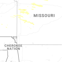
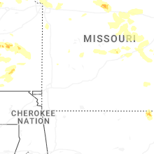


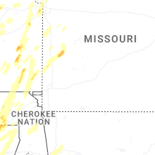


Connect with Interactive Hail Maps