

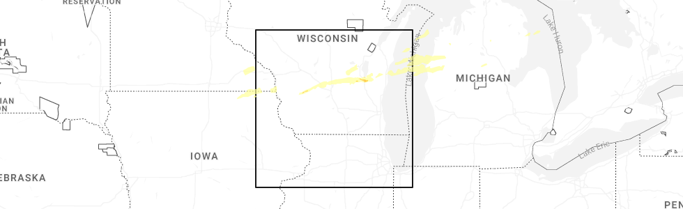
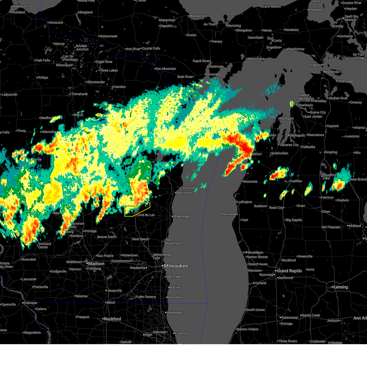
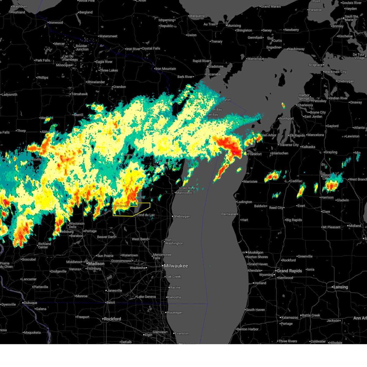
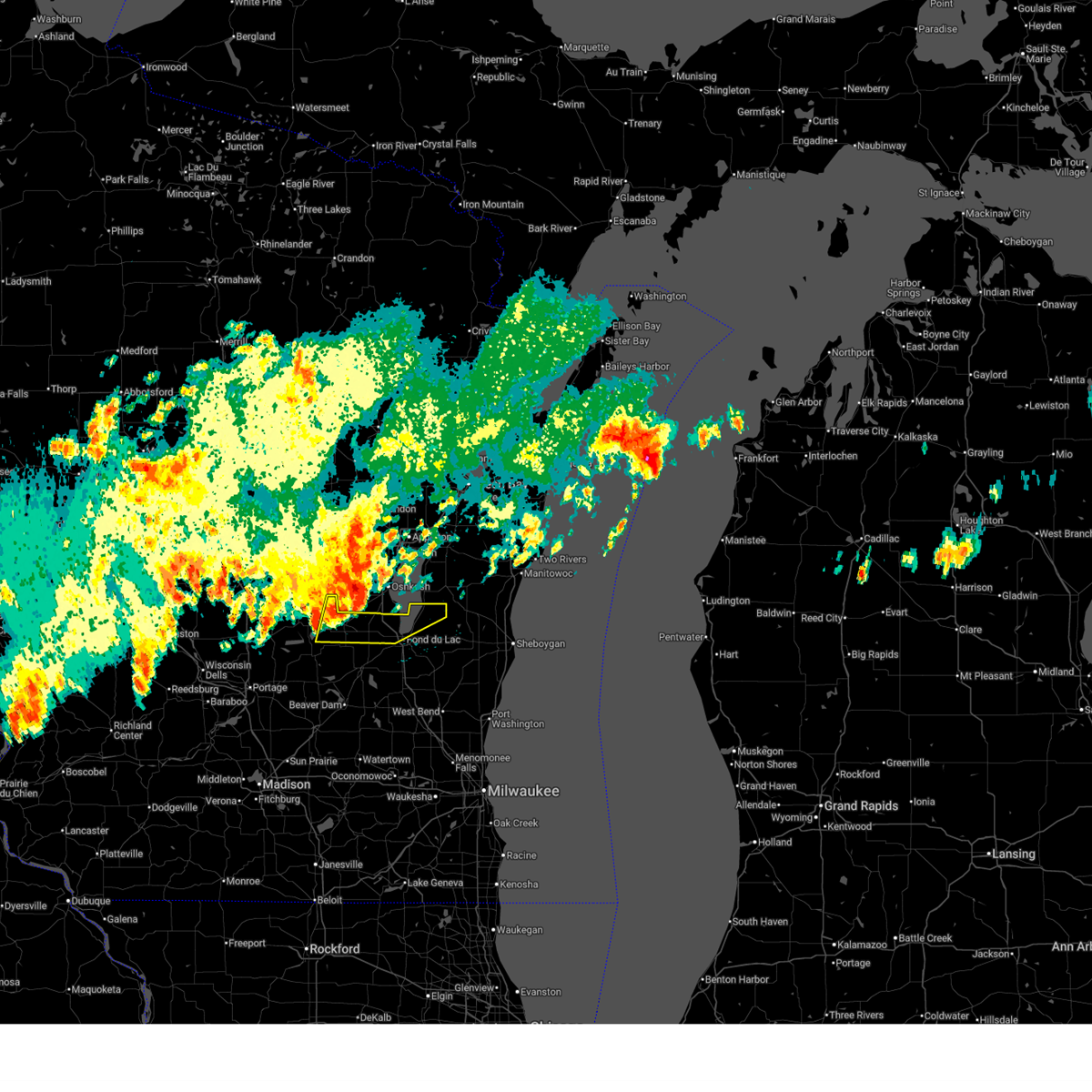
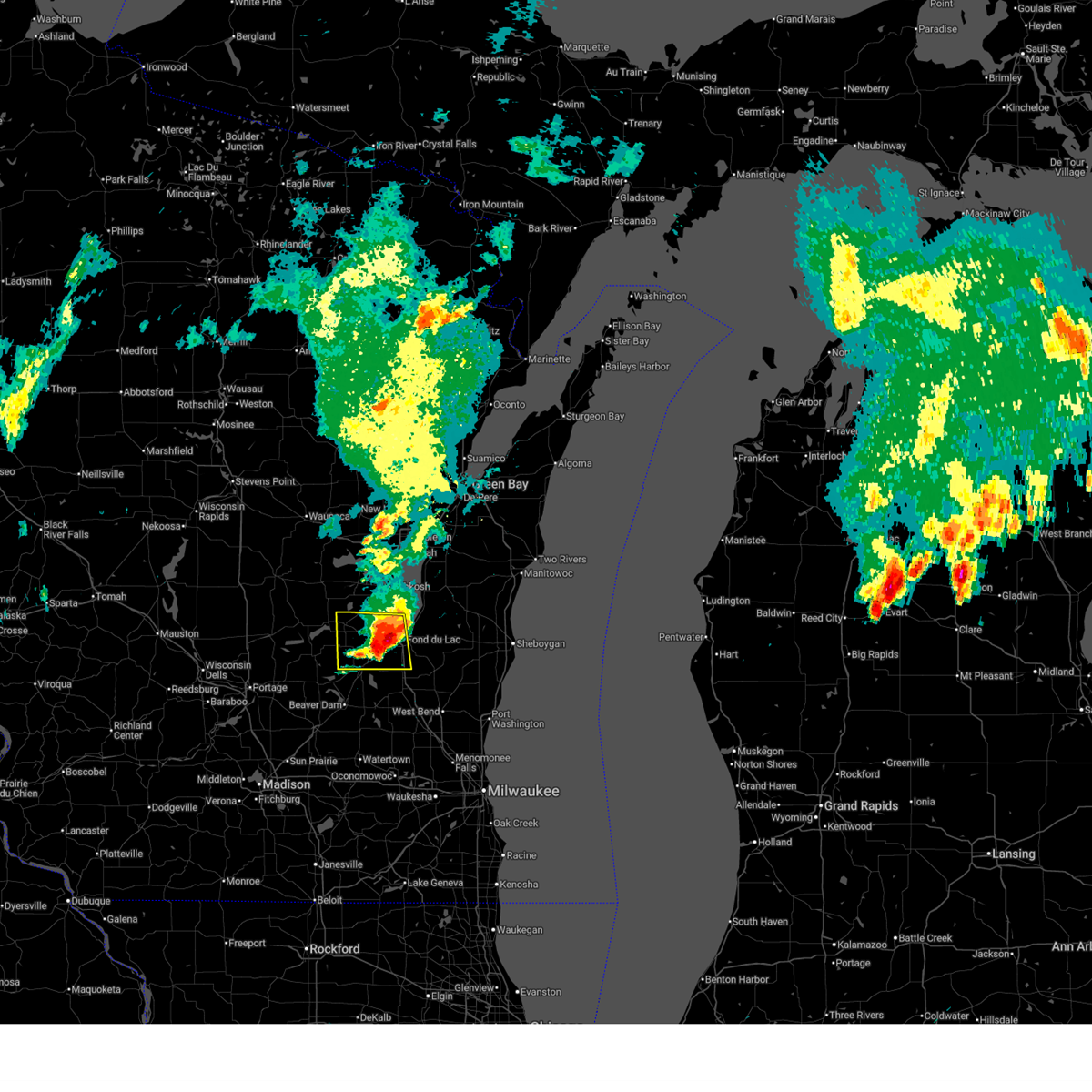
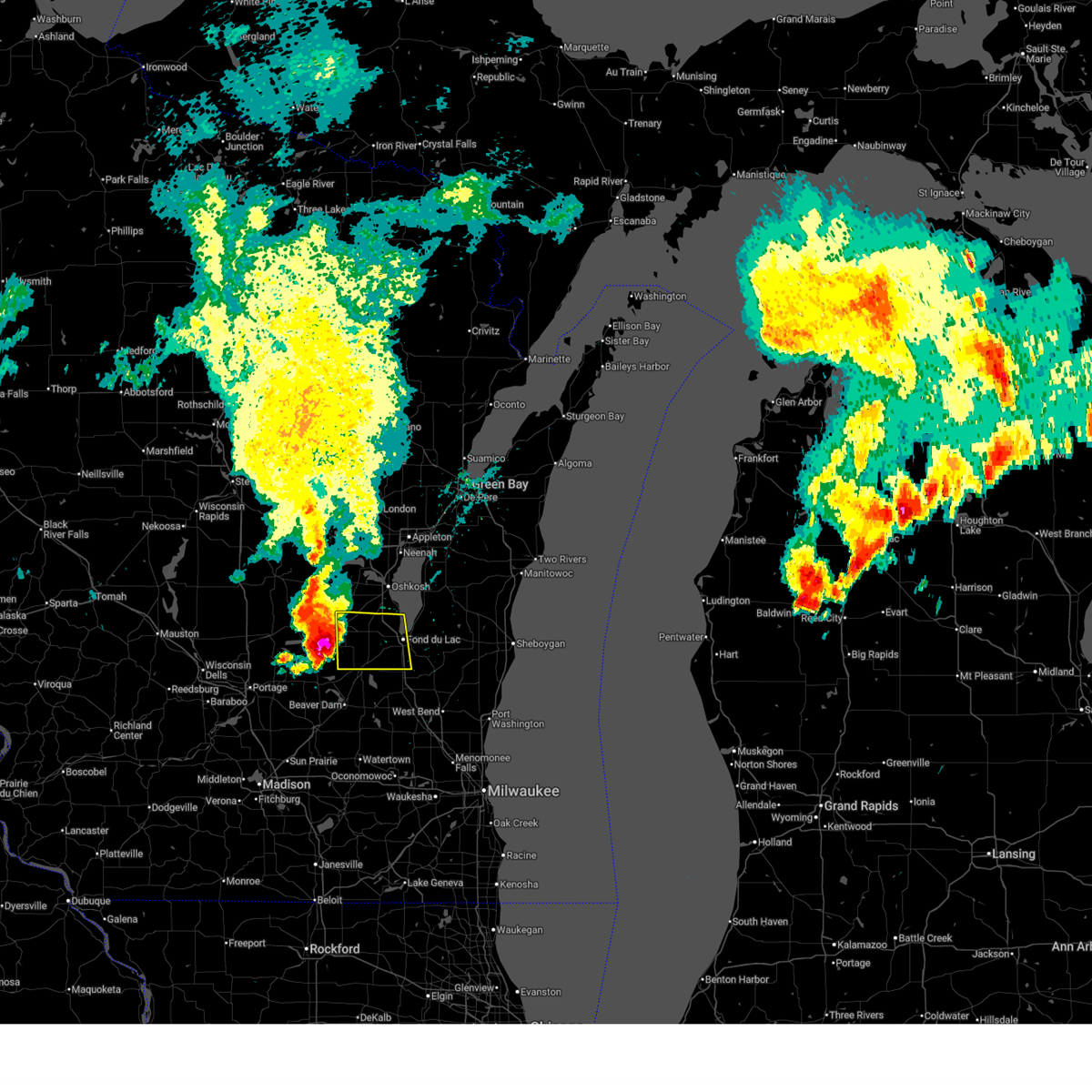
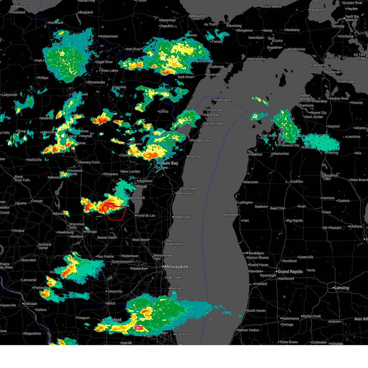
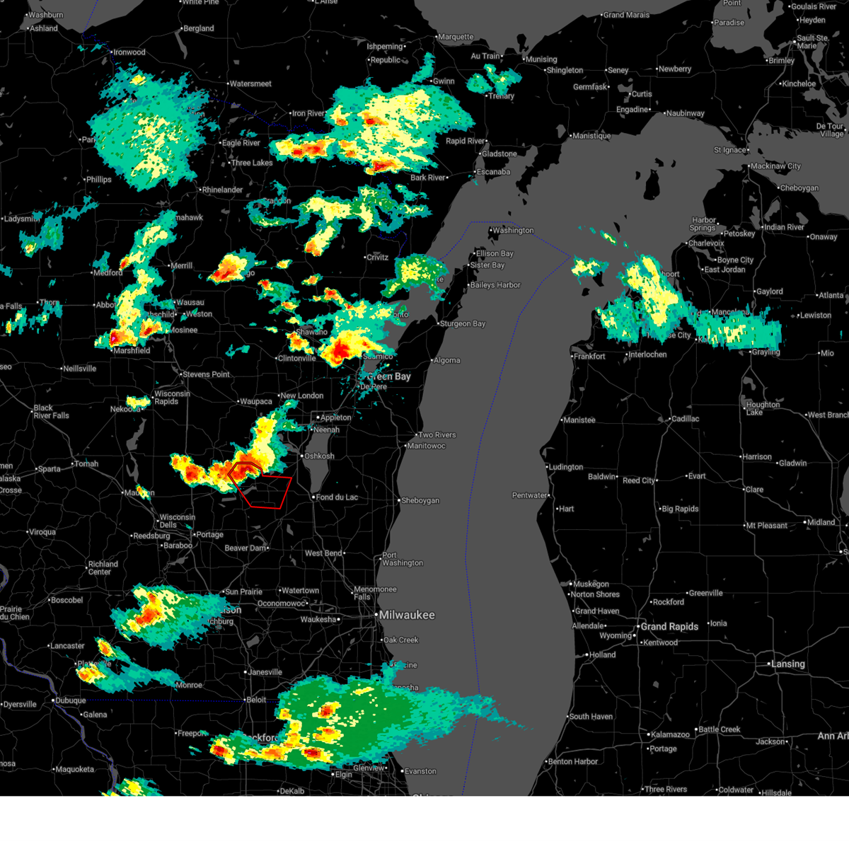
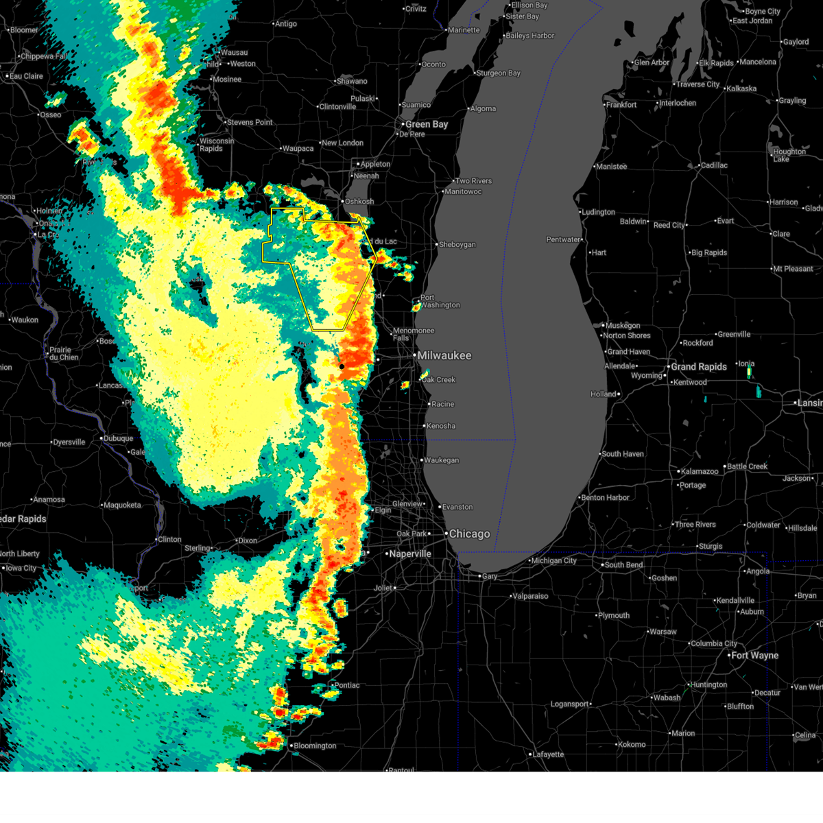
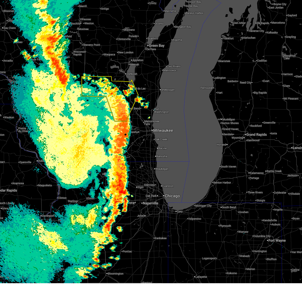
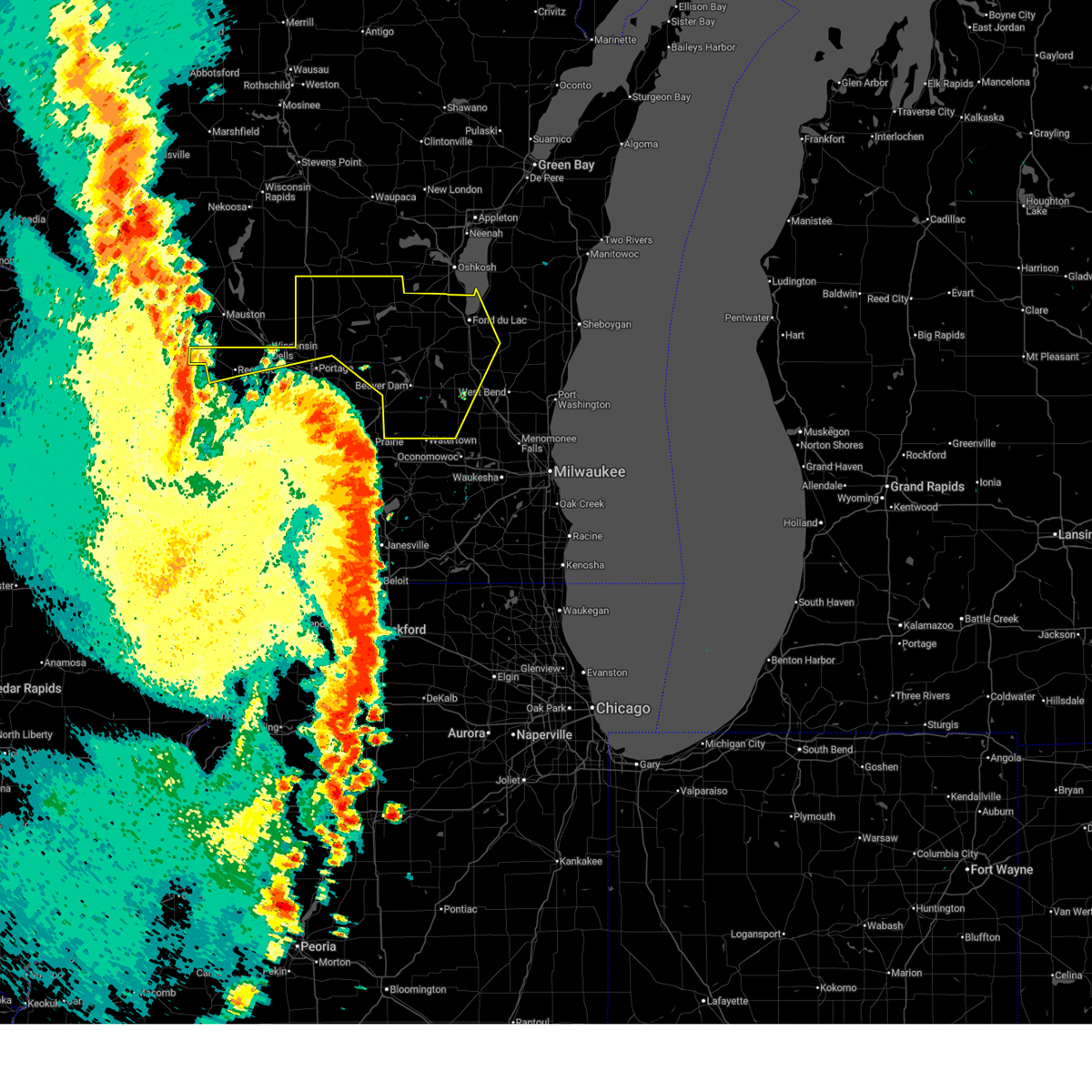
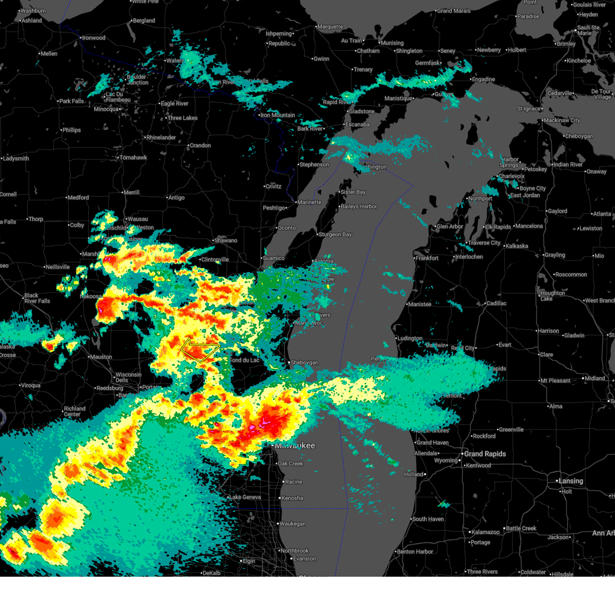
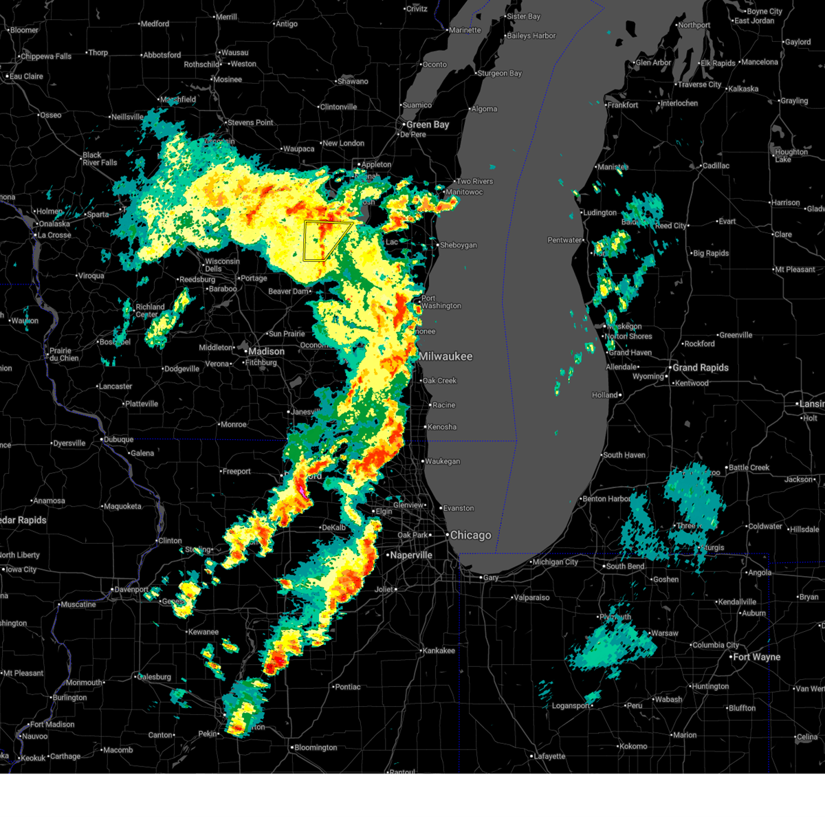
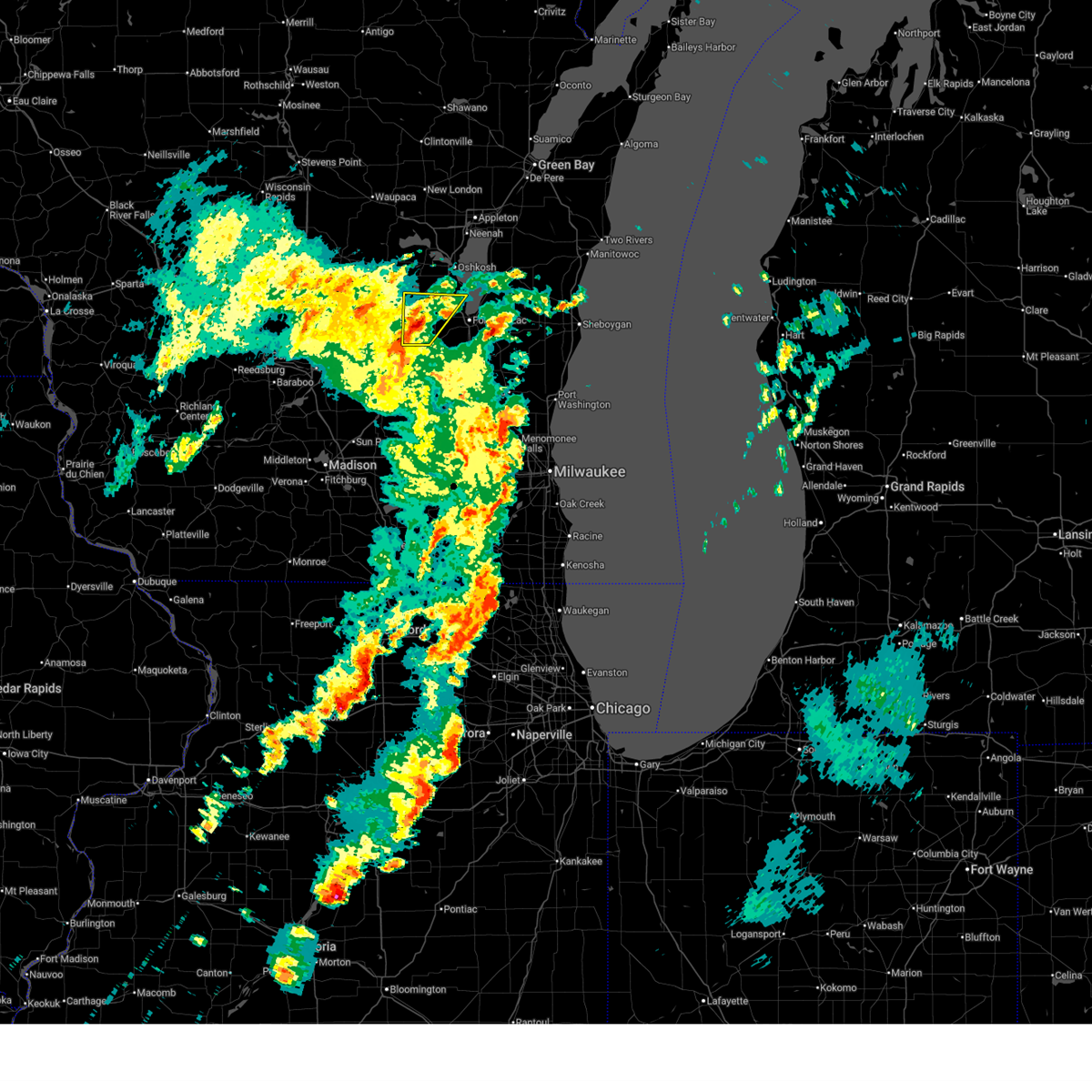
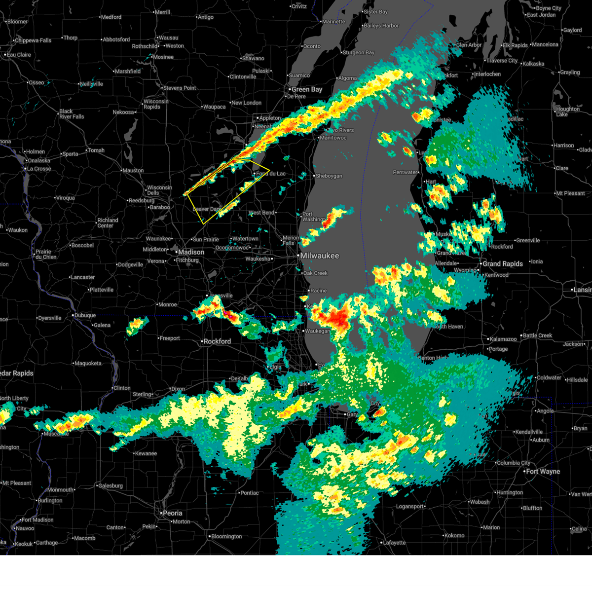
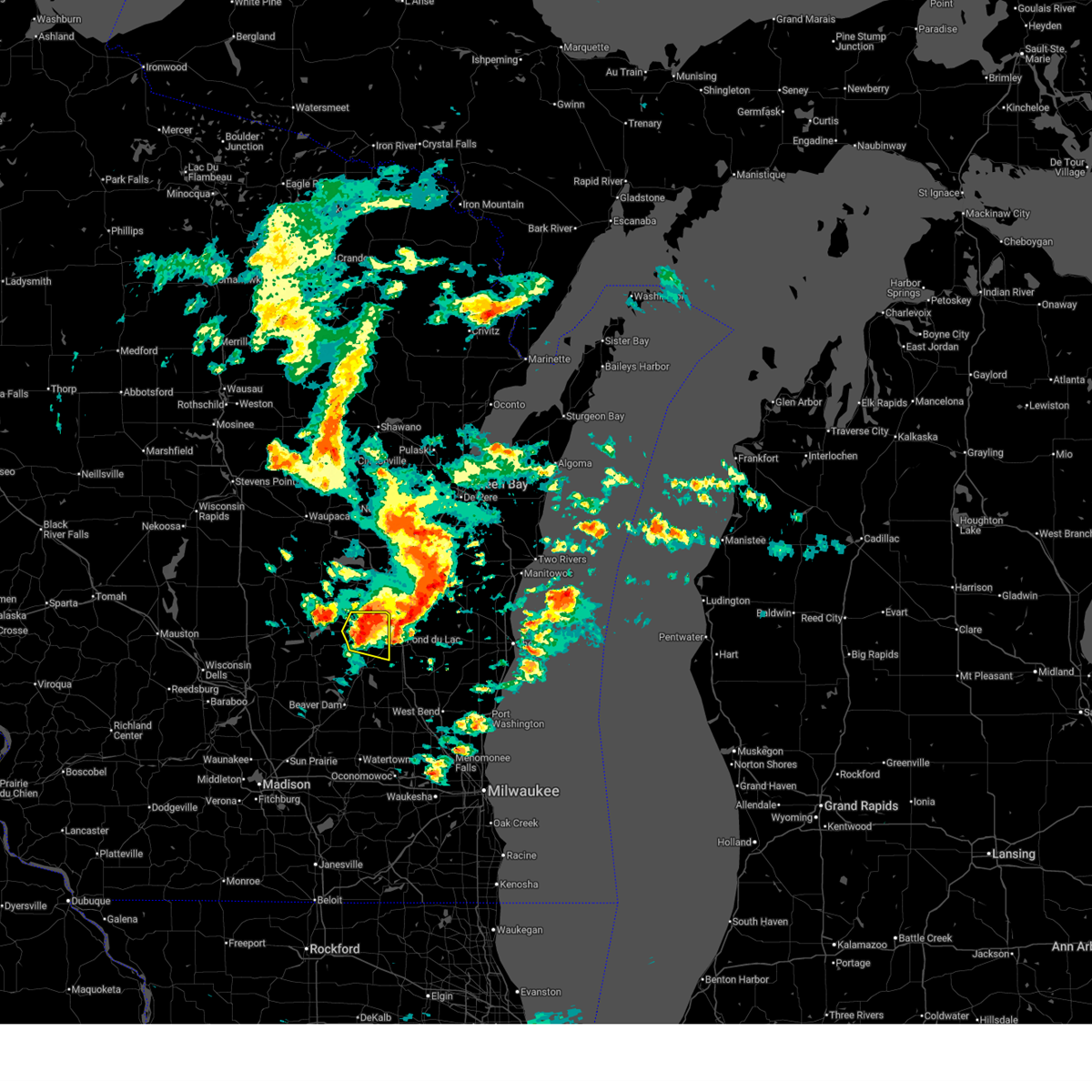
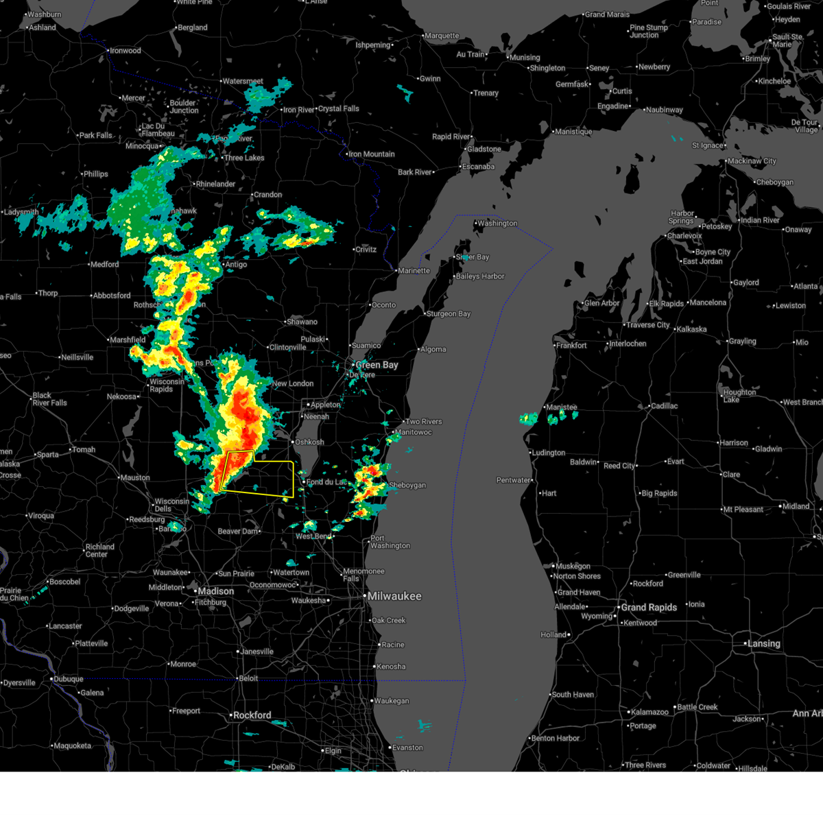
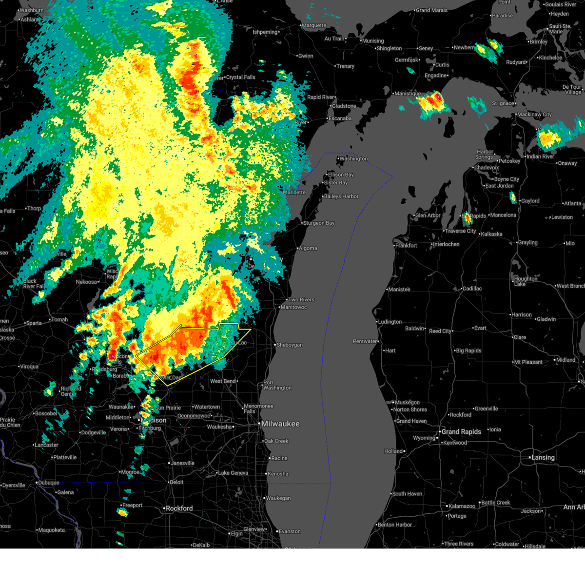
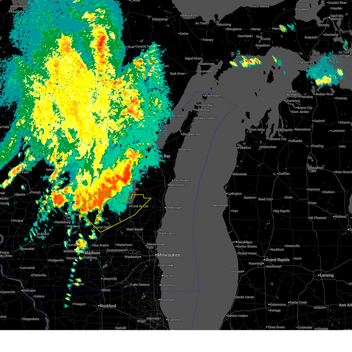
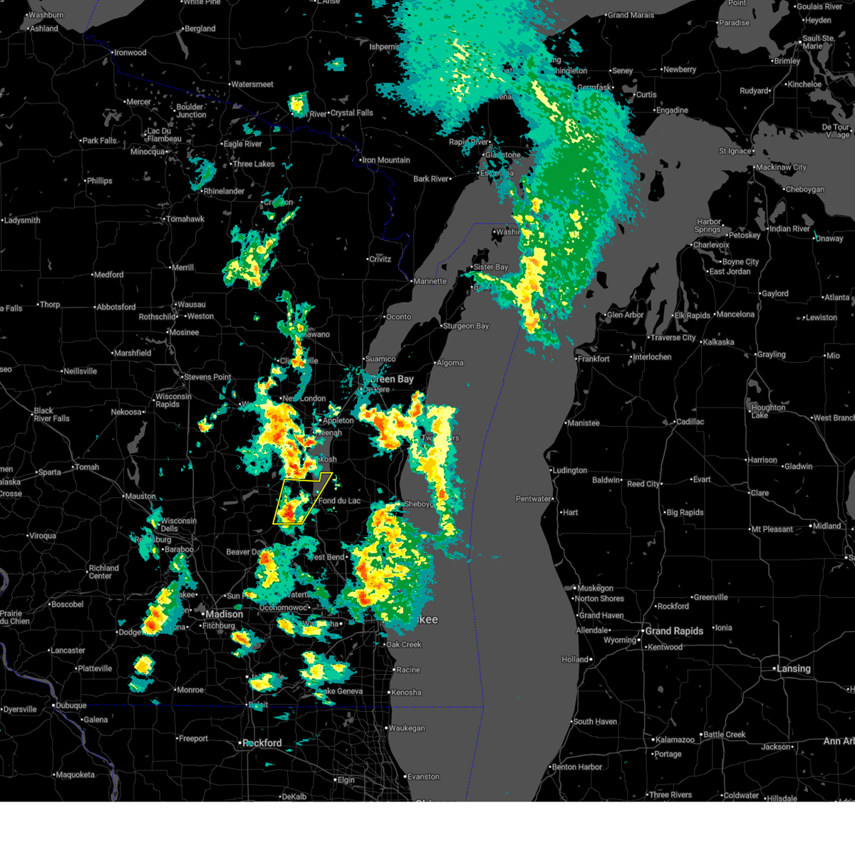
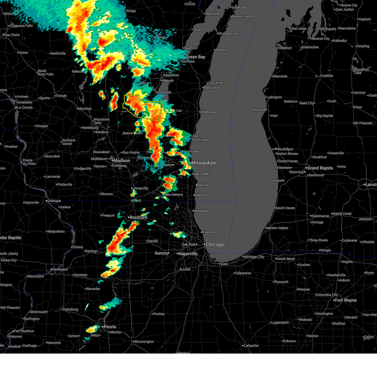
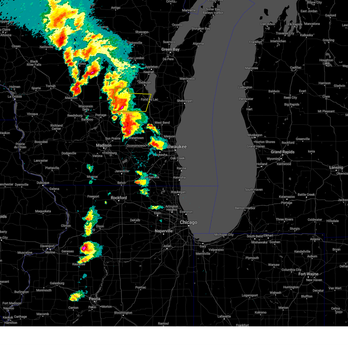
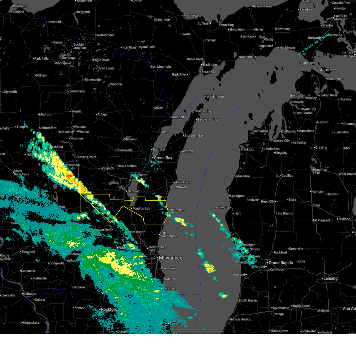
Hail Map for Rosendale, WI
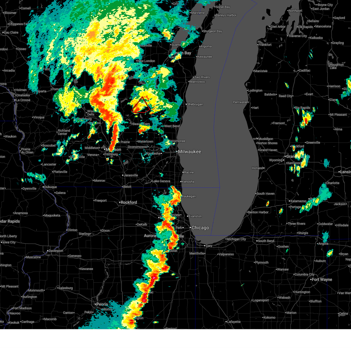
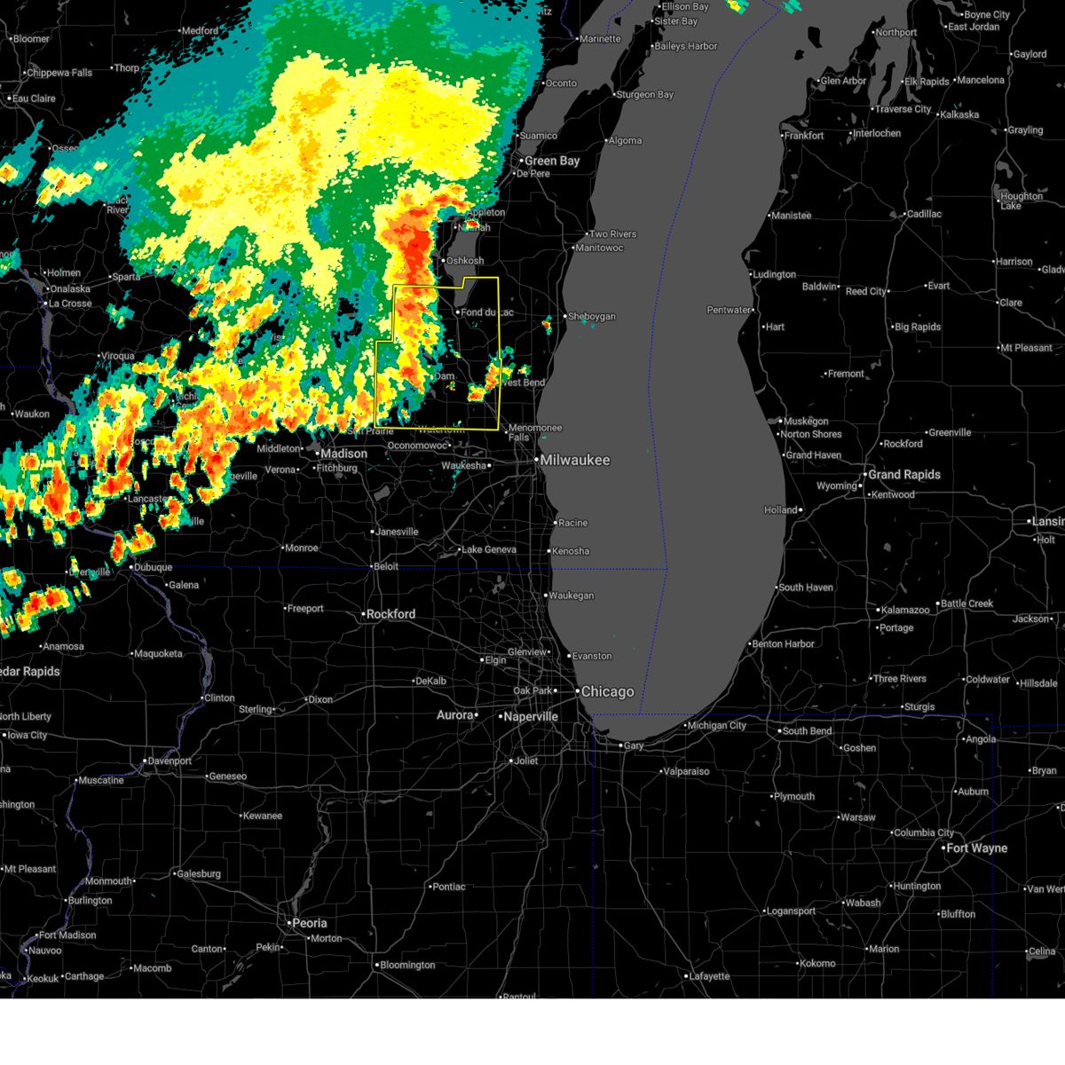
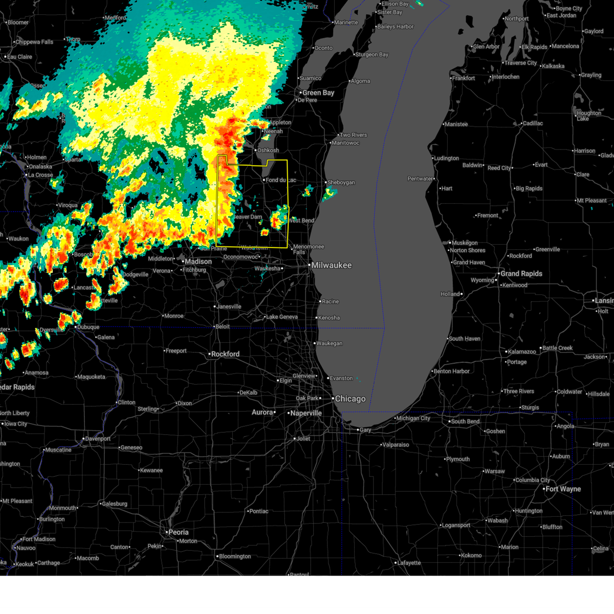
The Rosendale, WI area has had 2 reports of on-the-ground hail by trained spotters, and has been under severe weather warnings 32 times during the past 12 months. Doppler radar has detected hail at or near Rosendale, WI on 42 occasions, including 4 occasions during the past year.
| Name: | Rosendale, WI |
| Where Located: | 58.6 miles SW of Green Bay, WI |
| Map: | Google Map for Rosendale, WI |
| Population: | 1063 |
| Housing Units: | 417 |
| More Info: | Search Google for Rosendale, WI |
2
The Top Recent Hail Date for Rosendale, WI is Wednesday, July 1, 2026 (4th out of 42)
Hail and Wind Damage Spotted near Rosendale, WI
| Date / Time | Report Details |
|---|---|
| 7/8/2026 9:18 PM CDT |
 the severe thunderstorm warning has been cancelled and is no longer in effect the severe thunderstorm warning has been cancelled and is no longer in effect
|
| 7/8/2026 9:18 PM CDT |
 At 917 pm cdt, severe thunderstorms were located along a line extending from near oshkosh to near oakfield to near waupun to near randolph, moving east at 30 mph (radar indicated). Hazards include 60 mph wind gusts. Expect damage to roofs, siding, and trees. Locations impacted include, waupun, randolph, rosendale, brandon, cambria, fox lake, eldorado, alto, wyocena, friesland, atwater, astico, lagoda, and west rosendale. At 917 pm cdt, severe thunderstorms were located along a line extending from near oshkosh to near oakfield to near waupun to near randolph, moving east at 30 mph (radar indicated). Hazards include 60 mph wind gusts. Expect damage to roofs, siding, and trees. Locations impacted include, waupun, randolph, rosendale, brandon, cambria, fox lake, eldorado, alto, wyocena, friesland, atwater, astico, lagoda, and west rosendale.
|
| 7/8/2026 8:52 PM CDT |
 At 852 pm cdt, severe thunderstorms were located along a line extending from near berlin to near markesan to randolph to near pardeeville, moving east at 30 mph (radar indicated). Hazards include 60 mph wind gusts. Expect damage to roofs, siding, and trees. Locations impacted include, waupun, portage, ripon, berlin, pardeeville, randolph, markesan, rosendale, green lake, brandon, cambria, fox lake, eldorado, alto, manchester, wyocena, fairwater, friesland, kingston, and atwater. At 852 pm cdt, severe thunderstorms were located along a line extending from near berlin to near markesan to randolph to near pardeeville, moving east at 30 mph (radar indicated). Hazards include 60 mph wind gusts. Expect damage to roofs, siding, and trees. Locations impacted include, waupun, portage, ripon, berlin, pardeeville, randolph, markesan, rosendale, green lake, brandon, cambria, fox lake, eldorado, alto, manchester, wyocena, fairwater, friesland, kingston, and atwater.
|
| 7/8/2026 8:38 PM CDT |
 Svrmkx the national weather service in milwaukee/sullivan has issued a * severe thunderstorm warning for, western fond du lac county in east central wisconsin, green lake county in south central wisconsin, northeastern columbia county in south central wisconsin, northwestern dodge county in southeastern wisconsin, * until 930 pm cdt. * at 838 pm cdt, severe thunderstorms were located along a line extending from near berlin to near markesan to near cambria to near portage, moving east at 30 mph (radar indicated). Hazards include 60 mph wind gusts. expect damage to roofs, siding, and trees Svrmkx the national weather service in milwaukee/sullivan has issued a * severe thunderstorm warning for, western fond du lac county in east central wisconsin, green lake county in south central wisconsin, northeastern columbia county in south central wisconsin, northwestern dodge county in southeastern wisconsin, * until 930 pm cdt. * at 838 pm cdt, severe thunderstorms were located along a line extending from near berlin to near markesan to near cambria to near portage, moving east at 30 mph (radar indicated). Hazards include 60 mph wind gusts. expect damage to roofs, siding, and trees
|
| 7/2/2026 12:27 AM CDT |
 At 1227 am cdt, severe thunderstorms were located along a line extending from near high cliff state park to near central lake winnebago to near north fond du lac to near brandon, moving east at 30 mph (radar indicated). Hazards include 60 mph wind gusts. Expect damage to roofs, siding, and trees. Locations impacted include, fond du lac, north fond du lac, southern lake winnebago, taycheedah, eldorado, van dyne, peebles, marytown, johnsburg, and pipe. At 1227 am cdt, severe thunderstorms were located along a line extending from near high cliff state park to near central lake winnebago to near north fond du lac to near brandon, moving east at 30 mph (radar indicated). Hazards include 60 mph wind gusts. Expect damage to roofs, siding, and trees. Locations impacted include, fond du lac, north fond du lac, southern lake winnebago, taycheedah, eldorado, van dyne, peebles, marytown, johnsburg, and pipe.
|
| 7/2/2026 12:13 AM CDT |
 At 1213 am cdt, severe thunderstorms were located along a line extending from near northern lake winnebago to near central lake winnebago to near rosendale to near green lake, moving east at 30 mph (radar indicated). Hazards include 60 mph wind gusts. Expect damage to roofs, siding, and trees. Locations impacted include, fond du lac, ripon, north fond du lac, rosendale, southern lake winnebago, taycheedah, eldorado, van dyne, peebles, pipe, marytown, johnsburg, and west rosendale. At 1213 am cdt, severe thunderstorms were located along a line extending from near northern lake winnebago to near central lake winnebago to near rosendale to near green lake, moving east at 30 mph (radar indicated). Hazards include 60 mph wind gusts. Expect damage to roofs, siding, and trees. Locations impacted include, fond du lac, ripon, north fond du lac, rosendale, southern lake winnebago, taycheedah, eldorado, van dyne, peebles, pipe, marytown, johnsburg, and west rosendale.
|
| 7/2/2026 12:08 AM CDT |
 Svrmkx the national weather service in milwaukee/sullivan has issued a * severe thunderstorm warning for, northern fond du lac county in east central wisconsin, northeastern green lake county in south central wisconsin, * until 100 am cdt. * at 1208 am cdt, severe thunderstorms were located along a line extending from northern lake winnebago to near oshkosh to near rosendale to near green lake, moving east at 30 mph (radar indicated). Hazards include 60 mph wind gusts. expect damage to roofs, siding, and trees Svrmkx the national weather service in milwaukee/sullivan has issued a * severe thunderstorm warning for, northern fond du lac county in east central wisconsin, northeastern green lake county in south central wisconsin, * until 100 am cdt. * at 1208 am cdt, severe thunderstorms were located along a line extending from northern lake winnebago to near oshkosh to near rosendale to near green lake, moving east at 30 mph (radar indicated). Hazards include 60 mph wind gusts. expect damage to roofs, siding, and trees
|
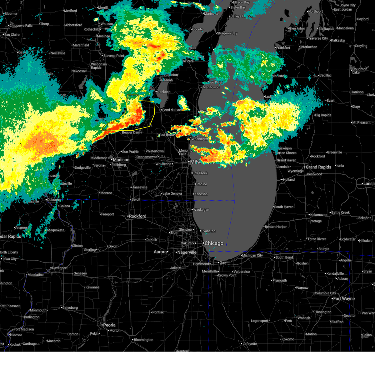
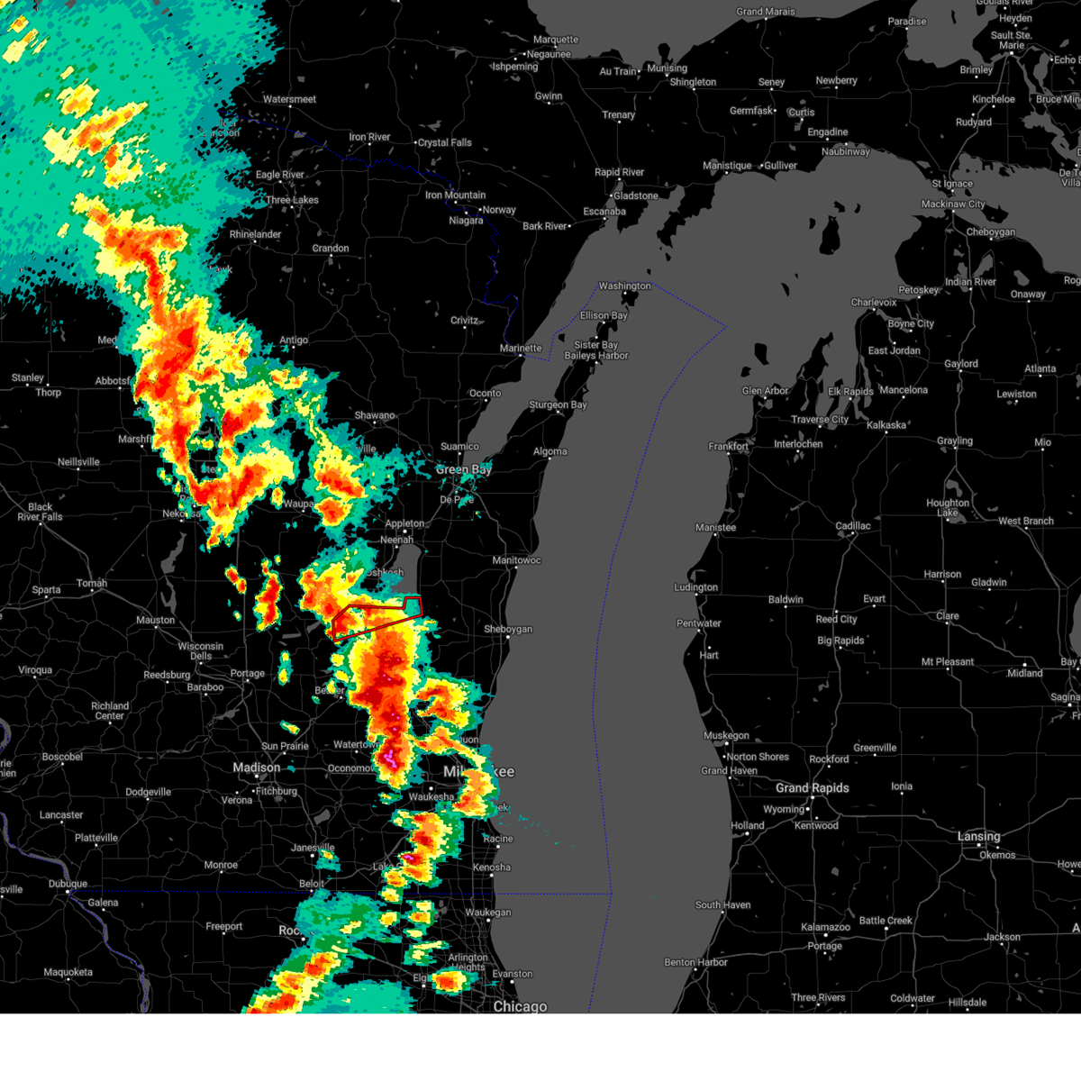
| 7/1/2026 12:17 PM CDT |
 At 1217 pm cdt, a severe thunderstorm was located over north fond du lac, moving east at 40 mph (radar indicated). Hazards include 60 mph wind gusts and half dollar size hail. Hail damage to vehicles is expected. expect wind damage to roofs, siding, and trees. Locations impacted include, fond du lac, waupun, ripon, north fond du lac, oakfield, rosendale, brandon, southern lake winnebago, lamartine, byron, eldorado, alto, fairwater, van dyne, oak center, lagoda, and west rosendale. At 1217 pm cdt, a severe thunderstorm was located over north fond du lac, moving east at 40 mph (radar indicated). Hazards include 60 mph wind gusts and half dollar size hail. Hail damage to vehicles is expected. expect wind damage to roofs, siding, and trees. Locations impacted include, fond du lac, waupun, ripon, north fond du lac, oakfield, rosendale, brandon, southern lake winnebago, lamartine, byron, eldorado, alto, fairwater, van dyne, oak center, lagoda, and west rosendale.
|
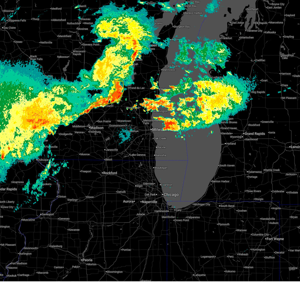
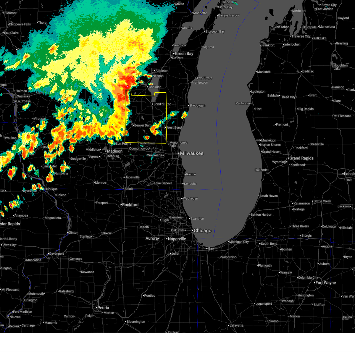
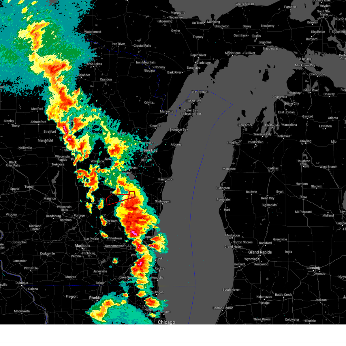
| 7/1/2026 12:00 PM CDT | Tennis Ball sized hail reported 4.2 miles N of Rosendale, WI, size est from social media pics sent to local media shared by county em. time est from radar. |
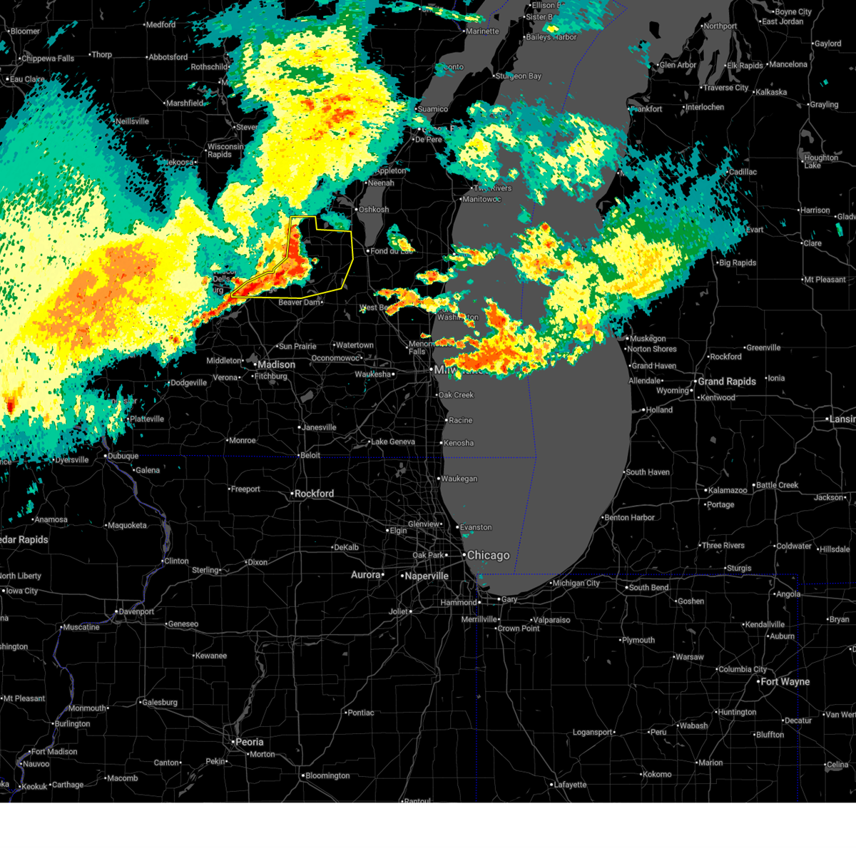
| 7/1/2026 11:41 AM CDT |
 Svrmkx the national weather service in milwaukee/sullivan has issued a * severe thunderstorm warning for, western fond du lac county in east central wisconsin, * until 1245 pm cdt. * at 1141 am cdt, a severe thunderstorm was located near markesan, or 9 miles southwest of ripon, moving east at 40 mph (radar indicated). Hazards include 60 mph wind gusts and quarter size hail. Hail damage to vehicles is expected. Expect wind damage to roofs, siding, and trees. Svrmkx the national weather service in milwaukee/sullivan has issued a * severe thunderstorm warning for, western fond du lac county in east central wisconsin, * until 1245 pm cdt. * at 1141 am cdt, a severe thunderstorm was located near markesan, or 9 miles southwest of ripon, moving east at 40 mph (radar indicated). Hazards include 60 mph wind gusts and quarter size hail. Hail damage to vehicles is expected. Expect wind damage to roofs, siding, and trees.
|
| 6/24/2026 6:29 PM CDT |
 At 629 pm cdt, severe thunderstorms were located along a line extending from near north fond du lac to near brandon to 7 miles east of markesan, moving southeast at 25 mph (radar indicated). Hazards include ping pong ball size hail and 60 mph wind gusts. People and animals outdoors will be injured. expect hail damage to roofs, siding, windows, and vehicles. expect wind damage to roofs, siding, and trees. locations impacted include, waupun, markesan, rosendale, brandon, lamartine, alto, manchester, fairwater, oak center, west rosendale, and lagoda. People attending celebrate waupun should seek safe shelter immediately!. At 629 pm cdt, severe thunderstorms were located along a line extending from near north fond du lac to near brandon to 7 miles east of markesan, moving southeast at 25 mph (radar indicated). Hazards include ping pong ball size hail and 60 mph wind gusts. People and animals outdoors will be injured. expect hail damage to roofs, siding, windows, and vehicles. expect wind damage to roofs, siding, and trees. locations impacted include, waupun, markesan, rosendale, brandon, lamartine, alto, manchester, fairwater, oak center, west rosendale, and lagoda. People attending celebrate waupun should seek safe shelter immediately!.
|
| 6/24/2026 5:53 PM CDT |
 Svrmkx the national weather service in milwaukee/sullivan has issued a * severe thunderstorm warning for, western fond du lac county in east central wisconsin, southern green lake county in south central wisconsin, * until 700 pm cdt. * at 553 pm cdt, severe thunderstorms were located along a line extending from rush lake to near green lake to near princeton, moving southeast at 25 mph (radar indicated). Hazards include 70 mph wind gusts and half dollar size hail. Hail damage to vehicles is expected. expect considerable tree damage. Wind damage is also likely to mobile homes, roofs, and outbuildings. Svrmkx the national weather service in milwaukee/sullivan has issued a * severe thunderstorm warning for, western fond du lac county in east central wisconsin, southern green lake county in south central wisconsin, * until 700 pm cdt. * at 553 pm cdt, severe thunderstorms were located along a line extending from rush lake to near green lake to near princeton, moving southeast at 25 mph (radar indicated). Hazards include 70 mph wind gusts and half dollar size hail. Hail damage to vehicles is expected. expect considerable tree damage. Wind damage is also likely to mobile homes, roofs, and outbuildings.
|
| 6/24/2026 5:50 PM CDT |
 At 550 pm cdt, a severe thunderstorm capable of producing a tornado was located over green lake, or near ripon, moving southeast at 20 mph (weather spotters reported a funnel cloud). Hazards include tornado and ping pong ball size hail. Flying debris will be dangerous to those caught without shelter. mobile homes will be damaged or destroyed. damage to roofs, windows, and vehicles will occur. tree damage is likely. this dangerous storm will be near, ripon and brandon around 555 pm cdt. rosendale around 605 pm cdt. Other locations impacted by this tornadic thunderstorm include fairwater and west rosendale. At 550 pm cdt, a severe thunderstorm capable of producing a tornado was located over green lake, or near ripon, moving southeast at 20 mph (weather spotters reported a funnel cloud). Hazards include tornado and ping pong ball size hail. Flying debris will be dangerous to those caught without shelter. mobile homes will be damaged or destroyed. damage to roofs, windows, and vehicles will occur. tree damage is likely. this dangerous storm will be near, ripon and brandon around 555 pm cdt. rosendale around 605 pm cdt. Other locations impacted by this tornadic thunderstorm include fairwater and west rosendale.
|
| 6/24/2026 5:45 PM CDT |
 At 545 pm cdt, a severe thunderstorm capable of producing a tornado was located near ripon, moving southeast at 30 mph (weather spotters reported a funnel cloud near green lake). Hazards include tornado and ping pong ball size hail. Flying debris will be dangerous to those caught without shelter. mobile homes will be damaged or destroyed. damage to roofs, windows, and vehicles will occur. tree damage is likely. this dangerous storm will be near, ripon, rosendale, and brandon around 550 pm cdt. Other locations impacted by this tornadic thunderstorm include fairwater and west rosendale. At 545 pm cdt, a severe thunderstorm capable of producing a tornado was located near ripon, moving southeast at 30 mph (weather spotters reported a funnel cloud near green lake). Hazards include tornado and ping pong ball size hail. Flying debris will be dangerous to those caught without shelter. mobile homes will be damaged or destroyed. damage to roofs, windows, and vehicles will occur. tree damage is likely. this dangerous storm will be near, ripon, rosendale, and brandon around 550 pm cdt. Other locations impacted by this tornadic thunderstorm include fairwater and west rosendale.
|
| 6/24/2026 5:30 PM CDT |
 Tormkx the national weather service in milwaukee/sullivan has issued a * tornado warning for, northwestern fond du lac county in east central wisconsin, eastern green lake county in south central wisconsin, * until 615 pm cdt. * at 530 pm cdt, a severe thunderstorm capable of producing a tornado was located near berlin, moving southeast at 30 mph (radar indicated rotation). Hazards include tornado and ping pong ball size hail. Flying debris will be dangerous to those caught without shelter. mobile homes will be damaged or destroyed. damage to roofs, windows, and vehicles will occur. tree damage is likely. this dangerous storm will be near, ripon, berlin, and green lake around 535 pm cdt. rosendale and brandon around 550 pm cdt. Other locations impacted by this tornadic thunderstorm include fairwater and west rosendale. Tormkx the national weather service in milwaukee/sullivan has issued a * tornado warning for, northwestern fond du lac county in east central wisconsin, eastern green lake county in south central wisconsin, * until 615 pm cdt. * at 530 pm cdt, a severe thunderstorm capable of producing a tornado was located near berlin, moving southeast at 30 mph (radar indicated rotation). Hazards include tornado and ping pong ball size hail. Flying debris will be dangerous to those caught without shelter. mobile homes will be damaged or destroyed. damage to roofs, windows, and vehicles will occur. tree damage is likely. this dangerous storm will be near, ripon, berlin, and green lake around 535 pm cdt. rosendale and brandon around 550 pm cdt. Other locations impacted by this tornadic thunderstorm include fairwater and west rosendale.
|
| 6/10/2026 3:07 PM CDT |
 At 307 pm cdt, severe thunderstorms were located along a line extending from near berlin to near rush lake to near oakfield, moving northeast at 55 mph (radar indicated). Hazards include 60 mph wind gusts and penny size hail. Expect damage to roofs, siding, and trees. Locations impacted include, fond du lac, watertown, beaver dam, waupun, ripon, berlin, mayville, north fond du lac, horicon, juneau, lomira, campbellsport, markesan, theresa, princeton, hustisford, oakfield, rosendale, green lake, and iron ridge. At 307 pm cdt, severe thunderstorms were located along a line extending from near berlin to near rush lake to near oakfield, moving northeast at 55 mph (radar indicated). Hazards include 60 mph wind gusts and penny size hail. Expect damage to roofs, siding, and trees. Locations impacted include, fond du lac, watertown, beaver dam, waupun, ripon, berlin, mayville, north fond du lac, horicon, juneau, lomira, campbellsport, markesan, theresa, princeton, hustisford, oakfield, rosendale, green lake, and iron ridge.
|
| 6/10/2026 3:01 PM CDT |
 At 301 pm cdt, severe thunderstorms were located along a line extending from near berlin to near ripon to near mayville, moving northeast at 55 mph (radar indicated). Hazards include 60 mph wind gusts and penny size hail. Expect damage to roofs, siding, and trees. Locations impacted include, fond du lac, watertown, beaver dam, waupun, ripon, berlin, mayville, north fond du lac, horicon, juneau, lomira, campbellsport, montello, markesan, theresa, westfield, princeton, hustisford, oakfield, and rosendale. At 301 pm cdt, severe thunderstorms were located along a line extending from near berlin to near ripon to near mayville, moving northeast at 55 mph (radar indicated). Hazards include 60 mph wind gusts and penny size hail. Expect damage to roofs, siding, and trees. Locations impacted include, fond du lac, watertown, beaver dam, waupun, ripon, berlin, mayville, north fond du lac, horicon, juneau, lomira, campbellsport, montello, markesan, theresa, westfield, princeton, hustisford, oakfield, and rosendale.
|
| 6/10/2026 2:16 PM CDT |
 Svrmkx the national weather service in milwaukee/sullivan has issued a * severe thunderstorm warning for, fond du lac county in east central wisconsin, green lake county in south central wisconsin, northeastern columbia county in south central wisconsin, marquette county in south central wisconsin, northwestern washington county in southeastern wisconsin, northern sauk county in south central wisconsin, dodge county in southeastern wisconsin, * until 330 pm cdt. * at 216 pm cdt, severe thunderstorms were located along a line extending from near portage to near rio to near deerfield, moving northeast at 55 mph (radar indicated). Hazards include 60 mph wind gusts and penny size hail. expect damage to roofs, siding, and trees Svrmkx the national weather service in milwaukee/sullivan has issued a * severe thunderstorm warning for, fond du lac county in east central wisconsin, green lake county in south central wisconsin, northeastern columbia county in south central wisconsin, marquette county in south central wisconsin, northwestern washington county in southeastern wisconsin, northern sauk county in south central wisconsin, dodge county in southeastern wisconsin, * until 330 pm cdt. * at 216 pm cdt, severe thunderstorms were located along a line extending from near portage to near rio to near deerfield, moving northeast at 55 mph (radar indicated). Hazards include 60 mph wind gusts and penny size hail. expect damage to roofs, siding, and trees
|
| 4/27/2026 10:10 PM CDT |
 the severe thunderstorm warning has been cancelled and is no longer in effect the severe thunderstorm warning has been cancelled and is no longer in effect
|
| 4/27/2026 9:58 PM CDT |
 At 958 pm cdt, severe thunderstorms were located along a line extending from near north fond du lac to near oakfield to 6 miles southwest of waupun to beaver dam, moving northeast at 35 mph (radar indicated). Hazards include 60 mph wind gusts and penny size hail. Expect damage to roofs, siding, and trees. Locations impacted include, fond du lac, beaver dam, waupun, mayville, north fond du lac, horicon, oakfield, rosendale, southern lake winnebago, burnett, taycheedah, lamartine, fox lake, eldorado, van dyne, kekoskee, peebles, atwater, oak center, and pipe. At 958 pm cdt, severe thunderstorms were located along a line extending from near north fond du lac to near oakfield to 6 miles southwest of waupun to beaver dam, moving northeast at 35 mph (radar indicated). Hazards include 60 mph wind gusts and penny size hail. Expect damage to roofs, siding, and trees. Locations impacted include, fond du lac, beaver dam, waupun, mayville, north fond du lac, horicon, oakfield, rosendale, southern lake winnebago, burnett, taycheedah, lamartine, fox lake, eldorado, van dyne, kekoskee, peebles, atwater, oak center, and pipe.
|
| 4/27/2026 9:43 PM CDT |
 Svrmkx the national weather service in milwaukee/sullivan has issued a * severe thunderstorm warning for, central fond du lac county in east central wisconsin, east central columbia county in south central wisconsin, northwestern dodge county in southeastern wisconsin, * until 1030 pm cdt. * at 943 pm cdt, severe thunderstorms were located along a line extending from near rosendale to near waupun to 6 miles northwest of beaver dam to near fall river, moving northeast at 35 mph (radar indicated). Hazards include 60 mph wind gusts and penny size hail. expect damage to roofs, siding, and trees Svrmkx the national weather service in milwaukee/sullivan has issued a * severe thunderstorm warning for, central fond du lac county in east central wisconsin, east central columbia county in south central wisconsin, northwestern dodge county in southeastern wisconsin, * until 1030 pm cdt. * at 943 pm cdt, severe thunderstorms were located along a line extending from near rosendale to near waupun to 6 miles northwest of beaver dam to near fall river, moving northeast at 35 mph (radar indicated). Hazards include 60 mph wind gusts and penny size hail. expect damage to roofs, siding, and trees
|
| 4/14/2026 7:00 PM CDT |
 Svrmkx the national weather service in milwaukee/sullivan has issued a * severe thunderstorm warning for, northwestern fond du lac county in east central wisconsin, east central green lake county in south central wisconsin, * until 730 pm cdt. * at 700 pm cdt, a severe thunderstorm was located over ripon, moving northeast at 40 mph (radar indicated). Hazards include 60 mph wind gusts and quarter size hail. Hail damage to vehicles is expected. Expect wind damage to roofs, siding, and trees. Svrmkx the national weather service in milwaukee/sullivan has issued a * severe thunderstorm warning for, northwestern fond du lac county in east central wisconsin, east central green lake county in south central wisconsin, * until 730 pm cdt. * at 700 pm cdt, a severe thunderstorm was located over ripon, moving northeast at 40 mph (radar indicated). Hazards include 60 mph wind gusts and quarter size hail. Hail damage to vehicles is expected. Expect wind damage to roofs, siding, and trees.
|
| 4/2/2026 7:53 PM CDT |
 the severe thunderstorm warning has been cancelled and is no longer in effect the severe thunderstorm warning has been cancelled and is no longer in effect
|
| 4/2/2026 7:39 PM CDT |
 Svrmkx the national weather service in milwaukee/sullivan has issued a * severe thunderstorm warning for, northwestern fond du lac county in east central wisconsin, * until 815 pm cdt. * at 739 pm cdt, a severe thunderstorm was located near brandon, or near ripon, moving northeast at 60 mph (radar indicated). Hazards include quarter size hail. damage to vehicles is expected Svrmkx the national weather service in milwaukee/sullivan has issued a * severe thunderstorm warning for, northwestern fond du lac county in east central wisconsin, * until 815 pm cdt. * at 739 pm cdt, a severe thunderstorm was located near brandon, or near ripon, moving northeast at 60 mph (radar indicated). Hazards include quarter size hail. damage to vehicles is expected
|
| 3/31/2026 12:23 PM CDT |
 the severe thunderstorm warning has been cancelled and is no longer in effect the severe thunderstorm warning has been cancelled and is no longer in effect
|
| 3/31/2026 12:02 PM CDT |
 Svrmkx the national weather service in milwaukee/sullivan has issued a * severe thunderstorm warning for, northwestern fond du lac county in east central wisconsin, southeastern green lake county in south central wisconsin, northeastern columbia county in south central wisconsin, northwestern dodge county in southeastern wisconsin, * until 1245 pm cdt. * at 1201 pm cdt, severe thunderstorms were located along a line extending from near rosendale to near pardeeville, moving southeast at 20 mph (radar indicated). Hazards include quarter size hail. damage to vehicles is expected Svrmkx the national weather service in milwaukee/sullivan has issued a * severe thunderstorm warning for, northwestern fond du lac county in east central wisconsin, southeastern green lake county in south central wisconsin, northeastern columbia county in south central wisconsin, northwestern dodge county in southeastern wisconsin, * until 1245 pm cdt. * at 1201 pm cdt, severe thunderstorms were located along a line extending from near rosendale to near pardeeville, moving southeast at 20 mph (radar indicated). Hazards include quarter size hail. damage to vehicles is expected
|
| 3/31/2026 9:14 AM CDT |
 At 913 am cdt, severe thunderstorms were located along a line extending from 6 miles northeast of rosendale to near brandon, moving east at 50 mph (radar indicated). Hazards include quarter size hail. Damage to vehicles is expected. Locations impacted include, ripon, oakfield, rosendale, brandon, lamartine, eldorado, west rosendale, and lagoda. At 913 am cdt, severe thunderstorms were located along a line extending from 6 miles northeast of rosendale to near brandon, moving east at 50 mph (radar indicated). Hazards include quarter size hail. Damage to vehicles is expected. Locations impacted include, ripon, oakfield, rosendale, brandon, lamartine, eldorado, west rosendale, and lagoda.
|
| 3/31/2026 9:14 AM CDT |
 the severe thunderstorm warning has been cancelled and is no longer in effect the severe thunderstorm warning has been cancelled and is no longer in effect
|
| 3/31/2026 8:47 AM CDT |
 Svrmkx the national weather service in milwaukee/sullivan has issued a * severe thunderstorm warning for, northwestern fond du lac county in east central wisconsin, green lake county in south central wisconsin, * until 930 am cdt. * at 847 am cdt, severe thunderstorms were located along a line extending from near green lake to near markesan, moving east at 50 mph (radar indicated). Hazards include 60 mph wind gusts and quarter size hail. Hail damage to vehicles is expected. Expect wind damage to roofs, siding, and trees. Svrmkx the national weather service in milwaukee/sullivan has issued a * severe thunderstorm warning for, northwestern fond du lac county in east central wisconsin, green lake county in south central wisconsin, * until 930 am cdt. * at 847 am cdt, severe thunderstorms were located along a line extending from near green lake to near markesan, moving east at 50 mph (radar indicated). Hazards include 60 mph wind gusts and quarter size hail. Hail damage to vehicles is expected. Expect wind damage to roofs, siding, and trees.
|
| 8/16/2025 3:44 PM CDT |
 Svrmkx the national weather service in milwaukee/sullivan has issued a * severe thunderstorm warning for, fond du lac county in east central wisconsin, eastern green lake county in south central wisconsin, eastern columbia county in south central wisconsin, northern dodge county in southeastern wisconsin, * until 430 pm cdt. * at 344 pm cdt, severe thunderstorms were located along a line extending from near rush lake to near randolph to near poynette, moving southeast at 50 mph (radar indicated). Hazards include 60 mph wind gusts and penny size hail. expect damage to roofs, siding, and trees Svrmkx the national weather service in milwaukee/sullivan has issued a * severe thunderstorm warning for, fond du lac county in east central wisconsin, eastern green lake county in south central wisconsin, eastern columbia county in south central wisconsin, northern dodge county in southeastern wisconsin, * until 430 pm cdt. * at 344 pm cdt, severe thunderstorms were located along a line extending from near rush lake to near randolph to near poynette, moving southeast at 50 mph (radar indicated). Hazards include 60 mph wind gusts and penny size hail. expect damage to roofs, siding, and trees
|
| 8/16/2025 11:56 AM CDT |
 At 1156 am cdt, severe thunderstorms were located along a line extending from near high cliff state park to near brandon to near pardeeville, moving southeast at 30 mph (radar indicated). Hazards include 60 mph wind gusts. Expect damage to roofs, siding, and trees. Locations impacted include, fond du lac, beaver dam, waupun, ripon, north fond du lac, lomira, pardeeville, randolph, fall river, markesan, oakfield, rosendale, green lake, brandon, cambria, southern lake winnebago, taycheedah, lamartine, byron, and fox lake. At 1156 am cdt, severe thunderstorms were located along a line extending from near high cliff state park to near brandon to near pardeeville, moving southeast at 30 mph (radar indicated). Hazards include 60 mph wind gusts. Expect damage to roofs, siding, and trees. Locations impacted include, fond du lac, beaver dam, waupun, ripon, north fond du lac, lomira, pardeeville, randolph, fall river, markesan, oakfield, rosendale, green lake, brandon, cambria, southern lake winnebago, taycheedah, lamartine, byron, and fox lake.
|
| 8/16/2025 11:38 AM CDT |
 Svrmkx the national weather service in milwaukee/sullivan has issued a * severe thunderstorm warning for, fond du lac county in east central wisconsin, green lake county in south central wisconsin, northeastern columbia county in south central wisconsin, southeastern marquette county in south central wisconsin, northern dodge county in southeastern wisconsin, northwestern sheboygan county in east central wisconsin, * until 1230 pm cdt. * at 1137 am cdt, severe thunderstorms were located along a line extending from near darboy to near markesan to near portage, moving southeast at 35 mph (radar indicated). Hazards include 60 mph wind gusts. expect damage to roofs, siding, and trees Svrmkx the national weather service in milwaukee/sullivan has issued a * severe thunderstorm warning for, fond du lac county in east central wisconsin, green lake county in south central wisconsin, northeastern columbia county in south central wisconsin, southeastern marquette county in south central wisconsin, northern dodge county in southeastern wisconsin, northwestern sheboygan county in east central wisconsin, * until 1230 pm cdt. * at 1137 am cdt, severe thunderstorms were located along a line extending from near darboy to near markesan to near portage, moving southeast at 35 mph (radar indicated). Hazards include 60 mph wind gusts. expect damage to roofs, siding, and trees
|
| 7/16/2025 3:28 PM CDT |
 Tormkx the national weather service in milwaukee/sullivan has issued a * tornado warning for, western fond du lac county in east central wisconsin, * until 400 pm cdt. * at 328 pm cdt, a severe thunderstorm capable of producing a tornado was located near waupun, moving northeast at 25 mph (radar indicated rotation). Hazards include tornado. Flying debris will be dangerous to those caught without shelter. mobile homes will be damaged or destroyed. damage to roofs, windows, and vehicles will occur. Tree damage is likely. Tormkx the national weather service in milwaukee/sullivan has issued a * tornado warning for, western fond du lac county in east central wisconsin, * until 400 pm cdt. * at 328 pm cdt, a severe thunderstorm capable of producing a tornado was located near waupun, moving northeast at 25 mph (radar indicated rotation). Hazards include tornado. Flying debris will be dangerous to those caught without shelter. mobile homes will be damaged or destroyed. damage to roofs, windows, and vehicles will occur. Tree damage is likely.
|
| 6/23/2025 6:36 PM CDT |
 the severe thunderstorm warning has been cancelled and is no longer in effect the severe thunderstorm warning has been cancelled and is no longer in effect
|
| 6/23/2025 6:36 PM CDT |
 At 634 pm cdt, severe thunderstorms were located along a line extending from 6 miles southwest of oshkosh to near watertown, moving east at 40 mph (law enforcement. scattered trees were reported down earlier when these storms moved through columbia and green lake counties). Hazards include 60 mph wind gusts. Expect damage to roofs, siding, and trees. Locations impacted include, fond du lac, west bend, watertown, beaver dam, hartford, waupun, ripon, jackson, mayville, slinger, north fond du lac, kewaskum, horicon, juneau, germantown, lomira, campbellsport, theresa, hustisford, and oakfield. At 634 pm cdt, severe thunderstorms were located along a line extending from 6 miles southwest of oshkosh to near watertown, moving east at 40 mph (law enforcement. scattered trees were reported down earlier when these storms moved through columbia and green lake counties). Hazards include 60 mph wind gusts. Expect damage to roofs, siding, and trees. Locations impacted include, fond du lac, west bend, watertown, beaver dam, hartford, waupun, ripon, jackson, mayville, slinger, north fond du lac, kewaskum, horicon, juneau, germantown, lomira, campbellsport, theresa, hustisford, and oakfield.
|
| 6/23/2025 6:31 PM CDT |
 At 629 pm cdt, severe thunderstorms were located along a line extending from 7 miles northeast of rush lake to near watertown, moving east at 40 mph (radar indicated and reports from law enforcement. scattered tree damage occurred earlier with these storms in green lake and columbia counties). Hazards include 60 mph wind gusts. Expect damage to roofs, siding, and trees. Locations impacted include, fond du lac, west bend, watertown, beaver dam, hartford, waupun, ripon, jackson, berlin, mayville, slinger, north fond du lac, kewaskum, horicon, juneau, germantown, lomira, campbellsport, markesan, and theresa. At 629 pm cdt, severe thunderstorms were located along a line extending from 7 miles northeast of rush lake to near watertown, moving east at 40 mph (radar indicated and reports from law enforcement. scattered tree damage occurred earlier with these storms in green lake and columbia counties). Hazards include 60 mph wind gusts. Expect damage to roofs, siding, and trees. Locations impacted include, fond du lac, west bend, watertown, beaver dam, hartford, waupun, ripon, jackson, berlin, mayville, slinger, north fond du lac, kewaskum, horicon, juneau, germantown, lomira, campbellsport, markesan, and theresa.
|
| 6/23/2025 6:19 PM CDT |
 Svrmkx the national weather service in milwaukee/sullivan has issued a * severe thunderstorm warning for, fond du lac county in east central wisconsin, eastern green lake county in south central wisconsin, washington county in southeastern wisconsin, dodge county in southeastern wisconsin, * until 730 pm cdt. * at 618 pm cdt, severe thunderstorms were located along a line extending from near rush lake to 7 miles northeast of waterloo, moving east at 40 mph (radar indicated). Hazards include 60 mph wind gusts. expect damage to roofs, siding, and trees Svrmkx the national weather service in milwaukee/sullivan has issued a * severe thunderstorm warning for, fond du lac county in east central wisconsin, eastern green lake county in south central wisconsin, washington county in southeastern wisconsin, dodge county in southeastern wisconsin, * until 730 pm cdt. * at 618 pm cdt, severe thunderstorms were located along a line extending from near rush lake to 7 miles northeast of waterloo, moving east at 40 mph (radar indicated). Hazards include 60 mph wind gusts. expect damage to roofs, siding, and trees
|
| 6/23/2025 6:01 PM CDT |
 At 600 pm cdt, severe thunderstorms were located along a line extending from near redgranite to near cambria, moving east at 40 mph (radar indicated). Hazards include 60 mph wind gusts. Expect damage to roofs, siding, and trees. Locations impacted include, waupun, ripon, berlin, pardeeville, randolph, markesan, princeton, rosendale, green lake, brandon, cambria, fox lake, alto, manchester, wyocena, fairwater, friesland, kingston, marquette, and atwater. At 600 pm cdt, severe thunderstorms were located along a line extending from near redgranite to near cambria, moving east at 40 mph (radar indicated). Hazards include 60 mph wind gusts. Expect damage to roofs, siding, and trees. Locations impacted include, waupun, ripon, berlin, pardeeville, randolph, markesan, princeton, rosendale, green lake, brandon, cambria, fox lake, alto, manchester, wyocena, fairwater, friesland, kingston, marquette, and atwater.
|
| 6/23/2025 5:42 PM CDT |
 Svrmkx the national weather service in milwaukee/sullivan has issued a * severe thunderstorm warning for, western fond du lac county in east central wisconsin, green lake county in south central wisconsin, northeastern columbia county in south central wisconsin, northwestern dodge county in southeastern wisconsin, * until 630 pm cdt. * at 542 pm cdt, severe thunderstorms were located along a line extending from 6 miles southwest of wautoma to near portage, moving east at 50 mph (radar indicated). Hazards include 60 mph wind gusts. expect damage to roofs, siding, and trees Svrmkx the national weather service in milwaukee/sullivan has issued a * severe thunderstorm warning for, western fond du lac county in east central wisconsin, green lake county in south central wisconsin, northeastern columbia county in south central wisconsin, northwestern dodge county in southeastern wisconsin, * until 630 pm cdt. * at 542 pm cdt, severe thunderstorms were located along a line extending from 6 miles southwest of wautoma to near portage, moving east at 50 mph (radar indicated). Hazards include 60 mph wind gusts. expect damage to roofs, siding, and trees
|
| 5/16/2025 5:39 PM CDT |
 The storm which prompted the warning has weakened below severe limits, and has exited the warned area. therefore, the warning will be allowed to expire. The storm which prompted the warning has weakened below severe limits, and has exited the warned area. therefore, the warning will be allowed to expire.
|
| 5/16/2025 5:18 PM CDT |
 Svrmkx the national weather service in milwaukee/sullivan has issued a * severe thunderstorm warning for, central fond du lac county in east central wisconsin, * until 545 pm cdt. * at 518 pm cdt, a severe thunderstorm was located near oakfield, or near waupun, moving northeast at 55 mph (radar indicated). Hazards include 60 mph wind gusts. expect damage to roofs, siding, and trees Svrmkx the national weather service in milwaukee/sullivan has issued a * severe thunderstorm warning for, central fond du lac county in east central wisconsin, * until 545 pm cdt. * at 518 pm cdt, a severe thunderstorm was located near oakfield, or near waupun, moving northeast at 55 mph (radar indicated). Hazards include 60 mph wind gusts. expect damage to roofs, siding, and trees
|
| 5/15/2025 6:28 PM CDT |
 the tornado warning has been cancelled and is no longer in effect the tornado warning has been cancelled and is no longer in effect
|
| 5/15/2025 6:12 PM CDT |
 Tormkx the national weather service in milwaukee/sullivan has issued a * tornado warning for, northern fond du lac county in east central wisconsin, * until 645 pm cdt. * at 612 pm cdt, a severe thunderstorm capable of producing a tornado was located near brandon, or near ripon, moving northeast at 40 mph (radar indicated rotation). Hazards include tornado and ping pong ball size hail. Flying debris will be dangerous to those caught without shelter. mobile homes will be damaged or destroyed. damage to roofs, windows, and vehicles will occur. Tree damage is likely. Tormkx the national weather service in milwaukee/sullivan has issued a * tornado warning for, northern fond du lac county in east central wisconsin, * until 645 pm cdt. * at 612 pm cdt, a severe thunderstorm capable of producing a tornado was located near brandon, or near ripon, moving northeast at 40 mph (radar indicated rotation). Hazards include tornado and ping pong ball size hail. Flying debris will be dangerous to those caught without shelter. mobile homes will be damaged or destroyed. damage to roofs, windows, and vehicles will occur. Tree damage is likely.
|
| 5/15/2025 6:07 PM CDT |
 At 607 pm cdt, severe thunderstorms were located along a line extending from near berlin to 6 miles north of rosendale to near southern lake winnebago, moving northeast at 55 mph (radar indicated). Hazards include ping pong ball size hail and 60 mph wind gusts. People and animals outdoors will be injured. expect hail damage to roofs, siding, windows, and vehicles. expect wind damage to roofs, siding, and trees. Locations impacted include, fond du lac, ripon, berlin, north fond du lac, markesan, princeton, oakfield, rosendale, green lake, brandon, southern lake winnebago, lamartine, eldorado, alto, fairwater, van dyne, oak center, lagoda, and west rosendale. At 607 pm cdt, severe thunderstorms were located along a line extending from near berlin to 6 miles north of rosendale to near southern lake winnebago, moving northeast at 55 mph (radar indicated). Hazards include ping pong ball size hail and 60 mph wind gusts. People and animals outdoors will be injured. expect hail damage to roofs, siding, windows, and vehicles. expect wind damage to roofs, siding, and trees. Locations impacted include, fond du lac, ripon, berlin, north fond du lac, markesan, princeton, oakfield, rosendale, green lake, brandon, southern lake winnebago, lamartine, eldorado, alto, fairwater, van dyne, oak center, lagoda, and west rosendale.
|
| 5/15/2025 5:37 PM CDT |
 Svrmkx the national weather service in milwaukee/sullivan has issued a * severe thunderstorm warning for, western fond du lac county in east central wisconsin, green lake county in south central wisconsin, * until 645 pm cdt. * at 537 pm cdt, severe thunderstorms were located along a line extending from 8 miles southeast of montello to near randolph to near waupun, moving northeast at 55 mph (radar indicated). Hazards include ping pong ball size hail and 60 mph wind gusts. People and animals outdoors will be injured. expect hail damage to roofs, siding, windows, and vehicles. Expect wind damage to roofs, siding, and trees. Svrmkx the national weather service in milwaukee/sullivan has issued a * severe thunderstorm warning for, western fond du lac county in east central wisconsin, green lake county in south central wisconsin, * until 645 pm cdt. * at 537 pm cdt, severe thunderstorms were located along a line extending from 8 miles southeast of montello to near randolph to near waupun, moving northeast at 55 mph (radar indicated). Hazards include ping pong ball size hail and 60 mph wind gusts. People and animals outdoors will be injured. expect hail damage to roofs, siding, windows, and vehicles. Expect wind damage to roofs, siding, and trees.
|
| 3/15/2025 12:42 AM CDT |
 Svrmkx the national weather service in milwaukee/sullivan has issued a * severe thunderstorm warning for, fond du lac county in east central wisconsin, green lake county in south central wisconsin, northeastern marquette county in south central wisconsin, northern dodge county in southeastern wisconsin, sheboygan county in east central wisconsin, * until 115 am cdt. * at 1242 am cdt, severe thunderstorms were located along a line extending from near wautoma to green lake to near theresa, moving northeast at 60 mph (radar indicated). Hazards include 60 mph wind gusts. expect damage to roofs, siding, and trees Svrmkx the national weather service in milwaukee/sullivan has issued a * severe thunderstorm warning for, fond du lac county in east central wisconsin, green lake county in south central wisconsin, northeastern marquette county in south central wisconsin, northern dodge county in southeastern wisconsin, sheboygan county in east central wisconsin, * until 115 am cdt. * at 1242 am cdt, severe thunderstorms were located along a line extending from near wautoma to green lake to near theresa, moving northeast at 60 mph (radar indicated). Hazards include 60 mph wind gusts. expect damage to roofs, siding, and trees
|
| 7/13/2024 7:59 PM CDT |
 At 759 pm cdt, severe thunderstorms were located along a line extending from near rosendale to near waupun, moving east at 30 mph (radar indicated). Hazards include 60 mph wind gusts and penny size hail. Expect damage to roofs, siding, and trees. Locations impacted include, waupun, ripon, oakfield, rosendale, brandon, lamartine, fox lake, eldorado, alto, fairwater, kekoskee, atwater, astico, oak center, lagoda, and west rosendale. At 759 pm cdt, severe thunderstorms were located along a line extending from near rosendale to near waupun, moving east at 30 mph (radar indicated). Hazards include 60 mph wind gusts and penny size hail. Expect damage to roofs, siding, and trees. Locations impacted include, waupun, ripon, oakfield, rosendale, brandon, lamartine, fox lake, eldorado, alto, fairwater, kekoskee, atwater, astico, oak center, lagoda, and west rosendale.
|
| 7/13/2024 7:59 PM CDT |
 the severe thunderstorm warning has been cancelled and is no longer in effect the severe thunderstorm warning has been cancelled and is no longer in effect
|
| 7/13/2024 7:29 PM CDT |
 Svrmkx the national weather service in milwaukee/sullivan has issued a * severe thunderstorm warning for, western fond du lac county in east central wisconsin, green lake county in south central wisconsin, northeastern columbia county in south central wisconsin, northwestern dodge county in southeastern wisconsin, * until 815 pm cdt. * at 729 pm cdt, severe thunderstorms were located along a line extending from near berlin to near markesan, moving east at 30 mph (radar indicated). Hazards include 60 mph wind gusts and quarter size hail. Hail damage to vehicles is expected. Expect wind damage to roofs, siding, and trees. Svrmkx the national weather service in milwaukee/sullivan has issued a * severe thunderstorm warning for, western fond du lac county in east central wisconsin, green lake county in south central wisconsin, northeastern columbia county in south central wisconsin, northwestern dodge county in southeastern wisconsin, * until 815 pm cdt. * at 729 pm cdt, severe thunderstorms were located along a line extending from near berlin to near markesan, moving east at 30 mph (radar indicated). Hazards include 60 mph wind gusts and quarter size hail. Hail damage to vehicles is expected. Expect wind damage to roofs, siding, and trees.
|
| 5/21/2024 9:03 PM CDT |
 Svrmkx the national weather service in milwaukee/sullivan has issued a * severe thunderstorm warning for, northwestern fond du lac county in east central wisconsin, * until 930 pm cdt. * at 902 pm cdt, a severe thunderstorm was located over rosendale, or 9 miles southeast of ripon, moving northeast at 80 mph (trained weather spotters. there have been multiple reports of tree and power line damage in dodge county). Hazards include 60 mph wind gusts. expect damage to roofs, siding, and trees Svrmkx the national weather service in milwaukee/sullivan has issued a * severe thunderstorm warning for, northwestern fond du lac county in east central wisconsin, * until 930 pm cdt. * at 902 pm cdt, a severe thunderstorm was located over rosendale, or 9 miles southeast of ripon, moving northeast at 80 mph (trained weather spotters. there have been multiple reports of tree and power line damage in dodge county). Hazards include 60 mph wind gusts. expect damage to roofs, siding, and trees
|
| 5/21/2024 8:36 PM CDT |
 At 836 pm cdt, severe thunderstorms capable of producing tornadoes were located along a line extending from lake poygan to near oakfield, moving northeast at 55 mph (radar indicated rotation). Hazards include tornado and quarter size hail. Flying debris will be dangerous to those caught without shelter. mobile homes will be damaged or destroyed. damage to roofs, windows, and vehicles will occur. tree damage is likely. locations impacted include, fond du lac, north fond du lac, rosendale, southern lake winnebago, taycheedah, lamartine, eldorado, mount calvary, st. Cloud, van dyne, peebles, pipe, lagoda, calvary, marytown, johnsburg, west rosendale, and town of forest. At 836 pm cdt, severe thunderstorms capable of producing tornadoes were located along a line extending from lake poygan to near oakfield, moving northeast at 55 mph (radar indicated rotation). Hazards include tornado and quarter size hail. Flying debris will be dangerous to those caught without shelter. mobile homes will be damaged or destroyed. damage to roofs, windows, and vehicles will occur. tree damage is likely. locations impacted include, fond du lac, north fond du lac, rosendale, southern lake winnebago, taycheedah, lamartine, eldorado, mount calvary, st. Cloud, van dyne, peebles, pipe, lagoda, calvary, marytown, johnsburg, west rosendale, and town of forest.
|
| 5/21/2024 8:36 PM CDT |
 the tornado warning has been cancelled and is no longer in effect the tornado warning has been cancelled and is no longer in effect
|
| 5/21/2024 8:11 PM CDT |
 Tormkx the national weather service in milwaukee/sullivan has issued a * tornado warning for, fond du lac county in east central wisconsin, green lake county in south central wisconsin, northeastern marquette county in south central wisconsin, * until 845 pm cdt. * at 811 pm cdt, severe thunderstorms capable of producing tornadoes were located along a line extending from 6 miles southwest of redgranite to near randolph, moving northeast at 55 mph (radar indicated rotation). Hazards include tornado and quarter size hail. Flying debris will be dangerous to those caught without shelter. mobile homes will be damaged or destroyed. damage to roofs, windows, and vehicles will occur. Tree damage is likely. Tormkx the national weather service in milwaukee/sullivan has issued a * tornado warning for, fond du lac county in east central wisconsin, green lake county in south central wisconsin, northeastern marquette county in south central wisconsin, * until 845 pm cdt. * at 811 pm cdt, severe thunderstorms capable of producing tornadoes were located along a line extending from 6 miles southwest of redgranite to near randolph, moving northeast at 55 mph (radar indicated rotation). Hazards include tornado and quarter size hail. Flying debris will be dangerous to those caught without shelter. mobile homes will be damaged or destroyed. damage to roofs, windows, and vehicles will occur. Tree damage is likely.
|
| 5/21/2024 8:04 PM CDT |
 Svrmkx the national weather service in milwaukee/sullivan has issued a * severe thunderstorm warning for, fond du lac county in east central wisconsin, green lake county in south central wisconsin, eastern columbia county in south central wisconsin, northwestern washington county in southeastern wisconsin, northeastern marquette county in south central wisconsin, northeastern dane county in south central wisconsin, dodge county in southeastern wisconsin, * until 900 pm cdt. * at 803 pm cdt, severe thunderstorms were located along a line extending from near wautoma to near markesan to near columbus, moving northeast at 55 mph (trained weather spotters. these storms have a history of producing widespread tree damage). Hazards include 70 mph wind gusts and quarter size hail. Hail damage to vehicles is expected. expect considerable tree damage. Wind damage is also likely to mobile homes, roofs, and outbuildings. Svrmkx the national weather service in milwaukee/sullivan has issued a * severe thunderstorm warning for, fond du lac county in east central wisconsin, green lake county in south central wisconsin, eastern columbia county in south central wisconsin, northwestern washington county in southeastern wisconsin, northeastern marquette county in south central wisconsin, northeastern dane county in south central wisconsin, dodge county in southeastern wisconsin, * until 900 pm cdt. * at 803 pm cdt, severe thunderstorms were located along a line extending from near wautoma to near markesan to near columbus, moving northeast at 55 mph (trained weather spotters. these storms have a history of producing widespread tree damage). Hazards include 70 mph wind gusts and quarter size hail. Hail damage to vehicles is expected. expect considerable tree damage. Wind damage is also likely to mobile homes, roofs, and outbuildings.
|
| 5/20/2024 10:49 AM CDT |
 the severe thunderstorm warning has been cancelled and is no longer in effect the severe thunderstorm warning has been cancelled and is no longer in effect
|
| 5/20/2024 10:39 AM CDT |
 At 1039 am cdt, a severe thunderstorm was located near brandon, or near waupun, moving northeast at 40 mph (radar indicated). Hazards include quarter size hail. Damage to vehicles is expected. Locations impacted include, fond du lac, rosendale, lamartine, eldorado, west rosendale, and lagoda. At 1039 am cdt, a severe thunderstorm was located near brandon, or near waupun, moving northeast at 40 mph (radar indicated). Hazards include quarter size hail. Damage to vehicles is expected. Locations impacted include, fond du lac, rosendale, lamartine, eldorado, west rosendale, and lagoda.
|
| 5/20/2024 10:39 AM CDT |
 the severe thunderstorm warning has been cancelled and is no longer in effect the severe thunderstorm warning has been cancelled and is no longer in effect
|
| 5/20/2024 10:26 AM CDT |
 Svrmkx the national weather service in milwaukee/sullivan has issued a * severe thunderstorm warning for, western fond du lac county in east central wisconsin, north central dodge county in southeastern wisconsin, * until 1100 am cdt. * at 1026 am cdt, a severe thunderstorm was located near waupun, moving northeast at 40 mph (radar indicated). Hazards include quarter size hail. damage to vehicles is expected Svrmkx the national weather service in milwaukee/sullivan has issued a * severe thunderstorm warning for, western fond du lac county in east central wisconsin, north central dodge county in southeastern wisconsin, * until 1100 am cdt. * at 1026 am cdt, a severe thunderstorm was located near waupun, moving northeast at 40 mph (radar indicated). Hazards include quarter size hail. damage to vehicles is expected
|
| 8/11/2023 9:07 PM CDT |
 At 906 pm cdt, severe thunderstorms were located along a line extending from near brandon to near cambria to near lake wisconsin, moving southeast at 45 mph (radar indicated). Hazards include 60 mph wind gusts. Expect damage to roofs, siding, and trees. locations impacted include, portage, ripon, berlin, pardeeville, randolph, montello, markesan, princeton, rosendale, green lake, brandon, packwaukee, alto, manchester, mecan, endeavor, fairwater, friesland, kingston, and marquette. hail threat, radar indicated max hail size, <. 75 in wind threat, radar indicated max wind gust, 60 mph. At 906 pm cdt, severe thunderstorms were located along a line extending from near brandon to near cambria to near lake wisconsin, moving southeast at 45 mph (radar indicated). Hazards include 60 mph wind gusts. Expect damage to roofs, siding, and trees. locations impacted include, portage, ripon, berlin, pardeeville, randolph, montello, markesan, princeton, rosendale, green lake, brandon, packwaukee, alto, manchester, mecan, endeavor, fairwater, friesland, kingston, and marquette. hail threat, radar indicated max hail size, <. 75 in wind threat, radar indicated max wind gust, 60 mph.
|
| 8/11/2023 8:43 PM CDT |
 At 842 pm cdt, severe thunderstorms were located along a line extending from near berlin to near montello to near wisconsin dells, moving southeast at 45 mph (emergency management reported tree damage across northwest marquette county). Hazards include 60 mph wind gusts. expect damage to roofs, siding, and trees At 842 pm cdt, severe thunderstorms were located along a line extending from near berlin to near montello to near wisconsin dells, moving southeast at 45 mph (emergency management reported tree damage across northwest marquette county). Hazards include 60 mph wind gusts. expect damage to roofs, siding, and trees
|
| 7/28/2023 10:04 PM CDT |
 At 1003 pm cdt, severe thunderstorms were located along a line extending from near rosendale to near watertown to near waterloo to near deerfield, moving southeast at 55 mph (radar indicated). Hazards include 70 mph wind gusts and penny size hail. Expect considerable tree damage. Damage is likely to mobile homes, roofs, and outbuildings. At 1003 pm cdt, severe thunderstorms were located along a line extending from near rosendale to near watertown to near waterloo to near deerfield, moving southeast at 55 mph (radar indicated). Hazards include 70 mph wind gusts and penny size hail. Expect considerable tree damage. Damage is likely to mobile homes, roofs, and outbuildings.
|
| 7/28/2023 9:51 PM CDT |
 At 951 pm cdt, severe thunderstorms were located along a line extending from near green lake to near fall river to near black earth, moving southeast at 45 mph (radar indicated). Hazards include 70 mph wind gusts and quarter size hail. Hail damage to vehicles is expected. expect considerable tree damage. wind damage is also likely to mobile homes, roofs, and outbuildings. Locations impacted include, beaver dam, waupun, ripon, berlin, columbus, randolph, fall river, markesan, princeton, rosendale, rio, green lake, brandon, cambria, burnett, fox lake, eldorado, alto, manchester, and reeseville. At 951 pm cdt, severe thunderstorms were located along a line extending from near green lake to near fall river to near black earth, moving southeast at 45 mph (radar indicated). Hazards include 70 mph wind gusts and quarter size hail. Hail damage to vehicles is expected. expect considerable tree damage. wind damage is also likely to mobile homes, roofs, and outbuildings. Locations impacted include, beaver dam, waupun, ripon, berlin, columbus, randolph, fall river, markesan, princeton, rosendale, rio, green lake, brandon, cambria, burnett, fox lake, eldorado, alto, manchester, and reeseville.
|
| 7/28/2023 9:21 PM CDT |
 At 921 pm cdt, severe thunderstorms were located along a line extending from 8 miles south of wautoma to pardeeville to near spring green, moving southeast at 45 mph (radar indicated). Hazards include 70 mph wind gusts and quarter size hail. Hail damage to vehicles is expected. expect considerable tree damage. Wind damage is also likely to mobile homes, roofs, and outbuildings. At 921 pm cdt, severe thunderstorms were located along a line extending from 8 miles south of wautoma to pardeeville to near spring green, moving southeast at 45 mph (radar indicated). Hazards include 70 mph wind gusts and quarter size hail. Hail damage to vehicles is expected. expect considerable tree damage. Wind damage is also likely to mobile homes, roofs, and outbuildings.
|
| 4/4/2023 11:10 PM CDT |
 At 1110 pm cdt, severe thunderstorms were located along a line extending from wisconsin dells to near rio to near columbus, moving northeast at 50 mph (radar indicated). Hazards include half dollar size hail. damage to vehicles is expected At 1110 pm cdt, severe thunderstorms were located along a line extending from wisconsin dells to near rio to near columbus, moving northeast at 50 mph (radar indicated). Hazards include half dollar size hail. damage to vehicles is expected
|
| 7/23/2022 6:04 PM CDT |
 At 604 pm cdt, severe thunderstorms were located along a line extending from north fond du lac to near oakfield to near beaver dam, moving southeast at 45 mph (radar indicated). Hazards include 60 mph wind gusts. Expect damage to roofs, siding, and trees. locations impacted include, fond du lac, ripon, north fond du lac, rosendale, brandon, southern lake winnebago, lamartine, eldorado, fairwater, van dyne, west rosendale and lagoda. people attending the fond du lac county fair should seek safe shelter immediately! hail threat, radar indicated max hail size, <. 75 in wind threat, observed max wind gust, 60 mph. At 604 pm cdt, severe thunderstorms were located along a line extending from north fond du lac to near oakfield to near beaver dam, moving southeast at 45 mph (radar indicated). Hazards include 60 mph wind gusts. Expect damage to roofs, siding, and trees. locations impacted include, fond du lac, ripon, north fond du lac, rosendale, brandon, southern lake winnebago, lamartine, eldorado, fairwater, van dyne, west rosendale and lagoda. people attending the fond du lac county fair should seek safe shelter immediately! hail threat, radar indicated max hail size, <. 75 in wind threat, observed max wind gust, 60 mph.
|
| 7/23/2022 5:38 PM CDT |
 At 537 pm cdt, severe thunderstorms were located along a line extending from near lake poygan to 6 miles west of oshkosh to rosendale, moving northeast at 60 mph (law enforcement reported multiple trees down across northern green lake county). Hazards include 60 mph wind gusts. Expect damage to roofs, siding, and trees. locations impacted include, fond du lac, ripon, berlin, north fond du lac, rosendale, green lake, brandon, southern lake winnebago, lamartine, eldorado, fairwater, van dyne, lagoda and west rosendale. hail threat, radar indicated max hail size, <. 75 in wind threat, radar indicated max wind gust, 60 mph. At 537 pm cdt, severe thunderstorms were located along a line extending from near lake poygan to 6 miles west of oshkosh to rosendale, moving northeast at 60 mph (law enforcement reported multiple trees down across northern green lake county). Hazards include 60 mph wind gusts. Expect damage to roofs, siding, and trees. locations impacted include, fond du lac, ripon, berlin, north fond du lac, rosendale, green lake, brandon, southern lake winnebago, lamartine, eldorado, fairwater, van dyne, lagoda and west rosendale. hail threat, radar indicated max hail size, <. 75 in wind threat, radar indicated max wind gust, 60 mph.
|
| 7/23/2022 5:23 PM CDT |
 At 522 pm cdt, severe thunderstorms were located along a line extending from near redgranite to near ripon to near brandon, moving northeast at 45 mph (radar indicated). Hazards include 60 mph wind gusts. expect damage to roofs, siding, and trees At 522 pm cdt, severe thunderstorms were located along a line extending from near redgranite to near ripon to near brandon, moving northeast at 45 mph (radar indicated). Hazards include 60 mph wind gusts. expect damage to roofs, siding, and trees
|
| 6/15/2022 6:34 PM CDT |
 At 633 pm cdt, severe thunderstorms were located along a line extending from ripon to columbus, moving east at 65 mph (radar indicated). Hazards include 60 mph wind gusts. expect damage to roofs, siding, and trees At 633 pm cdt, severe thunderstorms were located along a line extending from ripon to columbus, moving east at 65 mph (radar indicated). Hazards include 60 mph wind gusts. expect damage to roofs, siding, and trees
|
| 3/5/2022 6:21 PM CST |
 The severe thunderstorm warning for northeastern fond du lac county will expire at 630 pm cst, the storm which prompted the warning has weakened below severe limits, and will exit the warned area soon. therefore, the warning will be allowed to expire. The severe thunderstorm warning for northeastern fond du lac county will expire at 630 pm cst, the storm which prompted the warning has weakened below severe limits, and will exit the warned area soon. therefore, the warning will be allowed to expire.
|
| 3/5/2022 6:10 PM CST |
 At 609 pm cst, a severe thunderstorm was located near lomira, or 9 miles south of fond du lac, moving northeast at 60 mph (radar indicated). Hazards include 60 mph wind gusts and quarter size hail. Hail damage to vehicles is expected. expect wind damage to roofs, siding, and trees. locations impacted include, fond du lac, north fond du lac, rosendale, southern lake winnebago, eldorado, van dyne, marytown, johnsburg and pipe. hail threat, radar indicated max hail size, 1. 00 in wind threat, radar indicated max wind gust, 60 mph. At 609 pm cst, a severe thunderstorm was located near lomira, or 9 miles south of fond du lac, moving northeast at 60 mph (radar indicated). Hazards include 60 mph wind gusts and quarter size hail. Hail damage to vehicles is expected. expect wind damage to roofs, siding, and trees. locations impacted include, fond du lac, north fond du lac, rosendale, southern lake winnebago, eldorado, van dyne, marytown, johnsburg and pipe. hail threat, radar indicated max hail size, 1. 00 in wind threat, radar indicated max wind gust, 60 mph.
|
| 3/5/2022 5:59 PM CST |
 At 559 pm cst, a severe thunderstorm was located near mayville, moving northeast at 60 mph (radar indicated). Hazards include 60 mph wind gusts and quarter size hail. Hail damage to vehicles is expected. expect wind damage to roofs, siding, and trees. locations impacted include, fond du lac, ripon, north fond du lac, rosendale, brandon, southern lake winnebago, eldorado, alto, van dyne, pipe, lagoda, marytown, johnsburg and west rosendale. hail threat, radar indicated max hail size, 1. 00 in wind threat, radar indicated max wind gust, 60 mph. At 559 pm cst, a severe thunderstorm was located near mayville, moving northeast at 60 mph (radar indicated). Hazards include 60 mph wind gusts and quarter size hail. Hail damage to vehicles is expected. expect wind damage to roofs, siding, and trees. locations impacted include, fond du lac, ripon, north fond du lac, rosendale, brandon, southern lake winnebago, eldorado, alto, van dyne, pipe, lagoda, marytown, johnsburg and west rosendale. hail threat, radar indicated max hail size, 1. 00 in wind threat, radar indicated max wind gust, 60 mph.
|
| 3/5/2022 5:46 PM CST |
 At 545 pm cst, a severe thunderstorm was located over markesan, or 12 miles southwest of ripon, moving northeast at 60 mph (radar indicated). Hazards include 60 mph wind gusts and quarter size hail. Hail damage to vehicles is expected. expect wind damage to roofs, siding, and trees. locations impacted include, fond du lac, ripon, north fond du lac, randolph, markesan, rosendale, green lake, brandon, southern lake winnebago, eldorado, alto, manchester, fairwater, friesland, kingston, van dyne, marquette, pipe, lagoda and marytown. hail threat, radar indicated max hail size, 1. 00 in wind threat, radar indicated max wind gust, 60 mph. At 545 pm cst, a severe thunderstorm was located over markesan, or 12 miles southwest of ripon, moving northeast at 60 mph (radar indicated). Hazards include 60 mph wind gusts and quarter size hail. Hail damage to vehicles is expected. expect wind damage to roofs, siding, and trees. locations impacted include, fond du lac, ripon, north fond du lac, randolph, markesan, rosendale, green lake, brandon, southern lake winnebago, eldorado, alto, manchester, fairwater, friesland, kingston, van dyne, marquette, pipe, lagoda and marytown. hail threat, radar indicated max hail size, 1. 00 in wind threat, radar indicated max wind gust, 60 mph.
|
| 3/5/2022 5:33 PM CST |
 At 532 pm cst, a severe thunderstorm was located near pardeeville, or 13 miles east of portage, moving northeast at 60 mph (radar indicated). Hazards include 60 mph wind gusts and quarter size hail. Hail damage to vehicles is expected. Expect wind damage to roofs, siding, and trees. At 532 pm cst, a severe thunderstorm was located near pardeeville, or 13 miles east of portage, moving northeast at 60 mph (radar indicated). Hazards include 60 mph wind gusts and quarter size hail. Hail damage to vehicles is expected. Expect wind damage to roofs, siding, and trees.
|
| 9/7/2021 10:10 AM CDT |
 At 1010 am cdt, a severe thunderstorm was located near rosendale, or 8 miles north of waupun, moving east at 40 mph (radar indicated). Hazards include ping pong ball size hail and 60 mph wind gusts. People and animals outdoors will be injured. expect hail damage to roofs, siding, windows, and vehicles. Expect wind damage to roofs, siding, and trees. At 1010 am cdt, a severe thunderstorm was located near rosendale, or 8 miles north of waupun, moving east at 40 mph (radar indicated). Hazards include ping pong ball size hail and 60 mph wind gusts. People and animals outdoors will be injured. expect hail damage to roofs, siding, windows, and vehicles. Expect wind damage to roofs, siding, and trees.
|
| 9/7/2021 10:03 AM CDT |
 At 1002 am cdt, a severe thunderstorm was located near north fond du lac, moving east at 45 mph (radar indicated). Hazards include two inch hail and 60 mph wind gusts. People and animals outdoors will be injured. expect hail damage to roofs, siding, windows, and vehicles. expect wind damage to roofs, siding, and trees. locations impacted include, north fond du lac, rosendale, southern lake winnebago, eldorado, mount calvary, st. cloud, van dyne, peebles, pipe, calvary, marytown, johnsburg and west rosendale. thunderstorm damage threat, considerable hail threat, radar indicated max hail size, 2. 00 in wind threat, radar indicated max wind gust, 60 mph. At 1002 am cdt, a severe thunderstorm was located near north fond du lac, moving east at 45 mph (radar indicated). Hazards include two inch hail and 60 mph wind gusts. People and animals outdoors will be injured. expect hail damage to roofs, siding, windows, and vehicles. expect wind damage to roofs, siding, and trees. locations impacted include, north fond du lac, rosendale, southern lake winnebago, eldorado, mount calvary, st. cloud, van dyne, peebles, pipe, calvary, marytown, johnsburg and west rosendale. thunderstorm damage threat, considerable hail threat, radar indicated max hail size, 2. 00 in wind threat, radar indicated max wind gust, 60 mph.
|
| 9/7/2021 9:54 AM CDT |
 At 954 am cdt, a severe thunderstorm was located over rosendale, or 8 miles east of ripon, moving east at 40 mph (radar indicated). Hazards include two inch hail and 60 mph wind gusts. People and animals outdoors will be injured. expect hail damage to roofs, siding, windows, and vehicles. expect wind damage to roofs, siding, and trees. locations impacted include, north fond du lac, rosendale, southern lake winnebago, eldorado, mount calvary, st. cloud, van dyne, peebles, pipe, calvary, marytown, johnsburg and west rosendale. thunderstorm damage threat, considerable hail threat, radar indicated max hail size, 2. 00 in wind threat, radar indicated max wind gust, 60 mph. At 954 am cdt, a severe thunderstorm was located over rosendale, or 8 miles east of ripon, moving east at 40 mph (radar indicated). Hazards include two inch hail and 60 mph wind gusts. People and animals outdoors will be injured. expect hail damage to roofs, siding, windows, and vehicles. expect wind damage to roofs, siding, and trees. locations impacted include, north fond du lac, rosendale, southern lake winnebago, eldorado, mount calvary, st. cloud, van dyne, peebles, pipe, calvary, marytown, johnsburg and west rosendale. thunderstorm damage threat, considerable hail threat, radar indicated max hail size, 2. 00 in wind threat, radar indicated max wind gust, 60 mph.
|
| 9/7/2021 9:46 AM CDT |
 At 945 am cdt, a severe thunderstorm was located just east of ripon, moving east at 40 mph (radar indicated). Hazards include ping pong ball size hail and 60 mph wind gusts. People and animals outdoors will be injured. expect hail damage to roofs, siding, windows, and vehicles. expect wind damage to roofs, siding, and trees. locations impacted include, ripon, north fond du lac, rosendale, southern lake winnebago, eldorado, mount calvary, st. cloud, van dyne, peebles, pipe, calvary, marytown, johnsburg and west rosendale. hail threat, radar indicated max hail size, 1. 50 in wind threat, radar indicated max wind gust, 60 mph. At 945 am cdt, a severe thunderstorm was located just east of ripon, moving east at 40 mph (radar indicated). Hazards include ping pong ball size hail and 60 mph wind gusts. People and animals outdoors will be injured. expect hail damage to roofs, siding, windows, and vehicles. expect wind damage to roofs, siding, and trees. locations impacted include, ripon, north fond du lac, rosendale, southern lake winnebago, eldorado, mount calvary, st. cloud, van dyne, peebles, pipe, calvary, marytown, johnsburg and west rosendale. hail threat, radar indicated max hail size, 1. 50 in wind threat, radar indicated max wind gust, 60 mph.
|
| 9/7/2021 9:34 AM CDT |
 At 934 am cdt, a severe thunderstorm was located over ripon, moving east at 50 mph (radar indicated). Hazards include 60 mph wind gusts and quarter size hail. Hail damage to vehicles is expected. Expect wind damage to roofs, siding, and trees. At 934 am cdt, a severe thunderstorm was located over ripon, moving east at 50 mph (radar indicated). Hazards include 60 mph wind gusts and quarter size hail. Hail damage to vehicles is expected. Expect wind damage to roofs, siding, and trees.
|
| 7/28/2021 11:44 PM CDT |
 At 1143 pm cdt, severe thunderstorms were located along a line extending from near southern lake winnebago to near ripon to 6 miles north of westfield, moving southeast at 55 mph (radar indicated). Hazards include 70 mph wind gusts and penny size hail. Expect considerable tree damage. damage is likely to mobile homes, roofs, and outbuildings. locations impacted include, fond du lac, waupun, ripon, berlin, north fond du lac, campbellsport, montello, markesan, westfield, princeton, oakfield, rosendale, green lake, brandon, southern lake winnebago, lawrence, taycheedah, ashford, lamartine and byron. People attending fond du lac airport should seek safe shelter immediately!. At 1143 pm cdt, severe thunderstorms were located along a line extending from near southern lake winnebago to near ripon to 6 miles north of westfield, moving southeast at 55 mph (radar indicated). Hazards include 70 mph wind gusts and penny size hail. Expect considerable tree damage. damage is likely to mobile homes, roofs, and outbuildings. locations impacted include, fond du lac, waupun, ripon, berlin, north fond du lac, campbellsport, montello, markesan, westfield, princeton, oakfield, rosendale, green lake, brandon, southern lake winnebago, lawrence, taycheedah, ashford, lamartine and byron. People attending fond du lac airport should seek safe shelter immediately!.
|
| 7/28/2021 11:41 PM CDT |
 At 1141 pm cdt, a severe thunderstorm capable of producing a tornado was located near rush lake, or 7 miles northeast of ripon, moving southeast at 30 mph (radar indicated rotation). Hazards include tornado. Flying debris will be dangerous to those caught without shelter. mobile homes will be damaged or destroyed. damage to roofs, windows, and vehicles will occur. Tree damage is likely. At 1141 pm cdt, a severe thunderstorm capable of producing a tornado was located near rush lake, or 7 miles northeast of ripon, moving southeast at 30 mph (radar indicated rotation). Hazards include tornado. Flying debris will be dangerous to those caught without shelter. mobile homes will be damaged or destroyed. damage to roofs, windows, and vehicles will occur. Tree damage is likely.
|
| 7/28/2021 11:18 PM CDT |
 At 1118 pm cdt, severe thunderstorms were located along a line extending from 8 miles west of menasha to near redgranite to 8 miles south of lake wazeecha, moving southeast at 45 mph (radar indicated). Hazards include 60 mph wind gusts and penny size hail. expect damage to roofs, siding, and trees At 1118 pm cdt, severe thunderstorms were located along a line extending from 8 miles west of menasha to near redgranite to 8 miles south of lake wazeecha, moving southeast at 45 mph (radar indicated). Hazards include 60 mph wind gusts and penny size hail. expect damage to roofs, siding, and trees
|
| 6/24/2021 9:27 AM CDT |
 At 927 am cdt, a severe thunderstorm was located near rosendale, or 7 miles west of north fond du lac, moving east at 40 mph (radar indicated). Hazards include 60 mph wind gusts and quarter size hail. Hail damage to vehicles is expected. Expect wind damage to roofs, siding, and trees. At 927 am cdt, a severe thunderstorm was located near rosendale, or 7 miles west of north fond du lac, moving east at 40 mph (radar indicated). Hazards include 60 mph wind gusts and quarter size hail. Hail damage to vehicles is expected. Expect wind damage to roofs, siding, and trees.
|
| 8/25/2020 2:12 PM CDT |
 At 211 pm cdt, a severe thunderstorm was located near brandon, or near ripon, moving southeast at 30 mph (radar indicated). Hazards include quarter size hail. Damage to vehicles is expected. Locations impacted include, ripon, rosendale, brandon, lamartine, alto, fairwater, west rosendale and lagoda. At 211 pm cdt, a severe thunderstorm was located near brandon, or near ripon, moving southeast at 30 mph (radar indicated). Hazards include quarter size hail. Damage to vehicles is expected. Locations impacted include, ripon, rosendale, brandon, lamartine, alto, fairwater, west rosendale and lagoda.
|
| 8/25/2020 1:52 PM CDT |
 At 151 pm cdt, a severe thunderstorm was located near green lake, or near berlin, moving southeast at 25 mph (emergency management. at 150 pm, 1 1/4 inch hail was reported along county road b and state road 49 just south of berlin). Hazards include ping pong ball size hail and 60 mph wind gusts. People and animals outdoors will be injured. expect hail damage to roofs, siding, windows, and vehicles. Expect wind damage to roofs, siding, and trees. At 151 pm cdt, a severe thunderstorm was located near green lake, or near berlin, moving southeast at 25 mph (emergency management. at 150 pm, 1 1/4 inch hail was reported along county road b and state road 49 just south of berlin). Hazards include ping pong ball size hail and 60 mph wind gusts. People and animals outdoors will be injured. expect hail damage to roofs, siding, windows, and vehicles. Expect wind damage to roofs, siding, and trees.
|
| 7/28/2020 5:58 PM CDT |
 At 558 pm cdt, a severe thunderstorm was located near north fond du lac, moving east at 45 mph (radar indicated). Hazards include 70 mph wind gusts. Expect considerable tree damage. damage is likely to mobile homes, roofs, and outbuildings. Locations impacted include, fond du lac, north fond du lac, rosendale, southern lake winnebago, taycheedah, lamartine, eldorado, eden, mount calvary, van dyne, peebles, pipe, calvary, johnsburg, marytown and town of forest. At 558 pm cdt, a severe thunderstorm was located near north fond du lac, moving east at 45 mph (radar indicated). Hazards include 70 mph wind gusts. Expect considerable tree damage. damage is likely to mobile homes, roofs, and outbuildings. Locations impacted include, fond du lac, north fond du lac, rosendale, southern lake winnebago, taycheedah, lamartine, eldorado, eden, mount calvary, van dyne, peebles, pipe, calvary, johnsburg, marytown and town of forest.
|
| 7/28/2020 5:41 PM CDT |
 At 541 pm cdt, a severe thunderstorm was located near rush lake, or near ripon, moving east at 45 mph (radar indicated). Hazards include 60 mph wind gusts and penny size hail. Expect damage to roofs, siding, and trees. Locations impacted include, fond du lac, ripon, north fond du lac, rosendale, southern lake winnebago, taycheedah, lamartine, eldorado, eden, mount calvary, van dyne, peebles, pipe, calvary, johnsburg, west rosendale, marytown and town of forest. At 541 pm cdt, a severe thunderstorm was located near rush lake, or near ripon, moving east at 45 mph (radar indicated). Hazards include 60 mph wind gusts and penny size hail. Expect damage to roofs, siding, and trees. Locations impacted include, fond du lac, ripon, north fond du lac, rosendale, southern lake winnebago, taycheedah, lamartine, eldorado, eden, mount calvary, van dyne, peebles, pipe, calvary, johnsburg, west rosendale, marytown and town of forest.
|
| 7/28/2020 5:24 PM CDT |
 At 523 pm cdt, a severe thunderstorm was located over berlin, moving east at 45 mph (radar indicated). Hazards include 60 mph wind gusts and penny size hail. expect damage to roofs, siding, and trees At 523 pm cdt, a severe thunderstorm was located over berlin, moving east at 45 mph (radar indicated). Hazards include 60 mph wind gusts and penny size hail. expect damage to roofs, siding, and trees
|
| 6/20/2020 4:49 PM CDT | Multiple reports of trees and branches down in springvale. time estimated on rada in fond du lac county WI, 4.2 miles N of Rosendale, WI |
| 6/2/2020 8:27 PM CDT |
 At 826 pm cdt, severe thunderstorms were located along a line extending from near camp rokilio scout camp to 6 miles southwest of oakfield, moving east at 45 mph (radar indicated). Hazards include 60 mph wind gusts and quarter size hail. Hail damage to vehicles is expected. Expect wind damage to roofs, siding, and trees. At 826 pm cdt, severe thunderstorms were located along a line extending from near camp rokilio scout camp to 6 miles southwest of oakfield, moving east at 45 mph (radar indicated). Hazards include 60 mph wind gusts and quarter size hail. Hail damage to vehicles is expected. Expect wind damage to roofs, siding, and trees.
|
| 6/2/2020 7:51 PM CDT |
 At 751 pm cdt, severe thunderstorms were located along a line extending from central lake winnebago to near green lake, moving east at 40 mph (radar indicated). Hazards include 60 mph wind gusts and quarter size hail. Hail damage to vehicles is expected. Expect wind damage to roofs, siding, and trees. At 751 pm cdt, severe thunderstorms were located along a line extending from central lake winnebago to near green lake, moving east at 40 mph (radar indicated). Hazards include 60 mph wind gusts and quarter size hail. Hail damage to vehicles is expected. Expect wind damage to roofs, siding, and trees.
|
| 8/7/2019 8:50 PM CDT |
 At 849 pm cdt, severe thunderstorms were located along a line extending from sheboygan to near brandon, moving southeast at 50 mph (radar indicated). Hazards include 60 mph wind gusts and quarter size hail. Hail damage to vehicles is expected. Expect wind damage to roofs, siding, and trees. At 849 pm cdt, severe thunderstorms were located along a line extending from sheboygan to near brandon, moving southeast at 50 mph (radar indicated). Hazards include 60 mph wind gusts and quarter size hail. Hail damage to vehicles is expected. Expect wind damage to roofs, siding, and trees.
|
| 8/7/2019 8:20 PM CDT |
 At 820 pm cdt, severe thunderstorms were located along a line extending from near green lake to southern lake winnebago to near chilton, moving southeast at 25 mph (radar indicated). Hazards include 70 mph wind gusts and ping pong ball size hail. People and animals outdoors will be injured. expect hail damage to roofs, siding, windows, and vehicles. expect considerable tree damage. wind damage is also likely to mobile homes, roofs, and outbuildings. locations impacted include, fond du lac, ripon, north fond du lac, rosendale, elkhart lake, southern lake winnebago, taycheedah, mount calvary, st. Cloud, glenbeulah, peebles, pipe, calvary, marytown, johnsburg and west rosendale. At 820 pm cdt, severe thunderstorms were located along a line extending from near green lake to southern lake winnebago to near chilton, moving southeast at 25 mph (radar indicated). Hazards include 70 mph wind gusts and ping pong ball size hail. People and animals outdoors will be injured. expect hail damage to roofs, siding, windows, and vehicles. expect considerable tree damage. wind damage is also likely to mobile homes, roofs, and outbuildings. locations impacted include, fond du lac, ripon, north fond du lac, rosendale, elkhart lake, southern lake winnebago, taycheedah, mount calvary, st. Cloud, glenbeulah, peebles, pipe, calvary, marytown, johnsburg and west rosendale.
|
| 8/7/2019 8:08 PM CDT |
 At 808 pm cdt, severe thunderstorms were located along a line extending from near green lake to near southern lake winnebago to near chilton, moving southeast at 25 mph (radar indicated). Hazards include ping pong ball size hail and 60 mph wind gusts. People and animals outdoors will be injured. expect hail damage to roofs, siding, windows, and vehicles. Expect wind damage to roofs, siding, and trees. At 808 pm cdt, severe thunderstorms were located along a line extending from near green lake to near southern lake winnebago to near chilton, moving southeast at 25 mph (radar indicated). Hazards include ping pong ball size hail and 60 mph wind gusts. People and animals outdoors will be injured. expect hail damage to roofs, siding, windows, and vehicles. Expect wind damage to roofs, siding, and trees.
|
| 8/7/2019 7:55 PM CDT |
 At 754 pm cdt, a severe thunderstorm was located over berlin, moving southeast at 25 mph. emergency management reported trees down in berlin and at least 50 mph winds at 752 pm cdt (emergency management). Hazards include 60 mph wind gusts and quarter size hail. Hail damage to vehicles is expected. expect wind damage to roofs, siding, and trees. Locations impacted include, ripon, berlin, rosendale and west rosendale. At 754 pm cdt, a severe thunderstorm was located over berlin, moving southeast at 25 mph. emergency management reported trees down in berlin and at least 50 mph winds at 752 pm cdt (emergency management). Hazards include 60 mph wind gusts and quarter size hail. Hail damage to vehicles is expected. expect wind damage to roofs, siding, and trees. Locations impacted include, ripon, berlin, rosendale and west rosendale.
|
| 8/7/2019 7:45 PM CDT |
 At 744 pm cdt, a severe thunderstorm was located near berlin, moving southeast at 35 mph (radar indicated). Hazards include 60 mph wind gusts and quarter size hail. Hail damage to vehicles is expected. expect wind damage to roofs, siding, and trees. Locations impacted include, ripon, berlin, rosendale, green lake and west rosendale. At 744 pm cdt, a severe thunderstorm was located near berlin, moving southeast at 35 mph (radar indicated). Hazards include 60 mph wind gusts and quarter size hail. Hail damage to vehicles is expected. expect wind damage to roofs, siding, and trees. Locations impacted include, ripon, berlin, rosendale, green lake and west rosendale.
|
| 8/7/2019 7:33 PM CDT |
 At 732 pm cdt, a severe thunderstorm was located near berlin, moving east at 35 mph (radar indicated). Hazards include 60 mph wind gusts and quarter size hail. Hail damage to vehicles is expected. Expect wind damage to roofs, siding, and trees. At 732 pm cdt, a severe thunderstorm was located near berlin, moving east at 35 mph (radar indicated). Hazards include 60 mph wind gusts and quarter size hail. Hail damage to vehicles is expected. Expect wind damage to roofs, siding, and trees.
|
| 8/5/2019 8:26 PM CDT |
 The severe thunderstorm warning for southern green lake, western fond du lac, northeastern columbia, southern marquette and northwestern dodge counties will expire at 830 pm cdt, the storms which prompted the warning have weakened below severe limits. therefore, the warning will be allowed to expire. however gusty winds are still possible with these thunderstorms. The severe thunderstorm warning for southern green lake, western fond du lac, northeastern columbia, southern marquette and northwestern dodge counties will expire at 830 pm cdt, the storms which prompted the warning have weakened below severe limits. therefore, the warning will be allowed to expire. however gusty winds are still possible with these thunderstorms.
|
| 8/5/2019 8:15 PM CDT |
 At 815 pm cdt, severe thunderstorms were located along a line extending from rosendale to near randolph to near pardeeville, moving southeast at 50 mph (radar indicated). Hazards include 60 mph wind gusts. Expect damage to roofs, siding, and trees. Locations impacted include, beaver dam, waupun, portage, ripon, pardeeville, randolph, markesan, rosendale, rio, brandon, cambria, lamartine, fox lake, packwaukee, alto, manchester, wyocena, oxford, endeavor and fairwater. At 815 pm cdt, severe thunderstorms were located along a line extending from rosendale to near randolph to near pardeeville, moving southeast at 50 mph (radar indicated). Hazards include 60 mph wind gusts. Expect damage to roofs, siding, and trees. Locations impacted include, beaver dam, waupun, portage, ripon, pardeeville, randolph, markesan, rosendale, rio, brandon, cambria, lamartine, fox lake, packwaukee, alto, manchester, wyocena, oxford, endeavor and fairwater.
|
| 8/5/2019 7:57 PM CDT |
 The national weather service in milwaukee/sullivan has issued a * severe thunderstorm warning for. green lake county in south central wisconsin. western fond du lac county in east central wisconsin. northeastern columbia county in south central wisconsin. Southern marquette county in south central wisconsin. The national weather service in milwaukee/sullivan has issued a * severe thunderstorm warning for. green lake county in south central wisconsin. western fond du lac county in east central wisconsin. northeastern columbia county in south central wisconsin. Southern marquette county in south central wisconsin.
|
| 7/20/2019 1:10 PM CDT | Tree branches and power lines dow in fond du lac county WI, 2.4 miles E of Rosendale, WI |
| 6/27/2019 5:11 PM CDT |
 The severe thunderstorm warning for fond du lac county will expire at 515 pm cdt, the strongest winds with the line of storms will have moved into sheboygan county by 515 pm cdt. therefore, the warning will be allowed to expire. however gusty winds to 30 to 40 mph are still possible with these thunderstorms over eastern fond du lac county until 530 pm. a severe thunderstorm watch remains in effect until 900 pm cdt for southeastern and east central wisconsin. The severe thunderstorm warning for fond du lac county will expire at 515 pm cdt, the strongest winds with the line of storms will have moved into sheboygan county by 515 pm cdt. therefore, the warning will be allowed to expire. however gusty winds to 30 to 40 mph are still possible with these thunderstorms over eastern fond du lac county until 530 pm. a severe thunderstorm watch remains in effect until 900 pm cdt for southeastern and east central wisconsin.
|
| 6/27/2019 4:56 PM CDT |
 At 454 pm cdt, severe thunderstorms were located along a line extending from near central lake winnebago to near campbellsport, moving east at 45 mph (airport observation). Hazards include 60 mph wind gusts. a 62 mph wind has occurred at fond du lac airport. Expect damage to roofs, siding, and trees. locations impacted include, fond du lac, waupun, ripon, north fond du lac, campbellsport, oakfield, rosendale, brandon, southern lake winnebago, taycheedah, ashford, lamartine, byron, alto, eden, mount calvary, st. Cloud, fairwater, lagoda and waucousta. At 454 pm cdt, severe thunderstorms were located along a line extending from near central lake winnebago to near campbellsport, moving east at 45 mph (airport observation). Hazards include 60 mph wind gusts. a 62 mph wind has occurred at fond du lac airport. Expect damage to roofs, siding, and trees. locations impacted include, fond du lac, waupun, ripon, north fond du lac, campbellsport, oakfield, rosendale, brandon, southern lake winnebago, taycheedah, ashford, lamartine, byron, alto, eden, mount calvary, st. Cloud, fairwater, lagoda and waucousta.
|
| 6/27/2019 4:37 PM CDT |
 At 437 pm cdt, severe thunderstorms were located along a line extending from 6 miles southwest of oshkosh to 6 miles south of oakfield, moving east at 45 mph (radar indicated. these storms have a history of producing wind gusts between 50 and 65 mph with sporadic trees down). Hazards include 60 mph wind gusts and penny size hail. Expect damage to roofs, siding, and trees. locations impacted include, fond du lac, waupun, ripon, north fond du lac, campbellsport, oakfield, rosendale, brandon, southern lake winnebago, taycheedah, ashford, lamartine, byron, alto, eden, mount calvary, st. Cloud, fairwater, lagoda and waucousta. At 437 pm cdt, severe thunderstorms were located along a line extending from 6 miles southwest of oshkosh to 6 miles south of oakfield, moving east at 45 mph (radar indicated. these storms have a history of producing wind gusts between 50 and 65 mph with sporadic trees down). Hazards include 60 mph wind gusts and penny size hail. Expect damage to roofs, siding, and trees. locations impacted include, fond du lac, waupun, ripon, north fond du lac, campbellsport, oakfield, rosendale, brandon, southern lake winnebago, taycheedah, ashford, lamartine, byron, alto, eden, mount calvary, st. Cloud, fairwater, lagoda and waucousta.
|
| 6/27/2019 4:13 PM CDT |
 At 412 pm cdt, severe thunderstorms were located along a line extending from berlin to near randolph, moving east at 50 mph (radar indicated. these storms have a history of producing wind gusts between 50 and 60 mph with sporadic trees down). Hazards include 60 mph wind gusts and penny size hail. expect damage to roofs, siding, and trees At 412 pm cdt, severe thunderstorms were located along a line extending from berlin to near randolph, moving east at 50 mph (radar indicated. these storms have a history of producing wind gusts between 50 and 60 mph with sporadic trees down). Hazards include 60 mph wind gusts and penny size hail. expect damage to roofs, siding, and trees
|
| 10/9/2018 7:25 PM CDT |
 The severe thunderstorm warning for northeastern green lake and northwestern fond du lac counties will expire at 730 pm cdt, the storms which prompted the warning have weakened below severe limits, and have exited the warned area. therefore, the warning will be allowed to expire. a tornado watch remains in effect until 1000 pm cdt for south central wisconsin. The severe thunderstorm warning for northeastern green lake and northwestern fond du lac counties will expire at 730 pm cdt, the storms which prompted the warning have weakened below severe limits, and have exited the warned area. therefore, the warning will be allowed to expire. a tornado watch remains in effect until 1000 pm cdt for south central wisconsin.
|
| 10/9/2018 7:15 PM CDT |
 At 714 pm cdt, severe thunderstorms were located along a line extending from near rush lake to near green lake, moving north at 40 mph (radar indicated). Hazards include 60 mph wind gusts and penny size hail. Expect damage to roofs, siding, and trees. locations impacted include, ripon, berlin, rosendale, green lake and west rosendale. A tornado watch remains in effect until 1000 pm cdt for south central wisconsin. At 714 pm cdt, severe thunderstorms were located along a line extending from near rush lake to near green lake, moving north at 40 mph (radar indicated). Hazards include 60 mph wind gusts and penny size hail. Expect damage to roofs, siding, and trees. locations impacted include, ripon, berlin, rosendale, green lake and west rosendale. A tornado watch remains in effect until 1000 pm cdt for south central wisconsin.
|
| 10/9/2018 6:52 PM CDT |
 At 652 pm cdt, severe thunderstorms were located along a line extending from near waupun to near markesan, moving north at 40 mph (radar indicated). Hazards include 60 mph wind gusts and penny size hail. expect damage to roofs, siding, and trees At 652 pm cdt, severe thunderstorms were located along a line extending from near waupun to near markesan, moving north at 40 mph (radar indicated). Hazards include 60 mph wind gusts and penny size hail. expect damage to roofs, siding, and trees
|
| 8/28/2018 4:08 PM CDT |
 At 407 pm cdt, severe thunderstorms were located along a line extending from 6 miles northwest of north fond du lac to near waupun, moving east at 45 mph (emergency management. 70 mph winds were estimated in the brandon and waupun areas). Hazards include 70 mph wind gusts and quarter size hail. Hail damage to vehicles is expected. expect considerable tree damage. wind damage is also likely to mobile homes, roofs, and outbuildings. locations impacted include, fond du lac, waupun, ripon, north fond du lac, lomira, campbellsport, oakfield, rosendale, brandon, southern lake winnebago, taycheedah, ashford, lamartine, byron, alto, eden, mount calvary, brownsville, st. Cloud and fairwater. At 407 pm cdt, severe thunderstorms were located along a line extending from 6 miles northwest of north fond du lac to near waupun, moving east at 45 mph (emergency management. 70 mph winds were estimated in the brandon and waupun areas). Hazards include 70 mph wind gusts and quarter size hail. Hail damage to vehicles is expected. expect considerable tree damage. wind damage is also likely to mobile homes, roofs, and outbuildings. locations impacted include, fond du lac, waupun, ripon, north fond du lac, lomira, campbellsport, oakfield, rosendale, brandon, southern lake winnebago, taycheedah, ashford, lamartine, byron, alto, eden, mount calvary, brownsville, st. Cloud and fairwater.
|
| 8/28/2018 4:02 PM CDT |
 At 401 pm cdt, severe thunderstorms were located along a line extending from near rosendale to near waupun, moving east at 40 mph (emergency management. numerous trees have been reported down with these storms. winds are estimated to be between 70 and 80 mph at times). Hazards include 70 mph wind gusts and quarter size hail. Hail damage to vehicles is expected. expect considerable tree damage. wind damage is also likely to mobile homes, roofs, and outbuildings. locations impacted include, fond du lac, waupun, ripon, north fond du lac, lomira, campbellsport, oakfield, rosendale, brandon, southern lake winnebago, taycheedah, ashford, lamartine, byron, alto, eden, mount calvary, brownsville, st. Cloud and fairwater. At 401 pm cdt, severe thunderstorms were located along a line extending from near rosendale to near waupun, moving east at 40 mph (emergency management. numerous trees have been reported down with these storms. winds are estimated to be between 70 and 80 mph at times). Hazards include 70 mph wind gusts and quarter size hail. Hail damage to vehicles is expected. expect considerable tree damage. wind damage is also likely to mobile homes, roofs, and outbuildings. locations impacted include, fond du lac, waupun, ripon, north fond du lac, lomira, campbellsport, oakfield, rosendale, brandon, southern lake winnebago, taycheedah, ashford, lamartine, byron, alto, eden, mount calvary, brownsville, st. Cloud and fairwater.
|
| 8/28/2018 3:54 PM CDT |
 At 354 pm cdt, a severe thunderstorm capable of producing a tornado was located near ripon, moving east at 35 mph (radar indicated rotation). Hazards include tornado and quarter size hail. Flying debris will be dangerous to those caught without shelter. mobile homes will be damaged or destroyed. damage to roofs, windows, and vehicles will occur. tree damage is likely. Locations impacted include, ripon, north fond du lac, rosendale, brandon, lamartine, alto, fairwater, west rosendale and lagoda. At 354 pm cdt, a severe thunderstorm capable of producing a tornado was located near ripon, moving east at 35 mph (radar indicated rotation). Hazards include tornado and quarter size hail. Flying debris will be dangerous to those caught without shelter. mobile homes will be damaged or destroyed. damage to roofs, windows, and vehicles will occur. tree damage is likely. Locations impacted include, ripon, north fond du lac, rosendale, brandon, lamartine, alto, fairwater, west rosendale and lagoda.
|
| 8/28/2018 3:38 PM CDT |
 At 337 pm cdt, a confirmed tornado was located near green lake, or 8 miles southwest of ripon, moving east at 35 mph (public confirmed tornado. a tornado was reported near green lake. there has been considerable wind damage reported with this storm). Hazards include damaging tornado and quarter size hail. Flying debris will be dangerous to those caught without shelter. mobile homes will be damaged or destroyed. damage to roofs, windows, and vehicles will occur. Tree damage is likely. At 337 pm cdt, a confirmed tornado was located near green lake, or 8 miles southwest of ripon, moving east at 35 mph (public confirmed tornado. a tornado was reported near green lake. there has been considerable wind damage reported with this storm). Hazards include damaging tornado and quarter size hail. Flying debris will be dangerous to those caught without shelter. mobile homes will be damaged or destroyed. damage to roofs, windows, and vehicles will occur. Tree damage is likely.
|
| 8/28/2018 3:35 PM CDT |
 At 334 pm cdt, severe thunderstorms were located along a line extending from 7 miles north of rush lake to near cambria, moving east at 40 mph (emergency management. widespread tree damage and numerous reports of 70 to 80 mph winds have been reported with these storms). Hazards include 70 mph wind gusts and quarter size hail. Hail damage to vehicles is expected. expect considerable tree damage. Wind damage is also likely to mobile homes, roofs, and outbuildings. At 334 pm cdt, severe thunderstorms were located along a line extending from 7 miles north of rush lake to near cambria, moving east at 40 mph (emergency management. widespread tree damage and numerous reports of 70 to 80 mph winds have been reported with these storms). Hazards include 70 mph wind gusts and quarter size hail. Hail damage to vehicles is expected. expect considerable tree damage. Wind damage is also likely to mobile homes, roofs, and outbuildings.
|
| 8/26/2018 5:14 PM CDT |
 At 513 pm cdt, severe thunderstorms were located along a line extending from 6 miles east of rush lake to near waupun to near beaver dam, moving east at 35 mph (radar indicated). Hazards include 60 mph wind gusts and penny size hail. Expect damage to roofs, siding, and trees. Locations impacted include, fond du lac, beaver dam, waupun, ripon, mayville, north fond du lac, horicon, lomira, theresa, oakfield, rosendale, brandon, southern lake winnebago, burnett, taycheedah, lamartine, byron, fox lake, alto and brownsville. At 513 pm cdt, severe thunderstorms were located along a line extending from 6 miles east of rush lake to near waupun to near beaver dam, moving east at 35 mph (radar indicated). Hazards include 60 mph wind gusts and penny size hail. Expect damage to roofs, siding, and trees. Locations impacted include, fond du lac, beaver dam, waupun, ripon, mayville, north fond du lac, horicon, lomira, theresa, oakfield, rosendale, brandon, southern lake winnebago, burnett, taycheedah, lamartine, byron, fox lake, alto and brownsville.
|
| 8/26/2018 4:41 PM CDT |
 At 440 pm cdt, severe thunderstorms were located along a line extending from near princeton to randolph to 6 miles south of rio, moving east at 35 mph (law enforcement. multiple trees have been reported down across sauk and columbia counties over the last hour with this line of storms). Hazards include 60 mph wind gusts and penny size hail. expect damage to roofs, siding, and trees At 440 pm cdt, severe thunderstorms were located along a line extending from near princeton to randolph to 6 miles south of rio, moving east at 35 mph (law enforcement. multiple trees have been reported down across sauk and columbia counties over the last hour with this line of storms). Hazards include 60 mph wind gusts and penny size hail. expect damage to roofs, siding, and trees
|
| 7/15/2017 9:56 PM CDT |
 At 955 pm cdt, a severe thunderstorm was located 7 miles northeast of campbellsport, or 10 miles north of kewaskum, moving south at 30 mph (radar indicated). Hazards include 60 mph wind gusts and penny size hail. Expect damage to roofs, siding, and trees. Locations impacted include, fond du lac, waupun, plymouth, sheboygan falls, north fond du lac, cedar grove, campbellsport, random lake, oakfield, rosendale, elkhart lake, southern lake winnebago, taycheedah, ashford, lamartine, byron, greenbush, eden, mount calvary and cascade. At 955 pm cdt, a severe thunderstorm was located 7 miles northeast of campbellsport, or 10 miles north of kewaskum, moving south at 30 mph (radar indicated). Hazards include 60 mph wind gusts and penny size hail. Expect damage to roofs, siding, and trees. Locations impacted include, fond du lac, waupun, plymouth, sheboygan falls, north fond du lac, cedar grove, campbellsport, random lake, oakfield, rosendale, elkhart lake, southern lake winnebago, taycheedah, ashford, lamartine, byron, greenbush, eden, mount calvary and cascade.
|
| 7/15/2017 9:28 PM CDT |
 At 928 pm cdt, a severe thunderstorm was located near st anna, or 11 miles northeast of fond du lac, moving south at 30 mph (radar indicated). Hazards include 60 mph wind gusts and penny size hail. Expect damage to roofs, siding, and trees. Locations impacted include, sheboygan, fond du lac, waupun, plymouth, sheboygan falls, north fond du lac, howards grove, oostburg, kohler, cedar grove, campbellsport, random lake, oakfield, rosendale, elkhart lake, southern lake winnebago, taycheedah, ashford, lamartine and byron. At 928 pm cdt, a severe thunderstorm was located near st anna, or 11 miles northeast of fond du lac, moving south at 30 mph (radar indicated). Hazards include 60 mph wind gusts and penny size hail. Expect damage to roofs, siding, and trees. Locations impacted include, sheboygan, fond du lac, waupun, plymouth, sheboygan falls, north fond du lac, howards grove, oostburg, kohler, cedar grove, campbellsport, random lake, oakfield, rosendale, elkhart lake, southern lake winnebago, taycheedah, ashford, lamartine and byron.
|
| 7/15/2017 9:09 PM CDT |
 At 908 pm cdt, a severe thunderstorm was located near chilton, or 18 miles northwest of plymouth, moving south at 40 mph (radar indicated). Hazards include 60 mph wind gusts and penny size hail. expect damage to roofs, siding, and trees At 908 pm cdt, a severe thunderstorm was located near chilton, or 18 miles northwest of plymouth, moving south at 40 mph (radar indicated). Hazards include 60 mph wind gusts and penny size hail. expect damage to roofs, siding, and trees
|
| 6/14/2017 3:02 PM CDT |
 At 301 pm cdt, severe thunderstorms were located along a line extending from 6 miles northeast of berlin to near rush lake to near waupun, moving east at 50 mph. in addition there is a severe thunderstorm near the city of fond de lac moving north at 50 mph (radar indicated). Hazards include 60 mph wind gusts and quarter size hail. Hail damage to vehicles is expected. expect wind damage to roofs, siding, and trees. locations impacted include, fond du lac, waupun, ripon, north fond du lac, oakfield, rosendale, brandon, southern lake winnebago, taycheedah, lamartine, alto, mount calvary, st. Cloud, fairwater, peebles, oak center, pipe, lagoda, calvary and marytown. At 301 pm cdt, severe thunderstorms were located along a line extending from 6 miles northeast of berlin to near rush lake to near waupun, moving east at 50 mph. in addition there is a severe thunderstorm near the city of fond de lac moving north at 50 mph (radar indicated). Hazards include 60 mph wind gusts and quarter size hail. Hail damage to vehicles is expected. expect wind damage to roofs, siding, and trees. locations impacted include, fond du lac, waupun, ripon, north fond du lac, oakfield, rosendale, brandon, southern lake winnebago, taycheedah, lamartine, alto, mount calvary, st. Cloud, fairwater, peebles, oak center, pipe, lagoda, calvary and marytown.
|
| 6/14/2017 2:50 PM CDT |
 At 250 pm cdt, severe thunderstorms were located along a line extending from redgranite to 7 miles southeast of markesan, moving northeast at 50 mph (radar indicated). Hazards include 60 mph wind gusts and quarter size hail. Hail damage to vehicles is expected. Expect wind damage to roofs, siding, and trees. At 250 pm cdt, severe thunderstorms were located along a line extending from redgranite to 7 miles southeast of markesan, moving northeast at 50 mph (radar indicated). Hazards include 60 mph wind gusts and quarter size hail. Hail damage to vehicles is expected. Expect wind damage to roofs, siding, and trees.
|
| 6/12/2017 6:38 PM CDT |
 At 638 pm cdt, severe thunderstorms were located along a line extending from near rush lake to near brandon to near fall river to near columbus, moving east at 70 mph (law enforcement). Hazards include 60 mph wind gusts. Expect damage to roofs, siding, and trees. locations impacted include, fond du lac, beaver dam, waupun, ripon, berlin, mayville, north fond du lac, columbus, horicon, juneau, lodi, poynette, lomira, pardeeville, fall river, markesan, theresa, princeton, hustisford and oakfield. People attending lenz field house should seek safe shelter immediately!. At 638 pm cdt, severe thunderstorms were located along a line extending from near rush lake to near brandon to near fall river to near columbus, moving east at 70 mph (law enforcement). Hazards include 60 mph wind gusts. Expect damage to roofs, siding, and trees. locations impacted include, fond du lac, beaver dam, waupun, ripon, berlin, mayville, north fond du lac, columbus, horicon, juneau, lodi, poynette, lomira, pardeeville, fall river, markesan, theresa, princeton, hustisford and oakfield. People attending lenz field house should seek safe shelter immediately!.
|
| 6/12/2017 6:29 PM CDT |
 At 628 pm cdt, severe thunderstorms were located along a line extending from berlin to markesan to rio to near lodi, moving east at 55 mph (radar indicated). Hazards include 60 mph wind gusts. Expect damage to roofs, siding, and trees. locations impacted include, fond du lac, beaver dam, waupun, portage, ripon, mayville, north fond du lac, columbus, horicon, juneau, lake wisconsin, berlin, lodi, poynette, lomira, pardeeville, fall river, montello, markesan and theresa. People attending lenz field house should seek safe shelter immediately!. At 628 pm cdt, severe thunderstorms were located along a line extending from berlin to markesan to rio to near lodi, moving east at 55 mph (radar indicated). Hazards include 60 mph wind gusts. Expect damage to roofs, siding, and trees. locations impacted include, fond du lac, beaver dam, waupun, portage, ripon, mayville, north fond du lac, columbus, horicon, juneau, lake wisconsin, berlin, lodi, poynette, lomira, pardeeville, fall river, montello, markesan and theresa. People attending lenz field house should seek safe shelter immediately!.
|
| 6/12/2017 6:21 PM CDT |
 At 621 pm cdt, severe thunderstorms were located along a line extending from near redgranite to near markesan to near rio to lodi, moving east at 70 mph (radar indicated). Hazards include 60 mph wind gusts. expect damage to roofs, siding, and trees At 621 pm cdt, severe thunderstorms were located along a line extending from near redgranite to near markesan to near rio to lodi, moving east at 70 mph (radar indicated). Hazards include 60 mph wind gusts. expect damage to roofs, siding, and trees
|
| 6/12/2017 5:09 PM CDT |
 At 509 pm cdt, a severe thunderstorm was located over rosendale, or 8 miles east of ripon, moving northeast at 20 mph (radar indicated). Hazards include quarter size hail. Damage to vehicles is expected. Locations impacted include, ripon, north fond du lac, rosendale, brandon and west rosendale. At 509 pm cdt, a severe thunderstorm was located over rosendale, or 8 miles east of ripon, moving northeast at 20 mph (radar indicated). Hazards include quarter size hail. Damage to vehicles is expected. Locations impacted include, ripon, north fond du lac, rosendale, brandon and west rosendale.
|
| 6/12/2017 5:00 PM CDT |
 At 500 pm cdt, a severe thunderstorm was located near rosendale, or near ripon, moving northeast at 20 mph (radar indicated). Hazards include quarter size hail. Damage to vehicles is expected. Locations impacted include, fond du lac, ripon, north fond du lac, rosendale, brandon, southern lake winnebago and west rosendale. At 500 pm cdt, a severe thunderstorm was located near rosendale, or near ripon, moving northeast at 20 mph (radar indicated). Hazards include quarter size hail. Damage to vehicles is expected. Locations impacted include, fond du lac, ripon, north fond du lac, rosendale, brandon, southern lake winnebago and west rosendale.
|
| 6/12/2017 4:52 PM CDT |
 At 452 pm cdt, a severe thunderstorm was located near ripon, moving northeast at 20 mph (radar indicated). Hazards include quarter size hail. damage to vehicles is expected At 452 pm cdt, a severe thunderstorm was located near ripon, moving northeast at 20 mph (radar indicated). Hazards include quarter size hail. damage to vehicles is expected
|
| 5/17/2017 9:50 PM CDT |
 The severe thunderstorm warning for fond du lac, washington and dodge counties will expire at 1000 pm cdt, the storms which prompted the warning have weakened below severe limits, and no longer pose an immediate threat to life or property. therefore the warning will be allowed to expire. however gusty winds are still possible with these thunderstorms. a tornado watch remains in effect until 100 am cdt for southeastern and east central wisconsin. The severe thunderstorm warning for fond du lac, washington and dodge counties will expire at 1000 pm cdt, the storms which prompted the warning have weakened below severe limits, and no longer pose an immediate threat to life or property. therefore the warning will be allowed to expire. however gusty winds are still possible with these thunderstorms. a tornado watch remains in effect until 100 am cdt for southeastern and east central wisconsin.
|
| 5/17/2017 9:34 PM CDT |
 At 934 pm cdt, severe thunderstorms were located along a line extending from near berlin to near waupun to 7 miles northwest of watertown, moving east at 50 mph (radar indicated). Hazards include 60 mph wind gusts. Expect damage to roofs, siding, and trees. locations impacted include, fond du lac, west bend, watertown, beaver dam, hartford, waupun, ripon, jackson, mayville, slinger, north fond du lac, kewaskum, horicon, juneau, lomira, campbellsport, theresa, hustisford, oakfield and rosendale. A tornado watch remains in effect until 100 am cdt for southeastern and east central wisconsin. At 934 pm cdt, severe thunderstorms were located along a line extending from near berlin to near waupun to 7 miles northwest of watertown, moving east at 50 mph (radar indicated). Hazards include 60 mph wind gusts. Expect damage to roofs, siding, and trees. locations impacted include, fond du lac, west bend, watertown, beaver dam, hartford, waupun, ripon, jackson, mayville, slinger, north fond du lac, kewaskum, horicon, juneau, lomira, campbellsport, theresa, hustisford, oakfield and rosendale. A tornado watch remains in effect until 100 am cdt for southeastern and east central wisconsin.
|
| 5/17/2017 9:22 PM CDT |
 At 922 pm cdt, severe thunderstorms were located along a line extending from 6 miles southwest of redgranite to near markesan to near columbus, moving east at 50 mph (radar indicated). Hazards include 60 mph wind gusts and penny size hail. expect damage to roofs, siding, and trees At 922 pm cdt, severe thunderstorms were located along a line extending from 6 miles southwest of redgranite to near markesan to near columbus, moving east at 50 mph (radar indicated). Hazards include 60 mph wind gusts and penny size hail. expect damage to roofs, siding, and trees
|
| 7/21/2016 9:30 AM CDT |
 At 929 am cdt, a severe thunderstorm was located near fairwater, moving southeast at 40 mph (radar indicated). Hazards include 60 mph wind gusts. Expect damage to roofs. siding. and trees. locations impacted include, fond du lac, waupun, ripon, north fond du lac, oakfield, rosendale, brandon, southern lake winnebago, taycheedah, lamartine, byron, alto, eden, mount calvary, st. cloud, fairwater, peebles, oak center, pipe and marytown. People attending the fond du lac county fair should seek safe shelter immediately!. At 929 am cdt, a severe thunderstorm was located near fairwater, moving southeast at 40 mph (radar indicated). Hazards include 60 mph wind gusts. Expect damage to roofs. siding. and trees. locations impacted include, fond du lac, waupun, ripon, north fond du lac, oakfield, rosendale, brandon, southern lake winnebago, taycheedah, lamartine, byron, alto, eden, mount calvary, st. cloud, fairwater, peebles, oak center, pipe and marytown. People attending the fond du lac county fair should seek safe shelter immediately!.
|
| 7/21/2016 9:20 AM CDT |
 At 919 am cdt, a severe thunderstorm was located near north fond du lac, moving southeast at 40 mph (radar indicated). Hazards include 60 mph wind gusts. Expect damage to roofs. siding. and trees. locations impacted include, fond du lac, waupun, ripon, north fond du lac, oakfield, rosendale, brandon, southern lake winnebago, taycheedah, lamartine, byron, alto, eden, mount calvary, st. cloud, fairwater, peebles, oak center, pipe and marytown. People attending the fond du lac county fair should seek safe shelter immediately!. At 919 am cdt, a severe thunderstorm was located near north fond du lac, moving southeast at 40 mph (radar indicated). Hazards include 60 mph wind gusts. Expect damage to roofs. siding. and trees. locations impacted include, fond du lac, waupun, ripon, north fond du lac, oakfield, rosendale, brandon, southern lake winnebago, taycheedah, lamartine, byron, alto, eden, mount calvary, st. cloud, fairwater, peebles, oak center, pipe and marytown. People attending the fond du lac county fair should seek safe shelter immediately!.
|
| 7/21/2016 8:54 AM CDT |
 At 853 am cdt, a severe thunderstorm was located over rush lake, or near ripon, moving southeast at 40 mph (radar indicated). Hazards include 60 mph wind gusts. Expect damage to roofs. siding. and trees. locations impacted include, fond du lac, waupun, ripon, north fond du lac, oakfield, rosendale, brandon, southern lake winnebago, taycheedah, lamartine, byron, alto, eden, mount calvary, st. cloud, fairwater, peebles, oak center, pipe and marytown. People attending the fond du lac county fair should seek safe shelter immediately!. At 853 am cdt, a severe thunderstorm was located over rush lake, or near ripon, moving southeast at 40 mph (radar indicated). Hazards include 60 mph wind gusts. Expect damage to roofs. siding. and trees. locations impacted include, fond du lac, waupun, ripon, north fond du lac, oakfield, rosendale, brandon, southern lake winnebago, taycheedah, lamartine, byron, alto, eden, mount calvary, st. cloud, fairwater, peebles, oak center, pipe and marytown. People attending the fond du lac county fair should seek safe shelter immediately!.
|
| 7/21/2016 8:41 AM CDT |
 At 841 am cdt, a severe thunderstorm was located near berlin, moving southeast at 40 mph (radar indicated). Hazards include 60 mph wind gusts. Expect damage to roofs. siding. And trees. At 841 am cdt, a severe thunderstorm was located near berlin, moving southeast at 40 mph (radar indicated). Hazards include 60 mph wind gusts. Expect damage to roofs. siding. And trees.
|
| 5/28/2016 7:16 PM CDT |
 At 715 pm cdt, severe thunderstorms were located along a line extending from near berlin to near rosendale to near waupun, moving northeast at 40 mph (radar indicated). Hazards include 60 mph wind gusts and nickel size hail. Expect damage to roofs. siding. and trees. Locations impacted include, fond du lac, waupun, ripon, north fond du lac, berlin, markesan, princeton, rosendale, green lake, brandon, lamartine, fox lake, alto, fairwater, west rosendale and lagoda. At 715 pm cdt, severe thunderstorms were located along a line extending from near berlin to near rosendale to near waupun, moving northeast at 40 mph (radar indicated). Hazards include 60 mph wind gusts and nickel size hail. Expect damage to roofs. siding. and trees. Locations impacted include, fond du lac, waupun, ripon, north fond du lac, berlin, markesan, princeton, rosendale, green lake, brandon, lamartine, fox lake, alto, fairwater, west rosendale and lagoda.
|
| 5/28/2016 7:05 PM CDT |
 At 704 pm cdt, severe thunderstorms were located along a line extending from near green lake to near brandon to 6 miles west of waupun, moving northeast at 55 mph (radar indicated). Hazards include 60 mph wind gusts and nickel size hail. Expect damage to roofs. siding. And trees. At 704 pm cdt, severe thunderstorms were located along a line extending from near green lake to near brandon to 6 miles west of waupun, moving northeast at 55 mph (radar indicated). Hazards include 60 mph wind gusts and nickel size hail. Expect damage to roofs. siding. And trees.
|
| 8/14/2015 5:52 PM CDT |
 At 551 pm cdt, severe thunderstorms were located along a line extending from near cleveland to near sheboygan falls to near rosendale, moving southeast at 55 mph. wind gusts to 55 mph were reported near kiel in southern manitowoc county around 540 pm (radar indicated). Hazards include 60 mph wind gusts and quarter size hail. Hail damage to vehicles is expected. expect wind damage to roofs, siding and trees. these severe storms will be near, sheboygan, plymouth, sheboygan falls, howards grove and kohler around 555 pm cdt. other locations impacted by these severe thunderstorms include johnsburg, mount calvary, greenbush, glenbeulah, dundee, waldo, peebles, taycheedah, waucousta and west rosendale. those attending the pga championship in haven are in the path of these storms and should prepare for imminent dangerous weather conditions. Seek shelter now!. At 551 pm cdt, severe thunderstorms were located along a line extending from near cleveland to near sheboygan falls to near rosendale, moving southeast at 55 mph. wind gusts to 55 mph were reported near kiel in southern manitowoc county around 540 pm (radar indicated). Hazards include 60 mph wind gusts and quarter size hail. Hail damage to vehicles is expected. expect wind damage to roofs, siding and trees. these severe storms will be near, sheboygan, plymouth, sheboygan falls, howards grove and kohler around 555 pm cdt. other locations impacted by these severe thunderstorms include johnsburg, mount calvary, greenbush, glenbeulah, dundee, waldo, peebles, taycheedah, waucousta and west rosendale. those attending the pga championship in haven are in the path of these storms and should prepare for imminent dangerous weather conditions. Seek shelter now!.
|
| 8/14/2015 5:37 PM CDT |
 At 535 pm cdt, severe thunderstorms were located along a line extending from near cleveland to elkhart lake to 6 miles southeast of oshkosh, moving southeast at 50 mph (radar indicated). Hazards include 60 mph wind gusts and quarter size hail. Hail damage to vehicles is expected. expect wind damage to roofs, siding and trees. these severe storms will be near, plymouth and elkhart lake around 540 pm cdt. howards grove around 545 pm cdt. sheboygan, sheboygan falls and kohler around 550 pm cdt. other locations impacted by these severe thunderstorms include johnsburg, mount calvary, greenbush, glenbeulah, dundee, waldo, peebles, taycheedah, waucousta and west rosendale. those attending the pga championship in haven are in the path of these storms and should prepare for imminent dangerous weather conditions. Seek shelter now!. At 535 pm cdt, severe thunderstorms were located along a line extending from near cleveland to elkhart lake to 6 miles southeast of oshkosh, moving southeast at 50 mph (radar indicated). Hazards include 60 mph wind gusts and quarter size hail. Hail damage to vehicles is expected. expect wind damage to roofs, siding and trees. these severe storms will be near, plymouth and elkhart lake around 540 pm cdt. howards grove around 545 pm cdt. sheboygan, sheboygan falls and kohler around 550 pm cdt. other locations impacted by these severe thunderstorms include johnsburg, mount calvary, greenbush, glenbeulah, dundee, waldo, peebles, taycheedah, waucousta and west rosendale. those attending the pga championship in haven are in the path of these storms and should prepare for imminent dangerous weather conditions. Seek shelter now!.
|
| 8/14/2015 5:19 PM CDT |
 At 517 pm cdt, a severe thunderstorm was located over chilton, and near oshkosh, moving south at 45 mph (radar indicated). Hazards include 60 mph wind gusts and nickel size hail. Expect damage to roofs. siding and trees. This severe thunderstorm will remain over mainly rural areas of sheboygan and fond du lac counties, including the following locations, johnsburg, mount calvary, greenbush, glenbeulah, dundee, waldo, peebles, taycheedah, waucousta and west rosendale. At 517 pm cdt, a severe thunderstorm was located over chilton, and near oshkosh, moving south at 45 mph (radar indicated). Hazards include 60 mph wind gusts and nickel size hail. Expect damage to roofs. siding and trees. This severe thunderstorm will remain over mainly rural areas of sheboygan and fond du lac counties, including the following locations, johnsburg, mount calvary, greenbush, glenbeulah, dundee, waldo, peebles, taycheedah, waucousta and west rosendale.
|
| 8/2/2015 5:43 PM CDT |
 At 542 pm cdt, severe thunderstorms were located along a line extending from near north fond du lac to oakfield, moving east at 45 mph. at 540 pm, quarter sized hail was reported near eden (radar indicated). Hazards include 60 mph wind gusts and half dollar size hail. Hail damage to vehicles is expected. expect wind damage to roofs, siding and trees. Locations impacted include, fond du lac, waupun, north fond du lac, oakfield, rosendale, brandon, taycheedah, lamartine, byron, alto, peebles, oak center and lagoda. At 542 pm cdt, severe thunderstorms were located along a line extending from near north fond du lac to oakfield, moving east at 45 mph. at 540 pm, quarter sized hail was reported near eden (radar indicated). Hazards include 60 mph wind gusts and half dollar size hail. Hail damage to vehicles is expected. expect wind damage to roofs, siding and trees. Locations impacted include, fond du lac, waupun, north fond du lac, oakfield, rosendale, brandon, taycheedah, lamartine, byron, alto, peebles, oak center and lagoda.
|
| 8/2/2015 5:36 PM CDT |
 At 536 pm cdt, severe thunderstorms were located along a line extending from near rosendale to near waupun, moving east at 45 mph. this storm has a history of producing golf ball to half dollar sized hail (radar indicated). Hazards include 60 mph wind gusts and half dollar size hail. Hail damage to vehicles is expected. expect wind damage to roofs, siding and trees. Locations impacted include, fond du lac, waupun, north fond du lac, oakfield, rosendale, brandon, taycheedah, lamartine, byron, alto, peebles, oak center, west rosendale and lagoda. At 536 pm cdt, severe thunderstorms were located along a line extending from near rosendale to near waupun, moving east at 45 mph. this storm has a history of producing golf ball to half dollar sized hail (radar indicated). Hazards include 60 mph wind gusts and half dollar size hail. Hail damage to vehicles is expected. expect wind damage to roofs, siding and trees. Locations impacted include, fond du lac, waupun, north fond du lac, oakfield, rosendale, brandon, taycheedah, lamartine, byron, alto, peebles, oak center, west rosendale and lagoda.
|
| 8/2/2015 5:26 PM CDT |
 At 526 pm cdt, severe thunderstorms were located along a line extending from near rosendale to near waupun, moving east at 45 mph (radar indicated). Hazards include 60 mph wind gusts and half dollar size hail. Hail damage to vehicles is expected. Expect wind damage to roofs, siding and trees. At 526 pm cdt, severe thunderstorms were located along a line extending from near rosendale to near waupun, moving east at 45 mph (radar indicated). Hazards include 60 mph wind gusts and half dollar size hail. Hail damage to vehicles is expected. Expect wind damage to roofs, siding and trees.
|
| 8/2/2015 5:23 PM CDT |
 At 522 pm cdt, severe thunderstorms were located along a line extending from near plymouth to 9 miles northeast of campbellsport, moving southeast at 45 mph. at 514 pm cdt quarter sized hail was reported in fond du lac (public). Hazards include 70 mph wind gusts and half dollar size hail. Hail damage to vehicles is expected. expect considerable tree damage. wind damage is also likely to mobile homes, roofs and outbuildings. locations impacted include, fond du lac, ripon, north fond du lac, oakfield, rosendale, brandon, taycheedah, lamartine, eden, mount calvary, st. Cloud, fairwater, johnsburg, peebles, west rosendale, lagoda, pipe, marytown and calvary. At 522 pm cdt, severe thunderstorms were located along a line extending from near plymouth to 9 miles northeast of campbellsport, moving southeast at 45 mph. at 514 pm cdt quarter sized hail was reported in fond du lac (public). Hazards include 70 mph wind gusts and half dollar size hail. Hail damage to vehicles is expected. expect considerable tree damage. wind damage is also likely to mobile homes, roofs and outbuildings. locations impacted include, fond du lac, ripon, north fond du lac, oakfield, rosendale, brandon, taycheedah, lamartine, eden, mount calvary, st. Cloud, fairwater, johnsburg, peebles, west rosendale, lagoda, pipe, marytown and calvary.
|
| 8/2/2015 5:19 PM CDT |
 At 518 pm cdt, severe thunderstorms were located along a line extending from 6 miles southwest of elkhart lake to 9 miles north of campbellsport, moving southeast at 45 mph. at 514 pm cdt quarter sized hail was reported in fond du lac (public). Hazards include 70 mph wind gusts and half dollar size hail. Hail damage to vehicles is expected. expect considerable tree damage. wind damage is also likely to mobile homes, roofs and outbuildings. locations impacted include, fond du lac, ripon, north fond du lac, oakfield, rosendale, green lake, brandon, taycheedah, lamartine, eden, mount calvary, st. Cloud, fairwater, johnsburg, peebles, west rosendale, lagoda, pipe, marytown and calvary. At 518 pm cdt, severe thunderstorms were located along a line extending from 6 miles southwest of elkhart lake to 9 miles north of campbellsport, moving southeast at 45 mph. at 514 pm cdt quarter sized hail was reported in fond du lac (public). Hazards include 70 mph wind gusts and half dollar size hail. Hail damage to vehicles is expected. expect considerable tree damage. wind damage is also likely to mobile homes, roofs and outbuildings. locations impacted include, fond du lac, ripon, north fond du lac, oakfield, rosendale, green lake, brandon, taycheedah, lamartine, eden, mount calvary, st. Cloud, fairwater, johnsburg, peebles, west rosendale, lagoda, pipe, marytown and calvary.
|
| 8/2/2015 5:12 PM CDT |
 At 511 pm cdt, severe thunderstorms were located along a line extending from 7 miles southwest of st anna to 6 miles east of fond du lac, moving southeast at 50 mph. at 510 pm cdt, half inch sized hail was reported in saint peter (public). Hazards include 70 mph wind gusts and half dollar size hail. Hail damage to vehicles is expected. expect considerable tree damage. wind damage is also likely to mobile homes, roofs and outbuildings. locations impacted include, fond du lac, ripon, north fond du lac, oakfield, rosendale, green lake, brandon, taycheedah, lamartine, eden, mount calvary, st. Cloud, fairwater, johnsburg, peebles, west rosendale, lagoda, pipe, marytown and calvary. At 511 pm cdt, severe thunderstorms were located along a line extending from 7 miles southwest of st anna to 6 miles east of fond du lac, moving southeast at 50 mph. at 510 pm cdt, half inch sized hail was reported in saint peter (public). Hazards include 70 mph wind gusts and half dollar size hail. Hail damage to vehicles is expected. expect considerable tree damage. wind damage is also likely to mobile homes, roofs and outbuildings. locations impacted include, fond du lac, ripon, north fond du lac, oakfield, rosendale, green lake, brandon, taycheedah, lamartine, eden, mount calvary, st. Cloud, fairwater, johnsburg, peebles, west rosendale, lagoda, pipe, marytown and calvary.
|
| 8/2/2015 5:08 PM CDT | Quarter sized hail reported 0.2 miles WNW of Rosendale, WI |
| 8/2/2015 4:55 PM CDT |
 At 455 pm cdt, severe thunderstorms were located along a line extending from 7 miles north of fond du lac to near north fond du lac, moving southeast at 50 mph. this storm has a history of producing golf ball sized hail (trained weather spotters). Hazards include golf ball size hail and 70 mph wind gusts. People and animals outdoors will be injured. expect hail damage to roofs, siding, windows and vehicles. expect considerable tree damage. wind damage is also likely to mobile homes, roofs and outbuildings. locations impacted include, fond du lac, ripon, berlin, north fond du lac, oakfield, rosendale, green lake, brandon, taycheedah, lamartine, eden, mount calvary, st. Cloud, fairwater, johnsburg, peebles, west rosendale, lagoda, pipe and marytown. At 455 pm cdt, severe thunderstorms were located along a line extending from 7 miles north of fond du lac to near north fond du lac, moving southeast at 50 mph. this storm has a history of producing golf ball sized hail (trained weather spotters). Hazards include golf ball size hail and 70 mph wind gusts. People and animals outdoors will be injured. expect hail damage to roofs, siding, windows and vehicles. expect considerable tree damage. wind damage is also likely to mobile homes, roofs and outbuildings. locations impacted include, fond du lac, ripon, berlin, north fond du lac, oakfield, rosendale, green lake, brandon, taycheedah, lamartine, eden, mount calvary, st. Cloud, fairwater, johnsburg, peebles, west rosendale, lagoda, pipe and marytown.
|
| 8/2/2015 4:47 PM CDT |
 At 444 pm cdt, severe thunderstorms were located along a line extending from near oshkosh to berlin, moving southeast at 45 mph. at 430 pm cdt, golf ball sized hail was reported near poy sippi (trained weather spotters). Hazards include golf ball size hail and 60 mph wind gusts. People and animals outdoors will be injured. expect hail damage to roofs, siding, windows and vehicles. expect wind damage to roofs, siding and trees. locations impacted include, fond du lac, ripon, berlin, north fond du lac, oakfield, rosendale, green lake, brandon, taycheedah, lamartine, eden, mount calvary, st. Cloud, fairwater, johnsburg, peebles, west rosendale, lagoda, pipe and marytown. At 444 pm cdt, severe thunderstorms were located along a line extending from near oshkosh to berlin, moving southeast at 45 mph. at 430 pm cdt, golf ball sized hail was reported near poy sippi (trained weather spotters). Hazards include golf ball size hail and 60 mph wind gusts. People and animals outdoors will be injured. expect hail damage to roofs, siding, windows and vehicles. expect wind damage to roofs, siding and trees. locations impacted include, fond du lac, ripon, berlin, north fond du lac, oakfield, rosendale, green lake, brandon, taycheedah, lamartine, eden, mount calvary, st. Cloud, fairwater, johnsburg, peebles, west rosendale, lagoda, pipe and marytown.
|
| 8/2/2015 4:28 PM CDT |
 At 427 pm cdt, severe thunderstorms were located along a line extending from 7 miles southeast of lake poygan to near redgranite, moving southeast at 45 mph (radar indicated). Hazards include golf ball size hail and 60 mph wind gusts. People and animals outdoors will be injured. expect hail damage to roofs, siding, windows and vehicles. expect wind damage to roofs, siding and trees. severe thunderstorms will be near, green lake around 445 pm cdt. ripon around 450 pm cdt. rosendale around 505 pm cdt. north fond du lac around 515 pm cdt. fond du lac and oakfield around 520 pm cdt. other locations impacted by these severe thunderstorms include johnsburg, mount calvary, peebles, taycheedah, west rosendale, lagoda, lamartine, pipe, st. Cloud and marytown. At 427 pm cdt, severe thunderstorms were located along a line extending from 7 miles southeast of lake poygan to near redgranite, moving southeast at 45 mph (radar indicated). Hazards include golf ball size hail and 60 mph wind gusts. People and animals outdoors will be injured. expect hail damage to roofs, siding, windows and vehicles. expect wind damage to roofs, siding and trees. severe thunderstorms will be near, green lake around 445 pm cdt. ripon around 450 pm cdt. rosendale around 505 pm cdt. north fond du lac around 515 pm cdt. fond du lac and oakfield around 520 pm cdt. other locations impacted by these severe thunderstorms include johnsburg, mount calvary, peebles, taycheedah, west rosendale, lagoda, lamartine, pipe, st. Cloud and marytown.
|
| 7/18/2015 5:51 AM CDT |
 At 550 am cdt, severe thunderstorms were located along a line extending from near rosendale to near waunakee, and are nearly stationary (radar indicated). Hazards include 60 mph wind gusts and torrential rainfall. Expect damage to roofs. siding and trees. Locations impacted include, beaver dam, waupun, columbus, randolph, fall river, rosendale, brandon, cambria, fox lake, alto, otsego, doylestown, astico, south beaver dam, west rosendale and lagoda. At 550 am cdt, severe thunderstorms were located along a line extending from near rosendale to near waunakee, and are nearly stationary (radar indicated). Hazards include 60 mph wind gusts and torrential rainfall. Expect damage to roofs. siding and trees. Locations impacted include, beaver dam, waupun, columbus, randolph, fall river, rosendale, brandon, cambria, fox lake, alto, otsego, doylestown, astico, south beaver dam, west rosendale and lagoda.
|
| 7/18/2015 5:34 AM CDT |
 At 533 am cdt, severe thunderstorms were located along a line extending from near rosendale to near waunakee, moving east at 50 mph (radar indicated). Hazards include 60 mph wind gusts. torrential rainfall can also be expected. Expect damage to roofs. siding and trees. Locations impacted include, beaver dam, waupun, ripon, columbus, poynette, pardeeville, randolph, fall river, markesan, rosendale, rio, green lake, brandon, cambria, fox lake, alto, manchester, arlington, wyocena and otsego. At 533 am cdt, severe thunderstorms were located along a line extending from near rosendale to near waunakee, moving east at 50 mph (radar indicated). Hazards include 60 mph wind gusts. torrential rainfall can also be expected. Expect damage to roofs. siding and trees. Locations impacted include, beaver dam, waupun, ripon, columbus, poynette, pardeeville, randolph, fall river, markesan, rosendale, rio, green lake, brandon, cambria, fox lake, alto, manchester, arlington, wyocena and otsego.
|
| 7/18/2015 5:15 AM CDT |
 At 515 am cdt, severe thunderstorms were located along a line extending from near rush lake to near lake wisconsin, moving east at 50 mph (radar indicated). Hazards include 60 mph wind gusts and quarter size hail. Hail damage to vehicles is expected. Expect wind damage to roofs, siding and trees. At 515 am cdt, severe thunderstorms were located along a line extending from near rush lake to near lake wisconsin, moving east at 50 mph (radar indicated). Hazards include 60 mph wind gusts and quarter size hail. Hail damage to vehicles is expected. Expect wind damage to roofs, siding and trees.
|
| 7/13/2015 4:17 AM CDT |
 At 416 am cdt, severe thunderstorms were located along a line extending from near lomira to near watertown to near mount horeb, moving southeast at 55 mph (radar indicated). Hazards include 70 mph wind gusts. Expect considerable tree damage. damage is likely to mobile homes, roofs and outbuildings. Locations impacted include, madison, fond du lac, sun prairie, middleton, beaver dam, waunakee, waupun, ripon, mount horeb, windsor, mayville, columbus, prairie du sac, marshall, horicon, sauk city, juneau, deforest, cross plains and lodi. At 416 am cdt, severe thunderstorms were located along a line extending from near lomira to near watertown to near mount horeb, moving southeast at 55 mph (radar indicated). Hazards include 70 mph wind gusts. Expect considerable tree damage. damage is likely to mobile homes, roofs and outbuildings. Locations impacted include, madison, fond du lac, sun prairie, middleton, beaver dam, waunakee, waupun, ripon, mount horeb, windsor, mayville, columbus, prairie du sac, marshall, horicon, sauk city, juneau, deforest, cross plains and lodi.
|
| 7/13/2015 4:01 AM CDT |
 At 359 am cdt, severe thunderstorms were located along a line extending from near brandon to columbus to 7 miles northeast of dodgeville, moving southeast at 55 mph. at 334 am, a wind gust of 68 mph was reported at lone rock (radar indicated). Hazards include 70 mph wind gusts. Expect considerable tree damage. damage is likely to mobile homes, roofs and outbuildings. Locations impacted include, madison, fond du lac, sun prairie, middleton, beaver dam, waunakee, waupun, ripon, mount horeb, windsor, mayville, columbus, prairie du sac, marshall, horicon, sauk city, juneau, lake wisconsin, deforest and cross plains. At 359 am cdt, severe thunderstorms were located along a line extending from near brandon to columbus to 7 miles northeast of dodgeville, moving southeast at 55 mph. at 334 am, a wind gust of 68 mph was reported at lone rock (radar indicated). Hazards include 70 mph wind gusts. Expect considerable tree damage. damage is likely to mobile homes, roofs and outbuildings. Locations impacted include, madison, fond du lac, sun prairie, middleton, beaver dam, waunakee, waupun, ripon, mount horeb, windsor, mayville, columbus, prairie du sac, marshall, horicon, sauk city, juneau, lake wisconsin, deforest and cross plains.
|
| 7/13/2015 3:49 AM CDT |
 At 347 am cdt, severe thunderstorms were located along a line extending from near markesan to near rio to 9 miles southwest of spring green, moving southeast at 55 mph. at 334 am cdt, a wind gust of 68 mph was reported at lone rock (radar indicated). Hazards include 70 mph wind gusts. Expect considerable tree damage. damage is likely to mobile homes, roofs and outbuildings. Locations impacted include, madison, fond du lac, sun prairie, middleton, beaver dam, waunakee, waupun, portage, ripon, mount horeb, windsor, mayville, columbus, prairie du sac, marshall, horicon, sauk city, juneau, lake wisconsin and deforest. At 347 am cdt, severe thunderstorms were located along a line extending from near markesan to near rio to 9 miles southwest of spring green, moving southeast at 55 mph. at 334 am cdt, a wind gust of 68 mph was reported at lone rock (radar indicated). Hazards include 70 mph wind gusts. Expect considerable tree damage. damage is likely to mobile homes, roofs and outbuildings. Locations impacted include, madison, fond du lac, sun prairie, middleton, beaver dam, waunakee, waupun, portage, ripon, mount horeb, windsor, mayville, columbus, prairie du sac, marshall, horicon, sauk city, juneau, lake wisconsin and deforest.
|
| 7/13/2015 3:35 AM CDT |
 At 335 am cdt, severe thunderstorms were located along a line extending from princeton to near poynette to near muscoda, moving southeast at 55 mph (radar indicated). Hazards include 60 mph wind gusts. Expect damage to roofs. Siding and trees. At 335 am cdt, severe thunderstorms were located along a line extending from princeton to near poynette to near muscoda, moving southeast at 55 mph (radar indicated). Hazards include 60 mph wind gusts. Expect damage to roofs. Siding and trees.
|
| 5/30/2013 2:35 PM CDT | Small diameter trees across rosendale...time estimated from radar. report received from spotternetwork.or in fond du lac county WI, 0.4 miles ENE of Rosendale, WI |
Hail Maps for Rosendale, WI
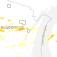


Connect with Interactive Hail Maps