

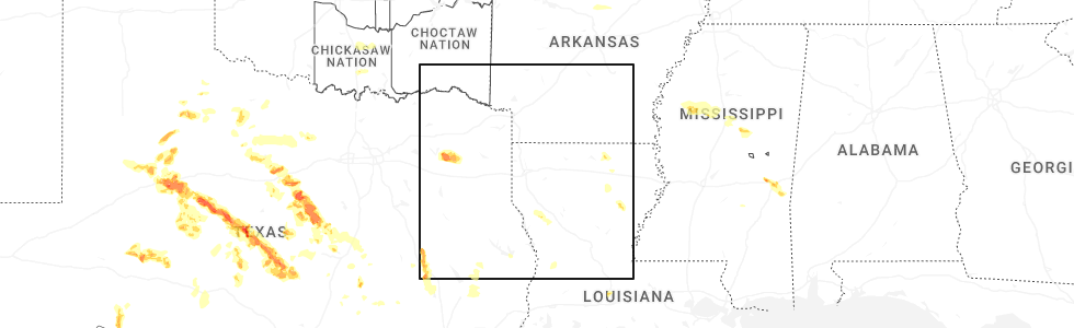
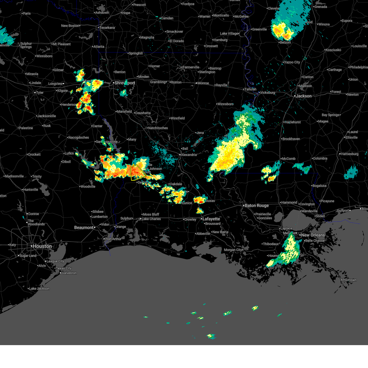
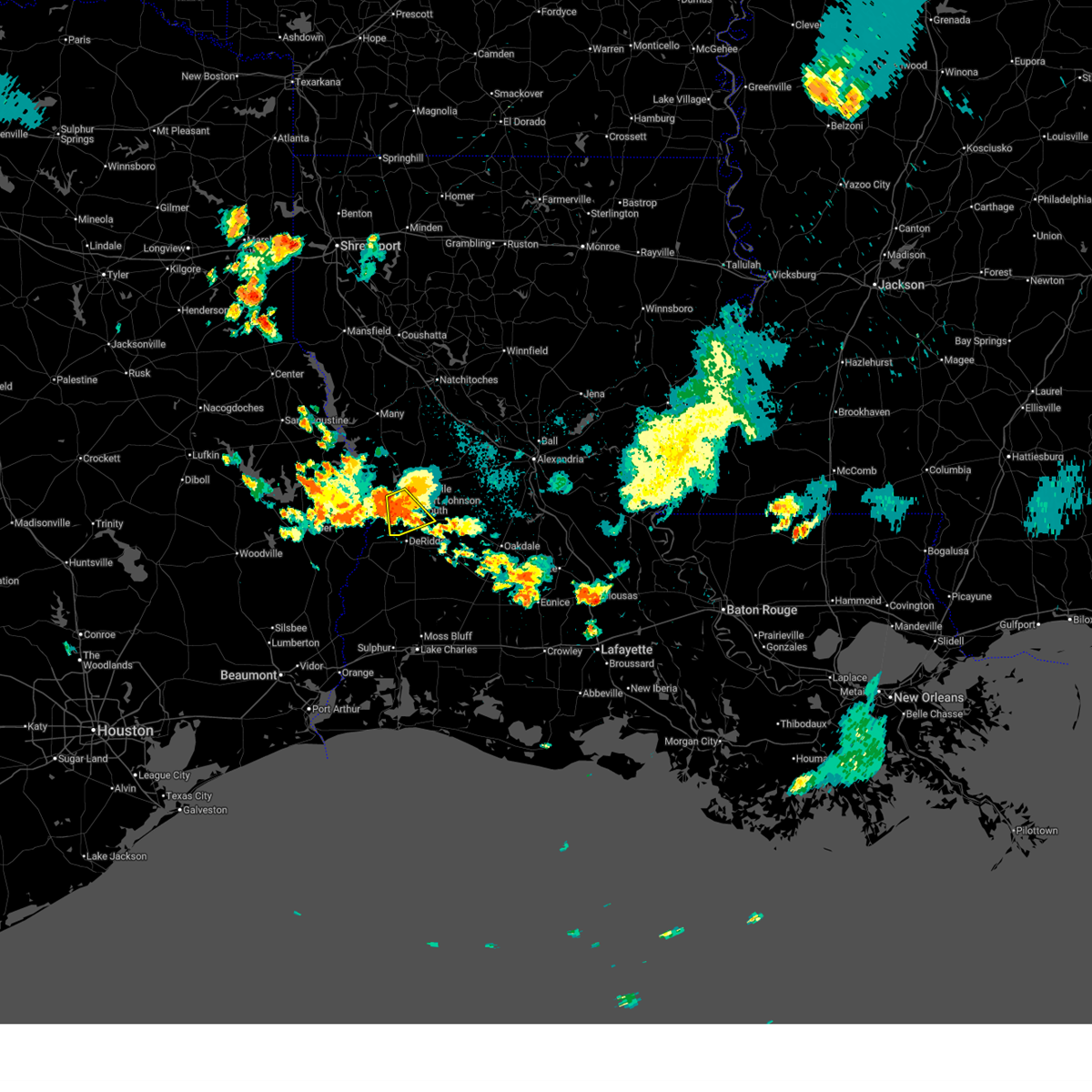
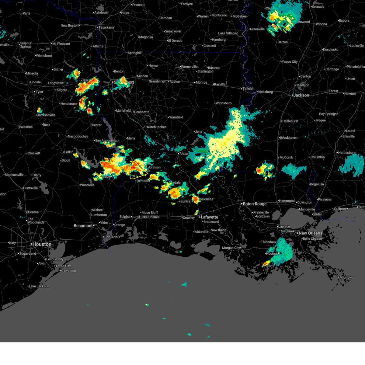
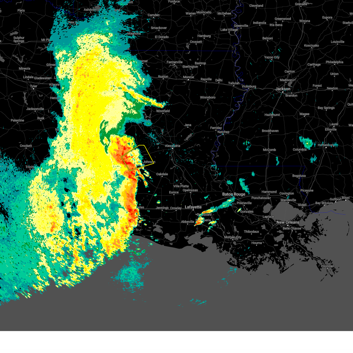
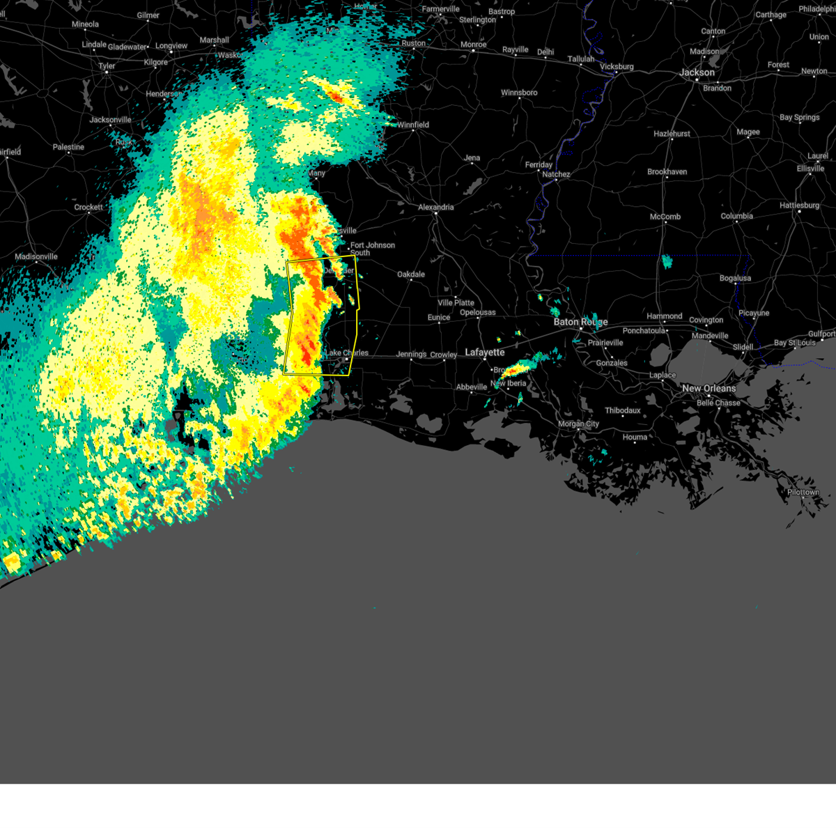
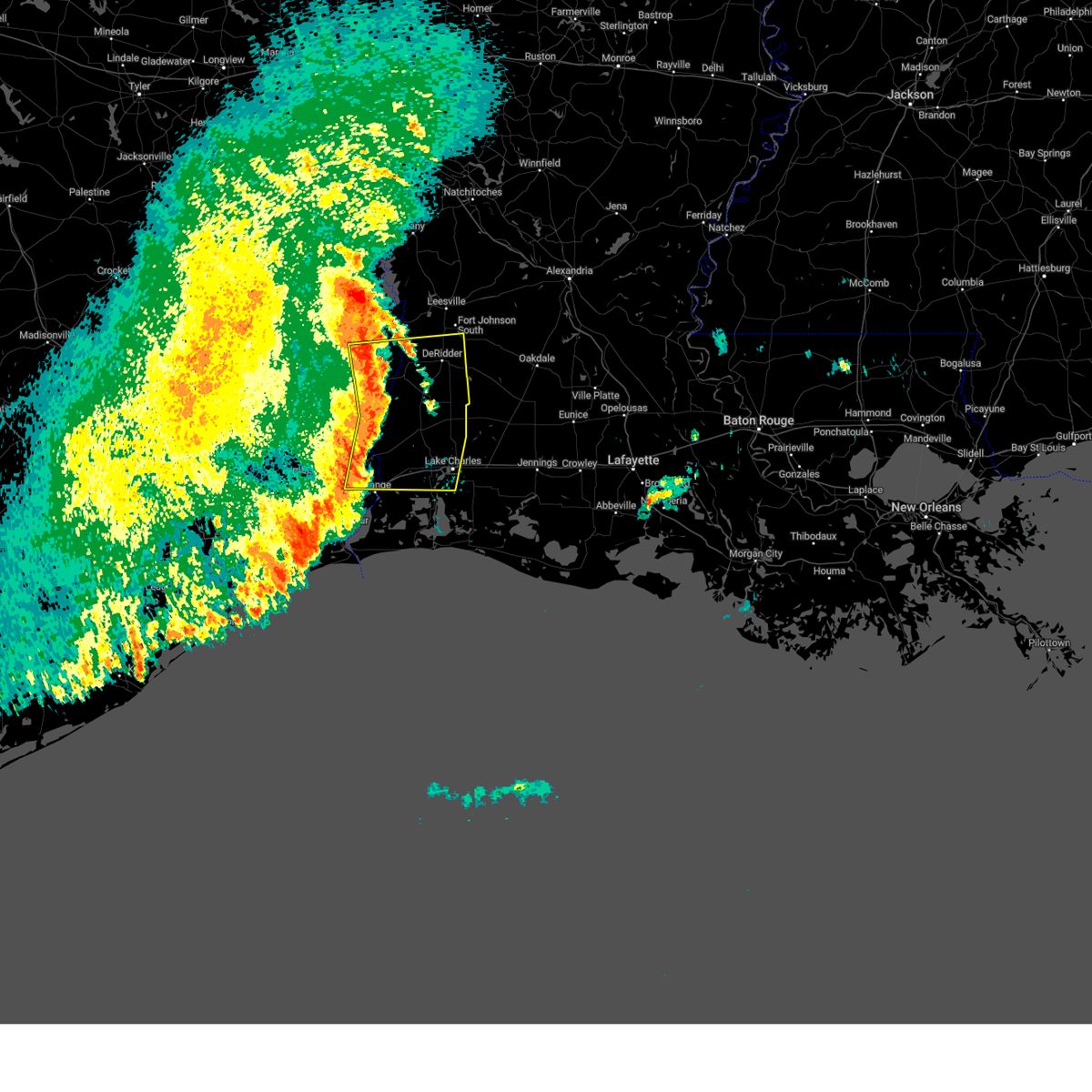
Hail Map for Rosepine, LA
The Rosepine, LA area has had 2 reports of on-the-ground hail by trained spotters, and has been under severe weather warnings 23 times during the past 12 months. Doppler radar has detected hail at or near Rosepine, LA on 92 occasions, including 8 occasions during the past year.
| Name: | Rosepine, LA |
| Where Located: | 63.3 miles NNE of Beaumont, TX |
| Map: | Google Map for Rosepine, LA |
| Population: | 1692 |
| Housing Units: | 731 |
| More Info: | Search Google for Rosepine, LA |
0
The Top Recent Hail Date for Rosepine, LA is Sunday, May 10, 2026 (90th out of 92)
Hail and Wind Damage Spotted near Rosepine, LA
| Date / Time | Report Details |
|---|---|
| 6/2/2026 6:51 PM CDT |
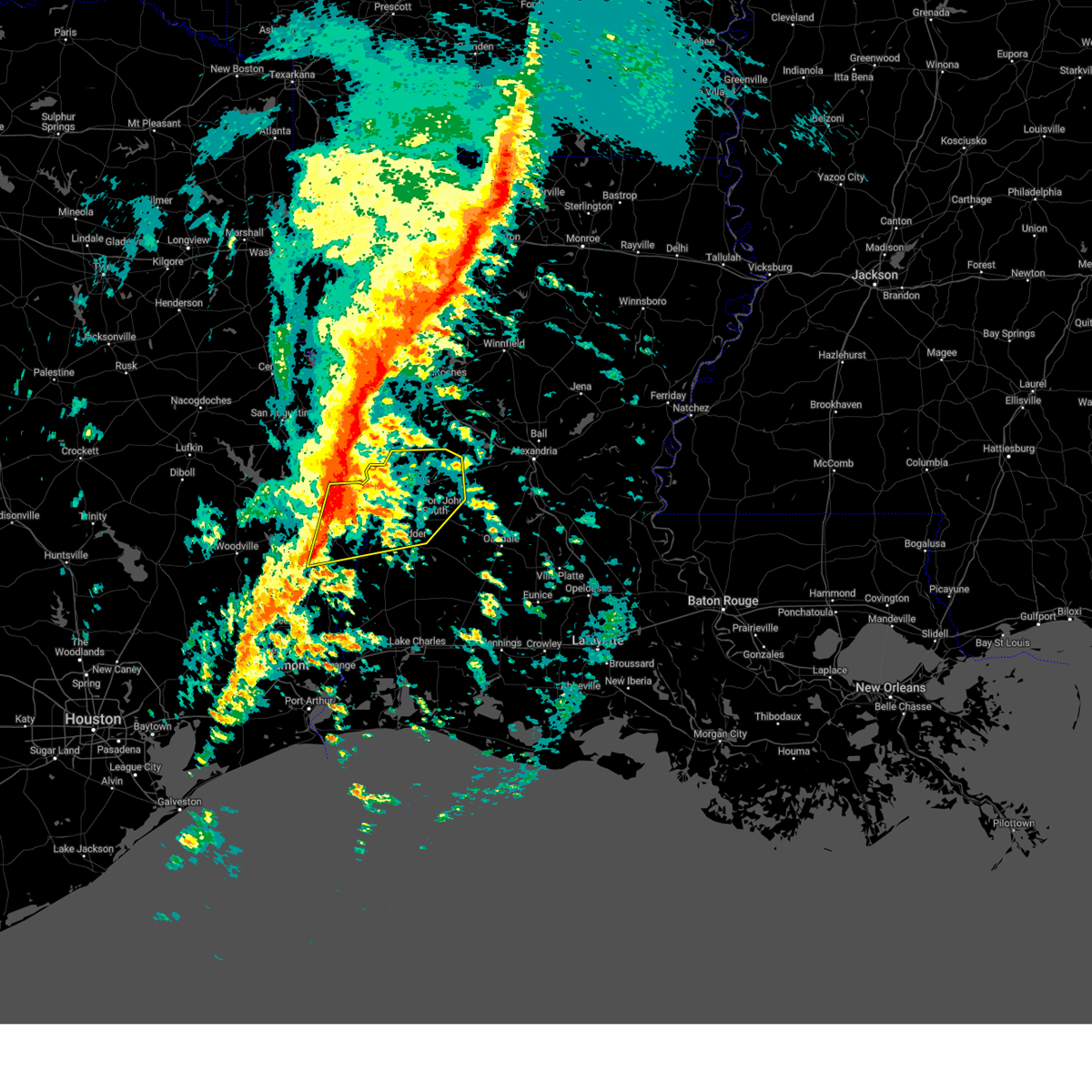
 The storm which prompted the warning has weakened below severe limits, and no longer poses an immediate threat to life or property. therefore, the warning will be allowed to expire. however heavy rain is still possible with this thunderstorm. The storm which prompted the warning has weakened below severe limits, and no longer poses an immediate threat to life or property. therefore, the warning will be allowed to expire. however heavy rain is still possible with this thunderstorm.
|
| 6/2/2026 6:28 PM CDT |
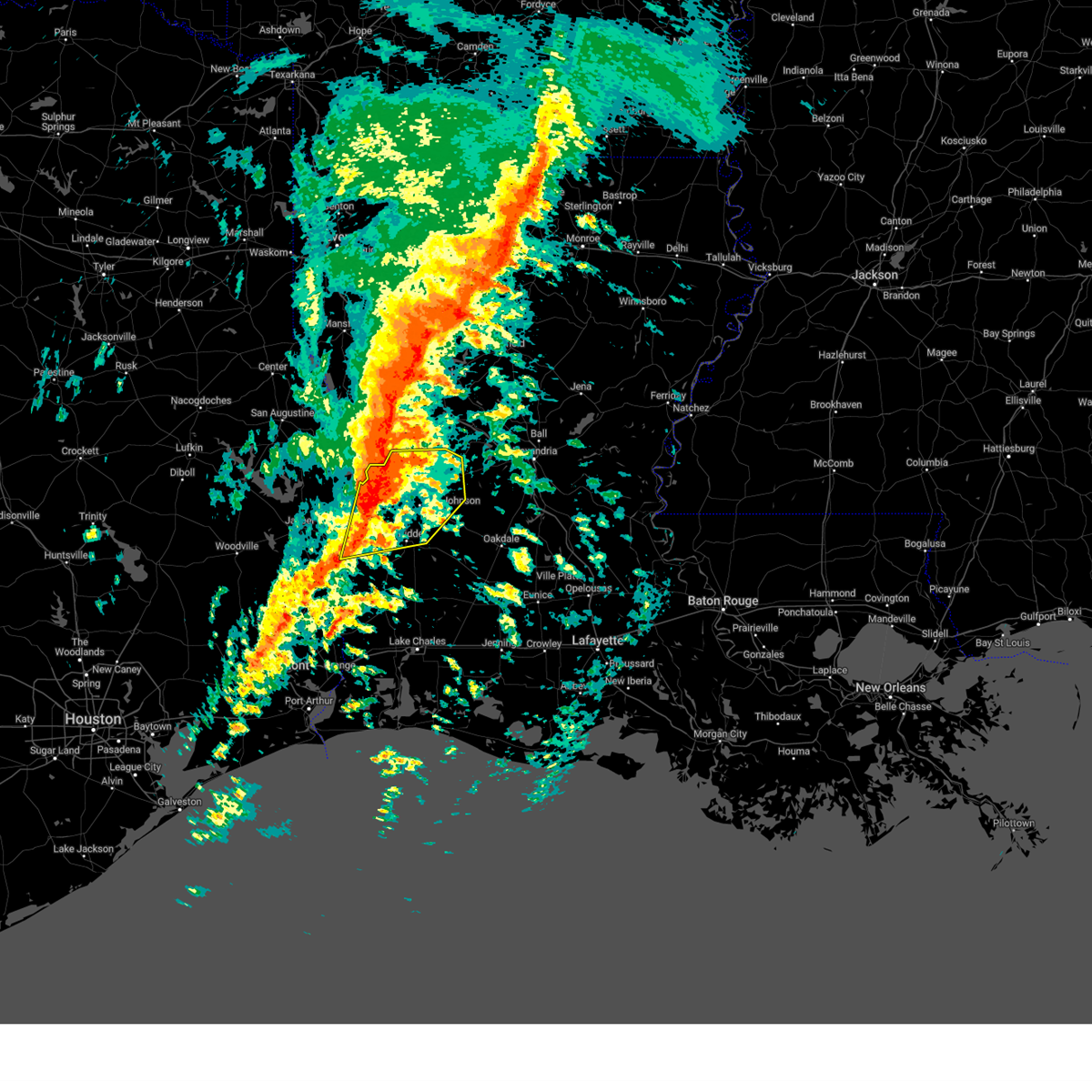
 Svrlch the national weather service in lake charles has issued a * severe thunderstorm warning for, southwestern vernon parish in west central louisiana, * until 700 pm cdt. * at 627 pm cdt, a severe thunderstorm was located near rosepine, moving southwest at 15 mph (radar indicated). Hazards include 60 mph wind gusts and nickel size hail. expect damage to roofs, siding, and trees Svrlch the national weather service in lake charles has issued a * severe thunderstorm warning for, southwestern vernon parish in west central louisiana, * until 700 pm cdt. * at 627 pm cdt, a severe thunderstorm was located near rosepine, moving southwest at 15 mph (radar indicated). Hazards include 60 mph wind gusts and nickel size hail. expect damage to roofs, siding, and trees
|
| 5/23/2026 10:05 AM CDT |
 At 1005 am cdt, a severe thunderstorm was located over burr ferry, or 7 miles southeast of toledo bend dam, moving east at 45 mph (radar indicated). Hazards include 60 mph wind gusts. Expect damage to roofs, siding, and trees. Locations impacted include, de ridder, leesville, rosepine, anacoco, fort polk, pitkin, sugartown, slagle, new llano, lacamp, fullerton, hutton, kurthwood, cravens, simpson, and pickering. At 1005 am cdt, a severe thunderstorm was located over burr ferry, or 7 miles southeast of toledo bend dam, moving east at 45 mph (radar indicated). Hazards include 60 mph wind gusts. Expect damage to roofs, siding, and trees. Locations impacted include, de ridder, leesville, rosepine, anacoco, fort polk, pitkin, sugartown, slagle, new llano, lacamp, fullerton, hutton, kurthwood, cravens, simpson, and pickering.
|
| 5/23/2026 9:29 AM CDT |
 At 927 am cdt, a severe thunderstorm was located near toledo bend dam, moving northeast at 35 mph (radar indicated). Hazards include 70 mph wind gusts. Expect considerable tree damage. damage is likely to mobile homes, roofs, and outbuildings. Locations impacted include, de ridder, leesville, newton, rosepine, anacoco, fort polk, sugartown, slagle, toledo bend dam, pitkin, burkeville, new llano, hornbeck, hutton, mayflower, kurthwood, junction, stringtown, lacamp, and fullerton. At 927 am cdt, a severe thunderstorm was located near toledo bend dam, moving northeast at 35 mph (radar indicated). Hazards include 70 mph wind gusts. Expect considerable tree damage. damage is likely to mobile homes, roofs, and outbuildings. Locations impacted include, de ridder, leesville, newton, rosepine, anacoco, fort polk, sugartown, slagle, toledo bend dam, pitkin, burkeville, new llano, hornbeck, hutton, mayflower, kurthwood, junction, stringtown, lacamp, and fullerton.
|
| 5/23/2026 9:18 AM CDT |
 At 917 am cdt, a severe thunderstorm was located near mayflower, or near burkeville, moving east at 60 mph (radar indicated). Hazards include 70 mph wind gusts. Expect considerable tree damage. damage is likely to mobile homes, roofs, and outbuildings. Locations impacted include, de ridder, jasper, leesville, newton, rosepine, anacoco, fort polk, sugartown, slagle, toledo bend dam, pitkin, burkeville, new llano, hornbeck, browndell, hutton, mayflower, kurthwood, harrisburg, and junction. At 917 am cdt, a severe thunderstorm was located near mayflower, or near burkeville, moving east at 60 mph (radar indicated). Hazards include 70 mph wind gusts. Expect considerable tree damage. damage is likely to mobile homes, roofs, and outbuildings. Locations impacted include, de ridder, jasper, leesville, newton, rosepine, anacoco, fort polk, sugartown, slagle, toledo bend dam, pitkin, burkeville, new llano, hornbeck, browndell, hutton, mayflower, kurthwood, harrisburg, and junction.
|
| 3/15/2026 9:13 PM CDT |
 The severe thunderstorm which prompted the warning has weakened. therefore, the warning will be allowed to expire. a tornado watch remains in effect until midnight cdt for southwestern and west central louisiana, and southeastern texas. The severe thunderstorm which prompted the warning has weakened. therefore, the warning will be allowed to expire. a tornado watch remains in effect until midnight cdt for southwestern and west central louisiana, and southeastern texas.
|
| 3/15/2026 9:03 PM CDT |
 the severe thunderstorm warning has been cancelled and is no longer in effect the severe thunderstorm warning has been cancelled and is no longer in effect
|
| 3/15/2026 9:03 PM CDT |
 At 902 pm cdt, a severe thunderstorm was located near rosepine, moving east at 35 mph (radar indicated). Hazards include 60 mph wind gusts and nickel size hail. Expect damage to roofs, siding, and trees. Locations impacted include, de ridder, rosepine, and junction. At 902 pm cdt, a severe thunderstorm was located near rosepine, moving east at 35 mph (radar indicated). Hazards include 60 mph wind gusts and nickel size hail. Expect damage to roofs, siding, and trees. Locations impacted include, de ridder, rosepine, and junction.
|
| 3/15/2026 8:50 PM CDT |
 At 850 pm cdt, a severe thunderstorm was located near rosepine, moving east at 35 mph (radar indicated). Hazards include 60 mph wind gusts and quarter size hail. Hail damage to vehicles is expected. expect wind damage to roofs, siding, and trees. Locations impacted include, de ridder, rosepine, merryville, fort polk, junction, stringtown, evans, and pickering. At 850 pm cdt, a severe thunderstorm was located near rosepine, moving east at 35 mph (radar indicated). Hazards include 60 mph wind gusts and quarter size hail. Hail damage to vehicles is expected. expect wind damage to roofs, siding, and trees. Locations impacted include, de ridder, rosepine, merryville, fort polk, junction, stringtown, evans, and pickering.
|
| 3/15/2026 8:42 PM CDT |
 At 842 pm cdt, a severe thunderstorm was located near burr ferry, or 10 miles west of rosepine, moving east at 30 mph (radar indicated). Hazards include 60 mph wind gusts and quarter size hail. Hail damage to vehicles is expected. expect wind damage to roofs, siding, and trees. Locations impacted include, de ridder, newton, rosepine, merryville, singer, bon weir, fort polk, burr ferry, junction, stringtown, evans, and pickering. At 842 pm cdt, a severe thunderstorm was located near burr ferry, or 10 miles west of rosepine, moving east at 30 mph (radar indicated). Hazards include 60 mph wind gusts and quarter size hail. Hail damage to vehicles is expected. expect wind damage to roofs, siding, and trees. Locations impacted include, de ridder, newton, rosepine, merryville, singer, bon weir, fort polk, burr ferry, junction, stringtown, evans, and pickering.
|
| 3/15/2026 8:32 PM CDT |
 At 832 pm cdt, a severe thunderstorm was located near burr ferry, or near burkeville, moving east at 25 mph (radar indicated). Hazards include 60 mph wind gusts and quarter size hail. Hail damage to vehicles is expected. expect wind damage to roofs, siding, and trees. Locations impacted include, de ridder, newton, rosepine, merryville, singer, bon weir, burkeville, fort polk, burr ferry, junction, stringtown, wiergate, evans, and pickering. At 832 pm cdt, a severe thunderstorm was located near burr ferry, or near burkeville, moving east at 25 mph (radar indicated). Hazards include 60 mph wind gusts and quarter size hail. Hail damage to vehicles is expected. expect wind damage to roofs, siding, and trees. Locations impacted include, de ridder, newton, rosepine, merryville, singer, bon weir, burkeville, fort polk, burr ferry, junction, stringtown, wiergate, evans, and pickering.
|
| 3/15/2026 8:23 PM CDT |
 At 823 pm cdt, a severe thunderstorm was located over burkeville, moving southeast at 30 mph (radar indicated). Hazards include 60 mph wind gusts and quarter size hail. Hail damage to vehicles is expected. expect wind damage to roofs, siding, and trees. Locations impacted include, de ridder, newton, rosepine, merryville, singer, bon weir, burkeville, fort polk, farrsville, burr ferry, jamestown, junction, stringtown, wiergate, evans, and pickering. At 823 pm cdt, a severe thunderstorm was located over burkeville, moving southeast at 30 mph (radar indicated). Hazards include 60 mph wind gusts and quarter size hail. Hail damage to vehicles is expected. expect wind damage to roofs, siding, and trees. Locations impacted include, de ridder, newton, rosepine, merryville, singer, bon weir, burkeville, fort polk, farrsville, burr ferry, jamestown, junction, stringtown, wiergate, evans, and pickering.
|
| 3/15/2026 8:11 PM CDT |
 Svrlch the national weather service in lake charles has issued a * severe thunderstorm warning for, northwestern beauregard parish in southwestern louisiana, southwestern vernon parish in west central louisiana, northern newton county in southeastern texas, * until 915 pm cdt. * at 810 pm cdt, a severe thunderstorm was located over farrsville, or 7 miles west of burkeville, moving southeast at 30 mph (radar indicated). Hazards include 60 mph wind gusts and quarter size hail. Hail damage to vehicles is expected. Expect wind damage to roofs, siding, and trees. Svrlch the national weather service in lake charles has issued a * severe thunderstorm warning for, northwestern beauregard parish in southwestern louisiana, southwestern vernon parish in west central louisiana, northern newton county in southeastern texas, * until 915 pm cdt. * at 810 pm cdt, a severe thunderstorm was located over farrsville, or 7 miles west of burkeville, moving southeast at 30 mph (radar indicated). Hazards include 60 mph wind gusts and quarter size hail. Hail damage to vehicles is expected. Expect wind damage to roofs, siding, and trees.
|
| 2/14/2026 7:56 PM CST |
 Svrlch the national weather service in lake charles has issued a * severe thunderstorm warning for, beauregard parish in southwestern louisiana, northwestern calcasieu parish in southwestern louisiana, southern vernon parish in west central louisiana, western allen parish in southwestern louisiana, central newton county in southeastern texas, * until 900 pm cst. * at 756 pm cst, severe thunderstorms were located along a line extending from near rosepine to near tulla to near devils pocket, moving east at 30 mph (radar indicated). Hazards include 60 mph wind gusts. expect damage to roofs, siding, and trees Svrlch the national weather service in lake charles has issued a * severe thunderstorm warning for, beauregard parish in southwestern louisiana, northwestern calcasieu parish in southwestern louisiana, southern vernon parish in west central louisiana, western allen parish in southwestern louisiana, central newton county in southeastern texas, * until 900 pm cst. * at 756 pm cst, severe thunderstorms were located along a line extending from near rosepine to near tulla to near devils pocket, moving east at 30 mph (radar indicated). Hazards include 60 mph wind gusts. expect damage to roofs, siding, and trees
|
| 2/14/2026 7:43 PM CST |
 At 743 pm cst, a severe thunderstorm was located near junction, or 9 miles west of de ridder, moving east at 50 mph (radar indicated). Hazards include 60 mph wind gusts. Expect damage to roofs, siding, and trees. Locations impacted include, de ridder, rosepine, new llano, burr ferry, junction, stringtown, evans, and pickering. At 743 pm cst, a severe thunderstorm was located near junction, or 9 miles west of de ridder, moving east at 50 mph (radar indicated). Hazards include 60 mph wind gusts. Expect damage to roofs, siding, and trees. Locations impacted include, de ridder, rosepine, new llano, burr ferry, junction, stringtown, evans, and pickering.
|
| 2/14/2026 7:18 PM CST |
 Svrlch the national weather service in lake charles has issued a * severe thunderstorm warning for, north central beauregard parish in southwestern louisiana, southwestern vernon parish in west central louisiana, northern newton county in southeastern texas, * until 800 pm cst. * at 718 pm cst, a severe thunderstorm was located near newton, moving east at 30 mph (radar indicated). Hazards include 60 mph wind gusts. expect damage to roofs, siding, and trees Svrlch the national weather service in lake charles has issued a * severe thunderstorm warning for, north central beauregard parish in southwestern louisiana, southwestern vernon parish in west central louisiana, northern newton county in southeastern texas, * until 800 pm cst. * at 718 pm cst, a severe thunderstorm was located near newton, moving east at 30 mph (radar indicated). Hazards include 60 mph wind gusts. expect damage to roofs, siding, and trees
|
| 10/28/2025 6:57 PM CDT | the severe thunderstorm warning has been cancelled and is no longer in effect |
| 10/28/2025 6:43 PM CDT | Svrlch the national weather service in lake charles has issued a * severe thunderstorm warning for, southwestern vernon parish in west central louisiana, * until 715 pm cdt. * at 643 pm cdt, a severe thunderstorm was located near new llano, or 8 miles southwest of leesville, moving southeast at 25 mph (radar indicated). Hazards include 60 mph wind gusts. expect damage to roofs, siding, and trees |
| 8/14/2025 9:38 PM CDT |
 The storm which prompted the warning has weakened below severe limits, and no longer poses an immediate threat to life or property. therefore, the warning will be allowed to expire. however heavy rain is still possible with this thunderstorm. The storm which prompted the warning has weakened below severe limits, and no longer poses an immediate threat to life or property. therefore, the warning will be allowed to expire. however heavy rain is still possible with this thunderstorm.
|
| 8/14/2025 9:05 PM CDT |
 Svrlch the national weather service in lake charles has issued a * severe thunderstorm warning for, north central beauregard parish in southwestern louisiana, southwestern vernon parish in west central louisiana, east central newton county in southeastern texas, * until 945 pm cdt. * at 905 pm cdt, a severe thunderstorm was located 8 miles southeast of burr ferry, or 9 miles west of rosepine, moving southwest at 15 mph (radar indicated). Hazards include 60 mph wind gusts. expect damage to roofs, siding, and trees Svrlch the national weather service in lake charles has issued a * severe thunderstorm warning for, north central beauregard parish in southwestern louisiana, southwestern vernon parish in west central louisiana, east central newton county in southeastern texas, * until 945 pm cdt. * at 905 pm cdt, a severe thunderstorm was located 8 miles southeast of burr ferry, or 9 miles west of rosepine, moving southwest at 15 mph (radar indicated). Hazards include 60 mph wind gusts. expect damage to roofs, siding, and trees
|
| 8/14/2025 8:53 PM CDT |
 The storm which prompted the warning has weakened below severe limits, and no longer poses an immediate threat to life or property. therefore, the warning will be allowed to expire. The storm which prompted the warning has weakened below severe limits, and no longer poses an immediate threat to life or property. therefore, the warning will be allowed to expire.
|
| 8/14/2025 8:46 PM CDT |
 At 846 pm cdt, a severe thunderstorm was located near new llano, or 7 miles north of rosepine, moving southeast at 15 mph (radar indicated). Hazards include 60 mph wind gusts. Expect damage to roofs, siding, and trees. Locations impacted include, leesville, rosepine, fort polk, new llano, and pickering. At 846 pm cdt, a severe thunderstorm was located near new llano, or 7 miles north of rosepine, moving southeast at 15 mph (radar indicated). Hazards include 60 mph wind gusts. Expect damage to roofs, siding, and trees. Locations impacted include, leesville, rosepine, fort polk, new llano, and pickering.
|
| 8/14/2025 8:26 PM CDT |
 Svrlch the national weather service in lake charles has issued a * severe thunderstorm warning for, southwestern vernon parish in west central louisiana, * until 900 pm cdt. * at 825 pm cdt, a severe thunderstorm was located near new llano, or near leesville, moving southeast at 10 mph (radar indicated). Hazards include 60 mph wind gusts. expect damage to roofs, siding, and trees Svrlch the national weather service in lake charles has issued a * severe thunderstorm warning for, southwestern vernon parish in west central louisiana, * until 900 pm cdt. * at 825 pm cdt, a severe thunderstorm was located near new llano, or near leesville, moving southeast at 10 mph (radar indicated). Hazards include 60 mph wind gusts. expect damage to roofs, siding, and trees
|
| 5/27/2025 3:06 AM CDT |
 Svrlch the national weather service in lake charles has issued a * severe thunderstorm warning for, central vernon parish in west central louisiana, * until 330 am cdt. * at 306 am cdt, a severe thunderstorm was located near new llano, or near leesville, moving east at 40 mph (radar indicated). Hazards include 60 mph wind gusts and quarter size hail. Hail damage to vehicles is expected. Expect wind damage to roofs, siding, and trees. Svrlch the national weather service in lake charles has issued a * severe thunderstorm warning for, central vernon parish in west central louisiana, * until 330 am cdt. * at 306 am cdt, a severe thunderstorm was located near new llano, or near leesville, moving east at 40 mph (radar indicated). Hazards include 60 mph wind gusts and quarter size hail. Hail damage to vehicles is expected. Expect wind damage to roofs, siding, and trees.
|
| 5/27/2025 2:42 AM CDT |
 At 241 am cdt, severe thunderstorms were located along a line extending from 7 miles south of burr ferry to near oretta to near vinton, moving east at 35 mph (radar indicated). Hazards include 60 mph wind gusts. Expect damage to roofs, siding, and trees. Locations impacted include, lake charles, sulphur, orange, de ridder, westlake, vinton, newton, rosepine, merryville, singer, moss bluff, de quincy, ragley, lake charles regional airport, starks, fields, bon weir, lunita, bivens, and toomey. At 241 am cdt, severe thunderstorms were located along a line extending from 7 miles south of burr ferry to near oretta to near vinton, moving east at 35 mph (radar indicated). Hazards include 60 mph wind gusts. Expect damage to roofs, siding, and trees. Locations impacted include, lake charles, sulphur, orange, de ridder, westlake, vinton, newton, rosepine, merryville, singer, moss bluff, de quincy, ragley, lake charles regional airport, starks, fields, bon weir, lunita, bivens, and toomey.
|
| 5/27/2025 2:42 AM CDT |
 the severe thunderstorm warning has been cancelled and is no longer in effect the severe thunderstorm warning has been cancelled and is no longer in effect
|
| 5/27/2025 2:12 AM CDT |
 Svrlch the national weather service in lake charles has issued a * severe thunderstorm warning for, beauregard parish in southwestern louisiana, calcasieu parish in southwestern louisiana, southwestern vernon parish in west central louisiana, newton county in southeastern texas, northeastern orange county in southeastern texas, southeastern jasper county in southeastern texas, * until 315 am cdt. * at 211 am cdt, severe thunderstorms were located along a line extending from near farrsville to near bancroft to near orangefield, moving east at 35 mph (radar indicated). Hazards include 60 mph wind gusts. expect damage to roofs, siding, and trees Svrlch the national weather service in lake charles has issued a * severe thunderstorm warning for, beauregard parish in southwestern louisiana, calcasieu parish in southwestern louisiana, southwestern vernon parish in west central louisiana, newton county in southeastern texas, northeastern orange county in southeastern texas, southeastern jasper county in southeastern texas, * until 315 am cdt. * at 211 am cdt, severe thunderstorms were located along a line extending from near farrsville to near bancroft to near orangefield, moving east at 35 mph (radar indicated). Hazards include 60 mph wind gusts. expect damage to roofs, siding, and trees
|
| 3/31/2025 2:40 AM CDT |
 Svrlch the national weather service in lake charles has issued a * severe thunderstorm warning for, northeastern beauregard parish in southwestern louisiana, south central vernon parish in west central louisiana, * until 300 am cdt. * at 240 am cdt, a severe thunderstorm was located near de ridder, moving northeast at 45 mph (radar indicated). Hazards include 60 mph wind gusts and nickel size hail. expect damage to roofs, siding, and trees Svrlch the national weather service in lake charles has issued a * severe thunderstorm warning for, northeastern beauregard parish in southwestern louisiana, south central vernon parish in west central louisiana, * until 300 am cdt. * at 240 am cdt, a severe thunderstorm was located near de ridder, moving northeast at 45 mph (radar indicated). Hazards include 60 mph wind gusts and nickel size hail. expect damage to roofs, siding, and trees
|
| 3/4/2025 11:18 AM CST |
 the severe thunderstorm warning has been cancelled and is no longer in effect the severe thunderstorm warning has been cancelled and is no longer in effect
|
| 3/4/2025 11:18 AM CST |
 At 1118 am cst, severe thunderstorms were located along a line extending from near hutton to near de ridder, moving east at 60 mph (radar indicated). Hazards include 70 mph wind gusts. Expect considerable tree damage. damage is likely to mobile homes, roofs, and outbuildings. Locations impacted include, leesville, anacoco, lacamp, hutton, rosepine, de ridder, fort johnson, new llano, kurthwood, evans, pickering, slagle, junction, cravens, simpson, and merryville. At 1118 am cst, severe thunderstorms were located along a line extending from near hutton to near de ridder, moving east at 60 mph (radar indicated). Hazards include 70 mph wind gusts. Expect considerable tree damage. damage is likely to mobile homes, roofs, and outbuildings. Locations impacted include, leesville, anacoco, lacamp, hutton, rosepine, de ridder, fort johnson, new llano, kurthwood, evans, pickering, slagle, junction, cravens, simpson, and merryville.
|
| 3/4/2025 10:59 AM CST |
 the severe thunderstorm warning has been cancelled and is no longer in effect the severe thunderstorm warning has been cancelled and is no longer in effect
|
| 3/4/2025 10:59 AM CST |
 At 1059 am cst, severe thunderstorms were located along a line extending from 8 miles northwest of kurthwood to near stringtown, moving east at 80 mph (radar indicated). Hazards include 60 mph wind gusts. Expect damage to roofs, siding, and trees. Locations impacted include, toledo bend dam, leesville, hornbeck, anacoco, lacamp, hutton, burr ferry, rosepine, de ridder, fort johnson, new llano, kurthwood, evans, pickering, slagle, junction, stringtown, cravens, simpson, and merryville. At 1059 am cst, severe thunderstorms were located along a line extending from 8 miles northwest of kurthwood to near stringtown, moving east at 80 mph (radar indicated). Hazards include 60 mph wind gusts. Expect damage to roofs, siding, and trees. Locations impacted include, toledo bend dam, leesville, hornbeck, anacoco, lacamp, hutton, burr ferry, rosepine, de ridder, fort johnson, new llano, kurthwood, evans, pickering, slagle, junction, stringtown, cravens, simpson, and merryville.
|
| 3/4/2025 10:43 AM CST |
 Svrlch the national weather service in lake charles has issued a * severe thunderstorm warning for, northwestern beauregard parish in southwestern louisiana, vernon parish in west central louisiana, northern newton county in southeastern texas, northeastern jasper county in southeastern texas, * until 1130 am cst. * at 1042 am cst, severe thunderstorms were located along a line extending from near toledo bend dam to near kirbyville, moving northeast at 80 mph (radar indicated). Hazards include 60 mph wind gusts. expect damage to roofs, siding, and trees Svrlch the national weather service in lake charles has issued a * severe thunderstorm warning for, northwestern beauregard parish in southwestern louisiana, vernon parish in west central louisiana, northern newton county in southeastern texas, northeastern jasper county in southeastern texas, * until 1130 am cst. * at 1042 am cst, severe thunderstorms were located along a line extending from near toledo bend dam to near kirbyville, moving northeast at 80 mph (radar indicated). Hazards include 60 mph wind gusts. expect damage to roofs, siding, and trees
|
| 6/4/2024 3:22 PM CDT |
 The storm which prompted the warning has moved out of the area. therefore, the warning will be allowed to expire. however heavy rain is still possible with this thunderstorm. a severe thunderstorm watch remains in effect until 800 pm cdt for central, southwestern and west central louisiana. The storm which prompted the warning has moved out of the area. therefore, the warning will be allowed to expire. however heavy rain is still possible with this thunderstorm. a severe thunderstorm watch remains in effect until 800 pm cdt for central, southwestern and west central louisiana.
|
| 6/4/2024 2:24 PM CDT |
 Svrlch the national weather service in lake charles has issued a * severe thunderstorm warning for, central rapides parish in central louisiana, northern beauregard parish in southwestern louisiana, vernon parish in west central louisiana, northeastern newton county in southeastern texas, * until 330 pm cdt. * at 224 pm cdt, a severe thunderstorm was located near hutton, or 12 miles northeast of slagle, moving east at 15 mph (radar indicated). Hazards include 60 mph wind gusts and penny size hail. expect damage to roofs, siding, and trees Svrlch the national weather service in lake charles has issued a * severe thunderstorm warning for, central rapides parish in central louisiana, northern beauregard parish in southwestern louisiana, vernon parish in west central louisiana, northeastern newton county in southeastern texas, * until 330 pm cdt. * at 224 pm cdt, a severe thunderstorm was located near hutton, or 12 miles northeast of slagle, moving east at 15 mph (radar indicated). Hazards include 60 mph wind gusts and penny size hail. expect damage to roofs, siding, and trees
|
| 6/2/2024 5:44 PM CDT |
 the severe thunderstorm warning has been cancelled and is no longer in effect the severe thunderstorm warning has been cancelled and is no longer in effect
|
| 6/2/2024 5:18 PM CDT |
 Svrlch the national weather service in lake charles has issued a * severe thunderstorm warning for, southwestern vernon parish in west central louisiana, * until 600 pm cdt. * at 518 pm cdt, a severe thunderstorm was located near rosepine, moving northeast at 15 mph (radar indicated). Hazards include 60 mph wind gusts and quarter size hail. Hail damage to vehicles is expected. Expect wind damage to roofs, siding, and trees. Svrlch the national weather service in lake charles has issued a * severe thunderstorm warning for, southwestern vernon parish in west central louisiana, * until 600 pm cdt. * at 518 pm cdt, a severe thunderstorm was located near rosepine, moving northeast at 15 mph (radar indicated). Hazards include 60 mph wind gusts and quarter size hail. Hail damage to vehicles is expected. Expect wind damage to roofs, siding, and trees.
|
| 5/30/2024 8:59 PM CDT |
 The storms which prompted the warning have moved out of the area with the exception of eastern vernon parish where a new warning has been issued. therefore, the warning will be allowed to expire. however gusty winds and heavy rain are still possible with these thunderstorms. a severe thunderstorm watch remains in effect until 1100 pm cdt for central and west central louisiana, and southeastern texas. to report severe weather, contact your nearest law enforcement agency. they will relay your report to the national weather service lake charles. The storms which prompted the warning have moved out of the area with the exception of eastern vernon parish where a new warning has been issued. therefore, the warning will be allowed to expire. however gusty winds and heavy rain are still possible with these thunderstorms. a severe thunderstorm watch remains in effect until 1100 pm cdt for central and west central louisiana, and southeastern texas. to report severe weather, contact your nearest law enforcement agency. they will relay your report to the national weather service lake charles.
|
| 5/30/2024 8:40 PM CDT |
 the severe thunderstorm warning has been cancelled and is no longer in effect the severe thunderstorm warning has been cancelled and is no longer in effect
|
| 5/30/2024 8:40 PM CDT |
 The storms which prompted the warning have weakened below severe limits, and no longer pose an immediate threat to life or property. therefore, the warning will be allowed to expire. a severe thunderstorm watch remains in effect until 1100 pm cdt for southwestern and west central louisiana, and southeastern texas. The storms which prompted the warning have weakened below severe limits, and no longer pose an immediate threat to life or property. therefore, the warning will be allowed to expire. a severe thunderstorm watch remains in effect until 1100 pm cdt for southwestern and west central louisiana, and southeastern texas.
|
| 5/30/2024 8:40 PM CDT |
 At 839 pm cdt, severe thunderstorms were located along a line extending from 10 miles west of hutton to kurthwood to near new llano to near rosepine, moving east at 50 mph (radar indicated). Hazards include 70 mph wind gusts and nickel size hail. Expect considerable tree damage. damage is likely to mobile homes, roofs, and outbuildings. Locations impacted include, leesville, rosepine, anacoco, fort johnson, slagle, new llano, hornbeck, lacamp, fullerton, hutton, burr ferry, kurthwood, cravens, simpson, evans, and pickering. At 839 pm cdt, severe thunderstorms were located along a line extending from 10 miles west of hutton to kurthwood to near new llano to near rosepine, moving east at 50 mph (radar indicated). Hazards include 70 mph wind gusts and nickel size hail. Expect considerable tree damage. damage is likely to mobile homes, roofs, and outbuildings. Locations impacted include, leesville, rosepine, anacoco, fort johnson, slagle, new llano, hornbeck, lacamp, fullerton, hutton, burr ferry, kurthwood, cravens, simpson, evans, and pickering.
|
| 5/30/2024 8:31 PM CDT |
 At 829 pm cdt, severe thunderstorms were located along a line extending from 11 miles northwest of kurthwood to 6 miles east of hornbeck to near leesville to near junction, moving east at 35 mph. these are destructive storms for vernon parish (radar indicated). Hazards include 80 mph wind gusts and nickel size hail. Flying debris will be dangerous to those caught without shelter. mobile homes will be heavily damaged. expect considerable damage to roofs, windows, and vehicles. extensive tree damage and power outages are likely. Locations impacted include, leesville, rosepine, anacoco, toledo bend dam, fort johnson, slagle, burkeville, new llano, hornbeck, lacamp, fullerton, hutton, burr ferry, kurthwood, stringtown, cravens, simpson, evans, and pickering. At 829 pm cdt, severe thunderstorms were located along a line extending from 11 miles northwest of kurthwood to 6 miles east of hornbeck to near leesville to near junction, moving east at 35 mph. these are destructive storms for vernon parish (radar indicated). Hazards include 80 mph wind gusts and nickel size hail. Flying debris will be dangerous to those caught without shelter. mobile homes will be heavily damaged. expect considerable damage to roofs, windows, and vehicles. extensive tree damage and power outages are likely. Locations impacted include, leesville, rosepine, anacoco, toledo bend dam, fort johnson, slagle, burkeville, new llano, hornbeck, lacamp, fullerton, hutton, burr ferry, kurthwood, stringtown, cravens, simpson, evans, and pickering.
|
| 5/30/2024 8:21 PM CDT |
 At 820 pm cdt, severe thunderstorms were located along a line extending from 10 miles southeast of many to hornbeck to 6 miles northeast of burr ferry to near stringtown, moving east at 35 mph. these are destructive storms for northern and central vernon parish (radar indicated). Hazards include 80 mph wind gusts and nickel size hail. Flying debris will be dangerous to those caught without shelter. mobile homes will be heavily damaged. expect considerable damage to roofs, windows, and vehicles. extensive tree damage and power outages are likely. Locations impacted include, leesville, rosepine, anacoco, toledo bend dam, fort johnson, slagle, burkeville, new llano, hornbeck, lacamp, farrsville, fullerton, hutton, burr ferry, mayflower, jamestown, kurthwood, stringtown, cravens, and simpson. At 820 pm cdt, severe thunderstorms were located along a line extending from 10 miles southeast of many to hornbeck to 6 miles northeast of burr ferry to near stringtown, moving east at 35 mph. these are destructive storms for northern and central vernon parish (radar indicated). Hazards include 80 mph wind gusts and nickel size hail. Flying debris will be dangerous to those caught without shelter. mobile homes will be heavily damaged. expect considerable damage to roofs, windows, and vehicles. extensive tree damage and power outages are likely. Locations impacted include, leesville, rosepine, anacoco, toledo bend dam, fort johnson, slagle, burkeville, new llano, hornbeck, lacamp, farrsville, fullerton, hutton, burr ferry, mayflower, jamestown, kurthwood, stringtown, cravens, and simpson.
|
| 5/30/2024 8:11 PM CDT |
 Svrlch the national weather service in lake charles has issued a * severe thunderstorm warning for, western beauregard parish in southwestern louisiana, southwestern vernon parish in west central louisiana, northwestern jefferson county in southeastern texas, southern tyler county in southeastern texas, newton county in southeastern texas, hardin county in southeastern texas, northwestern orange county in southeastern texas, jasper county in southeastern texas, * until 845 pm cdt. * at 811 pm cdt, severe thunderstorms were located along a line extending from near newton to near fred to near honey island, moving south at 45 mph (radar indicated). Hazards include 60 mph wind gusts and nickel size hail. expect damage to roofs, siding, and trees Svrlch the national weather service in lake charles has issued a * severe thunderstorm warning for, western beauregard parish in southwestern louisiana, southwestern vernon parish in west central louisiana, northwestern jefferson county in southeastern texas, southern tyler county in southeastern texas, newton county in southeastern texas, hardin county in southeastern texas, northwestern orange county in southeastern texas, jasper county in southeastern texas, * until 845 pm cdt. * at 811 pm cdt, severe thunderstorms were located along a line extending from near newton to near fred to near honey island, moving south at 45 mph (radar indicated). Hazards include 60 mph wind gusts and nickel size hail. expect damage to roofs, siding, and trees
|
| 5/30/2024 7:58 PM CDT |
 Svrlch the national weather service in lake charles has issued a * severe thunderstorm warning for, vernon parish in west central louisiana, northern newton county in southeastern texas, * until 900 pm cdt. * at 758 pm cdt, severe thunderstorms were located along a line extending from near zwolle to 10 miles east of hemphill to near toledo bend dam to harrisburg, moving east at 35 mph (radar indicated). Hazards include 60 mph wind gusts and penny size hail. expect damage to roofs, siding, and trees Svrlch the national weather service in lake charles has issued a * severe thunderstorm warning for, vernon parish in west central louisiana, northern newton county in southeastern texas, * until 900 pm cdt. * at 758 pm cdt, severe thunderstorms were located along a line extending from near zwolle to 10 miles east of hemphill to near toledo bend dam to harrisburg, moving east at 35 mph (radar indicated). Hazards include 60 mph wind gusts and penny size hail. expect damage to roofs, siding, and trees
|
| 5/16/2024 6:25 PM CDT |
 The severe thunderstorm which prompted the warning has moved out of the warned area. therefore, the warning will be allowed to expire. a tornado watch remains in effect until 1000 pm cdt for central, southwestern and west central louisiana. remember, a severe thunderstorm warning still remains in effect for southeast beauregard and west allen until 7 pm. The severe thunderstorm which prompted the warning has moved out of the warned area. therefore, the warning will be allowed to expire. a tornado watch remains in effect until 1000 pm cdt for central, southwestern and west central louisiana. remember, a severe thunderstorm warning still remains in effect for southeast beauregard and west allen until 7 pm.
|
| 5/16/2024 6:09 PM CDT |
 the severe thunderstorm warning has been cancelled and is no longer in effect the severe thunderstorm warning has been cancelled and is no longer in effect
|
| 5/16/2024 6:09 PM CDT |
 At 609 pm cdt, a severe thunderstorm was located near longville, or 9 miles north of ragley, moving east at 20 mph (radar indicated). Hazards include 70 mph wind gusts and ping pong ball size hail. People and animals outdoors will be injured. expect hail damage to roofs, siding, windows, and vehicles. expect considerable tree damage. wind damage is also likely to mobile homes, roofs, and outbuildings. Locations impacted include, de ridder, rosepine, merryville, elizabeth, reeves, dry creek, singer, sugartown, mittie, ragley, grant, longville, tulla, oretta, and bundick lake. At 609 pm cdt, a severe thunderstorm was located near longville, or 9 miles north of ragley, moving east at 20 mph (radar indicated). Hazards include 70 mph wind gusts and ping pong ball size hail. People and animals outdoors will be injured. expect hail damage to roofs, siding, windows, and vehicles. expect considerable tree damage. wind damage is also likely to mobile homes, roofs, and outbuildings. Locations impacted include, de ridder, rosepine, merryville, elizabeth, reeves, dry creek, singer, sugartown, mittie, ragley, grant, longville, tulla, oretta, and bundick lake.
|
| 5/16/2024 5:55 PM CDT |
 Svrlch the national weather service in lake charles has issued a * severe thunderstorm warning for, beauregard parish in southwestern louisiana, north central calcasieu parish in southwestern louisiana, southeastern vernon parish in west central louisiana, northwestern allen parish in southwestern louisiana, * until 630 pm cdt. * at 555 pm cdt, a severe thunderstorm was located near singer, moving east at 20 mph (radar indicated). Hazards include 60 mph wind gusts and quarter size hail. Hail damage to vehicles is expected. Expect wind damage to roofs, siding, and trees. Svrlch the national weather service in lake charles has issued a * severe thunderstorm warning for, beauregard parish in southwestern louisiana, north central calcasieu parish in southwestern louisiana, southeastern vernon parish in west central louisiana, northwestern allen parish in southwestern louisiana, * until 630 pm cdt. * at 555 pm cdt, a severe thunderstorm was located near singer, moving east at 20 mph (radar indicated). Hazards include 60 mph wind gusts and quarter size hail. Hail damage to vehicles is expected. Expect wind damage to roofs, siding, and trees.
|
| 5/16/2024 5:30 PM CDT |
 Svrlch the national weather service in lake charles has issued a * severe thunderstorm warning for, northern beauregard parish in southwestern louisiana, southwestern vernon parish in west central louisiana, east central newton county in southeastern texas, * until 600 pm cdt. * at 530 pm cdt, a severe thunderstorm was located near junction, or near merryville, moving east at 35 mph (radar indicated). Hazards include 60 mph wind gusts and penny size hail. expect damage to roofs, siding, and trees Svrlch the national weather service in lake charles has issued a * severe thunderstorm warning for, northern beauregard parish in southwestern louisiana, southwestern vernon parish in west central louisiana, east central newton county in southeastern texas, * until 600 pm cdt. * at 530 pm cdt, a severe thunderstorm was located near junction, or near merryville, moving east at 35 mph (radar indicated). Hazards include 60 mph wind gusts and penny size hail. expect damage to roofs, siding, and trees
|
| 5/16/2024 5:04 PM CDT |
 Svrlch the national weather service in lake charles has issued a * severe thunderstorm warning for, northwestern beauregard parish in southwestern louisiana, southwestern vernon parish in west central louisiana, central newton county in southeastern texas, east central jasper county in southeastern texas, * until 530 pm cdt. * at 503 pm cdt, a severe thunderstorm was located over roganville, or 8 miles west of newton, moving east at 35 mph (radar indicated). Hazards include 60 mph wind gusts and penny size hail. expect damage to roofs, siding, and trees Svrlch the national weather service in lake charles has issued a * severe thunderstorm warning for, northwestern beauregard parish in southwestern louisiana, southwestern vernon parish in west central louisiana, central newton county in southeastern texas, east central jasper county in southeastern texas, * until 530 pm cdt. * at 503 pm cdt, a severe thunderstorm was located over roganville, or 8 miles west of newton, moving east at 35 mph (radar indicated). Hazards include 60 mph wind gusts and penny size hail. expect damage to roofs, siding, and trees
|
| 5/16/2024 3:40 PM CDT |
 Svrlch the national weather service in lake charles has issued a * severe thunderstorm warning for, western rapides parish in central louisiana, vernon parish in west central louisiana, northeastern allen parish in southwestern louisiana, northeastern newton county in southeastern texas, * until 445 pm cdt. * at 339 pm cdt, a severe thunderstorm was located near burr ferry, or near toledo bend dam, moving east at 50 mph (radar indicated). Hazards include 60 mph wind gusts and quarter size hail. Hail damage to vehicles is expected. Expect wind damage to roofs, siding, and trees. Svrlch the national weather service in lake charles has issued a * severe thunderstorm warning for, western rapides parish in central louisiana, vernon parish in west central louisiana, northeastern allen parish in southwestern louisiana, northeastern newton county in southeastern texas, * until 445 pm cdt. * at 339 pm cdt, a severe thunderstorm was located near burr ferry, or near toledo bend dam, moving east at 50 mph (radar indicated). Hazards include 60 mph wind gusts and quarter size hail. Hail damage to vehicles is expected. Expect wind damage to roofs, siding, and trees.
|
| 5/12/2024 4:39 PM CDT |
 Svrlch the national weather service in lake charles has issued a * severe thunderstorm warning for, southwestern rapides parish in central louisiana, southeastern vernon parish in west central louisiana, northeastern allen parish in southwestern louisiana, * until 530 pm cdt. * at 439 pm cdt, a severe thunderstorm was located near cravens, or near fort johnson, moving east at 50 mph (radar indicated). Hazards include quarter size hail. damage to vehicles is expected Svrlch the national weather service in lake charles has issued a * severe thunderstorm warning for, southwestern rapides parish in central louisiana, southeastern vernon parish in west central louisiana, northeastern allen parish in southwestern louisiana, * until 530 pm cdt. * at 439 pm cdt, a severe thunderstorm was located near cravens, or near fort johnson, moving east at 50 mph (radar indicated). Hazards include quarter size hail. damage to vehicles is expected
|
| 5/12/2024 2:25 PM CDT |
 The storm which prompted the warning has weakened below severe limits, and no longer poses an immediate threat to life or property. therefore, the warning will be allowed to expire. however small hail and gusty winds are still possible with this thunderstorm. a tornado watch remains in effect until 700 pm cdt for southwestern and west central louisiana. The storm which prompted the warning has weakened below severe limits, and no longer poses an immediate threat to life or property. therefore, the warning will be allowed to expire. however small hail and gusty winds are still possible with this thunderstorm. a tornado watch remains in effect until 700 pm cdt for southwestern and west central louisiana.
|
| 5/12/2024 1:58 PM CDT |
 the severe thunderstorm warning has been cancelled and is no longer in effect the severe thunderstorm warning has been cancelled and is no longer in effect
|
| 5/12/2024 1:58 PM CDT |
 At 157 pm cdt, a severe thunderstorm was located near tulla, or 8 miles northwest of dry creek, moving east at 40 mph (radar indicated). Hazards include ping pong ball size hail and 60 mph wind gusts. People and animals outdoors will be injured. expect hail damage to roofs, siding, windows, and vehicles. expect wind damage to roofs, siding, and trees. Locations impacted include, de ridder, rosepine, dry creek, pitkin, sugartown, mittie, grant, tulla, fullerton, cravens, and bundick lake. At 157 pm cdt, a severe thunderstorm was located near tulla, or 8 miles northwest of dry creek, moving east at 40 mph (radar indicated). Hazards include ping pong ball size hail and 60 mph wind gusts. People and animals outdoors will be injured. expect hail damage to roofs, siding, windows, and vehicles. expect wind damage to roofs, siding, and trees. Locations impacted include, de ridder, rosepine, dry creek, pitkin, sugartown, mittie, grant, tulla, fullerton, cravens, and bundick lake.
|
| 5/12/2024 1:32 PM CDT |
 Svrlch the national weather service in lake charles has issued a * severe thunderstorm warning for, beauregard parish in southwestern louisiana, southern vernon parish in west central louisiana, north central allen parish in southwestern louisiana, east central newton county in southeastern texas, * until 230 pm cdt. * at 132 pm cdt, a severe thunderstorm was located over merryville, moving east at 35 mph (radar indicated). Hazards include ping pong ball size hail and 60 mph wind gusts. People and animals outdoors will be injured. expect hail damage to roofs, siding, windows, and vehicles. Expect wind damage to roofs, siding, and trees. Svrlch the national weather service in lake charles has issued a * severe thunderstorm warning for, beauregard parish in southwestern louisiana, southern vernon parish in west central louisiana, north central allen parish in southwestern louisiana, east central newton county in southeastern texas, * until 230 pm cdt. * at 132 pm cdt, a severe thunderstorm was located over merryville, moving east at 35 mph (radar indicated). Hazards include ping pong ball size hail and 60 mph wind gusts. People and animals outdoors will be injured. expect hail damage to roofs, siding, windows, and vehicles. Expect wind damage to roofs, siding, and trees.
|
| 5/9/2024 11:39 PM CDT |
 Svrlch the national weather service in lake charles has issued a * severe thunderstorm warning for, vernon parish in west central louisiana, * until 1230 am cdt. * at 1139 pm cdt, severe thunderstorms were located along a line extending from near burr ferry to near new llano to 8 miles south of leesville to near rosepine, moving east at 45 mph (radar indicated). Hazards include 60 mph wind gusts. expect damage to roofs, siding, and trees Svrlch the national weather service in lake charles has issued a * severe thunderstorm warning for, vernon parish in west central louisiana, * until 1230 am cdt. * at 1139 pm cdt, severe thunderstorms were located along a line extending from near burr ferry to near new llano to 8 miles south of leesville to near rosepine, moving east at 45 mph (radar indicated). Hazards include 60 mph wind gusts. expect damage to roofs, siding, and trees
|
| 5/5/2024 9:29 AM CDT |
 Svrlch the national weather service in lake charles has issued a * severe thunderstorm warning for, northeastern beauregard parish in southwestern louisiana, south central vernon parish in west central louisiana, * until 1015 am cdt. * at 929 am cdt, severe thunderstorms were located along a line extending from near de ridder to near singer, moving east at 25 mph (radar indicated). Hazards include 60 mph wind gusts. expect damage to roofs, siding, and trees Svrlch the national weather service in lake charles has issued a * severe thunderstorm warning for, northeastern beauregard parish in southwestern louisiana, south central vernon parish in west central louisiana, * until 1015 am cdt. * at 929 am cdt, severe thunderstorms were located along a line extending from near de ridder to near singer, moving east at 25 mph (radar indicated). Hazards include 60 mph wind gusts. expect damage to roofs, siding, and trees
|
| 4/10/2024 7:25 AM CDT |
 the severe thunderstorm warning has been cancelled and is no longer in effect the severe thunderstorm warning has been cancelled and is no longer in effect
|
| 4/10/2024 6:47 AM CDT |
 Svrlch the national weather service in lake charles has issued a * severe thunderstorm warning for, southwestern rapides parish in central louisiana, northern jefferson davis parish in southwestern louisiana, southwestern evangeline parish in central louisiana, eastern beauregard parish in southwestern louisiana, northwestern acadia parish in southwestern louisiana, southeastern vernon parish in west central louisiana, allen parish in southwestern louisiana, * until 745 am cdt. * at 647 am cdt, severe thunderstorms were located along a line extending from near de ridder to near dry creek to buller, moving northeast at 40 mph (radar indicated). Hazards include 60 mph wind gusts and nickel size hail. expect damage to roofs, siding, and trees Svrlch the national weather service in lake charles has issued a * severe thunderstorm warning for, southwestern rapides parish in central louisiana, northern jefferson davis parish in southwestern louisiana, southwestern evangeline parish in central louisiana, eastern beauregard parish in southwestern louisiana, northwestern acadia parish in southwestern louisiana, southeastern vernon parish in west central louisiana, allen parish in southwestern louisiana, * until 745 am cdt. * at 647 am cdt, severe thunderstorms were located along a line extending from near de ridder to near dry creek to buller, moving northeast at 40 mph (radar indicated). Hazards include 60 mph wind gusts and nickel size hail. expect damage to roofs, siding, and trees
|
| 4/10/2024 12:57 AM CDT |
 The storm which prompted the warning has weakened below severe limits, and no longer poses an immediate threat to life or property. therefore, the warning will be allowed to expire. The storm which prompted the warning has weakened below severe limits, and no longer poses an immediate threat to life or property. therefore, the warning will be allowed to expire.
|
| 4/10/2024 12:48 AM CDT |
 At 1248 am cdt, a severe thunderstorm was located near rosepine, moving east at 20 mph (radar indicated). Hazards include 60 mph wind gusts and half dollar size hail. Hail damage to vehicles is expected. expect wind damage to roofs, siding, and trees. Locations impacted include, de ridder, leesville, rosepine, fort johnson, new llano, and pickering. At 1248 am cdt, a severe thunderstorm was located near rosepine, moving east at 20 mph (radar indicated). Hazards include 60 mph wind gusts and half dollar size hail. Hail damage to vehicles is expected. expect wind damage to roofs, siding, and trees. Locations impacted include, de ridder, leesville, rosepine, fort johnson, new llano, and pickering.
|
| 4/10/2024 12:13 AM CDT |
 the severe thunderstorm warning has been cancelled and is no longer in effect the severe thunderstorm warning has been cancelled and is no longer in effect
|
| 4/10/2024 12:13 AM CDT |
 At 1212 am cdt, a severe thunderstorm was located near junction, or 11 miles west of rosepine, moving northeast at 25 mph (radar indicated). Hazards include two inch hail and 60 mph wind gusts. People and animals outdoors will be injured. expect hail damage to roofs, siding, windows, and vehicles. expect wind damage to roofs, siding, and trees. Locations impacted include, de ridder, leesville, rosepine, fort johnson, new llano, evans, and pickering. At 1212 am cdt, a severe thunderstorm was located near junction, or 11 miles west of rosepine, moving northeast at 25 mph (radar indicated). Hazards include two inch hail and 60 mph wind gusts. People and animals outdoors will be injured. expect hail damage to roofs, siding, windows, and vehicles. expect wind damage to roofs, siding, and trees. Locations impacted include, de ridder, leesville, rosepine, fort johnson, new llano, evans, and pickering.
|
| 4/9/2024 11:55 PM CDT |
 Svrlch the national weather service in lake charles has issued a * severe thunderstorm warning for, northwestern beauregard parish in southwestern louisiana, southwestern vernon parish in west central louisiana, northeastern newton county in southeastern texas, * until 100 am cdt. * at 1154 pm cdt, a severe thunderstorm was located over stringtown, or 9 miles northwest of merryville, moving northeast at 25 mph (radar indicated). Hazards include golf ball size hail and 60 mph wind gusts. People and animals outdoors will be injured. expect hail damage to roofs, siding, windows, and vehicles. Expect wind damage to roofs, siding, and trees. Svrlch the national weather service in lake charles has issued a * severe thunderstorm warning for, northwestern beauregard parish in southwestern louisiana, southwestern vernon parish in west central louisiana, northeastern newton county in southeastern texas, * until 100 am cdt. * at 1154 pm cdt, a severe thunderstorm was located over stringtown, or 9 miles northwest of merryville, moving northeast at 25 mph (radar indicated). Hazards include golf ball size hail and 60 mph wind gusts. People and animals outdoors will be injured. expect hail damage to roofs, siding, windows, and vehicles. Expect wind damage to roofs, siding, and trees.
|
| 2/11/2024 3:14 PM CST |
 At 313 pm cst, a severe thunderstorm was located near rosepine, moving northeast at 45 mph (radar indicated). Hazards include 60 mph wind gusts and quarter size hail. Hail damage to vehicles is expected. Expect wind damage to roofs, siding, and trees. At 313 pm cst, a severe thunderstorm was located near rosepine, moving northeast at 45 mph (radar indicated). Hazards include 60 mph wind gusts and quarter size hail. Hail damage to vehicles is expected. Expect wind damage to roofs, siding, and trees.
|
| 1/12/2024 4:56 AM CST |
 At 456 am cst, a severe thunderstorm was located near rosepine, moving northeast at 35 mph (radar indicated). Hazards include 60 mph wind gusts and penny size hail. expect damage to roofs, siding, and trees At 456 am cst, a severe thunderstorm was located near rosepine, moving northeast at 35 mph (radar indicated). Hazards include 60 mph wind gusts and penny size hail. expect damage to roofs, siding, and trees
|
| 1/8/2024 6:05 PM CST |
 The severe thunderstorm warning for north central beauregard and southwestern vernon parishes will expire at 615 pm cst, the storm which prompted the warning has weakened below severe limits, and no longer poses an immediate threat to life or property. therefore, the warning will be allowed to expire. however gusty winds and heavy rain are still possible with this thunderstorm. a tornado watch remains in effect until 900 pm cst for southwestern and west central louisiana, and southeastern texas. to report severe weather, contact your nearest law enforcement agency. they will relay your report to the national weather service lake charles. &&. The severe thunderstorm warning for north central beauregard and southwestern vernon parishes will expire at 615 pm cst, the storm which prompted the warning has weakened below severe limits, and no longer poses an immediate threat to life or property. therefore, the warning will be allowed to expire. however gusty winds and heavy rain are still possible with this thunderstorm. a tornado watch remains in effect until 900 pm cst for southwestern and west central louisiana, and southeastern texas. to report severe weather, contact your nearest law enforcement agency. they will relay your report to the national weather service lake charles. &&.
|
| 1/8/2024 5:44 PM CST |
 At 544 pm cst, a severe thunderstorm was located near junction, or 10 miles west of rosepine, moving northeast at 50 mph (radar indicated). Hazards include 60 mph wind gusts and quarter size hail. Hail damage to vehicles is expected. expect wind damage to roofs, siding, and trees. locations impacted include, de ridder, rosepine, evans, and pickering. hail threat, radar indicated max hail size, 1. 00 in wind threat, radar indicated max wind gust, 60 mph. At 544 pm cst, a severe thunderstorm was located near junction, or 10 miles west of rosepine, moving northeast at 50 mph (radar indicated). Hazards include 60 mph wind gusts and quarter size hail. Hail damage to vehicles is expected. expect wind damage to roofs, siding, and trees. locations impacted include, de ridder, rosepine, evans, and pickering. hail threat, radar indicated max hail size, 1. 00 in wind threat, radar indicated max wind gust, 60 mph.
|
| 1/8/2024 5:28 PM CST |
 At 527 pm cst, a severe thunderstorm was located near bon weir, moving northeast at 30 mph (radar indicated). Hazards include 60 mph wind gusts and quarter size hail. Hail damage to vehicles is expected. Expect wind damage to roofs, siding, and trees. At 527 pm cst, a severe thunderstorm was located near bon weir, moving northeast at 30 mph (radar indicated). Hazards include 60 mph wind gusts and quarter size hail. Hail damage to vehicles is expected. Expect wind damage to roofs, siding, and trees.
|
| 11/20/2023 4:35 PM CST |
 The severe thunderstorm warning for north central beauregard, southwestern vernon parishes in west central louisiana and northeastern newton counties will expire at 445 pm cst, the storm which prompted the warning has moved out of the area. therefore, the warning will be allowed to expire. a tornado watch remains in effect until 700 pm cst for southwestern and west central louisiana, and southeastern texas. &&. The severe thunderstorm warning for north central beauregard, southwestern vernon parishes in west central louisiana and northeastern newton counties will expire at 445 pm cst, the storm which prompted the warning has moved out of the area. therefore, the warning will be allowed to expire. a tornado watch remains in effect until 700 pm cst for southwestern and west central louisiana, and southeastern texas. &&.
|
| 11/20/2023 4:09 PM CST |
 At 409 pm cst, a severe thunderstorm was located near stringtown, or 8 miles southeast of burkeville, moving east at 20 mph (radar indicated). Hazards include 60 mph wind gusts and quarter size hail. Hail damage to vehicles is expected. expect wind damage to roofs, siding, and trees. locations impacted include, de ridder, rosepine, burr ferry, junction, and evans. hail threat, radar indicated max hail size, 1. 00 in wind threat, radar indicated max wind gust, 60 mph. At 409 pm cst, a severe thunderstorm was located near stringtown, or 8 miles southeast of burkeville, moving east at 20 mph (radar indicated). Hazards include 60 mph wind gusts and quarter size hail. Hail damage to vehicles is expected. expect wind damage to roofs, siding, and trees. locations impacted include, de ridder, rosepine, burr ferry, junction, and evans. hail threat, radar indicated max hail size, 1. 00 in wind threat, radar indicated max wind gust, 60 mph.
|
| 11/20/2023 3:48 PM CST |
 At 348 pm cst, a severe thunderstorm was located over stringtown, or near newton, moving east at 20 mph (radar indicated). Hazards include 60 mph wind gusts and quarter size hail. Hail damage to vehicles is expected. Expect wind damage to roofs, siding, and trees. At 348 pm cst, a severe thunderstorm was located over stringtown, or near newton, moving east at 20 mph (radar indicated). Hazards include 60 mph wind gusts and quarter size hail. Hail damage to vehicles is expected. Expect wind damage to roofs, siding, and trees.
|
| 9/8/2023 12:33 PM CDT |
 At 1233 pm cdt, severe thunderstorms were located along a line extending from 6 miles northeast of burr ferry to 7 miles southeast of slagle, moving south at 35 mph (radar indicated). Hazards include 60 mph wind gusts and penny size hail. Expect damage to roofs, siding, and trees. locations impacted include, de ridder, leesville, rosepine, fort johnson, new llano, burr ferry, evans, and pickering. hail threat, radar indicated max hail size, 0. 75 in wind threat, radar indicated max wind gust, 60 mph. At 1233 pm cdt, severe thunderstorms were located along a line extending from 6 miles northeast of burr ferry to 7 miles southeast of slagle, moving south at 35 mph (radar indicated). Hazards include 60 mph wind gusts and penny size hail. Expect damage to roofs, siding, and trees. locations impacted include, de ridder, leesville, rosepine, fort johnson, new llano, burr ferry, evans, and pickering. hail threat, radar indicated max hail size, 0. 75 in wind threat, radar indicated max wind gust, 60 mph.
|
| 9/8/2023 11:52 AM CDT |
 At 1152 am cdt, a severe thunderstorm was located near kurthwood, or 12 miles northeast of anacoco, moving south at 25 mph (radar indicated). Hazards include 60 mph wind gusts and quarter size hail. Hail damage to vehicles is expected. Expect wind damage to roofs, siding, and trees. At 1152 am cdt, a severe thunderstorm was located near kurthwood, or 12 miles northeast of anacoco, moving south at 25 mph (radar indicated). Hazards include 60 mph wind gusts and quarter size hail. Hail damage to vehicles is expected. Expect wind damage to roofs, siding, and trees.
|
| 7/9/2023 8:01 PM CDT |
 At 801 pm cdt, a severe thunderstorm was located near rosepine, moving southeast at 15 mph (radar indicated). Hazards include 60 mph wind gusts and quarter size hail. Hail damage to vehicles is expected. expect wind damage to roofs, siding, and trees. locations impacted include, de ridder, rosepine, sugartown and bundick lake. hail threat, radar indicated max hail size, 1. 00 in wind threat, radar indicated max wind gust, 60 mph. At 801 pm cdt, a severe thunderstorm was located near rosepine, moving southeast at 15 mph (radar indicated). Hazards include 60 mph wind gusts and quarter size hail. Hail damage to vehicles is expected. expect wind damage to roofs, siding, and trees. locations impacted include, de ridder, rosepine, sugartown and bundick lake. hail threat, radar indicated max hail size, 1. 00 in wind threat, radar indicated max wind gust, 60 mph.
|
| 7/9/2023 7:46 PM CDT |
 At 746 pm cdt, a severe thunderstorm was located over rosepine, moving southeast at 15 mph (radar indicated). Hazards include 60 mph wind gusts and quarter size hail. Hail damage to vehicles is expected. Expect wind damage to roofs, siding, and trees. At 746 pm cdt, a severe thunderstorm was located over rosepine, moving southeast at 15 mph (radar indicated). Hazards include 60 mph wind gusts and quarter size hail. Hail damage to vehicles is expected. Expect wind damage to roofs, siding, and trees.
|
| 6/12/2023 3:24 PM CDT |
 At 323 pm cdt, severe thunderstorms were located along a line extending from 8 miles north of toledo bend dam to near hutton, moving south at 30 mph (radar indicated). Hazards include 70 mph wind gusts and quarter size hail. Hail damage to vehicles is expected. expect considerable tree damage. Wind damage is also likely to mobile homes, roofs, and outbuildings. At 323 pm cdt, severe thunderstorms were located along a line extending from 8 miles north of toledo bend dam to near hutton, moving south at 30 mph (radar indicated). Hazards include 70 mph wind gusts and quarter size hail. Hail damage to vehicles is expected. expect considerable tree damage. Wind damage is also likely to mobile homes, roofs, and outbuildings.
|
| 4/27/2023 1:36 AM CDT |
 The severe thunderstorm warning for northeastern beauregard and south central vernon parishes will expire at 145 am cdt, the storm which prompted the warning has weakened below severe limits, and no longer poses an immediate threat to life or property. therefore, the warning will be allowed to expire. a severe thunderstorm watch remains in effect until 500 am cdt for southwestern and west central louisiana. The severe thunderstorm warning for northeastern beauregard and south central vernon parishes will expire at 145 am cdt, the storm which prompted the warning has weakened below severe limits, and no longer poses an immediate threat to life or property. therefore, the warning will be allowed to expire. a severe thunderstorm watch remains in effect until 500 am cdt for southwestern and west central louisiana.
|
| 4/27/2023 1:27 AM CDT |
 At 127 am cdt, a severe thunderstorm was located near de ridder, moving east at 30 mph (radar indicated). Hazards include quarter size hail. Damage to vehicles is expected. locations impacted include, de ridder, sugartown, tulla and bundick lake. hail threat, radar indicated max hail size, 1. 00 in wind threat, radar indicated max wind gust, <50 mph. At 127 am cdt, a severe thunderstorm was located near de ridder, moving east at 30 mph (radar indicated). Hazards include quarter size hail. Damage to vehicles is expected. locations impacted include, de ridder, sugartown, tulla and bundick lake. hail threat, radar indicated max hail size, 1. 00 in wind threat, radar indicated max wind gust, <50 mph.
|
| 4/27/2023 1:14 AM CDT |
 At 113 am cdt, a severe thunderstorm was located near de ridder, moving east at 30 mph (radar indicated). Hazards include 60 mph wind gusts and quarter size hail. Hail damage to vehicles is expected. Expect wind damage to roofs, siding, and trees. At 113 am cdt, a severe thunderstorm was located near de ridder, moving east at 30 mph (radar indicated). Hazards include 60 mph wind gusts and quarter size hail. Hail damage to vehicles is expected. Expect wind damage to roofs, siding, and trees.
|
| 4/27/2023 12:59 AM CDT |
 At 1259 am cdt, severe thunderstorms were located along a line extending from near burr ferry to near junction to near singer, moving east at 55 mph (radar indicated). Hazards include 60 mph wind gusts and half dollar size hail. Hail damage to vehicles is expected. expect wind damage to roofs, siding, and trees. locations impacted include, de ridder, rosepine, merryville, singer, fort polk, tulla, junction, evans, pickering and bundick lake. hail threat, radar indicated max hail size, 1. 25 in wind threat, radar indicated max wind gust, 60 mph. At 1259 am cdt, severe thunderstorms were located along a line extending from near burr ferry to near junction to near singer, moving east at 55 mph (radar indicated). Hazards include 60 mph wind gusts and half dollar size hail. Hail damage to vehicles is expected. expect wind damage to roofs, siding, and trees. locations impacted include, de ridder, rosepine, merryville, singer, fort polk, tulla, junction, evans, pickering and bundick lake. hail threat, radar indicated max hail size, 1. 25 in wind threat, radar indicated max wind gust, 60 mph.
|
| 4/27/2023 12:46 AM CDT |
 At 1246 am cdt, severe thunderstorms were located along a line extending from near mayflower to near stringtown to near bivens, moving east at 55 mph (radar indicated). Hazards include golf ball size hail and 60 mph wind gusts. People and animals outdoors will be injured. expect hail damage to roofs, siding, windows, and vehicles. Expect wind damage to roofs, siding, and trees. At 1246 am cdt, severe thunderstorms were located along a line extending from near mayflower to near stringtown to near bivens, moving east at 55 mph (radar indicated). Hazards include golf ball size hail and 60 mph wind gusts. People and animals outdoors will be injured. expect hail damage to roofs, siding, windows, and vehicles. Expect wind damage to roofs, siding, and trees.
|
| 3/26/2023 3:22 PM CDT |
 At 322 pm cdt, a severe thunderstorm was located 7 miles west of cravens, or 8 miles east of rosepine, moving east at 55 mph (public). Hazards include 70 mph wind gusts and ping pong ball size hail. People and animals outdoors will be injured. expect hail damage to roofs, siding, windows, and vehicles. expect considerable tree damage. wind damage is also likely to mobile homes, roofs, and outbuildings. Locations impacted include, de ridder, rosepine and tulla. At 322 pm cdt, a severe thunderstorm was located 7 miles west of cravens, or 8 miles east of rosepine, moving east at 55 mph (public). Hazards include 70 mph wind gusts and ping pong ball size hail. People and animals outdoors will be injured. expect hail damage to roofs, siding, windows, and vehicles. expect considerable tree damage. wind damage is also likely to mobile homes, roofs, and outbuildings. Locations impacted include, de ridder, rosepine and tulla.
|
| 3/26/2023 3:13 PM CDT |
 At 312 pm cdt, a severe thunderstorm was located over rosepine, moving east at 55 mph (public). Hazards include 70 mph wind gusts and ping pong ball size hail. People and animals outdoors will be injured. expect hail damage to roofs, siding, windows, and vehicles. expect considerable tree damage. wind damage is also likely to mobile homes, roofs, and outbuildings. locations impacted include, de ridder, rosepine, merryville, junction and tulla. thunderstorm damage threat, considerable hail threat, radar indicated max hail size, 1. 50 in wind threat, radar indicated max wind gust, 70 mph. At 312 pm cdt, a severe thunderstorm was located over rosepine, moving east at 55 mph (public). Hazards include 70 mph wind gusts and ping pong ball size hail. People and animals outdoors will be injured. expect hail damage to roofs, siding, windows, and vehicles. expect considerable tree damage. wind damage is also likely to mobile homes, roofs, and outbuildings. locations impacted include, de ridder, rosepine, merryville, junction and tulla. thunderstorm damage threat, considerable hail threat, radar indicated max hail size, 1. 50 in wind threat, radar indicated max wind gust, 70 mph.
|
| 3/26/2023 2:59 PM CDT |
 At 258 pm cdt, a severe thunderstorm was located over junction, or near merryville, moving east at 55 mph (radar indicated). Hazards include 70 mph wind gusts and ping pong ball size hail. People and animals outdoors will be injured. expect hail damage to roofs, siding, windows, and vehicles. expect considerable tree damage. Wind damage is also likely to mobile homes, roofs, and outbuildings. At 258 pm cdt, a severe thunderstorm was located over junction, or near merryville, moving east at 55 mph (radar indicated). Hazards include 70 mph wind gusts and ping pong ball size hail. People and animals outdoors will be injured. expect hail damage to roofs, siding, windows, and vehicles. expect considerable tree damage. Wind damage is also likely to mobile homes, roofs, and outbuildings.
|
| 3/26/2023 2:52 PM CDT |
 At 252 pm cdt, a severe thunderstorm was located near junction, or 11 miles southeast of burkeville, moving northeast at 55 mph (radar indicated). Hazards include ping pong ball size hail and 60 mph wind gusts. People and animals outdoors will be injured. expect hail damage to roofs, siding, windows, and vehicles. expect wind damage to roofs, siding, and trees. locations impacted include, de ridder, newton, rosepine, merryville, bon weir, burr ferry, junction, stringtown and evans. hail threat, radar indicated max hail size, 1. 50 in wind threat, radar indicated max wind gust, 60 mph. At 252 pm cdt, a severe thunderstorm was located near junction, or 11 miles southeast of burkeville, moving northeast at 55 mph (radar indicated). Hazards include ping pong ball size hail and 60 mph wind gusts. People and animals outdoors will be injured. expect hail damage to roofs, siding, windows, and vehicles. expect wind damage to roofs, siding, and trees. locations impacted include, de ridder, newton, rosepine, merryville, bon weir, burr ferry, junction, stringtown and evans. hail threat, radar indicated max hail size, 1. 50 in wind threat, radar indicated max wind gust, 60 mph.
|
| 3/26/2023 2:36 PM CDT |
 At 236 pm cdt, a severe thunderstorm was located over newton, moving northeast at 55 mph (radar indicated). Hazards include ping pong ball size hail and 60 mph wind gusts. People and animals outdoors will be injured. expect hail damage to roofs, siding, windows, and vehicles. Expect wind damage to roofs, siding, and trees. At 236 pm cdt, a severe thunderstorm was located over newton, moving northeast at 55 mph (radar indicated). Hazards include ping pong ball size hail and 60 mph wind gusts. People and animals outdoors will be injured. expect hail damage to roofs, siding, windows, and vehicles. Expect wind damage to roofs, siding, and trees.
|
| 11/11/2022 5:25 PM CST |
 At 525 pm cst, a severe thunderstorm was located near burr ferry, or 11 miles southwest of leesville, moving east at 35 mph (radar indicated). Hazards include 60 mph wind gusts and quarter size hail. Hail damage to vehicles is expected. expect wind damage to roofs, siding, and trees. locations impacted include, leesville, rosepine, anacoco, toledo bend dam, fort polk, new llano, burr ferry, evans and pickering. hail threat, radar indicated max hail size, 1. 00 in wind threat, radar indicated max wind gust, 60 mph. At 525 pm cst, a severe thunderstorm was located near burr ferry, or 11 miles southwest of leesville, moving east at 35 mph (radar indicated). Hazards include 60 mph wind gusts and quarter size hail. Hail damage to vehicles is expected. expect wind damage to roofs, siding, and trees. locations impacted include, leesville, rosepine, anacoco, toledo bend dam, fort polk, new llano, burr ferry, evans and pickering. hail threat, radar indicated max hail size, 1. 00 in wind threat, radar indicated max wind gust, 60 mph.
|
| 11/11/2022 4:59 PM CST |
 At 459 pm cst, a severe thunderstorm was located near burkeville, moving east at 35 mph (radar indicated). Hazards include 60 mph wind gusts and quarter size hail. Hail damage to vehicles is expected. Expect wind damage to roofs, siding, and trees. At 459 pm cst, a severe thunderstorm was located near burkeville, moving east at 35 mph (radar indicated). Hazards include 60 mph wind gusts and quarter size hail. Hail damage to vehicles is expected. Expect wind damage to roofs, siding, and trees.
|
| 10/12/2022 8:00 PM CDT |
 At 759 pm cdt, a severe thunderstorm was located over junction, or near merryville, moving southeast at 15 mph (radar indicated). Hazards include 60 mph wind gusts and quarter size hail. Hail damage to vehicles is expected. expect wind damage to roofs, siding, and trees. locations impacted include, de ridder, rosepine, merryville, singer and junction. hail threat, radar indicated max hail size, 1. 00 in wind threat, radar indicated max wind gust, 60 mph. At 759 pm cdt, a severe thunderstorm was located over junction, or near merryville, moving southeast at 15 mph (radar indicated). Hazards include 60 mph wind gusts and quarter size hail. Hail damage to vehicles is expected. expect wind damage to roofs, siding, and trees. locations impacted include, de ridder, rosepine, merryville, singer and junction. hail threat, radar indicated max hail size, 1. 00 in wind threat, radar indicated max wind gust, 60 mph.
|
| 10/12/2022 7:38 PM CDT |
 At 738 pm cdt, a severe thunderstorm was located over stringtown, or near newton, moving southeast at 15 mph (radar indicated). Hazards include 60 mph wind gusts and quarter size hail. Hail damage to vehicles is expected. Expect wind damage to roofs, siding, and trees. At 738 pm cdt, a severe thunderstorm was located over stringtown, or near newton, moving southeast at 15 mph (radar indicated). Hazards include 60 mph wind gusts and quarter size hail. Hail damage to vehicles is expected. Expect wind damage to roofs, siding, and trees.
|
| 9/7/2022 5:55 PM CDT |
 At 555 pm cdt, severe thunderstorms were located along a line extending from 7 miles north of toledo bend dam to near mayflower to 7 miles west of rosepine, moving west at 30 mph (radar indicated). Hazards include two inch hail and 70 mph wind gusts. People and animals outdoors will be injured. expect hail damage to roofs, siding, windows, and vehicles. expect considerable tree damage. wind damage is also likely to mobile homes, roofs, and outbuildings. locations impacted include, newton, anacoco, toledo bend dam, burkeville, hornbeck, browndell, farrsville, burr ferry, mayflower, jamestown, harrisburg, stringtown, wiergate and evans. thunderstorm damage threat, considerable hail threat, radar indicated max hail size, 2. 00 in wind threat, radar indicated max wind gust, 70 mph. At 555 pm cdt, severe thunderstorms were located along a line extending from 7 miles north of toledo bend dam to near mayflower to 7 miles west of rosepine, moving west at 30 mph (radar indicated). Hazards include two inch hail and 70 mph wind gusts. People and animals outdoors will be injured. expect hail damage to roofs, siding, windows, and vehicles. expect considerable tree damage. wind damage is also likely to mobile homes, roofs, and outbuildings. locations impacted include, newton, anacoco, toledo bend dam, burkeville, hornbeck, browndell, farrsville, burr ferry, mayflower, jamestown, harrisburg, stringtown, wiergate and evans. thunderstorm damage threat, considerable hail threat, radar indicated max hail size, 2. 00 in wind threat, radar indicated max wind gust, 70 mph.
|
| 9/7/2022 5:28 PM CDT |
 At 527 pm cdt, severe thunderstorms were located along a line extending from near many to 6 miles southwest of anacoco to near rosepine, moving southwest at 35 mph (radar indicated). Hazards include 70 mph wind gusts and quarter size hail. Hail damage to vehicles is expected. expect considerable tree damage. Wind damage is also likely to mobile homes, roofs, and outbuildings. At 527 pm cdt, severe thunderstorms were located along a line extending from near many to 6 miles southwest of anacoco to near rosepine, moving southwest at 35 mph (radar indicated). Hazards include 70 mph wind gusts and quarter size hail. Hail damage to vehicles is expected. expect considerable tree damage. Wind damage is also likely to mobile homes, roofs, and outbuildings.
|
| 6/10/2022 2:52 PM CDT |
 At 251 pm cdt, severe thunderstorms were located along a line extending from near lacamp to 6 miles west of cravens, moving southeast at 40 mph (radar indicated). Hazards include 70 mph wind gusts and ping pong ball size hail. People and animals outdoors will be injured. expect hail damage to roofs, siding, windows, and vehicles. expect considerable tree damage. Wind damage is also likely to mobile homes, roofs, and outbuildings. At 251 pm cdt, severe thunderstorms were located along a line extending from near lacamp to 6 miles west of cravens, moving southeast at 40 mph (radar indicated). Hazards include 70 mph wind gusts and ping pong ball size hail. People and animals outdoors will be injured. expect hail damage to roofs, siding, windows, and vehicles. expect considerable tree damage. Wind damage is also likely to mobile homes, roofs, and outbuildings.
|
| 5/24/2022 6:49 PM CDT |
 At 648 pm cdt, severe thunderstorms were located along a line extending from near sugartown to tulla to near bancroft, moving north at 60 mph (radar indicated). Hazards include 60 mph wind gusts. expect damage to roofs, siding, and trees At 648 pm cdt, severe thunderstorms were located along a line extending from near sugartown to tulla to near bancroft, moving north at 60 mph (radar indicated). Hazards include 60 mph wind gusts. expect damage to roofs, siding, and trees
|
| 3/30/2022 12:28 PM CDT |
 At 1228 pm cdt, a severe thunderstorm capable of producing a tornado was located over rosepine, moving east at 30 mph (radar indicated rotation). Hazards include tornado. Flying debris will be dangerous to those caught without shelter. mobile homes will be damaged or destroyed. damage to roofs, windows, and vehicles will occur. tree damage is likely. this dangerous storm will be near, cravens and fullerton around 100 pm cdt. Other locations impacted by this tornadic thunderstorm include pickering. At 1228 pm cdt, a severe thunderstorm capable of producing a tornado was located over rosepine, moving east at 30 mph (radar indicated rotation). Hazards include tornado. Flying debris will be dangerous to those caught without shelter. mobile homes will be damaged or destroyed. damage to roofs, windows, and vehicles will occur. tree damage is likely. this dangerous storm will be near, cravens and fullerton around 100 pm cdt. Other locations impacted by this tornadic thunderstorm include pickering.
|
| 12/18/2021 1:01 PM CST |
 At 101 pm cst, severe thunderstorms were located along a line extending from 6 miles northeast of junction to near deweyville, moving east at 40 mph (radar indicated). Hazards include 60 mph wind gusts and penny size hail. Expect damage to roofs, siding, and trees. Locations impacted include, sulphur, de ridder, vinton, rosepine, merryville, singer, deweyville, starks, fields, bon weir, de quincy, longville, lunita, bivens, buhler, hartburg, edgerly, devils pocket, tulla and bancroft. At 101 pm cst, severe thunderstorms were located along a line extending from 6 miles northeast of junction to near deweyville, moving east at 40 mph (radar indicated). Hazards include 60 mph wind gusts and penny size hail. Expect damage to roofs, siding, and trees. Locations impacted include, sulphur, de ridder, vinton, rosepine, merryville, singer, deweyville, starks, fields, bon weir, de quincy, longville, lunita, bivens, buhler, hartburg, edgerly, devils pocket, tulla and bancroft.
|
| 12/18/2021 12:52 PM CST |
 At 1252 pm cst, severe thunderstorms were located along a line extending from near stringtown to near devils pocket, moving east at 40 mph (radar indicated). Hazards include 60 mph wind gusts and penny size hail. expect damage to roofs, siding, and trees At 1252 pm cst, severe thunderstorms were located along a line extending from near stringtown to near devils pocket, moving east at 40 mph (radar indicated). Hazards include 60 mph wind gusts and penny size hail. expect damage to roofs, siding, and trees
|
| 5/9/2021 8:06 PM CDT |
 At 806 pm cdt, severe thunderstorms were located along a line extending from near slagle to fort polk to 7 miles west of cravens to near de ridder to near tulla, moving east at 40 mph (radar indicated). Hazards include 60 mph wind gusts and nickel size hail. Expect damage to roofs, siding, and trees. Locations impacted include, de ridder, fort polk, slagle, kurthwood, hutton, cravens and simpson. At 806 pm cdt, severe thunderstorms were located along a line extending from near slagle to fort polk to 7 miles west of cravens to near de ridder to near tulla, moving east at 40 mph (radar indicated). Hazards include 60 mph wind gusts and nickel size hail. Expect damage to roofs, siding, and trees. Locations impacted include, de ridder, fort polk, slagle, kurthwood, hutton, cravens and simpson.
|
| 5/9/2021 7:46 PM CDT |
 At 746 pm cdt, severe thunderstorms were located along a line extending from near anacoco to 6 miles west of new llano to 8 miles east of burr ferry to 7 miles west of rosepine to near junction, moving east at 40 mph (radar indicated). Hazards include 60 mph wind gusts and quarter size hail. Hail damage to vehicles is expected. expect wind damage to roofs, siding, and trees. Locations impacted include, de ridder, leesville, rosepine, anacoco, fort polk, slagle, new llano, hornbeck, hutton, kurthwood, junction, cravens, simpson and pickering. At 746 pm cdt, severe thunderstorms were located along a line extending from near anacoco to 6 miles west of new llano to 8 miles east of burr ferry to 7 miles west of rosepine to near junction, moving east at 40 mph (radar indicated). Hazards include 60 mph wind gusts and quarter size hail. Hail damage to vehicles is expected. expect wind damage to roofs, siding, and trees. Locations impacted include, de ridder, leesville, rosepine, anacoco, fort polk, slagle, new llano, hornbeck, hutton, kurthwood, junction, cravens, simpson and pickering.
|
| 5/9/2021 7:22 PM CDT |
 At 721 pm cdt, severe thunderstorms were located along a line extending from 11 miles east of hemphill to near toledo bend dam to 6 miles east of mayflower to burkeville to near jamestown, moving east at 40 mph (radar indicated). Hazards include 60 mph wind gusts and quarter size hail. Hail damage to vehicles is expected. Expect wind damage to roofs, siding, and trees. At 721 pm cdt, severe thunderstorms were located along a line extending from 11 miles east of hemphill to near toledo bend dam to 6 miles east of mayflower to burkeville to near jamestown, moving east at 40 mph (radar indicated). Hazards include 60 mph wind gusts and quarter size hail. Hail damage to vehicles is expected. Expect wind damage to roofs, siding, and trees.
|
| 5/4/2021 12:11 PM CDT |
 The tornado warning for northwestern beauregard and southwestern vernon parishes will expire at 1215 pm cdt, the storm which prompted the warning has weakened below severe limits, and no longer appears capable of producing a tornado. therefore, the warning will be allowed to expire. however small hail is still possible with this thunderstorm. a tornado watch remains in effect until 600 pm cdt for southwestern and west central louisiana. a severe thunderstorm watch remains in effect until 100 pm cdt for southeastern texas. The tornado warning for northwestern beauregard and southwestern vernon parishes will expire at 1215 pm cdt, the storm which prompted the warning has weakened below severe limits, and no longer appears capable of producing a tornado. therefore, the warning will be allowed to expire. however small hail is still possible with this thunderstorm. a tornado watch remains in effect until 600 pm cdt for southwestern and west central louisiana. a severe thunderstorm watch remains in effect until 100 pm cdt for southeastern texas.
|
| 5/4/2021 11:56 AM CDT |
 At 1156 am cdt, a severe thunderstorm capable of producing a tornado was located near junction, or 9 miles west of de ridder, moving northeast at 35 mph (radar indicated rotation). Hazards include tornado. Flying debris will be dangerous to those caught without shelter. mobile homes will be damaged or destroyed. damage to roofs, windows, and vehicles will occur. tree damage is likely. this dangerous storm will be near, rosepine around 1210 pm cdt. fort polk around 1215 pm cdt. Other locations impacted by this tornadic thunderstorm include evans and pickering. At 1156 am cdt, a severe thunderstorm capable of producing a tornado was located near junction, or 9 miles west of de ridder, moving northeast at 35 mph (radar indicated rotation). Hazards include tornado. Flying debris will be dangerous to those caught without shelter. mobile homes will be damaged or destroyed. damage to roofs, windows, and vehicles will occur. tree damage is likely. this dangerous storm will be near, rosepine around 1210 pm cdt. fort polk around 1215 pm cdt. Other locations impacted by this tornadic thunderstorm include evans and pickering.
|
| 5/4/2021 11:52 AM CDT |
 At 1148 am cdt, a severe thunderstorm capable of producing a tornado was located over junction, or 7 miles north of merryville, moving northeast at 35 mph (radar indicated rotation). Hazards include tornado. Flying debris will be dangerous to those caught without shelter. mobile homes will be damaged or destroyed. damage to roofs, windows, and vehicles will occur. tree damage is likely. this dangerous storm will be near, rosepine around 1210 pm cdt. fort polk around 1215 pm cdt. Other locations impacted by this tornadic thunderstorm include evans and pickering. At 1148 am cdt, a severe thunderstorm capable of producing a tornado was located over junction, or 7 miles north of merryville, moving northeast at 35 mph (radar indicated rotation). Hazards include tornado. Flying debris will be dangerous to those caught without shelter. mobile homes will be damaged or destroyed. damage to roofs, windows, and vehicles will occur. tree damage is likely. this dangerous storm will be near, rosepine around 1210 pm cdt. fort polk around 1215 pm cdt. Other locations impacted by this tornadic thunderstorm include evans and pickering.
|
| 4/23/2021 7:35 PM CDT |
 At 735 pm cdt, a severe thunderstorm capable of producing a tornado was located near fort polk, moving east at 30 mph (radar indicated rotation). Hazards include tornado and quarter size hail. Flying debris will be dangerous to those caught without shelter. mobile homes will be damaged or destroyed. damage to roofs, windows, and vehicles will occur. tree damage is likely. this dangerous storm will be near, new llano around 740 pm cdt. leesville and fort polk around 745 pm cdt. Other locations impacted by this tornadic thunderstorm include pickering and simpson. At 735 pm cdt, a severe thunderstorm capable of producing a tornado was located near fort polk, moving east at 30 mph (radar indicated rotation). Hazards include tornado and quarter size hail. Flying debris will be dangerous to those caught without shelter. mobile homes will be damaged or destroyed. damage to roofs, windows, and vehicles will occur. tree damage is likely. this dangerous storm will be near, new llano around 740 pm cdt. leesville and fort polk around 745 pm cdt. Other locations impacted by this tornadic thunderstorm include pickering and simpson.
|
| 4/7/2021 6:41 PM CDT |
 The severe thunderstorm warning for southwestern vernon parish, northern newton and northeastern jasper counties will expire at 645 pm cdt, the storm which prompted the warning is weakening below severe limits, and no longer poses an immediate threat to life or property. therefore, the warning will be allowed to expire. however small hail and gusty winds will still be possible with this thunderstorm as it moves east. The severe thunderstorm warning for southwestern vernon parish, northern newton and northeastern jasper counties will expire at 645 pm cdt, the storm which prompted the warning is weakening below severe limits, and no longer poses an immediate threat to life or property. therefore, the warning will be allowed to expire. however small hail and gusty winds will still be possible with this thunderstorm as it moves east.
|
| 4/7/2021 6:28 PM CDT |
 At 628 pm cdt, a severe thunderstorm was located near toledo bend dam, moving east at 45 mph (radar indicated). Hazards include 60 mph wind gusts and quarter size hail. Hail damage to vehicles is expected. expect wind damage to roofs, siding, and trees. Locations impacted include, leesville, rosepine, anacoco, toledo bend dam, fort polk, slagle, burkeville, new llano, farrsville, burr ferry, mayflower, harrisburg, wiergate, evans and pickering. At 628 pm cdt, a severe thunderstorm was located near toledo bend dam, moving east at 45 mph (radar indicated). Hazards include 60 mph wind gusts and quarter size hail. Hail damage to vehicles is expected. expect wind damage to roofs, siding, and trees. Locations impacted include, leesville, rosepine, anacoco, toledo bend dam, fort polk, slagle, burkeville, new llano, farrsville, burr ferry, mayflower, harrisburg, wiergate, evans and pickering.
|
| 4/7/2021 5:54 PM CDT |
 At 553 pm cdt, a severe thunderstorm was located near mayflower, or 12 miles northwest of burkeville, moving east at 45 mph (radar indicated). Hazards include 60 mph wind gusts and quarter size hail. Hail damage to vehicles is expected. Expect wind damage to roofs, siding, and trees. At 553 pm cdt, a severe thunderstorm was located near mayflower, or 12 miles northwest of burkeville, moving east at 45 mph (radar indicated). Hazards include 60 mph wind gusts and quarter size hail. Hail damage to vehicles is expected. Expect wind damage to roofs, siding, and trees.
|
| 8/16/2020 6:18 PM CDT |
 At 617 pm cdt, a severe thunderstorm was located over de ridder, moving south at 15 mph (radar indicated). Hazards include 60 mph wind gusts and quarter size hail. Hail damage to vehicles is expected. expect wind damage to roofs, siding, and trees. Locations impacted include, de ridder, rosepine, tulla and bundick lake. At 617 pm cdt, a severe thunderstorm was located over de ridder, moving south at 15 mph (radar indicated). Hazards include 60 mph wind gusts and quarter size hail. Hail damage to vehicles is expected. expect wind damage to roofs, siding, and trees. Locations impacted include, de ridder, rosepine, tulla and bundick lake.
|
| 8/16/2020 5:56 PM CDT |
 At 554 pm cdt, severe thunderstorms were located near rosepine, moving south at 15 mph (radar indicated). Hazards include 60 mph wind gusts and quarter size hail. Hail damage to vehicles is expected. Expect wind damage to roofs, siding, and trees. At 554 pm cdt, severe thunderstorms were located near rosepine, moving south at 15 mph (radar indicated). Hazards include 60 mph wind gusts and quarter size hail. Hail damage to vehicles is expected. Expect wind damage to roofs, siding, and trees.
|
| 8/15/2020 8:50 PM CDT |
 At 849 pm cdt, severe thunderstorms were located along a line extending from near hornbeck to near rosepine to near tulla, moving west at 10 mph (radar indicated). Hazards include 60 mph wind gusts and quarter size hail. Hail damage to vehicles is expected. Expect wind damage to roofs, siding, and trees. At 849 pm cdt, severe thunderstorms were located along a line extending from near hornbeck to near rosepine to near tulla, moving west at 10 mph (radar indicated). Hazards include 60 mph wind gusts and quarter size hail. Hail damage to vehicles is expected. Expect wind damage to roofs, siding, and trees.
|
| 5/8/2020 1:27 PM CDT |
 At 127 pm cdt, a severe thunderstorm was located 7 miles east of rosepine, moving southeast at 35 mph (radar indicated). Hazards include 60 mph wind gusts and quarter size hail. Hail damage to vehicles is expected. Expect wind damage to roofs, siding, and trees. At 127 pm cdt, a severe thunderstorm was located 7 miles east of rosepine, moving southeast at 35 mph (radar indicated). Hazards include 60 mph wind gusts and quarter size hail. Hail damage to vehicles is expected. Expect wind damage to roofs, siding, and trees.
|
| 5/8/2020 1:04 PM CDT |
 At 103 pm cdt, a severe thunderstorm was located 7 miles southwest of new llano, or 8 miles southwest of leesville, moving southeast at 35 mph (radar indicated). Hazards include 60 mph wind gusts and quarter size hail. Hail damage to vehicles is expected. Expect wind damage to roofs, siding, and trees. At 103 pm cdt, a severe thunderstorm was located 7 miles southwest of new llano, or 8 miles southwest of leesville, moving southeast at 35 mph (radar indicated). Hazards include 60 mph wind gusts and quarter size hail. Hail damage to vehicles is expected. Expect wind damage to roofs, siding, and trees.
|
| 4/29/2020 3:23 AM CDT |
 At 322 am cdt, severe thunderstorms were located along a line extending from 6 miles southeast of archie to 6 miles east of fort polk to near colmesneil, moving south at 45 mph (radar indicated). Hazards include 60 mph wind gusts and quarter size hail. Hail damage to vehicles is expected. expect wind damage to roofs, siding, and trees. locations impacted include, alexandria, pineville, de ridder, oakdale, jasper, leesville, marksville, woodville, newton, kirbyville, rosepine, glenmora, merryville, boyce, moreauville, anacoco, cheneyville, colmesneil, elizabeth and chester. This includes interstate 49 between mile markers 54 and 109. At 322 am cdt, severe thunderstorms were located along a line extending from 6 miles southeast of archie to 6 miles east of fort polk to near colmesneil, moving south at 45 mph (radar indicated). Hazards include 60 mph wind gusts and quarter size hail. Hail damage to vehicles is expected. expect wind damage to roofs, siding, and trees. locations impacted include, alexandria, pineville, de ridder, oakdale, jasper, leesville, marksville, woodville, newton, kirbyville, rosepine, glenmora, merryville, boyce, moreauville, anacoco, cheneyville, colmesneil, elizabeth and chester. This includes interstate 49 between mile markers 54 and 109.
|
| 4/29/2020 2:47 AM CDT |
 At 247 am cdt, severe thunderstorms were located along a line extending from near rosefield to near kurthwood to near huntington, moving south at 40 mph (radar indicated). Hazards include 60 mph wind gusts and quarter size hail. Hail damage to vehicles is expected. Expect wind damage to roofs, siding, and trees. At 247 am cdt, severe thunderstorms were located along a line extending from near rosefield to near kurthwood to near huntington, moving south at 40 mph (radar indicated). Hazards include 60 mph wind gusts and quarter size hail. Hail damage to vehicles is expected. Expect wind damage to roofs, siding, and trees.
|
| 4/22/2020 8:15 PM CDT |
 Tornado emergency for fort polk, the national weather service in lake charles has issued a * tornado warning for, southern vernon parish in west central louisiana, * until 845 pm cdt. * at 813 pm cdt, a confirmed large and destructive tornado was observed near rosepine, moving east at 30 mph. tornado emergency for fort polk. this is a particularly dangerous situation. take cover now! (radar confirmed tornado). Hazards include deadly tornado. You are in a life-threatening situation. flying debris may be deadly to those caught without shelter. mobile homes will be destroyed. considerable damage to homes, businesses, and vehicles is likely and complete destruction is possible. the tornado will be near, rosepine around 820 pm cdt. fort polk around 830 pm cdt. cravens around 845 pm cdt. Other locations impacted by this tornadic thunderstorm include pickering. Tornado emergency for fort polk, the national weather service in lake charles has issued a * tornado warning for, southern vernon parish in west central louisiana, * until 845 pm cdt. * at 813 pm cdt, a confirmed large and destructive tornado was observed near rosepine, moving east at 30 mph. tornado emergency for fort polk. this is a particularly dangerous situation. take cover now! (radar confirmed tornado). Hazards include deadly tornado. You are in a life-threatening situation. flying debris may be deadly to those caught without shelter. mobile homes will be destroyed. considerable damage to homes, businesses, and vehicles is likely and complete destruction is possible. the tornado will be near, rosepine around 820 pm cdt. fort polk around 830 pm cdt. cravens around 845 pm cdt. Other locations impacted by this tornadic thunderstorm include pickering.
|
| 4/22/2020 8:08 PM CDT |
 At 807 pm cdt, a confirmed large and extremely dangerous tornado was located 7 miles northwest of rosepine, moving east at 40 mph. this is a particularly dangerous situation. take cover now! (radar confirmed tornado). Hazards include damaging tornado. You are in a life-threatening situation. flying debris may be deadly to those caught without shelter. mobile homes will be destroyed. considerable damage to homes, businesses, and vehicles is likely and complete destruction is possible. the tornado will be near, rosepine around 815 pm cdt. Other locations impacted by this tornadic thunderstorm include pickering. At 807 pm cdt, a confirmed large and extremely dangerous tornado was located 7 miles northwest of rosepine, moving east at 40 mph. this is a particularly dangerous situation. take cover now! (radar confirmed tornado). Hazards include damaging tornado. You are in a life-threatening situation. flying debris may be deadly to those caught without shelter. mobile homes will be destroyed. considerable damage to homes, businesses, and vehicles is likely and complete destruction is possible. the tornado will be near, rosepine around 815 pm cdt. Other locations impacted by this tornadic thunderstorm include pickering.
|
| 4/22/2020 8:02 PM CDT |
 At 801 pm cdt, a confirmed large and extremely dangerous tornado was located near burr ferry, or 10 miles northwest of rosepine, moving east at 40 mph. this is a particularly dangerous situation. take cover now! (radar confirmed tornado). Hazards include damaging tornado. You are in a life-threatening situation. flying debris may be deadly to those caught without shelter. mobile homes will be destroyed. considerable damage to homes, businesses, and vehicles is likely and complete destruction is possible. the tornado will be near, rosepine around 815 pm cdt. Other locations impacted by this tornadic thunderstorm include evans and pickering. At 801 pm cdt, a confirmed large and extremely dangerous tornado was located near burr ferry, or 10 miles northwest of rosepine, moving east at 40 mph. this is a particularly dangerous situation. take cover now! (radar confirmed tornado). Hazards include damaging tornado. You are in a life-threatening situation. flying debris may be deadly to those caught without shelter. mobile homes will be destroyed. considerable damage to homes, businesses, and vehicles is likely and complete destruction is possible. the tornado will be near, rosepine around 815 pm cdt. Other locations impacted by this tornadic thunderstorm include evans and pickering.
|
| 4/22/2020 7:48 PM CDT |
 At 748 pm cdt, a confirmed large and extremely dangerous tornado was located near burkeville, moving east at 40 mph. this is a particularly dangerous situation. take cover now! (radar confirmed tornado). Hazards include damaging tornado. You are in a life-threatening situation. flying debris may be deadly to those caught without shelter. mobile homes will be destroyed. considerable damage to homes, businesses, and vehicles is likely and complete destruction is possible. the tornado will be near, burr ferry around 800 pm cdt. rosepine around 815 pm cdt. Other locations impacted by this tornadic thunderstorm include wiergate, evans and pickering. At 748 pm cdt, a confirmed large and extremely dangerous tornado was located near burkeville, moving east at 40 mph. this is a particularly dangerous situation. take cover now! (radar confirmed tornado). Hazards include damaging tornado. You are in a life-threatening situation. flying debris may be deadly to those caught without shelter. mobile homes will be destroyed. considerable damage to homes, businesses, and vehicles is likely and complete destruction is possible. the tornado will be near, burr ferry around 800 pm cdt. rosepine around 815 pm cdt. Other locations impacted by this tornadic thunderstorm include wiergate, evans and pickering.
|
| 4/9/2020 6:29 PM CDT |
 At 628 pm cdt, a severe thunderstorm was located near toledo bend dam, moving southeast at 30 mph (radar indicated). Hazards include 60 mph wind gusts and quarter size hail. Hail damage to vehicles is expected. expect wind damage to roofs, siding, and trees. Locations impacted include, leesville, rosepine, toledo bend dam, fort polk, new llano, burr ferry, evans and pickering. At 628 pm cdt, a severe thunderstorm was located near toledo bend dam, moving southeast at 30 mph (radar indicated). Hazards include 60 mph wind gusts and quarter size hail. Hail damage to vehicles is expected. expect wind damage to roofs, siding, and trees. Locations impacted include, leesville, rosepine, toledo bend dam, fort polk, new llano, burr ferry, evans and pickering.
|
| 4/9/2020 6:13 PM CDT |
 At 613 pm cdt, a severe thunderstorm was located 8 miles southeast of hemphill, or 12 miles northwest of toledo bend dam, moving southeast at 30 mph (radar indicated). Hazards include 60 mph wind gusts and quarter size hail. Hail damage to vehicles is expected. Expect wind damage to roofs, siding, and trees. At 613 pm cdt, a severe thunderstorm was located 8 miles southeast of hemphill, or 12 miles northwest of toledo bend dam, moving southeast at 30 mph (radar indicated). Hazards include 60 mph wind gusts and quarter size hail. Hail damage to vehicles is expected. Expect wind damage to roofs, siding, and trees.
|
| 2/5/2020 11:24 AM CST |
 The severe thunderstorm warning for north central beauregard and southwestern vernon parishes will expire at 1130 am cst, the severe thunderstorm which prompted the warning has moved out of the warned area. therefore, the warning will be allowed to expire. The severe thunderstorm warning for north central beauregard and southwestern vernon parishes will expire at 1130 am cst, the severe thunderstorm which prompted the warning has moved out of the warned area. therefore, the warning will be allowed to expire.
|
| 2/5/2020 11:19 AM CST |
 At 1119 am cst, a severe thunderstorm was located 7 miles east of rosepine, moving northeast at 35 mph (radar indicated). Hazards include 60 mph wind gusts and quarter size hail. Hail damage to vehicles is expected. Expect wind damage to roofs, siding, and trees. At 1119 am cst, a severe thunderstorm was located 7 miles east of rosepine, moving northeast at 35 mph (radar indicated). Hazards include 60 mph wind gusts and quarter size hail. Hail damage to vehicles is expected. Expect wind damage to roofs, siding, and trees.
|
| 2/5/2020 11:10 AM CST |
 At 1109 am cst, a severe thunderstorm was located over de ridder, moving northeast at 45 mph (radar indicated). Hazards include 60 mph wind gusts and quarter size hail. Hail damage to vehicles is expected. expect wind damage to roofs, siding, and trees. Locations impacted include, rosepine, de ridder, deridder, junction and evans. At 1109 am cst, a severe thunderstorm was located over de ridder, moving northeast at 45 mph (radar indicated). Hazards include 60 mph wind gusts and quarter size hail. Hail damage to vehicles is expected. expect wind damage to roofs, siding, and trees. Locations impacted include, rosepine, de ridder, deridder, junction and evans.
|
| 2/5/2020 10:49 AM CST |
 At 1049 am cst, a severe thunderstorm was located over singer, moving northeast at 45 mph (radar indicated). Hazards include 60 mph wind gusts and quarter size hail. Hail damage to vehicles is expected. Expect wind damage to roofs, siding, and trees. At 1049 am cst, a severe thunderstorm was located over singer, moving northeast at 45 mph (radar indicated). Hazards include 60 mph wind gusts and quarter size hail. Hail damage to vehicles is expected. Expect wind damage to roofs, siding, and trees.
|
| 1/11/2020 3:14 AM CST |
 At 313 am cst, severe thunderstorms were located along a line extending from near kurthwood to near johnsons bayou, moving east at 30 mph (radar indicated). Hazards include 60 mph wind gusts. expect damage to roofs, siding, and trees At 313 am cst, severe thunderstorms were located along a line extending from near kurthwood to near johnsons bayou, moving east at 30 mph (radar indicated). Hazards include 60 mph wind gusts. expect damage to roofs, siding, and trees
|
| 1/11/2020 2:40 AM CST |
 At 238 am cst, severe thunderstorms were located along a line extending from near hornbeck to near bivens to 22 miles southeast of high island, moving east at 40 mph (radar indicated. at 2:22 am cst jack brooks airport in beaumont reported a wind gust to 69 mph). Hazards include 70 mph wind gusts. Expect considerable tree damage. damage is likely to mobile homes, roofs, and outbuildings. locations impacted include, beaumont, lake charles, port arthur, sulphur, orange, nederland, groves, port neches, vidor, bridge city, leesville, west orange, vinton, newton, rosepine, merryville, anacoco, singer, sabine pass and johnsons bayou. this includes the following highways, interstate 10 in texas between mile markers 880 and 860. interstate 10 in louisiana between mile markers 1 and 26. Interstate 210 near mile marker 1. At 238 am cst, severe thunderstorms were located along a line extending from near hornbeck to near bivens to 22 miles southeast of high island, moving east at 40 mph (radar indicated. at 2:22 am cst jack brooks airport in beaumont reported a wind gust to 69 mph). Hazards include 70 mph wind gusts. Expect considerable tree damage. damage is likely to mobile homes, roofs, and outbuildings. locations impacted include, beaumont, lake charles, port arthur, sulphur, orange, nederland, groves, port neches, vidor, bridge city, leesville, west orange, vinton, newton, rosepine, merryville, anacoco, singer, sabine pass and johnsons bayou. this includes the following highways, interstate 10 in texas between mile markers 880 and 860. interstate 10 in louisiana between mile markers 1 and 26. Interstate 210 near mile marker 1.
|
| 1/11/2020 2:16 AM CST |
 At 216 am cst, severe thunderstorms were located along a line extending from 7 miles north of toledo bend dam to call to 16 miles south of high island, moving east at 40 mph (radar indicated). Hazards include 60 mph wind gusts. expect damage to roofs, siding, and trees At 216 am cst, severe thunderstorms were located along a line extending from 7 miles north of toledo bend dam to call to 16 miles south of high island, moving east at 40 mph (radar indicated). Hazards include 60 mph wind gusts. expect damage to roofs, siding, and trees
|
| 12/16/2019 11:23 AM CST |
 At 1122 am cst, a confirmed tornado was located near cravens, or 7 miles northwest of sugartown, moving northeast at 40 mph (radar confirmed tornado). Hazards include damaging tornado and quarter size hail. Flying debris will be dangerous to those caught without shelter. mobile homes will be damaged or destroyed. damage to roofs, windows, and vehicles will occur. tree damage is likely. This tornado will be near, sugartown around 1125 am cst. At 1122 am cst, a confirmed tornado was located near cravens, or 7 miles northwest of sugartown, moving northeast at 40 mph (radar confirmed tornado). Hazards include damaging tornado and quarter size hail. Flying debris will be dangerous to those caught without shelter. mobile homes will be damaged or destroyed. damage to roofs, windows, and vehicles will occur. tree damage is likely. This tornado will be near, sugartown around 1125 am cst.
|
| 12/16/2019 11:09 AM CST |
 At 1108 am cst, a severe thunderstorm capable of producing a tornado was located over de ridder, moving northeast at 40 mph (radar indicated rotation). Hazards include tornado and quarter size hail. Flying debris will be dangerous to those caught without shelter. mobile homes will be damaged or destroyed. damage to roofs, windows, and vehicles will occur. tree damage is likely. This dangerous storm will be near, sugartown around 1125 am cst. At 1108 am cst, a severe thunderstorm capable of producing a tornado was located over de ridder, moving northeast at 40 mph (radar indicated rotation). Hazards include tornado and quarter size hail. Flying debris will be dangerous to those caught without shelter. mobile homes will be damaged or destroyed. damage to roofs, windows, and vehicles will occur. tree damage is likely. This dangerous storm will be near, sugartown around 1125 am cst.
|
| 12/16/2019 11:00 AM CST |
 At 1100 am cst, a severe thunderstorm capable of producing a tornado was located near de ridder, moving northeast at 40 mph (radar indicated rotation). Hazards include tornado. Flying debris will be dangerous to those caught without shelter. mobile homes will be damaged or destroyed. damage to roofs, windows, and vehicles will occur. tree damage is likely. this dangerous storm will be near, de ridder around 1105 am cst. rosepine and deridder around 1110 am cst. Sugartown around 1125 am cst. At 1100 am cst, a severe thunderstorm capable of producing a tornado was located near de ridder, moving northeast at 40 mph (radar indicated rotation). Hazards include tornado. Flying debris will be dangerous to those caught without shelter. mobile homes will be damaged or destroyed. damage to roofs, windows, and vehicles will occur. tree damage is likely. this dangerous storm will be near, de ridder around 1105 am cst. rosepine and deridder around 1110 am cst. Sugartown around 1125 am cst.
|
| 10/29/2019 5:58 PM CDT |
 At 557 pm cdt, severe thunderstorms were located along a line extending from near merryville to near oretta, moving northeast at 30 mph (radar indicated). Hazards include 60 mph wind gusts and quarter size hail. Hail damage to vehicles is expected. Expect wind damage to roofs, siding, and trees. At 557 pm cdt, severe thunderstorms were located along a line extending from near merryville to near oretta, moving northeast at 30 mph (radar indicated). Hazards include 60 mph wind gusts and quarter size hail. Hail damage to vehicles is expected. Expect wind damage to roofs, siding, and trees.
|
| 5/19/2019 3:40 AM CDT |
 At 339 am cdt, a confirmed tornado was located over deridder, or over de ridder, moving north at 30 mph (radar confirmed tornado). Hazards include damaging tornado. Flying debris will be dangerous to those caught without shelter. mobile homes will be damaged or destroyed. damage to roofs, windows, and vehicles will occur. tree damage is likely. This tornado will be near, rosepine around 350 am cdt. At 339 am cdt, a confirmed tornado was located over deridder, or over de ridder, moving north at 30 mph (radar confirmed tornado). Hazards include damaging tornado. Flying debris will be dangerous to those caught without shelter. mobile homes will be damaged or destroyed. damage to roofs, windows, and vehicles will occur. tree damage is likely. This tornado will be near, rosepine around 350 am cdt.
|
| 5/19/2019 3:29 AM CDT |
 At 328 am cdt, a confirmed large and extremely dangerous tornado was located near de ridder, moving northeast at 30 mph. this is a particularly dangerous situation. take cover now! (radar confirmed tornado). Hazards include damaging tornado. You are in a life-threatening situation. flying debris may be deadly to those caught without shelter. mobile homes will be destroyed. considerable damage to homes, businesses, and vehicles is likely and complete destruction is possible. the tornado will be near, de ridder around 335 am cdt. Rosepine and deridder around 345 am cdt. At 328 am cdt, a confirmed large and extremely dangerous tornado was located near de ridder, moving northeast at 30 mph. this is a particularly dangerous situation. take cover now! (radar confirmed tornado). Hazards include damaging tornado. You are in a life-threatening situation. flying debris may be deadly to those caught without shelter. mobile homes will be destroyed. considerable damage to homes, businesses, and vehicles is likely and complete destruction is possible. the tornado will be near, de ridder around 335 am cdt. Rosepine and deridder around 345 am cdt.
|
| 5/9/2019 1:01 PM CDT |
 The national weather service in lake charles has issued a * severe thunderstorm warning for. northeastern beauregard parish in southwestern louisiana. south central vernon parish in west central louisiana. until 130 pm cdt. At 100 pm cdt, a severe thunderstorm was located over de ridder,. The national weather service in lake charles has issued a * severe thunderstorm warning for. northeastern beauregard parish in southwestern louisiana. south central vernon parish in west central louisiana. until 130 pm cdt. At 100 pm cdt, a severe thunderstorm was located over de ridder,.
|
| 4/7/2019 3:19 PM CDT |
 At 318 pm cdt, severe thunderstorms were located along a line extending from 8 miles west of toledo bend dam to near fort polk, moving northeast at 45 mph (radar indicated). Hazards include 60 mph wind gusts. Expect damage to roofs, siding, and trees. Locations impacted include, leesville, rosepine, anacoco, toledo bend dam, slagle, fort polk, deridder, new llano, hornbeck, burr ferry, kurthwood, evans and pickering. At 318 pm cdt, severe thunderstorms were located along a line extending from 8 miles west of toledo bend dam to near fort polk, moving northeast at 45 mph (radar indicated). Hazards include 60 mph wind gusts. Expect damage to roofs, siding, and trees. Locations impacted include, leesville, rosepine, anacoco, toledo bend dam, slagle, fort polk, deridder, new llano, hornbeck, burr ferry, kurthwood, evans and pickering.
|
| 4/7/2019 2:56 PM CDT |
 At 256 pm cdt, severe thunderstorms were located along a line extending from near ebenezer to near bon weir, moving northeast at 50 mph (radar indicated). Hazards include 60 mph wind gusts. expect damage to roofs, siding, and trees At 256 pm cdt, severe thunderstorms were located along a line extending from near ebenezer to near bon weir, moving northeast at 50 mph (radar indicated). Hazards include 60 mph wind gusts. expect damage to roofs, siding, and trees
|
| 4/4/2019 3:13 AM CDT |
 At 313 am cdt, a severe thunderstorm was located near tulla, or 7 miles northeast of singer, moving northeast at 25 mph (radar indicated). Hazards include 60 mph wind gusts and quarter size hail. Hail damage to vehicles is expected. Expect wind damage to roofs, siding, and trees. At 313 am cdt, a severe thunderstorm was located near tulla, or 7 miles northeast of singer, moving northeast at 25 mph (radar indicated). Hazards include 60 mph wind gusts and quarter size hail. Hail damage to vehicles is expected. Expect wind damage to roofs, siding, and trees.
|
| 4/4/2019 2:45 AM CDT | Quarter sized hail reported 0.5 miles NW of Rosepine, LA, broadcast media relayed report of quarter size hail in rosepine. |
| 4/4/2019 2:28 AM CDT |
 At 228 am cdt, a severe thunderstorm was located near rosepine, moving northeast at 45 mph (radar indicated). Hazards include quarter size hail. damage to vehicles is expected At 228 am cdt, a severe thunderstorm was located near rosepine, moving northeast at 45 mph (radar indicated). Hazards include quarter size hail. damage to vehicles is expected
|
| 3/25/2019 12:14 PM CDT |
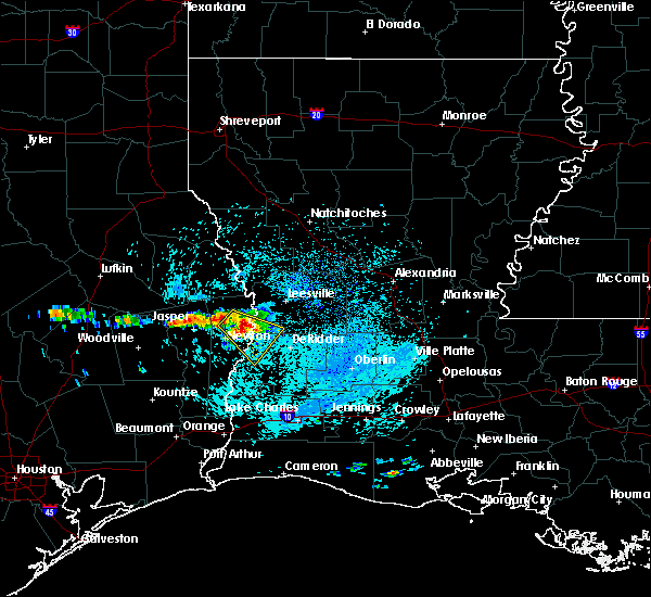 At 1213 pm cdt, a severe thunderstorm was located over stringtown, or near burkeville, moving southeast at 25 mph (radar indicated). Hazards include 60 mph wind gusts and quarter size hail. Hail damage to vehicles is expected. expect wind damage to roofs, siding, and trees. Locations impacted include, merryville, burkeville, junction, stringtown, wiergate and evans. At 1213 pm cdt, a severe thunderstorm was located over stringtown, or near burkeville, moving southeast at 25 mph (radar indicated). Hazards include 60 mph wind gusts and quarter size hail. Hail damage to vehicles is expected. expect wind damage to roofs, siding, and trees. Locations impacted include, merryville, burkeville, junction, stringtown, wiergate and evans.
|
| 3/25/2019 12:00 PM CDT |
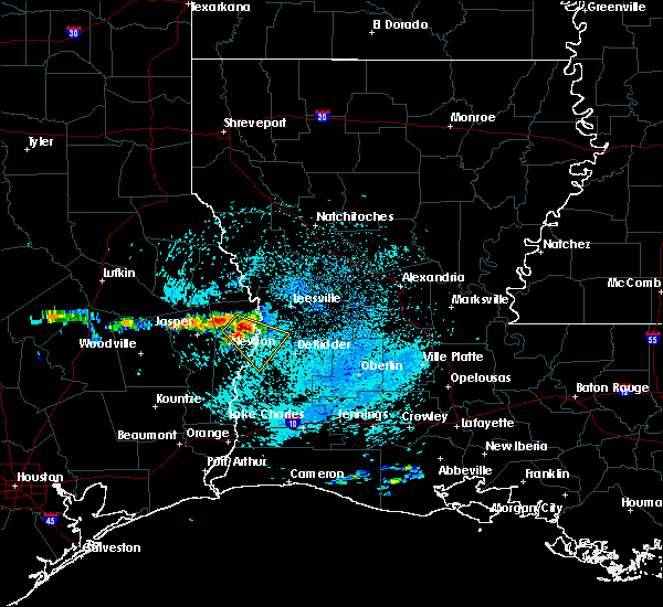 At 1200 pm cdt, a severe thunderstorm was located over burkeville, moving southeast at 25 mph (radar indicated). Hazards include 60 mph wind gusts and quarter size hail. Hail damage to vehicles is expected. Expect wind damage to roofs, siding, and trees. At 1200 pm cdt, a severe thunderstorm was located over burkeville, moving southeast at 25 mph (radar indicated). Hazards include 60 mph wind gusts and quarter size hail. Hail damage to vehicles is expected. Expect wind damage to roofs, siding, and trees.
|
| 12/27/2018 7:11 AM CST |
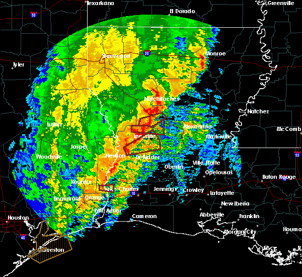 At 711 am cst, a severe thunderstorm capable of producing a tornado was located near rosepine, moving northeast at 45 mph (radar indicated rotation). Hazards include tornado. Flying debris will be dangerous to those caught without shelter. mobile homes will be damaged or destroyed. damage to roofs, windows, and vehicles will occur. tree damage is likely. this dangerous storm will be near, fort polk around 715 am cst. cravens around 730 am cst. fullerton around 735 am cst. lacamp around 745 am cst. Other locations impacted by this tornadic thunderstorm include pickering and simpson. At 711 am cst, a severe thunderstorm capable of producing a tornado was located near rosepine, moving northeast at 45 mph (radar indicated rotation). Hazards include tornado. Flying debris will be dangerous to those caught without shelter. mobile homes will be damaged or destroyed. damage to roofs, windows, and vehicles will occur. tree damage is likely. this dangerous storm will be near, fort polk around 715 am cst. cravens around 730 am cst. fullerton around 735 am cst. lacamp around 745 am cst. Other locations impacted by this tornadic thunderstorm include pickering and simpson.
|
| 10/31/2018 8:56 PM CDT |
 At 855 pm cdt, severe thunderstorms were located along a line extending from merryville to near singer to near dequincy to near lunita, moving east at 30 mph (radar indicated). Hazards include 60 mph wind gusts and nickel size hail. Expect damage to roofs, siding, and trees. locations impacted include, rosepine, merryville, dry creek, singer, de ridder, fields, de quincy, ragley, deridder, dequincy, longville, bivens, tulla, oretta and bundick lake. a tornado watch remains in effect until 1000 pm cdt for southeastern texas. A tornado watch also remains in effect until 400 am cdt for southwestern and west central louisiana. At 855 pm cdt, severe thunderstorms were located along a line extending from merryville to near singer to near dequincy to near lunita, moving east at 30 mph (radar indicated). Hazards include 60 mph wind gusts and nickel size hail. Expect damage to roofs, siding, and trees. locations impacted include, rosepine, merryville, dry creek, singer, de ridder, fields, de quincy, ragley, deridder, dequincy, longville, bivens, tulla, oretta and bundick lake. a tornado watch remains in effect until 1000 pm cdt for southeastern texas. A tornado watch also remains in effect until 400 am cdt for southwestern and west central louisiana.
|
| 10/31/2018 8:40 PM CDT |
 At 840 pm cdt, severe thunderstorms were located along a line extending from near bon weir to bivens to 6 miles southwest of fields to near starks, moving northeast at 40 mph (radar indicated). Hazards include 60 mph wind gusts and penny size hail. expect damage to roofs, siding, and trees At 840 pm cdt, severe thunderstorms were located along a line extending from near bon weir to bivens to 6 miles southwest of fields to near starks, moving northeast at 40 mph (radar indicated). Hazards include 60 mph wind gusts and penny size hail. expect damage to roofs, siding, and trees
|
| 7/3/2018 3:14 PM CDT |
 At 313 pm cdt, a severe thunderstorm was located near deridder, or near de ridder, moving southwest at 30 mph (radar indicated). Hazards include 60 mph wind gusts. expect damage to roofs, siding, and trees At 313 pm cdt, a severe thunderstorm was located near deridder, or near de ridder, moving southwest at 30 mph (radar indicated). Hazards include 60 mph wind gusts. expect damage to roofs, siding, and trees
|
| 7/3/2018 3:03 PM CDT |
 At 303 pm cdt, severe thunderstorms were located along a line extending from near new llano to near rosepine to 7 miles southwest of cravens, moving southwest at 20 mph (radar indicated). Hazards include 60 mph wind gusts. Expect damage to roofs, siding, and trees. Locations impacted include, leesville, rosepine, fort polk, de ridder, deridder, new llano, evans and pickering. At 303 pm cdt, severe thunderstorms were located along a line extending from near new llano to near rosepine to 7 miles southwest of cravens, moving southwest at 20 mph (radar indicated). Hazards include 60 mph wind gusts. Expect damage to roofs, siding, and trees. Locations impacted include, leesville, rosepine, fort polk, de ridder, deridder, new llano, evans and pickering.
|
| 7/3/2018 2:45 PM CDT |
 At 245 pm cdt, severe thunderstorms were located along a line extending from leesville to near fort polk to cravens, moving southwest at 20 mph (radar indicated). Hazards include 60 mph wind gusts. expect damage to roofs, siding, and trees At 245 pm cdt, severe thunderstorms were located along a line extending from leesville to near fort polk to cravens, moving southwest at 20 mph (radar indicated). Hazards include 60 mph wind gusts. expect damage to roofs, siding, and trees
|
| 4/7/2018 1:41 AM CDT |
 At 140 am cdt, severe thunderstorms were located along a line extending from near cravens to near tulla to oretta to near bancroft, moving southeast at 40 mph (radar indicated). Hazards include 60 mph wind gusts and quarter size hail. Hail damage to vehicles is expected. Expect wind damage to roofs, siding, and trees. At 140 am cdt, severe thunderstorms were located along a line extending from near cravens to near tulla to oretta to near bancroft, moving southeast at 40 mph (radar indicated). Hazards include 60 mph wind gusts and quarter size hail. Hail damage to vehicles is expected. Expect wind damage to roofs, siding, and trees.
|
| 4/7/2018 1:41 AM CDT |
 The national weather service in lake charles has issued a * severe thunderstorm warning for. northwestern jefferson davis parish in southwestern louisiana. beauregard parish in southwestern louisiana. northeastern calcasieu parish in southwestern louisiana. Southeastern vernon parish in west central louisiana. The national weather service in lake charles has issued a * severe thunderstorm warning for. northwestern jefferson davis parish in southwestern louisiana. beauregard parish in southwestern louisiana. northeastern calcasieu parish in southwestern louisiana. Southeastern vernon parish in west central louisiana.
|
| 4/7/2018 1:03 AM CDT |
 At 102 am cdt, severe thunderstorms were located along a line extending from 6 miles east of burkeville to near stringtown to near roganville to near magnolia springs, moving southeast at 40 mph (radar indicated). Hazards include 60 mph wind gusts and quarter size hail. Hail damage to vehicles is expected. Expect wind damage to roofs, siding, and trees. At 102 am cdt, severe thunderstorms were located along a line extending from 6 miles east of burkeville to near stringtown to near roganville to near magnolia springs, moving southeast at 40 mph (radar indicated). Hazards include 60 mph wind gusts and quarter size hail. Hail damage to vehicles is expected. Expect wind damage to roofs, siding, and trees.
|
| 4/3/2018 9:59 PM CDT |
 At 959 pm cdt, severe thunderstorms were located along a line extending from sieper to near fields, moving east at 30 mph (radar indicated). Hazards include 60 mph wind gusts and quarter size hail. Hail damage to vehicles is expected. expect wind damage to roofs, siding, and trees. Locations impacted include, alexandria, rosepine, merryville, dry creek, singer, de ridder, sugartown, ragley, hineston, fields, pitkin, fort polk, deridder, dequincy, bivens, otis, elmer, wrights settlement, devils pocket and sieper. At 959 pm cdt, severe thunderstorms were located along a line extending from sieper to near fields, moving east at 30 mph (radar indicated). Hazards include 60 mph wind gusts and quarter size hail. Hail damage to vehicles is expected. expect wind damage to roofs, siding, and trees. Locations impacted include, alexandria, rosepine, merryville, dry creek, singer, de ridder, sugartown, ragley, hineston, fields, pitkin, fort polk, deridder, dequincy, bivens, otis, elmer, wrights settlement, devils pocket and sieper.
|
| 4/3/2018 9:30 PM CDT |
 The national weather service in lake charles has issued a * severe thunderstorm warning for. western rapides parish in central louisiana. beauregard parish in southwestern louisiana. vernon parish in west central louisiana. Southern newton county in southeastern texas. The national weather service in lake charles has issued a * severe thunderstorm warning for. western rapides parish in central louisiana. beauregard parish in southwestern louisiana. vernon parish in west central louisiana. Southern newton county in southeastern texas.
|
| 4/3/2018 9:30 PM CDT |
 At 929 pm cdt, severe thunderstorms were located along a line extending from near slagle to near devils pocket, moving east at 30 mph (radar indicated). Hazards include 60 mph wind gusts and quarter size hail. Hail damage to vehicles is expected. Expect wind damage to roofs, siding, and trees. At 929 pm cdt, severe thunderstorms were located along a line extending from near slagle to near devils pocket, moving east at 30 mph (radar indicated). Hazards include 60 mph wind gusts and quarter size hail. Hail damage to vehicles is expected. Expect wind damage to roofs, siding, and trees.
|
| 4/3/2018 9:17 PM CDT |
 At 917 pm cdt, a severe thunderstorm was located over leesville, moving east at 40 mph (radar indicated). Hazards include 60 mph wind gusts and half dollar size hail. Hail damage to vehicles is expected. expect wind damage to roofs, siding, and trees. Locations impacted include, leesville, rosepine, fort polk, slagle, deridder, new llano, burr ferry, evans and pickering. At 917 pm cdt, a severe thunderstorm was located over leesville, moving east at 40 mph (radar indicated). Hazards include 60 mph wind gusts and half dollar size hail. Hail damage to vehicles is expected. expect wind damage to roofs, siding, and trees. Locations impacted include, leesville, rosepine, fort polk, slagle, deridder, new llano, burr ferry, evans and pickering.
|
| 4/3/2018 9:13 PM CDT |
 At 911 pm cdt, a severe thunderstorm was located near merryville, moving east at 40 mph (radar indicated). Hazards include 60 mph wind gusts and quarter size hail. Hail damage to vehicles is expected. Expect wind damage to roofs, siding, and trees. At 911 pm cdt, a severe thunderstorm was located near merryville, moving east at 40 mph (radar indicated). Hazards include 60 mph wind gusts and quarter size hail. Hail damage to vehicles is expected. Expect wind damage to roofs, siding, and trees.
|
| 4/3/2018 8:57 PM CDT |
 At 854 pm cdt, a severe thunderstorm was located over burr ferry, or near toledo bend dam, and near leesville, moving east at 40 mph. vernon parish s.o. reported golfball size hail near leesville (law enforcement). Hazards include golf ball size hail and 60 mph wind gusts. People and animals outdoors will be injured. expect hail damage to roofs, siding, windows, and vehicles. expect wind damage to roofs, siding, and trees. Locations impacted include, leesville, rosepine, anacoco, toledo bend dam, fort polk, slagle, burkeville, deridder, new llano, burr ferry, stringtown, wiergate, evans and pickering. At 854 pm cdt, a severe thunderstorm was located over burr ferry, or near toledo bend dam, and near leesville, moving east at 40 mph. vernon parish s.o. reported golfball size hail near leesville (law enforcement). Hazards include golf ball size hail and 60 mph wind gusts. People and animals outdoors will be injured. expect hail damage to roofs, siding, windows, and vehicles. expect wind damage to roofs, siding, and trees. Locations impacted include, leesville, rosepine, anacoco, toledo bend dam, fort polk, slagle, burkeville, deridder, new llano, burr ferry, stringtown, wiergate, evans and pickering.
|
| 4/3/2018 8:53 PM CDT |
 At 852 pm cdt, a severe thunderstorm was located near burr ferry, or near toledo bend dam, moving east at 40 mph (radar indicated). Hazards include 60 mph wind gusts. expect damage to roofs, siding, and trees At 852 pm cdt, a severe thunderstorm was located near burr ferry, or near toledo bend dam, moving east at 40 mph (radar indicated). Hazards include 60 mph wind gusts. expect damage to roofs, siding, and trees
|
| 4/3/2018 7:17 PM CDT |
 At 715 pm cdt, a severe thunderstorm was located over lacamp, or 10 miles west of hineston, moving east at 35 mph (radar indicated). Hazards include 60 mph wind gusts. Expect damage to roofs, siding, and trees. Locations impacted include, alexandria, pineville, leesville, rosepine, boyce, fort polk, alexandria international airport, slagle, hineston, lena, pitkin, deridder, ball, new llano, tioga, timber trails, hutton, esler regional airport, flatwoods and otis. At 715 pm cdt, a severe thunderstorm was located over lacamp, or 10 miles west of hineston, moving east at 35 mph (radar indicated). Hazards include 60 mph wind gusts. Expect damage to roofs, siding, and trees. Locations impacted include, alexandria, pineville, leesville, rosepine, boyce, fort polk, alexandria international airport, slagle, hineston, lena, pitkin, deridder, ball, new llano, tioga, timber trails, hutton, esler regional airport, flatwoods and otis.
|
| 4/3/2018 6:48 PM CDT |
 At 647 pm cdt, a line of severe thunderstorms was located near leesville, moving east at 35 mph (radar indicated). Hazards include 60 mph wind gusts. expect damage to roofs, siding, and trees At 647 pm cdt, a line of severe thunderstorms was located near leesville, moving east at 35 mph (radar indicated). Hazards include 60 mph wind gusts. expect damage to roofs, siding, and trees
|
| 3/18/2018 9:27 PM CDT |
 At 927 pm cdt, severe thunderstorms were located along a line extending from near slagle to leesville, moving east at 20 mph (radar indicated. at 9:15 pm, nickel sized hail was reported in leesville). Hazards include 60 mph wind gusts and quarter size hail. Hail damage to vehicles is expected. expect wind damage to roofs, siding, and trees. Locations impacted include, leesville, rosepine, anacoco, toledo bend dam, fort polk, slagle, deridder, new llano, hornbeck, burr ferry, kurthwood, evans and pickering. At 927 pm cdt, severe thunderstorms were located along a line extending from near slagle to leesville, moving east at 20 mph (radar indicated. at 9:15 pm, nickel sized hail was reported in leesville). Hazards include 60 mph wind gusts and quarter size hail. Hail damage to vehicles is expected. expect wind damage to roofs, siding, and trees. Locations impacted include, leesville, rosepine, anacoco, toledo bend dam, fort polk, slagle, deridder, new llano, hornbeck, burr ferry, kurthwood, evans and pickering.
|
| 3/18/2018 9:08 PM CDT |
 At 906 pm cdt, severe thunderstorms were located along a line extending from near slagle to near new llano, moving northeast at 20 mph. another severe thunderstorm entering northern newton county texas is likely to continue east at 40 mph and move into western vernon parish within the hour (radar indicated). Hazards include 60 mph wind gusts and quarter size hail. Hail damage to vehicles is expected. Expect wind damage to roofs, siding, and trees. At 906 pm cdt, severe thunderstorms were located along a line extending from near slagle to near new llano, moving northeast at 20 mph. another severe thunderstorm entering northern newton county texas is likely to continue east at 40 mph and move into western vernon parish within the hour (radar indicated). Hazards include 60 mph wind gusts and quarter size hail. Hail damage to vehicles is expected. Expect wind damage to roofs, siding, and trees.
|
| 5/28/2017 7:46 PM CDT |
 At 746 pm cdt, severe thunderstorms were located along a line extending from 10 miles south of natchitoches to near burr ferry to near browndell, moving southeast at 40 mph (radar indicated). Hazards include 60 mph wind gusts and nickel size hail. Expect damage to roofs, siding, and trees. Locations impacted include, leesville, newton, rosepine, boyce, anacoco, fort polk, de ridder, sugartown, slagle, toledo bend dam, hineston, lena, pitkin, burkeville, deridder, new llano, colfax, hornbeck, hutton and flatwoods. At 746 pm cdt, severe thunderstorms were located along a line extending from 10 miles south of natchitoches to near burr ferry to near browndell, moving southeast at 40 mph (radar indicated). Hazards include 60 mph wind gusts and nickel size hail. Expect damage to roofs, siding, and trees. Locations impacted include, leesville, newton, rosepine, boyce, anacoco, fort polk, de ridder, sugartown, slagle, toledo bend dam, hineston, lena, pitkin, burkeville, deridder, new llano, colfax, hornbeck, hutton and flatwoods.
|
| 5/28/2017 7:19 PM CDT |
 At 715 pm cdt, severe thunderstorms were located along a line extending from 15 miles west of natchitoches to 7 miles southeast of hemphill to 10 miles southeast of etoile, moving southeast at 45 mph (radar indicated). Hazards include 60 mph wind gusts and nickel size hail. expect damage to roofs, siding, and trees At 715 pm cdt, severe thunderstorms were located along a line extending from 15 miles west of natchitoches to 7 miles southeast of hemphill to 10 miles southeast of etoile, moving southeast at 45 mph (radar indicated). Hazards include 60 mph wind gusts and nickel size hail. expect damage to roofs, siding, and trees
|
| 5/21/2017 2:20 PM CDT |
 At 220 pm cdt, severe thunderstorms were located along a line extending from rosepine to 7 miles southwest of cravens, moving north at 25 mph (radar indicated). Hazards include 60 mph wind gusts. Expect damage to roofs, siding, and trees. Locations impacted include, rosepine, fort polk, de ridder, deridder, fullerton, cravens and pickering. At 220 pm cdt, severe thunderstorms were located along a line extending from rosepine to 7 miles southwest of cravens, moving north at 25 mph (radar indicated). Hazards include 60 mph wind gusts. Expect damage to roofs, siding, and trees. Locations impacted include, rosepine, fort polk, de ridder, deridder, fullerton, cravens and pickering.
|
| 5/21/2017 2:07 PM CDT |
 At 207 pm cdt, severe thunderstorms were located along a line extending from de ridder to 7 miles west of sugartown, moving north at 20 mph (radar indicated). Hazards include 60 mph wind gusts. Expect damage to roofs, siding, and trees. Locations impacted include, rosepine, fort polk, de ridder, deridder, tulla, fullerton, cravens and pickering. At 207 pm cdt, severe thunderstorms were located along a line extending from de ridder to 7 miles west of sugartown, moving north at 20 mph (radar indicated). Hazards include 60 mph wind gusts. Expect damage to roofs, siding, and trees. Locations impacted include, rosepine, fort polk, de ridder, deridder, tulla, fullerton, cravens and pickering.
|
| 5/21/2017 1:54 PM CDT |
 At 153 pm cdt, severe thunderstorms were located along a line extending from near de ridder to 7 miles northwest of dry creek, moving north at 25 mph (radar indicated). Hazards include 60 mph wind gusts. expect damage to roofs, siding, and trees At 153 pm cdt, severe thunderstorms were located along a line extending from near de ridder to 7 miles northwest of dry creek, moving north at 25 mph (radar indicated). Hazards include 60 mph wind gusts. expect damage to roofs, siding, and trees
|
| 5/3/2017 6:21 PM CDT |
 At 620 pm cdt, severe thunderstorms were located along a line extending from 6 miles southwest of hornbeck to near chester, moving southeast at 40 mph (radar indicated). Hazards include 60 mph wind gusts and quarter size hail. Hail damage to vehicles is expected. Expect wind damage to roofs, siding, and trees. At 620 pm cdt, severe thunderstorms were located along a line extending from 6 miles southwest of hornbeck to near chester, moving southeast at 40 mph (radar indicated). Hazards include 60 mph wind gusts and quarter size hail. Hail damage to vehicles is expected. Expect wind damage to roofs, siding, and trees.
|
| 5/3/2017 8:50 AM CDT |
 At 850 am cdt, a severe thunderstorm was located over singer, moving north at 40 mph (radar indicated). Hazards include golf ball size hail and 60 mph wind gusts. People and animals outdoors will be injured. expect hail damage to roofs, siding, windows, and vehicles. Expect wind damage to roofs, siding, and trees. At 850 am cdt, a severe thunderstorm was located over singer, moving north at 40 mph (radar indicated). Hazards include golf ball size hail and 60 mph wind gusts. People and animals outdoors will be injured. expect hail damage to roofs, siding, windows, and vehicles. Expect wind damage to roofs, siding, and trees.
|
| 4/30/2017 1:30 AM CDT |
 At 129 am cdt, severe thunderstorms were located along a line extending from 6 miles north of hornbeck to 6 miles north of cravens, moving northeast at 45 mph (radar indicated). Hazards include 60 mph wind gusts and quarter size hail. Hail damage to vehicles is expected. Expect wind damage to roofs, siding, and trees. At 129 am cdt, severe thunderstorms were located along a line extending from 6 miles north of hornbeck to 6 miles north of cravens, moving northeast at 45 mph (radar indicated). Hazards include 60 mph wind gusts and quarter size hail. Hail damage to vehicles is expected. Expect wind damage to roofs, siding, and trees.
|
| 4/2/2017 3:25 PM CDT |
 At 324 pm cdt, severe thunderstorms were located along a line extending from 7 miles southeast of many to 6 miles west of new llano to near stringtown, moving northeast at 50 mph (radar indicated). Hazards include 60 mph wind gusts. expect damage to roofs, siding, and trees At 324 pm cdt, severe thunderstorms were located along a line extending from 7 miles southeast of many to 6 miles west of new llano to near stringtown, moving northeast at 50 mph (radar indicated). Hazards include 60 mph wind gusts. expect damage to roofs, siding, and trees
|
| 3/25/2017 12:13 AM CDT |
 At 1212 am cdt, severe thunderstorms were located along a line extending from near toledo bend dam to near roganville, moving east at 45 mph (radar indicated). Hazards include 60 mph wind gusts. expect damage to roofs, siding, and trees At 1212 am cdt, severe thunderstorms were located along a line extending from near toledo bend dam to near roganville, moving east at 45 mph (radar indicated). Hazards include 60 mph wind gusts. expect damage to roofs, siding, and trees
|
| 1/2/2017 10:27 AM CST |
 At 1026 am cst, severe thunderstorms were located along a line extending from near hutton to near buhler, moving east at 45 mph (radar indicated). Hazards include 70 mph wind gusts. Expect considerable tree damage. damage is likely to mobile homes, roofs, and outbuildings. locations impacted include, leesville, rosepine, merryville, anacoco, de ridder, deweyville, ragley, fort polk, fields, singer, slagle, deridder, dequincy, new llano, hornbeck, lacamp, cravens, hutton, fullerton and tulla. A tornado watch remains in effect until 200 pm cst for west central, central and southwestern louisiana, and southeastern texas. At 1026 am cst, severe thunderstorms were located along a line extending from near hutton to near buhler, moving east at 45 mph (radar indicated). Hazards include 70 mph wind gusts. Expect considerable tree damage. damage is likely to mobile homes, roofs, and outbuildings. locations impacted include, leesville, rosepine, merryville, anacoco, de ridder, deweyville, ragley, fort polk, fields, singer, slagle, deridder, dequincy, new llano, hornbeck, lacamp, cravens, hutton, fullerton and tulla. A tornado watch remains in effect until 200 pm cst for west central, central and southwestern louisiana, and southeastern texas.
|
| 1/2/2017 10:23 AM CST |
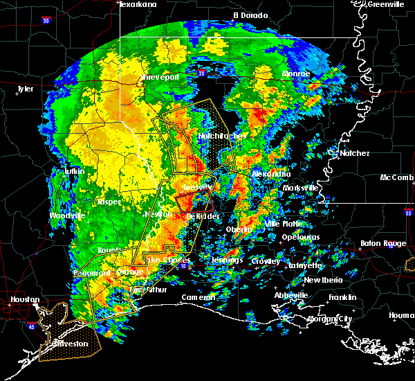 At 1023 am cst, a severe thunderstorm capable of producing a tornado was located over fort polk, moving east at 40 mph (radar indicated rotation). Hazards include tornado. Flying debris will be dangerous to those caught without shelter. mobile homes will be damaged or destroyed. damage to roofs, windows, and vehicles will occur. tree damage is likely. this dangerous storm will be near, cravens around 1035 am cst. fullerton around 1040 am cst. Other locations impacted by this tornadic thunderstorm include pickering. At 1023 am cst, a severe thunderstorm capable of producing a tornado was located over fort polk, moving east at 40 mph (radar indicated rotation). Hazards include tornado. Flying debris will be dangerous to those caught without shelter. mobile homes will be damaged or destroyed. damage to roofs, windows, and vehicles will occur. tree damage is likely. this dangerous storm will be near, cravens around 1035 am cst. fullerton around 1040 am cst. Other locations impacted by this tornadic thunderstorm include pickering.
|
| 1/2/2017 10:10 AM CST |
 At 1009 am cst, a severe thunderstorm capable of producing a tornado was located near rosepine, moving east at 35 mph (radar indicated rotation). Hazards include tornado. Flying debris will be dangerous to those caught without shelter. mobile homes will be damaged or destroyed. damage to roofs, windows, and vehicles will occur. tree damage is likely. this dangerous storm will be near, rosepine around 1015 am cst. fort polk around 1020 am cst. fullerton and cravens around 1045 am cst. Other locations impacted by this tornadic thunderstorm include pickering. At 1009 am cst, a severe thunderstorm capable of producing a tornado was located near rosepine, moving east at 35 mph (radar indicated rotation). Hazards include tornado. Flying debris will be dangerous to those caught without shelter. mobile homes will be damaged or destroyed. damage to roofs, windows, and vehicles will occur. tree damage is likely. this dangerous storm will be near, rosepine around 1015 am cst. fort polk around 1020 am cst. fullerton and cravens around 1045 am cst. Other locations impacted by this tornadic thunderstorm include pickering.
|
| 1/2/2017 10:08 AM CST |
 At 1007 am cst, severe thunderstorms were located along a line extending from near kurthwood to lunita, moving east at 55 mph (radar indicated). Hazards include 70 mph wind gusts. Expect considerable tree damage. damage is likely to mobile homes, roofs, and outbuildings. locations impacted include, leesville, rosepine, merryville, anacoco, de ridder, deweyville, bon weir, ragley, fort polk, fields, toledo bend dam, singer, slagle, deridder, dequincy, new llano, hornbeck, lacamp, cravens and hutton. A tornado watch remains in effect until 200 pm cst for west central, central and southwestern louisiana, and southeastern texas. At 1007 am cst, severe thunderstorms were located along a line extending from near kurthwood to lunita, moving east at 55 mph (radar indicated). Hazards include 70 mph wind gusts. Expect considerable tree damage. damage is likely to mobile homes, roofs, and outbuildings. locations impacted include, leesville, rosepine, merryville, anacoco, de ridder, deweyville, bon weir, ragley, fort polk, fields, toledo bend dam, singer, slagle, deridder, dequincy, new llano, hornbeck, lacamp, cravens and hutton. A tornado watch remains in effect until 200 pm cst for west central, central and southwestern louisiana, and southeastern texas.
|
| 1/2/2017 9:46 AM CST |
 At 946 am cst, severe thunderstorms were located along a line extending from near hornbeck to near deweyville, moving east at 30 mph (radar indicated). Hazards include 70 mph wind gusts. Expect considerable tree damage. Damage is likely to mobile homes, roofs, and outbuildings. At 946 am cst, severe thunderstorms were located along a line extending from near hornbeck to near deweyville, moving east at 30 mph (radar indicated). Hazards include 70 mph wind gusts. Expect considerable tree damage. Damage is likely to mobile homes, roofs, and outbuildings.
|
| 6/18/2016 2:05 PM CDT |
 At 203 pm cdt, a severe thunderstorm was located between fort polk and 5 miles northwest of leesville, moving south at 35 mph (radar indicated). Hazards include 60 mph wind gusts. Expect damage to roofs. siding. and trees. Locations impacted include, leesville, rosepine, anacoco, fort polk, slagle, deridder, new llano, hornbeck, burr ferry, evans and pickering. At 203 pm cdt, a severe thunderstorm was located between fort polk and 5 miles northwest of leesville, moving south at 35 mph (radar indicated). Hazards include 60 mph wind gusts. Expect damage to roofs. siding. and trees. Locations impacted include, leesville, rosepine, anacoco, fort polk, slagle, deridder, new llano, hornbeck, burr ferry, evans and pickering.
|
| 6/18/2016 1:28 PM CDT |
 At 127 pm cdt, a severe thunderstorm was located near slagle, moving south at 35 mph (radar indicated). Hazards include 60 mph wind gusts. Expect damage to roofs. siding. And trees. At 127 pm cdt, a severe thunderstorm was located near slagle, moving south at 35 mph (radar indicated). Hazards include 60 mph wind gusts. Expect damage to roofs. siding. And trees.
|
| 5/27/2016 5:00 PM CDT | Sheriffs department reports power pole snapped off at rosepin in vernon county LA, 0.5 miles NW of Rosepine, LA |
| 5/27/2016 4:20 PM CDT |
 At 419 pm cdt, severe thunderstorms were located along a line extending from 6 miles east of mayflower to near deweyville, moving east at 35 mph (radar indicated). Hazards include 60 mph wind gusts. Expect damage to roofs. siding. And trees. At 419 pm cdt, severe thunderstorms were located along a line extending from 6 miles east of mayflower to near deweyville, moving east at 35 mph (radar indicated). Hazards include 60 mph wind gusts. Expect damage to roofs. siding. And trees.
|
| 4/30/2016 7:33 AM CDT |
 At 732 am cdt, severe thunderstorms were located along a line extending from 6 miles northeast of junction to singer to near de quincy, moving east at 30 mph (radar indicated). Hazards include 60 mph wind gusts and quarter size hail. Hail damage to vehicles is expected. expect wind damage to roofs, siding, and trees. Locations impacted include, rosepine, ragley, de ridder, singer, deridder, dequincy, tulla, longville and oretta. At 732 am cdt, severe thunderstorms were located along a line extending from 6 miles northeast of junction to singer to near de quincy, moving east at 30 mph (radar indicated). Hazards include 60 mph wind gusts and quarter size hail. Hail damage to vehicles is expected. expect wind damage to roofs, siding, and trees. Locations impacted include, rosepine, ragley, de ridder, singer, deridder, dequincy, tulla, longville and oretta.
|
| 4/30/2016 6:44 AM CDT |
 At 643 am cdt, severe thunderstorms were located along a line extending from newton to near bancroft to near gist, moving east at 40 mph (radar indicated). Hazards include 60 mph wind gusts and quarter size hail. Hail damage to vehicles is expected. Expect wind damage to roofs, siding, and trees. At 643 am cdt, severe thunderstorms were located along a line extending from newton to near bancroft to near gist, moving east at 40 mph (radar indicated). Hazards include 60 mph wind gusts and quarter size hail. Hail damage to vehicles is expected. Expect wind damage to roofs, siding, and trees.
|
| 4/27/2016 7:46 AM CDT |
 At 746 am cdt, severe thunderstorms were located along a line extending from near hornbeck to near rosepine to near longville to near moss bluff to 6 miles northeast of holly beach to 25 miles south of johnsons bayou, moving east at 45 mph (radar indicated). Hazards include 60 mph wind gusts and penny size hail. Expect damage to roofs. siding. And trees. At 746 am cdt, severe thunderstorms were located along a line extending from near hornbeck to near rosepine to near longville to near moss bluff to 6 miles northeast of holly beach to 25 miles south of johnsons bayou, moving east at 45 mph (radar indicated). Hazards include 60 mph wind gusts and penny size hail. Expect damage to roofs. siding. And trees.
|
| 4/27/2016 7:27 AM CDT |
 At 726 am cdt, severe thunderstorms were located along a line extending from near anacoco to near de ridder to longville to sulphur to 16 miles south of johnsons bayou, moving east at 45 mph (radar indicated). Hazards include 60 mph wind gusts and penny size hail. Expect damage to roofs. siding. and trees. Locations impacted include, lake charles, sulphur, cameron, leesville, westlake, iowa, rosepine, anacoco, reeves, moss bluff, lake charles regional airport, mittie, dry creek, pitkin, ragley, fort polk, sabine national wildlife, sugartown, slagle and grand lake. At 726 am cdt, severe thunderstorms were located along a line extending from near anacoco to near de ridder to longville to sulphur to 16 miles south of johnsons bayou, moving east at 45 mph (radar indicated). Hazards include 60 mph wind gusts and penny size hail. Expect damage to roofs. siding. and trees. Locations impacted include, lake charles, sulphur, cameron, leesville, westlake, iowa, rosepine, anacoco, reeves, moss bluff, lake charles regional airport, mittie, dry creek, pitkin, ragley, fort polk, sabine national wildlife, sugartown, slagle and grand lake.
|
| 4/27/2016 6:47 AM CDT |
 At 646 am cdt, severe thunderstorms were located along a line extending from 8 miles southeast of pineland to newton to near bancroft to mauriceville to 12 miles east of high island, moving east at 45 mph (radar indicated). Hazards include 60 mph wind gusts and quarter size hail. Hail damage to vehicles is expected. Expect wind damage to roofs, siding, and trees. At 646 am cdt, severe thunderstorms were located along a line extending from 8 miles southeast of pineland to newton to near bancroft to mauriceville to 12 miles east of high island, moving east at 45 mph (radar indicated). Hazards include 60 mph wind gusts and quarter size hail. Hail damage to vehicles is expected. Expect wind damage to roofs, siding, and trees.
|
| 3/18/2016 7:18 PM CDT | Quarter sized hail reported 0.5 miles NW of Rosepine, LA, public reports quarter size hail at intersection of us 171 and la 3226 |
| 1/8/2016 9:37 PM CST |
 At 937 pm cst, severe thunderstorms were located along a line extending from near fullerton to near oretta, moving east at 25 mph (radar indicated). Hazards include quarter size hail. Damage to vehicles is expected. Locations impacted include, rosepine, pitkin, ragley, de ridder, fields, sugartown, singer, dry creek, fort polk, grant, deridder, dequincy, bivens, cravens, longville, fullerton, tulla, bancroft, oretta and bundick lake. At 937 pm cst, severe thunderstorms were located along a line extending from near fullerton to near oretta, moving east at 25 mph (radar indicated). Hazards include quarter size hail. Damage to vehicles is expected. Locations impacted include, rosepine, pitkin, ragley, de ridder, fields, sugartown, singer, dry creek, fort polk, grant, deridder, dequincy, bivens, cravens, longville, fullerton, tulla, bancroft, oretta and bundick lake.
|
| 1/8/2016 9:17 PM CST |
 At 916 pm cst, severe thunderstorms were located along a line extending from near cravens to near de quincy, moving east at 35 mph (radar indicated). Hazards include quarter size hail. damage to vehicles is expected At 916 pm cst, severe thunderstorms were located along a line extending from near cravens to near de quincy, moving east at 35 mph (radar indicated). Hazards include quarter size hail. damage to vehicles is expected
|
| 10/31/2015 9:11 AM CDT |
 At 910 am cdt, a severe thunderstorm capable of producing a tornado was located over stringtown, or 7 miles south of burkeville, moving northeast at 30 mph (radar indicated rotation). Hazards include tornado. Flying debris will be dangerous to those caught without shelter. mobile homes will be damaged or destroyed. damage to roofs, windows and vehicles will occur. tree damage is likely. this dangerous storm will be near, burr ferry around 935 am cdt. fort polk around 955 am cdt. leesville and new llano around 1000 am cdt. Other locations impacted by this tornadic thunderstorm include evans and pickering. At 910 am cdt, a severe thunderstorm capable of producing a tornado was located over stringtown, or 7 miles south of burkeville, moving northeast at 30 mph (radar indicated rotation). Hazards include tornado. Flying debris will be dangerous to those caught without shelter. mobile homes will be damaged or destroyed. damage to roofs, windows and vehicles will occur. tree damage is likely. this dangerous storm will be near, burr ferry around 935 am cdt. fort polk around 955 am cdt. leesville and new llano around 1000 am cdt. Other locations impacted by this tornadic thunderstorm include evans and pickering.
|
| 10/31/2015 7:28 AM CDT |
 At 728 am cdt, a severe thunderstorm capable of producing a tornado was located near merryville, moving northeast at 40 mph (radar indicated rotation). Hazards include tornado. Flying debris will be dangerous to those caught without shelter. mobile homes will be damaged or destroyed. damage to roofs, windows and vehicles will occur. tree damage is likely. this dangerous storm will be near, tulla around 745 am cdt. de ridder around 750 am cdt. rosepine and deridder around 755 am cdt. Other locations impacted by this tornadic thunderstorm include pickering. At 728 am cdt, a severe thunderstorm capable of producing a tornado was located near merryville, moving northeast at 40 mph (radar indicated rotation). Hazards include tornado. Flying debris will be dangerous to those caught without shelter. mobile homes will be damaged or destroyed. damage to roofs, windows and vehicles will occur. tree damage is likely. this dangerous storm will be near, tulla around 745 am cdt. de ridder around 750 am cdt. rosepine and deridder around 755 am cdt. Other locations impacted by this tornadic thunderstorm include pickering.
|
| 8/24/2015 7:11 PM CDT | Public reported limbs down near rosepine in vernon county LA, 0.5 miles NW of Rosepine, LA |
| 8/24/2015 7:06 PM CDT |
 At 705 pm cdt, doppler radar indicated a line of severe thunderstorms capable of producing damaging winds in excess of 60 mph. these storms were located along a line extending from near cravens to harmony, and moving south at 10 mph. At 705 pm cdt, doppler radar indicated a line of severe thunderstorms capable of producing damaging winds in excess of 60 mph. these storms were located along a line extending from near cravens to harmony, and moving south at 10 mph.
|
| 8/24/2015 7:03 PM CDT |
 At 702 pm cdt, doppler radar indicated a line of severe thunderstorms capable of producing damaging winds in excess of 60 mph. these storms were located along a line extending from near fort polk to near harmony, and moving south at 70 mph. At 702 pm cdt, doppler radar indicated a line of severe thunderstorms capable of producing damaging winds in excess of 60 mph. these storms were located along a line extending from near fort polk to near harmony, and moving south at 70 mph.
|
| 7/30/2015 5:32 PM CDT |
 At 532 pm cdt, doppler radar indicated a line of severe thunderstorms capable of producing damaging winds in excess of 60 mph. these storms were located along a line extending from 6 miles southwest of anacoco to near new llano to near fort polk, and moving southwest at 20 mph. At 532 pm cdt, doppler radar indicated a line of severe thunderstorms capable of producing damaging winds in excess of 60 mph. these storms were located along a line extending from 6 miles southwest of anacoco to near new llano to near fort polk, and moving southwest at 20 mph.
|
| 5/27/2015 6:23 AM CDT | At 623 am cdt, doppler radar indicated a line of severe thunderstorms capable of producing quarter size hail and damaging winds in excess of 60 mph. these storms were located along a line extending from near boyce to ragley, and moving east at 30 mph. |
| 5/27/2015 5:35 AM CDT | At 535 am cdt, doppler radar indicated a line of severe thunderstorms capable of producing damaging winds in excess of 60 mph. these storms were located along a line extending from near hornbeck to near merryville to near old salem, and moving east at 30 mph. nickel size hail may also accompany the damaging winds. |
| 5/25/2015 10:45 PM CDT | At 1045 pm cdt, doppler radar indicated a line of severe thunderstorms capable of producing quarter size hail and damaging winds in excess of 60 mph. these storms were located along a line extending from near boyce to near buhler to near fannett, moving east at 30 mph. locations impacted include, beaumont, port arthur, alexandria, orange, lumberton, vidor, bridge city, west orange, vinton, sour lake, rosepine, merryville, boyce, nome, deweyville, lena, dry creek, ragley, fort polk and evadale. a tornado watch remains in effect until 200 am cdt for southwestern louisiana and southeastern texas. |
| 5/25/2015 10:45 PM CDT | At 1045 pm cdt, doppler radar indicated a line of severe thunderstorms capable of producing quarter size hail and damaging winds in excess of 60 mph. these storms were located along a line extending from near boyce to near buhler to near fannett, moving east at 30 mph. locations impacted include, beaumont, port arthur, alexandria, orange, lumberton, vidor, bridge city, west orange, vinton, sour lake, rosepine, merryville, boyce, nome, deweyville, lena, dry creek, ragley, fort polk and evadale. a tornado watch remains in effect until 200 am cdt for southwestern louisiana and southeastern texas. |
| 5/25/2015 10:19 PM CDT | At 1018 pm cdt, doppler radar indicated a line of severe thunderstorms capable of producing quarter size hail and damaging winds in excess of 60 mph. these storms were located along a line extending from near de ridder to near lunita to nome. these storms were nearly stationary. |
| 5/25/2015 10:19 PM CDT | At 1018 pm cdt, doppler radar indicated a line of severe thunderstorms capable of producing quarter size hail and damaging winds in excess of 60 mph. these storms were located along a line extending from near de ridder to near lunita to nome. these storms were nearly stationary. |
| 5/25/2015 9:44 PM CDT | At 943 pm cdt, doppler radar indicated a line of severe thunderstorms capable of producing quarter size hail and damaging winds in excess of 60 mph. these storms were located along a line extending from 7 miles south of many to near bancroft, and moving east at 35 mph. |
| 4/27/2015 6:58 AM CDT | At 658 am cdt, doppler radar indicated a line of severe thunderstorms capable of producing quarter size hail and damaging winds in excess of 60 mph. these storms were located along a line extending from near anacoco to near cravens to near sulphur, and moving east at 55 mph. |
| 4/27/2015 6:50 AM CDT | At 649 am cdt, local law enforcement reported a line of severe thunderstorms producing quarter size hail and damaging winds in excess of 60 mph. these storms were located along a line extending from near leesville to near rosepine to near edgerly, moving east at 55 mph. locations impacted include, lake charles, sulphur, leesville, westlake, vinton, rosepine, merryville, anacoco, de ridder, moss bluff, starks, dry creek, pitkin, ragley, fort polk, fields, sugartown, de quincy, singer and slagle. a tornado watch remains in effect until 900 am cdt for southeastern texas. a tornado watch also remains in effect until 100 pm cdt for southwestern louisiana and southeastern texas. |
| 4/27/2015 6:21 AM CDT | At 621 am cdt, doppler radar indicated a line of severe thunderstorms capable of producing damaging winds in excess of 60 mph. these storms were located along a line extending from near mayflower to stringtown to near mauriceville, and moving east at 55 mph. |
| 10/13/2014 12:55 PM CDT | 911 relayed report of trees down in vernon county LA, 0.5 miles NW of Rosepine, LA |
| 10/13/2014 12:35 PM CDT | Vernon parish sheriff reports trees down on hwy 10... baily rd...providence...lewis and henry bas in vernon county LA, 2.8 miles SW of Rosepine, LA |
| 7/18/2013 5:46 PM CDT | Public relayed report through twitter of trees down on hawks rd with additional trees down on 171 in vernon county LA, 2.3 miles ESE of Rosepine, LA |
| 7/18/2013 5:45 PM CDT | Vernon sheriffs department reports trees and powerlines down and a roof blown off a home in rosepin in vernon county LA, 0.5 miles NW of Rosepine, LA |
Hail Maps for Rosepine, LA
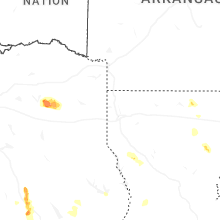

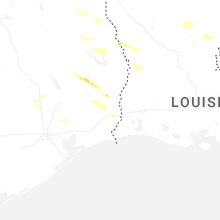
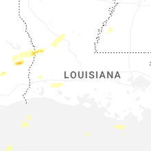
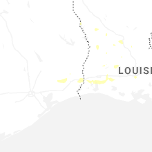
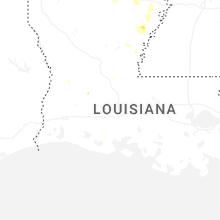
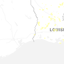
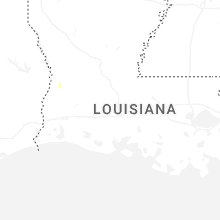
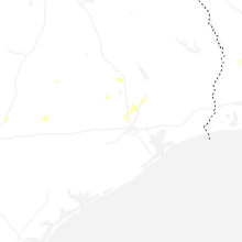
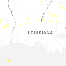


Connect with Interactive Hail Maps