

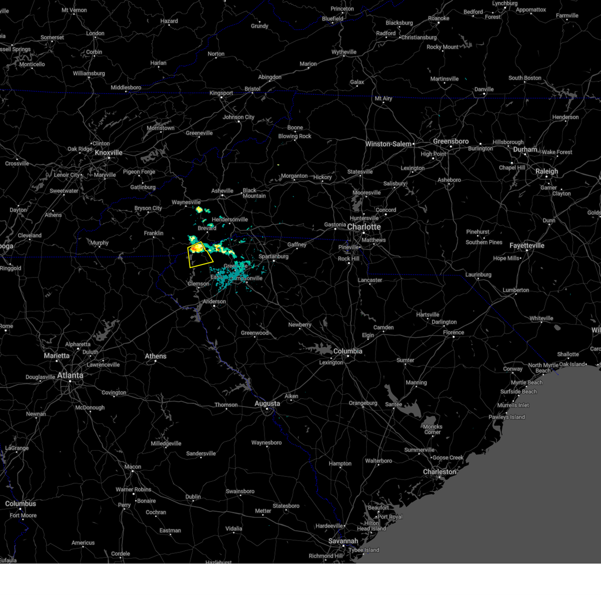
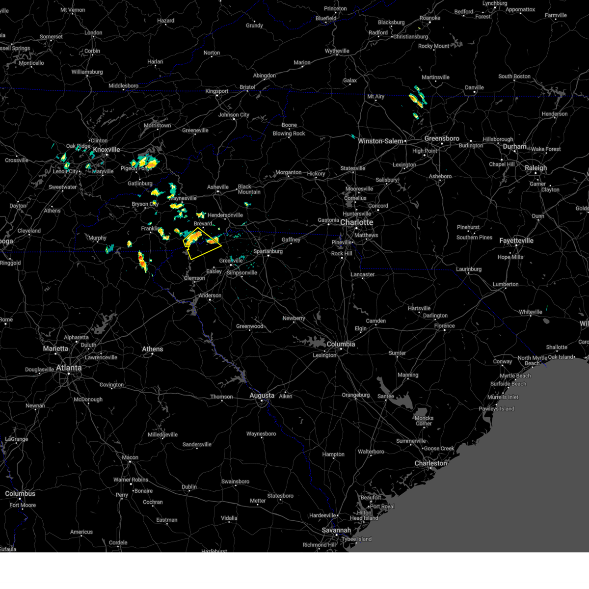
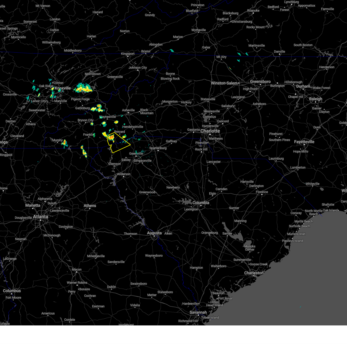
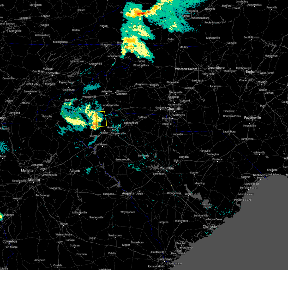
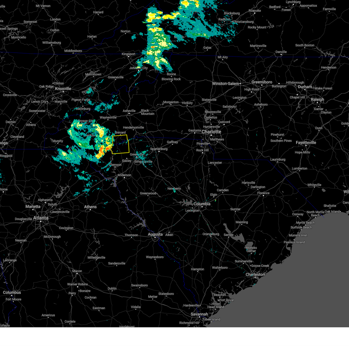
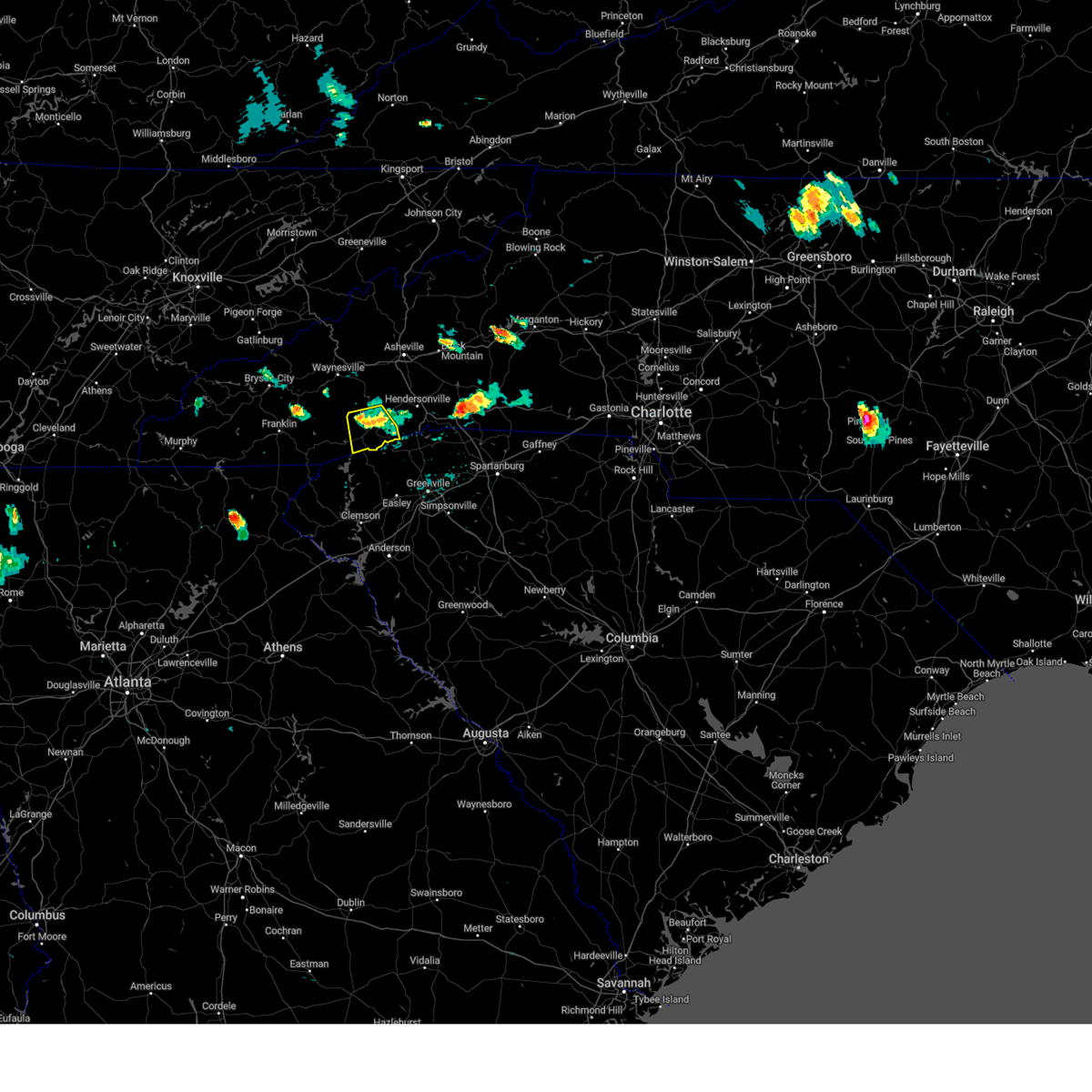
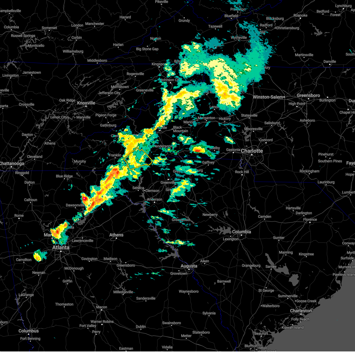
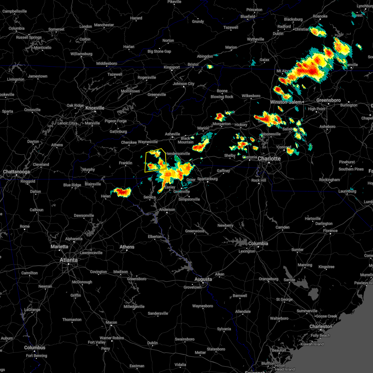
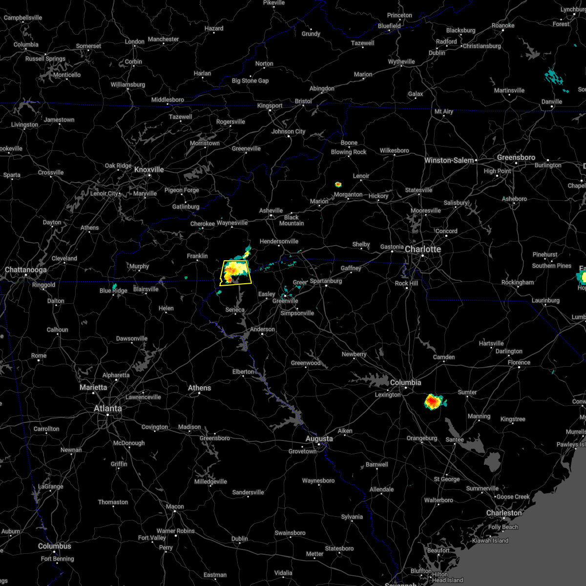
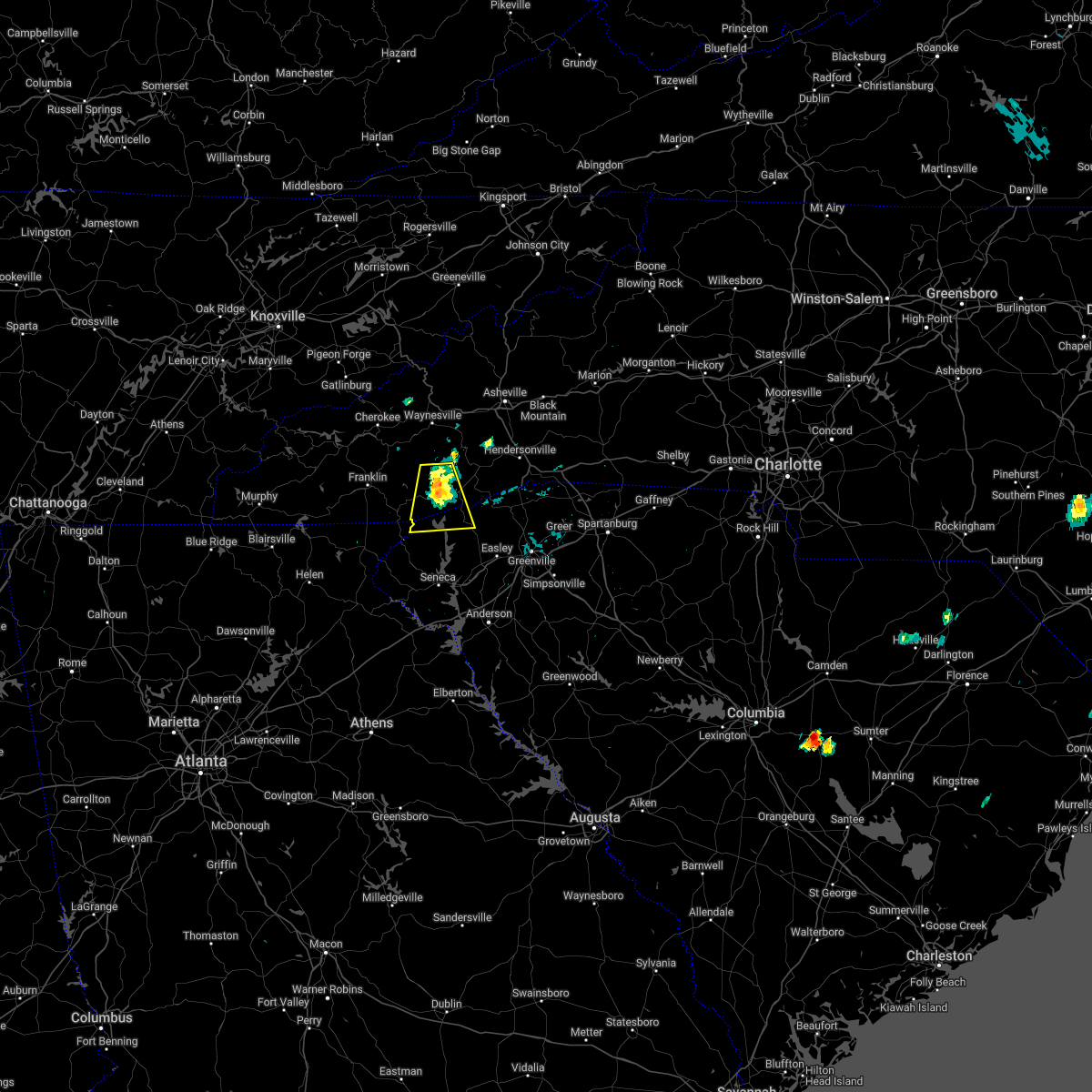
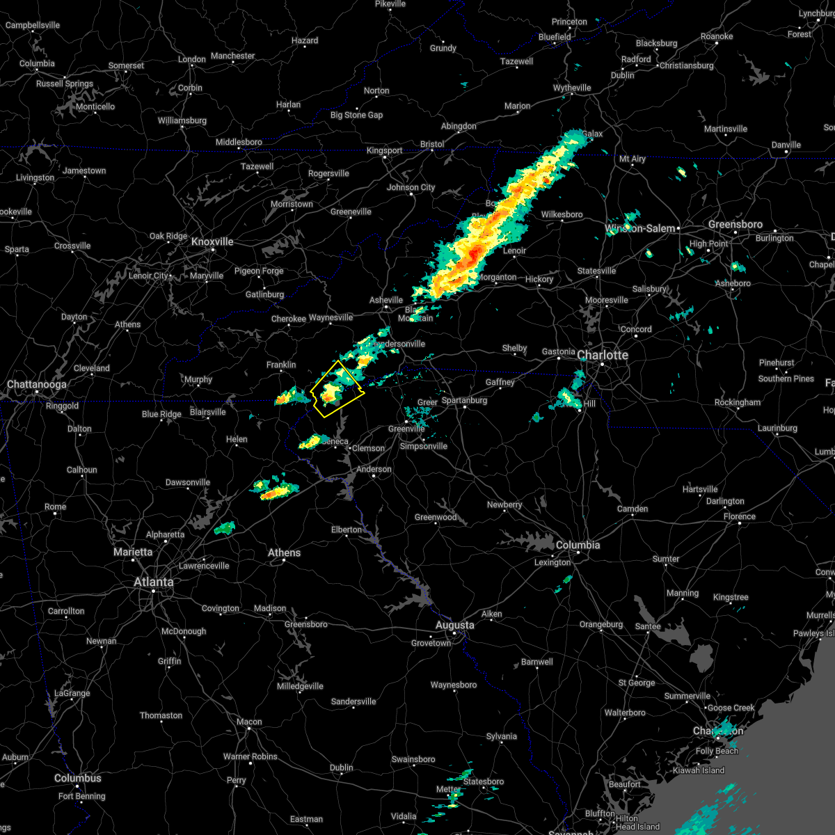
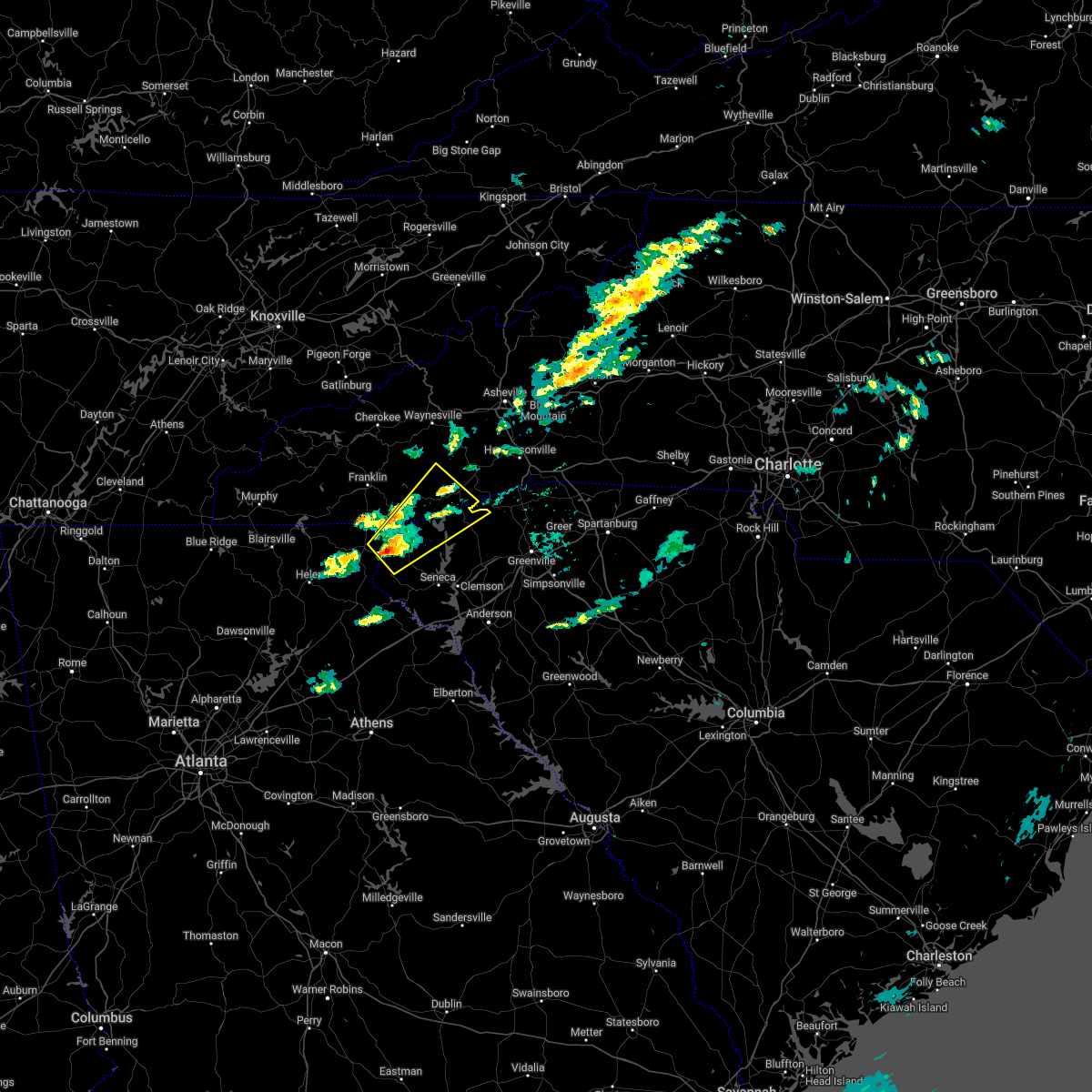
Hail Map for Rosman, NC
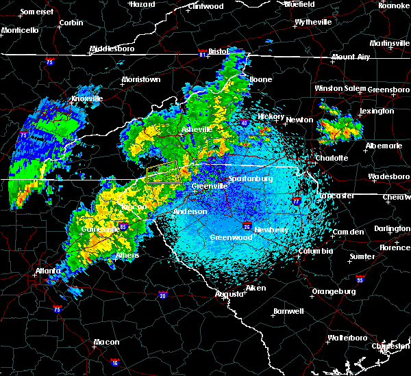
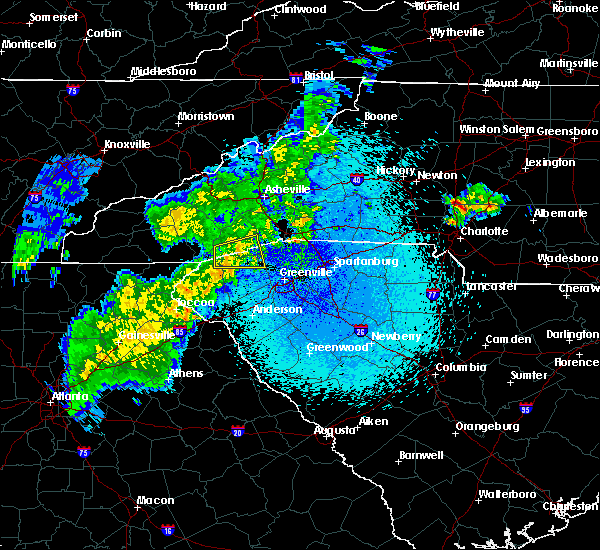
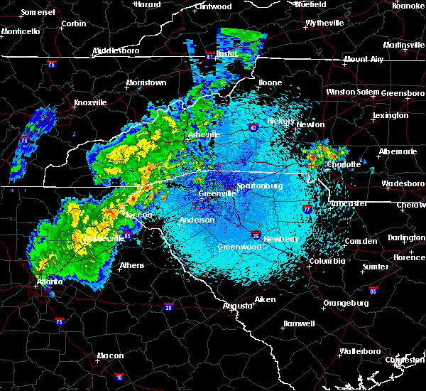
The Rosman, NC area has had 4 reports of on-the-ground hail by trained spotters, and has been under severe weather warnings 12 times during the past 12 months. Doppler radar has detected hail at or near Rosman, NC on 18 occasions.
| Name: | Rosman, NC |
| Where Located: | 25.1 miles NNW of Greenville, SC |
| Map: | Google Map for Rosman, NC |
| Population: | 576 |
| Housing Units: | 272 |
| More Info: | Search Google for Rosman, NC |
5
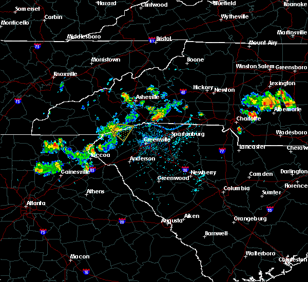
The Top Recent Hail Date for Rosman, NC is Wednesday, April 27, 2011 (1st out of 18)

Hail and Wind Damage Spotted near Rosman, NC
| Date / Time | Report Details |
|---|---|
| 4/15/2024 7:36 PM EDT |
 Svrgsp the national weather service in greenville-spartanburg has issued a * severe thunderstorm warning for, south central transylvania county in western north carolina, northwestern pickens county in upstate south carolina, northeastern oconee county in upstate south carolina, * until 815 pm edt. * at 736 pm edt, a severe thunderstorm was located 15 miles northwest of pickens, or near gorges state park, moving southeast at 15 mph (radar indicated). Hazards include 60 mph wind gusts and quarter size hail. Minor hail damage to vehicles is expected. Expect wind damage to trees and power lines. Svrgsp the national weather service in greenville-spartanburg has issued a * severe thunderstorm warning for, south central transylvania county in western north carolina, northwestern pickens county in upstate south carolina, northeastern oconee county in upstate south carolina, * until 815 pm edt. * at 736 pm edt, a severe thunderstorm was located 15 miles northwest of pickens, or near gorges state park, moving southeast at 15 mph (radar indicated). Hazards include 60 mph wind gusts and quarter size hail. Minor hail damage to vehicles is expected. Expect wind damage to trees and power lines.
|
| 8/24/2023 2:43 PM EDT |
 At 243 pm edt, a severe thunderstorm was located 11 miles southwest of brevard, or near rosman, moving southeast at 15 mph (radar indicated). Hazards include 60 mph wind gusts. Expect damage to trees and power lines. locations impacted include, rosman, lake toxaway, jocassee gorges, gorges state park, keowee toxaway state park, table rock state park, caesars head state park, pumpkintown, connestee and rocky bottom. hail threat, radar indicated max hail size, <. 75 in wind threat, radar indicated max wind gust, 60 mph. At 243 pm edt, a severe thunderstorm was located 11 miles southwest of brevard, or near rosman, moving southeast at 15 mph (radar indicated). Hazards include 60 mph wind gusts. Expect damage to trees and power lines. locations impacted include, rosman, lake toxaway, jocassee gorges, gorges state park, keowee toxaway state park, table rock state park, caesars head state park, pumpkintown, connestee and rocky bottom. hail threat, radar indicated max hail size, <. 75 in wind threat, radar indicated max wind gust, 60 mph.
|
| 8/24/2023 2:27 PM EDT | A report of a power line down and a tree down across blue ridge roa in transylvania county NC, 4.5 miles E of Rosman, NC |
| 8/24/2023 2:20 PM EDT |
 At 220 pm edt, a severe thunderstorm was located 9 miles southwest of brevard, or 4 miles northwest of rosman, moving southeast at 15 mph (radar indicated). Hazards include 60 mph wind gusts. expect damage to trees and power lines At 220 pm edt, a severe thunderstorm was located 9 miles southwest of brevard, or 4 miles northwest of rosman, moving southeast at 15 mph (radar indicated). Hazards include 60 mph wind gusts. expect damage to trees and power lines
|
| 8/7/2023 4:21 PM EDT |
 At 421 pm edt, severe thunderstorms were located along a line extending from 10 miles southwest of marion to 5 miles southeast of brevard, moving east at 50 mph (radar indicated). Hazards include 60 mph wind gusts. Expect damage to trees and power lines. locations impacted include, hendersonville, brevard, marion, rutherfordton, columbus, flat rock, etowah, mountain home, laurel park and tryon. hail threat, radar indicated max hail size, <. 75 in wind threat, radar indicated max wind gust, 60 mph. At 421 pm edt, severe thunderstorms were located along a line extending from 10 miles southwest of marion to 5 miles southeast of brevard, moving east at 50 mph (radar indicated). Hazards include 60 mph wind gusts. Expect damage to trees and power lines. locations impacted include, hendersonville, brevard, marion, rutherfordton, columbus, flat rock, etowah, mountain home, laurel park and tryon. hail threat, radar indicated max hail size, <. 75 in wind threat, radar indicated max wind gust, 60 mph.
|
| 8/7/2023 4:02 PM EDT |
 At 401 pm edt, severe thunderstorms were located along a line extending from 9 miles east of downtown asheville to 9 miles southwest of brevard, moving east at 50 mph (radar indicated). Hazards include 70 mph wind gusts and penny size hail. Expect considerable tree damage. Damage is likely to mobile homes, roofs, and outbuildings. At 401 pm edt, severe thunderstorms were located along a line extending from 9 miles east of downtown asheville to 9 miles southwest of brevard, moving east at 50 mph (radar indicated). Hazards include 70 mph wind gusts and penny size hail. Expect considerable tree damage. Damage is likely to mobile homes, roofs, and outbuildings.
|
| 7/19/2023 1:02 AM EDT |
 At 102 am edt, severe thunderstorms were located along a line extending from near brevard to 4 miles west of pickens, moving east at 30 mph (radar indicated). Hazards include 60 mph wind gusts and nickel size hail. Expect damage to trees and power lines. locations impacted include, jones gap state park, dupont state forest, table rock state park, caesars head state park, pumpkintown, dacusville, connestee, rocky bottom, sunset and sassafras mountain. hail threat, radar indicated max hail size, 0. 88 in wind threat, radar indicated max wind gust, 60 mph. At 102 am edt, severe thunderstorms were located along a line extending from near brevard to 4 miles west of pickens, moving east at 30 mph (radar indicated). Hazards include 60 mph wind gusts and nickel size hail. Expect damage to trees and power lines. locations impacted include, jones gap state park, dupont state forest, table rock state park, caesars head state park, pumpkintown, dacusville, connestee, rocky bottom, sunset and sassafras mountain. hail threat, radar indicated max hail size, 0. 88 in wind threat, radar indicated max wind gust, 60 mph.
|
| 7/19/2023 12:35 AM EDT |
 At 1235 am edt, a severe thunderstorm was located 14 miles northwest of pickens, or near lake jocassee, moving east at 30 mph (radar indicated). Hazards include 60 mph wind gusts and nickel size hail. expect damage to trees and power lines At 1235 am edt, a severe thunderstorm was located 14 miles northwest of pickens, or near lake jocassee, moving east at 30 mph (radar indicated). Hazards include 60 mph wind gusts and nickel size hail. expect damage to trees and power lines
|
| 7/1/2023 3:43 PM EDT |
 At 343 pm edt, a severe thunderstorm was located 6 miles west of brevard, or 4 miles southwest of looking glass, moving southeast at 5 mph (radar indicated). Hazards include 60 mph wind gusts and quarter size hail. Minor hail damage to vehicles is expected. Expect wind damage to trees and power lines. At 343 pm edt, a severe thunderstorm was located 6 miles west of brevard, or 4 miles southwest of looking glass, moving southeast at 5 mph (radar indicated). Hazards include 60 mph wind gusts and quarter size hail. Minor hail damage to vehicles is expected. Expect wind damage to trees and power lines.
|
| 3/3/2023 5:01 PM EST |
 At 501 pm est, a severe thunderstorm was located 16 miles east of franklin, or over cashiers, moving northeast at 100 mph (radar indicated). Hazards include 60 mph wind gusts. Expect damage to trees and power lines. locations impacted include, rosman, cashiers, lake toxaway, lake glenville, gorges state park, balsam grove, wolf mountain, connestee, whiteside mountain and sapphire. hail threat, radar indicated max hail size, <. 75 in wind threat, radar indicated max wind gust, 60 mph. At 501 pm est, a severe thunderstorm was located 16 miles east of franklin, or over cashiers, moving northeast at 100 mph (radar indicated). Hazards include 60 mph wind gusts. Expect damage to trees and power lines. locations impacted include, rosman, cashiers, lake toxaway, lake glenville, gorges state park, balsam grove, wolf mountain, connestee, whiteside mountain and sapphire. hail threat, radar indicated max hail size, <. 75 in wind threat, radar indicated max wind gust, 60 mph.
|
| 3/3/2023 4:51 PM EST |
 At 451 pm est, a severe thunderstorm was located 7 miles southwest of waynesville, or near balsam, moving northeast at 100 mph (radar indicated). Hazards include 60 mph wind gusts. Expect damage to trees and power lines. locations impacted include, sylva, cullowhee, maggie valley, balsam, rosman, webster, dillsboro, cashiers, lake toxaway and b. r. parkway-black balsam to mount pisgah. hail threat, radar indicated max hail size, <. 75 in wind threat, radar indicated max wind gust, 60 mph. At 451 pm est, a severe thunderstorm was located 7 miles southwest of waynesville, or near balsam, moving northeast at 100 mph (radar indicated). Hazards include 60 mph wind gusts. Expect damage to trees and power lines. locations impacted include, sylva, cullowhee, maggie valley, balsam, rosman, webster, dillsboro, cashiers, lake toxaway and b. r. parkway-black balsam to mount pisgah. hail threat, radar indicated max hail size, <. 75 in wind threat, radar indicated max wind gust, 60 mph.
|
| 3/3/2023 4:37 PM EST |
 At 436 pm est, a severe thunderstorm was located near franklin, moving northeast at 100 mph (radar indicated). Hazards include 60 mph wind gusts. expect damage to trees and power lines At 436 pm est, a severe thunderstorm was located near franklin, moving northeast at 100 mph (radar indicated). Hazards include 60 mph wind gusts. expect damage to trees and power lines
|
| 6/17/2022 4:30 PM EDT |
 At 430 pm edt, severe thunderstorms were located along a line extending from 12 miles southeast of sylva to 9 miles north of clayton, moving southeast at 30 mph (radar indicated). Hazards include 60 mph wind gusts and penny size hail. expect damage to trees and power lines At 430 pm edt, severe thunderstorms were located along a line extending from 12 miles southeast of sylva to 9 miles north of clayton, moving southeast at 30 mph (radar indicated). Hazards include 60 mph wind gusts and penny size hail. expect damage to trees and power lines
|
| 6/16/2022 2:30 PM EDT |
 At 229 pm edt, severe thunderstorms were located along a line extending from near brevard to 20 miles southeast of sylva, and are nearly stationary. another storm was located along the haywood transylvania county border, drifting southeast near 5 mph (radar indicated). Hazards include 60 mph wind gusts and quarter size hail. Minor hail damage to vehicles is expected. Expect wind damage to trees and power lines. At 229 pm edt, severe thunderstorms were located along a line extending from near brevard to 20 miles southeast of sylva, and are nearly stationary. another storm was located along the haywood transylvania county border, drifting southeast near 5 mph (radar indicated). Hazards include 60 mph wind gusts and quarter size hail. Minor hail damage to vehicles is expected. Expect wind damage to trees and power lines.
|
| 6/13/2022 6:08 PM EDT |
 At 608 pm edt, a severe thunderstorm was located 17 miles southwest of brevard, or near gorges state park, moving south at 15 mph (radar indicated). Hazards include 60 mph wind gusts and nickel size hail. Expect damage to trees and power lines. locations impacted include, rosman, cashiers, lake toxaway, gorges state park, lake jocassee, sunset, sapphire, bad creek, rocky bottom and devils fork state park. hail threat, radar indicated max hail size, 0. 88 in wind threat, radar indicated max wind gust, 60 mph. At 608 pm edt, a severe thunderstorm was located 17 miles southwest of brevard, or near gorges state park, moving south at 15 mph (radar indicated). Hazards include 60 mph wind gusts and nickel size hail. Expect damage to trees and power lines. locations impacted include, rosman, cashiers, lake toxaway, gorges state park, lake jocassee, sunset, sapphire, bad creek, rocky bottom and devils fork state park. hail threat, radar indicated max hail size, 0. 88 in wind threat, radar indicated max wind gust, 60 mph.
|
| 6/13/2022 5:46 PM EDT |
 At 546 pm edt, a severe thunderstorm was located 14 miles southwest of brevard, or near lake toxaway, moving south at 15 mph (radar indicated). Hazards include 60 mph wind gusts and quarter size hail. Minor hail damage to vehicles is expected. Expect wind damage to trees and power lines. At 546 pm edt, a severe thunderstorm was located 14 miles southwest of brevard, or near lake toxaway, moving south at 15 mph (radar indicated). Hazards include 60 mph wind gusts and quarter size hail. Minor hail damage to vehicles is expected. Expect wind damage to trees and power lines.
|
| 3/23/2022 7:49 PM EDT |
 The national weather service in greenville-spartanburg has issued a * severe thunderstorm warning for. transylvania county in western north carolina. central henderson county in western north carolina. northwestern greenville county in upstate south carolina. Until 815 pm edt. The national weather service in greenville-spartanburg has issued a * severe thunderstorm warning for. transylvania county in western north carolina. central henderson county in western north carolina. northwestern greenville county in upstate south carolina. Until 815 pm edt.
|
| 3/23/2022 7:49 PM EDT |
 At 749 pm edt, a severe thunderstorm was located 4 miles southwest of brevard, or near rosman, moving northeast at 45 mph (radar indicated). Hazards include 60 mph wind gusts and penny size hail. expect damage to trees and power lines At 749 pm edt, a severe thunderstorm was located 4 miles southwest of brevard, or near rosman, moving northeast at 45 mph (radar indicated). Hazards include 60 mph wind gusts and penny size hail. expect damage to trees and power lines
|
| 3/23/2022 7:29 PM EDT |
 At 729 pm edt, a severe thunderstorm was located 15 miles north of walhalla, or 6 miles west of lake jocassee, moving northeast at 25 mph (radar indicated). Hazards include 60 mph wind gusts and penny size hail. Expect damage to trees and power lines. locations impacted include, lake toxaway, lake jocassee, devils fork state park, gorges state park, bad creek, rocky bottom, sapphire, sassafras mountain, rosman and cashiers. hail threat, radar indicated max hail size, 0. 75 in wind threat, radar indicated max wind gust, 60 mph. At 729 pm edt, a severe thunderstorm was located 15 miles north of walhalla, or 6 miles west of lake jocassee, moving northeast at 25 mph (radar indicated). Hazards include 60 mph wind gusts and penny size hail. Expect damage to trees and power lines. locations impacted include, lake toxaway, lake jocassee, devils fork state park, gorges state park, bad creek, rocky bottom, sapphire, sassafras mountain, rosman and cashiers. hail threat, radar indicated max hail size, 0. 75 in wind threat, radar indicated max wind gust, 60 mph.
|
| 3/23/2022 7:01 PM EDT |
 At 700 pm edt, a cluster of severe thunderstorms were located 10 miles east of clayton, or 6 miles west of oconee state park, moving northeast at 30 mph (radar indicated). Hazards include 60 mph wind gusts and penny size hail. expect damage to trees and power lines At 700 pm edt, a cluster of severe thunderstorms were located 10 miles east of clayton, or 6 miles west of oconee state park, moving northeast at 30 mph (radar indicated). Hazards include 60 mph wind gusts and penny size hail. expect damage to trees and power lines
|
| 5/22/2020 1:48 PM EDT |
 At 147 pm edt, a severe thunderstorm was located 13 miles southwest of brevard, or near gorges state park, moving east at 40 mph (radar indicated). Hazards include 60 mph wind gusts and quarter size hail. Minor hail damage to vehicles is expected. Expect wind damage to trees and power lines. At 147 pm edt, a severe thunderstorm was located 13 miles southwest of brevard, or near gorges state park, moving east at 40 mph (radar indicated). Hazards include 60 mph wind gusts and quarter size hail. Minor hail damage to vehicles is expected. Expect wind damage to trees and power lines.
|
| 5/5/2020 4:40 PM EDT |
 At 439 pm edt, a severe thunderstorm was located 5 miles south of brevard, moving east at 45 mph (radar indicated). Hazards include 60 mph wind gusts and quarter size hail. Minor hail damage to vehicles is expected. expect wind damage to trees and power lines. Locations impacted include, brevard, rosman, lake toxaway, balsam grove, connestee, cedar mountain, penrose, dupont state forest and gorges state park. At 439 pm edt, a severe thunderstorm was located 5 miles south of brevard, moving east at 45 mph (radar indicated). Hazards include 60 mph wind gusts and quarter size hail. Minor hail damage to vehicles is expected. expect wind damage to trees and power lines. Locations impacted include, brevard, rosman, lake toxaway, balsam grove, connestee, cedar mountain, penrose, dupont state forest and gorges state park.
|
| 5/5/2020 4:30 PM EDT |
 At 430 pm edt, a severe thunderstorm was located 8 miles southwest of brevard, or near rosman, moving east at 40 mph (radar indicated). Hazards include 60 mph wind gusts and quarter size hail. Minor hail damage to vehicles is expected. Expect wind damage to trees and power lines. At 430 pm edt, a severe thunderstorm was located 8 miles southwest of brevard, or near rosman, moving east at 40 mph (radar indicated). Hazards include 60 mph wind gusts and quarter size hail. Minor hail damage to vehicles is expected. Expect wind damage to trees and power lines.
|
| 2/13/2020 7:28 AM EST |
 At 727 am est, severe thunderstorms were located along a line extending from 11 miles southwest of brevard to 4 miles east of walhalla to 9 miles east of toccoa, moving northeast at 65 mph (radar indicated). Hazards include 60 mph wind gusts. expect damage to trees and power lines At 727 am est, severe thunderstorms were located along a line extending from 11 miles southwest of brevard to 4 miles east of walhalla to 9 miles east of toccoa, moving northeast at 65 mph (radar indicated). Hazards include 60 mph wind gusts. expect damage to trees and power lines
|
| 1/11/2020 7:02 PM EST |
 At 702 pm est, severe thunderstorms were located along a line extending from 12 miles southwest of marshall to 13 miles southwest of brevard, moving northeast at 40 mph (radar indicated). Hazards include 60 mph wind gusts. expect damage to trees and power lines At 702 pm est, severe thunderstorms were located along a line extending from 12 miles southwest of marshall to 13 miles southwest of brevard, moving northeast at 40 mph (radar indicated). Hazards include 60 mph wind gusts. expect damage to trees and power lines
|
| 1/11/2020 6:31 PM EST |
 At 631 pm est, severe thunderstorms were located along a line extending from 16 miles southeast of newport to 16 miles north of walhalla, moving east at 40 mph (radar indicated). Hazards include 60 mph wind gusts. expect damage to trees and power lines At 631 pm est, severe thunderstorms were located along a line extending from 16 miles southeast of newport to 16 miles north of walhalla, moving east at 40 mph (radar indicated). Hazards include 60 mph wind gusts. expect damage to trees and power lines
|
| 8/1/2019 1:35 PM EDT | Large tree limbs blown down across blue ridge road. fire department called to clear debri in transylvania county NC, 7.4 miles E of Rosman, NC |
| 7/31/2019 9:08 PM EDT | 911 call center reported power lines down on sugar likker rd. time estimated from rada in pickens county SC, 8.9 miles N of Rosman, NC |
| 7/4/2019 6:12 PM EDT |
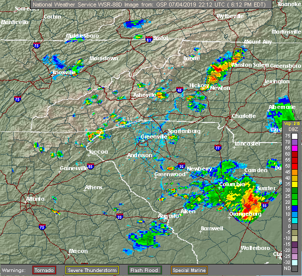 At 612 pm edt, a severe thunderstorm was located 6 miles south of brevard, or 5 miles east of rosman, and is nearly stationary (radar indicated). Hazards include 60 mph wind gusts and penny size hail. expect damage to trees and power lines At 612 pm edt, a severe thunderstorm was located 6 miles south of brevard, or 5 miles east of rosman, and is nearly stationary (radar indicated). Hazards include 60 mph wind gusts and penny size hail. expect damage to trees and power lines
|
| 6/22/2019 2:40 PM EDT | Quarter sized hail reported 9.9 miles NW of Rosman, NC, up to 1 inch hail se of caesars head state park. |
| 6/22/2019 1:09 AM EDT |
 At 108 am edt, a severe thunderstorm was located 5 miles northeast of sylva, or near balsam, moving east at 35 mph (radar indicated). Hazards include 60 mph wind gusts and nickel size hail. Expect damage to trees and power lines. Locations impacted include, brevard, franklin, sylva, waynesville, cullowhee, etowah, lake junaluska, clyde, highlands and maggie valley. At 108 am edt, a severe thunderstorm was located 5 miles northeast of sylva, or near balsam, moving east at 35 mph (radar indicated). Hazards include 60 mph wind gusts and nickel size hail. Expect damage to trees and power lines. Locations impacted include, brevard, franklin, sylva, waynesville, cullowhee, etowah, lake junaluska, clyde, highlands and maggie valley.
|
| 6/22/2019 12:38 AM EDT |
 The national weather service in greenville-spartanburg has issued a * severe thunderstorm warning for. eastern macon county in western north carolina. transylvania county in western north carolina. northwestern henderson county in western north carolina. Jackson county in western north carolina. The national weather service in greenville-spartanburg has issued a * severe thunderstorm warning for. eastern macon county in western north carolina. transylvania county in western north carolina. northwestern henderson county in western north carolina. Jackson county in western north carolina.
|
| 6/17/2019 10:35 PM EDT |
 The severe thunderstorm warning for southern transylvania and northwestern pickens counties will expire at 1045 pm edt, the storm which prompted the warning has weakened below severe limits, and has exited the warned area. therefore the warning will be allowed to expire. however gusty winds and heavy rain are still possible with this thunderstorm. The severe thunderstorm warning for southern transylvania and northwestern pickens counties will expire at 1045 pm edt, the storm which prompted the warning has weakened below severe limits, and has exited the warned area. therefore the warning will be allowed to expire. however gusty winds and heavy rain are still possible with this thunderstorm.
|
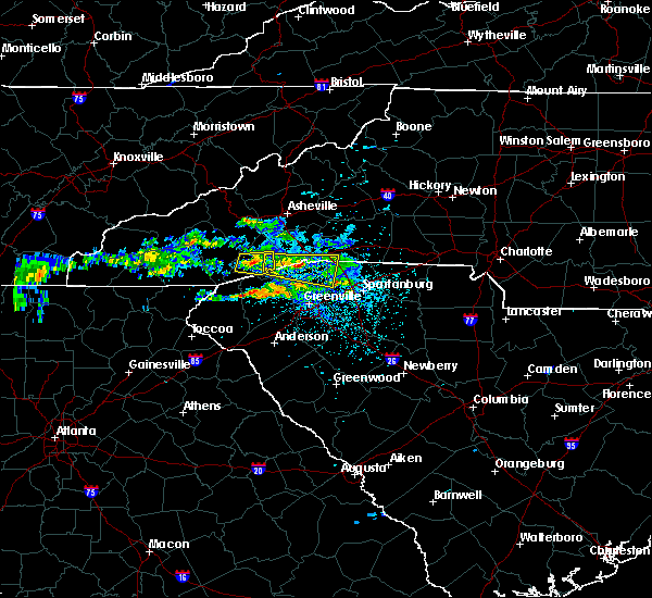
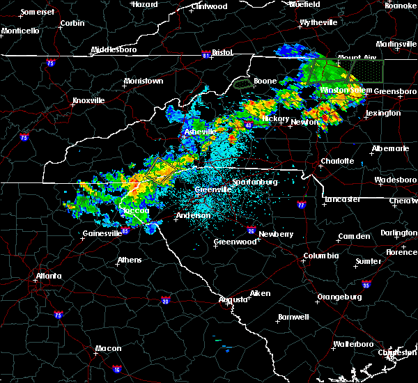
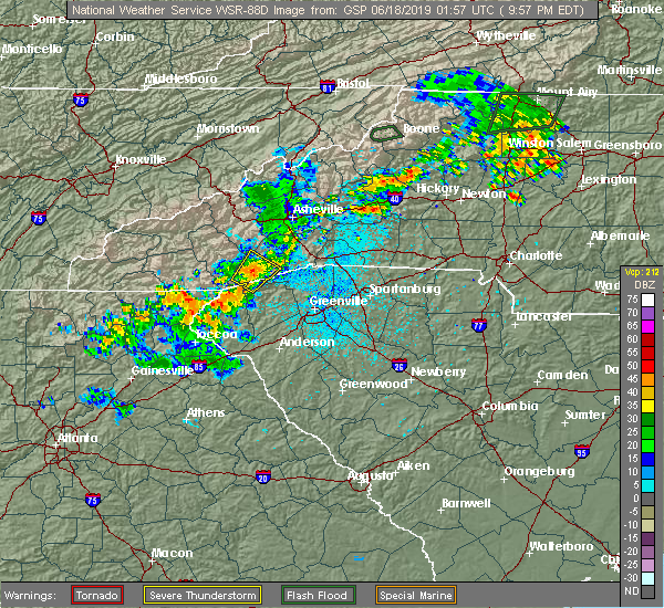
| 6/17/2019 10:23 PM EDT |
 At 1023 pm edt, a severe thunderstorm was located 7 miles southwest of brevard, or over rosman, moving northeast at 10 mph (radar indicated). Hazards include 60 mph wind gusts and quarter size hail. Minor hail damage to vehicles is expected. expect wind damage to trees and power lines. Locations impacted include, rosman, lake toxaway, gorges state park, balsam grove, connestee, rocky bottom, sapphire, sassafras mountain, brevard and cedar mountain. At 1023 pm edt, a severe thunderstorm was located 7 miles southwest of brevard, or over rosman, moving northeast at 10 mph (radar indicated). Hazards include 60 mph wind gusts and quarter size hail. Minor hail damage to vehicles is expected. expect wind damage to trees and power lines. Locations impacted include, rosman, lake toxaway, gorges state park, balsam grove, connestee, rocky bottom, sapphire, sassafras mountain, brevard and cedar mountain.
|
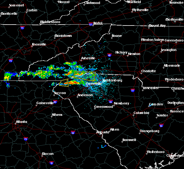
| 6/17/2019 9:56 PM EDT |
 At 955 pm edt, a severe thunderstorm was located 12 miles southwest of brevard, or near rosman, moving northeast at 10 mph (radar indicated). Hazards include 60 mph wind gusts and quarter size hail. Minor hail damage to vehicles is expected. Expect wind damage to trees and power lines. At 955 pm edt, a severe thunderstorm was located 12 miles southwest of brevard, or near rosman, moving northeast at 10 mph (radar indicated). Hazards include 60 mph wind gusts and quarter size hail. Minor hail damage to vehicles is expected. Expect wind damage to trees and power lines.
|
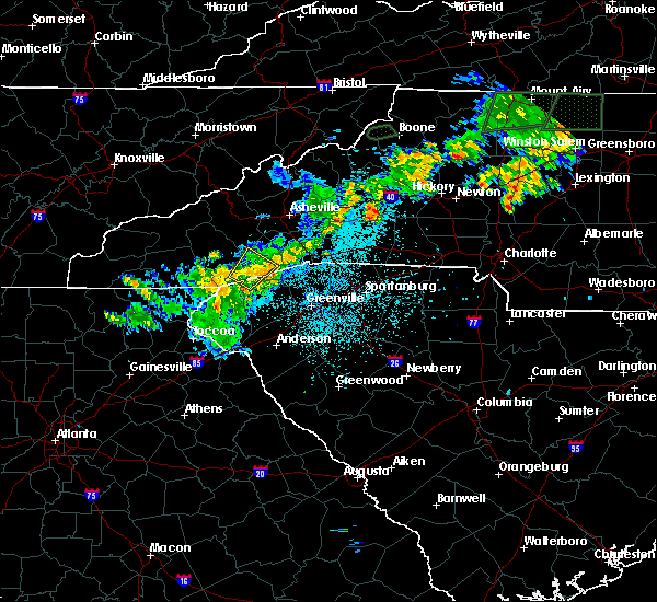
| 4/14/2019 8:41 PM EDT |
 At 841 pm edt, a severe thunderstorm capable of producing a tornado was located 11 miles northwest of pickens, or 5 miles northeast of jocassee gorges, moving northeast at 40 mph (radar indicated rotation). Hazards include tornado. Flying debris will be dangerous to those caught without shelter. mobile homes will be damaged or destroyed. damage to roofs, windows, and vehicles will occur. tree damage is likely. this dangerous storm will be near, table rock state park around 850 pm edt. caesars head state park and dupont state forest around 900 pm edt. jones gap state park and pleasant ridge state park around 910 pm edt. Other locations impacted by this dangerous thunderstorm include sunset, pumpkintown, little river in transylvania county, connestee and crab creek. At 841 pm edt, a severe thunderstorm capable of producing a tornado was located 11 miles northwest of pickens, or 5 miles northeast of jocassee gorges, moving northeast at 40 mph (radar indicated rotation). Hazards include tornado. Flying debris will be dangerous to those caught without shelter. mobile homes will be damaged or destroyed. damage to roofs, windows, and vehicles will occur. tree damage is likely. this dangerous storm will be near, table rock state park around 850 pm edt. caesars head state park and dupont state forest around 900 pm edt. jones gap state park and pleasant ridge state park around 910 pm edt. Other locations impacted by this dangerous thunderstorm include sunset, pumpkintown, little river in transylvania county, connestee and crab creek.
|
| 4/14/2019 8:41 PM EDT |
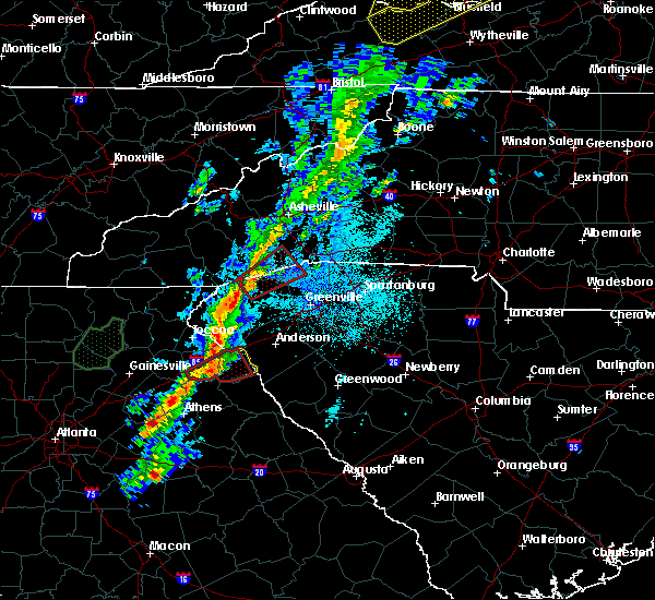 At 841 pm edt, a severe thunderstorm capable of producing a tornado was located 11 miles northwest of pickens, or 5 miles northeast of jocassee gorges, moving northeast at 40 mph (radar indicated rotation). Hazards include tornado. Flying debris will be dangerous to those caught without shelter. mobile homes will be damaged or destroyed. damage to roofs, windows, and vehicles will occur. tree damage is likely. this dangerous storm will be near, table rock state park around 850 pm edt. caesars head state park and dupont state forest around 900 pm edt. jones gap state park and pleasant ridge state park around 910 pm edt. Other locations impacted by this dangerous thunderstorm include sunset, pumpkintown, little river in transylvania county, connestee and crab creek. At 841 pm edt, a severe thunderstorm capable of producing a tornado was located 11 miles northwest of pickens, or 5 miles northeast of jocassee gorges, moving northeast at 40 mph (radar indicated rotation). Hazards include tornado. Flying debris will be dangerous to those caught without shelter. mobile homes will be damaged or destroyed. damage to roofs, windows, and vehicles will occur. tree damage is likely. this dangerous storm will be near, table rock state park around 850 pm edt. caesars head state park and dupont state forest around 900 pm edt. jones gap state park and pleasant ridge state park around 910 pm edt. Other locations impacted by this dangerous thunderstorm include sunset, pumpkintown, little river in transylvania county, connestee and crab creek.
|
| 4/14/2019 2:38 PM EDT |
 The severe thunderstorm warning for southeastern transylvania, northwestern greenville and pickens counties will expire at 245 pm edt, the storm which prompted the warning has moved out of the area. therefore the warning will be allowed to expire. however gusty winds are still possible with this thunderstorm. a tornado watch remains in effect until 700 pm edt for upstate south carolina. a tornado watch also remains in effect until 800 pm edt for western north carolina. The severe thunderstorm warning for southeastern transylvania, northwestern greenville and pickens counties will expire at 245 pm edt, the storm which prompted the warning has moved out of the area. therefore the warning will be allowed to expire. however gusty winds are still possible with this thunderstorm. a tornado watch remains in effect until 700 pm edt for upstate south carolina. a tornado watch also remains in effect until 800 pm edt for western north carolina.
|
| 4/14/2019 2:20 PM EDT |
 At 220 pm edt, a severe thunderstorm was located 7 miles south of pickens, or near norris, moving northeast at 45 mph (radar indicated). Hazards include 60 mph wind gusts and quarter size hail. Minor hail damage to vehicles is expected. expect wind damage to trees and power lines. locations impacted include, easley, pickens, central, liberty, norris, six mile, rosman, jocassee gorges, dupont state forest and table rock state park. a tornado watch remains in effect until 700 pm edt for upstate south carolina. A tornado watch also remains in effect until 800 pm edt for western north carolina. At 220 pm edt, a severe thunderstorm was located 7 miles south of pickens, or near norris, moving northeast at 45 mph (radar indicated). Hazards include 60 mph wind gusts and quarter size hail. Minor hail damage to vehicles is expected. expect wind damage to trees and power lines. locations impacted include, easley, pickens, central, liberty, norris, six mile, rosman, jocassee gorges, dupont state forest and table rock state park. a tornado watch remains in effect until 700 pm edt for upstate south carolina. A tornado watch also remains in effect until 800 pm edt for western north carolina.
|
| 4/14/2019 2:12 PM EDT |
 At 211 pm edt, a severe thunderstorm was located near clemson, moving northeast at 45 mph (radar indicated). Hazards include 60 mph wind gusts and quarter size hail. Minor hail damage to vehicles is expected. Expect wind damage to trees and power lines. At 211 pm edt, a severe thunderstorm was located near clemson, moving northeast at 45 mph (radar indicated). Hazards include 60 mph wind gusts and quarter size hail. Minor hail damage to vehicles is expected. Expect wind damage to trees and power lines.
|
| 8/6/2018 3:55 PM EDT |
 At 355 pm edt, a severe thunderstorm was located 13 miles southwest of brevard, or near lake toxaway, moving southeast at 10 mph (radar indicated). Hazards include 60 mph wind gusts and quarter size hail. Minor hail damage to vehicles is expected. Expect wind damage to trees and power lines. At 355 pm edt, a severe thunderstorm was located 13 miles southwest of brevard, or near lake toxaway, moving southeast at 10 mph (radar indicated). Hazards include 60 mph wind gusts and quarter size hail. Minor hail damage to vehicles is expected. Expect wind damage to trees and power lines.
|
| 6/26/2018 1:46 PM EDT |
 At 145 pm edt, a severe thunderstorm was located 5 miles south of brevard, moving southeast at 10 mph (radar indicated). Hazards include 60 mph wind gusts. Expect damage to trees and power lines. Locations impacted include, brevard, rosman, caesars head state park, jones gap state park, dupont state forest, balsam grove, connestee, cedar mountain, sassafras mountain and little river in transylvania county. At 145 pm edt, a severe thunderstorm was located 5 miles south of brevard, moving southeast at 10 mph (radar indicated). Hazards include 60 mph wind gusts. Expect damage to trees and power lines. Locations impacted include, brevard, rosman, caesars head state park, jones gap state park, dupont state forest, balsam grove, connestee, cedar mountain, sassafras mountain and little river in transylvania county.
|
| 6/26/2018 1:26 PM EDT |
 At 125 pm edt, a severe thunderstorm was located 5 miles south of brevard, or 4 miles east of rosman, moving southeast at 10 mph (radar indicated). Hazards include 60 mph wind gusts and quarter size hail. Minor hail damage to vehicles is expected. Expect wind damage to trees and power lines. At 125 pm edt, a severe thunderstorm was located 5 miles south of brevard, or 4 miles east of rosman, moving southeast at 10 mph (radar indicated). Hazards include 60 mph wind gusts and quarter size hail. Minor hail damage to vehicles is expected. Expect wind damage to trees and power lines.
|
| 6/25/2018 5:42 PM EDT |
 The severe thunderstorm warning for transylvania and northwestern henderson counties will expire at 545 pm edt, the storms which prompted the warning have moved out of the area. therefore the warning will be allowed to expire. however gusty winds are still possible with these thunderstorms. a severe thunderstorm watch remains in effect until 1000 pm edt for western north carolina, and upstate south carolina. The severe thunderstorm warning for transylvania and northwestern henderson counties will expire at 545 pm edt, the storms which prompted the warning have moved out of the area. therefore the warning will be allowed to expire. however gusty winds are still possible with these thunderstorms. a severe thunderstorm watch remains in effect until 1000 pm edt for western north carolina, and upstate south carolina.
|
| 6/25/2018 5:29 PM EDT |
 At 528 pm edt, severe thunderstorms were located along a line extending from 5 miles southeast of downtown asheville to 15 miles north of walhalla, moving east at 25 mph (radar indicated). Hazards include 60 mph wind gusts and quarter size hail. Minor hail damage to vehicles is expected. expect wind damage to trees and power lines. locations impacted include, brevard, mills river, fletcher, etowah, mountain home, rosman, lake toxaway, b. r. Parkway-mount pisgah to the nc arboretum, looking glass and gorges state park. At 528 pm edt, severe thunderstorms were located along a line extending from 5 miles southeast of downtown asheville to 15 miles north of walhalla, moving east at 25 mph (radar indicated). Hazards include 60 mph wind gusts and quarter size hail. Minor hail damage to vehicles is expected. expect wind damage to trees and power lines. locations impacted include, brevard, mills river, fletcher, etowah, mountain home, rosman, lake toxaway, b. r. Parkway-mount pisgah to the nc arboretum, looking glass and gorges state park.
|
| 6/25/2018 4:53 PM EDT |
 At 453 pm edt, severe thunderstorms were located along a line extending from 11 miles west of downtown asheville to 11 miles northeast of clayton, moving east at 25 mph (radar indicated). Hazards include 60 mph wind gusts and quarter size hail. Minor hail damage to vehicles is expected. Expect wind damage to trees and power lines. At 453 pm edt, severe thunderstorms were located along a line extending from 11 miles west of downtown asheville to 11 miles northeast of clayton, moving east at 25 mph (radar indicated). Hazards include 60 mph wind gusts and quarter size hail. Minor hail damage to vehicles is expected. Expect wind damage to trees and power lines.
|
| 6/24/2018 4:36 PM EDT |
 At 436 pm edt, severe thunderstorms were located along a line extending from 14 miles west of brevard to 13 miles northwest of pickens to 3 miles southeast of walhalla, moving east at 40 mph (radar indicated). Hazards include 60 mph wind gusts. expect damage to trees and power lines At 436 pm edt, severe thunderstorms were located along a line extending from 14 miles west of brevard to 13 miles northwest of pickens to 3 miles southeast of walhalla, moving east at 40 mph (radar indicated). Hazards include 60 mph wind gusts. expect damage to trees and power lines
|
| 6/23/2018 5:03 PM EDT |
 At 502 pm edt, severe thunderstorms were located along a line extending from 9 miles southeast of waynesville to 5 miles south of brevard to 5 miles south of pickens to 7 miles southeast of clemson, moving east at 55 mph (radar indicated). Hazards include 60 mph wind gusts. expect damage to trees and power lines At 502 pm edt, severe thunderstorms were located along a line extending from 9 miles southeast of waynesville to 5 miles south of brevard to 5 miles south of pickens to 7 miles southeast of clemson, moving east at 55 mph (radar indicated). Hazards include 60 mph wind gusts. expect damage to trees and power lines
|
| 6/23/2018 4:45 PM EDT |
 A severe thunderstorm warning remains in effect until 515 pm edt for transylvania. jackson. southeastern haywood. pickens and oconee counties. At 444 pm edt, severe thunderstorms were located along a line extending from 11 miles southeast of sylva to 14 miles northwest of pickens to near seneca, moving east at 45 mph. A severe thunderstorm warning remains in effect until 515 pm edt for transylvania. jackson. southeastern haywood. pickens and oconee counties. At 444 pm edt, severe thunderstorms were located along a line extending from 11 miles southeast of sylva to 14 miles northwest of pickens to near seneca, moving east at 45 mph.
|
| 6/23/2018 4:45 PM EDT |
 At 420 pm edt, severe thunderstorms were located along a line extending from 6 miles north of franklin to 9 miles northeast of clayton to 4 miles west of toccoa, moving east at 50 mph (radar indicated). Hazards include 60 mph wind gusts. expect damage to trees and power lines At 420 pm edt, severe thunderstorms were located along a line extending from 6 miles north of franklin to 9 miles northeast of clayton to 4 miles west of toccoa, moving east at 50 mph (radar indicated). Hazards include 60 mph wind gusts. expect damage to trees and power lines
|
| 6/23/2018 4:22 PM EDT |
 The national weather service in greenville-spartanburg has issued a * severe thunderstorm warning for. stephens county in northeastern georgia. southeastern habersham county in northeastern georgia. eastern rabun county in northeastern georgia. Eastern macon county in western north carolina. The national weather service in greenville-spartanburg has issued a * severe thunderstorm warning for. stephens county in northeastern georgia. southeastern habersham county in northeastern georgia. eastern rabun county in northeastern georgia. Eastern macon county in western north carolina.
|
| 6/23/2018 4:22 PM EDT |
 At 420 pm edt, severe thunderstorms were located along a line extending from 6 miles north of franklin to 9 miles northeast of clayton to 4 miles west of toccoa, moving east at 50 mph (radar indicated). Hazards include 60 mph wind gusts. expect damage to trees and power lines At 420 pm edt, severe thunderstorms were located along a line extending from 6 miles north of franklin to 9 miles northeast of clayton to 4 miles west of toccoa, moving east at 50 mph (radar indicated). Hazards include 60 mph wind gusts. expect damage to trees and power lines
|
| 6/16/2018 2:45 PM EDT | Tree debris in roadway at rosman hwy and parkway rd in transylvania county NC, 1.2 miles ENE of Rosman, NC |
| 6/16/2018 2:39 PM EDT |
 At 238 pm edt, a severe thunderstorm was located 14 miles southwest of brevard, or 4 miles east of gorges state park, moving southwest at 15 mph (radar indicated). Hazards include 60 mph wind gusts and quarter size hail. Minor hail damage to vehicles is expected. expect wind damage to trees and power lines. Locations impacted include, rosman, gorges state park, sassafras mountain, rocky bottom, lake toxaway, table rock state park, lake jocassee and jocassee gorges. At 238 pm edt, a severe thunderstorm was located 14 miles southwest of brevard, or 4 miles east of gorges state park, moving southwest at 15 mph (radar indicated). Hazards include 60 mph wind gusts and quarter size hail. Minor hail damage to vehicles is expected. expect wind damage to trees and power lines. Locations impacted include, rosman, gorges state park, sassafras mountain, rocky bottom, lake toxaway, table rock state park, lake jocassee and jocassee gorges.
|
| 6/16/2018 2:10 PM EDT |
 At 209 pm edt, a severe thunderstorm was located 8 miles southwest of brevard, or over rosman, moving south at 10 mph (radar indicated). Hazards include 60 mph wind gusts and quarter size hail. Minor hail damage to vehicles is expected. Expect wind damage to trees and power lines. At 209 pm edt, a severe thunderstorm was located 8 miles southwest of brevard, or over rosman, moving south at 10 mph (radar indicated). Hazards include 60 mph wind gusts and quarter size hail. Minor hail damage to vehicles is expected. Expect wind damage to trees and power lines.
|
| 6/14/2017 2:29 PM EDT |
 At 228 pm edt, a severe thunderstorm was located 12 miles south of brevard, or 5 miles northwest of table rock state park, moving south at 5 mph (radar indicated). Hazards include 60 mph wind gusts and quarter size hail. Minor hail damage to vehicles is expected. expect wind damage to trees and power lines. Locations impacted include, rosman, table rock state park, sassafras mountain, rocky bottom, caesars head state park, connestee, lake jocassee, gorges state park and jocassee gorges. At 228 pm edt, a severe thunderstorm was located 12 miles south of brevard, or 5 miles northwest of table rock state park, moving south at 5 mph (radar indicated). Hazards include 60 mph wind gusts and quarter size hail. Minor hail damage to vehicles is expected. expect wind damage to trees and power lines. Locations impacted include, rosman, table rock state park, sassafras mountain, rocky bottom, caesars head state park, connestee, lake jocassee, gorges state park and jocassee gorges.
|
| 6/14/2017 2:16 PM EDT |
 At 216 pm edt, a severe thunderstorm was located 10 miles south of brevard, or 4 miles southeast of rosman, and is nearly stationary (radar indicated). Hazards include 60 mph wind gusts and quarter size hail. Minor hail damage to vehicles is expected. Expect wind damage to trees and power lines. At 216 pm edt, a severe thunderstorm was located 10 miles south of brevard, or 4 miles southeast of rosman, and is nearly stationary (radar indicated). Hazards include 60 mph wind gusts and quarter size hail. Minor hail damage to vehicles is expected. Expect wind damage to trees and power lines.
|
| 5/28/2017 12:28 AM EDT |
 The severe thunderstorm warning for rabun, macon, southern transylvania and southern jackson counties will expire at 1230 am edt, the storms which prompted the warning have moved out of the area. therefore the warning will be allowed to expire. however gusty winds and heavy rain are still possible with these thunderstorms. a severe thunderstorm watch remains in effect until 200 am edt for western north carolina. a severe thunderstorm watch also remains in effect until 600 am edt for northeastern georgia, and upstate south carolina. The severe thunderstorm warning for rabun, macon, southern transylvania and southern jackson counties will expire at 1230 am edt, the storms which prompted the warning have moved out of the area. therefore the warning will be allowed to expire. however gusty winds and heavy rain are still possible with these thunderstorms. a severe thunderstorm watch remains in effect until 200 am edt for western north carolina. a severe thunderstorm watch also remains in effect until 600 am edt for northeastern georgia, and upstate south carolina.
|
| 5/28/2017 12:15 AM EDT | County reports trees...branches...and leaf litter covering wildwood driv in transylvania county NC, 3.4 miles E of Rosman, NC |
| 5/27/2017 11:43 PM EDT |
 At 1143 pm edt, severe thunderstorms were located along a line extending from 7 miles southeast of sylva to 12 miles east of hayesville, moving southeast at 45 mph (radar indicated). Hazards include 60 mph wind gusts and nickel size hail. expect damage to trees and power lines At 1143 pm edt, severe thunderstorms were located along a line extending from 7 miles southeast of sylva to 12 miles east of hayesville, moving southeast at 45 mph (radar indicated). Hazards include 60 mph wind gusts and nickel size hail. expect damage to trees and power lines
|
| 3/28/2017 12:54 AM EDT |
 The severe thunderstorm warning for southern transylvania, northwestern greenville, northern pickens and northeastern oconee counties will expire at 100 am edt, the severe thunderstorm which prompted the warning has weakened and moved out of the warned area. therefore the warning will be allowed to expire. The severe thunderstorm warning for southern transylvania, northwestern greenville, northern pickens and northeastern oconee counties will expire at 100 am edt, the severe thunderstorm which prompted the warning has weakened and moved out of the warned area. therefore the warning will be allowed to expire.
|
| 3/28/2017 12:27 AM EDT |
 At 1226 am edt, a severe thunderstorm was located 14 miles northwest of pickens, or 5 miles east of gorges state park, moving east at 40 mph (radar indicated). Hazards include 60 mph wind gusts. Expect damage to trees and minor damage to roofs and siding. Locations impacted include, rosman, lake toxaway, jocassee gorges, lake jocassee, dupont state forest, devils fork state park, gorges state park, table rock state park, caesars head state park and pumpkintown. At 1226 am edt, a severe thunderstorm was located 14 miles northwest of pickens, or 5 miles east of gorges state park, moving east at 40 mph (radar indicated). Hazards include 60 mph wind gusts. Expect damage to trees and minor damage to roofs and siding. Locations impacted include, rosman, lake toxaway, jocassee gorges, lake jocassee, dupont state forest, devils fork state park, gorges state park, table rock state park, caesars head state park and pumpkintown.
|
| 3/28/2017 12:08 AM EDT |
 At 1208 am edt, a severe thunderstorm was located 18 miles north of walhalla, or 5 miles southeast of cashiers, moving east at 40 mph (radar indicated). Hazards include 60 mph wind gusts. expect damage to trees and minor damage to roofs and siding At 1208 am edt, a severe thunderstorm was located 18 miles north of walhalla, or 5 miles southeast of cashiers, moving east at 40 mph (radar indicated). Hazards include 60 mph wind gusts. expect damage to trees and minor damage to roofs and siding
|
| 3/21/2017 10:32 PM EDT |
 At 1030 pm edt, an outflow of severe winds from the decaying thunderstorms stretched along a line extending from 12 miles southwest of downtown asheville to 7 miles east of brevard to 16 miles southwest of hendersonville. the leading edge of these winds were moving east at 35 mph. 40 to 60 mph winds will remain possible behind the passing outflow through 1045 pm (radar indicated). Hazards include 60 mph wind gusts. Expect damage to siding and trees. Locations impacted include, hendersonville, brevard, arden, mills river, fletcher, flat rock, etowah, mountain home, laurel park and rosman. At 1030 pm edt, an outflow of severe winds from the decaying thunderstorms stretched along a line extending from 12 miles southwest of downtown asheville to 7 miles east of brevard to 16 miles southwest of hendersonville. the leading edge of these winds were moving east at 35 mph. 40 to 60 mph winds will remain possible behind the passing outflow through 1045 pm (radar indicated). Hazards include 60 mph wind gusts. Expect damage to siding and trees. Locations impacted include, hendersonville, brevard, arden, mills river, fletcher, flat rock, etowah, mountain home, laurel park and rosman.
|
| 3/21/2017 9:59 PM EDT |
 At 958 pm edt, outflows from severe thunderstorms were located along a line extending from 8 miles southeast of waynesville to 8 miles west of brevard to 17 miles northwest of pickens, moving east at 55 mph (radar indicated). Hazards include 60 mph wind gusts. Expect damage to roofs. Siding and trees. At 958 pm edt, outflows from severe thunderstorms were located along a line extending from 8 miles southeast of waynesville to 8 miles west of brevard to 17 miles northwest of pickens, moving east at 55 mph (radar indicated). Hazards include 60 mph wind gusts. Expect damage to roofs. Siding and trees.
|
| 11/30/2016 3:59 PM EST |
 At 359 pm est, severe thunderstorms were located along a line extending from 11 miles northwest of pickens to 6 miles south of clemson to near hartwell to 9 miles north of elberton to 4 miles southwest of lexington, moving east at 40 mph (radar indicated). Hazards include 60 mph wind gusts. Expect damage to roofs. Siding and trees. At 359 pm est, severe thunderstorms were located along a line extending from 11 miles northwest of pickens to 6 miles south of clemson to near hartwell to 9 miles north of elberton to 4 miles southwest of lexington, moving east at 40 mph (radar indicated). Hazards include 60 mph wind gusts. Expect damage to roofs. Siding and trees.
|
| 11/30/2016 3:27 PM EST |
 At 327 pm est, severe thunderstorms were located along a line extending from 20 miles northwest of pickens to near walhalla to 7 miles southeast of toccoa, moving east at 55 mph (radar indicated). Hazards include 60 mph wind gusts. Expect damage to roofs. Siding and trees. At 327 pm est, severe thunderstorms were located along a line extending from 20 miles northwest of pickens to near walhalla to 7 miles southeast of toccoa, moving east at 55 mph (radar indicated). Hazards include 60 mph wind gusts. Expect damage to roofs. Siding and trees.
|
| 9/12/2016 5:55 PM EDT |
 At 554 pm edt, a severe thunderstorm was located 4 miles southwest of brevard, or near rosman, and is nearly stationary (radar indicated). Hazards include 60 mph wind gusts. Expect damage to roofs. siding and trees. Locations impacted include, rosman, connestee, balsam grove and gorges state park. At 554 pm edt, a severe thunderstorm was located 4 miles southwest of brevard, or near rosman, and is nearly stationary (radar indicated). Hazards include 60 mph wind gusts. Expect damage to roofs. siding and trees. Locations impacted include, rosman, connestee, balsam grove and gorges state park.
|
| 9/12/2016 5:31 PM EDT |
 At 530 pm edt, a severe thunderstorm was located near brevard, and is nearly stationary (radar indicated). Hazards include 60 mph wind gusts and quarter size hail. Hail damage to vehicles is expected. Expect wind damage to roofs, siding and trees. At 530 pm edt, a severe thunderstorm was located near brevard, and is nearly stationary (radar indicated). Hazards include 60 mph wind gusts and quarter size hail. Hail damage to vehicles is expected. Expect wind damage to roofs, siding and trees.
|
| 8/17/2016 2:40 PM EDT | 911 call center reported a tree down on nc-281 in lake toxaway. time estimated from rada in transylvania county NC, 6.2 miles E of Rosman, NC |
| 7/22/2016 5:17 PM EDT |
 At 517 pm edt, a severe thunderstorm was located 11 miles southwest of brevard, or 4 miles south of rosman, moving southeast at 10 mph (radar indicated). Hazards include 60 mph wind gusts and penny size hail. Expect damage to roofs. Siding and trees. At 517 pm edt, a severe thunderstorm was located 11 miles southwest of brevard, or 4 miles south of rosman, moving southeast at 10 mph (radar indicated). Hazards include 60 mph wind gusts and penny size hail. Expect damage to roofs. Siding and trees.
|
| 7/19/2016 2:43 PM EDT |
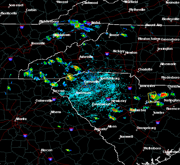 At 243 pm edt, a severe thunderstorm was located 13 miles northwest of pickens, or 6 miles north of jocassee gorges, moving south at 5 mph (radar indicated). Hazards include 60 mph wind gusts and penny size hail. Expect damage to roofs. siding and trees. Locations impacted include, rosman, sassafras mountain, sunset, rocky bottom, lake jocassee, jocassee gorges and gorges state park. At 243 pm edt, a severe thunderstorm was located 13 miles northwest of pickens, or 6 miles north of jocassee gorges, moving south at 5 mph (radar indicated). Hazards include 60 mph wind gusts and penny size hail. Expect damage to roofs. siding and trees. Locations impacted include, rosman, sassafras mountain, sunset, rocky bottom, lake jocassee, jocassee gorges and gorges state park.
|
| 7/19/2016 2:22 PM EDT |
 At 222 pm edt, a severe thunderstorm was located 12 miles southwest of brevard, or 4 miles south of rosman, moving south at 5 mph (radar indicated). Hazards include 60 mph wind gusts and quarter size hail. Hail damage to vehicles is expected. Expect wind damage to roofs, siding and trees. At 222 pm edt, a severe thunderstorm was located 12 miles southwest of brevard, or 4 miles south of rosman, moving south at 5 mph (radar indicated). Hazards include 60 mph wind gusts and quarter size hail. Hail damage to vehicles is expected. Expect wind damage to roofs, siding and trees.
|
| 7/8/2016 8:37 PM EDT |
 The severe thunderstorm warning for jackson, transylvania, southeastern swain, southern haywood and north central macon counties will expire at 845 pm edt, the storm which prompted the warning has weakened below severe limits, and no longer poses an immediate threat to life or property. therefore the warning will be allowed to expire. a severe thunderstorm watch remains in effect until midnight edt for western north carolina, and upstate south carolina. The severe thunderstorm warning for jackson, transylvania, southeastern swain, southern haywood and north central macon counties will expire at 845 pm edt, the storm which prompted the warning has weakened below severe limits, and no longer poses an immediate threat to life or property. therefore the warning will be allowed to expire. a severe thunderstorm watch remains in effect until midnight edt for western north carolina, and upstate south carolina.
|
| 7/8/2016 8:29 PM EDT |
 At 828 pm edt, a severe thunderstorm was located 4 miles north of brevard, or 4 miles east of looking glass, moving east at 40 mph. radar continues to show strong winds just off the surface, but the hail threat has passed (radar indicated). Hazards include 60 mph wind gusts. Expect damage to roofs. siding and trees. Locations impacted include, brevard, sylva, waynesville, cherokee, cullowhee, lake junaluska, maggie valley, balsam, rosman and webster. At 828 pm edt, a severe thunderstorm was located 4 miles north of brevard, or 4 miles east of looking glass, moving east at 40 mph. radar continues to show strong winds just off the surface, but the hail threat has passed (radar indicated). Hazards include 60 mph wind gusts. Expect damage to roofs. siding and trees. Locations impacted include, brevard, sylva, waynesville, cherokee, cullowhee, lake junaluska, maggie valley, balsam, rosman and webster.
|
| 7/8/2016 8:19 PM EDT |
 At 819 pm edt, a severe thunderstorm was located 19 miles north of walhalla, or 5 miles west of gorges state park, moving southeast at 30 mph (radar indicated). Hazards include 60 mph wind gusts. Expect damage to roofs. Siding and trees. At 819 pm edt, a severe thunderstorm was located 19 miles north of walhalla, or 5 miles west of gorges state park, moving southeast at 30 mph (radar indicated). Hazards include 60 mph wind gusts. Expect damage to roofs. Siding and trees.
|
| 7/8/2016 7:47 PM EDT |
 At 746 pm edt, a severe thunderstorm was located near sylva, moving east at 40 mph (radar indicated). Hazards include 60 mph wind gusts and quarter size hail. Hail damage to vehicles is expected. Expect wind damage to roofs, siding and trees. At 746 pm edt, a severe thunderstorm was located near sylva, moving east at 40 mph (radar indicated). Hazards include 60 mph wind gusts and quarter size hail. Hail damage to vehicles is expected. Expect wind damage to roofs, siding and trees.
|
| 7/7/2016 8:37 PM EDT |
 The severe thunderstorm warning for jackson, southwestern transylvania and macon counties will expire at 845 pm edt, the storms which prompted the warning have weakened below severe limits, and have exited the warned area. therefore the warning will be allowed to expire. a severe thunderstorm watch remains in effect until 1100 pm edt for western north carolina. The severe thunderstorm warning for jackson, southwestern transylvania and macon counties will expire at 845 pm edt, the storms which prompted the warning have weakened below severe limits, and have exited the warned area. therefore the warning will be allowed to expire. a severe thunderstorm watch remains in effect until 1100 pm edt for western north carolina.
|
| 7/7/2016 7:56 PM EDT |
 At 756 pm edt, severe thunderstorms were located along a line extending from 10 miles west of waynesville to 5 miles south of sylva to 8 miles west of franklin, moving southeast at 50 mph (radar indicated). Hazards include 60 mph wind gusts. Expect damage to roofs. Siding and trees. At 756 pm edt, severe thunderstorms were located along a line extending from 10 miles west of waynesville to 5 miles south of sylva to 8 miles west of franklin, moving southeast at 50 mph (radar indicated). Hazards include 60 mph wind gusts. Expect damage to roofs. Siding and trees.
|
| 6/14/2016 6:24 PM EDT |
 At 623 pm edt, severe thunderstorms were located along a line extending from 14 miles northwest of pickens to 16 miles south of hendersonville to 13 miles northeast of greenville downtown, moving northeast at 20 mph (radar indicated). Hazards include 60 mph wind gusts and nickel size hail. Expect damage to roofs. siding and trees. Locations impacted include, greer, travelers rest, duncan, landrum, slater-marietta, inman, campobello, rosman, and caesars head state park. At 623 pm edt, severe thunderstorms were located along a line extending from 14 miles northwest of pickens to 16 miles south of hendersonville to 13 miles northeast of greenville downtown, moving northeast at 20 mph (radar indicated). Hazards include 60 mph wind gusts and nickel size hail. Expect damage to roofs. siding and trees. Locations impacted include, greer, travelers rest, duncan, landrum, slater-marietta, inman, campobello, rosman, and caesars head state park.
|
| 6/14/2016 6:05 PM EDT |
 At 604 pm edt, severe thunderstorms were located along a line extending from 17 miles northeast of walhalla to 13 miles northeast of pickens to 10 miles northeast of greenville downtown, moving northeast at 20 mph (radar indicated). Hazards include 60 mph wind gusts. Expect damage to roofs. Siding and trees. At 604 pm edt, severe thunderstorms were located along a line extending from 17 miles northeast of walhalla to 13 miles northeast of pickens to 10 miles northeast of greenville downtown, moving northeast at 20 mph (radar indicated). Hazards include 60 mph wind gusts. Expect damage to roofs. Siding and trees.
|
| 6/14/2016 12:05 PM EDT | At 604 pm edt, severe thunderstorms were located along a line extending from 17 miles northeast of walhalla to 13 miles northeast of pickens to 10 miles northeast of greenville downtown, moving northeast at 20 mph (radar indicated). Hazards include 60 mph wind gusts. Expect damage to roofs. Siding and trees. |
| 6/14/2016 12:05 PM EDT | At 604 pm edt, severe thunderstorms were located along a line extending from 17 miles northeast of walhalla to 13 miles northeast of pickens to 10 miles northeast of greenville downtown, moving northeast at 20 mph (radar indicated). Hazards include 60 mph wind gusts. Expect damage to roofs. Siding and trees. |
| 6/22/2015 5:03 PM EDT |
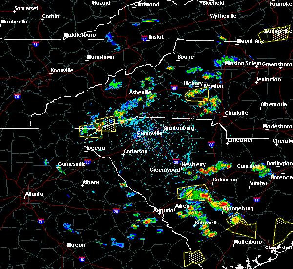 At 502 pm edt, doppler radar indicated a severe thunderstorm capable of producing quarter size hail and damaging winds in excess of 60 mph. this storm was located 15 miles north of walhalla, or 5 miles northwest of devils fork state park, moving east at 25 mph. locations impacted include, rosman, cashiers, lake toxaway, devils fork state park, jocassee gorges, lake jocassee, gorges state park, sunset, rocky bottom and bad creek. At 502 pm edt, doppler radar indicated a severe thunderstorm capable of producing quarter size hail and damaging winds in excess of 60 mph. this storm was located 15 miles north of walhalla, or 5 miles northwest of devils fork state park, moving east at 25 mph. locations impacted include, rosman, cashiers, lake toxaway, devils fork state park, jocassee gorges, lake jocassee, gorges state park, sunset, rocky bottom and bad creek.
|
| 6/22/2015 4:48 PM EDT |
 At 448 pm edt, doppler radar indicated a severe thunderstorm capable of producing quarter size hail and damaging winds in excess of 60 mph. this storm was located 19 miles north of walhalla, or 4 miles southeast of cashiers, and moving east at 10 mph. At 448 pm edt, doppler radar indicated a severe thunderstorm capable of producing quarter size hail and damaging winds in excess of 60 mph. this storm was located 19 miles north of walhalla, or 4 miles southeast of cashiers, and moving east at 10 mph.
|
| 6/22/2015 4:48 PM EDT |
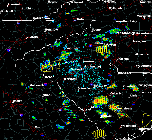 At 448 pm edt, doppler radar indicated a severe thunderstorm capable of producing quarter size hail and damaging winds in excess of 60 mph. this storm was located 19 miles north of walhalla, or 4 miles southeast of cashiers, and moving east at 10 mph. At 448 pm edt, doppler radar indicated a severe thunderstorm capable of producing quarter size hail and damaging winds in excess of 60 mph. this storm was located 19 miles north of walhalla, or 4 miles southeast of cashiers, and moving east at 10 mph.
|
| 6/18/2015 5:41 PM EDT | At 541 pm edt, doppler radar indicated a severe thunderstorm capable of producing quarter size hail and damaging winds in excess of 60 mph. this storm was located 13 miles west of brevard, or near lake toxaway, moving east at 15 mph. locations impacted include, rosman, cashiers, lake toxaway, gorges state park, connestee, balsam grove, wolf mountain, sapphire, sassafras mountain and lake glenville. |
| 6/18/2015 5:27 PM EDT | At 527 pm edt, doppler radar indicated a severe thunderstorm capable of producing quarter size hail and damaging winds in excess of 60 mph. this storm was located 18 miles southwest of brevard, or near cashiers, and moving northeast at 10 mph. |
| 6/18/2015 3:37 PM EDT | At 336 pm edt, doppler radar indicated a severe thunderstorm capable of producing large damaging hail up to golf ball size and damaging winds in excess of 60 mph. this storm was located 13 miles southwest of brevard, or near gorges state park, moving east at 15 mph. locations impacted include, rosman, lake toxaway, table rock state park, lake jocassee, caesars head state park, gorges state park, pumpkintown, cedar mountain, rocky bottom and connestee. |
| 6/18/2015 3:37 PM EDT | At 336 pm edt, doppler radar indicated a severe thunderstorm capable of producing large damaging hail up to golf ball size and damaging winds in excess of 60 mph. this storm was located 13 miles southwest of brevard, or near gorges state park, moving east at 15 mph. locations impacted include, rosman, lake toxaway, table rock state park, lake jocassee, caesars head state park, gorges state park, pumpkintown, cedar mountain, rocky bottom and connestee. |
| 6/18/2015 3:23 PM EDT | At 322 pm edt, doppler radar indicated a severe thunderstorm capable of producing large damaging hail up to golf ball size and damaging winds in excess of 60 mph. this storm was located 15 miles southwest of brevard, or over gorges state park, and moving east at 15 mph. |
| 6/18/2015 3:23 PM EDT | At 322 pm edt, doppler radar indicated a severe thunderstorm capable of producing large damaging hail up to golf ball size and damaging winds in excess of 60 mph. this storm was located 15 miles southwest of brevard, or over gorges state park, and moving east at 15 mph. |
| 6/9/2015 6:38 PM EDT |
 The severe thunderstorm warning for southeastern transylvania, northern pickens and northwestern greenville counties will expire at 645 pm edt, the severe thunderstorm which prompted the warning has weakened. therefore the warning will be allowed to expire. The severe thunderstorm warning for southeastern transylvania, northern pickens and northwestern greenville counties will expire at 645 pm edt, the severe thunderstorm which prompted the warning has weakened. therefore the warning will be allowed to expire.
|
| 6/9/2015 6:38 PM EDT |
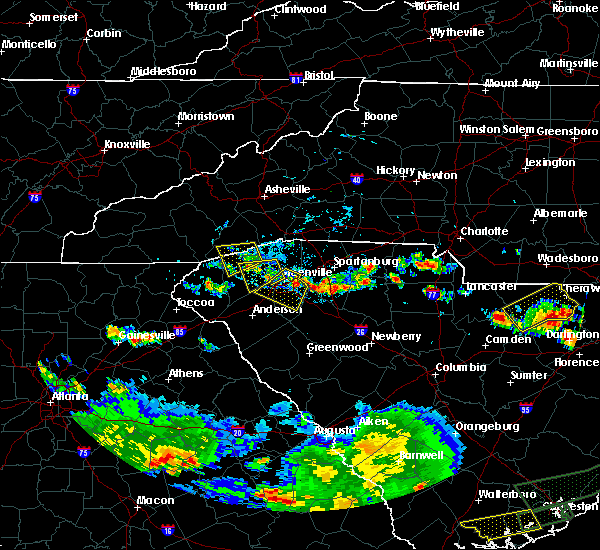 The severe thunderstorm warning for southeastern transylvania, northern pickens and northwestern greenville counties will expire at 645 pm edt, the severe thunderstorm which prompted the warning has weakened. therefore the warning will be allowed to expire. The severe thunderstorm warning for southeastern transylvania, northern pickens and northwestern greenville counties will expire at 645 pm edt, the severe thunderstorm which prompted the warning has weakened. therefore the warning will be allowed to expire.
|
| 6/9/2015 6:27 PM EDT |
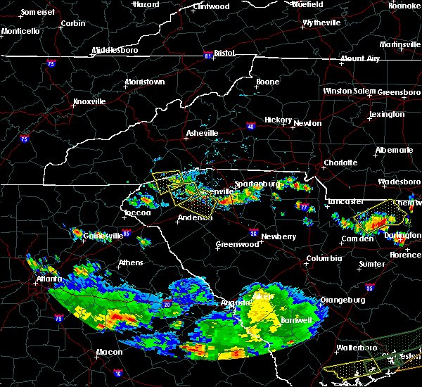 At 627 pm edt, doppler radar indicated a severe thunderstorm capable of producing quarter size hail and damaging winds in excess of 60 mph. this storm was located 11 miles north of pickens, or near table rock state park, moving west at 10 mph. locations impacted include, rosman, table rock state park, jocassee gorges, caesars head state park, pumpkintown, nine times, cedar mountain, sunset, rocky bottom and sassafras mountain. At 627 pm edt, doppler radar indicated a severe thunderstorm capable of producing quarter size hail and damaging winds in excess of 60 mph. this storm was located 11 miles north of pickens, or near table rock state park, moving west at 10 mph. locations impacted include, rosman, table rock state park, jocassee gorges, caesars head state park, pumpkintown, nine times, cedar mountain, sunset, rocky bottom and sassafras mountain.
|
| 6/9/2015 5:56 PM EDT |
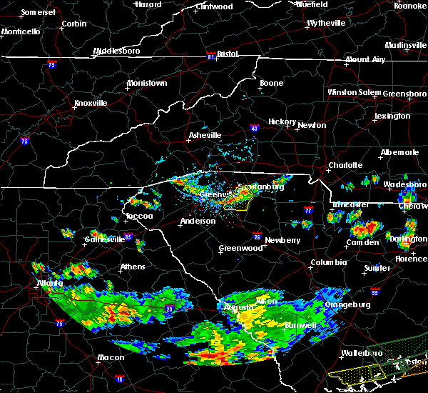 At 556 pm edt, doppler radar indicated a severe thunderstorm capable of producing quarter size hail and damaging winds in excess of 60 mph. this storm was located 12 miles south of brevard, or near table rock state park, and moving west at 10 mph. At 556 pm edt, doppler radar indicated a severe thunderstorm capable of producing quarter size hail and damaging winds in excess of 60 mph. this storm was located 12 miles south of brevard, or near table rock state park, and moving west at 10 mph.
|
| 6/8/2015 10:32 PM EDT | At 1032 pm edt, doppler radar indicated a line of severe thunderstorms capable of producing damaging winds in excess of 60 mph. these storms were located along a line extending from 4 miles southwest of hendersonville to 6 miles west of pickens, moving east at 35 mph. locations impacted include, easley, hendersonville, brevard, walhalla, pickens, columbus, berea, travelers rest, liberty and flat rock. |
| 6/8/2015 10:32 PM EDT | At 1032 pm edt, doppler radar indicated a line of severe thunderstorms capable of producing damaging winds in excess of 60 mph. these storms were located along a line extending from 4 miles southwest of hendersonville to 6 miles west of pickens, moving east at 35 mph. locations impacted include, easley, hendersonville, brevard, walhalla, pickens, columbus, berea, travelers rest, liberty and flat rock. |
| 6/8/2015 10:05 PM EDT | At 1004 pm edt, doppler radar indicated a line of severe thunderstorms capable of producing damaging winds in excess of 60 mph. these storms were located along a line extending from 4 miles west of brevard to 3 miles northwest of walhalla, and moving east at 35 mph. |
| 6/8/2015 10:05 PM EDT | At 1004 pm edt, doppler radar indicated a line of severe thunderstorms capable of producing damaging winds in excess of 60 mph. these storms were located along a line extending from 4 miles west of brevard to 3 miles northwest of walhalla, and moving east at 35 mph. |
| 6/8/2015 9:54 PM EDT | At 953 pm edt, doppler radar indicated a line of severe thunderstorms capable of producing damaging winds in excess of 60 mph. these storms were located along a line extending from 14 miles southeast of sylva to 9 miles east of clayton, moving east at 20 mph. locations impacted include, walhalla, clayton, mountain city, rosman, tiger, cashiers, salem, keowee toxaway state park, moccasin creek state park and oconee state park. |
| 6/8/2015 9:54 PM EDT | At 953 pm edt, doppler radar indicated a line of severe thunderstorms capable of producing damaging winds in excess of 60 mph. these storms were located along a line extending from 14 miles southeast of sylva to 9 miles east of clayton, moving east at 20 mph. locations impacted include, walhalla, clayton, mountain city, rosman, tiger, cashiers, salem, keowee toxaway state park, moccasin creek state park and oconee state park. |
| 6/8/2015 9:54 PM EDT | At 953 pm edt, doppler radar indicated a line of severe thunderstorms capable of producing damaging winds in excess of 60 mph. these storms were located along a line extending from 14 miles southeast of sylva to 9 miles east of clayton, moving east at 20 mph. locations impacted include, walhalla, clayton, mountain city, rosman, tiger, cashiers, salem, keowee toxaway state park, moccasin creek state park and oconee state park. |
| 6/8/2015 9:34 PM EDT | At 934 pm edt, doppler radar indicated a severe thunderstorm capable of producing damaging winds in excess of 60 mph. this storm was located 11 miles southeast of franklin, or near highlands, and moving east at 30 mph. |
| 6/8/2015 9:34 PM EDT | At 934 pm edt, doppler radar indicated a severe thunderstorm capable of producing damaging winds in excess of 60 mph. this storm was located 11 miles southeast of franklin, or near highlands, and moving east at 30 mph. |
| 6/8/2015 9:34 PM EDT | At 934 pm edt, doppler radar indicated a severe thunderstorm capable of producing damaging winds in excess of 60 mph. this storm was located 11 miles southeast of franklin, or near highlands, and moving east at 30 mph. |
| 4/22/2015 8:46 PM EDT | At 845 pm edt, doppler radar indicated a severe thunderstorm capable of producing damaging winds in excess of 60 mph. this storm was located 9 miles southwest of brevard, or over rosman, and moving east at 55 mph. |
| 4/22/2015 8:46 PM EDT | At 845 pm edt, doppler radar indicated a severe thunderstorm capable of producing damaging winds in excess of 60 mph. this storm was located 9 miles southwest of brevard, or over rosman, and moving east at 55 mph. |
| 6/13/2014 5:10 PM EDT | Multiple trees and power lines down in rosman area. time estimated from radar in transylvania county NC, 0.5 miles N of Rosman, NC |
| 5/20/2013 4:32 PM EDT | Quarter sized hail reported 7 miles ENE of Rosman, NC |
| 4/11/2013 9:39 PM EDT | Quarter sized hail reported 6.3 miles E of Rosman, NC, up to 1 inch hail around lake toxaway. |
| 1/1/0001 12:00 AM | Tree in roadway near us 178 and rocky bottom rd in pickens county SC, 6.8 miles N of Rosman, NC |
| 1/1/0001 12:00 AM | Half Dollar sized hail reported 9 miles ESE of Rosman, NC, near wolf mountain...hail somewhat in the shape of spears with diameter larger than an inch fell for a short time. no wind during the storm and a light gust prior to st |
Hail Maps for Rosman, NC


Connect with Interactive Hail Maps