

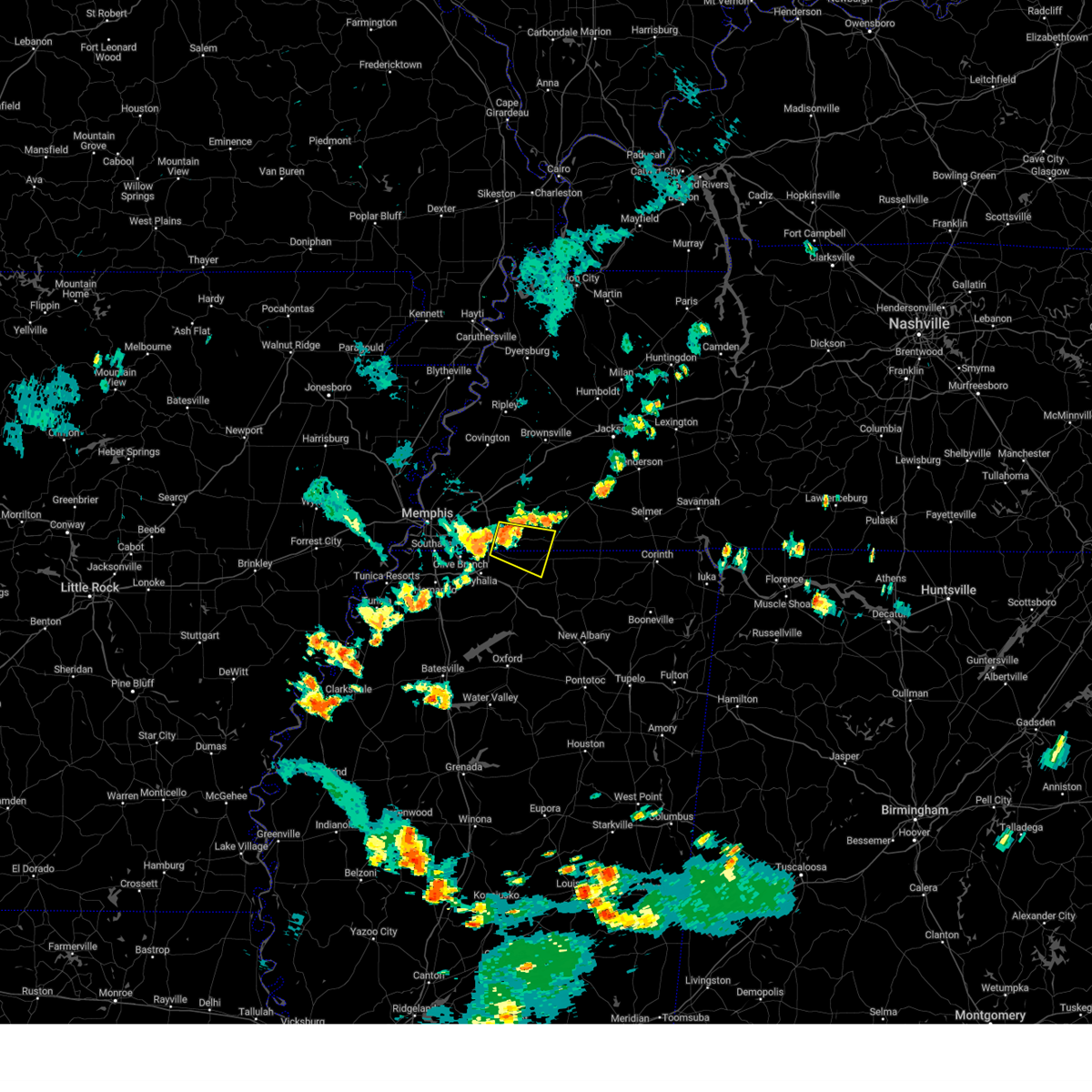
Hail Map for Rossville, TN
The Rossville, TN area has had 0 reports of on-the-ground hail by trained spotters, and has been under severe weather warnings 76 times during the past 12 months. Doppler radar has detected hail at or near Rossville, TN on 66 occasions, including 11 occasions during the past year.
| Name: | Rossville, TN |
| Where Located: | 29.1 miles ESE of Memphis, TN |
| Map: | Google Map for Rossville, TN |
| Population: | 664 |
| Housing Units: | 305 |
| More Info: | Search Google for Rossville, TN |
5
The Top Recent Hail Date for Rossville, TN is Monday, April 8, 2024 (1st out of 66)

Hail and Wind Damage Spotted near Rossville, TN
| Date / Time | Report Details |
|---|---|
| 4/8/2024 4:48 PM CDT |
 At 448 pm cdt, a severe thunderstorm was located 7 miles southwest of somerville, or 15 miles east of collierville, moving northeast at 35 mph (radar indicated). Hazards include 60 mph wind gusts and quarter size hail. Hail damage to vehicles is expected. expect wind damage to roofs, siding, and trees. Locations impacted include, somerville, warren, macon, oakland, piperton, rossville, moscow, williston, hickory valley, yum yum, laconia, elba, middleburg, moorman, taylor chapel, miller, hays crossing, pattersonville, powers, and forty five. At 448 pm cdt, a severe thunderstorm was located 7 miles southwest of somerville, or 15 miles east of collierville, moving northeast at 35 mph (radar indicated). Hazards include 60 mph wind gusts and quarter size hail. Hail damage to vehicles is expected. expect wind damage to roofs, siding, and trees. Locations impacted include, somerville, warren, macon, oakland, piperton, rossville, moscow, williston, hickory valley, yum yum, laconia, elba, middleburg, moorman, taylor chapel, miller, hays crossing, pattersonville, powers, and forty five.
|
| 4/8/2024 4:48 PM CDT |
 the severe thunderstorm warning has been cancelled and is no longer in effect the severe thunderstorm warning has been cancelled and is no longer in effect
|
| 4/8/2024 4:36 PM CDT | Powerlines down along hwy 57 in rossvill in fayette county TN, 1 miles WSW of Rossville, TN |
| 4/8/2024 4:34 PM CDT |
 Svrmeg the national weather service in memphis has issued a * severe thunderstorm warning for, northwestern marshall county in northwestern mississippi, fayette county in west tennessee, west central hardeman county in west tennessee, southeastern shelby county in west tennessee, * until 515 pm cdt. * at 434 pm cdt, a severe thunderstorm was located near mt pleasant, or 8 miles east of collierville, moving northeast at 35 mph (radar indicated). Hazards include 60 mph wind gusts and quarter size hail. Hail damage to vehicles is expected. Expect wind damage to roofs, siding, and trees. Svrmeg the national weather service in memphis has issued a * severe thunderstorm warning for, northwestern marshall county in northwestern mississippi, fayette county in west tennessee, west central hardeman county in west tennessee, southeastern shelby county in west tennessee, * until 515 pm cdt. * at 434 pm cdt, a severe thunderstorm was located near mt pleasant, or 8 miles east of collierville, moving northeast at 35 mph (radar indicated). Hazards include 60 mph wind gusts and quarter size hail. Hail damage to vehicles is expected. Expect wind damage to roofs, siding, and trees.
|
| 8/9/2023 11:36 AM CDT |
 The severe thunderstorm warning for northeastern desoto, southwestern fayette and southeastern shelby counties will expire at 1145 am cdt, the storm which prompted the warning has moved out of the area. therefore, the warning will be allowed to expire. The severe thunderstorm warning for northeastern desoto, southwestern fayette and southeastern shelby counties will expire at 1145 am cdt, the storm which prompted the warning has moved out of the area. therefore, the warning will be allowed to expire.
|
| 8/9/2023 11:30 AM CDT |
 At 1130 am cdt, a severe thunderstorm was located over germantown, moving east at 45 mph (radar indicated). Hazards include 60 mph wind gusts and quarter size hail. Hail damage to vehicles is expected. expect wind damage to roofs, siding, and trees. locations impacted include, bartlett, southaven, collierville, germantown, olive branch, cordova, memphis, lakeland, arlington, ellendale, southeast memphis, downtown memphis, eads, midtown memphis, piperton, gallaway, rossville, lenow, capleville and kirk. hail threat, radar indicated max hail size, 1. 00 in wind threat, radar indicated max wind gust, 60 mph. At 1130 am cdt, a severe thunderstorm was located over germantown, moving east at 45 mph (radar indicated). Hazards include 60 mph wind gusts and quarter size hail. Hail damage to vehicles is expected. expect wind damage to roofs, siding, and trees. locations impacted include, bartlett, southaven, collierville, germantown, olive branch, cordova, memphis, lakeland, arlington, ellendale, southeast memphis, downtown memphis, eads, midtown memphis, piperton, gallaway, rossville, lenow, capleville and kirk. hail threat, radar indicated max hail size, 1. 00 in wind threat, radar indicated max wind gust, 60 mph.
|
| 8/9/2023 11:07 AM CDT |
 At 1106 am cdt, a severe thunderstorm was located over southwest memphis, or near t o fuller state park, moving east at 45 mph (radar indicated). Hazards include 60 mph wind gusts and quarter size hail. Hail damage to vehicles is expected. Expect wind damage to roofs, siding, and trees. At 1106 am cdt, a severe thunderstorm was located over southwest memphis, or near t o fuller state park, moving east at 45 mph (radar indicated). Hazards include 60 mph wind gusts and quarter size hail. Hail damage to vehicles is expected. Expect wind damage to roofs, siding, and trees.
|
| 7/21/2023 2:14 PM CDT | Tree down blocking both lanes across hwy 57 in the 11200 block... east of rossville. time is radar estimate in fayette county TN, 4.4 miles WSW of Rossville, TN |
| 7/21/2023 2:07 PM CDT |
 At 207 pm cdt, severe thunderstorms were located along a line extending from 6 miles southwest of ripley to near somerville to near mt pleasant, moving east at 65 mph (public). Hazards include 60 mph wind gusts and penny size hail. expect damage to roofs, siding, and trees At 207 pm cdt, severe thunderstorms were located along a line extending from 6 miles southwest of ripley to near somerville to near mt pleasant, moving east at 65 mph (public). Hazards include 60 mph wind gusts and penny size hail. expect damage to roofs, siding, and trees
|
| 7/21/2023 1:50 PM CDT |
 At 149 pm cdt, severe thunderstorms were located along a line extending from near dell to near millington to near lewisburg, moving east at 50 mph (radar indicated). Hazards include 60 mph wind gusts. Expect damage to roofs, siding, and trees. locations impacted include, bartlett, southaven, collierville, germantown, olive branch, millington, covington, ripley, fort pillow state park, cordova, memphis, lakeland, arlington, munford, somerville, brighton, mt pleasant, ellendale, fulton and southeast memphis. hail threat, radar indicated max hail size, <. 75 in wind threat, radar indicated max wind gust, 60 mph. At 149 pm cdt, severe thunderstorms were located along a line extending from near dell to near millington to near lewisburg, moving east at 50 mph (radar indicated). Hazards include 60 mph wind gusts. Expect damage to roofs, siding, and trees. locations impacted include, bartlett, southaven, collierville, germantown, olive branch, millington, covington, ripley, fort pillow state park, cordova, memphis, lakeland, arlington, munford, somerville, brighton, mt pleasant, ellendale, fulton and southeast memphis. hail threat, radar indicated max hail size, <. 75 in wind threat, radar indicated max wind gust, 60 mph.
|
| 7/21/2023 1:38 PM CDT |
 At 138 pm cdt, severe thunderstorms were located along a line extending from near manila to millington to hernando, moving east at 50 mph. these are destructive storms for extreme northern shelby county and southern tipton county (radar indicated). Hazards include 80 mph wind gusts. Flying debris will be dangerous to those caught without shelter. mobile homes will be heavily damaged. expect considerable damage to roofs, windows, and vehicles. extensive tree damage and power outages are likely. locations impacted include, jonesboro, bartlett, southaven, collierville, germantown, olive branch, west memphis, horn lake, blytheville, hernando, marion, millington, covington, ripley, osceola, holly springs, trumann, manila, marked tree and lake city. thunderstorm damage threat, destructive hail threat, radar indicated max hail size, <. 75 in wind threat, radar indicated max wind gust, 80 mph. At 138 pm cdt, severe thunderstorms were located along a line extending from near manila to millington to hernando, moving east at 50 mph. these are destructive storms for extreme northern shelby county and southern tipton county (radar indicated). Hazards include 80 mph wind gusts. Flying debris will be dangerous to those caught without shelter. mobile homes will be heavily damaged. expect considerable damage to roofs, windows, and vehicles. extensive tree damage and power outages are likely. locations impacted include, jonesboro, bartlett, southaven, collierville, germantown, olive branch, west memphis, horn lake, blytheville, hernando, marion, millington, covington, ripley, osceola, holly springs, trumann, manila, marked tree and lake city. thunderstorm damage threat, destructive hail threat, radar indicated max hail size, <. 75 in wind threat, radar indicated max wind gust, 80 mph.
|
| 7/21/2023 1:16 PM CDT |
 At 115 pm cdt, severe thunderstorms were located along a line extending from near lake city to near jericho to near horseshoe lake, moving east at 50 mph (radar indicated). Hazards include 60 mph wind gusts and penny size hail. expect damage to roofs, siding, and trees At 115 pm cdt, severe thunderstorms were located along a line extending from near lake city to near jericho to near horseshoe lake, moving east at 50 mph (radar indicated). Hazards include 60 mph wind gusts and penny size hail. expect damage to roofs, siding, and trees
|
| 7/18/2023 6:38 PM CDT |
 The severe thunderstorm warning for northeastern desoto, northwestern marshall, southwestern fayette and southeastern shelby counties will expire at 645 pm cdt, the storm which prompted the warning has moved out of the area. therefore, the warning will be allowed to expire. a severe thunderstorm watch remains in effect until midnight cdt for northwestern mississippi, and west tennessee. The severe thunderstorm warning for northeastern desoto, northwestern marshall, southwestern fayette and southeastern shelby counties will expire at 645 pm cdt, the storm which prompted the warning has moved out of the area. therefore, the warning will be allowed to expire. a severe thunderstorm watch remains in effect until midnight cdt for northwestern mississippi, and west tennessee.
|
| 7/18/2023 6:17 PM CDT |
 At 617 pm cdt, a severe thunderstorm was located near collierville, moving southeast at 50 mph (radar indicated). Hazards include 60 mph wind gusts. Expect damage to roofs, siding, and trees. locations impacted include, collierville, germantown, olive branch, holly springs, cordova, memphis, byhalia, mt pleasant, southeast memphis, red banks, slayden, marianna, piperton, rossville, coal oil corner, lenow, cayce, handy corner, taska and capleville. hail threat, radar indicated max hail size, <. 75 in wind threat, radar indicated max wind gust, 60 mph. At 617 pm cdt, a severe thunderstorm was located near collierville, moving southeast at 50 mph (radar indicated). Hazards include 60 mph wind gusts. Expect damage to roofs, siding, and trees. locations impacted include, collierville, germantown, olive branch, holly springs, cordova, memphis, byhalia, mt pleasant, southeast memphis, red banks, slayden, marianna, piperton, rossville, coal oil corner, lenow, cayce, handy corner, taska and capleville. hail threat, radar indicated max hail size, <. 75 in wind threat, radar indicated max wind gust, 60 mph.
|
| 7/18/2023 5:56 PM CDT |
 At 556 pm cdt, a severe thunderstorm was located near bartlett, moving southeast at 50 mph (radar indicated). Hazards include 60 mph wind gusts and penny size hail. expect damage to roofs, siding, and trees At 556 pm cdt, a severe thunderstorm was located near bartlett, moving southeast at 50 mph (radar indicated). Hazards include 60 mph wind gusts and penny size hail. expect damage to roofs, siding, and trees
|
| 7/5/2023 7:51 PM CDT |
 At 751 pm cdt, a severe thunderstorm was located near mt pleasant, or 9 miles east of collierville, moving east at 15 mph (radar indicated). Hazards include 60 mph wind gusts. expect damage to roofs, siding, and trees At 751 pm cdt, a severe thunderstorm was located near mt pleasant, or 9 miles east of collierville, moving east at 15 mph (radar indicated). Hazards include 60 mph wind gusts. expect damage to roofs, siding, and trees
|
| 7/3/2023 2:24 PM CDT |
 The severe thunderstorm warning for northern marshall, northwestern benton, southern fayette and southeastern shelby counties will expire at 230 pm cdt, the storm which prompted the warning has weakened below severe limits, and no longer poses an immediate threat to life or property. therefore, the warning will be allowed to expire. The severe thunderstorm warning for northern marshall, northwestern benton, southern fayette and southeastern shelby counties will expire at 230 pm cdt, the storm which prompted the warning has weakened below severe limits, and no longer poses an immediate threat to life or property. therefore, the warning will be allowed to expire.
|
| 7/3/2023 2:04 PM CDT |
 At 203 pm cdt, a severe thunderstorm was located near mt pleasant, or 7 miles southeast of collierville, moving east at 15 mph (radar indicated). Hazards include 60 mph wind gusts and quarter size hail. Hail damage to vehicles is expected. Expect wind damage to roofs, siding, and trees. At 203 pm cdt, a severe thunderstorm was located near mt pleasant, or 7 miles southeast of collierville, moving east at 15 mph (radar indicated). Hazards include 60 mph wind gusts and quarter size hail. Hail damage to vehicles is expected. Expect wind damage to roofs, siding, and trees.
|
| 7/2/2023 11:23 PM CDT |
 At 1123 pm cdt, a severe thunderstorm was located over germantown, moving east at 20 mph (radar indicated). Hazards include 60 mph wind gusts. expect damage to roofs, siding, and trees At 1123 pm cdt, a severe thunderstorm was located over germantown, moving east at 20 mph (radar indicated). Hazards include 60 mph wind gusts. expect damage to roofs, siding, and trees
|
| 7/2/2023 8:18 PM CDT |
 At 818 pm cdt, a severe thunderstorm was located near millington, moving east at 40 mph (radar indicated). Hazards include 60 mph wind gusts and quarter size hail. Hail damage to vehicles is expected. Expect wind damage to roofs, siding, and trees. At 818 pm cdt, a severe thunderstorm was located near millington, moving east at 40 mph (radar indicated). Hazards include 60 mph wind gusts and quarter size hail. Hail damage to vehicles is expected. Expect wind damage to roofs, siding, and trees.
|
| 7/1/2023 10:10 AM CDT |
 At 1010 am cdt, a severe thunderstorm was located 8 miles northwest of michigan city, or 18 miles east of collierville, moving northeast at 35 mph (radar indicated). Hazards include 60 mph wind gusts and quarter size hail. Hail damage to vehicles is expected. expect wind damage to roofs, siding, and trees. locations impacted include, lamar, somerville, lagrange, michigan city, slayden, rossville, moscow, williston, grand junction, la grange, hickory valley, saulsbury, rogers springs, laconia, early grove, taylor chapel, miller, hays crossing, pattersonville and van buren. hail threat, radar indicated max hail size, 1. 00 in wind threat, radar indicated max wind gust, 60 mph. At 1010 am cdt, a severe thunderstorm was located 8 miles northwest of michigan city, or 18 miles east of collierville, moving northeast at 35 mph (radar indicated). Hazards include 60 mph wind gusts and quarter size hail. Hail damage to vehicles is expected. expect wind damage to roofs, siding, and trees. locations impacted include, lamar, somerville, lagrange, michigan city, slayden, rossville, moscow, williston, grand junction, la grange, hickory valley, saulsbury, rogers springs, laconia, early grove, taylor chapel, miller, hays crossing, pattersonville and van buren. hail threat, radar indicated max hail size, 1. 00 in wind threat, radar indicated max wind gust, 60 mph.
|
| 7/1/2023 9:55 AM CDT |
 At 955 am cdt, a severe thunderstorm was located over mt pleasant, or 12 miles southeast of collierville, moving northeast at 35 mph (radar indicated). Hazards include 60 mph wind gusts and quarter size hail. Hail damage to vehicles is expected. Expect wind damage to roofs, siding, and trees. At 955 am cdt, a severe thunderstorm was located over mt pleasant, or 12 miles southeast of collierville, moving northeast at 35 mph (radar indicated). Hazards include 60 mph wind gusts and quarter size hail. Hail damage to vehicles is expected. Expect wind damage to roofs, siding, and trees.
|
| 6/25/2023 7:20 PM CDT |
 At 719 pm cdt, a severe thunderstorm was located near lagrange, or 21 miles east of collierville, moving southeast at 75 mph (radar indicated). Hazards include 70 mph wind gusts. Expect considerable tree damage. Damage is likely to mobile homes, roofs, and outbuildings. At 719 pm cdt, a severe thunderstorm was located near lagrange, or 21 miles east of collierville, moving southeast at 75 mph (radar indicated). Hazards include 70 mph wind gusts. Expect considerable tree damage. Damage is likely to mobile homes, roofs, and outbuildings.
|
| 6/25/2023 6:48 PM CDT |
 At 648 pm cdt, a severe thunderstorm was located over millington, moving southeast at 55 mph (radar indicated). Hazards include 70 mph wind gusts. Expect considerable tree damage. Damage is likely to mobile homes, roofs, and outbuildings. At 648 pm cdt, a severe thunderstorm was located over millington, moving southeast at 55 mph (radar indicated). Hazards include 70 mph wind gusts. Expect considerable tree damage. Damage is likely to mobile homes, roofs, and outbuildings.
|
| 6/18/2023 8:59 PM CDT |
 At 859 pm cdt, severe thunderstorms were located along a line extending from near somerville to near mt pleasant, moving east at 35 mph (radar indicated). Hazards include 70 mph wind gusts. Expect considerable tree damage. damage is likely to mobile homes, roofs, and outbuildings. Locations impacted include, somerville, macon, piperton, rossville, moscow, williston, la grange, hays crossing, pattersonville, forty five and ghost river state natural area. At 859 pm cdt, severe thunderstorms were located along a line extending from near somerville to near mt pleasant, moving east at 35 mph (radar indicated). Hazards include 70 mph wind gusts. Expect considerable tree damage. damage is likely to mobile homes, roofs, and outbuildings. Locations impacted include, somerville, macon, piperton, rossville, moscow, williston, la grange, hays crossing, pattersonville, forty five and ghost river state natural area.
|
| 6/18/2023 8:52 PM CDT |
 At 851 pm cdt, severe thunderstorms were located along a line extending from near somerville to near collierville, moving east at 30 mph (radar indicated). Hazards include 60 mph wind gusts. Expect damage to roofs, siding, and trees. locations impacted include, somerville, macon, oakland, piperton, rossville, moscow, williston, la grange, elba, hays crossing, pattersonville, forty five and ghost river state natural area. hail threat, radar indicated max hail size, <. 75 in wind threat, radar indicated max wind gust, 60 mph. At 851 pm cdt, severe thunderstorms were located along a line extending from near somerville to near collierville, moving east at 30 mph (radar indicated). Hazards include 60 mph wind gusts. Expect damage to roofs, siding, and trees. locations impacted include, somerville, macon, oakland, piperton, rossville, moscow, williston, la grange, elba, hays crossing, pattersonville, forty five and ghost river state natural area. hail threat, radar indicated max hail size, <. 75 in wind threat, radar indicated max wind gust, 60 mph.
|
| 6/18/2023 8:36 PM CDT |
 At 836 pm cdt, severe thunderstorms were located along a line extending from 6 miles east of eads to near collierville, moving east at 30 mph (radar indicated). Hazards include 60 mph wind gusts and penny size hail. expect damage to roofs, siding, and trees At 836 pm cdt, severe thunderstorms were located along a line extending from 6 miles east of eads to near collierville, moving east at 30 mph (radar indicated). Hazards include 60 mph wind gusts and penny size hail. expect damage to roofs, siding, and trees
|
| 6/18/2023 6:25 AM CDT |
 The severe thunderstorm warning for southeastern tipton, fayette, western hardeman, southern haywood and eastern shelby counties will expire at 630 am cdt, the storms which prompted the warning have weakened below severe limits, and no longer pose an immediate threat to life or property. therefore, the warning will be allowed to expire. however gusty winds are still possible with these thunderstorms. a severe thunderstorm watch remains in effect until 1000 am cdt for northwestern mississippi, and west tennessee. The severe thunderstorm warning for southeastern tipton, fayette, western hardeman, southern haywood and eastern shelby counties will expire at 630 am cdt, the storms which prompted the warning have weakened below severe limits, and no longer pose an immediate threat to life or property. therefore, the warning will be allowed to expire. however gusty winds are still possible with these thunderstorms. a severe thunderstorm watch remains in effect until 1000 am cdt for northwestern mississippi, and west tennessee.
|
| 6/18/2023 6:08 AM CDT |
 The severe thunderstorm warning for northwestern union, marshall, western tippah, benton, southeastern fayette and southwestern hardeman counties will expire at 615 am cdt, the storm which prompted the warning has moved out of the area. therefore, the warning will be allowed to expire. a severe thunderstorm watch remains in effect until 1000 am cdt for northeastern and northwestern mississippi, and west tennessee. The severe thunderstorm warning for northwestern union, marshall, western tippah, benton, southeastern fayette and southwestern hardeman counties will expire at 615 am cdt, the storm which prompted the warning has moved out of the area. therefore, the warning will be allowed to expire. a severe thunderstorm watch remains in effect until 1000 am cdt for northeastern and northwestern mississippi, and west tennessee.
|
| 6/18/2023 5:51 AM CDT |
 At 550 am cdt, a severe thunderstorm was located near slayden, or 7 miles north of holly springs, moving east at 45 mph (radar indicated). Hazards include 60 mph wind gusts and penny size hail. expect damage to roofs, siding, and trees At 550 am cdt, a severe thunderstorm was located near slayden, or 7 miles north of holly springs, moving east at 45 mph (radar indicated). Hazards include 60 mph wind gusts and penny size hail. expect damage to roofs, siding, and trees
|
| 6/18/2023 5:43 AM CDT |
 At 543 am cdt, severe thunderstorms were located along a line extending from near munford to near eads to near collierville, moving east at 50 mph (radar indicated). Hazards include 60 mph wind gusts and penny size hail. expect damage to roofs, siding, and trees At 543 am cdt, severe thunderstorms were located along a line extending from near munford to near eads to near collierville, moving east at 50 mph (radar indicated). Hazards include 60 mph wind gusts and penny size hail. expect damage to roofs, siding, and trees
|
| 6/18/2023 5:19 AM CDT |
 At 519 am cdt, severe thunderstorms were located along a line extending from near dixonville to near bartlett to near olive branch, moving east at 50 mph (radar indicated). Hazards include 60 mph wind gusts and penny size hail. expect damage to roofs, siding, and trees At 519 am cdt, severe thunderstorms were located along a line extending from near dixonville to near bartlett to near olive branch, moving east at 50 mph (radar indicated). Hazards include 60 mph wind gusts and penny size hail. expect damage to roofs, siding, and trees
|
| 6/16/2023 3:09 PM CDT |
 The severe thunderstorm warning for northwestern marshall, southern fayette and southeastern shelby counties will expire at 315 pm cdt, the storm which prompted the warning has weakened below severe limits, and no longer poses an immediate threat to life or property. therefore, the warning will be allowed to expire. The severe thunderstorm warning for northwestern marshall, southern fayette and southeastern shelby counties will expire at 315 pm cdt, the storm which prompted the warning has weakened below severe limits, and no longer poses an immediate threat to life or property. therefore, the warning will be allowed to expire.
|
| 6/16/2023 2:46 PM CDT |
 At 245 pm cdt, a severe thunderstorm was located over collierville, moving east at 10 mph (radar indicated). Hazards include 60 mph wind gusts and quarter size hail. Hail damage to vehicles is expected. Expect wind damage to roofs, siding, and trees. At 245 pm cdt, a severe thunderstorm was located over collierville, moving east at 10 mph (radar indicated). Hazards include 60 mph wind gusts and quarter size hail. Hail damage to vehicles is expected. Expect wind damage to roofs, siding, and trees.
|
| 6/16/2023 2:20 PM CDT |
 At 219 pm cdt, a severe thunderstorm was located near eads, or near cordova, moving northeast at 10 mph (radar indicated). Hazards include 60 mph wind gusts and half dollar size hail. Hail damage to vehicles is expected. expect wind damage to roofs, siding, and trees. locations impacted include, bartlett, collierville, germantown, cordova, lakeland, arlington, eads, ellendale, macon, oakland, piperton, gallaway, rossville, braden, brunswick, lenow, fisherville, elba, canadaville and kirk. hail threat, radar indicated max hail size, 1. 25 in wind threat, radar indicated max wind gust, 60 mph. At 219 pm cdt, a severe thunderstorm was located near eads, or near cordova, moving northeast at 10 mph (radar indicated). Hazards include 60 mph wind gusts and half dollar size hail. Hail damage to vehicles is expected. expect wind damage to roofs, siding, and trees. locations impacted include, bartlett, collierville, germantown, cordova, lakeland, arlington, eads, ellendale, macon, oakland, piperton, gallaway, rossville, braden, brunswick, lenow, fisherville, elba, canadaville and kirk. hail threat, radar indicated max hail size, 1. 25 in wind threat, radar indicated max wind gust, 60 mph.
|
| 6/16/2023 2:09 PM CDT |
 At 209 pm cdt, a severe thunderstorm was located over cordova, moving northeast at 10 mph (radar indicated). Hazards include 60 mph wind gusts and half dollar size hail. Hail damage to vehicles is expected. Expect wind damage to roofs, siding, and trees. At 209 pm cdt, a severe thunderstorm was located over cordova, moving northeast at 10 mph (radar indicated). Hazards include 60 mph wind gusts and half dollar size hail. Hail damage to vehicles is expected. Expect wind damage to roofs, siding, and trees.
|
| 6/16/2023 1:58 PM CDT |
 At 158 pm cdt, a severe thunderstorm was located over meeman shelby forest state park, moving northeast at 5 mph (radar indicated). Hazards include 60 mph wind gusts and quarter size hail. Hail damage to vehicles is expected. expect wind damage to roofs, siding, and trees. locations impacted include, bartlett, collierville, germantown, olive branch, millington, meeman shelby forest state park, cordova, memphis, lakeland, arlington, munford, ellendale, dixonville, southeast memphis, eads, frayser, tipton, atoka, piperton and lenow. hail threat, radar indicated max hail size, 1. 00 in wind threat, radar indicated max wind gust, 60 mph. At 158 pm cdt, a severe thunderstorm was located over meeman shelby forest state park, moving northeast at 5 mph (radar indicated). Hazards include 60 mph wind gusts and quarter size hail. Hail damage to vehicles is expected. expect wind damage to roofs, siding, and trees. locations impacted include, bartlett, collierville, germantown, olive branch, millington, meeman shelby forest state park, cordova, memphis, lakeland, arlington, munford, ellendale, dixonville, southeast memphis, eads, frayser, tipton, atoka, piperton and lenow. hail threat, radar indicated max hail size, 1. 00 in wind threat, radar indicated max wind gust, 60 mph.
|
| 6/16/2023 1:42 PM CDT |
 At 142 pm cdt, a severe thunderstorm was located over meeman shelby forest state park, moving northeast at 5 mph (radar indicated). Hazards include 60 mph wind gusts and quarter size hail. Hail damage to vehicles is expected. Expect wind damage to roofs, siding, and trees. At 142 pm cdt, a severe thunderstorm was located over meeman shelby forest state park, moving northeast at 5 mph (radar indicated). Hazards include 60 mph wind gusts and quarter size hail. Hail damage to vehicles is expected. Expect wind damage to roofs, siding, and trees.
|
| 6/11/2023 7:12 PM CDT |
 The severe thunderstorm warning for north central marshall, southwestern fayette and southeastern shelby counties will expire at 715 pm cdt, the storm which prompted the warning has weakened below severe limits, and no longer poses an immediate threat to life or property. therefore, the warning will be allowed to expire. a severe thunderstorm watch remains in effect until 1000 pm cdt for northwestern mississippi, and west tennessee. The severe thunderstorm warning for north central marshall, southwestern fayette and southeastern shelby counties will expire at 715 pm cdt, the storm which prompted the warning has weakened below severe limits, and no longer poses an immediate threat to life or property. therefore, the warning will be allowed to expire. a severe thunderstorm watch remains in effect until 1000 pm cdt for northwestern mississippi, and west tennessee.
|
| 6/11/2023 7:05 PM CDT |
 At 705 pm cdt, a severe thunderstorm was located near collierville, moving southeast at 30 mph (radar indicated). Hazards include 60 mph wind gusts and quarter size hail. Hail damage to vehicles is expected. expect wind damage to roofs, siding, and trees. locations impacted include, collierville, germantown, mt pleasant, slayden, piperton, rossville, moscow, cayce, fisherville, elba, canadaville, taska, kirk, hays crossing and hickory withe. hail threat, radar indicated max hail size, 1. 00 in wind threat, radar indicated max wind gust, 60 mph. At 705 pm cdt, a severe thunderstorm was located near collierville, moving southeast at 30 mph (radar indicated). Hazards include 60 mph wind gusts and quarter size hail. Hail damage to vehicles is expected. expect wind damage to roofs, siding, and trees. locations impacted include, collierville, germantown, mt pleasant, slayden, piperton, rossville, moscow, cayce, fisherville, elba, canadaville, taska, kirk, hays crossing and hickory withe. hail threat, radar indicated max hail size, 1. 00 in wind threat, radar indicated max wind gust, 60 mph.
|
| 6/11/2023 6:49 PM CDT |
 At 649 pm cdt, a severe thunderstorm was located over collierville, moving southeast at 35 mph (radar indicated). Hazards include 60 mph wind gusts and quarter size hail. Hail damage to vehicles is expected. expect wind damage to roofs, siding, and trees. locations impacted include, bartlett, collierville, germantown, olive branch, cordova, memphis, lakeland, mt pleasant, eads, slayden, macon, piperton, rossville, moscow, lenow, cayce, fisherville, elba, canadaville and taska. hail threat, radar indicated max hail size, 1. 00 in wind threat, radar indicated max wind gust, 60 mph. At 649 pm cdt, a severe thunderstorm was located over collierville, moving southeast at 35 mph (radar indicated). Hazards include 60 mph wind gusts and quarter size hail. Hail damage to vehicles is expected. expect wind damage to roofs, siding, and trees. locations impacted include, bartlett, collierville, germantown, olive branch, cordova, memphis, lakeland, mt pleasant, eads, slayden, macon, piperton, rossville, moscow, lenow, cayce, fisherville, elba, canadaville and taska. hail threat, radar indicated max hail size, 1. 00 in wind threat, radar indicated max wind gust, 60 mph.
|
| 6/11/2023 6:35 PM CDT |
 At 635 pm cdt, a severe thunderstorm was located over cordova, moving southeast at 35 mph (radar indicated). Hazards include 60 mph wind gusts and quarter size hail. Hail damage to vehicles is expected. Expect wind damage to roofs, siding, and trees. At 635 pm cdt, a severe thunderstorm was located over cordova, moving southeast at 35 mph (radar indicated). Hazards include 60 mph wind gusts and quarter size hail. Hail damage to vehicles is expected. Expect wind damage to roofs, siding, and trees.
|
| 6/11/2023 6:07 PM CDT |
 The severe thunderstorm warning for central marshall and southern benton counties will expire at 615 pm cdt, the storm which prompted the warning has weakened below severe limits, and no longer poses an immediate threat to life or property. therefore, the warning will be allowed to expire. a severe thunderstorm watch remains in effect until 1000 pm cdt for northeastern and northwestern mississippi, and west tennessee. The severe thunderstorm warning for central marshall and southern benton counties will expire at 615 pm cdt, the storm which prompted the warning has weakened below severe limits, and no longer poses an immediate threat to life or property. therefore, the warning will be allowed to expire. a severe thunderstorm watch remains in effect until 1000 pm cdt for northeastern and northwestern mississippi, and west tennessee.
|
| 6/11/2023 5:44 PM CDT |
 At 544 pm cdt, a severe thunderstorm was located near mt pleasant, or 11 miles northwest of holly springs, moving southeast at 35 mph (radar indicated). Hazards include 60 mph wind gusts and quarter size hail. Hail damage to vehicles is expected. expect wind damage to roofs, siding, and trees. locations impacted include, holly springs, byhalia, snow lake shores, mt pleasant, red banks, slayden, ashland, potts camp, coal oil corner, winborn, spring hill, victoria, hudsonville, higdon, gilton, lake center, taska, atway, pine grove and mack. hail threat, radar indicated max hail size, 1. 00 in wind threat, radar indicated max wind gust, 60 mph. At 544 pm cdt, a severe thunderstorm was located near mt pleasant, or 11 miles northwest of holly springs, moving southeast at 35 mph (radar indicated). Hazards include 60 mph wind gusts and quarter size hail. Hail damage to vehicles is expected. expect wind damage to roofs, siding, and trees. locations impacted include, holly springs, byhalia, snow lake shores, mt pleasant, red banks, slayden, ashland, potts camp, coal oil corner, winborn, spring hill, victoria, hudsonville, higdon, gilton, lake center, taska, atway, pine grove and mack. hail threat, radar indicated max hail size, 1. 00 in wind threat, radar indicated max wind gust, 60 mph.
|
| 6/11/2023 5:36 PM CDT |
 At 536 pm cdt, a severe thunderstorm was located near byhalia, or 9 miles south of collierville, moving southeast at 40 mph (radar indicated). Hazards include 60 mph wind gusts and quarter size hail. Hail damage to vehicles is expected. Expect wind damage to roofs, siding, and trees. At 536 pm cdt, a severe thunderstorm was located near byhalia, or 9 miles south of collierville, moving southeast at 40 mph (radar indicated). Hazards include 60 mph wind gusts and quarter size hail. Hail damage to vehicles is expected. Expect wind damage to roofs, siding, and trees.
|
| 4/27/2023 6:03 PM CDT |
 At 603 pm cdt, a severe thunderstorm was located over collierville, moving northeast at 25 mph (radar indicated). Hazards include quarter size hail. damage to vehicles is expected At 603 pm cdt, a severe thunderstorm was located over collierville, moving northeast at 25 mph (radar indicated). Hazards include quarter size hail. damage to vehicles is expected
|
| 4/15/2023 9:46 PM CDT |
 At 945 pm cdt, severe thunderstorms were located along a line extending from near cloverport to near slayden to near coldwater, moving east at 50 mph (radar indicated). Hazards include 60 mph wind gusts. Expect damage to roofs, siding, and trees. locations impacted include, southaven, olive branch, hernando, holly springs, bolivar, chickasaw state forest, lamar, whiteville, somerville, coldwater, byhalia, mt pleasant, eudora, lewisburg, michigan city, red banks, barr, lagrange, independence and dancyville. hail threat, radar indicated max hail size, <. 75 in wind threat, radar indicated max wind gust, 60 mph. At 945 pm cdt, severe thunderstorms were located along a line extending from near cloverport to near slayden to near coldwater, moving east at 50 mph (radar indicated). Hazards include 60 mph wind gusts. Expect damage to roofs, siding, and trees. locations impacted include, southaven, olive branch, hernando, holly springs, bolivar, chickasaw state forest, lamar, whiteville, somerville, coldwater, byhalia, mt pleasant, eudora, lewisburg, michigan city, red banks, barr, lagrange, independence and dancyville. hail threat, radar indicated max hail size, <. 75 in wind threat, radar indicated max wind gust, 60 mph.
|
| 4/15/2023 9:31 PM CDT |
 At 931 pm cdt, severe thunderstorms were located along a line extending from dancyville to 6 miles east of collierville to near phillipp, moving east at 40 mph. strong outflow winds will precede this line of thunderstorms (radar indicated). Hazards include 60 mph wind gusts. Expect damage to roofs, siding, and trees. locations impacted include, bartlett, southaven, collierville, germantown, olive branch, horn lake, hernando, senatobia, holly springs, bolivar, chickasaw state forest, cordova, memphis, lamar, lakeland, arlington, whiteville, somerville, coldwater and byhalia. hail threat, radar indicated max hail size, <. 75 in wind threat, radar indicated max wind gust, 60 mph. At 931 pm cdt, severe thunderstorms were located along a line extending from dancyville to 6 miles east of collierville to near phillipp, moving east at 40 mph. strong outflow winds will precede this line of thunderstorms (radar indicated). Hazards include 60 mph wind gusts. Expect damage to roofs, siding, and trees. locations impacted include, bartlett, southaven, collierville, germantown, olive branch, horn lake, hernando, senatobia, holly springs, bolivar, chickasaw state forest, cordova, memphis, lamar, lakeland, arlington, whiteville, somerville, coldwater and byhalia. hail threat, radar indicated max hail size, <. 75 in wind threat, radar indicated max wind gust, 60 mph.
|
| 4/15/2023 9:10 PM CDT |
 At 908 pm cdt, severe thunderstorms were located along a line extending from 9 miles southeast of covington to germantown to robinsonville, moving east at 50 mph. strong outflow winds will precede this line of thunderstorms (radar indicated). Hazards include 60 mph wind gusts and penny size hail. expect damage to roofs, siding, and trees At 908 pm cdt, severe thunderstorms were located along a line extending from 9 miles southeast of covington to germantown to robinsonville, moving east at 50 mph. strong outflow winds will precede this line of thunderstorms (radar indicated). Hazards include 60 mph wind gusts and penny size hail. expect damage to roofs, siding, and trees
|
| 3/24/2023 8:25 PM CDT |
 At 825 pm cdt, severe thunderstorms were located along a line extending from near dancyville to near mt pleasant, moving east at 45 mph (radar indicated). Hazards include 70 mph wind gusts. Expect considerable tree damage. damage is likely to mobile homes, roofs, and outbuildings. locations impacted include, holly springs, lamar, whiteville, somerville, byhalia, snow lake shores, mt pleasant, hillville, michigan city, red banks, canaan, lagrange, dancyville, slayden, warren, macon, oakland, piperton, rossville and ashland. thunderstorm damage threat, considerable hail threat, radar indicated max hail size, <. 75 in wind threat, radar indicated max wind gust, 70 mph. At 825 pm cdt, severe thunderstorms were located along a line extending from near dancyville to near mt pleasant, moving east at 45 mph (radar indicated). Hazards include 70 mph wind gusts. Expect considerable tree damage. damage is likely to mobile homes, roofs, and outbuildings. locations impacted include, holly springs, lamar, whiteville, somerville, byhalia, snow lake shores, mt pleasant, hillville, michigan city, red banks, canaan, lagrange, dancyville, slayden, warren, macon, oakland, piperton, rossville and ashland. thunderstorm damage threat, considerable hail threat, radar indicated max hail size, <. 75 in wind threat, radar indicated max wind gust, 70 mph.
|
| 3/24/2023 8:04 PM CDT |
 At 804 pm cdt, severe thunderstorms were located along a line extending from 11 miles northeast of arlington to near lewisburg, moving east at 45 mph (radar indicated). Hazards include 70 mph wind gusts. Expect considerable tree damage. damage is likely to mobile homes, roofs, and outbuildings. locations impacted include, collierville, germantown, olive branch, holly springs, lamar, lakeland, arlington, whiteville, somerville, byhalia, snow lake shores, mt pleasant, hillville, lewisburg, michigan city, red banks, canaan, lagrange, eads and dancyville. thunderstorm damage threat, considerable hail threat, radar indicated max hail size, <. 75 in wind threat, radar indicated max wind gust, 70 mph. At 804 pm cdt, severe thunderstorms were located along a line extending from 11 miles northeast of arlington to near lewisburg, moving east at 45 mph (radar indicated). Hazards include 70 mph wind gusts. Expect considerable tree damage. damage is likely to mobile homes, roofs, and outbuildings. locations impacted include, collierville, germantown, olive branch, holly springs, lamar, lakeland, arlington, whiteville, somerville, byhalia, snow lake shores, mt pleasant, hillville, lewisburg, michigan city, red banks, canaan, lagrange, eads and dancyville. thunderstorm damage threat, considerable hail threat, radar indicated max hail size, <. 75 in wind threat, radar indicated max wind gust, 70 mph.
|
| 3/24/2023 7:57 PM CDT |
 At 757 pm cdt, severe thunderstorms were located along a line extending from 8 miles northeast of arlington to lewisburg, moving east at 50 mph (radar indicated). Hazards include 60 mph wind gusts. expect damage to roofs, siding, and trees At 757 pm cdt, severe thunderstorms were located along a line extending from 8 miles northeast of arlington to lewisburg, moving east at 50 mph (radar indicated). Hazards include 60 mph wind gusts. expect damage to roofs, siding, and trees
|
| 3/1/2023 6:32 PM CST |
 At 631 pm cst, a severe thunderstorm was located near slayden, or 16 miles east of collierville, moving northeast at 55 mph (radar indicated). Hazards include 60 mph wind gusts and quarter size hail. Hail damage to vehicles is expected. expect wind damage to roofs, siding, and trees. locations impacted include, mt pleasant, lagrange, michigan city, slayden, rossville, moscow, williston, grand junction, la grange, early grove, hays crossing, pattersonville, forty five and ghost river state natural area. hail threat, observed max hail size, 1. 00 in wind threat, radar indicated max wind gust, 60 mph. At 631 pm cst, a severe thunderstorm was located near slayden, or 16 miles east of collierville, moving northeast at 55 mph (radar indicated). Hazards include 60 mph wind gusts and quarter size hail. Hail damage to vehicles is expected. expect wind damage to roofs, siding, and trees. locations impacted include, mt pleasant, lagrange, michigan city, slayden, rossville, moscow, williston, grand junction, la grange, early grove, hays crossing, pattersonville, forty five and ghost river state natural area. hail threat, observed max hail size, 1. 00 in wind threat, radar indicated max wind gust, 60 mph.
|
| 3/1/2023 6:26 PM CST |
 At 625 pm cst, a severe thunderstorm was located near mt pleasant, or 12 miles east of collierville, moving northeast at 55 mph (radar indicated. at 623 pm quarter size hail was reported at mt. pleasant by a trained spotter). Hazards include ping pong ball size hail and 60 mph wind gusts. People and animals outdoors will be injured. expect hail damage to roofs, siding, windows, and vehicles. expect wind damage to roofs, siding, and trees. locations impacted include, mt pleasant, lagrange, michigan city, slayden, piperton, rossville, moscow, williston, grand junction, la grange, cayce, early grove, taska, hays crossing, pattersonville, forty five and ghost river state natural area. hail threat, observed max hail size, 1. 50 in wind threat, radar indicated max wind gust, 60 mph. At 625 pm cst, a severe thunderstorm was located near mt pleasant, or 12 miles east of collierville, moving northeast at 55 mph (radar indicated. at 623 pm quarter size hail was reported at mt. pleasant by a trained spotter). Hazards include ping pong ball size hail and 60 mph wind gusts. People and animals outdoors will be injured. expect hail damage to roofs, siding, windows, and vehicles. expect wind damage to roofs, siding, and trees. locations impacted include, mt pleasant, lagrange, michigan city, slayden, piperton, rossville, moscow, williston, grand junction, la grange, cayce, early grove, taska, hays crossing, pattersonville, forty five and ghost river state natural area. hail threat, observed max hail size, 1. 50 in wind threat, radar indicated max wind gust, 60 mph.
|
| 3/1/2023 6:14 PM CST |
 At 614 pm cst, a severe thunderstorm was located near byhalia, or 9 miles southeast of collierville, moving northeast at 55 mph (radar indicated). Hazards include ping pong ball size hail and 60 mph wind gusts. People and animals outdoors will be injured. expect hail damage to roofs, siding, windows, and vehicles. Expect wind damage to roofs, siding, and trees. At 614 pm cst, a severe thunderstorm was located near byhalia, or 9 miles southeast of collierville, moving northeast at 55 mph (radar indicated). Hazards include ping pong ball size hail and 60 mph wind gusts. People and animals outdoors will be injured. expect hail damage to roofs, siding, windows, and vehicles. Expect wind damage to roofs, siding, and trees.
|
| 2/16/2023 12:17 PM CST |
 At 1217 pm cst, a severe thunderstorm was located near mt pleasant, or 9 miles southeast of collierville, moving east at 35 mph (radar indicated). Hazards include 60 mph wind gusts. expect damage to roofs, siding, and trees At 1217 pm cst, a severe thunderstorm was located near mt pleasant, or 9 miles southeast of collierville, moving east at 35 mph (radar indicated). Hazards include 60 mph wind gusts. expect damage to roofs, siding, and trees
|
| 2/16/2023 12:17 PM CST |
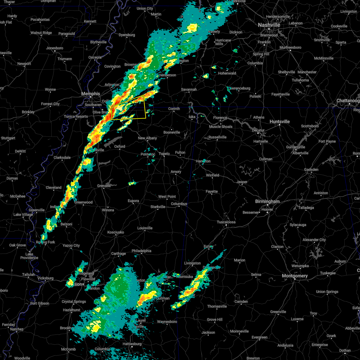 At 1217 pm cst, a severe thunderstorm was located near mt pleasant, or 9 miles southeast of collierville, moving east at 35 mph (radar indicated). Hazards include 60 mph wind gusts. expect damage to roofs, siding, and trees At 1217 pm cst, a severe thunderstorm was located near mt pleasant, or 9 miles southeast of collierville, moving east at 35 mph (radar indicated). Hazards include 60 mph wind gusts. expect damage to roofs, siding, and trees
|
| 11/29/2022 8:06 PM CST |
 At 806 pm cst, a severe thunderstorm was located near slayden, or 14 miles east of collierville, moving northeast at 55 mph (radar indicated). Hazards include 60 mph wind gusts and quarter size hail. Hail damage to vehicles is expected. Expect wind damage to roofs, siding, and trees. At 806 pm cst, a severe thunderstorm was located near slayden, or 14 miles east of collierville, moving northeast at 55 mph (radar indicated). Hazards include 60 mph wind gusts and quarter size hail. Hail damage to vehicles is expected. Expect wind damage to roofs, siding, and trees.
|
| 11/29/2022 7:36 PM CST |
 At 735 pm cst, a severe thunderstorm was located over eads, or near cordova, moving northeast at 60 mph (radar indicated). Hazards include 60 mph wind gusts and quarter size hail. Hail damage to vehicles is expected. Expect wind damage to roofs, siding, and trees. At 735 pm cst, a severe thunderstorm was located over eads, or near cordova, moving northeast at 60 mph (radar indicated). Hazards include 60 mph wind gusts and quarter size hail. Hail damage to vehicles is expected. Expect wind damage to roofs, siding, and trees.
|
| 11/29/2022 7:21 PM CST |
 At 720 pm cst, a cluster of severe thunderstorms were located over southeast memphis, or 7 miles northeast of southaven, moving northeast at 60 mph (radar indicated). Hazards include 60 mph wind gusts and quarter size hail. Hail damage to vehicles is expected. expect wind damage to roofs, siding, and trees. locations impacted include, bartlett, southaven, collierville, germantown, olive branch, horn lake, hernando, t o fuller state park, cordova, memphis, lakeland, arlington, walls, horseshoe lake, lake cormorant, southwest memphis, ellendale, eudora, lewisburg and whitehaven. hail threat, radar indicated max hail size, 1. 00 in wind threat, radar indicated max wind gust, 60 mph. At 720 pm cst, a cluster of severe thunderstorms were located over southeast memphis, or 7 miles northeast of southaven, moving northeast at 60 mph (radar indicated). Hazards include 60 mph wind gusts and quarter size hail. Hail damage to vehicles is expected. expect wind damage to roofs, siding, and trees. locations impacted include, bartlett, southaven, collierville, germantown, olive branch, horn lake, hernando, t o fuller state park, cordova, memphis, lakeland, arlington, walls, horseshoe lake, lake cormorant, southwest memphis, ellendale, eudora, lewisburg and whitehaven. hail threat, radar indicated max hail size, 1. 00 in wind threat, radar indicated max wind gust, 60 mph.
|
| 11/29/2022 7:06 PM CST |
 At 706 pm cst, a cluster of severe thunderstorms were located over walls, or near horn lake, moving northeast at 60 mph (radar indicated). Hazards include quarter size hail. damage to vehicles is expected At 706 pm cst, a cluster of severe thunderstorms were located over walls, or near horn lake, moving northeast at 60 mph (radar indicated). Hazards include quarter size hail. damage to vehicles is expected
|
| 5/21/2022 8:21 PM CDT |
 At 821 pm cdt, a severe thunderstorm was located near meeman shelby forest state park, moving southeast at 45 mph (radar indicated). Hazards include ping pong ball size hail and 60 mph wind gusts. People and animals outdoors will be injured. expect hail damage to roofs, siding, windows, and vehicles. Expect wind damage to roofs, siding, and trees. At 821 pm cdt, a severe thunderstorm was located near meeman shelby forest state park, moving southeast at 45 mph (radar indicated). Hazards include ping pong ball size hail and 60 mph wind gusts. People and animals outdoors will be injured. expect hail damage to roofs, siding, windows, and vehicles. Expect wind damage to roofs, siding, and trees.
|
| 5/15/2022 6:46 PM CDT |
 At 646 pm cdt, severe thunderstorms were located along a line extending from near hillville to 6 miles east of somerville to near slayden, moving east at 25 mph (radar indicated). Hazards include 60 mph wind gusts and quarter size hail. Hail damage to vehicles is expected. expect wind damage to roofs, siding, and trees. locations impacted include, lamar, whiteville, somerville, byhalia, snow lake shores, mt pleasant, lagrange, hillville, dancyville, michigan city, slayden, macon, rossville, moscow, williston, grand junction, la grange, hickory valley, coal oil corner and cayce. hail threat, observed max hail size, 1. 00 in wind threat, radar indicated max wind gust, 60 mph. At 646 pm cdt, severe thunderstorms were located along a line extending from near hillville to 6 miles east of somerville to near slayden, moving east at 25 mph (radar indicated). Hazards include 60 mph wind gusts and quarter size hail. Hail damage to vehicles is expected. expect wind damage to roofs, siding, and trees. locations impacted include, lamar, whiteville, somerville, byhalia, snow lake shores, mt pleasant, lagrange, hillville, dancyville, michigan city, slayden, macon, rossville, moscow, williston, grand junction, la grange, hickory valley, coal oil corner and cayce. hail threat, observed max hail size, 1. 00 in wind threat, radar indicated max wind gust, 60 mph.
|
| 5/15/2022 6:25 PM CDT |
 At 624 pm cdt, severe thunderstorms were located along a line extending from near dancyville to near somerville to near mt pleasant, moving east at 25 mph (radar indicated). Hazards include 60 mph wind gusts and quarter size hail. Hail damage to vehicles is expected. Expect wind damage to roofs, siding, and trees. At 624 pm cdt, severe thunderstorms were located along a line extending from near dancyville to near somerville to near mt pleasant, moving east at 25 mph (radar indicated). Hazards include 60 mph wind gusts and quarter size hail. Hail damage to vehicles is expected. Expect wind damage to roofs, siding, and trees.
|
| 5/13/2022 2:25 PM CDT |
 The severe thunderstorm warning for northeastern desoto, northwestern marshall, southwestern fayette and southeastern shelby counties will expire at 230 pm cdt, the storm which prompted the warning has weakened below severe limits, and no longer poses an immediate threat to life or property. therefore, the warning will be allowed to expire. The severe thunderstorm warning for northeastern desoto, northwestern marshall, southwestern fayette and southeastern shelby counties will expire at 230 pm cdt, the storm which prompted the warning has weakened below severe limits, and no longer poses an immediate threat to life or property. therefore, the warning will be allowed to expire.
|
| 5/13/2022 2:06 PM CDT |
 At 206 pm cdt, a severe thunderstorm was located near collierville, moving southwest at 15 mph (radar indicated). Hazards include 60 mph wind gusts and quarter size hail. Hail damage to vehicles is expected. Expect wind damage to roofs, siding, and trees. At 206 pm cdt, a severe thunderstorm was located near collierville, moving southwest at 15 mph (radar indicated). Hazards include 60 mph wind gusts and quarter size hail. Hail damage to vehicles is expected. Expect wind damage to roofs, siding, and trees.
|
| 4/13/2022 5:23 PM CDT |
 At 523 pm cdt, a severe thunderstorm was located near eads, or 7 miles northeast of collierville, moving east at 45 mph (radar indicated). Hazards include 60 mph wind gusts and penny size hail. expect damage to roofs, siding, and trees At 523 pm cdt, a severe thunderstorm was located near eads, or 7 miles northeast of collierville, moving east at 45 mph (radar indicated). Hazards include 60 mph wind gusts and penny size hail. expect damage to roofs, siding, and trees
|
| 4/12/2022 1:21 AM CDT |
 The severe thunderstorm warning for northern marshall, northwestern benton and southern fayette counties will expire at 130 am cdt, the storm which prompted the warning has weakened below severe limits, and no longer poses an immediate threat to life or property. therefore, the warning will be allowed to expire. a severe thunderstorm watch remains in effect until 400 am cdt for western tennessee. The severe thunderstorm warning for northern marshall, northwestern benton and southern fayette counties will expire at 130 am cdt, the storm which prompted the warning has weakened below severe limits, and no longer poses an immediate threat to life or property. therefore, the warning will be allowed to expire. a severe thunderstorm watch remains in effect until 400 am cdt for western tennessee.
|
| 4/12/2022 1:01 AM CDT |
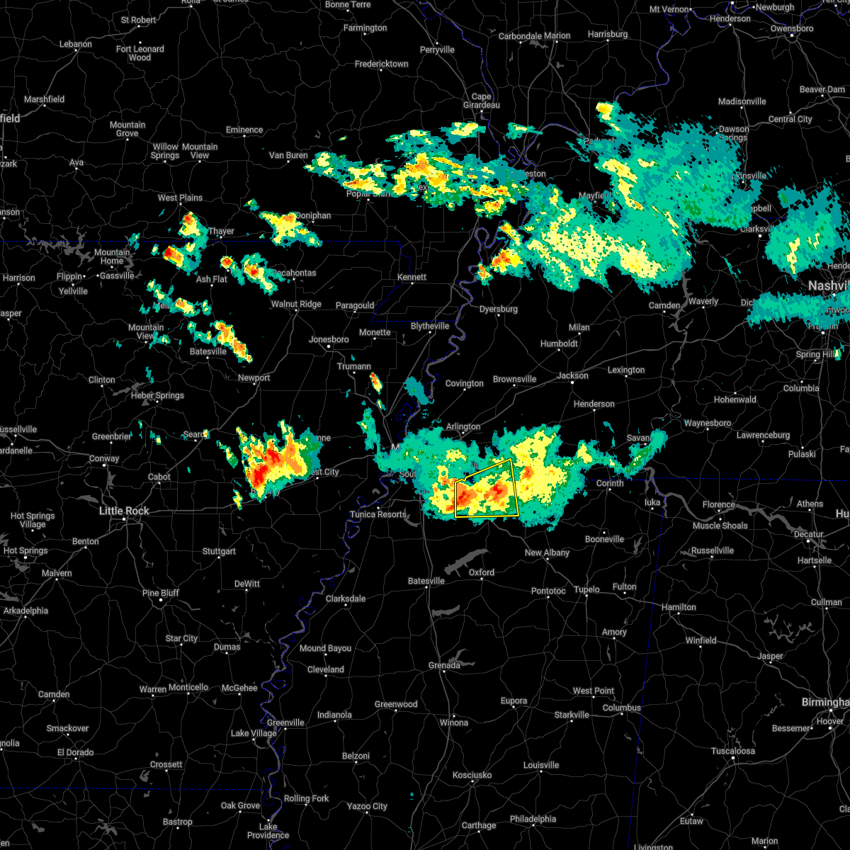 At 101 am cdt, a severe thunderstorm was located near byhalia, or 12 miles northwest of holly springs, moving east at 40 mph (radar indicated). Hazards include 60 mph wind gusts and quarter size hail. Hail damage to vehicles is expected. Expect wind damage to roofs, siding, and trees. At 101 am cdt, a severe thunderstorm was located near byhalia, or 12 miles northwest of holly springs, moving east at 40 mph (radar indicated). Hazards include 60 mph wind gusts and quarter size hail. Hail damage to vehicles is expected. Expect wind damage to roofs, siding, and trees.
|
| 3/30/2022 5:40 PM CDT |
 At 539 pm cdt, severe thunderstorms were located along a line extending from near dancyville to lagrange to gravestown, moving east at 55 mph (radar indicated). Hazards include 70 mph wind gusts. Expect considerable tree damage. damage is likely to mobile homes, roofs, and outbuildings. Locations impacted include, brownsville, holly springs, bolivar, ripley, lamar, lakeland, arlington, whiteville, somerville, blue mountain, jumpertown, snow lake shores, hillville, bethlehem, canaan, lagrange, eads, dancyville, slayden and michigan city. At 539 pm cdt, severe thunderstorms were located along a line extending from near dancyville to lagrange to gravestown, moving east at 55 mph (radar indicated). Hazards include 70 mph wind gusts. Expect considerable tree damage. damage is likely to mobile homes, roofs, and outbuildings. Locations impacted include, brownsville, holly springs, bolivar, ripley, lamar, lakeland, arlington, whiteville, somerville, blue mountain, jumpertown, snow lake shores, hillville, bethlehem, canaan, lagrange, eads, dancyville, slayden and michigan city.
|
| 3/30/2022 5:12 PM CDT |
 At 512 pm cdt, severe thunderstorms were located along a line extending from 7 miles south of munford to near byhalia to wall doxey state park, moving east at 55 mph (radar indicated). Hazards include 70 mph wind gusts. Expect considerable tree damage. Damage is likely to mobile homes, roofs, and outbuildings. At 512 pm cdt, severe thunderstorms were located along a line extending from 7 miles south of munford to near byhalia to wall doxey state park, moving east at 55 mph (radar indicated). Hazards include 70 mph wind gusts. Expect considerable tree damage. Damage is likely to mobile homes, roofs, and outbuildings.
|
| 2/17/2022 1:51 PM CST |
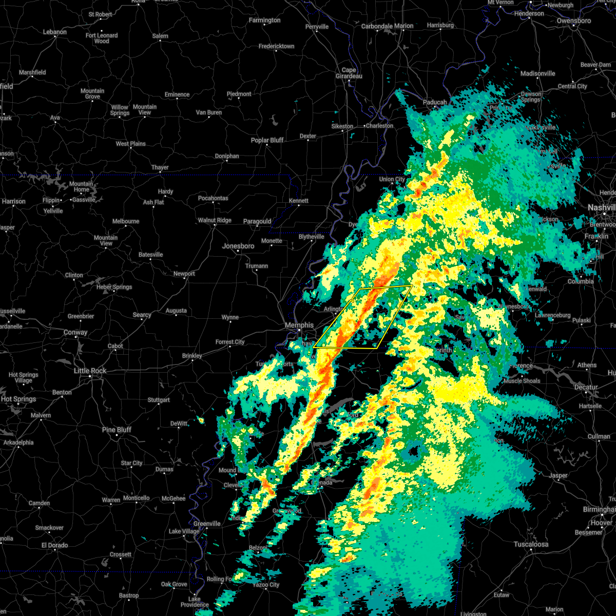 The severe thunderstorm warning for fayette, northwestern hardeman, southern haywood, southwestern madison and southeastern shelby counties will expire at 200 pm cst, the storms which prompted the warning have moved out of the area. therefore, the warning will be allowed to expire. a tornado watch remains in effect until 600 pm cst for northeastern and northwestern mississippi, and western tennessee. The severe thunderstorm warning for fayette, northwestern hardeman, southern haywood, southwestern madison and southeastern shelby counties will expire at 200 pm cst, the storms which prompted the warning have moved out of the area. therefore, the warning will be allowed to expire. a tornado watch remains in effect until 600 pm cst for northeastern and northwestern mississippi, and western tennessee.
|
| 2/17/2022 1:49 PM CST | Power lines down on highway 193 in rossvill in fayette county TN, 1 miles WSW of Rossville, TN |
| 2/17/2022 1:41 PM CST |
 At 141 pm cst, severe thunderstorms were located along a line extending from near dancyville to 6 miles east of collierville, moving east at 40 mph (radar indicated). Hazards include 60 mph wind gusts. Expect damage to roofs, siding, and trees. locations impacted include, collierville, germantown, bolivar, memphis, arlington, whiteville, somerville, hillville, lagrange, eads, dancyville, cloverport, mercer, warren, macon, oakland, piperton, rossville, moscow and stanton. hail threat, radar indicated max hail size, <. 75 in wind threat, radar indicated max wind gust, 60 mph. At 141 pm cst, severe thunderstorms were located along a line extending from near dancyville to 6 miles east of collierville, moving east at 40 mph (radar indicated). Hazards include 60 mph wind gusts. Expect damage to roofs, siding, and trees. locations impacted include, collierville, germantown, bolivar, memphis, arlington, whiteville, somerville, hillville, lagrange, eads, dancyville, cloverport, mercer, warren, macon, oakland, piperton, rossville, moscow and stanton. hail threat, radar indicated max hail size, <. 75 in wind threat, radar indicated max wind gust, 60 mph.
|
| 2/17/2022 1:17 PM CST |
 At 117 pm cst, severe thunderstorms were located along a line extending from 8 miles southeast of covington to southeast memphis, moving east at 55 mph (radar indicated). Hazards include 60 mph wind gusts. expect damage to roofs, siding, and trees At 117 pm cst, severe thunderstorms were located along a line extending from 8 miles southeast of covington to southeast memphis, moving east at 55 mph (radar indicated). Hazards include 60 mph wind gusts. expect damage to roofs, siding, and trees
|
| 12/10/2021 11:59 PM CST |
 At 1158 pm cst, a severe thunderstorm was located over midtown memphis, or 9 miles southwest of bartlett, moving northeast at 65 mph (radar indicated). Hazards include 60 mph wind gusts. Expect damage to roofs, siding, and trees. Locations impacted include, bartlett, southaven, collierville, germantown, olive branch, west memphis, horn lake, marion, millington, t o fuller state park, cordova, memphis, lakeland, arlington, somerville, walls, edmondson, horseshoe lake, anthonyville and southwest memphis. At 1158 pm cst, a severe thunderstorm was located over midtown memphis, or 9 miles southwest of bartlett, moving northeast at 65 mph (radar indicated). Hazards include 60 mph wind gusts. Expect damage to roofs, siding, and trees. Locations impacted include, bartlett, southaven, collierville, germantown, olive branch, west memphis, horn lake, marion, millington, t o fuller state park, cordova, memphis, lakeland, arlington, somerville, walls, edmondson, horseshoe lake, anthonyville and southwest memphis.
|
| 12/10/2021 11:48 PM CST |
 At 1148 pm cst, a severe thunderstorm was located near west memphis, moving northeast at 65 mph (radar indicated). Hazards include 60 mph wind gusts and penny size hail. expect damage to roofs, siding, and trees At 1148 pm cst, a severe thunderstorm was located near west memphis, moving northeast at 65 mph (radar indicated). Hazards include 60 mph wind gusts and penny size hail. expect damage to roofs, siding, and trees
|
| 5/4/2021 7:09 PM CDT |
 At 708 pm cdt, a severe thunderstorm was located near jericho, or near meeman shelby forest state park, moving east at 40 mph (radar indicated). Hazards include 60 mph wind gusts and quarter size hail. Hail damage to vehicles is expected. Expect wind damage to roofs, siding, and trees. At 708 pm cdt, a severe thunderstorm was located near jericho, or near meeman shelby forest state park, moving east at 40 mph (radar indicated). Hazards include 60 mph wind gusts and quarter size hail. Hail damage to vehicles is expected. Expect wind damage to roofs, siding, and trees.
|
| 5/3/2021 2:01 AM CDT |
 At 200 am cdt, a severe thunderstorm was located over lewisburg, or near olive branch, moving east at 30 mph (radar indicated). Hazards include 60 mph wind gusts. Expect damage to roofs, siding, and trees. Locations impacted include, southaven, olive branch, hernando, holly springs, byhalia, mt pleasant, lewisburg, red banks, slayden, piperton, coal oil corner, cayce, cockrum, watson, cedarview, bright, nesbit, handy corner, taska and robinson gin. At 200 am cdt, a severe thunderstorm was located over lewisburg, or near olive branch, moving east at 30 mph (radar indicated). Hazards include 60 mph wind gusts. Expect damage to roofs, siding, and trees. Locations impacted include, southaven, olive branch, hernando, holly springs, byhalia, mt pleasant, lewisburg, red banks, slayden, piperton, coal oil corner, cayce, cockrum, watson, cedarview, bright, nesbit, handy corner, taska and robinson gin.
|
| 5/3/2021 1:45 AM CDT |
 At 145 am cdt, a severe thunderstorm was located near hernando, moving east at 45 mph (radar indicated). Hazards include 60 mph wind gusts. expect damage to roofs, siding, and trees At 145 am cdt, a severe thunderstorm was located near hernando, moving east at 45 mph (radar indicated). Hazards include 60 mph wind gusts. expect damage to roofs, siding, and trees
|
| 3/30/2021 10:05 PM CDT |
 The severe thunderstorm warning for northern marshall, northern benton, southeastern fayette and southwestern hardeman counties will expire at 1015 pm cdt, the storm which prompted the warning has weakened below severe limits, and no longer poses an immediate threat to life or property. therefore, the warning will be allowed to expire. however heavy rain is still possible with this thunderstorm. The severe thunderstorm warning for northern marshall, northern benton, southeastern fayette and southwestern hardeman counties will expire at 1015 pm cdt, the storm which prompted the warning has weakened below severe limits, and no longer poses an immediate threat to life or property. therefore, the warning will be allowed to expire. however heavy rain is still possible with this thunderstorm.
|
| 3/30/2021 10:05 PM CDT |
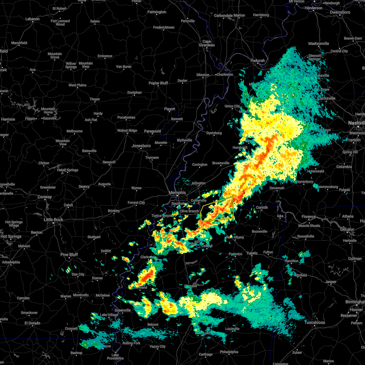 The severe thunderstorm warning for northern marshall, northern benton, southeastern fayette and southwestern hardeman counties will expire at 1015 pm cdt, the storm which prompted the warning has weakened below severe limits, and no longer poses an immediate threat to life or property. therefore, the warning will be allowed to expire. however heavy rain is still possible with this thunderstorm. The severe thunderstorm warning for northern marshall, northern benton, southeastern fayette and southwestern hardeman counties will expire at 1015 pm cdt, the storm which prompted the warning has weakened below severe limits, and no longer poses an immediate threat to life or property. therefore, the warning will be allowed to expire. however heavy rain is still possible with this thunderstorm.
|
| 3/30/2021 9:45 PM CDT |
 At 944 pm cdt, a severe thunderstorm was located near mt pleasant, or 7 miles north of holly springs, moving east at 35 mph (radar indicated). Hazards include 60 mph wind gusts. Expect damage to roofs, siding, and trees. Locations impacted include, holly springs, lamar, snow lake shores, canaan, mt pleasant, lagrange, michigan city, red banks, slayden, ashland, moscow, grand junction, la grange, saulsbury, brody, new canaan, taska, hamilton, van buren and victoria. At 944 pm cdt, a severe thunderstorm was located near mt pleasant, or 7 miles north of holly springs, moving east at 35 mph (radar indicated). Hazards include 60 mph wind gusts. Expect damage to roofs, siding, and trees. Locations impacted include, holly springs, lamar, snow lake shores, canaan, mt pleasant, lagrange, michigan city, red banks, slayden, ashland, moscow, grand junction, la grange, saulsbury, brody, new canaan, taska, hamilton, van buren and victoria.
|
| 3/30/2021 9:45 PM CDT |
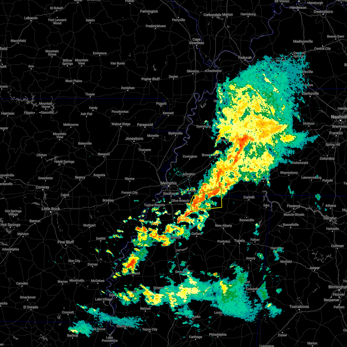 At 944 pm cdt, a severe thunderstorm was located near mt pleasant, or 7 miles north of holly springs, moving east at 35 mph (radar indicated). Hazards include 60 mph wind gusts. Expect damage to roofs, siding, and trees. Locations impacted include, holly springs, lamar, snow lake shores, canaan, mt pleasant, lagrange, michigan city, red banks, slayden, ashland, moscow, grand junction, la grange, saulsbury, brody, new canaan, taska, hamilton, van buren and victoria. At 944 pm cdt, a severe thunderstorm was located near mt pleasant, or 7 miles north of holly springs, moving east at 35 mph (radar indicated). Hazards include 60 mph wind gusts. Expect damage to roofs, siding, and trees. Locations impacted include, holly springs, lamar, snow lake shores, canaan, mt pleasant, lagrange, michigan city, red banks, slayden, ashland, moscow, grand junction, la grange, saulsbury, brody, new canaan, taska, hamilton, van buren and victoria.
|
| 3/30/2021 9:30 PM CDT |
 At 930 pm cdt, a severe thunderstorm was located over byhalia, or 12 miles northwest of holly springs, moving east at 35 mph (radar indicated). Hazards include 60 mph wind gusts. expect damage to roofs, siding, and trees At 930 pm cdt, a severe thunderstorm was located over byhalia, or 12 miles northwest of holly springs, moving east at 35 mph (radar indicated). Hazards include 60 mph wind gusts. expect damage to roofs, siding, and trees
|
| 3/30/2021 9:30 PM CDT |
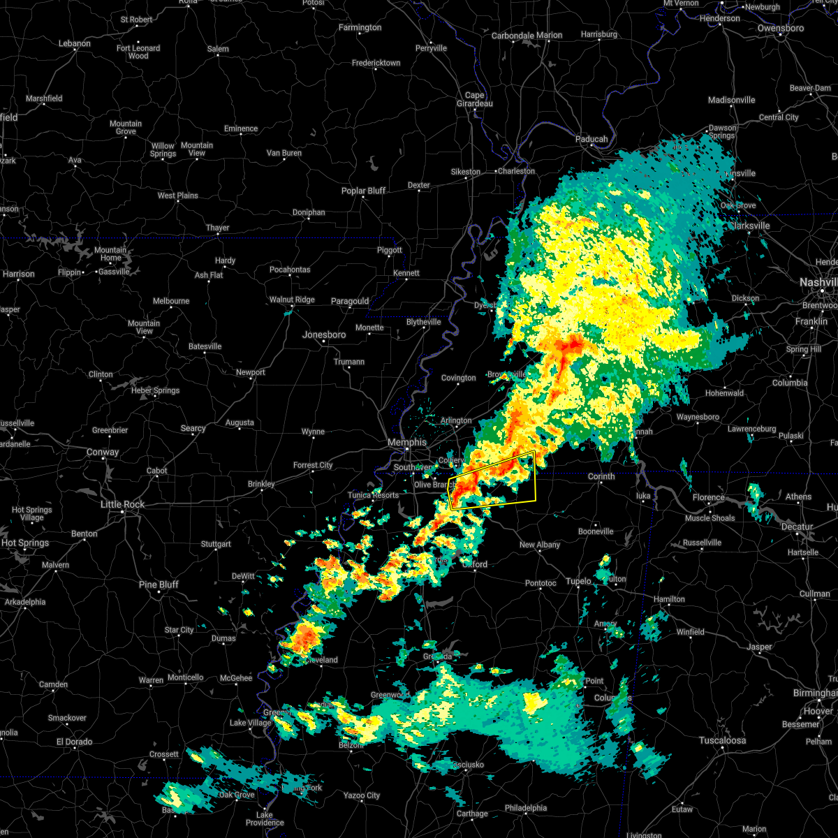 At 930 pm cdt, a severe thunderstorm was located over byhalia, or 12 miles northwest of holly springs, moving east at 35 mph (radar indicated). Hazards include 60 mph wind gusts. expect damage to roofs, siding, and trees At 930 pm cdt, a severe thunderstorm was located over byhalia, or 12 miles northwest of holly springs, moving east at 35 mph (radar indicated). Hazards include 60 mph wind gusts. expect damage to roofs, siding, and trees
|
| 3/27/2021 10:58 PM CDT |
 At 1058 pm cdt, severe thunderstorms were located along a line extending from 7 miles east of covington to holly springs, moving east at 50 mph (radar indicated). Hazards include 60 mph wind gusts. Expect damage to roofs, siding, and trees. Locations impacted include, brownsville, lamar, whiteville, somerville, byhalia, mt pleasant, hillville, michigan city, canaan, lagrange, belle eagle, dancyville, slayden, warren, macon, oakland, piperton, gallaway, rossville and moscow. At 1058 pm cdt, severe thunderstorms were located along a line extending from 7 miles east of covington to holly springs, moving east at 50 mph (radar indicated). Hazards include 60 mph wind gusts. Expect damage to roofs, siding, and trees. Locations impacted include, brownsville, lamar, whiteville, somerville, byhalia, mt pleasant, hillville, michigan city, canaan, lagrange, belle eagle, dancyville, slayden, warren, macon, oakland, piperton, gallaway, rossville and moscow.
|
| 3/27/2021 10:39 PM CDT |
 At 1039 pm cdt, severe thunderstorms were located along a line extending from near brighton to near independence, moving east at 50 mph (radar indicated). Hazards include 60 mph wind gusts. expect damage to roofs, siding, and trees At 1039 pm cdt, severe thunderstorms were located along a line extending from near brighton to near independence, moving east at 50 mph (radar indicated). Hazards include 60 mph wind gusts. expect damage to roofs, siding, and trees
|
| 3/27/2021 10:20 PM CDT |
 At 1020 pm cdt, severe thunderstorms were located along a line extending from near dixonville to southeast memphis, moving northeast at 65 mph (radar indicated). Hazards include 60 mph wind gusts. Expect damage to roofs, siding, and trees. Locations impacted include, bartlett, southaven, collierville, germantown, olive branch, horn lake, hernando, millington, t o fuller state park, meeman shelby forest state park, cordova, memphis, lakeland, arlington, munford, brighton, walls, lake cormorant, southwest memphis and ellendale. At 1020 pm cdt, severe thunderstorms were located along a line extending from near dixonville to southeast memphis, moving northeast at 65 mph (radar indicated). Hazards include 60 mph wind gusts. Expect damage to roofs, siding, and trees. Locations impacted include, bartlett, southaven, collierville, germantown, olive branch, horn lake, hernando, millington, t o fuller state park, meeman shelby forest state park, cordova, memphis, lakeland, arlington, munford, brighton, walls, lake cormorant, southwest memphis and ellendale.
|
| 3/27/2021 9:53 PM CDT |
 At 953 pm cdt, severe thunderstorms were located along a line extending from near jennette to near robinsonville, moving northeast at 65 mph (radar indicated). Hazards include 60 mph wind gusts. expect damage to roofs, siding, and trees At 953 pm cdt, severe thunderstorms were located along a line extending from near jennette to near robinsonville, moving northeast at 65 mph (radar indicated). Hazards include 60 mph wind gusts. expect damage to roofs, siding, and trees
|
| 3/27/2021 9:32 PM CDT |
 At 931 pm cdt, severe thunderstorms were located along a line extending from 7 miles northwest of dancyville to near olive branch, moving northeast at 40 mph (radar indicated). Hazards include 60 mph wind gusts. expect damage to roofs, siding, and trees At 931 pm cdt, severe thunderstorms were located along a line extending from 7 miles northwest of dancyville to near olive branch, moving northeast at 40 mph (radar indicated). Hazards include 60 mph wind gusts. expect damage to roofs, siding, and trees
|
| 3/17/2021 6:49 AM CDT |
 At 648 am cdt, a severe thunderstorm was located near red banks, or 11 miles northwest of holly springs, moving northeast at 35 mph (radar indicated). Hazards include quarter size hail. damage to vehicles is expected At 648 am cdt, a severe thunderstorm was located near red banks, or 11 miles northwest of holly springs, moving northeast at 35 mph (radar indicated). Hazards include quarter size hail. damage to vehicles is expected
|
| 9/2/2020 8:36 PM CDT |
 The severe thunderstorm warning for northern marshall, southwestern fayette and eastern shelby counties will expire at 845 pm cdt, the storm which prompted the warning has weakened below severe limits, and no longer poses an immediate threat to life or property. therefore, the warning will be allowed to expire. The severe thunderstorm warning for northern marshall, southwestern fayette and eastern shelby counties will expire at 845 pm cdt, the storm which prompted the warning has weakened below severe limits, and no longer poses an immediate threat to life or property. therefore, the warning will be allowed to expire.
|
| 9/2/2020 8:31 PM CDT |
 At 831 pm cdt, a severe thunderstorm was located near eads, or 7 miles northeast of collierville, moving northeast at 55 mph (radar indicated). Hazards include 60 mph wind gusts. Expect damage to roofs, siding, and trees. Locations impacted include, bartlett, collierville, germantown, cordova, memphis, lakeland, arlington, eads, ellendale, piperton, rossville, elmore park, brunswick, lenow, cayce, fisherville, raleigh, elba, canadaville and spring lake. At 831 pm cdt, a severe thunderstorm was located near eads, or 7 miles northeast of collierville, moving northeast at 55 mph (radar indicated). Hazards include 60 mph wind gusts. Expect damage to roofs, siding, and trees. Locations impacted include, bartlett, collierville, germantown, cordova, memphis, lakeland, arlington, eads, ellendale, piperton, rossville, elmore park, brunswick, lenow, cayce, fisherville, raleigh, elba, canadaville and spring lake.
|
| 9/2/2020 8:22 PM CDT |
 At 822 pm cdt, a severe thunderstorm was located over collierville, moving northeast at 45 mph (radar indicated). Hazards include 60 mph wind gusts. Expect damage to roofs, siding, and trees. Locations impacted include, bartlett, collierville, germantown, olive branch, cordova, memphis, lakeland, arlington, ellendale, southeast memphis, eads, midtown memphis, piperton, rossville, lenow, cayce, handy corner, capleville, kirk and elmore park. At 822 pm cdt, a severe thunderstorm was located over collierville, moving northeast at 45 mph (radar indicated). Hazards include 60 mph wind gusts. Expect damage to roofs, siding, and trees. Locations impacted include, bartlett, collierville, germantown, olive branch, cordova, memphis, lakeland, arlington, ellendale, southeast memphis, eads, midtown memphis, piperton, rossville, lenow, cayce, handy corner, capleville, kirk and elmore park.
|
| 9/2/2020 8:15 PM CDT |
 At 815 pm cdt, a severe thunderstorm was located near germantown, moving northeast at 40 mph (radar indicated). Hazards include 60 mph wind gusts. Expect damage to roofs, siding, and trees. Locations impacted include, bartlett, southaven, collierville, germantown, olive branch, horn lake, cordova, memphis, lakeland, arlington, southwest memphis, ellendale, southeast memphis, eads, lewisburg, whitehaven, midtown memphis, piperton, rossville and lenow. At 815 pm cdt, a severe thunderstorm was located near germantown, moving northeast at 40 mph (radar indicated). Hazards include 60 mph wind gusts. Expect damage to roofs, siding, and trees. Locations impacted include, bartlett, southaven, collierville, germantown, olive branch, horn lake, cordova, memphis, lakeland, arlington, southwest memphis, ellendale, southeast memphis, eads, lewisburg, whitehaven, midtown memphis, piperton, rossville and lenow.
|
| 9/2/2020 7:54 PM CDT |
 At 753 pm cdt, a severe thunderstorm was located near hernando, moving northeast at 55 mph (radar indicated). Hazards include 60 mph wind gusts. expect damage to roofs, siding, and trees At 753 pm cdt, a severe thunderstorm was located near hernando, moving northeast at 55 mph (radar indicated). Hazards include 60 mph wind gusts. expect damage to roofs, siding, and trees
|
| 6/5/2020 2:12 PM CDT |
 The severe thunderstorm warning for crittenden, desoto, northern marshall, northeastern tunica, northwestern benton, southern fayette and shelby counties will expire at 215 pm cdt, the storms which prompted the warning have moved out of the area. therefore, the warning will be allowed to expire. however gusty winds are still possible with these thunderstorms. a severe thunderstorm watch remains in effect until 600 pm cdt for eastern arkansas, northeastern and northwestern mississippi, and western tennessee. The severe thunderstorm warning for crittenden, desoto, northern marshall, northeastern tunica, northwestern benton, southern fayette and shelby counties will expire at 215 pm cdt, the storms which prompted the warning have moved out of the area. therefore, the warning will be allowed to expire. however gusty winds are still possible with these thunderstorms. a severe thunderstorm watch remains in effect until 600 pm cdt for eastern arkansas, northeastern and northwestern mississippi, and western tennessee.
|
| 6/5/2020 1:41 PM CDT |
 At 141 pm cdt, severe thunderstorms were located along a line extending from near pinckney to near olive branch to 9 miles south of somerville, moving southeast at 40 mph (radar indicated). Hazards include 60 mph wind gusts and penny size hail. Expect damage to roofs, siding, and trees. Locations impacted include, bartlett, southaven, collierville, germantown, olive branch, west memphis, horn lake, hernando, marion, millington, t o fuller state park, cordova, memphis, lamar, lakeland, arlington, somerville, byhalia, walls and crawfordsville. At 141 pm cdt, severe thunderstorms were located along a line extending from near pinckney to near olive branch to 9 miles south of somerville, moving southeast at 40 mph (radar indicated). Hazards include 60 mph wind gusts and penny size hail. Expect damage to roofs, siding, and trees. Locations impacted include, bartlett, southaven, collierville, germantown, olive branch, west memphis, horn lake, hernando, marion, millington, t o fuller state park, cordova, memphis, lamar, lakeland, arlington, somerville, byhalia, walls and crawfordsville.
|
| 6/5/2020 1:27 PM CDT |
 At 127 pm cdt, severe thunderstorms were located along a line extending from near simsboro to near midtown memphis to 7 miles east of eads, moving southeast at 35 mph (radar indicated). Hazards include 60 mph wind gusts. expect damage to roofs, siding, and trees At 127 pm cdt, severe thunderstorms were located along a line extending from near simsboro to near midtown memphis to 7 miles east of eads, moving southeast at 35 mph (radar indicated). Hazards include 60 mph wind gusts. expect damage to roofs, siding, and trees
|
| 6/4/2020 6:44 PM CDT |
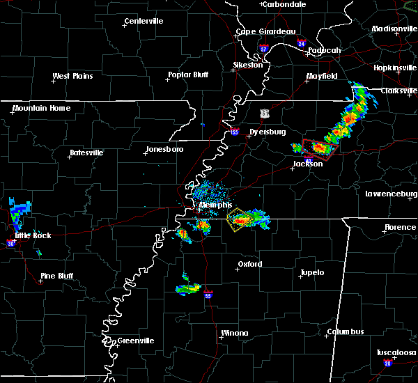 At 640 pm cdt, a severe thunderstorm was located over mt pleasant, or 9 miles southeast of collierville, moving southeast at 15 mph (radar indicated). Hazards include 60 mph wind gusts and quarter size hail. Hail damage to vehicles is expected. Expect wind damage to roofs, siding, and trees. At 640 pm cdt, a severe thunderstorm was located over mt pleasant, or 9 miles southeast of collierville, moving southeast at 15 mph (radar indicated). Hazards include 60 mph wind gusts and quarter size hail. Hail damage to vehicles is expected. Expect wind damage to roofs, siding, and trees.
|
| 6/4/2020 6:30 PM CDT |
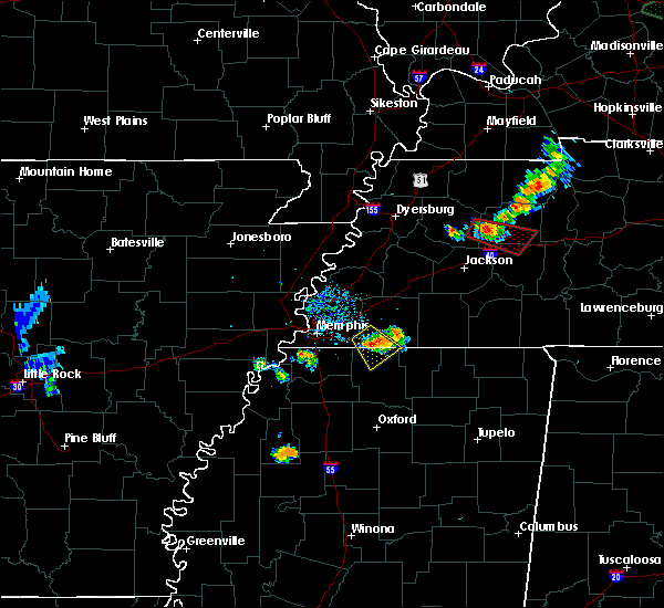 At 629 pm cdt, a severe thunderstorm was located near mt pleasant, or 8 miles east of collierville, moving southeast at 15 mph (radar indicated). Hazards include 60 mph wind gusts and quarter size hail. Hail damage to vehicles is expected. expect wind damage to roofs, siding, and trees. Locations impacted include, mt pleasant, slayden, piperton, rossville, moscow, taska, cayce, hays crossing and early grove. At 629 pm cdt, a severe thunderstorm was located near mt pleasant, or 8 miles east of collierville, moving southeast at 15 mph (radar indicated). Hazards include 60 mph wind gusts and quarter size hail. Hail damage to vehicles is expected. expect wind damage to roofs, siding, and trees. Locations impacted include, mt pleasant, slayden, piperton, rossville, moscow, taska, cayce, hays crossing and early grove.
|
| 6/4/2020 6:21 PM CDT |
 At 621 pm cdt, a severe thunderstorm was located near collierville, moving southeast at 15 mph (radar indicated). Hazards include 60 mph wind gusts and quarter size hail. Hail damage to vehicles is expected. expect wind damage to roofs, siding, and trees. Locations impacted include, mt pleasant, slayden, piperton, rossville, moscow, taska, cayce, hays crossing and early grove. At 621 pm cdt, a severe thunderstorm was located near collierville, moving southeast at 15 mph (radar indicated). Hazards include 60 mph wind gusts and quarter size hail. Hail damage to vehicles is expected. expect wind damage to roofs, siding, and trees. Locations impacted include, mt pleasant, slayden, piperton, rossville, moscow, taska, cayce, hays crossing and early grove.
|
| 6/4/2020 6:09 PM CDT |
 At 609 pm cdt, a severe thunderstorm was located near collierville, moving southeast at 15 mph (radar indicated). Hazards include 60 mph wind gusts and quarter size hail. Hail damage to vehicles is expected. expect wind damage to roofs, siding, and trees. Locations impacted include, collierville, mt pleasant, slayden, piperton, rossville, moscow, cayce, elba, canadaville, early grove, taska, kirk, hays crossing and hickory withe. At 609 pm cdt, a severe thunderstorm was located near collierville, moving southeast at 15 mph (radar indicated). Hazards include 60 mph wind gusts and quarter size hail. Hail damage to vehicles is expected. expect wind damage to roofs, siding, and trees. Locations impacted include, collierville, mt pleasant, slayden, piperton, rossville, moscow, cayce, elba, canadaville, early grove, taska, kirk, hays crossing and hickory withe.
|
| 6/4/2020 6:09 PM CDT |
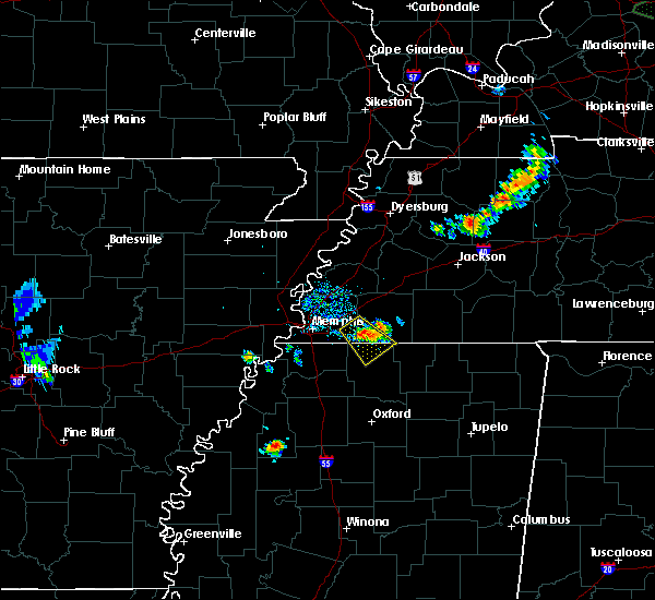 At 609 pm cdt, a severe thunderstorm was located near collierville, moving southeast at 15 mph (radar indicated). Hazards include 60 mph wind gusts and quarter size hail. Hail damage to vehicles is expected. expect wind damage to roofs, siding, and trees. Locations impacted include, collierville, mt pleasant, slayden, piperton, rossville, moscow, cayce, elba, canadaville, early grove, taska, kirk, hays crossing and hickory withe. At 609 pm cdt, a severe thunderstorm was located near collierville, moving southeast at 15 mph (radar indicated). Hazards include 60 mph wind gusts and quarter size hail. Hail damage to vehicles is expected. expect wind damage to roofs, siding, and trees. Locations impacted include, collierville, mt pleasant, slayden, piperton, rossville, moscow, cayce, elba, canadaville, early grove, taska, kirk, hays crossing and hickory withe.
|
| 6/4/2020 5:53 PM CDT |
 At 553 pm cdt, a severe thunderstorm was located near collierville, moving southeast at 15 mph (radar indicated). Hazards include 60 mph wind gusts and quarter size hail. Hail damage to vehicles is expected. Expect wind damage to roofs, siding, and trees. At 553 pm cdt, a severe thunderstorm was located near collierville, moving southeast at 15 mph (radar indicated). Hazards include 60 mph wind gusts and quarter size hail. Hail damage to vehicles is expected. Expect wind damage to roofs, siding, and trees.
|
| 4/12/2020 10:52 PM CDT |
 At 1051 pm cdt, severe thunderstorms were located along a line extending from near eads to 8 miles north of slayden to near snow lake shores, moving northeast at 65 mph (radar indicated). Hazards include 60 mph wind gusts. Expect damage to roofs, siding, and trees. Locations impacted include, brownsville, bolivar, whiteville, somerville, hillville, pocahontas, lagrange, dancyville, cloverport, mercer, warren, macon, oakland, mason, piperton, middleton, gallaway, rossville, moscow and stanton. At 1051 pm cdt, severe thunderstorms were located along a line extending from near eads to 8 miles north of slayden to near snow lake shores, moving northeast at 65 mph (radar indicated). Hazards include 60 mph wind gusts. Expect damage to roofs, siding, and trees. Locations impacted include, brownsville, bolivar, whiteville, somerville, hillville, pocahontas, lagrange, dancyville, cloverport, mercer, warren, macon, oakland, mason, piperton, middleton, gallaway, rossville, moscow and stanton.
|
| 4/12/2020 10:50 PM CDT |
 At 1050 pm cdt, severe thunderstorms were located along a line extending from near manila to 8 miles east of eads, moving northeast at 65 mph (radar indicated). Hazards include 60 mph wind gusts. Expect damage to roofs, siding, and trees. Locations impacted include, bartlett, southaven, collierville, germantown, olive branch, west memphis, blytheville, marion, millington, covington, osceola, gosnell, marked tree, lepanto, luxora, wilson, tyronza, keiser, meeman shelby forest state park and fort pillow state park. At 1050 pm cdt, severe thunderstorms were located along a line extending from near manila to 8 miles east of eads, moving northeast at 65 mph (radar indicated). Hazards include 60 mph wind gusts. Expect damage to roofs, siding, and trees. Locations impacted include, bartlett, southaven, collierville, germantown, olive branch, west memphis, blytheville, marion, millington, covington, osceola, gosnell, marked tree, lepanto, luxora, wilson, tyronza, keiser, meeman shelby forest state park and fort pillow state park.
|
| 4/12/2020 10:39 PM CDT |
 At 1039 pm cdt, severe thunderstorms were located along a line extending from near cordova to mt pleasant to near holly springs, moving northeast at 65 mph (radar indicated). Hazards include 60 mph wind gusts. expect damage to roofs, siding, and trees At 1039 pm cdt, severe thunderstorms were located along a line extending from near cordova to mt pleasant to near holly springs, moving northeast at 65 mph (radar indicated). Hazards include 60 mph wind gusts. expect damage to roofs, siding, and trees
|
| 4/12/2020 10:34 PM CDT |
 At 1034 pm cdt, severe thunderstorms were located along a line extending from near lepanto to near collierville, moving northeast at 65 mph (radar indicated). Hazards include 60 mph wind gusts. Expect damage to roofs, siding, and trees. Locations impacted include, bartlett, southaven, collierville, germantown, olive branch, west memphis, blytheville, marion, millington, covington, osceola, gosnell, marked tree, lepanto, luxora, wilson, tyronza, keiser, cordova and t o fuller state park. At 1034 pm cdt, severe thunderstorms were located along a line extending from near lepanto to near collierville, moving northeast at 65 mph (radar indicated). Hazards include 60 mph wind gusts. Expect damage to roofs, siding, and trees. Locations impacted include, bartlett, southaven, collierville, germantown, olive branch, west memphis, blytheville, marion, millington, covington, osceola, gosnell, marked tree, lepanto, luxora, wilson, tyronza, keiser, cordova and t o fuller state park.
|
| 4/12/2020 10:16 PM CDT |
 At 1016 pm cdt, severe thunderstorms were located along a line extending from near marked tree to near hernando, moving northeast at 65 mph (radar indicated). Hazards include 60 mph wind gusts. expect damage to roofs, siding, and trees At 1016 pm cdt, severe thunderstorms were located along a line extending from near marked tree to near hernando, moving northeast at 65 mph (radar indicated). Hazards include 60 mph wind gusts. expect damage to roofs, siding, and trees
|
| 4/8/2020 10:59 PM CDT |
 At 1059 pm cdt, a severe thunderstorm was located near canaan, or 19 miles south of bolivar, moving southeast at 45 mph (radar indicated). Hazards include 60 mph wind gusts and quarter size hail. Hail damage to vehicles is expected. expect wind damage to roofs, siding, and trees. Locations impacted include, lamar, snow lake shores, canaan, lagrange, michigan city, slayden, walnut, middleton, rossville, ashland, moscow, falkner, grand junction, la grange, saulsbury, chalybeate, brody, new canaan, hamilton and pattersonville. At 1059 pm cdt, a severe thunderstorm was located near canaan, or 19 miles south of bolivar, moving southeast at 45 mph (radar indicated). Hazards include 60 mph wind gusts and quarter size hail. Hail damage to vehicles is expected. expect wind damage to roofs, siding, and trees. Locations impacted include, lamar, snow lake shores, canaan, lagrange, michigan city, slayden, walnut, middleton, rossville, ashland, moscow, falkner, grand junction, la grange, saulsbury, chalybeate, brody, new canaan, hamilton and pattersonville.
|
| 4/8/2020 10:46 PM CDT |
 At 1045 pm cdt, a severe thunderstorm was located near michigan city, or 19 miles northeast of holly springs, moving southeast at 45 mph (radar indicated). Hazards include 60 mph wind gusts and quarter size hail. Hail damage to vehicles is expected. Expect wind damage to roofs, siding, and trees. At 1045 pm cdt, a severe thunderstorm was located near michigan city, or 19 miles northeast of holly springs, moving southeast at 45 mph (radar indicated). Hazards include 60 mph wind gusts and quarter size hail. Hail damage to vehicles is expected. Expect wind damage to roofs, siding, and trees.
|
| 4/8/2020 10:30 PM CDT |
 At 1030 pm cdt, a severe thunderstorm was located 10 miles north of slayden, or 12 miles east of collierville, moving southeast at 40 mph (radar indicated). Hazards include 60 mph wind gusts. Expect damage to roofs, siding, and trees. Locations impacted include, collierville, germantown, cordova, somerville, macon, oakland, piperton, rossville, moscow, williston, la grange, fisherville, elba, canadaville, kirk, hays crossing, pattersonville, forty five, hickory withe and ghost river state natural area. At 1030 pm cdt, a severe thunderstorm was located 10 miles north of slayden, or 12 miles east of collierville, moving southeast at 40 mph (radar indicated). Hazards include 60 mph wind gusts. Expect damage to roofs, siding, and trees. Locations impacted include, collierville, germantown, cordova, somerville, macon, oakland, piperton, rossville, moscow, williston, la grange, fisherville, elba, canadaville, kirk, hays crossing, pattersonville, forty five, hickory withe and ghost river state natural area.
|
| 4/8/2020 10:17 PM CDT |
 At 1017 pm cdt, a severe thunderstorm was located near eads, or 10 miles northeast of collierville, moving southeast at 45 mph (radar indicated). Hazards include 60 mph wind gusts. expect damage to roofs, siding, and trees At 1017 pm cdt, a severe thunderstorm was located near eads, or 10 miles northeast of collierville, moving southeast at 45 mph (radar indicated). Hazards include 60 mph wind gusts. expect damage to roofs, siding, and trees
|
| 3/28/2020 8:30 PM CDT |
 At 830 pm cdt, severe thunderstorms were located along a line extending from 10 miles northeast of arlington to near slayden to laws hill, moving east at 45 mph (radar indicated). Hazards include 60 mph wind gusts. Expect damage to roofs, siding, and trees. Locations impacted include, holly springs, wall doxey state park, lamar, whiteville, somerville, snow lake shores, mt pleasant, bethlehem, michigan city, red banks, laws hill, barr, canaan, lagrange, slayden, marianna, warren, macon, oakland and piperton. At 830 pm cdt, severe thunderstorms were located along a line extending from 10 miles northeast of arlington to near slayden to laws hill, moving east at 45 mph (radar indicated). Hazards include 60 mph wind gusts. Expect damage to roofs, siding, and trees. Locations impacted include, holly springs, wall doxey state park, lamar, whiteville, somerville, snow lake shores, mt pleasant, bethlehem, michigan city, red banks, laws hill, barr, canaan, lagrange, slayden, marianna, warren, macon, oakland and piperton.
|
| 3/28/2020 8:21 PM CDT |
 At 820 pm cdt, severe thunderstorms were located along a line extending from near arlington to near mt pleasant to near harmontown, moving east at 50 mph (radar indicated. at 815 pm cdt, 60 mph were observed in byhalia). Hazards include 60 mph wind gusts. Expect damage to roofs, siding, and trees. Locations impacted include, collierville, germantown, olive branch, holly springs, wall doxey state park, lamar, lakeland, arlington, whiteville, somerville, byhalia, snow lake shores, bethlehem, red banks, laws hill, canaan, lagrange, independence, eads and slayden. At 820 pm cdt, severe thunderstorms were located along a line extending from near arlington to near mt pleasant to near harmontown, moving east at 50 mph (radar indicated. at 815 pm cdt, 60 mph were observed in byhalia). Hazards include 60 mph wind gusts. Expect damage to roofs, siding, and trees. Locations impacted include, collierville, germantown, olive branch, holly springs, wall doxey state park, lamar, lakeland, arlington, whiteville, somerville, byhalia, snow lake shores, bethlehem, red banks, laws hill, canaan, lagrange, independence, eads and slayden.
|
| 3/28/2020 8:11 PM CDT |
 At 810 pm cdt, severe thunderstorms were located along a line extending from near dixonville to barr, moving east at 45 mph (radar indicated). Hazards include 60 mph wind gusts. expect damage to roofs, siding, and trees At 810 pm cdt, severe thunderstorms were located along a line extending from near dixonville to barr, moving east at 45 mph (radar indicated). Hazards include 60 mph wind gusts. expect damage to roofs, siding, and trees
|
| 3/28/2020 8:06 PM CDT |
 At 806 pm cdt, severe thunderstorms were located along a line extending from 6 miles north of arlington to near senatobia, moving east at 45 mph (radar indicated). Hazards include 70 mph wind gusts. Expect considerable tree damage. damage is likely to mobile homes, roofs, and outbuildings. Locations impacted include, bartlett, southaven, collierville, germantown, olive branch, hernando, millington, senatobia, cordova, memphis, lakeland, arlington, coldwater, byhalia, ellendale, lewisburg, barr, southeast memphis, independence and eads. At 806 pm cdt, severe thunderstorms were located along a line extending from 6 miles north of arlington to near senatobia, moving east at 45 mph (radar indicated). Hazards include 70 mph wind gusts. Expect considerable tree damage. damage is likely to mobile homes, roofs, and outbuildings. Locations impacted include, bartlett, southaven, collierville, germantown, olive branch, hernando, millington, senatobia, cordova, memphis, lakeland, arlington, coldwater, byhalia, ellendale, lewisburg, barr, southeast memphis, independence and eads.
|
| 3/28/2020 7:58 PM CDT |
 At 758 pm cdt, severe thunderstorms were located along a line extending from near dixonville to senatobia, moving east at 25 mph (radar indicated). Hazards include 70 mph wind gusts. Expect considerable tree damage. damage is likely to mobile homes, roofs, and outbuildings. Locations impacted include, bartlett, southaven, collierville, germantown, olive branch, horn lake, hernando, millington, senatobia, cordova, memphis, lakeland, arlington, coldwater, byhalia, ellendale, strayhorn, lewisburg, whitehaven and arkabutla. At 758 pm cdt, severe thunderstorms were located along a line extending from near dixonville to senatobia, moving east at 25 mph (radar indicated). Hazards include 70 mph wind gusts. Expect considerable tree damage. damage is likely to mobile homes, roofs, and outbuildings. Locations impacted include, bartlett, southaven, collierville, germantown, olive branch, horn lake, hernando, millington, senatobia, cordova, memphis, lakeland, arlington, coldwater, byhalia, ellendale, strayhorn, lewisburg, whitehaven and arkabutla.
|
| 3/28/2020 7:26 PM CDT |
 At 725 pm cdt, severe thunderstorms were located along a line extending from near meeman shelby forest state park to little texas, moving east at 40 mph (radar indicated). Hazards include 60 mph wind gusts. expect damage to roofs, siding, and trees At 725 pm cdt, severe thunderstorms were located along a line extending from near meeman shelby forest state park to little texas, moving east at 40 mph (radar indicated). Hazards include 60 mph wind gusts. expect damage to roofs, siding, and trees
|
| 3/3/2020 3:11 AM CST |
 At 311 am cst, a severe thunderstorm was located near lewisburg, or near olive branch, moving east at 55 mph (radar indicated). Hazards include 60 mph wind gusts. expect damage to roofs, siding, and trees At 311 am cst, a severe thunderstorm was located near lewisburg, or near olive branch, moving east at 55 mph (radar indicated). Hazards include 60 mph wind gusts. expect damage to roofs, siding, and trees
|
| 3/3/2020 3:11 AM CST |
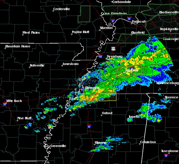 At 311 am cst, a severe thunderstorm was located near lewisburg, or near olive branch, moving east at 55 mph (radar indicated). Hazards include 60 mph wind gusts. expect damage to roofs, siding, and trees At 311 am cst, a severe thunderstorm was located near lewisburg, or near olive branch, moving east at 55 mph (radar indicated). Hazards include 60 mph wind gusts. expect damage to roofs, siding, and trees
|
| 1/11/2020 5:13 AM CST |
 At 512 am cst, doppler radar indicated a severe thunderstorm producing a tornado was located over collierville, moving northeast at 55 mph (radar indicated rotation). Hazards include tornado. Flying debris will be dangerous to those caught without shelter. mobile homes will be damaged or destroyed. damage to roofs, windows, and vehicles will occur. tree damage is likely. Locations impacted include, collierville, germantown, piperton, rossville, fisherville, kirk, elba, canadaville and hickory withe. At 512 am cst, doppler radar indicated a severe thunderstorm producing a tornado was located over collierville, moving northeast at 55 mph (radar indicated rotation). Hazards include tornado. Flying debris will be dangerous to those caught without shelter. mobile homes will be damaged or destroyed. damage to roofs, windows, and vehicles will occur. tree damage is likely. Locations impacted include, collierville, germantown, piperton, rossville, fisherville, kirk, elba, canadaville and hickory withe.
|
| 1/11/2020 5:01 AM CST |
 At 501 am cst, doppler radar indicated a severe thunderstorm producing a tornado was located near olive branch, moving northeast at 45 mph (radar indicated rotation). Hazards include tornado. Flying debris will be dangerous to those caught without shelter. mobile homes will be damaged or destroyed. damage to roofs, windows, and vehicles will occur. Tree damage is likely. At 501 am cst, doppler radar indicated a severe thunderstorm producing a tornado was located near olive branch, moving northeast at 45 mph (radar indicated rotation). Hazards include tornado. Flying debris will be dangerous to those caught without shelter. mobile homes will be damaged or destroyed. damage to roofs, windows, and vehicles will occur. Tree damage is likely.
|
| 10/21/2019 7:36 AM CDT |
 The severe thunderstorm warning for northern marshall, northwestern tippah, benton, eastern fayette, hardeman, southeastern haywood and madison counties will expire at 745 am cdt, the storms which prompted the warning have weakened below severe limits, and no longer pose an immediate threat to life or property. therefore, the warning will be allowed to expire. a tornado watch remains in effect until 1000 am cdt for northeastern and northwestern mississippi, and western tennessee. The severe thunderstorm warning for northern marshall, northwestern tippah, benton, eastern fayette, hardeman, southeastern haywood and madison counties will expire at 745 am cdt, the storms which prompted the warning have weakened below severe limits, and no longer pose an immediate threat to life or property. therefore, the warning will be allowed to expire. a tornado watch remains in effect until 1000 am cdt for northeastern and northwestern mississippi, and western tennessee.
|
| 10/21/2019 7:27 AM CDT |
 At 727 am cdt, severe thunderstorms were located along a line extending from near dancyville to near slayden, moving east at 45 mph (radar indicated). Hazards include 60 mph wind gusts. Expect damage to roofs, siding, and trees. Locations impacted include, jackson, brownsville, holly springs, bolivar, chickasaw state forest, lamar, whiteville, somerville, snow lake shores, mt pleasant, hillville, michigan city, red banks, canaan, bemis, lagrange, holly grove, dancyville, cloverport and slayden. At 727 am cdt, severe thunderstorms were located along a line extending from near dancyville to near slayden, moving east at 45 mph (radar indicated). Hazards include 60 mph wind gusts. Expect damage to roofs, siding, and trees. Locations impacted include, jackson, brownsville, holly springs, bolivar, chickasaw state forest, lamar, whiteville, somerville, snow lake shores, mt pleasant, hillville, michigan city, red banks, canaan, bemis, lagrange, holly grove, dancyville, cloverport and slayden.
|
| 10/21/2019 7:01 AM CDT |
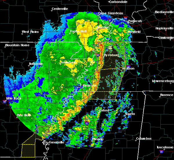 At 701 am cdt, severe thunderstorms were located along a line extending from 9 miles northeast of arlington to near lewisburg, moving east at 45 mph (radar indicated). Hazards include 60 mph wind gusts. expect damage to roofs, siding, and trees At 701 am cdt, severe thunderstorms were located along a line extending from 9 miles northeast of arlington to near lewisburg, moving east at 45 mph (radar indicated). Hazards include 60 mph wind gusts. expect damage to roofs, siding, and trees
|
| 6/23/2019 5:38 PM CDT |
 The severe thunderstorm warning for north central marshall and southern fayette counties will expire at 545 pm cdt, the storm which prompted the warning has weakened below severe limits, and no longer poses an immediate threat to life or property. therefore, the warning will be allowed to expire. however wind gusts to 45 mph, pea size hail and heavy rain are still possible with this thunderstorm. a severe thunderstorm watch remains in effect until 800 pm cdt for northwestern mississippi, and western tennessee. The severe thunderstorm warning for north central marshall and southern fayette counties will expire at 545 pm cdt, the storm which prompted the warning has weakened below severe limits, and no longer poses an immediate threat to life or property. therefore, the warning will be allowed to expire. however wind gusts to 45 mph, pea size hail and heavy rain are still possible with this thunderstorm. a severe thunderstorm watch remains in effect until 800 pm cdt for northwestern mississippi, and western tennessee.
|
| 6/23/2019 5:21 PM CDT |
 At 521 pm cdt, a severe thunderstorm was located 8 miles east of collierville, moving southeast at 55 mph (radar indicated). Hazards include 60 mph wind gusts. Expect damage to roofs, siding, and trees. Locations impacted include, arlington, mt pleasant, slayden, macon, oakland, piperton, rossville, moscow, williston, elba, canadaville, kirk, hays crossing, hickory withe and pattersonville. At 521 pm cdt, a severe thunderstorm was located 8 miles east of collierville, moving southeast at 55 mph (radar indicated). Hazards include 60 mph wind gusts. Expect damage to roofs, siding, and trees. Locations impacted include, arlington, mt pleasant, slayden, macon, oakland, piperton, rossville, moscow, williston, elba, canadaville, kirk, hays crossing, hickory withe and pattersonville.
|
| 6/23/2019 5:05 PM CDT |
 At 505 pm cdt, a severe thunderstorm was located over lakeland, or near cordova, moving southeast at 30 mph (radar indicated). Hazards include 60 mph wind gusts. expect damage to roofs, siding, and trees At 505 pm cdt, a severe thunderstorm was located over lakeland, or near cordova, moving southeast at 30 mph (radar indicated). Hazards include 60 mph wind gusts. expect damage to roofs, siding, and trees
|
| 6/23/2019 5:05 PM CDT |
 The national weather service in memphis has issued a * severe thunderstorm warning for. north central marshall county in northwestern mississippi. southern fayette county in western tennessee. east central shelby county in western tennessee. Until 545 pm cdt. The national weather service in memphis has issued a * severe thunderstorm warning for. north central marshall county in northwestern mississippi. southern fayette county in western tennessee. east central shelby county in western tennessee. Until 545 pm cdt.
|
| 6/20/2019 12:06 AM CDT |
 At 1205 am cdt, severe thunderstorms were located along a line extending from near ashport to near lewisburg, moving east at 50 mph (airport weather observation). Hazards include 70 mph wind gusts. Expect considerable tree damage. damage is likely to mobile homes, roofs, and outbuildings. Locations impacted include, bartlett, southaven, collierville, germantown, olive branch, horn lake, brownsville, millington, covington, ripley, osceola, luxora, wilson, keiser, cordova, meeman shelby forest state park, fort pillow state park, memphis, lakeland and arlington. At 1205 am cdt, severe thunderstorms were located along a line extending from near ashport to near lewisburg, moving east at 50 mph (airport weather observation). Hazards include 70 mph wind gusts. Expect considerable tree damage. damage is likely to mobile homes, roofs, and outbuildings. Locations impacted include, bartlett, southaven, collierville, germantown, olive branch, horn lake, brownsville, millington, covington, ripley, osceola, luxora, wilson, keiser, cordova, meeman shelby forest state park, fort pillow state park, memphis, lakeland and arlington.
|
| 6/19/2019 11:58 PM CDT |
 At 1158 pm cdt, severe thunderstorms were located along a line extending from near luxora to near hernando, moving east at 50 mph (radar indicated). Hazards include 60 mph wind gusts. expect damage to roofs, siding, and trees At 1158 pm cdt, severe thunderstorms were located along a line extending from near luxora to near hernando, moving east at 50 mph (radar indicated). Hazards include 60 mph wind gusts. expect damage to roofs, siding, and trees
|
| 5/15/2019 7:24 PM CDT |
 The severe thunderstorm warning for southwestern fayette and southeastern shelby counties will expire at 730 pm cdt, the storm which prompted the warning has weakened below severe limits, and no longer poses an immediate threat to life or property. therefore, the warning will be allowed to expire. The severe thunderstorm warning for southwestern fayette and southeastern shelby counties will expire at 730 pm cdt, the storm which prompted the warning has weakened below severe limits, and no longer poses an immediate threat to life or property. therefore, the warning will be allowed to expire.
|
| 5/15/2019 6:51 PM CDT |
 The national weather service in memphis has issued a * severe thunderstorm warning for. southwestern fayette county in western tennessee. southeastern shelby county in western tennessee. until 730 pm cdt. At 651 pm cdt, a severe thunderstorm was located over lakeland, or. The national weather service in memphis has issued a * severe thunderstorm warning for. southwestern fayette county in western tennessee. southeastern shelby county in western tennessee. until 730 pm cdt. At 651 pm cdt, a severe thunderstorm was located over lakeland, or.
|
| 4/6/2019 9:50 PM CDT |
 At 950 pm cdt, a severe thunderstorm was located near somerville, or 15 miles northeast of collierville, moving northeast at 50 mph (radar indicated). Hazards include 60 mph wind gusts. Expect damage to roofs, siding, and trees. Locations impacted include, somerville, lagrange, warren, macon, oakland, piperton, gallaway, rossville, moscow, williston, grand junction, la grange, yum yum, taylor chapel, hickory withe, pattersonville, fayette corners, laconia, elba and canadaville. At 950 pm cdt, a severe thunderstorm was located near somerville, or 15 miles northeast of collierville, moving northeast at 50 mph (radar indicated). Hazards include 60 mph wind gusts. Expect damage to roofs, siding, and trees. Locations impacted include, somerville, lagrange, warren, macon, oakland, piperton, gallaway, rossville, moscow, williston, grand junction, la grange, yum yum, taylor chapel, hickory withe, pattersonville, fayette corners, laconia, elba and canadaville.
|
| 4/6/2019 9:28 PM CDT |
 At 928 pm cdt, a severe thunderstorm was located near collierville, moving northeast at 50 mph (radar indicated). Hazards include 60 mph wind gusts. expect damage to roofs, siding, and trees At 928 pm cdt, a severe thunderstorm was located near collierville, moving northeast at 50 mph (radar indicated). Hazards include 60 mph wind gusts. expect damage to roofs, siding, and trees
|
| 8/20/2018 6:40 PM CDT |
 At 640 pm cdt, a severe thunderstorm was located 7 miles east of collierville, moving east at 45 mph (radar indicated). Hazards include 60 mph wind gusts. Expect damage to roofs, siding, and trees. Locations impacted include, michigan city, macon, piperton, rossville, moscow, williston, la grange, elba, canadaville, kirk, hays crossing, pattersonville, forty five and ghost river state natural area. At 640 pm cdt, a severe thunderstorm was located 7 miles east of collierville, moving east at 45 mph (radar indicated). Hazards include 60 mph wind gusts. Expect damage to roofs, siding, and trees. Locations impacted include, michigan city, macon, piperton, rossville, moscow, williston, la grange, elba, canadaville, kirk, hays crossing, pattersonville, forty five and ghost river state natural area.
|
| 8/20/2018 6:30 PM CDT |
 At 629 pm cdt, a severe thunderstorm was located over collierville, moving east at 35 mph (radar indicated). Hazards include 60 mph wind gusts. expect damage to roofs, siding, and trees At 629 pm cdt, a severe thunderstorm was located over collierville, moving east at 35 mph (radar indicated). Hazards include 60 mph wind gusts. expect damage to roofs, siding, and trees
|
| 7/19/2018 8:35 PM CDT |
 At 835 pm cdt, a severe thunderstorm was located near germantown, moving southeast at 5 mph (radar indicated). Hazards include 60 mph wind gusts and half dollar size hail. Hail damage to vehicles is expected. Expect wind damage to roofs, siding, and trees. At 835 pm cdt, a severe thunderstorm was located near germantown, moving southeast at 5 mph (radar indicated). Hazards include 60 mph wind gusts and half dollar size hail. Hail damage to vehicles is expected. Expect wind damage to roofs, siding, and trees.
|
| 7/19/2018 8:22 PM CDT |
 At 822 pm cdt, a severe thunderstorm was located near collierville, moving east at 5 mph (radar indicated). Hazards include 60 mph wind gusts and half dollar size hail. Hail damage to vehicles is expected. expect wind damage to roofs, siding, and trees. Locations impacted include, collierville, germantown, olive branch, holly springs, byhalia, mt pleasant, red banks, slayden, piperton, rossville, moscow, coal oil corner, cayce, fairhaven, victoria, hudsonville, early grove, handy corner, taska and miller. At 822 pm cdt, a severe thunderstorm was located near collierville, moving east at 5 mph (radar indicated). Hazards include 60 mph wind gusts and half dollar size hail. Hail damage to vehicles is expected. expect wind damage to roofs, siding, and trees. Locations impacted include, collierville, germantown, olive branch, holly springs, byhalia, mt pleasant, red banks, slayden, piperton, rossville, moscow, coal oil corner, cayce, fairhaven, victoria, hudsonville, early grove, handy corner, taska and miller.
|
| 7/19/2018 7:59 PM CDT |
 At 759 pm cdt, a severe thunderstorm was located near collierville, moving east at 5 mph (radar indicated). Hazards include ping pong ball size hail and 60 mph wind gusts. People and animals outdoors will be injured. expect hail damage to roofs, siding, windows, and vehicles. expect wind damage to roofs, siding, and trees. Locations impacted include, collierville, germantown, olive branch, holly springs, byhalia, mt pleasant, red banks, slayden, piperton, rossville, moscow, coal oil corner, cayce, fairhaven, victoria, hudsonville, early grove, handy corner, taska and miller. At 759 pm cdt, a severe thunderstorm was located near collierville, moving east at 5 mph (radar indicated). Hazards include ping pong ball size hail and 60 mph wind gusts. People and animals outdoors will be injured. expect hail damage to roofs, siding, windows, and vehicles. expect wind damage to roofs, siding, and trees. Locations impacted include, collierville, germantown, olive branch, holly springs, byhalia, mt pleasant, red banks, slayden, piperton, rossville, moscow, coal oil corner, cayce, fairhaven, victoria, hudsonville, early grove, handy corner, taska and miller.
|
| 7/19/2018 7:55 PM CDT |
 At 755 pm cdt, a severe thunderstorm was located near collierville, moving east at 5 mph (radar indicated). Hazards include 60 mph wind gusts and quarter size hail. Hail damage to vehicles is expected. Expect wind damage to roofs, siding, and trees. At 755 pm cdt, a severe thunderstorm was located near collierville, moving east at 5 mph (radar indicated). Hazards include 60 mph wind gusts and quarter size hail. Hail damage to vehicles is expected. Expect wind damage to roofs, siding, and trees.
|
| 7/4/2018 10:21 PM CDT |
 At 1020 pm cdt, a severe thunderstorm was located 8 miles south of whiteville, or 9 miles southwest of bolivar, moving west at 30 mph (radar indicated). Hazards include 60 mph wind gusts. Expect damage to roofs, siding, and trees. Locations impacted include, bolivar, whiteville, somerville, warren, macon, oakland, rossville, moscow, williston, grand junction, la grange, hickory valley, laconia, middleburg, moorman, lambert, hebron, hays crossing, pattersonville and powers. At 1020 pm cdt, a severe thunderstorm was located 8 miles south of whiteville, or 9 miles southwest of bolivar, moving west at 30 mph (radar indicated). Hazards include 60 mph wind gusts. Expect damage to roofs, siding, and trees. Locations impacted include, bolivar, whiteville, somerville, warren, macon, oakland, rossville, moscow, williston, grand junction, la grange, hickory valley, laconia, middleburg, moorman, lambert, hebron, hays crossing, pattersonville and powers.
|
| 7/4/2018 10:02 PM CDT |
 At 1002 pm cdt, a severe thunderstorm was located near bolivar, moving west at 30 mph (radar indicated). Hazards include 60 mph wind gusts. expect damage to roofs, siding, and trees At 1002 pm cdt, a severe thunderstorm was located near bolivar, moving west at 30 mph (radar indicated). Hazards include 60 mph wind gusts. expect damage to roofs, siding, and trees
|
| 6/23/2018 8:43 AM CDT |
 At 843 am cdt, a severe thunderstorm was located near somerville, or 16 miles northeast of collierville, moving northeast at 55 mph (radar indicated). Hazards include 60 mph wind gusts. Expect damage to roofs, siding, and trees. Locations impacted include, bolivar, whiteville, somerville, mt pleasant, lagrange, warren, macon, oakland, piperton, rossville, moscow, williston, grand junction, la grange, hickory valley, saulsbury, cayce, yum yum, taylor chapel and kirk. At 843 am cdt, a severe thunderstorm was located near somerville, or 16 miles northeast of collierville, moving northeast at 55 mph (radar indicated). Hazards include 60 mph wind gusts. Expect damage to roofs, siding, and trees. Locations impacted include, bolivar, whiteville, somerville, mt pleasant, lagrange, warren, macon, oakland, piperton, rossville, moscow, williston, grand junction, la grange, hickory valley, saulsbury, cayce, yum yum, taylor chapel and kirk.
|
| 6/23/2018 8:29 AM CDT |
 The national weather service in memphis has issued a * severe thunderstorm warning for. north central marshall county in northwestern mississippi. fayette county in southwestern tennessee. western hardeman county in southwestern tennessee. Until 915 am cdt. The national weather service in memphis has issued a * severe thunderstorm warning for. north central marshall county in northwestern mississippi. fayette county in southwestern tennessee. western hardeman county in southwestern tennessee. Until 915 am cdt.
|
| 6/23/2018 8:25 AM CDT |
 At 825 am cdt, a severe thunderstorm was located near collierville, moving east at 55 mph (radar indicated). Hazards include 70 mph wind gusts. Expect considerable tree damage. damage is likely to mobile homes, roofs, and outbuildings. Locations impacted include, bartlett, collierville, germantown, olive branch, cordova, memphis, lakeland, arlington, mt pleasant, ellendale, southeast memphis, eads, macon, oakland, piperton, rossville, moscow, lenow, cayce and cedarview. At 825 am cdt, a severe thunderstorm was located near collierville, moving east at 55 mph (radar indicated). Hazards include 70 mph wind gusts. Expect considerable tree damage. damage is likely to mobile homes, roofs, and outbuildings. Locations impacted include, bartlett, collierville, germantown, olive branch, cordova, memphis, lakeland, arlington, mt pleasant, ellendale, southeast memphis, eads, macon, oakland, piperton, rossville, moscow, lenow, cayce and cedarview.
|
| 6/23/2018 8:15 AM CDT |
 At 814 am cdt, a severe thunderstorm was located over germantown, moving east at 55 mph (radar indicated). Hazards include 70 mph wind gusts. Expect considerable tree damage. damage is likely to mobile homes, roofs, and outbuildings. Locations impacted include, bartlett, southaven, collierville, germantown, olive branch, horn lake, hernando, t o fuller state park, cordova, memphis, lakeland, arlington, mt pleasant, southwest memphis, ellendale, lewisburg, whitehaven, midtown memphis, southeast memphis and downtown memphis. At 814 am cdt, a severe thunderstorm was located over germantown, moving east at 55 mph (radar indicated). Hazards include 70 mph wind gusts. Expect considerable tree damage. damage is likely to mobile homes, roofs, and outbuildings. Locations impacted include, bartlett, southaven, collierville, germantown, olive branch, horn lake, hernando, t o fuller state park, cordova, memphis, lakeland, arlington, mt pleasant, southwest memphis, ellendale, lewisburg, whitehaven, midtown memphis, southeast memphis and downtown memphis.
|
| 6/23/2018 8:00 AM CDT |
 At 800 am cdt, a severe thunderstorm was located over whitehaven, or near southaven, moving east at 55 mph (radar indicated). Hazards include 70 mph wind gusts. Expect considerable tree damage. damage is likely to mobile homes, roofs, and outbuildings. Locations impacted include, bartlett, southaven, collierville, germantown, olive branch, west memphis, horn lake, hernando, t o fuller state park, cordova, lakeland, arlington, walls, edmondson, mt pleasant, southwest memphis, ellendale, lewisburg, whitehaven and midtown memphis. At 800 am cdt, a severe thunderstorm was located over whitehaven, or near southaven, moving east at 55 mph (radar indicated). Hazards include 70 mph wind gusts. Expect considerable tree damage. damage is likely to mobile homes, roofs, and outbuildings. Locations impacted include, bartlett, southaven, collierville, germantown, olive branch, west memphis, horn lake, hernando, t o fuller state park, cordova, lakeland, arlington, walls, edmondson, mt pleasant, southwest memphis, ellendale, lewisburg, whitehaven and midtown memphis.
|
| 6/23/2018 7:54 AM CDT |
 At 754 am cdt, a severe thunderstorm was located over walls, or near t o fuller state park, moving east at 55 mph (radar indicated). Hazards include 60 mph wind gusts. expect damage to roofs, siding, and trees At 754 am cdt, a severe thunderstorm was located over walls, or near t o fuller state park, moving east at 55 mph (radar indicated). Hazards include 60 mph wind gusts. expect damage to roofs, siding, and trees
|
| 6/21/2018 5:12 PM CDT |
 At 512 pm cdt, a severe thunderstorm was located over ellendale, or near bartlett, moving east at 45 mph (radar indicated). Hazards include 60 mph wind gusts and penny size hail. Hail damage to vehicles is expected. Expect wind damage to roofs, siding, and trees. At 512 pm cdt, a severe thunderstorm was located over ellendale, or near bartlett, moving east at 45 mph (radar indicated). Hazards include 60 mph wind gusts and penny size hail. Hail damage to vehicles is expected. Expect wind damage to roofs, siding, and trees.
|
| 6/12/2018 7:26 PM CDT |
 The severe thunderstorm warning for northwestern marshall and southwestern fayette counties will expire at 730 pm cdt, the storm which prompted the warning has weakened below severe limits, and no longer poses an immediate threat to life or property. therefore, the warning will be allowed to expire. The severe thunderstorm warning for northwestern marshall and southwestern fayette counties will expire at 730 pm cdt, the storm which prompted the warning has weakened below severe limits, and no longer poses an immediate threat to life or property. therefore, the warning will be allowed to expire.
|
| 6/12/2018 7:26 PM CDT |
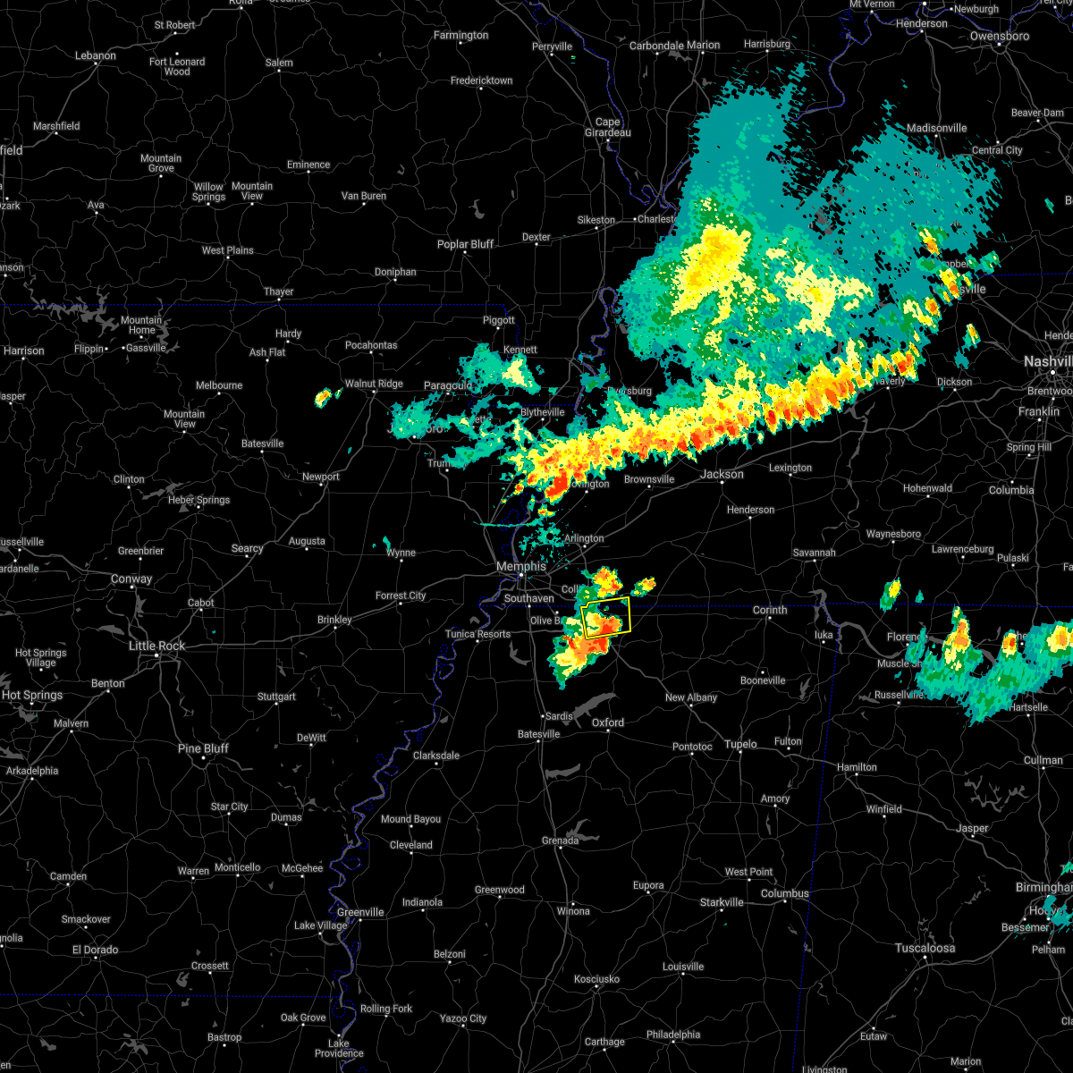 The severe thunderstorm warning for northwestern marshall and southwestern fayette counties will expire at 730 pm cdt, the storm which prompted the warning has weakened below severe limits, and no longer poses an immediate threat to life or property. therefore, the warning will be allowed to expire. The severe thunderstorm warning for northwestern marshall and southwestern fayette counties will expire at 730 pm cdt, the storm which prompted the warning has weakened below severe limits, and no longer poses an immediate threat to life or property. therefore, the warning will be allowed to expire.
|
| 6/12/2018 7:00 PM CDT |
 At 700 pm cdt, a severe thunderstorm was located near mt pleasant, or 9 miles southeast of collierville, moving east at 45 mph (radar indicated). Hazards include 60 mph wind gusts. expect damage to roofs, siding, and trees At 700 pm cdt, a severe thunderstorm was located near mt pleasant, or 9 miles southeast of collierville, moving east at 45 mph (radar indicated). Hazards include 60 mph wind gusts. expect damage to roofs, siding, and trees
|
| 6/12/2018 7:00 PM CDT |
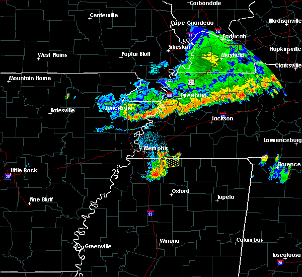 At 700 pm cdt, a severe thunderstorm was located near mt pleasant, or 9 miles southeast of collierville, moving east at 45 mph (radar indicated). Hazards include 60 mph wind gusts. expect damage to roofs, siding, and trees At 700 pm cdt, a severe thunderstorm was located near mt pleasant, or 9 miles southeast of collierville, moving east at 45 mph (radar indicated). Hazards include 60 mph wind gusts. expect damage to roofs, siding, and trees
|
| 6/3/2018 12:31 AM CDT |
 At 1231 am cdt, a severe thunderstorm was located near mt pleasant, or 7 miles southeast of collierville, moving southeast at 50 mph (radar indicated). Hazards include 60 mph wind gusts and quarter size hail. Hail damage to vehicles is expected. Expect wind damage to roofs, siding, and trees. At 1231 am cdt, a severe thunderstorm was located near mt pleasant, or 7 miles southeast of collierville, moving southeast at 50 mph (radar indicated). Hazards include 60 mph wind gusts and quarter size hail. Hail damage to vehicles is expected. Expect wind damage to roofs, siding, and trees.
|
| 6/1/2018 2:34 AM CDT |
 At 234 am cdt, a severe thunderstorm was located near chickasaw state park, moving east at 55 mph (radar indicated). Hazards include 60 mph wind gusts. Expect damage to roofs, siding, and trees. Locations impacted include, jackson, henderson, bolivar, chickasaw state forest, chickasaw state park, whiteville, somerville, silerton, masseyville, bemis, cloverport, mercer, robertson, warren, carroll, macon, oakland, piperton, rossville and moscow. At 234 am cdt, a severe thunderstorm was located near chickasaw state park, moving east at 55 mph (radar indicated). Hazards include 60 mph wind gusts. Expect damage to roofs, siding, and trees. Locations impacted include, jackson, henderson, bolivar, chickasaw state forest, chickasaw state park, whiteville, somerville, silerton, masseyville, bemis, cloverport, mercer, robertson, warren, carroll, macon, oakland, piperton, rossville and moscow.
|
| 6/1/2018 2:27 AM CDT |
 At 227 am cdt, a severe thunderstorm was located near chickasaw state park, moving east at 65 mph (radar indicated). Hazards include 60 mph wind gusts. Expect damage to roofs, siding, and trees. Locations impacted include, jackson, henderson, bolivar, chickasaw state forest, chickasaw state park, fairview, whiteville, somerville, three way, silerton, masseyville, bemis, cloverport, mercer, robertson, warren, carroll, macon, oakland and piperton. At 227 am cdt, a severe thunderstorm was located near chickasaw state park, moving east at 65 mph (radar indicated). Hazards include 60 mph wind gusts. Expect damage to roofs, siding, and trees. Locations impacted include, jackson, henderson, bolivar, chickasaw state forest, chickasaw state park, fairview, whiteville, somerville, three way, silerton, masseyville, bemis, cloverport, mercer, robertson, warren, carroll, macon, oakland and piperton.
|
| 6/1/2018 2:08 AM CDT |
 At 207 am cdt, a severe thunderstorm was located near holly grove, or 7 miles east of brownsville, moving southeast at 60 mph (radar indicated). Hazards include 60 mph wind gusts. expect damage to roofs, siding, and trees At 207 am cdt, a severe thunderstorm was located near holly grove, or 7 miles east of brownsville, moving southeast at 60 mph (radar indicated). Hazards include 60 mph wind gusts. expect damage to roofs, siding, and trees
|
| 4/14/2018 4:14 AM CDT |
 At 413 am cdt, a severe thunderstorm was located near byhalia, or 12 miles southeast of olive branch, moving northeast at 55 mph (radar indicated). Hazards include 60 mph wind gusts. expect damage to roofs, siding, and trees At 413 am cdt, a severe thunderstorm was located near byhalia, or 12 miles southeast of olive branch, moving northeast at 55 mph (radar indicated). Hazards include 60 mph wind gusts. expect damage to roofs, siding, and trees
|
| 8/31/2017 12:20 PM CDT |
 At 1220 pm cdt, a severe thunderstorm producing a tornado was located near slayden, or 16 miles north of holly springs, moving northwest at 30 mph (radar indicated rotation). Hazards include tornado. Flying debris will be dangerous to those caught without shelter. mobile homes will be damaged or destroyed. damage to roofs, windows, and vehicles will occur. tree damage is likely. This tornadic thunderstorm will remain over mainly rural areas of western fayette county, including the following locations: macon, elba, hays crossing, hickory withe, canadaville, oakland, moscow, griffen, rossville and piperton. At 1220 pm cdt, a severe thunderstorm producing a tornado was located near slayden, or 16 miles north of holly springs, moving northwest at 30 mph (radar indicated rotation). Hazards include tornado. Flying debris will be dangerous to those caught without shelter. mobile homes will be damaged or destroyed. damage to roofs, windows, and vehicles will occur. tree damage is likely. This tornadic thunderstorm will remain over mainly rural areas of western fayette county, including the following locations: macon, elba, hays crossing, hickory withe, canadaville, oakland, moscow, griffen, rossville and piperton.
|
| 8/31/2017 12:01 PM CDT |
 At 1201 pm cdt, a severe thunderstorm producing a tornado was located over lamar, or 14 miles northeast of holly springs, moving northwest at 35 mph (radar indicated rotation). Hazards include tornado. Flying debris will be dangerous to those caught without shelter. mobile homes will be damaged or destroyed. damage to roofs, windows, and vehicles will occur. tree damage is likely. this dangerous storm will be near, michigan city around 1205 pm cdt. Other locations impacted by this tornadic thunderstorm include macon, elba, canadaville, oakland, longtown, moscow, early grove, williston, lambert and warren. At 1201 pm cdt, a severe thunderstorm producing a tornado was located over lamar, or 14 miles northeast of holly springs, moving northwest at 35 mph (radar indicated rotation). Hazards include tornado. Flying debris will be dangerous to those caught without shelter. mobile homes will be damaged or destroyed. damage to roofs, windows, and vehicles will occur. tree damage is likely. this dangerous storm will be near, michigan city around 1205 pm cdt. Other locations impacted by this tornadic thunderstorm include macon, elba, canadaville, oakland, longtown, moscow, early grove, williston, lambert and warren.
|
| 8/11/2017 2:30 PM CDT |
 At 230 pm cdt, a severe thunderstorm was located 7 miles northeast of collierville, moving east at 20 mph (radar indicated). Hazards include 60 mph wind gusts. Expect damage to roofs, siding, and trees. Locations impacted include, macon, oakland, piperton, rossville, moscow, williston, la grange, elba, canadaville, kirk, hays crossing, pattersonville, forty five and hickory withe. At 230 pm cdt, a severe thunderstorm was located 7 miles northeast of collierville, moving east at 20 mph (radar indicated). Hazards include 60 mph wind gusts. Expect damage to roofs, siding, and trees. Locations impacted include, macon, oakland, piperton, rossville, moscow, williston, la grange, elba, canadaville, kirk, hays crossing, pattersonville, forty five and hickory withe.
|
| 8/11/2017 2:25 PM CDT |
 At 225 pm cdt, a severe thunderstorm was located near collierville, moving east at 20 mph (radar indicated). Hazards include 60 mph wind gusts. expect damage to roofs, siding, and trees At 225 pm cdt, a severe thunderstorm was located near collierville, moving east at 20 mph (radar indicated). Hazards include 60 mph wind gusts. expect damage to roofs, siding, and trees
|
| 5/27/2017 11:41 PM CDT |
 At 1141 pm cdt, a severe thunderstorm was located near mt pleasant, or 10 miles northwest of holly springs, moving southeast at 65 mph (radar indicated). Hazards include 70 mph wind gusts and quarter size hail. Hail damage to vehicles is expected. expect considerable tree damage. Wind damage is also likely to mobile homes, roofs, and outbuildings. At 1141 pm cdt, a severe thunderstorm was located near mt pleasant, or 10 miles northwest of holly springs, moving southeast at 65 mph (radar indicated). Hazards include 70 mph wind gusts and quarter size hail. Hail damage to vehicles is expected. expect considerable tree damage. Wind damage is also likely to mobile homes, roofs, and outbuildings.
|
| 5/27/2017 10:51 PM CDT |
 At 1051 pm cdt, a severe thunderstorm was located near meeman shelby forest state park, moving southeast at 60 mph. this is a very dangerous storm (radar indicated). Hazards include 80 mph wind gusts and quarter size hail. Flying debris will be dangerous to those caught without shelter. mobile homes will be heavily damaged. expect considerable damage to roofs, windows, and vehicles. Extensive tree damage and power outages are likely. At 1051 pm cdt, a severe thunderstorm was located near meeman shelby forest state park, moving southeast at 60 mph. this is a very dangerous storm (radar indicated). Hazards include 80 mph wind gusts and quarter size hail. Flying debris will be dangerous to those caught without shelter. mobile homes will be heavily damaged. expect considerable damage to roofs, windows, and vehicles. Extensive tree damage and power outages are likely.
|
| 4/29/2017 9:34 PM CDT |
 At 934 pm cdt, a severe thunderstorm was located near collierville, moving northeast at 40 mph (radar indicated). Hazards include 60 mph wind gusts and quarter size hail. Hail damage to vehicles is expected. expect wind damage to roofs, siding, and trees. Locations impacted include, bartlett, collierville, germantown, cordova, memphis, lakeland, arlington, somerville, ellendale, southeast memphis, eads, warren, macon, oakland, piperton, gallaway, rossville, lenow, redwood and capleville. At 934 pm cdt, a severe thunderstorm was located near collierville, moving northeast at 40 mph (radar indicated). Hazards include 60 mph wind gusts and quarter size hail. Hail damage to vehicles is expected. expect wind damage to roofs, siding, and trees. Locations impacted include, bartlett, collierville, germantown, cordova, memphis, lakeland, arlington, somerville, ellendale, southeast memphis, eads, warren, macon, oakland, piperton, gallaway, rossville, lenow, redwood and capleville.
|
| 4/29/2017 9:12 PM CDT |
 At 912 pm cdt, a severe thunderstorm was located near olive branch, moving northeast at 40 mph (radar indicated). Hazards include 60 mph wind gusts and quarter size hail. Hail damage to vehicles is expected. Expect wind damage to roofs, siding, and trees. At 912 pm cdt, a severe thunderstorm was located near olive branch, moving northeast at 40 mph (radar indicated). Hazards include 60 mph wind gusts and quarter size hail. Hail damage to vehicles is expected. Expect wind damage to roofs, siding, and trees.
|
| 4/29/2017 8:25 PM CDT |
 At 824 pm cdt, severe thunderstorms were located along a line extending from near wilson to t o fuller state park, moving northeast at 45 mph (radar indicated). Hazards include 60 mph wind gusts and quarter size hail. Hail damage to vehicles is expected. expect wind damage to roofs, siding, and trees. Locations impacted include, bartlett, collierville, germantown, millington, covington, osceola, wilson, t o fuller state park, meeman shelby forest state park, fort pillow state park, cordova, memphis, lakeland, arlington, munford, brighton, joiner, dyess, bassett and marie. At 824 pm cdt, severe thunderstorms were located along a line extending from near wilson to t o fuller state park, moving northeast at 45 mph (radar indicated). Hazards include 60 mph wind gusts and quarter size hail. Hail damage to vehicles is expected. expect wind damage to roofs, siding, and trees. Locations impacted include, bartlett, collierville, germantown, millington, covington, osceola, wilson, t o fuller state park, meeman shelby forest state park, fort pillow state park, cordova, memphis, lakeland, arlington, munford, brighton, joiner, dyess, bassett and marie.
|
| 4/29/2017 8:00 PM CDT |
 At 800 pm cdt, severe thunderstorms were located along a line extending from near marked tree to near pinckney, moving northeast at 60 mph (radar indicated). Hazards include 60 mph wind gusts and quarter size hail. Hail damage to vehicles is expected. Expect wind damage to roofs, siding, and trees. At 800 pm cdt, severe thunderstorms were located along a line extending from near marked tree to near pinckney, moving northeast at 60 mph (radar indicated). Hazards include 60 mph wind gusts and quarter size hail. Hail damage to vehicles is expected. Expect wind damage to roofs, siding, and trees.
|
| 3/27/2017 12:21 PM CDT |
 At 1221 pm cdt, a severe thunderstorm was located near mt pleasant, or 10 miles east of collierville, moving northeast at 40 mph (radar indicated). Hazards include quarter size hail. Damage to vehicles is expected. Locations impacted include, mt pleasant, red banks, slayden, rossville, moscow, la grange, taska, victoria, hays crossing, forty five and early grove. At 1221 pm cdt, a severe thunderstorm was located near mt pleasant, or 10 miles east of collierville, moving northeast at 40 mph (radar indicated). Hazards include quarter size hail. Damage to vehicles is expected. Locations impacted include, mt pleasant, red banks, slayden, rossville, moscow, la grange, taska, victoria, hays crossing, forty five and early grove.
|
| 3/27/2017 12:21 PM CDT |
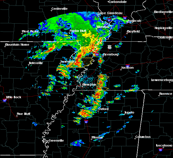 At 1221 pm cdt, a severe thunderstorm was located near mt pleasant, or 10 miles east of collierville, moving northeast at 40 mph (radar indicated). Hazards include quarter size hail. Damage to vehicles is expected. Locations impacted include, mt pleasant, red banks, slayden, rossville, moscow, la grange, taska, victoria, hays crossing, forty five and early grove. At 1221 pm cdt, a severe thunderstorm was located near mt pleasant, or 10 miles east of collierville, moving northeast at 40 mph (radar indicated). Hazards include quarter size hail. Damage to vehicles is expected. Locations impacted include, mt pleasant, red banks, slayden, rossville, moscow, la grange, taska, victoria, hays crossing, forty five and early grove.
|
| 3/27/2017 12:02 PM CDT |
 At 1202 pm cdt, a severe thunderstorm was located over byhalia, or 11 miles southeast of olive branch, moving northeast at 40 mph (radar indicated). Hazards include quarter size hail. Damage to vehicles is expected. Locations impacted include, byhalia, mt pleasant, red banks, slayden, piperton, rossville, moscow, la grange, coal oil corner, cayce, victoria, watson, early grove, taska, hays crossing and forty five. At 1202 pm cdt, a severe thunderstorm was located over byhalia, or 11 miles southeast of olive branch, moving northeast at 40 mph (radar indicated). Hazards include quarter size hail. Damage to vehicles is expected. Locations impacted include, byhalia, mt pleasant, red banks, slayden, piperton, rossville, moscow, la grange, coal oil corner, cayce, victoria, watson, early grove, taska, hays crossing and forty five.
|
| 3/27/2017 12:02 PM CDT |
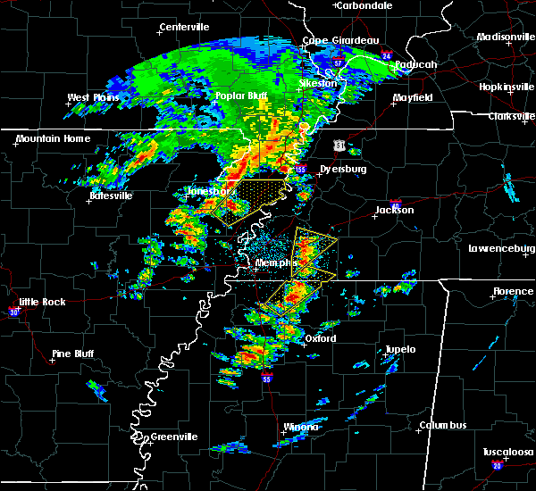 At 1202 pm cdt, a severe thunderstorm was located over byhalia, or 11 miles southeast of olive branch, moving northeast at 40 mph (radar indicated). Hazards include quarter size hail. Damage to vehicles is expected. Locations impacted include, byhalia, mt pleasant, red banks, slayden, piperton, rossville, moscow, la grange, coal oil corner, cayce, victoria, watson, early grove, taska, hays crossing and forty five. At 1202 pm cdt, a severe thunderstorm was located over byhalia, or 11 miles southeast of olive branch, moving northeast at 40 mph (radar indicated). Hazards include quarter size hail. Damage to vehicles is expected. Locations impacted include, byhalia, mt pleasant, red banks, slayden, piperton, rossville, moscow, la grange, coal oil corner, cayce, victoria, watson, early grove, taska, hays crossing and forty five.
|
| 3/27/2017 11:48 AM CDT |
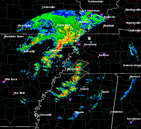 At 1148 am cdt, a severe thunderstorm was located near independence, or 12 miles south of olive branch, moving northeast at 40 mph (radar indicated). Hazards include quarter size hail. damage to vehicles is expected At 1148 am cdt, a severe thunderstorm was located near independence, or 12 miles south of olive branch, moving northeast at 40 mph (radar indicated). Hazards include quarter size hail. damage to vehicles is expected
|
| 3/10/2017 12:01 AM CST |
 At 1201 am cst, severe thunderstorms were located along a line extending from 10 miles north of slayden to near mt pleasant to near byhalia, moving southeast at 55 mph (radar indicated). Hazards include 60 mph wind gusts. Expect damage to roofs, siding, and trees. Locations impacted include, holly springs, lamar, byhalia, mt pleasant, red banks, slayden, piperton, rossville, moscow, coal oil corner, cayce, handy corner, taska, kirk, elba, victoria, canadaville, hudsonville, early grove and miller. At 1201 am cst, severe thunderstorms were located along a line extending from 10 miles north of slayden to near mt pleasant to near byhalia, moving southeast at 55 mph (radar indicated). Hazards include 60 mph wind gusts. Expect damage to roofs, siding, and trees. Locations impacted include, holly springs, lamar, byhalia, mt pleasant, red banks, slayden, piperton, rossville, moscow, coal oil corner, cayce, handy corner, taska, kirk, elba, victoria, canadaville, hudsonville, early grove and miller.
|
| 3/10/2017 12:01 AM CST |
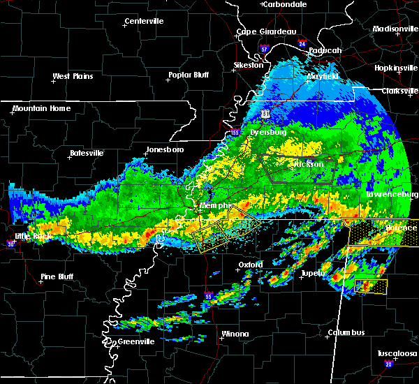 At 1201 am cst, severe thunderstorms were located along a line extending from 10 miles north of slayden to near mt pleasant to near byhalia, moving southeast at 55 mph (radar indicated). Hazards include 60 mph wind gusts. Expect damage to roofs, siding, and trees. Locations impacted include, holly springs, lamar, byhalia, mt pleasant, red banks, slayden, piperton, rossville, moscow, coal oil corner, cayce, handy corner, taska, kirk, elba, victoria, canadaville, hudsonville, early grove and miller. At 1201 am cst, severe thunderstorms were located along a line extending from 10 miles north of slayden to near mt pleasant to near byhalia, moving southeast at 55 mph (radar indicated). Hazards include 60 mph wind gusts. Expect damage to roofs, siding, and trees. Locations impacted include, holly springs, lamar, byhalia, mt pleasant, red banks, slayden, piperton, rossville, moscow, coal oil corner, cayce, handy corner, taska, kirk, elba, victoria, canadaville, hudsonville, early grove and miller.
|
| 3/9/2017 11:46 PM CST |
 At 1146 pm cst, severe thunderstorms were located along a line extending from eads to near germantown to near southeast memphis, moving southeast at 55 mph (radar indicated). Hazards include 60 mph wind gusts. expect damage to roofs, siding, and trees At 1146 pm cst, severe thunderstorms were located along a line extending from eads to near germantown to near southeast memphis, moving southeast at 55 mph (radar indicated). Hazards include 60 mph wind gusts. expect damage to roofs, siding, and trees
|
| 12/17/2016 9:32 PM CST |
 At 932 pm cst, a severe thunderstorm was located near cloverport, or 8 miles northwest of bolivar, moving northeast at 85 mph (radar indicated). Hazards include 60 mph wind gusts. Expect damage to roofs, siding, and trees. locations impacted include, collierville, byhalia, mt pleasant, macon, piperton, rossville, cayce, victoria, coal oil corner, elba, hays crossing and taska. A tornado watch remains in effect until 300 am cst for northwestern mississippi, and western tennessee. At 932 pm cst, a severe thunderstorm was located near cloverport, or 8 miles northwest of bolivar, moving northeast at 85 mph (radar indicated). Hazards include 60 mph wind gusts. Expect damage to roofs, siding, and trees. locations impacted include, collierville, byhalia, mt pleasant, macon, piperton, rossville, cayce, victoria, coal oil corner, elba, hays crossing and taska. A tornado watch remains in effect until 300 am cst for northwestern mississippi, and western tennessee.
|
| 12/17/2016 8:54 PM CST |
 At 854 pm cst, a severe thunderstorm was located over olive branch, moving northeast at 85 mph (radar indicated). Hazards include 60 mph wind gusts. expect damage to roofs, siding, and trees At 854 pm cst, a severe thunderstorm was located over olive branch, moving northeast at 85 mph (radar indicated). Hazards include 60 mph wind gusts. expect damage to roofs, siding, and trees
|
| 11/18/2016 6:02 PM CST |
 At 601 pm cst, a severe thunderstorm was located over slayden, or 11 miles north of holly springs, moving east at 55 mph (radar indicated). Hazards include 60 mph wind gusts. Expect damage to roofs. siding. and trees. Locations impacted include, holly springs, lamar, snow lake shores, slayden, mt pleasant, red banks, michigan city, piperton, rossville, ashland, moscow, la grange, mahon, victoria, hays crossing, forty five, hudsonville, early grove, cayce and atway. At 601 pm cst, a severe thunderstorm was located over slayden, or 11 miles north of holly springs, moving east at 55 mph (radar indicated). Hazards include 60 mph wind gusts. Expect damage to roofs. siding. and trees. Locations impacted include, holly springs, lamar, snow lake shores, slayden, mt pleasant, red banks, michigan city, piperton, rossville, ashland, moscow, la grange, mahon, victoria, hays crossing, forty five, hudsonville, early grove, cayce and atway.
|
| 11/18/2016 5:45 PM CST |
 At 545 pm cst, a severe thunderstorm was located over byhalia, or 10 miles southeast of olive branch, moving east at 55 mph (radar indicated). Hazards include 60 mph wind gusts. Expect damage to roofs. siding. And trees. At 545 pm cst, a severe thunderstorm was located over byhalia, or 10 miles southeast of olive branch, moving east at 55 mph (radar indicated). Hazards include 60 mph wind gusts. Expect damage to roofs. siding. And trees.
|
| 11/18/2016 5:45 PM CST |
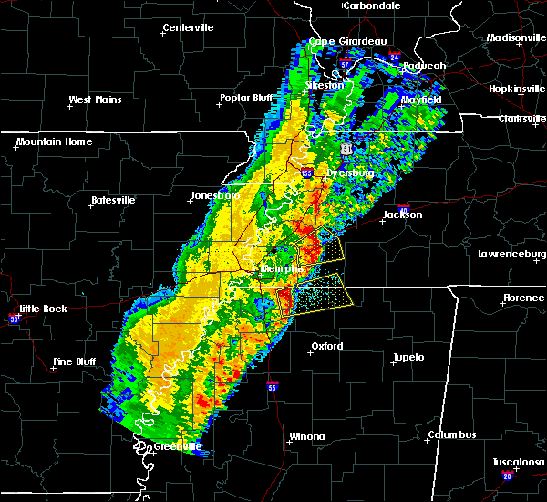 At 545 pm cst, a severe thunderstorm was located over byhalia, or 10 miles southeast of olive branch, moving east at 55 mph (radar indicated). Hazards include 60 mph wind gusts. Expect damage to roofs. siding. And trees. At 545 pm cst, a severe thunderstorm was located over byhalia, or 10 miles southeast of olive branch, moving east at 55 mph (radar indicated). Hazards include 60 mph wind gusts. Expect damage to roofs. siding. And trees.
|
| 7/15/2016 5:11 PM CDT |
 At 508 pm cdt, a severe thunderstorm was located over germantown, moving east at 15 mph (radar indicated). Hazards include 60 mph wind gusts and quarter size hail. Hail damage to vehicles is expected. expect wind damage to roofs, siding, and trees. quarter size hail was reported near mt. moriah and 385. wind damage has occured on lamar avenue and the winchester and perkins area in southeast memphis. Locations impacted include, southaven, collierville, germantown, olive branch, memphis, southeast memphis, piperton, rossville, handy corner, elba, capleville, kirk, cayce, white station, taska and parkway village. At 508 pm cdt, a severe thunderstorm was located over germantown, moving east at 15 mph (radar indicated). Hazards include 60 mph wind gusts and quarter size hail. Hail damage to vehicles is expected. expect wind damage to roofs, siding, and trees. quarter size hail was reported near mt. moriah and 385. wind damage has occured on lamar avenue and the winchester and perkins area in southeast memphis. Locations impacted include, southaven, collierville, germantown, olive branch, memphis, southeast memphis, piperton, rossville, handy corner, elba, capleville, kirk, cayce, white station, taska and parkway village.
|
| 7/15/2016 4:39 PM CDT |
 At 439 pm cdt, a severe thunderstorm was located over southeast memphis, or near germantown, moving east at 25 mph (radar indicated). Hazards include 60 mph wind gusts and quarter size hail. Hail damage to vehicles is expected. Expect wind damage to roofs, siding, and trees. At 439 pm cdt, a severe thunderstorm was located over southeast memphis, or near germantown, moving east at 25 mph (radar indicated). Hazards include 60 mph wind gusts and quarter size hail. Hail damage to vehicles is expected. Expect wind damage to roofs, siding, and trees.
|
| 6/27/2016 4:06 PM CDT |
 At 406 pm cdt, a severe thunderstorm was located 7 miles north of slayden, or 14 miles east of collierville, moving southeast at 15 mph (radar indicated). Hazards include 60 mph wind gusts and quarter size hail. Hail damage to vehicles is expected. Expect wind damage to roofs, siding, and trees. At 406 pm cdt, a severe thunderstorm was located 7 miles north of slayden, or 14 miles east of collierville, moving southeast at 15 mph (radar indicated). Hazards include 60 mph wind gusts and quarter size hail. Hail damage to vehicles is expected. Expect wind damage to roofs, siding, and trees.
|
| 6/27/2016 3:33 PM CDT |
 At 333 pm cdt, a severe thunderstorm was located 9 miles east of arlington, or 17 miles southeast of covington, moving southeast at 40 mph (radar indicated). Hazards include 60 mph wind gusts. Expect damage to roofs. siding. And trees. At 333 pm cdt, a severe thunderstorm was located 9 miles east of arlington, or 17 miles southeast of covington, moving southeast at 40 mph (radar indicated). Hazards include 60 mph wind gusts. Expect damage to roofs. siding. And trees.
|
| 6/15/2016 8:29 PM CDT |
 At 829 pm cdt, a severe thunderstorm was located near mt pleasant, or near collierville, moving southeast at 30 mph (radar indicated). Hazards include 60 mph wind gusts. Expect damage to roofs. siding. and trees. Locations impacted include, collierville, olive branch, holly springs, byhalia, slayden, mt pleasant, red banks, macon, piperton, rossville, moscow, mahon, hays crossing, kirk, early grove, cayce, mack, fairhaven, victoria and handy corner. At 829 pm cdt, a severe thunderstorm was located near mt pleasant, or near collierville, moving southeast at 30 mph (radar indicated). Hazards include 60 mph wind gusts. Expect damage to roofs. siding. and trees. Locations impacted include, collierville, olive branch, holly springs, byhalia, slayden, mt pleasant, red banks, macon, piperton, rossville, moscow, mahon, hays crossing, kirk, early grove, cayce, mack, fairhaven, victoria and handy corner.
|
| 6/15/2016 8:07 PM CDT |
 At 807 pm cdt, a severe thunderstorm was located near collierville, moving southeast at 25 mph (radar indicated). Hazards include 60 mph wind gusts and penny size hail. Expect damage to roofs. siding. And trees. At 807 pm cdt, a severe thunderstorm was located near collierville, moving southeast at 25 mph (radar indicated). Hazards include 60 mph wind gusts and penny size hail. Expect damage to roofs. siding. And trees.
|
| 5/25/2016 3:57 PM CDT |
 At 356 pm cdt, a severe thunderstorm was located near collierville, moving northeast at 30 mph (radar indicated). Hazards include 60 mph wind gusts and quarter size hail. Hail damage to vehicles is expected. expect wind damage to roofs, siding, and trees. Locations impacted include, byhalia, slayden, mt pleasant, piperton, cayce and taska. At 356 pm cdt, a severe thunderstorm was located near collierville, moving northeast at 30 mph (radar indicated). Hazards include 60 mph wind gusts and quarter size hail. Hail damage to vehicles is expected. expect wind damage to roofs, siding, and trees. Locations impacted include, byhalia, slayden, mt pleasant, piperton, cayce and taska.
|
| 5/25/2016 3:41 PM CDT |
 At 341 pm cdt, a severe thunderstorm was located near collierville, moving northeast at 30 mph (radar indicated). Hazards include 60 mph wind gusts and quarter size hail. Hail damage to vehicles is expected. expect wind damage to roofs, siding, and trees. Locations impacted include, collierville, olive branch, byhalia, lewisburg, slayden, mt pleasant, piperton, rossville, fairhaven, handy corner, elba, cedarview, cayce, taska and miller. At 341 pm cdt, a severe thunderstorm was located near collierville, moving northeast at 30 mph (radar indicated). Hazards include 60 mph wind gusts and quarter size hail. Hail damage to vehicles is expected. expect wind damage to roofs, siding, and trees. Locations impacted include, collierville, olive branch, byhalia, lewisburg, slayden, mt pleasant, piperton, rossville, fairhaven, handy corner, elba, cedarview, cayce, taska and miller.
|
| 5/25/2016 3:29 PM CDT |
 At 329 pm cdt, a severe thunderstorm was located over olive branch, moving northeast at 30 mph (radar indicated). Hazards include 60 mph wind gusts and quarter size hail. Hail damage to vehicles is expected. Expect wind damage to roofs, siding, and trees. At 329 pm cdt, a severe thunderstorm was located over olive branch, moving northeast at 30 mph (radar indicated). Hazards include 60 mph wind gusts and quarter size hail. Hail damage to vehicles is expected. Expect wind damage to roofs, siding, and trees.
|
| 3/31/2016 5:52 PM CDT |
 The severe thunderstorm warning for northwestern marshall and western fayette counties will expire at 600 pm cdt, the severe thunderstorm which prompted the warning has moved out of the warned area. therefore the warning will be allowed to expire. a tornado watch remains in effect until 1000 pm cdt for northern mississippi and western tennessee. The severe thunderstorm warning for northwestern marshall and western fayette counties will expire at 600 pm cdt, the severe thunderstorm which prompted the warning has moved out of the warned area. therefore the warning will be allowed to expire. a tornado watch remains in effect until 1000 pm cdt for northern mississippi and western tennessee.
|
| 3/31/2016 5:46 PM CDT |
 At 546 pm cdt, a severe thunderstorm was located over red banks, or 10 miles northwest of holly springs, moving east at 50 mph (radar indicated). Hazards include 70 mph wind gusts and quarter size hail. Hail damage to vehicles is expected. expect considerable tree damage. wind damage is also likely to mobile homes, roofs, and outbuildings. locations impacted include, lamar, byhalia, canaan, slayden, mt pleasant, red banks, lagrange, michigan city, piperton, rossville, moscow, williston, grand junction, la grange, mahon, hays crossing, kirk, hudsonville, early grove and cayce. A tornado watch remains in effect until 1000 pm cdt for northern mississippi and western tennessee. At 546 pm cdt, a severe thunderstorm was located over red banks, or 10 miles northwest of holly springs, moving east at 50 mph (radar indicated). Hazards include 70 mph wind gusts and quarter size hail. Hail damage to vehicles is expected. expect considerable tree damage. wind damage is also likely to mobile homes, roofs, and outbuildings. locations impacted include, lamar, byhalia, canaan, slayden, mt pleasant, red banks, lagrange, michigan city, piperton, rossville, moscow, williston, grand junction, la grange, mahon, hays crossing, kirk, hudsonville, early grove and cayce. A tornado watch remains in effect until 1000 pm cdt for northern mississippi and western tennessee.
|
| 3/31/2016 5:45 PM CDT |
 At 544 pm cdt, a severe thunderstorm was located near mt pleasant, or 7 miles southeast of collierville, moving east at 60 mph (radar indicated). Hazards include 60 mph wind gusts and quarter size hail. Hail damage to vehicles is expected. expect wind damage to roofs, siding, and trees. locations impacted include, arlington, somerville, byhalia, slayden, mt pleasant, warren, macon, oakland, piperton, rossville, moscow, williston, hays crossing, kirk, yum yum, early grove, cayce, canadaville, moorman and powers. A tornado watch remains in effect until 1000 pm cdt for northern mississippi and western tennessee. At 544 pm cdt, a severe thunderstorm was located near mt pleasant, or 7 miles southeast of collierville, moving east at 60 mph (radar indicated). Hazards include 60 mph wind gusts and quarter size hail. Hail damage to vehicles is expected. expect wind damage to roofs, siding, and trees. locations impacted include, arlington, somerville, byhalia, slayden, mt pleasant, warren, macon, oakland, piperton, rossville, moscow, williston, hays crossing, kirk, yum yum, early grove, cayce, canadaville, moorman and powers. A tornado watch remains in effect until 1000 pm cdt for northern mississippi and western tennessee.
|
| 3/31/2016 5:36 PM CDT |
 At 536 pm cdt, a severe thunderstorm was located near lewisburg, or 11 miles south of olive branch, moving east at 50 mph (radar indicated). Hazards include 70 mph wind gusts and quarter size hail. Hail damage to vehicles is expected. expect considerable tree damage. Wind damage is also likely to mobile homes, roofs, and outbuildings. At 536 pm cdt, a severe thunderstorm was located near lewisburg, or 11 miles south of olive branch, moving east at 50 mph (radar indicated). Hazards include 70 mph wind gusts and quarter size hail. Hail damage to vehicles is expected. expect considerable tree damage. Wind damage is also likely to mobile homes, roofs, and outbuildings.
|
| 3/31/2016 5:14 PM CDT |
 At 513 pm cdt, a severe thunderstorm was located near eudora, or near hernando, moving east at 60 mph (radar indicated). Hazards include 60 mph wind gusts and quarter size hail. Hail damage to vehicles is expected. Expect wind damage to roofs, siding, and trees. At 513 pm cdt, a severe thunderstorm was located near eudora, or near hernando, moving east at 60 mph (radar indicated). Hazards include 60 mph wind gusts and quarter size hail. Hail damage to vehicles is expected. Expect wind damage to roofs, siding, and trees.
|
| 8/7/2015 8:51 AM CDT |
 At 850 am cdt, severe thunderstorms were located along a line extending from 9 miles southwest of somerville to 7 miles north of mt pleasant to near byhalia, moving east at 55 mph (radar indicated). Hazards include 60 mph wind gusts. Expect damage to roofs. siding and trees. Locations impacted include, holly springs, lamar, byhalia, snow lake shores, slayden, mt pleasant, red banks, lagrange, michigan city, macon, piperton, rossville, moscow, potts camp, williston, grand junction, la grange, mahon, hays crossing and kirk. At 850 am cdt, severe thunderstorms were located along a line extending from 9 miles southwest of somerville to 7 miles north of mt pleasant to near byhalia, moving east at 55 mph (radar indicated). Hazards include 60 mph wind gusts. Expect damage to roofs. siding and trees. Locations impacted include, holly springs, lamar, byhalia, snow lake shores, slayden, mt pleasant, red banks, lagrange, michigan city, macon, piperton, rossville, moscow, potts camp, williston, grand junction, la grange, mahon, hays crossing and kirk.
|
| 8/7/2015 8:31 AM CDT |
 At 831 am cdt, severe thunderstorms were located along a line extending from arlington to near cordova to southaven, moving east at 55 mph (radar indicated). Hazards include 60 mph wind gusts. Expect damage to roofs. Siding and trees. At 831 am cdt, severe thunderstorms were located along a line extending from arlington to near cordova to southaven, moving east at 55 mph (radar indicated). Hazards include 60 mph wind gusts. Expect damage to roofs. Siding and trees.
|
| 8/5/2015 11:41 PM CDT |
 At 1140 pm cdt, a severe thunderstorm was located over germantown, moving southeast at 55 mph (radar indicated). Hazards include 60 mph wind gusts. Expect damage to roofs. Siding and trees. At 1140 pm cdt, a severe thunderstorm was located over germantown, moving southeast at 55 mph (radar indicated). Hazards include 60 mph wind gusts. Expect damage to roofs. Siding and trees.
|
| 8/5/2015 11:29 PM CDT |
 At 1128 pm cdt, a severe thunderstorm was located over southeast memphis, or near germantown, moving southeast at 40 mph (radar indicated). Hazards include 60 mph wind gusts. Expect damage to roofs. Siding and trees. At 1128 pm cdt, a severe thunderstorm was located over southeast memphis, or near germantown, moving southeast at 40 mph (radar indicated). Hazards include 60 mph wind gusts. Expect damage to roofs. Siding and trees.
|
| 8/5/2015 5:25 PM CDT |
 The severe thunderstorm warning for fayette and eastern shelby counties will expire at 530 pm cdt, the storm which prompted the warning has weakened below severe limits and exited the warned area. therefore the warning will be allowed to expire. a severe thunderstorm watch remains in effect until 700 pm cdt for northwestern mississippi and western tennessee. The severe thunderstorm warning for fayette and eastern shelby counties will expire at 530 pm cdt, the storm which prompted the warning has weakened below severe limits and exited the warned area. therefore the warning will be allowed to expire. a severe thunderstorm watch remains in effect until 700 pm cdt for northwestern mississippi and western tennessee.
|
| 8/5/2015 4:57 PM CDT |
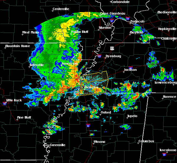 At 456 pm cdt, a severe thunderstorm was located near eads, or 11 miles northeast of collierville, moving east at 40 mph (radar indicated). Hazards include 70 mph wind gusts. Expect considerable tree damage. damage is likely to mobile homes, roofs and outbuildings. Locations impacted include, bartlett, collierville, germantown, cordova, lakeland, arlington, somerville, eads, warren, macon, oakland, piperton, gallaway, rossville, moscow, williston, braden, hays crossing, brunswick and kirk. At 456 pm cdt, a severe thunderstorm was located near eads, or 11 miles northeast of collierville, moving east at 40 mph (radar indicated). Hazards include 70 mph wind gusts. Expect considerable tree damage. damage is likely to mobile homes, roofs and outbuildings. Locations impacted include, bartlett, collierville, germantown, cordova, lakeland, arlington, somerville, eads, warren, macon, oakland, piperton, gallaway, rossville, moscow, williston, braden, hays crossing, brunswick and kirk.
|
| 8/5/2015 4:41 PM CDT |
 At 440 pm cdt, a severe thunderstorm was located over southwest memphis, or near t o fuller state park, moving east at 40 mph (radar indicated). Hazards include 70 mph wind gusts. Expect considerable tree damage. Damage is likely to mobile homes, roofs and outbuildings. At 440 pm cdt, a severe thunderstorm was located over southwest memphis, or near t o fuller state park, moving east at 40 mph (radar indicated). Hazards include 70 mph wind gusts. Expect considerable tree damage. Damage is likely to mobile homes, roofs and outbuildings.
|
| 7/14/2015 5:01 PM CDT |
 At 501 pm cdt, severe thunderstorms were located along a line extending from 7 miles northwest of pocahontas to near snow lake shores to near senatobia, moving southeast at 50 mph (radar indicated). Hazards include 60 mph wind gusts. Expect damage to roofs. Siding and trees. At 501 pm cdt, severe thunderstorms were located along a line extending from 7 miles northwest of pocahontas to near snow lake shores to near senatobia, moving southeast at 50 mph (radar indicated). Hazards include 60 mph wind gusts. Expect damage to roofs. Siding and trees.
|
| 7/14/2015 4:29 PM CDT |
 At 429 pm cdt, a severe thunderstorm was located 7 miles west of lagrange, or 18 miles east of collierville, moving southeast at 75 mph (trained weather spotters). Hazards include 60 mph wind gusts. Expect damage to roofs. Siding and trees. At 429 pm cdt, a severe thunderstorm was located 7 miles west of lagrange, or 18 miles east of collierville, moving southeast at 75 mph (trained weather spotters). Hazards include 60 mph wind gusts. Expect damage to roofs. Siding and trees.
|
| 7/14/2015 4:08 PM CDT |
 At 407 pm cdt, a severe thunderstorm was located near cordova, moving southeast at 50 mph (radar indicated). Hazards include 60 mph wind gusts. Expect damage to roofs. Siding and trees. At 407 pm cdt, a severe thunderstorm was located near cordova, moving southeast at 50 mph (radar indicated). Hazards include 60 mph wind gusts. Expect damage to roofs. Siding and trees.
|
| 6/29/2015 10:47 PM CDT |
 At 1047 pm cdt, a severe thunderstorm was located over downtown memphis, or near t o fuller state park, moving east at 30 mph (radar indicated). Hazards include 60 mph wind gusts and quarter size hail. Hail damage to vehicles is expected. Expect wind damage to roofs, siding and trees. At 1047 pm cdt, a severe thunderstorm was located over downtown memphis, or near t o fuller state park, moving east at 30 mph (radar indicated). Hazards include 60 mph wind gusts and quarter size hail. Hail damage to vehicles is expected. Expect wind damage to roofs, siding and trees.
|
| 6/29/2015 9:56 PM CDT |
 The severe thunderstorm warning for southwestern fayette and southeastern shelby counties will expire at 1000 pm cdt, the storm which prompted the warning has weakened below severe limits, and no longer poses an immediate threat to life or property. therefore the warning will be allowed to expire. however small hail is still possible with this thunderstorm. The severe thunderstorm warning for southwestern fayette and southeastern shelby counties will expire at 1000 pm cdt, the storm which prompted the warning has weakened below severe limits, and no longer poses an immediate threat to life or property. therefore the warning will be allowed to expire. however small hail is still possible with this thunderstorm.
|
| 6/29/2015 9:41 PM CDT |
 At 940 pm cdt, a severe thunderstorm was located over collierville, moving southeast at 15 mph (radar indicated). Hazards include quarter size hail. Damage to vehicles is expected. Locations impacted include, collierville, germantown, cordova, lakeland, piperton, rossville, elba, fisherville, hays crossing, kirk, lenow, canadaville and hickory withe. At 940 pm cdt, a severe thunderstorm was located over collierville, moving southeast at 15 mph (radar indicated). Hazards include quarter size hail. Damage to vehicles is expected. Locations impacted include, collierville, germantown, cordova, lakeland, piperton, rossville, elba, fisherville, hays crossing, kirk, lenow, canadaville and hickory withe.
|
| 6/29/2015 9:18 PM CDT |
 At 918 pm cdt, a severe thunderstorm was located near germantown, moving southeast at 15 mph (radar indicated). Hazards include quarter size hail. damage to vehicles is expected At 918 pm cdt, a severe thunderstorm was located near germantown, moving southeast at 15 mph (radar indicated). Hazards include quarter size hail. damage to vehicles is expected
|
| 6/8/2015 10:22 PM CDT | At 1022 pm cdt, a severe thunderstorm was located near mt pleasant, or near collierville, and is nearly stationary (radar indicated). Hazards include 60 mph wind gusts and half dollar size hail. Hail damage to vehicles is expected. expect wind damage to roofs, siding and trees. Locations impacted include, collierville, olive branch, holly springs, lamar, byhalia, snow lake shores, slayden, mt pleasant, red banks, michigan city, piperton, rossville, mahon, fairhaven, victoria, handy corner, cedarview, hudsonville, early grove and cayce. |
| 6/8/2015 10:22 PM CDT | At 1022 pm cdt, a severe thunderstorm was located near mt pleasant, or near collierville, and is nearly stationary (radar indicated). Hazards include 60 mph wind gusts and half dollar size hail. Hail damage to vehicles is expected. expect wind damage to roofs, siding and trees. Locations impacted include, collierville, olive branch, holly springs, lamar, byhalia, snow lake shores, slayden, mt pleasant, red banks, michigan city, piperton, rossville, mahon, fairhaven, victoria, handy corner, cedarview, hudsonville, early grove and cayce. |
| 6/8/2015 10:04 PM CDT | At 1004 pm cdt, a severe thunderstorm was located near collierville, moving east at 30 mph (radar indicated). Hazards include 60 mph wind gusts and half dollar size hail. Hail damage to vehicles is expected. Expect wind damage to roofs, siding and trees. |
| 6/8/2015 10:04 PM CDT | At 1004 pm cdt, a severe thunderstorm was located near collierville, moving east at 30 mph (radar indicated). Hazards include 60 mph wind gusts and half dollar size hail. Hail damage to vehicles is expected. Expect wind damage to roofs, siding and trees. |
| 4/1/2015 12:03 AM CDT | A severe thunderstorm warning remains in effect until 1245 am cdt for northern marshall and southern fayette counties. at 1203 am cdt. doppler radar indicated a severe thunderstorm producing quarter size hail and damaging winds in excess of 60 mph. this storm was located near byhalia. or 7 miles south of collierville. Moving southeast at 30 mph. |
| 4/1/2015 12:03 AM CDT | A severe thunderstorm warning remains in effect until 1245 am cdt for northern marshall and southern fayette counties. at 1203 am cdt. doppler radar indicated a severe thunderstorm producing quarter size hail and damaging winds in excess of 60 mph. this storm was located near byhalia. or 7 miles south of collierville. Moving southeast at 30 mph. |
| 3/31/2015 11:53 PM CDT | The national weather service in memphis has issued a * severe thunderstorm warning for. northeastern desoto county in northwestern mississippi. northern marshall county in northwestern mississippi. southern fayette county in southwestern tennessee. Southeastern shelby county in southwestern tennessee. |
| 3/31/2015 11:53 PM CDT | The national weather service in memphis has issued a * severe thunderstorm warning for. northeastern desoto county in northwestern mississippi. northern marshall county in northwestern mississippi. southern fayette county in southwestern tennessee. Southeastern shelby county in southwestern tennessee. |
| 3/31/2015 11:30 PM CDT | A severe thunderstorm warning remains in effect until midnight cdt for northern marshall and southwestern fayette counties. at 1130 pm cdt. doppler radar indicated a severe thunderstorm producing quarter size hail and damaging winds in excess of 60 mph. this storm was located near mt pleasant. or 8 miles southeast of collierville. Moving east at 25 mph. |
| 3/31/2015 11:30 PM CDT | A severe thunderstorm warning remains in effect until midnight cdt for northern marshall and southwestern fayette counties. at 1130 pm cdt. doppler radar indicated a severe thunderstorm producing quarter size hail and damaging winds in excess of 60 mph. this storm was located near mt pleasant. or 8 miles southeast of collierville. Moving east at 25 mph. |
| 3/31/2015 11:18 PM CDT | The national weather service in memphis has issued a * severe thunderstorm warning for. northern marshall county in northwestern mississippi. southwestern fayette county in southwestern tennessee. southeastern shelby county in southwestern tennessee. Until midnight cdt. |
| 3/31/2015 11:18 PM CDT | The national weather service in memphis has issued a * severe thunderstorm warning for. northern marshall county in northwestern mississippi. southwestern fayette county in southwestern tennessee. southeastern shelby county in southwestern tennessee. Until midnight cdt. |
| 6/3/2012 10:16 PM CDT | Tree limbs and power lines down across the county...slightly more concentrated over southwestern fayette count in fayette county TN, 1 miles WSW of Rossville, TN |
Hail Maps for Rossville, TN


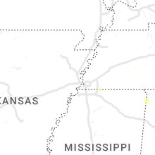


Connect with Interactive Hail Maps