

Hail Map for Rowesville, SC
The Rowesville, SC area has had 3 reports of on-the-ground hail by trained spotters, and has been under severe weather warnings 10 times during the past 12 months. Doppler radar has detected hail at or near Rowesville, SC on 56 occasions.
| Name: | Rowesville, SC |
| Where Located: | 49.2 miles WNW of Charleston, SC |
| Map: | Google Map for Rowesville, SC |
| Population: | 304 |
| Housing Units: | 135 |
| More Info: | Search Google for Rowesville, SC |
1
The Top Recent Hail Date for Rowesville, SC is Monday, March 31, 2025 (15th out of 56)

Hail and Wind Damage Spotted near Rowesville, SC
| Date / Time | Report Details |
|---|---|
| 7/12/2026 7:33 PM EDT |
 At 732 pm edt, a severe thunderstorm was located over brookdale, moving south at 15 mph (radar indicated). Hazards include 60 mph wind gusts. Expect damage to trees and powerlines. locations impacted include, orangeburg, brookdale, st. matthews, orangeburg county airport, claflin college, edisto gardens, south carolina state university, cameron, rowesville, cordova, yonder field, wilkinson heights, prince of orange mall, edisto, and creston. This includes interstate 26 between mile markers 139 and 162. At 732 pm edt, a severe thunderstorm was located over brookdale, moving south at 15 mph (radar indicated). Hazards include 60 mph wind gusts. Expect damage to trees and powerlines. locations impacted include, orangeburg, brookdale, st. matthews, orangeburg county airport, claflin college, edisto gardens, south carolina state university, cameron, rowesville, cordova, yonder field, wilkinson heights, prince of orange mall, edisto, and creston. This includes interstate 26 between mile markers 139 and 162.
|
| 7/12/2026 7:04 PM EDT |
 Svrcae the national weather service in columbia has issued a * severe thunderstorm warning for, southwestern calhoun county in central south carolina, central orangeburg county in central south carolina, * until 800 pm edt. * at 704 pm edt, a severe thunderstorm was located near brookdale, moving south at 15 mph (radar indicated). Hazards include 60 mph wind gusts. expect damage to trees and powerlines Svrcae the national weather service in columbia has issued a * severe thunderstorm warning for, southwestern calhoun county in central south carolina, central orangeburg county in central south carolina, * until 800 pm edt. * at 704 pm edt, a severe thunderstorm was located near brookdale, moving south at 15 mph (radar indicated). Hazards include 60 mph wind gusts. expect damage to trees and powerlines
|
| 7/11/2026 4:12 PM EDT |
 At 412 pm edt, a severe thunderstorm was located 7 miles south of santee state park, or 19 miles north of saint george, moving east at 25 mph (radar indicated). Hazards include 60 mph wind gusts. Expect damage to trees and powerlines. locations impacted include, holly hill, branchville, bowman, elloree, santee, cameron, eutawville, rowesville, vance, rocks pond campground and marina, yonder field, eautaw springs, indian bluff recreation park, blounts landing, and mill creek marina and campground. this includes the following highways, interstate 26 between mile markers 150 and 169. Interstate 95 between mile markers 85 and 100. At 412 pm edt, a severe thunderstorm was located 7 miles south of santee state park, or 19 miles north of saint george, moving east at 25 mph (radar indicated). Hazards include 60 mph wind gusts. Expect damage to trees and powerlines. locations impacted include, holly hill, branchville, bowman, elloree, santee, cameron, eutawville, rowesville, vance, rocks pond campground and marina, yonder field, eautaw springs, indian bluff recreation park, blounts landing, and mill creek marina and campground. this includes the following highways, interstate 26 between mile markers 150 and 169. Interstate 95 between mile markers 85 and 100.
|
| 7/11/2026 3:31 PM EDT |
 Svrcae the national weather service in columbia has issued a * severe thunderstorm warning for, southern calhoun county in central south carolina, southwestern clarendon county in central south carolina, central bamberg county in central south carolina, orangeburg county in central south carolina, * until 430 pm edt. * at 331 pm edt, a severe thunderstorm was located near brookdale, moving east at 25 mph (radar indicated). Hazards include 60 mph wind gusts. expect damage to trees and powerlines Svrcae the national weather service in columbia has issued a * severe thunderstorm warning for, southern calhoun county in central south carolina, southwestern clarendon county in central south carolina, central bamberg county in central south carolina, orangeburg county in central south carolina, * until 430 pm edt. * at 331 pm edt, a severe thunderstorm was located near brookdale, moving east at 25 mph (radar indicated). Hazards include 60 mph wind gusts. expect damage to trees and powerlines
|
| 7/5/2026 4:54 PM EDT |
 The storms which prompted the warning have weakened below severe limits, and no longer pose an immediate threat to life or property. therefore, the warning will be allowed to expire. however, gusty winds and heavy rain are still possible with these thunderstorms. to report severe weather, contact your nearest law enforcement agency. they will relay your report to the national weather service columbia. The storms which prompted the warning have weakened below severe limits, and no longer pose an immediate threat to life or property. therefore, the warning will be allowed to expire. however, gusty winds and heavy rain are still possible with these thunderstorms. to report severe weather, contact your nearest law enforcement agency. they will relay your report to the national weather service columbia.
|
| 7/5/2026 4:44 PM EDT |
 At 443 pm edt, severe thunderstorms were located along a line extending from near congaree national park to near orangeburg county airport, moving east at 15 mph (radar indicated). Hazards include 70 mph wind gusts and quarter size hail. Hail damage to vehicles is expected. expect considerable tree damage. wind damage is also likely to mobile homes, roofs, and outbuildings. locations impacted include, orangeburg, brookdale, st. matthews, branchville, orangeburg county airport, claflin college, edisto gardens, south carolina state university, rowesville, cordova, cope, wilkinson heights, prince of orange mall, and edisto. This includes interstate 26 between mile markers 136 and 150. At 443 pm edt, severe thunderstorms were located along a line extending from near congaree national park to near orangeburg county airport, moving east at 15 mph (radar indicated). Hazards include 70 mph wind gusts and quarter size hail. Hail damage to vehicles is expected. expect considerable tree damage. wind damage is also likely to mobile homes, roofs, and outbuildings. locations impacted include, orangeburg, brookdale, st. matthews, branchville, orangeburg county airport, claflin college, edisto gardens, south carolina state university, rowesville, cordova, cope, wilkinson heights, prince of orange mall, and edisto. This includes interstate 26 between mile markers 136 and 150.
|
| 7/5/2026 4:25 PM EDT |
 At 424 pm edt, severe thunderstorms were located along a line extending from near sandy run to 7 miles southwest of orangeburg county airport, moving east at 15 mph (radar indicated). Hazards include 70 mph wind gusts and quarter size hail. Hail damage to vehicles is expected. expect considerable tree damage. wind damage is also likely to mobile homes, roofs, and outbuildings. locations impacted include, orangeburg, brookdale, st. matthews, branchville, orangeburg county airport, claflin college, edisto gardens, south carolina state university, rowesville, cordova, cope, wilkinson heights, prince of orange mall, and edisto. This includes interstate 26 between mile markers 131 and 150. At 424 pm edt, severe thunderstorms were located along a line extending from near sandy run to 7 miles southwest of orangeburg county airport, moving east at 15 mph (radar indicated). Hazards include 70 mph wind gusts and quarter size hail. Hail damage to vehicles is expected. expect considerable tree damage. wind damage is also likely to mobile homes, roofs, and outbuildings. locations impacted include, orangeburg, brookdale, st. matthews, branchville, orangeburg county airport, claflin college, edisto gardens, south carolina state university, rowesville, cordova, cope, wilkinson heights, prince of orange mall, and edisto. This includes interstate 26 between mile markers 131 and 150.
|
| 7/5/2026 4:15 PM EDT |
 Svrcae the national weather service in columbia has issued a * severe thunderstorm warning for, northwestern calhoun county in central south carolina, east central bamberg county in central south carolina, central orangeburg county in central south carolina, southeastern richland county in central south carolina, * until 500 pm edt. * at 414 pm edt, severe thunderstorms were located along a line extending from near sandy run to 6 miles northeast of bamberg, moving east at 15 mph (radar indicated). Hazards include 60 mph wind gusts. expect damage to trees and powerlines Svrcae the national weather service in columbia has issued a * severe thunderstorm warning for, northwestern calhoun county in central south carolina, east central bamberg county in central south carolina, central orangeburg county in central south carolina, southeastern richland county in central south carolina, * until 500 pm edt. * at 414 pm edt, severe thunderstorms were located along a line extending from near sandy run to 6 miles northeast of bamberg, moving east at 15 mph (radar indicated). Hazards include 60 mph wind gusts. expect damage to trees and powerlines
|
| 3/12/2026 10:33 AM EDT |
 At 1033 am edt, severe thunderstorms were located along a line extending from 7 miles east of brookdale to near branchville to near cummings, moving east at 50 mph (radar indicated). Hazards include 60 mph wind gusts. Expect damage to trees and powerlines. locations impacted include, orangeburg, bamberg, brookdale, holly hill, branchville, bowman, elloree, santee state park, claflin college, south carolina state university, orangeburg county airport, edisto gardens, santee, cameron, rowesville, vance, cordova, poplar creek landing, stumphole landing, and prince of orange mall. this includes the following highways, interstate 26 between mile markers 147 and 169. Interstate 95 between mile markers 85 and 104. At 1033 am edt, severe thunderstorms were located along a line extending from 7 miles east of brookdale to near branchville to near cummings, moving east at 50 mph (radar indicated). Hazards include 60 mph wind gusts. Expect damage to trees and powerlines. locations impacted include, orangeburg, bamberg, brookdale, holly hill, branchville, bowman, elloree, santee state park, claflin college, south carolina state university, orangeburg county airport, edisto gardens, santee, cameron, rowesville, vance, cordova, poplar creek landing, stumphole landing, and prince of orange mall. this includes the following highways, interstate 26 between mile markers 147 and 169. Interstate 95 between mile markers 85 and 104.
|
| 3/12/2026 10:07 AM EDT |
 Svrcae the national weather service in columbia has issued a * severe thunderstorm warning for, southeastern calhoun county in central south carolina, southwestern clarendon county in central south carolina, bamberg county in central south carolina, orangeburg county in central south carolina, * until 1045 am edt. * at 1007 am edt, severe thunderstorms were located along a line extending from 11 miles west of edisto gardens to 6 miles northeast of ulmer to near estill, moving east at 50 mph (radar indicated). Hazards include 60 mph wind gusts. expect damage to trees and powerlines Svrcae the national weather service in columbia has issued a * severe thunderstorm warning for, southeastern calhoun county in central south carolina, southwestern clarendon county in central south carolina, bamberg county in central south carolina, orangeburg county in central south carolina, * until 1045 am edt. * at 1007 am edt, severe thunderstorms were located along a line extending from 11 miles west of edisto gardens to 6 miles northeast of ulmer to near estill, moving east at 50 mph (radar indicated). Hazards include 60 mph wind gusts. expect damage to trees and powerlines
|
| 7/11/2025 8:42 PM EDT |
 The storm which prompted the warning has weakened below severe limits, and no longer poses an immediate threat to life or property. therefore, the warning will be allowed to expire. however, gusty winds are still possible with this thunderstorm. The storm which prompted the warning has weakened below severe limits, and no longer poses an immediate threat to life or property. therefore, the warning will be allowed to expire. however, gusty winds are still possible with this thunderstorm.
|
| 7/11/2025 8:27 PM EDT |
 At 827 pm edt, a severe thunderstorm was located near branchville, or 10 miles south of orangeburg, moving east at 25 mph (radar indicated). Hazards include 60 mph wind gusts and quarter size hail. Hail damage to vehicles is expected. expect wind damage to trees and powerlines. locations impacted include, orangeburg, bamberg, brookdale, branchville, bowman, elloree, orangeburg county airport, claflin college, edisto gardens, south carolina state university, cameron, rowesville, cordova, cope, yonder field, wilkinson heights, prince of orange mall, edisto, and creston. this includes the following highways, interstate 26 between mile markers 146 and 169. Interstate 95 between mile markers 86 and 90. At 827 pm edt, a severe thunderstorm was located near branchville, or 10 miles south of orangeburg, moving east at 25 mph (radar indicated). Hazards include 60 mph wind gusts and quarter size hail. Hail damage to vehicles is expected. expect wind damage to trees and powerlines. locations impacted include, orangeburg, bamberg, brookdale, branchville, bowman, elloree, orangeburg county airport, claflin college, edisto gardens, south carolina state university, cameron, rowesville, cordova, cope, yonder field, wilkinson heights, prince of orange mall, edisto, and creston. this includes the following highways, interstate 26 between mile markers 146 and 169. Interstate 95 between mile markers 86 and 90.
|
| 7/11/2025 8:04 PM EDT |
 Svrcae the national weather service in columbia has issued a * severe thunderstorm warning for, southeastern calhoun county in central south carolina, central bamberg county in central south carolina, central orangeburg county in central south carolina, * until 845 pm edt. * at 803 pm edt, a severe thunderstorm was located near bamberg, moving east at 25 mph (radar indicated). Hazards include 60 mph wind gusts and quarter size hail. Hail damage to vehicles is expected. Expect wind damage to trees and powerlines. Svrcae the national weather service in columbia has issued a * severe thunderstorm warning for, southeastern calhoun county in central south carolina, central bamberg county in central south carolina, central orangeburg county in central south carolina, * until 845 pm edt. * at 803 pm edt, a severe thunderstorm was located near bamberg, moving east at 25 mph (radar indicated). Hazards include 60 mph wind gusts and quarter size hail. Hail damage to vehicles is expected. Expect wind damage to trees and powerlines.
|
| 7/10/2025 5:36 PM EDT |
 Svrcae the national weather service in columbia has issued a * severe thunderstorm warning for, southeastern calhoun county in central south carolina, southwestern clarendon county in central south carolina, southwestern sumter county in central south carolina, central orangeburg county in central south carolina, * until 615 pm edt. * at 536 pm edt, a severe thunderstorm was located over south carolina state university, or over brookdale, moving east at 30 mph (radar indicated). Hazards include 60 mph wind gusts and quarter size hail. Hail damage to vehicles is expected. Expect wind damage to trees and powerlines. Svrcae the national weather service in columbia has issued a * severe thunderstorm warning for, southeastern calhoun county in central south carolina, southwestern clarendon county in central south carolina, southwestern sumter county in central south carolina, central orangeburg county in central south carolina, * until 615 pm edt. * at 536 pm edt, a severe thunderstorm was located over south carolina state university, or over brookdale, moving east at 30 mph (radar indicated). Hazards include 60 mph wind gusts and quarter size hail. Hail damage to vehicles is expected. Expect wind damage to trees and powerlines.
|
| 6/25/2025 9:20 PM EDT |
 Svrcae the national weather service in columbia has issued a * severe thunderstorm warning for, barnwell county in central south carolina, bamberg county in central south carolina, aiken county in central south carolina, orangeburg county in central south carolina, * until 1015 pm edt. * at 919 pm edt, severe thunderstorms were located along a line extending from near orangeburg to 11 miles northeast of blackville to near aiken mall, moving south at 30 mph (radar indicated). Hazards include 60 mph wind gusts and penny size hail. expect damage to trees and powerlines Svrcae the national weather service in columbia has issued a * severe thunderstorm warning for, barnwell county in central south carolina, bamberg county in central south carolina, aiken county in central south carolina, orangeburg county in central south carolina, * until 1015 pm edt. * at 919 pm edt, severe thunderstorms were located along a line extending from near orangeburg to 11 miles northeast of blackville to near aiken mall, moving south at 30 mph (radar indicated). Hazards include 60 mph wind gusts and penny size hail. expect damage to trees and powerlines
|
| 6/7/2025 9:54 PM EDT |
 Svrcae the national weather service in columbia has issued a * severe thunderstorm warning for, southern calhoun county in central south carolina, southwestern clarendon county in central south carolina, orangeburg county in central south carolina, * until 1045 pm edt. * at 954 pm edt, severe thunderstorms were located along a line extending from near st. matthews to near branchville, moving east at 70 mph (radar indicated). Hazards include 60 mph wind gusts. expect damage to trees and powerlines Svrcae the national weather service in columbia has issued a * severe thunderstorm warning for, southern calhoun county in central south carolina, southwestern clarendon county in central south carolina, orangeburg county in central south carolina, * until 1045 pm edt. * at 954 pm edt, severe thunderstorms were located along a line extending from near st. matthews to near branchville, moving east at 70 mph (radar indicated). Hazards include 60 mph wind gusts. expect damage to trees and powerlines
|
| 6/7/2025 9:48 PM EDT | Orangeburg county em reported trees down in the town of rowesville. time estimated based on rada in orangeburg county SC, 0.3 miles NE of Rowesville, SC |
| 6/7/2025 9:38 PM EDT |
 At 938 pm edt, severe thunderstorms were located along a line extending from 11 miles south of gaston to 7 miles east of barnwell, moving east at 50 mph (radar indicated). Hazards include 60 mph wind gusts. Expect damage to trees and powerlines. locations impacted include, orangeburg, barnwell, bamberg, denmark, brookdale, blackville, st. matthews, branchville, claflin college, south carolina state university, orangeburg county airport, barnwell state park, edisto gardens, swansea, north, springfield, hilda, cameron, salley, and neeses. This includes interstate 26 between mile markers 132 and 158. At 938 pm edt, severe thunderstorms were located along a line extending from 11 miles south of gaston to 7 miles east of barnwell, moving east at 50 mph (radar indicated). Hazards include 60 mph wind gusts. Expect damage to trees and powerlines. locations impacted include, orangeburg, barnwell, bamberg, denmark, brookdale, blackville, st. matthews, branchville, claflin college, south carolina state university, orangeburg county airport, barnwell state park, edisto gardens, swansea, north, springfield, hilda, cameron, salley, and neeses. This includes interstate 26 between mile markers 132 and 158.
|
| 6/7/2025 9:09 PM EDT |
 Svrcae the national weather service in columbia has issued a * severe thunderstorm warning for, central calhoun county in central south carolina, barnwell county in central south carolina, bamberg county in central south carolina, southeastern lexington county in central south carolina, eastern aiken county in central south carolina, orangeburg county in central south carolina, * until 1000 pm edt. * at 908 pm edt, severe thunderstorms were located along a line extending from 8 miles north of aiken state park to near savannah river site, moving east at 50 mph (radar indicated). Hazards include 60 mph wind gusts. these storms have a history of producing widespread damaging winds. expect damage to trees and powerlines Svrcae the national weather service in columbia has issued a * severe thunderstorm warning for, central calhoun county in central south carolina, barnwell county in central south carolina, bamberg county in central south carolina, southeastern lexington county in central south carolina, eastern aiken county in central south carolina, orangeburg county in central south carolina, * until 1000 pm edt. * at 908 pm edt, severe thunderstorms were located along a line extending from 8 miles north of aiken state park to near savannah river site, moving east at 50 mph (radar indicated). Hazards include 60 mph wind gusts. these storms have a history of producing widespread damaging winds. expect damage to trees and powerlines
|
| 5/30/2025 5:30 PM EDT |
 The storms which prompted the warning have weakened below severe limits, and no longer pose an immediate threat to life or property. therefore, the warning has been allowed to expire. however, small hail and gusty winds are still possible with these thunderstorms. a severe thunderstorm watch remains in effect until 800 pm edt for central south carolina. The storms which prompted the warning have weakened below severe limits, and no longer pose an immediate threat to life or property. therefore, the warning has been allowed to expire. however, small hail and gusty winds are still possible with these thunderstorms. a severe thunderstorm watch remains in effect until 800 pm edt for central south carolina.
|
| 5/30/2025 5:09 PM EDT |
 At 508 pm edt, severe thunderstorms were located along a line extending from near elloree to near denmark, moving east at 45 mph (radar indicated). Hazards include 60 mph wind gusts and quarter size hail. Hail damage to vehicles is expected. expect wind damage to trees and powerlines. locations impacted include, orangeburg, barnwell, bamberg, denmark, brookdale, williston, blackville, branchville, bowman, claflin college, south carolina state university, orangeburg county airport, barnwell state park, edisto gardens, hilda, norway, rowesville, olar, elko, and cordova. this includes the following highways, interstate 26 between mile markers 153 and 168. interstate 95 between mile markers 87 and 92. Winds at the orangeburg airport recently gusted to 47 mph. At 508 pm edt, severe thunderstorms were located along a line extending from near elloree to near denmark, moving east at 45 mph (radar indicated). Hazards include 60 mph wind gusts and quarter size hail. Hail damage to vehicles is expected. expect wind damage to trees and powerlines. locations impacted include, orangeburg, barnwell, bamberg, denmark, brookdale, williston, blackville, branchville, bowman, claflin college, south carolina state university, orangeburg county airport, barnwell state park, edisto gardens, hilda, norway, rowesville, olar, elko, and cordova. this includes the following highways, interstate 26 between mile markers 153 and 168. interstate 95 between mile markers 87 and 92. Winds at the orangeburg airport recently gusted to 47 mph.
|
| 5/30/2025 4:46 PM EDT |
 Svrcae the national weather service in columbia has issued a * severe thunderstorm warning for, northeastern barnwell county in central south carolina, northern bamberg county in central south carolina, central orangeburg county in central south carolina, * until 530 pm edt. * at 446 pm edt, severe thunderstorms were located along a line extending from claflin college to near williston, moving east at 45 mph (radar indicated). Hazards include 60 mph wind gusts and quarter size hail. Hail damage to vehicles is expected. Expect wind damage to trees and powerlines. Svrcae the national weather service in columbia has issued a * severe thunderstorm warning for, northeastern barnwell county in central south carolina, northern bamberg county in central south carolina, central orangeburg county in central south carolina, * until 530 pm edt. * at 446 pm edt, severe thunderstorms were located along a line extending from claflin college to near williston, moving east at 45 mph (radar indicated). Hazards include 60 mph wind gusts and quarter size hail. Hail damage to vehicles is expected. Expect wind damage to trees and powerlines.
|
| 5/29/2025 3:28 PM EDT |
 Svrcae the national weather service in columbia has issued a * severe thunderstorm warning for, southeastern calhoun county in central south carolina, central orangeburg county in central south carolina, * until 430 pm edt. * at 327 pm edt, a severe thunderstorm was located near orangeburg county airport, or near orangeburg, moving northeast at 5 mph (radar indicated). Hazards include 60 mph wind gusts and quarter size hail. Hail damage to vehicles is expected. Expect wind damage to trees and powerlines. Svrcae the national weather service in columbia has issued a * severe thunderstorm warning for, southeastern calhoun county in central south carolina, central orangeburg county in central south carolina, * until 430 pm edt. * at 327 pm edt, a severe thunderstorm was located near orangeburg county airport, or near orangeburg, moving northeast at 5 mph (radar indicated). Hazards include 60 mph wind gusts and quarter size hail. Hail damage to vehicles is expected. Expect wind damage to trees and powerlines.
|
| 3/31/2025 5:26 PM EDT |
 Svrcae the national weather service in columbia has issued a * severe thunderstorm warning for, southeastern calhoun county in central south carolina, southwestern clarendon county in central south carolina, east central bamberg county in central south carolina, southeastern orangeburg county in central south carolina, * until 630 pm edt. * at 525 pm edt, severe thunderstorms were located near branchville, or 13 miles northwest of saint george, moving east at 35 mph (radar indicated). Hazards include 60 mph wind gusts and quarter size hail. Hail damage to vehicles is expected. Expect wind damage to trees and powerlines. Svrcae the national weather service in columbia has issued a * severe thunderstorm warning for, southeastern calhoun county in central south carolina, southwestern clarendon county in central south carolina, east central bamberg county in central south carolina, southeastern orangeburg county in central south carolina, * until 630 pm edt. * at 525 pm edt, severe thunderstorms were located near branchville, or 13 miles northwest of saint george, moving east at 35 mph (radar indicated). Hazards include 60 mph wind gusts and quarter size hail. Hail damage to vehicles is expected. Expect wind damage to trees and powerlines.
|
| 3/31/2025 5:06 PM EDT |
 the severe thunderstorm warning has been cancelled and is no longer in effect the severe thunderstorm warning has been cancelled and is no longer in effect
|
| 3/31/2025 5:06 PM EDT |
 At 505 pm edt, severe thunderstorms were located along a line extending from 7 miles southwest of poinsett state park to rivers bridge state park, moving east at 15 mph (radar indicated). Hazards include 60 mph wind gusts and penny size hail. Expect damage to trees and powerlines. locations impacted include, bowman, govan, fort motte, stumphole landing, cameron, hilda, ehrhardt, prince of orange mall, santee state park, edisto, holly hill, lone star, cope, orangeburg county airport, bamberg, yonder field, eutawville, st. matthews, elloree, and creston. this includes the following highways, interstate 26 between mile markers 131 and 169. Interstate 95 between mile markers 85 and 113. At 505 pm edt, severe thunderstorms were located along a line extending from 7 miles southwest of poinsett state park to rivers bridge state park, moving east at 15 mph (radar indicated). Hazards include 60 mph wind gusts and penny size hail. Expect damage to trees and powerlines. locations impacted include, bowman, govan, fort motte, stumphole landing, cameron, hilda, ehrhardt, prince of orange mall, santee state park, edisto, holly hill, lone star, cope, orangeburg county airport, bamberg, yonder field, eutawville, st. matthews, elloree, and creston. this includes the following highways, interstate 26 between mile markers 131 and 169. Interstate 95 between mile markers 85 and 113.
|
| 3/31/2025 4:26 PM EDT |
 Svrcae the national weather service in columbia has issued a * severe thunderstorm warning for, calhoun county in central south carolina, southwestern clarendon county in central south carolina, eastern barnwell county in central south carolina, bamberg county in central south carolina, southeastern lexington county in central south carolina, orangeburg county in central south carolina, * until 530 pm edt. * at 426 pm edt, severe thunderstorms were located along a line extending from near sandy run to near sycamore, moving east at 40 mph (radar indicated). Hazards include 60 mph wind gusts and penny size hail. expect damage to trees and powerlines Svrcae the national weather service in columbia has issued a * severe thunderstorm warning for, calhoun county in central south carolina, southwestern clarendon county in central south carolina, eastern barnwell county in central south carolina, bamberg county in central south carolina, southeastern lexington county in central south carolina, orangeburg county in central south carolina, * until 530 pm edt. * at 426 pm edt, severe thunderstorms were located along a line extending from near sandy run to near sycamore, moving east at 40 mph (radar indicated). Hazards include 60 mph wind gusts and penny size hail. expect damage to trees and powerlines
|
| 3/16/2025 8:50 AM EDT |
 The storm which prompted the warning has weakened below severe limits, and has exited the warned area. therefore, the warning will be allowed to expire. however, heavy rain is still possible with this thunderstorm. a tornado watch remains in effect until 200 pm edt for central south carolina. The storm which prompted the warning has weakened below severe limits, and has exited the warned area. therefore, the warning will be allowed to expire. however, heavy rain is still possible with this thunderstorm. a tornado watch remains in effect until 200 pm edt for central south carolina.
|
| 3/16/2025 7:58 AM EDT |
 Svrcae the national weather service in columbia has issued a * severe thunderstorm warning for, calhoun county in central south carolina, bamberg county in central south carolina, orangeburg county in central south carolina, southeastern richland county in central south carolina, * until 900 am edt. * at 758 am edt, a severe thunderstorm was located 8 miles north of bamberg, moving northeast at 55 mph (radar indicated). Hazards include 60 mph wind gusts. expect damage to trees and powerlines Svrcae the national weather service in columbia has issued a * severe thunderstorm warning for, calhoun county in central south carolina, bamberg county in central south carolina, orangeburg county in central south carolina, southeastern richland county in central south carolina, * until 900 am edt. * at 758 am edt, a severe thunderstorm was located 8 miles north of bamberg, moving northeast at 55 mph (radar indicated). Hazards include 60 mph wind gusts. expect damage to trees and powerlines
|
| 2/16/2025 8:29 AM EST |
 Svrcae the national weather service in columbia has issued a * severe thunderstorm warning for, lee county in central south carolina, calhoun county in central south carolina, clarendon county in central south carolina, southeastern barnwell county in central south carolina, bamberg county in central south carolina, sumter county in central south carolina, orangeburg county in central south carolina, southeastern richland county in central south carolina, * until 945 am est. * at 827 am est, severe thunderstorms were located along a line extending from near bishopville to near ulmer, moving east at 45 mph (numerous reports of downed trees from trained weather spotters). Hazards include 60 mph wind gusts. expect damage to trees and powerlines Svrcae the national weather service in columbia has issued a * severe thunderstorm warning for, lee county in central south carolina, calhoun county in central south carolina, clarendon county in central south carolina, southeastern barnwell county in central south carolina, bamberg county in central south carolina, sumter county in central south carolina, orangeburg county in central south carolina, southeastern richland county in central south carolina, * until 945 am est. * at 827 am est, severe thunderstorms were located along a line extending from near bishopville to near ulmer, moving east at 45 mph (numerous reports of downed trees from trained weather spotters). Hazards include 60 mph wind gusts. expect damage to trees and powerlines
|
| 2/16/2025 8:12 AM EST |
 At 812 am est, severe thunderstorms were located along a line extending from 8 miles south of sandy run to near sylvania, moving east at 50 mph (radar indicated). Hazards include 60 mph wind gusts. Expect damage to trees and powerlines. locations impacted include, orangeburg, barnwell, bamberg, denmark, brookdale, blackville, st. matthews, claflin college, south carolina state university, orangeburg county airport, barnwell state park, edisto gardens, north, hilda, cameron, neeses, norway, rowesville, snelling, and olar. This includes interstate 26 between mile markers 138 and 153. At 812 am est, severe thunderstorms were located along a line extending from 8 miles south of sandy run to near sylvania, moving east at 50 mph (radar indicated). Hazards include 60 mph wind gusts. Expect damage to trees and powerlines. locations impacted include, orangeburg, barnwell, bamberg, denmark, brookdale, blackville, st. matthews, claflin college, south carolina state university, orangeburg county airport, barnwell state park, edisto gardens, north, hilda, cameron, neeses, norway, rowesville, snelling, and olar. This includes interstate 26 between mile markers 138 and 153.
|
| 2/16/2025 8:12 AM EST |
 the severe thunderstorm warning has been cancelled and is no longer in effect the severe thunderstorm warning has been cancelled and is no longer in effect
|
| 2/16/2025 7:30 AM EST |
 Svrcae the national weather service in columbia has issued a * severe thunderstorm warning for, burke county in east central georgia, southeastern richmond county in east central georgia, southern calhoun county in central south carolina, barnwell county in central south carolina, bamberg county in central south carolina, aiken county in central south carolina, western orangeburg county in central south carolina, * until 830 am est. * at 730 am est, severe thunderstorms were located along a line extending from 6 miles northeast of aiken municipal airport to near summertown, moving east at 45 mph (radar indicated). Hazards include 60 mph wind gusts. expect damage to trees and powerlines Svrcae the national weather service in columbia has issued a * severe thunderstorm warning for, burke county in east central georgia, southeastern richmond county in east central georgia, southern calhoun county in central south carolina, barnwell county in central south carolina, bamberg county in central south carolina, aiken county in central south carolina, western orangeburg county in central south carolina, * until 830 am est. * at 730 am est, severe thunderstorms were located along a line extending from 6 miles northeast of aiken municipal airport to near summertown, moving east at 45 mph (radar indicated). Hazards include 60 mph wind gusts. expect damage to trees and powerlines
|
| 9/27/2024 1:43 AM EDT |
 The storm which prompted the warning has moved out of the area. therefore, the warning will be allowed to expire. a tornado watch remains in effect until 800 am edt for central south carolina. to report severe weather, contact your nearest law enforcement agency. they will relay your report to the national weather service columbia. The storm which prompted the warning has moved out of the area. therefore, the warning will be allowed to expire. a tornado watch remains in effect until 800 am edt for central south carolina. to report severe weather, contact your nearest law enforcement agency. they will relay your report to the national weather service columbia.
|
| 9/27/2024 1:31 AM EDT |
 At 131 am edt, a severe thunderstorm capable of producing a tornado was located near orangeburg county airport, or near orangeburg, moving northwest at 60 mph (radar indicated rotation). Hazards include tornado. Flying debris will be dangerous to those caught without shelter. mobile homes will be damaged or destroyed. damage to roofs, windows, and vehicles will occur. tree damage is likely. this dangerous storm will be near, orangeburg and orangeburg county airport around 135 am edt. Other locations impacted by this tornadic thunderstorm include wilkinson heights, rowesville, cordova, and edisto. At 131 am edt, a severe thunderstorm capable of producing a tornado was located near orangeburg county airport, or near orangeburg, moving northwest at 60 mph (radar indicated rotation). Hazards include tornado. Flying debris will be dangerous to those caught without shelter. mobile homes will be damaged or destroyed. damage to roofs, windows, and vehicles will occur. tree damage is likely. this dangerous storm will be near, orangeburg and orangeburg county airport around 135 am edt. Other locations impacted by this tornadic thunderstorm include wilkinson heights, rowesville, cordova, and edisto.
|
| 9/27/2024 1:15 AM EDT |
 Torcae the national weather service in columbia has issued a * tornado warning for, south central orangeburg county in central south carolina, * until 145 am edt. * at 115 am edt, a severe thunderstorm capable of producing a tornado was located near branchville, or 9 miles northwest of saint george, moving northwest at 35 mph (radar indicated rotation). Hazards include tornado. Flying debris will be dangerous to those caught without shelter. mobile homes will be damaged or destroyed. damage to roofs, windows, and vehicles will occur. tree damage is likely. this dangerous storm will be near, orangeburg, edisto gardens, and orangeburg county airport around 130 am edt. Other locations impacted by this tornadic thunderstorm include wilkinson heights, rowesville, cordova, and edisto. Torcae the national weather service in columbia has issued a * tornado warning for, south central orangeburg county in central south carolina, * until 145 am edt. * at 115 am edt, a severe thunderstorm capable of producing a tornado was located near branchville, or 9 miles northwest of saint george, moving northwest at 35 mph (radar indicated rotation). Hazards include tornado. Flying debris will be dangerous to those caught without shelter. mobile homes will be damaged or destroyed. damage to roofs, windows, and vehicles will occur. tree damage is likely. this dangerous storm will be near, orangeburg, edisto gardens, and orangeburg county airport around 130 am edt. Other locations impacted by this tornadic thunderstorm include wilkinson heights, rowesville, cordova, and edisto.
|
| 8/18/2024 10:47 PM EDT |
 At 1047 pm edt, a severe thunderstorm was located near branchville, or 10 miles southeast of bamberg, moving east at 25 mph (radar indicated). Hazards include 60 mph wind gusts. Expect damage to trees and powerlines. Locations impacted include, bamberg, branchville, ehrhardt, and rowesville. At 1047 pm edt, a severe thunderstorm was located near branchville, or 10 miles southeast of bamberg, moving east at 25 mph (radar indicated). Hazards include 60 mph wind gusts. Expect damage to trees and powerlines. Locations impacted include, bamberg, branchville, ehrhardt, and rowesville.
|
| 8/18/2024 10:10 PM EDT |
 Svrcae the national weather service in columbia has issued a * severe thunderstorm warning for, bamberg county in central south carolina, south central orangeburg county in central south carolina, * until 1100 pm edt. * at 1009 pm edt, a severe thunderstorm was located near ulmer, or 10 miles south of denmark, moving east at 25 mph (radar indicated). Hazards include 60 mph wind gusts and quarter size hail. Hail damage to vehicles is expected. Expect wind damage to trees and powerlines. Svrcae the national weather service in columbia has issued a * severe thunderstorm warning for, bamberg county in central south carolina, south central orangeburg county in central south carolina, * until 1100 pm edt. * at 1009 pm edt, a severe thunderstorm was located near ulmer, or 10 miles south of denmark, moving east at 25 mph (radar indicated). Hazards include 60 mph wind gusts and quarter size hail. Hail damage to vehicles is expected. Expect wind damage to trees and powerlines.
|
| 8/13/2024 3:26 PM EDT |
 The storm which prompted the warning has weakened below severe limits, and has exited the warned area. therefore, the warning will be allowed to expire. however, heavy rain is still possible with this thunderstorm. The storm which prompted the warning has weakened below severe limits, and has exited the warned area. therefore, the warning will be allowed to expire. however, heavy rain is still possible with this thunderstorm.
|
| 8/13/2024 2:49 PM EDT |
 Svrcae the national weather service in columbia has issued a * severe thunderstorm warning for, central bamberg county in central south carolina, south central orangeburg county in central south carolina, * until 330 pm edt. * at 249 pm edt, a severe thunderstorm was located near bamberg, moving southeast at 25 mph (radar indicated). Hazards include 60 mph wind gusts and penny size hail. expect damage to trees and powerlines Svrcae the national weather service in columbia has issued a * severe thunderstorm warning for, central bamberg county in central south carolina, south central orangeburg county in central south carolina, * until 330 pm edt. * at 249 pm edt, a severe thunderstorm was located near bamberg, moving southeast at 25 mph (radar indicated). Hazards include 60 mph wind gusts and penny size hail. expect damage to trees and powerlines
|
| 8/13/2024 2:25 PM EDT |
 The storm which prompted the warning has weakened below severe limits, and no longer poses an immediate threat to life or property. therefore, the warning will be allowed to expire. however, gusty winds are still possible with this thunderstorm. to report severe weather, contact your nearest law enforcement agency. they will relay your report to the national weather service columbia. The storm which prompted the warning has weakened below severe limits, and no longer poses an immediate threat to life or property. therefore, the warning will be allowed to expire. however, gusty winds are still possible with this thunderstorm. to report severe weather, contact your nearest law enforcement agency. they will relay your report to the national weather service columbia.
|
| 8/13/2024 2:00 PM EDT |
 At 159 pm edt, a severe thunderstorm was located near st. matthews, or 7 miles north of brookdale, moving southeast at 20 mph (radar indicated). Hazards include 60 mph wind gusts. Expect damage to trees and powerlines. locations impacted include, orangeburg, brookdale, st. matthews, orangeburg county airport, claflin college, edisto gardens, south carolina state university, sandy run, cameron, neeses, rowesville, cordova, livingston, fort motte, wilkinson heights, prince of orange mall, edisto, creston, and lone star. This includes interstate 26 between mile markers 131 and 155. At 159 pm edt, a severe thunderstorm was located near st. matthews, or 7 miles north of brookdale, moving southeast at 20 mph (radar indicated). Hazards include 60 mph wind gusts. Expect damage to trees and powerlines. locations impacted include, orangeburg, brookdale, st. matthews, orangeburg county airport, claflin college, edisto gardens, south carolina state university, sandy run, cameron, neeses, rowesville, cordova, livingston, fort motte, wilkinson heights, prince of orange mall, edisto, creston, and lone star. This includes interstate 26 between mile markers 131 and 155.
|
| 8/13/2024 2:00 PM EDT |
 the severe thunderstorm warning has been cancelled and is no longer in effect the severe thunderstorm warning has been cancelled and is no longer in effect
|
| 8/13/2024 1:41 PM EDT |
 Svrcae the national weather service in columbia has issued a * severe thunderstorm warning for, calhoun county in central south carolina, southeastern lexington county in central south carolina, southwestern sumter county in central south carolina, central orangeburg county in central south carolina, south central richland county in central south carolina, * until 230 pm edt. * at 141 pm edt, a severe thunderstorm was located near sandy run, or 15 miles north of brookdale, moving southeast at 20 mph (radar indicated). Hazards include 60 mph wind gusts. expect damage to trees and powerlines Svrcae the national weather service in columbia has issued a * severe thunderstorm warning for, calhoun county in central south carolina, southeastern lexington county in central south carolina, southwestern sumter county in central south carolina, central orangeburg county in central south carolina, south central richland county in central south carolina, * until 230 pm edt. * at 141 pm edt, a severe thunderstorm was located near sandy run, or 15 miles north of brookdale, moving southeast at 20 mph (radar indicated). Hazards include 60 mph wind gusts. expect damage to trees and powerlines
|
| 8/6/2024 10:32 AM EDT |
 the severe thunderstorm warning has been cancelled and is no longer in effect the severe thunderstorm warning has been cancelled and is no longer in effect
|
| 8/6/2024 10:12 AM EDT |
 At 1012 am edt, a severe thunderstorm was located near bowman, or 14 miles southeast of brookdale, moving northwest at 25 mph (radar indicated). Hazards include 60 mph wind gusts. Expect damage to trees and powerlines. locations impacted include, orangeburg, brookdale, bowman, orangeburg county airport, cameron, rowesville, wilkinson heights, and yonder field. This includes interstate 26 between mile markers 147 and 166. At 1012 am edt, a severe thunderstorm was located near bowman, or 14 miles southeast of brookdale, moving northwest at 25 mph (radar indicated). Hazards include 60 mph wind gusts. Expect damage to trees and powerlines. locations impacted include, orangeburg, brookdale, bowman, orangeburg county airport, cameron, rowesville, wilkinson heights, and yonder field. This includes interstate 26 between mile markers 147 and 166.
|
| 8/6/2024 9:59 AM EDT |
 Svrcae the national weather service in columbia has issued a * severe thunderstorm warning for, south central calhoun county in central south carolina, central orangeburg county in central south carolina, * until 1045 am edt. * at 959 am edt, a severe thunderstorm was located 7 miles west of holly hill, or 12 miles north of saint george, moving northwest at 25 mph (radar indicated). Hazards include 60 mph wind gusts. expect damage to trees and powerlines Svrcae the national weather service in columbia has issued a * severe thunderstorm warning for, south central calhoun county in central south carolina, central orangeburg county in central south carolina, * until 1045 am edt. * at 959 am edt, a severe thunderstorm was located 7 miles west of holly hill, or 12 miles north of saint george, moving northwest at 25 mph (radar indicated). Hazards include 60 mph wind gusts. expect damage to trees and powerlines
|
| 8/3/2024 7:11 PM EDT |
 At 711 pm edt, a severe thunderstorm was located near elloree, or 12 miles east of brookdale, moving northeast at 20 mph (radar indicated). Hazards include 60 mph wind gusts. Expect damage to trees and powerlines. locations impacted include, orangeburg, brookdale, summerton, bowman, elloree, santee state park, claflin college, south carolina state university, orangeburg county airport, edisto gardens, santee, pinewood, cameron, rowesville, paxville, vance, cordova, poplar creek landing, rimini, and stumphole landing. this includes the following highways, interstate 26 between mile markers 143 and 163. Interstate 95 between mile markers 93 and 112. At 711 pm edt, a severe thunderstorm was located near elloree, or 12 miles east of brookdale, moving northeast at 20 mph (radar indicated). Hazards include 60 mph wind gusts. Expect damage to trees and powerlines. locations impacted include, orangeburg, brookdale, summerton, bowman, elloree, santee state park, claflin college, south carolina state university, orangeburg county airport, edisto gardens, santee, pinewood, cameron, rowesville, paxville, vance, cordova, poplar creek landing, rimini, and stumphole landing. this includes the following highways, interstate 26 between mile markers 143 and 163. Interstate 95 between mile markers 93 and 112.
|
| 8/3/2024 6:50 PM EDT |
 Svrcae the national weather service in columbia has issued a * severe thunderstorm warning for, southeastern calhoun county in central south carolina, southwestern clarendon county in central south carolina, southwestern sumter county in central south carolina, central orangeburg county in central south carolina, * until 730 pm edt. * at 650 pm edt, a cluster of severe thunderstorms was located near brookdale, moving northeast at 20 mph (radar indicated). Hazards include 60 mph wind gusts. expect damage to trees and powerlines Svrcae the national weather service in columbia has issued a * severe thunderstorm warning for, southeastern calhoun county in central south carolina, southwestern clarendon county in central south carolina, southwestern sumter county in central south carolina, central orangeburg county in central south carolina, * until 730 pm edt. * at 650 pm edt, a cluster of severe thunderstorms was located near brookdale, moving northeast at 20 mph (radar indicated). Hazards include 60 mph wind gusts. expect damage to trees and powerlines
|
| 7/30/2024 8:58 PM EDT |
 The storm which prompted the warning has weakened below severe limits, and no longer poses an immediate threat to life or property. therefore, the warning will be allowed to expire. however, heavy rain is still possible with this thunderstorm. The storm which prompted the warning has weakened below severe limits, and no longer poses an immediate threat to life or property. therefore, the warning will be allowed to expire. however, heavy rain is still possible with this thunderstorm.
|
| 7/30/2024 8:38 PM EDT |
 At 838 pm edt, a severe thunderstorm was located near bamberg, and is nearly stationary (radar indicated). Hazards include 60 mph wind gusts and quarter size hail. Hail damage to vehicles is expected. expect wind damage to trees and powerlines. Locations impacted include, bamberg, denmark, branchville, ehrhardt, rowesville, cordova, cope, and bamberg county airport. At 838 pm edt, a severe thunderstorm was located near bamberg, and is nearly stationary (radar indicated). Hazards include 60 mph wind gusts and quarter size hail. Hail damage to vehicles is expected. expect wind damage to trees and powerlines. Locations impacted include, bamberg, denmark, branchville, ehrhardt, rowesville, cordova, cope, and bamberg county airport.
|
| 7/30/2024 8:04 PM EDT |
 Svrcae the national weather service in columbia has issued a * severe thunderstorm warning for, bamberg county in central south carolina, south central orangeburg county in central south carolina, * until 900 pm edt. * at 804 pm edt, a severe thunderstorm was located near bamberg, moving southeast at 10 mph (radar indicated). Hazards include 60 mph wind gusts and quarter size hail. Hail damage to vehicles is expected. Expect wind damage to trees and powerlines. Svrcae the national weather service in columbia has issued a * severe thunderstorm warning for, bamberg county in central south carolina, south central orangeburg county in central south carolina, * until 900 pm edt. * at 804 pm edt, a severe thunderstorm was located near bamberg, moving southeast at 10 mph (radar indicated). Hazards include 60 mph wind gusts and quarter size hail. Hail damage to vehicles is expected. Expect wind damage to trees and powerlines.
|
| 2/28/2024 7:41 PM EST | At 740 pm est, severe thunderstorms were located along a line extending from near brownsville to near mulberry to near brookdale, moving east at 50 mph (radar indicated). Hazards include 60 mph wind gusts. Expect damage to trees and powerlines. locations impacted include, sumter, orangeburg, manning, brookdale, south sumter, summerton, bowman, elloree, alcolu, woods bay state park, santee state park, claflin college, south carolina state university, orangeburg county airport, edisto gardens, santee, turbeville, mayesville, pinewood, and cameron. this includes the following highways, interstate 26 between mile markers 144 and 166. Interstate 95 between mile markers 94 and 146. |
| 2/28/2024 7:21 PM EST | At 721 pm est, severe thunderstorms were located along a line extending from floyd to near oakland to 14 miles northeast of blackville, moving east at 50 mph (radar indicated). Hazards include 60 mph wind gusts. Expect damage to trees and powerlines. locations impacted include, sumter, orangeburg, manning, south sumter, shaw air base, brookdale, st. matthews, summerton, bowman, eastover, elloree, oakland, santee state park, mulberry, orangeburg county airport, alcolu, woods bay state park, elliott, claflin college, and south carolina state university. this includes the following highways, interstate 26 between mile markers 132 and 166. Interstate 95 between mile markers 94 and 146. |
| 2/28/2024 7:03 PM EST | Svrcae the national weather service in columbia has issued a * severe thunderstorm warning for, lee county in central south carolina, calhoun county in central south carolina, western clarendon county in central south carolina, southeastern lexington county in central south carolina, sumter county in central south carolina, east central aiken county in central south carolina, orangeburg county in central south carolina, southeastern richland county in central south carolina, * until 800 pm est. * at 702 pm est, severe thunderstorms were located along a line extending from kellytown to near mcentire air base to near aiken state park, moving east at 50 mph (radar indicated). Hazards include 60 mph wind gusts. expect damage to trees and powerlines |
| 1/9/2024 3:05 PM EST |
 At 304 pm est, a severe thunderstorm capable of producing a tornado was located over orangeburg county airport, or over orangeburg, moving northeast at 55 mph (radar indicated rotation). Hazards include tornado. Flying debris will be dangerous to those caught without shelter. mobile homes will be damaged or destroyed. damage to roofs, windows, and vehicles will occur. tree damage is likely. this dangerous storm will be near, orangeburg, brookdale, claflin college, and south carolina state university around 310 pm est. st. matthews around 315 pm est. other locations impacted by this tornadic thunderstorm include wilkinson heights, creston, rowesville, prince of orange mall, cameron, and edisto. This includes interstate 26 between mile markers 140 and 157. At 304 pm est, a severe thunderstorm capable of producing a tornado was located over orangeburg county airport, or over orangeburg, moving northeast at 55 mph (radar indicated rotation). Hazards include tornado. Flying debris will be dangerous to those caught without shelter. mobile homes will be damaged or destroyed. damage to roofs, windows, and vehicles will occur. tree damage is likely. this dangerous storm will be near, orangeburg, brookdale, claflin college, and south carolina state university around 310 pm est. st. matthews around 315 pm est. other locations impacted by this tornadic thunderstorm include wilkinson heights, creston, rowesville, prince of orange mall, cameron, and edisto. This includes interstate 26 between mile markers 140 and 157.
|
| 1/9/2024 2:58 PM EST |
 At 258 pm est, severe thunderstorms were located along a line extending from arcadia lakes to 6 miles north of lodge, moving northeast at 45 mph (radar indicated). Hazards include 70 mph wind gusts. Expect considerable tree damage. Damage is likely to mobile homes, roofs, and outbuildings. At 258 pm est, severe thunderstorms were located along a line extending from arcadia lakes to 6 miles north of lodge, moving northeast at 45 mph (radar indicated). Hazards include 70 mph wind gusts. Expect considerable tree damage. Damage is likely to mobile homes, roofs, and outbuildings.
|
| 1/9/2024 2:47 PM EST |
 At 247 pm est, a severe thunderstorm capable of producing a tornado was located over bamberg, moving northeast at 50 mph (radar indicated rotation). Hazards include tornado. Flying debris will be dangerous to those caught without shelter. mobile homes will be damaged or destroyed. damage to roofs, windows, and vehicles will occur. tree damage is likely. this dangerous storm will be near, bamberg around 250 pm est. orangeburg and orangeburg county airport around 255 pm est. brookdale, claflin college, edisto gardens, and south carolina state university around 300 pm est. other locations impacted by this tornadic thunderstorm include cope, wilkinson heights, prince of orange mall, edisto, creston, rowesville, bamberg county airport, cameron, and cordova. This includes interstate 26 between mile markers 140 and 157. At 247 pm est, a severe thunderstorm capable of producing a tornado was located over bamberg, moving northeast at 50 mph (radar indicated rotation). Hazards include tornado. Flying debris will be dangerous to those caught without shelter. mobile homes will be damaged or destroyed. damage to roofs, windows, and vehicles will occur. tree damage is likely. this dangerous storm will be near, bamberg around 250 pm est. orangeburg and orangeburg county airport around 255 pm est. brookdale, claflin college, edisto gardens, and south carolina state university around 300 pm est. other locations impacted by this tornadic thunderstorm include cope, wilkinson heights, prince of orange mall, edisto, creston, rowesville, bamberg county airport, cameron, and cordova. This includes interstate 26 between mile markers 140 and 157.
|
| 1/9/2024 2:29 PM EST |
 At 228 pm est, severe thunderstorms were located along a line extending from 15 miles south of gaston to barton, moving northeast at 50 mph (radar indicated). Hazards include 70 mph wind gusts. Expect considerable tree damage. damage is likely to mobile homes, roofs, and outbuildings. locations impacted include, orangeburg, barnwell, bamberg, denmark, brookdale, blackville, st. matthews, branchville, claflin college, south carolina state university, orangeburg county airport, barnwell state park, rivers bridge state park, edisto gardens, ehrhardt, hilda, neeses, norway, rowesville, and olar. This includes interstate 26 between mile markers 141 and 152. At 228 pm est, severe thunderstorms were located along a line extending from 15 miles south of gaston to barton, moving northeast at 50 mph (radar indicated). Hazards include 70 mph wind gusts. Expect considerable tree damage. damage is likely to mobile homes, roofs, and outbuildings. locations impacted include, orangeburg, barnwell, bamberg, denmark, brookdale, blackville, st. matthews, branchville, claflin college, south carolina state university, orangeburg county airport, barnwell state park, rivers bridge state park, edisto gardens, ehrhardt, hilda, neeses, norway, rowesville, and olar. This includes interstate 26 between mile markers 141 and 152.
|
| 1/9/2024 1:59 PM EST |
 The national weather service in columbia has issued a * severe thunderstorm warning for. east central burke county in east central georgia. south central calhoun county in central south carolina. barnwell county in central south carolina. Bamberg county in central south carolina. The national weather service in columbia has issued a * severe thunderstorm warning for. east central burke county in east central georgia. south central calhoun county in central south carolina. barnwell county in central south carolina. Bamberg county in central south carolina.
|
| 1/9/2024 1:59 PM EST |
 At 158 pm est, severe thunderstorms were located along a line extending from near williston to near altman, moving northeast at 50 mph (radar indicated). Hazards include 70 mph wind gusts. Expect considerable tree damage. Damage is likely to mobile homes, roofs, and outbuildings. At 158 pm est, severe thunderstorms were located along a line extending from near williston to near altman, moving northeast at 50 mph (radar indicated). Hazards include 70 mph wind gusts. Expect considerable tree damage. Damage is likely to mobile homes, roofs, and outbuildings.
|
| 8/7/2023 7:47 PM EDT |
 At 746 pm edt, severe thunderstorms were located along a line extending from near santee state park to near branchville, moving southeast at 45 mph (radar indicated). Hazards include 60 mph wind gusts. Expect damage to trees and powerlines. locations impacted include, orangeburg, bamberg, brookdale, holly hill, branchville, summerton, bowman, elloree, santee state park, santee cooper regional airport, claflin college, south carolina state university, orangeburg county airport, edisto gardens, santee, cameron, eutawville, rowesville, vance, and cordova. this includes the following highways, interstate 26 between mile markers 144 and 169. interstate 95 between mile markers 85 and 111. hail threat, radar indicated max hail size, <. 75 in wind threat, radar indicated max wind gust, 60 mph. At 746 pm edt, severe thunderstorms were located along a line extending from near santee state park to near branchville, moving southeast at 45 mph (radar indicated). Hazards include 60 mph wind gusts. Expect damage to trees and powerlines. locations impacted include, orangeburg, bamberg, brookdale, holly hill, branchville, summerton, bowman, elloree, santee state park, santee cooper regional airport, claflin college, south carolina state university, orangeburg county airport, edisto gardens, santee, cameron, eutawville, rowesville, vance, and cordova. this includes the following highways, interstate 26 between mile markers 144 and 169. interstate 95 between mile markers 85 and 111. hail threat, radar indicated max hail size, <. 75 in wind threat, radar indicated max wind gust, 60 mph.
|
| 8/7/2023 7:13 PM EDT |
 At 711 pm edt, a line of severe thunderstorms was located in central orangeburg county moving east at 40 mph. another line of thunderstorms was moving into the county from the west at 40 mph (radar indicated). Hazards include 60-70 mph wind gusts. Expect considerable tree damage. Damage is likely to mobile homes, roofs, and outbuildings. At 711 pm edt, a line of severe thunderstorms was located in central orangeburg county moving east at 40 mph. another line of thunderstorms was moving into the county from the west at 40 mph (radar indicated). Hazards include 60-70 mph wind gusts. Expect considerable tree damage. Damage is likely to mobile homes, roofs, and outbuildings.
|
| 8/7/2023 6:42 PM EDT |
 At 641 pm edt, severe thunderstorms were located along a line extending from near st. matthews to claflin college to near bamberg, moving east at 35 mph (radar indicated). Hazards include 70 mph wind gusts. Expect considerable tree damage. Damage is likely to mobile homes, roofs, and outbuildings. At 641 pm edt, severe thunderstorms were located along a line extending from near st. matthews to claflin college to near bamberg, moving east at 35 mph (radar indicated). Hazards include 70 mph wind gusts. Expect considerable tree damage. Damage is likely to mobile homes, roofs, and outbuildings.
|
| 7/20/2023 9:38 PM EDT |
 At 937 pm edt, severe thunderstorms were located along a line extending from 11 miles south of sandy run to near rivers bridge state park to near hiltonia, moving southeast at 45 mph (radar indicated). Hazards include 60 mph wind gusts. Expect damage to trees and powerlines. locations impacted include, orangeburg, bamberg, denmark, brookdale, st. matthews, holly hill, branchville, bowman, elloree, santee state park, claflin college, south carolina state university, orangeburg county airport, rivers bridge state park, edisto gardens, santee, north, ehrhardt, cameron and neeses. this includes the following highways, interstate 26 between mile markers 133 and 169. interstate 95 between mile markers 85 and 103. hail threat, radar indicated max hail size, <. 75 in wind threat, radar indicated max wind gust, 60 mph. At 937 pm edt, severe thunderstorms were located along a line extending from 11 miles south of sandy run to near rivers bridge state park to near hiltonia, moving southeast at 45 mph (radar indicated). Hazards include 60 mph wind gusts. Expect damage to trees and powerlines. locations impacted include, orangeburg, bamberg, denmark, brookdale, st. matthews, holly hill, branchville, bowman, elloree, santee state park, claflin college, south carolina state university, orangeburg county airport, rivers bridge state park, edisto gardens, santee, north, ehrhardt, cameron and neeses. this includes the following highways, interstate 26 between mile markers 133 and 169. interstate 95 between mile markers 85 and 103. hail threat, radar indicated max hail size, <. 75 in wind threat, radar indicated max wind gust, 60 mph.
|
| 7/20/2023 9:12 PM EDT |
 At 911 pm edt, severe thunderstorms were located along a line extending from 14 miles northeast of aiken state park to near barnwell to near perkins, moving southeast at 65 mph (radar indicated). Hazards include 60 mph wind gusts. expect damage to trees and powerlines At 911 pm edt, severe thunderstorms were located along a line extending from 14 miles northeast of aiken state park to near barnwell to near perkins, moving southeast at 65 mph (radar indicated). Hazards include 60 mph wind gusts. expect damage to trees and powerlines
|
| 7/8/2023 4:36 PM EDT |
 The severe thunderstorm warning for south central calhoun and central orangeburg counties will expire at 445 pm edt, the storm which prompted the warning has weakened below severe limits, and no longer poses an immediate threat to life or property. therefore, the warning will be allowed to expire. however heavy rain is still possible with this thunderstorm. The severe thunderstorm warning for south central calhoun and central orangeburg counties will expire at 445 pm edt, the storm which prompted the warning has weakened below severe limits, and no longer poses an immediate threat to life or property. therefore, the warning will be allowed to expire. however heavy rain is still possible with this thunderstorm.
|
| 7/8/2023 4:23 PM EDT |
 At 423 pm edt, a severe thunderstorm was located over orangeburg county airport, or over orangeburg, moving east at 15 mph (radar indicated). Hazards include 60 mph wind gusts. Expect damage to trees and powerlines. locations impacted include, orangeburg, brookdale, branchville, bowman, elloree, orangeburg county airport, claflin college, edisto gardens, south carolina state university, cameron, rowesville, cordova, cope, yonder field, wilkinson heights, prince of orange mall and edisto. this includes interstate 26 between mile markers 144 and 161. hail threat, radar indicated max hail size, <. 75 in wind threat, radar indicated max wind gust, 60 mph. At 423 pm edt, a severe thunderstorm was located over orangeburg county airport, or over orangeburg, moving east at 15 mph (radar indicated). Hazards include 60 mph wind gusts. Expect damage to trees and powerlines. locations impacted include, orangeburg, brookdale, branchville, bowman, elloree, orangeburg county airport, claflin college, edisto gardens, south carolina state university, cameron, rowesville, cordova, cope, yonder field, wilkinson heights, prince of orange mall and edisto. this includes interstate 26 between mile markers 144 and 161. hail threat, radar indicated max hail size, <. 75 in wind threat, radar indicated max wind gust, 60 mph.
|
| 7/8/2023 4:01 PM EDT |
 At 401 pm edt, a severe thunderstorm was located near edisto gardens, or near orangeburg, moving east at 20 mph (radar indicated). Hazards include 60 mph wind gusts. expect damage to trees and powerlines At 401 pm edt, a severe thunderstorm was located near edisto gardens, or near orangeburg, moving east at 20 mph (radar indicated). Hazards include 60 mph wind gusts. expect damage to trees and powerlines
|
| 6/7/2023 4:32 PM EDT |
 At 431 pm edt, a severe thunderstorm was located near bowman, or 10 miles southeast of orangeburg, moving east at 30 mph (radar indicated). Hazards include 60 mph wind gusts and quarter size hail. Hail damage to vehicles is expected. expect wind damage to trees and powerlines. locations impacted include, orangeburg, brookdale, holly hill, branchville, bowman, elloree, orangeburg county airport, santee state park, claflin college, edisto gardens, south carolina state university, santee, rowesville, vance, poplar creek landing, yonder field, wilkinson heights, indian bluff recreation park, mill creek marina and campground and edisto. this includes the following highways, interstate 26 between mile markers 150 and 169. interstate 95 between mile markers 85 and 100. hail threat, radar indicated max hail size, 1. 00 in wind threat, radar indicated max wind gust, 60 mph. At 431 pm edt, a severe thunderstorm was located near bowman, or 10 miles southeast of orangeburg, moving east at 30 mph (radar indicated). Hazards include 60 mph wind gusts and quarter size hail. Hail damage to vehicles is expected. expect wind damage to trees and powerlines. locations impacted include, orangeburg, brookdale, holly hill, branchville, bowman, elloree, orangeburg county airport, santee state park, claflin college, edisto gardens, south carolina state university, santee, rowesville, vance, poplar creek landing, yonder field, wilkinson heights, indian bluff recreation park, mill creek marina and campground and edisto. this includes the following highways, interstate 26 between mile markers 150 and 169. interstate 95 between mile markers 85 and 100. hail threat, radar indicated max hail size, 1. 00 in wind threat, radar indicated max wind gust, 60 mph.
|
| 6/7/2023 4:30 PM EDT | Orangeburg co emergency manager reported around 20 trees knocked down in rowesville and vicinity... from cannon bridge rd and river dr east to the town of rowesville. n in orangeburg county SC, 0.4 miles WNW of Rowesville, SC |
| 6/7/2023 4:22 PM EDT |
 At 422 pm edt, a severe thunderstorm was located 7 miles south of orangeburg county airport, or 9 miles northeast of bamberg, moving east at 30 mph (radar indicated). Hazards include 60 mph wind gusts and quarter size hail. Hail damage to vehicles is expected. Expect wind damage to trees and powerlines. At 422 pm edt, a severe thunderstorm was located 7 miles south of orangeburg county airport, or 9 miles northeast of bamberg, moving east at 30 mph (radar indicated). Hazards include 60 mph wind gusts and quarter size hail. Hail damage to vehicles is expected. Expect wind damage to trees and powerlines.
|
| 1/4/2023 11:05 AM EST |
 At 1105 am est, severe thunderstorms were located along a line extending from near hopkins to orangeburg county airport to near lodge, moving east at 45 mph (radar indicated). Hazards include 60 mph wind gusts. Expect damage to trees and powerlines. locations impacted include, orangeburg, bamberg, mcentire air base, brookdale, st. matthews, gaston, branchville, bowman, eastover, congaree national park, hopkins, claflin college, south carolina state university, orangeburg county airport, sandy run, gadsden, rivers bridge state park, edisto gardens, swansea and ehrhardt. This includes interstate 26 between mile markers 119 and 162. At 1105 am est, severe thunderstorms were located along a line extending from near hopkins to orangeburg county airport to near lodge, moving east at 45 mph (radar indicated). Hazards include 60 mph wind gusts. Expect damage to trees and powerlines. locations impacted include, orangeburg, bamberg, mcentire air base, brookdale, st. matthews, gaston, branchville, bowman, eastover, congaree national park, hopkins, claflin college, south carolina state university, orangeburg county airport, sandy run, gadsden, rivers bridge state park, edisto gardens, swansea and ehrhardt. This includes interstate 26 between mile markers 119 and 162.
|
| 1/4/2023 10:35 AM EST |
 At 1034 am est, severe thunderstorms were located along a line extending from 9 miles south of red bank to near blackville to near martin, moving east at 45 mph (radar indicated. this storm has a history of producing wind damage). Hazards include 70 mph wind gusts. Expect considerable tree damage. Damage is likely to mobile homes, roofs, and outbuildings. At 1034 am est, severe thunderstorms were located along a line extending from 9 miles south of red bank to near blackville to near martin, moving east at 45 mph (radar indicated. this storm has a history of producing wind damage). Hazards include 70 mph wind gusts. Expect considerable tree damage. Damage is likely to mobile homes, roofs, and outbuildings.
|
| 8/3/2022 5:01 PM EDT |
 At 501 pm edt, a severe thunderstorm was located near bamberg, moving south at 15 mph (radar indicated). Hazards include golf ball size hail and 70 mph wind gusts. People and animals outdoors will be injured. expect hail damage to roofs, siding, windows, and vehicles. expect considerable tree damage. wind damage is also likely to mobile homes, roofs, and outbuildings. locations impacted include, orangeburg, brookdale, orangeburg county airport, claflin college, edisto gardens, south carolina state university, rowesville, cordova, cope, wilkinson heights, prince of orange mall and edisto. thunderstorm damage threat, considerable hail threat, radar indicated max hail size, 1. 75 in wind threat, radar indicated max wind gust, 70 mph. At 501 pm edt, a severe thunderstorm was located near bamberg, moving south at 15 mph (radar indicated). Hazards include golf ball size hail and 70 mph wind gusts. People and animals outdoors will be injured. expect hail damage to roofs, siding, windows, and vehicles. expect considerable tree damage. wind damage is also likely to mobile homes, roofs, and outbuildings. locations impacted include, orangeburg, brookdale, orangeburg county airport, claflin college, edisto gardens, south carolina state university, rowesville, cordova, cope, wilkinson heights, prince of orange mall and edisto. thunderstorm damage threat, considerable hail threat, radar indicated max hail size, 1. 75 in wind threat, radar indicated max wind gust, 70 mph.
|
| 8/3/2022 4:32 PM EDT |
 At 432 pm edt, a severe thunderstorm was located near edisto gardens, or 7 miles west of orangeburg, moving south at 10 mph (radar indicated). Hazards include 60 mph wind gusts and quarter size hail. Hail damage to vehicles is expected. Expect wind damage to trees and powerlines. At 432 pm edt, a severe thunderstorm was located near edisto gardens, or 7 miles west of orangeburg, moving south at 10 mph (radar indicated). Hazards include 60 mph wind gusts and quarter size hail. Hail damage to vehicles is expected. Expect wind damage to trees and powerlines.
|
| 6/17/2022 8:21 PM EDT |
 At 821 pm edt, a severe thunderstorm was located near old santee canal state park, or 7 miles east of moncks corner, moving southeast at 90 mph (radar indicated). Hazards include 60 mph wind gusts and penny size hail. Expect damage to trees and powerlines. locations impacted include, orangeburg, bamberg, denmark, brookdale, holly hill, branchville, bowman, elloree, santee state park, claflin college, south carolina state university, orangeburg county airport, rivers bridge state park, edisto gardens, santee, ehrhardt, hilda, cameron, norway and eutawville. this includes the following highways, interstate 26 between mile markers 145 and 169. interstate 95 between mile markers 85 and 106. hail threat, radar indicated max hail size, 0. 75 in wind threat, radar indicated max wind gust, 60 mph. At 821 pm edt, a severe thunderstorm was located near old santee canal state park, or 7 miles east of moncks corner, moving southeast at 90 mph (radar indicated). Hazards include 60 mph wind gusts and penny size hail. Expect damage to trees and powerlines. locations impacted include, orangeburg, bamberg, denmark, brookdale, holly hill, branchville, bowman, elloree, santee state park, claflin college, south carolina state university, orangeburg county airport, rivers bridge state park, edisto gardens, santee, ehrhardt, hilda, cameron, norway and eutawville. this includes the following highways, interstate 26 between mile markers 145 and 169. interstate 95 between mile markers 85 and 106. hail threat, radar indicated max hail size, 0. 75 in wind threat, radar indicated max wind gust, 60 mph.
|
| 6/17/2022 7:46 PM EDT |
 At 745 pm edt, a severe thunderstorm was located near brookdale, moving southeast at 90 mph (radar indicated). Hazards include 60 mph wind gusts and penny size hail. expect damage to trees and powerlines At 745 pm edt, a severe thunderstorm was located near brookdale, moving southeast at 90 mph (radar indicated). Hazards include 60 mph wind gusts and penny size hail. expect damage to trees and powerlines
|
| 6/17/2022 7:04 PM EDT |
 At 704 pm edt, severe thunderstorms were located along a line extending from 6 miles south of gadsden to 12 miles east of aiken state park, moving southeast at 30 mph (radar indicated). Hazards include 60 mph wind gusts. expect damage to trees and powerlines At 704 pm edt, severe thunderstorms were located along a line extending from 6 miles south of gadsden to 12 miles east of aiken state park, moving southeast at 30 mph (radar indicated). Hazards include 60 mph wind gusts. expect damage to trees and powerlines
|
| 6/16/2022 7:52 PM EDT |
 At 751 pm edt, a severe thunderstorm was located near brookdale, moving south at 25 mph (radar indicated). Hazards include 60 mph wind gusts and penny size hail. expect damage to trees and powerlines At 751 pm edt, a severe thunderstorm was located near brookdale, moving south at 25 mph (radar indicated). Hazards include 60 mph wind gusts and penny size hail. expect damage to trees and powerlines
|
| 6/14/2022 12:24 PM EDT |
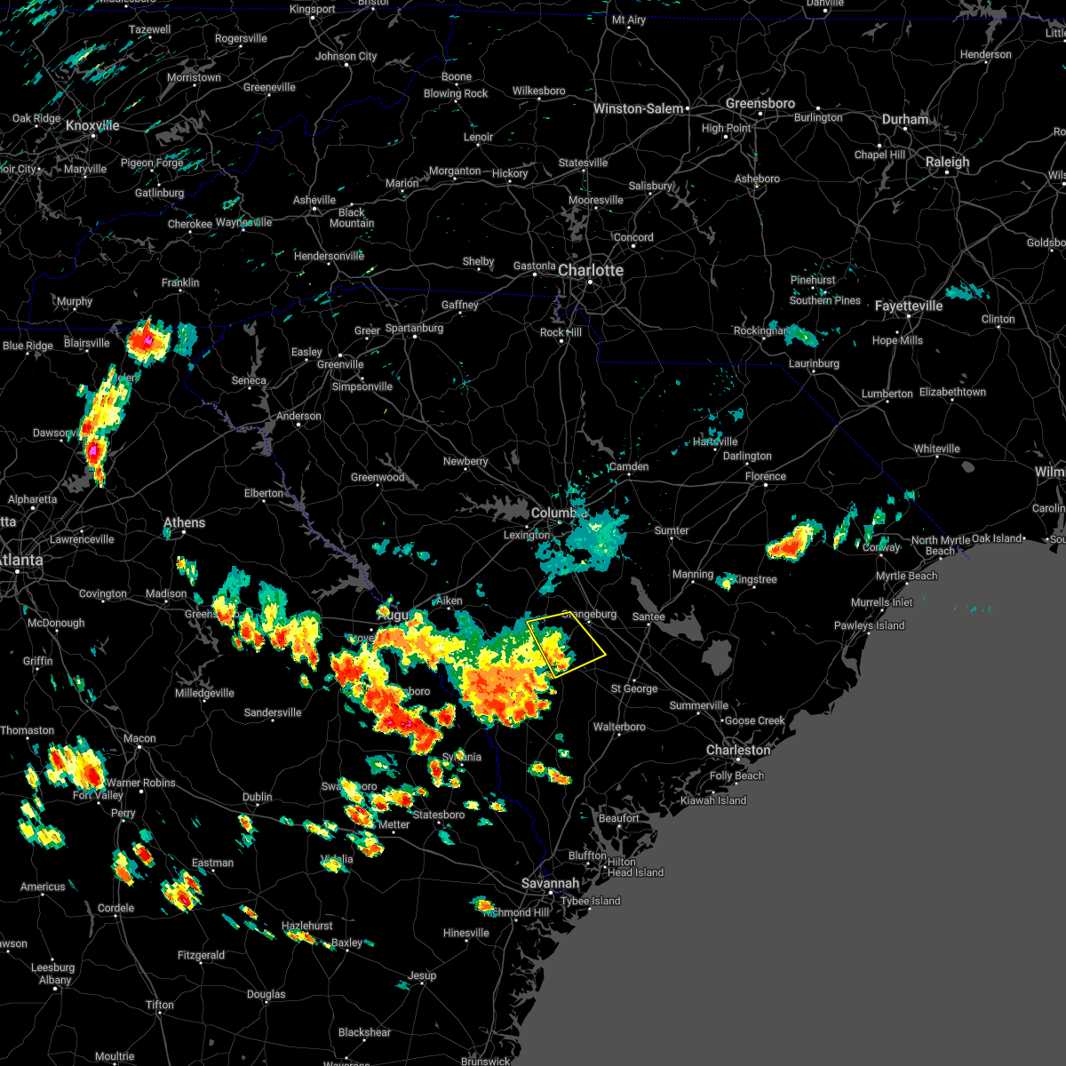 At 1154 am edt, severe thunderstorms were located along a line extending from 9 miles north of denmark to brookdale, moving east at 15 mph (radar indicated). Hazards include 60 mph wind gusts. Expect damage to trees and powerlines. locations impacted include, bamberg, denmark, norway, rowesville, cordova, cope, bamberg county airport and edisto. hail threat, radar indicated max hail size, <. 75 in wind threat, radar indicated max wind gust, 60 mph. At 1154 am edt, severe thunderstorms were located along a line extending from 9 miles north of denmark to brookdale, moving east at 15 mph (radar indicated). Hazards include 60 mph wind gusts. Expect damage to trees and powerlines. locations impacted include, bamberg, denmark, norway, rowesville, cordova, cope, bamberg county airport and edisto. hail threat, radar indicated max hail size, <. 75 in wind threat, radar indicated max wind gust, 60 mph.
|
| 6/14/2022 11:54 AM EDT |
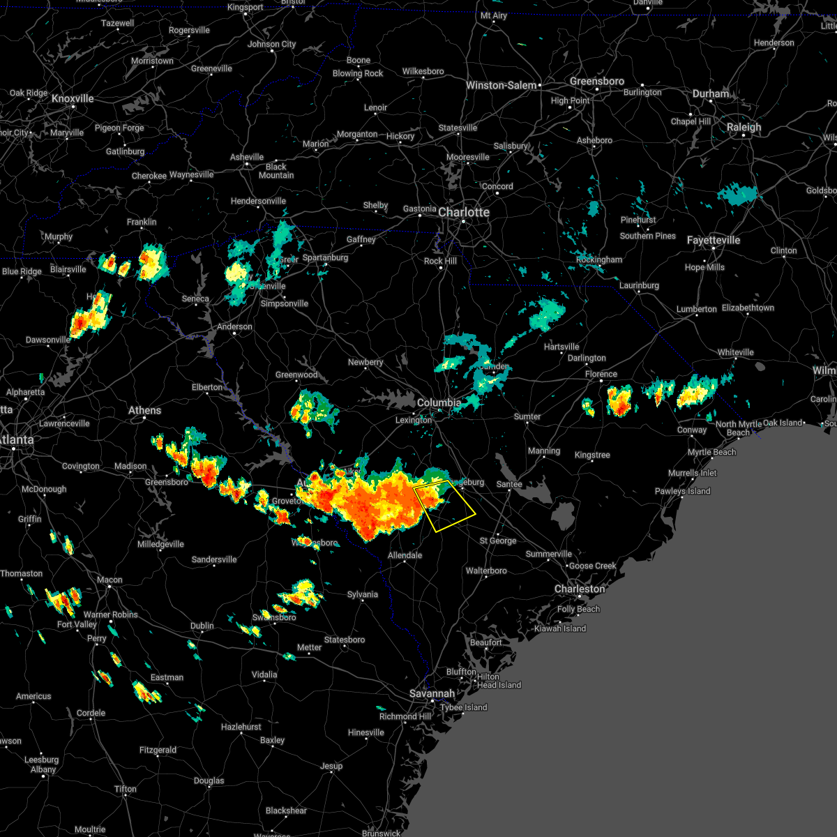 At 1154 am edt, severe thunderstorms were located along a line extending from 9 miles north of denmark to brookdale, moving east at 15 mph (radar indicated). Hazards include 60 mph wind gusts. Expect damage to trees and powerlines. locations impacted include, bamberg, denmark, norway, rowesville, cordova, cope, bamberg county airport and edisto. hail threat, radar indicated max hail size, <. 75 in wind threat, radar indicated max wind gust, 60 mph. At 1154 am edt, severe thunderstorms were located along a line extending from 9 miles north of denmark to brookdale, moving east at 15 mph (radar indicated). Hazards include 60 mph wind gusts. Expect damage to trees and powerlines. locations impacted include, bamberg, denmark, norway, rowesville, cordova, cope, bamberg county airport and edisto. hail threat, radar indicated max hail size, <. 75 in wind threat, radar indicated max wind gust, 60 mph.
|
| 6/14/2022 11:46 AM EDT |
 At 1128 am edt, severe thunderstorms were located along a line extending from 10 miles northeast of blackville to near orangeburg, moving southeast at 15 mph (radar indicated). Hazards include 60 mph wind gusts and quarter size hail. Hail damage to vehicles is expected. Expect wind damage to trees and powerlines. At 1128 am edt, severe thunderstorms were located along a line extending from 10 miles northeast of blackville to near orangeburg, moving southeast at 15 mph (radar indicated). Hazards include 60 mph wind gusts and quarter size hail. Hail damage to vehicles is expected. Expect wind damage to trees and powerlines.
|
| 6/14/2022 11:28 AM EDT |
 At 1128 am edt, severe thunderstorms were located along a line extending from 10 miles northeast of blackville to near orangeburg, moving southeast at 15 mph (radar indicated). Hazards include 60 mph wind gusts and quarter size hail. Hail damage to vehicles is expected. Expect wind damage to trees and powerlines. At 1128 am edt, severe thunderstorms were located along a line extending from 10 miles northeast of blackville to near orangeburg, moving southeast at 15 mph (radar indicated). Hazards include 60 mph wind gusts and quarter size hail. Hail damage to vehicles is expected. Expect wind damage to trees and powerlines.
|
| 5/6/2022 6:24 PM EDT |
 The severe thunderstorm warning for south central orangeburg county will expire at 630 pm edt, the storm which prompted the warning has weakened below severe limits, and has exited the warned area. therefore, the warning will be allowed to expire. a severe thunderstorm watch remains in effect until 1000 pm edt for central south carolina. The severe thunderstorm warning for south central orangeburg county will expire at 630 pm edt, the storm which prompted the warning has weakened below severe limits, and has exited the warned area. therefore, the warning will be allowed to expire. a severe thunderstorm watch remains in effect until 1000 pm edt for central south carolina.
|
| 5/6/2022 6:17 PM EDT |
 At 617 pm edt, a severe thunderstorm was located near bowman, or 12 miles southeast of orangeburg, moving northeast at 45 mph (radar indicated). Hazards include 60 mph wind gusts and quarter size hail. Hail damage to vehicles is expected. expect wind damage to trees and powerlines. locations impacted include, orangeburg, branchville, bowman, rowesville and yonder field. this includes the following highways, interstate 26 between mile markers 151 and 169. interstate 95 between mile markers 85 and 86. hail threat, radar indicated max hail size, 1. 00 in wind threat, radar indicated max wind gust, 60 mph. At 617 pm edt, a severe thunderstorm was located near bowman, or 12 miles southeast of orangeburg, moving northeast at 45 mph (radar indicated). Hazards include 60 mph wind gusts and quarter size hail. Hail damage to vehicles is expected. expect wind damage to trees and powerlines. locations impacted include, orangeburg, branchville, bowman, rowesville and yonder field. this includes the following highways, interstate 26 between mile markers 151 and 169. interstate 95 between mile markers 85 and 86. hail threat, radar indicated max hail size, 1. 00 in wind threat, radar indicated max wind gust, 60 mph.
|
| 5/6/2022 6:06 PM EDT |
 At 606 pm edt, a severe thunderstorm was located over branchville, or 10 miles east of bamberg, moving northeast at 45 mph (radar indicated). Hazards include 60 mph wind gusts and quarter size hail. Hail damage to vehicles is expected. Expect wind damage to trees and powerlines. At 606 pm edt, a severe thunderstorm was located over branchville, or 10 miles east of bamberg, moving northeast at 45 mph (radar indicated). Hazards include 60 mph wind gusts and quarter size hail. Hail damage to vehicles is expected. Expect wind damage to trees and powerlines.
|
| 5/6/2022 5:42 PM EDT |
 At 542 pm edt, a severe thunderstorm was located near elloree, or 12 miles northeast of brookdale, moving northeast at 70 mph (radar indicated). Hazards include ping pong ball size hail and 60 mph wind gusts. People and animals outdoors will be injured. expect hail damage to roofs, siding, windows, and vehicles. expect wind damage to trees and powerlines. locations impacted include, orangeburg, mcentire air base, brookdale, st. matthews, holly hill, branchville, summerton, bowman, eastover, elloree, congaree national park, santee state park, claflin college, south carolina state university, orangeburg county airport, sandy run, gadsden, edisto gardens, santee and swansea. this includes the following highways, interstate 26 between mile markers 124 and 169. interstate 95 between mile markers 85 and 109. hail threat, radar indicated max hail size, 1. 50 in wind threat, radar indicated max wind gust, 60 mph. At 542 pm edt, a severe thunderstorm was located near elloree, or 12 miles northeast of brookdale, moving northeast at 70 mph (radar indicated). Hazards include ping pong ball size hail and 60 mph wind gusts. People and animals outdoors will be injured. expect hail damage to roofs, siding, windows, and vehicles. expect wind damage to trees and powerlines. locations impacted include, orangeburg, mcentire air base, brookdale, st. matthews, holly hill, branchville, summerton, bowman, eastover, elloree, congaree national park, santee state park, claflin college, south carolina state university, orangeburg county airport, sandy run, gadsden, edisto gardens, santee and swansea. this includes the following highways, interstate 26 between mile markers 124 and 169. interstate 95 between mile markers 85 and 109. hail threat, radar indicated max hail size, 1. 50 in wind threat, radar indicated max wind gust, 60 mph.
|
| 5/6/2022 5:35 PM EDT |
 At 534 pm edt, a severe thunderstorm was located near brookdale, moving northeast at 70 mph (radar indicated). Hazards include 70 mph wind gusts and half dollar size hail. Hail damage to vehicles is expected. expect considerable tree damage. wind damage is also likely to mobile homes, roofs, and outbuildings. locations impacted include, orangeburg, bamberg, denmark, mcentire air base, brookdale, st. matthews, holly hill, branchville, summerton, bowman, eastover, elloree, santee state park, orangeburg county airport, congaree national park, claflin college, south carolina state university, sandy run, gadsden and edisto gardens. this includes the following highways, interstate 26 between mile markers 124 and 169. interstate 95 between mile markers 85 and 109. thunderstorm damage threat, considerable hail threat, radar indicated max hail size, 1. 25 in wind threat, observed max wind gust, 70 mph. At 534 pm edt, a severe thunderstorm was located near brookdale, moving northeast at 70 mph (radar indicated). Hazards include 70 mph wind gusts and half dollar size hail. Hail damage to vehicles is expected. expect considerable tree damage. wind damage is also likely to mobile homes, roofs, and outbuildings. locations impacted include, orangeburg, bamberg, denmark, mcentire air base, brookdale, st. matthews, holly hill, branchville, summerton, bowman, eastover, elloree, santee state park, orangeburg county airport, congaree national park, claflin college, south carolina state university, sandy run, gadsden and edisto gardens. this includes the following highways, interstate 26 between mile markers 124 and 169. interstate 95 between mile markers 85 and 109. thunderstorm damage threat, considerable hail threat, radar indicated max hail size, 1. 25 in wind threat, observed max wind gust, 70 mph.
|
| 5/6/2022 5:25 PM EDT |
 At 524 pm edt, a severe thunderstorm was located near edisto gardens, or near orangeburg, moving northeast at 70 mph (radar indicated). Hazards include 70 mph wind gusts and half dollar size hail. Hail damage to vehicles is expected. expect considerable tree damage. Wind damage is also likely to mobile homes, roofs, and outbuildings. At 524 pm edt, a severe thunderstorm was located near edisto gardens, or near orangeburg, moving northeast at 70 mph (radar indicated). Hazards include 70 mph wind gusts and half dollar size hail. Hail damage to vehicles is expected. expect considerable tree damage. Wind damage is also likely to mobile homes, roofs, and outbuildings.
|
| 5/6/2022 5:15 PM EDT |
 At 515 pm edt, a severe thunderstorm was located near denmark, moving northeast at 60 mph (radar indicated). Hazards include 60 mph wind gusts and quarter size hail. Hail damage to vehicles is expected. expect wind damage to trees and powerlines. locations impacted include, barnwell, bamberg, denmark, williston, blackville, branchville, barnwell state park, rivers bridge state park, ehrhardt, springfield, hilda, salley, neeses, norway, rowesville, snelling, olar, perry, kline and elko. hail threat, radar indicated max hail size, 1. 00 in wind threat, observed max wind gust, 60 mph. At 515 pm edt, a severe thunderstorm was located near denmark, moving northeast at 60 mph (radar indicated). Hazards include 60 mph wind gusts and quarter size hail. Hail damage to vehicles is expected. expect wind damage to trees and powerlines. locations impacted include, barnwell, bamberg, denmark, williston, blackville, branchville, barnwell state park, rivers bridge state park, ehrhardt, springfield, hilda, salley, neeses, norway, rowesville, snelling, olar, perry, kline and elko. hail threat, radar indicated max hail size, 1. 00 in wind threat, observed max wind gust, 60 mph.
|
| 5/6/2022 4:57 PM EDT |
 At 457 pm edt, a severe thunderstorm was located near barnwell, moving northeast at 60 mph (radar indicated). Hazards include 60 mph wind gusts and quarter size hail. Hail damage to vehicles is expected. Expect wind damage to trees and powerlines. At 457 pm edt, a severe thunderstorm was located near barnwell, moving northeast at 60 mph (radar indicated). Hazards include 60 mph wind gusts and quarter size hail. Hail damage to vehicles is expected. Expect wind damage to trees and powerlines.
|
| 4/5/2022 6:50 PM EDT |
 At 649 pm edt, a confirmed large and extremely dangerous tornado was located near bowman, or 11 miles southeast of orangeburg, moving northeast at 40 mph. this is a particularly dangerous situation. take cover now! (law enforcement confirmed tornado a tornado near cattle creek road in orangeburg county). Hazards include damaging tornado. You are in a life-threatening situation. flying debris may be deadly to those caught without shelter. mobile homes will be destroyed. considerable damage to homes, businesses, and vehicles is likely and complete destruction is possible. this tornadic thunderstorm will remain over mainly rural areas of central orangeburg county, including the following locations, yonder field and rowesville. this includes the following highways, interstate 26 between mile markers 154 and 168. Interstate 95 between mile markers 87 and 91. At 649 pm edt, a confirmed large and extremely dangerous tornado was located near bowman, or 11 miles southeast of orangeburg, moving northeast at 40 mph. this is a particularly dangerous situation. take cover now! (law enforcement confirmed tornado a tornado near cattle creek road in orangeburg county). Hazards include damaging tornado. You are in a life-threatening situation. flying debris may be deadly to those caught without shelter. mobile homes will be destroyed. considerable damage to homes, businesses, and vehicles is likely and complete destruction is possible. this tornadic thunderstorm will remain over mainly rural areas of central orangeburg county, including the following locations, yonder field and rowesville. this includes the following highways, interstate 26 between mile markers 154 and 168. Interstate 95 between mile markers 87 and 91.
|
| 4/5/2022 6:45 PM EDT |
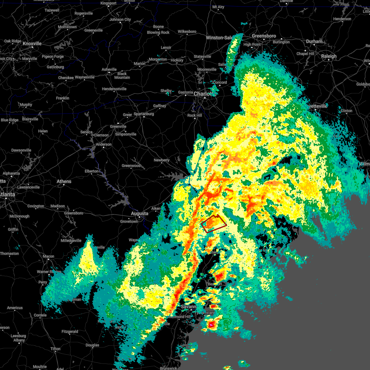 At 645 pm edt, a confirmed large and extremely dangerous tornado was located near bowman, or 11 miles southeast of orangeburg, moving northeast at 45 mph. this is a particularly dangerous situation. take cover now! (orangeburg county emergency management confirmed a tornado near rowesville). Hazards include damaging tornado. You are in a life-threatening situation. flying debris may be deadly to those caught without shelter. mobile homes will be destroyed. considerable damage to homes, businesses, and vehicles is likely and complete destruction is possible. the tornado will be near, bowman around 650 pm edt. other locations impacted by this tornadic thunderstorm include yonder field and rowesville. this includes the following highways, interstate 26 between mile markers 154 and 168. Interstate 95 between mile markers 87 and 91. At 645 pm edt, a confirmed large and extremely dangerous tornado was located near bowman, or 11 miles southeast of orangeburg, moving northeast at 45 mph. this is a particularly dangerous situation. take cover now! (orangeburg county emergency management confirmed a tornado near rowesville). Hazards include damaging tornado. You are in a life-threatening situation. flying debris may be deadly to those caught without shelter. mobile homes will be destroyed. considerable damage to homes, businesses, and vehicles is likely and complete destruction is possible. the tornado will be near, bowman around 650 pm edt. other locations impacted by this tornadic thunderstorm include yonder field and rowesville. this includes the following highways, interstate 26 between mile markers 154 and 168. Interstate 95 between mile markers 87 and 91.
|
| 4/5/2022 6:38 PM EDT |
 At 637 pm edt, a confirmed large and extremely dangerous tornado was located near branchville, or 12 miles east of bamberg, moving northeast at 45 mph. this is a particularly dangerous situation. take cover now! (radar confirmed tornado). Hazards include damaging tornado. You are in a life-threatening situation. flying debris may be deadly to those caught without shelter. mobile homes will be destroyed. considerable damage to homes, businesses, and vehicles is likely and complete destruction is possible. the tornado will be near, bowman around 650 pm edt. other locations impacted by this tornadic thunderstorm include yonder field and rowesville. this includes the following highways, interstate 26 between mile markers 154 and 168. Interstate 95 between mile markers 86 and 91. At 637 pm edt, a confirmed large and extremely dangerous tornado was located near branchville, or 12 miles east of bamberg, moving northeast at 45 mph. this is a particularly dangerous situation. take cover now! (radar confirmed tornado). Hazards include damaging tornado. You are in a life-threatening situation. flying debris may be deadly to those caught without shelter. mobile homes will be destroyed. considerable damage to homes, businesses, and vehicles is likely and complete destruction is possible. the tornado will be near, bowman around 650 pm edt. other locations impacted by this tornadic thunderstorm include yonder field and rowesville. this includes the following highways, interstate 26 between mile markers 154 and 168. Interstate 95 between mile markers 86 and 91.
|
| 4/5/2022 6:35 PM EDT |
 At 634 pm edt, a confirmed tornado was located over branchville, or 10 miles east of bamberg, moving northeast at 45 mph (radar confirmed tornado). Hazards include damaging tornado. Flying debris will be dangerous to those caught without shelter. mobile homes will be damaged or destroyed. damage to roofs, windows, and vehicles will occur. tree damage is likely. this tornado will be near, bowman around 650 pm edt. other locations impacted by this tornadic thunderstorm include yonder field and rowesville. this includes the following highways, interstate 26 between mile markers 154 and 169. Interstate 95 between mile markers 85 and 91. At 634 pm edt, a confirmed tornado was located over branchville, or 10 miles east of bamberg, moving northeast at 45 mph (radar confirmed tornado). Hazards include damaging tornado. Flying debris will be dangerous to those caught without shelter. mobile homes will be damaged or destroyed. damage to roofs, windows, and vehicles will occur. tree damage is likely. this tornado will be near, bowman around 650 pm edt. other locations impacted by this tornadic thunderstorm include yonder field and rowesville. this includes the following highways, interstate 26 between mile markers 154 and 169. Interstate 95 between mile markers 85 and 91.
|
| 4/5/2022 6:26 PM EDT |
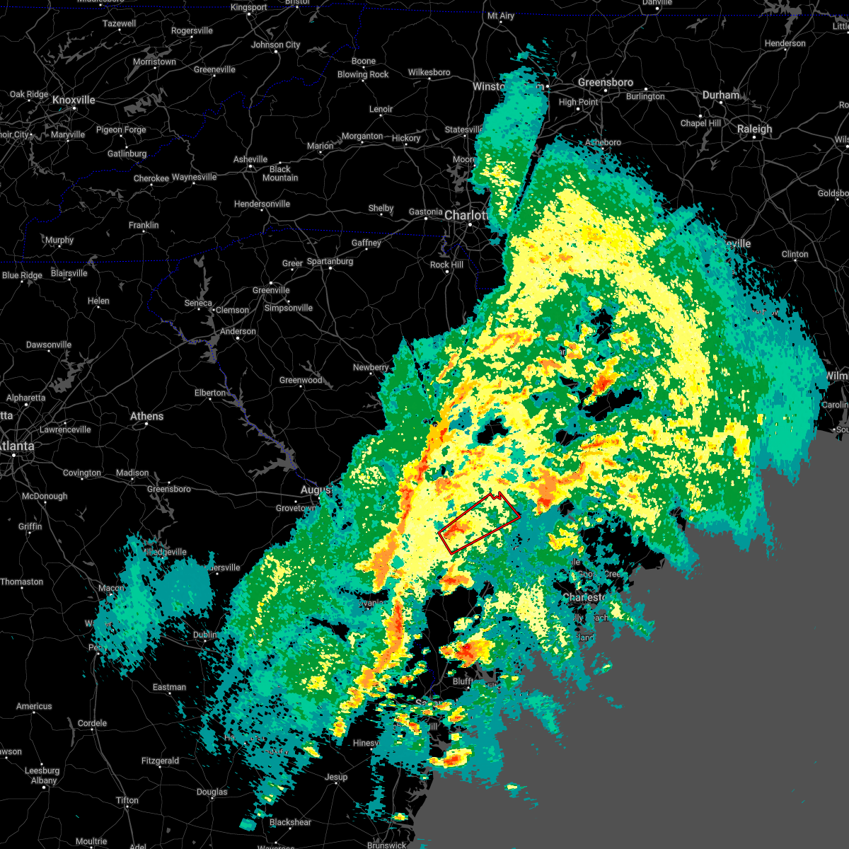 At 625 pm edt, a tornado producing storm was located near bamberg, moving northeast at 45 mph (radar confirmed tornado). Hazards include damaging tornado. Flying debris will be dangerous to those caught without shelter. mobile homes will be damaged or destroyed. damage to roofs, windows, and vehicles will occur. tree damage is likely. this tornadic storm will be near, branchville around 635 pm edt. bowman around 650 pm edt. other locations impacted by this tornadic thunderstorm include yonder field and rowesville. this includes the following highways, interstate 26 between mile markers 154 and 169. Interstate 95 between mile markers 85 and 91. At 625 pm edt, a tornado producing storm was located near bamberg, moving northeast at 45 mph (radar confirmed tornado). Hazards include damaging tornado. Flying debris will be dangerous to those caught without shelter. mobile homes will be damaged or destroyed. damage to roofs, windows, and vehicles will occur. tree damage is likely. this tornadic storm will be near, branchville around 635 pm edt. bowman around 650 pm edt. other locations impacted by this tornadic thunderstorm include yonder field and rowesville. this includes the following highways, interstate 26 between mile markers 154 and 169. Interstate 95 between mile markers 85 and 91.
|
| 4/5/2022 4:39 PM EDT |
 At 438 pm edt, a confirmed large and extremely dangerous tornado was located 7 miles north of padgetts, or 10 miles southeast of bamberg, moving northeast at 35 mph. this is a particularly dangerous situation. take cover now! (radar confirmed tornado). Hazards include damaging tornado. You are in a life-threatening situation. flying debris may be deadly to those caught without shelter. mobile homes will be destroyed. considerable damage to homes, businesses, and vehicles is likely and complete destruction is possible. the tornado will be near, branchville around 455 pm edt. Other locations impacted by this tornadic thunderstorm include rowesville. At 438 pm edt, a confirmed large and extremely dangerous tornado was located 7 miles north of padgetts, or 10 miles southeast of bamberg, moving northeast at 35 mph. this is a particularly dangerous situation. take cover now! (radar confirmed tornado). Hazards include damaging tornado. You are in a life-threatening situation. flying debris may be deadly to those caught without shelter. mobile homes will be destroyed. considerable damage to homes, businesses, and vehicles is likely and complete destruction is possible. the tornado will be near, branchville around 455 pm edt. Other locations impacted by this tornadic thunderstorm include rowesville.
|
| 4/5/2022 4:22 PM EDT |
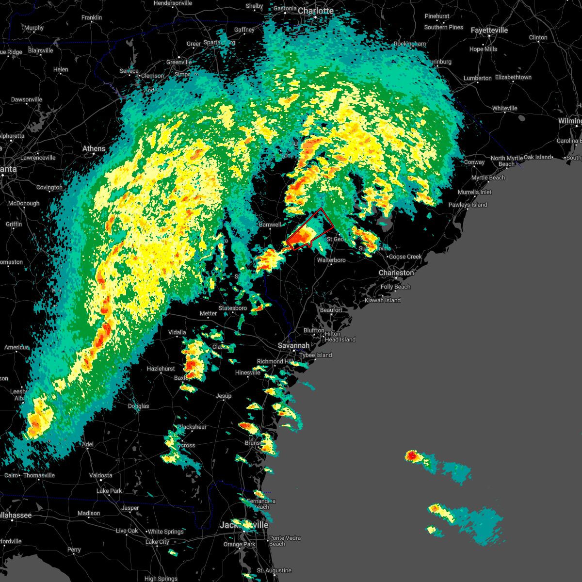 At 422 pm edt, a confirmed large and extremely dangerous tornado was located near rivers bridge state park, or 14 miles south of bamberg, moving northeast at 30 mph. this is a particularly dangerous situation. take cover now! (radar confirmed tornado). Hazards include damaging tornado. You are in a life-threatening situation. flying debris may be deadly to those caught without shelter. mobile homes will be destroyed. considerable damage to homes, businesses, and vehicles is likely and complete destruction is possible. the tornado will be near, branchville around 500 pm edt. Other locations impacted by this tornadic thunderstorm include ehrhardt and rowesville. At 422 pm edt, a confirmed large and extremely dangerous tornado was located near rivers bridge state park, or 14 miles south of bamberg, moving northeast at 30 mph. this is a particularly dangerous situation. take cover now! (radar confirmed tornado). Hazards include damaging tornado. You are in a life-threatening situation. flying debris may be deadly to those caught without shelter. mobile homes will be destroyed. considerable damage to homes, businesses, and vehicles is likely and complete destruction is possible. the tornado will be near, branchville around 500 pm edt. Other locations impacted by this tornadic thunderstorm include ehrhardt and rowesville.
|
| 4/5/2022 4:00 PM EDT |
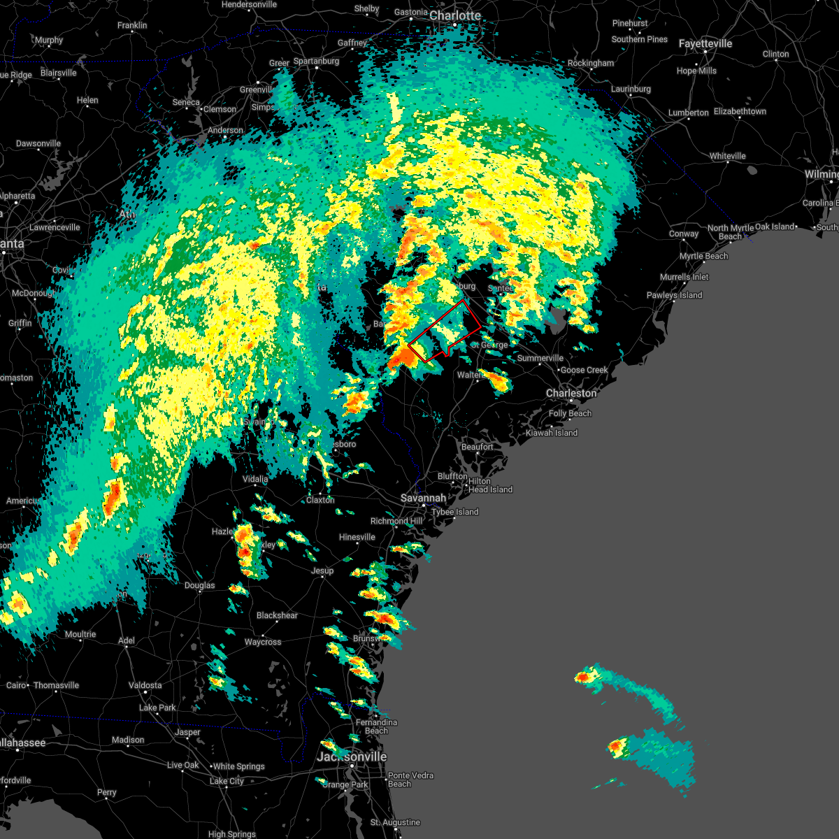 At 400 pm edt, a confirmed large and extremely dangerous tornado was located over allendale, moving northeast at 35 mph. this is a particularly dangerous situation. take cover now! (radar confirmed tornado). Hazards include damaging tornado. You are in a life-threatening situation. flying debris may be deadly to those caught without shelter. mobile homes will be destroyed. considerable damage to homes, businesses, and vehicles is likely and complete destruction is possible. the tornado will be near, rivers bridge state park around 420 pm edt. branchville around 455 pm edt. Other locations impacted by this tornadic thunderstorm include ehrhardt and rowesville. At 400 pm edt, a confirmed large and extremely dangerous tornado was located over allendale, moving northeast at 35 mph. this is a particularly dangerous situation. take cover now! (radar confirmed tornado). Hazards include damaging tornado. You are in a life-threatening situation. flying debris may be deadly to those caught without shelter. mobile homes will be destroyed. considerable damage to homes, businesses, and vehicles is likely and complete destruction is possible. the tornado will be near, rivers bridge state park around 420 pm edt. branchville around 455 pm edt. Other locations impacted by this tornadic thunderstorm include ehrhardt and rowesville.
|
| 1/3/2022 3:10 AM EST |
 The tornado warning for central orangeburg county will expire at 315 am est, the storm which prompted the warning has weakened below severe limits, and no longer appears capable of producing a tornado. therefore, the warning will be allowed to expire. The tornado warning for central orangeburg county will expire at 315 am est, the storm which prompted the warning has weakened below severe limits, and no longer appears capable of producing a tornado. therefore, the warning will be allowed to expire.
|
| 1/3/2022 3:01 AM EST |
 At 301 am est, a severe thunderstorm capable of producing a tornado was located 7 miles south of orangeburg county airport, or 8 miles northeast of bamberg, moving northeast at 30 mph (radar indicated rotation). Hazards include tornado. Flying debris will be dangerous to those caught without shelter. mobile homes will be damaged or destroyed. damage to roofs, windows, and vehicles will occur. tree damage is likely. this dangerous storm will be near, orangeburg county airport around 315 am est. south carolina state university, claflin college and edisto gardens around 320 am est. orangeburg and brookdale around 325 am est. Other locations impacted by this tornadic thunderstorm include wilkinson heights, prince of orange mall, edisto, yonder field, rowesville, cordova and cope. At 301 am est, a severe thunderstorm capable of producing a tornado was located 7 miles south of orangeburg county airport, or 8 miles northeast of bamberg, moving northeast at 30 mph (radar indicated rotation). Hazards include tornado. Flying debris will be dangerous to those caught without shelter. mobile homes will be damaged or destroyed. damage to roofs, windows, and vehicles will occur. tree damage is likely. this dangerous storm will be near, orangeburg county airport around 315 am est. south carolina state university, claflin college and edisto gardens around 320 am est. orangeburg and brookdale around 325 am est. Other locations impacted by this tornadic thunderstorm include wilkinson heights, prince of orange mall, edisto, yonder field, rowesville, cordova and cope.
|
| 1/3/2022 2:50 AM EST |
 At 250 am est, a severe thunderstorm capable of producing a tornado was located near bamberg, moving northeast at 35 mph (radar indicated rotation). Hazards include tornado. Flying debris will be dangerous to those caught without shelter. mobile homes will be damaged or destroyed. damage to roofs, windows, and vehicles will occur. tree damage is likely. this dangerous storm will be near, orangeburg, brookdale, orangeburg county airport, south carolina state university, claflin college and edisto gardens around 315 am est. Other locations impacted by this tornadic thunderstorm include wilkinson heights, cope, prince of orange mall, edisto, yonder field, rowesville and cordova. At 250 am est, a severe thunderstorm capable of producing a tornado was located near bamberg, moving northeast at 35 mph (radar indicated rotation). Hazards include tornado. Flying debris will be dangerous to those caught without shelter. mobile homes will be damaged or destroyed. damage to roofs, windows, and vehicles will occur. tree damage is likely. this dangerous storm will be near, orangeburg, brookdale, orangeburg county airport, south carolina state university, claflin college and edisto gardens around 315 am est. Other locations impacted by this tornadic thunderstorm include wilkinson heights, cope, prince of orange mall, edisto, yonder field, rowesville and cordova.
|
| 8/17/2021 4:56 PM EDT |
 At 455 pm edt, a severe thunderstorm capable of producing a tornado was located near bamberg, moving north at 30 mph (radar indicated rotation). Hazards include tornado. Flying debris will be dangerous to those caught without shelter. mobile homes will be damaged or destroyed. damage to roofs, windows, and vehicles will occur. Tree damage is likely. At 455 pm edt, a severe thunderstorm capable of producing a tornado was located near bamberg, moving north at 30 mph (radar indicated rotation). Hazards include tornado. Flying debris will be dangerous to those caught without shelter. mobile homes will be damaged or destroyed. damage to roofs, windows, and vehicles will occur. Tree damage is likely.
|
| 8/17/2021 4:48 PM EDT |
 At 448 pm edt, a severe thunderstorm was located near bamberg, moving north at 30 mph (radar indicated). Hazards include 60 mph wind gusts. expect damage to roofs, siding, and trees At 448 pm edt, a severe thunderstorm was located near bamberg, moving north at 30 mph (radar indicated). Hazards include 60 mph wind gusts. expect damage to roofs, siding, and trees
|
| 6/12/2021 2:16 PM EDT |
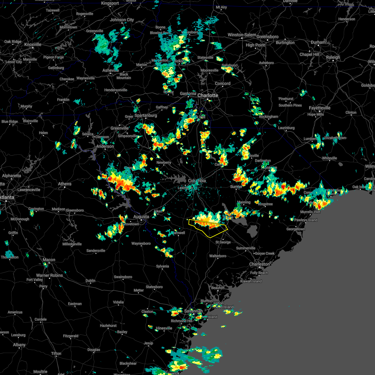 At 216 pm edt, severe thunderstorms were located along a line extending from 10 miles northeast of denmark to near orangeburg county airport to near bowman, moving south at 15 mph (radar indicated). Hazards include 60 mph wind gusts and quarter size hail. Hail damage to vehicles is expected. expect wind damage to roofs, siding, and trees. locations impacted include, branchville, bowman, norway, rowesville, cordova and cope. this includes the following highways, interstate 26 between mile markers 159 and 168. Interstate 95 between mile markers 86 and 89. At 216 pm edt, severe thunderstorms were located along a line extending from 10 miles northeast of denmark to near orangeburg county airport to near bowman, moving south at 15 mph (radar indicated). Hazards include 60 mph wind gusts and quarter size hail. Hail damage to vehicles is expected. expect wind damage to roofs, siding, and trees. locations impacted include, branchville, bowman, norway, rowesville, cordova and cope. this includes the following highways, interstate 26 between mile markers 159 and 168. Interstate 95 between mile markers 86 and 89.
|
| 6/12/2021 1:43 PM EDT |
 At 143 pm edt, severe thunderstorms were located along a line extending from 13 miles west of edisto gardens to orangeburg county airport to 7 miles north of bowman, moving south at 5 mph (radar indicated). Hazards include 60 mph wind gusts and quarter size hail. Hail damage to vehicles is expected. Expect wind damage to roofs, siding, and trees. At 143 pm edt, severe thunderstorms were located along a line extending from 13 miles west of edisto gardens to orangeburg county airport to 7 miles north of bowman, moving south at 5 mph (radar indicated). Hazards include 60 mph wind gusts and quarter size hail. Hail damage to vehicles is expected. Expect wind damage to roofs, siding, and trees.
|
| 5/4/2021 6:57 PM EDT |
 The severe thunderstorm warning for southeastern calhoun, southeastern barnwell, bamberg and orangeburg counties will expire at 700 pm edt, the storms which prompted the warning have weakened below severe limits, and no longer pose an immediate threat to life or property. therefore, the warning will be allowed to expire. however gusty winds are still possible with these thunderstorms. a severe thunderstorm watch remains in effect until 900 pm edt for central south carolina. The severe thunderstorm warning for southeastern calhoun, southeastern barnwell, bamberg and orangeburg counties will expire at 700 pm edt, the storms which prompted the warning have weakened below severe limits, and no longer pose an immediate threat to life or property. therefore, the warning will be allowed to expire. however gusty winds are still possible with these thunderstorms. a severe thunderstorm watch remains in effect until 900 pm edt for central south carolina.
|
| 5/4/2021 6:43 PM EDT |
 At 642 pm edt, severe thunderstorms were located along a line extending from near santee state park to near ulmer, moving southeast at 25 mph (radar indicated). Hazards include 60 mph wind gusts and penny size hail. Expect damage to roofs, siding, and trees. locations impacted include, orangeburg, barnwell, bamberg, denmark, brookdale, holly hill, branchville, bowman, elloree, santee state park, claflin college, south carolina state university, orangeburg county airport, rivers bridge state park, edisto gardens, santee, ehrhardt, hilda, cameron and eutawville. this includes the following highways, interstate 26 between mile markers 149 and 169. Interstate 95 between mile markers 85 and 101. At 642 pm edt, severe thunderstorms were located along a line extending from near santee state park to near ulmer, moving southeast at 25 mph (radar indicated). Hazards include 60 mph wind gusts and penny size hail. Expect damage to roofs, siding, and trees. locations impacted include, orangeburg, barnwell, bamberg, denmark, brookdale, holly hill, branchville, bowman, elloree, santee state park, claflin college, south carolina state university, orangeburg county airport, rivers bridge state park, edisto gardens, santee, ehrhardt, hilda, cameron and eutawville. this includes the following highways, interstate 26 between mile markers 149 and 169. Interstate 95 between mile markers 85 and 101.
|
| 5/4/2021 6:03 PM EDT |
 At 603 pm edt, severe thunderstorms were located along a line extending from near poinsett state park to 6 miles east of savannah river site, moving east at 30 mph (radar indicated). Hazards include 60 mph wind gusts. expect damage to roofs, siding, and trees At 603 pm edt, severe thunderstorms were located along a line extending from near poinsett state park to 6 miles east of savannah river site, moving east at 30 mph (radar indicated). Hazards include 60 mph wind gusts. expect damage to roofs, siding, and trees
|
| 5/3/2021 6:44 PM EDT |
 At 644 pm edt, a severe thunderstorm was located 8 miles north of lodge, or 9 miles southeast of bamberg, moving east at 45 mph (radar indicated). Hazards include ping pong ball size hail and 60 mph wind gusts. People and animals outdoors will be injured. expect hail damage to roofs, siding, windows, and vehicles. Expect wind damage to roofs, siding, and trees. At 644 pm edt, a severe thunderstorm was located 8 miles north of lodge, or 9 miles southeast of bamberg, moving east at 45 mph (radar indicated). Hazards include ping pong ball size hail and 60 mph wind gusts. People and animals outdoors will be injured. expect hail damage to roofs, siding, windows, and vehicles. Expect wind damage to roofs, siding, and trees.
|
| 6/28/2020 9:42 PM EDT |
 At 942 pm edt, a severe thunderstorm was located 8 miles west of edisto gardens, or 8 miles west of orangeburg, moving southeast at 40 mph (radar indicated). Hazards include 60 mph wind gusts. Expect damage to roofs, siding, and trees. locations impacted include, orangeburg, brookdale, st. matthews, orangeburg county airport, claflin college, edisto gardens, south carolina state university, north, cameron, neeses, norway, rowesville, woodford, cordova, livingston, yonder field, wilkinson heights, prince of orange mall, edisto and creston. This includes interstate 26 between mile markers 133 and 159. At 942 pm edt, a severe thunderstorm was located 8 miles west of edisto gardens, or 8 miles west of orangeburg, moving southeast at 40 mph (radar indicated). Hazards include 60 mph wind gusts. Expect damage to roofs, siding, and trees. locations impacted include, orangeburg, brookdale, st. matthews, orangeburg county airport, claflin college, edisto gardens, south carolina state university, north, cameron, neeses, norway, rowesville, woodford, cordova, livingston, yonder field, wilkinson heights, prince of orange mall, edisto and creston. This includes interstate 26 between mile markers 133 and 159.
|
| 6/28/2020 9:18 PM EDT |
 At 918 pm edt, a severe thunderstorm was located 14 miles southwest of gaston, or 19 miles south of red bank, moving east at 40 mph (radar indicated). Hazards include 60 mph wind gusts. expect damage to roofs, siding, and trees At 918 pm edt, a severe thunderstorm was located 14 miles southwest of gaston, or 19 miles south of red bank, moving east at 40 mph (radar indicated). Hazards include 60 mph wind gusts. expect damage to roofs, siding, and trees
|
| 6/27/2020 8:42 PM EDT |
 At 842 pm edt, severe thunderstorms were located along a line extending from 10 miles south of sandy run to edisto gardens to near bamberg to near ulmer, moving east at 50 mph (radar indicated). Hazards include 60 mph wind gusts. expect damage to roofs, siding, and trees At 842 pm edt, severe thunderstorms were located along a line extending from 10 miles south of sandy run to edisto gardens to near bamberg to near ulmer, moving east at 50 mph (radar indicated). Hazards include 60 mph wind gusts. expect damage to roofs, siding, and trees
|
| 6/27/2020 8:31 PM EDT |
 At 830 pm edt, severe thunderstorms were located along a line extending from 13 miles northwest of edisto gardens to near denmark to millett, moving east at 45 mph (radar indicated). Hazards include 60 mph wind gusts. Expect damage to roofs, siding, and trees. locations impacted include, orangeburg, barnwell, bamberg, denmark, brookdale, blackville, branchville, claflin college, south carolina state university, orangeburg county airport, barnwell state park, rivers bridge state park, edisto gardens, north, ehrhardt, hilda, neeses, norway, rowesville and olar. This includes interstate 26 between mile markers 142 and 147. At 830 pm edt, severe thunderstorms were located along a line extending from 13 miles northwest of edisto gardens to near denmark to millett, moving east at 45 mph (radar indicated). Hazards include 60 mph wind gusts. Expect damage to roofs, siding, and trees. locations impacted include, orangeburg, barnwell, bamberg, denmark, brookdale, blackville, branchville, claflin college, south carolina state university, orangeburg county airport, barnwell state park, rivers bridge state park, edisto gardens, north, ehrhardt, hilda, neeses, norway, rowesville and olar. This includes interstate 26 between mile markers 142 and 147.
|
| 6/27/2020 8:05 PM EDT |
 At 805 pm edt, severe thunderstorms were located along a line extending from 9 miles northeast of aiken state park to 6 miles south of williston to near plant vogtle, moving east at 50 mph (radar indicated). Hazards include 60 mph wind gusts. Expect damage to roofs, siding, and trees. locations impacted include, orangeburg, barnwell, bamberg, denmark, savannah river site, plant vogtle, brookdale, williston, blackville, branchville, claflin college, south carolina state university, orangeburg county airport, barnwell state park, rivers bridge state park, edisto gardens, wagener, north, ehrhardt and springfield. This includes interstate 26 between mile markers 142 and 147. At 805 pm edt, severe thunderstorms were located along a line extending from 9 miles northeast of aiken state park to 6 miles south of williston to near plant vogtle, moving east at 50 mph (radar indicated). Hazards include 60 mph wind gusts. Expect damage to roofs, siding, and trees. locations impacted include, orangeburg, barnwell, bamberg, denmark, savannah river site, plant vogtle, brookdale, williston, blackville, branchville, claflin college, south carolina state university, orangeburg county airport, barnwell state park, rivers bridge state park, edisto gardens, wagener, north, ehrhardt and springfield. This includes interstate 26 between mile markers 142 and 147.
|
| 6/27/2020 7:42 PM EDT |
 At 742 pm edt, severe thunderstorms were located along a line extending from near edgefield county airport to near jackson to 9 miles north of gough, moving east at 40 mph (radar indicated). Hazards include 60 mph wind gusts. expect damage to roofs, siding, and trees At 742 pm edt, severe thunderstorms were located along a line extending from near edgefield county airport to near jackson to 9 miles north of gough, moving east at 40 mph (radar indicated). Hazards include 60 mph wind gusts. expect damage to roofs, siding, and trees
|
| 6/23/2020 6:29 PM EDT |
 At 629 pm edt, severe thunderstorms were located along a line extending from 7 miles east of st. matthews to near bowman to near branchville, moving east at 35 mph (radar indicated). Hazards include 60 mph wind gusts and quarter size hail. Hail damage to vehicles is expected. Expect wind damage to roofs, siding, and trees. At 629 pm edt, severe thunderstorms were located along a line extending from 7 miles east of st. matthews to near bowman to near branchville, moving east at 35 mph (radar indicated). Hazards include 60 mph wind gusts and quarter size hail. Hail damage to vehicles is expected. Expect wind damage to roofs, siding, and trees.
|
| 5/22/2020 7:15 PM EDT |
 At 715 pm edt, a severe thunderstorm was located near orangeburg county airport, or near orangeburg, moving southeast at 20 mph (radar indicated). Hazards include 60 mph wind gusts and quarter size hail. Hail damage to vehicles is expected. Expect wind damage to roofs, siding, and trees. At 715 pm edt, a severe thunderstorm was located near orangeburg county airport, or near orangeburg, moving southeast at 20 mph (radar indicated). Hazards include 60 mph wind gusts and quarter size hail. Hail damage to vehicles is expected. Expect wind damage to roofs, siding, and trees.
|
| 4/13/2020 6:13 AM EDT |
 At 612 am edt, a severe thunderstorm capable of producing a tornado was located near bamberg, moving northeast at 50 mph (radar indicated rotation). Hazards include tornado. Flying debris will be dangerous to those caught without shelter. mobile homes will be damaged or destroyed. damage to roofs, windows, and vehicles will occur. tree damage is likely. this dangerous storm will be near, orangeburg, orangeburg county airport, edisto gardens, south carolina state university and claflin college around 625 am edt. brookdale around 630 am edt. elloree around 645 am edt. other locations impacted by this tornadic thunderstorm include wilkinson heights, cope, prince of orange mall, edisto, santee, creston, yonder field, rowesville, vance and cameron. this includes the following highways, interstate 26 between mile markers 145 and 164. Interstate 95 between mile markers 92 and 99. At 612 am edt, a severe thunderstorm capable of producing a tornado was located near bamberg, moving northeast at 50 mph (radar indicated rotation). Hazards include tornado. Flying debris will be dangerous to those caught without shelter. mobile homes will be damaged or destroyed. damage to roofs, windows, and vehicles will occur. tree damage is likely. this dangerous storm will be near, orangeburg, orangeburg county airport, edisto gardens, south carolina state university and claflin college around 625 am edt. brookdale around 630 am edt. elloree around 645 am edt. other locations impacted by this tornadic thunderstorm include wilkinson heights, cope, prince of orange mall, edisto, santee, creston, yonder field, rowesville, vance and cameron. this includes the following highways, interstate 26 between mile markers 145 and 164. Interstate 95 between mile markers 92 and 99.
|
| 2/6/2020 6:08 PM EST |
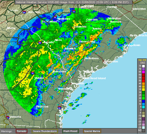 The severe thunderstorm warning for southeastern calhoun, central bamberg and southeastern orangeburg counties will expire at 615 pm est, the storms which prompted the warning have weakened below severe limits, and no longer pose an immediate threat to life or property. therefore, the warning will be allowed to expire. however gusty winds are still possible with these thunderstorms. a tornado watch remains in effect until 800 pm est for central south carolina. The severe thunderstorm warning for southeastern calhoun, central bamberg and southeastern orangeburg counties will expire at 615 pm est, the storms which prompted the warning have weakened below severe limits, and no longer pose an immediate threat to life or property. therefore, the warning will be allowed to expire. however gusty winds are still possible with these thunderstorms. a tornado watch remains in effect until 800 pm est for central south carolina.
|
| 2/6/2020 5:35 PM EST |
 At 535 pm est, severe thunderstorms were located along a line extending from 6 miles northeast of bamberg to 7 miles west of branchville to near rivers bridge state park, moving northeast at 65 mph (radar indicated). Hazards include 60 mph wind gusts. expect damage to roofs, siding, and trees At 535 pm est, severe thunderstorms were located along a line extending from 6 miles northeast of bamberg to 7 miles west of branchville to near rivers bridge state park, moving northeast at 65 mph (radar indicated). Hazards include 60 mph wind gusts. expect damage to roofs, siding, and trees
|
| 1/11/2020 11:42 PM EST |
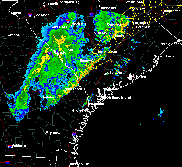 At 1142 pm est, a severe thunderstorm was located 7 miles north of lodge, or 9 miles southeast of bamberg, moving northeast at 60 mph (radar indicated). Hazards include 60 mph wind gusts. expect damage to roofs, siding, and trees At 1142 pm est, a severe thunderstorm was located 7 miles north of lodge, or 9 miles southeast of bamberg, moving northeast at 60 mph (radar indicated). Hazards include 60 mph wind gusts. expect damage to roofs, siding, and trees
|
| 10/31/2019 7:27 PM EDT |
 At 726 pm edt, severe thunderstorms were located along a line extending from near shaw air base to near elloree to near padgetts, moving east at 35 mph (radar indicated). Hazards include 60 mph wind gusts. expect damage to roofs, siding, and trees At 726 pm edt, severe thunderstorms were located along a line extending from near shaw air base to near elloree to near padgetts, moving east at 35 mph (radar indicated). Hazards include 60 mph wind gusts. expect damage to roofs, siding, and trees
|
| 10/31/2019 7:16 PM EDT |
 At 716 pm edt, severe thunderstorms were located along a line extending from near poinsett state park to near elloree to bowman, moving east at 40 mph (radar indicated). Hazards include 60 mph wind gusts. Expect damage to roofs, siding, and trees. locations impacted include, orangeburg, bamberg, brookdale, st. matthews, branchville, bowman, elloree, claflin college, south carolina state university, orangeburg county airport, rivers bridge state park, edisto gardens, ehrhardt, cameron, rowesville, cordova, cope, poplar creek landing, fort motte and stumphole landing. this includes the following highways, interstate 26 between mile markers 138 and 169. Interstate 95 between mile markers 85 and 92. At 716 pm edt, severe thunderstorms were located along a line extending from near poinsett state park to near elloree to bowman, moving east at 40 mph (radar indicated). Hazards include 60 mph wind gusts. Expect damage to roofs, siding, and trees. locations impacted include, orangeburg, bamberg, brookdale, st. matthews, branchville, bowman, elloree, claflin college, south carolina state university, orangeburg county airport, rivers bridge state park, edisto gardens, ehrhardt, cameron, rowesville, cordova, cope, poplar creek landing, fort motte and stumphole landing. this includes the following highways, interstate 26 between mile markers 138 and 169. Interstate 95 between mile markers 85 and 92.
|
| 10/31/2019 6:46 PM EDT |
 At 646 pm edt, severe thunderstorms were located along a line extending from 6 miles south of sandy run to 6 miles northwest of edisto gardens to bamberg, moving east at 55 mph (radar indicated). Hazards include 60 mph wind gusts. expect damage to roofs, siding, and trees At 646 pm edt, severe thunderstorms were located along a line extending from 6 miles south of sandy run to 6 miles northwest of edisto gardens to bamberg, moving east at 55 mph (radar indicated). Hazards include 60 mph wind gusts. expect damage to roofs, siding, and trees
|
| 9/9/2019 4:33 PM EDT |
 At 432 pm edt, a severe thunderstorm was located just south of orangeburg and near cordova. movement was southwest near 8 mph (radar indicated). Hazards include 60 mph wind gusts and nickel size hail. expect damage to roofs, siding, and trees At 432 pm edt, a severe thunderstorm was located just south of orangeburg and near cordova. movement was southwest near 8 mph (radar indicated). Hazards include 60 mph wind gusts and nickel size hail. expect damage to roofs, siding, and trees
|
| 7/31/2019 4:02 PM EDT |
 The national weather service in columbia has issued a * severe thunderstorm warning for. south central calhoun county in central south carolina. central orangeburg county in central south carolina. until 430 pm edt. At 401 pm edt, a severe thunderstorm was located near brookdale,. The national weather service in columbia has issued a * severe thunderstorm warning for. south central calhoun county in central south carolina. central orangeburg county in central south carolina. until 430 pm edt. At 401 pm edt, a severe thunderstorm was located near brookdale,.
|
| 7/18/2019 5:59 PM EDT |
 At 559 pm edt, a severe thunderstorm was located near orangeburg county airport, or near orangeburg, moving southeast at 40 mph (radar indicated). Hazards include 60 mph wind gusts. Expect damage to roofs, siding, and trees. locations impacted include, orangeburg, brookdale, bowman, elloree, orangeburg county airport, claflin college, edisto gardens, south carolina state university, santee, cameron, rowesville, cordova, yonder field, wilkinson heights, prince of orange mall and edisto. this includes the following highways, interstate 26 between mile markers 142 and 166. Interstate 95 between mile markers 94 and 97. At 559 pm edt, a severe thunderstorm was located near orangeburg county airport, or near orangeburg, moving southeast at 40 mph (radar indicated). Hazards include 60 mph wind gusts. Expect damage to roofs, siding, and trees. locations impacted include, orangeburg, brookdale, bowman, elloree, orangeburg county airport, claflin college, edisto gardens, south carolina state university, santee, cameron, rowesville, cordova, yonder field, wilkinson heights, prince of orange mall and edisto. this includes the following highways, interstate 26 between mile markers 142 and 166. Interstate 95 between mile markers 94 and 97.
|
| 7/18/2019 5:48 PM EDT |
 At 547 pm edt, a severe thunderstorm was located over orangeburg, moving southeast at 40 mph (radar indicated). Hazards include 60 mph wind gusts. expect damage to roofs, siding, and trees At 547 pm edt, a severe thunderstorm was located over orangeburg, moving southeast at 40 mph (radar indicated). Hazards include 60 mph wind gusts. expect damage to roofs, siding, and trees
|
| 7/13/2019 7:28 PM EDT |
 At 727 pm edt, a severe thunderstorm was located over orangeburg county airport, or near orangeburg, moving southeast at 35 mph (radar indicated). Hazards include 60 mph wind gusts. Expect damage to roofs, siding, and trees. locations impacted include, orangeburg, brookdale, branchville, bowman, elloree, orangeburg county airport, claflin college, edisto gardens, south carolina state university, santee, rowesville, cordova, cope, yonder field, wilkinson heights, prince of orange mall and edisto. this includes the following highways, interstate 26 between mile markers 144 and 166. Interstate 95 between mile markers 97 and 99. At 727 pm edt, a severe thunderstorm was located over orangeburg county airport, or near orangeburg, moving southeast at 35 mph (radar indicated). Hazards include 60 mph wind gusts. Expect damage to roofs, siding, and trees. locations impacted include, orangeburg, brookdale, branchville, bowman, elloree, orangeburg county airport, claflin college, edisto gardens, south carolina state university, santee, rowesville, cordova, cope, yonder field, wilkinson heights, prince of orange mall and edisto. this includes the following highways, interstate 26 between mile markers 144 and 166. Interstate 95 between mile markers 97 and 99.
|
| 7/13/2019 6:59 PM EDT |
 At 659 pm edt, severe thunderstorms were located along a line extending from 7 miles south of sandy run to 7 miles northwest of orangeburg, moving southeast at 20 mph (radar indicated). Hazards include 60 mph wind gusts. expect damage to roofs, siding, and trees At 659 pm edt, severe thunderstorms were located along a line extending from 7 miles south of sandy run to 7 miles northwest of orangeburg, moving southeast at 20 mph (radar indicated). Hazards include 60 mph wind gusts. expect damage to roofs, siding, and trees
|
| 6/22/2019 6:31 PM EDT |
 At 631 pm edt, severe thunderstorms were located along a line extending from near sandy run to 8 miles north of blackville, moving east at 35 mph (radar indicated). Hazards include 60 mph wind gusts and penny size hail. expect damage to roofs, siding, and trees At 631 pm edt, severe thunderstorms were located along a line extending from near sandy run to 8 miles north of blackville, moving east at 35 mph (radar indicated). Hazards include 60 mph wind gusts and penny size hail. expect damage to roofs, siding, and trees
|
| 6/22/2019 4:37 AM EDT |
 At 436 am edt, severe thunderstorms were located along a line extending from near st. matthews to near ulmer, moving southeast at 50 mph (radar indicated). Hazards include 70 mph wind gusts. Expect considerable tree damage. Damage is likely to mobile homes, roofs, and outbuildings. At 436 am edt, severe thunderstorms were located along a line extending from near st. matthews to near ulmer, moving southeast at 50 mph (radar indicated). Hazards include 70 mph wind gusts. Expect considerable tree damage. Damage is likely to mobile homes, roofs, and outbuildings.
|
| 6/20/2019 6:42 PM EDT |
 The severe thunderstorm warning for southeastern calhoun, clarendon, north central bamberg and southeastern orangeburg counties will expire at 645 pm edt, the storms which prompted the warning have moved out of the area. therefore, the warning will be allowed to expire. a severe thunderstorm watch remains in effect until 1000 pm edt for central south carolina. The severe thunderstorm warning for southeastern calhoun, clarendon, north central bamberg and southeastern orangeburg counties will expire at 645 pm edt, the storms which prompted the warning have moved out of the area. therefore, the warning will be allowed to expire. a severe thunderstorm watch remains in effect until 1000 pm edt for central south carolina.
|
| 6/20/2019 6:24 PM EDT |
 At 623 pm edt, severe thunderstorms were located along a line extending from 10 miles west of salters to near eastern lake marion, moving east at 65 mph. the strongest winds and large hail should be occurring in eutawville (radar indicated). Hazards include 70 mph wind gusts and quarter size hail. Hail damage to vehicles is expected. expect considerable tree damage. wind damage is also likely to mobile homes, roofs, and outbuildings. locations impacted include, orangeburg, manning, bamberg, denmark, brookdale, holly hill, branchville, summerton, bowman, elloree, santee state park, santee cooper regional airport, orangeburg county airport, santee, cameron, eutawville, rowesville, vance, cordova and cope. This includes interstate 95 between mile markers 85 and 119. At 623 pm edt, severe thunderstorms were located along a line extending from 10 miles west of salters to near eastern lake marion, moving east at 65 mph. the strongest winds and large hail should be occurring in eutawville (radar indicated). Hazards include 70 mph wind gusts and quarter size hail. Hail damage to vehicles is expected. expect considerable tree damage. wind damage is also likely to mobile homes, roofs, and outbuildings. locations impacted include, orangeburg, manning, bamberg, denmark, brookdale, holly hill, branchville, summerton, bowman, elloree, santee state park, santee cooper regional airport, orangeburg county airport, santee, cameron, eutawville, rowesville, vance, cordova and cope. This includes interstate 95 between mile markers 85 and 119.
|
| 6/20/2019 6:05 PM EDT |
 At 605 pm edt, severe thunderstorms were located along a line extending from near summerton to near bowman, moving east at 45 mph. the strongest winds are approaching manning (radar indicated). Hazards include 70 mph wind gusts and penny size hail. Expect considerable tree damage. damage is likely to mobile homes, roofs, and outbuildings. locations impacted include, orangeburg, manning, bamberg, denmark, brookdale, holly hill, branchville, summerton, bowman, elloree, santee state park, orangeburg county airport, alcolu, santee cooper regional airport, claflin college, south carolina state university, edisto gardens, santee, turbeville and pinewood. This includes interstate 95 between mile markers 85 and 135. At 605 pm edt, severe thunderstorms were located along a line extending from near summerton to near bowman, moving east at 45 mph. the strongest winds are approaching manning (radar indicated). Hazards include 70 mph wind gusts and penny size hail. Expect considerable tree damage. damage is likely to mobile homes, roofs, and outbuildings. locations impacted include, orangeburg, manning, bamberg, denmark, brookdale, holly hill, branchville, summerton, bowman, elloree, santee state park, orangeburg county airport, alcolu, santee cooper regional airport, claflin college, south carolina state university, edisto gardens, santee, turbeville and pinewood. This includes interstate 95 between mile markers 85 and 135.
|
| 6/20/2019 5:42 PM EDT |
 At 541 pm edt, severe thunderstorms were located along a line extending from 8 miles southwest of poinsett state park to near blackville, moving east at 60 mph. the strongest winds will soon move over st. matthews in calhoun county (radar indicated). Hazards include 70 mph wind gusts. Expect considerable tree damage. Damage is likely to mobile homes, roofs, and outbuildings. At 541 pm edt, severe thunderstorms were located along a line extending from 8 miles southwest of poinsett state park to near blackville, moving east at 60 mph. the strongest winds will soon move over st. matthews in calhoun county (radar indicated). Hazards include 70 mph wind gusts. Expect considerable tree damage. Damage is likely to mobile homes, roofs, and outbuildings.
|
| 6/20/2019 4:42 PM EDT |
 At 442 pm edt, severe thunderstorms were located along a line extending from near summerton to near branchville, moving east at 45 mph (radar indicated). Hazards include 70 mph wind gusts. Expect considerable tree damage. Damage is likely to mobile homes, roofs, and outbuildings. At 442 pm edt, severe thunderstorms were located along a line extending from near summerton to near branchville, moving east at 45 mph (radar indicated). Hazards include 70 mph wind gusts. Expect considerable tree damage. Damage is likely to mobile homes, roofs, and outbuildings.
|
| 6/20/2019 4:16 PM EDT |
 At 416 pm edt, a severe thunderstorm was located near brookdale, moving east at 45 mph (radar indicated). Hazards include 60 mph wind gusts. expect damage to roofs, siding, and trees At 416 pm edt, a severe thunderstorm was located near brookdale, moving east at 45 mph (radar indicated). Hazards include 60 mph wind gusts. expect damage to roofs, siding, and trees
|
| 4/19/2019 2:03 PM EDT |
 At 202 pm edt, a confirmed tornado was located near brookdale, moving northeast at 55 mph (radar confirmed tornado). Hazards include damaging tornado. Flying debris will be dangerous to those caught without shelter. mobile homes will be damaged or destroyed. damage to roofs, windows, and vehicles will occur. tree damage is likely. this tornado will be near, st. matthews around 215 pm edt. Other locations impacted by this tornadic thunderstorm include wilkinson heights, prince of orange mall, edisto, creston, cameron, lone star, low falls landing, cordova and rowesville. At 202 pm edt, a confirmed tornado was located near brookdale, moving northeast at 55 mph (radar confirmed tornado). Hazards include damaging tornado. Flying debris will be dangerous to those caught without shelter. mobile homes will be damaged or destroyed. damage to roofs, windows, and vehicles will occur. tree damage is likely. this tornado will be near, st. matthews around 215 pm edt. Other locations impacted by this tornadic thunderstorm include wilkinson heights, prince of orange mall, edisto, creston, cameron, lone star, low falls landing, cordova and rowesville.
|
| 4/19/2019 1:54 PM EDT | Power pole snapped... multiple trees in bay road... 1.3 miles e of time estimated by rada in orangeburg county SC, 0.6 miles SW of Rowesville, SC |
| 4/19/2019 1:54 PM EDT |
 At 154 pm edt, a tornado producing storm was located near orangeburg county airport, or 8 miles south of orangeburg, moving northeast at 55 mph (radar confirmed tornado). Hazards include damaging tornado. Flying debris will be dangerous to those caught without shelter. mobile homes will be damaged or destroyed. damage to roofs, windows, and vehicles will occur. tree damage is likely. this tornadic storm will be near, edisto gardens around 200 pm edt. orangeburg, brookdale, south carolina state university and claflin college around 205 pm edt. st. matthews around 215 pm edt. Other locations impacted by this tornadic thunderstorm include wilkinson heights, prince of orange mall, edisto, creston, yonder field, rowesville, cameron, lone star, low falls landing and cordova. At 154 pm edt, a tornado producing storm was located near orangeburg county airport, or 8 miles south of orangeburg, moving northeast at 55 mph (radar confirmed tornado). Hazards include damaging tornado. Flying debris will be dangerous to those caught without shelter. mobile homes will be damaged or destroyed. damage to roofs, windows, and vehicles will occur. tree damage is likely. this tornadic storm will be near, edisto gardens around 200 pm edt. orangeburg, brookdale, south carolina state university and claflin college around 205 pm edt. st. matthews around 215 pm edt. Other locations impacted by this tornadic thunderstorm include wilkinson heights, prince of orange mall, edisto, creston, yonder field, rowesville, cameron, lone star, low falls landing and cordova.
|
| 4/19/2019 1:53 PM EDT | Power lines down in a field along highway 21. time estimated from rada in orangeburg county SC, 1.6 miles NNW of Rowesville, SC |
| 4/19/2019 1:52 PM EDT | Large trees and power lines down. time estimated from rada in orangeburg county SC, 3.1 miles NNE of Rowesville, SC |
| 4/19/2019 1:46 PM EDT |
 At 145 pm edt, a severe thunderstorm was located near branchville, or 7 miles east of bamberg, moving northeast at 45 mph (radar indicated). Hazards include 70 mph wind gusts. Expect considerable tree damage. damage is likely to mobile homes, roofs, and outbuildings. Locations impacted include, orangeburg, bamberg, branchville, bowman, rowesville, cordova, cope, bamberg county airport and edisto. At 145 pm edt, a severe thunderstorm was located near branchville, or 7 miles east of bamberg, moving northeast at 45 mph (radar indicated). Hazards include 70 mph wind gusts. Expect considerable tree damage. damage is likely to mobile homes, roofs, and outbuildings. Locations impacted include, orangeburg, bamberg, branchville, bowman, rowesville, cordova, cope, bamberg county airport and edisto.
|
| 4/19/2019 1:36 PM EDT |
 At 136 pm edt, a severe thunderstorm was located 7 miles southeast of bamberg, moving northeast at 60 mph (radar indicated). Hazards include 70 mph wind gusts. Expect considerable tree damage. damage is likely to mobile homes, roofs, and outbuildings. Locations impacted include, orangeburg, bamberg, denmark, branchville, bowman, rivers bridge state park, ehrhardt, neeses, norway, rowesville, olar, cordova, cope, govan, bamberg county airport and edisto. At 136 pm edt, a severe thunderstorm was located 7 miles southeast of bamberg, moving northeast at 60 mph (radar indicated). Hazards include 70 mph wind gusts. Expect considerable tree damage. damage is likely to mobile homes, roofs, and outbuildings. Locations impacted include, orangeburg, bamberg, denmark, branchville, bowman, rivers bridge state park, ehrhardt, neeses, norway, rowesville, olar, cordova, cope, govan, bamberg county airport and edisto.
|
| 4/19/2019 1:17 PM EDT |
 At 116 pm edt, a severe thunderstorm was located near crocketville, or near hampton, moving northeast at 60 mph (radar indicated). Hazards include 70 mph wind gusts. Expect considerable tree damage. Damage is likely to mobile homes, roofs, and outbuildings. At 116 pm edt, a severe thunderstorm was located near crocketville, or near hampton, moving northeast at 60 mph (radar indicated). Hazards include 70 mph wind gusts. Expect considerable tree damage. Damage is likely to mobile homes, roofs, and outbuildings.
|
| 3/3/2019 6:10 PM EST |
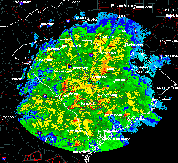 At 610 pm est, a severe thunderstorm capable of producing a tornado was located near branchville, or 11 miles east of bamberg, moving northeast at 35 mph (radar indicated rotation). Hazards include tornado. Flying debris will be dangerous to those caught without shelter. mobile homes will be damaged or destroyed. damage to roofs, windows, and vehicles will occur. Tree damage is likely. At 610 pm est, a severe thunderstorm capable of producing a tornado was located near branchville, or 11 miles east of bamberg, moving northeast at 35 mph (radar indicated rotation). Hazards include tornado. Flying debris will be dangerous to those caught without shelter. mobile homes will be damaged or destroyed. damage to roofs, windows, and vehicles will occur. Tree damage is likely.
|
| 10/10/2018 11:35 PM EDT |
 At 1133 pm edt, a severe thunderstorm capable of producing a tornado was located 7 miles south of orangeburg, or just northeast of rowesville. movement was north at 35 mph. the cordova and orangeburg area are threatened by this storm (radar indicated rotation). Hazards include tornado. Flying debris will be dangerous to those caught without shelter. mobile homes will be damaged or destroyed. damage to roofs, windows, and vehicles will occur. tree damage is likely. Locations impacted include, orangeburg, brookdale, rowesville, cordova, wilkinson heights and edisto. At 1133 pm edt, a severe thunderstorm capable of producing a tornado was located 7 miles south of orangeburg, or just northeast of rowesville. movement was north at 35 mph. the cordova and orangeburg area are threatened by this storm (radar indicated rotation). Hazards include tornado. Flying debris will be dangerous to those caught without shelter. mobile homes will be damaged or destroyed. damage to roofs, windows, and vehicles will occur. tree damage is likely. Locations impacted include, orangeburg, brookdale, rowesville, cordova, wilkinson heights and edisto.
|
| 10/10/2018 11:29 PM EDT |
 At 1128 pm edt, a severe thunderstorm capable of producing a tornado between branchville and rowesville. movement was north at 35 mph and toward the rowesville area (radar indicated rotation). Hazards include tornado. Flying debris will be dangerous to those caught without shelter. mobile homes will be damaged or destroyed. damage to roofs, windows, and vehicles will occur. tree damage is likely. Locations impacted include, orangeburg, brookdale, rowesville, cordova, wilkinson heights and edisto. At 1128 pm edt, a severe thunderstorm capable of producing a tornado between branchville and rowesville. movement was north at 35 mph and toward the rowesville area (radar indicated rotation). Hazards include tornado. Flying debris will be dangerous to those caught without shelter. mobile homes will be damaged or destroyed. damage to roofs, windows, and vehicles will occur. tree damage is likely. Locations impacted include, orangeburg, brookdale, rowesville, cordova, wilkinson heights and edisto.
|
| 10/10/2018 11:26 PM EDT |
 At 1126 pm edt, a severe thunderstorm capable of producing a tornado was located near branchville, or 10 miles east of bamberg, moving north at 35 mph (radar indicated rotation). Hazards include tornado. Flying debris will be dangerous to those caught without shelter. mobile homes will be damaged or destroyed. damage to roofs, windows, and vehicles will occur. Tree damage is likely. At 1126 pm edt, a severe thunderstorm capable of producing a tornado was located near branchville, or 10 miles east of bamberg, moving north at 35 mph (radar indicated rotation). Hazards include tornado. Flying debris will be dangerous to those caught without shelter. mobile homes will be damaged or destroyed. damage to roofs, windows, and vehicles will occur. Tree damage is likely.
|
| 7/26/2018 6:19 PM EDT |
 At 619 pm edt, severe thunderstorms were located along a line extending from near orangeburg to 6 miles northwest of ulmer, moving east at 15 mph (radar indicated). Hazards include 60 mph wind gusts and quarter size hail. Hail damage to vehicles is expected. expect wind damage to roofs, siding, and trees. locations impacted include, orangeburg, barnwell, bamberg, denmark, brookdale, blackville, branchville, bowman, ehrhardt, hilda, neeses, norway, rowesville, snelling, olar, kline, cordova, livingston, cope and govan. this includes the following highways, interstate 26 between mile markers 143 and 167. Interstate 95 near mile marker 89. At 619 pm edt, severe thunderstorms were located along a line extending from near orangeburg to 6 miles northwest of ulmer, moving east at 15 mph (radar indicated). Hazards include 60 mph wind gusts and quarter size hail. Hail damage to vehicles is expected. expect wind damage to roofs, siding, and trees. locations impacted include, orangeburg, barnwell, bamberg, denmark, brookdale, blackville, branchville, bowman, ehrhardt, hilda, neeses, norway, rowesville, snelling, olar, kline, cordova, livingston, cope and govan. this includes the following highways, interstate 26 between mile markers 143 and 167. Interstate 95 near mile marker 89.
|
| 7/26/2018 6:13 PM EDT |
 At 613 pm edt, severe thunderstorms were located along a line extending from near orangeburg to 6 miles north of seigling, moving east at 15 mph (radar indicated). Hazards include 60 mph wind gusts and penny size hail. expect damage to roofs, siding, and trees At 613 pm edt, severe thunderstorms were located along a line extending from near orangeburg to 6 miles north of seigling, moving east at 15 mph (radar indicated). Hazards include 60 mph wind gusts and penny size hail. expect damage to roofs, siding, and trees
|
| 7/26/2018 5:39 PM EDT |
 At 538 pm edt, a severe thunderstorm was located near brookdale, moving southeast at 20 mph (radar indicated). Hazards include 60 mph wind gusts. Expect damage to roofs, siding, and trees. locations impacted include, orangeburg, brookdale, st. matthews, cameron, rowesville, cordova, wilkinson heights and edisto. This includes interstate 26 between mile markers 133 and 155. At 538 pm edt, a severe thunderstorm was located near brookdale, moving southeast at 20 mph (radar indicated). Hazards include 60 mph wind gusts. Expect damage to roofs, siding, and trees. locations impacted include, orangeburg, brookdale, st. matthews, cameron, rowesville, cordova, wilkinson heights and edisto. This includes interstate 26 between mile markers 133 and 155.
|
| 7/26/2018 5:16 PM EDT |
 At 516 pm edt, a severe thunderstorm was located 8 miles west of st. matthews, or 11 miles northwest of brookdale, moving southeast at 25 mph (radar indicated). Hazards include 60 mph wind gusts and quarter size hail. Hail damage to vehicles is expected. Expect wind damage to roofs, siding, and trees. At 516 pm edt, a severe thunderstorm was located 8 miles west of st. matthews, or 11 miles northwest of brookdale, moving southeast at 25 mph (radar indicated). Hazards include 60 mph wind gusts and quarter size hail. Hail damage to vehicles is expected. Expect wind damage to roofs, siding, and trees.
|
| 6/25/2018 9:23 PM EDT |
 The severe thunderstorm warning for barnwell, bamberg and southwestern orangeburg counties will expire at 930 pm edt, the storms which prompted the warning have weakened below severe limits, and no longer pose an immediate threat to life or property. therefore, the warning will be allowed to expire. however gusty winds and frequent lightning are still expected with these thunderstorms. to report severe weather, contact your nearest law enforcement agency. they will relay your report to the national weather service columbia. remember, a severe thunderstorm warning still remains in effect for portions of bamberg and orangeburg counties until 10 pm. The severe thunderstorm warning for barnwell, bamberg and southwestern orangeburg counties will expire at 930 pm edt, the storms which prompted the warning have weakened below severe limits, and no longer pose an immediate threat to life or property. therefore, the warning will be allowed to expire. however gusty winds and frequent lightning are still expected with these thunderstorms. to report severe weather, contact your nearest law enforcement agency. they will relay your report to the national weather service columbia. remember, a severe thunderstorm warning still remains in effect for portions of bamberg and orangeburg counties until 10 pm.
|
| 6/25/2018 9:14 PM EDT |
 At 914 pm edt, severe thunderstorms were located along a line extending from near st. matthews to near ulmer, moving southeast at 25 mph (radar indicated). Hazards include 60 mph wind gusts. expect damage to roofs, siding, and trees At 914 pm edt, severe thunderstorms were located along a line extending from near st. matthews to near ulmer, moving southeast at 25 mph (radar indicated). Hazards include 60 mph wind gusts. expect damage to roofs, siding, and trees
|
| 6/25/2018 8:58 PM EDT |
 At 858 pm edt, severe thunderstorms were located along a line extending from near orangeburg to barnwell, moving east at 55 mph (radar indicated). Hazards include 60 mph wind gusts and penny size hail. Expect damage to roofs, siding, and trees. locations impacted include, barnwell, bamberg, denmark, savannah river site, williston, blackville, branchville, bowman, ehrhardt, springfield, hilda, neeses, norway, rowesville, snelling, olar, kline, elko, cordova and cope. This includes interstate 95 near mile marker 85. At 858 pm edt, severe thunderstorms were located along a line extending from near orangeburg to barnwell, moving east at 55 mph (radar indicated). Hazards include 60 mph wind gusts and penny size hail. Expect damage to roofs, siding, and trees. locations impacted include, barnwell, bamberg, denmark, savannah river site, williston, blackville, branchville, bowman, ehrhardt, springfield, hilda, neeses, norway, rowesville, snelling, olar, kline, elko, cordova and cope. This includes interstate 95 near mile marker 85.
|
| 6/25/2018 8:28 PM EDT |
 At 827 pm edt, severe thunderstorms were located along a line extending from 13 miles north of williston to near jackson, moving east at 60 mph (radar indicated). Hazards include 60 mph wind gusts and penny size hail. expect damage to roofs, siding, and trees At 827 pm edt, severe thunderstorms were located along a line extending from 13 miles north of williston to near jackson, moving east at 60 mph (radar indicated). Hazards include 60 mph wind gusts and penny size hail. expect damage to roofs, siding, and trees
|
| 6/25/2018 8:14 PM EDT |
 At 813 pm edt, severe thunderstorms were located along a line extending from near manning to near elloree to 10 miles south of gaston, moving southeast at 20 mph (radar indicated). Hazards include 70 mph wind gusts and quarter size hail. Hail damage to vehicles is expected. expect considerable tree damage. Wind damage is also likely to mobile homes, roofs, and outbuildings. At 813 pm edt, severe thunderstorms were located along a line extending from near manning to near elloree to 10 miles south of gaston, moving southeast at 20 mph (radar indicated). Hazards include 70 mph wind gusts and quarter size hail. Hail damage to vehicles is expected. expect considerable tree damage. Wind damage is also likely to mobile homes, roofs, and outbuildings.
|
| 6/24/2018 11:42 PM EDT |
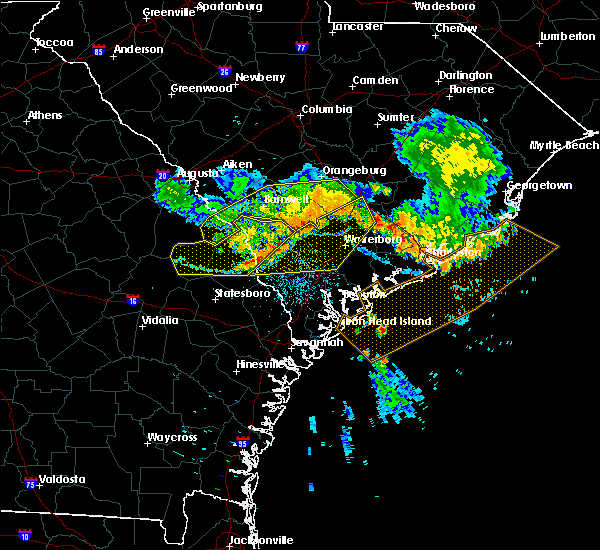 The national weather service in columbia has issued a * severe thunderstorm warning for. bamberg county in central south carolina. south central orangeburg county in central south carolina. until 1245 am edt. At 1141 pm edt, severe thunderstorms were located along a line. The national weather service in columbia has issued a * severe thunderstorm warning for. bamberg county in central south carolina. south central orangeburg county in central south carolina. until 1245 am edt. At 1141 pm edt, severe thunderstorms were located along a line.
|
| 6/24/2018 11:30 PM EDT |
 At 1129 pm edt, severe thunderstorms were located along a line extending from 9 miles southwest of cross to 8 miles south of orangeburg to near denmark to 6 miles north of sardis, moving east at 50 mph (radar indicated). Hazards include 60 mph wind gusts and quarter size hail. Hail damage to vehicles is expected. expect wind damage to roofs, siding, and trees. locations impacted include, barnwell, bamberg, denmark, blackville, branchville, sardis, bowman, ehrhardt, hilda, rowesville, snelling, olar, kline, elko, cordova, girard, cope and govan. this includes the following highways, interstate 26 between mile markers 154 and 164. Interstate 95 near mile marker 85. At 1129 pm edt, severe thunderstorms were located along a line extending from 9 miles southwest of cross to 8 miles south of orangeburg to near denmark to 6 miles north of sardis, moving east at 50 mph (radar indicated). Hazards include 60 mph wind gusts and quarter size hail. Hail damage to vehicles is expected. expect wind damage to roofs, siding, and trees. locations impacted include, barnwell, bamberg, denmark, blackville, branchville, sardis, bowman, ehrhardt, hilda, rowesville, snelling, olar, kline, elko, cordova, girard, cope and govan. this includes the following highways, interstate 26 between mile markers 154 and 164. Interstate 95 near mile marker 85.
|
| 6/24/2018 10:52 PM EDT |
 At 1051 pm edt, severe thunderstorms were located along a line extending from bowman to 10 miles north of blackville to near new ellenton to 7 miles south of hephzibah, moving southeast at 20 mph (radar indicated). Hazards include 60 mph wind gusts and quarter size hail. Hail damage to vehicles is expected. Expect wind damage to roofs, siding, and trees. At 1051 pm edt, severe thunderstorms were located along a line extending from bowman to 10 miles north of blackville to near new ellenton to 7 miles south of hephzibah, moving southeast at 20 mph (radar indicated). Hazards include 60 mph wind gusts and quarter size hail. Hail damage to vehicles is expected. Expect wind damage to roofs, siding, and trees.
|
| 6/24/2018 10:40 PM EDT |
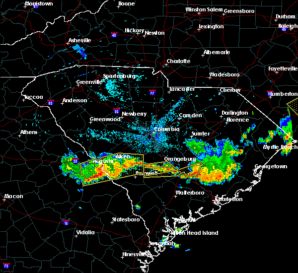 At 1039 pm edt, severe thunderstorms were located along a line extending from near bowman to near blackville, moving southeast at 20 mph (radar indicated). Hazards include 60 mph wind gusts and penny size hail. expect damage to roofs, siding, and trees At 1039 pm edt, severe thunderstorms were located along a line extending from near bowman to near blackville, moving southeast at 20 mph (radar indicated). Hazards include 60 mph wind gusts and penny size hail. expect damage to roofs, siding, and trees
|
| 6/24/2018 10:09 PM EDT |
 At 1008 pm edt, severe thunderstorms were located along a line extending from near orangeburg to 6 miles northeast of blackville, moving southeast at 20 mph (radar indicated). Hazards include 60 mph wind gusts. expect damage to roofs, siding, and trees At 1008 pm edt, severe thunderstorms were located along a line extending from near orangeburg to 6 miles northeast of blackville, moving southeast at 20 mph (radar indicated). Hazards include 60 mph wind gusts. expect damage to roofs, siding, and trees
|
| 4/15/2018 2:46 PM EDT |
 At 245 pm edt, thunderstorms with wind gusts of 40 to 60 mph were in parts of western orangeburg county, moving northward at 50 mph (radar indicated). Hazards include 60 mph wind gusts. Expect damage to roofs, siding, and trees. locations impacted include, orangeburg, bamberg, denmark, brookdale, branchville, swansea, north, ehrhardt, neeses, norway, rowesville, woodford, cordova, livingston, cope, edisto and wilkinson heights. this includes interstate 26 between mile markers 123 and 127. A tornado watch remains in effect until 700 pm edt for central south carolina. At 245 pm edt, thunderstorms with wind gusts of 40 to 60 mph were in parts of western orangeburg county, moving northward at 50 mph (radar indicated). Hazards include 60 mph wind gusts. Expect damage to roofs, siding, and trees. locations impacted include, orangeburg, bamberg, denmark, brookdale, branchville, swansea, north, ehrhardt, neeses, norway, rowesville, woodford, cordova, livingston, cope, edisto and wilkinson heights. this includes interstate 26 between mile markers 123 and 127. A tornado watch remains in effect until 700 pm edt for central south carolina.
|
| 4/15/2018 2:31 PM EDT |
 At 229 pm edt, likely severe thunderstorms were just southwest of north in western orangeburg county and in the area extending from williston and blackville in northern barnwell county. movement was northeast near 50 mph (radar indicated). Hazards include 60 mph wind gusts. Expect damage to roofs, siding, and trees. locations impacted include, orangeburg, bamberg, denmark, brookdale, williston, blackville, branchville, swansea, north, ehrhardt, springfield, hilda, salley, neeses, norway, rowesville, olar, elko, woodford and cordova. this includes interstate 26 between mile markers 123 and 127. A tornado watch remains in effect until 700 pm edt for central south carolina. At 229 pm edt, likely severe thunderstorms were just southwest of north in western orangeburg county and in the area extending from williston and blackville in northern barnwell county. movement was northeast near 50 mph (radar indicated). Hazards include 60 mph wind gusts. Expect damage to roofs, siding, and trees. locations impacted include, orangeburg, bamberg, denmark, brookdale, williston, blackville, branchville, swansea, north, ehrhardt, springfield, hilda, salley, neeses, norway, rowesville, olar, elko, woodford and cordova. this includes interstate 26 between mile markers 123 and 127. A tornado watch remains in effect until 700 pm edt for central south carolina.
|
| 4/15/2018 2:13 PM EDT |
 At 212 pm edt, likely severe thunderstorms were in the savannah river site moving northeast near 50 mph (radar indicated). Hazards include 60 mph wind gusts. expect damage to roofs, siding, and trees At 212 pm edt, likely severe thunderstorms were in the savannah river site moving northeast near 50 mph (radar indicated). Hazards include 60 mph wind gusts. expect damage to roofs, siding, and trees
|
| 10/23/2017 6:48 PM EDT |
 At 646 pm edt, a severe thunderstorm was located near brookdale, moving northeast at 30 mph (radar indicated). Hazards include 60 mph wind gusts. Expect damage to roofs, siding, and trees. locations impacted include, orangeburg, brookdale, st. matthews, branchville, cameron, rowesville, cordova, wilkinson heights and edisto. A tornado watch remains in effect until 900 pm edt for central south carolina. At 646 pm edt, a severe thunderstorm was located near brookdale, moving northeast at 30 mph (radar indicated). Hazards include 60 mph wind gusts. Expect damage to roofs, siding, and trees. locations impacted include, orangeburg, brookdale, st. matthews, branchville, cameron, rowesville, cordova, wilkinson heights and edisto. A tornado watch remains in effect until 900 pm edt for central south carolina.
|
| 10/23/2017 6:18 PM EDT |
 At 618 pm edt, a severe thunderstorm was located 7 miles northeast of bamberg, moving northeast at 35 mph (radar indicated). Hazards include 60 mph wind gusts. expect damage to roofs, siding, and trees At 618 pm edt, a severe thunderstorm was located 7 miles northeast of bamberg, moving northeast at 35 mph (radar indicated). Hazards include 60 mph wind gusts. expect damage to roofs, siding, and trees
|
| 10/23/2017 4:06 PM EDT |
 At 406 pm edt, a severe thunderstorm was located near orangeburg, moving northeast at 40 mph (radar indicated). Hazards include 60 mph wind gusts. Expect damage to roofs, siding, and trees. locations impacted include, orangeburg, brookdale, cameron, rowesville, cordova, cope, wilkinson heights and edisto. A tornado watch remains in effect until 900 pm edt for central south carolina. At 406 pm edt, a severe thunderstorm was located near orangeburg, moving northeast at 40 mph (radar indicated). Hazards include 60 mph wind gusts. Expect damage to roofs, siding, and trees. locations impacted include, orangeburg, brookdale, cameron, rowesville, cordova, cope, wilkinson heights and edisto. A tornado watch remains in effect until 900 pm edt for central south carolina.
|
| 10/23/2017 3:35 PM EDT |
 At 335 pm edt, a severe thunderstorm was located near bamberg, moving northeast at 40 mph (radar indicated). Hazards include 60 mph wind gusts. expect damage to roofs, siding, and trees At 335 pm edt, a severe thunderstorm was located near bamberg, moving northeast at 40 mph (radar indicated). Hazards include 60 mph wind gusts. expect damage to roofs, siding, and trees
|
| 7/19/2017 2:57 PM EDT |
 At 257 pm edt, a severe thunderstorm was located 7 miles northwest of bowman, or 7 miles southeast of brookdale, moving southeast at 20 mph (radar indicated). Hazards include 60 mph wind gusts and nickel size hail. expect damage to roofs, siding, and trees At 257 pm edt, a severe thunderstorm was located 7 miles northwest of bowman, or 7 miles southeast of brookdale, moving southeast at 20 mph (radar indicated). Hazards include 60 mph wind gusts and nickel size hail. expect damage to roofs, siding, and trees
|
| 7/15/2017 3:09 PM EDT |
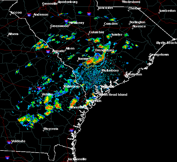 At 306 pm edt, thunderstorms extended from just east of branchville in eastern orangeburg county southwest into the area between bamberg and ehrhardt. movement was near near 15 mph. some of the thunderstorms likely contained wind gusts near 60 mph especially in the area just southeast of bamberg. very heavy rain will lead to ponding of water in poor drainage areas. do not attempt to drive on flooded roads (radar indicated). Hazards include 60 mph wind gusts. Expect damage to roofs, siding, and trees. Locations impacted include, branchville, ehrhardt, rowesville and olar. At 306 pm edt, thunderstorms extended from just east of branchville in eastern orangeburg county southwest into the area between bamberg and ehrhardt. movement was near near 15 mph. some of the thunderstorms likely contained wind gusts near 60 mph especially in the area just southeast of bamberg. very heavy rain will lead to ponding of water in poor drainage areas. do not attempt to drive on flooded roads (radar indicated). Hazards include 60 mph wind gusts. Expect damage to roofs, siding, and trees. Locations impacted include, branchville, ehrhardt, rowesville and olar.
|
| 7/15/2017 2:57 PM EDT |
 At 255 pm edt, thunderstorms extended from near branchville in orangeburg county southwest through bamberg county. movement was east near 15 mph. some of these storms likely contained wind gusts near 60 mph (radar indicated). Hazards include 60 mph wind gusts. expect damage to roofs, siding, and trees At 255 pm edt, thunderstorms extended from near branchville in orangeburg county southwest through bamberg county. movement was east near 15 mph. some of these storms likely contained wind gusts near 60 mph (radar indicated). Hazards include 60 mph wind gusts. expect damage to roofs, siding, and trees
|
| 7/8/2017 8:41 PM EDT |
 The severe thunderstorm warning for southern calhoun, barnwell, bamberg, southern aiken and orangeburg counties will expire at 845 pm edt, the storms which prompted the warning have weakened below severe limits, and no longer pose an immediate threat to life or property. therefore the warning will be allowed to expire. however gusty winds are still possible with these thunderstorms. The severe thunderstorm warning for southern calhoun, barnwell, bamberg, southern aiken and orangeburg counties will expire at 845 pm edt, the storms which prompted the warning have weakened below severe limits, and no longer pose an immediate threat to life or property. therefore the warning will be allowed to expire. however gusty winds are still possible with these thunderstorms.
|
| 7/8/2017 8:22 PM EDT |
 At 822 pm edt, severe thunderstorms were located along a line extending from near new ellenton to near elloree, moving east at 15 mph (radar indicated). Hazards include 60 mph wind gusts and quarter size hail. Hail damage to vehicles is expected. expect wind damage to roofs, siding, and trees. locations impacted include, orangeburg, barnwell, bamberg, denmark, brookdale, williston, blackville, new ellenton, st. Matthews, jackson, branchville, bowman, elloree, santee, springfield, hilda, cameron, neeses, norway and rowesville. At 822 pm edt, severe thunderstorms were located along a line extending from near new ellenton to near elloree, moving east at 15 mph (radar indicated). Hazards include 60 mph wind gusts and quarter size hail. Hail damage to vehicles is expected. expect wind damage to roofs, siding, and trees. locations impacted include, orangeburg, barnwell, bamberg, denmark, brookdale, williston, blackville, new ellenton, st. Matthews, jackson, branchville, bowman, elloree, santee, springfield, hilda, cameron, neeses, norway and rowesville.
|
| 7/8/2017 7:49 PM EDT |
 At 748 pm edt, severe thunderstorms were located along a line extending from near new ellenton to 6 miles southeast of st. matthews, moving east at 15 mph (radar indicated). Hazards include 60 mph wind gusts and quarter size hail. Hail damage to vehicles is expected. Expect wind damage to roofs, siding, and trees. At 748 pm edt, severe thunderstorms were located along a line extending from near new ellenton to 6 miles southeast of st. matthews, moving east at 15 mph (radar indicated). Hazards include 60 mph wind gusts and quarter size hail. Hail damage to vehicles is expected. Expect wind damage to roofs, siding, and trees.
|
| 5/1/2017 7:37 PM EDT |
 At 736 pm edt, severe thunderstorms were located along a line extending from 6 miles southwest of st. matthews to crocketville, moving northeast at 40 mph (radar indicated). Hazards include 60 mph wind gusts and nickel size hail. Expect damage to roofs, siding, and trees. locations impacted include, orangeburg, bamberg, denmark, brookdale, st. Matthews, branchville, north, ehrhardt, neeses, norway, rowesville, olar, cordova, livingston, cope, govan, wilkinson heights and edisto. At 736 pm edt, severe thunderstorms were located along a line extending from 6 miles southwest of st. matthews to crocketville, moving northeast at 40 mph (radar indicated). Hazards include 60 mph wind gusts and nickel size hail. Expect damage to roofs, siding, and trees. locations impacted include, orangeburg, bamberg, denmark, brookdale, st. Matthews, branchville, north, ehrhardt, neeses, norway, rowesville, olar, cordova, livingston, cope, govan, wilkinson heights and edisto.
|
| 5/1/2017 7:18 PM EDT |
 At 717 pm edt, severe thunderstorms were located along a line extending from 11 miles west of orangeburg to luray, moving northeast at 40 mph (radar indicated). Hazards include 60 mph wind gusts and nickel size hail. Expect damage to roofs, siding, and trees. locations impacted include, orangeburg, bamberg, denmark, brookdale, st. Matthews, branchville, north, ehrhardt, hilda, neeses, norway, rowesville, olar, cordova, livingston, cope, govan, wilkinson heights and edisto. At 717 pm edt, severe thunderstorms were located along a line extending from 11 miles west of orangeburg to luray, moving northeast at 40 mph (radar indicated). Hazards include 60 mph wind gusts and nickel size hail. Expect damage to roofs, siding, and trees. locations impacted include, orangeburg, bamberg, denmark, brookdale, st. Matthews, branchville, north, ehrhardt, hilda, neeses, norway, rowesville, olar, cordova, livingston, cope, govan, wilkinson heights and edisto.
|
| 5/1/2017 7:03 PM EDT |
 At 703 pm edt, severe thunderstorms were located along a line extending from 9 miles northeast of blackville to near shirley, moving northeast at 40 mph (radar indicated). Hazards include 60 mph wind gusts and nickel size hail. expect damage to roofs, siding, and trees At 703 pm edt, severe thunderstorms were located along a line extending from 9 miles northeast of blackville to near shirley, moving northeast at 40 mph (radar indicated). Hazards include 60 mph wind gusts and nickel size hail. expect damage to roofs, siding, and trees
|
| 4/6/2017 1:26 AM EDT |
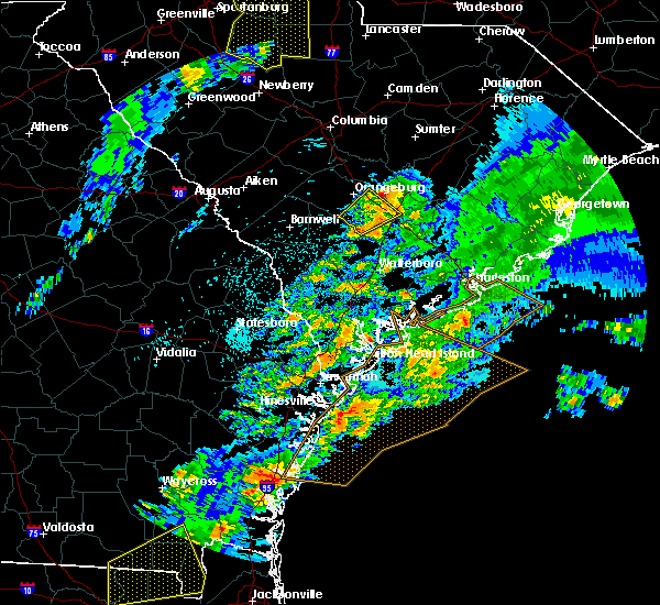 The severe thunderstorm warning for south central orangeburg county will expire at 130 am edt, the storm which prompted the warning has weakened below severe limits, and no longer pose an immediate threat to life or property. therefore the warning will be allowed to expire. however gusty winds are still possible with this thunderstorm. The severe thunderstorm warning for south central orangeburg county will expire at 130 am edt, the storm which prompted the warning has weakened below severe limits, and no longer pose an immediate threat to life or property. therefore the warning will be allowed to expire. however gusty winds are still possible with this thunderstorm.
|
| 4/6/2017 1:11 AM EDT |
 At 111 am edt, a severe thunderstorm was located over branchville, or 13 miles east of bamberg, moving northeast at 70 mph (radar indicated). Hazards include 60 mph wind gusts and quarter size hail. Hail damage to vehicles is expected. expect wind damage to roofs, siding, and trees. Locations impacted include, branchville, bowman and rowesville. At 111 am edt, a severe thunderstorm was located over branchville, or 13 miles east of bamberg, moving northeast at 70 mph (radar indicated). Hazards include 60 mph wind gusts and quarter size hail. Hail damage to vehicles is expected. expect wind damage to roofs, siding, and trees. Locations impacted include, branchville, bowman and rowesville.
|
| 4/6/2017 12:56 AM EDT |
 At 1255 am edt, a severe thunderstorm was located near lodge, or 12 miles south of bamberg, moving northeast at 70 mph (radar indicated). Hazards include 60 mph wind gusts and quarter size hail. Hail damage to vehicles is expected. Expect wind damage to roofs, siding, and trees. At 1255 am edt, a severe thunderstorm was located near lodge, or 12 miles south of bamberg, moving northeast at 70 mph (radar indicated). Hazards include 60 mph wind gusts and quarter size hail. Hail damage to vehicles is expected. Expect wind damage to roofs, siding, and trees.
|
| 4/5/2017 4:25 PM EDT |
 At 425 pm edt, a severe thunderstorm capable of producing a tornado was located 8 miles southwest of orangeburg, moving east at 30 mph (radar indicated rotation). Hazards include tornado. Flying debris will be dangerous to those caught without shelter. mobile homes will be damaged or destroyed. damage to roofs, windows, and vehicles will occur. tree damage is likely. Locations impacted include, branchville and rowesville. At 425 pm edt, a severe thunderstorm capable of producing a tornado was located 8 miles southwest of orangeburg, moving east at 30 mph (radar indicated rotation). Hazards include tornado. Flying debris will be dangerous to those caught without shelter. mobile homes will be damaged or destroyed. damage to roofs, windows, and vehicles will occur. tree damage is likely. Locations impacted include, branchville and rowesville.
|
| 4/5/2017 4:13 PM EDT |
 At 413 pm edt, a severe thunderstorm capable of producing a tornado was located 7 miles north of bamberg, moving east at 30 mph (radar indicated rotation). Hazards include tornado and quarter size hail. Flying debris will be dangerous to those caught without shelter. mobile homes will be damaged or destroyed. damage to roofs, windows, and vehicles will occur. tree damage is likely. Locations impacted include, branchville, rowesville, cordova and cope. At 413 pm edt, a severe thunderstorm capable of producing a tornado was located 7 miles north of bamberg, moving east at 30 mph (radar indicated rotation). Hazards include tornado and quarter size hail. Flying debris will be dangerous to those caught without shelter. mobile homes will be damaged or destroyed. damage to roofs, windows, and vehicles will occur. tree damage is likely. Locations impacted include, branchville, rowesville, cordova and cope.
|
| 4/5/2017 4:04 PM EDT |
 At 404 pm edt, a severe thunderstorm capable of producing a tornado was located 8 miles north of denmark, moving east at 25 mph (radar indicated rotation). Hazards include tornado and quarter size hail. Flying debris will be dangerous to those caught without shelter. mobile homes will be damaged or destroyed. damage to roofs, windows, and vehicles will occur. tree damage is likely. Locations impacted include, orangeburg, branchville, rowesville, cordova, cope, edisto and wilkinson heights. At 404 pm edt, a severe thunderstorm capable of producing a tornado was located 8 miles north of denmark, moving east at 25 mph (radar indicated rotation). Hazards include tornado and quarter size hail. Flying debris will be dangerous to those caught without shelter. mobile homes will be damaged or destroyed. damage to roofs, windows, and vehicles will occur. tree damage is likely. Locations impacted include, orangeburg, branchville, rowesville, cordova, cope, edisto and wilkinson heights.
|
| 4/5/2017 3:55 PM EDT |
 At 355 pm edt, a severe thunderstorm capable of producing a tornado was located 9 miles north of denmark, moving east at 30 mph (radar indicated rotation). Hazards include tornado and quarter size hail. Flying debris will be dangerous to those caught without shelter. mobile homes will be damaged or destroyed. damage to roofs, windows, and vehicles will occur. tree damage is likely. this dangerous storm will be near, branchville around 435 pm edt. Other locations impacted by this tornadic thunderstorm include wilkinson heights, cope, rowesville, norway, cordova and edisto. At 355 pm edt, a severe thunderstorm capable of producing a tornado was located 9 miles north of denmark, moving east at 30 mph (radar indicated rotation). Hazards include tornado and quarter size hail. Flying debris will be dangerous to those caught without shelter. mobile homes will be damaged or destroyed. damage to roofs, windows, and vehicles will occur. tree damage is likely. this dangerous storm will be near, branchville around 435 pm edt. Other locations impacted by this tornadic thunderstorm include wilkinson heights, cope, rowesville, norway, cordova and edisto.
|
| 4/3/2017 4:57 PM EDT |
 At 456 pm edt, severe thunderstorms were located along a line extending from near st. matthews to near ulmer, moving east at 65 mph (radar indicated). Hazards include 70 mph wind gusts and quarter size hail. Hail damage to vehicles is expected. expect considerable tree damage. Wind damage is also likely to mobile homes, roofs, and outbuildings. At 456 pm edt, severe thunderstorms were located along a line extending from near st. matthews to near ulmer, moving east at 65 mph (radar indicated). Hazards include 70 mph wind gusts and quarter size hail. Hail damage to vehicles is expected. expect considerable tree damage. Wind damage is also likely to mobile homes, roofs, and outbuildings.
|
| 4/3/2017 4:46 PM EDT |
 At 444 pm edt, severe thunderstorms were located along a line extending from 8 miles southeast of gaston to near ashton, moving northeast at 30 mph (radar indicated). Hazards include 70 mph wind gusts and quarter size hail. Hail damage to vehicles is expected. expect considerable tree damage. wind damage is also likely to mobile homes, roofs, and outbuildings. locations impacted include, orangeburg, bamberg, denmark, brookdale, st. matthews, branchville, bowman, north, ehrhardt, springfield, cameron, neeses, norway, rowesville, olar, woodford, cordova, livingston, cope and govan. multiple wind damage reports hve been received with this line of thunderstorms this afternoon. A tornado watch remains in effect until 900 pm edt for central south carolina. At 444 pm edt, severe thunderstorms were located along a line extending from 8 miles southeast of gaston to near ashton, moving northeast at 30 mph (radar indicated). Hazards include 70 mph wind gusts and quarter size hail. Hail damage to vehicles is expected. expect considerable tree damage. wind damage is also likely to mobile homes, roofs, and outbuildings. locations impacted include, orangeburg, bamberg, denmark, brookdale, st. matthews, branchville, bowman, north, ehrhardt, springfield, cameron, neeses, norway, rowesville, olar, woodford, cordova, livingston, cope and govan. multiple wind damage reports hve been received with this line of thunderstorms this afternoon. A tornado watch remains in effect until 900 pm edt for central south carolina.
|
| 4/3/2017 4:18 PM EDT |
 At 418 pm edt, severe thunderstorms were located along a line extending from 12 miles southwest of gaston to near sycamore, moving northeast at 60 mph (radar indicated). Hazards include 70 mph wind gusts and quarter size hail. Hail damage to vehicles is expected. expect considerable tree damage. Wind damage is also likely to mobile homes, roofs, and outbuildings. At 418 pm edt, severe thunderstorms were located along a line extending from 12 miles southwest of gaston to near sycamore, moving northeast at 60 mph (radar indicated). Hazards include 70 mph wind gusts and quarter size hail. Hail damage to vehicles is expected. expect considerable tree damage. Wind damage is also likely to mobile homes, roofs, and outbuildings.
|
| 2/15/2017 11:32 AM EST |
 At 1132 am est, a severe thunderstorm was located near bamberg, moving east at 45 mph (radar indicated). Hazards include 60 mph wind gusts. Expect damage to roofs, siding, and trees. Locations impacted include, bamberg, branchville, bowman, ehrhardt, rowesville, olar, kline, cordova, cope and govan. At 1132 am est, a severe thunderstorm was located near bamberg, moving east at 45 mph (radar indicated). Hazards include 60 mph wind gusts. Expect damage to roofs, siding, and trees. Locations impacted include, bamberg, branchville, bowman, ehrhardt, rowesville, olar, kline, cordova, cope and govan.
|
| 2/15/2017 11:21 AM EST |
 At 1120 am est, a severe thunderstorm was located 7 miles northeast of ulmer, or 8 miles south of denmark, moving east at 55 mph (radar indicated). Hazards include 60 mph wind gusts. Expect damage to roofs, siding, and trees. Locations impacted include, bamberg, denmark, branchville, bowman, ehrhardt, hilda, norway, rowesville, olar, kline, cordova, cope and govan. At 1120 am est, a severe thunderstorm was located 7 miles northeast of ulmer, or 8 miles south of denmark, moving east at 55 mph (radar indicated). Hazards include 60 mph wind gusts. Expect damage to roofs, siding, and trees. Locations impacted include, bamberg, denmark, branchville, bowman, ehrhardt, hilda, norway, rowesville, olar, kline, cordova, cope and govan.
|
| 2/15/2017 11:09 AM EST |
 At 1109 am est, a severe thunderstorm was located over barnwell, moving east at 55 mph (radar indicated). Hazards include 60 mph wind gusts. expect damage to roofs, siding, and trees At 1109 am est, a severe thunderstorm was located over barnwell, moving east at 55 mph (radar indicated). Hazards include 60 mph wind gusts. expect damage to roofs, siding, and trees
|
| 2/15/2017 10:35 AM EST |
 At 1035 am est, a severe thunderstorm was located near elloree, or 18 miles southwest of manning, moving east at 45 mph (radar indicated). Hazards include 60 mph wind gusts. expect damage to roofs, siding, and trees At 1035 am est, a severe thunderstorm was located near elloree, or 18 miles southwest of manning, moving east at 45 mph (radar indicated). Hazards include 60 mph wind gusts. expect damage to roofs, siding, and trees
|
| 1/21/2017 4:38 PM EST |
 At 437 pm est, a severe thunderstorm was located near bowman, or 8 miles southeast of orangeburg, moving east at 25 mph (radar indicated). Hazards include 60 mph wind gusts. expect damage to roofs, siding, and trees At 437 pm est, a severe thunderstorm was located near bowman, or 8 miles southeast of orangeburg, moving east at 25 mph (radar indicated). Hazards include 60 mph wind gusts. expect damage to roofs, siding, and trees
|
| 1/21/2017 4:15 PM EST |
 At 415 pm est, a severe thunderstorm capable of producing a tornado was located 7 miles north of bamberg, moving east at 25 mph (radar indicated rotation). Hazards include tornado. Flying debris will be dangerous to those caught without shelter. mobile homes will be damaged or destroyed. damage to roofs, windows, and vehicles will occur. tree damage is likely. this dangerous storm will be near, orangeburg around 440 pm est. brookdale around 445 pm est. Other locations impacted by this tornadic thunderstorm include cope, wilkinson heights, cordova, edisto and rowesville. At 415 pm est, a severe thunderstorm capable of producing a tornado was located 7 miles north of bamberg, moving east at 25 mph (radar indicated rotation). Hazards include tornado. Flying debris will be dangerous to those caught without shelter. mobile homes will be damaged or destroyed. damage to roofs, windows, and vehicles will occur. tree damage is likely. this dangerous storm will be near, orangeburg around 440 pm est. brookdale around 445 pm est. Other locations impacted by this tornadic thunderstorm include cope, wilkinson heights, cordova, edisto and rowesville.
|
| 8/18/2016 4:39 PM EDT |
 At 439 pm edt, a severe thunderstorm was located near bamberg, and is nearly stationary (radar indicated). Hazards include 60 mph wind gusts and nickel size hail. Expect damage to roofs. siding. And trees. At 439 pm edt, a severe thunderstorm was located near bamberg, and is nearly stationary (radar indicated). Hazards include 60 mph wind gusts and nickel size hail. Expect damage to roofs. siding. And trees.
|
| 7/31/2016 5:37 PM EDT |
 At 537 pm edt, a severe thunderstorm was located near branchville, or 12 miles west of saint george, moving southeast at 5 mph (radar indicated). Hazards include 60 mph wind gusts. Expect damage to roofs. siding. and trees. Locations impacted include, branchville, bowman and rowesville. At 537 pm edt, a severe thunderstorm was located near branchville, or 12 miles west of saint george, moving southeast at 5 mph (radar indicated). Hazards include 60 mph wind gusts. Expect damage to roofs. siding. and trees. Locations impacted include, branchville, bowman and rowesville.
|
| 7/31/2016 5:12 PM EDT |
 At 511 pm edt, a severe thunderstorm was located over branchville, or 12 miles southeast of bamberg, and is nearly stationary (radar indicated). Hazards include 70 mph wind gusts and penny size hail. Expect considerable tree damage. damage is likely to mobile homes, roofs, and outbuildings. Locations impacted include, branchville, bowman and rowesville. At 511 pm edt, a severe thunderstorm was located over branchville, or 12 miles southeast of bamberg, and is nearly stationary (radar indicated). Hazards include 70 mph wind gusts and penny size hail. Expect considerable tree damage. damage is likely to mobile homes, roofs, and outbuildings. Locations impacted include, branchville, bowman and rowesville.
|
| 7/31/2016 4:57 PM EDT |
 At 457 pm edt, a severe thunderstorm was located over branchville, or 11 miles east of bamberg, moving northeast at 5 mph (radar indicated). Hazards include 70 mph wind gusts and penny size hail. Expect considerable tree damage. Damage is likely to mobile homes, roofs, and outbuildings. At 457 pm edt, a severe thunderstorm was located over branchville, or 11 miles east of bamberg, moving northeast at 5 mph (radar indicated). Hazards include 70 mph wind gusts and penny size hail. Expect considerable tree damage. Damage is likely to mobile homes, roofs, and outbuildings.
|
| 7/21/2016 4:54 PM EDT |
 At 454 pm edt, a severe thunderstorm was located near branchville, or 11 miles south of orangeburg, neary stationary (radar indicated). Hazards include 60 mph wind gusts and nickel size hail. Expect damage to roofs. siding. And trees. At 454 pm edt, a severe thunderstorm was located near branchville, or 11 miles south of orangeburg, neary stationary (radar indicated). Hazards include 60 mph wind gusts and nickel size hail. Expect damage to roofs. siding. And trees.
|
| 7/15/2016 2:59 PM EDT |
 At 259 pm edt, severe thunderstorms were located along a line extending from near st. matthews to near lodge, moving northeast at 35 mph (radar indicated). Hazards include 60 mph wind gusts and nickel size hail. Expect damage to roofs. siding. And trees. At 259 pm edt, severe thunderstorms were located along a line extending from near st. matthews to near lodge, moving northeast at 35 mph (radar indicated). Hazards include 60 mph wind gusts and nickel size hail. Expect damage to roofs. siding. And trees.
|
| 7/9/2016 12:56 AM EDT |
 At 1254 am edt, severe thunderstorms were located along a line extending from near canadys to gifford to near woodcliff, moving southeast at 35 mph (radar indicated). Hazards include 60 mph wind gusts. Expect damage to roofs. siding. and trees. Locations impacted include, waynesboro, barnwell, bamberg, denmark, savannah river site, hephzibah, williston, blackville, jackson, branchville, sardis, midville, ehrhardt, hilda, keysville, rowesville, snelling, olar, kline and elko. At 1254 am edt, severe thunderstorms were located along a line extending from near canadys to gifford to near woodcliff, moving southeast at 35 mph (radar indicated). Hazards include 60 mph wind gusts. Expect damage to roofs. siding. and trees. Locations impacted include, waynesboro, barnwell, bamberg, denmark, savannah river site, hephzibah, williston, blackville, jackson, branchville, sardis, midville, ehrhardt, hilda, keysville, rowesville, snelling, olar, kline and elko.
|
| 7/9/2016 12:27 AM EDT |
 At 1227 am edt, severe thunderstorms were located along a line extending from 9 miles north of denmark to savannah river site to 8 miles east of wrens, moving southeast at 80 mph (radar indicated). Hazards include 60 mph wind gusts. Expect damage to roofs. siding. And trees. At 1227 am edt, severe thunderstorms were located along a line extending from 9 miles north of denmark to savannah river site to 8 miles east of wrens, moving southeast at 80 mph (radar indicated). Hazards include 60 mph wind gusts. Expect damage to roofs. siding. And trees.
|
| 7/6/2016 5:10 PM EDT |
 The severe thunderstorm warning for southwestern orangeburg, southeastern barnwell and bamberg counties will expire at 515 pm edt, the storms which prompted the warning have moved out of the area. therefore the warning will be allowed to expire. however gusty winds are still possible with these thunderstorms. a severe thunderstorm watch remains in effect until 900 pm edt for central south carolina. The severe thunderstorm warning for southwestern orangeburg, southeastern barnwell and bamberg counties will expire at 515 pm edt, the storms which prompted the warning have moved out of the area. therefore the warning will be allowed to expire. however gusty winds are still possible with these thunderstorms. a severe thunderstorm watch remains in effect until 900 pm edt for central south carolina.
|
| 7/6/2016 4:53 PM EDT |
 At 452 pm edt, severe thunderstorms were located along a line extending from near bowman to 6 miles southeast of barnwell to near woodcliff, moving southeast at 40 mph (radar indicated). Hazards include 60 mph wind gusts. Expect damage to roofs. siding. and trees. Locations impacted include, barnwell, bamberg, denmark, blackville, branchville, bowman, ehrhardt, hilda, norway, rowesville, snelling, olar, kline, cordova, cope, govan and duncan chapel. At 452 pm edt, severe thunderstorms were located along a line extending from near bowman to 6 miles southeast of barnwell to near woodcliff, moving southeast at 40 mph (radar indicated). Hazards include 60 mph wind gusts. Expect damage to roofs. siding. and trees. Locations impacted include, barnwell, bamberg, denmark, blackville, branchville, bowman, ehrhardt, hilda, norway, rowesville, snelling, olar, kline, cordova, cope, govan and duncan chapel.
|
| 7/6/2016 4:42 PM EDT |
 At 441 pm edt, severe thunderstorms were located along a line extending from 6 miles southeast of orangeburg to barnwell to 6 miles east of millen, moving southeast at 40 mph (radar indicated). Hazards include 60 mph wind gusts. Expect damage to roofs. siding. and trees. Locations impacted include, barnwell, bamberg, denmark, blackville, branchville, sardis, bowman, ehrhardt, hilda, norway, rowesville, snelling, olar, kline, elko, cordova, girard, cope, govan and duncan chapel. At 441 pm edt, severe thunderstorms were located along a line extending from 6 miles southeast of orangeburg to barnwell to 6 miles east of millen, moving southeast at 40 mph (radar indicated). Hazards include 60 mph wind gusts. Expect damage to roofs. siding. and trees. Locations impacted include, barnwell, bamberg, denmark, blackville, branchville, sardis, bowman, ehrhardt, hilda, norway, rowesville, snelling, olar, kline, elko, cordova, girard, cope, govan and duncan chapel.
|
| 7/6/2016 4:33 PM EDT |
 At 432 pm edt, severe thunderstorms were located along a line extending from near orangeburg to near barnwell to near perkins, moving southeast at 40 mph (radar indicated). Hazards include 60 mph wind gusts. Expect damage to roofs. siding. and trees. Locations impacted include, waynesboro, barnwell, bamberg, denmark, savannah river site, williston, blackville, branchville, sardis, bowman, ehrhardt, hilda, norway, rowesville, snelling, olar, kline, elko, cordova and girard. At 432 pm edt, severe thunderstorms were located along a line extending from near orangeburg to near barnwell to near perkins, moving southeast at 40 mph (radar indicated). Hazards include 60 mph wind gusts. Expect damage to roofs. siding. and trees. Locations impacted include, waynesboro, barnwell, bamberg, denmark, savannah river site, williston, blackville, branchville, sardis, bowman, ehrhardt, hilda, norway, rowesville, snelling, olar, kline, elko, cordova and girard.
|
| 7/6/2016 4:23 PM EDT |
 At 423 pm edt, severe thunderstorms were located along a line extending from near orangeburg to 9 miles east of savannah river site to near perkins, moving southeast at 40 mph (radar indicated). Hazards include 60 mph wind gusts. Expect damage to roofs. siding. And trees. At 423 pm edt, severe thunderstorms were located along a line extending from near orangeburg to 9 miles east of savannah river site to near perkins, moving southeast at 40 mph (radar indicated). Hazards include 60 mph wind gusts. Expect damage to roofs. siding. And trees.
|
| 7/5/2016 6:20 PM EDT |
 At 619 pm edt, a line of thunderstorms extended from eastern calhoun county southward into bamberg county. movement was eastward near 35 mph. some of the thunderstorms in the line contained wind gusts of 40 to 60 mph (radar indicated). Hazards include 60 mph wind gusts. Expect damage to roofs. siding. And trees. At 619 pm edt, a line of thunderstorms extended from eastern calhoun county southward into bamberg county. movement was eastward near 35 mph. some of the thunderstorms in the line contained wind gusts of 40 to 60 mph (radar indicated). Hazards include 60 mph wind gusts. Expect damage to roofs. siding. And trees.
|
| 6/24/2016 5:25 PM EDT |
 At 524 pm edt, severe thunderstorms were located along a line extending from 12 miles south of cartersville to 16 miles south of gaston, moving southeast at 25 mph (radar indicated). Hazards include 60 mph wind gusts and quarter size hail. Hail damage to vehicles is expected. Expect wind damage to roofs, siding, and trees. At 524 pm edt, severe thunderstorms were located along a line extending from 12 miles south of cartersville to 16 miles south of gaston, moving southeast at 25 mph (radar indicated). Hazards include 60 mph wind gusts and quarter size hail. Hail damage to vehicles is expected. Expect wind damage to roofs, siding, and trees.
|
| 6/17/2016 4:38 PM EDT |
 The severe thunderstorm warning for southwestern orangeburg and bamberg counties will expire at 445 pm edt, the storm which prompted the warning has moved out of the area. therefore the warning will be allowed to expire. a severe thunderstorm watch remains in effect until 1000 pm edt for central south carolina. The severe thunderstorm warning for southwestern orangeburg and bamberg counties will expire at 445 pm edt, the storm which prompted the warning has moved out of the area. therefore the warning will be allowed to expire. a severe thunderstorm watch remains in effect until 1000 pm edt for central south carolina.
|
| 6/17/2016 4:14 PM EDT |
 At 413 pm edt, a severe thunderstorm was located near padgetts, or 12 miles southeast of bamberg, moving east at 40 mph (radar indicated). Hazards include 70 mph wind gusts and nickel size hail. Expect considerable tree damage. damage is likely to mobile homes, roofs, and outbuildings. Locations impacted include, bamberg, denmark, branchville, bowman, ehrhardt, rowesville, olar, cope and govan. At 413 pm edt, a severe thunderstorm was located near padgetts, or 12 miles southeast of bamberg, moving east at 40 mph (radar indicated). Hazards include 70 mph wind gusts and nickel size hail. Expect considerable tree damage. damage is likely to mobile homes, roofs, and outbuildings. Locations impacted include, bamberg, denmark, branchville, bowman, ehrhardt, rowesville, olar, cope and govan.
|
| 6/17/2016 4:07 PM EDT |
 At 406 pm edt, a severe thunderstorm was located 7 miles south of bamberg, moving southeast at 40 mph (radar indicated). Hazards include 70 mph wind gusts and half dollar size hail. Hail damage to vehicles is expected. expect considerable tree damage. wind damage is also likely to mobile homes, roofs, and outbuildings. Locations impacted include, barnwell, bamberg, denmark, blackville, branchville, bowman, ehrhardt, hilda, norway, rowesville, olar, kline, cope and govan. At 406 pm edt, a severe thunderstorm was located 7 miles south of bamberg, moving southeast at 40 mph (radar indicated). Hazards include 70 mph wind gusts and half dollar size hail. Hail damage to vehicles is expected. expect considerable tree damage. wind damage is also likely to mobile homes, roofs, and outbuildings. Locations impacted include, barnwell, bamberg, denmark, blackville, branchville, bowman, ehrhardt, hilda, norway, rowesville, olar, kline, cope and govan.
|
| 6/17/2016 3:53 PM EDT |
 At 353 pm edt, a severe thunderstorm was located near barnwell, moving southeast at 30 mph (radar indicated). Hazards include 70 mph wind gusts and half dollar size hail. Hail damage to vehicles is expected. expect considerable tree damage. Wind damage is also likely to mobile homes, roofs, and outbuildings. At 353 pm edt, a severe thunderstorm was located near barnwell, moving southeast at 30 mph (radar indicated). Hazards include 70 mph wind gusts and half dollar size hail. Hail damage to vehicles is expected. expect considerable tree damage. Wind damage is also likely to mobile homes, roofs, and outbuildings.
|
| 6/17/2016 3:24 PM EDT |
 At 323 pm edt, a severe thunderstorm was located 10 miles northeast of williston, or 19 miles northwest of denmark, moving east at 40 mph (radar indicated). Hazards include 70 mph wind gusts and half dollar size hail. Hail damage to vehicles is expected. expect considerable tree damage. wind damage is also likely to mobile homes, roofs, and outbuildings. locations impacted include, orangeburg, bamberg, denmark, brookdale, williston, blackville, new ellenton, st. Matthews, holly hill, branchville, bowman, elloree, santee, swansea, wagener, north, pelion, springfield, hilda and cameron. At 323 pm edt, a severe thunderstorm was located 10 miles northeast of williston, or 19 miles northwest of denmark, moving east at 40 mph (radar indicated). Hazards include 70 mph wind gusts and half dollar size hail. Hail damage to vehicles is expected. expect considerable tree damage. wind damage is also likely to mobile homes, roofs, and outbuildings. locations impacted include, orangeburg, bamberg, denmark, brookdale, williston, blackville, new ellenton, st. Matthews, holly hill, branchville, bowman, elloree, santee, swansea, wagener, north, pelion, springfield, hilda and cameron.
|
| 6/17/2016 3:13 PM EDT |
 At 313 pm edt, a severe thunderstorm was located near bowman, or 9 miles southeast of orangeburg, moving east at 30 mph (radar indicated). Hazards include 60 mph wind gusts and quarter size hail. Hail damage to vehicles is expected. expect wind damage to roofs, siding, and trees. locations impacted include, orangeburg, bamberg, denmark, brookdale, williston, blackville, new ellenton, st. Matthews, holly hill, branchville, bowman, elloree, santee, swansea, wagener, north, pelion, springfield, hilda and cameron. At 313 pm edt, a severe thunderstorm was located near bowman, or 9 miles southeast of orangeburg, moving east at 30 mph (radar indicated). Hazards include 60 mph wind gusts and quarter size hail. Hail damage to vehicles is expected. expect wind damage to roofs, siding, and trees. locations impacted include, orangeburg, bamberg, denmark, brookdale, williston, blackville, new ellenton, st. Matthews, holly hill, branchville, bowman, elloree, santee, swansea, wagener, north, pelion, springfield, hilda and cameron.
|
| 6/17/2016 2:43 PM EDT |
 At 243 pm edt, a severe thunderstorm was located 9 miles north of bamberg, moving east at 30 mph (radar indicated). Hazards include 60 mph wind gusts and quarter size hail. Hail damage to vehicles is expected. Expect wind damage to roofs, siding, and trees. At 243 pm edt, a severe thunderstorm was located 9 miles north of bamberg, moving east at 30 mph (radar indicated). Hazards include 60 mph wind gusts and quarter size hail. Hail damage to vehicles is expected. Expect wind damage to roofs, siding, and trees.
|
| 6/5/2016 6:59 PM EDT |
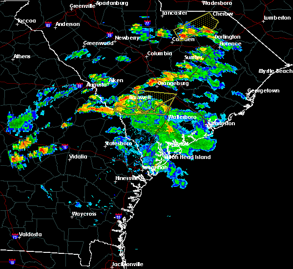 At 659 pm edt, a severe thunderstorm was located 7 miles northeast of bamberg, moving northeast at 35 mph (radar indicated). Hazards include 60 mph wind gusts. Expect damage to roofs. siding. and trees. Locations impacted include, bamberg, denmark, branchville, bowman, ehrhardt, rowesville, olar, cope and govan. At 659 pm edt, a severe thunderstorm was located 7 miles northeast of bamberg, moving northeast at 35 mph (radar indicated). Hazards include 60 mph wind gusts. Expect damage to roofs. siding. and trees. Locations impacted include, bamberg, denmark, branchville, bowman, ehrhardt, rowesville, olar, cope and govan.
|
| 6/5/2016 6:27 PM EDT |
 At 626 pm edt, a severe thunderstorm was located over ashton, or 13 miles northeast of hampton, moving north at 45 mph (radar indicated). Hazards include 60 mph wind gusts. Expect damage to roofs. siding. And trees. At 626 pm edt, a severe thunderstorm was located over ashton, or 13 miles northeast of hampton, moving north at 45 mph (radar indicated). Hazards include 60 mph wind gusts. Expect damage to roofs. siding. And trees.
|
| 2/3/2016 4:51 PM EST |
 At 448 pm est, doppler radar indicated a likely severe thunderstorm approaching the interstate 26 area near orangeburg. the storm will likely contain wind gusts of 40 to 60 mph. storm movement was northeastward near 45 mph. At 448 pm est, doppler radar indicated a likely severe thunderstorm approaching the interstate 26 area near orangeburg. the storm will likely contain wind gusts of 40 to 60 mph. storm movement was northeastward near 45 mph.
|
| 2/3/2016 4:40 PM EST |
 At 437 pm est, doppler radar indicated a likely severe thunderstorm just west of the cordova area of orangeburg county, moving toward the cordova and orangeburg area. the storm will likely contain wind gusts of 40 to 60 mph. storm movement was northeast near 40 mph. locations impacted include, orangeburg and cordova. At 437 pm est, doppler radar indicated a likely severe thunderstorm just west of the cordova area of orangeburg county, moving toward the cordova and orangeburg area. the storm will likely contain wind gusts of 40 to 60 mph. storm movement was northeast near 40 mph. locations impacted include, orangeburg and cordova.
|
| 2/3/2016 4:26 PM EST |
 At 424 pm est, doppler radar indicated a likely severe thunderstorm between cope and denmark near the orangeburg and bamberg county line, moving northeast near 40 mph. At 424 pm est, doppler radar indicated a likely severe thunderstorm between cope and denmark near the orangeburg and bamberg county line, moving northeast near 40 mph.
|
| 2/3/2016 4:26 PM EST |
 The national weather service in columbia has issued a * severe thunderstorm warning for. central orangeburg county in central south carolina. southwestern calhoun county in central south carolina. northwestern bamberg county in central south carolina. Until 530 pm est. The national weather service in columbia has issued a * severe thunderstorm warning for. central orangeburg county in central south carolina. southwestern calhoun county in central south carolina. northwestern bamberg county in central south carolina. Until 530 pm est.
|
| 7/20/2015 10:08 PM EDT |
 At 1004 pm edt, doppler radar indicated a severe thunderstorm capable of producing quarter size hail and destructive winds in excess of 70 mph. this storm was located near cordova, moving east at 20 mph. in addition, downed trees were reported near the town of cope in orangeburg county. downed trees and power lines were reported between blackville and denmark. . locations impacted include, orangeburg, bamberg, denmark, brookdale, rowesville, cordova, cope, govan, wilkinson heights and edisto. At 1004 pm edt, doppler radar indicated a severe thunderstorm capable of producing quarter size hail and destructive winds in excess of 70 mph. this storm was located near cordova, moving east at 20 mph. in addition, downed trees were reported near the town of cope in orangeburg county. downed trees and power lines were reported between blackville and denmark. . locations impacted include, orangeburg, bamberg, denmark, brookdale, rowesville, cordova, cope, govan, wilkinson heights and edisto.
|
| 7/20/2015 9:35 PM EDT |
 At 935 pm edt, doppler radar indicated severe thunderstorms capable of producing quarter size hail and destructive winds in excess of 70 mph. the strongest storm was located near denmark, and moving east at 20 mph. At 935 pm edt, doppler radar indicated severe thunderstorms capable of producing quarter size hail and destructive winds in excess of 70 mph. the strongest storm was located near denmark, and moving east at 20 mph.
|
| 7/2/2015 5:50 PM EDT |
 At 549 pm edt, doppler radar indicated a line of severe thunderstorms capable of producing damaging winds in excess of 60 mph. these storms were located along a line extending from near lydia to south sumter to 7 miles northwest of elloree to near bamberg, moving southeast at 45 mph. locations impacted include, sumter, orangeburg, manning, brookdale, south sumter, st. matthews, holly hill, branchville, summerton, bowman, elloree, millwood, mulberry, santee, turbeville, mayesville, pinewood, cameron, lynchburg and eutawville. At 549 pm edt, doppler radar indicated a line of severe thunderstorms capable of producing damaging winds in excess of 60 mph. these storms were located along a line extending from near lydia to south sumter to 7 miles northwest of elloree to near bamberg, moving southeast at 45 mph. locations impacted include, sumter, orangeburg, manning, brookdale, south sumter, st. matthews, holly hill, branchville, summerton, bowman, elloree, millwood, mulberry, santee, turbeville, mayesville, pinewood, cameron, lynchburg and eutawville.
|
| 7/2/2015 5:27 PM EDT |
 At 527 pm edt, doppler radar indicated a line of severe thunderstorms capable of producing damaging winds in excess of 60 mph. these storms were located along a line extending from 6 miles southwest of clyde to 10 miles southeast of camden to 7 miles east of eastover to st. matthews to 10 miles northeast of denmark, and moving east at 35 mph. At 527 pm edt, doppler radar indicated a line of severe thunderstorms capable of producing damaging winds in excess of 60 mph. these storms were located along a line extending from 6 miles southwest of clyde to 10 miles southeast of camden to 7 miles east of eastover to st. matthews to 10 miles northeast of denmark, and moving east at 35 mph.
|
| 6/30/2015 5:17 PM EDT |
 At 516 pm edt, doppler radar indicated a line of severe thunderstorms capable of producing damaging winds in excess of 60 mph. these storms were located along a line extending from 6 miles northeast of fort jackson to near bamberg, and moving east at 30 mph. nickel size hail may also accompany the damaging winds. At 516 pm edt, doppler radar indicated a line of severe thunderstorms capable of producing damaging winds in excess of 60 mph. these storms were located along a line extending from 6 miles northeast of fort jackson to near bamberg, and moving east at 30 mph. nickel size hail may also accompany the damaging winds.
|
| 5/11/2015 6:08 PM EDT | Quarter sized hail reported 0.3 miles NE of Rowesville, SC, orangeburg county dispatch reported quarter inch hail near river drive in rowesville. |
| 4/19/2015 5:08 PM EDT | this alert has expired |
| 4/19/2015 4:42 PM EDT | this alert has expired |
| 4/19/2015 4:42 PM EDT | At 439 pm edt, national weather service doppler radar indicated a line of severe thunderstorms capable of producing damaging winds in excess of 60 mph. these storms were located along a line extending from 19 miles north of blackville to 25 miles south of denmark, or along a line extending from 20 miles east of aiken to 7 miles northwest of hampton, and moving northeast at 30 mph. * some communities in the warning area include st. matthews, orangeburg, gaston, denmark, brookdale, branchville, bowman, blackville and bamberg. |
| 4/8/2015 12:52 AM EDT | The national weather service in columbia has issued a * severe thunderstorm warning for. southern calhoun county in central south carolina northern orangeburg county in central south carolina * until 145 am edt * at 1250 am edt. National weather service doppler radar indicated. |
| 5/14/2012 7:00 PM EDT | Quarter sized hail reported 2.8 miles WNW of Rowesville, SC, quarter size hail east of rowesville. |
| 3/16/2012 4:20 PM EDT | Quarter sized hail reported 3.1 miles NW of Rowesville, SC, quarter size hail reported by public on cattle creek road. |
| 1/1/0001 12:00 AM | Public reported a large oak tree limb down on the roof of a house along bethel forest road. the limb was 8 inches in diameter. other smaller limbs were down around the in orangeburg county SC, 1.6 miles WSW of Rowesville, SC |
| 1/1/0001 12:00 AM | Public reported a tree down on highway 21 between rowesville and orangebur in orangeburg county SC, 1.9 miles S of Rowesville, SC |
Hail Maps for Rowesville, SC


Connect with Interactive Hail Maps