

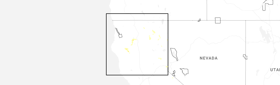
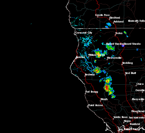
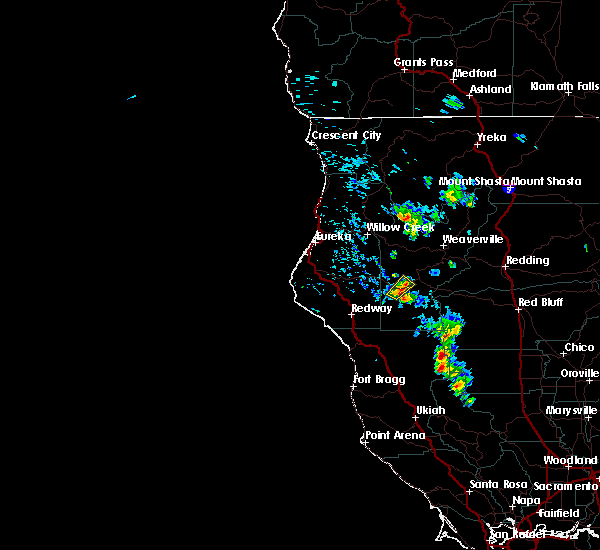
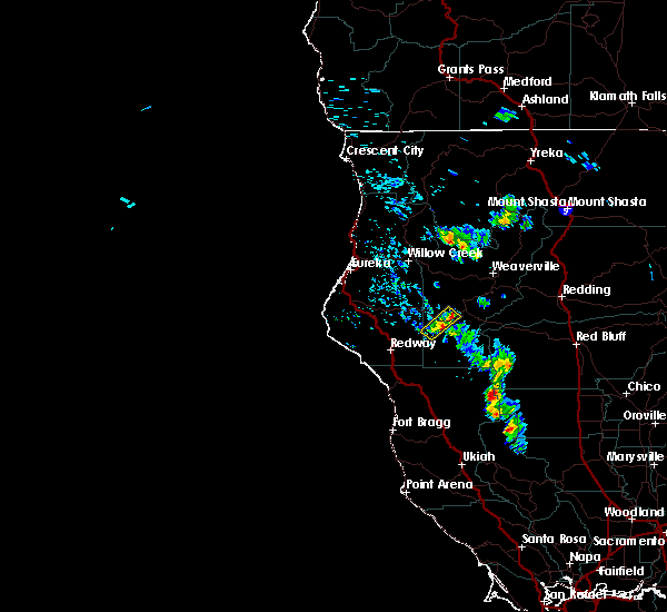
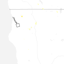
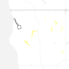
Hail Map for Ruth, CA
The Ruth, CA area has had 0 reports of on-the-ground hail by trained spotters, and has been under severe weather warnings 3 times during the past 12 months. Doppler radar has detected hail at or near Ruth, CA on 6 occasions, including 2 occasions during the past year.
| Name: | Ruth, CA |
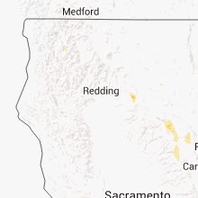
| Where Located: | 55.2 miles WSW of Redding, CA |
| Map: | Google Map for Ruth, CA |
| Population: | 195 |
| Housing Units: | 315 |
| More Info: | Search Google for Ruth, CA |
1
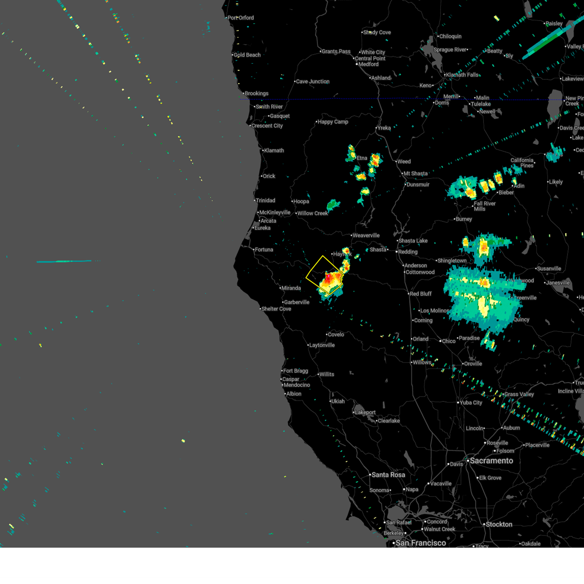
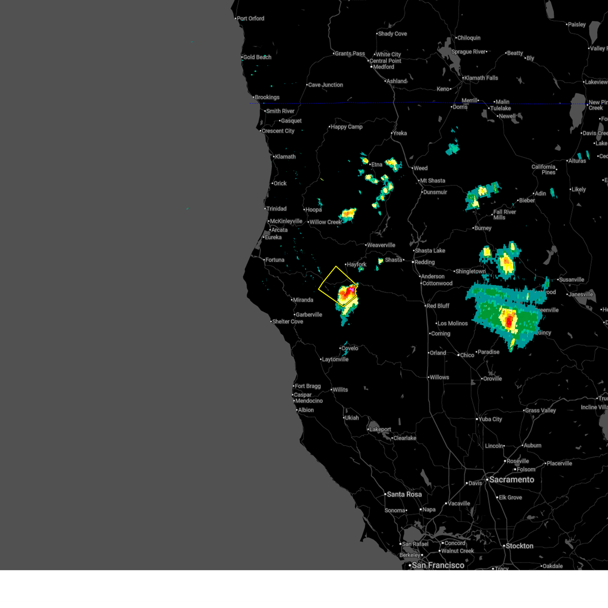
The Top Recent Hail Date for Ruth, CA is Friday, July 25, 2025 (5th out of 6)
Hail and Wind Damage Spotted near Ruth, CA
| Date / Time | Report Details |
|---|---|
| 7/25/2025 4:41 PM PDT |
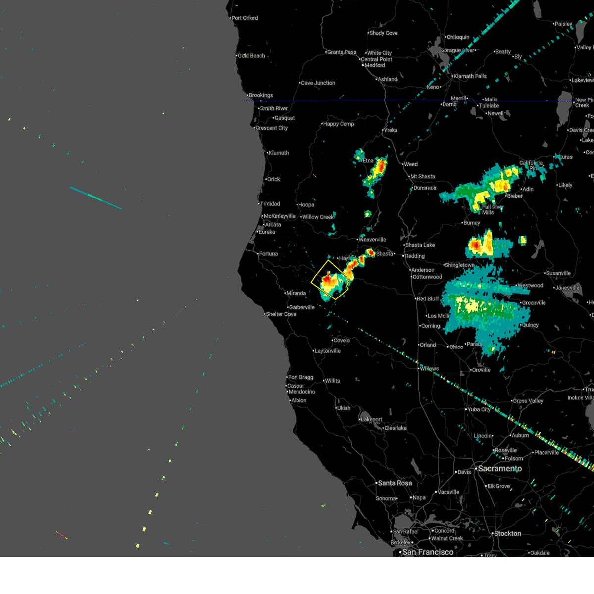 The thunderstorm has weakened to below severe limits. however, small hail, gusty winds, and heavy rain are still possible with this thunderstorm. The thunderstorm has weakened to below severe limits. however, small hail, gusty winds, and heavy rain are still possible with this thunderstorm.
|
| 7/25/2025 4:16 PM PDT |
 At 416 pm pdt, a severe thunderstorm was located over forest glen, or 17 miles southwest of hayfork, moving northwest at 10 mph (radar indicated). Hazards include 60 mph wind gusts and quarter size hail. Hail damage to vehicles is expected. expect wind damage to roofs, siding, and trees. Locations impacted include, forest glen and ruth. At 416 pm pdt, a severe thunderstorm was located over forest glen, or 17 miles southwest of hayfork, moving northwest at 10 mph (radar indicated). Hazards include 60 mph wind gusts and quarter size hail. Hail damage to vehicles is expected. expect wind damage to roofs, siding, and trees. Locations impacted include, forest glen and ruth.
|
| 7/25/2025 3:58 PM PDT |
 Svreka the national weather service in eureka has issued a * severe thunderstorm warning for, southwestern trinity county in northwestern california, * until 445 pm pdt. * at 358 pm pdt, a severe thunderstorm was located near forest glen, or 18 miles south of hayfork, moving northwest at 15 mph (radar indicated). Hazards include 60 mph wind gusts and half dollar size hail. Hail damage to vehicles is expected. Expect wind damage to roofs, siding, and trees. Svreka the national weather service in eureka has issued a * severe thunderstorm warning for, southwestern trinity county in northwestern california, * until 445 pm pdt. * at 358 pm pdt, a severe thunderstorm was located near forest glen, or 18 miles south of hayfork, moving northwest at 15 mph (radar indicated). Hazards include 60 mph wind gusts and half dollar size hail. Hail damage to vehicles is expected. Expect wind damage to roofs, siding, and trees.
|
| 8/9/2017 2:53 PM PDT |
 The severe thunderstorm warning for southwestern trinity county will expire at 300 pm pdt, the storm which prompted the warning has weakened below severe limits, and no longer poses an immediate threat to life or property. therefore the warning will be allowed to expire. however small hail is still possible with this thunderstorm. The severe thunderstorm warning for southwestern trinity county will expire at 300 pm pdt, the storm which prompted the warning has weakened below severe limits, and no longer poses an immediate threat to life or property. therefore the warning will be allowed to expire. however small hail is still possible with this thunderstorm.
|
| 8/9/2017 2:40 PM PDT |
 At 240 pm pdt, a severe thunderstorm was located near forest glen, or 19 miles southwest of hayfork, moving northeast at 5 mph (radar indicated). Hazards include quarter size hail. Damage to vehicles is expected. Locations impacted include, ruth and forest glen. At 240 pm pdt, a severe thunderstorm was located near forest glen, or 19 miles southwest of hayfork, moving northeast at 5 mph (radar indicated). Hazards include quarter size hail. Damage to vehicles is expected. Locations impacted include, ruth and forest glen.
|
| 8/9/2017 2:28 PM PDT |
 At 228 pm pdt, a severe thunderstorm was located near ruth, or 20 miles southwest of hayfork, moving northeast at 5 mph (radar indicated). Hazards include quarter size hail. damage to vehicles is expected At 228 pm pdt, a severe thunderstorm was located near ruth, or 20 miles southwest of hayfork, moving northeast at 5 mph (radar indicated). Hazards include quarter size hail. damage to vehicles is expected
|
Hail Maps for Ruth, CA


Connect with Interactive Hail Maps