

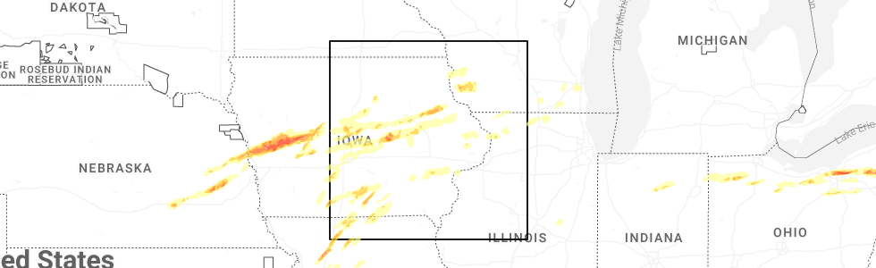
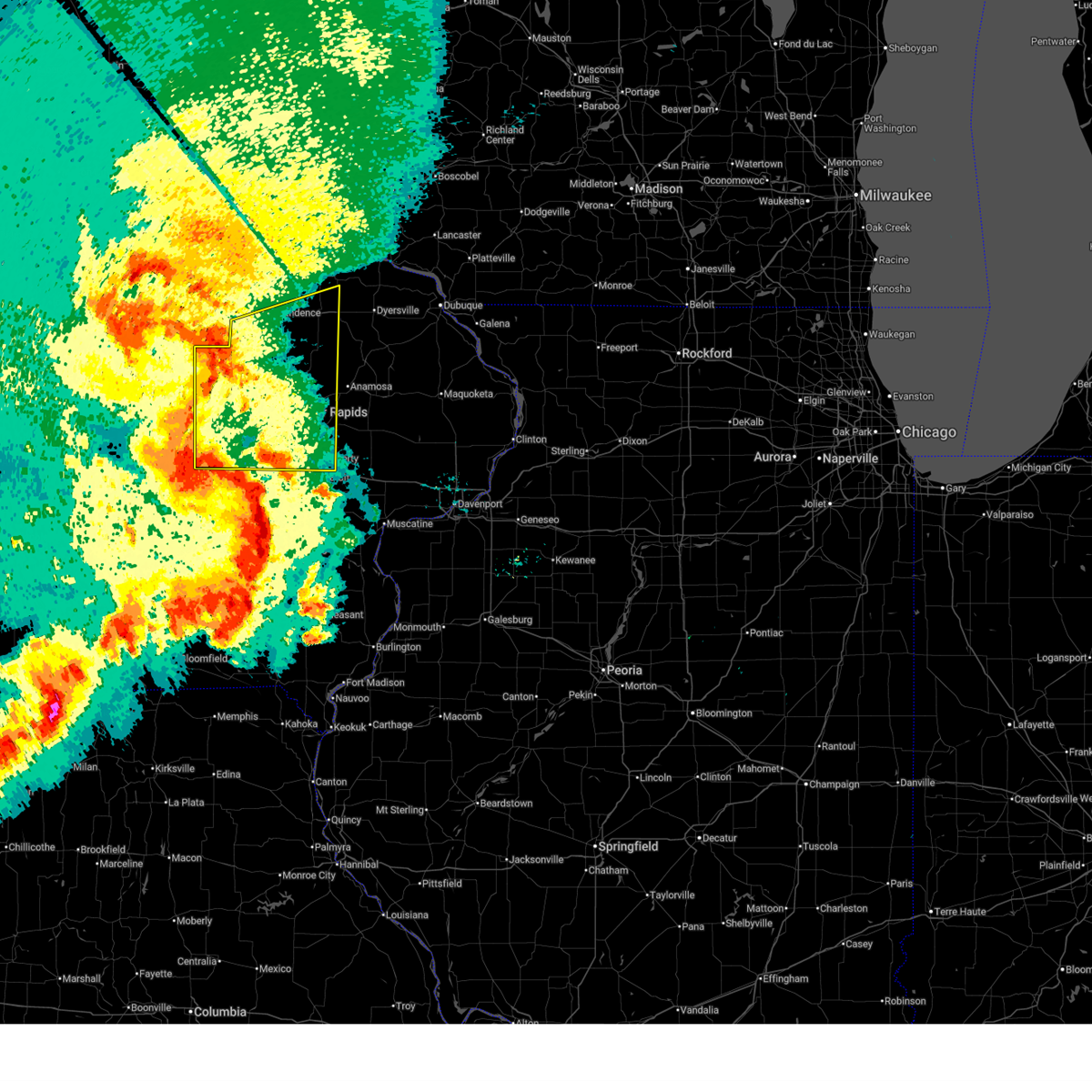
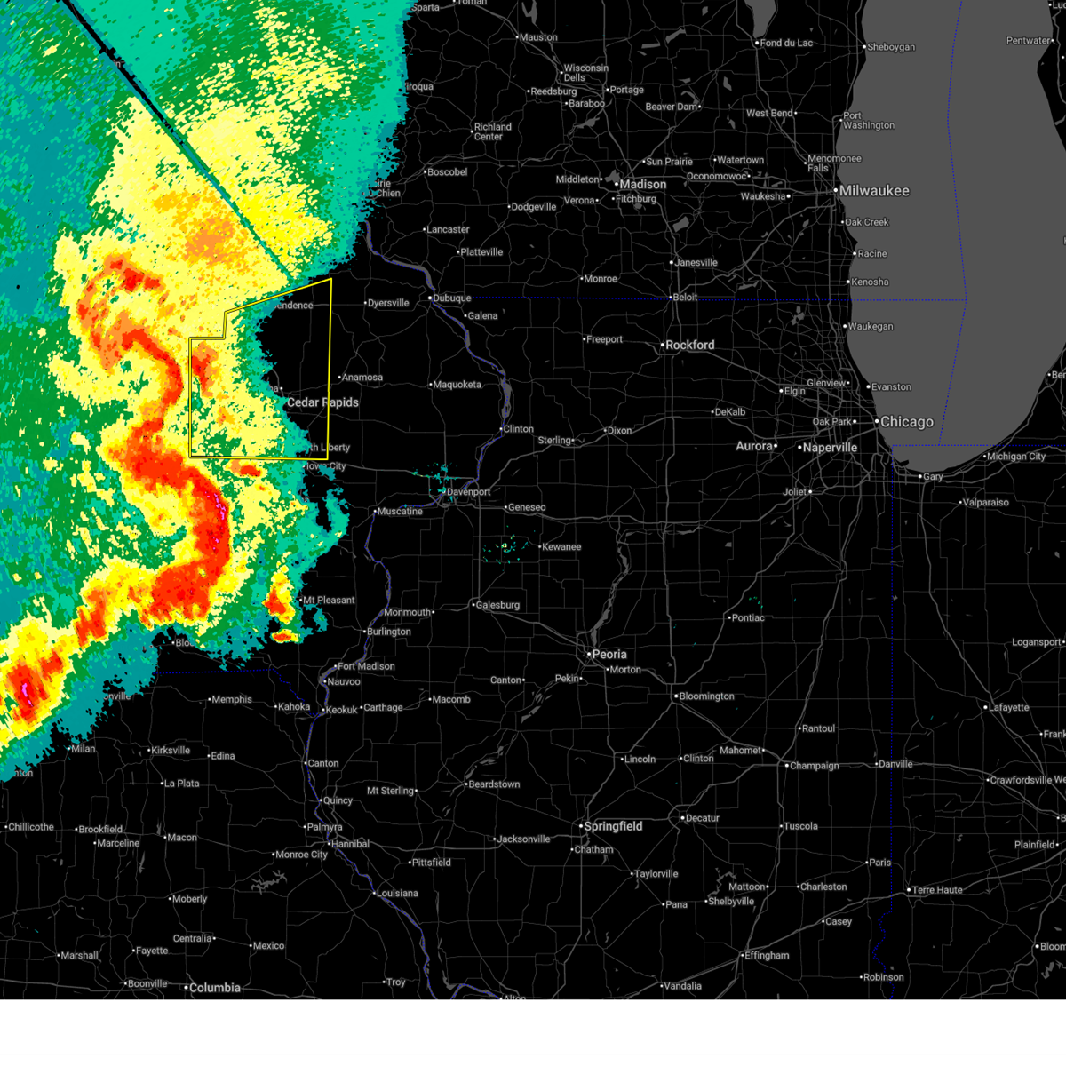
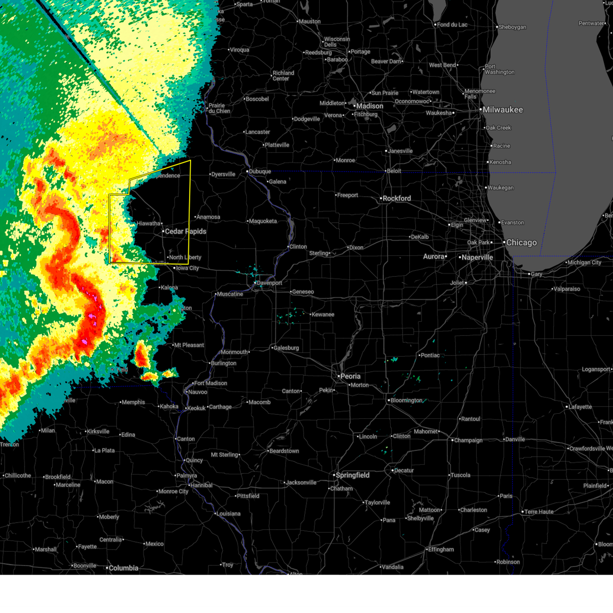
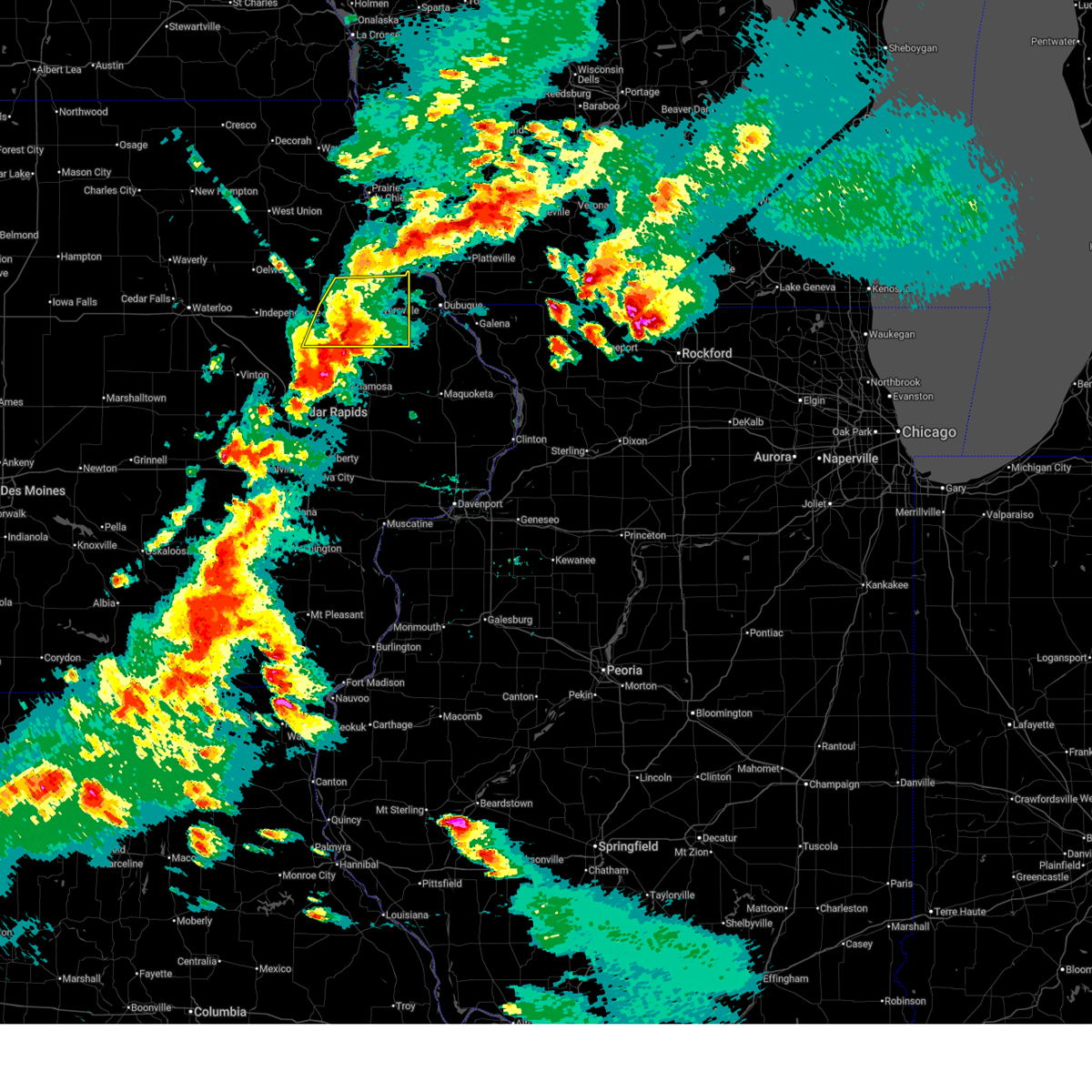
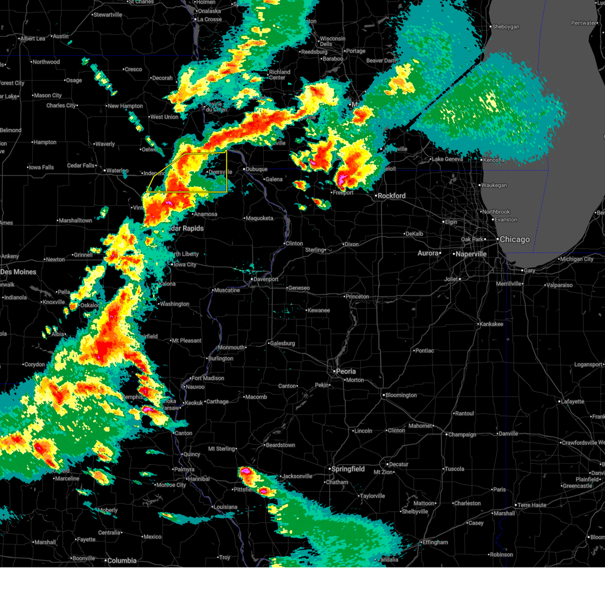
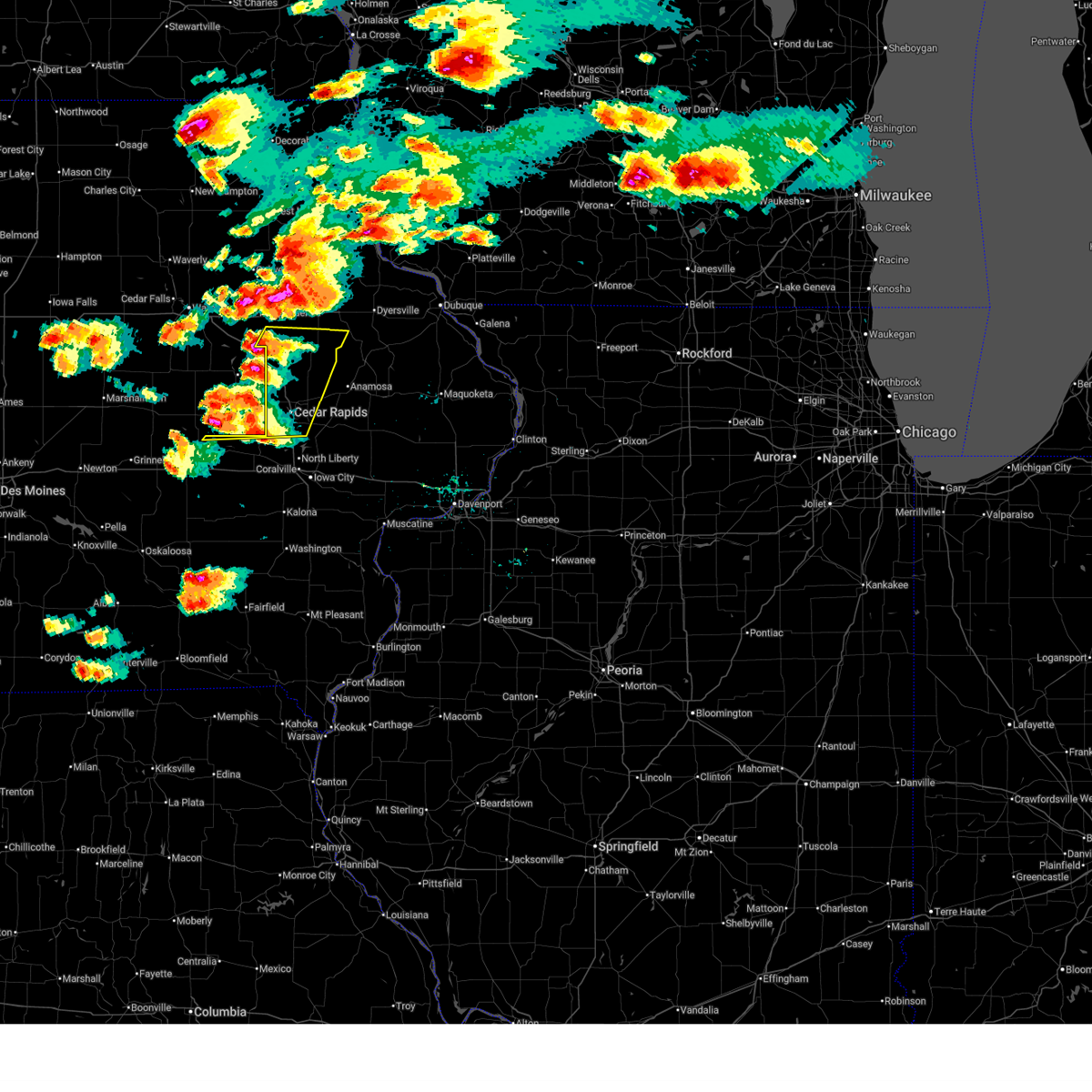
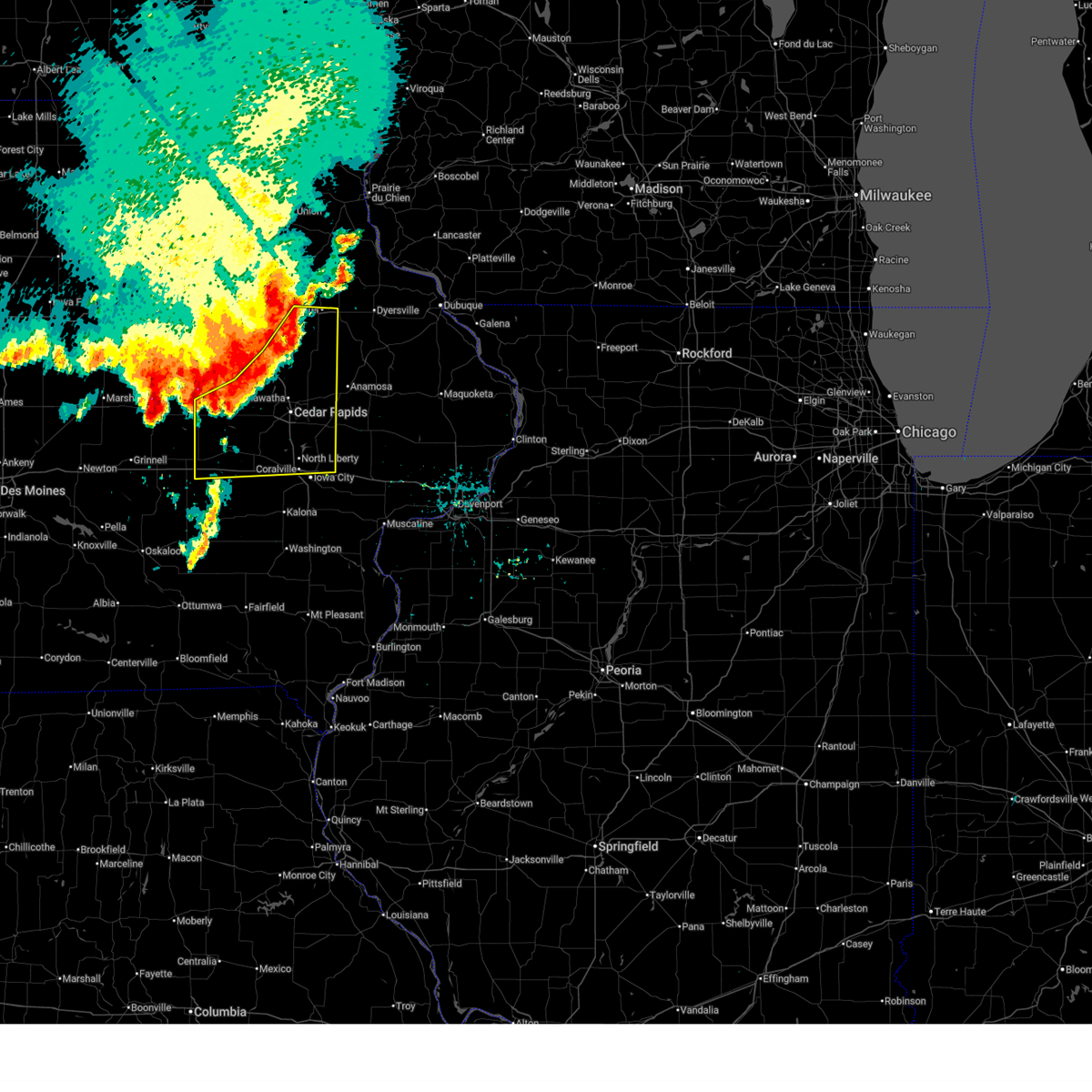
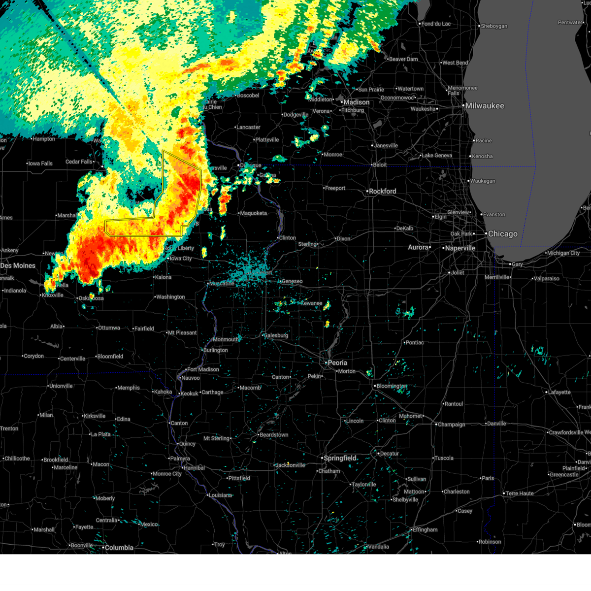
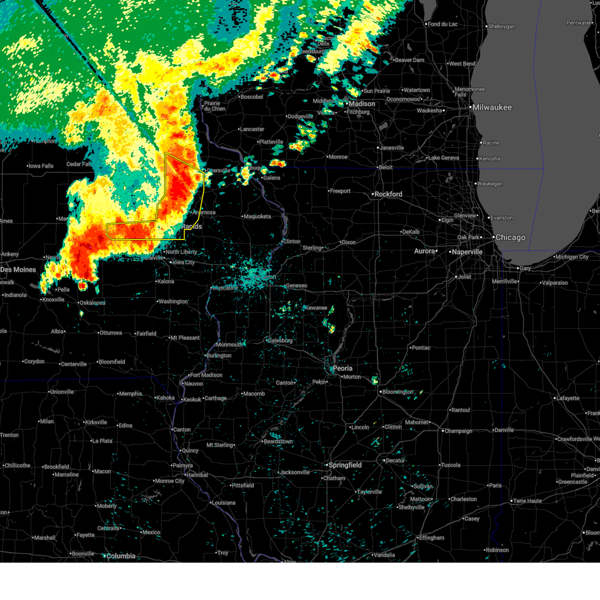
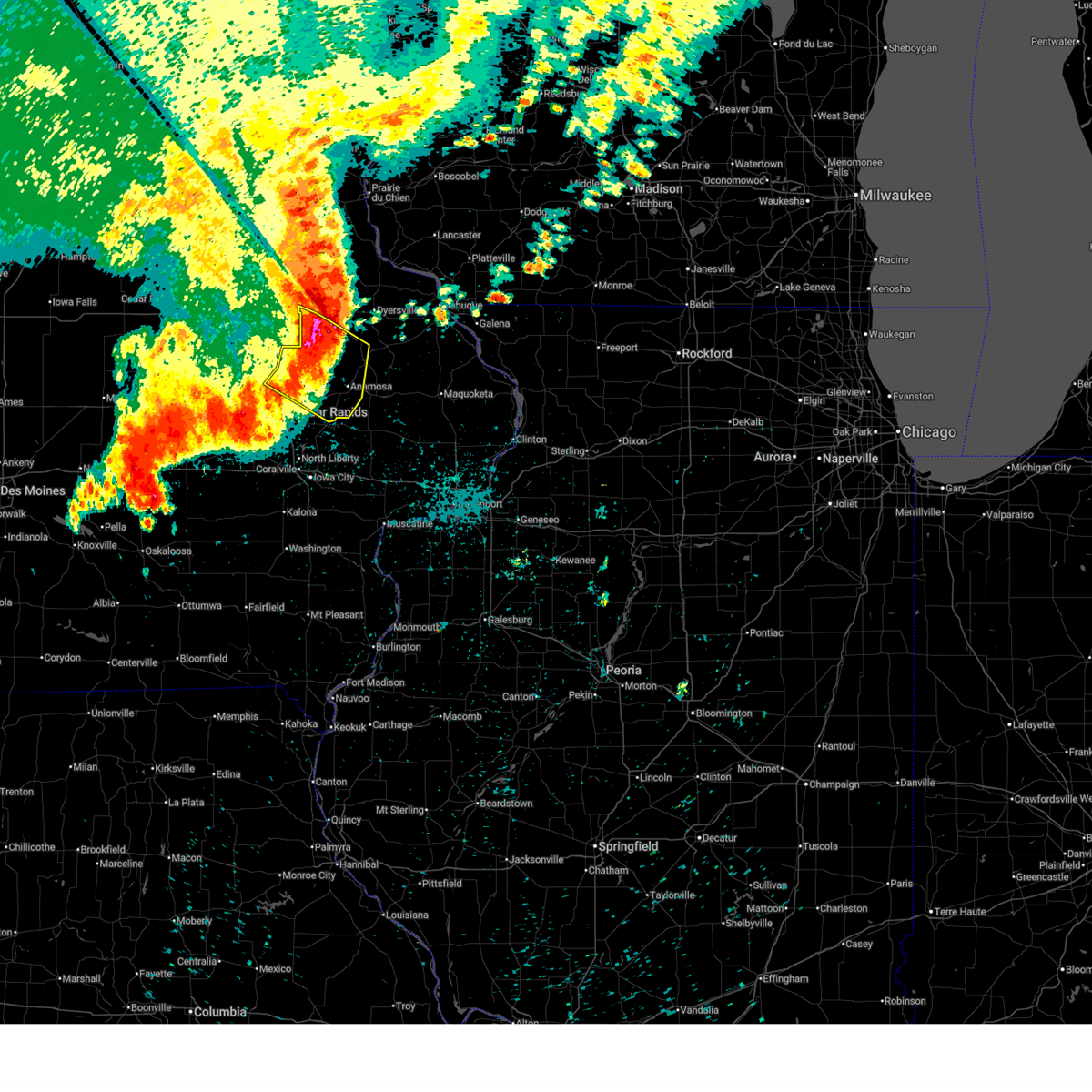
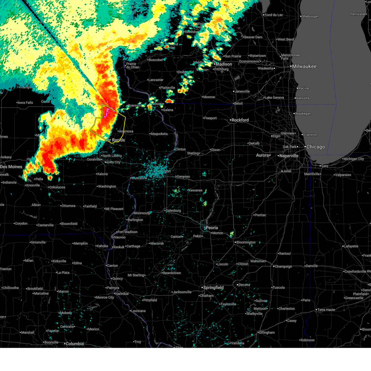
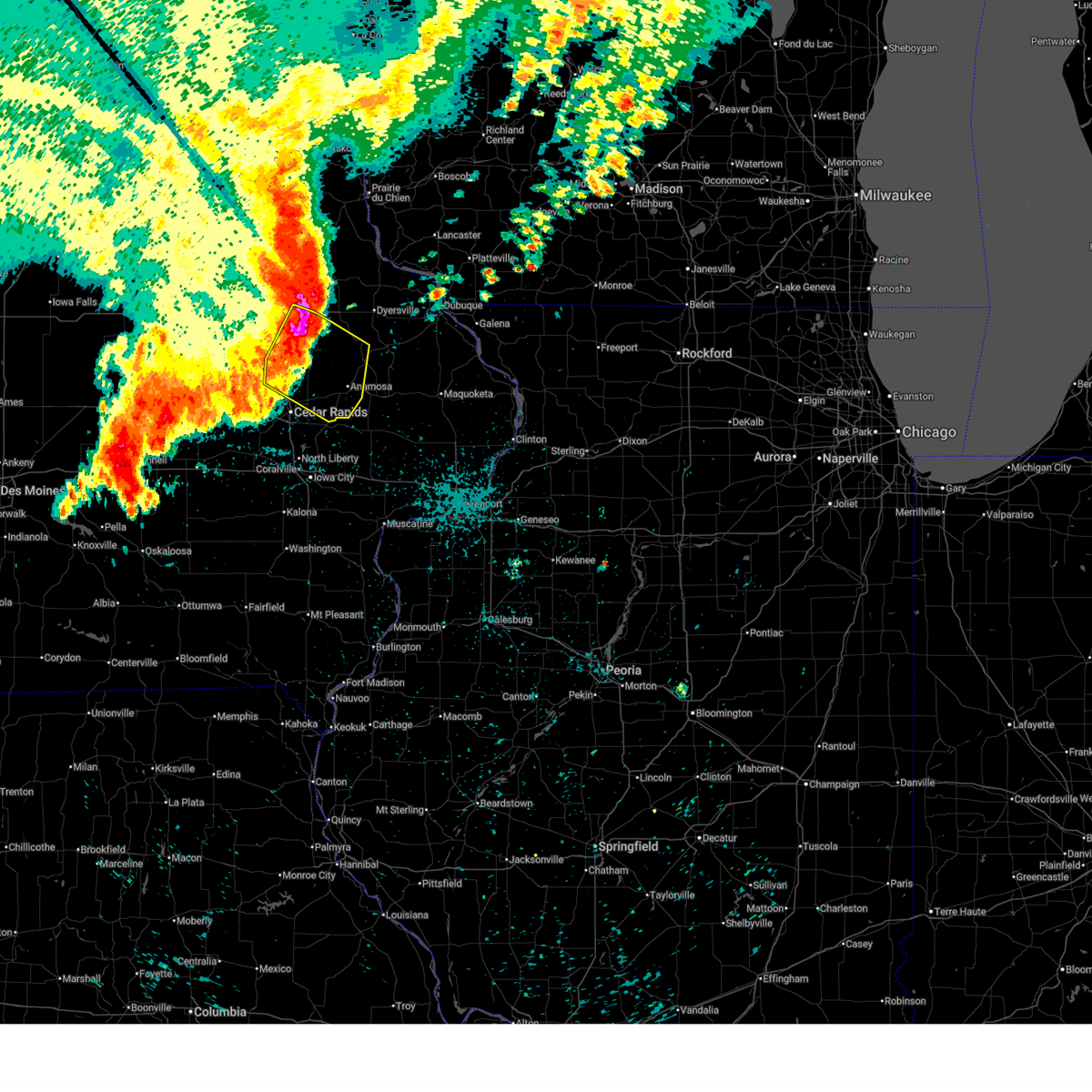
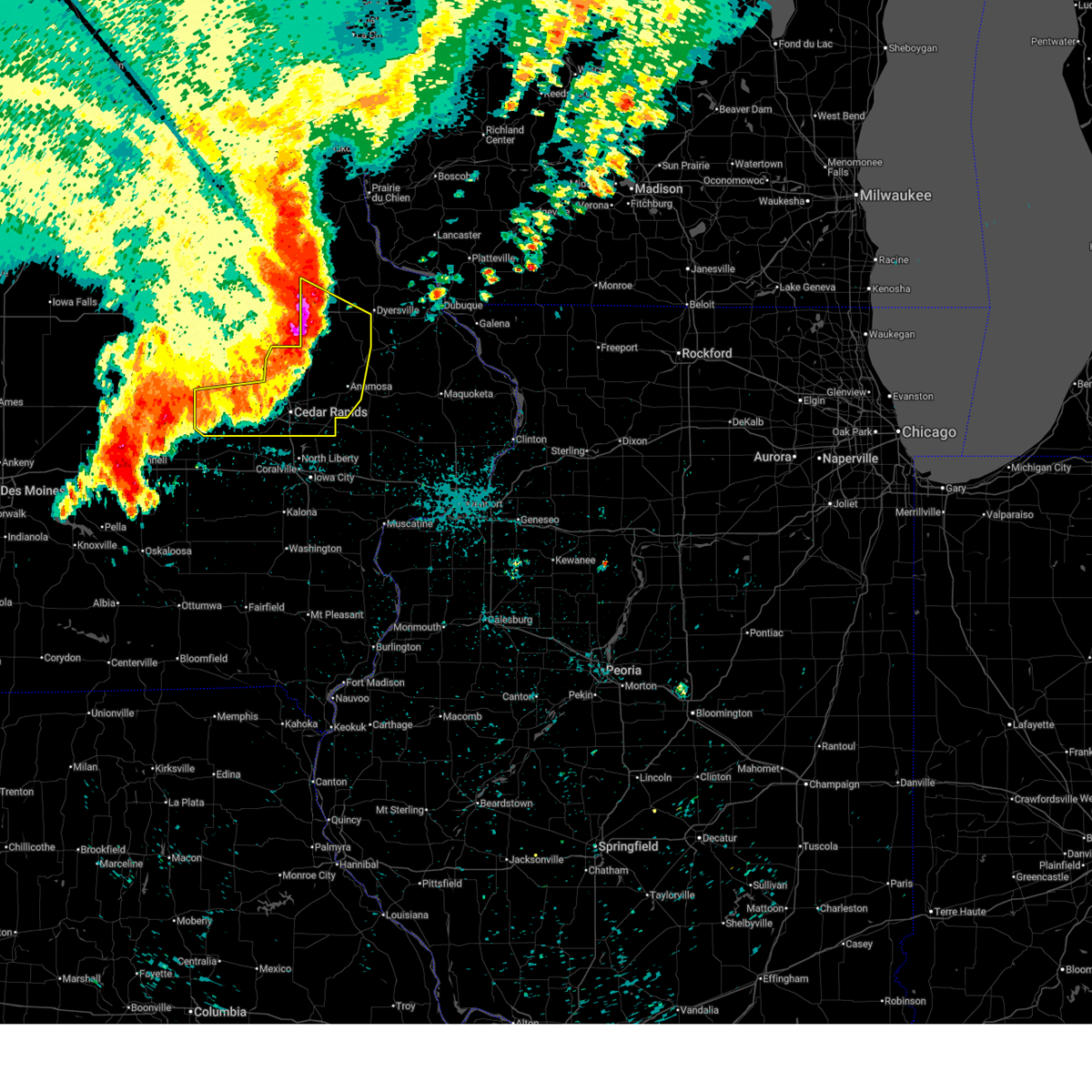
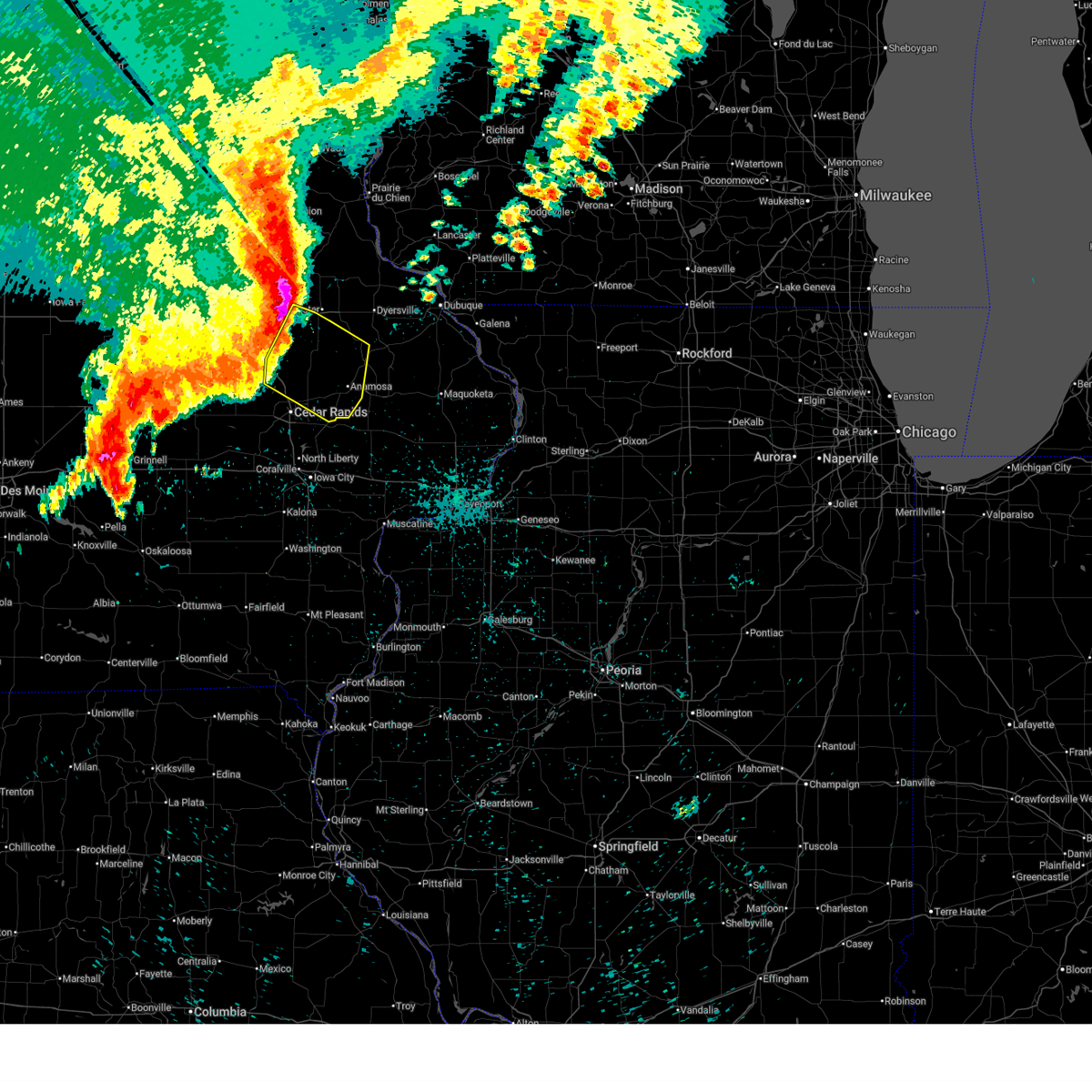
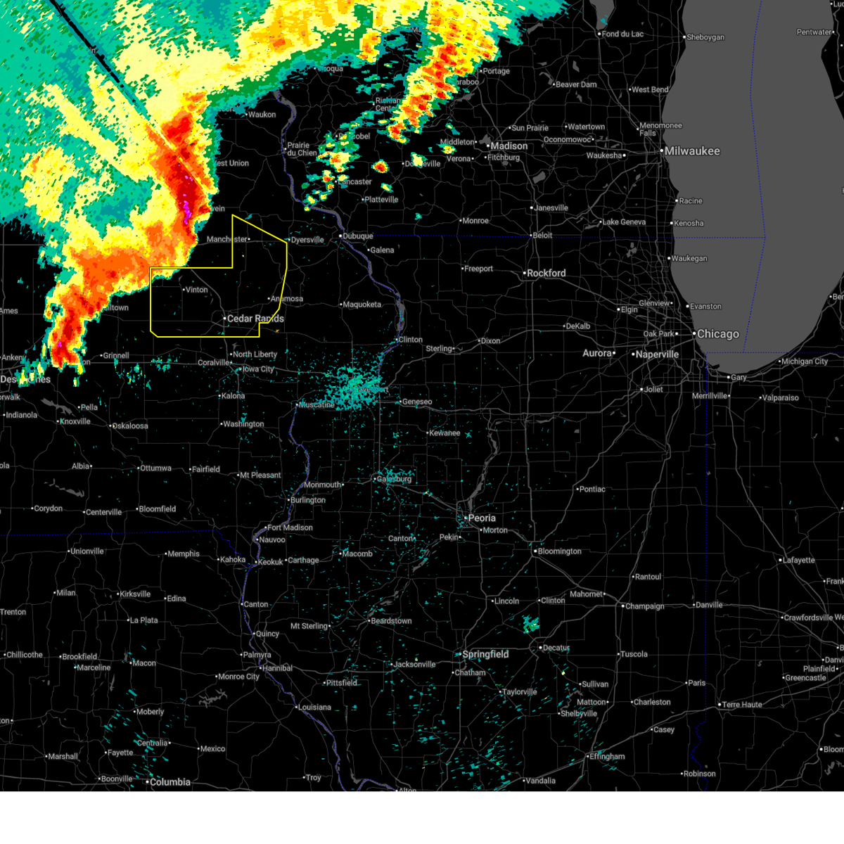
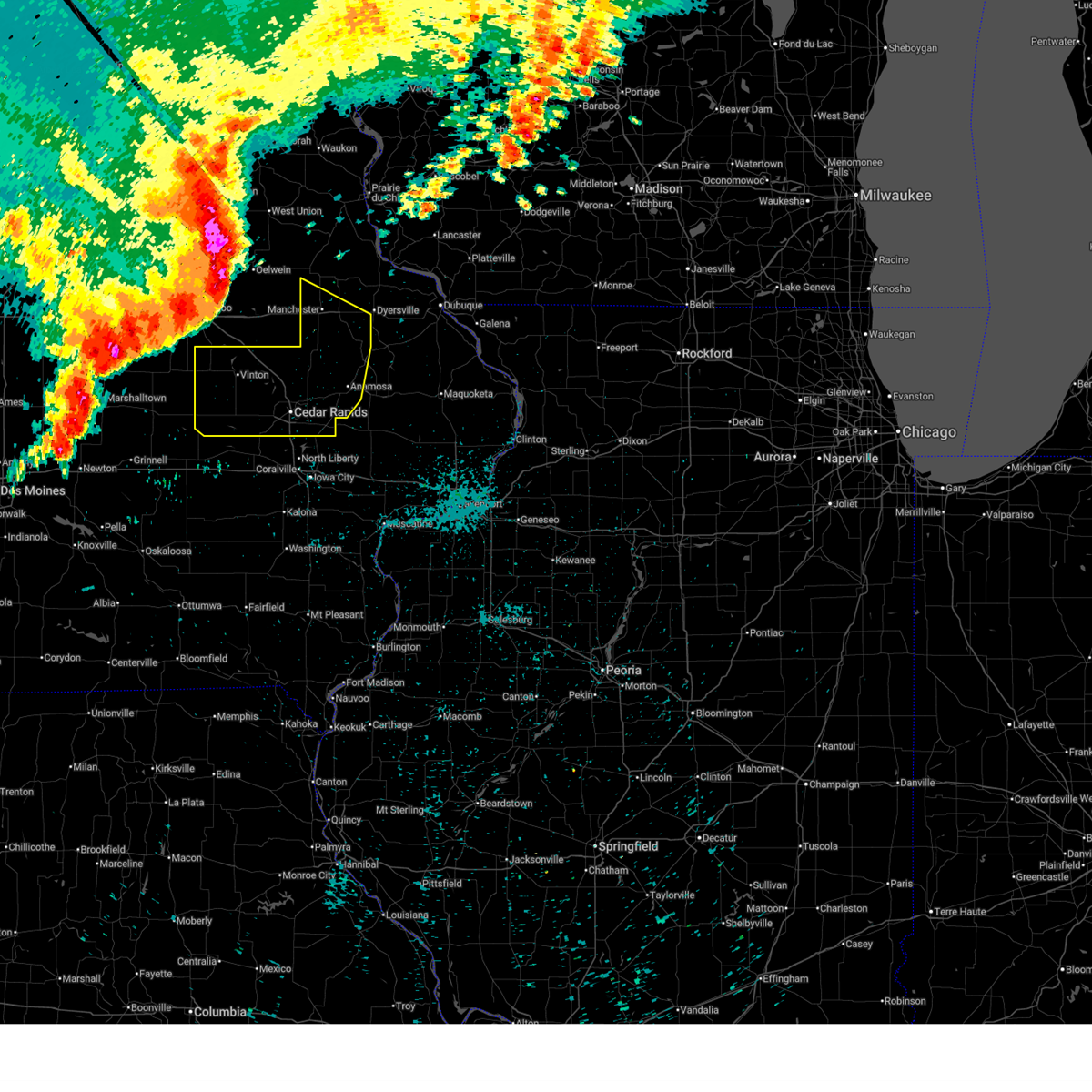
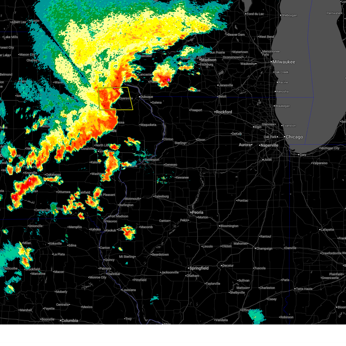
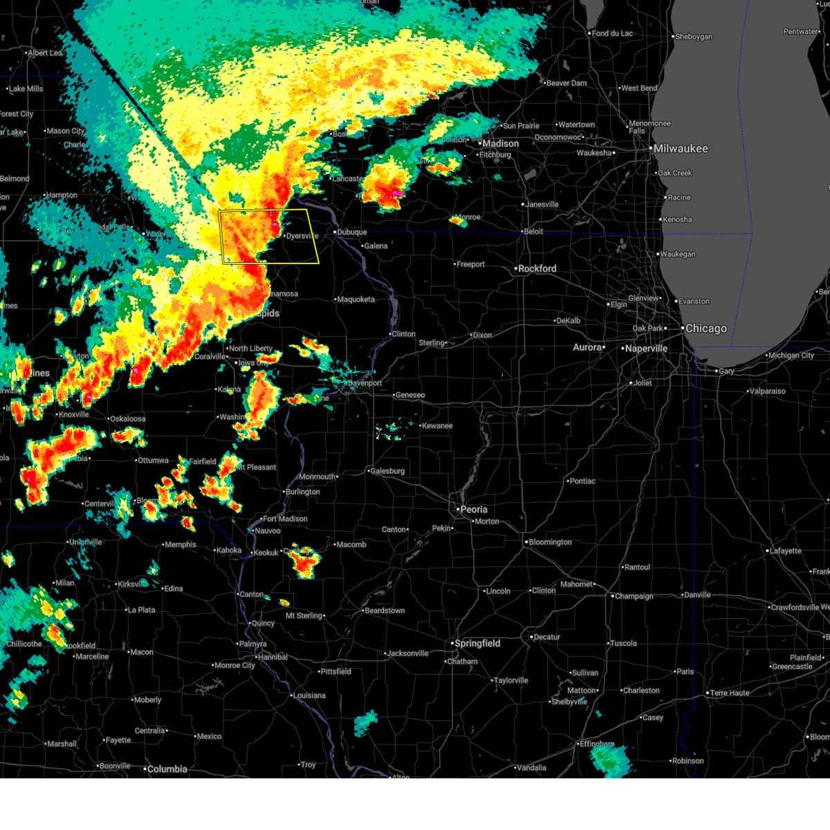
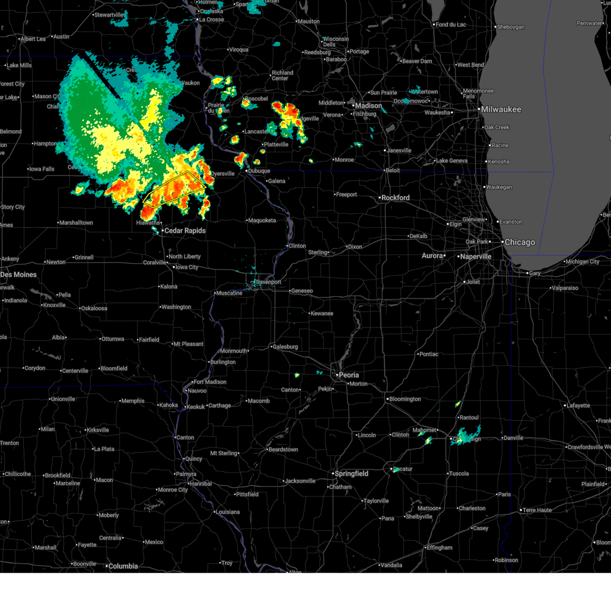
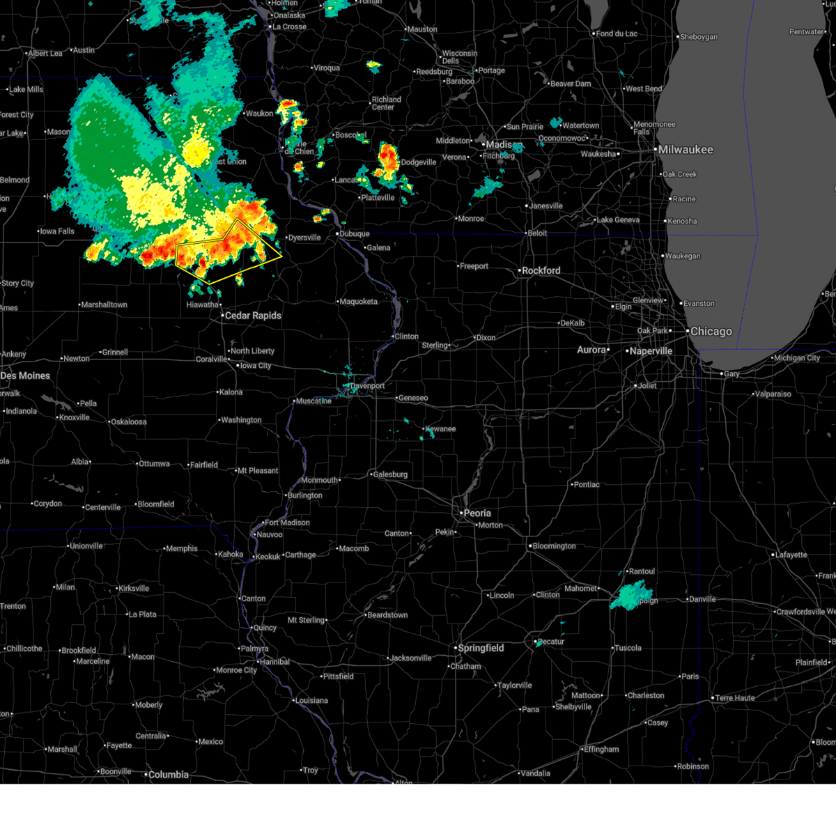
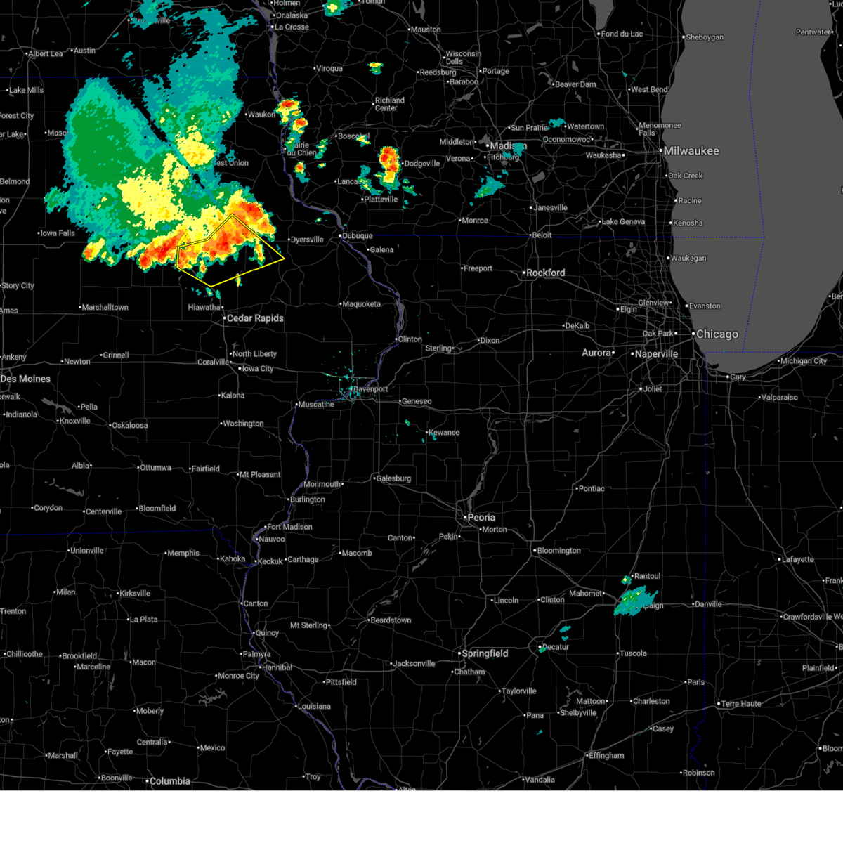
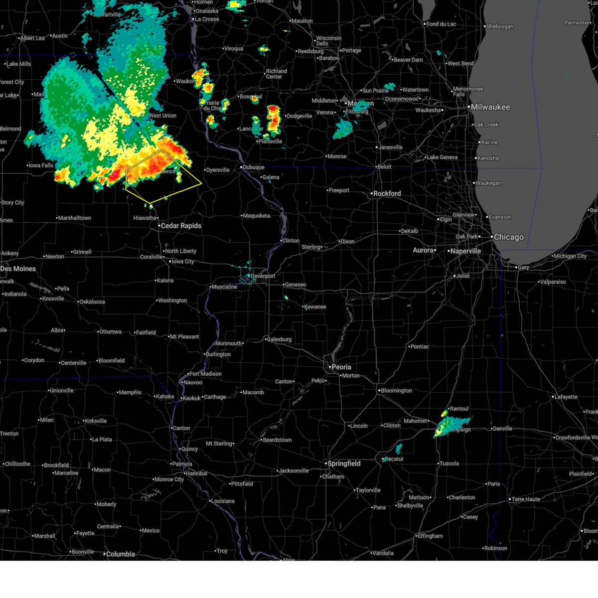
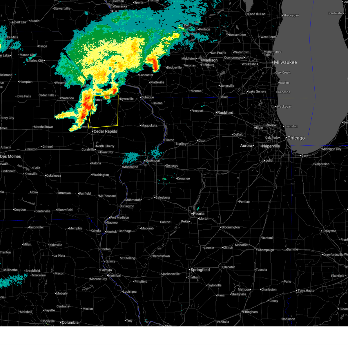
Hail Map for Ryan, IA
The Ryan, IA area has had 2 reports of on-the-ground hail by trained spotters, and has been under severe weather warnings 42 times during the past 12 months. Doppler radar has detected hail at or near Ryan, IA on 55 occasions, including 8 occasions during the past year.
| Name: | Ryan, IA |
| Where Located: | 27.6 miles NNE of Cedar Rapids, IA |
| Map: | Google Map for Ryan, IA |
| Population: | 361 |
| Housing Units: | 171 |
| More Info: | Search Google for Ryan, IA |
5
The Top Recent Hail Date for Ryan, IA is Wednesday, April 15, 2026 (9th out of 55)
Hail and Wind Damage Spotted near Ryan, IA
| Date / Time | Report Details |
|---|---|
| 7/2/2026 4:51 PM CDT |
 The storm which prompted the warning has weakened below severe limits, and has exited the warned area. therefore, the warning will be allowed to expire. however, heavy rain is still expected with this thunderstorm. a severe thunderstorm watch remains in effect until 700 pm cdt for northeastern iowa. The storm which prompted the warning has weakened below severe limits, and has exited the warned area. therefore, the warning will be allowed to expire. however, heavy rain is still expected with this thunderstorm. a severe thunderstorm watch remains in effect until 700 pm cdt for northeastern iowa.
|
| 7/2/2026 4:36 PM CDT |
 At 436 pm cdt, a severe thunderstorm was located near ryan, or near manchester, moving east at 35 mph (radar indicated). Hazards include 60 mph wind gusts. Expect damage to roofs, siding, and trees. Locations impacted include, manchester, quasqueton, ryan, delaware, masonville, monti, coffins grove park, robinson, baileys ford park, delaware county fairgrounds, manchester airport, and turtle creek park. At 436 pm cdt, a severe thunderstorm was located near ryan, or near manchester, moving east at 35 mph (radar indicated). Hazards include 60 mph wind gusts. Expect damage to roofs, siding, and trees. Locations impacted include, manchester, quasqueton, ryan, delaware, masonville, monti, coffins grove park, robinson, baileys ford park, delaware county fairgrounds, manchester airport, and turtle creek park.
|
| 7/2/2026 4:28 PM CDT |
 At 428 pm cdt, a severe thunderstorm was located near ryan, or near manchester, moving east at 40 mph (radar indicated). Hazards include 60 mph wind gusts. Expect damage to roofs, siding, and trees. Locations impacted include, manchester, winthrop, quasqueton, ryan, delaware, masonville, robinson, delaware county fairgrounds, manchester airport, monti, coffins grove park, baileys ford park, and turtle creek park. At 428 pm cdt, a severe thunderstorm was located near ryan, or near manchester, moving east at 40 mph (radar indicated). Hazards include 60 mph wind gusts. Expect damage to roofs, siding, and trees. Locations impacted include, manchester, winthrop, quasqueton, ryan, delaware, masonville, robinson, delaware county fairgrounds, manchester airport, monti, coffins grove park, baileys ford park, and turtle creek park.
|
| 7/2/2026 4:18 PM CDT |
 At 418 pm cdt, a severe thunderstorm was located over monti, or 11 miles southeast of independence, moving east at 35 mph (radar indicated). Hazards include 60 mph wind gusts. Expect damage to roofs, siding, and trees. locations impacted include, independence, manchester, winthrop, quasqueton, ryan, rowley, delaware, masonville, robinson, delaware county fairgrounds, manchester airport, monti, coffins grove park, baileys ford park, and turtle creek park. This includes interstate 380 between mile markers 49 and 50. At 418 pm cdt, a severe thunderstorm was located over monti, or 11 miles southeast of independence, moving east at 35 mph (radar indicated). Hazards include 60 mph wind gusts. Expect damage to roofs, siding, and trees. locations impacted include, independence, manchester, winthrop, quasqueton, ryan, rowley, delaware, masonville, robinson, delaware county fairgrounds, manchester airport, monti, coffins grove park, baileys ford park, and turtle creek park. This includes interstate 380 between mile markers 49 and 50.
|
| 7/2/2026 4:09 PM CDT |
 At 409 pm cdt, a severe thunderstorm was located over quasqueton, or 8 miles southeast of independence, moving east at 40 mph (radar indicated). Hazards include 60 mph wind gusts. Expect damage to roofs, siding, and trees. locations impacted include, independence, manchester, winthrop, quasqueton, ryan, brandon, rowley, delaware, masonville, lime creek county park, robinson, delaware county fairgrounds, manchester airport, monti, coffins grove park, baileys ford park, independence airport, and turtle creek park. This includes interstate 380 between mile markers 49 and 51. At 409 pm cdt, a severe thunderstorm was located over quasqueton, or 8 miles southeast of independence, moving east at 40 mph (radar indicated). Hazards include 60 mph wind gusts. Expect damage to roofs, siding, and trees. locations impacted include, independence, manchester, winthrop, quasqueton, ryan, brandon, rowley, delaware, masonville, lime creek county park, robinson, delaware county fairgrounds, manchester airport, monti, coffins grove park, baileys ford park, independence airport, and turtle creek park. This includes interstate 380 between mile markers 49 and 51.
|
| 7/2/2026 3:57 PM CDT |
 Svrdvn the national weather service in the quad cities has issued a * severe thunderstorm warning for, southern buchanan county in northeastern iowa, southwestern delaware county in northeastern iowa, * until 500 pm cdt. * at 356 pm cdt, a severe thunderstorm was located near lime creek county park, or near independence, moving east at 40 mph (radar indicated). Hazards include 60 mph wind gusts. expect damage to roofs, siding, and trees Svrdvn the national weather service in the quad cities has issued a * severe thunderstorm warning for, southern buchanan county in northeastern iowa, southwestern delaware county in northeastern iowa, * until 500 pm cdt. * at 356 pm cdt, a severe thunderstorm was located near lime creek county park, or near independence, moving east at 40 mph (radar indicated). Hazards include 60 mph wind gusts. expect damage to roofs, siding, and trees
|
| 6/11/2026 9:25 AM CDT |
 At 925 am cdt, severe thunderstorms were located along a line extending from near littleton to quasqueton to near pleasant creek state recreation area, moving east at 55 mph (radar indicated). Hazards include 70 mph wind gusts. Expect considerable tree damage. damage is likely to mobile homes, roofs, and outbuildings. locations impacted include, cedar rapids, independence, manchester, marengo, marion, coralville, north liberty, hiawatha, mount vernon, robins, lisbon, fairfax, solon, tiffin, ely, atkins, walford, springville, palo, and swisher. this includes the following highways, interstate 80 in iowa between mile markers 234 and 241. Interstate 380 between mile markers 1 and 28, and between mile markers 45 and 55. At 925 am cdt, severe thunderstorms were located along a line extending from near littleton to quasqueton to near pleasant creek state recreation area, moving east at 55 mph (radar indicated). Hazards include 70 mph wind gusts. Expect considerable tree damage. damage is likely to mobile homes, roofs, and outbuildings. locations impacted include, cedar rapids, independence, manchester, marengo, marion, coralville, north liberty, hiawatha, mount vernon, robins, lisbon, fairfax, solon, tiffin, ely, atkins, walford, springville, palo, and swisher. this includes the following highways, interstate 80 in iowa between mile markers 234 and 241. Interstate 380 between mile markers 1 and 28, and between mile markers 45 and 55.
|
| 6/11/2026 9:03 AM CDT |
 At 903 am cdt, severe thunderstorms were located along a line extending from waterloo to near mount auburn to near van horne, moving northeast at 55 mph (radar indicated). Hazards include 70 mph wind gusts. Expect considerable tree damage. damage is likely to mobile homes, roofs, and outbuildings. locations impacted include, cedar rapids, independence, vinton, manchester, marengo, marion, coralville, north liberty, hiawatha, mount vernon, robins, belle plaine, center point, lisbon, fairfax, solon, tiffin, ely, atkins, and walford. this includes the following highways, interstate 80 in iowa between mile markers 234 and 241. Interstate 380 between mile markers 1 and 55. At 903 am cdt, severe thunderstorms were located along a line extending from waterloo to near mount auburn to near van horne, moving northeast at 55 mph (radar indicated). Hazards include 70 mph wind gusts. Expect considerable tree damage. damage is likely to mobile homes, roofs, and outbuildings. locations impacted include, cedar rapids, independence, vinton, manchester, marengo, marion, coralville, north liberty, hiawatha, mount vernon, robins, belle plaine, center point, lisbon, fairfax, solon, tiffin, ely, atkins, and walford. this includes the following highways, interstate 80 in iowa between mile markers 234 and 241. Interstate 380 between mile markers 1 and 55.
|
| 6/11/2026 8:44 AM CDT |
 At 844 am cdt, severe thunderstorms were located along a line extending from morrison to near dysart to chelsea, moving east at 55 mph (radar indicated). Hazards include 70 mph wind gusts. Expect considerable tree damage. damage is likely to mobile homes, roofs, and outbuildings. locations impacted include, cedar rapids, independence, vinton, manchester, marengo, marion, coralville, north liberty, hiawatha, mount vernon, robins, belle plaine, center point, lisbon, fairfax, solon, tiffin, ely, atkins, and walford. this includes the following highways, interstate 80 in iowa between mile markers 234 and 241. Interstate 380 between mile markers 1 and 55. At 844 am cdt, severe thunderstorms were located along a line extending from morrison to near dysart to chelsea, moving east at 55 mph (radar indicated). Hazards include 70 mph wind gusts. Expect considerable tree damage. damage is likely to mobile homes, roofs, and outbuildings. locations impacted include, cedar rapids, independence, vinton, manchester, marengo, marion, coralville, north liberty, hiawatha, mount vernon, robins, belle plaine, center point, lisbon, fairfax, solon, tiffin, ely, atkins, and walford. this includes the following highways, interstate 80 in iowa between mile markers 234 and 241. Interstate 380 between mile markers 1 and 55.
|
| 6/11/2026 8:31 AM CDT |
 Svrdvn the national weather service in the quad cities has issued a * severe thunderstorm warning for, southern buchanan county in northeastern iowa, northern johnson county in east central iowa, benton county in east central iowa, western delaware county in northeastern iowa, linn county in east central iowa, northern iowa county in east central iowa, * until 945 am cdt. * at 830 am cdt, severe thunderstorms were located along a line extending from near conrad to near garwin to 6 miles south of tama, moving east at 55 mph (radar indicated). Hazards include 70 mph wind gusts. Expect considerable tree damage. Damage is likely to mobile homes, roofs, and outbuildings. Svrdvn the national weather service in the quad cities has issued a * severe thunderstorm warning for, southern buchanan county in northeastern iowa, northern johnson county in east central iowa, benton county in east central iowa, western delaware county in northeastern iowa, linn county in east central iowa, northern iowa county in east central iowa, * until 945 am cdt. * at 830 am cdt, severe thunderstorms were located along a line extending from near conrad to near garwin to 6 miles south of tama, moving east at 55 mph (radar indicated). Hazards include 70 mph wind gusts. Expect considerable tree damage. Damage is likely to mobile homes, roofs, and outbuildings.
|
| 6/10/2026 12:40 PM CDT |
 At 1240 pm cdt, severe thunderstorms were located along a line extending from near strawberry point to worthington to near fillmore, moving northeast at 45 mph (emergency management). Hazards include 60 mph wind gusts. Expect damage to roofs, siding, and trees. Locations impacted include, dubuque, manchester, asbury, dyersville, cascade, epworth, farley, peosta, edgewood, earlville, hopkinton, delhi, new vienna, colesburg, worthington, holy cross, ryan, greeley, luxemburg, and rickardsville. At 1240 pm cdt, severe thunderstorms were located along a line extending from near strawberry point to worthington to near fillmore, moving northeast at 45 mph (emergency management). Hazards include 60 mph wind gusts. Expect damage to roofs, siding, and trees. Locations impacted include, dubuque, manchester, asbury, dyersville, cascade, epworth, farley, peosta, edgewood, earlville, hopkinton, delhi, new vienna, colesburg, worthington, holy cross, ryan, greeley, luxemburg, and rickardsville.
|
| 6/10/2026 12:26 PM CDT |
 Svrdvn the national weather service in the quad cities has issued a * severe thunderstorm warning for, dubuque county in northeastern iowa, delaware county in northeastern iowa, * until 130 pm cdt. * at 1226 pm cdt, severe thunderstorms were located along a line extending from lamont to hopkinton to near camp courageous, moving northeast at 45 mph (radar indicated). Hazards include 60 mph wind gusts. expect damage to roofs, siding, and trees Svrdvn the national weather service in the quad cities has issued a * severe thunderstorm warning for, dubuque county in northeastern iowa, delaware county in northeastern iowa, * until 130 pm cdt. * at 1226 pm cdt, severe thunderstorms were located along a line extending from lamont to hopkinton to near camp courageous, moving northeast at 45 mph (radar indicated). Hazards include 60 mph wind gusts. expect damage to roofs, siding, and trees
|
| 4/17/2026 4:38 PM CDT |
 At 437 pm cdt, severe thunderstorms were located along a line extending from colesburg to near ryan, moving east at 45 mph (trained weather spotters). Hazards include 60 mph wind gusts and nickel size hail. Expect damage to roofs, siding, and trees. Locations impacted include, manchester, dyersville, cascade, epworth, farley, earlville, hopkinton, delhi, new vienna, colesburg, worthington, holy cross, ryan, greeley, luxemburg, rickardsville, delaware, bankston, oneida, and bankston park. At 437 pm cdt, severe thunderstorms were located along a line extending from colesburg to near ryan, moving east at 45 mph (trained weather spotters). Hazards include 60 mph wind gusts and nickel size hail. Expect damage to roofs, siding, and trees. Locations impacted include, manchester, dyersville, cascade, epworth, farley, earlville, hopkinton, delhi, new vienna, colesburg, worthington, holy cross, ryan, greeley, luxemburg, rickardsville, delaware, bankston, oneida, and bankston park.
|
| 4/17/2026 4:32 PM CDT |
 At 432 pm cdt, a severe thunderstorm was located over bankston park, or 15 miles west of dubuque, moving east at 70 mph (trained weather spotters). Hazards include 60 mph wind gusts and quarter size hail. Hail damage to vehicles is expected. expect wind damage to roofs, siding, and trees. Locations impacted include, manchester, dyersville, cascade, epworth, farley, earlville, hopkinton, quasqueton, delhi, new vienna, colesburg, worthington, holy cross, ryan, greeley, luxemburg, rickardsville, delaware, masonville, and bankston. At 432 pm cdt, a severe thunderstorm was located over bankston park, or 15 miles west of dubuque, moving east at 70 mph (trained weather spotters). Hazards include 60 mph wind gusts and quarter size hail. Hail damage to vehicles is expected. expect wind damage to roofs, siding, and trees. Locations impacted include, manchester, dyersville, cascade, epworth, farley, earlville, hopkinton, quasqueton, delhi, new vienna, colesburg, worthington, holy cross, ryan, greeley, luxemburg, rickardsville, delaware, masonville, and bankston.
|
| 4/17/2026 4:24 PM CDT |
 At 424 pm cdt, a severe squall line capable of producing both tornadoes and extensive straight line wind damage was located along a line extending from robinson to central city to near marion airport, moving northeast at 30 mph (radar indicated rotation). Hazards include tornado. Flying debris will be dangerous to those caught without shelter. mobile homes will be damaged or destroyed. damage to roofs, windows, and vehicles will occur. tree damage is likely. these dangerous storms will be near, ryan, prairieburg, waubeek, and howard h cherry scout reservation around 430 pm cdt. buck creek around 435 pm cdt. Other locations in the path of these tornadic storms include baileys ford park, turtle creek park, hopkinton, delhi and delaware. At 424 pm cdt, a severe squall line capable of producing both tornadoes and extensive straight line wind damage was located along a line extending from robinson to central city to near marion airport, moving northeast at 30 mph (radar indicated rotation). Hazards include tornado. Flying debris will be dangerous to those caught without shelter. mobile homes will be damaged or destroyed. damage to roofs, windows, and vehicles will occur. tree damage is likely. these dangerous storms will be near, ryan, prairieburg, waubeek, and howard h cherry scout reservation around 430 pm cdt. buck creek around 435 pm cdt. Other locations in the path of these tornadic storms include baileys ford park, turtle creek park, hopkinton, delhi and delaware.
|
| 4/17/2026 4:18 PM CDT |
 Tordvn the national weather service in the quad cities has issued a * tornado warning for, southeastern buchanan county in northeastern iowa, northwestern jones county in east central iowa, southern delaware county in northeastern iowa, northeastern linn county in east central iowa, * until 500 pm cdt. * at 417 pm cdt, severe thunderstorms capable of producing both tornadoes and extensive straight line wind damage were located along a line extending from near robinson to pinicon ridge park to marion, moving northeast at 30 mph (radar indicated rotation). Hazards include tornado. Flying debris will be dangerous to those caught without shelter. mobile homes will be damaged or destroyed. damage to roofs, windows, and vehicles will occur. tree damage is likely. these dangerous storms will be near, central city, coggon, ryan, prairieburg, waubeek, robinson, howard h cherry scout reservation, and buffalo creek park around 425 pm cdt. buck creek around 435 pm cdt. Other locations in the path of these tornadic storms include delhi, baileys ford park, turtle creek park, hopkinton and delaware. Tordvn the national weather service in the quad cities has issued a * tornado warning for, southeastern buchanan county in northeastern iowa, northwestern jones county in east central iowa, southern delaware county in northeastern iowa, northeastern linn county in east central iowa, * until 500 pm cdt. * at 417 pm cdt, severe thunderstorms capable of producing both tornadoes and extensive straight line wind damage were located along a line extending from near robinson to pinicon ridge park to marion, moving northeast at 30 mph (radar indicated rotation). Hazards include tornado. Flying debris will be dangerous to those caught without shelter. mobile homes will be damaged or destroyed. damage to roofs, windows, and vehicles will occur. tree damage is likely. these dangerous storms will be near, central city, coggon, ryan, prairieburg, waubeek, robinson, howard h cherry scout reservation, and buffalo creek park around 425 pm cdt. buck creek around 435 pm cdt. Other locations in the path of these tornadic storms include delhi, baileys ford park, turtle creek park, hopkinton and delaware.
|
| 4/17/2026 4:00 PM CDT |
 Svrdvn the national weather service in the quad cities has issued a * severe thunderstorm warning for, southeastern buchanan county in northeastern iowa, western dubuque county in northeastern iowa, delaware county in northeastern iowa, * until 500 pm cdt. * at 400 pm cdt, a severe thunderstorm was located near troy mills, or 12 miles southeast of independence, moving east at 75 mph (radar indicated). Hazards include 60 mph wind gusts and quarter size hail. Hail damage to vehicles is expected. Expect wind damage to roofs, siding, and trees. Svrdvn the national weather service in the quad cities has issued a * severe thunderstorm warning for, southeastern buchanan county in northeastern iowa, western dubuque county in northeastern iowa, delaware county in northeastern iowa, * until 500 pm cdt. * at 400 pm cdt, a severe thunderstorm was located near troy mills, or 12 miles southeast of independence, moving east at 75 mph (radar indicated). Hazards include 60 mph wind gusts and quarter size hail. Hail damage to vehicles is expected. Expect wind damage to roofs, siding, and trees.
|
| 4/15/2026 6:15 PM CDT |
 At 615 pm cdt, severe thunderstorms were located along a line extending from delhi to buck creek to howard h cherry scout reservation, moving northeast at 45 mph (radar indicated). Hazards include quarter size hail. Damage to vehicles is expected. Locations impacted include, dyersville, monticello, central city, earlville, coggon, hopkinton, delhi, ryan, prairieburg, delaware, jones county fairgrounds, buffalo creek park, howard h cherry scout reservation, linn county fairgrounds, pinicon ridge park, buck creek, baileys ford park, and turtle creek park. At 615 pm cdt, severe thunderstorms were located along a line extending from delhi to buck creek to howard h cherry scout reservation, moving northeast at 45 mph (radar indicated). Hazards include quarter size hail. Damage to vehicles is expected. Locations impacted include, dyersville, monticello, central city, earlville, coggon, hopkinton, delhi, ryan, prairieburg, delaware, jones county fairgrounds, buffalo creek park, howard h cherry scout reservation, linn county fairgrounds, pinicon ridge park, buck creek, baileys ford park, and turtle creek park.
|
| 4/14/2026 5:52 PM CDT |
 the severe thunderstorm warning has been cancelled and is no longer in effect the severe thunderstorm warning has been cancelled and is no longer in effect
|
| 4/14/2026 5:52 PM CDT |
 At 551 pm cdt, a severe thunderstorm was located near ryan, or 7 miles south of manchester, moving northeast at 45 mph (radar indicated). Hazards include quarter size hail. Damage to vehicles is expected. This severe storm will be near, hopkinton and buck creek around 555 pm cdt. At 551 pm cdt, a severe thunderstorm was located near ryan, or 7 miles south of manchester, moving northeast at 45 mph (radar indicated). Hazards include quarter size hail. Damage to vehicles is expected. This severe storm will be near, hopkinton and buck creek around 555 pm cdt.
|
| 4/14/2026 5:51 PM CDT | Quarter sized hail reported 1.4 miles WNW of Ryan, IA, report from mping: quarter (1.00 in.). |
| 4/14/2026 5:44 PM CDT |
 Svrdvn the national weather service in the quad cities has issued a * severe thunderstorm warning for, eastern buchanan county in northeastern iowa, southern delaware county in northeastern iowa, northeastern linn county in east central iowa, * until 600 pm cdt. * at 544 pm cdt, a severe thunderstorm was located over ryan, or 9 miles south of manchester, moving northeast at 50 mph (radar indicated). Hazards include quarter size hail. Damage to vehicles is expected. This severe thunderstorm will be near, hopkinton and buck creek around 550 pm cdt. Svrdvn the national weather service in the quad cities has issued a * severe thunderstorm warning for, eastern buchanan county in northeastern iowa, southern delaware county in northeastern iowa, northeastern linn county in east central iowa, * until 600 pm cdt. * at 544 pm cdt, a severe thunderstorm was located over ryan, or 9 miles south of manchester, moving northeast at 50 mph (radar indicated). Hazards include quarter size hail. Damage to vehicles is expected. This severe thunderstorm will be near, hopkinton and buck creek around 550 pm cdt.
|
| 4/14/2026 5:39 PM CDT |
 At 538 pm cdt, severe thunderstorms were located along a line extending from robinson to near atkins, moving east at 50 mph (public. at 528 pm cdt, public reported golf ball size hail near fairfax). Hazards include golf ball size hail. People and animals outdoors will be injured. expect damage to roofs, siding, windows, and vehicles. these severe storms will be near, cedar rapids, marion, hiawatha, robins, fairfax, central city, palo, alburnett, coggon, and ryan around 545 pm cdt. prairieburg, howard h cherry scout reservation, and buck creek around 550 pm cdt. This includes interstate 380 between mile markers 15 and 39. At 538 pm cdt, severe thunderstorms were located along a line extending from robinson to near atkins, moving east at 50 mph (public. at 528 pm cdt, public reported golf ball size hail near fairfax). Hazards include golf ball size hail. People and animals outdoors will be injured. expect damage to roofs, siding, windows, and vehicles. these severe storms will be near, cedar rapids, marion, hiawatha, robins, fairfax, central city, palo, alburnett, coggon, and ryan around 545 pm cdt. prairieburg, howard h cherry scout reservation, and buck creek around 550 pm cdt. This includes interstate 380 between mile markers 15 and 39.
|
| 4/14/2026 5:26 PM CDT |
 At 526 pm cdt, severe thunderstorms were located along a line extending from near walker to near blairstown, moving east at 45 mph (radar indicated). Hazards include quarter size hail. Damage to vehicles is expected. these severe storms will be near, center point, palo, walker, troy mills, monti, robinson, and pleasant creek state recreation area around 530 pm cdt. toddville and lafayette around 535 pm cdt. This includes interstate 380 between mile markers 12 and 39. At 526 pm cdt, severe thunderstorms were located along a line extending from near walker to near blairstown, moving east at 45 mph (radar indicated). Hazards include quarter size hail. Damage to vehicles is expected. these severe storms will be near, center point, palo, walker, troy mills, monti, robinson, and pleasant creek state recreation area around 530 pm cdt. toddville and lafayette around 535 pm cdt. This includes interstate 380 between mile markers 12 and 39.
|
| 4/14/2026 5:21 PM CDT |
 Svrdvn the national weather service in the quad cities has issued a * severe thunderstorm warning for, southeastern buchanan county in northeastern iowa, northwestern johnson county in east central iowa, southwestern delaware county in northeastern iowa, linn county in east central iowa, northeastern iowa county in east central iowa, * until 545 pm cdt. * at 521 pm cdt, severe thunderstorms were located along a line extending from near walker to blairstown, moving east at 45 mph (radar indicated). Hazards include quarter size hail. Damage to vehicles is expected. severe thunderstorms will be near, center point, walker, quasqueton, troy mills, and pleasant creek state recreation area around 525 pm cdt. palo, monti, and robinson around 530 pm cdt. ryan, toddville, and lafayette around 535 pm cdt. robins, coggon, paris, buffalo creek park, and morgan creek park around 540 pm cdt. This includes interstate 380 between mile markers 12 and 39. Svrdvn the national weather service in the quad cities has issued a * severe thunderstorm warning for, southeastern buchanan county in northeastern iowa, northwestern johnson county in east central iowa, southwestern delaware county in northeastern iowa, linn county in east central iowa, northeastern iowa county in east central iowa, * until 545 pm cdt. * at 521 pm cdt, severe thunderstorms were located along a line extending from near walker to blairstown, moving east at 45 mph (radar indicated). Hazards include quarter size hail. Damage to vehicles is expected. severe thunderstorms will be near, center point, walker, quasqueton, troy mills, and pleasant creek state recreation area around 525 pm cdt. palo, monti, and robinson around 530 pm cdt. ryan, toddville, and lafayette around 535 pm cdt. robins, coggon, paris, buffalo creek park, and morgan creek park around 540 pm cdt. This includes interstate 380 between mile markers 12 and 39.
|
| 8/15/2025 5:31 PM CDT |
 At 530 pm cdt, severe thunderstorms were located along a line extending from robinson to lafayette to atkins to near keystone, moving southeast at 35 mph (trained weather spotters. several personal weather stations have measured winds from 58 mph to 64 mph from near independence to vinton and newhall). Hazards include 60 mph wind gusts and penny size hail. Expect damage to roofs, siding, and trees. locations impacted include, cedar rapids, iowa city, vinton, manchester, marengo, marion, coralville, north liberty, hiawatha, mount vernon, robins, williamsburg, belle plaine, center point, lisbon, fairfax, solon, tiffin, ely, and atkins. this includes the following highways, interstate 80 in iowa between mile markers 205 and 248. Interstate 380 between mile markers 1 and 43. At 530 pm cdt, severe thunderstorms were located along a line extending from robinson to lafayette to atkins to near keystone, moving southeast at 35 mph (trained weather spotters. several personal weather stations have measured winds from 58 mph to 64 mph from near independence to vinton and newhall). Hazards include 60 mph wind gusts and penny size hail. Expect damage to roofs, siding, and trees. locations impacted include, cedar rapids, iowa city, vinton, manchester, marengo, marion, coralville, north liberty, hiawatha, mount vernon, robins, williamsburg, belle plaine, center point, lisbon, fairfax, solon, tiffin, ely, and atkins. this includes the following highways, interstate 80 in iowa between mile markers 205 and 248. Interstate 380 between mile markers 1 and 43.
|
| 8/15/2025 5:22 PM CDT |
 Svrdvn the national weather service in the quad cities has issued a * severe thunderstorm warning for, southeastern buchanan county in northeastern iowa, northern johnson county in east central iowa, benton county in east central iowa, southwestern delaware county in northeastern iowa, linn county in east central iowa, northern iowa county in east central iowa, * until 615 pm cdt. * at 522 pm cdt, severe thunderstorms were located along a line extending from near monti to center point to near newhall to near keystone, moving southeast at 35 mph (radar indicated). Hazards include 60 mph wind gusts and penny size hail. expect damage to roofs, siding, and trees Svrdvn the national weather service in the quad cities has issued a * severe thunderstorm warning for, southeastern buchanan county in northeastern iowa, northern johnson county in east central iowa, benton county in east central iowa, southwestern delaware county in northeastern iowa, linn county in east central iowa, northern iowa county in east central iowa, * until 615 pm cdt. * at 522 pm cdt, severe thunderstorms were located along a line extending from near monti to center point to near newhall to near keystone, moving southeast at 35 mph (radar indicated). Hazards include 60 mph wind gusts and penny size hail. expect damage to roofs, siding, and trees
|
| 7/29/2025 2:41 AM CDT |
 The storms which prompted the warning have moved out of the area. therefore, the warning will be allowed to expire. however, gusty winds and heavy rain are still possible with these thunderstorms. a severe thunderstorm watch remains in effect until 400 am cdt for northeastern and east central iowa. to report severe weather, contact your nearest law enforcement agency. they will relay your report to the national weather service the quad cities. The storms which prompted the warning have moved out of the area. therefore, the warning will be allowed to expire. however, gusty winds and heavy rain are still possible with these thunderstorms. a severe thunderstorm watch remains in effect until 400 am cdt for northeastern and east central iowa. to report severe weather, contact your nearest law enforcement agency. they will relay your report to the national weather service the quad cities.
|
| 7/29/2025 2:35 AM CDT |
 The storms which prompted the warning have moved out of the area. therefore, the warning will be allowed to expire. however, gusty winds are still possible with these thunderstorms. a severe thunderstorm watch remains in effect until 400 am cdt for northeastern and east central iowa. to report severe weather, contact your nearest law enforcement agency. they will relay your report to the national weather service the quad cities. The storms which prompted the warning have moved out of the area. therefore, the warning will be allowed to expire. however, gusty winds are still possible with these thunderstorms. a severe thunderstorm watch remains in effect until 400 am cdt for northeastern and east central iowa. to report severe weather, contact your nearest law enforcement agency. they will relay your report to the national weather service the quad cities.
|
| 7/29/2025 2:30 AM CDT |
 At 223 am cdt, severe thunderstorms were located along a line extending from near hopkinton to paralta to amana, moving southeast at 55 mph (emergency management). Hazards include 70 mph wind gusts. Expect considerable tree damage. damage is likely to mobile homes, roofs, and outbuildings. locations impacted include, cedar rapids, anamosa, manchester, marion, hiawatha, mount vernon, monticello, robins, belle plaine, lisbon, fairfax, ely, atkins, walford, central city, springville, newhall, earlville, blairstown, and van horne. This includes interstate 380 between mile markers 12 and 28. At 223 am cdt, severe thunderstorms were located along a line extending from near hopkinton to paralta to amana, moving southeast at 55 mph (emergency management). Hazards include 70 mph wind gusts. Expect considerable tree damage. damage is likely to mobile homes, roofs, and outbuildings. locations impacted include, cedar rapids, anamosa, manchester, marion, hiawatha, mount vernon, monticello, robins, belle plaine, lisbon, fairfax, ely, atkins, walford, central city, springville, newhall, earlville, blairstown, and van horne. This includes interstate 380 between mile markers 12 and 28.
|
| 7/29/2025 2:22 AM CDT |
 the severe thunderstorm warning has been cancelled and is no longer in effect the severe thunderstorm warning has been cancelled and is no longer in effect
|
| 7/29/2025 2:22 AM CDT |
 At 220 am cdt, severe thunderstorms were located along a line extending from delhi to viola to marion airport, moving southeast at 55 mph. these are destructive storms for central city and anamosa. (emergency management). Hazards include 80 mph wind gusts and quarter size hail. Flying debris will be dangerous to those caught without shelter. mobile homes will be heavily damaged. expect considerable damage to roofs, windows, and vehicles. extensive tree damage and power outages are likely. locations impacted include, cedar rapids, anamosa, marion, hiawatha, mount vernon, monticello, robins, center point, central city, springville, alburnett, coggon, hopkinton, ryan, martelle, prairieburg, masonville, morley, toddville, and troy mills. This includes interstate 380 between mile markers 27 and 35. At 220 am cdt, severe thunderstorms were located along a line extending from delhi to viola to marion airport, moving southeast at 55 mph. these are destructive storms for central city and anamosa. (emergency management). Hazards include 80 mph wind gusts and quarter size hail. Flying debris will be dangerous to those caught without shelter. mobile homes will be heavily damaged. expect considerable damage to roofs, windows, and vehicles. extensive tree damage and power outages are likely. locations impacted include, cedar rapids, anamosa, marion, hiawatha, mount vernon, monticello, robins, center point, central city, springville, alburnett, coggon, hopkinton, ryan, martelle, prairieburg, masonville, morley, toddville, and troy mills. This includes interstate 380 between mile markers 27 and 35.
|
| 7/29/2025 2:10 AM CDT |
 At 209 am cdt, severe thunderstorms were located along a line extending from dundee to paris to near lafayette, moving southeast at 40 mph. these are destructive storms for ryan, coggon, central city and anamosa (emergency management). Hazards include 90 mph wind gusts and quarter size hail. You are in a life-threatening situation. flying debris may be deadly to those caught without shelter. mobile homes will be heavily damaged or destroyed. homes and businesses will have substantial roof and window damage. expect extensive tree damage and power outages. locations impacted include, cedar rapids, anamosa, marion, hiawatha, mount vernon, monticello, robins, center point, central city, springville, walker, alburnett, coggon, hopkinton, ryan, martelle, prairieburg, masonville, morley, and toddville. This includes interstate 380 between mile markers 27 and 39. At 209 am cdt, severe thunderstorms were located along a line extending from dundee to paris to near lafayette, moving southeast at 40 mph. these are destructive storms for ryan, coggon, central city and anamosa (emergency management). Hazards include 90 mph wind gusts and quarter size hail. You are in a life-threatening situation. flying debris may be deadly to those caught without shelter. mobile homes will be heavily damaged or destroyed. homes and businesses will have substantial roof and window damage. expect extensive tree damage and power outages. locations impacted include, cedar rapids, anamosa, marion, hiawatha, mount vernon, monticello, robins, center point, central city, springville, walker, alburnett, coggon, hopkinton, ryan, martelle, prairieburg, masonville, morley, and toddville. This includes interstate 380 between mile markers 27 and 39.
|
| 7/29/2025 2:08 AM CDT |
 At 207 am cdt, severe thunderstorms were located along a line extending from delaware county fairgrounds to alburnett to near van horne, moving east at 55 mph (emergency management). Hazards include 70 mph wind gusts. Expect considerable tree damage. damage is likely to mobile homes, roofs, and outbuildings. locations impacted include, cedar rapids, anamosa, manchester, marion, hiawatha, mount vernon, monticello, robins, belle plaine, center point, lisbon, fairfax, ely, atkins, walford, central city, springville, palo, shellsburg, and newhall. This includes interstate 380 between mile markers 12 and 39. At 207 am cdt, severe thunderstorms were located along a line extending from delaware county fairgrounds to alburnett to near van horne, moving east at 55 mph (emergency management). Hazards include 70 mph wind gusts. Expect considerable tree damage. damage is likely to mobile homes, roofs, and outbuildings. locations impacted include, cedar rapids, anamosa, manchester, marion, hiawatha, mount vernon, monticello, robins, belle plaine, center point, lisbon, fairfax, ely, atkins, walford, central city, springville, palo, shellsburg, and newhall. This includes interstate 380 between mile markers 12 and 39.
|
| 7/29/2025 2:05 AM CDT |
 Svrdvn the national weather service in the quad cities has issued a * severe thunderstorm warning for, southeastern buchanan county in northeastern iowa, western jones county in east central iowa, southern delaware county in northeastern iowa, linn county in east central iowa, * until 245 am cdt. * at 201 am cdt, severe thunderstorms were located along a line extending from backbone state park to troy mills to center point, moving southeast at 40 mph. these are destructive storms for coggon, central city, anamosa, (radar and emergency management. at 150 am cdt a wind gust of 77 mph was reported in independence. widespread reports of trees down in buchanan county have been reported as well). Hazards include 80 mph wind gusts and quarter size hail. Flying debris will be dangerous to those caught without shelter. mobile homes will be heavily damaged. expect considerable damage to roofs, windows, and vehicles. Extensive tree damage and power outages are likely. Svrdvn the national weather service in the quad cities has issued a * severe thunderstorm warning for, southeastern buchanan county in northeastern iowa, western jones county in east central iowa, southern delaware county in northeastern iowa, linn county in east central iowa, * until 245 am cdt. * at 201 am cdt, severe thunderstorms were located along a line extending from backbone state park to troy mills to center point, moving southeast at 40 mph. these are destructive storms for coggon, central city, anamosa, (radar and emergency management. at 150 am cdt a wind gust of 77 mph was reported in independence. widespread reports of trees down in buchanan county have been reported as well). Hazards include 80 mph wind gusts and quarter size hail. Flying debris will be dangerous to those caught without shelter. mobile homes will be heavily damaged. expect considerable damage to roofs, windows, and vehicles. Extensive tree damage and power outages are likely.
|
| 7/29/2025 1:50 AM CDT |
 At 149 am cdt, severe thunderstorms were located along a line extending from aurora to urbana to near elberon, moving southeast at 55 mph (radar and emergency manager). Hazards include 70 mph wind gusts. Expect considerable tree damage. damage is likely to mobile homes, roofs, and outbuildings. locations impacted include, cedar rapids, anamosa, vinton, manchester, marion, hiawatha, mount vernon, monticello, robins, belle plaine, center point, lisbon, fairfax, ely, atkins, walford, urbana, dysart, central city, and springville. This includes interstate 380 between mile markers 12 and 48. At 149 am cdt, severe thunderstorms were located along a line extending from aurora to urbana to near elberon, moving southeast at 55 mph (radar and emergency manager). Hazards include 70 mph wind gusts. Expect considerable tree damage. damage is likely to mobile homes, roofs, and outbuildings. locations impacted include, cedar rapids, anamosa, vinton, manchester, marion, hiawatha, mount vernon, monticello, robins, belle plaine, center point, lisbon, fairfax, ely, atkins, walford, urbana, dysart, central city, and springville. This includes interstate 380 between mile markers 12 and 48.
|
| 7/29/2025 1:38 AM CDT |
 At 138 am cdt, severe thunderstorms were located along a line extending from near fontana county park to near lime creek county park to near traer, moving southeast at 55 mph (radar indicated). Hazards include 70 mph wind gusts. Expect considerable tree damage. damage is likely to mobile homes, roofs, and outbuildings. locations impacted include, cedar rapids, anamosa, vinton, manchester, marion, hiawatha, mount vernon, monticello, robins, belle plaine, center point, lisbon, fairfax, ely, atkins, walford, urbana, dysart, central city, and springville. This includes interstate 380 between mile markers 12 and 48. At 138 am cdt, severe thunderstorms were located along a line extending from near fontana county park to near lime creek county park to near traer, moving southeast at 55 mph (radar indicated). Hazards include 70 mph wind gusts. Expect considerable tree damage. damage is likely to mobile homes, roofs, and outbuildings. locations impacted include, cedar rapids, anamosa, vinton, manchester, marion, hiawatha, mount vernon, monticello, robins, belle plaine, center point, lisbon, fairfax, ely, atkins, walford, urbana, dysart, central city, and springville. This includes interstate 380 between mile markers 12 and 48.
|
| 7/29/2025 1:27 AM CDT |
 Svrdvn the national weather service in the quad cities has issued a * severe thunderstorm warning for, benton county in east central iowa, western jones county in east central iowa, delaware county in northeastern iowa, linn county in east central iowa, * until 245 am cdt. * at 127 am cdt, severe thunderstorms were located along a line extending from near fairbank to near jesup to near gladbrook, moving southeast at 55 mph (radar indicated). Hazards include 70 mph wind gusts. Expect considerable tree damage. Damage is likely to mobile homes, roofs, and outbuildings. Svrdvn the national weather service in the quad cities has issued a * severe thunderstorm warning for, benton county in east central iowa, western jones county in east central iowa, delaware county in northeastern iowa, linn county in east central iowa, * until 245 am cdt. * at 127 am cdt, severe thunderstorms were located along a line extending from near fairbank to near jesup to near gladbrook, moving southeast at 55 mph (radar indicated). Hazards include 70 mph wind gusts. Expect considerable tree damage. Damage is likely to mobile homes, roofs, and outbuildings.
|
| 7/11/2025 4:20 PM CDT |
 At 420 pm cdt, severe thunderstorms were located along a line extending from near strawberry point to buck creek, moving east at 40 mph (radar indicated). Hazards include 70 mph wind gusts and penny size hail. Expect considerable tree damage. damage is likely to mobile homes, roofs, and outbuildings. Locations impacted include, manchester, dyersville, cascade, epworth, farley, peosta, edgewood, earlville, hopkinton, delhi, new vienna, colesburg, worthington, holy cross, ryan, greeley, luxemburg, delaware, bernard, and bankston. At 420 pm cdt, severe thunderstorms were located along a line extending from near strawberry point to buck creek, moving east at 40 mph (radar indicated). Hazards include 70 mph wind gusts and penny size hail. Expect considerable tree damage. damage is likely to mobile homes, roofs, and outbuildings. Locations impacted include, manchester, dyersville, cascade, epworth, farley, peosta, edgewood, earlville, hopkinton, delhi, new vienna, colesburg, worthington, holy cross, ryan, greeley, luxemburg, delaware, bernard, and bankston.
|
| 7/11/2025 4:20 PM CDT |
 the severe thunderstorm warning has been cancelled and is no longer in effect the severe thunderstorm warning has been cancelled and is no longer in effect
|
| 7/11/2025 4:15 PM CDT |
 At 415 pm cdt, severe thunderstorms were located along a line extending from strawberry point to near ryan, moving east at 40 mph (radar indicated). Hazards include 70 mph wind gusts and penny size hail. Expect considerable tree damage. damage is likely to mobile homes, roofs, and outbuildings. Locations impacted include, manchester, dyersville, cascade, epworth, farley, peosta, edgewood, earlville, hopkinton, lamont, delhi, new vienna, colesburg, worthington, holy cross, ryan, greeley, luxemburg, dundee, and delaware. At 415 pm cdt, severe thunderstorms were located along a line extending from strawberry point to near ryan, moving east at 40 mph (radar indicated). Hazards include 70 mph wind gusts and penny size hail. Expect considerable tree damage. damage is likely to mobile homes, roofs, and outbuildings. Locations impacted include, manchester, dyersville, cascade, epworth, farley, peosta, edgewood, earlville, hopkinton, lamont, delhi, new vienna, colesburg, worthington, holy cross, ryan, greeley, luxemburg, dundee, and delaware.
|
| 7/11/2025 4:07 PM CDT |
 At 406 pm cdt, severe thunderstorms were located along a line extending from joy springs county park to near coggon, moving east at 40 mph (radar indicated). Hazards include 60 mph wind gusts and penny size hail. Expect damage to roofs, siding, and trees. Locations impacted include, manchester, dyersville, cascade, epworth, farley, peosta, edgewood, earlville, hopkinton, lamont, delhi, new vienna, colesburg, worthington, holy cross, ryan, greeley, luxemburg, dundee, and delaware. At 406 pm cdt, severe thunderstorms were located along a line extending from joy springs county park to near coggon, moving east at 40 mph (radar indicated). Hazards include 60 mph wind gusts and penny size hail. Expect damage to roofs, siding, and trees. Locations impacted include, manchester, dyersville, cascade, epworth, farley, peosta, edgewood, earlville, hopkinton, lamont, delhi, new vienna, colesburg, worthington, holy cross, ryan, greeley, luxemburg, dundee, and delaware.
|
| 7/11/2025 3:57 PM CDT |
 Svrdvn the national weather service in the quad cities has issued a * severe thunderstorm warning for, eastern buchanan county in northeastern iowa, western dubuque county in northeastern iowa, delaware county in northeastern iowa, * until 500 pm cdt. * at 356 pm cdt, severe thunderstorms were located along a line extending from aurora to near troy mills, moving east at 40 mph (radar indicated). Hazards include 60 mph wind gusts and nickel size hail. expect damage to roofs, siding, and trees Svrdvn the national weather service in the quad cities has issued a * severe thunderstorm warning for, eastern buchanan county in northeastern iowa, western dubuque county in northeastern iowa, delaware county in northeastern iowa, * until 500 pm cdt. * at 356 pm cdt, severe thunderstorms were located along a line extending from aurora to near troy mills, moving east at 40 mph (radar indicated). Hazards include 60 mph wind gusts and nickel size hail. expect damage to roofs, siding, and trees
|
| 6/16/2025 2:56 PM CDT |
 the severe thunderstorm warning has been cancelled and is no longer in effect the severe thunderstorm warning has been cancelled and is no longer in effect
|
| 6/16/2025 2:51 PM CDT |
 At 251 pm cdt, severe thunderstorms were located along a line extending from delhi to near ryan to near center point, moving southeast at 40 mph (radar indicated). Hazards include 60 mph wind gusts. Expect damage to roofs, siding, and trees. locations impacted include, center point, urbana, walker, coggon, hopkinton, delhi, ryan, delaware, troy mills, robinson, buffalo creek park, monti, buck creek, baileys ford park, and turtle creek park. This includes interstate 380 between mile markers 40 and 43. At 251 pm cdt, severe thunderstorms were located along a line extending from delhi to near ryan to near center point, moving southeast at 40 mph (radar indicated). Hazards include 60 mph wind gusts. Expect damage to roofs, siding, and trees. locations impacted include, center point, urbana, walker, coggon, hopkinton, delhi, ryan, delaware, troy mills, robinson, buffalo creek park, monti, buck creek, baileys ford park, and turtle creek park. This includes interstate 380 between mile markers 40 and 43.
|
| 6/16/2025 2:39 PM CDT |
 At 239 pm cdt, severe thunderstorms were located along a line extending from delaware county fairgrounds to near monti to spencers grove, moving southeast at 35 mph (radar indicated). Hazards include 60 mph wind gusts. Expect damage to roofs, siding, and trees. locations impacted include, independence, manchester, center point, urbana, walker, coggon, hopkinton, quasqueton, delhi, ryan, brandon, rowley, dundee, delaware, masonville, troy mills, manchester airport, monti, buck creek, and baileys ford park. This includes interstate 380 between mile markers 40 and 55. At 239 pm cdt, severe thunderstorms were located along a line extending from delaware county fairgrounds to near monti to spencers grove, moving southeast at 35 mph (radar indicated). Hazards include 60 mph wind gusts. Expect damage to roofs, siding, and trees. locations impacted include, independence, manchester, center point, urbana, walker, coggon, hopkinton, quasqueton, delhi, ryan, brandon, rowley, dundee, delaware, masonville, troy mills, manchester airport, monti, buck creek, and baileys ford park. This includes interstate 380 between mile markers 40 and 55.
|
| 6/16/2025 2:32 PM CDT |
 At 232 pm cdt, severe thunderstorms were located along a line extending from near coffins grove park to near monti to lime creek county park, moving southeast at 35 mph (radar indicated). Hazards include 60 mph wind gusts and quarter size hail. Hail damage to vehicles is expected. expect wind damage to roofs, siding, and trees. locations impacted include, independence, manchester, center point, urbana, winthrop, walker, coggon, hopkinton, quasqueton, lamont, delhi, ryan, brandon, rowley, dundee, delaware, masonville, troy mills, manchester airport, and monti. This includes interstate 380 between mile markers 40 and 55. At 232 pm cdt, severe thunderstorms were located along a line extending from near coffins grove park to near monti to lime creek county park, moving southeast at 35 mph (radar indicated). Hazards include 60 mph wind gusts and quarter size hail. Hail damage to vehicles is expected. expect wind damage to roofs, siding, and trees. locations impacted include, independence, manchester, center point, urbana, winthrop, walker, coggon, hopkinton, quasqueton, lamont, delhi, ryan, brandon, rowley, dundee, delaware, masonville, troy mills, manchester airport, and monti. This includes interstate 380 between mile markers 40 and 55.
|
| 6/16/2025 2:24 PM CDT |
 At 224 pm cdt, severe thunderstorms were located along a line extending from dundee to near winthrop to near lime creek county park, moving southeast at 40 mph (radar indicated). Hazards include 60 mph wind gusts and quarter size hail. Hail damage to vehicles is expected. expect wind damage to roofs, siding, and trees. locations impacted include, independence, manchester, jesup, center point, urbana, winthrop, walker, coggon, hopkinton, quasqueton, lamont, delhi, ryan, brandon, rowley, aurora, dundee, delaware, masonville, and troy mills. This includes interstate 380 between mile markers 40 and 55. At 224 pm cdt, severe thunderstorms were located along a line extending from dundee to near winthrop to near lime creek county park, moving southeast at 40 mph (radar indicated). Hazards include 60 mph wind gusts and quarter size hail. Hail damage to vehicles is expected. expect wind damage to roofs, siding, and trees. locations impacted include, independence, manchester, jesup, center point, urbana, winthrop, walker, coggon, hopkinton, quasqueton, lamont, delhi, ryan, brandon, rowley, aurora, dundee, delaware, masonville, and troy mills. This includes interstate 380 between mile markers 40 and 55.
|
| 6/16/2025 2:16 PM CDT |
 Svrdvn the national weather service in the quad cities has issued a * severe thunderstorm warning for, buchanan county in northeastern iowa, northeastern benton county in east central iowa, southwestern delaware county in northeastern iowa, northwestern linn county in east central iowa, * until 315 pm cdt. * at 216 pm cdt, severe thunderstorms were located along a line extending from lamont to near independence airport, moving southeast at 30 mph (radar indicated). Hazards include 60 mph wind gusts and quarter size hail. Hail damage to vehicles is expected. Expect wind damage to roofs, siding, and trees. Svrdvn the national weather service in the quad cities has issued a * severe thunderstorm warning for, buchanan county in northeastern iowa, northeastern benton county in east central iowa, southwestern delaware county in northeastern iowa, northwestern linn county in east central iowa, * until 315 pm cdt. * at 216 pm cdt, severe thunderstorms were located along a line extending from lamont to near independence airport, moving southeast at 30 mph (radar indicated). Hazards include 60 mph wind gusts and quarter size hail. Hail damage to vehicles is expected. Expect wind damage to roofs, siding, and trees.
|
| 6/11/2025 9:11 PM CDT |
 At 911 pm cdt, severe thunderstorms were located along a line extending from earlville to near buck creek to near whittier, moving east at 40 mph (radar indicated). Hazards include 60 mph wind gusts. Expect damage to roofs, siding, and trees. Locations impacted include, cedar rapids, anamosa, manchester, marion, hiawatha, dyersville, monticello, robins, central city, springville, earlville, alburnett, coggon, hopkinton, delhi, ryan, prairieburg, delaware, waubeek, and stone city. At 911 pm cdt, severe thunderstorms were located along a line extending from earlville to near buck creek to near whittier, moving east at 40 mph (radar indicated). Hazards include 60 mph wind gusts. Expect damage to roofs, siding, and trees. Locations impacted include, cedar rapids, anamosa, manchester, marion, hiawatha, dyersville, monticello, robins, central city, springville, earlville, alburnett, coggon, hopkinton, delhi, ryan, prairieburg, delaware, waubeek, and stone city.
|
| 6/11/2025 9:11 PM CDT |
 the severe thunderstorm warning has been cancelled and is no longer in effect the severe thunderstorm warning has been cancelled and is no longer in effect
|
| 6/11/2025 9:03 PM CDT |
 At 903 pm cdt, severe thunderstorms were located along a line extending from delaware to near buck creek to near alburnett, moving east at 45 mph (radar indicated). Hazards include 60 mph wind gusts. Expect damage to roofs, siding, and trees. locations impacted include, cedar rapids, anamosa, manchester, marion, hiawatha, dyersville, monticello, robins, central city, springville, earlville, alburnett, coggon, hopkinton, delhi, ryan, prairieburg, delaware, masonville, and toddville. This includes interstate 380 between mile markers 25 and 32. At 903 pm cdt, severe thunderstorms were located along a line extending from delaware to near buck creek to near alburnett, moving east at 45 mph (radar indicated). Hazards include 60 mph wind gusts. Expect damage to roofs, siding, and trees. locations impacted include, cedar rapids, anamosa, manchester, marion, hiawatha, dyersville, monticello, robins, central city, springville, earlville, alburnett, coggon, hopkinton, delhi, ryan, prairieburg, delaware, masonville, and toddville. This includes interstate 380 between mile markers 25 and 32.
|
| 6/11/2025 8:43 PM CDT |
 Svrdvn the national weather service in the quad cities has issued a * severe thunderstorm warning for, southeastern buchanan county in northeastern iowa, northwestern jones county in east central iowa, delaware county in northeastern iowa, northern linn county in east central iowa, * until 945 pm cdt. * at 843 pm cdt, severe thunderstorms were located along a line extending from masonville to pleasant creek state recreation area, moving east at 40 mph (trained weather spotters). Hazards include 60 mph wind gusts. expect damage to roofs, siding, and trees Svrdvn the national weather service in the quad cities has issued a * severe thunderstorm warning for, southeastern buchanan county in northeastern iowa, northwestern jones county in east central iowa, delaware county in northeastern iowa, northern linn county in east central iowa, * until 945 pm cdt. * at 843 pm cdt, severe thunderstorms were located along a line extending from masonville to pleasant creek state recreation area, moving east at 40 mph (trained weather spotters). Hazards include 60 mph wind gusts. expect damage to roofs, siding, and trees
|
| 3/14/2025 9:13 PM CDT |
 At 912 pm cdt, severe thunderstorms were located along a line extending from edgewood to near dyersville to near scotch grove, moving east at 45 mph (trained weather spotters). Hazards include 60 mph wind gusts. Expect damage to roofs, siding, and trees. Locations impacted include, otter creek, new vienna, south gary owen, sherrill, bankston park, fillmore, central city, balltown, waupeton, lattnerville, pinicon ridge park, buck creek, baileys ford park, petersburg, east rickardsville, dubuque county fairgrounds, dubuque, worthington, washington mills, and monticello municipal airport. At 912 pm cdt, severe thunderstorms were located along a line extending from edgewood to near dyersville to near scotch grove, moving east at 45 mph (trained weather spotters). Hazards include 60 mph wind gusts. Expect damage to roofs, siding, and trees. Locations impacted include, otter creek, new vienna, south gary owen, sherrill, bankston park, fillmore, central city, balltown, waupeton, lattnerville, pinicon ridge park, buck creek, baileys ford park, petersburg, east rickardsville, dubuque county fairgrounds, dubuque, worthington, washington mills, and monticello municipal airport.
|
| 3/14/2025 8:58 PM CDT |
 Svrdvn the national weather service in the quad cities has issued a * severe thunderstorm warning for, western jackson county in east central iowa, dubuque county in northeastern iowa, northern jones county in east central iowa, delaware county in northeastern iowa, northeastern linn county in east central iowa, * until 1000 pm cdt. * at 858 pm cdt, severe thunderstorms were located along a line extending from near backbone state park to delhi to langworthy, moving northeast at 45 mph (trained weather spotters). Hazards include 60 mph wind gusts. expect damage to roofs, siding, and trees Svrdvn the national weather service in the quad cities has issued a * severe thunderstorm warning for, western jackson county in east central iowa, dubuque county in northeastern iowa, northern jones county in east central iowa, delaware county in northeastern iowa, northeastern linn county in east central iowa, * until 1000 pm cdt. * at 858 pm cdt, severe thunderstorms were located along a line extending from near backbone state park to delhi to langworthy, moving northeast at 45 mph (trained weather spotters). Hazards include 60 mph wind gusts. expect damage to roofs, siding, and trees
|
| 7/15/2024 5:59 PM CDT |
 At 559 pm cdt, severe thunderstorms were located along a line extending from near luxemburg to near cedar rapids municipal airport, moving east at 25 mph (radar indicated). Hazards include 70 mph wind gusts and penny size hail. Expect considerable tree damage. damage is likely to mobile homes, roofs, and outbuildings. locations impacted include, cedar rapids, anamosa, vinton, manchester, mechanicsville, marion, hiawatha, mount vernon, dyersville, monticello, robins, belle plaine, center point, cascade, lisbon, fairfax, solon, epworth, ely, and atkins. This includes interstate 380 between mile markers 8 and 45. At 559 pm cdt, severe thunderstorms were located along a line extending from near luxemburg to near cedar rapids municipal airport, moving east at 25 mph (radar indicated). Hazards include 70 mph wind gusts and penny size hail. Expect considerable tree damage. damage is likely to mobile homes, roofs, and outbuildings. locations impacted include, cedar rapids, anamosa, vinton, manchester, mechanicsville, marion, hiawatha, mount vernon, dyersville, monticello, robins, belle plaine, center point, cascade, lisbon, fairfax, solon, epworth, ely, and atkins. This includes interstate 380 between mile markers 8 and 45.
|
| 7/15/2024 5:54 PM CDT |
 Svrdvn the national weather service in the quad cities has issued a * severe thunderstorm warning for, southern jackson county in east central iowa, northern cedar county in east central iowa, southwestern dubuque county in northeastern iowa, northeastern johnson county in east central iowa, southeastern benton county in east central iowa, jones county in east central iowa, southeastern delaware county in northeastern iowa, linn county in east central iowa, western clinton county in east central iowa, * until 700 pm cdt. * at 554 pm cdt, severe thunderstorms were located along a line extending from near langworthy to near cedar rapids municipal airport, moving east at 15 mph (radar indicated). Hazards include 80 mph wind gusts. Flying debris will be dangerous to those caught without shelter. mobile homes will be heavily damaged. expect considerable damage to roofs, windows, and vehicles. Extensive tree damage and power outages are likely. Svrdvn the national weather service in the quad cities has issued a * severe thunderstorm warning for, southern jackson county in east central iowa, northern cedar county in east central iowa, southwestern dubuque county in northeastern iowa, northeastern johnson county in east central iowa, southeastern benton county in east central iowa, jones county in east central iowa, southeastern delaware county in northeastern iowa, linn county in east central iowa, western clinton county in east central iowa, * until 700 pm cdt. * at 554 pm cdt, severe thunderstorms were located along a line extending from near langworthy to near cedar rapids municipal airport, moving east at 15 mph (radar indicated). Hazards include 80 mph wind gusts. Flying debris will be dangerous to those caught without shelter. mobile homes will be heavily damaged. expect considerable damage to roofs, windows, and vehicles. Extensive tree damage and power outages are likely.
|
| 7/15/2024 5:40 PM CDT |
 At 539 pm cdt, severe thunderstorms were located along a line extending from near twin bridges park to near fairfax, moving east at 25 mph (radar indicated). Hazards include 70 mph wind gusts and penny size hail. Expect considerable tree damage. damage is likely to mobile homes, roofs, and outbuildings. locations impacted include, cedar rapids, independence, anamosa, vinton, manchester, mechanicsville, marion, hiawatha, mount vernon, dyersville, monticello, robins, belle plaine, jesup, center point, cascade, lisbon, fairfax, solon, and epworth. This includes interstate 380 between mile markers 8 and 55. At 539 pm cdt, severe thunderstorms were located along a line extending from near twin bridges park to near fairfax, moving east at 25 mph (radar indicated). Hazards include 70 mph wind gusts and penny size hail. Expect considerable tree damage. damage is likely to mobile homes, roofs, and outbuildings. locations impacted include, cedar rapids, independence, anamosa, vinton, manchester, mechanicsville, marion, hiawatha, mount vernon, dyersville, monticello, robins, belle plaine, jesup, center point, cascade, lisbon, fairfax, solon, and epworth. This includes interstate 380 between mile markers 8 and 55.
|
| 7/15/2024 5:20 PM CDT | Svrdvn the national weather service in the quad cities has issued a * severe thunderstorm warning for, buchanan county in northeastern iowa, northwestern cedar county in east central iowa, western dubuque county in northeastern iowa, northern johnson county in east central iowa, benton county in east central iowa, jones county in east central iowa, delaware county in northeastern iowa, linn county in east central iowa, northeastern iowa county in east central iowa, * until 630 pm cdt. * at 520 pm cdt, severe thunderstorms were located along a line extending from edgewood to near norway, moving east at 25 mph (radar indicated). Hazards include 70 mph wind gusts and quarter size hail. Hail damage to vehicles is expected. expect considerable tree damage. Wind damage is also likely to mobile homes, roofs, and outbuildings. |
| 5/27/2024 4:58 PM CDT |
 At 458 pm cdt, a severe thunderstorm was located near buck creek, or 12 miles north of anamosa, moving east at 45 mph (radar indicated). Hazards include 60 mph wind gusts and quarter size hail. Hail damage to vehicles is expected. expect wind damage to roofs, siding, and trees. Locations impacted include, dyersville, monticello, cascade, epworth, farley, peosta, central city, earlville, coggon, hopkinton, delhi, worthington, ryan, onslow, prairieburg, delaware, bernard, center junction, langworthy, and canton. At 458 pm cdt, a severe thunderstorm was located near buck creek, or 12 miles north of anamosa, moving east at 45 mph (radar indicated). Hazards include 60 mph wind gusts and quarter size hail. Hail damage to vehicles is expected. expect wind damage to roofs, siding, and trees. Locations impacted include, dyersville, monticello, cascade, epworth, farley, peosta, central city, earlville, coggon, hopkinton, delhi, worthington, ryan, onslow, prairieburg, delaware, bernard, center junction, langworthy, and canton.
|
| 5/27/2024 4:53 PM CDT |
 At 452 pm cdt, a severe thunderstorm was located near buck creek, or 13 miles south of manchester, moving east at 45 mph (radar indicated). Hazards include 60 mph wind gusts and quarter size hail. Hail damage to vehicles is expected. expect wind damage to roofs, siding, and trees. Locations impacted include, manchester, dyersville, monticello, cascade, epworth, farley, peosta, central city, earlville, coggon, hopkinton, delhi, worthington, ryan, onslow, prairieburg, delaware, bernard, center junction, and waubeek. At 452 pm cdt, a severe thunderstorm was located near buck creek, or 13 miles south of manchester, moving east at 45 mph (radar indicated). Hazards include 60 mph wind gusts and quarter size hail. Hail damage to vehicles is expected. expect wind damage to roofs, siding, and trees. Locations impacted include, manchester, dyersville, monticello, cascade, epworth, farley, peosta, central city, earlville, coggon, hopkinton, delhi, worthington, ryan, onslow, prairieburg, delaware, bernard, center junction, and waubeek.
|
| 5/27/2024 4:41 PM CDT |
 Svrdvn the national weather service in the quad cities has issued a * severe thunderstorm warning for, southwestern dubuque county in northeastern iowa, northern jones county in east central iowa, southern delaware county in northeastern iowa, northeastern linn county in east central iowa, * until 530 pm cdt. * at 441 pm cdt, a severe thunderstorm was located over robinson, or 12 miles southwest of manchester, moving east at 45 mph (radar indicated). Hazards include 60 mph wind gusts and quarter size hail. Hail damage to vehicles is expected. Expect wind damage to roofs, siding, and trees. Svrdvn the national weather service in the quad cities has issued a * severe thunderstorm warning for, southwestern dubuque county in northeastern iowa, northern jones county in east central iowa, southern delaware county in northeastern iowa, northeastern linn county in east central iowa, * until 530 pm cdt. * at 441 pm cdt, a severe thunderstorm was located over robinson, or 12 miles southwest of manchester, moving east at 45 mph (radar indicated). Hazards include 60 mph wind gusts and quarter size hail. Hail damage to vehicles is expected. Expect wind damage to roofs, siding, and trees.
|
| 5/27/2024 4:39 PM CDT |
 the severe thunderstorm warning has been cancelled and is no longer in effect the severe thunderstorm warning has been cancelled and is no longer in effect
|
| 5/27/2024 4:39 PM CDT |
 At 439 pm cdt, a severe thunderstorm was located over robinson, or 12 miles southwest of manchester, moving east at 45 mph (radar indicated). Hazards include 60 mph wind gusts and quarter size hail. Hail damage to vehicles is expected. expect wind damage to roofs, siding, and trees. Locations impacted include, manchester, center point, alburnett, coggon, quasqueton, ryan, masonville, troy mills, paris, robinson, buffalo creek park, manchester airport, monti, coffins grove park, lafayette, baileys ford park, and pinicon ridge park. At 439 pm cdt, a severe thunderstorm was located over robinson, or 12 miles southwest of manchester, moving east at 45 mph (radar indicated). Hazards include 60 mph wind gusts and quarter size hail. Hail damage to vehicles is expected. expect wind damage to roofs, siding, and trees. Locations impacted include, manchester, center point, alburnett, coggon, quasqueton, ryan, masonville, troy mills, paris, robinson, buffalo creek park, manchester airport, monti, coffins grove park, lafayette, baileys ford park, and pinicon ridge park.
|
| 5/27/2024 4:33 PM CDT |
 At 432 pm cdt, a severe thunderstorm was located near troy mills, or 13 miles southeast of independence, moving east at 45 mph (radar indicated). Hazards include 60 mph wind gusts and quarter size hail. Hail damage to vehicles is expected. expect wind damage to roofs, siding, and trees. locations impacted include, manchester, center point, urbana, winthrop, walker, alburnett, coggon, quasqueton, ryan, rowley, masonville, troy mills, paris, winthrop golf course, robinson, buffalo creek park, monti, coffins grove park, lafayette, and spencers grove. This includes interstate 380 between mile markers 36 and 43. At 432 pm cdt, a severe thunderstorm was located near troy mills, or 13 miles southeast of independence, moving east at 45 mph (radar indicated). Hazards include 60 mph wind gusts and quarter size hail. Hail damage to vehicles is expected. expect wind damage to roofs, siding, and trees. locations impacted include, manchester, center point, urbana, winthrop, walker, alburnett, coggon, quasqueton, ryan, rowley, masonville, troy mills, paris, winthrop golf course, robinson, buffalo creek park, monti, coffins grove park, lafayette, and spencers grove. This includes interstate 380 between mile markers 36 and 43.
|
| 5/27/2024 4:25 PM CDT |
 At 424 pm cdt, a severe thunderstorm was located near quasqueton, or 11 miles southeast of independence, moving east at 45 mph (radar indicated). Hazards include 60 mph wind gusts and quarter size hail. Hail damage to vehicles is expected. expect wind damage to roofs, siding, and trees. locations impacted include, independence, manchester, center point, urbana, winthrop, walker, alburnett, coggon, quasqueton, ryan, rowley, masonville, troy mills, paris, wapsipinicon golf course, manchester airport, monti, cheney, winthrop golf course, and robinson. This includes interstate 380 between mile markers 37 and 50. At 424 pm cdt, a severe thunderstorm was located near quasqueton, or 11 miles southeast of independence, moving east at 45 mph (radar indicated). Hazards include 60 mph wind gusts and quarter size hail. Hail damage to vehicles is expected. expect wind damage to roofs, siding, and trees. locations impacted include, independence, manchester, center point, urbana, winthrop, walker, alburnett, coggon, quasqueton, ryan, rowley, masonville, troy mills, paris, wapsipinicon golf course, manchester airport, monti, cheney, winthrop golf course, and robinson. This includes interstate 380 between mile markers 37 and 50.
|
| 5/27/2024 4:17 PM CDT |
 At 417 pm cdt, a severe thunderstorm was located over spencers grove, or 10 miles south of independence, moving east at 45 mph (radar indicated. at 442 pm, waterloo airport, 61 mph wind was reported). Hazards include 60 mph wind gusts and quarter size hail. Hail damage to vehicles is expected. expect wind damage to roofs, siding, and trees. locations impacted include, independence, manchester, jesup, center point, urbana, winthrop, walker, alburnett, coggon, quasqueton, ryan, brandon, rowley, masonville, troy mills, paris, wapsipinicon golf course, vinton memorial airport, manchester airport, and fontana county park. This includes interstate 380 between mile markers 33 and 55. At 417 pm cdt, a severe thunderstorm was located over spencers grove, or 10 miles south of independence, moving east at 45 mph (radar indicated. at 442 pm, waterloo airport, 61 mph wind was reported). Hazards include 60 mph wind gusts and quarter size hail. Hail damage to vehicles is expected. expect wind damage to roofs, siding, and trees. locations impacted include, independence, manchester, jesup, center point, urbana, winthrop, walker, alburnett, coggon, quasqueton, ryan, brandon, rowley, masonville, troy mills, paris, wapsipinicon golf course, vinton memorial airport, manchester airport, and fontana county park. This includes interstate 380 between mile markers 33 and 55.
|
| 5/27/2024 4:11 PM CDT |
 At 410 pm cdt, a severe thunderstorm was located over lime creek county park, or 9 miles southwest of independence, moving east at 45 mph (radar indicated. at 442 pm, waterloo airport, 61 mph wind was reported). Hazards include 60 mph wind gusts and quarter size hail. Hail damage to vehicles is expected. expect wind damage to roofs, siding, and trees. locations impacted include, independence, manchester, jesup, center point, urbana, fairbank, winthrop, walker, alburnett, coggon, quasqueton, ryan, brandon, rowley, mount auburn, masonville, troy mills, paris, wapsipinicon golf course, and vinton memorial airport. This includes interstate 380 between mile markers 33 and 55. At 410 pm cdt, a severe thunderstorm was located over lime creek county park, or 9 miles southwest of independence, moving east at 45 mph (radar indicated. at 442 pm, waterloo airport, 61 mph wind was reported). Hazards include 60 mph wind gusts and quarter size hail. Hail damage to vehicles is expected. expect wind damage to roofs, siding, and trees. locations impacted include, independence, manchester, jesup, center point, urbana, fairbank, winthrop, walker, alburnett, coggon, quasqueton, ryan, brandon, rowley, mount auburn, masonville, troy mills, paris, wapsipinicon golf course, and vinton memorial airport. This includes interstate 380 between mile markers 33 and 55.
|
| 5/27/2024 4:04 PM CDT |
 Svrdvn the national weather service in the quad cities has issued a * severe thunderstorm warning for, buchanan county in northeastern iowa, northern benton county in east central iowa, southwestern delaware county in northeastern iowa, northwestern linn county in east central iowa, * until 445 pm cdt. * at 404 pm cdt, a severe thunderstorm was located over lime creek county park, or 9 miles southwest of independence, moving east at 55 mph (radar indicated). Hazards include 60 mph wind gusts and quarter size hail. Hail damage to vehicles is expected. Expect wind damage to roofs, siding, and trees. Svrdvn the national weather service in the quad cities has issued a * severe thunderstorm warning for, buchanan county in northeastern iowa, northern benton county in east central iowa, southwestern delaware county in northeastern iowa, northwestern linn county in east central iowa, * until 445 pm cdt. * at 404 pm cdt, a severe thunderstorm was located over lime creek county park, or 9 miles southwest of independence, moving east at 55 mph (radar indicated). Hazards include 60 mph wind gusts and quarter size hail. Hail damage to vehicles is expected. Expect wind damage to roofs, siding, and trees.
|
| 5/24/2024 7:34 AM CDT |
 the severe thunderstorm warning has been cancelled and is no longer in effect the severe thunderstorm warning has been cancelled and is no longer in effect
|
| 5/24/2024 7:34 AM CDT |
 At 733 am cdt, severe thunderstorms were located along a line extending from wood to near scotch grove to near cedar county fairgrounds, moving east at 40 mph (radar indicated). Hazards include 70 mph wind gusts and nickel size hail. Expect considerable tree damage. damage is likely to mobile homes, roofs, and outbuildings. Locations impacted include, anamosa, manchester, mechanicsville, stanwood, marion, mount vernon, dyersville, monticello, lisbon, ely, springville, edgewood, earlville, olin, hopkinton, delhi, colesburg, worthington, ryan, and bertram. At 733 am cdt, severe thunderstorms were located along a line extending from wood to near scotch grove to near cedar county fairgrounds, moving east at 40 mph (radar indicated). Hazards include 70 mph wind gusts and nickel size hail. Expect considerable tree damage. damage is likely to mobile homes, roofs, and outbuildings. Locations impacted include, anamosa, manchester, mechanicsville, stanwood, marion, mount vernon, dyersville, monticello, lisbon, ely, springville, edgewood, earlville, olin, hopkinton, delhi, colesburg, worthington, ryan, and bertram.
|
| 5/24/2024 7:21 AM CDT |
 the severe thunderstorm warning has been cancelled and is no longer in effect the severe thunderstorm warning has been cancelled and is no longer in effect
|
| 5/24/2024 7:21 AM CDT |
 At 721 am cdt, severe thunderstorms were located along a line extending from near edgewood to near stone city to sutliff, moving east at 40 mph (radar indicated). Hazards include 70 mph wind gusts and nickel size hail. Expect considerable tree damage. damage is likely to mobile homes, roofs, and outbuildings. locations impacted include, cedar rapids, anamosa, manchester, mechanicsville, stanwood, marion, hiawatha, mount vernon, dyersville, monticello, robins, lisbon, fairfax, ely, walford, central city, springville, edgewood, earlville, and olin. This includes interstate 380 between mile markers 12 and 27. At 721 am cdt, severe thunderstorms were located along a line extending from near edgewood to near stone city to sutliff, moving east at 40 mph (radar indicated). Hazards include 70 mph wind gusts and nickel size hail. Expect considerable tree damage. damage is likely to mobile homes, roofs, and outbuildings. locations impacted include, cedar rapids, anamosa, manchester, mechanicsville, stanwood, marion, hiawatha, mount vernon, dyersville, monticello, robins, lisbon, fairfax, ely, walford, central city, springville, edgewood, earlville, and olin. This includes interstate 380 between mile markers 12 and 27.
|
| 5/24/2024 7:10 AM CDT |
 At 710 am cdt, severe thunderstorms were located along a line extending from near lamont to waubeek to solon, moving east at 40 mph (radar indicated). Hazards include 70 mph wind gusts and nickel size hail. Expect considerable tree damage. damage is likely to mobile homes, roofs, and outbuildings. locations impacted include, cedar rapids, anamosa, manchester, mechanicsville, stanwood, marion, hiawatha, mount vernon, dyersville, monticello, robins, center point, lisbon, fairfax, ely, atkins, walford, central city, springville, and palo. This includes interstate 380 between mile markers 12 and 36. At 710 am cdt, severe thunderstorms were located along a line extending from near lamont to waubeek to solon, moving east at 40 mph (radar indicated). Hazards include 70 mph wind gusts and nickel size hail. Expect considerable tree damage. damage is likely to mobile homes, roofs, and outbuildings. locations impacted include, cedar rapids, anamosa, manchester, mechanicsville, stanwood, marion, hiawatha, mount vernon, dyersville, monticello, robins, center point, lisbon, fairfax, ely, atkins, walford, central city, springville, and palo. This includes interstate 380 between mile markers 12 and 36.
|
| 5/24/2024 7:08 AM CDT |
 Tordvn the national weather service in the quad cities has issued a * tornado warning for, western dubuque county in northeastern iowa, northern jones county in east central iowa, delaware county in northeastern iowa, northeastern linn county in east central iowa, * until 800 am cdt. * at 708 am cdt, severe thunderstorms capable of producing both tornadoes and extensive straight line wind damage were located along a line extending from near ryan to near prairieburg to whittier, moving northeast at 45 mph (radar indicated rotation). Hazards include tornado. Flying debris will be dangerous to those caught without shelter. mobile homes will be damaged or destroyed. damage to roofs, windows, and vehicles will occur. tree damage is likely. these dangerous storms will be near, anamosa, delhi, prairieburg, viola, stone city, baileys ford park, buck creek, turtle creek park, and matsell bridge natural area around 715 am cdt. monticello, hopkinton, delaware, langworthy, and jones county fairgrounds around 720 am cdt. earlville and monticello municipal airport around 725 am cdt. Other locations in the path of these tornadic storms include dyersville, worthington, petersburg, camp courageous, scotch grove, pictured rocks wildlife area, cascade, farley, new vienna, new wine park, epworth, luxemburg, bankston, temple hill, holy cross, fillmore, camp little cloud, fillmore recreation area and bankston park. Tordvn the national weather service in the quad cities has issued a * tornado warning for, western dubuque county in northeastern iowa, northern jones county in east central iowa, delaware county in northeastern iowa, northeastern linn county in east central iowa, * until 800 am cdt. * at 708 am cdt, severe thunderstorms capable of producing both tornadoes and extensive straight line wind damage were located along a line extending from near ryan to near prairieburg to whittier, moving northeast at 45 mph (radar indicated rotation). Hazards include tornado. Flying debris will be dangerous to those caught without shelter. mobile homes will be damaged or destroyed. damage to roofs, windows, and vehicles will occur. tree damage is likely. these dangerous storms will be near, anamosa, delhi, prairieburg, viola, stone city, baileys ford park, buck creek, turtle creek park, and matsell bridge natural area around 715 am cdt. monticello, hopkinton, delaware, langworthy, and jones county fairgrounds around 720 am cdt. earlville and monticello municipal airport around 725 am cdt. Other locations in the path of these tornadic storms include dyersville, worthington, petersburg, camp courageous, scotch grove, pictured rocks wildlife area, cascade, farley, new vienna, new wine park, epworth, luxemburg, bankston, temple hill, holy cross, fillmore, camp little cloud, fillmore recreation area and bankston park.
|
| 5/24/2024 6:54 AM CDT |
 At 654 am cdt, severe thunderstorms were located along a line extending from stanley to lafayette to near swisher, moving east at 40 mph (radar indicated). Hazards include 70 mph wind gusts and quarter size hail. Hail damage to vehicles is expected. expect considerable tree damage. wind damage is also likely to mobile homes, roofs, and outbuildings. locations impacted include, cedar rapids, independence, anamosa, manchester, mechanicsville, stanwood, marion, hiawatha, mount vernon, dyersville, monticello, robins, center point, lisbon, fairfax, ely, atkins, walford, urbana, and central city. This includes interstate 380 between mile markers 12 and 48. At 654 am cdt, severe thunderstorms were located along a line extending from stanley to lafayette to near swisher, moving east at 40 mph (radar indicated). Hazards include 70 mph wind gusts and quarter size hail. Hail damage to vehicles is expected. expect considerable tree damage. wind damage is also likely to mobile homes, roofs, and outbuildings. locations impacted include, cedar rapids, independence, anamosa, manchester, mechanicsville, stanwood, marion, hiawatha, mount vernon, dyersville, monticello, robins, center point, lisbon, fairfax, ely, atkins, walford, urbana, and central city. This includes interstate 380 between mile markers 12 and 48.
|
| 5/24/2024 6:45 AM CDT |
 Svrdvn the national weather service in the quad cities has issued a * severe thunderstorm warning for, buchanan county in northeastern iowa, northwestern cedar county in east central iowa, southwestern dubuque county in northeastern iowa, eastern benton county in east central iowa, jones county in east central iowa, delaware county in northeastern iowa, linn county in east central iowa, * until 745 am cdt. * at 645 am cdt, severe thunderstorms were located along a line extending from hazleton to near center point to near east amana, moving east at 40 mph (radar indicated). Hazards include 60 mph wind gusts and quarter size hail. Hail damage to vehicles is expected. Expect wind damage to roofs, siding, and trees. Svrdvn the national weather service in the quad cities has issued a * severe thunderstorm warning for, buchanan county in northeastern iowa, northwestern cedar county in east central iowa, southwestern dubuque county in northeastern iowa, eastern benton county in east central iowa, jones county in east central iowa, delaware county in northeastern iowa, linn county in east central iowa, * until 745 am cdt. * at 645 am cdt, severe thunderstorms were located along a line extending from hazleton to near center point to near east amana, moving east at 40 mph (radar indicated). Hazards include 60 mph wind gusts and quarter size hail. Hail damage to vehicles is expected. Expect wind damage to roofs, siding, and trees.
|
| 5/21/2024 7:45 PM CDT |
 At 744 pm cdt, severe thunderstorms were located along a line extending from colesburg to near dyersville to near monticello municipal airport, moving northeast at 70 mph (trained weather spotters). Hazards include 70 mph wind gusts and quarter size hail. Hail damage to vehicles is expected. expect considerable tree damage. wind damage is also likely to mobile homes, roofs, and outbuildings. Locations impacted include, dyersville, farley, earlville, hopkinton, delhi, new vienna, colesburg, worthington, holy cross, ryan, luxemburg, rickardsville, delaware, balltown, bankston, bankston park, cottage hill, finley's landing park, new wine park, and waupeton. At 744 pm cdt, severe thunderstorms were located along a line extending from colesburg to near dyersville to near monticello municipal airport, moving northeast at 70 mph (trained weather spotters). Hazards include 70 mph wind gusts and quarter size hail. Hail damage to vehicles is expected. expect considerable tree damage. wind damage is also likely to mobile homes, roofs, and outbuildings. Locations impacted include, dyersville, farley, earlville, hopkinton, delhi, new vienna, colesburg, worthington, holy cross, ryan, luxemburg, rickardsville, delaware, balltown, bankston, bankston park, cottage hill, finley's landing park, new wine park, and waupeton.
|
| 5/21/2024 7:37 PM CDT |
 At 736 pm cdt, a severe thunderstorm was located near earlville, or 12 miles east of manchester, moving northeast at 60 mph (trained weather spotters). Hazards include 70 mph wind gusts and quarter size hail. Hail damage to vehicles is expected. expect considerable tree damage. wind damage is also likely to mobile homes, roofs, and outbuildings. Locations impacted include, dyersville, farley, central city, earlville, coggon, hopkinton, delhi, new vienna, colesburg, worthington, holy cross, ryan, luxemburg, rickardsville, prairieburg, delaware, balltown, bankston, waubeek, and bankston park. At 736 pm cdt, a severe thunderstorm was located near earlville, or 12 miles east of manchester, moving northeast at 60 mph (trained weather spotters). Hazards include 70 mph wind gusts and quarter size hail. Hail damage to vehicles is expected. expect considerable tree damage. wind damage is also likely to mobile homes, roofs, and outbuildings. Locations impacted include, dyersville, farley, central city, earlville, coggon, hopkinton, delhi, new vienna, colesburg, worthington, holy cross, ryan, luxemburg, rickardsville, prairieburg, delaware, balltown, bankston, waubeek, and bankston park.
|
| 5/21/2024 7:30 PM CDT |
 Svrdvn the national weather service in the quad cities has issued a * severe thunderstorm warning for, northwestern dubuque county in northeastern iowa, northwestern jones county in east central iowa, central delaware county in northeastern iowa, northeastern linn county in east central iowa, * until 815 pm cdt. * at 730 pm cdt, a severe thunderstorm was located over delhi, or 9 miles southeast of manchester, moving northeast at 65 mph (radar indicated). Hazards include 70 mph wind gusts and quarter size hail. Hail damage to vehicles is expected. expect considerable tree damage. Wind damage is also likely to mobile homes, roofs, and outbuildings. Svrdvn the national weather service in the quad cities has issued a * severe thunderstorm warning for, northwestern dubuque county in northeastern iowa, northwestern jones county in east central iowa, central delaware county in northeastern iowa, northeastern linn county in east central iowa, * until 815 pm cdt. * at 730 pm cdt, a severe thunderstorm was located over delhi, or 9 miles southeast of manchester, moving northeast at 65 mph (radar indicated). Hazards include 70 mph wind gusts and quarter size hail. Hail damage to vehicles is expected. expect considerable tree damage. Wind damage is also likely to mobile homes, roofs, and outbuildings.
|
| 5/21/2024 7:18 PM CDT |
 the severe thunderstorm warning has been cancelled and is no longer in effect the severe thunderstorm warning has been cancelled and is no longer in effect
|
| 5/21/2024 7:18 PM CDT |
 At 718 pm cdt, a severe thunderstorm was located over alburnett, or 15 miles north of cedar rapids, moving northeast at 55 mph (radar indicated). Hazards include 70 mph wind gusts and quarter size hail. Hail damage to vehicles is expected. expect considerable tree damage. wind damage is also likely to mobile homes, roofs, and outbuildings. locations impacted include, cedar rapids, marion, hiawatha, robins, center point, fairfax, central city, palo, walker, alburnett, coggon, hopkinton, ryan, prairieburg, masonville, toddville, troy mills, waubeek, whittier, and paris. This includes interstate 380 between mile markers 15 and 40. At 718 pm cdt, a severe thunderstorm was located over alburnett, or 15 miles north of cedar rapids, moving northeast at 55 mph (radar indicated). Hazards include 70 mph wind gusts and quarter size hail. Hail damage to vehicles is expected. expect considerable tree damage. wind damage is also likely to mobile homes, roofs, and outbuildings. locations impacted include, cedar rapids, marion, hiawatha, robins, center point, fairfax, central city, palo, walker, alburnett, coggon, hopkinton, ryan, prairieburg, masonville, toddville, troy mills, waubeek, whittier, and paris. This includes interstate 380 between mile markers 15 and 40.
|
| 5/21/2024 7:02 PM CDT |
 At 701 pm cdt, severe thunderstorms were located along a line extending from arlington to near pleasant creek state recreation area, moving northeast at 70 mph. these are destructive storms for northern buchanan county (emergency management). Hazards include 80 mph wind gusts and quarter size hail. Flying debris will be dangerous to those caught without shelter. mobile homes will be heavily damaged. expect considerable damage to roofs, windows, and vehicles. extensive tree damage and power outages are likely. locations impacted include, independence, manchester, center point, urbana, fairbank, shellsburg, edgewood, winthrop, hazleton, walker, coggon, quasqueton, lamont, ryan, rowley, aurora, dundee, masonville, stanley, and troy mills. This includes interstate 380 between mile markers 34 and 47. At 701 pm cdt, severe thunderstorms were located along a line extending from arlington to near pleasant creek state recreation area, moving northeast at 70 mph. these are destructive storms for northern buchanan county (emergency management). Hazards include 80 mph wind gusts and quarter size hail. Flying debris will be dangerous to those caught without shelter. mobile homes will be heavily damaged. expect considerable damage to roofs, windows, and vehicles. extensive tree damage and power outages are likely. locations impacted include, independence, manchester, center point, urbana, fairbank, shellsburg, edgewood, winthrop, hazleton, walker, coggon, quasqueton, lamont, ryan, rowley, aurora, dundee, masonville, stanley, and troy mills. This includes interstate 380 between mile markers 34 and 47.
|
| 5/21/2024 6:59 PM CDT |
 At 659 pm cdt, a severe thunderstorm was located over atkins, or 8 miles west of cedar rapids, moving northeast at 55 mph (radar indicated). Hazards include 70 mph wind gusts and quarter size hail. Hail damage to vehicles is expected. expect considerable tree damage. wind damage is also likely to mobile homes, roofs, and outbuildings. locations impacted include, cedar rapids, marion, hiawatha, robins, center point, fairfax, atkins, walford, central city, palo, shellsburg, newhall, walker, alburnett, coggon, hopkinton, ryan, prairieburg, masonville, and toddville. This includes interstate 380 between mile markers 15 and 41. At 659 pm cdt, a severe thunderstorm was located over atkins, or 8 miles west of cedar rapids, moving northeast at 55 mph (radar indicated). Hazards include 70 mph wind gusts and quarter size hail. Hail damage to vehicles is expected. expect considerable tree damage. wind damage is also likely to mobile homes, roofs, and outbuildings. locations impacted include, cedar rapids, marion, hiawatha, robins, center point, fairfax, atkins, walford, central city, palo, shellsburg, newhall, walker, alburnett, coggon, hopkinton, ryan, prairieburg, masonville, and toddville. This includes interstate 380 between mile markers 15 and 41.
|
| 5/21/2024 6:57 PM CDT |
 At 656 pm cdt, severe thunderstorms were located along a line extending from near county road w 45 and 187 to shellsburg, moving northeast at 45 mph. these are destructive storms for buchanan county (emergency management). Hazards include 80 mph wind gusts and quarter size hail. Flying debris will be dangerous to those caught without shelter. mobile homes will be heavily damaged. expect considerable damage to roofs, windows, and vehicles. extensive tree damage and power outages are likely. locations impacted include, independence, vinton, manchester, belle plaine, jesup, center point, urbana, dysart, fairbank, shellsburg, edgewood, winthrop, hazleton, walker, van horne, coggon, keystone, quasqueton, lamont, and garrison. This includes interstate 380 between mile markers 34 and 55. At 656 pm cdt, severe thunderstorms were located along a line extending from near county road w 45 and 187 to shellsburg, moving northeast at 45 mph. these are destructive storms for buchanan county (emergency management). Hazards include 80 mph wind gusts and quarter size hail. Flying debris will be dangerous to those caught without shelter. mobile homes will be heavily damaged. expect considerable damage to roofs, windows, and vehicles. extensive tree damage and power outages are likely. locations impacted include, independence, vinton, manchester, belle plaine, jesup, center point, urbana, dysart, fairbank, shellsburg, edgewood, winthrop, hazleton, walker, van horne, coggon, keystone, quasqueton, lamont, and garrison. This includes interstate 380 between mile markers 34 and 55.
|
| 5/21/2024 6:52 PM CDT |
 Svrdvn the national weather service in the quad cities has issued a * severe thunderstorm warning for, southeastern buchanan county in northeastern iowa, northwestern johnson county in east central iowa, southeastern benton county in east central iowa, northwestern jones county in east central iowa, southern delaware county in northeastern iowa, linn county in east central iowa, * until 730 pm cdt. * at 652 pm cdt, a severe thunderstorm was located over norway, or 10 miles northeast of marengo, moving northeast at 55 mph (emergency management). Hazards include 70 mph wind gusts and half dollar size hail. Hail damage to vehicles is expected. expect considerable tree damage. Wind damage is also likely to mobile homes, roofs, and outbuildings. Svrdvn the national weather service in the quad cities has issued a * severe thunderstorm warning for, southeastern buchanan county in northeastern iowa, northwestern johnson county in east central iowa, southeastern benton county in east central iowa, northwestern jones county in east central iowa, southern delaware county in northeastern iowa, linn county in east central iowa, * until 730 pm cdt. * at 652 pm cdt, a severe thunderstorm was located over norway, or 10 miles northeast of marengo, moving northeast at 55 mph (emergency management). Hazards include 70 mph wind gusts and half dollar size hail. Hail damage to vehicles is expected. expect considerable tree damage. Wind damage is also likely to mobile homes, roofs, and outbuildings.
|
| 5/21/2024 6:40 PM CDT |
 At 639 pm cdt, severe thunderstorms were located along a line extending from near county road w 45 and 187 to van horne, moving northeast at 65 mph. these are destructive storms for buchanan and benton counties! (emergency management). Hazards include 80 mph wind gusts and quarter size hail. Flying debris will be dangerous to those caught without shelter. mobile homes will be heavily damaged. expect considerable damage to roofs, windows, and vehicles. extensive tree damage and power outages are likely. locations impacted include, independence, vinton, manchester, belle plaine, jesup, center point, urbana, dysart, fairbank, shellsburg, edgewood, winthrop, hazleton, walker, van horne, coggon, keystone, quasqueton, lamont, and garrison. This includes interstate 380 between mile markers 34 and 55. At 639 pm cdt, severe thunderstorms were located along a line extending from near county road w 45 and 187 to van horne, moving northeast at 65 mph. these are destructive storms for buchanan and benton counties! (emergency management). Hazards include 80 mph wind gusts and quarter size hail. Flying debris will be dangerous to those caught without shelter. mobile homes will be heavily damaged. expect considerable damage to roofs, windows, and vehicles. extensive tree damage and power outages are likely. locations impacted include, independence, vinton, manchester, belle plaine, jesup, center point, urbana, dysart, fairbank, shellsburg, edgewood, winthrop, hazleton, walker, van horne, coggon, keystone, quasqueton, lamont, and garrison. This includes interstate 380 between mile markers 34 and 55.
|
| 5/21/2024 6:24 PM CDT |
 Svrdvn the national weather service in the quad cities has issued a * severe thunderstorm warning for, buchanan county in northeastern iowa, benton county in east central iowa, western delaware county in northeastern iowa, northwestern linn county in east central iowa, * until 715 pm cdt. * at 624 pm cdt, severe thunderstorms were located along a line extending from near fairbank to near belle plaine, moving northeast at 60 mph (radar indicated). Hazards include 70 mph wind gusts and quarter size hail. Hail damage to vehicles is expected. expect considerable tree damage. Wind damage is also likely to mobile homes, roofs, and outbuildings. Svrdvn the national weather service in the quad cities has issued a * severe thunderstorm warning for, buchanan county in northeastern iowa, benton county in east central iowa, western delaware county in northeastern iowa, northwestern linn county in east central iowa, * until 715 pm cdt. * at 624 pm cdt, severe thunderstorms were located along a line extending from near fairbank to near belle plaine, moving northeast at 60 mph (radar indicated). Hazards include 70 mph wind gusts and quarter size hail. Hail damage to vehicles is expected. expect considerable tree damage. Wind damage is also likely to mobile homes, roofs, and outbuildings.
|
| 4/27/2024 5:13 PM CDT |
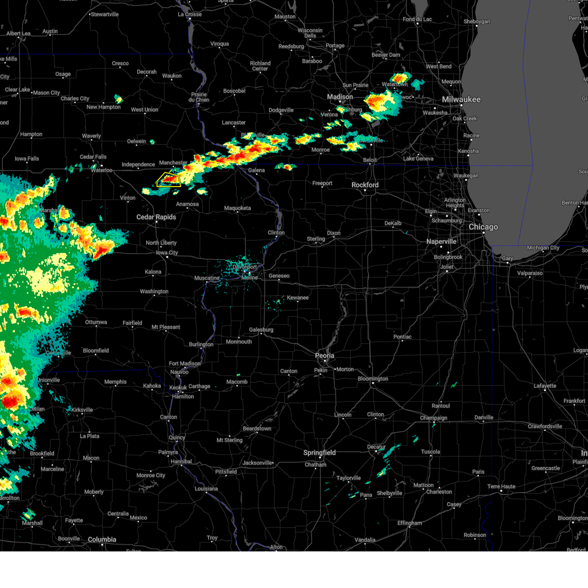 The storm which prompted the warning has weakened below severe limits, and no longer poses an immediate threat to life or property. therefore, the warning will be allowed to expire. however, small hail and heavy rain are still possible with this thunderstorm. to report severe weather, contact your nearest law enforcement agency. they will relay your report to the national weather service the quad cities. The storm which prompted the warning has weakened below severe limits, and no longer poses an immediate threat to life or property. therefore, the warning will be allowed to expire. however, small hail and heavy rain are still possible with this thunderstorm. to report severe weather, contact your nearest law enforcement agency. they will relay your report to the national weather service the quad cities.
|
| 4/27/2024 5:02 PM CDT |
 At 502 pm cdt, a severe thunderstorm was located over ryan, or 9 miles south of manchester, moving northeast at 25 mph (radar indicated). Hazards include 60 mph wind gusts and quarter size hail. Hail damage to vehicles is expected. expect wind damage to roofs, siding, and trees. Locations impacted include, ryan and robinson. At 502 pm cdt, a severe thunderstorm was located over ryan, or 9 miles south of manchester, moving northeast at 25 mph (radar indicated). Hazards include 60 mph wind gusts and quarter size hail. Hail damage to vehicles is expected. expect wind damage to roofs, siding, and trees. Locations impacted include, ryan and robinson.
|
| 4/27/2024 5:02 PM CDT |
 the severe thunderstorm warning has been cancelled and is no longer in effect the severe thunderstorm warning has been cancelled and is no longer in effect
|
| 4/27/2024 4:53 PM CDT |
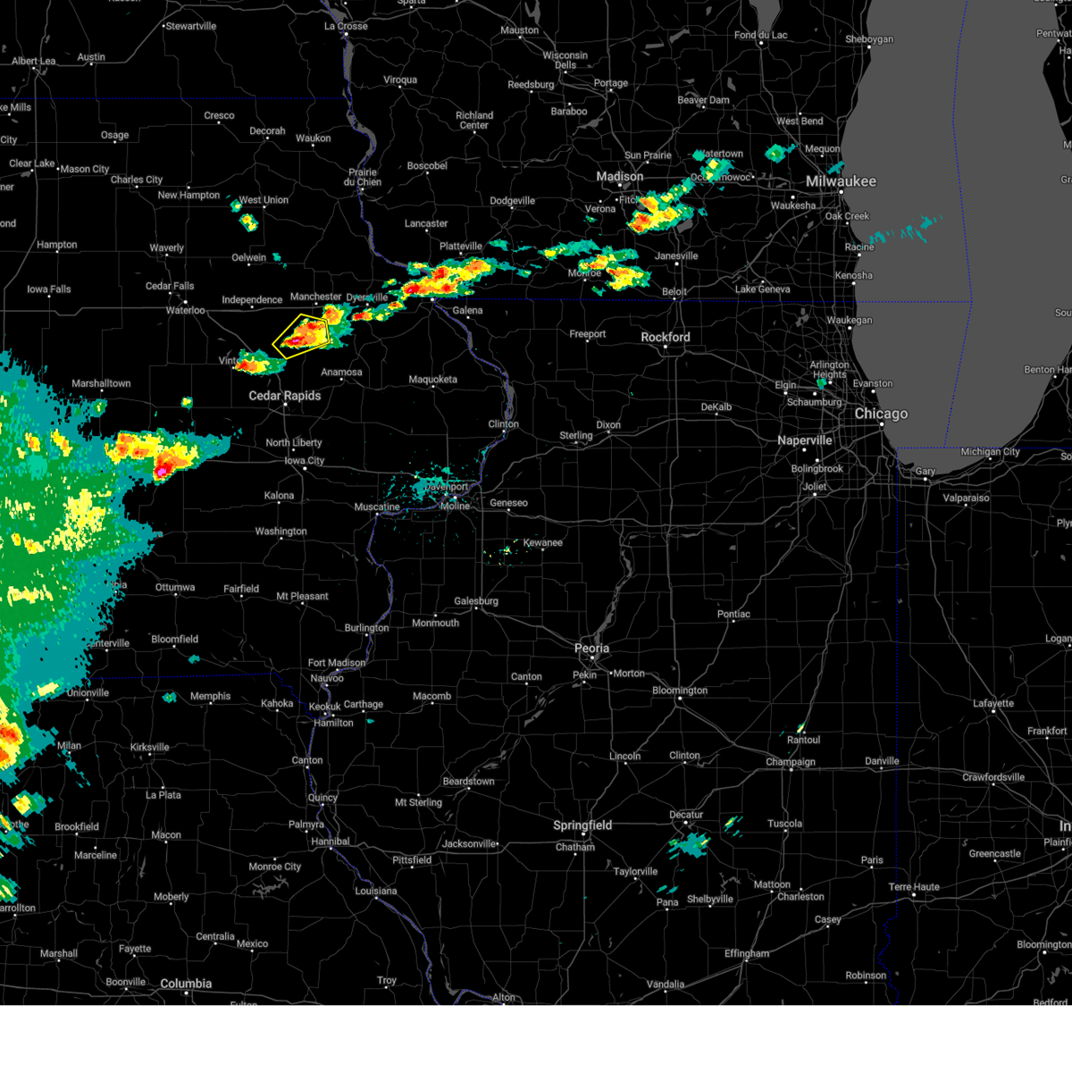 At 453 pm cdt, a severe thunderstorm was located over robinson, or 12 miles southwest of manchester, moving northeast at 25 mph (radar indicated). Hazards include 60 mph wind gusts and quarter size hail. Hail damage to vehicles is expected. expect wind damage to roofs, siding, and trees. Locations impacted include, coggon, ryan, paris, troy mills, buffalo creek park, and robinson. At 453 pm cdt, a severe thunderstorm was located over robinson, or 12 miles southwest of manchester, moving northeast at 25 mph (radar indicated). Hazards include 60 mph wind gusts and quarter size hail. Hail damage to vehicles is expected. expect wind damage to roofs, siding, and trees. Locations impacted include, coggon, ryan, paris, troy mills, buffalo creek park, and robinson.
|
| 4/27/2024 4:46 PM CDT |
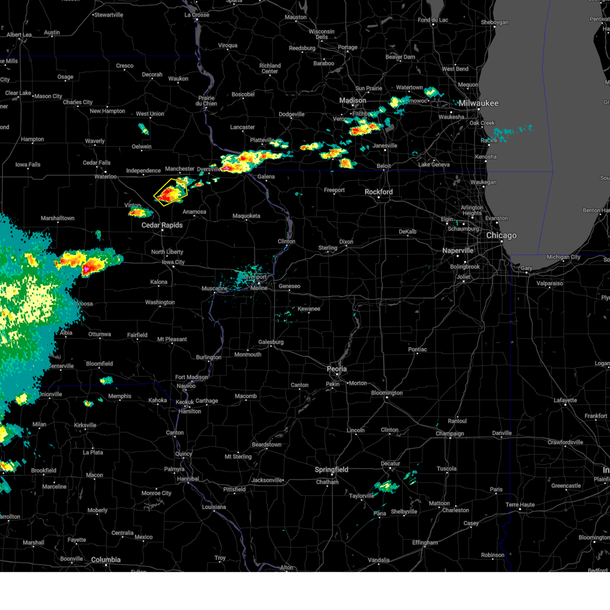 At 446 pm cdt, a severe thunderstorm was located near troy mills, or 15 miles southwest of manchester, moving northeast at 25 mph (radar indicated). Hazards include 60 mph wind gusts and quarter size hail. Hail damage to vehicles is expected. expect wind damage to roofs, siding, and trees. Locations impacted include, coggon, ryan, paris, troy mills, buffalo creek park, and robinson. At 446 pm cdt, a severe thunderstorm was located near troy mills, or 15 miles southwest of manchester, moving northeast at 25 mph (radar indicated). Hazards include 60 mph wind gusts and quarter size hail. Hail damage to vehicles is expected. expect wind damage to roofs, siding, and trees. Locations impacted include, coggon, ryan, paris, troy mills, buffalo creek park, and robinson.
|
| 4/27/2024 4:35 PM CDT |
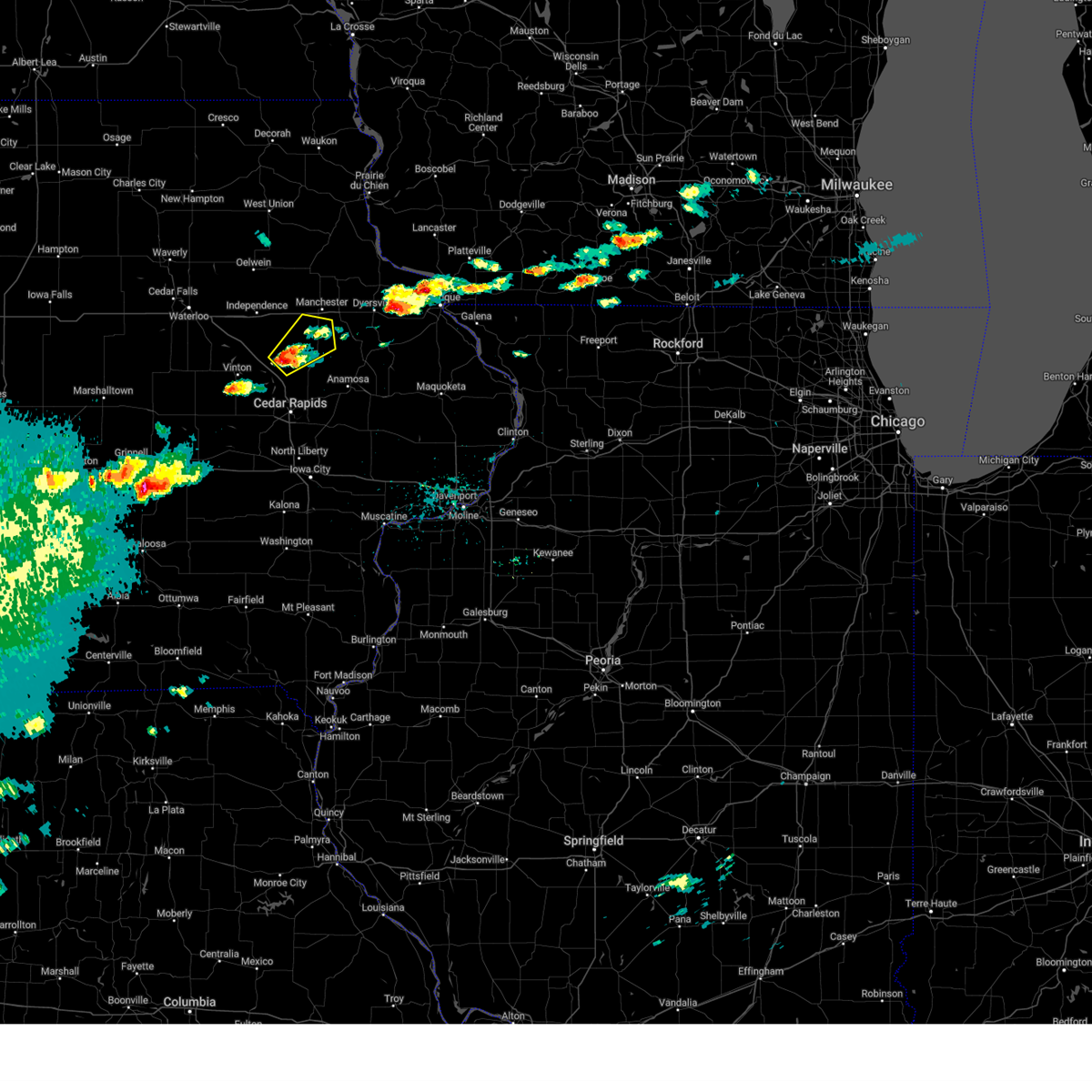 Svrdvn the national weather service in the quad cities has issued a * severe thunderstorm warning for, southeastern buchanan county in northeastern iowa, southwestern delaware county in northeastern iowa, northern linn county in east central iowa, * until 515 pm cdt. * at 435 pm cdt, a severe thunderstorm was located over troy mills, or 18 miles southeast of independence, moving northeast at 25 mph (radar indicated). Hazards include 60 mph wind gusts and quarter size hail. Hail damage to vehicles is expected. Expect wind damage to roofs, siding, and trees. Svrdvn the national weather service in the quad cities has issued a * severe thunderstorm warning for, southeastern buchanan county in northeastern iowa, southwestern delaware county in northeastern iowa, northern linn county in east central iowa, * until 515 pm cdt. * at 435 pm cdt, a severe thunderstorm was located over troy mills, or 18 miles southeast of independence, moving northeast at 25 mph (radar indicated). Hazards include 60 mph wind gusts and quarter size hail. Hail damage to vehicles is expected. Expect wind damage to roofs, siding, and trees.
|
| 4/16/2024 3:53 PM CDT |
 The storms which prompted the warning have weakened below severe limits, and no longer pose an immediate threat to life or property. therefore, the warning will be allowed to expire. however, gusty winds are still possible with these thunderstorms. a tornado watch remains in effect until 800 pm cdt for northeastern and east central iowa. The storms which prompted the warning have weakened below severe limits, and no longer pose an immediate threat to life or property. therefore, the warning will be allowed to expire. however, gusty winds are still possible with these thunderstorms. a tornado watch remains in effect until 800 pm cdt for northeastern and east central iowa.
|
| 4/16/2024 3:45 PM CDT |
 At 345 pm cdt, severe thunderstorms were located along a line extending from near highway 56 and county w 70 to camp courageous, moving northeast at 50 mph (radar indicated). Hazards include 60 mph wind gusts. Expect damage to roofs, siding, and trees. Locations impacted include, anamosa, manchester, dyersville, monticello, epworth, farley, edgewood, earlville, coggon, hopkinton, lamont, delhi, new vienna, colesburg, worthington, ryan, greeley, luxemburg, aurora, and prairieburg. At 345 pm cdt, severe thunderstorms were located along a line extending from near highway 56 and county w 70 to camp courageous, moving northeast at 50 mph (radar indicated). Hazards include 60 mph wind gusts. Expect damage to roofs, siding, and trees. Locations impacted include, anamosa, manchester, dyersville, monticello, epworth, farley, edgewood, earlville, coggon, hopkinton, lamont, delhi, new vienna, colesburg, worthington, ryan, greeley, luxemburg, aurora, and prairieburg.
|
| 4/16/2024 3:31 PM CDT |
 At 330 pm cdt, severe thunderstorms were located along a line extending from near wadena to wapsipinicon state park, moving northeast at 50 mph (radar indicated). Hazards include 60 mph wind gusts. Expect damage to roofs, siding, and trees. Locations impacted include, anamosa, manchester, dyersville, monticello, epworth, farley, central city, springville, edgewood, winthrop, earlville, coggon, hopkinton, lamont, delhi, new vienna, colesburg, worthington, ryan, and greeley. At 330 pm cdt, severe thunderstorms were located along a line extending from near wadena to wapsipinicon state park, moving northeast at 50 mph (radar indicated). Hazards include 60 mph wind gusts. Expect damage to roofs, siding, and trees. Locations impacted include, anamosa, manchester, dyersville, monticello, epworth, farley, central city, springville, edgewood, winthrop, earlville, coggon, hopkinton, lamont, delhi, new vienna, colesburg, worthington, ryan, and greeley.
|
| 4/16/2024 3:31 PM CDT |
 the severe thunderstorm warning has been cancelled and is no longer in effect the severe thunderstorm warning has been cancelled and is no longer in effect
|
| 4/16/2024 3:15 PM CDT |
 Svrdvn the national weather service in the quad cities has issued a * severe thunderstorm warning for, buchanan county in northeastern iowa, western dubuque county in northeastern iowa, northern johnson county in east central iowa, northwestern jones county in east central iowa, delaware county in northeastern iowa, linn county in east central iowa, * until 400 pm cdt. * at 314 pm cdt, severe thunderstorms were located along a line extending from near oelwein to near marion airport, moving northeast at 50 mph (radar indicated). Hazards include 70 mph wind gusts. Expect considerable tree damage. Damage is likely to mobile homes, roofs, and outbuildings. Svrdvn the national weather service in the quad cities has issued a * severe thunderstorm warning for, buchanan county in northeastern iowa, western dubuque county in northeastern iowa, northern johnson county in east central iowa, northwestern jones county in east central iowa, delaware county in northeastern iowa, linn county in east central iowa, * until 400 pm cdt. * at 314 pm cdt, severe thunderstorms were located along a line extending from near oelwein to near marion airport, moving northeast at 50 mph (radar indicated). Hazards include 70 mph wind gusts. Expect considerable tree damage. Damage is likely to mobile homes, roofs, and outbuildings.
|
| 7/28/2023 8:00 PM CDT | House damage and roof blown off a shed in rya in delaware county IA, 0.7 miles SSW of Ryan, IA |
| 7/28/2023 7:53 PM CDT | Storm damage reported in delaware county IA, 0.2 miles W of Ryan, IA |
| 7/28/2023 7:52 PM CDT |
 At 752 pm cdt, severe thunderstorms were located along a line extending from greeley to near buffalo creek park, moving east at 50 mph (trained weather spotters). Hazards include 70 mph wind gusts and quarter size hail. Hail damage to vehicles is expected. expect considerable tree damage. Wind damage is also likely to mobile homes, roofs, and outbuildings. At 752 pm cdt, severe thunderstorms were located along a line extending from greeley to near buffalo creek park, moving east at 50 mph (trained weather spotters). Hazards include 70 mph wind gusts and quarter size hail. Hail damage to vehicles is expected. expect considerable tree damage. Wind damage is also likely to mobile homes, roofs, and outbuildings.
|
| 7/14/2023 3:55 PM CDT |
 The severe thunderstorm warning for southeastern buchanan, northwestern jones, southwestern delaware and northeastern linn counties will expire at 400 pm cdt, the storm which prompted the warning has weakened below severe limits, and no longer poses an immediate threat to life or property. therefore, the warning will be allowed to expire. a severe thunderstorm watch remains in effect until 1000 pm cdt for east central iowa. The severe thunderstorm warning for southeastern buchanan, northwestern jones, southwestern delaware and northeastern linn counties will expire at 400 pm cdt, the storm which prompted the warning has weakened below severe limits, and no longer poses an immediate threat to life or property. therefore, the warning will be allowed to expire. a severe thunderstorm watch remains in effect until 1000 pm cdt for east central iowa.
|
| 7/14/2023 3:27 PM CDT |
 At 327 pm cdt, a severe thunderstorm was located over robinson, or 11 miles southwest of manchester, moving east at 15 mph (radar indicated). Hazards include 60 mph wind gusts and quarter size hail. Hail damage to vehicles is expected. expect wind damage to roofs, siding, and trees. locations impacted include, central city, coggon, delhi, ryan, prairieburg, delaware, troy mills, paris, robinson, buffalo creek park, monti, pinicon ridge park, buck creek, baileys ford park and turtle creek park. hail threat, radar indicated max hail size, 1. 00 in wind threat, radar indicated max wind gust, 60 mph. At 327 pm cdt, a severe thunderstorm was located over robinson, or 11 miles southwest of manchester, moving east at 15 mph (radar indicated). Hazards include 60 mph wind gusts and quarter size hail. Hail damage to vehicles is expected. expect wind damage to roofs, siding, and trees. locations impacted include, central city, coggon, delhi, ryan, prairieburg, delaware, troy mills, paris, robinson, buffalo creek park, monti, pinicon ridge park, buck creek, baileys ford park and turtle creek park. hail threat, radar indicated max hail size, 1. 00 in wind threat, radar indicated max wind gust, 60 mph.
|
| 7/14/2023 3:15 PM CDT |
 At 314 pm cdt, a severe thunderstorm was located over robinson, or 14 miles southwest of manchester, moving east at 15 mph (radar indicated). Hazards include 60 mph wind gusts and quarter size hail. Hail damage to vehicles is expected. Expect wind damage to roofs, siding, and trees. At 314 pm cdt, a severe thunderstorm was located over robinson, or 14 miles southwest of manchester, moving east at 15 mph (radar indicated). Hazards include 60 mph wind gusts and quarter size hail. Hail damage to vehicles is expected. Expect wind damage to roofs, siding, and trees.
|
| 6/24/2023 8:06 PM CDT |
 At 805 pm cdt, a severe thunderstorm was located over ryan, or 9 miles south of manchester, moving east at 20 mph. wind gusts of 50 to 60 mph were reported in ryan around 8 pm this evening from local fire officials (public). Hazards include 60 mph wind gusts. Expect damage to roofs, siding, and trees. this severe thunderstorm will be near, baileys ford park around 810 pm cdt. delhi and turtle creek park around 820 pm cdt. buck creek around 825 pm cdt. hopkinton around 840 pm cdt. monticello, worthington, jones county fairgrounds and monticello municipal airport around 845 pm cdt. other locations impacted by this severe thunderstorm include buck creek, camp courageous, baileys ford park, jones county fairgrounds, pictured rocks wildlife area, turtle creek park and monticello municipal airport. hail threat, radar indicated max hail size, <. 75 in wind threat, radar indicated max wind gust, 60 mph. At 805 pm cdt, a severe thunderstorm was located over ryan, or 9 miles south of manchester, moving east at 20 mph. wind gusts of 50 to 60 mph were reported in ryan around 8 pm this evening from local fire officials (public). Hazards include 60 mph wind gusts. Expect damage to roofs, siding, and trees. this severe thunderstorm will be near, baileys ford park around 810 pm cdt. delhi and turtle creek park around 820 pm cdt. buck creek around 825 pm cdt. hopkinton around 840 pm cdt. monticello, worthington, jones county fairgrounds and monticello municipal airport around 845 pm cdt. other locations impacted by this severe thunderstorm include buck creek, camp courageous, baileys ford park, jones county fairgrounds, pictured rocks wildlife area, turtle creek park and monticello municipal airport. hail threat, radar indicated max hail size, <. 75 in wind threat, radar indicated max wind gust, 60 mph.
|
| 4/19/2023 9:47 AM CDT |
 At 947 am cdt, a severe thunderstorm was located over delhi, or near manchester, moving northeast at 40 mph (radar indicated). Hazards include quarter size hail. Damage to vehicles is expected. locations impacted include, greeley, petersburg and dyersville. hail threat, radar indicated max hail size, 1. 00 in wind threat, radar indicated max wind gust, <50 mph. At 947 am cdt, a severe thunderstorm was located over delhi, or near manchester, moving northeast at 40 mph (radar indicated). Hazards include quarter size hail. Damage to vehicles is expected. locations impacted include, greeley, petersburg and dyersville. hail threat, radar indicated max hail size, 1. 00 in wind threat, radar indicated max wind gust, <50 mph.
|
| 4/19/2023 9:36 AM CDT |
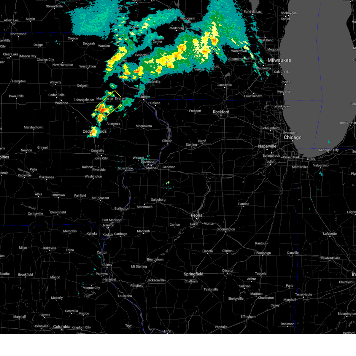 At 936 am cdt, a severe thunderstorm was located over ryan, or 8 miles south of manchester, moving northeast at 40 mph (radar indicated). Hazards include quarter size hail. Damage to vehicles is expected. this severe thunderstorm will be near, buck creek around 940 am cdt. manchester, turtle creek park, baileys ford park and delaware county fairgrounds around 945 am cdt. delhi and delaware around 950 am cdt. earlville and oneida around 955 am cdt. other locations in the path of this severe thunderstorm include dyersville, greeley and petersburg. hail threat, radar indicated max hail size, 1. 00 in wind threat, radar indicated max wind gust, <50 mph. At 936 am cdt, a severe thunderstorm was located over ryan, or 8 miles south of manchester, moving northeast at 40 mph (radar indicated). Hazards include quarter size hail. Damage to vehicles is expected. this severe thunderstorm will be near, buck creek around 940 am cdt. manchester, turtle creek park, baileys ford park and delaware county fairgrounds around 945 am cdt. delhi and delaware around 950 am cdt. earlville and oneida around 955 am cdt. other locations in the path of this severe thunderstorm include dyersville, greeley and petersburg. hail threat, radar indicated max hail size, 1. 00 in wind threat, radar indicated max wind gust, <50 mph.
|
| 4/4/2023 11:44 PM CDT |
 At 1143 pm cdt, severe thunderstorms were located along a line extending from near wood to near linn county fairgrounds to high amana, moving east at 35 mph (radar indicated). Hazards include 60 mph wind gusts and quarter size hail. Hail damage to vehicles is expected. expect wind damage to roofs, siding, and trees. these severe storms will be near, central city, edgewood, coggon, greeley, whittier, twin bridges park, pinicon ridge park and buffalo creek park around 1150 pm cdt. colesburg, waubeek, howard h cherry scout reservation and petersburg around 1155 pm cdt. prairieburg and matsell bridge natural area around 1200 am cdt. shueyville and cedar rapids municipal airport around 1205 am cdt. ely around 1215 am cdt. palisades-kepler state park around 1220 am cdt. mount vernon and lisbon around 1230 am cdt. other locations impacted by these severe thunderstorms include robinson, matsell bridge natural area, delaware county fairgrounds, buffalo creek park, manchester airport, howard h cherry scout reservation, oneida, pleasant creek state recreation area, squaw creek park and linn county fairgrounds. hail threat, radar indicated max hail size, 1. 00 in wind threat, radar indicated max wind gust, 60 mph. At 1143 pm cdt, severe thunderstorms were located along a line extending from near wood to near linn county fairgrounds to high amana, moving east at 35 mph (radar indicated). Hazards include 60 mph wind gusts and quarter size hail. Hail damage to vehicles is expected. expect wind damage to roofs, siding, and trees. these severe storms will be near, central city, edgewood, coggon, greeley, whittier, twin bridges park, pinicon ridge park and buffalo creek park around 1150 pm cdt. colesburg, waubeek, howard h cherry scout reservation and petersburg around 1155 pm cdt. prairieburg and matsell bridge natural area around 1200 am cdt. shueyville and cedar rapids municipal airport around 1205 am cdt. ely around 1215 am cdt. palisades-kepler state park around 1220 am cdt. mount vernon and lisbon around 1230 am cdt. other locations impacted by these severe thunderstorms include robinson, matsell bridge natural area, delaware county fairgrounds, buffalo creek park, manchester airport, howard h cherry scout reservation, oneida, pleasant creek state recreation area, squaw creek park and linn county fairgrounds. hail threat, radar indicated max hail size, 1. 00 in wind threat, radar indicated max wind gust, 60 mph.
|
| 4/4/2023 11:15 PM CDT |
 At 1114 pm cdt, severe thunderstorms were located along a line extending from lamont to near benton city park to near ladora, moving east at 35 mph (radar indicated). Hazards include 60 mph wind gusts and quarter size hail. Hail damage to vehicles is expected. expect wind damage to roofs, siding, and trees. severe thunderstorms will be near, palo, lamont, pleasant creek state recreation area and winthrop golf course around 1120 pm cdt. center point, dundee, backbone state park, coffins grove park, manchester airport and hannen lake park around 1125 pm cdt. manchester, hiawatha and toddville around 1130 pm cdt. robins, edgewood and lafayette around 1135 pm cdt. alburnett, greeley, oneida and watkins around 1140 pm cdt. central city, paris, linn county fairgrounds, twin bridges park and pinicon ridge park around 1145 pm cdt. walford, coggon, waubeek, whittier, buffalo creek park and petersburg around 1150 pm cdt. colesburg, prairieburg and howard h cherry scout reservation around 1155 pm cdt. Other locations impacted by these severe thunderstorms include manchester airport, squaw creek park, linn county fairgrounds, monti, hannen lake park, pinicon ridge park, buck creek, twin bridges park, baileys ford park and marion airport. At 1114 pm cdt, severe thunderstorms were located along a line extending from lamont to near benton city park to near ladora, moving east at 35 mph (radar indicated). Hazards include 60 mph wind gusts and quarter size hail. Hail damage to vehicles is expected. expect wind damage to roofs, siding, and trees. severe thunderstorms will be near, palo, lamont, pleasant creek state recreation area and winthrop golf course around 1120 pm cdt. center point, dundee, backbone state park, coffins grove park, manchester airport and hannen lake park around 1125 pm cdt. manchester, hiawatha and toddville around 1130 pm cdt. robins, edgewood and lafayette around 1135 pm cdt. alburnett, greeley, oneida and watkins around 1140 pm cdt. central city, paris, linn county fairgrounds, twin bridges park and pinicon ridge park around 1145 pm cdt. walford, coggon, waubeek, whittier, buffalo creek park and petersburg around 1150 pm cdt. colesburg, prairieburg and howard h cherry scout reservation around 1155 pm cdt. Other locations impacted by these severe thunderstorms include manchester airport, squaw creek park, linn county fairgrounds, monti, hannen lake park, pinicon ridge park, buck creek, twin bridges park, baileys ford park and marion airport.
|
| 4/4/2023 9:21 PM CDT |
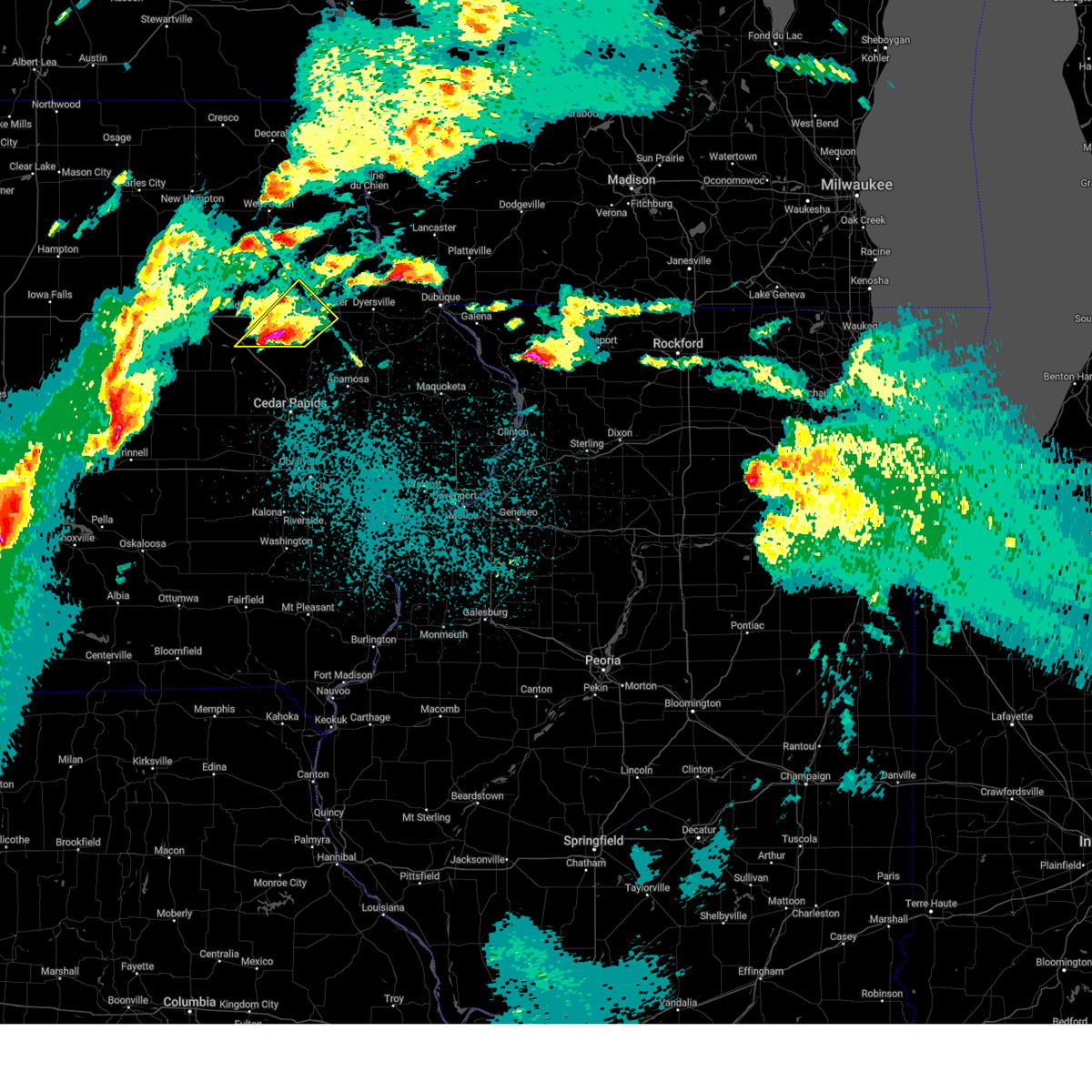 At 921 pm cdt, a severe thunderstorm was located near monti, or 12 miles southeast of independence, moving northeast at 40 mph (radar indicated). Hazards include golf ball size hail and 60 mph wind gusts. People and animals outdoors will be injured. expect hail damage to roofs, siding, windows, and vehicles. expect wind damage to roofs, siding, and trees. this severe storm will be near, winthrop, monti and robinson around 925 pm cdt. masonville and winthrop golf course around 935 pm cdt. coffins grove park and manchester airport around 940 pm cdt. manchester, dundee and delaware county fairgrounds around 945 pm cdt. Other locations impacted by this severe thunderstorm include lime creek county park, monti, coffins grove park, winthrop golf course, robinson, baileys ford park, delaware county fairgrounds and manchester airport. At 921 pm cdt, a severe thunderstorm was located near monti, or 12 miles southeast of independence, moving northeast at 40 mph (radar indicated). Hazards include golf ball size hail and 60 mph wind gusts. People and animals outdoors will be injured. expect hail damage to roofs, siding, windows, and vehicles. expect wind damage to roofs, siding, and trees. this severe storm will be near, winthrop, monti and robinson around 925 pm cdt. masonville and winthrop golf course around 935 pm cdt. coffins grove park and manchester airport around 940 pm cdt. manchester, dundee and delaware county fairgrounds around 945 pm cdt. Other locations impacted by this severe thunderstorm include lime creek county park, monti, coffins grove park, winthrop golf course, robinson, baileys ford park, delaware county fairgrounds and manchester airport.
|
| 4/4/2023 9:10 PM CDT |
 At 907 pm cdt, a severe thunderstorm was located over walker, or 13 miles northeast of vinton, moving northeast at 45 mph. at 905 pm cdt, urbana fire and rescue reported hail the size of quarters in urbana (emergency management). Hazards include 60 mph wind gusts and quarter size hail. Hail damage to vehicles is expected. expect wind damage to roofs, siding, and trees. this severe storm will be near, troy mills around 915 pm cdt. quasqueton around 920 pm cdt. winthrop, monti and robinson around 925 pm cdt. winthrop golf course around 930 pm cdt. masonville around 935 pm cdt. manchester, coffins grove park, manchester airport and delaware county fairgrounds around 940 pm cdt. dundee around 945 pm cdt. other locations impacted by this severe thunderstorm include lime creek county park, monti, coffins grove park, winthrop golf course, robinson, baileys ford park, spencers grove, minne estema park, delaware county fairgrounds and manchester airport. hail threat, observed max hail size, 1. 00 in wind threat, radar indicated max wind gust, 60 mph. At 907 pm cdt, a severe thunderstorm was located over walker, or 13 miles northeast of vinton, moving northeast at 45 mph. at 905 pm cdt, urbana fire and rescue reported hail the size of quarters in urbana (emergency management). Hazards include 60 mph wind gusts and quarter size hail. Hail damage to vehicles is expected. expect wind damage to roofs, siding, and trees. this severe storm will be near, troy mills around 915 pm cdt. quasqueton around 920 pm cdt. winthrop, monti and robinson around 925 pm cdt. winthrop golf course around 930 pm cdt. masonville around 935 pm cdt. manchester, coffins grove park, manchester airport and delaware county fairgrounds around 940 pm cdt. dundee around 945 pm cdt. other locations impacted by this severe thunderstorm include lime creek county park, monti, coffins grove park, winthrop golf course, robinson, baileys ford park, spencers grove, minne estema park, delaware county fairgrounds and manchester airport. hail threat, observed max hail size, 1. 00 in wind threat, radar indicated max wind gust, 60 mph.
|
| 4/4/2023 8:55 PM CDT |
 At 854 pm cdt, a severe thunderstorm was located over hoefle-dulin park, or over vinton, moving northeast at 40 mph. at 852 pm cdt, benton county emergency management reported hail the size of quarters two miles south of vinton (emergency management). Hazards include 60 mph wind gusts and quarter size hail. Hail damage to vehicles is expected. expect wind damage to roofs, siding, and trees. this severe thunderstorm will be near, wildcat bluff park around 900 pm cdt. center point, urbana and cheney around 905 pm cdt. spencers grove around 910 pm cdt. walker and rowley around 915 pm cdt. troy mills around 920 pm cdt. quasqueton around 925 pm cdt. winthrop, monti and robinson around 930 pm cdt. winthrop golf course around 935 pm cdt. other locations impacted by this severe thunderstorm include lime creek county park, winthrop golf course, robinson, vinton memorial airport, rodgers park, delaware county fairgrounds, manchester airport, benton city park, hoefle-dulin park and monti. hail threat, observed max hail size, 1. 00 in wind threat, radar indicated max wind gust, 60 mph. At 854 pm cdt, a severe thunderstorm was located over hoefle-dulin park, or over vinton, moving northeast at 40 mph. at 852 pm cdt, benton county emergency management reported hail the size of quarters two miles south of vinton (emergency management). Hazards include 60 mph wind gusts and quarter size hail. Hail damage to vehicles is expected. expect wind damage to roofs, siding, and trees. this severe thunderstorm will be near, wildcat bluff park around 900 pm cdt. center point, urbana and cheney around 905 pm cdt. spencers grove around 910 pm cdt. walker and rowley around 915 pm cdt. troy mills around 920 pm cdt. quasqueton around 925 pm cdt. winthrop, monti and robinson around 930 pm cdt. winthrop golf course around 935 pm cdt. other locations impacted by this severe thunderstorm include lime creek county park, winthrop golf course, robinson, vinton memorial airport, rodgers park, delaware county fairgrounds, manchester airport, benton city park, hoefle-dulin park and monti. hail threat, observed max hail size, 1. 00 in wind threat, radar indicated max wind gust, 60 mph.
|
| 4/4/2023 8:55 AM CDT |
 The severe thunderstorm warning for southeastern buchanan, northwestern jones, southwestern delaware and central linn counties will expire at 900 am cdt, the storm which prompted the warning has weakened below severe limits, and no longer poses an immediate threat to life or property. therefore, the warning will be allowed to expire. The severe thunderstorm warning for southeastern buchanan, northwestern jones, southwestern delaware and central linn counties will expire at 900 am cdt, the storm which prompted the warning has weakened below severe limits, and no longer poses an immediate threat to life or property. therefore, the warning will be allowed to expire.
|
| 4/4/2023 8:45 AM CDT |
 At 845 am cdt, a severe thunderstorm was located over alburnett, or 12 miles north of cedar rapids, moving northeast at 55 mph (trained weather spotters). Hazards include ping pong ball size hail. People and animals outdoors will be injured. expect damage to roofs, siding, windows, and vehicles. this severe storm will be near, central city, paris, waubeek, linn county fairgrounds and pinicon ridge park around 850 am cdt. prairieburg, buffalo creek park and howard h cherry scout reservation around 855 am cdt. other locations in the path of this severe thunderstorm include coggon, robinson and ryan. hail threat, radar indicated max hail size, 1. 50 in wind threat, radar indicated max wind gust, <50 mph. At 845 am cdt, a severe thunderstorm was located over alburnett, or 12 miles north of cedar rapids, moving northeast at 55 mph (trained weather spotters). Hazards include ping pong ball size hail. People and animals outdoors will be injured. expect damage to roofs, siding, windows, and vehicles. this severe storm will be near, central city, paris, waubeek, linn county fairgrounds and pinicon ridge park around 850 am cdt. prairieburg, buffalo creek park and howard h cherry scout reservation around 855 am cdt. other locations in the path of this severe thunderstorm include coggon, robinson and ryan. hail threat, radar indicated max hail size, 1. 50 in wind threat, radar indicated max wind gust, <50 mph.
|
| 4/4/2023 8:38 AM CDT |
 At 838 am cdt, a severe thunderstorm was located over hiawatha, or near cedar rapids, moving northeast at 55 mph (trained weather spotters). Hazards include ping pong ball size hail. People and animals outdoors will be injured. expect damage to roofs, siding, windows, and vehicles. this severe storm will be near, alburnett and whittier around 845 am cdt. other locations in the path of this severe thunderstorm include central city, paris, waubeek, linn county fairgrounds, pinicon ridge park, prairieburg, buffalo creek park, howard h cherry scout reservation, coggon, robinson and ryan. hail threat, radar indicated max hail size, 1. 50 in wind threat, radar indicated max wind gust, <50 mph. At 838 am cdt, a severe thunderstorm was located over hiawatha, or near cedar rapids, moving northeast at 55 mph (trained weather spotters). Hazards include ping pong ball size hail. People and animals outdoors will be injured. expect damage to roofs, siding, windows, and vehicles. this severe storm will be near, alburnett and whittier around 845 am cdt. other locations in the path of this severe thunderstorm include central city, paris, waubeek, linn county fairgrounds, pinicon ridge park, prairieburg, buffalo creek park, howard h cherry scout reservation, coggon, robinson and ryan. hail threat, radar indicated max hail size, 1. 50 in wind threat, radar indicated max wind gust, <50 mph.
|
| 4/4/2023 8:29 AM CDT |
 At 829 am cdt, a severe thunderstorm was located over cedar rapids, moving northeast at 55 mph (radar indicated). Hazards include quarter size hail. Damage to vehicles is expected. this severe thunderstorm will be near, marion, hiawatha, robins, toddville, squaw creek park and marion airport around 840 am cdt. alburnett, whittier and lafayette around 845 am cdt. other locations in the path of this severe thunderstorm include central city, waubeek, linn county fairgrounds, paris, pinicon ridge park, howard h cherry scout reservation, coggon, ryan, prairieburg, buffalo creek park and robinson. hail threat, radar indicated max hail size, 1. 00 in wind threat, radar indicated max wind gust, <50 mph. At 829 am cdt, a severe thunderstorm was located over cedar rapids, moving northeast at 55 mph (radar indicated). Hazards include quarter size hail. Damage to vehicles is expected. this severe thunderstorm will be near, marion, hiawatha, robins, toddville, squaw creek park and marion airport around 840 am cdt. alburnett, whittier and lafayette around 845 am cdt. other locations in the path of this severe thunderstorm include central city, waubeek, linn county fairgrounds, paris, pinicon ridge park, howard h cherry scout reservation, coggon, ryan, prairieburg, buffalo creek park and robinson. hail threat, radar indicated max hail size, 1. 00 in wind threat, radar indicated max wind gust, <50 mph.
|
| 8/3/2022 11:40 AM CDT |
 At 1140 am cdt, a severe thunderstorm was located near dyersville, or 14 miles east of manchester, and is nearly stationary (radar indicated). Hazards include 60 mph wind gusts. Expect damage to roofs, siding, and trees. locations impacted include, manchester, dyersville, farley, earlville, hopkinton, delhi, new vienna, worthington, ryan, delaware, oneida, delaware county fairgrounds, new wine park, baileys ford park, petersburg and turtle creek park. hail threat, radar indicated max hail size, <. 75 in wind threat, radar indicated max wind gust, 60 mph. At 1140 am cdt, a severe thunderstorm was located near dyersville, or 14 miles east of manchester, and is nearly stationary (radar indicated). Hazards include 60 mph wind gusts. Expect damage to roofs, siding, and trees. locations impacted include, manchester, dyersville, farley, earlville, hopkinton, delhi, new vienna, worthington, ryan, delaware, oneida, delaware county fairgrounds, new wine park, baileys ford park, petersburg and turtle creek park. hail threat, radar indicated max hail size, <. 75 in wind threat, radar indicated max wind gust, 60 mph.
|
| 8/3/2022 11:28 AM CDT |
 At 1127 am cdt, a severe thunderstorm was located over earlville, or 10 miles east of manchester, moving east at 20 mph (radar indicated). Hazards include 60 mph wind gusts. expect damage to roofs, siding, and trees At 1127 am cdt, a severe thunderstorm was located over earlville, or 10 miles east of manchester, moving east at 20 mph (radar indicated). Hazards include 60 mph wind gusts. expect damage to roofs, siding, and trees
|
| 8/3/2022 11:12 AM CDT |
 At 1112 am cdt, a severe thunderstorm was located over baileys ford park, or near manchester, moving east at 25 mph (radar indicated). Hazards include 60 mph wind gusts. Expect damage to roofs, siding, and trees. locations impacted include, manchester, dyersville, earlville, hopkinton, delhi, worthington, ryan, delaware, oneida, delaware county fairgrounds, manchester airport, new wine park, coffins grove park, buck creek, baileys ford park and turtle creek park. hail threat, radar indicated max hail size, <. 75 in wind threat, observed max wind gust, 60 mph. At 1112 am cdt, a severe thunderstorm was located over baileys ford park, or near manchester, moving east at 25 mph (radar indicated). Hazards include 60 mph wind gusts. Expect damage to roofs, siding, and trees. locations impacted include, manchester, dyersville, earlville, hopkinton, delhi, worthington, ryan, delaware, oneida, delaware county fairgrounds, manchester airport, new wine park, coffins grove park, buck creek, baileys ford park and turtle creek park. hail threat, radar indicated max hail size, <. 75 in wind threat, observed max wind gust, 60 mph.
|
| 8/3/2022 11:02 AM CDT |
 At 1102 am cdt, a severe thunderstorm was located over manchester, moving east at 25 mph (radar indicated). Hazards include 60 mph wind gusts. expect damage to roofs, siding, and trees At 1102 am cdt, a severe thunderstorm was located over manchester, moving east at 25 mph (radar indicated). Hazards include 60 mph wind gusts. expect damage to roofs, siding, and trees
|
| 8/3/2022 10:29 AM CDT |
 At 1029 am cdt, severe thunderstorms were located along a line extending from near lime creek county park to cedar rapids, moving east at 40 mph (radar indicated). Hazards include 60 mph wind gusts and penny size hail. Expect damage to roofs, siding, and trees. locations impacted include, cedar rapids, independence, anamosa, vinton, marion, hiawatha, robins, jesup, center point, fairfax, atkins, urbana, central city, springville, palo, shellsburg, winthrop, hazleton, walker and alburnett. hail threat, radar indicated max hail size, 0. 75 in wind threat, radar indicated max wind gust, 60 mph. At 1029 am cdt, severe thunderstorms were located along a line extending from near lime creek county park to cedar rapids, moving east at 40 mph (radar indicated). Hazards include 60 mph wind gusts and penny size hail. Expect damage to roofs, siding, and trees. locations impacted include, cedar rapids, independence, anamosa, vinton, marion, hiawatha, robins, jesup, center point, fairfax, atkins, urbana, central city, springville, palo, shellsburg, winthrop, hazleton, walker and alburnett. hail threat, radar indicated max hail size, 0. 75 in wind threat, radar indicated max wind gust, 60 mph.
|
| 8/3/2022 10:19 AM CDT |
 At 1018 am cdt, severe thunderstorms were located along a line extending from near la porte city to fairfax, moving northeast at 40 mph (radar indicated). Hazards include 60 mph wind gusts and penny size hail. expect damage to roofs, siding, and trees At 1018 am cdt, severe thunderstorms were located along a line extending from near la porte city to fairfax, moving northeast at 40 mph (radar indicated). Hazards include 60 mph wind gusts and penny size hail. expect damage to roofs, siding, and trees
|
| 7/24/2022 12:22 AM CDT |
 At 1222 am cdt, a severe thunderstorm was located near hopkinton, or 11 miles southeast of manchester, moving east at 50 mph (radar indicated). Hazards include 60 mph wind gusts. Expect damage to roofs, siding, and trees. locations impacted include, monticello, central city, hopkinton, delhi, ryan, prairieburg, waubeek, langworthy, jones county fairgrounds, howard h cherry scout reservation, buck creek, baileys ford park, turtle creek park and monticello municipal airport. hail threat, radar indicated max hail size, <. 75 in wind threat, radar indicated max wind gust, 60 mph. At 1222 am cdt, a severe thunderstorm was located near hopkinton, or 11 miles southeast of manchester, moving east at 50 mph (radar indicated). Hazards include 60 mph wind gusts. Expect damage to roofs, siding, and trees. locations impacted include, monticello, central city, hopkinton, delhi, ryan, prairieburg, waubeek, langworthy, jones county fairgrounds, howard h cherry scout reservation, buck creek, baileys ford park, turtle creek park and monticello municipal airport. hail threat, radar indicated max hail size, <. 75 in wind threat, radar indicated max wind gust, 60 mph.
|
| 7/24/2022 12:06 AM CDT |
 At 1206 am cdt, a severe thunderstorm was located over ryan, or 11 miles south of manchester, moving east at 50 mph (radar indicated). Hazards include 60 mph wind gusts. expect damage to roofs, siding, and trees At 1206 am cdt, a severe thunderstorm was located over ryan, or 11 miles south of manchester, moving east at 50 mph (radar indicated). Hazards include 60 mph wind gusts. expect damage to roofs, siding, and trees
|
| 7/5/2022 9:34 PM CDT |
 At 934 pm cdt, a severe thunderstorm was located near langworthy, or near anamosa, moving east at 40 mph (trained weather spotters). Hazards include 70 mph wind gusts. Expect considerable tree damage. damage is likely to mobile homes, roofs, and outbuildings. locations impacted include, cedar rapids, anamosa, marion, mount vernon, monticello, lisbon, central city, springville, olin, coggon, hopkinton, wyoming, ryan, bertram, martelle, onslow, prairieburg, masonville, morley and center junction. thunderstorm damage threat, considerable hail threat, radar indicated max hail size, <. 75 in wind threat, observed max wind gust, 70 mph. At 934 pm cdt, a severe thunderstorm was located near langworthy, or near anamosa, moving east at 40 mph (trained weather spotters). Hazards include 70 mph wind gusts. Expect considerable tree damage. damage is likely to mobile homes, roofs, and outbuildings. locations impacted include, cedar rapids, anamosa, marion, mount vernon, monticello, lisbon, central city, springville, olin, coggon, hopkinton, wyoming, ryan, bertram, martelle, onslow, prairieburg, masonville, morley and center junction. thunderstorm damage threat, considerable hail threat, radar indicated max hail size, <. 75 in wind threat, observed max wind gust, 70 mph.
|
| 7/5/2022 9:27 PM CDT |
 At 927 pm cdt, a severe thunderstorm was located near prairieburg, or 8 miles northwest of anamosa, moving east at 40 mph (trained weather spotters). Hazards include 70 mph wind gusts. Expect considerable tree damage. damage is likely to mobile homes, roofs, and outbuildings. Locations impacted include, cedar rapids, anamosa, marion, hiawatha, mount vernon, monticello, robins, lisbon, central city, springville, olin, alburnett, coggon, hopkinton, wyoming, ryan, bertram, martelle, onslow and prairieburg. At 927 pm cdt, a severe thunderstorm was located near prairieburg, or 8 miles northwest of anamosa, moving east at 40 mph (trained weather spotters). Hazards include 70 mph wind gusts. Expect considerable tree damage. damage is likely to mobile homes, roofs, and outbuildings. Locations impacted include, cedar rapids, anamosa, marion, hiawatha, mount vernon, monticello, robins, lisbon, central city, springville, olin, alburnett, coggon, hopkinton, wyoming, ryan, bertram, martelle, onslow and prairieburg.
|
| 7/5/2022 9:21 PM CDT |
 A severe thunderstorm warning remains in effect until 1000 pm cdt for jones. southern delaware and linn counties. at 921 pm cdt, a severe thunderstorm was located over prairieburg, or 11 miles northwest of anamosa, moving east at 40 mph. hazard. 70 mph wind gusts. source. Trained weather spotters. A severe thunderstorm warning remains in effect until 1000 pm cdt for jones. southern delaware and linn counties. at 921 pm cdt, a severe thunderstorm was located over prairieburg, or 11 miles northwest of anamosa, moving east at 40 mph. hazard. 70 mph wind gusts. source. Trained weather spotters.
|
| 7/5/2022 9:08 PM CDT |
 At 908 pm cdt, a severe thunderstorm was located near buffalo creek park, or 16 miles southwest of manchester, moving east at 40 mph (trained weather spotters). Hazards include 70 mph wind gusts. Expect considerable tree damage. damage is likely to mobile homes, roofs, and outbuildings. Locations impacted include, cedar rapids, anamosa, marion, hiawatha, mount vernon, monticello, robins, center point, lisbon, urbana, central city, springville, walker, olin, alburnett, coggon, hopkinton, wyoming, ryan and bertram. At 908 pm cdt, a severe thunderstorm was located near buffalo creek park, or 16 miles southwest of manchester, moving east at 40 mph (trained weather spotters). Hazards include 70 mph wind gusts. Expect considerable tree damage. damage is likely to mobile homes, roofs, and outbuildings. Locations impacted include, cedar rapids, anamosa, marion, hiawatha, mount vernon, monticello, robins, center point, lisbon, urbana, central city, springville, walker, olin, alburnett, coggon, hopkinton, wyoming, ryan and bertram.
|
| 7/5/2022 9:00 PM CDT |
 At 900 pm cdt, a severe thunderstorm was located over troy mills, or 14 miles southeast of independence, moving east at 40 mph (radar indicated). Hazards include 60 mph wind gusts. expect damage to roofs, siding, and trees At 900 pm cdt, a severe thunderstorm was located over troy mills, or 14 miles southeast of independence, moving east at 40 mph (radar indicated). Hazards include 60 mph wind gusts. expect damage to roofs, siding, and trees
|
| 3/5/2022 7:59 PM CST |
 At 758 pm cst, a severe thunderstorm capable of producing a tornado was located over manchester, moving northeast at 45 mph (radar indicated rotation). Hazards include tornado. Flying debris will be dangerous to those caught without shelter. mobile homes will be damaged or destroyed. damage to roofs, windows, and vehicles will occur. tree damage is likely. Locations impacted include, delhi, delaware, earlville, greeley, oneida, dyersville and colesburg. At 758 pm cst, a severe thunderstorm capable of producing a tornado was located over manchester, moving northeast at 45 mph (radar indicated rotation). Hazards include tornado. Flying debris will be dangerous to those caught without shelter. mobile homes will be damaged or destroyed. damage to roofs, windows, and vehicles will occur. tree damage is likely. Locations impacted include, delhi, delaware, earlville, greeley, oneida, dyersville and colesburg.
|
| 3/5/2022 7:42 PM CST |
 At 742 pm cst, a severe thunderstorm capable of producing a tornado was located near quasqueton, or 12 miles southeast of independence, moving northeast at 45 mph (radar indicated rotation). Hazards include tornado. Flying debris will be dangerous to those caught without shelter. mobile homes will be damaged or destroyed. damage to roofs, windows, and vehicles will occur. tree damage is likely. this dangerous storm will be near, ryan and masonville around 755 pm cst. Other locations in the path of this tornadic thunderstorm include manchester, delhi, delaware, oneida, earlville, greeley, dyersville and colesburg. At 742 pm cst, a severe thunderstorm capable of producing a tornado was located near quasqueton, or 12 miles southeast of independence, moving northeast at 45 mph (radar indicated rotation). Hazards include tornado. Flying debris will be dangerous to those caught without shelter. mobile homes will be damaged or destroyed. damage to roofs, windows, and vehicles will occur. tree damage is likely. this dangerous storm will be near, ryan and masonville around 755 pm cst. Other locations in the path of this tornadic thunderstorm include manchester, delhi, delaware, oneida, earlville, greeley, dyersville and colesburg.
|
| 12/15/2021 9:05 PM CST |
 At 905 pm cst, severe thunderstorms were located along a line extending from sageville to millersburg, moving east at 65 mph (trained weather spotters). Hazards include 70 mph wind gusts. Expect considerable tree damage. damage is likely to mobile homes, roofs, and outbuildings. Locations impacted include, cedar rapids, iowa city, washington, manchester, columbus junction, marion, coralville, north liberty, hiawatha, mount vernon, robins, center point, kalona, lisbon, fairfax, solon, tiffin, ely, walford and wellman. At 905 pm cst, severe thunderstorms were located along a line extending from sageville to millersburg, moving east at 65 mph (trained weather spotters). Hazards include 70 mph wind gusts. Expect considerable tree damage. damage is likely to mobile homes, roofs, and outbuildings. Locations impacted include, cedar rapids, iowa city, washington, manchester, columbus junction, marion, coralville, north liberty, hiawatha, mount vernon, robins, center point, kalona, lisbon, fairfax, solon, tiffin, ely, walford and wellman.
|
| 12/15/2021 8:48 PM CST | Shingle damage reported as well as other damage in the neighborhoo in delaware county IA, 4 miles E of Ryan, IA |
| 12/15/2021 8:37 PM CST |
 At 836 pm cst, severe thunderstorms were located along a line extending from greeley to columbus junction, moving east at 65 mph (trained weather spotters). Hazards include 70 mph wind gusts. a wind gust of 66 mph was measured at the eastern iowa airport at 830 pm. Expect considerable tree damage. damage is likely to mobile homes, roofs, and outbuildings. Locations impacted include, cedar rapids, iowa city, washington, manchester, columbus junction, marion, coralville, north liberty, hiawatha, mount vernon, robins, center point, kalona, lisbon, fairfax, solon, tiffin, ely, walford and wellman. At 836 pm cst, severe thunderstorms were located along a line extending from greeley to columbus junction, moving east at 65 mph (trained weather spotters). Hazards include 70 mph wind gusts. a wind gust of 66 mph was measured at the eastern iowa airport at 830 pm. Expect considerable tree damage. damage is likely to mobile homes, roofs, and outbuildings. Locations impacted include, cedar rapids, iowa city, washington, manchester, columbus junction, marion, coralville, north liberty, hiawatha, mount vernon, robins, center point, kalona, lisbon, fairfax, solon, tiffin, ely, walford and wellman.
|
| 12/15/2021 8:30 PM CST |
 At 830 pm cst, severe thunderstorms were located along a line extending from near edgewood to cotter, moving east at 65 mph (radar indicated). Hazards include 70 mph wind gusts and penny size hail. Expect considerable tree damage. damage is likely to mobile homes, roofs, and outbuildings. Locations impacted include, cedar rapids, iowa city, washington, manchester, columbus junction, marion, coralville, north liberty, hiawatha, mount vernon, robins, center point, kalona, lisbon, fairfax, solon, tiffin, ely, walford and wellman. At 830 pm cst, severe thunderstorms were located along a line extending from near edgewood to cotter, moving east at 65 mph (radar indicated). Hazards include 70 mph wind gusts and penny size hail. Expect considerable tree damage. damage is likely to mobile homes, roofs, and outbuildings. Locations impacted include, cedar rapids, iowa city, washington, manchester, columbus junction, marion, coralville, north liberty, hiawatha, mount vernon, robins, center point, kalona, lisbon, fairfax, solon, tiffin, ely, walford and wellman.
|
| 12/15/2021 8:27 PM CST |
 At 826 pm cst, severe thunderstorms were located along a line extending from near dundee to ainsworth, moving east at 65 mph (trained weather spotters. a trained spotter measured 70 mph winds in norway). Hazards include 70 mph wind gusts and penny size hail. Expect considerable tree damage. damage is likely to mobile homes, roofs, and outbuildings. Locations impacted include, cedar rapids, iowa city, washington, manchester, columbus junction, marion, coralville, north liberty, hiawatha, mount vernon, robins, center point, kalona, lisbon, fairfax, solon, tiffin, ely, walford and wellman. At 826 pm cst, severe thunderstorms were located along a line extending from near dundee to ainsworth, moving east at 65 mph (trained weather spotters. a trained spotter measured 70 mph winds in norway). Hazards include 70 mph wind gusts and penny size hail. Expect considerable tree damage. damage is likely to mobile homes, roofs, and outbuildings. Locations impacted include, cedar rapids, iowa city, washington, manchester, columbus junction, marion, coralville, north liberty, hiawatha, mount vernon, robins, center point, kalona, lisbon, fairfax, solon, tiffin, ely, walford and wellman.
|
| 12/15/2021 8:08 PM CST |
 At 808 pm cst, severe thunderstorms were located along a line extending from near hazleton to 8 miles southeast of harper, moving east at 65 mph (radar indicated). Hazards include 70 mph wind gusts and penny size hail. Expect considerable tree damage. Damage is likely to mobile homes, roofs, and outbuildings. At 808 pm cst, severe thunderstorms were located along a line extending from near hazleton to 8 miles southeast of harper, moving east at 65 mph (radar indicated). Hazards include 70 mph wind gusts and penny size hail. Expect considerable tree damage. Damage is likely to mobile homes, roofs, and outbuildings.
|
| 8/24/2021 3:25 PM CDT |
 At 325 pm cdt, severe thunderstorms were located along a line extending from near ryan to near troy mills to near center point, moving east at 45 mph (radar indicated). Hazards include 60 mph wind gusts. Expect damage to roofs, siding, and trees. these severe storms will be near, coggon, ryan and paris around 330 pm cdt. central city and prairieburg around 335 pm cdt. other locations in the path of these severe thunderstorms include waubeek, hopkinton, monticello, stone city, anamosa and langworthy. hail threat, radar indicated max hail size, <. 75 in wind threat, observed max wind gust, 60 mph. At 325 pm cdt, severe thunderstorms were located along a line extending from near ryan to near troy mills to near center point, moving east at 45 mph (radar indicated). Hazards include 60 mph wind gusts. Expect damage to roofs, siding, and trees. these severe storms will be near, coggon, ryan and paris around 330 pm cdt. central city and prairieburg around 335 pm cdt. other locations in the path of these severe thunderstorms include waubeek, hopkinton, monticello, stone city, anamosa and langworthy. hail threat, radar indicated max hail size, <. 75 in wind threat, observed max wind gust, 60 mph.
|
| 8/24/2021 3:19 PM CDT |
 At 319 pm cdt, severe thunderstorms were located along a line extending from near troy mills to near center point to near vinton, moving east at 45 mph (radar indicated). Hazards include 60 mph wind gusts. Expect damage to roofs, siding, and trees. these severe storms will be near, troy mills around 325 pm cdt. other locations in the path of these severe thunderstorms include alburnett, coggon, ryan, paris, central city, prairieburg, waubeek, anamosa, monticello, stone city and langworthy. hail threat, radar indicated max hail size, <. 75 in wind threat, observed max wind gust, 60 mph. At 319 pm cdt, severe thunderstorms were located along a line extending from near troy mills to near center point to near vinton, moving east at 45 mph (radar indicated). Hazards include 60 mph wind gusts. Expect damage to roofs, siding, and trees. these severe storms will be near, troy mills around 325 pm cdt. other locations in the path of these severe thunderstorms include alburnett, coggon, ryan, paris, central city, prairieburg, waubeek, anamosa, monticello, stone city and langworthy. hail threat, radar indicated max hail size, <. 75 in wind threat, observed max wind gust, 60 mph.
|
| 8/24/2021 3:06 PM CDT |
 At 306 pm cdt, severe thunderstorms were located along a line extending from rowley to near urbana to near garrison, moving southeast at 45 mph (radar indicated). Hazards include 60 mph wind gusts. Expect damage to roofs, siding, and trees. these severe storms will be near, urbana, walker, quasqueton and rowley around 310 pm cdt. other locations in the path of these severe thunderstorms include center point, troy mills, paris, alburnett, coggon, ryan, central city, prairieburg, waubeek, anamosa, monticello, stone city and langworthy. hail threat, radar indicated max hail size, <. 75 in wind threat, observed max wind gust, 60 mph. At 306 pm cdt, severe thunderstorms were located along a line extending from rowley to near urbana to near garrison, moving southeast at 45 mph (radar indicated). Hazards include 60 mph wind gusts. Expect damage to roofs, siding, and trees. these severe storms will be near, urbana, walker, quasqueton and rowley around 310 pm cdt. other locations in the path of these severe thunderstorms include center point, troy mills, paris, alburnett, coggon, ryan, central city, prairieburg, waubeek, anamosa, monticello, stone city and langworthy. hail threat, radar indicated max hail size, <. 75 in wind threat, observed max wind gust, 60 mph.
|
| 8/24/2021 2:54 PM CDT |
 At 254 pm cdt, severe thunderstorms were located along a line extending from near stanley to near independence to near dysart, moving east at 45 mph (trained weather spotters). Hazards include 70 mph wind gusts. Expect considerable tree damage. damage is likely to mobile homes, roofs, and outbuildings. these severe storms will be near, independence, winthrop, aurora and stanley around 300 pm cdt. quasqueton around 305 pm cdt. other locations in the path of these severe thunderstorms include vinton, lamont, masonville, dundee, manchester, urbana, edgewood, ryan, center point, delaware, delhi, greeley, oneida, earlville, hopkinton and colesburg. thunderstorm damage threat, considerable hail threat, radar indicated max hail size, <. 75 in wind threat, observed max wind gust, 70 mph. At 254 pm cdt, severe thunderstorms were located along a line extending from near stanley to near independence to near dysart, moving east at 45 mph (trained weather spotters). Hazards include 70 mph wind gusts. Expect considerable tree damage. damage is likely to mobile homes, roofs, and outbuildings. these severe storms will be near, independence, winthrop, aurora and stanley around 300 pm cdt. quasqueton around 305 pm cdt. other locations in the path of these severe thunderstorms include vinton, lamont, masonville, dundee, manchester, urbana, edgewood, ryan, center point, delaware, delhi, greeley, oneida, earlville, hopkinton and colesburg. thunderstorm damage threat, considerable hail threat, radar indicated max hail size, <. 75 in wind threat, observed max wind gust, 70 mph.
|
| 8/24/2021 2:49 PM CDT |
 At 249 pm cdt, severe thunderstorms were located along a line extending from near oelwein to near independence to la porte city, moving east at 45 mph (trained weather spotters). Hazards include 70 mph wind gusts. Expect considerable tree damage. damage is likely to mobile homes, roofs, and outbuildings. severe thunderstorms will be near, stanley around 255 pm cdt. vinton, winthrop, quasqueton and aurora around 300 pm cdt. lamont around 305 pm cdt. other locations in the path of these severe thunderstorms include urbana, masonville, manchester, center point, walker, dundee, edgewood, ryan, troy mills, alburnett, delhi, greeley, delaware, oneida, paris, central city, earlville, coggon and colesburg. thunderstorm damage threat, considerable hail threat, radar indicated max hail size, <. 75 in wind threat, observed max wind gust, 70 mph. At 249 pm cdt, severe thunderstorms were located along a line extending from near oelwein to near independence to la porte city, moving east at 45 mph (trained weather spotters). Hazards include 70 mph wind gusts. Expect considerable tree damage. damage is likely to mobile homes, roofs, and outbuildings. severe thunderstorms will be near, stanley around 255 pm cdt. vinton, winthrop, quasqueton and aurora around 300 pm cdt. lamont around 305 pm cdt. other locations in the path of these severe thunderstorms include urbana, masonville, manchester, center point, walker, dundee, edgewood, ryan, troy mills, alburnett, delhi, greeley, delaware, oneida, paris, central city, earlville, coggon and colesburg. thunderstorm damage threat, considerable hail threat, radar indicated max hail size, <. 75 in wind threat, observed max wind gust, 70 mph.
|
| 8/11/2021 4:54 PM CDT |
 At 454 pm cdt, a severe thunderstorm was located over delhi, or 10 miles southeast of manchester, moving east at 25 mph (radar indicated). Hazards include 60 mph wind gusts and quarter size hail. Hail damage to vehicles is expected. expect wind damage to roofs, siding, and trees. this severe storm will be near, hopkinton around 500 pm cdt. other locations in the path of this severe thunderstorm include dyersville, worthington, cascade, epworth and farley. hail threat, radar indicated max hail size, 1. 00 in wind threat, radar indicated max wind gust, 60 mph. At 454 pm cdt, a severe thunderstorm was located over delhi, or 10 miles southeast of manchester, moving east at 25 mph (radar indicated). Hazards include 60 mph wind gusts and quarter size hail. Hail damage to vehicles is expected. expect wind damage to roofs, siding, and trees. this severe storm will be near, hopkinton around 500 pm cdt. other locations in the path of this severe thunderstorm include dyersville, worthington, cascade, epworth and farley. hail threat, radar indicated max hail size, 1. 00 in wind threat, radar indicated max wind gust, 60 mph.
|
| 8/11/2021 4:46 PM CDT |
 At 446 pm cdt, a severe thunderstorm was located over delhi, or 7 miles southeast of manchester, moving east at 25 mph (radar indicated). Hazards include 60 mph wind gusts and quarter size hail. Hail damage to vehicles is expected. expect wind damage to roofs, siding, and trees. locations impacted include, earlville, hopkinton, dyersville, farley and worthington. hail threat, radar indicated max hail size, 1. 00 in wind threat, radar indicated max wind gust, 60 mph. At 446 pm cdt, a severe thunderstorm was located over delhi, or 7 miles southeast of manchester, moving east at 25 mph (radar indicated). Hazards include 60 mph wind gusts and quarter size hail. Hail damage to vehicles is expected. expect wind damage to roofs, siding, and trees. locations impacted include, earlville, hopkinton, dyersville, farley and worthington. hail threat, radar indicated max hail size, 1. 00 in wind threat, radar indicated max wind gust, 60 mph.
|
| 8/11/2021 4:37 PM CDT |
 At 437 pm cdt, a severe thunderstorm was located over earlville, or 8 miles east of manchester, moving east at 30 mph (radar indicated). Hazards include 60 mph wind gusts and quarter size hail. Hail damage to vehicles is expected. expect wind damage to roofs, siding, and trees. locations impacted include, worthington, dyersville, new vienna, farley, epworth and bankston. hail threat, radar indicated max hail size, 1. 00 in wind threat, radar indicated max wind gust, 60 mph. At 437 pm cdt, a severe thunderstorm was located over earlville, or 8 miles east of manchester, moving east at 30 mph (radar indicated). Hazards include 60 mph wind gusts and quarter size hail. Hail damage to vehicles is expected. expect wind damage to roofs, siding, and trees. locations impacted include, worthington, dyersville, new vienna, farley, epworth and bankston. hail threat, radar indicated max hail size, 1. 00 in wind threat, radar indicated max wind gust, 60 mph.
|
| 8/11/2021 4:26 PM CDT |
 At 425 pm cdt, a severe thunderstorm was located over manchester, moving east at 30 mph (radar indicated). Hazards include 60 mph wind gusts and quarter size hail. Hail damage to vehicles is expected. expect wind damage to roofs, siding, and trees. this severe thunderstorm will be near, delaware around 430 pm cdt. delhi, greeley and oneida around 435 pm cdt. earlville around 440 pm cdt. other locations in the path of this severe thunderstorm include worthington, dyersville, new vienna, farley, luxemburg, holy cross, epworth and bankston. hail threat, radar indicated max hail size, 1. 00 in wind threat, radar indicated max wind gust, 60 mph. At 425 pm cdt, a severe thunderstorm was located over manchester, moving east at 30 mph (radar indicated). Hazards include 60 mph wind gusts and quarter size hail. Hail damage to vehicles is expected. expect wind damage to roofs, siding, and trees. this severe thunderstorm will be near, delaware around 430 pm cdt. delhi, greeley and oneida around 435 pm cdt. earlville around 440 pm cdt. other locations in the path of this severe thunderstorm include worthington, dyersville, new vienna, farley, luxemburg, holy cross, epworth and bankston. hail threat, radar indicated max hail size, 1. 00 in wind threat, radar indicated max wind gust, 60 mph.
|
| 8/10/2021 4:42 PM CDT |
 At 442 pm cdt, severe thunderstorms were located along a line extending from menominee to near zwingle to center junction, moving east at 35 mph (trained weather spotters). Hazards include 60 mph wind gusts. Expect damage to roofs, siding, and trees. locations impacted include, dubuque, galena, asbury, monticello, cascade, epworth, east dubuque, farley, peosta, central city, alburnett, coggon, hopkinton, worthington, ryan, la motte, menominee, prairieburg, st. donatus and centralia. hail threat, radar indicated max hail size, <. 75 in wind threat, radar indicated max wind gust, 60 mph. At 442 pm cdt, severe thunderstorms were located along a line extending from menominee to near zwingle to center junction, moving east at 35 mph (trained weather spotters). Hazards include 60 mph wind gusts. Expect damage to roofs, siding, and trees. locations impacted include, dubuque, galena, asbury, monticello, cascade, epworth, east dubuque, farley, peosta, central city, alburnett, coggon, hopkinton, worthington, ryan, la motte, menominee, prairieburg, st. donatus and centralia. hail threat, radar indicated max hail size, <. 75 in wind threat, radar indicated max wind gust, 60 mph.
|
| 8/10/2021 4:18 PM CDT |
 At 417 pm cdt, severe thunderstorms were located along a line extending from durango to near cascade to near stone city, moving east at 40 mph (radar indicated). Hazards include 60 mph wind gusts. Expect damage to roofs, siding, and trees. locations impacted include, dubuque, asbury, east dubuque, sherrill, sageville, bernard, durango, menominee, zwingle, galena, la motte, st. donatus and canton. hail threat, radar indicated max hail size, <. 75 in wind threat, radar indicated max wind gust, 60 mph. At 417 pm cdt, severe thunderstorms were located along a line extending from durango to near cascade to near stone city, moving east at 40 mph (radar indicated). Hazards include 60 mph wind gusts. Expect damage to roofs, siding, and trees. locations impacted include, dubuque, asbury, east dubuque, sherrill, sageville, bernard, durango, menominee, zwingle, galena, la motte, st. donatus and canton. hail threat, radar indicated max hail size, <. 75 in wind threat, radar indicated max wind gust, 60 mph.
|
| 8/10/2021 4:04 PM CDT |
 At 403 pm cdt, severe thunderstorms were located along a line extending from sherrill to near monticello, moving east at 35 mph (radar indicated). Hazards include 60 mph wind gusts. Expect damage to roofs, siding, and trees. severe thunderstorms will be near, dubuque, asbury, rickardsville, sherrill, sageville and durango around 410 pm cdt. east dubuque around 420 pm cdt. other locations in the path of these severe thunderstorms include cascade, menominee, bernard, canton, zwingle and la motte. hail threat, radar indicated max hail size, <. 75 in wind threat, radar indicated max wind gust, 60 mph. At 403 pm cdt, severe thunderstorms were located along a line extending from sherrill to near monticello, moving east at 35 mph (radar indicated). Hazards include 60 mph wind gusts. Expect damage to roofs, siding, and trees. severe thunderstorms will be near, dubuque, asbury, rickardsville, sherrill, sageville and durango around 410 pm cdt. east dubuque around 420 pm cdt. other locations in the path of these severe thunderstorms include cascade, menominee, bernard, canton, zwingle and la motte. hail threat, radar indicated max hail size, <. 75 in wind threat, radar indicated max wind gust, 60 mph.
|
| 8/10/2021 3:42 PM CDT |
 At 341 pm cdt, severe thunderstorms were located along a line extending from near guttenberg to near hopkinton to central city, moving east at 30 mph (radar indicated). Hazards include 60 mph wind gusts and quarter size hail. Hail damage to vehicles is expected. expect wind damage to roofs, siding, and trees. these severe thunderstorms will remain over mainly rural areas of eastern buchanan, delaware and northern linn counties, including the following locations, winthrop golf course, robinson, delaware county fairgrounds, buffalo creek park, manchester airport, howard h cherry scout reservation, oneida, linn county fairgrounds, monti and coffins grove park. hail threat, radar indicated max hail size, 1. 00 in wind threat, radar indicated max wind gust, 60 mph. At 341 pm cdt, severe thunderstorms were located along a line extending from near guttenberg to near hopkinton to central city, moving east at 30 mph (radar indicated). Hazards include 60 mph wind gusts and quarter size hail. Hail damage to vehicles is expected. expect wind damage to roofs, siding, and trees. these severe thunderstorms will remain over mainly rural areas of eastern buchanan, delaware and northern linn counties, including the following locations, winthrop golf course, robinson, delaware county fairgrounds, buffalo creek park, manchester airport, howard h cherry scout reservation, oneida, linn county fairgrounds, monti and coffins grove park. hail threat, radar indicated max hail size, 1. 00 in wind threat, radar indicated max wind gust, 60 mph.
|
| 8/10/2021 3:25 PM CDT |
 At 324 pm cdt, severe thunderstorms were located along a line extending from near garnavillo to near delhi to near alburnett, moving east at 30 mph. a trained spotter reported a 60 mph wind gust in independence at 215 pm cdt (radar indicated). Hazards include 60 mph wind gusts and quarter size hail. Hail damage to vehicles is expected. expect wind damage to roofs, siding, and trees. severe thunderstorms will be near, delhi and delaware around 330 pm cdt. earlville around 335 pm cdt. coggon and hopkinton around 340 pm cdt. other locations in the path of these severe thunderstorms include prairieburg and waubeek. hail threat, radar indicated max hail size, 1. 00 in wind threat, radar indicated max wind gust, 60 mph. At 324 pm cdt, severe thunderstorms were located along a line extending from near garnavillo to near delhi to near alburnett, moving east at 30 mph. a trained spotter reported a 60 mph wind gust in independence at 215 pm cdt (radar indicated). Hazards include 60 mph wind gusts and quarter size hail. Hail damage to vehicles is expected. expect wind damage to roofs, siding, and trees. severe thunderstorms will be near, delhi and delaware around 330 pm cdt. earlville around 335 pm cdt. coggon and hopkinton around 340 pm cdt. other locations in the path of these severe thunderstorms include prairieburg and waubeek. hail threat, radar indicated max hail size, 1. 00 in wind threat, radar indicated max wind gust, 60 mph.
|
| 7/28/2021 1:26 AM CDT |
 The severe thunderstorm warning for southeastern buchanan and delaware counties will expire at 130 am cdt, the storm which prompted the warning has weakened below severe limits, and no longer poses an immediate threat to life or property. therefore, the warning will be allowed to expire. however small hail and gusty winds to 40 mph are still possible from quasqueton, to robinson and ryan through 2 am. a severe thunderstorm watch remains in effect until 200 am cdt for northeastern iowa. The severe thunderstorm warning for southeastern buchanan and delaware counties will expire at 130 am cdt, the storm which prompted the warning has weakened below severe limits, and no longer poses an immediate threat to life or property. therefore, the warning will be allowed to expire. however small hail and gusty winds to 40 mph are still possible from quasqueton, to robinson and ryan through 2 am. a severe thunderstorm watch remains in effect until 200 am cdt for northeastern iowa.
|
| 7/28/2021 1:14 AM CDT |
 At 113 am cdt, a severe thunderstorm was located over masonville, or near manchester, moving southeast at 40 mph (public). Hazards include 60 mph wind gusts and penny size hail. Expect damage to roofs, siding, and trees. locations impacted include, manchester, delhi, ryan, delaware and hopkinton. At 1250 am cst, a public weather station just north of aurora reported a wind gust of 63 mph. At 113 am cdt, a severe thunderstorm was located over masonville, or near manchester, moving southeast at 40 mph (public). Hazards include 60 mph wind gusts and penny size hail. Expect damage to roofs, siding, and trees. locations impacted include, manchester, delhi, ryan, delaware and hopkinton. At 1250 am cst, a public weather station just north of aurora reported a wind gust of 63 mph.
|
| 7/28/2021 12:50 AM CDT |
 At 1249 am cdt, a severe thunderstorm was located near aurora, or 11 miles northeast of independence, moving southeast at 45 mph (radar indicated). Hazards include 60 mph wind gusts and quarter size hail. Hail damage to vehicles is expected. expect wind damage to roofs, siding, and trees. this severe thunderstorm will be near, dundee and masonville around 100 am cdt. manchester around 105 am cdt. Other locations in the path of this severe thunderstorm include delhi, ryan, delaware and hopkinton. At 1249 am cdt, a severe thunderstorm was located near aurora, or 11 miles northeast of independence, moving southeast at 45 mph (radar indicated). Hazards include 60 mph wind gusts and quarter size hail. Hail damage to vehicles is expected. expect wind damage to roofs, siding, and trees. this severe thunderstorm will be near, dundee and masonville around 100 am cdt. manchester around 105 am cdt. Other locations in the path of this severe thunderstorm include delhi, ryan, delaware and hopkinton.
|
| 6/22/2021 6:05 PM CDT |
 At 605 pm cdt, a severe thunderstorm was located over prairieburg, or 14 miles south of manchester, moving east at 45 mph (radar indicated). Hazards include quarter size hail. Damage to vehicles is expected. This severe thunderstorm will remain over mainly rural areas of south central delaware and northeastern linn counties, including the following locations, buffalo creek park, pinicon ridge park, howard h cherry scout reservation and linn county fairgrounds. At 605 pm cdt, a severe thunderstorm was located over prairieburg, or 14 miles south of manchester, moving east at 45 mph (radar indicated). Hazards include quarter size hail. Damage to vehicles is expected. This severe thunderstorm will remain over mainly rural areas of south central delaware and northeastern linn counties, including the following locations, buffalo creek park, pinicon ridge park, howard h cherry scout reservation and linn county fairgrounds.
|
| 6/22/2021 5:58 PM CDT |
 At 557 pm cdt, a severe thunderstorm was located over coggon, or 15 miles south of manchester, moving east at 40 mph (radar indicated). Hazards include quarter size hail. Damage to vehicles is expected. This severe storm will be near, prairieburg around 605 pm cdt. At 557 pm cdt, a severe thunderstorm was located over coggon, or 15 miles south of manchester, moving east at 40 mph (radar indicated). Hazards include quarter size hail. Damage to vehicles is expected. This severe storm will be near, prairieburg around 605 pm cdt.
|
| 6/22/2021 5:51 PM CDT |
 At 550 pm cdt, a severe thunderstorm was located near troy mills, or 16 miles southwest of manchester, moving east at 45 mph (radar indicated). Hazards include quarter size hail. Damage to vehicles is expected. this severe storm will be near, central city around 555 pm cdt. coggon and ryan around 600 pm cdt. Other locations in the path of this severe thunderstorm include prairieburg. At 550 pm cdt, a severe thunderstorm was located near troy mills, or 16 miles southwest of manchester, moving east at 45 mph (radar indicated). Hazards include quarter size hail. Damage to vehicles is expected. this severe storm will be near, central city around 555 pm cdt. coggon and ryan around 600 pm cdt. Other locations in the path of this severe thunderstorm include prairieburg.
|
| 6/22/2021 5:42 PM CDT |
 At 542 pm cdt, a severe thunderstorm was located over walker, or 15 miles southeast of independence, moving east at 45 mph (radar indicated). Hazards include half dollar size hail. Damage to vehicles is expected. this severe storm will be near, troy mills around 545 pm cdt. paris around 550 pm cdt. central city and coggon around 555 pm cdt. Other locations in the path of this severe thunderstorm include ryan and prairieburg. At 542 pm cdt, a severe thunderstorm was located over walker, or 15 miles southeast of independence, moving east at 45 mph (radar indicated). Hazards include half dollar size hail. Damage to vehicles is expected. this severe storm will be near, troy mills around 545 pm cdt. paris around 550 pm cdt. central city and coggon around 555 pm cdt. Other locations in the path of this severe thunderstorm include ryan and prairieburg.
|
| 6/22/2021 5:35 PM CDT |
 At 534 pm cdt, a severe thunderstorm was located near urbana, or 11 miles northeast of vinton, moving east at 35 mph (radar indicated). Hazards include half dollar size hail. Damage to vehicles is expected. this severe storm will be near, center point and walker around 540 pm cdt. Other locations in the path of this severe thunderstorm include troy mills, paris, central city, coggon, ryan and prairieburg. At 534 pm cdt, a severe thunderstorm was located near urbana, or 11 miles northeast of vinton, moving east at 35 mph (radar indicated). Hazards include half dollar size hail. Damage to vehicles is expected. this severe storm will be near, center point and walker around 540 pm cdt. Other locations in the path of this severe thunderstorm include troy mills, paris, central city, coggon, ryan and prairieburg.
|
| 6/22/2021 5:29 PM CDT |
 At 529 pm cdt, a severe thunderstorm was located over urbana, or 9 miles northeast of vinton, moving east at 50 mph (radar indicated). Hazards include half dollar size hail. Damage to vehicles is expected. this severe storm will be near, walker around 535 pm cdt. troy mills around 540 pm cdt. paris around 545 pm cdt. Other locations in the path of this severe thunderstorm include central city, coggon, ryan and prairieburg. At 529 pm cdt, a severe thunderstorm was located over urbana, or 9 miles northeast of vinton, moving east at 50 mph (radar indicated). Hazards include half dollar size hail. Damage to vehicles is expected. this severe storm will be near, walker around 535 pm cdt. troy mills around 540 pm cdt. paris around 545 pm cdt. Other locations in the path of this severe thunderstorm include central city, coggon, ryan and prairieburg.
|
| 6/22/2021 5:27 PM CDT |
 At 526 pm cdt, a severe thunderstorm was located over urbana, or 7 miles northeast of vinton, moving east at 50 mph (radar indicated). Hazards include quarter size hail. Damage to vehicles is expected. this severe thunderstorm will be near, center point and walker around 535 pm cdt. troy mills around 540 pm cdt. paris around 545 pm cdt. Other locations in the path of this severe thunderstorm include central city, coggon, ryan and prairieburg. At 526 pm cdt, a severe thunderstorm was located over urbana, or 7 miles northeast of vinton, moving east at 50 mph (radar indicated). Hazards include quarter size hail. Damage to vehicles is expected. this severe thunderstorm will be near, center point and walker around 535 pm cdt. troy mills around 540 pm cdt. paris around 545 pm cdt. Other locations in the path of this severe thunderstorm include central city, coggon, ryan and prairieburg.
|
| 6/20/2021 7:43 PM CDT |
 At 743 pm cdt, a severe thunderstorm was located near worthington, or 16 miles northeast of anamosa, moving east at 35 mph (radar indicated). Hazards include 70 mph wind gusts and penny size hail. Expect considerable tree damage. damage is likely to mobile homes, roofs, and outbuildings. this severe storm will be near, cascade around 755 pm cdt. Other locations impacted by this severe thunderstorm include buck creek, camp courageous, robinson, scotch grove, jones county fairgrounds, pictured rocks wildlife area, buffalo creek park, turtle creek park and monticello municipal airport. At 743 pm cdt, a severe thunderstorm was located near worthington, or 16 miles northeast of anamosa, moving east at 35 mph (radar indicated). Hazards include 70 mph wind gusts and penny size hail. Expect considerable tree damage. damage is likely to mobile homes, roofs, and outbuildings. this severe storm will be near, cascade around 755 pm cdt. Other locations impacted by this severe thunderstorm include buck creek, camp courageous, robinson, scotch grove, jones county fairgrounds, pictured rocks wildlife area, buffalo creek park, turtle creek park and monticello municipal airport.
|
| 6/20/2021 7:32 PM CDT |
 At 731 pm cdt, a severe thunderstorm was located over hopkinton, or 14 miles southeast of manchester, moving southeast at 35 mph (radar indicated). Hazards include 60 mph wind gusts and quarter size hail. Hail damage to vehicles is expected. expect wind damage to roofs, siding, and trees. this severe storm will be near, monticello and worthington around 740 pm cdt. cascade around 750 pm cdt. Other locations impacted by this severe thunderstorm include robinson, jones county fairgrounds, pictured rocks wildlife area, buffalo creek park, new wine park, lattnerville, buck creek, camp courageous, baileys ford park and petersburg. At 731 pm cdt, a severe thunderstorm was located over hopkinton, or 14 miles southeast of manchester, moving southeast at 35 mph (radar indicated). Hazards include 60 mph wind gusts and quarter size hail. Hail damage to vehicles is expected. expect wind damage to roofs, siding, and trees. this severe storm will be near, monticello and worthington around 740 pm cdt. cascade around 750 pm cdt. Other locations impacted by this severe thunderstorm include robinson, jones county fairgrounds, pictured rocks wildlife area, buffalo creek park, new wine park, lattnerville, buck creek, camp courageous, baileys ford park and petersburg.
|
| 6/20/2021 7:20 PM CDT |
 At 720 pm cdt, a severe thunderstorm was located over delhi, or 9 miles southeast of manchester, moving southeast at 35 mph (radar indicated). Hazards include 60 mph wind gusts and quarter size hail. Hail damage to vehicles is expected. expect wind damage to roofs, siding, and trees. Locations impacted include, hopkinton, monticello, worthington and cascade. At 720 pm cdt, a severe thunderstorm was located over delhi, or 9 miles southeast of manchester, moving southeast at 35 mph (radar indicated). Hazards include 60 mph wind gusts and quarter size hail. Hail damage to vehicles is expected. expect wind damage to roofs, siding, and trees. Locations impacted include, hopkinton, monticello, worthington and cascade.
|
| 6/20/2021 7:08 PM CDT |
 At 708 pm cdt, a severe thunderstorm was located over manchester, moving southeast at 35 mph (radar indicated). Hazards include 60 mph wind gusts and quarter size hail. Hail damage to vehicles is expected. expect wind damage to roofs, siding, and trees. this severe thunderstorm will be near, delhi and delaware around 715 pm cdt. earlville around 720 pm cdt. Other locations in the path of this severe thunderstorm include hopkinton, monticello, worthington and cascade. At 708 pm cdt, a severe thunderstorm was located over manchester, moving southeast at 35 mph (radar indicated). Hazards include 60 mph wind gusts and quarter size hail. Hail damage to vehicles is expected. expect wind damage to roofs, siding, and trees. this severe thunderstorm will be near, delhi and delaware around 715 pm cdt. earlville around 720 pm cdt. Other locations in the path of this severe thunderstorm include hopkinton, monticello, worthington and cascade.
|
| 9/6/2020 4:41 AM CDT |
 At 441 am cdt, severe thunderstorms were located along a line extending from near langworthy to springville, moving southeast at 45 mph (radar indicated). Hazards include 60 mph wind gusts and penny size hail. Expect damage to roofs, siding, and trees. locations impacted include, anamosa, mechanicsville, stanwood, marion, mount vernon, monticello, robins, center point, lisbon, central city, springville, olin, alburnett, coggon, wyoming, oxford junction, ryan, martelle, onslow and prairieburg. This includes interstate 380 between mile markers 30 and 35. At 441 am cdt, severe thunderstorms were located along a line extending from near langworthy to springville, moving southeast at 45 mph (radar indicated). Hazards include 60 mph wind gusts and penny size hail. Expect damage to roofs, siding, and trees. locations impacted include, anamosa, mechanicsville, stanwood, marion, mount vernon, monticello, robins, center point, lisbon, central city, springville, olin, alburnett, coggon, wyoming, oxford junction, ryan, martelle, onslow and prairieburg. This includes interstate 380 between mile markers 30 and 35.
|
| 9/6/2020 4:28 AM CDT |
 At 428 am cdt, severe thunderstorms were located along a line extending from near prairieburg to near robins, moving southeast at 45 mph (radar indicated). Hazards include 60 mph wind gusts and penny size hail. expect damage to roofs, siding, and trees At 428 am cdt, severe thunderstorms were located along a line extending from near prairieburg to near robins, moving southeast at 45 mph (radar indicated). Hazards include 60 mph wind gusts and penny size hail. expect damage to roofs, siding, and trees
|
| 9/6/2020 3:04 AM CDT |
 At 304 am cdt, severe thunderstorms were located along a line extending from near epworth to center junction, moving southeast at 30 mph (radar indicated). Hazards include 60 mph wind gusts and quarter size hail. Hail damage to vehicles is expected. expect wind damage to roofs, siding, and trees. Locations impacted include, manchester, monticello, cascade, farley, earlville, coggon, hopkinton, delhi, worthington, ryan, onslow, prairieburg, delaware, center junction, langworthy, canton, fillmore, manchester airport, buck creek and baileys ford park. At 304 am cdt, severe thunderstorms were located along a line extending from near epworth to center junction, moving southeast at 30 mph (radar indicated). Hazards include 60 mph wind gusts and quarter size hail. Hail damage to vehicles is expected. expect wind damage to roofs, siding, and trees. Locations impacted include, manchester, monticello, cascade, farley, earlville, coggon, hopkinton, delhi, worthington, ryan, onslow, prairieburg, delaware, center junction, langworthy, canton, fillmore, manchester airport, buck creek and baileys ford park.
|
| 9/6/2020 2:47 AM CDT |
 At 247 am cdt, severe thunderstorms were located along a line extending from near worthington to near langworthy, moving southeast at 30 mph (trained weather spotters). Hazards include 60 mph wind gusts. Expect damage to roofs, siding, and trees. Locations impacted include, manchester, monticello, cascade, farley, earlville, coggon, hopkinton, delhi, worthington, ryan, onslow, prairieburg, delaware, center junction, langworthy, canton, fillmore, manchester airport, buck creek and baileys ford park. At 247 am cdt, severe thunderstorms were located along a line extending from near worthington to near langworthy, moving southeast at 30 mph (trained weather spotters). Hazards include 60 mph wind gusts. Expect damage to roofs, siding, and trees. Locations impacted include, manchester, monticello, cascade, farley, earlville, coggon, hopkinton, delhi, worthington, ryan, onslow, prairieburg, delaware, center junction, langworthy, canton, fillmore, manchester airport, buck creek and baileys ford park.
|
| 9/6/2020 2:30 AM CDT |
 At 230 am cdt, severe thunderstorms were located along a line extending from near earlville to near prairieburg, moving southeast at 35 mph (radar indicated). Hazards include 60 mph wind gusts and quarter size hail. Hail damage to vehicles is expected. expect wind damage to roofs, siding, and trees. Locations impacted include, manchester, monticello, cascade, farley, earlville, coggon, hopkinton, delhi, worthington, ryan, onslow, prairieburg, delaware, center junction, langworthy, canton, fillmore, manchester airport, buck creek and baileys ford park. At 230 am cdt, severe thunderstorms were located along a line extending from near earlville to near prairieburg, moving southeast at 35 mph (radar indicated). Hazards include 60 mph wind gusts and quarter size hail. Hail damage to vehicles is expected. expect wind damage to roofs, siding, and trees. Locations impacted include, manchester, monticello, cascade, farley, earlville, coggon, hopkinton, delhi, worthington, ryan, onslow, prairieburg, delaware, center junction, langworthy, canton, fillmore, manchester airport, buck creek and baileys ford park.
|
| 9/6/2020 2:17 AM CDT |
 At 216 am cdt, a severe thunderstorm was located near delhi, or 8 miles southeast of manchester, moving southeast at 30 mph (radar indicated). Hazards include 60 mph wind gusts and quarter size hail. Hail damage to vehicles is expected. Expect wind damage to roofs, siding, and trees. At 216 am cdt, a severe thunderstorm was located near delhi, or 8 miles southeast of manchester, moving southeast at 30 mph (radar indicated). Hazards include 60 mph wind gusts and quarter size hail. Hail damage to vehicles is expected. Expect wind damage to roofs, siding, and trees.
|
| 9/6/2020 2:07 AM CDT |
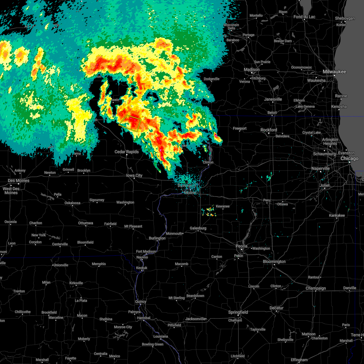 At 207 am cdt, a severe thunderstorm was located near ryan, or 7 miles southwest of manchester, moving southeast at 30 mph (radar indicated). Hazards include 60 mph wind gusts and quarter size hail. Hail damage to vehicles is expected. expect wind damage to roofs, siding, and trees. Locations impacted include, quasqueton, ryan, masonville, monti, winthrop golf course and robinson. At 207 am cdt, a severe thunderstorm was located near ryan, or 7 miles southwest of manchester, moving southeast at 30 mph (radar indicated). Hazards include 60 mph wind gusts and quarter size hail. Hail damage to vehicles is expected. expect wind damage to roofs, siding, and trees. Locations impacted include, quasqueton, ryan, masonville, monti, winthrop golf course and robinson.
|
| 9/6/2020 1:49 AM CDT |
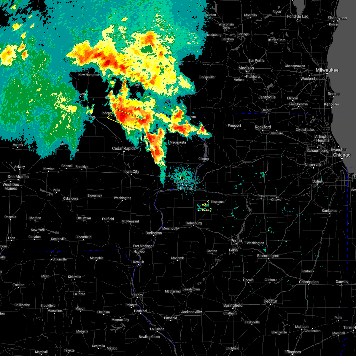 At 147 am cdt, a severe thunderstorm was located over winthrop, or 10 miles east of independence, moving southeast at 30 mph (trained weather spotters). Hazards include 60 mph wind gusts and half dollar size hail. Hail damage to vehicles is expected. expect wind damage to roofs, siding, and trees. Locations impacted include, independence, winthrop, quasqueton, ryan, masonville, monti, buchanan county fairgrounds, winthrop golf course, robinson and independence airport. At 147 am cdt, a severe thunderstorm was located over winthrop, or 10 miles east of independence, moving southeast at 30 mph (trained weather spotters). Hazards include 60 mph wind gusts and half dollar size hail. Hail damage to vehicles is expected. expect wind damage to roofs, siding, and trees. Locations impacted include, independence, winthrop, quasqueton, ryan, masonville, monti, buchanan county fairgrounds, winthrop golf course, robinson and independence airport.
|
| 9/6/2020 1:35 AM CDT |
 At 135 am cdt, a severe thunderstorm was located near independence, moving southeast at 25 mph (radar indicated). Hazards include 60 mph wind gusts and half dollar size hail. Hail damage to vehicles is expected. Expect wind damage to roofs, siding, and trees. At 135 am cdt, a severe thunderstorm was located near independence, moving southeast at 25 mph (radar indicated). Hazards include 60 mph wind gusts and half dollar size hail. Hail damage to vehicles is expected. Expect wind damage to roofs, siding, and trees.
|
| 8/10/2020 1:12 PM CDT |
 At 1248 pm cdt, a severe thunderstorm was located near rowley, or 7 miles south of independence, moving east at 55 mph (radar indicated). Hazards include 70 mph wind gusts. Expect considerable tree damage. damage is likely to mobile homes, roofs, and outbuildings. locations impacted include, independence, manchester, jesup, urbana, central city, fairbank, edgewood, winthrop, hazleton, walker, coggon, quasqueton, lamont, ryan, brandon, rowley, aurora, prairieburg, dundee and mount auburn. This includes interstate 380 between mile markers 41 and 55. At 1248 pm cdt, a severe thunderstorm was located near rowley, or 7 miles south of independence, moving east at 55 mph (radar indicated). Hazards include 70 mph wind gusts. Expect considerable tree damage. damage is likely to mobile homes, roofs, and outbuildings. locations impacted include, independence, manchester, jesup, urbana, central city, fairbank, edgewood, winthrop, hazleton, walker, coggon, quasqueton, lamont, ryan, brandon, rowley, aurora, prairieburg, dundee and mount auburn. This includes interstate 380 between mile markers 41 and 55.
|
| 8/10/2020 12:48 PM CDT |
 At 1248 pm cdt, a severe thunderstorm was located near rowley, or 7 miles south of independence, moving east at 55 mph (radar indicated). Hazards include 70 mph wind gusts. Expect considerable tree damage. damage is likely to mobile homes, roofs, and outbuildings. locations impacted include, independence, manchester, jesup, urbana, central city, fairbank, edgewood, winthrop, hazleton, walker, coggon, quasqueton, lamont, ryan, brandon, rowley, aurora, prairieburg, dundee and mount auburn. This includes interstate 380 between mile markers 41 and 55. At 1248 pm cdt, a severe thunderstorm was located near rowley, or 7 miles south of independence, moving east at 55 mph (radar indicated). Hazards include 70 mph wind gusts. Expect considerable tree damage. damage is likely to mobile homes, roofs, and outbuildings. locations impacted include, independence, manchester, jesup, urbana, central city, fairbank, edgewood, winthrop, hazleton, walker, coggon, quasqueton, lamont, ryan, brandon, rowley, aurora, prairieburg, dundee and mount auburn. This includes interstate 380 between mile markers 41 and 55.
|
| 8/10/2020 12:17 PM CDT |
 The national weather service in the quad cities has issued a * severe thunderstorm warning for. buchanan county in northeastern iowa. northern benton county in east central iowa. western delaware county in northeastern iowa. Northern linn county in east central iowa. The national weather service in the quad cities has issued a * severe thunderstorm warning for. buchanan county in northeastern iowa. northern benton county in east central iowa. western delaware county in northeastern iowa. Northern linn county in east central iowa.
|
| 7/11/2020 10:01 AM CDT |
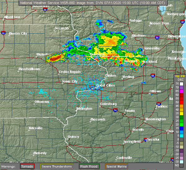 At 1000 am cdt, severe thunderstorms were located along a line extending from near manchester to near troy mills to near rowley, moving southeast at 35 mph (radar indicated). Hazards include 70 mph wind gusts and ping pong ball size hail. People and animals outdoors will be injured. expect hail damage to roofs, siding, windows, and vehicles. expect considerable tree damage. wind damage is also likely to mobile homes, roofs, and outbuildings. Locations impacted include, manchester, winthrop, quasqueton, ryan, rowley, masonville, monti, coffins grove park, winthrop golf course, buck creek, robinson and manchester airport. At 1000 am cdt, severe thunderstorms were located along a line extending from near manchester to near troy mills to near rowley, moving southeast at 35 mph (radar indicated). Hazards include 70 mph wind gusts and ping pong ball size hail. People and animals outdoors will be injured. expect hail damage to roofs, siding, windows, and vehicles. expect considerable tree damage. wind damage is also likely to mobile homes, roofs, and outbuildings. Locations impacted include, manchester, winthrop, quasqueton, ryan, rowley, masonville, monti, coffins grove park, winthrop golf course, buck creek, robinson and manchester airport.
|
| 7/11/2020 9:48 AM CDT |
 At 947 am cdt, severe thunderstorms were located along a line extending from near masonville to near quasqueton to near rowley, moving southeast at 45 mph (radar indicated). Hazards include 70 mph wind gusts and ping pong ball size hail. People and animals outdoors will be injured. expect hail damage to roofs, siding, windows, and vehicles. expect considerable tree damage. wind damage is also likely to mobile homes, roofs, and outbuildings. locations impacted include, independence, manchester, winthrop, quasqueton, lamont, ryan, brandon, rowley, dundee, masonville, lime creek county park, winthrop golf course, robinson, wapsipinicon golf course, manchester airport, littleton, monti, buchanan county fairgrounds, coffins grove park and buck creek. This includes interstate 380 between mile markers 49 and 54. At 947 am cdt, severe thunderstorms were located along a line extending from near masonville to near quasqueton to near rowley, moving southeast at 45 mph (radar indicated). Hazards include 70 mph wind gusts and ping pong ball size hail. People and animals outdoors will be injured. expect hail damage to roofs, siding, windows, and vehicles. expect considerable tree damage. wind damage is also likely to mobile homes, roofs, and outbuildings. locations impacted include, independence, manchester, winthrop, quasqueton, lamont, ryan, brandon, rowley, dundee, masonville, lime creek county park, winthrop golf course, robinson, wapsipinicon golf course, manchester airport, littleton, monti, buchanan county fairgrounds, coffins grove park and buck creek. This includes interstate 380 between mile markers 49 and 54.
|
| 7/11/2020 9:17 AM CDT |
 The national weather service in the quad cities has issued a * severe thunderstorm warning for. buchanan county in northeastern iowa. western delaware county in northeastern iowa. until 1015 am cdt. At 916 am cdt, severe thunderstorms were located along a line. The national weather service in the quad cities has issued a * severe thunderstorm warning for. buchanan county in northeastern iowa. western delaware county in northeastern iowa. until 1015 am cdt. At 916 am cdt, severe thunderstorms were located along a line.
|
| 7/9/2020 3:18 PM CDT |
 At 318 pm cdt, severe thunderstorms were located along a line extending from near edgewood to delhi to near ryan, moving east at 30 mph (radar indicated). Hazards include 60 mph wind gusts. Expect damage to roofs, siding, and trees. Locations impacted include, manchester, earlville, hopkinton, delhi, ryan, greeley, delaware, oneida, delaware county fairgrounds, manchester airport, twin bridges park, buck creek, baileys ford park, petersburg and turtle creek park. At 318 pm cdt, severe thunderstorms were located along a line extending from near edgewood to delhi to near ryan, moving east at 30 mph (radar indicated). Hazards include 60 mph wind gusts. Expect damage to roofs, siding, and trees. Locations impacted include, manchester, earlville, hopkinton, delhi, ryan, greeley, delaware, oneida, delaware county fairgrounds, manchester airport, twin bridges park, buck creek, baileys ford park, petersburg and turtle creek park.
|
| 7/9/2020 3:11 PM CDT |
 At 256 pm cdt, severe thunderstorms were located along a line extending from near lamont to near masonville to near troy mills, moving east at 40 mph (radar indicated). Hazards include 60 mph wind gusts. expect damage to roofs, siding, and trees At 256 pm cdt, severe thunderstorms were located along a line extending from near lamont to near masonville to near troy mills, moving east at 40 mph (radar indicated). Hazards include 60 mph wind gusts. expect damage to roofs, siding, and trees
|
| 7/9/2020 2:56 PM CDT |
 At 256 pm cdt, severe thunderstorms were located along a line extending from near lamont to near masonville to near troy mills, moving east at 40 mph (radar indicated). Hazards include 60 mph wind gusts. expect damage to roofs, siding, and trees At 256 pm cdt, severe thunderstorms were located along a line extending from near lamont to near masonville to near troy mills, moving east at 40 mph (radar indicated). Hazards include 60 mph wind gusts. expect damage to roofs, siding, and trees
|
| 3/28/2020 7:11 PM CDT |
 At 710 pm cdt, severe thunderstorms capable of producing tornadoes were located along a line extending from near lamont to near troy mills, moving northeast at 40 mph. these storms have a history of producing tornadoes as they move along the warm front, located near highway 20 (radar indicated rotation). Hazards include tornado. Flying debris will be dangerous to those caught without shelter. mobile homes will be damaged or destroyed. damage to roofs, windows, and vehicles will occur. tree damage is likely. these dangerous storms will be near, lamont around 715 pm cdt. dundee and masonville around 720 pm cdt. ryan around 725 pm cdt. manchester and edgewood around 730 pm cdt. delhi, greeley and delaware around 735 pm cdt. oneida around 740 pm cdt. earlville and colesburg around 745 pm cdt. Other locations impacted by these tornadic storms include winthrop golf course, robinson, delaware county fairgrounds, manchester airport, oneida, monti, coffins grove park, twin bridges park, buck creek and baileys ford park. At 710 pm cdt, severe thunderstorms capable of producing tornadoes were located along a line extending from near lamont to near troy mills, moving northeast at 40 mph. these storms have a history of producing tornadoes as they move along the warm front, located near highway 20 (radar indicated rotation). Hazards include tornado. Flying debris will be dangerous to those caught without shelter. mobile homes will be damaged or destroyed. damage to roofs, windows, and vehicles will occur. tree damage is likely. these dangerous storms will be near, lamont around 715 pm cdt. dundee and masonville around 720 pm cdt. ryan around 725 pm cdt. manchester and edgewood around 730 pm cdt. delhi, greeley and delaware around 735 pm cdt. oneida around 740 pm cdt. earlville and colesburg around 745 pm cdt. Other locations impacted by these tornadic storms include winthrop golf course, robinson, delaware county fairgrounds, manchester airport, oneida, monti, coffins grove park, twin bridges park, buck creek and baileys ford park.
|
| 3/28/2020 6:53 PM CDT |
 At 652 pm cdt, severe thunderstorms capable of producing a tornado were located along a line extending from near independence to walker, moving northeast at 40 mph (radar indicated rotation. spotters indicated a funnel cloud near independence). Hazards include tornado. Flying debris will be dangerous to those caught without shelter. mobile homes will be damaged or destroyed. damage to roofs, windows, and vehicles will occur. tree damage is likely. these dangerous storms will be near, winthrop and stanley around 700 pm cdt. aurora around 705 pm cdt. lamont around 710 pm cdt. dundee and masonville around 715 pm cdt. ryan around 720 pm cdt. manchester, edgewood, delhi and greeley around 730 pm cdt. delaware and oneida around 735 pm cdt. earlville around 740 pm cdt. Other locations impacted by these tornadic storms include winthrop golf course, robinson, delaware county fairgrounds, manchester airport, oneida, monti, coffins grove park, twin bridges park, buck creek and baileys ford park. At 652 pm cdt, severe thunderstorms capable of producing a tornado were located along a line extending from near independence to walker, moving northeast at 40 mph (radar indicated rotation. spotters indicated a funnel cloud near independence). Hazards include tornado. Flying debris will be dangerous to those caught without shelter. mobile homes will be damaged or destroyed. damage to roofs, windows, and vehicles will occur. tree damage is likely. these dangerous storms will be near, winthrop and stanley around 700 pm cdt. aurora around 705 pm cdt. lamont around 710 pm cdt. dundee and masonville around 715 pm cdt. ryan around 720 pm cdt. manchester, edgewood, delhi and greeley around 730 pm cdt. delaware and oneida around 735 pm cdt. earlville around 740 pm cdt. Other locations impacted by these tornadic storms include winthrop golf course, robinson, delaware county fairgrounds, manchester airport, oneida, monti, coffins grove park, twin bridges park, buck creek and baileys ford park.
|
| 9/12/2019 5:27 PM CDT |
 The severe thunderstorm warning for delaware county will expire at 530 pm cdt, the storm which prompted the warning has weakened below severe limits, and has exited the warned area. therefore, the warning will be allowed to expire. however gusty winds are still possible with this thunderstorm. a severe thunderstorm watch remains in effect until 1000 pm cdt for northeastern iowa. The severe thunderstorm warning for delaware county will expire at 530 pm cdt, the storm which prompted the warning has weakened below severe limits, and has exited the warned area. therefore, the warning will be allowed to expire. however gusty winds are still possible with this thunderstorm. a severe thunderstorm watch remains in effect until 1000 pm cdt for northeastern iowa.
|
| 9/12/2019 5:18 PM CDT |
 At 518 pm cdt, a severe thunderstorm was located over manchester, moving north at 50 mph (radar indicated). Hazards include 60 mph wind gusts. Expect damage to roofs, siding, and trees. Locations impacted include, manchester, edgewood, earlville, delhi, colesburg, ryan, greeley, dundee, delaware, masonville, oneida, delaware county fairgrounds, manchester airport, coffins grove park, twin bridges park, buck creek, baileys ford park, backbone state park and turtle creek park. At 518 pm cdt, a severe thunderstorm was located over manchester, moving north at 50 mph (radar indicated). Hazards include 60 mph wind gusts. Expect damage to roofs, siding, and trees. Locations impacted include, manchester, edgewood, earlville, delhi, colesburg, ryan, greeley, dundee, delaware, masonville, oneida, delaware county fairgrounds, manchester airport, coffins grove park, twin bridges park, buck creek, baileys ford park, backbone state park and turtle creek park.
|
| 9/12/2019 5:14 PM CDT |
 At 514 pm cdt, a severe thunderstorm was located near manchester, moving north at 50 mph (radar indicated). Hazards include 60 mph wind gusts. Expect damage to roofs, siding, and trees. Locations impacted include, manchester, edgewood, earlville, delhi, colesburg, ryan, greeley, dundee, delaware, masonville, oneida, robinson, delaware county fairgrounds, manchester airport, coffins grove park, twin bridges park, buck creek, baileys ford park, backbone state park and turtle creek park. At 514 pm cdt, a severe thunderstorm was located near manchester, moving north at 50 mph (radar indicated). Hazards include 60 mph wind gusts. Expect damage to roofs, siding, and trees. Locations impacted include, manchester, edgewood, earlville, delhi, colesburg, ryan, greeley, dundee, delaware, masonville, oneida, robinson, delaware county fairgrounds, manchester airport, coffins grove park, twin bridges park, buck creek, baileys ford park, backbone state park and turtle creek park.
|
| 9/12/2019 5:08 PM CDT |
 At 508 pm cdt, a severe thunderstorm was located over ryan, or 8 miles south of manchester, moving north at 50 mph (radar indicated). Hazards include 60 mph wind gusts. Expect damage to roofs, siding, and trees. Locations impacted include, manchester, edgewood, earlville, coggon, lamont, delhi, colesburg, ryan, greeley, prairieburg, dundee, delaware, masonville, oneida, manchester airport, monti, twin bridges park, buck creek, baileys ford park and robinson. At 508 pm cdt, a severe thunderstorm was located over ryan, or 8 miles south of manchester, moving north at 50 mph (radar indicated). Hazards include 60 mph wind gusts. Expect damage to roofs, siding, and trees. Locations impacted include, manchester, edgewood, earlville, coggon, lamont, delhi, colesburg, ryan, greeley, prairieburg, dundee, delaware, masonville, oneida, manchester airport, monti, twin bridges park, buck creek, baileys ford park and robinson.
|
| 9/12/2019 5:02 PM CDT |
 At 501 pm cdt, a severe thunderstorm was located over coggon, or 14 miles south of manchester, moving north at 50 mph (media reports wind damage to trees). Hazards include 60 mph wind gusts. Expect damage to roofs, siding, and trees. Locations impacted include, manchester, central city, edgewood, earlville, coggon, lamont, delhi, colesburg, ryan, greeley, prairieburg, dundee, delaware, masonville, troy mills, waubeek, oneida, paris, manchester airport and linn county fairgrounds. At 501 pm cdt, a severe thunderstorm was located over coggon, or 14 miles south of manchester, moving north at 50 mph (media reports wind damage to trees). Hazards include 60 mph wind gusts. Expect damage to roofs, siding, and trees. Locations impacted include, manchester, central city, edgewood, earlville, coggon, lamont, delhi, colesburg, ryan, greeley, prairieburg, dundee, delaware, masonville, troy mills, waubeek, oneida, paris, manchester airport and linn county fairgrounds.
|
| 9/12/2019 4:50 PM CDT |
 The national weather service in the quad cities has issued a * severe thunderstorm warning for. eastern buchanan county in northeastern iowa. delaware county in northeastern iowa. northern linn county in east central iowa. Until 530 pm cdt. The national weather service in the quad cities has issued a * severe thunderstorm warning for. eastern buchanan county in northeastern iowa. delaware county in northeastern iowa. northern linn county in east central iowa. Until 530 pm cdt.
|
| 6/30/2019 5:32 PM CDT |
 At 532 pm cdt, severe thunderstorms were located along a line extending from hazel green to near hopkinton to near brandon, moving south at 45 mph (trained weather spotters). Hazards include 70 mph wind gusts and quarter size hail. Hail damage to vehicles is expected. expect considerable tree damage. wind damage is also likely to mobile homes, roofs, and outbuildings. locations impacted include, dubuque, independence, manchester, galena, asbury, dyersville, jesup, epworth, east dubuque, farley, peosta, winthrop, earlville, hopkinton, quasqueton, delhi, new vienna, worthington, ryan and brandon. This includes interstate 380 between mile markers 50 and 55. At 532 pm cdt, severe thunderstorms were located along a line extending from hazel green to near hopkinton to near brandon, moving south at 45 mph (trained weather spotters). Hazards include 70 mph wind gusts and quarter size hail. Hail damage to vehicles is expected. expect considerable tree damage. wind damage is also likely to mobile homes, roofs, and outbuildings. locations impacted include, dubuque, independence, manchester, galena, asbury, dyersville, jesup, epworth, east dubuque, farley, peosta, winthrop, earlville, hopkinton, quasqueton, delhi, new vienna, worthington, ryan and brandon. This includes interstate 380 between mile markers 50 and 55.
|
| 6/30/2019 5:18 PM CDT |
 At 518 pm cdt, severe thunderstorms were located along a line extending from near platteville to delaware to near brandon, moving south at 45 mph (trained weather spotters). Hazards include 70 mph wind gusts and quarter size hail. Hail damage to vehicles is expected. expect considerable tree damage. wind damage is also likely to mobile homes, roofs, and outbuildings. locations impacted include, dubuque, independence, manchester, galena, asbury, dyersville, jesup, epworth, east dubuque, farley, peosta, fairbank, edgewood, winthrop, hazleton, earlville, hopkinton, quasqueton, lamont and delhi. This includes interstate 380 between mile markers 50 and 55. At 518 pm cdt, severe thunderstorms were located along a line extending from near platteville to delaware to near brandon, moving south at 45 mph (trained weather spotters). Hazards include 70 mph wind gusts and quarter size hail. Hail damage to vehicles is expected. expect considerable tree damage. wind damage is also likely to mobile homes, roofs, and outbuildings. locations impacted include, dubuque, independence, manchester, galena, asbury, dyersville, jesup, epworth, east dubuque, farley, peosta, fairbank, edgewood, winthrop, hazleton, earlville, hopkinton, quasqueton, lamont and delhi. This includes interstate 380 between mile markers 50 and 55.
|
| 6/30/2019 5:07 PM CDT |
 At 506 pm cdt, severe thunderstorms were located along a line extending from near platteville to edgewood to near jesup, moving southeast at 40 mph (trained weather spotters). Hazards include 70 mph wind gusts and quarter size hail. Hail damage to vehicles is expected. expect considerable tree damage. wind damage is also likely to mobile homes, roofs, and outbuildings. locations impacted include, dubuque, independence, manchester, galena, asbury, dyersville, jesup, epworth, east dubuque, farley, peosta, fairbank, edgewood, winthrop, hazleton, earlville, hopkinton, quasqueton, lamont and delhi. This includes interstate 380 between mile markers 50 and 55. At 506 pm cdt, severe thunderstorms were located along a line extending from near platteville to edgewood to near jesup, moving southeast at 40 mph (trained weather spotters). Hazards include 70 mph wind gusts and quarter size hail. Hail damage to vehicles is expected. expect considerable tree damage. wind damage is also likely to mobile homes, roofs, and outbuildings. locations impacted include, dubuque, independence, manchester, galena, asbury, dyersville, jesup, epworth, east dubuque, farley, peosta, fairbank, edgewood, winthrop, hazleton, earlville, hopkinton, quasqueton, lamont and delhi. This includes interstate 380 between mile markers 50 and 55.
|
| 6/30/2019 5:02 PM CDT |
 At 502 pm cdt, severe thunderstorms were located along a line extending from 7 miles east of lancaster to near edgewood to near jesup, moving southeast at 40 mph (trained weather spotters). Hazards include 60 mph wind gusts and quarter size hail. Hail damage to vehicles is expected. expect wind damage to roofs, siding, and trees. locations impacted include, dubuque, independence, manchester, galena, asbury, dyersville, jesup, epworth, east dubuque, farley, peosta, fairbank, edgewood, winthrop, hazleton, earlville, hopkinton, quasqueton, lamont and delhi. This includes interstate 380 between mile markers 50 and 55. At 502 pm cdt, severe thunderstorms were located along a line extending from 7 miles east of lancaster to near edgewood to near jesup, moving southeast at 40 mph (trained weather spotters). Hazards include 60 mph wind gusts and quarter size hail. Hail damage to vehicles is expected. expect wind damage to roofs, siding, and trees. locations impacted include, dubuque, independence, manchester, galena, asbury, dyersville, jesup, epworth, east dubuque, farley, peosta, fairbank, edgewood, winthrop, hazleton, earlville, hopkinton, quasqueton, lamont and delhi. This includes interstate 380 between mile markers 50 and 55.
|
| 6/30/2019 4:58 PM CDT |
 At 457 pm cdt, severe thunderstorms were located along a line extending from near lancaster to 7 miles northeast of strawberry point to near hazleton, moving east at 45 mph (trained weather spotter measured a wind gust to 59 mph 4 miles west of stanley). Hazards include 60 mph wind gusts and quarter size hail. Hail damage to vehicles is expected. expect wind damage to roofs, siding, and trees. locations impacted include, dubuque, independence, manchester, galena, asbury, dyersville, jesup, epworth, east dubuque, farley, peosta, fairbank, edgewood, winthrop, hazleton, earlville, hopkinton, quasqueton, lamont and delhi. This includes interstate 380 between mile markers 50 and 55. At 457 pm cdt, severe thunderstorms were located along a line extending from near lancaster to 7 miles northeast of strawberry point to near hazleton, moving east at 45 mph (trained weather spotter measured a wind gust to 59 mph 4 miles west of stanley). Hazards include 60 mph wind gusts and quarter size hail. Hail damage to vehicles is expected. expect wind damage to roofs, siding, and trees. locations impacted include, dubuque, independence, manchester, galena, asbury, dyersville, jesup, epworth, east dubuque, farley, peosta, fairbank, edgewood, winthrop, hazleton, earlville, hopkinton, quasqueton, lamont and delhi. This includes interstate 380 between mile markers 50 and 55.
|
| 6/30/2019 4:54 PM CDT |
 At 453 pm cdt, severe thunderstorms were located along a line extending from near lancaster to 6 miles south of elkader to near hazleton, moving south at 45 mph (radar indicated). Hazards include 60 mph wind gusts and quarter size hail. Hail damage to vehicles is expected. Expect wind damage to roofs, siding, and trees. At 453 pm cdt, severe thunderstorms were located along a line extending from near lancaster to 6 miles south of elkader to near hazleton, moving south at 45 mph (radar indicated). Hazards include 60 mph wind gusts and quarter size hail. Hail damage to vehicles is expected. Expect wind damage to roofs, siding, and trees.
|
| 6/9/2019 4:52 PM CDT |
 At 448 pm cdt, a severe thunderstorm capable of producing a tornado was located near prairieburg, or 8 miles northwest of anamosa, moving east at 20 mph (radar indicated rotation). Hazards include tornado. Expect damage to mobile homes, roofs, and vehicles. this dangerous storm will be near, monticello around 510 pm cdt. center junction and langworthy around 515 pm cdt. Other locations impacted by this tornadic thunderstorm include buck creek, camp courageous, baileys ford park, scotch grove, central park, jones county fairgrounds, pictured rocks wildlife area, howard h cherry scout reservation, turtle creek park and monticello municipal airport. At 448 pm cdt, a severe thunderstorm capable of producing a tornado was located near prairieburg, or 8 miles northwest of anamosa, moving east at 20 mph (radar indicated rotation). Hazards include tornado. Expect damage to mobile homes, roofs, and vehicles. this dangerous storm will be near, monticello around 510 pm cdt. center junction and langworthy around 515 pm cdt. Other locations impacted by this tornadic thunderstorm include buck creek, camp courageous, baileys ford park, scotch grove, central park, jones county fairgrounds, pictured rocks wildlife area, howard h cherry scout reservation, turtle creek park and monticello municipal airport.
|
| 6/9/2019 4:48 PM CDT |
 At 442 pm cdt, a confirmed tornado was located over prairieburg, or 9 miles northwest of anamosa, moving east at 20 mph (weather spotters confirmed tornado just east of central city around 435 pm). Hazards include tornado. Expect damage to mobile homes, roofs, and vehicles. this tornado will be near, monticello around 505 pm cdt. langworthy around 510 pm cdt. center junction around 515 pm cdt. Other locations impacted by this tornadic thunderstorm include buck creek, camp courageous, baileys ford park, scotch grove, central park, jones county fairgrounds, pictured rocks wildlife area, howard h cherry scout reservation, turtle creek park and monticello municipal airport. At 442 pm cdt, a confirmed tornado was located over prairieburg, or 9 miles northwest of anamosa, moving east at 20 mph (weather spotters confirmed tornado just east of central city around 435 pm). Hazards include tornado. Expect damage to mobile homes, roofs, and vehicles. this tornado will be near, monticello around 505 pm cdt. langworthy around 510 pm cdt. center junction around 515 pm cdt. Other locations impacted by this tornadic thunderstorm include buck creek, camp courageous, baileys ford park, scotch grove, central park, jones county fairgrounds, pictured rocks wildlife area, howard h cherry scout reservation, turtle creek park and monticello municipal airport.
|
| 6/9/2019 4:43 PM CDT |
 At 442 pm cdt, a confirmed tornado was located over prairieburg, or 9 miles northwest of anamosa, moving east at 20 mph (weather spotters confirmed tornado just east of central city around 435 pm). Hazards include tornado. Expect damage to mobile homes, roofs, and vehicles. this tornado will be near, monticello around 505 pm cdt. langworthy around 510 pm cdt. center junction around 515 pm cdt. Other locations impacted by this tornadic thunderstorm include buck creek, camp courageous, baileys ford park, scotch grove, central park, jones county fairgrounds, pictured rocks wildlife area, howard h cherry scout reservation, turtle creek park and monticello municipal airport. At 442 pm cdt, a confirmed tornado was located over prairieburg, or 9 miles northwest of anamosa, moving east at 20 mph (weather spotters confirmed tornado just east of central city around 435 pm). Hazards include tornado. Expect damage to mobile homes, roofs, and vehicles. this tornado will be near, monticello around 505 pm cdt. langworthy around 510 pm cdt. center junction around 515 pm cdt. Other locations impacted by this tornadic thunderstorm include buck creek, camp courageous, baileys ford park, scotch grove, central park, jones county fairgrounds, pictured rocks wildlife area, howard h cherry scout reservation, turtle creek park and monticello municipal airport.
|
| 6/9/2019 4:38 PM CDT |
 At 438 pm cdt, a confirmed tornado was located over prairieburg, or 11 miles northwest of anamosa, moving east at 20 mph (weather spotters confirmed tornado at 434 pm, just east of central city). Hazards include tornado. Expect damage to mobile homes, roofs, and vehicles. this tornado will be near, monticello around 505 pm cdt. langworthy around 510 pm cdt. center junction around 515 pm cdt. Other locations impacted by this tornadic thunderstorm include robinson, jones county fairgrounds, pictured rocks wildlife area, buffalo creek park, howard h cherry scout reservation, linn county fairgrounds, pinicon ridge park, buck creek, camp courageous and baileys ford park. At 438 pm cdt, a confirmed tornado was located over prairieburg, or 11 miles northwest of anamosa, moving east at 20 mph (weather spotters confirmed tornado at 434 pm, just east of central city). Hazards include tornado. Expect damage to mobile homes, roofs, and vehicles. this tornado will be near, monticello around 505 pm cdt. langworthy around 510 pm cdt. center junction around 515 pm cdt. Other locations impacted by this tornadic thunderstorm include robinson, jones county fairgrounds, pictured rocks wildlife area, buffalo creek park, howard h cherry scout reservation, linn county fairgrounds, pinicon ridge park, buck creek, camp courageous and baileys ford park.
|
| 6/9/2019 4:34 PM CDT |
 At 434 pm cdt, a confirmed tornado was located over prairieburg, or 11 miles northwest of anamosa, moving east at 35 mph (weather spotters confirmed tornado). Hazards include damaging tornado. Flying debris will be dangerous to those caught without shelter. mobile homes will be damaged or destroyed. damage to roofs, windows, and vehicles will occur. tree damage is likely. the tornado will be near, monticello and langworthy around 450 pm cdt. center junction around 505 pm cdt. Other locations impacted by this tornadic thunderstorm include robinson, jones county fairgrounds, pictured rocks wildlife area, buffalo creek park, howard h cherry scout reservation, linn county fairgrounds, pinicon ridge park, buck creek, camp courageous and baileys ford park. At 434 pm cdt, a confirmed tornado was located over prairieburg, or 11 miles northwest of anamosa, moving east at 35 mph (weather spotters confirmed tornado). Hazards include damaging tornado. Flying debris will be dangerous to those caught without shelter. mobile homes will be damaged or destroyed. damage to roofs, windows, and vehicles will occur. tree damage is likely. the tornado will be near, monticello and langworthy around 450 pm cdt. center junction around 505 pm cdt. Other locations impacted by this tornadic thunderstorm include robinson, jones county fairgrounds, pictured rocks wildlife area, buffalo creek park, howard h cherry scout reservation, linn county fairgrounds, pinicon ridge park, buck creek, camp courageous and baileys ford park.
|
| 10/9/2018 3:09 PM CDT |
 At 309 pm cdt, a severe thunderstorm capable of producing a tornado was located over ryan, or 8 miles south of manchester, moving north at 40 mph (radar indicated rotation). Hazards include tornado. Flying debris will be dangerous to those caught without shelter. mobile homes will be damaged or destroyed. damage to roofs, windows, and vehicles will occur. tree damage is likely. this dangerous storm will be near, delhi and delaware around 320 pm cdt. manchester and earlville around 325 pm cdt. oneida around 330 pm cdt. edgewood and greeley around 335 pm cdt. colesburg around 340 pm cdt. Other locations impacted by this tornadic thunderstorm include twin bridges park, baileys ford park, petersburg, delaware county fairgrounds, oneida, turtle creek park and manchester airport. At 309 pm cdt, a severe thunderstorm capable of producing a tornado was located over ryan, or 8 miles south of manchester, moving north at 40 mph (radar indicated rotation). Hazards include tornado. Flying debris will be dangerous to those caught without shelter. mobile homes will be damaged or destroyed. damage to roofs, windows, and vehicles will occur. tree damage is likely. this dangerous storm will be near, delhi and delaware around 320 pm cdt. manchester and earlville around 325 pm cdt. oneida around 330 pm cdt. edgewood and greeley around 335 pm cdt. colesburg around 340 pm cdt. Other locations impacted by this tornadic thunderstorm include twin bridges park, baileys ford park, petersburg, delaware county fairgrounds, oneida, turtle creek park and manchester airport.
|
| 9/3/2018 5:15 PM CDT |
 At 514 pm cdt, a severe thunderstorm capable of producing a tornado was located over center point, or 13 miles east of vinton, moving northeast at 30 mph (radar indicated rotation). Hazards include tornado. Flying debris will be dangerous to those caught without shelter. mobile homes will be damaged or destroyed. damage to roofs, windows, and vehicles will occur. tree damage is likely. this dangerous storm will be near, alburnett around 525 pm cdt. troy mills around 530 pm cdt. paris around 535 pm cdt. central city around 540 pm cdt. coggon around 545 pm cdt. prairieburg around 550 pm cdt. ryan around 555 pm cdt. delhi around 600 pm cdt. other locations impacted by this tornadic thunderstorm include pinicon ridge park, buck creek, robinson, baileys ford park, lafayette, buffalo creek park, howard h cherry scout reservation, pleasant creek state recreation area, turtle creek park and linn county fairgrounds. This includes interstate 380 between mile markers 29 and 39. At 514 pm cdt, a severe thunderstorm capable of producing a tornado was located over center point, or 13 miles east of vinton, moving northeast at 30 mph (radar indicated rotation). Hazards include tornado. Flying debris will be dangerous to those caught without shelter. mobile homes will be damaged or destroyed. damage to roofs, windows, and vehicles will occur. tree damage is likely. this dangerous storm will be near, alburnett around 525 pm cdt. troy mills around 530 pm cdt. paris around 535 pm cdt. central city around 540 pm cdt. coggon around 545 pm cdt. prairieburg around 550 pm cdt. ryan around 555 pm cdt. delhi around 600 pm cdt. other locations impacted by this tornadic thunderstorm include pinicon ridge park, buck creek, robinson, baileys ford park, lafayette, buffalo creek park, howard h cherry scout reservation, pleasant creek state recreation area, turtle creek park and linn county fairgrounds. This includes interstate 380 between mile markers 29 and 39.
|
| 9/2/2018 3:38 PM CDT |
 The severe thunderstorm warning for delaware county will expire at 345 pm cdt, the storm which prompted the warning has weakened below severe limits, and no longer poses an immediate threat to life or property. therefore, the warning will be allowed to expire. however gusty winds and heavy rain are still possible with this thunderstorm. to report severe weather, contact your nearest law enforcement agency. they will relay your report to the national weather service the quad cities. The severe thunderstorm warning for delaware county will expire at 345 pm cdt, the storm which prompted the warning has weakened below severe limits, and no longer poses an immediate threat to life or property. therefore, the warning will be allowed to expire. however gusty winds and heavy rain are still possible with this thunderstorm. to report severe weather, contact your nearest law enforcement agency. they will relay your report to the national weather service the quad cities.
|
| 9/2/2018 3:32 PM CDT |
 At 332 pm cdt, a severe thunderstorm was located near earlville, or 12 miles east of manchester, moving east at 35 mph (radar indicated). Hazards include 60 mph wind gusts. Expect damage to roofs, siding, and trees. Locations impacted include, manchester, edgewood, earlville, delhi, colesburg, ryan, greeley, delaware, oneida, delaware county fairgrounds, manchester airport, twin bridges park, buck creek, baileys ford park, petersburg and turtle creek park. At 332 pm cdt, a severe thunderstorm was located near earlville, or 12 miles east of manchester, moving east at 35 mph (radar indicated). Hazards include 60 mph wind gusts. Expect damage to roofs, siding, and trees. Locations impacted include, manchester, edgewood, earlville, delhi, colesburg, ryan, greeley, delaware, oneida, delaware county fairgrounds, manchester airport, twin bridges park, buck creek, baileys ford park, petersburg and turtle creek park.
|
| 9/2/2018 3:23 PM CDT |
 At 323 pm cdt, a severe thunderstorm was located near oneida, or 10 miles northeast of manchester, moving east at 35 mph (radar indicated). Hazards include 60 mph wind gusts. Expect damage to roofs, siding, and trees. Locations impacted include, manchester, edgewood, earlville, delhi, colesburg, ryan, greeley, dundee, delaware, oneida, robinson, delaware county fairgrounds, manchester airport, monti, coffins grove park, twin bridges park, buck creek, baileys ford park, petersburg and backbone state park. At 323 pm cdt, a severe thunderstorm was located near oneida, or 10 miles northeast of manchester, moving east at 35 mph (radar indicated). Hazards include 60 mph wind gusts. Expect damage to roofs, siding, and trees. Locations impacted include, manchester, edgewood, earlville, delhi, colesburg, ryan, greeley, dundee, delaware, oneida, robinson, delaware county fairgrounds, manchester airport, monti, coffins grove park, twin bridges park, buck creek, baileys ford park, petersburg and backbone state park.
|
| 9/2/2018 3:16 PM CDT |
 At 316 pm cdt, a severe thunderstorm was located over oneida, or near manchester, moving east at 40 mph (radar indicated). Hazards include 60 mph wind gusts. Expect damage to roofs, siding, and trees. Locations impacted include, manchester, edgewood, earlville, lamont, delhi, colesburg, ryan, greeley, dundee, delaware, masonville, oneida, robinson, delaware county fairgrounds, manchester airport, monti, coffins grove park, twin bridges park, buck creek and baileys ford park. At 316 pm cdt, a severe thunderstorm was located over oneida, or near manchester, moving east at 40 mph (radar indicated). Hazards include 60 mph wind gusts. Expect damage to roofs, siding, and trees. Locations impacted include, manchester, edgewood, earlville, lamont, delhi, colesburg, ryan, greeley, dundee, delaware, masonville, oneida, robinson, delaware county fairgrounds, manchester airport, monti, coffins grove park, twin bridges park, buck creek and baileys ford park.
|
| 9/2/2018 3:01 PM CDT |
 At 300 pm cdt, a severe thunderstorm was located near quasqueton, or 12 miles southwest of manchester, moving northeast at 35 mph (radar indicated). Hazards include 60 mph wind gusts. expect damage to roofs, siding, and trees At 300 pm cdt, a severe thunderstorm was located near quasqueton, or 12 miles southwest of manchester, moving northeast at 35 mph (radar indicated). Hazards include 60 mph wind gusts. expect damage to roofs, siding, and trees
|
| 9/1/2018 1:19 AM CDT |
 At 119 am cdt, a severe thunderstorm was located near troy mills, or 13 miles southwest of manchester, moving northeast at 30 mph (radar indicated). Hazards include half dollar size hail. Damage to vehicles is expected. Locations impacted include, manchester, edgewood, winthrop, quasqueton, colesburg, ryan, greeley, dundee, delaware, masonville, oneida, winthrop golf course, robinson, delaware county fairgrounds, manchester airport, monti, coffins grove park, twin bridges park, baileys ford park and petersburg. At 119 am cdt, a severe thunderstorm was located near troy mills, or 13 miles southwest of manchester, moving northeast at 30 mph (radar indicated). Hazards include half dollar size hail. Damage to vehicles is expected. Locations impacted include, manchester, edgewood, winthrop, quasqueton, colesburg, ryan, greeley, dundee, delaware, masonville, oneida, winthrop golf course, robinson, delaware county fairgrounds, manchester airport, monti, coffins grove park, twin bridges park, baileys ford park and petersburg.
|
| 9/1/2018 1:12 AM CDT |
 At 111 am cdt, a severe thunderstorm was located near troy mills, or 13 miles southeast of independence, moving northeast at 30 mph (radar indicated). Hazards include 60 mph wind gusts and half dollar size hail. Hail damage to vehicles is expected. Expect wind damage to roofs, siding, and trees. At 111 am cdt, a severe thunderstorm was located near troy mills, or 13 miles southeast of independence, moving northeast at 30 mph (radar indicated). Hazards include 60 mph wind gusts and half dollar size hail. Hail damage to vehicles is expected. Expect wind damage to roofs, siding, and trees.
|
| 8/5/2018 5:34 PM CDT |
 At 533 pm cdt, a severe thunderstorm was located over ryan, or 7 miles south of manchester, moving quickly east at 50 mph (radar indicated). Hazards include 60 mph wind gusts and penny size hail. Expect damage to roofs, siding, and trees. Locations impacted include, manchester, dyersville, monticello, edgewood, winthrop, earlville, walker, coggon, hopkinton, quasqueton, lamont, delhi, colesburg, ryan, greeley, aurora, prairieburg, dundee, delaware and masonville. At 533 pm cdt, a severe thunderstorm was located over ryan, or 7 miles south of manchester, moving quickly east at 50 mph (radar indicated). Hazards include 60 mph wind gusts and penny size hail. Expect damage to roofs, siding, and trees. Locations impacted include, manchester, dyersville, monticello, edgewood, winthrop, earlville, walker, coggon, hopkinton, quasqueton, lamont, delhi, colesburg, ryan, greeley, aurora, prairieburg, dundee, delaware and masonville.
|
| 8/5/2018 5:07 PM CDT |
 The national weather service in the quad cities has issued a * severe thunderstorm warning for. buchanan county in northeastern iowa. northeastern benton county in east central iowa. northwestern jones county in east central iowa. Delaware county in northeastern iowa. The national weather service in the quad cities has issued a * severe thunderstorm warning for. buchanan county in northeastern iowa. northeastern benton county in east central iowa. northwestern jones county in east central iowa. Delaware county in northeastern iowa.
|
| 7/13/2018 5:31 PM CDT |
 At 531 pm cdt, severe thunderstorms were located along a line extending from near luxemburg to near delaware, moving east at 20 mph (radar indicated). Hazards include 60 mph wind gusts. expect damage to roofs, siding, and trees At 531 pm cdt, severe thunderstorms were located along a line extending from near luxemburg to near delaware, moving east at 20 mph (radar indicated). Hazards include 60 mph wind gusts. expect damage to roofs, siding, and trees
|
| 7/13/2018 5:15 PM CDT |
 At 503 pm cdt, a severe thunderstorm was located near aurora, or 11 miles northeast of independence, moving east at 40 mph (radar indicated). Hazards include 60 mph wind gusts. Expect damage to roofs, siding, and trees. Locations impacted include, independence, manchester, edgewood, winthrop, hazleton, quasqueton, lamont, ryan, rowley, aurora, dundee, masonville, stanley, wapsipinicon golf course, manchester airport, fontana county park, monti, baileys ford park, jakway park and winthrop golf course. At 503 pm cdt, a severe thunderstorm was located near aurora, or 11 miles northeast of independence, moving east at 40 mph (radar indicated). Hazards include 60 mph wind gusts. Expect damage to roofs, siding, and trees. Locations impacted include, independence, manchester, edgewood, winthrop, hazleton, quasqueton, lamont, ryan, rowley, aurora, dundee, masonville, stanley, wapsipinicon golf course, manchester airport, fontana county park, monti, baileys ford park, jakway park and winthrop golf course.
|
| 7/13/2018 5:03 PM CDT |
 At 503 pm cdt, a severe thunderstorm was located near aurora, or 11 miles northeast of independence, moving east at 40 mph (radar indicated). Hazards include 60 mph wind gusts. Expect damage to roofs, siding, and trees. Locations impacted include, independence, manchester, edgewood, winthrop, hazleton, quasqueton, lamont, ryan, rowley, aurora, dundee, masonville, stanley, wapsipinicon golf course, manchester airport, fontana county park, monti, baileys ford park, jakway park and winthrop golf course. At 503 pm cdt, a severe thunderstorm was located near aurora, or 11 miles northeast of independence, moving east at 40 mph (radar indicated). Hazards include 60 mph wind gusts. Expect damage to roofs, siding, and trees. Locations impacted include, independence, manchester, edgewood, winthrop, hazleton, quasqueton, lamont, ryan, rowley, aurora, dundee, masonville, stanley, wapsipinicon golf course, manchester airport, fontana county park, monti, baileys ford park, jakway park and winthrop golf course.
|
| 7/13/2018 4:51 PM CDT |
 The national weather service in the quad cities has issued a * severe thunderstorm warning for. buchanan county in northeastern iowa. western delaware county in northeastern iowa. until 530 pm cdt. At 450 pm cdt, a severe thunderstorm was located near hazleton, or. The national weather service in the quad cities has issued a * severe thunderstorm warning for. buchanan county in northeastern iowa. western delaware county in northeastern iowa. until 530 pm cdt. At 450 pm cdt, a severe thunderstorm was located near hazleton, or.
|
| 6/20/2018 5:07 PM CDT |
 At 502 pm cdt, a severe thunderstorm was located near prairieburg, or 10 miles north of anamosa, moving northeast at 30 mph (radar indicated). Hazards include 60 mph wind gusts. Expect damage to roofs, siding, and trees. locations impacted include, anamosa, monticello, cascade, central city, springville, hopkinton, ryan, prairieburg, waubeek, stone city, viola, whittier, langworthy, linn county fairgrounds, pinicon ridge park, buck creek, monticello municipal airport, matsell bridge natural area, jones county fairgrounds and pictured rocks wildlife area. A tornado watch remains in effect until 700 pm cdt for northeastern and east central iowa. At 502 pm cdt, a severe thunderstorm was located near prairieburg, or 10 miles north of anamosa, moving northeast at 30 mph (radar indicated). Hazards include 60 mph wind gusts. Expect damage to roofs, siding, and trees. locations impacted include, anamosa, monticello, cascade, central city, springville, hopkinton, ryan, prairieburg, waubeek, stone city, viola, whittier, langworthy, linn county fairgrounds, pinicon ridge park, buck creek, monticello municipal airport, matsell bridge natural area, jones county fairgrounds and pictured rocks wildlife area. A tornado watch remains in effect until 700 pm cdt for northeastern and east central iowa.
|
| 6/20/2018 5:02 PM CDT |
 At 502 pm cdt, a severe thunderstorm was located near prairieburg, or 10 miles north of anamosa, moving northeast at 30 mph (radar indicated). Hazards include 60 mph wind gusts. Expect damage to roofs, siding, and trees. locations impacted include, anamosa, monticello, cascade, central city, springville, hopkinton, ryan, prairieburg, waubeek, stone city, viola, whittier, langworthy, linn county fairgrounds, pinicon ridge park, buck creek, monticello municipal airport, matsell bridge natural area, jones county fairgrounds and pictured rocks wildlife area. A tornado watch remains in effect until 700 pm cdt for northeastern and east central iowa. At 502 pm cdt, a severe thunderstorm was located near prairieburg, or 10 miles north of anamosa, moving northeast at 30 mph (radar indicated). Hazards include 60 mph wind gusts. Expect damage to roofs, siding, and trees. locations impacted include, anamosa, monticello, cascade, central city, springville, hopkinton, ryan, prairieburg, waubeek, stone city, viola, whittier, langworthy, linn county fairgrounds, pinicon ridge park, buck creek, monticello municipal airport, matsell bridge natural area, jones county fairgrounds and pictured rocks wildlife area. A tornado watch remains in effect until 700 pm cdt for northeastern and east central iowa.
|
| 6/20/2018 4:50 PM CDT |
 At 450 pm cdt, a severe thunderstorm was located near prairieburg, or 9 miles north of anamosa, moving northeast at 35 mph (radar indicated). Hazards include 60 mph wind gusts. Expect damage to roofs, siding, and trees. locations impacted include, anamosa, manchester, monticello, cascade, central city, springville, hopkinton, delhi, worthington, ryan, martelle, prairieburg, delaware, waubeek, stone city, viola, whittier, langworthy, fillmore and linn county fairgrounds. A tornado watch remains in effect until 700 pm cdt for northeastern and east central iowa. At 450 pm cdt, a severe thunderstorm was located near prairieburg, or 9 miles north of anamosa, moving northeast at 35 mph (radar indicated). Hazards include 60 mph wind gusts. Expect damage to roofs, siding, and trees. locations impacted include, anamosa, manchester, monticello, cascade, central city, springville, hopkinton, delhi, worthington, ryan, martelle, prairieburg, delaware, waubeek, stone city, viola, whittier, langworthy, fillmore and linn county fairgrounds. A tornado watch remains in effect until 700 pm cdt for northeastern and east central iowa.
|
| 6/20/2018 4:33 PM CDT |
 At 433 pm cdt, a severe thunderstorm was located over stone city, or near anamosa, moving northeast at 30 mph (radar indicated). Hazards include 60 mph wind gusts. expect damage to roofs, siding, and trees At 433 pm cdt, a severe thunderstorm was located over stone city, or near anamosa, moving northeast at 30 mph (radar indicated). Hazards include 60 mph wind gusts. expect damage to roofs, siding, and trees
|
| 6/9/2018 10:05 PM CDT |
 At 1004 pm cdt, severe thunderstorms were located along a line extending from lamont to near coggon to near mount auburn, moving east at 40 mph. at 1000 pm cdt, a trained spotter estimated winds at 65 mph in masonville (trained weather spotters). Hazards include 70 mph wind gusts and half dollar size hail. Hail damage to vehicles is expected. expect considerable tree damage. wind damage is also likely to mobile homes, roofs, and outbuildings. locations impacted include, independence, manchester, dyersville, monticello, center point, urbana, central city, winthrop, earlville, walker, alburnett, coggon, hopkinton, quasqueton, delhi, ryan, brandon, rowley, prairieburg and dundee. This includes interstate 380 between mile markers 36 and 55. At 1004 pm cdt, severe thunderstorms were located along a line extending from lamont to near coggon to near mount auburn, moving east at 40 mph. at 1000 pm cdt, a trained spotter estimated winds at 65 mph in masonville (trained weather spotters). Hazards include 70 mph wind gusts and half dollar size hail. Hail damage to vehicles is expected. expect considerable tree damage. wind damage is also likely to mobile homes, roofs, and outbuildings. locations impacted include, independence, manchester, dyersville, monticello, center point, urbana, central city, winthrop, earlville, walker, alburnett, coggon, hopkinton, quasqueton, delhi, ryan, brandon, rowley, prairieburg and dundee. This includes interstate 380 between mile markers 36 and 55.
|
| 6/9/2018 9:59 PM CDT |
 At 958 pm cdt, severe thunderstorms were located along a line extending from aurora to near coggon to near vinton, moving east at 40 mph. at 950 pm cdt, a trained spotter reported a measured wind gust of 60 mph in winthrop (trained weather spotters). Hazards include 70 mph wind gusts and half dollar size hail. Hail damage to vehicles is expected. expect considerable tree damage. wind damage is also likely to mobile homes, roofs, and outbuildings. locations impacted include, independence, manchester, dyersville, monticello, center point, urbana, central city, winthrop, earlville, walker, alburnett, coggon, hopkinton, quasqueton, delhi, ryan, brandon, rowley, prairieburg and dundee. This includes interstate 380 between mile markers 36 and 55. At 958 pm cdt, severe thunderstorms were located along a line extending from aurora to near coggon to near vinton, moving east at 40 mph. at 950 pm cdt, a trained spotter reported a measured wind gust of 60 mph in winthrop (trained weather spotters). Hazards include 70 mph wind gusts and half dollar size hail. Hail damage to vehicles is expected. expect considerable tree damage. wind damage is also likely to mobile homes, roofs, and outbuildings. locations impacted include, independence, manchester, dyersville, monticello, center point, urbana, central city, winthrop, earlville, walker, alburnett, coggon, hopkinton, quasqueton, delhi, ryan, brandon, rowley, prairieburg and dundee. This includes interstate 380 between mile markers 36 and 55.
|
| 6/9/2018 9:45 PM CDT |
 At 944 pm cdt, severe thunderstorms were located along a line extending from near hazleton to near quasqueton to near dysart, moving east at 40 mph (radar indicated). Hazards include 70 mph wind gusts and half dollar size hail. Hail damage to vehicles is expected. expect considerable tree damage. Wind damage is also likely to mobile homes, roofs, and outbuildings. At 944 pm cdt, severe thunderstorms were located along a line extending from near hazleton to near quasqueton to near dysart, moving east at 40 mph (radar indicated). Hazards include 70 mph wind gusts and half dollar size hail. Hail damage to vehicles is expected. expect considerable tree damage. Wind damage is also likely to mobile homes, roofs, and outbuildings.
|
| 6/9/2018 9:05 PM CDT |
 At 903 pm cdt, severe thunderstorms were located along a line extending from dundee to masonville to near quasqueton, moving east at 25 mph. at 902 pm cdt, a trained spotter reported quarter size hail 1 mile southeast of independence (trained weather spotters). Hazards include 60 mph wind gusts and half dollar size hail. Hail damage to vehicles is expected. expect wind damage to roofs, siding, and trees. Locations impacted include, manchester, edgewood, winthrop, earlville, quasqueton, lamont, delhi, colesburg, ryan, greeley, dundee, delaware, masonville, oneida, manchester airport, monti, twin bridges park, buck creek, baileys ford park and winthrop golf course. At 903 pm cdt, severe thunderstorms were located along a line extending from dundee to masonville to near quasqueton, moving east at 25 mph. at 902 pm cdt, a trained spotter reported quarter size hail 1 mile southeast of independence (trained weather spotters). Hazards include 60 mph wind gusts and half dollar size hail. Hail damage to vehicles is expected. expect wind damage to roofs, siding, and trees. Locations impacted include, manchester, edgewood, winthrop, earlville, quasqueton, lamont, delhi, colesburg, ryan, greeley, dundee, delaware, masonville, oneida, manchester airport, monti, twin bridges park, buck creek, baileys ford park and winthrop golf course.
|
| 6/9/2018 8:56 PM CDT |
 At 856 pm cdt, severe thunderstorms were located along a line extending from near dundee to near winthrop to quasqueton, moving east at 20 mph (radar indicated). Hazards include 60 mph wind gusts and half dollar size hail. Hail damage to vehicles is expected. expect wind damage to roofs, siding, and trees. Locations impacted include, independence, manchester, edgewood, winthrop, earlville, quasqueton, lamont, delhi, colesburg, ryan, rowley, greeley, aurora, dundee, delaware, masonville, stanley, oneida, manchester airport and monti. At 856 pm cdt, severe thunderstorms were located along a line extending from near dundee to near winthrop to quasqueton, moving east at 20 mph (radar indicated). Hazards include 60 mph wind gusts and half dollar size hail. Hail damage to vehicles is expected. expect wind damage to roofs, siding, and trees. Locations impacted include, independence, manchester, edgewood, winthrop, earlville, quasqueton, lamont, delhi, colesburg, ryan, rowley, greeley, aurora, dundee, delaware, masonville, stanley, oneida, manchester airport and monti.
|
| 6/9/2018 8:44 PM CDT |
 At 844 pm cdt, severe thunderstorms were located along a line extending from lamont to near winthrop to near quasqueton, moving east at 20 mph (radar indicated). Hazards include ping pong ball size hail and 60 mph wind gusts. People and animals outdoors will be injured. expect hail damage to roofs, siding, windows, and vehicles. Expect wind damage to roofs, siding, and trees. At 844 pm cdt, severe thunderstorms were located along a line extending from lamont to near winthrop to near quasqueton, moving east at 20 mph (radar indicated). Hazards include ping pong ball size hail and 60 mph wind gusts. People and animals outdoors will be injured. expect hail damage to roofs, siding, windows, and vehicles. Expect wind damage to roofs, siding, and trees.
|
| 5/25/2018 10:53 PM CDT |
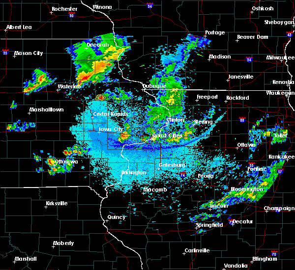 At 1053 pm cdt, a severe thunderstorm was located over ryan, or 9 miles south of manchester, moving southeast at 15 mph (radar indicated). Hazards include quarter size hail. Damage to vehicles is expected. Locations impacted include, ryan and robinson. At 1053 pm cdt, a severe thunderstorm was located over ryan, or 9 miles south of manchester, moving southeast at 15 mph (radar indicated). Hazards include quarter size hail. Damage to vehicles is expected. Locations impacted include, ryan and robinson.
|
| 5/25/2018 10:40 PM CDT |
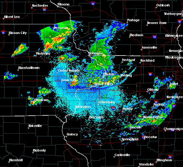 At 1039 pm cdt, a severe thunderstorm was located near masonville, or 7 miles southwest of manchester, moving southeast at 20 mph (radar indicated). Hazards include quarter size hail. Damage to vehicles is expected. Locations impacted include, manchester, ryan, coffins grove park and robinson. At 1039 pm cdt, a severe thunderstorm was located near masonville, or 7 miles southwest of manchester, moving southeast at 20 mph (radar indicated). Hazards include quarter size hail. Damage to vehicles is expected. Locations impacted include, manchester, ryan, coffins grove park and robinson.
|
| 5/25/2018 10:26 PM CDT |
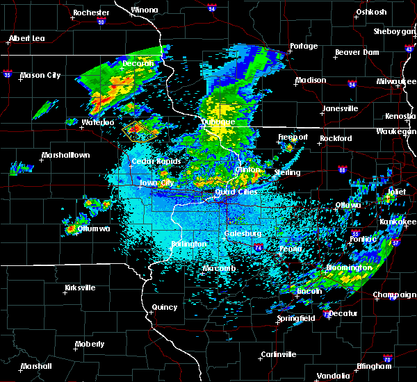 The national weather service in the quad cities has issued a * severe thunderstorm warning for. southeastern buchanan county in northeastern iowa. southwestern delaware county in northeastern iowa. until 1115 pm cdt. At 1025 pm cdt, a severe thunderstorm was located over masonville,. The national weather service in the quad cities has issued a * severe thunderstorm warning for. southeastern buchanan county in northeastern iowa. southwestern delaware county in northeastern iowa. until 1115 pm cdt. At 1025 pm cdt, a severe thunderstorm was located over masonville,.
|
| 5/25/2018 8:52 PM CDT |
 The severe thunderstorm warning for northwestern jo daviess, northwestern jackson, eastern buchanan, dubuque and delaware counties will expire at 900 pm cdt, the storms which prompted the warning have weakened below severe limits, and no longer pose an immediate threat to life or property. therefore, the warning will be allowed to expire. however hail up to penny size and gusty winds are still possible with these thunderstorms. to report severe weather, contact your nearest law enforcement agency. they will relay your report to the national weather service the quad cities. The severe thunderstorm warning for northwestern jo daviess, northwestern jackson, eastern buchanan, dubuque and delaware counties will expire at 900 pm cdt, the storms which prompted the warning have weakened below severe limits, and no longer pose an immediate threat to life or property. therefore, the warning will be allowed to expire. however hail up to penny size and gusty winds are still possible with these thunderstorms. to report severe weather, contact your nearest law enforcement agency. they will relay your report to the national weather service the quad cities.
|
| 5/25/2018 8:40 PM CDT |
 At 839 pm cdt, severe thunderstorms were located along a line extending from menominee to near rowley, moving southeast at 40 mph (radar indicated). Hazards include 60 mph wind gusts and penny size hail. Expect damage to roofs, siding, and trees. Locations impacted include, dubuque, independence, manchester, galena, asbury, dyersville, cascade, epworth, east dubuque, farley, peosta, winthrop, earlville, hopkinton, quasqueton, lamont, delhi, new vienna, colesburg and worthington. At 839 pm cdt, severe thunderstorms were located along a line extending from menominee to near rowley, moving southeast at 40 mph (radar indicated). Hazards include 60 mph wind gusts and penny size hail. Expect damage to roofs, siding, and trees. Locations impacted include, dubuque, independence, manchester, galena, asbury, dyersville, cascade, epworth, east dubuque, farley, peosta, winthrop, earlville, hopkinton, quasqueton, lamont, delhi, new vienna, colesburg and worthington.
|
| 5/25/2018 8:27 PM CDT |
 At 825 pm cdt, severe thunderstorms were located along a line extending from near sageville to independence, moving southeast at 25 mph (emergency management). Hazards include 60 mph wind gusts and penny size hail. Expect damage to roofs, siding, and trees. Locations impacted include, dubuque, independence, manchester, galena, asbury, dyersville, jesup, cascade, epworth, east dubuque, farley, peosta, fairbank, edgewood, winthrop, hazleton, earlville, hopkinton, quasqueton and lamont. At 825 pm cdt, severe thunderstorms were located along a line extending from near sageville to independence, moving southeast at 25 mph (emergency management). Hazards include 60 mph wind gusts and penny size hail. Expect damage to roofs, siding, and trees. Locations impacted include, dubuque, independence, manchester, galena, asbury, dyersville, jesup, cascade, epworth, east dubuque, farley, peosta, fairbank, edgewood, winthrop, hazleton, earlville, hopkinton, quasqueton and lamont.
|
| 5/25/2018 8:10 PM CDT |
 At 808 pm cdt, severe thunderstorms were located along a line extending from 6 miles west of platteville to 6 miles southwest of independence, moving southeast at 40 mph (radar indicated). Hazards include 60 mph wind gusts and penny size hail. expect damage to roofs, siding, and trees At 808 pm cdt, severe thunderstorms were located along a line extending from 6 miles west of platteville to 6 miles southwest of independence, moving southeast at 40 mph (radar indicated). Hazards include 60 mph wind gusts and penny size hail. expect damage to roofs, siding, and trees
|
| 7/22/2017 12:12 AM CDT |
 The severe thunderstorm warning for jo daviess, carroll, southwestern stephenson, jackson, northeastern buchanan, dubuque, northern jones, delaware and northern clinton counties will expire at 1215 am cdt, the storms which prompted the warning have weakened below severe limits, and no longer pose an immediate threat to life or property. therefore, the warning will be allowed to expire. however gusty winds over 40 mph and heavy rain are still possible with these thunderstorms. a severe thunderstorm watch remains in effect until 200 am cdt for northwestern illinois, and northeastern and east central iowa. The severe thunderstorm warning for jo daviess, carroll, southwestern stephenson, jackson, northeastern buchanan, dubuque, northern jones, delaware and northern clinton counties will expire at 1215 am cdt, the storms which prompted the warning have weakened below severe limits, and no longer pose an immediate threat to life or property. therefore, the warning will be allowed to expire. however gusty winds over 40 mph and heavy rain are still possible with these thunderstorms. a severe thunderstorm watch remains in effect until 200 am cdt for northwestern illinois, and northeastern and east central iowa.
|
| 7/22/2017 12:03 AM CDT |
 At 1201 am cdt, severe thunderstorms were located along a line extending from near elizabeth to near prairieburg, moving southeast at 40 mph (law enforcement in dubuque county reports trees are down and power lines also down from this storm). Hazards include 70 mph wind gusts and penny size hail. Expect considerable tree damage. damage is likely to mobile homes, roofs, and outbuildings. locations impacted include, dubuque, maquoketa, manchester, galena, mount carroll, asbury, dyersville, monticello, savanna, bellevue, cascade, stockton, epworth, east dubuque, farley, lanark, peosta, milledgeville, preston and fairhaven. If you are at monticello fairgrounds you should seek safe shelter immediately!. At 1201 am cdt, severe thunderstorms were located along a line extending from near elizabeth to near prairieburg, moving southeast at 40 mph (law enforcement in dubuque county reports trees are down and power lines also down from this storm). Hazards include 70 mph wind gusts and penny size hail. Expect considerable tree damage. damage is likely to mobile homes, roofs, and outbuildings. locations impacted include, dubuque, maquoketa, manchester, galena, mount carroll, asbury, dyersville, monticello, savanna, bellevue, cascade, stockton, epworth, east dubuque, farley, lanark, peosta, milledgeville, preston and fairhaven. If you are at monticello fairgrounds you should seek safe shelter immediately!.
|
| 7/21/2017 11:53 PM CDT |
 At 1153 pm cdt, severe thunderstorms were located roughly along a line extending from near schapville to near ryan, moving southeast at 40 mph (radar indicated). Hazards include 70 mph wind gusts and penny size hail. Expect considerable tree damage. damage is likely to mobile homes, roofs, and outbuildings. locations impacted include, dubuque, maquoketa, manchester, galena, mount carroll, asbury, dyersville, monticello, savanna, bellevue, cascade, stockton, epworth, east dubuque, farley, lanark, peosta, milledgeville, preston and fairhaven. If you are at monticello fairgrounds you should seek safe shelter immediately!. At 1153 pm cdt, severe thunderstorms were located roughly along a line extending from near schapville to near ryan, moving southeast at 40 mph (radar indicated). Hazards include 70 mph wind gusts and penny size hail. Expect considerable tree damage. damage is likely to mobile homes, roofs, and outbuildings. locations impacted include, dubuque, maquoketa, manchester, galena, mount carroll, asbury, dyersville, monticello, savanna, bellevue, cascade, stockton, epworth, east dubuque, farley, lanark, peosta, milledgeville, preston and fairhaven. If you are at monticello fairgrounds you should seek safe shelter immediately!.
|
| 7/21/2017 11:36 PM CDT |
 At 1136 pm cdt, severe thunderstorms were located along a line extending from near council hill to near masonville, moving southeast at 40 mph (radar indicated). Hazards include 70 mph wind gusts and penny size hail. Expect considerable tree damage. damage is likely to mobile homes, roofs, and outbuildings. locations impacted include, dubuque, maquoketa, manchester, galena, mount carroll, asbury, dyersville, monticello, savanna, bellevue, cascade, stockton, epworth, east dubuque, farley, lanark, peosta, milledgeville, preston and fairhaven. If you are at monticello fairgrounds you should seek safe shelter immediately!. At 1136 pm cdt, severe thunderstorms were located along a line extending from near council hill to near masonville, moving southeast at 40 mph (radar indicated). Hazards include 70 mph wind gusts and penny size hail. Expect considerable tree damage. damage is likely to mobile homes, roofs, and outbuildings. locations impacted include, dubuque, maquoketa, manchester, galena, mount carroll, asbury, dyersville, monticello, savanna, bellevue, cascade, stockton, epworth, east dubuque, farley, lanark, peosta, milledgeville, preston and fairhaven. If you are at monticello fairgrounds you should seek safe shelter immediately!.
|
| 7/21/2017 11:22 PM CDT |
 At 1121 pm cdt, severe thunderstorms were located along a line extending from near menominee to winthrop, moving southeast at 40 mph (radar indicated). Hazards include 70 mph wind gusts and penny size hail. Expect considerable tree damage. damage is likely to mobile homes, roofs, and outbuildings. locations impacted include, dubuque, maquoketa, manchester, galena, mount carroll, asbury, dyersville, monticello, savanna, bellevue, cascade, stockton, epworth, east dubuque, farley, lanark, peosta, milledgeville, preston and fairhaven. If you are at monticello fairgrounds you should seek safe shelter immediately!. At 1121 pm cdt, severe thunderstorms were located along a line extending from near menominee to winthrop, moving southeast at 40 mph (radar indicated). Hazards include 70 mph wind gusts and penny size hail. Expect considerable tree damage. damage is likely to mobile homes, roofs, and outbuildings. locations impacted include, dubuque, maquoketa, manchester, galena, mount carroll, asbury, dyersville, monticello, savanna, bellevue, cascade, stockton, epworth, east dubuque, farley, lanark, peosta, milledgeville, preston and fairhaven. If you are at monticello fairgrounds you should seek safe shelter immediately!.
|
| 7/21/2017 11:10 PM CDT |
 At 1109 pm cdt, severe thunderstorms were located along a line extending from near sageville to 6 miles south of stanley, moving southeast at 40 mph (radar indicated). Hazards include 60 mph wind gusts and penny size hail. expect damage to roofs, siding, and trees At 1109 pm cdt, severe thunderstorms were located along a line extending from near sageville to 6 miles south of stanley, moving southeast at 40 mph (radar indicated). Hazards include 60 mph wind gusts and penny size hail. expect damage to roofs, siding, and trees
|
| 7/21/2017 11:10 PM CDT |
 The national weather service in the quad cities has issued a * severe thunderstorm warning for. jo daviess county in northwestern illinois. carroll county in northwestern illinois. southwestern stephenson county in northwestern illinois. Jackson county in east central iowa. The national weather service in the quad cities has issued a * severe thunderstorm warning for. jo daviess county in northwestern illinois. carroll county in northwestern illinois. southwestern stephenson county in northwestern illinois. Jackson county in east central iowa.
|
| 6/29/2017 6:10 PM CDT |
 The severe thunderstorm warning for jones, delaware and linn counties will expire at 1115 pm cdt, the storms which prompted the warning have weakened. therefore, the warning will be allowed to expire. The severe thunderstorm warning for jones, delaware and linn counties will expire at 1115 pm cdt, the storms which prompted the warning have weakened. therefore, the warning will be allowed to expire.
|
| 6/29/2017 6:06 PM CDT |
 At 1103 pm cdt, severe thunderstorms were located along a line extending from near colesburg to near hopkinton to near springville, moving east at 40 mph (this line of storms has a history of producing 60 mph winds across portions of buchanan, linn, and delaware counties). Hazards include 60 mph wind gusts. Expect damage to roofs, siding, and trees. Locations impacted include, manchester, marion, central city, springville, edgewood, earlville, coggon, delhi, ryan, greeley, prairieburg, delaware, waubeek, whittier, oneida, linn county fairgrounds, pinicon ridge park, twin bridges park, buck creek and baileys ford park. At 1103 pm cdt, severe thunderstorms were located along a line extending from near colesburg to near hopkinton to near springville, moving east at 40 mph (this line of storms has a history of producing 60 mph winds across portions of buchanan, linn, and delaware counties). Hazards include 60 mph wind gusts. Expect damage to roofs, siding, and trees. Locations impacted include, manchester, marion, central city, springville, edgewood, earlville, coggon, delhi, ryan, greeley, prairieburg, delaware, waubeek, whittier, oneida, linn county fairgrounds, pinicon ridge park, twin bridges park, buck creek and baileys ford park.
|
| 6/29/2017 5:54 PM CDT |
 At 1053 pm cdt, severe thunderstorms were located along a line extending from edgewood to near ryan to marion, moving east at 50 mph (trained weather spotters). Hazards include 60 mph wind gusts. Expect damage to roofs, siding, and trees. Locations impacted include, cedar rapids, manchester, marion, hiawatha, robins, center point, central city, springville, palo, edgewood, winthrop, earlville, alburnett, coggon, quasqueton, lamont, delhi, ryan, greeley and aurora. At 1053 pm cdt, severe thunderstorms were located along a line extending from edgewood to near ryan to marion, moving east at 50 mph (trained weather spotters). Hazards include 60 mph wind gusts. Expect damage to roofs, siding, and trees. Locations impacted include, cedar rapids, manchester, marion, hiawatha, robins, center point, central city, springville, palo, edgewood, winthrop, earlville, alburnett, coggon, quasqueton, lamont, delhi, ryan, greeley and aurora.
|
| 6/29/2017 5:36 PM CDT |
 At 1034 pm cdt, severe thunderstorms were located along a line extending from lamont to near troy mills to near norway, moving east at 45 mph (trained spotters). Hazards include 60 mph wind gusts. Expect damage to roofs, siding, and trees. Locations impacted include, cedar rapids, independence, manchester, marion, hiawatha, robins, center point, urbana, central city, springville, palo, shellsburg, edgewood, winthrop, earlville, walker, alburnett, coggon, quasqueton and lamont. At 1034 pm cdt, severe thunderstorms were located along a line extending from lamont to near troy mills to near norway, moving east at 45 mph (trained spotters). Hazards include 60 mph wind gusts. Expect damage to roofs, siding, and trees. Locations impacted include, cedar rapids, independence, manchester, marion, hiawatha, robins, center point, urbana, central city, springville, palo, shellsburg, edgewood, winthrop, earlville, walker, alburnett, coggon, quasqueton and lamont.
|
| 6/29/2017 5:30 PM CDT |
 At 1029 pm cdt, severe thunderstorms were located along a line extending from near aurora to near walker to near newhall, moving east at 35 mph (radar indicated). Hazards include 60 mph wind gusts. expect damage to roofs, siding, and trees At 1029 pm cdt, severe thunderstorms were located along a line extending from near aurora to near walker to near newhall, moving east at 35 mph (radar indicated). Hazards include 60 mph wind gusts. expect damage to roofs, siding, and trees
|
| 6/28/2017 1:34 PM CDT |
 At 634 pm cdt, a severe thunderstorm was located over paris, or 16 miles north of cedar rapids, moving northeast at 30 mph (radar indicated). Hazards include 60 mph wind gusts and half dollar size hail. Hail damage to vehicles is expected. Expect wind damage to roofs, siding, and trees. At 634 pm cdt, a severe thunderstorm was located over paris, or 16 miles north of cedar rapids, moving northeast at 30 mph (radar indicated). Hazards include 60 mph wind gusts and half dollar size hail. Hail damage to vehicles is expected. Expect wind damage to roofs, siding, and trees.
|
| 6/15/2017 9:27 PM CDT |
 The severe thunderstorm warning for southeastern buchanan, southwestern delaware and north central linn counties will expire at 930 pm cdt, the storm which prompted the warning has moved out of the area. therefore, the warning will be allowed to expire. a severe thunderstorm watch remains in effect until 100 am cdt for northeastern and east central iowa. remember, a severe thunderstorm warning still remains in effect for northern buchanan county through 945 pm. The severe thunderstorm warning for southeastern buchanan, southwestern delaware and north central linn counties will expire at 930 pm cdt, the storm which prompted the warning has moved out of the area. therefore, the warning will be allowed to expire. a severe thunderstorm watch remains in effect until 100 am cdt for northeastern and east central iowa. remember, a severe thunderstorm warning still remains in effect for northern buchanan county through 945 pm.
|
| 6/15/2017 8:45 PM CDT |
 At 845 pm cdt, a severe thunderstorm was located over rowley, or near independence, moving southeast at 30 mph (trained weather spotters). Hazards include 60 mph wind gusts and quarter size hail. Hail damage to vehicles is expected. Expect wind damage to roofs, siding, and trees. At 845 pm cdt, a severe thunderstorm was located over rowley, or near independence, moving southeast at 30 mph (trained weather spotters). Hazards include 60 mph wind gusts and quarter size hail. Hail damage to vehicles is expected. Expect wind damage to roofs, siding, and trees.
|
| 6/15/2017 8:26 PM CDT |
 At 826 pm cdt, a severe thunderstorm was located near alburnett, or 15 miles north of cedar rapids, moving southeast at 25 mph (radar indicated). Hazards include 60 mph wind gusts and half dollar size hail. Hail damage to vehicles is expected. expect wind damage to roofs, siding, and trees. locations impacted include, center point, urbana, central city, springville, walker, alburnett, coggon, quasqueton, ryan, brandon, rowley, prairieburg, troy mills, waubeek, viola, whittier, paris, linn county fairgrounds, monti and pinicon ridge park. This includes interstate 380 between mile markers 37 and 53. At 826 pm cdt, a severe thunderstorm was located near alburnett, or 15 miles north of cedar rapids, moving southeast at 25 mph (radar indicated). Hazards include 60 mph wind gusts and half dollar size hail. Hail damage to vehicles is expected. expect wind damage to roofs, siding, and trees. locations impacted include, center point, urbana, central city, springville, walker, alburnett, coggon, quasqueton, ryan, brandon, rowley, prairieburg, troy mills, waubeek, viola, whittier, paris, linn county fairgrounds, monti and pinicon ridge park. This includes interstate 380 between mile markers 37 and 53.
|
| 6/15/2017 8:18 PM CDT |
 At 817 pm cdt, a cluster of severe thunderstorms over northern linn county, moving southeast at 30 mph (radar indicated). Hazards include 60 mph wind gusts and half dollar size hail. Hail damage to vehicles is expected. expect wind damage to roofs, siding, and trees. locations impacted include, center point, urbana, central city, springville, walker, alburnett, coggon, quasqueton, ryan, brandon, rowley, prairieburg, troy mills, waubeek, viola, whittier, paris, linn county fairgrounds, monti and pinicon ridge park. This includes interstate 380 between mile markers 37 and 53. At 817 pm cdt, a cluster of severe thunderstorms over northern linn county, moving southeast at 30 mph (radar indicated). Hazards include 60 mph wind gusts and half dollar size hail. Hail damage to vehicles is expected. expect wind damage to roofs, siding, and trees. locations impacted include, center point, urbana, central city, springville, walker, alburnett, coggon, quasqueton, ryan, brandon, rowley, prairieburg, troy mills, waubeek, viola, whittier, paris, linn county fairgrounds, monti and pinicon ridge park. This includes interstate 380 between mile markers 37 and 53.
|
| 6/15/2017 8:12 PM CDT |
 At 812 pm cdt, a severe thunderstorm was located over troy mills, or 18 miles southeast of independence, moving southeast at 35 mph (radar indicated). Hazards include ping pong ball size hail and 60 mph wind gusts. People and animals outdoors will be injured. expect hail damage to roofs, siding, windows, and vehicles. expect wind damage to roofs, siding, and trees. locations impacted include, center point, urbana, central city, walker, alburnett, coggon, quasqueton, ryan, brandon, rowley, prairieburg, troy mills, waubeek, viola, whittier, paris, linn county fairgrounds, monti, pinicon ridge park and minne estema park. This includes interstate 380 between mile markers 37 and 53. At 812 pm cdt, a severe thunderstorm was located over troy mills, or 18 miles southeast of independence, moving southeast at 35 mph (radar indicated). Hazards include ping pong ball size hail and 60 mph wind gusts. People and animals outdoors will be injured. expect hail damage to roofs, siding, windows, and vehicles. expect wind damage to roofs, siding, and trees. locations impacted include, center point, urbana, central city, walker, alburnett, coggon, quasqueton, ryan, brandon, rowley, prairieburg, troy mills, waubeek, viola, whittier, paris, linn county fairgrounds, monti, pinicon ridge park and minne estema park. This includes interstate 380 between mile markers 37 and 53.
|
| 6/15/2017 8:02 PM CDT |
 At 802 pm cdt, a severe thunderstorm was located over walker, or 12 miles southeast of independence, moving southeast at 30 mph (radar indicated). Hazards include ping pong ball size hail and 60 mph wind gusts. People and animals outdoors will be injured. expect hail damage to roofs, siding, windows, and vehicles. expect wind damage to roofs, siding, and trees. locations impacted include, center point, urbana, central city, walker, alburnett, coggon, quasqueton, ryan, brandon, rowley, prairieburg, troy mills, waubeek, viola, whittier, paris, linn county fairgrounds, monti, pinicon ridge park and minne estema park. This includes interstate 380 between mile markers 37 and 53. At 802 pm cdt, a severe thunderstorm was located over walker, or 12 miles southeast of independence, moving southeast at 30 mph (radar indicated). Hazards include ping pong ball size hail and 60 mph wind gusts. People and animals outdoors will be injured. expect hail damage to roofs, siding, windows, and vehicles. expect wind damage to roofs, siding, and trees. locations impacted include, center point, urbana, central city, walker, alburnett, coggon, quasqueton, ryan, brandon, rowley, prairieburg, troy mills, waubeek, viola, whittier, paris, linn county fairgrounds, monti, pinicon ridge park and minne estema park. This includes interstate 380 between mile markers 37 and 53.
|
| 6/15/2017 7:51 PM CDT |
 At 750 pm cdt, a severe thunderstorm was located over rowley, or 8 miles south of independence, moving southeast at 30 mph (radar indicated). Hazards include golf ball size hail and 60 mph wind gusts. People and animals outdoors will be injured. expect hail damage to roofs, siding, windows, and vehicles. Expect wind damage to roofs, siding, and trees. At 750 pm cdt, a severe thunderstorm was located over rowley, or 8 miles south of independence, moving southeast at 30 mph (radar indicated). Hazards include golf ball size hail and 60 mph wind gusts. People and animals outdoors will be injured. expect hail damage to roofs, siding, windows, and vehicles. Expect wind damage to roofs, siding, and trees.
|
| 5/17/2017 7:07 PM CDT |
 The tornado warning for northwestern dubuque, northwestern jones, eastern delaware and northeastern linn counties will expire at 715 pm cdt, the storm which prompted the warning has weakened below severe limits, and no longer appears capable of producing a tornado. therefore, the warning will be allowed to expire. a tornado watch remains in effect until 1100 pm cdt for northeastern and east central iowa. remember, a severe thunderstorm warning still remains in effect for dubuque, delaware, jones and linn counties until 730 pm cdt. The tornado warning for northwestern dubuque, northwestern jones, eastern delaware and northeastern linn counties will expire at 715 pm cdt, the storm which prompted the warning has weakened below severe limits, and no longer appears capable of producing a tornado. therefore, the warning will be allowed to expire. a tornado watch remains in effect until 1100 pm cdt for northeastern and east central iowa. remember, a severe thunderstorm warning still remains in effect for dubuque, delaware, jones and linn counties until 730 pm cdt.
|
| 5/17/2017 6:47 PM CDT |
 At 646 pm cdt, severe thunderstorms were located along a line extending from near aurora to near manchester to morley to near lone tree, moving northeast at 35 mph (trained weather spotters). Hazards include 70 mph wind gusts. Expect considerable tree damage. damage is likely to mobile homes, roofs, and outbuildings. locations impacted include, iowa city, dubuque, muscatine, anamosa, manchester, tipton, west branch, mechanicsville, stanwood, marion, coralville, north liberty, mount vernon, asbury, dyersville, monticello, west liberty, wilton, cascade and lisbon. this includes interstate 80 in iowa between mile markers 239 and 274. A tornado watch remains in effect until 1100 pm cdt for northwestern illinois, and southeastern, northeastern and east central iowa. At 646 pm cdt, severe thunderstorms were located along a line extending from near aurora to near manchester to morley to near lone tree, moving northeast at 35 mph (trained weather spotters). Hazards include 70 mph wind gusts. Expect considerable tree damage. damage is likely to mobile homes, roofs, and outbuildings. locations impacted include, iowa city, dubuque, muscatine, anamosa, manchester, tipton, west branch, mechanicsville, stanwood, marion, coralville, north liberty, mount vernon, asbury, dyersville, monticello, west liberty, wilton, cascade and lisbon. this includes interstate 80 in iowa between mile markers 239 and 274. A tornado watch remains in effect until 1100 pm cdt for northwestern illinois, and southeastern, northeastern and east central iowa.
|
| 5/17/2017 6:41 PM CDT |
 At 640 pm cdt, severe thunderstorms were located along a line extending from hazleton to masonville to near prairieburg to near riverside, moving northeast at 45 mph (trained weather spotters). Hazards include 70 mph wind gusts. Expect considerable tree damage. damage is likely to mobile homes, roofs, and outbuildings. locations impacted include, cedar rapids, iowa city, dubuque, muscatine, independence, anamosa, manchester, tipton, west branch, mechanicsville, stanwood, marion, coralville, north liberty, mount vernon, asbury, dyersville, monticello, west liberty and wilton. this includes the following highways, interstate 80 in iowa between mile markers 239 and 274. interstate 380 between mile markers 1 and 6. A tornado watch remains in effect until 1100 pm cdt for northwestern illinois, and southeastern, northeastern and east central iowa. At 640 pm cdt, severe thunderstorms were located along a line extending from hazleton to masonville to near prairieburg to near riverside, moving northeast at 45 mph (trained weather spotters). Hazards include 70 mph wind gusts. Expect considerable tree damage. damage is likely to mobile homes, roofs, and outbuildings. locations impacted include, cedar rapids, iowa city, dubuque, muscatine, independence, anamosa, manchester, tipton, west branch, mechanicsville, stanwood, marion, coralville, north liberty, mount vernon, asbury, dyersville, monticello, west liberty and wilton. this includes the following highways, interstate 80 in iowa between mile markers 239 and 274. interstate 380 between mile markers 1 and 6. A tornado watch remains in effect until 1100 pm cdt for northwestern illinois, and southeastern, northeastern and east central iowa.
|
| 5/17/2017 6:32 PM CDT | Storm damage reported in delaware county IA, 0.2 miles W of Ryan, IA |
| 5/17/2017 6:32 PM CDT |
 At 632 pm cdt, a confirmed tornado was located over waubeek, or 9 miles west of anamosa, moving northeast at 60 mph (weather spotters confirmed tornado). Hazards include damaging tornado. Flying debris will be dangerous to those caught without shelter. mobile homes will be damaged or destroyed. damage to roofs, windows, and vehicles will occur. tree damage is likely. the tornado will be near, ryan around 645 pm cdt. hopkinton and delhi around 650 pm cdt. earlville, delaware and oneida around 655 pm cdt. dyersville, new vienna and greeley around 700 pm cdt. colesburg and luxemburg around 705 pm cdt. Other locations impacted by this tornadic thunderstorm include pinicon ridge park, twin bridges park, buck creek, baileys ford park, petersburg, matsell bridge natural area, howard h cherry scout reservation, oneida, new wine park and turtle creek park. At 632 pm cdt, a confirmed tornado was located over waubeek, or 9 miles west of anamosa, moving northeast at 60 mph (weather spotters confirmed tornado). Hazards include damaging tornado. Flying debris will be dangerous to those caught without shelter. mobile homes will be damaged or destroyed. damage to roofs, windows, and vehicles will occur. tree damage is likely. the tornado will be near, ryan around 645 pm cdt. hopkinton and delhi around 650 pm cdt. earlville, delaware and oneida around 655 pm cdt. dyersville, new vienna and greeley around 700 pm cdt. colesburg and luxemburg around 705 pm cdt. Other locations impacted by this tornadic thunderstorm include pinicon ridge park, twin bridges park, buck creek, baileys ford park, petersburg, matsell bridge natural area, howard h cherry scout reservation, oneida, new wine park and turtle creek park.
|
| 5/17/2017 6:31 PM CDT |
 At 630 pm cdt, severe thunderstorms were located along a line extending from near fairbank to near quasqueton to near springville to near hills, moving northeast at 40 mph (trained weather spotters). Hazards include 70 mph wind gusts. Expect considerable tree damage. Damage is likely to mobile homes, roofs, and outbuildings. At 630 pm cdt, severe thunderstorms were located along a line extending from near fairbank to near quasqueton to near springville to near hills, moving northeast at 40 mph (trained weather spotters). Hazards include 70 mph wind gusts. Expect considerable tree damage. Damage is likely to mobile homes, roofs, and outbuildings.
|
| 5/17/2017 6:28 PM CDT | Storm damage reported in delaware county IA, 0.9 miles E of Ryan, IA |
| 5/17/2017 6:22 PM CDT |
 At 622 pm cdt, severe thunderstorms were located along a line extending from 6 miles southeast of jesup to near quasqueton to near alburnett to richmond, moving northeast at 45 mph (trained weather spotters). Hazards include 70 mph wind gusts. Expect considerable tree damage. damage is likely to mobile homes, roofs, and outbuildings. locations impacted include, cedar rapids, iowa city, independence, manchester, west branch, marion, coralville, north liberty, hiawatha, mount vernon, robins, jesup, center point, kalona, lisbon, fairfax, solon, tiffin, ely and atkins. this includes the following highways, interstate 80 in iowa between mile markers 224 and 253. interstate 380 between mile markers 1 and 55. A tornado watch remains in effect until 1100 pm cdt for southeastern, northeastern and east central iowa. At 622 pm cdt, severe thunderstorms were located along a line extending from 6 miles southeast of jesup to near quasqueton to near alburnett to richmond, moving northeast at 45 mph (trained weather spotters). Hazards include 70 mph wind gusts. Expect considerable tree damage. damage is likely to mobile homes, roofs, and outbuildings. locations impacted include, cedar rapids, iowa city, independence, manchester, west branch, marion, coralville, north liberty, hiawatha, mount vernon, robins, jesup, center point, kalona, lisbon, fairfax, solon, tiffin, ely and atkins. this includes the following highways, interstate 80 in iowa between mile markers 224 and 253. interstate 380 between mile markers 1 and 55. A tornado watch remains in effect until 1100 pm cdt for southeastern, northeastern and east central iowa.
|
| 5/17/2017 6:15 PM CDT |
 At 615 pm cdt, severe thunderstorms were located along a line extending from near brandon to near urbana to robins to near wellman, moving northeast at 55 mph (trained weather spotters). Hazards include 70 mph wind gusts and quarter size hail. Hail damage to vehicles is expected. expect considerable tree damage. wind damage is also likely to mobile homes, roofs, and outbuildings. locations impacted include, cedar rapids, iowa city, independence, vinton, manchester, west branch, marion, coralville, north liberty, hiawatha, mount vernon, robins, jesup, center point, kalona, lisbon, fairfax, solon, tiffin and ely. this includes the following highways, interstate 80 in iowa between mile markers 224 and 253. interstate 380 between mile markers 1 and 55. A tornado watch remains in effect until 1100 pm cdt for southeastern, northeastern and east central iowa. At 615 pm cdt, severe thunderstorms were located along a line extending from near brandon to near urbana to robins to near wellman, moving northeast at 55 mph (trained weather spotters). Hazards include 70 mph wind gusts and quarter size hail. Hail damage to vehicles is expected. expect considerable tree damage. wind damage is also likely to mobile homes, roofs, and outbuildings. locations impacted include, cedar rapids, iowa city, independence, vinton, manchester, west branch, marion, coralville, north liberty, hiawatha, mount vernon, robins, jesup, center point, kalona, lisbon, fairfax, solon, tiffin and ely. this includes the following highways, interstate 80 in iowa between mile markers 224 and 253. interstate 380 between mile markers 1 and 55. A tornado watch remains in effect until 1100 pm cdt for southeastern, northeastern and east central iowa.
|
| 5/17/2017 6:10 PM CDT |
 At 610 pm cdt, severe thunderstorms were located along a line extending from near mount auburn to near shellsburg to near hiawatha to near kinross, moving northeast at 55 mph (trained weather spotters). Hazards include 70 mph wind gusts and quarter size hail. Hail damage to vehicles is expected. expect considerable tree damage. wind damage is also likely to mobile homes, roofs, and outbuildings. locations impacted include, cedar rapids, iowa city, independence, vinton, manchester, west branch, marion, coralville, north liberty, hiawatha, mount vernon, robins, jesup, center point, kalona, lisbon, fairfax, solon, tiffin and ely. this includes the following highways, interstate 80 in iowa between mile markers 224 and 253. interstate 380 between mile markers 1 and 55. A tornado watch remains in effect until 1100 pm cdt for southeastern, northeastern and east central iowa. At 610 pm cdt, severe thunderstorms were located along a line extending from near mount auburn to near shellsburg to near hiawatha to near kinross, moving northeast at 55 mph (trained weather spotters). Hazards include 70 mph wind gusts and quarter size hail. Hail damage to vehicles is expected. expect considerable tree damage. wind damage is also likely to mobile homes, roofs, and outbuildings. locations impacted include, cedar rapids, iowa city, independence, vinton, manchester, west branch, marion, coralville, north liberty, hiawatha, mount vernon, robins, jesup, center point, kalona, lisbon, fairfax, solon, tiffin and ely. this includes the following highways, interstate 80 in iowa between mile markers 224 and 253. interstate 380 between mile markers 1 and 55. A tornado watch remains in effect until 1100 pm cdt for southeastern, northeastern and east central iowa.
|
| 5/17/2017 6:04 PM CDT |
 At 604 pm cdt, severe thunderstorms were located along a line extending from near la porte city to near palo to near kinross, moving northeast at 45 mph (trained weather spotters). Hazards include 70 mph wind gusts and quarter size hail. Hail damage to vehicles is expected. expect considerable tree damage. wind damage is also likely to mobile homes, roofs, and outbuildings. locations impacted include, cedar rapids, iowa city, independence, vinton, manchester, west branch, marion, coralville, north liberty, hiawatha, mount vernon, robins, jesup, center point, kalona, lisbon, fairfax, solon, tiffin and ely. this includes the following highways, interstate 80 in iowa between mile markers 224 and 253. interstate 380 between mile markers 1 and 55. A tornado watch remains in effect until 1100 pm cdt for southeastern, northeastern and east central iowa. At 604 pm cdt, severe thunderstorms were located along a line extending from near la porte city to near palo to near kinross, moving northeast at 45 mph (trained weather spotters). Hazards include 70 mph wind gusts and quarter size hail. Hail damage to vehicles is expected. expect considerable tree damage. wind damage is also likely to mobile homes, roofs, and outbuildings. locations impacted include, cedar rapids, iowa city, independence, vinton, manchester, west branch, marion, coralville, north liberty, hiawatha, mount vernon, robins, jesup, center point, kalona, lisbon, fairfax, solon, tiffin and ely. this includes the following highways, interstate 80 in iowa between mile markers 224 and 253. interstate 380 between mile markers 1 and 55. A tornado watch remains in effect until 1100 pm cdt for southeastern, northeastern and east central iowa.
|
| 5/17/2017 5:56 PM CDT |
 At 555 pm cdt, severe thunderstorms were located along a line extending from near dysart to newhall to kinross, moving northeast at 45 mph (trained weather spotters). Hazards include 70 mph wind gusts and quarter size hail. Hail damage to vehicles is expected. expect considerable tree damage. wind damage is also likely to mobile homes, roofs, and outbuildings. locations impacted include, cedar rapids, iowa city, independence, vinton, manchester, west branch, marion, coralville, north liberty, hiawatha, mount vernon, robins, jesup, center point, kalona, lisbon, fairfax, solon, tiffin and ely. this includes the following highways, interstate 80 in iowa between mile markers 224 and 253. interstate 380 between mile markers 1 and 55. A tornado watch remains in effect until 1100 pm cdt for southeastern, northeastern and east central iowa. At 555 pm cdt, severe thunderstorms were located along a line extending from near dysart to newhall to kinross, moving northeast at 45 mph (trained weather spotters). Hazards include 70 mph wind gusts and quarter size hail. Hail damage to vehicles is expected. expect considerable tree damage. wind damage is also likely to mobile homes, roofs, and outbuildings. locations impacted include, cedar rapids, iowa city, independence, vinton, manchester, west branch, marion, coralville, north liberty, hiawatha, mount vernon, robins, jesup, center point, kalona, lisbon, fairfax, solon, tiffin and ely. this includes the following highways, interstate 80 in iowa between mile markers 224 and 253. interstate 380 between mile markers 1 and 55. A tornado watch remains in effect until 1100 pm cdt for southeastern, northeastern and east central iowa.
|
| 5/17/2017 5:50 PM CDT |
 At 550 pm cdt, severe thunderstorms were located along a line extending from near dysart to near norway to near kinross, moving northeast at 40 mph (radar indicated). Hazards include 70 mph wind gusts and quarter size hail. Hail damage to vehicles is expected. expect considerable tree damage. Wind damage is also likely to mobile homes, roofs, and outbuildings. At 550 pm cdt, severe thunderstorms were located along a line extending from near dysart to near norway to near kinross, moving northeast at 40 mph (radar indicated). Hazards include 70 mph wind gusts and quarter size hail. Hail damage to vehicles is expected. expect considerable tree damage. Wind damage is also likely to mobile homes, roofs, and outbuildings.
|
| 4/15/2017 8:39 PM CDT |
 The tornado warning for southwestern delaware and northeastern linn counties will expire at 845 pm cdt, the tornadic thunderstorm which prompted the warning has weakened, therefore the warning will be allowed to expire. however heavy rain is still possible with this thunderstorm. remember, a severe thunderstorm warning still remains in effect for linn county until 900 pm cdt. The tornado warning for southwestern delaware and northeastern linn counties will expire at 845 pm cdt, the tornadic thunderstorm which prompted the warning has weakened, therefore the warning will be allowed to expire. however heavy rain is still possible with this thunderstorm. remember, a severe thunderstorm warning still remains in effect for linn county until 900 pm cdt.
|
| 4/15/2017 8:33 PM CDT |
 At 833 pm cdt, a severe thunderstorm capable of producing a tornado was located over prairieburg, or 14 miles northwest of anamosa, moving east at 35 mph (radar indicated rotation). Hazards include tornado. Flying debris will be dangerous to those caught without shelter. mobile homes will be damaged or destroyed. damage to roofs, windows, and vehicles will occur. tree damage is likely. This tornadic thunderstorm will remain over mainly rural areas of southwestern delaware and northeastern linn counties, including the following locations: buffalo creek park and robinson. At 833 pm cdt, a severe thunderstorm capable of producing a tornado was located over prairieburg, or 14 miles northwest of anamosa, moving east at 35 mph (radar indicated rotation). Hazards include tornado. Flying debris will be dangerous to those caught without shelter. mobile homes will be damaged or destroyed. damage to roofs, windows, and vehicles will occur. tree damage is likely. This tornadic thunderstorm will remain over mainly rural areas of southwestern delaware and northeastern linn counties, including the following locations: buffalo creek park and robinson.
|
| 4/15/2017 8:24 PM CDT |
 At 824 pm cdt, a severe thunderstorm capable of producing a tornado was located over coggon, or 14 miles south of manchester, moving east at 35 mph (radar indicated rotation). Hazards include tornado and quarter size hail. Flying debris will be dangerous to those caught without shelter. mobile homes will be damaged or destroyed. damage to roofs, windows, and vehicles will occur. tree damage is likely. this dangerous storm will be near, prairieburg around 835 pm cdt. Other locations impacted by this tornadic thunderstorm include buffalo creek park, pinicon ridge park and robinson. At 824 pm cdt, a severe thunderstorm capable of producing a tornado was located over coggon, or 14 miles south of manchester, moving east at 35 mph (radar indicated rotation). Hazards include tornado and quarter size hail. Flying debris will be dangerous to those caught without shelter. mobile homes will be damaged or destroyed. damage to roofs, windows, and vehicles will occur. tree damage is likely. this dangerous storm will be near, prairieburg around 835 pm cdt. Other locations impacted by this tornadic thunderstorm include buffalo creek park, pinicon ridge park and robinson.
|
| 4/15/2017 8:06 PM CDT |
 At 805 pm cdt, a severe thunderstorm capable of producing a tornado was located over walker, or 15 miles southeast of independence, moving east at 30 mph (radar indicated rotation). Hazards include tornado and quarter size hail. Flying debris will be dangerous to those caught without shelter. mobile homes will be damaged or destroyed. damage to roofs, windows, and vehicles will occur. tree damage is likely. this dangerous storm will be near, troy mills around 810 pm cdt. paris around 820 pm cdt. central city and coggon around 825 pm cdt. ryan around 830 pm cdt. prairieburg and waubeek around 835 pm cdt. Other locations impacted by this tornadic thunderstorm include buffalo creek park, pinicon ridge park, robinson, howard h cherry scout reservation and linn county fairgrounds. At 805 pm cdt, a severe thunderstorm capable of producing a tornado was located over walker, or 15 miles southeast of independence, moving east at 30 mph (radar indicated rotation). Hazards include tornado and quarter size hail. Flying debris will be dangerous to those caught without shelter. mobile homes will be damaged or destroyed. damage to roofs, windows, and vehicles will occur. tree damage is likely. this dangerous storm will be near, troy mills around 810 pm cdt. paris around 820 pm cdt. central city and coggon around 825 pm cdt. ryan around 830 pm cdt. prairieburg and waubeek around 835 pm cdt. Other locations impacted by this tornadic thunderstorm include buffalo creek park, pinicon ridge park, robinson, howard h cherry scout reservation and linn county fairgrounds.
|
| 4/15/2017 7:56 PM CDT |
 At 755 pm cdt, a severe thunderstorm capable of producing a tornado was located over walker, or 12 miles northeast of vinton, moving east at 35 mph (radar indicated rotation). Hazards include tornado and quarter size hail. Flying debris will be dangerous to those caught without shelter. mobile homes will be damaged or destroyed. damage to roofs, windows, and vehicles will occur. tree damage is likely. this dangerous storm will be near, troy mills around 810 pm cdt. paris around 820 pm cdt. central city, coggon and ryan around 825 pm cdt. prairieburg and waubeek around 830 pm cdt. other locations impacted by this tornadic thunderstorm include pinicon ridge park, robinson, spencers grove, buffalo creek park, howard h cherry scout reservation, cheney and linn county fairgrounds. This includes interstate 380 between mile markers 43 and 48. At 755 pm cdt, a severe thunderstorm capable of producing a tornado was located over walker, or 12 miles northeast of vinton, moving east at 35 mph (radar indicated rotation). Hazards include tornado and quarter size hail. Flying debris will be dangerous to those caught without shelter. mobile homes will be damaged or destroyed. damage to roofs, windows, and vehicles will occur. tree damage is likely. this dangerous storm will be near, troy mills around 810 pm cdt. paris around 820 pm cdt. central city, coggon and ryan around 825 pm cdt. prairieburg and waubeek around 830 pm cdt. other locations impacted by this tornadic thunderstorm include pinicon ridge park, robinson, spencers grove, buffalo creek park, howard h cherry scout reservation, cheney and linn county fairgrounds. This includes interstate 380 between mile markers 43 and 48.
|
| 3/6/2017 9:23 PM CST |
 At 922 pm cst, severe thunderstorms were located along a line extending from 7 miles northwest of cassville to near guttenberg to near hopkinton to langworthy to near morley to near solon to university heights, moving east at 60 mph (trained weather spotters). Hazards include 70 mph wind gusts and quarter size hail. Hail damage to vehicles is expected. expect considerable tree damage. wind damage is also likely to mobile homes, roofs, and outbuildings. locations impacted include, cedar rapids, iowa city, manchester, west branch, marion, coralville, north liberty, mount vernon, dyersville, lisbon, solon, tiffin, ely, lone tree, central city, springville, university heights, swisher, edgewood and earlville. this includes the following highways, interstate 80 in iowa between mile markers 230 and 253. interstate 380 between mile markers 1 and 23. a tornado watch remains in effect until 1000 pm cst for southeastern, northeastern and east central iowa. A tornado watch also remains in effect until 400 am cst for southeastern, northeastern and east central iowa. At 922 pm cst, severe thunderstorms were located along a line extending from 7 miles northwest of cassville to near guttenberg to near hopkinton to langworthy to near morley to near solon to university heights, moving east at 60 mph (trained weather spotters). Hazards include 70 mph wind gusts and quarter size hail. Hail damage to vehicles is expected. expect considerable tree damage. wind damage is also likely to mobile homes, roofs, and outbuildings. locations impacted include, cedar rapids, iowa city, manchester, west branch, marion, coralville, north liberty, mount vernon, dyersville, lisbon, solon, tiffin, ely, lone tree, central city, springville, university heights, swisher, edgewood and earlville. this includes the following highways, interstate 80 in iowa between mile markers 230 and 253. interstate 380 between mile markers 1 and 23. a tornado watch remains in effect until 1000 pm cst for southeastern, northeastern and east central iowa. A tornado watch also remains in effect until 400 am cst for southeastern, northeastern and east central iowa.
|
| 3/6/2017 9:11 PM CST |
 At 910 pm cst, severe thunderstorms were located along a line extending from 9 miles south of garnavillo to 7 miles northwest of colesburg to coggon to waubeek to bertram to near north liberty to 8 miles northwest of kalona, moving east at 60 mph (trained weather spotters). Hazards include 70 mph wind gusts and quarter size hail. Hail damage to vehicles is expected. expect considerable tree damage. wind damage is also likely to mobile homes, roofs, and outbuildings. locations impacted include, cedar rapids, iowa city, manchester, west branch, marion, coralville, north liberty, hiawatha, mount vernon, dyersville, robins, center point, lisbon, fairfax, solon, tiffin, ely, walford, lone tree and central city. this includes the following highways, interstate 80 in iowa between mile markers 230 and 253. interstate 380 between mile markers 1 and 39. a tornado watch remains in effect until 1000 pm cst for southeastern, northeastern and east central iowa. A tornado watch also remains in effect until 400 am cst for southeastern, northeastern and east central iowa. At 910 pm cst, severe thunderstorms were located along a line extending from 9 miles south of garnavillo to 7 miles northwest of colesburg to coggon to waubeek to bertram to near north liberty to 8 miles northwest of kalona, moving east at 60 mph (trained weather spotters). Hazards include 70 mph wind gusts and quarter size hail. Hail damage to vehicles is expected. expect considerable tree damage. wind damage is also likely to mobile homes, roofs, and outbuildings. locations impacted include, cedar rapids, iowa city, manchester, west branch, marion, coralville, north liberty, hiawatha, mount vernon, dyersville, robins, center point, lisbon, fairfax, solon, tiffin, ely, walford, lone tree and central city. this includes the following highways, interstate 80 in iowa between mile markers 230 and 253. interstate 380 between mile markers 1 and 39. a tornado watch remains in effect until 1000 pm cst for southeastern, northeastern and east central iowa. A tornado watch also remains in effect until 400 am cst for southeastern, northeastern and east central iowa.
|
| 3/6/2017 9:08 PM CST |
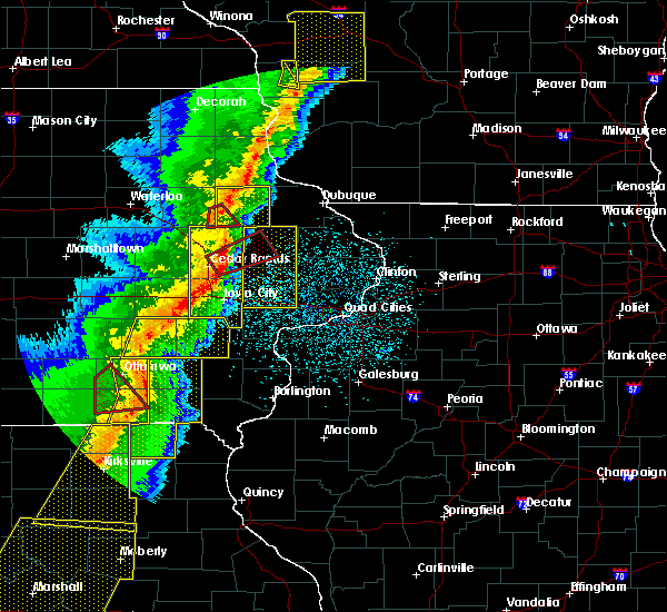 At 908 pm cst, a severe thunderstorm capable of producing a tornado was located near ryan, or 9 miles southwest of manchester, moving east at 45 mph (radar indicated rotation). Hazards include tornado. Flying debris will be dangerous to those caught without shelter. mobile homes will be damaged or destroyed. damage to roofs, windows, and vehicles will occur. tree damage is likely. This tornadic thunderstorm will remain over mainly rural areas of southeastern buchanan and southwestern delaware counties, including the following locations: monti and robinson. At 908 pm cst, a severe thunderstorm capable of producing a tornado was located near ryan, or 9 miles southwest of manchester, moving east at 45 mph (radar indicated rotation). Hazards include tornado. Flying debris will be dangerous to those caught without shelter. mobile homes will be damaged or destroyed. damage to roofs, windows, and vehicles will occur. tree damage is likely. This tornadic thunderstorm will remain over mainly rural areas of southeastern buchanan and southwestern delaware counties, including the following locations: monti and robinson.
|
| 3/6/2017 8:55 PM CST |
 At 855 pm cst, severe thunderstorms were located along a line extending from strawberry point to near dundee to center point to toddville to near parnell, moving northeast at 70 mph (radar indicated). Hazards include 70 mph wind gusts. Expect considerable tree damage. damage is likely to mobile homes, roofs, and outbuildings. locations impacted include, cedar rapids, iowa city, manchester, west branch, marion, coralville, north liberty, hiawatha, mount vernon, dyersville, robins, center point, lisbon, fairfax, solon, tiffin, ely, walford, lone tree and central city. this includes the following highways, interstate 80 in iowa between mile markers 230 and 253. interstate 380 between mile markers 1 and 39. a tornado watch remains in effect until 1000 pm cst for southeastern, northeastern and east central iowa. A tornado watch also remains in effect until 400 am cst for southeastern, northeastern and east central iowa. At 855 pm cst, severe thunderstorms were located along a line extending from strawberry point to near dundee to center point to toddville to near parnell, moving northeast at 70 mph (radar indicated). Hazards include 70 mph wind gusts. Expect considerable tree damage. damage is likely to mobile homes, roofs, and outbuildings. locations impacted include, cedar rapids, iowa city, manchester, west branch, marion, coralville, north liberty, hiawatha, mount vernon, dyersville, robins, center point, lisbon, fairfax, solon, tiffin, ely, walford, lone tree and central city. this includes the following highways, interstate 80 in iowa between mile markers 230 and 253. interstate 380 between mile markers 1 and 39. a tornado watch remains in effect until 1000 pm cst for southeastern, northeastern and east central iowa. A tornado watch also remains in effect until 400 am cst for southeastern, northeastern and east central iowa.
|
| 3/6/2017 8:52 PM CST |
 At 852 pm cst, a severe thunderstorm capable of producing a tornado was located near rowley, or 9 miles southeast of independence, moving east at 45 mph (radar indicated rotation). Hazards include tornado. Flying debris will be dangerous to those caught without shelter. mobile homes will be damaged or destroyed. damage to roofs, windows, and vehicles will occur. tree damage is likely. this dangerous storm will be near, masonville around 910 pm cst. ryan around 915 pm cst. Other locations impacted by this tornadic thunderstorm include monti and robinson. At 852 pm cst, a severe thunderstorm capable of producing a tornado was located near rowley, or 9 miles southeast of independence, moving east at 45 mph (radar indicated rotation). Hazards include tornado. Flying debris will be dangerous to those caught without shelter. mobile homes will be damaged or destroyed. damage to roofs, windows, and vehicles will occur. tree damage is likely. this dangerous storm will be near, masonville around 910 pm cst. ryan around 915 pm cst. Other locations impacted by this tornadic thunderstorm include monti and robinson.
|
| 3/6/2017 8:47 PM CST |
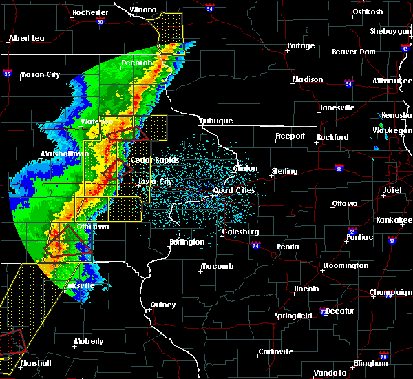 At 847 pm cst, a severe thunderstorm capable of producing a tornado was located near rowley, or 9 miles south of independence, moving east at 35 mph (radar indicated rotation). Hazards include tornado. Flying debris will be dangerous to those caught without shelter. mobile homes will be damaged or destroyed. damage to roofs, windows, and vehicles will occur. tree damage is likely. this dangerous storm will be near, rowley around 850 pm cst. quasqueton around 900 pm cst. masonville around 915 pm cst. ryan around 920 pm cst. Other locations impacted by this tornadic thunderstorm include monti and robinson. At 847 pm cst, a severe thunderstorm capable of producing a tornado was located near rowley, or 9 miles south of independence, moving east at 35 mph (radar indicated rotation). Hazards include tornado. Flying debris will be dangerous to those caught without shelter. mobile homes will be damaged or destroyed. damage to roofs, windows, and vehicles will occur. tree damage is likely. this dangerous storm will be near, rowley around 850 pm cst. quasqueton around 900 pm cst. masonville around 915 pm cst. ryan around 920 pm cst. Other locations impacted by this tornadic thunderstorm include monti and robinson.
|
| 3/6/2017 8:40 PM CST |
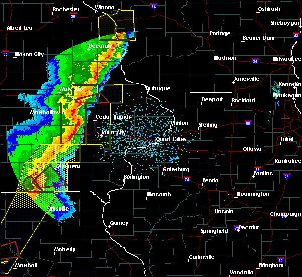 At 840 pm cst, a severe thunderstorm capable of producing a tornado was located over brandon, or 10 miles north of vinton, moving east at 35 mph (radar indicated rotation). Hazards include tornado. Flying debris will be dangerous to those caught without shelter. mobile homes will be damaged or destroyed. damage to roofs, windows, and vehicles will occur. tree damage is likely. this dangerous storm will be near, rowley around 850 pm cst. quasqueton around 900 pm cst. masonville around 915 pm cst. ryan around 920 pm cst. other locations impacted by this tornadic thunderstorm include lime creek county park, monti and robinson. This includes interstate 380 between mile markers 49 and 53. At 840 pm cst, a severe thunderstorm capable of producing a tornado was located over brandon, or 10 miles north of vinton, moving east at 35 mph (radar indicated rotation). Hazards include tornado. Flying debris will be dangerous to those caught without shelter. mobile homes will be damaged or destroyed. damage to roofs, windows, and vehicles will occur. tree damage is likely. this dangerous storm will be near, rowley around 850 pm cst. quasqueton around 900 pm cst. masonville around 915 pm cst. ryan around 920 pm cst. other locations impacted by this tornadic thunderstorm include lime creek county park, monti and robinson. This includes interstate 380 between mile markers 49 and 53.
|
| 3/6/2017 8:34 PM CST |
 At 832 pm cst, severe thunderstorms were located along a line extending from near arlington to near independence to near luzerne to near marengo to hayesville, moving east at 60 mph. the strongest part of this storm is located east of belle plaine heading towards cedar rapids. these are very dangerous storms! (emergency manager). Hazards include 90 mph wind gusts. You are in a life-threatening situation. flying debris may be deadly to those caught without shelter. mobile homes will be heavily damaged or destroyed. homes and businesses will have substantial roof and window damage. expect extensive tree damage and power outages. locations impacted include, cedar rapids, iowa city, manchester, west branch, marion, coralville, north liberty, hiawatha, mount vernon, dyersville, robins, center point, lisbon, fairfax, solon, tiffin, ely, walford, lone tree and central city. this includes the following highways, interstate 80 in iowa between mile markers 230 and 253. interstate 380 between mile markers 1 and 39. A tornado watch remains in effect until 1000 pm cst for southeastern, northeastern and east central iowa. At 832 pm cst, severe thunderstorms were located along a line extending from near arlington to near independence to near luzerne to near marengo to hayesville, moving east at 60 mph. the strongest part of this storm is located east of belle plaine heading towards cedar rapids. these are very dangerous storms! (emergency manager). Hazards include 90 mph wind gusts. You are in a life-threatening situation. flying debris may be deadly to those caught without shelter. mobile homes will be heavily damaged or destroyed. homes and businesses will have substantial roof and window damage. expect extensive tree damage and power outages. locations impacted include, cedar rapids, iowa city, manchester, west branch, marion, coralville, north liberty, hiawatha, mount vernon, dyersville, robins, center point, lisbon, fairfax, solon, tiffin, ely, walford, lone tree and central city. this includes the following highways, interstate 80 in iowa between mile markers 230 and 253. interstate 380 between mile markers 1 and 39. A tornado watch remains in effect until 1000 pm cst for southeastern, northeastern and east central iowa.
|
| 3/6/2017 8:29 PM CST |
 At 828 pm cst, severe thunderstorms were located along a line extending from near stanley to near brandon to near belle plaine to near ladora to near hedrick, moving east at 60 mph (radar indicated. at 826 pm cst, trained spotters reported a 70 mph wind gust at belle plaine). Hazards include 70 mph wind gusts. Expect considerable tree damage. Damage is likely to mobile homes, roofs, and outbuildings. At 828 pm cst, severe thunderstorms were located along a line extending from near stanley to near brandon to near belle plaine to near ladora to near hedrick, moving east at 60 mph (radar indicated. at 826 pm cst, trained spotters reported a 70 mph wind gust at belle plaine). Hazards include 70 mph wind gusts. Expect considerable tree damage. Damage is likely to mobile homes, roofs, and outbuildings.
|
| 8/28/2016 4:33 PM CDT |
 The national weather service in the quad cities has issued a * tornado warning for. southeastern buchanan county in northeastern iowa. north central linn county in east central iowa. southwestern delaware county in northeastern iowa. Until 500 pm cdt. The national weather service in the quad cities has issued a * tornado warning for. southeastern buchanan county in northeastern iowa. north central linn county in east central iowa. southwestern delaware county in northeastern iowa. Until 500 pm cdt.
|
| 8/4/2016 7:42 PM CDT | The severe thunderstorm warning for delaware county will expire at 745 pm cdt. the storms which prompted the warning have moved east out of the area. therefore the warning will be allowed to expire. However heavy rain is still possible with additional thunderstorms moving in from the west. |
| 8/4/2016 7:17 PM CDT |
 At 714 pm cdt, severe thunderstorms were located along a line extending from near colesburg to near ryan, moving southeast at 45 mph (radar indicated). Hazards include 60 mph wind gusts. Expect damage to roofs. siding. and trees. Locations impacted include, manchester, dyersville, edgewood, earlville, hopkinton, delhi, colesburg, ryan, greeley, dundee, delaware, masonville, oneida, turtle creek park, delaware county fairgrounds, petersburg, backbone state park, buck creek, manchester airport and twin bridges park. At 714 pm cdt, severe thunderstorms were located along a line extending from near colesburg to near ryan, moving southeast at 45 mph (radar indicated). Hazards include 60 mph wind gusts. Expect damage to roofs. siding. and trees. Locations impacted include, manchester, dyersville, edgewood, earlville, hopkinton, delhi, colesburg, ryan, greeley, dundee, delaware, masonville, oneida, turtle creek park, delaware county fairgrounds, petersburg, backbone state park, buck creek, manchester airport and twin bridges park.
|
| 8/4/2016 6:53 PM CDT |
 At 653 pm cdt, severe thunderstorms were located along a line extending from volga to near winthrop, moving southeast at 40 mph (radar indicated). Hazards include 60 mph wind gusts. Expect damage to roofs. siding. And trees. At 653 pm cdt, severe thunderstorms were located along a line extending from volga to near winthrop, moving southeast at 40 mph (radar indicated). Hazards include 60 mph wind gusts. Expect damage to roofs. siding. And trees.
|
| 7/23/2016 4:25 PM CDT |
 At 424 pm cdt, severe thunderstorms were located along a line extending from near earlville to near hopkinton to near central city, moving east at 40 mph. these are very dangerous storms (radar indicated. this storm has a history of significant wind damage with whole trees being blown down). Hazards include 80 mph wind gusts. Flying debris will be dangerous to those caught without shelter. mobile homes will be heavily damaged. expect considerable damage to roofs, windows, and vehicles. extensive tree damage and power outages are likely. Locations impacted include, anamosa, manchester, dyersville, monticello, central city, earlville, coggon, hopkinton, delhi, worthington, ryan, prairieburg, delaware, oneida, langworthy, paris, buffalo creek park, delaware county fairgrounds, buck creek and baileys ford park. At 424 pm cdt, severe thunderstorms were located along a line extending from near earlville to near hopkinton to near central city, moving east at 40 mph. these are very dangerous storms (radar indicated. this storm has a history of significant wind damage with whole trees being blown down). Hazards include 80 mph wind gusts. Flying debris will be dangerous to those caught without shelter. mobile homes will be heavily damaged. expect considerable damage to roofs, windows, and vehicles. extensive tree damage and power outages are likely. Locations impacted include, anamosa, manchester, dyersville, monticello, central city, earlville, coggon, hopkinton, delhi, worthington, ryan, prairieburg, delaware, oneida, langworthy, paris, buffalo creek park, delaware county fairgrounds, buck creek and baileys ford park.
|
| 7/23/2016 4:13 PM CDT |
 At 412 pm cdt, a severe thunderstorm capable of producing a tornado was located near delhi, or near manchester, moving east at 35 mph (radar indicated rotation). Hazards include tornado. Flying debris will be dangerous to those caught without shelter. mobile homes will be damaged or destroyed. damage to roofs, windows, and vehicles will occur. tree damage is likely. this dangerous storm will be near, earlville and hopkinton around 425 pm cdt. dyersville around 440 pm cdt. Other locations impacted by this tornadic thunderstorm include buck creek, turtle creek park, baileys ford park and delaware county fairgrounds. At 412 pm cdt, a severe thunderstorm capable of producing a tornado was located near delhi, or near manchester, moving east at 35 mph (radar indicated rotation). Hazards include tornado. Flying debris will be dangerous to those caught without shelter. mobile homes will be damaged or destroyed. damage to roofs, windows, and vehicles will occur. tree damage is likely. this dangerous storm will be near, earlville and hopkinton around 425 pm cdt. dyersville around 440 pm cdt. Other locations impacted by this tornadic thunderstorm include buck creek, turtle creek park, baileys ford park and delaware county fairgrounds.
|
| 7/23/2016 4:11 PM CDT |
 At 409 pm cdt, severe thunderstorms were located along a line extending from near oneida to near ryan to near paris, moving east at 40 mph. these are very dangerous storms (radar indicated. this storm has a history of significant wind damage with whole trees being blown down). Hazards include 80 mph wind gusts. Flying debris will be dangerous to those caught without shelter. mobile homes will be heavily damaged. expect considerable damage to roofs, windows, and vehicles. extensive tree damage and power outages are likely. Locations impacted include, anamosa, manchester, dyersville, monticello, central city, earlville, walker, coggon, hopkinton, delhi, worthington, ryan, prairieburg, dundee, delaware, masonville, oneida, troy mills, langworthy and paris. At 409 pm cdt, severe thunderstorms were located along a line extending from near oneida to near ryan to near paris, moving east at 40 mph. these are very dangerous storms (radar indicated. this storm has a history of significant wind damage with whole trees being blown down). Hazards include 80 mph wind gusts. Flying debris will be dangerous to those caught without shelter. mobile homes will be heavily damaged. expect considerable damage to roofs, windows, and vehicles. extensive tree damage and power outages are likely. Locations impacted include, anamosa, manchester, dyersville, monticello, central city, earlville, walker, coggon, hopkinton, delhi, worthington, ryan, prairieburg, dundee, delaware, masonville, oneida, troy mills, langworthy and paris.
|
| 7/23/2016 4:00 PM CDT |
 At 400 pm cdt, a severe thunderstorm capable of producing a tornado was located near masonville, or near manchester, moving east at 35 mph (radar indicated rotation). Hazards include tornado. Flying debris will be dangerous to those caught without shelter. mobile homes will be damaged or destroyed. damage to roofs, windows, and vehicles will occur. tree damage is likely. this dangerous storm will be near, manchester and ryan around 405 pm cdt. delaware around 415 pm cdt. delhi around 420 pm cdt. earlville around 425 pm cdt. hopkinton around 430 pm cdt. dyersville around 440 pm cdt. Other locations impacted by this tornadic thunderstorm include coffins grove park, turtle creek park, baileys ford park, delaware county fairgrounds, buck creek, manchester airport, robinson and oneida. At 400 pm cdt, a severe thunderstorm capable of producing a tornado was located near masonville, or near manchester, moving east at 35 mph (radar indicated rotation). Hazards include tornado. Flying debris will be dangerous to those caught without shelter. mobile homes will be damaged or destroyed. damage to roofs, windows, and vehicles will occur. tree damage is likely. this dangerous storm will be near, manchester and ryan around 405 pm cdt. delaware around 415 pm cdt. delhi around 420 pm cdt. earlville around 425 pm cdt. hopkinton around 430 pm cdt. dyersville around 440 pm cdt. Other locations impacted by this tornadic thunderstorm include coffins grove park, turtle creek park, baileys ford park, delaware county fairgrounds, buck creek, manchester airport, robinson and oneida.
|
| 7/23/2016 3:52 PM CDT |
 At 351 pm cdt, severe thunderstorms were located along a line extending from dundee to near ryan to near center point, moving east at 35 mph (radar indicated). Hazards include 70 mph wind gusts. Expect considerable tree damage. Damage is likely to mobile homes, roofs, and outbuildings. At 351 pm cdt, severe thunderstorms were located along a line extending from dundee to near ryan to near center point, moving east at 35 mph (radar indicated). Hazards include 70 mph wind gusts. Expect considerable tree damage. Damage is likely to mobile homes, roofs, and outbuildings.
|
| 7/17/2016 5:18 AM CDT |
 At 518 am cdt, a severe thunderstorm was located over manchester, moving east at 60 mph (radar indicated). Hazards include 60 mph wind gusts. Expect damage to roofs. siding. and trees. Locations impacted include, dubuque, manchester, asbury, dyersville, cascade, epworth, east dubuque, farley, peosta, edgewood, earlville, hopkinton, delhi, new vienna, colesburg, worthington, holy cross, ryan, greeley and luxemburg. At 518 am cdt, a severe thunderstorm was located over manchester, moving east at 60 mph (radar indicated). Hazards include 60 mph wind gusts. Expect damage to roofs. siding. and trees. Locations impacted include, dubuque, manchester, asbury, dyersville, cascade, epworth, east dubuque, farley, peosta, edgewood, earlville, hopkinton, delhi, new vienna, colesburg, worthington, holy cross, ryan, greeley and luxemburg.
|
| 7/17/2016 5:17 AM CDT |
 At 517 am cdt, severe thunderstorms were located along a line extending from near troy mills to near norway to 7 miles north of new sharon, moving southeast at 60 mph (radar indicated). Hazards include 60 mph wind gusts. Expect damage to roofs. siding. and trees. Locations impacted include, cedar rapids, iowa city, marengo, marion, coralville, north liberty, hiawatha, mount vernon, robins, williamsburg, belle plaine, center point, lisbon, fairfax, solon, tiffin, ely, atkins, walford and central city. At 517 am cdt, severe thunderstorms were located along a line extending from near troy mills to near norway to 7 miles north of new sharon, moving southeast at 60 mph (radar indicated). Hazards include 60 mph wind gusts. Expect damage to roofs. siding. and trees. Locations impacted include, cedar rapids, iowa city, marengo, marion, coralville, north liberty, hiawatha, mount vernon, robins, williamsburg, belle plaine, center point, lisbon, fairfax, solon, tiffin, ely, atkins, walford and central city.
|
| 7/17/2016 5:10 AM CDT |
 At 510 am cdt, a severe thunderstorm was located over masonville, or near manchester, moving east at 60 mph (radar indicated). Hazards include 60 mph wind gusts. Expect damage to roofs. siding. And trees. At 510 am cdt, a severe thunderstorm was located over masonville, or near manchester, moving east at 60 mph (radar indicated). Hazards include 60 mph wind gusts. Expect damage to roofs. siding. And trees.
|
| 7/17/2016 5:03 AM CDT |
 At 502 am cdt, severe thunderstorms were located along a line extending from near quasqueton to near van horne to near iowa speedway, moving southeast at 50 mph (radar indicated). Hazards include 60 mph wind gusts. Expect damage to roofs. siding. and trees. Locations impacted include, cedar rapids, iowa city, independence, vinton, marengo, marion, coralville, north liberty, hiawatha, mount vernon, robins, williamsburg, belle plaine, jesup, center point, lisbon, fairfax, solon, tiffin and ely. At 502 am cdt, severe thunderstorms were located along a line extending from near quasqueton to near van horne to near iowa speedway, moving southeast at 50 mph (radar indicated). Hazards include 60 mph wind gusts. Expect damage to roofs. siding. and trees. Locations impacted include, cedar rapids, iowa city, independence, vinton, marengo, marion, coralville, north liberty, hiawatha, mount vernon, robins, williamsburg, belle plaine, jesup, center point, lisbon, fairfax, solon, tiffin and ely.
|
| 7/17/2016 4:37 AM CDT |
 At 436 am cdt, severe thunderstorms were located along a line extending from near waterloo to near toledo to near bondurant, moving southeast at 60 mph (radar indicated). Hazards include 60 mph wind gusts. Expect damage to roofs. siding. And trees. At 436 am cdt, severe thunderstorms were located along a line extending from near waterloo to near toledo to near bondurant, moving southeast at 60 mph (radar indicated). Hazards include 60 mph wind gusts. Expect damage to roofs. siding. And trees.
|
| 7/6/2016 2:53 AM CDT |
 At 253 am cdt, a severe thunderstorm was located over monticello, or 11 miles northeast of anamosa, moving east at 60 mph (radar indicated). Hazards include 70 mph wind gusts. Expect considerable tree damage. damage is likely to mobile homes, roofs, and outbuildings. Locations impacted include, dubuque, manchester, galena, asbury, dyersville, monticello, cascade, epworth, east dubuque, farley, peosta, central city, earlville, coggon, hopkinton, delhi, andrew, new vienna, colesburg and worthington. At 253 am cdt, a severe thunderstorm was located over monticello, or 11 miles northeast of anamosa, moving east at 60 mph (radar indicated). Hazards include 70 mph wind gusts. Expect considerable tree damage. damage is likely to mobile homes, roofs, and outbuildings. Locations impacted include, dubuque, manchester, galena, asbury, dyersville, monticello, cascade, epworth, east dubuque, farley, peosta, central city, earlville, coggon, hopkinton, delhi, andrew, new vienna, colesburg and worthington.
|
| 7/6/2016 2:46 AM CDT |
 At 246 am cdt, a severe thunderstorm was located near prairieburg, or 10 miles north of anamosa, moving east at 70 mph (radar indicated). Hazards include 70 mph wind gusts and penny size hail. Expect considerable tree damage. Damage is likely to mobile homes, roofs, and outbuildings. At 246 am cdt, a severe thunderstorm was located near prairieburg, or 10 miles north of anamosa, moving east at 70 mph (radar indicated). Hazards include 70 mph wind gusts and penny size hail. Expect considerable tree damage. Damage is likely to mobile homes, roofs, and outbuildings.
|
| 6/14/2016 8:25 PM CDT |
 At 824 pm cdt, severe thunderstorms were located along a line extending from near edgewood to near delhi, moving east at 40 mph (radar indicated). Hazards include 60 mph wind gusts. Expect damage to roofs. siding. and trees. Locations impacted include, manchester, dyersville, edgewood, earlville, hopkinton, delhi, colesburg, ryan, greeley, dundee, delaware, masonville, oneida, turtle creek park, delaware county fairgrounds, petersburg, backbone state park, buck creek, manchester airport and robinson. At 824 pm cdt, severe thunderstorms were located along a line extending from near edgewood to near delhi, moving east at 40 mph (radar indicated). Hazards include 60 mph wind gusts. Expect damage to roofs. siding. and trees. Locations impacted include, manchester, dyersville, edgewood, earlville, hopkinton, delhi, colesburg, ryan, greeley, dundee, delaware, masonville, oneida, turtle creek park, delaware county fairgrounds, petersburg, backbone state park, buck creek, manchester airport and robinson.
|
| 6/14/2016 8:11 PM CDT |
 At 811 pm cdt, a severe thunderstorm was located over masonville, or near manchester, moving east at 30 mph (radar indicated). Hazards include 60 mph wind gusts. Expect damage to roofs. siding. and trees. Locations impacted include, manchester, dyersville, edgewood, winthrop, earlville, hopkinton, quasqueton, lamont, delhi, colesburg, ryan, greeley, aurora, dundee, delaware, masonville, stanley, oneida, delaware county fairgrounds and petersburg. At 811 pm cdt, a severe thunderstorm was located over masonville, or near manchester, moving east at 30 mph (radar indicated). Hazards include 60 mph wind gusts. Expect damage to roofs. siding. and trees. Locations impacted include, manchester, dyersville, edgewood, winthrop, earlville, hopkinton, quasqueton, lamont, delhi, colesburg, ryan, greeley, aurora, dundee, delaware, masonville, stanley, oneida, delaware county fairgrounds and petersburg.
|
| 6/14/2016 7:58 PM CDT |
 At 758 pm cdt, a severe thunderstorm was located over winthrop, or 9 miles east of independence, moving east at 30 mph (radar indicated). Hazards include 60 mph wind gusts. Expect damage to roofs. siding. And trees. At 758 pm cdt, a severe thunderstorm was located over winthrop, or 9 miles east of independence, moving east at 30 mph (radar indicated). Hazards include 60 mph wind gusts. Expect damage to roofs. siding. And trees.
|
| 6/22/2015 9:11 AM CDT |
 The severe thunderstorm warning for dubuque and delaware counties will expire at 915 am cdt, the storms which prompted the warning have moved out of the area. therefore the warning will be allowed to expire. however gusty winds and heavy rain are still possible with these thunderstorms. remember, a severe thunderstorm warning still remains in effect for eastern dubuque county until 10 am!. The severe thunderstorm warning for dubuque and delaware counties will expire at 915 am cdt, the storms which prompted the warning have moved out of the area. therefore the warning will be allowed to expire. however gusty winds and heavy rain are still possible with these thunderstorms. remember, a severe thunderstorm warning still remains in effect for eastern dubuque county until 10 am!.
|
| 6/22/2015 9:04 AM CDT |
 At 903 am cdt, severe thunderstorms were located along a line extending from 6 miles north of sherrill to near hopkinton, moving east at 65 mph. these are very dangerous storms (trained weather spotters). Hazards include 80 mph wind gusts and penny size hail. Flying debris will be dangerous to those caught without shelter. mobile homes will be heavily damaged. expect considerable damage to roofs, windows and vehicles. extensive tree damage and power outages are likely. Locations impacted include, manchester, dyersville, cascade, epworth, farley, peosta, earlville, hopkinton, delhi, new vienna, colesburg, worthington, holy cross, ryan, greeley, luxemburg, rickardsville, sherrill, dundee and delaware. At 903 am cdt, severe thunderstorms were located along a line extending from 6 miles north of sherrill to near hopkinton, moving east at 65 mph. these are very dangerous storms (trained weather spotters). Hazards include 80 mph wind gusts and penny size hail. Flying debris will be dangerous to those caught without shelter. mobile homes will be heavily damaged. expect considerable damage to roofs, windows and vehicles. extensive tree damage and power outages are likely. Locations impacted include, manchester, dyersville, cascade, epworth, farley, peosta, earlville, hopkinton, delhi, new vienna, colesburg, worthington, holy cross, ryan, greeley, luxemburg, rickardsville, sherrill, dundee and delaware.
|
| 6/22/2015 8:52 AM CDT |
 At 850 am cdt, severe thunderstorms were located along a line extending from near cassville to near ryan, moving east at 70 mph. these are very dangerous storms (radar indicated). Hazards include 80 mph wind gusts and penny size hail. Flying debris will be dangerous to those caught without shelter. mobile homes will be heavily damaged. expect considerable damage to roofs, windows and vehicles. extensive tree damage and power outages are likely. Locations impacted include, manchester, dyersville, cascade, epworth, farley, peosta, earlville, hopkinton, delhi, new vienna, colesburg, worthington, holy cross, ryan, greeley, luxemburg, rickardsville, sherrill, dundee and delaware. At 850 am cdt, severe thunderstorms were located along a line extending from near cassville to near ryan, moving east at 70 mph. these are very dangerous storms (radar indicated). Hazards include 80 mph wind gusts and penny size hail. Flying debris will be dangerous to those caught without shelter. mobile homes will be heavily damaged. expect considerable damage to roofs, windows and vehicles. extensive tree damage and power outages are likely. Locations impacted include, manchester, dyersville, cascade, epworth, farley, peosta, earlville, hopkinton, delhi, new vienna, colesburg, worthington, holy cross, ryan, greeley, luxemburg, rickardsville, sherrill, dundee and delaware.
|
| 6/22/2015 8:42 AM CDT |
 At 842 am cdt, severe thunderstorms were located along a line extending from near colesburg to near quasqueton, moving east at 75 mph. these are very dangerous storms (radar indicated). Hazards include 80 mph wind gusts and penny size hail. Flying debris will be dangerous to those caught without shelter. mobile homes will be heavily damaged. expect considerable damage to roofs, windows and vehicles. extensive tree damage and power outages are likely. Locations impacted include, manchester, dyersville, cascade, epworth, farley, peosta, earlville, hopkinton, delhi, new vienna, colesburg, worthington, holy cross, ryan, greeley, luxemburg, rickardsville, sherrill, dundee and delaware. At 842 am cdt, severe thunderstorms were located along a line extending from near colesburg to near quasqueton, moving east at 75 mph. these are very dangerous storms (radar indicated). Hazards include 80 mph wind gusts and penny size hail. Flying debris will be dangerous to those caught without shelter. mobile homes will be heavily damaged. expect considerable damage to roofs, windows and vehicles. extensive tree damage and power outages are likely. Locations impacted include, manchester, dyersville, cascade, epworth, farley, peosta, earlville, hopkinton, delhi, new vienna, colesburg, worthington, holy cross, ryan, greeley, luxemburg, rickardsville, sherrill, dundee and delaware.
|
| 6/22/2015 8:34 AM CDT |
 At 834 am cdt, severe thunderstorms were located along a line extending from near arlington to near independence, moving east at 65 mph. these are very dangerous storms (radar indicated). Hazards include 80 mph wind gusts and penny size hail. Flying debris will be dangerous to those caught without shelter. mobile homes will be heavily damaged. expect considerable damage to roofs, windows and vehicles. Extensive tree damage and power outages are likely. At 834 am cdt, severe thunderstorms were located along a line extending from near arlington to near independence, moving east at 65 mph. these are very dangerous storms (radar indicated). Hazards include 80 mph wind gusts and penny size hail. Flying debris will be dangerous to those caught without shelter. mobile homes will be heavily damaged. expect considerable damage to roofs, windows and vehicles. Extensive tree damage and power outages are likely.
|
| 5/3/2015 10:25 PM CDT | At 1024 pm cdt, a severe thunderstorm was located near ryan, or 9 miles southwest of manchester, moving east at 45 mph (radar indicated). Hazards include 60 mph wind gusts and penny size hail. Expect damage to roofs. Siding and trees. |
| 5/19/2013 11:15 PM CDT | Sheriff department reported a camper on top of a truck on 300th street. time estimated from rada in delaware county IA, 3.9 miles E of Ryan, IA |
| 4/29/2013 10:00 AM CDT | Quarter sized hail reported 0.2 miles W of Ryan, IA, mostly nickle with a few quarter size |
| 8/4/2012 1:16 PM CDT | Estimated 60 to 70 mph winds. relayed by delaware county sheriffs offic in delaware county IA, 5.3 miles W of Ryan, IA |
| 7/25/2012 9:52 PM CDT | Report relayed by the emergency manager in delaware county IA, 0.9 miles E of Ryan, IA |
Hail Maps for Ryan, IA
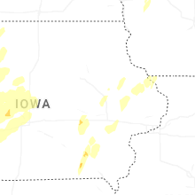


Connect with Interactive Hail Maps