

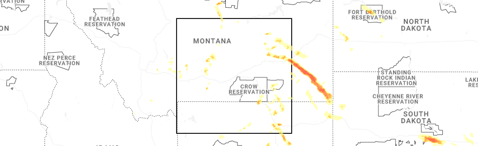
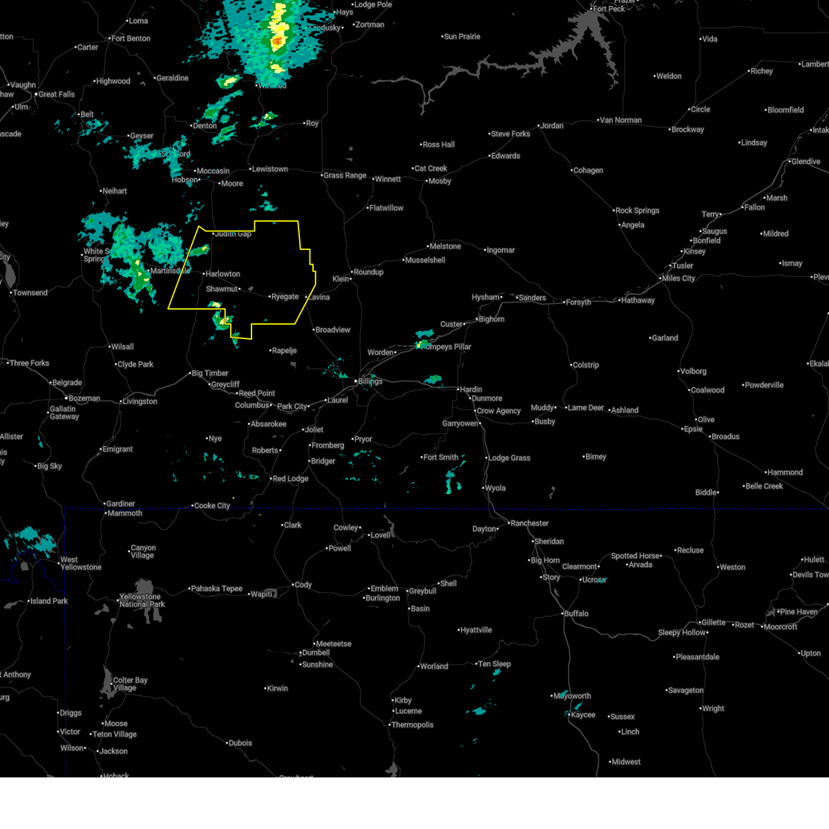
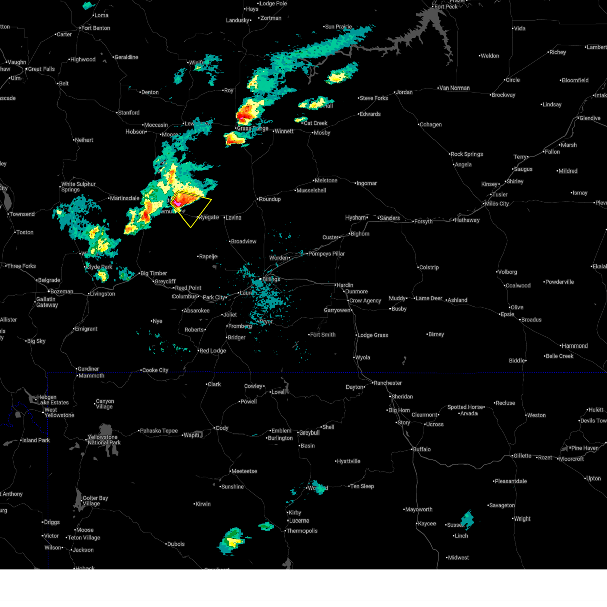
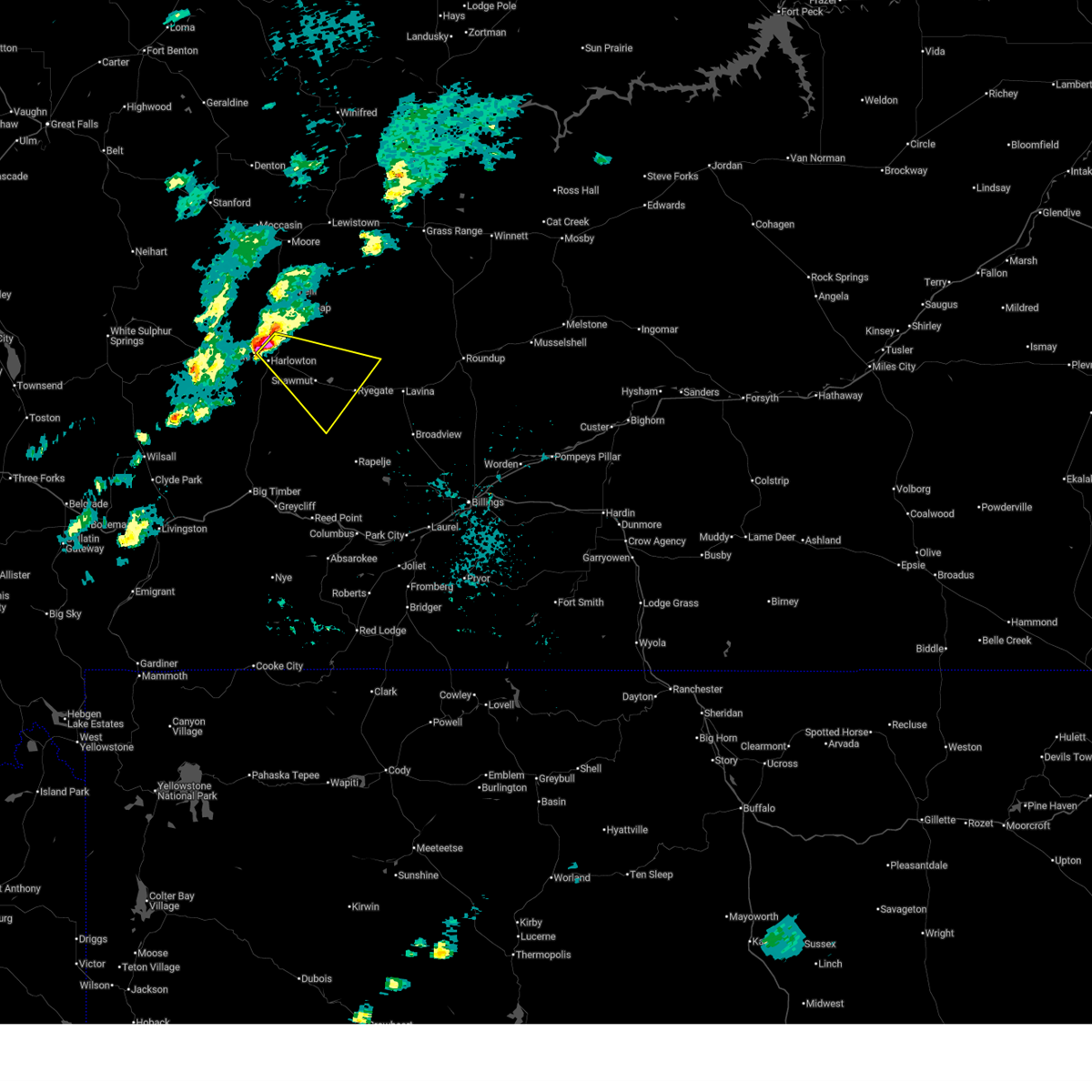
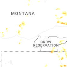
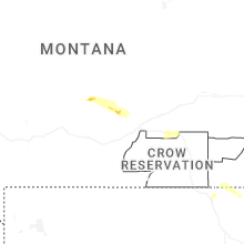
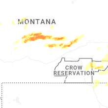
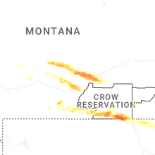
Hail Map for Ryegate, MT
The Ryegate, MT area has had 14 reports of on-the-ground hail by trained spotters, and has been under severe weather warnings 4 times during the past 12 months. Doppler radar has detected hail at or near Ryegate, MT on 31 occasions, including 3 occasions during the past year.
| Name: | Ryegate, MT |
| Where Located: | 50.4 miles NW of Billings, MT |
| Map: | Google Map for Ryegate, MT |
| Population: | 245 |
| Housing Units: | 145 |
| More Info: | Search Google for Ryegate, MT |
0
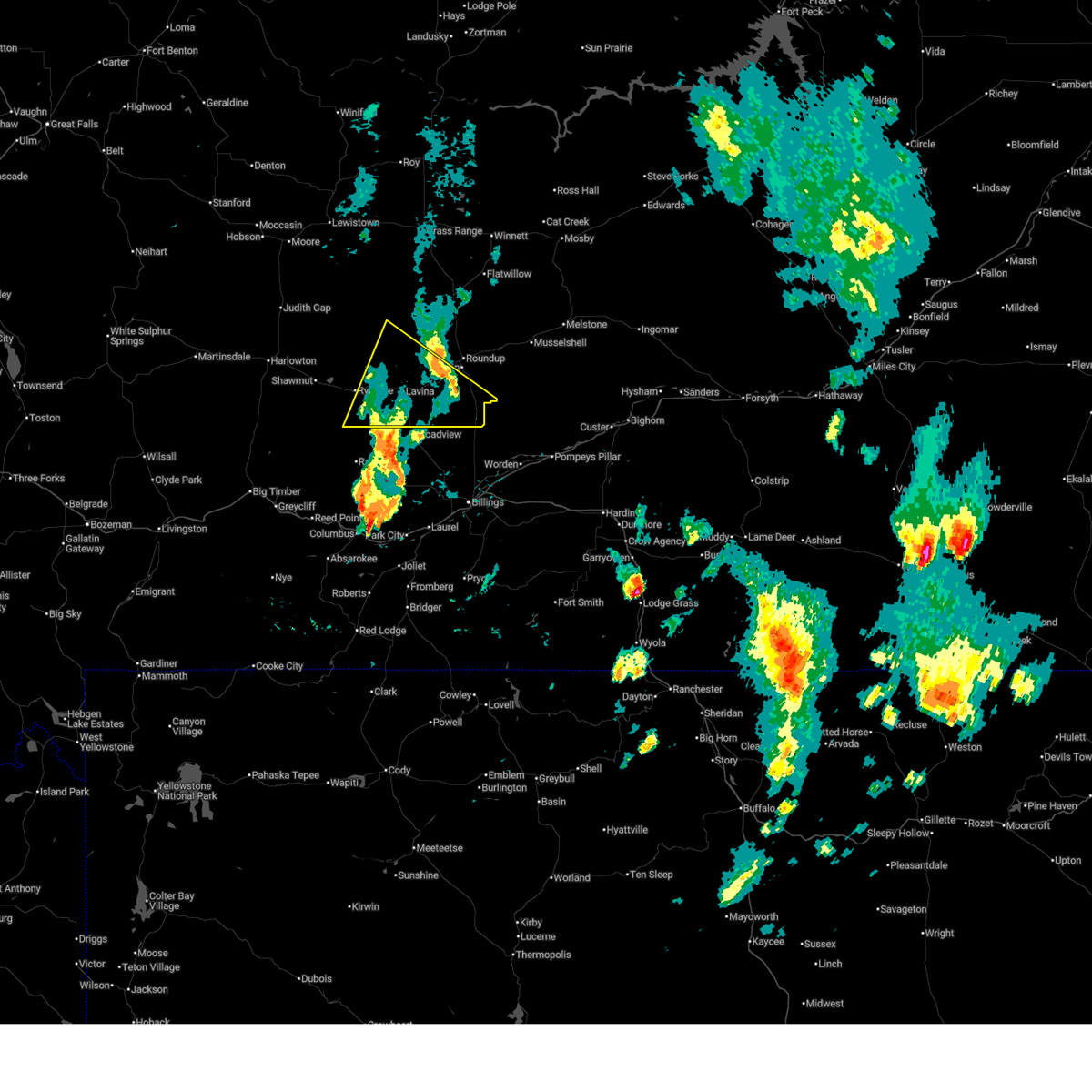
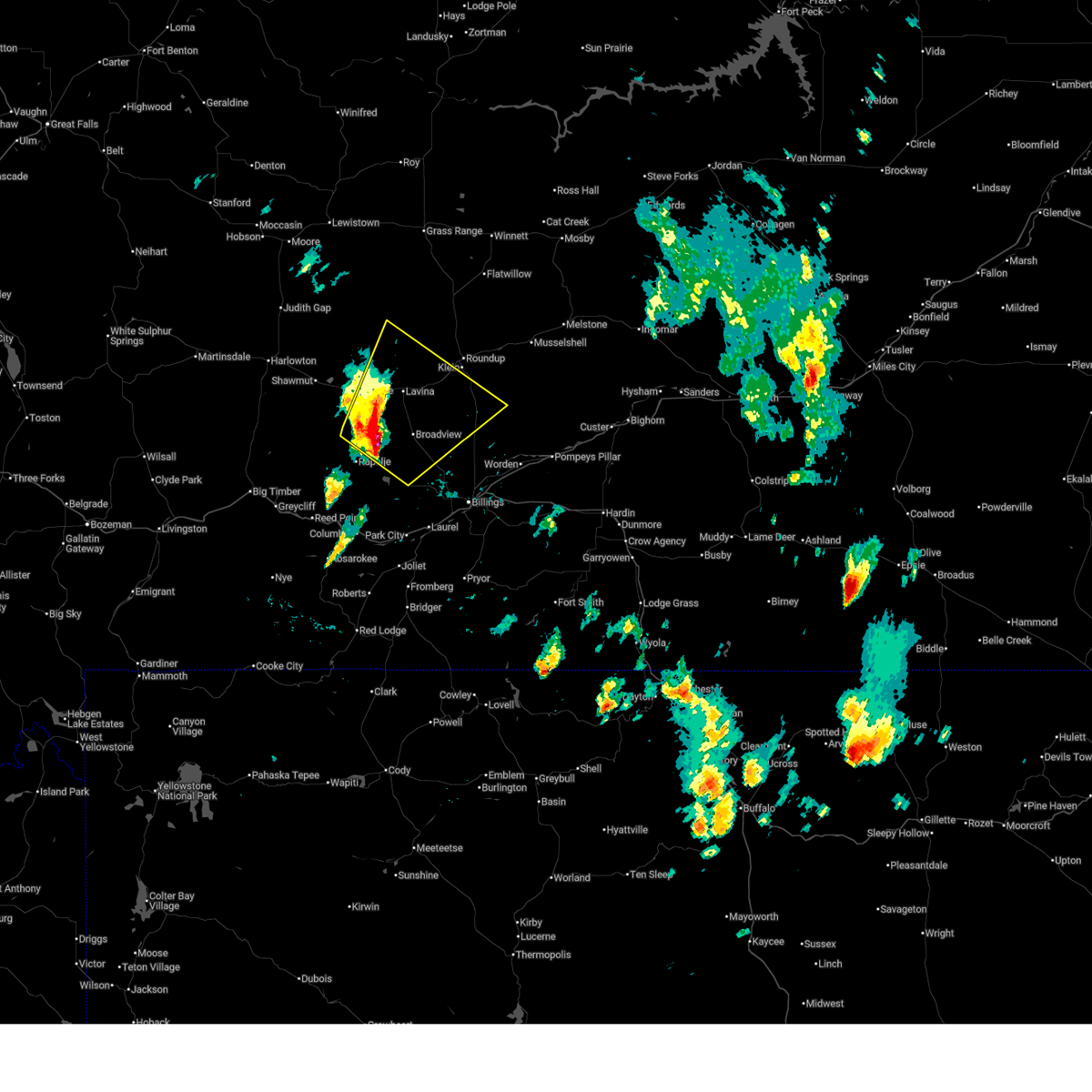
The Top Recent Hail Date for Ryegate, MT is Tuesday, July 29, 2025 (31st out of 31)
Hail and Wind Damage Spotted near Ryegate, MT
| Date / Time | Report Details |
|---|---|
| 6/7/2026 3:35 PM MDT |
 The storm which prompted the warning has weakened below severe limits, and no longer poses an immediate threat to life or property. therefore, the warning will be allowed to expire. however, gusty winds are still possible with this thunderstorm. The storm which prompted the warning has weakened below severe limits, and no longer poses an immediate threat to life or property. therefore, the warning will be allowed to expire. however, gusty winds are still possible with this thunderstorm.
|
| 6/7/2026 3:12 PM MDT |
 At 312 pm mdt, a severe thunderstorm was located 21 miles southwest of roundup, moving northeast at 35 mph (radar indicated). Hazards include 60 mph wind gusts and small hail. Expect damage to roofs, siding, and trees. Locations impacted include, lavina. At 312 pm mdt, a severe thunderstorm was located 21 miles southwest of roundup, moving northeast at 35 mph (radar indicated). Hazards include 60 mph wind gusts and small hail. Expect damage to roofs, siding, and trees. Locations impacted include, lavina.
|
| 6/7/2026 2:45 PM MDT |
 Svrbyz the national weather service in billings has issued a * severe thunderstorm warning for, eastern golden valley county in central montana, southwestern musselshell county in central montana, northeastern stillwater county in south central montana, northwestern yellowstone county in south central montana, * until 345 pm mdt. * at 245 pm mdt, a severe thunderstorm was located 17 miles southeast of ryegate, or 32 miles north of columbus, moving northeast at 35 mph (radar indicated). Hazards include 60 mph wind gusts and quarter size hail. Hail damage to vehicles is expected. Expect wind damage to roofs, siding, and trees. Svrbyz the national weather service in billings has issued a * severe thunderstorm warning for, eastern golden valley county in central montana, southwestern musselshell county in central montana, northeastern stillwater county in south central montana, northwestern yellowstone county in south central montana, * until 345 pm mdt. * at 245 pm mdt, a severe thunderstorm was located 17 miles southeast of ryegate, or 32 miles north of columbus, moving northeast at 35 mph (radar indicated). Hazards include 60 mph wind gusts and quarter size hail. Hail damage to vehicles is expected. Expect wind damage to roofs, siding, and trees.
|
| 5/13/2026 4:41 PM MDT |
 Svrbyz the national weather service in billings has issued a * severe thunderstorm warning for, golden valley county in central montana, wheatland county in central montana, * until 545 pm mdt. * at 441 pm mdt, showers and thunderstorms producing strong winds were located along a line from 11 miles southwest of harlowton to 15 miles south of ryegate, moving northeast at 50 mph (radar indicated). Hazards include 60 to 70 mph wind gusts. Expect tree damage. Damage is likely to mobile homes, roofs, and outbuildings. Svrbyz the national weather service in billings has issued a * severe thunderstorm warning for, golden valley county in central montana, wheatland county in central montana, * until 545 pm mdt. * at 441 pm mdt, showers and thunderstorms producing strong winds were located along a line from 11 miles southwest of harlowton to 15 miles south of ryegate, moving northeast at 50 mph (radar indicated). Hazards include 60 to 70 mph wind gusts. Expect tree damage. Damage is likely to mobile homes, roofs, and outbuildings.
|
| 6/16/2025 3:18 PM MDT |
 At 318 pm mdt, a severe thunderstorm was located 7 miles south of deadmans basin reservoir, or 24 miles southeast of harlowton, moving east at 25 mph (radar indicated). Hazards include 60 mph wind gusts and half dollar size hail. Hail damage to vehicles is expected. expect wind damage to roofs, siding, and trees. Locations impacted include, ryegate and deadmans basin reservoir. At 318 pm mdt, a severe thunderstorm was located 7 miles south of deadmans basin reservoir, or 24 miles southeast of harlowton, moving east at 25 mph (radar indicated). Hazards include 60 mph wind gusts and half dollar size hail. Hail damage to vehicles is expected. expect wind damage to roofs, siding, and trees. Locations impacted include, ryegate and deadmans basin reservoir.
|
| 6/16/2025 3:02 PM MDT |
 Svrbyz the national weather service in billings has issued a * severe thunderstorm warning for, southwestern golden valley county in central montana, southeastern wheatland county in central montana, * until 345 pm mdt. * at 302 pm mdt, a severe thunderstorm was located 10 miles southwest of deadmans basin reservoir, or 20 miles southeast of harlowton, moving east at 25 mph (radar indicated). Hazards include 60 mph wind gusts and quarter size hail. Hail damage to vehicles is expected. Expect wind damage to roofs, siding, and trees. Svrbyz the national weather service in billings has issued a * severe thunderstorm warning for, southwestern golden valley county in central montana, southeastern wheatland county in central montana, * until 345 pm mdt. * at 302 pm mdt, a severe thunderstorm was located 10 miles southwest of deadmans basin reservoir, or 20 miles southeast of harlowton, moving east at 25 mph (radar indicated). Hazards include 60 mph wind gusts and quarter size hail. Hail damage to vehicles is expected. Expect wind damage to roofs, siding, and trees.
|
| 6/13/2025 4:20 PM MDT | Hen Egg sized hail reported 0.3 miles SSW of Ryegate, MT, time estimated by radar. |
| 6/13/2025 4:11 PM MDT |
 Svrbyz the national weather service in billings has issued a * severe thunderstorm warning for, southeastern golden valley county in central montana, southwestern musselshell county in central montana, southeastern wheatland county in central montana, northeastern stillwater county in south central montana, west central yellowstone county in south central montana, * until 515 pm mdt. * at 411 pm mdt, a severe thunderstorm was located near ryegate, or 32 miles east of harlowton, moving southeast at 35 mph (radar indicated). Hazards include two inch hail and 70 mph wind gusts. People and animals outdoors will be injured. expect hail damage to roofs, siding, windows, and vehicles. expect considerable tree damage. Wind damage is also likely to mobile homes, roofs, and outbuildings. Svrbyz the national weather service in billings has issued a * severe thunderstorm warning for, southeastern golden valley county in central montana, southwestern musselshell county in central montana, southeastern wheatland county in central montana, northeastern stillwater county in south central montana, west central yellowstone county in south central montana, * until 515 pm mdt. * at 411 pm mdt, a severe thunderstorm was located near ryegate, or 32 miles east of harlowton, moving southeast at 35 mph (radar indicated). Hazards include two inch hail and 70 mph wind gusts. People and animals outdoors will be injured. expect hail damage to roofs, siding, windows, and vehicles. expect considerable tree damage. Wind damage is also likely to mobile homes, roofs, and outbuildings.
|
| 6/13/2025 3:44 PM MDT |
 At 344 pm mdt, a severe thunderstorm was located over deadmans basin reservoir, or 21 miles east of harlowton, moving east at 30 mph (radar indicated). Hazards include two inch hail and 70 mph wind gusts. People and animals outdoors will be injured. expect hail damage to roofs, siding, windows, and vehicles. expect considerable tree damage. wind damage is also likely to mobile homes, roofs, and outbuildings. Locations impacted include, ryegate, deadmans basin reservoir and franklin. At 344 pm mdt, a severe thunderstorm was located over deadmans basin reservoir, or 21 miles east of harlowton, moving east at 30 mph (radar indicated). Hazards include two inch hail and 70 mph wind gusts. People and animals outdoors will be injured. expect hail damage to roofs, siding, windows, and vehicles. expect considerable tree damage. wind damage is also likely to mobile homes, roofs, and outbuildings. Locations impacted include, ryegate, deadmans basin reservoir and franklin.
|
| 6/13/2025 3:08 PM MDT |
 Svrbyz the national weather service in billings has issued a * severe thunderstorm warning for, southwestern golden valley county in central montana, southeastern wheatland county in central montana, * until 415 pm mdt. * at 308 pm mdt, a severe thunderstorm was located near harlowton, moving east at 30 mph (radar indicated). Hazards include tennis ball size hail and 70 mph wind gusts. People and animals outdoors will be injured. expect hail damage to roofs, siding, windows, and vehicles. expect considerable tree damage. Wind damage is also likely to mobile homes, roofs, and outbuildings. Svrbyz the national weather service in billings has issued a * severe thunderstorm warning for, southwestern golden valley county in central montana, southeastern wheatland county in central montana, * until 415 pm mdt. * at 308 pm mdt, a severe thunderstorm was located near harlowton, moving east at 30 mph (radar indicated). Hazards include tennis ball size hail and 70 mph wind gusts. People and animals outdoors will be injured. expect hail damage to roofs, siding, windows, and vehicles. expect considerable tree damage. Wind damage is also likely to mobile homes, roofs, and outbuildings.
|
| 7/10/2023 7:30 PM MDT | Storm damage reported in stillwater county MT, 17.7 miles N of Ryegate, MT |
| 9/7/2022 3:45 PM MDT | Storm damage reported in stillwater county MT, 17.7 miles N of Ryegate, MT |
| 7/24/2022 5:51 PM MDT |
 At 551 pm mdt, a severe thunderstorm was located 21 miles northwest of laurel, or 21 miles northeast of columbus, and is moving east northeastward at 5 mph (radar indicated). Hazards include 60 mph wind gusts and quarter size hail. Hail damage to vehicles is expected. Expect wind damage to roofs, siding, and trees. At 551 pm mdt, a severe thunderstorm was located 21 miles northwest of laurel, or 21 miles northeast of columbus, and is moving east northeastward at 5 mph (radar indicated). Hazards include 60 mph wind gusts and quarter size hail. Hail damage to vehicles is expected. Expect wind damage to roofs, siding, and trees.
|
| 7/7/2022 5:27 PM MDT |
 At 527 pm mdt, a severe thunderstorm was located 10 miles south of deadmans basin reservoir, or 23 miles southeast of harlowton, moving east at 10 mph (radar indicated). Hazards include 60 mph wind gusts and quarter size hail. Hail damage to vehicles is expected. expect wind damage to roofs, siding, and trees. locations impacted include, ryegate, deadmans basin reservoir, franklin and shawmut. hail threat, radar indicated max hail size, 1. 00 in wind threat, radar indicated max wind gust, 60 mph. At 527 pm mdt, a severe thunderstorm was located 10 miles south of deadmans basin reservoir, or 23 miles southeast of harlowton, moving east at 10 mph (radar indicated). Hazards include 60 mph wind gusts and quarter size hail. Hail damage to vehicles is expected. expect wind damage to roofs, siding, and trees. locations impacted include, ryegate, deadmans basin reservoir, franklin and shawmut. hail threat, radar indicated max hail size, 1. 00 in wind threat, radar indicated max wind gust, 60 mph.
|
| 7/7/2022 5:05 PM MDT |
 At 505 pm mdt, a severe thunderstorm was located 12 miles southwest of deadmans basin reservoir, or 22 miles southeast of harlowton, moving east at 10 mph (radar indicated). Hazards include 60 mph wind gusts and quarter size hail. Hail damage to vehicles is expected. Expect wind damage to roofs, siding, and trees. At 505 pm mdt, a severe thunderstorm was located 12 miles southwest of deadmans basin reservoir, or 22 miles southeast of harlowton, moving east at 10 mph (radar indicated). Hazards include 60 mph wind gusts and quarter size hail. Hail damage to vehicles is expected. Expect wind damage to roofs, siding, and trees.
|
| 9/3/2021 4:42 PM MDT |
 At 442 pm mdt, a severe thunderstorm was located near ryegate, or 25 miles east of harlowton, moving southeast at 20 mph (radar indicated). Hazards include 60 mph wind gusts and quarter size hail. Hail damage to vehicles is expected. Expect wind damage to roofs, siding, and trees. At 442 pm mdt, a severe thunderstorm was located near ryegate, or 25 miles east of harlowton, moving southeast at 20 mph (radar indicated). Hazards include 60 mph wind gusts and quarter size hail. Hail damage to vehicles is expected. Expect wind damage to roofs, siding, and trees.
|
| 9/3/2021 4:25 PM MDT |
 At 425 pm mdt, a severe thunderstorm was located near deadmans basin reservoir, or 21 miles east of harlowton, moving southeast at 20 mph (radar indicated). Hazards include 60 mph wind gusts and quarter size hail. Hail damage to vehicles is expected. expect wind damage to roofs, siding, and trees. locations impacted include, ryegate, deadmans basin reservoir, franklin and shawmut. hail threat, radar indicated max hail size, 1. 00 in wind threat, radar indicated max wind gust, 60 mph. At 425 pm mdt, a severe thunderstorm was located near deadmans basin reservoir, or 21 miles east of harlowton, moving southeast at 20 mph (radar indicated). Hazards include 60 mph wind gusts and quarter size hail. Hail damage to vehicles is expected. expect wind damage to roofs, siding, and trees. locations impacted include, ryegate, deadmans basin reservoir, franklin and shawmut. hail threat, radar indicated max hail size, 1. 00 in wind threat, radar indicated max wind gust, 60 mph.
|
| 9/3/2021 4:05 PM MDT |
 At 404 pm mdt, a severe thunderstorm was located 8 miles northwest of deadmans basin reservoir, or 16 miles east of harlowton, moving southeast at 20 mph (radar indicated). Hazards include 60 mph wind gusts and quarter size hail. Hail damage to vehicles is expected. Expect wind damage to roofs, siding, and trees. At 404 pm mdt, a severe thunderstorm was located 8 miles northwest of deadmans basin reservoir, or 16 miles east of harlowton, moving southeast at 20 mph (radar indicated). Hazards include 60 mph wind gusts and quarter size hail. Hail damage to vehicles is expected. Expect wind damage to roofs, siding, and trees.
|
| 7/7/2021 6:14 PM MDT |
 At 612 pm mdt, severe thunderstorms were located along a line extending from 9 miles northeast of harlowton to 15 miles south of deadmans basin reservoir to 15 miles northwest of columbus to 11 miles southwest of absarokee, moving east at 50 mph (radar indicated). Hazards include 60 mph wind gusts. penny size hail is possible with strongest storms along the line. Expect damage to roofs, siding, and trees. this storm has a history of producing 60 mph wind gusts. Locations impacted include, columbus, harlowton, ryegate, deadmans basin reservoir, absarokee, franklin, reed point, halfbreed lake wildlife, fishtail, shawmut, hailstone wildlife refuge, dean, cooney reservoir state park, nye, roscoe and rapelje. At 612 pm mdt, severe thunderstorms were located along a line extending from 9 miles northeast of harlowton to 15 miles south of deadmans basin reservoir to 15 miles northwest of columbus to 11 miles southwest of absarokee, moving east at 50 mph (radar indicated). Hazards include 60 mph wind gusts. penny size hail is possible with strongest storms along the line. Expect damage to roofs, siding, and trees. this storm has a history of producing 60 mph wind gusts. Locations impacted include, columbus, harlowton, ryegate, deadmans basin reservoir, absarokee, franklin, reed point, halfbreed lake wildlife, fishtail, shawmut, hailstone wildlife refuge, dean, cooney reservoir state park, nye, roscoe and rapelje.
|
| 7/7/2021 5:49 PM MDT |
 At 546 pm mdt, severe thunderstorms were located along a line extending from 17 miles west of harlowton to 6 miles southeast of big timber to 25 miles north of cooke city, moving east at 40 mph (radar indicated. at 540pm a gust of 60 mph was reported at the big timber airport). Hazards include 60 mph wind gusts. quarter size hail is possible with the stronger storms along the line. Hail damage to vehicles is expected. Expect wind damage to roofs, siding, and trees. At 546 pm mdt, severe thunderstorms were located along a line extending from 17 miles west of harlowton to 6 miles southeast of big timber to 25 miles north of cooke city, moving east at 40 mph (radar indicated. at 540pm a gust of 60 mph was reported at the big timber airport). Hazards include 60 mph wind gusts. quarter size hail is possible with the stronger storms along the line. Hail damage to vehicles is expected. Expect wind damage to roofs, siding, and trees.
|
| 8/20/2020 8:23 PM MDT |
 The severe thunderstorm warning for southwestern golden valley county will expire at 830 pm mdt, the storm which prompted the warning has weakened below severe limits, and no longer poses an immediate threat to life or property. therefore, the warning will be allowed to expire. however gusty winds and heavy rain are still possible with this thunderstorm. The severe thunderstorm warning for southwestern golden valley county will expire at 830 pm mdt, the storm which prompted the warning has weakened below severe limits, and no longer poses an immediate threat to life or property. therefore, the warning will be allowed to expire. however gusty winds and heavy rain are still possible with this thunderstorm.
|
| 8/20/2020 8:17 PM MDT |
 At 816 pm mdt, a severe thunderstorm was located 9 miles southwest of ryegate, or 29 miles southeast of harlowton, moving northeast at 35 mph (radar indicated). Hazards include 60 mph wind gusts and quarter size hail, along with very heavy rainfall. Hail damage to vehicles is expected. expect wind damage to roofs, siding, and trees. Locations impacted include, ryegate. At 816 pm mdt, a severe thunderstorm was located 9 miles southwest of ryegate, or 29 miles southeast of harlowton, moving northeast at 35 mph (radar indicated). Hazards include 60 mph wind gusts and quarter size hail, along with very heavy rainfall. Hail damage to vehicles is expected. expect wind damage to roofs, siding, and trees. Locations impacted include, ryegate.
|
| 8/20/2020 8:04 PM MDT |
 At 803 pm mdt, a severe thunderstorm was located 14 miles south of deadmans basin reservoir, or 26 miles southeast of harlowton, moving northeast at 35 mph (radar indicated). Hazards include 60 mph wind gusts and half dollar size hail, along with very heavy rainfall. Hail damage to vehicles is expected. Expect wind damage to roofs, siding, and trees. At 803 pm mdt, a severe thunderstorm was located 14 miles south of deadmans basin reservoir, or 26 miles southeast of harlowton, moving northeast at 35 mph (radar indicated). Hazards include 60 mph wind gusts and half dollar size hail, along with very heavy rainfall. Hail damage to vehicles is expected. Expect wind damage to roofs, siding, and trees.
|
| 7/23/2020 5:42 PM MDT |
 At 523 pm mdt, severe thunderstorms were located along a line extending from 8 miles northeast of ryegate to 6 miles west of joliet, moving east at 50 mph (radar indicated). Hazards include 60 mph wind gusts. a wind gust of 61 mph was reported at the big timber airport at 4:40 pm mdt. Expect damage to roofs, siding, and trees. Locations impacted include, columbus, bridger, joliet, fromberg, ryegate, deadmans basin reservoir, absarokee, lavina, franklin, reed point, halfbreed lake wildlife, edgar, fishtail, boyd, shawmut, hailstone wildlife refuge, roberts, molt, cooney reservoir state park and park city. At 523 pm mdt, severe thunderstorms were located along a line extending from 8 miles northeast of ryegate to 6 miles west of joliet, moving east at 50 mph (radar indicated). Hazards include 60 mph wind gusts. a wind gust of 61 mph was reported at the big timber airport at 4:40 pm mdt. Expect damage to roofs, siding, and trees. Locations impacted include, columbus, bridger, joliet, fromberg, ryegate, deadmans basin reservoir, absarokee, lavina, franklin, reed point, halfbreed lake wildlife, edgar, fishtail, boyd, shawmut, hailstone wildlife refuge, roberts, molt, cooney reservoir state park and park city.
|
| 7/23/2020 5:24 PM MDT |
 At 523 pm mdt, severe thunderstorms were located along a line extending from 8 miles northeast of ryegate to 6 miles west of joliet, moving east at 50 mph (radar indicated). Hazards include 60 mph wind gusts. a wind gust of 61 mph was reported at the big timber airport at 4:40 pm mdt. Expect damage to roofs, siding, and trees. Locations impacted include, columbus, bridger, joliet, fromberg, ryegate, deadmans basin reservoir, absarokee, lavina, franklin, reed point, halfbreed lake wildlife, edgar, fishtail, boyd, shawmut, hailstone wildlife refuge, roberts, molt, cooney reservoir state park and park city. At 523 pm mdt, severe thunderstorms were located along a line extending from 8 miles northeast of ryegate to 6 miles west of joliet, moving east at 50 mph (radar indicated). Hazards include 60 mph wind gusts. a wind gust of 61 mph was reported at the big timber airport at 4:40 pm mdt. Expect damage to roofs, siding, and trees. Locations impacted include, columbus, bridger, joliet, fromberg, ryegate, deadmans basin reservoir, absarokee, lavina, franklin, reed point, halfbreed lake wildlife, edgar, fishtail, boyd, shawmut, hailstone wildlife refuge, roberts, molt, cooney reservoir state park and park city.
|
| 7/23/2020 5:10 PM MDT |
 At 508 pm mdt, severe thunderstorms were located along a line extending from near deadmans basin reservoir to near absarokee, moving east at 50 mph (radar indicated. a wind gust of 61 mph was reported at the big timber airport at 4:40 pm mdt). Hazards include 60 mph wind gusts. expect damage to roofs, siding, and trees At 508 pm mdt, severe thunderstorms were located along a line extending from near deadmans basin reservoir to near absarokee, moving east at 50 mph (radar indicated. a wind gust of 61 mph was reported at the big timber airport at 4:40 pm mdt). Hazards include 60 mph wind gusts. expect damage to roofs, siding, and trees
|
| 7/7/2020 3:42 PM MDT |
 At 340 pm mdt, a severe thunderstorm was located near ryegate, or 33 miles southeast of harlowton, moving northeast at 35 mph (trained spotters). Hazards include two inch hail and 60 mph wind gusts. People and animals outdoors will be injured. expect hail damage to roofs, siding, windows, and vehicles. Expect wind damage to roofs, siding, and trees. At 340 pm mdt, a severe thunderstorm was located near ryegate, or 33 miles southeast of harlowton, moving northeast at 35 mph (trained spotters). Hazards include two inch hail and 60 mph wind gusts. People and animals outdoors will be injured. expect hail damage to roofs, siding, windows, and vehicles. Expect wind damage to roofs, siding, and trees.
|
| 7/7/2020 3:15 PM MDT | Hen Egg sized hail reported 13.9 miles NE of Ryegate, MT |
| 5/20/2020 1:43 AM MDT |
 The severe thunderstorm warning for west central musselshell and northeastern golden valley counties will expire at 145 am mdt, the storm which prompted the warning has weakened below severe limits, and no longer poses an immediate threat to life or property. therefore, the warning will be allowed to expire. however penny sized hail and heavy rain are still possible with this thunderstorm. The severe thunderstorm warning for west central musselshell and northeastern golden valley counties will expire at 145 am mdt, the storm which prompted the warning has weakened below severe limits, and no longer poses an immediate threat to life or property. therefore, the warning will be allowed to expire. however penny sized hail and heavy rain are still possible with this thunderstorm.
|
| 5/20/2020 1:21 AM MDT |
 At 121 am mdt, a severe thunderstorm was located 14 miles northeast of ryegate, or 21 miles west of roundup, moving northeast at 45 mph (trained weather spotters). Hazards include 60 mph wind gusts and quarter size hail. Hail damage to vehicles is expected. expect wind damage to roofs, siding, and trees. Locations impacted include, lavina. At 121 am mdt, a severe thunderstorm was located 14 miles northeast of ryegate, or 21 miles west of roundup, moving northeast at 45 mph (trained weather spotters). Hazards include 60 mph wind gusts and quarter size hail. Hail damage to vehicles is expected. expect wind damage to roofs, siding, and trees. Locations impacted include, lavina.
|
| 5/20/2020 1:11 AM MDT | Quarter sized hail reported 0.5 miles ESE of Ryegate, MT |
| 5/20/2020 1:08 AM MDT | Golf Ball sized hail reported 2.1 miles NNW of Ryegate, MT |
| 5/20/2020 12:55 AM MDT |
 At 1254 am mdt, a severe thunderstorm was located 10 miles south of ryegate, or 36 miles north of columbus, moving northeast at 40 mph (trained weather spotters). Hazards include 60 mph wind gusts and half dollar size hail. Hail damage to vehicles is expected. Expect wind damage to roofs, siding, and trees. At 1254 am mdt, a severe thunderstorm was located 10 miles south of ryegate, or 36 miles north of columbus, moving northeast at 40 mph (trained weather spotters). Hazards include 60 mph wind gusts and half dollar size hail. Hail damage to vehicles is expected. Expect wind damage to roofs, siding, and trees.
|
| 5/19/2020 8:25 PM MDT | Quarter sized hail reported 16.7 miles SSE of Ryegate, MT, hail lasted for 20 minutes. |
| 8/11/2019 4:27 PM MDT |
 At 424 pm mdt, a severe thunderstorm was located 11 miles southeast of harlowton, moving northeast at 40 mph (radar indicated). Hazards include 60 mph wind gusts and quarter size hail. Hail damage to vehicles is expected. Expect wind damage to roofs, siding, and trees. At 424 pm mdt, a severe thunderstorm was located 11 miles southeast of harlowton, moving northeast at 40 mph (radar indicated). Hazards include 60 mph wind gusts and quarter size hail. Hail damage to vehicles is expected. Expect wind damage to roofs, siding, and trees.
|
| 8/11/2019 4:14 PM MDT | Quarter sized hail reported 16.7 miles SSE of Ryegate, MT, hail from nickel to quarter size and heavy rain reported |
| 7/14/2019 6:26 PM MDT |
 The severe thunderstorm warning for northeastern wheatland and central golden valley counties will expire at 630 pm mdt, the storm which prompted the warning has weakened below severe limits, and no longer poses an immediate threat to life or property. therefore, the warning will be allowed to expire. however nickel- size hail and gusty winds are still possible with this thunderstorm. The severe thunderstorm warning for northeastern wheatland and central golden valley counties will expire at 630 pm mdt, the storm which prompted the warning has weakened below severe limits, and no longer poses an immediate threat to life or property. therefore, the warning will be allowed to expire. however nickel- size hail and gusty winds are still possible with this thunderstorm.
|
| 7/14/2019 6:09 PM MDT |
 At 608 pm mdt, a severe thunderstorm was located 11 miles northeast of harlowton, moving east at 35 mph (radar indicated). Hazards include 70 mph wind gusts and half dollar size hail. Hail damage to vehicles is expected. expect considerable tree damage. wind damage is also likely to mobile homes, roofs, and outbuildings. Locations impacted include, ryegate and franklin. At 608 pm mdt, a severe thunderstorm was located 11 miles northeast of harlowton, moving east at 35 mph (radar indicated). Hazards include 70 mph wind gusts and half dollar size hail. Hail damage to vehicles is expected. expect considerable tree damage. wind damage is also likely to mobile homes, roofs, and outbuildings. Locations impacted include, ryegate and franklin.
|
| 7/14/2019 5:42 PM MDT |
 At 541 pm mdt, a severe thunderstorm was located 7 miles north of harlowton, moving east at 45 mph (radar indicated). Hazards include 70 mph wind gusts and half dollar size hail. Hail damage to vehicles is expected. expect considerable tree damage. Wind damage is also likely to mobile homes, roofs, and outbuildings. At 541 pm mdt, a severe thunderstorm was located 7 miles north of harlowton, moving east at 45 mph (radar indicated). Hazards include 70 mph wind gusts and half dollar size hail. Hail damage to vehicles is expected. expect considerable tree damage. Wind damage is also likely to mobile homes, roofs, and outbuildings.
|
| 7/11/2019 6:26 PM MDT |
 At 625 pm mdt, a severe thunderstorm was located near ryegate, or 32 miles east of harlowton, moving east at 35 mph (radar indicated). Hazards include 60 mph wind gusts and quarter size hail. Hail damage to vehicles is expected. Expect wind damage to roofs, siding, and trees. At 625 pm mdt, a severe thunderstorm was located near ryegate, or 32 miles east of harlowton, moving east at 35 mph (radar indicated). Hazards include 60 mph wind gusts and quarter size hail. Hail damage to vehicles is expected. Expect wind damage to roofs, siding, and trees.
|
| 7/11/2019 6:14 PM MDT |
 At 614 pm mdt, a severe thunderstorm was located near ryegate, or 31 miles west of roundup, moving northeast at 45 mph (radar indicated). Hazards include 60 mph wind gusts and quarter size hail. Hail damage to vehicles is expected. expect wind damage to roofs, siding, and trees. Locations impacted include, ryegate and franklin. At 614 pm mdt, a severe thunderstorm was located near ryegate, or 31 miles west of roundup, moving northeast at 45 mph (radar indicated). Hazards include 60 mph wind gusts and quarter size hail. Hail damage to vehicles is expected. expect wind damage to roofs, siding, and trees. Locations impacted include, ryegate and franklin.
|
| 7/11/2019 5:59 PM MDT |
 At 559 pm mdt, a severe thunderstorm was located near ryegate, or 31 miles west of roundup, moving northeast at 40 mph (radar indicated). Hazards include 60 mph wind gusts and half dollar size hail. Hail damage to vehicles is expected. Expect wind damage to roofs, siding, and trees. At 559 pm mdt, a severe thunderstorm was located near ryegate, or 31 miles west of roundup, moving northeast at 40 mph (radar indicated). Hazards include 60 mph wind gusts and half dollar size hail. Hail damage to vehicles is expected. Expect wind damage to roofs, siding, and trees.
|
| 7/11/2019 5:57 PM MDT |
 At 557 pm mdt, a severe thunderstorm was located 9 miles southwest of ryegate, or 28 miles southeast of harlowton, moving northeast at 45 mph (radar indicated). Hazards include 60 mph wind gusts and quarter size hail. Hail damage to vehicles is expected. Expect wind damage to roofs, siding, and trees. At 557 pm mdt, a severe thunderstorm was located 9 miles southwest of ryegate, or 28 miles southeast of harlowton, moving northeast at 45 mph (radar indicated). Hazards include 60 mph wind gusts and quarter size hail. Hail damage to vehicles is expected. Expect wind damage to roofs, siding, and trees.
|
| 7/11/2019 5:56 PM MDT | Quarter sized hail reported 0.5 miles ESE of Ryegate, MT, quarter-sized hail. |
| 7/11/2019 5:48 PM MDT |
 At 548 pm mdt, a severe thunderstorm was located over ryegate, or 26 miles east of harlowton, moving northeast at 30 mph (radar indicated). Hazards include 60 mph wind gusts and half dollar size hail. Hail damage to vehicles is expected. expect wind damage to roofs, siding, and trees. Locations impacted include, ryegate and franklin. At 548 pm mdt, a severe thunderstorm was located over ryegate, or 26 miles east of harlowton, moving northeast at 30 mph (radar indicated). Hazards include 60 mph wind gusts and half dollar size hail. Hail damage to vehicles is expected. expect wind damage to roofs, siding, and trees. Locations impacted include, ryegate and franklin.
|
| 7/11/2019 5:45 PM MDT | Quarter sized hail reported 3.8 miles E of Ryegate, MT, spotter was driving reported pea- to quarter-sized hail |
| 7/11/2019 5:27 PM MDT |
 At 527 pm mdt, a severe thunderstorm was located 7 miles southwest of deadmans basin reservoir, or 20 miles southeast of harlowton, moving northeast at 25 mph (radar indicated). Hazards include 60 mph wind gusts and half dollar size hail. Hail damage to vehicles is expected. Expect wind damage to roofs, siding, and trees. At 527 pm mdt, a severe thunderstorm was located 7 miles southwest of deadmans basin reservoir, or 20 miles southeast of harlowton, moving northeast at 25 mph (radar indicated). Hazards include 60 mph wind gusts and half dollar size hail. Hail damage to vehicles is expected. Expect wind damage to roofs, siding, and trees.
|
| 6/27/2019 7:20 PM MDT | Quarter sized hail reported 24.1 miles S of Ryegate, MT |
| 5/26/2019 5:11 PM MDT |
 The severe thunderstorm warning for northeastern stillwater and southern golden valley counties will expire at 515 pm mdt, the storm which prompted the warning has weakened below severe limits, and no longer poses an immediate threat to life or property. therefore, the warning will be allowed to expire. however small hail, gusty winds around 40 mph and heavy rain are still possible with this thunderstorm. The severe thunderstorm warning for northeastern stillwater and southern golden valley counties will expire at 515 pm mdt, the storm which prompted the warning has weakened below severe limits, and no longer poses an immediate threat to life or property. therefore, the warning will be allowed to expire. however small hail, gusty winds around 40 mph and heavy rain are still possible with this thunderstorm.
|
| 5/26/2019 4:49 PM MDT |
 At 445 pm mdt, a thunderstorm was located near ryegate, or 29 miles east of harlowton, moving north at 25 mph. Hazards include 60 mph wind gusts, quarter size hail and torrential rainfall. Hail damage to vehicles is expected. expect wind damage to roofs, siding, and trees. Locations impacted include, ryegate, halfbreed lake wildlife, hailstone wildlife refuge and rapelje. At 445 pm mdt, a thunderstorm was located near ryegate, or 29 miles east of harlowton, moving north at 25 mph. Hazards include 60 mph wind gusts, quarter size hail and torrential rainfall. Hail damage to vehicles is expected. expect wind damage to roofs, siding, and trees. Locations impacted include, ryegate, halfbreed lake wildlife, hailstone wildlife refuge and rapelje.
|
| 5/26/2019 4:23 PM MDT |
 At 420 pm mdt, a severe thunderstorm was located 18 miles south of ryegate, or 27 miles north of columbus, moving north at 25 mph. Hazards include 60 mph wind gusts, quarter size hail and torrential rainfall. Hail damage to vehicles is expected. Expect wind damage to roofs, siding, and trees. At 420 pm mdt, a severe thunderstorm was located 18 miles south of ryegate, or 27 miles north of columbus, moving north at 25 mph. Hazards include 60 mph wind gusts, quarter size hail and torrential rainfall. Hail damage to vehicles is expected. Expect wind damage to roofs, siding, and trees.
|
| 5/7/2017 4:46 PM MDT |
 At 445 pm mdt, a severe thunderstorm was located 7 miles southeast of ryegate, or 33 miles southwest of roundup, moving northeast at 20 mph (radar indicated). Hazards include 60 mph wind gusts and half dollar size hail. Hail damage to vehicles is expected. Expect wind damage to roofs, siding, and trees. At 445 pm mdt, a severe thunderstorm was located 7 miles southeast of ryegate, or 33 miles southwest of roundup, moving northeast at 20 mph (radar indicated). Hazards include 60 mph wind gusts and half dollar size hail. Hail damage to vehicles is expected. Expect wind damage to roofs, siding, and trees.
|
| 5/7/2017 4:22 PM MDT |
 At 422 pm mdt, a severe thunderstorm was located 11 miles south of ryegate, or 34 miles north of columbus, moving northeast at 40 mph (radar indicated). Hazards include 60 mph wind gusts and quarter size hail. Hail damage to vehicles is expected. Expect wind damage to roofs, siding, and trees. At 422 pm mdt, a severe thunderstorm was located 11 miles south of ryegate, or 34 miles north of columbus, moving northeast at 40 mph (radar indicated). Hazards include 60 mph wind gusts and quarter size hail. Hail damage to vehicles is expected. Expect wind damage to roofs, siding, and trees.
|
| 7/16/2016 6:38 PM MDT |
 At 638 pm mdt, a severe thunderstorm was located 11 miles west of roundup, moving east at 30 mph (radar indicated). Hazards include 60 mph wind gusts and quarter size hail. Hail damage to vehicles is expected. expect wind damage to roofs, siding, and trees. Locations impacted include, roundup, ryegate, lavina, klein and franklin. At 638 pm mdt, a severe thunderstorm was located 11 miles west of roundup, moving east at 30 mph (radar indicated). Hazards include 60 mph wind gusts and quarter size hail. Hail damage to vehicles is expected. expect wind damage to roofs, siding, and trees. Locations impacted include, roundup, ryegate, lavina, klein and franklin.
|
| 7/16/2016 6:12 PM MDT |
 At 611 pm mdt, a severe thunderstorm was located 9 miles east of ryegate, or 25 miles west of roundup, moving east at 30 mph (radar indicated). Hazards include 60 mph wind gusts and quarter size hail. Hail damage to vehicles is expected. Expect wind damage to roofs, siding, and trees. At 611 pm mdt, a severe thunderstorm was located 9 miles east of ryegate, or 25 miles west of roundup, moving east at 30 mph (radar indicated). Hazards include 60 mph wind gusts and quarter size hail. Hail damage to vehicles is expected. Expect wind damage to roofs, siding, and trees.
|
| 7/15/2016 7:45 PM MDT |
 At 744 pm mdt, a severe thunderstorm was located near ryegate, or 28 miles east of harlowton, moving east at 30 mph (radar indicated). Hazards include 60 mph wind gusts and quarter size hail. Hail damage to vehicles is expected. expect wind damage to roofs, siding, and trees. Locations impacted include, ryegate and franklin. At 744 pm mdt, a severe thunderstorm was located near ryegate, or 28 miles east of harlowton, moving east at 30 mph (radar indicated). Hazards include 60 mph wind gusts and quarter size hail. Hail damage to vehicles is expected. expect wind damage to roofs, siding, and trees. Locations impacted include, ryegate and franklin.
|
| 7/15/2016 7:14 PM MDT |
 At 713 pm mdt, a severe thunderstorm was located 12 miles east of harlowton, moving southeast at 30 mph (radar indicated). Hazards include 60 mph wind gusts and quarter size hail. Hail damage to vehicles is expected. Expect wind damage to roofs, siding, and trees. At 713 pm mdt, a severe thunderstorm was located 12 miles east of harlowton, moving southeast at 30 mph (radar indicated). Hazards include 60 mph wind gusts and quarter size hail. Hail damage to vehicles is expected. Expect wind damage to roofs, siding, and trees.
|
| 5/21/2016 3:11 PM MDT | A severe thunderstorm warning remains in effect until 345 pm mdt for western musselshell. northeastern stillwater. golden valley. west central big horn. southwestern yellowstone. north central carbon and northeastern wheatland counties. at 306 pm mdt. Severe thunderstorms were located along a line extending from 18 miles southeast of ryegate to near billings west. |
| 7/8/2013 4:00 PM MDT | Large trees downed on county court in golden valley county MT, 0.5 miles ESE of Ryegate, MT |
| 7/8/2013 4:00 PM MDT | Sheep shed destroyed in golden valley county MT, 0.5 miles ESE of Ryegate, MT |
| 7/8/2013 3:55 PM MDT | Also lots of marble sized hail piled up on dec in golden valley county MT, 0.5 miles ESE of Ryegate, MT |
| 7/8/2013 3:40 PM MDT | Strong wind gusts ahead of approaching stor in golden valley county MT, 4.7 miles N of Ryegate, MT |
| 7/8/2013 3:27 PM MDT | Golf Ball sized hail reported 15.5 miles NE of Ryegate, MT, windows broken by hail |
| 6/13/2013 7:30 PM MDT | Half Dollar sized hail reported 4.7 miles N of Ryegate, MT |
| 1/1/0001 12:00 AM | Quarter sized hail reported 17.7 miles NE of Ryegate, MT, a few 1 inch hail stones...lots of smaller hail. |
| 1/1/0001 12:00 AM | Quarter sized hail reported 8.2 miles NNE of Ryegate, MT |
| 1/1/0001 12:00 AM | Ping Pong Ball sized hail reported 5.8 miles NE of Ryegate, MT, rancher reported hail from 730-820 pm. lost 180 head of cattle which ran off 200ft cliff to escape hail. 5.00 rainfall with washed out roads and flash flooding. |
Hail Maps for Ryegate, MT


Connect with Interactive Hail Maps