

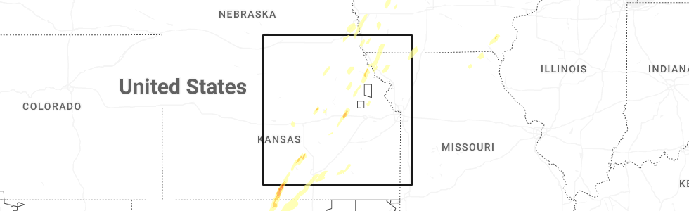
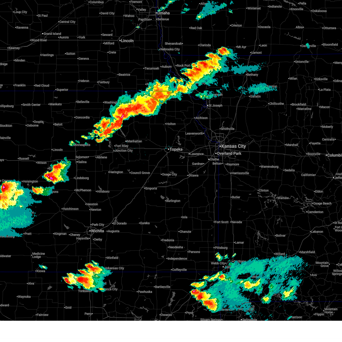
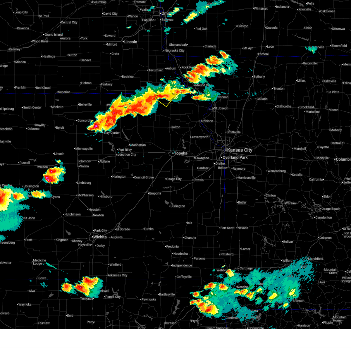
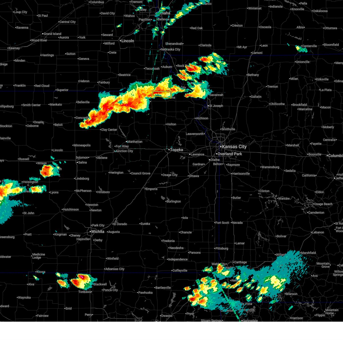
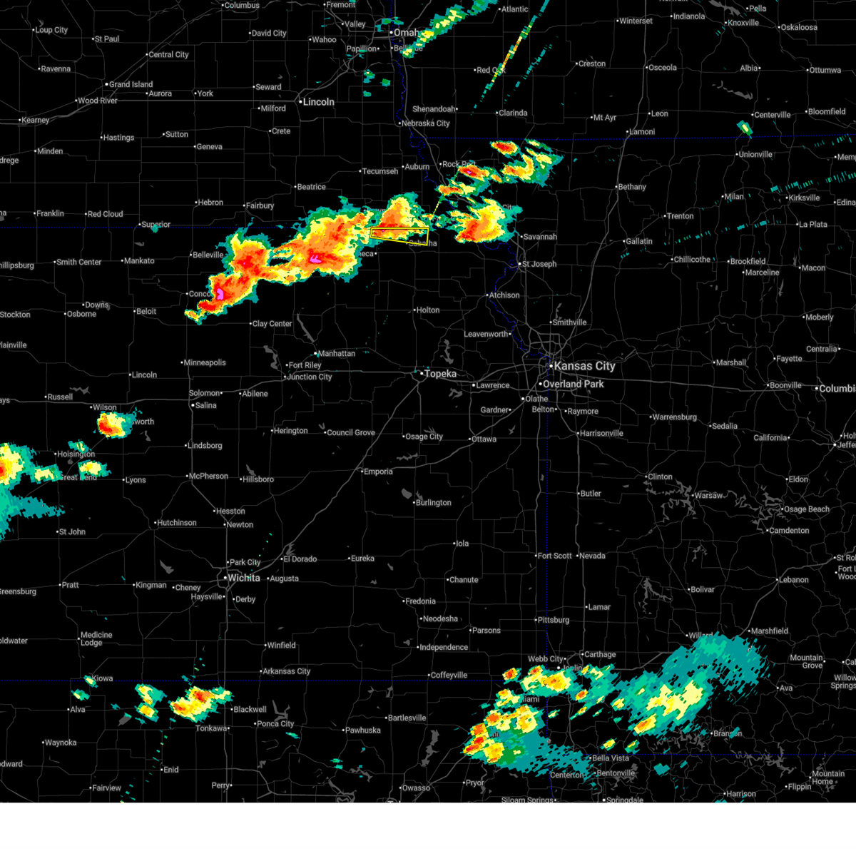
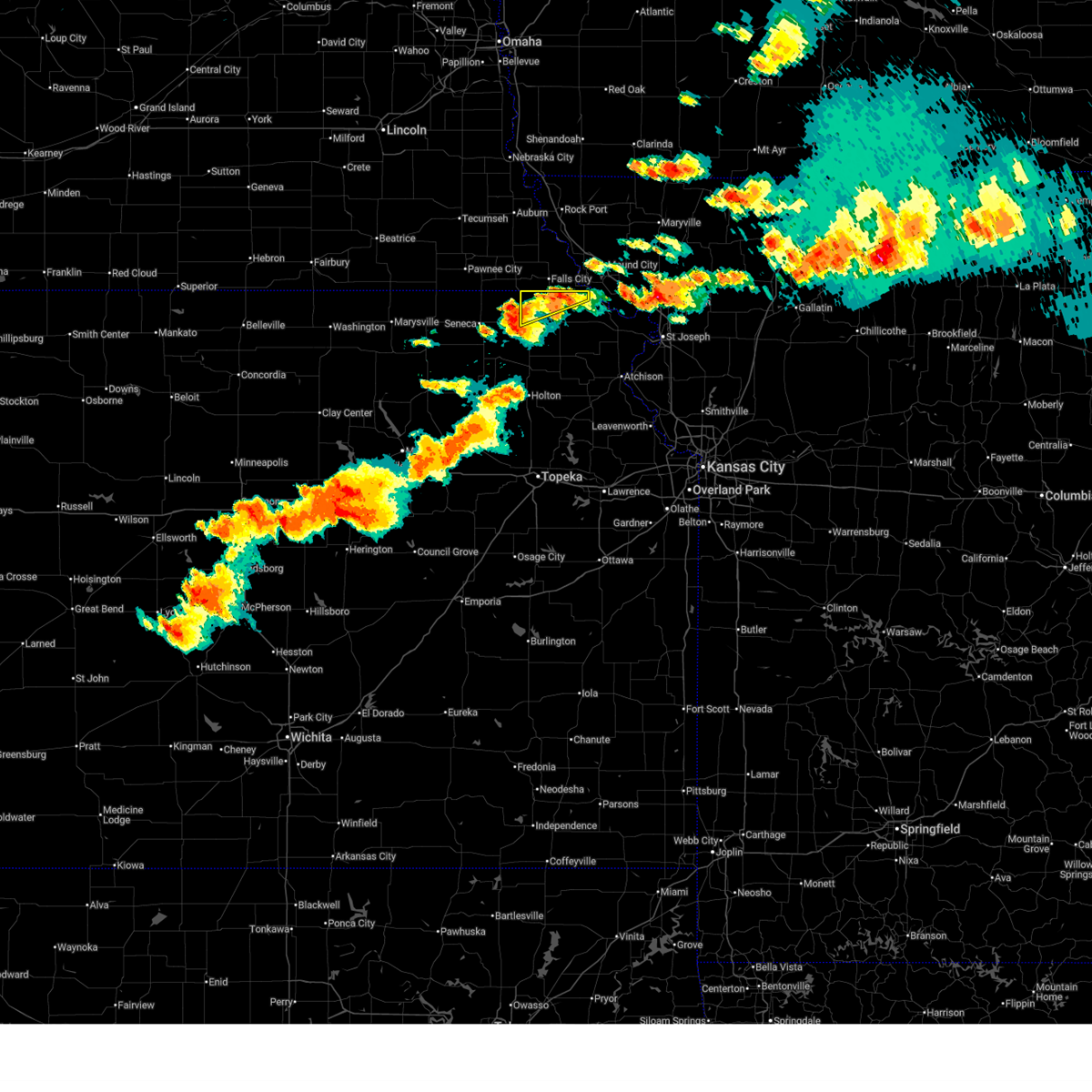
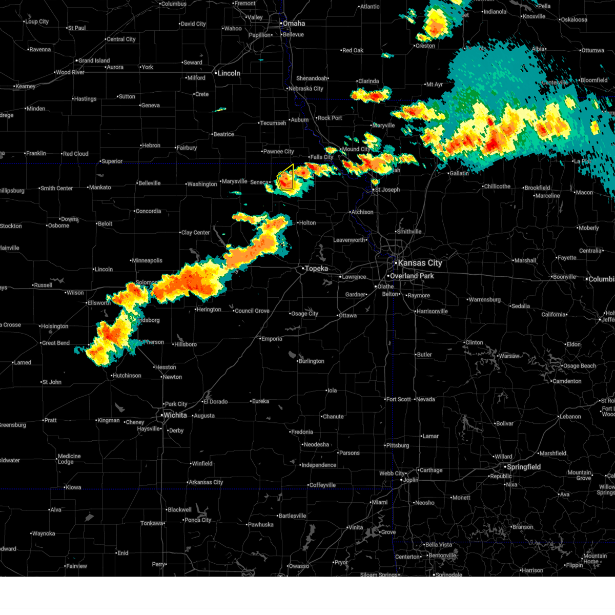
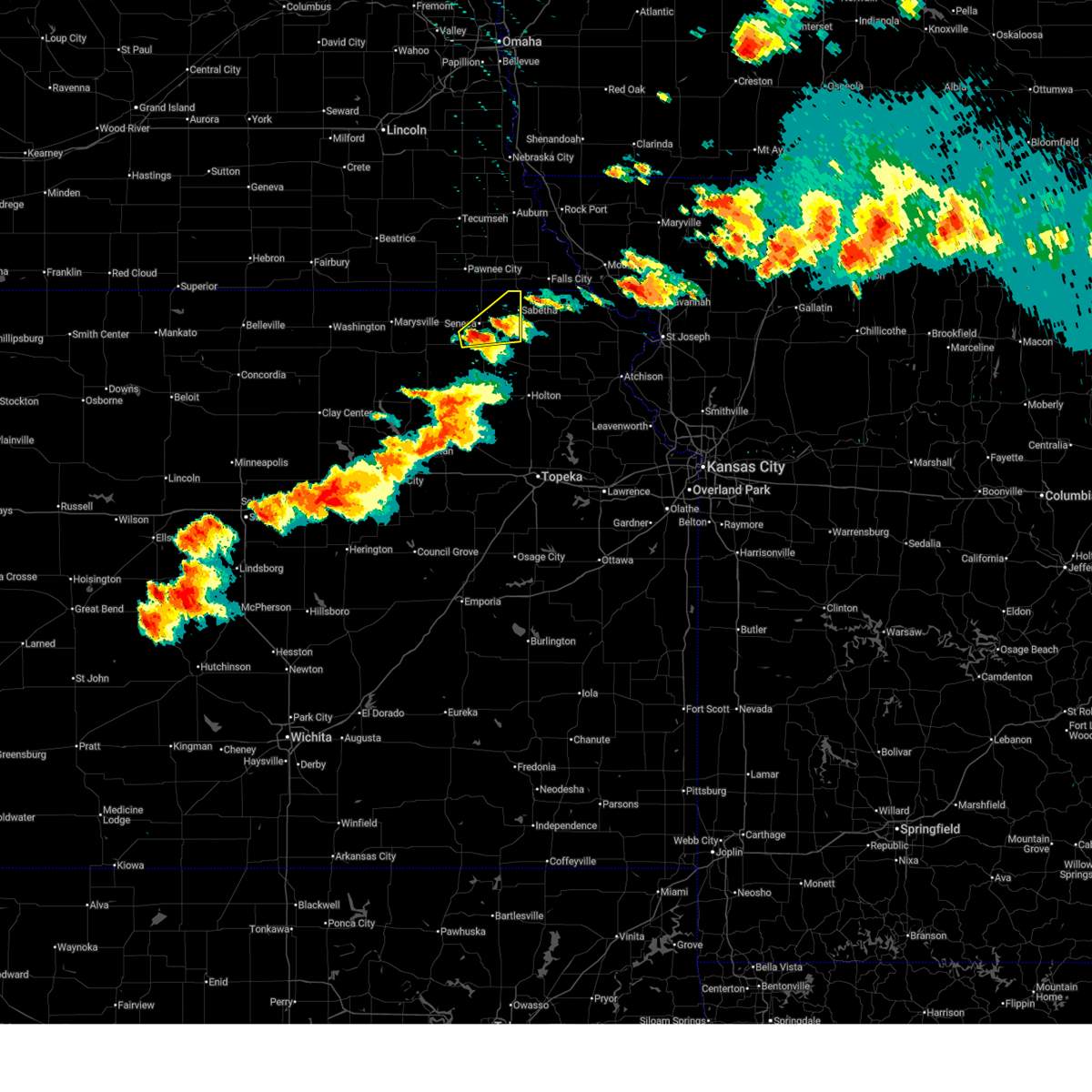
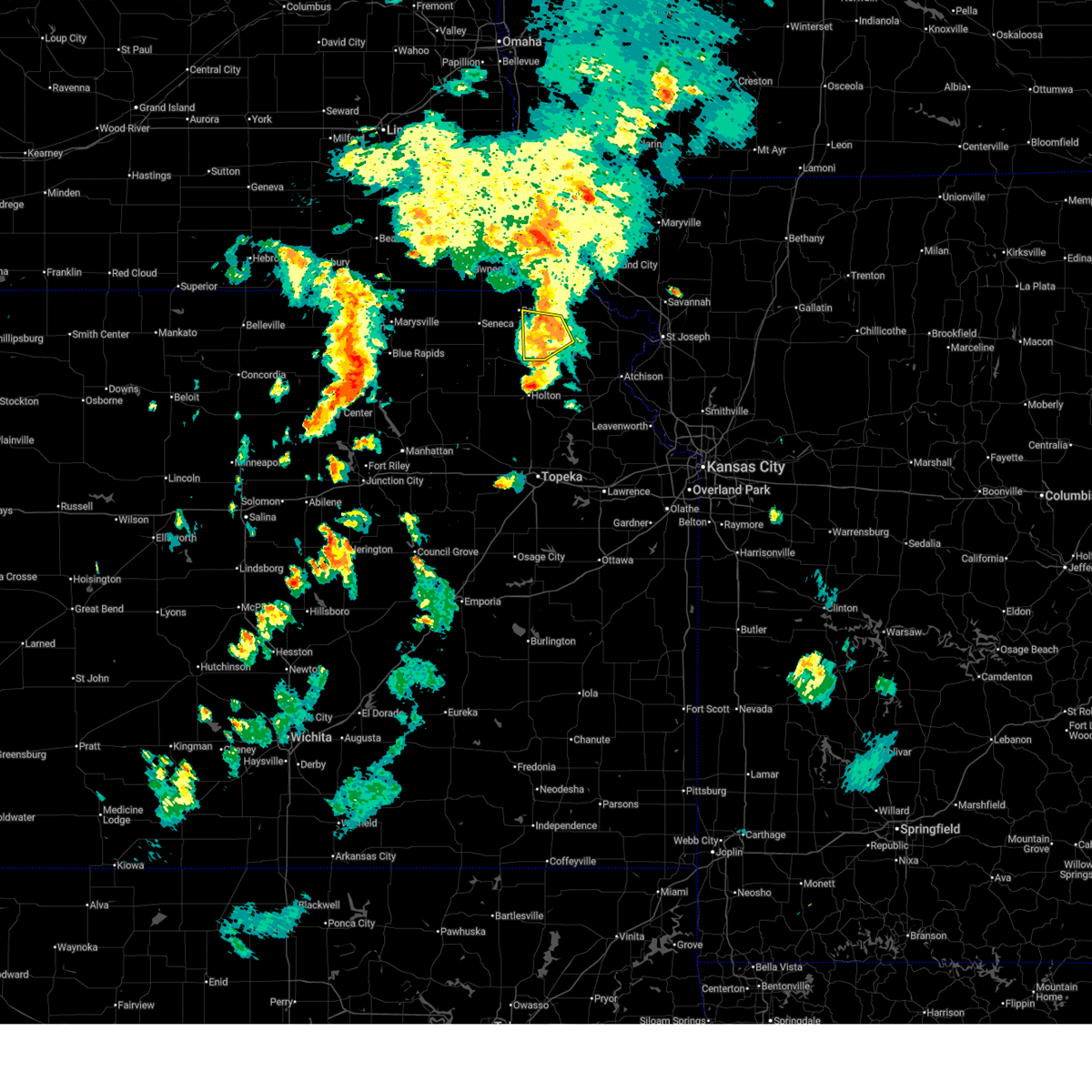
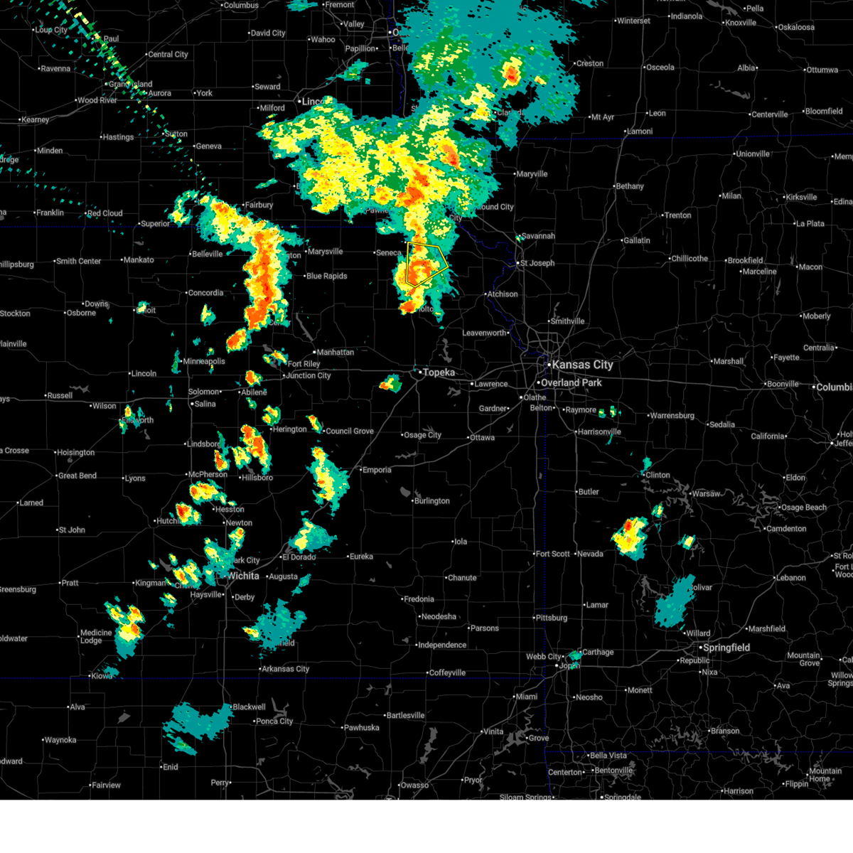
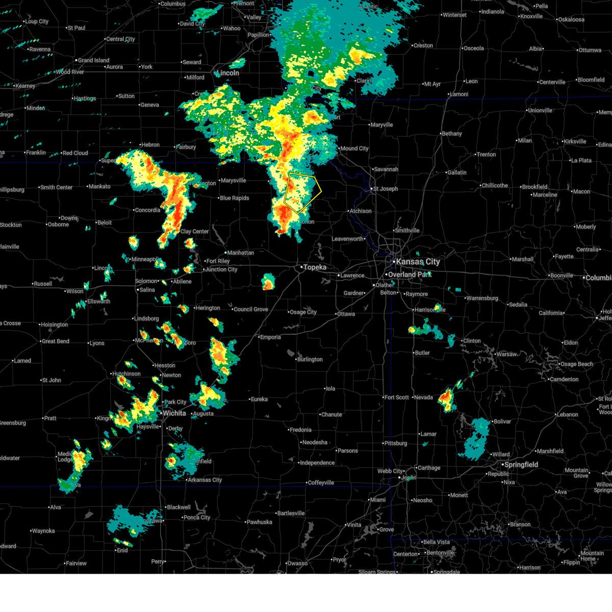
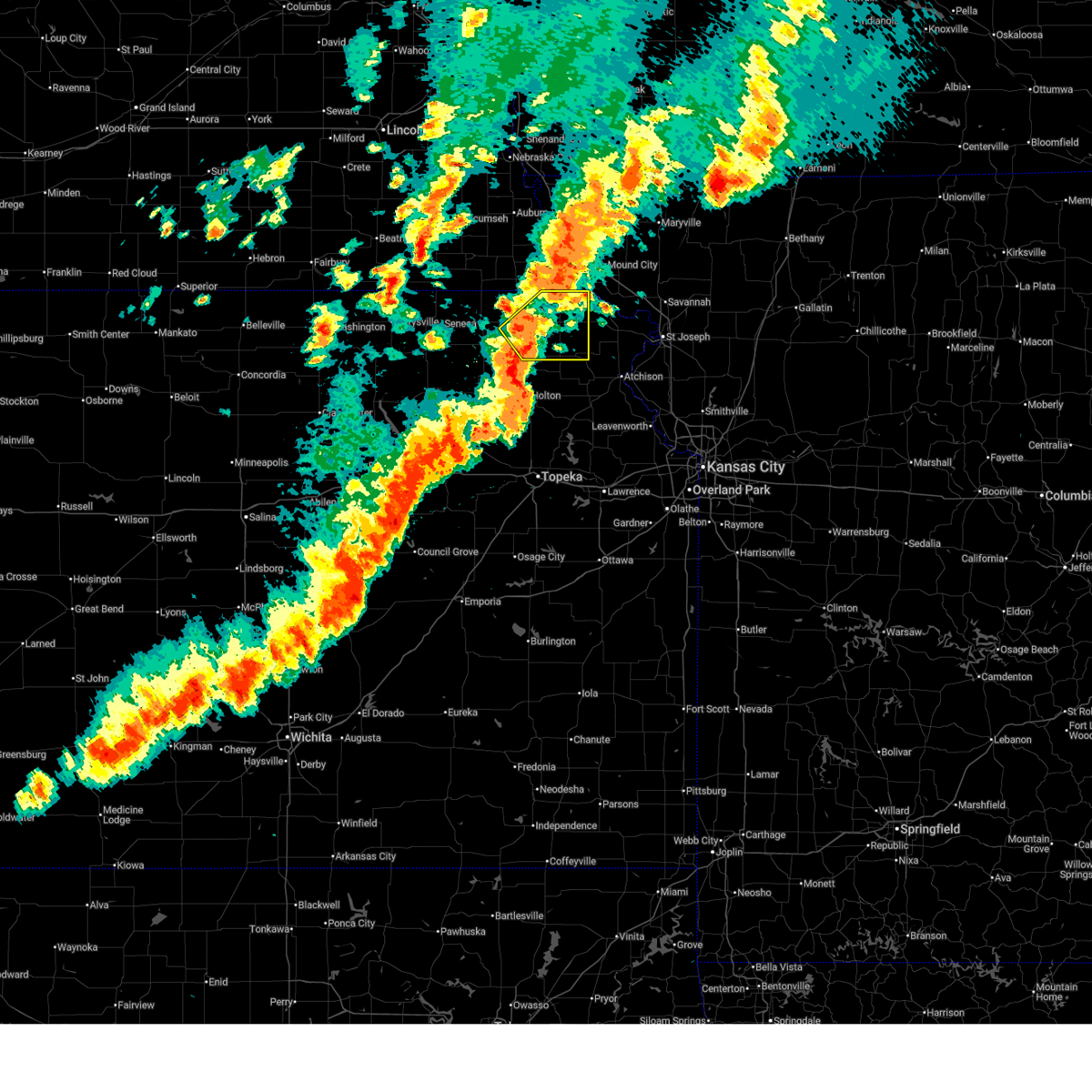
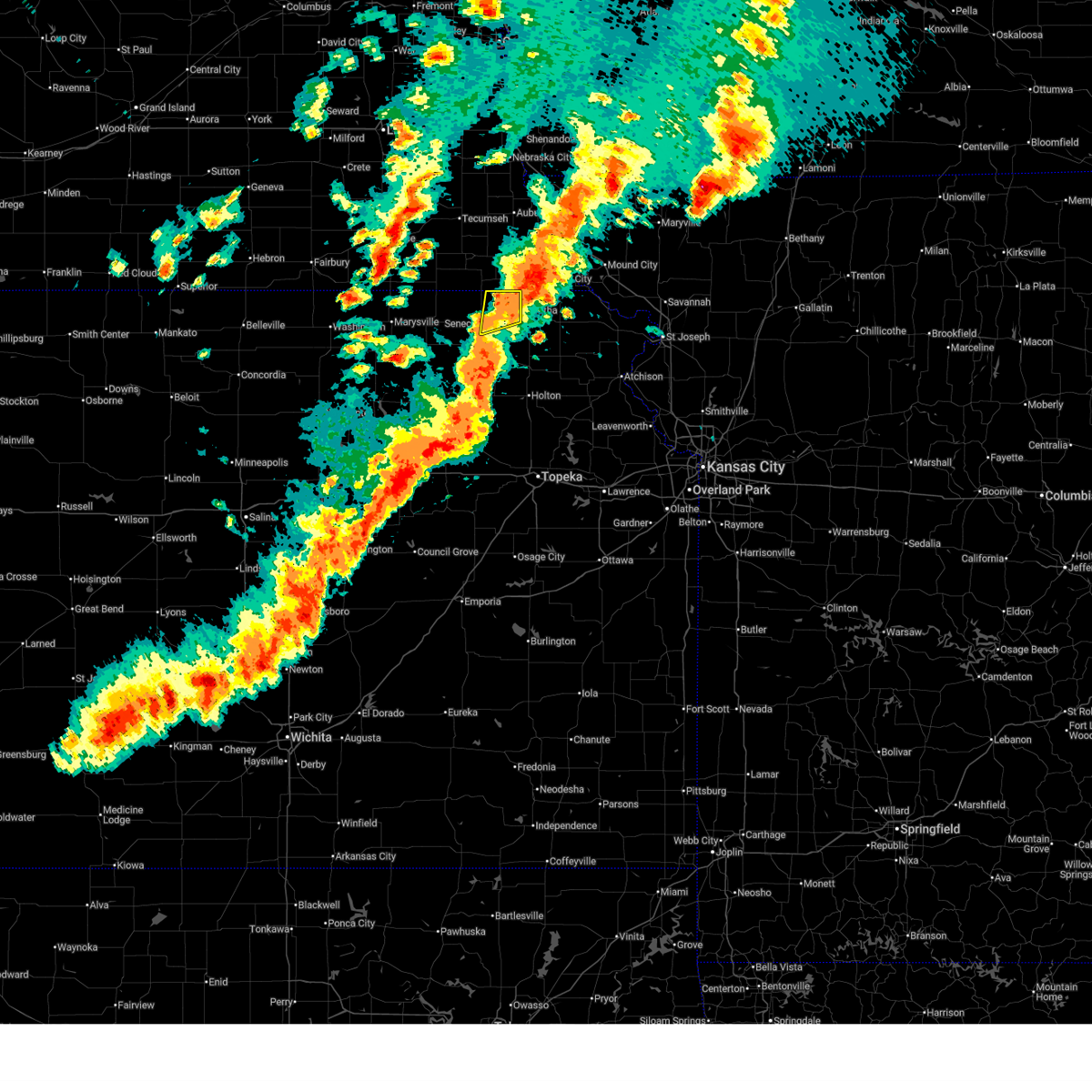
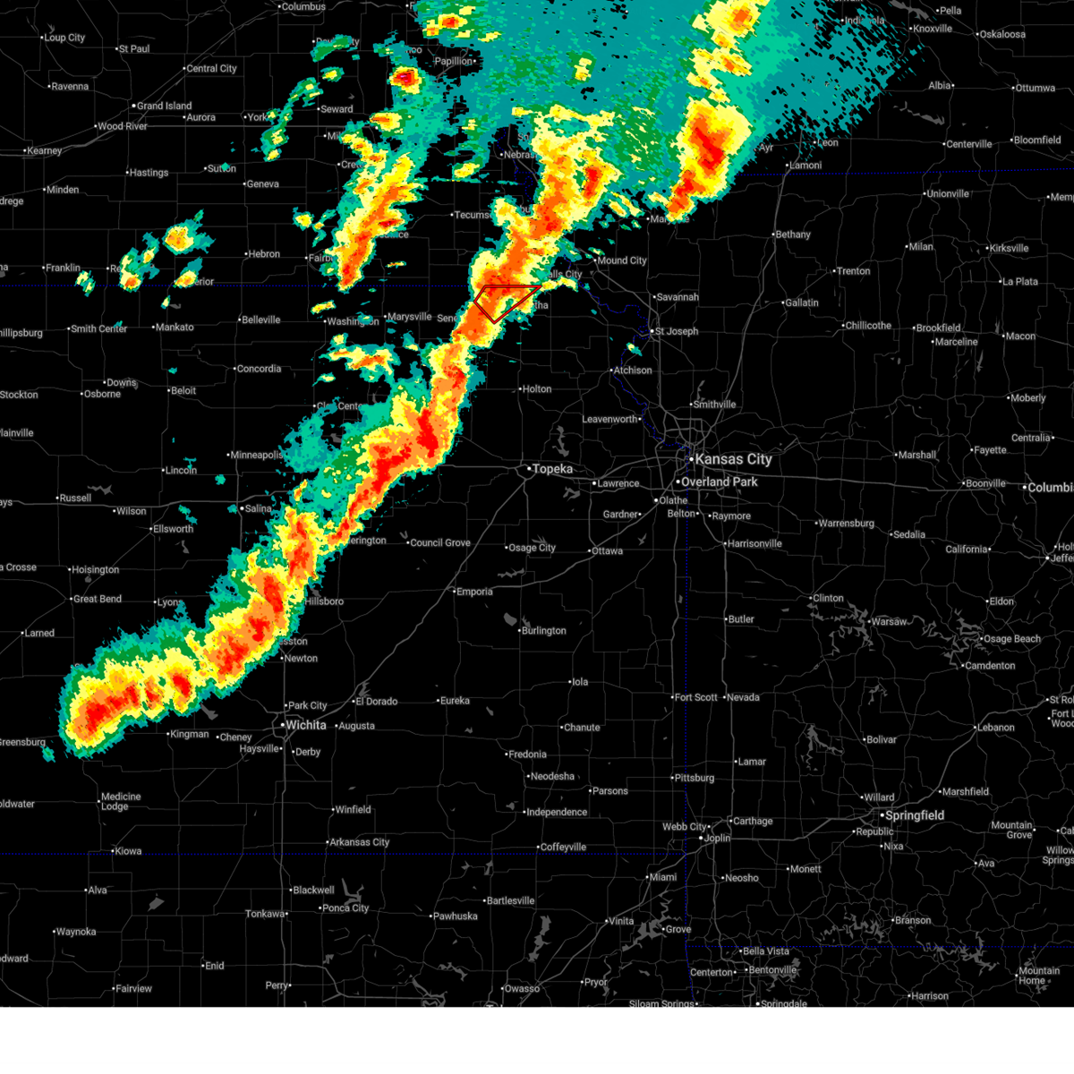
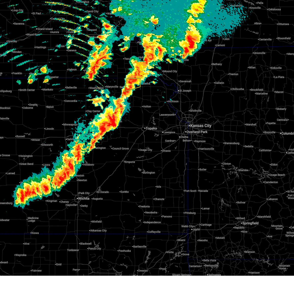
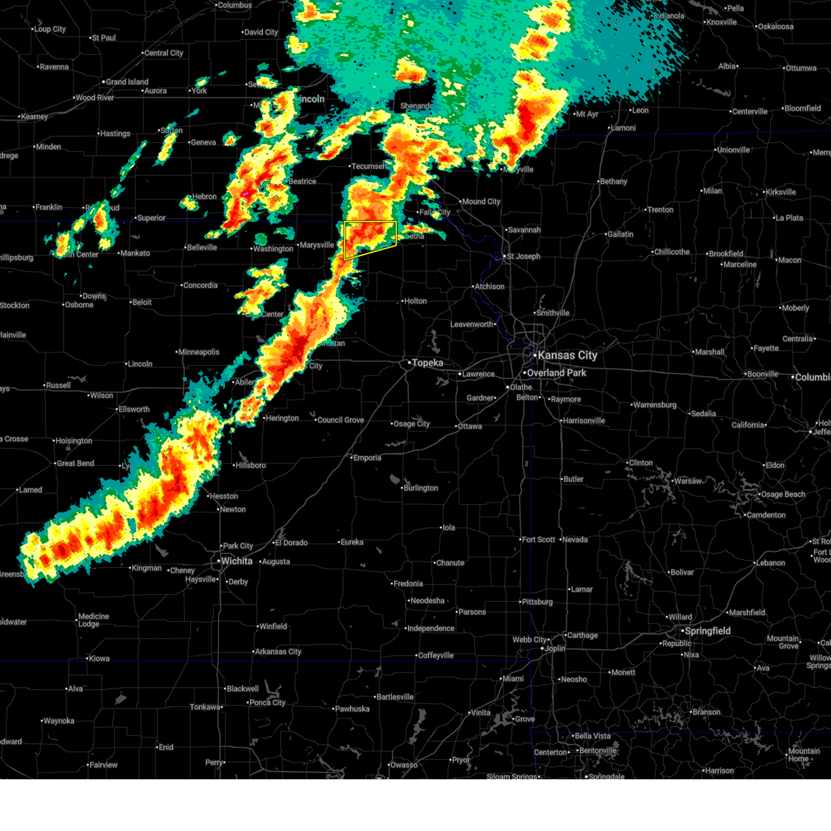
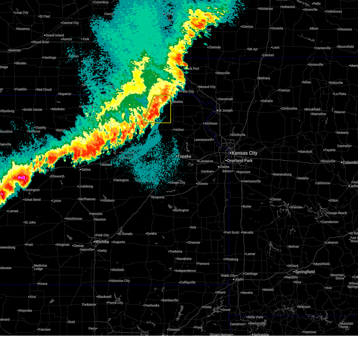
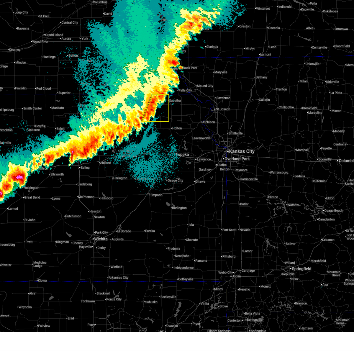
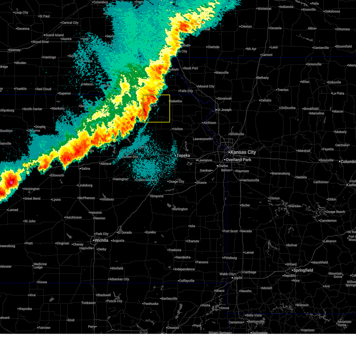
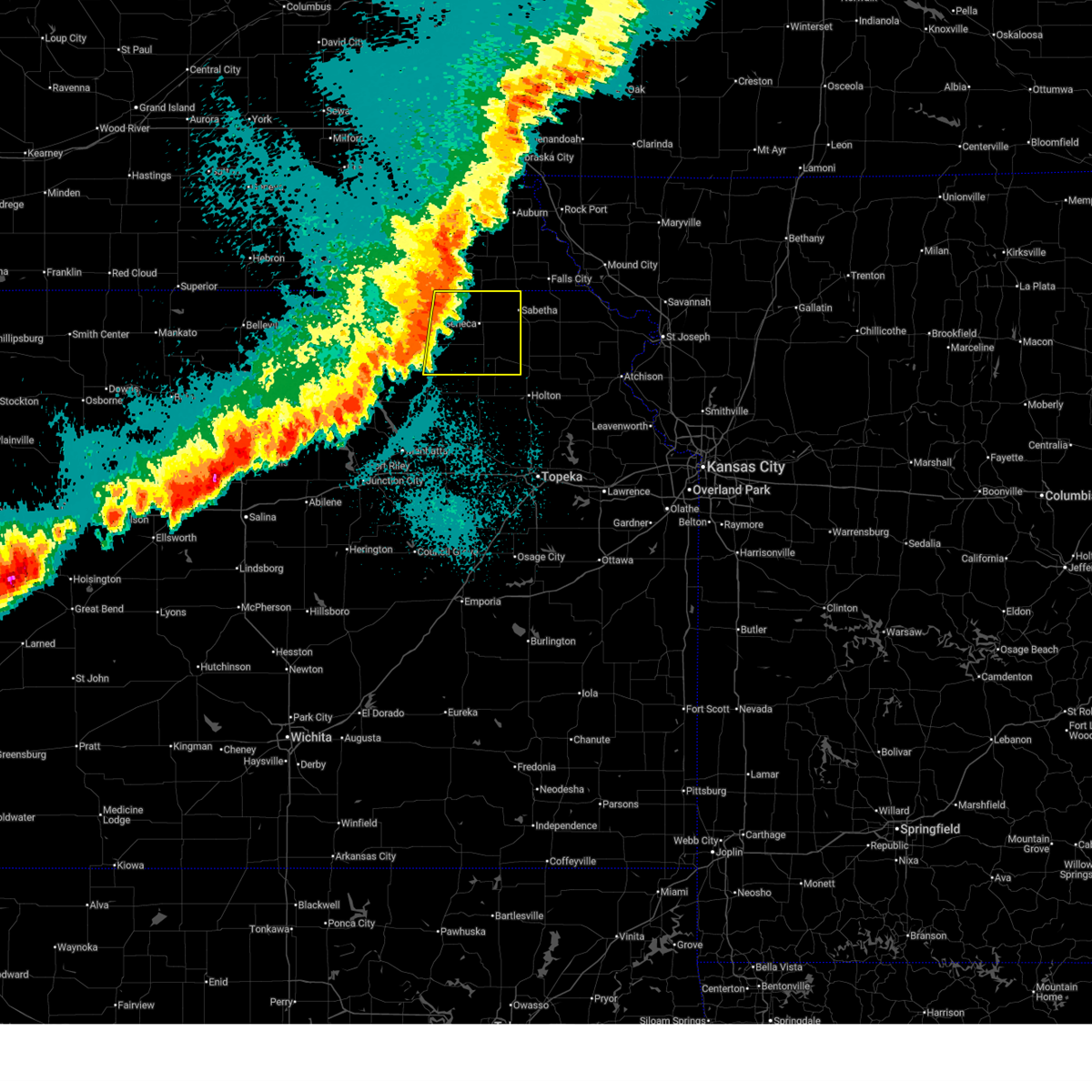
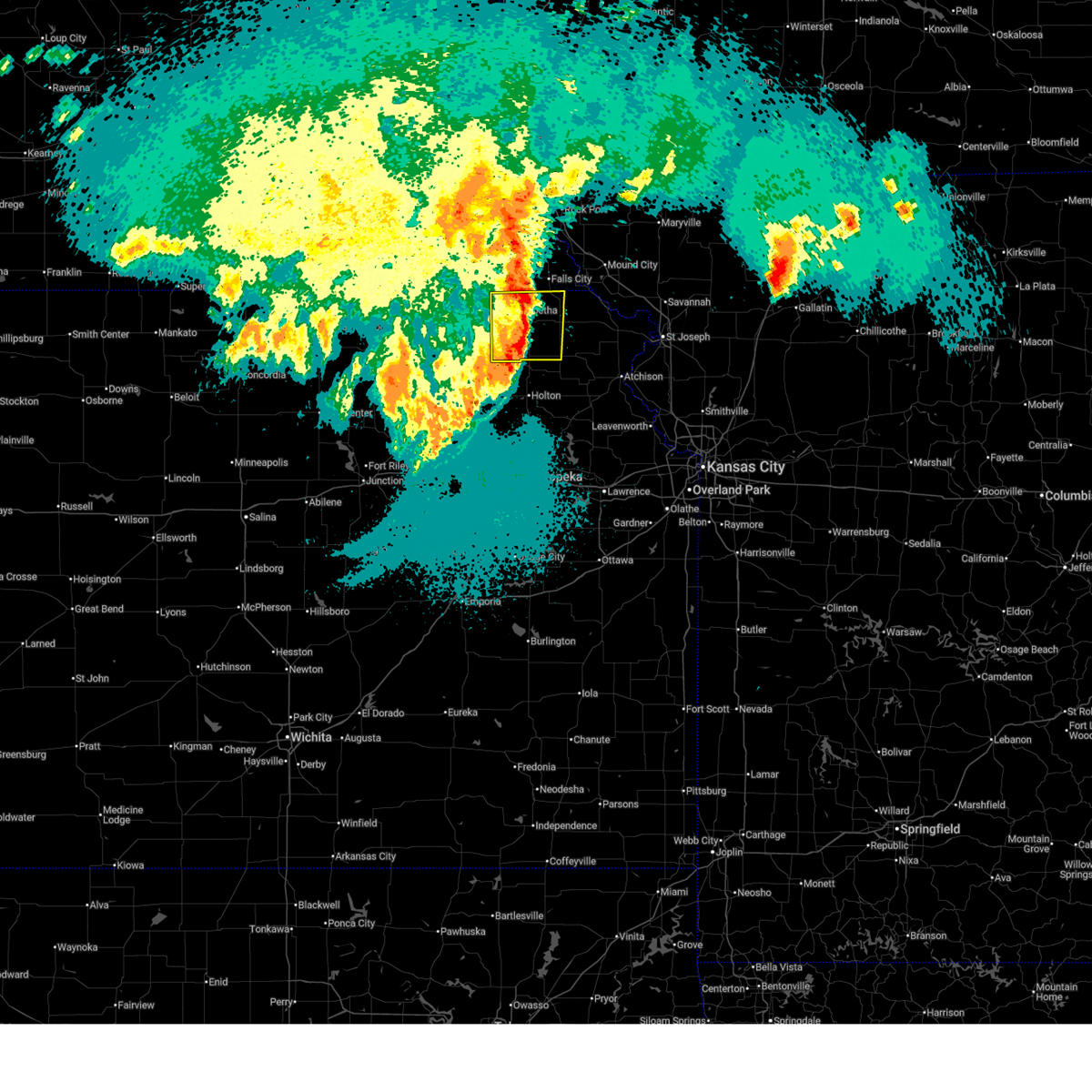
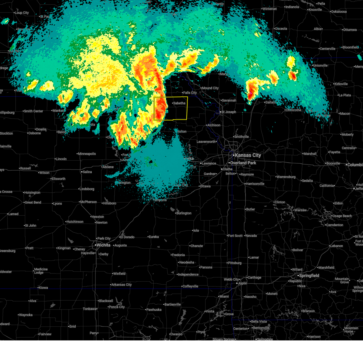
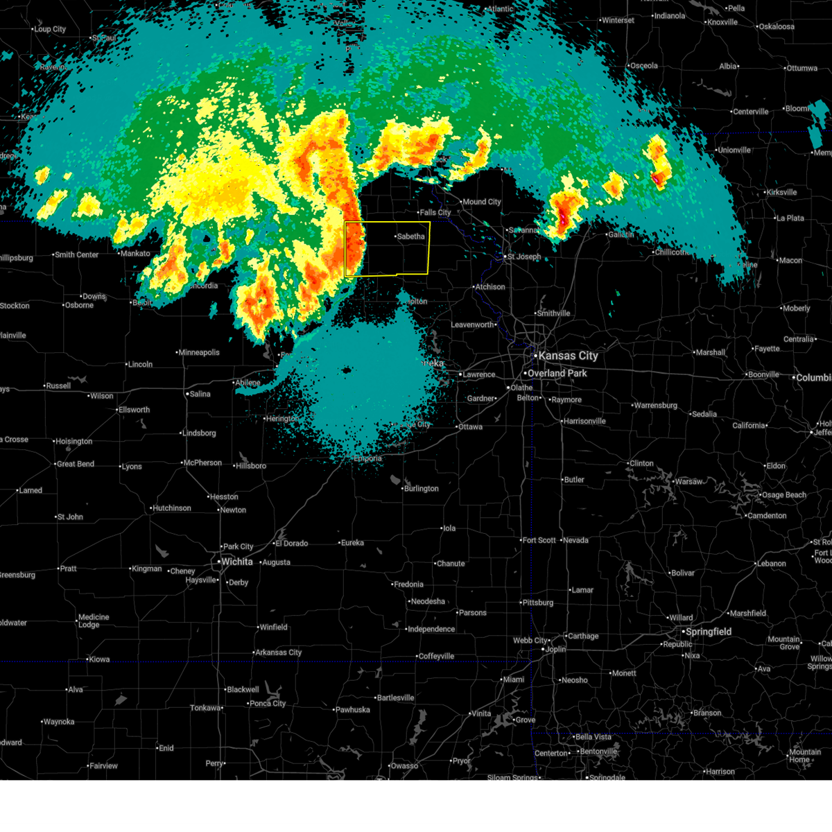
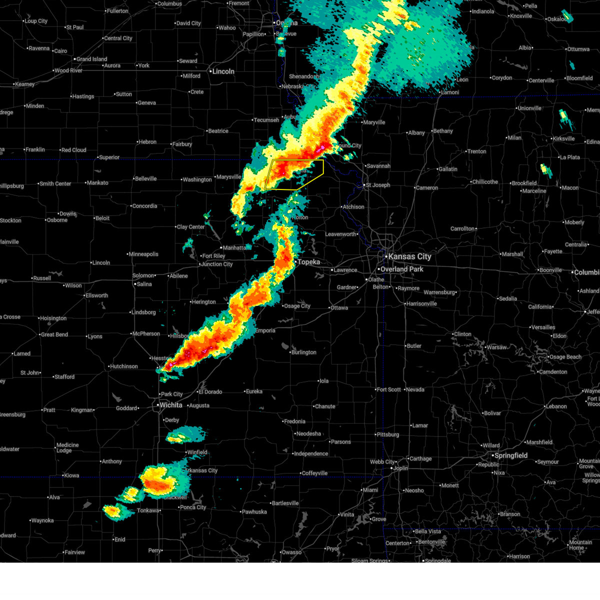
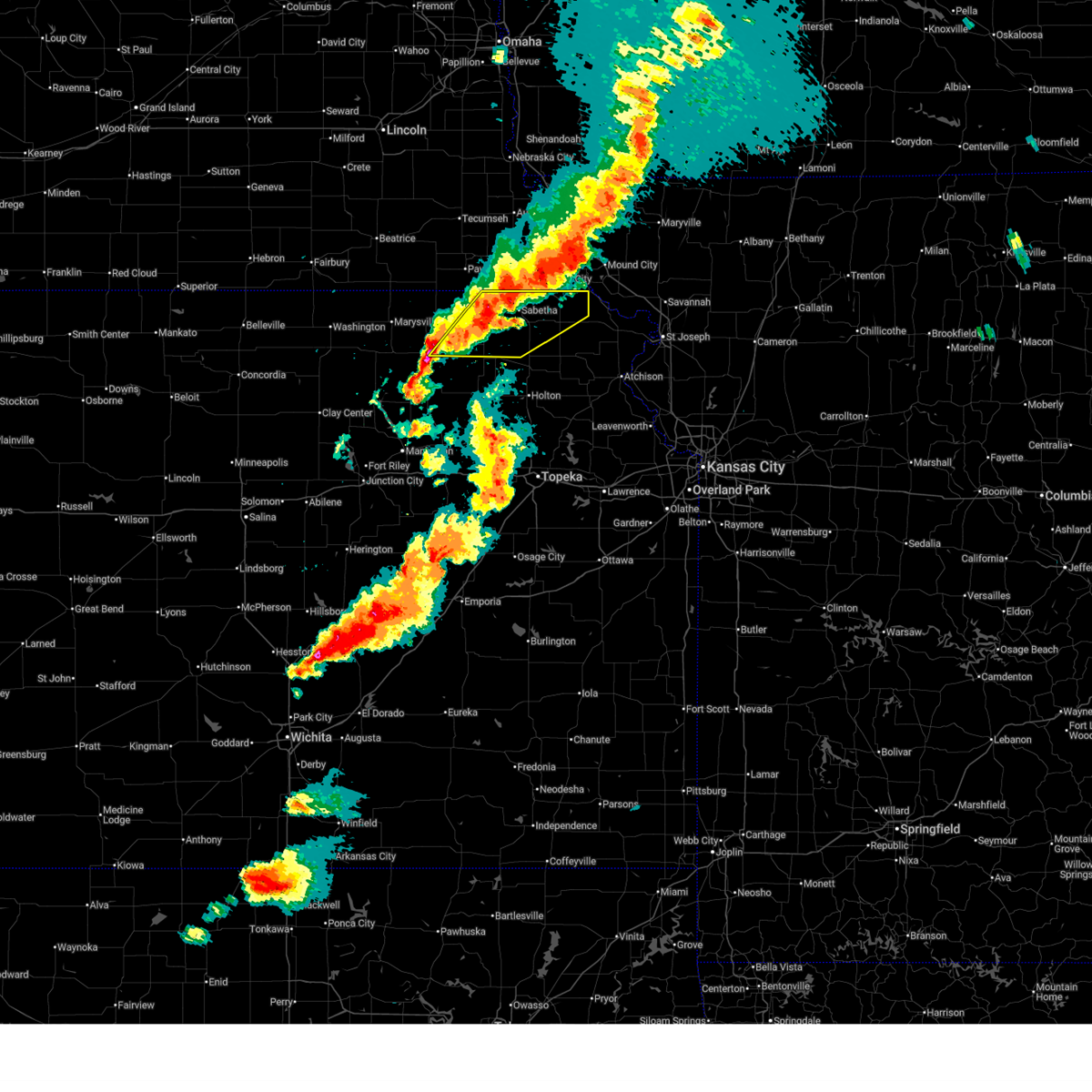
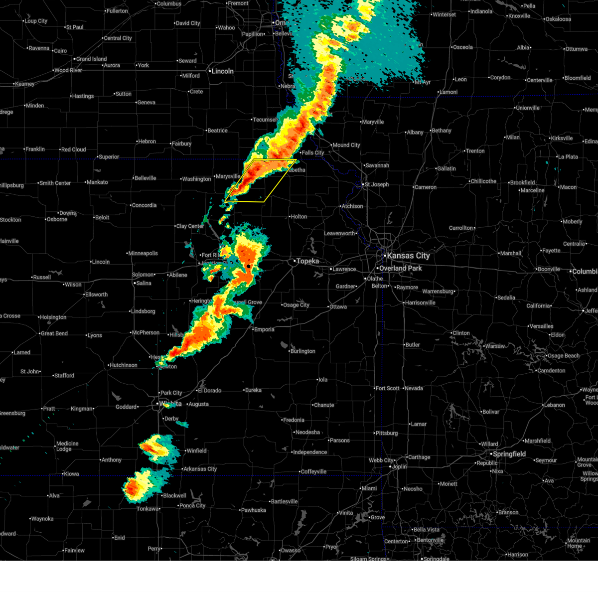
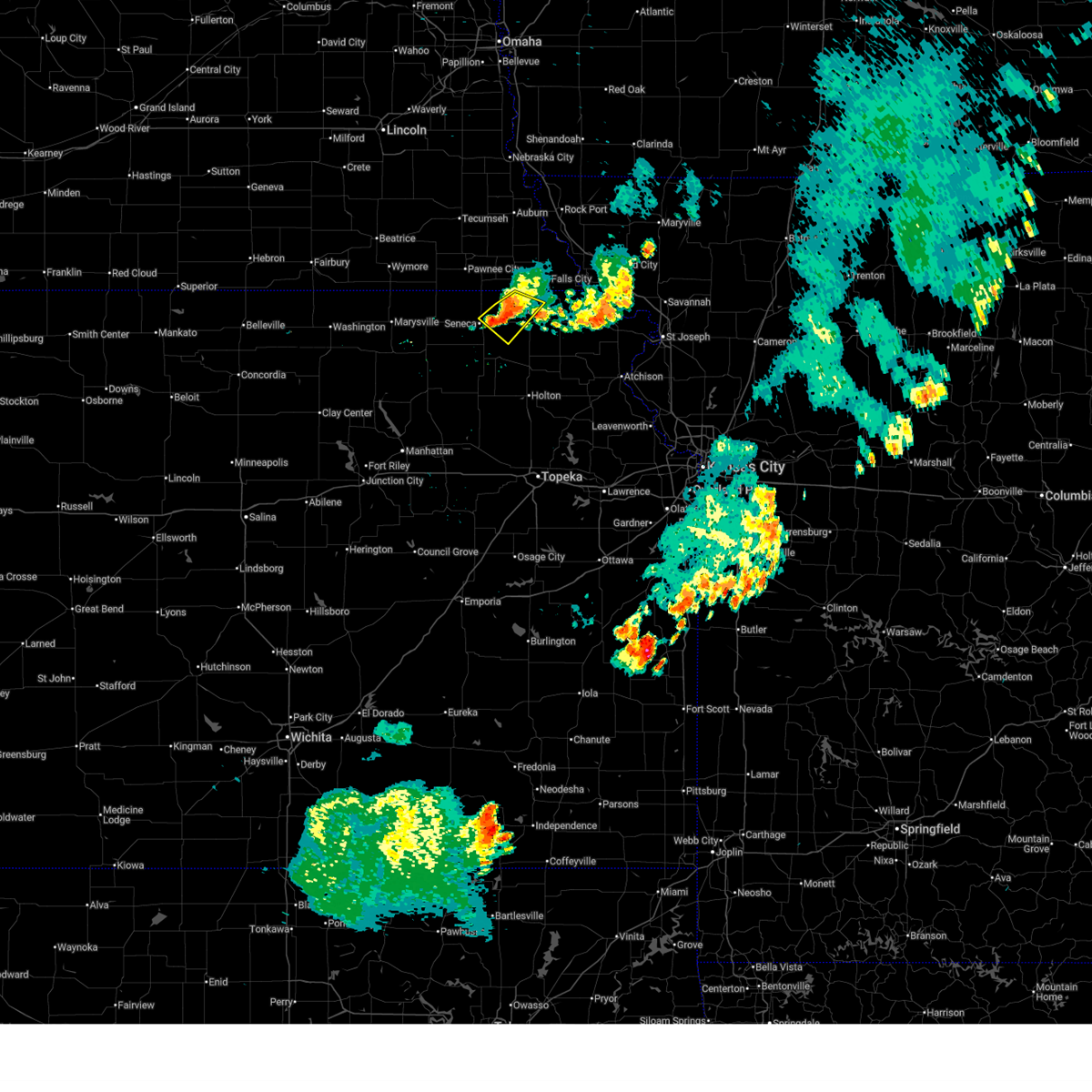
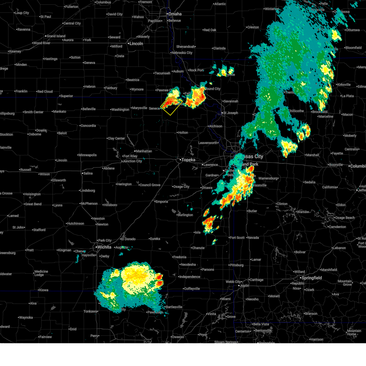
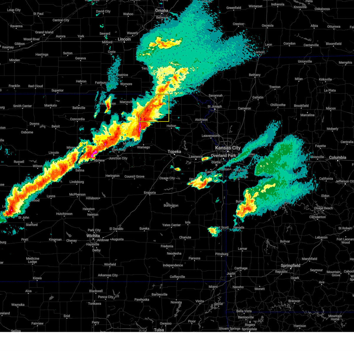
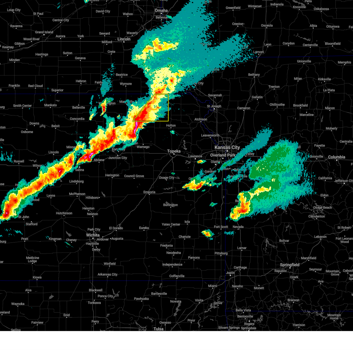
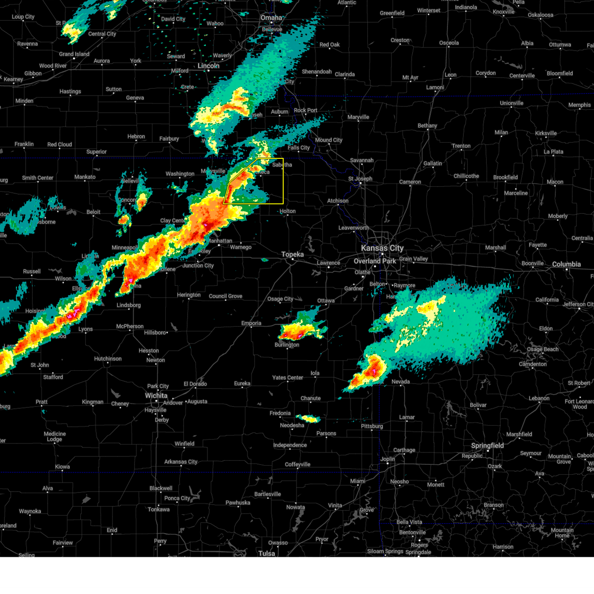
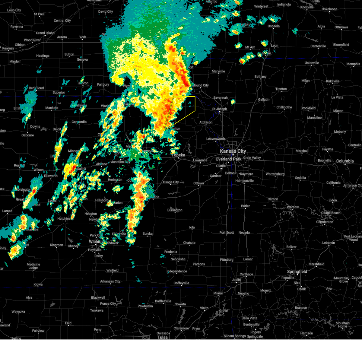
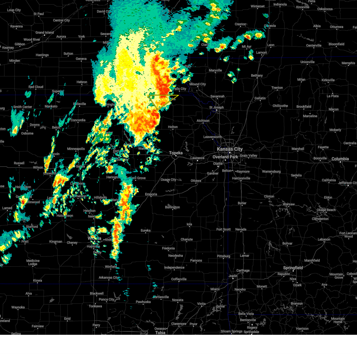
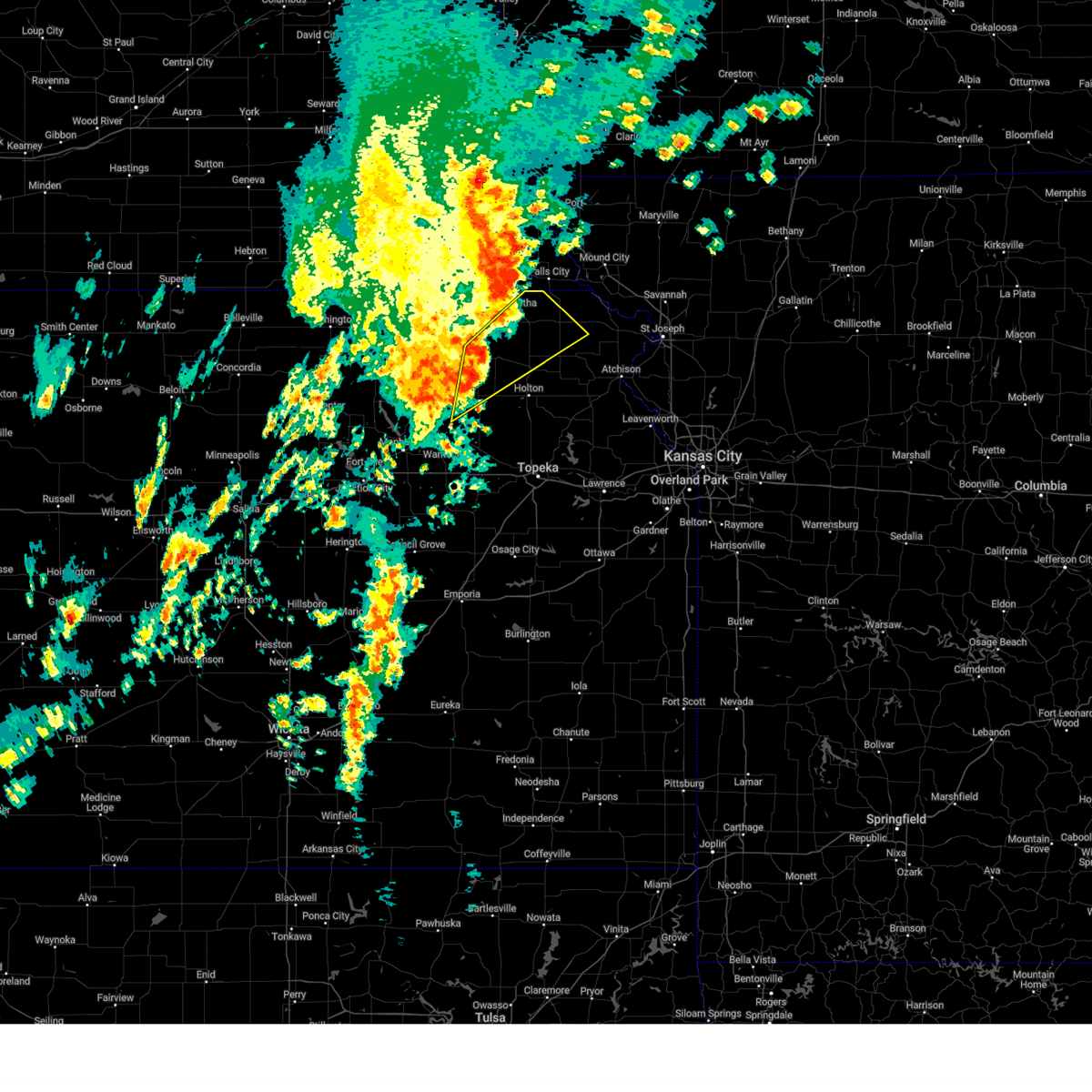
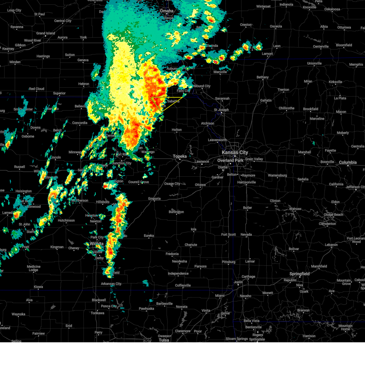
Hail Map for Sabetha, KS
The Sabetha, KS area has had 12 reports of on-the-ground hail by trained spotters, and has been under severe weather warnings 30 times during the past 12 months. Doppler radar has detected hail at or near Sabetha, KS on 101 occasions, including 4 occasions during the past year.
| Name: | Sabetha, KS |
| Where Located: | 64.9 miles NE of Manhattan, KS |
| Map: | Google Map for Sabetha, KS |
| Population: | 2571 |
| Housing Units: | 1230 |
| More Info: | Search Google for Sabetha, KS |
1
The Top Recent Hail Date for Sabetha, KS is Thursday, March 5, 2026 (18th out of 101)
Hail and Wind Damage Spotted near Sabetha, KS
| Date / Time | Report Details |
|---|---|
| 6/13/2026 7:09 PM CDT |
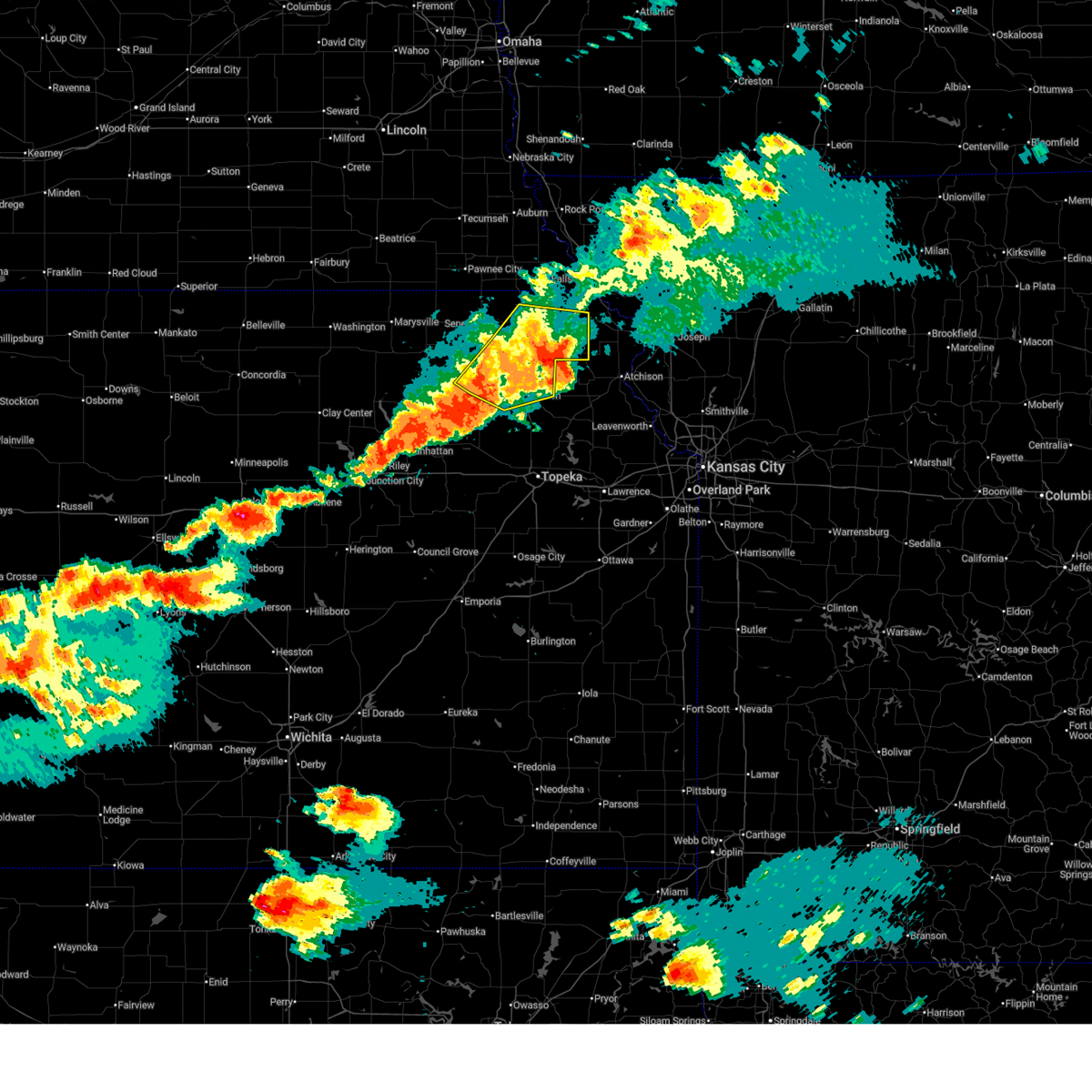 At 709 pm cdt, severe thunderstorms were located along a line extending from 4 miles north of everest to near muscotah to 3 miles east of holton, moving east at 40 mph (trained weather spotters. at 659 pm cdt...personal weather station reported 67 mph wind gust in holton). Hazards include 70 mph wind gusts and quarter size hail. Hail damage to vehicles is expected. expect considerable tree damage. wind damage is also likely to mobile homes, roofs, and outbuildings. Locations impacted include, holton, hiawatha, sabetha, horton, wetmore, everest, fairview, robinson, whiting, circleville, corning, netawaka, soldier, havensville, goff, powhattan, hamlin, willis, kickapoo reservation, and woodlawn. At 709 pm cdt, severe thunderstorms were located along a line extending from 4 miles north of everest to near muscotah to 3 miles east of holton, moving east at 40 mph (trained weather spotters. at 659 pm cdt...personal weather station reported 67 mph wind gust in holton). Hazards include 70 mph wind gusts and quarter size hail. Hail damage to vehicles is expected. expect considerable tree damage. wind damage is also likely to mobile homes, roofs, and outbuildings. Locations impacted include, holton, hiawatha, sabetha, horton, wetmore, everest, fairview, robinson, whiting, circleville, corning, netawaka, soldier, havensville, goff, powhattan, hamlin, willis, kickapoo reservation, and woodlawn.
|
| 6/13/2026 6:56 PM CDT |
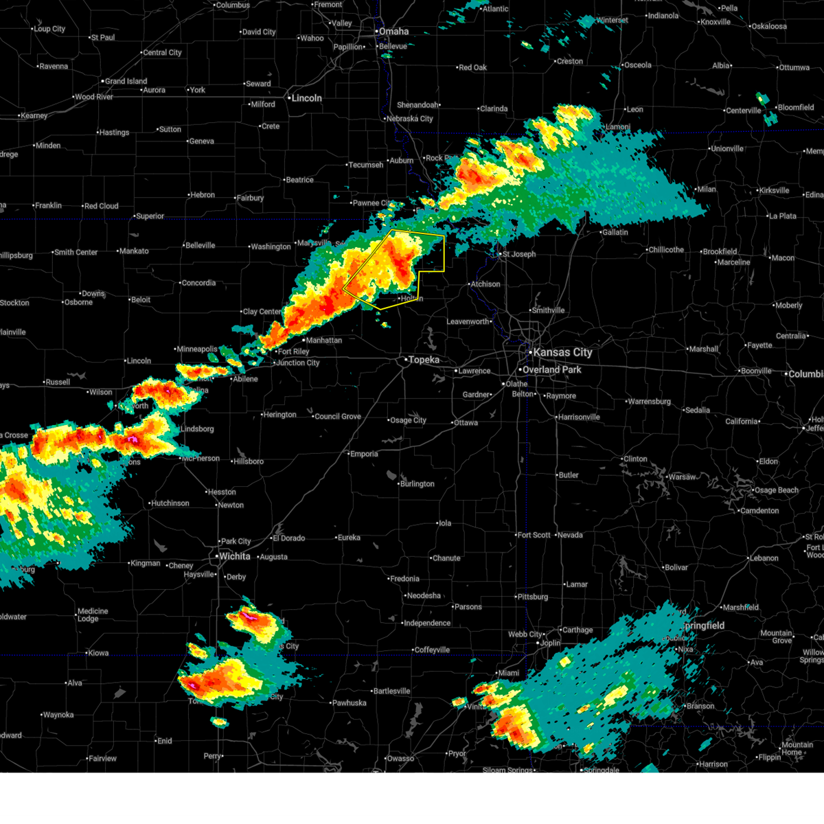 At 656 pm cdt, severe thunderstorms were located along a line extending from 3 miles east of powhattan to near whiting to near circleville, moving east at 40 mph (radar indicated). Hazards include 60 mph wind gusts and quarter size hail. Hail damage to vehicles is expected. expect wind damage to roofs, siding, and trees. Locations impacted include, holton, hiawatha, sabetha, horton, wetmore, everest, fairview, robinson, whiting, circleville, corning, netawaka, soldier, havensville, goff, powhattan, hamlin, willis, kickapoo reservation, and woodlawn. At 656 pm cdt, severe thunderstorms were located along a line extending from 3 miles east of powhattan to near whiting to near circleville, moving east at 40 mph (radar indicated). Hazards include 60 mph wind gusts and quarter size hail. Hail damage to vehicles is expected. expect wind damage to roofs, siding, and trees. Locations impacted include, holton, hiawatha, sabetha, horton, wetmore, everest, fairview, robinson, whiting, circleville, corning, netawaka, soldier, havensville, goff, powhattan, hamlin, willis, kickapoo reservation, and woodlawn.
|
| 6/13/2026 6:36 PM CDT |
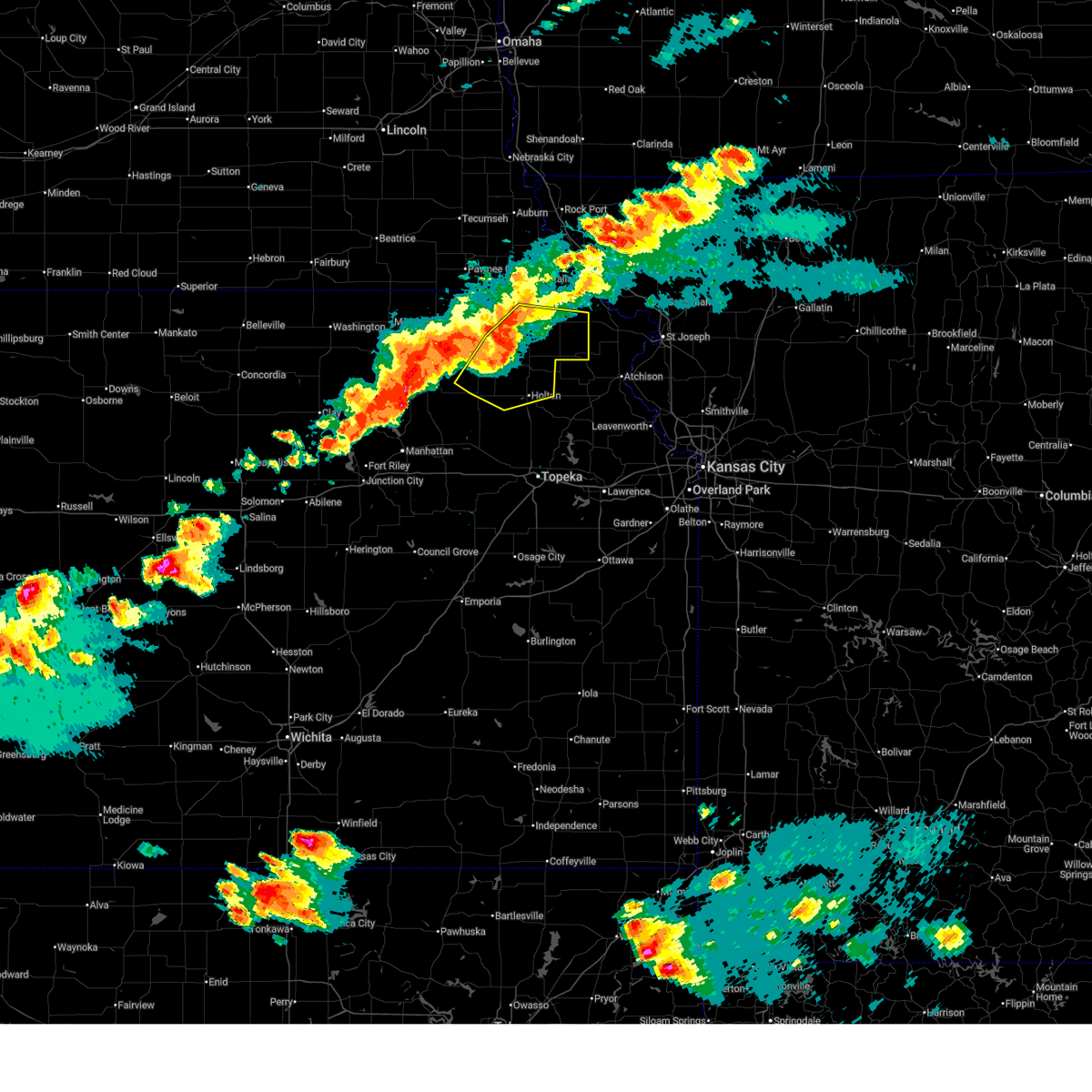 Svrtop the national weather service in topeka has issued a * severe thunderstorm warning for, southeastern nemaha county in northeastern kansas, northeastern pottawatomie county in northeastern kansas, northern jackson county in northeastern kansas, brown county in northeastern kansas, * until 715 pm cdt. * at 635 pm cdt, severe thunderstorms were located along a line extending from near fairview to near wetmore to 3 miles west of soldier, moving east at 40 mph (radar indicated). Hazards include 60 mph wind gusts and quarter size hail. Hail damage to vehicles is expected. Expect wind damage to roofs, siding, and trees. Svrtop the national weather service in topeka has issued a * severe thunderstorm warning for, southeastern nemaha county in northeastern kansas, northeastern pottawatomie county in northeastern kansas, northern jackson county in northeastern kansas, brown county in northeastern kansas, * until 715 pm cdt. * at 635 pm cdt, severe thunderstorms were located along a line extending from near fairview to near wetmore to 3 miles west of soldier, moving east at 40 mph (radar indicated). Hazards include 60 mph wind gusts and quarter size hail. Hail damage to vehicles is expected. Expect wind damage to roofs, siding, and trees.
|
| 6/13/2026 6:23 PM CDT |
 The storm which prompted the warning has weakened below severe limits, and no longer poses an immediate threat to life or property. therefore, the warning will be allowed to expire. however, small hail, gusty winds and heavy rain are still possible with this thunderstorm. a tornado watch remains in effect until 1100 pm cdt for northeastern kansas. remember, a severe thunderstorm warning still remains in effect for central and southern nemaha county until 7 pm cdt. The storm which prompted the warning has weakened below severe limits, and no longer poses an immediate threat to life or property. therefore, the warning will be allowed to expire. however, small hail, gusty winds and heavy rain are still possible with this thunderstorm. a tornado watch remains in effect until 1100 pm cdt for northeastern kansas. remember, a severe thunderstorm warning still remains in effect for central and southern nemaha county until 7 pm cdt.
|
| 6/13/2026 6:07 PM CDT |
 Svrtop the national weather service in topeka has issued a * severe thunderstorm warning for, northeastern nemaha county in northeastern kansas, northwestern brown county in northeastern kansas, * until 630 pm cdt. * at 606 pm cdt, a severe thunderstorm was located near bern, moving southeast at 15 mph (radar indicated). Hazards include 60 mph wind gusts and quarter size hail. Hail damage to vehicles is expected. Expect wind damage to roofs, siding, and trees. Svrtop the national weather service in topeka has issued a * severe thunderstorm warning for, northeastern nemaha county in northeastern kansas, northwestern brown county in northeastern kansas, * until 630 pm cdt. * at 606 pm cdt, a severe thunderstorm was located near bern, moving southeast at 15 mph (radar indicated). Hazards include 60 mph wind gusts and quarter size hail. Hail damage to vehicles is expected. Expect wind damage to roofs, siding, and trees.
|
| 6/13/2026 5:54 PM CDT |
 At 554 pm cdt, a severe thunderstorm was located near bern, moving east at 30 mph (radar indicated). Hazards include 60 mph wind gusts and quarter size hail. Hail damage to vehicles is expected. expect wind damage to roofs, siding, and trees. Locations impacted include, sabetha, morrill, bern, and hamlin. At 554 pm cdt, a severe thunderstorm was located near bern, moving east at 30 mph (radar indicated). Hazards include 60 mph wind gusts and quarter size hail. Hail damage to vehicles is expected. expect wind damage to roofs, siding, and trees. Locations impacted include, sabetha, morrill, bern, and hamlin.
|
| 6/13/2026 5:39 PM CDT |
 Svrtop the national weather service in topeka has issued a * severe thunderstorm warning for, northeastern nemaha county in northeastern kansas, northwestern brown county in northeastern kansas, * until 615 pm cdt. * at 538 pm cdt, a severe thunderstorm was located over bern, moving east at 40 mph (radar indicated). Hazards include 60 mph wind gusts and quarter size hail. Hail damage to vehicles is expected. Expect wind damage to roofs, siding, and trees. Svrtop the national weather service in topeka has issued a * severe thunderstorm warning for, northeastern nemaha county in northeastern kansas, northwestern brown county in northeastern kansas, * until 615 pm cdt. * at 538 pm cdt, a severe thunderstorm was located over bern, moving east at 40 mph (radar indicated). Hazards include 60 mph wind gusts and quarter size hail. Hail damage to vehicles is expected. Expect wind damage to roofs, siding, and trees.
|
| 6/10/2026 8:01 PM CDT |
 Svrtop the national weather service in topeka has issued a * severe thunderstorm warning for, northern brown county in northeastern kansas, * until 830 pm cdt. * at 800 pm cdt, a severe thunderstorm was located near sabetha, moving northeast at 35 mph (radar indicated). Hazards include 60 mph wind gusts and quarter size hail. Hail damage to vehicles is expected. Expect wind damage to roofs, siding, and trees. Svrtop the national weather service in topeka has issued a * severe thunderstorm warning for, northern brown county in northeastern kansas, * until 830 pm cdt. * at 800 pm cdt, a severe thunderstorm was located near sabetha, moving northeast at 35 mph (radar indicated). Hazards include 60 mph wind gusts and quarter size hail. Hail damage to vehicles is expected. Expect wind damage to roofs, siding, and trees.
|
| 6/10/2026 7:53 PM CDT |
 At 753 pm cdt, a severe thunderstorm was located over oneida, moving northeast at 30 mph (radar indicated). Hazards include 60 mph wind gusts and quarter size hail. Hail damage to vehicles is expected. expect wind damage to roofs, siding, and trees. Locations impacted include, sabetha, oneida, and woodlawn. At 753 pm cdt, a severe thunderstorm was located over oneida, moving northeast at 30 mph (radar indicated). Hazards include 60 mph wind gusts and quarter size hail. Hail damage to vehicles is expected. expect wind damage to roofs, siding, and trees. Locations impacted include, sabetha, oneida, and woodlawn.
|
| 6/10/2026 7:29 PM CDT |
 Svrtop the national weather service in topeka has issued a * severe thunderstorm warning for, central nemaha county in northeastern kansas, * until 815 pm cdt. * at 729 pm cdt, a severe thunderstorm was located near centralia, moving northeast at 30 mph (radar indicated). Hazards include 60 mph wind gusts and half dollar size hail. Hail damage to vehicles is expected. Expect wind damage to roofs, siding, and trees. Svrtop the national weather service in topeka has issued a * severe thunderstorm warning for, central nemaha county in northeastern kansas, * until 815 pm cdt. * at 729 pm cdt, a severe thunderstorm was located near centralia, moving northeast at 30 mph (radar indicated). Hazards include 60 mph wind gusts and half dollar size hail. Hail damage to vehicles is expected. Expect wind damage to roofs, siding, and trees.
|
| 6/4/2026 4:26 PM CDT |
 At 425 pm cdt, a severe thunderstorm was located near powhattan, moving northeast at 35 mph (radar indicated). Hazards include 60 mph wind gusts. Expect damage to roofs, siding, and trees. Locations impacted include, hiawatha, fairview, powhattan, willis, and kickapoo reservation. At 425 pm cdt, a severe thunderstorm was located near powhattan, moving northeast at 35 mph (radar indicated). Hazards include 60 mph wind gusts. Expect damage to roofs, siding, and trees. Locations impacted include, hiawatha, fairview, powhattan, willis, and kickapoo reservation.
|
| 6/4/2026 4:17 PM CDT |
 At 416 pm cdt, a severe thunderstorm was located near kickapoo reservation, moving northeast at 35 mph (radar indicated). Hazards include 60 mph wind gusts. Expect damage to roofs, siding, and trees. Locations impacted include, hiawatha, fairview, powhattan, willis, and kickapoo reservation. At 416 pm cdt, a severe thunderstorm was located near kickapoo reservation, moving northeast at 35 mph (radar indicated). Hazards include 60 mph wind gusts. Expect damage to roofs, siding, and trees. Locations impacted include, hiawatha, fairview, powhattan, willis, and kickapoo reservation.
|
| 6/4/2026 4:07 PM CDT |
 Svrtop the national weather service in topeka has issued a * severe thunderstorm warning for, southeastern nemaha county in northeastern kansas, northeastern jackson county in northeastern kansas, southwestern brown county in northeastern kansas, * until 445 pm cdt. * at 406 pm cdt, a severe thunderstorm was located near wetmore, moving northeast at 35 mph (radar indicated). Hazards include 60 mph wind gusts. expect damage to roofs, siding, and trees Svrtop the national weather service in topeka has issued a * severe thunderstorm warning for, southeastern nemaha county in northeastern kansas, northeastern jackson county in northeastern kansas, southwestern brown county in northeastern kansas, * until 445 pm cdt. * at 406 pm cdt, a severe thunderstorm was located near wetmore, moving northeast at 35 mph (radar indicated). Hazards include 60 mph wind gusts. expect damage to roofs, siding, and trees
|
| 5/18/2026 7:20 PM CDT |
 Svrtop the national weather service in topeka has issued a * severe thunderstorm warning for, east central nemaha county in northeastern kansas, brown county in northeastern kansas, * until 800 pm cdt. * at 720 pm cdt, a severe thunderstorm was located near kickapoo reservation, moving northeast at 50 mph (radar indicated). Hazards include 70 mph wind gusts and nickel size hail. Expect considerable tree damage. Damage is likely to mobile homes, roofs, and outbuildings. Svrtop the national weather service in topeka has issued a * severe thunderstorm warning for, east central nemaha county in northeastern kansas, brown county in northeastern kansas, * until 800 pm cdt. * at 720 pm cdt, a severe thunderstorm was located near kickapoo reservation, moving northeast at 50 mph (radar indicated). Hazards include 70 mph wind gusts and nickel size hail. Expect considerable tree damage. Damage is likely to mobile homes, roofs, and outbuildings.
|
| 5/18/2026 7:02 PM CDT |
 At 702 pm cdt, a severe thunderstorm was located near oneida, moving east at 35 mph (radar indicated). Hazards include 60 mph wind gusts and quarter size hail. Hail damage to vehicles is expected. expect wind damage to roofs, siding, and trees. Locations impacted include, sabetha, bern, and oneida. At 702 pm cdt, a severe thunderstorm was located near oneida, moving east at 35 mph (radar indicated). Hazards include 60 mph wind gusts and quarter size hail. Hail damage to vehicles is expected. expect wind damage to roofs, siding, and trees. Locations impacted include, sabetha, bern, and oneida.
|
| 5/18/2026 7:01 PM CDT |
 At 701 pm cdt, a severe thunderstorm capable of producing a tornado was located over sabetha, moving northeast at 45 mph (radar indicated rotation). Hazards include tornado and quarter size hail. Flying debris will be dangerous to those caught without shelter. mobile homes will be damaged or destroyed. damage to roofs, windows, and vehicles will occur. tree damage is likely. Locations impacted include, sabetha. At 701 pm cdt, a severe thunderstorm capable of producing a tornado was located over sabetha, moving northeast at 45 mph (radar indicated rotation). Hazards include tornado and quarter size hail. Flying debris will be dangerous to those caught without shelter. mobile homes will be damaged or destroyed. damage to roofs, windows, and vehicles will occur. tree damage is likely. Locations impacted include, sabetha.
|
| 5/18/2026 6:55 PM CDT |
 At 655 pm cdt, a severe thunderstorm capable of producing a tornado was located 4 miles east of bern, moving northeast at 40 mph (radar indicated rotation). Hazards include tornado and quarter size hail. Flying debris will be dangerous to those caught without shelter. mobile homes will be damaged or destroyed. damage to roofs, windows, and vehicles will occur. tree damage is likely. Locations impacted include, sabetha, bern, and oneida. At 655 pm cdt, a severe thunderstorm capable of producing a tornado was located 4 miles east of bern, moving northeast at 40 mph (radar indicated rotation). Hazards include tornado and quarter size hail. Flying debris will be dangerous to those caught without shelter. mobile homes will be damaged or destroyed. damage to roofs, windows, and vehicles will occur. tree damage is likely. Locations impacted include, sabetha, bern, and oneida.
|
| 5/18/2026 6:50 PM CDT |
 At 650 pm cdt, a severe thunderstorm was located near seneca, moving northeast at 30 mph (radar indicated). Hazards include 60 mph wind gusts and quarter size hail. Hail damage to vehicles is expected. expect wind damage to roofs, siding, and trees. Locations impacted include, sabetha, seneca, bern, and oneida. At 650 pm cdt, a severe thunderstorm was located near seneca, moving northeast at 30 mph (radar indicated). Hazards include 60 mph wind gusts and quarter size hail. Hail damage to vehicles is expected. expect wind damage to roofs, siding, and trees. Locations impacted include, sabetha, seneca, bern, and oneida.
|
| 5/18/2026 6:31 PM CDT |
 Svrtop the national weather service in topeka has issued a * severe thunderstorm warning for, northern nemaha county in northeastern kansas, * until 715 pm cdt. * at 631 pm cdt, a severe thunderstorm was located near baileyville, moving northeast at 30 mph (radar indicated). Hazards include 60 mph wind gusts and quarter size hail. Hail damage to vehicles is expected. Expect wind damage to roofs, siding, and trees. Svrtop the national weather service in topeka has issued a * severe thunderstorm warning for, northern nemaha county in northeastern kansas, * until 715 pm cdt. * at 631 pm cdt, a severe thunderstorm was located near baileyville, moving northeast at 30 mph (radar indicated). Hazards include 60 mph wind gusts and quarter size hail. Hail damage to vehicles is expected. Expect wind damage to roofs, siding, and trees.
|
| 5/17/2026 10:24 PM CDT |
 The storms which prompted the warning have weakened below severe limits, and no longer pose an immediate threat to life or property. therefore, the warning will be allowed to expire. however, small hail and gusty winds are still possible with these thunderstorms. a tornado watch remains in effect until 1100 pm cdt for northeastern kansas. The storms which prompted the warning have weakened below severe limits, and no longer pose an immediate threat to life or property. therefore, the warning will be allowed to expire. however, small hail and gusty winds are still possible with these thunderstorms. a tornado watch remains in effect until 1100 pm cdt for northeastern kansas.
|
| 5/17/2026 10:15 PM CDT |
 At 1015 pm cdt, severe thunderstorms were located along a line extending from 4 miles east of du bois to near corning, moving east at 35 mph (radar indicated). Hazards include 60 mph wind gusts and quarter size hail. Hail damage to vehicles is expected. expect wind damage to roofs, siding, and trees. Locations impacted include, sabetha, seneca, centralia, wetmore, bern, corning, goff, vermillion, oneida, baileyville, lillis, and woodlawn. At 1015 pm cdt, severe thunderstorms were located along a line extending from 4 miles east of du bois to near corning, moving east at 35 mph (radar indicated). Hazards include 60 mph wind gusts and quarter size hail. Hail damage to vehicles is expected. expect wind damage to roofs, siding, and trees. Locations impacted include, sabetha, seneca, centralia, wetmore, bern, corning, goff, vermillion, oneida, baileyville, lillis, and woodlawn.
|
| 5/17/2026 10:02 PM CDT |
 At 1002 pm cdt, severe thunderstorms were located along a line extending from near du bois to 5 miles east of lillis, moving east at 35 mph (radar indicated). Hazards include 60 mph wind gusts and quarter size hail. Hail damage to vehicles is expected. expect wind damage to roofs, siding, and trees. Locations impacted include, sabetha, seneca, centralia, axtell, wetmore, bern, corning, goff, vermillion, oneida, baileyville, lillis, and woodlawn. At 1002 pm cdt, severe thunderstorms were located along a line extending from near du bois to 5 miles east of lillis, moving east at 35 mph (radar indicated). Hazards include 60 mph wind gusts and quarter size hail. Hail damage to vehicles is expected. expect wind damage to roofs, siding, and trees. Locations impacted include, sabetha, seneca, centralia, axtell, wetmore, bern, corning, goff, vermillion, oneida, baileyville, lillis, and woodlawn.
|
| 5/17/2026 9:46 PM CDT |
 Svrtop the national weather service in topeka has issued a * severe thunderstorm warning for, nemaha county in northeastern kansas, eastern marshall county in northeastern kansas, * until 1030 pm cdt. * at 946 pm cdt, severe thunderstorms were located along a line extending from 5 miles east of summerfield to near lillis, moving east at 35 mph (radar indicated). Hazards include 60 mph wind gusts and quarter size hail. Hail damage to vehicles is expected. Expect wind damage to roofs, siding, and trees. Svrtop the national weather service in topeka has issued a * severe thunderstorm warning for, nemaha county in northeastern kansas, eastern marshall county in northeastern kansas, * until 1030 pm cdt. * at 946 pm cdt, severe thunderstorms were located along a line extending from 5 miles east of summerfield to near lillis, moving east at 35 mph (radar indicated). Hazards include 60 mph wind gusts and quarter size hail. Hail damage to vehicles is expected. Expect wind damage to roofs, siding, and trees.
|
| 5/17/2026 1:11 AM CDT |
 At 111 am cdt, severe thunderstorms were located along a line extending from 4 miles south of salem to 4 miles south of fairview to near circleville, moving east at 45 mph (radar indicated). Hazards include 70 mph wind gusts and nickel size hail. Expect considerable tree damage. damage is likely to mobile homes, roofs, and outbuildings. Locations impacted include, hiawatha, sabetha, horton, wetmore, fairview, morrill, bern, goff, reserve, powhattan, oneida, hamlin, kickapoo reservation, and woodlawn. At 111 am cdt, severe thunderstorms were located along a line extending from 4 miles south of salem to 4 miles south of fairview to near circleville, moving east at 45 mph (radar indicated). Hazards include 70 mph wind gusts and nickel size hail. Expect considerable tree damage. damage is likely to mobile homes, roofs, and outbuildings. Locations impacted include, hiawatha, sabetha, horton, wetmore, fairview, morrill, bern, goff, reserve, powhattan, oneida, hamlin, kickapoo reservation, and woodlawn.
|
| 5/17/2026 1:01 AM CDT |
 At 101 am cdt, severe thunderstorms were located along a line extending from 6 miles northeast of bern to near woodlawn to near soldier, moving east at 50 mph (radar indicated). Hazards include 70 mph wind gusts and nickel size hail. Expect considerable tree damage. damage is likely to mobile homes, roofs, and outbuildings. Locations impacted include, hiawatha, sabetha, seneca, horton, centralia, wetmore, fairview, morrill, bern, corning, goff, reserve, powhattan, oneida, hamlin, kickapoo reservation, and woodlawn. At 101 am cdt, severe thunderstorms were located along a line extending from 6 miles northeast of bern to near woodlawn to near soldier, moving east at 50 mph (radar indicated). Hazards include 70 mph wind gusts and nickel size hail. Expect considerable tree damage. damage is likely to mobile homes, roofs, and outbuildings. Locations impacted include, hiawatha, sabetha, seneca, horton, centralia, wetmore, fairview, morrill, bern, corning, goff, reserve, powhattan, oneida, hamlin, kickapoo reservation, and woodlawn.
|
| 5/17/2026 12:47 AM CDT |
 Svrtop the national weather service in topeka has issued a * severe thunderstorm warning for, nemaha county in northeastern kansas, brown county in northeastern kansas, * until 130 am cdt. * at 1246 am cdt, severe thunderstorms were located along a line extending from 4 miles southwest of du bois to 3 miles northeast of centralia to 3 miles north of onaga, moving east at 45 mph (radar indicated). Hazards include 70 mph wind gusts and nickel size hail. Expect considerable tree damage. Damage is likely to mobile homes, roofs, and outbuildings. Svrtop the national weather service in topeka has issued a * severe thunderstorm warning for, nemaha county in northeastern kansas, brown county in northeastern kansas, * until 130 am cdt. * at 1246 am cdt, severe thunderstorms were located along a line extending from 4 miles southwest of du bois to 3 miles northeast of centralia to 3 miles north of onaga, moving east at 45 mph (radar indicated). Hazards include 70 mph wind gusts and nickel size hail. Expect considerable tree damage. Damage is likely to mobile homes, roofs, and outbuildings.
|
| 4/23/2026 7:03 PM CDT |
 At 702 pm cdt, severe thunderstorms were located along a line extending from 4 miles southeast of mound city to near woodlawn, moving east at 60 mph (radar indicated). Hazards include 60 mph wind gusts and penny size hail. Expect damage to roofs, siding, and trees. Locations impacted include, hiawatha, sabetha, fairview, morrill, reserve, powhattan, oneida, hamlin, and woodlawn. At 702 pm cdt, severe thunderstorms were located along a line extending from 4 miles southeast of mound city to near woodlawn, moving east at 60 mph (radar indicated). Hazards include 60 mph wind gusts and penny size hail. Expect damage to roofs, siding, and trees. Locations impacted include, hiawatha, sabetha, fairview, morrill, reserve, powhattan, oneida, hamlin, and woodlawn.
|
| 4/23/2026 6:53 PM CDT |
 Svrtop the national weather service in topeka has issued a * severe thunderstorm warning for, nemaha county in northeastern kansas, brown county in northeastern kansas, east central marshall county in northeastern kansas, * until 730 pm cdt. * at 652 pm cdt, severe thunderstorms were located along a line extending from 4 miles east of rulo to 5 miles east of centralia, moving east at 60 mph (radar indicated). Hazards include 60 mph wind gusts and quarter size hail. Hail damage to vehicles is expected. Expect wind damage to roofs, siding, and trees. Svrtop the national weather service in topeka has issued a * severe thunderstorm warning for, nemaha county in northeastern kansas, brown county in northeastern kansas, east central marshall county in northeastern kansas, * until 730 pm cdt. * at 652 pm cdt, severe thunderstorms were located along a line extending from 4 miles east of rulo to 5 miles east of centralia, moving east at 60 mph (radar indicated). Hazards include 60 mph wind gusts and quarter size hail. Hail damage to vehicles is expected. Expect wind damage to roofs, siding, and trees.
|
| 4/23/2026 6:46 PM CDT | At 646 pm cdt, severe thunderstorms were located along a line extending from near bern to 3 miles south of frankfort, moving northeast at 15 mph (radar indicated). Hazards include 60 mph wind gusts and half dollar size hail. Hail damage to vehicles is expected. expect wind damage to roofs, siding, and trees. Locations impacted include, sabetha, seneca, frankfort, centralia, axtell, bern, corning, vermillion, oneida, baileyville, and lillis. |
| 4/23/2026 6:21 PM CDT |
 Svrtop the national weather service in topeka has issued a * severe thunderstorm warning for, nemaha county in northeastern kansas, northwestern brown county in northeastern kansas, southeastern marshall county in northeastern kansas, * until 700 pm cdt. * at 621 pm cdt, severe thunderstorms were located along a line extending from 3 miles north of baileyville to near frankfort, moving northeast at 30 mph (radar indicated). Hazards include 60 mph wind gusts and half dollar size hail. Hail damage to vehicles is expected. Expect wind damage to roofs, siding, and trees. Svrtop the national weather service in topeka has issued a * severe thunderstorm warning for, nemaha county in northeastern kansas, northwestern brown county in northeastern kansas, southeastern marshall county in northeastern kansas, * until 700 pm cdt. * at 621 pm cdt, severe thunderstorms were located along a line extending from 3 miles north of baileyville to near frankfort, moving northeast at 30 mph (radar indicated). Hazards include 60 mph wind gusts and half dollar size hail. Hail damage to vehicles is expected. Expect wind damage to roofs, siding, and trees.
|
| 6/26/2025 8:56 PM CDT |
 The storm which prompted the warning has weakened below severe limits, and no longer poses an immediate threat to life or property. therefore, the warning will be allowed to expire. however, gusty winds and heavy rain are still possible with this thunderstorm. The storm which prompted the warning has weakened below severe limits, and no longer poses an immediate threat to life or property. therefore, the warning will be allowed to expire. however, gusty winds and heavy rain are still possible with this thunderstorm.
|
| 6/26/2025 8:40 PM CDT |
 Svrtop the national weather service in topeka has issued a * severe thunderstorm warning for, east central nemaha county in northeastern kansas, west central brown county in northeastern kansas, * until 900 pm cdt. * at 840 pm cdt, a severe thunderstorm was located near woodlawn, moving southeast at 5 mph (emergency management). Hazards include 60 mph wind gusts. expect damage to roofs, siding, and trees Svrtop the national weather service in topeka has issued a * severe thunderstorm warning for, east central nemaha county in northeastern kansas, west central brown county in northeastern kansas, * until 900 pm cdt. * at 840 pm cdt, a severe thunderstorm was located near woodlawn, moving southeast at 5 mph (emergency management). Hazards include 60 mph wind gusts. expect damage to roofs, siding, and trees
|
| 6/26/2025 8:33 PM CDT |
 At 832 pm cdt, a severe thunderstorm was located near woodlawn, moving southeast at 15 mph (emergency management. at 832 pm cdt, emergency management reported 60 mph wind gusts 4 miles south of sabetha). Hazards include 60 mph wind gusts. Expect damage to roofs, siding, and trees. Locations impacted include, sabetha, morrill, oneida, and woodlawn. At 832 pm cdt, a severe thunderstorm was located near woodlawn, moving southeast at 15 mph (emergency management. at 832 pm cdt, emergency management reported 60 mph wind gusts 4 miles south of sabetha). Hazards include 60 mph wind gusts. Expect damage to roofs, siding, and trees. Locations impacted include, sabetha, morrill, oneida, and woodlawn.
|
| 6/26/2025 8:31 PM CDT | On us36 at the nemaha / brown co lin in nemaha county KS, 4.6 miles N of Sabetha, KS |
| 6/26/2025 8:24 PM CDT |
 At 823 pm cdt, a severe thunderstorm was located near sabetha, moving southeast at 10 mph (radar indicated). Hazards include 60 mph wind gusts. Expect damage to roofs, siding, and trees. Locations impacted include, sabetha, morrill, oneida, and woodlawn. At 823 pm cdt, a severe thunderstorm was located near sabetha, moving southeast at 10 mph (radar indicated). Hazards include 60 mph wind gusts. Expect damage to roofs, siding, and trees. Locations impacted include, sabetha, morrill, oneida, and woodlawn.
|
| 6/26/2025 8:10 PM CDT |
 Svrtop the national weather service in topeka has issued a * severe thunderstorm warning for, northeastern nemaha county in northeastern kansas, northwestern brown county in northeastern kansas, * until 845 pm cdt. * at 810 pm cdt, a severe thunderstorm was located near oneida, moving southeast at 10 mph (radar indicated. at 806 pm cdt, a personal weather station near sabetha measured 55 mph wind gust). Hazards include 60 mph wind gusts. expect damage to roofs, siding, and trees Svrtop the national weather service in topeka has issued a * severe thunderstorm warning for, northeastern nemaha county in northeastern kansas, northwestern brown county in northeastern kansas, * until 845 pm cdt. * at 810 pm cdt, a severe thunderstorm was located near oneida, moving southeast at 10 mph (radar indicated. at 806 pm cdt, a personal weather station near sabetha measured 55 mph wind gust). Hazards include 60 mph wind gusts. expect damage to roofs, siding, and trees
|
| 4/1/2025 11:30 PM CDT | Ping Pong Ball sized hail reported 5.4 miles ENE of Sabetha, KS |
| 4/1/2025 10:57 PM CDT |
 At 1056 pm cdt, severe thunderstorms were located along a line extending from near bern to 4 miles southeast of vermillion, moving northeast at 45 mph (radar indicated). Hazards include 60 mph wind gusts and half dollar size hail. Hail damage to vehicles is expected. expect wind damage to roofs, siding, and trees. Locations impacted include, bern, seneca, sabetha, vermillion, wetmore, baileyville, goff, oneida, lillis, woodlawn, centralia, and corning. At 1056 pm cdt, severe thunderstorms were located along a line extending from near bern to 4 miles southeast of vermillion, moving northeast at 45 mph (radar indicated). Hazards include 60 mph wind gusts and half dollar size hail. Hail damage to vehicles is expected. expect wind damage to roofs, siding, and trees. Locations impacted include, bern, seneca, sabetha, vermillion, wetmore, baileyville, goff, oneida, lillis, woodlawn, centralia, and corning.
|
| 4/1/2025 10:47 PM CDT |
 At 1047 pm cdt, severe thunderstorms were located along a line extending from 5 miles west of bern to near lillis, moving northeast at 45 mph (radar indicated). Hazards include 60 mph wind gusts and quarter size hail. Hail damage to vehicles is expected. expect wind damage to roofs, siding, and trees. Locations impacted include, bern, seneca, sabetha, vermillion, wetmore, baileyville, goff, oneida, lillis, woodlawn, centralia, and corning. At 1047 pm cdt, severe thunderstorms were located along a line extending from 5 miles west of bern to near lillis, moving northeast at 45 mph (radar indicated). Hazards include 60 mph wind gusts and quarter size hail. Hail damage to vehicles is expected. expect wind damage to roofs, siding, and trees. Locations impacted include, bern, seneca, sabetha, vermillion, wetmore, baileyville, goff, oneida, lillis, woodlawn, centralia, and corning.
|
| 4/1/2025 10:17 PM CDT |
 Svrtop the national weather service in topeka has issued a * severe thunderstorm warning for, nemaha county in northeastern kansas, southeastern marshall county in northeastern kansas, * until 1115 pm cdt. * at 1017 pm cdt, severe thunderstorms were located along a line extending from 3 miles north of frankfort to 5 miles east of olsburg, moving northeast at 45 mph (radar indicated). Hazards include 60 mph wind gusts and quarter size hail. Hail damage to vehicles is expected. Expect wind damage to roofs, siding, and trees. Svrtop the national weather service in topeka has issued a * severe thunderstorm warning for, nemaha county in northeastern kansas, southeastern marshall county in northeastern kansas, * until 1115 pm cdt. * at 1017 pm cdt, severe thunderstorms were located along a line extending from 3 miles north of frankfort to 5 miles east of olsburg, moving northeast at 45 mph (radar indicated). Hazards include 60 mph wind gusts and quarter size hail. Hail damage to vehicles is expected. Expect wind damage to roofs, siding, and trees.
|
| 10/30/2024 1:13 PM CDT |
 Svrtop the national weather service in topeka has issued a * severe thunderstorm warning for, southeastern nemaha county in northeastern kansas, northwestern jackson county in northeastern kansas, brown county in northeastern kansas, * until 145 pm cdt. * at 112 pm cdt, severe thunderstorms were located along a line extending from near reserve to 7 miles northeast of emmett, moving northeast at 60 mph (radar indicated. there have multiple recent reports of 60- 70 mph wind gusts in eastern nemaha county). Hazards include 70 mph wind gusts. Expect considerable tree damage. Damage is likely to mobile homes, roofs, and outbuildings. Svrtop the national weather service in topeka has issued a * severe thunderstorm warning for, southeastern nemaha county in northeastern kansas, northwestern jackson county in northeastern kansas, brown county in northeastern kansas, * until 145 pm cdt. * at 112 pm cdt, severe thunderstorms were located along a line extending from near reserve to 7 miles northeast of emmett, moving northeast at 60 mph (radar indicated. there have multiple recent reports of 60- 70 mph wind gusts in eastern nemaha county). Hazards include 70 mph wind gusts. Expect considerable tree damage. Damage is likely to mobile homes, roofs, and outbuildings.
|
| 10/30/2024 12:51 PM CDT |
 The storm which prompted the warning has moved out of the area. therefore, the warning will be allowed to expire. however, gusty winds are still possible with this thunderstorm. remember, a severe thunderstorm warning still remains in effect for portions of southeast nemaha county and western brown county. The storm which prompted the warning has moved out of the area. therefore, the warning will be allowed to expire. however, gusty winds are still possible with this thunderstorm. remember, a severe thunderstorm warning still remains in effect for portions of southeast nemaha county and western brown county.
|
| 10/30/2024 12:49 PM CDT |
 Svrtop the national weather service in topeka has issued a * severe thunderstorm warning for, northeastern pottawatomie county in northeastern kansas, southeastern nemaha county in northeastern kansas, northwestern jackson county in northeastern kansas, brown county in northeastern kansas, * until 115 pm cdt. * at 1248 pm cdt, a severe thunderstorm was located over goff, moving northeast at 70 mph (radar indicated). Hazards include 60 mph wind gusts and penny size hail. expect damage to roofs, siding, and trees Svrtop the national weather service in topeka has issued a * severe thunderstorm warning for, northeastern pottawatomie county in northeastern kansas, southeastern nemaha county in northeastern kansas, northwestern jackson county in northeastern kansas, brown county in northeastern kansas, * until 115 pm cdt. * at 1248 pm cdt, a severe thunderstorm was located over goff, moving northeast at 70 mph (radar indicated). Hazards include 60 mph wind gusts and penny size hail. expect damage to roofs, siding, and trees
|
| 10/30/2024 12:46 PM CDT | Storm damage reported in nemaha county KS, 1.9 miles NE of Sabetha, KS |
| 10/30/2024 12:36 PM CDT |
 Svrtop the national weather service in topeka has issued a * severe thunderstorm warning for, northern nemaha county in northeastern kansas, northwestern brown county in northeastern kansas, * until 100 pm cdt. * at 1235 pm cdt, a severe thunderstorm was located 5 miles southwest of bern, moving northeast at 70 mph (emergency management. at 1235 pm, emergency manager reported estimated 60 mph wind gust in seneca). Hazards include 60 mph wind gusts and penny size hail. expect damage to roofs, siding, and trees Svrtop the national weather service in topeka has issued a * severe thunderstorm warning for, northern nemaha county in northeastern kansas, northwestern brown county in northeastern kansas, * until 100 pm cdt. * at 1235 pm cdt, a severe thunderstorm was located 5 miles southwest of bern, moving northeast at 70 mph (emergency management. at 1235 pm, emergency manager reported estimated 60 mph wind gust in seneca). Hazards include 60 mph wind gusts and penny size hail. expect damage to roofs, siding, and trees
|
| 6/26/2024 2:50 AM CDT |
 At 250 am cdt, severe thunderstorms were located along a line extending from 5 miles west of kickapoo reservation to near westmoreland to near manchester, moving southeast at 60 mph (radar indicated). Hazards include 60 mph wind gusts. Expect damage to roofs, siding, and trees. Locations impacted include, clay center, sabetha, seneca, blaine, frankfort, miltonvale, centralia, wetmore, morganville, bern, corning, green, goff, vermillion, wheaton, oneida, lillis, and woodlawn. At 250 am cdt, severe thunderstorms were located along a line extending from 5 miles west of kickapoo reservation to near westmoreland to near manchester, moving southeast at 60 mph (radar indicated). Hazards include 60 mph wind gusts. Expect damage to roofs, siding, and trees. Locations impacted include, clay center, sabetha, seneca, blaine, frankfort, miltonvale, centralia, wetmore, morganville, bern, corning, green, goff, vermillion, wheaton, oneida, lillis, and woodlawn.
|
| 6/26/2024 2:50 AM CDT |
 the severe thunderstorm warning has been cancelled and is no longer in effect the severe thunderstorm warning has been cancelled and is no longer in effect
|
| 6/26/2024 2:45 AM CDT |
 At 244 am cdt, severe thunderstorms were located along a line extending from near woodlawn to 3 miles northwest of westmoreland to 3 miles west of longford, moving southeast at 45 mph (radar indicated). Hazards include 60 mph wind gusts. Expect damage to roofs, siding, and trees. Locations impacted include, clay center, sabetha, seneca, blue rapids, blaine, frankfort, waterville, miltonvale, centralia, axtell, wetmore, morganville, bern, corning, green, goff, vermillion, wheaton, oneida, and aurora. At 244 am cdt, severe thunderstorms were located along a line extending from near woodlawn to 3 miles northwest of westmoreland to 3 miles west of longford, moving southeast at 45 mph (radar indicated). Hazards include 60 mph wind gusts. Expect damage to roofs, siding, and trees. Locations impacted include, clay center, sabetha, seneca, blue rapids, blaine, frankfort, waterville, miltonvale, centralia, axtell, wetmore, morganville, bern, corning, green, goff, vermillion, wheaton, oneida, and aurora.
|
| 6/26/2024 2:35 AM CDT |
 the severe thunderstorm warning has been cancelled and is no longer in effect the severe thunderstorm warning has been cancelled and is no longer in effect
|
| 6/26/2024 2:35 AM CDT |
 At 234 am cdt, severe thunderstorms were located along a line extending from oneida to 7 miles north of olsburg to 4 miles southwest of miltonvale, moving southeast at 45 mph (radar indicated). Hazards include 60 mph wind gusts and nickel size hail. Expect damage to roofs, siding, and trees. Locations impacted include, concordia, clay center, sabetha, seneca, blue rapids, blaine, frankfort, clyde, waterville, clifton, miltonvale, centralia, linn, axtell, wetmore, greenleaf, beattie, morganville, bern, and barnes. At 234 am cdt, severe thunderstorms were located along a line extending from oneida to 7 miles north of olsburg to 4 miles southwest of miltonvale, moving southeast at 45 mph (radar indicated). Hazards include 60 mph wind gusts and nickel size hail. Expect damage to roofs, siding, and trees. Locations impacted include, concordia, clay center, sabetha, seneca, blue rapids, blaine, frankfort, clyde, waterville, clifton, miltonvale, centralia, linn, axtell, wetmore, greenleaf, beattie, morganville, bern, and barnes.
|
| 6/26/2024 2:15 AM CDT |
 Svrtop the national weather service in topeka has issued a * severe thunderstorm warning for, northwestern riley county in northeastern kansas, northwestern ottawa county in north central kansas, northern pottawatomie county in northeastern kansas, nemaha county in northeastern kansas, western brown county in northeastern kansas, southern washington county in north central kansas, northern clay county in north central kansas, cloud county in north central kansas, marshall county in northeastern kansas, * until 300 am cdt. * at 214 am cdt, severe thunderstorms were located along a line extending from near pawnee city to 4 miles north of waterville to 5 miles southwest of concordia, moving southeast at 40 mph (radar indicated). Hazards include 60 mph wind gusts and nickel size hail. expect damage to roofs, siding, and trees Svrtop the national weather service in topeka has issued a * severe thunderstorm warning for, northwestern riley county in northeastern kansas, northwestern ottawa county in north central kansas, northern pottawatomie county in northeastern kansas, nemaha county in northeastern kansas, western brown county in northeastern kansas, southern washington county in north central kansas, northern clay county in north central kansas, cloud county in north central kansas, marshall county in northeastern kansas, * until 300 am cdt. * at 214 am cdt, severe thunderstorms were located along a line extending from near pawnee city to 4 miles north of waterville to 5 miles southwest of concordia, moving southeast at 40 mph (radar indicated). Hazards include 60 mph wind gusts and nickel size hail. expect damage to roofs, siding, and trees
|
| 6/15/2024 7:57 PM CDT |
 At 757 pm cdt, severe thunderstorms were located along a line extending from near falls city to near hiawatha to near kickapoo reservation, moving east at 25 mph (radar indicated). Hazards include 60 mph wind gusts and nickel size hail. Expect damage to roofs, siding, and trees. Locations impacted include, hiawatha, sabetha, horton, everest, fairview, robinson, morrill, reserve, powhattan, hamlin, willis, and kickapoo reservation. At 757 pm cdt, severe thunderstorms were located along a line extending from near falls city to near hiawatha to near kickapoo reservation, moving east at 25 mph (radar indicated). Hazards include 60 mph wind gusts and nickel size hail. Expect damage to roofs, siding, and trees. Locations impacted include, hiawatha, sabetha, horton, everest, fairview, robinson, morrill, reserve, powhattan, hamlin, willis, and kickapoo reservation.
|
| 6/15/2024 7:57 PM CDT |
 the severe thunderstorm warning has been cancelled and is no longer in effect the severe thunderstorm warning has been cancelled and is no longer in effect
|
| 6/15/2024 7:43 PM CDT |
 Svrtop the national weather service in topeka has issued a * severe thunderstorm warning for, eastern nemaha county in northeastern kansas, northeastern jackson county in northeastern kansas, brown county in northeastern kansas, * until 830 pm cdt. * at 743 pm cdt, severe thunderstorms were located along a line extending from 5 miles southeast of salem to near fairview to 4 miles south of netawaka, moving east at 25 mph (radar indicated). Hazards include 60 mph wind gusts and nickel size hail. expect damage to roofs, siding, and trees Svrtop the national weather service in topeka has issued a * severe thunderstorm warning for, eastern nemaha county in northeastern kansas, northeastern jackson county in northeastern kansas, brown county in northeastern kansas, * until 830 pm cdt. * at 743 pm cdt, severe thunderstorms were located along a line extending from 5 miles southeast of salem to near fairview to 4 miles south of netawaka, moving east at 25 mph (radar indicated). Hazards include 60 mph wind gusts and nickel size hail. expect damage to roofs, siding, and trees
|
| 6/15/2024 7:21 PM CDT |
 the severe thunderstorm warning has been cancelled and is no longer in effect the severe thunderstorm warning has been cancelled and is no longer in effect
|
| 6/15/2024 7:21 PM CDT |
 At 718 pm cdt, severe thunderstorms were located along a line extending from 6 miles northeast of bern to near sabetha to 4 miles north of circleville, moving northeast at 40 mph (trained weather spotters. at 712 pm trained spotters reported 60 mph winds in corning. also a home weather station recorded a 64 mph wind gust 1 mile north northwest of bern at 708 pm). Hazards include 60 mph wind gusts and nickel size hail. Expect damage to roofs, siding, and trees. Locations impacted include, hiawatha, sabetha, seneca, horton, centralia, wetmore, everest, fairview, robinson, morrill, whiting, bern, corning, netawaka, soldier, goff, reserve, powhattan, oneida, and hamlin. At 718 pm cdt, severe thunderstorms were located along a line extending from 6 miles northeast of bern to near sabetha to 4 miles north of circleville, moving northeast at 40 mph (trained weather spotters. at 712 pm trained spotters reported 60 mph winds in corning. also a home weather station recorded a 64 mph wind gust 1 mile north northwest of bern at 708 pm). Hazards include 60 mph wind gusts and nickel size hail. Expect damage to roofs, siding, and trees. Locations impacted include, hiawatha, sabetha, seneca, horton, centralia, wetmore, everest, fairview, robinson, morrill, whiting, bern, corning, netawaka, soldier, goff, reserve, powhattan, oneida, and hamlin.
|
| 6/15/2024 7:04 PM CDT |
 Svrtop the national weather service in topeka has issued a * severe thunderstorm warning for, northeastern pottawatomie county in northeastern kansas, nemaha county in northeastern kansas, northern jackson county in northeastern kansas, brown county in northeastern kansas, * until 745 pm cdt. * at 704 pm cdt, severe thunderstorms were located along a line extending from near du bois to oneida to near soldier, moving northeast at 40 mph (radar indicated). Hazards include 60 mph wind gusts and nickel size hail. expect damage to roofs, siding, and trees Svrtop the national weather service in topeka has issued a * severe thunderstorm warning for, northeastern pottawatomie county in northeastern kansas, nemaha county in northeastern kansas, northern jackson county in northeastern kansas, brown county in northeastern kansas, * until 745 pm cdt. * at 704 pm cdt, severe thunderstorms were located along a line extending from near du bois to oneida to near soldier, moving northeast at 40 mph (radar indicated). Hazards include 60 mph wind gusts and nickel size hail. expect damage to roofs, siding, and trees
|
| 5/25/2024 11:14 PM CDT |
 the severe thunderstorm warning has been cancelled and is no longer in effect the severe thunderstorm warning has been cancelled and is no longer in effect
|
| 5/25/2024 11:14 PM CDT |
 The storms which prompted the warning have weakened below severe limits, and have exited the warned area. therefore, the warning will be allowed to expire. however, gusty winds and heavy rain are still possible with these thunderstorms. a tornado watch remains in effect until 500 am cdt for northeastern kansas. The storms which prompted the warning have weakened below severe limits, and have exited the warned area. therefore, the warning will be allowed to expire. however, gusty winds and heavy rain are still possible with these thunderstorms. a tornado watch remains in effect until 500 am cdt for northeastern kansas.
|
| 5/25/2024 11:14 PM CDT |
 At 1113 pm cdt, severe thunderstorms were located along a line extending from 4 miles northeast of morrill to near powhattan to whiting, moving east at 40 mph (radar indicated). Hazards include 60 mph wind gusts and quarter size hail. Hail damage to vehicles is expected. expect wind damage to roofs, siding, and trees. Locations impacted include, hiawatha, sabetha, horton, everest, fairview, robinson, morrill, whiting, netawaka, reserve, powhattan, hamlin, willis, and kickapoo reservation. At 1113 pm cdt, severe thunderstorms were located along a line extending from 4 miles northeast of morrill to near powhattan to whiting, moving east at 40 mph (radar indicated). Hazards include 60 mph wind gusts and quarter size hail. Hail damage to vehicles is expected. expect wind damage to roofs, siding, and trees. Locations impacted include, hiawatha, sabetha, horton, everest, fairview, robinson, morrill, whiting, netawaka, reserve, powhattan, hamlin, willis, and kickapoo reservation.
|
| 5/25/2024 11:09 PM CDT |
 At 1109 pm cdt, severe thunderstorms were located along a line extending from 4 miles north of wetmore to 3 miles north of soldier, moving east at 25 mph (radar indicated). Hazards include 60 mph wind gusts and quarter size hail. Hail damage to vehicles is expected. expect wind damage to roofs, siding, and trees. Locations impacted include, sabetha, wetmore, and goff. At 1109 pm cdt, severe thunderstorms were located along a line extending from 4 miles north of wetmore to 3 miles north of soldier, moving east at 25 mph (radar indicated). Hazards include 60 mph wind gusts and quarter size hail. Hail damage to vehicles is expected. expect wind damage to roofs, siding, and trees. Locations impacted include, sabetha, wetmore, and goff.
|
| 5/25/2024 11:07 PM CDT |
 At 1107 pm cdt, severe thunderstorms were located along a line extending from 3 miles northwest of morrill to near powhattan to near netawaka, moving east at 35 mph (radar indicated). Hazards include 60 mph wind gusts and quarter size hail. Hail damage to vehicles is expected. expect wind damage to roofs, siding, and trees. Locations impacted include, hiawatha, sabetha, horton, wetmore, everest, fairview, robinson, morrill, whiting, netawaka, reserve, powhattan, hamlin, willis, and kickapoo reservation. At 1107 pm cdt, severe thunderstorms were located along a line extending from 3 miles northwest of morrill to near powhattan to near netawaka, moving east at 35 mph (radar indicated). Hazards include 60 mph wind gusts and quarter size hail. Hail damage to vehicles is expected. expect wind damage to roofs, siding, and trees. Locations impacted include, hiawatha, sabetha, horton, wetmore, everest, fairview, robinson, morrill, whiting, netawaka, reserve, powhattan, hamlin, willis, and kickapoo reservation.
|
| 5/25/2024 10:57 PM CDT |
 At 1057 pm cdt, severe thunderstorms were located along a line extending from 5 miles east of bern to near woodlawn to 6 miles north of havensville, moving east at 30 mph (radar indicated). Hazards include 60 mph wind gusts and quarter size hail. Hail damage to vehicles is expected. expect wind damage to roofs, siding, and trees. Locations impacted include, sabetha, wetmore, corning, goff, and woodlawn. At 1057 pm cdt, severe thunderstorms were located along a line extending from 5 miles east of bern to near woodlawn to 6 miles north of havensville, moving east at 30 mph (radar indicated). Hazards include 60 mph wind gusts and quarter size hail. Hail damage to vehicles is expected. expect wind damage to roofs, siding, and trees. Locations impacted include, sabetha, wetmore, corning, goff, and woodlawn.
|
| 5/25/2024 10:53 PM CDT |
 Svrtop the national weather service in topeka has issued a * severe thunderstorm warning for, eastern nemaha county in northeastern kansas, northeastern jackson county in northeastern kansas, brown county in northeastern kansas, * until 1145 pm cdt. * at 1052 pm cdt, severe thunderstorms were located along a line extending from 4 miles east of bern to near woodlawn to 4 miles northeast of soldier, moving east at 40 mph (radar indicated). Hazards include 60 mph wind gusts and quarter size hail. Hail damage to vehicles is expected. Expect wind damage to roofs, siding, and trees. Svrtop the national weather service in topeka has issued a * severe thunderstorm warning for, eastern nemaha county in northeastern kansas, northeastern jackson county in northeastern kansas, brown county in northeastern kansas, * until 1145 pm cdt. * at 1052 pm cdt, severe thunderstorms were located along a line extending from 4 miles east of bern to near woodlawn to 4 miles northeast of soldier, moving east at 40 mph (radar indicated). Hazards include 60 mph wind gusts and quarter size hail. Hail damage to vehicles is expected. Expect wind damage to roofs, siding, and trees.
|
| 5/25/2024 10:43 PM CDT |
 At 1043 pm cdt, severe thunderstorms were located along a line extending from near bern to 3 miles west of woodlawn to 3 miles north of soldier, moving east at 40 mph (radar indicated). Hazards include 60 mph wind gusts and quarter size hail. Hail damage to vehicles is expected. expect wind damage to roofs, siding, and trees. Locations impacted include, sabetha, seneca, centralia, wetmore, bern, corning, goff, oneida, and woodlawn. At 1043 pm cdt, severe thunderstorms were located along a line extending from near bern to 3 miles west of woodlawn to 3 miles north of soldier, moving east at 40 mph (radar indicated). Hazards include 60 mph wind gusts and quarter size hail. Hail damage to vehicles is expected. expect wind damage to roofs, siding, and trees. Locations impacted include, sabetha, seneca, centralia, wetmore, bern, corning, goff, oneida, and woodlawn.
|
| 5/25/2024 10:30 PM CDT |
 At 1029 pm cdt, severe thunderstorms were located along a line extending from 6 miles southwest of du bois to 4 miles east of lillis, moving east at 30 mph (public. at 1022 pm cdt, a personal weather station 3 ne of vermillion measured a 58 mph wind gust). Hazards include 60 mph wind gusts and quarter size hail. Hail damage to vehicles is expected. expect wind damage to roofs, siding, and trees. Locations impacted include, sabetha, seneca, centralia, wetmore, bern, corning, goff, oneida, baileyville, and woodlawn. At 1029 pm cdt, severe thunderstorms were located along a line extending from 6 miles southwest of du bois to 4 miles east of lillis, moving east at 30 mph (public. at 1022 pm cdt, a personal weather station 3 ne of vermillion measured a 58 mph wind gust). Hazards include 60 mph wind gusts and quarter size hail. Hail damage to vehicles is expected. expect wind damage to roofs, siding, and trees. Locations impacted include, sabetha, seneca, centralia, wetmore, bern, corning, goff, oneida, baileyville, and woodlawn.
|
| 5/25/2024 10:26 PM CDT |
 Svrtop the national weather service in topeka has issued a * severe thunderstorm warning for, nemaha county in northeastern kansas, * until 1115 pm cdt. * at 1025 pm cdt, severe thunderstorms were located along a line extending from 7 miles north of baileyville to near lillis, moving east at 30 mph (radar indicated). Hazards include 60 mph wind gusts and quarter size hail. Hail damage to vehicles is expected. Expect wind damage to roofs, siding, and trees. Svrtop the national weather service in topeka has issued a * severe thunderstorm warning for, nemaha county in northeastern kansas, * until 1115 pm cdt. * at 1025 pm cdt, severe thunderstorms were located along a line extending from 7 miles north of baileyville to near lillis, moving east at 30 mph (radar indicated). Hazards include 60 mph wind gusts and quarter size hail. Hail damage to vehicles is expected. Expect wind damage to roofs, siding, and trees.
|
| 5/6/2024 9:25 PM CDT |
 The storm which prompted the warning has weakened below severe limits, and no longer poses an immediate threat to life or property. therefore, the warning will be allowed to expire. however, gusty winds are still possible with this thunderstorm. a tornado watch remains in effect until 1100 pm cdt for northeastern kansas. The storm which prompted the warning has weakened below severe limits, and no longer poses an immediate threat to life or property. therefore, the warning will be allowed to expire. however, gusty winds are still possible with this thunderstorm. a tornado watch remains in effect until 1100 pm cdt for northeastern kansas.
|
| 5/6/2024 9:07 PM CDT |
 the severe thunderstorm warning has been cancelled and is no longer in effect the severe thunderstorm warning has been cancelled and is no longer in effect
|
| 5/6/2024 9:07 PM CDT |
 At 907 pm cdt, a severe thunderstorm was located over sabetha, moving northeast at 55 mph (radar indicated). Hazards include 60 mph wind gusts and quarter size hail. Hail damage to vehicles is expected. expect wind damage to roofs, siding, and trees. Locations impacted include, sabetha, fairview, morrill, bern, reserve, oneida, hamlin, and woodlawn. At 907 pm cdt, a severe thunderstorm was located over sabetha, moving northeast at 55 mph (radar indicated). Hazards include 60 mph wind gusts and quarter size hail. Hail damage to vehicles is expected. expect wind damage to roofs, siding, and trees. Locations impacted include, sabetha, fairview, morrill, bern, reserve, oneida, hamlin, and woodlawn.
|
| 5/6/2024 8:52 PM CDT |
 At 852 pm cdt, severe thunderstorms were located along a line extending from 3 miles northeast of bern to 3 miles northeast of havensville, moving northeast at 25 mph (radar indicated). Hazards include 60 mph wind gusts and quarter size hail. Hail damage to vehicles is expected. expect wind damage to roofs, siding, and trees. Locations impacted include, hiawatha, sabetha, seneca, horton, centralia, wetmore, fairview, morrill, whiting, bern, corning, netawaka, goff, reserve, powhattan, oneida, hamlin, willis, kickapoo reservation, and woodlawn. At 852 pm cdt, severe thunderstorms were located along a line extending from 3 miles northeast of bern to 3 miles northeast of havensville, moving northeast at 25 mph (radar indicated). Hazards include 60 mph wind gusts and quarter size hail. Hail damage to vehicles is expected. expect wind damage to roofs, siding, and trees. Locations impacted include, hiawatha, sabetha, seneca, horton, centralia, wetmore, fairview, morrill, whiting, bern, corning, netawaka, goff, reserve, powhattan, oneida, hamlin, willis, kickapoo reservation, and woodlawn.
|
| 5/6/2024 8:52 PM CDT |
 the severe thunderstorm warning has been cancelled and is no longer in effect the severe thunderstorm warning has been cancelled and is no longer in effect
|
| 5/6/2024 8:43 PM CDT |
 Svrtop the national weather service in topeka has issued a * severe thunderstorm warning for, northeastern pottawatomie county in northeastern kansas, nemaha county in northeastern kansas, northern jackson county in northeastern kansas, brown county in northeastern kansas, * until 930 pm cdt. * at 843 pm cdt, severe thunderstorms were located along a line extending from 3 miles northeast of bern to 3 miles north of havensville, moving east at 35 mph (radar indicated). Hazards include 60 mph wind gusts and quarter size hail. Hail damage to vehicles is expected. Expect wind damage to roofs, siding, and trees. Svrtop the national weather service in topeka has issued a * severe thunderstorm warning for, northeastern pottawatomie county in northeastern kansas, nemaha county in northeastern kansas, northern jackson county in northeastern kansas, brown county in northeastern kansas, * until 930 pm cdt. * at 843 pm cdt, severe thunderstorms were located along a line extending from 3 miles northeast of bern to 3 miles north of havensville, moving east at 35 mph (radar indicated). Hazards include 60 mph wind gusts and quarter size hail. Hail damage to vehicles is expected. Expect wind damage to roofs, siding, and trees.
|
| 5/6/2024 8:35 PM CDT |
 At 835 pm cdt, severe thunderstorms were located along a line extending from 4 miles north of bern to near havensville, moving east at 35 mph (radar indicated). Hazards include golf ball size hail and 60 mph wind gusts. People and animals outdoors will be injured. expect hail damage to roofs, siding, windows, and vehicles. expect wind damage to roofs, siding, and trees. Locations impacted include, holton, sabetha, seneca, onaga, centralia, axtell, wetmore, fairview, morrill, circleville, bern, corning, netawaka, soldier, havensville, goff, vermillion, oneida, baileyville, and woodlawn. At 835 pm cdt, severe thunderstorms were located along a line extending from 4 miles north of bern to near havensville, moving east at 35 mph (radar indicated). Hazards include golf ball size hail and 60 mph wind gusts. People and animals outdoors will be injured. expect hail damage to roofs, siding, windows, and vehicles. expect wind damage to roofs, siding, and trees. Locations impacted include, holton, sabetha, seneca, onaga, centralia, axtell, wetmore, fairview, morrill, circleville, bern, corning, netawaka, soldier, havensville, goff, vermillion, oneida, baileyville, and woodlawn.
|
| 5/6/2024 8:30 PM CDT |
 At 829 pm cdt, severe thunderstorms were located along a line extending from near bern to 3 miles south of havensville, moving northeast at 60 mph (radar indicated). Hazards include golf ball size hail and 60 mph wind gusts. People and animals outdoors will be injured. expect hail damage to roofs, siding, windows, and vehicles. expect wind damage to roofs, siding, and trees. Locations impacted include, holton, sabetha, seneca, onaga, centralia, axtell, wetmore, fairview, morrill, circleville, bern, corning, netawaka, soldier, havensville, goff, vermillion, wheaton, oneida, and baileyville. At 829 pm cdt, severe thunderstorms were located along a line extending from near bern to 3 miles south of havensville, moving northeast at 60 mph (radar indicated). Hazards include golf ball size hail and 60 mph wind gusts. People and animals outdoors will be injured. expect hail damage to roofs, siding, windows, and vehicles. expect wind damage to roofs, siding, and trees. Locations impacted include, holton, sabetha, seneca, onaga, centralia, axtell, wetmore, fairview, morrill, circleville, bern, corning, netawaka, soldier, havensville, goff, vermillion, wheaton, oneida, and baileyville.
|
| 5/6/2024 8:22 PM CDT |
 Svrtop the national weather service in topeka has issued a * severe thunderstorm warning for, northeastern pottawatomie county in northeastern kansas, nemaha county in northeastern kansas, northwestern jackson county in northeastern kansas, western brown county in northeastern kansas, eastern marshall county in northeastern kansas, * until 845 pm cdt. * at 821 pm cdt, severe thunderstorms were located along a line extending from 5 miles west of bern to 4 miles south of onaga, moving northeast at 55 mph (radar indicated). Hazards include 60 mph wind gusts and quarter size hail. Hail damage to vehicles is expected. Expect wind damage to roofs, siding, and trees. Svrtop the national weather service in topeka has issued a * severe thunderstorm warning for, northeastern pottawatomie county in northeastern kansas, nemaha county in northeastern kansas, northwestern jackson county in northeastern kansas, western brown county in northeastern kansas, eastern marshall county in northeastern kansas, * until 845 pm cdt. * at 821 pm cdt, severe thunderstorms were located along a line extending from 5 miles west of bern to 4 miles south of onaga, moving northeast at 55 mph (radar indicated). Hazards include 60 mph wind gusts and quarter size hail. Hail damage to vehicles is expected. Expect wind damage to roofs, siding, and trees.
|
| 4/30/2024 4:49 PM CDT |
 Svrtop the national weather service in topeka has issued a * severe thunderstorm warning for, central nemaha county in northeastern kansas, southwestern brown county in northeastern kansas, east central marshall county in northeastern kansas, * until 515 pm cdt. * at 449 pm cdt, a severe thunderstorm was located 5 miles west of woodlawn, moving east at 30 mph (radar indicated). Hazards include two inch hail and 70 mph wind gusts. People and animals outdoors will be injured. expect hail damage to roofs, siding, windows, and vehicles. expect considerable tree damage. Wind damage is also likely to mobile homes, roofs, and outbuildings. Svrtop the national weather service in topeka has issued a * severe thunderstorm warning for, central nemaha county in northeastern kansas, southwestern brown county in northeastern kansas, east central marshall county in northeastern kansas, * until 515 pm cdt. * at 449 pm cdt, a severe thunderstorm was located 5 miles west of woodlawn, moving east at 30 mph (radar indicated). Hazards include two inch hail and 70 mph wind gusts. People and animals outdoors will be injured. expect hail damage to roofs, siding, windows, and vehicles. expect considerable tree damage. Wind damage is also likely to mobile homes, roofs, and outbuildings.
|
| 4/27/2024 3:06 PM CDT |
 At 304 pm cdt, a severe thunderstorm capable of producing a tornado was located near fairview, moving northeast at 35 mph (radar indicated rotation). Hazards include tornado and ping pong ball size hail. Flying debris will be dangerous to those caught without shelter. mobile homes will be damaged or destroyed. damage to roofs, windows, and vehicles will occur. tree damage is likely. this dangerous storm will be near, hiawatha, sabetha, fairview, morrill, and hamlin around 310 pm cdt. reserve around 320 pm cdt. other locations impacted by this tornadic thunderstorm include iowa reservation of kansas and nebraska and sac and fox nation reservation. This storm has a history of producing tornadoes. At 304 pm cdt, a severe thunderstorm capable of producing a tornado was located near fairview, moving northeast at 35 mph (radar indicated rotation). Hazards include tornado and ping pong ball size hail. Flying debris will be dangerous to those caught without shelter. mobile homes will be damaged or destroyed. damage to roofs, windows, and vehicles will occur. tree damage is likely. this dangerous storm will be near, hiawatha, sabetha, fairview, morrill, and hamlin around 310 pm cdt. reserve around 320 pm cdt. other locations impacted by this tornadic thunderstorm include iowa reservation of kansas and nebraska and sac and fox nation reservation. This storm has a history of producing tornadoes.
|
| 4/27/2024 3:06 PM CDT |
 the tornado warning has been cancelled and is no longer in effect the tornado warning has been cancelled and is no longer in effect
|
| 4/27/2024 3:01 PM CDT |
 At 300 pm cdt, a severe thunderstorm capable of producing a tornado was located near woodlawn, moving northeast at 35 mph (radar indicated rotation). Hazards include tornado and golf ball size hail. Flying debris will be dangerous to those caught without shelter. mobile homes will be damaged or destroyed. damage to roofs, windows, and vehicles will occur. tree damage is likely. this dangerous storm will be near, sabetha, fairview, morrill, and powhattan around 305 pm cdt. hiawatha and hamlin around 310 pm cdt. reserve around 320 pm cdt. other locations impacted by this tornadic thunderstorm include iowa reservation of kansas and nebraska and sac and fox nation reservation. at 3 pm cdt, emergency management reports the tornado has lifted. The thunderstorms remains capable of producing a tornado at any time. At 300 pm cdt, a severe thunderstorm capable of producing a tornado was located near woodlawn, moving northeast at 35 mph (radar indicated rotation). Hazards include tornado and golf ball size hail. Flying debris will be dangerous to those caught without shelter. mobile homes will be damaged or destroyed. damage to roofs, windows, and vehicles will occur. tree damage is likely. this dangerous storm will be near, sabetha, fairview, morrill, and powhattan around 305 pm cdt. hiawatha and hamlin around 310 pm cdt. reserve around 320 pm cdt. other locations impacted by this tornadic thunderstorm include iowa reservation of kansas and nebraska and sac and fox nation reservation. at 3 pm cdt, emergency management reports the tornado has lifted. The thunderstorms remains capable of producing a tornado at any time.
|
| 4/27/2024 2:55 PM CDT |
 Tortop the national weather service in topeka has issued a * tornado warning for, east central nemaha county in northeastern kansas, brown county in northeastern kansas, * until 400 pm cdt. * at 254 pm cdt, a confirmed tornado was located over woodlawn, moving northeast at 35 mph (emergency management confirmed tornado). Hazards include damaging tornado and golf ball size hail. Flying debris will be dangerous to those caught without shelter. mobile homes will be damaged or destroyed. damage to roofs, windows, and vehicles will occur. tree damage is likely. the tornado will be near, sabetha, fairview, and powhattan around 300 pm cdt. hiawatha, morrill, and hamlin around 310 pm cdt. reserve around 320 pm cdt. Other locations impacted by this tornadic thunderstorm include iowa reservation of kansas and nebraska and sac and fox nation reservation. Tortop the national weather service in topeka has issued a * tornado warning for, east central nemaha county in northeastern kansas, brown county in northeastern kansas, * until 400 pm cdt. * at 254 pm cdt, a confirmed tornado was located over woodlawn, moving northeast at 35 mph (emergency management confirmed tornado). Hazards include damaging tornado and golf ball size hail. Flying debris will be dangerous to those caught without shelter. mobile homes will be damaged or destroyed. damage to roofs, windows, and vehicles will occur. tree damage is likely. the tornado will be near, sabetha, fairview, and powhattan around 300 pm cdt. hiawatha, morrill, and hamlin around 310 pm cdt. reserve around 320 pm cdt. Other locations impacted by this tornadic thunderstorm include iowa reservation of kansas and nebraska and sac and fox nation reservation.
|
| 4/26/2024 5:15 PM CDT |
 At 515 pm cdt, severe thunderstorms were located along a line extending from 4 miles north of hiawatha to near powhattan, moving northeast at 55 mph (radar indicated). Hazards include 60 mph wind gusts and half dollar size hail. Hail damage to vehicles is expected. expect wind damage to roofs, siding, and trees. Locations impacted include, hiawatha, sabetha, horton, everest, fairview, robinson, morrill, reserve, powhattan, hamlin, willis, and kickapoo reservation. At 515 pm cdt, severe thunderstorms were located along a line extending from 4 miles north of hiawatha to near powhattan, moving northeast at 55 mph (radar indicated). Hazards include 60 mph wind gusts and half dollar size hail. Hail damage to vehicles is expected. expect wind damage to roofs, siding, and trees. Locations impacted include, hiawatha, sabetha, horton, everest, fairview, robinson, morrill, reserve, powhattan, hamlin, willis, and kickapoo reservation.
|
| 4/26/2024 5:01 PM CDT |
 Svrtop the national weather service in topeka has issued a * severe thunderstorm warning for, brown county in northeastern kansas, * until 545 pm cdt. * at 501 pm cdt, severe thunderstorms were located along a line extending from near fairview to near wetmore, moving northeast at 55 mph (radar indicated). Hazards include 60 mph wind gusts and half dollar size hail. Hail damage to vehicles is expected. Expect wind damage to roofs, siding, and trees. Svrtop the national weather service in topeka has issued a * severe thunderstorm warning for, brown county in northeastern kansas, * until 545 pm cdt. * at 501 pm cdt, severe thunderstorms were located along a line extending from near fairview to near wetmore, moving northeast at 55 mph (radar indicated). Hazards include 60 mph wind gusts and half dollar size hail. Hail damage to vehicles is expected. Expect wind damage to roofs, siding, and trees.
|
| 4/26/2024 4:54 PM CDT |
 The storm which prompted the warning has moved out of the area. therefore, the warning will be allowed to expire. however, small hail and gusty winds are still possible with this thunderstorm. a tornado watch remains in effect until 900 pm cdt for northeastern kansas. The storm which prompted the warning has moved out of the area. therefore, the warning will be allowed to expire. however, small hail and gusty winds are still possible with this thunderstorm. a tornado watch remains in effect until 900 pm cdt for northeastern kansas.
|
| 4/26/2024 4:50 PM CDT |
 At 450 pm cdt, a severe thunderstorm was located 4 miles northwest of sabetha, moving northeast at 60 mph (radar indicated). Hazards include 60 mph wind gusts and half dollar size hail. Hail damage to vehicles is expected. expect wind damage to roofs, siding, and trees. Locations impacted include, sabetha. At 450 pm cdt, a severe thunderstorm was located 4 miles northwest of sabetha, moving northeast at 60 mph (radar indicated). Hazards include 60 mph wind gusts and half dollar size hail. Hail damage to vehicles is expected. expect wind damage to roofs, siding, and trees. Locations impacted include, sabetha.
|
| 4/26/2024 4:44 PM CDT |
 At 444 pm cdt, a severe thunderstorm was located near oneida, moving northeast at 35 mph (radar indicated). Hazards include 60 mph wind gusts and quarter size hail. Hail damage to vehicles is expected. expect wind damage to roofs, siding, and trees. Locations impacted include, sabetha, bern, and oneida. At 444 pm cdt, a severe thunderstorm was located near oneida, moving northeast at 35 mph (radar indicated). Hazards include 60 mph wind gusts and quarter size hail. Hail damage to vehicles is expected. expect wind damage to roofs, siding, and trees. Locations impacted include, sabetha, bern, and oneida.
|
| 4/26/2024 4:35 PM CDT |
 Svrtop the national weather service in topeka has issued a * severe thunderstorm warning for, northeastern nemaha county in northeastern kansas, northwestern brown county in northeastern kansas, * until 500 pm cdt. * at 435 pm cdt, a severe thunderstorm was located near bern, moving northeast at 60 mph (radar indicated). Hazards include golf ball size hail and 60 mph wind gusts. People and animals outdoors will be injured. expect hail damage to roofs, siding, windows, and vehicles. Expect wind damage to roofs, siding, and trees. Svrtop the national weather service in topeka has issued a * severe thunderstorm warning for, northeastern nemaha county in northeastern kansas, northwestern brown county in northeastern kansas, * until 500 pm cdt. * at 435 pm cdt, a severe thunderstorm was located near bern, moving northeast at 60 mph (radar indicated). Hazards include golf ball size hail and 60 mph wind gusts. People and animals outdoors will be injured. expect hail damage to roofs, siding, windows, and vehicles. Expect wind damage to roofs, siding, and trees.
|
| 4/26/2024 4:18 PM CDT |
 At 418 pm cdt, a severe thunderstorm was located 5 miles north of seneca, moving northeast at 45 mph (radar indicated). Hazards include tennis ball size hail and 70 mph wind gusts. People and animals outdoors will be injured. expect hail damage to roofs, siding, windows, and vehicles. expect considerable tree damage. wind damage is also likely to mobile homes, roofs, and outbuildings. Locations impacted include, bern and oneida. At 418 pm cdt, a severe thunderstorm was located 5 miles north of seneca, moving northeast at 45 mph (radar indicated). Hazards include tennis ball size hail and 70 mph wind gusts. People and animals outdoors will be injured. expect hail damage to roofs, siding, windows, and vehicles. expect considerable tree damage. wind damage is also likely to mobile homes, roofs, and outbuildings. Locations impacted include, bern and oneida.
|
| 4/26/2024 4:12 PM CDT |
 Svrtop the national weather service in topeka has issued a * severe thunderstorm warning for, northern nemaha county in northeastern kansas, * until 445 pm cdt. * at 411 pm cdt, a severe thunderstorm was located near seneca, moving northeast at 50 mph (radar indicated). Hazards include tennis ball size hail and 70 mph wind gusts. People and animals outdoors will be injured. expect hail damage to roofs, siding, windows, and vehicles. expect considerable tree damage. Wind damage is also likely to mobile homes, roofs, and outbuildings. Svrtop the national weather service in topeka has issued a * severe thunderstorm warning for, northern nemaha county in northeastern kansas, * until 445 pm cdt. * at 411 pm cdt, a severe thunderstorm was located near seneca, moving northeast at 50 mph (radar indicated). Hazards include tennis ball size hail and 70 mph wind gusts. People and animals outdoors will be injured. expect hail damage to roofs, siding, windows, and vehicles. expect considerable tree damage. Wind damage is also likely to mobile homes, roofs, and outbuildings.
|
| 9/16/2023 3:41 PM CDT |
 At 341 pm cdt, a severe thunderstorm was located near powhattan, moving southeast at 20 mph (radar indicated). Hazards include 60 mph wind gusts and quarter size hail. Hail damage to vehicles is expected. expect wind damage to roofs, siding, and trees. locations impacted include, sabetha, horton, fairview, powhattan, willis and kickapoo reservation. hail threat, radar indicated max hail size, 1. 00 in wind threat, radar indicated max wind gust, 60 mph. At 341 pm cdt, a severe thunderstorm was located near powhattan, moving southeast at 20 mph (radar indicated). Hazards include 60 mph wind gusts and quarter size hail. Hail damage to vehicles is expected. expect wind damage to roofs, siding, and trees. locations impacted include, sabetha, horton, fairview, powhattan, willis and kickapoo reservation. hail threat, radar indicated max hail size, 1. 00 in wind threat, radar indicated max wind gust, 60 mph.
|
| 9/16/2023 3:29 PM CDT |
 At 329 pm cdt, a severe thunderstorm was located over fairview, moving southeast at 20 mph (radar indicated). Hazards include 60 mph wind gusts and quarter size hail. Hail damage to vehicles is expected. expect wind damage to roofs, siding, and trees. locations impacted include, sabetha, horton, fairview, powhattan, willis and kickapoo reservation. hail threat, radar indicated max hail size, 1. 00 in wind threat, radar indicated max wind gust, 60 mph. At 329 pm cdt, a severe thunderstorm was located over fairview, moving southeast at 20 mph (radar indicated). Hazards include 60 mph wind gusts and quarter size hail. Hail damage to vehicles is expected. expect wind damage to roofs, siding, and trees. locations impacted include, sabetha, horton, fairview, powhattan, willis and kickapoo reservation. hail threat, radar indicated max hail size, 1. 00 in wind threat, radar indicated max wind gust, 60 mph.
|
| 9/16/2023 3:16 PM CDT |
 At 316 pm cdt, a severe thunderstorm was located near fairview, moving southeast at 20 mph (trained weather spotters). Hazards include golf ball size hail and 60 mph wind gusts. People and animals outdoors will be injured. expect hail damage to roofs, siding, windows, and vehicles. Expect wind damage to roofs, siding, and trees. At 316 pm cdt, a severe thunderstorm was located near fairview, moving southeast at 20 mph (trained weather spotters). Hazards include golf ball size hail and 60 mph wind gusts. People and animals outdoors will be injured. expect hail damage to roofs, siding, windows, and vehicles. Expect wind damage to roofs, siding, and trees.
|
| 9/16/2023 3:15 PM CDT | Quarter sized hail reported 0.5 miles ESE of Sabetha, KS, hail covering the ground. |
| 9/16/2023 3:12 PM CDT |
 At 311 pm cdt, a severe thunderstorm was located near sabetha, moving southeast at 15 mph (trained weather spotters). Hazards include golf ball size hail and 60 mph wind gusts. People and animals outdoors will be injured. expect hail damage to roofs, siding, windows, and vehicles. expect wind damage to roofs, siding, and trees. locations impacted include, sabetha, fairview, morrill and hamlin. thunderstorm damage threat, considerable hail threat, radar indicated max hail size, 1. 75 in wind threat, radar indicated max wind gust, 60 mph. At 311 pm cdt, a severe thunderstorm was located near sabetha, moving southeast at 15 mph (trained weather spotters). Hazards include golf ball size hail and 60 mph wind gusts. People and animals outdoors will be injured. expect hail damage to roofs, siding, windows, and vehicles. expect wind damage to roofs, siding, and trees. locations impacted include, sabetha, fairview, morrill and hamlin. thunderstorm damage threat, considerable hail threat, radar indicated max hail size, 1. 75 in wind threat, radar indicated max wind gust, 60 mph.
|
| 9/16/2023 3:02 PM CDT |
 At 300 pm cdt, a severe thunderstorm was located 2 miles north sabetha, moving southeast at 20 mph (trained weather spotters). Hazards include golf ball size hail and 60 mph wind gusts. People and animals outdoors will be injured. expect hail damage to roofs, siding, windows, and vehicles. expect wind damage to roofs, siding, and trees. locations impacted include, sabetha, fairview, morrill, reserve and hamlin. at 250 pm, trained spotters reported golfball size hail 5 miles east-northeast of bern. thunderstorm damage threat, considerable hail threat, radar indicated max hail size, 1. 75 in wind threat, radar indicated max wind gust, 60 mph. At 300 pm cdt, a severe thunderstorm was located 2 miles north sabetha, moving southeast at 20 mph (trained weather spotters). Hazards include golf ball size hail and 60 mph wind gusts. People and animals outdoors will be injured. expect hail damage to roofs, siding, windows, and vehicles. expect wind damage to roofs, siding, and trees. locations impacted include, sabetha, fairview, morrill, reserve and hamlin. at 250 pm, trained spotters reported golfball size hail 5 miles east-northeast of bern. thunderstorm damage threat, considerable hail threat, radar indicated max hail size, 1. 75 in wind threat, radar indicated max wind gust, 60 mph.
|
| 9/16/2023 2:58 PM CDT |
 At 257 pm cdt, a severe thunderstorm was located 3 miles north of sabetha, moving southeast at 20 mph (radar indicated). Hazards include golf ball size hail and 60 mph wind gusts. People and animals outdoors will be injured. expect hail damage to roofs, siding, windows, and vehicles. expect wind damage to roofs, siding, and trees. locations impacted include, sabetha, fairview, morrill, reserve and hamlin. thunderstorm damage threat, considerable hail threat, radar indicated max hail size, 1. 75 in wind threat, radar indicated max wind gust, 60 mph. At 257 pm cdt, a severe thunderstorm was located 3 miles north of sabetha, moving southeast at 20 mph (radar indicated). Hazards include golf ball size hail and 60 mph wind gusts. People and animals outdoors will be injured. expect hail damage to roofs, siding, windows, and vehicles. expect wind damage to roofs, siding, and trees. locations impacted include, sabetha, fairview, morrill, reserve and hamlin. thunderstorm damage threat, considerable hail threat, radar indicated max hail size, 1. 75 in wind threat, radar indicated max wind gust, 60 mph.
|
| 9/16/2023 2:50 PM CDT |
 At 249 pm cdt, a severe thunderstorm was located near sabetha, moving southeast at 20 mph (radar indicated). Hazards include golf ball size hail and 60 mph wind gusts. People and animals outdoors will be injured. expect hail damage to roofs, siding, windows, and vehicles. expect wind damage to roofs, siding, and trees. locations impacted include, sabetha, fairview, morrill, reserve and hamlin. thunderstorm damage threat, considerable hail threat, radar indicated max hail size, 1. 75 in wind threat, radar indicated max wind gust, 60 mph. At 249 pm cdt, a severe thunderstorm was located near sabetha, moving southeast at 20 mph (radar indicated). Hazards include golf ball size hail and 60 mph wind gusts. People and animals outdoors will be injured. expect hail damage to roofs, siding, windows, and vehicles. expect wind damage to roofs, siding, and trees. locations impacted include, sabetha, fairview, morrill, reserve and hamlin. thunderstorm damage threat, considerable hail threat, radar indicated max hail size, 1. 75 in wind threat, radar indicated max wind gust, 60 mph.
|
| 9/16/2023 2:40 PM CDT |
 At 240 pm cdt, a severe thunderstorm was located 5 miles north of sabetha, moving southeast at 20 mph (radar indicated). Hazards include 60 mph wind gusts and half dollar size hail. Hail damage to vehicles is expected. Expect wind damage to roofs, siding, and trees. At 240 pm cdt, a severe thunderstorm was located 5 miles north of sabetha, moving southeast at 20 mph (radar indicated). Hazards include 60 mph wind gusts and half dollar size hail. Hail damage to vehicles is expected. Expect wind damage to roofs, siding, and trees.
|
| 7/29/2023 9:49 AM CDT |
 At 949 am cdt, severe thunderstorms were located along a line extending from 5 miles west of white cloud to near hiawatha to powhattan, moving southeast at 45 mph (radar indicated). Hazards include 60 mph wind gusts and quarter size hail. Hail damage to vehicles is expected. expect wind damage to roofs, siding, and trees. locations impacted include, hiawatha, sabetha, robinson, morrill, reserve and hamlin. hail threat, radar indicated max hail size, 1. 00 in wind threat, radar indicated max wind gust, 60 mph. At 949 am cdt, severe thunderstorms were located along a line extending from 5 miles west of white cloud to near hiawatha to powhattan, moving southeast at 45 mph (radar indicated). Hazards include 60 mph wind gusts and quarter size hail. Hail damage to vehicles is expected. expect wind damage to roofs, siding, and trees. locations impacted include, hiawatha, sabetha, robinson, morrill, reserve and hamlin. hail threat, radar indicated max hail size, 1. 00 in wind threat, radar indicated max wind gust, 60 mph.
|
| 7/29/2023 9:37 AM CDT |
 At 936 am cdt, severe thunderstorms were located along a line extending from 4 miles east of falls city to near hamlin to near fairview, moving southeast at 45 mph (radar indicated). Hazards include 60 mph wind gusts and quarter size hail. Hail damage to vehicles is expected. Expect wind damage to roofs, siding, and trees. At 936 am cdt, severe thunderstorms were located along a line extending from 4 miles east of falls city to near hamlin to near fairview, moving southeast at 45 mph (radar indicated). Hazards include 60 mph wind gusts and quarter size hail. Hail damage to vehicles is expected. Expect wind damage to roofs, siding, and trees.
|
| 7/4/2023 11:04 PM CDT |
 At 1104 pm cdt, severe thunderstorms were located along a line extending from 4 miles southeast of savannah to 6 miles southwest of atchison to near dover, moving east at 55 mph (radar indicated). Hazards include 70 mph wind gusts and penny size hail. Expect considerable tree damage. damage is likely to mobile homes, roofs, and outbuildings. locations impacted include, topeka, northwestern lawrence, wamego, holton, hiawatha, sabetha, horton, valley falls, rossville, oskaloosa, alma, tecumseh, st. marys, richland, dover, silver lake, auburn, perry, mclouth and meriden. this includes the following highways, interstate 70 between mile markers 309 and 355. kansas turnpike between mile markers 165 and 202. thunderstorm damage threat, considerable hail threat, radar indicated max hail size, 0. 75 in wind threat, radar indicated max wind gust, 70 mph. At 1104 pm cdt, severe thunderstorms were located along a line extending from 4 miles southeast of savannah to 6 miles southwest of atchison to near dover, moving east at 55 mph (radar indicated). Hazards include 70 mph wind gusts and penny size hail. Expect considerable tree damage. damage is likely to mobile homes, roofs, and outbuildings. locations impacted include, topeka, northwestern lawrence, wamego, holton, hiawatha, sabetha, horton, valley falls, rossville, oskaloosa, alma, tecumseh, st. marys, richland, dover, silver lake, auburn, perry, mclouth and meriden. this includes the following highways, interstate 70 between mile markers 309 and 355. kansas turnpike between mile markers 165 and 202. thunderstorm damage threat, considerable hail threat, radar indicated max hail size, 0. 75 in wind threat, radar indicated max wind gust, 70 mph.
|
| 7/4/2023 10:42 PM CDT |
 At 1042 pm cdt, severe thunderstorms were located along a line extending from 3 miles southeast of oregon to near muscotah to near alma, moving east at 55 mph (radar indicated). Hazards include 70 mph wind gusts and penny size hail. Expect considerable tree damage. Damage is likely to mobile homes, roofs, and outbuildings. At 1042 pm cdt, severe thunderstorms were located along a line extending from 3 miles southeast of oregon to near muscotah to near alma, moving east at 55 mph (radar indicated). Hazards include 70 mph wind gusts and penny size hail. Expect considerable tree damage. Damage is likely to mobile homes, roofs, and outbuildings.
|
| 7/4/2023 10:31 PM CDT |
 At 1031 pm cdt, severe thunderstorms were located along a line extending from near white cloud to 4 miles southwest of whiting to 4 miles northwest of belvue, moving east at 55 mph (radar indicated). Hazards include 70 mph wind gusts and penny size hail. Expect considerable tree damage. damage is likely to mobile homes, roofs, and outbuildings. locations impacted include, holton, hiawatha, sabetha, seneca, horton, valley falls, westmoreland, blaine, meriden, onaga, hoyt, centralia, axtell, wetmore, mayetta, everest, fairview, robinson, morrill and emmett. thunderstorm damage threat, considerable hail threat, radar indicated max hail size, 0. 75 in wind threat, radar indicated max wind gust, 70 mph. At 1031 pm cdt, severe thunderstorms were located along a line extending from near white cloud to 4 miles southwest of whiting to 4 miles northwest of belvue, moving east at 55 mph (radar indicated). Hazards include 70 mph wind gusts and penny size hail. Expect considerable tree damage. damage is likely to mobile homes, roofs, and outbuildings. locations impacted include, holton, hiawatha, sabetha, seneca, horton, valley falls, westmoreland, blaine, meriden, onaga, hoyt, centralia, axtell, wetmore, mayetta, everest, fairview, robinson, morrill and emmett. thunderstorm damage threat, considerable hail threat, radar indicated max hail size, 0. 75 in wind threat, radar indicated max wind gust, 70 mph.
|
| 7/4/2023 10:22 PM CDT |
 At 1022 pm cdt, severe thunderstorms were located along a line extending from 4 miles east of reserve to 4 miles northeast of circleville to near louisville, moving east at 55 mph (radar indicated). Hazards include 70 mph wind gusts and penny size hail. Expect considerable tree damage. Damage is likely to mobile homes, roofs, and outbuildings. At 1022 pm cdt, severe thunderstorms were located along a line extending from 4 miles east of reserve to 4 miles northeast of circleville to near louisville, moving east at 55 mph (radar indicated). Hazards include 70 mph wind gusts and penny size hail. Expect considerable tree damage. Damage is likely to mobile homes, roofs, and outbuildings.
|
| 7/4/2023 10:16 PM CDT |
 At 1015 pm cdt, severe thunderstorms were located along a line extending from 4 miles east of reserve to near kickapoo reservation to near havensville, moving east at 40 mph (trained weather spotter in corning at 1010 pm cdt). Hazards include 70 mph wind gusts. Expect considerable tree damage. damage is likely to mobile homes, roofs, and outbuildings. locations impacted include, holton, hiawatha, sabetha, horton, onaga, centralia, wetmore, everest, fairview, robinson, morrill, whiting, circleville, corning, netawaka, soldier, havensville, goff, reserve and powhattan. thunderstorm damage threat, considerable hail threat, radar indicated max hail size, <. 75 in wind threat, radar indicated max wind gust, 70 mph. At 1015 pm cdt, severe thunderstorms were located along a line extending from 4 miles east of reserve to near kickapoo reservation to near havensville, moving east at 40 mph (trained weather spotter in corning at 1010 pm cdt). Hazards include 70 mph wind gusts. Expect considerable tree damage. damage is likely to mobile homes, roofs, and outbuildings. locations impacted include, holton, hiawatha, sabetha, horton, onaga, centralia, wetmore, everest, fairview, robinson, morrill, whiting, circleville, corning, netawaka, soldier, havensville, goff, reserve and powhattan. thunderstorm damage threat, considerable hail threat, radar indicated max hail size, <. 75 in wind threat, radar indicated max wind gust, 70 mph.
|
| 7/4/2023 10:12 PM CDT |
 At 1011 pm cdt, severe thunderstorms were located along a line extending from 3 miles east of reserve to 3 miles northwest of kickapoo reservation to near havensville, moving east at 40 mph (radar indicated). Hazards include 70 mph wind gusts. Expect considerable tree damage. damage is likely to mobile homes, roofs, and outbuildings. locations impacted include, holton, hiawatha, sabetha, horton, onaga, centralia, wetmore, everest, fairview, robinson, morrill, whiting, circleville, corning, netawaka, soldier, havensville, goff, reserve and powhattan. thunderstorm damage threat, considerable hail threat, radar indicated max hail size, <. 75 in wind threat, radar indicated max wind gust, 70 mph. At 1011 pm cdt, severe thunderstorms were located along a line extending from 3 miles east of reserve to 3 miles northwest of kickapoo reservation to near havensville, moving east at 40 mph (radar indicated). Hazards include 70 mph wind gusts. Expect considerable tree damage. damage is likely to mobile homes, roofs, and outbuildings. locations impacted include, holton, hiawatha, sabetha, horton, onaga, centralia, wetmore, everest, fairview, robinson, morrill, whiting, circleville, corning, netawaka, soldier, havensville, goff, reserve and powhattan. thunderstorm damage threat, considerable hail threat, radar indicated max hail size, <. 75 in wind threat, radar indicated max wind gust, 70 mph.
|
| 7/4/2023 10:02 PM CDT |
 At 1001 pm cdt, severe thunderstorms were located along a line extending from near reserve to near woodlawn to 3 miles northwest of onaga, moving east at 40 mph (radar indicated). Hazards include 60 mph wind gusts. expect damage to roofs, siding, and trees At 1001 pm cdt, severe thunderstorms were located along a line extending from near reserve to near woodlawn to 3 miles northwest of onaga, moving east at 40 mph (radar indicated). Hazards include 60 mph wind gusts. expect damage to roofs, siding, and trees
|
| 7/4/2023 8:54 PM CDT |
 At 854 pm cdt, severe thunderstorms were located along a line extending from near shubert to 6 miles northeast of axtell to 3 miles northeast of bremen, moving southeast at 40 mph (radar indicated). Hazards include 60 mph wind gusts. Expect damage to roofs, siding, and trees. locations impacted include, marysville, sabetha, seneca, axtell, beattie, bern, summerfield, oneida, oketo, baileyville and woodlawn. hail threat, radar indicated max hail size, <. 75 in wind threat, radar indicated max wind gust, 60 mph. At 854 pm cdt, severe thunderstorms were located along a line extending from near shubert to 6 miles northeast of axtell to 3 miles northeast of bremen, moving southeast at 40 mph (radar indicated). Hazards include 60 mph wind gusts. Expect damage to roofs, siding, and trees. locations impacted include, marysville, sabetha, seneca, axtell, beattie, bern, summerfield, oneida, oketo, baileyville and woodlawn. hail threat, radar indicated max hail size, <. 75 in wind threat, radar indicated max wind gust, 60 mph.
|
| 7/4/2023 8:29 PM CDT |
 At 829 pm cdt, severe thunderstorms were located along a line extending from auburn to 9 miles north of summerfield to diller, moving southeast at 40 mph (mesonet). Hazards include 60 mph wind gusts. expect damage to roofs, siding, and trees At 829 pm cdt, severe thunderstorms were located along a line extending from auburn to 9 miles north of summerfield to diller, moving southeast at 40 mph (mesonet). Hazards include 60 mph wind gusts. expect damage to roofs, siding, and trees
|
| 6/29/2023 7:53 AM CDT |
 At 751 am cdt, a severe thunderstorm was located over horton, moving east at 55 mph (radar indicated). Hazards include 70 mph wind gusts and quarter size hail. Hail damage to vehicles is expected. expect considerable tree damage. Wind damage is also likely to mobile homes, roofs, and outbuildings. At 751 am cdt, a severe thunderstorm was located over horton, moving east at 55 mph (radar indicated). Hazards include 70 mph wind gusts and quarter size hail. Hail damage to vehicles is expected. expect considerable tree damage. Wind damage is also likely to mobile homes, roofs, and outbuildings.
|
| 6/29/2023 7:39 AM CDT |
 At 738 am cdt, a severe thunderstorm was located near oneida, moving east at 55 mph (trained weather spotters. spotters reported winds in excess of 70 mph near seneca at 735 am). Hazards include 70 mph wind gusts and ping pong ball size hail. People and animals outdoors will be injured. expect hail damage to roofs, siding, windows, and vehicles. expect considerable tree damage. Wind damage is also likely to mobile homes, roofs, and outbuildings. At 738 am cdt, a severe thunderstorm was located near oneida, moving east at 55 mph (trained weather spotters. spotters reported winds in excess of 70 mph near seneca at 735 am). Hazards include 70 mph wind gusts and ping pong ball size hail. People and animals outdoors will be injured. expect hail damage to roofs, siding, windows, and vehicles. expect considerable tree damage. Wind damage is also likely to mobile homes, roofs, and outbuildings.
|
| 5/12/2023 7:26 PM CDT |
 At 726 pm cdt, a severe thunderstorm was located near fairview, moving north at 30 mph (radar indicated). Hazards include 60 mph wind gusts and half dollar size hail. Hail damage to vehicles is expected. Expect wind damage to roofs, siding, and trees. At 726 pm cdt, a severe thunderstorm was located near fairview, moving north at 30 mph (radar indicated). Hazards include 60 mph wind gusts and half dollar size hail. Hail damage to vehicles is expected. Expect wind damage to roofs, siding, and trees.
|
| 5/12/2023 6:12 PM CDT |
 The severe thunderstorm warning for northeastern nemaha and northwestern brown counties will expire at 615 pm cdt, the storm which prompted the warning has weakened below severe limits, and no longer poses an immediate threat to life or property. therefore, the warning will be allowed to expire. however small hail and gusty winds are still possible with this thunderstorm. a severe thunderstorm watch remains in effect until 1100 pm cdt for northeastern kansas. The severe thunderstorm warning for northeastern nemaha and northwestern brown counties will expire at 615 pm cdt, the storm which prompted the warning has weakened below severe limits, and no longer poses an immediate threat to life or property. therefore, the warning will be allowed to expire. however small hail and gusty winds are still possible with this thunderstorm. a severe thunderstorm watch remains in effect until 1100 pm cdt for northeastern kansas.
|
| 5/12/2023 5:49 PM CDT |
 At 549 pm cdt, a severe thunderstorm was located over fairview, moving northeast at 30 mph (radar indicated). Hazards include 60 mph wind gusts and quarter size hail. Hail damage to vehicles is expected. expect wind damage to roofs, siding, and trees. locations impacted include, sabetha, fairview, morrill, reserve, hamlin and woodlawn. hail threat, radar indicated max hail size, 1. 00 in wind threat, radar indicated max wind gust, 60 mph. At 549 pm cdt, a severe thunderstorm was located over fairview, moving northeast at 30 mph (radar indicated). Hazards include 60 mph wind gusts and quarter size hail. Hail damage to vehicles is expected. expect wind damage to roofs, siding, and trees. locations impacted include, sabetha, fairview, morrill, reserve, hamlin and woodlawn. hail threat, radar indicated max hail size, 1. 00 in wind threat, radar indicated max wind gust, 60 mph.
|
| 5/12/2023 5:37 PM CDT |
 At 537 pm cdt, a severe thunderstorm was located near fairview, moving north at 35 mph (radar indicated). Hazards include 60 mph wind gusts and nickel size hail. Expect damage to roofs, siding, and trees. locations impacted include, sabetha, fairview, morrill, reserve, hamlin and woodlawn. hail threat, radar indicated max hail size, 0. 88 in wind threat, radar indicated max wind gust, 60 mph. At 537 pm cdt, a severe thunderstorm was located near fairview, moving north at 35 mph (radar indicated). Hazards include 60 mph wind gusts and nickel size hail. Expect damage to roofs, siding, and trees. locations impacted include, sabetha, fairview, morrill, reserve, hamlin and woodlawn. hail threat, radar indicated max hail size, 0. 88 in wind threat, radar indicated max wind gust, 60 mph.
|
| 5/12/2023 5:27 PM CDT |
 At 527 pm cdt, a severe thunderstorm was located near woodlawn, moving north at 35 mph (radar indicated). Hazards include 60 mph wind gusts and half dollar size hail. Hail damage to vehicles is expected. Expect wind damage to roofs, siding, and trees. At 527 pm cdt, a severe thunderstorm was located near woodlawn, moving north at 35 mph (radar indicated). Hazards include 60 mph wind gusts and half dollar size hail. Hail damage to vehicles is expected. Expect wind damage to roofs, siding, and trees.
|
| 5/7/2023 10:28 PM CDT |
 At 1028 pm cdt, a severe thunderstorm was located 4 miles north of hiawatha, moving east at 60 mph (radar indicated). Hazards include 60 mph wind gusts and quarter size hail. Hail damage to vehicles is expected. Expect wind damage to roofs, siding, and trees. At 1028 pm cdt, a severe thunderstorm was located 4 miles north of hiawatha, moving east at 60 mph (radar indicated). Hazards include 60 mph wind gusts and quarter size hail. Hail damage to vehicles is expected. Expect wind damage to roofs, siding, and trees.
|
| 4/20/2023 3:59 AM CDT |
 At 359 am cdt, severe thunderstorms were located along a line extending from 3 miles northwest of reserve to near whiting, moving east at 40 mph (radar indicated). Hazards include 60 mph wind gusts and nickel size hail. Expect damage to roofs, siding, and trees. locations impacted include, hiawatha, sabetha, horton, wetmore, everest, fairview, robinson, morrill, whiting, netawaka, reserve, powhattan, hamlin, willis and kickapoo reservation. hail threat, radar indicated max hail size, 0. 88 in wind threat, radar indicated max wind gust, 60 mph. At 359 am cdt, severe thunderstorms were located along a line extending from 3 miles northwest of reserve to near whiting, moving east at 40 mph (radar indicated). Hazards include 60 mph wind gusts and nickel size hail. Expect damage to roofs, siding, and trees. locations impacted include, hiawatha, sabetha, horton, wetmore, everest, fairview, robinson, morrill, whiting, netawaka, reserve, powhattan, hamlin, willis and kickapoo reservation. hail threat, radar indicated max hail size, 0. 88 in wind threat, radar indicated max wind gust, 60 mph.
|
| 4/20/2023 3:40 AM CDT |
 At 340 am cdt, severe thunderstorms were located along a line extending from 5 miles northeast of bern to 4 miles southwest of wetmore, moving east at 50 mph (trained weather spotters reported 70 mph winds in corning). Hazards include 70 mph wind gusts and quarter size hail. Hail damage to vehicles is expected. expect considerable tree damage. wind damage is also likely to mobile homes, roofs, and outbuildings. locations impacted include, hiawatha, sabetha, horton, wetmore, everest, fairview, robinson, morrill, whiting, bern, netawaka, goff, reserve, powhattan, oneida, hamlin, willis, kickapoo reservation and woodlawn. thunderstorm damage threat, considerable hail threat, radar indicated max hail size, 1. 00 in wind threat, radar indicated max wind gust, 70 mph. At 340 am cdt, severe thunderstorms were located along a line extending from 5 miles northeast of bern to 4 miles southwest of wetmore, moving east at 50 mph (trained weather spotters reported 70 mph winds in corning). Hazards include 70 mph wind gusts and quarter size hail. Hail damage to vehicles is expected. expect considerable tree damage. wind damage is also likely to mobile homes, roofs, and outbuildings. locations impacted include, hiawatha, sabetha, horton, wetmore, everest, fairview, robinson, morrill, whiting, bern, netawaka, goff, reserve, powhattan, oneida, hamlin, willis, kickapoo reservation and woodlawn. thunderstorm damage threat, considerable hail threat, radar indicated max hail size, 1. 00 in wind threat, radar indicated max wind gust, 70 mph.
|
| 4/20/2023 3:33 AM CDT |
 At 332 am cdt, severe thunderstorms were located along a line extending from 6 miles west of bern to 4 miles northeast of havensville, moving northeast at 45 mph (radar indicated). Hazards include 60 mph wind gusts and quarter size hail. Hail damage to vehicles is expected. Expect wind damage to roofs, siding, and trees. At 332 am cdt, severe thunderstorms were located along a line extending from 6 miles west of bern to 4 miles northeast of havensville, moving northeast at 45 mph (radar indicated). Hazards include 60 mph wind gusts and quarter size hail. Hail damage to vehicles is expected. Expect wind damage to roofs, siding, and trees.
|
| 4/19/2023 8:07 PM CDT |
 At 807 pm cdt, a severe thunderstorm was located near vermillion, moving northeast at 30 mph (radar indicated). Hazards include 60 mph wind gusts and quarter size hail. Hail damage to vehicles is expected. expect wind damage to roofs, siding, and trees. locations impacted include, sabetha, seneca, centralia, axtell, bern, vermillion, oneida and baileyville. hail threat, radar indicated max hail size, 1. 00 in wind threat, radar indicated max wind gust, 60 mph. At 807 pm cdt, a severe thunderstorm was located near vermillion, moving northeast at 30 mph (radar indicated). Hazards include 60 mph wind gusts and quarter size hail. Hail damage to vehicles is expected. expect wind damage to roofs, siding, and trees. locations impacted include, sabetha, seneca, centralia, axtell, bern, vermillion, oneida and baileyville. hail threat, radar indicated max hail size, 1. 00 in wind threat, radar indicated max wind gust, 60 mph.
|
| 4/19/2023 7:43 PM CDT |
 At 743 pm cdt, a severe thunderstorm was located near vermillion, moving northeast at 30 mph (radar indicated). Hazards include golf ball size hail and 60 mph wind gusts. People and animals outdoors will be injured. expect hail damage to roofs, siding, windows, and vehicles. Expect wind damage to roofs, siding, and trees. At 743 pm cdt, a severe thunderstorm was located near vermillion, moving northeast at 30 mph (radar indicated). Hazards include golf ball size hail and 60 mph wind gusts. People and animals outdoors will be injured. expect hail damage to roofs, siding, windows, and vehicles. Expect wind damage to roofs, siding, and trees.
|
| 4/4/2023 7:21 PM CDT |
 At 720 pm cdt, a severe thunderstorm was located over hamlin, moving northeast at 70 mph (radar indicated). Hazards include 60 mph wind gusts and half dollar size hail. Hail damage to vehicles is expected. Expect wind damage to roofs, siding, and trees. At 720 pm cdt, a severe thunderstorm was located over hamlin, moving northeast at 70 mph (radar indicated). Hazards include 60 mph wind gusts and half dollar size hail. Hail damage to vehicles is expected. Expect wind damage to roofs, siding, and trees.
|
| 6/12/2022 9:32 AM CDT |
 At 931 am cdt, a severe thunderstorm was located near fairview, moving east at 45 mph (radar indicated). Hazards include 60 mph wind gusts and quarter size hail. Hail damage to vehicles is expected. expect wind damage to roofs, siding, and trees. locations impacted include, hiawatha, sabetha, fairview, morrill, powhattan, hamlin, kickapoo reservation and woodlawn. hail threat, radar indicated max hail size, 1. 00 in wind threat, radar indicated max wind gust, 60 mph. At 931 am cdt, a severe thunderstorm was located near fairview, moving east at 45 mph (radar indicated). Hazards include 60 mph wind gusts and quarter size hail. Hail damage to vehicles is expected. expect wind damage to roofs, siding, and trees. locations impacted include, hiawatha, sabetha, fairview, morrill, powhattan, hamlin, kickapoo reservation and woodlawn. hail threat, radar indicated max hail size, 1. 00 in wind threat, radar indicated max wind gust, 60 mph.
|
| 6/12/2022 9:19 AM CDT |
 At 919 am cdt, a severe thunderstorm was located near woodlawn, moving east at 45 mph (trained weather spotters. at 912 am cdt...trained spotter southwest of seneca reported quarter size hail). Hazards include 60 mph wind gusts and quarter size hail. Hail damage to vehicles is expected. expect wind damage to roofs, siding, and trees. locations impacted include, hiawatha, sabetha, seneca, fairview, morrill, bern, powhattan, oneida, hamlin, kickapoo reservation and woodlawn. hail threat, observed max hail size, 1. 00 in wind threat, radar indicated max wind gust, 60 mph. At 919 am cdt, a severe thunderstorm was located near woodlawn, moving east at 45 mph (trained weather spotters. at 912 am cdt...trained spotter southwest of seneca reported quarter size hail). Hazards include 60 mph wind gusts and quarter size hail. Hail damage to vehicles is expected. expect wind damage to roofs, siding, and trees. locations impacted include, hiawatha, sabetha, seneca, fairview, morrill, bern, powhattan, oneida, hamlin, kickapoo reservation and woodlawn. hail threat, observed max hail size, 1. 00 in wind threat, radar indicated max wind gust, 60 mph.
|
| 6/12/2022 9:10 AM CDT |
 At 910 am cdt, a severe thunderstorm was located near seneca, moving east at 40 mph (radar indicated). Hazards include 60 mph wind gusts and quarter size hail. Hail damage to vehicles is expected. Expect wind damage to roofs, siding, and trees. At 910 am cdt, a severe thunderstorm was located near seneca, moving east at 40 mph (radar indicated). Hazards include 60 mph wind gusts and quarter size hail. Hail damage to vehicles is expected. Expect wind damage to roofs, siding, and trees.
|
| 6/7/2022 11:48 PM CDT |
 At 1147 pm cdt, severe thunderstorms were located along a line extending from 4 miles northeast of seneca to near goff to 5 miles northeast of emmett, moving east at 70 mph (emergency management reports 60 mph winds near corning). Hazards include 70 mph wind gusts. Expect considerable tree damage. damage is likely to mobile homes, roofs, and outbuildings. locations impacted include, sabetha, seneca, westmoreland, onaga, centralia, axtell, wetmore, circleville, bern, corning, summerfield, soldier, havensville, goff, vermillion, wheaton, oneida, baileyville, lillis and woodlawn. thunderstorm damage threat, considerable hail threat, radar indicated max hail size, <. 75 in wind threat, observed max wind gust, 70 mph. At 1147 pm cdt, severe thunderstorms were located along a line extending from 4 miles northeast of seneca to near goff to 5 miles northeast of emmett, moving east at 70 mph (emergency management reports 60 mph winds near corning). Hazards include 70 mph wind gusts. Expect considerable tree damage. damage is likely to mobile homes, roofs, and outbuildings. locations impacted include, sabetha, seneca, westmoreland, onaga, centralia, axtell, wetmore, circleville, bern, corning, summerfield, soldier, havensville, goff, vermillion, wheaton, oneida, baileyville, lillis and woodlawn. thunderstorm damage threat, considerable hail threat, radar indicated max hail size, <. 75 in wind threat, observed max wind gust, 70 mph.
|
| 6/7/2022 11:42 PM CDT |
 At 1142 pm cdt, severe thunderstorms were located along a line extending from 3 miles northwest of seneca to near corning to 3 miles north of emmett, moving east at 65 mph (radar indicated). Hazards include 70 mph wind gusts. Expect considerable tree damage. damage is likely to mobile homes, roofs, and outbuildings. locations impacted include, sabetha, seneca, westmoreland, blaine, onaga, centralia, axtell, wetmore, circleville, bern, corning, summerfield, soldier, havensville, goff, vermillion, wheaton, oneida, baileyville and lillis. thunderstorm damage threat, considerable hail threat, radar indicated max hail size, <. 75 in wind threat, radar indicated max wind gust, 70 mph. At 1142 pm cdt, severe thunderstorms were located along a line extending from 3 miles northwest of seneca to near corning to 3 miles north of emmett, moving east at 65 mph (radar indicated). Hazards include 70 mph wind gusts. Expect considerable tree damage. damage is likely to mobile homes, roofs, and outbuildings. locations impacted include, sabetha, seneca, westmoreland, blaine, onaga, centralia, axtell, wetmore, circleville, bern, corning, summerfield, soldier, havensville, goff, vermillion, wheaton, oneida, baileyville and lillis. thunderstorm damage threat, considerable hail threat, radar indicated max hail size, <. 75 in wind threat, radar indicated max wind gust, 70 mph.
|
| 6/7/2022 11:30 PM CDT |
 At 1130 pm cdt, severe thunderstorms were located along a line extending from 4 miles north of baileyville to near vermillion to near westmoreland, moving east at 60 mph (radar indicated). Hazards include 70 mph wind gusts and penny size hail. Expect considerable tree damage. damage is likely to mobile homes, roofs, and outbuildings. locations impacted include, sabetha, seneca, westmoreland, blaine, frankfort, onaga, centralia, axtell, wetmore, olsburg, beattie, circleville, bern, corning, summerfield, soldier, havensville, goff, vermillion and wheaton. thunderstorm damage threat, considerable hail threat, radar indicated max hail size, 0. 75 in wind threat, observed max wind gust, 70 mph. At 1130 pm cdt, severe thunderstorms were located along a line extending from 4 miles north of baileyville to near vermillion to near westmoreland, moving east at 60 mph (radar indicated). Hazards include 70 mph wind gusts and penny size hail. Expect considerable tree damage. damage is likely to mobile homes, roofs, and outbuildings. locations impacted include, sabetha, seneca, westmoreland, blaine, frankfort, onaga, centralia, axtell, wetmore, olsburg, beattie, circleville, bern, corning, summerfield, soldier, havensville, goff, vermillion and wheaton. thunderstorm damage threat, considerable hail threat, radar indicated max hail size, 0. 75 in wind threat, observed max wind gust, 70 mph.
|
| 6/7/2022 11:15 PM CDT |
 At 1114 pm cdt, severe thunderstorms were located along a line extending from 5 miles north of beattie to near frankfort to 3 miles southwest of olsburg, moving east at 60 mph. these are destructive storms for marshall county (emergency management reported 65 mph winds near blue rapids). Hazards include 80 mph wind gusts and nickel size hail. Flying debris will be dangerous to those caught without shelter. mobile homes will be heavily damaged. expect considerable damage to roofs, windows, and vehicles. Extensive tree damage and power outages are likely. At 1114 pm cdt, severe thunderstorms were located along a line extending from 5 miles north of beattie to near frankfort to 3 miles southwest of olsburg, moving east at 60 mph. these are destructive storms for marshall county (emergency management reported 65 mph winds near blue rapids). Hazards include 80 mph wind gusts and nickel size hail. Flying debris will be dangerous to those caught without shelter. mobile homes will be heavily damaged. expect considerable damage to roofs, windows, and vehicles. Extensive tree damage and power outages are likely.
|
| 4/29/2022 9:08 PM CDT |
 The severe thunderstorm warning for southeastern nemaha, northern jackson and southwestern brown counties will expire at 915 pm cdt, the storms which prompted the warning have weakened below severe limits, and no longer pose an immediate threat to life or property. therefore, the warning will be allowed to expire. however gusty winds are still possible with these thunderstorms. a tornado watch remains in effect until 1100 pm cdt for northeastern kansas. The severe thunderstorm warning for southeastern nemaha, northern jackson and southwestern brown counties will expire at 915 pm cdt, the storms which prompted the warning have weakened below severe limits, and no longer pose an immediate threat to life or property. therefore, the warning will be allowed to expire. however gusty winds are still possible with these thunderstorms. a tornado watch remains in effect until 1100 pm cdt for northeastern kansas.
|
| 4/29/2022 8:48 PM CDT |
 At 848 pm cdt, severe thunderstorms were located along a line extending from near soldier to near circleville to near holton, moving northeast at 50 mph (radar indicated). Hazards include 60 mph wind gusts and quarter size hail. Hail damage to vehicles is expected. Expect wind damage to roofs, siding, and trees. At 848 pm cdt, severe thunderstorms were located along a line extending from near soldier to near circleville to near holton, moving northeast at 50 mph (radar indicated). Hazards include 60 mph wind gusts and quarter size hail. Hail damage to vehicles is expected. Expect wind damage to roofs, siding, and trees.
|
| 4/29/2022 8:31 PM CDT |
 At 830 pm cdt, severe thunderstorms were located along a line extending from near hamlin to 4 miles west of horton to 3 miles northeast of holton, moving northeast at 35 mph (radar indicated). Hazards include 60 mph wind gusts and nickel size hail. Expect damage to roofs, siding, and trees. locations impacted include, holton, sabetha, horton, wetmore, fairview, morrill, whiting, circleville, netawaka, soldier, goff, powhattan, oneida, hamlin, kickapoo reservation and woodlawn. hail threat, radar indicated max hail size, 0. 88 in wind threat, radar indicated max wind gust, 60 mph. At 830 pm cdt, severe thunderstorms were located along a line extending from near hamlin to 4 miles west of horton to 3 miles northeast of holton, moving northeast at 35 mph (radar indicated). Hazards include 60 mph wind gusts and nickel size hail. Expect damage to roofs, siding, and trees. locations impacted include, holton, sabetha, horton, wetmore, fairview, morrill, whiting, circleville, netawaka, soldier, goff, powhattan, oneida, hamlin, kickapoo reservation and woodlawn. hail threat, radar indicated max hail size, 0. 88 in wind threat, radar indicated max wind gust, 60 mph.
|
| 4/29/2022 8:14 PM CDT |
 At 814 pm cdt, severe thunderstorms were located along a line extending from near sabetha to near wetmore to 5 miles south of circleville, moving northeast at 25 mph (radar indicated). Hazards include 60 mph wind gusts and nickel size hail. expect damage to roofs, siding, and trees At 814 pm cdt, severe thunderstorms were located along a line extending from near sabetha to near wetmore to 5 miles south of circleville, moving northeast at 25 mph (radar indicated). Hazards include 60 mph wind gusts and nickel size hail. expect damage to roofs, siding, and trees
|
| 4/29/2022 7:49 PM CDT |
 At 748 pm cdt, severe thunderstorms were located along a line extending from seneca to near soldier to 4 miles northwest of emmett, moving east at 25 mph (radar indicated). Hazards include 60 mph wind gusts and nickel size hail. Expect damage to roofs, siding, and trees. locations impacted include, sabetha, seneca, onaga, centralia, wetmore, circleville, corning, soldier, havensville, goff, oneida, baileyville and woodlawn. hail threat, radar indicated max hail size, 0. 88 in wind threat, radar indicated max wind gust, 60 mph. At 748 pm cdt, severe thunderstorms were located along a line extending from seneca to near soldier to 4 miles northwest of emmett, moving east at 25 mph (radar indicated). Hazards include 60 mph wind gusts and nickel size hail. Expect damage to roofs, siding, and trees. locations impacted include, sabetha, seneca, onaga, centralia, wetmore, circleville, corning, soldier, havensville, goff, oneida, baileyville and woodlawn. hail threat, radar indicated max hail size, 0. 88 in wind threat, radar indicated max wind gust, 60 mph.
|
| 4/29/2022 7:39 PM CDT |
 At 739 pm cdt, severe thunderstorms were located along a line extending from 4 miles west of corning to near havensville to 6 miles west of emmett, moving northeast at 25 mph (radar indicated). Hazards include 60 mph wind gusts and nickel size hail. expect damage to roofs, siding, and trees At 739 pm cdt, severe thunderstorms were located along a line extending from 4 miles west of corning to near havensville to 6 miles west of emmett, moving northeast at 25 mph (radar indicated). Hazards include 60 mph wind gusts and nickel size hail. expect damage to roofs, siding, and trees
|
| 8/31/2021 8:10 AM CDT |
 At 809 am cdt, a severe thunderstorm was located over powhattan, moving southeast at 40 mph (radar indicated). Hazards include 60 mph wind gusts. expect damage to roofs, siding, and trees At 809 am cdt, a severe thunderstorm was located over powhattan, moving southeast at 40 mph (radar indicated). Hazards include 60 mph wind gusts. expect damage to roofs, siding, and trees
|
| 8/20/2021 8:24 PM CDT |
 The severe thunderstorm warning for northern nemaha and brown counties will expire at 830 pm cdt, the storm which prompted the warning has weakened below severe limits, and no longer poses an immediate threat to life or property. therefore, the warning will be allowed to expire. a severe thunderstorm watch remains in effect until 1100 pm cdt for northeastern kansas. The severe thunderstorm warning for northern nemaha and brown counties will expire at 830 pm cdt, the storm which prompted the warning has weakened below severe limits, and no longer poses an immediate threat to life or property. therefore, the warning will be allowed to expire. a severe thunderstorm watch remains in effect until 1100 pm cdt for northeastern kansas.
|
| 8/20/2021 7:51 PM CDT |
 At 751 pm cdt, a severe thunderstorm was located near sabetha, moving east at 40 mph (radar indicated). Hazards include 60 mph wind gusts. expect damage to roofs, siding, and trees At 751 pm cdt, a severe thunderstorm was located near sabetha, moving east at 40 mph (radar indicated). Hazards include 60 mph wind gusts. expect damage to roofs, siding, and trees
|
| 7/10/2021 1:45 AM CDT |
 At 144 am cdt, severe thunderstorms were located along a line extending from 3 miles northwest of forest city to near muscotah, moving east at 60 mph (77 mph wind gust was reported at falls city, nebraska at 138 am). Hazards include 70 mph wind gusts. Expect considerable tree damage. Damage is likely to mobile homes, roofs, and outbuildings. At 144 am cdt, severe thunderstorms were located along a line extending from 3 miles northwest of forest city to near muscotah, moving east at 60 mph (77 mph wind gust was reported at falls city, nebraska at 138 am). Hazards include 70 mph wind gusts. Expect considerable tree damage. Damage is likely to mobile homes, roofs, and outbuildings.
|
| 6/25/2021 12:31 AM CDT |
 At 1230 am cdt, a severe thunderstorm was located over morrill, moving east at 35 mph (radar indicated). Hazards include ping pong ball size hail and 60 mph wind gusts. People and animals outdoors will be injured. expect hail damage to roofs, siding, windows, and vehicles. expect wind damage to roofs, siding, and trees. Locations impacted include, sabetha, fairview, morrill, reserve and hamlin. At 1230 am cdt, a severe thunderstorm was located over morrill, moving east at 35 mph (radar indicated). Hazards include ping pong ball size hail and 60 mph wind gusts. People and animals outdoors will be injured. expect hail damage to roofs, siding, windows, and vehicles. expect wind damage to roofs, siding, and trees. Locations impacted include, sabetha, fairview, morrill, reserve and hamlin.
|
| 6/25/2021 12:24 AM CDT |
 At 1223 am cdt, a severe thunderstorm was located near morrill, moving east at 35 mph (radar indicated). Hazards include ping pong ball size hail and 60 mph wind gusts. People and animals outdoors will be injured. expect hail damage to roofs, siding, windows, and vehicles. expect wind damage to roofs, siding, and trees. Locations impacted include, sabetha, morrill, reserve and hamlin. At 1223 am cdt, a severe thunderstorm was located near morrill, moving east at 35 mph (radar indicated). Hazards include ping pong ball size hail and 60 mph wind gusts. People and animals outdoors will be injured. expect hail damage to roofs, siding, windows, and vehicles. expect wind damage to roofs, siding, and trees. Locations impacted include, sabetha, morrill, reserve and hamlin.
|
| 6/25/2021 12:14 AM CDT |
 At 1213 am cdt, a severe thunderstorm was located near sabetha, moving east at 35 mph (radar indicated). Hazards include 60 mph wind gusts and half dollar size hail. Hail damage to vehicles is expected. Expect wind damage to roofs, siding, and trees. At 1213 am cdt, a severe thunderstorm was located near sabetha, moving east at 35 mph (radar indicated). Hazards include 60 mph wind gusts and half dollar size hail. Hail damage to vehicles is expected. Expect wind damage to roofs, siding, and trees.
|
| 6/24/2021 8:57 PM CDT |
 At 839 pm cdt, severe thunderstorms were located along a line extending from highland to 4 miles southwest of woodlawn, moving southeast at 35 mph (radar indicated). Hazards include 60 mph wind gusts and nickel size hail. Expect damage to roofs, siding, and trees. Locations impacted include, hiawatha, sabetha, fairview, robinson, morrill, reserve, powhattan, oneida, hamlin, willis, kickapoo reservation and woodlawn. At 839 pm cdt, severe thunderstorms were located along a line extending from highland to 4 miles southwest of woodlawn, moving southeast at 35 mph (radar indicated). Hazards include 60 mph wind gusts and nickel size hail. Expect damage to roofs, siding, and trees. Locations impacted include, hiawatha, sabetha, fairview, robinson, morrill, reserve, powhattan, oneida, hamlin, willis, kickapoo reservation and woodlawn.
|
| 6/24/2021 8:39 PM CDT | At 839 pm cdt, severe thunderstorms were located along a line extending from highland to 4 miles southwest of woodlawn, moving southeast at 35 mph (radar indicated). Hazards include 60 mph wind gusts and nickel size hail. Expect damage to roofs, siding, and trees. Locations impacted include, hiawatha, sabetha, fairview, robinson, morrill, reserve, powhattan, oneida, hamlin, willis, kickapoo reservation and woodlawn. |
| 6/24/2021 8:11 PM CDT |
 At 811 pm cdt, severe thunderstorms were located along a line extending from near reserve to near baileyville, moving southeast at 35 mph (radar indicated). Hazards include 60 mph wind gusts and nickel size hail. expect damage to roofs, siding, and trees At 811 pm cdt, severe thunderstorms were located along a line extending from near reserve to near baileyville, moving southeast at 35 mph (radar indicated). Hazards include 60 mph wind gusts and nickel size hail. expect damage to roofs, siding, and trees
|
| 6/24/2021 7:49 PM CDT |
 At 749 pm cdt, a severe thunderstorm was located near seneca, moving east at 30 mph (radar indicated). Hazards include 60 mph wind gusts and quarter size hail. Hail damage to vehicles is expected. Expect wind damage to roofs, siding, and trees. At 749 pm cdt, a severe thunderstorm was located near seneca, moving east at 30 mph (radar indicated). Hazards include 60 mph wind gusts and quarter size hail. Hail damage to vehicles is expected. Expect wind damage to roofs, siding, and trees.
|
| 6/24/2021 7:00 PM CDT |
 At 659 pm cdt, severe thunderstorms were located along a line extending from 4 miles northwest of bern to near sabetha, moving northeast at 50 mph (radar indicated). Hazards include ping pong ball size hail and 60 mph wind gusts. People and animals outdoors will be injured. expect hail damage to roofs, siding, windows, and vehicles. Expect wind damage to roofs, siding, and trees. At 659 pm cdt, severe thunderstorms were located along a line extending from 4 miles northwest of bern to near sabetha, moving northeast at 50 mph (radar indicated). Hazards include ping pong ball size hail and 60 mph wind gusts. People and animals outdoors will be injured. expect hail damage to roofs, siding, windows, and vehicles. Expect wind damage to roofs, siding, and trees.
|
| 6/24/2021 6:36 PM CDT |
 At 635 pm cdt, a severe thunderstorm was located over bern, moving east at 25 mph (radar indicated). Hazards include ping pong ball size hail and 60 mph wind gusts. People and animals outdoors will be injured. expect hail damage to roofs, siding, windows, and vehicles. Expect wind damage to roofs, siding, and trees. At 635 pm cdt, a severe thunderstorm was located over bern, moving east at 25 mph (radar indicated). Hazards include ping pong ball size hail and 60 mph wind gusts. People and animals outdoors will be injured. expect hail damage to roofs, siding, windows, and vehicles. Expect wind damage to roofs, siding, and trees.
|
| 6/11/2021 12:46 PM CDT | Time estimated by rada in brown county KS, 0.8 miles NW of Sabetha, KS |
| 6/11/2021 12:46 PM CDT | Trees reported to have fallen on house. time estimated by rada in nemaha county KS, 0.7 miles NE of Sabetha, KS |
| 6/11/2021 12:46 PM CDT | Report of aircraft overturned... and damage to aircraft hanger. time estimated by rada in brown county KS, 0.6 miles WSW of Sabetha, KS |
| 6/11/2021 12:40 PM CDT |
 At 1240 pm cdt, severe thunderstorms were located along a line extending from 5 miles northwest of morrill to 3 miles east of oneida to 5 miles east of centralia, moving east at 30 mph (radar indicated). Hazards include 60 mph wind gusts. Expect damage to roofs, siding, and trees. Locations impacted include, morrill, sabetha, fairview, reserve, hamlin, hiawatha, robinson, powhattan and kickapoo reservation. At 1240 pm cdt, severe thunderstorms were located along a line extending from 5 miles northwest of morrill to 3 miles east of oneida to 5 miles east of centralia, moving east at 30 mph (radar indicated). Hazards include 60 mph wind gusts. Expect damage to roofs, siding, and trees. Locations impacted include, morrill, sabetha, fairview, reserve, hamlin, hiawatha, robinson, powhattan and kickapoo reservation.
|
| 6/11/2021 12:19 PM CDT |
 At 1219 pm cdt, severe thunderstorms were located along a line extending from near bern to near seneca to 3 miles northeast of vermillion, moving east at 40 mph (radar indicated). Hazards include 60 mph wind gusts. Expect damage to roofs, siding, and trees. severe thunderstorms will be near, bern around 1225 pm cdt. sabetha and oneida around 1230 pm cdt. corning around 1235 pm cdt. Other locations in the path of these severe thunderstorms include morrill, goff, fairview, reserve, hamlin, woodlawn, hiawatha, robinson, powhattan, willis and kickapoo reservation. At 1219 pm cdt, severe thunderstorms were located along a line extending from near bern to near seneca to 3 miles northeast of vermillion, moving east at 40 mph (radar indicated). Hazards include 60 mph wind gusts. Expect damage to roofs, siding, and trees. severe thunderstorms will be near, bern around 1225 pm cdt. sabetha and oneida around 1230 pm cdt. corning around 1235 pm cdt. Other locations in the path of these severe thunderstorms include morrill, goff, fairview, reserve, hamlin, woodlawn, hiawatha, robinson, powhattan, willis and kickapoo reservation.
|
| 7/11/2020 12:48 PM CDT |
 At 1248 pm cdt, a severe thunderstorm was located near woodlawn, moving southeast at 40 mph (radar indicated). Hazards include 60 mph wind gusts and half dollar size hail. Hail damage to vehicles is expected. expect wind damage to roofs, siding, and trees. Locations impacted include, hiawatha, sabetha, fairview, morrill, netawaka, powhattan, oneida, kickapoo reservation and woodlawn. At 1248 pm cdt, a severe thunderstorm was located near woodlawn, moving southeast at 40 mph (radar indicated). Hazards include 60 mph wind gusts and half dollar size hail. Hail damage to vehicles is expected. expect wind damage to roofs, siding, and trees. Locations impacted include, hiawatha, sabetha, fairview, morrill, netawaka, powhattan, oneida, kickapoo reservation and woodlawn.
|
| 7/11/2020 12:32 PM CDT |
 At 1232 pm cdt, a severe thunderstorm was located 4 miles southwest of bern, moving east at 35 mph (radar indicated). Hazards include 60 mph wind gusts and half dollar size hail. Hail damage to vehicles is expected. Expect wind damage to roofs, siding, and trees. At 1232 pm cdt, a severe thunderstorm was located 4 miles southwest of bern, moving east at 35 mph (radar indicated). Hazards include 60 mph wind gusts and half dollar size hail. Hail damage to vehicles is expected. Expect wind damage to roofs, siding, and trees.
|
| 7/9/2020 3:07 AM CDT |
 The severe thunderstorm warning for jefferson, southeastern geary, southeastern riley, shawnee, wabaunsee, southeastern pottawatomie, jackson, southeastern nemaha and brown counties will expire at 315 am cdt, the storms which prompted the warning have weakened below severe limits, and no longer pose an immediate threat to life or property. therefore, the warning will be allowed to expire. however gusty winds and heavy rain are still possible with these thunderstorms. a severe thunderstorm watch remains in effect until 500 am cdt for northeastern and east central kansas. The severe thunderstorm warning for jefferson, southeastern geary, southeastern riley, shawnee, wabaunsee, southeastern pottawatomie, jackson, southeastern nemaha and brown counties will expire at 315 am cdt, the storms which prompted the warning have weakened below severe limits, and no longer pose an immediate threat to life or property. therefore, the warning will be allowed to expire. however gusty winds and heavy rain are still possible with these thunderstorms. a severe thunderstorm watch remains in effect until 500 am cdt for northeastern and east central kansas.
|
| 7/9/2020 2:41 AM CDT |
 At 241 am cdt, severe thunderstorms were located along a line extending from 4 miles northeast of morrill to 6 miles southwest of hoyt to 8 miles west of eskridge, moving east at 45 mph (radar indicated). Hazards include 60 mph wind gusts. Expect damage to roofs, siding, and trees. locations impacted include, topeka, holton, hiawatha, sabetha, horton, valley falls, rossville, oskaloosa, alma, tecumseh, st. marys, dover, silver lake, auburn, meriden, hoyt, ozawkie, nortonville, maple hill and wetmore. this includes the following highways, interstate 70 between mile markers 313 and 355. Kansas turnpike between mile markers 166 and 185. At 241 am cdt, severe thunderstorms were located along a line extending from 4 miles northeast of morrill to 6 miles southwest of hoyt to 8 miles west of eskridge, moving east at 45 mph (radar indicated). Hazards include 60 mph wind gusts. Expect damage to roofs, siding, and trees. locations impacted include, topeka, holton, hiawatha, sabetha, horton, valley falls, rossville, oskaloosa, alma, tecumseh, st. marys, dover, silver lake, auburn, meriden, hoyt, ozawkie, nortonville, maple hill and wetmore. this includes the following highways, interstate 70 between mile markers 313 and 355. Kansas turnpike between mile markers 166 and 185.
|
| 7/9/2020 2:22 AM CDT |
 At 222 am cdt, severe thunderstorms were located along a line extending from near morrill to near maple hill to 6 miles northwest of hope, moving southeast at 55 mph (radar indicated). Hazards include 60 mph wind gusts. Expect damage to roofs, siding, and trees. locations impacted include, manhattan, junction city, wamego, hiawatha, sabetha, seneca, alma, westmoreland, blaine, st. marys, ogden, grandview plaza, onaga, st. george, milford, centralia, wetmore, fairview, mcfarland and morrill. This includes interstate 70 between mile markers 292 and 337. At 222 am cdt, severe thunderstorms were located along a line extending from near morrill to near maple hill to 6 miles northwest of hope, moving southeast at 55 mph (radar indicated). Hazards include 60 mph wind gusts. Expect damage to roofs, siding, and trees. locations impacted include, manhattan, junction city, wamego, hiawatha, sabetha, seneca, alma, westmoreland, blaine, st. marys, ogden, grandview plaza, onaga, st. george, milford, centralia, wetmore, fairview, mcfarland and morrill. This includes interstate 70 between mile markers 292 and 337.
|
| 7/9/2020 2:13 AM CDT |
 At 212 am cdt, severe thunderstorms were located along a line extending from 5 miles northeast of bern to 4 miles southwest of st. marys to 7 miles north of carlton, moving southeast at 50 mph (radar indicated). Hazards include 60 mph wind gusts. Expect damage to roofs, siding, and trees. locations impacted include, manhattan, junction city, abilene, wamego, hiawatha, sabetha, seneca, alma, westmoreland, blaine, st. marys, ogden, grandview plaza, chapman, solomon, enterprise, onaga, st. george, milford and centralia. This includes interstate 70 between mile markers 267 and 337. At 212 am cdt, severe thunderstorms were located along a line extending from 5 miles northeast of bern to 4 miles southwest of st. marys to 7 miles north of carlton, moving southeast at 50 mph (radar indicated). Hazards include 60 mph wind gusts. Expect damage to roofs, siding, and trees. locations impacted include, manhattan, junction city, abilene, wamego, hiawatha, sabetha, seneca, alma, westmoreland, blaine, st. marys, ogden, grandview plaza, chapman, solomon, enterprise, onaga, st. george, milford and centralia. This includes interstate 70 between mile markers 267 and 337.
|
| 7/9/2020 2:09 AM CDT |
 At 209 am cdt, severe thunderstorms were located along a line extending from 4 miles northeast of bern to near belvue to 8 miles southeast of ogden, moving east at 65 mph (radar indicated). Hazards include 60 mph wind gusts. expect damage to roofs, siding, and trees At 209 am cdt, severe thunderstorms were located along a line extending from 4 miles northeast of bern to near belvue to 8 miles southeast of ogden, moving east at 65 mph (radar indicated). Hazards include 60 mph wind gusts. expect damage to roofs, siding, and trees
|
| 7/9/2020 1:56 AM CDT |
 At 155 am cdt, severe thunderstorms were located along a line extending from 5 miles northwest of bern to near louisville to 3 miles southwest of new cambria, moving southeast at 50 mph (radar indicated). Hazards include 60 mph wind gusts and penny size hail. Expect damage to roofs, siding, and trees. locations impacted include, manhattan, junction city, abilene, wamego, hiawatha, sabetha, minneapolis, seneca, alma, westmoreland, blaine, st. marys, ogden, grandview plaza, chapman, solomon, enterprise, onaga, bennington and st. george. This includes interstate 70 between mile markers 267 and 337. At 155 am cdt, severe thunderstorms were located along a line extending from 5 miles northwest of bern to near louisville to 3 miles southwest of new cambria, moving southeast at 50 mph (radar indicated). Hazards include 60 mph wind gusts and penny size hail. Expect damage to roofs, siding, and trees. locations impacted include, manhattan, junction city, abilene, wamego, hiawatha, sabetha, minneapolis, seneca, alma, westmoreland, blaine, st. marys, ogden, grandview plaza, chapman, solomon, enterprise, onaga, bennington and st. george. This includes interstate 70 between mile markers 267 and 337.
|
| 7/9/2020 1:35 AM CDT |
 At 135 am cdt, severe thunderstorms were located along a line extending from 3 miles southeast of summerfield to near tuttle creek lake to 4 miles south of tescott, moving southeast at 55 mph (radar indicated). Hazards include 60 mph wind gusts and penny size hail. expect damage to roofs, siding, and trees At 135 am cdt, severe thunderstorms were located along a line extending from 3 miles southeast of summerfield to near tuttle creek lake to 4 miles south of tescott, moving southeast at 55 mph (radar indicated). Hazards include 60 mph wind gusts and penny size hail. expect damage to roofs, siding, and trees
|
| 6/5/2020 2:10 AM CDT |
 At 210 am cdt, a severe thunderstorm was located over hiawatha, moving southeast at 40 mph (radar indicated). Hazards include 60 mph wind gusts and penny size hail. Expect damage to roofs, siding, and trees. Locations impacted include, hiawatha, sabetha, fairview, robinson, morrill, reserve and hamlin. At 210 am cdt, a severe thunderstorm was located over hiawatha, moving southeast at 40 mph (radar indicated). Hazards include 60 mph wind gusts and penny size hail. Expect damage to roofs, siding, and trees. Locations impacted include, hiawatha, sabetha, fairview, robinson, morrill, reserve and hamlin.
|
| 6/5/2020 2:05 AM CDT |
 At 205 am cdt, a severe thunderstorm was located over hamlin, moving east at 40 mph (radar indicated). Hazards include 60 mph wind gusts and penny size hail. Expect damage to roofs, siding, and trees. Locations impacted include, hiawatha, sabetha, everest, fairview, robinson, morrill, reserve, powhattan, hamlin and willis. At 205 am cdt, a severe thunderstorm was located over hamlin, moving east at 40 mph (radar indicated). Hazards include 60 mph wind gusts and penny size hail. Expect damage to roofs, siding, and trees. Locations impacted include, hiawatha, sabetha, everest, fairview, robinson, morrill, reserve, powhattan, hamlin and willis.
|
| 6/5/2020 1:47 AM CDT |
 At 146 am cdt, a severe thunderstorm was located 4 miles east of bern, moving southeast at 40 mph (radar indicated). Hazards include 60 mph wind gusts and quarter size hail. Hail damage to vehicles is expected. expect wind damage to roofs, siding, and trees. Locations impacted include, hiawatha, sabetha, seneca, horton, everest, fairview, robinson, morrill, bern, reserve, powhattan, oneida, hamlin, willis, kickapoo reservation and woodlawn. At 146 am cdt, a severe thunderstorm was located 4 miles east of bern, moving southeast at 40 mph (radar indicated). Hazards include 60 mph wind gusts and quarter size hail. Hail damage to vehicles is expected. expect wind damage to roofs, siding, and trees. Locations impacted include, hiawatha, sabetha, seneca, horton, everest, fairview, robinson, morrill, bern, reserve, powhattan, oneida, hamlin, willis, kickapoo reservation and woodlawn.
|
| 6/5/2020 1:45 AM CDT |
 At 145 am cdt, a severe thunderstorm was located near bern, moving southeast at 40 mph (radar indicated). Hazards include 60 mph wind gusts. expect damage to roofs, siding, and trees At 145 am cdt, a severe thunderstorm was located near bern, moving southeast at 40 mph (radar indicated). Hazards include 60 mph wind gusts. expect damage to roofs, siding, and trees
|
| 6/4/2020 12:56 AM CDT |
 At 1255 am cdt, severe thunderstorms were located along a line extending from 5 miles north of troy to 5 miles northeast of rossville to 5 miles southeast of enterprise, moving southeast at 55 mph (radar indicated). Hazards include 60 mph wind gusts and nickel size hail. Expect damage to roofs, siding, and trees. locations impacted include, northwestern topeka, manhattan, junction city, abilene, wamego, holton, hiawatha, sabetha, horton, rossville, alma, westmoreland, blaine, st. marys, ogden, grandview plaza, dover, silver lake, chapman and solomon. This includes interstate 70 between mile markers 267 and 355. At 1255 am cdt, severe thunderstorms were located along a line extending from 5 miles north of troy to 5 miles northeast of rossville to 5 miles southeast of enterprise, moving southeast at 55 mph (radar indicated). Hazards include 60 mph wind gusts and nickel size hail. Expect damage to roofs, siding, and trees. locations impacted include, northwestern topeka, manhattan, junction city, abilene, wamego, holton, hiawatha, sabetha, horton, rossville, alma, westmoreland, blaine, st. marys, ogden, grandview plaza, dover, silver lake, chapman and solomon. This includes interstate 70 between mile markers 267 and 355.
|
| 6/4/2020 12:50 AM CDT |
 At 1250 am cdt, severe thunderstorms were located along a line extending from 5 miles south of oregon to near holton to 6 miles southeast of grandview plaza, moving east at 60 mph (radar indicated). Hazards include 60 mph wind gusts and nickel size hail. Expect damage to roofs, siding, and trees. Locations impacted include, manhattan, sabetha, seneca, westmoreland, blaine, ogden, wakefield, riley, onaga, milford, centralia, wetmore, olsburg, bern, corning, havensville, goff, wheaton, oneida and lillis. At 1250 am cdt, severe thunderstorms were located along a line extending from 5 miles south of oregon to near holton to 6 miles southeast of grandview plaza, moving east at 60 mph (radar indicated). Hazards include 60 mph wind gusts and nickel size hail. Expect damage to roofs, siding, and trees. Locations impacted include, manhattan, sabetha, seneca, westmoreland, blaine, ogden, wakefield, riley, onaga, milford, centralia, wetmore, olsburg, bern, corning, havensville, goff, wheaton, oneida and lillis.
|
| 6/4/2020 12:32 AM CDT |
 At 1232 am cdt, severe thunderstorms were located along a line extending from 5 miles west of white cloud to near havensville to 5 miles northeast of chapman, moving east at 60 mph (radar indicated). Hazards include 60 mph wind gusts and nickel size hail. Expect damage to roofs, siding, and trees. Locations impacted include, manhattan, clay center, sabetha, seneca, westmoreland, blaine, ogden, wakefield, riley, frankfort, onaga, milford, centralia, leonardville, axtell, wetmore, olsburg, bern, randolph and corning. At 1232 am cdt, severe thunderstorms were located along a line extending from 5 miles west of white cloud to near havensville to 5 miles northeast of chapman, moving east at 60 mph (radar indicated). Hazards include 60 mph wind gusts and nickel size hail. Expect damage to roofs, siding, and trees. Locations impacted include, manhattan, clay center, sabetha, seneca, westmoreland, blaine, ogden, wakefield, riley, frankfort, onaga, milford, centralia, leonardville, axtell, wetmore, olsburg, bern, randolph and corning.
|
| 6/4/2020 12:31 AM CDT |
 At 1230 am cdt, severe thunderstorms were located along a line extending from 5 miles northeast of reserve to near havensville to near moonlight, moving east at 55 mph (radar indicated). Hazards include 60 mph wind gusts and nickel size hail. Expect damage to roofs, siding, and trees. locations impacted include, northwestern topeka, manhattan, junction city, abilene, wamego, holton, hiawatha, sabetha, seneca, horton, rossville, alma, westmoreland, blaine, st. marys, ogden, grandview plaza, dover, silver lake and chapman. This includes interstate 70 between mile markers 267 and 355. At 1230 am cdt, severe thunderstorms were located along a line extending from 5 miles northeast of reserve to near havensville to near moonlight, moving east at 55 mph (radar indicated). Hazards include 60 mph wind gusts and nickel size hail. Expect damage to roofs, siding, and trees. locations impacted include, northwestern topeka, manhattan, junction city, abilene, wamego, holton, hiawatha, sabetha, seneca, horton, rossville, alma, westmoreland, blaine, st. marys, ogden, grandview plaza, dover, silver lake and chapman. This includes interstate 70 between mile markers 267 and 355.
|
| 6/4/2020 12:25 AM CDT |
 At 1224 am cdt, severe thunderstorms were located along a line extending from 3 miles north of reserve to onaga to 4 miles northeast of talmage, moving east at 55 mph (radar indicated). Hazards include 60 mph wind gusts and nickel size hail. expect damage to roofs, siding, and trees At 1224 am cdt, severe thunderstorms were located along a line extending from 3 miles north of reserve to onaga to 4 miles northeast of talmage, moving east at 55 mph (radar indicated). Hazards include 60 mph wind gusts and nickel size hail. expect damage to roofs, siding, and trees
|
| 6/3/2020 11:58 PM CDT |
 At 1158 pm cdt, severe thunderstorms were located along a line extending from 6 miles north of bern to 5 miles southeast of blue rapids to near wells, moving east at 60 mph (radar indicated). Hazards include 70 mph wind gusts and nickel size hail. Expect considerable tree damage. Damage is likely to mobile homes, roofs, and outbuildings. At 1158 pm cdt, severe thunderstorms were located along a line extending from 6 miles north of bern to 5 miles southeast of blue rapids to near wells, moving east at 60 mph (radar indicated). Hazards include 70 mph wind gusts and nickel size hail. Expect considerable tree damage. Damage is likely to mobile homes, roofs, and outbuildings.
|
| 5/22/2020 8:14 PM CDT |
 At 813 pm cdt, a severe thunderstorm was located over morrill, moving northeast at 25 mph (trained weather spotters. at 810 pm cdt, spotters reported hail up to the size of quarters in morrill). Hazards include 60 mph wind gusts and quarter size hail. Hail damage to vehicles is expected. expect wind damage to roofs, siding, and trees. Locations impacted include, sabetha, morrill, reserve and hamlin. At 813 pm cdt, a severe thunderstorm was located over morrill, moving northeast at 25 mph (trained weather spotters. at 810 pm cdt, spotters reported hail up to the size of quarters in morrill). Hazards include 60 mph wind gusts and quarter size hail. Hail damage to vehicles is expected. expect wind damage to roofs, siding, and trees. Locations impacted include, sabetha, morrill, reserve and hamlin.
|
| 5/22/2020 8:12 PM CDT |
 At 811 pm cdt, a severe thunderstorm was located over morrill, moving northeast at 25 mph (radar indicated). Hazards include 60 mph wind gusts and quarter size hail. Hail damage to vehicles is expected. expect wind damage to roofs, siding, and trees. Locations impacted include, sabetha, morrill, reserve and hamlin. At 811 pm cdt, a severe thunderstorm was located over morrill, moving northeast at 25 mph (radar indicated). Hazards include 60 mph wind gusts and quarter size hail. Hail damage to vehicles is expected. expect wind damage to roofs, siding, and trees. Locations impacted include, sabetha, morrill, reserve and hamlin.
|
| 5/22/2020 8:01 PM CDT |
 At 801 pm cdt, a severe thunderstorm was located near fairview, moving northeast at 25 mph (radar indicated). Hazards include 60 mph wind gusts and quarter size hail. Hail damage to vehicles is expected. Expect wind damage to roofs, siding, and trees. At 801 pm cdt, a severe thunderstorm was located near fairview, moving northeast at 25 mph (radar indicated). Hazards include 60 mph wind gusts and quarter size hail. Hail damage to vehicles is expected. Expect wind damage to roofs, siding, and trees.
|
| 5/14/2020 8:54 PM CDT |
 At 853 pm cdt, a severe thunderstorm was located over woodlawn, moving northeast at 25 mph. another severe thunderstorm was located over morrill, and was also moving northeast at 25 mph (radar indicated). Hazards include 60 mph wind gusts and quarter size hail. Hail damage to vehicles is expected. Expect wind damage to roofs, siding, and trees. At 853 pm cdt, a severe thunderstorm was located over woodlawn, moving northeast at 25 mph. another severe thunderstorm was located over morrill, and was also moving northeast at 25 mph (radar indicated). Hazards include 60 mph wind gusts and quarter size hail. Hail damage to vehicles is expected. Expect wind damage to roofs, siding, and trees.
|
| 3/19/2020 6:40 PM CDT |
 At 639 pm cdt, a severe thunderstorm was located near reserve, moving northeast at 45 mph (radar indicated). Hazards include 60 mph wind gusts and half dollar size hail. Hail damage to vehicles is expected. expect wind damage to roofs, siding, and trees. Locations impacted include, morrill, reserve and hamlin. At 639 pm cdt, a severe thunderstorm was located near reserve, moving northeast at 45 mph (radar indicated). Hazards include 60 mph wind gusts and half dollar size hail. Hail damage to vehicles is expected. expect wind damage to roofs, siding, and trees. Locations impacted include, morrill, reserve and hamlin.
|
| 3/19/2020 6:25 PM CDT |
 At 625 pm cdt, a severe thunderstorm was located over hamlin, moving northeast at 45 mph (radar indicated). Hazards include 60 mph wind gusts and half dollar size hail. Hail damage to vehicles is expected. Expect wind damage to roofs, siding, and trees. At 625 pm cdt, a severe thunderstorm was located over hamlin, moving northeast at 45 mph (radar indicated). Hazards include 60 mph wind gusts and half dollar size hail. Hail damage to vehicles is expected. Expect wind damage to roofs, siding, and trees.
|
| 9/9/2019 3:43 PM CDT |
 The severe thunderstorm warning for northern nemaha county will expire at 345 pm cdt, the storm which prompted the warning has weakened below severe limits, and has exited the warned area. therefore, the warning will be allowed to expire. however gusty winds to around 40 mph are still possible with this thunderstorm. The severe thunderstorm warning for northern nemaha county will expire at 345 pm cdt, the storm which prompted the warning has weakened below severe limits, and has exited the warned area. therefore, the warning will be allowed to expire. however gusty winds to around 40 mph are still possible with this thunderstorm.
|
| 9/9/2019 3:23 PM CDT |
 At 322 pm cdt, a severe thunderstorm was located near oneida, moving northeast at 50 mph (radar indicated. at 318 pm cdt...a personal weather station reported wind gusts to 55 mph 3 miles northeast of centralia). Hazards include 60 mph wind gusts. expect damage to roofs, siding, and trees At 322 pm cdt, a severe thunderstorm was located near oneida, moving northeast at 50 mph (radar indicated. at 318 pm cdt...a personal weather station reported wind gusts to 55 mph 3 miles northeast of centralia). Hazards include 60 mph wind gusts. expect damage to roofs, siding, and trees
|
| 8/29/2019 10:15 PM CDT |
 At 1014 pm cdt, severe thunderstorms were located along a line extending from 4 miles southwest of white cloud to 3 miles north of fairview, moving south at 10 mph (radar indicated). Hazards include 60 mph wind gusts and quarter size hail. Hail damage to vehicles is expected. Expect wind damage to roofs, siding, and trees. At 1014 pm cdt, severe thunderstorms were located along a line extending from 4 miles southwest of white cloud to 3 miles north of fairview, moving south at 10 mph (radar indicated). Hazards include 60 mph wind gusts and quarter size hail. Hail damage to vehicles is expected. Expect wind damage to roofs, siding, and trees.
|
| 8/17/2019 1:01 AM CDT |
 At 100 am cdt, a severe thunderstorm was located 6 miles west of corning, moving east at 35 mph (radar indicated). Hazards include quarter size hail. damage to vehicles is expected At 100 am cdt, a severe thunderstorm was located 6 miles west of corning, moving east at 35 mph (radar indicated). Hazards include quarter size hail. damage to vehicles is expected
|
| 8/15/2019 7:47 PM CDT |
 A severe thunderstorm warning remains in effect until 815 pm cdt for brown county. at 747 pm cdt, a severe thunderstorm was located near hiawatha, moving southeast at 25 mph. hazard. golf ball size hail and 60 mph wind gusts. source. Trained weather spotters. A severe thunderstorm warning remains in effect until 815 pm cdt for brown county. at 747 pm cdt, a severe thunderstorm was located near hiawatha, moving southeast at 25 mph. hazard. golf ball size hail and 60 mph wind gusts. source. Trained weather spotters.
|
| 8/15/2019 7:23 PM CDT |
 At 723 pm cdt, a severe thunderstorm was located 4 miles northeast of morrill, moving southeast at 25 mph (radar indicated). Hazards include ping pong ball size hail and 60 mph wind gusts. People and animals outdoors will be injured. expect hail damage to roofs, siding, windows, and vehicles. Expect wind damage to roofs, siding, and trees. At 723 pm cdt, a severe thunderstorm was located 4 miles northeast of morrill, moving southeast at 25 mph (radar indicated). Hazards include ping pong ball size hail and 60 mph wind gusts. People and animals outdoors will be injured. expect hail damage to roofs, siding, windows, and vehicles. Expect wind damage to roofs, siding, and trees.
|
| 8/15/2019 4:18 PM CDT |
 At 418 pm cdt, a severe thunderstorm was located 6 miles north of morrill, moving east at 25 mph (radar indicated). Hazards include tennis ball size hail and 60 mph wind gusts. People and animals outdoors will be injured. expect hail damage to roofs, siding, windows, and vehicles. Expect wind damage to roofs, siding, and trees. At 418 pm cdt, a severe thunderstorm was located 6 miles north of morrill, moving east at 25 mph (radar indicated). Hazards include tennis ball size hail and 60 mph wind gusts. People and animals outdoors will be injured. expect hail damage to roofs, siding, windows, and vehicles. Expect wind damage to roofs, siding, and trees.
|
| 8/15/2019 3:56 PM CDT |
 At 354 pm cdt, a severe thunderstorm was located near morrill, moving east at 35 mph (trained weather spotters. this storm has a history of producing ping pong sized hail). Hazards include ping pong ball size hail and 60 mph wind gusts. People and animals outdoors will be injured. expect hail damage to roofs, siding, windows, and vehicles. expect wind damage to roofs, siding, and trees. Locations impacted include, hiawatha, sabetha, fairview, robinson, morrill, reserve and hamlin. At 354 pm cdt, a severe thunderstorm was located near morrill, moving east at 35 mph (trained weather spotters. this storm has a history of producing ping pong sized hail). Hazards include ping pong ball size hail and 60 mph wind gusts. People and animals outdoors will be injured. expect hail damage to roofs, siding, windows, and vehicles. expect wind damage to roofs, siding, and trees. Locations impacted include, hiawatha, sabetha, fairview, robinson, morrill, reserve and hamlin.
|
| 8/15/2019 3:47 PM CDT |
 At 347 pm cdt, a severe thunderstorm was located near sabetha, moving east at 35 mph (trained weather spotters. at 340 pm a spotter 5 miles northwest of sabetha reported ping pong sized hail and broken windows). Hazards include ping pong ball size hail and 60 mph wind gusts. People and animals outdoors will be injured. expect hail damage to roofs, siding, windows, and vehicles. expect wind damage to roofs, siding, and trees. Locations impacted include, hiawatha, sabetha, fairview, robinson, morrill, reserve and hamlin. At 347 pm cdt, a severe thunderstorm was located near sabetha, moving east at 35 mph (trained weather spotters. at 340 pm a spotter 5 miles northwest of sabetha reported ping pong sized hail and broken windows). Hazards include ping pong ball size hail and 60 mph wind gusts. People and animals outdoors will be injured. expect hail damage to roofs, siding, windows, and vehicles. expect wind damage to roofs, siding, and trees. Locations impacted include, hiawatha, sabetha, fairview, robinson, morrill, reserve and hamlin.
|
| 8/15/2019 3:43 PM CDT |
 At 343 pm cdt, a severe thunderstorm was located over sabetha, moving east at 35 mph (radar indicated). Hazards include 60 mph wind gusts and quarter size hail. Hail damage to vehicles is expected. Expect wind damage to roofs, siding, and trees. At 343 pm cdt, a severe thunderstorm was located over sabetha, moving east at 35 mph (radar indicated). Hazards include 60 mph wind gusts and quarter size hail. Hail damage to vehicles is expected. Expect wind damage to roofs, siding, and trees.
|
| 8/15/2019 3:42 PM CDT | Hen Egg sized hail reported 5.2 miles SE of Sabetha, KS, delayed report. |
| 8/15/2019 3:42 PM CDT | Delayed report...several trees dow in nemaha county KS, 5.2 miles SE of Sabetha, KS |
| 8/15/2019 3:40 PM CDT | Broken windows from estimated 60 mph wind-driven hai in nemaha county KS, 5.2 miles SE of Sabetha, KS |
| 8/15/2019 3:40 PM CDT | Ping Pong Ball sized hail reported 5.2 miles SE of Sabetha, KS |
| 8/15/2019 3:37 PM CDT |
 At 320 pm cdt, a severe thunderstorm was located over bern, moving southeast at 35 mph (radar indicated). Hazards include 60 mph wind gusts and quarter size hail. Hail damage to vehicles is expected. Expect wind damage to roofs, siding, and trees. At 320 pm cdt, a severe thunderstorm was located over bern, moving southeast at 35 mph (radar indicated). Hazards include 60 mph wind gusts and quarter size hail. Hail damage to vehicles is expected. Expect wind damage to roofs, siding, and trees.
|
| 8/15/2019 3:27 PM CDT | Trees blown down across roadway. time estimated based on radar dat in nemaha county KS, 5.2 miles ESE of Sabetha, KS |
| 8/15/2019 3:21 PM CDT |
 At 320 pm cdt, a severe thunderstorm was located over bern, moving southeast at 35 mph (radar indicated). Hazards include 60 mph wind gusts and quarter size hail. Hail damage to vehicles is expected. Expect wind damage to roofs, siding, and trees. At 320 pm cdt, a severe thunderstorm was located over bern, moving southeast at 35 mph (radar indicated). Hazards include 60 mph wind gusts and quarter size hail. Hail damage to vehicles is expected. Expect wind damage to roofs, siding, and trees.
|
| 6/21/2019 8:46 AM CDT |
 At 845 am cdt, severe thunderstorms were located along a line extending from 4 miles northeast of oregon to near delia to 6 miles southeast of alma, moving east at 55 mph (radar indicated). Hazards include 60 mph wind gusts and penny size hail. Expect damage to roofs, siding, and trees. locations impacted include, holton, hiawatha, horton, rossville, alma, st. marys, maple hill, wetmore, mayetta, everest, fairview, mcfarland, robinson, morrill, paxico, belvue, emmett, whiting, circleville and delia. This includes interstate 70 between mile markers 323 and 343. At 845 am cdt, severe thunderstorms were located along a line extending from 4 miles northeast of oregon to near delia to 6 miles southeast of alma, moving east at 55 mph (radar indicated). Hazards include 60 mph wind gusts and penny size hail. Expect damage to roofs, siding, and trees. locations impacted include, holton, hiawatha, horton, rossville, alma, st. marys, maple hill, wetmore, mayetta, everest, fairview, mcfarland, robinson, morrill, paxico, belvue, emmett, whiting, circleville and delia. This includes interstate 70 between mile markers 323 and 343.
|
| 6/21/2019 8:22 AM CDT |
 At 822 am cdt, severe thunderstorms were located along a line extending from 6 miles northeast of reserve to near wamego to 7 miles northwest of alta vista, moving east at 55 mph (radar indicated). Hazards include 60 mph wind gusts and penny size hail. expect damage to roofs, siding, and trees At 822 am cdt, severe thunderstorms were located along a line extending from 6 miles northeast of reserve to near wamego to 7 miles northwest of alta vista, moving east at 55 mph (radar indicated). Hazards include 60 mph wind gusts and penny size hail. expect damage to roofs, siding, and trees
|
| 5/28/2019 10:02 PM CDT |
 At 1001 pm cdt, severe thunderstorms were located along a line extending from 6 miles southwest of craig to 6 miles east of reserve to 3 miles southeast of kickapoo reservation, moving northeast at 50 mph (radar indicated). Hazards include 60 mph wind gusts and quarter size hail. Hail damage to vehicles is expected. expect wind damage to roofs, siding, and trees. Locations impacted include, hiawatha, sabetha, horton, everest, fairview, robinson, morrill, reserve, powhattan, hamlin, willis and kickapoo reservation. At 1001 pm cdt, severe thunderstorms were located along a line extending from 6 miles southwest of craig to 6 miles east of reserve to 3 miles southeast of kickapoo reservation, moving northeast at 50 mph (radar indicated). Hazards include 60 mph wind gusts and quarter size hail. Hail damage to vehicles is expected. expect wind damage to roofs, siding, and trees. Locations impacted include, hiawatha, sabetha, horton, everest, fairview, robinson, morrill, reserve, powhattan, hamlin, willis and kickapoo reservation.
|
| 5/28/2019 9:54 PM CDT |
 At 954 pm cdt, severe thunderstorms were located along a line extending from 3 miles north of falls city to 3 miles east of hamlin to near wetmore, moving northeast at 50 mph (radar indicated). Hazards include 70 mph wind gusts and half dollar size hail. Hail damage to vehicles is expected. expect considerable tree damage. wind damage is also likely to mobile homes, roofs, and outbuildings. Locations impacted include, hiawatha, sabetha, horton, wetmore, everest, fairview, robinson, morrill, netawaka, goff, reserve, powhattan, hamlin, willis, kickapoo reservation and woodlawn. At 954 pm cdt, severe thunderstorms were located along a line extending from 3 miles north of falls city to 3 miles east of hamlin to near wetmore, moving northeast at 50 mph (radar indicated). Hazards include 70 mph wind gusts and half dollar size hail. Hail damage to vehicles is expected. expect considerable tree damage. wind damage is also likely to mobile homes, roofs, and outbuildings. Locations impacted include, hiawatha, sabetha, horton, wetmore, everest, fairview, robinson, morrill, netawaka, goff, reserve, powhattan, hamlin, willis, kickapoo reservation and woodlawn.
|
| 5/28/2019 9:46 PM CDT |
 At 945 pm cdt, severe thunderstorms were located along a line extending from near verdon to near hamlin to 3 miles south of goff, moving east at 50 mph (trained weather spotter). Hazards include 60 mph wind gusts in corning. Expect damage to roofs, siding, and trees. Locations impacted include, hiawatha, sabetha, horton, wetmore, everest, fairview, robinson, morrill, bern, corning, netawaka, goff, reserve, powhattan, oneida, hamlin, willis, kickapoo reservation and woodlawn. At 945 pm cdt, severe thunderstorms were located along a line extending from near verdon to near hamlin to 3 miles south of goff, moving east at 50 mph (trained weather spotter). Hazards include 60 mph wind gusts in corning. Expect damage to roofs, siding, and trees. Locations impacted include, hiawatha, sabetha, horton, wetmore, everest, fairview, robinson, morrill, bern, corning, netawaka, goff, reserve, powhattan, oneida, hamlin, willis, kickapoo reservation and woodlawn.
|
| 5/28/2019 9:35 PM CDT |
 At 934 pm cdt, severe thunderstorms were located along a line extending from near humboldt to near sabetha to 4 miles south of corning, moving northeast at 55 mph (radar indicated). Hazards include 70 mph wind gusts and half dollar size hail. Hail damage to vehicles is expected. expect considerable tree damage. Wind damage is also likely to mobile homes, roofs, and outbuildings. At 934 pm cdt, severe thunderstorms were located along a line extending from near humboldt to near sabetha to 4 miles south of corning, moving northeast at 55 mph (radar indicated). Hazards include 70 mph wind gusts and half dollar size hail. Hail damage to vehicles is expected. expect considerable tree damage. Wind damage is also likely to mobile homes, roofs, and outbuildings.
|
| 5/28/2019 3:31 PM CDT |
 At 330 pm cdt, a severe thunderstorm was located over reserve, moving northeast at 50 mph (radar indicated). Hazards include 60 mph wind gusts and quarter size hail. Hail damage to vehicles is expected. Expect wind damage to roofs, siding, and trees. At 330 pm cdt, a severe thunderstorm was located over reserve, moving northeast at 50 mph (radar indicated). Hazards include 60 mph wind gusts and quarter size hail. Hail damage to vehicles is expected. Expect wind damage to roofs, siding, and trees.
|
| 5/28/2019 3:13 PM CDT |
 At 313 pm cdt, a severe thunderstorm was located near morrill, moving northeast at 50 mph (radar indicated). Hazards include 60 mph wind gusts and quarter size hail. Hail damage to vehicles is expected. expect wind damage to roofs, siding, and trees. Locations impacted include, hiawatha, sabetha, fairview, robinson, morrill, reserve, powhattan, hamlin and woodlawn. At 313 pm cdt, a severe thunderstorm was located near morrill, moving northeast at 50 mph (radar indicated). Hazards include 60 mph wind gusts and quarter size hail. Hail damage to vehicles is expected. expect wind damage to roofs, siding, and trees. Locations impacted include, hiawatha, sabetha, fairview, robinson, morrill, reserve, powhattan, hamlin and woodlawn.
|
| 5/28/2019 3:07 PM CDT |
 At 306 pm cdt, a severe thunderstorm was located near fairview, moving northeast at 55 mph (radar indicated). Hazards include 60 mph wind gusts and half dollar size hail. Hail damage to vehicles is expected. expect wind damage to roofs, siding, and trees. Locations impacted include, hiawatha, sabetha, fairview, robinson, morrill, reserve, powhattan, hamlin and woodlawn. At 306 pm cdt, a severe thunderstorm was located near fairview, moving northeast at 55 mph (radar indicated). Hazards include 60 mph wind gusts and half dollar size hail. Hail damage to vehicles is expected. expect wind damage to roofs, siding, and trees. Locations impacted include, hiawatha, sabetha, fairview, robinson, morrill, reserve, powhattan, hamlin and woodlawn.
|
| 5/28/2019 2:47 PM CDT |
 At 247 pm cdt, a severe thunderstorm was located near fairview, moving northeast at 50 mph (radar indicated). Hazards include 60 mph wind gusts and half dollar size hail. Hail damage to vehicles is expected. Expect wind damage to roofs, siding, and trees. At 247 pm cdt, a severe thunderstorm was located near fairview, moving northeast at 50 mph (radar indicated). Hazards include 60 mph wind gusts and half dollar size hail. Hail damage to vehicles is expected. Expect wind damage to roofs, siding, and trees.
|
| 5/28/2019 2:21 PM CDT |
 At 221 pm cdt, a severe thunderstorm was located near lillis, moving northeast at 50 mph (radar indicated). Hazards include 60 mph wind gusts and half dollar size hail. Hail damage to vehicles is expected. Expect wind damage to roofs, siding, and trees. At 221 pm cdt, a severe thunderstorm was located near lillis, moving northeast at 50 mph (radar indicated). Hazards include 60 mph wind gusts and half dollar size hail. Hail damage to vehicles is expected. Expect wind damage to roofs, siding, and trees.
|
| 5/24/2019 4:29 AM CDT |
 At 429 am cdt, a severe thunderstorm was located 4 miles west of sabetha, moving east at 45 mph (radar indicated). Hazards include 60 mph wind gusts and nickel size hail. expect damage to roofs, siding, and trees At 429 am cdt, a severe thunderstorm was located 4 miles west of sabetha, moving east at 45 mph (radar indicated). Hazards include 60 mph wind gusts and nickel size hail. expect damage to roofs, siding, and trees
|
| 5/21/2019 2:14 PM CDT |
 At 712 pm cdt, a severe thunderstorm capable of producing a tornado was located near oneida, moving north at 40 mph (weather spotters reported a funnel cloud). Hazards include tornado and half dollar size hail. Flying debris will be dangerous to those caught without shelter. mobile homes will be damaged or destroyed. damage to roofs, windows, and vehicles will occur. tree damage is likely. this dangerous storm will be near, bern around 720 pm cdt. At 711 pm cdt, trained spotters reported a funnel cloud 4 miles southeast of seneca. At 712 pm cdt, a severe thunderstorm capable of producing a tornado was located near oneida, moving north at 40 mph (weather spotters reported a funnel cloud). Hazards include tornado and half dollar size hail. Flying debris will be dangerous to those caught without shelter. mobile homes will be damaged or destroyed. damage to roofs, windows, and vehicles will occur. tree damage is likely. this dangerous storm will be near, bern around 720 pm cdt. At 711 pm cdt, trained spotters reported a funnel cloud 4 miles southeast of seneca.
|
| 5/21/2019 2:05 PM CDT |
 At 704 pm cdt, a severe thunderstorm capable of producing a tornado was located near seneca, moving northeast at 40 mph (radar indicated rotation). Hazards include tornado and quarter size hail. Flying debris will be dangerous to those caught without shelter. mobile homes will be damaged or destroyed. damage to roofs, windows, and vehicles will occur. tree damage is likely. this dangerous storm will be near, oneida around 715 pm cdt. Bern around 720 pm cdt. At 704 pm cdt, a severe thunderstorm capable of producing a tornado was located near seneca, moving northeast at 40 mph (radar indicated rotation). Hazards include tornado and quarter size hail. Flying debris will be dangerous to those caught without shelter. mobile homes will be damaged or destroyed. damage to roofs, windows, and vehicles will occur. tree damage is likely. this dangerous storm will be near, oneida around 715 pm cdt. Bern around 720 pm cdt.
|
| 8/6/2018 6:55 PM CDT |
 At 654 pm cdt, a severe thunderstorm was located near hamlin, moving east at 35 mph (trained weather spotters reported ping pong sized hail 1 mile west of fairview at 639 pm). Hazards include 60 mph wind gusts and quarter size hail. Hail damage to vehicles is expected. expect wind damage to roofs, siding, and trees. Locations impacted include, hiawatha, sabetha, fairview, robinson, morrill, reserve, powhattan, hamlin and willis. At 654 pm cdt, a severe thunderstorm was located near hamlin, moving east at 35 mph (trained weather spotters reported ping pong sized hail 1 mile west of fairview at 639 pm). Hazards include 60 mph wind gusts and quarter size hail. Hail damage to vehicles is expected. expect wind damage to roofs, siding, and trees. Locations impacted include, hiawatha, sabetha, fairview, robinson, morrill, reserve, powhattan, hamlin and willis.
|
| 8/6/2018 6:44 PM CDT |
 At 642 pm cdt, a severe thunderstorm was located near morrill, moving east at 35 mph (trained weather spotters reported ping pong sized hail 1 mile west of fairview at 639 pm). Hazards include ping pong ball size hail and 60 mph wind gusts. People and animals outdoors will be injured. expect hail damage to roofs, siding, windows, and vehicles. expect wind damage to roofs, siding, and trees. Locations impacted include, hiawatha, sabetha, fairview, robinson, morrill, reserve, powhattan, hamlin, willis and woodlawn. At 642 pm cdt, a severe thunderstorm was located near morrill, moving east at 35 mph (trained weather spotters reported ping pong sized hail 1 mile west of fairview at 639 pm). Hazards include ping pong ball size hail and 60 mph wind gusts. People and animals outdoors will be injured. expect hail damage to roofs, siding, windows, and vehicles. expect wind damage to roofs, siding, and trees. Locations impacted include, hiawatha, sabetha, fairview, robinson, morrill, reserve, powhattan, hamlin, willis and woodlawn.
|
| 8/6/2018 6:38 PM CDT | Ping Pong Ball sized hail reported 5.7 miles NE of Sabetha, KS |
| 8/6/2018 6:24 PM CDT |
 At 624 pm cdt, a severe thunderstorm was located near oneida, moving east at 35 mph (radar indicated). Hazards include 60 mph wind gusts and quarter size hail. Hail damage to vehicles is expected. Expect wind damage to roofs, siding, and trees. At 624 pm cdt, a severe thunderstorm was located near oneida, moving east at 35 mph (radar indicated). Hazards include 60 mph wind gusts and quarter size hail. Hail damage to vehicles is expected. Expect wind damage to roofs, siding, and trees.
|
| 6/30/2018 6:36 PM CDT |
 At 635 pm cdt, severe thunderstorms were located along a line extending from 3 miles southeast of woodlawn to near horton, moving northeast at 45 mph (doppler radar indicated). Hazards include 60 mph wind gusts. Expect damage to roofs, siding, and trees. Locations impacted include, holton, hiawatha, sabetha, horton, wetmore, everest, fairview, robinson, morrill, whiting, corning, netawaka, goff, reserve, powhattan, hamlin, willis, kickapoo reservation and woodlawn. At 635 pm cdt, severe thunderstorms were located along a line extending from 3 miles southeast of woodlawn to near horton, moving northeast at 45 mph (doppler radar indicated). Hazards include 60 mph wind gusts. Expect damage to roofs, siding, and trees. Locations impacted include, holton, hiawatha, sabetha, horton, wetmore, everest, fairview, robinson, morrill, whiting, corning, netawaka, goff, reserve, powhattan, hamlin, willis, kickapoo reservation and woodlawn.
|
| 6/30/2018 6:13 PM CDT |
 At 612 pm cdt, severe thunderstorms were located along a line extending from near woodlawn to near horton, moving northeast at 30 mph. 60 mph wind gusts were reported 6 miles northeast of wetmore at 610 pm (public). Hazards include 60 mph wind gusts. Expect damage to roofs, siding, and trees. Locations impacted include, holton, hiawatha, sabetha, horton, wetmore, everest, fairview, robinson, morrill, whiting, circleville, corning, netawaka, soldier, goff, reserve, powhattan, hamlin, willis and kickapoo reservation. At 612 pm cdt, severe thunderstorms were located along a line extending from near woodlawn to near horton, moving northeast at 30 mph. 60 mph wind gusts were reported 6 miles northeast of wetmore at 610 pm (public). Hazards include 60 mph wind gusts. Expect damage to roofs, siding, and trees. Locations impacted include, holton, hiawatha, sabetha, horton, wetmore, everest, fairview, robinson, morrill, whiting, circleville, corning, netawaka, soldier, goff, reserve, powhattan, hamlin, willis and kickapoo reservation.
|
| 6/30/2018 6:02 PM CDT |
 At 602 pm cdt, severe thunderstorms were located along a line extending from 4 miles north of goff to near whiting, moving northeast at 30 mph (radar indicated). Hazards include 60 mph wind gusts. expect damage to roofs, siding, and trees At 602 pm cdt, severe thunderstorms were located along a line extending from 4 miles north of goff to near whiting, moving northeast at 30 mph (radar indicated). Hazards include 60 mph wind gusts. expect damage to roofs, siding, and trees
|
| 6/11/2018 9:38 PM CDT |
 At 938 pm cdt, severe thunderstorms were located along a line extending from 4 miles east of robinson to 4 miles southeast of woodlawn, moving south at 25 mph (radar indicated). Hazards include 60 mph wind gusts and quarter size hail. Hail damage to vehicles is expected. expect wind damage to roofs, siding, and trees. Locations impacted include, hiawatha, sabetha, horton, everest, fairview, robinson, morrill, bern, reserve, powhattan, hamlin, willis, kickapoo reservation and woodlawn. At 938 pm cdt, severe thunderstorms were located along a line extending from 4 miles east of robinson to 4 miles southeast of woodlawn, moving south at 25 mph (radar indicated). Hazards include 60 mph wind gusts and quarter size hail. Hail damage to vehicles is expected. expect wind damage to roofs, siding, and trees. Locations impacted include, hiawatha, sabetha, horton, everest, fairview, robinson, morrill, bern, reserve, powhattan, hamlin, willis, kickapoo reservation and woodlawn.
|
| 6/11/2018 9:26 PM CDT |
 At 925 pm cdt, severe thunderstorms were located along a line extending from near oregon to 4 miles east of woodlawn, moving southeast at 30 mph (radar indicated). Hazards include 60 mph wind gusts and quarter size hail. Hail damage to vehicles is expected. Expect wind damage to roofs, siding, and trees. At 925 pm cdt, severe thunderstorms were located along a line extending from near oregon to 4 miles east of woodlawn, moving southeast at 30 mph (radar indicated). Hazards include 60 mph wind gusts and quarter size hail. Hail damage to vehicles is expected. Expect wind damage to roofs, siding, and trees.
|
| 6/11/2018 9:13 PM CDT |
 At 913 pm cdt, a severe squall line capable of producing both tornadoes and extensive straight line wind damage was located along a line extending from 6 miles east of reserve to 4 miles southwest of sabetha, moving southeast at 35 mph (radar indicated rotation). Hazards include tornado and half dollar size hail. Flying debris will be dangerous to those caught without shelter. mobile homes will be damaged or destroyed. damage to roofs, windows, and vehicles will occur. tree damage is likely. Locations impacted include, sabetha, fairview, morrill, bern, reserve, hamlin and woodlawn. At 913 pm cdt, a severe squall line capable of producing both tornadoes and extensive straight line wind damage was located along a line extending from 6 miles east of reserve to 4 miles southwest of sabetha, moving southeast at 35 mph (radar indicated rotation). Hazards include tornado and half dollar size hail. Flying debris will be dangerous to those caught without shelter. mobile homes will be damaged or destroyed. damage to roofs, windows, and vehicles will occur. tree damage is likely. Locations impacted include, sabetha, fairview, morrill, bern, reserve, hamlin and woodlawn.
|
| 6/11/2018 9:00 PM CDT |
 At 842 pm cdt, severe thunderstorms capable of producing both tornadoes and extensive straight line wind damage were located along a line extending from near verdon to 6 miles south of humboldt, moving southeast at 30 mph (radar indicated rotation). Hazards include tornado and half dollar size hail. Flying debris will be dangerous to those caught without shelter. mobile homes will be damaged or destroyed. damage to roofs, windows, and vehicles will occur. Tree damage is likely. At 842 pm cdt, severe thunderstorms capable of producing both tornadoes and extensive straight line wind damage were located along a line extending from near verdon to 6 miles south of humboldt, moving southeast at 30 mph (radar indicated rotation). Hazards include tornado and half dollar size hail. Flying debris will be dangerous to those caught without shelter. mobile homes will be damaged or destroyed. damage to roofs, windows, and vehicles will occur. Tree damage is likely.
|
| 6/11/2018 8:42 PM CDT |
 At 842 pm cdt, severe thunderstorms capable of producing both tornadoes and extensive straight line wind damage were located along a line extending from near verdon to 6 miles south of humboldt, moving southeast at 30 mph (radar indicated rotation). Hazards include tornado and half dollar size hail. Flying debris will be dangerous to those caught without shelter. mobile homes will be damaged or destroyed. damage to roofs, windows, and vehicles will occur. Tree damage is likely. At 842 pm cdt, severe thunderstorms capable of producing both tornadoes and extensive straight line wind damage were located along a line extending from near verdon to 6 miles south of humboldt, moving southeast at 30 mph (radar indicated rotation). Hazards include tornado and half dollar size hail. Flying debris will be dangerous to those caught without shelter. mobile homes will be damaged or destroyed. damage to roofs, windows, and vehicles will occur. Tree damage is likely.
|
| 6/11/2018 8:35 PM CDT |
 At 835 pm cdt, severe thunderstorms were located along a line extending from near verdon to near bern, moving southeast at 40 mph (radar indicated. these storms have a history of producing large hail and damaging winds). Hazards include 70 mph wind gusts and half dollar size hail. Hail damage to vehicles is expected. expect considerable tree damage. wind damage is also likely to mobile homes, roofs, and outbuildings. Locations impacted include, hiawatha, sabetha, fairview, robinson, morrill, reserve, powhattan, oneida, hamlin and woodlawn. At 835 pm cdt, severe thunderstorms were located along a line extending from near verdon to near bern, moving southeast at 40 mph (radar indicated. these storms have a history of producing large hail and damaging winds). Hazards include 70 mph wind gusts and half dollar size hail. Hail damage to vehicles is expected. expect considerable tree damage. wind damage is also likely to mobile homes, roofs, and outbuildings. Locations impacted include, hiawatha, sabetha, fairview, robinson, morrill, reserve, powhattan, oneida, hamlin and woodlawn.
|
| 6/11/2018 8:28 PM CDT |
 At 827 pm cdt, severe thunderstorms were located along a line extending from 3 miles northwest of verdon to 6 miles northwest of bern, moving southeast at 35 mph (radar indicated. these storms have a history of producing large hail and damaging winds). Hazards include 70 mph wind gusts and half dollar size hail. Hail damage to vehicles is expected. expect considerable tree damage. wind damage is also likely to mobile homes, roofs, and outbuildings. Locations impacted include, hiawatha, sabetha, fairview, robinson, morrill, reserve, powhattan, oneida, hamlin and woodlawn. At 827 pm cdt, severe thunderstorms were located along a line extending from 3 miles northwest of verdon to 6 miles northwest of bern, moving southeast at 35 mph (radar indicated. these storms have a history of producing large hail and damaging winds). Hazards include 70 mph wind gusts and half dollar size hail. Hail damage to vehicles is expected. expect considerable tree damage. wind damage is also likely to mobile homes, roofs, and outbuildings. Locations impacted include, hiawatha, sabetha, fairview, robinson, morrill, reserve, powhattan, oneida, hamlin and woodlawn.
|
| 6/11/2018 8:15 PM CDT |
 The national weather service in topeka has issued a * severe thunderstorm warning for. northeastern nemaha county in northeastern kansas. brown county in northeastern kansas. Until 915 pm cdt * at 814 pm cdt, severe thunderstorms were located along a line. The national weather service in topeka has issued a * severe thunderstorm warning for. northeastern nemaha county in northeastern kansas. brown county in northeastern kansas. Until 915 pm cdt * at 814 pm cdt, severe thunderstorms were located along a line.
|
| 6/9/2018 7:44 PM CDT |
 At 743 pm cdt, a severe thunderstorm was located near morrill, moving southeast at 20 mph (radar indicated). Hazards include 60 mph wind gusts and quarter size hail. Hail damage to vehicles is expected. Expect wind damage to roofs, siding, and trees. At 743 pm cdt, a severe thunderstorm was located near morrill, moving southeast at 20 mph (radar indicated). Hazards include 60 mph wind gusts and quarter size hail. Hail damage to vehicles is expected. Expect wind damage to roofs, siding, and trees.
|
| 6/9/2018 7:29 PM CDT |
 At 726 pm cdt, a severe thunderstorm was located 6 miles north of sabetha, moving east at 20 mph (radar indicated). Hazards include 60 mph wind gusts and quarter size hail. Hail damage to vehicles is expected. Expect wind damage to roofs, siding, and trees. At 726 pm cdt, a severe thunderstorm was located 6 miles north of sabetha, moving east at 20 mph (radar indicated). Hazards include 60 mph wind gusts and quarter size hail. Hail damage to vehicles is expected. Expect wind damage to roofs, siding, and trees.
|
| 6/9/2018 6:41 PM CDT |
 At 641 pm cdt, a severe thunderstorm was located 5 miles east of bern, moving east at 20 mph (radar indicated). Hazards include 60 mph wind gusts and quarter size hail. Hail damage to vehicles is expected. Expect wind damage to roofs, siding, and trees. At 641 pm cdt, a severe thunderstorm was located 5 miles east of bern, moving east at 20 mph (radar indicated). Hazards include 60 mph wind gusts and quarter size hail. Hail damage to vehicles is expected. Expect wind damage to roofs, siding, and trees.
|
| 5/2/2018 6:35 PM CDT |
 At 634 pm cdt, severe thunderstorms were located along a line extending from 3 miles northeast of bern to near woodlawn to 3 miles northeast of delia, moving northeast at 45 mph (radar indicated). Hazards include 60 mph wind gusts and quarter size hail. Hail damage to vehicles is expected. expect wind damage to roofs, siding, and trees. locations impacted include, wamego, holton, sabetha, seneca, st. marys, horton, onaga, hoyt, centralia, wetmore, mayetta, fairview, morrill, belvue, emmett, whiting, denison, circleville, delia and bern. A tornado watch remains in effect until 1000 pm cdt for northeastern and east central kansas. At 634 pm cdt, severe thunderstorms were located along a line extending from 3 miles northeast of bern to near woodlawn to 3 miles northeast of delia, moving northeast at 45 mph (radar indicated). Hazards include 60 mph wind gusts and quarter size hail. Hail damage to vehicles is expected. expect wind damage to roofs, siding, and trees. locations impacted include, wamego, holton, sabetha, seneca, st. marys, horton, onaga, hoyt, centralia, wetmore, mayetta, fairview, morrill, belvue, emmett, whiting, denison, circleville, delia and bern. A tornado watch remains in effect until 1000 pm cdt for northeastern and east central kansas.
|
| 5/2/2018 6:26 PM CDT |
 At 626 pm cdt, severe thunderstorms were located along a line extending from 3 miles west of bern to 4 miles north of goff to 3 miles southwest of delia, moving east at 40 mph (radar indicated). Hazards include 60 mph wind gusts and quarter size hail. Hail damage to vehicles is expected. expect wind damage to roofs, siding, and trees. locations impacted include, wamego, holton, sabetha, seneca, st. marys, horton, onaga, hoyt, centralia, axtell, wetmore, mayetta, fairview, morrill, belvue, emmett, louisville, whiting, denison and circleville. A tornado watch remains in effect until 1000 pm cdt for northeastern and east central kansas. At 626 pm cdt, severe thunderstorms were located along a line extending from 3 miles west of bern to 4 miles north of goff to 3 miles southwest of delia, moving east at 40 mph (radar indicated). Hazards include 60 mph wind gusts and quarter size hail. Hail damage to vehicles is expected. expect wind damage to roofs, siding, and trees. locations impacted include, wamego, holton, sabetha, seneca, st. marys, horton, onaga, hoyt, centralia, axtell, wetmore, mayetta, fairview, morrill, belvue, emmett, louisville, whiting, denison and circleville. A tornado watch remains in effect until 1000 pm cdt for northeastern and east central kansas.
|
| 5/2/2018 6:20 PM CDT |
 At 619 pm cdt, severe thunderstorms were located along a line extending from 6 miles northeast of axtell to 3 miles east of centralia to belvue, moving northeast at 45 mph (radar indicated). Hazards include 60 mph wind gusts and quarter size hail. Hail damage to vehicles is expected. expect wind damage to roofs, siding, and trees. locations impacted include, wamego, holton, sabetha, seneca, st. marys, horton, onaga, hoyt, centralia, axtell, wetmore, mayetta, fairview, morrill, belvue, emmett, louisville, whiting, denison and circleville. A tornado watch remains in effect until 1000 pm cdt for northeastern and east central kansas. At 619 pm cdt, severe thunderstorms were located along a line extending from 6 miles northeast of axtell to 3 miles east of centralia to belvue, moving northeast at 45 mph (radar indicated). Hazards include 60 mph wind gusts and quarter size hail. Hail damage to vehicles is expected. expect wind damage to roofs, siding, and trees. locations impacted include, wamego, holton, sabetha, seneca, st. marys, horton, onaga, hoyt, centralia, axtell, wetmore, mayetta, fairview, morrill, belvue, emmett, louisville, whiting, denison and circleville. A tornado watch remains in effect until 1000 pm cdt for northeastern and east central kansas.
|
| 5/2/2018 6:03 PM CDT |
 At 602 pm cdt, severe thunderstorms were located along a line extending from near beattie to near lillis to louisville, moving northeast at 45 mph (radar indicated). Hazards include 60 mph wind gusts and quarter size hail. Hail damage to vehicles is expected. Expect wind damage to roofs, siding, and trees. At 602 pm cdt, severe thunderstorms were located along a line extending from near beattie to near lillis to louisville, moving northeast at 45 mph (radar indicated). Hazards include 60 mph wind gusts and quarter size hail. Hail damage to vehicles is expected. Expect wind damage to roofs, siding, and trees.
|
| 4/13/2018 4:39 PM CDT |
 At 430 pm cdt, a severe thunderstorm was located 5 miles northwest of sabetha, moving northeast at 40 mph (radar indicated). Hazards include ping pong ball size hail and 60 mph wind gusts. People and animals outdoors will be injured. expect hail damage to roofs, siding, windows, and vehicles. expect wind damage to roofs, siding, and trees. Locations impacted include, sabetha and bern. At 430 pm cdt, a severe thunderstorm was located 5 miles northwest of sabetha, moving northeast at 40 mph (radar indicated). Hazards include ping pong ball size hail and 60 mph wind gusts. People and animals outdoors will be injured. expect hail damage to roofs, siding, windows, and vehicles. expect wind damage to roofs, siding, and trees. Locations impacted include, sabetha and bern.
|
| 4/13/2018 4:30 PM CDT |
 At 430 pm cdt, a severe thunderstorm was located 5 miles northwest of sabetha, moving northeast at 40 mph (radar indicated). Hazards include ping pong ball size hail and 60 mph wind gusts. People and animals outdoors will be injured. expect hail damage to roofs, siding, windows, and vehicles. expect wind damage to roofs, siding, and trees. Locations impacted include, sabetha and bern. At 430 pm cdt, a severe thunderstorm was located 5 miles northwest of sabetha, moving northeast at 40 mph (radar indicated). Hazards include ping pong ball size hail and 60 mph wind gusts. People and animals outdoors will be injured. expect hail damage to roofs, siding, windows, and vehicles. expect wind damage to roofs, siding, and trees. Locations impacted include, sabetha and bern.
|
| 4/13/2018 4:11 PM CDT |
 At 411 pm cdt, a severe thunderstorm was located 4 miles southeast of seneca, moving northeast at 35 mph (radar indicated). Hazards include ping pong ball size hail and 60 mph wind gusts. People and animals outdoors will be injured. expect hail damage to roofs, siding, windows, and vehicles. Expect wind damage to roofs, siding, and trees. At 411 pm cdt, a severe thunderstorm was located 4 miles southeast of seneca, moving northeast at 35 mph (radar indicated). Hazards include ping pong ball size hail and 60 mph wind gusts. People and animals outdoors will be injured. expect hail damage to roofs, siding, windows, and vehicles. Expect wind damage to roofs, siding, and trees.
|
| 6/16/2017 11:55 PM CDT |
 The severe thunderstorm warning for eastern nemaha, northeastern jackson and southwestern brown counties will expire at midnight cdt, the storm which prompted the warning has moved out of the area. therefore the warning will be allowed to expire. a severe thunderstorm watch remains in effect until 400 am cdt for northeastern kansas. remember, a severe thunderstorm warning still remains in effect for portions of southern nemaha and northern jackson counties until 1215 am. The severe thunderstorm warning for eastern nemaha, northeastern jackson and southwestern brown counties will expire at midnight cdt, the storm which prompted the warning has moved out of the area. therefore the warning will be allowed to expire. a severe thunderstorm watch remains in effect until 400 am cdt for northeastern kansas. remember, a severe thunderstorm warning still remains in effect for portions of southern nemaha and northern jackson counties until 1215 am.
|
| 6/16/2017 11:13 PM CDT |
 At 1113 pm cdt, a severe thunderstorm was located 4 miles west of kickapoo reservation, moving southeast at 50 mph (radar indicated). Hazards include 60 mph wind gusts. Expect damage to roofs, siding, and trees. this severe thunderstorm will be near, netawaka around 1120 pm cdt. Horton and whiting around 1125 pm cdt. At 1113 pm cdt, a severe thunderstorm was located 4 miles west of kickapoo reservation, moving southeast at 50 mph (radar indicated). Hazards include 60 mph wind gusts. Expect damage to roofs, siding, and trees. this severe thunderstorm will be near, netawaka around 1120 pm cdt. Horton and whiting around 1125 pm cdt.
|
| 6/16/2017 10:07 PM CDT |
 At 1007 pm cdt, severe thunderstorms were located along a line extending from near craig to near reserve to 5 miles south of humboldt, moving southeast at 65 mph. these are very dangerous storms (radar indicated). Hazards include 80 mph wind gusts and ping pong ball size hail. Flying debris will be dangerous to those caught without shelter. mobile homes will be heavily damaged. expect considerable damage to roofs, windows, and vehicles. extensive tree damage and power outages are likely. these severe storms will be near, reserve around 1010 pm cdt. sabetha, robinson and morrill around 1020 pm cdt. fairview and hamlin around 1025 pm cdt. Hiawatha and powhattan around 1030 pm cdt. At 1007 pm cdt, severe thunderstorms were located along a line extending from near craig to near reserve to 5 miles south of humboldt, moving southeast at 65 mph. these are very dangerous storms (radar indicated). Hazards include 80 mph wind gusts and ping pong ball size hail. Flying debris will be dangerous to those caught without shelter. mobile homes will be heavily damaged. expect considerable damage to roofs, windows, and vehicles. extensive tree damage and power outages are likely. these severe storms will be near, reserve around 1010 pm cdt. sabetha, robinson and morrill around 1020 pm cdt. fairview and hamlin around 1025 pm cdt. Hiawatha and powhattan around 1030 pm cdt.
|
| 6/16/2017 9:49 PM CDT |
 At 948 pm cdt, severe thunderstorms were located along a line extending from 6 miles southwest of fairfax to 3 miles northwest of verdon to near table rock, moving southeast at 70 mph. these are very dangerous storms (radar indicated). Hazards include 80 mph wind gusts and ping pong ball size hail. Flying debris will be dangerous to those caught without shelter. mobile homes will be heavily damaged. expect considerable damage to roofs, windows, and vehicles. Extensive tree damage and power outages are likely. At 948 pm cdt, severe thunderstorms were located along a line extending from 6 miles southwest of fairfax to 3 miles northwest of verdon to near table rock, moving southeast at 70 mph. these are very dangerous storms (radar indicated). Hazards include 80 mph wind gusts and ping pong ball size hail. Flying debris will be dangerous to those caught without shelter. mobile homes will be heavily damaged. expect considerable damage to roofs, windows, and vehicles. Extensive tree damage and power outages are likely.
|
| 4/10/2017 12:28 AM CDT |
 At 1227 am cdt, severe thunderstorms were located along a line extending from near reserve to near fairview, moving east at 20 mph (at 1225 am trained weather spotters reported quarter size hail 5 miles southeast of sabetha). Hazards include quarter size hail. damage to vehicles is expected At 1227 am cdt, severe thunderstorms were located along a line extending from near reserve to near fairview, moving east at 20 mph (at 1225 am trained weather spotters reported quarter size hail 5 miles southeast of sabetha). Hazards include quarter size hail. damage to vehicles is expected
|
| 4/10/2017 12:15 AM CDT |
 At 1213 am cdt, severe thunderstorms were located along a line extending from near reserve to 4 miles south of sabetha, moving east at 20 mph (at 1203 am half-dollar size hail was reported in sabetha). Hazards include half dollar size hail. Damage to vehicles is expected. Locations impacted include, hiawatha, sabetha, fairview, morrill, reserve and hamlin. At 1213 am cdt, severe thunderstorms were located along a line extending from near reserve to 4 miles south of sabetha, moving east at 20 mph (at 1203 am half-dollar size hail was reported in sabetha). Hazards include half dollar size hail. Damage to vehicles is expected. Locations impacted include, hiawatha, sabetha, fairview, morrill, reserve and hamlin.
|
| 4/10/2017 12:03 AM CDT | Half Dollar sized hail reported 0.7 miles NE of Sabetha, KS, from social media. time estamted from radar data. |
| 4/9/2017 11:45 PM CDT |
 At 1144 pm cdt, a severe thunderstorm was located near morrill, moving east at 35 mph (radar indicated). Hazards include quarter size hail. damage to vehicles is expected At 1144 pm cdt, a severe thunderstorm was located near morrill, moving east at 35 mph (radar indicated). Hazards include quarter size hail. damage to vehicles is expected
|
| 3/6/2017 6:01 PM CST |
 At 601 pm cst, severe thunderstorms were located along a line extending from near reserve to 5 miles south of soldier, moving east at 40 mph (radar indicated). Hazards include 70 mph wind gusts and nickel size hail. Expect considerable tree damage. damage is likely to mobile homes, roofs, and outbuildings. locations impacted include, hiawatha, sabetha, horton, wetmore, everest, fairview, robinson, morrill, whiting, circleville, corning, netawaka, soldier, havensville, goff, reserve, powhattan, oneida, hamlin and willis. A tornado watch remains in effect until 1000 pm cst for northeastern kansas. At 601 pm cst, severe thunderstorms were located along a line extending from near reserve to 5 miles south of soldier, moving east at 40 mph (radar indicated). Hazards include 70 mph wind gusts and nickel size hail. Expect considerable tree damage. damage is likely to mobile homes, roofs, and outbuildings. locations impacted include, hiawatha, sabetha, horton, wetmore, everest, fairview, robinson, morrill, whiting, circleville, corning, netawaka, soldier, havensville, goff, reserve, powhattan, oneida, hamlin and willis. A tornado watch remains in effect until 1000 pm cst for northeastern kansas.
|
| 3/6/2017 5:42 PM CST |
 At 542 pm cst, a severe thunderstorm was located near sabetha, moving northeast at 55 mph (radar indicated). Hazards include 60 mph wind gusts and nickel size hail. Expect damage to roofs, siding, and trees. locations impacted include, sabetha, seneca, centralia and oneida. A tornado watch remains in effect until 1000 pm cst for northeastern kansas. At 542 pm cst, a severe thunderstorm was located near sabetha, moving northeast at 55 mph (radar indicated). Hazards include 60 mph wind gusts and nickel size hail. Expect damage to roofs, siding, and trees. locations impacted include, sabetha, seneca, centralia and oneida. A tornado watch remains in effect until 1000 pm cst for northeastern kansas.
|
| 3/6/2017 5:40 PM CST |
 At 539 pm cst, severe thunderstorms were located along a line extending from 5 miles northwest of sabetha to 3 miles southwest of onaga, moving east at 40 mph (radar indicated). Hazards include 60 mph wind gusts and nickel size hail. expect damage to roofs, siding, and trees At 539 pm cst, severe thunderstorms were located along a line extending from 5 miles northwest of sabetha to 3 miles southwest of onaga, moving east at 40 mph (radar indicated). Hazards include 60 mph wind gusts and nickel size hail. expect damage to roofs, siding, and trees
|
| 3/6/2017 5:24 PM CST |
 At 524 pm cst, a severe thunderstorm was located near baileyville, moving northeast at 55 mph (trained weather spotters reported damaging winds near baileyville with this storm at 522 pm). Hazards include 60 mph wind gusts and nickel size hail. expect damage to roofs, siding, and trees At 524 pm cst, a severe thunderstorm was located near baileyville, moving northeast at 55 mph (trained weather spotters reported damaging winds near baileyville with this storm at 522 pm). Hazards include 60 mph wind gusts and nickel size hail. expect damage to roofs, siding, and trees
|
| 10/6/2016 6:41 PM CDT |
 At 640 pm cdt, a severe thunderstorm was located 4 miles east of woodlawn, moving northeast at 40 mph (radar indicated). Hazards include 60 mph wind gusts and nickel size hail. Expect damage to roofs. siding. And trees. At 640 pm cdt, a severe thunderstorm was located 4 miles east of woodlawn, moving northeast at 40 mph (radar indicated). Hazards include 60 mph wind gusts and nickel size hail. Expect damage to roofs. siding. And trees.
|
| 8/24/2016 6:42 PM CDT |
 At 642 pm cdt, a severe thunderstorm was located near fairview, moving east at 25 mph (radar indicated). Hazards include ping pong ball size hail and 60 mph wind gusts. People and animals outdoors will be injured. expect hail damage to roofs, siding, windows, and vehicles. Expect wind damage to roofs, siding, and trees. At 642 pm cdt, a severe thunderstorm was located near fairview, moving east at 25 mph (radar indicated). Hazards include ping pong ball size hail and 60 mph wind gusts. People and animals outdoors will be injured. expect hail damage to roofs, siding, windows, and vehicles. Expect wind damage to roofs, siding, and trees.
|
| 7/14/2016 3:33 PM CDT |
 At 331 pm cdt, a severe thunderstorm was located over sabetha, moving northeast at 20 mph (trained weather spotters reported 1 inch hail 4 miles south southwest of sabetha at 329 pm). Hazards include 60 mph wind gusts and quarter size hail. Hail damage to vehicles is expected. expect wind damage to roofs, siding, and trees. Locations impacted include, sabetha, fairview and morrill. At 331 pm cdt, a severe thunderstorm was located over sabetha, moving northeast at 20 mph (trained weather spotters reported 1 inch hail 4 miles south southwest of sabetha at 329 pm). Hazards include 60 mph wind gusts and quarter size hail. Hail damage to vehicles is expected. expect wind damage to roofs, siding, and trees. Locations impacted include, sabetha, fairview and morrill.
|
| 7/14/2016 3:29 PM CDT | Quarter sized hail reported 5.1 miles NNE of Sabetha, KS |
| 7/14/2016 3:15 PM CDT |
 At 315 pm cdt, a severe thunderstorm was located near oneida, moving northeast at 30 mph (radar indicated). Hazards include 60 mph wind gusts and quarter size hail. Hail damage to vehicles is expected. Expect wind damage to roofs, siding, and trees. At 315 pm cdt, a severe thunderstorm was located near oneida, moving northeast at 30 mph (radar indicated). Hazards include 60 mph wind gusts and quarter size hail. Hail damage to vehicles is expected. Expect wind damage to roofs, siding, and trees.
|
| 7/13/2016 9:45 AM CDT |
 At 945 am cdt, severe thunderstorms were located along a line extending from 5 miles southwest of falls city to muscotah, moving east at 45 mph (trained weather spotters). Hazards include 60 mph wind gusts and nickel size hail. Expect damage to roofs. siding. and trees. Locations impacted include, hiawatha, sabetha, horton, everest, fairview, robinson, morrill, whiting, netawaka, reserve, powhattan, hamlin, willis and kickapoo reservation. At 945 am cdt, severe thunderstorms were located along a line extending from 5 miles southwest of falls city to muscotah, moving east at 45 mph (trained weather spotters). Hazards include 60 mph wind gusts and nickel size hail. Expect damage to roofs. siding. and trees. Locations impacted include, hiawatha, sabetha, horton, everest, fairview, robinson, morrill, whiting, netawaka, reserve, powhattan, hamlin, willis and kickapoo reservation.
|
| 7/13/2016 9:33 AM CDT |
 At 932 am cdt, severe thunderstorms were located along a line extending from 7 miles northwest of morrill to holton, moving east at 50 mph (trained weather spotters reported 60 mph winds with tree limbs down in circleville at 928 am cdt). Hazards include 60 mph wind gusts and nickel size hail. Expect damage to roofs. siding. and trees. Locations impacted include, holton, hiawatha, sabetha, horton, wetmore, everest, fairview, robinson, morrill, whiting, circleville, netawaka, goff, reserve, powhattan, oneida, hamlin, willis, kickapoo reservation and woodlawn. At 932 am cdt, severe thunderstorms were located along a line extending from 7 miles northwest of morrill to holton, moving east at 50 mph (trained weather spotters reported 60 mph winds with tree limbs down in circleville at 928 am cdt). Hazards include 60 mph wind gusts and nickel size hail. Expect damage to roofs. siding. and trees. Locations impacted include, holton, hiawatha, sabetha, horton, wetmore, everest, fairview, robinson, morrill, whiting, circleville, netawaka, goff, reserve, powhattan, oneida, hamlin, willis, kickapoo reservation and woodlawn.
|
| 7/13/2016 9:26 AM CDT |
 At 925 am cdt, severe thunderstorms were located along a line extending from 7 miles northeast of bern to 5 miles north of potawatomi reservation, moving east at 45 mph (radar indicated). Hazards include 60 mph wind gusts and nickel size hail. Expect damage to roofs. siding. And trees. At 925 am cdt, severe thunderstorms were located along a line extending from 7 miles northeast of bern to 5 miles north of potawatomi reservation, moving east at 45 mph (radar indicated). Hazards include 60 mph wind gusts and nickel size hail. Expect damage to roofs. siding. And trees.
|
| 7/13/2016 9:14 AM CDT |
 At 913 am cdt, severe thunderstorms were located along a line extending from 6 miles west of bern to near centralia, moving northeast at 65 mph (radar indicated). Hazards include 60 mph wind gusts and nickel size hail. Expect damage to roofs. siding. and trees. Locations impacted include, sabetha, seneca, axtell, bern, summerfield, oneida and baileyville. At 913 am cdt, severe thunderstorms were located along a line extending from 6 miles west of bern to near centralia, moving northeast at 65 mph (radar indicated). Hazards include 60 mph wind gusts and nickel size hail. Expect damage to roofs. siding. and trees. Locations impacted include, sabetha, seneca, axtell, bern, summerfield, oneida and baileyville.
|
| 7/13/2016 9:02 AM CDT |
 At 901 am cdt, severe thunderstorms were located along a line extending from 6 miles west of bern to near lillis, moving northeast at 50 mph (radar indicated). Hazards include 60 mph wind gusts and nickel size hail. Expect damage to roofs. siding. and trees. Locations impacted include, sabetha, seneca, frankfort, centralia, axtell, bern, corning, summerfield, vermillion, oneida, lillis and baileyville. At 901 am cdt, severe thunderstorms were located along a line extending from 6 miles west of bern to near lillis, moving northeast at 50 mph (radar indicated). Hazards include 60 mph wind gusts and nickel size hail. Expect damage to roofs. siding. and trees. Locations impacted include, sabetha, seneca, frankfort, centralia, axtell, bern, corning, summerfield, vermillion, oneida, lillis and baileyville.
|
| 7/13/2016 8:48 AM CDT |
 At 847 am cdt, severe thunderstorms were located along a line extending from axtell to 6 miles northwest of blaine, moving northeast at 50 mph (radar indicated). Hazards include 60 mph wind gusts and quarter size hail. Hail damage to vehicles is expected. Expect wind damage to roofs, siding, and trees. At 847 am cdt, severe thunderstorms were located along a line extending from axtell to 6 miles northwest of blaine, moving northeast at 50 mph (radar indicated). Hazards include 60 mph wind gusts and quarter size hail. Hail damage to vehicles is expected. Expect wind damage to roofs, siding, and trees.
|
| 7/7/2016 3:21 AM CDT |
 At 321 am cdt, severe thunderstorms were located along a line extending from 5 miles southwest of craig to near sabetha, moving southeast at 55 mph (emergency management). Hazards include 60 mph wind gusts. Expect damage to roofs. siding. And trees. At 321 am cdt, severe thunderstorms were located along a line extending from 5 miles southwest of craig to near sabetha, moving southeast at 55 mph (emergency management). Hazards include 60 mph wind gusts. Expect damage to roofs. siding. And trees.
|
| 4/26/2016 6:03 PM CDT |
 At 600 pm cdt, a severe thunderstorm was located near reserve, moving north at 30 mph. a second severe thunderstorm 5 miles northwest of morrill (trained weather spotters). Hazards include 60 mph wind gusts and quarter size hail. Hail damage to vehicles is expected. expect wind damage to roofs, siding, and trees. locations impacted include, hiawatha, sabetha, morrill, reserve and hamlin. A tornado watch remains in effect until 900 pm cdt for northeastern kansas. At 600 pm cdt, a severe thunderstorm was located near reserve, moving north at 30 mph. a second severe thunderstorm 5 miles northwest of morrill (trained weather spotters). Hazards include 60 mph wind gusts and quarter size hail. Hail damage to vehicles is expected. expect wind damage to roofs, siding, and trees. locations impacted include, hiawatha, sabetha, morrill, reserve and hamlin. A tornado watch remains in effect until 900 pm cdt for northeastern kansas.
|
| 4/26/2016 5:52 PM CDT |
 At 550 pm cdt, a severe thunderstorm was located over fairview, moving north at 35 mph (trained weather spotters reported golf ball size hail 3 miles east sabatha). Hazards include golf ball size hail. People and animals outdoors will be injured. Expect damage to roofs, siding, windows, and vehicles. At 550 pm cdt, a severe thunderstorm was located over fairview, moving north at 35 mph (trained weather spotters reported golf ball size hail 3 miles east sabatha). Hazards include golf ball size hail. People and animals outdoors will be injured. Expect damage to roofs, siding, windows, and vehicles.
|
| 4/26/2016 7:23 AM CDT |
 The severe thunderstorm warning for brown and northeastern jackson counties will expire at 730 am cdt, the storm which prompted the warning has weakened below severe limits, and no longer pose an immediate threat to life or property. therefore the warning will be allowed to expire. however gusty winds and heavy rain are still possible with this thunderstorm. a severe thunderstorm watch remains in effect until 1000 am cdt for northeastern kansas. The severe thunderstorm warning for brown and northeastern jackson counties will expire at 730 am cdt, the storm which prompted the warning has weakened below severe limits, and no longer pose an immediate threat to life or property. therefore the warning will be allowed to expire. however gusty winds and heavy rain are still possible with this thunderstorm. a severe thunderstorm watch remains in effect until 1000 am cdt for northeastern kansas.
|
| 4/26/2016 7:10 AM CDT |
 The severe thunderstorm warning for eastern nemaha county will expire at 715 am cdt, the storm which prompted the warning has weakened below severe limits, and no longer pose an immediate threat to life or property. therefore the warning will be allowed to expire. however gusty winds and heavy rain are still possible with this thunderstorm. a severe thunderstorm watch remains in effect until 1000 am cdt for northeastern kansas. The severe thunderstorm warning for eastern nemaha county will expire at 715 am cdt, the storm which prompted the warning has weakened below severe limits, and no longer pose an immediate threat to life or property. therefore the warning will be allowed to expire. however gusty winds and heavy rain are still possible with this thunderstorm. a severe thunderstorm watch remains in effect until 1000 am cdt for northeastern kansas.
|
| 4/26/2016 6:55 AM CDT |
 At 654 am cdt, a severe thunderstorm was located near wetmore, moving east at 35 mph (trained weather spotters. at 652 am cdt...spotters reported quarter sized hail and 60 mph winds 4 miles west southwest of woodlawn). Hazards include ping pong ball size hail and 60 mph wind gusts. People and animals outdoors will be injured. expect hail damage to roofs, siding, windows, and vehicles. Expect wind damage to roofs, siding, and trees. At 654 am cdt, a severe thunderstorm was located near wetmore, moving east at 35 mph (trained weather spotters. at 652 am cdt...spotters reported quarter sized hail and 60 mph winds 4 miles west southwest of woodlawn). Hazards include ping pong ball size hail and 60 mph wind gusts. People and animals outdoors will be injured. expect hail damage to roofs, siding, windows, and vehicles. Expect wind damage to roofs, siding, and trees.
|
| 4/26/2016 6:45 AM CDT |
 At 645 am cdt, a severe thunderstorm was located over goff, moving east at 20 mph (radar indicated). Hazards include two inch hail and 60 mph wind gusts. People and animals outdoors will be injured. expect hail damage to roofs, siding, windows, and vehicles. expect wind damage to roofs, siding, and trees. Locations impacted include, sabetha, seneca, centralia, wetmore, corning, goff, oneida and woodlawn. At 645 am cdt, a severe thunderstorm was located over goff, moving east at 20 mph (radar indicated). Hazards include two inch hail and 60 mph wind gusts. People and animals outdoors will be injured. expect hail damage to roofs, siding, windows, and vehicles. expect wind damage to roofs, siding, and trees. Locations impacted include, sabetha, seneca, centralia, wetmore, corning, goff, oneida and woodlawn.
|
| 4/26/2016 6:36 AM CDT |
 At 635 am cdt, a severe thunderstorm was located near goff, moving east at 35 mph (radar indicated). Hazards include 60 mph wind gusts and half dollar size hail. Hail damage to vehicles is expected. Expect wind damage to roofs, siding, and trees. At 635 am cdt, a severe thunderstorm was located near goff, moving east at 35 mph (radar indicated). Hazards include 60 mph wind gusts and half dollar size hail. Hail damage to vehicles is expected. Expect wind damage to roofs, siding, and trees.
|
| 4/26/2016 6:30 AM CDT |
 At 628 am cdt, a severe thunderstorm was located near corning, moving east at 35 mph (trained weather spotters. at 628 am cdt...spotters reported 60 mph winds and hail up to the size of quarters 4 miles south southwest of baileyville). Hazards include 60 mph wind gusts and half dollar size hail. Hail damage to vehicles is expected. expect wind damage to roofs, siding, and trees. Locations impacted include, sabetha, seneca, centralia, wetmore, corning, goff, oneida, woodlawn and baileyville. At 628 am cdt, a severe thunderstorm was located near corning, moving east at 35 mph (trained weather spotters. at 628 am cdt...spotters reported 60 mph winds and hail up to the size of quarters 4 miles south southwest of baileyville). Hazards include 60 mph wind gusts and half dollar size hail. Hail damage to vehicles is expected. expect wind damage to roofs, siding, and trees. Locations impacted include, sabetha, seneca, centralia, wetmore, corning, goff, oneida, woodlawn and baileyville.
|
| 4/26/2016 6:11 AM CDT |
 At 610 am cdt, a severe thunderstorm was located over vermillion, moving east at 35 mph (trained weather spotters. at 608 am cdt...spotters reported 70 mph winds 2 miles west of frankfort). Hazards include 70 mph wind gusts and ping pong ball size hail. People and animals outdoors will be injured. expect hail damage to roofs, siding, windows, and vehicles. expect considerable tree damage. wind damage is also likely to mobile homes, roofs, and outbuildings. Locations impacted include, sabetha, seneca, frankfort, centralia, axtell, wetmore, corning, goff, vermillion, oneida, baileyville, woodlawn and lillis. At 610 am cdt, a severe thunderstorm was located over vermillion, moving east at 35 mph (trained weather spotters. at 608 am cdt...spotters reported 70 mph winds 2 miles west of frankfort). Hazards include 70 mph wind gusts and ping pong ball size hail. People and animals outdoors will be injured. expect hail damage to roofs, siding, windows, and vehicles. expect considerable tree damage. wind damage is also likely to mobile homes, roofs, and outbuildings. Locations impacted include, sabetha, seneca, frankfort, centralia, axtell, wetmore, corning, goff, vermillion, oneida, baileyville, woodlawn and lillis.
|
| 4/26/2016 5:53 AM CDT |
 At 552 am cdt, a severe thunderstorm was located over frankfort, moving east at 35 mph (trained weather spotters). Hazards include ping pong ball size hail and 60 mph wind gusts. People and animals outdoors will be injured. expect hail damage to roofs, siding, windows, and vehicles. Expect wind damage to roofs, siding, and trees. At 552 am cdt, a severe thunderstorm was located over frankfort, moving east at 35 mph (trained weather spotters). Hazards include ping pong ball size hail and 60 mph wind gusts. People and animals outdoors will be injured. expect hail damage to roofs, siding, windows, and vehicles. Expect wind damage to roofs, siding, and trees.
|
| 8/3/2015 11:26 AM CDT |
 At 1125 am cdt, severe thunderstorms were located along a line extending from 6 miles north of sabetha to white cloud, moving southeast at 10 mph (radar indicated). Hazards include 60 mph wind gusts and quarter size hail. Hail damage to vehicles is expected. Expect wind damage to roofs, siding and trees. At 1125 am cdt, severe thunderstorms were located along a line extending from 6 miles north of sabetha to white cloud, moving southeast at 10 mph (radar indicated). Hazards include 60 mph wind gusts and quarter size hail. Hail damage to vehicles is expected. Expect wind damage to roofs, siding and trees.
|
| 6/21/2015 11:30 AM CDT |
 At 1126 am cdt, a severe thunderstorm was located near bern, and moving southeast at 40 mph (radar indicated). Hazards include 60 mph wind gusts and quarter size hail. Hail damage to vehicles is expected. Expect wind damage to roofs, siding and trees. At 1126 am cdt, a severe thunderstorm was located near bern, and moving southeast at 40 mph (radar indicated). Hazards include 60 mph wind gusts and quarter size hail. Hail damage to vehicles is expected. Expect wind damage to roofs, siding and trees.
|
| 6/11/2015 4:57 PM CDT |
 At 455 pm cdt, a severe thunderstorm was located near morrill, and moving northeast at 30 mph (radar indicated). Hazards include 60 mph wind gusts and quarter size hail. Hail damage to vehicles is expected. Expect wind damage to roofs, siding and trees. At 455 pm cdt, a severe thunderstorm was located near morrill, and moving northeast at 30 mph (radar indicated). Hazards include 60 mph wind gusts and quarter size hail. Hail damage to vehicles is expected. Expect wind damage to roofs, siding and trees.
|
| 6/11/2015 4:54 PM CDT |
 At 452 pm cdt, a severe thunderstorm was located near morrill, and moving northeast at 35 mph (radar indicated). Hazards include 60 mph wind gusts and quarter size hail. Hail damage to vehicles is expected. expect wind damage to roofs, siding and trees. Locations impacted include, hamlin and reserve. At 452 pm cdt, a severe thunderstorm was located near morrill, and moving northeast at 35 mph (radar indicated). Hazards include 60 mph wind gusts and quarter size hail. Hail damage to vehicles is expected. expect wind damage to roofs, siding and trees. Locations impacted include, hamlin and reserve.
|
| 6/11/2015 4:41 PM CDT |
 At 439 pm cdt, a severe thunderstorm was located near sabetha, and moving northeast at 35 mph (radar indicated). Hazards include 60 mph wind gusts and quarter size hail. Hail damage to vehicles is expected. expect wind damage to roofs, siding and trees. Locations impacted include, sabetha, fairview, morrill, hamlin and reserve. At 439 pm cdt, a severe thunderstorm was located near sabetha, and moving northeast at 35 mph (radar indicated). Hazards include 60 mph wind gusts and quarter size hail. Hail damage to vehicles is expected. expect wind damage to roofs, siding and trees. Locations impacted include, sabetha, fairview, morrill, hamlin and reserve.
|
| 6/11/2015 4:24 PM CDT |
 At 423 pm cdt, a severe thunderstorm was located near seneca, and moving northeast at 40 mph (radar indicated). Hazards include 60 mph wind gusts and quarter size hail. Hail damage to vehicles is expected. Expect wind damage to roofs, siding and trees. At 423 pm cdt, a severe thunderstorm was located near seneca, and moving northeast at 40 mph (radar indicated). Hazards include 60 mph wind gusts and quarter size hail. Hail damage to vehicles is expected. Expect wind damage to roofs, siding and trees.
|
| 5/25/2015 5:33 PM CDT | At 532 pm cdt, a severe thunderstorm was located near woodlawn, and moving northeast at 35 mph (radar indicated). Hazards include half dollar size hail. Damage to vehicles is expected. Locations impacted include, sabetha, oneida and bern. |
| 5/25/2015 5:17 PM CDT | At 512 pm cdt, a severe thunderstorm was located 6 miles southeast of seneca, and moving northeast at 35 mph. additional strong to severe storms were located in central and northeast nemaha county, also moving northeast at 35 mph (radar indicated). Hazards include quarter size hail. damage to vehicles is expected |
| 6/3/2014 10:55 PM CDT | Quarter sized hail reported 1.6 miles ENE of Sabetha, KS |
| 4/12/2014 8:16 PM CDT | Quarter sized hail reported 5.2 miles SE of Sabetha, KS |
| 8/8/2012 5:30 PM CDT | Half Dollar sized hail reported 3.4 miles NNW of Sabetha, KS |
| 1/1/0001 12:00 AM | Quarter sized hail reported 0.7 miles NE of Sabetha, KS |
| 1/1/0001 12:00 AM | Quarter sized hail reported 2.8 miles W of Sabetha, KS |
Hail Maps for Sabetha, KS
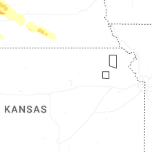
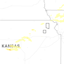

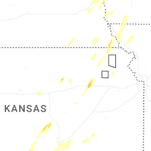
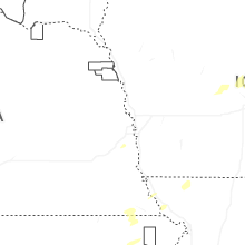


Connect with Interactive Hail Maps