

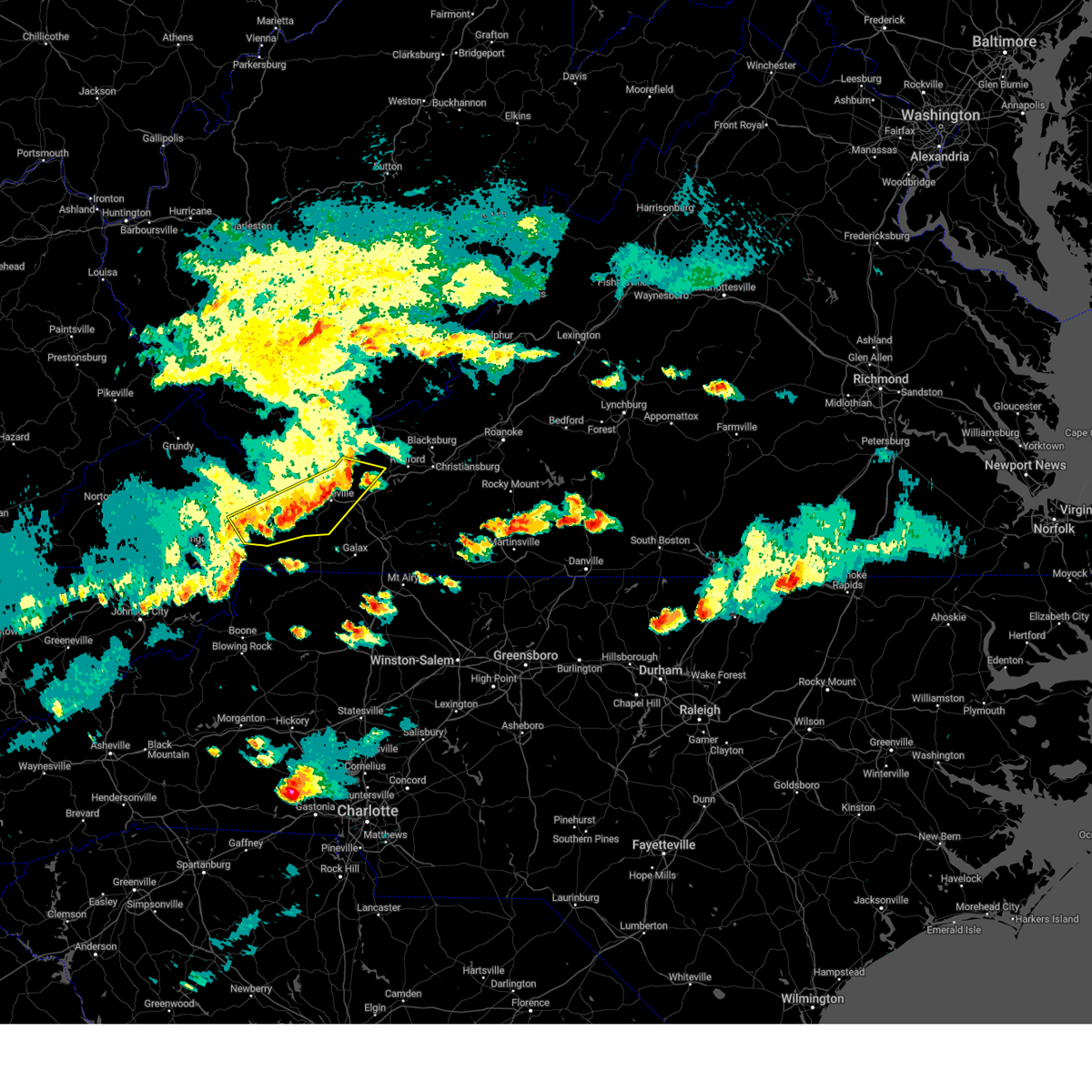
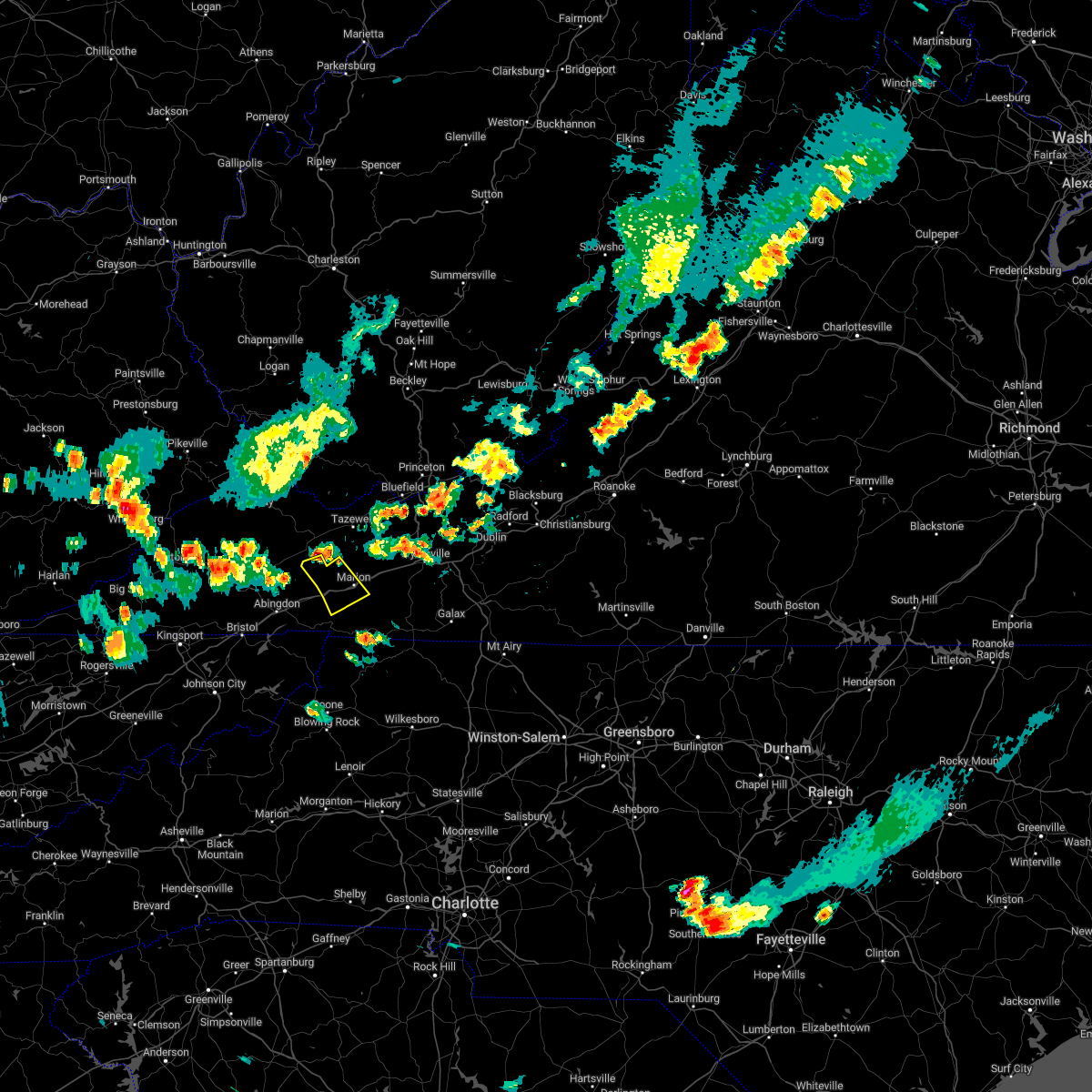
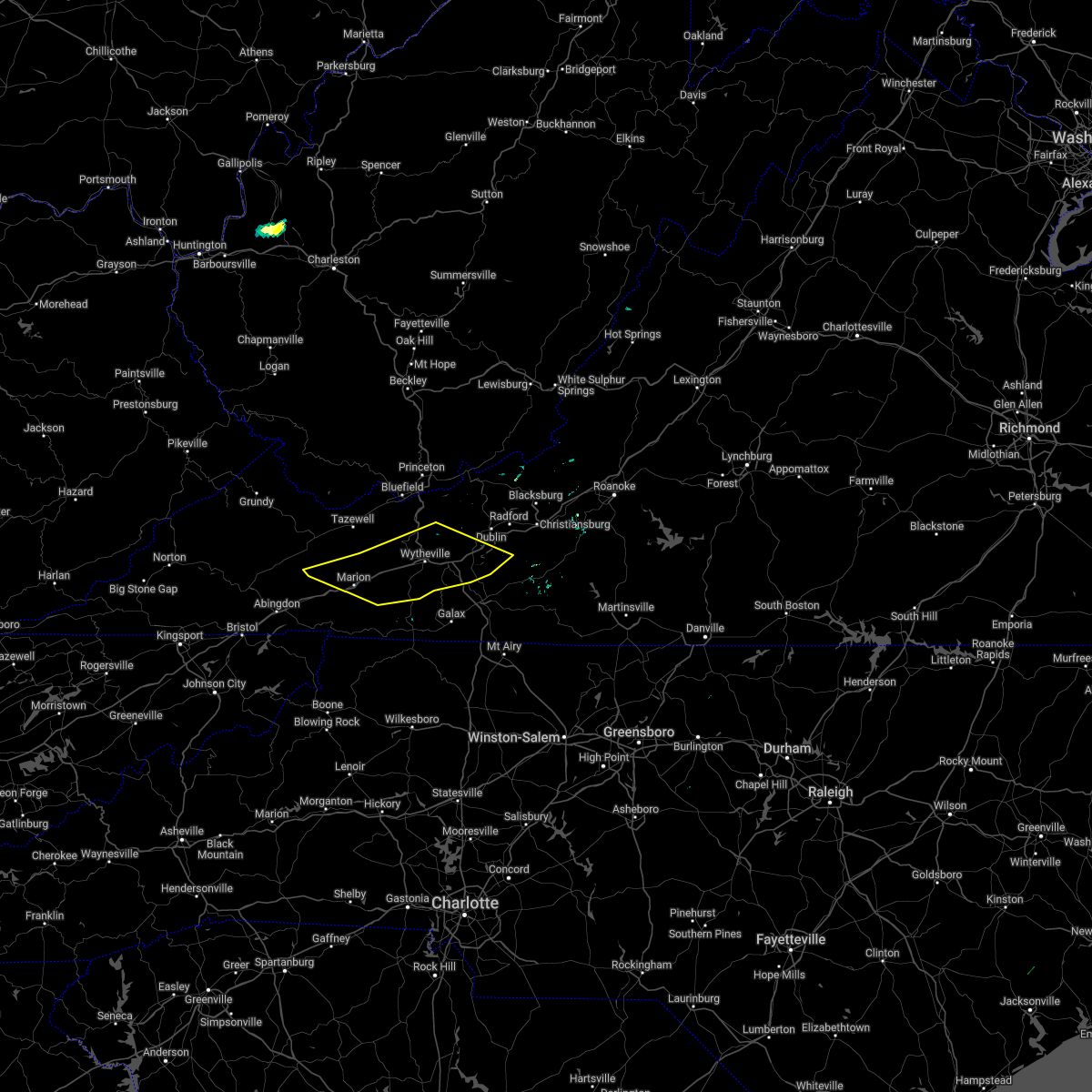
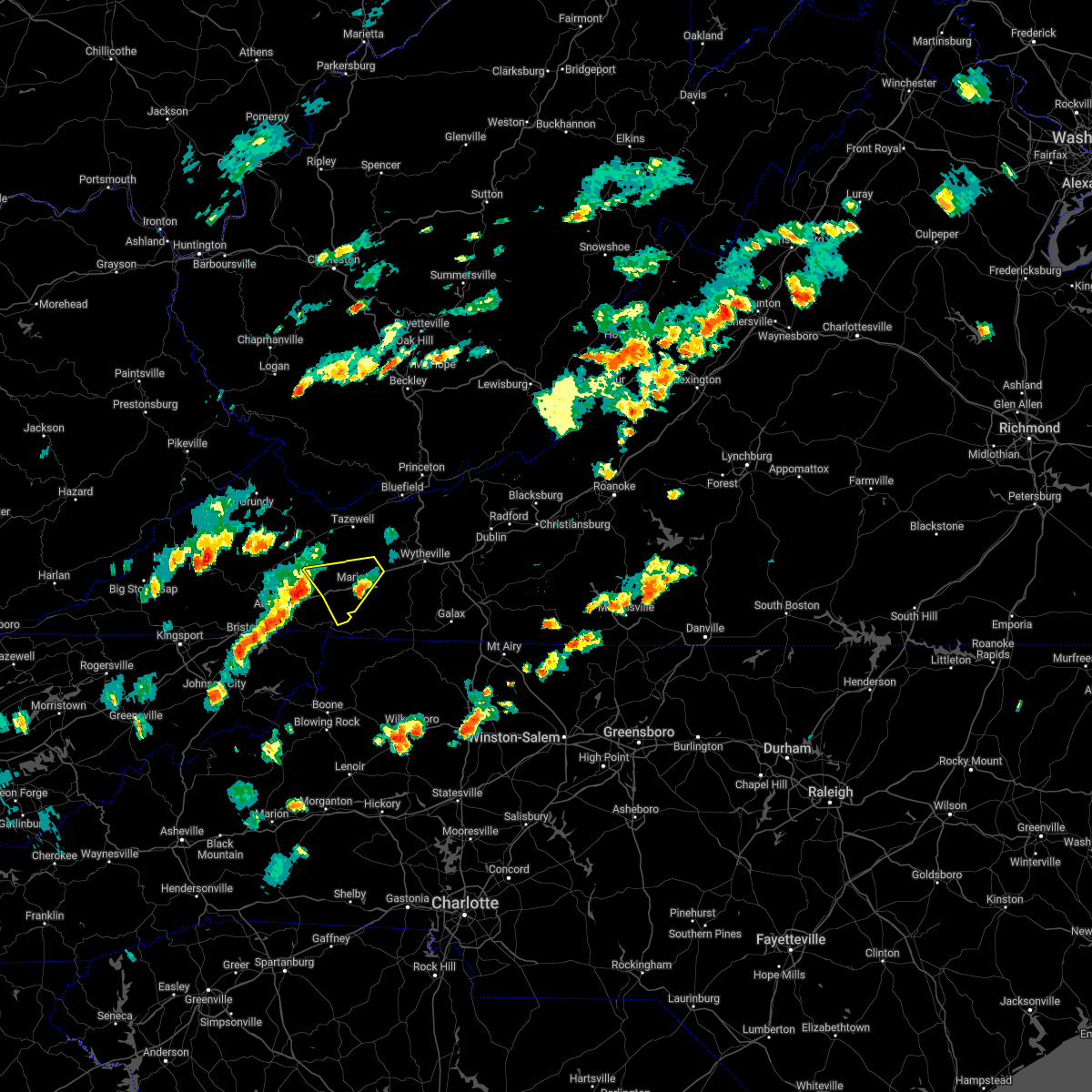
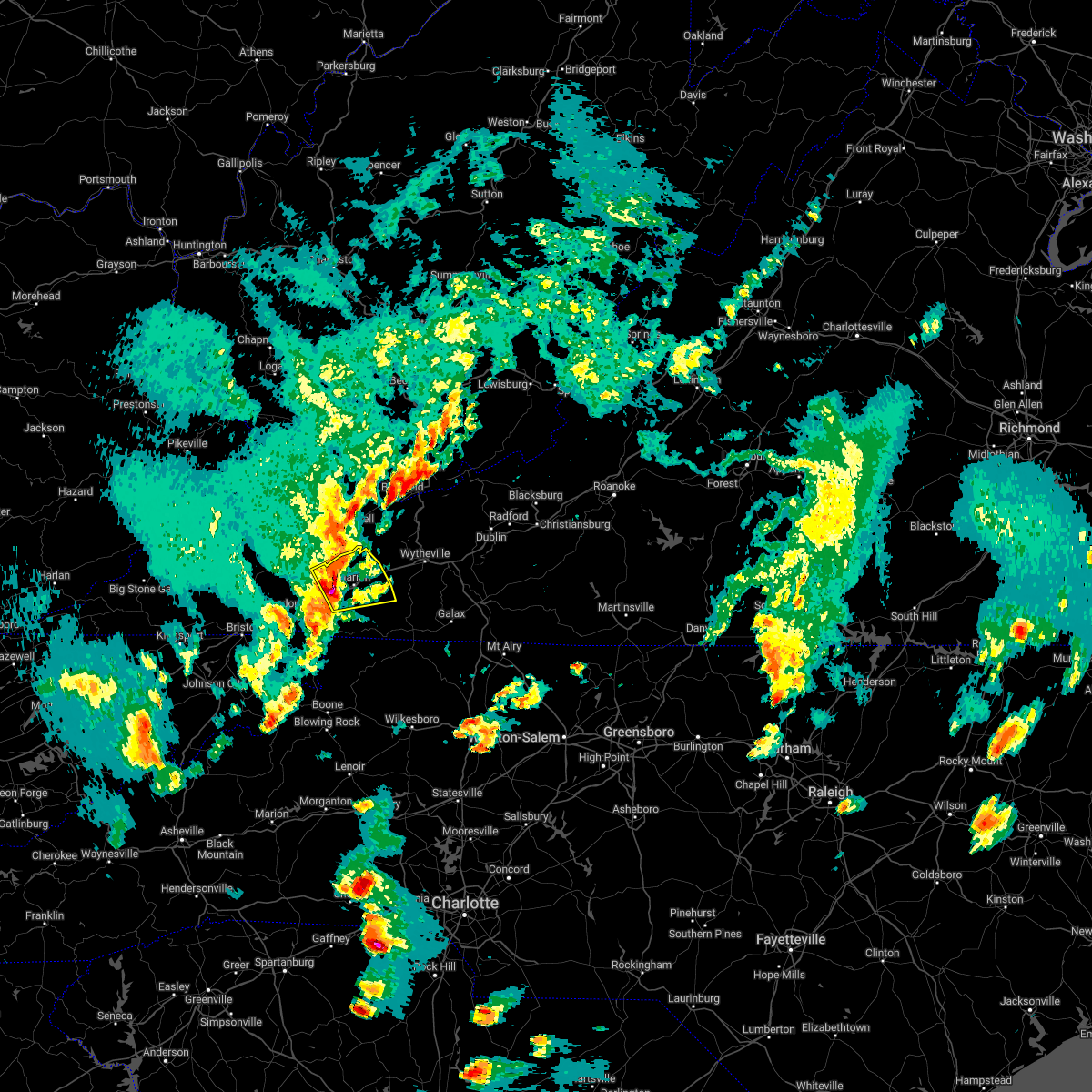
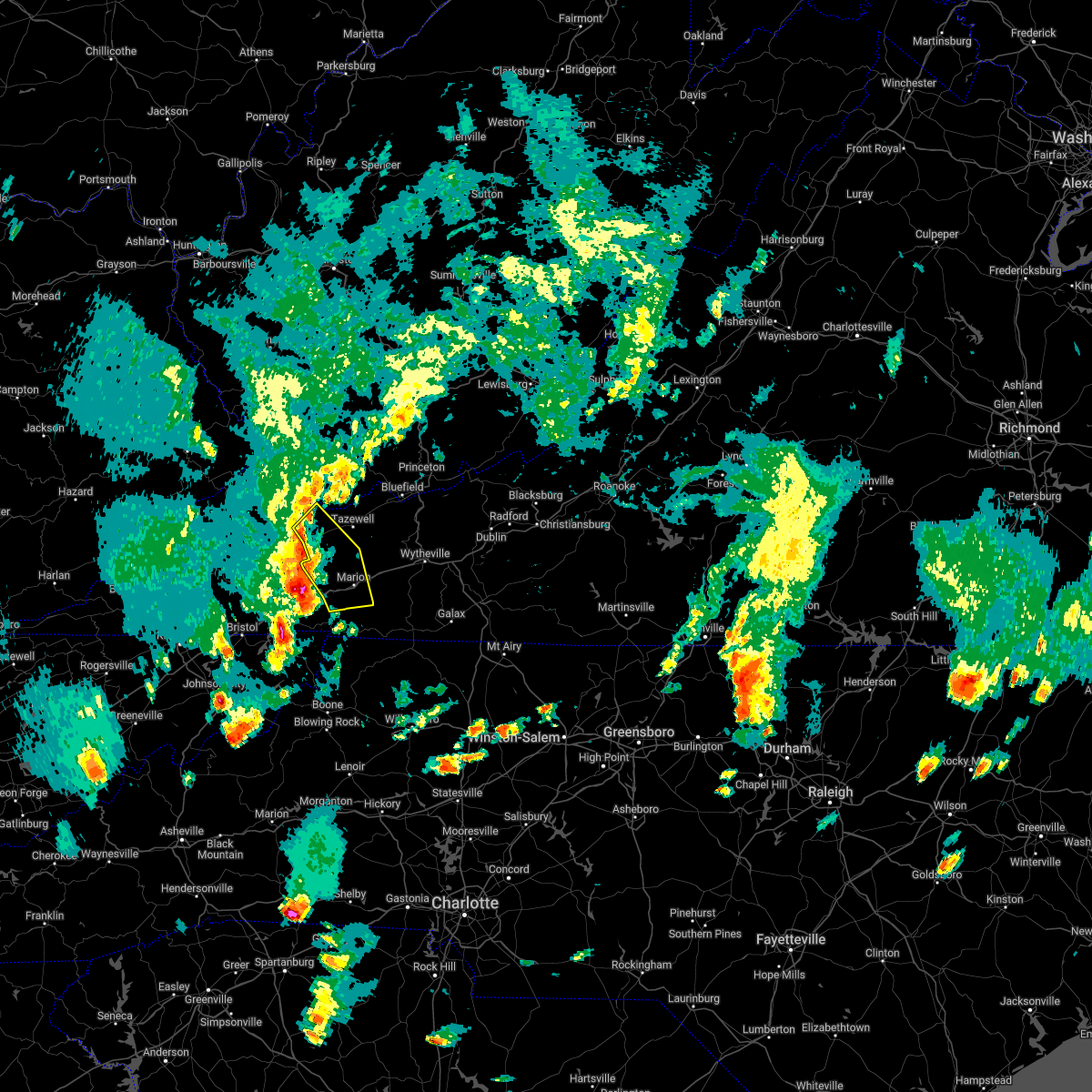
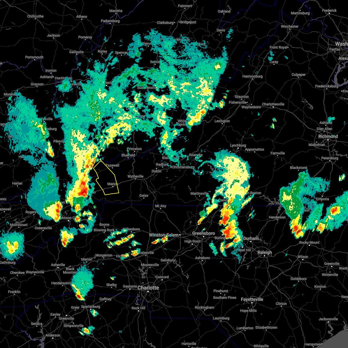
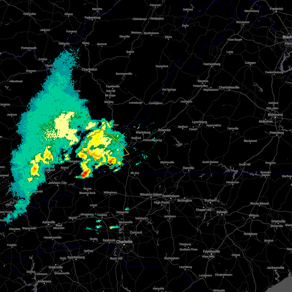
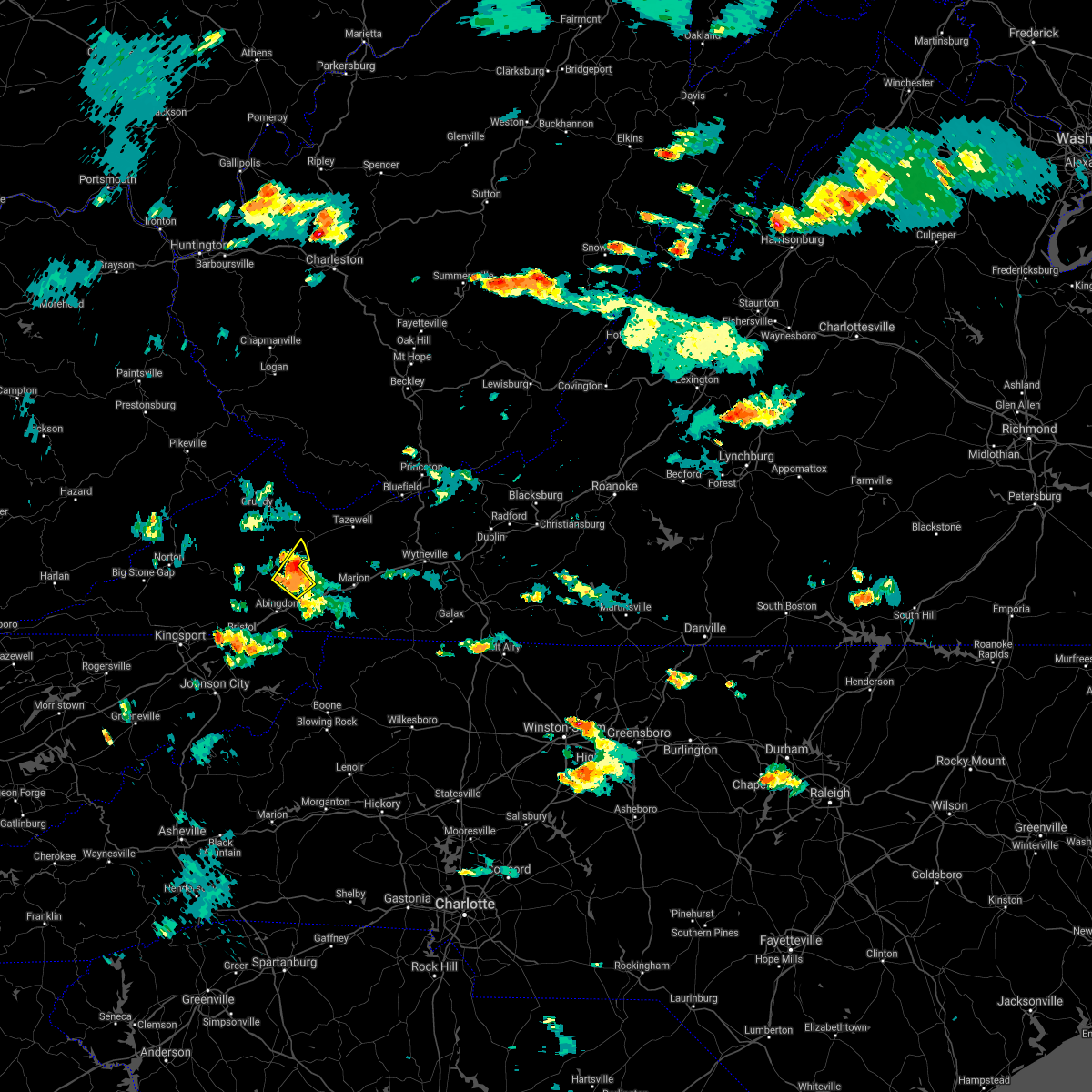
Hail Map for Saltville, VA
The Saltville, VA area has had 11 reports of on-the-ground hail by trained spotters, and has been under severe weather warnings 25 times during the past 12 months. Doppler radar has detected hail at or near Saltville, VA on 27 occasions.
| Name: | Saltville, VA |
| Where Located: | 31.9 miles NE of Bristol, TN |
| Map: | Google Map for Saltville, VA |
| Population: | 2077 |
| Housing Units: | 967 |
| More Info: | Search Google for Saltville, VA |
1
The Top Recent Hail Date for Saltville, VA is Friday, May 6, 2022 (8th out of 27)

Hail and Wind Damage Spotted near Saltville, VA
| Date / Time | Report Details |
|---|---|
| 4/11/2024 6:00 PM EDT | Tree down in the 2100 block of tumbling creek road... in the far northwest corner of smyth county. the tree was blocking the entire roadwa in smyth county VA, 5.4 miles SE of Saltville, VA |
| 2/12/2024 11:30 PM EST | Tree down along highwa in smyth county VA, 14.6 miles WSW of Saltville, VA |
| 2/12/2024 11:04 PM EST | A few trees and a powerline downed on east main street near the holston rive in smyth county VA, 1.4 miles SSW of Saltville, VA |
| 2/12/2024 10:56 PM EST |
 At 1054 pm est, severe thunderstorms were located along a line extending from near glen burke to mountain city, moving east at 50 mph (radar indicated). Hazards include 60 mph wind gusts. expect damage to roofs, siding, and trees At 1054 pm est, severe thunderstorms were located along a line extending from near glen burke to mountain city, moving east at 50 mph (radar indicated). Hazards include 60 mph wind gusts. expect damage to roofs, siding, and trees
|
| 7/29/2023 5:17 PM EDT |
 At 515 pm edt, a severe thunderstorm was located near lebanon, moving east at 20 mph (radar indicated). Hazards include 60 mph wind gusts and quarter size hail. Hail damage to vehicles is expected. expect wind damage to roofs, siding, and trees. locations impacted include, johnson city, kingsport, bristol tn, bristol va, abingdon, lebanon, mountain city, gate city, weber city and spurgeon. this includes the following highways, interstate 26 in tennessee between mile markers 1 and 17. interstate 81 in tennessee between mile markers 40 and 75. interstate 81 in virginia between mile markers 1 and 34. hail threat, radar indicated max hail size, 1. 00 in wind threat, radar indicated max wind gust, 60 mph. At 515 pm edt, a severe thunderstorm was located near lebanon, moving east at 20 mph (radar indicated). Hazards include 60 mph wind gusts and quarter size hail. Hail damage to vehicles is expected. expect wind damage to roofs, siding, and trees. locations impacted include, johnson city, kingsport, bristol tn, bristol va, abingdon, lebanon, mountain city, gate city, weber city and spurgeon. this includes the following highways, interstate 26 in tennessee between mile markers 1 and 17. interstate 81 in tennessee between mile markers 40 and 75. interstate 81 in virginia between mile markers 1 and 34. hail threat, radar indicated max hail size, 1. 00 in wind threat, radar indicated max wind gust, 60 mph.
|
| 7/29/2023 4:53 PM EDT |
 At 452 pm edt, a severe thunderstorm was located near lebanon, moving east at 20 mph (radar indicated). Hazards include 60 mph wind gusts and quarter size hail. Hail damage to vehicles is expected. Expect wind damage to roofs, siding, and trees. At 452 pm edt, a severe thunderstorm was located near lebanon, moving east at 20 mph (radar indicated). Hazards include 60 mph wind gusts and quarter size hail. Hail damage to vehicles is expected. Expect wind damage to roofs, siding, and trees.
|
| 7/28/2023 5:41 PM EDT |
 At 541 pm edt, severe thunderstorms were located along a line extending from near catawba to pilot to near grahams forge to near sugar grove, moving southeast at 25 mph (radar indicated). Hazards include 60 mph wind gusts. Expect damage to roofs, siding, and trees. locations impacted include, blacksburg, salem, christiansburg, radford, pulaski, wytheville, and marion. this includes the following location virginia tech. hail threat, radar indicated max hail size, <. 75 in wind threat, radar indicated max wind gust, 60 mph. At 541 pm edt, severe thunderstorms were located along a line extending from near catawba to pilot to near grahams forge to near sugar grove, moving southeast at 25 mph (radar indicated). Hazards include 60 mph wind gusts. Expect damage to roofs, siding, and trees. locations impacted include, blacksburg, salem, christiansburg, radford, pulaski, wytheville, and marion. this includes the following location virginia tech. hail threat, radar indicated max hail size, <. 75 in wind threat, radar indicated max wind gust, 60 mph.
|
| 7/28/2023 5:20 PM EDT |
 At 520 pm edt, severe thunderstorms were located along a line extending from sinking creek to radford to near wytheville to marion, moving southeast at 35 mph (radar indicated). Hazards include 60 mph wind gusts. Expect damage to roofs, siding, and trees. locations impacted include, blacksburg, salem, christiansburg, radford, pulaski, wytheville, and bland. this includes the following location virginia tech. hail threat, radar indicated max hail size, <. 75 in wind threat, radar indicated max wind gust, 60 mph. At 520 pm edt, severe thunderstorms were located along a line extending from sinking creek to radford to near wytheville to marion, moving southeast at 35 mph (radar indicated). Hazards include 60 mph wind gusts. Expect damage to roofs, siding, and trees. locations impacted include, blacksburg, salem, christiansburg, radford, pulaski, wytheville, and bland. this includes the following location virginia tech. hail threat, radar indicated max hail size, <. 75 in wind threat, radar indicated max wind gust, 60 mph.
|
| 7/28/2023 4:51 PM EDT |
 At 451 pm edt, severe thunderstorms were located along a line extending from wolfcreek to near narrows to suiter to near broadford, moving southeast at 45 mph (radar indicated). Hazards include 60 mph wind gusts. expect damage to roofs, siding, and trees At 451 pm edt, severe thunderstorms were located along a line extending from wolfcreek to near narrows to suiter to near broadford, moving southeast at 45 mph (radar indicated). Hazards include 60 mph wind gusts. expect damage to roofs, siding, and trees
|
| 7/28/2023 4:42 PM EDT |
 At 442 pm edt, severe thunderstorms were located along a line extending from near allison gap to 7 miles southwest of lebanon, moving southeast at 15 mph (radar indicated). Hazards include 60 mph wind gusts and penny size hail. expect damage to roofs, siding, and trees At 442 pm edt, severe thunderstorms were located along a line extending from near allison gap to 7 miles southwest of lebanon, moving southeast at 15 mph (radar indicated). Hazards include 60 mph wind gusts and penny size hail. expect damage to roofs, siding, and trees
|
| 7/28/2023 4:30 PM EDT |
 At 430 pm edt, severe thunderstorms were located along a line extending from 7 miles southwest of claypool hill to 8 miles south of cleveland va, moving southeast at 15 mph (radar indicated). Hazards include 60 mph wind gusts and quarter size hail. Hail damage to vehicles is expected. expect wind damage to roofs, siding, and trees. locations impacted include, lebanon, cleveland va, honaker, st. paul, dye, castlewood, holston, hansonville and rosedale. hail threat, radar indicated max hail size, 1. 00 in wind threat, radar indicated max wind gust, 60 mph. At 430 pm edt, severe thunderstorms were located along a line extending from 7 miles southwest of claypool hill to 8 miles south of cleveland va, moving southeast at 15 mph (radar indicated). Hazards include 60 mph wind gusts and quarter size hail. Hail damage to vehicles is expected. expect wind damage to roofs, siding, and trees. locations impacted include, lebanon, cleveland va, honaker, st. paul, dye, castlewood, holston, hansonville and rosedale. hail threat, radar indicated max hail size, 1. 00 in wind threat, radar indicated max wind gust, 60 mph.
|
| 7/28/2023 4:06 PM EDT |
 At 405 pm edt, severe thunderstorms were located along a line extending from 7 miles west of raven to 8 miles southwest of trammel, moving east at 10 mph (radar indicated). Hazards include 60 mph wind gusts and quarter size hail. Hail damage to vehicles is expected. Expect wind damage to roofs, siding, and trees. At 405 pm edt, severe thunderstorms were located along a line extending from 7 miles west of raven to 8 miles southwest of trammel, moving east at 10 mph (radar indicated). Hazards include 60 mph wind gusts and quarter size hail. Hail damage to vehicles is expected. Expect wind damage to roofs, siding, and trees.
|
| 5/16/2023 6:56 PM EDT |
 The severe thunderstorm warning for northeastern sullivan, northern johnson and eastern washington counties and the eastern city of bristol will expire at 700 pm edt, the storm which prompted the warning has moved out of the area. therefore, the warning will be allowed to expire. a severe thunderstorm watch remains in effect until 800 pm edt for east tennessee, and southwestern virginia. a severe thunderstorm watch also remains in effect until 1000 pm edt for east tennessee. to report severe weather, contact your nearest law enforcement agency. they will relay your report to the national weather service morristown. The severe thunderstorm warning for northeastern sullivan, northern johnson and eastern washington counties and the eastern city of bristol will expire at 700 pm edt, the storm which prompted the warning has moved out of the area. therefore, the warning will be allowed to expire. a severe thunderstorm watch remains in effect until 800 pm edt for east tennessee, and southwestern virginia. a severe thunderstorm watch also remains in effect until 1000 pm edt for east tennessee. to report severe weather, contact your nearest law enforcement agency. they will relay your report to the national weather service morristown.
|
| 5/16/2023 6:45 PM EDT |
 At 644 pm edt, severe thunderstorms were located along a line extending from near long spur to near mount rogers national recreation area, moving east at 40 mph (radar indicated). Hazards include 60 mph wind gusts. Expect damage to roofs, siding, and trees. locations impacted include, wytheville, bland, marion, chilhowie, rural retreat, ceres, and max meadows. hail threat, radar indicated max hail size, <. 75 in wind threat, radar indicated max wind gust, 60 mph. At 644 pm edt, severe thunderstorms were located along a line extending from near long spur to near mount rogers national recreation area, moving east at 40 mph (radar indicated). Hazards include 60 mph wind gusts. Expect damage to roofs, siding, and trees. locations impacted include, wytheville, bland, marion, chilhowie, rural retreat, ceres, and max meadows. hail threat, radar indicated max hail size, <. 75 in wind threat, radar indicated max wind gust, 60 mph.
|
| 5/16/2023 6:35 PM EDT | Couple of large trees down along allison gap roa in smyth county VA, 1.2 miles S of Saltville, VA |
| 5/16/2023 6:34 PM EDT |
 At 634 pm edt, a severe thunderstorm was located 9 miles southeast of abingdon, moving east at 50 mph (radar indicated). Hazards include 60 mph wind gusts. Expect damage to roofs, siding, and trees. locations impacted include, bristol tn, bristol va, abingdon, mountain city, glade spring, damascus, laurel bloomery, emory-meadow view, shady valley and south holston dam. This includes interstate 81 in virginia between mile markers 9 and 34. At 634 pm edt, a severe thunderstorm was located 9 miles southeast of abingdon, moving east at 50 mph (radar indicated). Hazards include 60 mph wind gusts. Expect damage to roofs, siding, and trees. locations impacted include, bristol tn, bristol va, abingdon, mountain city, glade spring, damascus, laurel bloomery, emory-meadow view, shady valley and south holston dam. This includes interstate 81 in virginia between mile markers 9 and 34.
|
| 5/16/2023 6:30 PM EDT | Couple of large trees down along route 107 in saltvill in smyth county VA, 1.2 miles S of Saltville, VA |
| 5/16/2023 6:30 PM EDT |
 At 629 pm edt, severe thunderstorms were located along a line extending from near bland to near chilhowie, moving east at 40 mph (radar indicated). Hazards include 60 mph wind gusts. Expect damage to roofs, siding, and trees. locations impacted include, wytheville, bland, marion, saltville, chilhowie, rural retreat, and ceres. hail threat, radar indicated max hail size, <. 75 in wind threat, radar indicated max wind gust, 60 mph. At 629 pm edt, severe thunderstorms were located along a line extending from near bland to near chilhowie, moving east at 40 mph (radar indicated). Hazards include 60 mph wind gusts. Expect damage to roofs, siding, and trees. locations impacted include, wytheville, bland, marion, saltville, chilhowie, rural retreat, and ceres. hail threat, radar indicated max hail size, <. 75 in wind threat, radar indicated max wind gust, 60 mph.
|
| 5/16/2023 6:22 PM EDT |
 At 621 pm edt, severe thunderstorms were located along a line extending from near clear fork to quarry, moving east at 40 mph (radar indicated). Hazards include 60 mph wind gusts. expect damage to roofs, siding, and trees At 621 pm edt, severe thunderstorms were located along a line extending from near clear fork to quarry, moving east at 40 mph (radar indicated). Hazards include 60 mph wind gusts. expect damage to roofs, siding, and trees
|
| 5/16/2023 6:03 PM EDT |
 At 603 pm edt, a severe thunderstorm was located 8 miles northwest of bristol va, moving east at 55 mph (radar indicated). Hazards include 60 mph wind gusts. expect damage to roofs, siding, and trees At 603 pm edt, a severe thunderstorm was located 8 miles northwest of bristol va, moving east at 55 mph (radar indicated). Hazards include 60 mph wind gusts. expect damage to roofs, siding, and trees
|
| 5/16/2023 5:49 PM EDT |
 At 549 pm edt, a severe thunderstorm was located near cleveland va, or near lebanon, moving east at 30 mph (radar indicated). Hazards include 60 mph wind gusts and penny size hail. Expect damage to roofs, siding, and trees. Locations impacted include, lebanon, honaker, dye and rosedale. At 549 pm edt, a severe thunderstorm was located near cleveland va, or near lebanon, moving east at 30 mph (radar indicated). Hazards include 60 mph wind gusts and penny size hail. Expect damage to roofs, siding, and trees. Locations impacted include, lebanon, honaker, dye and rosedale.
|
| 5/16/2023 5:34 PM EDT |
 At 534 pm edt, a severe thunderstorm was located near trammel, or 8 miles southwest of davenport, moving east at 40 mph (radar indicated). Hazards include 60 mph wind gusts and nickel size hail. expect damage to roofs, siding, and trees At 534 pm edt, a severe thunderstorm was located near trammel, or 8 miles southwest of davenport, moving east at 40 mph (radar indicated). Hazards include 60 mph wind gusts and nickel size hail. expect damage to roofs, siding, and trees
|
| 3/3/2023 5:35 PM EST | Several trees down with numerous power outage in smyth county VA, 0.6 miles SSW of Saltville, VA |
| 3/3/2023 5:25 PM EST |
 The severe thunderstorm warning for northwestern smyth and tazewell counties will expire at 530 pm est, the storm which prompted the warning has weakened below severe limits, and no longer poses an immediate threat to life or property. therefore, the warning will be allowed to expire. however gusty winds are still possible with this thunderstorm. The severe thunderstorm warning for northwestern smyth and tazewell counties will expire at 530 pm est, the storm which prompted the warning has weakened below severe limits, and no longer poses an immediate threat to life or property. therefore, the warning will be allowed to expire. however gusty winds are still possible with this thunderstorm.
|
| 3/3/2023 5:14 PM EST |
 At 514 pm est, a severe thunderstorm was located near allison gap, or 7 miles northwest of saltville, moving northeast at 60 mph (radar indicated). Hazards include 60 mph wind gusts. Expect damage to roofs, siding, and trees. locations impacted include, richlands, tazewell, saltville, chilhowie, cedar bluff, pocahontas, and raven. hail threat, radar indicated max hail size, <. 75 in wind threat, radar indicated max wind gust, 60 mph. At 514 pm est, a severe thunderstorm was located near allison gap, or 7 miles northwest of saltville, moving northeast at 60 mph (radar indicated). Hazards include 60 mph wind gusts. Expect damage to roofs, siding, and trees. locations impacted include, richlands, tazewell, saltville, chilhowie, cedar bluff, pocahontas, and raven. hail threat, radar indicated max hail size, <. 75 in wind threat, radar indicated max wind gust, 60 mph.
|
| 3/3/2023 5:00 PM EST |
 At 500 pm est, a severe thunderstorm was located near allison gap, or near saltville, moving northeast at 60 mph (radar indicated). Hazards include 60 mph wind gusts. expect damage to roofs, siding, and trees At 500 pm est, a severe thunderstorm was located near allison gap, or near saltville, moving northeast at 60 mph (radar indicated). Hazards include 60 mph wind gusts. expect damage to roofs, siding, and trees
|
| 3/3/2023 4:37 PM EST |
 At 436 pm est, a severe thunderstorm was located 7 miles west of walnut hill, or 8 miles east of kingsport, moving northeast at 70 mph (radar indicated). Hazards include 60 mph wind gusts. expect damage to roofs, siding, and trees At 436 pm est, a severe thunderstorm was located 7 miles west of walnut hill, or 8 miles east of kingsport, moving northeast at 70 mph (radar indicated). Hazards include 60 mph wind gusts. expect damage to roofs, siding, and trees
|
| 1/3/2023 4:50 PM EST | 4 to 5 trees snapped and power poles downed along lake drive in saltvill in smyth county VA, 0.4 miles ENE of Saltville, VA |
| 8/10/2022 6:00 PM EDT | Several reports of downed trees in the saltville are in smyth county VA, 0.6 miles SSW of Saltville, VA |
| 8/5/2022 5:57 PM EDT |
 At 556 pm edt, severe thunderstorms were located along a line extending from near payne gap to 8 miles northeast of gate city to near quarry, moving northeast at 35 mph (radar indicated). Hazards include 60 mph wind gusts and penny size hail. expect damage to roofs, siding, and trees At 556 pm edt, severe thunderstorms were located along a line extending from near payne gap to 8 miles northeast of gate city to near quarry, moving northeast at 35 mph (radar indicated). Hazards include 60 mph wind gusts and penny size hail. expect damage to roofs, siding, and trees
|
| 8/5/2022 5:33 PM EDT |
 At 532 pm edt, severe thunderstorms were located along a line extending from near abingdon to bristol va to kingsport, moving north at 15 mph (radar indicated). Hazards include 60 mph wind gusts and nickel size hail. Expect damage to roofs, siding, and trees. locations impacted include, kingsport, bristol tn, bristol va, abingdon, lebanon, gate city, weber city, colonial heights, walnut hill and church hill. this includes the following highways, interstate 26 in tennessee between mile markers 1 and 7. interstate 81 in tennessee between mile markers 59 and 75. interstate 81 in virginia between mile markers 1 and 25. hail threat, radar indicated max hail size, 0. 88 in wind threat, radar indicated max wind gust, 60 mph. At 532 pm edt, severe thunderstorms were located along a line extending from near abingdon to bristol va to kingsport, moving north at 15 mph (radar indicated). Hazards include 60 mph wind gusts and nickel size hail. Expect damage to roofs, siding, and trees. locations impacted include, kingsport, bristol tn, bristol va, abingdon, lebanon, gate city, weber city, colonial heights, walnut hill and church hill. this includes the following highways, interstate 26 in tennessee between mile markers 1 and 7. interstate 81 in tennessee between mile markers 59 and 75. interstate 81 in virginia between mile markers 1 and 25. hail threat, radar indicated max hail size, 0. 88 in wind threat, radar indicated max wind gust, 60 mph.
|
| 8/5/2022 5:09 PM EDT |
 At 508 pm edt, severe thunderstorms were located along a line extending from 6 miles east of bristol va to near bristol tn to 7 miles southwest of colonial heights, moving north at 15 mph (radar indicated). Hazards include 60 mph wind gusts and nickel size hail. expect damage to roofs, siding, and trees At 508 pm edt, severe thunderstorms were located along a line extending from 6 miles east of bristol va to near bristol tn to 7 miles southwest of colonial heights, moving north at 15 mph (radar indicated). Hazards include 60 mph wind gusts and nickel size hail. expect damage to roofs, siding, and trees
|
| 7/23/2022 6:35 PM EDT |
 At 635 pm edt, a severe thunderstorm was located near broadford, or near saltville, moving southeast at 10 mph (radar indicated). Hazards include 60 mph wind gusts and quarter size hail. Hail damage to vehicles is expected. Expect wind damage to roofs, siding, and trees. At 635 pm edt, a severe thunderstorm was located near broadford, or near saltville, moving southeast at 10 mph (radar indicated). Hazards include 60 mph wind gusts and quarter size hail. Hail damage to vehicles is expected. Expect wind damage to roofs, siding, and trees.
|
| 7/18/2022 6:15 PM EDT |
 At 612 pm edt, a severe thunderstorm was located 7 miles southeast of abingdon, moving east at 25 mph (radar indicated. at 605 pm, local law enforcement reported several trees down across sullivan county, tn and washington county, va). Hazards include 60 mph wind gusts. Expect damage to roofs, siding, and trees. locations impacted include, abingdon, glade spring, damascus, lindell, holston, emory-meadow view and konnarock. this includes interstate 81 in virginia between mile markers 12 and 34. hail threat, radar indicated max hail size, <. 75 in wind threat, radar indicated max wind gust, 60 mph. At 612 pm edt, a severe thunderstorm was located 7 miles southeast of abingdon, moving east at 25 mph (radar indicated. at 605 pm, local law enforcement reported several trees down across sullivan county, tn and washington county, va). Hazards include 60 mph wind gusts. Expect damage to roofs, siding, and trees. locations impacted include, abingdon, glade spring, damascus, lindell, holston, emory-meadow view and konnarock. this includes interstate 81 in virginia between mile markers 12 and 34. hail threat, radar indicated max hail size, <. 75 in wind threat, radar indicated max wind gust, 60 mph.
|
| 7/18/2022 5:31 PM EDT |
 At 530 pm edt, a severe thunderstorm was located near bristol va, moving northeast at 25 mph (radar indicated). Hazards include 60 mph wind gusts. expect damage to roofs, siding, and trees At 530 pm edt, a severe thunderstorm was located near bristol va, moving northeast at 25 mph (radar indicated). Hazards include 60 mph wind gusts. expect damage to roofs, siding, and trees
|
| 6/17/2022 4:21 PM EDT |
 At 420 pm edt, severe thunderstorms were located along a line extending from near dublin to marion, moving east at 70 mph (radar indicated). Hazards include 60 mph wind gusts. Expect damage to roofs, siding, and trees. locations impacted include, pulaski, wytheville, bland, marion, saltville, rural retreat, and ceres. hail threat, radar indicated max hail size, <. 75 in wind threat, radar indicated max wind gust, 60 mph. At 420 pm edt, severe thunderstorms were located along a line extending from near dublin to marion, moving east at 70 mph (radar indicated). Hazards include 60 mph wind gusts. Expect damage to roofs, siding, and trees. locations impacted include, pulaski, wytheville, bland, marion, saltville, rural retreat, and ceres. hail threat, radar indicated max hail size, <. 75 in wind threat, radar indicated max wind gust, 60 mph.
|
| 6/17/2022 3:35 PM EDT | Scattered trees and powerlines down throughout the northwest part of the county from saltville to rich valley and from saltville to chilhowi in smyth county VA, 5.2 miles W of Saltville, VA |
| 6/17/2022 3:32 PM EDT |
 At 331 pm edt, severe thunderstorms were located along a line extending from near mechanicsburg to near nebo, moving east at 70 mph (radar indicated). Hazards include 60 mph wind gusts and quarter size hail. Hail damage to vehicles is expected. Expect wind damage to roofs, siding, and trees. At 331 pm edt, severe thunderstorms were located along a line extending from near mechanicsburg to near nebo, moving east at 70 mph (radar indicated). Hazards include 60 mph wind gusts and quarter size hail. Hail damage to vehicles is expected. Expect wind damage to roofs, siding, and trees.
|
| 6/14/2022 5:13 AM EDT |
 At 513 am edt, a severe thunderstorm was located near elk creek, or near speedwell, moving southeast at 55 mph (radar indicated). Hazards include 60 mph wind gusts. Expect damage to roofs, siding, and trees. locations impacted include, wytheville, galax, marion, hillsville, saltville, chilhowie, and sparta. hail threat, radar indicated max hail size, <. 75 in wind threat, radar indicated max wind gust, 60 mph. At 513 am edt, a severe thunderstorm was located near elk creek, or near speedwell, moving southeast at 55 mph (radar indicated). Hazards include 60 mph wind gusts. Expect damage to roofs, siding, and trees. locations impacted include, wytheville, galax, marion, hillsville, saltville, chilhowie, and sparta. hail threat, radar indicated max hail size, <. 75 in wind threat, radar indicated max wind gust, 60 mph.
|
| 6/14/2022 4:49 AM EDT |
 At 449 am edt, a severe thunderstorm was located over nebo, or 7 miles southwest of ceres, moving southeast at 55 mph (radar indicated). Hazards include 60 mph wind gusts and quarter size hail. Hail damage to vehicles is expected. Expect wind damage to roofs, siding, and trees. At 449 am edt, a severe thunderstorm was located over nebo, or 7 miles southwest of ceres, moving southeast at 55 mph (radar indicated). Hazards include 60 mph wind gusts and quarter size hail. Hail damage to vehicles is expected. Expect wind damage to roofs, siding, and trees.
|
| 6/2/2022 3:28 PM EDT |
 The severe thunderstorm warning for northeastern washington county will expire at 330 pm edt, the storm which prompted the warning has weakened below severe limits, and no longer poses an immediate threat to life or property. therefore, the warning will be allowed to expire. however gusty winds are still possible with this thunderstorm. The severe thunderstorm warning for northeastern washington county will expire at 330 pm edt, the storm which prompted the warning has weakened below severe limits, and no longer poses an immediate threat to life or property. therefore, the warning will be allowed to expire. however gusty winds are still possible with this thunderstorm.
|
| 6/2/2022 3:05 PM EDT |
 At 305 pm edt, severe thunderstorms were located along a line extending from near quarry to pine crest, moving east at 30 mph (radar indicated). Hazards include 60 mph wind gusts and quarter size hail. Hail damage to vehicles is expected. Expect wind damage to roofs, siding, and trees. At 305 pm edt, severe thunderstorms were located along a line extending from near quarry to pine crest, moving east at 30 mph (radar indicated). Hazards include 60 mph wind gusts and quarter size hail. Hail damage to vehicles is expected. Expect wind damage to roofs, siding, and trees.
|
| 6/2/2022 3:04 PM EDT |
 At 304 pm edt, a severe thunderstorm was located near quarry, or 7 miles southwest of saltville, moving east at 25 mph (radar indicated). Hazards include 60 mph wind gusts and penny size hail. expect damage to roofs, siding, and trees At 304 pm edt, a severe thunderstorm was located near quarry, or 7 miles southwest of saltville, moving east at 25 mph (radar indicated). Hazards include 60 mph wind gusts and penny size hail. expect damage to roofs, siding, and trees
|
| 5/6/2022 7:20 PM EDT |
 At 720 pm edt, severe thunderstorms were located along a line extending from 8 miles southwest of raven to near broadford to adwolf, moving northeast at 50 mph (radar indicated). Hazards include 60 mph wind gusts. Expect damage to roofs, siding, and trees. locations impacted include, lebanon, cleveland va, glade spring, honaker, st. paul, dye, lindell, castlewood, rosedale and emory-meadow view. this includes interstate 81 in virginia between mile markers 31 and 34. hail threat, radar indicated max hail size, <. 75 in wind threat, radar indicated max wind gust, 60 mph. At 720 pm edt, severe thunderstorms were located along a line extending from 8 miles southwest of raven to near broadford to adwolf, moving northeast at 50 mph (radar indicated). Hazards include 60 mph wind gusts. Expect damage to roofs, siding, and trees. locations impacted include, lebanon, cleveland va, glade spring, honaker, st. paul, dye, lindell, castlewood, rosedale and emory-meadow view. this includes interstate 81 in virginia between mile markers 31 and 34. hail threat, radar indicated max hail size, <. 75 in wind threat, radar indicated max wind gust, 60 mph.
|
| 5/6/2022 6:56 PM EDT |
 At 655 pm edt, severe thunderstorms were located along a line extending from 11 miles southwest of cleveland va to near abingdon to 12 miles east of bristol va, moving northeast at 45 mph. this line of storms has a history of producing damaging winds (radar indicated). Hazards include 60 mph wind gusts. expect damage to roofs, siding, and trees At 655 pm edt, severe thunderstorms were located along a line extending from 11 miles southwest of cleveland va to near abingdon to 12 miles east of bristol va, moving northeast at 45 mph. this line of storms has a history of producing damaging winds (radar indicated). Hazards include 60 mph wind gusts. expect damage to roofs, siding, and trees
|
| 5/6/2022 5:47 PM EDT |
 At 546 pm edt, a severe thunderstorm was located near broadford, or near marion, moving northeast at 55 mph (radar indicated). Hazards include 60 mph wind gusts and half dollar size hail. Hail damage to vehicles is expected. Expect wind damage to roofs, siding, and trees. At 546 pm edt, a severe thunderstorm was located near broadford, or near marion, moving northeast at 55 mph (radar indicated). Hazards include 60 mph wind gusts and half dollar size hail. Hail damage to vehicles is expected. Expect wind damage to roofs, siding, and trees.
|
| 5/6/2022 5:21 PM EDT |
 At 519 pm edt, severe thunderstorms were located along a line extending from raven to near allison gap to 7 miles southwest of quarry, moving northeast at 60 mph (radar indicated). Hazards include 60 mph wind gusts and quarter size hail. Hail damage to vehicles is expected. expect wind damage to roofs, siding, and trees. Locations impacted include, marion, richlands, saltville, chilhowie, cedar bluff, mount rogers national recreation area, and sugar grove. At 519 pm edt, severe thunderstorms were located along a line extending from raven to near allison gap to 7 miles southwest of quarry, moving northeast at 60 mph (radar indicated). Hazards include 60 mph wind gusts and quarter size hail. Hail damage to vehicles is expected. expect wind damage to roofs, siding, and trees. Locations impacted include, marion, richlands, saltville, chilhowie, cedar bluff, mount rogers national recreation area, and sugar grove.
|
| 5/6/2022 5:04 PM EDT |
 At 503 pm edt, severe thunderstorms were located along a line extending from near lebanon to 9 miles west of saltville to abingdon, moving northeast at 60 mph (radar indicated). Hazards include 60 mph wind gusts and quarter size hail. Hail damage to vehicles is expected. Expect wind damage to roofs, siding, and trees. At 503 pm edt, severe thunderstorms were located along a line extending from near lebanon to 9 miles west of saltville to abingdon, moving northeast at 60 mph (radar indicated). Hazards include 60 mph wind gusts and quarter size hail. Hail damage to vehicles is expected. Expect wind damage to roofs, siding, and trees.
|
| 5/6/2022 5:03 PM EDT |
 At 503 pm edt, a severe thunderstorm capable of producing a tornado was located over abingdon, moving east at 35 mph (radar indicated rotation). Hazards include tornado and quarter size hail. Flying debris will be dangerous to those caught without shelter. mobile homes will be damaged or destroyed. damage to roofs, windows, and vehicles will occur. tree damage is likely. this tornadic thunderstorm will remain over mainly rural areas of eastern washington county, including the following locations, lindell, emory-meadow view and glade spring. This includes interstate 81 in virginia between mile markers 20 and 34. At 503 pm edt, a severe thunderstorm capable of producing a tornado was located over abingdon, moving east at 35 mph (radar indicated rotation). Hazards include tornado and quarter size hail. Flying debris will be dangerous to those caught without shelter. mobile homes will be damaged or destroyed. damage to roofs, windows, and vehicles will occur. tree damage is likely. this tornadic thunderstorm will remain over mainly rural areas of eastern washington county, including the following locations, lindell, emory-meadow view and glade spring. This includes interstate 81 in virginia between mile markers 20 and 34.
|
| 6/7/2021 4:28 PM EDT |
 At 427 pm edt, severe thunderstorms were located along a line extending from 7 miles south of trammel to near abingdon, moving northeast at 30 mph (radar indicated). Hazards include 60 mph wind gusts. Expect damage to roofs, siding, and trees. locations impacted include, bristol va, abingdon, lebanon, cleveland va, glade spring, honaker, st. paul, emory-meadow view, rosedale and dye. This includes interstate 81 in virginia between mile markers 9 and 34. At 427 pm edt, severe thunderstorms were located along a line extending from 7 miles south of trammel to near abingdon, moving northeast at 30 mph (radar indicated). Hazards include 60 mph wind gusts. Expect damage to roofs, siding, and trees. locations impacted include, bristol va, abingdon, lebanon, cleveland va, glade spring, honaker, st. paul, emory-meadow view, rosedale and dye. This includes interstate 81 in virginia between mile markers 9 and 34.
|
| 6/7/2021 3:59 PM EDT |
 The national weather service in morristown has issued a * severe thunderstorm warning for. eastern sullivan county in east tennessee. northwestern johnson county in east tennessee. northeastern carter county in east tennessee. Russell county in southwestern virginia. The national weather service in morristown has issued a * severe thunderstorm warning for. eastern sullivan county in east tennessee. northwestern johnson county in east tennessee. northeastern carter county in east tennessee. Russell county in southwestern virginia.
|
| 6/7/2021 3:59 PM EDT |
 At 358 pm edt, severe thunderstorms were located along a line extending from 11 miles northeast of gate city to 11 miles southeast of bristol tn, moving northeast at 30 mph (radar indicated). Hazards include 60 mph wind gusts. expect damage to roofs, siding, and trees At 358 pm edt, severe thunderstorms were located along a line extending from 11 miles northeast of gate city to 11 miles southeast of bristol tn, moving northeast at 30 mph (radar indicated). Hazards include 60 mph wind gusts. expect damage to roofs, siding, and trees
|
| 3/28/2021 2:46 AM EDT |
 At 245 am edt, a severe thunderstorm was located 7 miles southwest of chilhowie, moving east at 55 mph (radar indicated). Hazards include 60 mph wind gusts and quarter size hail. Hail damage to vehicles is expected. Expect wind damage to roofs, siding, and trees. At 245 am edt, a severe thunderstorm was located 7 miles southwest of chilhowie, moving east at 55 mph (radar indicated). Hazards include 60 mph wind gusts and quarter size hail. Hail damage to vehicles is expected. Expect wind damage to roofs, siding, and trees.
|
| 3/27/2021 1:43 PM EDT |
 The severe thunderstorm warning for eastern sullivan, johnson, carter, eastern russell and washington counties and the eastern city of bristol will expire at 145 pm edt, the storms which prompted the warning have moved out of the area. therefore, the warning will be allowed to expire. The severe thunderstorm warning for eastern sullivan, johnson, carter, eastern russell and washington counties and the eastern city of bristol will expire at 145 pm edt, the storms which prompted the warning have moved out of the area. therefore, the warning will be allowed to expire.
|
| 3/27/2021 1:25 PM EDT |
 At 125 pm edt, severe thunderstorms were located along a line extending from near davenport to near elk park, moving east at 35 mph (radar indicated). Hazards include 60 mph wind gusts and penny size hail. Expect damage to roofs, siding, and trees. locations impacted include, bristol tn, bristol va, elizabethton, abingdon, lebanon, mountain city, hampton, glade spring, honaker and damascus. This includes interstate 81 in virginia between mile markers 6 and 34. At 125 pm edt, severe thunderstorms were located along a line extending from near davenport to near elk park, moving east at 35 mph (radar indicated). Hazards include 60 mph wind gusts and penny size hail. Expect damage to roofs, siding, and trees. locations impacted include, bristol tn, bristol va, elizabethton, abingdon, lebanon, mountain city, hampton, glade spring, honaker and damascus. This includes interstate 81 in virginia between mile markers 6 and 34.
|
| 3/27/2021 1:15 PM EDT |
 At 114 pm edt, severe thunderstorms were located along a line extending from glen burke to near bakersville, moving east at 40 mph (radar indicated). Hazards include 60 mph wind gusts and quarter size hail. Hail damage to vehicles is expected. Expect wind damage to roofs, siding, and trees. At 114 pm edt, severe thunderstorms were located along a line extending from glen burke to near bakersville, moving east at 40 mph (radar indicated). Hazards include 60 mph wind gusts and quarter size hail. Hail damage to vehicles is expected. Expect wind damage to roofs, siding, and trees.
|
| 3/27/2021 1:01 PM EDT |
 At 101 pm edt, severe thunderstorms were located along a line extending from near trammel to 6 miles east of erwin, moving east at 35 mph (radar indicated). Hazards include 60 mph wind gusts and penny size hail. expect damage to roofs, siding, and trees At 101 pm edt, severe thunderstorms were located along a line extending from near trammel to 6 miles east of erwin, moving east at 35 mph (radar indicated). Hazards include 60 mph wind gusts and penny size hail. expect damage to roofs, siding, and trees
|
| 3/27/2021 1:01 PM EDT |
 The national weather service in morristown has issued a * severe thunderstorm warning for. sullivan county in east tennessee. northeastern washington county in east tennessee. northeastern unicoi county in east tennessee. Johnson county in east tennessee. The national weather service in morristown has issued a * severe thunderstorm warning for. sullivan county in east tennessee. northeastern washington county in east tennessee. northeastern unicoi county in east tennessee. Johnson county in east tennessee.
|
| 3/27/2021 12:20 PM EDT |
 At 1220 pm edt, severe thunderstorms were located along a line extending from near asberrys to comers rock, moving northeast at 50 mph (radar indicated). Hazards include 60 mph wind gusts and half dollar size hail. Hail damage to vehicles is expected. expect wind damage to roofs, siding, and trees. Locations impacted include, wytheville, bland, marion, bluefield, tazewell, rural retreat, and ceres. At 1220 pm edt, severe thunderstorms were located along a line extending from near asberrys to comers rock, moving northeast at 50 mph (radar indicated). Hazards include 60 mph wind gusts and half dollar size hail. Hail damage to vehicles is expected. expect wind damage to roofs, siding, and trees. Locations impacted include, wytheville, bland, marion, bluefield, tazewell, rural retreat, and ceres.
|
| 3/27/2021 12:12 PM EDT |
 The severe thunderstorm warning for northeastern washington county will expire at 1215 pm edt, the storm which prompted the warning has moved out of the area. therefore, the warning will be allowed to expire. The severe thunderstorm warning for northeastern washington county will expire at 1215 pm edt, the storm which prompted the warning has moved out of the area. therefore, the warning will be allowed to expire.
|
| 3/27/2021 12:03 PM EDT |
 At 1203 pm edt, a severe thunderstorm was located over quarry, or near chilhowie, moving northeast at 45 mph (public). Hazards include quarter size hail. Damage to vehicles is expected. locations impacted include, glade spring, konnarock and emory-meadow view. This includes interstate 81 in virginia between mile markers 27 and 34. At 1203 pm edt, a severe thunderstorm was located over quarry, or near chilhowie, moving northeast at 45 mph (public). Hazards include quarter size hail. Damage to vehicles is expected. locations impacted include, glade spring, konnarock and emory-meadow view. This includes interstate 81 in virginia between mile markers 27 and 34.
|
| 3/27/2021 11:52 AM EDT |
 At 1151 am edt, severe thunderstorms were located along a line extending from near abingdon to nella, moving northeast at 50 mph (radar indicated). Hazards include 60 mph wind gusts and quarter size hail. Hail damage to vehicles is expected. Expect wind damage to roofs, siding, and trees. At 1151 am edt, severe thunderstorms were located along a line extending from near abingdon to nella, moving northeast at 50 mph (radar indicated). Hazards include 60 mph wind gusts and quarter size hail. Hail damage to vehicles is expected. Expect wind damage to roofs, siding, and trees.
|
| 3/27/2021 11:43 AM EDT |
 At 1143 am edt, a severe thunderstorm was located near abingdon, moving northeast at 45 mph (radar indicated). Hazards include quarter size hail. damage to vehicles is expected At 1143 am edt, a severe thunderstorm was located near abingdon, moving northeast at 45 mph (radar indicated). Hazards include quarter size hail. damage to vehicles is expected
|
| 8/28/2020 7:36 PM EDT |
 At 736 pm edt, a severe thunderstorm was located 8 miles west of saltville, moving northeast at 20 mph (radar indicated). Hazards include 60 mph wind gusts and quarter size hail. Hail damage to vehicles is expected. expect wind damage to roofs, siding, and trees. Locations impacted include, lindell and emory-meadow view. At 736 pm edt, a severe thunderstorm was located 8 miles west of saltville, moving northeast at 20 mph (radar indicated). Hazards include 60 mph wind gusts and quarter size hail. Hail damage to vehicles is expected. expect wind damage to roofs, siding, and trees. Locations impacted include, lindell and emory-meadow view.
|
| 8/28/2020 7:20 PM EDT |
 At 720 pm edt, a severe thunderstorm was located near abingdon, moving northeast at 20 mph (radar indicated). Hazards include 60 mph wind gusts and quarter size hail. Hail damage to vehicles is expected. Expect wind damage to roofs, siding, and trees. At 720 pm edt, a severe thunderstorm was located near abingdon, moving northeast at 20 mph (radar indicated). Hazards include 60 mph wind gusts and quarter size hail. Hail damage to vehicles is expected. Expect wind damage to roofs, siding, and trees.
|
| 7/24/2020 6:01 PM EDT |
 At 601 pm edt, severe thunderstorms were located along a line extending from 6 miles west of saltville to 8 miles north of bristol va to 7 miles southeast of big stone gap, moving southeast at 20 mph (radar indicated). Hazards include 60 mph wind gusts. Expect damage to roofs, siding, and trees. locations impacted include, bristol va, abingdon, gate city, weber city, mount carmel, glade spring, nickelsville, dungannon, emory-meadow view and lindell. This includes interstate 81 in virginia between mile markers 13 and 34. At 601 pm edt, severe thunderstorms were located along a line extending from 6 miles west of saltville to 8 miles north of bristol va to 7 miles southeast of big stone gap, moving southeast at 20 mph (radar indicated). Hazards include 60 mph wind gusts. Expect damage to roofs, siding, and trees. locations impacted include, bristol va, abingdon, gate city, weber city, mount carmel, glade spring, nickelsville, dungannon, emory-meadow view and lindell. This includes interstate 81 in virginia between mile markers 13 and 34.
|
| 7/24/2020 5:36 PM EDT |
 At 536 pm edt, severe thunderstorms were located along a line extending from 8 miles east of lebanon to 7 miles north of gate city, moving southeast at 15 mph (radar indicated). Hazards include 60 mph wind gusts and penny size hail. Expect damage to roofs, siding, and trees. locations impacted include, bristol va, abingdon, lebanon, gate city, big stone gap, weber city, cleveland va, mount carmel, glade spring and st. paul. This includes interstate 81 in virginia between mile markers 13 and 34. At 536 pm edt, severe thunderstorms were located along a line extending from 8 miles east of lebanon to 7 miles north of gate city, moving southeast at 15 mph (radar indicated). Hazards include 60 mph wind gusts and penny size hail. Expect damage to roofs, siding, and trees. locations impacted include, bristol va, abingdon, lebanon, gate city, big stone gap, weber city, cleveland va, mount carmel, glade spring and st. paul. This includes interstate 81 in virginia between mile markers 13 and 34.
|
| 7/24/2020 5:16 PM EDT |
 At 516 pm edt, severe thunderstorms were located along a line extending from 8 miles northeast of lebanon to 7 miles southeast of big stone gap, moving southeast at 15 mph (radar indicated). Hazards include 60 mph wind gusts and penny size hail. expect damage to roofs, siding, and trees At 516 pm edt, severe thunderstorms were located along a line extending from 8 miles northeast of lebanon to 7 miles southeast of big stone gap, moving southeast at 15 mph (radar indicated). Hazards include 60 mph wind gusts and penny size hail. expect damage to roofs, siding, and trees
|
| 4/8/2020 6:26 PM EDT |
 The severe thunderstorm warning for smyth, southwestern tazewell, southern wythe, northwestern carroll and northeastern grayson counties will expire at 630 pm edt, the storms which prompted the warning have weakened below severe limits, and have exited the warned area. therefore, the warning will be allowed to expire. a severe thunderstorm watch remains in effect until 800 pm edt for northwestern north carolina, and southwestern virginia. when it is safe to do so, please send your reports of hail of any size, as well as reports of any wind damage, including downed trees or large limbs, to the national weather service by calling toll free at 1, 8 6 6, 2 1 5, 4 3 2 4. reports and pictures can also be shared on the national weather service blacksburg facebook page and on twitter. The severe thunderstorm warning for smyth, southwestern tazewell, southern wythe, northwestern carroll and northeastern grayson counties will expire at 630 pm edt, the storms which prompted the warning have weakened below severe limits, and have exited the warned area. therefore, the warning will be allowed to expire. a severe thunderstorm watch remains in effect until 800 pm edt for northwestern north carolina, and southwestern virginia. when it is safe to do so, please send your reports of hail of any size, as well as reports of any wind damage, including downed trees or large limbs, to the national weather service by calling toll free at 1, 8 6 6, 2 1 5, 4 3 2 4. reports and pictures can also be shared on the national weather service blacksburg facebook page and on twitter.
|
| 4/8/2020 6:04 PM EDT |
 At 603 pm edt, severe thunderstorms were located along a line extending from near allison gap to near mount rogers national recreation area to near ivanhoe, moving southeast at 20 mph (radar indicated). Hazards include 60 mph wind gusts. Expect damage to roofs, siding, and trees. Locations impacted include, wytheville, marion, saltville, chilhowie, rural retreat, fries, and mount rogers national recreation area. At 603 pm edt, severe thunderstorms were located along a line extending from near allison gap to near mount rogers national recreation area to near ivanhoe, moving southeast at 20 mph (radar indicated). Hazards include 60 mph wind gusts. Expect damage to roofs, siding, and trees. Locations impacted include, wytheville, marion, saltville, chilhowie, rural retreat, fries, and mount rogers national recreation area.
|
| 4/8/2020 5:48 PM EDT |
 At 547 pm edt, severe thunderstorms were located along a line extending from near claypool hill to atkins to patterson, moving south at 25 mph (radar indicated). Hazards include 60 mph wind gusts. expect damage to roofs, siding, and trees At 547 pm edt, severe thunderstorms were located along a line extending from near claypool hill to atkins to patterson, moving south at 25 mph (radar indicated). Hazards include 60 mph wind gusts. expect damage to roofs, siding, and trees
|
| 3/29/2020 7:35 AM EDT |
 The severe thunderstorm warning for eastern sullivan, johnson, carter and washington counties and the city of bristol will expire at 745 am edt, the storms which prompted the warning have weakened below severe limits, and no longer pose an immediate threat to life or property. therefore, the warning will be allowed to expire. however gusty winds are still possible with these thunderstorms. The severe thunderstorm warning for eastern sullivan, johnson, carter and washington counties and the city of bristol will expire at 745 am edt, the storms which prompted the warning have weakened below severe limits, and no longer pose an immediate threat to life or property. therefore, the warning will be allowed to expire. however gusty winds are still possible with these thunderstorms.
|
| 3/29/2020 7:26 AM EDT |
 At 726 am edt, severe thunderstorms were located along a line extending from 6 miles west of abingdon to 10 miles east of bristol tn to near hampton, moving east at 70 mph (radar indicated). Hazards include 60 mph wind gusts. Expect damage to roofs, siding, and trees. locations impacted include, bristol tn, bristol va, elizabethton, abingdon, mountain city, walnut hill, hampton, bluff city, glade spring and damascus. this includes the following highways, interstate 81 in tennessee between mile markers 73 and 75. Interstate 81 in virginia between mile markers 1 and 34. At 726 am edt, severe thunderstorms were located along a line extending from 6 miles west of abingdon to 10 miles east of bristol tn to near hampton, moving east at 70 mph (radar indicated). Hazards include 60 mph wind gusts. Expect damage to roofs, siding, and trees. locations impacted include, bristol tn, bristol va, elizabethton, abingdon, mountain city, walnut hill, hampton, bluff city, glade spring and damascus. this includes the following highways, interstate 81 in tennessee between mile markers 73 and 75. Interstate 81 in virginia between mile markers 1 and 34.
|
| 3/29/2020 7:06 AM EDT |
 At 705 am edt, severe thunderstorms were located along a line extending from near weber city to oak grove to near erwin, moving east at 75 mph (radar indicated). Hazards include 60 mph wind gusts. expect damage to roofs, siding, and trees At 705 am edt, severe thunderstorms were located along a line extending from near weber city to oak grove to near erwin, moving east at 75 mph (radar indicated). Hazards include 60 mph wind gusts. expect damage to roofs, siding, and trees
|
| 1/11/2020 7:57 PM EST |
 At 756 pm est, severe thunderstorms were located along a line extending from gratton to near thomas bridge to rominger, moving east at 50 mph (radar indicated). Hazards include 70 mph wind gusts and quarter size hail. Hail damage to vehicles is expected. expect considerable tree damage. wind damage is also likely to mobile homes, roofs, and outbuildings. locations impacted include, boone, marion, richlands, bluefield, tazewell, saltville, and chilhowie. This includes the following location appalachian state university. At 756 pm est, severe thunderstorms were located along a line extending from gratton to near thomas bridge to rominger, moving east at 50 mph (radar indicated). Hazards include 70 mph wind gusts and quarter size hail. Hail damage to vehicles is expected. expect considerable tree damage. wind damage is also likely to mobile homes, roofs, and outbuildings. locations impacted include, boone, marion, richlands, bluefield, tazewell, saltville, and chilhowie. This includes the following location appalachian state university.
|
| 1/11/2020 7:51 PM EST |
 The severe thunderstorm warning for northeastern sullivan, johnson, eastern carter, eastern russell and washington counties and the east central city of bristol will expire at 800 pm est, the storms which prompted the warning have moved out of the warned area. therefore, the warning will be allowed to expire. The severe thunderstorm warning for northeastern sullivan, johnson, eastern carter, eastern russell and washington counties and the east central city of bristol will expire at 800 pm est, the storms which prompted the warning have moved out of the warned area. therefore, the warning will be allowed to expire.
|
| 1/11/2020 7:42 PM EST |
 At 741 pm est, severe thunderstorms were located along a line extending from near raven to near chilhowie to near elk park, moving east at 50 mph (radar indicated). Hazards include 60 mph wind gusts and quarter size hail. Hail damage to vehicles is expected. expect wind damage to roofs, siding, and trees. locations impacted include, boone, marion, richlands, bluefield, tazewell, saltville, and chilhowie. This includes the following location appalachian state university. At 741 pm est, severe thunderstorms were located along a line extending from near raven to near chilhowie to near elk park, moving east at 50 mph (radar indicated). Hazards include 60 mph wind gusts and quarter size hail. Hail damage to vehicles is expected. expect wind damage to roofs, siding, and trees. locations impacted include, boone, marion, richlands, bluefield, tazewell, saltville, and chilhowie. This includes the following location appalachian state university.
|
| 1/11/2020 7:35 PM EST | Several trees down in the saltville area. timing estimated by rada in smyth county VA, 0.6 miles SSW of Saltville, VA |
| 1/11/2020 7:27 PM EST |
 At 726 pm est, severe thunderstorms were located along a line extending from near cleveland va to abingdon to near erwin, moving east at 40 mph (radar indicated). Hazards include 60 mph wind gusts and quarter size hail. Hail damage to vehicles is expected. Expect wind damage to roofs, siding, and trees. At 726 pm est, severe thunderstorms were located along a line extending from near cleveland va to abingdon to near erwin, moving east at 40 mph (radar indicated). Hazards include 60 mph wind gusts and quarter size hail. Hail damage to vehicles is expected. Expect wind damage to roofs, siding, and trees.
|
| 1/11/2020 7:16 PM EST |
 At 715 pm est, severe thunderstorms were located along a line extending from near cleveland va to near elk park, moving east at 65 mph (radar indicated). Hazards include 70 mph wind gusts. Expect considerable tree damage. Damage is likely to mobile homes, roofs, and outbuildings. At 715 pm est, severe thunderstorms were located along a line extending from near cleveland va to near elk park, moving east at 65 mph (radar indicated). Hazards include 70 mph wind gusts. Expect considerable tree damage. Damage is likely to mobile homes, roofs, and outbuildings.
|
| 10/31/2019 3:00 PM EDT | One tree was blown down on park blvd north of hungry mother state par in smyth county VA, 12.7 miles WSW of Saltville, VA |
| 10/31/2019 2:46 PM EDT | Corrects previous tstm wnd dmg report from 5 nnw marion. one tree was blown down on park blvd north of hungry mother state par in smyth county VA, 12.7 miles WSW of Saltville, VA |
| 10/31/2019 2:45 PM EDT |
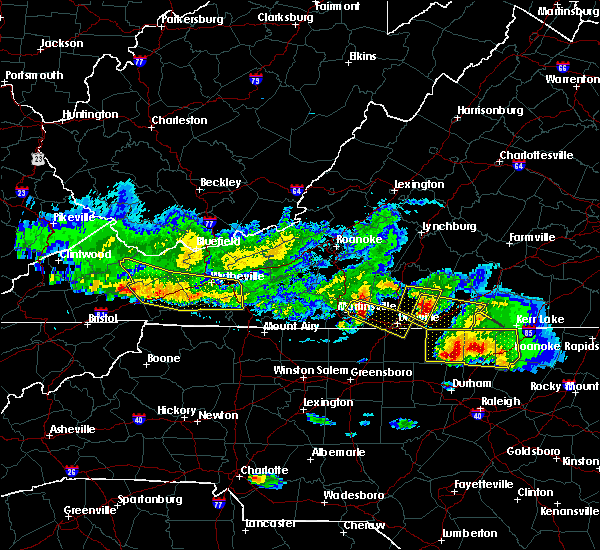
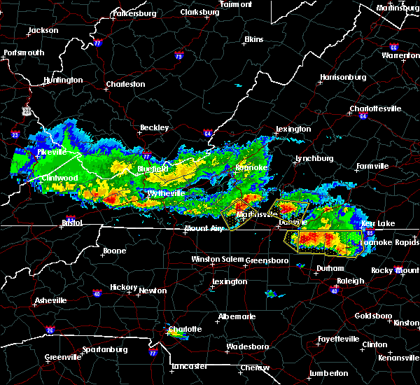
 At 242 pm edt, severe thunderstorms were located along a line extending from camden on gauley to near marion, moving northeast at 70 mph (radar indicated). Hazards include 60 mph wind gusts. expect damage to roofs, siding, and trees At 242 pm edt, severe thunderstorms were located along a line extending from camden on gauley to near marion, moving northeast at 70 mph (radar indicated). Hazards include 60 mph wind gusts. expect damage to roofs, siding, and trees
|
| 10/31/2019 2:45 PM EDT |
 The national weather service in blacksburg has issued a * severe thunderstorm warning for. giles county in southwestern virginia. smyth county in southwestern virginia. tazewell county in southwestern virginia. Bland county in southwestern virginia. The national weather service in blacksburg has issued a * severe thunderstorm warning for. giles county in southwestern virginia. smyth county in southwestern virginia. tazewell county in southwestern virginia. Bland county in southwestern virginia.
|
| 10/31/2019 2:06 PM EDT |
 At 205 pm edt, severe thunderstorms were located along a line extending from 7 miles southwest of summersville to near quarry, moving east at 60 mph (radar indicated). Hazards include 60 mph wind gusts. Expect damage to roofs, siding, and trees. locations impacted include, bluefield, wytheville, bland, princeton, marion, richlands, and tazewell. this includes the following location mercer county airport. A tornado watch remains in effect until 700 pm edt for northwestern north carolina, southwestern virginia, and southeastern west virginia. At 205 pm edt, severe thunderstorms were located along a line extending from 7 miles southwest of summersville to near quarry, moving east at 60 mph (radar indicated). Hazards include 60 mph wind gusts. Expect damage to roofs, siding, and trees. locations impacted include, bluefield, wytheville, bland, princeton, marion, richlands, and tazewell. this includes the following location mercer county airport. A tornado watch remains in effect until 700 pm edt for northwestern north carolina, southwestern virginia, and southeastern west virginia.
|
| 10/31/2019 1:32 PM EDT |
 At 130 pm edt, severe thunderstorms were located along a line extending from near oceana to near bristol va, moving northeast at 55 mph (radar indicated). Hazards include 60 mph wind gusts. expect damage to roofs, siding, and trees At 130 pm edt, severe thunderstorms were located along a line extending from near oceana to near bristol va, moving northeast at 55 mph (radar indicated). Hazards include 60 mph wind gusts. expect damage to roofs, siding, and trees
|
| 10/31/2019 1:32 PM EDT |
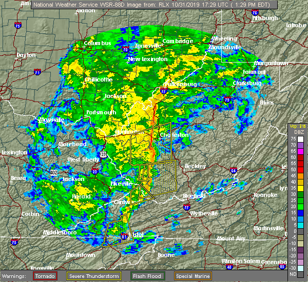 At 130 pm edt, severe thunderstorms were located along a line extending from near oceana to near bristol va, moving northeast at 55 mph (radar indicated). Hazards include 60 mph wind gusts. expect damage to roofs, siding, and trees At 130 pm edt, severe thunderstorms were located along a line extending from near oceana to near bristol va, moving northeast at 55 mph (radar indicated). Hazards include 60 mph wind gusts. expect damage to roofs, siding, and trees
|
| 6/22/2019 1:53 AM EDT |
 At 152 am edt, severe thunderstorms were located along a line extending from near lebanon to near ashland, moving east at 45 mph (radar indicated). Hazards include 60 mph wind gusts. Expect damage to roofs, siding, and trees. Locations impacted include, abingdon, lebanon, mountain city, cleveland va, glade spring, honaker, damascus, laurel bloomery, emory-meadow view, rosedale, shady valley, lindell, holston, harr and konnarock. At 152 am edt, severe thunderstorms were located along a line extending from near lebanon to near ashland, moving east at 45 mph (radar indicated). Hazards include 60 mph wind gusts. Expect damage to roofs, siding, and trees. Locations impacted include, abingdon, lebanon, mountain city, cleveland va, glade spring, honaker, damascus, laurel bloomery, emory-meadow view, rosedale, shady valley, lindell, holston, harr and konnarock.
|
| 6/22/2019 1:38 AM EDT |
 At 137 am edt, severe thunderstorms were located along a line extending from 6 miles southwest of cleveland va to near reese, moving northeast at 45 mph (radar indicated). Hazards include 60 mph wind gusts. Expect damage to roofs, siding, and trees. Locations impacted include, bristol tn, bristol va, abingdon, lebanon, mountain city, cleveland va, walnut hill, glade spring, honaker, damascus, laurel bloomery, emory-meadow view, rosedale, shady valley, south holston dam, collingwood, doeville, hansonville, konnarock and neva. At 137 am edt, severe thunderstorms were located along a line extending from 6 miles southwest of cleveland va to near reese, moving northeast at 45 mph (radar indicated). Hazards include 60 mph wind gusts. Expect damage to roofs, siding, and trees. Locations impacted include, bristol tn, bristol va, abingdon, lebanon, mountain city, cleveland va, walnut hill, glade spring, honaker, damascus, laurel bloomery, emory-meadow view, rosedale, shady valley, south holston dam, collingwood, doeville, hansonville, konnarock and neva.
|
| 6/22/2019 1:08 AM EDT |
 At 108 am edt, severe thunderstorms were located along a line extending from 11 miles northeast of gate city to near erwin, moving east at 50 mph (radar indicated). Hazards include 60 mph wind gusts. expect damage to roofs, siding, and trees At 108 am edt, severe thunderstorms were located along a line extending from 11 miles northeast of gate city to near erwin, moving east at 50 mph (radar indicated). Hazards include 60 mph wind gusts. expect damage to roofs, siding, and trees
|
| 5/29/2019 5:41 PM EDT |
 At 541 pm edt, severe thunderstorms were located along a line extending from near ivanhoe to near ceres to near thomas bridge, moving east at 40 mph (radar indicated). Hazards include 60 mph wind gusts and quarter size hail. Hail damage to vehicles is expected. expect wind damage to roofs, siding, and trees. Locations impacted include, pulaski, wytheville, bland, marion, and dublin. At 541 pm edt, severe thunderstorms were located along a line extending from near ivanhoe to near ceres to near thomas bridge, moving east at 40 mph (radar indicated). Hazards include 60 mph wind gusts and quarter size hail. Hail damage to vehicles is expected. expect wind damage to roofs, siding, and trees. Locations impacted include, pulaski, wytheville, bland, marion, and dublin.
|
| 5/29/2019 5:06 PM EDT |
 The severe thunderstorm warning for central russell and central washington counties will expire at 515 pm edt, the storm which prompted the warning has weakened below severe limits, and no longer poses an immediate threat to life or property. therefore, the warning will be allowed to expire. however gusty winds of 40 mph are still possible with this thunderstorm. The severe thunderstorm warning for central russell and central washington counties will expire at 515 pm edt, the storm which prompted the warning has weakened below severe limits, and no longer poses an immediate threat to life or property. therefore, the warning will be allowed to expire. however gusty winds of 40 mph are still possible with this thunderstorm.
|
| 5/29/2019 4:57 PM EDT |
 The severe thunderstorm warning for western giles, smyth, tazewell, bland, western wythe, summers, mercer and western monroe counties will expire at 500 pm edt, the storms which prompted the warning have moved out of the area, but additional storms are expected so a new warning has been issued for a portion of the area. a severe thunderstorm watch remains in effect until 800 pm edt for southwestern and west central virginia, and southeastern west virginia. when it is safe to do so, please send your reports of hail of any size, as well as reports of any wind damage, including downed trees or large limbs, to the national weather service by calling toll free at 1, 8 6 6, 2 1 5, 4 3 2 4. reports and pictures can also be shared on the national weather service blacksburg facebook page and on twitter. The severe thunderstorm warning for western giles, smyth, tazewell, bland, western wythe, summers, mercer and western monroe counties will expire at 500 pm edt, the storms which prompted the warning have moved out of the area, but additional storms are expected so a new warning has been issued for a portion of the area. a severe thunderstorm watch remains in effect until 800 pm edt for southwestern and west central virginia, and southeastern west virginia. when it is safe to do so, please send your reports of hail of any size, as well as reports of any wind damage, including downed trees or large limbs, to the national weather service by calling toll free at 1, 8 6 6, 2 1 5, 4 3 2 4. reports and pictures can also be shared on the national weather service blacksburg facebook page and on twitter.
|
| 5/29/2019 4:57 PM EDT |
 The severe thunderstorm warning for western giles. smyth. tazewell. bland. western wythe. summers. mercer and western monroe counties will expire at 500 pm edt. The storms which prompted the warning have moved out of the area, but additional storms are expected so a new warning has been issued for a portion of the area. The severe thunderstorm warning for western giles. smyth. tazewell. bland. western wythe. summers. mercer and western monroe counties will expire at 500 pm edt. The storms which prompted the warning have moved out of the area, but additional storms are expected so a new warning has been issued for a portion of the area.
|
| 5/29/2019 4:55 PM EDT |
 At 454 pm edt, severe thunderstorms were located along a line extending from chapel to near thomas bridge, moving east at 30 mph. additional storms will be moring into the region from the west (radar indicated). Hazards include 60 mph wind gusts and quarter size hail. Hail damage to vehicles is expected. Expect wind damage to roofs, siding, and trees. At 454 pm edt, severe thunderstorms were located along a line extending from chapel to near thomas bridge, moving east at 30 mph. additional storms will be moring into the region from the west (radar indicated). Hazards include 60 mph wind gusts and quarter size hail. Hail damage to vehicles is expected. Expect wind damage to roofs, siding, and trees.
|
| 5/29/2019 4:55 PM EDT |
 At 455 pm edt, a severe thunderstorm was located near lebanon, moving east at 45 mph (radar indicated). Hazards include 60 mph wind gusts and quarter size hail. Hail damage to vehicles is expected. expect wind damage to roofs, siding, and trees. locations impacted include, abingdon, lebanon, cleveland va, glade spring, st. Paul, lindell, castlewood, holston, hansonville, emory-meadow view and rosedale. At 455 pm edt, a severe thunderstorm was located near lebanon, moving east at 45 mph (radar indicated). Hazards include 60 mph wind gusts and quarter size hail. Hail damage to vehicles is expected. expect wind damage to roofs, siding, and trees. locations impacted include, abingdon, lebanon, cleveland va, glade spring, st. Paul, lindell, castlewood, holston, hansonville, emory-meadow view and rosedale.
|
| 5/29/2019 4:37 PM EDT |
 At 436 pm edt, a severe thunderstorm was located 7 miles southwest of trammel, or 13 miles east of wise, moving east at 45 mph (radar indicated). Hazards include 60 mph wind gusts and quarter size hail. Hail damage to vehicles is expected. Expect wind damage to roofs, siding, and trees. At 436 pm edt, a severe thunderstorm was located 7 miles southwest of trammel, or 13 miles east of wise, moving east at 45 mph (radar indicated). Hazards include 60 mph wind gusts and quarter size hail. Hail damage to vehicles is expected. Expect wind damage to roofs, siding, and trees.
|
| 5/29/2019 4:25 PM EDT | Tree down at the saltville golf course. time estimated by rada in smyth county VA, 0.6 miles SSW of Saltville, VA |
| 5/29/2019 4:02 PM EDT |
 At 401 pm edt, severe thunderstorms were located along a line extending from near bradley to near coal city to near welch to near lebanon, moving east at 45 mph (radar indicated). Hazards include 70 mph wind gusts and quarter size hail. Hail damage to vehicles is expected. expect considerable tree damage. wind damage is also likely to mobile homes, roofs, and outbuildings. locations impacted include, bluefield, wytheville, bland, princeton, and marion. This includes the following location mercer county airport. At 401 pm edt, severe thunderstorms were located along a line extending from near bradley to near coal city to near welch to near lebanon, moving east at 45 mph (radar indicated). Hazards include 70 mph wind gusts and quarter size hail. Hail damage to vehicles is expected. expect considerable tree damage. wind damage is also likely to mobile homes, roofs, and outbuildings. locations impacted include, bluefield, wytheville, bland, princeton, and marion. This includes the following location mercer county airport.
|
| 5/29/2019 3:25 PM EDT |
 At 324 pm edt, severe thunderstorms were located along a line extending from wharton to 6 miles southeast of argo to 8 miles south of trammel, moving east at 40 mph (radar indicated). Hazards include 60 mph wind gusts and quarter size hail. Hail damage to vehicles is expected. Expect wind damage to roofs, siding, and trees. At 324 pm edt, severe thunderstorms were located along a line extending from wharton to 6 miles southeast of argo to 8 miles south of trammel, moving east at 40 mph (radar indicated). Hazards include 60 mph wind gusts and quarter size hail. Hail damage to vehicles is expected. Expect wind damage to roofs, siding, and trees.
|
| 9/9/2018 8:13 PM EDT |
 At 812 pm edt, severe thunderstorms were located along a line extending from near trammel to 7 miles southwest of quarry, moving northeast at 40 mph (radar indicated). Hazards include 60 mph wind gusts and penny size hail. Expect damage to roofs, siding, and trees. locations impacted include, abingdon, lebanon, cleveland va, glade spring, honaker, st. Paul, dye, lindell, emory-meadow view, rosedale and castlewood. At 812 pm edt, severe thunderstorms were located along a line extending from near trammel to 7 miles southwest of quarry, moving northeast at 40 mph (radar indicated). Hazards include 60 mph wind gusts and penny size hail. Expect damage to roofs, siding, and trees. locations impacted include, abingdon, lebanon, cleveland va, glade spring, honaker, st. Paul, dye, lindell, emory-meadow view, rosedale and castlewood.
|
| 9/9/2018 7:51 PM EDT |
 At 751 pm edt, severe thunderstorms were located along a line extending from 10 miles southeast of wise to near abingdon, moving northeast at 40 mph (radar indicated). Hazards include 60 mph wind gusts and penny size hail. Expect damage to roofs, siding, and trees. locations impacted include, bristol va, abingdon, lebanon, cleveland va, glade spring, honaker, st. Paul, damascus, nickelsville, dungannon, emory-meadow view, rosedale, dye, lindell, collingwood, castlewood, holston, hansonville, hilander park and benhams. At 751 pm edt, severe thunderstorms were located along a line extending from 10 miles southeast of wise to near abingdon, moving northeast at 40 mph (radar indicated). Hazards include 60 mph wind gusts and penny size hail. Expect damage to roofs, siding, and trees. locations impacted include, bristol va, abingdon, lebanon, cleveland va, glade spring, honaker, st. Paul, damascus, nickelsville, dungannon, emory-meadow view, rosedale, dye, lindell, collingwood, castlewood, holston, hansonville, hilander park and benhams.
|
| 9/9/2018 7:33 PM EDT |
 At 732 pm edt, severe thunderstorms were located along a line extending from 8 miles south of norton to bristol tn, moving northeast at 40 mph (radar indicated). Hazards include 60 mph wind gusts and penny size hail. Expect damage to roofs, siding, and trees. locations impacted include, kingsport, bristol tn, bristol va, abingdon, lebanon, gate city, cleveland va, walnut hill, bluff city, glade spring, honaker, st. Paul, damascus, nickelsville, dungannon, laurel bloomery, emory-meadow view, rosedale, shady valley and south holston dam. At 732 pm edt, severe thunderstorms were located along a line extending from 8 miles south of norton to bristol tn, moving northeast at 40 mph (radar indicated). Hazards include 60 mph wind gusts and penny size hail. Expect damage to roofs, siding, and trees. locations impacted include, kingsport, bristol tn, bristol va, abingdon, lebanon, gate city, cleveland va, walnut hill, bluff city, glade spring, honaker, st. Paul, damascus, nickelsville, dungannon, laurel bloomery, emory-meadow view, rosedale, shady valley and south holston dam.
|
| 9/9/2018 7:12 PM EDT |
 At 712 pm edt, severe thunderstorms were located along a line extending from 12 miles north of surgoinsville to near oak grove, moving northeast at 40 mph (radar indicated). Hazards include 60 mph wind gusts and penny size hail. expect damage to roofs, siding, and trees At 712 pm edt, severe thunderstorms were located along a line extending from 12 miles north of surgoinsville to near oak grove, moving northeast at 40 mph (radar indicated). Hazards include 60 mph wind gusts and penny size hail. expect damage to roofs, siding, and trees
|
| 7/6/2018 11:47 AM EDT |
 At 1147 am edt, a severe thunderstorm was located near broadford, moving southeast at 20 mph (radar indicated). Hazards include 70 mph wind gusts and ping pong ball size hail. People and animals outdoors will be injured. expect hail damage to roofs, siding, windows, and vehicles. expect considerable tree damage. Wind damage is also likely to mobile homes, roofs, and outbuildings. At 1147 am edt, a severe thunderstorm was located near broadford, moving southeast at 20 mph (radar indicated). Hazards include 70 mph wind gusts and ping pong ball size hail. People and animals outdoors will be injured. expect hail damage to roofs, siding, windows, and vehicles. expect considerable tree damage. Wind damage is also likely to mobile homes, roofs, and outbuildings.
|
| 6/25/2018 4:13 PM EDT |
 At 413 pm edt, severe thunderstorms were located along a line extending from near marion to 9 miles west of mountain city, moving southeast at 35 mph (radar indicated). Hazards include 60 mph wind gusts and penny size hail. Expect damage to roofs, siding, and trees. Locations impacted include, abingdon, mountain city, glade spring, damascus, south holston dam, laurel bloomery, emory-meadow view, harr, shady valley and konnarock. At 413 pm edt, severe thunderstorms were located along a line extending from near marion to 9 miles west of mountain city, moving southeast at 35 mph (radar indicated). Hazards include 60 mph wind gusts and penny size hail. Expect damage to roofs, siding, and trees. Locations impacted include, abingdon, mountain city, glade spring, damascus, south holston dam, laurel bloomery, emory-meadow view, harr, shady valley and konnarock.
|
| 6/25/2018 3:53 PM EDT |
 At 353 pm edt, severe thunderstorms were located along a line extending from near richlands to near bristol tn, moving east at 30 mph (radar indicated). Hazards include 60 mph wind gusts and penny size hail. expect damage to roofs, siding, and trees At 353 pm edt, severe thunderstorms were located along a line extending from near richlands to near bristol tn, moving east at 30 mph (radar indicated). Hazards include 60 mph wind gusts and penny size hail. expect damage to roofs, siding, and trees
|
| 5/11/2018 3:02 PM EDT |
 At 301 pm edt, a severe thunderstorm was located near cleveland va, or near lebanon, moving southeast at 5 mph (public reported quarter size hail in cleveland, va). Hazards include 60 mph wind gusts and quarter size hail. Hail damage to vehicles is expected. expect wind damage to roofs, siding, and trees. locations impacted include, lebanon, cleveland va, st. Paul, castlewood, holston, hansonville and rosedale. At 301 pm edt, a severe thunderstorm was located near cleveland va, or near lebanon, moving southeast at 5 mph (public reported quarter size hail in cleveland, va). Hazards include 60 mph wind gusts and quarter size hail. Hail damage to vehicles is expected. expect wind damage to roofs, siding, and trees. locations impacted include, lebanon, cleveland va, st. Paul, castlewood, holston, hansonville and rosedale.
|
| 5/11/2018 2:30 PM EDT |
 At 230 pm edt, a severe thunderstorm was located over cleveland va, or near lebanon, moving southeast at 5 mph (radar indicated). Hazards include 60 mph wind gusts and quarter size hail. Hail damage to vehicles is expected. Expect wind damage to roofs, siding, and trees. At 230 pm edt, a severe thunderstorm was located over cleveland va, or near lebanon, moving southeast at 5 mph (radar indicated). Hazards include 60 mph wind gusts and quarter size hail. Hail damage to vehicles is expected. Expect wind damage to roofs, siding, and trees.
|
| 4/4/2018 2:54 AM EDT |
 The severe thunderstorm warning for russell and northern washington counties will expire at 300 am edt, the storm which prompted the warning has weakened below severe limits, and no longer poses an immediate threat to life or property. therefore the warning will be allowed to expire. however gusty winds and heavy rain are still possible with this thunderstorm. a severe thunderstorm watch remains in effect until 300 am edt for southwestern virginia. The severe thunderstorm warning for russell and northern washington counties will expire at 300 am edt, the storm which prompted the warning has weakened below severe limits, and no longer poses an immediate threat to life or property. therefore the warning will be allowed to expire. however gusty winds and heavy rain are still possible with this thunderstorm. a severe thunderstorm watch remains in effect until 300 am edt for southwestern virginia.
|
| 4/4/2018 2:22 AM EDT |
 At 222 am edt, a severe thunderstorm was located 12 miles south of trammel, or 14 miles southeast of wise, moving east at 55 mph (radar indicated). Hazards include 60 mph wind gusts. expect damage to roofs, siding, and trees At 222 am edt, a severe thunderstorm was located 12 miles south of trammel, or 14 miles southeast of wise, moving east at 55 mph (radar indicated). Hazards include 60 mph wind gusts. expect damage to roofs, siding, and trees
|
| 4/4/2018 2:17 AM EDT |
 At 216 am edt, severe thunderstorms were located along a line extending from near red jacket to woodman to near davenport to 12 miles southeast of norton, moving east at 60 mph (radar indicated). Hazards include 60 mph wind gusts. expect damage to roofs, siding, and trees At 216 am edt, severe thunderstorms were located along a line extending from near red jacket to woodman to near davenport to 12 miles southeast of norton, moving east at 60 mph (radar indicated). Hazards include 60 mph wind gusts. expect damage to roofs, siding, and trees
|
| 11/18/2017 10:38 PM EST |
 At 1037 pm est, severe thunderstorms were located along a line extending from near quarry to 7 miles southeast of abingdon, moving east at 115 mph (radar indicated. wind gusts to 60 mph were reported in the bristol area during the past 30 minutes with this line of storms). Hazards include 60 mph wind gusts. expect damage to roofs, siding, and trees At 1037 pm est, severe thunderstorms were located along a line extending from near quarry to 7 miles southeast of abingdon, moving east at 115 mph (radar indicated. wind gusts to 60 mph were reported in the bristol area during the past 30 minutes with this line of storms). Hazards include 60 mph wind gusts. expect damage to roofs, siding, and trees
|
| 7/23/2017 9:09 PM EDT |
 At 907 pm edt, a severe thunderstorm was located 5 miles north of chilhowie, moving southeast at 20 mph (radar indicated). Hazards include 60 mph wind gusts and quarter size hail. Hail damage to vehicles is expected. expect wind damage to roofs, siding, and trees. Locations impacted include, marion, chilhowie, sugar grove, mount rogers national recreation area, and nebo. At 907 pm edt, a severe thunderstorm was located 5 miles north of chilhowie, moving southeast at 20 mph (radar indicated). Hazards include 60 mph wind gusts and quarter size hail. Hail damage to vehicles is expected. expect wind damage to roofs, siding, and trees. Locations impacted include, marion, chilhowie, sugar grove, mount rogers national recreation area, and nebo.
|
| 7/23/2017 8:44 PM EDT |
 The national weather service in blacksburg has issued a * severe thunderstorm warning for. smyth county in southwestern virginia. Until 945 pm edt * at 844 pm edt, a severe thunderstorm was located over saltville, moving southeast at 30 mph. The national weather service in blacksburg has issued a * severe thunderstorm warning for. smyth county in southwestern virginia. Until 945 pm edt * at 844 pm edt, a severe thunderstorm was located over saltville, moving southeast at 30 mph.
|
| 5/27/2017 7:25 PM EDT |
 At 724 pm edt, a severe thunderstorm was located near thomas bridge, moving southeast at 20 mph (radar indicated). Hazards include 60 mph wind gusts and quarter size hail. Hail damage to vehicles is expected. expect wind damage to roofs, siding, and trees. Locations impacted include, marion, saltville, chilhowie, mount rogers national recreation area, and sugar grove. At 724 pm edt, a severe thunderstorm was located near thomas bridge, moving southeast at 20 mph (radar indicated). Hazards include 60 mph wind gusts and quarter size hail. Hail damage to vehicles is expected. expect wind damage to roofs, siding, and trees. Locations impacted include, marion, saltville, chilhowie, mount rogers national recreation area, and sugar grove.
|
| 5/27/2017 7:21 PM EDT |
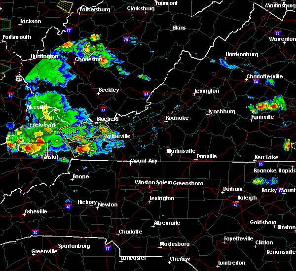 The severe thunderstorm warning for northwestern smyth, tazewell, bland and northwestern wythe counties will expire at 730 pm edt, the storm which prompted the warning has weakened below severe limits, and no longer poses an immediate threat to life or property. therefore the warning will be allowed to expire. a severe thunderstorm watch remains in effect until 200 am edt for northwestern north carolina, and southwestern virginia. when it is safe to do so, please send your reports of hail of any size, as well as reports of any wind damage, including downed trees or large limbs, to the national weather service by calling toll free at 1, 8 6 6, 2 1 5, 4 3 2 4. reports and pictures can also be shared on the national weather service blacksburg facebook page and on twitter. The severe thunderstorm warning for northwestern smyth, tazewell, bland and northwestern wythe counties will expire at 730 pm edt, the storm which prompted the warning has weakened below severe limits, and no longer poses an immediate threat to life or property. therefore the warning will be allowed to expire. a severe thunderstorm watch remains in effect until 200 am edt for northwestern north carolina, and southwestern virginia. when it is safe to do so, please send your reports of hail of any size, as well as reports of any wind damage, including downed trees or large limbs, to the national weather service by calling toll free at 1, 8 6 6, 2 1 5, 4 3 2 4. reports and pictures can also be shared on the national weather service blacksburg facebook page and on twitter.
|
| 5/27/2017 7:06 PM EDT |
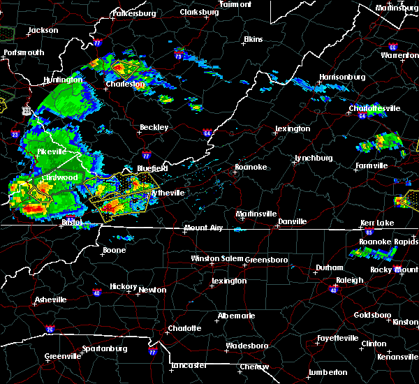 At 705 pm edt, a severe thunderstorm was located over hungry mother state park, moving east at 30 mph (radar indicated). Hazards include 60 mph wind gusts and quarter size hail. Hail damage to vehicles is expected. expect wind damage to roofs, siding, and trees. Locations impacted include, wytheville, marion, saltville, chilhowie, and rural retreat. At 705 pm edt, a severe thunderstorm was located over hungry mother state park, moving east at 30 mph (radar indicated). Hazards include 60 mph wind gusts and quarter size hail. Hail damage to vehicles is expected. expect wind damage to roofs, siding, and trees. Locations impacted include, wytheville, marion, saltville, chilhowie, and rural retreat.
|
| 5/27/2017 6:55 PM EDT |
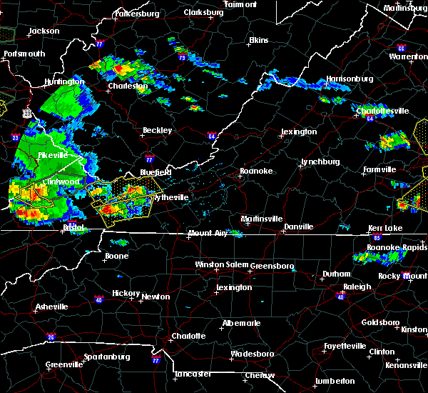 At 654 pm edt, a severe thunderstorm was located over burkes garden, moving east at 30 mph (radar indicated). Hazards include 60 mph wind gusts and quarter size hail. Hail damage to vehicles is expected. expect wind damage to roofs, siding, and trees. Locations impacted include, bland, richlands, bluefield, tazewell, and cedar bluff. At 654 pm edt, a severe thunderstorm was located over burkes garden, moving east at 30 mph (radar indicated). Hazards include 60 mph wind gusts and quarter size hail. Hail damage to vehicles is expected. expect wind damage to roofs, siding, and trees. Locations impacted include, bland, richlands, bluefield, tazewell, and cedar bluff.
|
| 5/27/2017 6:51 PM EDT | Quarter sized hail reported 5.8 miles WSW of Saltville, VA, in rich valley |
| 5/27/2017 6:46 PM EDT | Half Dollar sized hail reported 3.6 miles SW of Saltville, VA, quarter to half-dollar hail. via social media. |
| 5/27/2017 6:44 PM EDT |
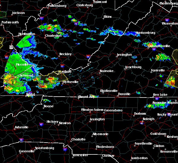 At 644 pm edt, a severe thunderstorm was located over saltville, moving east at 30 mph (radar indicated). Hazards include 60 mph wind gusts and quarter size hail. Hail damage to vehicles is expected. Expect wind damage to roofs, siding, and trees. At 644 pm edt, a severe thunderstorm was located over saltville, moving east at 30 mph (radar indicated). Hazards include 60 mph wind gusts and quarter size hail. Hail damage to vehicles is expected. Expect wind damage to roofs, siding, and trees.
|
| 5/27/2017 6:42 PM EDT | Ping Pong Ball sized hail reported 0.6 miles SSW of Saltville, VA, through social media. |
| 5/27/2017 6:42 PM EDT | Ping Pong Ball sized hail reported 1.9 miles S of Saltville, VA, through social media. |
| 5/27/2017 6:41 PM EDT | Golf Ball sized hail reported 0.6 miles SSW of Saltville, VA, viewer pic in saltville from david boyd/wcyb of hail ranging from ping pong to golf ball size. time estimated from radar. |
| 5/27/2017 6:41 PM EDT | Golf Ball sized hail reported 2.7 miles WSW of Saltville, VA, viewer pic in saltville from david boyd/wcyb of hail ranging from ping pong to golf ball size. time estimated from radar. |
| 5/27/2017 6:30 PM EDT |
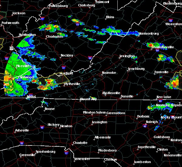 At 630 pm edt, a severe thunderstorm was located over asberrys, moving east at 35 mph (radar indicated). Hazards include 60 mph wind gusts and quarter size hail. Hail damage to vehicles is expected. Expect wind damage to roofs, siding, and trees. At 630 pm edt, a severe thunderstorm was located over asberrys, moving east at 35 mph (radar indicated). Hazards include 60 mph wind gusts and quarter size hail. Hail damage to vehicles is expected. Expect wind damage to roofs, siding, and trees.
|
| 5/24/2017 2:55 PM EDT | One tree down near the intersection of route 16 and route 610 in smyth county VA, 13.8 miles WSW of Saltville, VA |
| 5/24/2017 2:45 PM EDT |
 At 244 pm edt, a severe thunderstorm was located over broadford, moving northeast at 35 mph (radar indicated). Hazards include 60 mph wind gusts. Expect damage to roofs, siding, and trees. Locations impacted include, marion, richlands, tazewell, saltville, and chilhowie. At 244 pm edt, a severe thunderstorm was located over broadford, moving northeast at 35 mph (radar indicated). Hazards include 60 mph wind gusts. Expect damage to roofs, siding, and trees. Locations impacted include, marion, richlands, tazewell, saltville, and chilhowie.
|
| 5/24/2017 2:44 PM EDT | Numerous large limbs down and power out. time from rada in smyth county VA, 8.1 miles WSW of Saltville, VA |
| 5/24/2017 2:32 PM EDT |
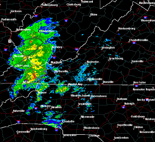 At 231 pm edt, a severe thunderstorm was located over allison gap, moving northeast at 40 mph (radar indicated). Hazards include 60 mph wind gusts. Expect damage to roofs, siding, and trees. Locations impacted include, marion, richlands, tazewell, saltville, and chilhowie. At 231 pm edt, a severe thunderstorm was located over allison gap, moving northeast at 40 mph (radar indicated). Hazards include 60 mph wind gusts. Expect damage to roofs, siding, and trees. Locations impacted include, marion, richlands, tazewell, saltville, and chilhowie.
|
| 5/24/2017 2:21 PM EDT |
 At 221 pm edt, severe thunderstorms were located along a line extending from 6 miles north of lebanon to 7 miles west of saltville to 7 miles southwest of quarry to 9 miles southeast of abingdon, moving northeast at 45 mph (radar indicated). Hazards include 60 mph wind gusts. Expect damage to roofs, siding, and trees. Locations impacted include, abingdon, lebanon, glade spring, honaker, damascus, lindell, dye, emory-meadow view, rosedale and konnarock. At 221 pm edt, severe thunderstorms were located along a line extending from 6 miles north of lebanon to 7 miles west of saltville to 7 miles southwest of quarry to 9 miles southeast of abingdon, moving northeast at 45 mph (radar indicated). Hazards include 60 mph wind gusts. Expect damage to roofs, siding, and trees. Locations impacted include, abingdon, lebanon, glade spring, honaker, damascus, lindell, dye, emory-meadow view, rosedale and konnarock.
|
| 5/24/2017 2:14 PM EDT |
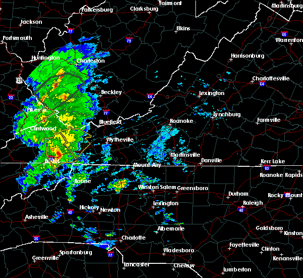 At 214 pm edt, a severe thunderstorm was located near abingdon, moving northeast at 45 mph (radar indicated). Hazards include 60 mph wind gusts. expect damage to roofs, siding, and trees At 214 pm edt, a severe thunderstorm was located near abingdon, moving northeast at 45 mph (radar indicated). Hazards include 60 mph wind gusts. expect damage to roofs, siding, and trees
|
| 5/24/2017 2:13 PM EDT |
 At 213 pm edt, severe thunderstorms were located along a line extending from near lebanon to near abingdon to 8 miles northwest of mountain city, moving northeast at 55 mph (radar indicated). Hazards include 60 mph wind gusts. Expect damage to roofs, siding, and trees. Locations impacted include, abingdon, lebanon, cleveland va, glade spring, honaker, damascus, emory-meadow view, rosedale, lindell, dye, holston, hansonville, hilander park, harr and konnarock. At 213 pm edt, severe thunderstorms were located along a line extending from near lebanon to near abingdon to 8 miles northwest of mountain city, moving northeast at 55 mph (radar indicated). Hazards include 60 mph wind gusts. Expect damage to roofs, siding, and trees. Locations impacted include, abingdon, lebanon, cleveland va, glade spring, honaker, damascus, emory-meadow view, rosedale, lindell, dye, holston, hansonville, hilander park, harr and konnarock.
|
| 5/24/2017 1:39 PM EDT |
 At 139 pm edt, severe thunderstorms were located along a line extending from 6 miles north of surgoinsville to 10 miles west of gray to 8 miles west of jonesborough to 11 miles southeast of tusculum, moving northeast at 45 mph (radar indicated). Hazards include 60 mph wind gusts. expect damage to roofs, siding, and trees At 139 pm edt, severe thunderstorms were located along a line extending from 6 miles north of surgoinsville to 10 miles west of gray to 8 miles west of jonesborough to 11 miles southeast of tusculum, moving northeast at 45 mph (radar indicated). Hazards include 60 mph wind gusts. expect damage to roofs, siding, and trees
|
| 4/29/2017 4:38 PM EDT |
 At 438 pm edt, a severe thunderstorm was located 8 miles southwest of chilhowie, moving northeast at 20 mph (radar indicated). Hazards include 60 mph wind gusts and quarter size hail. Hail damage to vehicles is expected. Expect wind damage to roofs, siding, and trees. At 438 pm edt, a severe thunderstorm was located 8 miles southwest of chilhowie, moving northeast at 20 mph (radar indicated). Hazards include 60 mph wind gusts and quarter size hail. Hail damage to vehicles is expected. Expect wind damage to roofs, siding, and trees.
|
| 3/1/2017 12:21 PM EST |
 At 1220 pm est, severe thunderstorms were located along a line extending from chilhowie to near bristol tn, moving east at 55 mph (radar indicated). Hazards include 60 mph wind gusts and penny size hail. expect damage to roofs, siding, and trees At 1220 pm est, severe thunderstorms were located along a line extending from chilhowie to near bristol tn, moving east at 55 mph (radar indicated). Hazards include 60 mph wind gusts and penny size hail. expect damage to roofs, siding, and trees
|
| 3/1/2017 12:03 PM EST |
 At 1202 pm est, severe thunderstorms were located along a line extending from near lebanon to 6 miles northeast of surgoinsville, moving southeast at 25 mph (radar indicated). Hazards include 60 mph wind gusts and penny size hail. Expect damage to roofs, siding, and trees. locations impacted include, kingsport, bristol tn, bristol va, abingdon, rogersville, lebanon, gate city, surgoinsville, weber city, cleveland va, walnut hill, church hill, mount carmel, coeburn, glade spring, honaker, st. Paul, damascus, nickelsville and dungannon. At 1202 pm est, severe thunderstorms were located along a line extending from near lebanon to 6 miles northeast of surgoinsville, moving southeast at 25 mph (radar indicated). Hazards include 60 mph wind gusts and penny size hail. Expect damage to roofs, siding, and trees. locations impacted include, kingsport, bristol tn, bristol va, abingdon, rogersville, lebanon, gate city, surgoinsville, weber city, cleveland va, walnut hill, church hill, mount carmel, coeburn, glade spring, honaker, st. Paul, damascus, nickelsville and dungannon.
|
| 3/1/2017 11:30 AM EST |
 At 1130 am est, severe thunderstorms were located along a line extending from bland to nebo to near saltville, moving southeast at 15 mph (radar indicated). Hazards include 60 mph wind gusts. expect damage to roofs, siding, and trees At 1130 am est, severe thunderstorms were located along a line extending from bland to nebo to near saltville, moving southeast at 15 mph (radar indicated). Hazards include 60 mph wind gusts. expect damage to roofs, siding, and trees
|
| 3/1/2017 11:24 AM EST |
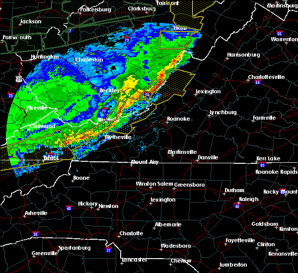 At 1124 am est, severe thunderstorms were located along a line extending from hungry mother state park to near chilhowie to near abingdon, moving southeast at 50 mph (radar indicated). Hazards include 60 mph wind gusts and quarter size hail. Hail damage to vehicles is expected. expect wind damage to roofs, siding, and trees. Locations impacted include, saltville, chilhowie, ceres, nebo, and asberrys. At 1124 am est, severe thunderstorms were located along a line extending from hungry mother state park to near chilhowie to near abingdon, moving southeast at 50 mph (radar indicated). Hazards include 60 mph wind gusts and quarter size hail. Hail damage to vehicles is expected. expect wind damage to roofs, siding, and trees. Locations impacted include, saltville, chilhowie, ceres, nebo, and asberrys.
|
| 3/1/2017 11:10 AM EST |
 At 1109 am est, severe thunderstorms were located along a line extending from 8 miles east of wise to near jonesville, moving southeast at 50 mph (radar indicated). Hazards include 60 mph wind gusts and penny size hail. expect damage to roofs, siding, and trees At 1109 am est, severe thunderstorms were located along a line extending from 8 miles east of wise to near jonesville, moving southeast at 50 mph (radar indicated). Hazards include 60 mph wind gusts and penny size hail. expect damage to roofs, siding, and trees
|
| 3/1/2017 10:52 AM EST |
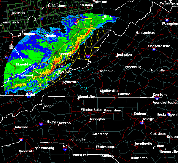 At 1052 am est, severe thunderstorms were located along a line extending from jewell ridge to raven to near davenport, moving southeast at 50 mph (radar indicated). Hazards include 60 mph wind gusts and quarter size hail. Hail damage to vehicles is expected. Expect wind damage to roofs, siding, and trees. At 1052 am est, severe thunderstorms were located along a line extending from jewell ridge to raven to near davenport, moving southeast at 50 mph (radar indicated). Hazards include 60 mph wind gusts and quarter size hail. Hail damage to vehicles is expected. Expect wind damage to roofs, siding, and trees.
|
| 11/30/2016 10:40 AM EST |
 At 1039 am est, a severe thunderstorm was located 7 miles south of lebanon, moving northeast at 45 mph (radar indicated). Hazards include 60 mph wind gusts and quarter size hail. Hail damage to vehicles is expected. Expect wind damage to roofs, siding, and trees. At 1039 am est, a severe thunderstorm was located 7 miles south of lebanon, moving northeast at 45 mph (radar indicated). Hazards include 60 mph wind gusts and quarter size hail. Hail damage to vehicles is expected. Expect wind damage to roofs, siding, and trees.
|
| 11/30/2016 7:28 AM EST |
 At 728 am est, severe thunderstorms were located along a line extending from 6 miles west of allison gap to 6 miles south of abingdon to 11 miles west of mountain city, moving east at 60 mph (radar indicated). Hazards include 60 mph wind gusts. Expect damage to roofs. siding. and trees. Locations impacted include, abingdon, mountain city, glade spring, damascus, harr, sadie, laurel bloomery, doeville, rosedale, lindell, emory-meadow view, neva and shady valley. At 728 am est, severe thunderstorms were located along a line extending from 6 miles west of allison gap to 6 miles south of abingdon to 11 miles west of mountain city, moving east at 60 mph (radar indicated). Hazards include 60 mph wind gusts. Expect damage to roofs. siding. and trees. Locations impacted include, abingdon, mountain city, glade spring, damascus, harr, sadie, laurel bloomery, doeville, rosedale, lindell, emory-meadow view, neva and shady valley.
|
| 11/30/2016 7:02 AM EST |
 At 701 am est, severe thunderstorms were located along a line extending from 9 miles southwest of cleveland va to 6 miles west of walnut hill to near midway, moving east at 55 mph (radar indicated). Hazards include 60 mph wind gusts. Expect damage to roofs. siding. and trees. Locations impacted include, johnson city, kingsport, bristol tn, bristol va, elizabethton, abingdon, lebanon, mountain city, jonesborough, cleveland va, central, walnut hill, oak grove, spurgeon, hampton, gray, pine crest, midway, colonial heights and bluff city. At 701 am est, severe thunderstorms were located along a line extending from 9 miles southwest of cleveland va to 6 miles west of walnut hill to near midway, moving east at 55 mph (radar indicated). Hazards include 60 mph wind gusts. Expect damage to roofs. siding. and trees. Locations impacted include, johnson city, kingsport, bristol tn, bristol va, elizabethton, abingdon, lebanon, mountain city, jonesborough, cleveland va, central, walnut hill, oak grove, spurgeon, hampton, gray, pine crest, midway, colonial heights and bluff city.
|
| 11/30/2016 6:47 AM EST |
 At 646 am est, severe thunderstorms were located along a line extending from 11 miles southeast of norton to near kingsport to near tusculum, moving east at 50 mph (radar indicated). Hazards include 60 mph wind gusts. Expect damage to roofs. siding. And trees. At 646 am est, severe thunderstorms were located along a line extending from 11 miles southeast of norton to near kingsport to near tusculum, moving east at 50 mph (radar indicated). Hazards include 60 mph wind gusts. Expect damage to roofs. siding. And trees.
|
| 8/16/2016 7:45 PM EDT | Half Dollar sized hail reported 3.6 miles SW of Saltville, VA |
| 8/16/2016 7:38 PM EDT | Quarter sized hail reported 2 miles WSW of Saltville, VA |
| 8/16/2016 7:37 PM EDT |
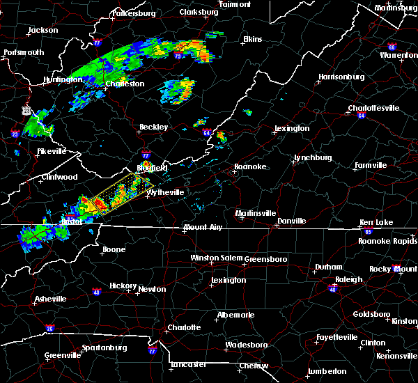 At 737 pm edt, a severe thunderstorm was located over broadford, moving northeast at 30 mph (radar indicated). Hazards include 60 mph wind gusts and half dollar size hail. Hail damage to vehicles is expected. Expect wind damage to roofs, siding, and trees. At 737 pm edt, a severe thunderstorm was located over broadford, moving northeast at 30 mph (radar indicated). Hazards include 60 mph wind gusts and half dollar size hail. Hail damage to vehicles is expected. Expect wind damage to roofs, siding, and trees.
|
| 7/4/2016 9:38 PM EDT |
 The severe thunderstorm warning for northeastern johnson and eastern washington counties will expire at 945 pm edt, the storms which prompted the warning have moved out of the area. therefore the warning will be allowed to expire. The severe thunderstorm warning for northeastern johnson and eastern washington counties will expire at 945 pm edt, the storms which prompted the warning have moved out of the area. therefore the warning will be allowed to expire.
|
| 7/4/2016 9:32 PM EDT |
 At 932 pm edt, severe thunderstorms were located along a line extending from near adwolf to near whitetop to near flatwood, moving southeast at 40 mph (radar indicated). Hazards include 60 mph wind gusts. Expect damage to roofs. siding. And trees. At 932 pm edt, severe thunderstorms were located along a line extending from near adwolf to near whitetop to near flatwood, moving southeast at 40 mph (radar indicated). Hazards include 60 mph wind gusts. Expect damage to roofs. siding. And trees.
|
| 7/4/2016 9:24 PM EDT |
 At 924 pm edt, severe thunderstorms were located along a line extending from saltville to 7 miles north of mountain city, moving east at 45 mph (radar indicated). Hazards include 60 mph wind gusts and penny size hail. Expect damage to roofs. siding. and trees. Locations impacted include, mountain city, glade spring, damascus, konnarock, emory-meadow view and laurel bloomery. At 924 pm edt, severe thunderstorms were located along a line extending from saltville to 7 miles north of mountain city, moving east at 45 mph (radar indicated). Hazards include 60 mph wind gusts and penny size hail. Expect damage to roofs. siding. and trees. Locations impacted include, mountain city, glade spring, damascus, konnarock, emory-meadow view and laurel bloomery.
|
| 7/4/2016 9:07 PM EDT |
 At 907 pm edt, severe thunderstorms were located along a line extending from 7 miles north of abingdon to 10 miles southeast of bristol va, moving east at 45 mph (radar indicated). Hazards include 60 mph wind gusts and penny size hail. Expect damage to roofs. siding. And trees. At 907 pm edt, severe thunderstorms were located along a line extending from 7 miles north of abingdon to 10 miles southeast of bristol va, moving east at 45 mph (radar indicated). Hazards include 60 mph wind gusts and penny size hail. Expect damage to roofs. siding. And trees.
|
| 6/23/2016 10:00 PM EDT |
 At 1000 pm edt, a severe thunderstorm was located near mountain city, moving southeast at 25 mph (radar indicated). Hazards include 60 mph wind gusts and quarter size hail. Hail damage to vehicles is expected. expect wind damage to roofs, siding, and trees. Locations impacted include, bristol tn, bristol va, abingdon, mountain city, walnut hill, glade spring, damascus, trade, sadie, south holston dam, elk mills, shady valley, hunter, benhams, harr, hilander park, laurel bloomery, doeville, holston and konnarock. At 1000 pm edt, a severe thunderstorm was located near mountain city, moving southeast at 25 mph (radar indicated). Hazards include 60 mph wind gusts and quarter size hail. Hail damage to vehicles is expected. expect wind damage to roofs, siding, and trees. Locations impacted include, bristol tn, bristol va, abingdon, mountain city, walnut hill, glade spring, damascus, trade, sadie, south holston dam, elk mills, shady valley, hunter, benhams, harr, hilander park, laurel bloomery, doeville, holston and konnarock.
|
| 6/23/2016 9:22 PM EDT |
 At 921 pm edt, a severe thunderstorm was located near bristol va, moving southeast at 30 mph (radar indicated). Hazards include 60 mph wind gusts and quarter size hail. Hail damage to vehicles is expected. Expect wind damage to roofs, siding, and trees. At 921 pm edt, a severe thunderstorm was located near bristol va, moving southeast at 30 mph (radar indicated). Hazards include 60 mph wind gusts and quarter size hail. Hail damage to vehicles is expected. Expect wind damage to roofs, siding, and trees.
|
| 6/23/2016 9:17 PM EDT |
 At 916 pm edt, severe thunderstorms were located along a line extending from near kimberling to sugar grove, moving east at 50 mph (radar indicated). Hazards include 60 mph wind gusts. Expect damage to roofs. siding. and trees. Locations impacted include, wytheville, bland, marion, chilhowie, and rural retreat. At 916 pm edt, severe thunderstorms were located along a line extending from near kimberling to sugar grove, moving east at 50 mph (radar indicated). Hazards include 60 mph wind gusts. Expect damage to roofs. siding. and trees. Locations impacted include, wytheville, bland, marion, chilhowie, and rural retreat.
|
| 6/23/2016 8:52 PM EDT |
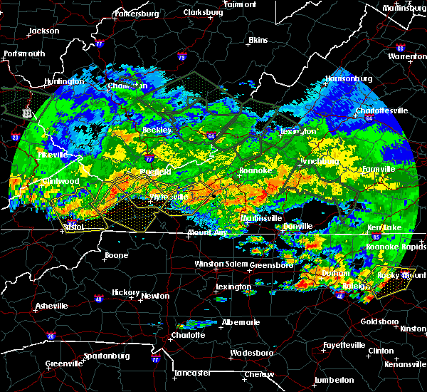 At 852 pm edt, severe thunderstorms were located along a line extending from near tiptop to broadford, moving east at 45 mph (radar indicated). Hazards include 70 mph wind gusts. Expect considerable tree damage. damage is likely to mobile homes, roofs, and outbuildings. Locations impacted include, bluefield, tazewell, saltville, burkes garden, and rocky gap. At 852 pm edt, severe thunderstorms were located along a line extending from near tiptop to broadford, moving east at 45 mph (radar indicated). Hazards include 70 mph wind gusts. Expect considerable tree damage. damage is likely to mobile homes, roofs, and outbuildings. Locations impacted include, bluefield, tazewell, saltville, burkes garden, and rocky gap.
|
| 6/23/2016 8:51 PM EDT |
 At 850 pm edt, severe thunderstorms were located along a line extending from near boissevain to quarry, moving east at 50 mph (radar indicated). Hazards include 60 mph wind gusts. Expect damage to roofs. siding. And trees. At 850 pm edt, severe thunderstorms were located along a line extending from near boissevain to quarry, moving east at 50 mph (radar indicated). Hazards include 60 mph wind gusts. Expect damage to roofs. siding. And trees.
|
| 6/23/2016 8:46 PM EDT |
 At 845 pm edt, a severe thunderstorm was located 8 miles east of abingdon, moving southeast at 35 mph (radar indicated). Hazards include 60 mph wind gusts and quarter size hail. Hail damage to vehicles is expected. expect wind damage to roofs, siding, and trees. locations impacted include, bristol tn, bristol va, abingdon, lebanon, cleveland va, glade spring, honaker, st. Paul, damascus, hilander park, harr, holston, konnarock, rosedale, castlewood, dye, lindell, emory-meadow view and hansonville. At 845 pm edt, a severe thunderstorm was located 8 miles east of abingdon, moving southeast at 35 mph (radar indicated). Hazards include 60 mph wind gusts and quarter size hail. Hail damage to vehicles is expected. expect wind damage to roofs, siding, and trees. locations impacted include, bristol tn, bristol va, abingdon, lebanon, cleveland va, glade spring, honaker, st. Paul, damascus, hilander park, harr, holston, konnarock, rosedale, castlewood, dye, lindell, emory-meadow view and hansonville.
|
| 6/23/2016 8:37 PM EDT |
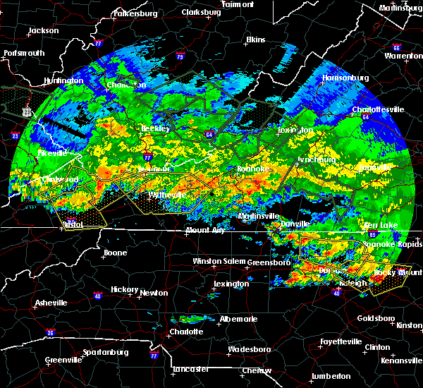 At 837 pm edt, severe thunderstorms were located along a line extending from near war to near allison gap, moving southeast at 60 mph (radar indicated). Hazards include 70 mph wind gusts. Expect considerable tree damage. damage is likely to mobile homes, roofs, and outbuildings. Locations impacted include, richlands, bluefield, tazewell, saltville, and cedar bluff. At 837 pm edt, severe thunderstorms were located along a line extending from near war to near allison gap, moving southeast at 60 mph (radar indicated). Hazards include 70 mph wind gusts. Expect considerable tree damage. damage is likely to mobile homes, roofs, and outbuildings. Locations impacted include, richlands, bluefield, tazewell, saltville, and cedar bluff.
|
| 6/23/2016 8:15 PM EDT |
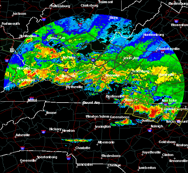 At 814 pm edt, severe thunderstorms were located along a line extending from near war to davenport, moving east at 45 mph (radar indicated). Hazards include 60 mph wind gusts. Expect damage to roofs. siding. And trees. At 814 pm edt, severe thunderstorms were located along a line extending from near war to davenport, moving east at 45 mph (radar indicated). Hazards include 60 mph wind gusts. Expect damage to roofs. siding. And trees.
|
| 6/23/2016 8:11 PM EDT |
 At 811 pm edt, a severe thunderstorm was located near cleveland va, or 7 miles south of davenport, moving southeast at 35 mph (radar indicated). Hazards include 60 mph wind gusts and quarter size hail. Hail damage to vehicles is expected. Expect wind damage to roofs, siding, and trees. At 811 pm edt, a severe thunderstorm was located near cleveland va, or 7 miles south of davenport, moving southeast at 35 mph (radar indicated). Hazards include 60 mph wind gusts and quarter size hail. Hail damage to vehicles is expected. Expect wind damage to roofs, siding, and trees.
|
| 6/21/2016 6:57 PM EDT | The severe thunderstorm warning for northwestern grayson, tazewell, smyth, southwestern wythe and southwestern bland counties will expire at 700 pm edt, the storm which prompted the warning has weakened below severe limits, and no longer poses an immediate threat to life or property. therefore the warning will be allowed to expire. however gusty winds and heavy rain are still possible with this thunderstorm. a severe thunderstorm watch remains in effect until 1000 pm edt for virginia and west virginia. when it is safe to do so, please send your reports of hail of any size, as well as any reports of wind damage, including downed trees or large limbs, to the national weather service by calling toll free at 1, 8 6 6, 2 1 5, 4 3 2 4. reports and pictures can also be shared on the national weather service blacksburg facebook page and on twitter. |
| 6/21/2016 6:36 PM EDT |
 At 636 pm edt, a severe thunderstorm was located near raven, or near richlands, moving southeast at 25 mph (radar indicated). Hazards include 60 mph wind gusts and quarter size hail. Hail damage to vehicles is expected. expect wind damage to roofs, siding, and trees. Locations impacted include, glade spring, honaker, dye, lindell, rosedale and emory-meadow view. At 636 pm edt, a severe thunderstorm was located near raven, or near richlands, moving southeast at 25 mph (radar indicated). Hazards include 60 mph wind gusts and quarter size hail. Hail damage to vehicles is expected. expect wind damage to roofs, siding, and trees. Locations impacted include, glade spring, honaker, dye, lindell, rosedale and emory-meadow view.
|
| 6/21/2016 6:22 PM EDT |
 At 621 pm edt, a severe thunderstorm was located over cliffield, moving southeast at 35 mph (radar indicated). Hazards include 60 mph wind gusts and quarter size hail. Hail damage to vehicles is expected. expect wind damage to roofs, siding, and trees. Locations impacted include, marion, richlands, tazewell, saltville, and chilhowie. At 621 pm edt, a severe thunderstorm was located over cliffield, moving southeast at 35 mph (radar indicated). Hazards include 60 mph wind gusts and quarter size hail. Hail damage to vehicles is expected. expect wind damage to roofs, siding, and trees. Locations impacted include, marion, richlands, tazewell, saltville, and chilhowie.
|
| 6/21/2016 6:12 PM EDT |
 At 612 pm edt, a severe thunderstorm was located over raven, or near richlands, moving southeast at 25 mph (radar indicated). Hazards include 60 mph wind gusts and quarter size hail. Hail damage to vehicles is expected. Expect wind damage to roofs, siding, and trees. At 612 pm edt, a severe thunderstorm was located over raven, or near richlands, moving southeast at 25 mph (radar indicated). Hazards include 60 mph wind gusts and quarter size hail. Hail damage to vehicles is expected. Expect wind damage to roofs, siding, and trees.
|
| 6/21/2016 6:06 PM EDT |
 At 605 pm edt, a severe thunderstorm was located over glen burke, moving southeast at 40 mph (radar indicated). Hazards include 60 mph wind gusts and quarter size hail. Hail damage to vehicles is expected. Expect wind damage to roofs, siding, and trees. At 605 pm edt, a severe thunderstorm was located over glen burke, moving southeast at 40 mph (radar indicated). Hazards include 60 mph wind gusts and quarter size hail. Hail damage to vehicles is expected. Expect wind damage to roofs, siding, and trees.
|
| 6/16/2016 10:28 PM EDT | The severe thunderstorm warning for central grayson, smyth, wythe and northwestern carroll counties will expire at 1030 pm edt, the storms which prompted the warning have weakened below severe limits, and no longer pose an immediate threat to life or property. therefore the warning will be allowed to expire. however gusty winds to 45 mph along with small hail and heavy rainfall will continue. when it is safe to do so, please send your reports of hail of any size, as well as any reports of wind damage, including downed trees or large limbs, to the national weather service by calling toll free at 1, 8 6 6, 2 1 5, 4 3 2 4. reports and pictures can also be shared on the national weather service blacksburg facebook page and on twitter. |
| 6/16/2016 10:06 PM EDT |
 At 1006 pm edt, severe thunderstorms were located along a line extending from near coleman store to near mount rogers national recreation area to near broadford, moving southeast at 40 mph (radar indicated). Hazards include 60 mph wind gusts. Expect damage to roofs. siding. and trees. Locations impacted include, wytheville, marion, saltville, chilhowie, and rural retreat. At 1006 pm edt, severe thunderstorms were located along a line extending from near coleman store to near mount rogers national recreation area to near broadford, moving southeast at 40 mph (radar indicated). Hazards include 60 mph wind gusts. Expect damage to roofs. siding. and trees. Locations impacted include, wytheville, marion, saltville, chilhowie, and rural retreat.
|
| 6/16/2016 9:55 PM EDT | Widespread trees down from saltville to mario in smyth county VA, 0.6 miles SSW of Saltville, VA |
| 6/16/2016 9:39 PM EDT |
 At 937 pm edt, severe thunderstorms were located along a line extending from near favonia to asberrys to raven, moving southeast at 40 mph. these storms will drop through the region with damaging winds in the next hour (radar indicated). Hazards include 60 mph wind gusts. Expect damage to roofs. siding. And trees. At 937 pm edt, severe thunderstorms were located along a line extending from near favonia to asberrys to raven, moving southeast at 40 mph. these storms will drop through the region with damaging winds in the next hour (radar indicated). Hazards include 60 mph wind gusts. Expect damage to roofs. siding. And trees.
|
| 6/16/2016 9:22 PM EDT |
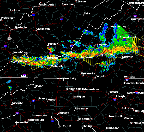 At 922 pm edt, a severe thunderstorm was located over cliffield, moving southeast at 35 mph (radar indicated). Hazards include 60 mph wind gusts and quarter size hail. Hail damage to vehicles is expected. expect wind damage to roofs, siding, and trees. Locations impacted include, richlands, tazewell, cedar bluff, asberrys, and broadford. At 922 pm edt, a severe thunderstorm was located over cliffield, moving southeast at 35 mph (radar indicated). Hazards include 60 mph wind gusts and quarter size hail. Hail damage to vehicles is expected. expect wind damage to roofs, siding, and trees. Locations impacted include, richlands, tazewell, cedar bluff, asberrys, and broadford.
|
| 6/16/2016 9:02 PM EDT |
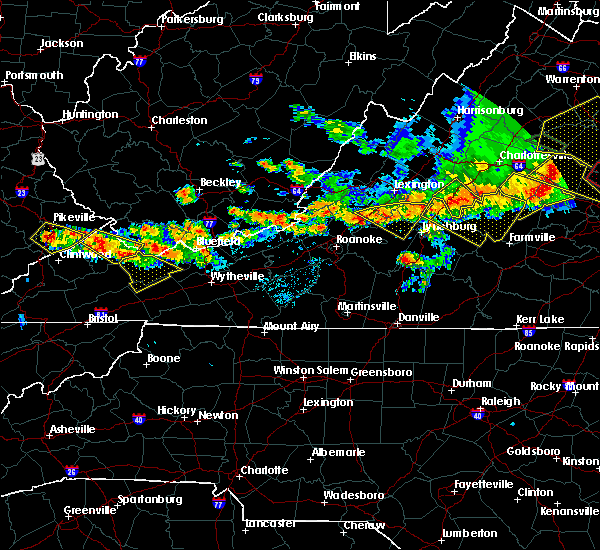 At 900 pm edt, a severe thunderstorm was located near jewell ridge, moving southeast at 25 mph (radar indicated). Hazards include 60 mph wind gusts and quarter size hail. Hail damage to vehicles is expected. Expect wind damage to roofs, siding, and trees. At 900 pm edt, a severe thunderstorm was located near jewell ridge, moving southeast at 25 mph (radar indicated). Hazards include 60 mph wind gusts and quarter size hail. Hail damage to vehicles is expected. Expect wind damage to roofs, siding, and trees.
|
| 5/12/2016 6:41 PM EDT |
 At 640 pm edt, severe thunderstorms were located along a line extending from 19 miles northeast of cleveland to 6 miles southeast of lebanon, moving northeast at 35 mph (radar indicated). Hazards include 60 mph wind gusts and penny size hail. Expect damage to roofs. siding. and trees. Locations impacted include, abingdon, glade spring, honaker, dye, lindell, rosedale and emory-meadow view. At 640 pm edt, severe thunderstorms were located along a line extending from 19 miles northeast of cleveland to 6 miles southeast of lebanon, moving northeast at 35 mph (radar indicated). Hazards include 60 mph wind gusts and penny size hail. Expect damage to roofs. siding. and trees. Locations impacted include, abingdon, glade spring, honaker, dye, lindell, rosedale and emory-meadow view.
|
| 5/12/2016 6:25 PM EDT |
 At 624 pm edt, severe thunderstorms were located along a line extending from 11 miles northeast of cleveland to near bristol, moving northeast at 35 mph (radar indicated). Hazards include 60 mph wind gusts and penny size hail. Expect damage to roofs. siding. And trees. At 624 pm edt, severe thunderstorms were located along a line extending from 11 miles northeast of cleveland to near bristol, moving northeast at 35 mph (radar indicated). Hazards include 60 mph wind gusts and penny size hail. Expect damage to roofs. siding. And trees.
|
| 3/14/2016 3:54 PM EDT |
 At 353 pm edt, a severe thunderstorm was located over abingdon, moving northeast at 35 mph (radar indicated). Hazards include 60 mph wind gusts and quarter size hail. Hail damage to vehicles is expected. expect wind damage to roofs, siding, and trees. Locations impacted include, abingdon, bristol va, bristol, glade spring, damascus, lindell, benhams, shady valley, holston, south holston dam, hilander park, konnarock, harr and emory-meadow view. At 353 pm edt, a severe thunderstorm was located over abingdon, moving northeast at 35 mph (radar indicated). Hazards include 60 mph wind gusts and quarter size hail. Hail damage to vehicles is expected. expect wind damage to roofs, siding, and trees. Locations impacted include, abingdon, bristol va, bristol, glade spring, damascus, lindell, benhams, shady valley, holston, south holston dam, hilander park, konnarock, harr and emory-meadow view.
|
| 3/14/2016 3:37 PM EDT |
 At 337 pm edt, a severe thunderstorm was located over bristol tn, moving northeast at 25 mph (radar indicated). Hazards include 60 mph wind gusts and quarter size hail. Hail damage to vehicles is expected. Expect wind damage to roofs, siding, and trees. At 337 pm edt, a severe thunderstorm was located over bristol tn, moving northeast at 25 mph (radar indicated). Hazards include 60 mph wind gusts and quarter size hail. Hail damage to vehicles is expected. Expect wind damage to roofs, siding, and trees.
|
| 7/14/2015 9:04 PM EDT |
 At 902 pm edt, a line of severe thunderstorms was located across parts of smyth, wythe and bland counties, moving southeast at 45 mph (radar indicated). Hazards include 60 mph wind gusts. Expect damage to roofs. siding and trees. Locations impacted include, wytheville, galax, bland, marion, and hillsville. At 902 pm edt, a line of severe thunderstorms was located across parts of smyth, wythe and bland counties, moving southeast at 45 mph (radar indicated). Hazards include 60 mph wind gusts. Expect damage to roofs. siding and trees. Locations impacted include, wytheville, galax, bland, marion, and hillsville.
|
| 7/14/2015 8:50 PM EDT | Multiple trees were blown down in the saltville are in smyth county VA, 0.6 miles SSW of Saltville, VA |
| 7/14/2015 8:50 PM EDT |
 At 849 pm edt, a line of severe thunderstorms was located over tazewell and bland counties, moving southeast at 45 mph (radar indicated). Hazards include 60 mph wind gusts. Expect damage to roofs. Siding and trees. At 849 pm edt, a line of severe thunderstorms was located over tazewell and bland counties, moving southeast at 45 mph (radar indicated). Hazards include 60 mph wind gusts. Expect damage to roofs. Siding and trees.
|
| 7/14/2015 8:48 PM EDT |
 At 847 pm edt, severe thunderstorms were located along a line extending from 9 miles west of cleveland to near lebanon to 21 miles northeast of abingdon, moving southeast at 30 mph (radar indicated). Hazards include 60 mph wind gusts and nickel size hail. Expect damage to roofs. siding and trees. locations impacted include, lebanon, cleveland, glade spring, st. Paul, nickelsville, holston, castlewood, lindell, hansonville, rosedale and emory-meadow view. At 847 pm edt, severe thunderstorms were located along a line extending from 9 miles west of cleveland to near lebanon to 21 miles northeast of abingdon, moving southeast at 30 mph (radar indicated). Hazards include 60 mph wind gusts and nickel size hail. Expect damage to roofs. siding and trees. locations impacted include, lebanon, cleveland, glade spring, st. Paul, nickelsville, holston, castlewood, lindell, hansonville, rosedale and emory-meadow view.
|
| 7/14/2015 8:25 PM EDT |
 At 825 pm edt, severe thunderstorms were located along a line extending from 10 miles west of cleveland to 6 miles north of lebanon, moving southeast at 35 mph (radar indicated). Hazards include 60 mph wind gusts and nickel size hail. Expect damage to roofs. Siding and trees. At 825 pm edt, severe thunderstorms were located along a line extending from 10 miles west of cleveland to 6 miles north of lebanon, moving southeast at 35 mph (radar indicated). Hazards include 60 mph wind gusts and nickel size hail. Expect damage to roofs. Siding and trees.
|
| 7/14/2015 8:21 PM EDT |
 At 821 pm edt, severe thunderstorms were located along a line extending from princeton to near bandy to trammel, moving south at 45 mph (radar indicated). Hazards include 60 mph wind gusts and quarter size hail. Hail damage to vehicles is expected. expect wind damage to roofs, siding and trees. locations impacted include, bluefield, wytheville, bland, princeton, and marion. This includes mercer county airport. At 821 pm edt, severe thunderstorms were located along a line extending from princeton to near bandy to trammel, moving south at 45 mph (radar indicated). Hazards include 60 mph wind gusts and quarter size hail. Hail damage to vehicles is expected. expect wind damage to roofs, siding and trees. locations impacted include, bluefield, wytheville, bland, princeton, and marion. This includes mercer county airport.
|
| 7/14/2015 8:01 PM EDT |
 At 801 pm edt, severe thunderstorms were located along a line extending from near mullens to near war to john flannagan lake, moving south at 40 mph (radar indicated). Hazards include 60 mph wind gusts and quarter size hail. Hail damage to vehicles is expected. Expect wind damage to roofs, siding and trees. At 801 pm edt, severe thunderstorms were located along a line extending from near mullens to near war to john flannagan lake, moving south at 40 mph (radar indicated). Hazards include 60 mph wind gusts and quarter size hail. Hail damage to vehicles is expected. Expect wind damage to roofs, siding and trees.
|
| 7/13/2015 6:35 PM EDT |
 A severe thunderstorm warning remains in effect until 700 pm edt for washington. southeastern scott counties and the city of bristol. at 634 pm edt. severe thunderstorms were located along a line extending from 32 miles northeast of abingdon to near kingsport. Moving east at 60 mph. A severe thunderstorm warning remains in effect until 700 pm edt for washington. southeastern scott counties and the city of bristol. at 634 pm edt. severe thunderstorms were located along a line extending from 32 miles northeast of abingdon to near kingsport. Moving east at 60 mph.
|
| 7/13/2015 6:22 PM EDT |
 At 537 pm edt, severe thunderstorms were located along a line extending from near dry creek to near war, moving east at 50 mph. another severe thunderstorm was developing in western tazewell just west of claypool hill and is also rapidly approaching severe limits (radar indicated). Hazards include 70 mph wind gusts and quarter size hail. Hail damage to vehicles is expected. expect considerable tree damage. Wind damage is also likely to mobile homes, roofs and outbuildings. At 537 pm edt, severe thunderstorms were located along a line extending from near dry creek to near war, moving east at 50 mph. another severe thunderstorm was developing in western tazewell just west of claypool hill and is also rapidly approaching severe limits (radar indicated). Hazards include 70 mph wind gusts and quarter size hail. Hail damage to vehicles is expected. expect considerable tree damage. Wind damage is also likely to mobile homes, roofs and outbuildings.
|
| 7/13/2015 6:22 PM EDT |
 At 621 pm edt, severe thunderstorms were located along a line extending from near hinton to richlands, moving east at 50 mph (radar indicated). Hazards include 60 mph wind gusts. Expect damage to roofs. siding and trees. locations impacted include, bluefield, princeton, richlands, tazewell, and hinton. This includes mercer county airport. At 621 pm edt, severe thunderstorms were located along a line extending from near hinton to richlands, moving east at 50 mph (radar indicated). Hazards include 60 mph wind gusts. Expect damage to roofs. siding and trees. locations impacted include, bluefield, princeton, richlands, tazewell, and hinton. This includes mercer county airport.
|
| 7/13/2015 6:20 PM EDT |
 A severe thunderstorm warning remains in effect until 700 pm edt for washington. central russell. southeastern scott counties and the city of bristol. at 620 pm edt. severe thunderstorms were located along a line extending from 23 miles east of lebanon to 7 miles southwest of gate city. Moving east at 60 mph. A severe thunderstorm warning remains in effect until 700 pm edt for washington. central russell. southeastern scott counties and the city of bristol. at 620 pm edt. severe thunderstorms were located along a line extending from 23 miles east of lebanon to 7 miles southwest of gate city. Moving east at 60 mph.
|
| 7/13/2015 6:17 PM EDT | At least two trees blown down by thunderstorm winds in tow in smyth county VA, 0.6 miles SSW of Saltville, VA |
| 7/13/2015 6:03 PM EDT |
 At 601 pm edt, severe thunderstorms were located along a line extending from 12 miles northeast of lebanon to 8 miles southeast of jonesville, moving east at 50 mph (radar indicated). Hazards include 60 mph wind gusts and quarter size hail. Hail damage to vehicles is possible. Expect wind damage to roofs, siding and trees. At 601 pm edt, severe thunderstorms were located along a line extending from 12 miles northeast of lebanon to 8 miles southeast of jonesville, moving east at 50 mph (radar indicated). Hazards include 60 mph wind gusts and quarter size hail. Hail damage to vehicles is possible. Expect wind damage to roofs, siding and trees.
|
| 7/13/2015 5:39 PM EDT |
 At 537 pm edt, severe thunderstorms were located along a line extending from near dry creek to near war, moving east at 50 mph. another severe thunderstorm was developing in western tazewell just west of claypool hill and is also rapidly approaching severe limits (radar indicated). Hazards include 70 mph wind gusts and quarter size hail. Hail damage to vehicles is expected. expect considerable tree damage. Wind damage is also likely to mobile homes, roofs and outbuildings. At 537 pm edt, severe thunderstorms were located along a line extending from near dry creek to near war, moving east at 50 mph. another severe thunderstorm was developing in western tazewell just west of claypool hill and is also rapidly approaching severe limits (radar indicated). Hazards include 70 mph wind gusts and quarter size hail. Hail damage to vehicles is expected. expect considerable tree damage. Wind damage is also likely to mobile homes, roofs and outbuildings.
|
| 6/23/2015 8:52 PM EDT |
 At 852 pm edt, a severe thunderstorm was located near allison gap, or near saltville, moving southeast at 20 mph (radar indicated). Hazards include 60 mph wind gusts and quarter size hail. Hail damage to vehicles is expected. Expect wind damage to roofs, siding and trees. At 852 pm edt, a severe thunderstorm was located near allison gap, or near saltville, moving southeast at 20 mph (radar indicated). Hazards include 60 mph wind gusts and quarter size hail. Hail damage to vehicles is expected. Expect wind damage to roofs, siding and trees.
|
| 6/21/2015 6:36 PM EDT |
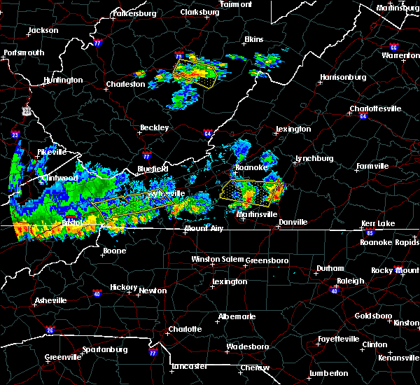 The severe thunderstorm warning for smyth and wythe counties will expire at 645 pm edt, the storm which prompted the warning has weakened below severe limits, and has exited the warned area. therefore the warning will be allowed to expire. a severe thunderstorm watch remains in effect until 800 pm edt for southwestern virginia and southeastern west virginia. when it is safe to do so, please send your reports of hail of any size, as well as any reports of wind damage, including downed trees or large limbs, to the national weather service by calling toll free at 1, 8 6 6, 2 1 5, 4 3 2 4. reports and pictures can also be shared on the national weather service blacksburg facebook page and on twitter. The severe thunderstorm warning for smyth and wythe counties will expire at 645 pm edt, the storm which prompted the warning has weakened below severe limits, and has exited the warned area. therefore the warning will be allowed to expire. a severe thunderstorm watch remains in effect until 800 pm edt for southwestern virginia and southeastern west virginia. when it is safe to do so, please send your reports of hail of any size, as well as any reports of wind damage, including downed trees or large limbs, to the national weather service by calling toll free at 1, 8 6 6, 2 1 5, 4 3 2 4. reports and pictures can also be shared on the national weather service blacksburg facebook page and on twitter.
|
| 6/21/2015 6:11 PM EDT |
 At 610 pm edt, a severe thunderstorm was located over crockett, moving east at 25 mph (radar indicated). Hazards include 60 mph wind gusts and quarter size hail. Hail damage to vehicles is expected. expect wind damage to roofs, siding and trees. Locations impacted include, wytheville, marion, saltville, chilhowie, and rural retreat. At 610 pm edt, a severe thunderstorm was located over crockett, moving east at 25 mph (radar indicated). Hazards include 60 mph wind gusts and quarter size hail. Hail damage to vehicles is expected. expect wind damage to roofs, siding and trees. Locations impacted include, wytheville, marion, saltville, chilhowie, and rural retreat.
|
| 6/21/2015 5:45 PM EDT |
 At 545 pm edt, a severe thunderstorm was located near ceres, moving east at 25 mph (radar indicated). Hazards include 60 mph wind gusts and quarter size hail. Hail damage to vehicles is expected. Expect wind damage to roofs, siding and trees. At 545 pm edt, a severe thunderstorm was located near ceres, moving east at 25 mph (radar indicated). Hazards include 60 mph wind gusts and quarter size hail. Hail damage to vehicles is expected. Expect wind damage to roofs, siding and trees.
|
| 6/8/2015 6:49 PM EDT | At 647 pm edt, severe thunderstorms were located along a line extending from tiptop virginia, to 8 miles northwest of whitetop, moving east at 40 mph (radar indicated). Hazards include 60 mph wind gusts. Expect damage to roofs. siding and trees. Locations impacted include, marion, bluefield, tazewell, saltville, chilhowie and mount rogers. |
| 6/8/2015 6:32 PM EDT | At 630 pm edt, severe thunderstorms were located along a line extending from near tazewell, to south of abingdon, moving east at 40 mph (radar indicated). Hazards include 60 mph wind gusts. Expect damage to roofs. siding and trees. Locations impacted include, marion, richlands, bluefield, tazewell, saltville chilhowie and mount rogers. |
| 6/8/2015 6:17 PM EDT | At 616 pm edt, severe thunderstorms were located along a line extending from near raven to near bristol va, moving east at 35 mph (radar indicated). Hazards include 60 mph wind gusts and nickel size hail. Expect damage to roofs. siding and trees. Locations impacted include, bristol va, abingdon, lebanon, glade spring, honaker, damascus, benhams, hilander park, holston, konnarock, rosedale, dye, lindell, emory-meadow view and hansonville. |
| 6/8/2015 6:09 PM EDT | At 606 pm edt, severe thunderstorms were located along a line extending from near richlands to bristol virginia, moving east at 35 mph (radar indicated). Hazards include 60 mph wind gusts. Expect damage to roofs. Siding and trees. |
| 6/8/2015 5:45 PM EDT | At 544 pm edt, severe thunderstorms were located along a line extending from near trammel to 6 miles east of weber city, moving east at 30 mph (radar indicated). Hazards include 60 mph wind gusts and nickel size hail. Expect damage to roofs. Siding and trees. |
| 4/26/2015 12:38 AM EDT | At 1237 am edt, a severe thunderstorm was located over broadford, moving east at 30 mph (radar indicated). Hazards include quarter size hail. Damage to vehicles is expected. locations impacted include, marion, saltville, broadford, nebo, and allison gap. 1. 00in. |
| 4/26/2015 12:21 AM EDT | At 1221 am edt, a severe thunderstorm was located near allison gap, moving east at 30 mph (radar indicated). Hazards include quarter size hail. damage to vehicles is expected |
| 4/25/2015 11:44 PM EDT | At 1144 pm edt, a severe thunderstorm was located 13 miles east of lebanon, moving east at 30 mph (radar indicated). Hazards include quarter size hail and 60 mph wind gusts. Hail damage to vehicles is expected. expect wind damage to roofs, siding and trees. locations impacted include, glade spring and emory-meadow view. 1. 00in. |
| 4/25/2015 11:31 PM EDT | At 1131 pm edt, a severe thunderstorm was located 7 miles east of lebanon, moving east at 30 mph (radar indicated). Hazards include quarter size hail and 60 mph wind gusts. Hail damage to vehicles is expected. Expect wind damage to roofs, siding and trees. |
| 4/25/2015 9:48 PM EDT | At 948 pm edt, a severe thunderstorm was located 9 miles northeast of abingdon, moving southeast at 30 mph (radar indicated). Hazards include half dollar size hail and 60 mph wind gusts. Hail damage to vehicles is expected. expect wind damage to roofs, siding and trees. locations impacted include, glade spring, konnarock, lindell and emory-meadow view. 1. 25in. |
| 4/25/2015 9:33 PM EDT | At 932 pm edt, a severe thunderstorm was located near lebanon, moving southeast at 25 mph (radar indicated). Hazards include half dollar size hail and 60 mph wind gusts. Hail damage to vehicles is expected. Expect wind damage to roofs, siding and trees. |
| 4/19/2015 11:33 PM EDT | At 1132 pm edt, severe thunderstorms were located along a line extending from 11 miles northeast of cleveland to 9 miles north of abingdon to 8 miles north of mountain city, moving northeast at 55 mph (radar indicated). Hazards include 60 mph wind gusts. Expect damage to roofs. siding and trees. locations impacted include, abingdon, lebanon, mountain city, bristol tn, bristol va, bristol, cleveland, walnut hill, bluff city, glade spring, honaker, st. paul, damascus, lindell, hansonville, laurel bloomery, holston, castlewood, collingwood and rosedale. 75in. |
| 4/19/2015 11:33 PM EDT | At 1132 pm edt, severe thunderstorms were located along a line extending from 11 miles northeast of cleveland to 9 miles north of abingdon to 8 miles north of mountain city, moving northeast at 55 mph (radar indicated). Hazards include 60 mph wind gusts. Expect damage to roofs. siding and trees. locations impacted include, abingdon, lebanon, mountain city, bristol tn, bristol va, bristol, cleveland, walnut hill, bluff city, glade spring, honaker, st. paul, damascus, lindell, hansonville, laurel bloomery, holston, castlewood, collingwood and rosedale. 75in. |
| 4/19/2015 11:11 PM EDT | At 1110 pm edt, severe thunderstorms were located along a line extending from 8 miles west of cleveland to 9 miles northwest of bristol va to near bristol, moving northeast at 55 mph (radar indicated). Hazards include 60 mph wind gusts. Expect damage to roofs. Siding and trees. |
| 4/19/2015 11:11 PM EDT | At 1110 pm edt, severe thunderstorms were located along a line extending from 8 miles west of cleveland to 9 miles northwest of bristol va to near bristol, moving northeast at 55 mph (radar indicated). Hazards include 60 mph wind gusts. Expect damage to roofs. Siding and trees. |
| 6/13/2013 1:40 PM EDT | Trees down on hwy 107 between chilhowie and saltvill in smyth county VA, 2.4 miles NW of Saltville, VA |
| 6/13/2013 1:39 PM EDT | Trees down in saltville in smyth county VA, 0.6 miles SSW of Saltville, VA |
| 5/19/2013 4:30 PM EDT | Quarter sized hail reported 0.9 miles E of Saltville, VA, hail ranged from nickel to quarter size along rt 91 |
| 7/25/2012 1:57 AM EDT | Two large trees down at the intersection of freestone valley road and veterans roa in tazewell county VA, 7.9 miles SW of Saltville, VA |
| 7/1/2012 11:42 PM EDT | Trees down near saltville on hwy 107 and on east main street in smyth county VA, 1.4 miles SSW of Saltville, VA |
| 7/1/2012 10:55 AM EDT | Large limb fell on a car on freestone valley road and smashed the windshield. people inside the car were uninjure in tazewell county VA, 8.7 miles SW of Saltville, VA |
| 6/29/2012 9:04 PM EDT | Tree down on power line and numerous large branches down along poor valley roa in smyth county VA, 1.9 miles SE of Saltville, VA |
| 6/29/2012 9:04 PM EDT | Tree down on power line and numerous large branches down along poor valley roa in washington county VA, 4.8 miles E of Saltville, VA |
| 1/1/0001 12:00 AM | Golf Ball sized hail reported 1.6 miles WNW of Saltville, VA, law enforcement reported hail up to the size of golfballs on highway 107 between chilhowie and saltville. |
| 1/1/0001 12:00 AM | Several trees and limbs dow in smyth county VA, 2.3 miles SW of Saltville, VA |
| 1/1/0001 12:00 AM | Trees dow in smyth county VA, 4.8 miles SW of Saltville, VA |
| 1/1/0001 12:00 AM | Softball sized hail reported 0.6 miles SSW of Saltville, VA, reports of numerous trees and large branches down in and around town |
| 1/1/0001 12:00 AM | Reports of numerous trees and large branches down in and around town in smyth county VA, 0.6 miles SSW of Saltville, VA |
Hail Maps for Saltville, VA


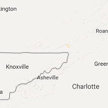


Connect with Interactive Hail Maps