

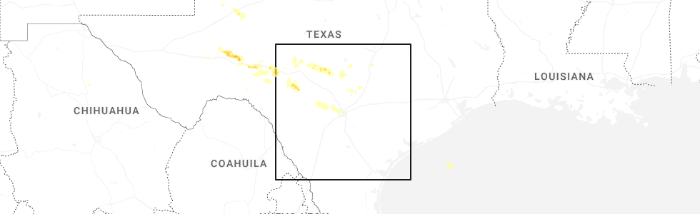
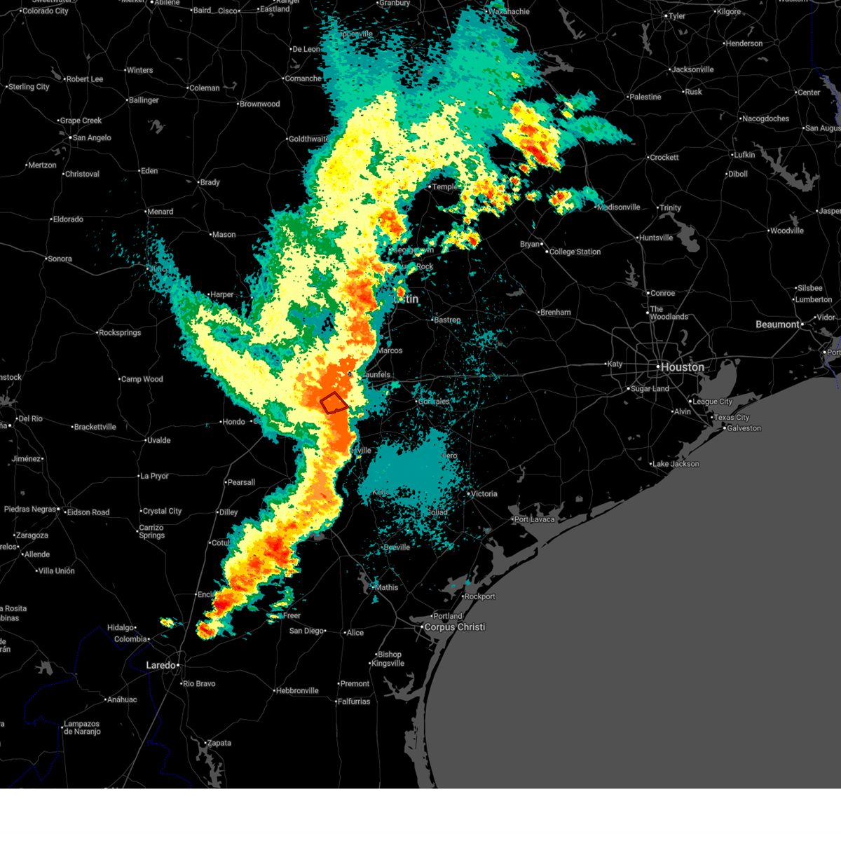
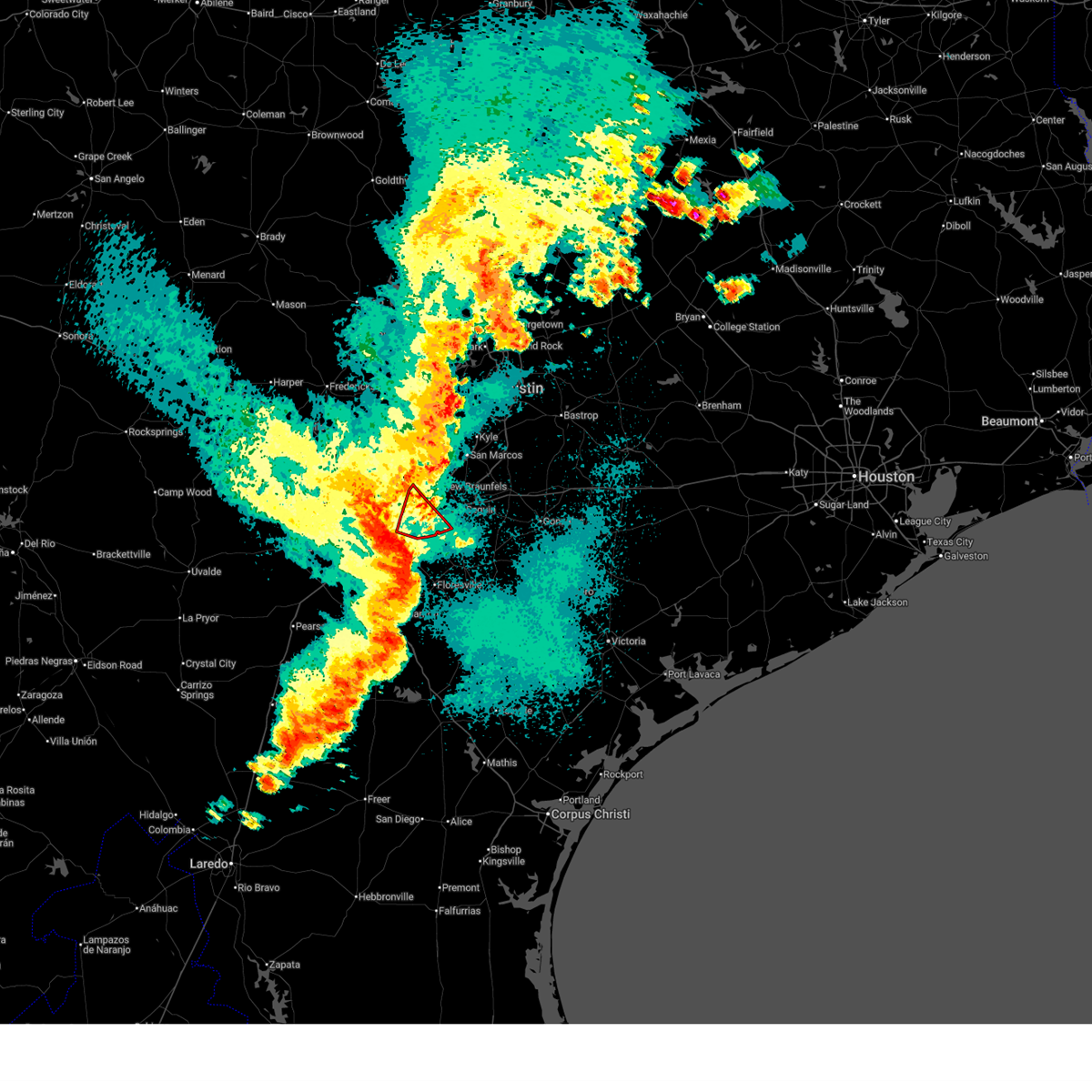
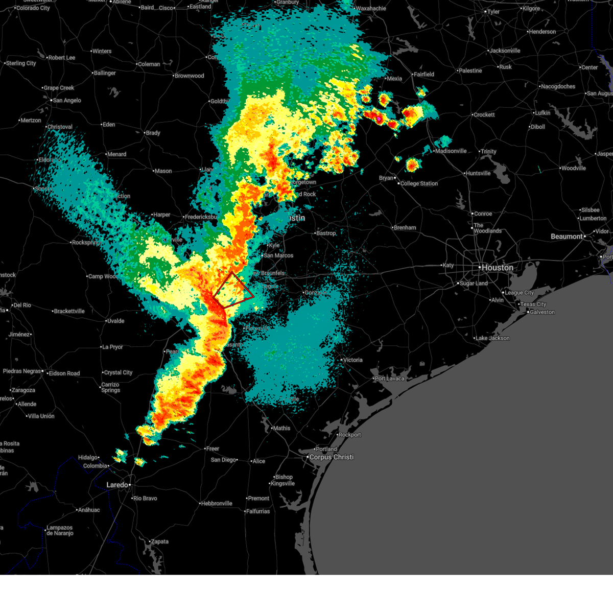
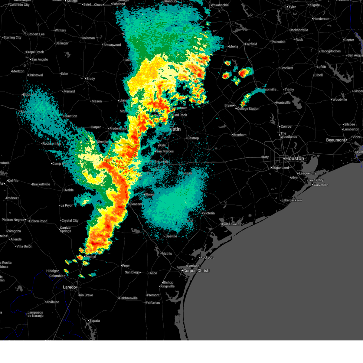
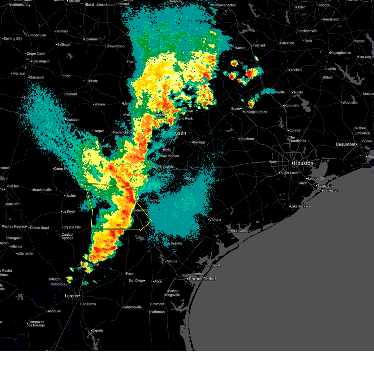
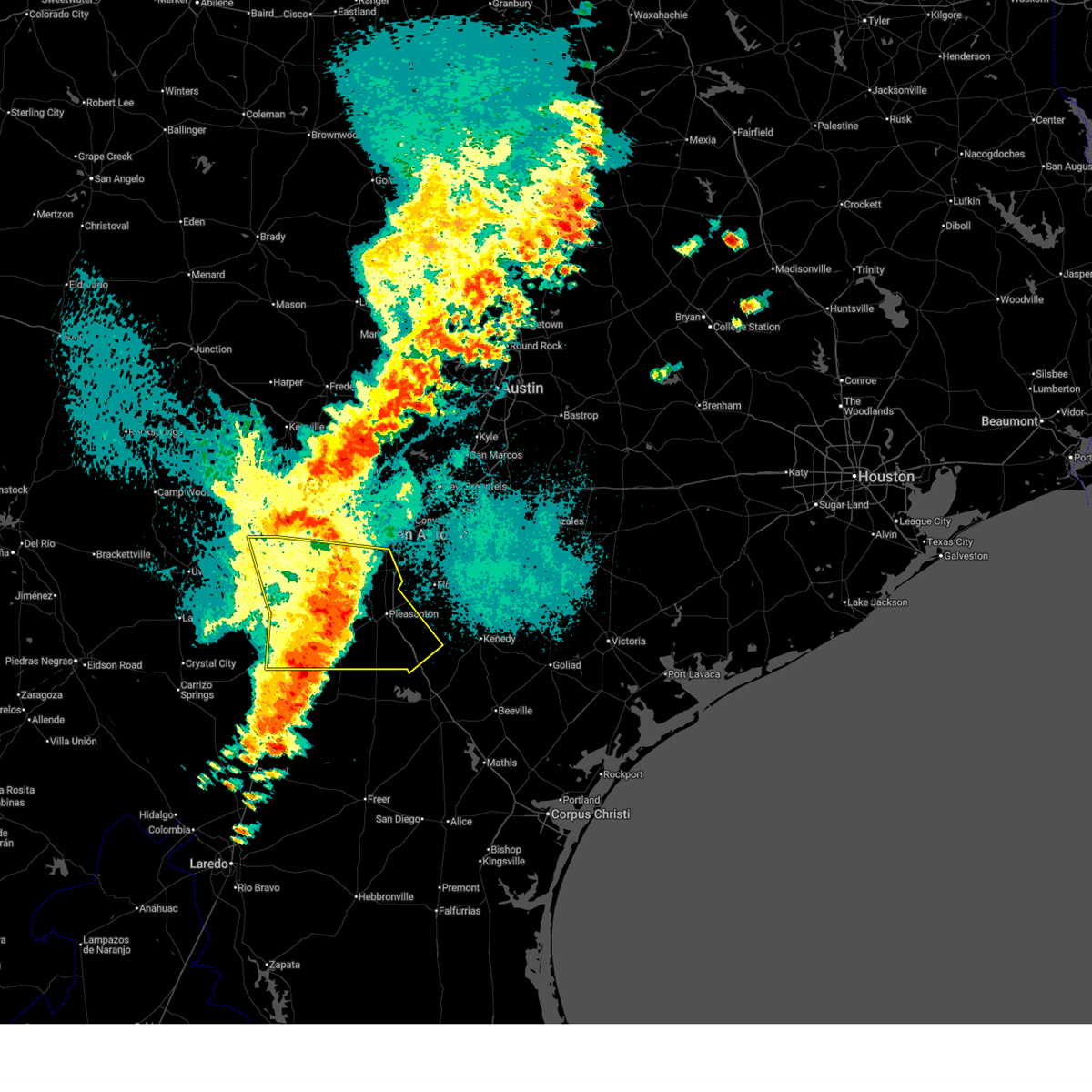
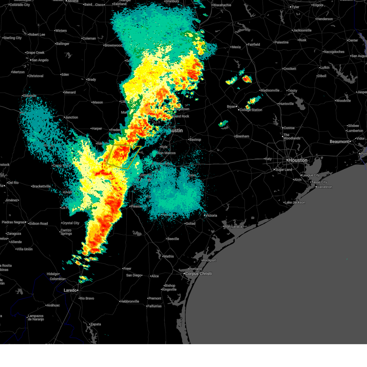
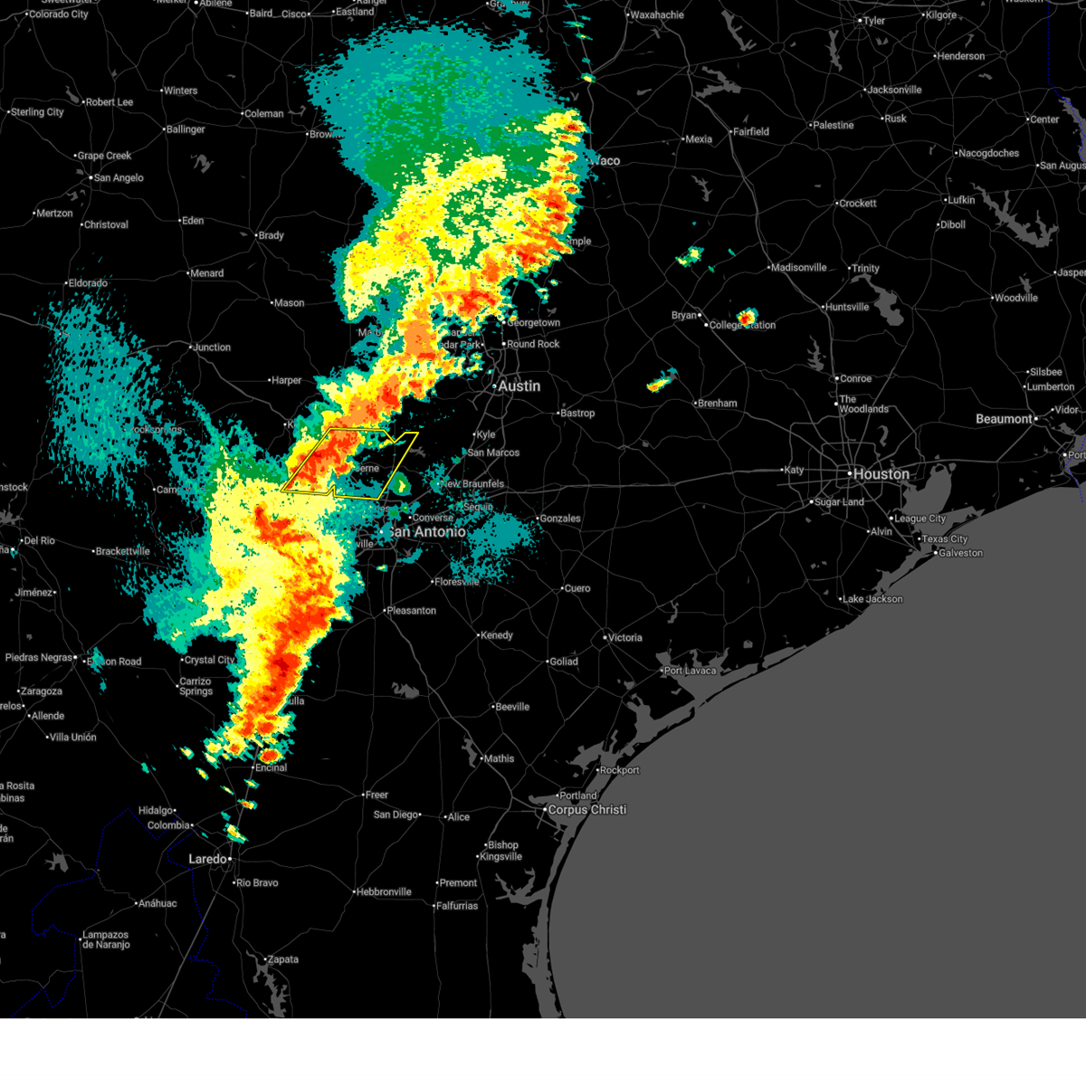
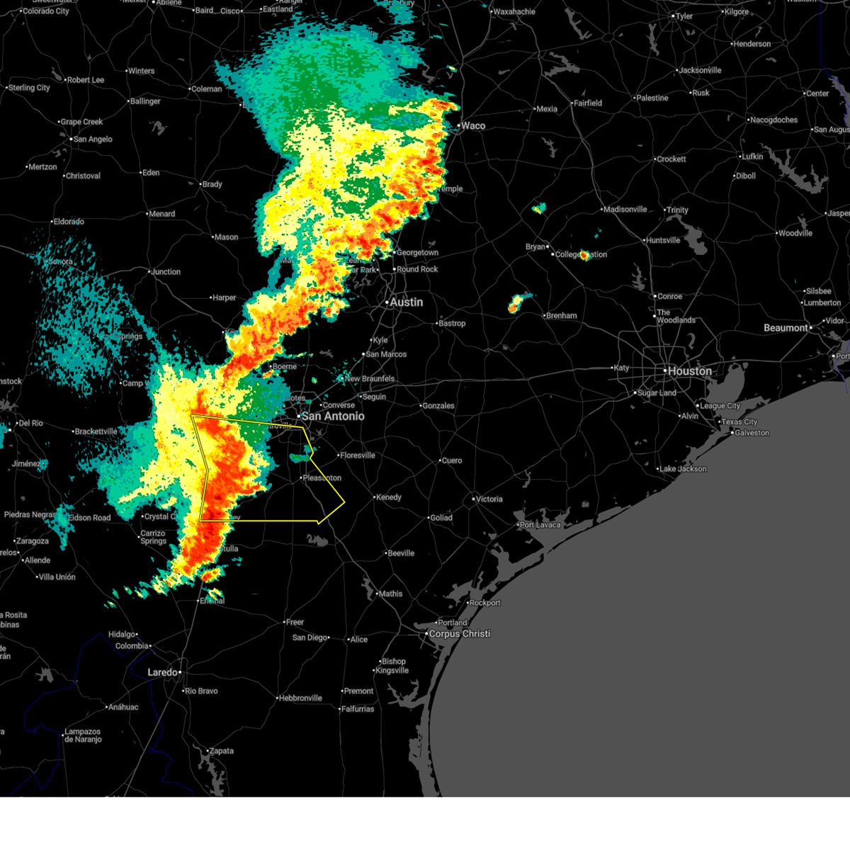
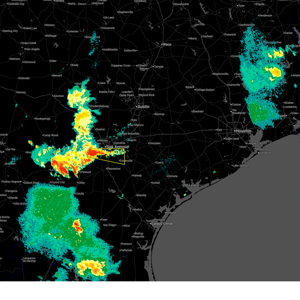
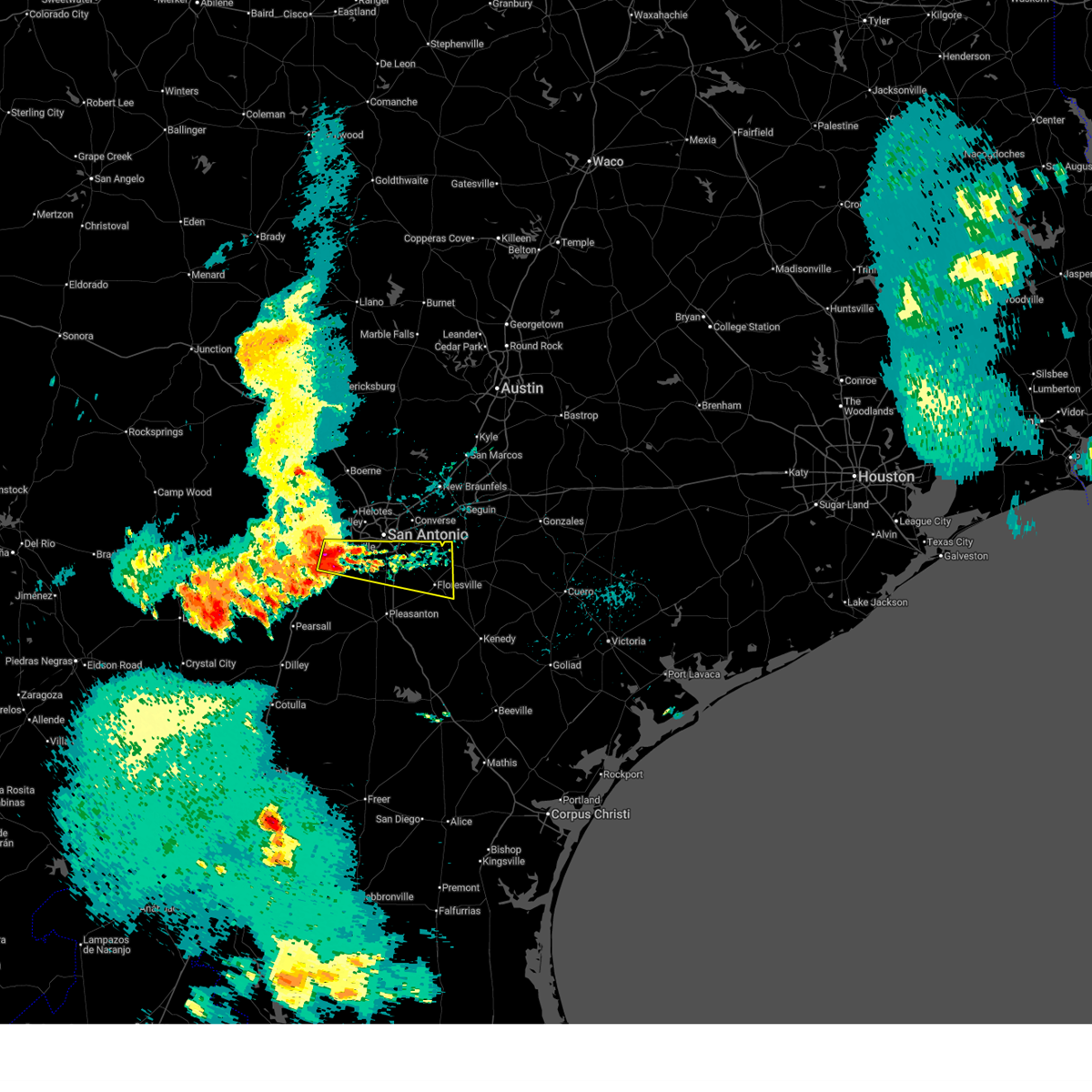
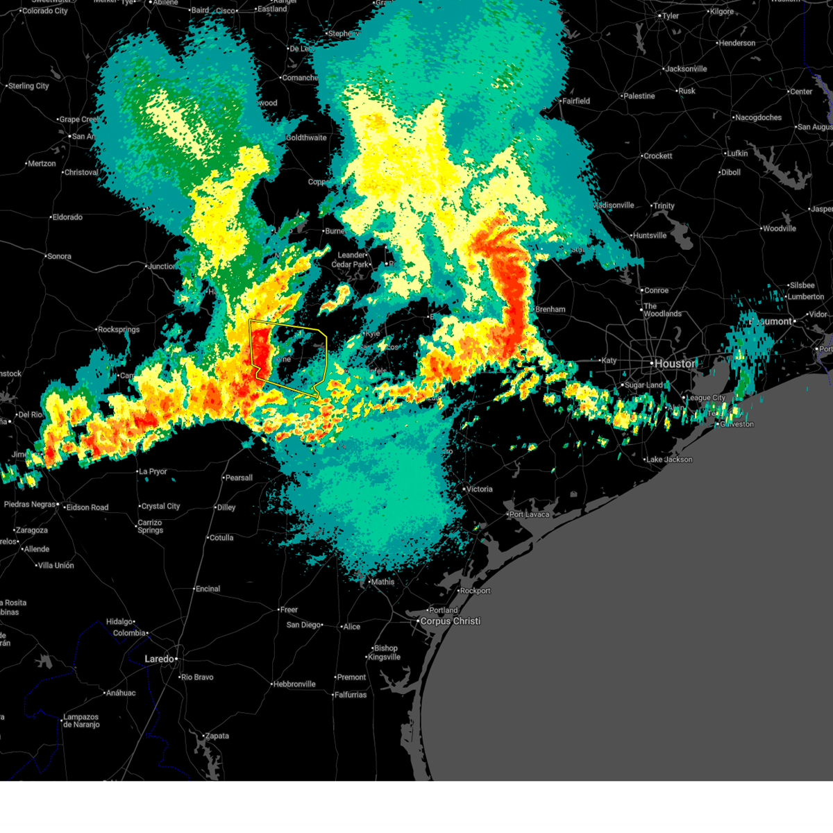
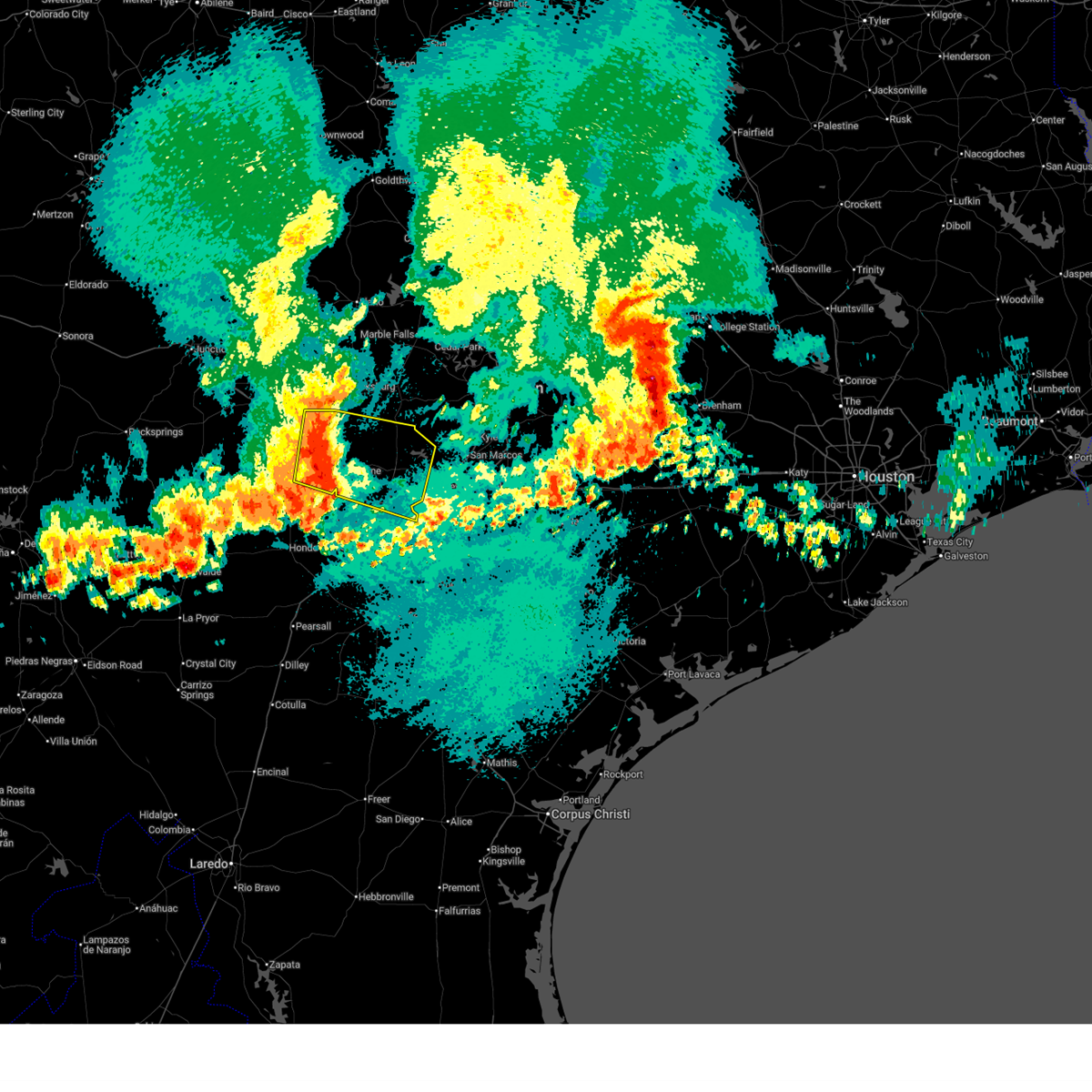
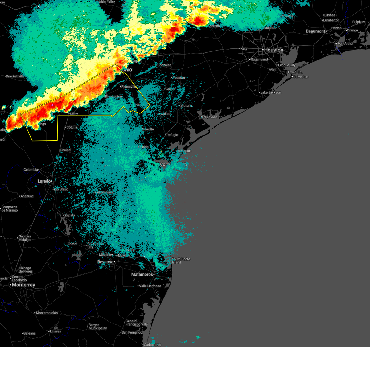
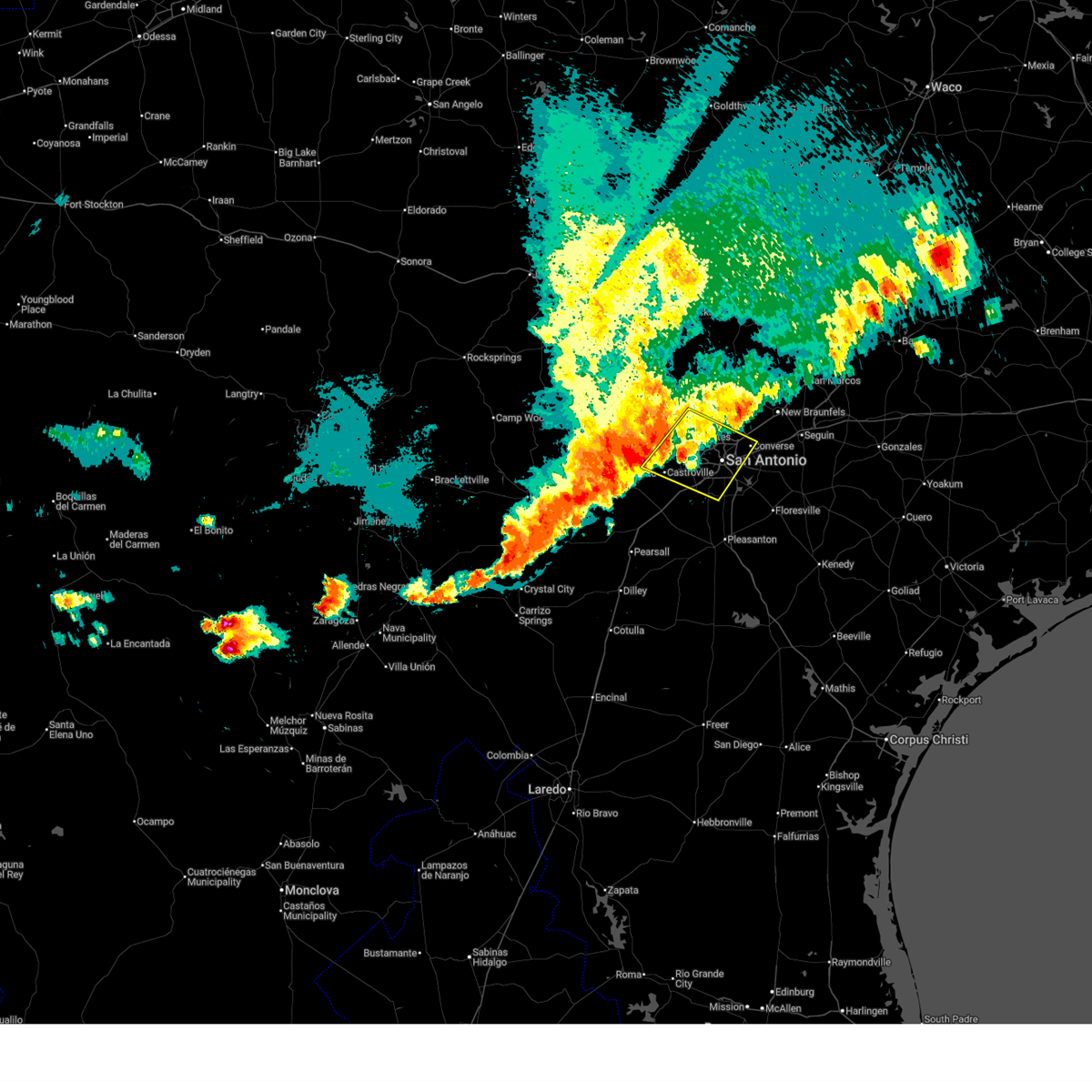
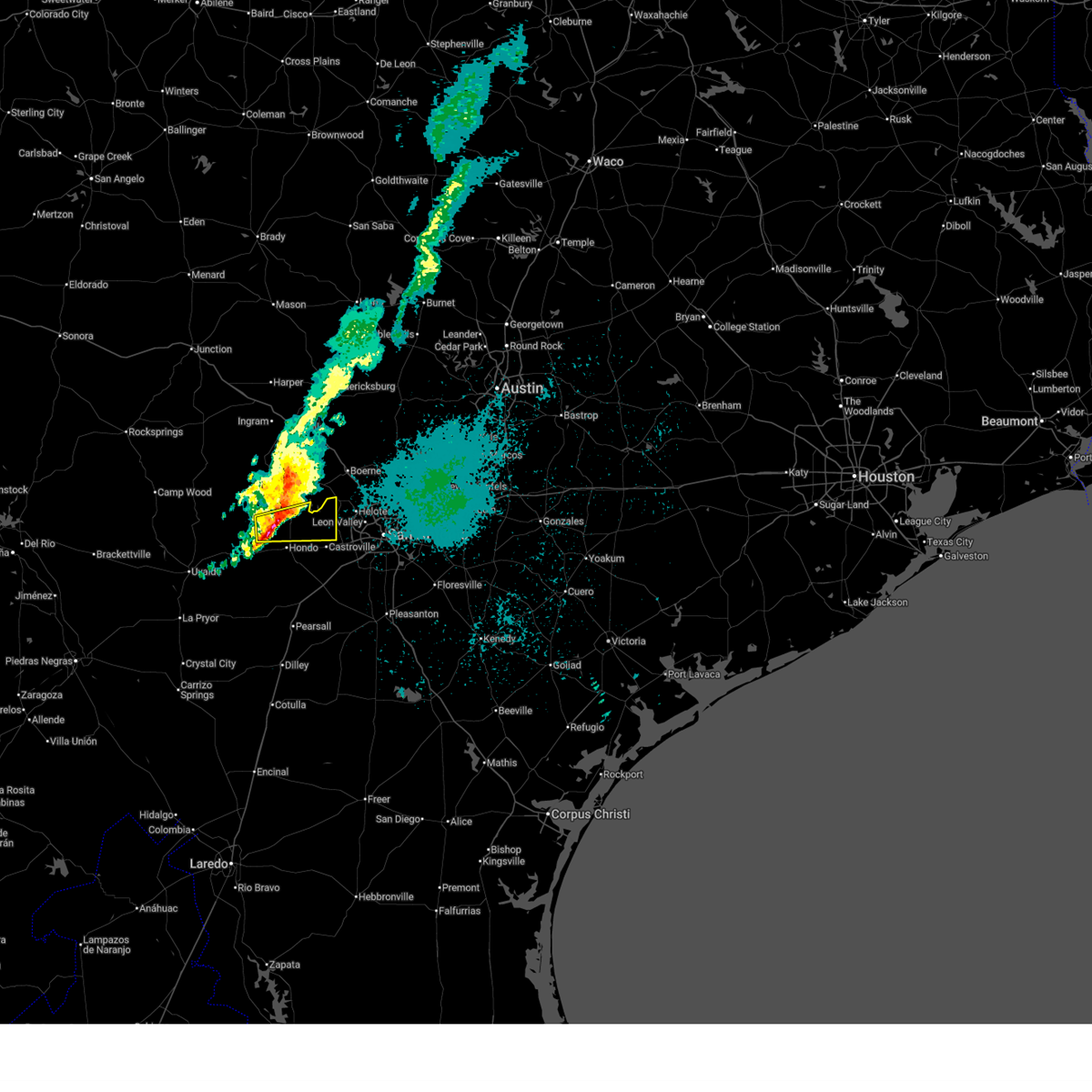
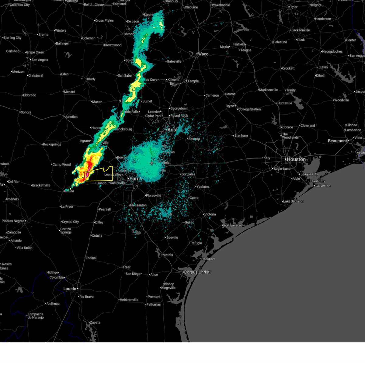
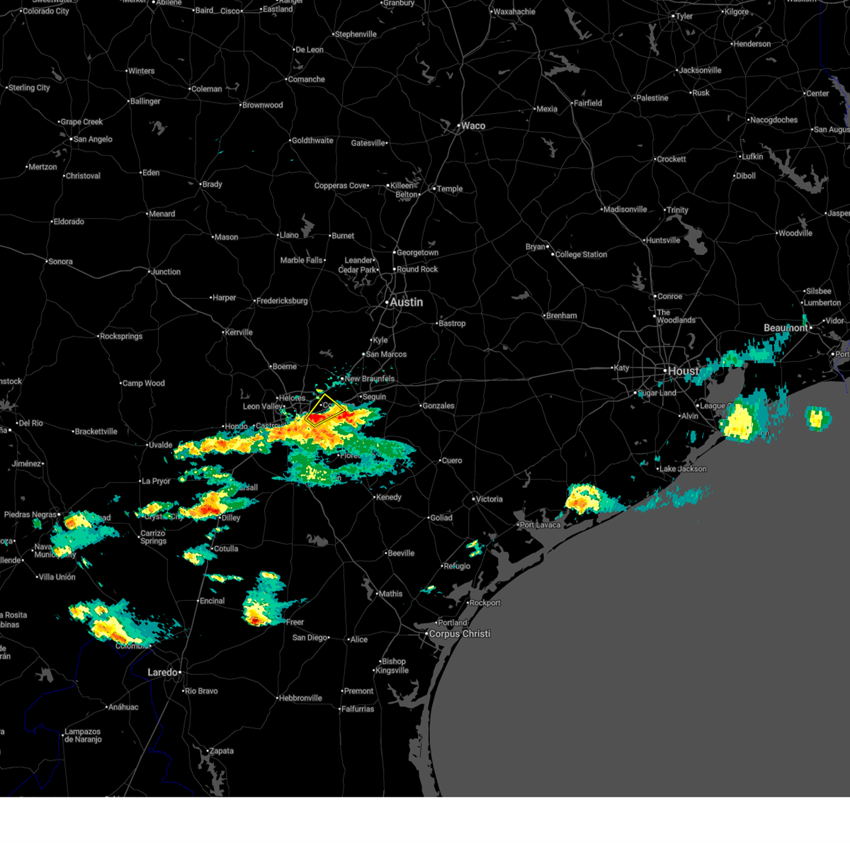
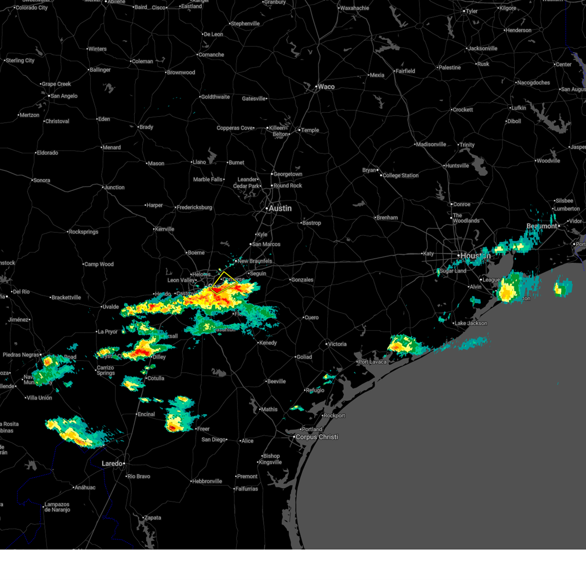
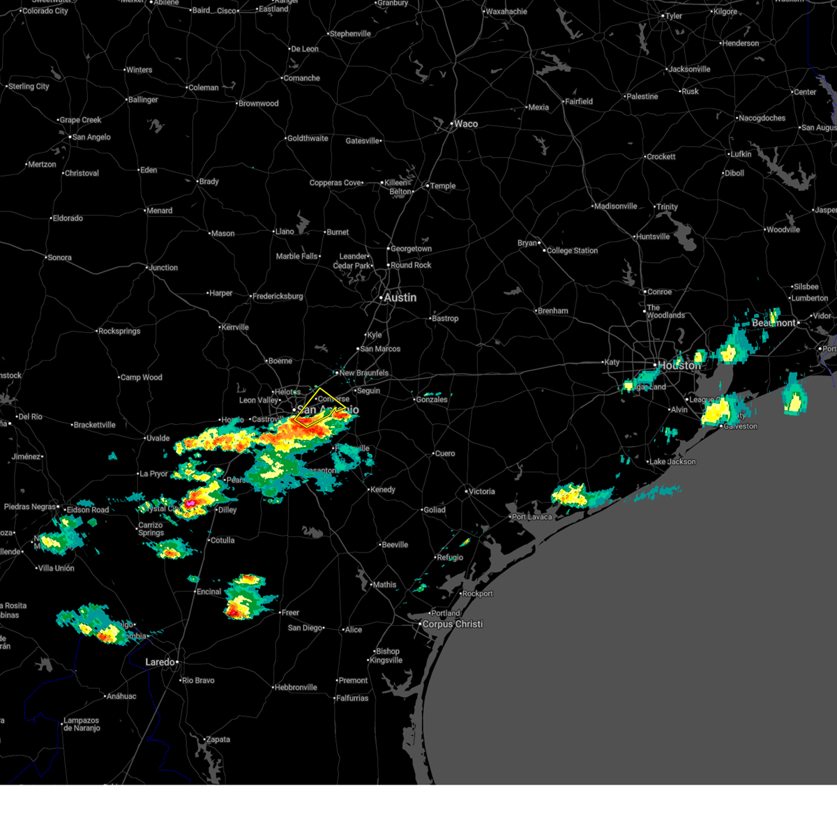
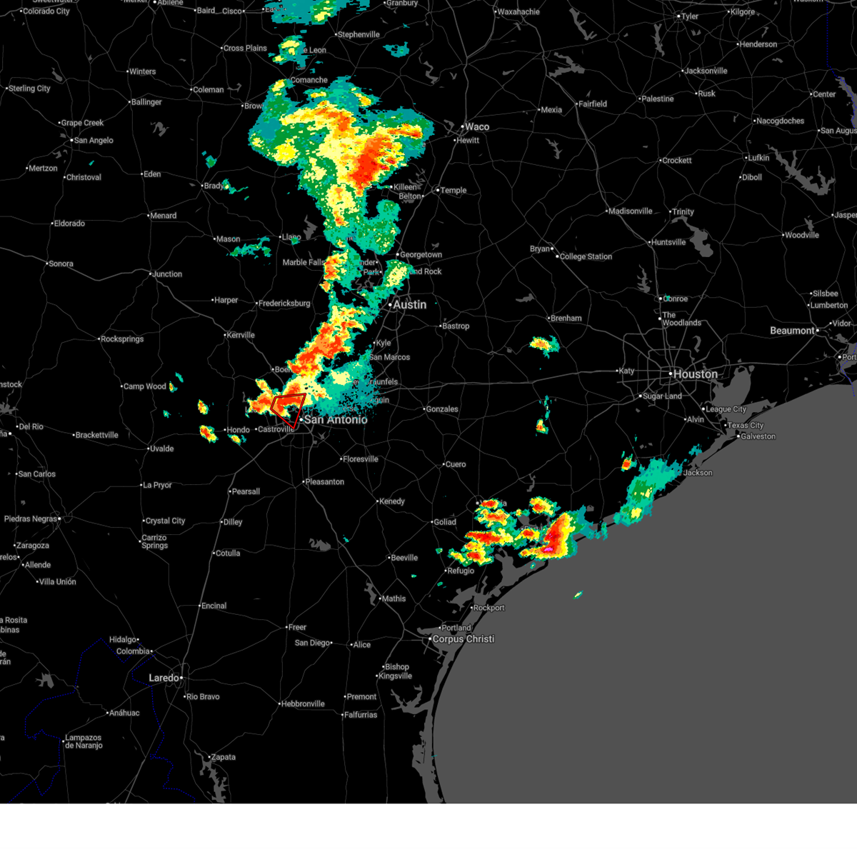
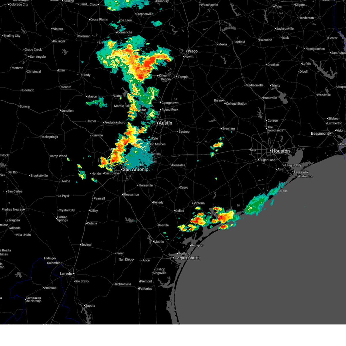
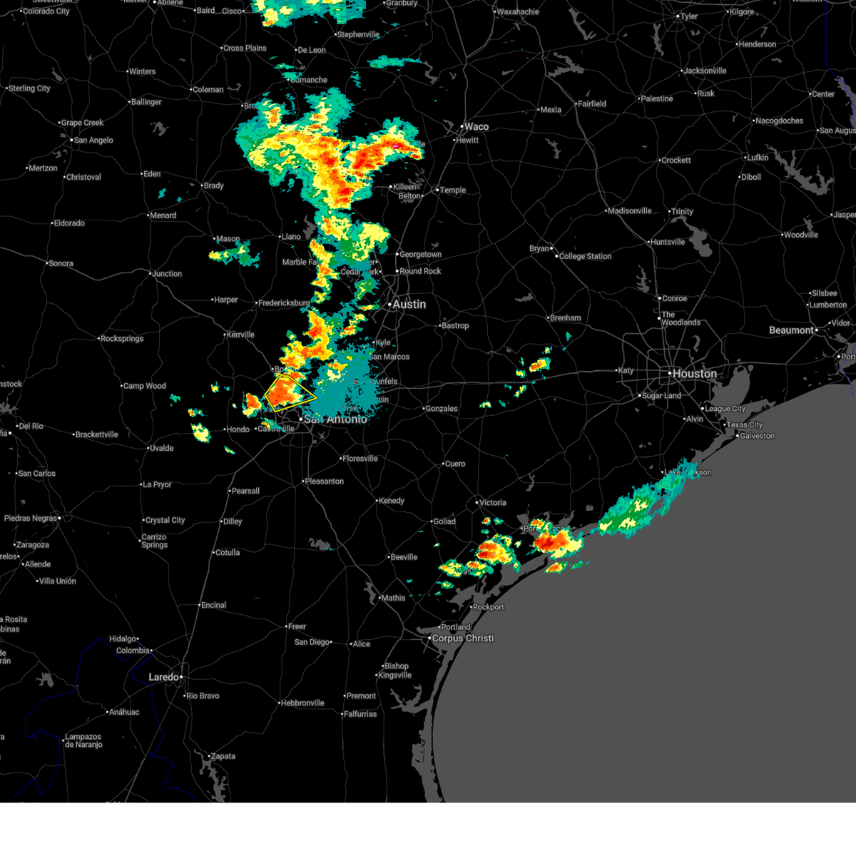
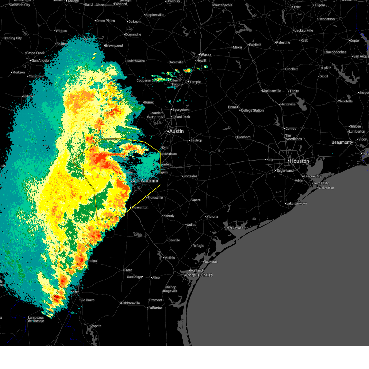
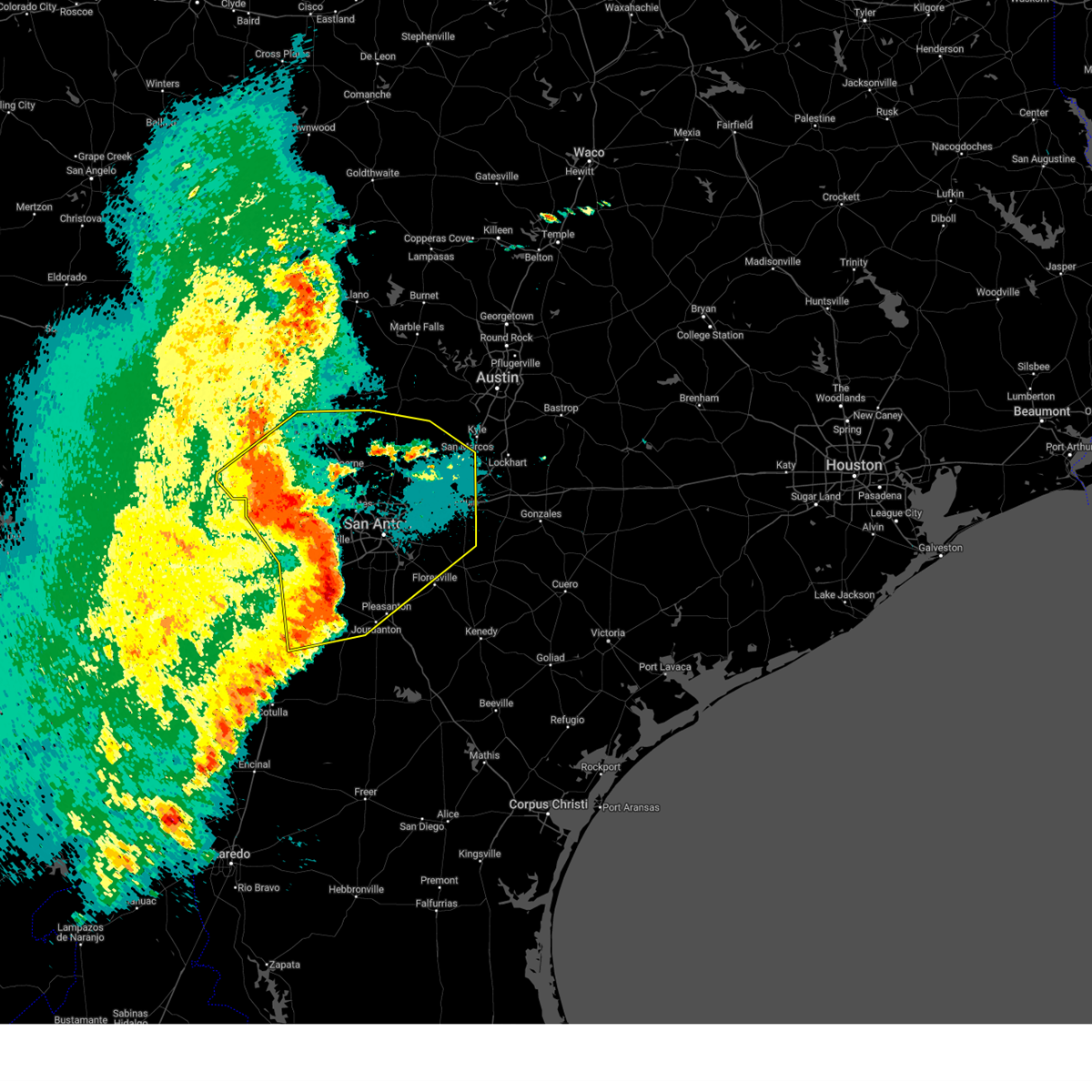
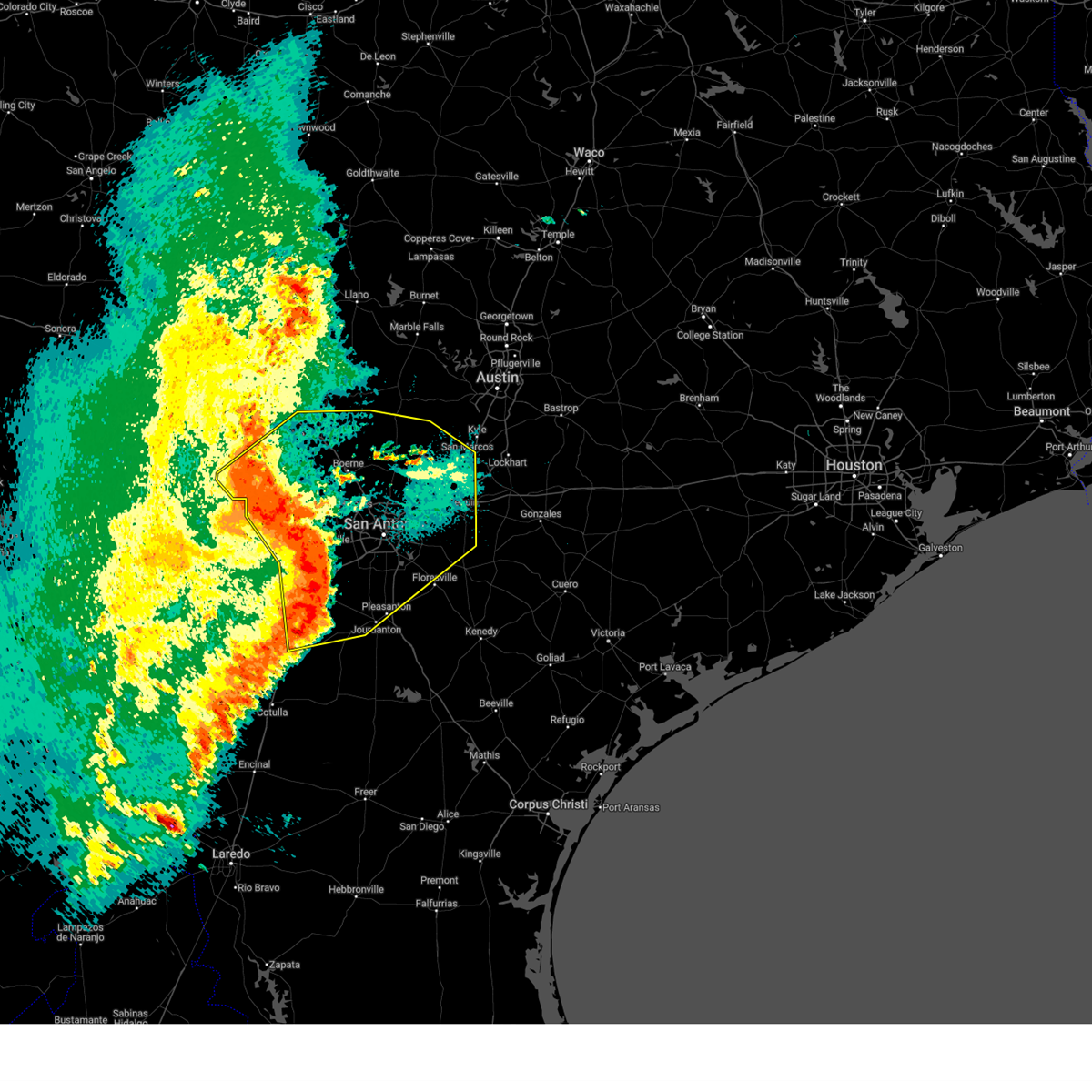
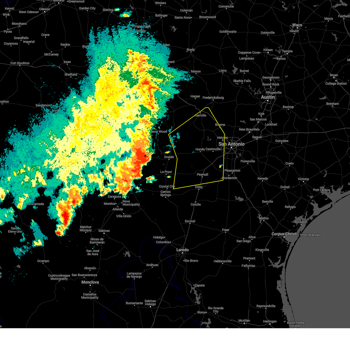
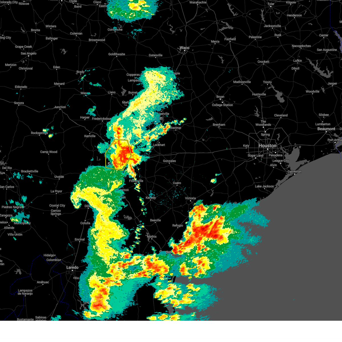
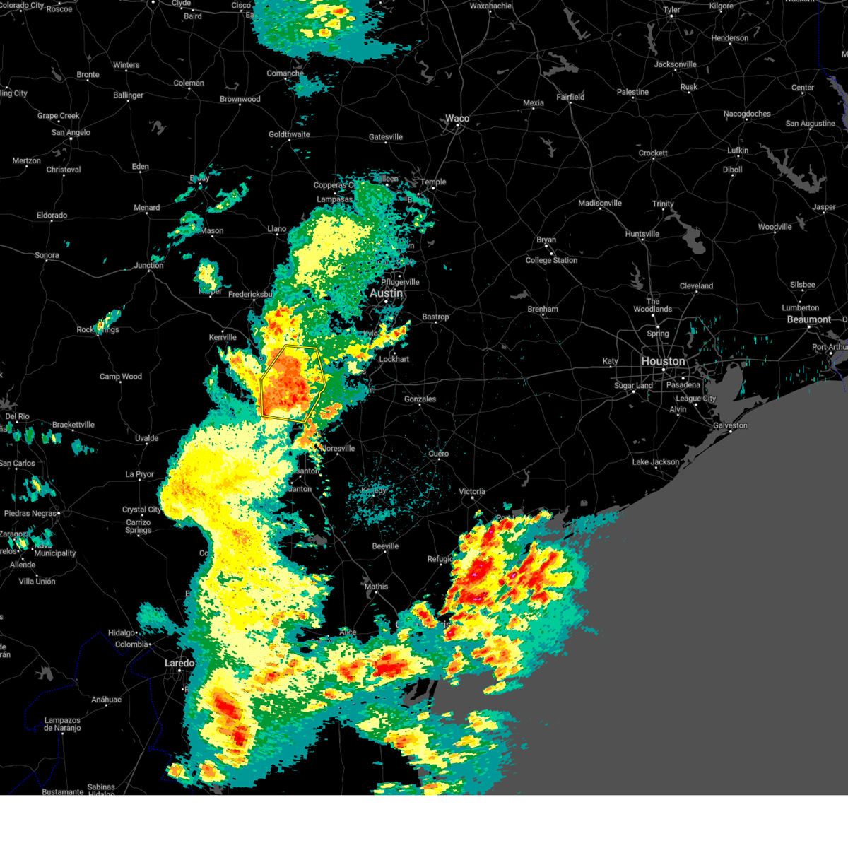
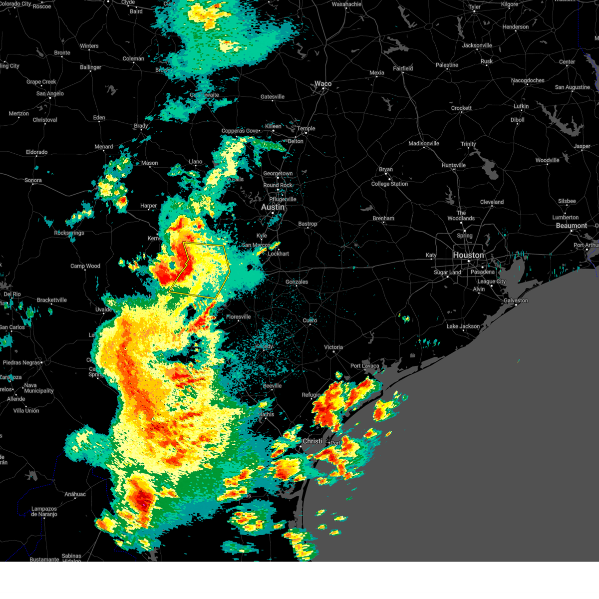
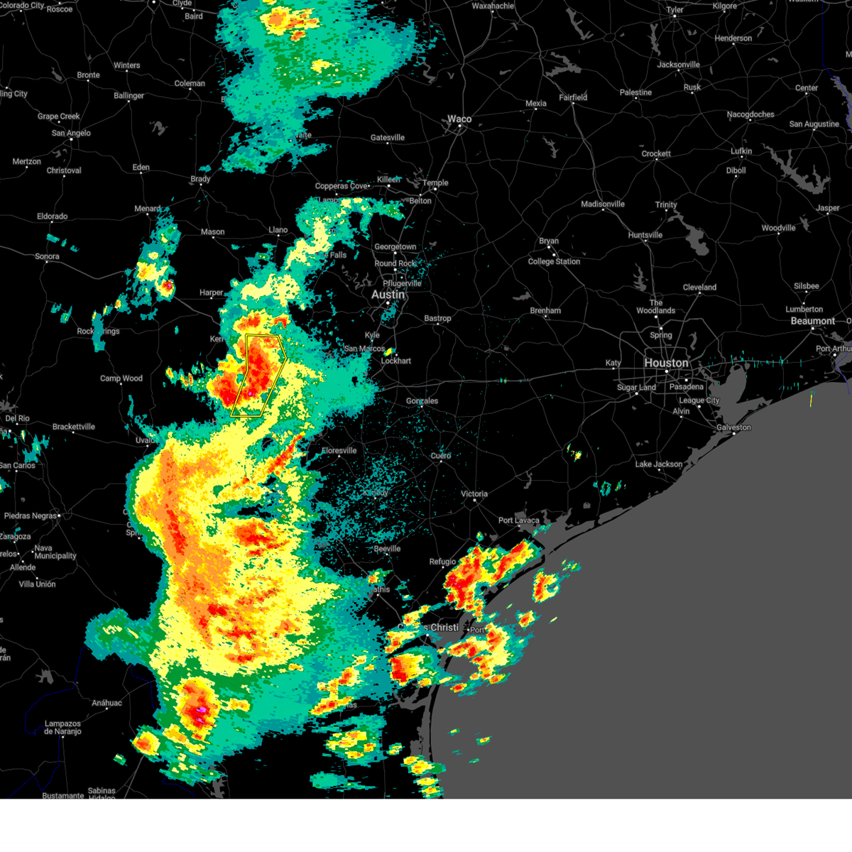
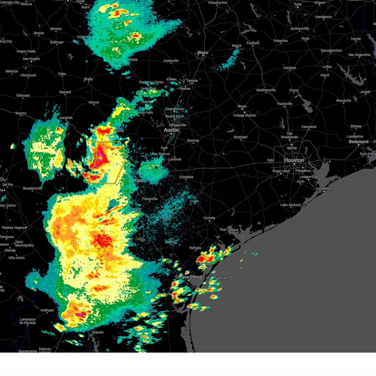
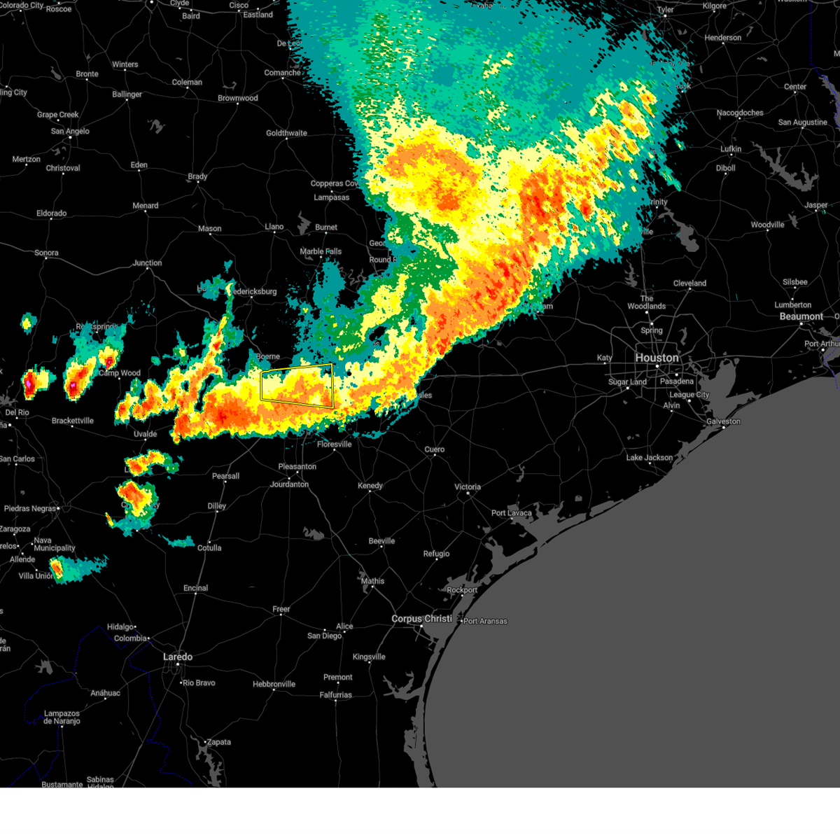
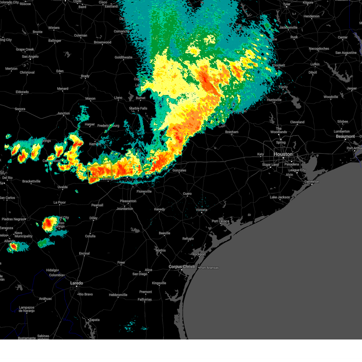
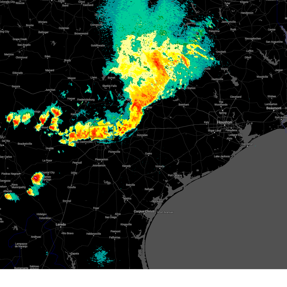
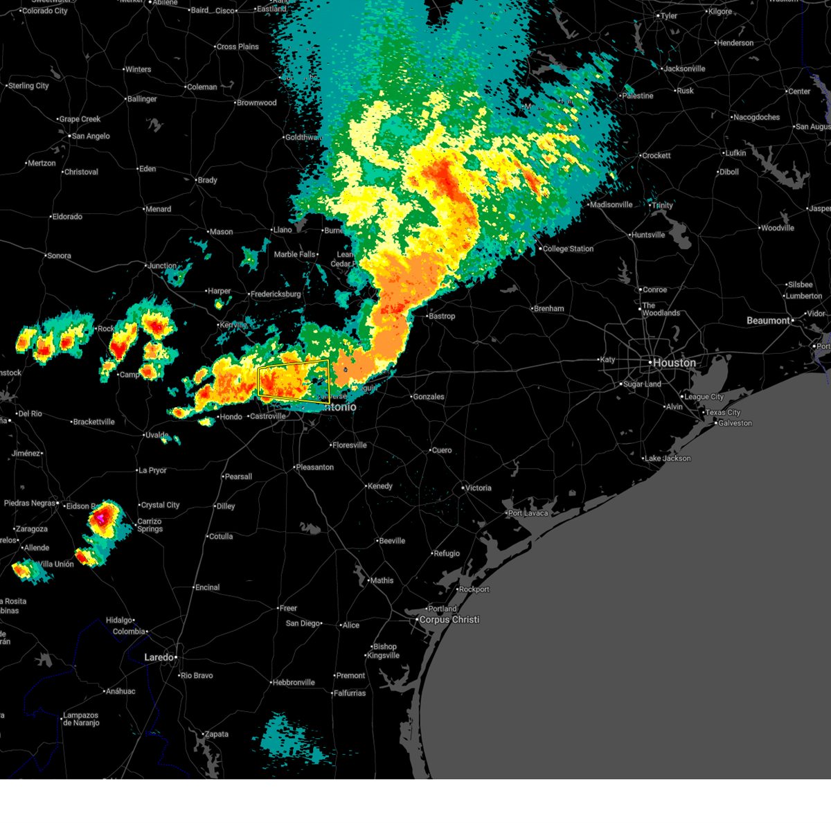
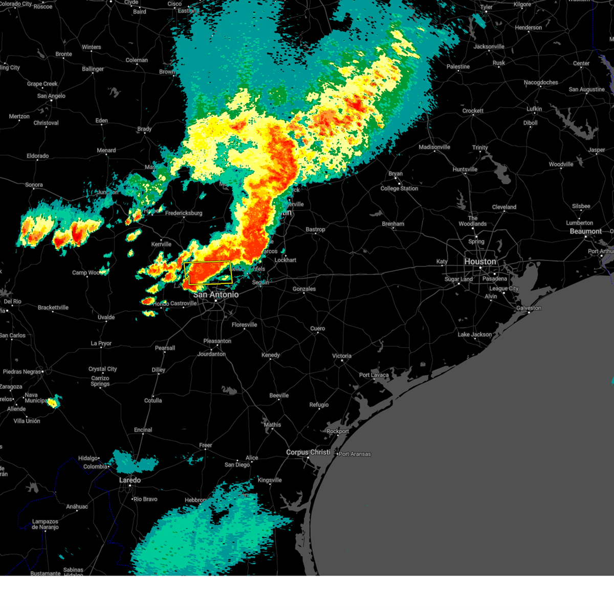
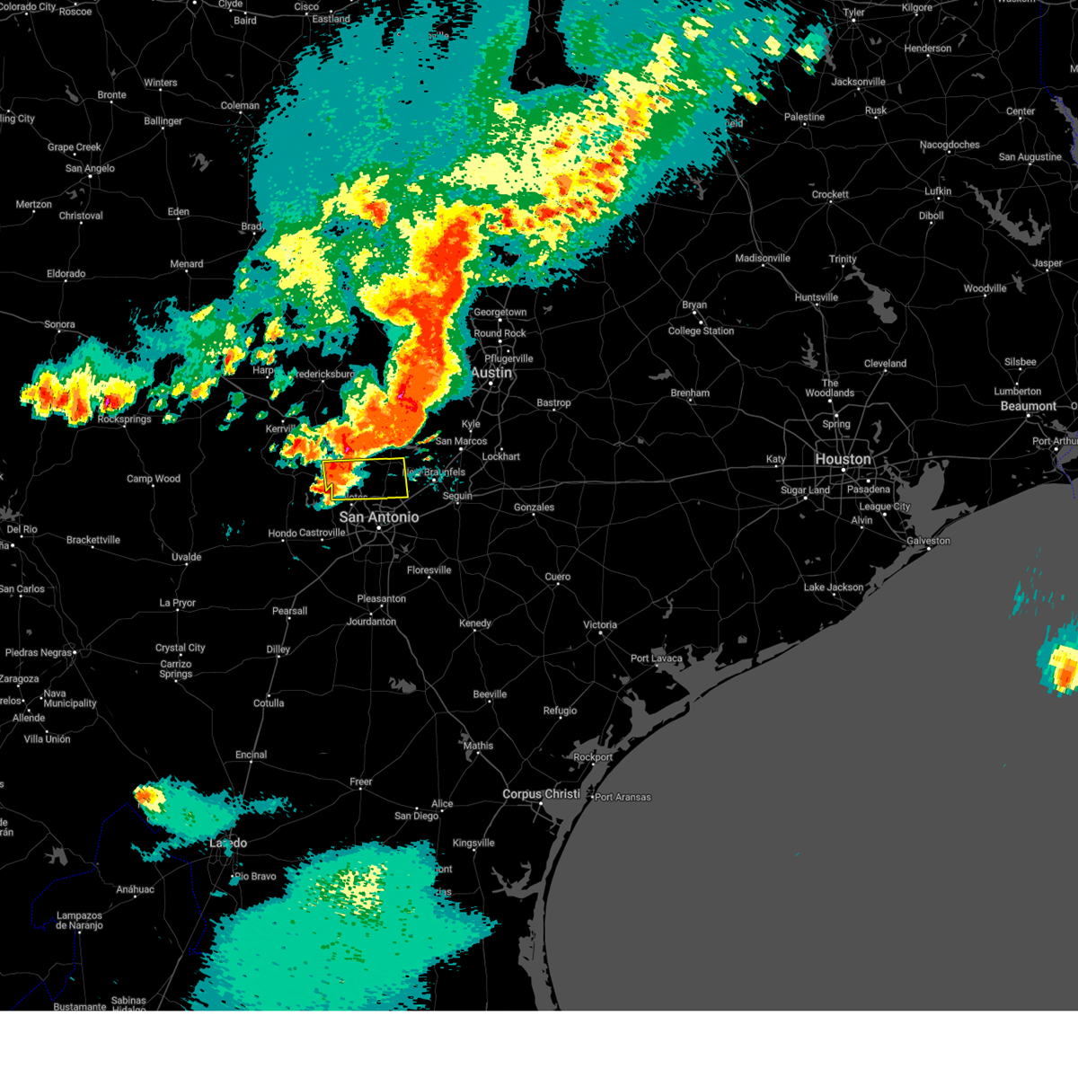
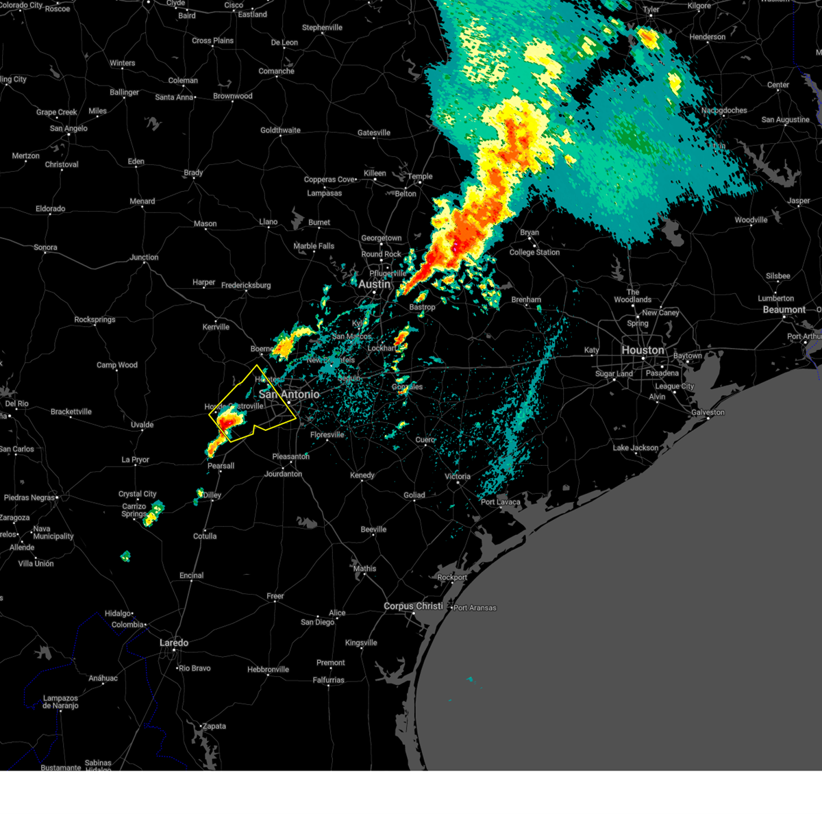
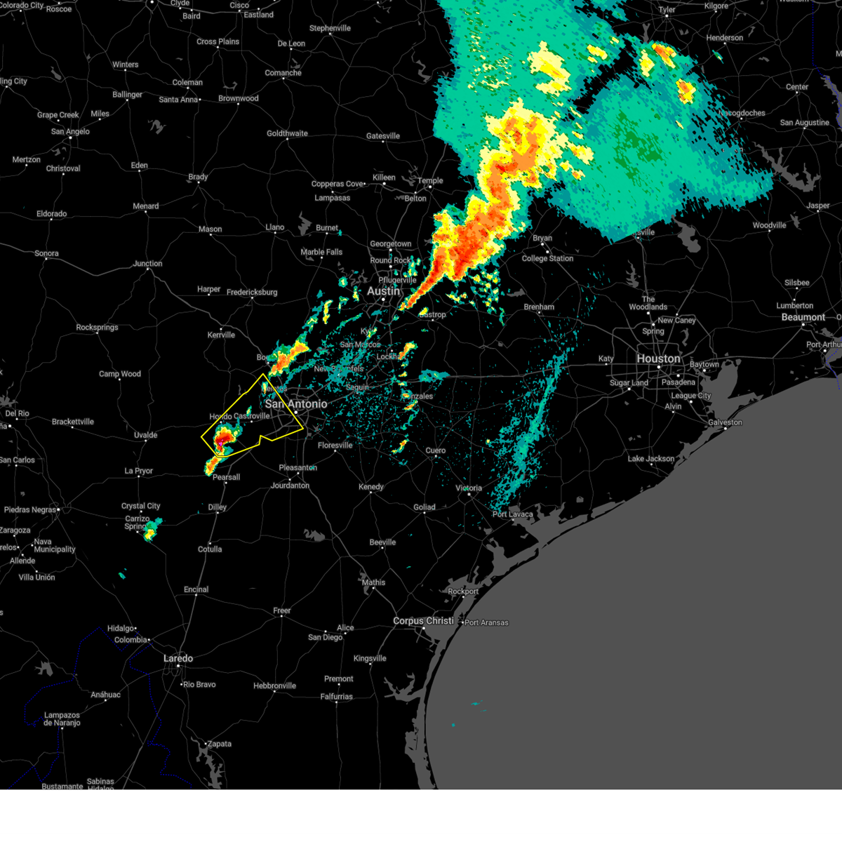
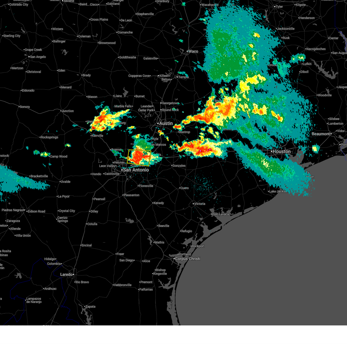
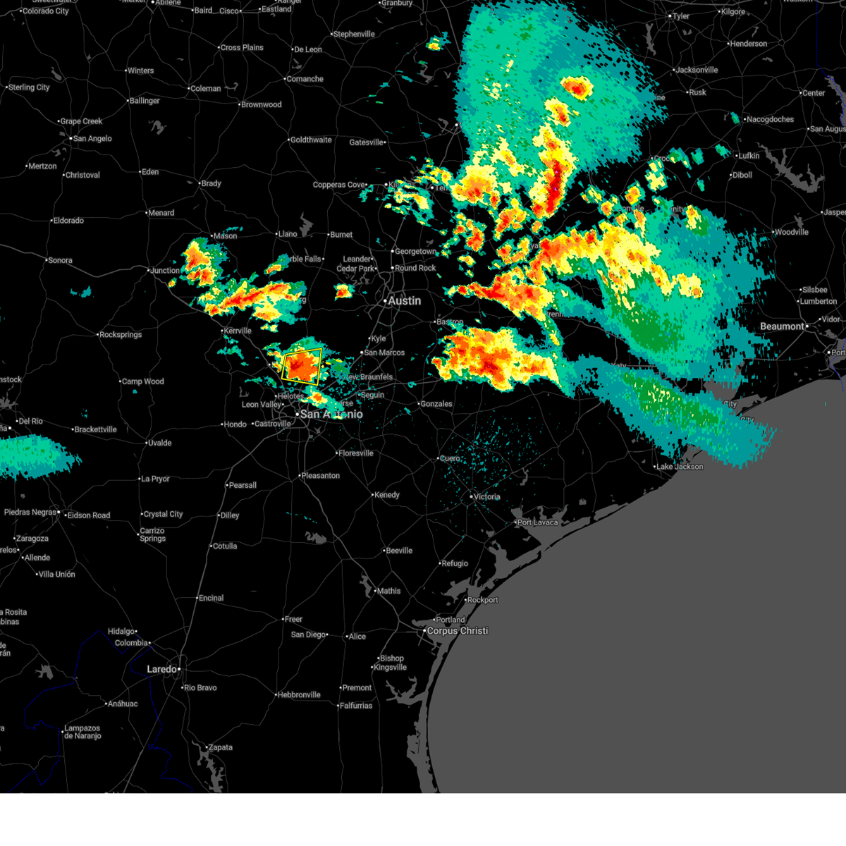
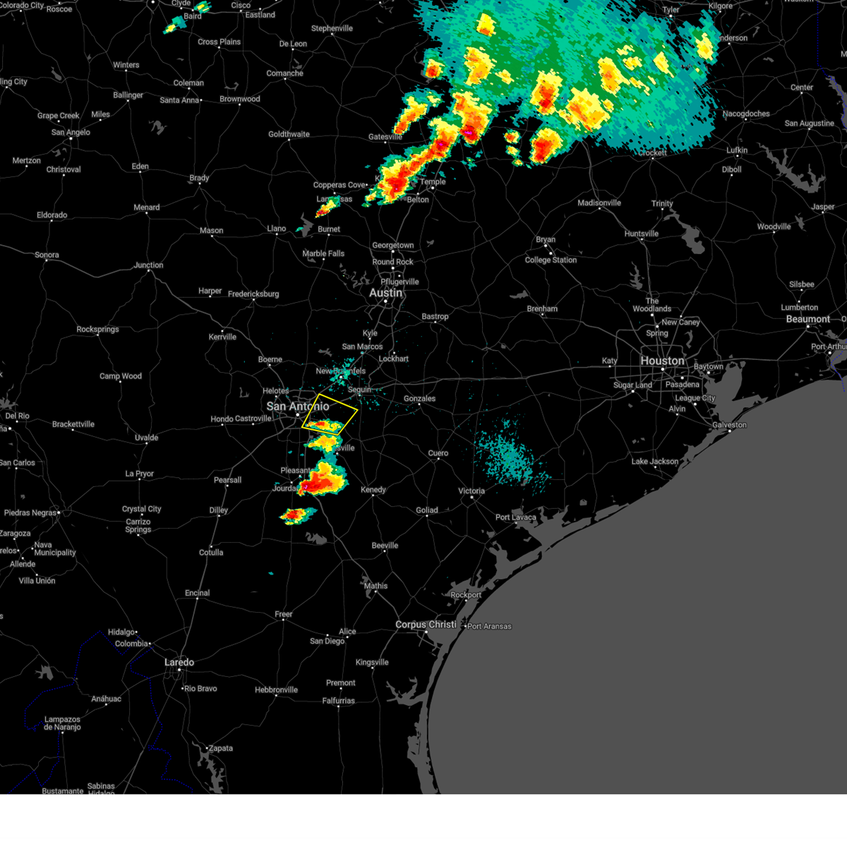
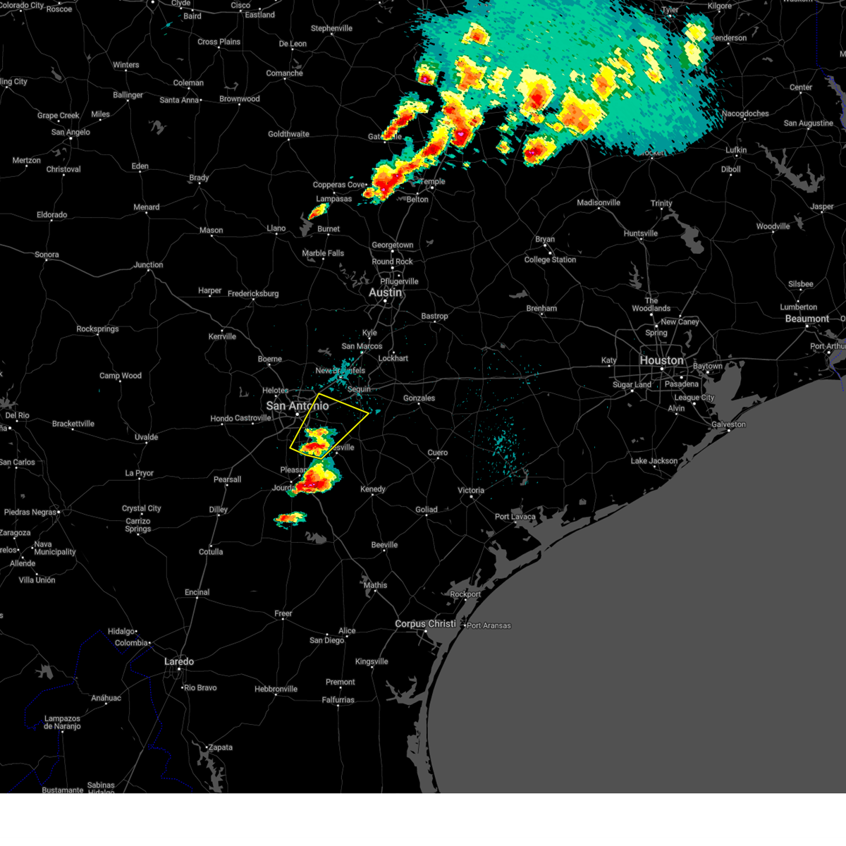
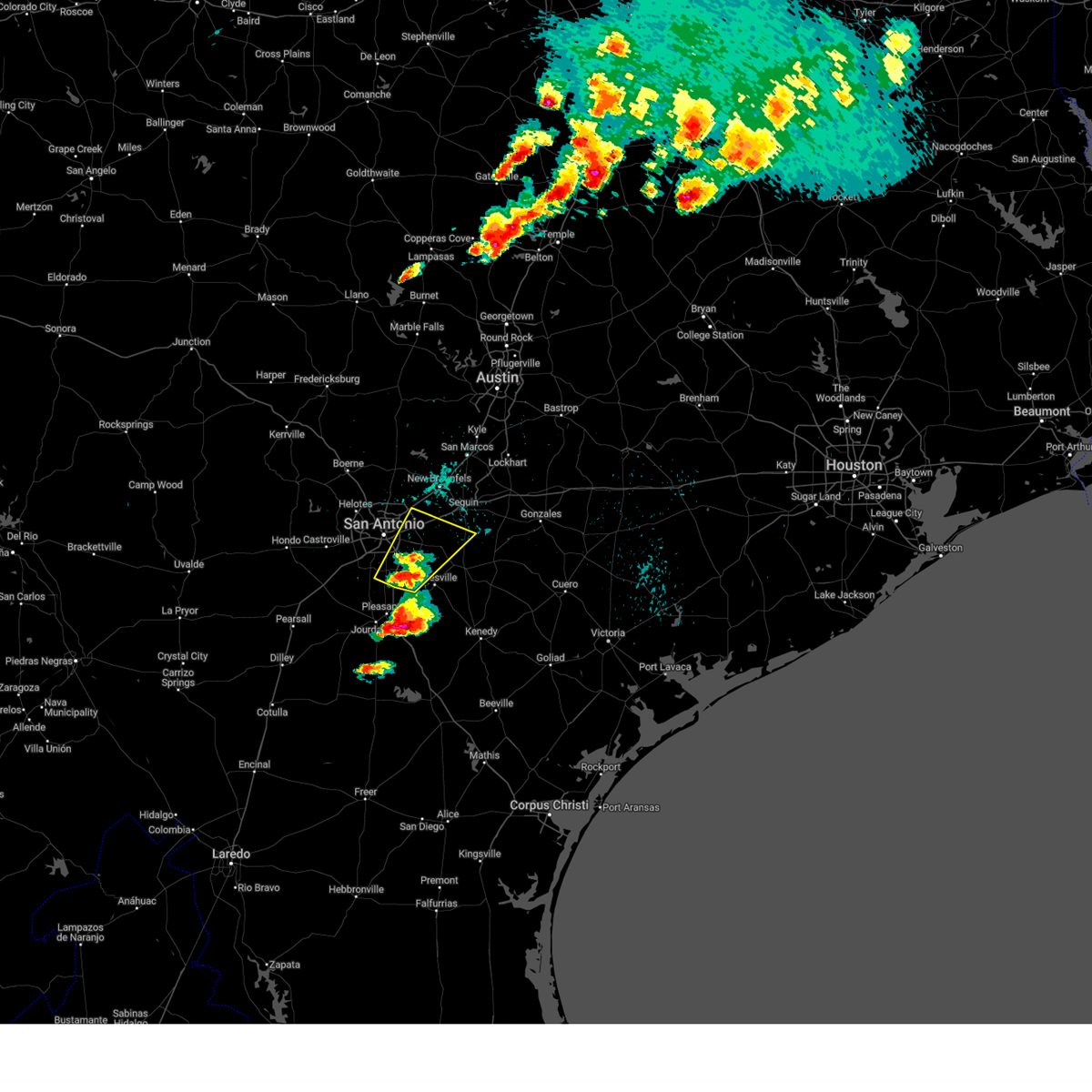
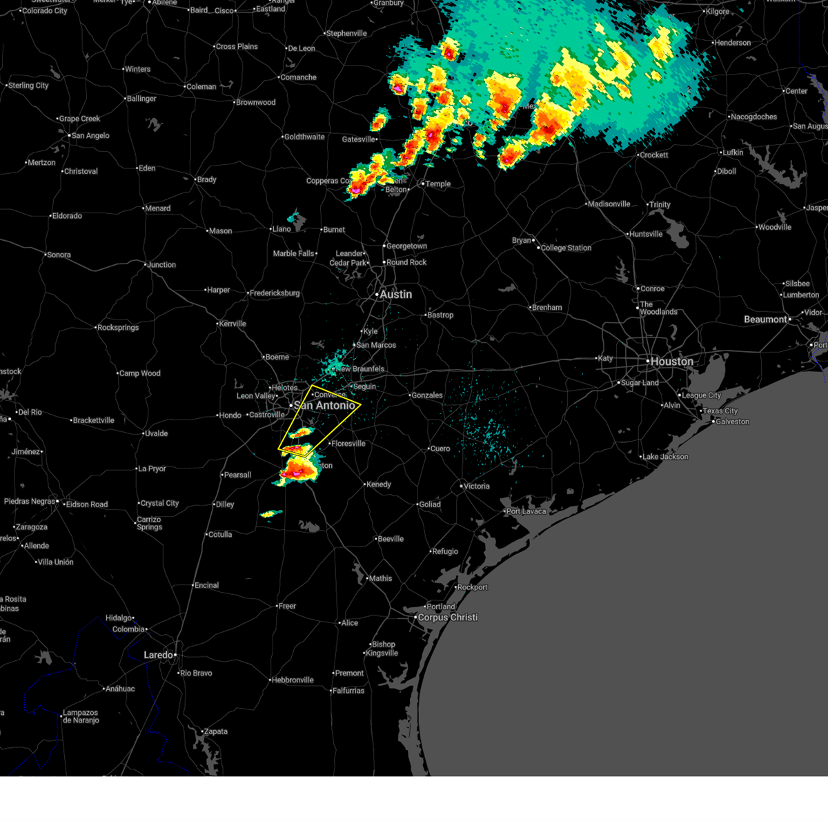
Hail Map for San Antonio, TX
The San Antonio, TX area has had 222 reports of on-the-ground hail by trained spotters, and has been under severe weather warnings 32 times during the past 12 months. Doppler radar has detected hail at or near San Antonio, TX on 157 occasions, including 7 occasions during the past year.
| Name: | San Antonio, TX |
| Where Located: | 4.4 miles NW of San Antonio, TX |
| Map: | Google Map for San Antonio, TX |
| Population: | 1327407 |
| Housing Units: | 524246 |
| More Info: | Search Google for San Antonio, TX |
1
The Top Recent Hail Date for San Antonio, TX is Thursday, May 21, 2026 (43rd out of 157)
Hail and Wind Damage Spotted near San Antonio, TX
| Date / Time | Report Details |
|---|---|
| 5/26/2026 10:26 PM CDT |
 The storm which prompted the warning has moved out of the area. therefore, the warning will be allowed to expire. a severe thunderstorm watch remains in effect until 600 am cdt for south central texas. The storm which prompted the warning has moved out of the area. therefore, the warning will be allowed to expire. a severe thunderstorm watch remains in effect until 600 am cdt for south central texas.
|
| 5/26/2026 10:15 PM CDT |
 At 1015 pm cdt, a severe thunderstorm capable of producing a tornado was located over zuehl, or near cibolo, moving east at 35 mph (radar indicated rotation). Hazards include tornado. Flying debris will be dangerous to those caught without shelter. mobile homes will be damaged or destroyed. damage to roofs, windows, and vehicles will occur. tree damage is likely. this dangerous storm will be near, cibolo, st. hedwig, new berlin, and zuehl around 1020 pm cdt. Other locations impacted by this tornadic thunderstorm include friendly corner. At 1015 pm cdt, a severe thunderstorm capable of producing a tornado was located over zuehl, or near cibolo, moving east at 35 mph (radar indicated rotation). Hazards include tornado. Flying debris will be dangerous to those caught without shelter. mobile homes will be damaged or destroyed. damage to roofs, windows, and vehicles will occur. tree damage is likely. this dangerous storm will be near, cibolo, st. hedwig, new berlin, and zuehl around 1020 pm cdt. Other locations impacted by this tornadic thunderstorm include friendly corner.
|
| 5/26/2026 10:02 PM CDT |
 At 1002 pm cdt, a severe squall line capable of producing both tornadoes and estraight line wind damage was located over kirby, or near converse, moving northeast at 25 mph (radar indicated rotation). Hazards include tornado. Flying debris will be dangerous to those caught without shelter. mobile homes will be damaged or destroyed. damage to roofs, windows, and vehicles will occur. tree damage is likely. these dangerous storms will be near, san antonio, schertz, converse, universal city, and randolph afb around 1005 pm cdt. st. hedwig around 1010 pm cdt. cibolo and zuehl around 1015 pm cdt. santa clara around 1020 pm cdt. new berlin around 1025 pm cdt. Other locations impacted by this tornadic thunderstorm include friendly corner, bracken, and martinez. At 1002 pm cdt, a severe squall line capable of producing both tornadoes and estraight line wind damage was located over kirby, or near converse, moving northeast at 25 mph (radar indicated rotation). Hazards include tornado. Flying debris will be dangerous to those caught without shelter. mobile homes will be damaged or destroyed. damage to roofs, windows, and vehicles will occur. tree damage is likely. these dangerous storms will be near, san antonio, schertz, converse, universal city, and randolph afb around 1005 pm cdt. st. hedwig around 1010 pm cdt. cibolo and zuehl around 1015 pm cdt. santa clara around 1020 pm cdt. new berlin around 1025 pm cdt. Other locations impacted by this tornadic thunderstorm include friendly corner, bracken, and martinez.
|
| 5/26/2026 9:58 PM CDT |
 At 957 pm cdt, a severe squall line capable of producing both tornadoes and extensive straight line wind damage was located over kirby, or near converse, moving northeast at 30 mph (radar indicated rotation). Hazards include tornado. Flying debris will be dangerous to those caught without shelter. mobile homes will be damaged or destroyed. damage to roofs, windows, and vehicles will occur. tree damage is likely. these dangerous storms will be near, san antonio, schertz, converse, universal city, live oak, randolph afb, and windcrest around 1005 pm cdt. cibolo around 1010 pm cdt. st. hedwig and zuehl around 1015 pm cdt. santa clara around 1020 pm cdt. new berlin around 1025 pm cdt. Other locations impacted by this tornadic thunderstorm include friendly corner, martinez, and bracken. At 957 pm cdt, a severe squall line capable of producing both tornadoes and extensive straight line wind damage was located over kirby, or near converse, moving northeast at 30 mph (radar indicated rotation). Hazards include tornado. Flying debris will be dangerous to those caught without shelter. mobile homes will be damaged or destroyed. damage to roofs, windows, and vehicles will occur. tree damage is likely. these dangerous storms will be near, san antonio, schertz, converse, universal city, live oak, randolph afb, and windcrest around 1005 pm cdt. cibolo around 1010 pm cdt. st. hedwig and zuehl around 1015 pm cdt. santa clara around 1020 pm cdt. new berlin around 1025 pm cdt. Other locations impacted by this tornadic thunderstorm include friendly corner, martinez, and bracken.
|
| 5/26/2026 9:48 PM CDT |
 Torewx the national weather service in austin san antonio has issued a * tornado warning for, southwestern guadalupe county in south central texas, northeastern bexar county in south central texas, south central comal county in south central texas, * until 1030 pm cdt. * at 948 pm cdt, severe thunderstorms capable of producing both tornadoes and extensive straight line wind damage were located over terrell hills, or near san antonio, moving northeast at 30 mph (radar indicated rotation). Hazards include tornado. Flying debris will be dangerous to those caught without shelter. mobile homes will be damaged or destroyed. damage to roofs, windows, and vehicles will occur. tree damage is likely. these dangerous storms will be near, san antonio, kirby, windcrest, and terrell hills around 955 pm cdt. converse and live oak around 1000 pm cdt. schertz, universal city, and randolph afb around 1005 pm cdt. selma around 1010 pm cdt. cibolo around 1015 pm cdt. santa clara and zuehl around 1020 pm cdt. Other locations impacted by this tornadic thunderstorm include adkins, martinez, bracken, and friendly corner. Torewx the national weather service in austin san antonio has issued a * tornado warning for, southwestern guadalupe county in south central texas, northeastern bexar county in south central texas, south central comal county in south central texas, * until 1030 pm cdt. * at 948 pm cdt, severe thunderstorms capable of producing both tornadoes and extensive straight line wind damage were located over terrell hills, or near san antonio, moving northeast at 30 mph (radar indicated rotation). Hazards include tornado. Flying debris will be dangerous to those caught without shelter. mobile homes will be damaged or destroyed. damage to roofs, windows, and vehicles will occur. tree damage is likely. these dangerous storms will be near, san antonio, kirby, windcrest, and terrell hills around 955 pm cdt. converse and live oak around 1000 pm cdt. schertz, universal city, and randolph afb around 1005 pm cdt. selma around 1010 pm cdt. cibolo around 1015 pm cdt. santa clara and zuehl around 1020 pm cdt. Other locations impacted by this tornadic thunderstorm include adkins, martinez, bracken, and friendly corner.
|
| 5/26/2026 9:35 PM CDT |
 The storms which prompted the warning have weakened below severe limits, and have exited the warned area. therefore, the warning will be allowed to expire. however gusty winds and heavy rain are still possible with these thunderstorms. a severe thunderstorm watch remains in effect until 600 am cdt for south central texas. The storms which prompted the warning have weakened below severe limits, and have exited the warned area. therefore, the warning will be allowed to expire. however gusty winds and heavy rain are still possible with these thunderstorms. a severe thunderstorm watch remains in effect until 600 am cdt for south central texas.
|
| 5/26/2026 9:10 PM CDT |
 At 909 pm cdt, severe thunderstorms were located along a line extending from near hondo to near schattel to near artesia wells, moving east at 25 mph (radar indicated). Hazards include 60 mph wind gusts and nickel size hail. Expect damage to roofs, siding, and trees. Locations impacted include, san antonio, pleasanton, pearsall, hondo, devine, jourdanton, dilley, poteet, castroville, charlotte, christine, stinson municipal airport, campbellton, lytle, somerset, natalia, lacoste, north pearsall, moore, and goldfinch. At 909 pm cdt, severe thunderstorms were located along a line extending from near hondo to near schattel to near artesia wells, moving east at 25 mph (radar indicated). Hazards include 60 mph wind gusts and nickel size hail. Expect damage to roofs, siding, and trees. Locations impacted include, san antonio, pleasanton, pearsall, hondo, devine, jourdanton, dilley, poteet, castroville, charlotte, christine, stinson municipal airport, campbellton, lytle, somerset, natalia, lacoste, north pearsall, moore, and goldfinch.
|
| 5/26/2026 9:08 PM CDT |
 At 908 pm cdt, severe thunderstorms were located along a line extending from near kendalia to near kronkosky state natural area, moving east at 25 mph (radar indicated). Hazards include 60 mph wind gusts and penny size hail. Expect damage to roofs, siding, and trees. Locations impacted include, san antonio, boerne, canyon lake, fair oaks ranch, bulverde, cross mountain, guadalupe river state park, walnut grove, kendalia, the dominion, sisterdale, kreutzberg, spring branch, welfare, nelson city, waring, timberwood park, leon springs, kronkosky state natural area, and bergheim. At 908 pm cdt, severe thunderstorms were located along a line extending from near kendalia to near kronkosky state natural area, moving east at 25 mph (radar indicated). Hazards include 60 mph wind gusts and penny size hail. Expect damage to roofs, siding, and trees. Locations impacted include, san antonio, boerne, canyon lake, fair oaks ranch, bulverde, cross mountain, guadalupe river state park, walnut grove, kendalia, the dominion, sisterdale, kreutzberg, spring branch, welfare, nelson city, waring, timberwood park, leon springs, kronkosky state natural area, and bergheim.
|
| 5/26/2026 8:47 PM CDT |
 Svrewx the national weather service in austin san antonio has issued a * severe thunderstorm warning for, east central bandera county in south central texas, southeastern kerr county in south central texas, kendall county in south central texas, northwestern bexar county in south central texas, northwestern comal county in south central texas, * until 945 pm cdt. * at 846 pm cdt, severe thunderstorms were located along a line extending from near kendalia to near bandera falls, moving east at 25 mph (radar indicated). Hazards include 60 mph wind gusts and quarter size hail. Hail damage to vehicles is expected. Expect wind damage to roofs, siding, and trees. Svrewx the national weather service in austin san antonio has issued a * severe thunderstorm warning for, east central bandera county in south central texas, southeastern kerr county in south central texas, kendall county in south central texas, northwestern bexar county in south central texas, northwestern comal county in south central texas, * until 945 pm cdt. * at 846 pm cdt, severe thunderstorms were located along a line extending from near kendalia to near bandera falls, moving east at 25 mph (radar indicated). Hazards include 60 mph wind gusts and quarter size hail. Hail damage to vehicles is expected. Expect wind damage to roofs, siding, and trees.
|
| 5/26/2026 8:37 PM CDT |
 Svrewx the national weather service in austin san antonio has issued a * severe thunderstorm warning for, southern medina county in south central texas, frio county in south central texas, atascosa county in south central texas, southwestern bexar county in south central texas, * until 945 pm cdt. * at 837 pm cdt, severe thunderstorms were located along a line extending from near d'hanis to near moore to near chaparral wildlife management area, moving east at 30 mph (radar indicated). Hazards include 60 mph wind gusts and quarter size hail. Hail damage to vehicles is expected. Expect wind damage to roofs, siding, and trees. Svrewx the national weather service in austin san antonio has issued a * severe thunderstorm warning for, southern medina county in south central texas, frio county in south central texas, atascosa county in south central texas, southwestern bexar county in south central texas, * until 945 pm cdt. * at 837 pm cdt, severe thunderstorms were located along a line extending from near d'hanis to near moore to near chaparral wildlife management area, moving east at 30 mph (radar indicated). Hazards include 60 mph wind gusts and quarter size hail. Hail damage to vehicles is expected. Expect wind damage to roofs, siding, and trees.
|
| 5/23/2026 8:36 AM CDT |
 the severe thunderstorm warning has been cancelled and is no longer in effect the severe thunderstorm warning has been cancelled and is no longer in effect
|
| 5/23/2026 8:21 AM CDT |
 Svrewx the national weather service in austin san antonio has issued a * severe thunderstorm warning for, east central medina county in south central texas, northwestern atascosa county in south central texas, northwestern wilson county in south central texas, southern bexar county in south central texas, * until 915 am cdt. * at 821 am cdt, a severe thunderstorm was located over lacoste, or near castroville, moving east at 50 mph (radar indicated). Hazards include 60 mph wind gusts and quarter size hail. Hail damage to vehicles is expected. Expect wind damage to roofs, siding, and trees. Svrewx the national weather service in austin san antonio has issued a * severe thunderstorm warning for, east central medina county in south central texas, northwestern atascosa county in south central texas, northwestern wilson county in south central texas, southern bexar county in south central texas, * until 915 am cdt. * at 821 am cdt, a severe thunderstorm was located over lacoste, or near castroville, moving east at 50 mph (radar indicated). Hazards include 60 mph wind gusts and quarter size hail. Hail damage to vehicles is expected. Expect wind damage to roofs, siding, and trees.
|
| 5/20/2026 12:00 AM CDT | Measured wind gusts of up to 55-60 miles per hour. sustained winds of 20 miles per hour. winds were measured on personal home weather station. time estimate in bexar county TX, 10.8 miles SSW of San Antonio, TX |
| 5/19/2026 11:41 PM CDT |
 the severe thunderstorm warning has been cancelled and is no longer in effect the severe thunderstorm warning has been cancelled and is no longer in effect
|
| 5/19/2026 11:41 PM CDT |
 At 1141 pm cdt, severe thunderstorms were located along a line extending from near sisterdale to near cross mountain, moving east at 35 mph (radar indicated). Hazards include 60 mph wind gusts. Expect damage to roofs, siding, and trees. Locations impacted include, san antonio, new braunfels, schertz, converse, universal city, live oak, boerne, selma, randolph afb, canyon lake, fair oaks ranch, bulverde, garden ridge, shavano park, hollywood park, cross mountain, guadalupe river state park, walnut grove, kendalia, and smithson valley. At 1141 pm cdt, severe thunderstorms were located along a line extending from near sisterdale to near cross mountain, moving east at 35 mph (radar indicated). Hazards include 60 mph wind gusts. Expect damage to roofs, siding, and trees. Locations impacted include, san antonio, new braunfels, schertz, converse, universal city, live oak, boerne, selma, randolph afb, canyon lake, fair oaks ranch, bulverde, garden ridge, shavano park, hollywood park, cross mountain, guadalupe river state park, walnut grove, kendalia, and smithson valley.
|
| 5/19/2026 11:22 PM CDT |
 Svrewx the national weather service in austin san antonio has issued a * severe thunderstorm warning for, northeastern bandera county in south central texas, southeastern kerr county in south central texas, southwestern blanco county in south central texas, kendall county in south central texas, northern bexar county in south central texas, comal county in south central texas, * until 1215 am cdt. * at 1122 pm cdt, severe thunderstorms were located along a line extending from near old tunnel state park to near kronkosky state natural area, moving east at 35 mph (radar indicated). Hazards include 60 mph wind gusts. expect damage to roofs, siding, and trees Svrewx the national weather service in austin san antonio has issued a * severe thunderstorm warning for, northeastern bandera county in south central texas, southeastern kerr county in south central texas, southwestern blanco county in south central texas, kendall county in south central texas, northern bexar county in south central texas, comal county in south central texas, * until 1215 am cdt. * at 1122 pm cdt, severe thunderstorms were located along a line extending from near old tunnel state park to near kronkosky state natural area, moving east at 35 mph (radar indicated). Hazards include 60 mph wind gusts. expect damage to roofs, siding, and trees
|
| 5/10/2026 10:54 PM CDT |
 Svrewx the national weather service in austin san antonio has issued a * severe thunderstorm warning for, southeastern medina county in south central texas, dimmit county in south central texas, karnes county in south central texas, southern zavala county in south central texas, frio county in south central texas, atascosa county in south central texas, wilson county in south central texas, southern bexar county in south central texas, * until midnight cdt. * at 1054 pm cdt, severe thunderstorms were located along a line extending from near st. hedwig to near derby to near asherton, moving southeast at 30 mph (radar indicated). Hazards include 60 mph wind gusts and quarter size hail. Hail damage to vehicles is expected. Expect wind damage to roofs, siding, and trees. Svrewx the national weather service in austin san antonio has issued a * severe thunderstorm warning for, southeastern medina county in south central texas, dimmit county in south central texas, karnes county in south central texas, southern zavala county in south central texas, frio county in south central texas, atascosa county in south central texas, wilson county in south central texas, southern bexar county in south central texas, * until midnight cdt. * at 1054 pm cdt, severe thunderstorms were located along a line extending from near st. hedwig to near derby to near asherton, moving southeast at 30 mph (radar indicated). Hazards include 60 mph wind gusts and quarter size hail. Hail damage to vehicles is expected. Expect wind damage to roofs, siding, and trees.
|
| 5/10/2026 10:16 PM CDT |
 Svrewx the national weather service in austin san antonio has issued a * severe thunderstorm warning for, east central medina county in south central texas, bexar county in south central texas, * until 1100 pm cdt. * at 1015 pm cdt, a severe thunderstorm was located over sea world, or 11 miles northeast of castroville, moving southeast at 35 mph (radar indicated). Hazards include 60 mph wind gusts and quarter size hail. Hail damage to vehicles is expected. Expect wind damage to roofs, siding, and trees. Svrewx the national weather service in austin san antonio has issued a * severe thunderstorm warning for, east central medina county in south central texas, bexar county in south central texas, * until 1100 pm cdt. * at 1015 pm cdt, a severe thunderstorm was located over sea world, or 11 miles northeast of castroville, moving southeast at 35 mph (radar indicated). Hazards include 60 mph wind gusts and quarter size hail. Hail damage to vehicles is expected. Expect wind damage to roofs, siding, and trees.
|
| 4/15/2026 5:17 AM CDT |
 the severe thunderstorm warning has been cancelled and is no longer in effect the severe thunderstorm warning has been cancelled and is no longer in effect
|
| 4/15/2026 5:01 AM CDT |
 Svrewx the national weather service in austin san antonio has issued a * severe thunderstorm warning for, northern medina county in south central texas, * until 600 am cdt. * at 501 am cdt, a severe thunderstorm was located 9 miles north of d'hanis, or 10 miles northwest of hondo, moving east at 35 mph (radar indicated). Hazards include 60 mph wind gusts and quarter size hail. Hail damage to vehicles is expected. Expect wind damage to roofs, siding, and trees. Svrewx the national weather service in austin san antonio has issued a * severe thunderstorm warning for, northern medina county in south central texas, * until 600 am cdt. * at 501 am cdt, a severe thunderstorm was located 9 miles north of d'hanis, or 10 miles northwest of hondo, moving east at 35 mph (radar indicated). Hazards include 60 mph wind gusts and quarter size hail. Hail damage to vehicles is expected. Expect wind damage to roofs, siding, and trees.
|
| 3/8/2026 6:28 AM CST |
 the severe thunderstorm warning has been cancelled and is no longer in effect the severe thunderstorm warning has been cancelled and is no longer in effect
|
| 3/8/2026 6:25 AM CST |
 At 725 am cdt, a severe thunderstorm was located over china grove, or 7 miles southwest of converse, moving northeast at 15 mph (radar indicated). Hazards include quarter size hail. Damage to vehicles is expected. locations impacted include, san antonio, schertz, cibolo, converse, universal city, randolph afb, kirby, st. Hedwig, china grove, zuehl, martinez, and friendly corner. At 725 am cdt, a severe thunderstorm was located over china grove, or 7 miles southwest of converse, moving northeast at 15 mph (radar indicated). Hazards include quarter size hail. Damage to vehicles is expected. locations impacted include, san antonio, schertz, cibolo, converse, universal city, randolph afb, kirby, st. Hedwig, china grove, zuehl, martinez, and friendly corner.
|
| 3/8/2026 6:10 AM CST |
 Svrewx the national weather service in austin san antonio has issued a * severe thunderstorm warning for, southwestern guadalupe county in south central texas, east central bexar county in south central texas, * until 815 am cdt. * at 710 am cdt, a severe thunderstorm was located near china grove, or near stinson municipal airport, moving northeast at 15 mph (radar indicated). Hazards include quarter size hail. damage to vehicles is expected Svrewx the national weather service in austin san antonio has issued a * severe thunderstorm warning for, southwestern guadalupe county in south central texas, east central bexar county in south central texas, * until 815 am cdt. * at 710 am cdt, a severe thunderstorm was located near china grove, or near stinson municipal airport, moving northeast at 15 mph (radar indicated). Hazards include quarter size hail. damage to vehicles is expected
|
| 3/7/2026 5:07 PM CST |
 the severe thunderstorm warning has been cancelled and is no longer in effect the severe thunderstorm warning has been cancelled and is no longer in effect
|
| 3/7/2026 4:53 PM CST |
 At 453 pm cst, a severe thunderstorm was located near pipe creek, or 11 miles east of bandera, moving northeast at 30 mph (radar indicated). Hazards include quarter size hail. Damage to vehicles is expected. this severe storm will be near, kronkosky state natural area around 500 pm cst. boerne around 505 pm cst. fair oaks ranch around 515 pm cst. Other locations impacted by this severe thunderstorm include scenic oaks, san geronimo, lake medina shores, and cascade caverns. At 453 pm cst, a severe thunderstorm was located near pipe creek, or 11 miles east of bandera, moving northeast at 30 mph (radar indicated). Hazards include quarter size hail. Damage to vehicles is expected. this severe storm will be near, kronkosky state natural area around 500 pm cst. boerne around 505 pm cst. fair oaks ranch around 515 pm cst. Other locations impacted by this severe thunderstorm include scenic oaks, san geronimo, lake medina shores, and cascade caverns.
|
| 3/7/2026 4:41 PM CST |
 At 440 pm cst, a severe thunderstorm was located over lakehills, or 8 miles southeast of bandera, moving northeast at 30 mph (radar indicated). Hazards include quarter size hail. Damage to vehicles is expected. this severe storm will be near, lakehills and bandera falls around 445 pm cst. pipe creek around 450 pm cst. kronkosky state natural area around 455 pm cst. boerne around 510 pm cst. fair oaks ranch around 525 pm cst. Other locations impacted by this severe thunderstorm include scenic oaks, san geronimo, lake medina shores, and cascade caverns. At 440 pm cst, a severe thunderstorm was located over lakehills, or 8 miles southeast of bandera, moving northeast at 30 mph (radar indicated). Hazards include quarter size hail. Damage to vehicles is expected. this severe storm will be near, lakehills and bandera falls around 445 pm cst. pipe creek around 450 pm cst. kronkosky state natural area around 455 pm cst. boerne around 510 pm cst. fair oaks ranch around 525 pm cst. Other locations impacted by this severe thunderstorm include scenic oaks, san geronimo, lake medina shores, and cascade caverns.
|
| 3/7/2026 4:28 PM CST |
 Svrewx the national weather service in austin san antonio has issued a * severe thunderstorm warning for, northeastern medina county in south central texas, southeastern bandera county in south central texas, southwestern kendall county in south central texas, northwestern bexar county in south central texas, * until 530 pm cst. * at 427 pm cst, a severe thunderstorm was located near bandera falls, or 7 miles southeast of bandera, moving east at 30 mph (trained weather spotters. at 423 pm cst, quarter sized hail was reported 6 miles south of bandera along highway 173). Hazards include quarter size hail. Damage to vehicles is expected. this severe thunderstorm will be near, lakehills and bandera falls around 430 pm cst. pipe creek around 440 pm cst. kronkosky state natural area around 445 pm cst. boerne around 455 pm cst. fair oaks ranch around 505 pm cst. Other locations impacted by this severe thunderstorm include scenic oaks, san geronimo, lake medina shores, and cascade caverns. Svrewx the national weather service in austin san antonio has issued a * severe thunderstorm warning for, northeastern medina county in south central texas, southeastern bandera county in south central texas, southwestern kendall county in south central texas, northwestern bexar county in south central texas, * until 530 pm cst. * at 427 pm cst, a severe thunderstorm was located near bandera falls, or 7 miles southeast of bandera, moving east at 30 mph (trained weather spotters. at 423 pm cst, quarter sized hail was reported 6 miles south of bandera along highway 173). Hazards include quarter size hail. Damage to vehicles is expected. this severe thunderstorm will be near, lakehills and bandera falls around 430 pm cst. pipe creek around 440 pm cst. kronkosky state natural area around 445 pm cst. boerne around 455 pm cst. fair oaks ranch around 505 pm cst. Other locations impacted by this severe thunderstorm include scenic oaks, san geronimo, lake medina shores, and cascade caverns.
|
| 10/25/2025 10:22 AM CDT | At 1022 am cdt, a severe thunderstorm was located 8 miles north of new fountain, or 11 miles northeast of hondo, moving northeast at 40 mph (radar indicated). Hazards include quarter size hail. Damage to vehicles is expected. Locations impacted include, mico, lakehills, and lake medina shores. |
| 10/25/2025 9:55 AM CDT | Svrewx the national weather service in austin san antonio has issued a * severe thunderstorm warning for, northern medina county in south central texas, southeastern bandera county in south central texas, * until 1045 am cdt. * at 955 am cdt, a severe thunderstorm was located 10 miles north of d'hanis, or 12 miles northwest of hondo, moving northeast at 45 mph (radar indicated). Hazards include half dollar size hail. damage to vehicles is expected |
| 10/24/2025 11:52 PM CDT | the severe thunderstorm warning has been cancelled and is no longer in effect |
| 10/24/2025 11:52 PM CDT | At 1152 pm cdt, severe thunderstorms were located along a line extending from 6 miles southeast of payton to near garden ridge to near helotes, moving east at 60 mph (radar indicated). Hazards include 70 mph wind gusts and penny size hail. Expect considerable tree damage. damage is likely to mobile homes, roofs, and outbuildings. Locations impacted include, san antonio, new braunfels, san marcos, schertz, kyle, cibolo, converse, universal city, live oak, buda, boerne, selma, wimberley, blanco, san antonio int airport, randolph afb, canyon lake dam, canyon lake, leon valley, and helotes. |
| 10/24/2025 11:24 PM CDT | Svrewx the national weather service in austin san antonio has issued a * severe thunderstorm warning for, northern medina county in south central texas, southeastern bandera county in south central texas, hays county in south central texas, northwestern guadalupe county in south central texas, southwestern blanco county in south central texas, southeastern gillespie county in south central texas, kendall county in south central texas, northern bexar county in south central texas, comal county in south central texas, * until 1215 am cdt. * at 1123 pm cdt, severe thunderstorms were located along a line extending from 6 miles southeast of luckenbach to near kronkosky state natural area to near hill country state natural area, moving east at 60 mph (radar indicated). Hazards include 70 mph wind gusts and penny size hail. Expect considerable tree damage. Damage is likely to mobile homes, roofs, and outbuildings. |
| 8/31/2025 7:01 PM CDT | Wind gust of 51 kts at ksa in bexar county TX, 5.5 miles SW of San Antonio, TX |
| 8/19/2025 5:15 PM CDT | A few small trees down and metal traffic signs bent near st. marys universit in bexar county TX, 2.7 miles NE of San Antonio, TX |
| 8/19/2025 4:30 PM CDT | A multi-trunk tree was split and knocked over a street ligh in bexar county TX, 12 miles S of San Antonio, TX |
| 6/12/2025 12:12 AM CDT |
 the severe thunderstorm warning has been cancelled and is no longer in effect the severe thunderstorm warning has been cancelled and is no longer in effect
|
| 6/12/2025 12:11 AM CDT |
 The storm which prompted the warning has weakened below severe limits, and no longer appears capable of producing a tornado. therefore, the warning will be allowed to expire. however gusty winds and heavy rain are still possible with this thunderstorm. The storm which prompted the warning has weakened below severe limits, and no longer appears capable of producing a tornado. therefore, the warning will be allowed to expire. however gusty winds and heavy rain are still possible with this thunderstorm.
|
| 6/11/2025 11:51 PM CDT |
 Torewx the national weather service in austin san antonio has issued a * tornado warning for, west central bexar county in south central texas, * until 1215 am cdt. * at 1151 pm cdt, a severe thunderstorm capable of producing a tornado was located near helotes, or 10 miles west of san antonio, moving east at 10 mph (radar indicated rotation). Hazards include tornado and quarter size hail. Flying debris will be dangerous to those caught without shelter. mobile homes will be damaged or destroyed. damage to roofs, windows, and vehicles will occur. Tree damage is likely. Torewx the national weather service in austin san antonio has issued a * tornado warning for, west central bexar county in south central texas, * until 1215 am cdt. * at 1151 pm cdt, a severe thunderstorm capable of producing a tornado was located near helotes, or 10 miles west of san antonio, moving east at 10 mph (radar indicated rotation). Hazards include tornado and quarter size hail. Flying debris will be dangerous to those caught without shelter. mobile homes will be damaged or destroyed. damage to roofs, windows, and vehicles will occur. Tree damage is likely.
|
| 6/11/2025 11:48 PM CDT |
 At 1148 pm cdt, a severe thunderstorm was located over helotes, or 11 miles northwest of san antonio, moving northeast at 10 mph (radar indicated). Hazards include 60 mph wind gusts and quarter size hail. Hail damage to vehicles is expected. expect wind damage to roofs, siding, and trees. Locations impacted include, san antonio, san antonio int airport, leon valley, helotes, fair oaks ranch, shavano park, hollywood park, cross mountain, leon springs, the dominion, government canyon state natural area, timberwood park, castle hills, hill country village, grey forest, fiesta texas, and scenic oaks. At 1148 pm cdt, a severe thunderstorm was located over helotes, or 11 miles northwest of san antonio, moving northeast at 10 mph (radar indicated). Hazards include 60 mph wind gusts and quarter size hail. Hail damage to vehicles is expected. expect wind damage to roofs, siding, and trees. Locations impacted include, san antonio, san antonio int airport, leon valley, helotes, fair oaks ranch, shavano park, hollywood park, cross mountain, leon springs, the dominion, government canyon state natural area, timberwood park, castle hills, hill country village, grey forest, fiesta texas, and scenic oaks.
|
| 6/11/2025 11:40 PM CDT |
 Svrewx the national weather service in austin san antonio has issued a * severe thunderstorm warning for, northwestern bexar county in south central texas, * until 1245 am cdt. * at 1140 pm cdt, a severe thunderstorm was located over helotes, or 12 miles northwest of san antonio, moving northeast at 10 mph (radar indicated). Hazards include 60 mph wind gusts and quarter size hail. Hail damage to vehicles is expected. Expect wind damage to roofs, siding, and trees. Svrewx the national weather service in austin san antonio has issued a * severe thunderstorm warning for, northwestern bexar county in south central texas, * until 1245 am cdt. * at 1140 pm cdt, a severe thunderstorm was located over helotes, or 12 miles northwest of san antonio, moving northeast at 10 mph (radar indicated). Hazards include 60 mph wind gusts and quarter size hail. Hail damage to vehicles is expected. Expect wind damage to roofs, siding, and trees.
|
| 6/11/2025 12:53 AM CDT |
 The storms which prompted the warning have weakened below severe limits, and no longer pose an immediate threat to life or property. therefore, the warning will be allowed to expire. a severe thunderstorm watch remains in effect until 200 am cdt for south central texas. The storms which prompted the warning have weakened below severe limits, and no longer pose an immediate threat to life or property. therefore, the warning will be allowed to expire. a severe thunderstorm watch remains in effect until 200 am cdt for south central texas.
|
| 6/11/2025 12:19 AM CDT |
 At 1218 am cdt, severe thunderstorms were located along a line extending from near lakehills to near sea world to near somerset, moving east at 60 mph (radar indicated). Hazards include 60 mph wind gusts and quarter size hail. Hail damage to vehicles is expected. expect wind damage to roofs, siding, and trees. Locations impacted include, san antonio, new braunfels, san marcos, medina, schertz, seguin, cibolo, kerrville, converse, universal city, live oak, boerne, pleasanton, selma, pearsall, hondo, floresville, devine, jourdanton, and poteet. At 1218 am cdt, severe thunderstorms were located along a line extending from near lakehills to near sea world to near somerset, moving east at 60 mph (radar indicated). Hazards include 60 mph wind gusts and quarter size hail. Hail damage to vehicles is expected. expect wind damage to roofs, siding, and trees. Locations impacted include, san antonio, new braunfels, san marcos, medina, schertz, seguin, cibolo, kerrville, converse, universal city, live oak, boerne, pleasanton, selma, pearsall, hondo, floresville, devine, jourdanton, and poteet.
|
| 6/11/2025 12:13 AM CDT |
 The storms which prompted the warning have moved out of the area. therefore, the warning will be allowed to expire. however small hail, gusty winds and heavy rain are still possible with these thunderstorms. a severe thunderstorm watch remains in effect until 200 am cdt for south central texas. remember, a severe thunderstorm warning still remains in effect for portions of medina, bandera, frio, bexar, kendall, kerr, and atascosa. The storms which prompted the warning have moved out of the area. therefore, the warning will be allowed to expire. however small hail, gusty winds and heavy rain are still possible with these thunderstorms. a severe thunderstorm watch remains in effect until 200 am cdt for south central texas. remember, a severe thunderstorm warning still remains in effect for portions of medina, bandera, frio, bexar, kendall, kerr, and atascosa.
|
| 6/11/2025 12:10 AM CDT |
 Svrewx the national weather service in austin san antonio has issued a * severe thunderstorm warning for, medina county in south central texas, bandera county in south central texas, southeastern kerr county in south central texas, southwestern hays county in south central texas, guadalupe county in south central texas, southwestern blanco county in south central texas, northeastern frio county in south central texas, northwestern atascosa county in south central texas, kendall county in south central texas, northwestern wilson county in south central texas, bexar county in south central texas, comal county in south central texas, * until 100 am cdt. * at 1207 am cdt, severe thunderstorms were located along a line extending from near mico to near rio medina to near lytle, moving northeast at 55 mph (radar indicated). Hazards include 60 mph wind gusts and quarter size hail. Hail damage to vehicles is expected. Expect wind damage to roofs, siding, and trees. Svrewx the national weather service in austin san antonio has issued a * severe thunderstorm warning for, medina county in south central texas, bandera county in south central texas, southeastern kerr county in south central texas, southwestern hays county in south central texas, guadalupe county in south central texas, southwestern blanco county in south central texas, northeastern frio county in south central texas, northwestern atascosa county in south central texas, kendall county in south central texas, northwestern wilson county in south central texas, bexar county in south central texas, comal county in south central texas, * until 100 am cdt. * at 1207 am cdt, severe thunderstorms were located along a line extending from near mico to near rio medina to near lytle, moving northeast at 55 mph (radar indicated). Hazards include 60 mph wind gusts and quarter size hail. Hail damage to vehicles is expected. Expect wind damage to roofs, siding, and trees.
|
| 6/10/2025 11:31 PM CDT |
 Svrewx the national weather service in austin san antonio has issued a * severe thunderstorm warning for, medina county in south central texas, bandera county in south central texas, southeastern kerr county in south central texas, eastern uvalde county in south central texas, eastern zavala county in south central texas, frio county in south central texas, northwestern atascosa county in south central texas, southwestern kendall county in south central texas, western bexar county in south central texas, southeastern real county in south central texas, * until 1215 am cdt. * at 1130 pm cdt, severe thunderstorms were located along a line extending from 8 miles east of vanderpool to near hondo to bluff, moving northeast at 35 mph (radar indicated). Hazards include 60 mph wind gusts and quarter size hail. Hail damage to vehicles is expected. Expect wind damage to roofs, siding, and trees. Svrewx the national weather service in austin san antonio has issued a * severe thunderstorm warning for, medina county in south central texas, bandera county in south central texas, southeastern kerr county in south central texas, eastern uvalde county in south central texas, eastern zavala county in south central texas, frio county in south central texas, northwestern atascosa county in south central texas, southwestern kendall county in south central texas, western bexar county in south central texas, southeastern real county in south central texas, * until 1215 am cdt. * at 1130 pm cdt, severe thunderstorms were located along a line extending from 8 miles east of vanderpool to near hondo to bluff, moving northeast at 35 mph (radar indicated). Hazards include 60 mph wind gusts and quarter size hail. Hail damage to vehicles is expected. Expect wind damage to roofs, siding, and trees.
|
| 5/28/2025 4:57 AM CDT |
 The storms which prompted the warning have weakened below severe limits, and no longer pose an immediate threat to life or property. therefore, the warning will be allowed to expire. however gusty winds and heavy rain are still possible with these thunderstorms. The storms which prompted the warning have weakened below severe limits, and no longer pose an immediate threat to life or property. therefore, the warning will be allowed to expire. however gusty winds and heavy rain are still possible with these thunderstorms.
|
| 5/28/2025 4:35 AM CDT |
 the severe thunderstorm warning has been cancelled and is no longer in effect the severe thunderstorm warning has been cancelled and is no longer in effect
|
| 5/28/2025 4:35 AM CDT |
 At 434 am cdt, severe thunderstorms were located along a line extending from guadalupe river state park to near hollywood park to san antonio, moving southeast at 40 mph (radar indicated). Hazards include 60 mph wind gusts and nickel size hail. Expect damage to roofs, siding, and trees. these severe storms will be near, san antonio, schertz, converse, universal city, live oak, selma, kirby, alamo heights, windcrest, and terrell hills around 440 am cdt. canyon lake around 445 am cdt. Other locations impacted by these severe thunderstorms include fiesta texas, hill country village, grey forest, scenic oaks, san geronimo, cascade caverns, anhalt, castle hills, honey creek state natural area, and balcones heights. At 434 am cdt, severe thunderstorms were located along a line extending from guadalupe river state park to near hollywood park to san antonio, moving southeast at 40 mph (radar indicated). Hazards include 60 mph wind gusts and nickel size hail. Expect damage to roofs, siding, and trees. these severe storms will be near, san antonio, schertz, converse, universal city, live oak, selma, kirby, alamo heights, windcrest, and terrell hills around 440 am cdt. canyon lake around 445 am cdt. Other locations impacted by these severe thunderstorms include fiesta texas, hill country village, grey forest, scenic oaks, san geronimo, cascade caverns, anhalt, castle hills, honey creek state natural area, and balcones heights.
|
| 5/28/2025 4:02 AM CDT |
 Svrewx the national weather service in austin san antonio has issued a * severe thunderstorm warning for, east central medina county in south central texas, southern kendall county in south central texas, northwestern bexar county in south central texas, southwestern comal county in south central texas, * until 500 am cdt. * at 402 am cdt, severe thunderstorms were located along a line extending from near walnut grove to fair oaks ranch to cliff, moving east at 25 mph (radar indicated). Hazards include 60 mph wind gusts and nickel size hail. Expect damage to roofs, siding, and trees. severe thunderstorms will be near, san antonio, boerne, helotes, fair oaks ranch, cross mountain, kreutzberg, the dominion, leon springs, and government canyon state natural area around 405 am cdt. bergheim around 410 am cdt. bulverde and timberwood park around 415 am cdt. leon valley, shavano park, and sea world around 420 am cdt. guadalupe river state park around 425 am cdt. hollywood park around 430 am cdt. san antonio int airport around 435 am cdt. alamo heights, olmos park, and spring branch around 440 am cdt. Other locations impacted by these severe thunderstorms include hill country village, grey forest, san geronimo, cascade caverns, anhalt, bracken, specht store, fiesta texas, crown, and scenic oaks. Svrewx the national weather service in austin san antonio has issued a * severe thunderstorm warning for, east central medina county in south central texas, southern kendall county in south central texas, northwestern bexar county in south central texas, southwestern comal county in south central texas, * until 500 am cdt. * at 402 am cdt, severe thunderstorms were located along a line extending from near walnut grove to fair oaks ranch to cliff, moving east at 25 mph (radar indicated). Hazards include 60 mph wind gusts and nickel size hail. Expect damage to roofs, siding, and trees. severe thunderstorms will be near, san antonio, boerne, helotes, fair oaks ranch, cross mountain, kreutzberg, the dominion, leon springs, and government canyon state natural area around 405 am cdt. bergheim around 410 am cdt. bulverde and timberwood park around 415 am cdt. leon valley, shavano park, and sea world around 420 am cdt. guadalupe river state park around 425 am cdt. hollywood park around 430 am cdt. san antonio int airport around 435 am cdt. alamo heights, olmos park, and spring branch around 440 am cdt. Other locations impacted by these severe thunderstorms include hill country village, grey forest, san geronimo, cascade caverns, anhalt, bracken, specht store, fiesta texas, crown, and scenic oaks.
|
| 5/28/2025 3:53 AM CDT |
 At 353 am cdt, severe thunderstorms were located along a line extending from waring to near boerne to mico, moving east at 25 mph (radar indicated). Hazards include 60 mph wind gusts and penny size hail. Expect damage to roofs, siding, and trees. Locations impacted include, boerne, comfort, walnut grove, lakehills, cliff, bandera falls, mico, sisterdale, kreutzberg, government canyon state natural area, pipe creek, welfare, nelson city, kronkosky state natural area, waring, rio medina, san geronimo, cascade caverns, crown, and lake medina shores. At 353 am cdt, severe thunderstorms were located along a line extending from waring to near boerne to mico, moving east at 25 mph (radar indicated). Hazards include 60 mph wind gusts and penny size hail. Expect damage to roofs, siding, and trees. Locations impacted include, boerne, comfort, walnut grove, lakehills, cliff, bandera falls, mico, sisterdale, kreutzberg, government canyon state natural area, pipe creek, welfare, nelson city, kronkosky state natural area, waring, rio medina, san geronimo, cascade caverns, crown, and lake medina shores.
|
| 5/28/2025 3:25 AM CDT |
 Svrewx the national weather service in austin san antonio has issued a * severe thunderstorm warning for, northern medina county in south central texas, eastern bandera county in south central texas, southeastern kerr county in south central texas, kendall county in south central texas, northwestern bexar county in south central texas, * until 430 am cdt. * at 325 am cdt, severe thunderstorms were located along a line extending from near kerrville to 6 miles southeast of center point to 8 miles south of hill country state natural area, moving east at 20 mph (radar indicated). Hazards include 60 mph wind gusts and half dollar size hail. Hail damage to vehicles is expected. Expect wind damage to roofs, siding, and trees. Svrewx the national weather service in austin san antonio has issued a * severe thunderstorm warning for, northern medina county in south central texas, eastern bandera county in south central texas, southeastern kerr county in south central texas, kendall county in south central texas, northwestern bexar county in south central texas, * until 430 am cdt. * at 325 am cdt, severe thunderstorms were located along a line extending from near kerrville to 6 miles southeast of center point to 8 miles south of hill country state natural area, moving east at 20 mph (radar indicated). Hazards include 60 mph wind gusts and half dollar size hail. Hail damage to vehicles is expected. Expect wind damage to roofs, siding, and trees.
|
| 5/26/2025 10:28 PM CDT |
 The storm which prompted the warning has weakened below severe limits, and no longer poses an immediate threat to life or property. therefore, the warning will be allowed to expire. a tornado watch remains in effect until midnight cdt for south central texas. The storm which prompted the warning has weakened below severe limits, and no longer poses an immediate threat to life or property. therefore, the warning will be allowed to expire. a tornado watch remains in effect until midnight cdt for south central texas.
|
| 5/26/2025 10:26 PM CDT |
 The storm which prompted the warning has moved out of the area. therefore, the warning will be allowed to expire. however small hail and gusty winds are still possible with this thunderstorm. a tornado watch remains in effect until midnight cdt for south central texas. remember, a severe thunderstorm warning still remains in effect for central medina county until 11:30 pm. The storm which prompted the warning has moved out of the area. therefore, the warning will be allowed to expire. however small hail and gusty winds are still possible with this thunderstorm. a tornado watch remains in effect until midnight cdt for south central texas. remember, a severe thunderstorm warning still remains in effect for central medina county until 11:30 pm.
|
| 5/26/2025 10:03 PM CDT |
 At 1003 pm cdt, a severe thunderstorm was located over garden ridge, or over selma, moving east at 30 mph (radar indicated). Hazards include ping pong ball size hail and 60 mph wind gusts. People and animals outdoors will be injured. expect hail damage to roofs, siding, windows, and vehicles. expect wind damage to roofs, siding, and trees. Locations impacted include, san antonio, new braunfels, schertz, cibolo, converse, universal city, live oak, selma, san antonio int airport, randolph afb, leon valley, helotes, fair oaks ranch, kirby, alamo heights, windcrest, terrell hills, bulverde, garden ridge, and shavano park. At 1003 pm cdt, a severe thunderstorm was located over garden ridge, or over selma, moving east at 30 mph (radar indicated). Hazards include ping pong ball size hail and 60 mph wind gusts. People and animals outdoors will be injured. expect hail damage to roofs, siding, windows, and vehicles. expect wind damage to roofs, siding, and trees. Locations impacted include, san antonio, new braunfels, schertz, cibolo, converse, universal city, live oak, selma, san antonio int airport, randolph afb, leon valley, helotes, fair oaks ranch, kirby, alamo heights, windcrest, terrell hills, bulverde, garden ridge, and shavano park.
|
| 5/26/2025 10:02 PM CDT |
 At 1002 pm cdt, a severe thunderstorm was located 8 miles west of mico, or 13 miles south of bandera, moving east at 25 mph (radar indicated). Hazards include 60 mph wind gusts and quarter size hail. Hail damage to vehicles is expected. expect wind damage to roofs, siding, and trees. Locations impacted include, lakehills, cliff, mico, rio medina, hill country state natural area, government canyon state natural area, and lake medina shores. At 1002 pm cdt, a severe thunderstorm was located 8 miles west of mico, or 13 miles south of bandera, moving east at 25 mph (radar indicated). Hazards include 60 mph wind gusts and quarter size hail. Hail damage to vehicles is expected. expect wind damage to roofs, siding, and trees. Locations impacted include, lakehills, cliff, mico, rio medina, hill country state natural area, government canyon state natural area, and lake medina shores.
|
| 5/26/2025 9:59 PM CDT | Quarter sized hail reported 8.1 miles SSE of San Antonio, TX, report from mping. |
| 5/26/2025 9:57 PM CDT | Quarter sized hail reported 9.3 miles SSE of San Antonio, TX, report from mping. |
| 5/26/2025 9:56 PM CDT | Ping Pong Ball sized hail reported 8 miles ESE of San Antonio, TX, report from mping. |
| 5/26/2025 9:49 PM CDT | Quarter sized hail reported 8 miles ESE of San Antonio, TX, report from mping. |
| 5/26/2025 9:45 PM CDT |
 At 945 pm cdt, a severe thunderstorm was located over hollywood park, or near san antonio int airport, moving east at 30 mph. this is a destructive storm for northern bexar county (radar indicated). Hazards include baseball size hail and 60 mph wind gusts. People and animals outdoors will be severely injured. expect shattered windows, extensive damage to roofs, siding, and vehicles. Locations impacted include, san antonio, new braunfels, schertz, cibolo, converse, universal city, live oak, selma, san antonio int airport, randolph afb, leon valley, helotes, fair oaks ranch, kirby, alamo heights, windcrest, terrell hills, bulverde, garden ridge, and shavano park. At 945 pm cdt, a severe thunderstorm was located over hollywood park, or near san antonio int airport, moving east at 30 mph. this is a destructive storm for northern bexar county (radar indicated). Hazards include baseball size hail and 60 mph wind gusts. People and animals outdoors will be severely injured. expect shattered windows, extensive damage to roofs, siding, and vehicles. Locations impacted include, san antonio, new braunfels, schertz, cibolo, converse, universal city, live oak, selma, san antonio int airport, randolph afb, leon valley, helotes, fair oaks ranch, kirby, alamo heights, windcrest, terrell hills, bulverde, garden ridge, and shavano park.
|
| 5/26/2025 9:43 PM CDT |
 Svrewx the national weather service in austin san antonio has issued a * severe thunderstorm warning for, northern medina county in south central texas, southeastern bandera county in south central texas, * until 1030 pm cdt. * at 942 pm cdt, a severe thunderstorm was located 7 miles south of hill country state natural area, or 10 miles southeast of tarpley, moving east at 25 mph (radar indicated). Hazards include 60 mph wind gusts and quarter size hail. Hail damage to vehicles is expected. Expect wind damage to roofs, siding, and trees. Svrewx the national weather service in austin san antonio has issued a * severe thunderstorm warning for, northern medina county in south central texas, southeastern bandera county in south central texas, * until 1030 pm cdt. * at 942 pm cdt, a severe thunderstorm was located 7 miles south of hill country state natural area, or 10 miles southeast of tarpley, moving east at 25 mph (radar indicated). Hazards include 60 mph wind gusts and quarter size hail. Hail damage to vehicles is expected. Expect wind damage to roofs, siding, and trees.
|
| 5/26/2025 9:41 PM CDT |
 Svrewx the national weather service in austin san antonio has issued a * severe thunderstorm warning for, west central guadalupe county in south central texas, northern bexar county in south central texas, southwestern comal county in south central texas, * until 1030 pm cdt. * at 940 pm cdt, a severe thunderstorm was located over shavano park, or near san antonio int airport, moving east at 30 mph (radar indicated). Hazards include 60 mph wind gusts and half dollar size hail. Hail damage to vehicles is expected. Expect wind damage to roofs, siding, and trees. Svrewx the national weather service in austin san antonio has issued a * severe thunderstorm warning for, west central guadalupe county in south central texas, northern bexar county in south central texas, southwestern comal county in south central texas, * until 1030 pm cdt. * at 940 pm cdt, a severe thunderstorm was located over shavano park, or near san antonio int airport, moving east at 30 mph (radar indicated). Hazards include 60 mph wind gusts and half dollar size hail. Hail damage to vehicles is expected. Expect wind damage to roofs, siding, and trees.
|
| 5/26/2025 9:17 PM CDT | Tea Cup sized hail reported 14.3 miles ESE of San Antonio, TX, 3 in hailstone measured from culebra and talley rd. time estimated via radar. |
| 5/26/2025 8:46 PM CDT |
 the severe thunderstorm warning has been cancelled and is no longer in effect the severe thunderstorm warning has been cancelled and is no longer in effect
|
| 5/26/2025 8:43 PM CDT |
 Svrewx the national weather service in austin san antonio has issued a * severe thunderstorm warning for, eastern medina county in south central texas, northern bexar county in south central texas, southwestern comal county in south central texas, * until 945 pm cdt. * at 843 pm cdt, a severe thunderstorm was located near government canyon state natural area, or 10 miles south of boerne, moving east at 30 mph (radar indicated). Hazards include 60 mph wind gusts and quarter size hail. Hail damage to vehicles is expected. Expect wind damage to roofs, siding, and trees. Svrewx the national weather service in austin san antonio has issued a * severe thunderstorm warning for, eastern medina county in south central texas, northern bexar county in south central texas, southwestern comal county in south central texas, * until 945 pm cdt. * at 843 pm cdt, a severe thunderstorm was located near government canyon state natural area, or 10 miles south of boerne, moving east at 30 mph (radar indicated). Hazards include 60 mph wind gusts and quarter size hail. Hail damage to vehicles is expected. Expect wind damage to roofs, siding, and trees.
|
| 5/26/2025 8:19 PM CDT |
 Svrewx the national weather service in austin san antonio has issued a * severe thunderstorm warning for, east central bandera county in south central texas, southwestern kendall county in south central texas, northwestern bexar county in south central texas, southwestern comal county in south central texas, * until 915 pm cdt. * at 819 pm cdt, a severe thunderstorm was located near kronkosky state natural area, or near boerne, moving east at 25 mph (radar indicated). Hazards include 60 mph wind gusts and quarter size hail. Hail damage to vehicles is expected. Expect wind damage to roofs, siding, and trees. Svrewx the national weather service in austin san antonio has issued a * severe thunderstorm warning for, east central bandera county in south central texas, southwestern kendall county in south central texas, northwestern bexar county in south central texas, southwestern comal county in south central texas, * until 915 pm cdt. * at 819 pm cdt, a severe thunderstorm was located near kronkosky state natural area, or near boerne, moving east at 25 mph (radar indicated). Hazards include 60 mph wind gusts and quarter size hail. Hail damage to vehicles is expected. Expect wind damage to roofs, siding, and trees.
|
| 5/6/2025 12:52 PM CDT |
 At 1252 pm cdt, a severe thunderstorm was located near dunlay, or near castroville, moving northeast at 50 mph (radar indicated). Hazards include 60 mph wind gusts and quarter size hail. Hail damage to vehicles is expected. expect wind damage to roofs, siding, and trees. Locations impacted include, san antonio, hondo, devine, castroville, stinson municipal airport, leon valley, helotes, lytle, somerset, natalia, lacoste, noonan, quihi, dunlay, mico, government canyon state natural area, pearson, sea world, bader, and lackland afb. At 1252 pm cdt, a severe thunderstorm was located near dunlay, or near castroville, moving northeast at 50 mph (radar indicated). Hazards include 60 mph wind gusts and quarter size hail. Hail damage to vehicles is expected. expect wind damage to roofs, siding, and trees. Locations impacted include, san antonio, hondo, devine, castroville, stinson municipal airport, leon valley, helotes, lytle, somerset, natalia, lacoste, noonan, quihi, dunlay, mico, government canyon state natural area, pearson, sea world, bader, and lackland afb.
|
| 5/6/2025 12:37 PM CDT |
 Svrewx the national weather service in austin san antonio has issued a * severe thunderstorm warning for, southeastern medina county in south central texas, southwestern bexar county in south central texas, * until 115 pm cdt. * at 1237 pm cdt, a severe thunderstorm was located near yancey, or 11 miles south of hondo, moving northeast at 50 mph (radar indicated). Hazards include 60 mph wind gusts and quarter size hail. Hail damage to vehicles is expected. Expect wind damage to roofs, siding, and trees. Svrewx the national weather service in austin san antonio has issued a * severe thunderstorm warning for, southeastern medina county in south central texas, southwestern bexar county in south central texas, * until 115 pm cdt. * at 1237 pm cdt, a severe thunderstorm was located near yancey, or 11 miles south of hondo, moving northeast at 50 mph (radar indicated). Hazards include 60 mph wind gusts and quarter size hail. Hail damage to vehicles is expected. Expect wind damage to roofs, siding, and trees.
|
| 5/2/2025 5:08 PM CDT |
 the severe thunderstorm warning has been cancelled and is no longer in effect the severe thunderstorm warning has been cancelled and is no longer in effect
|
| 5/2/2025 5:08 PM CDT |
 At 507 pm cdt, a severe thunderstorm was located near santa clara, or near new braunfels, moving east at 20 mph (radar indicated). Hazards include 60 mph wind gusts and quarter size hail. Hail damage to vehicles is expected. expect wind damage to roofs, siding, and trees. Locations impacted include, san antonio, new braunfels, schertz, seguin, cibolo, universal city, live oak, selma, randolph afb, canyon lake, bulverde, garden ridge, mcqueeney, marion, santa clara, new berlin, geronimo, zorn, freiheit, and solms. At 507 pm cdt, a severe thunderstorm was located near santa clara, or near new braunfels, moving east at 20 mph (radar indicated). Hazards include 60 mph wind gusts and quarter size hail. Hail damage to vehicles is expected. expect wind damage to roofs, siding, and trees. Locations impacted include, san antonio, new braunfels, schertz, seguin, cibolo, universal city, live oak, selma, randolph afb, canyon lake, bulverde, garden ridge, mcqueeney, marion, santa clara, new berlin, geronimo, zorn, freiheit, and solms.
|
| 5/2/2025 4:53 PM CDT |
 At 452 pm cdt, a severe thunderstorm was located over garden ridge, or near selma, moving east at 20 mph (radar indicated). Hazards include ping pong ball size hail and 60 mph wind gusts. People and animals outdoors will be injured. expect hail damage to roofs, siding, windows, and vehicles. expect wind damage to roofs, siding, and trees. Locations impacted include, san antonio, new braunfels, san marcos, schertz, seguin, cibolo, universal city, live oak, selma, randolph afb, canyon lake, bulverde, garden ridge, mcqueeney, marion, santa clara, new berlin, geronimo, zorn, and startzville. At 452 pm cdt, a severe thunderstorm was located over garden ridge, or near selma, moving east at 20 mph (radar indicated). Hazards include ping pong ball size hail and 60 mph wind gusts. People and animals outdoors will be injured. expect hail damage to roofs, siding, windows, and vehicles. expect wind damage to roofs, siding, and trees. Locations impacted include, san antonio, new braunfels, san marcos, schertz, seguin, cibolo, universal city, live oak, selma, randolph afb, canyon lake, bulverde, garden ridge, mcqueeney, marion, santa clara, new berlin, geronimo, zorn, and startzville.
|
| 5/2/2025 4:51 PM CDT | Quarter sized hail reported 19.5 miles SW of San Antonio, TX, dime to quarter size hail near natural bridge caverns. |
| 5/2/2025 4:50 PM CDT | Quarter sized hail reported 17.9 miles SW of San Antonio, TX |
| 5/2/2025 4:46 PM CDT |
 Svrewx the national weather service in austin san antonio has issued a * severe thunderstorm warning for, south central hays county in south central texas, central guadalupe county in south central texas, northeastern bexar county in south central texas, southeastern comal county in south central texas, * until 545 pm cdt. * at 445 pm cdt, a severe thunderstorm was located near smithson valley, or 9 miles southwest of canyon lake dam, moving east at 20 mph. another severe thunderstorm was located near garden ridge and was also moving east at 20 mph (radar indicated). Hazards include 60 mph wind gusts and half dollar size hail. Hail damage to vehicles is expected. Expect wind damage to roofs, siding, and trees. Svrewx the national weather service in austin san antonio has issued a * severe thunderstorm warning for, south central hays county in south central texas, central guadalupe county in south central texas, northeastern bexar county in south central texas, southeastern comal county in south central texas, * until 545 pm cdt. * at 445 pm cdt, a severe thunderstorm was located near smithson valley, or 9 miles southwest of canyon lake dam, moving east at 20 mph. another severe thunderstorm was located near garden ridge and was also moving east at 20 mph (radar indicated). Hazards include 60 mph wind gusts and half dollar size hail. Hail damage to vehicles is expected. Expect wind damage to roofs, siding, and trees.
|
| 5/2/2025 4:38 PM CDT |
 At 435 pm cdt, a severe thunderstorm was located over bulverde, or 14 miles northwest of selma, moving east at 25 mph (trained weather spotters). Hazards include 60 mph wind gusts and half dollar size hail. Hail damage to vehicles is expected. expect wind damage to roofs, siding, and trees. Locations impacted include, canyon lake, bulverde, garden ridge, smithson valley, timberwood park, guadalupe river state park, spring branch, anhalt, honey creek state natural area, and specht store. At 435 pm cdt, a severe thunderstorm was located over bulverde, or 14 miles northwest of selma, moving east at 25 mph (trained weather spotters). Hazards include 60 mph wind gusts and half dollar size hail. Hail damage to vehicles is expected. expect wind damage to roofs, siding, and trees. Locations impacted include, canyon lake, bulverde, garden ridge, smithson valley, timberwood park, guadalupe river state park, spring branch, anhalt, honey creek state natural area, and specht store.
|
| 5/2/2025 4:38 PM CDT |
 the severe thunderstorm warning has been cancelled and is no longer in effect the severe thunderstorm warning has been cancelled and is no longer in effect
|
| 5/2/2025 4:35 PM CDT | Quarter sized hail reported 16.3 miles SSW of San Antonio, TX, report from mping. |
| 5/2/2025 4:24 PM CDT |
 At 424 pm cdt, a severe thunderstorm was located near bulverde, or 12 miles east of boerne, moving east at 20 mph (radar indicated). Hazards include 60 mph wind gusts and half dollar size hail. Hail damage to vehicles is expected. expect wind damage to roofs, siding, and trees. Locations impacted include, canyon lake, fair oaks ranch, bulverde, garden ridge, guadalupe river state park, spring branch, smithson valley, timberwood park, bergheim, anhalt, honey creek state natural area, and specht store. At 424 pm cdt, a severe thunderstorm was located near bulverde, or 12 miles east of boerne, moving east at 20 mph (radar indicated). Hazards include 60 mph wind gusts and half dollar size hail. Hail damage to vehicles is expected. expect wind damage to roofs, siding, and trees. Locations impacted include, canyon lake, fair oaks ranch, bulverde, garden ridge, guadalupe river state park, spring branch, smithson valley, timberwood park, bergheim, anhalt, honey creek state natural area, and specht store.
|
| 5/2/2025 4:11 PM CDT |
 At 411 pm cdt, a severe thunderstorm was located over bergheim, or 8 miles east of boerne, moving east at 15 mph (radar indicated). Hazards include 60 mph wind gusts and quarter size hail. Hail damage to vehicles is expected. expect wind damage to roofs, siding, and trees. Locations impacted include, canyon lake, fair oaks ranch, bulverde, garden ridge, guadalupe river state park, smithson valley, timberwood park, spring branch, bergheim, anhalt, specht store, honey creek state natural area, and scenic oaks. At 411 pm cdt, a severe thunderstorm was located over bergheim, or 8 miles east of boerne, moving east at 15 mph (radar indicated). Hazards include 60 mph wind gusts and quarter size hail. Hail damage to vehicles is expected. expect wind damage to roofs, siding, and trees. Locations impacted include, canyon lake, fair oaks ranch, bulverde, garden ridge, guadalupe river state park, smithson valley, timberwood park, spring branch, bergheim, anhalt, specht store, honey creek state natural area, and scenic oaks.
|
| 5/2/2025 3:59 PM CDT |
 Svrewx the national weather service in austin san antonio has issued a * severe thunderstorm warning for, southeastern kendall county in south central texas, north central bexar county in south central texas, southwestern comal county in south central texas, * until 500 pm cdt. * at 359 pm cdt, a severe thunderstorm was located over fair oaks ranch, or near boerne, moving east at 20 mph (radar indicated). Hazards include 60 mph wind gusts and quarter size hail. Hail damage to vehicles is expected. Expect wind damage to roofs, siding, and trees. Svrewx the national weather service in austin san antonio has issued a * severe thunderstorm warning for, southeastern kendall county in south central texas, north central bexar county in south central texas, southwestern comal county in south central texas, * until 500 pm cdt. * at 359 pm cdt, a severe thunderstorm was located over fair oaks ranch, or near boerne, moving east at 20 mph (radar indicated). Hazards include 60 mph wind gusts and quarter size hail. Hail damage to vehicles is expected. Expect wind damage to roofs, siding, and trees.
|
| 4/30/2025 6:40 PM CDT |
 the severe thunderstorm warning has been cancelled and is no longer in effect the severe thunderstorm warning has been cancelled and is no longer in effect
|
| 4/30/2025 6:24 PM CDT |
 At 624 pm cdt, a severe thunderstorm was located near st. hedwig, or 8 miles south of converse, moving northeast at 35 mph (radar indicated). Hazards include 60 mph wind gusts and quarter size hail. Hail damage to vehicles is expected. expect wind damage to roofs, siding, and trees. this severe storm will be near, schertz, cibolo, st. hedwig, and zuehl around 630 pm cdt. new berlin around 635 pm cdt. Other locations impacted by this severe thunderstorm include adkins, sayers, martinez, friendly corner, parita, and brooks city base. At 624 pm cdt, a severe thunderstorm was located near st. hedwig, or 8 miles south of converse, moving northeast at 35 mph (radar indicated). Hazards include 60 mph wind gusts and quarter size hail. Hail damage to vehicles is expected. expect wind damage to roofs, siding, and trees. this severe storm will be near, schertz, cibolo, st. hedwig, and zuehl around 630 pm cdt. new berlin around 635 pm cdt. Other locations impacted by this severe thunderstorm include adkins, sayers, martinez, friendly corner, parita, and brooks city base.
|
| 4/30/2025 6:17 PM CDT | Quarter sized hail reported 16.7 miles WNW of San Antonio, TX |
| 4/30/2025 6:13 PM CDT |
 the severe thunderstorm warning has been cancelled and is no longer in effect the severe thunderstorm warning has been cancelled and is no longer in effect
|
| 4/30/2025 6:13 PM CDT |
 At 611 pm cdt, a severe thunderstorm was located over elmendorf, or 10 miles southeast of stinson municipal airport, moving northeast at 35 mph (radar indicated). Hazards include 60 mph wind gusts and quarter size hail. Hail damage to vehicles is expected. expect wind damage to roofs, siding, and trees. this severe storm will be near, elmendorf and calaveras lake around 615 pm cdt. st. hedwig around 625 pm cdt. la vernia and new berlin around 635 pm cdt. zuehl around 640 pm cdt. cibolo around 645 pm cdt. Other locations impacted by this severe thunderstorm include martinez, mitchell lake, losoya, parita, southton, canada verde, sayers, friendly corner, thelma, and sandy oaks. At 611 pm cdt, a severe thunderstorm was located over elmendorf, or 10 miles southeast of stinson municipal airport, moving northeast at 35 mph (radar indicated). Hazards include 60 mph wind gusts and quarter size hail. Hail damage to vehicles is expected. expect wind damage to roofs, siding, and trees. this severe storm will be near, elmendorf and calaveras lake around 615 pm cdt. st. hedwig around 625 pm cdt. la vernia and new berlin around 635 pm cdt. zuehl around 640 pm cdt. cibolo around 645 pm cdt. Other locations impacted by this severe thunderstorm include martinez, mitchell lake, losoya, parita, southton, canada verde, sayers, friendly corner, thelma, and sandy oaks.
|
| 4/30/2025 5:56 PM CDT |
 Svrewx the national weather service in austin san antonio has issued a * severe thunderstorm warning for, southwestern guadalupe county in south central texas, north central atascosa county in south central texas, northwestern wilson county in south central texas, southeastern bexar county in south central texas, * until 700 pm cdt. * at 556 pm cdt, a severe thunderstorm was located near leming, or 10 miles northeast of poteet, moving northeast at 35 mph (radar indicated). Hazards include 60 mph wind gusts and half dollar size hail. Hail damage to vehicles is expected. Expect wind damage to roofs, siding, and trees. Svrewx the national weather service in austin san antonio has issued a * severe thunderstorm warning for, southwestern guadalupe county in south central texas, north central atascosa county in south central texas, northwestern wilson county in south central texas, southeastern bexar county in south central texas, * until 700 pm cdt. * at 556 pm cdt, a severe thunderstorm was located near leming, or 10 miles northeast of poteet, moving northeast at 35 mph (radar indicated). Hazards include 60 mph wind gusts and half dollar size hail. Hail damage to vehicles is expected. Expect wind damage to roofs, siding, and trees.
|
| 3/31/2025 6:24 PM CDT |
 the severe thunderstorm warning has been cancelled and is no longer in effect the severe thunderstorm warning has been cancelled and is no longer in effect
|
| 3/31/2025 6:21 PM CDT | Quarter sized hail reported 15.4 miles E of San Antonio, TX, report from mping quarter (1.00 in.). |
| 3/31/2025 6:16 PM CDT |
 At 616 pm cdt, a severe thunderstorm was located near stinson municipal airport, moving southeast at 25 mph (radar indicated). Hazards include 60 mph wind gusts and quarter size hail. Hail damage to vehicles is expected. expect wind damage to roofs, siding, and trees. Locations impacted include, elmendorf, martinez, mitchell lake, stinson municipal airport, losoya, parita, calaveras lake, southton, sayers, china grove, olmos park, brooks city base, adkins, buena vista, braunig lake, alamo heights, san antonio, sandy oaks, terrell hills, and lackland afb. At 616 pm cdt, a severe thunderstorm was located near stinson municipal airport, moving southeast at 25 mph (radar indicated). Hazards include 60 mph wind gusts and quarter size hail. Hail damage to vehicles is expected. expect wind damage to roofs, siding, and trees. Locations impacted include, elmendorf, martinez, mitchell lake, stinson municipal airport, losoya, parita, calaveras lake, southton, sayers, china grove, olmos park, brooks city base, adkins, buena vista, braunig lake, alamo heights, san antonio, sandy oaks, terrell hills, and lackland afb.
|
| 3/31/2025 6:13 PM CDT | Half Dollar sized hail reported 11.7 miles E of San Antonio, TX, half dollar size hail near brennan high school. |
| 3/31/2025 6:10 PM CDT | Ping Pong Ball sized hail reported 8.2 miles NE of San Antonio, TX |
| 3/31/2025 6:08 PM CDT |
 The storm which prompted the warning has moved out of the area. therefore, the warning will be allowed to expire. The storm which prompted the warning has moved out of the area. therefore, the warning will be allowed to expire.
|
| 3/31/2025 6:03 PM CDT |
 Svrewx the national weather service in austin san antonio has issued a * severe thunderstorm warning for, central bexar county in south central texas, * until 645 pm cdt. * at 602 pm cdt, a severe thunderstorm was located over lackland afb, or near san antonio, moving southeast at 25 mph (radar indicated). Hazards include ping pong ball size hail and 60 mph wind gusts. People and animals outdoors will be injured. expect hail damage to roofs, siding, windows, and vehicles. Expect wind damage to roofs, siding, and trees. Svrewx the national weather service in austin san antonio has issued a * severe thunderstorm warning for, central bexar county in south central texas, * until 645 pm cdt. * at 602 pm cdt, a severe thunderstorm was located over lackland afb, or near san antonio, moving southeast at 25 mph (radar indicated). Hazards include ping pong ball size hail and 60 mph wind gusts. People and animals outdoors will be injured. expect hail damage to roofs, siding, windows, and vehicles. Expect wind damage to roofs, siding, and trees.
|
| 3/31/2025 6:02 PM CDT | Ping Pong Ball sized hail reported 6.2 miles E of San Antonio, TX, report from mping ping pong ball (1.50 in.). |
| 3/31/2025 6:00 PM CDT | Quarter sized hail reported 8.8 miles ENE of San Antonio, TX |
| 3/31/2025 6:00 PM CDT | Golf Ball sized hail reported 10.7 miles ENE of San Antonio, TX |
| 3/31/2025 5:58 PM CDT | Golf Ball sized hail reported 7.8 miles ENE of San Antonio, TX |
| 3/31/2025 5:58 PM CDT | Hen Egg sized hail reported 10 miles E of San Antonio, TX |
| 3/31/2025 5:55 PM CDT | Golf Ball sized hail reported 7.6 miles ENE of San Antonio, TX |
| 3/31/2025 5:53 PM CDT |
 the severe thunderstorm warning has been cancelled and is no longer in effect the severe thunderstorm warning has been cancelled and is no longer in effect
|
| 3/31/2025 5:53 PM CDT |
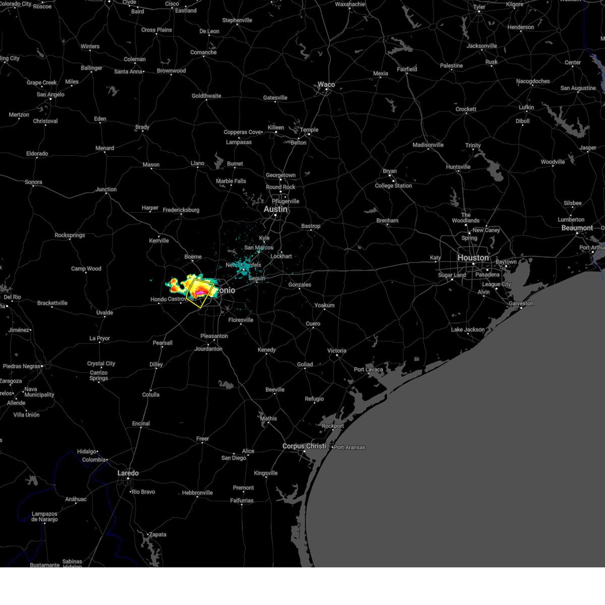 At 553 pm cdt, a severe thunderstorm was located over sea world, or 9 miles west of san antonio, moving southeast at 20 mph (public). Hazards include golf ball size hail and 70 mph wind gusts. People and animals outdoors will be injured. expect hail damage to roofs, siding, windows, and vehicles. expect considerable tree damage. wind damage is also likely to mobile homes, roofs, and outbuildings. Locations impacted include, lackland afb, helotes, castle hills, leon valley, balcones heights, sea world, san antonio, san antonio int airport, and government canyon state natural area. At 553 pm cdt, a severe thunderstorm was located over sea world, or 9 miles west of san antonio, moving southeast at 20 mph (public). Hazards include golf ball size hail and 70 mph wind gusts. People and animals outdoors will be injured. expect hail damage to roofs, siding, windows, and vehicles. expect considerable tree damage. wind damage is also likely to mobile homes, roofs, and outbuildings. Locations impacted include, lackland afb, helotes, castle hills, leon valley, balcones heights, sea world, san antonio, san antonio int airport, and government canyon state natural area.
|
| 3/31/2025 5:52 PM CDT | Golf Ball sized hail reported 10.3 miles ENE of San Antonio, TX |
| 3/31/2025 5:52 PM CDT | Ping Pong Ball sized hail reported 6.2 miles E of San Antonio, TX, report from mping ping pong ball (1.50 in.). |
| 3/31/2025 5:50 PM CDT | Golf Ball sized hail reported 10 miles E of San Antonio, TX, amateur radio passed a report of golf ball size near sea world. time estimated from radar. |
| 3/31/2025 5:49 PM CDT | Ping Pong Ball sized hail reported 5.2 miles ESE of San Antonio, TX |
| 3/31/2025 5:48 PM CDT |
 At 547 pm cdt, a severe thunderstorm was located over sea world, or 10 miles west of san antonio, moving southeast at 20 mph (public). Hazards include 70 mph wind gusts and ping pong ball size hail. People and animals outdoors will be injured. expect hail damage to roofs, siding, windows, and vehicles. expect considerable tree damage. wind damage is also likely to mobile homes, roofs, and outbuildings. Locations impacted include, lackland afb, helotes, cliff, government canyon state natural area, castle hills, leon valley, balcones heights, sea world, san antonio, san antonio int airport, and shavano park. At 547 pm cdt, a severe thunderstorm was located over sea world, or 10 miles west of san antonio, moving southeast at 20 mph (public). Hazards include 70 mph wind gusts and ping pong ball size hail. People and animals outdoors will be injured. expect hail damage to roofs, siding, windows, and vehicles. expect considerable tree damage. wind damage is also likely to mobile homes, roofs, and outbuildings. Locations impacted include, lackland afb, helotes, cliff, government canyon state natural area, castle hills, leon valley, balcones heights, sea world, san antonio, san antonio int airport, and shavano park.
|
| 3/31/2025 5:45 PM CDT | Quarter sized hail reported 9.9 miles E of San Antonio, TX, broken window and weather station measured 75 mph. |
| 3/31/2025 5:36 PM CDT |
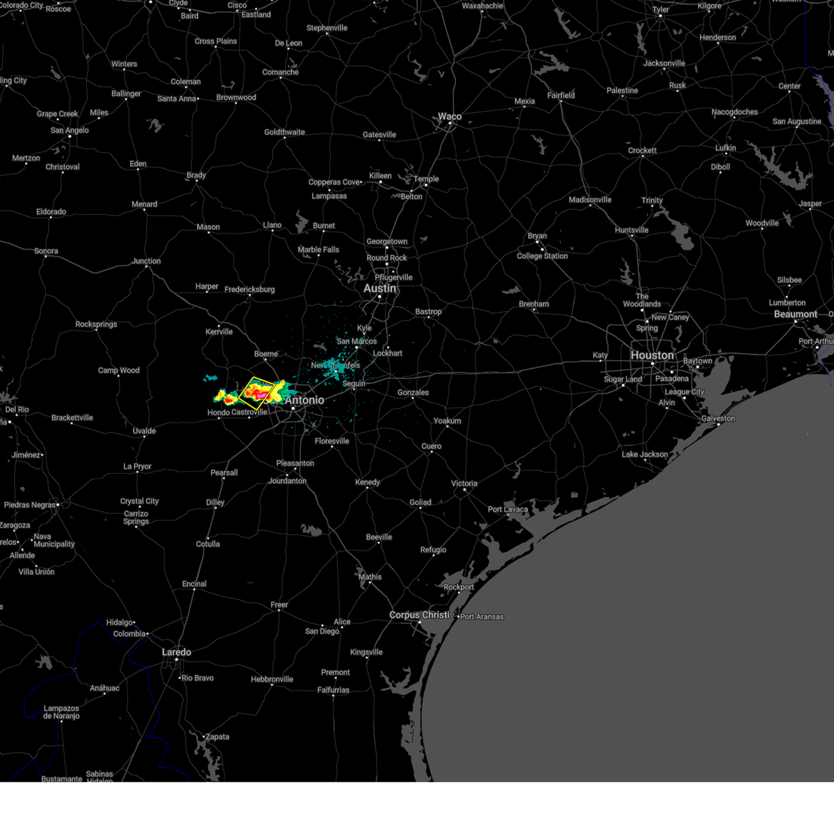 the severe thunderstorm warning has been cancelled and is no longer in effect the severe thunderstorm warning has been cancelled and is no longer in effect
|
| 3/31/2025 5:34 PM CDT |
 Svrewx the national weather service in austin san antonio has issued a * severe thunderstorm warning for, east central medina county in south central texas, west central bexar county in south central texas, * until 615 pm cdt. * at 533 pm cdt, a severe thunderstorm was located over cliff, or 12 miles northeast of castroville, moving southeast at 20 mph (radar indicated). Hazards include ping pong ball size hail. People and animals outdoors will be injured. Expect damage to roofs, siding, windows, and vehicles. Svrewx the national weather service in austin san antonio has issued a * severe thunderstorm warning for, east central medina county in south central texas, west central bexar county in south central texas, * until 615 pm cdt. * at 533 pm cdt, a severe thunderstorm was located over cliff, or 12 miles northeast of castroville, moving southeast at 20 mph (radar indicated). Hazards include ping pong ball size hail. People and animals outdoors will be injured. Expect damage to roofs, siding, windows, and vehicles.
|
| 3/31/2025 5:33 PM CDT | Golf Ball sized hail reported 18.6 miles ESE of San Antonio, TX, report from mping golf ball (1.75 in.). |
| 3/31/2025 5:30 PM CDT |
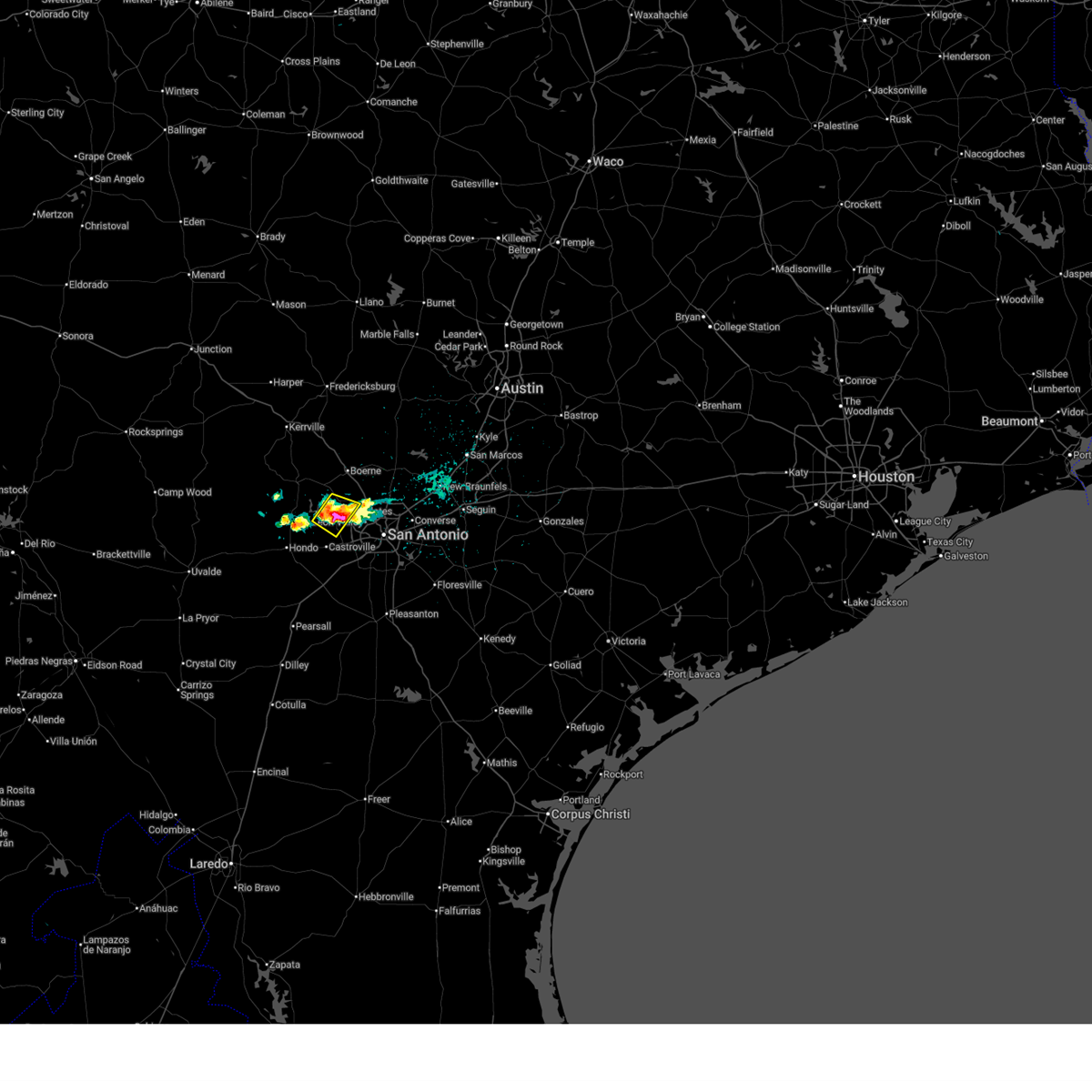 At 529 pm cdt, a severe thunderstorm was located over mico, or 14 miles north of castroville, and is nearly stationary (radar indicated). Hazards include golf ball size hail. People and animals outdoors will be injured. expect damage to roofs, siding, windows, and vehicles. Locations impacted include, helotes, cliff, government canyon state natural area, mico, san geronimo, and grey forest. At 529 pm cdt, a severe thunderstorm was located over mico, or 14 miles north of castroville, and is nearly stationary (radar indicated). Hazards include golf ball size hail. People and animals outdoors will be injured. expect damage to roofs, siding, windows, and vehicles. Locations impacted include, helotes, cliff, government canyon state natural area, mico, san geronimo, and grey forest.
|
| 3/31/2025 5:30 PM CDT |
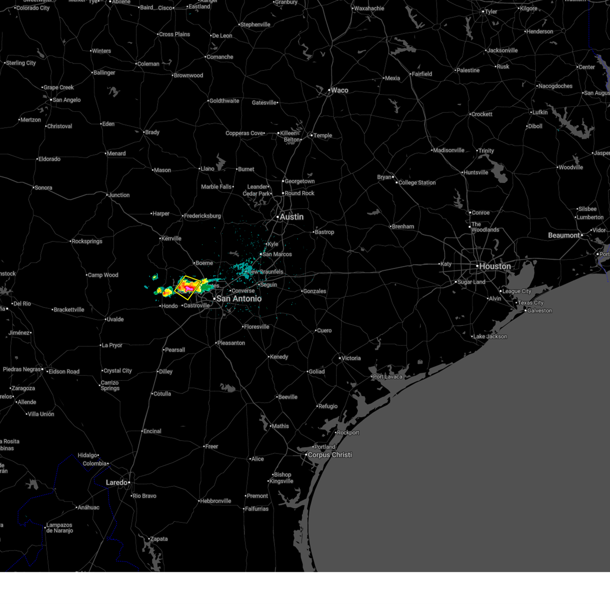 the severe thunderstorm warning has been cancelled and is no longer in effect the severe thunderstorm warning has been cancelled and is no longer in effect
|
| 3/31/2025 5:21 PM CDT |
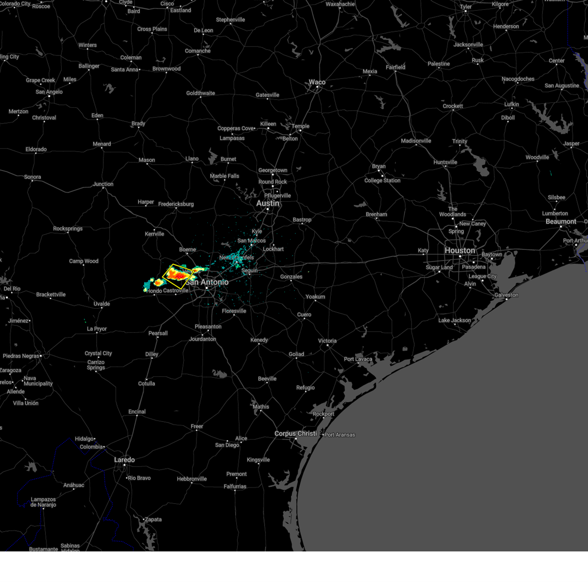 At 521 pm cdt, a severe thunderstorm was located over mico, or 14 miles north of castroville, and is nearly stationary (radar indicated). Hazards include ping pong ball size hail. People and animals outdoors will be injured. expect damage to roofs, siding, windows, and vehicles. Locations impacted include, lakehills, helotes, cliff, government canyon state natural area, san geronimo, mico, and grey forest. At 521 pm cdt, a severe thunderstorm was located over mico, or 14 miles north of castroville, and is nearly stationary (radar indicated). Hazards include ping pong ball size hail. People and animals outdoors will be injured. expect damage to roofs, siding, windows, and vehicles. Locations impacted include, lakehills, helotes, cliff, government canyon state natural area, san geronimo, mico, and grey forest.
|
| 3/31/2025 5:17 PM CDT |
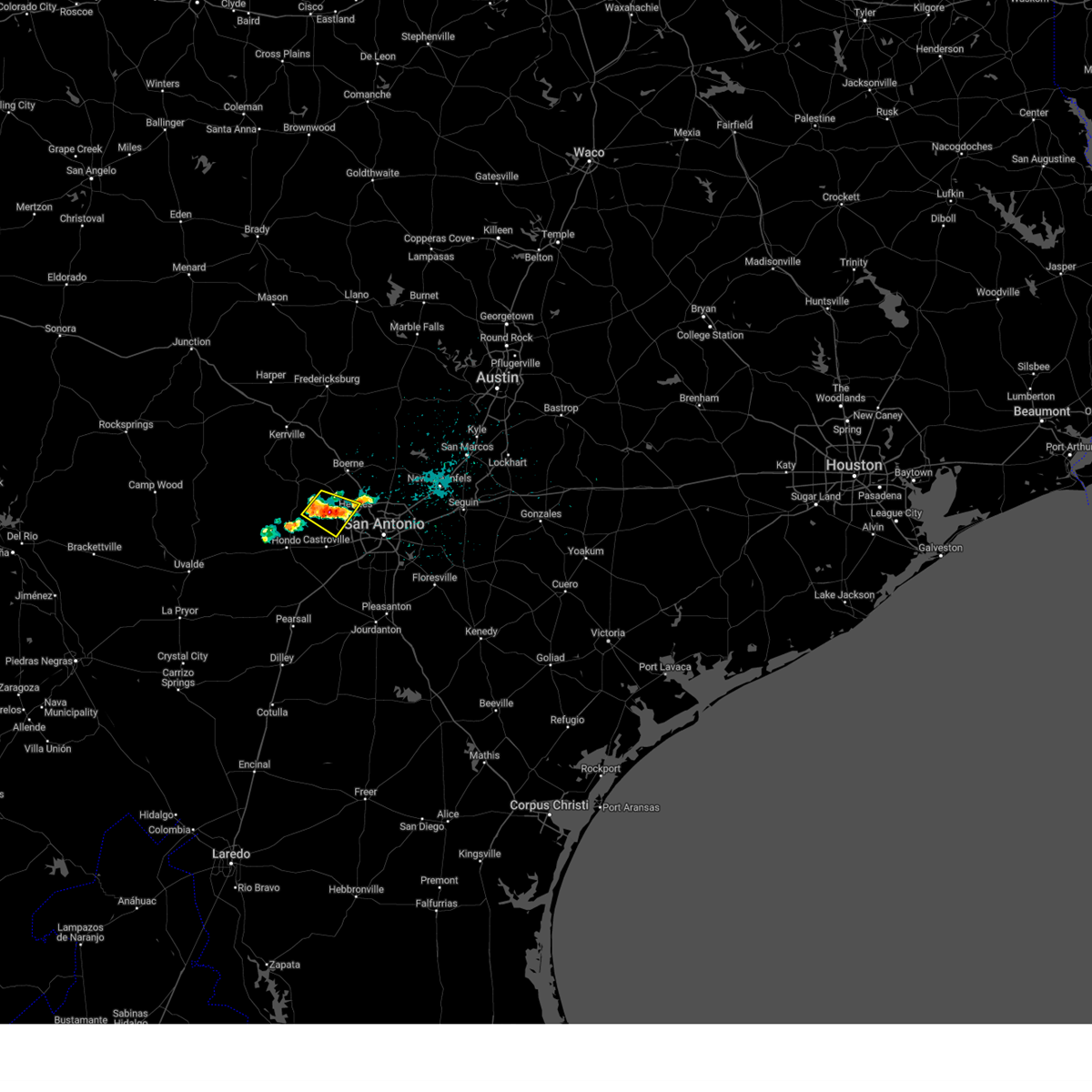 Svrewx the national weather service in austin san antonio has issued a * severe thunderstorm warning for, northeastern medina county in south central texas, southeastern bandera county in south central texas, west central bexar county in south central texas, * until 615 pm cdt. * at 516 pm cdt, a severe thunderstorm was located over mico, or 14 miles north of castroville, and is nearly stationary (radar indicated). Hazards include quarter size hail. damage to vehicles is expected Svrewx the national weather service in austin san antonio has issued a * severe thunderstorm warning for, northeastern medina county in south central texas, southeastern bandera county in south central texas, west central bexar county in south central texas, * until 615 pm cdt. * at 516 pm cdt, a severe thunderstorm was located over mico, or 14 miles north of castroville, and is nearly stationary (radar indicated). Hazards include quarter size hail. damage to vehicles is expected
|
| 3/23/2025 11:02 PM CDT |
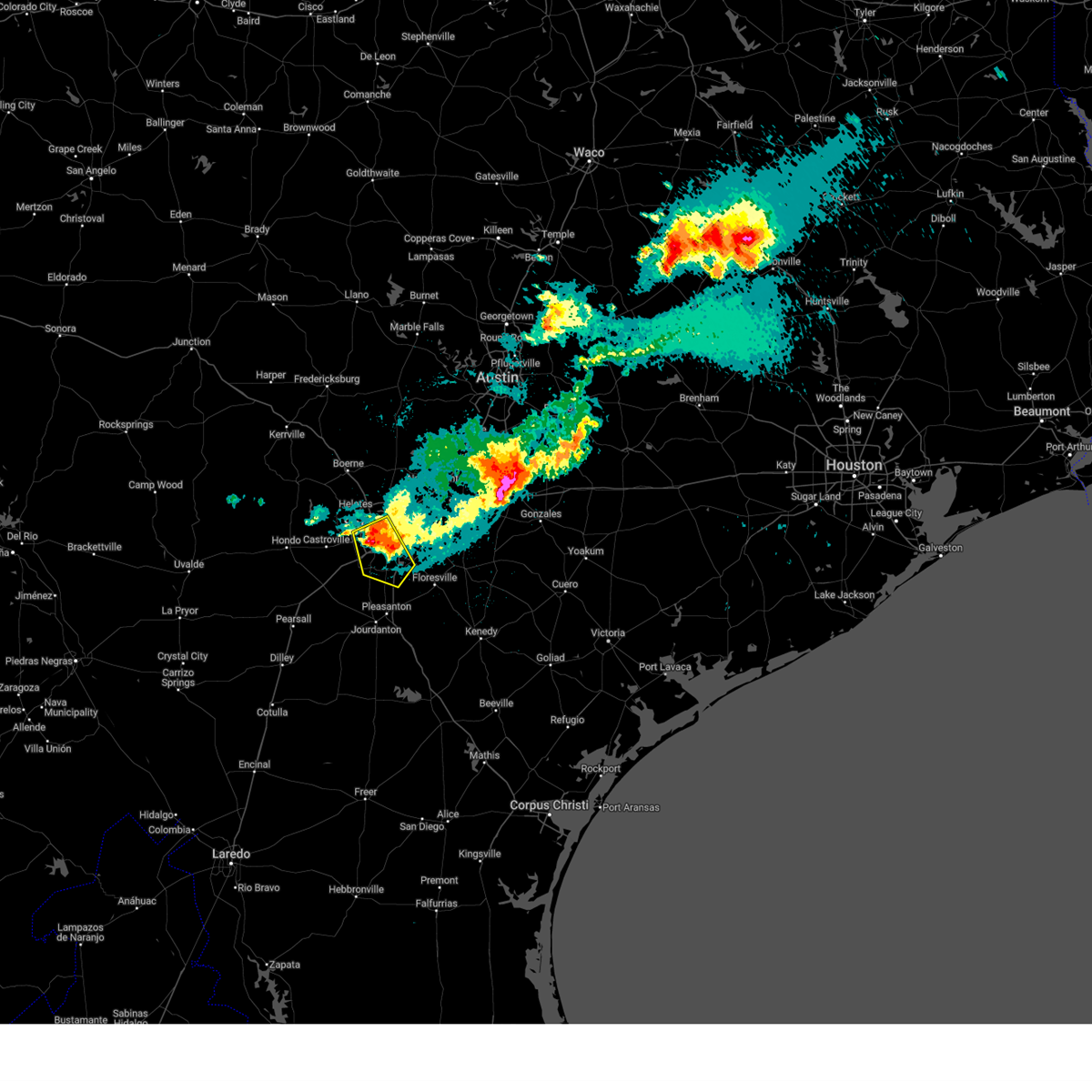 the severe thunderstorm warning has been cancelled and is no longer in effect the severe thunderstorm warning has been cancelled and is no longer in effect
|
| 3/23/2025 10:52 PM CDT |
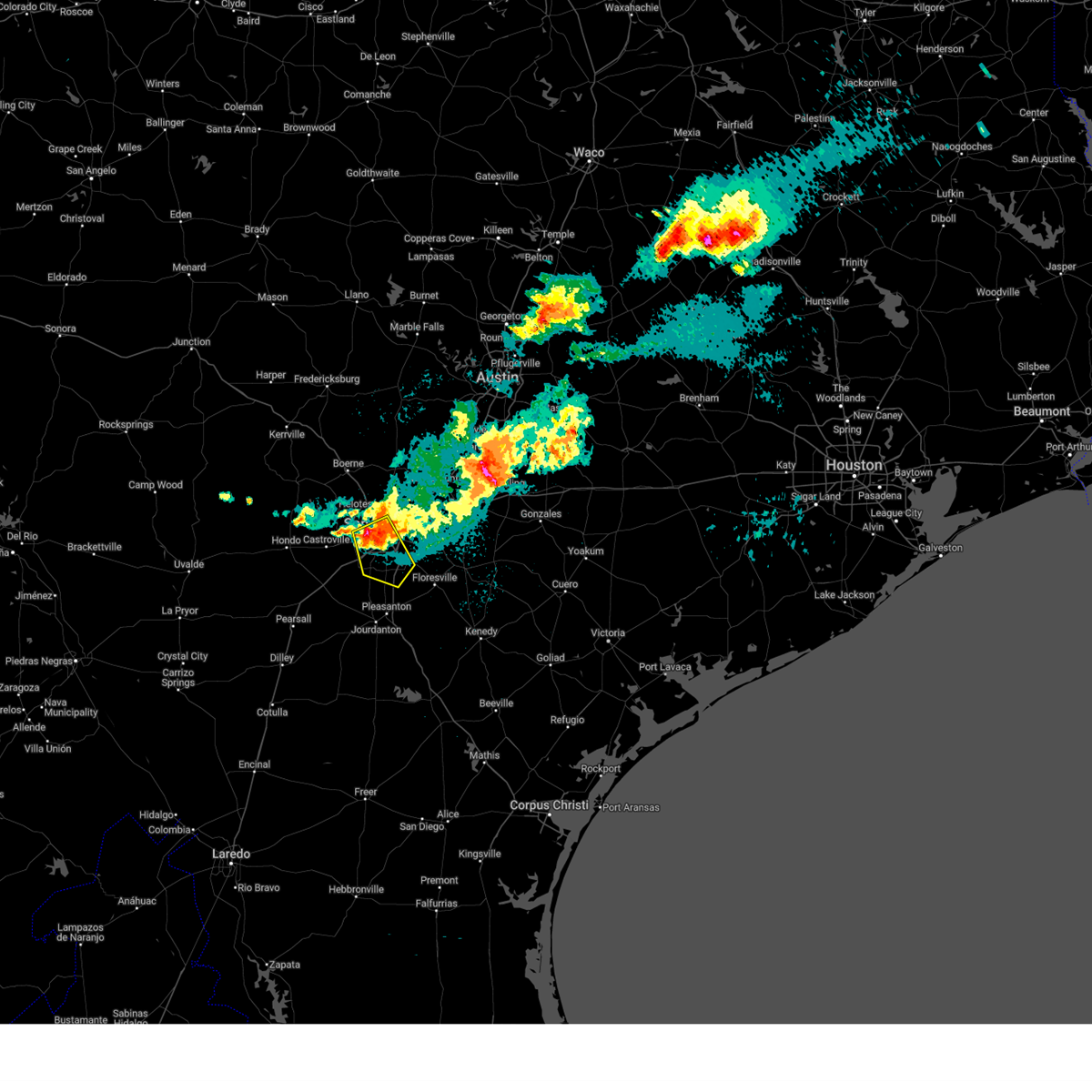 At 1052 pm cdt, a severe thunderstorm was located near stinson municipal airport, moving southeast at 30 mph (radar indicated). Hazards include 60 mph wind gusts and quarter size hail. Hail damage to vehicles is expected. expect wind damage to roofs, siding, and trees. Locations impacted include, san antonio, stinson municipal airport, san antonio int airport, leon valley, alamo heights, terrell hills, olmos park, elmendorf, lackland afb, castle hills, sandy oaks, balcones heights, von ormy, buena vista, mitchell lake, losoya, southton, thelma, brooks city base, and braunig lake. At 1052 pm cdt, a severe thunderstorm was located near stinson municipal airport, moving southeast at 30 mph (radar indicated). Hazards include 60 mph wind gusts and quarter size hail. Hail damage to vehicles is expected. expect wind damage to roofs, siding, and trees. Locations impacted include, san antonio, stinson municipal airport, san antonio int airport, leon valley, alamo heights, terrell hills, olmos park, elmendorf, lackland afb, castle hills, sandy oaks, balcones heights, von ormy, buena vista, mitchell lake, losoya, southton, thelma, brooks city base, and braunig lake.
|
| 3/23/2025 10:36 PM CDT |
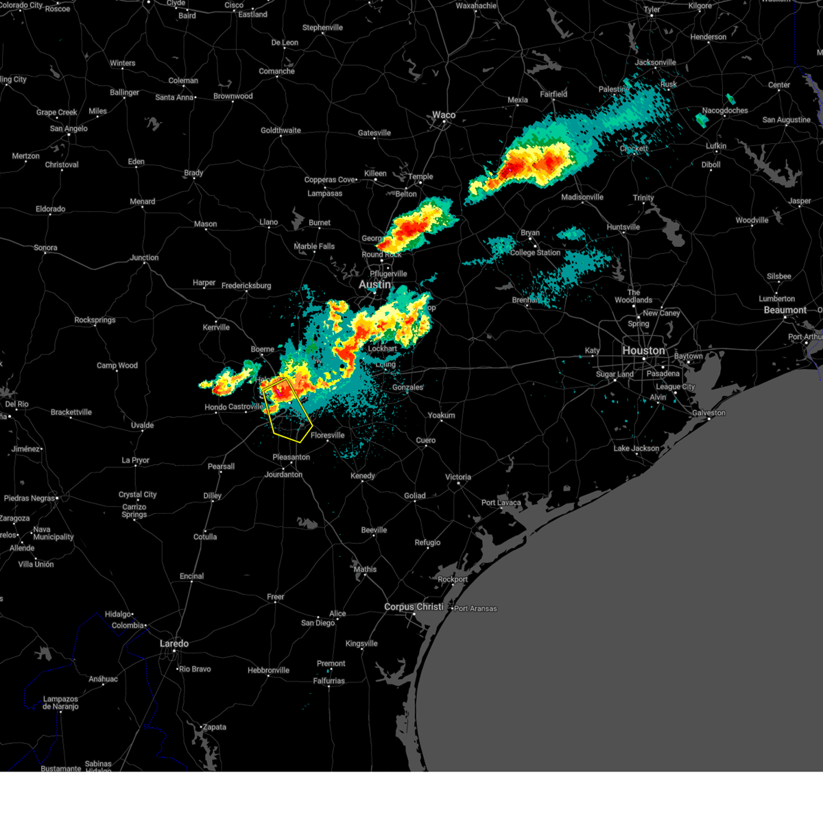 Svrewx the national weather service in austin san antonio has issued a * severe thunderstorm warning for, southwestern bexar county in south central texas, * until 1115 pm cdt. * at 1036 pm cdt, a severe thunderstorm was located over leon valley, or near san antonio, moving southeast at 30 mph (radar indicated). Hazards include 60 mph wind gusts and half dollar size hail. Hail damage to vehicles is expected. Expect wind damage to roofs, siding, and trees. Svrewx the national weather service in austin san antonio has issued a * severe thunderstorm warning for, southwestern bexar county in south central texas, * until 1115 pm cdt. * at 1036 pm cdt, a severe thunderstorm was located over leon valley, or near san antonio, moving southeast at 30 mph (radar indicated). Hazards include 60 mph wind gusts and half dollar size hail. Hail damage to vehicles is expected. Expect wind damage to roofs, siding, and trees.
|
| 3/23/2025 10:23 PM CDT | Quarter sized hail reported 8.1 miles SSE of San Antonio, TX, report from mping. time estimated by radar. |
| 3/23/2025 10:05 PM CDT |
 Svrewx the national weather service in austin san antonio has issued a * severe thunderstorm warning for, northwestern bexar county in south central texas, southwestern comal county in south central texas, * until 1045 pm cdt. * at 1004 pm cdt, a severe thunderstorm was located over the dominion, or 11 miles southeast of boerne, moving southeast at 25 mph (radar indicated). Hazards include 60 mph wind gusts and quarter size hail. Hail damage to vehicles is expected. Expect wind damage to roofs, siding, and trees. Svrewx the national weather service in austin san antonio has issued a * severe thunderstorm warning for, northwestern bexar county in south central texas, southwestern comal county in south central texas, * until 1045 pm cdt. * at 1004 pm cdt, a severe thunderstorm was located over the dominion, or 11 miles southeast of boerne, moving southeast at 25 mph (radar indicated). Hazards include 60 mph wind gusts and quarter size hail. Hail damage to vehicles is expected. Expect wind damage to roofs, siding, and trees.
|
| 3/23/2025 9:58 PM CDT |
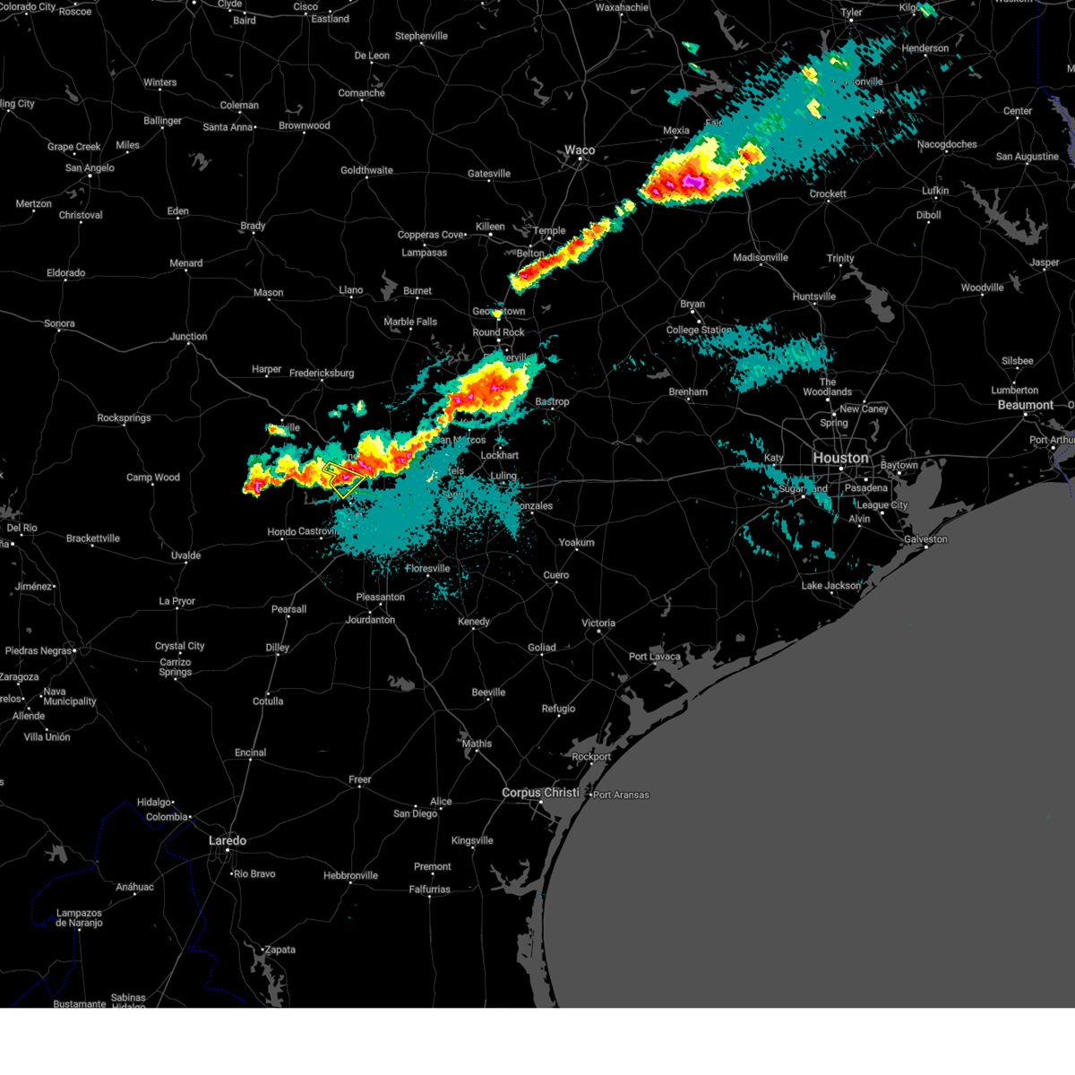 the severe thunderstorm warning has been cancelled and is no longer in effect the severe thunderstorm warning has been cancelled and is no longer in effect
|
| 3/23/2025 9:53 PM CDT |
 At 953 pm cdt, a severe thunderstorm was located over timberwood park, or 14 miles north of san antonio int airport, moving southeast at 15 mph (radar indicated). Hazards include 60 mph wind gusts and quarter size hail. Hail damage to vehicles is expected. expect wind damage to roofs, siding, and trees. Locations impacted include, san antonio, boerne, canyon lake dam, canyon lake, fair oaks ranch, bulverde, shavano park, hollywood park, cross mountain, guadalupe river state park, smithson valley, timberwood park, leon springs, the dominion, spring branch, bergheim, cascade caverns, anhalt, startzville, and sattler. At 953 pm cdt, a severe thunderstorm was located over timberwood park, or 14 miles north of san antonio int airport, moving southeast at 15 mph (radar indicated). Hazards include 60 mph wind gusts and quarter size hail. Hail damage to vehicles is expected. expect wind damage to roofs, siding, and trees. Locations impacted include, san antonio, boerne, canyon lake dam, canyon lake, fair oaks ranch, bulverde, shavano park, hollywood park, cross mountain, guadalupe river state park, smithson valley, timberwood park, leon springs, the dominion, spring branch, bergheim, cascade caverns, anhalt, startzville, and sattler.
|
| 3/23/2025 9:40 PM CDT |
 At 940 pm cdt, a severe thunderstorm was located near kronkosky state natural area, or near boerne, moving southeast at 15 mph (radar indicated). Hazards include half dollar size hail. Damage to vehicles is expected. Locations impacted include, boerne, fair oaks ranch, cross mountain, leon springs, kronkosky state natural area, government canyon state natural area, and scenic oaks. At 940 pm cdt, a severe thunderstorm was located near kronkosky state natural area, or near boerne, moving southeast at 15 mph (radar indicated). Hazards include half dollar size hail. Damage to vehicles is expected. Locations impacted include, boerne, fair oaks ranch, cross mountain, leon springs, kronkosky state natural area, government canyon state natural area, and scenic oaks.
|
| 3/23/2025 9:40 PM CDT |
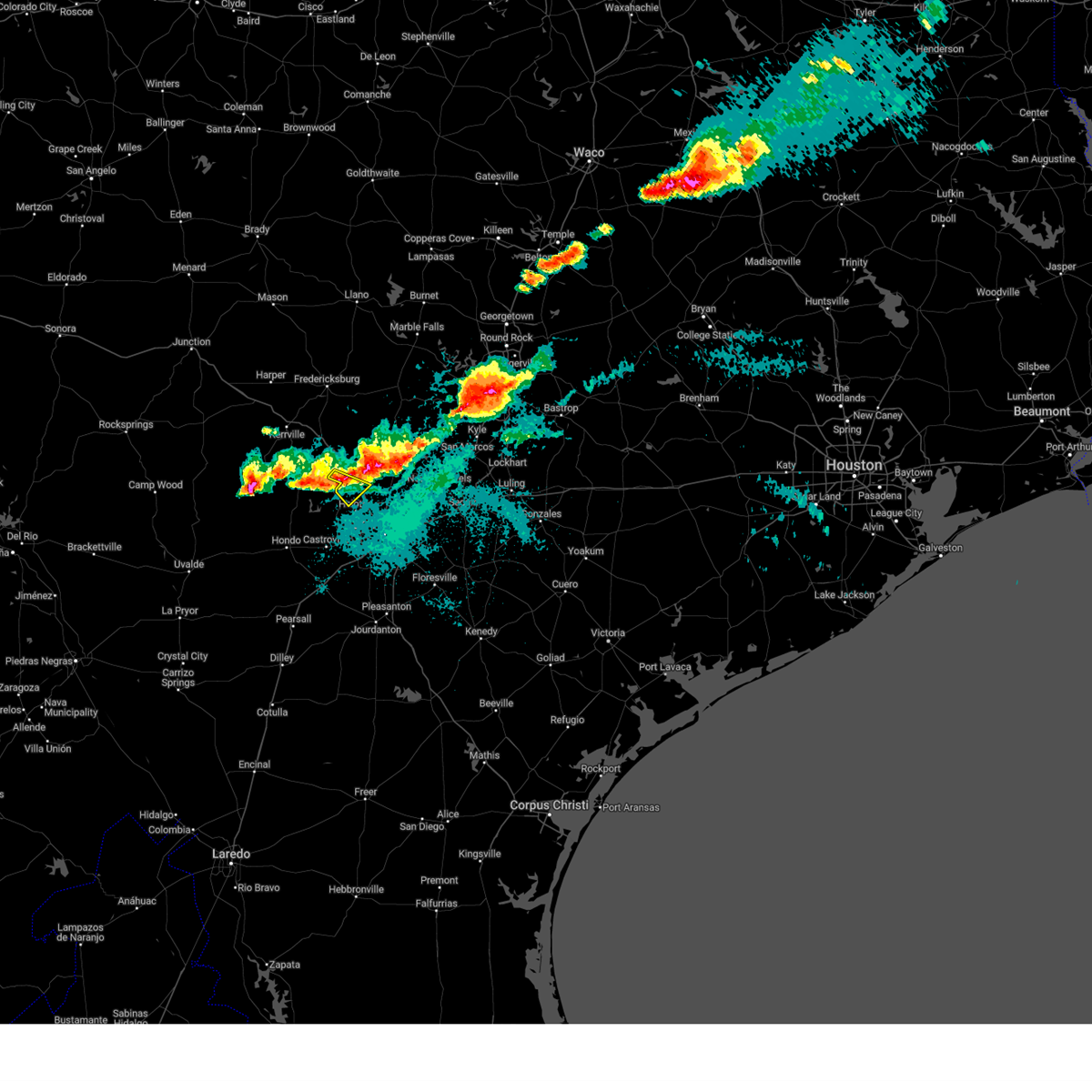 the severe thunderstorm warning has been cancelled and is no longer in effect the severe thunderstorm warning has been cancelled and is no longer in effect
|
| 3/23/2025 9:35 PM CDT |
 Svrewx the national weather service in austin san antonio has issued a * severe thunderstorm warning for, southeastern kendall county in south central texas, north central bexar county in south central texas, comal county in south central texas, * until 1015 pm cdt. * at 935 pm cdt, a severe thunderstorm was located near bergheim, or 12 miles east of boerne, moving southeast at 20 mph (radar indicated). Hazards include 60 mph wind gusts and half dollar size hail. Hail damage to vehicles is expected. Expect wind damage to roofs, siding, and trees. Svrewx the national weather service in austin san antonio has issued a * severe thunderstorm warning for, southeastern kendall county in south central texas, north central bexar county in south central texas, comal county in south central texas, * until 1015 pm cdt. * at 935 pm cdt, a severe thunderstorm was located near bergheim, or 12 miles east of boerne, moving southeast at 20 mph (radar indicated). Hazards include 60 mph wind gusts and half dollar size hail. Hail damage to vehicles is expected. Expect wind damage to roofs, siding, and trees.
|
| 3/23/2025 9:29 PM CDT |
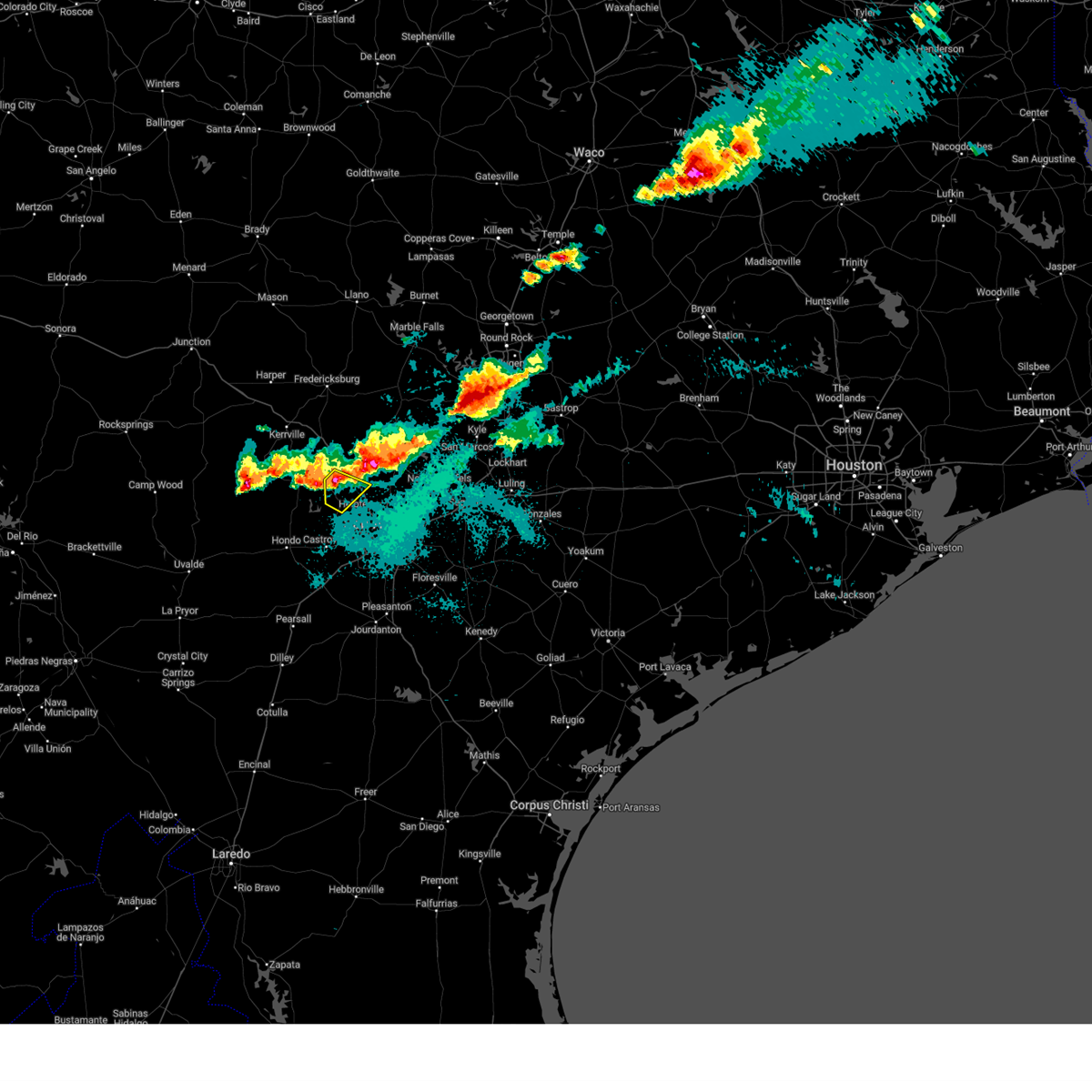 Svrewx the national weather service in austin san antonio has issued a * severe thunderstorm warning for, northeastern medina county in south central texas, east central bandera county in south central texas, south central kendall county in south central texas, northwestern bexar county in south central texas, * until 1015 pm cdt. * at 929 pm cdt, a severe thunderstorm was located near kronkosky state natural area, or near boerne, moving southeast at 15 mph (radar indicated). Hazards include half dollar size hail. damage to vehicles is expected Svrewx the national weather service in austin san antonio has issued a * severe thunderstorm warning for, northeastern medina county in south central texas, east central bandera county in south central texas, south central kendall county in south central texas, northwestern bexar county in south central texas, * until 1015 pm cdt. * at 929 pm cdt, a severe thunderstorm was located near kronkosky state natural area, or near boerne, moving southeast at 15 mph (radar indicated). Hazards include half dollar size hail. damage to vehicles is expected
|
| 3/23/2025 9:23 PM CDT |
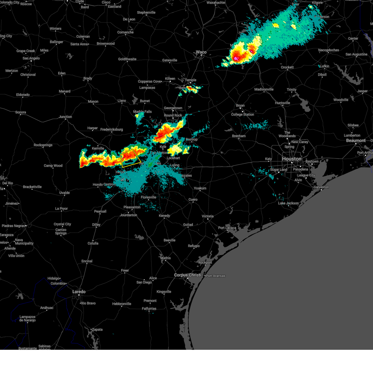 At 923 pm cdt, a severe thunderstorm was located over bergheim, or 11 miles east of boerne, moving south at 20 mph (radar indicated). Hazards include 60 mph wind gusts and quarter size hail. Hail damage to vehicles is expected. expect wind damage to roofs, siding, and trees. Locations impacted include, canyon lake, fair oaks ranch, bulverde, guadalupe river state park, smithson valley, kreutzberg, spring branch, bergheim, kendalia, timberwood park, anhalt, specht store, honey creek state natural area, and scenic oaks. At 923 pm cdt, a severe thunderstorm was located over bergheim, or 11 miles east of boerne, moving south at 20 mph (radar indicated). Hazards include 60 mph wind gusts and quarter size hail. Hail damage to vehicles is expected. expect wind damage to roofs, siding, and trees. Locations impacted include, canyon lake, fair oaks ranch, bulverde, guadalupe river state park, smithson valley, kreutzberg, spring branch, bergheim, kendalia, timberwood park, anhalt, specht store, honey creek state natural area, and scenic oaks.
|
| 3/23/2025 9:01 PM CDT |
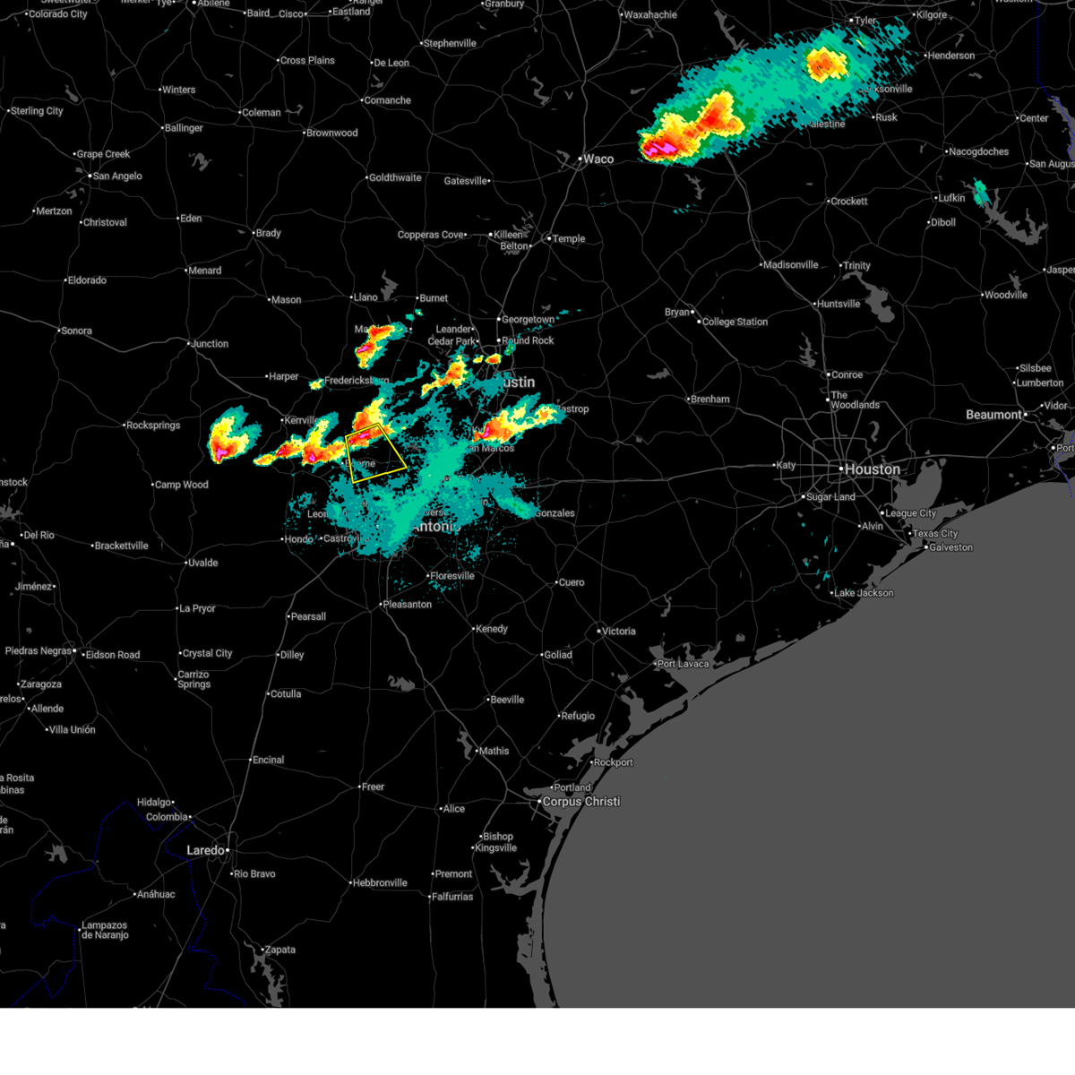 Svrewx the national weather service in austin san antonio has issued a * severe thunderstorm warning for, southeastern kendall county in south central texas, north central bexar county in south central texas, west central comal county in south central texas, * until 945 pm cdt. * at 901 pm cdt, a severe thunderstorm was located near kendalia, or 13 miles northeast of boerne, moving south at 20 mph (radar indicated). Hazards include golf ball size hail and 60 mph wind gusts. People and animals outdoors will be injured. expect hail damage to roofs, siding, windows, and vehicles. Expect wind damage to roofs, siding, and trees. Svrewx the national weather service in austin san antonio has issued a * severe thunderstorm warning for, southeastern kendall county in south central texas, north central bexar county in south central texas, west central comal county in south central texas, * until 945 pm cdt. * at 901 pm cdt, a severe thunderstorm was located near kendalia, or 13 miles northeast of boerne, moving south at 20 mph (radar indicated). Hazards include golf ball size hail and 60 mph wind gusts. People and animals outdoors will be injured. expect hail damage to roofs, siding, windows, and vehicles. Expect wind damage to roofs, siding, and trees.
|
| 11/4/2024 9:51 PM CST |
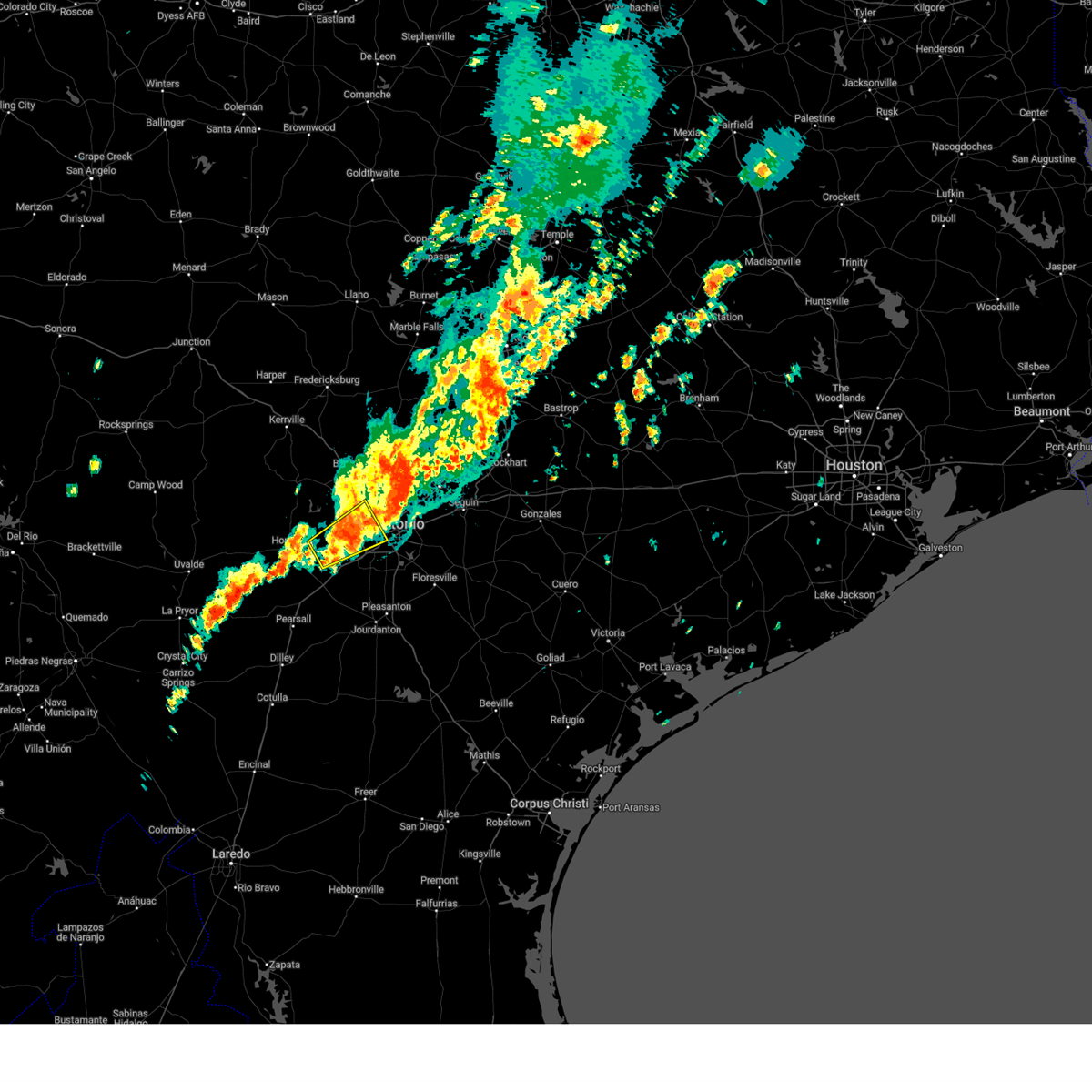 the severe thunderstorm warning has been cancelled and is no longer in effect the severe thunderstorm warning has been cancelled and is no longer in effect
|
| 11/4/2024 9:25 PM CST |
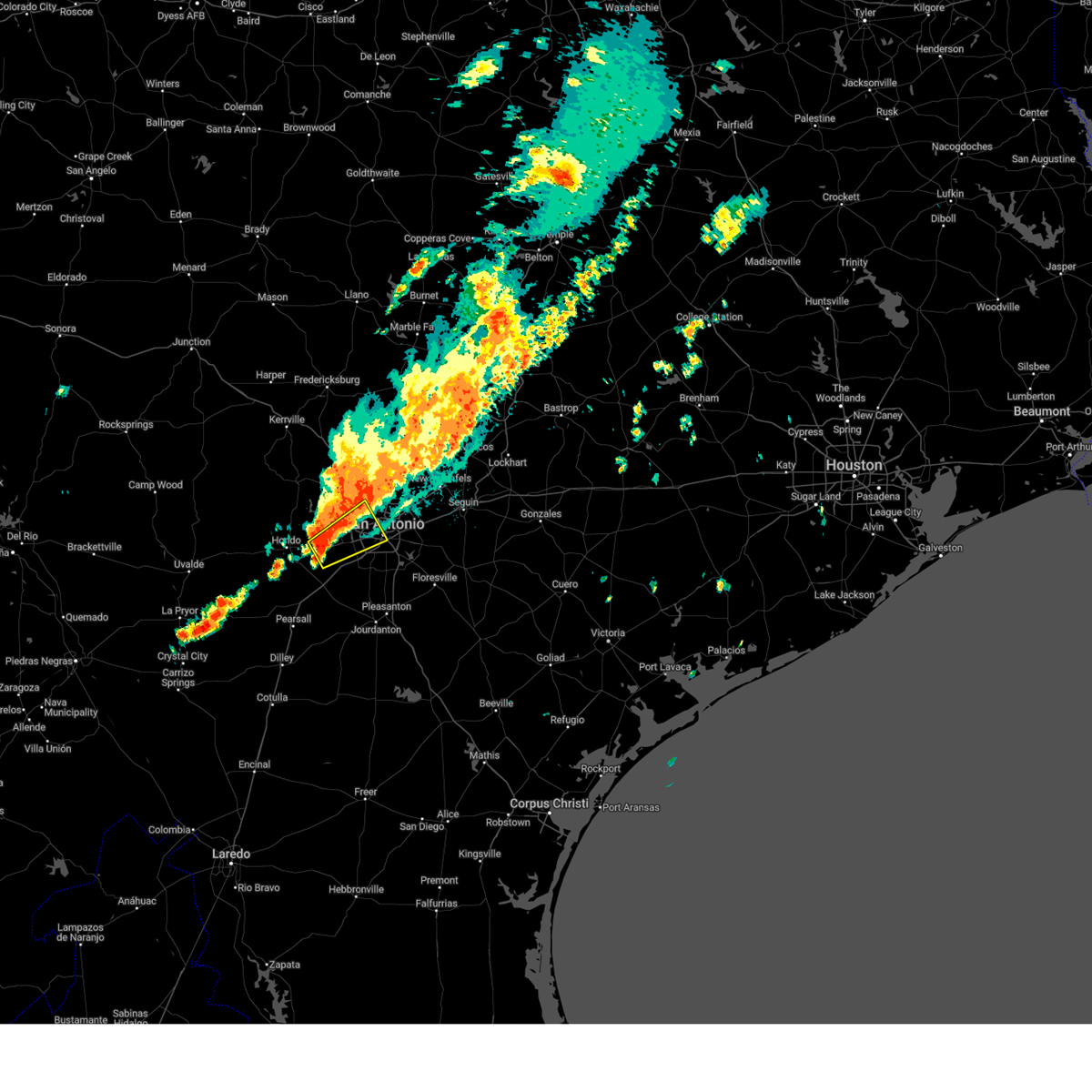 Svrewx the national weather service in austin san antonio has issued a * severe thunderstorm warning for, east central medina county in south central texas, northwestern bexar county in south central texas, * until 1015 pm cst. * at 925 pm cst, a severe thunderstorm was located over castroville, moving northeast at 20 mph (radar indicated). Hazards include quarter size hail. damage to vehicles is expected Svrewx the national weather service in austin san antonio has issued a * severe thunderstorm warning for, east central medina county in south central texas, northwestern bexar county in south central texas, * until 1015 pm cst. * at 925 pm cst, a severe thunderstorm was located over castroville, moving northeast at 20 mph (radar indicated). Hazards include quarter size hail. damage to vehicles is expected
|
| 6/9/2024 11:27 PM CDT |
 the severe thunderstorm warning has been cancelled and is no longer in effect the severe thunderstorm warning has been cancelled and is no longer in effect
|
| 6/9/2024 11:11 PM CDT |
 At 1111 pm cdt, a severe thunderstorm was located near sea world, or 12 miles northeast of castroville, moving east at 10 mph (radar indicated). Hazards include 60 mph wind gusts and quarter size hail. Hail damage to vehicles is expected. expect wind damage to roofs, siding, and trees. Locations impacted include, san antonio, leon valley, helotes, shavano park, government canyon state natural area, castle hills, and balcones heights. At 1111 pm cdt, a severe thunderstorm was located near sea world, or 12 miles northeast of castroville, moving east at 10 mph (radar indicated). Hazards include 60 mph wind gusts and quarter size hail. Hail damage to vehicles is expected. expect wind damage to roofs, siding, and trees. Locations impacted include, san antonio, leon valley, helotes, shavano park, government canyon state natural area, castle hills, and balcones heights.
|
| 6/9/2024 10:55 PM CDT |
 Svrewx the national weather service in austin san antonio has issued a * severe thunderstorm warning for, northwestern bexar county in south central texas, * until midnight cdt. * at 1055 pm cdt, a severe thunderstorm was located over government canyon state natural area, or 14 miles south of boerne, moving east at 10 mph (radar indicated). Hazards include 60 mph wind gusts and quarter size hail. Hail damage to vehicles is expected. Expect wind damage to roofs, siding, and trees. Svrewx the national weather service in austin san antonio has issued a * severe thunderstorm warning for, northwestern bexar county in south central texas, * until midnight cdt. * at 1055 pm cdt, a severe thunderstorm was located over government canyon state natural area, or 14 miles south of boerne, moving east at 10 mph (radar indicated). Hazards include 60 mph wind gusts and quarter size hail. Hail damage to vehicles is expected. Expect wind damage to roofs, siding, and trees.
|
| 4/28/2024 11:58 AM CDT |
 At 1158 am cdt, a severe thunderstorm was located near floresville, moving northeast at 25 mph (radar indicated). Hazards include 60 mph wind gusts and quarter size hail. Hail damage to vehicles is expected. expect wind damage to roofs, siding, and trees. Locations impacted include, pleasanton, floresville, elmendorf, calaveras lake, leming, sandy oaks, espey, canada verde, graytown, and braunig lake. At 1158 am cdt, a severe thunderstorm was located near floresville, moving northeast at 25 mph (radar indicated). Hazards include 60 mph wind gusts and quarter size hail. Hail damage to vehicles is expected. expect wind damage to roofs, siding, and trees. Locations impacted include, pleasanton, floresville, elmendorf, calaveras lake, leming, sandy oaks, espey, canada verde, graytown, and braunig lake.
|
| 4/28/2024 11:38 AM CDT |
 At 1137 am cdt, a severe thunderstorm was located 8 miles northeast of leming, or 11 miles west of floresville, moving northeast at 25 mph (radar indicated). Hazards include 60 mph wind gusts and quarter size hail. Hail damage to vehicles is expected. expect wind damage to roofs, siding, and trees. Locations impacted include, pleasanton, floresville, elmendorf, calaveras lake, leming, sandy oaks, espey, canada verde, graytown, and braunig lake. At 1137 am cdt, a severe thunderstorm was located 8 miles northeast of leming, or 11 miles west of floresville, moving northeast at 25 mph (radar indicated). Hazards include 60 mph wind gusts and quarter size hail. Hail damage to vehicles is expected. expect wind damage to roofs, siding, and trees. Locations impacted include, pleasanton, floresville, elmendorf, calaveras lake, leming, sandy oaks, espey, canada verde, graytown, and braunig lake.
|
| 4/28/2024 11:22 AM CDT |
 Svrewx the national weather service in austin san antonio has issued a * severe thunderstorm warning for, north central atascosa county in south central texas, west central wilson county in south central texas, southeastern bexar county in south central texas, * until 1215 pm cdt. * at 1122 am cdt, a severe thunderstorm was located over leming, or 7 miles east of poteet, moving northeast at 25 mph (radar indicated). Hazards include 60 mph wind gusts and quarter size hail. Hail damage to vehicles is expected. Expect wind damage to roofs, siding, and trees. Svrewx the national weather service in austin san antonio has issued a * severe thunderstorm warning for, north central atascosa county in south central texas, west central wilson county in south central texas, southeastern bexar county in south central texas, * until 1215 pm cdt. * at 1122 am cdt, a severe thunderstorm was located over leming, or 7 miles east of poteet, moving northeast at 25 mph (radar indicated). Hazards include 60 mph wind gusts and quarter size hail. Hail damage to vehicles is expected. Expect wind damage to roofs, siding, and trees.
|
| 4/21/2024 12:32 AM CDT | Hen Egg sized hail reported 18.7 miles SSW of San Antonio, TX |
| 4/21/2024 12:32 AM CDT |
 At 1231 am cdt, severe thunderstorms were located along a line extending from near new braunfels to near timberwood park, moving east at 30 mph (radar indicated). Hazards include ping pong ball size hail. People and animals outdoors will be injured. expect damage to roofs, siding, windows, and vehicles. Locations impacted include, san antonio, new braunfels, san marcos, schertz, seguin, cibolo, selma, canyon lake dam, canyon lake, fair oaks ranch, bulverde, garden ridge, shavano park, hollywood park, cross mountain, kingsbury, santa clara, staples, smithson valley, and the dominion. At 1231 am cdt, severe thunderstorms were located along a line extending from near new braunfels to near timberwood park, moving east at 30 mph (radar indicated). Hazards include ping pong ball size hail. People and animals outdoors will be injured. expect damage to roofs, siding, windows, and vehicles. Locations impacted include, san antonio, new braunfels, san marcos, schertz, seguin, cibolo, selma, canyon lake dam, canyon lake, fair oaks ranch, bulverde, garden ridge, shavano park, hollywood park, cross mountain, kingsbury, santa clara, staples, smithson valley, and the dominion.
|
| 4/21/2024 12:30 AM CDT | Golf Ball sized hail reported 15 miles S of San Antonio, TX |
| 4/21/2024 12:30 AM CDT |
 At 1229 am cdt, severe thunderstorms were located along a line extending from 6 miles northwest of new braunfels to timberwood park, moving east at 30 mph (radar indicated). Hazards include quarter size hail. Damage to vehicles is expected. Locations impacted include, san antonio, new braunfels, san marcos, schertz, seguin, cibolo, selma, canyon lake dam, canyon lake, fair oaks ranch, bulverde, garden ridge, shavano park, hollywood park, cross mountain, kingsbury, santa clara, staples, smithson valley, and the dominion. At 1229 am cdt, severe thunderstorms were located along a line extending from 6 miles northwest of new braunfels to timberwood park, moving east at 30 mph (radar indicated). Hazards include quarter size hail. Damage to vehicles is expected. Locations impacted include, san antonio, new braunfels, san marcos, schertz, seguin, cibolo, selma, canyon lake dam, canyon lake, fair oaks ranch, bulverde, garden ridge, shavano park, hollywood park, cross mountain, kingsbury, santa clara, staples, smithson valley, and the dominion.
|
| 4/21/2024 12:29 AM CDT | Half Dollar sized hail reported 14.8 miles SSW of San Antonio, TX |
| 4/21/2024 12:25 AM CDT | Quarter sized hail reported 15 miles SSW of San Antonio, TX |
| 4/21/2024 12:17 AM CDT |
 Svrewx the national weather service in austin san antonio has issued a * severe thunderstorm warning for, south central hays county in south central texas, northern guadalupe county in south central texas, north central bexar county in south central texas, comal county in south central texas, * until 100 am cdt. * at 1217 am cdt, severe thunderstorms were located along a line extending from near garden ridge to near the dominion, moving east at 45 mph (radar indicated). Hazards include quarter size hail. damage to vehicles is expected Svrewx the national weather service in austin san antonio has issued a * severe thunderstorm warning for, south central hays county in south central texas, northern guadalupe county in south central texas, north central bexar county in south central texas, comal county in south central texas, * until 100 am cdt. * at 1217 am cdt, severe thunderstorms were located along a line extending from near garden ridge to near the dominion, moving east at 45 mph (radar indicated). Hazards include quarter size hail. damage to vehicles is expected
|
| 4/20/2024 10:48 PM CDT |
 the severe thunderstorm warning has been cancelled and is no longer in effect the severe thunderstorm warning has been cancelled and is no longer in effect
|
| 4/20/2024 10:42 PM CDT |
 At 1041 pm cdt, a severe thunderstorm was located near stinson municipal airport, moving east at 40 mph (radar indicated). Hazards include quarter size hail. Damage to vehicles is expected. locations impacted include, san antonio, stinson municipal airport, kirby, st. Hedwig, elmendorf, la vernia, china grove, calaveras lake, lackland afb, martinez, parita, southton, sayers, brooks city base, and adkins. At 1041 pm cdt, a severe thunderstorm was located near stinson municipal airport, moving east at 40 mph (radar indicated). Hazards include quarter size hail. Damage to vehicles is expected. locations impacted include, san antonio, stinson municipal airport, kirby, st. Hedwig, elmendorf, la vernia, china grove, calaveras lake, lackland afb, martinez, parita, southton, sayers, brooks city base, and adkins.
|
| 4/20/2024 10:42 PM CDT |
 the severe thunderstorm warning has been cancelled and is no longer in effect the severe thunderstorm warning has been cancelled and is no longer in effect
|
| 4/20/2024 10:25 PM CDT |
 At 1025 pm cdt, a severe thunderstorm was located over lackland afb, or near san antonio, moving east at 35 mph (radar indicated). Hazards include 60 mph wind gusts and quarter size hail. Hail damage to vehicles is expected. expect wind damage to roofs, siding, and trees. locations impacted include, san antonio, schertz, cibolo, universal city, live oak, selma, san antonio int airport, stinson municipal airport, randolph afb, leon valley, helotes, kirby, alamo heights, windcrest, terrell hills, olmos park, st. Hedwig, elmendorf, la vernia, and china grove. At 1025 pm cdt, a severe thunderstorm was located over lackland afb, or near san antonio, moving east at 35 mph (radar indicated). Hazards include 60 mph wind gusts and quarter size hail. Hail damage to vehicles is expected. expect wind damage to roofs, siding, and trees. locations impacted include, san antonio, schertz, cibolo, universal city, live oak, selma, san antonio int airport, stinson municipal airport, randolph afb, leon valley, helotes, kirby, alamo heights, windcrest, terrell hills, olmos park, st. Hedwig, elmendorf, la vernia, and china grove.
|
| 4/20/2024 10:25 PM CDT |
 the severe thunderstorm warning has been cancelled and is no longer in effect the severe thunderstorm warning has been cancelled and is no longer in effect
|
| 4/20/2024 10:08 PM CDT |
 Svrewx the national weather service in austin san antonio has issued a * severe thunderstorm warning for, east central medina county in south central texas, southwestern guadalupe county in south central texas, northwestern wilson county in south central texas, central bexar county in south central texas, * until 1115 pm cdt. * at 1007 pm cdt, a severe thunderstorm was located over sea world, or 10 miles northeast of castroville, moving east at 40 mph (radar indicated). Hazards include 60 mph wind gusts and quarter size hail. Hail damage to vehicles is expected. Expect wind damage to roofs, siding, and trees. Svrewx the national weather service in austin san antonio has issued a * severe thunderstorm warning for, east central medina county in south central texas, southwestern guadalupe county in south central texas, northwestern wilson county in south central texas, central bexar county in south central texas, * until 1115 pm cdt. * at 1007 pm cdt, a severe thunderstorm was located over sea world, or 10 miles northeast of castroville, moving east at 40 mph (radar indicated). Hazards include 60 mph wind gusts and quarter size hail. Hail damage to vehicles is expected. Expect wind damage to roofs, siding, and trees.
|
| 4/9/2024 11:21 PM CDT |
 the severe thunderstorm warning has been cancelled and is no longer in effect the severe thunderstorm warning has been cancelled and is no longer in effect
|
| 4/9/2024 11:21 PM CDT |
 At 1120 pm cdt, a severe thunderstorm was located over mcqueeney, or near new braunfels, moving northeast at 30 mph (radar indicated). Hazards include 60 mph wind gusts and quarter size hail. Hail damage to vehicles is expected. expect wind damage to roofs, siding, and trees. Locations impacted include, new braunfels, schertz, seguin, cibolo, universal city, selma, luling, garden ridge, mcqueeney, marion, kingsbury, santa clara, new berlin, staples, zuehl, geronimo, zorn, fentress, redwood, and freiheit. At 1120 pm cdt, a severe thunderstorm was located over mcqueeney, or near new braunfels, moving northeast at 30 mph (radar indicated). Hazards include 60 mph wind gusts and quarter size hail. Hail damage to vehicles is expected. expect wind damage to roofs, siding, and trees. Locations impacted include, new braunfels, schertz, seguin, cibolo, universal city, selma, luling, garden ridge, mcqueeney, marion, kingsbury, santa clara, new berlin, staples, zuehl, geronimo, zorn, fentress, redwood, and freiheit.
|
| 4/9/2024 10:58 PM CDT |
 Svrewx the national weather service in austin san antonio has issued a * severe thunderstorm warning for, guadalupe county in south central texas, northwestern wilson county in south central texas, northeastern bexar county in south central texas, southeastern comal county in south central texas, * until 1145 pm cdt. * at 1058 pm cdt, a severe thunderstorm was located over schertz, moving northeast at 30 mph (radar indicated). Hazards include 60 mph wind gusts and quarter size hail. Hail damage to vehicles is expected. Expect wind damage to roofs, siding, and trees. Svrewx the national weather service in austin san antonio has issued a * severe thunderstorm warning for, guadalupe county in south central texas, northwestern wilson county in south central texas, northeastern bexar county in south central texas, southeastern comal county in south central texas, * until 1145 pm cdt. * at 1058 pm cdt, a severe thunderstorm was located over schertz, moving northeast at 30 mph (radar indicated). Hazards include 60 mph wind gusts and quarter size hail. Hail damage to vehicles is expected. Expect wind damage to roofs, siding, and trees.
|
| 4/9/2024 10:44 PM CDT |
 At 1044 pm cdt, severe thunderstorms were located along a line extending from live oak to 7 miles south of somerset, moving east at 35 mph (radar indicated). Hazards include 70 mph wind gusts and nickel size hail. Expect considerable tree damage. damage is likely to mobile homes, roofs, and outbuildings. Locations impacted include, san antonio, new braunfels, schertz, cibolo, universal city, live oak, selma, devine, stinson municipal airport, san antonio int airport, randolph afb, leon valley, kirby, alamo heights, windcrest, terrell hills, shavano park, hollywood park, lytle, and mcqueeney. At 1044 pm cdt, severe thunderstorms were located along a line extending from live oak to 7 miles south of somerset, moving east at 35 mph (radar indicated). Hazards include 70 mph wind gusts and nickel size hail. Expect considerable tree damage. damage is likely to mobile homes, roofs, and outbuildings. Locations impacted include, san antonio, new braunfels, schertz, cibolo, universal city, live oak, selma, devine, stinson municipal airport, san antonio int airport, randolph afb, leon valley, kirby, alamo heights, windcrest, terrell hills, shavano park, hollywood park, lytle, and mcqueeney.
|
| 4/9/2024 10:40 PM CDT | Measured at ksa in bexar county TX, 5.5 miles SW of San Antonio, TX |
| 4/9/2024 10:35 PM CDT | Wind gust to 58 mph at kelly fiel in bexar county TX, 6.1 miles NNE of San Antonio, TX |
| 4/9/2024 10:24 PM CDT | Quarter sized hail reported 9.4 miles NNE of San Antonio, TX, report from mping quarter. |
| 4/9/2024 10:18 PM CDT |
 Svrewx the national weather service in austin san antonio has issued a * severe thunderstorm warning for, southeastern medina county in south central texas, west central guadalupe county in south central texas, northwestern atascosa county in south central texas, bexar county in south central texas, * until 1115 pm cdt. * at 1017 pm cdt, severe thunderstorms were located along a line extending from shavano park to near devine, moving east at 15 mph (radar indicated). Hazards include 60 mph wind gusts and quarter size hail. Hail damage to vehicles is expected. Expect wind damage to roofs, siding, and trees. Svrewx the national weather service in austin san antonio has issued a * severe thunderstorm warning for, southeastern medina county in south central texas, west central guadalupe county in south central texas, northwestern atascosa county in south central texas, bexar county in south central texas, * until 1115 pm cdt. * at 1017 pm cdt, severe thunderstorms were located along a line extending from shavano park to near devine, moving east at 15 mph (radar indicated). Hazards include 60 mph wind gusts and quarter size hail. Hail damage to vehicles is expected. Expect wind damage to roofs, siding, and trees.
|
| 4/9/2024 10:13 PM CDT | Quarter sized hail reported 8 miles ESE of San Antonio, TX, report from mping quarter. |
| 4/9/2024 10:02 PM CDT | Quarter sized hail reported 16.1 miles ENE of San Antonio, TX, up to 1 inch in diameter hail on redbird ranch northeast of castroville. time estimated via radar. |
| 4/9/2024 9:55 PM CDT |
 the severe thunderstorm warning has been cancelled and is no longer in effect the severe thunderstorm warning has been cancelled and is no longer in effect
|
| 4/9/2024 9:55 PM CDT |
 At 955 pm cdt, severe thunderstorms were located along a line extending from near helotes to near yancey, moving east at 50 mph (radar indicated). Hazards include 60 mph wind gusts and quarter size hail. Hail damage to vehicles is expected. expect wind damage to roofs, siding, and trees. Locations impacted include, san antonio, hondo, devine, castroville, leon valley, helotes, shavano park, hollywood park, cross mountain, lytle, natalia, lacoste, noonan, quihi, dunlay, mico, government canyon state natural area, pearson, sea world, and bader. At 955 pm cdt, severe thunderstorms were located along a line extending from near helotes to near yancey, moving east at 50 mph (radar indicated). Hazards include 60 mph wind gusts and quarter size hail. Hail damage to vehicles is expected. expect wind damage to roofs, siding, and trees. Locations impacted include, san antonio, hondo, devine, castroville, leon valley, helotes, shavano park, hollywood park, cross mountain, lytle, natalia, lacoste, noonan, quihi, dunlay, mico, government canyon state natural area, pearson, sea world, and bader.
|
| 4/9/2024 9:39 PM CDT |
 Svrewx the national weather service in austin san antonio has issued a * severe thunderstorm warning for, medina county in south central texas, southeastern bandera county in south central texas, southeastern uvalde county in south central texas, northwestern bexar county in south central texas, * until 1045 pm cdt. * at 938 pm cdt, severe thunderstorms were located along a line extending from mico to 6 miles northwest of frio town, moving east at 35 mph (radar indicated). Hazards include 60 mph wind gusts and quarter size hail. Hail damage to vehicles is expected. Expect wind damage to roofs, siding, and trees. Svrewx the national weather service in austin san antonio has issued a * severe thunderstorm warning for, medina county in south central texas, southeastern bandera county in south central texas, southeastern uvalde county in south central texas, northwestern bexar county in south central texas, * until 1045 pm cdt. * at 938 pm cdt, severe thunderstorms were located along a line extending from mico to 6 miles northwest of frio town, moving east at 35 mph (radar indicated). Hazards include 60 mph wind gusts and quarter size hail. Hail damage to vehicles is expected. Expect wind damage to roofs, siding, and trees.
|
| 4/9/2024 9:32 PM CDT |
 At 932 pm cdt, a severe thunderstorm was located over smithson valley, or 11 miles west of canyon lake dam, moving east at 35 mph (radar indicated). Hazards include golf ball size hail and 60 mph wind gusts. People and animals outdoors will be injured. expect hail damage to roofs, siding, windows, and vehicles. expect wind damage to roofs, siding, and trees. Locations impacted include, wimberley, canyon lake dam, canyon lake, fair oaks ranch, bulverde, woodcreek, guadalupe river state park, smithson valley, fischer, spring branch, bergheim, timberwood park, anhalt, startzville, sattler, specht store, scenic oaks, and honey creek state natural area. At 932 pm cdt, a severe thunderstorm was located over smithson valley, or 11 miles west of canyon lake dam, moving east at 35 mph (radar indicated). Hazards include golf ball size hail and 60 mph wind gusts. People and animals outdoors will be injured. expect hail damage to roofs, siding, windows, and vehicles. expect wind damage to roofs, siding, and trees. Locations impacted include, wimberley, canyon lake dam, canyon lake, fair oaks ranch, bulverde, woodcreek, guadalupe river state park, smithson valley, fischer, spring branch, bergheim, timberwood park, anhalt, startzville, sattler, specht store, scenic oaks, and honey creek state natural area.
|
| 4/9/2024 9:19 PM CDT |
 Svrewx the national weather service in austin san antonio has issued a * severe thunderstorm warning for, southwestern hays county in south central texas, southeastern kendall county in south central texas, north central bexar county in south central texas, comal county in south central texas, * until 1015 pm cdt. * at 919 pm cdt, a severe thunderstorm was located near bergheim, or 12 miles east of boerne, moving east at 35 mph (radar indicated). Hazards include 60 mph wind gusts and quarter size hail. Hail damage to vehicles is expected. Expect wind damage to roofs, siding, and trees. Svrewx the national weather service in austin san antonio has issued a * severe thunderstorm warning for, southwestern hays county in south central texas, southeastern kendall county in south central texas, north central bexar county in south central texas, comal county in south central texas, * until 1015 pm cdt. * at 919 pm cdt, a severe thunderstorm was located near bergheim, or 12 miles east of boerne, moving east at 35 mph (radar indicated). Hazards include 60 mph wind gusts and quarter size hail. Hail damage to vehicles is expected. Expect wind damage to roofs, siding, and trees.
|
| 4/1/2024 11:06 PM CDT |
 The storm which prompted the warning has weakened below severe limits, and no longer poses an immediate threat to life or property. therefore, the warning will be allowed to expire. The storm which prompted the warning has weakened below severe limits, and no longer poses an immediate threat to life or property. therefore, the warning will be allowed to expire.
|
| 4/1/2024 10:51 PM CDT |
 the severe thunderstorm warning has been cancelled and is no longer in effect the severe thunderstorm warning has been cancelled and is no longer in effect
|
| 4/1/2024 10:51 PM CDT |
 At 1051 pm cdt, a severe thunderstorm was located over zuehl, or near cibolo, moving east at 45 mph (radar indicated). Hazards include quarter size hail. Damage to vehicles is expected. Locations impacted include, new braunfels, schertz, seguin, cibolo, selma, garden ridge, mcqueeney, marion, santa clara, new berlin, zuehl, geronimo, nolte, zipp, bracken, and solms. At 1051 pm cdt, a severe thunderstorm was located over zuehl, or near cibolo, moving east at 45 mph (radar indicated). Hazards include quarter size hail. Damage to vehicles is expected. Locations impacted include, new braunfels, schertz, seguin, cibolo, selma, garden ridge, mcqueeney, marion, santa clara, new berlin, zuehl, geronimo, nolte, zipp, bracken, and solms.
|
| 4/1/2024 10:42 PM CDT |
 At 1042 pm cdt, a severe thunderstorm was located over randolph afb, moving east at 45 mph (radar indicated). Hazards include quarter size hail. Damage to vehicles is expected. locations impacted include, san antonio, new braunfels, schertz, seguin, cibolo, universal city, live oak, selma, randolph afb, kirby, windcrest, garden ridge, mcqueeney, st. Hedwig, china grove, marion, santa clara, new berlin, zuehl, and geronimo. At 1042 pm cdt, a severe thunderstorm was located over randolph afb, moving east at 45 mph (radar indicated). Hazards include quarter size hail. Damage to vehicles is expected. locations impacted include, san antonio, new braunfels, schertz, seguin, cibolo, universal city, live oak, selma, randolph afb, kirby, windcrest, garden ridge, mcqueeney, st. Hedwig, china grove, marion, santa clara, new berlin, zuehl, and geronimo.
|
| 4/1/2024 10:30 PM CDT | Quarter sized hail reported 1.7 miles WNW of San Antonio, TX, social media picture of hail at the intersection of blanco rd and fresno st. |
| 4/1/2024 10:29 PM CDT |
 the severe thunderstorm warning has been cancelled and is no longer in effect the severe thunderstorm warning has been cancelled and is no longer in effect
|
| 4/1/2024 10:27 PM CDT |
 At 1027 pm cdt, a severe thunderstorm was located over olmos park, or over san antonio, moving east at 45 mph (radar indicated). Hazards include half dollar size hail. Damage to vehicles is expected. locations impacted include, san antonio, new braunfels, schertz, seguin, cibolo, universal city, live oak, selma, san antonio int airport, randolph afb, kirby, alamo heights, windcrest, terrell hills, garden ridge, shavano park, hollywood park, mcqueeney, olmos park, and st. Hedwig. At 1027 pm cdt, a severe thunderstorm was located over olmos park, or over san antonio, moving east at 45 mph (radar indicated). Hazards include half dollar size hail. Damage to vehicles is expected. locations impacted include, san antonio, new braunfels, schertz, seguin, cibolo, universal city, live oak, selma, san antonio int airport, randolph afb, kirby, alamo heights, windcrest, terrell hills, garden ridge, shavano park, hollywood park, mcqueeney, olmos park, and st. Hedwig.
|
| 4/1/2024 10:20 PM CDT | Quarter sized hail reported 7.2 miles ENE of San Antonio, TX, a trained spotter reported one quarter inch hail. |
| 4/1/2024 10:20 PM CDT |
 Svrewx the national weather service in austin san antonio has issued a * severe thunderstorm warning for, southwestern guadalupe county in south central texas, central bexar county in south central texas, southeastern comal county in south central texas, * until 1115 pm cdt. * at 1020 pm cdt, a severe thunderstorm was located near leon valley, or near san antonio, moving east at 45 mph (trained weather spotters). Hazards include golf ball size hail. People and animals outdoors will be injured. Expect damage to roofs, siding, windows, and vehicles. Svrewx the national weather service in austin san antonio has issued a * severe thunderstorm warning for, southwestern guadalupe county in south central texas, central bexar county in south central texas, southeastern comal county in south central texas, * until 1115 pm cdt. * at 1020 pm cdt, a severe thunderstorm was located near leon valley, or near san antonio, moving east at 45 mph (trained weather spotters). Hazards include golf ball size hail. People and animals outdoors will be injured. Expect damage to roofs, siding, windows, and vehicles.
|
| 4/1/2024 10:19 PM CDT | Ping Pong Ball sized hail reported 5.2 miles ESE of San Antonio, TX, ping pong sized hail reported in leon valley from trained spotter. |
| 4/1/2024 10:18 PM CDT |
 At 1018 pm cdt, a severe thunderstorm was located over leon valley, or near san antonio, moving east at 40 mph (radar indicated). Hazards include golf ball size hail and 60 mph wind gusts. People and animals outdoors will be injured. expect hail damage to roofs, siding, windows, and vehicles. expect wind damage to roofs, siding, and trees. Locations impacted include, san antonio, leon valley, helotes, shavano park, sea world, lackland afb, government canyon state natural area, castle hills, balcones heights, grey forest, and fiesta texas. At 1018 pm cdt, a severe thunderstorm was located over leon valley, or near san antonio, moving east at 40 mph (radar indicated). Hazards include golf ball size hail and 60 mph wind gusts. People and animals outdoors will be injured. expect hail damage to roofs, siding, windows, and vehicles. expect wind damage to roofs, siding, and trees. Locations impacted include, san antonio, leon valley, helotes, shavano park, sea world, lackland afb, government canyon state natural area, castle hills, balcones heights, grey forest, and fiesta texas.
|
| 4/1/2024 10:10 PM CDT |
 the severe thunderstorm warning has been cancelled and is no longer in effect the severe thunderstorm warning has been cancelled and is no longer in effect
|
| 4/1/2024 10:10 PM CDT |
 At 1009 pm cdt, a severe thunderstorm was located over sea world, or 10 miles northeast of castroville, moving east at 45 mph (radar indicated). Hazards include ping pong ball size hail and 60 mph wind gusts. People and animals outdoors will be injured. expect hail damage to roofs, siding, windows, and vehicles. expect wind damage to roofs, siding, and trees. Locations impacted include, san antonio, leon valley, helotes, shavano park, government canyon state natural area, sea world, lackland afb, castle hills, balcones heights, and fiesta texas. At 1009 pm cdt, a severe thunderstorm was located over sea world, or 10 miles northeast of castroville, moving east at 45 mph (radar indicated). Hazards include ping pong ball size hail and 60 mph wind gusts. People and animals outdoors will be injured. expect hail damage to roofs, siding, windows, and vehicles. expect wind damage to roofs, siding, and trees. Locations impacted include, san antonio, leon valley, helotes, shavano park, government canyon state natural area, sea world, lackland afb, castle hills, balcones heights, and fiesta texas.
|
| 4/1/2024 10:01 PM CDT |
 At 1001 pm cdt, a severe thunderstorm was located over rio medina, or 7 miles north of castroville, moving east at 40 mph (radar indicated). Hazards include ping pong ball size hail and 60 mph wind gusts. People and animals outdoors will be injured. expect hail damage to roofs, siding, windows, and vehicles. expect wind damage to roofs, siding, and trees. Locations impacted include, san antonio, castroville, leon valley, helotes, shavano park, cliff, mico, government canyon state natural area, rio medina, sea world, bader, castle hills, balcones heights, grey forest, and fiesta texas. At 1001 pm cdt, a severe thunderstorm was located over rio medina, or 7 miles north of castroville, moving east at 40 mph (radar indicated). Hazards include ping pong ball size hail and 60 mph wind gusts. People and animals outdoors will be injured. expect hail damage to roofs, siding, windows, and vehicles. expect wind damage to roofs, siding, and trees. Locations impacted include, san antonio, castroville, leon valley, helotes, shavano park, cliff, mico, government canyon state natural area, rio medina, sea world, bader, castle hills, balcones heights, grey forest, and fiesta texas.
|
| 4/1/2024 9:54 PM CDT |
 Svrewx the national weather service in austin san antonio has issued a * severe thunderstorm warning for, east central medina county in south central texas, northwestern bexar county in south central texas, * until 1045 pm cdt. * at 953 pm cdt, a severe thunderstorm was located near quihi, or 9 miles northwest of castroville, moving east at 40 mph (radar indicated). Hazards include 60 mph wind gusts and quarter size hail. Hail damage to vehicles is expected. Expect wind damage to roofs, siding, and trees. Svrewx the national weather service in austin san antonio has issued a * severe thunderstorm warning for, east central medina county in south central texas, northwestern bexar county in south central texas, * until 1045 pm cdt. * at 953 pm cdt, a severe thunderstorm was located near quihi, or 9 miles northwest of castroville, moving east at 40 mph (radar indicated). Hazards include 60 mph wind gusts and quarter size hail. Hail damage to vehicles is expected. Expect wind damage to roofs, siding, and trees.
|
| 3/21/2024 9:35 PM CDT |
 The storm which prompted the warning has weakened below severe limits, and no longer poses an immediate threat to life or property. therefore, the warning will be allowed to expire. The storm which prompted the warning has weakened below severe limits, and no longer poses an immediate threat to life or property. therefore, the warning will be allowed to expire.
|
| 3/21/2024 9:23 PM CDT |
 At 923 pm cdt, a severe thunderstorm was located over kirby, or 7 miles east of san antonio, moving southeast at 30 mph (public). Hazards include quarter size hail. Damage to vehicles is expected. locations impacted include, san antonio, schertz, cibolo, universal city, live oak, selma, stinson municipal airport, randolph afb, kirby, windcrest, terrell hills, st. Hedwig, china grove, marion, santa clara, calaveras lake, zuehl, converse, martinez, and sayers. At 923 pm cdt, a severe thunderstorm was located over kirby, or 7 miles east of san antonio, moving southeast at 30 mph (public). Hazards include quarter size hail. Damage to vehicles is expected. locations impacted include, san antonio, schertz, cibolo, universal city, live oak, selma, stinson municipal airport, randolph afb, kirby, windcrest, terrell hills, st. Hedwig, china grove, marion, santa clara, calaveras lake, zuehl, converse, martinez, and sayers.
|
| 3/21/2024 9:12 PM CDT | Quarter sized hail reported 4.2 miles WNW of San Antonio, TX, spotter reported 1 inch hail lasting about 30 seconds near brackenridge park. |
| 3/21/2024 9:08 PM CDT |
 At 908 pm cdt, a severe thunderstorm was located over san antonio, moving southeast at 30 mph (public). Hazards include half dollar size hail. Damage to vehicles is expected. locations impacted include, san antonio, schertz, cibolo, universal city, live oak, selma, san antonio int airport, randolph afb, stinson municipal airport, leon valley, kirby, alamo heights, windcrest, terrell hills, shavano park, hollywood park, olmos park, st. Hedwig, china grove, and marion. At 908 pm cdt, a severe thunderstorm was located over san antonio, moving southeast at 30 mph (public). Hazards include half dollar size hail. Damage to vehicles is expected. locations impacted include, san antonio, schertz, cibolo, universal city, live oak, selma, san antonio int airport, randolph afb, stinson municipal airport, leon valley, kirby, alamo heights, windcrest, terrell hills, shavano park, hollywood park, olmos park, st. Hedwig, china grove, and marion.
|
| 3/21/2024 9:01 PM CDT | Golf Ball sized hail reported 4.8 miles SE of San Antonio, TX, measured hailstones near huebner and eckhert of near golf ball size... pictures sent via social media. |
| 3/21/2024 8:57 PM CDT | Tennis Ball sized hail reported 3.2 miles E of San Antonio, TX, picture of tennis ball size hail near silver tip and white tail in san antonio. |
| 3/21/2024 8:55 PM CDT | Hen Egg sized hail reported 6.9 miles ESE of San Antonio, TX, estimated 2 hail reported near bandera and guilbeau... picture via social media. |
| 3/21/2024 8:55 PM CDT |
 At 854 pm cdt, a severe thunderstorm was located over leon valley, or near san antonio, moving southeast at 30 mph (public). Hazards include half dollar size hail. Damage to vehicles is expected. locations impacted include, san antonio, schertz, cibolo, universal city, live oak, selma, san antonio int airport, stinson municipal airport, randolph afb, leon valley, helotes, kirby, alamo heights, windcrest, terrell hills, shavano park, hollywood park, cross mountain, olmos park, and st. Hedwig. At 854 pm cdt, a severe thunderstorm was located over leon valley, or near san antonio, moving southeast at 30 mph (public). Hazards include half dollar size hail. Damage to vehicles is expected. locations impacted include, san antonio, schertz, cibolo, universal city, live oak, selma, san antonio int airport, stinson municipal airport, randolph afb, leon valley, helotes, kirby, alamo heights, windcrest, terrell hills, shavano park, hollywood park, cross mountain, olmos park, and st. Hedwig.
|
| 3/21/2024 8:53 PM CDT | Quarter sized hail reported 8 miles ESE of San Antonio, TX, report from mping quarter (1.00 in.). |
| 3/21/2024 8:51 PM CDT | Half Dollar sized hail reported 8.6 miles ESE of San Antonio, TX, report from mping half dollar (1.25 in.). |
| 3/21/2024 8:47 PM CDT |
 Svrewx the national weather service in austin san antonio has issued a * severe thunderstorm warning for, west central guadalupe county in south central texas, central bexar county in south central texas, * until 945 pm cdt. * at 847 pm cdt, a severe thunderstorm was located over helotes, or 10 miles northwest of san antonio, moving southeast at 30 mph (radar indicated). Hazards include half dollar size hail. damage to vehicles is expected Svrewx the national weather service in austin san antonio has issued a * severe thunderstorm warning for, west central guadalupe county in south central texas, central bexar county in south central texas, * until 945 pm cdt. * at 847 pm cdt, a severe thunderstorm was located over helotes, or 10 miles northwest of san antonio, moving southeast at 30 mph (radar indicated). Hazards include half dollar size hail. damage to vehicles is expected
|
| 3/15/2024 2:45 PM CDT |
 The storm which prompted the warning has weakened below severe limits, and no longer poses an immediate threat to life or property. therefore, the warning has been allowed to expire. however small hail is still possible with this thunderstorm. a severe thunderstorm watch remains in effect until 800 pm cdt for south central texas. The storm which prompted the warning has weakened below severe limits, and no longer poses an immediate threat to life or property. therefore, the warning has been allowed to expire. however small hail is still possible with this thunderstorm. a severe thunderstorm watch remains in effect until 800 pm cdt for south central texas.
|
| 3/15/2024 2:33 PM CDT |
 At 233 pm cdt, a severe thunderstorm was located near calaveras lake, or 11 miles east of stinson municipal airport, moving northeast at 15 mph (radar indicated). Hazards include 60 mph wind gusts and quarter size hail. Hail damage to vehicles is expected. expect wind damage to roofs, siding, and trees. locations impacted include, st. Hedwig, elmendorf, calaveras lake, adkins, sayers, and parita. At 233 pm cdt, a severe thunderstorm was located near calaveras lake, or 11 miles east of stinson municipal airport, moving northeast at 15 mph (radar indicated). Hazards include 60 mph wind gusts and quarter size hail. Hail damage to vehicles is expected. expect wind damage to roofs, siding, and trees. locations impacted include, st. Hedwig, elmendorf, calaveras lake, adkins, sayers, and parita.
|
| 3/15/2024 2:16 PM CDT |
 At 216 pm cdt, a severe thunderstorm was located over calaveras lake, or 9 miles east of stinson municipal airport, moving east at 10 mph (radar indicated). Hazards include 60 mph wind gusts and quarter size hail. Hail damage to vehicles is expected. expect wind damage to roofs, siding, and trees. locations impacted include, st. Hedwig, elmendorf, china grove, calaveras lake, parita, adkins, sayers, and braunig lake. At 216 pm cdt, a severe thunderstorm was located over calaveras lake, or 9 miles east of stinson municipal airport, moving east at 10 mph (radar indicated). Hazards include 60 mph wind gusts and quarter size hail. Hail damage to vehicles is expected. expect wind damage to roofs, siding, and trees. locations impacted include, st. Hedwig, elmendorf, china grove, calaveras lake, parita, adkins, sayers, and braunig lake.
|
| 3/15/2024 2:00 PM CDT |
 At 200 pm cdt, a severe thunderstorm was located near calaveras lake, or near stinson municipal airport, moving northeast at 15 mph (radar indicated). Hazards include 60 mph wind gusts and quarter size hail. Hail damage to vehicles is expected. expect wind damage to roofs, siding, and trees. locations impacted include, san antonio, schertz, stinson municipal airport, kirby, st. Hedwig, elmendorf, china grove, calaveras lake, converse, buena vista, martinez, mitchell lake, parita, southton, sayers, brooks city base, adkins, and braunig lake. At 200 pm cdt, a severe thunderstorm was located near calaveras lake, or near stinson municipal airport, moving northeast at 15 mph (radar indicated). Hazards include 60 mph wind gusts and quarter size hail. Hail damage to vehicles is expected. expect wind damage to roofs, siding, and trees. locations impacted include, san antonio, schertz, stinson municipal airport, kirby, st. Hedwig, elmendorf, china grove, calaveras lake, converse, buena vista, martinez, mitchell lake, parita, southton, sayers, brooks city base, adkins, and braunig lake.
|
| 3/15/2024 1:45 PM CDT |
 Svrewx the national weather service in austin san antonio has issued a * severe thunderstorm warning for, southeastern bexar county in south central texas, * until 245 pm cdt. * at 144 pm cdt, a severe thunderstorm was located near stinson municipal airport, moving northeast at 15 mph (radar indicated). Hazards include 60 mph wind gusts and quarter size hail. Hail damage to vehicles is expected. Expect wind damage to roofs, siding, and trees. Svrewx the national weather service in austin san antonio has issued a * severe thunderstorm warning for, southeastern bexar county in south central texas, * until 245 pm cdt. * at 144 pm cdt, a severe thunderstorm was located near stinson municipal airport, moving northeast at 15 mph (radar indicated). Hazards include 60 mph wind gusts and quarter size hail. Hail damage to vehicles is expected. Expect wind damage to roofs, siding, and trees.
|
| 2/10/2024 9:08 AM CST |
 The severe thunderstorm warning for southwestern kendall and northwestern bexar counties will expire at 915 am cst, the storm which prompted the warning has weakened below severe limits, and no longer poses an immediate threat to life or property. therefore, the warning will be allowed to expire. however small hail is still possible with this thunderstorm. The severe thunderstorm warning for southwestern kendall and northwestern bexar counties will expire at 915 am cst, the storm which prompted the warning has weakened below severe limits, and no longer poses an immediate threat to life or property. therefore, the warning will be allowed to expire. however small hail is still possible with this thunderstorm.
|
| 2/10/2024 8:46 AM CST |
 At 844 am cst, a severe thunderstorm was located over boerne, moving east at 40 mph (radar indicated). Hazards include quarter size hail. Damage to vehicles is expected. locations impacted include, boerne, fair oaks ranch, cross mountain, walnut grove, leon springs, sisterdale, kreutzberg, welfare, nelson city, kronkosky state natural area, cascade caverns, crown, and scenic oaks. hail threat, radar indicated max hail size, 1. 00 in wind threat, radar indicated max wind gust, <50 mph. At 844 am cst, a severe thunderstorm was located over boerne, moving east at 40 mph (radar indicated). Hazards include quarter size hail. Damage to vehicles is expected. locations impacted include, boerne, fair oaks ranch, cross mountain, walnut grove, leon springs, sisterdale, kreutzberg, welfare, nelson city, kronkosky state natural area, cascade caverns, crown, and scenic oaks. hail threat, radar indicated max hail size, 1. 00 in wind threat, radar indicated max wind gust, <50 mph.
|
| 2/10/2024 8:29 AM CST |
 At 828 am cst, a severe thunderstorm was located over pipe creek, or 8 miles east of bandera, moving east at 40 mph (radar indicated). Hazards include quarter size hail. Damage to vehicles is expected. locations impacted include, san antonio, boerne, helotes, fair oaks ranch, shavano park, cross mountain, walnut grove, bandera falls, the dominion, sisterdale, kreutzberg, pipe creek, welfare, nelson city, waring, lakehills, leon springs, kronkosky state natural area, government canyon state natural area, and grey forest. hail threat, radar indicated max hail size, 1. 00 in wind threat, radar indicated max wind gust, <50 mph. At 828 am cst, a severe thunderstorm was located over pipe creek, or 8 miles east of bandera, moving east at 40 mph (radar indicated). Hazards include quarter size hail. Damage to vehicles is expected. locations impacted include, san antonio, boerne, helotes, fair oaks ranch, shavano park, cross mountain, walnut grove, bandera falls, the dominion, sisterdale, kreutzberg, pipe creek, welfare, nelson city, waring, lakehills, leon springs, kronkosky state natural area, government canyon state natural area, and grey forest. hail threat, radar indicated max hail size, 1. 00 in wind threat, radar indicated max wind gust, <50 mph.
|
| 2/10/2024 8:15 AM CST |
 At 814 am cst, a severe thunderstorm was located over bandera, moving east at 40 mph (radar indicated). Hazards include quarter size hail. damage to vehicles is expected At 814 am cst, a severe thunderstorm was located over bandera, moving east at 40 mph (radar indicated). Hazards include quarter size hail. damage to vehicles is expected
|
| 1/24/2024 2:13 AM CST |
 At 212 am cst, a severe thunderstorm was located near elmendorf, or 9 miles southeast of stinson municipal airport, moving northeast at 45 mph (radar indicated). Hazards include 60 mph wind gusts and nickel size hail. Expect damage to roofs, siding, and trees. locations impacted include, floresville, st. hedwig, elmendorf, la vernia, calaveras lake, sutherland springs, sandy oaks, buena vista, parita, losoya, southton, canada verde, sayers, adkins, and braunig lake. hail threat, radar indicated max hail size, 0. 88 in wind threat, radar indicated max wind gust, 60 mph. At 212 am cst, a severe thunderstorm was located near elmendorf, or 9 miles southeast of stinson municipal airport, moving northeast at 45 mph (radar indicated). Hazards include 60 mph wind gusts and nickel size hail. Expect damage to roofs, siding, and trees. locations impacted include, floresville, st. hedwig, elmendorf, la vernia, calaveras lake, sutherland springs, sandy oaks, buena vista, parita, losoya, southton, canada verde, sayers, adkins, and braunig lake. hail threat, radar indicated max hail size, 0. 88 in wind threat, radar indicated max wind gust, 60 mph.
|
| 1/24/2024 2:02 AM CST |
 At 202 am cst, a severe thunderstorm was located 7 miles north of leming, or 10 miles northeast of poteet, moving northeast at 45 mph (radar indicated). Hazards include 60 mph wind gusts and quarter size hail. Hail damage to vehicles is expected. expect wind damage to roofs, siding, and trees. locations impacted include, floresville, poteet, st. hedwig, elmendorf, la vernia, calaveras lake, leming, sutherland springs, sandy oaks, buena vista, mitchell lake, parita, losoya, southton, canada verde, sayers, thelma, espey, adkins, and braunig lake. hail threat, radar indicated max hail size, 1. 00 in wind threat, radar indicated max wind gust, 60 mph. At 202 am cst, a severe thunderstorm was located 7 miles north of leming, or 10 miles northeast of poteet, moving northeast at 45 mph (radar indicated). Hazards include 60 mph wind gusts and quarter size hail. Hail damage to vehicles is expected. expect wind damage to roofs, siding, and trees. locations impacted include, floresville, poteet, st. hedwig, elmendorf, la vernia, calaveras lake, leming, sutherland springs, sandy oaks, buena vista, mitchell lake, parita, losoya, southton, canada verde, sayers, thelma, espey, adkins, and braunig lake. hail threat, radar indicated max hail size, 1. 00 in wind threat, radar indicated max wind gust, 60 mph.
|
| 1/24/2024 1:49 AM CST |
 At 148 am cst, a severe thunderstorm was located near poteet, moving northeast at 45 mph (radar indicated). Hazards include ping pong ball size hail and 60 mph wind gusts. People and animals outdoors will be injured. expect hail damage to roofs, siding, windows, and vehicles. Expect wind damage to roofs, siding, and trees. At 148 am cst, a severe thunderstorm was located near poteet, moving northeast at 45 mph (radar indicated). Hazards include ping pong ball size hail and 60 mph wind gusts. People and animals outdoors will be injured. expect hail damage to roofs, siding, windows, and vehicles. Expect wind damage to roofs, siding, and trees.
|
| 10/26/2023 11:13 AM CDT |
 The severe thunderstorm warning for north central atascosa, west central wilson and south central bexar counties will expire at 1115 am cdt, the storm which prompted the warning has weakened below severe limits, and no longer poses an immediate threat to life or property. therefore, the warning will be allowed to expire. The severe thunderstorm warning for north central atascosa, west central wilson and south central bexar counties will expire at 1115 am cdt, the storm which prompted the warning has weakened below severe limits, and no longer poses an immediate threat to life or property. therefore, the warning will be allowed to expire.
|
| 10/26/2023 11:07 AM CDT |
 At 1107 am cdt, a severe thunderstorm was located over poteet, moving northeast at 25 mph (radar indicated). Hazards include 60 mph wind gusts and penny size hail. Expect damage to roofs, siding, and trees. locations impacted include, pleasanton, floresville, poteet, leming, sandy oaks, coughran, mitchell lake, espey, losoya, graytown, and thelma. hail threat, radar indicated max hail size, 0. 75 in wind threat, radar indicated max wind gust, 60 mph. At 1107 am cdt, a severe thunderstorm was located over poteet, moving northeast at 25 mph (radar indicated). Hazards include 60 mph wind gusts and penny size hail. Expect damage to roofs, siding, and trees. locations impacted include, pleasanton, floresville, poteet, leming, sandy oaks, coughran, mitchell lake, espey, losoya, graytown, and thelma. hail threat, radar indicated max hail size, 0. 75 in wind threat, radar indicated max wind gust, 60 mph.
|
| 10/26/2023 10:54 AM CDT |
 At 1053 am cdt, a severe thunderstorm was located near pleasanton, moving northeast at 25 mph (radar indicated). Hazards include 60 mph wind gusts and penny size hail. Expect damage to roofs, siding, and trees. locations impacted include, pleasanton, floresville, jourdanton, poteet, leming, sandy oaks, mitchell lake, losoya, graytown, thelma, coughran, amphion, and espey. hail threat, radar indicated max hail size, 0. 75 in wind threat, radar indicated max wind gust, 60 mph. At 1053 am cdt, a severe thunderstorm was located near pleasanton, moving northeast at 25 mph (radar indicated). Hazards include 60 mph wind gusts and penny size hail. Expect damage to roofs, siding, and trees. locations impacted include, pleasanton, floresville, jourdanton, poteet, leming, sandy oaks, mitchell lake, losoya, graytown, thelma, coughran, amphion, and espey. hail threat, radar indicated max hail size, 0. 75 in wind threat, radar indicated max wind gust, 60 mph.
|
| 10/26/2023 10:49 AM CDT |
 At 1047 am cdt, a severe thunderstorm was located near elmendorf, or 11 miles west of floresville, moving northeast at 25 mph (radar indicated). Hazards include 60 mph wind gusts and penny size hail. expect damage to roofs, siding, and trees At 1047 am cdt, a severe thunderstorm was located near elmendorf, or 11 miles west of floresville, moving northeast at 25 mph (radar indicated). Hazards include 60 mph wind gusts and penny size hail. expect damage to roofs, siding, and trees
|
| 10/26/2023 10:42 AM CDT |
 At 1042 am cdt, a severe thunderstorm was located near jourdanton, moving northeast at 25 mph (radar indicated). Hazards include 60 mph wind gusts and penny size hail. expect damage to roofs, siding, and trees At 1042 am cdt, a severe thunderstorm was located near jourdanton, moving northeast at 25 mph (radar indicated). Hazards include 60 mph wind gusts and penny size hail. expect damage to roofs, siding, and trees
|
| 10/26/2023 8:15 AM CDT | Damage near southwest preparatory schoo in bexar county TX, 6 miles W of San Antonio, TX |
| 10/26/2023 8:09 AM CDT | Apartment complex damag in bexar county TX, 6 miles W of San Antonio, TX |
| 8/22/2023 4:01 PM CDT |
 At 400 pm cdt, severe thunderstorms were located along a line extending from bandera to near quihi, moving west at 50 mph (radar indicated). Hazards include 60 mph wind gusts. Expect damage to roofs, siding, and trees. locations impacted include, bandera, vanderpool, tarpley, lakehills, cliff, bandera falls, mico, pipe creek, kronkosky state natural area, utopia, hill country state natural area, rio medina, and lake medina shores. hail threat, radar indicated max hail size, <. 75 in wind threat, radar indicated max wind gust, 60 mph. At 400 pm cdt, severe thunderstorms were located along a line extending from bandera to near quihi, moving west at 50 mph (radar indicated). Hazards include 60 mph wind gusts. Expect damage to roofs, siding, and trees. locations impacted include, bandera, vanderpool, tarpley, lakehills, cliff, bandera falls, mico, pipe creek, kronkosky state natural area, utopia, hill country state natural area, rio medina, and lake medina shores. hail threat, radar indicated max hail size, <. 75 in wind threat, radar indicated max wind gust, 60 mph.
|
| 8/22/2023 3:49 PM CDT |
 At 348 pm cdt, severe thunderstorms were located along a line extending from near kronkosky state natural area to near rio medina, moving west at 50 mph (radar indicated). Hazards include 60 mph wind gusts. expect damage to roofs, siding, and trees At 348 pm cdt, severe thunderstorms were located along a line extending from near kronkosky state natural area to near rio medina, moving west at 50 mph (radar indicated). Hazards include 60 mph wind gusts. expect damage to roofs, siding, and trees
|
| 8/22/2023 3:40 PM CDT |
 At 340 pm cdt, severe thunderstorms were located along a line extending from near kronkosky state natural area to near government canyon state natural area to near cliff, moving west at 50 mph (radar indicated). Hazards include 60 mph wind gusts. Expect damage to roofs, siding, and trees. locations impacted include, san antonio, boerne, leon valley, helotes, fair oaks ranch, cross mountain, lakehills, cliff, leon springs, the dominion, mico, government canyon state natural area, pipe creek, kronkosky state natural area, rio medina, sea world, balcones heights, grey forest, san geronimo, and cascade caverns. hail threat, radar indicated max hail size, <. 75 in wind threat, radar indicated max wind gust, 60 mph. At 340 pm cdt, severe thunderstorms were located along a line extending from near kronkosky state natural area to near government canyon state natural area to near cliff, moving west at 50 mph (radar indicated). Hazards include 60 mph wind gusts. Expect damage to roofs, siding, and trees. locations impacted include, san antonio, boerne, leon valley, helotes, fair oaks ranch, cross mountain, lakehills, cliff, leon springs, the dominion, mico, government canyon state natural area, pipe creek, kronkosky state natural area, rio medina, sea world, balcones heights, grey forest, san geronimo, and cascade caverns. hail threat, radar indicated max hail size, <. 75 in wind threat, radar indicated max wind gust, 60 mph.
|
| 8/22/2023 3:21 PM CDT |
 At 321 pm cdt, severe thunderstorms were located along a line extending from near timberwood park to near hollywood park to live oak, moving west at 45 mph (radar indicated). Hazards include 60 mph wind gusts. expect damage to roofs, siding, and trees At 321 pm cdt, severe thunderstorms were located along a line extending from near timberwood park to near hollywood park to live oak, moving west at 45 mph (radar indicated). Hazards include 60 mph wind gusts. expect damage to roofs, siding, and trees
|
| 8/22/2023 3:15 PM CDT |
 At 315 pm cdt, severe thunderstorms were located along a line extending from near bulverde to near windcrest, moving west at 45 mph (radar indicated). Hazards include 60 mph wind gusts. Expect damage to roofs, siding, and trees. locations impacted include, san antonio, new braunfels, schertz, cibolo, universal city, live oak, selma, san antonio int airport, randolph afb, canyon lake, kirby, alamo heights, windcrest, terrell hills, bulverde, garden ridge, hollywood park, olmos park, marion, and santa clara. hail threat, radar indicated max hail size, <. 75 in wind threat, radar indicated max wind gust, 60 mph. At 315 pm cdt, severe thunderstorms were located along a line extending from near bulverde to near windcrest, moving west at 45 mph (radar indicated). Hazards include 60 mph wind gusts. Expect damage to roofs, siding, and trees. locations impacted include, san antonio, new braunfels, schertz, cibolo, universal city, live oak, selma, san antonio int airport, randolph afb, canyon lake, kirby, alamo heights, windcrest, terrell hills, bulverde, garden ridge, hollywood park, olmos park, marion, and santa clara. hail threat, radar indicated max hail size, <. 75 in wind threat, radar indicated max wind gust, 60 mph.
|
| 8/22/2023 2:49 PM CDT |
 At 249 pm cdt, severe thunderstorms were located along a line extending from near geronimo to 7 miles south of seguin, moving west at 45 mph (radar indicated). Hazards include 60 mph wind gusts. expect damage to roofs, siding, and trees At 249 pm cdt, severe thunderstorms were located along a line extending from near geronimo to 7 miles south of seguin, moving west at 45 mph (radar indicated). Hazards include 60 mph wind gusts. expect damage to roofs, siding, and trees
|
| 6/8/2023 2:32 PM CDT | Half Dollar sized hail reported 12.4 miles SW of San Antonio, TX, picture of estimated half dollar size hail at toepperwein and nagadoches. |
| 6/8/2023 2:32 PM CDT |
 At 231 pm cdt, a severe thunderstorm was located over universal city, moving southeast at 30 mph (trained weather spotters. at 2:24 pm ping pong ball size hail, was reported near timberwood park). Hazards include golf ball size hail and 60 mph wind gusts. People and animals outdoors will be injured. expect hail damage to roofs, siding, windows, and vehicles. expect wind damage to roofs, siding, and trees. locations impacted include, san antonio, schertz, cibolo, universal city, live oak, selma, randolph afb, kirby, windcrest, garden ridge, st. hedwig, elmendorf, la vernia, china grove, marion, santa clara, new berlin, zuehl, calaveras lake and timberwood park. thunderstorm damage threat, considerable hail threat, observed max hail size, 1. 75 in wind threat, radar indicated max wind gust, 60 mph. At 231 pm cdt, a severe thunderstorm was located over universal city, moving southeast at 30 mph (trained weather spotters. at 2:24 pm ping pong ball size hail, was reported near timberwood park). Hazards include golf ball size hail and 60 mph wind gusts. People and animals outdoors will be injured. expect hail damage to roofs, siding, windows, and vehicles. expect wind damage to roofs, siding, and trees. locations impacted include, san antonio, schertz, cibolo, universal city, live oak, selma, randolph afb, kirby, windcrest, garden ridge, st. hedwig, elmendorf, la vernia, china grove, marion, santa clara, new berlin, zuehl, calaveras lake and timberwood park. thunderstorm damage threat, considerable hail threat, observed max hail size, 1. 75 in wind threat, radar indicated max wind gust, 60 mph.
|
| 6/8/2023 2:24 PM CDT | Ping Pong Ball sized hail reported 15.1 miles SSW of San Antonio, TX, pictures of estimated ping pong ball size hail near tpc parkway and the golf course via social media. |
| 6/8/2023 2:21 PM CDT | Quarter sized hail reported 14.6 miles SW of San Antonio, TX, estimated quarter size hail at rolling meadows elementary school. |
| 6/8/2023 2:17 PM CDT |
 At 217 pm cdt, a severe thunderstorm was located near garden ridge, or near selma, moving southeast at 25 mph (radar indicated). Hazards include golf ball size hail and 60 mph wind gusts. People and animals outdoors will be injured. expect hail damage to roofs, siding, windows, and vehicles. Expect wind damage to roofs, siding, and trees. At 217 pm cdt, a severe thunderstorm was located near garden ridge, or near selma, moving southeast at 25 mph (radar indicated). Hazards include golf ball size hail and 60 mph wind gusts. People and animals outdoors will be injured. expect hail damage to roofs, siding, windows, and vehicles. Expect wind damage to roofs, siding, and trees.
|
| 6/8/2023 2:13 PM CDT |
 At 213 pm cdt, a severe thunderstorm was located near garden ridge, or 8 miles west of new braunfels, moving southeast at 30 mph (trained weather spotters). Hazards include 60 mph wind gusts and quarter size hail. Hail damage to vehicles is expected. expect wind damage to roofs, siding, and trees. locations impacted include, new braunfels, schertz, cibolo, selma, canyon lake, bulverde, garden ridge, santa clara, guadalupe river state park, smithson valley, spring branch, timberwood park, anhalt, startzville, bracken, freiheit, solms, gruene, honey creek state natural area and new braunfels national airport. hail threat, observed max hail size, 1. 00 in wind threat, radar indicated max wind gust, 60 mph. At 213 pm cdt, a severe thunderstorm was located near garden ridge, or 8 miles west of new braunfels, moving southeast at 30 mph (trained weather spotters). Hazards include 60 mph wind gusts and quarter size hail. Hail damage to vehicles is expected. expect wind damage to roofs, siding, and trees. locations impacted include, new braunfels, schertz, cibolo, selma, canyon lake, bulverde, garden ridge, santa clara, guadalupe river state park, smithson valley, spring branch, timberwood park, anhalt, startzville, bracken, freiheit, solms, gruene, honey creek state natural area and new braunfels national airport. hail threat, observed max hail size, 1. 00 in wind threat, radar indicated max wind gust, 60 mph.
|
| 6/8/2023 1:59 PM CDT |
 At 158 pm cdt, a severe thunderstorm was located over smithson valley, or 10 miles southwest of canyon lake dam, moving southeast at 30 mph (radar indicated). Hazards include 60 mph wind gusts and quarter size hail. Hail damage to vehicles is expected. expect wind damage to roofs, siding, and trees. locations impacted include, new braunfels, schertz, cibolo, selma, canyon lake, bulverde, garden ridge, santa clara, guadalupe river state park, smithson valley, spring branch, timberwood park, anhalt, startzville, bracken, freiheit, solms, gruene, honey creek state natural area and new braunfels national airport. hail threat, radar indicated max hail size, 1. 00 in wind threat, radar indicated max wind gust, 60 mph. At 158 pm cdt, a severe thunderstorm was located over smithson valley, or 10 miles southwest of canyon lake dam, moving southeast at 30 mph (radar indicated). Hazards include 60 mph wind gusts and quarter size hail. Hail damage to vehicles is expected. expect wind damage to roofs, siding, and trees. locations impacted include, new braunfels, schertz, cibolo, selma, canyon lake, bulverde, garden ridge, santa clara, guadalupe river state park, smithson valley, spring branch, timberwood park, anhalt, startzville, bracken, freiheit, solms, gruene, honey creek state natural area and new braunfels national airport. hail threat, radar indicated max hail size, 1. 00 in wind threat, radar indicated max wind gust, 60 mph.
|
| 6/8/2023 1:38 PM CDT |
 At 138 pm cdt, a severe thunderstorm was located over guadalupe river state park, or 15 miles south of blanco, moving southeast at 30 mph (radar indicated). Hazards include 60 mph wind gusts and quarter size hail. Hail damage to vehicles is expected. Expect wind damage to roofs, siding, and trees. At 138 pm cdt, a severe thunderstorm was located over guadalupe river state park, or 15 miles south of blanco, moving southeast at 30 mph (radar indicated). Hazards include 60 mph wind gusts and quarter size hail. Hail damage to vehicles is expected. Expect wind damage to roofs, siding, and trees.
|
| 6/3/2023 12:34 AM CDT |
 At 1234 am cdt, severe thunderstorms were located along a line extending from near canyon lake dam to near mcqueeney to 8 miles northeast of leming, moving east at 45 mph (radar indicated). Hazards include 60 mph wind gusts. Expect damage to roofs, siding, and trees. locations impacted include, san antonio, new braunfels, san marcos, schertz, kyle, seguin, cibolo, universal city, live oak, selma, floresville, wimberley, randolph afb, canyon lake dam, stinson municipal airport, canyon lake, garden ridge, mcqueeney, st. hedwig and elmendorf. hail threat, radar indicated max hail size, <. 75 in wind threat, radar indicated max wind gust, 60 mph. At 1234 am cdt, severe thunderstorms were located along a line extending from near canyon lake dam to near mcqueeney to 8 miles northeast of leming, moving east at 45 mph (radar indicated). Hazards include 60 mph wind gusts. Expect damage to roofs, siding, and trees. locations impacted include, san antonio, new braunfels, san marcos, schertz, kyle, seguin, cibolo, universal city, live oak, selma, floresville, wimberley, randolph afb, canyon lake dam, stinson municipal airport, canyon lake, garden ridge, mcqueeney, st. hedwig and elmendorf. hail threat, radar indicated max hail size, <. 75 in wind threat, radar indicated max wind gust, 60 mph.
|
| 6/3/2023 12:14 AM CDT |
 At 1213 am cdt, severe thunderstorms were located along a line extending from near twin sisters to garden ridge to somerset, moving east at 45 mph (radar indicated). Hazards include 60 mph wind gusts and penny size hail. Expect damage to roofs, siding, and trees. locations impacted include, san antonio, new braunfels, san marcos, schertz, kyle, seguin, cibolo, universal city, live oak, buda, selma, floresville, wimberley, san antonio int airport, randolph afb, canyon lake dam, stinson municipal airport, canyon lake, leon valley and helotes. hail threat, radar indicated max hail size, 0. 75 in wind threat, radar indicated max wind gust, 60 mph. At 1213 am cdt, severe thunderstorms were located along a line extending from near twin sisters to garden ridge to somerset, moving east at 45 mph (radar indicated). Hazards include 60 mph wind gusts and penny size hail. Expect damage to roofs, siding, and trees. locations impacted include, san antonio, new braunfels, san marcos, schertz, kyle, seguin, cibolo, universal city, live oak, buda, selma, floresville, wimberley, san antonio int airport, randolph afb, canyon lake dam, stinson municipal airport, canyon lake, leon valley and helotes. hail threat, radar indicated max hail size, 0. 75 in wind threat, radar indicated max wind gust, 60 mph.
|
| 6/3/2023 12:12 AM CDT | 50 knot wind gust at stinson aso in bexar county TX, 10.2 miles NNW of San Antonio, TX |
| 6/2/2023 11:53 PM CDT |
 At 1153 pm cdt, severe thunderstorms were located along a line extending from near kendalia to timberwood park to pearson, moving east at 45 mph (radar indicated). Hazards include 60 mph wind gusts and penny size hail. expect damage to roofs, siding, and trees At 1153 pm cdt, severe thunderstorms were located along a line extending from near kendalia to timberwood park to pearson, moving east at 45 mph (radar indicated). Hazards include 60 mph wind gusts and penny size hail. expect damage to roofs, siding, and trees
|
| 6/2/2023 11:47 PM CDT |
 At 1146 pm cdt, severe thunderstorms were located along a line extending from near sisterdale to near the dominion to near dunlay, moving east at 45 mph (radar indicated). Hazards include 70 mph wind gusts and penny size hail. Expect considerable tree damage. damage is likely to mobile homes, roofs, and outbuildings. locations impacted include, san antonio, boerne, hondo, castroville, canyon lake, leon valley, helotes, fair oaks ranch, bulverde, shavano park, cross mountain, lacoste, walnut grove, guadalupe river state park, kendalia, smithson valley, d`hanis, noonan, the dominion and quihi. thunderstorm damage threat, considerable hail threat, radar indicated max hail size, 0. 75 in wind threat, radar indicated max wind gust, 70 mph. At 1146 pm cdt, severe thunderstorms were located along a line extending from near sisterdale to near the dominion to near dunlay, moving east at 45 mph (radar indicated). Hazards include 70 mph wind gusts and penny size hail. Expect considerable tree damage. damage is likely to mobile homes, roofs, and outbuildings. locations impacted include, san antonio, boerne, hondo, castroville, canyon lake, leon valley, helotes, fair oaks ranch, bulverde, shavano park, cross mountain, lacoste, walnut grove, guadalupe river state park, kendalia, smithson valley, d`hanis, noonan, the dominion and quihi. thunderstorm damage threat, considerable hail threat, radar indicated max hail size, 0. 75 in wind threat, radar indicated max wind gust, 70 mph.
|
| 6/2/2023 11:29 PM CDT |
 At 1128 pm cdt, severe thunderstorms were located along a line extending from near old tunnel state park to near kronkosky state natural area to near d`hanis, moving east at 65 mph (radar indicated). Hazards include 70 mph wind gusts and penny size hail. Expect considerable tree damage. damage is likely to mobile homes, roofs, and outbuildings. locations impacted include, san antonio, kerrville, boerne, hondo, castroville, comfort, bandera, tarpley, canyon lake, leon valley, helotes, fair oaks ranch, bulverde, shavano park, cross mountain, lytle, lacoste, guadalupe river state park, kendalia and d`hanis. thunderstorm damage threat, considerable hail threat, radar indicated max hail size, 0. 75 in wind threat, radar indicated max wind gust, 70 mph. At 1128 pm cdt, severe thunderstorms were located along a line extending from near old tunnel state park to near kronkosky state natural area to near d`hanis, moving east at 65 mph (radar indicated). Hazards include 70 mph wind gusts and penny size hail. Expect considerable tree damage. damage is likely to mobile homes, roofs, and outbuildings. locations impacted include, san antonio, kerrville, boerne, hondo, castroville, comfort, bandera, tarpley, canyon lake, leon valley, helotes, fair oaks ranch, bulverde, shavano park, cross mountain, lytle, lacoste, guadalupe river state park, kendalia and d`hanis. thunderstorm damage threat, considerable hail threat, radar indicated max hail size, 0. 75 in wind threat, radar indicated max wind gust, 70 mph.
|
| 6/2/2023 11:12 PM CDT |
 At 1112 pm cdt, severe thunderstorms were located along a line extending from near kerrville to 7 miles southeast of camp verde to near sabinal, moving east at 45 mph (radar indicated). Hazards include 60 mph wind gusts and quarter size hail. Hail damage to vehicles is expected. Expect wind damage to roofs, siding, and trees. At 1112 pm cdt, severe thunderstorms were located along a line extending from near kerrville to 7 miles southeast of camp verde to near sabinal, moving east at 45 mph (radar indicated). Hazards include 60 mph wind gusts and quarter size hail. Hail damage to vehicles is expected. Expect wind damage to roofs, siding, and trees.
|
| 5/13/2023 1:52 AM CDT |
 At 152 am cdt, severe thunderstorms were located along a line extending from 6 miles southeast of somerset to near jourdanton, moving north at 35 mph (radar indicated). Hazards include 60 mph wind gusts. Expect damage to roofs, siding, and trees. locations impacted include, san antonio, schertz, universal city, live oak, selma, poteet, san antonio int airport, stinson municipal airport, randolph afb, leon valley, kirby, alamo heights, windcrest, terrell hills, olmos park, st. hedwig, somerset, elmendorf, china grove and calaveras lake. hail threat, radar indicated max hail size, <. 75 in wind threat, radar indicated max wind gust, 60 mph. At 152 am cdt, severe thunderstorms were located along a line extending from 6 miles southeast of somerset to near jourdanton, moving north at 35 mph (radar indicated). Hazards include 60 mph wind gusts. Expect damage to roofs, siding, and trees. locations impacted include, san antonio, schertz, universal city, live oak, selma, poteet, san antonio int airport, stinson municipal airport, randolph afb, leon valley, kirby, alamo heights, windcrest, terrell hills, olmos park, st. hedwig, somerset, elmendorf, china grove and calaveras lake. hail threat, radar indicated max hail size, <. 75 in wind threat, radar indicated max wind gust, 60 mph.
|
| 5/13/2023 1:32 AM CDT |
 At 132 am cdt, severe thunderstorms were located along a line extending from near jourdanton to 8 miles south of charlotte, moving north at 45 mph (radar indicated). Hazards include 60 mph wind gusts. expect damage to roofs, siding, and trees At 132 am cdt, severe thunderstorms were located along a line extending from near jourdanton to 8 miles south of charlotte, moving north at 45 mph (radar indicated). Hazards include 60 mph wind gusts. expect damage to roofs, siding, and trees
|
| 5/13/2023 12:56 AM CDT |
 At 1256 am cdt, severe thunderstorms were located along a line extending from walnut grove to near san antonio to 9 miles east of bigfoot, moving east at 45 mph (radar indicated). Hazards include 60 mph wind gusts. Expect damage to roofs, siding, and trees. locations impacted include, san antonio, schertz, cibolo, universal city, live oak, boerne, selma, stinson municipal airport, san antonio int airport, randolph afb, canyon lake, leon valley, helotes, fair oaks ranch, kirby, alamo heights, windcrest, terrell hills, bulverde and garden ridge. hail threat, radar indicated max hail size, <. 75 in wind threat, radar indicated max wind gust, 60 mph. At 1256 am cdt, severe thunderstorms were located along a line extending from walnut grove to near san antonio to 9 miles east of bigfoot, moving east at 45 mph (radar indicated). Hazards include 60 mph wind gusts. Expect damage to roofs, siding, and trees. locations impacted include, san antonio, schertz, cibolo, universal city, live oak, boerne, selma, stinson municipal airport, san antonio int airport, randolph afb, canyon lake, leon valley, helotes, fair oaks ranch, kirby, alamo heights, windcrest, terrell hills, bulverde and garden ridge. hail threat, radar indicated max hail size, <. 75 in wind threat, radar indicated max wind gust, 60 mph.
|
| 5/13/2023 12:37 AM CDT |
 At 1237 am cdt, severe thunderstorms were located along a line extending from near nelson city to near leon valley to 9 miles east of bigfoot, moving east at 40 mph (radar indicated). Hazards include 60 mph wind gusts and penny size hail. Expect damage to roofs, siding, and trees. locations impacted include, san antonio, schertz, cibolo, universal city, live oak, boerne, selma, devine, castroville, bandera, stinson municipal airport, san antonio int airport, randolph afb, canyon lake, leon valley, helotes, fair oaks ranch, kirby, alamo heights and windcrest. hail threat, radar indicated max hail size, 0. 75 in wind threat, radar indicated max wind gust, 60 mph. At 1237 am cdt, severe thunderstorms were located along a line extending from near nelson city to near leon valley to 9 miles east of bigfoot, moving east at 40 mph (radar indicated). Hazards include 60 mph wind gusts and penny size hail. Expect damage to roofs, siding, and trees. locations impacted include, san antonio, schertz, cibolo, universal city, live oak, boerne, selma, devine, castroville, bandera, stinson municipal airport, san antonio int airport, randolph afb, canyon lake, leon valley, helotes, fair oaks ranch, kirby, alamo heights and windcrest. hail threat, radar indicated max hail size, 0. 75 in wind threat, radar indicated max wind gust, 60 mph.
|
| 5/13/2023 12:13 AM CDT |
 At 1213 am cdt, severe thunderstorms were located along a line extending from near camp verde to near rio medina to near bigfoot, moving east at 30 mph (radar indicated). Hazards include 60 mph wind gusts. expect damage to roofs, siding, and trees At 1213 am cdt, severe thunderstorms were located along a line extending from near camp verde to near rio medina to near bigfoot, moving east at 30 mph (radar indicated). Hazards include 60 mph wind gusts. expect damage to roofs, siding, and trees
|
| 5/12/2023 11:43 PM CDT |
 At 1143 pm cdt, severe thunderstorms were located along a line extending from near tarpley to near new fountain to yancey, moving northeast at 30 mph (radar indicated). Hazards include 60 mph wind gusts. Expect damage to roofs, siding, and trees. locations impacted include, san antonio, hondo, castroville, bandera, tarpley, lacoste, camp verde, d`hanis, bandera falls, noonan, quihi, dunlay, mico, pearson, pipe creek, sea world, bader, lakehills, cliff and new fountain. hail threat, radar indicated max hail size, <. 75 in wind threat, radar indicated max wind gust, 60 mph. At 1143 pm cdt, severe thunderstorms were located along a line extending from near tarpley to near new fountain to yancey, moving northeast at 30 mph (radar indicated). Hazards include 60 mph wind gusts. Expect damage to roofs, siding, and trees. locations impacted include, san antonio, hondo, castroville, bandera, tarpley, lacoste, camp verde, d`hanis, bandera falls, noonan, quihi, dunlay, mico, pearson, pipe creek, sea world, bader, lakehills, cliff and new fountain. hail threat, radar indicated max hail size, <. 75 in wind threat, radar indicated max wind gust, 60 mph.
|
| 5/12/2023 11:25 PM CDT |
 At 1125 pm cdt, severe thunderstorms were located along a line extending from 10 miles southeast of utopia to near yancey, moving northeast at 25 mph (radar indicated). Hazards include 60 mph wind gusts and penny size hail. Expect damage to roofs, siding, and trees. locations impacted include, san antonio, medina, hondo, castroville, bandera, tarpley, sabinal, lacoste, camp verde, d`hanis, bandera falls, noonan, quihi, dunlay, mico, pearson, pipe creek, utopia, sea world and bader. hail threat, radar indicated max hail size, 0. 75 in wind threat, radar indicated max wind gust, 60 mph. At 1125 pm cdt, severe thunderstorms were located along a line extending from 10 miles southeast of utopia to near yancey, moving northeast at 25 mph (radar indicated). Hazards include 60 mph wind gusts and penny size hail. Expect damage to roofs, siding, and trees. locations impacted include, san antonio, medina, hondo, castroville, bandera, tarpley, sabinal, lacoste, camp verde, d`hanis, bandera falls, noonan, quihi, dunlay, mico, pearson, pipe creek, utopia, sea world and bader. hail threat, radar indicated max hail size, 0. 75 in wind threat, radar indicated max wind gust, 60 mph.
|
| 5/12/2023 11:13 PM CDT |
 At 1113 pm cdt, severe thunderstorms were located along a line extending from 9 miles north of sabinal to near yancey, moving northeast at 25 mph (radar indicated). Hazards include 60 mph wind gusts and penny size hail. expect damage to roofs, siding, and trees At 1113 pm cdt, severe thunderstorms were located along a line extending from 9 miles north of sabinal to near yancey, moving northeast at 25 mph (radar indicated). Hazards include 60 mph wind gusts and penny size hail. expect damage to roofs, siding, and trees
|
| 4/28/2023 7:09 PM CDT |
 At 708 pm cdt, a severe thunderstorm was located over china grove, or 9 miles east of stinson municipal airport, moving southeast at 25 mph. at 700 pm cdt, trained weather spotters reported quarter sized hail 2 miles east of san antonio (trained weather spotters). Hazards include 60 mph wind gusts and quarter size hail. Hail damage to vehicles is expected. expect wind damage to roofs, siding, and trees. locations impacted include, san antonio, schertz, cibolo, universal city, stinson municipal airport, randolph afb, kirby, windcrest, st. hedwig, elmendorf, la vernia, china grove, new berlin, zuehl, calaveras lake, converse, martinez, southton, canada verde and sayers. hail threat, radar indicated max hail size, 1. 00 in wind threat, radar indicated max wind gust, 60 mph. At 708 pm cdt, a severe thunderstorm was located over china grove, or 9 miles east of stinson municipal airport, moving southeast at 25 mph. at 700 pm cdt, trained weather spotters reported quarter sized hail 2 miles east of san antonio (trained weather spotters). Hazards include 60 mph wind gusts and quarter size hail. Hail damage to vehicles is expected. expect wind damage to roofs, siding, and trees. locations impacted include, san antonio, schertz, cibolo, universal city, stinson municipal airport, randolph afb, kirby, windcrest, st. hedwig, elmendorf, la vernia, china grove, new berlin, zuehl, calaveras lake, converse, martinez, southton, canada verde and sayers. hail threat, radar indicated max hail size, 1. 00 in wind threat, radar indicated max wind gust, 60 mph.
|
| 4/28/2023 7:00 PM CDT | Quarter sized hail reported 6.6 miles NW of San Antonio, TX, trained spotter reports quarter size hail 2 miles southeast of downtown san antonio. |
| 4/28/2023 6:59 PM CDT | Quarter sized hail reported 4.7 miles NW of San Antonio, TX, report from mping quarter (1.00 in.). |
| 4/28/2023 6:55 PM CDT |
 At 654 pm cdt, a severe thunderstorm was located over kirby, or near san antonio, moving southeast at 25 mph (radar indicated). Hazards include 60 mph wind gusts and quarter size hail. Hail damage to vehicles is expected. Expect wind damage to roofs, siding, and trees. At 654 pm cdt, a severe thunderstorm was located over kirby, or near san antonio, moving southeast at 25 mph (radar indicated). Hazards include 60 mph wind gusts and quarter size hail. Hail damage to vehicles is expected. Expect wind damage to roofs, siding, and trees.
|
| 4/28/2023 6:45 PM CDT | Quarter sized hail reported 2.9 miles W of San Antonio, TX, up to 1 inch hail in olmos park. |
| 4/28/2023 6:39 PM CDT |
 At 638 pm cdt, a severe thunderstorm was located over terrell hills, or near san antonio int airport, moving southeast at 35 mph (radar indicated). Hazards include 60 mph wind gusts and quarter size hail. Hail damage to vehicles is expected. expect wind damage to roofs, siding, and trees. locations impacted include, san antonio, schertz, cibolo, universal city, live oak, selma, san antonio int airport, stinson municipal airport, randolph afb, leon valley, helotes, fair oaks ranch, kirby, alamo heights, windcrest, terrell hills, shavano park, hollywood park, cross mountain and olmos park. hail threat, radar indicated max hail size, 1. 00 in wind threat, radar indicated max wind gust, 60 mph. At 638 pm cdt, a severe thunderstorm was located over terrell hills, or near san antonio int airport, moving southeast at 35 mph (radar indicated). Hazards include 60 mph wind gusts and quarter size hail. Hail damage to vehicles is expected. expect wind damage to roofs, siding, and trees. locations impacted include, san antonio, schertz, cibolo, universal city, live oak, selma, san antonio int airport, stinson municipal airport, randolph afb, leon valley, helotes, fair oaks ranch, kirby, alamo heights, windcrest, terrell hills, shavano park, hollywood park, cross mountain and olmos park. hail threat, radar indicated max hail size, 1. 00 in wind threat, radar indicated max wind gust, 60 mph.
|
| 4/28/2023 6:31 PM CDT | Quarter sized hail reported 9.7 miles SSW of San Antonio, TX, report from mping quarter (1.00 in.). |
| 4/28/2023 6:25 PM CDT | Quarter sized hail reported 8.7 miles SSE of San Antonio, TX, up to quarter size hail near the rim. |
| 4/28/2023 6:20 PM CDT | Quarter sized hail reported 13 miles SSE of San Antonio, TX, public reports quarter size hail at the dominion shopping center. time estimated from radar. |
| 4/28/2023 6:20 PM CDT | Quarter sized hail reported 11.5 miles SSE of San Antonio, TX, report from mping quarter (1.00 in.). |
| 4/28/2023 6:16 PM CDT | Quarter sized hail reported 15 miles SSE of San Antonio, TX |
| 4/28/2023 6:10 PM CDT |
 At 610 pm cdt, a severe thunderstorm was located over helotes, or 13 miles south of boerne, moving southeast at 35 mph (public). Hazards include golf ball size hail and 60 mph wind gusts. People and animals outdoors will be injured. expect hail damage to roofs, siding, windows, and vehicles. Expect wind damage to roofs, siding, and trees. At 610 pm cdt, a severe thunderstorm was located over helotes, or 13 miles south of boerne, moving southeast at 35 mph (public). Hazards include golf ball size hail and 60 mph wind gusts. People and animals outdoors will be injured. expect hail damage to roofs, siding, windows, and vehicles. Expect wind damage to roofs, siding, and trees.
|
| 4/28/2023 6:03 PM CDT |
 At 603 pm cdt, severe thunderstorms were located along a line extending from near niederwald to near mico, moving southeast at 35 mph (trained weather spotters). Hazards include golf ball size hail and 60 mph wind gusts. People and animals outdoors will be injured. expect hail damage to roofs, siding, windows, and vehicles. expect wind damage to roofs, siding, and trees. locations impacted include, san antonio, new braunfels, san marcos, schertz, kyle, buda, boerne, lockhart, selma, wimberley, bandera, canyon lake dam, canyon lake, helotes, fair oaks ranch, bulverde, garden ridge, shavano park, hollywood park and cross mountain. thunderstorm damage threat, considerable hail threat, observed max hail size, 1. 75 in wind threat, radar indicated max wind gust, 60 mph. At 603 pm cdt, severe thunderstorms were located along a line extending from near niederwald to near mico, moving southeast at 35 mph (trained weather spotters). Hazards include golf ball size hail and 60 mph wind gusts. People and animals outdoors will be injured. expect hail damage to roofs, siding, windows, and vehicles. expect wind damage to roofs, siding, and trees. locations impacted include, san antonio, new braunfels, san marcos, schertz, kyle, buda, boerne, lockhart, selma, wimberley, bandera, canyon lake dam, canyon lake, helotes, fair oaks ranch, bulverde, garden ridge, shavano park, hollywood park and cross mountain. thunderstorm damage threat, considerable hail threat, observed max hail size, 1. 75 in wind threat, radar indicated max wind gust, 60 mph.
|
| 4/28/2023 5:50 PM CDT |
 At 549 pm cdt, severe thunderstorms were located along a line extending from buda to near lakehills, moving southeast at 35 mph (trained weather spotters reported golf ball size hail in downtown bandera at 5:30 pm). Hazards include golf ball size hail and 60 mph wind gusts. People and animals outdoors will be injured. expect hail damage to roofs, siding, windows, and vehicles. expect wind damage to roofs, siding, and trees. locations impacted include, san antonio, new braunfels, san marcos, schertz, kyle, buda, boerne, lockhart, selma, dripping springs, wimberley, bandera, canyon lake dam, canyon lake, helotes, fair oaks ranch, bulverde, garden ridge, shavano park and hollywood park. thunderstorm damage threat, considerable hail threat, observed max hail size, 1. 75 in wind threat, radar indicated max wind gust, 60 mph. At 549 pm cdt, severe thunderstorms were located along a line extending from buda to near lakehills, moving southeast at 35 mph (trained weather spotters reported golf ball size hail in downtown bandera at 5:30 pm). Hazards include golf ball size hail and 60 mph wind gusts. People and animals outdoors will be injured. expect hail damage to roofs, siding, windows, and vehicles. expect wind damage to roofs, siding, and trees. locations impacted include, san antonio, new braunfels, san marcos, schertz, kyle, buda, boerne, lockhart, selma, dripping springs, wimberley, bandera, canyon lake dam, canyon lake, helotes, fair oaks ranch, bulverde, garden ridge, shavano park and hollywood park. thunderstorm damage threat, considerable hail threat, observed max hail size, 1. 75 in wind threat, radar indicated max wind gust, 60 mph.
|
| 4/28/2023 5:40 PM CDT |
 At 540 pm cdt, severe thunderstorms were located along a line extending from near shady hollow to 6 miles west of lakehills, moving southeast at 35 mph (radar indicated). Hazards include golf ball size hail and 60 mph wind gusts. People and animals outdoors will be injured. expect hail damage to roofs, siding, windows, and vehicles. Expect wind damage to roofs, siding, and trees. At 540 pm cdt, severe thunderstorms were located along a line extending from near shady hollow to 6 miles west of lakehills, moving southeast at 35 mph (radar indicated). Hazards include golf ball size hail and 60 mph wind gusts. People and animals outdoors will be injured. expect hail damage to roofs, siding, windows, and vehicles. Expect wind damage to roofs, siding, and trees.
|
| 4/28/2023 5:25 PM CDT |
 At 525 pm cdt, severe thunderstorms were located along a line extending from near tanglewood forest to near kronkosky state natural area, moving east at 50 mph (radar indicated). Hazards include golf ball size hail and 60 mph wind gusts. People and animals outdoors will be injured. expect hail damage to roofs, siding, windows, and vehicles. expect wind damage to roofs, siding, and trees. locations impacted include, san antonio, new braunfels, san marcos, schertz, kyle, buda, boerne, selma, dripping springs, wimberley, comfort, blanco, bandera, canyon lake dam, canyon lake, helotes, fair oaks ranch, bulverde, garden ridge and shavano park. thunderstorm damage threat, considerable hail threat, radar indicated max hail size, 1. 75 in wind threat, radar indicated max wind gust, 60 mph. At 525 pm cdt, severe thunderstorms were located along a line extending from near tanglewood forest to near kronkosky state natural area, moving east at 50 mph (radar indicated). Hazards include golf ball size hail and 60 mph wind gusts. People and animals outdoors will be injured. expect hail damage to roofs, siding, windows, and vehicles. expect wind damage to roofs, siding, and trees. locations impacted include, san antonio, new braunfels, san marcos, schertz, kyle, buda, boerne, selma, dripping springs, wimberley, comfort, blanco, bandera, canyon lake dam, canyon lake, helotes, fair oaks ranch, bulverde, garden ridge and shavano park. thunderstorm damage threat, considerable hail threat, radar indicated max hail size, 1. 75 in wind threat, radar indicated max wind gust, 60 mph.
|
| 4/28/2023 5:14 PM CDT |
 At 514 pm cdt, severe thunderstorms were located along a line extending from near bee cave to pipe creek, moving east at 50 mph (radar indicated). Hazards include 60 mph wind gusts and quarter size hail. Hail damage to vehicles is expected. Expect wind damage to roofs, siding, and trees. At 514 pm cdt, severe thunderstorms were located along a line extending from near bee cave to pipe creek, moving east at 50 mph (radar indicated). Hazards include 60 mph wind gusts and quarter size hail. Hail damage to vehicles is expected. Expect wind damage to roofs, siding, and trees.
|
| 4/21/2023 1:49 AM CDT |
 At 149 am cdt, severe thunderstorms were located along a line extending from 7 miles northeast of sutherland springs to jourdanton, moving southeast at 30 mph (radar indicated). Hazards include 60 mph wind gusts and quarter size hail. Hail damage to vehicles is expected. expect wind damage to roofs, siding, and trees. locations impacted include, pleasanton, floresville, jourdanton, poteet, poth, stockdale, campbellton, kosciusko, nixon, st. hedwig, elmendorf, la vernia, falls city, pandora, calaveras lake, gillett, cestohowa, sutherland springs, leming and sandy oaks. hail threat, radar indicated max hail size, 1. 00 in wind threat, radar indicated max wind gust, 60 mph. At 149 am cdt, severe thunderstorms were located along a line extending from 7 miles northeast of sutherland springs to jourdanton, moving southeast at 30 mph (radar indicated). Hazards include 60 mph wind gusts and quarter size hail. Hail damage to vehicles is expected. expect wind damage to roofs, siding, and trees. locations impacted include, pleasanton, floresville, jourdanton, poteet, poth, stockdale, campbellton, kosciusko, nixon, st. hedwig, elmendorf, la vernia, falls city, pandora, calaveras lake, gillett, cestohowa, sutherland springs, leming and sandy oaks. hail threat, radar indicated max hail size, 1. 00 in wind threat, radar indicated max wind gust, 60 mph.
|
| 4/21/2023 1:24 AM CDT |
 At 124 am cdt, severe thunderstorms were located along a line extending from near zuehl to 8 miles west of poteet, moving southeast at 30 mph (radar indicated). Hazards include 60 mph wind gusts and quarter size hail. Hail damage to vehicles is expected. Expect wind damage to roofs, siding, and trees. At 124 am cdt, severe thunderstorms were located along a line extending from near zuehl to 8 miles west of poteet, moving southeast at 30 mph (radar indicated). Hazards include 60 mph wind gusts and quarter size hail. Hail damage to vehicles is expected. Expect wind damage to roofs, siding, and trees.
|
| 4/21/2023 1:04 AM CDT |
 At 104 am cdt, a severe thunderstorm was located near somerset, or 12 miles east of devine, moving southeast at 40 mph (radar indicated). Hazards include ping pong ball size hail and 60 mph wind gusts. People and animals outdoors will be injured. expect hail damage to roofs, siding, windows, and vehicles. expect wind damage to roofs, siding, and trees. locations impacted include, san antonio, devine, poteet, castroville, lytle, somerset, natalia, lacoste, noonan, pearson, bigfoot, von ormy, iuka, mitchell lake, losoya, macdona, mangus corner, thelma, amphion and rossville. hail threat, radar indicated max hail size, 1. 50 in wind threat, radar indicated max wind gust, 60 mph. At 104 am cdt, a severe thunderstorm was located near somerset, or 12 miles east of devine, moving southeast at 40 mph (radar indicated). Hazards include ping pong ball size hail and 60 mph wind gusts. People and animals outdoors will be injured. expect hail damage to roofs, siding, windows, and vehicles. expect wind damage to roofs, siding, and trees. locations impacted include, san antonio, devine, poteet, castroville, lytle, somerset, natalia, lacoste, noonan, pearson, bigfoot, von ormy, iuka, mitchell lake, losoya, macdona, mangus corner, thelma, amphion and rossville. hail threat, radar indicated max hail size, 1. 50 in wind threat, radar indicated max wind gust, 60 mph.
|
| 4/21/2023 12:55 AM CDT |
 At 1255 am cdt, a severe thunderstorm was located over lytle, or 8 miles southeast of castroville, moving southeast at 40 mph (radar indicated). Hazards include 60 mph wind gusts and quarter size hail. Hail damage to vehicles is expected. expect wind damage to roofs, siding, and trees. locations impacted include, san antonio, hondo, devine, poteet, castroville, lytle, somerset, natalia, lacoste, noonan, quihi, dunlay, mico, pearson, bader, new fountain, biry, rio medina, bigfoot and von ormy. hail threat, radar indicated max hail size, 1. 00 in wind threat, radar indicated max wind gust, 60 mph. At 1255 am cdt, a severe thunderstorm was located over lytle, or 8 miles southeast of castroville, moving southeast at 40 mph (radar indicated). Hazards include 60 mph wind gusts and quarter size hail. Hail damage to vehicles is expected. expect wind damage to roofs, siding, and trees. locations impacted include, san antonio, hondo, devine, poteet, castroville, lytle, somerset, natalia, lacoste, noonan, quihi, dunlay, mico, pearson, bader, new fountain, biry, rio medina, bigfoot and von ormy. hail threat, radar indicated max hail size, 1. 00 in wind threat, radar indicated max wind gust, 60 mph.
|
| 4/21/2023 12:37 AM CDT |
 At 1237 am cdt, a severe thunderstorm was located over leon valley, or near san antonio, moving southeast at 40 mph (radar indicated). Hazards include 60 mph wind gusts and quarter size hail. Hail damage to vehicles is expected. Expect wind damage to roofs, siding, and trees. At 1237 am cdt, a severe thunderstorm was located over leon valley, or near san antonio, moving southeast at 40 mph (radar indicated). Hazards include 60 mph wind gusts and quarter size hail. Hail damage to vehicles is expected. Expect wind damage to roofs, siding, and trees.
|
| 4/21/2023 12:33 AM CDT | Quarter sized hail reported 5.2 miles ESE of San Antonio, TX, nickel to quarter size hail reported at this time via twitter in nw san antonio. |
| 4/21/2023 12:26 AM CDT |
 At 1226 am cdt, a severe thunderstorm was located over quihi, or 8 miles northeast of hondo, moving southeast at 40 mph (radar indicated). Hazards include 60 mph wind gusts and quarter size hail. Hail damage to vehicles is expected. Expect wind damage to roofs, siding, and trees. At 1226 am cdt, a severe thunderstorm was located over quihi, or 8 miles northeast of hondo, moving southeast at 40 mph (radar indicated). Hazards include 60 mph wind gusts and quarter size hail. Hail damage to vehicles is expected. Expect wind damage to roofs, siding, and trees.
|
| 4/21/2023 12:17 AM CDT |
 At 1217 am cdt, a severe thunderstorm was located over government canyon state natural area, or 13 miles south of boerne, moving southeast at 20 mph (radar indicated). Hazards include 60 mph wind gusts and half dollar size hail. Hail damage to vehicles is expected. expect wind damage to roofs, siding, and trees. locations impacted include, san antonio, san antonio int airport, leon valley, helotes, alamo heights, shavano park, hollywood park, cross mountain, olmos park, the dominion, mico, government canyon state natural area, sea world, lakehills, cliff, lackland afb, leon springs, kronkosky state natural area, castle hills and balcones heights. hail threat, radar indicated max hail size, 1. 25 in wind threat, radar indicated max wind gust, 60 mph. At 1217 am cdt, a severe thunderstorm was located over government canyon state natural area, or 13 miles south of boerne, moving southeast at 20 mph (radar indicated). Hazards include 60 mph wind gusts and half dollar size hail. Hail damage to vehicles is expected. expect wind damage to roofs, siding, and trees. locations impacted include, san antonio, san antonio int airport, leon valley, helotes, alamo heights, shavano park, hollywood park, cross mountain, olmos park, the dominion, mico, government canyon state natural area, sea world, lakehills, cliff, lackland afb, leon springs, kronkosky state natural area, castle hills and balcones heights. hail threat, radar indicated max hail size, 1. 25 in wind threat, radar indicated max wind gust, 60 mph.
|
| 4/21/2023 12:01 AM CDT |
 At 1201 am cdt, a severe thunderstorm was located near lakehills, or 13 miles southwest of boerne, moving southeast at 25 mph (radar indicated). Hazards include ping pong ball size hail and 60 mph wind gusts. People and animals outdoors will be injured. expect hail damage to roofs, siding, windows, and vehicles. expect wind damage to roofs, siding, and trees. locations impacted include, san antonio, san antonio int airport, leon valley, helotes, alamo heights, shavano park, hollywood park, cross mountain, olmos park, bandera falls, the dominion, mico, government canyon state natural area, pipe creek, sea world, lakehills, cliff, lackland afb, leon springs and kronkosky state natural area. hail threat, radar indicated max hail size, 1. 50 in wind threat, radar indicated max wind gust, 60 mph. At 1201 am cdt, a severe thunderstorm was located near lakehills, or 13 miles southwest of boerne, moving southeast at 25 mph (radar indicated). Hazards include ping pong ball size hail and 60 mph wind gusts. People and animals outdoors will be injured. expect hail damage to roofs, siding, windows, and vehicles. expect wind damage to roofs, siding, and trees. locations impacted include, san antonio, san antonio int airport, leon valley, helotes, alamo heights, shavano park, hollywood park, cross mountain, olmos park, bandera falls, the dominion, mico, government canyon state natural area, pipe creek, sea world, lakehills, cliff, lackland afb, leon springs and kronkosky state natural area. hail threat, radar indicated max hail size, 1. 50 in wind threat, radar indicated max wind gust, 60 mph.
|
| 4/20/2023 11:52 PM CDT |
 At 1151 pm cdt, a severe thunderstorm was located over lakehills, or 10 miles southeast of bandera, moving southeast at 25 mph (radar indicated). Hazards include 60 mph wind gusts and quarter size hail. Hail damage to vehicles is expected. Expect wind damage to roofs, siding, and trees. At 1151 pm cdt, a severe thunderstorm was located over lakehills, or 10 miles southeast of bandera, moving southeast at 25 mph (radar indicated). Hazards include 60 mph wind gusts and quarter size hail. Hail damage to vehicles is expected. Expect wind damage to roofs, siding, and trees.
|
| 4/20/2023 7:55 PM CDT |
 At 755 pm cdt, a severe thunderstorm was located near elmendorf, or 7 miles southeast of stinson municipal airport, moving southeast at 25 mph (radar indicated). Hazards include 60 mph wind gusts and quarter size hail. Hail damage to vehicles is expected. expect wind damage to roofs, siding, and trees. locations impacted include, san antonio, schertz, cibolo, universal city, live oak, floresville, san antonio int airport, stinson municipal airport, randolph afb, kirby, alamo heights, windcrest, terrell hills, olmos park, st. hedwig, elmendorf, la vernia, china grove, new berlin and zuehl. hail threat, radar indicated max hail size, 1. 00 in wind threat, radar indicated max wind gust, 60 mph. At 755 pm cdt, a severe thunderstorm was located near elmendorf, or 7 miles southeast of stinson municipal airport, moving southeast at 25 mph (radar indicated). Hazards include 60 mph wind gusts and quarter size hail. Hail damage to vehicles is expected. expect wind damage to roofs, siding, and trees. locations impacted include, san antonio, schertz, cibolo, universal city, live oak, floresville, san antonio int airport, stinson municipal airport, randolph afb, kirby, alamo heights, windcrest, terrell hills, olmos park, st. hedwig, elmendorf, la vernia, china grove, new berlin and zuehl. hail threat, radar indicated max hail size, 1. 00 in wind threat, radar indicated max wind gust, 60 mph.
|
| 4/20/2023 7:40 PM CDT | Quarter sized hail reported 3.6 miles WNW of San Antonio, TX, quarter size hail at trinity university. |
| 4/20/2023 7:40 PM CDT |
 At 739 pm cdt, a severe thunderstorm was located over stinson municipal airport, moving southeast at 30 mph (radar indicated). Hazards include ping pong ball size hail and 60 mph wind gusts. People and animals outdoors will be injured. expect hail damage to roofs, siding, windows, and vehicles. Expect wind damage to roofs, siding, and trees. At 739 pm cdt, a severe thunderstorm was located over stinson municipal airport, moving southeast at 30 mph (radar indicated). Hazards include ping pong ball size hail and 60 mph wind gusts. People and animals outdoors will be injured. expect hail damage to roofs, siding, windows, and vehicles. Expect wind damage to roofs, siding, and trees.
|
| 4/20/2023 7:34 PM CDT | Quarter sized hail reported 2.3 miles SW of San Antonio, TX, picture of quarter size hail relayed via facebook. |
| 4/20/2023 7:29 PM CDT |
 At 729 pm cdt, a severe thunderstorm was located near stinson municipal airport, moving southeast at 25 mph (radar indicated). Hazards include ping pong ball size hail and 60 mph wind gusts. People and animals outdoors will be injured. expect hail damage to roofs, siding, windows, and vehicles. expect wind damage to roofs, siding, and trees. locations impacted include, san antonio, stinson municipal airport, somerset, elmendorf, calaveras lake, sandy oaks, von ormy, buena vista, mitchell lake, losoya, macdona, southton, mangus corner, thelma and braunig lake. hail threat, radar indicated max hail size, 1. 50 in wind threat, radar indicated max wind gust, 60 mph. At 729 pm cdt, a severe thunderstorm was located near stinson municipal airport, moving southeast at 25 mph (radar indicated). Hazards include ping pong ball size hail and 60 mph wind gusts. People and animals outdoors will be injured. expect hail damage to roofs, siding, windows, and vehicles. expect wind damage to roofs, siding, and trees. locations impacted include, san antonio, stinson municipal airport, somerset, elmendorf, calaveras lake, sandy oaks, von ormy, buena vista, mitchell lake, losoya, macdona, southton, mangus corner, thelma and braunig lake. hail threat, radar indicated max hail size, 1. 50 in wind threat, radar indicated max wind gust, 60 mph.
|
| 4/20/2023 7:28 PM CDT |
 At 727 pm cdt, a severe thunderstorm was located over san antonio, moving southeast at 15 mph (radar indicated). Hazards include ping pong ball size hail and 60 mph wind gusts. People and animals outdoors will be injured. expect hail damage to roofs, siding, windows, and vehicles. expect wind damage to roofs, siding, and trees. locations impacted include, san antonio, schertz, universal city, live oak, stinson municipal airport, san antonio int airport, randolph afb, leon valley, kirby, alamo heights, windcrest, terrell hills, olmos park, st. hedwig, china grove, lackland afb, converse, castle hills, balcones heights and martinez. hail threat, radar indicated max hail size, 1. 50 in wind threat, radar indicated max wind gust, 60 mph. At 727 pm cdt, a severe thunderstorm was located over san antonio, moving southeast at 15 mph (radar indicated). Hazards include ping pong ball size hail and 60 mph wind gusts. People and animals outdoors will be injured. expect hail damage to roofs, siding, windows, and vehicles. expect wind damage to roofs, siding, and trees. locations impacted include, san antonio, schertz, universal city, live oak, stinson municipal airport, san antonio int airport, randolph afb, leon valley, kirby, alamo heights, windcrest, terrell hills, olmos park, st. hedwig, china grove, lackland afb, converse, castle hills, balcones heights and martinez. hail threat, radar indicated max hail size, 1. 50 in wind threat, radar indicated max wind gust, 60 mph.
|
| 4/20/2023 7:21 PM CDT | Report from mping 1-inch tree limbs broke in bexar county TX, 10.1 miles NE of San Antonio, TX |
| 4/20/2023 7:17 PM CDT |
 At 716 pm cdt, a severe thunderstorm was located near lackland afb, or 11 miles west of stinson municipal airport, moving east at 25 mph (radar indicated). Hazards include golf ball size hail and 60 mph wind gusts. People and animals outdoors will be injured. expect hail damage to roofs, siding, windows, and vehicles. Expect wind damage to roofs, siding, and trees. At 716 pm cdt, a severe thunderstorm was located near lackland afb, or 11 miles west of stinson municipal airport, moving east at 25 mph (radar indicated). Hazards include golf ball size hail and 60 mph wind gusts. People and animals outdoors will be injured. expect hail damage to roofs, siding, windows, and vehicles. Expect wind damage to roofs, siding, and trees.
|
| 4/20/2023 7:11 PM CDT |
 At 710 pm cdt, a severe thunderstorm was located over san antonio, moving east at 25 mph (radar indicated). Hazards include golf ball size hail and 60 mph wind gusts. People and animals outdoors will be injured. expect hail damage to roofs, siding, windows, and vehicles. expect wind damage to roofs, siding, and trees. locations impacted include, san antonio, schertz, universal city, live oak, selma, san antonio int airport, stinson municipal airport, randolph afb, leon valley, helotes, kirby, alamo heights, windcrest, terrell hills, garden ridge, shavano park, hollywood park, cross mountain, olmos park and st. hedwig. thunderstorm damage threat, considerable hail threat, radar indicated max hail size, 1. 75 in wind threat, radar indicated max wind gust, 60 mph. At 710 pm cdt, a severe thunderstorm was located over san antonio, moving east at 25 mph (radar indicated). Hazards include golf ball size hail and 60 mph wind gusts. People and animals outdoors will be injured. expect hail damage to roofs, siding, windows, and vehicles. expect wind damage to roofs, siding, and trees. locations impacted include, san antonio, schertz, universal city, live oak, selma, san antonio int airport, stinson municipal airport, randolph afb, leon valley, helotes, kirby, alamo heights, windcrest, terrell hills, garden ridge, shavano park, hollywood park, cross mountain, olmos park and st. hedwig. thunderstorm damage threat, considerable hail threat, radar indicated max hail size, 1. 75 in wind threat, radar indicated max wind gust, 60 mph.
|
| 4/20/2023 7:06 PM CDT | Quarter sized hail reported 3.9 miles ESE of San Antonio, TX, report from mping quarter (1.00 in.). |
| 4/20/2023 7:00 PM CDT | Quarter sized hail reported 3.9 miles ESE of San Antonio, TX, facebook report of estimated quarter size hail. |
| 4/20/2023 7:00 PM CDT |
 At 700 pm cdt, a severe thunderstorm was located over leon valley, or near san antonio, moving east at 20 mph (radar indicated). Hazards include two inch hail and 60 mph wind gusts. People and animals outdoors will be injured. expect hail damage to roofs, siding, windows, and vehicles. expect wind damage to roofs, siding, and trees. locations impacted include, san antonio, schertz, universal city, live oak, selma, san antonio int airport, stinson municipal airport, randolph afb, leon valley, helotes, kirby, alamo heights, windcrest, terrell hills, garden ridge, shavano park, hollywood park, cross mountain, olmos park and st. hedwig. thunderstorm damage threat, considerable hail threat, radar indicated max hail size, 2. 00 in wind threat, radar indicated max wind gust, 60 mph. At 700 pm cdt, a severe thunderstorm was located over leon valley, or near san antonio, moving east at 20 mph (radar indicated). Hazards include two inch hail and 60 mph wind gusts. People and animals outdoors will be injured. expect hail damage to roofs, siding, windows, and vehicles. expect wind damage to roofs, siding, and trees. locations impacted include, san antonio, schertz, universal city, live oak, selma, san antonio int airport, stinson municipal airport, randolph afb, leon valley, helotes, kirby, alamo heights, windcrest, terrell hills, garden ridge, shavano park, hollywood park, cross mountain, olmos park and st. hedwig. thunderstorm damage threat, considerable hail threat, radar indicated max hail size, 2. 00 in wind threat, radar indicated max wind gust, 60 mph.
|
| 4/20/2023 6:55 PM CDT | Quarter sized hail reported 8.9 miles SE of San Antonio, TX, facebook report of estimated quarter size hail with a few a bit larger. |
| 4/20/2023 6:54 PM CDT | Quarter sized hail reported 4.5 miles ESE of San Antonio, TX, report from mping quarter (1.00 in.). |
| 4/20/2023 6:51 PM CDT | Quarter sized hail reported 6.3 miles E of San Antonio, TX, quarter size hail in leon valley. |
| 4/20/2023 6:43 PM CDT | Tree down near sea worl in bexar county TX, 10.1 miles ENE of San Antonio, TX |
| 4/20/2023 6:40 PM CDT |
 At 639 pm cdt, a severe thunderstorm was located near helotes, or 13 miles west of san antonio, moving east at 30 mph (radar indicated). Hazards include two inch hail and 60 mph wind gusts. People and animals outdoors will be injured. expect hail damage to roofs, siding, windows, and vehicles. Expect wind damage to roofs, siding, and trees. At 639 pm cdt, a severe thunderstorm was located near helotes, or 13 miles west of san antonio, moving east at 30 mph (radar indicated). Hazards include two inch hail and 60 mph wind gusts. People and animals outdoors will be injured. expect hail damage to roofs, siding, windows, and vehicles. Expect wind damage to roofs, siding, and trees.
|
| 4/20/2023 6:30 PM CDT |
 At 630 pm cdt, a severe thunderstorm was located over government canyon state natural area, or 13 miles south of boerne, moving east at 40 mph (radar indicated). Hazards include ping pong ball size hail and 60 mph wind gusts. People and animals outdoors will be injured. expect hail damage to roofs, siding, windows, and vehicles. expect wind damage to roofs, siding, and trees. locations impacted include, san antonio, boerne, helotes, fair oaks ranch, cross mountain, walnut grove, cliff, kreutzberg, government canyon state natural area, pipe creek, kronkosky state natural area, sea world, leon springs, lakehills, grey forest, san geronimo, cascade caverns and scenic oaks. hail threat, radar indicated max hail size, 1. 50 in wind threat, radar indicated max wind gust, 60 mph. At 630 pm cdt, a severe thunderstorm was located over government canyon state natural area, or 13 miles south of boerne, moving east at 40 mph (radar indicated). Hazards include ping pong ball size hail and 60 mph wind gusts. People and animals outdoors will be injured. expect hail damage to roofs, siding, windows, and vehicles. expect wind damage to roofs, siding, and trees. locations impacted include, san antonio, boerne, helotes, fair oaks ranch, cross mountain, walnut grove, cliff, kreutzberg, government canyon state natural area, pipe creek, kronkosky state natural area, sea world, leon springs, lakehills, grey forest, san geronimo, cascade caverns and scenic oaks. hail threat, radar indicated max hail size, 1. 50 in wind threat, radar indicated max wind gust, 60 mph.
|
| 4/20/2023 6:24 PM CDT |
 At 623 pm cdt, a severe thunderstorm was located near lakehills, or 12 miles southwest of boerne, moving east at 35 mph (radar indicated). Hazards include 60 mph wind gusts and quarter size hail. Hail damage to vehicles is expected. expect wind damage to roofs, siding, and trees. locations impacted include, san antonio, boerne, helotes, fair oaks ranch, cross mountain, walnut grove, lakehills, cliff, bandera falls, mico, kreutzberg, government canyon state natural area, pipe creek, kronkosky state natural area, rio medina, sea world, leon springs, grey forest, san geronimo and cascade caverns. hail threat, radar indicated max hail size, 1. 00 in wind threat, radar indicated max wind gust, 60 mph. At 623 pm cdt, a severe thunderstorm was located near lakehills, or 12 miles southwest of boerne, moving east at 35 mph (radar indicated). Hazards include 60 mph wind gusts and quarter size hail. Hail damage to vehicles is expected. expect wind damage to roofs, siding, and trees. locations impacted include, san antonio, boerne, helotes, fair oaks ranch, cross mountain, walnut grove, lakehills, cliff, bandera falls, mico, kreutzberg, government canyon state natural area, pipe creek, kronkosky state natural area, rio medina, sea world, leon springs, grey forest, san geronimo and cascade caverns. hail threat, radar indicated max hail size, 1. 00 in wind threat, radar indicated max wind gust, 60 mph.
|
| 4/20/2023 6:05 PM CDT |
 At 604 pm cdt, a severe thunderstorm was located near bandera, moving east at 15 mph (radar indicated). Hazards include 60 mph wind gusts and quarter size hail. Hail damage to vehicles is expected. Expect wind damage to roofs, siding, and trees. At 604 pm cdt, a severe thunderstorm was located near bandera, moving east at 15 mph (radar indicated). Hazards include 60 mph wind gusts and quarter size hail. Hail damage to vehicles is expected. Expect wind damage to roofs, siding, and trees.
|
| 3/2/2023 8:43 PM CST |
 At 842 pm cst, a severe thunderstorm was located near elmendorf, or 7 miles southeast of stinson municipal airport, moving east at 55 mph (radar indicated). Hazards include 60 mph wind gusts and quarter size hail. Hail damage to vehicles is expected. Expect wind damage to roofs, siding, and trees. At 842 pm cst, a severe thunderstorm was located near elmendorf, or 7 miles southeast of stinson municipal airport, moving east at 55 mph (radar indicated). Hazards include 60 mph wind gusts and quarter size hail. Hail damage to vehicles is expected. Expect wind damage to roofs, siding, and trees.
|
| 3/2/2023 8:20 PM CST | Large tree limb several inches in diameter snappe in bexar county TX, 10.8 miles W of San Antonio, TX |
| 3/2/2023 8:15 PM CST | Quarter sized hail reported 6 miles W of San Antonio, TX, report from mping quarter (1.00 in.). |
| 3/2/2023 8:15 PM CST |
 At 815 pm cst, severe thunderstorms were located along a line extending from niederwald to near zorn to new braunfels to kirby to 6 miles southwest of elmendorf, moving east at 70 mph (radar indicated). Hazards include 60 mph wind gusts and quarter size hail. Hail damage to vehicles is expected. expect wind damage to roofs, siding, and trees. locations impacted include, san antonio, new braunfels, san marcos, schertz, kyle, seguin, cibolo, universal city, live oak, selma, wimberley, san antonio int airport, randolph afb, canyon lake dam, stinson municipal airport, canyon lake, leon valley, helotes, fair oaks ranch and kirby. hail threat, radar indicated max hail size, 1. 00 in wind threat, radar indicated max wind gust, 60 mph. At 815 pm cst, severe thunderstorms were located along a line extending from niederwald to near zorn to new braunfels to kirby to 6 miles southwest of elmendorf, moving east at 70 mph (radar indicated). Hazards include 60 mph wind gusts and quarter size hail. Hail damage to vehicles is expected. expect wind damage to roofs, siding, and trees. locations impacted include, san antonio, new braunfels, san marcos, schertz, kyle, seguin, cibolo, universal city, live oak, selma, wimberley, san antonio int airport, randolph afb, canyon lake dam, stinson municipal airport, canyon lake, leon valley, helotes, fair oaks ranch and kirby. hail threat, radar indicated max hail size, 1. 00 in wind threat, radar indicated max wind gust, 60 mph.
|
| 3/2/2023 8:13 PM CST | Report from mping 3-inch tree limbs broken; power poles broke in bexar county TX, 8.9 miles SE of San Antonio, TX |
| 3/2/2023 8:12 PM CST | Ping Pong Ball sized hail reported 8.8 miles NW of San Antonio, TX, image forwarded of estimated ping pong ball size hail in the pecan valley neighborhood of san antonio from earlier this evening. time approximated from radar. |
| 3/2/2023 8:08 PM CST |
 The severe thunderstorm warning for northeastern medina, southeastern bandera, south central blanco, kendall and northwestern bexar counties will expire at 815 pm cst, the storms which prompted the warning have moved out of the area. therefore, the warning will be allowed to expire. a severe thunderstorm watch remains in effect until 1000 pm cst for south central texas. The severe thunderstorm warning for northeastern medina, southeastern bandera, south central blanco, kendall and northwestern bexar counties will expire at 815 pm cst, the storms which prompted the warning have moved out of the area. therefore, the warning will be allowed to expire. a severe thunderstorm watch remains in effect until 1000 pm cst for south central texas.
|
| 3/2/2023 7:55 PM CST | Report from mping 3-inch tree limbs broken; power poles broke in bexar county TX, 5.3 miles SSE of San Antonio, TX |
| 3/2/2023 7:53 PM CST | Gust to 60 mph reported at kelly fiel in bexar county TX, 7.1 miles NNE of San Antonio, TX |
| 3/2/2023 7:51 PM CST | Gust of 58 mph reported at the san antonio airpor in bexar county TX, 5.5 miles SW of San Antonio, TX |
| 3/2/2023 7:50 PM CST | Reported tree dow in medina county TX, 20.8 miles E of San Antonio, TX |
| 3/2/2023 7:38 PM CST |
 At 737 pm cst, severe thunderstorms were located along a line extending from near woodcreek to near spring branch to near bergheim to near sea world, moving east at 65 mph (radar indicated). Hazards include 60 mph wind gusts and penny size hail. expect damage to roofs, siding, and trees At 737 pm cst, severe thunderstorms were located along a line extending from near woodcreek to near spring branch to near bergheim to near sea world, moving east at 65 mph (radar indicated). Hazards include 60 mph wind gusts and penny size hail. expect damage to roofs, siding, and trees
|
| 3/2/2023 7:32 PM CST | Report from mping 3-inch tree limbs broken power poles broke in bexar county TX, 4.5 miles ESE of San Antonio, TX |
| 3/2/2023 7:31 PM CST | Report from mping 3-inch tree limbs broken power poles broke in bexar county TX, 5.7 miles SE of San Antonio, TX |
| 3/2/2023 7:28 PM CST |
 At 727 pm cst, severe thunderstorms were located along a line extending from near fischer to near kreutzberg to near boerne to near lakehills, moving east at 50 mph (radar indicated). Hazards include 60 mph wind gusts and penny size hail. Expect damage to roofs, siding, and trees. locations impacted include, boerne, fair oaks ranch, cross mountain, walnut grove, kendalia, bandera falls, mico, sisterdale, kreutzberg, government canyon state natural area, pipe creek, welfare, nelson city, waring, lakehills, cliff, twin sisters, kronkosky state natural area, bergheim and guadalupe river state park. hail threat, radar indicated max hail size, 0. 75 in wind threat, radar indicated max wind gust, 60 mph. At 727 pm cst, severe thunderstorms were located along a line extending from near fischer to near kreutzberg to near boerne to near lakehills, moving east at 50 mph (radar indicated). Hazards include 60 mph wind gusts and penny size hail. Expect damage to roofs, siding, and trees. locations impacted include, boerne, fair oaks ranch, cross mountain, walnut grove, kendalia, bandera falls, mico, sisterdale, kreutzberg, government canyon state natural area, pipe creek, welfare, nelson city, waring, lakehills, cliff, twin sisters, kronkosky state natural area, bergheim and guadalupe river state park. hail threat, radar indicated max hail size, 0. 75 in wind threat, radar indicated max wind gust, 60 mph.
|
| 3/2/2023 7:07 PM CST |
 At 707 pm cst, severe thunderstorms were located along a line extending from 6 miles southwest of albert to near pipe creek to near hill country state natural area, moving east at 40 mph (radar indicated). Hazards include 60 mph wind gusts and penny size hail. expect damage to roofs, siding, and trees At 707 pm cst, severe thunderstorms were located along a line extending from 6 miles southwest of albert to near pipe creek to near hill country state natural area, moving east at 40 mph (radar indicated). Hazards include 60 mph wind gusts and penny size hail. expect damage to roofs, siding, and trees
|
| 3/2/2023 3:29 AM CST |
 At 329 am cst, a severe thunderstorm was located over smithson valley, or 8 miles southwest of canyon lake dam, moving east at 50 mph (radar indicated). Hazards include half dollar size hail. Damage to vehicles is expected. locations impacted include, new braunfels, canyon lake dam, canyon lake, bulverde, spring branch, smithson valley, fischer, guadalupe river state park, timberwood park, startzville, sattler and honey creek state natural area. hail threat, observed max hail size, 1. 25 in wind threat, radar indicated max wind gust, <50 mph. At 329 am cst, a severe thunderstorm was located over smithson valley, or 8 miles southwest of canyon lake dam, moving east at 50 mph (radar indicated). Hazards include half dollar size hail. Damage to vehicles is expected. locations impacted include, new braunfels, canyon lake dam, canyon lake, bulverde, spring branch, smithson valley, fischer, guadalupe river state park, timberwood park, startzville, sattler and honey creek state natural area. hail threat, observed max hail size, 1. 25 in wind threat, radar indicated max wind gust, <50 mph.
|
| 3/2/2023 3:22 AM CST | Quarter sized hail reported 15.7 miles S of San Antonio, TX |
| 3/2/2023 3:17 AM CST |
 At 317 am cst, a severe thunderstorm was located over bulverde, or 15 miles northwest of selma, moving east at 50 mph (public). Hazards include quarter size hail. Damage to vehicles is expected. locations impacted include, new braunfels, canyon lake dam, canyon lake, fair oaks ranch, bulverde, guadalupe river state park, smithson valley, timberwood park, fischer, spring branch, bergheim, anhalt, startzville, sattler, specht store and honey creek state natural area. hail threat, observed max hail size, 1. 00 in wind threat, radar indicated max wind gust, <50 mph. At 317 am cst, a severe thunderstorm was located over bulverde, or 15 miles northwest of selma, moving east at 50 mph (public). Hazards include quarter size hail. Damage to vehicles is expected. locations impacted include, new braunfels, canyon lake dam, canyon lake, fair oaks ranch, bulverde, guadalupe river state park, smithson valley, timberwood park, fischer, spring branch, bergheim, anhalt, startzville, sattler, specht store and honey creek state natural area. hail threat, observed max hail size, 1. 00 in wind threat, radar indicated max wind gust, <50 mph.
|
| 3/2/2023 3:12 AM CST | Quarter sized hail reported 14.5 miles SSE of San Antonio, TX, very widespread. |
| 3/2/2023 3:07 AM CST |
 At 307 am cst, a severe thunderstorm was located over fair oaks ranch, or 8 miles east of boerne, moving east at 55 mph (radar indicated). Hazards include quarter size hail. Damage to vehicles is expected. locations impacted include, new braunfels, boerne, canyon lake dam, canyon lake, fair oaks ranch, bulverde, cross mountain, walnut grove, guadalupe river state park, smithson valley, the dominion, kreutzberg, spring branch, timberwood park, leon springs, fischer, bergheim, grey forest, startzville and specht store. hail threat, radar indicated max hail size, 1. 00 in wind threat, radar indicated max wind gust, <50 mph. At 307 am cst, a severe thunderstorm was located over fair oaks ranch, or 8 miles east of boerne, moving east at 55 mph (radar indicated). Hazards include quarter size hail. Damage to vehicles is expected. locations impacted include, new braunfels, boerne, canyon lake dam, canyon lake, fair oaks ranch, bulverde, cross mountain, walnut grove, guadalupe river state park, smithson valley, the dominion, kreutzberg, spring branch, timberwood park, leon springs, fischer, bergheim, grey forest, startzville and specht store. hail threat, radar indicated max hail size, 1. 00 in wind threat, radar indicated max wind gust, <50 mph.
|
| 3/2/2023 2:50 AM CST |
 At 249 am cst, a severe thunderstorm was located near kronkosky state natural area, or 9 miles southwest of boerne, moving east at 55 mph (radar indicated). Hazards include quarter size hail. damage to vehicles is expected At 249 am cst, a severe thunderstorm was located near kronkosky state natural area, or 9 miles southwest of boerne, moving east at 55 mph (radar indicated). Hazards include quarter size hail. damage to vehicles is expected
|
| 10/24/2022 10:08 PM CDT |
 At 1008 pm cdt, severe thunderstorms were located along a line extending from near tanglewood to cedar creek to near zorn to live oak, moving east at 30 mph (radar indicated). Hazards include 60 mph wind gusts and nickel size hail. expect damage to roofs, siding, and trees At 1008 pm cdt, severe thunderstorms were located along a line extending from near tanglewood to cedar creek to near zorn to live oak, moving east at 30 mph (radar indicated). Hazards include 60 mph wind gusts and nickel size hail. expect damage to roofs, siding, and trees
|
| 10/24/2022 9:42 PM CDT |
 At 942 pm cdt, severe thunderstorms were located along a line extending from near buda to near canyon lake dam to near garden ridge, moving east at 45 mph (radar indicated). Hazards include 60 mph wind gusts and nickel size hail. Expect damage to roofs, siding, and trees. locations impacted include, new braunfels, san marcos, schertz, kyle, seguin, cibolo, buda, lockhart, luling, wimberley, canyon lake dam, canyon lake, bulverde, garden ridge, mcqueeney, woodcreek, martindale, marion, uhland and mustang ridge. hail threat, radar indicated max hail size, 0. 88 in wind threat, radar indicated max wind gust, 60 mph. At 942 pm cdt, severe thunderstorms were located along a line extending from near buda to near canyon lake dam to near garden ridge, moving east at 45 mph (radar indicated). Hazards include 60 mph wind gusts and nickel size hail. Expect damage to roofs, siding, and trees. locations impacted include, new braunfels, san marcos, schertz, kyle, seguin, cibolo, buda, lockhart, luling, wimberley, canyon lake dam, canyon lake, bulverde, garden ridge, mcqueeney, woodcreek, martindale, marion, uhland and mustang ridge. hail threat, radar indicated max hail size, 0. 88 in wind threat, radar indicated max wind gust, 60 mph.
|
| 10/24/2022 9:14 PM CDT |
 At 913 pm cdt, severe thunderstorms were located along a line extending from henly to near spring branch to near bergheim, moving east at 55 mph (radar indicated). Hazards include 60 mph wind gusts and penny size hail. expect damage to roofs, siding, and trees At 913 pm cdt, severe thunderstorms were located along a line extending from henly to near spring branch to near bergheim, moving east at 55 mph (radar indicated). Hazards include 60 mph wind gusts and penny size hail. expect damage to roofs, siding, and trees
|
| 7/10/2022 4:02 PM CDT |
 At 402 pm cdt, a severe thunderstorm was located near smithson valley, or 9 miles southwest of canyon lake dam, moving southwest at 10 mph (radar indicated). Hazards include 60 mph wind gusts. expect damage to roofs, siding, and trees At 402 pm cdt, a severe thunderstorm was located near smithson valley, or 9 miles southwest of canyon lake dam, moving southwest at 10 mph (radar indicated). Hazards include 60 mph wind gusts. expect damage to roofs, siding, and trees
|
| 5/25/2022 12:37 AM CDT |
 At 1237 am cdt, severe thunderstorms were located along a line extending from 6 miles southwest of waelder to 7 miles west of floresville to near bluff, moving southeast at 45 mph (radar indicated). Hazards include 60 mph wind gusts. expect damage to roofs, siding, and trees At 1237 am cdt, severe thunderstorms were located along a line extending from 6 miles southwest of waelder to 7 miles west of floresville to near bluff, moving southeast at 45 mph (radar indicated). Hazards include 60 mph wind gusts. expect damage to roofs, siding, and trees
|
| 5/25/2022 12:30 AM CDT |
 At 1230 am cdt, severe thunderstorms were located along a line extending from near yoakum to 8 miles northwest of nell to 8 miles east of dilley, moving southeast at 40 mph (radar indicated). Hazards include 60 mph wind gusts. Expect damage to roofs, siding, and trees. locations impacted include, san antonio, new braunfels, san marcos, schertz, kyle, seguin, cibolo, universal city, live oak, lockhart, pleasanton, selma, pearsall, hondo, gonzales, floresville, luling, devine, jourdanton and poteet. hail threat, radar indicated max hail size, <. 75 in wind threat, radar indicated max wind gust, 60 mph. At 1230 am cdt, severe thunderstorms were located along a line extending from near yoakum to 8 miles northwest of nell to 8 miles east of dilley, moving southeast at 40 mph (radar indicated). Hazards include 60 mph wind gusts. Expect damage to roofs, siding, and trees. locations impacted include, san antonio, new braunfels, san marcos, schertz, kyle, seguin, cibolo, universal city, live oak, lockhart, pleasanton, selma, pearsall, hondo, gonzales, floresville, luling, devine, jourdanton and poteet. hail threat, radar indicated max hail size, <. 75 in wind threat, radar indicated max wind gust, 60 mph.
|
| 5/25/2022 12:11 AM CDT | Report from mping. 3-inch tree limbs broke in bexar county TX, 8.6 miles SSW of San Antonio, TX |
| 5/25/2022 12:11 AM CDT |
 At 1211 am cdt, severe thunderstorms were located along a line extending from 10 miles east of lockhart to stinson municipal airport to 9 miles north of frio town, moving southeast at 50 mph (radar indicated). Hazards include 60 mph wind gusts and penny size hail. Expect damage to roofs, siding, and trees. locations impacted include, san antonio, new braunfels, san marcos, schertz, kyle, seguin, cibolo, universal city, live oak, lockhart, pleasanton, selma, pearsall, hondo, gonzales, floresville, luling, devine, jourdanton and poteet. hail threat, radar indicated max hail size, 0. 75 in wind threat, radar indicated max wind gust, 60 mph. At 1211 am cdt, severe thunderstorms were located along a line extending from 10 miles east of lockhart to stinson municipal airport to 9 miles north of frio town, moving southeast at 50 mph (radar indicated). Hazards include 60 mph wind gusts and penny size hail. Expect damage to roofs, siding, and trees. locations impacted include, san antonio, new braunfels, san marcos, schertz, kyle, seguin, cibolo, universal city, live oak, lockhart, pleasanton, selma, pearsall, hondo, gonzales, floresville, luling, devine, jourdanton and poteet. hail threat, radar indicated max hail size, 0. 75 in wind threat, radar indicated max wind gust, 60 mph.
|
| 5/25/2022 12:06 AM CDT | Measured at san antonio stinson municipal airpor in bexar county TX, 10.2 miles NNW of San Antonio, TX |
| 5/24/2022 11:59 PM CDT | Report from mping: 1-inch tree limbs broke in bexar county TX, 8 miles SSW of San Antonio, TX |
| 5/24/2022 11:54 PM CDT | Report from mping: 1-inch tree limbs broke in bexar county TX, 7.7 miles WSW of San Antonio, TX |
| 5/24/2022 11:51 PM CDT | Recorded at san antonio intl airport. power flashes also reported by spotter along loop 410 in northeast san antoni in bexar county TX, 5.5 miles SW of San Antonio, TX |
| 5/24/2022 11:49 PM CDT |
 At 1148 pm cdt, severe thunderstorms were located along a line extending from near martindale to rio medina to sabinal, moving southeast at 40 mph (radar indicated). Hazards include 60 mph wind gusts and nickel size hail. expect damage to roofs, siding, and trees At 1148 pm cdt, severe thunderstorms were located along a line extending from near martindale to rio medina to sabinal, moving southeast at 40 mph (radar indicated). Hazards include 60 mph wind gusts and nickel size hail. expect damage to roofs, siding, and trees
|
| 5/24/2022 11:27 PM CDT |
 At 1127 pm cdt, severe thunderstorms were located along a line extending from near buda to near canyon lake dam to 8 miles north of sabinal, moving east at 60 mph (radar indicated). Hazards include 60 mph wind gusts and quarter size hail. Hail damage to vehicles is expected. expect wind damage to roofs, siding, and trees. locations impacted include, san antonio, new braunfels, san marcos, boerne, hondo, wimberley, bandera, leakey, tarpley, vanderpool, canyon lake dam, canyon lake, helotes, fair oaks ranch, bulverde, garden ridge, shavano park, hollywood park, cross mountain and sabinal. hail threat, radar indicated max hail size, 1. 00 in wind threat, radar indicated max wind gust, 60 mph. At 1127 pm cdt, severe thunderstorms were located along a line extending from near buda to near canyon lake dam to 8 miles north of sabinal, moving east at 60 mph (radar indicated). Hazards include 60 mph wind gusts and quarter size hail. Hail damage to vehicles is expected. expect wind damage to roofs, siding, and trees. locations impacted include, san antonio, new braunfels, san marcos, boerne, hondo, wimberley, bandera, leakey, tarpley, vanderpool, canyon lake dam, canyon lake, helotes, fair oaks ranch, bulverde, garden ridge, shavano park, hollywood park, cross mountain and sabinal. hail threat, radar indicated max hail size, 1. 00 in wind threat, radar indicated max wind gust, 60 mph.
|
| 5/24/2022 11:01 PM CDT |
 At 1100 pm cdt, severe thunderstorms were located along a line extending from 6 miles north of woodcreek to near kendalia to near vanderpool, moving east at 50 mph (radar indicated). Hazards include 60 mph wind gusts and quarter size hail. Hail damage to vehicles is expected. Expect wind damage to roofs, siding, and trees. At 1100 pm cdt, severe thunderstorms were located along a line extending from 6 miles north of woodcreek to near kendalia to near vanderpool, moving east at 50 mph (radar indicated). Hazards include 60 mph wind gusts and quarter size hail. Hail damage to vehicles is expected. Expect wind damage to roofs, siding, and trees.
|
| 5/21/2022 9:59 PM CDT |
 At 958 pm cdt, a severe thunderstorm was located near canyon lake dam, moving east at 30 mph (radar indicated). Hazards include 70 mph wind gusts and quarter size hail. Hail damage to vehicles is expected. expect considerable tree damage. wind damage is also likely to mobile homes, roofs, and outbuildings. locations impacted include, new braunfels, san marcos, schertz, cibolo, wimberley, canyon lake dam, canyon lake, fair oaks ranch, bulverde, garden ridge, mcqueeney, woodcreek, santa clara, guadalupe river state park, smithson valley, spring branch, timberwood park, fischer, bergheim and startzville. thunderstorm damage threat, considerable hail threat, radar indicated max hail size, 1. 00 in wind threat, radar indicated max wind gust, 70 mph. At 958 pm cdt, a severe thunderstorm was located near canyon lake dam, moving east at 30 mph (radar indicated). Hazards include 70 mph wind gusts and quarter size hail. Hail damage to vehicles is expected. expect considerable tree damage. wind damage is also likely to mobile homes, roofs, and outbuildings. locations impacted include, new braunfels, san marcos, schertz, cibolo, wimberley, canyon lake dam, canyon lake, fair oaks ranch, bulverde, garden ridge, mcqueeney, woodcreek, santa clara, guadalupe river state park, smithson valley, spring branch, timberwood park, fischer, bergheim and startzville. thunderstorm damage threat, considerable hail threat, radar indicated max hail size, 1. 00 in wind threat, radar indicated max wind gust, 70 mph.
|
| 5/21/2022 9:41 PM CDT |
 At 940 pm cdt, a severe thunderstorm was located near fischer, or 9 miles northwest of canyon lake dam, moving east at 30 mph (radar indicated). Hazards include 70 mph wind gusts and quarter size hail. Hail damage to vehicles is expected. expect considerable tree damage. wind damage is also likely to mobile homes, roofs, and outbuildings. Locations impacted include, new braunfels, san marcos, schertz, cibolo, wimberley, blanco, canyon lake dam, canyon lake, fair oaks ranch, bulverde, garden ridge, mcqueeney, woodcreek, santa clara, guadalupe river state park, kendalia, smithson valley, spring branch, payton and timberwood park. At 940 pm cdt, a severe thunderstorm was located near fischer, or 9 miles northwest of canyon lake dam, moving east at 30 mph (radar indicated). Hazards include 70 mph wind gusts and quarter size hail. Hail damage to vehicles is expected. expect considerable tree damage. wind damage is also likely to mobile homes, roofs, and outbuildings. Locations impacted include, new braunfels, san marcos, schertz, cibolo, wimberley, blanco, canyon lake dam, canyon lake, fair oaks ranch, bulverde, garden ridge, mcqueeney, woodcreek, santa clara, guadalupe river state park, kendalia, smithson valley, spring branch, payton and timberwood park.
|
| 5/21/2022 9:37 PM CDT |
 At 937 pm cdt, severe thunderstorms were located along a line extending from near helotes to lackland afb to near lytle, moving east at 25 mph (radar indicated). Hazards include 70 mph wind gusts and ping pong ball size hail. People and animals outdoors will be injured. expect hail damage to roofs, siding, windows, and vehicles. expect considerable tree damage. wind damage is also likely to mobile homes, roofs, and outbuildings. locations impacted include, san antonio, hondo, devine, castroville, stinson municipal airport, san antonio int airport, leon valley, helotes, kirby, alamo heights, terrell hills, shavano park, hollywood park, cross mountain, lytle, olmos park, somerset, natalia, lacoste and moore. thunderstorm damage threat, considerable hail threat, radar indicated max hail size, 1. 50 in wind threat, radar indicated max wind gust, 70 mph. At 937 pm cdt, severe thunderstorms were located along a line extending from near helotes to lackland afb to near lytle, moving east at 25 mph (radar indicated). Hazards include 70 mph wind gusts and ping pong ball size hail. People and animals outdoors will be injured. expect hail damage to roofs, siding, windows, and vehicles. expect considerable tree damage. wind damage is also likely to mobile homes, roofs, and outbuildings. locations impacted include, san antonio, hondo, devine, castroville, stinson municipal airport, san antonio int airport, leon valley, helotes, kirby, alamo heights, terrell hills, shavano park, hollywood park, cross mountain, lytle, olmos park, somerset, natalia, lacoste and moore. thunderstorm damage threat, considerable hail threat, radar indicated max hail size, 1. 50 in wind threat, radar indicated max wind gust, 70 mph.
|
| 5/21/2022 9:20 PM CDT |
 At 920 pm cdt, a severe thunderstorm was located over kendalia, or 10 miles south of blanco, moving east at 30 mph (radar indicated). Hazards include 70 mph wind gusts and quarter size hail. Hail damage to vehicles is expected. expect considerable tree damage. Wind damage is also likely to mobile homes, roofs, and outbuildings. At 920 pm cdt, a severe thunderstorm was located over kendalia, or 10 miles south of blanco, moving east at 30 mph (radar indicated). Hazards include 70 mph wind gusts and quarter size hail. Hail damage to vehicles is expected. expect considerable tree damage. Wind damage is also likely to mobile homes, roofs, and outbuildings.
|
| 5/21/2022 8:48 PM CDT |
 At 848 pm cdt, severe thunderstorms were located along a line extending from bandera falls to near rio medina to near biry, moving east at 25 mph (radar indicated). Hazards include 70 mph wind gusts and ping pong ball size hail. People and animals outdoors will be injured. expect hail damage to roofs, siding, windows, and vehicles. expect considerable tree damage. Wind damage is also likely to mobile homes, roofs, and outbuildings. At 848 pm cdt, severe thunderstorms were located along a line extending from bandera falls to near rio medina to near biry, moving east at 25 mph (radar indicated). Hazards include 70 mph wind gusts and ping pong ball size hail. People and animals outdoors will be injured. expect hail damage to roofs, siding, windows, and vehicles. expect considerable tree damage. Wind damage is also likely to mobile homes, roofs, and outbuildings.
|
| 5/21/2022 8:22 PM CDT |
 At 822 pm cdt, a severe thunderstorm was located near new fountain, or 8 miles northeast of hondo, moving southeast at 20 mph (radar indicated). Hazards include ping pong ball size hail and 60 mph wind gusts. People and animals outdoors will be injured. expect hail damage to roofs, siding, windows, and vehicles. Expect wind damage to roofs, siding, and trees. At 822 pm cdt, a severe thunderstorm was located near new fountain, or 8 miles northeast of hondo, moving southeast at 20 mph (radar indicated). Hazards include ping pong ball size hail and 60 mph wind gusts. People and animals outdoors will be injured. expect hail damage to roofs, siding, windows, and vehicles. Expect wind damage to roofs, siding, and trees.
|
| 5/5/2022 12:25 AM CDT | Storm damage reported in bexar county TX, 10.2 miles NNW of San Antonio, TX |
| 5/5/2022 12:15 AM CDT | 59 mph wind gust at kelly afb awo in bexar county TX, 7.1 miles NNE of San Antonio, TX |
| 5/5/2022 12:01 AM CDT |
 At 1201 am cdt, a severe thunderstorm was located over lytle, or 7 miles southeast of castroville, moving east at 50 mph (radar indicated). Hazards include 60 mph wind gusts and quarter size hail. Hail damage to vehicles is expected. expect wind damage to roofs, siding, and trees. locations impacted include, san antonio, devine, castroville, lytle, somerset, natalia, lacoste, lackland afb, noonan, dunlay, pearson, sea world, bader, von ormy, macdona, and mangus corner. hail threat, radar indicated max hail size, 1. 00 in wind threat, radar indicated max wind gust, 60 mph. At 1201 am cdt, a severe thunderstorm was located over lytle, or 7 miles southeast of castroville, moving east at 50 mph (radar indicated). Hazards include 60 mph wind gusts and quarter size hail. Hail damage to vehicles is expected. expect wind damage to roofs, siding, and trees. locations impacted include, san antonio, devine, castroville, lytle, somerset, natalia, lacoste, lackland afb, noonan, dunlay, pearson, sea world, bader, von ormy, macdona, and mangus corner. hail threat, radar indicated max hail size, 1. 00 in wind threat, radar indicated max wind gust, 60 mph.
|
| 5/4/2022 11:46 PM CDT |
 At 1146 pm cdt, a severe thunderstorm was located near cross mountain, or 7 miles south of boerne, moving northeast at 30 mph (radar indicated). Hazards include 60 mph wind gusts and half dollar size hail. Hail damage to vehicles is expected. expect wind damage to roofs, siding, and trees. locations impacted include, boerne, helotes, fair oaks ranch, cross mountain, leon springs, the dominion, kreutzberg, government canyon state natural area, bergheim, timberwood park, grey forest, cascade caverns, and scenic oaks. hail threat, radar indicated max hail size, 1. 25 in wind threat, radar indicated max wind gust, 60 mph. At 1146 pm cdt, a severe thunderstorm was located near cross mountain, or 7 miles south of boerne, moving northeast at 30 mph (radar indicated). Hazards include 60 mph wind gusts and half dollar size hail. Hail damage to vehicles is expected. expect wind damage to roofs, siding, and trees. locations impacted include, boerne, helotes, fair oaks ranch, cross mountain, leon springs, the dominion, kreutzberg, government canyon state natural area, bergheim, timberwood park, grey forest, cascade caverns, and scenic oaks. hail threat, radar indicated max hail size, 1. 25 in wind threat, radar indicated max wind gust, 60 mph.
|
| 5/4/2022 11:45 PM CDT |
 At 1145 pm cdt, a severe thunderstorm was located over biry, or 7 miles northwest of devine, moving east at 40 mph (radar indicated). Hazards include 60 mph wind gusts and quarter size hail. Hail damage to vehicles is expected. expect wind damage to roofs, siding, and trees. locations impacted include, san antonio, devine, castroville, lytle, somerset, natalia, lacoste, lackland afb, noonan, dunlay, biry, pearson, yancey, sea world, bader, von ormy, macdona, and mangus corner. hail threat, radar indicated max hail size, 1. 00 in wind threat, radar indicated max wind gust, 60 mph. At 1145 pm cdt, a severe thunderstorm was located over biry, or 7 miles northwest of devine, moving east at 40 mph (radar indicated). Hazards include 60 mph wind gusts and quarter size hail. Hail damage to vehicles is expected. expect wind damage to roofs, siding, and trees. locations impacted include, san antonio, devine, castroville, lytle, somerset, natalia, lacoste, lackland afb, noonan, dunlay, biry, pearson, yancey, sea world, bader, von ormy, macdona, and mangus corner. hail threat, radar indicated max hail size, 1. 00 in wind threat, radar indicated max wind gust, 60 mph.
|
| 5/4/2022 11:30 PM CDT |
 At 1130 pm cdt, a severe thunderstorm was located over yancey, or 13 miles south of hondo, moving east at 40 mph (radar indicated). Hazards include 60 mph wind gusts and quarter size hail. Hail damage to vehicles is expected. Expect wind damage to roofs, siding, and trees. At 1130 pm cdt, a severe thunderstorm was located over yancey, or 13 miles south of hondo, moving east at 40 mph (radar indicated). Hazards include 60 mph wind gusts and quarter size hail. Hail damage to vehicles is expected. Expect wind damage to roofs, siding, and trees.
|
| 5/4/2022 11:09 PM CDT |
 At 1108 pm cdt, a severe thunderstorm was located near mico, or 11 miles south of bandera, moving northeast at 30 mph (radar indicated). Hazards include 60 mph wind gusts and half dollar size hail. Hail damage to vehicles is expected. Expect wind damage to roofs, siding, and trees. At 1108 pm cdt, a severe thunderstorm was located near mico, or 11 miles south of bandera, moving northeast at 30 mph (radar indicated). Hazards include 60 mph wind gusts and half dollar size hail. Hail damage to vehicles is expected. Expect wind damage to roofs, siding, and trees.
|
| 4/17/2022 5:19 PM CDT |
 At 519 pm cdt, a severe thunderstorm was located near rio medina, or near castroville, moving southeast at 20 mph (radar indicated). Hazards include 60 mph wind gusts and quarter size hail. Hail damage to vehicles is expected. expect wind damage to roofs, siding, and trees. locations impacted include, castroville. hail threat, radar indicated max hail size, 1. 00 in wind threat, radar indicated max wind gust, 60 mph. At 519 pm cdt, a severe thunderstorm was located near rio medina, or near castroville, moving southeast at 20 mph (radar indicated). Hazards include 60 mph wind gusts and quarter size hail. Hail damage to vehicles is expected. expect wind damage to roofs, siding, and trees. locations impacted include, castroville. hail threat, radar indicated max hail size, 1. 00 in wind threat, radar indicated max wind gust, 60 mph.
|
| 4/17/2022 5:10 PM CDT | Quarter sized hail reported 20.8 miles E of San Antonio, TX, report received via social media. |
| 4/17/2022 5:09 PM CDT |
 At 509 pm cdt, a severe thunderstorm was located over rio medina, or near castroville, moving southeast at 25 mph (trained weather spotters). Hazards include 60 mph wind gusts and quarter size hail. Hail damage to vehicles is expected. expect wind damage to roofs, siding, and trees. locations impacted include, castroville, rio medina and cliff. hail threat, observed max hail size, 1. 00 in wind threat, radar indicated max wind gust, 60 mph. At 509 pm cdt, a severe thunderstorm was located over rio medina, or near castroville, moving southeast at 25 mph (trained weather spotters). Hazards include 60 mph wind gusts and quarter size hail. Hail damage to vehicles is expected. expect wind damage to roofs, siding, and trees. locations impacted include, castroville, rio medina and cliff. hail threat, observed max hail size, 1. 00 in wind threat, radar indicated max wind gust, 60 mph.
|
| 4/17/2022 4:57 PM CDT |
 At 457 pm cdt, a severe thunderstorm was located over mico, or 11 miles northwest of castroville, moving southeast at 25 mph (radar indicated). Hazards include 60 mph wind gusts and half dollar size hail. Hail damage to vehicles is expected. expect wind damage to roofs, siding, and trees. locations impacted include, castroville, new fountain, quihi, dunlay, mico, rio medina, bader and cliff. hail threat, radar indicated max hail size, 1. 25 in wind threat, radar indicated max wind gust, 60 mph. At 457 pm cdt, a severe thunderstorm was located over mico, or 11 miles northwest of castroville, moving southeast at 25 mph (radar indicated). Hazards include 60 mph wind gusts and half dollar size hail. Hail damage to vehicles is expected. expect wind damage to roofs, siding, and trees. locations impacted include, castroville, new fountain, quihi, dunlay, mico, rio medina, bader and cliff. hail threat, radar indicated max hail size, 1. 25 in wind threat, radar indicated max wind gust, 60 mph.
|
| 4/17/2022 4:39 PM CDT |
 At 438 pm cdt, a severe thunderstorm was located near lakehills, or 8 miles south of bandera, moving southeast at 20 mph (radar indicated). Hazards include golf ball size hail and 60 mph wind gusts. People and animals outdoors will be injured. expect hail damage to roofs, siding, windows, and vehicles. Expect wind damage to roofs, siding, and trees. At 438 pm cdt, a severe thunderstorm was located near lakehills, or 8 miles south of bandera, moving southeast at 20 mph (radar indicated). Hazards include golf ball size hail and 60 mph wind gusts. People and animals outdoors will be injured. expect hail damage to roofs, siding, windows, and vehicles. Expect wind damage to roofs, siding, and trees.
|
| 4/17/2022 4:01 PM CDT |
 At 400 pm cdt, a severe thunderstorm was located over boerne, moving southeast at 25 mph (radar indicated). Hazards include 60 mph wind gusts and half dollar size hail. Hail damage to vehicles is expected. expect wind damage to roofs, siding, and trees. locations impacted include, boerne, fair oaks ranch, bulverde, cross mountain, walnut grove, leon springs, the dominion, kreutzberg, nelson city, kronkosky state natural area, bergheim, timberwood park, government canyon state natural area, lakehills, grey forest, san geronimo, cascade caverns, specht store and scenic oaks. hail threat, radar indicated max hail size, 1. 25 in wind threat, radar indicated max wind gust, 60 mph. At 400 pm cdt, a severe thunderstorm was located over boerne, moving southeast at 25 mph (radar indicated). Hazards include 60 mph wind gusts and half dollar size hail. Hail damage to vehicles is expected. expect wind damage to roofs, siding, and trees. locations impacted include, boerne, fair oaks ranch, bulverde, cross mountain, walnut grove, leon springs, the dominion, kreutzberg, nelson city, kronkosky state natural area, bergheim, timberwood park, government canyon state natural area, lakehills, grey forest, san geronimo, cascade caverns, specht store and scenic oaks. hail threat, radar indicated max hail size, 1. 25 in wind threat, radar indicated max wind gust, 60 mph.
|
| 4/17/2022 3:46 PM CDT |
 At 346 pm cdt, a severe thunderstorm was located near nelson city, or 8 miles northwest of boerne, moving southeast at 25 mph (radar indicated). Hazards include golf ball size hail and 60 mph wind gusts. People and animals outdoors will be injured. expect hail damage to roofs, siding, windows, and vehicles. expect wind damage to roofs, siding, and trees. locations impacted include, boerne, fair oaks ranch, bulverde, cross mountain, walnut grove, leon springs, the dominion, kreutzberg, welfare, nelson city, kronkosky state natural area, waring, bergheim, timberwood park, government canyon state natural area, lakehills, grey forest, san geronimo, cascade caverns and specht store. thunderstorm damage threat, considerable hail threat, radar indicated max hail size, 1. 75 in wind threat, radar indicated max wind gust, 60 mph. At 346 pm cdt, a severe thunderstorm was located near nelson city, or 8 miles northwest of boerne, moving southeast at 25 mph (radar indicated). Hazards include golf ball size hail and 60 mph wind gusts. People and animals outdoors will be injured. expect hail damage to roofs, siding, windows, and vehicles. expect wind damage to roofs, siding, and trees. locations impacted include, boerne, fair oaks ranch, bulverde, cross mountain, walnut grove, leon springs, the dominion, kreutzberg, welfare, nelson city, kronkosky state natural area, waring, bergheim, timberwood park, government canyon state natural area, lakehills, grey forest, san geronimo, cascade caverns and specht store. thunderstorm damage threat, considerable hail threat, radar indicated max hail size, 1. 75 in wind threat, radar indicated max wind gust, 60 mph.
|
| 4/17/2022 3:37 PM CDT |
 At 337 pm cdt, a severe thunderstorm was located near comfort, moving southeast at 25 mph (radar indicated). Hazards include ping pong ball size hail and 60 mph wind gusts. People and animals outdoors will be injured. expect hail damage to roofs, siding, windows, and vehicles. Expect wind damage to roofs, siding, and trees. At 337 pm cdt, a severe thunderstorm was located near comfort, moving southeast at 25 mph (radar indicated). Hazards include ping pong ball size hail and 60 mph wind gusts. People and animals outdoors will be injured. expect hail damage to roofs, siding, windows, and vehicles. Expect wind damage to roofs, siding, and trees.
|
| 4/12/2022 5:45 PM CDT | Hen Egg sized hail reported 14.5 miles SSW of San Antonio, TX, from a viewer one and half inch to two inch hail at tpc pkwy and bulverde green. |
| 4/12/2022 5:34 PM CDT |
 At 534 pm cdt, a severe thunderstorm was located near garden ridge, or 7 miles north of selma, moving northeast at 25 mph (radar indicated). Hazards include 60 mph wind gusts and quarter size hail. Hail damage to vehicles is expected. Expect wind damage to roofs, siding, and trees. At 534 pm cdt, a severe thunderstorm was located near garden ridge, or 7 miles north of selma, moving northeast at 25 mph (radar indicated). Hazards include 60 mph wind gusts and quarter size hail. Hail damage to vehicles is expected. Expect wind damage to roofs, siding, and trees.
|
| 4/12/2022 5:08 PM CDT | Quarter sized hail reported 11.2 miles SSW of San Antonio, TX, quarter size hail in stone oak. |
| 4/12/2022 5:04 PM CDT |
 At 504 pm cdt, a severe thunderstorm was located over hollywood park, or near san antonio int airport, moving northeast at 25 mph (broadcast media). Hazards include quarter size hail. Damage to vehicles is expected. locations impacted include, san antonio, new braunfels, schertz, canyon lake, bulverde, garden ridge, shavano park, hollywood park, smithson valley, timberwood park, hill country village and solms. hail threat, observed max hail size, 1. 00 in wind threat, radar indicated max wind gust, <50 mph. At 504 pm cdt, a severe thunderstorm was located over hollywood park, or near san antonio int airport, moving northeast at 25 mph (broadcast media). Hazards include quarter size hail. Damage to vehicles is expected. locations impacted include, san antonio, new braunfels, schertz, canyon lake, bulverde, garden ridge, shavano park, hollywood park, smithson valley, timberwood park, hill country village and solms. hail threat, observed max hail size, 1. 00 in wind threat, radar indicated max wind gust, <50 mph.
|
| 4/12/2022 5:00 PM CDT |
 At 500 pm cdt, a severe thunderstorm was located over shavano park, or near san antonio int airport, moving northeast at 25 mph (broadcast media). Hazards include quarter size hail. damage to vehicles is expected At 500 pm cdt, a severe thunderstorm was located over shavano park, or near san antonio int airport, moving northeast at 25 mph (broadcast media). Hazards include quarter size hail. damage to vehicles is expected
|
| 4/12/2022 4:59 PM CDT | Quarter sized hail reported 9.3 miles S of San Antonio, TX, corrects previous hail report from 2 n shavano park. quarter sized hail reported in shavano highlands. |
| 4/11/2022 12:06 AM CDT |
 The severe thunderstorm warning for northwestern bexar county will expire at 1215 am cdt, the storm which prompted the warning has weakened below severe limits, and no longer poses an immediate threat to life or property. therefore, the warning will be allowed to expire. The severe thunderstorm warning for northwestern bexar county will expire at 1215 am cdt, the storm which prompted the warning has weakened below severe limits, and no longer poses an immediate threat to life or property. therefore, the warning will be allowed to expire.
|
| 4/10/2022 11:54 PM CDT |
 At 1153 pm cdt, a severe thunderstorm was located near government canyon state natural area, or 10 miles south of boerne, moving east at 35 mph (radar indicated). Hazards include 60 mph wind gusts and quarter size hail. Hail damage to vehicles is expected. expect wind damage to roofs, siding, and trees. locations impacted include, san antonio, helotes, fair oaks ranch, shavano park, cross mountain, leon springs, the dominion, government canyon state natural area, grey forest, fiesta texas, scenic oaks, and san geronimo. hail threat, radar indicated max hail size, 1. 00 in wind threat, radar indicated max wind gust, 60 mph. At 1153 pm cdt, a severe thunderstorm was located near government canyon state natural area, or 10 miles south of boerne, moving east at 35 mph (radar indicated). Hazards include 60 mph wind gusts and quarter size hail. Hail damage to vehicles is expected. expect wind damage to roofs, siding, and trees. locations impacted include, san antonio, helotes, fair oaks ranch, shavano park, cross mountain, leon springs, the dominion, government canyon state natural area, grey forest, fiesta texas, scenic oaks, and san geronimo. hail threat, radar indicated max hail size, 1. 00 in wind threat, radar indicated max wind gust, 60 mph.
|
| 4/10/2022 11:38 PM CDT |
 At 1138 pm cdt, a severe thunderstorm was located near lakehills, or 13 miles southeast of bandera, moving east at 35 mph (radar indicated). Hazards include 60 mph wind gusts and quarter size hail. Hail damage to vehicles is expected. Expect wind damage to roofs, siding, and trees. At 1138 pm cdt, a severe thunderstorm was located near lakehills, or 13 miles southeast of bandera, moving east at 35 mph (radar indicated). Hazards include 60 mph wind gusts and quarter size hail. Hail damage to vehicles is expected. Expect wind damage to roofs, siding, and trees.
|
| 4/10/2022 11:18 PM CDT |
 At 1117 pm cdt, a severe thunderstorm was located over schertz, moving east at 40 mph (radar indicated. one inch hail was reported in northwest san antonio and also in live oak). Hazards include 60 mph wind gusts and quarter size hail. Hail damage to vehicles is expected. expect wind damage to roofs, siding, and trees. locations impacted include, san antonio, new braunfels, schertz, seguin, cibolo, universal city, live oak, selma, randolph afb, san antonio int airport, kirby, windcrest, terrell hills, bulverde, garden ridge, hollywood park, mcqueeney, st. hedwig, marion, and santa clara. hail threat, observed max hail size, 1. 00 in wind threat, radar indicated max wind gust, 60 mph. At 1117 pm cdt, a severe thunderstorm was located over schertz, moving east at 40 mph (radar indicated. one inch hail was reported in northwest san antonio and also in live oak). Hazards include 60 mph wind gusts and quarter size hail. Hail damage to vehicles is expected. expect wind damage to roofs, siding, and trees. locations impacted include, san antonio, new braunfels, schertz, seguin, cibolo, universal city, live oak, selma, randolph afb, san antonio int airport, kirby, windcrest, terrell hills, bulverde, garden ridge, hollywood park, mcqueeney, st. hedwig, marion, and santa clara. hail threat, observed max hail size, 1. 00 in wind threat, radar indicated max wind gust, 60 mph.
|
| 4/10/2022 11:15 PM CDT | Quarter sized hail reported 11.4 miles SW of San Antonio, TX |
| 4/10/2022 11:08 PM CDT | Quarter sized hail reported 7.2 miles SSE of San Antonio, TX, public report relayed via social media of quarter size hail at the intersection of de zavala road and interstate 10. |
| 4/10/2022 11:05 PM CDT |
 At 1104 pm cdt, a severe thunderstorm was located over windcrest, or over live oak, moving east at 40 mph (radar indicated). Hazards include 60 mph wind gusts and quarter size hail. Hail damage to vehicles is expected. expect wind damage to roofs, siding, and trees. locations impacted include, san antonio, new braunfels, schertz, seguin, cibolo, universal city, live oak, selma, san antonio int airport, randolph afb, kirby, alamo heights, windcrest, terrell hills, bulverde, garden ridge, shavano park, hollywood park, mcqueeney, and olmos park. hail threat, observed max hail size, 1. 00 in wind threat, radar indicated max wind gust, 60 mph. At 1104 pm cdt, a severe thunderstorm was located over windcrest, or over live oak, moving east at 40 mph (radar indicated). Hazards include 60 mph wind gusts and quarter size hail. Hail damage to vehicles is expected. expect wind damage to roofs, siding, and trees. locations impacted include, san antonio, new braunfels, schertz, seguin, cibolo, universal city, live oak, selma, san antonio int airport, randolph afb, kirby, alamo heights, windcrest, terrell hills, bulverde, garden ridge, shavano park, hollywood park, mcqueeney, and olmos park. hail threat, observed max hail size, 1. 00 in wind threat, radar indicated max wind gust, 60 mph.
|
| 4/10/2022 10:48 PM CDT |
 At 1047 pm cdt, a severe thunderstorm was located over leon valley, or near san antonio, moving east at 40 mph (radar indicated). Hazards include 60 mph wind gusts and quarter size hail. Hail damage to vehicles is expected. Expect wind damage to roofs, siding, and trees. At 1047 pm cdt, a severe thunderstorm was located over leon valley, or near san antonio, moving east at 40 mph (radar indicated). Hazards include 60 mph wind gusts and quarter size hail. Hail damage to vehicles is expected. Expect wind damage to roofs, siding, and trees.
|
| 3/22/2022 12:01 AM CDT | Quarter sized hail reported 10.7 miles W of San Antonio, TX, amateur radio operator reports quarter sized hail near rittiman road and farm to market 78. |
| 3/21/2022 11:57 PM CDT | Quarter sized hail reported 11.5 miles WSW of San Antonio, TX, report from mping: quarter (1.00 in.). |
| 3/21/2022 11:55 PM CDT |
 At 1155 pm cdt, severe thunderstorms were located along a line extending from near santa clara to near stinson municipal airport, moving northeast at 20 mph (radar indicated). Hazards include 60 mph wind gusts and quarter size hail. Hail damage to vehicles is expected. Expect wind damage to roofs, siding, and trees. At 1155 pm cdt, severe thunderstorms were located along a line extending from near santa clara to near stinson municipal airport, moving northeast at 20 mph (radar indicated). Hazards include 60 mph wind gusts and quarter size hail. Hail damage to vehicles is expected. Expect wind damage to roofs, siding, and trees.
|
| 3/21/2022 11:48 PM CDT | Quarter sized hail reported 8.8 miles NW of San Antonio, TX, report from mping: quarter (1.00 in.). |
| 3/21/2022 11:45 PM CDT |
 At 1145 pm cdt, severe thunderstorms were located along a line extending from 7 miles east of somerset to near charlotte, moving northeast at 30 mph (radar indicated). Hazards include 60 mph wind gusts and quarter size hail. Hail damage to vehicles is expected. Expect wind damage to roofs, siding, and trees. At 1145 pm cdt, severe thunderstorms were located along a line extending from 7 miles east of somerset to near charlotte, moving northeast at 30 mph (radar indicated). Hazards include 60 mph wind gusts and quarter size hail. Hail damage to vehicles is expected. Expect wind damage to roofs, siding, and trees.
|
| 3/21/2022 5:10 PM CDT |
 At 509 pm cdt, a severe thunderstorm was located over zuehl, or near cibolo, moving northeast at 35 mph. this is a destructive storm near santa clara (radar indicated). Hazards include 80 mph wind gusts and tennis ball size hail. Flying debris will be dangerous to those caught without shelter. mobile homes will be heavily damaged. expect considerable damage to roofs, windows, and vehicles. extensive tree damage and power outages are likely. locations impacted include, new braunfels, san marcos, schertz, seguin, cibolo, mcqueeney, st. Hedwig, marion, kingsbury, santa clara, new berlin, staples, zuehl, geronimo, zorn, redwood, freiheit, solms, hunter and nolte. At 509 pm cdt, a severe thunderstorm was located over zuehl, or near cibolo, moving northeast at 35 mph. this is a destructive storm near santa clara (radar indicated). Hazards include 80 mph wind gusts and tennis ball size hail. Flying debris will be dangerous to those caught without shelter. mobile homes will be heavily damaged. expect considerable damage to roofs, windows, and vehicles. extensive tree damage and power outages are likely. locations impacted include, new braunfels, san marcos, schertz, seguin, cibolo, mcqueeney, st. Hedwig, marion, kingsbury, santa clara, new berlin, staples, zuehl, geronimo, zorn, redwood, freiheit, solms, hunter and nolte.
|
| 3/21/2022 5:03 PM CDT |
 At 502 pm cdt, a severe thunderstorm was located over zuehl, or 7 miles southeast of cibolo, moving northeast at 30 mph (radar indicated). Hazards include golf ball size hail and 60 mph wind gusts. People and animals outdoors will be injured. expect hail damage to roofs, siding, windows, and vehicles. expect wind damage to roofs, siding, and trees. locations impacted include, new braunfels, san marcos, schertz, seguin, cibolo, mcqueeney, st. Hedwig, marion, kingsbury, santa clara, new berlin, staples, zuehl, geronimo, zorn, redwood, freiheit, solms, hunter and nolte. At 502 pm cdt, a severe thunderstorm was located over zuehl, or 7 miles southeast of cibolo, moving northeast at 30 mph (radar indicated). Hazards include golf ball size hail and 60 mph wind gusts. People and animals outdoors will be injured. expect hail damage to roofs, siding, windows, and vehicles. expect wind damage to roofs, siding, and trees. locations impacted include, new braunfels, san marcos, schertz, seguin, cibolo, mcqueeney, st. Hedwig, marion, kingsbury, santa clara, new berlin, staples, zuehl, geronimo, zorn, redwood, freiheit, solms, hunter and nolte.
|
| 3/21/2022 4:43 PM CDT |
 At 443 pm cdt, a severe thunderstorm was located near randolph afb, moving northeast at 35 mph (radar indicated). Hazards include 60 mph wind gusts and quarter size hail. Hail damage to vehicles is expected. Expect wind damage to roofs, siding, and trees. At 443 pm cdt, a severe thunderstorm was located near randolph afb, moving northeast at 35 mph (radar indicated). Hazards include 60 mph wind gusts and quarter size hail. Hail damage to vehicles is expected. Expect wind damage to roofs, siding, and trees.
|
| 10/27/2021 5:17 AM CDT |
 At 517 am cdt, severe thunderstorms were located along a line extending from 6 miles northeast of wimberley to near hollywood park, moving east at 40 mph (radar indicated). Hazards include 60 mph wind gusts and penny size hail. Expect damage to roofs, siding, and trees. locations impacted include, san antonio, new braunfels, san marcos, schertz, kyle, buda, boerne, selma, wimberley, blanco, canyon lake dam, canyon lake, fair oaks ranch, bulverde, garden ridge, hollywood park, cross mountain, woodcreek, guadalupe river state park and kendalia. hail threat, radar indicated max hail size, 0. 75 in wind threat, radar indicated max wind gust, 60 mph. At 517 am cdt, severe thunderstorms were located along a line extending from 6 miles northeast of wimberley to near hollywood park, moving east at 40 mph (radar indicated). Hazards include 60 mph wind gusts and penny size hail. Expect damage to roofs, siding, and trees. locations impacted include, san antonio, new braunfels, san marcos, schertz, kyle, buda, boerne, selma, wimberley, blanco, canyon lake dam, canyon lake, fair oaks ranch, bulverde, garden ridge, hollywood park, cross mountain, woodcreek, guadalupe river state park and kendalia. hail threat, radar indicated max hail size, 0. 75 in wind threat, radar indicated max wind gust, 60 mph.
|
| 10/27/2021 4:50 AM CDT |
 At 450 am cdt, severe thunderstorms were located along a line extending from near payton to cross mountain, moving east at 45 mph (radar indicated). Hazards include 60 mph wind gusts and penny size hail. expect damage to roofs, siding, and trees At 450 am cdt, severe thunderstorms were located along a line extending from near payton to cross mountain, moving east at 45 mph (radar indicated). Hazards include 60 mph wind gusts and penny size hail. expect damage to roofs, siding, and trees
|
| 6/15/2021 7:35 PM CDT | Public reported a measured wind speed of 62 mph... with a power outage shortly after. also noted some downed tree in bexar county TX, 6.9 miles E of San Antonio, TX |
| 5/28/2021 9:48 PM CDT |
 At 947 pm cdt, severe thunderstorms were located along a line extending from near spring branch to garden ridge to near china grove, moving east at 45 mph (radar indicated). Hazards include 70 mph wind gusts and penny size hail. Expect considerable tree damage. damage is likely to mobile homes, roofs, and outbuildings. Locations impacted include, san antonio, new braunfels, san marcos, schertz, kyle, seguin, cibolo, universal city, live oak, lockhart, selma, luling, wimberley, stockdale, stinson municipal airport, san antonio int airport, randolph afb, canyon lake dam, canyon lake and leon valley. At 947 pm cdt, severe thunderstorms were located along a line extending from near spring branch to garden ridge to near china grove, moving east at 45 mph (radar indicated). Hazards include 70 mph wind gusts and penny size hail. Expect considerable tree damage. damage is likely to mobile homes, roofs, and outbuildings. Locations impacted include, san antonio, new braunfels, san marcos, schertz, kyle, seguin, cibolo, universal city, live oak, lockhart, selma, luling, wimberley, stockdale, stinson municipal airport, san antonio int airport, randolph afb, canyon lake dam, canyon lake and leon valley.
|
| 5/28/2021 9:39 PM CDT | Large tree trunk snappe in bexar county TX, 10 miles WSW of San Antonio, TX |
| 5/28/2021 9:35 PM CDT | Small tree limbs broke in bexar county TX, 2.9 miles W of San Antonio, TX |
| 5/28/2021 9:35 PM CDT | Numerous reported of tree... fence... and power line damage across the north and northeast side of the san antonio metro are in bexar county TX, 10.5 miles WSW of San Antonio, TX |
| 5/28/2021 9:34 PM CDT |
 At 933 pm cdt, severe thunderstorms were located along a line extending from near guadalupe river state park to near timberwood park to near lackland afb, moving east at 45 mph. these are very dangerous storms (radar indicated). Hazards include 80 mph wind gusts and penny size hail. Flying debris will be dangerous to those caught without shelter. mobile homes will be heavily damaged. expect considerable damage to roofs, windows, and vehicles. Extensive tree damage and power outages are likely. At 933 pm cdt, severe thunderstorms were located along a line extending from near guadalupe river state park to near timberwood park to near lackland afb, moving east at 45 mph. these are very dangerous storms (radar indicated). Hazards include 80 mph wind gusts and penny size hail. Flying debris will be dangerous to those caught without shelter. mobile homes will be heavily damaged. expect considerable damage to roofs, windows, and vehicles. Extensive tree damage and power outages are likely.
|
| 5/28/2021 9:33 PM CDT | 77 mph gust recorded at sat aso in bexar county TX, 5.6 miles SW of San Antonio, TX |
| 5/28/2021 9:32 PM CDT | Measured by sat aso in bexar county TX, 5.6 miles SW of San Antonio, TX |
| 5/28/2021 9:21 PM CDT |
 At 920 pm cdt, severe thunderstorms were located along a line extending from near kreutzberg to near the dominion to near cliff, moving southeast at 55 mph (radar indicated). Hazards include 70 mph wind gusts and quarter size hail. Hail damage to vehicles is expected. expect considerable tree damage. wind damage is also likely to mobile homes, roofs, and outbuildings. Locations impacted include, san antonio, live oak, boerne, castroville, stinson municipal airport, san antonio int airport, canyon lake, leon valley, helotes, fair oaks ranch, kirby, alamo heights, windcrest, terrell hills, bulverde, shavano park, hollywood park, cross mountain, olmos park and lacoste. At 920 pm cdt, severe thunderstorms were located along a line extending from near kreutzberg to near the dominion to near cliff, moving southeast at 55 mph (radar indicated). Hazards include 70 mph wind gusts and quarter size hail. Hail damage to vehicles is expected. expect considerable tree damage. wind damage is also likely to mobile homes, roofs, and outbuildings. Locations impacted include, san antonio, live oak, boerne, castroville, stinson municipal airport, san antonio int airport, canyon lake, leon valley, helotes, fair oaks ranch, kirby, alamo heights, windcrest, terrell hills, bulverde, shavano park, hollywood park, cross mountain, olmos park and lacoste.
|
| 5/28/2021 9:10 PM CDT |
 At 909 pm cdt, severe thunderstorms were located along a line extending from walnut grove to near government canyon state natural area to near mico to near utopia, moving southeast at 40 mph (radar indicated). Hazards include 80 mph wind gusts and ping pong ball size hail. People and animals outdoors will be injured. expect hail damage to roofs, siding, windows, and vehicles. expect considerable tree damage. wind damage is also likely to mobile homes, roofs, and outbuildings. Locations impacted include, san antonio, live oak, boerne, hondo, castroville, bandera, stinson municipal airport, san antonio int airport, canyon lake, leon valley, helotes, fair oaks ranch, kirby, alamo heights, windcrest, terrell hills, bulverde, shavano park, hollywood park and cross mountain. At 909 pm cdt, severe thunderstorms were located along a line extending from walnut grove to near government canyon state natural area to near mico to near utopia, moving southeast at 40 mph (radar indicated). Hazards include 80 mph wind gusts and ping pong ball size hail. People and animals outdoors will be injured. expect hail damage to roofs, siding, windows, and vehicles. expect considerable tree damage. wind damage is also likely to mobile homes, roofs, and outbuildings. Locations impacted include, san antonio, live oak, boerne, hondo, castroville, bandera, stinson municipal airport, san antonio int airport, canyon lake, leon valley, helotes, fair oaks ranch, kirby, alamo heights, windcrest, terrell hills, bulverde, shavano park, hollywood park and cross mountain.
|
| 5/28/2021 8:44 PM CDT |
 At 844 pm cdt, severe thunderstorms were located along a line extending from near center point to near pipe creek to near hill country state natural area to near tuff, moving southeast at 40 mph (radar indicated). Hazards include 60 mph wind gusts and quarter size hail. Hail damage to vehicles is expected. Expect wind damage to roofs, siding, and trees. At 844 pm cdt, severe thunderstorms were located along a line extending from near center point to near pipe creek to near hill country state natural area to near tuff, moving southeast at 40 mph (radar indicated). Hazards include 60 mph wind gusts and quarter size hail. Hail damage to vehicles is expected. Expect wind damage to roofs, siding, and trees.
|
| 5/18/2021 2:00 PM CDT |
 At 200 pm cdt, severe thunderstorms were located along a line extending from near kendalia to near timberwood park, moving east at 30 mph (radar indicated). Hazards include 60 mph wind gusts and quarter size hail. Hail damage to vehicles is expected. expect wind damage to roofs, siding, and trees. Locations impacted include, boerne, blanco, canyon lake, fair oaks ranch, bulverde, cross mountain, guadalupe river state park, kendalia, smithson valley, leon springs, kreutzberg, spring branch, twin sisters, bergheim, the dominion, timberwood park, sisterdale, anhalt, specht store and scenic oaks. At 200 pm cdt, severe thunderstorms were located along a line extending from near kendalia to near timberwood park, moving east at 30 mph (radar indicated). Hazards include 60 mph wind gusts and quarter size hail. Hail damage to vehicles is expected. expect wind damage to roofs, siding, and trees. Locations impacted include, boerne, blanco, canyon lake, fair oaks ranch, bulverde, cross mountain, guadalupe river state park, kendalia, smithson valley, leon springs, kreutzberg, spring branch, twin sisters, bergheim, the dominion, timberwood park, sisterdale, anhalt, specht store and scenic oaks.
|
| 5/18/2021 1:51 PM CDT |
 At 151 pm cdt, severe thunderstorms were located along a line extending from near sisterdale to near fair oaks ranch, moving northeast at 15 mph (radar indicated). Hazards include 60 mph wind gusts and quarter size hail. Hail damage to vehicles is expected. Expect wind damage to roofs, siding, and trees. At 151 pm cdt, severe thunderstorms were located along a line extending from near sisterdale to near fair oaks ranch, moving northeast at 15 mph (radar indicated). Hazards include 60 mph wind gusts and quarter size hail. Hail damage to vehicles is expected. Expect wind damage to roofs, siding, and trees.
|
| 5/18/2021 2:20 AM CDT | Report from mping: 1-inch tree limbs broken; shingles blown off. wind speeds of 65 mph reported at nearby stinson municipal airpor in bexar county TX, 6.9 miles NNW of San Antonio, TX |
| 5/11/2021 6:21 PM CDT |
 At 616 pm cdt, a severe thunderstorm was located near cliff, or 8 miles north of castroville, moving north at 25 mph (radar indicated). Hazards include quarter size hail. Damage to vehicles is expected. already received a report of a quarter sized hail at u. s. 90 and montgomery rd. the latest radar scan shows the storm weakening, however, could be producing penny sized hail. will continue to monitor. Locations impacted include, san antonio, castroville, helotes, lacoste, cliff, government canyon state natural area, mico, rio medina, sea world and macdona. At 616 pm cdt, a severe thunderstorm was located near cliff, or 8 miles north of castroville, moving north at 25 mph (radar indicated). Hazards include quarter size hail. Damage to vehicles is expected. already received a report of a quarter sized hail at u. s. 90 and montgomery rd. the latest radar scan shows the storm weakening, however, could be producing penny sized hail. will continue to monitor. Locations impacted include, san antonio, castroville, helotes, lacoste, cliff, government canyon state natural area, mico, rio medina, sea world and macdona.
|
| 5/11/2021 6:08 PM CDT | Quarter sized hail reported 13.9 miles ENE of San Antonio, TX, quarter sized hail reported at u.s. 90 and montgomery rd. |
| 5/11/2021 5:54 PM CDT |
 The severe thunderstorm warning for northwestern atascosa, west central wilson and south central bexar counties will expire at 600 pm cdt, the severe thunderstorm which prompted the warning has weakened. therefore, the warning will be allowed to expire. a severe thunderstorm watch remains in effect until 1000 pm cdt for south central texas. The severe thunderstorm warning for northwestern atascosa, west central wilson and south central bexar counties will expire at 600 pm cdt, the severe thunderstorm which prompted the warning has weakened. therefore, the warning will be allowed to expire. a severe thunderstorm watch remains in effect until 1000 pm cdt for south central texas.
|
| 5/11/2021 5:46 PM CDT |
 At 545 pm cdt, a severe thunderstorm was located over lacoste, or near castroville, moving north at 25 mph (radar indicated). Hazards include quarter size hail. damage to vehicles is expected At 545 pm cdt, a severe thunderstorm was located over lacoste, or near castroville, moving north at 25 mph (radar indicated). Hazards include quarter size hail. damage to vehicles is expected
|
| 5/11/2021 4:59 PM CDT |
 At 459 pm cdt, a severe thunderstorm was located 8 miles east of bigfoot, or 8 miles west of poteet, moving northeast at 20 mph (radar indicated). Hazards include quarter size hail. damage to vehicles is expected At 459 pm cdt, a severe thunderstorm was located 8 miles east of bigfoot, or 8 miles west of poteet, moving northeast at 20 mph (radar indicated). Hazards include quarter size hail. damage to vehicles is expected
|
| 5/10/2021 10:18 PM CDT |
 At 1018 pm cdt, severe thunderstorms were located along a line extending from hill country state natural area to hondo, moving east at 30 mph. these are very dangerous storms (radar indicated). Hazards include 80 mph wind gusts and half dollar size hail. Flying debris will be dangerous to those caught without shelter. mobile homes will be heavily damaged. expect considerable damage to roofs, windows, and vehicles. extensive tree damage and power outages are likely. Locations impacted include, hondo, castroville, lacoste, lakehills, cliff, d`hanis, bandera falls, new fountain, quihi, dunlay, mico, pipe creek, hill country state natural area, rio medina, bader, kronkosky state natural area, government canyon state natural area, lake medina shores and san geronimo. At 1018 pm cdt, severe thunderstorms were located along a line extending from hill country state natural area to hondo, moving east at 30 mph. these are very dangerous storms (radar indicated). Hazards include 80 mph wind gusts and half dollar size hail. Flying debris will be dangerous to those caught without shelter. mobile homes will be heavily damaged. expect considerable damage to roofs, windows, and vehicles. extensive tree damage and power outages are likely. Locations impacted include, hondo, castroville, lacoste, lakehills, cliff, d`hanis, bandera falls, new fountain, quihi, dunlay, mico, pipe creek, hill country state natural area, rio medina, bader, kronkosky state natural area, government canyon state natural area, lake medina shores and san geronimo.
|
| 5/10/2021 10:13 PM CDT |
 At 1012 pm cdt, severe thunderstorms were located along a line extending from near hill country state natural area to hondo, moving east at 40 mph (radar indicated). Hazards include 70 mph wind gusts and quarter size hail. Hail damage to vehicles is expected. expect considerable tree damage. wind damage is also likely to mobile homes, roofs, and outbuildings. Locations impacted include, hondo, castroville, lacoste, lakehills, cliff, d`hanis, bandera falls, new fountain, quihi, dunlay, mico, pipe creek, hill country state natural area, rio medina, bader, kronkosky state natural area, government canyon state natural area, lake medina shores and san geronimo. At 1012 pm cdt, severe thunderstorms were located along a line extending from near hill country state natural area to hondo, moving east at 40 mph (radar indicated). Hazards include 70 mph wind gusts and quarter size hail. Hail damage to vehicles is expected. expect considerable tree damage. wind damage is also likely to mobile homes, roofs, and outbuildings. Locations impacted include, hondo, castroville, lacoste, lakehills, cliff, d`hanis, bandera falls, new fountain, quihi, dunlay, mico, pipe creek, hill country state natural area, rio medina, bader, kronkosky state natural area, government canyon state natural area, lake medina shores and san geronimo.
|
| 5/10/2021 9:52 PM CDT |
 At 951 pm cdt, severe thunderstorms were located along a line extending from near utopia to near sabinal, moving east at 30 mph (radar indicated). Hazards include 70 mph wind gusts and quarter size hail. Hail damage to vehicles is expected. expect considerable tree damage. Wind damage is also likely to mobile homes, roofs, and outbuildings. At 951 pm cdt, severe thunderstorms were located along a line extending from near utopia to near sabinal, moving east at 30 mph (radar indicated). Hazards include 70 mph wind gusts and quarter size hail. Hail damage to vehicles is expected. expect considerable tree damage. Wind damage is also likely to mobile homes, roofs, and outbuildings.
|
| 5/3/2021 8:43 PM CDT |
 At 843 pm cdt, a severe thunderstorm was located over st. hedwig, or 8 miles south of randolph afb, moving east at 30 mph (public). Hazards include golf ball size hail and 60 mph wind gusts. People and animals outdoors will be injured. expect hail damage to roofs, siding, windows, and vehicles. Expect wind damage to roofs, siding, and trees. At 843 pm cdt, a severe thunderstorm was located over st. hedwig, or 8 miles south of randolph afb, moving east at 30 mph (public). Hazards include golf ball size hail and 60 mph wind gusts. People and animals outdoors will be injured. expect hail damage to roofs, siding, windows, and vehicles. Expect wind damage to roofs, siding, and trees.
|
| 5/3/2021 8:30 PM CDT | Tennis Ball sized hail reported 10.7 miles NW of San Antonio, TX, twitter report kate schenck av and alsbrook dr. |
| 5/3/2021 8:27 PM CDT | Golf Ball sized hail reported 10.2 miles W of San Antonio, TX, golf ball sized hail reported in kirby off binz-englemann. |
| 5/3/2021 8:26 PM CDT |
 At 825 pm cdt, a severe thunderstorm was located over terrell hills, or near san antonio int airport, moving northeast at 30 mph (public). Hazards include two inch hail and 60 mph wind gusts. People and animals outdoors will be injured. expect hail damage to roofs, siding, windows, and vehicles. expect wind damage to roofs, siding, and trees. locations impacted include, san antonio, new braunfels, schertz, cibolo, universal city, live oak, selma, san antonio int airport, randolph afb, kirby, alamo heights, windcrest, terrell hills, garden ridge, olmos park, st. Hedwig, china grove, marion, santa clara and new berlin. At 825 pm cdt, a severe thunderstorm was located over terrell hills, or near san antonio int airport, moving northeast at 30 mph (public). Hazards include two inch hail and 60 mph wind gusts. People and animals outdoors will be injured. expect hail damage to roofs, siding, windows, and vehicles. expect wind damage to roofs, siding, and trees. locations impacted include, san antonio, new braunfels, schertz, cibolo, universal city, live oak, selma, san antonio int airport, randolph afb, kirby, alamo heights, windcrest, terrell hills, garden ridge, olmos park, st. Hedwig, china grove, marion, santa clara and new berlin.
|
| 5/3/2021 8:25 PM CDT | Baseball sized hail reported 10.7 miles NW of San Antonio, TX, twitter report at se military and alsbrook dr. |
| 5/3/2021 8:23 PM CDT |
 The national weather service in austin san antonio has issued a * severe thunderstorm warning for. south central guadalupe county in south central texas. northwestern wilson county in south central texas. southeastern bexar county in south central texas. Until 845 pm cdt. The national weather service in austin san antonio has issued a * severe thunderstorm warning for. south central guadalupe county in south central texas. northwestern wilson county in south central texas. southeastern bexar county in south central texas. Until 845 pm cdt.
|
| 5/3/2021 8:20 PM CDT | Hen Egg sized hail reported 9.9 miles NW of San Antonio, TX, twitter report at goliad rd and east palfrey dr. |
| 5/3/2021 8:20 PM CDT | Baseball sized hail reported 7.9 miles NW of San Antonio, TX, twitter report roland av. and i-10. |
| 5/3/2021 8:17 PM CDT |
 At 817 pm cdt, a severe thunderstorm was located over san antonio, moving east at 35 mph (public). Hazards include ping pong ball size hail and 60 mph wind gusts. People and animals outdoors will be injured. expect hail damage to roofs, siding, windows, and vehicles. expect wind damage to roofs, siding, and trees. locations impacted include, san antonio, schertz, cibolo, universal city, live oak, selma, san antonio int airport, randolph afb, kirby, alamo heights, windcrest, terrell hills, garden ridge, olmos park, st. Hedwig, china grove, marion, santa clara, new berlin and zuehl. At 817 pm cdt, a severe thunderstorm was located over san antonio, moving east at 35 mph (public). Hazards include ping pong ball size hail and 60 mph wind gusts. People and animals outdoors will be injured. expect hail damage to roofs, siding, windows, and vehicles. expect wind damage to roofs, siding, and trees. locations impacted include, san antonio, schertz, cibolo, universal city, live oak, selma, san antonio int airport, randolph afb, kirby, alamo heights, windcrest, terrell hills, garden ridge, olmos park, st. Hedwig, china grove, marion, santa clara, new berlin and zuehl.
|
| 5/3/2021 8:15 PM CDT | Hen Egg sized hail reported 6.3 miles NNW of San Antonio, TX, twitter report... between roosevelt and s. presa near robert b green academy. |
| 5/3/2021 8:14 PM CDT | Hen Egg sized hail reported 7.5 miles NW of San Antonio, TX, twitter report at steves av and gevers st. |
| 5/3/2021 8:14 PM CDT | Ping Pong Ball sized hail reported 8.1 miles NW of San Antonio, TX, twitter report at i-37 and southcross. |
| 5/3/2021 8:13 PM CDT | Golf Ball sized hail reported 4.7 miles W of San Antonio, TX, twitter report at broadway and hildebrand. |
| 5/3/2021 8:10 PM CDT | Baseball sized hail reported 3.2 miles N of San Antonio, TX, updates previous hail report from 2 w san antonio. trained spotter report of baseball sized hail near zarzamora and saunders at 810pm. |
| 5/3/2021 8:10 PM CDT | Tea Cup sized hail reported 4.6 miles N of San Antonio, TX, twitter report at noria and calaveras. |
| 5/3/2021 8:06 PM CDT | Hen Egg sized hail reported 1.8 miles NNW of San Antonio, TX, twitter report at woodlawn lake. |
| 5/3/2021 8:05 PM CDT | Golf Ball sized hail reported 3.2 miles N of San Antonio, TX, trained spotter report of golf ball sized hail near zarzamora and saunders at 805pm. |
| 5/3/2021 8:05 PM CDT | Hen Egg sized hail reported 6.8 miles NNW of San Antonio, TX, photo via social media of estimated 2 hail near i35 and division. |
| 5/3/2021 8:03 PM CDT | Quarter sized hail reported 6.8 miles NNW of San Antonio, TX, hail up to one inch reported near i-35 and division. |
| 5/3/2021 8:00 PM CDT | Golf Ball sized hail reported 2.6 miles NNE of San Antonio, TX, twitter report: menchaca and nw 29th. |
| 5/3/2021 7:59 PM CDT | Quarter sized hail reported 2.7 miles NE of San Antonio, TX, 1 inch hail reported at st marys university. |
| 5/3/2021 7:57 PM CDT | Quarter sized hail reported 2.7 miles NE of San Antonio, TX, twitter report... just south of st. marys university. |
| 5/3/2021 7:57 PM CDT |
 At 757 pm cdt, a severe thunderstorm was located over san antonio, moving northeast at 55 mph. this is a very dangerous storm (radar indicated). Hazards include baseball size hail and 60 mph wind gusts. People and animals outdoors will be severely injured. expect shattered windows, extensive damage to roofs, siding, and vehicles. Locations impacted include, san antonio, schertz, universal city, live oak, selma, san antonio int airport, leon valley, alamo heights, windcrest, terrell hills, garden ridge, shavano park, hollywood park, olmos park, lackland afb, sea world, timberwood park, converse, castle hills and balcones heights. At 757 pm cdt, a severe thunderstorm was located over san antonio, moving northeast at 55 mph. this is a very dangerous storm (radar indicated). Hazards include baseball size hail and 60 mph wind gusts. People and animals outdoors will be severely injured. expect shattered windows, extensive damage to roofs, siding, and vehicles. Locations impacted include, san antonio, schertz, universal city, live oak, selma, san antonio int airport, leon valley, alamo heights, windcrest, terrell hills, garden ridge, shavano park, hollywood park, olmos park, lackland afb, sea world, timberwood park, converse, castle hills and balcones heights.
|
| 5/3/2021 7:54 PM CDT |
 At 753 pm cdt, a severe thunderstorm was located near lackland afb, or near san antonio, moving northeast at 30 mph. this is a very dangerous storm (radar indicated). Hazards include baseball size hail and 60 mph wind gusts. People and animals outdoors will be severely injured. expect shattered windows, extensive damage to roofs, siding, and vehicles. Locations impacted include, san antonio, new braunfels, schertz, cibolo, universal city, live oak, selma, san antonio int airport, randolph afb, canyon lake, leon valley, kirby, alamo heights, windcrest, terrell hills, bulverde, garden ridge, shavano park, hollywood park and olmos park. At 753 pm cdt, a severe thunderstorm was located near lackland afb, or near san antonio, moving northeast at 30 mph. this is a very dangerous storm (radar indicated). Hazards include baseball size hail and 60 mph wind gusts. People and animals outdoors will be severely injured. expect shattered windows, extensive damage to roofs, siding, and vehicles. Locations impacted include, san antonio, new braunfels, schertz, cibolo, universal city, live oak, selma, san antonio int airport, randolph afb, canyon lake, leon valley, kirby, alamo heights, windcrest, terrell hills, bulverde, garden ridge, shavano park, hollywood park and olmos park.
|
| 5/3/2021 7:49 PM CDT |
 At 749 pm cdt, a severe thunderstorm was located over lackland afb, or 7 miles southwest of san antonio, moving northeast at 30 mph (radar indicated). Hazards include two inch hail and 60 mph wind gusts. People and animals outdoors will be injured. expect hail damage to roofs, siding, windows, and vehicles. Expect wind damage to roofs, siding, and trees. At 749 pm cdt, a severe thunderstorm was located over lackland afb, or 7 miles southwest of san antonio, moving northeast at 30 mph (radar indicated). Hazards include two inch hail and 60 mph wind gusts. People and animals outdoors will be injured. expect hail damage to roofs, siding, windows, and vehicles. Expect wind damage to roofs, siding, and trees.
|
| 5/3/2021 7:42 PM CDT |
 At 742 pm cdt, a severe thunderstorm was located over leon valley, or 7 miles northwest of san antonio, moving northeast at 15 mph (public). Hazards include 60 mph wind gusts and half dollar size hail. Hail damage to vehicles is expected. expect wind damage to roofs, siding, and trees. Locations impacted include, san antonio, schertz, universal city, live oak, selma, san antonio int airport, leon valley, helotes, alamo heights, windcrest, terrell hills, bulverde, garden ridge, shavano park, hollywood park, cross mountain, olmos park, the dominion, sea world and lackland afb. At 742 pm cdt, a severe thunderstorm was located over leon valley, or 7 miles northwest of san antonio, moving northeast at 15 mph (public). Hazards include 60 mph wind gusts and half dollar size hail. Hail damage to vehicles is expected. expect wind damage to roofs, siding, and trees. Locations impacted include, san antonio, schertz, universal city, live oak, selma, san antonio int airport, leon valley, helotes, alamo heights, windcrest, terrell hills, bulverde, garden ridge, shavano park, hollywood park, cross mountain, olmos park, the dominion, sea world and lackland afb.
|
| 5/3/2021 7:40 PM CDT |
 At 739 pm cdt, a severe thunderstorm was located over kreutzberg, or near boerne, moving north at 35 mph (trained weather spotters). Hazards include golf ball size hail and 60 mph wind gusts. People and animals outdoors will be injured. expect hail damage to roofs, siding, windows, and vehicles. expect wind damage to roofs, siding, and trees. Locations impacted include, boerne, blanco, fair oaks ranch, cross mountain, flugrath, walnut grove, kendalia, luckenbach, cain city, old tunnel state park, bankersmith, sisterdale, kreutzberg, welfare, nelson city, kronkosky state natural area, waring, grapetown, bergheim and cascade caverns. At 739 pm cdt, a severe thunderstorm was located over kreutzberg, or near boerne, moving north at 35 mph (trained weather spotters). Hazards include golf ball size hail and 60 mph wind gusts. People and animals outdoors will be injured. expect hail damage to roofs, siding, windows, and vehicles. expect wind damage to roofs, siding, and trees. Locations impacted include, boerne, blanco, fair oaks ranch, cross mountain, flugrath, walnut grove, kendalia, luckenbach, cain city, old tunnel state park, bankersmith, sisterdale, kreutzberg, welfare, nelson city, kronkosky state natural area, waring, grapetown, bergheim and cascade caverns.
|
| 5/3/2021 7:37 PM CDT | Quarter sized hail reported 11.6 miles E of San Antonio, TX, corrects previous hail report from 3 nw sea world. multiple reports of pea to quarter size hail in the alamo ranch area from ham operators. |
| 5/3/2021 7:28 PM CDT | Quarter sized hail reported 8.2 miles ESE of San Antonio, TX, trained spotter called in a report of hail up to 1 inch on bare back trail. |
| 5/3/2021 7:14 PM CDT |
 At 714 pm cdt, a severe thunderstorm was located near government canyon state natural area, or 12 miles southwest of boerne, moving northeast at 40 mph (radar indicated). Hazards include ping pong ball size hail and 60 mph wind gusts. People and animals outdoors will be injured. expect hail damage to roofs, siding, windows, and vehicles. Expect wind damage to roofs, siding, and trees. At 714 pm cdt, a severe thunderstorm was located near government canyon state natural area, or 12 miles southwest of boerne, moving northeast at 40 mph (radar indicated). Hazards include ping pong ball size hail and 60 mph wind gusts. People and animals outdoors will be injured. expect hail damage to roofs, siding, windows, and vehicles. Expect wind damage to roofs, siding, and trees.
|
| 5/3/2021 7:12 PM CDT | Ping Pong Ball sized hail reported 15.1 miles ENE of San Antonio, TX, twitter report. |
| 5/3/2021 7:12 PM CDT |
 At 712 pm cdt, a severe thunderstorm was located over sea world, or 10 miles northeast of castroville, moving northeast at 25 mph (public). Hazards include ping pong ball size hail and 60 mph wind gusts. People and animals outdoors will be injured. expect hail damage to roofs, siding, windows, and vehicles. Expect wind damage to roofs, siding, and trees. At 712 pm cdt, a severe thunderstorm was located over sea world, or 10 miles northeast of castroville, moving northeast at 25 mph (public). Hazards include ping pong ball size hail and 60 mph wind gusts. People and animals outdoors will be injured. expect hail damage to roofs, siding, windows, and vehicles. Expect wind damage to roofs, siding, and trees.
|
| 5/3/2021 7:10 PM CDT | Ping Pong Ball sized hail reported 15.1 miles ENE of San Antonio, TX, 1.5 inch hail measured near potranco road and 211. |
| 4/29/2021 2:06 AM CDT |
 The severe thunderstorm warning for southeastern medina, northwestern atascosa and southwestern bexar counties will expire at 215 am cdt, the storm which prompted the warning has weakened below severe limits, and no longer poses an immediate threat to life or property. therefore, the warning will be allowed to expire. a tornado watch remains in effect until 500 am cdt for south central texas. remember, a severe thunderstorm warning still remains in effect for bexar county until 230 am. The severe thunderstorm warning for southeastern medina, northwestern atascosa and southwestern bexar counties will expire at 215 am cdt, the storm which prompted the warning has weakened below severe limits, and no longer poses an immediate threat to life or property. therefore, the warning will be allowed to expire. a tornado watch remains in effect until 500 am cdt for south central texas. remember, a severe thunderstorm warning still remains in effect for bexar county until 230 am.
|
| 4/29/2021 1:58 AM CDT |
 At 158 am cdt, a severe thunderstorm was located over somerset, or 13 miles southwest of stinson municipal airport, moving east at 50 mph (radar indicated). Hazards include 60 mph wind gusts and penny size hail. Expect damage to roofs, siding, and trees. Locations impacted include, san antonio, castroville, stinson municipal airport, lytle, somerset, natalia, lacoste, lackland afb, pearson, sandy oaks, von ormy, buena vista, mitchell lake, losoya, macdona, southton, mangus corner, thelma and brooks city base. At 158 am cdt, a severe thunderstorm was located over somerset, or 13 miles southwest of stinson municipal airport, moving east at 50 mph (radar indicated). Hazards include 60 mph wind gusts and penny size hail. Expect damage to roofs, siding, and trees. Locations impacted include, san antonio, castroville, stinson municipal airport, lytle, somerset, natalia, lacoste, lackland afb, pearson, sandy oaks, von ormy, buena vista, mitchell lake, losoya, macdona, southton, mangus corner, thelma and brooks city base.
|
| 4/29/2021 1:48 AM CDT |
 At 147 am cdt, severe thunderstorms were located along a line extending from near rio medina to near lacoste to near natalia, moving east at 45 mph (radar indicated). Hazards include 60 mph wind gusts. expect damage to roofs, siding, and trees At 147 am cdt, severe thunderstorms were located along a line extending from near rio medina to near lacoste to near natalia, moving east at 45 mph (radar indicated). Hazards include 60 mph wind gusts. expect damage to roofs, siding, and trees
|
| 4/29/2021 1:32 AM CDT |
 At 132 am cdt, a severe thunderstorm was located near biry, or 7 miles west of devine, moving east at 50 mph (radar indicated. in northeast frio county). Hazards include 70 mph wind gusts and half dollar size hail. Hail damage to vehicles is expected. expect considerable tree damage. wind damage is also likely to mobile homes, roofs, and outbuildings. Locations impacted include, san antonio, devine, castroville, stinson municipal airport, lytle, somerset, natalia, lacoste, moore, noonan, pearson, lackland afb, biry, yancey, bigfoot, sandy oaks, von ormy, buena vista, losoya and macdona. At 132 am cdt, a severe thunderstorm was located near biry, or 7 miles west of devine, moving east at 50 mph (radar indicated. in northeast frio county). Hazards include 70 mph wind gusts and half dollar size hail. Hail damage to vehicles is expected. expect considerable tree damage. wind damage is also likely to mobile homes, roofs, and outbuildings. Locations impacted include, san antonio, devine, castroville, stinson municipal airport, lytle, somerset, natalia, lacoste, moore, noonan, pearson, lackland afb, biry, yancey, bigfoot, sandy oaks, von ormy, buena vista, losoya and macdona.
|
| 4/29/2021 1:22 AM CDT |
 At 122 am cdt, a severe thunderstorm was located near yancey, or 15 miles south of hondo, moving east at 50 mph (radar indicated). Hazards include 70 mph wind gusts and half dollar size hail. Hail damage to vehicles is expected. expect considerable tree damage. Wind damage is also likely to mobile homes, roofs, and outbuildings. At 122 am cdt, a severe thunderstorm was located near yancey, or 15 miles south of hondo, moving east at 50 mph (radar indicated). Hazards include 70 mph wind gusts and half dollar size hail. Hail damage to vehicles is expected. expect considerable tree damage. Wind damage is also likely to mobile homes, roofs, and outbuildings.
|
| 4/28/2021 10:03 PM CDT |
 At 1003 pm cdt, a severe thunderstorm was located over natalia, or near devine, moving east at 40 mph (radar indicated). Hazards include 60 mph wind gusts and quarter size hail. Hail damage to vehicles is expected. expect wind damage to roofs, siding, and trees. Locations impacted include, san antonio, devine, stinson municipal airport, lytle, somerset, natalia, lacoste, lackland afb, noonan, pearson, leming, sandy oaks, von ormy, buena vista, mitchell lake, losoya, macdona, southton, mangus corner and thelma. At 1003 pm cdt, a severe thunderstorm was located over natalia, or near devine, moving east at 40 mph (radar indicated). Hazards include 60 mph wind gusts and quarter size hail. Hail damage to vehicles is expected. expect wind damage to roofs, siding, and trees. Locations impacted include, san antonio, devine, stinson municipal airport, lytle, somerset, natalia, lacoste, lackland afb, noonan, pearson, leming, sandy oaks, von ormy, buena vista, mitchell lake, losoya, macdona, southton, mangus corner and thelma.
|
| 4/28/2021 9:50 PM CDT |
 At 950 pm cdt, a severe thunderstorm was located near biry, or near devine, moving east at 40 mph (radar indicated). Hazards include golf ball size hail and 70 mph wind gusts. People and animals outdoors will be injured. expect hail damage to roofs, siding, windows, and vehicles. expect considerable tree damage. wind damage is also likely to mobile homes, roofs, and outbuildings. Locations impacted include, san antonio, devine, stinson municipal airport, lytle, somerset, natalia, lacoste, moore, noonan, pearson, leming, lackland afb, bigfoot, biry, sandy oaks, von ormy, buena vista, iuka, losoya and macdona. At 950 pm cdt, a severe thunderstorm was located near biry, or near devine, moving east at 40 mph (radar indicated). Hazards include golf ball size hail and 70 mph wind gusts. People and animals outdoors will be injured. expect hail damage to roofs, siding, windows, and vehicles. expect considerable tree damage. wind damage is also likely to mobile homes, roofs, and outbuildings. Locations impacted include, san antonio, devine, stinson municipal airport, lytle, somerset, natalia, lacoste, moore, noonan, pearson, leming, lackland afb, bigfoot, biry, sandy oaks, von ormy, buena vista, iuka, losoya and macdona.
|
| 4/28/2021 9:47 PM CDT |
 At 947 pm cdt, a severe thunderstorm was located near garden ridge, or 8 miles north of selma, moving northeast at 25 mph (radar indicated). Hazards include 60 mph wind gusts and quarter size hail. Hail damage to vehicles is expected. expect wind damage to roofs, siding, and trees. Locations impacted include, new braunfels, schertz, cibolo, selma, canyon lake, bulverde, garden ridge, marion, santa clara, smithson valley, spring branch, startzville, bracken and solms. At 947 pm cdt, a severe thunderstorm was located near garden ridge, or 8 miles north of selma, moving northeast at 25 mph (radar indicated). Hazards include 60 mph wind gusts and quarter size hail. Hail damage to vehicles is expected. expect wind damage to roofs, siding, and trees. Locations impacted include, new braunfels, schertz, cibolo, selma, canyon lake, bulverde, garden ridge, marion, santa clara, smithson valley, spring branch, startzville, bracken and solms.
|
| 4/28/2021 9:41 PM CDT |
 A tornado warning remains in effect until 1000 pm cdt for northwestern guadalupe and southeastern comal counties. at 940 pm cdt, a severe thunderstorm capable of producing a tornado was located over garden ridge, or near schertz, moving east at 35 mph. hazard. Tornado and quarter size hail. A tornado warning remains in effect until 1000 pm cdt for northwestern guadalupe and southeastern comal counties. at 940 pm cdt, a severe thunderstorm capable of producing a tornado was located over garden ridge, or near schertz, moving east at 35 mph. hazard. Tornado and quarter size hail.
|
| 4/28/2021 9:37 PM CDT |
 At 936 pm cdt, a severe thunderstorm was located over yancey, or 12 miles west of devine, moving east at 40 mph (radar indicated). Hazards include 70 mph wind gusts and ping pong ball size hail. People and animals outdoors will be injured. expect hail damage to roofs, siding, windows, and vehicles. expect considerable tree damage. Wind damage is also likely to mobile homes, roofs, and outbuildings. At 936 pm cdt, a severe thunderstorm was located over yancey, or 12 miles west of devine, moving east at 40 mph (radar indicated). Hazards include 70 mph wind gusts and ping pong ball size hail. People and animals outdoors will be injured. expect hail damage to roofs, siding, windows, and vehicles. expect considerable tree damage. Wind damage is also likely to mobile homes, roofs, and outbuildings.
|
| 4/28/2021 9:33 PM CDT |
 At 933 pm cdt, a severe thunderstorm was located near garden ridge, or near selma, moving northeast at 25 mph (radar indicated). Hazards include 60 mph wind gusts and quarter size hail. Hail damage to vehicles is expected. expect wind damage to roofs, siding, and trees. Locations impacted include, san antonio, new braunfels, schertz, cibolo, universal city, live oak, selma, san antonio int airport, randolph afb, canyon lake, kirby, alamo heights, windcrest, terrell hills, bulverde, garden ridge, shavano park, hollywood park, marion and santa clara. At 933 pm cdt, a severe thunderstorm was located near garden ridge, or near selma, moving northeast at 25 mph (radar indicated). Hazards include 60 mph wind gusts and quarter size hail. Hail damage to vehicles is expected. expect wind damage to roofs, siding, and trees. Locations impacted include, san antonio, new braunfels, schertz, cibolo, universal city, live oak, selma, san antonio int airport, randolph afb, canyon lake, kirby, alamo heights, windcrest, terrell hills, bulverde, garden ridge, shavano park, hollywood park, marion and santa clara.
|
| 4/28/2021 9:30 PM CDT | Trees dow in bexar county TX, 12.8 miles SW of San Antonio, TX |
| 4/28/2021 9:30 PM CDT | Social media report showing pictures of trees down near the intersection of stahl road and judson roa in bexar county TX, 12.3 miles SW of San Antonio, TX |
| 4/28/2021 9:30 PM CDT |
 At 930 pm cdt, a severe thunderstorm capable of producing a tornado was located over selma, moving east at 35 mph (radar indicated rotation). Hazards include tornado and quarter size hail. Flying debris will be dangerous to those caught without shelter. mobile homes will be damaged or destroyed. damage to roofs, windows, and vehicles will occur. Tree damage is likely. At 930 pm cdt, a severe thunderstorm capable of producing a tornado was located over selma, moving east at 35 mph (radar indicated rotation). Hazards include tornado and quarter size hail. Flying debris will be dangerous to those caught without shelter. mobile homes will be damaged or destroyed. damage to roofs, windows, and vehicles will occur. Tree damage is likely.
|
| 4/28/2021 9:14 PM CDT |
 At 913 pm cdt, a severe thunderstorm was located over hollywood park, or near san antonio int airport, moving northeast at 30 mph (radar indicated). Hazards include 60 mph wind gusts and quarter size hail. Hail damage to vehicles is expected. expect wind damage to roofs, siding, and trees. Locations impacted include, san antonio, new braunfels, schertz, cibolo, universal city, live oak, selma, san antonio int airport, randolph afb, canyon lake, leon valley, helotes, fair oaks ranch, kirby, alamo heights, windcrest, terrell hills, bulverde, garden ridge and shavano park. At 913 pm cdt, a severe thunderstorm was located over hollywood park, or near san antonio int airport, moving northeast at 30 mph (radar indicated). Hazards include 60 mph wind gusts and quarter size hail. Hail damage to vehicles is expected. expect wind damage to roofs, siding, and trees. Locations impacted include, san antonio, new braunfels, schertz, cibolo, universal city, live oak, selma, san antonio int airport, randolph afb, canyon lake, leon valley, helotes, fair oaks ranch, kirby, alamo heights, windcrest, terrell hills, bulverde, garden ridge and shavano park.
|
| 4/28/2021 8:55 PM CDT | Quarter sized hail reported 9.7 miles ESE of San Antonio, TX |
| 4/28/2021 8:55 PM CDT |
 At 855 pm cdt, a severe thunderstorm was located over leon valley, or near san antonio, moving northeast at 25 mph (radar indicated). Hazards include 60 mph wind gusts and half dollar size hail. Hail damage to vehicles is expected. Expect wind damage to roofs, siding, and trees. At 855 pm cdt, a severe thunderstorm was located over leon valley, or near san antonio, moving northeast at 25 mph (radar indicated). Hazards include 60 mph wind gusts and half dollar size hail. Hail damage to vehicles is expected. Expect wind damage to roofs, siding, and trees.
|
| 4/28/2021 8:45 PM CDT |
 At 845 pm cdt, a severe thunderstorm was located 12 miles northeast of sabinal, or 13 miles southwest of tarpley, moving east at 45 mph (radar indicated). Hazards include ping pong ball size hail and 60 mph wind gusts. People and animals outdoors will be injured. expect hail damage to roofs, siding, windows, and vehicles. Expect wind damage to roofs, siding, and trees. At 845 pm cdt, a severe thunderstorm was located 12 miles northeast of sabinal, or 13 miles southwest of tarpley, moving east at 45 mph (radar indicated). Hazards include ping pong ball size hail and 60 mph wind gusts. People and animals outdoors will be injured. expect hail damage to roofs, siding, windows, and vehicles. Expect wind damage to roofs, siding, and trees.
|
| 4/28/2021 8:42 PM CDT |
 At 841 pm cdt, a severe thunderstorm was located over leon valley, or near san antonio, moving northeast at 40 mph (radar indicated). Hazards include golf ball size hail and 60 mph wind gusts. People and animals outdoors will be injured. expect hail damage to roofs, siding, windows, and vehicles. expect wind damage to roofs, siding, and trees. Locations impacted include, san antonio, schertz, universal city, live oak, selma, castroville, stinson municipal airport, san antonio int airport, randolph afb, canyon lake, leon valley, helotes, fair oaks ranch, kirby, alamo heights, windcrest, terrell hills, bulverde, garden ridge and shavano park. At 841 pm cdt, a severe thunderstorm was located over leon valley, or near san antonio, moving northeast at 40 mph (radar indicated). Hazards include golf ball size hail and 60 mph wind gusts. People and animals outdoors will be injured. expect hail damage to roofs, siding, windows, and vehicles. expect wind damage to roofs, siding, and trees. Locations impacted include, san antonio, schertz, universal city, live oak, selma, castroville, stinson municipal airport, san antonio int airport, randolph afb, canyon lake, leon valley, helotes, fair oaks ranch, kirby, alamo heights, windcrest, terrell hills, bulverde, garden ridge and shavano park.
|
| 4/28/2021 8:40 PM CDT | Golf Ball sized hail reported 11.6 miles E of San Antonio, TX, twitter report. |
| 4/28/2021 8:35 PM CDT | Quarter sized hail reported 10 miles NE of San Antonio, TX |
| 4/28/2021 8:35 PM CDT |
 At 835 pm cdt, a severe thunderstorm capable of producing a tornado was located over lackland afb, or 9 miles southwest of san antonio, moving east at 30 mph (radar indicated rotation). Hazards include tornado and baseball size hail. Flying debris will be dangerous to those caught without shelter. mobile homes will be damaged or destroyed. damage to roofs, windows, and vehicles will occur. tree damage is likely. Locations impacted include, san antonio, stinson municipal airport, leon valley, alamo heights, terrell hills, olmos park, lackland afb, sea world, balcones heights, von ormy, buena vista, mitchell lake, macdona, mangus corner and brooks city base. At 835 pm cdt, a severe thunderstorm capable of producing a tornado was located over lackland afb, or 9 miles southwest of san antonio, moving east at 30 mph (radar indicated rotation). Hazards include tornado and baseball size hail. Flying debris will be dangerous to those caught without shelter. mobile homes will be damaged or destroyed. damage to roofs, windows, and vehicles will occur. tree damage is likely. Locations impacted include, san antonio, stinson municipal airport, leon valley, alamo heights, terrell hills, olmos park, lackland afb, sea world, balcones heights, von ormy, buena vista, mitchell lake, macdona, mangus corner and brooks city base.
|
| 4/28/2021 8:29 PM CDT |
 At 829 pm cdt, a severe thunderstorm was located near lackland afb, or near san antonio, moving east at 45 mph. this is a very dangerous storm (radar indicated). Hazards include baseball size hail and 70 mph wind gusts. People and animals outdoors will be severely injured. expect shattered windows, extensive damage to roofs, siding, and vehicles. Locations impacted include, san antonio, schertz, universal city, live oak, boerne, selma, devine, castroville, stinson municipal airport, san antonio int airport, randolph afb, canyon lake, leon valley, helotes, fair oaks ranch, kirby, alamo heights, windcrest, terrell hills and bulverde. At 829 pm cdt, a severe thunderstorm was located near lackland afb, or near san antonio, moving east at 45 mph. this is a very dangerous storm (radar indicated). Hazards include baseball size hail and 70 mph wind gusts. People and animals outdoors will be severely injured. expect shattered windows, extensive damage to roofs, siding, and vehicles. Locations impacted include, san antonio, schertz, universal city, live oak, boerne, selma, devine, castroville, stinson municipal airport, san antonio int airport, randolph afb, canyon lake, leon valley, helotes, fair oaks ranch, kirby, alamo heights, windcrest, terrell hills and bulverde.
|
| 4/28/2021 8:27 PM CDT | Quarter sized hail reported 13.2 miles ENE of San Antonio, TX |
| 4/28/2021 8:23 PM CDT | Quarter sized hail reported 9.5 miles NE of San Antonio, TX, twitter report. |
| 4/28/2021 8:22 PM CDT | Ping Pong Ball sized hail reported 7.8 miles ENE of San Antonio, TX, twitter report. |
| 4/28/2021 8:17 PM CDT | Quarter sized hail reported 10 miles E of San Antonio, TX |
| 4/28/2021 8:17 PM CDT |
 At 817 pm cdt, a severe thunderstorm was located near sea world, or 9 miles northeast of castroville, moving east at 30 mph (radar indicated). Hazards include two inch hail and 70 mph wind gusts. People and animals outdoors will be injured. expect hail damage to roofs, siding, windows, and vehicles. expect considerable tree damage. wind damage is also likely to mobile homes, roofs, and outbuildings. Locations impacted include, san antonio, schertz, universal city, live oak, boerne, selma, devine, castroville, stinson municipal airport, san antonio int airport, randolph afb, canyon lake, leon valley, helotes, fair oaks ranch, kirby, alamo heights, windcrest, terrell hills and bulverde. At 817 pm cdt, a severe thunderstorm was located near sea world, or 9 miles northeast of castroville, moving east at 30 mph (radar indicated). Hazards include two inch hail and 70 mph wind gusts. People and animals outdoors will be injured. expect hail damage to roofs, siding, windows, and vehicles. expect considerable tree damage. wind damage is also likely to mobile homes, roofs, and outbuildings. Locations impacted include, san antonio, schertz, universal city, live oak, boerne, selma, devine, castroville, stinson municipal airport, san antonio int airport, randolph afb, canyon lake, leon valley, helotes, fair oaks ranch, kirby, alamo heights, windcrest, terrell hills and bulverde.
|
| 4/28/2021 8:16 PM CDT |
 At 816 pm cdt, a severe thunderstorm capable of producing a tornado was located over castroville, moving northeast at 25 mph (radar indicated rotation). Hazards include tornado and two inch hail. Flying debris will be dangerous to those caught without shelter. mobile homes will be damaged or destroyed. damage to roofs, windows, and vehicles will occur. tree damage is likely. Locations impacted include, san antonio, castroville, stinson municipal airport, leon valley, alamo heights, terrell hills, lytle, olmos park, somerset, lacoste, lackland afb, noonan, pearson, rio medina, sea world, balcones heights, von ormy, buena vista, mitchell lake and losoya. At 816 pm cdt, a severe thunderstorm capable of producing a tornado was located over castroville, moving northeast at 25 mph (radar indicated rotation). Hazards include tornado and two inch hail. Flying debris will be dangerous to those caught without shelter. mobile homes will be damaged or destroyed. damage to roofs, windows, and vehicles will occur. tree damage is likely. Locations impacted include, san antonio, castroville, stinson municipal airport, leon valley, alamo heights, terrell hills, lytle, olmos park, somerset, lacoste, lackland afb, noonan, pearson, rio medina, sea world, balcones heights, von ormy, buena vista, mitchell lake and losoya.
|
| 4/28/2021 7:59 PM CDT |
 At 759 pm cdt, a severe thunderstorm was located over rio medina, or near castroville, moving east at 45 mph (radar indicated). Hazards include two inch hail and 70 mph wind gusts. People and animals outdoors will be injured. expect hail damage to roofs, siding, windows, and vehicles. expect considerable tree damage. Wind damage is also likely to mobile homes, roofs, and outbuildings. At 759 pm cdt, a severe thunderstorm was located over rio medina, or near castroville, moving east at 45 mph (radar indicated). Hazards include two inch hail and 70 mph wind gusts. People and animals outdoors will be injured. expect hail damage to roofs, siding, windows, and vehicles. expect considerable tree damage. Wind damage is also likely to mobile homes, roofs, and outbuildings.
|
| 4/28/2021 7:55 PM CDT |
 At 755 pm cdt, a severe thunderstorm capable of producing a tornado was located near dunlay, or 7 miles southwest of castroville, moving east at 35 mph (radar indicated rotation). Hazards include tornado and hail up to two inches in diameter. Flying debris will be dangerous to those caught without shelter. mobile homes will be damaged or destroyed. damage to roofs, windows, and vehicles will occur. Tree damage is likely. At 755 pm cdt, a severe thunderstorm capable of producing a tornado was located near dunlay, or 7 miles southwest of castroville, moving east at 35 mph (radar indicated rotation). Hazards include tornado and hail up to two inches in diameter. Flying debris will be dangerous to those caught without shelter. mobile homes will be damaged or destroyed. damage to roofs, windows, and vehicles will occur. Tree damage is likely.
|
| 4/28/2021 7:42 PM CDT |
 At 741 pm cdt, a severe thunderstorm capable of producing a tornado was located near hondo, moving east at 35 mph (radar indicated rotation). Hazards include tornado and tennis ball size hail. Flying debris will be dangerous to those caught without shelter. mobile homes will be damaged or destroyed. damage to roofs, windows, and vehicles will occur. tree damage is likely. Locations impacted include, hondo, devine, castroville, lytle, natalia, lacoste, cliff, noonan, new fountain, quihi, dunlay, mico, biry, pearson, rio medina, bader, government canyon state natural area and san geronimo. At 741 pm cdt, a severe thunderstorm capable of producing a tornado was located near hondo, moving east at 35 mph (radar indicated rotation). Hazards include tornado and tennis ball size hail. Flying debris will be dangerous to those caught without shelter. mobile homes will be damaged or destroyed. damage to roofs, windows, and vehicles will occur. tree damage is likely. Locations impacted include, hondo, devine, castroville, lytle, natalia, lacoste, cliff, noonan, new fountain, quihi, dunlay, mico, biry, pearson, rio medina, bader, government canyon state natural area and san geronimo.
|
| 4/28/2021 7:34 PM CDT |
 At 733 pm cdt, a severe thunderstorm was located 8 miles north of hondo, moving east at 45 mph (radar indicated). Hazards include tennis ball size hail and 70 mph wind gusts. People and animals outdoors will be injured. expect hail damage to roofs, siding, windows, and vehicles. expect considerable tree damage. wind damage is also likely to mobile homes, roofs, and outbuildings. Locations impacted include, hondo, devine, castroville, tarpley, lytle, natalia, lacoste, d`hanis, bandera falls, noonan, quihi, dunlay, mico, pearson, pipe creek, bader, lakehills, cliff, new fountain and biry. At 733 pm cdt, a severe thunderstorm was located 8 miles north of hondo, moving east at 45 mph (radar indicated). Hazards include tennis ball size hail and 70 mph wind gusts. People and animals outdoors will be injured. expect hail damage to roofs, siding, windows, and vehicles. expect considerable tree damage. wind damage is also likely to mobile homes, roofs, and outbuildings. Locations impacted include, hondo, devine, castroville, tarpley, lytle, natalia, lacoste, d`hanis, bandera falls, noonan, quihi, dunlay, mico, pearson, pipe creek, bader, lakehills, cliff, new fountain and biry.
|
| 4/28/2021 7:26 PM CDT |
 At 725 pm cdt, a confirmed tornado was located over d`hanis, or near hondo, moving east at 45 mph (weather spotters confirmed tornado). Hazards include damaging tornado and tennis ball size hail. Flying debris will be dangerous to those caught without shelter. mobile homes will be damaged or destroyed. damage to roofs, windows, and vehicles will occur. Tree damage is likely. At 725 pm cdt, a confirmed tornado was located over d`hanis, or near hondo, moving east at 45 mph (weather spotters confirmed tornado). Hazards include damaging tornado and tennis ball size hail. Flying debris will be dangerous to those caught without shelter. mobile homes will be damaged or destroyed. damage to roofs, windows, and vehicles will occur. Tree damage is likely.
|
| 4/28/2021 7:10 PM CDT |
 At 710 pm cdt, a severe thunderstorm was located 8 miles northwest of sabinal, or 20 miles northeast of uvalde, moving east at 45 mph (radar indicated). Hazards include two inch hail and 70 mph wind gusts. People and animals outdoors will be injured. expect hail damage to roofs, siding, windows, and vehicles. expect considerable tree damage. Wind damage is also likely to mobile homes, roofs, and outbuildings. At 710 pm cdt, a severe thunderstorm was located 8 miles northwest of sabinal, or 20 miles northeast of uvalde, moving east at 45 mph (radar indicated). Hazards include two inch hail and 70 mph wind gusts. People and animals outdoors will be injured. expect hail damage to roofs, siding, windows, and vehicles. expect considerable tree damage. Wind damage is also likely to mobile homes, roofs, and outbuildings.
|
| 4/23/2021 7:29 PM CDT |
 At 729 pm cdt, a severe thunderstorm was located over calaveras lake, or 9 miles east of stinson municipal airport, moving southeast at 20 mph (radar indicated). Hazards include 60 mph wind gusts and quarter size hail. Hail damage to vehicles is expected. expect wind damage to roofs, siding, and trees. locations impacted include, st. Hedwig, elmendorf, la vernia, calaveras lake, parita and sayers. At 729 pm cdt, a severe thunderstorm was located over calaveras lake, or 9 miles east of stinson municipal airport, moving southeast at 20 mph (radar indicated). Hazards include 60 mph wind gusts and quarter size hail. Hail damage to vehicles is expected. expect wind damage to roofs, siding, and trees. locations impacted include, st. Hedwig, elmendorf, la vernia, calaveras lake, parita and sayers.
|
| 4/23/2021 7:16 PM CDT |
 At 716 pm cdt, a severe thunderstorm was located over china grove, or near stinson municipal airport, moving east at 25 mph (radar indicated). Hazards include 60 mph wind gusts and quarter size hail. Hail damage to vehicles is expected. Expect wind damage to roofs, siding, and trees. At 716 pm cdt, a severe thunderstorm was located over china grove, or near stinson municipal airport, moving east at 25 mph (radar indicated). Hazards include 60 mph wind gusts and quarter size hail. Hail damage to vehicles is expected. Expect wind damage to roofs, siding, and trees.
|
| 4/23/2021 7:12 PM CDT | Quarter sized hail reported 4.2 miles NNW of San Antonio, TX, report of quarter size hail at pinkertons bbq in downtown san antonio. |
| 4/23/2021 7:10 PM CDT |
 At 710 pm cdt, a severe thunderstorm was located near terrell hills, or near san antonio, moving east at 15 mph (public). Hazards include 60 mph wind gusts and quarter size hail. Hail damage to vehicles is expected. expect wind damage to roofs, siding, and trees. locations impacted include, san antonio, new braunfels, schertz, cibolo, universal city, live oak, selma, san antonio int airport, randolph afb, kirby, alamo heights, windcrest, terrell hills, garden ridge, olmos park, st. Hedwig, china grove, marion, santa clara and new berlin. At 710 pm cdt, a severe thunderstorm was located near terrell hills, or near san antonio, moving east at 15 mph (public). Hazards include 60 mph wind gusts and quarter size hail. Hail damage to vehicles is expected. expect wind damage to roofs, siding, and trees. locations impacted include, san antonio, new braunfels, schertz, cibolo, universal city, live oak, selma, san antonio int airport, randolph afb, kirby, alamo heights, windcrest, terrell hills, garden ridge, olmos park, st. Hedwig, china grove, marion, santa clara and new berlin.
|
| 4/23/2021 7:08 PM CDT | Quarter sized hail reported 1.8 miles NNW of San Antonio, TX, twitter picture of hail up to quarter size. |
| 4/23/2021 6:45 PM CDT |
 At 644 pm cdt, a severe thunderstorm was located over san antonio, moving east at 30 mph (radar indicated). Hazards include 60 mph wind gusts and quarter size hail. Hail damage to vehicles is expected. Expect wind damage to roofs, siding, and trees. At 644 pm cdt, a severe thunderstorm was located over san antonio, moving east at 30 mph (radar indicated). Hazards include 60 mph wind gusts and quarter size hail. Hail damage to vehicles is expected. Expect wind damage to roofs, siding, and trees.
|
| 3/23/2021 2:13 AM CDT |
 At 212 am cdt, a severe thunderstorm was located near la vernia, or 11 miles north of floresville, moving east at 35 mph (radar indicated). Hazards include 60 mph wind gusts and quarter size hail. Hail damage to vehicles is expected. Expect wind damage to roofs, siding, and trees. At 212 am cdt, a severe thunderstorm was located near la vernia, or 11 miles north of floresville, moving east at 35 mph (radar indicated). Hazards include 60 mph wind gusts and quarter size hail. Hail damage to vehicles is expected. Expect wind damage to roofs, siding, and trees.
|
| 3/23/2021 1:44 AM CDT | Quarter sized hail reported 13.2 miles ENE of San Antonio, TX, report relayed via the media of quarter sized hail on the west side of san antonio. |
| 3/23/2021 1:39 AM CDT |
 At 138 am cdt, a severe thunderstorm was located over leon valley, or near san antonio, moving east at 35 mph (radar indicated). Hazards include 60 mph wind gusts and quarter size hail. Hail damage to vehicles is expected. expect wind damage to roofs, siding, and trees. Locations impacted include, san antonio, new braunfels, schertz, seguin, cibolo, universal city, live oak, selma, castroville, stinson municipal airport, san antonio int airport, randolph afb, canyon lake, leon valley, helotes, kirby, alamo heights, windcrest, terrell hills and bulverde. At 138 am cdt, a severe thunderstorm was located over leon valley, or near san antonio, moving east at 35 mph (radar indicated). Hazards include 60 mph wind gusts and quarter size hail. Hail damage to vehicles is expected. expect wind damage to roofs, siding, and trees. Locations impacted include, san antonio, new braunfels, schertz, seguin, cibolo, universal city, live oak, selma, castroville, stinson municipal airport, san antonio int airport, randolph afb, canyon lake, leon valley, helotes, kirby, alamo heights, windcrest, terrell hills and bulverde.
|
| 3/23/2021 1:14 AM CDT |
 At 114 am cdt, a severe thunderstorm was located over mico, or 13 miles north of castroville, moving east at 40 mph (radar indicated). Hazards include 60 mph wind gusts and quarter size hail. Hail damage to vehicles is expected. expect wind damage to roofs, siding, and trees. Locations impacted include, castroville, lakehills, cliff, mico, rio medina, kronkosky state natural area and lake medina shores. At 114 am cdt, a severe thunderstorm was located over mico, or 13 miles north of castroville, moving east at 40 mph (radar indicated). Hazards include 60 mph wind gusts and quarter size hail. Hail damage to vehicles is expected. expect wind damage to roofs, siding, and trees. Locations impacted include, castroville, lakehills, cliff, mico, rio medina, kronkosky state natural area and lake medina shores.
|
| 3/23/2021 1:13 AM CDT |
 At 113 am cdt, a severe thunderstorm was located near cliff, or 14 miles north of castroville, moving east at 35 mph (radar indicated). Hazards include 60 mph wind gusts and quarter size hail. Hail damage to vehicles is expected. Expect wind damage to roofs, siding, and trees. At 113 am cdt, a severe thunderstorm was located near cliff, or 14 miles north of castroville, moving east at 35 mph (radar indicated). Hazards include 60 mph wind gusts and quarter size hail. Hail damage to vehicles is expected. Expect wind damage to roofs, siding, and trees.
|
| 3/23/2021 1:11 AM CDT |
 At 110 am cdt, a severe thunderstorm was located near smithson valley, or 13 miles southwest of canyon lake dam, moving east at 35 mph (radar indicated). Hazards include golf ball size hail and 70 mph wind gusts. People and animals outdoors will be injured. expect hail damage to roofs, siding, windows, and vehicles. expect considerable tree damage. wind damage is also likely to mobile homes, roofs, and outbuildings. Locations impacted include, new braunfels, schertz, universal city, boerne, selma, wimberley, canyon lake dam, canyon lake, fair oaks ranch, bulverde, garden ridge, woodcreek, guadalupe river state park, smithson valley, spring branch, payton, timberwood park, fischer, twin sisters and bergheim. At 110 am cdt, a severe thunderstorm was located near smithson valley, or 13 miles southwest of canyon lake dam, moving east at 35 mph (radar indicated). Hazards include golf ball size hail and 70 mph wind gusts. People and animals outdoors will be injured. expect hail damage to roofs, siding, windows, and vehicles. expect considerable tree damage. wind damage is also likely to mobile homes, roofs, and outbuildings. Locations impacted include, new braunfels, schertz, universal city, boerne, selma, wimberley, canyon lake dam, canyon lake, fair oaks ranch, bulverde, garden ridge, woodcreek, guadalupe river state park, smithson valley, spring branch, payton, timberwood park, fischer, twin sisters and bergheim.
|
| 3/23/2021 12:53 AM CDT |
 At 1252 am cdt, a severe thunderstorm was located over bergheim, or 9 miles east of boerne, moving east at 35 mph (radar indicated). Hazards include 70 mph wind gusts and half dollar size hail. Hail damage to vehicles is expected. expect considerable tree damage. wind damage is also likely to mobile homes, roofs, and outbuildings. Locations impacted include, new braunfels, schertz, universal city, boerne, selma, wimberley, blanco, canyon lake dam, canyon lake, fair oaks ranch, bulverde, garden ridge, woodcreek, walnut grove, guadalupe river state park, kendalia, smithson valley, sisterdale, kreutzberg and spring branch. At 1252 am cdt, a severe thunderstorm was located over bergheim, or 9 miles east of boerne, moving east at 35 mph (radar indicated). Hazards include 70 mph wind gusts and half dollar size hail. Hail damage to vehicles is expected. expect considerable tree damage. wind damage is also likely to mobile homes, roofs, and outbuildings. Locations impacted include, new braunfels, schertz, universal city, boerne, selma, wimberley, blanco, canyon lake dam, canyon lake, fair oaks ranch, bulverde, garden ridge, woodcreek, walnut grove, guadalupe river state park, kendalia, smithson valley, sisterdale, kreutzberg and spring branch.
|
| 3/23/2021 12:51 AM CDT |
 At 1251 am cdt, a severe thunderstorm was located over hill country state natural area, or 7 miles southeast of tarpley, moving east at 40 mph (radar indicated). Hazards include 60 mph wind gusts and half dollar size hail. Hail damage to vehicles is expected. expect wind damage to roofs, siding, and trees. Locations impacted include, castroville, bandera, tarpley, lakehills, cliff, pipe creek, bandera falls, kronkosky state natural area, hill country state natural area, mico, rio medina and lake medina shores. At 1251 am cdt, a severe thunderstorm was located over hill country state natural area, or 7 miles southeast of tarpley, moving east at 40 mph (radar indicated). Hazards include 60 mph wind gusts and half dollar size hail. Hail damage to vehicles is expected. expect wind damage to roofs, siding, and trees. Locations impacted include, castroville, bandera, tarpley, lakehills, cliff, pipe creek, bandera falls, kronkosky state natural area, hill country state natural area, mico, rio medina and lake medina shores.
|
| 3/23/2021 12:35 AM CDT |
 At 1235 am cdt, a severe thunderstorm was located over walnut grove, or 7 miles north of boerne, moving east at 35 mph (radar indicated). Hazards include 60 mph wind gusts and quarter size hail. Hail damage to vehicles is expected. Expect wind damage to roofs, siding, and trees. At 1235 am cdt, a severe thunderstorm was located over walnut grove, or 7 miles north of boerne, moving east at 35 mph (radar indicated). Hazards include 60 mph wind gusts and quarter size hail. Hail damage to vehicles is expected. Expect wind damage to roofs, siding, and trees.
|
| 3/23/2021 12:25 AM CDT |
 At 1225 am cdt, a severe thunderstorm was located 7 miles northeast of utopia, or 8 miles southeast of vanderpool, moving east at 40 mph (radar indicated). Hazards include 60 mph wind gusts and quarter size hail. Hail damage to vehicles is expected. Expect wind damage to roofs, siding, and trees. At 1225 am cdt, a severe thunderstorm was located 7 miles northeast of utopia, or 8 miles southeast of vanderpool, moving east at 40 mph (radar indicated). Hazards include 60 mph wind gusts and quarter size hail. Hail damage to vehicles is expected. Expect wind damage to roofs, siding, and trees.
|
| 7/31/2020 5:46 PM CDT |
 At 545 pm cdt, a severe thunderstorm was located 7 miles southeast of canyon lake dam, moving south at 35 mph (radar indicated). Hazards include 60 mph wind gusts and quarter size hail. Hail damage to vehicles is expected. Expect wind damage to roofs, siding, and trees. At 545 pm cdt, a severe thunderstorm was located 7 miles southeast of canyon lake dam, moving south at 35 mph (radar indicated). Hazards include 60 mph wind gusts and quarter size hail. Hail damage to vehicles is expected. Expect wind damage to roofs, siding, and trees.
|
| 5/28/2020 5:52 PM CDT |
 At 552 pm cdt, a severe thunderstorm was located over shavano park, or near san antonio int airport, moving east at 30 mph (radar indicated). Hazards include 60 mph wind gusts and quarter size hail. Hail damage to vehicles is expected. expect wind damage to roofs, siding, and trees. Locations impacted include, san antonio, universal city, live oak, selma, san antonio int airport, randolph afb, kirby, alamo heights, windcrest, terrell hills, shavano park, hollywood park, cross mountain, the dominion, converse, castle hills, hill country village and fiesta texas. At 552 pm cdt, a severe thunderstorm was located over shavano park, or near san antonio int airport, moving east at 30 mph (radar indicated). Hazards include 60 mph wind gusts and quarter size hail. Hail damage to vehicles is expected. expect wind damage to roofs, siding, and trees. Locations impacted include, san antonio, universal city, live oak, selma, san antonio int airport, randolph afb, kirby, alamo heights, windcrest, terrell hills, shavano park, hollywood park, cross mountain, the dominion, converse, castle hills, hill country village and fiesta texas.
|
| 5/28/2020 5:38 PM CDT |
 At 538 pm cdt, a severe thunderstorm was located over helotes, or 11 miles northwest of san antonio, moving southeast at 25 mph (radar indicated). Hazards include 60 mph wind gusts and quarter size hail. Hail damage to vehicles is expected. Expect wind damage to roofs, siding, and trees. At 538 pm cdt, a severe thunderstorm was located over helotes, or 11 miles northwest of san antonio, moving southeast at 25 mph (radar indicated). Hazards include 60 mph wind gusts and quarter size hail. Hail damage to vehicles is expected. Expect wind damage to roofs, siding, and trees.
|
| 5/27/2020 9:57 PM CDT |
 At 956 pm cdt, severe thunderstorms were located along a line extending from near elmendorf to 6 miles southeast of somerset, moving southeast at 30 mph (radar indicated). Hazards include 60 mph wind gusts and quarter size hail. Hail damage to vehicles is expected. Expect wind damage to roofs, siding, and trees. At 956 pm cdt, severe thunderstorms were located along a line extending from near elmendorf to 6 miles southeast of somerset, moving southeast at 30 mph (radar indicated). Hazards include 60 mph wind gusts and quarter size hail. Hail damage to vehicles is expected. Expect wind damage to roofs, siding, and trees.
|
| 5/27/2020 9:52 PM CDT | Quarter sized hail reported 14.5 miles NW of San Antonio, TX |
| 5/27/2020 9:43 PM CDT |
 At 942 pm cdt, a severe thunderstorm was located over somerset, or 11 miles southwest of stinson municipal airport, moving southeast at 35 mph (trained weather spotters). Hazards include two inch hail and 60 mph wind gusts. People and animals outdoors will be injured. expect hail damage to roofs, siding, windows, and vehicles. expect wind damage to roofs, siding, and trees. Locations impacted include, san antonio, poteet, castroville, lytle, somerset, lacoste, lackland afb, rio medina, leming, pearson, von ormy, iuka, macdona, mangus corner, thelma, espey and rossville. At 942 pm cdt, a severe thunderstorm was located over somerset, or 11 miles southwest of stinson municipal airport, moving southeast at 35 mph (trained weather spotters). Hazards include two inch hail and 60 mph wind gusts. People and animals outdoors will be injured. expect hail damage to roofs, siding, windows, and vehicles. expect wind damage to roofs, siding, and trees. Locations impacted include, san antonio, poteet, castroville, lytle, somerset, lacoste, lackland afb, rio medina, leming, pearson, von ormy, iuka, macdona, mangus corner, thelma, espey and rossville.
|
| 5/27/2020 9:31 PM CDT |
 At 930 pm cdt, a severe thunderstorm was located near china grove, or near stinson municipal airport, moving southeast at 25 mph (trained weather spotters). Hazards include two inch hail and 70 mph wind gusts. People and animals outdoors will be injured. expect hail damage to roofs, siding, windows, and vehicles. expect considerable tree damage. wind damage is also likely to mobile homes, roofs, and outbuildings. locations impacted include, san antonio, schertz, stinson municipal airport, kirby, st. Hedwig, elmendorf, china grove, calaveras lake, converse, sandy oaks, buena vista, martinez, mitchell lake, parita, losoya, canada verde, southton, sayers, brooks city base and adkins. At 930 pm cdt, a severe thunderstorm was located near china grove, or near stinson municipal airport, moving southeast at 25 mph (trained weather spotters). Hazards include two inch hail and 70 mph wind gusts. People and animals outdoors will be injured. expect hail damage to roofs, siding, windows, and vehicles. expect considerable tree damage. wind damage is also likely to mobile homes, roofs, and outbuildings. locations impacted include, san antonio, schertz, stinson municipal airport, kirby, st. Hedwig, elmendorf, china grove, calaveras lake, converse, sandy oaks, buena vista, martinez, mitchell lake, parita, losoya, canada verde, southton, sayers, brooks city base and adkins.
|
| 5/27/2020 9:30 PM CDT | Ping Pong Ball sized hail reported 9.8 miles WNW of San Antonio, TX, martindale army air field. |
| 5/27/2020 9:24 PM CDT | Tennis Ball sized hail reported 10.4 miles E of San Antonio, TX, at 1604 and culebra. |
| 5/27/2020 9:22 PM CDT | Quarter sized hail reported 13.2 miles ENE of San Antonio, TX, air force personnel reports quarter hail. |
| 5/27/2020 9:21 PM CDT | Quarter sized hail reported 8.9 miles WNW of San Antonio, TX |
| 5/27/2020 9:18 PM CDT | Fence panels blown dow in bexar county TX, 13.2 miles ENE of San Antonio, TX |
| 5/27/2020 9:17 PM CDT | Off duty nws met measured 61 mp in bexar county TX, 6.4 miles WNW of San Antonio, TX |
| 5/27/2020 9:16 PM CDT |
 At 916 pm cdt, a severe thunderstorm was located near sea world, or 7 miles northeast of castroville, moving southeast at 40 mph (radar indicated). Hazards include golf ball size hail and 60 mph wind gusts. People and animals outdoors will be injured. expect hail damage to roofs, siding, windows, and vehicles. Expect wind damage to roofs, siding, and trees. At 916 pm cdt, a severe thunderstorm was located near sea world, or 7 miles northeast of castroville, moving southeast at 40 mph (radar indicated). Hazards include golf ball size hail and 60 mph wind gusts. People and animals outdoors will be injured. expect hail damage to roofs, siding, windows, and vehicles. Expect wind damage to roofs, siding, and trees.
|
| 5/27/2020 9:15 PM CDT | Golf Ball sized hail reported 5.9 miles W of San Antonio, TX, report from mping: golf ball (1.75 in.). |
| 5/27/2020 9:15 PM CDT | Golf Ball sized hail reported 7.1 miles W of San Antonio, TX, ft. sam houston. |
| 5/27/2020 9:12 PM CDT | Hen Egg sized hail reported 10 miles S of San Antonio, TX, intersection of huebner and blanco. |
| 5/27/2020 9:05 PM CDT |
 At 904 pm cdt, a severe thunderstorm was located over alamo heights, or over san antonio int airport, moving southeast at 25 mph (trained weather spotters). Hazards include two inch hail and 70 mph wind gusts. People and animals outdoors will be injured. expect hail damage to roofs, siding, windows, and vehicles. expect considerable tree damage. Wind damage is also likely to mobile homes, roofs, and outbuildings. At 904 pm cdt, a severe thunderstorm was located over alamo heights, or over san antonio int airport, moving southeast at 25 mph (trained weather spotters). Hazards include two inch hail and 70 mph wind gusts. People and animals outdoors will be injured. expect hail damage to roofs, siding, windows, and vehicles. expect considerable tree damage. Wind damage is also likely to mobile homes, roofs, and outbuildings.
|
| 5/27/2020 9:04 PM CDT | Quarter sized hail reported 11.1 miles SW of San Antonio, TX, intersection of 1604 and bulverde. |
| 5/27/2020 9:03 PM CDT | Hen Egg sized hail reported 5.6 miles WSW of San Antonio, TX, 410 and broadway. |
| 5/27/2020 8:59 PM CDT | Measured at ksa in bexar county TX, 5.5 miles SW of San Antonio, TX |
| 5/27/2020 8:59 PM CDT | Half Dollar sized hail reported 5.5 miles SW of San Antonio, TX, corrects previous hail report from 3 e castle hills. metar from ksat reports 1.25 inch hail. |
| 5/27/2020 8:59 PM CDT | Hen Egg sized hail reported 9 miles SSW of San Antonio, TX, report from mping: hen egg (2.00 in.). |
| 5/27/2020 8:56 PM CDT | Golf Ball sized hail reported 9 miles SSW of San Antonio, TX, report from mping: golf ball (1.75 in.). |
| 5/27/2020 8:54 PM CDT | Quarter sized hail reported 5.5 miles SW of San Antonio, TX, metar from ksat reports 1 inch hail. |
| 5/27/2020 8:54 PM CDT |
 At 854 pm cdt, a severe thunderstorm was located over san antonio int airport, moving southeast at 30 mph (trained weather spotters). Hazards include two inch hail and 60 mph wind gusts. People and animals outdoors will be injured. expect hail damage to roofs, siding, windows, and vehicles. expect wind damage to roofs, siding, and trees. Locations impacted include, san antonio, schertz, cibolo, universal city, live oak, selma, san antonio int airport, randolph afb, stinson municipal airport, kirby, alamo heights, windcrest, terrell hills, garden ridge, shavano park, hollywood park, olmos park, marion, santa clara and timberwood park. At 854 pm cdt, a severe thunderstorm was located over san antonio int airport, moving southeast at 30 mph (trained weather spotters). Hazards include two inch hail and 60 mph wind gusts. People and animals outdoors will be injured. expect hail damage to roofs, siding, windows, and vehicles. expect wind damage to roofs, siding, and trees. Locations impacted include, san antonio, schertz, cibolo, universal city, live oak, selma, san antonio int airport, randolph afb, stinson municipal airport, kirby, alamo heights, windcrest, terrell hills, garden ridge, shavano park, hollywood park, olmos park, marion, santa clara and timberwood park.
|
| 5/27/2020 8:52 PM CDT | Quarter sized hail reported 9 miles SSW of San Antonio, TX, report from mping: quarter (1.00 in.). |
| 5/27/2020 8:52 PM CDT |
 At 852 pm cdt, a severe thunderstorm was located over san antonio int airport, moving south at 20 mph (trained weather spotters). Hazards include golf ball size hail and 60 mph wind gusts. People and animals outdoors will be injured. expect hail damage to roofs, siding, windows, and vehicles. expect wind damage to roofs, siding, and trees. Locations impacted include, san antonio, schertz, cibolo, universal city, live oak, selma, san antonio int airport, randolph afb, stinson municipal airport, kirby, alamo heights, windcrest, terrell hills, garden ridge, shavano park, hollywood park, olmos park, marion, santa clara and timberwood park. At 852 pm cdt, a severe thunderstorm was located over san antonio int airport, moving south at 20 mph (trained weather spotters). Hazards include golf ball size hail and 60 mph wind gusts. People and animals outdoors will be injured. expect hail damage to roofs, siding, windows, and vehicles. expect wind damage to roofs, siding, and trees. Locations impacted include, san antonio, schertz, cibolo, universal city, live oak, selma, san antonio int airport, randolph afb, stinson municipal airport, kirby, alamo heights, windcrest, terrell hills, garden ridge, shavano park, hollywood park, olmos park, marion, santa clara and timberwood park.
|
| 5/27/2020 8:49 PM CDT | Hen Egg sized hail reported 8.6 miles S of San Antonio, TX |
| 5/27/2020 8:49 PM CDT | Golf Ball sized hail reported 7.9 miles S of San Antonio, TX |
| 5/27/2020 8:49 PM CDT |
 At 849 pm cdt, a severe thunderstorm was located over pipe creek, or 9 miles east of bandera, moving southeast at 35 mph (radar indicated). Hazards include golf ball size hail and 60 mph wind gusts. People and animals outdoors will be injured. expect hail damage to roofs, siding, windows, and vehicles. expect wind damage to roofs, siding, and trees. Locations impacted include, san antonio, medina, kerrville, boerne, castroville, comfort, bandera, leon valley, helotes, cross mountain, ingram, hunt, camp verde, bandera falls, kerrville-schreiner park, quihi, dunlay, mico, waltonia and government canyon state natural area. At 849 pm cdt, a severe thunderstorm was located over pipe creek, or 9 miles east of bandera, moving southeast at 35 mph (radar indicated). Hazards include golf ball size hail and 60 mph wind gusts. People and animals outdoors will be injured. expect hail damage to roofs, siding, windows, and vehicles. expect wind damage to roofs, siding, and trees. Locations impacted include, san antonio, medina, kerrville, boerne, castroville, comfort, bandera, leon valley, helotes, cross mountain, ingram, hunt, camp verde, bandera falls, kerrville-schreiner park, quihi, dunlay, mico, waltonia and government canyon state natural area.
|
| 5/27/2020 8:47 PM CDT | Quarter sized hail reported 9.4 miles S of San Antonio, TX |
| 5/27/2020 8:47 PM CDT | Half Dollar sized hail reported 7.9 miles S of San Antonio, TX, report from mping: half dollar (1.25 in.). |
| 5/27/2020 8:46 PM CDT | Quarter sized hail reported 7.9 miles S of San Antonio, TX |
| 5/27/2020 8:44 PM CDT | Ping Pong Ball sized hail reported 9.2 miles S of San Antonio, TX |
| 5/27/2020 8:38 PM CDT |
 At 838 pm cdt, a severe thunderstorm was located over hollywood park, or near san antonio int airport, moving southeast at 30 mph (trained weather spotters). Hazards include ping pong ball size hail and 60 mph wind gusts. People and animals outdoors will be injured. expect hail damage to roofs, siding, windows, and vehicles. expect wind damage to roofs, siding, and trees. Locations impacted include, san antonio, schertz, cibolo, universal city, live oak, selma, san antonio int airport, randolph afb, stinson municipal airport, fair oaks ranch, kirby, alamo heights, windcrest, terrell hills, bulverde, garden ridge, shavano park, hollywood park, cross mountain and olmos park. At 838 pm cdt, a severe thunderstorm was located over hollywood park, or near san antonio int airport, moving southeast at 30 mph (trained weather spotters). Hazards include ping pong ball size hail and 60 mph wind gusts. People and animals outdoors will be injured. expect hail damage to roofs, siding, windows, and vehicles. expect wind damage to roofs, siding, and trees. Locations impacted include, san antonio, schertz, cibolo, universal city, live oak, selma, san antonio int airport, randolph afb, stinson municipal airport, fair oaks ranch, kirby, alamo heights, windcrest, terrell hills, bulverde, garden ridge, shavano park, hollywood park, cross mountain and olmos park.
|
| 5/27/2020 8:35 PM CDT | Broadcast media shared a photo of a large tree down near the intersection of crosstimber and plumbrook in northern san antoni in bexar county TX, 9.2 miles S of San Antonio, TX |
| 5/27/2020 8:33 PM CDT | Ping Pong Ball sized hail reported 13.6 miles S of San Antonio, TX, report from mping: ping pong ball (1.50 in.). |
| 5/27/2020 8:29 PM CDT |
 At 828 pm cdt, a severe thunderstorm was located near camp verde, or 7 miles north of bandera, moving southeast at 35 mph (radar indicated). Hazards include two inch hail and 60 mph wind gusts. People and animals outdoors will be injured. expect hail damage to roofs, siding, windows, and vehicles. Expect wind damage to roofs, siding, and trees. At 828 pm cdt, a severe thunderstorm was located near camp verde, or 7 miles north of bandera, moving southeast at 35 mph (radar indicated). Hazards include two inch hail and 60 mph wind gusts. People and animals outdoors will be injured. expect hail damage to roofs, siding, windows, and vehicles. Expect wind damage to roofs, siding, and trees.
|
| 5/27/2020 8:12 PM CDT |
 At 811 pm cdt, a severe thunderstorm was located near fair oaks ranch, or 7 miles east of boerne, moving southeast at 30 mph (radar indicated). Hazards include ping pong ball size hail and 60 mph wind gusts. People and animals outdoors will be injured. expect hail damage to roofs, siding, windows, and vehicles. Expect wind damage to roofs, siding, and trees. At 811 pm cdt, a severe thunderstorm was located near fair oaks ranch, or 7 miles east of boerne, moving southeast at 30 mph (radar indicated). Hazards include ping pong ball size hail and 60 mph wind gusts. People and animals outdoors will be injured. expect hail damage to roofs, siding, windows, and vehicles. Expect wind damage to roofs, siding, and trees.
|
| 5/27/2020 7:59 PM CDT |
 At 759 pm cdt, a severe thunderstorm was located over kreutzberg, or near boerne, moving southeast at 25 mph (radar indicated). Hazards include 60 mph wind gusts and half dollar size hail. Hail damage to vehicles is expected. expect wind damage to roofs, siding, and trees. Locations impacted include, boerne, comfort, helotes, fair oaks ranch, bulverde, cross mountain, walnut grove, guadalupe river state park, the dominion, sisterdale, kreutzberg, welfare, nelson city, waring, leon springs, old tunnel state park, bankersmith, bergheim, timberwood park and smithson valley. At 759 pm cdt, a severe thunderstorm was located over kreutzberg, or near boerne, moving southeast at 25 mph (radar indicated). Hazards include 60 mph wind gusts and half dollar size hail. Hail damage to vehicles is expected. expect wind damage to roofs, siding, and trees. Locations impacted include, boerne, comfort, helotes, fair oaks ranch, bulverde, cross mountain, walnut grove, guadalupe river state park, the dominion, sisterdale, kreutzberg, welfare, nelson city, waring, leon springs, old tunnel state park, bankersmith, bergheim, timberwood park and smithson valley.
|
| 5/27/2020 7:37 PM CDT |
 At 737 pm cdt, a severe thunderstorm was located over sisterdale, or 8 miles east of comfort, moving southeast at 30 mph (radar indicated). Hazards include ping pong ball size hail and 60 mph wind gusts. People and animals outdoors will be injured. expect hail damage to roofs, siding, windows, and vehicles. expect wind damage to roofs, siding, and trees. Locations impacted include, boerne, comfort, helotes, fair oaks ranch, bulverde, cross mountain, walnut grove, guadalupe river state park, the dominion, sisterdale, kreutzberg, welfare, nelson city, waring, leon springs, old tunnel state park, bankersmith, bergheim, timberwood park and smithson valley. At 737 pm cdt, a severe thunderstorm was located over sisterdale, or 8 miles east of comfort, moving southeast at 30 mph (radar indicated). Hazards include ping pong ball size hail and 60 mph wind gusts. People and animals outdoors will be injured. expect hail damage to roofs, siding, windows, and vehicles. expect wind damage to roofs, siding, and trees. Locations impacted include, boerne, comfort, helotes, fair oaks ranch, bulverde, cross mountain, walnut grove, guadalupe river state park, the dominion, sisterdale, kreutzberg, welfare, nelson city, waring, leon springs, old tunnel state park, bankersmith, bergheim, timberwood park and smithson valley.
|
| 5/27/2020 7:26 PM CDT |
 At 726 pm cdt, a severe thunderstorm was located near waring, or 7 miles northeast of comfort, moving southeast at 40 mph (radar indicated). Hazards include ping pong ball size hail and 60 mph wind gusts. People and animals outdoors will be injured. expect hail damage to roofs, siding, windows, and vehicles. Expect wind damage to roofs, siding, and trees. At 726 pm cdt, a severe thunderstorm was located near waring, or 7 miles northeast of comfort, moving southeast at 40 mph (radar indicated). Hazards include ping pong ball size hail and 60 mph wind gusts. People and animals outdoors will be injured. expect hail damage to roofs, siding, windows, and vehicles. Expect wind damage to roofs, siding, and trees.
|
| 5/26/2020 4:20 PM CDT |
 At 420 pm cdt, a severe thunderstorm was located near kirby, or near randolph afb, moving southeast at 10 mph (radar indicated). Hazards include 60 mph wind gusts and quarter size hail. Hail damage to vehicles is expected. expect wind damage to roofs, siding, and trees. locations impacted include, san antonio, schertz, kirby, st. Hedwig, elmendorf, la vernia, china grove, calaveras lake, converse, martinez, parita, sayers and adkins. At 420 pm cdt, a severe thunderstorm was located near kirby, or near randolph afb, moving southeast at 10 mph (radar indicated). Hazards include 60 mph wind gusts and quarter size hail. Hail damage to vehicles is expected. expect wind damage to roofs, siding, and trees. locations impacted include, san antonio, schertz, kirby, st. Hedwig, elmendorf, la vernia, china grove, calaveras lake, converse, martinez, parita, sayers and adkins.
|
| 5/26/2020 4:08 PM CDT |
 At 407 pm cdt, a severe thunderstorm was located over kirby, or near live oak, moving south at 10 mph (radar indicated). Hazards include 60 mph wind gusts and quarter size hail. Hail damage to vehicles is expected. Expect wind damage to roofs, siding, and trees. At 407 pm cdt, a severe thunderstorm was located over kirby, or near live oak, moving south at 10 mph (radar indicated). Hazards include 60 mph wind gusts and quarter size hail. Hail damage to vehicles is expected. Expect wind damage to roofs, siding, and trees.
|
| 5/26/2020 12:26 AM CDT |
 At 1225 am cdt, a severe thunderstorm was located near bigfoot, or 7 miles southeast of devine, moving east at 40 mph (radar indicated). Hazards include 60 mph wind gusts and quarter size hail. Hail damage to vehicles is expected. Expect wind damage to roofs, siding, and trees. At 1225 am cdt, a severe thunderstorm was located near bigfoot, or 7 miles southeast of devine, moving east at 40 mph (radar indicated). Hazards include 60 mph wind gusts and quarter size hail. Hail damage to vehicles is expected. Expect wind damage to roofs, siding, and trees.
|
| 5/24/2020 9:36 PM CDT |
 At 935 pm cdt, severe thunderstorms were located along a line extending from near la vernia to near cross, moving east at 30 mph (radar indicated). Hazards include 60 mph wind gusts and nickel size hail. Expect damage to roofs, siding, and trees. Locations impacted include, pleasanton, floresville, jourdanton, poteet, poth, charlotte, stockdale, christine, campbellton, elmendorf, la vernia, falls city, calaveras lake, sutherland springs, leming, sandy oaks, buena vista, losoya, canada verde and southton. At 935 pm cdt, severe thunderstorms were located along a line extending from near la vernia to near cross, moving east at 30 mph (radar indicated). Hazards include 60 mph wind gusts and nickel size hail. Expect damage to roofs, siding, and trees. Locations impacted include, pleasanton, floresville, jourdanton, poteet, poth, charlotte, stockdale, christine, campbellton, elmendorf, la vernia, falls city, calaveras lake, sutherland springs, leming, sandy oaks, buena vista, losoya, canada verde and southton.
|
| 5/24/2020 9:32 PM CDT |
 At 931 pm cdt, severe thunderstorms were located along a line extending from 7 miles southwest of the hills to near zorn to near st. hedwig, moving east at 25 mph (radar indicated). Hazards include 60 mph wind gusts and nickel size hail. Expect damage to roofs, siding, and trees. Locations impacted include, san antonio, austin, new braunfels, san marcos, schertz, kyle, seguin, cibolo, universal city, live oak, buda, lockhart, selma, luling, dripping springs, wimberley, tanglewood forest, austin bergstrom int airport, randolph afb and canyon lake dam. At 931 pm cdt, severe thunderstorms were located along a line extending from 7 miles southwest of the hills to near zorn to near st. hedwig, moving east at 25 mph (radar indicated). Hazards include 60 mph wind gusts and nickel size hail. Expect damage to roofs, siding, and trees. Locations impacted include, san antonio, austin, new braunfels, san marcos, schertz, kyle, seguin, cibolo, universal city, live oak, buda, lockhart, selma, luling, dripping springs, wimberley, tanglewood forest, austin bergstrom int airport, randolph afb and canyon lake dam.
|
| 5/24/2020 8:59 PM CDT |
 At 859 pm cdt, severe thunderstorms were located along a line extending from near stinson municipal airport to 7 miles northwest of zella, moving east at 40 mph (radar indicated). Hazards include 60 mph wind gusts and nickel size hail. expect damage to roofs, siding, and trees At 859 pm cdt, severe thunderstorms were located along a line extending from near stinson municipal airport to 7 miles northwest of zella, moving east at 40 mph (radar indicated). Hazards include 60 mph wind gusts and nickel size hail. expect damage to roofs, siding, and trees
|
| 5/24/2020 8:54 PM CDT |
 At 853 pm cdt, severe thunderstorms were located along a line extending from near johnson city to near garden ridge to stinson municipal airport, moving east at 45 mph (radar indicated). Hazards include 60 mph wind gusts and nickel size hail. expect damage to roofs, siding, and trees At 853 pm cdt, severe thunderstorms were located along a line extending from near johnson city to near garden ridge to stinson municipal airport, moving east at 45 mph (radar indicated). Hazards include 60 mph wind gusts and nickel size hail. expect damage to roofs, siding, and trees
|
| 5/24/2020 8:52 PM CDT | Report from mping: 1-inch tree limbs broken; shingles blown of in bexar county TX, 11.5 miles S of San Antonio, TX |
| 5/24/2020 8:43 PM CDT |
 At 843 pm cdt, severe thunderstorms were located along a line extending from near horseshoe bay to near live oak to 9 miles southeast of derby, moving east at 60 mph (radar indicated). Hazards include 60 mph wind gusts and quarter size hail. Hail damage to vehicles is expected. expect wind damage to roofs, siding, and trees. Locations impacted include, san antonio, schertz, universal city, live oak, boerne, fredericksburg, pleasanton, selma, pearsall, marble falls, devine, jourdanton, dilley, poteet, castroville, comfort, blanco, charlotte, christine and round mountain. At 843 pm cdt, severe thunderstorms were located along a line extending from near horseshoe bay to near live oak to 9 miles southeast of derby, moving east at 60 mph (radar indicated). Hazards include 60 mph wind gusts and quarter size hail. Hail damage to vehicles is expected. expect wind damage to roofs, siding, and trees. Locations impacted include, san antonio, schertz, universal city, live oak, boerne, fredericksburg, pleasanton, selma, pearsall, marble falls, devine, jourdanton, dilley, poteet, castroville, comfort, blanco, charlotte, christine and round mountain.
|
| 5/24/2020 8:40 PM CDT | Tree linbs down near evans rd and bulverde r in bexar county TX, 13.6 miles SSW of San Antonio, TX |
| 5/24/2020 8:25 PM CDT |
 At 825 pm cdt, a severe thunderstorm capable of producing a tornado was located over shavano park, or 7 miles northwest of san antonio int airport, moving east at 45 mph (radar indicated rotation). Hazards include tornado. Flying debris will be dangerous to those caught without shelter. mobile homes will be damaged or destroyed. damage to roofs, windows, and vehicles will occur. Tree damage is likely. At 825 pm cdt, a severe thunderstorm capable of producing a tornado was located over shavano park, or 7 miles northwest of san antonio int airport, moving east at 45 mph (radar indicated rotation). Hazards include tornado. Flying debris will be dangerous to those caught without shelter. mobile homes will be damaged or destroyed. damage to roofs, windows, and vehicles will occur. Tree damage is likely.
|
| 5/24/2020 8:23 PM CDT | Report from mping: 1-inch tree limbs broken; shingles blown of in bexar county TX, 8.3 miles ESE of San Antonio, TX |
| 5/24/2020 8:19 PM CDT |
 At 818 pm cdt, a severe thunderstorm capable of producing a tornado was located near helotes, or 9 miles northwest of san antonio, moving northeast at 45 mph (radar indicated rotation). Hazards include tornado. Flying debris will be dangerous to those caught without shelter. mobile homes will be damaged or destroyed. damage to roofs, windows, and vehicles will occur. tree damage is likely. Locations impacted include, san antonio, san antonio int airport, leon valley, helotes, alamo heights, shavano park, hollywood park, cross mountain, timberwood park, sea world, government canyon state natural area, castle hills, balcones heights, hill country village, grey forest and fiesta texas. At 818 pm cdt, a severe thunderstorm capable of producing a tornado was located near helotes, or 9 miles northwest of san antonio, moving northeast at 45 mph (radar indicated rotation). Hazards include tornado. Flying debris will be dangerous to those caught without shelter. mobile homes will be damaged or destroyed. damage to roofs, windows, and vehicles will occur. tree damage is likely. Locations impacted include, san antonio, san antonio int airport, leon valley, helotes, alamo heights, shavano park, hollywood park, cross mountain, timberwood park, sea world, government canyon state natural area, castle hills, balcones heights, hill country village, grey forest and fiesta texas.
|
| 5/24/2020 8:04 PM CDT |
 At 803 pm cdt, a severe thunderstorm capable of producing a tornado was located over cliff, or 9 miles north of castroville, moving east at 45 mph (radar indicated rotation). Hazards include tornado. Flying debris will be dangerous to those caught without shelter. mobile homes will be damaged or destroyed. damage to roofs, windows, and vehicles will occur. Tree damage is likely. At 803 pm cdt, a severe thunderstorm capable of producing a tornado was located over cliff, or 9 miles north of castroville, moving east at 45 mph (radar indicated rotation). Hazards include tornado. Flying debris will be dangerous to those caught without shelter. mobile homes will be damaged or destroyed. damage to roofs, windows, and vehicles will occur. Tree damage is likely.
|
| 5/24/2020 8:00 PM CDT | Significant wind damage to a home on palomino path. windows broken... much of the roof gone... fence post stuck in a wall. time estimated via rada in bexar county TX, 10.5 miles ESE of San Antonio, TX |
| 5/24/2020 8:00 PM CDT |
 At 759 pm cdt, severe thunderstorms were located along a line extending from near crabapple to 6 miles east of derby, moving east at 40 mph (radar indicated). Hazards include 60 mph wind gusts and quarter size hail. Hail damage to vehicles is expected. Expect wind damage to roofs, siding, and trees. At 759 pm cdt, severe thunderstorms were located along a line extending from near crabapple to 6 miles east of derby, moving east at 40 mph (radar indicated). Hazards include 60 mph wind gusts and quarter size hail. Hail damage to vehicles is expected. Expect wind damage to roofs, siding, and trees.
|
| 5/24/2020 8:10 AM CDT | Most of a fence displaced. gazebo heavily damaged... and other wind damage reported in the waterford park neighborhood. time estimated by rada in bexar county TX, 13.7 miles ESE of San Antonio, TX |
| 5/23/2020 9:05 PM CDT |
 At 905 pm cdt, a severe thunderstorm was located 9 miles northeast of sabinal, or 15 miles west of hondo, moving east at 40 mph (radar indicated). Hazards include 60 mph wind gusts and nickel size hail. expect damage to roofs, siding, and trees At 905 pm cdt, a severe thunderstorm was located 9 miles northeast of sabinal, or 15 miles west of hondo, moving east at 40 mph (radar indicated). Hazards include 60 mph wind gusts and nickel size hail. expect damage to roofs, siding, and trees
|
| 5/15/2020 11:39 PM CDT | Half Dollar sized hail reported 21.6 miles NNW of San Antonio, TX |
| 5/15/2020 11:36 PM CDT |
 At 1135 pm cdt, a severe thunderstorm was located over campbellton, moving east at 40 mph (radar indicated). Hazards include 60 mph wind gusts and nickel size hail. Expect damage to roofs, siding, and trees. Locations impacted include, pleasanton, floresville, jourdanton, poteet, poth, charlotte, stockdale, christine, campbellton, lytle, somerset, elmendorf, natalia, falls city, calaveras lake, leming, sandy oaks, von ormy, buena vista, and iuka. At 1135 pm cdt, a severe thunderstorm was located over campbellton, moving east at 40 mph (radar indicated). Hazards include 60 mph wind gusts and nickel size hail. Expect damage to roofs, siding, and trees. Locations impacted include, pleasanton, floresville, jourdanton, poteet, poth, charlotte, stockdale, christine, campbellton, lytle, somerset, elmendorf, natalia, falls city, calaveras lake, leming, sandy oaks, von ormy, buena vista, and iuka.
|
| 5/15/2020 11:26 PM CDT | Quarter sized hail reported 21.9 miles N of San Antonio, TX |
| 5/15/2020 11:26 PM CDT | 2 foot diameter trees were blown down over road in bexar county TX, 21.9 miles N of San Antonio, TX |
| 5/15/2020 11:19 PM CDT |
 At 1118 pm cdt, a severe thunderstorm was located near christine, moving east at 40 mph (radar indicated). Hazards include 60 mph wind gusts and nickel size hail. Expect damage to roofs, siding, and trees. Locations impacted include, pleasanton, floresville, jourdanton, poteet, poth, charlotte, stockdale, christine, campbellton, lytle, somerset, elmendorf, natalia, falls city, goldfinch, calaveras lake, leming, schattel, bigfoot, and sandy oaks. At 1118 pm cdt, a severe thunderstorm was located near christine, moving east at 40 mph (radar indicated). Hazards include 60 mph wind gusts and nickel size hail. Expect damage to roofs, siding, and trees. Locations impacted include, pleasanton, floresville, jourdanton, poteet, poth, charlotte, stockdale, christine, campbellton, lytle, somerset, elmendorf, natalia, falls city, goldfinch, calaveras lake, leming, schattel, bigfoot, and sandy oaks.
|
| 5/15/2020 11:08 PM CDT |
 At 1107 pm cdt, severe thunderstorms were located along a line extending from lake victor to near fischer to near windcrest to near lacoste, moving east at 30 mph (radar indicated). Hazards include 60 mph wind gusts and quarter size hail. Hail damage to vehicles is expected. expect wind damage to roofs, siding, and trees. Locations impacted include, san antonio, austin, new braunfels, cedar park, san marcos, schertz, cibolo, universal city, live oak, selma, burnet, marble falls, kingsland, dripping springs, wimberley, blanco, bertram, round mountain, san antonio int airport and randolph afb. At 1107 pm cdt, severe thunderstorms were located along a line extending from lake victor to near fischer to near windcrest to near lacoste, moving east at 30 mph (radar indicated). Hazards include 60 mph wind gusts and quarter size hail. Hail damage to vehicles is expected. expect wind damage to roofs, siding, and trees. Locations impacted include, san antonio, austin, new braunfels, cedar park, san marcos, schertz, cibolo, universal city, live oak, selma, burnet, marble falls, kingsland, dripping springs, wimberley, blanco, bertram, round mountain, san antonio int airport and randolph afb.
|
| 5/15/2020 10:55 PM CDT |
 At 1053 pm cdt, a severe thunderstorm was located over charlotte, moving east at 40 mph (radar indicated). Hazards include 60 mph wind gusts and nickel size hail. expect damage to roofs, siding, and trees At 1053 pm cdt, a severe thunderstorm was located over charlotte, moving east at 40 mph (radar indicated). Hazards include 60 mph wind gusts and nickel size hail. expect damage to roofs, siding, and trees
|
| 5/15/2020 10:43 PM CDT |
 At 1042 pm cdt, a severe thunderstorm was located near charlotte, moving east at 40 mph (radar indicated). Hazards include 60 mph wind gusts and quarter size hail. Hail damage to vehicles is expected. expect wind damage to roofs, siding, and trees. Locations impacted include, san antonio, pearsall, hondo, devine, dilley, castroville, lytle, somerset, natalia, lacoste, north pearsall, moore, goldfinch, hilltop, noonan, quihi, dunlay, pearson, bader, and schattel. At 1042 pm cdt, a severe thunderstorm was located near charlotte, moving east at 40 mph (radar indicated). Hazards include 60 mph wind gusts and quarter size hail. Hail damage to vehicles is expected. expect wind damage to roofs, siding, and trees. Locations impacted include, san antonio, pearsall, hondo, devine, dilley, castroville, lytle, somerset, natalia, lacoste, north pearsall, moore, goldfinch, hilltop, noonan, quihi, dunlay, pearson, bader, and schattel.
|
| 5/15/2020 10:31 PM CDT |
 At 1031 pm cdt, severe thunderstorms were located along a line extending from 6 miles north of tow to near twin sisters to cross mountain to quihi, moving east at 30 mph (radar indicated). Hazards include 60 mph wind gusts and quarter size hail. Hail damage to vehicles is expected. Expect wind damage to roofs, siding, and trees. At 1031 pm cdt, severe thunderstorms were located along a line extending from 6 miles north of tow to near twin sisters to cross mountain to quihi, moving east at 30 mph (radar indicated). Hazards include 60 mph wind gusts and quarter size hail. Hail damage to vehicles is expected. Expect wind damage to roofs, siding, and trees.
|
| 5/15/2020 10:16 PM CDT |
 At 1015 pm cdt, a severe thunderstorm was located near moore, or 9 miles northeast of pearsall, moving east at 40 mph (radar indicated). Hazards include 60 mph wind gusts and penny size hail. Expect damage to roofs, siding, and trees. Locations impacted include, san antonio, pearsall, hondo, devine, dilley, castroville, lytle, somerset, natalia, lacoste, north pearsall, moore, goldfinch, d`hanis, hilltop, noonan, quihi, dunlay, pearson and bader. At 1015 pm cdt, a severe thunderstorm was located near moore, or 9 miles northeast of pearsall, moving east at 40 mph (radar indicated). Hazards include 60 mph wind gusts and penny size hail. Expect damage to roofs, siding, and trees. Locations impacted include, san antonio, pearsall, hondo, devine, dilley, castroville, lytle, somerset, natalia, lacoste, north pearsall, moore, goldfinch, d`hanis, hilltop, noonan, quihi, dunlay, pearson and bader.
|
| 5/15/2020 9:54 PM CDT |
 At 953 pm cdt, a severe thunderstorm was located near frio town, or 16 miles northwest of pearsall, moving east at 40 mph (radar indicated). Hazards include 60 mph wind gusts and penny size hail. expect damage to roofs, siding, and trees At 953 pm cdt, a severe thunderstorm was located near frio town, or 16 miles northwest of pearsall, moving east at 40 mph (radar indicated). Hazards include 60 mph wind gusts and penny size hail. expect damage to roofs, siding, and trees
|
| 5/15/2020 9:32 PM CDT |
 At 931 pm cdt, a severe thunderstorm was located near bandera, moving east at 20 mph (radar indicated). Hazards include 60 mph wind gusts. expect damage to roofs, siding, and trees At 931 pm cdt, a severe thunderstorm was located near bandera, moving east at 20 mph (radar indicated). Hazards include 60 mph wind gusts. expect damage to roofs, siding, and trees
|
| 5/12/2020 11:44 AM CDT |
 At 1144 am cdt, a severe thunderstorm was located near timberwood park, or 12 miles southeast of boerne, moving east at 15 mph (radar indicated). Hazards include 60 mph wind gusts. Expect damage to roofs, siding, and trees. Locations impacted include, canyon lake, bulverde, guadalupe river state park, spring branch, smithson valley, timberwood park, anhalt, honey creek state natural area and specht store. At 1144 am cdt, a severe thunderstorm was located near timberwood park, or 12 miles southeast of boerne, moving east at 15 mph (radar indicated). Hazards include 60 mph wind gusts. Expect damage to roofs, siding, and trees. Locations impacted include, canyon lake, bulverde, guadalupe river state park, spring branch, smithson valley, timberwood park, anhalt, honey creek state natural area and specht store.
|
| 5/12/2020 11:14 AM CDT |
 At 1114 am cdt, a severe thunderstorm was located over fair oaks ranch, or near boerne, moving east at 20 mph (radar indicated). Hazards include 60 mph wind gusts. expect damage to roofs, siding, and trees At 1114 am cdt, a severe thunderstorm was located over fair oaks ranch, or near boerne, moving east at 20 mph (radar indicated). Hazards include 60 mph wind gusts. expect damage to roofs, siding, and trees
|
| 5/12/2020 10:50 AM CDT |
 At 1049 am cdt, a severe thunderstorm capable of producing a tornado was located near cross mountain, or near boerne, moving east at 20 mph (radar indicated rotation). Hazards include tornado. Flying debris will be dangerous to those caught without shelter. mobile homes will be damaged or destroyed. damage to roofs, windows, and vehicles will occur. Tree damage is likely. At 1049 am cdt, a severe thunderstorm capable of producing a tornado was located near cross mountain, or near boerne, moving east at 20 mph (radar indicated rotation). Hazards include tornado. Flying debris will be dangerous to those caught without shelter. mobile homes will be damaged or destroyed. damage to roofs, windows, and vehicles will occur. Tree damage is likely.
|
| 4/25/2020 11:24 AM CDT |
 At 1124 am cdt, a severe thunderstorm was located over calaveras lake, or 10 miles east of stinson municipal airport, moving east at 40 mph (radar indicated). Hazards include quarter size hail. damage to vehicles is expected At 1124 am cdt, a severe thunderstorm was located over calaveras lake, or 10 miles east of stinson municipal airport, moving east at 40 mph (radar indicated). Hazards include quarter size hail. damage to vehicles is expected
|
| 3/4/2020 5:29 AM CST |
 At 528 am cst, severe thunderstorms were located along a line extending from rocky creek to near kendalia to fair oaks ranch, moving east at 40 mph (radar indicated). Hazards include 60 mph wind gusts and penny size hail. expect damage to roofs, siding, and trees At 528 am cst, severe thunderstorms were located along a line extending from rocky creek to near kendalia to fair oaks ranch, moving east at 40 mph (radar indicated). Hazards include 60 mph wind gusts and penny size hail. expect damage to roofs, siding, and trees
|
| 3/4/2020 5:11 AM CST |
 At 511 am cst, severe thunderstorms were located along a line extending from near fredericksburg to 7 miles southeast of luckenbach to near kronkosky state natural area to near quihi, moving east at 45 mph (radar indicated). Hazards include 60 mph wind gusts and penny size hail. Expect damage to roofs, siding, and trees. Locations impacted include, boerne, fredericksburg, hondo, castroville, comfort, helotes, fair oaks ranch, cross mountain, stonewall, walnut grove, bandera falls, dunlay, quihi, mico, rocky hill, sisterdale, rocky creek, kreutzberg, government canyon state natural area and pipe creek. At 511 am cst, severe thunderstorms were located along a line extending from near fredericksburg to 7 miles southeast of luckenbach to near kronkosky state natural area to near quihi, moving east at 45 mph (radar indicated). Hazards include 60 mph wind gusts and penny size hail. Expect damage to roofs, siding, and trees. Locations impacted include, boerne, fredericksburg, hondo, castroville, comfort, helotes, fair oaks ranch, cross mountain, stonewall, walnut grove, bandera falls, dunlay, quihi, mico, rocky hill, sisterdale, rocky creek, kreutzberg, government canyon state natural area and pipe creek.
|
| 3/4/2020 4:43 AM CST |
 At 442 am cst, severe thunderstorms were located along a line extending from near tivydale to near cypress creek to near hill country state natural area to near d`hanis, moving east at 35 mph (radar indicated). Hazards include 60 mph wind gusts and quarter size hail. Hail damage to vehicles is expected. Expect wind damage to roofs, siding, and trees. At 442 am cst, severe thunderstorms were located along a line extending from near tivydale to near cypress creek to near hill country state natural area to near d`hanis, moving east at 35 mph (radar indicated). Hazards include 60 mph wind gusts and quarter size hail. Hail damage to vehicles is expected. Expect wind damage to roofs, siding, and trees.
|
| 1/10/2020 8:05 PM CST | Collapse of awning at busines in bexar county TX, 19 miles WNW of San Antonio, TX |
| 1/10/2020 8:00 PM CST |
 At 800 pm cst, a severe thunderstorm was located near st. hedwig, or near randolph afb, moving east at 45 mph (radar indicated). Hazards include 60 mph wind gusts and nickel size hail. Expect damage to roofs, siding, and trees. locations impacted include, san antonio, new braunfels, san marcos, schertz, seguin, cibolo, universal city, selma, floresville, stockdale, stinson municipal airport, canyon lake dam, randolph afb, canyon lake, garden ridge, mcqueeney, nixon, st. Hedwig, somerset and elmendorf. At 800 pm cst, a severe thunderstorm was located near st. hedwig, or near randolph afb, moving east at 45 mph (radar indicated). Hazards include 60 mph wind gusts and nickel size hail. Expect damage to roofs, siding, and trees. locations impacted include, san antonio, new braunfels, san marcos, schertz, seguin, cibolo, universal city, selma, floresville, stockdale, stinson municipal airport, canyon lake dam, randolph afb, canyon lake, garden ridge, mcqueeney, nixon, st. Hedwig, somerset and elmendorf.
|
| 1/10/2020 7:54 PM CST | Quarter sized hail reported 13.6 miles SSW of San Antonio, TX |
| 1/10/2020 7:54 PM CST |
 At 754 pm cst, a severe thunderstorm was located over hollywood park, or near san antonio int airport, moving northeast at 45 mph (radar indicated). Hazards include 60 mph wind gusts and nickel size hail. Expect damage to roofs, siding, and trees. Locations impacted include, san antonio, schertz, universal city, live oak, selma, san antonio int airport, randolph afb, stinson municipal airport, leon valley, kirby, alamo heights, windcrest, terrell hills, shavano park, hollywood park, cross mountain, olmos park, somerset, the dominion and lackland afb. At 754 pm cst, a severe thunderstorm was located over hollywood park, or near san antonio int airport, moving northeast at 45 mph (radar indicated). Hazards include 60 mph wind gusts and nickel size hail. Expect damage to roofs, siding, and trees. Locations impacted include, san antonio, schertz, universal city, live oak, selma, san antonio int airport, randolph afb, stinson municipal airport, leon valley, kirby, alamo heights, windcrest, terrell hills, shavano park, hollywood park, cross mountain, olmos park, somerset, the dominion and lackland afb.
|
| 1/10/2020 7:53 PM CST |
 At 753 pm cst, a severe thunderstorm was located near kirby, or near randolph afb, moving east at 45 mph (radar indicated). Hazards include 60 mph wind gusts and nickel size hail. expect damage to roofs, siding, and trees At 753 pm cst, a severe thunderstorm was located near kirby, or near randolph afb, moving east at 45 mph (radar indicated). Hazards include 60 mph wind gusts and nickel size hail. expect damage to roofs, siding, and trees
|
| 1/10/2020 7:48 PM CST | Recorded at kssf - stinson airpor in bexar county TX, 10.2 miles NNW of San Antonio, TX |
| 1/10/2020 7:39 PM CST | Carports blown down. gas station sign blown dow in bexar county TX, 8 miles N of San Antonio, TX |
| 1/10/2020 7:38 PM CST | Corrects previous tstm wnd gst report from 2 se universal city. wind gust to 57 kt at ksk in bexar county TX, 7.1 miles NNE of San Antonio, TX |
| 1/10/2020 7:19 PM CST |
 At 719 pm cst, a severe thunderstorm was located over castroville, moving northeast at 45 mph (radar indicated). Hazards include 60 mph wind gusts and quarter size hail. Hail damage to vehicles is expected. Expect wind damage to roofs, siding, and trees. At 719 pm cst, a severe thunderstorm was located over castroville, moving northeast at 45 mph (radar indicated). Hazards include 60 mph wind gusts and quarter size hail. Hail damage to vehicles is expected. Expect wind damage to roofs, siding, and trees.
|
| 1/10/2020 7:14 PM CST |
 At 714 pm cst, a severe thunderstorm was located over dunlay, or 7 miles southwest of castroville, moving northeast at 40 mph (radar indicated). Hazards include 60 mph wind gusts and half dollar size hail. Hail damage to vehicles is expected. expect wind damage to roofs, siding, and trees. Locations impacted include, hondo, devine, castroville, lytle, natalia, lacoste, cliff, noonan, new fountain, dunlay, quihi, biry, pearson, bader, rio medina and government canyon state natural area. At 714 pm cst, a severe thunderstorm was located over dunlay, or 7 miles southwest of castroville, moving northeast at 40 mph (radar indicated). Hazards include 60 mph wind gusts and half dollar size hail. Hail damage to vehicles is expected. expect wind damage to roofs, siding, and trees. Locations impacted include, hondo, devine, castroville, lytle, natalia, lacoste, cliff, noonan, new fountain, dunlay, quihi, biry, pearson, bader, rio medina and government canyon state natural area.
|
| 1/10/2020 7:05 PM CST |
 At 704 pm cst, a severe thunderstorm was located near biry, or near hondo, moving northeast at 35 mph (radar indicated). Hazards include golf ball size hail and 60 mph wind gusts. People and animals outdoors will be injured. expect hail damage to roofs, siding, windows, and vehicles. expect wind damage to roofs, siding, and trees. Locations impacted include, hondo, devine, castroville, lytle, natalia, lacoste, cliff, noonan, new fountain, dunlay, quihi, biry, pearson, yancey, bader, rio medina and government canyon state natural area. At 704 pm cst, a severe thunderstorm was located near biry, or near hondo, moving northeast at 35 mph (radar indicated). Hazards include golf ball size hail and 60 mph wind gusts. People and animals outdoors will be injured. expect hail damage to roofs, siding, windows, and vehicles. expect wind damage to roofs, siding, and trees. Locations impacted include, hondo, devine, castroville, lytle, natalia, lacoste, cliff, noonan, new fountain, dunlay, quihi, biry, pearson, yancey, bader, rio medina and government canyon state natural area.
|
| 1/10/2020 6:54 PM CST |
 At 654 pm cst, a severe thunderstorm was located 7 miles northwest of yancey, or 9 miles southwest of hondo, moving northeast at 35 mph (radar indicated). Hazards include two inch hail and 60 mph wind gusts. People and animals outdoors will be injured. expect hail damage to roofs, siding, windows, and vehicles. expect wind damage to roofs, siding, and trees. Locations impacted include, hondo, devine, castroville, lytle, natalia, lacoste, cliff, noonan, new fountain, dunlay, quihi, biry, pearson, yancey, bader, rio medina, frio town and government canyon state natural area. At 654 pm cst, a severe thunderstorm was located 7 miles northwest of yancey, or 9 miles southwest of hondo, moving northeast at 35 mph (radar indicated). Hazards include two inch hail and 60 mph wind gusts. People and animals outdoors will be injured. expect hail damage to roofs, siding, windows, and vehicles. expect wind damage to roofs, siding, and trees. Locations impacted include, hondo, devine, castroville, lytle, natalia, lacoste, cliff, noonan, new fountain, dunlay, quihi, biry, pearson, yancey, bader, rio medina, frio town and government canyon state natural area.
|
| 1/10/2020 6:52 PM CST |
 At 652 pm cst, a severe thunderstorm was located 7 miles northwest of yancey, or 11 miles southwest of hondo, moving northeast at 35 mph (radar indicated). Hazards include ping pong ball size hail and 60 mph wind gusts. People and animals outdoors will be injured. expect hail damage to roofs, siding, windows, and vehicles. Expect wind damage to roofs, siding, and trees. At 652 pm cst, a severe thunderstorm was located 7 miles northwest of yancey, or 11 miles southwest of hondo, moving northeast at 35 mph (radar indicated). Hazards include ping pong ball size hail and 60 mph wind gusts. People and animals outdoors will be injured. expect hail damage to roofs, siding, windows, and vehicles. Expect wind damage to roofs, siding, and trees.
|
| 9/19/2019 10:16 PM CDT |
 At 1015 pm cdt, a severe thunderstorm was located near government canyon state natural area, or 14 miles southwest of boerne, moving west at 10 mph (radar indicated). Hazards include 60 mph wind gusts. expect damage to roofs, siding, and trees At 1015 pm cdt, a severe thunderstorm was located near government canyon state natural area, or 14 miles southwest of boerne, moving west at 10 mph (radar indicated). Hazards include 60 mph wind gusts. expect damage to roofs, siding, and trees
|
| 9/19/2019 10:10 PM CDT |
 At 1009 pm cdt, severe thunderstorms were located along a line extending from lakehills to cliff to near government canyon state natural area, moving west at 10 mph (radar indicated). Hazards include 60 mph wind gusts. Expect damage to roofs, siding, and trees. Locations impacted include, san antonio, castroville, helotes, lakehills, cliff, government canyon state natural area, mico, rio medina, sea world, grey forest, san geronimo and lake medina shores. At 1009 pm cdt, severe thunderstorms were located along a line extending from lakehills to cliff to near government canyon state natural area, moving west at 10 mph (radar indicated). Hazards include 60 mph wind gusts. Expect damage to roofs, siding, and trees. Locations impacted include, san antonio, castroville, helotes, lakehills, cliff, government canyon state natural area, mico, rio medina, sea world, grey forest, san geronimo and lake medina shores.
|
| 9/19/2019 9:56 PM CDT |
 The severe thunderstorm warning for central bexar county will expire at 1000 pm cdt, the storms which prompted the warning have moved out of the area. therefore, the warning will be allowed to expire. however gusty winds are still possible with these thunderstorms. to report severe weather, contact your nearest law enforcement agency. they will relay your report to the national weather service austin san antonio. remember, a severe thunderstorm warning still remains in effect for western bexar county through 10:30 pm cdt. The severe thunderstorm warning for central bexar county will expire at 1000 pm cdt, the storms which prompted the warning have moved out of the area. therefore, the warning will be allowed to expire. however gusty winds are still possible with these thunderstorms. to report severe weather, contact your nearest law enforcement agency. they will relay your report to the national weather service austin san antonio. remember, a severe thunderstorm warning still remains in effect for western bexar county through 10:30 pm cdt.
|
| 9/19/2019 9:35 PM CDT |
 At 934 pm cdt, severe thunderstorms were located along a line extending from near leon valley to near san antonio to china grove, moving west at 15 mph (radar indicated). Hazards include 60 mph wind gusts. expect damage to roofs, siding, and trees At 934 pm cdt, severe thunderstorms were located along a line extending from near leon valley to near san antonio to china grove, moving west at 15 mph (radar indicated). Hazards include 60 mph wind gusts. expect damage to roofs, siding, and trees
|
| 9/19/2019 9:25 PM CDT | Reports via media on twitter of a large scaffolding that was blown over onto a church in downtown san antoni in bexar county TX, 4.3 miles NW of San Antonio, TX |
| 9/19/2019 9:19 PM CDT | Report from mping of a one inch tree limb broken and some shingles blown off a hom in bexar county TX, 5.9 miles W of San Antonio, TX |
| 9/19/2019 9:10 PM CDT |
 At 910 pm cdt, severe thunderstorms were located along a line extending from near live oak to zuehl to 6 miles southeast of seguin, moving west at 5 mph (radar indicated). Hazards include 60 mph wind gusts. Expect damage to roofs, siding, and trees. locations impacted include, san antonio, schertz, cibolo, universal city, live oak, selma, randolph afb, windcrest, mcqueeney, st. Hedwig, marion, santa clara, new berlin, zuehl, converse and friendly corner. At 910 pm cdt, severe thunderstorms were located along a line extending from near live oak to zuehl to 6 miles southeast of seguin, moving west at 5 mph (radar indicated). Hazards include 60 mph wind gusts. Expect damage to roofs, siding, and trees. locations impacted include, san antonio, schertz, cibolo, universal city, live oak, selma, randolph afb, windcrest, mcqueeney, st. Hedwig, marion, santa clara, new berlin, zuehl, converse and friendly corner.
|
| 9/19/2019 9:04 PM CDT | Pics via twitter of a sizable tree limb that fell and damaged a jeep. report relayed via news media and time estimate via radar velocity dat in bexar county TX, 13.2 miles WSW of San Antonio, TX |
| 9/19/2019 9:01 PM CDT |
 At 901 pm cdt, severe thunderstorms were located along a line extending from near shavano park to kirby to near zuehl, moving west at 10 mph (radar indicated). Hazards include 60 mph wind gusts. expect damage to roofs, siding, and trees At 901 pm cdt, severe thunderstorms were located along a line extending from near shavano park to kirby to near zuehl, moving west at 10 mph (radar indicated). Hazards include 60 mph wind gusts. expect damage to roofs, siding, and trees
|
| 9/19/2019 8:37 PM CDT |
 At 836 pm cdt, severe thunderstorms were located along a line extending from garden ridge to near marion to 8 miles southeast of seguin, moving west at 5 mph (radar indicated). Hazards include 60 mph wind gusts. expect damage to roofs, siding, and trees At 836 pm cdt, severe thunderstorms were located along a line extending from garden ridge to near marion to 8 miles southeast of seguin, moving west at 5 mph (radar indicated). Hazards include 60 mph wind gusts. expect damage to roofs, siding, and trees
|
| 6/17/2019 1:35 AM CDT |
 At 134 am cdt, severe thunderstorms were located along a line extending from near kingsbury to 10 miles southeast of seguin to near pandora to near floresville to 6 miles west of elmendorf, moving southeast at 40 mph (radar indicated). Hazards include 60 mph wind gusts and nickel size hail. Expect damage to roofs, siding, and trees. locations impacted include, san antonio, new braunfels, schertz, seguin, cibolo, gonzales, floresville, luling, poteet, karnes city, poth, yorktown, stockdale, kosciusko, stinson municipal airport, randolph afb, lytle, mcqueeney, nixon and st. Hedwig. At 134 am cdt, severe thunderstorms were located along a line extending from near kingsbury to 10 miles southeast of seguin to near pandora to near floresville to 6 miles west of elmendorf, moving southeast at 40 mph (radar indicated). Hazards include 60 mph wind gusts and nickel size hail. Expect damage to roofs, siding, and trees. locations impacted include, san antonio, new braunfels, schertz, seguin, cibolo, gonzales, floresville, luling, poteet, karnes city, poth, yorktown, stockdale, kosciusko, stinson municipal airport, randolph afb, lytle, mcqueeney, nixon and st. Hedwig.
|
| 6/17/2019 1:15 AM CDT |
 At 115 am cdt, severe thunderstorms were located along a line extending from near new braunfels to near seguin to near la vernia to near calaveras lake to near somerset, moving southeast at 40 mph (radar indicated). Hazards include 60 mph wind gusts and nickel size hail. expect damage to roofs, siding, and trees At 115 am cdt, severe thunderstorms were located along a line extending from near new braunfels to near seguin to near la vernia to near calaveras lake to near somerset, moving southeast at 40 mph (radar indicated). Hazards include 60 mph wind gusts and nickel size hail. expect damage to roofs, siding, and trees
|
| 6/17/2019 1:01 AM CDT |
 At 101 am cdt, severe thunderstorms were located along a line extending from near new braunfels to near zuehl to near elmendorf to 11 miles south of tarpley, moving southeast at 40 mph (radar indicated). Hazards include 70 mph wind gusts and nickel size hail. Expect considerable tree damage. damage is likely to mobile homes, roofs, and outbuildings. Locations impacted include, san antonio, new braunfels, schertz, seguin, cibolo, universal city, live oak, selma, hondo, castroville, san antonio int airport, randolph afb, stinson municipal airport, canyon lake, leon valley, helotes, fair oaks ranch, kirby, alamo heights and windcrest. At 101 am cdt, severe thunderstorms were located along a line extending from near new braunfels to near zuehl to near elmendorf to 11 miles south of tarpley, moving southeast at 40 mph (radar indicated). Hazards include 70 mph wind gusts and nickel size hail. Expect considerable tree damage. damage is likely to mobile homes, roofs, and outbuildings. Locations impacted include, san antonio, new braunfels, schertz, seguin, cibolo, universal city, live oak, selma, hondo, castroville, san antonio int airport, randolph afb, stinson municipal airport, canyon lake, leon valley, helotes, fair oaks ranch, kirby, alamo heights and windcrest.
|
| 6/17/2019 12:49 AM CDT |
 At 1249 am cdt, severe thunderstorms were located along a line extending from near smithson valley to garden ridge to near kirby to rio medina, moving southeast at 35 mph (radar indicated). Hazards include 70 mph wind gusts and nickel size hail. Expect considerable tree damage. damage is likely to mobile homes, roofs, and outbuildings. Locations impacted include, san antonio, new braunfels, schertz, seguin, cibolo, universal city, live oak, selma, hondo, castroville, san antonio int airport, randolph afb, stinson municipal airport, canyon lake, leon valley, helotes, fair oaks ranch, kirby, alamo heights and windcrest. At 1249 am cdt, severe thunderstorms were located along a line extending from near smithson valley to garden ridge to near kirby to rio medina, moving southeast at 35 mph (radar indicated). Hazards include 70 mph wind gusts and nickel size hail. Expect considerable tree damage. damage is likely to mobile homes, roofs, and outbuildings. Locations impacted include, san antonio, new braunfels, schertz, seguin, cibolo, universal city, live oak, selma, hondo, castroville, san antonio int airport, randolph afb, stinson municipal airport, canyon lake, leon valley, helotes, fair oaks ranch, kirby, alamo heights and windcrest.
|
| 6/17/2019 12:27 AM CDT |
 At 1226 am cdt, severe thunderstorms were located along a line extending from near guadalupe river state park to near timberwood park to near leon valley to 7 miles southwest of tarpley, moving east at 35 mph (radar indicated). Hazards include 70 mph wind gusts and penny size hail. Expect considerable tree damage. Damage is likely to mobile homes, roofs, and outbuildings. At 1226 am cdt, severe thunderstorms were located along a line extending from near guadalupe river state park to near timberwood park to near leon valley to 7 miles southwest of tarpley, moving east at 35 mph (radar indicated). Hazards include 70 mph wind gusts and penny size hail. Expect considerable tree damage. Damage is likely to mobile homes, roofs, and outbuildings.
|
| 6/17/2019 12:16 AM CDT |
 At 1215 am cdt, severe thunderstorms were located along a line extending from near bergheim to helotes to near tarpley, moving southeast at 25 mph (radar indicated). Hazards include 60 mph wind gusts and penny size hail. Expect damage to roofs, siding, and trees. Locations impacted include, san antonio, medina, boerne, hondo, castroville, bandera, tarpley, canyon lake, leon valley, helotes, fair oaks ranch, bulverde, shavano park, cross mountain, lacoste, guadalupe river state park, d`hanis, bandera falls, the dominion and dunlay. At 1215 am cdt, severe thunderstorms were located along a line extending from near bergheim to helotes to near tarpley, moving southeast at 25 mph (radar indicated). Hazards include 60 mph wind gusts and penny size hail. Expect damage to roofs, siding, and trees. Locations impacted include, san antonio, medina, boerne, hondo, castroville, bandera, tarpley, canyon lake, leon valley, helotes, fair oaks ranch, bulverde, shavano park, cross mountain, lacoste, guadalupe river state park, d`hanis, bandera falls, the dominion and dunlay.
|
| 6/17/2019 12:02 AM CDT |
 At 1201 am cdt, severe thunderstorms were located along a line extending from near bergheim to near lakehills to near tarpley, moving southeast at 35 mph (radar indicated). Hazards include 60 mph wind gusts and quarter size hail. Hail damage to vehicles is expected. expect wind damage to roofs, siding, and trees. Locations impacted include, san antonio, medina, boerne, hondo, castroville, bandera, tarpley, canyon lake, leon valley, helotes, fair oaks ranch, bulverde, shavano park, cross mountain, lacoste, guadalupe river state park, d`hanis, bandera falls, the dominion and dunlay. At 1201 am cdt, severe thunderstorms were located along a line extending from near bergheim to near lakehills to near tarpley, moving southeast at 35 mph (radar indicated). Hazards include 60 mph wind gusts and quarter size hail. Hail damage to vehicles is expected. expect wind damage to roofs, siding, and trees. Locations impacted include, san antonio, medina, boerne, hondo, castroville, bandera, tarpley, canyon lake, leon valley, helotes, fair oaks ranch, bulverde, shavano park, cross mountain, lacoste, guadalupe river state park, d`hanis, bandera falls, the dominion and dunlay.
|
| 6/16/2019 11:28 PM CDT |
 The national weather service in austin san antonio has issued a * severe thunderstorm warning for. medina county in south central texas. bandera county in south central texas. southeastern kerr county in south central texas. Northeastern uvalde county in south central texas. The national weather service in austin san antonio has issued a * severe thunderstorm warning for. medina county in south central texas. bandera county in south central texas. southeastern kerr county in south central texas. Northeastern uvalde county in south central texas.
|
| 6/9/2019 9:58 PM CDT |
 At 958 pm cdt, severe thunderstorms were located along a line extending from near leon valley to near rio medina to 6 miles northwest of new fountain, moving southeast at 20 mph (radar indicated). Hazards include 60 mph wind gusts and quarter size hail. Hail damage to vehicles is expected. expect wind damage to roofs, siding, and trees. Locations impacted include, san antonio, hondo, castroville, stinson municipal airport, san antonio int airport, leon valley, helotes, shavano park, hollywood park, olmos park, lacoste, d`hanis, quihi, dunlay, mico, government canyon state natural area, sea world, bader, lackland afb and cliff. At 958 pm cdt, severe thunderstorms were located along a line extending from near leon valley to near rio medina to 6 miles northwest of new fountain, moving southeast at 20 mph (radar indicated). Hazards include 60 mph wind gusts and quarter size hail. Hail damage to vehicles is expected. expect wind damage to roofs, siding, and trees. Locations impacted include, san antonio, hondo, castroville, stinson municipal airport, san antonio int airport, leon valley, helotes, shavano park, hollywood park, olmos park, lacoste, d`hanis, quihi, dunlay, mico, government canyon state natural area, sea world, bader, lackland afb and cliff.
|
| 6/9/2019 9:28 PM CDT |
 At 927 pm cdt, severe thunderstorms were located along a line extending from the dominion to near cross mountain to near lakehills to near hill country state natural area, moving south at 20 mph (radar indicated). Hazards include 60 mph wind gusts and quarter size hail. Hail damage to vehicles is expected. Expect wind damage to roofs, siding, and trees. At 927 pm cdt, severe thunderstorms were located along a line extending from the dominion to near cross mountain to near lakehills to near hill country state natural area, moving south at 20 mph (radar indicated). Hazards include 60 mph wind gusts and quarter size hail. Hail damage to vehicles is expected. Expect wind damage to roofs, siding, and trees.
|
| 6/9/2019 9:01 PM CDT |
 At 901 pm cdt, severe thunderstorms were located along a line extending from near fair oaks ranch to medina to 13 miles north of vance, moving south at 15 mph (radar indicated). Hazards include 60 mph wind gusts and quarter size hail. Hail damage to vehicles is expected. expect wind damage to roofs, siding, and trees. Locations impacted include, san antonio, medina, boerne, hondo, castroville, bandera, leakey, stinson municipal airport, tarpley, san antonio int airport, vanderpool, leon valley, helotes, fair oaks ranch, alamo heights, terrell hills, shavano park, hollywood park, cross mountain and lytle. At 901 pm cdt, severe thunderstorms were located along a line extending from near fair oaks ranch to medina to 13 miles north of vance, moving south at 15 mph (radar indicated). Hazards include 60 mph wind gusts and quarter size hail. Hail damage to vehicles is expected. expect wind damage to roofs, siding, and trees. Locations impacted include, san antonio, medina, boerne, hondo, castroville, bandera, leakey, stinson municipal airport, tarpley, san antonio int airport, vanderpool, leon valley, helotes, fair oaks ranch, alamo heights, terrell hills, shavano park, hollywood park, cross mountain and lytle.
|
| 6/9/2019 8:35 PM CDT |
 At 835 pm cdt, severe thunderstorms were located along a line extending from fair oaks ranch to medina to 15 miles north of vance, moving southwest at 40 mph (radar indicated). Hazards include 60 mph wind gusts and quarter size hail. Hail damage to vehicles is expected. Expect wind damage to roofs, siding, and trees. At 835 pm cdt, severe thunderstorms were located along a line extending from fair oaks ranch to medina to 15 miles north of vance, moving southwest at 40 mph (radar indicated). Hazards include 60 mph wind gusts and quarter size hail. Hail damage to vehicles is expected. Expect wind damage to roofs, siding, and trees.
|
| 6/9/2019 8:25 PM CDT |
 At 824 pm cdt, severe thunderstorms were located along a line extending from near garden ridge to 6 miles southeast of seguin to near palmeto state park, moving south at 55 mph (radar indicated). Hazards include 60 mph wind gusts and quarter size hail. Hail damage to vehicles is expected. expect wind damage to roofs, siding, and trees. locations impacted include, san antonio, new braunfels, schertz, seguin, cibolo, universal city, live oak, selma, luling, stockdale, randolph afb, kirby, windcrest, bulverde, garden ridge, mcqueeney, nixon, st. Hedwig, elmendorf and la vernia. At 824 pm cdt, severe thunderstorms were located along a line extending from near garden ridge to 6 miles southeast of seguin to near palmeto state park, moving south at 55 mph (radar indicated). Hazards include 60 mph wind gusts and quarter size hail. Hail damage to vehicles is expected. expect wind damage to roofs, siding, and trees. locations impacted include, san antonio, new braunfels, schertz, seguin, cibolo, universal city, live oak, selma, luling, stockdale, randolph afb, kirby, windcrest, bulverde, garden ridge, mcqueeney, nixon, st. Hedwig, elmendorf and la vernia.
|
| 6/9/2019 8:19 PM CDT |
 At 818 pm cdt, severe thunderstorms were located along a line extending from near rosanky to near seguin to near bulverde, moving south at 45 mph (radar indicated). Hazards include golf ball size hail and 70 mph wind gusts. People and animals outdoors will be injured. expect hail damage to roofs, siding, windows, and vehicles. expect considerable tree damage. wind damage is also likely to mobile homes, roofs, and outbuildings. Locations impacted include, san antonio, new braunfels, san marcos, schertz, kyle, seguin, cibolo, universal city, live oak, lockhart, selma, luling, flatonia, canyon lake dam, san antonio int airport, canyon lake, bulverde, garden ridge, shavano park and hollywood park. At 818 pm cdt, severe thunderstorms were located along a line extending from near rosanky to near seguin to near bulverde, moving south at 45 mph (radar indicated). Hazards include golf ball size hail and 70 mph wind gusts. People and animals outdoors will be injured. expect hail damage to roofs, siding, windows, and vehicles. expect considerable tree damage. wind damage is also likely to mobile homes, roofs, and outbuildings. Locations impacted include, san antonio, new braunfels, san marcos, schertz, kyle, seguin, cibolo, universal city, live oak, lockhart, selma, luling, flatonia, canyon lake dam, san antonio int airport, canyon lake, bulverde, garden ridge, shavano park and hollywood park.
|
| 6/9/2019 8:17 PM CDT |
 At 816 pm cdt, severe thunderstorms were located along a line extending from near garden ridge to near seguin to near luling, moving south at 50 mph (radar indicated). Hazards include 70 mph wind gusts and quarter size hail. Hail damage to vehicles is expected. expect considerable tree damage. Wind damage is also likely to mobile homes, roofs, and outbuildings. At 816 pm cdt, severe thunderstorms were located along a line extending from near garden ridge to near seguin to near luling, moving south at 50 mph (radar indicated). Hazards include 70 mph wind gusts and quarter size hail. Hail damage to vehicles is expected. expect considerable tree damage. Wind damage is also likely to mobile homes, roofs, and outbuildings.
|
| 6/9/2019 8:08 PM CDT |
 At 807 pm cdt, severe thunderstorms were located along a line extending from 8 miles west of cistern to near zorn to near smithson valley, moving south at 50 mph (radar indicated). Hazards include golf ball size hail and 70 mph wind gusts. People and animals outdoors will be injured. expect hail damage to roofs, siding, windows, and vehicles. expect considerable tree damage. wind damage is also likely to mobile homes, roofs, and outbuildings. Locations impacted include, san antonio, new braunfels, san marcos, schertz, kyle, seguin, cibolo, universal city, live oak, lockhart, selma, luling, smithville, wimberley, flatonia, canyon lake dam, san antonio int airport, canyon lake, bulverde and garden ridge. At 807 pm cdt, severe thunderstorms were located along a line extending from 8 miles west of cistern to near zorn to near smithson valley, moving south at 50 mph (radar indicated). Hazards include golf ball size hail and 70 mph wind gusts. People and animals outdoors will be injured. expect hail damage to roofs, siding, windows, and vehicles. expect considerable tree damage. wind damage is also likely to mobile homes, roofs, and outbuildings. Locations impacted include, san antonio, new braunfels, san marcos, schertz, kyle, seguin, cibolo, universal city, live oak, lockhart, selma, luling, smithville, wimberley, flatonia, canyon lake dam, san antonio int airport, canyon lake, bulverde and garden ridge.
|
| 6/9/2019 7:56 PM CDT |
 At 756 pm cdt, severe thunderstorms were located along a line extending from near rosanky to near spring branch, moving south at 40 mph (radar indicated). Hazards include 60 mph wind gusts and quarter size hail. Hail damage to vehicles is expected. expect wind damage to roofs, siding, and trees. Locations impacted include, san antonio, austin, new braunfels, san marcos, schertz, kyle, seguin, cibolo, universal city, live oak, buda, lockhart, selma, bastrop, luling, smithville, dripping springs, wimberley, blanco and flatonia. At 756 pm cdt, severe thunderstorms were located along a line extending from near rosanky to near spring branch, moving south at 40 mph (radar indicated). Hazards include 60 mph wind gusts and quarter size hail. Hail damage to vehicles is expected. expect wind damage to roofs, siding, and trees. Locations impacted include, san antonio, austin, new braunfels, san marcos, schertz, kyle, seguin, cibolo, universal city, live oak, buda, lockhart, selma, bastrop, luling, smithville, dripping springs, wimberley, blanco and flatonia.
|
| 6/9/2019 7:46 PM CDT |
 At 745 pm cdt, severe thunderstorms were located along a line extending from near bastrop to twin sisters, moving south at 40 mph (radar indicated). Hazards include 60 mph wind gusts and quarter size hail. Hail damage to vehicles is expected. Expect wind damage to roofs, siding, and trees. At 745 pm cdt, severe thunderstorms were located along a line extending from near bastrop to twin sisters, moving south at 40 mph (radar indicated). Hazards include 60 mph wind gusts and quarter size hail. Hail damage to vehicles is expected. Expect wind damage to roofs, siding, and trees.
|
| 6/6/2019 6:15 PM CDT |
 At 615 pm cdt, a severe thunderstorm was located near st. hedwig, or 10 miles south of randolph afb, moving southeast at 35 mph (radar indicated). Hazards include 60 mph wind gusts and penny size hail. Expect damage to roofs, siding, and trees. locations impacted include, san antonio, schertz, kirby, st. Hedwig, elmendorf, la vernia, china grove, calaveras lake, converse, martinez, parita, sayers and adkins. At 615 pm cdt, a severe thunderstorm was located near st. hedwig, or 10 miles south of randolph afb, moving southeast at 35 mph (radar indicated). Hazards include 60 mph wind gusts and penny size hail. Expect damage to roofs, siding, and trees. locations impacted include, san antonio, schertz, kirby, st. Hedwig, elmendorf, la vernia, china grove, calaveras lake, converse, martinez, parita, sayers and adkins.
|
| 6/6/2019 6:04 PM CDT |
 At 557 pm cdt, quarter sized hail was reported at san pedro and basse road. at 600 pm cdt, a severe thunderstorm was located over kirby, or 7 miles east of san antonio, moving southeast at 35 mph (radar indicated). Hazards include 60 mph wind gusts and quarter size hail. Hail damage to vehicles is expected. expect wind damage to roofs, siding, and trees. locations impacted include, san antonio, schertz, stinson municipal airport, san antonio int airport, kirby, alamo heights, windcrest, terrell hills, olmos park, st. Hedwig, elmendorf, la vernia, china grove, calaveras lake, converse, martinez, parita, southton, canada verde and sayers. At 557 pm cdt, quarter sized hail was reported at san pedro and basse road. at 600 pm cdt, a severe thunderstorm was located over kirby, or 7 miles east of san antonio, moving southeast at 35 mph (radar indicated). Hazards include 60 mph wind gusts and quarter size hail. Hail damage to vehicles is expected. expect wind damage to roofs, siding, and trees. locations impacted include, san antonio, schertz, stinson municipal airport, san antonio int airport, kirby, alamo heights, windcrest, terrell hills, olmos park, st. Hedwig, elmendorf, la vernia, china grove, calaveras lake, converse, martinez, parita, southton, canada verde and sayers.
|
| 6/6/2019 6:02 PM CDT | Quarter sized hail reported 4.3 miles NW of San Antonio, TX, quarter sized hail on n st. marys street just south of ih35. |
| 6/6/2019 5:59 PM CDT | Quarter sized hail reported 4.5 miles NNW of San Antonio, TX, quarter sized hail in downtown san antonio. |
| 6/6/2019 5:57 PM CDT | Quarter sized hail reported 4.1 miles W of San Antonio, TX |
| 6/6/2019 5:57 PM CDT | Quarter sized hail reported 2.5 miles WSW of San Antonio, TX, quarter sized hail measured at san pedro and basse. |
| 6/6/2019 5:54 PM CDT | Billboard sign blown down at i-10 and n laredo s in bexar county TX, 3 miles NNW of San Antonio, TX |
| 6/6/2019 5:49 PM CDT | Tree blown down on king william street. time of event estimated with rada in bexar county TX, 4.8 miles NW of San Antonio, TX |
| 6/6/2019 5:49 PM CDT |
 At 549 pm cdt, a severe thunderstorm was located over san antonio, moving southeast at 35 mph (radar indicated). Hazards include golf ball size hail and 60 mph wind gusts. People and animals outdoors will be injured. expect hail damage to roofs, siding, windows, and vehicles. expect wind damage to roofs, siding, and trees. locations impacted include, san antonio, schertz, san antonio int airport, stinson municipal airport, leon valley, kirby, alamo heights, windcrest, terrell hills, olmos park, st. Hedwig, elmendorf, la vernia, china grove, calaveras lake, lackland afb, converse, castle hills, sandy oaks and balcones heights. At 549 pm cdt, a severe thunderstorm was located over san antonio, moving southeast at 35 mph (radar indicated). Hazards include golf ball size hail and 60 mph wind gusts. People and animals outdoors will be injured. expect hail damage to roofs, siding, windows, and vehicles. expect wind damage to roofs, siding, and trees. locations impacted include, san antonio, schertz, san antonio int airport, stinson municipal airport, leon valley, kirby, alamo heights, windcrest, terrell hills, olmos park, st. Hedwig, elmendorf, la vernia, china grove, calaveras lake, lackland afb, converse, castle hills, sandy oaks and balcones heights.
|
| 6/6/2019 5:48 PM CDT | Quarter sized hail reported 1.1 miles WNW of San Antonio, TX, media relayed report of quarter sized hail in los angeles heights. time of event estimated with radar. |
| 6/6/2019 5:47 PM CDT |
 At 546 pm cdt, a severe thunderstorm was located over san antonio, moving southeast at 35 mph (radar indicated). Hazards include 60 mph wind gusts and quarter size hail. Hail damage to vehicles is expected. Expect wind damage to roofs, siding, and trees. At 546 pm cdt, a severe thunderstorm was located over san antonio, moving southeast at 35 mph (radar indicated). Hazards include 60 mph wind gusts and quarter size hail. Hail damage to vehicles is expected. Expect wind damage to roofs, siding, and trees.
|
| 6/6/2019 5:14 PM CDT | 3 inch tree limbs blown down and power poles damage in bexar county TX, 10 miles SSW of San Antonio, TX |
| 6/6/2019 4:08 PM CDT |
 At 401 pm cdt, the public reported quarter sized hail 1 mile east of bulverde. at 405 pm cdt, a severe thunderstorm was located near smithson valley, or 11 miles southwest of canyon lake dam, moving east at 30 mph (public). Hazards include 60 mph wind gusts and quarter size hail. Hail damage to vehicles is expected. expect wind damage to roofs, siding, and trees. Locations impacted include, san antonio, new braunfels, schertz, cibolo, universal city, live oak, selma, randolph afb, canyon lake, bulverde, garden ridge, hollywood park, smithson valley, timberwood park, spring branch, converse, startzville, bracken, sattler and anhalt. At 401 pm cdt, the public reported quarter sized hail 1 mile east of bulverde. at 405 pm cdt, a severe thunderstorm was located near smithson valley, or 11 miles southwest of canyon lake dam, moving east at 30 mph (public). Hazards include 60 mph wind gusts and quarter size hail. Hail damage to vehicles is expected. expect wind damage to roofs, siding, and trees. Locations impacted include, san antonio, new braunfels, schertz, cibolo, universal city, live oak, selma, randolph afb, canyon lake, bulverde, garden ridge, hollywood park, smithson valley, timberwood park, spring branch, converse, startzville, bracken, sattler and anhalt.
|
| 6/6/2019 3:51 PM CDT |
 At 351 pm cdt, a severe thunderstorm was located over bulverde, or 15 miles northwest of selma, moving east at 30 mph (radar indicated). Hazards include 60 mph wind gusts and quarter size hail. Hail damage to vehicles is expected. Expect wind damage to roofs, siding, and trees. At 351 pm cdt, a severe thunderstorm was located over bulverde, or 15 miles northwest of selma, moving east at 30 mph (radar indicated). Hazards include 60 mph wind gusts and quarter size hail. Hail damage to vehicles is expected. Expect wind damage to roofs, siding, and trees.
|
| 5/14/2019 9:19 PM CDT |
 At 919 pm cdt, a severe thunderstorm was located near stinson municipal airport, moving southeast at 15 mph (radar indicated). Hazards include 60 mph wind gusts and quarter size hail. Hail damage to vehicles is expected. expect wind damage to roofs, siding, and trees. Locations impacted include, san antonio, stinson municipal airport, elmendorf, sandy oaks, buena vista, mitchell lake, losoya, southton, thelma and braunig lake. At 919 pm cdt, a severe thunderstorm was located near stinson municipal airport, moving southeast at 15 mph (radar indicated). Hazards include 60 mph wind gusts and quarter size hail. Hail damage to vehicles is expected. expect wind damage to roofs, siding, and trees. Locations impacted include, san antonio, stinson municipal airport, elmendorf, sandy oaks, buena vista, mitchell lake, losoya, southton, thelma and braunig lake.
|
| 5/14/2019 9:01 PM CDT |
 At 900 pm cdt, a severe thunderstorm was located over stinson municipal airport, moving southeast at 10 mph (radar indicated). Hazards include 60 mph wind gusts and quarter size hail. Hail damage to vehicles is expected. Expect wind damage to roofs, siding, and trees. At 900 pm cdt, a severe thunderstorm was located over stinson municipal airport, moving southeast at 10 mph (radar indicated). Hazards include 60 mph wind gusts and quarter size hail. Hail damage to vehicles is expected. Expect wind damage to roofs, siding, and trees.
|
| 5/7/2019 6:08 PM CDT | Hen Egg sized hail reported 9.9 miles E of San Antonio, TX |
| 4/13/2019 11:40 AM CDT |
 The severe thunderstorm warning for southwestern guadalupe, northwestern wilson and east central bexar counties will expire at 1145 am cdt, the storm which prompted the warning has weakened below severe limits, and no longer poses an immediate threat to life or property. therefore, the warning will be allowed to expire. however small hail and gusty winds are still possible with this thunderstorm. a severe thunderstorm watch remains in effect until 300 pm cdt for south central texas. The severe thunderstorm warning for southwestern guadalupe, northwestern wilson and east central bexar counties will expire at 1145 am cdt, the storm which prompted the warning has weakened below severe limits, and no longer poses an immediate threat to life or property. therefore, the warning will be allowed to expire. however small hail and gusty winds are still possible with this thunderstorm. a severe thunderstorm watch remains in effect until 300 pm cdt for south central texas.
|
| 4/13/2019 11:25 AM CDT |
 At 1125 am cdt, a severe thunderstorm was located over st. hedwig, or 7 miles southeast of randolph afb, moving east at 40 mph (radar indicated). Hazards include 60 mph wind gusts and quarter size hail. Hail damage to vehicles is expected. expect wind damage to roofs, siding, and trees. locations impacted include, san antonio, schertz, cibolo, randolph afb, mcqueeney, st. Hedwig, la vernia, china grove, marion, new berlin, zuehl, calaveras lake, converse, martinez, parita, sayers, friendly corner and adkins. At 1125 am cdt, a severe thunderstorm was located over st. hedwig, or 7 miles southeast of randolph afb, moving east at 40 mph (radar indicated). Hazards include 60 mph wind gusts and quarter size hail. Hail damage to vehicles is expected. expect wind damage to roofs, siding, and trees. locations impacted include, san antonio, schertz, cibolo, randolph afb, mcqueeney, st. Hedwig, la vernia, china grove, marion, new berlin, zuehl, calaveras lake, converse, martinez, parita, sayers, friendly corner and adkins.
|
| 4/13/2019 11:05 AM CDT |
 At 1104 am cdt, a severe thunderstorm was located near stinson municipal airport, moving east at 40 mph (radar indicated). Hazards include 60 mph wind gusts and quarter size hail. Hail damage to vehicles is expected. expect wind damage to roofs, siding, and trees. locations impacted include, san antonio, schertz, cibolo, stinson municipal airport, randolph afb, kirby, terrell hills, mcqueeney, st. Hedwig, elmendorf, la vernia, china grove, marion, new berlin, zuehl, calaveras lake, converse, buena vista, martinez and southton. At 1104 am cdt, a severe thunderstorm was located near stinson municipal airport, moving east at 40 mph (radar indicated). Hazards include 60 mph wind gusts and quarter size hail. Hail damage to vehicles is expected. expect wind damage to roofs, siding, and trees. locations impacted include, san antonio, schertz, cibolo, stinson municipal airport, randolph afb, kirby, terrell hills, mcqueeney, st. Hedwig, elmendorf, la vernia, china grove, marion, new berlin, zuehl, calaveras lake, converse, buena vista, martinez and southton.
|
| 4/13/2019 10:50 AM CDT |
 At 1049 am cdt, a severe thunderstorm was located near lackland afb, or near stinson municipal airport, moving east at 40 mph (radar indicated). Hazards include 60 mph wind gusts and quarter size hail. Hail damage to vehicles is expected. Expect wind damage to roofs, siding, and trees. At 1049 am cdt, a severe thunderstorm was located near lackland afb, or near stinson municipal airport, moving east at 40 mph (radar indicated). Hazards include 60 mph wind gusts and quarter size hail. Hail damage to vehicles is expected. Expect wind damage to roofs, siding, and trees.
|
| 4/13/2019 9:58 AM CDT |
 At 957 am cdt, a severe thunderstorm was located over bulverde, or 13 miles northwest of selma, moving northeast at 40 mph (radar indicated). Hazards include ping pong ball size hail and 60 mph wind gusts. People and animals outdoors will be injured. expect hail damage to roofs, siding, windows, and vehicles. expect wind damage to roofs, siding, and trees. Locations impacted include, new braunfels, canyon lake dam, canyon lake, bulverde, smithson valley, timberwood park, spring branch, hunter, anhalt, startzville, sattler, specht store, gruene and honey creek state natural area. At 957 am cdt, a severe thunderstorm was located over bulverde, or 13 miles northwest of selma, moving northeast at 40 mph (radar indicated). Hazards include ping pong ball size hail and 60 mph wind gusts. People and animals outdoors will be injured. expect hail damage to roofs, siding, windows, and vehicles. expect wind damage to roofs, siding, and trees. Locations impacted include, new braunfels, canyon lake dam, canyon lake, bulverde, smithson valley, timberwood park, spring branch, hunter, anhalt, startzville, sattler, specht store, gruene and honey creek state natural area.
|
| 4/13/2019 9:53 AM CDT | Tea Cup sized hail reported 14.1 miles S of San Antonio, TX, received a tweet of a picture of a hail stone over 3 inches located 3 miles north of 1604 and blanco road. |
| 4/13/2019 9:48 AM CDT | Tea Cup sized hail reported 13 miles SSE of San Antonio, TX, received two reports near the dominion area of 3 inch hail. |
| 4/13/2019 9:41 AM CDT |
 At 941 am cdt, a severe thunderstorm was located over the dominion, or 11 miles southeast of boerne, moving northeast at 45 mph. this is a very dangerous storm (radar indicated). Hazards include baseball size hail and 60 mph wind gusts. People and animals outdoors will be severely injured. expect shattered windows, extensive damage to roofs, siding, and vehicles. Locations impacted include, san antonio, new braunfels, schertz, canyon lake dam, canyon lake, fair oaks ranch, bulverde, garden ridge, shavano park, hollywood park, cross mountain, smithson valley, the dominion, timberwood park, leon springs, spring branch, hill country village, startzville, specht store and fiesta texas. At 941 am cdt, a severe thunderstorm was located over the dominion, or 11 miles southeast of boerne, moving northeast at 45 mph. this is a very dangerous storm (radar indicated). Hazards include baseball size hail and 60 mph wind gusts. People and animals outdoors will be severely injured. expect shattered windows, extensive damage to roofs, siding, and vehicles. Locations impacted include, san antonio, new braunfels, schertz, canyon lake dam, canyon lake, fair oaks ranch, bulverde, garden ridge, shavano park, hollywood park, cross mountain, smithson valley, the dominion, timberwood park, leon springs, spring branch, hill country village, startzville, specht store and fiesta texas.
|
| 4/13/2019 9:40 AM CDT | Baseball sized hail reported 10.5 miles SSE of San Antonio, TX, public called in a report of baseball size hail just north of six flags... in a neighborhood development on wishata way. |
| 4/13/2019 9:38 AM CDT | Golf Ball sized hail reported 9.6 miles SSE of San Antonio, TX, storm spotter at six flags called in with report of golfball size hail. |
| 4/13/2019 9:37 AM CDT |
 At 936 am cdt, a severe thunderstorm was located over leon springs, or 10 miles southeast of boerne, moving northeast at 45 mph (radar indicated). Hazards include two inch hail and 60 mph wind gusts. People and animals outdoors will be injured. expect hail damage to roofs, siding, windows, and vehicles. Expect wind damage to roofs, siding, and trees. At 936 am cdt, a severe thunderstorm was located over leon springs, or 10 miles southeast of boerne, moving northeast at 45 mph (radar indicated). Hazards include two inch hail and 60 mph wind gusts. People and animals outdoors will be injured. expect hail damage to roofs, siding, windows, and vehicles. Expect wind damage to roofs, siding, and trees.
|
| 4/13/2019 9:30 AM CDT | Tea Cup sized hail reported 13 miles SSE of San Antonio, TX, images showing damage to vehicles with broken windows in the dominion country club from large hail. |
| 4/13/2019 9:30 AM CDT |
 At 930 am cdt, a severe thunderstorm was located near cross mountain, or 10 miles south of boerne, moving northeast at 30 mph (radar indicated). Hazards include two inch hail and 60 mph wind gusts. People and animals outdoors will be injured. expect hail damage to roofs, siding, windows, and vehicles. expect wind damage to roofs, siding, and trees. Locations impacted include, san antonio, helotes, cross mountain, government canyon state natural area, grey forest, fiesta texas and scenic oaks. At 930 am cdt, a severe thunderstorm was located near cross mountain, or 10 miles south of boerne, moving northeast at 30 mph (radar indicated). Hazards include two inch hail and 60 mph wind gusts. People and animals outdoors will be injured. expect hail damage to roofs, siding, windows, and vehicles. expect wind damage to roofs, siding, and trees. Locations impacted include, san antonio, helotes, cross mountain, government canyon state natural area, grey forest, fiesta texas and scenic oaks.
|
| 4/13/2019 9:28 AM CDT |
 At 928 am cdt, a severe thunderstorm capable of producing a tornado was located near cross mountain, or 12 miles south of boerne, moving east at 35 mph (radar indicated rotation). Hazards include tornado and quarter size hail. Flying debris will be dangerous to those caught without shelter. mobile homes will be damaged or destroyed. damage to roofs, windows, and vehicles will occur. tree damage is likely. Locations impacted include, san antonio, helotes, fair oaks ranch, shavano park, cross mountain, leon springs, the dominion, government canyon state natural area, grey forest, fiesta texas and scenic oaks. At 928 am cdt, a severe thunderstorm capable of producing a tornado was located near cross mountain, or 12 miles south of boerne, moving east at 35 mph (radar indicated rotation). Hazards include tornado and quarter size hail. Flying debris will be dangerous to those caught without shelter. mobile homes will be damaged or destroyed. damage to roofs, windows, and vehicles will occur. tree damage is likely. Locations impacted include, san antonio, helotes, fair oaks ranch, shavano park, cross mountain, leon springs, the dominion, government canyon state natural area, grey forest, fiesta texas and scenic oaks.
|
| 4/13/2019 9:23 AM CDT |
 At 923 am cdt, a severe thunderstorm was located near government canyon state natural area, or 13 miles south of boerne, moving northeast at 35 mph (radar indicated). Hazards include ping pong ball size hail and 60 mph wind gusts. People and animals outdoors will be injured. expect hail damage to roofs, siding, windows, and vehicles. expect wind damage to roofs, siding, and trees. Locations impacted include, san antonio, helotes, cross mountain, government canyon state natural area, grey forest, fiesta texas, scenic oaks and san geronimo. At 923 am cdt, a severe thunderstorm was located near government canyon state natural area, or 13 miles south of boerne, moving northeast at 35 mph (radar indicated). Hazards include ping pong ball size hail and 60 mph wind gusts. People and animals outdoors will be injured. expect hail damage to roofs, siding, windows, and vehicles. expect wind damage to roofs, siding, and trees. Locations impacted include, san antonio, helotes, cross mountain, government canyon state natural area, grey forest, fiesta texas, scenic oaks and san geronimo.
|
| 4/13/2019 9:19 AM CDT |
 At 918 am cdt, a severe thunderstorm capable of producing a tornado was located near government canyon state natural area, or 14 miles south of boerne, moving east at 35 mph (radar indicated rotation). Hazards include tornado and quarter size hail. Flying debris will be dangerous to those caught without shelter. mobile homes will be damaged or destroyed. damage to roofs, windows, and vehicles will occur. Tree damage is likely. At 918 am cdt, a severe thunderstorm capable of producing a tornado was located near government canyon state natural area, or 14 miles south of boerne, moving east at 35 mph (radar indicated rotation). Hazards include tornado and quarter size hail. Flying debris will be dangerous to those caught without shelter. mobile homes will be damaged or destroyed. damage to roofs, windows, and vehicles will occur. Tree damage is likely.
|
| 4/13/2019 9:00 AM CDT |
 At 859 am cdt, a severe thunderstorm was located near mico, or 13 miles northwest of castroville, moving northeast at 25 mph (radar indicated). Hazards include 60 mph wind gusts and quarter size hail. Hail damage to vehicles is expected. Expect wind damage to roofs, siding, and trees. At 859 am cdt, a severe thunderstorm was located near mico, or 13 miles northwest of castroville, moving northeast at 25 mph (radar indicated). Hazards include 60 mph wind gusts and quarter size hail. Hail damage to vehicles is expected. Expect wind damage to roofs, siding, and trees.
|
| 4/13/2019 8:35 AM CDT |
 At 834 am cdt, a severe thunderstorm was located north of hondo, moving east at 25 mph (radar indicated). Hazards include 60 mph wind gusts and quarter size hail. this storm also has a history of producing a rotating wall cloud. Hail damage to vehicles is expected. expect wind damage to roofs, siding, and trees. Locations impacted include, hondo, castroville, cliff, new fountain, quihi, dunlay, mico, rio medina, bader and government canyon state natural area. At 834 am cdt, a severe thunderstorm was located north of hondo, moving east at 25 mph (radar indicated). Hazards include 60 mph wind gusts and quarter size hail. this storm also has a history of producing a rotating wall cloud. Hail damage to vehicles is expected. expect wind damage to roofs, siding, and trees. Locations impacted include, hondo, castroville, cliff, new fountain, quihi, dunlay, mico, rio medina, bader and government canyon state natural area.
|
| 4/13/2019 8:12 AM CDT |
 At 811 am cdt, a severe thunderstorm was located northwest of d`hanis, or 11 miles northwest of hondo, moving east at 30 mph (radar indicated). Hazards include 60 mph wind gusts and quarter size hail. Hail damage to vehicles is expected. Expect wind damage to roofs, siding, and trees. At 811 am cdt, a severe thunderstorm was located northwest of d`hanis, or 11 miles northwest of hondo, moving east at 30 mph (radar indicated). Hazards include 60 mph wind gusts and quarter size hail. Hail damage to vehicles is expected. Expect wind damage to roofs, siding, and trees.
|
| 4/7/2019 7:29 AM CDT | The bexar county office of emergency management relayed a report of downed trees at the intersection of montgomery drive and glen terrac in bexar county TX, 12.1 miles W of San Antonio, TX |
| 4/7/2019 7:21 AM CDT |
 At 721 am cdt, severe thunderstorms were located along a line extending from near canyon lake to near mcqueeney to 8 miles north of stockdale, moving east at 35 mph (radar indicated). Hazards include 60 mph wind gusts and penny size hail. Expect damage to roofs, siding, and trees. locations impacted include, san antonio, new braunfels, schertz, seguin, cibolo, universal city, live oak, selma, randolph afb, canyon lake dam, san antonio int airport, canyon lake, kirby, windcrest, bulverde, garden ridge, hollywood park, mcqueeney, st. Hedwig and la vernia. At 721 am cdt, severe thunderstorms were located along a line extending from near canyon lake to near mcqueeney to 8 miles north of stockdale, moving east at 35 mph (radar indicated). Hazards include 60 mph wind gusts and penny size hail. Expect damage to roofs, siding, and trees. locations impacted include, san antonio, new braunfels, schertz, seguin, cibolo, universal city, live oak, selma, randolph afb, canyon lake dam, san antonio int airport, canyon lake, kirby, windcrest, bulverde, garden ridge, hollywood park, mcqueeney, st. Hedwig and la vernia.
|
| 4/7/2019 7:01 AM CDT |
 At 700 am cdt, severe thunderstorms were located along a line extending from near guadalupe river state park to near cibolo to la vernia, moving east at 35 mph (radar indicated). Hazards include 60 mph wind gusts. Expect damage to roofs, siding, and trees. Locations impacted include, san antonio, new braunfels, schertz, seguin, cibolo, universal city, live oak, boerne, selma, stinson municipal airport, san antonio int airport, randolph afb, canyon lake dam, canyon lake, fair oaks ranch, kirby, alamo heights, windcrest, terrell hills and bulverde. At 700 am cdt, severe thunderstorms were located along a line extending from near guadalupe river state park to near cibolo to la vernia, moving east at 35 mph (radar indicated). Hazards include 60 mph wind gusts. Expect damage to roofs, siding, and trees. Locations impacted include, san antonio, new braunfels, schertz, seguin, cibolo, universal city, live oak, boerne, selma, stinson municipal airport, san antonio int airport, randolph afb, canyon lake dam, canyon lake, fair oaks ranch, kirby, alamo heights, windcrest, terrell hills and bulverde.
|
| 4/7/2019 6:38 AM CDT |
 At 637 am cdt, severe thunderstorms were located along a line extending from walnut grove to hollywood park to elmendorf, moving east at 35 mph (radar indicated). Hazards include 60 mph wind gusts and penny size hail. expect damage to roofs, siding, and trees At 637 am cdt, severe thunderstorms were located along a line extending from walnut grove to hollywood park to elmendorf, moving east at 35 mph (radar indicated). Hazards include 60 mph wind gusts and penny size hail. expect damage to roofs, siding, and trees
|
| 4/7/2019 6:19 AM CDT |
 At 619 am cdt, severe thunderstorms were located along a line extending from near pipe creek to 11 miles east of pleasanton, moving east at 45 mph (radar indicated). Hazards include 60 mph wind gusts and penny size hail. Expect damage to roofs, siding, and trees. Locations impacted include, san antonio, pleasanton, jourdanton, poteet, castroville, bandera, christine, lytle, somerset, lacoste, bandera falls, mico, government canyon state natural area, pipe creek, leming, sea world, lakehills, cliff, rio medina and kronkosky state natural area. At 619 am cdt, severe thunderstorms were located along a line extending from near pipe creek to 11 miles east of pleasanton, moving east at 45 mph (radar indicated). Hazards include 60 mph wind gusts and penny size hail. Expect damage to roofs, siding, and trees. Locations impacted include, san antonio, pleasanton, jourdanton, poteet, castroville, bandera, christine, lytle, somerset, lacoste, bandera falls, mico, government canyon state natural area, pipe creek, leming, sea world, lakehills, cliff, rio medina and kronkosky state natural area.
|
| 4/7/2019 6:01 AM CDT |
 At 600 am cdt, severe thunderstorms were located along a line extending from near bandera to near pleasanton, moving east at 45 mph (radar indicated). Hazards include 60 mph wind gusts and penny size hail. Expect damage to roofs, siding, and trees. Locations impacted include, san antonio, pleasanton, devine, jourdanton, poteet, castroville, charlotte, bandera, christine, tarpley, lytle, somerset, natalia, lacoste, bandera falls, dunlay, mico, pearson, leming and sea world. At 600 am cdt, severe thunderstorms were located along a line extending from near bandera to near pleasanton, moving east at 45 mph (radar indicated). Hazards include 60 mph wind gusts and penny size hail. Expect damage to roofs, siding, and trees. Locations impacted include, san antonio, pleasanton, devine, jourdanton, poteet, castroville, charlotte, bandera, christine, tarpley, lytle, somerset, natalia, lacoste, bandera falls, dunlay, mico, pearson, leming and sea world.
|
| 4/7/2019 5:39 AM CDT |
 At 539 am cdt, severe thunderstorms were located along a line extending from near tarpley to charlotte, moving east at 45 mph (radar indicated). Hazards include 60 mph wind gusts and penny size hail. expect damage to roofs, siding, and trees At 539 am cdt, severe thunderstorms were located along a line extending from near tarpley to charlotte, moving east at 45 mph (radar indicated). Hazards include 60 mph wind gusts and penny size hail. expect damage to roofs, siding, and trees
|
| 4/7/2019 5:27 AM CDT |
 At 526 am cdt, a severe thunderstorm was located over leming, or near poteet, moving northeast at 30 mph (radar indicated). Hazards include 60 mph wind gusts and quarter size hail. Hail damage to vehicles is expected. expect wind damage to roofs, siding, and trees. Locations impacted include, pleasanton, floresville, poteet, elmendorf, calaveras lake, leming, sandy oaks, buena vista, mitchell lake, losoya, southton, canada verde, graytown, thelma, amphion, espey and braunig lake. At 526 am cdt, a severe thunderstorm was located over leming, or near poteet, moving northeast at 30 mph (radar indicated). Hazards include 60 mph wind gusts and quarter size hail. Hail damage to vehicles is expected. expect wind damage to roofs, siding, and trees. Locations impacted include, pleasanton, floresville, poteet, elmendorf, calaveras lake, leming, sandy oaks, buena vista, mitchell lake, losoya, southton, canada verde, graytown, thelma, amphion, espey and braunig lake.
|
| 4/7/2019 5:07 AM CDT |
 At 507 am cdt, a severe thunderstorm was located over jourdanton, moving northeast at 35 mph (radar indicated). Hazards include 60 mph wind gusts and quarter size hail. Hail damage to vehicles is expected. Expect wind damage to roofs, siding, and trees. At 507 am cdt, a severe thunderstorm was located over jourdanton, moving northeast at 35 mph (radar indicated). Hazards include 60 mph wind gusts and quarter size hail. Hail damage to vehicles is expected. Expect wind damage to roofs, siding, and trees.
|
| 10/31/2018 5:43 PM CDT |
 At 543 pm cdt, a severe thunderstorm was located over garden ridge, or near selma, moving east at 25 mph (radar indicated). Hazards include 60 mph wind gusts and quarter size hail. Hail damage to vehicles is expected. Expect wind damage to roofs, siding, and trees. At 543 pm cdt, a severe thunderstorm was located over garden ridge, or near selma, moving east at 25 mph (radar indicated). Hazards include 60 mph wind gusts and quarter size hail. Hail damage to vehicles is expected. Expect wind damage to roofs, siding, and trees.
|
| 10/31/2018 5:35 PM CDT | Large live oak tree snapped at trunk. damage also to patio furnitur in comal county TX, 18.3 miles SW of San Antonio, TX |
| 10/31/2018 5:29 PM CDT |
 At 526 pm cdt, a severe thunderstorm was located over hollywood park, or 7 miles north of san antonio int airport, moving northeast at 25 mph. the storm produced dime size hail around 1604 and potranco several minutes ago according to a media report. radar continues to show a good signal for up to one quarter size hail along a line from timber park to leon valley (radar indicated). Hazards include quarter size hail. Damage to vehicles is expected. Locations impacted include, san antonio, san antonio int airport, leon valley, shavano park, hollywood park, cross mountain, timberwood park, the dominion, sea world, castle hills, balcones heights, hill country village and fiesta texas. At 526 pm cdt, a severe thunderstorm was located over hollywood park, or 7 miles north of san antonio int airport, moving northeast at 25 mph. the storm produced dime size hail around 1604 and potranco several minutes ago according to a media report. radar continues to show a good signal for up to one quarter size hail along a line from timber park to leon valley (radar indicated). Hazards include quarter size hail. Damage to vehicles is expected. Locations impacted include, san antonio, san antonio int airport, leon valley, shavano park, hollywood park, cross mountain, timberwood park, the dominion, sea world, castle hills, balcones heights, hill country village and fiesta texas.
|
| 10/31/2018 5:14 PM CDT |
 At 514 pm cdt, a severe thunderstorm was located near sea world, or 10 miles east of castroville, moving east at 20 mph (radar indicated). Hazards include quarter size hail. damage to vehicles is expected At 514 pm cdt, a severe thunderstorm was located near sea world, or 10 miles east of castroville, moving east at 20 mph (radar indicated). Hazards include quarter size hail. damage to vehicles is expected
|
| 10/31/2018 5:06 PM CDT |
 At 506 pm cdt, a severe thunderstorm was located near helotes, or 9 miles west of san antonio int airport, moving northeast at 25 mph (radar indicated). Hazards include quarter size hail. damage to vehicles is expected At 506 pm cdt, a severe thunderstorm was located near helotes, or 9 miles west of san antonio int airport, moving northeast at 25 mph (radar indicated). Hazards include quarter size hail. damage to vehicles is expected
|
| 6/13/2018 2:47 PM CDT | Large tree limbs downed by strong winds in the wildwood subdivisio in bexar county TX, 6.9 miles ESE of San Antonio, TX |
| 5/4/2018 8:28 AM CDT |
 At 828 am cdt, a severe thunderstorm was located near lakehills, or 10 miles south of bandera, moving east at 35 mph (radar indicated). Hazards include 60 mph wind gusts and quarter size hail. Hail damage to vehicles is expected. expect wind damage to roofs, siding, and trees. Locations impacted include, boerne, castroville, bandera, helotes, lacoste, lakehills, cliff, bandera falls, new fountain, quihi, dunlay, mico, government canyon state natural area, pipe creek, kronkosky state natural area, hill country state natural area, rio medina, bader, san geronimo and cascade caverns. At 828 am cdt, a severe thunderstorm was located near lakehills, or 10 miles south of bandera, moving east at 35 mph (radar indicated). Hazards include 60 mph wind gusts and quarter size hail. Hail damage to vehicles is expected. expect wind damage to roofs, siding, and trees. Locations impacted include, boerne, castroville, bandera, helotes, lacoste, lakehills, cliff, bandera falls, new fountain, quihi, dunlay, mico, government canyon state natural area, pipe creek, kronkosky state natural area, hill country state natural area, rio medina, bader, san geronimo and cascade caverns.
|
| 5/4/2018 8:10 AM CDT |
 A severe thunderstorm warning remains in effect until 845 am cdt for northern medina. central bandera. southeastern kerr. southwestern kendall and northwestern bexar counties. at 809 am cdt, a severe thunderstorm was located over hill country state natural area, or near tarpley, moving east at 35 mph. hazard. 60 mph wind gusts and half dollar size hail. A severe thunderstorm warning remains in effect until 845 am cdt for northern medina. central bandera. southeastern kerr. southwestern kendall and northwestern bexar counties. at 809 am cdt, a severe thunderstorm was located over hill country state natural area, or near tarpley, moving east at 35 mph. hazard. 60 mph wind gusts and half dollar size hail.
|
| 5/4/2018 7:46 AM CDT |
 At 745 am cdt, a severe thunderstorm was located near tarpley, moving east at 40 mph (radar indicated). Hazards include 60 mph wind gusts and quarter size hail. Hail damage to vehicles is expected. Expect wind damage to roofs, siding, and trees. At 745 am cdt, a severe thunderstorm was located near tarpley, moving east at 40 mph (radar indicated). Hazards include 60 mph wind gusts and quarter size hail. Hail damage to vehicles is expected. Expect wind damage to roofs, siding, and trees.
|
| 4/25/2018 3:37 PM CDT |
 The severe thunderstorm warning for northern medina, southeastern bandera and northwestern bexar counties will expire at 345 pm cdt, the storm which prompted the warning has weakened below severe limits, and no longer poses an immediate threat to life or property. therefore, the warning will be allowed to expire. however gusty winds up to 30 mph and frequent cloud to ground lightning are still hazards with this storm. to report severe weather, contact your nearest law enforcement agency. they will relay your report to the national weather service austin san antonio. The severe thunderstorm warning for northern medina, southeastern bandera and northwestern bexar counties will expire at 345 pm cdt, the storm which prompted the warning has weakened below severe limits, and no longer poses an immediate threat to life or property. therefore, the warning will be allowed to expire. however gusty winds up to 30 mph and frequent cloud to ground lightning are still hazards with this storm. to report severe weather, contact your nearest law enforcement agency. they will relay your report to the national weather service austin san antonio.
|
| 4/25/2018 3:15 PM CDT |
 At 312 pm cdt, a severe thunderstorm was located near mico, or 12 miles south of bandera, moving east southeast at 40 mph. doppler radar has indicated that straight line wind potential has decreased slightly, but 60 mph still possible (radar indicated). Hazards include 60 mph wind gusts and penny size hail. Expect damage to roofs, siding, and trees. Locations impacted include, san antonio, bandera, helotes, fair oaks ranch, cross mountain, lakehills, cliff, bandera falls, leon springs, quihi, mico, government canyon state natural area, pipe creek, kronkosky state natural area, hill country state natural area, sea world, rio medina, grey forest, san geronimo and scenic oaks. At 312 pm cdt, a severe thunderstorm was located near mico, or 12 miles south of bandera, moving east southeast at 40 mph. doppler radar has indicated that straight line wind potential has decreased slightly, but 60 mph still possible (radar indicated). Hazards include 60 mph wind gusts and penny size hail. Expect damage to roofs, siding, and trees. Locations impacted include, san antonio, bandera, helotes, fair oaks ranch, cross mountain, lakehills, cliff, bandera falls, leon springs, quihi, mico, government canyon state natural area, pipe creek, kronkosky state natural area, hill country state natural area, sea world, rio medina, grey forest, san geronimo and scenic oaks.
|
| 4/25/2018 2:57 PM CDT |
 At 254 pm cdt, a severe thunderstorm was located over hill country state natural area, or near tarpley, moving east at 40 mph. doppler radar indicated 70mph may be possible. this is headed toward medina lake and lakehills in the next 10 minutes (radar indicated). Hazards include 70 mph wind gusts and quarter size hail. Hail damage to vehicles is expected. expect considerable tree damage. wind damage is also likely to mobile homes, roofs, and outbuildings. Locations impacted include, san antonio, bandera, tarpley, helotes, fair oaks ranch, cross mountain, lakehills, cliff, bandera falls, leon springs, mico, government canyon state natural area, pipe creek, kronkosky state natural area, hill country state natural area, sea world, rio medina, grey forest, san geronimo and scenic oaks. At 254 pm cdt, a severe thunderstorm was located over hill country state natural area, or near tarpley, moving east at 40 mph. doppler radar indicated 70mph may be possible. this is headed toward medina lake and lakehills in the next 10 minutes (radar indicated). Hazards include 70 mph wind gusts and quarter size hail. Hail damage to vehicles is expected. expect considerable tree damage. wind damage is also likely to mobile homes, roofs, and outbuildings. Locations impacted include, san antonio, bandera, tarpley, helotes, fair oaks ranch, cross mountain, lakehills, cliff, bandera falls, leon springs, mico, government canyon state natural area, pipe creek, kronkosky state natural area, hill country state natural area, sea world, rio medina, grey forest, san geronimo and scenic oaks.
|
| 4/25/2018 2:48 PM CDT |
 At 247 pm cdt, a severe thunderstorm was located over tarpley, moving east at 40 mph. this storm is likely producing very strong straight line winds (radar indicated). Hazards include 70 mph wind gusts and quarter size hail. Hail damage to vehicles is expected. expect considerable tree damage. Wind damage is also likely to mobile homes, roofs, and outbuildings. At 247 pm cdt, a severe thunderstorm was located over tarpley, moving east at 40 mph. this storm is likely producing very strong straight line winds (radar indicated). Hazards include 70 mph wind gusts and quarter size hail. Hail damage to vehicles is expected. expect considerable tree damage. Wind damage is also likely to mobile homes, roofs, and outbuildings.
|
| 4/14/2018 12:36 AM CDT |
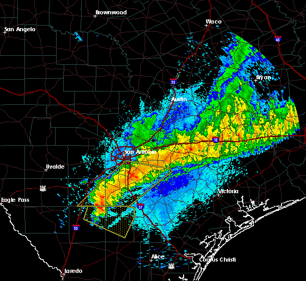 The severe thunderstorm warning for northwestern karnes, eastern frio, atascosa, wilson and southeastern bexar counties will expire at 1245 am cdt, the storms which prompted the warning have weakened below severe limits, and no longer pose an immediate threat to life or property. therefore the warning will be allowed to expire. however gusty winds to 45 mph are still possible with these thunderstorms. The severe thunderstorm warning for northwestern karnes, eastern frio, atascosa, wilson and southeastern bexar counties will expire at 1245 am cdt, the storms which prompted the warning have weakened below severe limits, and no longer pose an immediate threat to life or property. therefore the warning will be allowed to expire. however gusty winds to 45 mph are still possible with these thunderstorms.
|
| 4/14/2018 12:29 AM CDT |
 At 1229 am cdt, severe thunderstorms were located along a line extending from 12 miles north of nixon to 6 miles east of gardendale, moving east at 55 mph (radar indicated). Hazards include 60 mph wind gusts and penny size hail. Expect damage to roofs, siding, and trees. Locations impacted include, san antonio, pleasanton, floresville, jourdanton, dilley, poteet, poth, charlotte, stockdale, christine, campbellton, kosciusko, stinson municipal airport, somerset, elmendorf, falls city, goldfinch, pandora, calaveras lake and sutherland springs. At 1229 am cdt, severe thunderstorms were located along a line extending from 12 miles north of nixon to 6 miles east of gardendale, moving east at 55 mph (radar indicated). Hazards include 60 mph wind gusts and penny size hail. Expect damage to roofs, siding, and trees. Locations impacted include, san antonio, pleasanton, floresville, jourdanton, dilley, poteet, poth, charlotte, stockdale, christine, campbellton, kosciusko, stinson municipal airport, somerset, elmendorf, falls city, goldfinch, pandora, calaveras lake and sutherland springs.
|
| 4/14/2018 12:20 AM CDT |
 At 1220 am cdt, a severe thunderstorm was located over la vernia, or 13 miles southeast of randolph afb, moving east at 55 mph (radar indicated). Hazards include 60 mph wind gusts and nickel size hail. Expect damage to roofs, siding, and trees. locations impacted include, san antonio, schertz, seguin, cibolo, universal city, randolph afb, mcqueeney, st. Hedwig, la vernia, china grove, marion, kingsbury, santa clara, new berlin, zuehl, converse, nolte, martinez, parita and zipp. At 1220 am cdt, a severe thunderstorm was located over la vernia, or 13 miles southeast of randolph afb, moving east at 55 mph (radar indicated). Hazards include 60 mph wind gusts and nickel size hail. Expect damage to roofs, siding, and trees. locations impacted include, san antonio, schertz, seguin, cibolo, universal city, randolph afb, mcqueeney, st. Hedwig, la vernia, china grove, marion, kingsbury, santa clara, new berlin, zuehl, converse, nolte, martinez, parita and zipp.
|
| 4/14/2018 12:04 AM CDT |
 At 1203 am cdt, severe thunderstorms were located along a line extending from near st. hedwig to 7 miles north of light, moving east at 30 mph (radar indicated). Hazards include 60 mph wind gusts and quarter size hail. Hail damage to vehicles is expected. Expect wind damage to roofs, siding, and trees. At 1203 am cdt, severe thunderstorms were located along a line extending from near st. hedwig to 7 miles north of light, moving east at 30 mph (radar indicated). Hazards include 60 mph wind gusts and quarter size hail. Hail damage to vehicles is expected. Expect wind damage to roofs, siding, and trees.
|
| 4/13/2018 11:51 PM CDT |
 At 1150 pm cdt, a severe thunderstorm was located near randolph afb, moving east at 20 mph (radar indicated). Hazards include 60 mph wind gusts and quarter size hail. Hail damage to vehicles is expected. Expect wind damage to roofs, siding, and trees. At 1150 pm cdt, a severe thunderstorm was located near randolph afb, moving east at 20 mph (radar indicated). Hazards include 60 mph wind gusts and quarter size hail. Hail damage to vehicles is expected. Expect wind damage to roofs, siding, and trees.
|
| 4/3/2018 9:32 PM CDT |
 At 932 pm cdt, a severe thunderstorm was located near st. hedwig, or 11 miles southeast of randolph afb, moving east at 40 mph (public). Hazards include 60 mph wind gusts and quarter size hail. Hail damage to vehicles is expected. expect wind damage to roofs, siding, and trees. locations impacted include, schertz, cibolo, mcqueeney, st. Hedwig, la vernia, new berlin, zuehl, adkins, sayers and friendly corner. At 932 pm cdt, a severe thunderstorm was located near st. hedwig, or 11 miles southeast of randolph afb, moving east at 40 mph (public). Hazards include 60 mph wind gusts and quarter size hail. Hail damage to vehicles is expected. expect wind damage to roofs, siding, and trees. locations impacted include, schertz, cibolo, mcqueeney, st. Hedwig, la vernia, new berlin, zuehl, adkins, sayers and friendly corner.
|
| 4/3/2018 9:25 PM CDT | Golf Ball sized hail reported 10.8 miles W of San Antonio, TX, quarter to golfball sized hail. |
| 4/3/2018 9:25 PM CDT |
 At 924 pm cdt, a severe thunderstorm was located near randolph afb, moving east at 25 mph (public). Hazards include golf ball size hail and 60 mph wind gusts. People and animals outdoors will be injured. expect hail damage to roofs, siding, windows, and vehicles. expect wind damage to roofs, siding, and trees. locations impacted include, san antonio, schertz, cibolo, universal city, live oak, randolph afb, kirby, windcrest, mcqueeney, st. Hedwig, la vernia, china grove, marion, santa clara, new berlin, zuehl, converse, martinez, sayers and friendly corner. At 924 pm cdt, a severe thunderstorm was located near randolph afb, moving east at 25 mph (public). Hazards include golf ball size hail and 60 mph wind gusts. People and animals outdoors will be injured. expect hail damage to roofs, siding, windows, and vehicles. expect wind damage to roofs, siding, and trees. locations impacted include, san antonio, schertz, cibolo, universal city, live oak, randolph afb, kirby, windcrest, mcqueeney, st. Hedwig, la vernia, china grove, marion, santa clara, new berlin, zuehl, converse, martinez, sayers and friendly corner.
|
| 4/3/2018 9:22 PM CDT |
 At 921 pm cdt, a severe thunderstorm was located near china grove, or near randolph afb, moving east at 25 mph (radar indicated). Hazards include 60 mph wind gusts and quarter size hail. Hail damage to vehicles is expected. expect wind damage to roofs, siding, and trees. locations impacted include, san antonio, schertz, cibolo, universal city, live oak, randolph afb, kirby, windcrest, mcqueeney, st. Hedwig, la vernia, china grove, marion, santa clara, new berlin, zuehl, converse, martinez, sayers and friendly corner. At 921 pm cdt, a severe thunderstorm was located near china grove, or near randolph afb, moving east at 25 mph (radar indicated). Hazards include 60 mph wind gusts and quarter size hail. Hail damage to vehicles is expected. expect wind damage to roofs, siding, and trees. locations impacted include, san antonio, schertz, cibolo, universal city, live oak, randolph afb, kirby, windcrest, mcqueeney, st. Hedwig, la vernia, china grove, marion, santa clara, new berlin, zuehl, converse, martinez, sayers and friendly corner.
|
| 4/3/2018 9:20 PM CDT | Quarter sized hail reported 11 miles WNW of San Antonio, TX, quarter sized hail between kirby and china grove reported by public. |
| 4/3/2018 9:12 PM CDT |
 At 912 pm cdt, a severe thunderstorm was located over kirby, or 7 miles south of live oak, moving east at 15 mph (radar indicated). Hazards include 60 mph wind gusts and quarter size hail. Hail damage to vehicles is expected. Expect wind damage to roofs, siding, and trees. At 912 pm cdt, a severe thunderstorm was located over kirby, or 7 miles south of live oak, moving east at 15 mph (radar indicated). Hazards include 60 mph wind gusts and quarter size hail. Hail damage to vehicles is expected. Expect wind damage to roofs, siding, and trees.
|
| 3/28/2018 10:20 PM CDT | Quarter sized hail reported 10.3 miles WNW of San Antonio, TX, public report of quarter sized hail near the intersection of loop 410 and rigsby ave via ksat 12 facebook. |
| 3/28/2018 10:13 AM CDT |
 The severe thunderstorm warning for western bexar county will expire at 1015 am cdt. the storm which prompted the warning has weakened below severe limits, and no longer poses an immediate threat to life or property. therefore the warning will be allowed to expire. However small hail, gusty winds and heavy rain are still possible with this thunderstorm. The severe thunderstorm warning for western bexar county will expire at 1015 am cdt. the storm which prompted the warning has weakened below severe limits, and no longer poses an immediate threat to life or property. therefore the warning will be allowed to expire. However small hail, gusty winds and heavy rain are still possible with this thunderstorm.
|
| 3/28/2018 9:45 AM CDT | Quarter sized hail reported 11.6 miles ENE of San Antonio, TX |
| 3/28/2018 9:44 AM CDT |
 At 943 am cdt, a severe thunderstorm was located over lackland afb, or 9 miles west of san antonio, moving northeast at 30 mph (radar indicated). Hazards include 60 mph wind gusts and quarter size hail. Hail damage to vehicles is expected. expect wind damage to roofs, siding, and trees. Locations impacted include, san antonio, san antonio int airport, leon valley, helotes, kirby, alamo heights, windcrest, terrell hills, shavano park, hollywood park, cross mountain, olmos park, lackland afb, leon springs, the dominion, sea world, castle hills, balcones heights, von ormy and hill country village. At 943 am cdt, a severe thunderstorm was located over lackland afb, or 9 miles west of san antonio, moving northeast at 30 mph (radar indicated). Hazards include 60 mph wind gusts and quarter size hail. Hail damage to vehicles is expected. expect wind damage to roofs, siding, and trees. Locations impacted include, san antonio, san antonio int airport, leon valley, helotes, kirby, alamo heights, windcrest, terrell hills, shavano park, hollywood park, cross mountain, olmos park, lackland afb, leon springs, the dominion, sea world, castle hills, balcones heights, von ormy and hill country village.
|
| 3/28/2018 9:33 AM CDT |
 At 931 am cdt, a severe thunderstorm was located near lacoste, or near castroville, moving northeast at 35 mph. the public reported half dollar, or 1.25 inch diameter hail, in lacoste around 925 am (radar indicated). Hazards include ping pong ball size hail and 60 mph wind gusts. People and animals outdoors will be injured. expect hail damage to roofs, siding, windows, and vehicles. expect wind damage to roofs, siding, and trees. Locations impacted include, san antonio, castroville, san antonio int airport, leon valley, helotes, kirby, alamo heights, windcrest, terrell hills, shavano park, hollywood park, cross mountain, olmos park, somerset, lacoste, the dominion, government canyon state natural area, sea world, lackland afb and cliff. At 931 am cdt, a severe thunderstorm was located near lacoste, or near castroville, moving northeast at 35 mph. the public reported half dollar, or 1.25 inch diameter hail, in lacoste around 925 am (radar indicated). Hazards include ping pong ball size hail and 60 mph wind gusts. People and animals outdoors will be injured. expect hail damage to roofs, siding, windows, and vehicles. expect wind damage to roofs, siding, and trees. Locations impacted include, san antonio, castroville, san antonio int airport, leon valley, helotes, kirby, alamo heights, windcrest, terrell hills, shavano park, hollywood park, cross mountain, olmos park, somerset, lacoste, the dominion, government canyon state natural area, sea world, lackland afb and cliff.
|
| 3/28/2018 9:16 AM CDT |
 At 914 am cdt, a severe thunderstorm was located over noonan, or near castroville, moving northeast at 40 mph (radar indicated). Hazards include ping pong ball size hail and 60 mph wind gusts. People and animals outdoors will be injured. expect hail damage to roofs, siding, windows, and vehicles. Expect wind damage to roofs, siding, and trees. At 914 am cdt, a severe thunderstorm was located over noonan, or near castroville, moving northeast at 40 mph (radar indicated). Hazards include ping pong ball size hail and 60 mph wind gusts. People and animals outdoors will be injured. expect hail damage to roofs, siding, windows, and vehicles. Expect wind damage to roofs, siding, and trees.
|
| 3/28/2018 12:54 AM CDT |
 The severe thunderstorm warning for southeastern medina, northwestern atascosa and west central bexar counties will expire at 100 am cdt, the storm which prompted the warning has weakened below severe limits, and no longer poses an immediate threat to life or property. therefore the warning will be allowed to expire. however heavy rain is still possible with this thunderstorm. a severe thunderstorm watch remains in effect until 300 am cdt for south central texas. The severe thunderstorm warning for southeastern medina, northwestern atascosa and west central bexar counties will expire at 100 am cdt, the storm which prompted the warning has weakened below severe limits, and no longer poses an immediate threat to life or property. therefore the warning will be allowed to expire. however heavy rain is still possible with this thunderstorm. a severe thunderstorm watch remains in effect until 300 am cdt for south central texas.
|
| 3/28/2018 12:36 AM CDT |
 At 1236 am cdt, a severe thunderstorm was located over devine, moving northeast at 45 mph (radar indicated). Hazards include 60 mph wind gusts and quarter size hail. Hail damage to vehicles is expected. expect wind damage to roofs, siding, and trees. Locations impacted include, devine, castroville, lytle, natalia, lacoste, noonan, dunlay, biry, pearson, bader, rio medina, von ormy, macdona and mangus corner. At 1236 am cdt, a severe thunderstorm was located over devine, moving northeast at 45 mph (radar indicated). Hazards include 60 mph wind gusts and quarter size hail. Hail damage to vehicles is expected. expect wind damage to roofs, siding, and trees. Locations impacted include, devine, castroville, lytle, natalia, lacoste, noonan, dunlay, biry, pearson, bader, rio medina, von ormy, macdona and mangus corner.
|
| 3/28/2018 12:21 AM CDT |
 At 1221 am cdt, a severe thunderstorm was located over moore, or 9 miles southwest of devine, moving northeast at 45 mph (radar indicated). Hazards include 60 mph wind gusts and half dollar size hail. Hail damage to vehicles is expected. Expect wind damage to roofs, siding, and trees. At 1221 am cdt, a severe thunderstorm was located over moore, or 9 miles southwest of devine, moving northeast at 45 mph (radar indicated). Hazards include 60 mph wind gusts and half dollar size hail. Hail damage to vehicles is expected. Expect wind damage to roofs, siding, and trees.
|
| 5/31/2017 3:29 PM CDT |
 At 328 pm cdt, a severe thunderstorm was located near leming, or 9 miles northeast of poteet, moving northeast at 15 mph. this storm has a history of producing hail up to the size of quarters (public). Hazards include 60 mph wind gusts and quarter size hail. Hail damage to vehicles is expected. expect wind damage to roofs, siding, and trees. Locations impacted include, leming, espey, losoya and graytown. At 328 pm cdt, a severe thunderstorm was located near leming, or 9 miles northeast of poteet, moving northeast at 15 mph. this storm has a history of producing hail up to the size of quarters (public). Hazards include 60 mph wind gusts and quarter size hail. Hail damage to vehicles is expected. expect wind damage to roofs, siding, and trees. Locations impacted include, leming, espey, losoya and graytown.
|
| 5/31/2017 3:11 PM CDT |
 At 311 pm cdt, a severe thunderstorm was located over leming, or near poteet, moving northeast at 15 mph (radar indicated). Hazards include 60 mph wind gusts and quarter size hail. Hail damage to vehicles is expected. Expect wind damage to roofs, siding, and trees. At 311 pm cdt, a severe thunderstorm was located over leming, or near poteet, moving northeast at 15 mph (radar indicated). Hazards include 60 mph wind gusts and quarter size hail. Hail damage to vehicles is expected. Expect wind damage to roofs, siding, and trees.
|
| 5/30/2017 4:53 PM CDT |
 At 452 pm cdt, a severe thunderstorm was located over elmendorf, or 9 miles southeast of stinson municipal airport, moving east at 20 mph (radar indicated). Hazards include 60 mph wind gusts and quarter size hail. Hail damage to vehicles is expected. Expect wind damage to roofs, siding, and trees. At 452 pm cdt, a severe thunderstorm was located over elmendorf, or 9 miles southeast of stinson municipal airport, moving east at 20 mph (radar indicated). Hazards include 60 mph wind gusts and quarter size hail. Hail damage to vehicles is expected. Expect wind damage to roofs, siding, and trees.
|
| 5/28/2017 8:04 PM CDT |
 At 804 pm cdt, severe thunderstorms were located along a line extending from near wimberley to 6 miles southwest of san marcos to zorn to santa clara, moving east at 40 mph (radar indicated). Hazards include 60 mph wind gusts and quarter size hail. Hail damage to vehicles is expected. expect wind damage to roofs, siding, and trees. Locations impacted include, new braunfels, san marcos, schertz, kyle, seguin, cibolo, lockhart, selma, luling, wimberley, canyon lake dam, canyon lake, bulverde, garden ridge, martindale, marion, uhland, santa clara, staples and fentress. At 804 pm cdt, severe thunderstorms were located along a line extending from near wimberley to 6 miles southwest of san marcos to zorn to santa clara, moving east at 40 mph (radar indicated). Hazards include 60 mph wind gusts and quarter size hail. Hail damage to vehicles is expected. expect wind damage to roofs, siding, and trees. Locations impacted include, new braunfels, san marcos, schertz, kyle, seguin, cibolo, lockhart, selma, luling, wimberley, canyon lake dam, canyon lake, bulverde, garden ridge, martindale, marion, uhland, santa clara, staples and fentress.
|
| 5/28/2017 7:52 PM CDT |
 At 751 pm cdt, severe thunderstorms were located along a line extending from near wimberley to 6 miles east of canyon lake dam to near new braunfels to near garden ridge, moving east at 40 mph (radar indicated). Hazards include 60 mph wind gusts and quarter size hail. Hail damage to vehicles is expected. expect wind damage to roofs, siding, and trees. Locations impacted include, new braunfels, san marcos, schertz, kyle, seguin, cibolo, lockhart, selma, luling, wimberley, canyon lake dam, canyon lake, bulverde, garden ridge, woodcreek, martindale, marion, uhland, santa clara and new berlin. At 751 pm cdt, severe thunderstorms were located along a line extending from near wimberley to 6 miles east of canyon lake dam to near new braunfels to near garden ridge, moving east at 40 mph (radar indicated). Hazards include 60 mph wind gusts and quarter size hail. Hail damage to vehicles is expected. expect wind damage to roofs, siding, and trees. Locations impacted include, new braunfels, san marcos, schertz, kyle, seguin, cibolo, lockhart, selma, luling, wimberley, canyon lake dam, canyon lake, bulverde, garden ridge, woodcreek, martindale, marion, uhland, santa clara and new berlin.
|
| 5/28/2017 7:41 PM CDT |
 The national weather service in austin san antonio has issued a * severe thunderstorm warning for. southwestern caldwell county in south central texas. southern hays county in south central texas. guadalupe county in south central texas. Comal county in south central texas. The national weather service in austin san antonio has issued a * severe thunderstorm warning for. southwestern caldwell county in south central texas. southern hays county in south central texas. guadalupe county in south central texas. Comal county in south central texas.
|
| 5/23/2017 5:27 PM CDT |
 At 527 pm cdt, a severe thunderstorm was located near somerset, or 12 miles northeast of devine, moving southeast at 30 mph (radar indicated). Hazards include 60 mph wind gusts and quarter size hail. Hail damage to vehicles is expected. Expect wind damage to roofs, siding, and trees. At 527 pm cdt, a severe thunderstorm was located near somerset, or 12 miles northeast of devine, moving southeast at 30 mph (radar indicated). Hazards include 60 mph wind gusts and quarter size hail. Hail damage to vehicles is expected. Expect wind damage to roofs, siding, and trees.
|
| 5/23/2017 5:02 PM CDT |
 At 502 pm cdt, a severe thunderstorm was located over elmendorf, or 8 miles southeast of stinson municipal airport, moving southeast at 40 mph (radar indicated). Hazards include golf ball size hail and 60 mph wind gusts. People and animals outdoors will be injured. expect hail damage to roofs, siding, windows, and vehicles. expect wind damage to roofs, siding, and trees. Locations impacted include, floresville, poth, elmendorf, calaveras lake, sutherland springs, losoya, southton, canada verde, buena vista and braunig lake. At 502 pm cdt, a severe thunderstorm was located over elmendorf, or 8 miles southeast of stinson municipal airport, moving southeast at 40 mph (radar indicated). Hazards include golf ball size hail and 60 mph wind gusts. People and animals outdoors will be injured. expect hail damage to roofs, siding, windows, and vehicles. expect wind damage to roofs, siding, and trees. Locations impacted include, floresville, poth, elmendorf, calaveras lake, sutherland springs, losoya, southton, canada verde, buena vista and braunig lake.
|
| 5/23/2017 4:46 PM CDT |
 At 446 pm cdt, a severe thunderstorm was located over stinson municipal airport, moving east at 40 mph (radar indicated). Hazards include 60 mph wind gusts and quarter size hail. Hail damage to vehicles is expected. Expect wind damage to roofs, siding, and trees. At 446 pm cdt, a severe thunderstorm was located over stinson municipal airport, moving east at 40 mph (radar indicated). Hazards include 60 mph wind gusts and quarter size hail. Hail damage to vehicles is expected. Expect wind damage to roofs, siding, and trees.
|
| 4/2/2017 8:43 AM CDT |
 At 843 am cdt, a severe thunderstorm was located over smithson valley, or 11 miles west of canyon lake dam, moving east at 40 mph (radar indicated). Hazards include 60 mph wind gusts. Expect damage to roofs, siding, and trees. locations impacted include, san antonio, new braunfels, schertz, live oak, selma, san antonio int ap, canyon lake dam, leon valley, helotes, fair oaks ranch, canyon lake, bulverde, shavano park, garden ridge, hollywood park, cross mountain, guadalupe river state park, smithson valley, the dominion and spring branch. A tornado watch remains in effect until 100 pm cdt for south central texas. At 843 am cdt, a severe thunderstorm was located over smithson valley, or 11 miles west of canyon lake dam, moving east at 40 mph (radar indicated). Hazards include 60 mph wind gusts. Expect damage to roofs, siding, and trees. locations impacted include, san antonio, new braunfels, schertz, live oak, selma, san antonio int ap, canyon lake dam, leon valley, helotes, fair oaks ranch, canyon lake, bulverde, shavano park, garden ridge, hollywood park, cross mountain, guadalupe river state park, smithson valley, the dominion and spring branch. A tornado watch remains in effect until 100 pm cdt for south central texas.
|
| 4/2/2017 8:41 AM CDT |
 At 835 am cdt, a line of severe thunderstorms was located 7 miles northwest of north pearsall, or 9 miles north of pearsall, moving east at 30 mph. these storms are producing heavy rains, frequent cloud to ground lightning strikes, strong wind gusts and up to one inch hail size according to radar tools (radar indicated). Hazards include 60 mph wind gusts and quarter size hail. Hail damage to vehicles is expected. expect wind damage to roofs, siding, and trees. locations impacted include, pearsall, hondo, devine, castroville, moore, lytle, natalia, lacoste, goldfinch, d`hanis, noonan, quihi, dunlay, mico, pearson, north pearsall, bader, bluff, schattel and west pearsall. A tornado watch remains in effect until 100 pm cdt for south central texas. At 835 am cdt, a line of severe thunderstorms was located 7 miles northwest of north pearsall, or 9 miles north of pearsall, moving east at 30 mph. these storms are producing heavy rains, frequent cloud to ground lightning strikes, strong wind gusts and up to one inch hail size according to radar tools (radar indicated). Hazards include 60 mph wind gusts and quarter size hail. Hail damage to vehicles is expected. expect wind damage to roofs, siding, and trees. locations impacted include, pearsall, hondo, devine, castroville, moore, lytle, natalia, lacoste, goldfinch, d`hanis, noonan, quihi, dunlay, mico, pearson, north pearsall, bader, bluff, schattel and west pearsall. A tornado watch remains in effect until 100 pm cdt for south central texas.
|
| 4/2/2017 8:19 AM CDT |
 At 819 am cdt, a severe thunderstorm was located over fair oaks ranch, or near boerne, moving east at 35 mph (radar indicated). Hazards include 60 mph wind gusts and nickel size hail. expect damage to roofs, siding, and trees At 819 am cdt, a severe thunderstorm was located over fair oaks ranch, or near boerne, moving east at 35 mph (radar indicated). Hazards include 60 mph wind gusts and nickel size hail. expect damage to roofs, siding, and trees
|
| 4/2/2017 8:13 AM CDT |
 At 812 am cdt, a severe thunderstorm was located over frio town, or 16 miles east of batesville, moving east at 30 mph (radar indicated). Hazards include 60 mph wind gusts and quarter size hail. Hail damage to vehicles is expected. Expect wind damage to roofs, siding, and trees. At 812 am cdt, a severe thunderstorm was located over frio town, or 16 miles east of batesville, moving east at 30 mph (radar indicated). Hazards include 60 mph wind gusts and quarter size hail. Hail damage to vehicles is expected. Expect wind damage to roofs, siding, and trees.
|
| 2/19/2017 10:59 PM CST |
 At 1058 pm cst, a severe squall line capable of producing both tornadoes and extensive straight line wind damage was located over garden ridge, or near selma, moving northeast at 45 mph. two circulations were detected on radar, one moving along highway 78 just east of cibolo and a second in garden ridge near schoenthal road (radar indicated rotation). Hazards include tornado. Flying debris will be dangerous to those caught without shelter. mobile homes will be damaged or destroyed. damage to roofs, windows, and vehicles will occur. tree damage is likely. Locations impacted include, schertz, cibolo, universal city, selma, randolph afb, bulverde, garden ridge, marion, santa clara and bracken. At 1058 pm cst, a severe squall line capable of producing both tornadoes and extensive straight line wind damage was located over garden ridge, or near selma, moving northeast at 45 mph. two circulations were detected on radar, one moving along highway 78 just east of cibolo and a second in garden ridge near schoenthal road (radar indicated rotation). Hazards include tornado. Flying debris will be dangerous to those caught without shelter. mobile homes will be damaged or destroyed. damage to roofs, windows, and vehicles will occur. tree damage is likely. Locations impacted include, schertz, cibolo, universal city, selma, randolph afb, bulverde, garden ridge, marion, santa clara and bracken.
|
| 2/19/2017 10:56 PM CST |
 At 1056 pm cst, severe thunderstorms were located along a line extending from near fischer to near sutherland springs, moving east at 40 mph (radar indicated). Hazards include 60 mph wind gusts and nickel size hail. expect damage to roofs, siding, and trees At 1056 pm cst, severe thunderstorms were located along a line extending from near fischer to near sutherland springs, moving east at 40 mph (radar indicated). Hazards include 60 mph wind gusts and nickel size hail. expect damage to roofs, siding, and trees
|
| 2/19/2017 10:55 PM CST | Possible tornado confirmed. caller reported trees down... homes damaged... power lines dow in bexar county TX, 11.9 miles SW of San Antonio, TX |
| 2/19/2017 10:52 PM CST |
 At 1051 pm cst, severe thunderstorms were located along a line extending from near selma to st. hedwig, moving northeast at 45 mph. these storms may contain tornadoes along the leading edge of the line (radar indicated). Hazards include 60 mph wind gusts and quarter size hail. Hail damage to vehicles is expected. expect wind damage to roofs, siding, and trees. locations impacted include, san antonio, new braunfels, schertz, cibolo, universal city, live oak, selma, randolph afb, windcrest, canyon lake, bulverde, garden ridge, st. Hedwig, la vernia, santa clara, new berlin, zuehl, converse, bracken and friendly corner. At 1051 pm cst, severe thunderstorms were located along a line extending from near selma to st. hedwig, moving northeast at 45 mph. these storms may contain tornadoes along the leading edge of the line (radar indicated). Hazards include 60 mph wind gusts and quarter size hail. Hail damage to vehicles is expected. expect wind damage to roofs, siding, and trees. locations impacted include, san antonio, new braunfels, schertz, cibolo, universal city, live oak, selma, randolph afb, windcrest, canyon lake, bulverde, garden ridge, st. Hedwig, la vernia, santa clara, new berlin, zuehl, converse, bracken and friendly corner.
|
| 2/19/2017 10:50 PM CST | Caller reported large trees in the road and traffic lights down. possible tornado in bexar county TX, 4.4 miles WSW of San Antonio, TX |
| 2/19/2017 10:50 PM CST | Possible tornado damage reported. apartment complex with roof blown off... 2-3 house with serious damage and several others with moderate to minor damag in bexar county TX, 10.8 miles W of San Antonio, TX |
| 2/19/2017 10:50 PM CST | Social media report possible tornado damage... roof caved i in bexar county TX, 12.4 miles SW of San Antonio, TX |
| 2/19/2017 10:50 PM CST | Report via social media... large power tower mangle in bexar county TX, 11 miles SW of San Antonio, TX |
| 2/19/2017 10:49 PM CST |
 At 1045 pm cst, a severe squall line capable of producing both tornadoes and extensive straight line wind damage was located near live oak, moving northeast at 50 mph. two rotations were noted, one near nacogdoches road and o`conner road, and another near live oak (radar indicated rotation). Hazards include tornado. Flying debris will be dangerous to those caught without shelter. mobile homes will be damaged or destroyed. damage to roofs, windows, and vehicles will occur. tree damage is likely. Locations impacted include, san antonio, schertz, cibolo, universal city, live oak, selma, randolph afb, windcrest, bulverde, garden ridge, marion, santa clara, converse and bracken. At 1045 pm cst, a severe squall line capable of producing both tornadoes and extensive straight line wind damage was located near live oak, moving northeast at 50 mph. two rotations were noted, one near nacogdoches road and o`conner road, and another near live oak (radar indicated rotation). Hazards include tornado. Flying debris will be dangerous to those caught without shelter. mobile homes will be damaged or destroyed. damage to roofs, windows, and vehicles will occur. tree damage is likely. Locations impacted include, san antonio, schertz, cibolo, universal city, live oak, selma, randolph afb, windcrest, bulverde, garden ridge, marion, santa clara, converse and bracken.
|
| 2/19/2017 10:45 PM CST | Report via social media near woodridge elementary... roofs blown off... trees dow in bexar county TX, 5.5 miles WSW of San Antonio, TX |
| 2/19/2017 10:45 PM CST | Possible tornado damage broadway and nacogdoches... apartment roof blown off... power lines to the groun in bexar county TX, 4.4 miles WSW of San Antonio, TX |
| 2/19/2017 10:42 PM CST |
 At 1041 pm cst, a severe squall line capable of producing both tornadoes and extensive straight line wind damage was located over san antonio int ap, moving northeast at 25 mph (radar indicated rotation). Hazards include tornado. Flying debris will be dangerous to those caught without shelter. mobile homes will be damaged or destroyed. damage to roofs, windows, and vehicles will occur. tree damage is likely. Locations impacted include, san antonio, schertz, cibolo, universal city, live oak, selma, randolph afb, san antonio int ap, kirby, alamo heights, windcrest, terrell hills, bulverde, garden ridge, hollywood park, olmos park, marion, santa clara, converse and castle hills. At 1041 pm cst, a severe squall line capable of producing both tornadoes and extensive straight line wind damage was located over san antonio int ap, moving northeast at 25 mph (radar indicated rotation). Hazards include tornado. Flying debris will be dangerous to those caught without shelter. mobile homes will be damaged or destroyed. damage to roofs, windows, and vehicles will occur. tree damage is likely. Locations impacted include, san antonio, schertz, cibolo, universal city, live oak, selma, randolph afb, san antonio int ap, kirby, alamo heights, windcrest, terrell hills, bulverde, garden ridge, hollywood park, olmos park, marion, santa clara, converse and castle hills.
|
| 2/19/2017 10:39 PM CST |
 At 1038 pm cst, a severe thunderstorm capable of producing a tornado was located over san antonio int ap, moving northeast at 35 mph (radar indicated rotation). Hazards include tornado. Flying debris will be dangerous to those caught without shelter. mobile homes will be damaged or destroyed. damage to roofs, windows, and vehicles will occur. Tree damage is likely. At 1038 pm cst, a severe thunderstorm capable of producing a tornado was located over san antonio int ap, moving northeast at 35 mph (radar indicated rotation). Hazards include tornado. Flying debris will be dangerous to those caught without shelter. mobile homes will be damaged or destroyed. damage to roofs, windows, and vehicles will occur. Tree damage is likely.
|
| 2/19/2017 10:34 PM CST |
 At 1034 pm cst, severe thunderstorms were located along a line extending from near san antonio int ap to near elmendorf, moving northeast at 30 mph (radar indicated). Hazards include 60 mph wind gusts and quarter size hail. Hail damage to vehicles is expected. Expect wind damage to roofs, siding, and trees. At 1034 pm cst, severe thunderstorms were located along a line extending from near san antonio int ap to near elmendorf, moving northeast at 30 mph (radar indicated). Hazards include 60 mph wind gusts and quarter size hail. Hail damage to vehicles is expected. Expect wind damage to roofs, siding, and trees.
|
| 2/19/2017 10:10 PM CST | Quarter sized hail reported 8.6 miles S of San Antonio, TX, spotter reported quarter sized hail and heavy rain.. 2 inches. |
| 6/2/2016 8:12 PM CDT |
 At 812 pm cdt, severe thunderstorms were located along a line extending from 8 miles east of somerset to near bigfoot, moving east at 15 mph (radar indicated). Hazards include quarter size hail. Damage to vehicles is expected. Locations impacted include, poteet, big foot, schattel, bigfoot, rossville, kyote, iuka, espey, amphion, mitchell lake, buena vista, braunig lake, thelma and losoya. At 812 pm cdt, severe thunderstorms were located along a line extending from 8 miles east of somerset to near bigfoot, moving east at 15 mph (radar indicated). Hazards include quarter size hail. Damage to vehicles is expected. Locations impacted include, poteet, big foot, schattel, bigfoot, rossville, kyote, iuka, espey, amphion, mitchell lake, buena vista, braunig lake, thelma and losoya.
|
| 6/2/2016 7:56 PM CDT |
 At 755 pm cdt, severe thunderstorms were located along a line extending from near somerset to near big foot, moving east at 15 mph (radar indicated). Hazards include quarter size hail. Damage to vehicles is expected. Locations impacted include, san antonio, devine, poteet, moore, somerset, big foot, schattel, bigfoot, von ormy, rossville, kyote, iuka, espey, amphion, mitchell lake, buena vista, braunig lake, thelma and losoya. At 755 pm cdt, severe thunderstorms were located along a line extending from near somerset to near big foot, moving east at 15 mph (radar indicated). Hazards include quarter size hail. Damage to vehicles is expected. Locations impacted include, san antonio, devine, poteet, moore, somerset, big foot, schattel, bigfoot, von ormy, rossville, kyote, iuka, espey, amphion, mitchell lake, buena vista, braunig lake, thelma and losoya.
|
| 6/2/2016 7:30 PM CDT | Quarter sized hail reported 3.4 miles NW of San Antonio, TX |
| 6/2/2016 7:27 PM CDT |
 At 726 pm cdt, severe thunderstorms were located along a line extending from near somerset to near devine, moving southeast at 15 mph (radar indicated). Hazards include quarter size hail. damage to vehicles is expected At 726 pm cdt, severe thunderstorms were located along a line extending from near somerset to near devine, moving southeast at 15 mph (radar indicated). Hazards include quarter size hail. damage to vehicles is expected
|
| 6/1/2016 7:35 PM CDT |
 At 734 pm cdt, a severe thunderstorm was located near new braunfels, moving east at 40 mph (radar indicated). Hazards include quarter size hail. Damage to vehicles is expected. Locations impacted include, new braunfels, schertz, canyon lake, bulverde, garden ridge, sattler, hunter, solms, gruene, freiheit and startzville. At 734 pm cdt, a severe thunderstorm was located near new braunfels, moving east at 40 mph (radar indicated). Hazards include quarter size hail. Damage to vehicles is expected. Locations impacted include, new braunfels, schertz, canyon lake, bulverde, garden ridge, sattler, hunter, solms, gruene, freiheit and startzville.
|
| 6/1/2016 7:08 PM CDT |
 At 707 pm cdt, a severe thunderstorm was located over bulverde, or 16 miles northwest of universal city, moving east at 40 mph (radar indicated). Hazards include half dollar size hail. damage to vehicles is expected At 707 pm cdt, a severe thunderstorm was located over bulverde, or 16 miles northwest of universal city, moving east at 40 mph (radar indicated). Hazards include half dollar size hail. damage to vehicles is expected
|
| 6/1/2016 6:33 PM CDT |
 At 632 pm cdt, a severe thunderstorm was located over bergheim, or 11 miles east of boerne, moving east at 40 mph (trained weather spotters. at 6:22 pm one inch hail was reported near boerne). Hazards include golf ball size hail and 60 mph wind gusts. People and animals outdoors will be injured. expect hail damage to roofs, siding, windows, and vehicles. expect wind damage to roofs, siding, and trees. Locations impacted include, boerne, fair oaks ranch, canyon lake, bulverde, timberwood park, bergheim, waring, walnut grove, kendalia, guadalupe river state park, spring branch, welfare, nelson city, kreutzberg, cascade caverns, anhalt, specht store, crown and scenic oaks. At 632 pm cdt, a severe thunderstorm was located over bergheim, or 11 miles east of boerne, moving east at 40 mph (trained weather spotters. at 6:22 pm one inch hail was reported near boerne). Hazards include golf ball size hail and 60 mph wind gusts. People and animals outdoors will be injured. expect hail damage to roofs, siding, windows, and vehicles. expect wind damage to roofs, siding, and trees. Locations impacted include, boerne, fair oaks ranch, canyon lake, bulverde, timberwood park, bergheim, waring, walnut grove, kendalia, guadalupe river state park, spring branch, welfare, nelson city, kreutzberg, cascade caverns, anhalt, specht store, crown and scenic oaks.
|
| 6/1/2016 6:10 PM CDT |
 At 609 pm cdt, a severe thunderstorm was located over nelson city, or near boerne, moving east at 40 mph (trained weather spotters). Hazards include golf ball size hail and 60 mph wind gusts. People and animals outdoors will be injured. expect hail damage to roofs, siding, windows, and vehicles. Expect wind damage to roofs, siding, and trees. At 609 pm cdt, a severe thunderstorm was located over nelson city, or near boerne, moving east at 40 mph (trained weather spotters). Hazards include golf ball size hail and 60 mph wind gusts. People and animals outdoors will be injured. expect hail damage to roofs, siding, windows, and vehicles. Expect wind damage to roofs, siding, and trees.
|
| 5/31/2016 3:18 PM CDT |
 At 318 pm cdt, a severe thunderstorm was located near zorn, or 7 miles southwest of san marcos, moving northeast at 45 mph (radar indicated). Hazards include 60 mph wind gusts and quarter size hail. Hail damage to vehicles is expected. expect wind damage to roofs, siding, and trees. Locations impacted include, new braunfels, san marcos, lockhart, wimberley, canyon lake dam, schertz, kyle, cibolo, buda, selma, canyon lake, bulverde, garden ridge, woodcreek, martindale, uhland, santa clara, niederwald, staples and geronimo. At 318 pm cdt, a severe thunderstorm was located near zorn, or 7 miles southwest of san marcos, moving northeast at 45 mph (radar indicated). Hazards include 60 mph wind gusts and quarter size hail. Hail damage to vehicles is expected. expect wind damage to roofs, siding, and trees. Locations impacted include, new braunfels, san marcos, lockhart, wimberley, canyon lake dam, schertz, kyle, cibolo, buda, selma, canyon lake, bulverde, garden ridge, woodcreek, martindale, uhland, santa clara, niederwald, staples and geronimo.
|
| 5/31/2016 2:56 PM CDT |
 At 256 pm cdt, a severe thunderstorm was located near garden ridge, or 9 miles west of new braunfels, moving northeast at 45 mph (radar indicated). Hazards include 60 mph wind gusts and quarter size hail. Hail damage to vehicles is expected. Expect wind damage to roofs, siding, and trees. At 256 pm cdt, a severe thunderstorm was located near garden ridge, or 9 miles west of new braunfels, moving northeast at 45 mph (radar indicated). Hazards include 60 mph wind gusts and quarter size hail. Hail damage to vehicles is expected. Expect wind damage to roofs, siding, and trees.
|
| 5/29/2016 3:31 AM CDT |
 At 330 am cdt, a severe thunderstorm was located near lackland afb, or 10 miles east of castroville, moving east at 20 mph (radar indicated). Hazards include 60 mph wind gusts and quarter size hail. Hail damage to vehicles is expected. expect wind damage to roofs, siding, and trees. Locations impacted include, san antonio, leon valley, helotes, lytle, somerset, lackland afb, sea world, von ormy, macdona and mangus corner. At 330 am cdt, a severe thunderstorm was located near lackland afb, or 10 miles east of castroville, moving east at 20 mph (radar indicated). Hazards include 60 mph wind gusts and quarter size hail. Hail damage to vehicles is expected. expect wind damage to roofs, siding, and trees. Locations impacted include, san antonio, leon valley, helotes, lytle, somerset, lackland afb, sea world, von ormy, macdona and mangus corner.
|
| 5/29/2016 3:16 AM CDT |
 At 316 am cdt, a severe thunderstorm was located over lacoste, or near castroville, moving east at 15 mph (radar indicated). Hazards include 60 mph wind gusts and quarter size hail. Hail damage to vehicles is expected. expect wind damage to roofs, siding, and trees. Locations impacted include, san antonio, devine, castroville, leon valley, helotes, lytle, somerset, natalia, lacoste, pearson, bader, noonan, lackland afb, cliff, rio medina, sea world, mico, von ormy, mangus corner and macdona. At 316 am cdt, a severe thunderstorm was located over lacoste, or near castroville, moving east at 15 mph (radar indicated). Hazards include 60 mph wind gusts and quarter size hail. Hail damage to vehicles is expected. expect wind damage to roofs, siding, and trees. Locations impacted include, san antonio, devine, castroville, leon valley, helotes, lytle, somerset, natalia, lacoste, pearson, bader, noonan, lackland afb, cliff, rio medina, sea world, mico, von ormy, mangus corner and macdona.
|
| 5/29/2016 3:00 AM CDT |
 At 259 am cdt, a severe thunderstorm was located over lacoste, or near castroville, moving east at 20 mph (radar indicated). Hazards include 60 mph wind gusts and quarter size hail. Hail damage to vehicles is expected. Expect wind damage to roofs, siding, and trees. At 259 am cdt, a severe thunderstorm was located over lacoste, or near castroville, moving east at 20 mph (radar indicated). Hazards include 60 mph wind gusts and quarter size hail. Hail damage to vehicles is expected. Expect wind damage to roofs, siding, and trees.
|
| 5/29/2016 1:18 AM CDT |
 At 117 am cdt, a severe thunderstorm was located 2 miles east of bandera, moving northeast at 10 mph (radar indicated). Hazards include 60 mph wind gusts and quarter size hail. Hail damage to vehicles is expected. expect wind damage to roofs, siding, and trees. Locations impacted include, bandera, tarpley, pipe creek, lakehills, cliff, rio medina, bandera falls and mico. At 117 am cdt, a severe thunderstorm was located 2 miles east of bandera, moving northeast at 10 mph (radar indicated). Hazards include 60 mph wind gusts and quarter size hail. Hail damage to vehicles is expected. expect wind damage to roofs, siding, and trees. Locations impacted include, bandera, tarpley, pipe creek, lakehills, cliff, rio medina, bandera falls and mico.
|
| 5/29/2016 12:55 AM CDT |
 At 1255 am cdt, severe thunderstorms were located along a line extending from bandera falls to 10 miles southeast of tarpley to 8 miles southeast of utopia, moving southeast at 20 mph (radar indicated). Hazards include 60 mph wind gusts and quarter size hail. Hail damage to vehicles is expected. Expect wind damage to roofs, siding, and trees. At 1255 am cdt, severe thunderstorms were located along a line extending from bandera falls to 10 miles southeast of tarpley to 8 miles southeast of utopia, moving southeast at 20 mph (radar indicated). Hazards include 60 mph wind gusts and quarter size hail. Hail damage to vehicles is expected. Expect wind damage to roofs, siding, and trees.
|
| 5/29/2016 12:11 AM CDT |
 At 1210 am cdt, severe thunderstorms were located along a line extending from welfare to bandera falls to near utopia to 7 miles west of montell, moving south at 15 mph. this incluses garner state park where ongoing camping is high for the holiday weekend (radar indicated). Hazards include 60 mph wind gusts and quarter size hail. Hail damage to vehicles is expected. expect wind damage to roofs, siding, and trees. Locations impacted include, medina, kerrville, boerne, comfort, bandera, leakey, vanderpool, tarpley, camp wood, montell, lost maples state park, waring, concan, pipe creek, walnut grove, utopia, welfare, sisterdale, bandera falls and mico. At 1210 am cdt, severe thunderstorms were located along a line extending from welfare to bandera falls to near utopia to 7 miles west of montell, moving south at 15 mph. this incluses garner state park where ongoing camping is high for the holiday weekend (radar indicated). Hazards include 60 mph wind gusts and quarter size hail. Hail damage to vehicles is expected. expect wind damage to roofs, siding, and trees. Locations impacted include, medina, kerrville, boerne, comfort, bandera, leakey, vanderpool, tarpley, camp wood, montell, lost maples state park, waring, concan, pipe creek, walnut grove, utopia, welfare, sisterdale, bandera falls and mico.
|
| 5/28/2016 11:59 PM CDT |
 At 1158 pm cdt, severe thunderstorms were located along a line extending from comfort to pipe creek to near utopia to 7 miles west of montell, moving south to south-southeast at 15 mph (radar indicated). Hazards include 60 mph wind gusts and quarter size hail. Hail damage to vehicles is expected. Expect wind damage to roofs, siding, and trees. At 1158 pm cdt, severe thunderstorms were located along a line extending from comfort to pipe creek to near utopia to 7 miles west of montell, moving south to south-southeast at 15 mph (radar indicated). Hazards include 60 mph wind gusts and quarter size hail. Hail damage to vehicles is expected. Expect wind damage to roofs, siding, and trees.
|
| 5/28/2016 7:18 PM CDT |
 At 717 pm cdt, a severe thunderstorm was nearly stationary located near hondo. this storm was capable of producing quarter sized hail and very heavy rainfall leading to flash flooding (radar indicated). Hazards include 60 mph wind gusts and quarter size hail. Hail damage to vehicles is expected. expect wind damage to roofs, siding, and trees. Locations impacted include, hondo, castroville, bandera, tarpley, lytle, natalia, lacoste, dunlay, d`hanis, pearson, bader, noonan, lakehills, new fountain, pipe creek, biry, quihi, cliff, rio medina and bandera falls. At 717 pm cdt, a severe thunderstorm was nearly stationary located near hondo. this storm was capable of producing quarter sized hail and very heavy rainfall leading to flash flooding (radar indicated). Hazards include 60 mph wind gusts and quarter size hail. Hail damage to vehicles is expected. expect wind damage to roofs, siding, and trees. Locations impacted include, hondo, castroville, bandera, tarpley, lytle, natalia, lacoste, dunlay, d`hanis, pearson, bader, noonan, lakehills, new fountain, pipe creek, biry, quihi, cliff, rio medina and bandera falls.
|
| 5/28/2016 7:13 PM CDT |
 At 711 pm cdt, a severe thunderstorm was nearly stationary and located near hondo. this storm has a history of producing hail two inches in diameter. it is also producing torrential downpours which could lead to significant flash flooding (public). Hazards include two inch hail and 60 mph wind gusts. People and animals outdoors will be injured. expect hail damage to roofs, siding, windows, and vehicles. expect wind damage to roofs, siding, and trees. Locations impacted include, hondo, castroville, bandera, tarpley, lytle, natalia, lacoste, dunlay, d`hanis, pearson, bader, noonan, lakehills, new fountain, pipe creek, biry, quihi, cliff, rio medina and bandera falls. At 711 pm cdt, a severe thunderstorm was nearly stationary and located near hondo. this storm has a history of producing hail two inches in diameter. it is also producing torrential downpours which could lead to significant flash flooding (public). Hazards include two inch hail and 60 mph wind gusts. People and animals outdoors will be injured. expect hail damage to roofs, siding, windows, and vehicles. expect wind damage to roofs, siding, and trees. Locations impacted include, hondo, castroville, bandera, tarpley, lytle, natalia, lacoste, dunlay, d`hanis, pearson, bader, noonan, lakehills, new fountain, pipe creek, biry, quihi, cliff, rio medina and bandera falls.
|
| 5/28/2016 6:55 PM CDT |
 At 652 pm cdt, a severe thunderstorm was located near hondo, moving east at 10 mph. doppler radar indicated this storm may be producing tennis ball sized hail. a second severe thunderstorm was located 10 miles southeast of tarpley moving north at 15 mph. this storm could produce quarter sized hail (radar indicated). Hazards include tennis ball size hail and 60 mph wind gusts. People and animals outdoors will be injured. expect hail damage to roofs, siding, windows, and vehicles. expect wind damage to roofs, siding, and trees. Locations impacted include, hondo, castroville, bandera, tarpley, lytle, natalia, lacoste, dunlay, d`hanis, pearson, bader, noonan, lakehills, new fountain, pipe creek, biry, quihi, cliff, rio medina and bandera falls. At 652 pm cdt, a severe thunderstorm was located near hondo, moving east at 10 mph. doppler radar indicated this storm may be producing tennis ball sized hail. a second severe thunderstorm was located 10 miles southeast of tarpley moving north at 15 mph. this storm could produce quarter sized hail (radar indicated). Hazards include tennis ball size hail and 60 mph wind gusts. People and animals outdoors will be injured. expect hail damage to roofs, siding, windows, and vehicles. expect wind damage to roofs, siding, and trees. Locations impacted include, hondo, castroville, bandera, tarpley, lytle, natalia, lacoste, dunlay, d`hanis, pearson, bader, noonan, lakehills, new fountain, pipe creek, biry, quihi, cliff, rio medina and bandera falls.
|
| 5/28/2016 6:43 PM CDT |
 At 641 pm cdt, a severe thunderstorm was located 8 miles north of hondo, moving north at 15 mph. another severe thunderstorm was located 5 miles south of hondo and was nearly stationary (radar indicated). Hazards include ping pong ball size hail and 60 mph wind gusts. People and animals outdoors will be injured. expect hail damage to roofs, siding, windows, and vehicles. Expect wind damage to roofs, siding, and trees. At 641 pm cdt, a severe thunderstorm was located 8 miles north of hondo, moving north at 15 mph. another severe thunderstorm was located 5 miles south of hondo and was nearly stationary (radar indicated). Hazards include ping pong ball size hail and 60 mph wind gusts. People and animals outdoors will be injured. expect hail damage to roofs, siding, windows, and vehicles. Expect wind damage to roofs, siding, and trees.
|
| 5/18/2016 12:08 AM CDT |
 At 1208 am cdt, a severe thunderstorm was located over elmendorf, or 14 miles northwest of floresville, moving east at 25 mph (radar indicated). Hazards include 60 mph wind gusts and nickel size hail. Expect damage to roofs. siding. and trees. locations impacted include, san antonio, st. Hedwig, elmendorf, calaveras lake, sayers, southton, adkins, parita, martinez, mitchell lake, buena vista, braunig lake, thelma, losoya and brooks city base. At 1208 am cdt, a severe thunderstorm was located over elmendorf, or 14 miles northwest of floresville, moving east at 25 mph (radar indicated). Hazards include 60 mph wind gusts and nickel size hail. Expect damage to roofs. siding. and trees. locations impacted include, san antonio, st. Hedwig, elmendorf, calaveras lake, sayers, southton, adkins, parita, martinez, mitchell lake, buena vista, braunig lake, thelma, losoya and brooks city base.
|
| 5/17/2016 11:45 PM CDT |
 At 1145 pm cdt, severe thunderstorms were located along a line extending from near canyon lake dam to selma, moving east at 30 mph (radar indicated). Hazards include 60 mph wind gusts and nickel size hail. Expect damage to roofs. siding. and trees. Locations impacted include, new braunfels, canyon lake dam, schertz, cibolo, selma, canyon lake, bulverde, garden ridge, marion, santa clara, timberwood park, fischer, spring branch, northcliff, anhalt, hunter, bracken, solms, gruene and sattler. At 1145 pm cdt, severe thunderstorms were located along a line extending from near canyon lake dam to selma, moving east at 30 mph (radar indicated). Hazards include 60 mph wind gusts and nickel size hail. Expect damage to roofs. siding. and trees. Locations impacted include, new braunfels, canyon lake dam, schertz, cibolo, selma, canyon lake, bulverde, garden ridge, marion, santa clara, timberwood park, fischer, spring branch, northcliff, anhalt, hunter, bracken, solms, gruene and sattler.
|
| 5/17/2016 11:38 PM CDT |
 At 1137 pm cdt, a severe thunderstorm was located near somerset, or 13 miles southwest of san antonio, moving east at 25 mph (radar indicated). Hazards include 60 mph wind gusts and quarter size hail. Hail damage to vehicles is expected. Expect wind damage to roofs, siding, and trees. At 1137 pm cdt, a severe thunderstorm was located near somerset, or 13 miles southwest of san antonio, moving east at 25 mph (radar indicated). Hazards include 60 mph wind gusts and quarter size hail. Hail damage to vehicles is expected. Expect wind damage to roofs, siding, and trees.
|
| 5/17/2016 11:16 PM CDT |
 At 1116 pm cdt, a severe thunderstorm was located near lacoste, or 7 miles east of castroville, moving east at 20 mph (radar indicated). Hazards include 60 mph wind gusts and half dollar size hail. Hail damage to vehicles is expected. expect wind damage to roofs, siding, and trees. Locations impacted include, san antonio, castroville, leon valley, lytle, somerset, lacoste, pearson, lackland afb, sea world, von ormy, macdona and mangus corner. At 1116 pm cdt, a severe thunderstorm was located near lacoste, or 7 miles east of castroville, moving east at 20 mph (radar indicated). Hazards include 60 mph wind gusts and half dollar size hail. Hail damage to vehicles is expected. expect wind damage to roofs, siding, and trees. Locations impacted include, san antonio, castroville, leon valley, lytle, somerset, lacoste, pearson, lackland afb, sea world, von ormy, macdona and mangus corner.
|
| 5/17/2016 11:05 PM CDT |
 At 1105 pm cdt, severe thunderstorms were located along a line extending from near kendalia to leon springs, moving east at 30 mph (radar indicated). Hazards include 60 mph wind gusts and nickel size hail. Expect damage to roofs. siding. And trees. At 1105 pm cdt, severe thunderstorms were located along a line extending from near kendalia to leon springs, moving east at 30 mph (radar indicated). Hazards include 60 mph wind gusts and nickel size hail. Expect damage to roofs. siding. And trees.
|
| 5/17/2016 10:57 PM CDT |
 At 1057 pm cdt, a severe thunderstorm was located over castroville, moving southeast at 20 mph (radar indicated). Hazards include golf ball size hail and 60 mph wind gusts. People and animals outdoors will be injured. expect hail damage to roofs, siding, windows, and vehicles. Expect wind damage to roofs, siding, and trees. At 1057 pm cdt, a severe thunderstorm was located over castroville, moving southeast at 20 mph (radar indicated). Hazards include golf ball size hail and 60 mph wind gusts. People and animals outdoors will be injured. expect hail damage to roofs, siding, windows, and vehicles. Expect wind damage to roofs, siding, and trees.
|
| 5/17/2016 10:48 PM CDT |
 At 1048 pm cdt, severe thunderstorms were located along a line extending from 6 miles southeast of pipe creek to bader, moving east at 20 mph (radar indicated). Hazards include 60 mph wind gusts and quarter size hail. Hail damage to vehicles is expected. expect wind damage to roofs, siding, and trees. Locations impacted include, boerne, castroville, fair oaks ranch, dunlay, bader, lakehills, new fountain, pipe creek, quihi, cliff, rio medina, bandera falls, mico, cascade caverns and scenic oaks. At 1048 pm cdt, severe thunderstorms were located along a line extending from 6 miles southeast of pipe creek to bader, moving east at 20 mph (radar indicated). Hazards include 60 mph wind gusts and quarter size hail. Hail damage to vehicles is expected. expect wind damage to roofs, siding, and trees. Locations impacted include, boerne, castroville, fair oaks ranch, dunlay, bader, lakehills, new fountain, pipe creek, quihi, cliff, rio medina, bandera falls, mico, cascade caverns and scenic oaks.
|
| 5/17/2016 10:14 PM CDT |
 At 1014 pm cdt, severe thunderstorms were located along a line extending from near bandera to near hondo, moving east at 20 mph (radar indicated). Hazards include golf ball size hail and 60 mph wind gusts. People and animals outdoors will be injured. expect hail damage to roofs, siding, windows, and vehicles. Expect wind damage to roofs, siding, and trees. At 1014 pm cdt, severe thunderstorms were located along a line extending from near bandera to near hondo, moving east at 20 mph (radar indicated). Hazards include golf ball size hail and 60 mph wind gusts. People and animals outdoors will be injured. expect hail damage to roofs, siding, windows, and vehicles. Expect wind damage to roofs, siding, and trees.
|
| 4/30/2016 5:00 AM CDT |
 At 500 am cdt, a severe thunderstorm was located over pearson, or near castroville, moving east at 45 mph (radar indicated). Hazards include 60 mph wind gusts and quarter size hail. Hail damage to vehicles is expected. Expect wind damage to roofs, siding, and trees. At 500 am cdt, a severe thunderstorm was located over pearson, or near castroville, moving east at 45 mph (radar indicated). Hazards include 60 mph wind gusts and quarter size hail. Hail damage to vehicles is expected. Expect wind damage to roofs, siding, and trees.
|
| 4/30/2016 3:25 AM CDT |
 At 324 am cdt, a severe thunderstorm was located 7 miles north of hondo, moving east at 40 mph (radar indicated). Hazards include 60 mph wind gusts and quarter size hail. Hail damage to vehicles is expected. expect wind damage to roofs, siding, and trees. Locations impacted include, hondo, castroville, lacoste, dunlay, bader, pearson, lakehills, new fountain, quihi, cliff, rio medina, mico and noonan. At 324 am cdt, a severe thunderstorm was located 7 miles north of hondo, moving east at 40 mph (radar indicated). Hazards include 60 mph wind gusts and quarter size hail. Hail damage to vehicles is expected. expect wind damage to roofs, siding, and trees. Locations impacted include, hondo, castroville, lacoste, dunlay, bader, pearson, lakehills, new fountain, quihi, cliff, rio medina, mico and noonan.
|
| 4/30/2016 3:03 AM CDT |
 At 303 am cdt, a severe thunderstorm was located 8 miles north of sabinal, or 15 miles southwest of tarpley, moving east at 40 mph (radar indicated). Hazards include tennis ball size hail and 60 mph wind gusts. People and animals outdoors will be injured. expect hail damage to roofs, siding, windows, and vehicles. Expect wind damage to roofs, siding, and trees. At 303 am cdt, a severe thunderstorm was located 8 miles north of sabinal, or 15 miles southwest of tarpley, moving east at 40 mph (radar indicated). Hazards include tennis ball size hail and 60 mph wind gusts. People and animals outdoors will be injured. expect hail damage to roofs, siding, windows, and vehicles. Expect wind damage to roofs, siding, and trees.
|
| 4/29/2016 9:34 PM CDT |
 At 934 pm cdt, a severe thunderstorm was located over universal city, moving east at 20 mph (radar indicated). Hazards include 60 mph wind gusts and quarter size hail. Hail damage to vehicles is expected. expect wind damage to roofs, siding, and trees. locations impacted include, san antonio, new braunfels, seguin, universal city, canyon lake dam, schertz, cibolo, live oak, kirby, alamo heights, selma, windcrest, canyon lake, terrell hills, bulverde, garden ridge, olmos park, st. Hedwig, marion and santa clara. At 934 pm cdt, a severe thunderstorm was located over universal city, moving east at 20 mph (radar indicated). Hazards include 60 mph wind gusts and quarter size hail. Hail damage to vehicles is expected. expect wind damage to roofs, siding, and trees. locations impacted include, san antonio, new braunfels, seguin, universal city, canyon lake dam, schertz, cibolo, live oak, kirby, alamo heights, selma, windcrest, canyon lake, terrell hills, bulverde, garden ridge, olmos park, st. Hedwig, marion and santa clara.
|
| 4/29/2016 9:16 PM CDT |
 At 916 pm cdt, a severe thunderstorm was located over windcrest, or near universal city, moving east at 10 mph (radar indicated). Hazards include 60 mph wind gusts and quarter size hail. Hail damage to vehicles is expected. expect wind damage to roofs, siding, and trees. Locations impacted include, san antonio, new braunfels, seguin, universal city, canyon lake dam, schertz, cibolo, live oak, leon valley, kirby, alamo heights, fair oaks ranch, selma, windcrest, canyon lake, terrell hills, bulverde, garden ridge, hollywood park and shavano park. At 916 pm cdt, a severe thunderstorm was located over windcrest, or near universal city, moving east at 10 mph (radar indicated). Hazards include 60 mph wind gusts and quarter size hail. Hail damage to vehicles is expected. expect wind damage to roofs, siding, and trees. Locations impacted include, san antonio, new braunfels, seguin, universal city, canyon lake dam, schertz, cibolo, live oak, leon valley, kirby, alamo heights, fair oaks ranch, selma, windcrest, canyon lake, terrell hills, bulverde, garden ridge, hollywood park and shavano park.
|
| 4/29/2016 9:06 PM CDT |
 At 905 pm cdt, severe thunderstorms were located near timberwood park and near windcrest, moving east at 20 mph. the threat for damaging wind gusts is increasing (radar indicated). Hazards include 70 mph wind gusts and quarter size hail. Hail damage to vehicles is expected. expect considerable tree damage. wind damage is also likely to mobile homes, roofs, and outbuildings. Locations impacted include, san antonio, new braunfels, seguin, universal city, canyon lake dam, schertz, cibolo, live oak, leon valley, kirby, alamo heights, fair oaks ranch, selma, windcrest, canyon lake, terrell hills, bulverde, garden ridge, hollywood park and shavano park. At 905 pm cdt, severe thunderstorms were located near timberwood park and near windcrest, moving east at 20 mph. the threat for damaging wind gusts is increasing (radar indicated). Hazards include 70 mph wind gusts and quarter size hail. Hail damage to vehicles is expected. expect considerable tree damage. wind damage is also likely to mobile homes, roofs, and outbuildings. Locations impacted include, san antonio, new braunfels, seguin, universal city, canyon lake dam, schertz, cibolo, live oak, leon valley, kirby, alamo heights, fair oaks ranch, selma, windcrest, canyon lake, terrell hills, bulverde, garden ridge, hollywood park and shavano park.
|
| 4/29/2016 9:03 PM CDT | Golf Ball sized hail reported 6.1 miles WSW of San Antonio, TX, golf ball sized hail falling around interstate 410 and nacogdoches rd. |
| 4/29/2016 9:03 PM CDT | Half Dollar sized hail reported 4.1 miles W of San Antonio, TX, report via twitter with pictures of quarter to half dollar hail. |
| 4/29/2016 8:52 PM CDT |
 At 851 pm cdt, a severe thunderstorm was located near hollywood park, or 8 miles west of universal city, moving east at 30 mph. this storm will move east between loops 410 and 1604 toward interstate 35 (radar indicated). Hazards include 70 mph wind gusts and ping pong ball size hail. People and animals outdoors will be injured. expect hail damage to roofs, siding, windows, and vehicles. expect considerable tree damage. wind damage is also likely to mobile homes, roofs, and outbuildings. Locations impacted include, san antonio, new braunfels, seguin, universal city, canyon lake dam, schertz, cibolo, live oak, leon valley, kirby, alamo heights, fair oaks ranch, selma, windcrest, canyon lake, terrell hills, bulverde, garden ridge, hollywood park and shavano park. At 851 pm cdt, a severe thunderstorm was located near hollywood park, or 8 miles west of universal city, moving east at 30 mph. this storm will move east between loops 410 and 1604 toward interstate 35 (radar indicated). Hazards include 70 mph wind gusts and ping pong ball size hail. People and animals outdoors will be injured. expect hail damage to roofs, siding, windows, and vehicles. expect considerable tree damage. wind damage is also likely to mobile homes, roofs, and outbuildings. Locations impacted include, san antonio, new braunfels, seguin, universal city, canyon lake dam, schertz, cibolo, live oak, leon valley, kirby, alamo heights, fair oaks ranch, selma, windcrest, canyon lake, terrell hills, bulverde, garden ridge, hollywood park and shavano park.
|
| 4/29/2016 8:51 PM CDT | Quarter sized hail reported 7.4 miles SSW of San Antonio, TX, public report of 1 inch hail near the intersection of blanco and bitters. report via twitter. |
| 4/29/2016 8:50 PM CDT | Quarter sized hail reported 6.2 miles SW of San Antonio, TX, public report of quarter sized hail via twitter. |
| 4/29/2016 8:48 PM CDT |
 At 846 pm cdt, a severe thunderstorm was located over hollywood park, or 7 miles north of san antonio, moving east at 30 mph. this storm will move east between loops 410 and 1604 toward interstate 35 (radar indicated). Hazards include 60 mph wind gusts and quarter size hail. Hail damage to vehicles is expected. Expect wind damage to roofs, siding, and trees. At 846 pm cdt, a severe thunderstorm was located over hollywood park, or 7 miles north of san antonio, moving east at 30 mph. this storm will move east between loops 410 and 1604 toward interstate 35 (radar indicated). Hazards include 60 mph wind gusts and quarter size hail. Hail damage to vehicles is expected. Expect wind damage to roofs, siding, and trees.
|
| 4/29/2016 8:45 PM CDT | Golf Ball sized hail reported 4.7 miles SSW of San Antonio, TX, golf ball sized hail near blanco road and ramsey. report via twitter. |
| 4/29/2016 8:37 PM CDT |
 At 833 pm cdt, a severe thunderstorm was located near shavano park, or 11 miles northwest of san antonio, moving east at 20 mph. this storm will move across northern parts of san antonio between loop 410 and the camp bullis, stone oak area (radar indicated). Hazards include 70 mph wind gusts and ping pong ball size hail. People and animals outdoors will be injured. expect hail damage to roofs, siding, windows, and vehicles. expect considerable tree damage. wind damage is also likely to mobile homes, roofs, and outbuildings. Locations impacted include, san antonio, leon valley, helotes, alamo heights, hollywood park, shavano park, olmos park, cross mountain, the dominion, leon springs, timberwood park, castle hills, balcones heights, hill country village, grey forest, fiesta texas and scenic oaks. At 833 pm cdt, a severe thunderstorm was located near shavano park, or 11 miles northwest of san antonio, moving east at 20 mph. this storm will move across northern parts of san antonio between loop 410 and the camp bullis, stone oak area (radar indicated). Hazards include 70 mph wind gusts and ping pong ball size hail. People and animals outdoors will be injured. expect hail damage to roofs, siding, windows, and vehicles. expect considerable tree damage. wind damage is also likely to mobile homes, roofs, and outbuildings. Locations impacted include, san antonio, leon valley, helotes, alamo heights, hollywood park, shavano park, olmos park, cross mountain, the dominion, leon springs, timberwood park, castle hills, balcones heights, hill country village, grey forest, fiesta texas and scenic oaks.
|
| 4/29/2016 8:19 PM CDT |
 At 817 pm cdt, a severe thunderstorm was located over helotes, or 14 miles northwest of san antonio, moving east at 20 mph. this storm is moving across state highway 16, nearing loop 1604 and will approach the intersection of loop 1604 and interstate 10 (radar indicated). Hazards include golf ball size hail and 70 mph wind gusts. People and animals outdoors will be injured. expect hail damage to roofs, siding, windows, and vehicles. expect considerable tree damage. wind damage is also likely to mobile homes, roofs, and outbuildings. Locations impacted include, san antonio, leon valley, helotes, alamo heights, fair oaks ranch, hollywood park, shavano park, olmos park, cross mountain, the dominion, leon springs, sea world, lackland afb, timberwood park, castle hills, balcones heights, hill country village, grey forest, fiesta texas and scenic oaks. At 817 pm cdt, a severe thunderstorm was located over helotes, or 14 miles northwest of san antonio, moving east at 20 mph. this storm is moving across state highway 16, nearing loop 1604 and will approach the intersection of loop 1604 and interstate 10 (radar indicated). Hazards include golf ball size hail and 70 mph wind gusts. People and animals outdoors will be injured. expect hail damage to roofs, siding, windows, and vehicles. expect considerable tree damage. wind damage is also likely to mobile homes, roofs, and outbuildings. Locations impacted include, san antonio, leon valley, helotes, alamo heights, fair oaks ranch, hollywood park, shavano park, olmos park, cross mountain, the dominion, leon springs, sea world, lackland afb, timberwood park, castle hills, balcones heights, hill country village, grey forest, fiesta texas and scenic oaks.
|
| 4/29/2016 8:11 PM CDT |
 At 809 pm cdt, a severe thunderstorm was located near helotes, moving northeast at 25 mph. this storm is moving toward loop 1604 and bandera road (radar indicated). Hazards include golf ball size hail and 70 mph wind gusts. People and animals outdoors will be injured. expect hail damage to roofs, siding, windows, and vehicles. expect considerable tree damage. Wind damage is also likely to mobile homes, roofs, and outbuildings. At 809 pm cdt, a severe thunderstorm was located near helotes, moving northeast at 25 mph. this storm is moving toward loop 1604 and bandera road (radar indicated). Hazards include golf ball size hail and 70 mph wind gusts. People and animals outdoors will be injured. expect hail damage to roofs, siding, windows, and vehicles. expect considerable tree damage. Wind damage is also likely to mobile homes, roofs, and outbuildings.
|
| 4/29/2016 7:50 PM CDT |
 At 750 pm cdt, a severe thunderstorm was located over cliff, or 12 miles north of castroville, moving east at 20 mph (radar indicated). Hazards include 60 mph wind gusts and quarter size hail. Hail damage to vehicles is expected. Expect wind damage to roofs, siding, and trees. At 750 pm cdt, a severe thunderstorm was located over cliff, or 12 miles north of castroville, moving east at 20 mph (radar indicated). Hazards include 60 mph wind gusts and quarter size hail. Hail damage to vehicles is expected. Expect wind damage to roofs, siding, and trees.
|
| 4/27/2016 4:43 AM CDT |
 At 442 am cdt, a severe thunderstorm was located over devine, moving east at 40 mph (radar indicated). Hazards include quarter size hail. damage to vehicles is expected At 442 am cdt, a severe thunderstorm was located over devine, moving east at 40 mph (radar indicated). Hazards include quarter size hail. damage to vehicles is expected
|
| 4/27/2016 2:45 AM CDT |
 At 244 am cdt, severe thunderstorms were located along a line extending from near coupland to niederwald to near new braunfels to windcrest, moving southeast at 55 mph. wind gusts of 51 mph were reported at rusty miller lago vista airport and 46 mph at austin bergstrom and san antonio international airports (radar indicated). Hazards include 60 mph wind gusts. Expect damage to roofs. siding. and trees. Locations impacted include, san antonio, austin, round rock, new braunfels, cedar park, pflugerville, san marcos, seguin, universal city, lockhart, elgin, bastrop, luling, wimberley, dripping springs, tanglewood forest, anderson mill, canyon lake dam, windemere and austin bergstrom int ap. At 244 am cdt, severe thunderstorms were located along a line extending from near coupland to niederwald to near new braunfels to windcrest, moving southeast at 55 mph. wind gusts of 51 mph were reported at rusty miller lago vista airport and 46 mph at austin bergstrom and san antonio international airports (radar indicated). Hazards include 60 mph wind gusts. Expect damage to roofs. siding. and trees. Locations impacted include, san antonio, austin, round rock, new braunfels, cedar park, pflugerville, san marcos, seguin, universal city, lockhart, elgin, bastrop, luling, wimberley, dripping springs, tanglewood forest, anderson mill, canyon lake dam, windemere and austin bergstrom int ap.
|
| 4/27/2016 2:22 AM CDT |
 At 221 am cdt, severe thunderstorms were located along a line extending from near leander to near driftwood to near timberwood park, moving east at 60 mph. this line will cross the i-35 corridor northeast of san antonio to austin and round rock (radar indicated). Hazards include 70 mph wind gusts. Expect considerable tree damage. damage is likely to mobile homes, roofs, and outbuildings. Locations impacted include, san antonio, austin, round rock, new braunfels, cedar park, pflugerville, san marcos, seguin, universal city, lockhart, elgin, bastrop, luling, wimberley, dripping springs, tanglewood forest, anderson mill, canyon lake dam, windemere and austin bergstrom int ap. At 221 am cdt, severe thunderstorms were located along a line extending from near leander to near driftwood to near timberwood park, moving east at 60 mph. this line will cross the i-35 corridor northeast of san antonio to austin and round rock (radar indicated). Hazards include 70 mph wind gusts. Expect considerable tree damage. damage is likely to mobile homes, roofs, and outbuildings. Locations impacted include, san antonio, austin, round rock, new braunfels, cedar park, pflugerville, san marcos, seguin, universal city, lockhart, elgin, bastrop, luling, wimberley, dripping springs, tanglewood forest, anderson mill, canyon lake dam, windemere and austin bergstrom int ap.
|
| 4/27/2016 2:04 AM CDT |
 At 202 am cdt, severe thunderstorms were located along a line extending from near smithwick to near johnson city to kreutzberg, moving east at 60 mph. this line of storms will cross the i-35 corridor between san antonio and round rock, including austin (radar indicated). Hazards include 70 mph wind gusts. Expect considerable tree damage. Damage is likely to mobile homes, roofs, and outbuildings. At 202 am cdt, severe thunderstorms were located along a line extending from near smithwick to near johnson city to kreutzberg, moving east at 60 mph. this line of storms will cross the i-35 corridor between san antonio and round rock, including austin (radar indicated). Hazards include 70 mph wind gusts. Expect considerable tree damage. Damage is likely to mobile homes, roofs, and outbuildings.
|
| 4/25/2016 7:10 PM CDT | Quarter sized hail reported 16.5 miles SSW of San Antonio, TX, 1 inch hail reported near timberwood park |
| 4/25/2016 7:06 PM CDT |
 At 706 pm cdt, a severe thunderstorm was located over timberwood park, or 11 miles northwest of universal city, moving northeast at 30 mph (trained weather spotters). Hazards include ping pong ball size hail and 60 mph wind gusts. People and animals outdoors will be injured. expect hail damage to roofs, siding, windows, and vehicles. Expect wind damage to roofs, siding, and trees. At 706 pm cdt, a severe thunderstorm was located over timberwood park, or 11 miles northwest of universal city, moving northeast at 30 mph (trained weather spotters). Hazards include ping pong ball size hail and 60 mph wind gusts. People and animals outdoors will be injured. expect hail damage to roofs, siding, windows, and vehicles. Expect wind damage to roofs, siding, and trees.
|
| 4/25/2016 7:05 PM CDT | Quarter sized hail reported 12.9 miles S of San Antonio, TX, 1 inch hail reported near wilderness oak and hardy oak boulevard |
| 4/25/2016 7:02 PM CDT | Ping Pong Ball sized hail reported 8 miles SSW of San Antonio, TX, 1.50 inch hail reported 1 mile south of loop 1604 and blanco road in san antonio |
| 4/25/2016 7:01 PM CDT |
 At 701 pm cdt, a severe thunderstorm was located near shavano park, or 11 miles north of san antonio, moving northeast at 30 mph (trained weather spotters). Hazards include ping pong ball size hail and 60 mph wind gusts. People and animals outdoors will be injured. expect hail damage to roofs, siding, windows, and vehicles. expect wind damage to roofs, siding, and trees. Locations impacted include, san antonio, universal city, schertz, live oak, kirby, selma, windcrest, hollywood park, shavano park, timberwood park, the dominion, leon springs, cross mountain, converse, hill country village, randolph afb, fiesta texas and san antonio int ap. At 701 pm cdt, a severe thunderstorm was located near shavano park, or 11 miles north of san antonio, moving northeast at 30 mph (trained weather spotters). Hazards include ping pong ball size hail and 60 mph wind gusts. People and animals outdoors will be injured. expect hail damage to roofs, siding, windows, and vehicles. expect wind damage to roofs, siding, and trees. Locations impacted include, san antonio, universal city, schertz, live oak, kirby, selma, windcrest, hollywood park, shavano park, timberwood park, the dominion, leon springs, cross mountain, converse, hill country village, randolph afb, fiesta texas and san antonio int ap.
|
| 4/25/2016 6:58 PM CDT | Quarter sized hail reported 8 miles SSW of San Antonio, TX, quarter-sized hail reported 1 mile south of blanco road and loop 1604 |
| 4/25/2016 6:58 PM CDT | Quarter sized hail reported 9.5 miles SSW of San Antonio, TX, 1 inch hail near intersection of loop 1604 and u.s. highway 281 |
| 4/25/2016 6:50 PM CDT | Hen Egg sized hail reported 7.2 miles SSE of San Antonio, TX, mostly nickel to ping pong size hail...with occasional golf ball to 2 inch hail...at vance jackson and de zavalla |
| 4/25/2016 6:48 PM CDT | Baseball sized hail reported 5.1 miles SSE of San Antonio, TX, 2.75 inch hail reported near usaa at huebner and i-10 |
| 4/25/2016 6:45 PM CDT | Tennis Ball sized hail reported 6.6 miles SSE of San Antonio, TX, 2.5 inch hail reported near dezavala and i-10 in san antonio |
| 4/25/2016 6:45 PM CDT | Quarter sized hail reported 4.5 miles SE of San Antonio, TX, reported at san antonio methodist hospital on floyd curl drive |
| 4/25/2016 6:45 PM CDT | Quarter sized hail reported 4.8 miles WSW of San Antonio, TX, 1 inch hail reported near alamo heights high school in san antonio |
| 4/25/2016 6:43 PM CDT |
 At 643 pm cdt, a severe thunderstorm was located over leon valley, or near san antonio, moving northeast at 40 mph (trained weather spotters). Hazards include golf ball size hail and 60 mph wind gusts. People and animals outdoors will be injured. expect hail damage to roofs, siding, windows, and vehicles. expect wind damage to roofs, siding, and trees. Locations impacted include, san antonio, universal city, schertz, live oak, leon valley, kirby, helotes, alamo heights, fair oaks ranch, selma, windcrest, terrell hills, hollywood park, shavano park, olmos park, leon springs, sea world, cross mountain, timberwood park and the dominion. At 643 pm cdt, a severe thunderstorm was located over leon valley, or near san antonio, moving northeast at 40 mph (trained weather spotters). Hazards include golf ball size hail and 60 mph wind gusts. People and animals outdoors will be injured. expect hail damage to roofs, siding, windows, and vehicles. expect wind damage to roofs, siding, and trees. Locations impacted include, san antonio, universal city, schertz, live oak, leon valley, kirby, helotes, alamo heights, fair oaks ranch, selma, windcrest, terrell hills, hollywood park, shavano park, olmos park, leon springs, sea world, cross mountain, timberwood park and the dominion.
|
| 4/25/2016 6:42 PM CDT | Quarter sized hail reported 4.5 miles SE of San Antonio, TX, at the medical center |
| 4/25/2016 6:40 PM CDT | Ping Pong Ball sized hail reported 6.3 miles E of San Antonio, TX, 1.5 inch hail reported at culebra and ingram road |
| 4/25/2016 6:38 PM CDT |
 At 638 pm cdt, a severe thunderstorm was located over leon valley, or near san antonio, moving northeast at 40 mph (trained weather spotters). Hazards include ping pong ball size hail and 60 mph wind gusts. People and animals outdoors will be injured. expect hail damage to roofs, siding, windows, and vehicles. expect wind damage to roofs, siding, and trees. Locations impacted include, san antonio, universal city, schertz, live oak, leon valley, kirby, helotes, alamo heights, fair oaks ranch, selma, windcrest, terrell hills, hollywood park, shavano park, olmos park, lackland afb, leon springs, sea world, cross mountain and timberwood park. At 638 pm cdt, a severe thunderstorm was located over leon valley, or near san antonio, moving northeast at 40 mph (trained weather spotters). Hazards include ping pong ball size hail and 60 mph wind gusts. People and animals outdoors will be injured. expect hail damage to roofs, siding, windows, and vehicles. expect wind damage to roofs, siding, and trees. Locations impacted include, san antonio, universal city, schertz, live oak, leon valley, kirby, helotes, alamo heights, fair oaks ranch, selma, windcrest, terrell hills, hollywood park, shavano park, olmos park, lackland afb, leon springs, sea world, cross mountain and timberwood park.
|
| 4/25/2016 6:37 PM CDT | Golf Ball sized hail reported 7.8 miles ENE of San Antonio, TX, golf ball hail reported near 151 and potranco road in san antonio |
| 4/25/2016 6:33 PM CDT | Quarter sized hail reported 1.8 miles SSE of San Antonio, TX, quarter-sized hail reported near i-10 and 410 near balcones heights |
| 4/25/2016 6:32 PM CDT | Quarter sized hail reported 9.9 miles E of San Antonio, TX |
| 4/25/2016 6:31 PM CDT | Golf Ball sized hail reported 10.1 miles N of San Antonio, TX, 1 inch hail reported 1 mile south of south park mall |
| 4/25/2016 6:30 PM CDT | Half Dollar sized hail reported 9.5 miles NE of San Antonio, TX, 1.25 inch hail reported at us 90 and ray ellison boulevard |
| 4/25/2016 6:25 PM CDT | Golf Ball sized hail reported 10.1 miles NNE of San Antonio, TX, golf ball hail reported near five palms drive and trading post street in san antonio |
| 4/25/2016 6:25 PM CDT |
 At 625 pm cdt, a severe thunderstorm was located near lackland afb, or 11 miles east of castroville, moving northeast at 40 mph (radar indicated). Hazards include 60 mph wind gusts and half dollar size hail. Hail damage to vehicles is expected. Expect wind damage to roofs, siding, and trees. At 625 pm cdt, a severe thunderstorm was located near lackland afb, or 11 miles east of castroville, moving northeast at 40 mph (radar indicated). Hazards include 60 mph wind gusts and half dollar size hail. Hail damage to vehicles is expected. Expect wind damage to roofs, siding, and trees.
|
| 4/25/2016 6:23 PM CDT | Quarter sized hail reported 9.1 miles NNE of San Antonio, TX, 1 inch hail reported near intersection of vista point and vista grove in southwest san antonio |
| 4/25/2016 6:22 PM CDT | Quarter sized hail reported 10.6 miles NNW of San Antonio, TX, 1 inch hail reported near roosevelt and ashley street |
| 4/25/2016 6:19 PM CDT |
 At 619 pm cdt, a severe thunderstorm was located near lackland afb, or 10 miles south of san antonio, moving northeast at 25 mph (radar indicated). Hazards include two inch hail and 60 mph wind gusts. People and animals outdoors will be injured. expect hail damage to roofs, siding, windows, and vehicles. expect wind damage to roofs, siding, and trees. Locations impacted include, san antonio, lytle, somerset, elmendorf, calaveras lake, lackland afb, sea world, von ormy, southton, mangus corner, mitchell lake, buena vista, macdona, braunig lake, thelma, losoya and brooks city base. At 619 pm cdt, a severe thunderstorm was located near lackland afb, or 10 miles south of san antonio, moving northeast at 25 mph (radar indicated). Hazards include two inch hail and 60 mph wind gusts. People and animals outdoors will be injured. expect hail damage to roofs, siding, windows, and vehicles. expect wind damage to roofs, siding, and trees. Locations impacted include, san antonio, lytle, somerset, elmendorf, calaveras lake, lackland afb, sea world, von ormy, southton, mangus corner, mitchell lake, buena vista, macdona, braunig lake, thelma, losoya and brooks city base.
|
| 4/25/2016 5:54 PM CDT |
 At 553 pm cdt, a severe thunderstorm was located near somerset, or 10 miles northwest of poteet, moving northeast at 35 mph (radar indicated). Hazards include two inch hail and 60 mph wind gusts. People and animals outdoors will be injured. expect hail damage to roofs, siding, windows, and vehicles. expect wind damage to roofs, siding, and trees. Locations impacted include, san antonio, poteet, lytle, somerset, elmendorf, calaveras lake, lackland afb, sea world, von ormy, rossville, southton, mangus corner, espey, mitchell lake, buena vista, macdona, braunig lake, thelma, losoya and brooks city base. At 553 pm cdt, a severe thunderstorm was located near somerset, or 10 miles northwest of poteet, moving northeast at 35 mph (radar indicated). Hazards include two inch hail and 60 mph wind gusts. People and animals outdoors will be injured. expect hail damage to roofs, siding, windows, and vehicles. expect wind damage to roofs, siding, and trees. Locations impacted include, san antonio, poteet, lytle, somerset, elmendorf, calaveras lake, lackland afb, sea world, von ormy, rossville, southton, mangus corner, espey, mitchell lake, buena vista, macdona, braunig lake, thelma, losoya and brooks city base.
|
| 4/25/2016 5:48 PM CDT |
 At 548 pm cdt, a severe thunderstorm was located 8 miles south of somerset, or 8 miles northwest of poteet, moving northeast at 25 mph (radar indicated). Hazards include ping pong ball size hail and 60 mph wind gusts. People and animals outdoors will be injured. expect hail damage to roofs, siding, windows, and vehicles. Expect wind damage to roofs, siding, and trees. At 548 pm cdt, a severe thunderstorm was located 8 miles south of somerset, or 8 miles northwest of poteet, moving northeast at 25 mph (radar indicated). Hazards include ping pong ball size hail and 60 mph wind gusts. People and animals outdoors will be injured. expect hail damage to roofs, siding, windows, and vehicles. Expect wind damage to roofs, siding, and trees.
|
| 4/17/2016 4:55 PM CDT |
 At 455 pm cdt, a severe thunderstorm was located over fair oaks ranch, or near boerne, moving north at 25 mph (trained weather spotters). Hazards include 60 mph wind gusts and quarter size hail. Hail damage to vehicles is expected. expect wind damage to roofs, siding, and trees. Locations impacted include, boerne, fair oaks ranch, walnut grove, kendalia, bergheim, kreutzberg, leon springs, sisterdale, cross mountain, cascade caverns, crown and scenic oaks. At 455 pm cdt, a severe thunderstorm was located over fair oaks ranch, or near boerne, moving north at 25 mph (trained weather spotters). Hazards include 60 mph wind gusts and quarter size hail. Hail damage to vehicles is expected. expect wind damage to roofs, siding, and trees. Locations impacted include, boerne, fair oaks ranch, walnut grove, kendalia, bergheim, kreutzberg, leon springs, sisterdale, cross mountain, cascade caverns, crown and scenic oaks.
|
| 4/17/2016 4:23 PM CDT |
 At 422 pm cdt, a severe thunderstorm was located over fair oaks ranch, or 8 miles southeast of boerne, moving north at 15 mph. a second storm located just north of helotes is also moving north at 15 mph (trained weather spotters). Hazards include 60 mph wind gusts and quarter size hail. Hail damage to vehicles is expected. Expect wind damage to roofs, siding, and trees. At 422 pm cdt, a severe thunderstorm was located over fair oaks ranch, or 8 miles southeast of boerne, moving north at 15 mph. a second storm located just north of helotes is also moving north at 15 mph (trained weather spotters). Hazards include 60 mph wind gusts and quarter size hail. Hail damage to vehicles is expected. Expect wind damage to roofs, siding, and trees.
|
| 4/17/2016 4:18 PM CDT | Quarter sized hail reported 14.5 miles SSE of San Antonio, TX, quarter sized hail |
| 4/12/2016 11:15 PM CDT |
 At 1114 pm cdt, a severe thunderstorm was located near somerset, or 12 miles north of poteet, moving east at 25 mph (radar indicated). Hazards include 60 mph wind gusts and quarter size hail. Hail damage to vehicles is expected. expect wind damage to roofs, siding, and trees. Locations impacted include, somerset, elmendorf, espey, mitchell lake, buena vista, braunig lake, thelma and losoya. At 1114 pm cdt, a severe thunderstorm was located near somerset, or 12 miles north of poteet, moving east at 25 mph (radar indicated). Hazards include 60 mph wind gusts and quarter size hail. Hail damage to vehicles is expected. expect wind damage to roofs, siding, and trees. Locations impacted include, somerset, elmendorf, espey, mitchell lake, buena vista, braunig lake, thelma and losoya.
|
| 4/12/2016 10:59 PM CDT |
 At 1058 pm cdt, a severe thunderstorm was located over somerset, or 13 miles north of poteet, moving east at 25 mph. this storm will move east along the atascosa and bexar county line (radar indicated). Hazards include 60 mph wind gusts and quarter size hail. Hail damage to vehicles is expected. expect wind damage to roofs, siding, and trees. Locations impacted include, pleasanton, poteet, lytle, somerset, elmendorf, leming, von ormy, rossville, mangus corner, espey, mitchell lake, buena vista, braunig lake, thelma and losoya. At 1058 pm cdt, a severe thunderstorm was located over somerset, or 13 miles north of poteet, moving east at 25 mph. this storm will move east along the atascosa and bexar county line (radar indicated). Hazards include 60 mph wind gusts and quarter size hail. Hail damage to vehicles is expected. expect wind damage to roofs, siding, and trees. Locations impacted include, pleasanton, poteet, lytle, somerset, elmendorf, leming, von ormy, rossville, mangus corner, espey, mitchell lake, buena vista, braunig lake, thelma and losoya.
|
| 4/12/2016 10:26 PM CDT |
 At 1025 pm cdt, a severe thunderstorm was located over pearson, or near castroville, moving southeast at 30 mph. this storm will move across the natalia and lytle areas to between somerset and pleasanton (radar indicated). Hazards include golf ball size hail and 60 mph wind gusts. People and animals outdoors will be injured. expect hail damage to roofs, siding, windows, and vehicles. Expect wind damage to roofs, siding, and trees. At 1025 pm cdt, a severe thunderstorm was located over pearson, or near castroville, moving southeast at 30 mph. this storm will move across the natalia and lytle areas to between somerset and pleasanton (radar indicated). Hazards include golf ball size hail and 60 mph wind gusts. People and animals outdoors will be injured. expect hail damage to roofs, siding, windows, and vehicles. Expect wind damage to roofs, siding, and trees.
|
| 4/12/2016 10:14 PM CDT | Golf Ball sized hail reported 6.9 miles SSE of San Antonio, TX, golfball hail or slightly larger with 1.34 inches of rain in 10 minutes |
| 4/12/2016 10:00 PM CDT | Baseball sized hail reported 6.5 miles W of San Antonio, TX |
| 4/12/2016 9:55 PM CDT | Tennis Ball sized hail reported 9.1 miles WNW of San Antonio, TX, 2.5 inch hail reported near shamrock and wheatland in kirby |
| 4/12/2016 9:49 PM CDT |
 At 947 pm cdt, a severe thunderstorm was located over windcrest, or near universal city, moving east at 35 mph. this storm will cross the intersection of loop 410 and interstate 35 then move across interstate 10 near loop 1604. this is a very dangerous storm (radar indicated). Hazards include baseball size hail and 70 mph wind gusts. People and animals outdoors will be severely injured. Expect shattered windows, extensive damage to roofs, siding, and vehicles. At 947 pm cdt, a severe thunderstorm was located over windcrest, or near universal city, moving east at 35 mph. this storm will cross the intersection of loop 410 and interstate 35 then move across interstate 10 near loop 1604. this is a very dangerous storm (radar indicated). Hazards include baseball size hail and 70 mph wind gusts. People and animals outdoors will be severely injured. Expect shattered windows, extensive damage to roofs, siding, and vehicles.
|
| 4/12/2016 9:48 PM CDT | Tea Cup sized hail reported 4.7 miles W of San Antonio, TX, 3 inch diameter hail reported at the intersection of austin highway and north new braunfels road in the alamo heights area. |
| 4/12/2016 9:47 PM CDT | Tea Cup sized hail reported 10.8 miles W of San Antonio, TX, 3.5 inch hail reported at the intersection of foster road and interstate 10. |
| 4/12/2016 9:43 PM CDT | Ping Pong Ball sized hail reported 2.6 miles SSW of San Antonio, TX, 1.5 inch hail reported near jackson keller and shalimar by a trained spotter |
| 4/12/2016 9:42 PM CDT | Tea Cup sized hail reported 5 miles WSW of San Antonio, TX, teacup size hail reported near n new braunfels and eisenhauer |
| 4/12/2016 9:40 PM CDT | Hen Egg sized hail reported 5.5 miles SW of San Antonio, TX |
| 4/12/2016 9:40 PM CDT | Storm damage reported in bexar county TX, 5.5 miles SW of San Antonio, TX |
| 4/12/2016 9:40 PM CDT |
 At 938 pm cdt, a severe thunderstorm was located over alamo heights, or near san antonio, moving east at 35 mph. this storm will move to the east across northern san antonio between downtown and loop 1604 (radar indicated). Hazards include tennis ball size hail and 60 mph wind gusts. People and animals outdoors will be injured. expect hail damage to roofs, siding, windows, and vehicles. expect wind damage to roofs, siding, and trees. Locations impacted include, san antonio, live oak, leon valley, kirby, alamo heights, fair oaks ranch, windcrest, terrell hills, hollywood park, shavano park, olmos park, timberwood park, the dominion, leon springs, cross mountain, castle hills, balcones heights, hill country village, fiesta texas and san antonio int ap. At 938 pm cdt, a severe thunderstorm was located over alamo heights, or near san antonio, moving east at 35 mph. this storm will move to the east across northern san antonio between downtown and loop 1604 (radar indicated). Hazards include tennis ball size hail and 60 mph wind gusts. People and animals outdoors will be injured. expect hail damage to roofs, siding, windows, and vehicles. expect wind damage to roofs, siding, and trees. Locations impacted include, san antonio, live oak, leon valley, kirby, alamo heights, fair oaks ranch, windcrest, terrell hills, hollywood park, shavano park, olmos park, timberwood park, the dominion, leon springs, cross mountain, castle hills, balcones heights, hill country village, fiesta texas and san antonio int ap.
|
| 4/12/2016 9:39 PM CDT | Tea Cup sized hail reported 10.1 miles S of San Antonio, TX, twitter report of 3.5 inch hail measured at bandera rd and huebner road north of san antonio. |
| 4/12/2016 9:35 PM CDT | Tea Cup sized hail reported 4.1 miles W of San Antonio, TX, three inch diameter hail reported on the campus of the university of the incarnate word. |
| 4/12/2016 9:31 PM CDT | Ping Pong Ball sized hail reported 3.2 miles SSW of San Antonio, TX, 1.5 inch hail leaving dents in cars |
| 4/12/2016 9:29 PM CDT | Hen Egg sized hail reported 6.9 miles ESE of San Antonio, TX, 2 inch hail measured near bandera rd and guilbeau rd |
| 4/12/2016 9:28 PM CDT | Quarter sized hail reported 6.6 miles SSE of San Antonio, TX, 1 inch hail near de zavala and vance jackson intersection |
| 4/12/2016 9:26 PM CDT | Hen Egg sized hail reported 6.9 miles SSE of San Antonio, TX |
| 4/12/2016 9:26 PM CDT |
 At 925 pm cdt, a severe thunderstorm was located over shavano park, or 8 miles northwest of san antonio, moving east at 55 mph. this storm will continue to move to the east along loop 1604 to cross interstate 10 and highway 281. this is a very dangerous storm (radar indicated). Hazards include baseball size hail and 60 mph wind gusts. People and animals outdoors will be severely injured. expect shattered windows, extensive damage to roofs, siding, and vehicles. Locations impacted include, san antonio, live oak, leon valley, kirby, helotes, alamo heights, fair oaks ranch, windcrest, terrell hills, bulverde, hollywood park, shavano park, olmos park, leon springs, sea world, cross mountain, timberwood park, the dominion, castle hills and balcones heights. At 925 pm cdt, a severe thunderstorm was located over shavano park, or 8 miles northwest of san antonio, moving east at 55 mph. this storm will continue to move to the east along loop 1604 to cross interstate 10 and highway 281. this is a very dangerous storm (radar indicated). Hazards include baseball size hail and 60 mph wind gusts. People and animals outdoors will be severely injured. expect shattered windows, extensive damage to roofs, siding, and vehicles. Locations impacted include, san antonio, live oak, leon valley, kirby, helotes, alamo heights, fair oaks ranch, windcrest, terrell hills, bulverde, hollywood park, shavano park, olmos park, leon springs, sea world, cross mountain, timberwood park, the dominion, castle hills and balcones heights.
|
| 4/12/2016 9:24 PM CDT | Hen Egg sized hail reported 8.9 miles SE of San Antonio, TX, hail reported on pioneer gold road near helotes. between golf ball and tennis ball sized via trained spotter. |
| 4/12/2016 9:20 PM CDT |
 At 919 pm cdt, a severe thunderstorm was located over helotes, or 13 miles northwest of san antonio, moving east at 30 mph. this storm will move to the east along loop 1604 crossing interstate 10 and highway 281 (radar indicated). Hazards include golf ball size hail and 60 mph wind gusts. People and animals outdoors will be injured. expect hail damage to roofs, siding, windows, and vehicles. expect wind damage to roofs, siding, and trees. Locations impacted include, san antonio, live oak, leon valley, kirby, helotes, alamo heights, fair oaks ranch, windcrest, terrell hills, bulverde, hollywood park, shavano park, olmos park, leon springs, sea world, cross mountain, timberwood park, the dominion, castle hills and balcones heights. At 919 pm cdt, a severe thunderstorm was located over helotes, or 13 miles northwest of san antonio, moving east at 30 mph. this storm will move to the east along loop 1604 crossing interstate 10 and highway 281 (radar indicated). Hazards include golf ball size hail and 60 mph wind gusts. People and animals outdoors will be injured. expect hail damage to roofs, siding, windows, and vehicles. expect wind damage to roofs, siding, and trees. Locations impacted include, san antonio, live oak, leon valley, kirby, helotes, alamo heights, fair oaks ranch, windcrest, terrell hills, bulverde, hollywood park, shavano park, olmos park, leon springs, sea world, cross mountain, timberwood park, the dominion, castle hills and balcones heights.
|
| 4/12/2016 9:18 PM CDT | Golf Ball sized hail reported 14.3 miles ESE of San Antonio, TX, golf ball sized hail reported near talley road and culebra road in western bexar county. |
| 4/12/2016 9:02 PM CDT |
 At 900 pm cdt, a severe thunderstorm was located near mico, or 14 miles north of castroville, moving east at 30 mph. this storm will move over the helotes area and then along the northwestern part of loop 1604, then cross interstate 10 (radar indicated). Hazards include 60 mph wind gusts and quarter size hail. Hail damage to vehicles is expected. Expect wind damage to roofs, siding, and trees. At 900 pm cdt, a severe thunderstorm was located near mico, or 14 miles north of castroville, moving east at 30 mph. this storm will move over the helotes area and then along the northwestern part of loop 1604, then cross interstate 10 (radar indicated). Hazards include 60 mph wind gusts and quarter size hail. Hail damage to vehicles is expected. Expect wind damage to roofs, siding, and trees.
|
| 4/1/2016 5:52 AM CDT |
 The severe thunderstorm warning for southwestern bexar county will expire at 600 am cdt, the storm which prompted the warning has weakened below severe limits, and no longer pose an immediate threat to life or property. therefore the warning will be allowed to expire. however small hail and brief heavy rain are still possible with this thunderstorm. to report severe weather, contact your nearest law enforcement agency. they will relay your report to the national weather service austin san antonio. The severe thunderstorm warning for southwestern bexar county will expire at 600 am cdt, the storm which prompted the warning has weakened below severe limits, and no longer pose an immediate threat to life or property. therefore the warning will be allowed to expire. however small hail and brief heavy rain are still possible with this thunderstorm. to report severe weather, contact your nearest law enforcement agency. they will relay your report to the national weather service austin san antonio.
|
| 4/1/2016 5:45 AM CDT |
 At 544 am cdt, a severe thunderstorm was located near somerset, or 14 miles north of poteet, moving northeast at 45 mph (radar indicated). Hazards include quarter size hail. Damage to vehicles is expected. Locations impacted include, san antonio, somerset, von ormy, southton, mitchell lake, buena vista, thelma, losoya and brooks city base. At 544 am cdt, a severe thunderstorm was located near somerset, or 14 miles north of poteet, moving northeast at 45 mph (radar indicated). Hazards include quarter size hail. Damage to vehicles is expected. Locations impacted include, san antonio, somerset, von ormy, southton, mitchell lake, buena vista, thelma, losoya and brooks city base.
|
| 4/1/2016 5:30 AM CDT |
 At 529 am cdt, a severe thunderstorm was located near somerset, or 11 miles east of devine, moving northeast at 35 mph (radar indicated). Hazards include quarter size hail. Damage to vehicles is expected. Locations impacted include, san antonio, poteet, lytle, somerset, leming, von ormy, rossville, southton, mangus corner, espey, mitchell lake, buena vista, macdona, thelma, losoya and brooks city base. At 529 am cdt, a severe thunderstorm was located near somerset, or 11 miles east of devine, moving northeast at 35 mph (radar indicated). Hazards include quarter size hail. Damage to vehicles is expected. Locations impacted include, san antonio, poteet, lytle, somerset, leming, von ormy, rossville, southton, mangus corner, espey, mitchell lake, buena vista, macdona, thelma, losoya and brooks city base.
|
| 4/1/2016 5:13 AM CDT |
 At 511 am cdt, a severe thunderstorm was located over devine, moving northeast at 40 mph (radar indicated). Hazards include quarter size hail. damage to vehicles is expected At 511 am cdt, a severe thunderstorm was located over devine, moving northeast at 40 mph (radar indicated). Hazards include quarter size hail. damage to vehicles is expected
|
| 3/9/2016 12:48 AM CST |
 At 1248 am cst, severe thunderstorms were located along a line extending from near shavano park to 7 miles west of elmendorf, moving northeast at 45 mph (radar indicated). Hazards include 60 mph wind gusts and penny size hail. Expect damage to roofs. siding. and trees. locations impacted include, san antonio, universal city, schertz, live oak, leon valley, kirby, helotes, alamo heights, selma, windcrest, terrell hills, hollywood park, shavano park, olmos park, st. Hedwig, elmendorf, calaveras lake, lackland afb, leon springs and sea world. At 1248 am cst, severe thunderstorms were located along a line extending from near shavano park to 7 miles west of elmendorf, moving northeast at 45 mph (radar indicated). Hazards include 60 mph wind gusts and penny size hail. Expect damage to roofs. siding. and trees. locations impacted include, san antonio, universal city, schertz, live oak, leon valley, kirby, helotes, alamo heights, selma, windcrest, terrell hills, hollywood park, shavano park, olmos park, st. Hedwig, elmendorf, calaveras lake, lackland afb, leon springs and sea world.
|
| 3/9/2016 12:36 AM CST |
 At 1236 am cst, severe thunderstorms were located along a line extending from near sea world to 6 miles northwest of leming, moving north at 40 mph (radar indicated). Hazards include 60 mph wind gusts and nickel size hail. Expect damage to roofs. siding. And trees. At 1236 am cst, severe thunderstorms were located along a line extending from near sea world to 6 miles northwest of leming, moving north at 40 mph (radar indicated). Hazards include 60 mph wind gusts and nickel size hail. Expect damage to roofs. siding. And trees.
|
| 3/9/2016 12:28 AM CST |
 At 1225 am cst, a severe thunderstorm was located near lackland afb, or 12 miles east of castroville, moving northeast at 30 mph (radar indicated). Hazards include 60 mph wind gusts and quarter size hail. Hail damage to vehicles is expected. expect wind damage to roofs, siding, and trees. Locations impacted include, san antonio, lytle, lackland afb, sea world, von ormy, macdona and mangus corner. At 1225 am cst, a severe thunderstorm was located near lackland afb, or 12 miles east of castroville, moving northeast at 30 mph (radar indicated). Hazards include 60 mph wind gusts and quarter size hail. Hail damage to vehicles is expected. expect wind damage to roofs, siding, and trees. Locations impacted include, san antonio, lytle, lackland afb, sea world, von ormy, macdona and mangus corner.
|
| 3/9/2016 12:11 AM CST |
 At 1210 am cst, a severe thunderstorm was located over lytle, or 8 miles southeast of castroville, moving northeast at 25 mph (radar indicated). Hazards include 60 mph wind gusts and penny size hail. Expect damage to roofs. siding. and trees. Locations impacted include, san antonio, lytle, lackland afb, sea world, von ormy, macdona and mangus corner. At 1210 am cst, a severe thunderstorm was located over lytle, or 8 miles southeast of castroville, moving northeast at 25 mph (radar indicated). Hazards include 60 mph wind gusts and penny size hail. Expect damage to roofs. siding. and trees. Locations impacted include, san antonio, lytle, lackland afb, sea world, von ormy, macdona and mangus corner.
|
| 3/8/2016 11:51 PM CST |
 At 1151 pm cst, a severe thunderstorm was located over natalia, or near devine, moving northeast at 25 mph (radar indicated). Hazards include 60 mph wind gusts and penny size hail. Expect damage to roofs. siding. And trees. At 1151 pm cst, a severe thunderstorm was located over natalia, or near devine, moving northeast at 25 mph (radar indicated). Hazards include 60 mph wind gusts and penny size hail. Expect damage to roofs. siding. And trees.
|
| 12/13/2015 2:11 AM CST |
 The severe thunderstorm warning for northwestern atascosa, southeastern medina and bexar counties will expire at 215 am cst, the storms which prompted the warning have weakened below severe limits, and no longer pose an immediate threat to life or property. therefore the warning will be allowed to expire. The severe thunderstorm warning for northwestern atascosa, southeastern medina and bexar counties will expire at 215 am cst, the storms which prompted the warning have weakened below severe limits, and no longer pose an immediate threat to life or property. therefore the warning will be allowed to expire.
|
| 12/13/2015 1:36 AM CST |
 At 136 am cst, severe thunderstorms were located along a line extending from near henly to near bulverde, moving east at 50 mph (radar indicated). Hazards include 60 mph wind gusts. Expect damage to roofs. Siding and trees. At 136 am cst, severe thunderstorms were located along a line extending from near henly to near bulverde, moving east at 50 mph (radar indicated). Hazards include 60 mph wind gusts. Expect damage to roofs. Siding and trees.
|
| 12/13/2015 1:18 AM CST |
 At 118 am cst, severe thunderstorms were located along a line extending from near mico to near moore, moving east at 35 mph (radar indicated). Hazards include 60 mph wind gusts. Expect damage to roofs. siding and trees. Locations impacted include, san antonio, devine, castroville, leon valley, kirby, helotes, alamo heights, windcrest, terrell hills, hollywood park, shavano park, lytle, olmos park, somerset, natalia, lacoste, pearson, bader, noonan and lackland afb. At 118 am cst, severe thunderstorms were located along a line extending from near mico to near moore, moving east at 35 mph (radar indicated). Hazards include 60 mph wind gusts. Expect damage to roofs. siding and trees. Locations impacted include, san antonio, devine, castroville, leon valley, kirby, helotes, alamo heights, windcrest, terrell hills, hollywood park, shavano park, lytle, olmos park, somerset, natalia, lacoste, pearson, bader, noonan and lackland afb.
|
| 12/13/2015 1:12 AM CST |
 At 112 am cst, severe thunderstorms were located along a line extending from near bandera falls to near biry, moving east at 60 mph (radar indicated). Hazards include 60 mph wind gusts. Expect damage to roofs. Siding and trees. At 112 am cst, severe thunderstorms were located along a line extending from near bandera falls to near biry, moving east at 60 mph (radar indicated). Hazards include 60 mph wind gusts. Expect damage to roofs. Siding and trees.
|
| 10/31/2015 3:38 AM CDT |
 The severe thunderstorm warning for western wilson, northern atascosa and bexar counties will expire at 345 am cdt, the storms which prompted the warning have weakened below severe limits, and exited the warned area. therefore the warning will be allowed to expire. however gusty winds and heavy rain are still possible with these thunderstorms. to report severe weather, contact your nearest law enforcement agency. they will relay your report to the national weather service austin san antonio. The severe thunderstorm warning for western wilson, northern atascosa and bexar counties will expire at 345 am cdt, the storms which prompted the warning have weakened below severe limits, and exited the warned area. therefore the warning will be allowed to expire. however gusty winds and heavy rain are still possible with these thunderstorms. to report severe weather, contact your nearest law enforcement agency. they will relay your report to the national weather service austin san antonio.
|
| 10/31/2015 3:23 AM CDT | Ham operator reported a 61 mph wind gust. with sustained winds between 20 and 45 mp in bexar county TX, 3.2 miles E of San Antonio, TX |
| 10/31/2015 3:15 AM CDT |
 At 313 am cdt, severe thunderstorms were located along a line extending from helotes to near somerset to near poteet, moving northeast at 40 mph (radar indicated). Hazards include 60 mph wind gusts. Expect damage to roofs. siding and trees. locations impacted include, san antonio, universal city, pleasanton, jourdanton, poteet, schertz, live oak, leon valley, kirby, helotes, alamo heights, windcrest, terrell hills, hollywood park, shavano park, olmos park, st. Hedwig, somerset, elmendorf and calaveras lake. At 313 am cdt, severe thunderstorms were located along a line extending from helotes to near somerset to near poteet, moving northeast at 40 mph (radar indicated). Hazards include 60 mph wind gusts. Expect damage to roofs. siding and trees. locations impacted include, san antonio, universal city, pleasanton, jourdanton, poteet, schertz, live oak, leon valley, kirby, helotes, alamo heights, windcrest, terrell hills, hollywood park, shavano park, olmos park, st. Hedwig, somerset, elmendorf and calaveras lake.
|
| 10/31/2015 2:41 AM CDT |
 At 241 am cdt, severe thunderstorms were located along a line extending from new fountain to devine to 8 miles south of goldfinch, moving northeast at 40 mph (radar indicated). Hazards include 60 to 70 mph wind gusts. Expect considerable tree damage. Damage is likely to mobile homes, roofs and outbuildings. At 241 am cdt, severe thunderstorms were located along a line extending from new fountain to devine to 8 miles south of goldfinch, moving northeast at 40 mph (radar indicated). Hazards include 60 to 70 mph wind gusts. Expect considerable tree damage. Damage is likely to mobile homes, roofs and outbuildings.
|
| 10/30/2015 7:04 AM CDT |
 At 704 am cdt, a severe thunderstorm was located over timberwood park, or 15 miles northwest of universal city, moving northeast at 35 mph (radar indicated). Hazards include 60 mph wind gusts and penny size hail. Expect damage to roofs. Siding and trees. At 704 am cdt, a severe thunderstorm was located over timberwood park, or 15 miles northwest of universal city, moving northeast at 35 mph (radar indicated). Hazards include 60 mph wind gusts and penny size hail. Expect damage to roofs. Siding and trees.
|
| 10/30/2015 5:58 AM CDT |
 At 558 am cdt, a severe thunderstorm capable of producing a tornado was located near calaveras lake, or 10 miles northwest of floresville, moving north at 45 mph (radar indicated rotation). Hazards include tornado. Flying debris will be dangerous to those caught without shelter. mobile homes will be damaged or destroyed. damage to roofs, windows and vehicles will occur. tree damage is likely. this dangerous storm will be near, st. hedwig around 620 am cdt. schertz around 630 am cdt. Other locations impacted by this tornadic thunderstorm include friendly corner, sayers, martinez, parita, randolph afb, converse and adkins. At 558 am cdt, a severe thunderstorm capable of producing a tornado was located near calaveras lake, or 10 miles northwest of floresville, moving north at 45 mph (radar indicated rotation). Hazards include tornado. Flying debris will be dangerous to those caught without shelter. mobile homes will be damaged or destroyed. damage to roofs, windows and vehicles will occur. tree damage is likely. this dangerous storm will be near, st. hedwig around 620 am cdt. schertz around 630 am cdt. Other locations impacted by this tornadic thunderstorm include friendly corner, sayers, martinez, parita, randolph afb, converse and adkins.
|
| 10/30/2015 5:39 AM CDT |
 At 537 am cdt, a severe thunderstorm capable of producing a tornado was located 7 miles south of elmendorf, or 8 miles west of floresville, moving north at 35 mph. there is also a second storm just southeast of the main storm that is also capable of producing a tornado. both areas of well defined rotation are west of floresville and will come close to elmendorf over the next 10 minutes (radar indicated rotation). Hazards include tornado. Flying debris will be dangerous to those caught without shelter. mobile homes will be damaged or destroyed. damage to roofs, windows and vehicles will occur. tree damage is likely. this dangerous storm will be near, elmendorf and calaveras lake around 550 am cdt. la vernia around 600 am cdt. Other locations impacted by this tornadic thunderstorm include braunig lake, adkins, sayers, parita and canada verde. At 537 am cdt, a severe thunderstorm capable of producing a tornado was located 7 miles south of elmendorf, or 8 miles west of floresville, moving north at 35 mph. there is also a second storm just southeast of the main storm that is also capable of producing a tornado. both areas of well defined rotation are west of floresville and will come close to elmendorf over the next 10 minutes (radar indicated rotation). Hazards include tornado. Flying debris will be dangerous to those caught without shelter. mobile homes will be damaged or destroyed. damage to roofs, windows and vehicles will occur. tree damage is likely. this dangerous storm will be near, elmendorf and calaveras lake around 550 am cdt. la vernia around 600 am cdt. Other locations impacted by this tornadic thunderstorm include braunig lake, adkins, sayers, parita and canada verde.
|
| 10/30/2015 5:34 AM CDT |
 At 533 am cdt, a severe thunderstorm capable of producing a tornado was located 9 miles west of floresville, moving northeast at 30 mph (radar indicated rotation). Hazards include tornado. Flying debris will be dangerous to those caught without shelter. mobile homes will be damaged or destroyed. damage to roofs, windows and vehicles will occur. tree damage is likely. this dangerous storm will be near, floresville around 550 am cdt. elmendorf and calaveras lake around 555 am cdt. la vernia and sutherland springs around 600 am cdt. Other locations impacted by this tornadic thunderstorm include braunig lake, sayers, adkins, parita and canada verde. At 533 am cdt, a severe thunderstorm capable of producing a tornado was located 9 miles west of floresville, moving northeast at 30 mph (radar indicated rotation). Hazards include tornado. Flying debris will be dangerous to those caught without shelter. mobile homes will be damaged or destroyed. damage to roofs, windows and vehicles will occur. tree damage is likely. this dangerous storm will be near, floresville around 550 am cdt. elmendorf and calaveras lake around 555 am cdt. la vernia and sutherland springs around 600 am cdt. Other locations impacted by this tornadic thunderstorm include braunig lake, sayers, adkins, parita and canada verde.
|
| 9/25/2015 2:28 PM CDT | San antonio international airport asos ksat recorded a 50 knot wind gus in bexar county TX, 5.5 miles SW of San Antonio, TX |
| 6/21/2015 6:13 PM CDT |
 At 613 pm cdt, severe thunderstorms were located along a line extending from near spring branch to garden ridge, moving north at 20 mph (radar indicated). Hazards include 60 mph wind gusts. Expect damage to roofs. Siding and trees. At 613 pm cdt, severe thunderstorms were located along a line extending from near spring branch to garden ridge, moving north at 20 mph (radar indicated). Hazards include 60 mph wind gusts. Expect damage to roofs. Siding and trees.
|
| 6/17/2015 7:49 PM CDT | 3 inch diameter tree limbs blown down in bexar county TX, 7.6 miles SSW of San Antonio, TX |
| 6/17/2015 6:16 PM CDT | Large tree branches blown down in bexar county TX, 13.1 miles SSW of San Antonio, TX |
| 5/29/2015 12:49 AM CDT | Port san antonio asos kskf in bexar county TX, 7.1 miles NNE of San Antonio, TX |
| 5/29/2015 12:40 AM CDT | Storm damage reported in bexar county TX, 7.1 miles NNE of San Antonio, TX |
| 5/28/2015 11:58 PM CDT | At 1157 pm cdt, severe thunderstorms were located along a line extending from near blanco to near pipe creek to near d`hanis, moving southeast at 35 mph (radar indicated). Hazards include 60 mph wind gusts. Expect damage to roofs. Siding and trees. |
| 5/23/2015 8:52 PM CDT | At 851 pm cdt, severe thunderstorms were located along a line extending from zorn to near dilley, moving northeast at 60 mph (radar indicated). Hazards include 60 mph wind gusts and nickel size hail. Expect damage to roofs. siding and trees. locations impacted include, san antonio, new braunfels, seguin, universal city, pearsall, pleasanton, dilley, jourdanton, poteet, charlotte, canyon lake dam, schertz, moore, cibolo, live oak, leon valley, kirby, alamo heights, selma and windcrest. A tornado watch remains in effect until 300 am cdt for south central texas. |
| 5/23/2015 8:44 PM CDT | At 844 pm cdt, a severe squall line capable of producing both tornadoes and extensive straight line wind damage was located near universal city, moving east at 40 mph (radar indicated rotation). Hazards include tornado. Flying debris will be dangerous to those caught without shelter. mobile homes will be damaged or destroyed. damage to roofs, windows and vehicles will occur. tree damage is likely. these dangerous storms will be near, cibolo around 850 pm cdt. new berlin and zuehl around 900 pm cdt. Other locations impacted by this tornadic thunderstorm include friendly corner, converse, adkins, martinez and randolph afb. |
| 5/23/2015 8:32 PM CDT | At 832 pm cdt, severe thunderstorms were located along a line extending from 7 miles south of san antonio to near dilley, moving southeast at 20 mph (radar indicated). Hazards include 60 mph wind gusts. Expect damage to roofs. Siding and trees. |
| 5/23/2015 8:23 PM CDT | At 823 pm cdt, severe thunderstorms capable of producing both tornadoes and extensive straight line wind damage were located over san antonio, moving east at 40 mph (radar indicated rotation). Hazards include tornado. Flying debris will be dangerous to those caught without shelter. mobile homes will be damaged or destroyed. damage to roofs, windows and vehicles will occur. tree damage is likely. these dangerous storms will be near, kirby, windcrest and china grove around 835 pm cdt. universal city and live oak around 840 pm cdt. selma around 845 pm cdt. st. hedwig around 850 pm cdt. zuehl around 855 pm cdt. new berlin around 900 pm cdt. Other locations impacted by this tornadic thunderstorm include friendly corner, san antonio int ap, martinez, randolph afb, converse, castle hills, adkins and balcones heights. |
| 5/23/2015 8:15 PM CDT | At 814 pm cdt, a severe squall line capable of producing both tornadoes and extensive straight line wind damage was located near leon valley, or 7 miles west of san antonio, moving east at 45 mph (radar indicated rotation). Hazards include tornado. Flying debris will be dangerous to those caught without shelter. mobile homes will be damaged or destroyed. damage to roofs, windows and vehicles will occur. tree damage is likely. This tornadic thunderstorm will move over west central bexar county, including the following locations, balcones heights and castle hills. |
| 5/23/2015 7:55 PM CDT | At 755 pm cdt, a severe thunderstorm capable of producing a tornado was located over rio medina, or near castroville, moving east at 35 mph (radar indicated rotation). Hazards include tornado. Flying debris will be dangerous to those caught without shelter. mobile homes will be damaged or destroyed. damage to roofs, windows and vehicles will occur. tree damage is likely. this dangerous storm will be near, sea world around 810 pm cdt. leon valley around 815 pm cdt. lackland afb around 820 pm cdt. Other locations impacted by this tornadic thunderstorm include balcones heights and castle hills. |
| 5/23/2015 7:50 PM CDT | At 750 pm cdt, severe thunderstorms were located along a line extending from near lakehills to lacoste to near divot, moving east at 50 mph (radar indicated). Hazards include 60 mph wind gusts. Expect damage to roofs. Siding and trees. |
| 5/13/2015 10:15 AM CDT | At 1014 am cdt, a severe thunderstorm was located near somerset, or 11 miles southeast of castroville, moving east at 30 mph (radar indicated). Hazards include 60 mph wind gusts. Expect damage to roofs. siding and trees. locations impacted include, san antonio, devine, lytle, somerset, natalia, lacoste, pearson, noonan, lackland afb, sea world, bigfoot, von ormy, mangus corner, macdona and thelma. a tornado watch remains in effect until 500 pm cdt for south central texas. 75in. |
| 5/13/2015 9:53 AM CDT | At 952 am cdt, a severe thunderstorm was located over devine, moving northeast at 30 mph (radar indicated). Hazards include 60 mph wind gusts. Expect damage to roofs. Siding and trees. |
| 4/27/2015 2:16 AM CDT | At 215 am cdt, severe thunderstorms were located along a line extending from 7 miles southeast of rogers to near palmeto to near stockdale to near floresville to near poteet to 6 miles west of schattel to 8 miles east of dilley, and are nearly stationary (radar indicated). Hazards include 60 mph wind gusts and penny size hail. Expect damage to roofs. siding and trees. locations impacted include, san antonio, austin, new braunfels, pflugerville, san marcos, seguin, taylor, lockhart, pearsall, pleasanton, elgin, gonzales, bastrop, crystal city, floresville, luling, giddings, dilley, jourdanton and smithville. a tornado watch remains in effect until 900 am cdt for south central texas. 0. 75in. |
| 4/27/2015 1:58 AM CDT | At 157 am cdt, severe thunderstorms were located along a line extending from near cameron to 9 miles south of cedar creek to near sutherland springs to near elmendorf to near bigfoot to pearsall to dilley, moving east at 55 mph (radar indicated). Hazards include 60 mph wind gusts and penny size hail. Expect damage to roofs. siding and trees. locations impacted include, san antonio, austin, round rock, new braunfels, cedar park, georgetown, pflugerville, san marcos, seguin, universal city, taylor, lockhart, pearsall, pleasanton, elgin, gonzales, bastrop, crystal city, floresville and luling. a tornado watch remains in effect until 900 am cdt for south central texas. 0. 75in. |
| 4/27/2015 1:38 AM CDT | At 137 am cdt, severe thunderstorms were located along a line extending from near bartlett to zorn to near somerset to moore to 9 miles east of batesville to near brundage, moving east at 50 mph (radar indicated). Hazards include 60 mph wind gusts and penny size hail. Expect damage to roofs. Siding and trees. |
| 4/27/2015 1:20 AM CDT | Trees down on power lines near intersection of hwy 90 and general mcmullen in bexar county TX, 5.4 miles NNE of San Antonio, TX |
| 4/27/2015 1:05 AM CDT | At 103 am cdt, severe thunderstorms were located along a line extending from near watson to near canyon lake to near fair oaks ranch to near lacoste to near yancey, and are nearly stationary. these are very dangerous storms (radar indicated). Hazards include 80 mph wind gusts and penny size hail. the strongest winds will impact medina, bexar and comal counties. Flying debris will be dangerous to those caught without shelter. mobile homes will be heavily damaged. expect considerable damage to roofs, windows and vehicles. extensive tree damage and power outages are likely. locations impacted include, san antonio, austin, round rock, new braunfels, cedar park, georgetown, pflugerville, san marcos, seguin, universal city, taylor, boerne, hondo, kingsland, marble falls, burnet, castroville, comfort, wimberley and dripping springs. 0. 75in. |
| 4/27/2015 12:44 AM CDT | At 1243 am cdt, severe thunderstorms were located along a line extending from near lake victor to near guadalupe river state park to near pipe creek to quihi to 9 miles southeast of sabinal, moving east at 45 mph (radar indicated). Hazards include 70 mph wind gusts and penny size hail. Expect considerable tree damage. Damage is likely to mobile homes, roofs and outbuildings. |
| 4/25/2015 5:55 AM CDT | The severe thunderstorm warning for north central atascosa, south central bexar, west central karnes and southwestern wilson counties will expire at 600 am cdt, the storm which prompted the warning has moved out of the area. therefore the warning will be allowed to expire. a severe thunderstorm watch remains in effect until 1000 am cdt for south central texas. |
| 4/25/2015 5:19 AM CDT | At 519 am cdt, a severe thunderstorm was located near floresville, moving east at 45 mph (radar indicated). Hazards include 60 mph wind gusts and quarter size hail. Hail damage to vehicles is expected. expect wind damage to roofs, siding and trees. locations impacted include, floresville, poth, falls city, sutherland springs, fairview, braunig lake, canada verde, graytown and losoya. 1. 00in. |
| 4/25/2015 5:11 AM CDT | The severe thunderstorm warning for southeastern medina, northwestern atascosa and southwestern bexar counties will expire at 515 am cdt, the severe thunderstorm which prompted the warning has moved out of the warned area. therefore the warning will be allowed to expire. a severe thunderstorm warning from this same storm remains in effect for parts of eastern atascosa and eastern bexar counties. a severe thunderstorm watch remains in effect until 1000 am cdt for south central texas. |
| 4/25/2015 5:02 AM CDT | At 502 am cdt, a severe thunderstorm was located near leming, or 8 miles northeast of poteet, moving east at 50 mph (radar indicated). Hazards include 60 mph wind gusts and quarter size hail. Hail damage to vehicles is expected. expect wind damage to roofs, siding and trees. locations impacted include, floresville, poteet, poth, somerset, elmendorf, falls city, sutherland springs, leming, fairview, canada verde, espey, braunig lake, thelma, losoya and graytown. 1. 00in. |
| 4/25/2015 4:53 AM CDT | At 453 am cdt, a severe thunderstorm was located near poteet, moving east at 45 mph (radar indicated). Hazards include 60 mph wind gusts and quarter size hail. Hail damage to vehicles is expected. Expect wind damage to roofs, siding and trees. |
| 4/25/2015 4:49 AM CDT | Quarter sized hail reported 11.3 miles ENE of San Antonio, TX |
| 4/25/2015 4:45 AM CDT | Several trees knocked down by thunderstorm winds. relayed by ksa in medina county TX, 16.6 miles E of San Antonio, TX |
| 4/25/2015 4:34 AM CDT | At 434 am cdt, a severe thunderstorm was located over lytle, or 9 miles northeast of devine, moving east at 55 mph (radar indicated). Hazards include 60 mph wind gusts and quarter size hail. Hail damage to vehicles is expected. expect wind damage to roofs, siding and trees. locations impacted include, san antonio, devine, castroville, helotes, lytle, somerset, natalia, lacoste, dunlay, pearson, bader, noonan, lackland afb, new fountain, biry, quihi, rio medina, sea world, von ormy and mangus corner. 1. 00in. |
| 4/25/2015 4:20 AM CDT | Quarter sized hail reported 4.8 miles SSE of San Antonio, TX, at i-10 and fredericksburg rd in san antonio. |
| 4/25/2015 4:19 AM CDT | At 418 am cdt, a severe thunderstorm was located near biry, or 8 miles southeast of hondo, moving east at 45 mph (radar indicated). Hazards include 60 mph wind gusts and quarter size hail. Hail damage to vehicles is expected. Expect wind damage to roofs, siding and trees. |
| 4/25/2015 4:15 AM CDT | Quarter sized hail reported 3.8 miles E of San Antonio, TX, near i-410 and bandera in san antonio. |
| 4/25/2015 4:14 AM CDT | At 414 am cdt, a severe thunderstorm was located over leon valley, or 7 miles west of san antonio, moving east at 35 mph (radar indicated). Hazards include 60 mph wind gusts and quarter size hail. Hail damage to vehicles is expected. expect wind damage to roofs, siding and trees. locations impacted include, san antonio, universal city, live oak, leon valley, helotes, alamo heights, selma, windcrest, terrell hills, hollywood park, shavano park, olmos park, sea world, lackland afb, timberwood park, converse, castle hills, balcones heights, hill country village and fiesta texas. 1. 00in. |
| 4/25/2015 4:07 AM CDT | At 406 am cdt, a severe thunderstorm was located over leon valley, or 8 miles northwest of san antonio, moving northeast at 45 mph (radar indicated). Hazards include 60 mph wind gusts and quarter size hail. Hail damage to vehicles is expected. Expect wind damage to roofs, siding and trees. |
| 4/25/2015 3:55 AM CDT | Half Dollar sized hail reported 6.8 miles E of San Antonio, TX |
| 4/25/2015 3:30 AM CDT | Hen Egg sized hail reported 9.5 miles ENE of San Antonio, TX, tree limbs greater than 2 inches down in addition to hail. |
| 4/25/2015 3:27 AM CDT | At 326 am cdt, a severe thunderstorm was located over sea world, or 9 miles west of san antonio, moving east at 45 mph (radar indicated). Hazards include 60 mph wind gusts and quarter size hail. Hail damage to vehicles is expected. expect wind damage to roofs, siding and trees. locations impacted include, san antonio, leon valley, shavano park, lackland afb, sea world, castle hills and balcones heights. 1. 00in. |
| 4/25/2015 3:14 AM CDT | At 313 am cdt, a severe thunderstorm was located near castroville, moving east at 45 mph (radar indicated). Hazards include 60 mph wind gusts and quarter size hail. Hail damage to vehicles is expected. Expect wind damage to roofs, siding and trees. |
| 4/16/2015 3:54 PM CDT | At 353 pm cdt, a severe thunderstorm was located near canyon lake, moving east at 30 mph (radar indicated). Hazards include 60 mph wind gusts and quarter size hail. Hail damage to vehicles is expected. expect wind damage to roofs, siding and trees. locations impacted include, canyon lake dam, canyon lake, bulverde, timberwood park, spring branch, fischer, canyon city, anhalt, sattler, specht store and startzville. 1. 00in. |
| 4/16/2015 3:36 PM CDT | At 335 pm cdt, doppler radar indicated a severe thunderstorm capable of producing quarter size hail and damaging winds in excess of 60 mph. this storm was located near bulverde, or 14 miles east of boerne, and moving northeast at 25 mph. heavy rains can also be expected with this storm. |
| 11/22/2014 8:52 PM CST | Several 2 inch diameter tree limbs blown down in bexar county TX, 8.5 miles NW of San Antonio, TX |
| 11/22/2014 8:26 PM CST | 3 to 4 inch diameter tree limb broken by thunderstorm winds in bexar county TX, 9.7 miles NW of San Antonio, TX |
| 11/22/2014 7:58 PM CST | Storm damage reported in bexar county TX, 4.3 miles NW of San Antonio, TX |
| 8/26/2014 6:46 PM CDT | Several trees blown over near holbrook road and loop 41 in bexar county TX, 8.3 miles W of San Antonio, TX |
| 6/12/2014 11:21 PM CDT | Trees blown into power lines causing loss of powe in bexar county TX, 14.5 miles SSW of San Antonio, TX |
| 5/9/2014 12:30 PM CDT | Ping Pong Ball sized hail reported 13.2 miles SSE of San Antonio, TX, also...wind gusts to e55 mph |
| 6/12/2013 5:15 PM CDT | Small tree limbs down. diameter less than 2 inche in bexar county TX, 4.9 miles SE of San Antonio, TX |
| 4/29/2013 9:04 PM CDT | Quarter sized hail reported 14.3 miles ESE of San Antonio, TX |
| 4/29/2013 8:25 PM CDT | Wind damage to trees...light poles...and small buildings. time estimated from rada in bexar county TX, 9 miles SE of San Antonio, TX |
| 4/29/2013 8:20 PM CDT | 4-5 inch diameter tree limbs blown down. time estimated from rada in bexar county TX, 8.5 miles SE of San Antonio, TX |
| 4/29/2013 7:05 PM CDT | Tree branches in the rodaway in bexar county TX, 1.1 miles SSW of San Antonio, TX |
| 3/31/2013 6:01 PM CDT | Golf Ball sized hail reported 4.2 miles WNW of San Antonio, TX, reported by ch12 |
| 3/31/2013 5:50 PM CDT | Quarter sized hail reported 5 miles WSW of San Antonio, TX, dime to marble |
| 3/31/2013 5:42 PM CDT | Quarter sized hail reported 3.7 miles SW of San Antonio, TX, dime to quarter size hail for 10 min |
| 3/31/2013 5:41 PM CDT | Quarter sized hail reported 0.5 miles WSW of San Antonio, TX |
| 3/31/2013 5:38 PM CDT | Quarter sized hail reported 3.8 miles SW of San Antonio, TX |
| 3/10/2013 2:18 AM CDT | Half Dollar sized hail reported 6.7 miles SSW of San Antonio, TX, hail inch and a quarter size and wind gusts to 44 mph. |
| 3/10/2013 2:09 AM CDT | Quarter sized hail reported 4.1 miles SSW of San Antonio, TX, penny to quarter size hail |
| 3/10/2013 1:18 AM CDT | Half Dollar sized hail reported 6.7 miles SSW of San Antonio, TX, hail inch and a quarter size and wind gusts to 44 mph. |
| 3/10/2013 1:09 AM CDT | Quarter sized hail reported 4.1 miles SSW of San Antonio, TX, penny to quarter size hail |
| 8/10/2012 5:43 PM CDT | 3 miles south of san antonio intl airport in bexar county TX, 2 miles WNW of San Antonio, TX |
| 8/10/2012 5:30 PM CDT | Estimated 65 to 75 mph wind gusts near medical center. power lines and large tree limbs blown dow in bexar county TX, 2 miles WNW of San Antonio, TX |
| 8/10/2012 5:30 PM CDT | Near medical center and i-10. estimated 60 mph gusts and perhaps stronger. roofing material blown from office buildings broke some windows in bexar county TX, 2 miles WNW of San Antonio, TX |
| 7/13/2012 5:39 PM CDT | Small tree limbs down in bexar county TX, 5.1 miles SSE of San Antonio, TX |
| 7/13/2012 5:25 PM CDT | 3 inch diameter tree limbs blown down near de zavala at vance jackson in bexar county TX, 6.6 miles SSE of San Antonio, TX |
| 5/11/2012 7:55 PM CDT | Storm damage reported in bexar county TX, 2 miles WNW of San Antonio, TX |
| 5/11/2012 7:55 PM CDT | Just south of the sat airport in bexar county TX, 2 miles WNW of San Antonio, TX |
| 5/11/2012 7:55 PM CDT | Quarter sized hail reported 2 miles WNW of San Antonio, TX, castle hills area...hail ranged from 0.50 to 1.00 inch. hail lasted 30 to 45 seconds. estimated wind gusts to 35 mph. 10 minute rainfall amount was 0.18 inches. |
| 5/11/2012 7:52 PM CDT | Asos measured 58 mph wind gust...fcwos measured 0.75 inch hail in bexar county TX, 2 miles WNW of San Antonio, TX |
| 5/11/2012 7:49 PM CDT | Quarter sized hail reported 2 miles WNW of San Antonio, TX, hail falling just west of sat airport on hwy 281 |
| 5/11/2012 7:35 PM CDT | Several large trees...six inch diameter or greater...knocked down along vance jackson rd between dezavala rd and huebner rd in bexar county TX, 6.1 miles SSE of San Antonio, TX |
| 2/3/2012 11:15 PM CST | Quarter sized hail reported 9 miles W of San Antonio, TX |
| 1/1/0001 12:00 AM | Half Dollar sized hail reported 4.8 miles SSE of San Antonio, TX, 1 and quarter size hail. |
| 1/1/0001 12:00 AM | Quarter sized hail reported 3.2 miles SSW of San Antonio, TX |
| 1/1/0001 12:00 AM | Quarter sized hail reported 3.2 miles SSW of San Antonio, TX, quarter size hail and 1 inch of rainfall in 30 minutes. |
| 2/3/2012 10:30 PM CST | Quarter sized hail reported 2.2 miles ESE of San Antonio, TX, quarter size near babcock and 410. |
| 1/1/0001 12:00 AM | Several postal trucks overturned on valley hi dr. near loop 410 in sw san antonio in bexar county TX, 9 miles NE of San Antonio, TX |
| 1/1/0001 12:00 AM | Fences blown in bexar county TX, 8.6 miles ENE of San Antonio, TX |
| 1/1/0001 12:00 AM | Golf Ball sized hail reported 2 miles WNW of San Antonio, TX, forwarded through ch4 |
| 1/1/0001 12:00 AM | Golf Ball sized hail reported 7.7 miles W of San Antonio, TX |
| 1/1/0001 12:00 AM | Multiple trees blown down... primarily on the west side of town in bexar county TX, 2 miles WNW of San Antonio, TX |
| 1/1/0001 12:00 AM | Ping Pong Ball sized hail reported 4.2 miles WNW of San Antonio, TX, ping pong ball size hail reported near brackenridge park relayed by media |
| 1/1/0001 12:00 AM | Quarter sized hail reported 4.7 miles WSW of San Antonio, TX, brief hail yet intense 4 min duration. strong downdraft. |
| 1/1/0001 12:00 AM | Quarter sized hail reported 5.3 miles N of San Antonio, TX |
| 2/10/2009 9:30 PM CST | Quarter sized hail reported 11.2 miles ESE of San Antonio, TX, large hail reported at the dominion |
| 2/10/2009 9:27 PM CST | Quarter sized hail reported 11.4 miles NE of San Antonio, TX, hail lasted for 2 minutes |
| 2/10/2009 9:25 PM CST | Golf Ball sized hail reported 3.1 miles WNW of San Antonio, TX |
| 2/10/2009 9:25 PM CST | Half Dollar sized hail reported 11.8 miles SSW of San Antonio, TX |
Hail Maps for San Antonio, TX
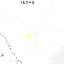
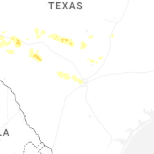
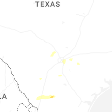

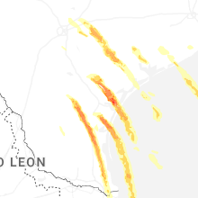

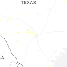
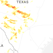
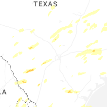


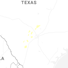


Connect with Interactive Hail Maps