

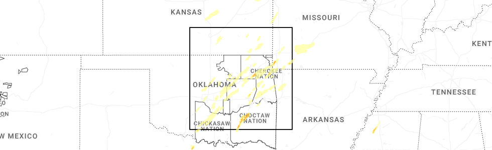
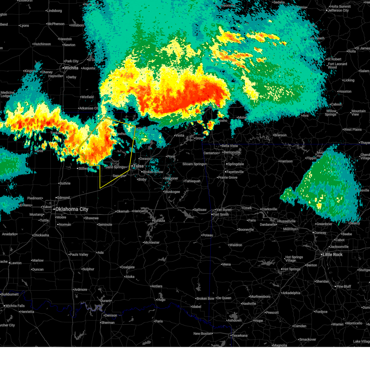
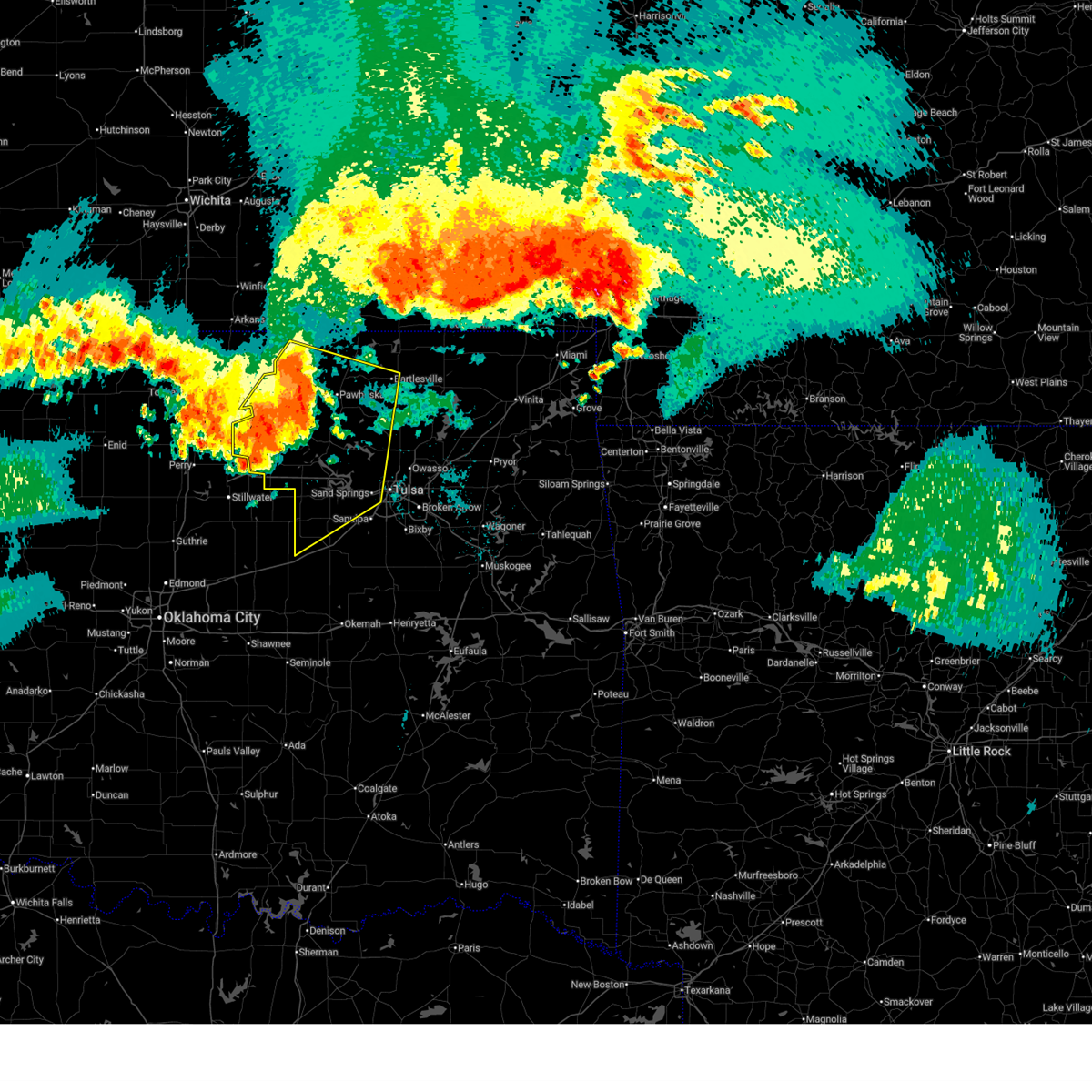
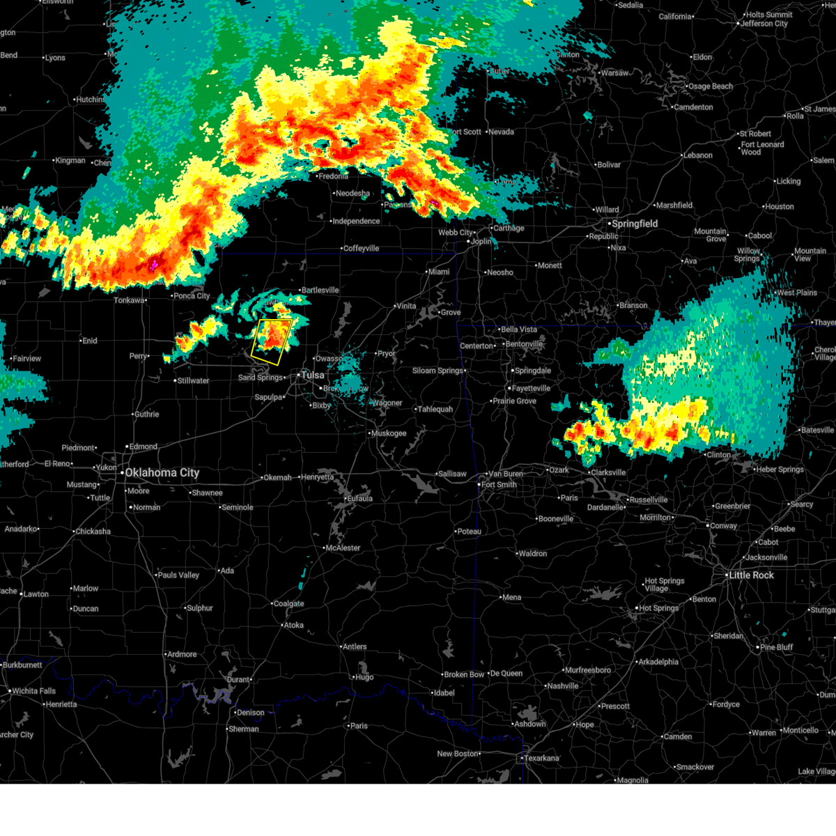
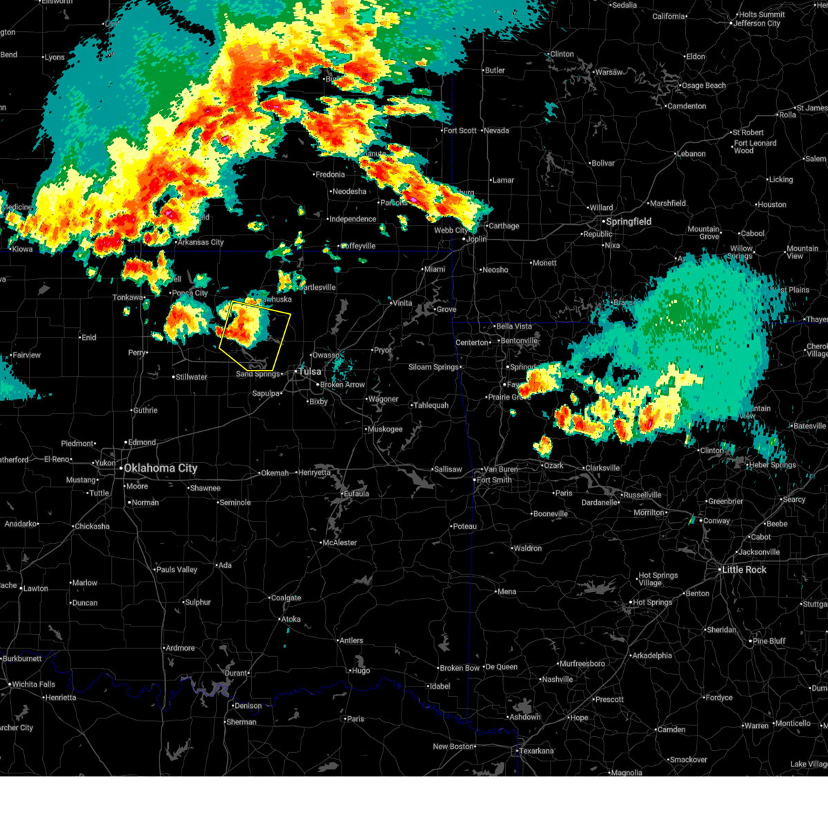
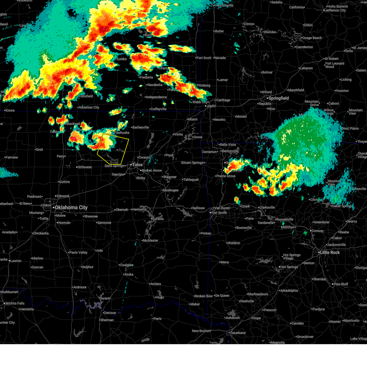
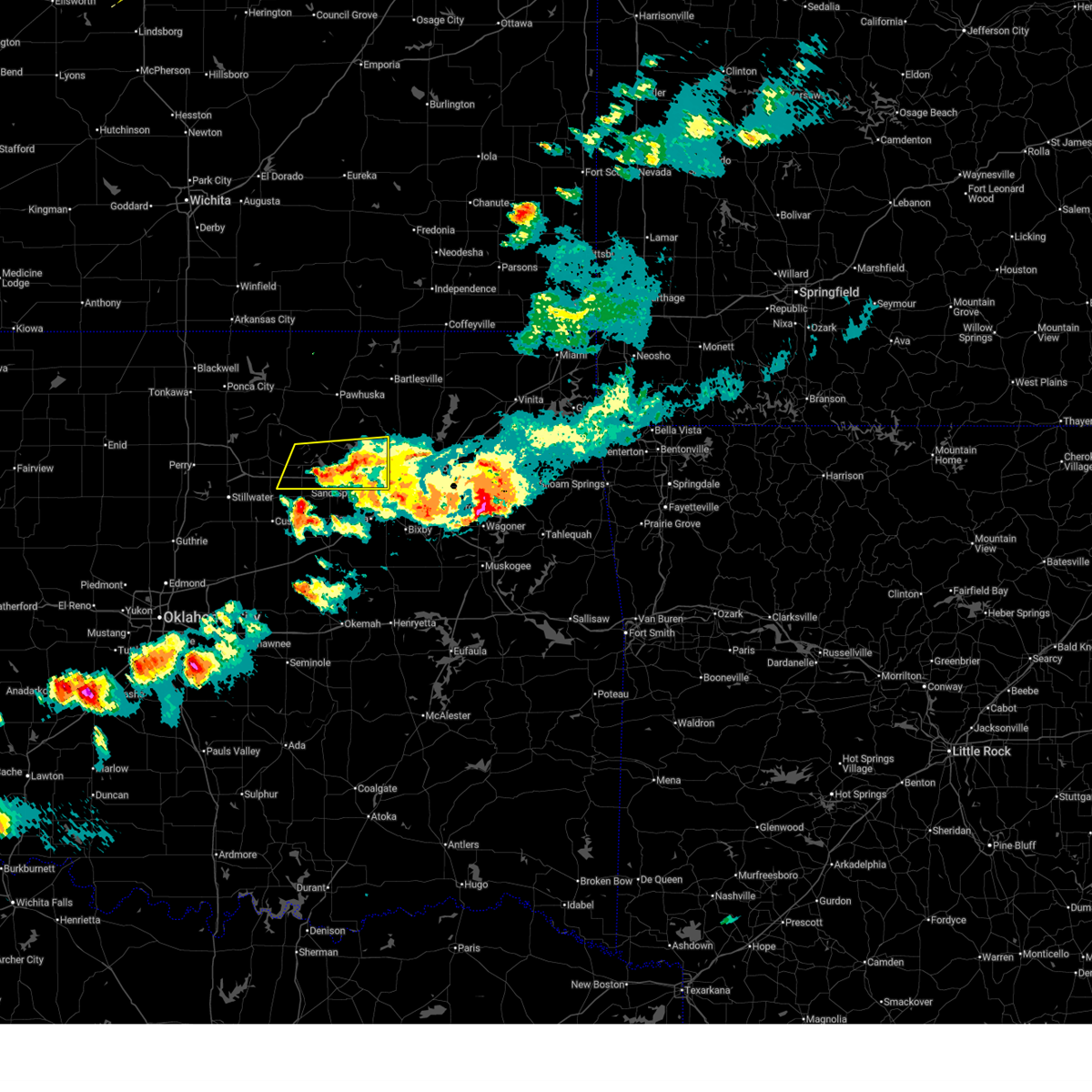
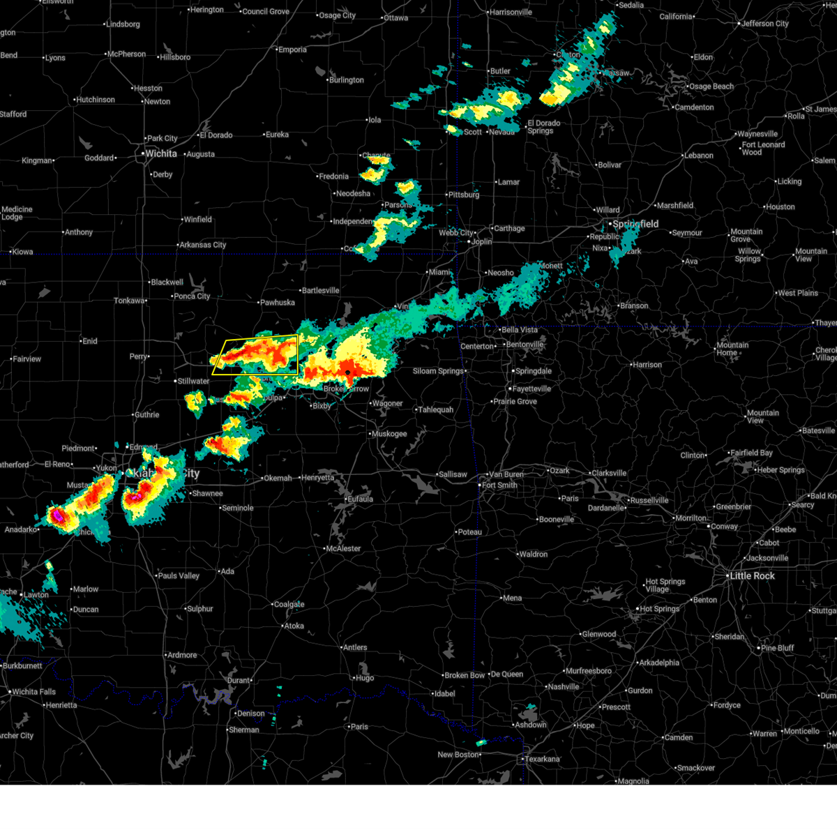
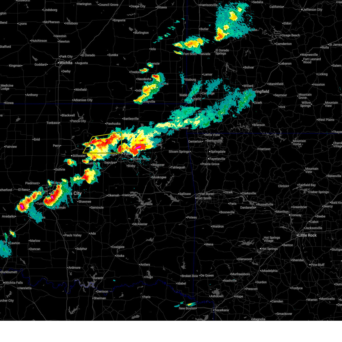
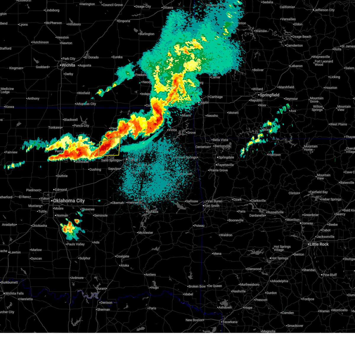
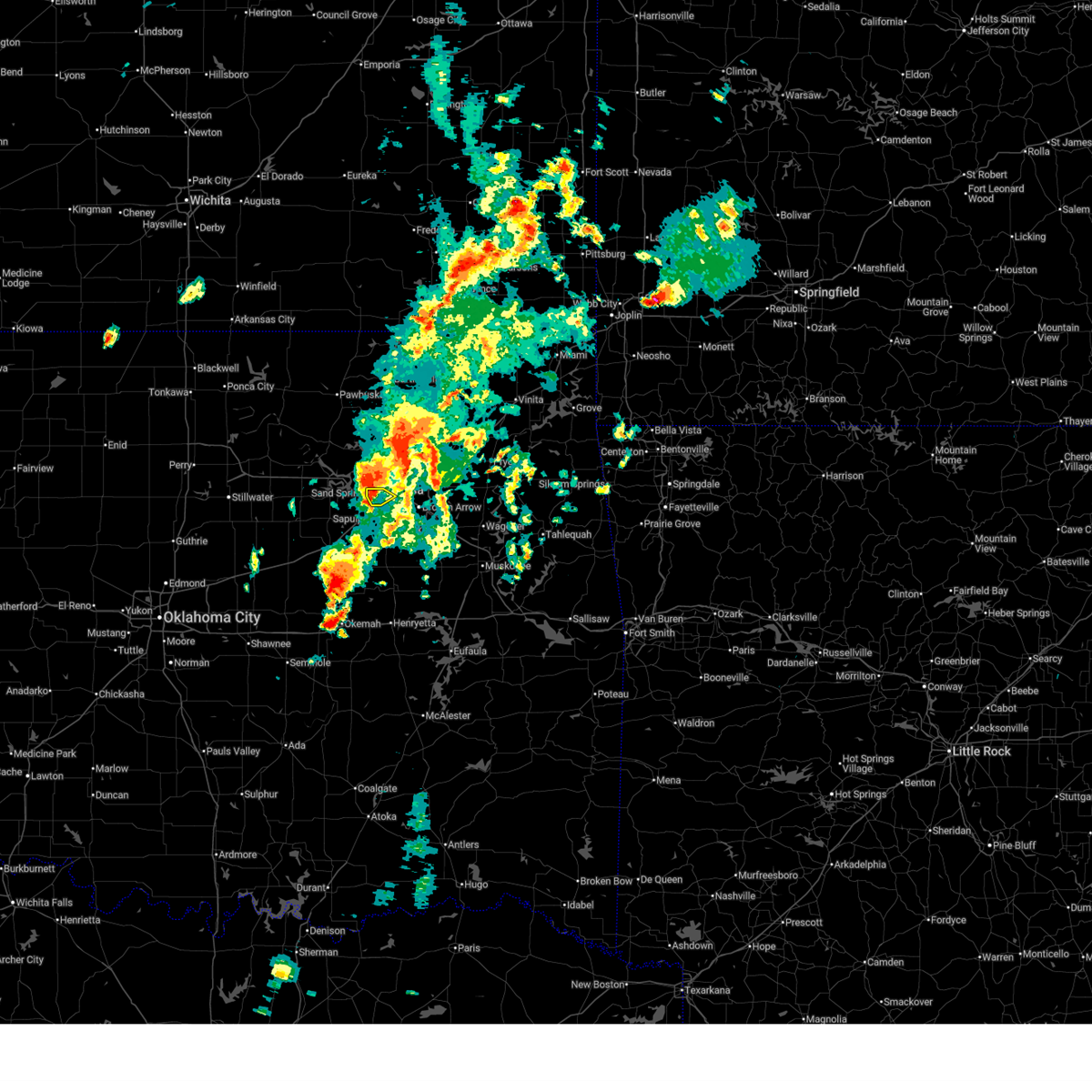
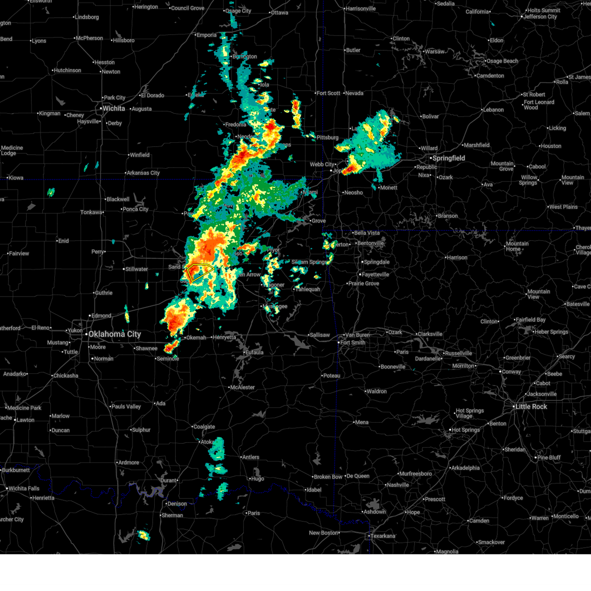
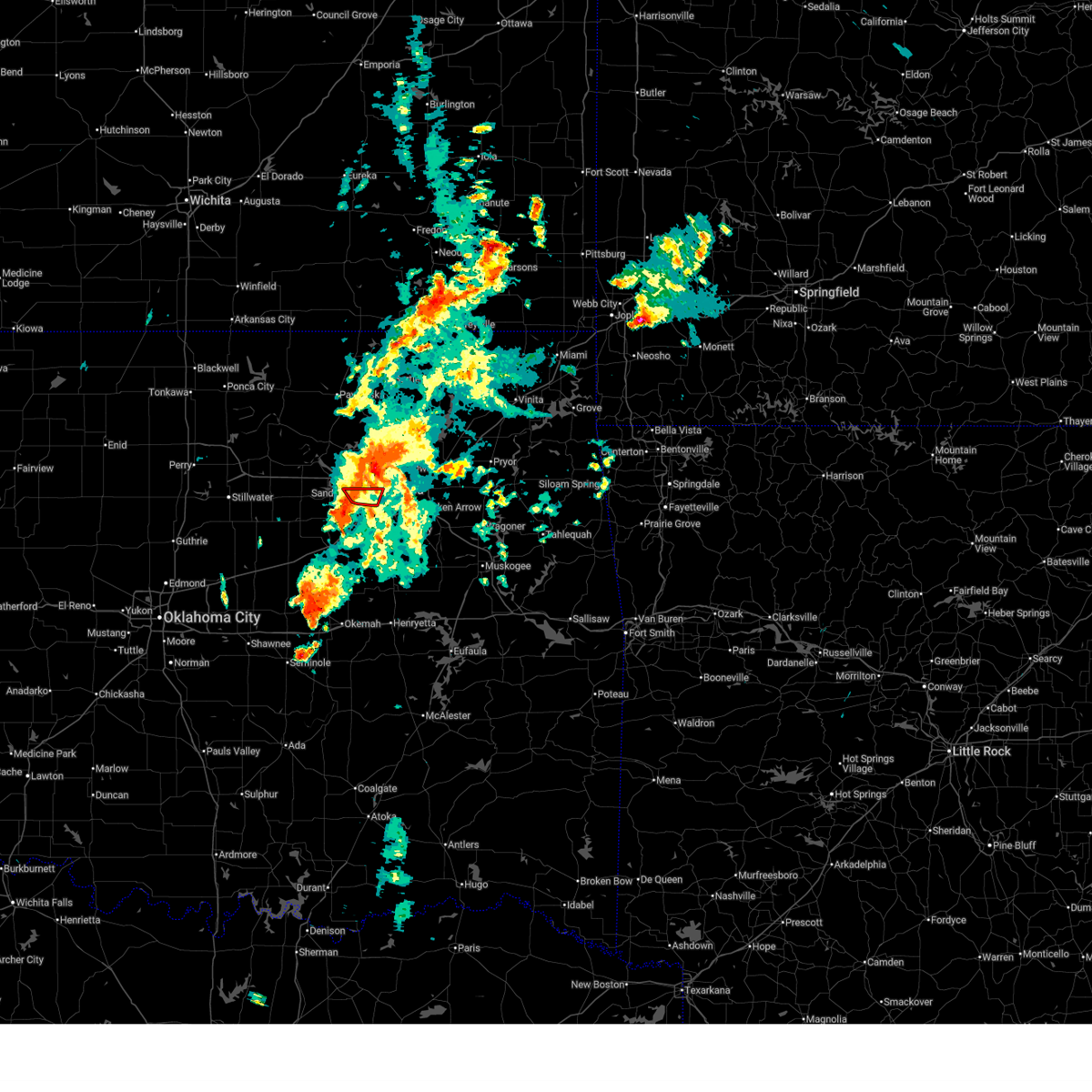
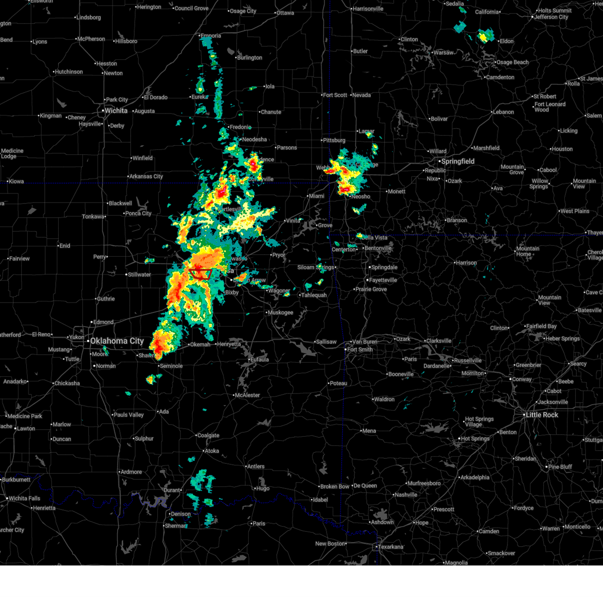
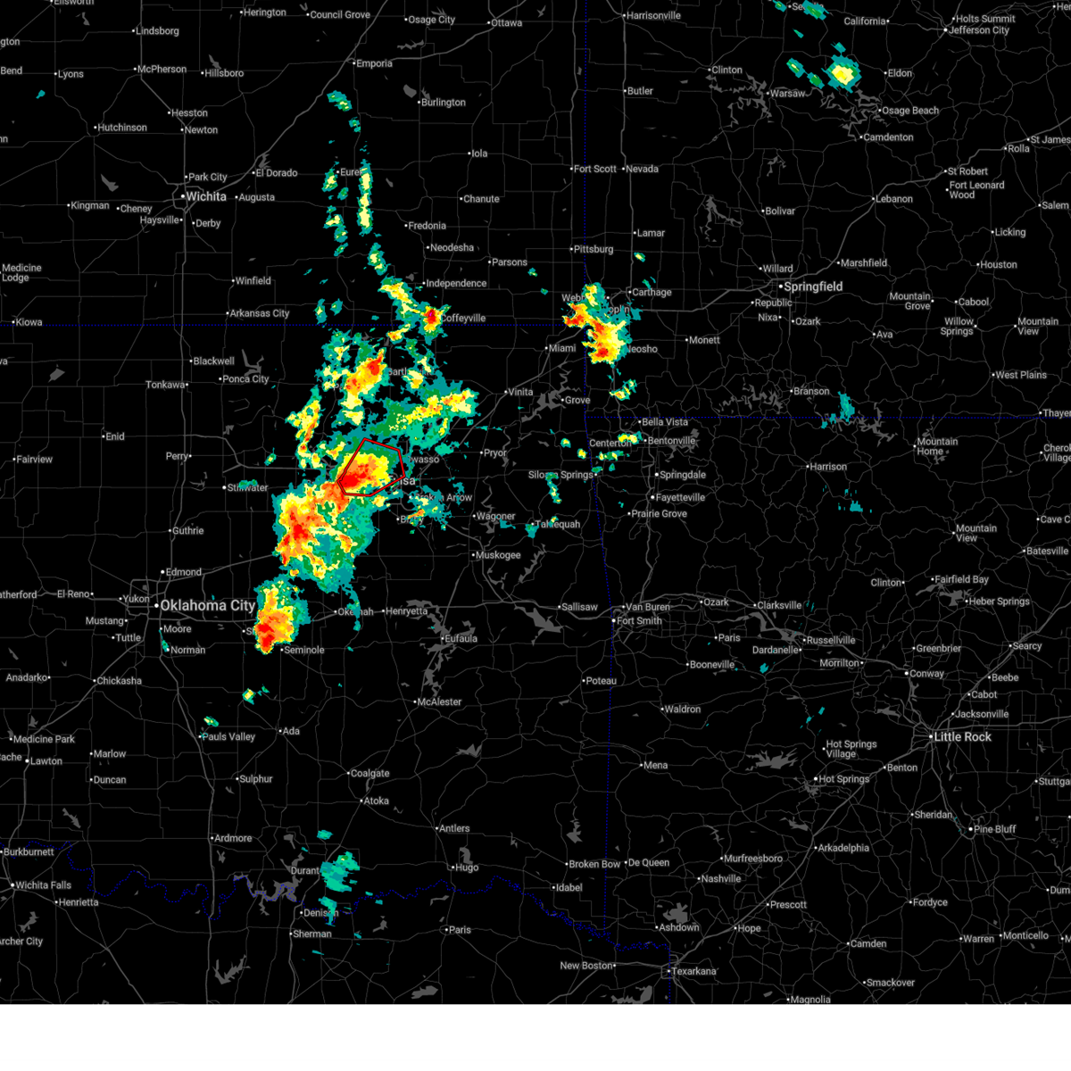
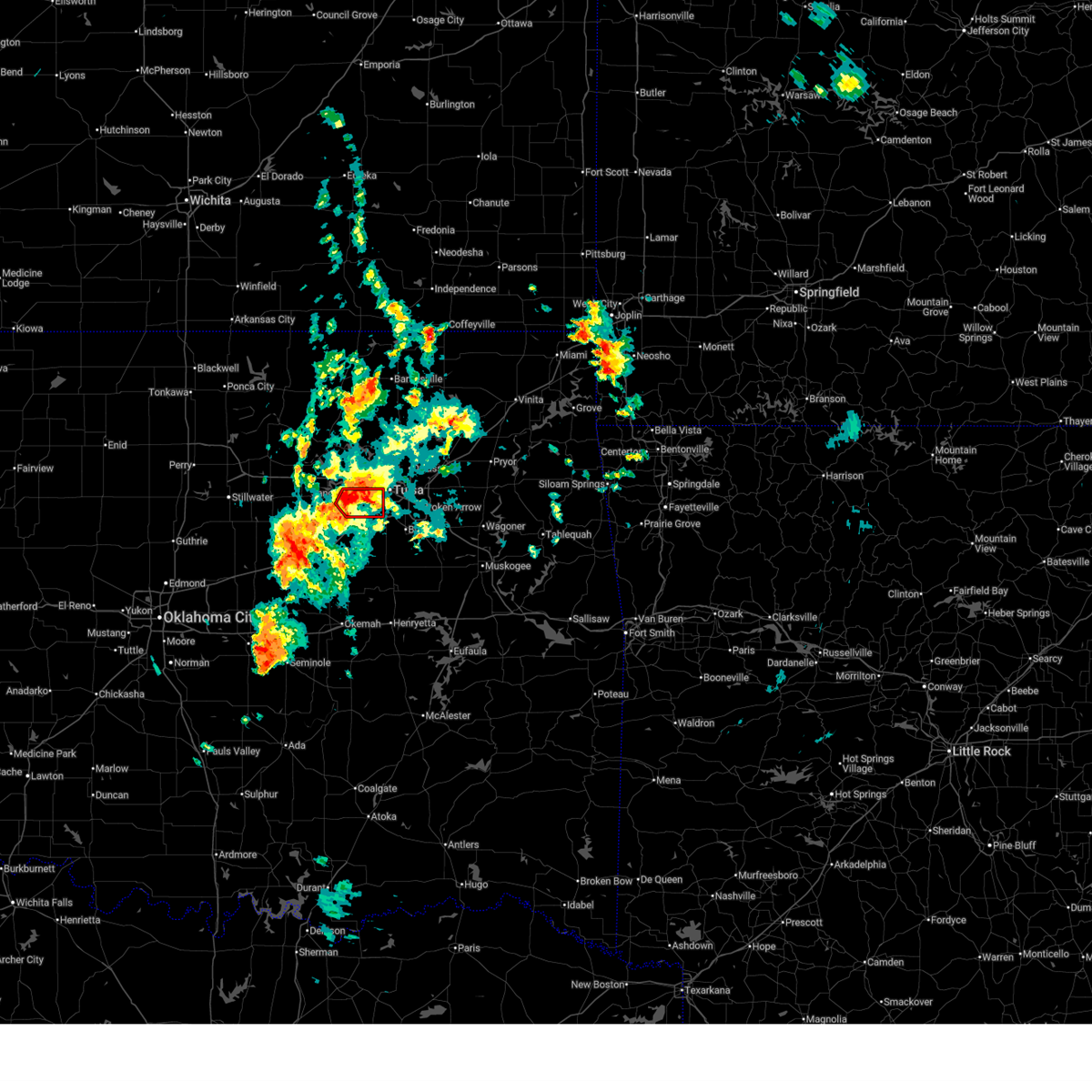
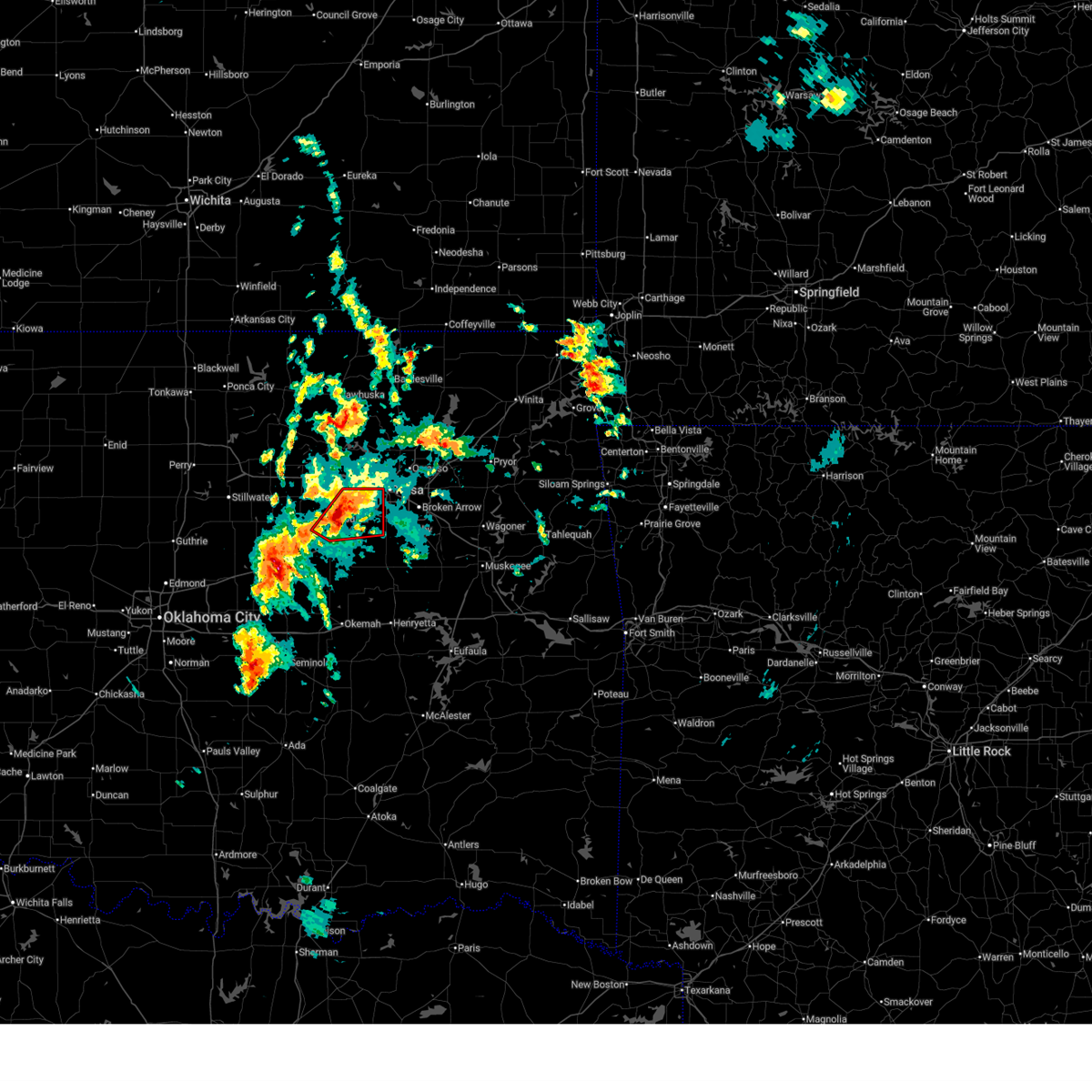
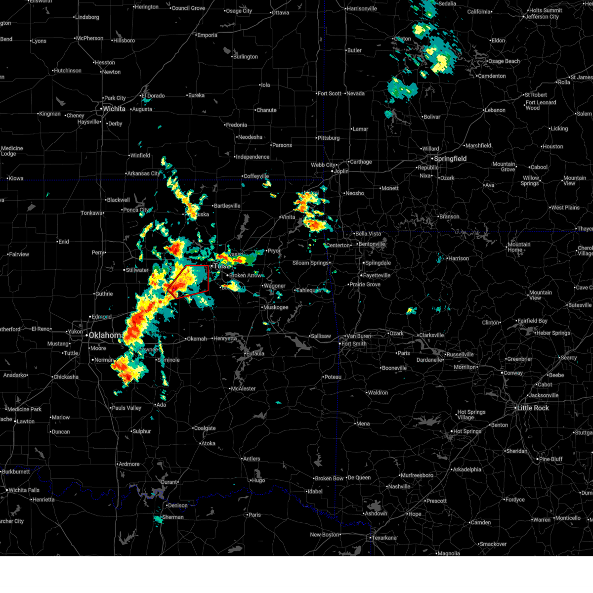
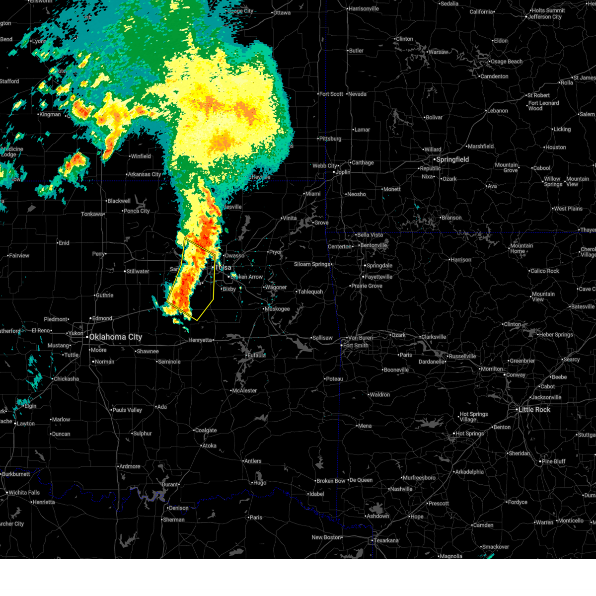
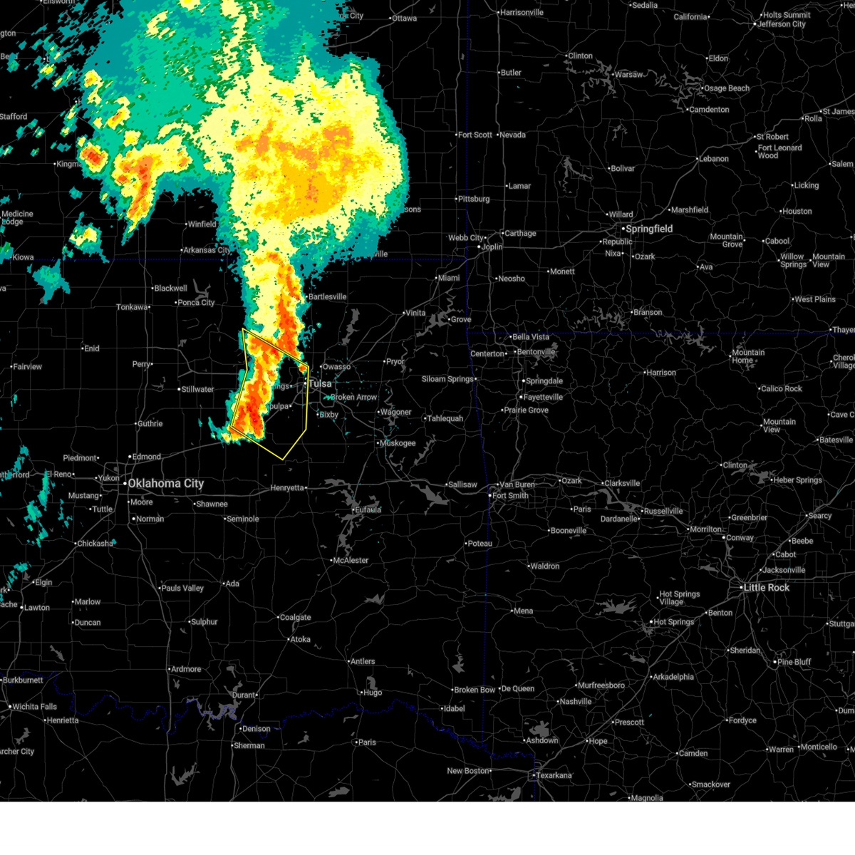
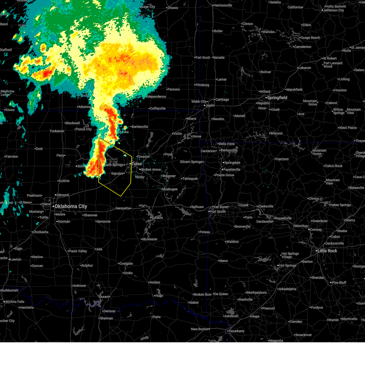
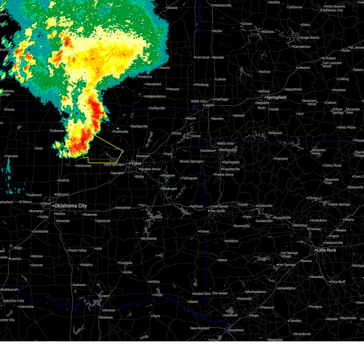
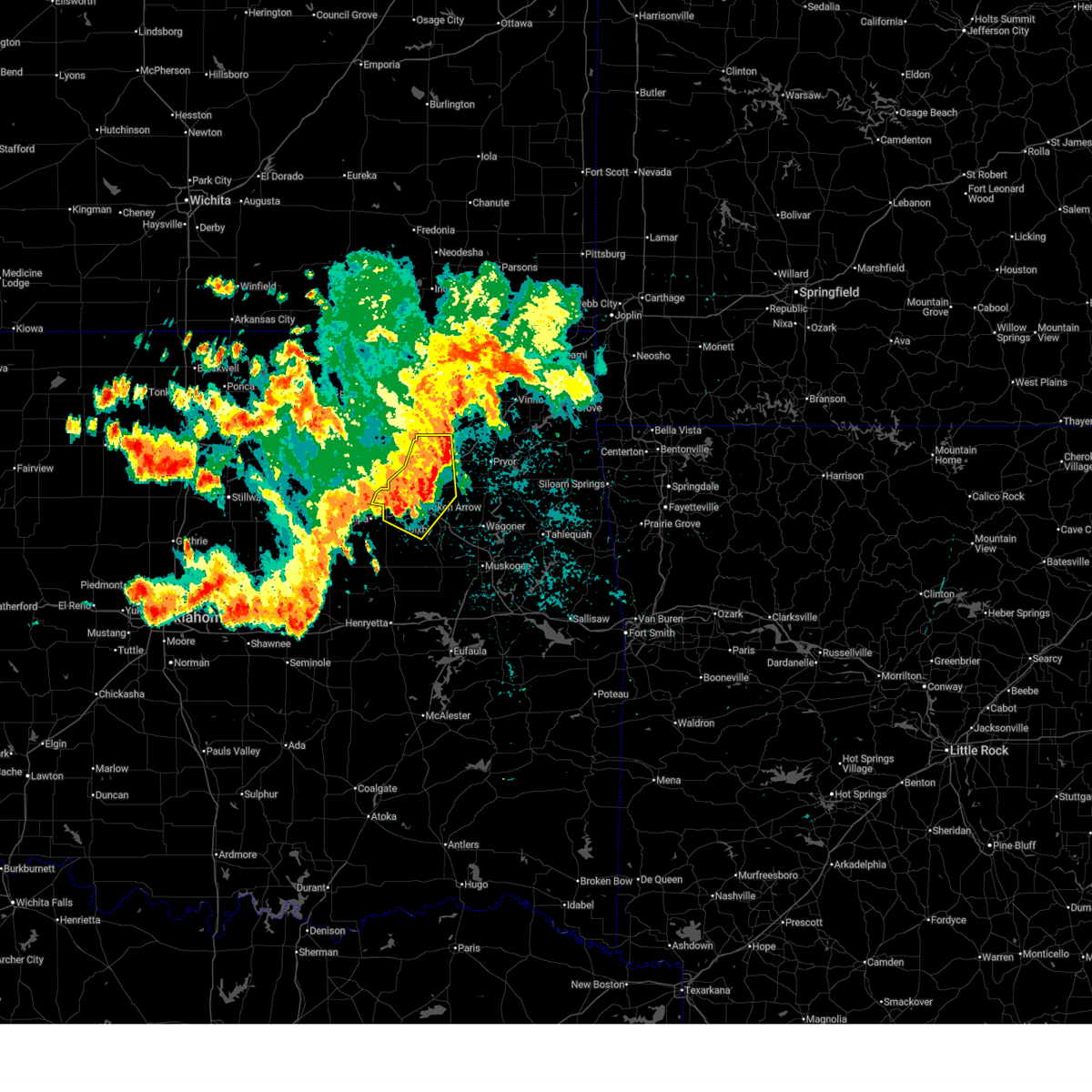
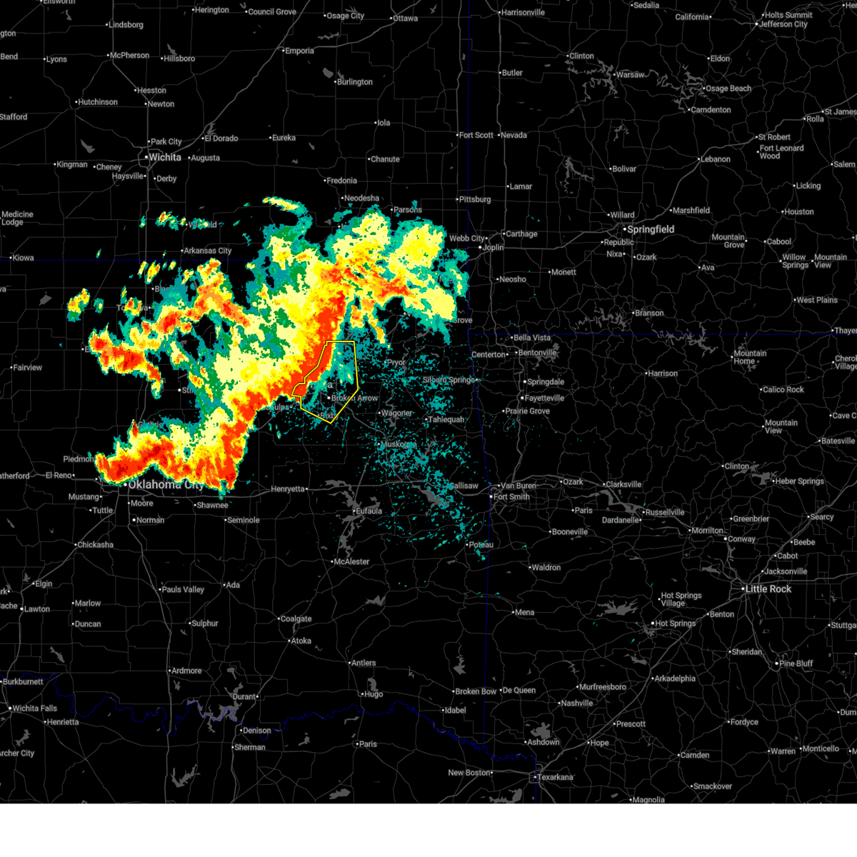
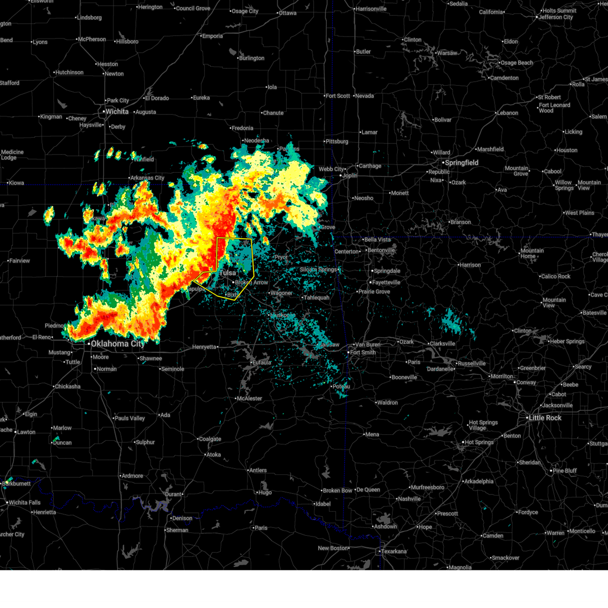
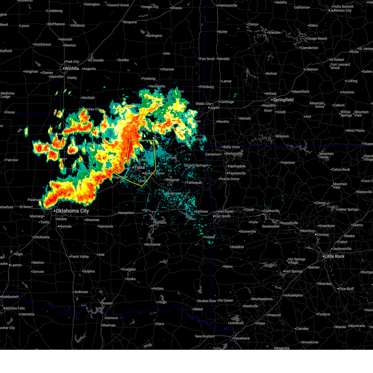
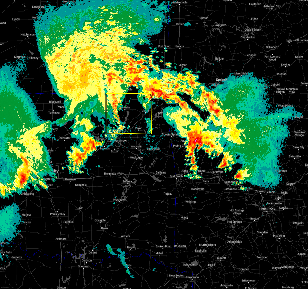
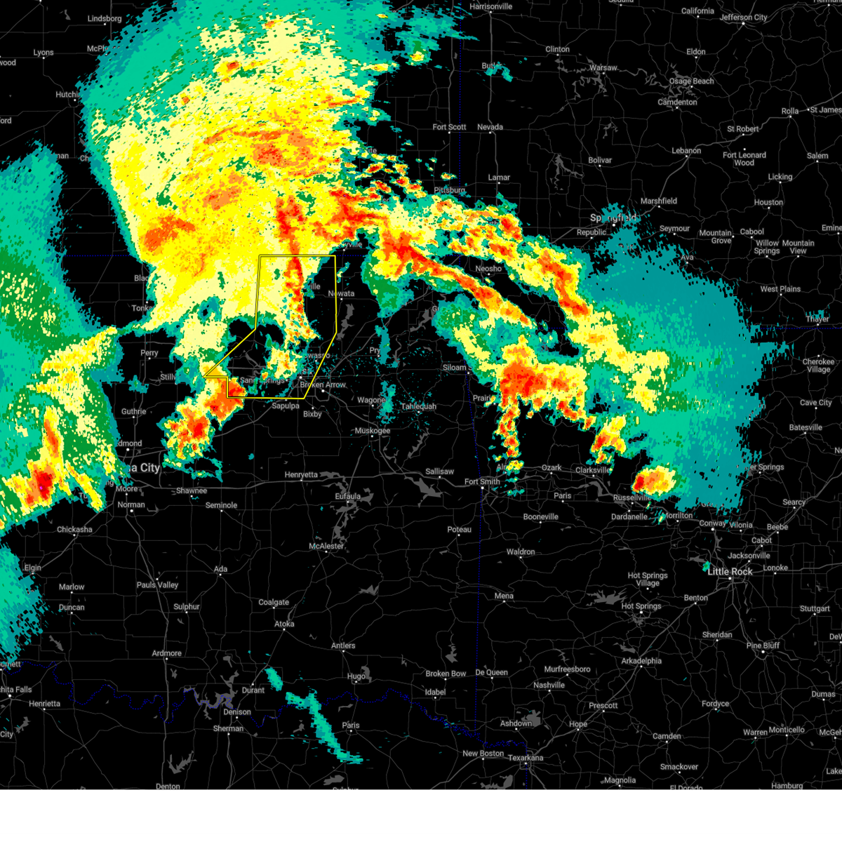
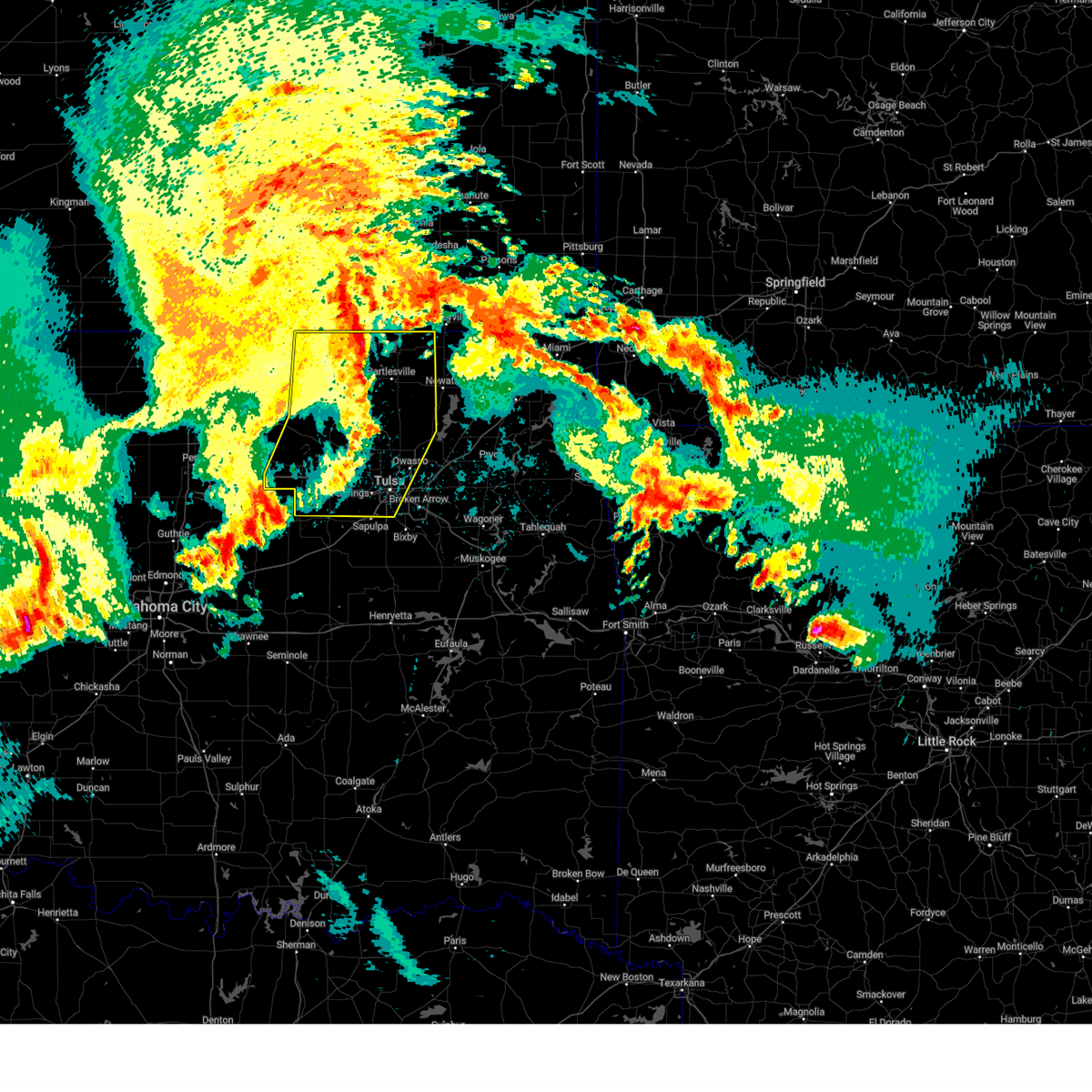
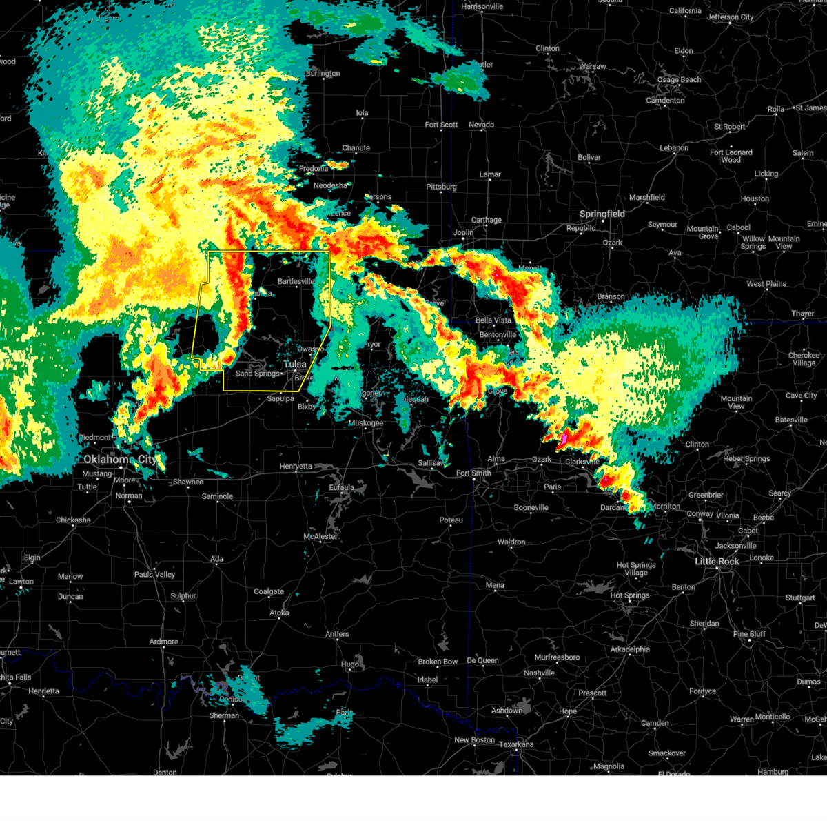
Hail Map for Sand Springs, OK
The Sand Springs, OK area has had 23 reports of on-the-ground hail by trained spotters, and has been under severe weather warnings 52 times during the past 12 months. Doppler radar has detected hail at or near Sand Springs, OK on 135 occasions, including 9 occasions during the past year.
| Name: | Sand Springs, OK |
| Where Located: | 8.6 miles W of Tulsa, OK |
| Map: | Google Map for Sand Springs, OK |
| Population: | 18906 |
| Housing Units: | 7995 |
| More Info: | Search Google for Sand Springs, OK |
1
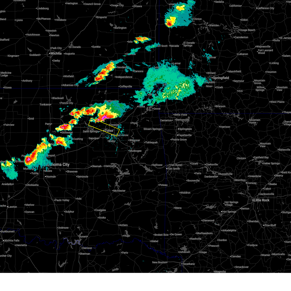
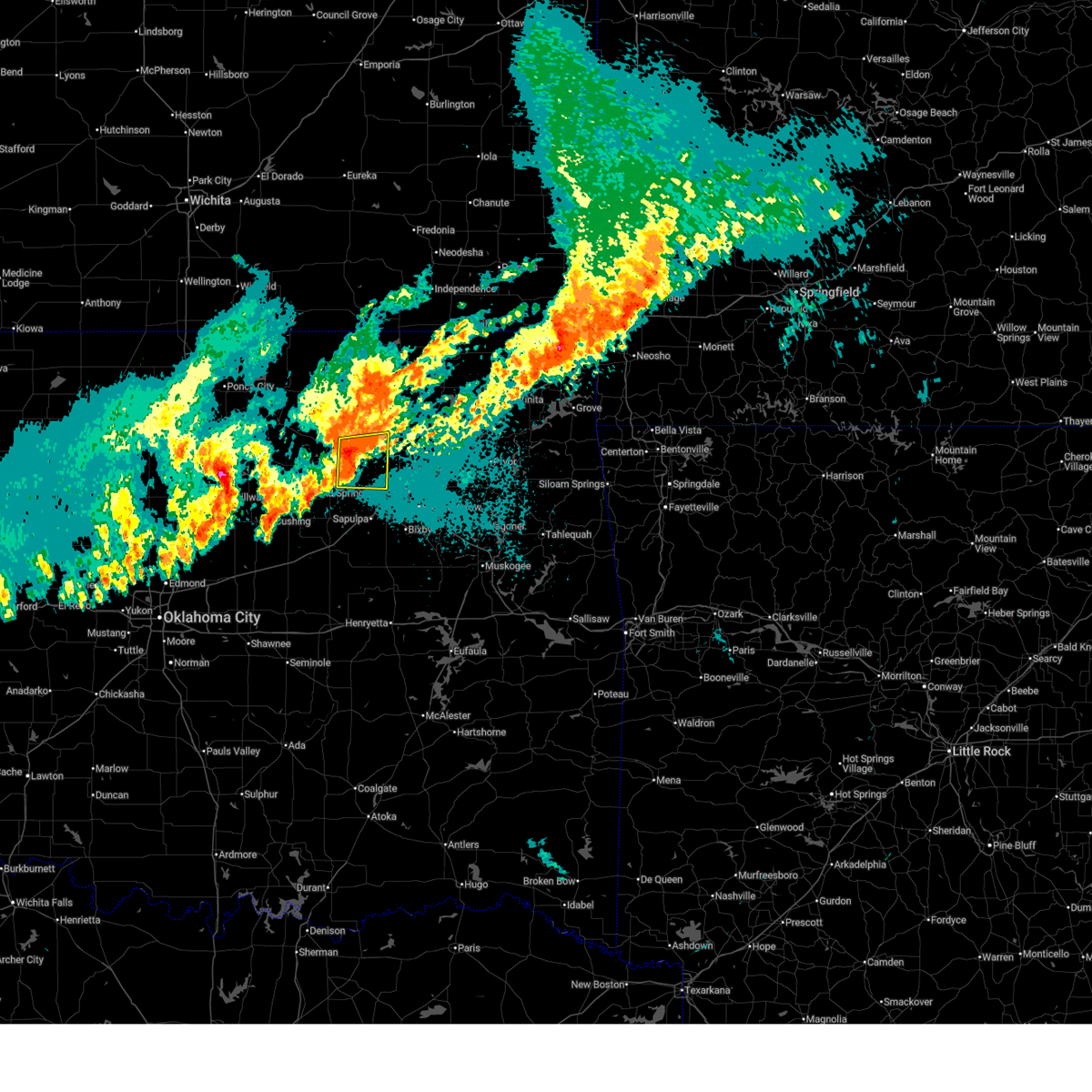
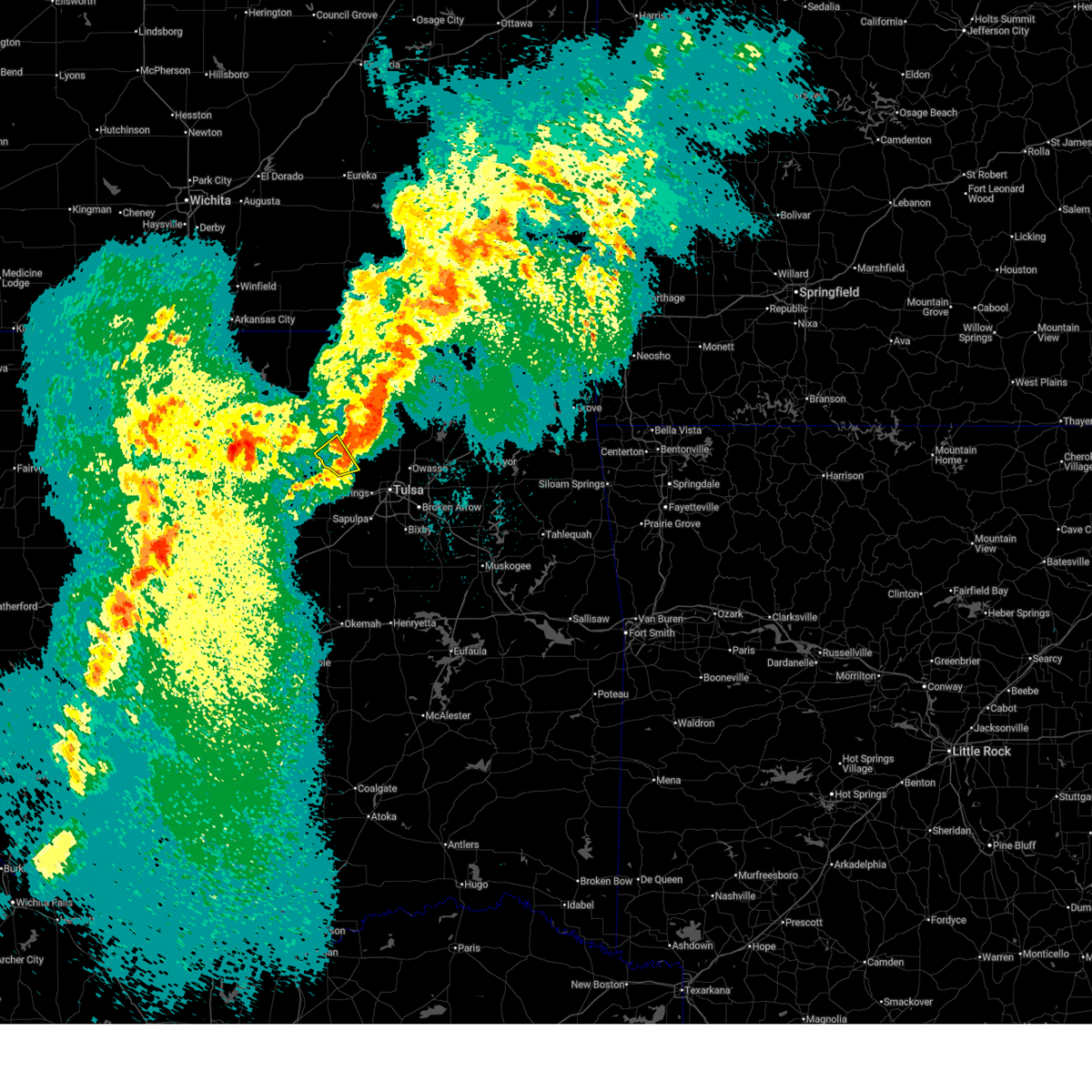
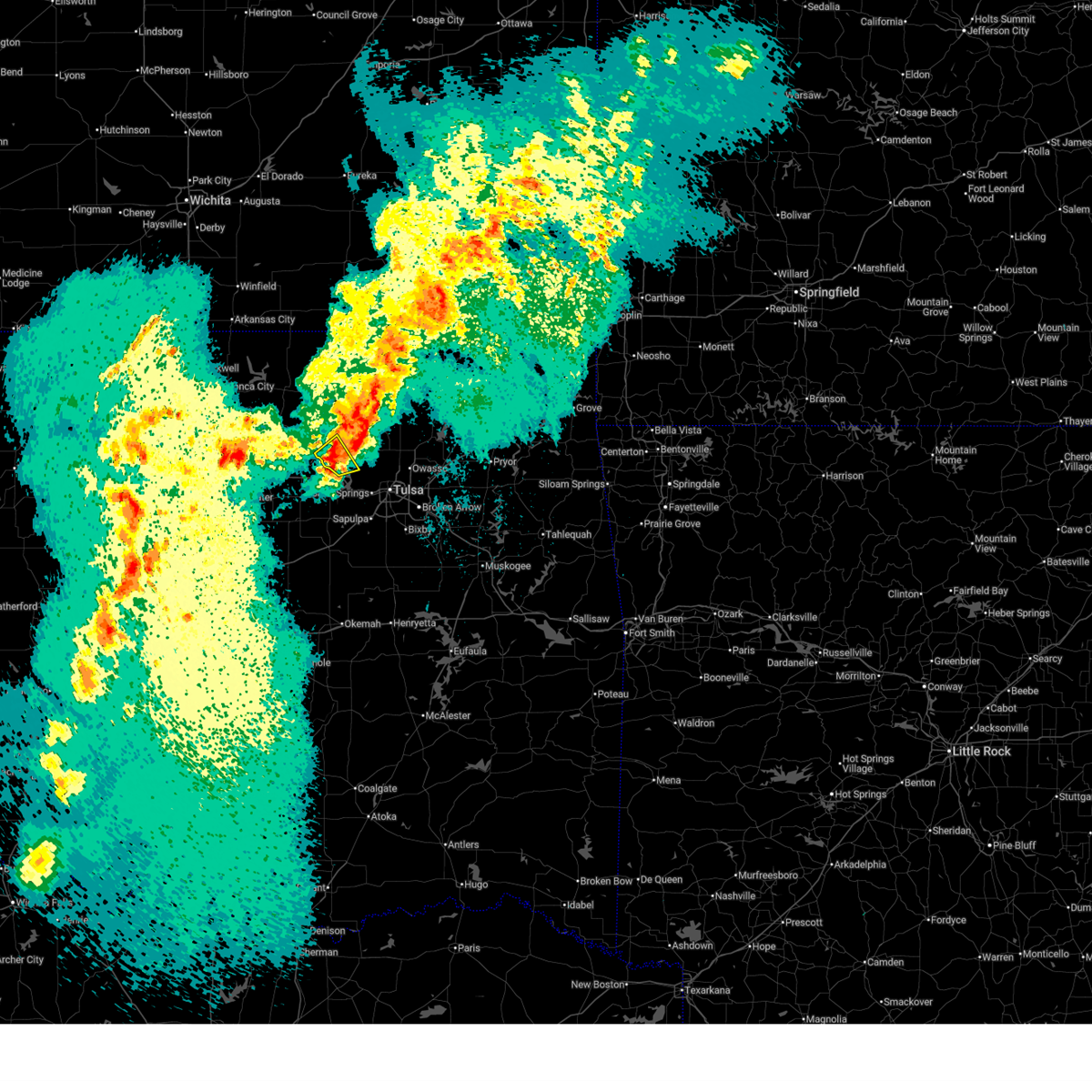
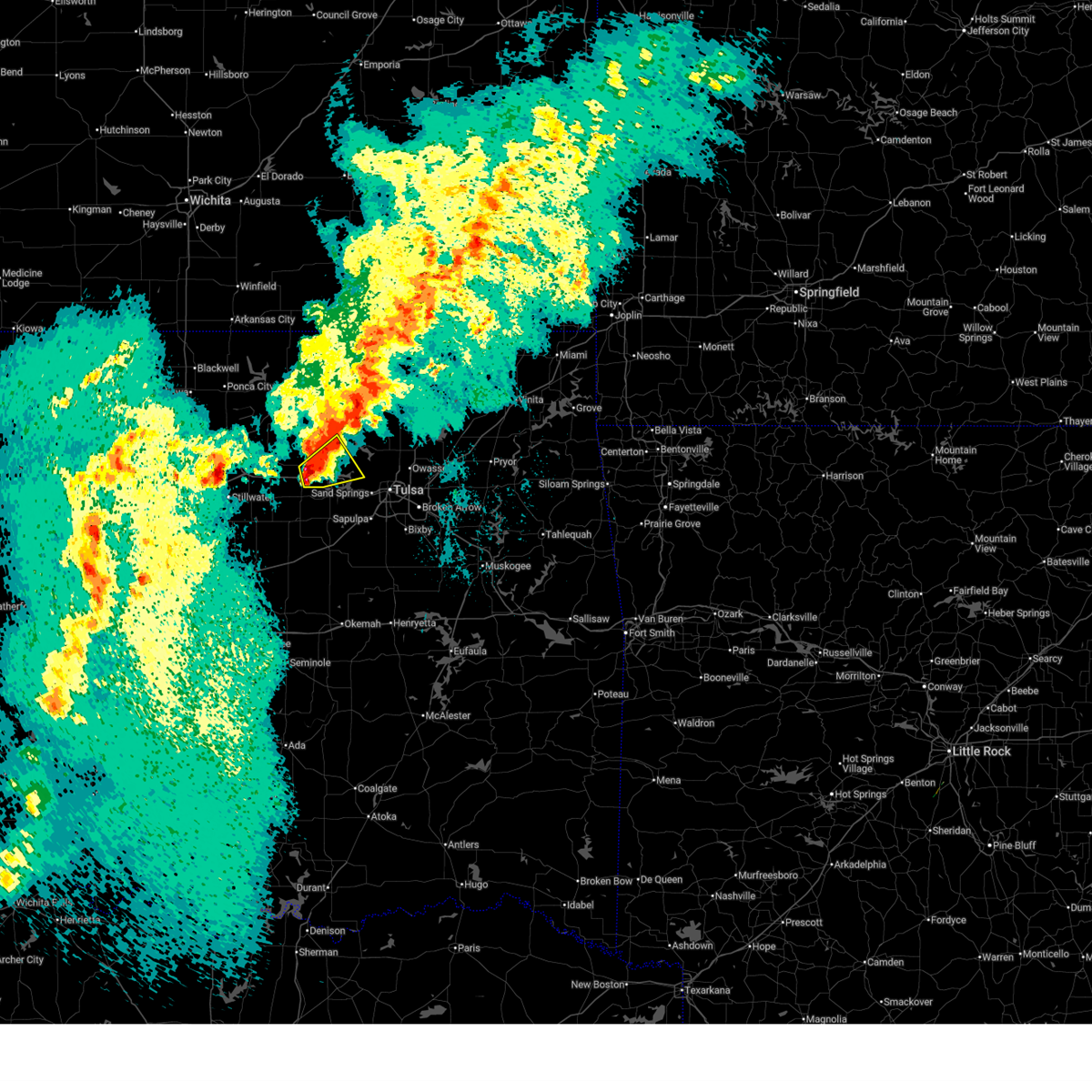
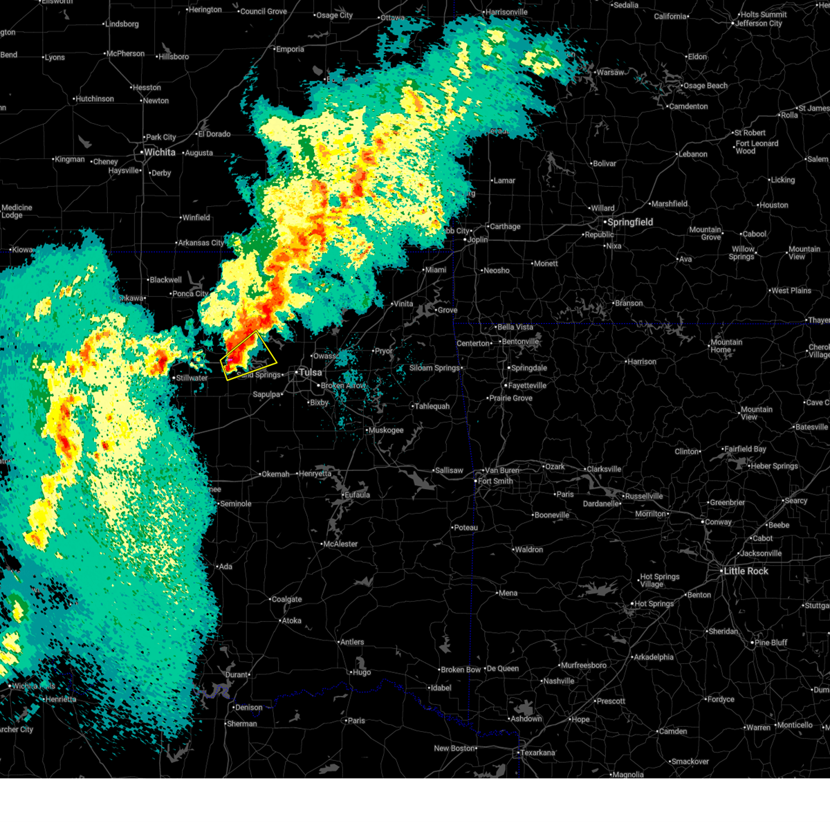
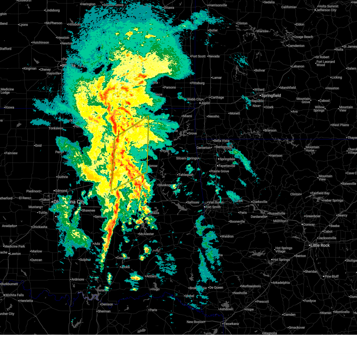
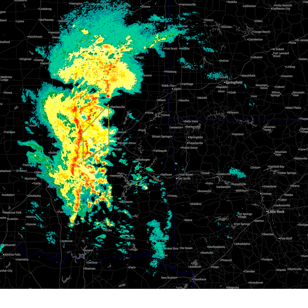
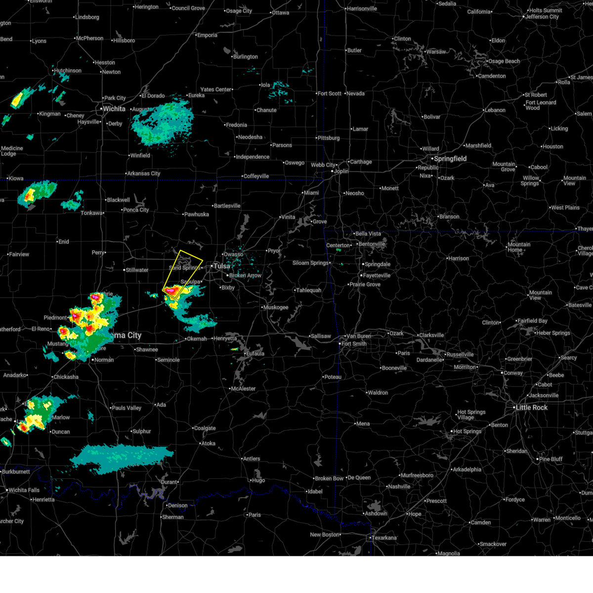
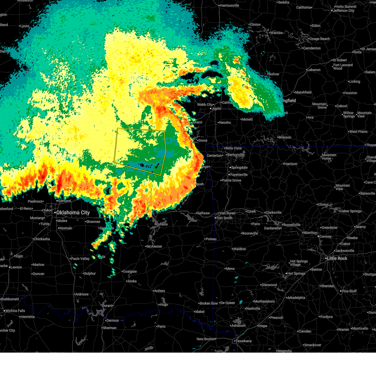
The Top Recent Hail Date for Sand Springs, OK is Friday, March 6, 2026 (15th out of 135)
Hail and Wind Damage Spotted near Sand Springs, OK
| Date / Time | Report Details |
|---|---|
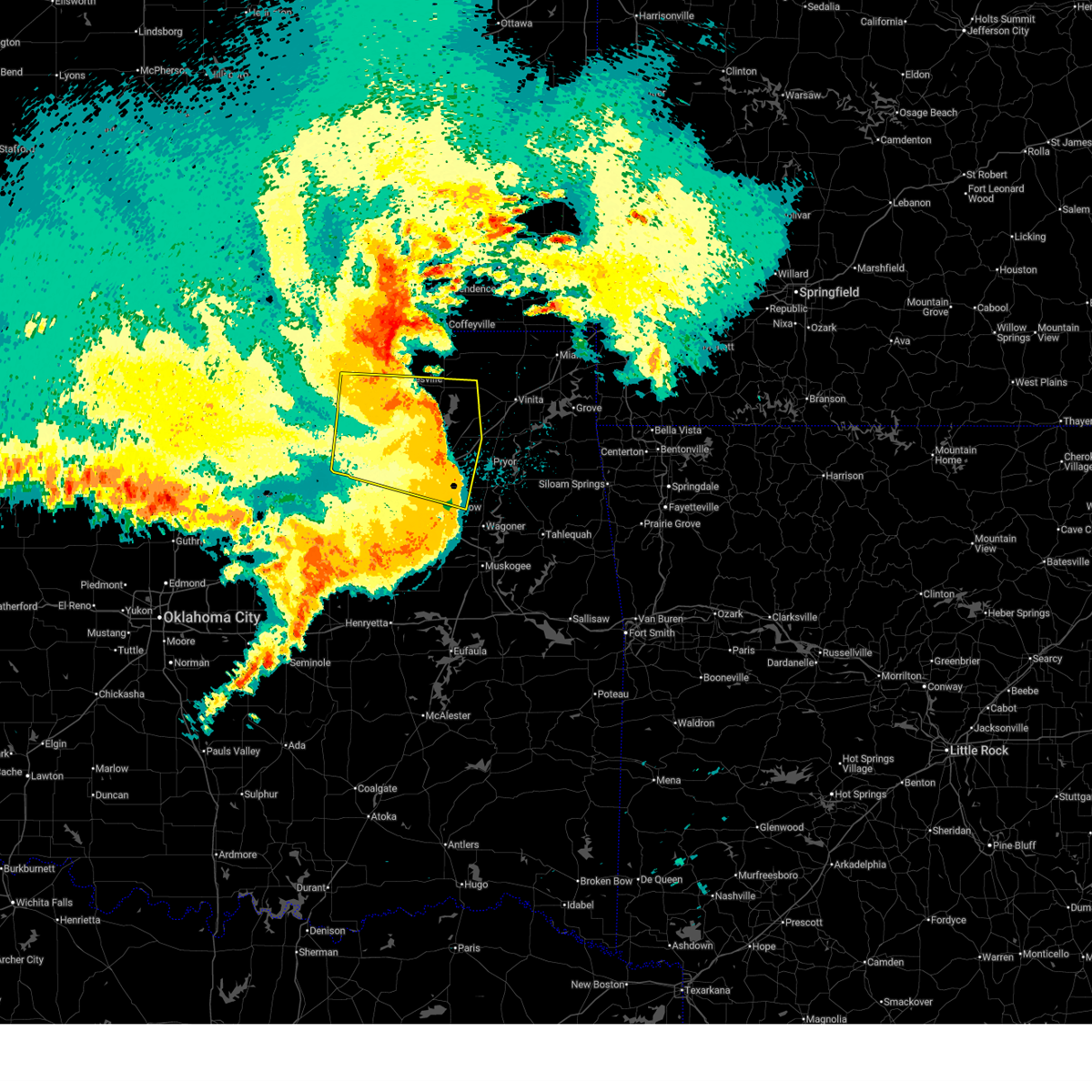
| 6/13/2026 11:20 PM CDT |
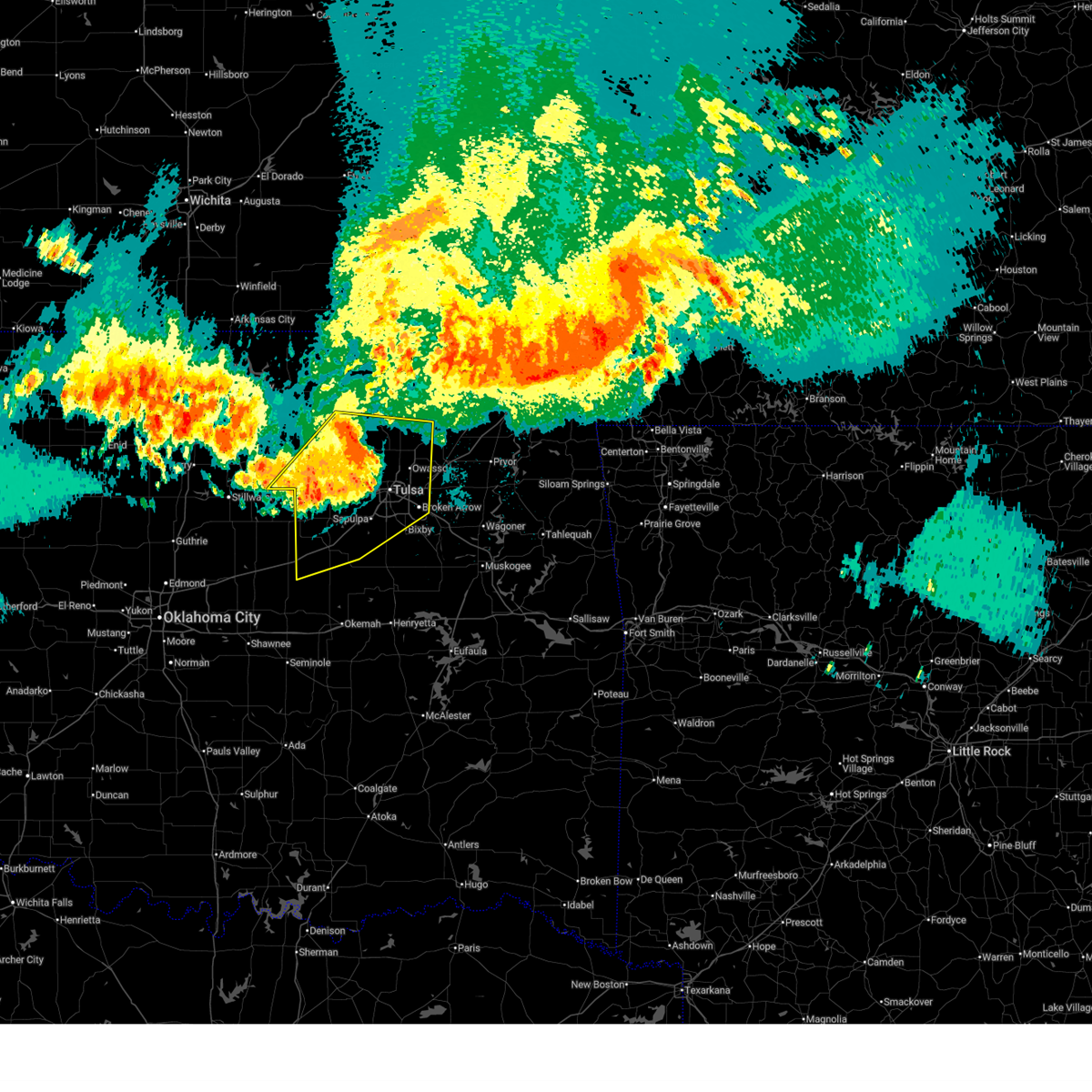 At 1120 pm cdt, severe thunderstorms were located along a line extending from 5 miles south of barnsdall to 4 miles northeast of sand springs to 2 miles northeast of drumright, moving southeast at 45 mph (radar indicated). Hazards include 70 mph wind gusts. Expect considerable tree damage. damage is likely to mobile homes, roofs, and outbuildings. Locations in or near the path include, tulsa, broken arrow, sand springs, bristow, owasso, bixby, sapulpa, jenks, glenpool, skiatook, catoosa, collinsville, hominy, cleveland, mannford, drumright, kiefer, sperry, mounds, kellyville, this includes interstate 44 between mile markers 178 and 238. At 1120 pm cdt, severe thunderstorms were located along a line extending from 5 miles south of barnsdall to 4 miles northeast of sand springs to 2 miles northeast of drumright, moving southeast at 45 mph (radar indicated). Hazards include 70 mph wind gusts. Expect considerable tree damage. damage is likely to mobile homes, roofs, and outbuildings. Locations in or near the path include, tulsa, broken arrow, sand springs, bristow, owasso, bixby, sapulpa, jenks, glenpool, skiatook, catoosa, collinsville, hominy, cleveland, mannford, drumright, kiefer, sperry, mounds, kellyville, this includes interstate 44 between mile markers 178 and 238.
|
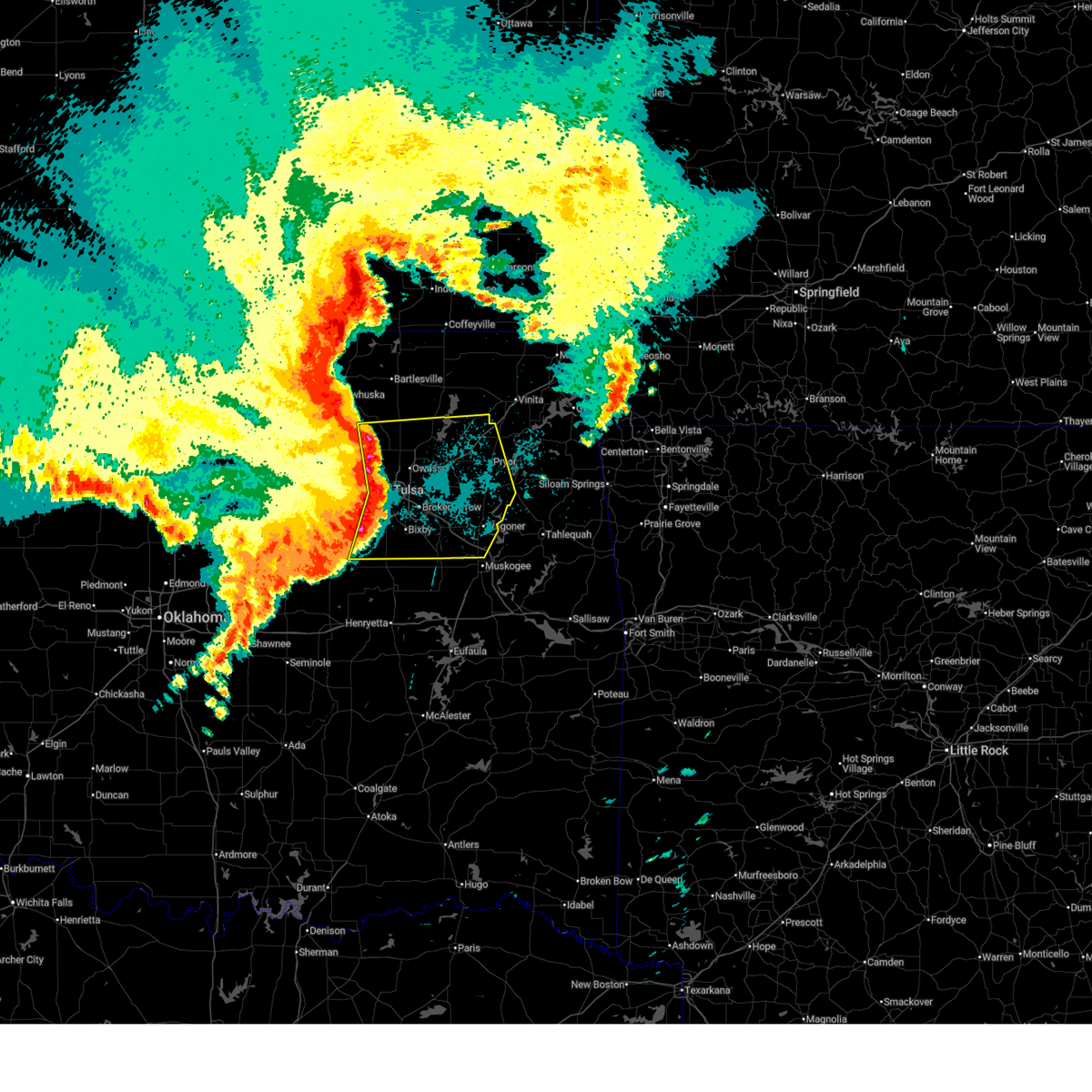
| 6/13/2026 11:09 PM CDT |
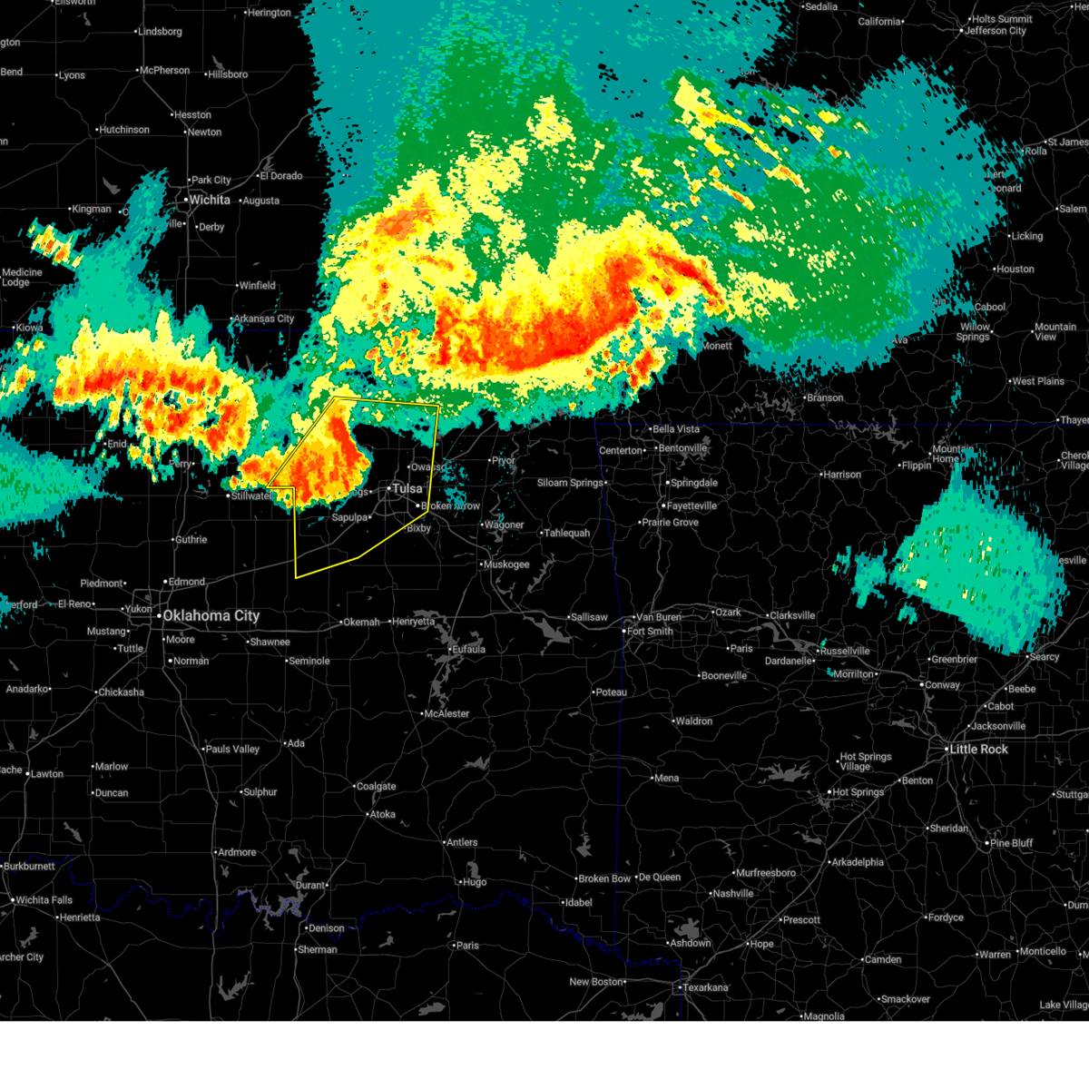 Svrtsa the national weather service in tulsa has issued a * severe thunderstorm warning for, western rogers county in northeastern oklahoma, southeastern osage county in northeastern oklahoma, creek county in northeastern oklahoma, southern washington county in northeastern oklahoma, northwestern wagoner county in northeastern oklahoma, northwestern okmulgee county in northeastern oklahoma, southeastern pawnee county in northeastern oklahoma, tulsa county in northeastern oklahoma, * until midnight cdt. * at 1109 pm cdt, severe thunderstorms were located along a line extending from 3 miles east of wynona to 4 miles east of walnut creek state park to 3 miles northwest of drumright, moving southeast at 45 mph (radar indicated). Hazards include 60 mph wind gusts. Expect damage to roofs, siding, and trees. Locations in or near the path include, tulsa, broken arrow, sand springs, bristow, owasso, bixby, sapulpa, jenks, glenpool, skiatook, catoosa, collinsville, hominy, cleveland, mannford, drumright, kiefer, barnsdall, sperry, mounds, this includes interstate 44 between mile markers 178 and 239. Svrtsa the national weather service in tulsa has issued a * severe thunderstorm warning for, western rogers county in northeastern oklahoma, southeastern osage county in northeastern oklahoma, creek county in northeastern oklahoma, southern washington county in northeastern oklahoma, northwestern wagoner county in northeastern oklahoma, northwestern okmulgee county in northeastern oklahoma, southeastern pawnee county in northeastern oklahoma, tulsa county in northeastern oklahoma, * until midnight cdt. * at 1109 pm cdt, severe thunderstorms were located along a line extending from 3 miles east of wynona to 4 miles east of walnut creek state park to 3 miles northwest of drumright, moving southeast at 45 mph (radar indicated). Hazards include 60 mph wind gusts. Expect damage to roofs, siding, and trees. Locations in or near the path include, tulsa, broken arrow, sand springs, bristow, owasso, bixby, sapulpa, jenks, glenpool, skiatook, catoosa, collinsville, hominy, cleveland, mannford, drumright, kiefer, barnsdall, sperry, mounds, this includes interstate 44 between mile markers 178 and 239.
|
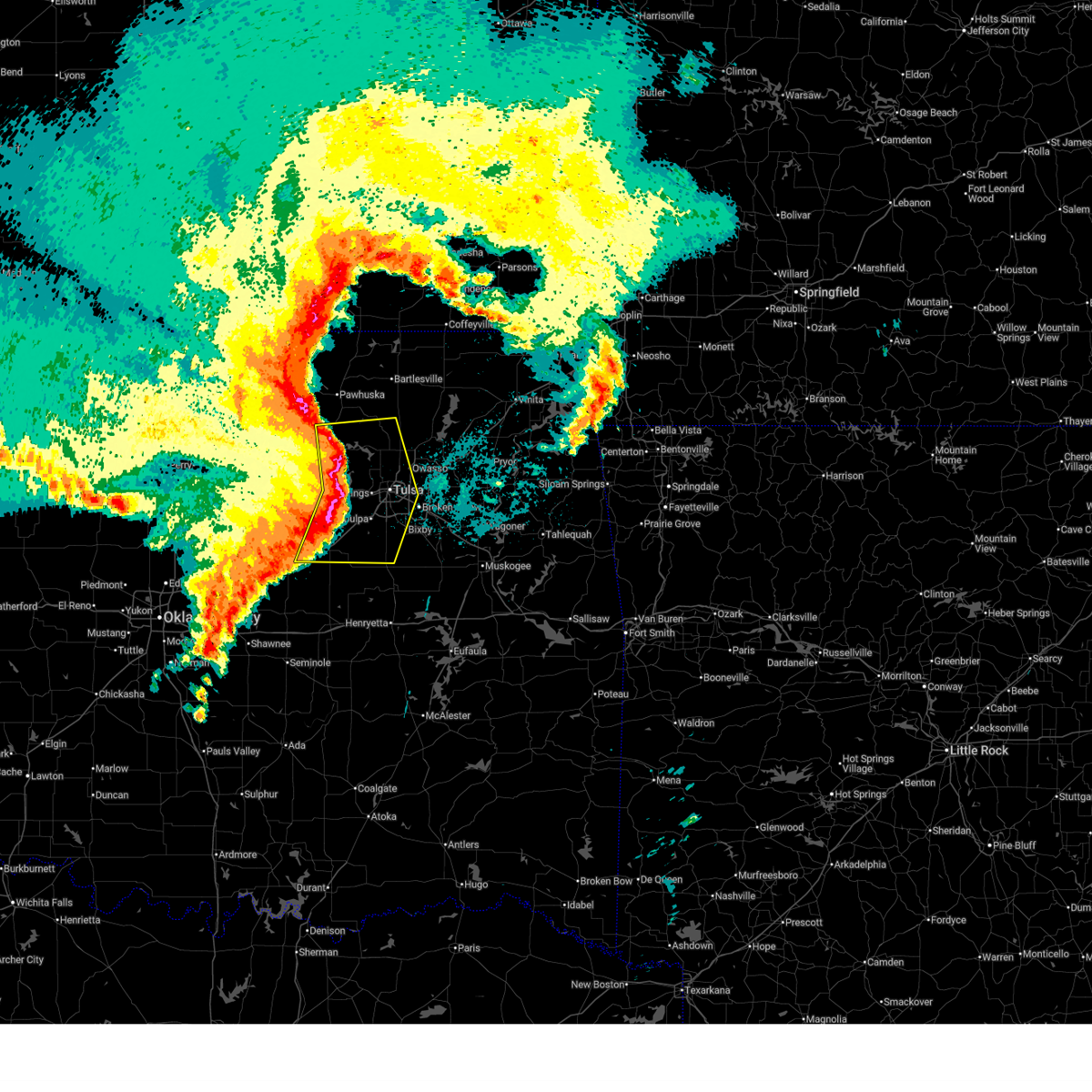
| 6/13/2026 11:04 PM CDT |
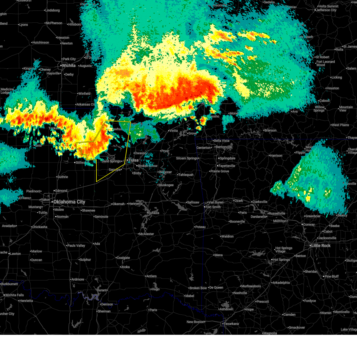 At 1104 pm cdt, severe thunderstorms were located along a line extending from 3 miles east of pawhuska to 3 miles east of walnut creek state park to 3 miles southwest of oilton, moving southeast at 40 mph (radar indicated). Hazards include 60 mph wind gusts. Expect damage to roofs, siding, and trees. Locations in or near the path include, tulsa, bartlesville, sand springs, pawhuska, pawnee, skiatook, hominy, cleveland, mannford, drumright, barnsdall, oilton, wynona, ochelata, jennings, avant, westport, osage, hallett, blackburn,. At 1104 pm cdt, severe thunderstorms were located along a line extending from 3 miles east of pawhuska to 3 miles east of walnut creek state park to 3 miles southwest of oilton, moving southeast at 40 mph (radar indicated). Hazards include 60 mph wind gusts. Expect damage to roofs, siding, and trees. Locations in or near the path include, tulsa, bartlesville, sand springs, pawhuska, pawnee, skiatook, hominy, cleveland, mannford, drumright, barnsdall, oilton, wynona, ochelata, jennings, avant, westport, osage, hallett, blackburn,.
|
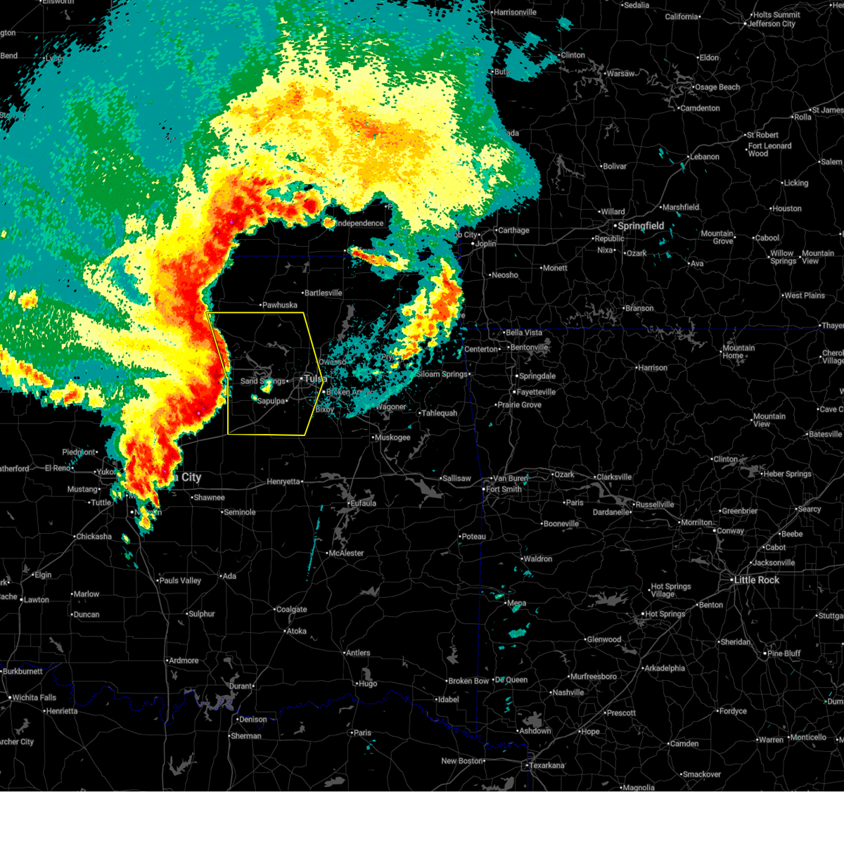
| 6/13/2026 10:50 PM CDT |
 At 1050 pm cdt, severe thunderstorms were located along a line extending from 2 miles west of sunset lake to 3 miles southeast of hominy to 4 miles northwest of quay, moving southeast at 45 mph (radar indicated). Hazards include 70 mph wind gusts. Expect considerable tree damage. damage is likely to mobile homes, roofs, and outbuildings. Locations in or near the path include, tulsa, bartlesville, sand springs, pawhuska, pawnee, skiatook, hominy, cleveland, mannford, drumright, fairfax, barnsdall, oilton, shidler, wynona, ochelata, jennings, ralston, avant, westport,. At 1050 pm cdt, severe thunderstorms were located along a line extending from 2 miles west of sunset lake to 3 miles southeast of hominy to 4 miles northwest of quay, moving southeast at 45 mph (radar indicated). Hazards include 70 mph wind gusts. Expect considerable tree damage. damage is likely to mobile homes, roofs, and outbuildings. Locations in or near the path include, tulsa, bartlesville, sand springs, pawhuska, pawnee, skiatook, hominy, cleveland, mannford, drumright, fairfax, barnsdall, oilton, shidler, wynona, ochelata, jennings, ralston, avant, westport,.
|
| 6/13/2026 10:37 PM CDT |
 Svrtsa the national weather service in tulsa has issued a * severe thunderstorm warning for, osage county in northeastern oklahoma, northern creek county in northeastern oklahoma, southern washington county in northeastern oklahoma, pawnee county in northeastern oklahoma, northwestern tulsa county in northeastern oklahoma, * until 1115 pm cdt. * at 1036 pm cdt, severe thunderstorms were located along a line extending from pearsonia to 4 miles northeast of blackburn to near glencoe, moving southeast at 50 mph (radar indicated). Hazards include 70 mph wind gusts and penny size hail. Expect considerable tree damage. damage is likely to mobile homes, roofs, and outbuildings. Locations in or near the path include, tulsa, bartlesville, sand springs, pawhuska, pawnee, skiatook, hominy, cleveland, mannford, drumright, fairfax, barnsdall, oilton, shidler, wynona, ochelata, jennings, ralston, avant, westport,. Svrtsa the national weather service in tulsa has issued a * severe thunderstorm warning for, osage county in northeastern oklahoma, northern creek county in northeastern oklahoma, southern washington county in northeastern oklahoma, pawnee county in northeastern oklahoma, northwestern tulsa county in northeastern oklahoma, * until 1115 pm cdt. * at 1036 pm cdt, severe thunderstorms were located along a line extending from pearsonia to 4 miles northeast of blackburn to near glencoe, moving southeast at 50 mph (radar indicated). Hazards include 70 mph wind gusts and penny size hail. Expect considerable tree damage. damage is likely to mobile homes, roofs, and outbuildings. Locations in or near the path include, tulsa, bartlesville, sand springs, pawhuska, pawnee, skiatook, hominy, cleveland, mannford, drumright, fairfax, barnsdall, oilton, shidler, wynona, ochelata, jennings, ralston, avant, westport,.
|
| 6/13/2026 9:41 PM CDT |
 At 941 pm cdt, a severe thunderstorm was located 9 miles northeast of walnut creek state park, moving east at 30 mph (radar indicated). Hazards include 60 mph wind gusts and penny size hail. Expect damage to roofs, siding, and trees. Locations in or near the path include, avant, wolco,. At 941 pm cdt, a severe thunderstorm was located 9 miles northeast of walnut creek state park, moving east at 30 mph (radar indicated). Hazards include 60 mph wind gusts and penny size hail. Expect damage to roofs, siding, and trees. Locations in or near the path include, avant, wolco,.
|
| 6/13/2026 9:12 PM CDT |
 At 911 pm cdt, severe thunderstorms were located along a line extending from 2 miles west of wynona to 4 miles southeast of hominy to 4 miles northwest of cleveland, moving east at 20 mph (radar indicated). Hazards include 60 mph wind gusts and quarter size hail. Hail damage to vehicles is expected. expect wind damage to roofs, siding, and trees. Locations in or near the path include, hominy, cleveland, barnsdall, wynona, avant, westport, osage, blackburn, walnut creek state park, pershing, wolco,. At 911 pm cdt, severe thunderstorms were located along a line extending from 2 miles west of wynona to 4 miles southeast of hominy to 4 miles northwest of cleveland, moving east at 20 mph (radar indicated). Hazards include 60 mph wind gusts and quarter size hail. Hail damage to vehicles is expected. expect wind damage to roofs, siding, and trees. Locations in or near the path include, hominy, cleveland, barnsdall, wynona, avant, westport, osage, blackburn, walnut creek state park, pershing, wolco,.
|
| 6/13/2026 8:58 PM CDT |
 Svrtsa the national weather service in tulsa has issued a * severe thunderstorm warning for, southeastern osage county in northeastern oklahoma, southeastern pawnee county in northeastern oklahoma, * until 1000 pm cdt. * at 858 pm cdt, severe thunderstorms were located along a line extending from 9 miles west of wynona to 3 miles west of hominy to 2 miles west of blackburn, moving east at 15 mph (radar indicated). Hazards include 70 mph wind gusts and half dollar size hail. Hail damage to vehicles is expected. expect considerable tree damage. wind damage is also likely to mobile homes, roofs, and outbuildings. Locations in or near the path include, hominy, cleveland, barnsdall, wynona, avant, westport, osage, blackburn, walnut creek state park, pershing, wolco,. Svrtsa the national weather service in tulsa has issued a * severe thunderstorm warning for, southeastern osage county in northeastern oklahoma, southeastern pawnee county in northeastern oklahoma, * until 1000 pm cdt. * at 858 pm cdt, severe thunderstorms were located along a line extending from 9 miles west of wynona to 3 miles west of hominy to 2 miles west of blackburn, moving east at 15 mph (radar indicated). Hazards include 70 mph wind gusts and half dollar size hail. Hail damage to vehicles is expected. expect considerable tree damage. wind damage is also likely to mobile homes, roofs, and outbuildings. Locations in or near the path include, hominy, cleveland, barnsdall, wynona, avant, westport, osage, blackburn, walnut creek state park, pershing, wolco,.
|
| 5/8/2026 6:50 PM CDT |
 The storms which prompted the warning have weakened below severe limits, and no longer pose an immediate threat to life or property. therefore, the warning will be allowed to expire. however, gusty winds to 40 mph are still possible with these thunderstorms. a severe thunderstorm watch remains in effect until 1000 pm cdt for northeastern oklahoma. The storms which prompted the warning have weakened below severe limits, and no longer pose an immediate threat to life or property. therefore, the warning will be allowed to expire. however, gusty winds to 40 mph are still possible with these thunderstorms. a severe thunderstorm watch remains in effect until 1000 pm cdt for northeastern oklahoma.
|
| 5/8/2026 6:27 PM CDT |
 At 627 pm cdt, severe thunderstorms were located along a line extending from near hominy to near maramec, moving southeast at 20 mph (radar indicated). Hazards include 60 mph wind gusts and quarter size hail. Hail damage to vehicles is expected. expect wind damage to roofs, siding, and trees. Locations in or near the path include, tulsa, sand springs, skiatook, hominy, cleveland, sperry, jennings, westport, osage, hallett, blackburn, terlton, maramec, walnut creek state park,. At 627 pm cdt, severe thunderstorms were located along a line extending from near hominy to near maramec, moving southeast at 20 mph (radar indicated). Hazards include 60 mph wind gusts and quarter size hail. Hail damage to vehicles is expected. expect wind damage to roofs, siding, and trees. Locations in or near the path include, tulsa, sand springs, skiatook, hominy, cleveland, sperry, jennings, westport, osage, hallett, blackburn, terlton, maramec, walnut creek state park,.
|
| 5/8/2026 6:11 PM CDT |
 Svrtsa the national weather service in tulsa has issued a * severe thunderstorm warning for, southeastern osage county in northeastern oklahoma, southeastern pawnee county in northeastern oklahoma, * until 700 pm cdt. * at 611 pm cdt, severe thunderstorms were located along a line extending from 9 miles south of barnsdall to 3 miles northeast of hallett, moving east at 15 mph (radar indicated). Hazards include 60 mph wind gusts and half dollar size hail. Hail damage to vehicles is expected. expect wind damage to roofs, siding, and trees. Locations in or near the path include, tulsa, sand springs, skiatook, hominy, cleveland, sperry, jennings, avant, westport, osage, hallett, blackburn, terlton, maramec, walnut creek state park,. Svrtsa the national weather service in tulsa has issued a * severe thunderstorm warning for, southeastern osage county in northeastern oklahoma, southeastern pawnee county in northeastern oklahoma, * until 700 pm cdt. * at 611 pm cdt, severe thunderstorms were located along a line extending from 9 miles south of barnsdall to 3 miles northeast of hallett, moving east at 15 mph (radar indicated). Hazards include 60 mph wind gusts and half dollar size hail. Hail damage to vehicles is expected. expect wind damage to roofs, siding, and trees. Locations in or near the path include, tulsa, sand springs, skiatook, hominy, cleveland, sperry, jennings, avant, westport, osage, hallett, blackburn, terlton, maramec, walnut creek state park,.
|
| 5/8/2026 5:34 PM CDT |
 Svrtsa the national weather service in tulsa has issued a * severe thunderstorm warning for, southwestern rogers county in northeastern oklahoma, southeastern osage county in northeastern oklahoma, northwestern wagoner county in northeastern oklahoma, northeastern tulsa county in northeastern oklahoma, * until 630 pm cdt. * at 534 pm cdt, a severe thunderstorm was located 7 miles west of sperry, moving east at 30 mph (radar indicated). Hazards include 60 mph wind gusts and half dollar size hail. Hail damage to vehicles is expected. expect wind damage to roofs, siding, and trees. Locations in or near the path include, tulsa, broken arrow, owasso, catoosa, sperry, turley, tulsa international airport, walnut creek state park, this includes interstate 44 between mile markers 227 and 240. Svrtsa the national weather service in tulsa has issued a * severe thunderstorm warning for, southwestern rogers county in northeastern oklahoma, southeastern osage county in northeastern oklahoma, northwestern wagoner county in northeastern oklahoma, northeastern tulsa county in northeastern oklahoma, * until 630 pm cdt. * at 534 pm cdt, a severe thunderstorm was located 7 miles west of sperry, moving east at 30 mph (radar indicated). Hazards include 60 mph wind gusts and half dollar size hail. Hail damage to vehicles is expected. expect wind damage to roofs, siding, and trees. Locations in or near the path include, tulsa, broken arrow, owasso, catoosa, sperry, turley, tulsa international airport, walnut creek state park, this includes interstate 44 between mile markers 227 and 240.
|
| 4/28/2026 2:06 PM CDT |
 At 206 pm cdt, a severe thunderstorm was located 5 miles southwest of mannford, moving east at 40 mph (radar indicated). Hazards include quarter size hail. Damage to vehicles is expected. Locations in or near the path include, tulsa, sand springs, sapulpa, jenks, mannford, keystone state park, jenks riverside airport, this includes interstate 44 between mile markers 205 and 222. At 206 pm cdt, a severe thunderstorm was located 5 miles southwest of mannford, moving east at 40 mph (radar indicated). Hazards include quarter size hail. Damage to vehicles is expected. Locations in or near the path include, tulsa, sand springs, sapulpa, jenks, mannford, keystone state park, jenks riverside airport, this includes interstate 44 between mile markers 205 and 222.
|
| 4/28/2026 1:51 PM CDT |
 Svrtsa the national weather service in tulsa has issued a * severe thunderstorm warning for, northern creek county in northeastern oklahoma, central tulsa county in northeastern oklahoma, * until 230 pm cdt. * at 151 pm cdt, a severe thunderstorm was located 3 miles northeast of drumright, moving east at 40 mph (radar indicated). Hazards include half dollar size hail. Damage to vehicles is expected. Locations in or near the path include, tulsa, sand springs, bixby, sapulpa, jenks, glenpool, mannford, drumright, kellyville, oilton, shamrock, keystone state park, jenks riverside airport, turley, silver city, this includes interstate 44 between mile markers 201 and 225. Svrtsa the national weather service in tulsa has issued a * severe thunderstorm warning for, northern creek county in northeastern oklahoma, central tulsa county in northeastern oklahoma, * until 230 pm cdt. * at 151 pm cdt, a severe thunderstorm was located 3 miles northeast of drumright, moving east at 40 mph (radar indicated). Hazards include half dollar size hail. Damage to vehicles is expected. Locations in or near the path include, tulsa, sand springs, bixby, sapulpa, jenks, glenpool, mannford, drumright, kellyville, oilton, shamrock, keystone state park, jenks riverside airport, turley, silver city, this includes interstate 44 between mile markers 201 and 225.
|
| 4/23/2026 11:34 PM CDT |
 At 1134 pm cdt, a severe thunderstorm was located 10 miles southwest of avant, moving east at 45 mph (radar indicated). Hazards include 60 mph wind gusts and quarter size hail. Hail damage to vehicles is expected. expect wind damage to roofs, siding, and trees. Locations in or near the path include, hominy, cleveland, osage,. At 1134 pm cdt, a severe thunderstorm was located 10 miles southwest of avant, moving east at 45 mph (radar indicated). Hazards include 60 mph wind gusts and quarter size hail. Hail damage to vehicles is expected. expect wind damage to roofs, siding, and trees. Locations in or near the path include, hominy, cleveland, osage,.
|
| 4/23/2026 11:14 PM CDT |
 Svrtsa the national weather service in tulsa has issued a * severe thunderstorm warning for, southeastern osage county in northeastern oklahoma, southeastern pawnee county in northeastern oklahoma, * until 1145 pm cdt. * at 1114 pm cdt, a severe thunderstorm was located over cleveland, moving east at 45 mph (radar indicated). Hazards include 60 mph wind gusts and half dollar size hail. Hail damage to vehicles is expected. expect wind damage to roofs, siding, and trees. Locations in or near the path include, hominy, cleveland, westport, osage, hallett, walnut creek state park,. Svrtsa the national weather service in tulsa has issued a * severe thunderstorm warning for, southeastern osage county in northeastern oklahoma, southeastern pawnee county in northeastern oklahoma, * until 1145 pm cdt. * at 1114 pm cdt, a severe thunderstorm was located over cleveland, moving east at 45 mph (radar indicated). Hazards include 60 mph wind gusts and half dollar size hail. Hail damage to vehicles is expected. expect wind damage to roofs, siding, and trees. Locations in or near the path include, hominy, cleveland, westport, osage, hallett, walnut creek state park,.
|
| 4/17/2026 9:48 PM CDT |
 At 947 pm cdt, a severe thunderstorm was located 7 miles northeast of walnut creek state park, moving east at 50 mph (radar indicated). Hazards include 60 mph wind gusts and quarter size hail. Hail damage to vehicles is expected. expect wind damage to roofs, siding, and trees. Locations in or near the path include, tulsa, sand springs, skiatook, westport, walnut creek state park,. At 947 pm cdt, a severe thunderstorm was located 7 miles northeast of walnut creek state park, moving east at 50 mph (radar indicated). Hazards include 60 mph wind gusts and quarter size hail. Hail damage to vehicles is expected. expect wind damage to roofs, siding, and trees. Locations in or near the path include, tulsa, sand springs, skiatook, westport, walnut creek state park,.
|
| 4/17/2026 9:30 PM CDT |
 At 930 pm cdt, a severe thunderstorm was located near osage, moving east at 50 mph (radar indicated). Hazards include 60 mph wind gusts and quarter size hail. Hail damage to vehicles is expected. expect wind damage to roofs, siding, and trees. Locations in or near the path include, tulsa, sand springs, skiatook, hominy, cleveland, jennings, westport, osage, hallett, terlton, walnut creek state park,. At 930 pm cdt, a severe thunderstorm was located near osage, moving east at 50 mph (radar indicated). Hazards include 60 mph wind gusts and quarter size hail. Hail damage to vehicles is expected. expect wind damage to roofs, siding, and trees. Locations in or near the path include, tulsa, sand springs, skiatook, hominy, cleveland, jennings, westport, osage, hallett, terlton, walnut creek state park,.
|
| 4/17/2026 9:13 PM CDT |
 Svrtsa the national weather service in tulsa has issued a * severe thunderstorm warning for, southeastern osage county in northeastern oklahoma, northern creek county in northeastern oklahoma, pawnee county in northeastern oklahoma, west central tulsa county in northeastern oklahoma, * until 1000 pm cdt. * at 912 pm cdt, a severe thunderstorm was located near maramec, moving east at 50 mph (radar indicated). Hazards include 60 mph wind gusts and quarter size hail. Hail damage to vehicles is expected. expect wind damage to roofs, siding, and trees. Locations in or near the path include, tulsa, sand springs, pawnee, skiatook, hominy, cleveland, mannford, oilton, jennings, westport, osage, hallett, blackburn, terlton, maramec, skedee, keystone state park, walnut creek state park, silver city, this includes interstate 44 between mile markers 217 and 219. Svrtsa the national weather service in tulsa has issued a * severe thunderstorm warning for, southeastern osage county in northeastern oklahoma, northern creek county in northeastern oklahoma, pawnee county in northeastern oklahoma, west central tulsa county in northeastern oklahoma, * until 1000 pm cdt. * at 912 pm cdt, a severe thunderstorm was located near maramec, moving east at 50 mph (radar indicated). Hazards include 60 mph wind gusts and quarter size hail. Hail damage to vehicles is expected. expect wind damage to roofs, siding, and trees. Locations in or near the path include, tulsa, sand springs, pawnee, skiatook, hominy, cleveland, mannford, oilton, jennings, westport, osage, hallett, blackburn, terlton, maramec, skedee, keystone state park, walnut creek state park, silver city, this includes interstate 44 between mile markers 217 and 219.
|
| 4/1/2026 9:28 PM CDT |
 The storm which prompted the warning has moved out of the area. therefore, the warning will be allowed to expire. however, gusty winds to 40 mph are still possible with this thunderstorm. a tornado watch remains in effect until midnight cdt for northeastern oklahoma. The storm which prompted the warning has moved out of the area. therefore, the warning will be allowed to expire. however, gusty winds to 40 mph are still possible with this thunderstorm. a tornado watch remains in effect until midnight cdt for northeastern oklahoma.
|
| 4/1/2026 9:17 PM CDT |
 the severe thunderstorm warning has been cancelled and is no longer in effect the severe thunderstorm warning has been cancelled and is no longer in effect
|
| 4/1/2026 9:17 PM CDT |
 At 917 pm cdt, a severe thunderstorm was located near osage, moving northeast at 30 mph (radar indicated). Hazards include 60 mph wind gusts and quarter size hail. Hail damage to vehicles is expected. expect wind damage to roofs, siding, and trees. Locations in or near the path include, osage, walnut creek state park, hominy,. At 917 pm cdt, a severe thunderstorm was located near osage, moving northeast at 30 mph (radar indicated). Hazards include 60 mph wind gusts and quarter size hail. Hail damage to vehicles is expected. expect wind damage to roofs, siding, and trees. Locations in or near the path include, osage, walnut creek state park, hominy,.
|
| 4/1/2026 9:01 PM CDT |
 the severe thunderstorm warning has been cancelled and is no longer in effect the severe thunderstorm warning has been cancelled and is no longer in effect
|
| 4/1/2026 9:01 PM CDT |
 At 900 pm cdt, a severe thunderstorm was located 4 miles south of cleveland, moving northeast at 30 mph (radar indicated). Hazards include ping pong ball size hail and 60 mph wind gusts. People and animals outdoors will be injured. expect hail damage to roofs, siding, windows, and vehicles. expect wind damage to roofs, siding, and trees. Locations in or near the path include, westport, walnut creek state park, osage, terlton, hallett, cleveland, hominy,. At 900 pm cdt, a severe thunderstorm was located 4 miles south of cleveland, moving northeast at 30 mph (radar indicated). Hazards include ping pong ball size hail and 60 mph wind gusts. People and animals outdoors will be injured. expect hail damage to roofs, siding, windows, and vehicles. expect wind damage to roofs, siding, and trees. Locations in or near the path include, westport, walnut creek state park, osage, terlton, hallett, cleveland, hominy,.
|
| 4/1/2026 8:50 PM CDT |
 Svrtsa the national weather service in tulsa has issued a * severe thunderstorm warning for, south central osage county in northeastern oklahoma, northwestern creek county in northeastern oklahoma, southeastern pawnee county in northeastern oklahoma, * until 930 pm cdt. * at 850 pm cdt, a severe thunderstorm was located over jennings, moving northeast at 20 mph (radar indicated). Hazards include 60 mph wind gusts and half dollar size hail. Hail damage to vehicles is expected. expect wind damage to roofs, siding, and trees. Locations in or near the path include, westport, walnut creek state park, osage, terlton, hallett, jennings, cleveland, hominy,. Svrtsa the national weather service in tulsa has issued a * severe thunderstorm warning for, south central osage county in northeastern oklahoma, northwestern creek county in northeastern oklahoma, southeastern pawnee county in northeastern oklahoma, * until 930 pm cdt. * at 850 pm cdt, a severe thunderstorm was located over jennings, moving northeast at 20 mph (radar indicated). Hazards include 60 mph wind gusts and half dollar size hail. Hail damage to vehicles is expected. expect wind damage to roofs, siding, and trees. Locations in or near the path include, westport, walnut creek state park, osage, terlton, hallett, jennings, cleveland, hominy,.
|
| 3/6/2026 6:53 PM CST |
 the severe thunderstorm warning has been cancelled and is no longer in effect the severe thunderstorm warning has been cancelled and is no longer in effect
|
| 3/6/2026 6:50 PM CST |
 At 649 pm cst, a severe thunderstorm was located near sand springs, moving northeast at 40 mph (radar indicated). Hazards include 60 mph wind gusts and nickel size hail. Expect damage to roofs, siding, and trees. Locations in or near the path include, sand springs, tulsa, this includes interstate 44 between mile markers 216 and 219. At 649 pm cst, a severe thunderstorm was located near sand springs, moving northeast at 40 mph (radar indicated). Hazards include 60 mph wind gusts and nickel size hail. Expect damage to roofs, siding, and trees. Locations in or near the path include, sand springs, tulsa, this includes interstate 44 between mile markers 216 and 219.
|
| 3/6/2026 6:50 PM CST |
 the severe thunderstorm warning has been cancelled and is no longer in effect the severe thunderstorm warning has been cancelled and is no longer in effect
|
| 3/6/2026 6:37 PM CST |
 Svrtsa the national weather service in tulsa has issued a * severe thunderstorm warning for, northeastern creek county in northeastern oklahoma, west central tulsa county in northeastern oklahoma, * until 715 pm cst. * at 637 pm cst, a severe thunderstorm was located 6 miles northwest of sapulpa, moving northeast at 30 mph (radar indicated). Hazards include 60 mph wind gusts and quarter size hail. Hail damage to vehicles is expected. expect wind damage to roofs, siding, and trees. Locations in or near the path include, sand springs, tulsa, this includes interstate 44 between mile markers 216 and 219. Svrtsa the national weather service in tulsa has issued a * severe thunderstorm warning for, northeastern creek county in northeastern oklahoma, west central tulsa county in northeastern oklahoma, * until 715 pm cst. * at 637 pm cst, a severe thunderstorm was located 6 miles northwest of sapulpa, moving northeast at 30 mph (radar indicated). Hazards include 60 mph wind gusts and quarter size hail. Hail damage to vehicles is expected. expect wind damage to roofs, siding, and trees. Locations in or near the path include, sand springs, tulsa, this includes interstate 44 between mile markers 216 and 219.
|
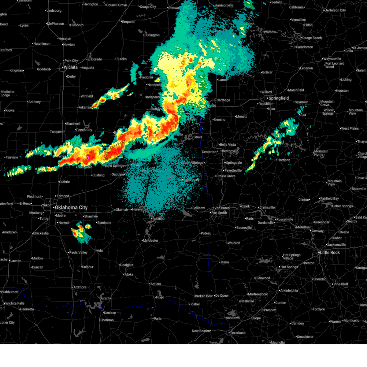
| 3/6/2026 6:34 PM CST |
 Tortsa the national weather service in tulsa has issued a * tornado warning for, northwestern rogers county in northeastern oklahoma, southeastern osage county in northeastern oklahoma, southern washington county in northeastern oklahoma, northeastern tulsa county in northeastern oklahoma, * until 730 pm cst. * at 634 pm cst, a confirmed tornado was located over turley, moving northeast at 30 mph (radar confirmed tornado). Hazards include damaging tornado. Flying debris will be dangerous to those caught without shelter. mobile homes will be damaged or destroyed. damage to roofs, windows, and vehicles will occur. tree damage is likely. Locations in or near the path include, skiatook, turley, ramona, vera, oologah, collinsville, sperry, owasso, tulsa,. Tortsa the national weather service in tulsa has issued a * tornado warning for, northwestern rogers county in northeastern oklahoma, southeastern osage county in northeastern oklahoma, southern washington county in northeastern oklahoma, northeastern tulsa county in northeastern oklahoma, * until 730 pm cst. * at 634 pm cst, a confirmed tornado was located over turley, moving northeast at 30 mph (radar confirmed tornado). Hazards include damaging tornado. Flying debris will be dangerous to those caught without shelter. mobile homes will be damaged or destroyed. damage to roofs, windows, and vehicles will occur. tree damage is likely. Locations in or near the path include, skiatook, turley, ramona, vera, oologah, collinsville, sperry, owasso, tulsa,.
|
| 3/6/2026 6:28 PM CST |
 The storm which prompted the warning has moved out of the area. therefore, the warning will be allowed to expire. a tornado watch remains in effect until 1000 pm cst for northeastern oklahoma. The storm which prompted the warning has moved out of the area. therefore, the warning will be allowed to expire. a tornado watch remains in effect until 1000 pm cst for northeastern oklahoma.
|
| 3/6/2026 6:27 PM CST |
 At 627 pm cst, a confirmed tornado was located near turley, moving northeast at 35 mph (radar confirmed tornado). Hazards include damaging tornado and quarter size hail. Flying debris will be dangerous to those caught without shelter. mobile homes will be damaged or destroyed. damage to roofs, windows, and vehicles will occur. tree damage is likely. Locations in or near the path include, turley, tulsa international airport, sperry, tulsa, skiatook, owasso,. At 627 pm cst, a confirmed tornado was located near turley, moving northeast at 35 mph (radar confirmed tornado). Hazards include damaging tornado and quarter size hail. Flying debris will be dangerous to those caught without shelter. mobile homes will be damaged or destroyed. damage to roofs, windows, and vehicles will occur. tree damage is likely. Locations in or near the path include, turley, tulsa international airport, sperry, tulsa, skiatook, owasso,.
|
| 3/6/2026 6:11 PM CST |
 the tornado warning has been cancelled and is no longer in effect the tornado warning has been cancelled and is no longer in effect
|
| 3/6/2026 6:11 PM CST |
 At 611 pm cst, a severe thunderstorm with strong low level rotation that could produce a tornado at any time was located near sand springs, moving northeast at 30 mph (radar indicated rotation). Hazards include tornado and quarter size hail. Flying debris will be dangerous to those caught without shelter. mobile homes will be damaged or destroyed. damage to roofs, windows, and vehicles will occur. tree damage is likely. Locations in or near the path include, sand springs, keystone state park, tulsa,. At 611 pm cst, a severe thunderstorm with strong low level rotation that could produce a tornado at any time was located near sand springs, moving northeast at 30 mph (radar indicated rotation). Hazards include tornado and quarter size hail. Flying debris will be dangerous to those caught without shelter. mobile homes will be damaged or destroyed. damage to roofs, windows, and vehicles will occur. tree damage is likely. Locations in or near the path include, sand springs, keystone state park, tulsa,.
|
| 3/6/2026 6:03 PM CST |
 Tortsa the national weather service in tulsa has issued a * tornado warning for, southeastern osage county in northeastern oklahoma, central tulsa county in northeastern oklahoma, * until 700 pm cst. * at 603 pm cst, a severe thunderstorm with strong low level rotation that could produce a tornado at any time was located 5 miles southeast of keystone state park, moving northeast at 20 mph (radar indicated rotation). Hazards include tornado and quarter size hail. Flying debris will be dangerous to those caught without shelter. mobile homes will be damaged or destroyed. damage to roofs, windows, and vehicles will occur. tree damage is likely. Locations in or near the path include, sand springs, keystone state park, turley, tulsa international airport, sperry, tulsa, skiatook, owasso, this includes interstate 44 near mile marker 218. Tortsa the national weather service in tulsa has issued a * tornado warning for, southeastern osage county in northeastern oklahoma, central tulsa county in northeastern oklahoma, * until 700 pm cst. * at 603 pm cst, a severe thunderstorm with strong low level rotation that could produce a tornado at any time was located 5 miles southeast of keystone state park, moving northeast at 20 mph (radar indicated rotation). Hazards include tornado and quarter size hail. Flying debris will be dangerous to those caught without shelter. mobile homes will be damaged or destroyed. damage to roofs, windows, and vehicles will occur. tree damage is likely. Locations in or near the path include, sand springs, keystone state park, turley, tulsa international airport, sperry, tulsa, skiatook, owasso, this includes interstate 44 near mile marker 218.
|
| 3/6/2026 5:58 PM CST |
 At 558 pm cst, a severe thunderstorm with strong low level rotation that could produce a tornado at any time was located 5 miles southeast of keystone state park, moving northeast at 25 mph (radar indicated rotation). Hazards include tornado and quarter size hail. Flying debris will be dangerous to those caught without shelter. mobile homes will be damaged or destroyed. damage to roofs, windows, and vehicles will occur. tree damage is likely. Locations in or near the path include, sand springs, keystone state park, mannford, tulsa, this includes interstate 44 between mile markers 211 and 218. At 558 pm cst, a severe thunderstorm with strong low level rotation that could produce a tornado at any time was located 5 miles southeast of keystone state park, moving northeast at 25 mph (radar indicated rotation). Hazards include tornado and quarter size hail. Flying debris will be dangerous to those caught without shelter. mobile homes will be damaged or destroyed. damage to roofs, windows, and vehicles will occur. tree damage is likely. Locations in or near the path include, sand springs, keystone state park, mannford, tulsa, this includes interstate 44 between mile markers 211 and 218.
|
| 3/6/2026 5:45 PM CST |
 At 545 pm cst, a confirmed tornado was located 6 miles northwest of kellyville, moving northeast at 30 mph (weather spotters confirmed tornado). Hazards include damaging tornado and quarter size hail. Flying debris will be dangerous to those caught without shelter. mobile homes will be damaged or destroyed. damage to roofs, windows, and vehicles will occur. tree damage is likely. Locations in or near the path include, sand springs, keystone state park, sapulpa, mannford, tulsa, this includes interstate 44 between mile markers 202 and 218. At 545 pm cst, a confirmed tornado was located 6 miles northwest of kellyville, moving northeast at 30 mph (weather spotters confirmed tornado). Hazards include damaging tornado and quarter size hail. Flying debris will be dangerous to those caught without shelter. mobile homes will be damaged or destroyed. damage to roofs, windows, and vehicles will occur. tree damage is likely. Locations in or near the path include, sand springs, keystone state park, sapulpa, mannford, tulsa, this includes interstate 44 between mile markers 202 and 218.
|
| 3/6/2026 5:39 PM CST |
 At 539 pm cst, a confirmed tornado was located 7 miles northwest of kellyville, moving northeast at 30 mph (weather spotters confirmed tornado). Hazards include damaging tornado and quarter size hail. Flying debris will be dangerous to those caught without shelter. mobile homes will be damaged or destroyed. damage to roofs, windows, and vehicles will occur. tree damage is likely. Locations in or near the path include, sand springs, keystone state park, mannford, sapulpa, kellyville, kiefer, tulsa, this includes interstate 44 between mile markers 196 and 218. At 539 pm cst, a confirmed tornado was located 7 miles northwest of kellyville, moving northeast at 30 mph (weather spotters confirmed tornado). Hazards include damaging tornado and quarter size hail. Flying debris will be dangerous to those caught without shelter. mobile homes will be damaged or destroyed. damage to roofs, windows, and vehicles will occur. tree damage is likely. Locations in or near the path include, sand springs, keystone state park, mannford, sapulpa, kellyville, kiefer, tulsa, this includes interstate 44 between mile markers 196 and 218.
|
| 3/6/2026 5:27 PM CST |
 Tortsa the national weather service in tulsa has issued a * tornado warning for, central creek county in northeastern oklahoma, west central tulsa county in northeastern oklahoma, * until 630 pm cst. * at 527 pm cst, a confirmed tornado was located 5 miles north of bristow, moving northeast at 30 mph (weather spotters confirmed tornado). Hazards include damaging tornado and half dollar size hail. Flying debris will be dangerous to those caught without shelter. mobile homes will be damaged or destroyed. damage to roofs, windows, and vehicles will occur. tree damage is likely. Locations in or near the path include, sand springs, keystone state park, mannford, sapulpa, kellyville, kiefer, tulsa, this includes interstate 44 between mile markers 190 and 218. Tortsa the national weather service in tulsa has issued a * tornado warning for, central creek county in northeastern oklahoma, west central tulsa county in northeastern oklahoma, * until 630 pm cst. * at 527 pm cst, a confirmed tornado was located 5 miles north of bristow, moving northeast at 30 mph (weather spotters confirmed tornado). Hazards include damaging tornado and half dollar size hail. Flying debris will be dangerous to those caught without shelter. mobile homes will be damaged or destroyed. damage to roofs, windows, and vehicles will occur. tree damage is likely. Locations in or near the path include, sand springs, keystone state park, mannford, sapulpa, kellyville, kiefer, tulsa, this includes interstate 44 between mile markers 190 and 218.
|
| 1/8/2026 8:52 AM CST |
 Svrtsa the national weather service in tulsa has issued a * severe thunderstorm warning for, western rogers county in northeastern oklahoma, southeastern osage county in northeastern oklahoma, eastern creek county in northeastern oklahoma, southern washington county in northeastern oklahoma, southwestern nowata county in northeastern oklahoma, northwestern wagoner county in northeastern oklahoma, northwestern okmulgee county in northeastern oklahoma, tulsa county in northeastern oklahoma, * until 930 am cst. * at 852 am cst, severe thunderstorms were located along a line extending from 5 miles south of barnsdall to near slick, moving northeast at 50 mph (radar indicated). Hazards include 70 mph wind gusts and quarter size hail. Hail damage to vehicles is expected. expect considerable tree damage. wind damage is also likely to mobile homes, roofs, and outbuildings. Locations in or near the path include, barnsdall, sand springs, broken arrow, sapulpa, collinsville, jenks riverside airport, liberty, sperry, skiatook, mounds, watova, ramona, hectorville, vera, talala, leonard, jenks, bixby, wolco, owasso, this includes interstate 44 between mile markers 199 and 250. Svrtsa the national weather service in tulsa has issued a * severe thunderstorm warning for, western rogers county in northeastern oklahoma, southeastern osage county in northeastern oklahoma, eastern creek county in northeastern oklahoma, southern washington county in northeastern oklahoma, southwestern nowata county in northeastern oklahoma, northwestern wagoner county in northeastern oklahoma, northwestern okmulgee county in northeastern oklahoma, tulsa county in northeastern oklahoma, * until 930 am cst. * at 852 am cst, severe thunderstorms were located along a line extending from 5 miles south of barnsdall to near slick, moving northeast at 50 mph (radar indicated). Hazards include 70 mph wind gusts and quarter size hail. Hail damage to vehicles is expected. expect considerable tree damage. wind damage is also likely to mobile homes, roofs, and outbuildings. Locations in or near the path include, barnsdall, sand springs, broken arrow, sapulpa, collinsville, jenks riverside airport, liberty, sperry, skiatook, mounds, watova, ramona, hectorville, vera, talala, leonard, jenks, bixby, wolco, owasso, this includes interstate 44 between mile markers 199 and 250.
|
| 1/8/2026 8:15 AM CST |
 Svrtsa the national weather service in tulsa has issued a * severe thunderstorm warning for, southeastern osage county in northeastern oklahoma, northern creek county in northeastern oklahoma, southeastern pawnee county in northeastern oklahoma, west central tulsa county in northeastern oklahoma, * until 900 am cst. * at 814 am cst, severe thunderstorms were located along a line extending from 3 miles east of quay to 2 miles south of stroud, moving northeast at 65 mph (radar indicated). Hazards include 60 mph wind gusts and quarter size hail. Hail damage to vehicles is expected. expect wind damage to roofs, siding, and trees. Locations in or near the path include, barnsdall, sand springs, shamrock, mannford, sapulpa, hallett, depew, jennings, tallant, cleveland, wolco, westport, keystone state park, hominy, walnut creek state park, oilton, milfay, silver city, drumright, osage, this includes interstate 44 between mile markers 178 and 219. Svrtsa the national weather service in tulsa has issued a * severe thunderstorm warning for, southeastern osage county in northeastern oklahoma, northern creek county in northeastern oklahoma, southeastern pawnee county in northeastern oklahoma, west central tulsa county in northeastern oklahoma, * until 900 am cst. * at 814 am cst, severe thunderstorms were located along a line extending from 3 miles east of quay to 2 miles south of stroud, moving northeast at 65 mph (radar indicated). Hazards include 60 mph wind gusts and quarter size hail. Hail damage to vehicles is expected. expect wind damage to roofs, siding, and trees. Locations in or near the path include, barnsdall, sand springs, shamrock, mannford, sapulpa, hallett, depew, jennings, tallant, cleveland, wolco, westport, keystone state park, hominy, walnut creek state park, oilton, milfay, silver city, drumright, osage, this includes interstate 44 between mile markers 178 and 219.
|
| 11/19/2025 9:55 PM CST | Svrtsa the national weather service in tulsa has issued a * severe thunderstorm warning for, southeastern osage county in northeastern oklahoma, southern washington county in northeastern oklahoma, northwestern tulsa county in northeastern oklahoma, * until 1045 pm cst. * at 955 pm cst, a severe thunderstorm was located 3 miles east of walnut creek state park, moving northeast at 35 mph (radar indicated). Hazards include 60 mph wind gusts and quarter size hail. Hail damage to vehicles is expected. expect wind damage to roofs, siding, and trees. Locations in or near the path include, avant, skiatook, ramona, walnut creek state park, vera, wolco,. |
| 11/19/2025 9:47 PM CST | At 947 pm cst, a severe thunderstorm was located near walnut creek state park, moving northeast at 35 mph (radar indicated). Hazards include 60 mph wind gusts and half dollar size hail. Hail damage to vehicles is expected. expect wind damage to roofs, siding, and trees. Locations in or near the path include, westport, keystone state park, walnut creek state park, mannford, sand springs,. |
| 11/19/2025 9:47 PM CST | the severe thunderstorm warning has been cancelled and is no longer in effect |
| 11/19/2025 9:31 PM CST | At 931 pm cst, a severe thunderstorm was located 3 miles southwest of mannford, moving northeast at 35 mph (radar indicated). Hazards include 60 mph wind gusts and half dollar size hail. Hail damage to vehicles is expected. expect wind damage to roofs, siding, and trees. Locations in or near the path include, westport, keystone state park, walnut creek state park, mannford, sand springs,. |
| 11/19/2025 9:10 PM CST |
 Svrtsa the national weather service in tulsa has issued a * severe thunderstorm warning for, south central osage county in northeastern oklahoma, northwestern creek county in northeastern oklahoma, southeastern pawnee county in northeastern oklahoma, west central tulsa county in northeastern oklahoma, * until 1000 pm cst. * at 910 pm cst, a severe thunderstorm was located 6 miles east of shamrock, moving northeast at 35 mph (radar indicated). Hazards include 60 mph wind gusts and half dollar size hail. Hail damage to vehicles is expected. expect wind damage to roofs, siding, and trees. Locations in or near the path include, westport, keystone state park, shamrock, walnut creek state park, mannford, sand springs, this includes interstate 44 near mile marker 189. Svrtsa the national weather service in tulsa has issued a * severe thunderstorm warning for, south central osage county in northeastern oklahoma, northwestern creek county in northeastern oklahoma, southeastern pawnee county in northeastern oklahoma, west central tulsa county in northeastern oklahoma, * until 1000 pm cst. * at 910 pm cst, a severe thunderstorm was located 6 miles east of shamrock, moving northeast at 35 mph (radar indicated). Hazards include 60 mph wind gusts and half dollar size hail. Hail damage to vehicles is expected. expect wind damage to roofs, siding, and trees. Locations in or near the path include, westport, keystone state park, shamrock, walnut creek state park, mannford, sand springs, this includes interstate 44 near mile marker 189.
|
| 10/18/2025 6:07 PM CDT | Quarter sized hail reported 6 miles ENE of Sand Springs, OK, 1 inch hail reported. |
| 9/20/2025 9:57 PM CDT | The storm which prompted the warning has weakened below severe limits, and no longer poses an immediate threat to life or property. therefore, the warning will be allowed to expire. however, gusty winds are still possible with this thunderstorm. |
| 9/20/2025 9:42 PM CDT | the severe thunderstorm warning has been cancelled and is no longer in effect |
| 9/20/2025 9:42 PM CDT | At 941 pm cdt, a severe thunderstorm was located 4 miles northeast of sand springs, moving east at 20 mph (radar indicated). Hazards include 60 mph wind gusts and penny size hail. Expect damage to roofs, siding, and trees. Locations in or near the path include, sand springs, sperry, skiatook, tulsa, this includes interstate 44 between mile markers 216 and 220. |
| 9/20/2025 9:13 PM CDT | Svrtsa the national weather service in tulsa has issued a * severe thunderstorm warning for, southeastern osage county in northeastern oklahoma, northeastern creek county in northeastern oklahoma, southeastern pawnee county in northeastern oklahoma, northwestern tulsa county in northeastern oklahoma, * until 1000 pm cdt. * at 913 pm cdt, a severe thunderstorm was located 3 miles northeast of walnut creek state park, moving east at 20 mph (radar indicated). Hazards include 60 mph wind gusts and quarter size hail. Hail damage to vehicles is expected. expect wind damage to roofs, siding, and trees. Locations in or near the path include, westport, sand springs, keystone state park, walnut creek state park, mannford, sperry, skiatook, tulsa, this includes interstate 44 between mile markers 216 and 220. |
| 9/20/2025 9:00 PM CDT | At 859 pm cdt, a severe thunderstorm was located 7 miles west of sperry, moving east at 20 mph (radar indicated). Hazards include 60 mph wind gusts and quarter size hail. Hail damage to vehicles is expected. expect wind damage to roofs, siding, and trees. Locations in or near the path include, westport, walnut creek state park, sperry, skiatook, tulsa,. |
| 9/20/2025 8:41 PM CDT | Svrtsa the national weather service in tulsa has issued a * severe thunderstorm warning for, southeastern osage county in northeastern oklahoma, southeastern pawnee county in northeastern oklahoma, * until 915 pm cdt. * at 841 pm cdt, a severe thunderstorm was located 4 miles northeast of walnut creek state park, moving east at 20 mph (radar indicated). Hazards include 60 mph wind gusts and quarter size hail. Hail damage to vehicles is expected. expect wind damage to roofs, siding, and trees. Locations in or near the path include, westport, walnut creek state park, sperry, skiatook, tulsa,. |
| 6/18/2025 1:10 AM CDT |
 The storms which prompted the warning have moved out of the area. therefore, the warning will be allowed to expire. however, gusty winds to 40 mph are still possible with these thunderstorms. a severe thunderstorm watch remains in effect until 400 am cdt for northeastern oklahoma. The storms which prompted the warning have moved out of the area. therefore, the warning will be allowed to expire. however, gusty winds to 40 mph are still possible with these thunderstorms. a severe thunderstorm watch remains in effect until 400 am cdt for northeastern oklahoma.
|
| 6/18/2025 12:25 AM CDT |
 Svrtsa the national weather service in tulsa has issued a * severe thunderstorm warning for, west central craig county in northeastern oklahoma, rogers county in northeastern oklahoma, southeastern osage county in northeastern oklahoma, northwestern mayes county in northeastern oklahoma, southern washington county in northeastern oklahoma, southern nowata county in northeastern oklahoma, northwestern wagoner county in northeastern oklahoma, northeastern tulsa county in northeastern oklahoma, * until 115 am cdt. * at 1225 am cdt, strong rear-inflow jet winds behind a line of severe thunderstorms were located along a line extending from near bartlesville municipal airport to near avant to 6 miles west of turley, moving east at 50 mph (radar indicated). Hazards include 70 mph wind gusts and quarter size hail. Hail damage to vehicles is expected. expect considerable tree damage. Wind damage is also likely to mobile homes, roofs, and outbuildings. Svrtsa the national weather service in tulsa has issued a * severe thunderstorm warning for, west central craig county in northeastern oklahoma, rogers county in northeastern oklahoma, southeastern osage county in northeastern oklahoma, northwestern mayes county in northeastern oklahoma, southern washington county in northeastern oklahoma, southern nowata county in northeastern oklahoma, northwestern wagoner county in northeastern oklahoma, northeastern tulsa county in northeastern oklahoma, * until 115 am cdt. * at 1225 am cdt, strong rear-inflow jet winds behind a line of severe thunderstorms were located along a line extending from near bartlesville municipal airport to near avant to 6 miles west of turley, moving east at 50 mph (radar indicated). Hazards include 70 mph wind gusts and quarter size hail. Hail damage to vehicles is expected. expect considerable tree damage. Wind damage is also likely to mobile homes, roofs, and outbuildings.
|
| 6/18/2025 12:00 AM CDT |
 Svrtsa the national weather service in tulsa has issued a * severe thunderstorm warning for, rogers county in northeastern oklahoma, southeastern osage county in northeastern oklahoma, northeastern creek county in northeastern oklahoma, western mayes county in northeastern oklahoma, southern washington county in northeastern oklahoma, wagoner county in northeastern oklahoma, northwestern muskogee county in east central oklahoma, northern okmulgee county in northeastern oklahoma, tulsa county in northeastern oklahoma, * until 1245 am cdt. * at 1200 am cdt, severe thunderstorms were located along a line extending from 4 miles southwest of avant to 4 miles east of sand springs to 6 miles west of mounds, moving east at 65 mph (radar indicated). Hazards include 70 mph wind gusts and penny size hail. Expect considerable tree damage. Damage is likely to mobile homes, roofs, and outbuildings. Svrtsa the national weather service in tulsa has issued a * severe thunderstorm warning for, rogers county in northeastern oklahoma, southeastern osage county in northeastern oklahoma, northeastern creek county in northeastern oklahoma, western mayes county in northeastern oklahoma, southern washington county in northeastern oklahoma, wagoner county in northeastern oklahoma, northwestern muskogee county in east central oklahoma, northern okmulgee county in northeastern oklahoma, tulsa county in northeastern oklahoma, * until 1245 am cdt. * at 1200 am cdt, severe thunderstorms were located along a line extending from 4 miles southwest of avant to 4 miles east of sand springs to 6 miles west of mounds, moving east at 65 mph (radar indicated). Hazards include 70 mph wind gusts and penny size hail. Expect considerable tree damage. Damage is likely to mobile homes, roofs, and outbuildings.
|
| 6/17/2025 11:48 PM CDT |
 At 1148 pm cdt, severe thunderstorms were located along a line extending from 3 miles west of wynona to near keystone state park to near bristow, moving east at 60 mph (radar indicated). Hazards include 70 mph wind gusts and nickel size hail. Expect considerable tree damage. damage is likely to mobile homes, roofs, and outbuildings. Locations impacted include, tulsa, broken arrow, sand springs, bristow, owasso, bixby, sapulpa, jenks, glenpool, skiatook, hominy, mannford, kiefer, sperry, mounds, kellyville, depew, avant, westport, and osage. At 1148 pm cdt, severe thunderstorms were located along a line extending from 3 miles west of wynona to near keystone state park to near bristow, moving east at 60 mph (radar indicated). Hazards include 70 mph wind gusts and nickel size hail. Expect considerable tree damage. damage is likely to mobile homes, roofs, and outbuildings. Locations impacted include, tulsa, broken arrow, sand springs, bristow, owasso, bixby, sapulpa, jenks, glenpool, skiatook, hominy, mannford, kiefer, sperry, mounds, kellyville, depew, avant, westport, and osage.
|
| 6/17/2025 11:45 PM CDT | Numerous 10-12 inch thick limbs dow in tulsa county OK, 3.1 miles E of Sand Springs, OK |
| 6/17/2025 11:31 PM CDT |
 Svrtsa the national weather service in tulsa has issued a * severe thunderstorm warning for, southeastern osage county in northeastern oklahoma, creek county in northeastern oklahoma, southwestern washington county in northeastern oklahoma, northwestern okmulgee county in northeastern oklahoma, eastern pawnee county in northeastern oklahoma, tulsa county in northeastern oklahoma, * until 1215 am cdt. * at 1130 pm cdt, severe thunderstorms were located along a line extending from near fairfax to near jennings to 3 miles southeast of avery, moving east at 45 mph (radar indicated). Hazards include 70 mph wind gusts and quarter size hail. Hail damage to vehicles is expected. expect considerable tree damage. Wind damage is also likely to mobile homes, roofs, and outbuildings. Svrtsa the national weather service in tulsa has issued a * severe thunderstorm warning for, southeastern osage county in northeastern oklahoma, creek county in northeastern oklahoma, southwestern washington county in northeastern oklahoma, northwestern okmulgee county in northeastern oklahoma, eastern pawnee county in northeastern oklahoma, tulsa county in northeastern oklahoma, * until 1215 am cdt. * at 1130 pm cdt, severe thunderstorms were located along a line extending from near fairfax to near jennings to 3 miles southeast of avery, moving east at 45 mph (radar indicated). Hazards include 70 mph wind gusts and quarter size hail. Hail damage to vehicles is expected. expect considerable tree damage. Wind damage is also likely to mobile homes, roofs, and outbuildings.
|
| 6/17/2025 8:23 AM CDT |
 At 823 am cdt, severe thunderstorms were located along a line extending from 7 miles west of sperry to near kellyville to near slick, moving southeast at 35 mph (radar indicated). Hazards include 60 mph wind gusts and penny size hail. Expect damage to roofs, siding, and trees. Locations impacted include, tulsa, sand springs, bristow, sapulpa, jenks, glenpool, mannford, kiefer, beggs, sperry, mounds, kellyville, depew, westport, slick, keystone state park, walnut creek state park, jenks riverside airport, turley, and liberty. At 823 am cdt, severe thunderstorms were located along a line extending from 7 miles west of sperry to near kellyville to near slick, moving southeast at 35 mph (radar indicated). Hazards include 60 mph wind gusts and penny size hail. Expect damage to roofs, siding, and trees. Locations impacted include, tulsa, sand springs, bristow, sapulpa, jenks, glenpool, mannford, kiefer, beggs, sperry, mounds, kellyville, depew, westport, slick, keystone state park, walnut creek state park, jenks riverside airport, turley, and liberty.
|
| 6/17/2025 8:12 AM CDT |
 At 811 am cdt, severe thunderstorms were located along a line extending from 6 miles northeast of walnut creek state park to 4 miles northwest of kellyville to 4 miles west of slick, moving southeast at 35 mph (radar indicated). Hazards include 60 mph wind gusts and penny size hail. Expect damage to roofs, siding, and trees. Locations impacted include, tulsa, sand springs, bristow, sapulpa, jenks, glenpool, hominy, cleveland, mannford, kiefer, beggs, sperry, mounds, kellyville, depew, westport, osage, slick, terlton, and shamrock. At 811 am cdt, severe thunderstorms were located along a line extending from 6 miles northeast of walnut creek state park to 4 miles northwest of kellyville to 4 miles west of slick, moving southeast at 35 mph (radar indicated). Hazards include 60 mph wind gusts and penny size hail. Expect damage to roofs, siding, and trees. Locations impacted include, tulsa, sand springs, bristow, sapulpa, jenks, glenpool, hominy, cleveland, mannford, kiefer, beggs, sperry, mounds, kellyville, depew, westport, osage, slick, terlton, and shamrock.
|
| 6/17/2025 7:38 AM CDT |
 Svrtsa the national weather service in tulsa has issued a * severe thunderstorm warning for, southeastern osage county in northeastern oklahoma, creek county in northeastern oklahoma, northwestern okmulgee county in northeastern oklahoma, southeastern pawnee county in northeastern oklahoma, central tulsa county in northeastern oklahoma, * until 830 am cdt. * at 738 am cdt, severe thunderstorms were located along a line extending from 3 miles southwest of hominy to 7 miles southeast of oilton to near shamrock, moving southeast at 35 mph (radar indicated). Hazards include 60 mph wind gusts and penny size hail. expect damage to roofs, siding, and trees Svrtsa the national weather service in tulsa has issued a * severe thunderstorm warning for, southeastern osage county in northeastern oklahoma, creek county in northeastern oklahoma, northwestern okmulgee county in northeastern oklahoma, southeastern pawnee county in northeastern oklahoma, central tulsa county in northeastern oklahoma, * until 830 am cdt. * at 738 am cdt, severe thunderstorms were located along a line extending from 3 miles southwest of hominy to 7 miles southeast of oilton to near shamrock, moving southeast at 35 mph (radar indicated). Hazards include 60 mph wind gusts and penny size hail. expect damage to roofs, siding, and trees
|
| 6/17/2025 6:53 AM CDT |
 Svrtsa the national weather service in tulsa has issued a * severe thunderstorm warning for, southern osage county in northeastern oklahoma, pawnee county in northeastern oklahoma, * until 745 am cdt. * at 653 am cdt, severe thunderstorms were located along a line extending from near fairfax to 3 miles north of pawnee to near morrison, moving southeast at 35 mph (radar indicated). Hazards include 60 mph wind gusts and quarter size hail. Hail damage to vehicles is expected. Expect wind damage to roofs, siding, and trees. Svrtsa the national weather service in tulsa has issued a * severe thunderstorm warning for, southern osage county in northeastern oklahoma, pawnee county in northeastern oklahoma, * until 745 am cdt. * at 653 am cdt, severe thunderstorms were located along a line extending from near fairfax to 3 miles north of pawnee to near morrison, moving southeast at 35 mph (radar indicated). Hazards include 60 mph wind gusts and quarter size hail. Hail damage to vehicles is expected. Expect wind damage to roofs, siding, and trees.
|
| 6/15/2025 12:29 AM CDT |
 The storms which prompted the warning have weakened below severe limits, and no longer pose an immediate threat to life or property. therefore, the warning will be allowed to expire. however, gusty winds are still possible with these thunderstorms. a severe thunderstorm watch remains in effect until 600 am cdt for northeastern oklahoma. The storms which prompted the warning have weakened below severe limits, and no longer pose an immediate threat to life or property. therefore, the warning will be allowed to expire. however, gusty winds are still possible with these thunderstorms. a severe thunderstorm watch remains in effect until 600 am cdt for northeastern oklahoma.
|
| 6/15/2025 12:16 AM CDT |
 the severe thunderstorm warning has been cancelled and is no longer in effect the severe thunderstorm warning has been cancelled and is no longer in effect
|
| 6/15/2025 12:16 AM CDT |
 At 1216 am cdt, severe thunderstorms were located along a line extending from 2 miles northeast of collinsville to 2 miles west of catoosa to 2 miles south of glenpool, moving east at 35 mph (radar indicated). Hazards include 60 mph wind gusts and nickel size hail. Expect damage to roofs, siding, and trees. Locations in or near the path include, broken arrow, collinsville, verdigris, jenks riverside airport, tulsa, claremore, tulsa international airport, oologah, leonard, jenks, catoosa, bixby, owasso, oneta, tiawah, inola, glenpool, turley, sand springs, coweta, this includes interstate 44 between mile markers 217 and 250. At 1216 am cdt, severe thunderstorms were located along a line extending from 2 miles northeast of collinsville to 2 miles west of catoosa to 2 miles south of glenpool, moving east at 35 mph (radar indicated). Hazards include 60 mph wind gusts and nickel size hail. Expect damage to roofs, siding, and trees. Locations in or near the path include, broken arrow, collinsville, verdigris, jenks riverside airport, tulsa, claremore, tulsa international airport, oologah, leonard, jenks, catoosa, bixby, owasso, oneta, tiawah, inola, glenpool, turley, sand springs, coweta, this includes interstate 44 between mile markers 217 and 250.
|
| 6/15/2025 12:05 AM CDT |
 At 1204 am cdt, severe thunderstorms were located along a line extending from 2 miles southwest of vera to near tulsa international airport to 2 miles west of kiefer, moving east at 35 mph (radar indicated). Hazards include 60 mph wind gusts and penny size hail. Expect damage to roofs, siding, and trees. Locations in or near the path include, sand springs, broken arrow, sapulpa, collinsville, verdigris, jenks riverside airport, sperry, tulsa, claremore, skiatook, turley, tulsa international airport, vera, oologah, leonard, jenks, glenpool, catoosa, bixby, owasso, this includes interstate 44 between mile markers 210 and 250. At 1204 am cdt, severe thunderstorms were located along a line extending from 2 miles southwest of vera to near tulsa international airport to 2 miles west of kiefer, moving east at 35 mph (radar indicated). Hazards include 60 mph wind gusts and penny size hail. Expect damage to roofs, siding, and trees. Locations in or near the path include, sand springs, broken arrow, sapulpa, collinsville, verdigris, jenks riverside airport, sperry, tulsa, claremore, skiatook, turley, tulsa international airport, vera, oologah, leonard, jenks, glenpool, catoosa, bixby, owasso, this includes interstate 44 between mile markers 210 and 250.
|
| 6/15/2025 12:05 AM CDT |
 the severe thunderstorm warning has been cancelled and is no longer in effect the severe thunderstorm warning has been cancelled and is no longer in effect
|
| 6/14/2025 11:57 PM CDT |
 At 1156 pm cdt, severe thunderstorms were located along a line extending from 4 miles southeast of avant to near turley to 3 miles northeast of kellyville, moving east at 35 mph (radar indicated). Hazards include 60 mph wind gusts and penny size hail. Expect damage to roofs, siding, and trees. Locations in or near the path include, sand springs, broken arrow, sapulpa, collinsville, jenks riverside airport, sperry, skiatook, ramona, vera, talala, leonard, jenks, bixby, owasso, keystone state park, verdigris, tulsa, claremore, turley, tulsa international airport, this includes interstate 44 between mile markers 207 and 250. At 1156 pm cdt, severe thunderstorms were located along a line extending from 4 miles southeast of avant to near turley to 3 miles northeast of kellyville, moving east at 35 mph (radar indicated). Hazards include 60 mph wind gusts and penny size hail. Expect damage to roofs, siding, and trees. Locations in or near the path include, sand springs, broken arrow, sapulpa, collinsville, jenks riverside airport, sperry, skiatook, ramona, vera, talala, leonard, jenks, bixby, owasso, keystone state park, verdigris, tulsa, claremore, turley, tulsa international airport, this includes interstate 44 between mile markers 207 and 250.
|
| 6/14/2025 11:57 PM CDT |
 the severe thunderstorm warning has been cancelled and is no longer in effect the severe thunderstorm warning has been cancelled and is no longer in effect
|
| 6/14/2025 11:47 PM CDT |
 Svrtsa the national weather service in tulsa has issued a * severe thunderstorm warning for, western rogers county in northeastern oklahoma, southeastern osage county in northeastern oklahoma, northeastern creek county in northeastern oklahoma, southern washington county in northeastern oklahoma, northwestern wagoner county in northeastern oklahoma, southeastern pawnee county in northeastern oklahoma, tulsa county in northeastern oklahoma, * until 1230 am cdt. * at 1146 pm cdt, severe thunderstorms were located along a line extending from 2 miles west of avant to 6 miles west of sperry to 5 miles northwest of kellyville, moving east at 35 mph (radar indicated). Hazards include 60 mph wind gusts and penny size hail. Expect damage to roofs, siding, and trees. Locations in or near the path include, barnsdall, sand springs, broken arrow, mannford, sapulpa, collinsville, jenks riverside airport, sperry, skiatook, ramona, vera, talala, leonard, jenks, bixby, wolco, owasso, westport, keystone state park, walnut creek state park, this includes interstate 44 between mile markers 205 and 250. Svrtsa the national weather service in tulsa has issued a * severe thunderstorm warning for, western rogers county in northeastern oklahoma, southeastern osage county in northeastern oklahoma, northeastern creek county in northeastern oklahoma, southern washington county in northeastern oklahoma, northwestern wagoner county in northeastern oklahoma, southeastern pawnee county in northeastern oklahoma, tulsa county in northeastern oklahoma, * until 1230 am cdt. * at 1146 pm cdt, severe thunderstorms were located along a line extending from 2 miles west of avant to 6 miles west of sperry to 5 miles northwest of kellyville, moving east at 35 mph (radar indicated). Hazards include 60 mph wind gusts and penny size hail. Expect damage to roofs, siding, and trees. Locations in or near the path include, barnsdall, sand springs, broken arrow, mannford, sapulpa, collinsville, jenks riverside airport, sperry, skiatook, ramona, vera, talala, leonard, jenks, bixby, wolco, owasso, westport, keystone state park, walnut creek state park, this includes interstate 44 between mile markers 205 and 250.
|
| 6/7/2025 3:52 AM CDT |
 Svrtsa the national weather service in tulsa has issued a * severe thunderstorm warning for, craig county in northeastern oklahoma, rogers county in northeastern oklahoma, northeastern osage county in northeastern oklahoma, mayes county in northeastern oklahoma, washington county in northeastern oklahoma, nowata county in northeastern oklahoma, northeastern tulsa county in northeastern oklahoma, * until 445 am cdt. * at 352 am cdt, severe thunderstorms were located along a line extending from 2 miles east of caney to 4 miles northwest of talala to owasso, moving east at 55 mph (radar indicated). Hazards include 60 mph wind gusts. Expect damage to roofs, siding, and trees. Locations in or near the path include, pensacola, wann, vinita, collinsville, cherokee state park, disney little blue state park, big cabin, strang, hoot owl, vera, chelsea, white oak, bushyhead, wolco, owasso, hollow, pryor, ketchum, delaware, ochelata, this includes interstate 44 between mile markers 244 and 292. Svrtsa the national weather service in tulsa has issued a * severe thunderstorm warning for, craig county in northeastern oklahoma, rogers county in northeastern oklahoma, northeastern osage county in northeastern oklahoma, mayes county in northeastern oklahoma, washington county in northeastern oklahoma, nowata county in northeastern oklahoma, northeastern tulsa county in northeastern oklahoma, * until 445 am cdt. * at 352 am cdt, severe thunderstorms were located along a line extending from 2 miles east of caney to 4 miles northwest of talala to owasso, moving east at 55 mph (radar indicated). Hazards include 60 mph wind gusts. Expect damage to roofs, siding, and trees. Locations in or near the path include, pensacola, wann, vinita, collinsville, cherokee state park, disney little blue state park, big cabin, strang, hoot owl, vera, chelsea, white oak, bushyhead, wolco, owasso, hollow, pryor, ketchum, delaware, ochelata, this includes interstate 44 between mile markers 244 and 292.
|
| 6/7/2025 3:39 AM CDT |
 At 339 am cdt, severe thunderstorms were located along a line extending from 3 miles east of hulah to 2 miles south of ramona to 2 miles west of sand springs, moving east at 55 mph (radar indicated). Hazards include 60 mph wind gusts. Expect damage to roofs, siding, and trees. Locations in or near the path include, barnsdall, sand springs, bigheart, wann, mannford, dewey, hallett, bartlesville municipal airport, collinsville, jenks riverside airport, jennings, tallant, sperry, pawhuska, cleveland, osage hills state park, skiatook, pershing, ramona, vera, this includes interstate 44 between mile markers 212 and 226. At 339 am cdt, severe thunderstorms were located along a line extending from 3 miles east of hulah to 2 miles south of ramona to 2 miles west of sand springs, moving east at 55 mph (radar indicated). Hazards include 60 mph wind gusts. Expect damage to roofs, siding, and trees. Locations in or near the path include, barnsdall, sand springs, bigheart, wann, mannford, dewey, hallett, bartlesville municipal airport, collinsville, jenks riverside airport, jennings, tallant, sperry, pawhuska, cleveland, osage hills state park, skiatook, pershing, ramona, vera, this includes interstate 44 between mile markers 212 and 226.
|
| 6/7/2025 3:27 AM CDT |
 At 326 am cdt, severe thunderstorms were located along a line extending from 5 miles south of chautauqua to 3 miles southeast of barnsdall to near mannford, moving east at 55 mph (radar indicated). Hazards include 60 to 70 mph wind gusts. Expect considerable tree damage. damage is likely to mobile homes, roofs, and outbuildings. Locations in or near the path include, barnsdall, sand springs, wann, collinsville, jenks riverside airport, pawhuska, osage hills state park, vera, nelagoney, wolco, owasso, keystone state park, hominy, oilton, ochelata, sunset lake, tulsa, silver city, maramec, bartlesville, this includes interstate 44 between mile markers 212 and 226. At 326 am cdt, severe thunderstorms were located along a line extending from 5 miles south of chautauqua to 3 miles southeast of barnsdall to near mannford, moving east at 55 mph (radar indicated). Hazards include 60 to 70 mph wind gusts. Expect considerable tree damage. damage is likely to mobile homes, roofs, and outbuildings. Locations in or near the path include, barnsdall, sand springs, wann, collinsville, jenks riverside airport, pawhuska, osage hills state park, vera, nelagoney, wolco, owasso, keystone state park, hominy, oilton, ochelata, sunset lake, tulsa, silver city, maramec, bartlesville, this includes interstate 44 between mile markers 212 and 226.
|
| 6/7/2025 3:11 AM CDT |
 Svrtsa the national weather service in tulsa has issued a * severe thunderstorm warning for, northwestern rogers county in northeastern oklahoma, osage county in northeastern oklahoma, northern creek county in northeastern oklahoma, washington county in northeastern oklahoma, western nowata county in northeastern oklahoma, pawnee county in northeastern oklahoma, central tulsa county in northeastern oklahoma, * until 400 am cdt. * at 310 am cdt, severe thunderstorms were located along a line extending from 9 miles northeast of foraker to 4 miles west of wynona to 3 miles southwest of jennings, moving east at 55 mph (radar indicated). Hazards include 60 to 70 mph wind gusts and penny size hail. Expect considerable tree damage. damage is likely to mobile homes, roofs, and outbuildings. Locations in or near the path include, barnsdall, sand springs, wann, collinsville, jenks riverside airport, pawhuska, ralston, osage hills state park, grainola, vera, nelagoney, wolco, owasso, keystone state park, hominy, oilton, ochelata, apperson, sunset lake, fairfax, this includes interstate 44 between mile markers 212 and 226. Svrtsa the national weather service in tulsa has issued a * severe thunderstorm warning for, northwestern rogers county in northeastern oklahoma, osage county in northeastern oklahoma, northern creek county in northeastern oklahoma, washington county in northeastern oklahoma, western nowata county in northeastern oklahoma, pawnee county in northeastern oklahoma, central tulsa county in northeastern oklahoma, * until 400 am cdt. * at 310 am cdt, severe thunderstorms were located along a line extending from 9 miles northeast of foraker to 4 miles west of wynona to 3 miles southwest of jennings, moving east at 55 mph (radar indicated). Hazards include 60 to 70 mph wind gusts and penny size hail. Expect considerable tree damage. damage is likely to mobile homes, roofs, and outbuildings. Locations in or near the path include, barnsdall, sand springs, wann, collinsville, jenks riverside airport, pawhuska, ralston, osage hills state park, grainola, vera, nelagoney, wolco, owasso, keystone state park, hominy, oilton, ochelata, apperson, sunset lake, fairfax, this includes interstate 44 between mile markers 212 and 226.
|
| 6/6/2025 4:59 AM CDT |
 Svrtsa the national weather service in tulsa has issued a * severe thunderstorm warning for, east central creek county in northeastern oklahoma, northwestern wagoner county in northeastern oklahoma, northwestern okmulgee county in northeastern oklahoma, southeastern tulsa county in northeastern oklahoma, * until 545 am cdt. * at 459 am cdt, severe thunderstorms were located along a line extending from near tulsa to 5 miles north of slick, moving east at 30 mph (radar indicated). Hazards include 60 mph wind gusts and half dollar size hail. Hail damage to vehicles is expected. expect wind damage to roofs, siding, and trees. Locations in or near the path include, beggs, broken arrow, bristow, sapulpa, jenks riverside airport, liberty, coweta, tulsa, mounds, stonebluff, hectorville, leonard, jenks, glenpool, bixby, kellyville, kiefer, oneta, sand springs, this includes interstate 44 between mile markers 190 and 229. Svrtsa the national weather service in tulsa has issued a * severe thunderstorm warning for, east central creek county in northeastern oklahoma, northwestern wagoner county in northeastern oklahoma, northwestern okmulgee county in northeastern oklahoma, southeastern tulsa county in northeastern oklahoma, * until 545 am cdt. * at 459 am cdt, severe thunderstorms were located along a line extending from near tulsa to 5 miles north of slick, moving east at 30 mph (radar indicated). Hazards include 60 mph wind gusts and half dollar size hail. Hail damage to vehicles is expected. expect wind damage to roofs, siding, and trees. Locations in or near the path include, beggs, broken arrow, bristow, sapulpa, jenks riverside airport, liberty, coweta, tulsa, mounds, stonebluff, hectorville, leonard, jenks, glenpool, bixby, kellyville, kiefer, oneta, sand springs, this includes interstate 44 between mile markers 190 and 229.
|
| 6/6/2025 4:50 AM CDT |
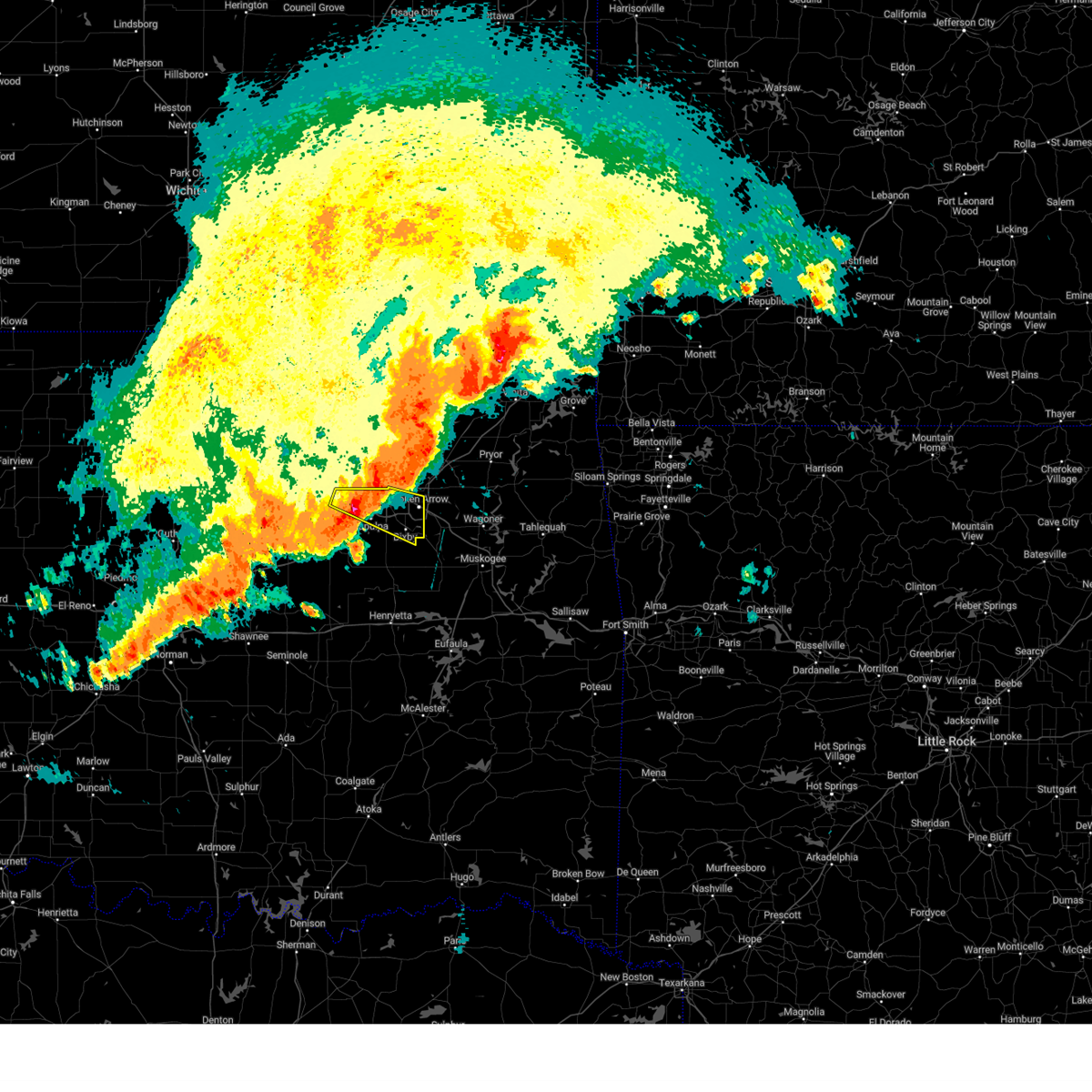 At 450 am cdt, a severe thunderstorm was located 5 miles southeast of keystone state park, moving east at 30 mph (radar indicated). Hazards include 60 mph wind gusts and quarter size hail. Hail damage to vehicles is expected. expect wind damage to roofs, siding, and trees. Locations in or near the path include, sand springs, keystone state park, broken arrow, mannford, sapulpa, leonard, jenks, glenpool, jenks riverside airport, bixby, tulsa, kiefer, this includes interstate 44 between mile markers 207 and 229. At 450 am cdt, a severe thunderstorm was located 5 miles southeast of keystone state park, moving east at 30 mph (radar indicated). Hazards include 60 mph wind gusts and quarter size hail. Hail damage to vehicles is expected. expect wind damage to roofs, siding, and trees. Locations in or near the path include, sand springs, keystone state park, broken arrow, mannford, sapulpa, leonard, jenks, glenpool, jenks riverside airport, bixby, tulsa, kiefer, this includes interstate 44 between mile markers 207 and 229.
|
| 6/6/2025 4:35 AM CDT |
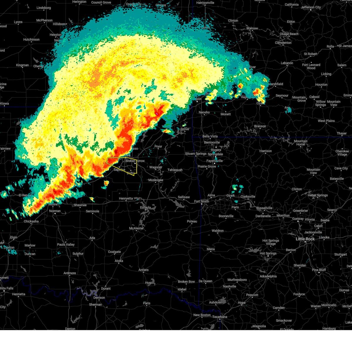 At 435 am cdt, a severe thunderstorm was located 4 miles southwest of sand springs, moving east at 35 mph (radar indicated). Hazards include 70 mph wind gusts and ping pong ball size hail. People and animals outdoors will be injured. expect hail damage to roofs, siding, windows, and vehicles. expect considerable tree damage. wind damage is also likely to mobile homes, roofs, and outbuildings. Locations in or near the path include, sand springs, keystone state park, broken arrow, mannford, sapulpa, leonard, jenks, glenpool, jenks riverside airport, bixby, tulsa, kiefer, this includes interstate 44 between mile markers 207 and 229. At 435 am cdt, a severe thunderstorm was located 4 miles southwest of sand springs, moving east at 35 mph (radar indicated). Hazards include 70 mph wind gusts and ping pong ball size hail. People and animals outdoors will be injured. expect hail damage to roofs, siding, windows, and vehicles. expect considerable tree damage. wind damage is also likely to mobile homes, roofs, and outbuildings. Locations in or near the path include, sand springs, keystone state park, broken arrow, mannford, sapulpa, leonard, jenks, glenpool, jenks riverside airport, bixby, tulsa, kiefer, this includes interstate 44 between mile markers 207 and 229.
|
| 6/6/2025 4:24 AM CDT |
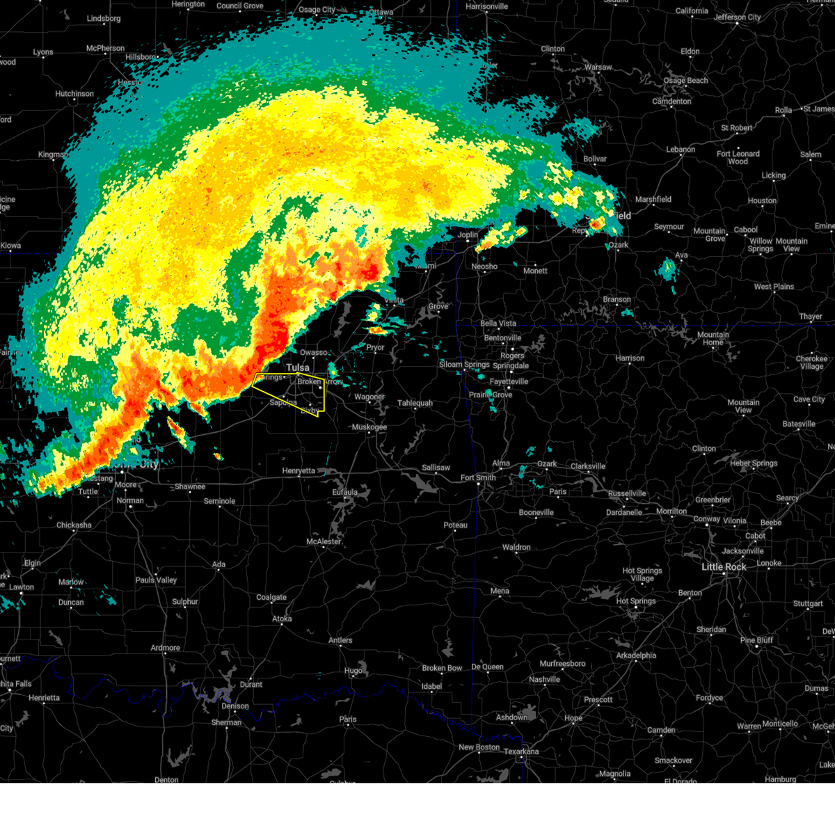 Svrtsa the national weather service in tulsa has issued a * severe thunderstorm warning for, northeastern creek county in northeastern oklahoma, southern tulsa county in northeastern oklahoma, * until 515 am cdt. * at 424 am cdt, a severe thunderstorm was located over keystone state park, moving east at 35 mph (radar indicated). Hazards include 70 mph wind gusts. Expect considerable tree damage. damage is likely to mobile homes, roofs, and outbuildings. Locations in or near the path include, sand springs, keystone state park, broken arrow, mannford, sapulpa, leonard, jenks, glenpool, jenks riverside airport, bixby, tulsa, kiefer, this includes interstate 44 between mile markers 207 and 229. Svrtsa the national weather service in tulsa has issued a * severe thunderstorm warning for, northeastern creek county in northeastern oklahoma, southern tulsa county in northeastern oklahoma, * until 515 am cdt. * at 424 am cdt, a severe thunderstorm was located over keystone state park, moving east at 35 mph (radar indicated). Hazards include 70 mph wind gusts. Expect considerable tree damage. damage is likely to mobile homes, roofs, and outbuildings. Locations in or near the path include, sand springs, keystone state park, broken arrow, mannford, sapulpa, leonard, jenks, glenpool, jenks riverside airport, bixby, tulsa, kiefer, this includes interstate 44 between mile markers 207 and 229.
|
| 6/6/2025 4:09 AM CDT |
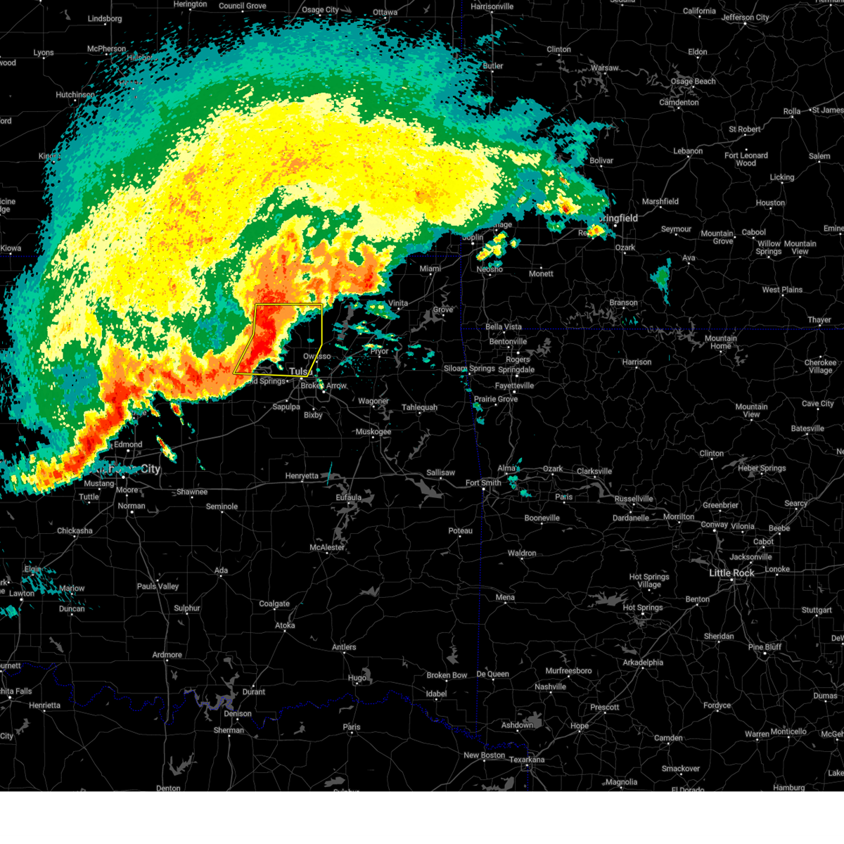 At 409 am cdt, severe thunderstorms were located along a line extending from 4 miles east of pawhuska to 8 miles east of hominy to 4 miles northeast of terlton, moving east at 35 mph (radar indicated). Hazards include 60 mph wind gusts and half dollar size hail. Hail damage to vehicles is expected. expect wind damage to roofs, siding, and trees. Locations in or near the path include, westport, barnsdall, hominy, walnut creek state park, wynona, collinsville, ochelata, tallant, sperry, pawhuska, cleveland, skiatook, pershing, turley, ramona, osage, vera, terlton, nelagoney, avant,. At 409 am cdt, severe thunderstorms were located along a line extending from 4 miles east of pawhuska to 8 miles east of hominy to 4 miles northeast of terlton, moving east at 35 mph (radar indicated). Hazards include 60 mph wind gusts and half dollar size hail. Hail damage to vehicles is expected. expect wind damage to roofs, siding, and trees. Locations in or near the path include, westport, barnsdall, hominy, walnut creek state park, wynona, collinsville, ochelata, tallant, sperry, pawhuska, cleveland, skiatook, pershing, turley, ramona, osage, vera, terlton, nelagoney, avant,.
|
| 6/6/2025 3:53 AM CDT |
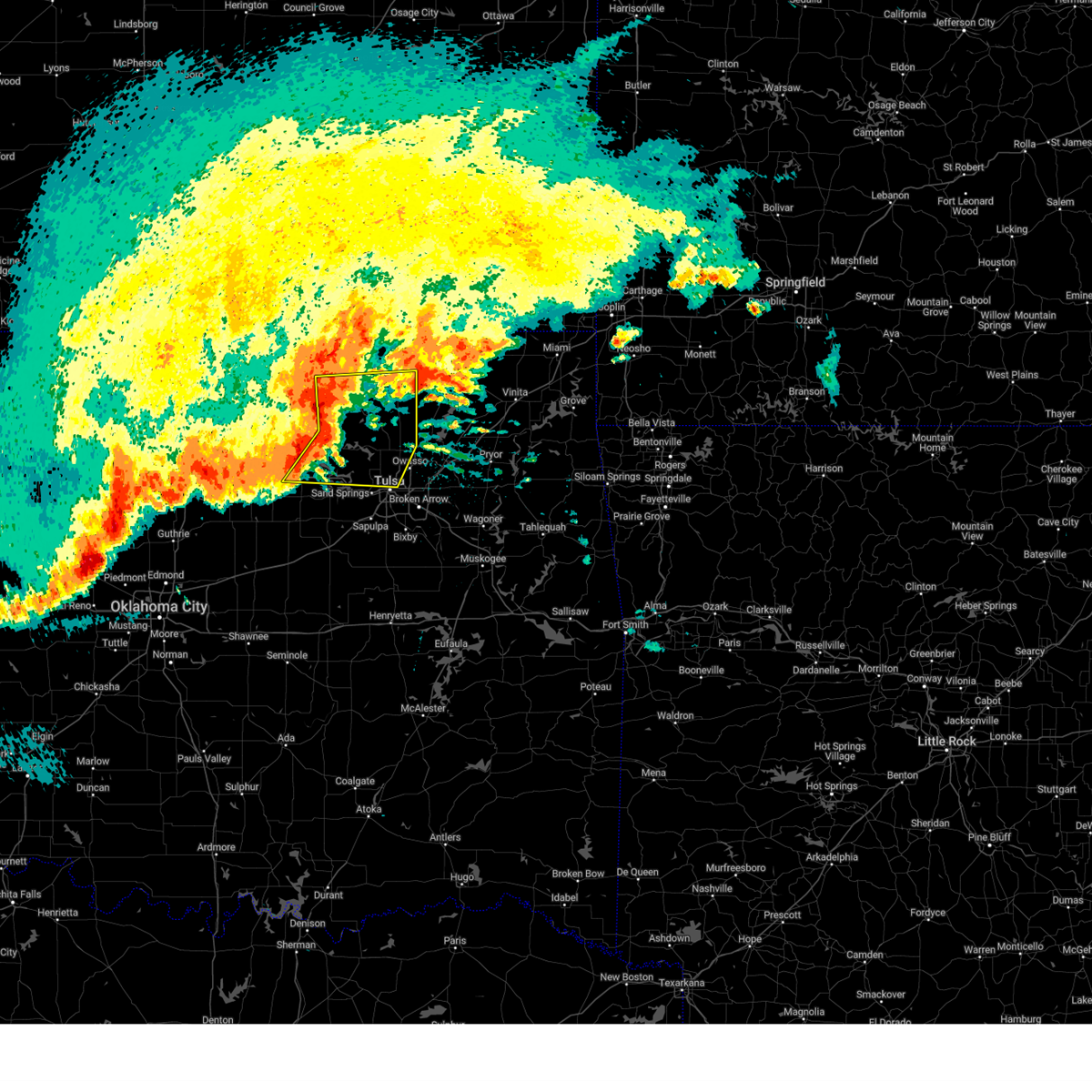 Svrtsa the national weather service in tulsa has issued a * severe thunderstorm warning for, southeastern osage county in northeastern oklahoma, washington county in northeastern oklahoma, southeastern pawnee county in northeastern oklahoma, northeastern tulsa county in northeastern oklahoma, * until 445 am cdt. * at 353 am cdt, severe thunderstorms were located along a line extending from 3 miles west of pawhuska to 3 miles north of hominy to near hallett, moving east at 35 mph (radar indicated). Hazards include 70 mph wind gusts and ping pong ball size hail. People and animals outdoors will be injured. expect hail damage to roofs, siding, windows, and vehicles. expect considerable tree damage. wind damage is also likely to mobile homes, roofs, and outbuildings. Locations in or near the path include, barnsdall, hallett, bartlesville municipal airport, collinsville, tallant, sperry, pawhuska, cleveland, osage hills state park, skiatook, pershing, ramona, vera, nelagoney, wolco, westport, hominy, walnut creek state park, wynona, ochelata,. Svrtsa the national weather service in tulsa has issued a * severe thunderstorm warning for, southeastern osage county in northeastern oklahoma, washington county in northeastern oklahoma, southeastern pawnee county in northeastern oklahoma, northeastern tulsa county in northeastern oklahoma, * until 445 am cdt. * at 353 am cdt, severe thunderstorms were located along a line extending from 3 miles west of pawhuska to 3 miles north of hominy to near hallett, moving east at 35 mph (radar indicated). Hazards include 70 mph wind gusts and ping pong ball size hail. People and animals outdoors will be injured. expect hail damage to roofs, siding, windows, and vehicles. expect considerable tree damage. wind damage is also likely to mobile homes, roofs, and outbuildings. Locations in or near the path include, barnsdall, hallett, bartlesville municipal airport, collinsville, tallant, sperry, pawhuska, cleveland, osage hills state park, skiatook, pershing, ramona, vera, nelagoney, wolco, westport, hominy, walnut creek state park, wynona, ochelata,.
|
| 6/3/2025 7:06 PM CDT |
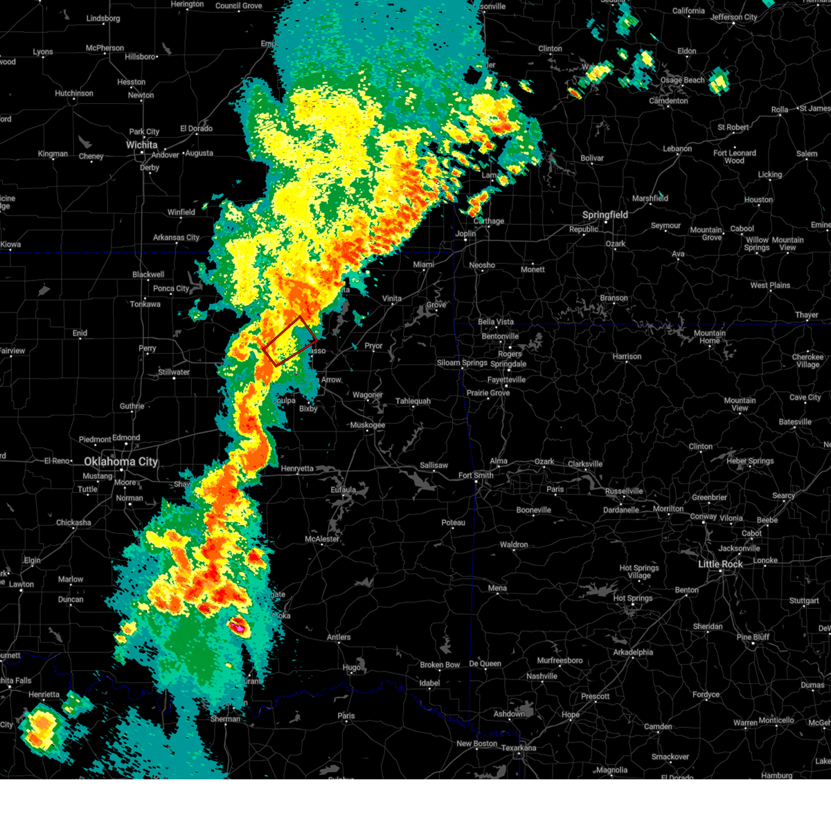 Tortsa the national weather service in tulsa has issued a * tornado warning for, southeastern osage county in northeastern oklahoma, southern washington county in northeastern oklahoma, northeastern tulsa county in northeastern oklahoma, * until 730 pm cdt. * at 706 pm cdt, a severe thunderstorm capable of producing a tornado was located 7 miles east of walnut creek state park, moving northeast at 40 mph (radar indicated rotation). Hazards include tornado. Flying debris will be dangerous to those caught without shelter. mobile homes will be damaged or destroyed. damage to roofs, windows, and vehicles will occur. tree damage is likely. Locations in or near the path include, collinsville, skiatook, sperry, vera,. Tortsa the national weather service in tulsa has issued a * tornado warning for, southeastern osage county in northeastern oklahoma, southern washington county in northeastern oklahoma, northeastern tulsa county in northeastern oklahoma, * until 730 pm cdt. * at 706 pm cdt, a severe thunderstorm capable of producing a tornado was located 7 miles east of walnut creek state park, moving northeast at 40 mph (radar indicated rotation). Hazards include tornado. Flying debris will be dangerous to those caught without shelter. mobile homes will be damaged or destroyed. damage to roofs, windows, and vehicles will occur. tree damage is likely. Locations in or near the path include, collinsville, skiatook, sperry, vera,.
|
| 6/3/2025 6:57 PM CDT |
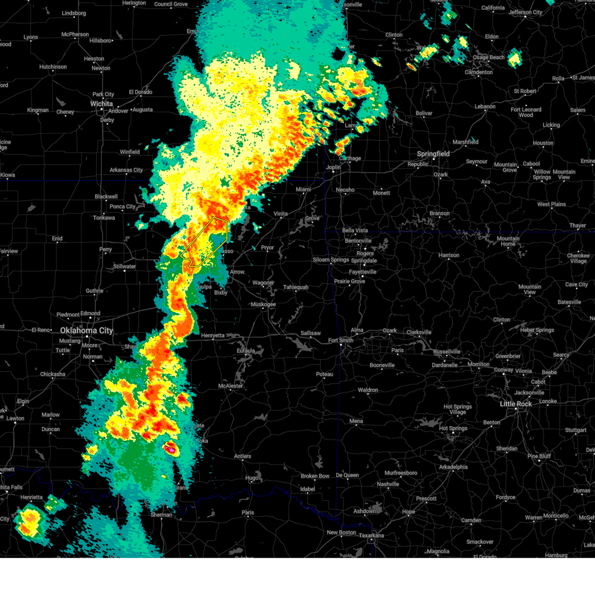 At 657 pm cdt, a severe thunderstorm was located 3 miles east of walnut creek state park, moving northeast at 45 mph (radar indicated). Hazards include 60 mph wind gusts. Expect damage to roofs, siding, and trees. Locations in or near the path include, skiatook, ramona, walnut creek state park, vera, avant, ochelata, sperry, wolco, sand springs,. At 657 pm cdt, a severe thunderstorm was located 3 miles east of walnut creek state park, moving northeast at 45 mph (radar indicated). Hazards include 60 mph wind gusts. Expect damage to roofs, siding, and trees. Locations in or near the path include, skiatook, ramona, walnut creek state park, vera, avant, ochelata, sperry, wolco, sand springs,.
|
| 6/3/2025 6:57 PM CDT |
 the severe thunderstorm warning has been cancelled and is no longer in effect the severe thunderstorm warning has been cancelled and is no longer in effect
|
| 6/3/2025 6:50 PM CDT |
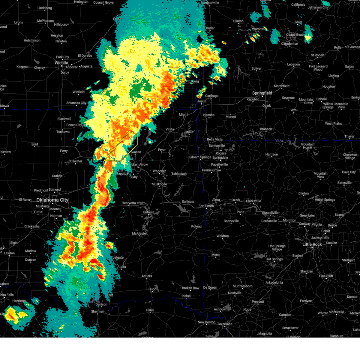 Svrtsa the national weather service in tulsa has issued a * severe thunderstorm warning for, southeastern osage county in northeastern oklahoma, southern washington county in northeastern oklahoma, southeastern pawnee county in northeastern oklahoma, north central tulsa county in northeastern oklahoma, * until 745 pm cdt. * at 650 pm cdt, a severe thunderstorm was located near westport, moving northeast at 45 mph (radar indicated). Hazards include 60 mph wind gusts. Expect damage to roofs, siding, and trees. Locations in or near the path include, westport, skiatook, ramona, walnut creek state park, vera, avant, ochelata, sperry, wolco, sand springs,. Svrtsa the national weather service in tulsa has issued a * severe thunderstorm warning for, southeastern osage county in northeastern oklahoma, southern washington county in northeastern oklahoma, southeastern pawnee county in northeastern oklahoma, north central tulsa county in northeastern oklahoma, * until 745 pm cdt. * at 650 pm cdt, a severe thunderstorm was located near westport, moving northeast at 45 mph (radar indicated). Hazards include 60 mph wind gusts. Expect damage to roofs, siding, and trees. Locations in or near the path include, westport, skiatook, ramona, walnut creek state park, vera, avant, ochelata, sperry, wolco, sand springs,.
|
| 5/25/2025 3:24 AM CDT |
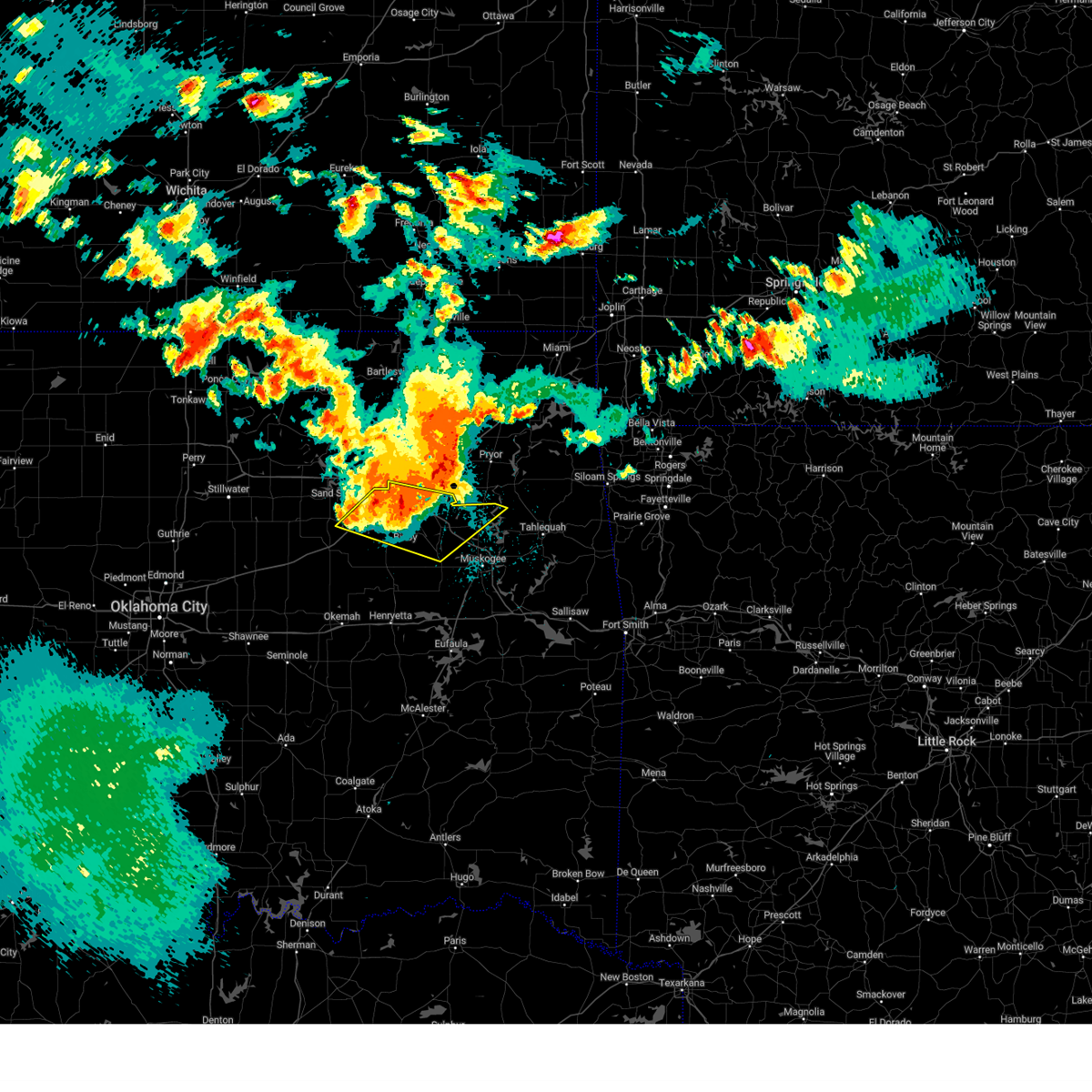 Svrtsa the national weather service in tulsa has issued a * severe thunderstorm warning for, northeastern creek county in northeastern oklahoma, wagoner county in northeastern oklahoma, northeastern okmulgee county in northeastern oklahoma, northwestern muskogee county in east central oklahoma, tulsa county in northeastern oklahoma, * until 415 am cdt. * at 323 am cdt, a severe thunderstorm was located 3 miles southeast of tulsa, moving east at 35 mph (radar indicated). Hazards include quarter size hail. Damage to vehicles is expected. Locations in or near the path include, sand springs, broken arrow, sapulpa, wagoner, jenks riverside airport, redbird, coweta, tulsa, stonebluff, haskell, leonard, jenks, glenpool, bixby, porter, choska, kellyville, kiefer, oneta, liberty, this includes interstate 44 between mile markers 201 and 234. Svrtsa the national weather service in tulsa has issued a * severe thunderstorm warning for, northeastern creek county in northeastern oklahoma, wagoner county in northeastern oklahoma, northeastern okmulgee county in northeastern oklahoma, northwestern muskogee county in east central oklahoma, tulsa county in northeastern oklahoma, * until 415 am cdt. * at 323 am cdt, a severe thunderstorm was located 3 miles southeast of tulsa, moving east at 35 mph (radar indicated). Hazards include quarter size hail. Damage to vehicles is expected. Locations in or near the path include, sand springs, broken arrow, sapulpa, wagoner, jenks riverside airport, redbird, coweta, tulsa, stonebluff, haskell, leonard, jenks, glenpool, bixby, porter, choska, kellyville, kiefer, oneta, liberty, this includes interstate 44 between mile markers 201 and 234.
|
| 5/25/2025 3:03 AM CDT |
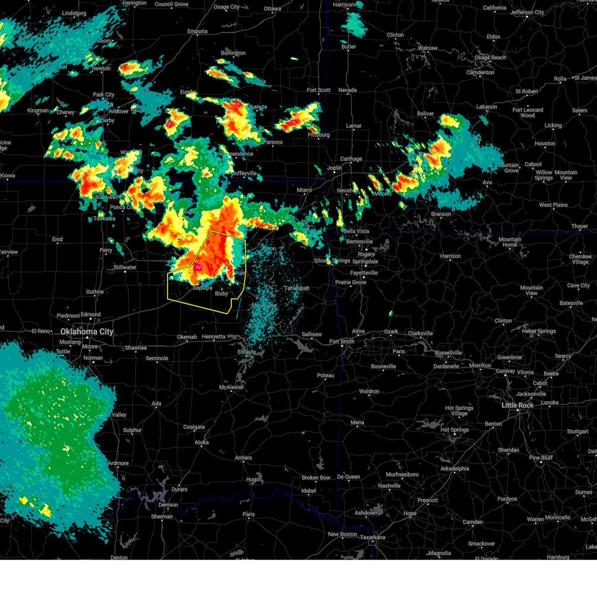 At 302 am cdt, severe thunderstorms were located along a line extending from 2 miles northwest of owasso to 2 miles northeast of kiefer to 6 miles north of bristow, moving southeast at 35 mph (radar indicated). Hazards include 60 mph wind gusts and quarter size hail. Hail damage to vehicles is expected. expect wind damage to roofs, siding, and trees. Locations in or near the path include, sand springs, broken arrow, mannford, sapulpa, collinsville, jenks riverside airport, liberty, sperry, skiatook, mounds, stonebluff, hectorville, vera, leonard, jenks, bixby, owasso, keystone state park, bristow, verdigris, this includes interstate 44 between mile markers 188 and 248. At 302 am cdt, severe thunderstorms were located along a line extending from 2 miles northwest of owasso to 2 miles northeast of kiefer to 6 miles north of bristow, moving southeast at 35 mph (radar indicated). Hazards include 60 mph wind gusts and quarter size hail. Hail damage to vehicles is expected. expect wind damage to roofs, siding, and trees. Locations in or near the path include, sand springs, broken arrow, mannford, sapulpa, collinsville, jenks riverside airport, liberty, sperry, skiatook, mounds, stonebluff, hectorville, vera, leonard, jenks, bixby, owasso, keystone state park, bristow, verdigris, this includes interstate 44 between mile markers 188 and 248.
|
| 5/25/2025 3:01 AM CDT | Quarter sized hail reported 6 miles ENE of Sand Springs, OK |
| 5/25/2025 2:53 AM CDT |
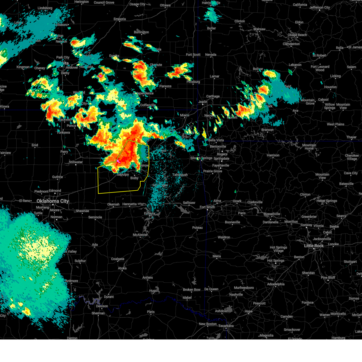 At 253 am cdt, severe thunderstorms were located along a line extending from 3 miles east of skiatook to 2 miles northeast of sapulpa to 6 miles east of drumright, moving southeast at 35 mph (radar indicated). Hazards include ping pong ball size hail and 60 mph wind gusts. People and animals outdoors will be injured. expect hail damage to roofs, siding, windows, and vehicles. expect wind damage to roofs, siding, and trees. Locations in or near the path include, beggs, sand springs, broken arrow, shamrock, preston, mannford, sapulpa, collinsville, jenks riverside airport, liberty, depew, sperry, skiatook, mounds, stonebluff, hectorville, vera, leonard, jenks, bixby, this includes interstate 44 between mile markers 178 and 248. At 253 am cdt, severe thunderstorms were located along a line extending from 3 miles east of skiatook to 2 miles northeast of sapulpa to 6 miles east of drumright, moving southeast at 35 mph (radar indicated). Hazards include ping pong ball size hail and 60 mph wind gusts. People and animals outdoors will be injured. expect hail damage to roofs, siding, windows, and vehicles. expect wind damage to roofs, siding, and trees. Locations in or near the path include, beggs, sand springs, broken arrow, shamrock, preston, mannford, sapulpa, collinsville, jenks riverside airport, liberty, depew, sperry, skiatook, mounds, stonebluff, hectorville, vera, leonard, jenks, bixby, this includes interstate 44 between mile markers 178 and 248.
|
| 5/25/2025 2:52 AM CDT | Ping Pong Ball sized hail reported 4.8 miles E of Sand Springs, OK, report from mping: ping pong ball (1.50 in.). |
| 5/25/2025 2:50 AM CDT | Quarter sized hail reported 6 miles ENE of Sand Springs, OK |
| 5/25/2025 2:45 AM CDT |
 Svrtsa the national weather service in tulsa has issued a * severe thunderstorm warning for, southwestern rogers county in northeastern oklahoma, southeastern osage county in northeastern oklahoma, creek county in northeastern oklahoma, southern washington county in northeastern oklahoma, northwestern wagoner county in northeastern oklahoma, northern okmulgee county in northeastern oklahoma, tulsa county in northeastern oklahoma, * until 330 am cdt. * at 244 am cdt, severe thunderstorms were located along a line extending from near skiatook to 4 miles north of sapulpa to 4 miles east of drumright, moving southeast at 35 mph (radar indicated). Hazards include golf ball size hail and 60 mph wind gusts. People and animals outdoors will be injured. expect hail damage to roofs, siding, windows, and vehicles. expect wind damage to roofs, siding, and trees. Locations in or near the path include, beggs, sand springs, broken arrow, shamrock, preston, mannford, sapulpa, collinsville, jenks riverside airport, liberty, depew, sperry, skiatook, mounds, stonebluff, hectorville, vera, leonard, jenks, bixby, this includes interstate 44 between mile markers 178 and 248. Svrtsa the national weather service in tulsa has issued a * severe thunderstorm warning for, southwestern rogers county in northeastern oklahoma, southeastern osage county in northeastern oklahoma, creek county in northeastern oklahoma, southern washington county in northeastern oklahoma, northwestern wagoner county in northeastern oklahoma, northern okmulgee county in northeastern oklahoma, tulsa county in northeastern oklahoma, * until 330 am cdt. * at 244 am cdt, severe thunderstorms were located along a line extending from near skiatook to 4 miles north of sapulpa to 4 miles east of drumright, moving southeast at 35 mph (radar indicated). Hazards include golf ball size hail and 60 mph wind gusts. People and animals outdoors will be injured. expect hail damage to roofs, siding, windows, and vehicles. expect wind damage to roofs, siding, and trees. Locations in or near the path include, beggs, sand springs, broken arrow, shamrock, preston, mannford, sapulpa, collinsville, jenks riverside airport, liberty, depew, sperry, skiatook, mounds, stonebluff, hectorville, vera, leonard, jenks, bixby, this includes interstate 44 between mile markers 178 and 248.
|
| 5/25/2025 2:41 AM CDT |
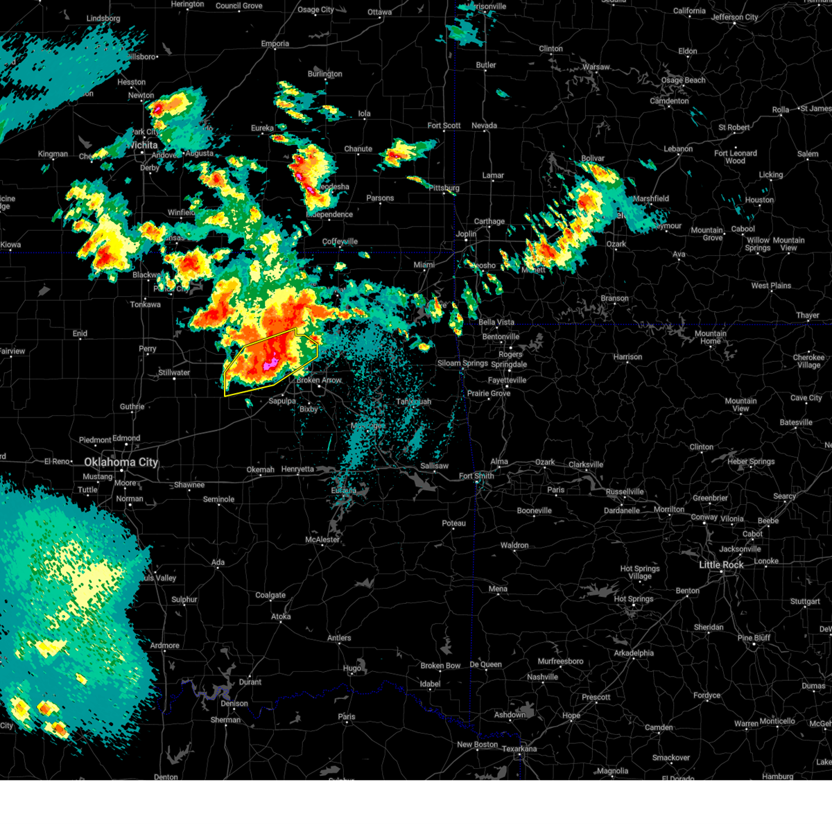 At 241 am cdt, severe thunderstorms were located along a line extending from near skiatook to 3 miles west of sand springs to near oilton, moving southeast at 35 mph (radar indicated). Hazards include golf ball size hail and 60 mph wind gusts. People and animals outdoors will be injured. expect hail damage to roofs, siding, windows, and vehicles. expect wind damage to roofs, siding, and trees. Locations in or near the path include, westport, sand springs, keystone state park, walnut creek state park, mannford, collinsville, oilton, jennings, sperry, cleveland, silver city, skiatook, turley, osage, terlton, owasso, tulsa,. At 241 am cdt, severe thunderstorms were located along a line extending from near skiatook to 3 miles west of sand springs to near oilton, moving southeast at 35 mph (radar indicated). Hazards include golf ball size hail and 60 mph wind gusts. People and animals outdoors will be injured. expect hail damage to roofs, siding, windows, and vehicles. expect wind damage to roofs, siding, and trees. Locations in or near the path include, westport, sand springs, keystone state park, walnut creek state park, mannford, collinsville, oilton, jennings, sperry, cleveland, silver city, skiatook, turley, osage, terlton, owasso, tulsa,.
|
| 5/25/2025 2:15 AM CDT |
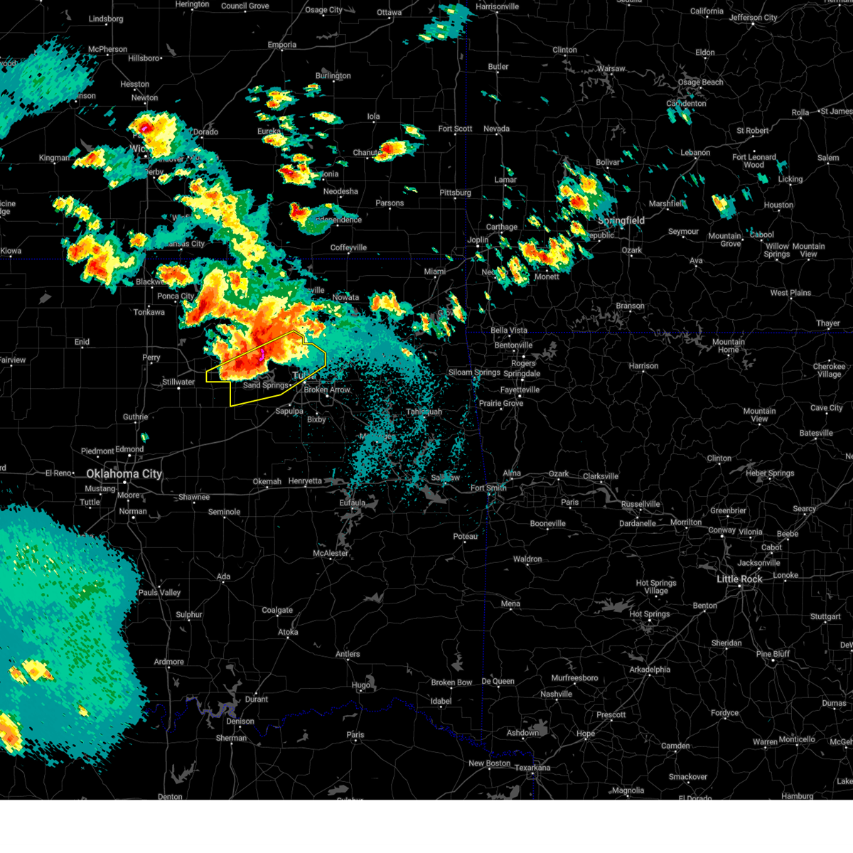 Svrtsa the national weather service in tulsa has issued a * severe thunderstorm warning for, southeastern osage county in northeastern oklahoma, northwestern creek county in northeastern oklahoma, southeastern pawnee county in northeastern oklahoma, northern tulsa county in northeastern oklahoma, * until 300 am cdt. * at 215 am cdt, severe thunderstorms were located along a line extending from 4 miles southwest of avant to 5 miles southeast of hominy to 2 miles southwest of maramec, moving southeast at 25 mph (radar indicated). Hazards include golf ball size hail and 60 mph wind gusts. People and animals outdoors will be injured. expect hail damage to roofs, siding, windows, and vehicles. expect wind damage to roofs, siding, and trees. Locations in or near the path include, westport, sand springs, keystone state park, walnut creek state park, mannford, hallett, collinsville, oilton, jennings, sperry, cleveland, silver city, skiatook, turley, maramec, osage, terlton, avant, owasso, tulsa,. Svrtsa the national weather service in tulsa has issued a * severe thunderstorm warning for, southeastern osage county in northeastern oklahoma, northwestern creek county in northeastern oklahoma, southeastern pawnee county in northeastern oklahoma, northern tulsa county in northeastern oklahoma, * until 300 am cdt. * at 215 am cdt, severe thunderstorms were located along a line extending from 4 miles southwest of avant to 5 miles southeast of hominy to 2 miles southwest of maramec, moving southeast at 25 mph (radar indicated). Hazards include golf ball size hail and 60 mph wind gusts. People and animals outdoors will be injured. expect hail damage to roofs, siding, windows, and vehicles. expect wind damage to roofs, siding, and trees. Locations in or near the path include, westport, sand springs, keystone state park, walnut creek state park, mannford, hallett, collinsville, oilton, jennings, sperry, cleveland, silver city, skiatook, turley, maramec, osage, terlton, avant, owasso, tulsa,.
|
| 5/25/2025 2:07 AM CDT |
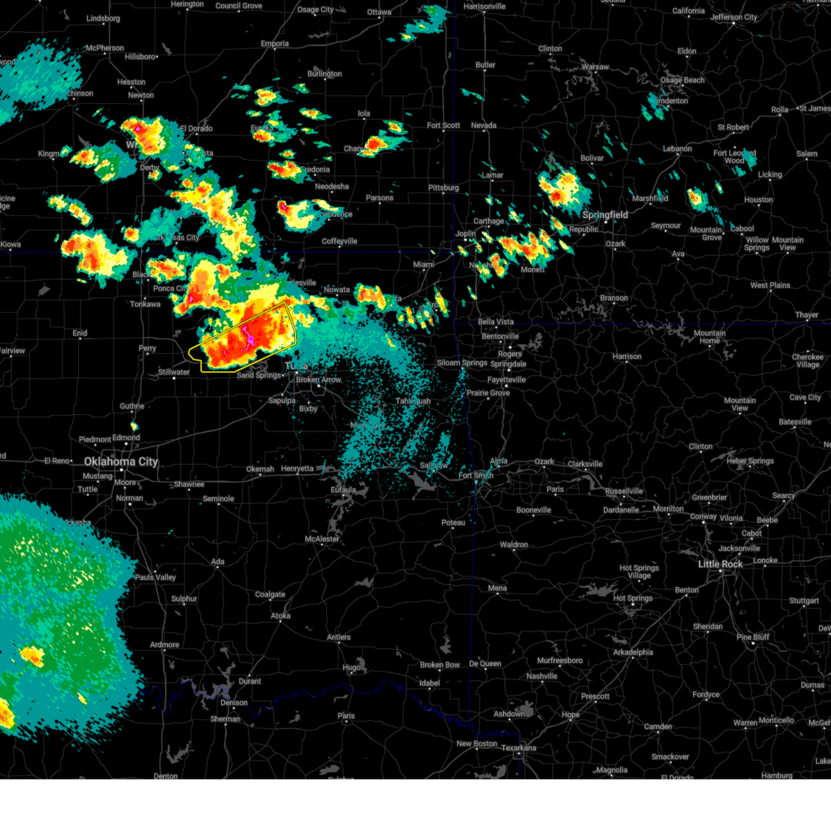 At 207 am cdt, severe thunderstorms were located along a line extending from near hominy to 4 miles northwest of maramec, moving southeast at 20 mph (radar indicated). Hazards include two inch hail and 60 mph wind gusts. People and animals outdoors will be injured. expect hail damage to roofs, siding, windows, and vehicles. expect wind damage to roofs, siding, and trees. Locations in or near the path include, barnsdall, hominy, skedee, wynona, hallett, jennings, tallant, cleveland, blackburn, maramec, osage, terlton, avant, pawnee, wolco, skiatook,. At 207 am cdt, severe thunderstorms were located along a line extending from near hominy to 4 miles northwest of maramec, moving southeast at 20 mph (radar indicated). Hazards include two inch hail and 60 mph wind gusts. People and animals outdoors will be injured. expect hail damage to roofs, siding, windows, and vehicles. expect wind damage to roofs, siding, and trees. Locations in or near the path include, barnsdall, hominy, skedee, wynona, hallett, jennings, tallant, cleveland, blackburn, maramec, osage, terlton, avant, pawnee, wolco, skiatook,.
|
| 5/25/2025 1:46 AM CDT |
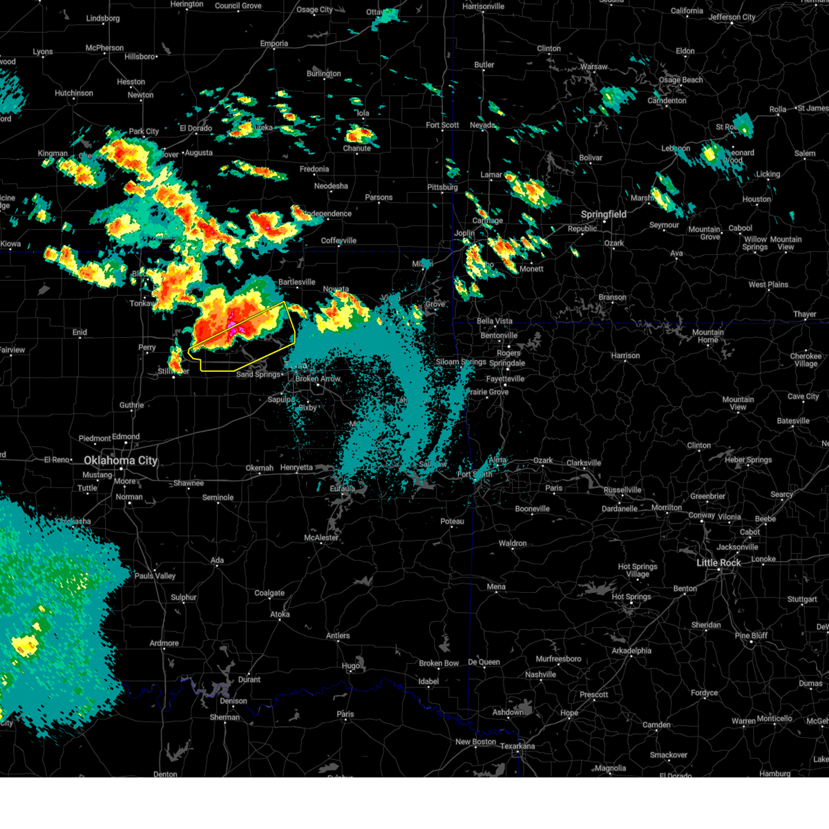 Svrtsa the national weather service in tulsa has issued a * severe thunderstorm warning for, southeastern osage county in northeastern oklahoma, southern pawnee county in northeastern oklahoma, * until 230 am cdt. * at 145 am cdt, severe thunderstorms were located along a line extending from 6 miles west of hominy to near pawnee, moving east at 25 mph (radar indicated). Hazards include two inch hail and 60 mph wind gusts. People and animals outdoors will be injured. expect hail damage to roofs, siding, windows, and vehicles. expect wind damage to roofs, siding, and trees. Locations in or near the path include, barnsdall, hominy, skedee, wynona, hallett, jennings, tallant, cleveland, blackburn, maramec, osage, terlton, avant, pawnee, wolco, skiatook,. Svrtsa the national weather service in tulsa has issued a * severe thunderstorm warning for, southeastern osage county in northeastern oklahoma, southern pawnee county in northeastern oklahoma, * until 230 am cdt. * at 145 am cdt, severe thunderstorms were located along a line extending from 6 miles west of hominy to near pawnee, moving east at 25 mph (radar indicated). Hazards include two inch hail and 60 mph wind gusts. People and animals outdoors will be injured. expect hail damage to roofs, siding, windows, and vehicles. expect wind damage to roofs, siding, and trees. Locations in or near the path include, barnsdall, hominy, skedee, wynona, hallett, jennings, tallant, cleveland, blackburn, maramec, osage, terlton, avant, pawnee, wolco, skiatook,.
|
| 5/24/2025 6:17 AM CDT |
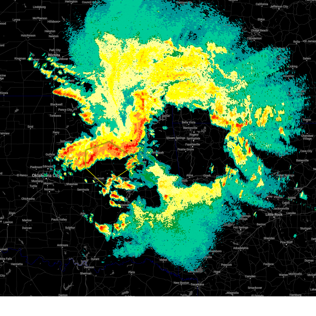 the severe thunderstorm warning has been cancelled and is no longer in effect the severe thunderstorm warning has been cancelled and is no longer in effect
|
| 5/24/2025 6:17 AM CDT |
 At 617 am cdt, severe thunderstorms were located along a line extending from 4 miles south of coweta to 3 miles west of preston to 7 miles west of welty, moving southeast at 50 mph (radar indicated). Hazards include 70 mph wind gusts and penny size hail. Expect considerable tree damage. damage is likely to mobile homes, roofs, and outbuildings. locations in or near the path include, beggs, sand springs, shamrock, preston, sapulpa, jenks riverside airport, liberty, depew, mounds, clearview, schulter, stonebluff, hectorville, eram, haskell, leonard, jenks, morris, pharoah, bixby, this includes the following highways, interstate 40 in oklahoma between mile markers 221 and 236. Interstate 44 between mile markers 178 and 223. At 617 am cdt, severe thunderstorms were located along a line extending from 4 miles south of coweta to 3 miles west of preston to 7 miles west of welty, moving southeast at 50 mph (radar indicated). Hazards include 70 mph wind gusts and penny size hail. Expect considerable tree damage. damage is likely to mobile homes, roofs, and outbuildings. locations in or near the path include, beggs, sand springs, shamrock, preston, sapulpa, jenks riverside airport, liberty, depew, mounds, clearview, schulter, stonebluff, hectorville, eram, haskell, leonard, jenks, morris, pharoah, bixby, this includes the following highways, interstate 40 in oklahoma between mile markers 221 and 236. Interstate 44 between mile markers 178 and 223.
|
| 5/24/2025 5:58 AM CDT |
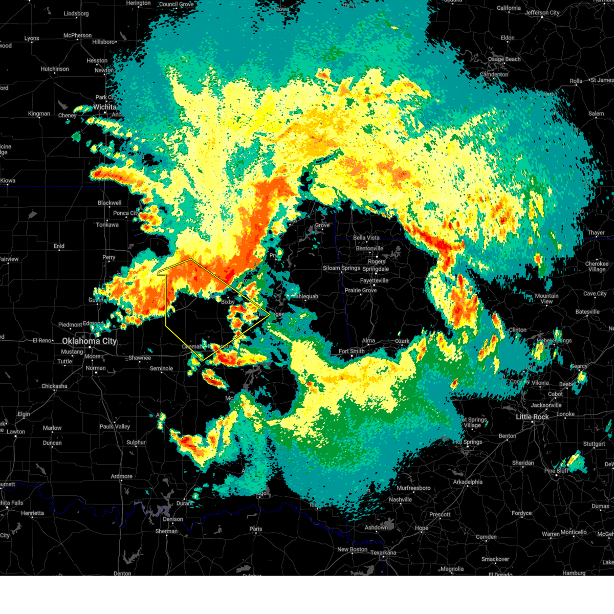 Svrtsa the national weather service in tulsa has issued a * severe thunderstorm warning for, south central osage county in northeastern oklahoma, creek county in northeastern oklahoma, southwestern wagoner county in northeastern oklahoma, okmulgee county in northeastern oklahoma, northwestern muskogee county in east central oklahoma, southeastern pawnee county in northeastern oklahoma, southern tulsa county in northeastern oklahoma, eastern okfuskee county in east central oklahoma, * until 700 am cdt. * at 558 am cdt, severe thunderstorms were located along a line extending from 4 miles northwest of broken arrow to 6 miles southwest of mannford to 2 miles south of shamrock, moving southeast at 45 mph (radar indicated). Hazards include 70 mph wind gusts and penny size hail. Expect considerable tree damage. damage is likely to mobile homes, roofs, and outbuildings. locations in or near the path include, beggs, sand springs, shamrock, sapulpa, jenks riverside airport, depew, mounds, clearview, schulter, stonebluff, hectorville, eram, haskell, leonard, morris, pharoah, keystone state park, okmulgee, oilton, okfuskee, this includes the following highways, interstate 40 in oklahoma between mile markers 221 and 236. Interstate 44 between mile markers 178 and 223. Svrtsa the national weather service in tulsa has issued a * severe thunderstorm warning for, south central osage county in northeastern oklahoma, creek county in northeastern oklahoma, southwestern wagoner county in northeastern oklahoma, okmulgee county in northeastern oklahoma, northwestern muskogee county in east central oklahoma, southeastern pawnee county in northeastern oklahoma, southern tulsa county in northeastern oklahoma, eastern okfuskee county in east central oklahoma, * until 700 am cdt. * at 558 am cdt, severe thunderstorms were located along a line extending from 4 miles northwest of broken arrow to 6 miles southwest of mannford to 2 miles south of shamrock, moving southeast at 45 mph (radar indicated). Hazards include 70 mph wind gusts and penny size hail. Expect considerable tree damage. damage is likely to mobile homes, roofs, and outbuildings. locations in or near the path include, beggs, sand springs, shamrock, sapulpa, jenks riverside airport, depew, mounds, clearview, schulter, stonebluff, hectorville, eram, haskell, leonard, morris, pharoah, keystone state park, okmulgee, oilton, okfuskee, this includes the following highways, interstate 40 in oklahoma between mile markers 221 and 236. Interstate 44 between mile markers 178 and 223.
|
| 5/24/2025 5:50 AM CDT |
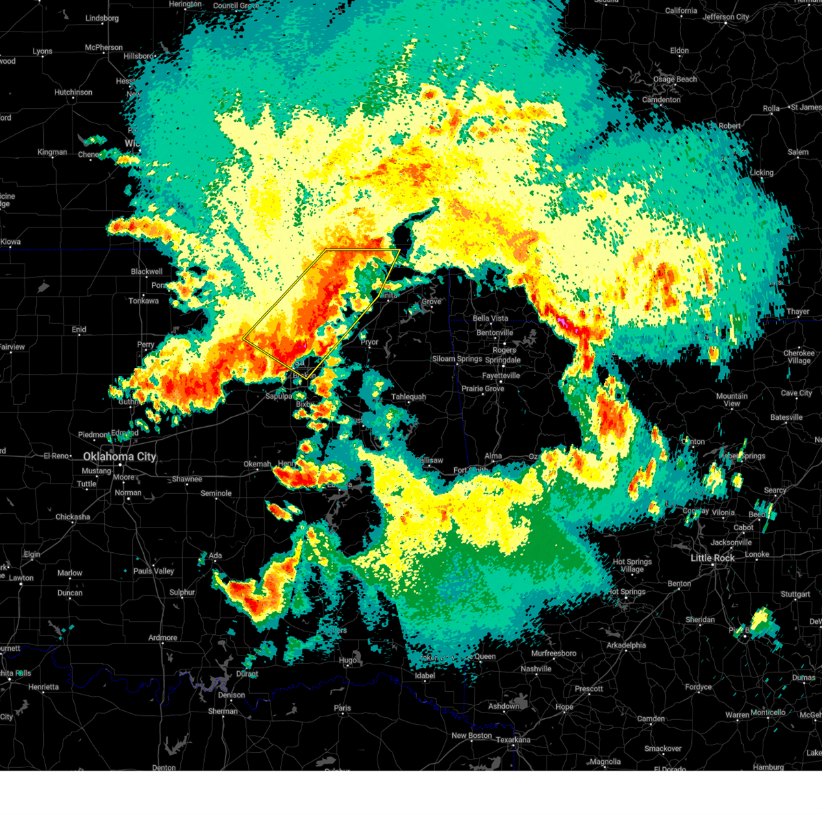 At 550 am cdt, severe thunderstorms were located along a line extending from 9 miles north of new alluwe to turley, moving southeast at 65 mph (trained weather spotters). Hazards include 70 mph wind gusts and penny size hail. Expect considerable tree damage. damage is likely to mobile homes, roofs, and outbuildings. Locations in or near the path include, barnsdall, dewey, collinsville, sperry, skiatook, watova, ramona, vera, talala, chelsea, foyil, bushyhead, wolco, owasso, new alluwe, hollow, lenapah, south coffeyville, delaware, ochelata, this includes interstate 44 between mile markers 226 and 234. At 550 am cdt, severe thunderstorms were located along a line extending from 9 miles north of new alluwe to turley, moving southeast at 65 mph (trained weather spotters). Hazards include 70 mph wind gusts and penny size hail. Expect considerable tree damage. damage is likely to mobile homes, roofs, and outbuildings. Locations in or near the path include, barnsdall, dewey, collinsville, sperry, skiatook, watova, ramona, vera, talala, chelsea, foyil, bushyhead, wolco, owasso, new alluwe, hollow, lenapah, south coffeyville, delaware, ochelata, this includes interstate 44 between mile markers 226 and 234.
|
| 5/24/2025 5:41 AM CDT |
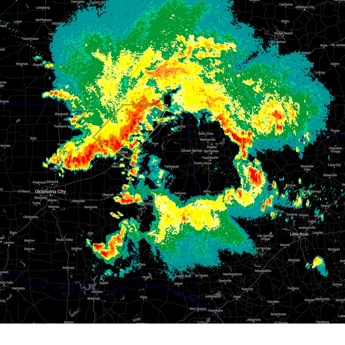 At 541 am cdt, severe thunderstorms were located along a line extending from 2 miles northeast of delaware to 6 miles west of sperry, moving southeast at 65 mph (trained weather spotters). Hazards include 70 mph wind gusts and penny size hail. Expect considerable tree damage. damage is likely to mobile homes, roofs, and outbuildings. Locations in or near the path include, barnsdall, wann, dewey, bartlesville municipal airport, collinsville, tallant, sperry, pawhuska, osage hills state park, skiatook, pershing, watova, ramona, vera, talala, chelsea, nelagoney, foyil, bushyhead, wolco, this includes interstate 44 between mile markers 226 and 234. At 541 am cdt, severe thunderstorms were located along a line extending from 2 miles northeast of delaware to 6 miles west of sperry, moving southeast at 65 mph (trained weather spotters). Hazards include 70 mph wind gusts and penny size hail. Expect considerable tree damage. damage is likely to mobile homes, roofs, and outbuildings. Locations in or near the path include, barnsdall, wann, dewey, bartlesville municipal airport, collinsville, tallant, sperry, pawhuska, osage hills state park, skiatook, pershing, watova, ramona, vera, talala, chelsea, nelagoney, foyil, bushyhead, wolco, this includes interstate 44 between mile markers 226 and 234.
|
| 5/24/2025 5:38 AM CDT |
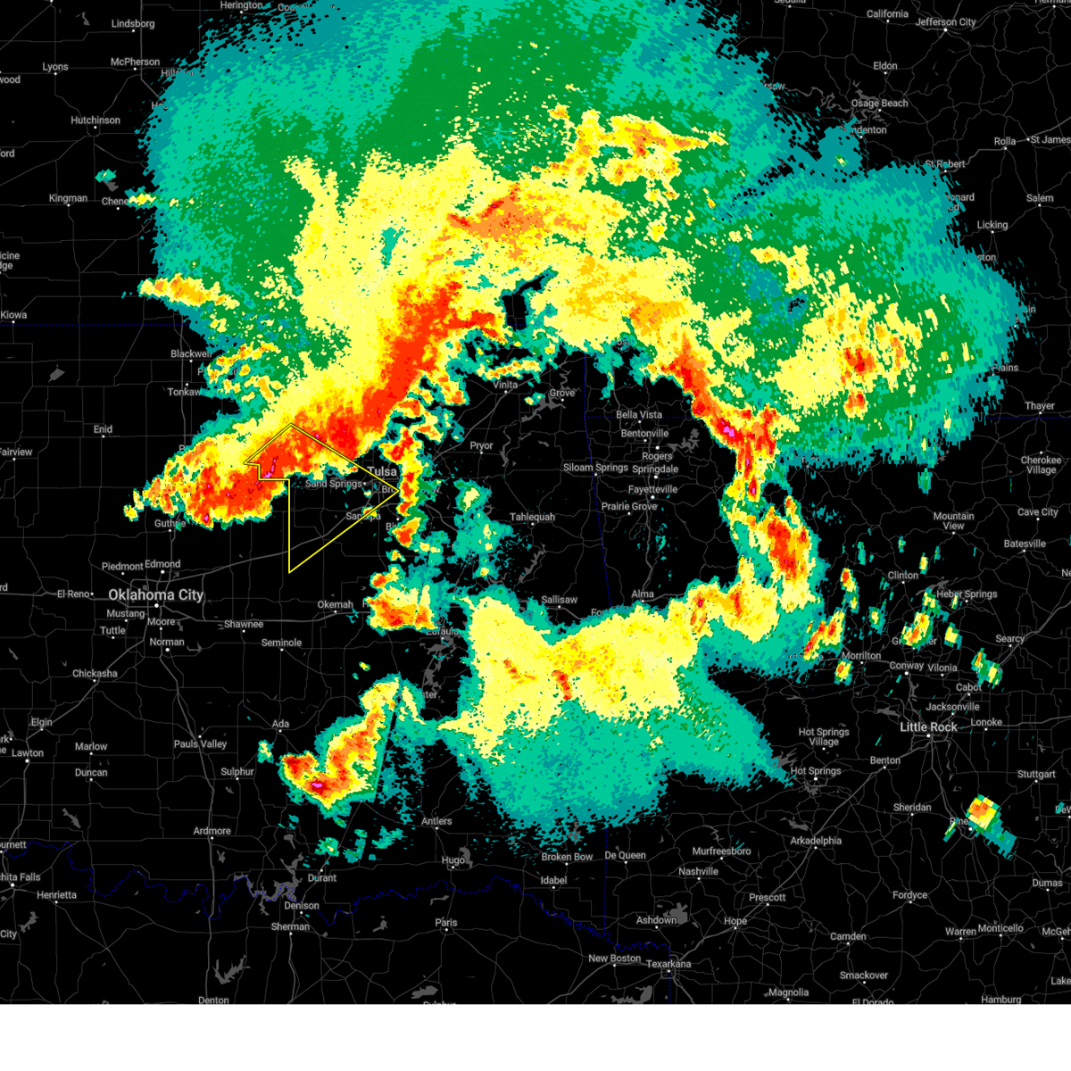 At 538 am cdt, severe thunderstorms were located along a line extending from 3 miles east of osage to near tryon, moving southeast at 65 mph (radar indicated). Hazards include 70 mph wind gusts and penny size hail. Expect considerable tree damage. damage is likely to mobile homes, roofs, and outbuildings. Locations in or near the path include, sand springs, skedee, shamrock, mannford, sapulpa, hallett, jenks riverside airport, depew, jennings, cleveland, blackburn, westport, keystone state park, bristow, walnut creek state park, oilton, milfay, silver city, drumright, maramec, this includes interstate 44 between mile markers 178 and 226. At 538 am cdt, severe thunderstorms were located along a line extending from 3 miles east of osage to near tryon, moving southeast at 65 mph (radar indicated). Hazards include 70 mph wind gusts and penny size hail. Expect considerable tree damage. damage is likely to mobile homes, roofs, and outbuildings. Locations in or near the path include, sand springs, skedee, shamrock, mannford, sapulpa, hallett, jenks riverside airport, depew, jennings, cleveland, blackburn, westport, keystone state park, bristow, walnut creek state park, oilton, milfay, silver city, drumright, maramec, this includes interstate 44 between mile markers 178 and 226.
|
| 5/24/2025 5:37 AM CDT |
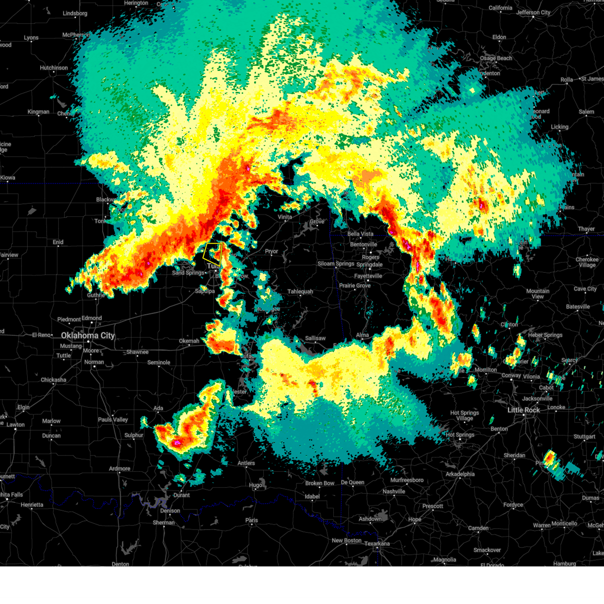 At 537 am cdt, a severe thunderstorm was located near skiatook, moving east at 25 mph (radar indicated). Hazards include 60 mph wind gusts and quarter size hail. Hail damage to vehicles is expected. expect wind damage to roofs, siding, and trees. Locations in or near the path include, skiatook, turley, sperry, tulsa,. At 537 am cdt, a severe thunderstorm was located near skiatook, moving east at 25 mph (radar indicated). Hazards include 60 mph wind gusts and quarter size hail. Hail damage to vehicles is expected. expect wind damage to roofs, siding, and trees. Locations in or near the path include, skiatook, turley, sperry, tulsa,.
|
| 5/24/2025 5:27 AM CDT |
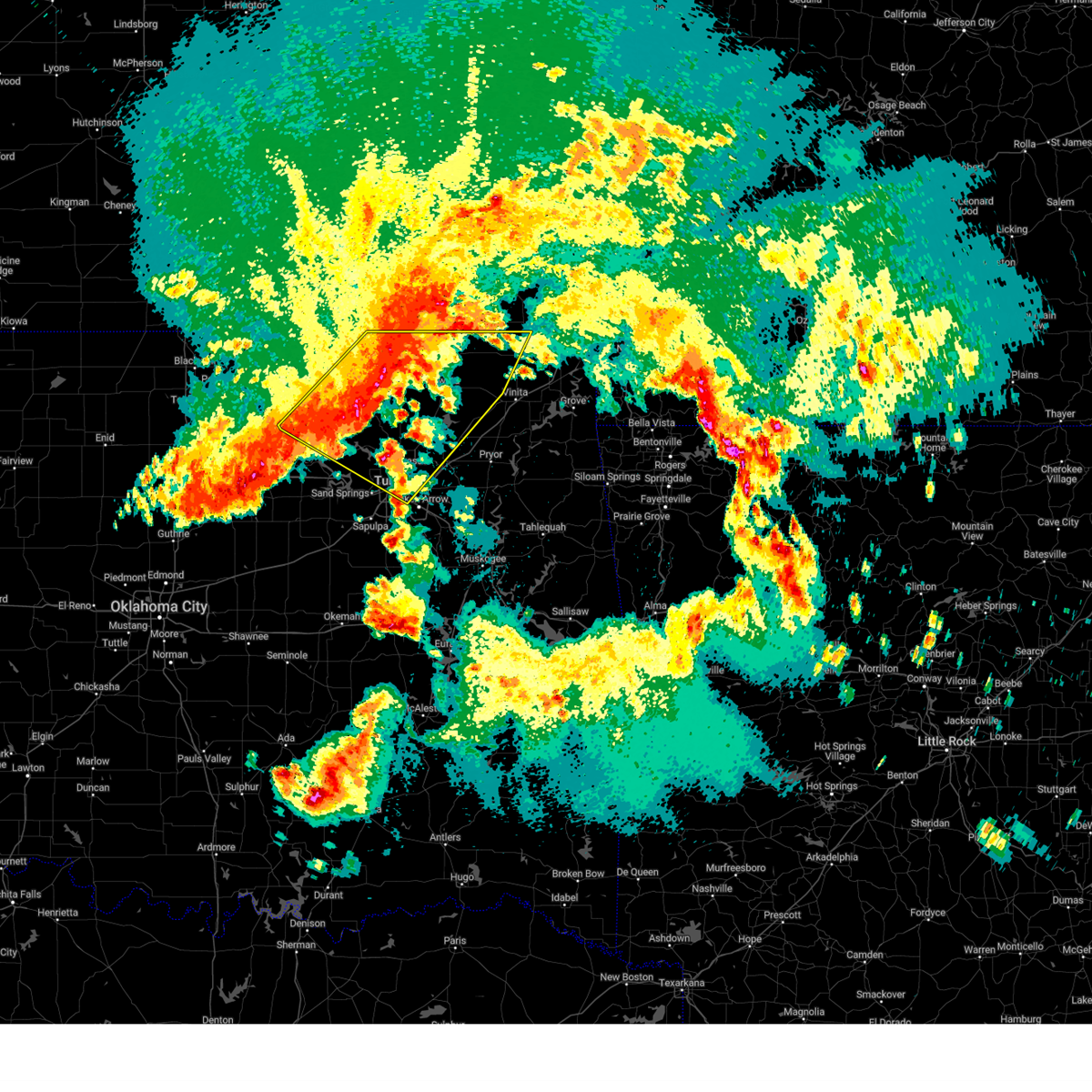 the severe thunderstorm warning has been cancelled and is no longer in effect the severe thunderstorm warning has been cancelled and is no longer in effect
|
| 5/24/2025 5:27 AM CDT |
 At 526 am cdt, severe thunderstorms were located along a line extending from 2 miles south of wann to 4 miles southeast of hominy, moving southeast at 70 mph (radar indicated). Hazards include 70 mph wind gusts and nickel size hail. Expect considerable tree damage. damage is likely to mobile homes, roofs, and outbuildings. Locations in or near the path include, barnsdall, bigheart, wann, dewey, bartlesville municipal airport, collinsville, tallant, sperry, pawhuska, osage hills state park, skiatook, pershing, watova, ramona, vera, talala, chelsea, nelagoney, foyil, bushyhead, this includes interstate 44 between mile markers 226 and 234. At 526 am cdt, severe thunderstorms were located along a line extending from 2 miles south of wann to 4 miles southeast of hominy, moving southeast at 70 mph (radar indicated). Hazards include 70 mph wind gusts and nickel size hail. Expect considerable tree damage. damage is likely to mobile homes, roofs, and outbuildings. Locations in or near the path include, barnsdall, bigheart, wann, dewey, bartlesville municipal airport, collinsville, tallant, sperry, pawhuska, osage hills state park, skiatook, pershing, watova, ramona, vera, talala, chelsea, nelagoney, foyil, bushyhead, this includes interstate 44 between mile markers 226 and 234.
|
| 5/24/2025 5:25 AM CDT |
 At 525 am cdt, a severe thunderstorm was located near sperry, moving east at 35 mph (radar indicated). Hazards include 70 mph wind gusts and ping pong ball size hail. People and animals outdoors will be injured. expect hail damage to roofs, siding, windows, and vehicles. expect considerable tree damage. wind damage is also likely to mobile homes, roofs, and outbuildings. Locations in or near the path include, skiatook, turley, sperry, tulsa,. At 525 am cdt, a severe thunderstorm was located near sperry, moving east at 35 mph (radar indicated). Hazards include 70 mph wind gusts and ping pong ball size hail. People and animals outdoors will be injured. expect hail damage to roofs, siding, windows, and vehicles. expect considerable tree damage. wind damage is also likely to mobile homes, roofs, and outbuildings. Locations in or near the path include, skiatook, turley, sperry, tulsa,.
|
| 5/24/2025 5:22 AM CDT |
 Svrtsa the national weather service in tulsa has issued a * severe thunderstorm warning for, south central osage county in northeastern oklahoma, creek county in northeastern oklahoma, pawnee county in northeastern oklahoma, west central tulsa county in northeastern oklahoma, * until 615 am cdt. * at 521 am cdt, severe thunderstorms were located along a line extending from 2 miles northwest of blackburn to 3 miles northeast of coyle, moving east at 35 mph (radar indicated. a 64 mph gust was reported at the pawnee mesonet). Hazards include 70 mph wind gusts. Expect considerable tree damage. damage is likely to mobile homes, roofs, and outbuildings. Locations in or near the path include, sand springs, skedee, shamrock, mannford, sapulpa, hallett, jenks riverside airport, depew, jennings, cleveland, blackburn, westport, keystone state park, bristow, walnut creek state park, oilton, milfay, silver city, drumright, maramec, this includes interstate 44 between mile markers 178 and 226. Svrtsa the national weather service in tulsa has issued a * severe thunderstorm warning for, south central osage county in northeastern oklahoma, creek county in northeastern oklahoma, pawnee county in northeastern oklahoma, west central tulsa county in northeastern oklahoma, * until 615 am cdt. * at 521 am cdt, severe thunderstorms were located along a line extending from 2 miles northwest of blackburn to 3 miles northeast of coyle, moving east at 35 mph (radar indicated. a 64 mph gust was reported at the pawnee mesonet). Hazards include 70 mph wind gusts. Expect considerable tree damage. damage is likely to mobile homes, roofs, and outbuildings. Locations in or near the path include, sand springs, skedee, shamrock, mannford, sapulpa, hallett, jenks riverside airport, depew, jennings, cleveland, blackburn, westport, keystone state park, bristow, walnut creek state park, oilton, milfay, silver city, drumright, maramec, this includes interstate 44 between mile markers 178 and 226.
|
| 5/24/2025 5:16 AM CDT |
 At 516 am cdt, a severe thunderstorm was located 7 miles west of sperry, moving east at 35 mph (radar indicated). Hazards include ping pong ball size hail and 60 mph wind gusts. People and animals outdoors will be injured. expect hail damage to roofs, siding, windows, and vehicles. expect wind damage to roofs, siding, and trees. Locations in or near the path include, skiatook, turley, sperry, tulsa,. At 516 am cdt, a severe thunderstorm was located 7 miles west of sperry, moving east at 35 mph (radar indicated). Hazards include ping pong ball size hail and 60 mph wind gusts. People and animals outdoors will be injured. expect hail damage to roofs, siding, windows, and vehicles. expect wind damage to roofs, siding, and trees. Locations in or near the path include, skiatook, turley, sperry, tulsa,.
|
| 5/24/2025 5:13 AM CDT |
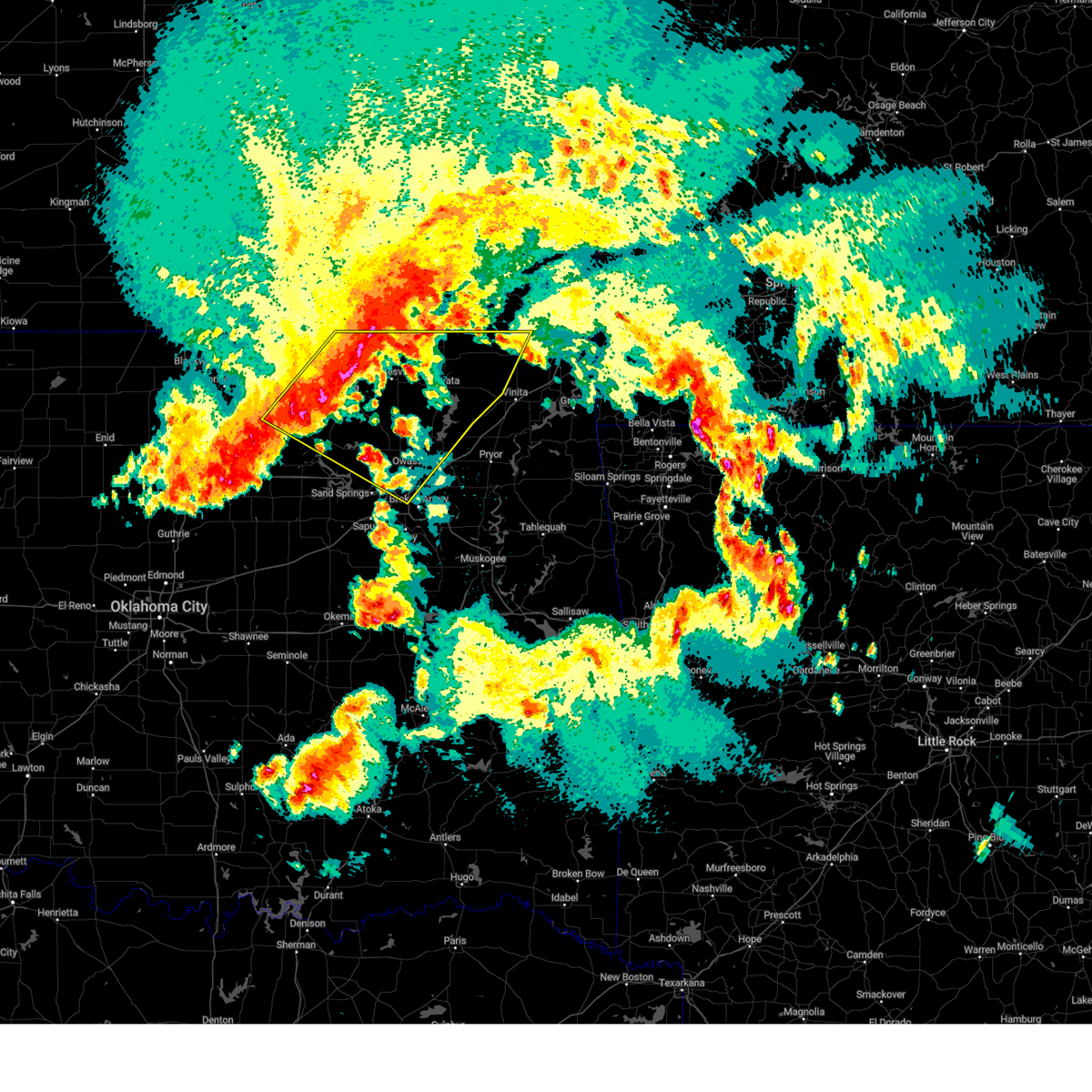 Svrtsa the national weather service in tulsa has issued a * severe thunderstorm warning for, western craig county in northeastern oklahoma, northern rogers county in northeastern oklahoma, osage county in northeastern oklahoma, washington county in northeastern oklahoma, nowata county in northeastern oklahoma, north central pawnee county in northeastern oklahoma, northeastern tulsa county in northeastern oklahoma, * until 600 am cdt. * at 513 am cdt, severe thunderstorms were located along a line extending from 4 miles north of hulah to 9 miles north of blackburn, moving southeast at 65 mph (radar indicated). Hazards include 60 mph wind gusts and nickel size hail. Expect damage to roofs, siding, and trees. Locations in or near the path include, barnsdall, bigheart, wann, dewey, bartlesville municipal airport, collinsville, tallant, sperry, pawhuska, ralston, osage hills state park, skiatook, pershing, watova, ramona, vera, talala, chelsea, nelagoney, foyil, this includes interstate 44 between mile markers 226 and 233. Svrtsa the national weather service in tulsa has issued a * severe thunderstorm warning for, western craig county in northeastern oklahoma, northern rogers county in northeastern oklahoma, osage county in northeastern oklahoma, washington county in northeastern oklahoma, nowata county in northeastern oklahoma, north central pawnee county in northeastern oklahoma, northeastern tulsa county in northeastern oklahoma, * until 600 am cdt. * at 513 am cdt, severe thunderstorms were located along a line extending from 4 miles north of hulah to 9 miles north of blackburn, moving southeast at 65 mph (radar indicated). Hazards include 60 mph wind gusts and nickel size hail. Expect damage to roofs, siding, and trees. Locations in or near the path include, barnsdall, bigheart, wann, dewey, bartlesville municipal airport, collinsville, tallant, sperry, pawhuska, ralston, osage hills state park, skiatook, pershing, watova, ramona, vera, talala, chelsea, nelagoney, foyil, this includes interstate 44 between mile markers 226 and 233.
|
| 5/24/2025 5:03 AM CDT |
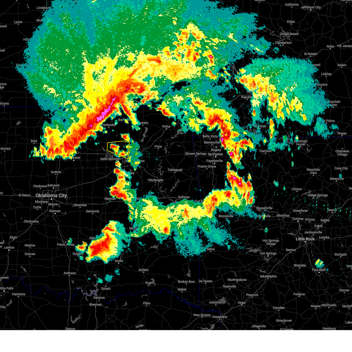 Svrtsa the national weather service in tulsa has issued a * severe thunderstorm warning for, southeastern osage county in northeastern oklahoma, north central tulsa county in northeastern oklahoma, * until 545 am cdt. * at 503 am cdt, a severe thunderstorm was located 6 miles north of walnut creek state park, moving east at 25 mph (radar indicated). Hazards include 60 mph wind gusts and quarter size hail. Hail damage to vehicles is expected. expect wind damage to roofs, siding, and trees. Locations in or near the path include, skiatook, turley, sperry, walnut creek state park, tulsa,. Svrtsa the national weather service in tulsa has issued a * severe thunderstorm warning for, southeastern osage county in northeastern oklahoma, north central tulsa county in northeastern oklahoma, * until 545 am cdt. * at 503 am cdt, a severe thunderstorm was located 6 miles north of walnut creek state park, moving east at 25 mph (radar indicated). Hazards include 60 mph wind gusts and quarter size hail. Hail damage to vehicles is expected. expect wind damage to roofs, siding, and trees. Locations in or near the path include, skiatook, turley, sperry, walnut creek state park, tulsa,.
|
| 5/19/2025 4:25 PM CDT |
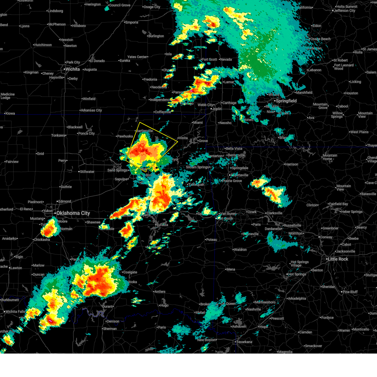 At 424 pm cdt, a severe thunderstorm was located over oologah, moving northeast at 55 mph (radar indicated. at around 400 pm cdt, multiple hail reports from quarter to golf ball size were reported in tulsa and owasso. 64 mph winds were reported at tulsa international airport). Hazards include 70 mph wind gusts and ping pong ball size hail. People and animals outdoors will be injured. expect hail damage to roofs, siding, windows, and vehicles. expect considerable tree damage. wind damage is also likely to mobile homes, roofs, and outbuildings. Locations in or near the path include, collinsville, sperry, skiatook, watova, ramona, big cabin, vera, talala, chelsea, white oak, foyil, bushyhead, owasso, new alluwe, verdigris, ochelata, claremore, turley, tulsa international airport, nowata, this includes interstate 44 between mile markers 230 and 279. At 424 pm cdt, a severe thunderstorm was located over oologah, moving northeast at 55 mph (radar indicated. at around 400 pm cdt, multiple hail reports from quarter to golf ball size were reported in tulsa and owasso. 64 mph winds were reported at tulsa international airport). Hazards include 70 mph wind gusts and ping pong ball size hail. People and animals outdoors will be injured. expect hail damage to roofs, siding, windows, and vehicles. expect considerable tree damage. wind damage is also likely to mobile homes, roofs, and outbuildings. Locations in or near the path include, collinsville, sperry, skiatook, watova, ramona, big cabin, vera, talala, chelsea, white oak, foyil, bushyhead, owasso, new alluwe, verdigris, ochelata, claremore, turley, tulsa international airport, nowata, this includes interstate 44 between mile markers 230 and 279.
|
| 5/19/2025 4:25 PM CDT |
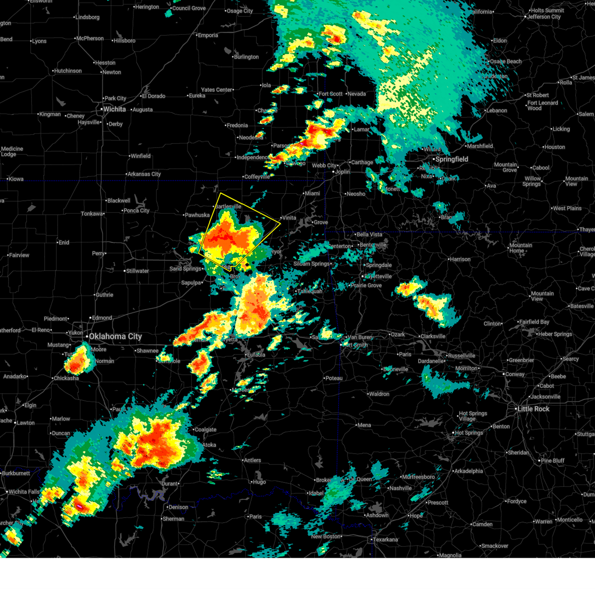 the severe thunderstorm warning has been cancelled and is no longer in effect the severe thunderstorm warning has been cancelled and is no longer in effect
|
| 5/19/2025 4:08 PM CDT |
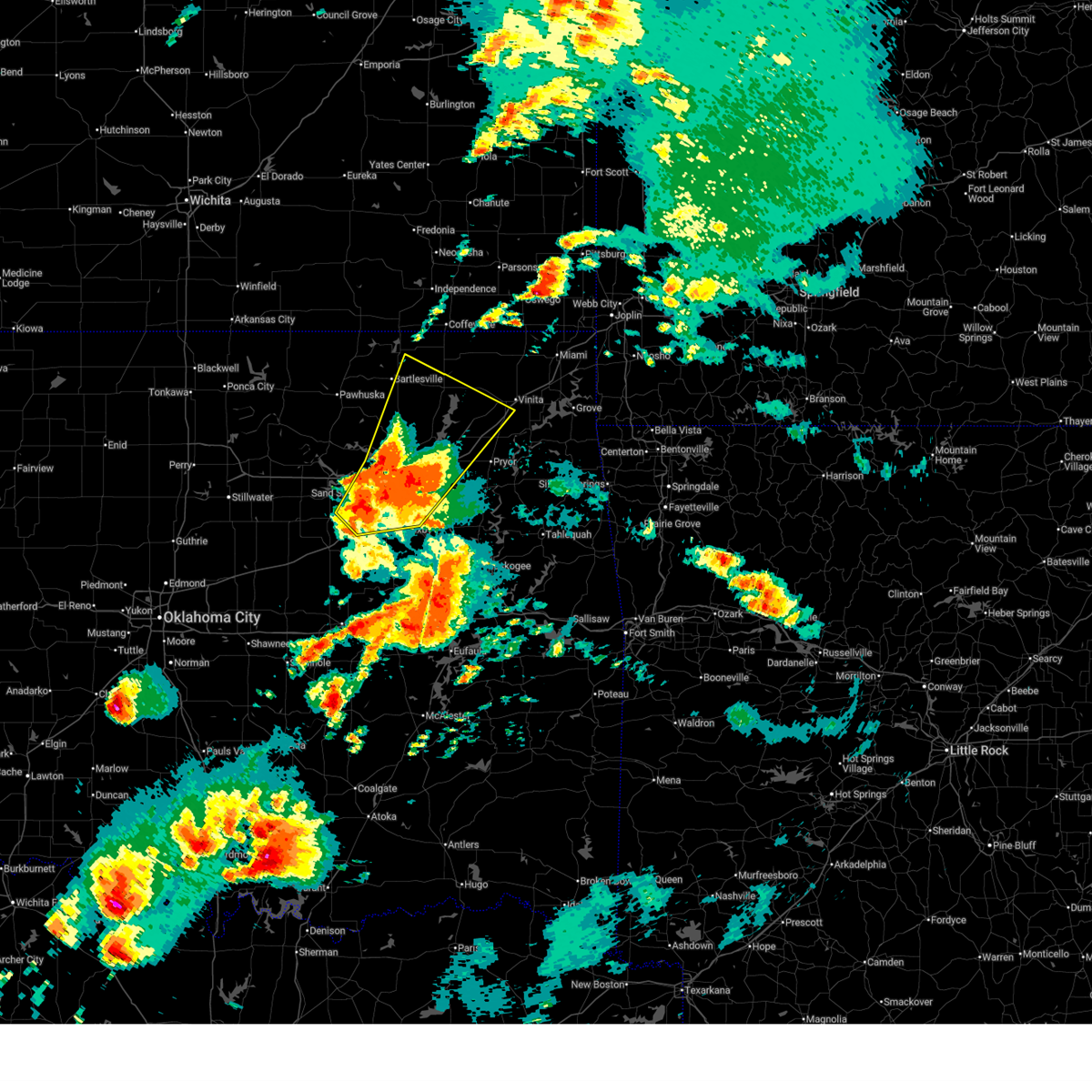 Svrtsa the national weather service in tulsa has issued a * severe thunderstorm warning for, southwestern craig county in northeastern oklahoma, rogers county in northeastern oklahoma, southeastern osage county in northeastern oklahoma, northeastern creek county in northeastern oklahoma, northwestern mayes county in northeastern oklahoma, washington county in northeastern oklahoma, southern nowata county in northeastern oklahoma, northwestern wagoner county in northeastern oklahoma, tulsa county in northeastern oklahoma, * until 500 pm cdt. * at 407 pm cdt, a cluster of severe thunderstorms was located 3 miles northwest of catoosa, moving northeast at 55 mph. hail to ping pong ball size was observed in tulsa with these storms (radar indicated). Hazards include ping pong ball size hail and 60 mph wind gusts. People and animals outdoors will be injured. expect hail damage to roofs, siding, windows, and vehicles. expect wind damage to roofs, siding, and trees. Locations in or near the path include, sand springs, broken arrow, sapulpa, collinsville, jenks riverside airport, sperry, skiatook, watova, ramona, big cabin, vera, talala, chelsea, jenks, white oak, bixby, foyil, bushyhead, owasso, new alluwe, this includes interstate 44 between mile markers 202 and 279. Svrtsa the national weather service in tulsa has issued a * severe thunderstorm warning for, southwestern craig county in northeastern oklahoma, rogers county in northeastern oklahoma, southeastern osage county in northeastern oklahoma, northeastern creek county in northeastern oklahoma, northwestern mayes county in northeastern oklahoma, washington county in northeastern oklahoma, southern nowata county in northeastern oklahoma, northwestern wagoner county in northeastern oklahoma, tulsa county in northeastern oklahoma, * until 500 pm cdt. * at 407 pm cdt, a cluster of severe thunderstorms was located 3 miles northwest of catoosa, moving northeast at 55 mph. hail to ping pong ball size was observed in tulsa with these storms (radar indicated). Hazards include ping pong ball size hail and 60 mph wind gusts. People and animals outdoors will be injured. expect hail damage to roofs, siding, windows, and vehicles. expect wind damage to roofs, siding, and trees. Locations in or near the path include, sand springs, broken arrow, sapulpa, collinsville, jenks riverside airport, sperry, skiatook, watova, ramona, big cabin, vera, talala, chelsea, jenks, white oak, bixby, foyil, bushyhead, owasso, new alluwe, this includes interstate 44 between mile markers 202 and 279.
|
| 5/19/2025 4:00 PM CDT |
 the severe thunderstorm warning has been cancelled and is no longer in effect the severe thunderstorm warning has been cancelled and is no longer in effect
|
| 5/19/2025 4:00 PM CDT |
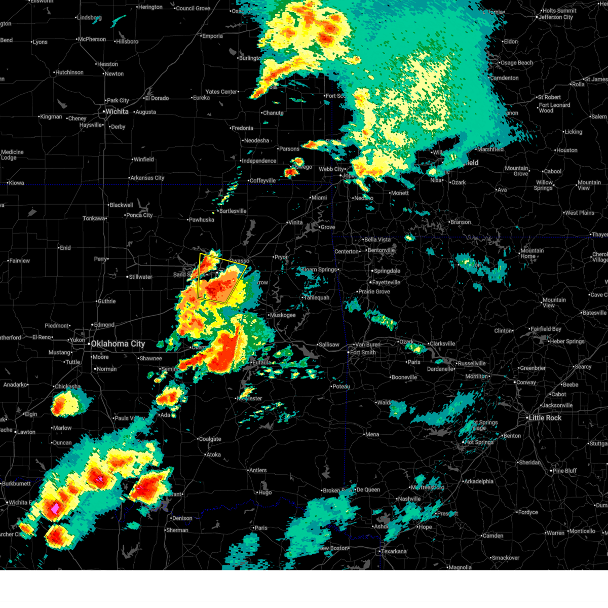 At 400 pm cdt, a severe thunderstorm was located near tulsa, moving north at 60 mph. ping pong ball sized hail was reported in jenks (radar indicated). Hazards include two inch hail and 60 mph wind gusts. People and animals outdoors will be injured. expect hail damage to roofs, siding, windows, and vehicles. expect wind damage to roofs, siding, and trees. Locations in or near the path include, sand springs, broken arrow, sapulpa, jenks riverside airport, sperry, tulsa, turley, tulsa international airport, jenks, glenpool, catoosa, bixby, kellyville, kiefer, owasso, liberty, this includes interstate 44 between mile markers 205 and 242. At 400 pm cdt, a severe thunderstorm was located near tulsa, moving north at 60 mph. ping pong ball sized hail was reported in jenks (radar indicated). Hazards include two inch hail and 60 mph wind gusts. People and animals outdoors will be injured. expect hail damage to roofs, siding, windows, and vehicles. expect wind damage to roofs, siding, and trees. Locations in or near the path include, sand springs, broken arrow, sapulpa, jenks riverside airport, sperry, tulsa, turley, tulsa international airport, jenks, glenpool, catoosa, bixby, kellyville, kiefer, owasso, liberty, this includes interstate 44 between mile markers 205 and 242.
|
| 5/19/2025 3:53 PM CDT |
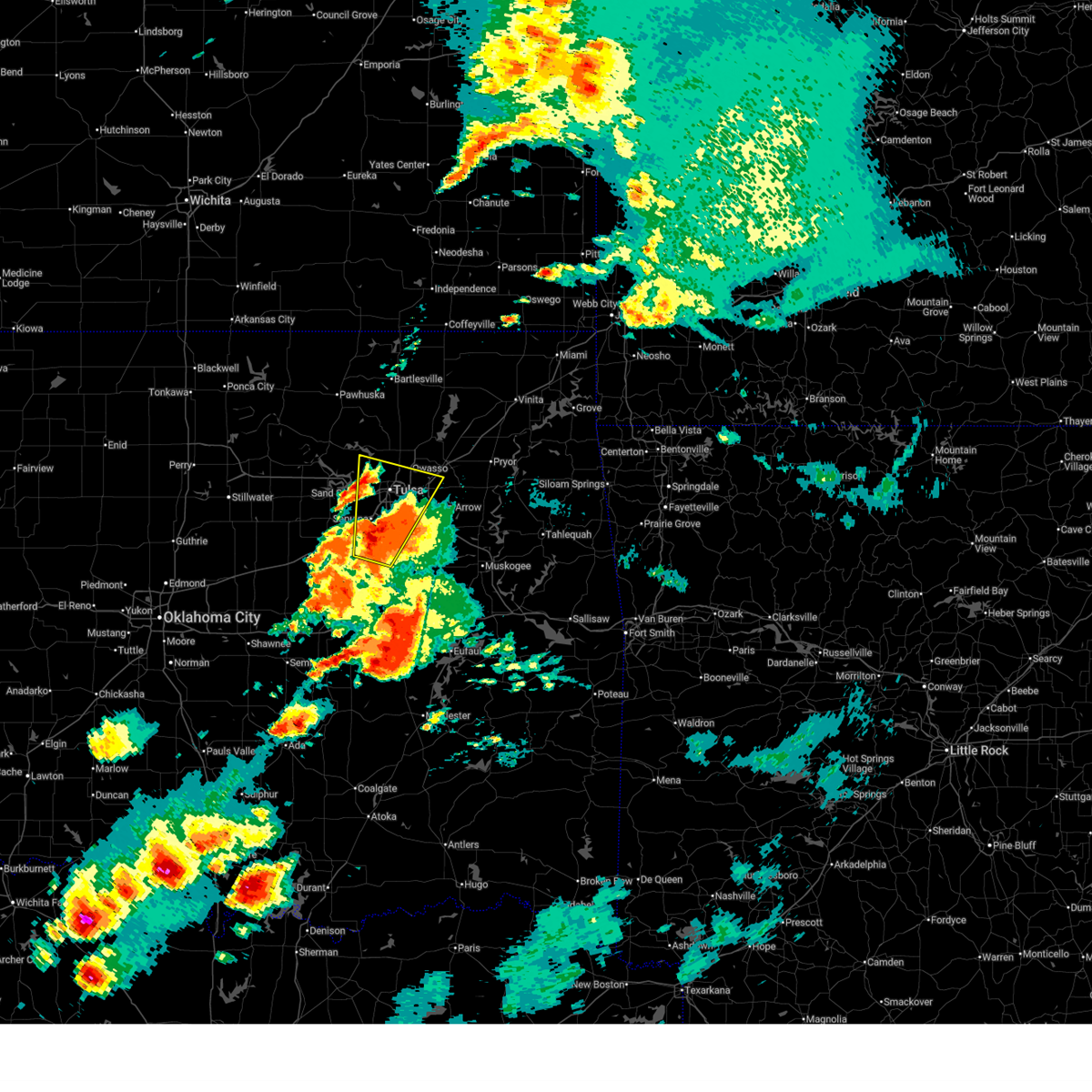 At 352 pm cdt, a severe thunderstorm was located over jenks, moving north at 60 mph (radar indicated). Hazards include golf ball size hail and 60 mph wind gusts. People and animals outdoors will be injured. expect hail damage to roofs, siding, windows, and vehicles. expect wind damage to roofs, siding, and trees. Locations in or near the path include, sand springs, broken arrow, sapulpa, jenks riverside airport, liberty, sperry, tulsa, mounds, turley, tulsa international airport, hectorville, jenks, glenpool, catoosa, bixby, kellyville, kiefer, owasso, this includes interstate 44 between mile markers 205 and 242. At 352 pm cdt, a severe thunderstorm was located over jenks, moving north at 60 mph (radar indicated). Hazards include golf ball size hail and 60 mph wind gusts. People and animals outdoors will be injured. expect hail damage to roofs, siding, windows, and vehicles. expect wind damage to roofs, siding, and trees. Locations in or near the path include, sand springs, broken arrow, sapulpa, jenks riverside airport, liberty, sperry, tulsa, mounds, turley, tulsa international airport, hectorville, jenks, glenpool, catoosa, bixby, kellyville, kiefer, owasso, this includes interstate 44 between mile markers 205 and 242.
|
| 5/19/2025 3:47 PM CDT |
 Svrtsa the national weather service in tulsa has issued a * severe thunderstorm warning for, northwestern rogers county in northeastern oklahoma, southeastern osage county in northeastern oklahoma, northeastern creek county in northeastern oklahoma, southern washington county in northeastern oklahoma, southeastern pawnee county in northeastern oklahoma, northern tulsa county in northeastern oklahoma, * until 430 pm cdt. * at 346 pm cdt, a cluster of severe thunderstorm was located 4 miles northeast of keystone state park, moving northeast at 50 mph (radar indicated). Hazards include 60 mph wind gusts and half dollar size hail. Hail damage to vehicles is expected. expect wind damage to roofs, siding, and trees. Locations in or near the path include, sand springs, keystone state park, walnut creek state park, mannford, collinsville, sperry, skiatook, turley, ramona, vera, oologah, owasso, tulsa international airport, avant, tulsa,. Svrtsa the national weather service in tulsa has issued a * severe thunderstorm warning for, northwestern rogers county in northeastern oklahoma, southeastern osage county in northeastern oklahoma, northeastern creek county in northeastern oklahoma, southern washington county in northeastern oklahoma, southeastern pawnee county in northeastern oklahoma, northern tulsa county in northeastern oklahoma, * until 430 pm cdt. * at 346 pm cdt, a cluster of severe thunderstorm was located 4 miles northeast of keystone state park, moving northeast at 50 mph (radar indicated). Hazards include 60 mph wind gusts and half dollar size hail. Hail damage to vehicles is expected. expect wind damage to roofs, siding, and trees. Locations in or near the path include, sand springs, keystone state park, walnut creek state park, mannford, collinsville, sperry, skiatook, turley, ramona, vera, oologah, owasso, tulsa international airport, avant, tulsa,.
|
| 5/19/2025 3:35 PM CDT |
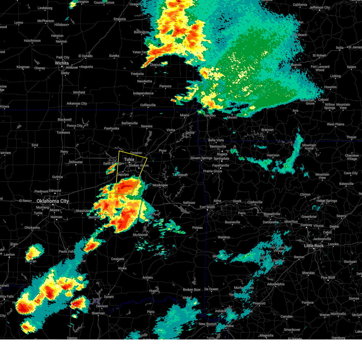 the severe thunderstorm warning has been cancelled and is no longer in effect the severe thunderstorm warning has been cancelled and is no longer in effect
|
| 5/19/2025 3:35 PM CDT |
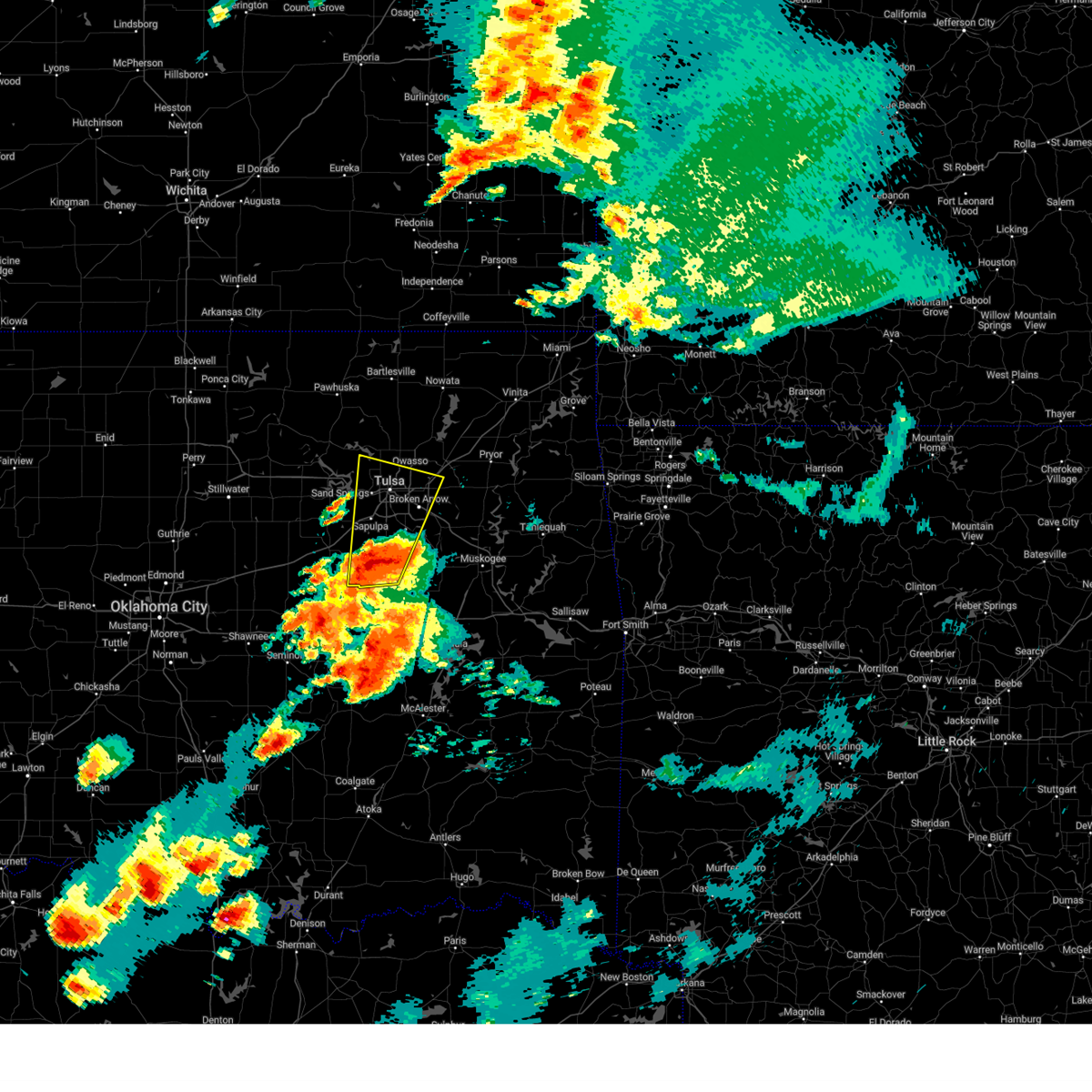 At 335 pm cdt, a severe thunderstorm was located near beggs, moving north at 60 mph (radar indicated). Hazards include ping pong ball size hail and 60 mph wind gusts. People and animals outdoors will be injured. expect hail damage to roofs, siding, windows, and vehicles. expect wind damage to roofs, siding, and trees. Locations in or near the path include, beggs, sand springs, broken arrow, preston, sapulpa, jenks riverside airport, liberty, sperry, tulsa, mounds, turley, tulsa international airport, hectorville, leonard, jenks, glenpool, catoosa, bixby, kellyville, kiefer, this includes interstate 44 between mile markers 204 and 242. At 335 pm cdt, a severe thunderstorm was located near beggs, moving north at 60 mph (radar indicated). Hazards include ping pong ball size hail and 60 mph wind gusts. People and animals outdoors will be injured. expect hail damage to roofs, siding, windows, and vehicles. expect wind damage to roofs, siding, and trees. Locations in or near the path include, beggs, sand springs, broken arrow, preston, sapulpa, jenks riverside airport, liberty, sperry, tulsa, mounds, turley, tulsa international airport, hectorville, leonard, jenks, glenpool, catoosa, bixby, kellyville, kiefer, this includes interstate 44 between mile markers 204 and 242.
|
| 5/19/2025 3:26 PM CDT |
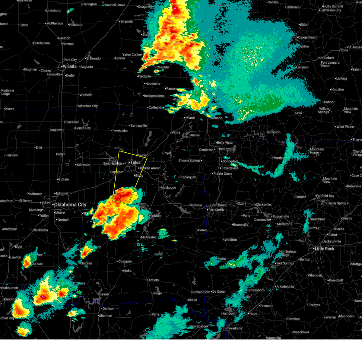 Svrtsa the national weather service in tulsa has issued a * severe thunderstorm warning for, southwestern rogers county in northeastern oklahoma, southeastern osage county in northeastern oklahoma, eastern creek county in northeastern oklahoma, northwestern wagoner county in northeastern oklahoma, western okmulgee county in northeastern oklahoma, tulsa county in northeastern oklahoma, northeastern okfuskee county in east central oklahoma, * until 415 pm cdt. * at 326 pm cdt, a severe thunderstorm was located 3 miles northwest of okmulgee state park, moving north at 60 mph (radar indicated). Hazards include two inch hail and 60 mph wind gusts. People and animals outdoors will be injured. expect hail damage to roofs, siding, windows, and vehicles. expect wind damage to roofs, siding, and trees. Locations in or near the path include, beggs, sand springs, broken arrow, preston, sapulpa, jenks riverside airport, liberty, sperry, mounds, hectorville, leonard, jenks, bixby, okmulgee, okfuskee, tulsa, turley, tulsa international airport, okmulgee state park, glenpool, this includes interstate 44 between mile markers 202 and 242. Svrtsa the national weather service in tulsa has issued a * severe thunderstorm warning for, southwestern rogers county in northeastern oklahoma, southeastern osage county in northeastern oklahoma, eastern creek county in northeastern oklahoma, northwestern wagoner county in northeastern oklahoma, western okmulgee county in northeastern oklahoma, tulsa county in northeastern oklahoma, northeastern okfuskee county in east central oklahoma, * until 415 pm cdt. * at 326 pm cdt, a severe thunderstorm was located 3 miles northwest of okmulgee state park, moving north at 60 mph (radar indicated). Hazards include two inch hail and 60 mph wind gusts. People and animals outdoors will be injured. expect hail damage to roofs, siding, windows, and vehicles. expect wind damage to roofs, siding, and trees. Locations in or near the path include, beggs, sand springs, broken arrow, preston, sapulpa, jenks riverside airport, liberty, sperry, mounds, hectorville, leonard, jenks, bixby, okmulgee, okfuskee, tulsa, turley, tulsa international airport, okmulgee state park, glenpool, this includes interstate 44 between mile markers 202 and 242.
|
| 5/18/2025 12:36 PM CDT |
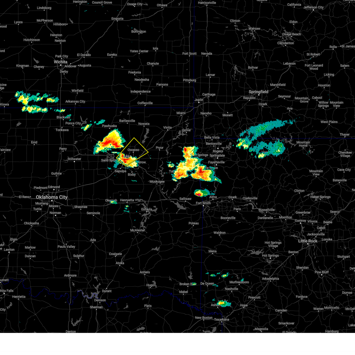 Svrtsa the national weather service in tulsa has issued a * severe thunderstorm warning for, west central rogers county in northeastern oklahoma, southeastern osage county in northeastern oklahoma, south central washington county in northeastern oklahoma, northeastern tulsa county in northeastern oklahoma, * until 115 pm cdt. * at 1236 pm cdt, a severe thunderstorm was located 4 miles northeast of sand springs, moving northeast at 35 mph (radar indicated). Hazards include quarter size hail. Damage to vehicles is expected. Locations in or near the path include, sand springs, collinsville, verdigris, sperry, tulsa, claremore, skiatook, turley, tulsa international airport, vera, catoosa, owasso, tiawah, this includes interstate 44 between mile markers 217 and 235, and between mile markers 237 and 249. Svrtsa the national weather service in tulsa has issued a * severe thunderstorm warning for, west central rogers county in northeastern oklahoma, southeastern osage county in northeastern oklahoma, south central washington county in northeastern oklahoma, northeastern tulsa county in northeastern oklahoma, * until 115 pm cdt. * at 1236 pm cdt, a severe thunderstorm was located 4 miles northeast of sand springs, moving northeast at 35 mph (radar indicated). Hazards include quarter size hail. Damage to vehicles is expected. Locations in or near the path include, sand springs, collinsville, verdigris, sperry, tulsa, claremore, skiatook, turley, tulsa international airport, vera, catoosa, owasso, tiawah, this includes interstate 44 between mile markers 217 and 235, and between mile markers 237 and 249.
|
| 4/29/2025 7:00 AM CDT | At 700 am cdt, severe thunderstorms were located along a line extending from 5 miles south of wann to 6 miles west of skiatook, moving east at 40 mph (radar indicated). Hazards include 60 mph wind gusts and nickel size hail. Expect damage to roofs, siding, and trees. Locations in or near the path include, barnsdall, dewey, bartlesville municipal airport, collinsville, sperry, skiatook, watova, ramona, vera, talala, foyil, wolco, owasso, new alluwe, hollow, lenapah, verdigris, delaware, ochelata, claremore, this includes interstate 44 between mile markers 238 and 248. |
| 4/29/2025 6:47 AM CDT |
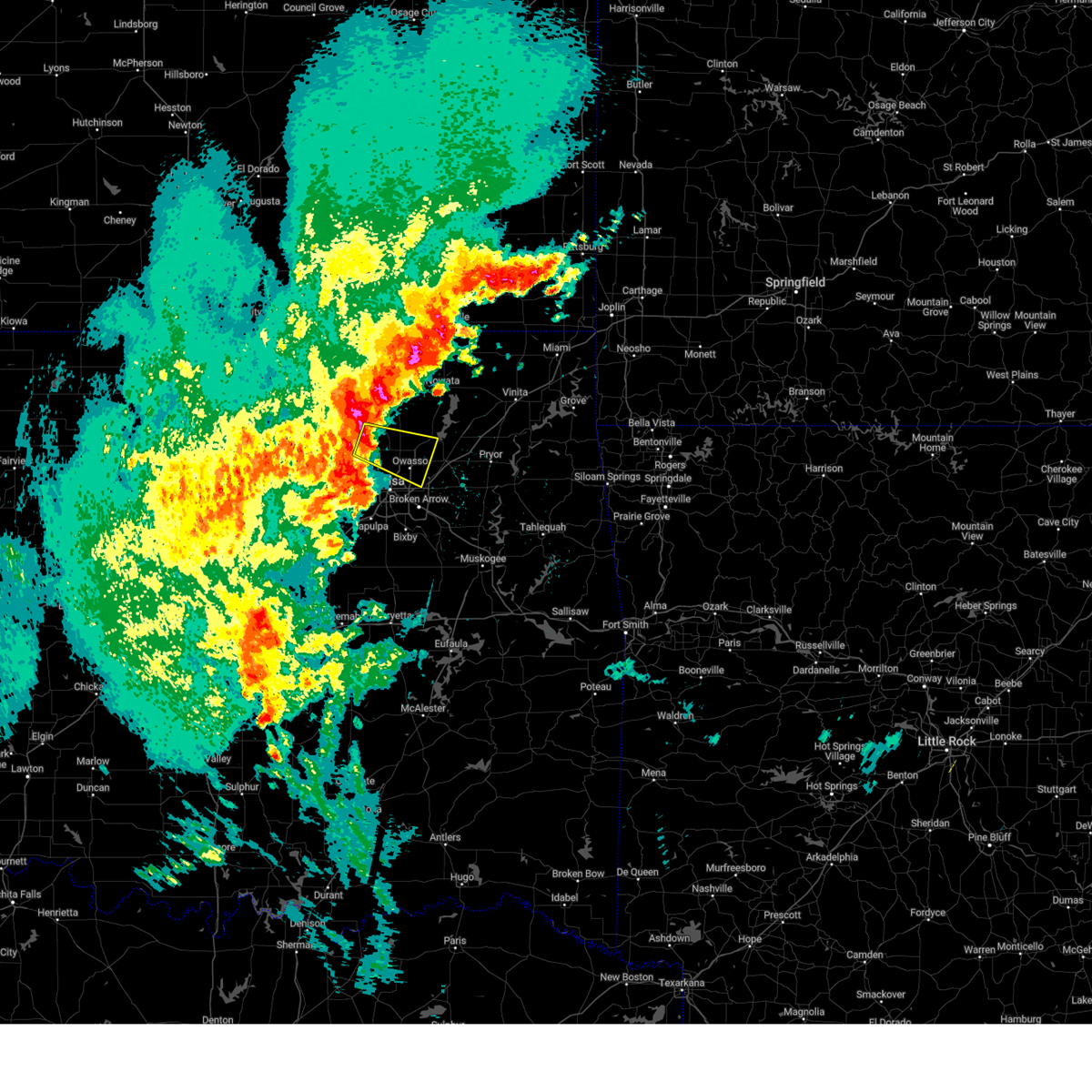 Svrtsa the national weather service in tulsa has issued a * severe thunderstorm warning for, west central rogers county in northeastern oklahoma, southeastern osage county in northeastern oklahoma, southern washington county in northeastern oklahoma, northeastern tulsa county in northeastern oklahoma, * until 715 am cdt. * at 647 am cdt, a severe thunderstorm was located 6 miles southwest of avant, moving east at 45 mph (radar indicated). Hazards include 70 mph wind gusts. Expect considerable tree damage. damage is likely to mobile homes, roofs, and outbuildings. Locations in or near the path include, skiatook, turley, vera, collinsville, avant, catoosa, sperry, owasso, tulsa,. Svrtsa the national weather service in tulsa has issued a * severe thunderstorm warning for, west central rogers county in northeastern oklahoma, southeastern osage county in northeastern oklahoma, southern washington county in northeastern oklahoma, northeastern tulsa county in northeastern oklahoma, * until 715 am cdt. * at 647 am cdt, a severe thunderstorm was located 6 miles southwest of avant, moving east at 45 mph (radar indicated). Hazards include 70 mph wind gusts. Expect considerable tree damage. damage is likely to mobile homes, roofs, and outbuildings. Locations in or near the path include, skiatook, turley, vera, collinsville, avant, catoosa, sperry, owasso, tulsa,.
|
| 4/29/2025 6:40 AM CDT |
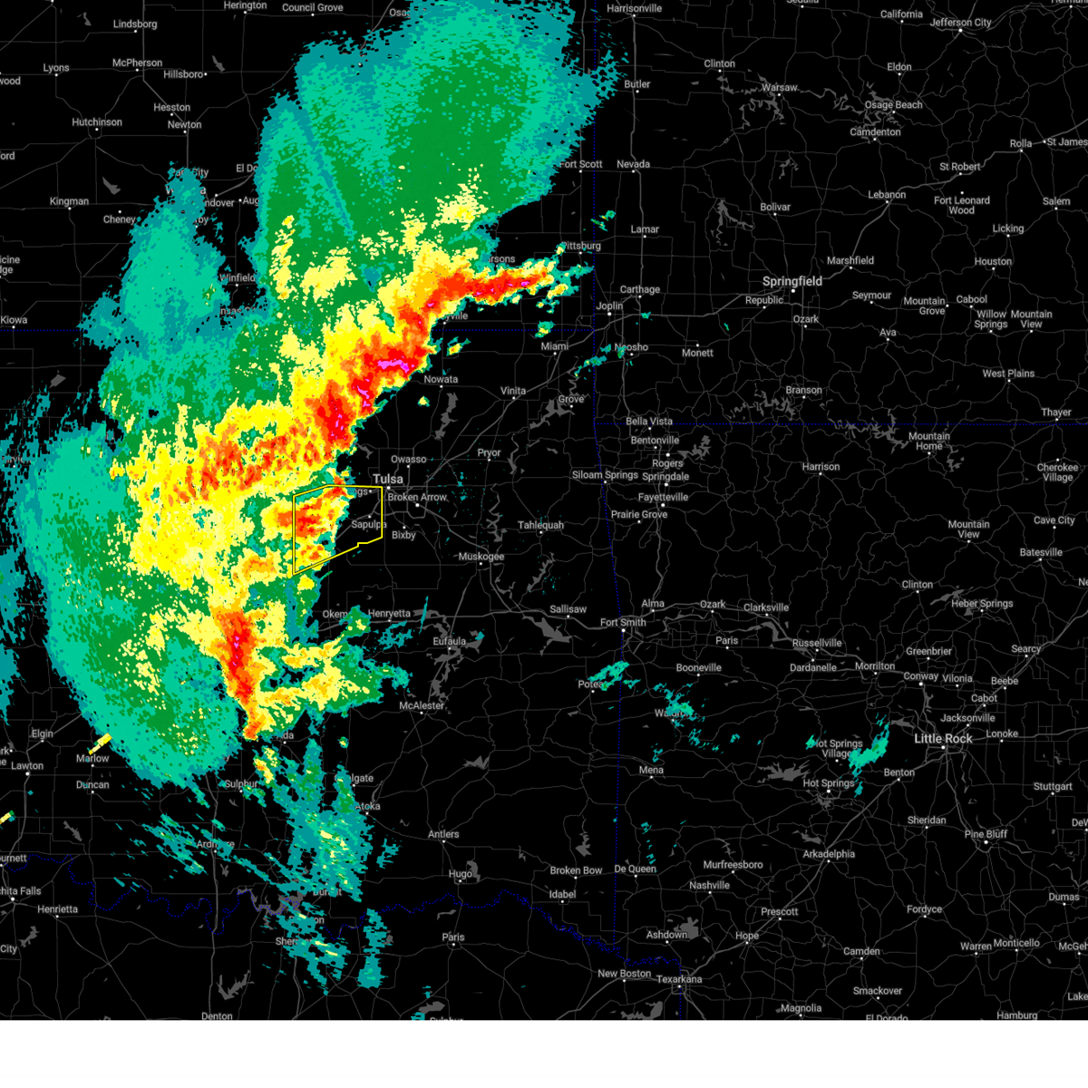 At 640 am cdt, a severe thunderstorm was located 8 miles west of kellyville, moving northeast at 45 mph (radar indicated). Hazards include 60 mph wind gusts. Expect damage to roofs, siding, and trees. Locations in or near the path include, sand springs, keystone state park, shamrock, bristow, mannford, sapulpa, oilton, depew, milfay, silver city, drumright, kellyville, kiefer, tulsa, this includes interstate 44 between mile markers 178 and 218. At 640 am cdt, a severe thunderstorm was located 8 miles west of kellyville, moving northeast at 45 mph (radar indicated). Hazards include 60 mph wind gusts. Expect damage to roofs, siding, and trees. Locations in or near the path include, sand springs, keystone state park, shamrock, bristow, mannford, sapulpa, oilton, depew, milfay, silver city, drumright, kellyville, kiefer, tulsa, this includes interstate 44 between mile markers 178 and 218.
|
| 4/29/2025 6:39 AM CDT |
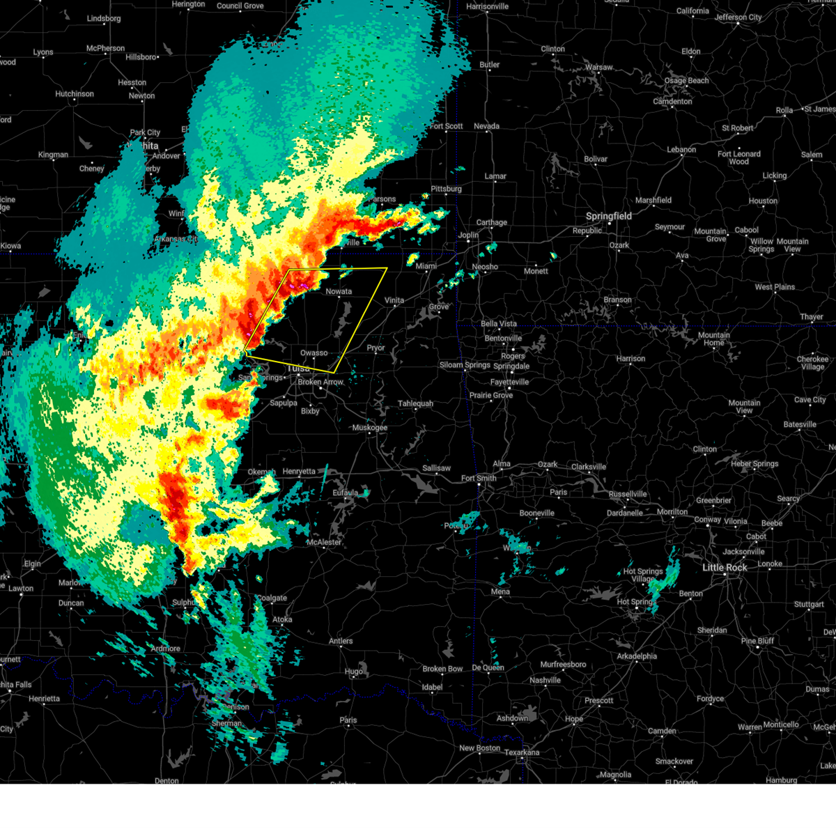 Svrtsa the national weather service in tulsa has issued a * severe thunderstorm warning for, northwestern craig county in northeastern oklahoma, rogers county in northeastern oklahoma, southeastern osage county in northeastern oklahoma, washington county in northeastern oklahoma, nowata county in northeastern oklahoma, northeastern tulsa county in northeastern oklahoma, * until 730 am cdt. * at 638 am cdt, severe thunderstorms were located along a line extending from 3 miles west of dewey to 7 miles north of walnut creek state park, moving east at 50 mph (radar indicated). Hazards include 60 mph wind gusts and quarter size hail. Hail damage to vehicles is expected. expect wind damage to roofs, siding, and trees. Locations in or near the path include, barnsdall, dewey, bartlesville municipal airport, collinsville, tallant, sperry, skiatook, pershing, watova, ramona, vera, talala, nelagoney, foyil, wolco, owasso, new alluwe, hominy, hollow, lenapah, this includes interstate 44 between mile markers 238 and 248. Svrtsa the national weather service in tulsa has issued a * severe thunderstorm warning for, northwestern craig county in northeastern oklahoma, rogers county in northeastern oklahoma, southeastern osage county in northeastern oklahoma, washington county in northeastern oklahoma, nowata county in northeastern oklahoma, northeastern tulsa county in northeastern oklahoma, * until 730 am cdt. * at 638 am cdt, severe thunderstorms were located along a line extending from 3 miles west of dewey to 7 miles north of walnut creek state park, moving east at 50 mph (radar indicated). Hazards include 60 mph wind gusts and quarter size hail. Hail damage to vehicles is expected. expect wind damage to roofs, siding, and trees. Locations in or near the path include, barnsdall, dewey, bartlesville municipal airport, collinsville, tallant, sperry, skiatook, pershing, watova, ramona, vera, talala, nelagoney, foyil, wolco, owasso, new alluwe, hominy, hollow, lenapah, this includes interstate 44 between mile markers 238 and 248.
|
| 4/29/2025 6:26 AM CDT |
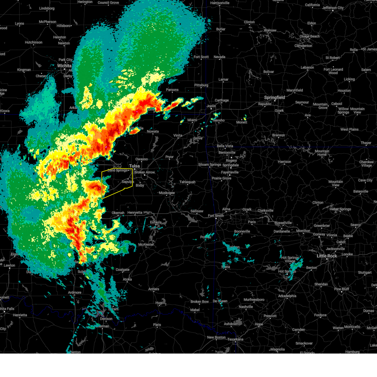 Svrtsa the national weather service in tulsa has issued a * severe thunderstorm warning for, creek county in northeastern oklahoma, southwestern tulsa county in northeastern oklahoma, * until 715 am cdt. * at 626 am cdt, a severe thunderstorm was located near shamrock, moving northeast at 45 mph (radar indicated). Hazards include 60 mph wind gusts and nickel size hail. Expect damage to roofs, siding, and trees. Locations in or near the path include, sand springs, keystone state park, shamrock, bristow, mannford, sapulpa, oilton, depew, milfay, silver city, drumright, kellyville, kiefer, tulsa, this includes interstate 44 between mile markers 178 and 218. Svrtsa the national weather service in tulsa has issued a * severe thunderstorm warning for, creek county in northeastern oklahoma, southwestern tulsa county in northeastern oklahoma, * until 715 am cdt. * at 626 am cdt, a severe thunderstorm was located near shamrock, moving northeast at 45 mph (radar indicated). Hazards include 60 mph wind gusts and nickel size hail. Expect damage to roofs, siding, and trees. Locations in or near the path include, sand springs, keystone state park, shamrock, bristow, mannford, sapulpa, oilton, depew, milfay, silver city, drumright, kellyville, kiefer, tulsa, this includes interstate 44 between mile markers 178 and 218.
|
| 4/4/2025 6:34 AM CDT |
 At 634 am cdt, severe thunderstorms were located along a line extending from 5 miles northeast of slick to 6 miles west of stonebluff to 3 miles north of boynton, moving northeast at 65 mph (radar indicated). Hazards include 60 mph wind gusts and half dollar size hail. Hail damage to vehicles is expected. expect wind damage to roofs, siding, and trees. Locations in or near the path include, beggs, sapulpa, inola, collinsville, mazie, jenks riverside airport, locust grove, mounds, strang, hoot owl, stonebluff, hectorville, chouteau, eram, haskell, leonard, morris, murphy, bushyhead, owasso, this includes interstate 44 between mile markers 202 and 272. At 634 am cdt, severe thunderstorms were located along a line extending from 5 miles northeast of slick to 6 miles west of stonebluff to 3 miles north of boynton, moving northeast at 65 mph (radar indicated). Hazards include 60 mph wind gusts and half dollar size hail. Hail damage to vehicles is expected. expect wind damage to roofs, siding, and trees. Locations in or near the path include, beggs, sapulpa, inola, collinsville, mazie, jenks riverside airport, locust grove, mounds, strang, hoot owl, stonebluff, hectorville, chouteau, eram, haskell, leonard, morris, murphy, bushyhead, owasso, this includes interstate 44 between mile markers 202 and 272.
|
| 4/4/2025 6:32 AM CDT |
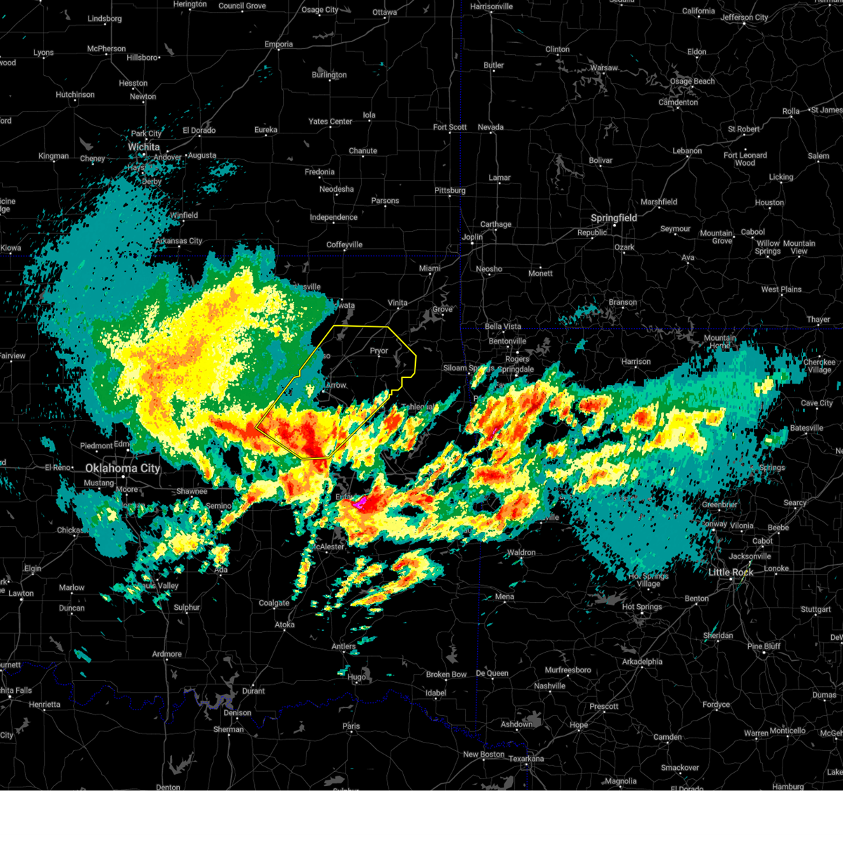 Svrtsa the national weather service in tulsa has issued a * severe thunderstorm warning for, rogers county in northeastern oklahoma, southeastern creek county in northeastern oklahoma, mayes county in northeastern oklahoma, wagoner county in northeastern oklahoma, northern okmulgee county in northeastern oklahoma, northwestern muskogee county in east central oklahoma, tulsa county in northeastern oklahoma, * until 715 am cdt. * at 631 am cdt, severe thunderstorms were located along a line extending from 3 miles north of slick to 6 miles north of bald hill to 2 miles northwest of boynton, moving northeast at 90 mph (radar indicated). Hazards include 60 mph wind gusts and half dollar size hail. Hail damage to vehicles is expected. expect wind damage to roofs, siding, and trees. Locations in or near the path include, beggs, sapulpa, inola, collinsville, mazie, jenks riverside airport, locust grove, mounds, strang, hoot owl, stonebluff, hectorville, chouteau, eram, haskell, leonard, morris, murphy, bushyhead, owasso, this includes interstate 44 between mile markers 202 and 272. Svrtsa the national weather service in tulsa has issued a * severe thunderstorm warning for, rogers county in northeastern oklahoma, southeastern creek county in northeastern oklahoma, mayes county in northeastern oklahoma, wagoner county in northeastern oklahoma, northern okmulgee county in northeastern oklahoma, northwestern muskogee county in east central oklahoma, tulsa county in northeastern oklahoma, * until 715 am cdt. * at 631 am cdt, severe thunderstorms were located along a line extending from 3 miles north of slick to 6 miles north of bald hill to 2 miles northwest of boynton, moving northeast at 90 mph (radar indicated). Hazards include 60 mph wind gusts and half dollar size hail. Hail damage to vehicles is expected. expect wind damage to roofs, siding, and trees. Locations in or near the path include, beggs, sapulpa, inola, collinsville, mazie, jenks riverside airport, locust grove, mounds, strang, hoot owl, stonebluff, hectorville, chouteau, eram, haskell, leonard, morris, murphy, bushyhead, owasso, this includes interstate 44 between mile markers 202 and 272.
|
| 4/2/2025 7:06 AM CDT |
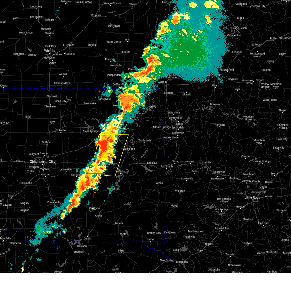 At 706 am cdt, severe thunderstorms were located along a line extending from 5 miles east of jenks riverside airport to 5 miles north of wetumka, moving east at 45 mph (radar indicated). Hazards include 60 mph wind gusts and quarter size hail. Hail damage to vehicles is expected. expect wind damage to roofs, siding, and trees. locations in or near the path include, beggs, broken arrow, preston, sapulpa, raiford, weleetka, dewar, jenks riverside airport, liberty, vivian, mounds, pierce, clearview, schulter, stonebluff, hectorville, eram, haskell, leonard, jenks, this includes the following highways, interstate 40 in oklahoma between mile markers 219 and 258. Interstate 44 between mile markers 211 and 216. At 706 am cdt, severe thunderstorms were located along a line extending from 5 miles east of jenks riverside airport to 5 miles north of wetumka, moving east at 45 mph (radar indicated). Hazards include 60 mph wind gusts and quarter size hail. Hail damage to vehicles is expected. expect wind damage to roofs, siding, and trees. locations in or near the path include, beggs, broken arrow, preston, sapulpa, raiford, weleetka, dewar, jenks riverside airport, liberty, vivian, mounds, pierce, clearview, schulter, stonebluff, hectorville, eram, haskell, leonard, jenks, this includes the following highways, interstate 40 in oklahoma between mile markers 219 and 258. Interstate 44 between mile markers 211 and 216.
|
| 4/2/2025 6:52 AM CDT |
 At 651 am cdt, severe thunderstorms were located along a line extending from 3 miles west of chetopa to 4 miles north of broken arrow, moving east at 60 mph (radar indicated). Hazards include 60 mph wind gusts and quarter size hail. Hail damage to vehicles is expected. expect wind damage to roofs, siding, and trees. Locations in or near the path include, sand springs, vinita, inola, collinsville, commerce, mazie, watova, picher, big cabin, talala, chouteau, pryor creek, chelsea, white oak, welch, foyil, bushyhead, owasso, new alluwe, hollow, this includes interstate 44 between mile markers 217 and 294. At 651 am cdt, severe thunderstorms were located along a line extending from 3 miles west of chetopa to 4 miles north of broken arrow, moving east at 60 mph (radar indicated). Hazards include 60 mph wind gusts and quarter size hail. Hail damage to vehicles is expected. expect wind damage to roofs, siding, and trees. Locations in or near the path include, sand springs, vinita, inola, collinsville, commerce, mazie, watova, picher, big cabin, talala, chouteau, pryor creek, chelsea, white oak, welch, foyil, bushyhead, owasso, new alluwe, hollow, this includes interstate 44 between mile markers 217 and 294.
|
| 4/2/2025 6:52 AM CDT |
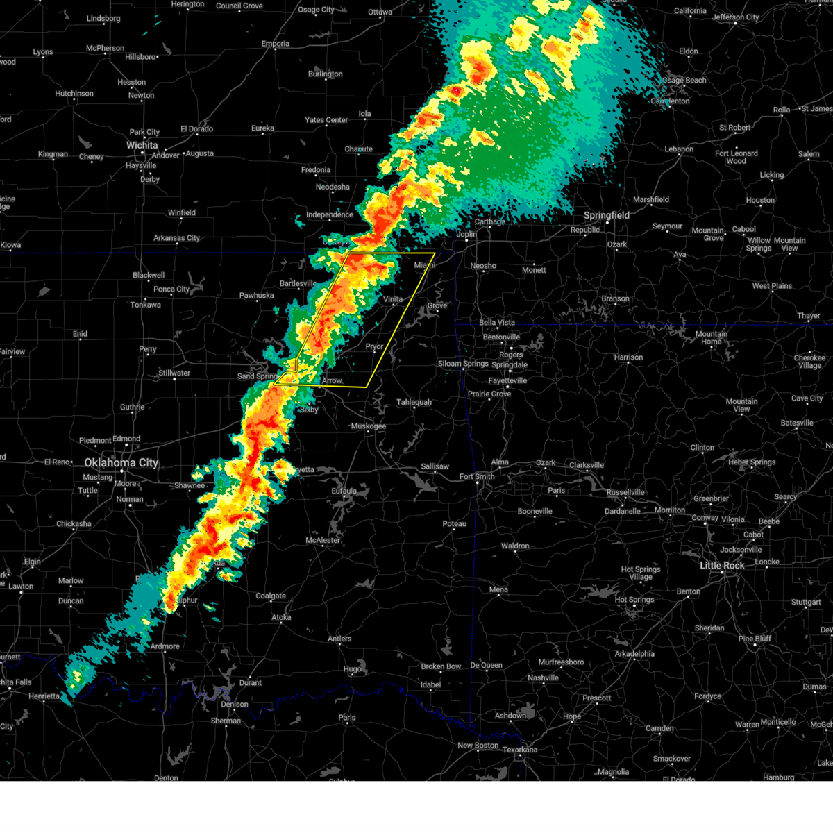 the severe thunderstorm warning has been cancelled and is no longer in effect the severe thunderstorm warning has been cancelled and is no longer in effect
|
| 4/2/2025 6:48 AM CDT |
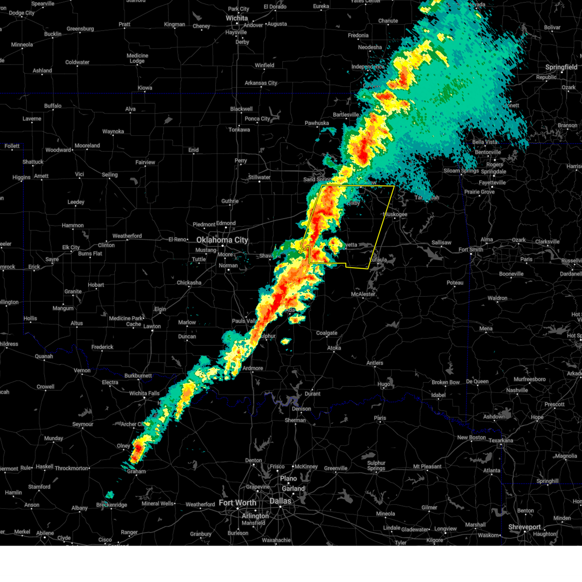 Svrtsa the national weather service in tulsa has issued a * severe thunderstorm warning for, eastern creek county in northeastern oklahoma, western mcintosh county in southeastern oklahoma, southwestern wagoner county in northeastern oklahoma, okmulgee county in northeastern oklahoma, northwestern muskogee county in east central oklahoma, southern tulsa county in northeastern oklahoma, okfuskee county in east central oklahoma, * until 745 am cdt. * at 648 am cdt, severe thunderstorms were located along a line extending from 2 miles north of sapulpa to 3 miles south of cromwell, moving east at 45 mph (radar indicated). Hazards include 60 mph wind gusts and quarter size hail. Hail damage to vehicles is expected. expect wind damage to roofs, siding, and trees. locations in or near the path include, beggs, sapulpa, raiford, jenks riverside airport, mounds, pierce, clearview, schulter, stonebluff, hectorville, eram, haskell, leonard, morris, pharoah, bryant, hoffman, okmulgee, hitchita, okemah, this includes the following highways, interstate 40 in oklahoma between mile markers 212 and 258. Interstate 44 between mile markers 193 and 216. Svrtsa the national weather service in tulsa has issued a * severe thunderstorm warning for, eastern creek county in northeastern oklahoma, western mcintosh county in southeastern oklahoma, southwestern wagoner county in northeastern oklahoma, okmulgee county in northeastern oklahoma, northwestern muskogee county in east central oklahoma, southern tulsa county in northeastern oklahoma, okfuskee county in east central oklahoma, * until 745 am cdt. * at 648 am cdt, severe thunderstorms were located along a line extending from 2 miles north of sapulpa to 3 miles south of cromwell, moving east at 45 mph (radar indicated). Hazards include 60 mph wind gusts and quarter size hail. Hail damage to vehicles is expected. expect wind damage to roofs, siding, and trees. locations in or near the path include, beggs, sapulpa, raiford, jenks riverside airport, mounds, pierce, clearview, schulter, stonebluff, hectorville, eram, haskell, leonard, morris, pharoah, bryant, hoffman, okmulgee, hitchita, okemah, this includes the following highways, interstate 40 in oklahoma between mile markers 212 and 258. Interstate 44 between mile markers 193 and 216.
|
| 4/2/2025 6:29 AM CDT |
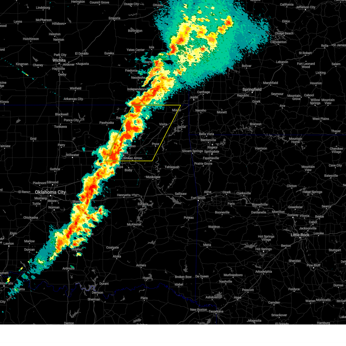 Svrtsa the national weather service in tulsa has issued a * severe thunderstorm warning for, craig county in northeastern oklahoma, rogers county in northeastern oklahoma, southeastern osage county in northeastern oklahoma, western ottawa county in northeastern oklahoma, northeastern creek county in northeastern oklahoma, western mayes county in northeastern oklahoma, washington county in northeastern oklahoma, nowata county in northeastern oklahoma, northwestern wagoner county in northeastern oklahoma, tulsa county in northeastern oklahoma, * until 715 am cdt. * at 628 am cdt, severe thunderstorms were located along a line extending from 6 miles east of south coffeyville to 3 miles north of sapulpa, moving east at 60 mph (radar indicated). Hazards include 60 mph wind gusts and quarter size hail. Hail damage to vehicles is expected. expect wind damage to roofs, siding, and trees. Locations in or near the path include, sand springs, wann, vinita, inola, collinsville, commerce, mazie, picher, big cabin, vera, chouteau, chelsea, white oak, bushyhead, wolco, owasso, keystone state park, hollow, pryor, delaware, this includes interstate 44 between mile markers 216 and 294. Svrtsa the national weather service in tulsa has issued a * severe thunderstorm warning for, craig county in northeastern oklahoma, rogers county in northeastern oklahoma, southeastern osage county in northeastern oklahoma, western ottawa county in northeastern oklahoma, northeastern creek county in northeastern oklahoma, western mayes county in northeastern oklahoma, washington county in northeastern oklahoma, nowata county in northeastern oklahoma, northwestern wagoner county in northeastern oklahoma, tulsa county in northeastern oklahoma, * until 715 am cdt. * at 628 am cdt, severe thunderstorms were located along a line extending from 6 miles east of south coffeyville to 3 miles north of sapulpa, moving east at 60 mph (radar indicated). Hazards include 60 mph wind gusts and quarter size hail. Hail damage to vehicles is expected. expect wind damage to roofs, siding, and trees. Locations in or near the path include, sand springs, wann, vinita, inola, collinsville, commerce, mazie, picher, big cabin, vera, chouteau, chelsea, white oak, bushyhead, wolco, owasso, keystone state park, hollow, pryor, delaware, this includes interstate 44 between mile markers 216 and 294.
|
| 4/2/2025 6:17 AM CDT |
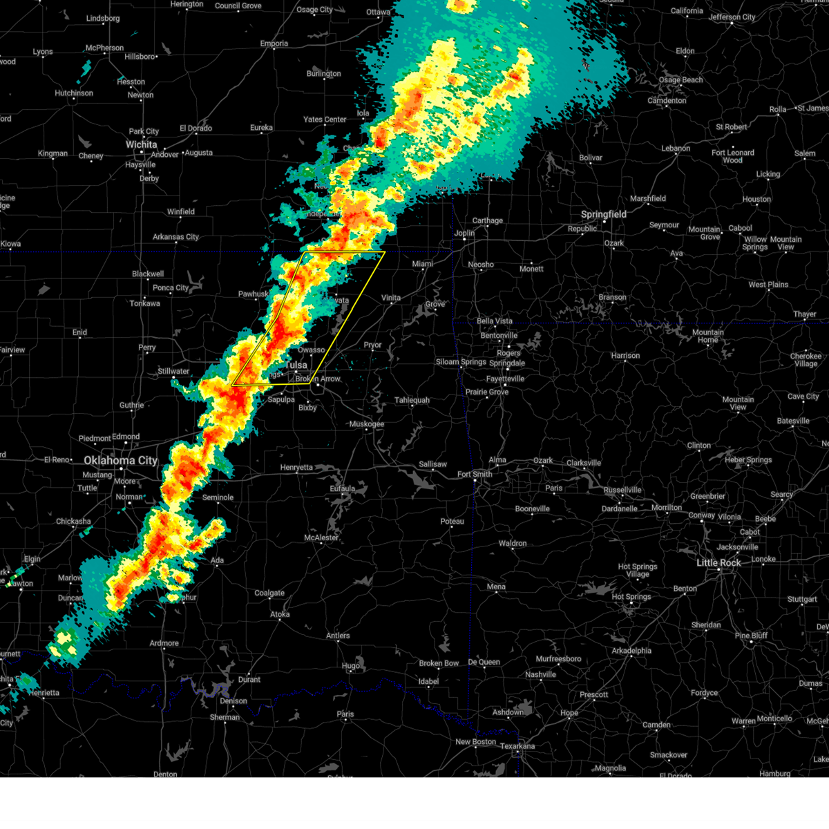 At 617 am cdt, severe thunderstorms were located along a line extending from near edna to 2 miles south of turley, moving east at 55 mph (radar indicated). Hazards include 60 mph wind gusts and quarter size hail. Hail damage to vehicles is expected. expect wind damage to roofs, siding, and trees. Locations in or near the path include, sand springs, wann, mannford, dewey, bartlesville municipal airport, collinsville, sperry, skiatook, watova, ramona, vera, talala, wolco, owasso, westport, new alluwe, keystone state park, walnut creek state park, lenapah, south coffeyville, this includes interstate 44 between mile markers 216 and 233. At 617 am cdt, severe thunderstorms were located along a line extending from near edna to 2 miles south of turley, moving east at 55 mph (radar indicated). Hazards include 60 mph wind gusts and quarter size hail. Hail damage to vehicles is expected. expect wind damage to roofs, siding, and trees. Locations in or near the path include, sand springs, wann, mannford, dewey, bartlesville municipal airport, collinsville, sperry, skiatook, watova, ramona, vera, talala, wolco, owasso, westport, new alluwe, keystone state park, walnut creek state park, lenapah, south coffeyville, this includes interstate 44 between mile markers 216 and 233.
|
| 4/2/2025 6:02 AM CDT |
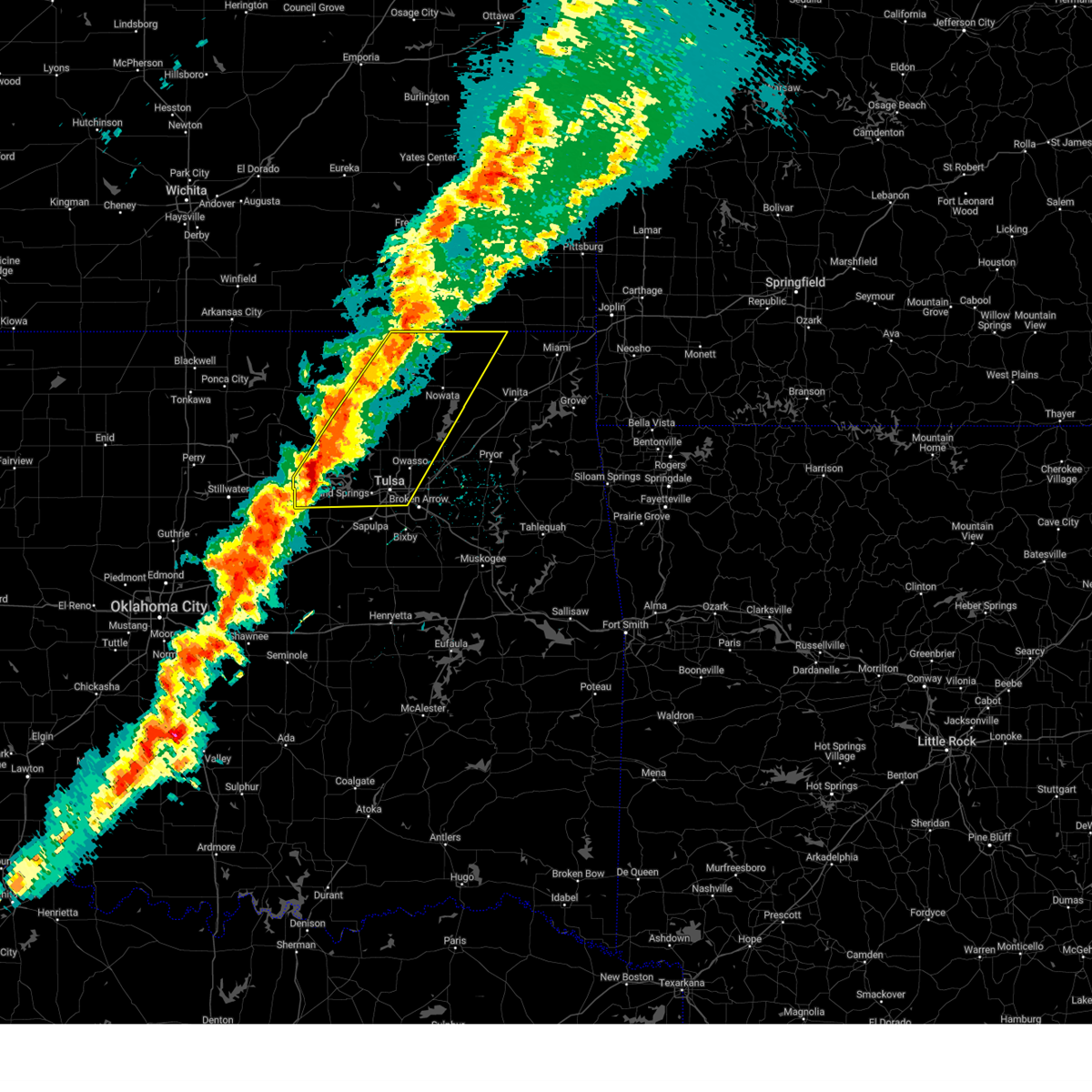 At 602 am cdt, severe thunderstorms were located along a line extending from 4 miles east of coffeyville to 5 miles northeast of keystone state park, moving east at 55 mph (radar indicated). Hazards include 60 mph wind gusts and quarter size hail. Hail damage to vehicles is expected. expect wind damage to roofs, siding, and trees. Locations in or near the path include, barnsdall, sand springs, wann, mannford, dewey, hallett, bartlesville municipal airport, collinsville, jennings, tallant, sperry, cleveland, osage hills state park, skiatook, pershing, watova, ramona, vera, talala, nelagoney, this includes interstate 44 between mile markers 216 and 233. At 602 am cdt, severe thunderstorms were located along a line extending from 4 miles east of coffeyville to 5 miles northeast of keystone state park, moving east at 55 mph (radar indicated). Hazards include 60 mph wind gusts and quarter size hail. Hail damage to vehicles is expected. expect wind damage to roofs, siding, and trees. Locations in or near the path include, barnsdall, sand springs, wann, mannford, dewey, hallett, bartlesville municipal airport, collinsville, jennings, tallant, sperry, cleveland, osage hills state park, skiatook, pershing, watova, ramona, vera, talala, nelagoney, this includes interstate 44 between mile markers 216 and 233.
|
| 4/2/2025 5:41 AM CDT |
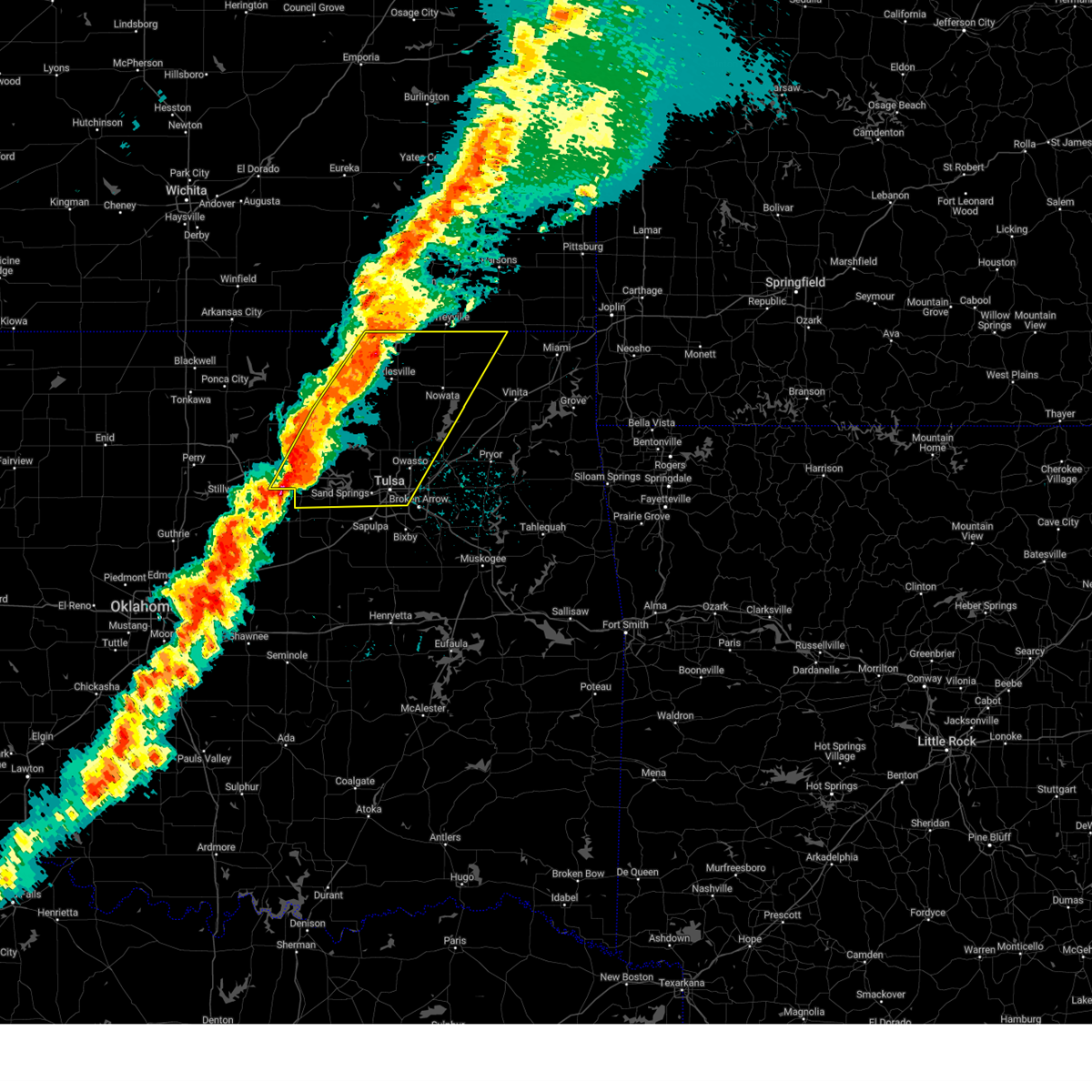 Svrtsa the national weather service in tulsa has issued a * severe thunderstorm warning for, northwestern craig county in northeastern oklahoma, northwestern rogers county in northeastern oklahoma, eastern osage county in northeastern oklahoma, northern creek county in northeastern oklahoma, washington county in northeastern oklahoma, nowata county in northeastern oklahoma, southeastern pawnee county in northeastern oklahoma, central tulsa county in northeastern oklahoma, * until 630 am cdt. * at 540 am cdt, severe thunderstorms were located along a line extending from near caney to near jennings, moving east at 55 mph (radar indicated). Hazards include 60 mph wind gusts and quarter size hail. Hail damage to vehicles is expected. expect wind damage to roofs, siding, and trees. Locations in or near the path include, barnsdall, sand springs, wann, collinsville, pawhuska, osage hills state park, vera, nelagoney, wolco, owasso, keystone state park, hominy, oilton, delaware, ochelata, sunset lake, tulsa, silver city, maramec, bartlesville, this includes interstate 44 between mile markers 216 and 233. Svrtsa the national weather service in tulsa has issued a * severe thunderstorm warning for, northwestern craig county in northeastern oklahoma, northwestern rogers county in northeastern oklahoma, eastern osage county in northeastern oklahoma, northern creek county in northeastern oklahoma, washington county in northeastern oklahoma, nowata county in northeastern oklahoma, southeastern pawnee county in northeastern oklahoma, central tulsa county in northeastern oklahoma, * until 630 am cdt. * at 540 am cdt, severe thunderstorms were located along a line extending from near caney to near jennings, moving east at 55 mph (radar indicated). Hazards include 60 mph wind gusts and quarter size hail. Hail damage to vehicles is expected. expect wind damage to roofs, siding, and trees. Locations in or near the path include, barnsdall, sand springs, wann, collinsville, pawhuska, osage hills state park, vera, nelagoney, wolco, owasso, keystone state park, hominy, oilton, delaware, ochelata, sunset lake, tulsa, silver city, maramec, bartlesville, this includes interstate 44 between mile markers 216 and 233.
|
| 11/4/2024 12:42 PM CST |
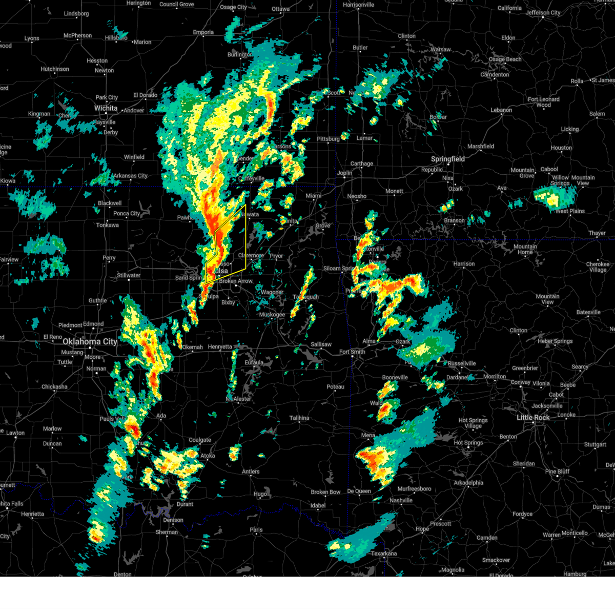 At 1242 pm cst, severe thunderstorms were located along a line extending from 5 miles northeast of ramona to 3 miles east of skiatook to 4 miles southwest of turley, moving northeast at 45 mph (radar indicated). Hazards include 60 mph wind gusts and quarter size hail. Hail damage to vehicles is expected. expect wind damage to roofs, siding, and trees. Locations in or near the path include, tulsa, sand springs, owasso, skiatook, catoosa, collinsville, verdigris, sperry, oologah, ramona, ochelata, talala, vera, turley, tulsa international airport, gray, this includes interstate 44 near mile marker 241. At 1242 pm cst, severe thunderstorms were located along a line extending from 5 miles northeast of ramona to 3 miles east of skiatook to 4 miles southwest of turley, moving northeast at 45 mph (radar indicated). Hazards include 60 mph wind gusts and quarter size hail. Hail damage to vehicles is expected. expect wind damage to roofs, siding, and trees. Locations in or near the path include, tulsa, sand springs, owasso, skiatook, catoosa, collinsville, verdigris, sperry, oologah, ramona, ochelata, talala, vera, turley, tulsa international airport, gray, this includes interstate 44 near mile marker 241.
|
| 11/4/2024 12:31 PM CST |
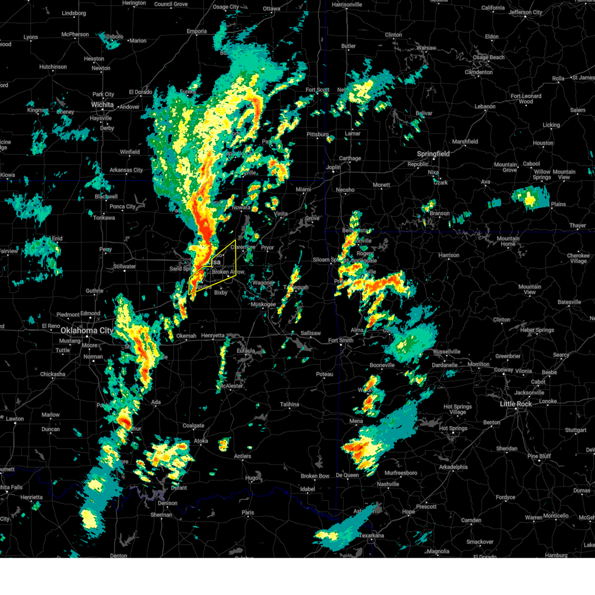 At 1231 pm cst, a severe thunderstorm was located 3 miles southeast of sand springs, moving northeast at 45 mph (radar indicated). Hazards include 60 mph wind gusts. Expect damage to roofs, siding, and trees. Locations in or near the path include, tulsa, broken arrow, sand springs, owasso, bixby, sapulpa, jenks, glenpool, catoosa, kiefer, kellyville, jenks riverside airport, turley, tulsa international airport, gray, this includes interstate 44 between mile markers 200 and 239. At 1231 pm cst, a severe thunderstorm was located 3 miles southeast of sand springs, moving northeast at 45 mph (radar indicated). Hazards include 60 mph wind gusts. Expect damage to roofs, siding, and trees. Locations in or near the path include, tulsa, broken arrow, sand springs, owasso, bixby, sapulpa, jenks, glenpool, catoosa, kiefer, kellyville, jenks riverside airport, turley, tulsa international airport, gray, this includes interstate 44 between mile markers 200 and 239.
|
| 11/4/2024 12:30 PM CST |
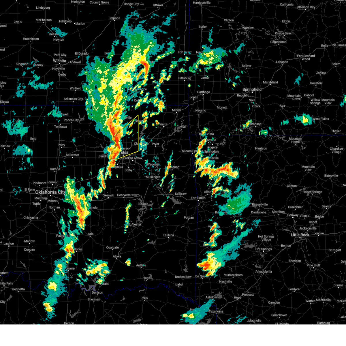 At 1229 pm cst, severe thunderstorms were located along a line extending from 3 miles northeast of avant to 2 miles southwest of sperry to 2 miles north of sand springs, moving northeast at 45 mph (radar indicated). Hazards include 60 mph wind gusts and penny size hail. Expect damage to roofs, siding, and trees. Locations in or near the path include, tulsa, sand springs, owasso, skiatook, catoosa, collinsville, verdigris, sperry, oologah, ramona, ochelata, avant, talala, vera, turley, tulsa international airport, gray, wolco, this includes interstate 44 near mile marker 241. At 1229 pm cst, severe thunderstorms were located along a line extending from 3 miles northeast of avant to 2 miles southwest of sperry to 2 miles north of sand springs, moving northeast at 45 mph (radar indicated). Hazards include 60 mph wind gusts and penny size hail. Expect damage to roofs, siding, and trees. Locations in or near the path include, tulsa, sand springs, owasso, skiatook, catoosa, collinsville, verdigris, sperry, oologah, ramona, ochelata, avant, talala, vera, turley, tulsa international airport, gray, wolco, this includes interstate 44 near mile marker 241.
|
| 11/4/2024 12:26 PM CST |
 At 1226 pm cst, a severe thunderstorm capable of producing a tornado was located 3 miles west of sperry, moving northeast at 40 mph (radar indicated rotation). Hazards include tornado. Flying debris will be dangerous to those caught without shelter. mobile homes will be damaged or destroyed. damage to roofs, windows, and vehicles will occur. tree damage is likely. Locations in or near the path include, tulsa, skiatook, collinsville, sperry, vera, turley,. At 1226 pm cst, a severe thunderstorm capable of producing a tornado was located 3 miles west of sperry, moving northeast at 40 mph (radar indicated rotation). Hazards include tornado. Flying debris will be dangerous to those caught without shelter. mobile homes will be damaged or destroyed. damage to roofs, windows, and vehicles will occur. tree damage is likely. Locations in or near the path include, tulsa, skiatook, collinsville, sperry, vera, turley,.
|
| 11/4/2024 12:22 PM CST |
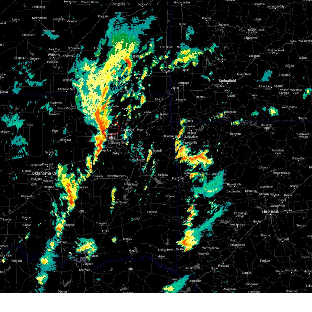 Tortsa the national weather service in tulsa has issued a * tornado warning for, southeastern osage county in northeastern oklahoma, south central washington county in northeastern oklahoma, northeastern tulsa county in northeastern oklahoma, * until 100 pm cst. * at 1222 pm cst, a severe thunderstorm capable of producing a tornado was located 5 miles west of sperry, moving northeast at 45 mph (radar indicated rotation). Hazards include tornado. Flying debris will be dangerous to those caught without shelter. mobile homes will be damaged or destroyed. damage to roofs, windows, and vehicles will occur. tree damage is likely. Locations in or near the path include, tulsa, skiatook, collinsville, sperry, vera, turley,. Tortsa the national weather service in tulsa has issued a * tornado warning for, southeastern osage county in northeastern oklahoma, south central washington county in northeastern oklahoma, northeastern tulsa county in northeastern oklahoma, * until 100 pm cst. * at 1222 pm cst, a severe thunderstorm capable of producing a tornado was located 5 miles west of sperry, moving northeast at 45 mph (radar indicated rotation). Hazards include tornado. Flying debris will be dangerous to those caught without shelter. mobile homes will be damaged or destroyed. damage to roofs, windows, and vehicles will occur. tree damage is likely. Locations in or near the path include, tulsa, skiatook, collinsville, sperry, vera, turley,.
|
| 11/4/2024 12:20 PM CST |
 Svrtsa the national weather service in tulsa has issued a * severe thunderstorm warning for, southwestern rogers county in northeastern oklahoma, northeastern creek county in northeastern oklahoma, northwestern wagoner county in northeastern oklahoma, southeastern tulsa county in northeastern oklahoma, * until 100 pm cst. * at 1220 pm cst, a severe thunderstorm was located 4 miles west of sapulpa, moving northeast at 45 mph (radar indicated). Hazards include 60 mph wind gusts. Expect damage to roofs, siding, and trees. Locations in or near the path include, tulsa, broken arrow, sand springs, owasso, bixby, sapulpa, jenks, glenpool, catoosa, kellyville, jenks riverside airport, turley, tulsa international airport, gray, this includes interstate 44 between mile markers 199 and 239. Svrtsa the national weather service in tulsa has issued a * severe thunderstorm warning for, southwestern rogers county in northeastern oklahoma, northeastern creek county in northeastern oklahoma, northwestern wagoner county in northeastern oklahoma, southeastern tulsa county in northeastern oklahoma, * until 100 pm cst. * at 1220 pm cst, a severe thunderstorm was located 4 miles west of sapulpa, moving northeast at 45 mph (radar indicated). Hazards include 60 mph wind gusts. Expect damage to roofs, siding, and trees. Locations in or near the path include, tulsa, broken arrow, sand springs, owasso, bixby, sapulpa, jenks, glenpool, catoosa, kellyville, jenks riverside airport, turley, tulsa international airport, gray, this includes interstate 44 between mile markers 199 and 239.
|
| 11/4/2024 12:15 PM CST |
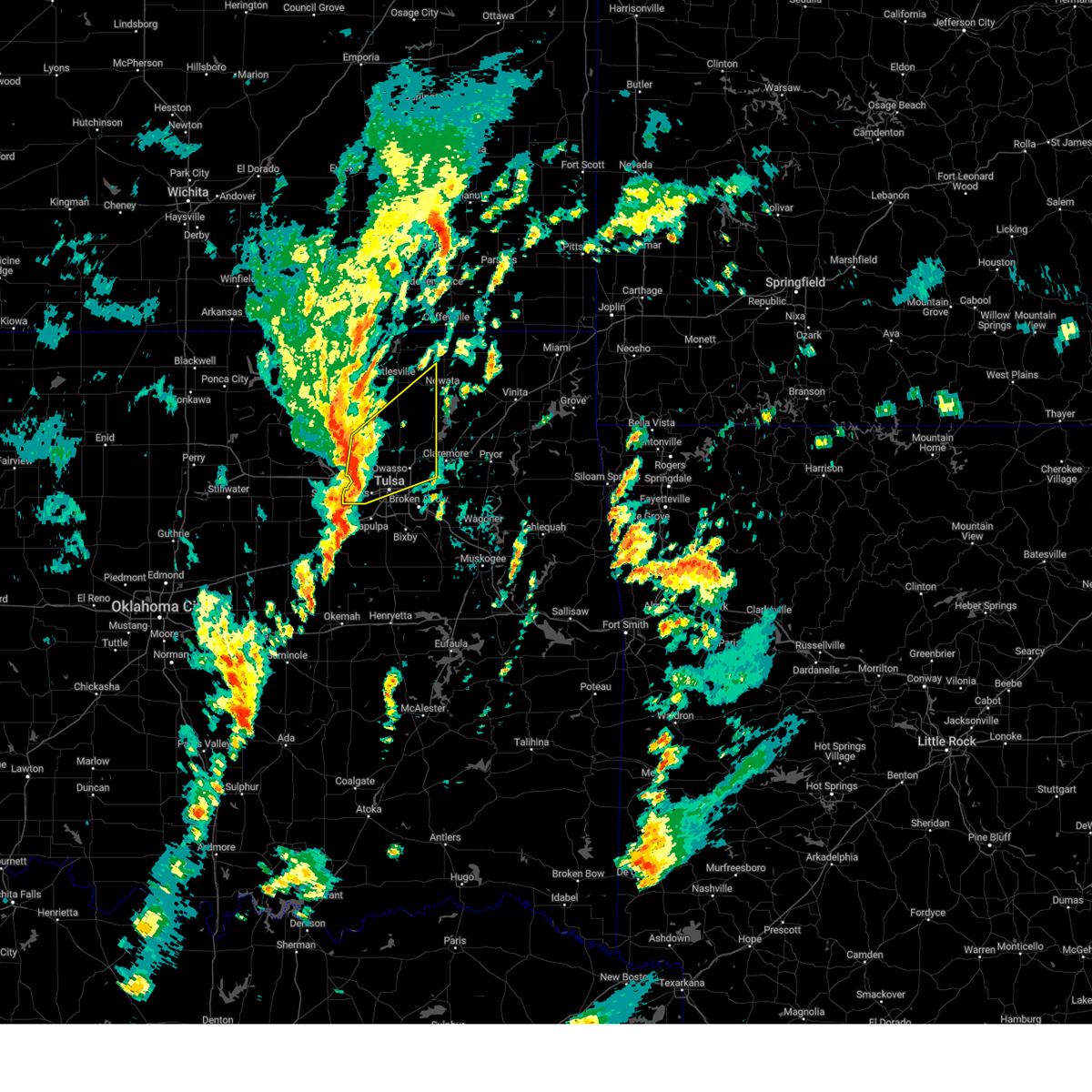 Svrtsa the national weather service in tulsa has issued a * severe thunderstorm warning for, northwestern rogers county in northeastern oklahoma, southeastern osage county in northeastern oklahoma, southern washington county in northeastern oklahoma, southwestern nowata county in northeastern oklahoma, northern tulsa county in northeastern oklahoma, * until 100 pm cst. * at 1215 pm cst, severe thunderstorms were located along a line extending from 7 miles southwest of avant to 4 miles northwest of sand springs to 4 miles south of keystone state park, moving northeast at 45 mph (radar indicated). Hazards include 60 mph wind gusts. Expect damage to roofs, siding, and trees. Locations in or near the path include, tulsa, sand springs, owasso, skiatook, catoosa, collinsville, verdigris, sperry, oologah, ramona, ochelata, avant, talala, vera, keystone state park, turley, tulsa international airport, gray, wolco, this includes interstate 44 near mile marker 241. Svrtsa the national weather service in tulsa has issued a * severe thunderstorm warning for, northwestern rogers county in northeastern oklahoma, southeastern osage county in northeastern oklahoma, southern washington county in northeastern oklahoma, southwestern nowata county in northeastern oklahoma, northern tulsa county in northeastern oklahoma, * until 100 pm cst. * at 1215 pm cst, severe thunderstorms were located along a line extending from 7 miles southwest of avant to 4 miles northwest of sand springs to 4 miles south of keystone state park, moving northeast at 45 mph (radar indicated). Hazards include 60 mph wind gusts. Expect damage to roofs, siding, and trees. Locations in or near the path include, tulsa, sand springs, owasso, skiatook, catoosa, collinsville, verdigris, sperry, oologah, ramona, ochelata, avant, talala, vera, keystone state park, turley, tulsa international airport, gray, wolco, this includes interstate 44 near mile marker 241.
|
| 11/4/2024 12:08 PM CST |
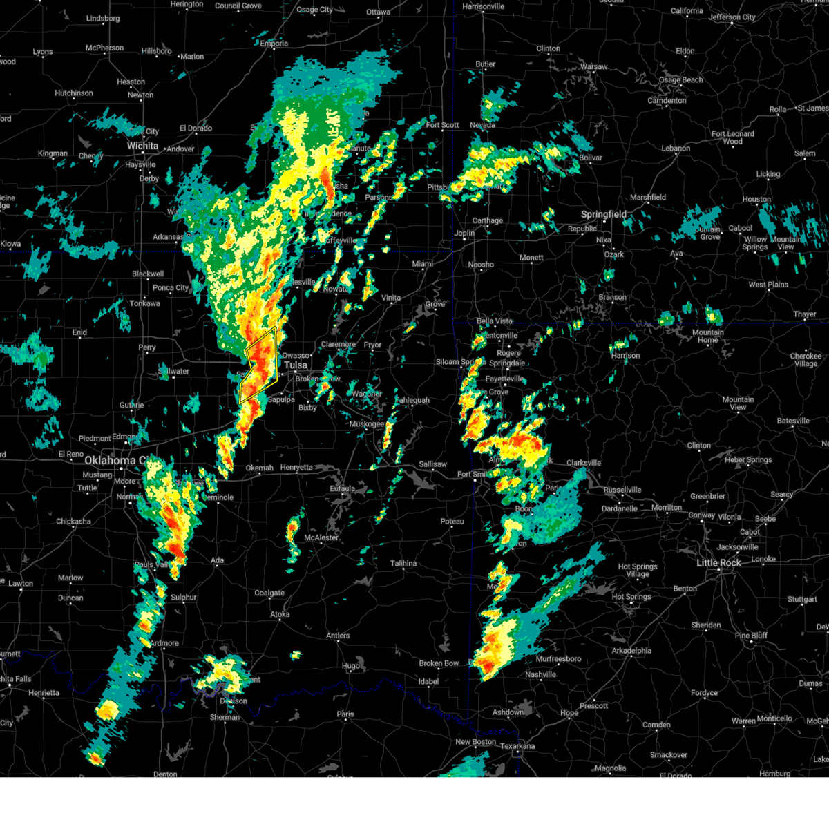 At 1208 pm cst, severe thunderstorms were located along a line extending from 7 miles north of walnut creek state park to 5 miles south of keystone state park, moving northeast at 45 mph (radar indicated). Hazards include 60 mph wind gusts and penny size hail. Expect damage to roofs, siding, and trees. Locations in or near the path include, sand springs, mannford, westport, osage, keystone state park, walnut creek state park,. At 1208 pm cst, severe thunderstorms were located along a line extending from 7 miles north of walnut creek state park to 5 miles south of keystone state park, moving northeast at 45 mph (radar indicated). Hazards include 60 mph wind gusts and penny size hail. Expect damage to roofs, siding, and trees. Locations in or near the path include, sand springs, mannford, westport, osage, keystone state park, walnut creek state park,.
|
| 11/4/2024 12:00 PM CST |
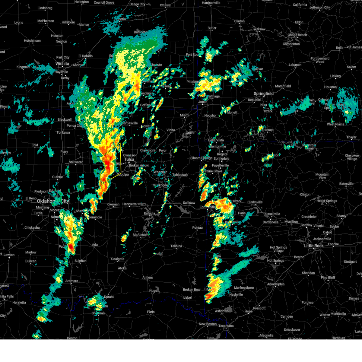 At 1200 pm cst, severe thunderstorms were located along a line extending from 2 miles east of osage to 7 miles northwest of kellyville, moving northeast at 40 mph (radar indicated). Hazards include 60 mph wind gusts and penny size hail. Expect damage to roofs, siding, and trees. Locations in or near the path include, sand springs, mannford, westport, osage, terlton, keystone state park, walnut creek state park, this includes interstate 44 near mile marker 182, and between mile markers 199 and 208. At 1200 pm cst, severe thunderstorms were located along a line extending from 2 miles east of osage to 7 miles northwest of kellyville, moving northeast at 40 mph (radar indicated). Hazards include 60 mph wind gusts and penny size hail. Expect damage to roofs, siding, and trees. Locations in or near the path include, sand springs, mannford, westport, osage, terlton, keystone state park, walnut creek state park, this includes interstate 44 near mile marker 182, and between mile markers 199 and 208.
|
| 11/4/2024 11:58 AM CST |
 Svrtsa the national weather service in tulsa has issued a * severe thunderstorm warning for, central creek county in northeastern oklahoma, west central tulsa county in northeastern oklahoma, * until 1230 pm cst. * at 1158 am cst, severe thunderstorms were located along a line extending from 6 miles east of shamrock to near bristow to 5 miles southeast of depew, moving northeast at 50 mph (radar indicated). Hazards include 60 mph wind gusts and penny size hail. Expect damage to roofs, siding, and trees. Locations in or near the path include, bristow, kellyville, slick, this includes interstate 44 between mile markers 186 and 208. Svrtsa the national weather service in tulsa has issued a * severe thunderstorm warning for, central creek county in northeastern oklahoma, west central tulsa county in northeastern oklahoma, * until 1230 pm cst. * at 1158 am cst, severe thunderstorms were located along a line extending from 6 miles east of shamrock to near bristow to 5 miles southeast of depew, moving northeast at 50 mph (radar indicated). Hazards include 60 mph wind gusts and penny size hail. Expect damage to roofs, siding, and trees. Locations in or near the path include, bristow, kellyville, slick, this includes interstate 44 between mile markers 186 and 208.
|
| 11/4/2024 11:49 AM CST |
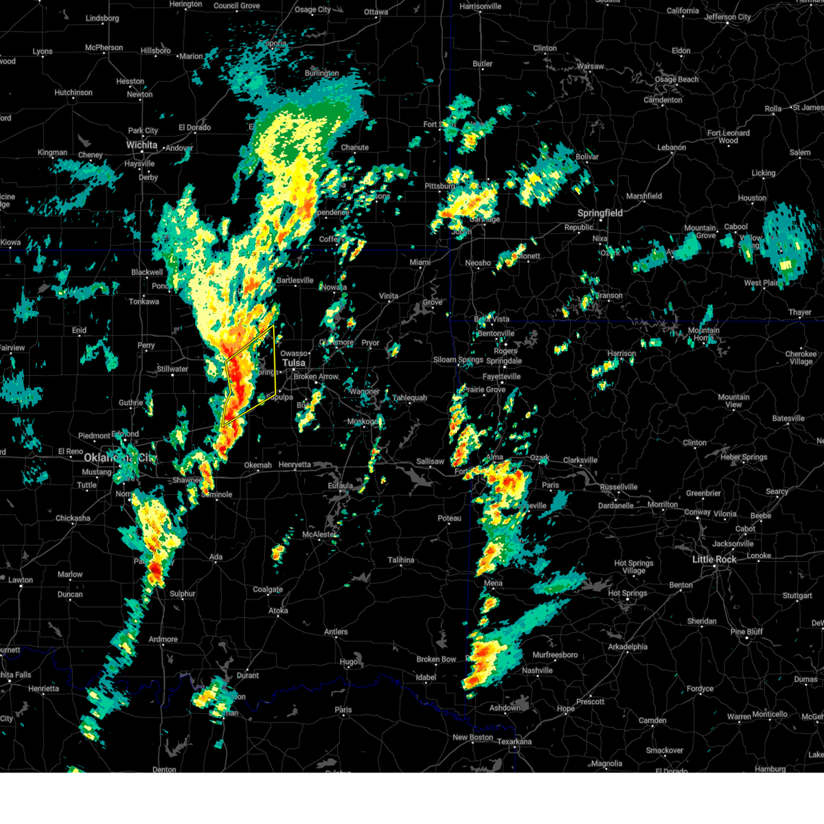 At 1149 am cst, severe thunderstorms were located along a line extending from 2 miles northeast of terlton to 5 miles northwest of bristow, moving northeast at 55 mph (radar indicated). Hazards include 60 mph wind gusts and quarter size hail. Hail damage to vehicles is expected. expect wind damage to roofs, siding, and trees. Locations in or near the path include, sand springs, mannford, depew, jennings, westport, osage, terlton, shamrock, keystone state park, walnut creek state park, silver city, this includes interstate 44 between mile markers 178 and 186, and between mile markers 197 and 208. At 1149 am cst, severe thunderstorms were located along a line extending from 2 miles northeast of terlton to 5 miles northwest of bristow, moving northeast at 55 mph (radar indicated). Hazards include 60 mph wind gusts and quarter size hail. Hail damage to vehicles is expected. expect wind damage to roofs, siding, and trees. Locations in or near the path include, sand springs, mannford, depew, jennings, westport, osage, terlton, shamrock, keystone state park, walnut creek state park, silver city, this includes interstate 44 between mile markers 178 and 186, and between mile markers 197 and 208.
|
| 11/4/2024 11:39 AM CST |
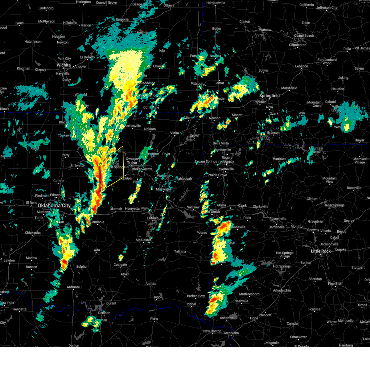 Svrtsa the national weather service in tulsa has issued a * severe thunderstorm warning for, southeastern osage county in northeastern oklahoma, northern creek county in northeastern oklahoma, southeastern pawnee county in northeastern oklahoma, west central tulsa county in northeastern oklahoma, * until 1230 pm cst. * at 1138 am cst, severe thunderstorms were located along a line extending from 3 miles southwest of jennings to 4 miles northwest of depew, moving northeast at 40 mph (radar indicated). Hazards include 60 mph wind gusts and quarter size hail. Hail damage to vehicles is expected. expect wind damage to roofs, siding, and trees. Locations in or near the path include, sand springs, mannford, drumright, oilton, depew, jennings, westport, osage, terlton, shamrock, keystone state park, walnut creek state park, silver city, this includes interstate 44 between mile markers 178 and 186, and between mile markers 197 and 208. Svrtsa the national weather service in tulsa has issued a * severe thunderstorm warning for, southeastern osage county in northeastern oklahoma, northern creek county in northeastern oklahoma, southeastern pawnee county in northeastern oklahoma, west central tulsa county in northeastern oklahoma, * until 1230 pm cst. * at 1138 am cst, severe thunderstorms were located along a line extending from 3 miles southwest of jennings to 4 miles northwest of depew, moving northeast at 40 mph (radar indicated). Hazards include 60 mph wind gusts and quarter size hail. Hail damage to vehicles is expected. expect wind damage to roofs, siding, and trees. Locations in or near the path include, sand springs, mannford, drumright, oilton, depew, jennings, westport, osage, terlton, shamrock, keystone state park, walnut creek state park, silver city, this includes interstate 44 between mile markers 178 and 186, and between mile markers 197 and 208.
|
| 11/3/2024 3:04 PM CST |
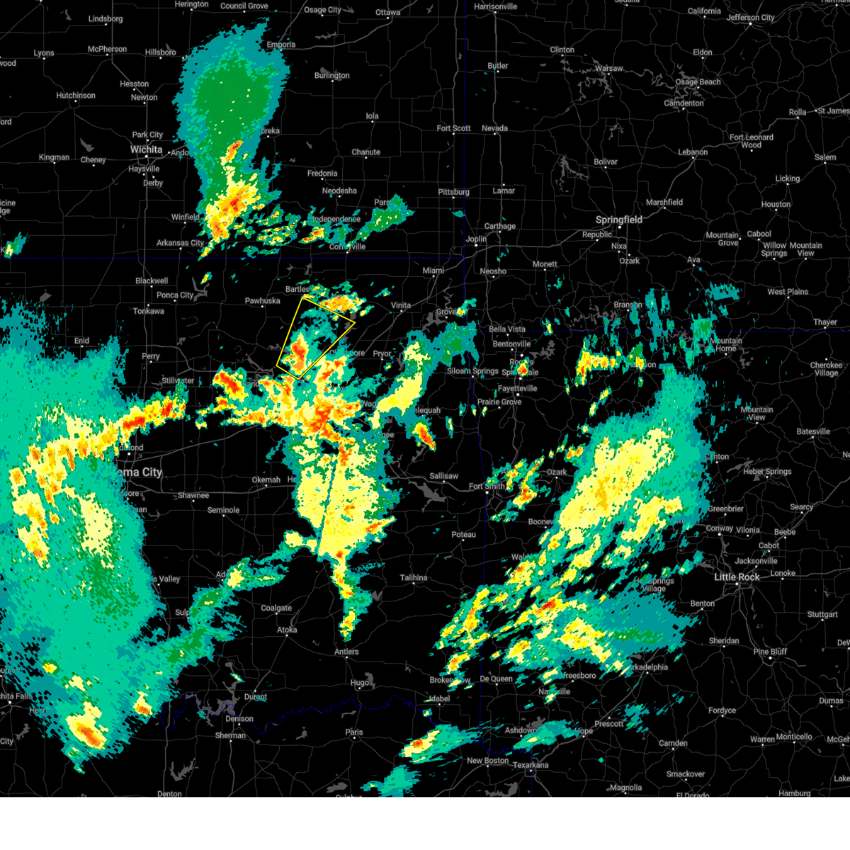 the severe thunderstorm warning has been cancelled and is no longer in effect the severe thunderstorm warning has been cancelled and is no longer in effect
|
| 11/3/2024 2:48 PM CST |
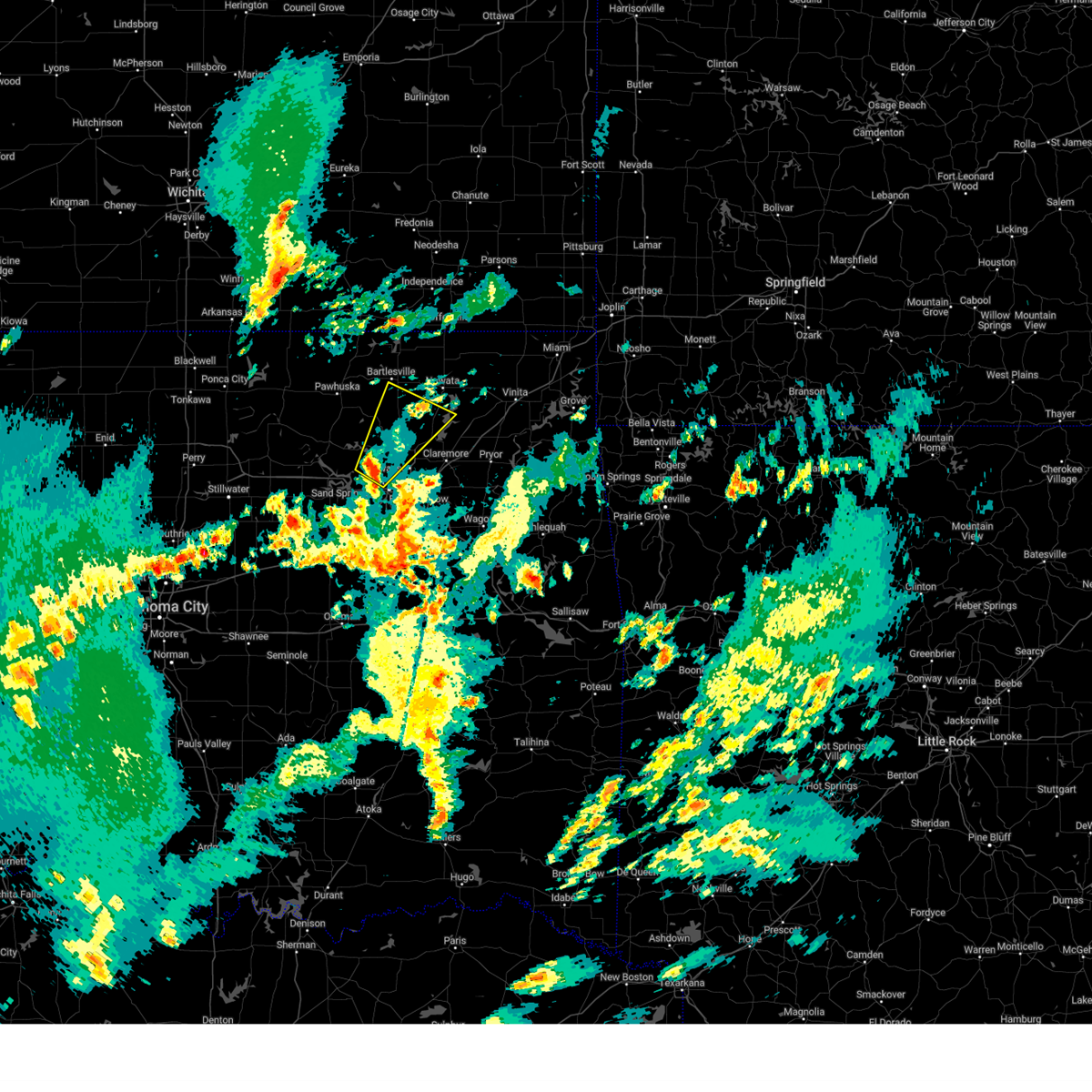 Svrtsa the national weather service in tulsa has issued a * severe thunderstorm warning for, northwestern rogers county in northeastern oklahoma, southeastern osage county in northeastern oklahoma, southern washington county in northeastern oklahoma, southwestern nowata county in northeastern oklahoma, northeastern tulsa county in northeastern oklahoma, * until 315 pm cst. * at 247 pm cst, a severe thunderstorm was located 4 miles west of sperry, moving northeast at 50 mph (radar indicated). Hazards include 60 mph wind gusts and quarter size hail. Hail damage to vehicles is expected. expect wind damage to roofs, siding, and trees. Locations in or near the path include, tulsa, bartlessouville, skiatook, collinsville, sperry, oologah, ramona, ochelata, avant, talala, vera, turley, wolco,. Svrtsa the national weather service in tulsa has issued a * severe thunderstorm warning for, northwestern rogers county in northeastern oklahoma, southeastern osage county in northeastern oklahoma, southern washington county in northeastern oklahoma, southwestern nowata county in northeastern oklahoma, northeastern tulsa county in northeastern oklahoma, * until 315 pm cst. * at 247 pm cst, a severe thunderstorm was located 4 miles west of sperry, moving northeast at 50 mph (radar indicated). Hazards include 60 mph wind gusts and quarter size hail. Hail damage to vehicles is expected. expect wind damage to roofs, siding, and trees. Locations in or near the path include, tulsa, bartlessouville, skiatook, collinsville, sperry, oologah, ramona, ochelata, avant, talala, vera, turley, wolco,.
|
| 11/3/2024 4:40 AM CST |
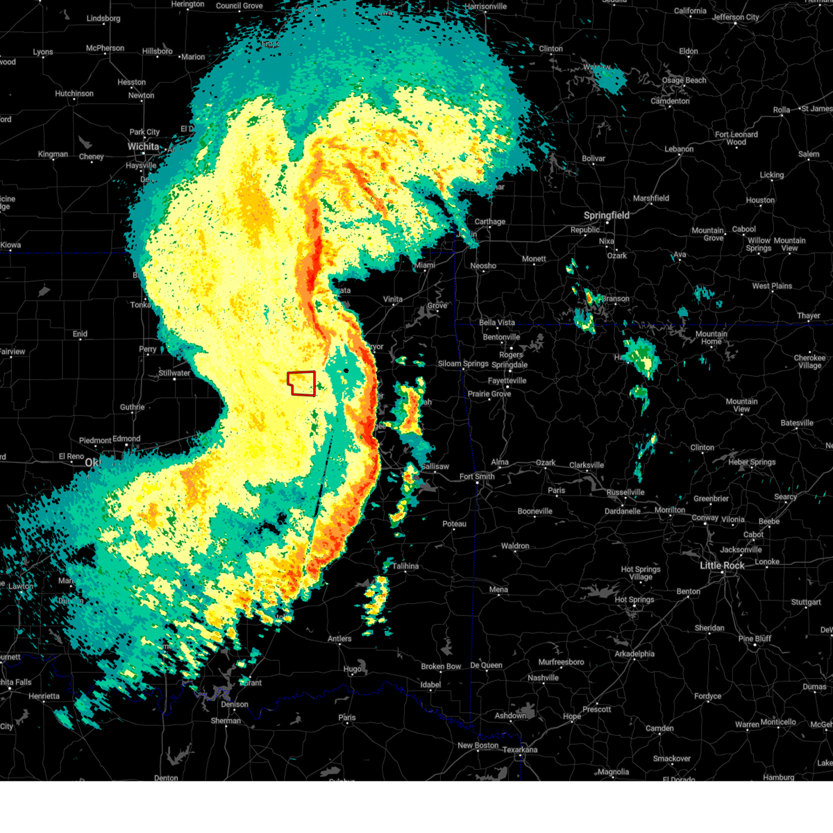 The tornadic thunderstorm which prompted the warning has moved out of the warned area. therefore, the warning will be allowed to expire. a tornado watch remains in effect until 900 am cst for northeastern oklahoma. The tornadic thunderstorm which prompted the warning has moved out of the warned area. therefore, the warning will be allowed to expire. a tornado watch remains in effect until 900 am cst for northeastern oklahoma.
|
| 11/3/2024 4:19 AM CST |
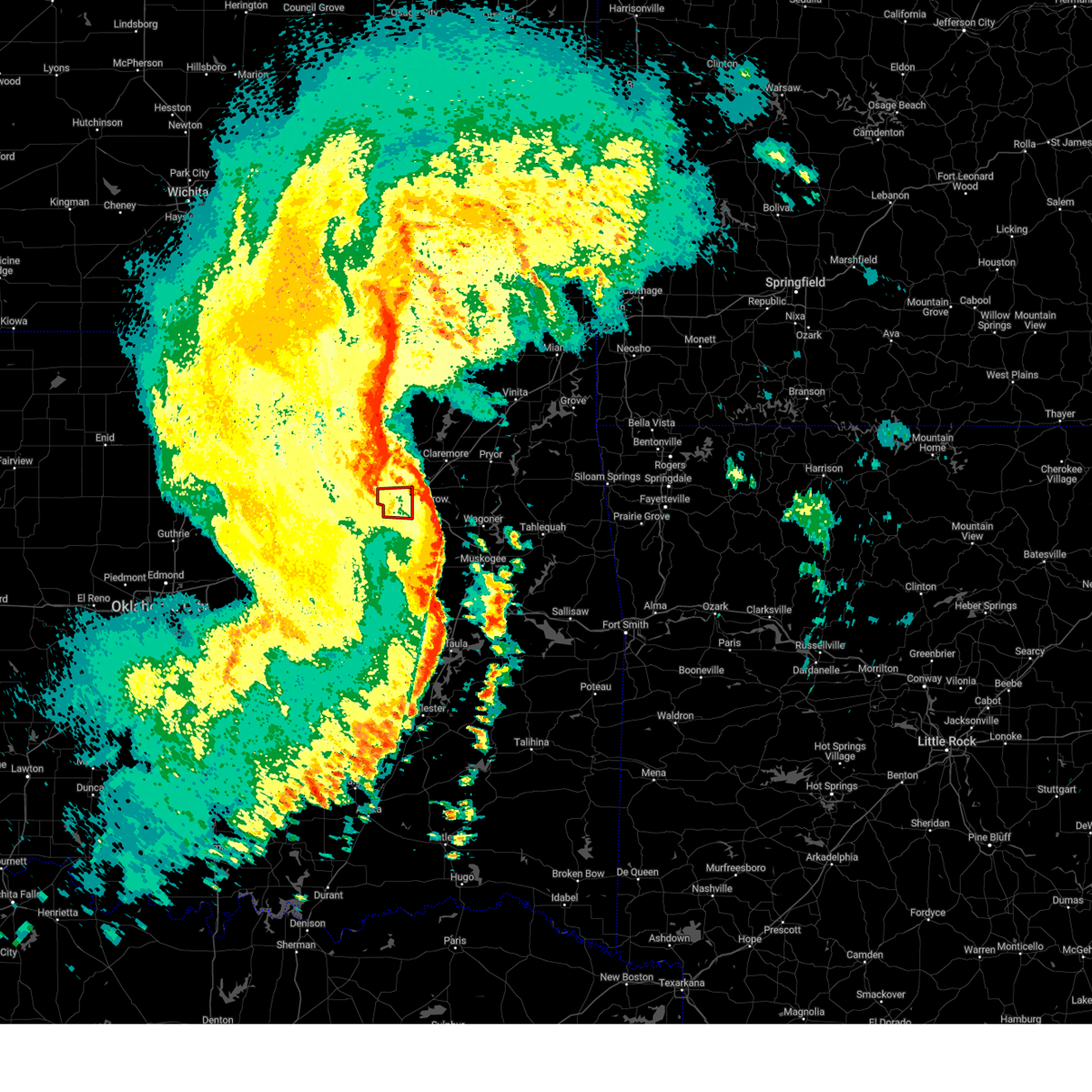 At 419 am cst, a severe thunderstorm capable of producing a tornado was located 4 miles west of tulsa, moving east at 30 mph (radar indicated rotation). Hazards include tornado. Flying debris will be dangerous to those caught without shelter. mobile homes will be damaged or destroyed. damage to roofs, windows, and vehicles will occur. tree damage is likely. Locations in or near the path include, tulsa, broken arrow, sand springs, bixby, jenks, jenks riverside airport, this includes interstate 44 between mile markers 217 and 230. At 419 am cst, a severe thunderstorm capable of producing a tornado was located 4 miles west of tulsa, moving east at 30 mph (radar indicated rotation). Hazards include tornado. Flying debris will be dangerous to those caught without shelter. mobile homes will be damaged or destroyed. damage to roofs, windows, and vehicles will occur. tree damage is likely. Locations in or near the path include, tulsa, broken arrow, sand springs, bixby, jenks, jenks riverside airport, this includes interstate 44 between mile markers 217 and 230.
|
| 11/3/2024 4:13 AM CST |
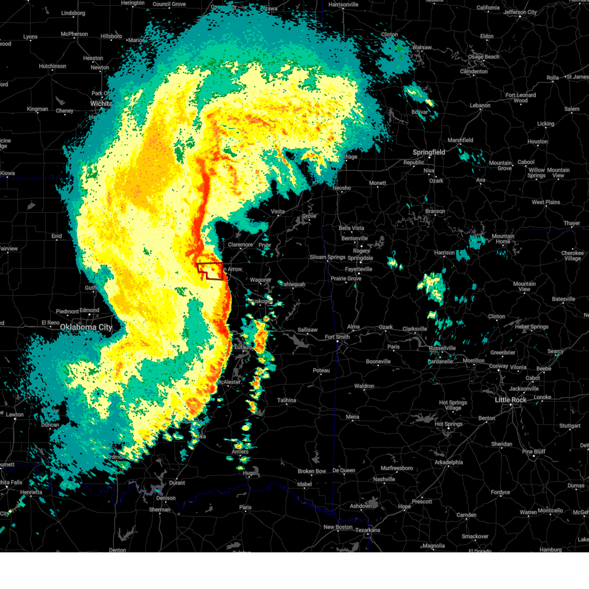 Tortsa the national weather service in tulsa has issued a * tornado warning for, central tulsa county in northeastern oklahoma, * until 445 am cst. * at 412 am cst, a severe thunderstorm capable of producing a tornado was located 4 miles northwest of jenks riverside airport, moving east at 30 mph (radar indicated rotation). Hazards include tornado. Flying debris will be dangerous to those caught without shelter. mobile homes will be damaged or destroyed. damage to roofs, windows, and vehicles will occur. tree damage is likely. Locations in or near the path include, tulsa, broken arrow, sand springs, bixby, jenks, jenks riverside airport, gray, this includes interstate 44 between mile markers 217 and 230. Tortsa the national weather service in tulsa has issued a * tornado warning for, central tulsa county in northeastern oklahoma, * until 445 am cst. * at 412 am cst, a severe thunderstorm capable of producing a tornado was located 4 miles northwest of jenks riverside airport, moving east at 30 mph (radar indicated rotation). Hazards include tornado. Flying debris will be dangerous to those caught without shelter. mobile homes will be damaged or destroyed. damage to roofs, windows, and vehicles will occur. tree damage is likely. Locations in or near the path include, tulsa, broken arrow, sand springs, bixby, jenks, jenks riverside airport, gray, this includes interstate 44 between mile markers 217 and 230.
|
| 11/3/2024 4:09 AM CST |
 At 409 am cst, a severe thunderstorm capable of producing a tornado was located over sand springs, moving east at 35 mph (radar indicated rotation). Hazards include tornado. Flying debris will be dangerous to those caught without shelter. mobile homes will be damaged or destroyed. damage to roofs, windows, and vehicles will occur. tree damage is likely. Locations in or near the path include, tulsa, sand springs, gray, this includes interstate 44 between mile markers 217 and 218. At 409 am cst, a severe thunderstorm capable of producing a tornado was located over sand springs, moving east at 35 mph (radar indicated rotation). Hazards include tornado. Flying debris will be dangerous to those caught without shelter. mobile homes will be damaged or destroyed. damage to roofs, windows, and vehicles will occur. tree damage is likely. Locations in or near the path include, tulsa, sand springs, gray, this includes interstate 44 between mile markers 217 and 218.
|
| 11/3/2024 4:06 AM CST |
 the severe thunderstorm warning has been cancelled and is no longer in effect the severe thunderstorm warning has been cancelled and is no longer in effect
|
| 11/3/2024 4:06 AM CST |
 At 406 am cst, severe thunderstorms were located along a line extending from 2 miles west of tulsa to 4 miles west of haskell to 4 miles southeast of hoffman, moving east at 50 mph (radar indicated). Hazards include 70 mph wind gusts. Expect considerable tree damage. damage is likely to mobile homes, roofs, and outbuildings. locations in or near the path include, tulsa, sand springs, okmulgee, bixby, sapulpa, jenks, glenpool, henryetta, mannford, kiefer, morris, beggs, mounds, kellyville, dewar, schulter, keystone state park, preston, jenks riverside airport, bald hill, this includes the following highways, interstate 40 in oklahoma between mile markers 239 and 241. Interstate 44 between mile markers 201 and 223. At 406 am cst, severe thunderstorms were located along a line extending from 2 miles west of tulsa to 4 miles west of haskell to 4 miles southeast of hoffman, moving east at 50 mph (radar indicated). Hazards include 70 mph wind gusts. Expect considerable tree damage. damage is likely to mobile homes, roofs, and outbuildings. locations in or near the path include, tulsa, sand springs, okmulgee, bixby, sapulpa, jenks, glenpool, henryetta, mannford, kiefer, morris, beggs, mounds, kellyville, dewar, schulter, keystone state park, preston, jenks riverside airport, bald hill, this includes the following highways, interstate 40 in oklahoma between mile markers 239 and 241. Interstate 44 between mile markers 201 and 223.
|
| 11/3/2024 3:59 AM CST |
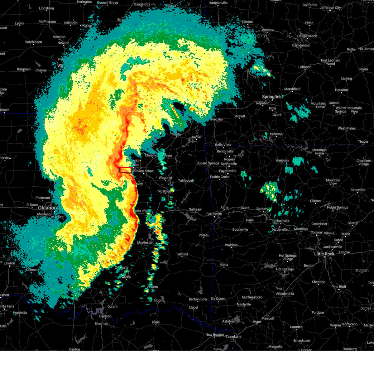 At 359 am cst, a severe thunderstorm capable of producing a tornado was located 3 miles east of keystone state park, moving east at 30 mph (radar indicated rotation). Hazards include tornado. Flying debris will be dangerous to those caught without shelter. mobile homes will be damaged or destroyed. damage to roofs, windows, and vehicles will occur. tree damage is likely. Locations in or near the path include, tulsa, sand springs, keystone state park, gray, this includes interstate 44 between mile markers 217 and 218. At 359 am cst, a severe thunderstorm capable of producing a tornado was located 3 miles east of keystone state park, moving east at 30 mph (radar indicated rotation). Hazards include tornado. Flying debris will be dangerous to those caught without shelter. mobile homes will be damaged or destroyed. damage to roofs, windows, and vehicles will occur. tree damage is likely. Locations in or near the path include, tulsa, sand springs, keystone state park, gray, this includes interstate 44 between mile markers 217 and 218.
|
| 11/3/2024 3:51 AM CST |
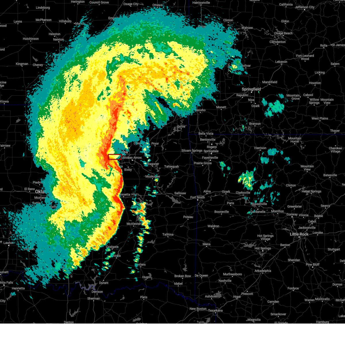 Tortsa the national weather service in tulsa has issued a * tornado warning for, west central tulsa county in northeastern oklahoma, * until 415 am cst. * at 351 am cst, a severe thunderstorm capable of producing a tornado was located over keystone state park, moving east at 35 mph (radar indicated rotation). Hazards include tornado. Flying debris will be dangerous to those caught without shelter. mobile homes will be damaged or destroyed. damage to roofs, windows, and vehicles will occur. tree damage is likely. Locations in or near the path include, tulsa, sand springs, mannford, keystone state park, gray, this includes interstate 44 between mile markers 217 and 218. Tortsa the national weather service in tulsa has issued a * tornado warning for, west central tulsa county in northeastern oklahoma, * until 415 am cst. * at 351 am cst, a severe thunderstorm capable of producing a tornado was located over keystone state park, moving east at 35 mph (radar indicated rotation). Hazards include tornado. Flying debris will be dangerous to those caught without shelter. mobile homes will be damaged or destroyed. damage to roofs, windows, and vehicles will occur. tree damage is likely. Locations in or near the path include, tulsa, sand springs, mannford, keystone state park, gray, this includes interstate 44 between mile markers 217 and 218.
|
| 11/3/2024 3:29 AM CST |
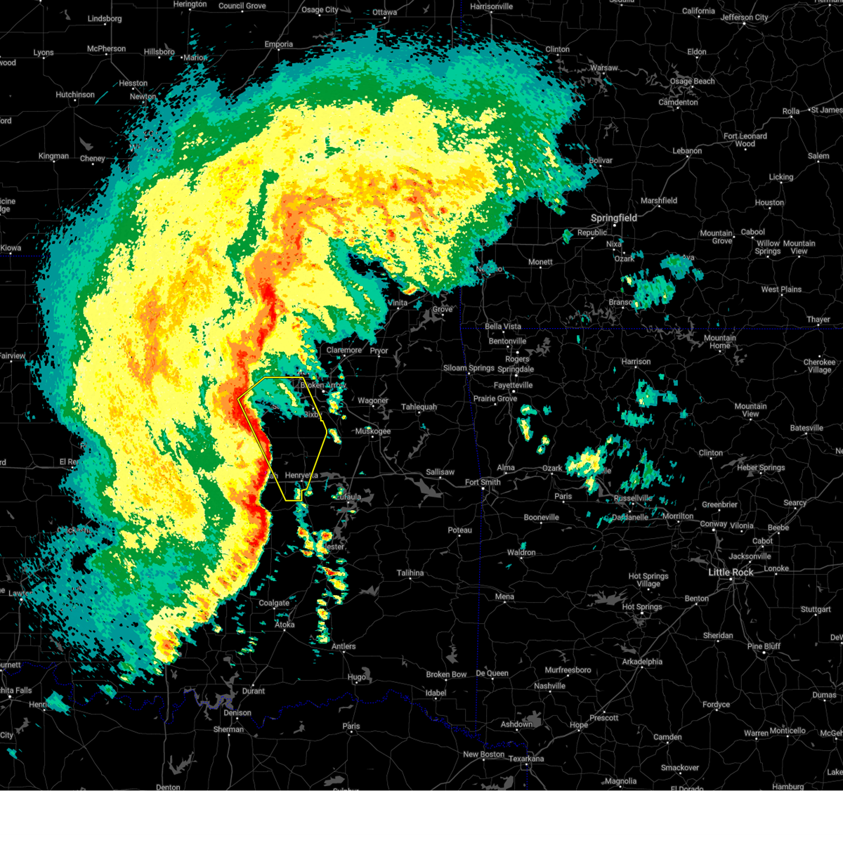 Svrtsa the national weather service in tulsa has issued a * severe thunderstorm warning for, central creek county in northeastern oklahoma, okmulgee county in northeastern oklahoma, southern tulsa county in northeastern oklahoma, eastern okfuskee county in east central oklahoma, * until 415 am cst. * at 329 am cst, severe thunderstorms were located along a line extending from 6 miles east of drumright to 6 miles northwest of okfuskee to 4 miles southeast of bearden, moving east at 50 mph (radar indicated). Hazards include 70 mph wind gusts. Expect considerable tree damage. damage is likely to mobile homes, roofs, and outbuildings. locations in or near the path include, tulsa, sand springs, okmulgee, bristow, bixby, sapulpa, jenks, okfuskee, glenpool, henryetta, mannford, kiefer, morris, beggs, mounds, kellyville, weleetka, dewar, schulter, slick, this includes the following highways, interstate 40 in oklahoma between mile markers 226 and 241. Interstate 44 between mile markers 190 and 223. Svrtsa the national weather service in tulsa has issued a * severe thunderstorm warning for, central creek county in northeastern oklahoma, okmulgee county in northeastern oklahoma, southern tulsa county in northeastern oklahoma, eastern okfuskee county in east central oklahoma, * until 415 am cst. * at 329 am cst, severe thunderstorms were located along a line extending from 6 miles east of drumright to 6 miles northwest of okfuskee to 4 miles southeast of bearden, moving east at 50 mph (radar indicated). Hazards include 70 mph wind gusts. Expect considerable tree damage. damage is likely to mobile homes, roofs, and outbuildings. locations in or near the path include, tulsa, sand springs, okmulgee, bristow, bixby, sapulpa, jenks, okfuskee, glenpool, henryetta, mannford, kiefer, morris, beggs, mounds, kellyville, weleetka, dewar, schulter, slick, this includes the following highways, interstate 40 in oklahoma between mile markers 226 and 241. Interstate 44 between mile markers 190 and 223.
|
| 10/30/2024 9:55 PM CDT |
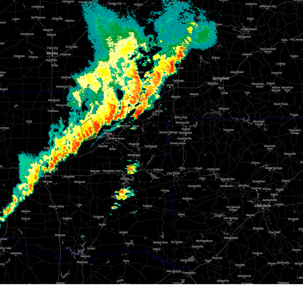 The storm which prompted the warning has weakened below severe limits, and has exited the warned area. therefore, the warning will be allowed to expire. however, gusty winds are still possible with this thunderstorm. a tornado watch remains in effect until midnight cdt for northeastern oklahoma. The storm which prompted the warning has weakened below severe limits, and has exited the warned area. therefore, the warning will be allowed to expire. however, gusty winds are still possible with this thunderstorm. a tornado watch remains in effect until midnight cdt for northeastern oklahoma.
|
| 10/30/2024 9:36 PM CDT |
 At 935 pm cdt, a severe thunderstorm was located over hallett, moving northeast at 45 mph (radar indicated). Hazards include 60 mph wind gusts and quarter size hail. Hail damage to vehicles is expected. expect wind damage to roofs, siding, and trees. Locations in or near the path include, hominy, cleveland, mannford, jennings, westport, osage, hallett, blackburn, terlton, silver city,. At 935 pm cdt, a severe thunderstorm was located over hallett, moving northeast at 45 mph (radar indicated). Hazards include 60 mph wind gusts and quarter size hail. Hail damage to vehicles is expected. expect wind damage to roofs, siding, and trees. Locations in or near the path include, hominy, cleveland, mannford, jennings, westport, osage, hallett, blackburn, terlton, silver city,.
|
| 10/30/2024 9:36 PM CDT |
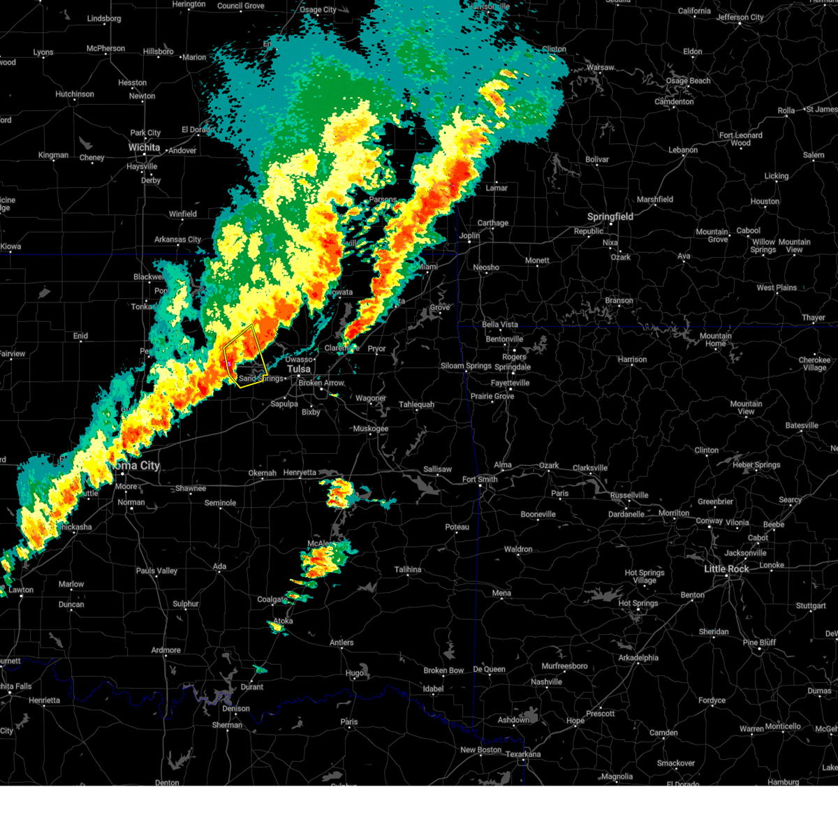 the severe thunderstorm warning has been cancelled and is no longer in effect the severe thunderstorm warning has been cancelled and is no longer in effect
|
| 10/30/2024 9:13 PM CDT |
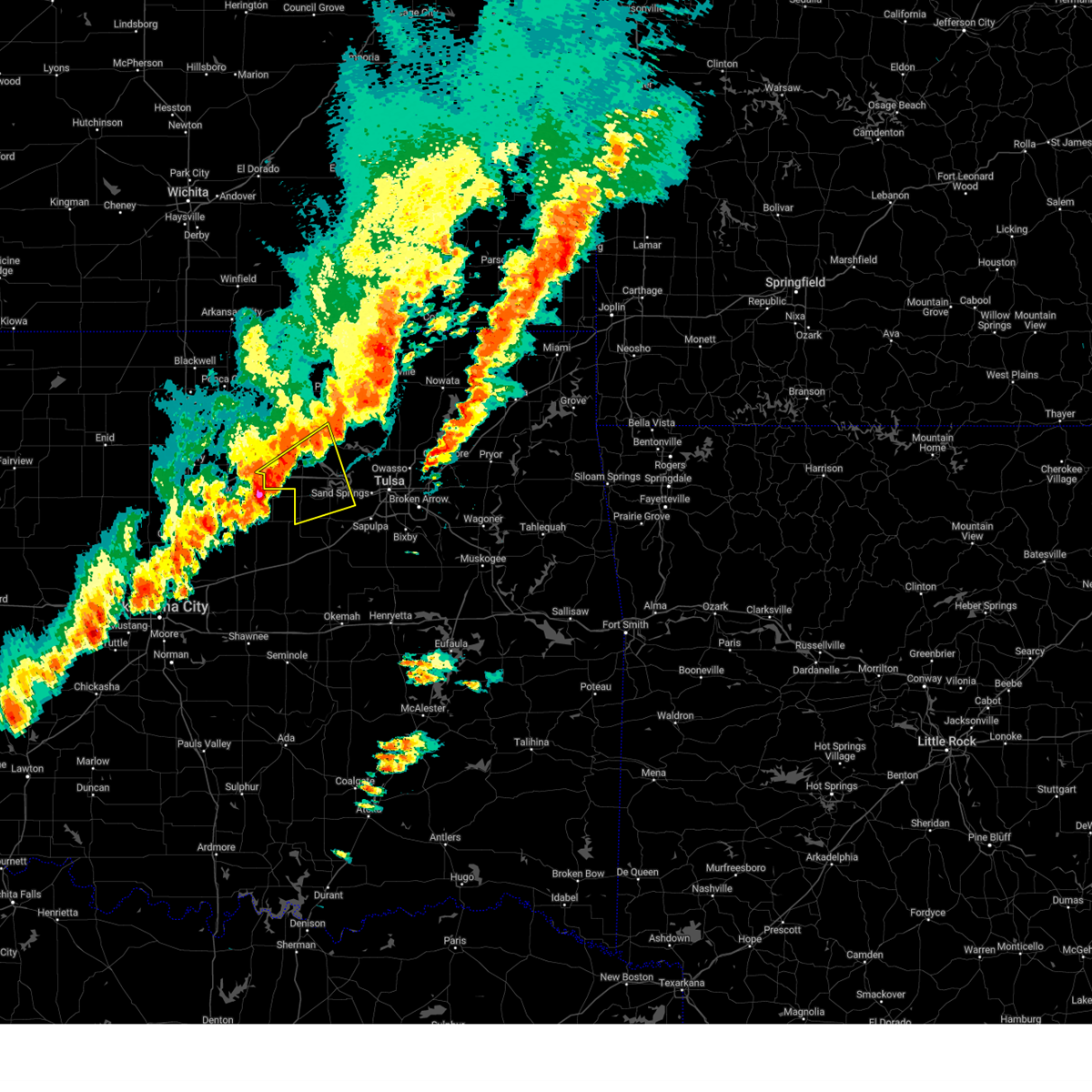 Svrtsa the national weather service in tulsa has issued a * severe thunderstorm warning for, south central osage county in northeastern oklahoma, northwestern creek county in northeastern oklahoma, southern pawnee county in northeastern oklahoma, west central tulsa county in northeastern oklahoma, * until 1000 pm cdt. * at 912 pm cdt, a severe thunderstorm was located 7 miles northeast of ripley, moving northeast at 45 mph (radar indicated). Hazards include 60 mph wind gusts and quarter size hail. Hail damage to vehicles is expected. expect wind damage to roofs, siding, and trees. Locations in or near the path include, hominy, cleveland, mannford, drumright, oilton, jennings, westport, osage, hallett, blackburn, terlton, maramec, keystone state park, silver city,. Svrtsa the national weather service in tulsa has issued a * severe thunderstorm warning for, south central osage county in northeastern oklahoma, northwestern creek county in northeastern oklahoma, southern pawnee county in northeastern oklahoma, west central tulsa county in northeastern oklahoma, * until 1000 pm cdt. * at 912 pm cdt, a severe thunderstorm was located 7 miles northeast of ripley, moving northeast at 45 mph (radar indicated). Hazards include 60 mph wind gusts and quarter size hail. Hail damage to vehicles is expected. expect wind damage to roofs, siding, and trees. Locations in or near the path include, hominy, cleveland, mannford, drumright, oilton, jennings, westport, osage, hallett, blackburn, terlton, maramec, keystone state park, silver city,.
|
| 10/30/2024 8:44 PM CDT |
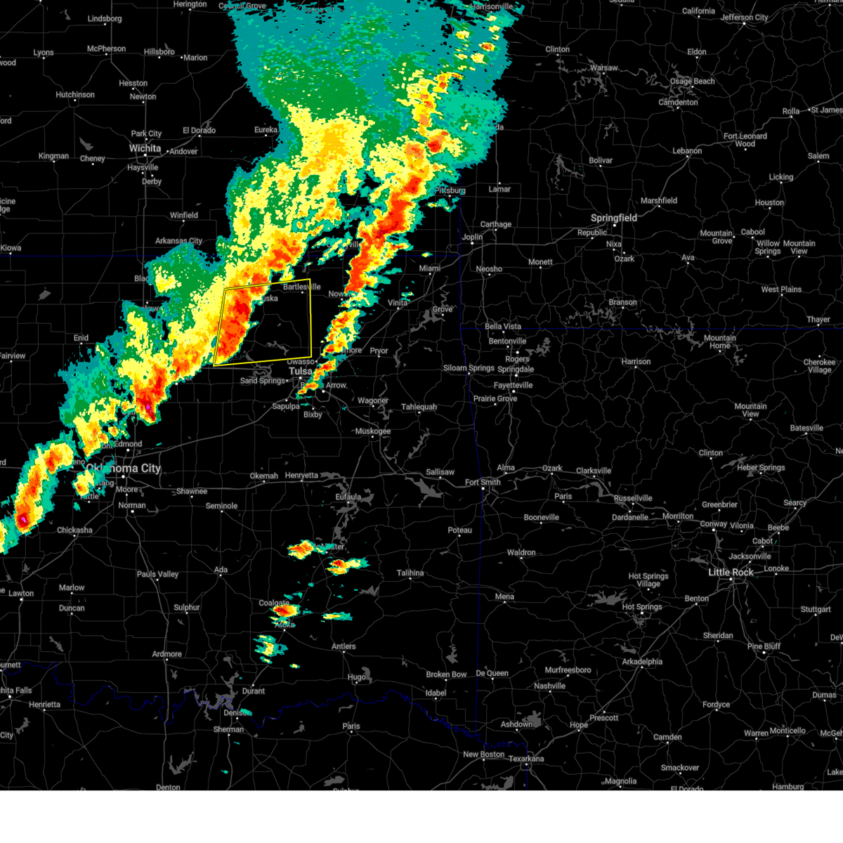 Svrtsa the national weather service in tulsa has issued a * severe thunderstorm warning for, southeastern osage county in northeastern oklahoma, southern washington county in northeastern oklahoma, central pawnee county in northeastern oklahoma, north central tulsa county in northeastern oklahoma, * until 930 pm cdt. * at 843 pm cdt, a severe thunderstorm was located 8 miles west of wynona, moving northeast at 50 mph (radar indicated). Hazards include 60 mph wind gusts and nickel size hail. Expect damage to roofs, siding, and trees. Locations in or near the path include, bartlesville, pawhuska, skiatook, hominy, dewey, cleveland, barnsdall, sperry, ramona, wynona, ochelata, avant, osage, blackburn, maramec, skedee, bartlesville municipal airport, sunset lake, osage hills state park, okesa,. Svrtsa the national weather service in tulsa has issued a * severe thunderstorm warning for, southeastern osage county in northeastern oklahoma, southern washington county in northeastern oklahoma, central pawnee county in northeastern oklahoma, north central tulsa county in northeastern oklahoma, * until 930 pm cdt. * at 843 pm cdt, a severe thunderstorm was located 8 miles west of wynona, moving northeast at 50 mph (radar indicated). Hazards include 60 mph wind gusts and nickel size hail. Expect damage to roofs, siding, and trees. Locations in or near the path include, bartlesville, pawhuska, skiatook, hominy, dewey, cleveland, barnsdall, sperry, ramona, wynona, ochelata, avant, osage, blackburn, maramec, skedee, bartlesville municipal airport, sunset lake, osage hills state park, okesa,.
|
| 10/30/2024 8:33 PM CDT |
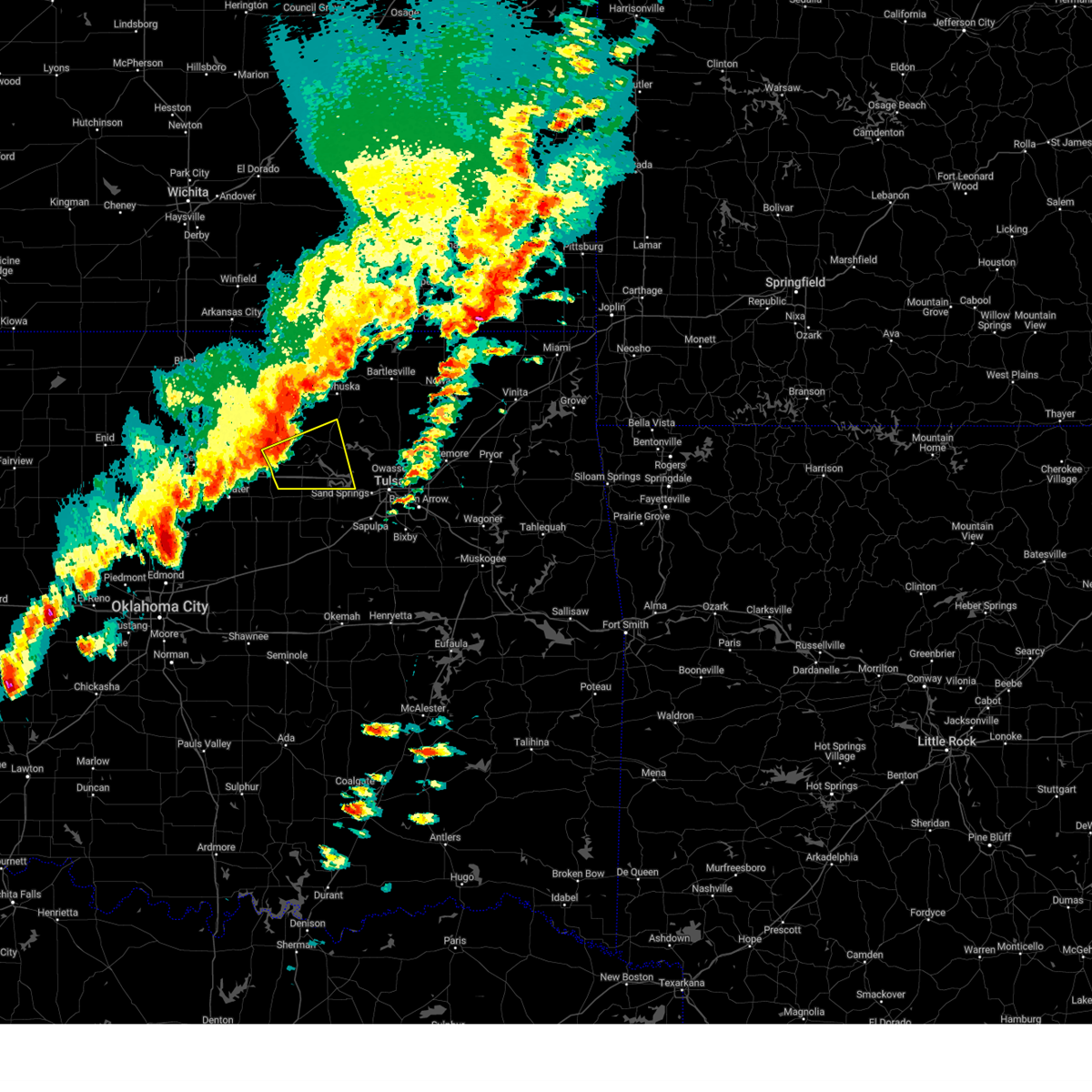 At 833 pm cdt, a severe thunderstorm was located 3 miles southeast of skedee, moving northeast at 55 mph (radar indicated). Hazards include 60 mph wind gusts and quarter size hail. Hail damage to vehicles is expected. expect wind damage to roofs, siding, and trees. Locations in or near the path include, pawnee, hominy, cleveland, jennings, westport, osage, hallett, blackburn, terlton, maramec, skedee, walnut creek state park,. At 833 pm cdt, a severe thunderstorm was located 3 miles southeast of skedee, moving northeast at 55 mph (radar indicated). Hazards include 60 mph wind gusts and quarter size hail. Hail damage to vehicles is expected. expect wind damage to roofs, siding, and trees. Locations in or near the path include, pawnee, hominy, cleveland, jennings, westport, osage, hallett, blackburn, terlton, maramec, skedee, walnut creek state park,.
|
| 10/30/2024 8:19 PM CDT |
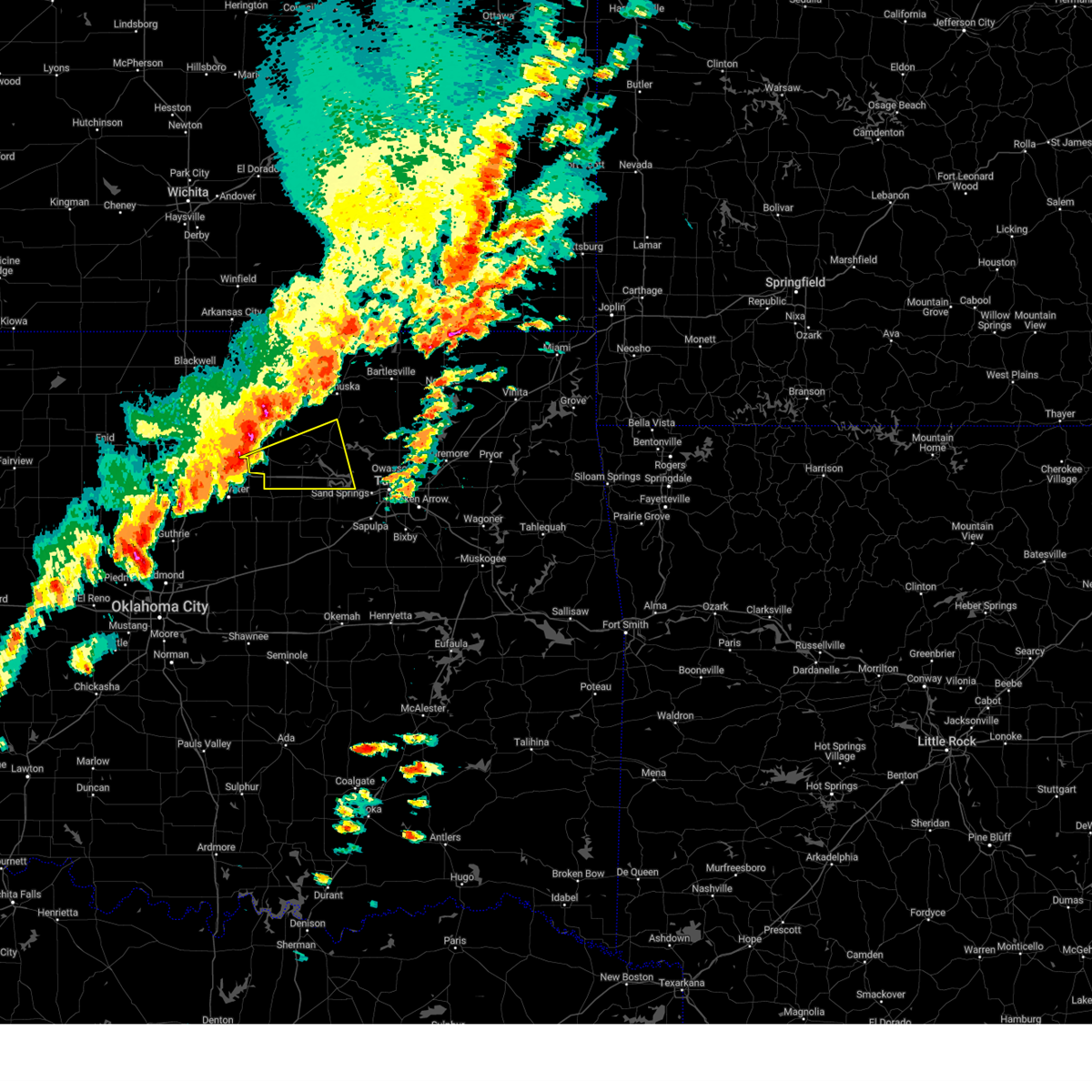 Svrtsa the national weather service in tulsa has issued a * severe thunderstorm warning for, south central osage county in northeastern oklahoma, pawnee county in northeastern oklahoma, * until 845 pm cdt. * at 819 pm cdt, a severe thunderstorm was located 3 miles northeast of glencoe, moving east at 55 mph (radar indicated). Hazards include 60 mph wind gusts and quarter size hail. Hail damage to vehicles is expected. expect wind damage to roofs, siding, and trees. Locations in or near the path include, pawnee, hominy, cleveland, jennings, westport, osage, hallett, blackburn, terlton, maramec, skedee, walnut creek state park,. Svrtsa the national weather service in tulsa has issued a * severe thunderstorm warning for, south central osage county in northeastern oklahoma, pawnee county in northeastern oklahoma, * until 845 pm cdt. * at 819 pm cdt, a severe thunderstorm was located 3 miles northeast of glencoe, moving east at 55 mph (radar indicated). Hazards include 60 mph wind gusts and quarter size hail. Hail damage to vehicles is expected. expect wind damage to roofs, siding, and trees. Locations in or near the path include, pawnee, hominy, cleveland, jennings, westport, osage, hallett, blackburn, terlton, maramec, skedee, walnut creek state park,.
|
| 8/16/2024 9:37 PM CDT |
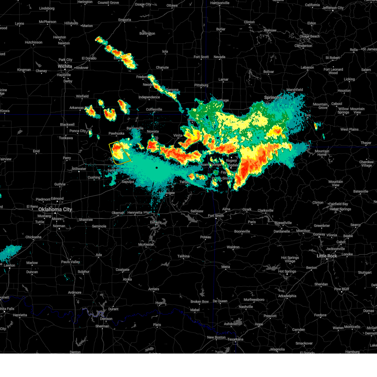 The storm which prompted the warning has weakened below severe limits, and no longer poses an immediate threat to life or property. therefore, the warning will be allowed to expire. however, heavy rain is still possible with this thunderstorm. a severe thunderstorm watch remains in effect until 1100 pm cdt for northeastern oklahoma. to report severe weather, contact your nearest law enforcement agency. they will relay your report to the national weather service tulsa. The storm which prompted the warning has weakened below severe limits, and no longer poses an immediate threat to life or property. therefore, the warning will be allowed to expire. however, heavy rain is still possible with this thunderstorm. a severe thunderstorm watch remains in effect until 1100 pm cdt for northeastern oklahoma. to report severe weather, contact your nearest law enforcement agency. they will relay your report to the national weather service tulsa.
|
| 8/16/2024 9:33 PM CDT |
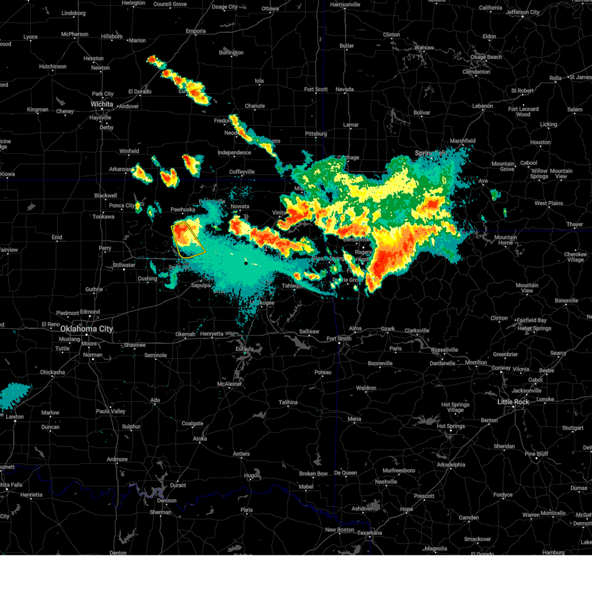 the severe thunderstorm warning has been cancelled and is no longer in effect the severe thunderstorm warning has been cancelled and is no longer in effect
|
| 8/16/2024 9:33 PM CDT |
 At 932 pm cdt, a severe thunderstorm was located 4 miles east of hominy, moving southeast at 30 mph (radar indicated). Hazards include 60 mph wind gusts and penny size hail. Expect damage to roofs, siding, and trees. Locations in or near the path include, hominy, wynona, walnut creek state park,. At 932 pm cdt, a severe thunderstorm was located 4 miles east of hominy, moving southeast at 30 mph (radar indicated). Hazards include 60 mph wind gusts and penny size hail. Expect damage to roofs, siding, and trees. Locations in or near the path include, hominy, wynona, walnut creek state park,.
|
| 8/16/2024 9:06 PM CDT |
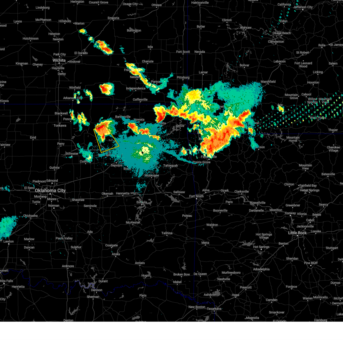 Svrtsa the national weather service in tulsa has issued a * severe thunderstorm warning for, southeastern osage county in northeastern oklahoma, southeastern pawnee county in northeastern oklahoma, * until 945 pm cdt. * at 905 pm cdt, a severe thunderstorm was located 7 miles west of wynona, moving southeast at 35 mph (radar indicated). Hazards include 70 mph wind gusts and half dollar size hail. Hail damage to vehicles is expected. expect considerable tree damage. wind damage is also likely to mobile homes, roofs, and outbuildings. Locations in or near the path include, hominy, cleveland, wynona, westport, osage, walnut creek state park,. Svrtsa the national weather service in tulsa has issued a * severe thunderstorm warning for, southeastern osage county in northeastern oklahoma, southeastern pawnee county in northeastern oklahoma, * until 945 pm cdt. * at 905 pm cdt, a severe thunderstorm was located 7 miles west of wynona, moving southeast at 35 mph (radar indicated). Hazards include 70 mph wind gusts and half dollar size hail. Hail damage to vehicles is expected. expect considerable tree damage. wind damage is also likely to mobile homes, roofs, and outbuildings. Locations in or near the path include, hominy, cleveland, wynona, westport, osage, walnut creek state park,.
|
| 8/15/2024 10:42 PM CDT |
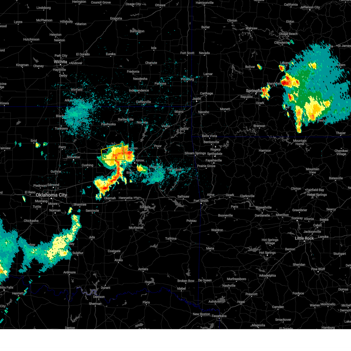 The severe thunderstorm which prompted the warning has weakened. therefore, the warning will be allowed to expire. however, gusty winds are still possible with this thunderstorm. a severe thunderstorm watch remains in effect until midnight cdt for northeastern oklahoma. The severe thunderstorm which prompted the warning has weakened. therefore, the warning will be allowed to expire. however, gusty winds are still possible with this thunderstorm. a severe thunderstorm watch remains in effect until midnight cdt for northeastern oklahoma.
|
| 8/15/2024 10:22 PM CDT |
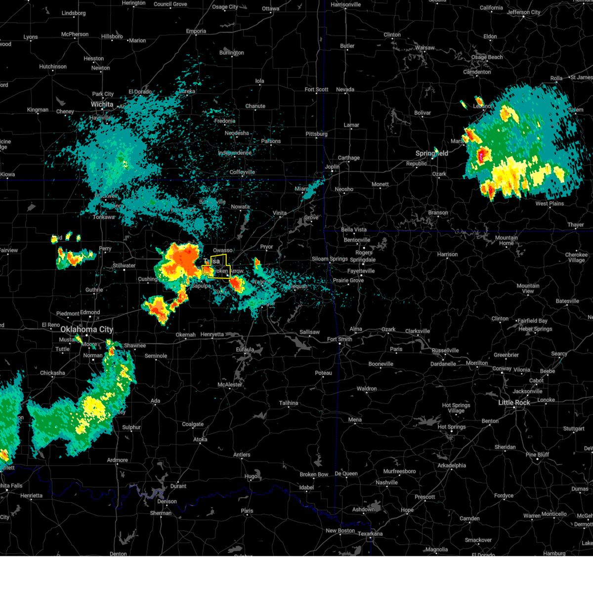 Svrtsa the national weather service in tulsa has issued a * severe thunderstorm warning for, east central tulsa county in northeastern oklahoma, * until 1100 pm cdt. * at 1022 pm cdt, a severe thunderstorm was located 4 miles east of sand springs, moving east at 20 mph (radar indicated). Hazards include 60 mph wind gusts and quarter size hail. Hail damage to vehicles is expected. expect wind damage to roofs, siding, and trees. Locations in or near the path include, tulsa, broken arrow, sand springs, owasso, jenks, catoosa, turley, tulsa international airport, jenks riverside airport, gray, this includes interstate 44 between mile markers 217 and 232. Svrtsa the national weather service in tulsa has issued a * severe thunderstorm warning for, east central tulsa county in northeastern oklahoma, * until 1100 pm cdt. * at 1022 pm cdt, a severe thunderstorm was located 4 miles east of sand springs, moving east at 20 mph (radar indicated). Hazards include 60 mph wind gusts and quarter size hail. Hail damage to vehicles is expected. expect wind damage to roofs, siding, and trees. Locations in or near the path include, tulsa, broken arrow, sand springs, owasso, jenks, catoosa, turley, tulsa international airport, jenks riverside airport, gray, this includes interstate 44 between mile markers 217 and 232.
|
| 8/15/2024 10:07 PM CDT |
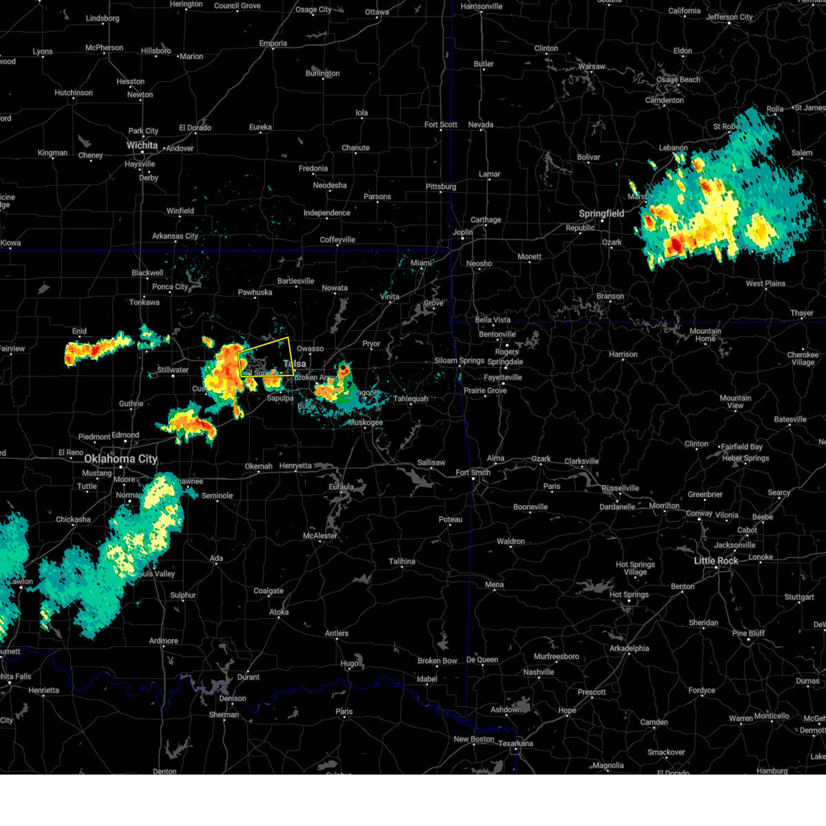 At 1007 pm cdt, a severe thunderstorm was located over westport, moving east at 30 mph (radar indicated). Hazards include 60 mph wind gusts. Expect damage to roofs, siding, and trees. Locations in or near the path include, tulsa, sand springs, mannford, westport, osage, keystone state park, walnut creek state park, gray,. At 1007 pm cdt, a severe thunderstorm was located over westport, moving east at 30 mph (radar indicated). Hazards include 60 mph wind gusts. Expect damage to roofs, siding, and trees. Locations in or near the path include, tulsa, sand springs, mannford, westport, osage, keystone state park, walnut creek state park, gray,.
|
| 8/15/2024 9:56 PM CDT |
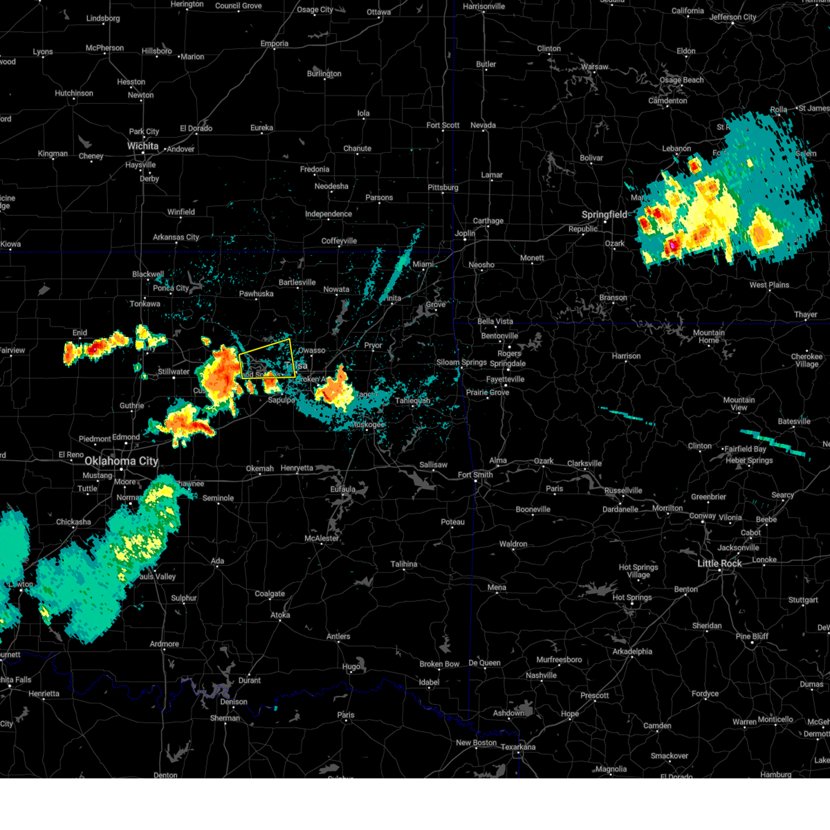 Svrtsa the national weather service in tulsa has issued a * severe thunderstorm warning for, southeastern osage county in northeastern oklahoma, north central creek county in northeastern oklahoma, southeastern pawnee county in northeastern oklahoma, west central tulsa county in northeastern oklahoma, * until 1045 pm cdt. * at 956 pm cdt, a severe thunderstorm was located 3 miles west of westport, moving east at 25 mph (radar indicated). Hazards include 60 mph wind gusts. Expect damage to roofs, siding, and trees. Locations in or near the path include, tulsa, sand springs, mannford, westport, osage, keystone state park, walnut creek state park, gray,. Svrtsa the national weather service in tulsa has issued a * severe thunderstorm warning for, southeastern osage county in northeastern oklahoma, north central creek county in northeastern oklahoma, southeastern pawnee county in northeastern oklahoma, west central tulsa county in northeastern oklahoma, * until 1045 pm cdt. * at 956 pm cdt, a severe thunderstorm was located 3 miles west of westport, moving east at 25 mph (radar indicated). Hazards include 60 mph wind gusts. Expect damage to roofs, siding, and trees. Locations in or near the path include, tulsa, sand springs, mannford, westport, osage, keystone state park, walnut creek state park, gray,.
|
| 6/29/2024 9:01 PM CDT |
 The storms which prompted the warning have weakened below severe limits, and no longer pose an immediate threat to life or property. therefore, the warning has been allowed to expire. however, gusty winds to 50 mph are still possible with these thunderstorms. a severe thunderstorm watch remains in effect until 1100 pm cdt for northeastern and east central oklahoma. The storms which prompted the warning have weakened below severe limits, and no longer pose an immediate threat to life or property. therefore, the warning has been allowed to expire. however, gusty winds to 50 mph are still possible with these thunderstorms. a severe thunderstorm watch remains in effect until 1100 pm cdt for northeastern and east central oklahoma.
|
| 6/29/2024 8:54 PM CDT | Strong thunderstorm wind snapped large tree limb in tulsa county OK, 4.9 miles ENE of Sand Springs, OK |
| 6/29/2024 8:42 PM CDT |
 At 841 pm cdt, severe thunderstorms were located along a line extending from 6 miles northwest of sperry to 3 miles west of inola to 3 miles north of chouteau, moving southeast at 25 mph (radar indicated and off-duty nws employee reported 65 mph wind gusts to 65 mph near tiawah at 825 pm). Hazards include 60 mph wind gusts and nickel size hail. Expect damage to roofs, siding, and trees. Locations in or near the path include, tulsa, broken arrow, sand springs, claremore, pryor, owasso, coweta, pryor creek, skiatook, catoosa, collinsville, verdigris, chouteau, inola, barnsdall, sperry, oologah, ramona, ochelata, foyil, this includes interstate 44 between mile markers 221 and 266. At 841 pm cdt, severe thunderstorms were located along a line extending from 6 miles northwest of sperry to 3 miles west of inola to 3 miles north of chouteau, moving southeast at 25 mph (radar indicated and off-duty nws employee reported 65 mph wind gusts to 65 mph near tiawah at 825 pm). Hazards include 60 mph wind gusts and nickel size hail. Expect damage to roofs, siding, and trees. Locations in or near the path include, tulsa, broken arrow, sand springs, claremore, pryor, owasso, coweta, pryor creek, skiatook, catoosa, collinsville, verdigris, chouteau, inola, barnsdall, sperry, oologah, ramona, ochelata, foyil, this includes interstate 44 between mile markers 221 and 266.
|
| 6/29/2024 8:17 PM CDT |
 At 816 pm cdt, severe thunderstorms were located along a line extending from 5 miles south of barnsdall to 3 miles north of verdigris to 5 miles southeast of foyil, moving south at 30 mph (radar indicated and storm spotters reported 71 mph wind gusts in barnsdall at 814 pm). Hazards include 70 mph wind gusts and quarter size hail. Hail damage to vehicles is expected. expect considerable tree damage. wind damage is also likely to mobile homes, roofs, and outbuildings. Locations in or near the path include, tulsa, broken arrow, bartlesville, sand springs, claremore, pryor, owasso, coweta, pryor creek, skiatook, catoosa, collinsville, verdigris, chouteau, chelsea, inola, barnsdall, sperry, oologah, ramona, this includes interstate 44 between mile markers 221 and 266. At 816 pm cdt, severe thunderstorms were located along a line extending from 5 miles south of barnsdall to 3 miles north of verdigris to 5 miles southeast of foyil, moving south at 30 mph (radar indicated and storm spotters reported 71 mph wind gusts in barnsdall at 814 pm). Hazards include 70 mph wind gusts and quarter size hail. Hail damage to vehicles is expected. expect considerable tree damage. wind damage is also likely to mobile homes, roofs, and outbuildings. Locations in or near the path include, tulsa, broken arrow, bartlesville, sand springs, claremore, pryor, owasso, coweta, pryor creek, skiatook, catoosa, collinsville, verdigris, chouteau, chelsea, inola, barnsdall, sperry, oologah, ramona, this includes interstate 44 between mile markers 221 and 266.
|
| 6/29/2024 8:01 PM CDT |
 Svrtsa the national weather service in tulsa has issued a * severe thunderstorm warning for, rogers county in northeastern oklahoma, southeastern osage county in northeastern oklahoma, western mayes county in northeastern oklahoma, southern washington county in northeastern oklahoma, northern wagoner county in northeastern oklahoma, northeastern tulsa county in northeastern oklahoma, * until 900 pm cdt. * at 801 pm cdt, severe thunderstorms were located along a line extending from 2 miles northwest of barnsdall to 4 miles south of oologah to 4 miles northeast of foyil, moving south at 30 mph (radar indicated). Hazards include 60 mph wind gusts and quarter size hail. Hail damage to vehicles is expected. expect wind damage to roofs, siding, and trees. Locations in or near the path include, tulsa, broken arrow, bartlesville, sand springs, claremore, pryor, owasso, coweta, pryor creek, skiatook, catoosa, collinsville, verdigris, chouteau, chelsea, inola, barnsdall, sperry, oologah, ramona, this includes interstate 44 between mile markers 221 and 266. Svrtsa the national weather service in tulsa has issued a * severe thunderstorm warning for, rogers county in northeastern oklahoma, southeastern osage county in northeastern oklahoma, western mayes county in northeastern oklahoma, southern washington county in northeastern oklahoma, northern wagoner county in northeastern oklahoma, northeastern tulsa county in northeastern oklahoma, * until 900 pm cdt. * at 801 pm cdt, severe thunderstorms were located along a line extending from 2 miles northwest of barnsdall to 4 miles south of oologah to 4 miles northeast of foyil, moving south at 30 mph (radar indicated). Hazards include 60 mph wind gusts and quarter size hail. Hail damage to vehicles is expected. expect wind damage to roofs, siding, and trees. Locations in or near the path include, tulsa, broken arrow, bartlesville, sand springs, claremore, pryor, owasso, coweta, pryor creek, skiatook, catoosa, collinsville, verdigris, chouteau, chelsea, inola, barnsdall, sperry, oologah, ramona, this includes interstate 44 between mile markers 221 and 266.
|
| 6/26/2024 8:00 AM CDT |
 the severe thunderstorm warning has been cancelled and is no longer in effect the severe thunderstorm warning has been cancelled and is no longer in effect
|
| 6/26/2024 8:00 AM CDT |
 At 800 am cdt, severe thunderstorms were located along a line extending from bristow to 2 miles northeast of preston, moving south at 35 mph (radar indicated). Hazards include 70 mph wind gusts. Expect considerable tree damage. damage is likely to mobile homes, roofs, and outbuildings. Locations in or near the path include, tulsa, broken arrow, sand springs, okmulgee, bristow, bixby, sapulpa, jenks, glenpool, catoosa, mannford, kiefer, beggs, mounds, kellyville, slick, preston, jenks riverside airport, keystone state park, bald hill, this includes interstate 44 between mile markers 188 and 237. At 800 am cdt, severe thunderstorms were located along a line extending from bristow to 2 miles northeast of preston, moving south at 35 mph (radar indicated). Hazards include 70 mph wind gusts. Expect considerable tree damage. damage is likely to mobile homes, roofs, and outbuildings. Locations in or near the path include, tulsa, broken arrow, sand springs, okmulgee, bristow, bixby, sapulpa, jenks, glenpool, catoosa, mannford, kiefer, beggs, mounds, kellyville, slick, preston, jenks riverside airport, keystone state park, bald hill, this includes interstate 44 between mile markers 188 and 237.
|
| 6/26/2024 7:32 AM CDT |
 Svrtsa the national weather service in tulsa has issued a * severe thunderstorm warning for, southwestern rogers county in northeastern oklahoma, southeastern osage county in northeastern oklahoma, central creek county in northeastern oklahoma, northwestern wagoner county in northeastern oklahoma, northern okmulgee county in northeastern oklahoma, southeastern pawnee county in northeastern oklahoma, tulsa county in northeastern oklahoma, * until 830 am cdt. * at 732 am cdt, severe thunderstorms were located along a line extending from near keystone state park to 3 miles northwest of broken arrow, moving south at 65 mph (radar indicated). Hazards include 70 mph wind gusts. Expect considerable tree damage. damage is likely to mobile homes, roofs, and outbuildings. Locations in or near the path include, tulsa, broken arrow, sand springs, okmulgee, bristow, owasso, bixby, sapulpa, jenks, glenpool, catoosa, mannford, kiefer, beggs, sperry, mounds, kellyville, westport, slick, shamrock, this includes interstate 44 between mile markers 188 and 237. Svrtsa the national weather service in tulsa has issued a * severe thunderstorm warning for, southwestern rogers county in northeastern oklahoma, southeastern osage county in northeastern oklahoma, central creek county in northeastern oklahoma, northwestern wagoner county in northeastern oklahoma, northern okmulgee county in northeastern oklahoma, southeastern pawnee county in northeastern oklahoma, tulsa county in northeastern oklahoma, * until 830 am cdt. * at 732 am cdt, severe thunderstorms were located along a line extending from near keystone state park to 3 miles northwest of broken arrow, moving south at 65 mph (radar indicated). Hazards include 70 mph wind gusts. Expect considerable tree damage. damage is likely to mobile homes, roofs, and outbuildings. Locations in or near the path include, tulsa, broken arrow, sand springs, okmulgee, bristow, owasso, bixby, sapulpa, jenks, glenpool, catoosa, mannford, kiefer, beggs, sperry, mounds, kellyville, westport, slick, shamrock, this includes interstate 44 between mile markers 188 and 237.
|
| 5/25/2024 10:51 PM CDT |
 Tortsa the national weather service in tulsa has issued a * tornado warning for, southwestern rogers county in northeastern oklahoma, southeastern osage county in northeastern oklahoma, southern washington county in northeastern oklahoma, northwestern wagoner county in northeastern oklahoma, northeastern tulsa county in northeastern oklahoma, * until 1130 pm cdt. * at 1050 pm cdt, a severe thunderstorm with strong low level rotation that could produce a tornado at any time was located 8 miles northeast of walnut creek state park, moving east at 40 mph (radar indicated rotation). Hazards include tornado and tennis ball size hail. Flying debris will be dangerous to those caught without shelter. mobile homes will be damaged or destroyed. damage to roofs, windows, and vehicles will occur. tree damage is likely. Locations in or near the path include, tulsa, claremore, owasso, skiatook, catoosa, collinsville, verdigris, sperry, oologah, vera, walnut creek state park, turley, tulsa international airport, this includes interstate 44 between mile markers 229 and 248. Tortsa the national weather service in tulsa has issued a * tornado warning for, southwestern rogers county in northeastern oklahoma, southeastern osage county in northeastern oklahoma, southern washington county in northeastern oklahoma, northwestern wagoner county in northeastern oklahoma, northeastern tulsa county in northeastern oklahoma, * until 1130 pm cdt. * at 1050 pm cdt, a severe thunderstorm with strong low level rotation that could produce a tornado at any time was located 8 miles northeast of walnut creek state park, moving east at 40 mph (radar indicated rotation). Hazards include tornado and tennis ball size hail. Flying debris will be dangerous to those caught without shelter. mobile homes will be damaged or destroyed. damage to roofs, windows, and vehicles will occur. tree damage is likely. Locations in or near the path include, tulsa, claremore, owasso, skiatook, catoosa, collinsville, verdigris, sperry, oologah, vera, walnut creek state park, turley, tulsa international airport, this includes interstate 44 between mile markers 229 and 248.
|
| 5/25/2024 10:44 PM CDT |
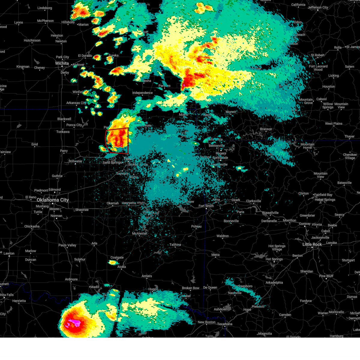 At 1044 pm cdt, a severe thunderstorm capable of producing a tornado was located 6 miles northeast of walnut creek state park, moving east at 40 mph (radar indicated rotation). Hazards include tornado and half dollar size hail. Flying debris will be dangerous to those caught without shelter. mobile homes will be damaged or destroyed. damage to roofs, windows, and vehicles will occur. tree damage is likely. Locations in or near the path include, pawhuska, skiatook, hominy, barnsdall, sperry, wynona, avant, pershing, nelagoney, tallant, wolco,. At 1044 pm cdt, a severe thunderstorm capable of producing a tornado was located 6 miles northeast of walnut creek state park, moving east at 40 mph (radar indicated rotation). Hazards include tornado and half dollar size hail. Flying debris will be dangerous to those caught without shelter. mobile homes will be damaged or destroyed. damage to roofs, windows, and vehicles will occur. tree damage is likely. Locations in or near the path include, pawhuska, skiatook, hominy, barnsdall, sperry, wynona, avant, pershing, nelagoney, tallant, wolco,.
|
| 5/25/2024 10:33 PM CDT |
 the tornado warning has been cancelled and is no longer in effect the tornado warning has been cancelled and is no longer in effect
|
| 5/25/2024 10:33 PM CDT |
 At 1032 pm cdt, a severe thunderstorm capable of producing a tornado was located near hominy, moving east at 50 mph (radar indicated rotation). Hazards include tornado and half dollar size hail. Flying debris will be dangerous to those caught without shelter. mobile homes will be damaged or destroyed. damage to roofs, windows, and vehicles will occur. tree damage is likely. Locations in or near the path include, pawhuska, skiatook, hominy, barnsdall, sperry, wynona, avant, pershing, nelagoney, tallant, wolco,. At 1032 pm cdt, a severe thunderstorm capable of producing a tornado was located near hominy, moving east at 50 mph (radar indicated rotation). Hazards include tornado and half dollar size hail. Flying debris will be dangerous to those caught without shelter. mobile homes will be damaged or destroyed. damage to roofs, windows, and vehicles will occur. tree damage is likely. Locations in or near the path include, pawhuska, skiatook, hominy, barnsdall, sperry, wynona, avant, pershing, nelagoney, tallant, wolco,.
|
| 5/25/2024 10:18 PM CDT |
 Tortsa the national weather service in tulsa has issued a * tornado warning for, southeastern osage county in northeastern oklahoma, central pawnee county in northeastern oklahoma, * until 1100 pm cdt. * at 1018 pm cdt, a severe thunderstorm capable of producing a tornado was located near blackburn, moving east at 45 mph (radar indicated rotation). Hazards include tornado and half dollar size hail. Flying debris will be dangerous to those caught without shelter. mobile homes will be damaged or destroyed. damage to roofs, windows, and vehicles will occur. tree damage is likely. Locations in or near the path include, pawhuska, skiatook, hominy, cleveland, fairfax, barnsdall, sperry, wynona, ralston, avant, osage, blackburn, skedee, tallant, pershing, nelagoney, wolco,. Tortsa the national weather service in tulsa has issued a * tornado warning for, southeastern osage county in northeastern oklahoma, central pawnee county in northeastern oklahoma, * until 1100 pm cdt. * at 1018 pm cdt, a severe thunderstorm capable of producing a tornado was located near blackburn, moving east at 45 mph (radar indicated rotation). Hazards include tornado and half dollar size hail. Flying debris will be dangerous to those caught without shelter. mobile homes will be damaged or destroyed. damage to roofs, windows, and vehicles will occur. tree damage is likely. Locations in or near the path include, pawhuska, skiatook, hominy, cleveland, fairfax, barnsdall, sperry, wynona, ralston, avant, osage, blackburn, skedee, tallant, pershing, nelagoney, wolco,.
|
| 5/25/2024 9:27 PM CDT |
 the severe thunderstorm warning has been cancelled and is no longer in effect the severe thunderstorm warning has been cancelled and is no longer in effect
|
| 5/25/2024 9:16 PM CDT |
 At 916 pm cdt, a severe thunderstorm was located near westport, moving east at 60 mph (radar indicated). Hazards include 60 mph wind gusts and quarter size hail. Hail damage to vehicles is expected. expect wind damage to roofs, siding, and trees. Locations in or near the path include, tulsa, sand springs, skiatook, hominy, cleveland, jennings, avant, westport, osage, hallett, terlton, walnut creek state park, wolco,. At 916 pm cdt, a severe thunderstorm was located near westport, moving east at 60 mph (radar indicated). Hazards include 60 mph wind gusts and quarter size hail. Hail damage to vehicles is expected. expect wind damage to roofs, siding, and trees. Locations in or near the path include, tulsa, sand springs, skiatook, hominy, cleveland, jennings, avant, westport, osage, hallett, terlton, walnut creek state park, wolco,.
|
| 5/25/2024 9:06 PM CDT |
 At 906 pm cdt, a severe thunderstorm was located 3 miles north of hallett, moving east at 55 mph (radar indicated). Hazards include 60 mph wind gusts and quarter size hail. Hail damage to vehicles is expected. expect wind damage to roofs, siding, and trees. Locations in or near the path include, tulsa, sand springs, skiatook, hominy, cleveland, jennings, avant, westport, osage, hallett, blackburn, terlton, maramec, skedee, walnut creek state park, wolco,. At 906 pm cdt, a severe thunderstorm was located 3 miles north of hallett, moving east at 55 mph (radar indicated). Hazards include 60 mph wind gusts and quarter size hail. Hail damage to vehicles is expected. expect wind damage to roofs, siding, and trees. Locations in or near the path include, tulsa, sand springs, skiatook, hominy, cleveland, jennings, avant, westport, osage, hallett, blackburn, terlton, maramec, skedee, walnut creek state park, wolco,.
|
| 5/25/2024 8:53 PM CDT |
 Svrtsa the national weather service in tulsa has issued a * severe thunderstorm warning for, southeastern osage county in northeastern oklahoma, pawnee county in northeastern oklahoma, * until 1000 pm cdt. * at 852 pm cdt, a severe thunderstorm was located 3 miles south of pawnee, moving east at 60 mph (radar indicated). Hazards include 60 mph wind gusts and quarter size hail. Hail damage to vehicles is expected. expect wind damage to roofs, siding, and trees. Locations in or near the path include, tulsa, sand springs, pawnee, skiatook, hominy, cleveland, jennings, avant, westport, osage, hallett, blackburn, terlton, maramec, skedee, walnut creek state park, wolco,. Svrtsa the national weather service in tulsa has issued a * severe thunderstorm warning for, southeastern osage county in northeastern oklahoma, pawnee county in northeastern oklahoma, * until 1000 pm cdt. * at 852 pm cdt, a severe thunderstorm was located 3 miles south of pawnee, moving east at 60 mph (radar indicated). Hazards include 60 mph wind gusts and quarter size hail. Hail damage to vehicles is expected. expect wind damage to roofs, siding, and trees. Locations in or near the path include, tulsa, sand springs, pawnee, skiatook, hominy, cleveland, jennings, avant, westport, osage, hallett, blackburn, terlton, maramec, skedee, walnut creek state park, wolco,.
|
| 5/25/2024 8:50 PM CDT |
 At 850 pm cdt, a severe thunderstorm was located 4 miles southwest of pawnee, moving east at 60 mph (radar indicated). Hazards include 60 mph wind gusts and quarter size hail. Hail damage to vehicles is expected. expect wind damage to roofs, siding, and trees. Locations in or near the path include, tulsa, sand springs, pawnee, skiatook, hominy, cleveland, jennings, avant, westport, osage, hallett, blackburn, terlton, maramec, skedee, walnut creek state park,. At 850 pm cdt, a severe thunderstorm was located 4 miles southwest of pawnee, moving east at 60 mph (radar indicated). Hazards include 60 mph wind gusts and quarter size hail. Hail damage to vehicles is expected. expect wind damage to roofs, siding, and trees. Locations in or near the path include, tulsa, sand springs, pawnee, skiatook, hominy, cleveland, jennings, avant, westport, osage, hallett, blackburn, terlton, maramec, skedee, walnut creek state park,.
|
| 5/25/2024 8:33 PM CDT |
 At 832 pm cdt, a severe thunderstorm was located over lake mcmurtry, moving east at 50 mph. anouther strong to severe thunderstorm was located near pawnee (radar indicated). Hazards include 60 mph wind gusts and quarter size hail. Hail damage to vehicles is expected. expect wind damage to roofs, siding, and trees. Locations in or near the path include, tulsa, sand springs, pawnee, skiatook, hominy, cleveland, jennings, ralston, avant, westport, osage, hallett, blackburn, terlton, maramec, skedee, walnut creek state park,. At 832 pm cdt, a severe thunderstorm was located over lake mcmurtry, moving east at 50 mph. anouther strong to severe thunderstorm was located near pawnee (radar indicated). Hazards include 60 mph wind gusts and quarter size hail. Hail damage to vehicles is expected. expect wind damage to roofs, siding, and trees. Locations in or near the path include, tulsa, sand springs, pawnee, skiatook, hominy, cleveland, jennings, ralston, avant, westport, osage, hallett, blackburn, terlton, maramec, skedee, walnut creek state park,.
|
| 5/25/2024 7:58 PM CDT |
 Svrtsa the national weather service in tulsa has issued a * severe thunderstorm warning for, southern osage county in northeastern oklahoma, pawnee county in northeastern oklahoma, * until 900 pm cdt. * at 757 pm cdt, a severe thunderstorm was located 7 miles west of morrison, moving east at 75 mph (radar indicated). Hazards include 60 mph wind gusts and quarter size hail. Hail damage to vehicles is expected. expect wind damage to roofs, siding, and trees. Locations in or near the path include, tulsa, sand springs, pawnee, skiatook, hominy, cleveland, jennings, ralston, avant, westport, osage, hallett, blackburn, terlton, maramec, skedee, walnut creek state park,. Svrtsa the national weather service in tulsa has issued a * severe thunderstorm warning for, southern osage county in northeastern oklahoma, pawnee county in northeastern oklahoma, * until 900 pm cdt. * at 757 pm cdt, a severe thunderstorm was located 7 miles west of morrison, moving east at 75 mph (radar indicated). Hazards include 60 mph wind gusts and quarter size hail. Hail damage to vehicles is expected. expect wind damage to roofs, siding, and trees. Locations in or near the path include, tulsa, sand springs, pawnee, skiatook, hominy, cleveland, jennings, ralston, avant, westport, osage, hallett, blackburn, terlton, maramec, skedee, walnut creek state park,.
|
| 5/22/2024 7:09 AM CDT |
 the severe thunderstorm warning has been cancelled and is no longer in effect the severe thunderstorm warning has been cancelled and is no longer in effect
|
| 5/22/2024 7:05 AM CDT |
 At 705 am cdt, a severe thunderstorm was located near sand springs, moving east at 20 mph (radar indicated). Hazards include quarter size hail. Damage to vehicles is expected. Locations in or near the path include, tulsa, sand springs, sapulpa, jenks, glenpool, sperry, turley, jenks riverside airport, gray, this includes interstate 44 between mile markers 208 and 222. At 705 am cdt, a severe thunderstorm was located near sand springs, moving east at 20 mph (radar indicated). Hazards include quarter size hail. Damage to vehicles is expected. Locations in or near the path include, tulsa, sand springs, sapulpa, jenks, glenpool, sperry, turley, jenks riverside airport, gray, this includes interstate 44 between mile markers 208 and 222.
|
| 5/22/2024 6:52 AM CDT |
 Svrtsa the national weather service in tulsa has issued a * severe thunderstorm warning for, southeastern osage county in northeastern oklahoma, northeastern creek county in northeastern oklahoma, central tulsa county in northeastern oklahoma, * until 745 am cdt. * at 652 am cdt, a severe thunderstorm was located 3 miles southeast of keystone state park, moving east at 20 mph (radar indicated). Hazards include quarter size hail. Damage to vehicles is expected. Locations in or near the path include, tulsa, sand springs, sapulpa, jenks, glenpool, mannford, sperry, keystone state park, turley, jenks riverside airport, gray, this includes interstate 44 between mile markers 207 and 222. Svrtsa the national weather service in tulsa has issued a * severe thunderstorm warning for, southeastern osage county in northeastern oklahoma, northeastern creek county in northeastern oklahoma, central tulsa county in northeastern oklahoma, * until 745 am cdt. * at 652 am cdt, a severe thunderstorm was located 3 miles southeast of keystone state park, moving east at 20 mph (radar indicated). Hazards include quarter size hail. Damage to vehicles is expected. Locations in or near the path include, tulsa, sand springs, sapulpa, jenks, glenpool, mannford, sperry, keystone state park, turley, jenks riverside airport, gray, this includes interstate 44 between mile markers 207 and 222.
|
| 5/21/2024 5:40 PM CDT |
 At 539 pm cdt, a severe thunderstorm was located over jenks riverside airport, moving east at 50 mph (radar indicated). Hazards include tennis ball size hail and 60 mph wind gusts. People and animals outdoors will be injured. expect hail damage to roofs, siding, windows, and vehicles. expect wind damage to roofs, siding, and trees. Locations in or near the path include, tulsa, broken arrow, sand springs, bixby, sapulpa, jenks, glenpool, kiefer, jenks riverside airport, this includes interstate 44 between mile markers 210 and 230. At 539 pm cdt, a severe thunderstorm was located over jenks riverside airport, moving east at 50 mph (radar indicated). Hazards include tennis ball size hail and 60 mph wind gusts. People and animals outdoors will be injured. expect hail damage to roofs, siding, windows, and vehicles. expect wind damage to roofs, siding, and trees. Locations in or near the path include, tulsa, broken arrow, sand springs, bixby, sapulpa, jenks, glenpool, kiefer, jenks riverside airport, this includes interstate 44 between mile markers 210 and 230.
|
| 5/21/2024 5:34 PM CDT |
 At 534 pm cdt, a severe thunderstorm was located 3 miles east of sapulpa, moving east at 50 mph (radar indicated). Hazards include golf ball size hail and 60 mph wind gusts. People and animals outdoors will be injured. expect hail damage to roofs, siding, windows, and vehicles. expect wind damage to roofs, siding, and trees. Locations in or near the path include, tulsa, broken arrow, sand springs, bixby, sapulpa, jenks, glenpool, kiefer, jenks riverside airport, this includes interstate 44 between mile markers 210 and 230. At 534 pm cdt, a severe thunderstorm was located 3 miles east of sapulpa, moving east at 50 mph (radar indicated). Hazards include golf ball size hail and 60 mph wind gusts. People and animals outdoors will be injured. expect hail damage to roofs, siding, windows, and vehicles. expect wind damage to roofs, siding, and trees. Locations in or near the path include, tulsa, broken arrow, sand springs, bixby, sapulpa, jenks, glenpool, kiefer, jenks riverside airport, this includes interstate 44 between mile markers 210 and 230.
|
| 5/21/2024 5:22 PM CDT |
 At 522 pm cdt, a severe thunderstorm was located 3 miles north of kellyville, moving east at 50 mph (radar indicated). Hazards include 60 mph wind gusts and half dollar size hail. Hail damage to vehicles is expected. expect wind damage to roofs, siding, and trees. Locations in or near the path include, tulsa, broken arrow, sand springs, bixby, sapulpa, jenks, glenpool, kiefer, kellyville, jenks riverside airport, this includes interstate 44 between mile markers 201 and 230. At 522 pm cdt, a severe thunderstorm was located 3 miles north of kellyville, moving east at 50 mph (radar indicated). Hazards include 60 mph wind gusts and half dollar size hail. Hail damage to vehicles is expected. expect wind damage to roofs, siding, and trees. Locations in or near the path include, tulsa, broken arrow, sand springs, bixby, sapulpa, jenks, glenpool, kiefer, kellyville, jenks riverside airport, this includes interstate 44 between mile markers 201 and 230.
|
| 5/21/2024 5:13 PM CDT |
 Svrtsa the national weather service in tulsa has issued a * severe thunderstorm warning for, northeastern creek county in northeastern oklahoma, southern tulsa county in northeastern oklahoma, * until 600 pm cdt. * at 513 pm cdt, a severe thunderstorm was located 7 miles west of kellyville, moving east at 50 mph (radar indicated). Hazards include 60 mph wind gusts and half dollar size hail. Hail damage to vehicles is expected. expect wind damage to roofs, siding, and trees. Locations in or near the path include, tulsa, broken arrow, sand springs, bixby, sapulpa, jenks, glenpool, kiefer, kellyville, jenks riverside airport, leonard, this includes interstate 44 between mile markers 197 and 230. Svrtsa the national weather service in tulsa has issued a * severe thunderstorm warning for, northeastern creek county in northeastern oklahoma, southern tulsa county in northeastern oklahoma, * until 600 pm cdt. * at 513 pm cdt, a severe thunderstorm was located 7 miles west of kellyville, moving east at 50 mph (radar indicated). Hazards include 60 mph wind gusts and half dollar size hail. Hail damage to vehicles is expected. expect wind damage to roofs, siding, and trees. Locations in or near the path include, tulsa, broken arrow, sand springs, bixby, sapulpa, jenks, glenpool, kiefer, kellyville, jenks riverside airport, leonard, this includes interstate 44 between mile markers 197 and 230.
|
| 5/21/2024 4:48 PM CDT |
 Svrtsa the national weather service in tulsa has issued a * severe thunderstorm warning for, northern rogers county in northeastern oklahoma, southeastern osage county in northeastern oklahoma, northeastern creek county in northeastern oklahoma, northwestern mayes county in northeastern oklahoma, southern washington county in northeastern oklahoma, tulsa county in northeastern oklahoma, * until 530 pm cdt. * at 447 pm cdt, severe thunderstorms were located along a line extending from 4 miles east of vera to 3 miles southeast of keystone state park, moving east at 35 mph (radar indicated). Hazards include 60 mph wind gusts and quarter size hail. Hail damage to vehicles is expected. expect wind damage to roofs, siding, and trees. Locations in or near the path include, tulsa, sand springs, claremore, owasso, skiatook, catoosa, collinsville, verdigris, mannford, sperry, oologah, foyil, vera, keystone state park, turley, tulsa international airport, gray, bushyhead, this includes interstate 44 between mile markers 215 and 253. Svrtsa the national weather service in tulsa has issued a * severe thunderstorm warning for, northern rogers county in northeastern oklahoma, southeastern osage county in northeastern oklahoma, northeastern creek county in northeastern oklahoma, northwestern mayes county in northeastern oklahoma, southern washington county in northeastern oklahoma, tulsa county in northeastern oklahoma, * until 530 pm cdt. * at 447 pm cdt, severe thunderstorms were located along a line extending from 4 miles east of vera to 3 miles southeast of keystone state park, moving east at 35 mph (radar indicated). Hazards include 60 mph wind gusts and quarter size hail. Hail damage to vehicles is expected. expect wind damage to roofs, siding, and trees. Locations in or near the path include, tulsa, sand springs, claremore, owasso, skiatook, catoosa, collinsville, verdigris, mannford, sperry, oologah, foyil, vera, keystone state park, turley, tulsa international airport, gray, bushyhead, this includes interstate 44 between mile markers 215 and 253.
|
| 5/21/2024 4:23 PM CDT |
 At 423 pm cdt, severe thunderstorms were located along a line extending from 2 miles southwest of ramona to 6 miles northeast of walnut creek state park, moving east at 30 mph (radar indicated). Hazards include 60 mph wind gusts and quarter size hail. Hail damage to vehicles is expected. expect wind damage to roofs, siding, and trees. Locations in or near the path include, skiatook, collinsville, ramona, avant, vera,. At 423 pm cdt, severe thunderstorms were located along a line extending from 2 miles southwest of ramona to 6 miles northeast of walnut creek state park, moving east at 30 mph (radar indicated). Hazards include 60 mph wind gusts and quarter size hail. Hail damage to vehicles is expected. expect wind damage to roofs, siding, and trees. Locations in or near the path include, skiatook, collinsville, ramona, avant, vera,.
|
| 5/21/2024 4:09 PM CDT |
 At 409 pm cdt, a severe thunderstorm was located 8 miles southwest of avant, moving east at 40 mph (radar indicated). Hazards include 60 mph wind gusts and quarter size hail. Hail damage to vehicles is expected. expect wind damage to roofs, siding, and trees. Locations in or near the path include, skiatook, collinsville, ramona, avant, vera, wolco,. At 409 pm cdt, a severe thunderstorm was located 8 miles southwest of avant, moving east at 40 mph (radar indicated). Hazards include 60 mph wind gusts and quarter size hail. Hail damage to vehicles is expected. expect wind damage to roofs, siding, and trees. Locations in or near the path include, skiatook, collinsville, ramona, avant, vera, wolco,.
|
| 5/21/2024 3:59 PM CDT |
 Svrtsa the national weather service in tulsa has issued a * severe thunderstorm warning for, northwestern rogers county in northeastern oklahoma, southeastern osage county in northeastern oklahoma, southern washington county in northeastern oklahoma, northeastern tulsa county in northeastern oklahoma, * until 445 pm cdt. * at 359 pm cdt, a severe thunderstorm was located 7 miles southeast of hominy, moving east at 40 mph (radar indicated). Hazards include 60 mph wind gusts and quarter size hail. Hail damage to vehicles is expected. expect wind damage to roofs, siding, and trees. Locations in or near the path include, skiatook, collinsville, ramona, avant, vera, wolco,. Svrtsa the national weather service in tulsa has issued a * severe thunderstorm warning for, northwestern rogers county in northeastern oklahoma, southeastern osage county in northeastern oklahoma, southern washington county in northeastern oklahoma, northeastern tulsa county in northeastern oklahoma, * until 445 pm cdt. * at 359 pm cdt, a severe thunderstorm was located 7 miles southeast of hominy, moving east at 40 mph (radar indicated). Hazards include 60 mph wind gusts and quarter size hail. Hail damage to vehicles is expected. expect wind damage to roofs, siding, and trees. Locations in or near the path include, skiatook, collinsville, ramona, avant, vera, wolco,.
|
| 5/20/2024 2:56 AM CDT |
 The storm which prompted the warning has moved out of the area. therefore, the warning will be allowed to expire. however, gusty winds and heavy rain are still possible with this thunderstorm. a severe thunderstorm watch remains in effect until 600 am cdt for northeastern oklahoma. The storm which prompted the warning has moved out of the area. therefore, the warning will be allowed to expire. however, gusty winds and heavy rain are still possible with this thunderstorm. a severe thunderstorm watch remains in effect until 600 am cdt for northeastern oklahoma.
|
| 5/20/2024 2:32 AM CDT |
 the severe thunderstorm warning has been cancelled and is no longer in effect the severe thunderstorm warning has been cancelled and is no longer in effect
|
| 5/20/2024 2:32 AM CDT |
 At 232 am cdt, a severe thunderstorm was located 4 miles west of tulsa, moving east at 45 mph (radar indicated). Hazards include 60 mph wind gusts and quarter size hail. Hail damage to vehicles is expected. expect wind damage to roofs, siding, and trees. Locations in or near the path include, tulsa, broken arrow, sand springs, bixby, jenks, catoosa, tulsa international airport, jenks riverside airport, gray, this includes interstate 44 between mile markers 217 and 232. At 232 am cdt, a severe thunderstorm was located 4 miles west of tulsa, moving east at 45 mph (radar indicated). Hazards include 60 mph wind gusts and quarter size hail. Hail damage to vehicles is expected. expect wind damage to roofs, siding, and trees. Locations in or near the path include, tulsa, broken arrow, sand springs, bixby, jenks, catoosa, tulsa international airport, jenks riverside airport, gray, this includes interstate 44 between mile markers 217 and 232.
|
| 5/20/2024 2:31 AM CDT |
 The severe thunderstorm which prompted the warning has moved out of the warned area. therefore, the warning has been allowed to expire. however, gusty winds to 50 mph are still possible in southeastern osage county with this thunderstorm. a severe thunderstorm watch remains in effect until 600 am cdt for northeastern oklahoma. The severe thunderstorm which prompted the warning has moved out of the warned area. therefore, the warning has been allowed to expire. however, gusty winds to 50 mph are still possible in southeastern osage county with this thunderstorm. a severe thunderstorm watch remains in effect until 600 am cdt for northeastern oklahoma.
|
| 5/20/2024 2:16 AM CDT |
 At 216 am cdt, a severe thunderstorm was located over westport, moving east at 30 mph (radar indicated). Hazards include 60 mph wind gusts and quarter size hail. Hail damage to vehicles is expected. expect wind damage to roofs, siding, and trees. Locations in or near the path include, tulsa, sand springs, skiatook, hominy, sperry, avant, westport, osage, walnut creek state park,. At 216 am cdt, a severe thunderstorm was located over westport, moving east at 30 mph (radar indicated). Hazards include 60 mph wind gusts and quarter size hail. Hail damage to vehicles is expected. expect wind damage to roofs, siding, and trees. Locations in or near the path include, tulsa, sand springs, skiatook, hominy, sperry, avant, westport, osage, walnut creek state park,.
|
| 5/20/2024 2:14 AM CDT |
 Svrtsa the national weather service in tulsa has issued a * severe thunderstorm warning for, northeastern creek county in northeastern oklahoma, central tulsa county in northeastern oklahoma, * until 300 am cdt. * at 214 am cdt, a severe thunderstorm was located over keystone state park, moving east at 40 mph (radar indicated). Hazards include 60 mph wind gusts and quarter size hail. Hail damage to vehicles is expected. expect wind damage to roofs, siding, and trees. Locations in or near the path include, tulsa, broken arrow, sand springs, bixby, jenks, catoosa, mannford, keystone state park, tulsa international airport, jenks riverside airport, gray, this includes interstate 44 between mile markers 212 and 232. Svrtsa the national weather service in tulsa has issued a * severe thunderstorm warning for, northeastern creek county in northeastern oklahoma, central tulsa county in northeastern oklahoma, * until 300 am cdt. * at 214 am cdt, a severe thunderstorm was located over keystone state park, moving east at 40 mph (radar indicated). Hazards include 60 mph wind gusts and quarter size hail. Hail damage to vehicles is expected. expect wind damage to roofs, siding, and trees. Locations in or near the path include, tulsa, broken arrow, sand springs, bixby, jenks, catoosa, mannford, keystone state park, tulsa international airport, jenks riverside airport, gray, this includes interstate 44 between mile markers 212 and 232.
|
| 5/20/2024 1:47 AM CDT |
 Svrtsa the national weather service in tulsa has issued a * severe thunderstorm warning for, southeastern osage county in northeastern oklahoma, southeastern pawnee county in northeastern oklahoma, * until 230 am cdt. * at 146 am cdt, a severe thunderstorm was located 3 miles west of cleveland, moving east at 35 mph (radar indicated). Hazards include 60 mph wind gusts and quarter size hail. Hail damage to vehicles is expected. expect wind damage to roofs, siding, and trees. Locations in or near the path include, tulsa, sand springs, skiatook, hominy, cleveland, sperry, jennings, avant, westport, osage, hallett, blackburn, terlton, walnut creek state park,. Svrtsa the national weather service in tulsa has issued a * severe thunderstorm warning for, southeastern osage county in northeastern oklahoma, southeastern pawnee county in northeastern oklahoma, * until 230 am cdt. * at 146 am cdt, a severe thunderstorm was located 3 miles west of cleveland, moving east at 35 mph (radar indicated). Hazards include 60 mph wind gusts and quarter size hail. Hail damage to vehicles is expected. expect wind damage to roofs, siding, and trees. Locations in or near the path include, tulsa, sand springs, skiatook, hominy, cleveland, sperry, jennings, avant, westport, osage, hallett, blackburn, terlton, walnut creek state park,.
|
| 5/6/2024 11:13 PM CDT |
 At 1113 pm cdt, a severe thunderstorm was located near keystone state park, moving east at 50 mph (radar indicated). Hazards include 60 mph wind gusts and quarter size hail. Hail damage to vehicles is expected. expect wind damage to roofs, siding, and trees. Locations in or near the path include, tulsa, broken arrow, sand springs, claremore, bristow, pryor, owasso, bixby, sapulpa, jenks, glenpool, coweta, pryor creek, catoosa, verdigris, mannford, drumright, chouteau, inola, kiefer, this includes interstate 44 between mile markers 178 and 252. At 1113 pm cdt, a severe thunderstorm was located near keystone state park, moving east at 50 mph (radar indicated). Hazards include 60 mph wind gusts and quarter size hail. Hail damage to vehicles is expected. expect wind damage to roofs, siding, and trees. Locations in or near the path include, tulsa, broken arrow, sand springs, claremore, bristow, pryor, owasso, bixby, sapulpa, jenks, glenpool, coweta, pryor creek, catoosa, verdigris, mannford, drumright, chouteau, inola, kiefer, this includes interstate 44 between mile markers 178 and 252.
|
| 5/6/2024 11:06 PM CDT |
 At 1106 pm cdt, severe thunderstorms were located along a line extending from 6 miles west of pryor to near oneta to 3 miles southeast of depew, moving east at 25 mph (radar indicated). Hazards include 60 mph wind gusts and quarter size hail. Hail damage to vehicles is expected. expect wind damage to roofs, siding, and trees. Locations in or near the path include, tulsa, broken arrow, sand springs, claremore, bristow, pryor, owasso, bixby, sapulpa, jenks, glenpool, coweta, pryor creek, catoosa, verdigris, mannford, drumright, chouteau, inola, kiefer, this includes interstate 44 between mile markers 178 and 252. At 1106 pm cdt, severe thunderstorms were located along a line extending from 6 miles west of pryor to near oneta to 3 miles southeast of depew, moving east at 25 mph (radar indicated). Hazards include 60 mph wind gusts and quarter size hail. Hail damage to vehicles is expected. expect wind damage to roofs, siding, and trees. Locations in or near the path include, tulsa, broken arrow, sand springs, claremore, bristow, pryor, owasso, bixby, sapulpa, jenks, glenpool, coweta, pryor creek, catoosa, verdigris, mannford, drumright, chouteau, inola, kiefer, this includes interstate 44 between mile markers 178 and 252.
|
| 5/6/2024 10:42 PM CDT |
 Svrtsa the national weather service in tulsa has issued a * severe thunderstorm warning for, southern rogers county in northeastern oklahoma, southeastern osage county in northeastern oklahoma, creek county in northeastern oklahoma, west central mayes county in northeastern oklahoma, northwestern wagoner county in northeastern oklahoma, northwestern okmulgee county in northeastern oklahoma, southern pawnee county in northeastern oklahoma, tulsa county in northeastern oklahoma, * until 1130 pm cdt. * at 1041 pm cdt, severe thunderstorms were located along a line extending from near claremore to 3 miles east of jenks riverside airport to 2 miles north of stroud, moving east at 25 mph (radar indicated). Hazards include 60 mph wind gusts and half dollar size hail. Hail damage to vehicles is expected. expect wind damage to roofs, siding, and trees. Locations in or near the path include, tulsa, broken arrow, sand springs, claremore, bristow, pryor, owasso, bixby, sapulpa, jenks, glenpool, coweta, pryor creek, catoosa, verdigris, mannford, drumright, chouteau, inola, kiefer, this includes interstate 44 between mile markers 178 and 252. Svrtsa the national weather service in tulsa has issued a * severe thunderstorm warning for, southern rogers county in northeastern oklahoma, southeastern osage county in northeastern oklahoma, creek county in northeastern oklahoma, west central mayes county in northeastern oklahoma, northwestern wagoner county in northeastern oklahoma, northwestern okmulgee county in northeastern oklahoma, southern pawnee county in northeastern oklahoma, tulsa county in northeastern oklahoma, * until 1130 pm cdt. * at 1041 pm cdt, severe thunderstorms were located along a line extending from near claremore to 3 miles east of jenks riverside airport to 2 miles north of stroud, moving east at 25 mph (radar indicated). Hazards include 60 mph wind gusts and half dollar size hail. Hail damage to vehicles is expected. expect wind damage to roofs, siding, and trees. Locations in or near the path include, tulsa, broken arrow, sand springs, claremore, bristow, pryor, owasso, bixby, sapulpa, jenks, glenpool, coweta, pryor creek, catoosa, verdigris, mannford, drumright, chouteau, inola, kiefer, this includes interstate 44 between mile markers 178 and 252.
|
| 5/6/2024 10:05 PM CDT |
 At 1004 pm cdt, severe thunderstorms were located along a line extending from 3 miles northeast of osage hills state park to 3 miles east of ramona to near sand springs, moving east at 60 mph (radar indicated). Hazards include 70 mph wind gusts and nickel size hail. Expect considerable tree damage. damage is likely to mobile homes, roofs, and outbuildings. Locations in or near the path include, tulsa, bartlesville, sand springs, sapulpa, skiatook, hominy, cleveland, mannford, drumright, barnsdall, oilton, jennings, avant, westport, osage, hallett, blackburn, terlton, maramec, bigheart, this includes interstate 44 between mile markers 206 and 218. At 1004 pm cdt, severe thunderstorms were located along a line extending from 3 miles northeast of osage hills state park to 3 miles east of ramona to near sand springs, moving east at 60 mph (radar indicated). Hazards include 70 mph wind gusts and nickel size hail. Expect considerable tree damage. damage is likely to mobile homes, roofs, and outbuildings. Locations in or near the path include, tulsa, bartlesville, sand springs, sapulpa, skiatook, hominy, cleveland, mannford, drumright, barnsdall, oilton, jennings, avant, westport, osage, hallett, blackburn, terlton, maramec, bigheart, this includes interstate 44 between mile markers 206 and 218.
|
| 5/6/2024 9:58 PM CDT |
 Svrtsa the national weather service in tulsa has issued a * severe thunderstorm warning for, rogers county in northeastern oklahoma, southeastern osage county in northeastern oklahoma, creek county in northeastern oklahoma, southern washington county in northeastern oklahoma, southwestern nowata county in northeastern oklahoma, northwestern wagoner county in northeastern oklahoma, southeastern pawnee county in northeastern oklahoma, tulsa county in northeastern oklahoma, * until 1045 pm cdt. * at 958 pm cdt, severe thunderstorms were located along a line extending from 4 miles south of ochelata to 7 miles west of sperry to 8 miles south of mannford, moving east at 50 mph (radar indicated). Hazards include 70 mph wind gusts and penny size hail. Expect considerable tree damage. damage is likely to mobile homes, roofs, and outbuildings. Locations in or near the path include, tulsa, broken arrow, sand springs, claremore, owasso, bixby, sapulpa, jenks, glenpool, coweta, skiatook, catoosa, collinsville, verdigris, mannford, drumright, chelsea, inola, kiefer, sperry, this includes interstate 44 between mile markers 194 and 259. Svrtsa the national weather service in tulsa has issued a * severe thunderstorm warning for, rogers county in northeastern oklahoma, southeastern osage county in northeastern oklahoma, creek county in northeastern oklahoma, southern washington county in northeastern oklahoma, southwestern nowata county in northeastern oklahoma, northwestern wagoner county in northeastern oklahoma, southeastern pawnee county in northeastern oklahoma, tulsa county in northeastern oklahoma, * until 1045 pm cdt. * at 958 pm cdt, severe thunderstorms were located along a line extending from 4 miles south of ochelata to 7 miles west of sperry to 8 miles south of mannford, moving east at 50 mph (radar indicated). Hazards include 70 mph wind gusts and penny size hail. Expect considerable tree damage. damage is likely to mobile homes, roofs, and outbuildings. Locations in or near the path include, tulsa, broken arrow, sand springs, claremore, owasso, bixby, sapulpa, jenks, glenpool, coweta, skiatook, catoosa, collinsville, verdigris, mannford, drumright, chelsea, inola, kiefer, sperry, this includes interstate 44 between mile markers 194 and 259.
|
| 5/6/2024 9:39 PM CDT |
 At 938 pm cdt, severe thunderstorms were located along a line extending from 5 miles southeast of shidler to 5 miles south of wynona to near oilton, moving east at 70 mph (radar indicated). Hazards include 70 mph wind gusts and nickel size hail. Expect considerable tree damage. damage is likely to mobile homes, roofs, and outbuildings. Locations in or near the path include, tulsa, bartlesville, sand springs, pawhuska, pawnee, sapulpa, skiatook, hominy, cleveland, mannford, drumright, fairfax, barnsdall, oilton, wynona, jennings, ralston, avant, westport, osage, this includes interstate 44 between mile markers 206 and 218. At 938 pm cdt, severe thunderstorms were located along a line extending from 5 miles southeast of shidler to 5 miles south of wynona to near oilton, moving east at 70 mph (radar indicated). Hazards include 70 mph wind gusts and nickel size hail. Expect considerable tree damage. damage is likely to mobile homes, roofs, and outbuildings. Locations in or near the path include, tulsa, bartlesville, sand springs, pawhuska, pawnee, sapulpa, skiatook, hominy, cleveland, mannford, drumright, fairfax, barnsdall, oilton, wynona, jennings, ralston, avant, westport, osage, this includes interstate 44 between mile markers 206 and 218.
|
| 5/6/2024 9:17 PM CDT |
 Svrtsa the national weather service in tulsa has issued a * severe thunderstorm warning for, osage county in northeastern oklahoma, northern creek county in northeastern oklahoma, pawnee county in northeastern oklahoma, west central tulsa county in northeastern oklahoma, * until 1015 pm cdt. * at 917 pm cdt, severe thunderstorms were located along a line extending from 6 miles southeast of ponca city to 4 miles northwest of maramec to 2 miles northwest of ripley, moving east at 60 mph (radar indicated). Hazards include 70 mph wind gusts and quarter size hail. Hail damage to vehicles is expected. expect considerable tree damage. wind damage is also likely to mobile homes, roofs, and outbuildings. Locations in or near the path include, tulsa, bartlesville, sand springs, pawhuska, pawnee, sapulpa, skiatook, hominy, cleveland, mannford, drumright, fairfax, barnsdall, oilton, shidler, wynona, jennings, ralston, avant, westport, this includes interstate 44 between mile markers 206 and 218. Svrtsa the national weather service in tulsa has issued a * severe thunderstorm warning for, osage county in northeastern oklahoma, northern creek county in northeastern oklahoma, pawnee county in northeastern oklahoma, west central tulsa county in northeastern oklahoma, * until 1015 pm cdt. * at 917 pm cdt, severe thunderstorms were located along a line extending from 6 miles southeast of ponca city to 4 miles northwest of maramec to 2 miles northwest of ripley, moving east at 60 mph (radar indicated). Hazards include 70 mph wind gusts and quarter size hail. Hail damage to vehicles is expected. expect considerable tree damage. wind damage is also likely to mobile homes, roofs, and outbuildings. Locations in or near the path include, tulsa, bartlesville, sand springs, pawhuska, pawnee, sapulpa, skiatook, hominy, cleveland, mannford, drumright, fairfax, barnsdall, oilton, shidler, wynona, jennings, ralston, avant, westport, this includes interstate 44 between mile markers 206 and 218.
|
| 5/1/2024 1:14 AM CDT |
 the severe thunderstorm warning has been cancelled and is no longer in effect the severe thunderstorm warning has been cancelled and is no longer in effect
|
| 5/1/2024 12:52 AM CDT |
 Svrtsa the national weather service in tulsa has issued a * severe thunderstorm warning for, southwestern rogers county in northeastern oklahoma, eastern tulsa county in northeastern oklahoma, * until 145 am cdt. * at 1252 am cdt, a severe thunderstorm was located near jenks riverside airport, moving northeast at 15 mph (radar indicated). Hazards include 60 mph wind gusts and quarter size hail. Hail damage to vehicles is expected. expect wind damage to roofs, siding, and trees. Locations in or near the path include, tulsa, broken arrow, sand springs, owasso, bixby, jenks, skiatook, catoosa, sperry, jenks riverside airport, turley, tulsa international airport, gray, this includes interstate 44 between mile markers 217 and 240. Svrtsa the national weather service in tulsa has issued a * severe thunderstorm warning for, southwestern rogers county in northeastern oklahoma, eastern tulsa county in northeastern oklahoma, * until 145 am cdt. * at 1252 am cdt, a severe thunderstorm was located near jenks riverside airport, moving northeast at 15 mph (radar indicated). Hazards include 60 mph wind gusts and quarter size hail. Hail damage to vehicles is expected. expect wind damage to roofs, siding, and trees. Locations in or near the path include, tulsa, broken arrow, sand springs, owasso, bixby, jenks, skiatook, catoosa, sperry, jenks riverside airport, turley, tulsa international airport, gray, this includes interstate 44 between mile markers 217 and 240.
|
| 4/27/2024 11:47 PM CDT |
 the severe thunderstorm warning has been cancelled and is no longer in effect the severe thunderstorm warning has been cancelled and is no longer in effect
|
| 4/27/2024 11:47 PM CDT |
 At 1147 pm cdt, severe thunderstorms were located along a line extending from 3 miles east of wynona to near avant to 4 miles southwest of collinsville to 2 miles southeast of tulsa, moving northeast at 45 mph (radar indicated). Hazards include 70 mph wind gusts and penny size hail. Expect considerable tree damage. damage is likely to mobile homes, roofs, and outbuildings. Locations in or near the path include, tulsa, broken arrow, sand springs, owasso, bixby, sapulpa, jenks, glenpool, skiatook, hominy, kiefer, sperry, mounds, wynona, jenks riverside airport, turley, tulsa international airport, liberty, gray, this includes interstate 44 between mile markers 211 and 229. At 1147 pm cdt, severe thunderstorms were located along a line extending from 3 miles east of wynona to near avant to 4 miles southwest of collinsville to 2 miles southeast of tulsa, moving northeast at 45 mph (radar indicated). Hazards include 70 mph wind gusts and penny size hail. Expect considerable tree damage. damage is likely to mobile homes, roofs, and outbuildings. Locations in or near the path include, tulsa, broken arrow, sand springs, owasso, bixby, sapulpa, jenks, glenpool, skiatook, hominy, kiefer, sperry, mounds, wynona, jenks riverside airport, turley, tulsa international airport, liberty, gray, this includes interstate 44 between mile markers 211 and 229.
|
| 4/27/2024 11:29 PM CDT |
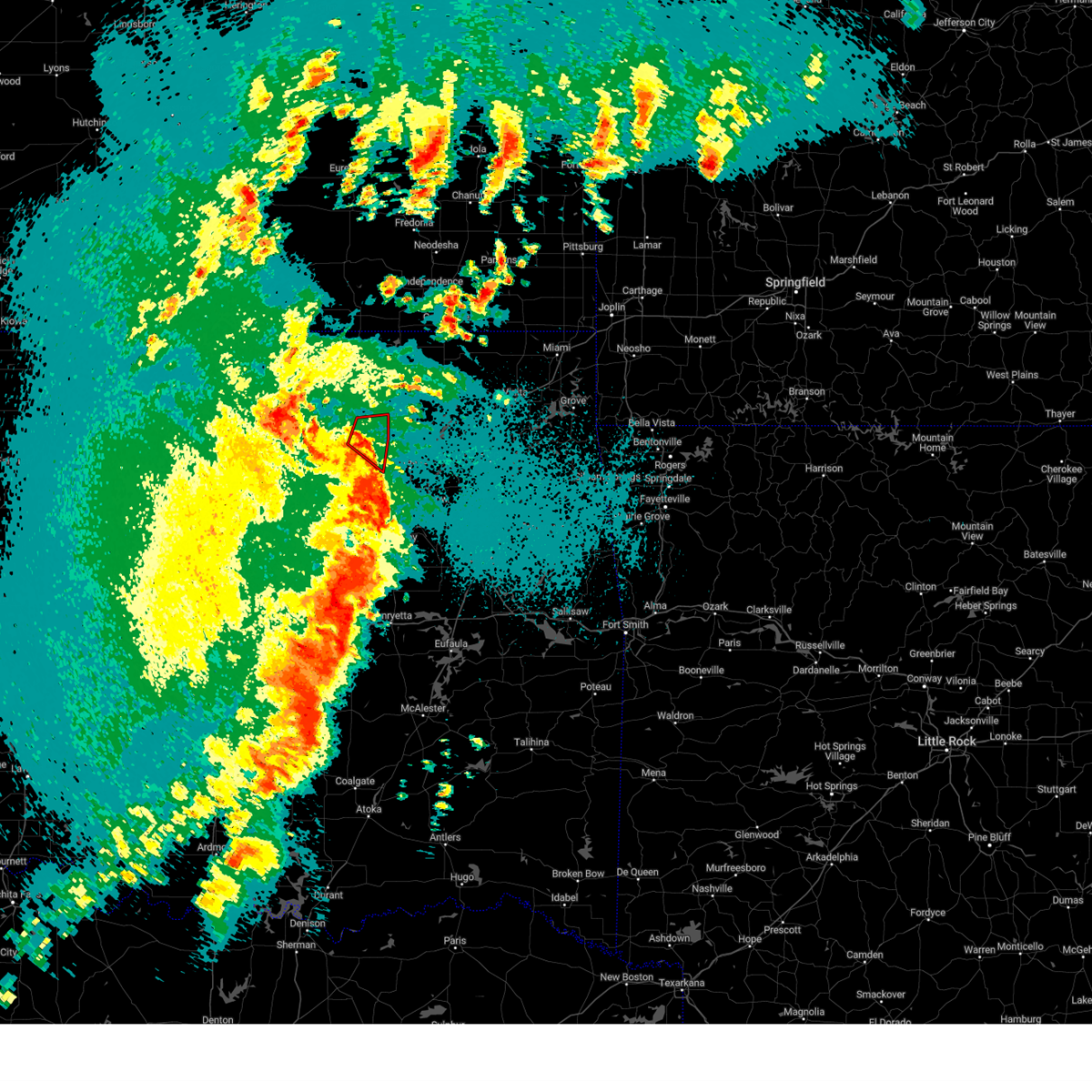 Tortsa the national weather service in tulsa has issued a * tornado warning for, east central osage county in northeastern oklahoma, * until midnight cdt. * at 1129 pm cdt, severe thunderstorms capable of producing a tornado were located along a line extending from 10 miles east of hominy to 5 miles west of sperry, moving northeast at 55 mph (radar indicated rotation). Hazards include tornado. Flying debris will be dangerous to those caught without shelter. mobile homes will be damaged or destroyed. damage to roofs, windows, and vehicles will occur. tree damage is likely. Locations in or near the path include, skiatook, avant, wolco,. Tortsa the national weather service in tulsa has issued a * tornado warning for, east central osage county in northeastern oklahoma, * until midnight cdt. * at 1129 pm cdt, severe thunderstorms capable of producing a tornado were located along a line extending from 10 miles east of hominy to 5 miles west of sperry, moving northeast at 55 mph (radar indicated rotation). Hazards include tornado. Flying debris will be dangerous to those caught without shelter. mobile homes will be damaged or destroyed. damage to roofs, windows, and vehicles will occur. tree damage is likely. Locations in or near the path include, skiatook, avant, wolco,.
|
| 4/27/2024 11:24 PM CDT |
 At 1124 pm cdt, severe thunderstorms were located along a line extending from 4 miles southwest of hominy to 5 miles north of walnut creek state park to 2 miles northeast of sand springs to 2 miles southwest of kiefer, moving northeast at 50 mph (radar indicated). Hazards include 70 mph wind gusts and penny size hail. Expect considerable tree damage. damage is likely to mobile homes, roofs, and outbuildings. Locations in or near the path include, tulsa, broken arrow, sand springs, owasso, bixby, sapulpa, jenks, glenpool, skiatook, hominy, cleveland, mannford, kiefer, sperry, mounds, wynona, westport, osage, blackburn, jenks riverside airport, this includes interstate 44 between mile markers 207 and 229. At 1124 pm cdt, severe thunderstorms were located along a line extending from 4 miles southwest of hominy to 5 miles north of walnut creek state park to 2 miles northeast of sand springs to 2 miles southwest of kiefer, moving northeast at 50 mph (radar indicated). Hazards include 70 mph wind gusts and penny size hail. Expect considerable tree damage. damage is likely to mobile homes, roofs, and outbuildings. Locations in or near the path include, tulsa, broken arrow, sand springs, owasso, bixby, sapulpa, jenks, glenpool, skiatook, hominy, cleveland, mannford, kiefer, sperry, mounds, wynona, westport, osage, blackburn, jenks riverside airport, this includes interstate 44 between mile markers 207 and 229.
|
| 4/27/2024 10:57 PM CDT |
 Svrtsa the national weather service in tulsa has issued a * severe thunderstorm warning for, southeastern osage county in northeastern oklahoma, northeastern creek county in northeastern oklahoma, northwestern okmulgee county in northeastern oklahoma, southeastern pawnee county in northeastern oklahoma, tulsa county in northeastern oklahoma, * until midnight cdt. * at 1057 pm cdt, severe thunderstorms were located along a line extending from 2 miles southwest of quay to 2 miles east of oilton to 4 miles north of bristow to 3 miles north of welty, moving northeast at 50 mph (radar indicated). Hazards include 70 mph wind gusts and nickel size hail. Expect considerable tree damage. damage is likely to mobile homes, roofs, and outbuildings. Locations in or near the path include, tulsa, broken arrow, sand springs, owasso, bixby, sapulpa, jenks, glenpool, skiatook, hominy, cleveland, mannford, kiefer, sperry, mounds, kellyville, wynona, jennings, westport, osage, this includes interstate 44 between mile markers 202 and 229. Svrtsa the national weather service in tulsa has issued a * severe thunderstorm warning for, southeastern osage county in northeastern oklahoma, northeastern creek county in northeastern oklahoma, northwestern okmulgee county in northeastern oklahoma, southeastern pawnee county in northeastern oklahoma, tulsa county in northeastern oklahoma, * until midnight cdt. * at 1057 pm cdt, severe thunderstorms were located along a line extending from 2 miles southwest of quay to 2 miles east of oilton to 4 miles north of bristow to 3 miles north of welty, moving northeast at 50 mph (radar indicated). Hazards include 70 mph wind gusts and nickel size hail. Expect considerable tree damage. damage is likely to mobile homes, roofs, and outbuildings. Locations in or near the path include, tulsa, broken arrow, sand springs, owasso, bixby, sapulpa, jenks, glenpool, skiatook, hominy, cleveland, mannford, kiefer, sperry, mounds, kellyville, wynona, jennings, westport, osage, this includes interstate 44 between mile markers 202 and 229.
|
| 4/26/2024 4:38 PM CDT |
 The storm which prompted the warning has moved out of the area. therefore, the warning will be allowed to expire. a tornado watch remains in effect until 900 pm cdt for northeastern oklahoma. to report severe weather, contact your nearest law enforcement agency. they will relay your report to the national weather service tulsa. The storm which prompted the warning has moved out of the area. therefore, the warning will be allowed to expire. a tornado watch remains in effect until 900 pm cdt for northeastern oklahoma. to report severe weather, contact your nearest law enforcement agency. they will relay your report to the national weather service tulsa.
|
| 4/26/2024 4:21 PM CDT |
 At 421 pm cdt, a severe thunderstorm was located near sperry, moving northeast at 35 mph (radar indicated). Hazards include ping pong ball size hail and 60 mph wind gusts. People and animals outdoors will be injured. expect hail damage to roofs, siding, windows, and vehicles. expect wind damage to roofs, siding, and trees. Locations in or near the path include, tulsa, claremore, owasso, skiatook, collinsville, sperry, oologah, ramona, talala, vera, turley,. At 421 pm cdt, a severe thunderstorm was located near sperry, moving northeast at 35 mph (radar indicated). Hazards include ping pong ball size hail and 60 mph wind gusts. People and animals outdoors will be injured. expect hail damage to roofs, siding, windows, and vehicles. expect wind damage to roofs, siding, and trees. Locations in or near the path include, tulsa, claremore, owasso, skiatook, collinsville, sperry, oologah, ramona, talala, vera, turley,.
|
| 4/26/2024 4:17 PM CDT |
 At 416 pm cdt, a severe thunderstorm was located 3 miles northeast of keystone state park, moving northeast at 40 mph (radar indicated). Hazards include 60 mph wind gusts and half dollar size hail. Hail damage to vehicles is expected. expect wind damage to roofs, siding, and trees. Locations in or near the path include, tulsa, sand springs, mannford, westport, keystone state park, walnut creek state park, turley, gray,. At 416 pm cdt, a severe thunderstorm was located 3 miles northeast of keystone state park, moving northeast at 40 mph (radar indicated). Hazards include 60 mph wind gusts and half dollar size hail. Hail damage to vehicles is expected. expect wind damage to roofs, siding, and trees. Locations in or near the path include, tulsa, sand springs, mannford, westport, keystone state park, walnut creek state park, turley, gray,.
|
| 4/26/2024 4:17 PM CDT |
 the severe thunderstorm warning has been cancelled and is no longer in effect the severe thunderstorm warning has been cancelled and is no longer in effect
|
| 4/26/2024 4:12 PM CDT |
 Svrtsa the national weather service in tulsa has issued a * severe thunderstorm warning for, northwestern rogers county in northeastern oklahoma, eastern osage county in northeastern oklahoma, southern washington county in northeastern oklahoma, northeastern tulsa county in northeastern oklahoma, * until 500 pm cdt. * at 412 pm cdt, a severe thunderstorm was located 4 miles west of sperry, moving northeast at 35 mph (radar indicated). Hazards include ping pong ball size hail and 60 mph wind gusts. People and animals outdoors will be injured. expect hail damage to roofs, siding, windows, and vehicles. expect wind damage to roofs, siding, and trees. Locations in or near the path include, tulsa, claremore, owasso, skiatook, collinsville, sperry, oologah, ramona, talala, vera, turley,. Svrtsa the national weather service in tulsa has issued a * severe thunderstorm warning for, northwestern rogers county in northeastern oklahoma, eastern osage county in northeastern oklahoma, southern washington county in northeastern oklahoma, northeastern tulsa county in northeastern oklahoma, * until 500 pm cdt. * at 412 pm cdt, a severe thunderstorm was located 4 miles west of sperry, moving northeast at 35 mph (radar indicated). Hazards include ping pong ball size hail and 60 mph wind gusts. People and animals outdoors will be injured. expect hail damage to roofs, siding, windows, and vehicles. expect wind damage to roofs, siding, and trees. Locations in or near the path include, tulsa, claremore, owasso, skiatook, collinsville, sperry, oologah, ramona, talala, vera, turley,.
|
| 4/26/2024 3:58 PM CDT |
 Svrtsa the national weather service in tulsa has issued a * severe thunderstorm warning for, southeastern osage county in northeastern oklahoma, northern creek county in northeastern oklahoma, southeastern pawnee county in northeastern oklahoma, central tulsa county in northeastern oklahoma, * until 445 pm cdt. * at 357 pm cdt, a severe thunderstorm was located 6 miles southwest of mannford, moving northeast at 40 mph (radar indicated). Hazards include 60 mph wind gusts and half dollar size hail. Hail damage to vehicles is expected. expect wind damage to roofs, siding, and trees. Locations in or near the path include, tulsa, sand springs, mannford, westport, keystone state park, walnut creek state park, turley, gray, this includes interstate 44 between mile markers 205 and 209, and between mile markers 213 and 229. Svrtsa the national weather service in tulsa has issued a * severe thunderstorm warning for, southeastern osage county in northeastern oklahoma, northern creek county in northeastern oklahoma, southeastern pawnee county in northeastern oklahoma, central tulsa county in northeastern oklahoma, * until 445 pm cdt. * at 357 pm cdt, a severe thunderstorm was located 6 miles southwest of mannford, moving northeast at 40 mph (radar indicated). Hazards include 60 mph wind gusts and half dollar size hail. Hail damage to vehicles is expected. expect wind damage to roofs, siding, and trees. Locations in or near the path include, tulsa, sand springs, mannford, westport, keystone state park, walnut creek state park, turley, gray, this includes interstate 44 between mile markers 205 and 209, and between mile markers 213 and 229.
|
| 4/26/2024 6:58 AM CDT |
 The storms which prompted the warning have moved out of the warned area. therefore, the warning will be allowed to expire. a tornado watch remains in effect until 1100 am cdt for northeastern and east central oklahoma. remember, a severe thunderstorm warning still remains in effect for pars of washington, tulsa, rogers and wagoner counties until 745 am cdt. The storms which prompted the warning have moved out of the warned area. therefore, the warning will be allowed to expire. a tornado watch remains in effect until 1100 am cdt for northeastern and east central oklahoma. remember, a severe thunderstorm warning still remains in effect for pars of washington, tulsa, rogers and wagoner counties until 745 am cdt.
|
| 4/26/2024 6:34 AM CDT |
 the severe thunderstorm warning has been cancelled and is no longer in effect the severe thunderstorm warning has been cancelled and is no longer in effect
|
| 4/26/2024 6:34 AM CDT |
 At 634 am cdt, severe thunderstorms were located along a line extending from 6 miles west of sperry to 4 miles south of turley to 5 miles west of haskell, moving northeast at 60 mph (radar indicated). Hazards include 70 mph wind gusts. Expect considerable tree damage. damage is likely to mobile homes, roofs, and outbuildings. Locations in or near the path include, tulsa, broken arrow, sand springs, claremore, okmulgee, wagoner, owasso, bixby, jenks, glenpool, coweta, skiatook, catoosa, collinsville, verdigris, haskell, inola, sperry, oologah, porter, this includes interstate 44 between mile markers 216 and 250. At 634 am cdt, severe thunderstorms were located along a line extending from 6 miles west of sperry to 4 miles south of turley to 5 miles west of haskell, moving northeast at 60 mph (radar indicated). Hazards include 70 mph wind gusts. Expect considerable tree damage. damage is likely to mobile homes, roofs, and outbuildings. Locations in or near the path include, tulsa, broken arrow, sand springs, claremore, okmulgee, wagoner, owasso, bixby, jenks, glenpool, coweta, skiatook, catoosa, collinsville, verdigris, haskell, inola, sperry, oologah, porter, this includes interstate 44 between mile markers 216 and 250.
|
| 4/26/2024 6:25 AM CDT |
 The storms which prompted the warning have moved out of the area. therefore, the warning will be allowed to expire. however, gusty winds are still possible with these thunderstorms. a tornado watch remains in effect until 1100 am cdt for northeastern and east central oklahoma. remember, a severe thunderstorm warning still remains in effect for eastern creek and northern okfuskee counties until 7 am cdt. The storms which prompted the warning have moved out of the area. therefore, the warning will be allowed to expire. however, gusty winds are still possible with these thunderstorms. a tornado watch remains in effect until 1100 am cdt for northeastern and east central oklahoma. remember, a severe thunderstorm warning still remains in effect for eastern creek and northern okfuskee counties until 7 am cdt.
|
| 4/26/2024 6:16 AM CDT |
 Svrtsa the national weather service in tulsa has issued a * severe thunderstorm warning for, western rogers county in northeastern oklahoma, southeastern osage county in northeastern oklahoma, northeastern creek county in northeastern oklahoma, southern washington county in northeastern oklahoma, wagoner county in northeastern oklahoma, northwestern muskogee county in east central oklahoma, okmulgee county in northeastern oklahoma, southeastern pawnee county in northeastern oklahoma, tulsa county in northeastern oklahoma, * until 700 am cdt. * at 615 am cdt, severe thunderstorms were located along a line extending from mannford to 4 miles north of kellyville to 3 miles southwest of okmulgee, moving northeast at 55 mph (radar indicated). Hazards include 70 mph wind gusts. Expect considerable tree damage. damage is likely to mobile homes, roofs, and outbuildings. Locations in or near the path include, tulsa, broken arrow, sand springs, claremore, okmulgee, wagoner, owasso, bixby, sapulpa, jenks, glenpool, coweta, skiatook, catoosa, collinsville, verdigris, mannford, haskell, inola, kiefer, this includes interstate 44 between mile markers 201 and 250. Svrtsa the national weather service in tulsa has issued a * severe thunderstorm warning for, western rogers county in northeastern oklahoma, southeastern osage county in northeastern oklahoma, northeastern creek county in northeastern oklahoma, southern washington county in northeastern oklahoma, wagoner county in northeastern oklahoma, northwestern muskogee county in east central oklahoma, okmulgee county in northeastern oklahoma, southeastern pawnee county in northeastern oklahoma, tulsa county in northeastern oklahoma, * until 700 am cdt. * at 615 am cdt, severe thunderstorms were located along a line extending from mannford to 4 miles north of kellyville to 3 miles southwest of okmulgee, moving northeast at 55 mph (radar indicated). Hazards include 70 mph wind gusts. Expect considerable tree damage. damage is likely to mobile homes, roofs, and outbuildings. Locations in or near the path include, tulsa, broken arrow, sand springs, claremore, okmulgee, wagoner, owasso, bixby, sapulpa, jenks, glenpool, coweta, skiatook, catoosa, collinsville, verdigris, mannford, haskell, inola, kiefer, this includes interstate 44 between mile markers 201 and 250.
|
| 4/26/2024 6:09 AM CDT |
 At 609 am cdt, a severe squall line capable of producing tornadoes that may not be visible due to heavy rain was located along a line extending from 8 miles east of drumright to 6 miles west of kellyville to 5 miles southwest of okmulgee state park, moving east at 55 mph (radar indicated rotation). Hazards include tornado. Flying debris will be dangerous to those caught without shelter. mobile homes will be damaged or destroyed. damage to roofs, windows, and vehicles will occur. tree damage is likely. Locations in or near the path include, okmulgee, sapulpa, kiefer, beggs, mounds, kellyville, slick, preston, okmulgee state park, this includes interstate 44 between mile markers 192 and 211. At 609 am cdt, a severe squall line capable of producing tornadoes that may not be visible due to heavy rain was located along a line extending from 8 miles east of drumright to 6 miles west of kellyville to 5 miles southwest of okmulgee state park, moving east at 55 mph (radar indicated rotation). Hazards include tornado. Flying debris will be dangerous to those caught without shelter. mobile homes will be damaged or destroyed. damage to roofs, windows, and vehicles will occur. tree damage is likely. Locations in or near the path include, okmulgee, sapulpa, kiefer, beggs, mounds, kellyville, slick, preston, okmulgee state park, this includes interstate 44 between mile markers 192 and 211.
|
| 4/26/2024 6:09 AM CDT |
 the tornado warning has been cancelled and is no longer in effect the tornado warning has been cancelled and is no longer in effect
|
| 4/26/2024 5:57 AM CDT |
 Tortsa the national weather service in tulsa has issued a * tornado warning for, creek county in northeastern oklahoma, northwestern okmulgee county in northeastern oklahoma, northeastern okfuskee county in east central oklahoma, * until 630 am cdt. * at 557 am cdt, a severe squall line capable of producing tornadoes that may not be visible due to heavy rain was located along a line extending from near shamrock to 2 miles north of okemah, moving northeast at 50 mph (radar indicated rotation). Hazards include tornado. Flying debris will be dangerous to those caught without shelter. mobile homes will be damaged or destroyed. damage to roofs, windows, and vehicles will occur. tree damage is likely. locations in or near the path include, okmulgee, bristow, okemah, sapulpa, okfuskee, kiefer, beggs, mounds, kellyville, depew, slick, shamrock, preston, okmulgee state park, welty, mason, this includes the following highways, interstate 40 in oklahoma between mile markers 219 and 224. Interstate 44 between mile markers 183 and 211. Tortsa the national weather service in tulsa has issued a * tornado warning for, creek county in northeastern oklahoma, northwestern okmulgee county in northeastern oklahoma, northeastern okfuskee county in east central oklahoma, * until 630 am cdt. * at 557 am cdt, a severe squall line capable of producing tornadoes that may not be visible due to heavy rain was located along a line extending from near shamrock to 2 miles north of okemah, moving northeast at 50 mph (radar indicated rotation). Hazards include tornado. Flying debris will be dangerous to those caught without shelter. mobile homes will be damaged or destroyed. damage to roofs, windows, and vehicles will occur. tree damage is likely. locations in or near the path include, okmulgee, bristow, okemah, sapulpa, okfuskee, kiefer, beggs, mounds, kellyville, depew, slick, shamrock, preston, okmulgee state park, welty, mason, this includes the following highways, interstate 40 in oklahoma between mile markers 219 and 224. Interstate 44 between mile markers 183 and 211.
|
| 4/6/2024 8:59 PM CDT |
 the severe thunderstorm warning has been cancelled and is no longer in effect the severe thunderstorm warning has been cancelled and is no longer in effect
|
| 4/6/2024 8:42 PM CDT |
 At 842 pm cdt, a severe thunderstorm was located 3 miles northeast of sand springs, moving northeast at 40 mph (radar indicated). Hazards include 60 mph wind gusts and quarter size hail. Hail damage to vehicles is expected. expect wind damage to roofs, siding, and trees. Locations in or near the path include, tulsa, sand springs, owasso, skiatook, catoosa, collinsville, verdigris, sperry, turley, tulsa international airport, gray, this includes interstate 44 between mile markers 216 and 221, and near mile marker 244. At 842 pm cdt, a severe thunderstorm was located 3 miles northeast of sand springs, moving northeast at 40 mph (radar indicated). Hazards include 60 mph wind gusts and quarter size hail. Hail damage to vehicles is expected. expect wind damage to roofs, siding, and trees. Locations in or near the path include, tulsa, sand springs, owasso, skiatook, catoosa, collinsville, verdigris, sperry, turley, tulsa international airport, gray, this includes interstate 44 between mile markers 216 and 221, and near mile marker 244.
|
| 4/6/2024 8:42 PM CDT |
 the severe thunderstorm warning has been cancelled and is no longer in effect the severe thunderstorm warning has been cancelled and is no longer in effect
|
| 4/6/2024 8:30 PM CDT |
 Svrtsa the national weather service in tulsa has issued a * severe thunderstorm warning for, west central rogers county in northeastern oklahoma, southeastern osage county in northeastern oklahoma, northeastern creek county in northeastern oklahoma, southern washington county in northeastern oklahoma, northern tulsa county in northeastern oklahoma, * until 915 pm cdt. * at 830 pm cdt, a severe thunderstorm was located 4 miles southwest of sand springs, moving northeast at 40 mph (radar indicated). Hazards include 60 mph wind gusts and quarter size hail. Hail damage to vehicles is expected. expect wind damage to roofs, siding, and trees. Locations in or near the path include, tulsa, sand springs, owasso, skiatook, catoosa, collinsville, verdigris, mannford, sperry, keystone state park, turley, tulsa international airport, gray, this includes interstate 44 between mile markers 206 and 208, and between mile markers 213 and 221, and near mile marker 244. Svrtsa the national weather service in tulsa has issued a * severe thunderstorm warning for, west central rogers county in northeastern oklahoma, southeastern osage county in northeastern oklahoma, northeastern creek county in northeastern oklahoma, southern washington county in northeastern oklahoma, northern tulsa county in northeastern oklahoma, * until 915 pm cdt. * at 830 pm cdt, a severe thunderstorm was located 4 miles southwest of sand springs, moving northeast at 40 mph (radar indicated). Hazards include 60 mph wind gusts and quarter size hail. Hail damage to vehicles is expected. expect wind damage to roofs, siding, and trees. Locations in or near the path include, tulsa, sand springs, owasso, skiatook, catoosa, collinsville, verdigris, mannford, sperry, keystone state park, turley, tulsa international airport, gray, this includes interstate 44 between mile markers 206 and 208, and between mile markers 213 and 221, and near mile marker 244.
|
| 4/1/2024 10:26 PM CDT |
 The storms which prompted the warning have weakened below severe limits, and no longer pose an immediate threat to life or property. therefore, the warning will be allowed to expire. however, small hail, gusty winds and heavy rain are still possible with these thunderstorms. a tornado watch remains in effect until midnight cdt for northeastern oklahoma. The storms which prompted the warning have weakened below severe limits, and no longer pose an immediate threat to life or property. therefore, the warning will be allowed to expire. however, small hail, gusty winds and heavy rain are still possible with these thunderstorms. a tornado watch remains in effect until midnight cdt for northeastern oklahoma.
|
| 4/1/2024 10:11 PM CDT |
 the severe thunderstorm warning has been cancelled and is no longer in effect the severe thunderstorm warning has been cancelled and is no longer in effect
|
| 4/1/2024 10:11 PM CDT |
 At 1011 pm cdt, severe thunderstorms were located along a line extending from walnut creek state park to near keystone state park, moving northeast at 55 mph (radar indicated). Hazards include 60 mph wind gusts and quarter size hail. Hail damage to vehicles is expected. expect wind damage to roofs, siding, and trees. Locations in or near the path include, tulsa, sand springs, owasso, skiatook, collinsville, mannford, sperry, vera, keystone state park, walnut creek state park, turley, tulsa international airport, gray, this includes interstate 44 between mile markers 230 and 231. At 1011 pm cdt, severe thunderstorms were located along a line extending from walnut creek state park to near keystone state park, moving northeast at 55 mph (radar indicated). Hazards include 60 mph wind gusts and quarter size hail. Hail damage to vehicles is expected. expect wind damage to roofs, siding, and trees. Locations in or near the path include, tulsa, sand springs, owasso, skiatook, collinsville, mannford, sperry, vera, keystone state park, walnut creek state park, turley, tulsa international airport, gray, this includes interstate 44 between mile markers 230 and 231.
|
| 4/1/2024 10:06 PM CDT |
 At 1006 pm cdt, severe thunderstorms were located along a line extending from near westport to 2 miles north of keystone state park to 2 miles southeast of mannford, moving northeast at 55 mph (radar indicated). Hazards include 60 mph wind gusts and quarter size hail. Hail damage to vehicles is expected. expect wind damage to roofs, siding, and trees. Locations in or near the path include, tulsa, sand springs, owasso, skiatook, collinsville, mannford, sperry, westport, vera, keystone state park, walnut creek state park, turley, tulsa international airport, gray, this includes interstate 44 between mile markers 230 and 231. At 1006 pm cdt, severe thunderstorms were located along a line extending from near westport to 2 miles north of keystone state park to 2 miles southeast of mannford, moving northeast at 55 mph (radar indicated). Hazards include 60 mph wind gusts and quarter size hail. Hail damage to vehicles is expected. expect wind damage to roofs, siding, and trees. Locations in or near the path include, tulsa, sand springs, owasso, skiatook, collinsville, mannford, sperry, westport, vera, keystone state park, walnut creek state park, turley, tulsa international airport, gray, this includes interstate 44 between mile markers 230 and 231.
|
| 4/1/2024 9:52 PM CDT |
 Svrtsa the national weather service in tulsa has issued a * severe thunderstorm warning for, southeastern osage county in northeastern oklahoma, northern creek county in northeastern oklahoma, southern washington county in northeastern oklahoma, southeastern pawnee county in northeastern oklahoma, northern tulsa county in northeastern oklahoma, * until 1030 pm cdt. * at 952 pm cdt, severe thunderstorms were located along a line extending from near terlton to 6 miles west of mannford to 6 miles southeast of oilton, moving northeast at 55 mph (radar indicated). Hazards include 60 mph wind gusts and quarter size hail. Hail damage to vehicles is expected. expect wind damage to roofs, siding, and trees. Locations in or near the path include, tulsa, sand springs, owasso, skiatook, collinsville, mannford, sperry, jennings, westport, vera, terlton, keystone state park, walnut creek state park, turley, tulsa international airport, gray, silver city, this includes interstate 44 between mile markers 230 and 231. Svrtsa the national weather service in tulsa has issued a * severe thunderstorm warning for, southeastern osage county in northeastern oklahoma, northern creek county in northeastern oklahoma, southern washington county in northeastern oklahoma, southeastern pawnee county in northeastern oklahoma, northern tulsa county in northeastern oklahoma, * until 1030 pm cdt. * at 952 pm cdt, severe thunderstorms were located along a line extending from near terlton to 6 miles west of mannford to 6 miles southeast of oilton, moving northeast at 55 mph (radar indicated). Hazards include 60 mph wind gusts and quarter size hail. Hail damage to vehicles is expected. expect wind damage to roofs, siding, and trees. Locations in or near the path include, tulsa, sand springs, owasso, skiatook, collinsville, mannford, sperry, jennings, westport, vera, terlton, keystone state park, walnut creek state park, turley, tulsa international airport, gray, silver city, this includes interstate 44 between mile markers 230 and 231.
|
| 4/1/2024 8:19 PM CDT |
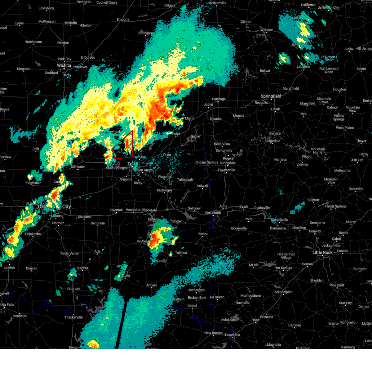 the tornado warning has been cancelled and is no longer in effect the tornado warning has been cancelled and is no longer in effect
|
| 4/1/2024 8:19 PM CDT |
 the severe thunderstorm warning has been cancelled and is no longer in effect the severe thunderstorm warning has been cancelled and is no longer in effect
|
| 4/1/2024 8:06 PM CDT |
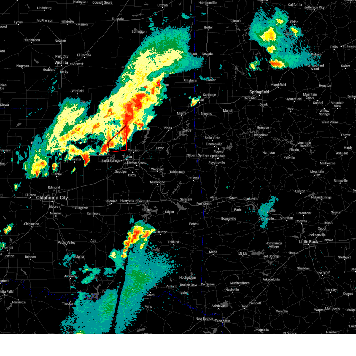 Tortsa the national weather service in tulsa has issued a * tornado warning for, southeastern osage county in northeastern oklahoma, * until 830 pm cdt. * at 805 pm cdt, a severe thunderstorm capable of producing a tornado was located 6 miles east of hominy, moving northeast at 60 mph (radar indicated rotation). Hazards include tornado. Flying debris will be dangerous to those caught without shelter. mobile homes will be damaged or destroyed. damage to roofs, windows, and vehicles will occur. tree damage is likely. Locations in or near the path include, skiatook, hominy, barnsdall, avant, wolco,. Tortsa the national weather service in tulsa has issued a * tornado warning for, southeastern osage county in northeastern oklahoma, * until 830 pm cdt. * at 805 pm cdt, a severe thunderstorm capable of producing a tornado was located 6 miles east of hominy, moving northeast at 60 mph (radar indicated rotation). Hazards include tornado. Flying debris will be dangerous to those caught without shelter. mobile homes will be damaged or destroyed. damage to roofs, windows, and vehicles will occur. tree damage is likely. Locations in or near the path include, skiatook, hominy, barnsdall, avant, wolco,.
|
| 4/1/2024 8:03 PM CDT |
 the severe thunderstorm warning has been cancelled and is no longer in effect the severe thunderstorm warning has been cancelled and is no longer in effect
|
| 4/1/2024 8:03 PM CDT |
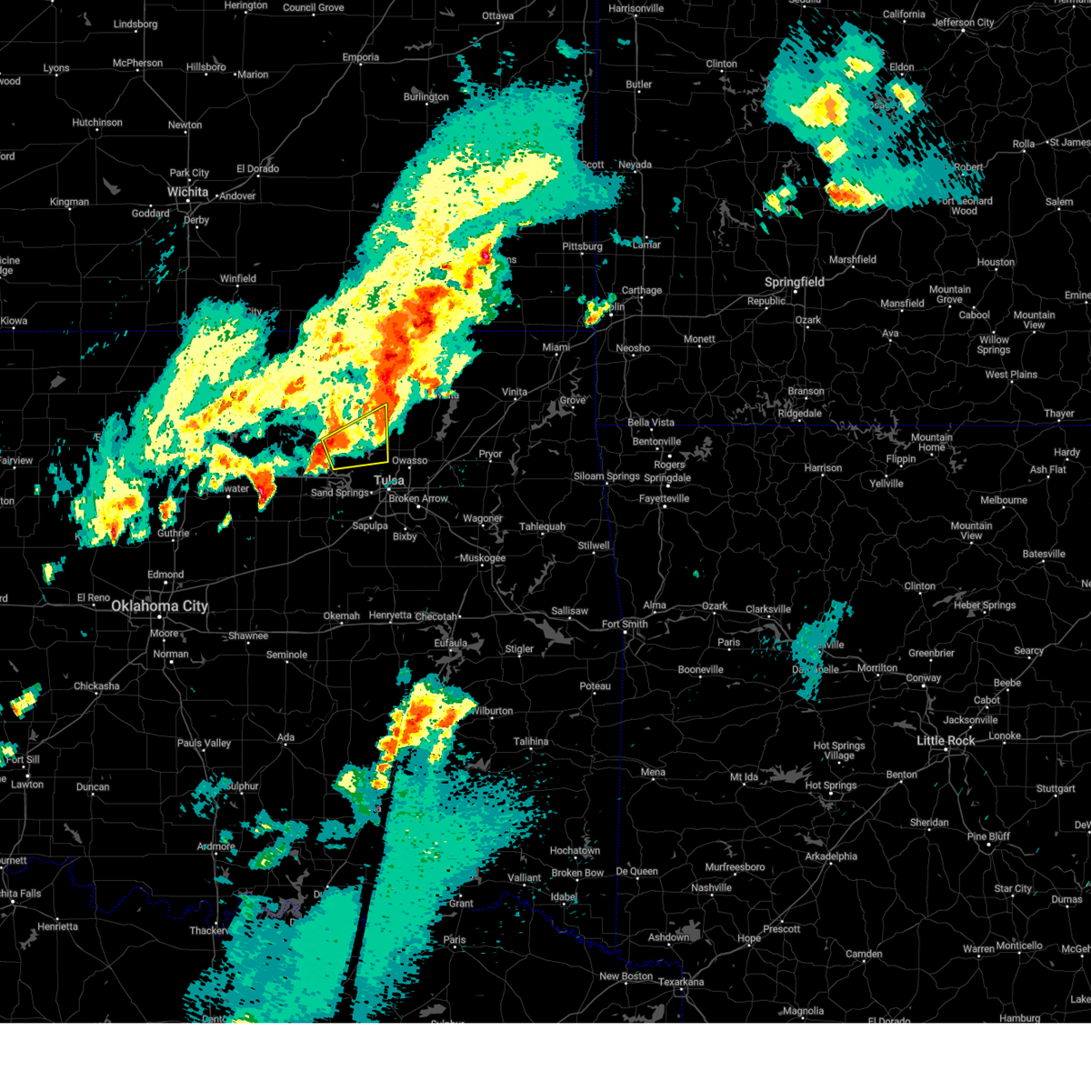 At 802 pm cdt, a severe thunderstorm was located 5 miles southeast of hominy, moving northeast at 40 mph (radar indicated). Hazards include 60 mph wind gusts and quarter size hail. Hail damage to vehicles is expected. expect wind damage to roofs, siding, and trees. Locations in or near the path include, skiatook, hominy, avant, wolco,. At 802 pm cdt, a severe thunderstorm was located 5 miles southeast of hominy, moving northeast at 40 mph (radar indicated). Hazards include 60 mph wind gusts and quarter size hail. Hail damage to vehicles is expected. expect wind damage to roofs, siding, and trees. Locations in or near the path include, skiatook, hominy, avant, wolco,.
|
| 4/1/2024 7:49 PM CDT |
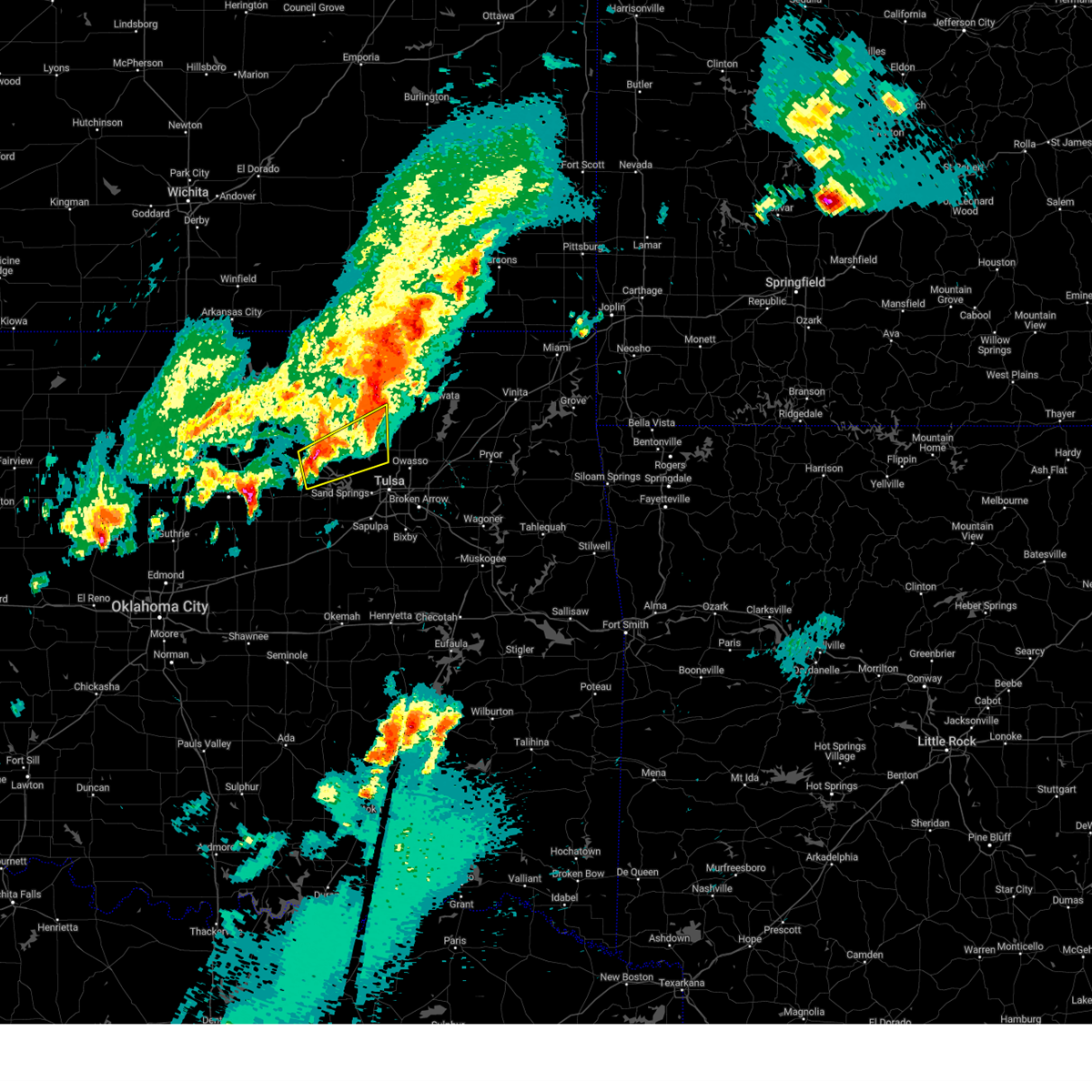 Svrtsa the national weather service in tulsa has issued a * severe thunderstorm warning for, southeastern osage county in northeastern oklahoma, southeastern pawnee county in northeastern oklahoma, * until 830 pm cdt. * at 749 pm cdt, a severe thunderstorm was located over cleveland, moving northeast at 40 mph (radar indicated). Hazards include 60 mph wind gusts and quarter size hail. Hail damage to vehicles is expected. expect wind damage to roofs, siding, and trees. Locations in or near the path include, skiatook, hominy, cleveland, avant, westport, osage, terlton, walnut creek state park, wolco,. Svrtsa the national weather service in tulsa has issued a * severe thunderstorm warning for, southeastern osage county in northeastern oklahoma, southeastern pawnee county in northeastern oklahoma, * until 830 pm cdt. * at 749 pm cdt, a severe thunderstorm was located over cleveland, moving northeast at 40 mph (radar indicated). Hazards include 60 mph wind gusts and quarter size hail. Hail damage to vehicles is expected. expect wind damage to roofs, siding, and trees. Locations in or near the path include, skiatook, hominy, cleveland, avant, westport, osage, terlton, walnut creek state park, wolco,.
|
| 3/13/2024 8:59 PM CDT |
 The storm which prompted the warning has weakened below severe limits, and no longer poses an immediate threat to life or property. therefore, the warning will be allowed to expire. however, small hail and gusty winds are still possible with this thunderstorm. to report severe weather, contact your nearest law enforcement agency. they will relay your report to the national weather service tulsa. The storm which prompted the warning has weakened below severe limits, and no longer poses an immediate threat to life or property. therefore, the warning will be allowed to expire. however, small hail and gusty winds are still possible with this thunderstorm. to report severe weather, contact your nearest law enforcement agency. they will relay your report to the national weather service tulsa.
|
| 3/13/2024 8:46 PM CDT |
 At 845 pm cdt, a severe thunderstorm was located 6 miles east of walnut creek state park, moving northeast at 35 mph (radar indicated). Hazards include 60 mph wind gusts and quarter size hail. Hail damage to vehicles is expected. expect wind damage to roofs, siding, and trees. Locations in or near the path include, tulsa, sand springs, skiatook, sperry, turley, walnut creek state park,. At 845 pm cdt, a severe thunderstorm was located 6 miles east of walnut creek state park, moving northeast at 35 mph (radar indicated). Hazards include 60 mph wind gusts and quarter size hail. Hail damage to vehicles is expected. expect wind damage to roofs, siding, and trees. Locations in or near the path include, tulsa, sand springs, skiatook, sperry, turley, walnut creek state park,.
|
| 3/13/2024 8:46 PM CDT |
 the severe thunderstorm warning has been cancelled and is no longer in effect the severe thunderstorm warning has been cancelled and is no longer in effect
|
| 3/13/2024 8:35 PM CDT |
 At 835 pm cdt, a severe thunderstorm was located 3 miles northeast of keystone state park, moving northeast at 35 mph (radar indicated). Hazards include 60 mph wind gusts and quarter size hail. Hail damage to vehicles is expected. expect wind damage to roofs, siding, and trees. Locations in or near the path include, tulsa, sand springs, skiatook, mannford, sperry, westport, keystone state park, turley, walnut creek state park,. At 835 pm cdt, a severe thunderstorm was located 3 miles northeast of keystone state park, moving northeast at 35 mph (radar indicated). Hazards include 60 mph wind gusts and quarter size hail. Hail damage to vehicles is expected. expect wind damage to roofs, siding, and trees. Locations in or near the path include, tulsa, sand springs, skiatook, mannford, sperry, westport, keystone state park, turley, walnut creek state park,.
|
| 3/13/2024 8:22 PM CDT |
 Svrtsa the national weather service in tulsa has issued a * severe thunderstorm warning for, southeastern osage county in northeastern oklahoma, northeastern creek county in northeastern oklahoma, southeastern pawnee county in northeastern oklahoma, western tulsa county in northeastern oklahoma, * until 900 pm cdt. * at 821 pm cdt, a severe thunderstorm was located over mannford, moving northeast at 40 mph (radar indicated). Hazards include 60 mph wind gusts and quarter size hail. Hail damage to vehicles is expected. expect wind damage to roofs, siding, and trees. Locations in or near the path include, tulsa, sand springs, skiatook, mannford, sperry, westport, keystone state park, turley, walnut creek state park, gray,. Svrtsa the national weather service in tulsa has issued a * severe thunderstorm warning for, southeastern osage county in northeastern oklahoma, northeastern creek county in northeastern oklahoma, southeastern pawnee county in northeastern oklahoma, western tulsa county in northeastern oklahoma, * until 900 pm cdt. * at 821 pm cdt, a severe thunderstorm was located over mannford, moving northeast at 40 mph (radar indicated). Hazards include 60 mph wind gusts and quarter size hail. Hail damage to vehicles is expected. expect wind damage to roofs, siding, and trees. Locations in or near the path include, tulsa, sand springs, skiatook, mannford, sperry, westport, keystone state park, turley, walnut creek state park, gray,.
|
| 10/4/2023 6:55 PM CDT |
 At 654 pm cdt, severe thunderstorms were located along a line extending from 8 miles west of turley to 4 miles southeast of sand springs to 2 miles northeast of sapulpa to 3 miles west of mounds, moving east at 40 mph (radar indicated). Hazards include 60 mph wind gusts and penny size hail. Expect damage to roofs, siding, and trees. locations in or near the path include, tulsa, broken arrow, sand springs, owasso, bixby, sapulpa, jenks, glenpool, kiefer, mounds, jenks riverside airport, turley, tulsa international airport, liberty, gray, this includes interstate 44 between mile markers 206 and 230. hail threat, radar indicated max hail size, 0. 75 in wind threat, radar indicated max wind gust, 60 mph. At 654 pm cdt, severe thunderstorms were located along a line extending from 8 miles west of turley to 4 miles southeast of sand springs to 2 miles northeast of sapulpa to 3 miles west of mounds, moving east at 40 mph (radar indicated). Hazards include 60 mph wind gusts and penny size hail. Expect damage to roofs, siding, and trees. locations in or near the path include, tulsa, broken arrow, sand springs, owasso, bixby, sapulpa, jenks, glenpool, kiefer, mounds, jenks riverside airport, turley, tulsa international airport, liberty, gray, this includes interstate 44 between mile markers 206 and 230. hail threat, radar indicated max hail size, 0. 75 in wind threat, radar indicated max wind gust, 60 mph.
|
| 10/4/2023 6:35 PM CDT |
 At 635 pm cdt, severe thunderstorms were located along a line extending from 3 miles north of keystone state park to 5 miles west of kellyville, moving east at 35 mph (radar indicated). Hazards include 60 mph wind gusts and quarter size hail. Hail damage to vehicles is expected. expect wind damage to roofs, siding, and trees. locations in or near the path include, tulsa, broken arrow, sand springs, owasso, bixby, sapulpa, jenks, glenpool, mannford, kiefer, mounds, kellyville, westport, keystone state park, walnut creek state park, jenks riverside airport, turley, tulsa international airport, liberty, gray, this includes interstate 44 between mile markers 197 and 230. hail threat, radar indicated max hail size, 1. 00 in wind threat, radar indicated max wind gust, 60 mph. At 635 pm cdt, severe thunderstorms were located along a line extending from 3 miles north of keystone state park to 5 miles west of kellyville, moving east at 35 mph (radar indicated). Hazards include 60 mph wind gusts and quarter size hail. Hail damage to vehicles is expected. expect wind damage to roofs, siding, and trees. locations in or near the path include, tulsa, broken arrow, sand springs, owasso, bixby, sapulpa, jenks, glenpool, mannford, kiefer, mounds, kellyville, westport, keystone state park, walnut creek state park, jenks riverside airport, turley, tulsa international airport, liberty, gray, this includes interstate 44 between mile markers 197 and 230. hail threat, radar indicated max hail size, 1. 00 in wind threat, radar indicated max wind gust, 60 mph.
|
| 9/23/2023 9:53 PM CDT |
 At 953 pm cdt, a severe thunderstorm was located 3 miles south of walnut creek state park, moving east at 40 mph (radar indicated). Hazards include 60 mph wind gusts and penny size hail. Expect damage to roofs, siding, and trees. locations in or near the path include, tulsa, sand springs, skiatook, westport, walnut creek state park, hail threat, radar indicated max hail size, 0. 75 in wind threat, radar indicated max wind gust, 60 mph. At 953 pm cdt, a severe thunderstorm was located 3 miles south of walnut creek state park, moving east at 40 mph (radar indicated). Hazards include 60 mph wind gusts and penny size hail. Expect damage to roofs, siding, and trees. locations in or near the path include, tulsa, sand springs, skiatook, westport, walnut creek state park, hail threat, radar indicated max hail size, 0. 75 in wind threat, radar indicated max wind gust, 60 mph.
|
| 9/23/2023 9:40 PM CDT |
 At 940 pm cdt, a severe thunderstorm was located 5 miles southwest of westport, moving east at 40 mph (radar indicated). Hazards include 60 mph wind gusts and quarter size hail. Hail damage to vehicles is expected. expect wind damage to roofs, siding, and trees. locations in or near the path include, tulsa, sand springs, skiatook, westport, terlton, walnut creek state park, hail threat, radar indicated max hail size, 1. 00 in wind threat, radar indicated max wind gust, 60 mph. At 940 pm cdt, a severe thunderstorm was located 5 miles southwest of westport, moving east at 40 mph (radar indicated). Hazards include 60 mph wind gusts and quarter size hail. Hail damage to vehicles is expected. expect wind damage to roofs, siding, and trees. locations in or near the path include, tulsa, sand springs, skiatook, westport, terlton, walnut creek state park, hail threat, radar indicated max hail size, 1. 00 in wind threat, radar indicated max wind gust, 60 mph.
|
| 9/23/2023 8:21 PM CDT |
 The severe thunderstorm warning for northern creek county will expire at 830 pm cdt, the storm which prompted the warning has moved out of the area. therefore, the warning will be allowed to expire. a severe thunderstorm watch remains in effect until 1100 pm cdt for northeastern oklahoma. The severe thunderstorm warning for northern creek county will expire at 830 pm cdt, the storm which prompted the warning has moved out of the area. therefore, the warning will be allowed to expire. a severe thunderstorm watch remains in effect until 1100 pm cdt for northeastern oklahoma.
|
| 9/23/2023 7:41 PM CDT |
 At 741 pm cdt, a severe thunderstorm was located 9 miles east of drumright, moving east at 25 mph (radar indicated). Hazards include 60 mph wind gusts and quarter size hail. Hail damage to vehicles is expected. expect wind damage to roofs, siding, and trees. locations in or near the path include, sapulpa, kellyville, silver city, this includes interstate 44 between mile markers 197 and 213. hail threat, radar indicated max hail size, 1. 00 in wind threat, radar indicated max wind gust, 60 mph. At 741 pm cdt, a severe thunderstorm was located 9 miles east of drumright, moving east at 25 mph (radar indicated). Hazards include 60 mph wind gusts and quarter size hail. Hail damage to vehicles is expected. expect wind damage to roofs, siding, and trees. locations in or near the path include, sapulpa, kellyville, silver city, this includes interstate 44 between mile markers 197 and 213. hail threat, radar indicated max hail size, 1. 00 in wind threat, radar indicated max wind gust, 60 mph.
|
| 9/23/2023 7:10 PM CDT |
 At 710 pm cdt, severe thunderstorms were located along a line extending from 5 miles northeast of keystone state park to 3 miles southeast of mannford, moving east at 25 mph (radar indicated). Hazards include ping pong ball size hail and 60 mph wind gusts. People and animals outdoors will be injured. expect hail damage to roofs, siding, windows, and vehicles. expect wind damage to roofs, siding, and trees. locations in or near the path include, tulsa, sand springs, mannford, westport, keystone state park, walnut creek state park, gray, this includes interstate 44 between mile markers 212 and 218. hail threat, radar indicated max hail size, 1. 50 in wind threat, radar indicated max wind gust, 60 mph. At 710 pm cdt, severe thunderstorms were located along a line extending from 5 miles northeast of keystone state park to 3 miles southeast of mannford, moving east at 25 mph (radar indicated). Hazards include ping pong ball size hail and 60 mph wind gusts. People and animals outdoors will be injured. expect hail damage to roofs, siding, windows, and vehicles. expect wind damage to roofs, siding, and trees. locations in or near the path include, tulsa, sand springs, mannford, westport, keystone state park, walnut creek state park, gray, this includes interstate 44 between mile markers 212 and 218. hail threat, radar indicated max hail size, 1. 50 in wind threat, radar indicated max wind gust, 60 mph.
|
| 9/23/2023 7:07 PM CDT |
 At 707 pm cdt, a severe thunderstorm was located 7 miles southwest of avant, moving northeast at 25 mph (radar indicated). Hazards include 60 mph wind gusts and quarter size hail. Hail damage to vehicles is expected. expect wind damage to roofs, siding, and trees. locations in or near the path include, skiatook, ramona, avant, vera, hail threat, radar indicated max hail size, 1. 00 in wind threat, radar indicated max wind gust, 60 mph. At 707 pm cdt, a severe thunderstorm was located 7 miles southwest of avant, moving northeast at 25 mph (radar indicated). Hazards include 60 mph wind gusts and quarter size hail. Hail damage to vehicles is expected. expect wind damage to roofs, siding, and trees. locations in or near the path include, skiatook, ramona, avant, vera, hail threat, radar indicated max hail size, 1. 00 in wind threat, radar indicated max wind gust, 60 mph.
|
| 9/23/2023 6:59 PM CDT |
 At 659 pm cdt, severe thunderstorms were located along a line extending from 3 miles south of walnut creek state park to 3 miles southwest of mannford, moving east at 25 mph (radar indicated). Hazards include ping pong ball size hail and 60 mph wind gusts. People and animals outdoors will be injured. expect hail damage to roofs, siding, windows, and vehicles. expect wind damage to roofs, siding, and trees. locations in or near the path include, tulsa, sand springs, mannford, westport, keystone state park, walnut creek state park, gray, this includes interstate 44 between mile markers 212 and 218. hail threat, radar indicated max hail size, 1. 50 in wind threat, radar indicated max wind gust, 60 mph. At 659 pm cdt, severe thunderstorms were located along a line extending from 3 miles south of walnut creek state park to 3 miles southwest of mannford, moving east at 25 mph (radar indicated). Hazards include ping pong ball size hail and 60 mph wind gusts. People and animals outdoors will be injured. expect hail damage to roofs, siding, windows, and vehicles. expect wind damage to roofs, siding, and trees. locations in or near the path include, tulsa, sand springs, mannford, westport, keystone state park, walnut creek state park, gray, this includes interstate 44 between mile markers 212 and 218. hail threat, radar indicated max hail size, 1. 50 in wind threat, radar indicated max wind gust, 60 mph.
|
| 9/23/2023 6:56 PM CDT |
 At 656 pm cdt, a severe thunderstorm was located 9 miles northeast of walnut creek state park, moving northeast at 30 mph (radar indicated). Hazards include ping pong ball size hail and 60 mph wind gusts. People and animals outdoors will be injured. expect hail damage to roofs, siding, windows, and vehicles. expect wind damage to roofs, siding, and trees. locations in or near the path include, skiatook, ramona, avant, vera, wolco, hail threat, radar indicated max hail size, 1. 50 in wind threat, radar indicated max wind gust, 60 mph. At 656 pm cdt, a severe thunderstorm was located 9 miles northeast of walnut creek state park, moving northeast at 30 mph (radar indicated). Hazards include ping pong ball size hail and 60 mph wind gusts. People and animals outdoors will be injured. expect hail damage to roofs, siding, windows, and vehicles. expect wind damage to roofs, siding, and trees. locations in or near the path include, skiatook, ramona, avant, vera, wolco, hail threat, radar indicated max hail size, 1. 50 in wind threat, radar indicated max wind gust, 60 mph.
|
| 9/23/2023 6:47 PM CDT |
 At 647 pm cdt, a severe thunderstorm was located near walnut creek state park, moving east at 25 mph (radar indicated). Hazards include 60 mph wind gusts and quarter size hail. Hail damage to vehicles is expected. expect wind damage to roofs, siding, and trees. locations in or near the path include, tulsa, sand springs, skiatook, sperry, walnut creek state park, hail threat, radar indicated max hail size, 1. 00 in wind threat, radar indicated max wind gust, 60 mph. At 647 pm cdt, a severe thunderstorm was located near walnut creek state park, moving east at 25 mph (radar indicated). Hazards include 60 mph wind gusts and quarter size hail. Hail damage to vehicles is expected. expect wind damage to roofs, siding, and trees. locations in or near the path include, tulsa, sand springs, skiatook, sperry, walnut creek state park, hail threat, radar indicated max hail size, 1. 00 in wind threat, radar indicated max wind gust, 60 mph.
|
| 9/23/2023 6:29 PM CDT |
 At 629 pm cdt, a severe thunderstorm was located 3 miles southwest of westport, moving east at 25 mph (radar indicated). Hazards include golf ball size hail and 60 mph wind gusts. People and animals outdoors will be injured. expect hail damage to roofs, siding, windows, and vehicles. expect wind damage to roofs, siding, and trees. locations in or near the path include, tulsa, sand springs, skiatook, sperry, westport, walnut creek state park, thunderstorm damage threat, considerable hail threat, radar indicated max hail size, 1. 75 in wind threat, radar indicated max wind gust, 60 mph. At 629 pm cdt, a severe thunderstorm was located 3 miles southwest of westport, moving east at 25 mph (radar indicated). Hazards include golf ball size hail and 60 mph wind gusts. People and animals outdoors will be injured. expect hail damage to roofs, siding, windows, and vehicles. expect wind damage to roofs, siding, and trees. locations in or near the path include, tulsa, sand springs, skiatook, sperry, westport, walnut creek state park, thunderstorm damage threat, considerable hail threat, radar indicated max hail size, 1. 75 in wind threat, radar indicated max wind gust, 60 mph.
|
| 9/23/2023 6:24 PM CDT |
 At 624 pm cdt, a severe thunderstorm was located 3 miles east of terlton, moving northeast at 25 mph (radar indicated). Hazards include ping pong ball size hail and 60 mph wind gusts. People and animals outdoors will be injured. expect hail damage to roofs, siding, windows, and vehicles. expect wind damage to roofs, siding, and trees. locations in or near the path include, mannford, jennings, westport, hallett, terlton, keystone state park, silver city, hail threat, radar indicated max hail size, 1. 50 in wind threat, radar indicated max wind gust, 60 mph. At 624 pm cdt, a severe thunderstorm was located 3 miles east of terlton, moving northeast at 25 mph (radar indicated). Hazards include ping pong ball size hail and 60 mph wind gusts. People and animals outdoors will be injured. expect hail damage to roofs, siding, windows, and vehicles. expect wind damage to roofs, siding, and trees. locations in or near the path include, mannford, jennings, westport, hallett, terlton, keystone state park, silver city, hail threat, radar indicated max hail size, 1. 50 in wind threat, radar indicated max wind gust, 60 mph.
|
| 9/23/2023 6:18 PM CDT |
 At 618 pm cdt, a severe thunderstorm was located near terlton, moving east at 20 mph (radar indicated). Hazards include 60 mph wind gusts and quarter size hail. Hail damage to vehicles is expected. expect wind damage to roofs, siding, and trees. locations in or near the path include, mannford, jennings, westport, hallett, terlton, keystone state park, silver city, hail threat, radar indicated max hail size, 1. 00 in wind threat, radar indicated max wind gust, 60 mph. At 618 pm cdt, a severe thunderstorm was located near terlton, moving east at 20 mph (radar indicated). Hazards include 60 mph wind gusts and quarter size hail. Hail damage to vehicles is expected. expect wind damage to roofs, siding, and trees. locations in or near the path include, mannford, jennings, westport, hallett, terlton, keystone state park, silver city, hail threat, radar indicated max hail size, 1. 00 in wind threat, radar indicated max wind gust, 60 mph.
|
| 9/23/2023 6:10 PM CDT |
 At 610 pm cdt, a severe thunderstorm was located near terlton, moving east at 20 mph (radar indicated). Hazards include 60 mph wind gusts and quarter size hail. Hail damage to vehicles is expected. expect wind damage to roofs, siding, and trees. locations in or near the path include, mannford, oilton, jennings, westport, hallett, terlton, keystone state park, silver city, hail threat, radar indicated max hail size, 1. 00 in wind threat, radar indicated max wind gust, 60 mph. At 610 pm cdt, a severe thunderstorm was located near terlton, moving east at 20 mph (radar indicated). Hazards include 60 mph wind gusts and quarter size hail. Hail damage to vehicles is expected. expect wind damage to roofs, siding, and trees. locations in or near the path include, mannford, oilton, jennings, westport, hallett, terlton, keystone state park, silver city, hail threat, radar indicated max hail size, 1. 00 in wind threat, radar indicated max wind gust, 60 mph.
|
| 9/5/2023 7:43 PM CDT |
 The severe thunderstorm warning for southeastern osage, northeastern creek and west central tulsa counties will expire at 745 pm cdt, the storm which prompted the warning has weakened below severe limits, and no longer poses an immediate threat to life or property. therefore, the warning will be allowed to expire. a severe thunderstorm watch remains in effect until midnight cdt for northeastern oklahoma. The severe thunderstorm warning for southeastern osage, northeastern creek and west central tulsa counties will expire at 745 pm cdt, the storm which prompted the warning has weakened below severe limits, and no longer poses an immediate threat to life or property. therefore, the warning will be allowed to expire. a severe thunderstorm watch remains in effect until midnight cdt for northeastern oklahoma.
|
| 9/5/2023 7:28 PM CDT |
 At 727 pm cdt, a severe thunderstorm was located 4 miles east of keystone state park, moving northeast at 35 mph (trained weather spotters). Hazards include 60 mph wind gusts and penny size hail. Expect damage to roofs, siding, and trees. locations in or near the path include, tulsa, sand springs, keystone state park, gray, this includes interstate 44 between mile markers 214 and 218. hail threat, radar indicated max hail size, 0. 75 in wind threat, radar indicated max wind gust, 60 mph. At 727 pm cdt, a severe thunderstorm was located 4 miles east of keystone state park, moving northeast at 35 mph (trained weather spotters). Hazards include 60 mph wind gusts and penny size hail. Expect damage to roofs, siding, and trees. locations in or near the path include, tulsa, sand springs, keystone state park, gray, this includes interstate 44 between mile markers 214 and 218. hail threat, radar indicated max hail size, 0. 75 in wind threat, radar indicated max wind gust, 60 mph.
|
| 9/5/2023 7:14 PM CDT |
 At 713 pm cdt, a severe thunderstorm was located near mannford, moving northeast at 30 mph (radar indicated). Hazards include 60 mph wind gusts and penny size hail. Expect damage to roofs, siding, and trees. locations in or near the path include, tulsa, sand springs, mannford, keystone state park, gray, this includes interstate 44 between mile markers 214 and 218. hail threat, radar indicated max hail size, 0. 75 in wind threat, radar indicated max wind gust, 60 mph. At 713 pm cdt, a severe thunderstorm was located near mannford, moving northeast at 30 mph (radar indicated). Hazards include 60 mph wind gusts and penny size hail. Expect damage to roofs, siding, and trees. locations in or near the path include, tulsa, sand springs, mannford, keystone state park, gray, this includes interstate 44 between mile markers 214 and 218. hail threat, radar indicated max hail size, 0. 75 in wind threat, radar indicated max wind gust, 60 mph.
|
| 9/5/2023 7:12 PM CDT | Half Dollar sized hail reported 13.2 miles NE of Sand Springs, OK |
| 8/14/2023 1:05 AM CDT |
 At 105 am cdt, severe thunderstorms were located along a line extending from 3 miles northeast of ramona to 4 miles east of vera to near owasso, moving east at 50 mph (radar indicated). Hazards include 60 mph wind gusts. Expect damage to roofs, siding, and trees. locations in or near the path include, owasso, skiatook, collinsville, barnsdall, sperry, ramona, ochelata, avant, vera, turley, tallant, wolco, hail threat, radar indicated max hail size, <. 75 in wind threat, radar indicated max wind gust, 60 mph. At 105 am cdt, severe thunderstorms were located along a line extending from 3 miles northeast of ramona to 4 miles east of vera to near owasso, moving east at 50 mph (radar indicated). Hazards include 60 mph wind gusts. Expect damage to roofs, siding, and trees. locations in or near the path include, owasso, skiatook, collinsville, barnsdall, sperry, ramona, ochelata, avant, vera, turley, tallant, wolco, hail threat, radar indicated max hail size, <. 75 in wind threat, radar indicated max wind gust, 60 mph.
|
| 8/14/2023 12:50 AM CDT |
 At 1250 am cdt, severe thunderstorms were located along a line extending from near barnsdall to near avant to near sperry to 2 miles west of sand springs, moving east at 50 mph (radar indicated). Hazards include 70 mph wind gusts. Expect considerable tree damage. damage is likely to mobile homes, roofs, and outbuildings. locations in or near the path include, tulsa, sand springs, claremore, owasso, skiatook, catoosa, collinsville, verdigris, barnsdall, sperry, oologah, ramona, ochelata, foyil, avant, talala, vera, watova, turley, tulsa international airport, this includes interstate 44 between mile markers 230 and 255. thunderstorm damage threat, considerable hail threat, radar indicated max hail size, <. 75 in wind threat, radar indicated max wind gust, 70 mph. At 1250 am cdt, severe thunderstorms were located along a line extending from near barnsdall to near avant to near sperry to 2 miles west of sand springs, moving east at 50 mph (radar indicated). Hazards include 70 mph wind gusts. Expect considerable tree damage. damage is likely to mobile homes, roofs, and outbuildings. locations in or near the path include, tulsa, sand springs, claremore, owasso, skiatook, catoosa, collinsville, verdigris, barnsdall, sperry, oologah, ramona, ochelata, foyil, avant, talala, vera, watova, turley, tulsa international airport, this includes interstate 44 between mile markers 230 and 255. thunderstorm damage threat, considerable hail threat, radar indicated max hail size, <. 75 in wind threat, radar indicated max wind gust, 70 mph.
|
| 8/14/2023 12:27 AM CDT |
 At 1227 am cdt, severe thunderstorms were located along a line extending from 7 miles west of wynona to 2 miles southeast of hominy to 3 miles south of osage, moving east at 50 mph (radar indicated). Hazards include 70 mph wind gusts. Expect considerable tree damage. damage is likely to mobile homes, roofs, and outbuildings. locations in or near the path include, owasso, skiatook, collinsville, hominy, cleveland, barnsdall, sperry, ramona, wynona, ochelata, avant, vera, osage, walnut creek state park, turley, tallant, pershing, wolco, thunderstorm damage threat, considerable hail threat, radar indicated max hail size, <. 75 in wind threat, radar indicated max wind gust, 70 mph. At 1227 am cdt, severe thunderstorms were located along a line extending from 7 miles west of wynona to 2 miles southeast of hominy to 3 miles south of osage, moving east at 50 mph (radar indicated). Hazards include 70 mph wind gusts. Expect considerable tree damage. damage is likely to mobile homes, roofs, and outbuildings. locations in or near the path include, owasso, skiatook, collinsville, hominy, cleveland, barnsdall, sperry, ramona, wynona, ochelata, avant, vera, osage, walnut creek state park, turley, tallant, pershing, wolco, thunderstorm damage threat, considerable hail threat, radar indicated max hail size, <. 75 in wind threat, radar indicated max wind gust, 70 mph.
|
| 8/14/2023 12:01 AM CDT | Storm damage reported in tulsa county OK, 4.8 miles NNW of Sand Springs, OK |
| 8/13/2023 11:45 PM CDT |
 At 1145 pm cdt, severe thunderstorms were located along a line extending from near mannford to 2 miles northwest of kellyville, moving east at 55 mph (radar indicated). Hazards include 70 mph wind gusts. Expect considerable tree damage. damage is likely to mobile homes, roofs, and outbuildings. locations in or near the path include, tulsa, broken arrow, sand springs, bixby, sapulpa, jenks, glenpool, coweta, catoosa, mannford, kiefer, mounds, kellyville, porter, jenks riverside airport, stonebluff, keystone state park, turley, tulsa international airport, oneta, this includes interstate 44 between mile markers 202 and 238. thunderstorm damage threat, considerable hail threat, radar indicated max hail size, <. 75 in wind threat, radar indicated max wind gust, 70 mph. At 1145 pm cdt, severe thunderstorms were located along a line extending from near mannford to 2 miles northwest of kellyville, moving east at 55 mph (radar indicated). Hazards include 70 mph wind gusts. Expect considerable tree damage. damage is likely to mobile homes, roofs, and outbuildings. locations in or near the path include, tulsa, broken arrow, sand springs, bixby, sapulpa, jenks, glenpool, coweta, catoosa, mannford, kiefer, mounds, kellyville, porter, jenks riverside airport, stonebluff, keystone state park, turley, tulsa international airport, oneta, this includes interstate 44 between mile markers 202 and 238. thunderstorm damage threat, considerable hail threat, radar indicated max hail size, <. 75 in wind threat, radar indicated max wind gust, 70 mph.
|
| 8/13/2023 11:39 PM CDT |
 At 1138 pm cdt, severe thunderstorms were located along a line extending from 2 miles south of terlton to 9 miles west of kellyville, moving east at 55 mph (radar indicated). Hazards include 70 mph wind gusts. Expect considerable tree damage. damage is likely to mobile homes, roofs, and outbuildings. locations in or near the path include, sand springs, bristow, sapulpa, mannford, drumright, kellyville, oilton, depew, jennings, westport, hallett, terlton, shamrock, keystone state park, walnut creek state park, silver city, this includes interstate 44 between mile markers 178 and 210. thunderstorm damage threat, considerable hail threat, radar indicated max hail size, <. 75 in wind threat, radar indicated max wind gust, 70 mph. At 1138 pm cdt, severe thunderstorms were located along a line extending from 2 miles south of terlton to 9 miles west of kellyville, moving east at 55 mph (radar indicated). Hazards include 70 mph wind gusts. Expect considerable tree damage. damage is likely to mobile homes, roofs, and outbuildings. locations in or near the path include, sand springs, bristow, sapulpa, mannford, drumright, kellyville, oilton, depew, jennings, westport, hallett, terlton, shamrock, keystone state park, walnut creek state park, silver city, this includes interstate 44 between mile markers 178 and 210. thunderstorm damage threat, considerable hail threat, radar indicated max hail size, <. 75 in wind threat, radar indicated max wind gust, 70 mph.
|
| 8/13/2023 11:25 PM CDT |
 At 1125 pm cdt, severe thunderstorms were located along a line extending from 2 miles west of yale to 3 miles north of shamrock, moving east at 45 mph (radar indicated). Hazards include 70 mph wind gusts. Expect considerable tree damage. damage is likely to mobile homes, roofs, and outbuildings. locations in or near the path include, sand springs, bristow, sapulpa, mannford, drumright, kellyville, oilton, depew, jennings, westport, hallett, terlton, shamrock, keystone state park, walnut creek state park, silver city, this includes interstate 44 between mile markers 178 and 210. thunderstorm damage threat, considerable hail threat, radar indicated max hail size, <. 75 in wind threat, radar indicated max wind gust, 70 mph. At 1125 pm cdt, severe thunderstorms were located along a line extending from 2 miles west of yale to 3 miles north of shamrock, moving east at 45 mph (radar indicated). Hazards include 70 mph wind gusts. Expect considerable tree damage. damage is likely to mobile homes, roofs, and outbuildings. locations in or near the path include, sand springs, bristow, sapulpa, mannford, drumright, kellyville, oilton, depew, jennings, westport, hallett, terlton, shamrock, keystone state park, walnut creek state park, silver city, this includes interstate 44 between mile markers 178 and 210. thunderstorm damage threat, considerable hail threat, radar indicated max hail size, <. 75 in wind threat, radar indicated max wind gust, 70 mph.
|
| 8/13/2023 11:16 PM CDT |
 At 1115 pm cdt, a severe thunderstorm was located 4 miles north of cushing, moving east at 50 mph (radar indicated). Hazards include 60 mph wind gusts. Expect damage to roofs, siding, and trees. locations in or near the path include, sand springs, bristow, sapulpa, mannford, drumright, kellyville, oilton, depew, jennings, westport, hallett, terlton, shamrock, keystone state park, walnut creek state park, silver city, this includes interstate 44 between mile markers 178 and 210. hail threat, radar indicated max hail size, <. 75 in wind threat, radar indicated max wind gust, 60 mph. At 1115 pm cdt, a severe thunderstorm was located 4 miles north of cushing, moving east at 50 mph (radar indicated). Hazards include 60 mph wind gusts. Expect damage to roofs, siding, and trees. locations in or near the path include, sand springs, bristow, sapulpa, mannford, drumright, kellyville, oilton, depew, jennings, westport, hallett, terlton, shamrock, keystone state park, walnut creek state park, silver city, this includes interstate 44 between mile markers 178 and 210. hail threat, radar indicated max hail size, <. 75 in wind threat, radar indicated max wind gust, 60 mph.
|
| 8/7/2023 3:04 AM CDT | Quarter sized hail reported 6.1 miles N of Sand Springs, OK, report from mping: quarter (1.00 in.). |
| 8/7/2023 2:59 AM CDT |
 At 259 am cdt, a severe thunderstorm was located near sapulpa, moving east at 50 mph (radar indicated). Hazards include 60 mph wind gusts and quarter size hail. Hail damage to vehicles is expected. expect wind damage to roofs, siding, and trees. locations in or near the path include, tulsa, broken arrow, sand springs, bixby, sapulpa, jenks, glenpool, coweta, kiefer, jenks riverside airport, stonebluff, oneta, leonard, this includes interstate 44 between mile markers 206 and 225. hail threat, radar indicated max hail size, 1. 00 in wind threat, radar indicated max wind gust, 60 mph. At 259 am cdt, a severe thunderstorm was located near sapulpa, moving east at 50 mph (radar indicated). Hazards include 60 mph wind gusts and quarter size hail. Hail damage to vehicles is expected. expect wind damage to roofs, siding, and trees. locations in or near the path include, tulsa, broken arrow, sand springs, bixby, sapulpa, jenks, glenpool, coweta, kiefer, jenks riverside airport, stonebluff, oneta, leonard, this includes interstate 44 between mile markers 206 and 225. hail threat, radar indicated max hail size, 1. 00 in wind threat, radar indicated max wind gust, 60 mph.
|
| 8/7/2023 2:48 AM CDT |
 At 247 am cdt, a severe thunderstorm was located 6 miles northwest of kellyville, moving east at 50 mph (radar indicated). Hazards include 60 mph wind gusts and half dollar size hail. Hail damage to vehicles is expected. expect wind damage to roofs, siding, and trees. locations in or near the path include, tulsa, broken arrow, sand springs, bixby, sapulpa, jenks, glenpool, coweta, kiefer, kellyville, jenks riverside airport, stonebluff, oneta, liberty, leonard, this includes interstate 44 between mile markers 201 and 225. hail threat, radar indicated max hail size, 1. 25 in wind threat, radar indicated max wind gust, 60 mph. At 247 am cdt, a severe thunderstorm was located 6 miles northwest of kellyville, moving east at 50 mph (radar indicated). Hazards include 60 mph wind gusts and half dollar size hail. Hail damage to vehicles is expected. expect wind damage to roofs, siding, and trees. locations in or near the path include, tulsa, broken arrow, sand springs, bixby, sapulpa, jenks, glenpool, coweta, kiefer, kellyville, jenks riverside airport, stonebluff, oneta, liberty, leonard, this includes interstate 44 between mile markers 201 and 225. hail threat, radar indicated max hail size, 1. 25 in wind threat, radar indicated max wind gust, 60 mph.
|
| 8/5/2023 7:39 AM CDT |
 At 739 am cdt, severe thunderstorms were located 2 miles northeast of turley, 4 miles northeast of sand springs and 4 miles south of tulsa, moving east at 10 mph (radar indicated). Hazards include 60 mph wind gusts and penny size hail. Expect damage to roofs, siding, and trees. locations in or near the path include, tulsa, broken arrow, sand springs, owasso, bixby, jenks, glenpool, coweta, catoosa, verdigris, jenks riverside airport, turley, tulsa international airport, oneta, gray, this includes interstate 44 between mile markers 211 and 245. hail threat, radar indicated max hail size, 0. 75 in wind threat, radar indicated max wind gust, 60 mph. At 739 am cdt, severe thunderstorms were located 2 miles northeast of turley, 4 miles northeast of sand springs and 4 miles south of tulsa, moving east at 10 mph (radar indicated). Hazards include 60 mph wind gusts and penny size hail. Expect damage to roofs, siding, and trees. locations in or near the path include, tulsa, broken arrow, sand springs, owasso, bixby, jenks, glenpool, coweta, catoosa, verdigris, jenks riverside airport, turley, tulsa international airport, oneta, gray, this includes interstate 44 between mile markers 211 and 245. hail threat, radar indicated max hail size, 0. 75 in wind threat, radar indicated max wind gust, 60 mph.
|
| 7/21/2023 6:06 AM CDT |
 At 606 am cdt, severe thunderstorms were located along a line extending from 2 miles northeast of sperry to 4 miles south of tulsa to 5 miles east of mounds, moving east at 50 mph (radar indicated). Hazards include 60 mph wind gusts. Expect damage to roofs, siding, and trees. locations in or near the path include, tulsa, broken arrow, claremore, owasso, bixby, jenks, glenpool, coweta, skiatook, catoosa, collinsville, verdigris, inola, sperry, oologah, vera, jenks riverside airport, turley, tulsa international airport, stonebluff, this includes interstate 44 between mile markers 219 and 249. hail threat, radar indicated max hail size, <. 75 in wind threat, radar indicated max wind gust, 60 mph. At 606 am cdt, severe thunderstorms were located along a line extending from 2 miles northeast of sperry to 4 miles south of tulsa to 5 miles east of mounds, moving east at 50 mph (radar indicated). Hazards include 60 mph wind gusts. Expect damage to roofs, siding, and trees. locations in or near the path include, tulsa, broken arrow, claremore, owasso, bixby, jenks, glenpool, coweta, skiatook, catoosa, collinsville, verdigris, inola, sperry, oologah, vera, jenks riverside airport, turley, tulsa international airport, stonebluff, this includes interstate 44 between mile markers 219 and 249. hail threat, radar indicated max hail size, <. 75 in wind threat, radar indicated max wind gust, 60 mph.
|
| 7/21/2023 5:52 AM CDT |
 At 552 am cdt, a severe thunderstorm was located 8 miles northeast of walnut creek state park, moving east at 45 mph (radar indicated). Hazards include 70 mph wind gusts. Expect considerable tree damage. damage is likely to mobile homes, roofs, and outbuildings. Locations in or near the path include, tulsa, claremore, owasso, skiatook, catoosa, collinsville, verdigris, sperry, oologah, turley, tulsa international airport, this includes interstate 44 between mile markers 238 and 247. At 552 am cdt, a severe thunderstorm was located 8 miles northeast of walnut creek state park, moving east at 45 mph (radar indicated). Hazards include 70 mph wind gusts. Expect considerable tree damage. damage is likely to mobile homes, roofs, and outbuildings. Locations in or near the path include, tulsa, claremore, owasso, skiatook, catoosa, collinsville, verdigris, sperry, oologah, turley, tulsa international airport, this includes interstate 44 between mile markers 238 and 247.
|
| 7/21/2023 5:44 AM CDT |
 At 544 am cdt, severe thunderstorms were located along a line extending from 6 miles north of walnut creek state park to 4 miles southeast of keystone state park to 4 miles southwest of kellyville, moving east at 50 mph (radar indicated). Hazards include 60 mph wind gusts. Expect damage to roofs, siding, and trees. locations in or near the path include, tulsa, broken arrow, sand springs, claremore, owasso, bixby, sapulpa, jenks, glenpool, coweta, skiatook, catoosa, collinsville, verdigris, inola, kiefer, sperry, mounds, kellyville, oologah, this includes interstate 44 between mile markers 199 and 249. hail threat, radar indicated max hail size, <. 75 in wind threat, radar indicated max wind gust, 60 mph. At 544 am cdt, severe thunderstorms were located along a line extending from 6 miles north of walnut creek state park to 4 miles southeast of keystone state park to 4 miles southwest of kellyville, moving east at 50 mph (radar indicated). Hazards include 60 mph wind gusts. Expect damage to roofs, siding, and trees. locations in or near the path include, tulsa, broken arrow, sand springs, claremore, owasso, bixby, sapulpa, jenks, glenpool, coweta, skiatook, catoosa, collinsville, verdigris, inola, kiefer, sperry, mounds, kellyville, oologah, this includes interstate 44 between mile markers 199 and 249. hail threat, radar indicated max hail size, <. 75 in wind threat, radar indicated max wind gust, 60 mph.
|
| 7/21/2023 5:39 AM CDT |
 At 539 am cdt, severe thunderstorms were located along a line extending from 3 miles southeast of hominy to near mannford to 5 miles north of bristow, moving east at 45 mph (radar indicated). Hazards include 60 mph wind gusts. Expect damage to roofs, siding, and trees. locations in or near the path include, tulsa, sand springs, bristow, sapulpa, hominy, cleveland, mannford, kellyville, avant, westport, osage, slick, terlton, shamrock, keystone state park, walnut creek state park, gray, silver city, this includes interstate 44 between mile markers 185 and 216. hail threat, radar indicated max hail size, <. 75 in wind threat, radar indicated max wind gust, 60 mph. At 539 am cdt, severe thunderstorms were located along a line extending from 3 miles southeast of hominy to near mannford to 5 miles north of bristow, moving east at 45 mph (radar indicated). Hazards include 60 mph wind gusts. Expect damage to roofs, siding, and trees. locations in or near the path include, tulsa, sand springs, bristow, sapulpa, hominy, cleveland, mannford, kellyville, avant, westport, osage, slick, terlton, shamrock, keystone state park, walnut creek state park, gray, silver city, this includes interstate 44 between mile markers 185 and 216. hail threat, radar indicated max hail size, <. 75 in wind threat, radar indicated max wind gust, 60 mph.
|
| 7/21/2023 5:26 AM CDT |
 At 525 am cdt, severe thunderstorms were located along a line extending from 2 miles northeast of blackburn to 2 miles south of terlton to 2 miles northeast of shamrock, moving east at 50 mph (radar indicated). Hazards include 70 mph wind gusts. Expect considerable tree damage. damage is likely to mobile homes, roofs, and outbuildings. locations in or near the path include, tulsa, sand springs, bristow, pawnee, sapulpa, hominy, cleveland, mannford, drumright, kellyville, oilton, jennings, avant, westport, osage, slick, hallett, blackburn, terlton, shamrock, this includes interstate 44 between mile markers 185 and 216. thunderstorm damage threat, considerable hail threat, radar indicated max hail size, <. 75 in wind threat, radar indicated max wind gust, 70 mph. At 525 am cdt, severe thunderstorms were located along a line extending from 2 miles northeast of blackburn to 2 miles south of terlton to 2 miles northeast of shamrock, moving east at 50 mph (radar indicated). Hazards include 70 mph wind gusts. Expect considerable tree damage. damage is likely to mobile homes, roofs, and outbuildings. locations in or near the path include, tulsa, sand springs, bristow, pawnee, sapulpa, hominy, cleveland, mannford, drumright, kellyville, oilton, jennings, avant, westport, osage, slick, hallett, blackburn, terlton, shamrock, this includes interstate 44 between mile markers 185 and 216. thunderstorm damage threat, considerable hail threat, radar indicated max hail size, <. 75 in wind threat, radar indicated max wind gust, 70 mph.
|
| 7/21/2023 5:09 AM CDT |
 At 509 am cdt, severe thunderstorms were located along a line extending from 4 miles north of pawnee to near quay to 2 miles southwest of cushing, moving east at 45 mph (radar indicated). Hazards include 70 mph wind gusts. Expect considerable tree damage. damage is likely to mobile homes, roofs, and outbuildings. locations in or near the path include, tulsa, sand springs, bristow, pawnee, sapulpa, hominy, cleveland, mannford, drumright, kellyville, oilton, jennings, avant, westport, osage, slick, hallett, blackburn, terlton, shamrock, this includes interstate 44 between mile markers 185 and 216. thunderstorm damage threat, considerable hail threat, radar indicated max hail size, <. 75 in wind threat, radar indicated max wind gust, 70 mph. At 509 am cdt, severe thunderstorms were located along a line extending from 4 miles north of pawnee to near quay to 2 miles southwest of cushing, moving east at 45 mph (radar indicated). Hazards include 70 mph wind gusts. Expect considerable tree damage. damage is likely to mobile homes, roofs, and outbuildings. locations in or near the path include, tulsa, sand springs, bristow, pawnee, sapulpa, hominy, cleveland, mannford, drumright, kellyville, oilton, jennings, avant, westport, osage, slick, hallett, blackburn, terlton, shamrock, this includes interstate 44 between mile markers 185 and 216. thunderstorm damage threat, considerable hail threat, radar indicated max hail size, <. 75 in wind threat, radar indicated max wind gust, 70 mph.
|
| 7/14/2023 8:11 PM CDT |
 The severe thunderstorm warning for south central osage, northern creek, southeastern pawnee and west central tulsa counties will expire at 815 pm cdt, the storm which prompted the warning has weakened below severe limits, and no longer poses an immediate threat to life or property. therefore, the warning will be allowed to expire. a severe thunderstorm watch remains in effect until midnight cdt for northeastern oklahoma. The severe thunderstorm warning for south central osage, northern creek, southeastern pawnee and west central tulsa counties will expire at 815 pm cdt, the storm which prompted the warning has weakened below severe limits, and no longer poses an immediate threat to life or property. therefore, the warning will be allowed to expire. a severe thunderstorm watch remains in effect until midnight cdt for northeastern oklahoma.
|
| 7/14/2023 8:08 PM CDT |
 At 808 pm cdt, severe thunderstorms were located along a line extending from 3 miles southeast of rose to 5 miles southeast of chouteau to oneta, moving southeast at 55 mph (radar indicated). Hazards include 60 mph wind gusts and penny size hail. Expect damage to roofs, siding, and trees. locations in or near the path include, tulsa, broken arrow, sand springs, claremore, pryor, owasso, bixby, jenks, coweta, pryor creek, skiatook, catoosa, collinsville, verdigris, chouteau, chelsea, inola, locust grove, salina, sperry, this includes interstate 44 between mile markers 217 and 272. hail threat, radar indicated max hail size, 0. 75 in wind threat, radar indicated max wind gust, 60 mph. At 808 pm cdt, severe thunderstorms were located along a line extending from 3 miles southeast of rose to 5 miles southeast of chouteau to oneta, moving southeast at 55 mph (radar indicated). Hazards include 60 mph wind gusts and penny size hail. Expect damage to roofs, siding, and trees. locations in or near the path include, tulsa, broken arrow, sand springs, claremore, pryor, owasso, bixby, jenks, coweta, pryor creek, skiatook, catoosa, collinsville, verdigris, chouteau, chelsea, inola, locust grove, salina, sperry, this includes interstate 44 between mile markers 217 and 272. hail threat, radar indicated max hail size, 0. 75 in wind threat, radar indicated max wind gust, 60 mph.
|
| 7/14/2023 7:51 PM CDT |
 At 751 pm cdt, a severe thunderstorm was located over mannford, moving southeast at 30 mph (radar indicated). Hazards include 60 mph wind gusts and penny size hail. Expect damage to roofs, siding, and trees. locations in or near the path include, sand springs, sapulpa, jenks, mannford, drumright, kellyville, oilton, jennings, westport, terlton, shamrock, keystone state park, walnut creek state park, silver city, this includes interstate 44 between mile markers 198 and 216. hail threat, radar indicated max hail size, 0. 75 in wind threat, radar indicated max wind gust, 60 mph. At 751 pm cdt, a severe thunderstorm was located over mannford, moving southeast at 30 mph (radar indicated). Hazards include 60 mph wind gusts and penny size hail. Expect damage to roofs, siding, and trees. locations in or near the path include, sand springs, sapulpa, jenks, mannford, drumright, kellyville, oilton, jennings, westport, terlton, shamrock, keystone state park, walnut creek state park, silver city, this includes interstate 44 between mile markers 198 and 216. hail threat, radar indicated max hail size, 0. 75 in wind threat, radar indicated max wind gust, 60 mph.
|
| 7/14/2023 7:37 PM CDT |
 At 737 pm cdt, severe thunderstorms were located along a line extending from 4 miles northwest of adair to 4 miles north of claremore to 4 miles west of sperry, moving southeast at 35 mph (radar indicated). Hazards include 70 mph wind gusts and penny size hail. Expect considerable tree damage. damage is likely to mobile homes, roofs, and outbuildings. locations in or near the path include, tulsa, broken arrow, sand springs, claremore, pryor, owasso, bixby, jenks, coweta, pryor creek, skiatook, catoosa, collinsville, verdigris, chouteau, chelsea, inola, locust grove, salina, sperry, this includes interstate 44 between mile markers 217 and 272. thunderstorm damage threat, considerable hail threat, radar indicated max hail size, 0. 75 in wind threat, radar indicated max wind gust, 70 mph. At 737 pm cdt, severe thunderstorms were located along a line extending from 4 miles northwest of adair to 4 miles north of claremore to 4 miles west of sperry, moving southeast at 35 mph (radar indicated). Hazards include 70 mph wind gusts and penny size hail. Expect considerable tree damage. damage is likely to mobile homes, roofs, and outbuildings. locations in or near the path include, tulsa, broken arrow, sand springs, claremore, pryor, owasso, bixby, jenks, coweta, pryor creek, skiatook, catoosa, collinsville, verdigris, chouteau, chelsea, inola, locust grove, salina, sperry, this includes interstate 44 between mile markers 217 and 272. thunderstorm damage threat, considerable hail threat, radar indicated max hail size, 0. 75 in wind threat, radar indicated max wind gust, 70 mph.
|
| 7/14/2023 7:30 PM CDT |
 At 730 pm cdt, a severe thunderstorm was located near osage, moving south at 45 mph (radar indicated). Hazards include 60 mph wind gusts and penny size hail. Expect damage to roofs, siding, and trees. locations in or near the path include, sand springs, sapulpa, jenks, cleveland, mannford, drumright, kellyville, oilton, jennings, westport, osage, hallett, terlton, shamrock, maramec, keystone state park, walnut creek state park, silver city, this includes interstate 44 between mile markers 198 and 216. hail threat, radar indicated max hail size, 0. 75 in wind threat, radar indicated max wind gust, 60 mph. At 730 pm cdt, a severe thunderstorm was located near osage, moving south at 45 mph (radar indicated). Hazards include 60 mph wind gusts and penny size hail. Expect damage to roofs, siding, and trees. locations in or near the path include, sand springs, sapulpa, jenks, cleveland, mannford, drumright, kellyville, oilton, jennings, westport, osage, hallett, terlton, shamrock, maramec, keystone state park, walnut creek state park, silver city, this includes interstate 44 between mile markers 198 and 216. hail threat, radar indicated max hail size, 0. 75 in wind threat, radar indicated max wind gust, 60 mph.
|
| 7/14/2023 7:23 PM CDT |
 At 723 pm cdt, severe thunderstorms were located along a line extending from 5 miles west of talala to 3 miles north of skiatook to 9 miles southwest of avant, moving southeast at 55 mph (radar indicated). Hazards include 70 mph wind gusts and penny size hail. Expect considerable tree damage. damage is likely to mobile homes, roofs, and outbuildings. locations in or near the path include, tulsa, broken arrow, sand springs, claremore, pryor, owasso, bixby, jenks, coweta, pryor creek, skiatook, catoosa, collinsville, verdigris, chouteau, chelsea, inola, locust grove, salina, sperry, this includes interstate 44 between mile markers 216 and 272. thunderstorm damage threat, considerable hail threat, radar indicated max hail size, 0. 75 in wind threat, radar indicated max wind gust, 70 mph. At 723 pm cdt, severe thunderstorms were located along a line extending from 5 miles west of talala to 3 miles north of skiatook to 9 miles southwest of avant, moving southeast at 55 mph (radar indicated). Hazards include 70 mph wind gusts and penny size hail. Expect considerable tree damage. damage is likely to mobile homes, roofs, and outbuildings. locations in or near the path include, tulsa, broken arrow, sand springs, claremore, pryor, owasso, bixby, jenks, coweta, pryor creek, skiatook, catoosa, collinsville, verdigris, chouteau, chelsea, inola, locust grove, salina, sperry, this includes interstate 44 between mile markers 216 and 272. thunderstorm damage threat, considerable hail threat, radar indicated max hail size, 0. 75 in wind threat, radar indicated max wind gust, 70 mph.
|
| 7/14/2023 12:07 AM CDT |
 At 1207 am cdt, severe thunderstorms were located along a line extending from 6 miles north of sand springs to 3 miles southeast of tulsa international airport, moving east at 30 mph (radar indicated). Hazards include 60 mph wind gusts and quarter size hail. Hail damage to vehicles is expected. expect wind damage to roofs, siding, and trees. locations in or near the path include, tulsa, broken arrow, sand springs, owasso, catoosa, verdigris, sperry, turley, tulsa international airport, gray, this includes interstate 44 between mile markers 220 and 244. hail threat, radar indicated max hail size, 1. 00 in wind threat, radar indicated max wind gust, 60 mph. At 1207 am cdt, severe thunderstorms were located along a line extending from 6 miles north of sand springs to 3 miles southeast of tulsa international airport, moving east at 30 mph (radar indicated). Hazards include 60 mph wind gusts and quarter size hail. Hail damage to vehicles is expected. expect wind damage to roofs, siding, and trees. locations in or near the path include, tulsa, broken arrow, sand springs, owasso, catoosa, verdigris, sperry, turley, tulsa international airport, gray, this includes interstate 44 between mile markers 220 and 244. hail threat, radar indicated max hail size, 1. 00 in wind threat, radar indicated max wind gust, 60 mph.
|
| 6/27/2023 9:34 AM CDT |
 At 933 am cdt, severe thunderstorms were located along a line extending from sapulpa to 2 miles southwest of preston to 3 miles northeast of wetumka, moving east at 45 mph (radar indicated). Hazards include 60 mph wind gusts and penny size hail. Expect damage to roofs, siding, and trees. locations in or near the path include, tulsa, broken arrow, okmulgee, bristow, okemah, bixby, sapulpa, jenks, okfuskee, glenpool, henryetta, kiefer, morris, beggs, mounds, kellyville, weleetka, dewar, schulter, grayson, this includes the following highways, interstate 40 in oklahoma between mile markers 212 and 246. interstate 44 between mile markers 190 and 216. hail threat, radar indicated max hail size, 0. 75 in wind threat, radar indicated max wind gust, 60 mph. At 933 am cdt, severe thunderstorms were located along a line extending from sapulpa to 2 miles southwest of preston to 3 miles northeast of wetumka, moving east at 45 mph (radar indicated). Hazards include 60 mph wind gusts and penny size hail. Expect damage to roofs, siding, and trees. locations in or near the path include, tulsa, broken arrow, okmulgee, bristow, okemah, bixby, sapulpa, jenks, okfuskee, glenpool, henryetta, kiefer, morris, beggs, mounds, kellyville, weleetka, dewar, schulter, grayson, this includes the following highways, interstate 40 in oklahoma between mile markers 212 and 246. interstate 44 between mile markers 190 and 216. hail threat, radar indicated max hail size, 0. 75 in wind threat, radar indicated max wind gust, 60 mph.
|
| 6/27/2023 9:17 AM CDT |
 At 917 am cdt, severe thunderstorms were located along a line extending from 6 miles south of mannford to 3 miles southeast of slick to near bearden, moving east at 45 mph (radar indicated). Hazards include 60 mph wind gusts and nickel size hail. Expect damage to roofs, siding, and trees. locations in or near the path include, tulsa, broken arrow, okmulgee, bristow, okemah, bixby, sapulpa, jenks, okfuskee, glenpool, henryetta, kiefer, morris, beggs, mounds, kellyville, weleetka, dewar, schulter, grayson, this includes the following highways, interstate 40 in oklahoma between mile markers 212 and 246. interstate 44 between mile markers 190 and 216. hail threat, radar indicated max hail size, 0. 88 in wind threat, radar indicated max wind gust, 60 mph. At 917 am cdt, severe thunderstorms were located along a line extending from 6 miles south of mannford to 3 miles southeast of slick to near bearden, moving east at 45 mph (radar indicated). Hazards include 60 mph wind gusts and nickel size hail. Expect damage to roofs, siding, and trees. locations in or near the path include, tulsa, broken arrow, okmulgee, bristow, okemah, bixby, sapulpa, jenks, okfuskee, glenpool, henryetta, kiefer, morris, beggs, mounds, kellyville, weleetka, dewar, schulter, grayson, this includes the following highways, interstate 40 in oklahoma between mile markers 212 and 246. interstate 44 between mile markers 190 and 216. hail threat, radar indicated max hail size, 0. 88 in wind threat, radar indicated max wind gust, 60 mph.
|
| 6/27/2023 9:04 AM CDT |
 At 904 am cdt, severe thunderstorms were located along a line extending from 6 miles east of drumright to 3 miles south of bristow to near boley, moving east at 50 mph (radar indicated). Hazards include 70 mph wind gusts and quarter size hail. Hail damage to vehicles is expected. expect considerable tree damage. wind damage is also likely to mobile homes, roofs, and outbuildings. locations in or near the path include, bristow, okemah, okfuskee, mannford, drumright, boley, kellyville, oilton, depew, paden, bearden, slick, castle, shamrock, clearview, welty, silver city, milfay, mason, this includes the following highways, interstate 40 in oklahoma between mile markers 212 and 227. interstate 44 between mile markers 178 and 207. thunderstorm damage threat, considerable hail threat, radar indicated max hail size, 1. 00 in wind threat, radar indicated max wind gust, 70 mph. At 904 am cdt, severe thunderstorms were located along a line extending from 6 miles east of drumright to 3 miles south of bristow to near boley, moving east at 50 mph (radar indicated). Hazards include 70 mph wind gusts and quarter size hail. Hail damage to vehicles is expected. expect considerable tree damage. wind damage is also likely to mobile homes, roofs, and outbuildings. locations in or near the path include, bristow, okemah, okfuskee, mannford, drumright, boley, kellyville, oilton, depew, paden, bearden, slick, castle, shamrock, clearview, welty, silver city, milfay, mason, this includes the following highways, interstate 40 in oklahoma between mile markers 212 and 227. interstate 44 between mile markers 178 and 207. thunderstorm damage threat, considerable hail threat, radar indicated max hail size, 1. 00 in wind threat, radar indicated max wind gust, 70 mph.
|
| 6/27/2023 8:44 AM CDT |
 At 843 am cdt, severe thunderstorms were located along a line extending from 2 miles north of ripley to 4 miles south of sparks, moving east at 50 mph (radar indicated). Hazards include 70 mph wind gusts and quarter size hail. Hail damage to vehicles is expected. expect considerable tree damage. wind damage is also likely to mobile homes, roofs, and outbuildings. locations in or near the path include, bristow, okemah, okfuskee, mannford, drumright, boley, kellyville, oilton, depew, paden, bearden, slick, castle, shamrock, clearview, welty, silver city, milfay, mason, this includes the following highways, interstate 40 in oklahoma between mile markers 212 and 227. interstate 44 between mile markers 178 and 207. thunderstorm damage threat, considerable hail threat, radar indicated max hail size, 1. 00 in wind threat, radar indicated max wind gust, 70 mph. At 843 am cdt, severe thunderstorms were located along a line extending from 2 miles north of ripley to 4 miles south of sparks, moving east at 50 mph (radar indicated). Hazards include 70 mph wind gusts and quarter size hail. Hail damage to vehicles is expected. expect considerable tree damage. wind damage is also likely to mobile homes, roofs, and outbuildings. locations in or near the path include, bristow, okemah, okfuskee, mannford, drumright, boley, kellyville, oilton, depew, paden, bearden, slick, castle, shamrock, clearview, welty, silver city, milfay, mason, this includes the following highways, interstate 40 in oklahoma between mile markers 212 and 227. interstate 44 between mile markers 178 and 207. thunderstorm damage threat, considerable hail threat, radar indicated max hail size, 1. 00 in wind threat, radar indicated max wind gust, 70 mph.
|
| 6/18/2023 12:18 AM CDT |
 At 1217 am cdt, severe thunderstorms were located along a line extending from 5 miles west of sperry to 3 miles south of broken arrow to 5 miles northwest of bald hill, moving east at 70 mph. these are destructive storms for the tulsa metro area (radar indicated). Hazards include 100 mph wind gusts and quarter size hail. You are in a life-threatening situation. flying debris may be deadly to those caught without shelter. mobile homes will be destroyed. expect considerable damage to homes and businesses. expect extensive tree damage and power outages. locations in or near the path include, tulsa, broken arrow, sand springs, bristow, owasso, bixby, sapulpa, jenks, glenpool, catoosa, mannford, kiefer, beggs, sperry, mounds, kellyville, westport, slick, jenks riverside airport, keystone state park, this includes interstate 44 between mile markers 190 and 232. thunderstorm damage threat, destructive hail threat, radar indicated max hail size, 1. 00 in wind threat, radar indicated max wind gust, 100 mph. At 1217 am cdt, severe thunderstorms were located along a line extending from 5 miles west of sperry to 3 miles south of broken arrow to 5 miles northwest of bald hill, moving east at 70 mph. these are destructive storms for the tulsa metro area (radar indicated). Hazards include 100 mph wind gusts and quarter size hail. You are in a life-threatening situation. flying debris may be deadly to those caught without shelter. mobile homes will be destroyed. expect considerable damage to homes and businesses. expect extensive tree damage and power outages. locations in or near the path include, tulsa, broken arrow, sand springs, bristow, owasso, bixby, sapulpa, jenks, glenpool, catoosa, mannford, kiefer, beggs, sperry, mounds, kellyville, westport, slick, jenks riverside airport, keystone state park, this includes interstate 44 between mile markers 190 and 232. thunderstorm damage threat, destructive hail threat, radar indicated max hail size, 1. 00 in wind threat, radar indicated max wind gust, 100 mph.
|
| 6/18/2023 12:16 AM CDT |
 At 1216 am cdt, severe thunderstorms were located along a line extending from caney to westport, moving east at 45 mph (radar indicated). Hazards include 60 mph wind gusts and nickel size hail. Expect damage to roofs, siding, and trees. locations in or near the path include, bartlesville, pawhuska, skiatook, hominy, cleveland, barnsdall, wynona, avant, osage, bigheart, bartlesville municipal airport, hulah, sunset lake, osage hills state park, okesa, wah sha she state park, tallant, pershing, nelagoney, wolco, hail threat, radar indicated max hail size, 0. 88 in wind threat, radar indicated max wind gust, 60 mph. At 1216 am cdt, severe thunderstorms were located along a line extending from caney to westport, moving east at 45 mph (radar indicated). Hazards include 60 mph wind gusts and nickel size hail. Expect damage to roofs, siding, and trees. locations in or near the path include, bartlesville, pawhuska, skiatook, hominy, cleveland, barnsdall, wynona, avant, osage, bigheart, bartlesville municipal airport, hulah, sunset lake, osage hills state park, okesa, wah sha she state park, tallant, pershing, nelagoney, wolco, hail threat, radar indicated max hail size, 0. 88 in wind threat, radar indicated max wind gust, 60 mph.
|
| 6/18/2023 12:05 AM CDT | Power lines down at 209th w ave and wekiwa r in tulsa county OK, 4.6 miles ENE of Sand Springs, OK |
| 6/18/2023 12:05 AM CDT | Roof damage to a home; several 15-24 inch diameter trees down; power lines down. time estimated from rada in tulsa county OK, 2.7 miles NW of Sand Springs, OK |
| 6/18/2023 12:03 AM CDT |
 At 1203 am cdt, severe thunderstorms were located along a line extending from 2 miles northwest of keystone state park to 2 miles south of sapulpa to 2 miles east of slick, moving east at 70 mph. these are destructive storms for the tulsa metro area (radar indicated). Hazards include 100 mph wind gusts and quarter size hail. You are in a life-threatening situation. flying debris may be deadly to those caught without shelter. mobile homes will be destroyed. expect considerable damage to homes and businesses. expect extensive tree damage and power outages. locations in or near the path include, tulsa, broken arrow, sand springs, bristow, owasso, bixby, sapulpa, jenks, glenpool, catoosa, mannford, drumright, kiefer, beggs, sperry, mounds, kellyville, oilton, depew, jennings, this includes interstate 44 between mile markers 178 and 232. thunderstorm damage threat, destructive hail threat, radar indicated max hail size, 1. 00 in wind threat, radar indicated max wind gust, 100 mph. At 1203 am cdt, severe thunderstorms were located along a line extending from 2 miles northwest of keystone state park to 2 miles south of sapulpa to 2 miles east of slick, moving east at 70 mph. these are destructive storms for the tulsa metro area (radar indicated). Hazards include 100 mph wind gusts and quarter size hail. You are in a life-threatening situation. flying debris may be deadly to those caught without shelter. mobile homes will be destroyed. expect considerable damage to homes and businesses. expect extensive tree damage and power outages. locations in or near the path include, tulsa, broken arrow, sand springs, bristow, owasso, bixby, sapulpa, jenks, glenpool, catoosa, mannford, drumright, kiefer, beggs, sperry, mounds, kellyville, oilton, depew, jennings, this includes interstate 44 between mile markers 178 and 232. thunderstorm damage threat, destructive hail threat, radar indicated max hail size, 1. 00 in wind threat, radar indicated max wind gust, 100 mph.
|
| 6/17/2023 11:57 PM CDT |
 At 1156 pm cdt, severe thunderstorms were located along a line extending from 4 miles northwest of mannford to 2 miles northwest of kellyville to 3 miles southeast of bristow, moving east at 70 mph. these are destructive storms moving into the western tulsa metro (radar indicated). Hazards include 90 mph wind gusts and quarter size hail. You are in a life-threatening situation. flying debris may be deadly to those caught without shelter. mobile homes will be heavily damaged or destroyed. homes and businesses will have substantial roof and window damage. expect extensive tree damage and power outages. locations in or near the path include, tulsa, broken arrow, sand springs, bristow, owasso, bixby, sapulpa, jenks, glenpool, catoosa, mannford, drumright, kiefer, beggs, sperry, mounds, kellyville, oilton, depew, jennings, this includes interstate 44 between mile markers 178 and 232. thunderstorm damage threat, destructive hail threat, radar indicated max hail size, 1. 00 in wind threat, radar indicated max wind gust, 90 mph. At 1156 pm cdt, severe thunderstorms were located along a line extending from 4 miles northwest of mannford to 2 miles northwest of kellyville to 3 miles southeast of bristow, moving east at 70 mph. these are destructive storms moving into the western tulsa metro (radar indicated). Hazards include 90 mph wind gusts and quarter size hail. You are in a life-threatening situation. flying debris may be deadly to those caught without shelter. mobile homes will be heavily damaged or destroyed. homes and businesses will have substantial roof and window damage. expect extensive tree damage and power outages. locations in or near the path include, tulsa, broken arrow, sand springs, bristow, owasso, bixby, sapulpa, jenks, glenpool, catoosa, mannford, drumright, kiefer, beggs, sperry, mounds, kellyville, oilton, depew, jennings, this includes interstate 44 between mile markers 178 and 232. thunderstorm damage threat, destructive hail threat, radar indicated max hail size, 1. 00 in wind threat, radar indicated max wind gust, 90 mph.
|
| 6/17/2023 11:43 PM CDT |
 At 1142 pm cdt, severe thunderstorms were located along a line extending from 6 miles west of elgin to 5 miles northwest of quay, moving east at 45 mph (radar indicated). Hazards include 60 mph wind gusts and nickel size hail. Expect damage to roofs, siding, and trees. locations in or near the path include, bartlesville, pawhuska, pawnee, skiatook, hominy, cleveland, fairfax, barnsdall, shidler, wynona, ralston, avant, osage, hallett, blackburn, maramec, skedee, foraker, bigheart, bartlesville municipal airport, hail threat, radar indicated max hail size, 0. 88 in wind threat, radar indicated max wind gust, 60 mph. At 1142 pm cdt, severe thunderstorms were located along a line extending from 6 miles west of elgin to 5 miles northwest of quay, moving east at 45 mph (radar indicated). Hazards include 60 mph wind gusts and nickel size hail. Expect damage to roofs, siding, and trees. locations in or near the path include, bartlesville, pawhuska, pawnee, skiatook, hominy, cleveland, fairfax, barnsdall, shidler, wynona, ralston, avant, osage, hallett, blackburn, maramec, skedee, foraker, bigheart, bartlesville municipal airport, hail threat, radar indicated max hail size, 0. 88 in wind threat, radar indicated max wind gust, 60 mph.
|
| 6/17/2023 11:39 PM CDT |
 At 1137 pm cdt, severe thunderstorms were located along a line extending from 3 miles west of quay to drumright to 3 miles east of kendrick, moving east at 50 mph. these are destructive storms for across creek and tulsa counties including the tulsa metro area (radar indicated). Hazards include 90 mph wind gusts and quarter size hail. You are in a life-threatening situation. flying debris may be deadly to those caught without shelter. mobile homes will be heavily damaged or destroyed. homes and businesses will have substantial roof and window damage. expect extensive tree damage and power outages. locations in or near the path include, tulsa, broken arrow, sand springs, bristow, owasso, bixby, sapulpa, jenks, glenpool, catoosa, mannford, drumright, kiefer, beggs, sperry, mounds, kellyville, oilton, depew, jennings, this includes interstate 44 between mile markers 178 and 232. thunderstorm damage threat, destructive hail threat, radar indicated max hail size, 1. 00 in wind threat, radar indicated max wind gust, 90 mph. At 1137 pm cdt, severe thunderstorms were located along a line extending from 3 miles west of quay to drumright to 3 miles east of kendrick, moving east at 50 mph. these are destructive storms for across creek and tulsa counties including the tulsa metro area (radar indicated). Hazards include 90 mph wind gusts and quarter size hail. You are in a life-threatening situation. flying debris may be deadly to those caught without shelter. mobile homes will be heavily damaged or destroyed. homes and businesses will have substantial roof and window damage. expect extensive tree damage and power outages. locations in or near the path include, tulsa, broken arrow, sand springs, bristow, owasso, bixby, sapulpa, jenks, glenpool, catoosa, mannford, drumright, kiefer, beggs, sperry, mounds, kellyville, oilton, depew, jennings, this includes interstate 44 between mile markers 178 and 232. thunderstorm damage threat, destructive hail threat, radar indicated max hail size, 1. 00 in wind threat, radar indicated max wind gust, 90 mph.
|
| 6/10/2023 5:23 AM CDT |
 The severe thunderstorm warning for northwestern rogers, eastern osage, washington, western nowata and northeastern tulsa counties will expire at 530 am cdt, the storms which prompted the warning have weakened below severe limits, and no longer pose an immediate threat to life or property. therefore, the warning will be allowed to expire. however small hail, gusty winds and heavy rain are still possible with these thunderstorms. to report severe weather, contact your nearest law enforcement agency. they will relay your report to the national weather service tulsa. The severe thunderstorm warning for northwestern rogers, eastern osage, washington, western nowata and northeastern tulsa counties will expire at 530 am cdt, the storms which prompted the warning have weakened below severe limits, and no longer pose an immediate threat to life or property. therefore, the warning will be allowed to expire. however small hail, gusty winds and heavy rain are still possible with these thunderstorms. to report severe weather, contact your nearest law enforcement agency. they will relay your report to the national weather service tulsa.
|
| 6/10/2023 5:03 AM CDT |
 At 503 am cdt, severe thunderstorms were located along a line extending from 3 miles southwest of caney to 4 miles south of bartlesville municipal airport to 5 miles east of walnut creek state park, moving east at 40 mph (radar indicated). Hazards include 60 mph wind gusts and penny size hail. Expect damage to roofs, siding, and trees. locations in or near the path include, bartlesville, nowata, owasso, skiatook, collinsville, dewey, barnsdall, sperry, oologah, south coffeyville, copan, ramona, ochelata, delaware, avant, lenapah, talala, vera, wann, bartlesville municipal airport, hail threat, radar indicated max hail size, 0. 75 in wind threat, radar indicated max wind gust, 60 mph. At 503 am cdt, severe thunderstorms were located along a line extending from 3 miles southwest of caney to 4 miles south of bartlesville municipal airport to 5 miles east of walnut creek state park, moving east at 40 mph (radar indicated). Hazards include 60 mph wind gusts and penny size hail. Expect damage to roofs, siding, and trees. locations in or near the path include, bartlesville, nowata, owasso, skiatook, collinsville, dewey, barnsdall, sperry, oologah, south coffeyville, copan, ramona, ochelata, delaware, avant, lenapah, talala, vera, wann, bartlesville municipal airport, hail threat, radar indicated max hail size, 0. 75 in wind threat, radar indicated max wind gust, 60 mph.
|
| 6/10/2023 4:48 AM CDT |
 At 448 am cdt, severe thunderstorms were located along a line extending from 4 miles northwest of hulah to near okesa to 2 miles northwest of walnut creek state park, moving east at 40 mph (radar indicated). Hazards include 60 mph wind gusts and penny size hail. Expect damage to roofs, siding, and trees. locations in or near the path include, bartlesville, nowata, owasso, skiatook, collinsville, dewey, barnsdall, sperry, oologah, south coffeyville, copan, ramona, ochelata, delaware, avant, lenapah, talala, vera, wann, bartlesville municipal airport, hail threat, radar indicated max hail size, 0. 75 in wind threat, radar indicated max wind gust, 60 mph. At 448 am cdt, severe thunderstorms were located along a line extending from 4 miles northwest of hulah to near okesa to 2 miles northwest of walnut creek state park, moving east at 40 mph (radar indicated). Hazards include 60 mph wind gusts and penny size hail. Expect damage to roofs, siding, and trees. locations in or near the path include, bartlesville, nowata, owasso, skiatook, collinsville, dewey, barnsdall, sperry, oologah, south coffeyville, copan, ramona, ochelata, delaware, avant, lenapah, talala, vera, wann, bartlesville municipal airport, hail threat, radar indicated max hail size, 0. 75 in wind threat, radar indicated max wind gust, 60 mph.
|
| 6/9/2023 7:26 PM CDT |
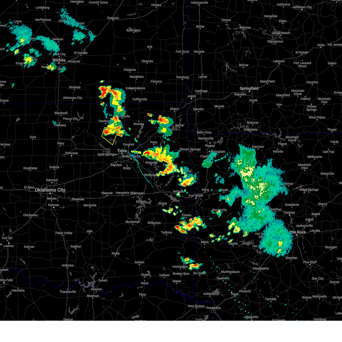 At 725 pm cdt, a severe thunderstorm was located near wynona, moving southeast at 15 mph (radar indicated). Hazards include 60 mph wind gusts and nickel size hail. Expect damage to roofs, siding, and trees. locations in or near the path include, barnsdall, wynona, hail threat, radar indicated max hail size, 0. 88 in wind threat, radar indicated max wind gust, 60 mph. At 725 pm cdt, a severe thunderstorm was located near wynona, moving southeast at 15 mph (radar indicated). Hazards include 60 mph wind gusts and nickel size hail. Expect damage to roofs, siding, and trees. locations in or near the path include, barnsdall, wynona, hail threat, radar indicated max hail size, 0. 88 in wind threat, radar indicated max wind gust, 60 mph.
|
| 6/9/2023 7:09 PM CDT |
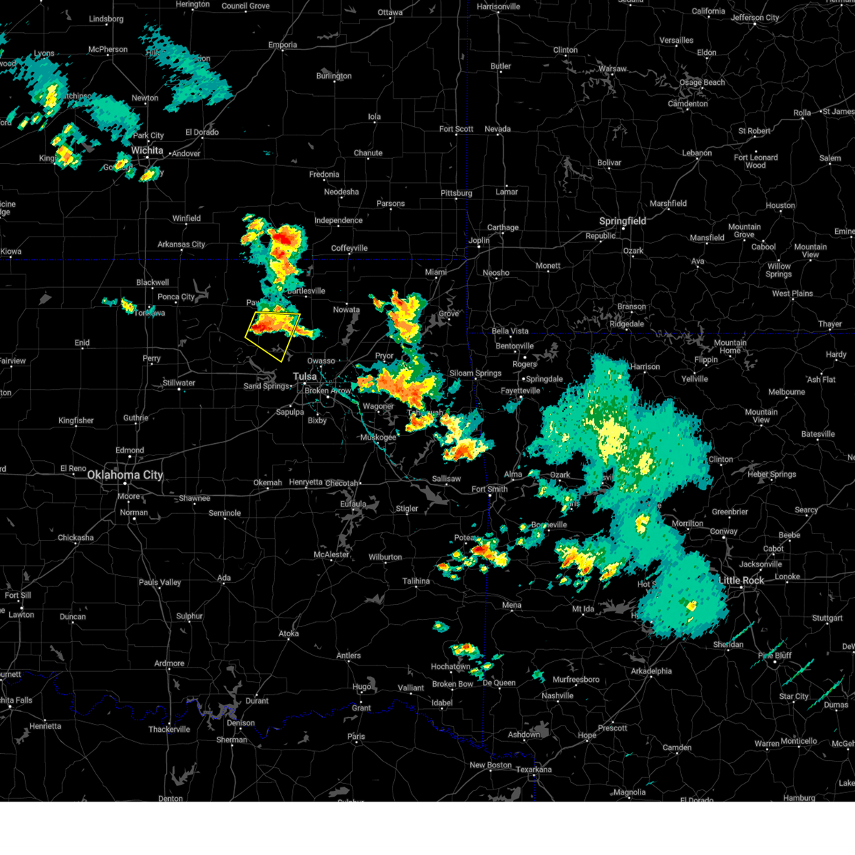 At 709 pm cdt, a severe thunderstorm was located 3 miles west of wynona, moving southeast at 10 mph (radar indicated). Hazards include 60 mph wind gusts and nickel size hail. Expect damage to roofs, siding, and trees. locations in or near the path include, hominy, barnsdall, wynona, nelagoney, pershing, tallant, hail threat, radar indicated max hail size, 0. 88 in wind threat, radar indicated max wind gust, 60 mph. At 709 pm cdt, a severe thunderstorm was located 3 miles west of wynona, moving southeast at 10 mph (radar indicated). Hazards include 60 mph wind gusts and nickel size hail. Expect damage to roofs, siding, and trees. locations in or near the path include, hominy, barnsdall, wynona, nelagoney, pershing, tallant, hail threat, radar indicated max hail size, 0. 88 in wind threat, radar indicated max wind gust, 60 mph.
|
| 6/6/2023 7:30 PM CDT |
 At 729 pm cdt, a severe thunderstorm was located 4 miles east of sand springs, and is nearly stationary (radar indicated). Hazards include 60 mph wind gusts and quarter size hail. Hail damage to vehicles is expected. expect wind damage to roofs, siding, and trees. locations in or near the path include, tulsa, sand springs, gray, this includes interstate 44 between mile markers 217 and 225. hail threat, radar indicated max hail size, 1. 00 in wind threat, radar indicated max wind gust, 60 mph. At 729 pm cdt, a severe thunderstorm was located 4 miles east of sand springs, and is nearly stationary (radar indicated). Hazards include 60 mph wind gusts and quarter size hail. Hail damage to vehicles is expected. expect wind damage to roofs, siding, and trees. locations in or near the path include, tulsa, sand springs, gray, this includes interstate 44 between mile markers 217 and 225. hail threat, radar indicated max hail size, 1. 00 in wind threat, radar indicated max wind gust, 60 mph.
|
| 6/6/2023 7:18 PM CDT |
 At 718 pm cdt, severe thunderstorms were located along a line extending from 4 miles northeast of sapulpa to kiefer, moving southeast at 10 mph (radar indicated). Hazards include 60 mph wind gusts and quarter size hail. Hail damage to vehicles is expected. expect wind damage to roofs, siding, and trees. locations in or near the path include, tulsa, bixby, sapulpa, jenks, glenpool, kiefer, mounds, jenks riverside airport, liberty, hectorville, this includes interstate 44 between mile markers 211 and 217. hail threat, radar indicated max hail size, 1. 00 in wind threat, radar indicated max wind gust, 60 mph. At 718 pm cdt, severe thunderstorms were located along a line extending from 4 miles northeast of sapulpa to kiefer, moving southeast at 10 mph (radar indicated). Hazards include 60 mph wind gusts and quarter size hail. Hail damage to vehicles is expected. expect wind damage to roofs, siding, and trees. locations in or near the path include, tulsa, bixby, sapulpa, jenks, glenpool, kiefer, mounds, jenks riverside airport, liberty, hectorville, this includes interstate 44 between mile markers 211 and 217. hail threat, radar indicated max hail size, 1. 00 in wind threat, radar indicated max wind gust, 60 mph.
|
| 3/23/2023 4:13 PM CDT |
 At 413 pm cdt, a severe thunderstorm was located 6 miles west of quay, moving northeast at 65 mph (radar indicated). Hazards include 60 mph wind gusts and quarter size hail. Hail damage to vehicles is expected. expect wind damage to roofs, siding, and trees. locations in or near the path include, pawnee, hominy, cleveland, jennings, osage, hallett, blackburn, terlton, maramec, skedee, hail threat, radar indicated max hail size, 1. 00 in wind threat, radar indicated max wind gust, 60 mph. At 413 pm cdt, a severe thunderstorm was located 6 miles west of quay, moving northeast at 65 mph (radar indicated). Hazards include 60 mph wind gusts and quarter size hail. Hail damage to vehicles is expected. expect wind damage to roofs, siding, and trees. locations in or near the path include, pawnee, hominy, cleveland, jennings, osage, hallett, blackburn, terlton, maramec, skedee, hail threat, radar indicated max hail size, 1. 00 in wind threat, radar indicated max wind gust, 60 mph.
|
| 2/26/2023 10:27 PM CST |
 At 1026 pm cst, a severe thunderstorm was located 6 miles southeast of slick, moving northeast at 105 mph (radar indicated). Hazards include 70 mph wind gusts and penny size hail. Expect considerable tree damage. damage is likely to mobile homes, roofs, and outbuildings. this storm ha a history of producing wind damage and tornadoes. Locations in or near the path include, tulsa, broken arrow, muskogee, sand springs, claremore, okmulgee, wagoner, bristow, okemah, owasso, bixby, sapulpa, jenks, okfuskee, glenpool, coweta, skiatook, catoosa, collinsville, verdigris, this includes interstate 44 between mile markers 179 and 247. At 1026 pm cst, a severe thunderstorm was located 6 miles southeast of slick, moving northeast at 105 mph (radar indicated). Hazards include 70 mph wind gusts and penny size hail. Expect considerable tree damage. damage is likely to mobile homes, roofs, and outbuildings. this storm ha a history of producing wind damage and tornadoes. Locations in or near the path include, tulsa, broken arrow, muskogee, sand springs, claremore, okmulgee, wagoner, bristow, okemah, owasso, bixby, sapulpa, jenks, okfuskee, glenpool, coweta, skiatook, catoosa, collinsville, verdigris, this includes interstate 44 between mile markers 179 and 247.
|
| 11/4/2022 4:09 PM CDT |
 At 408 pm cdt, severe thunderstorms were located along a line extending from near kiefer to near bixby, moving north at 75 mph (radar indicated). Hazards include 60 mph wind gusts and quarter size hail. Hail damage to vehicles is expected. expect wind damage to roofs, siding, and trees. locations in or near the path include, tulsa, broken arrow, sand springs, owasso, bixby, sapulpa, jenks, glenpool, catoosa, kiefer, sperry, jenks riverside airport, turley, tulsa international airport, gray, leonard, this includes interstate 44 between mile markers 208 and 236. hail threat, radar indicated max hail size, 1. 00 in wind threat, radar indicated max wind gust, 60 mph. At 408 pm cdt, severe thunderstorms were located along a line extending from near kiefer to near bixby, moving north at 75 mph (radar indicated). Hazards include 60 mph wind gusts and quarter size hail. Hail damage to vehicles is expected. expect wind damage to roofs, siding, and trees. locations in or near the path include, tulsa, broken arrow, sand springs, owasso, bixby, sapulpa, jenks, glenpool, catoosa, kiefer, sperry, jenks riverside airport, turley, tulsa international airport, gray, leonard, this includes interstate 44 between mile markers 208 and 236. hail threat, radar indicated max hail size, 1. 00 in wind threat, radar indicated max wind gust, 60 mph.
|
| 11/4/2022 4:01 PM CDT |
 At 401 pm cdt, severe thunderstorms were located along a line extending from 4 miles southwest of mounds to 7 miles north of bald hill, moving north at 70 mph (radar indicated). Hazards include 60 mph wind gusts and quarter size hail. Hail damage to vehicles is expected. expect wind damage to roofs, siding, and trees. locations in or near the path include, tulsa, broken arrow, sand springs, owasso, bixby, sapulpa, jenks, glenpool, catoosa, kiefer, beggs, sperry, mounds, jenks riverside airport, turley, tulsa international airport, liberty, gray, hectorville, leonard, this includes interstate 44 between mile markers 207 and 236. hail threat, radar indicated max hail size, 1. 00 in wind threat, radar indicated max wind gust, 60 mph. At 401 pm cdt, severe thunderstorms were located along a line extending from 4 miles southwest of mounds to 7 miles north of bald hill, moving north at 70 mph (radar indicated). Hazards include 60 mph wind gusts and quarter size hail. Hail damage to vehicles is expected. expect wind damage to roofs, siding, and trees. locations in or near the path include, tulsa, broken arrow, sand springs, owasso, bixby, sapulpa, jenks, glenpool, catoosa, kiefer, beggs, sperry, mounds, jenks riverside airport, turley, tulsa international airport, liberty, gray, hectorville, leonard, this includes interstate 44 between mile markers 207 and 236. hail threat, radar indicated max hail size, 1. 00 in wind threat, radar indicated max wind gust, 60 mph.
|
| 10/24/2022 11:36 AM CDT |
 At 1135 am cdt, a severe thunderstorm was located 5 miles northeast of sand springs, moving northeast at 40 mph (radar indicated). Hazards include 60 mph wind gusts. Expect damage to roofs, siding, and trees. Locations in or near the path include, tulsa, broken arrow, sand springs, claremore, owasso, bixby, sapulpa, jenks, glenpool, coweta, skiatook, catoosa, collinsville, verdigris, chelsea, inola, kiefer, sperry, oologah, foyil, this includes interstate 44 between mile markers 207 and 258. At 1135 am cdt, a severe thunderstorm was located 5 miles northeast of sand springs, moving northeast at 40 mph (radar indicated). Hazards include 60 mph wind gusts. Expect damage to roofs, siding, and trees. Locations in or near the path include, tulsa, broken arrow, sand springs, claremore, owasso, bixby, sapulpa, jenks, glenpool, coweta, skiatook, catoosa, collinsville, verdigris, chelsea, inola, kiefer, sperry, oologah, foyil, this includes interstate 44 between mile markers 207 and 258.
|
| 8/29/2022 1:50 PM CDT | At 150 pm cdt, a severe thunderstorm was centered 8 miles southwest of avant, moving north at 15 mph (radar indicated). Hazards include 60 mph wind gusts and nickel size hail. Expect damage to roofs, siding, and trees. locations in or near the path include, skiatook, hail threat, radar indicated max hail size, 0. 88 in wind threat, radar indicated max wind gust, 60 mph. |
| 8/29/2022 1:42 PM CDT | At 142 pm cdt, a severe thunderstorm was located 9 miles northwest of sperry, moving northeast at 10 mph (radar indicated). Hazards include 60 mph wind gusts and nickel size hail. Expect damage to roofs, siding, and trees. locations in or near the path include, skiatook, avant, hail threat, radar indicated max hail size, 0. 88 in wind threat, radar indicated max wind gust, 60 mph. |
| 7/28/2022 10:07 PM CDT |
 The severe thunderstorm warning for southeastern osage, northeastern creek and tulsa counties will expire at 1015 pm cdt, the storm which prompted the warning has weakened below severe limits, and no longer poses an immediate threat to life or property. therefore, the warning will be allowed to expire. however gusty winds to 40 mph are still possible with this thunderstorm. The severe thunderstorm warning for southeastern osage, northeastern creek and tulsa counties will expire at 1015 pm cdt, the storm which prompted the warning has weakened below severe limits, and no longer poses an immediate threat to life or property. therefore, the warning will be allowed to expire. however gusty winds to 40 mph are still possible with this thunderstorm.
|
| 7/28/2022 9:51 PM CDT |
 At 950 pm cdt, a severe thunderstorm was located 5 miles southwest of sperry, moving east at 25 mph. another severe thunderstorm was near sand springs (radar indicated). Hazards include 60 mph wind gusts. Expect damage to roofs, siding, and trees. locations in or near the path include, tulsa, broken arrow, sand springs, owasso, bixby, jenks, skiatook, catoosa, collinsville, sperry, keystone state park, jenks riverside airport, turley, tulsa international airport, gray, this includes interstate 44 between mile markers 210 and 232. hail threat, radar indicated max hail size, <. 75 in wind threat, radar indicated max wind gust, 60 mph. At 950 pm cdt, a severe thunderstorm was located 5 miles southwest of sperry, moving east at 25 mph. another severe thunderstorm was near sand springs (radar indicated). Hazards include 60 mph wind gusts. Expect damage to roofs, siding, and trees. locations in or near the path include, tulsa, broken arrow, sand springs, owasso, bixby, jenks, skiatook, catoosa, collinsville, sperry, keystone state park, jenks riverside airport, turley, tulsa international airport, gray, this includes interstate 44 between mile markers 210 and 232. hail threat, radar indicated max hail size, <. 75 in wind threat, radar indicated max wind gust, 60 mph.
|
| 7/28/2022 9:26 PM CDT |
 At 925 pm cdt, a severe thunderstorm was located near walnut creek state park, moving east at 25 mph. another severe thunderstorm was just east of oilton (radar indicated). Hazards include 60 mph wind gusts and quarter size hail. Hail damage to vehicles is expected. expect wind damage to roofs, siding, and trees. locations in or near the path include, tulsa, broken arrow, sand springs, owasso, bixby, jenks, skiatook, catoosa, collinsville, mannford, sperry, westport, keystone state park, walnut creek state park, jenks riverside airport, turley, tulsa international airport, gray, silver city, this includes interstate 44 between mile markers 209 and 232. hail threat, radar indicated max hail size, 1. 00 in wind threat, radar indicated max wind gust, 60 mph. At 925 pm cdt, a severe thunderstorm was located near walnut creek state park, moving east at 25 mph. another severe thunderstorm was just east of oilton (radar indicated). Hazards include 60 mph wind gusts and quarter size hail. Hail damage to vehicles is expected. expect wind damage to roofs, siding, and trees. locations in or near the path include, tulsa, broken arrow, sand springs, owasso, bixby, jenks, skiatook, catoosa, collinsville, mannford, sperry, westport, keystone state park, walnut creek state park, jenks riverside airport, turley, tulsa international airport, gray, silver city, this includes interstate 44 between mile markers 209 and 232. hail threat, radar indicated max hail size, 1. 00 in wind threat, radar indicated max wind gust, 60 mph.
|
| 7/27/2022 5:38 PM CDT |
 The severe thunderstorm warning for west central rogers, northeastern creek and northeastern tulsa counties will expire at 545 pm cdt, the storms which prompted the warning have moved out of the area. therefore, the warning will be allowed to expire. however gusty winds to 50 mph are still possible with these thunderstorms. The severe thunderstorm warning for west central rogers, northeastern creek and northeastern tulsa counties will expire at 545 pm cdt, the storms which prompted the warning have moved out of the area. therefore, the warning will be allowed to expire. however gusty winds to 50 mph are still possible with these thunderstorms.
|
| 7/27/2022 5:25 PM CDT |
 At 524 pm cdt, a severe thunderstorm was located over tulsa, moving east at 25 mph (radar indicated). Hazards include 60 mph wind gusts. Expect damage to roofs, siding, and trees. locations in or near the path include, tulsa, broken arrow, sand springs, owasso, bixby, jenks, catoosa, collinsville, turley, tulsa international airport, jenks riverside airport, gray, this includes interstate 44 between mile markers 212 and 235. hail threat, radar indicated max hail size, <. 75 in wind threat, radar indicated max wind gust, 60 mph. At 524 pm cdt, a severe thunderstorm was located over tulsa, moving east at 25 mph (radar indicated). Hazards include 60 mph wind gusts. Expect damage to roofs, siding, and trees. locations in or near the path include, tulsa, broken arrow, sand springs, owasso, bixby, jenks, catoosa, collinsville, turley, tulsa international airport, jenks riverside airport, gray, this includes interstate 44 between mile markers 212 and 235. hail threat, radar indicated max hail size, <. 75 in wind threat, radar indicated max wind gust, 60 mph.
|
| 7/27/2022 4:55 PM CDT |
 At 454 pm cdt, a severe thunderstorm was located over sand springs, moving east at 10 mph. another severe thunderstorm was near owasso, moving east at 10 mph (radar indicated). Hazards include 60 mph wind gusts. Expect damage to roofs, siding, and trees. locations in or near the path include, tulsa, broken arrow, sand springs, owasso, bixby, jenks, catoosa, collinsville, sperry, jenks riverside airport, turley, tulsa international airport, gray, this includes interstate 44 between mile markers 212 and 235. hail threat, radar indicated max hail size, <. 75 in wind threat, radar indicated max wind gust, 60 mph. At 454 pm cdt, a severe thunderstorm was located over sand springs, moving east at 10 mph. another severe thunderstorm was near owasso, moving east at 10 mph (radar indicated). Hazards include 60 mph wind gusts. Expect damage to roofs, siding, and trees. locations in or near the path include, tulsa, broken arrow, sand springs, owasso, bixby, jenks, catoosa, collinsville, sperry, jenks riverside airport, turley, tulsa international airport, gray, this includes interstate 44 between mile markers 212 and 235. hail threat, radar indicated max hail size, <. 75 in wind threat, radar indicated max wind gust, 60 mph.
|
| 6/8/2022 8:19 AM CDT |
 At 818 am cdt, a severe thunderstorm was located 5 miles northwest of sand springs, moving east at 25 mph (radar indicated). Hazards include 60 mph wind gusts and quarter size hail. Hail damage to vehicles is expected. expect wind damage to roofs, siding, and trees. locations in or near the path include, tulsa, sand springs, mannford, keystone state park, hail threat, radar indicated max hail size, 1. 00 in wind threat, radar indicated max wind gust, 60 mph. At 818 am cdt, a severe thunderstorm was located 5 miles northwest of sand springs, moving east at 25 mph (radar indicated). Hazards include 60 mph wind gusts and quarter size hail. Hail damage to vehicles is expected. expect wind damage to roofs, siding, and trees. locations in or near the path include, tulsa, sand springs, mannford, keystone state park, hail threat, radar indicated max hail size, 1. 00 in wind threat, radar indicated max wind gust, 60 mph.
|
| 6/8/2022 7:44 AM CDT |
 At 744 am cdt, a severe thunderstorm was located over osage, moving southeast at 25 mph (radar indicated). Hazards include 60 mph wind gusts and quarter size hail. Hail damage to vehicles is expected. expect wind damage to roofs, siding, and trees. locations in or near the path include, tulsa, sand springs, cleveland, mannford, westport, osage, keystone state park, walnut creek state park, hail threat, radar indicated max hail size, 1. 00 in wind threat, radar indicated max wind gust, 60 mph. At 744 am cdt, a severe thunderstorm was located over osage, moving southeast at 25 mph (radar indicated). Hazards include 60 mph wind gusts and quarter size hail. Hail damage to vehicles is expected. expect wind damage to roofs, siding, and trees. locations in or near the path include, tulsa, sand springs, cleveland, mannford, westport, osage, keystone state park, walnut creek state park, hail threat, radar indicated max hail size, 1. 00 in wind threat, radar indicated max wind gust, 60 mph.
|
| 6/6/2022 2:25 AM CDT |
 The severe thunderstorm warning for northern creek, southern pawnee and southwestern tulsa counties will expire at 230 am cdt, the storms which prompted the warning have weakened below severe limits, and no longer pose an immediate threat to life or property. therefore, the warning will be allowed to expire. however gusty winds 45 to 55 mph are still possible with these thunderstorms. a severe thunderstorm watch remains in effect until 300 am cdt for northeastern oklahoma. The severe thunderstorm warning for northern creek, southern pawnee and southwestern tulsa counties will expire at 230 am cdt, the storms which prompted the warning have weakened below severe limits, and no longer pose an immediate threat to life or property. therefore, the warning will be allowed to expire. however gusty winds 45 to 55 mph are still possible with these thunderstorms. a severe thunderstorm watch remains in effect until 300 am cdt for northeastern oklahoma.
|
| 6/6/2022 2:25 AM CDT |
 The severe thunderstorm warning for southwestern rogers, southeastern osage, southern washington, northwestern wagoner, southeastern pawnee and northern tulsa counties will expire at 230 am cdt, the storms which prompted the warning have weakened below severe limits, and no longer pose an immediate threat to life or property. therefore, the warning will be allowed to expire. however gusty winds 40 to 50 mph are still possible with these thunderstorms. a severe thunderstorm watch remains in effect until 300 am cdt for northeastern oklahoma. The severe thunderstorm warning for southwestern rogers, southeastern osage, southern washington, northwestern wagoner, southeastern pawnee and northern tulsa counties will expire at 230 am cdt, the storms which prompted the warning have weakened below severe limits, and no longer pose an immediate threat to life or property. therefore, the warning will be allowed to expire. however gusty winds 40 to 50 mph are still possible with these thunderstorms. a severe thunderstorm watch remains in effect until 300 am cdt for northeastern oklahoma.
|
| 6/6/2022 2:10 AM CDT |
 At 210 am cdt, severe thunderstorms were located along a line extending from 4 miles west of westport to 5 miles north of perkins, moving southeast at 40 mph (radar indicated). Hazards include 60 mph wind gusts. Expect damage to roofs, siding, and trees. locations in or near the path include, tulsa, sand springs, sapulpa, jenks, glenpool, mannford, drumright, kellyville, oilton, jennings, hallett, terlton, shamrock, maramec, keystone state park, jenks riverside airport, silver city, this includes interstate 44 between mile markers 196 and 216. hail threat, radar indicated max hail size, <. 75 in wind threat, radar indicated max wind gust, 60 mph. At 210 am cdt, severe thunderstorms were located along a line extending from 4 miles west of westport to 5 miles north of perkins, moving southeast at 40 mph (radar indicated). Hazards include 60 mph wind gusts. Expect damage to roofs, siding, and trees. locations in or near the path include, tulsa, sand springs, sapulpa, jenks, glenpool, mannford, drumright, kellyville, oilton, jennings, hallett, terlton, shamrock, maramec, keystone state park, jenks riverside airport, silver city, this includes interstate 44 between mile markers 196 and 216. hail threat, radar indicated max hail size, <. 75 in wind threat, radar indicated max wind gust, 60 mph.
|
| 6/6/2022 2:10 AM CDT |
 At 209 am cdt, severe thunderstorms were located along a line extending from 4 miles north of skiatook to 2 miles southwest of sperry to 5 miles east of walnut creek state park, moving east at 55 mph (radar indicated). Hazards include 60 mph wind gusts. Expect damage to roofs, siding, and trees. locations in or near the path include, tulsa, broken arrow, sand springs, claremore, owasso, skiatook, catoosa, collinsville, verdigris, cleveland, inola, sperry, oologah, foyil, avant, westport, vera, osage, walnut creek state park, turley, this includes interstate 44 between mile markers 216 and 256. hail threat, radar indicated max hail size, <. 75 in wind threat, radar indicated max wind gust, 60 mph. At 209 am cdt, severe thunderstorms were located along a line extending from 4 miles north of skiatook to 2 miles southwest of sperry to 5 miles east of walnut creek state park, moving east at 55 mph (radar indicated). Hazards include 60 mph wind gusts. Expect damage to roofs, siding, and trees. locations in or near the path include, tulsa, broken arrow, sand springs, claremore, owasso, skiatook, catoosa, collinsville, verdigris, cleveland, inola, sperry, oologah, foyil, avant, westport, vera, osage, walnut creek state park, turley, this includes interstate 44 between mile markers 216 and 256. hail threat, radar indicated max hail size, <. 75 in wind threat, radar indicated max wind gust, 60 mph.
|
| 6/6/2022 1:50 AM CDT |
 At 150 am cdt, severe thunderstorms were located along a line extending from 2 miles north of hallett to 3 miles south of lake carl blackwell, moving southeast at 45 mph (radar indicated). Hazards include 60 mph wind gusts. Expect damage to roofs, siding, and trees. locations in or near the path include, tulsa, sand springs, pawnee, sapulpa, jenks, glenpool, mannford, drumright, kellyville, oilton, jennings, hallett, terlton, shamrock, maramec, keystone state park, jenks riverside airport, silver city, this includes interstate 44 between mile markers 196 and 216. hail threat, radar indicated max hail size, <. 75 in wind threat, radar indicated max wind gust, 60 mph. At 150 am cdt, severe thunderstorms were located along a line extending from 2 miles north of hallett to 3 miles south of lake carl blackwell, moving southeast at 45 mph (radar indicated). Hazards include 60 mph wind gusts. Expect damage to roofs, siding, and trees. locations in or near the path include, tulsa, sand springs, pawnee, sapulpa, jenks, glenpool, mannford, drumright, kellyville, oilton, jennings, hallett, terlton, shamrock, maramec, keystone state park, jenks riverside airport, silver city, this includes interstate 44 between mile markers 196 and 216. hail threat, radar indicated max hail size, <. 75 in wind threat, radar indicated max wind gust, 60 mph.
|
| 6/6/2022 1:47 AM CDT |
 At 147 am cdt, severe thunderstorms were located along a line extending from 4 miles southeast of wynona to 6 miles southeast of hominy to cleveland, moving east at 60 mph (radar indicated). Hazards include 65 mph wind gusts. Expect damage to roofs, siding, and trees. locations in or near the path include, tulsa, broken arrow, sand springs, claremore, owasso, skiatook, catoosa, collinsville, verdigris, hominy, cleveland, inola, barnsdall, sperry, oologah, wynona, foyil, avant, westport, vera, this includes interstate 44 between mile markers 216 and 256. hail threat, radar indicated max hail size, <. 75 in wind threat, radar indicated max wind gust, 60 mph. At 147 am cdt, severe thunderstorms were located along a line extending from 4 miles southeast of wynona to 6 miles southeast of hominy to cleveland, moving east at 60 mph (radar indicated). Hazards include 65 mph wind gusts. Expect damage to roofs, siding, and trees. locations in or near the path include, tulsa, broken arrow, sand springs, claremore, owasso, skiatook, catoosa, collinsville, verdigris, hominy, cleveland, inola, barnsdall, sperry, oologah, wynona, foyil, avant, westport, vera, this includes interstate 44 between mile markers 216 and 256. hail threat, radar indicated max hail size, <. 75 in wind threat, radar indicated max wind gust, 60 mph.
|
| 6/6/2022 1:38 AM CDT |
 At 137 am cdt, severe thunderstorms were located along a line extending from 3 miles northwest of hominy to 4 miles south of blackburn to 3 miles south of sooner lake, moving east at 60 mph (radar indicated). Hazards include 60 mph wind gusts. Expect damage to roofs, siding, and trees. locations in or near the path include, pawnee, skiatook, hominy, cleveland, jennings, ralston, westport, osage, hallett, blackburn, terlton, maramec, skedee, walnut creek state park, hail threat, radar indicated max hail size, <. 75 in wind threat, radar indicated max wind gust, 60 mph. At 137 am cdt, severe thunderstorms were located along a line extending from 3 miles northwest of hominy to 4 miles south of blackburn to 3 miles south of sooner lake, moving east at 60 mph (radar indicated). Hazards include 60 mph wind gusts. Expect damage to roofs, siding, and trees. locations in or near the path include, pawnee, skiatook, hominy, cleveland, jennings, ralston, westport, osage, hallett, blackburn, terlton, maramec, skedee, walnut creek state park, hail threat, radar indicated max hail size, <. 75 in wind threat, radar indicated max wind gust, 60 mph.
|
| 6/6/2022 1:22 AM CDT |
 At 121 am cdt, severe thunderstorms were located along a line extending from 5 miles west of ralston to 7 miles north of lake mcmurtry, moving southeast at 45 mph (radar indicated). Hazards include 60 mph wind gusts. Expect damage to roofs, siding, and trees. locations in or near the path include, pawnee, skiatook, hominy, cleveland, jennings, ralston, westport, osage, hallett, blackburn, terlton, maramec, skedee, walnut creek state park, at 1:10 am, the red rock oklahoma mesonet station reported a wind gust of 60 mph. hail threat, radar indicated max hail size, <. 75 in wind threat, radar indicated max wind gust, 60 mph. At 121 am cdt, severe thunderstorms were located along a line extending from 5 miles west of ralston to 7 miles north of lake mcmurtry, moving southeast at 45 mph (radar indicated). Hazards include 60 mph wind gusts. Expect damage to roofs, siding, and trees. locations in or near the path include, pawnee, skiatook, hominy, cleveland, jennings, ralston, westport, osage, hallett, blackburn, terlton, maramec, skedee, walnut creek state park, at 1:10 am, the red rock oklahoma mesonet station reported a wind gust of 60 mph. hail threat, radar indicated max hail size, <. 75 in wind threat, radar indicated max wind gust, 60 mph.
|
| 5/19/2022 4:17 AM CDT |
 At 416 am cdt, severe thunderstorms were located along a line extending from 3 miles southwest of elgin to 4 miles northeast of pawhuska to near walnut creek state park, moving northeast at 60 mph (radar indicated). Hazards include 60 mph wind gusts. Expect damage to roofs, siding, and trees. locations in or near the path include, bartlesville, nowata, pawhuska, skiatook, dewey, barnsdall, south coffeyville, copan, ramona, wynona, ochelata, delaware, avant, westport, lenapah, talala, vera, wann, bigheart, bartlesville municipal airport, hail threat, radar indicated max hail size, <. 75 in wind threat, radar indicated max wind gust, 60 mph. At 416 am cdt, severe thunderstorms were located along a line extending from 3 miles southwest of elgin to 4 miles northeast of pawhuska to near walnut creek state park, moving northeast at 60 mph (radar indicated). Hazards include 60 mph wind gusts. Expect damage to roofs, siding, and trees. locations in or near the path include, bartlesville, nowata, pawhuska, skiatook, dewey, barnsdall, south coffeyville, copan, ramona, wynona, ochelata, delaware, avant, westport, lenapah, talala, vera, wann, bigheart, bartlesville municipal airport, hail threat, radar indicated max hail size, <. 75 in wind threat, radar indicated max wind gust, 60 mph.
|
| 5/4/2022 11:51 PM CDT |
 At 1150 pm cdt, severe thunderstorms were located along a line extending from 2 miles south of westport to 2 miles south of depew, moving east at 30 mph (radar indicated). Hazards include 60 mph wind gusts and quarter size hail. Hail damage to vehicles is expected. expect wind damage to roofs, siding, and trees. locations in or near the path include, bristow, mannford, drumright, oilton, depew, westport, terlton, shamrock, keystone state park, walnut creek state park, silver city, milfay, this includes interstate 44 between mile markers 178 and 204. hail threat, radar indicated max hail size, 1. 00 in wind threat, radar indicated max wind gust, 60 mph. At 1150 pm cdt, severe thunderstorms were located along a line extending from 2 miles south of westport to 2 miles south of depew, moving east at 30 mph (radar indicated). Hazards include 60 mph wind gusts and quarter size hail. Hail damage to vehicles is expected. expect wind damage to roofs, siding, and trees. locations in or near the path include, bristow, mannford, drumright, oilton, depew, westport, terlton, shamrock, keystone state park, walnut creek state park, silver city, milfay, this includes interstate 44 between mile markers 178 and 204. hail threat, radar indicated max hail size, 1. 00 in wind threat, radar indicated max wind gust, 60 mph.
|
| 5/4/2022 11:46 PM CDT |
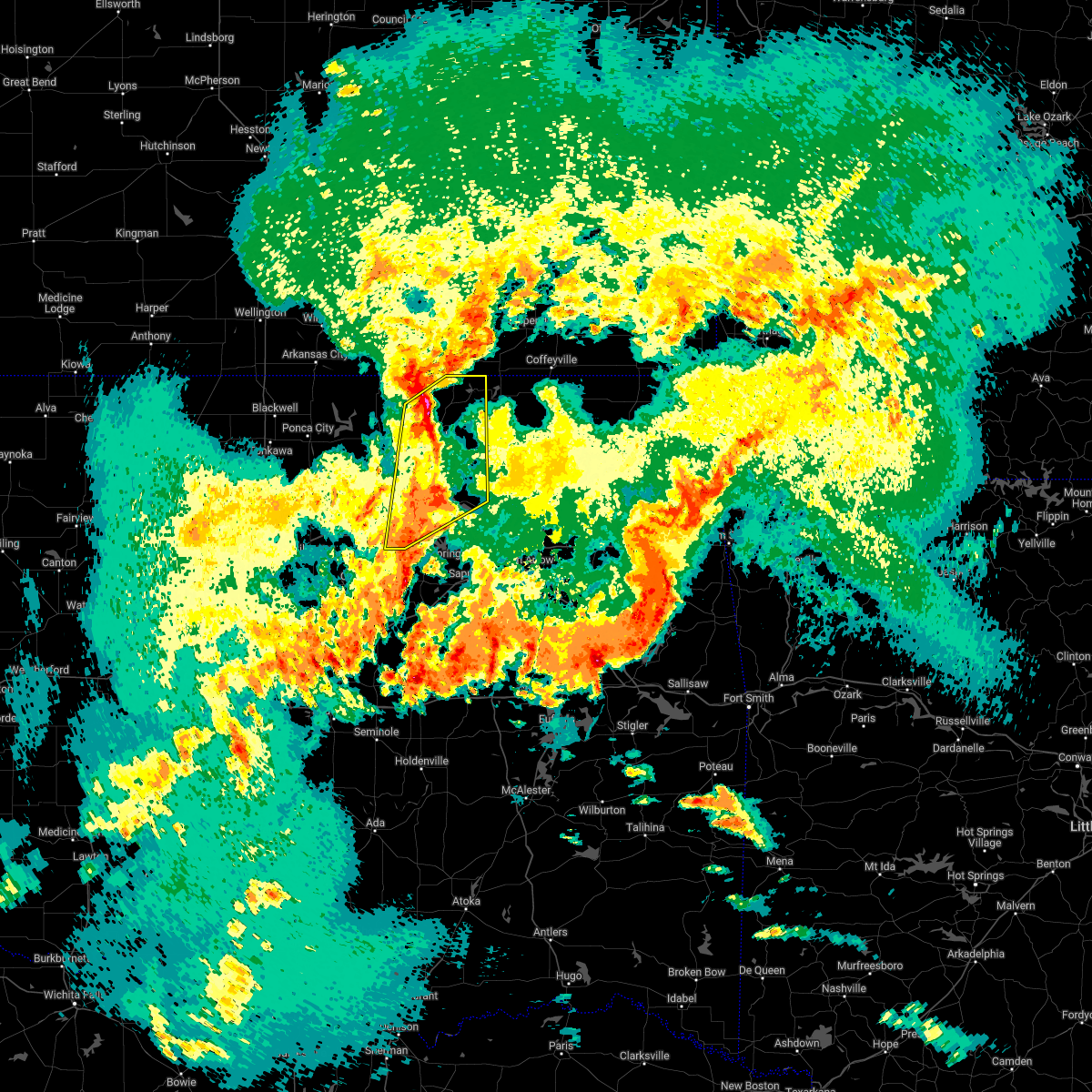 At 1145 pm cdt, severe thunderstorms were located along a line extending from elgin to 9 miles southwest of avant, moving northeast at 55 mph (radar indicated). Hazards include 60 mph wind gusts. Expect damage to roofs, siding, and trees. locations in or near the path include, bartlesville, pawhuska, skiatook, hominy, cleveland, barnsdall, wynona, jennings, avant, osage, hallett, terlton, bigheart, pearsonia, bartlesville municipal airport, hulah, sunset lake, osage hills state park, okesa, wah sha she state park, hail threat, radar indicated max hail size, <. 75 in wind threat, radar indicated max wind gust, 60 mph. At 1145 pm cdt, severe thunderstorms were located along a line extending from elgin to 9 miles southwest of avant, moving northeast at 55 mph (radar indicated). Hazards include 60 mph wind gusts. Expect damage to roofs, siding, and trees. locations in or near the path include, bartlesville, pawhuska, skiatook, hominy, cleveland, barnsdall, wynona, jennings, avant, osage, hallett, terlton, bigheart, pearsonia, bartlesville municipal airport, hulah, sunset lake, osage hills state park, okesa, wah sha she state park, hail threat, radar indicated max hail size, <. 75 in wind threat, radar indicated max wind gust, 60 mph.
|
| 5/4/2022 11:30 PM CDT |
 At 1129 pm cdt, severe thunderstorms were located along a line extending from 3 miles southwest of terlton to near stroud, moving east at 30 mph (radar indicated). Hazards include 60 mph wind gusts and penny size hail. Expect damage to roofs, siding, and trees. locations in or near the path include, bristow, mannford, drumright, oilton, depew, westport, terlton, shamrock, keystone state park, walnut creek state park, silver city, milfay, this includes interstate 44 between mile markers 178 and 204. hail threat, radar indicated max hail size, 0. 75 in wind threat, radar indicated max wind gust, 60 mph. At 1129 pm cdt, severe thunderstorms were located along a line extending from 3 miles southwest of terlton to near stroud, moving east at 30 mph (radar indicated). Hazards include 60 mph wind gusts and penny size hail. Expect damage to roofs, siding, and trees. locations in or near the path include, bristow, mannford, drumright, oilton, depew, westport, terlton, shamrock, keystone state park, walnut creek state park, silver city, milfay, this includes interstate 44 between mile markers 178 and 204. hail threat, radar indicated max hail size, 0. 75 in wind threat, radar indicated max wind gust, 60 mph.
|
| 5/4/2022 7:16 PM CDT |
 At 716 pm cdt, a severe thunderstorm was located 7 miles north of bristow, moving northeast at 45 mph (radar indicated). Hazards include ping pong ball size hail. People and animals outdoors will be injured. expect damage to roofs, siding, windows, and vehicles. locations in or near the path include, sapulpa, mannford, kellyville, this includes interstate 44 between mile markers 192 and 212. hail threat, radar indicated max hail size, 1. 50 in wind threat, radar indicated max wind gust, <50 mph. At 716 pm cdt, a severe thunderstorm was located 7 miles north of bristow, moving northeast at 45 mph (radar indicated). Hazards include ping pong ball size hail. People and animals outdoors will be injured. expect damage to roofs, siding, windows, and vehicles. locations in or near the path include, sapulpa, mannford, kellyville, this includes interstate 44 between mile markers 192 and 212. hail threat, radar indicated max hail size, 1. 50 in wind threat, radar indicated max wind gust, <50 mph.
|
| 5/4/2022 7:09 PM CDT |
 At 709 pm cdt, a severe thunderstorm was located 4 miles northwest of bristow, moving northeast at 45 mph (radar indicated). Hazards include half dollar size hail. Damage to vehicles is expected. locations in or near the path include, bristow, sapulpa, mannford, kellyville, depew, this includes interstate 44 between mile markers 182 and 212. hail threat, radar indicated max hail size, 1. 25 in wind threat, radar indicated max wind gust, <50 mph. At 709 pm cdt, a severe thunderstorm was located 4 miles northwest of bristow, moving northeast at 45 mph (radar indicated). Hazards include half dollar size hail. Damage to vehicles is expected. locations in or near the path include, bristow, sapulpa, mannford, kellyville, depew, this includes interstate 44 between mile markers 182 and 212. hail threat, radar indicated max hail size, 1. 25 in wind threat, radar indicated max wind gust, <50 mph.
|
| 5/4/2022 6:37 PM CDT |
 The severe thunderstorm warning for southeastern osage and northeastern tulsa counties will expire at 645 pm cdt, the storm which prompted the warning has weakened below severe limits, and has exited the warned area. therefore, the warning will be allowed to expire. however small hail is still possible with this thunderstorm. a tornado watch remains in effect until 1000 pm cdt for northeastern oklahoma. The severe thunderstorm warning for southeastern osage and northeastern tulsa counties will expire at 645 pm cdt, the storm which prompted the warning has weakened below severe limits, and has exited the warned area. therefore, the warning will be allowed to expire. however small hail is still possible with this thunderstorm. a tornado watch remains in effect until 1000 pm cdt for northeastern oklahoma.
|
| 5/4/2022 6:18 PM CDT |
 At 617 pm cdt, a severe thunderstorm was located 5 miles west of turley, moving northeast at 40 mph (trained weather spotters. at 604 pm, quarter sized hail was reported near keystone dam). Hazards include quarter size hail. Damage to vehicles is expected. locations in or near the path include, tulsa, sand springs, owasso, skiatook, sperry, turley, hail threat, observed max hail size, 1. 00 in wind threat, radar indicated max wind gust, <50 mph. At 617 pm cdt, a severe thunderstorm was located 5 miles west of turley, moving northeast at 40 mph (trained weather spotters. at 604 pm, quarter sized hail was reported near keystone dam). Hazards include quarter size hail. Damage to vehicles is expected. locations in or near the path include, tulsa, sand springs, owasso, skiatook, sperry, turley, hail threat, observed max hail size, 1. 00 in wind threat, radar indicated max wind gust, <50 mph.
|
| 5/4/2022 6:08 PM CDT | Quarter sized hail reported 0.9 miles SSE of Sand Springs, OK, social media report of 1 inch hail at the sand springs pogue airport. |
| 5/4/2022 6:07 PM CDT | Half Dollar sized hail reported 3.1 miles NW of Sand Springs, OK, social media report of half dollar hail in sand springs. |
| 5/4/2022 6:04 PM CDT | Quarter sized hail reported 6 miles ENE of Sand Springs, OK, corrects previous hail report from 6 e mannford. report of 1 inch hail at keystone dam. |
| 5/4/2022 6:04 PM CDT | Softball sized hail reported 6 miles ENE of Sand Springs, OK, report of 1 inch hail at keystone dam. |
| 5/4/2022 6:04 PM CDT |
 At 603 pm cdt, a severe thunderstorm was located 3 miles northwest of sand springs, moving northeast at 40 mph (radar indicated). Hazards include half dollar size hail. Damage to vehicles is expected. locations in or near the path include, sand springs, mannford, westport, keystone state park, gray, this includes interstate 44 near mile marker 217. hail threat, radar indicated max hail size, 1. 25 in wind threat, radar indicated max wind gust, <50 mph. At 603 pm cdt, a severe thunderstorm was located 3 miles northwest of sand springs, moving northeast at 40 mph (radar indicated). Hazards include half dollar size hail. Damage to vehicles is expected. locations in or near the path include, sand springs, mannford, westport, keystone state park, gray, this includes interstate 44 near mile marker 217. hail threat, radar indicated max hail size, 1. 25 in wind threat, radar indicated max wind gust, <50 mph.
|
| 5/4/2022 6:00 PM CDT |
 At 600 pm cdt, a severe thunderstorm was located 3 miles southeast of keystone state park, moving northeast at 35 mph (radar indicated). Hazards include half dollar size hail. Damage to vehicles is expected. locations in or near the path include, tulsa, sand springs, owasso, skiatook, mannford, sperry, keystone state park, turley, gray, hail threat, radar indicated max hail size, 1. 25 in wind threat, radar indicated max wind gust, <50 mph. At 600 pm cdt, a severe thunderstorm was located 3 miles southeast of keystone state park, moving northeast at 35 mph (radar indicated). Hazards include half dollar size hail. Damage to vehicles is expected. locations in or near the path include, tulsa, sand springs, owasso, skiatook, mannford, sperry, keystone state park, turley, gray, hail threat, radar indicated max hail size, 1. 25 in wind threat, radar indicated max wind gust, <50 mph.
|
| 5/4/2022 5:47 PM CDT |
 At 547 pm cdt, a severe thunderstorm was located 4 miles northwest of mannford, moving northeast at 45 mph (radar indicated). Hazards include half dollar size hail. Damage to vehicles is expected. locations in or near the path include, skiatook, hominy, mannford, wynona, westport, osage, terlton, walnut creek state park, pershing, hail threat, radar indicated max hail size, 1. 25 in wind threat, radar indicated max wind gust, <50 mph. At 547 pm cdt, a severe thunderstorm was located 4 miles northwest of mannford, moving northeast at 45 mph (radar indicated). Hazards include half dollar size hail. Damage to vehicles is expected. locations in or near the path include, skiatook, hominy, mannford, wynona, westport, osage, terlton, walnut creek state park, pershing, hail threat, radar indicated max hail size, 1. 25 in wind threat, radar indicated max wind gust, <50 mph.
|
| 5/4/2022 5:41 PM CDT |
 At 541 pm cdt, a severe thunderstorm was located 8 miles northwest of kellyville, moving northeast at 40 mph (radar indicated). Hazards include half dollar size hail. Damage to vehicles is expected. locations in or near the path include, sand springs, sapulpa, mannford, kellyville, westport, keystone state park, gray, this includes interstate 44 between mile markers 195 and 217. hail threat, radar indicated max hail size, 1. 25 in wind threat, radar indicated max wind gust, <50 mph. At 541 pm cdt, a severe thunderstorm was located 8 miles northwest of kellyville, moving northeast at 40 mph (radar indicated). Hazards include half dollar size hail. Damage to vehicles is expected. locations in or near the path include, sand springs, sapulpa, mannford, kellyville, westport, keystone state park, gray, this includes interstate 44 between mile markers 195 and 217. hail threat, radar indicated max hail size, 1. 25 in wind threat, radar indicated max wind gust, <50 mph.
|
| 5/4/2022 5:28 PM CDT |
 At 528 pm cdt, a severe thunderstorm was located 5 miles east of shamrock, moving northeast at 40 mph (radar indicated). Hazards include half dollar size hail. Damage to vehicles is expected. locations in or near the path include, sand springs, bristow, sapulpa, mannford, kellyville, depew, westport, shamrock, keystone state park, gray, this includes interstate 44 between mile markers 183 and 217. hail threat, radar indicated max hail size, 1. 25 in wind threat, radar indicated max wind gust, <50 mph. At 528 pm cdt, a severe thunderstorm was located 5 miles east of shamrock, moving northeast at 40 mph (radar indicated). Hazards include half dollar size hail. Damage to vehicles is expected. locations in or near the path include, sand springs, bristow, sapulpa, mannford, kellyville, depew, westport, shamrock, keystone state park, gray, this includes interstate 44 between mile markers 183 and 217. hail threat, radar indicated max hail size, 1. 25 in wind threat, radar indicated max wind gust, <50 mph.
|
| 5/2/2022 7:58 PM CDT |
 At 757 pm cdt, severe thunderstorms were located along a line extending from 2 miles west of coweta to preston to 7 miles west of welty, moving east at 35 mph (radar indicated). Hazards include 60 mph wind gusts and quarter size hail. Hail damage to vehicles is expected. expect wind damage to roofs, siding, and trees. locations in or near the path include, tulsa, broken arrow, sand springs, okmulgee, bristow, okemah, owasso, bixby, sapulpa, jenks, okfuskee, glenpool, catoosa, henryetta, kiefer, morris, beggs, boley, mounds, kellyville, this includes the following highways, interstate 40 in oklahoma between mile markers 217 and 243. interstate 44 between mile markers 178 and 232. hail threat, radar indicated max hail size, 1. 00 in wind threat, radar indicated max wind gust, 60 mph. At 757 pm cdt, severe thunderstorms were located along a line extending from 2 miles west of coweta to preston to 7 miles west of welty, moving east at 35 mph (radar indicated). Hazards include 60 mph wind gusts and quarter size hail. Hail damage to vehicles is expected. expect wind damage to roofs, siding, and trees. locations in or near the path include, tulsa, broken arrow, sand springs, okmulgee, bristow, okemah, owasso, bixby, sapulpa, jenks, okfuskee, glenpool, catoosa, henryetta, kiefer, morris, beggs, boley, mounds, kellyville, this includes the following highways, interstate 40 in oklahoma between mile markers 217 and 243. interstate 44 between mile markers 178 and 232. hail threat, radar indicated max hail size, 1. 00 in wind threat, radar indicated max wind gust, 60 mph.
|
| 5/2/2022 7:32 PM CDT |
 At 731 pm cdt, severe thunderstorms were located along a line extending from 4 miles southwest of turley to 2 miles south of glenpool to near welty, moving east at 60 mph (radar indicated). Hazards include 70 mph wind gusts and quarter size hail. Hail damage to vehicles is expected. expect considerable tree damage. wind damage is also likely to mobile homes, roofs, and outbuildings. locations in or near the path include, tulsa, broken arrow, sand springs, okmulgee, bristow, okemah, owasso, bixby, sapulpa, jenks, okfuskee, glenpool, catoosa, henryetta, mannford, kiefer, morris, beggs, sperry, boley, this includes the following highways, interstate 40 in oklahoma between mile markers 217 and 243. Interstate 44 between mile markers 178 and 234. At 731 pm cdt, severe thunderstorms were located along a line extending from 4 miles southwest of turley to 2 miles south of glenpool to near welty, moving east at 60 mph (radar indicated). Hazards include 70 mph wind gusts and quarter size hail. Hail damage to vehicles is expected. expect considerable tree damage. wind damage is also likely to mobile homes, roofs, and outbuildings. locations in or near the path include, tulsa, broken arrow, sand springs, okmulgee, bristow, okemah, owasso, bixby, sapulpa, jenks, okfuskee, glenpool, catoosa, henryetta, mannford, kiefer, morris, beggs, sperry, boley, this includes the following highways, interstate 40 in oklahoma between mile markers 217 and 243. Interstate 44 between mile markers 178 and 234.
|
| 5/2/2022 7:27 PM CDT |
 At 726 pm cdt, a severe thunderstorm was located 4 miles northwest of skiatook, moving east at 45 mph (radar indicated). Hazards include 60 mph wind gusts and nickel size hail. Expect damage to roofs, siding, and trees. locations in or near the path include, skiatook, collinsville, sperry, ramona, ochelata, avant, vera, walnut creek state park, wolco, hail threat, radar indicated max hail size, 0. 88 in wind threat, radar indicated max wind gust, 60 mph. At 726 pm cdt, a severe thunderstorm was located 4 miles northwest of skiatook, moving east at 45 mph (radar indicated). Hazards include 60 mph wind gusts and nickel size hail. Expect damage to roofs, siding, and trees. locations in or near the path include, skiatook, collinsville, sperry, ramona, ochelata, avant, vera, walnut creek state park, wolco, hail threat, radar indicated max hail size, 0. 88 in wind threat, radar indicated max wind gust, 60 mph.
|
| 5/2/2022 7:19 PM CDT |
 At 718 pm cdt, severe thunderstorms were located along a line extending from 4 miles southeast of walnut creek state park to 2 miles southeast of kellyville to 7 miles north of paden, moving east at 50 mph (radar indicated). Hazards include 70 mph wind gusts and quarter size hail. Hail damage to vehicles is expected. expect considerable tree damage. wind damage is also likely to mobile homes, roofs, and outbuildings. locations in or near the path include, tulsa, broken arrow, sand springs, okmulgee, bristow, okemah, owasso, bixby, sapulpa, jenks, okfuskee, glenpool, catoosa, henryetta, mannford, drumright, kiefer, morris, beggs, sperry, this includes the following highways, interstate 40 in oklahoma between mile markers 217 and 243. Interstate 44 between mile markers 177 and 234. At 718 pm cdt, severe thunderstorms were located along a line extending from 4 miles southeast of walnut creek state park to 2 miles southeast of kellyville to 7 miles north of paden, moving east at 50 mph (radar indicated). Hazards include 70 mph wind gusts and quarter size hail. Hail damage to vehicles is expected. expect considerable tree damage. wind damage is also likely to mobile homes, roofs, and outbuildings. locations in or near the path include, tulsa, broken arrow, sand springs, okmulgee, bristow, okemah, owasso, bixby, sapulpa, jenks, okfuskee, glenpool, catoosa, henryetta, mannford, drumright, kiefer, morris, beggs, sperry, this includes the following highways, interstate 40 in oklahoma between mile markers 217 and 243. Interstate 44 between mile markers 177 and 234.
|
| 5/2/2022 7:14 PM CDT |
 At 713 pm cdt, a severe thunderstorm was located 8 miles northeast of walnut creek state park, moving east at 45 mph (radar indicated). Hazards include 60 mph wind gusts and nickel size hail. Expect damage to roofs, siding, and trees. locations in or near the path include, skiatook, collinsville, hominy, cleveland, sperry, ramona, ochelata, avant, westport, vera, osage, terlton, walnut creek state park, wolco, hail threat, radar indicated max hail size, 0. 88 in wind threat, radar indicated max wind gust, 60 mph. At 713 pm cdt, a severe thunderstorm was located 8 miles northeast of walnut creek state park, moving east at 45 mph (radar indicated). Hazards include 60 mph wind gusts and nickel size hail. Expect damage to roofs, siding, and trees. locations in or near the path include, skiatook, collinsville, hominy, cleveland, sperry, ramona, ochelata, avant, westport, vera, osage, terlton, walnut creek state park, wolco, hail threat, radar indicated max hail size, 0. 88 in wind threat, radar indicated max wind gust, 60 mph.
|
| 5/2/2022 7:01 PM CDT |
 At 701 pm cdt, a severe thunderstorm capable of producing a tornado was located near cleveland, moving east at 25 mph (radar indicated rotation). Hazards include tornado and quarter size hail. Flying debris will be dangerous to those caught without shelter. mobile homes will be damaged or destroyed. damage to roofs, windows, and vehicles will occur. tree damage is likely. Locations in or near the path include, hominy, cleveland, osage,. At 701 pm cdt, a severe thunderstorm capable of producing a tornado was located near cleveland, moving east at 25 mph (radar indicated rotation). Hazards include tornado and quarter size hail. Flying debris will be dangerous to those caught without shelter. mobile homes will be damaged or destroyed. damage to roofs, windows, and vehicles will occur. tree damage is likely. Locations in or near the path include, hominy, cleveland, osage,.
|
| 5/2/2022 6:59 PM CDT |
 At 659 pm cdt, a severe thunderstorm was located over osage, moving east at 40 mph (radar indicated). Hazards include 60 mph wind gusts and quarter size hail. Hail damage to vehicles is expected. expect wind damage to roofs, siding, and trees. Locations in or near the path include, tulsa, sand springs, hominy, cleveland, barnsdall, wynona, jennings, westport, osage, hallett, blackburn, terlton, walnut creek state park, tallant,. At 659 pm cdt, a severe thunderstorm was located over osage, moving east at 40 mph (radar indicated). Hazards include 60 mph wind gusts and quarter size hail. Hail damage to vehicles is expected. expect wind damage to roofs, siding, and trees. Locations in or near the path include, tulsa, sand springs, hominy, cleveland, barnsdall, wynona, jennings, westport, osage, hallett, blackburn, terlton, walnut creek state park, tallant,.
|
| 5/2/2022 6:56 PM CDT |
 At 656 pm cdt, severe thunderstorms were located along a line extending from 3 miles west of mannford to 6 miles east of sparks, moving east at 60 mph (radar indicated). Hazards include 70 mph wind gusts and quarter size hail. Hail damage to vehicles is expected. expect considerable tree damage. wind damage is also likely to mobile homes, roofs, and outbuildings. locations in or near the path include, tulsa, broken arrow, sand springs, okmulgee, bristow, okemah, owasso, bixby, sapulpa, jenks, okfuskee, glenpool, catoosa, henryetta, mannford, drumright, kiefer, morris, beggs, sperry, this includes the following highways, interstate 40 in oklahoma between mile markers 217 and 243. interstate 44 between mile markers 177 and 234. thunderstorm damage threat, considerable hail threat, radar indicated max hail size, 1. 00 in wind threat, radar indicated max wind gust, 70 mph. At 656 pm cdt, severe thunderstorms were located along a line extending from 3 miles west of mannford to 6 miles east of sparks, moving east at 60 mph (radar indicated). Hazards include 70 mph wind gusts and quarter size hail. Hail damage to vehicles is expected. expect considerable tree damage. wind damage is also likely to mobile homes, roofs, and outbuildings. locations in or near the path include, tulsa, broken arrow, sand springs, okmulgee, bristow, okemah, owasso, bixby, sapulpa, jenks, okfuskee, glenpool, catoosa, henryetta, mannford, drumright, kiefer, morris, beggs, sperry, this includes the following highways, interstate 40 in oklahoma between mile markers 217 and 243. interstate 44 between mile markers 177 and 234. thunderstorm damage threat, considerable hail threat, radar indicated max hail size, 1. 00 in wind threat, radar indicated max wind gust, 70 mph.
|
| 5/2/2022 6:50 PM CDT |
 At 647 pm cdt, a severe thunderstorm capable of producing a tornado was located near hallett, moving northeast at 35 mph (radar indicated rotation). Hazards include tornado and quarter size hail. Flying debris will be dangerous to those caught without shelter. mobile homes will be damaged or destroyed. damage to roofs, windows, and vehicles will occur. tree damage is likely. Locations in or near the path include, hominy, cleveland, osage, hallett,. At 647 pm cdt, a severe thunderstorm capable of producing a tornado was located near hallett, moving northeast at 35 mph (radar indicated rotation). Hazards include tornado and quarter size hail. Flying debris will be dangerous to those caught without shelter. mobile homes will be damaged or destroyed. damage to roofs, windows, and vehicles will occur. tree damage is likely. Locations in or near the path include, hominy, cleveland, osage, hallett,.
|
| 5/2/2022 6:46 PM CDT |
 At 645 pm cdt, a severe thunderstorm was located 3 miles north of hallett, moving northeast at 35 mph (radar indicated). Hazards include 60 mph wind gusts and quarter size hail. Hail damage to vehicles is expected. expect wind damage to roofs, siding, and trees. Locations in or near the path include, tulsa, sand springs, pawhuska, pawnee, hominy, cleveland, barnsdall, wynona, jennings, ralston, westport, osage, hallett, blackburn, terlton, maramec, skedee, walnut creek state park, tallant, pershing,. At 645 pm cdt, a severe thunderstorm was located 3 miles north of hallett, moving northeast at 35 mph (radar indicated). Hazards include 60 mph wind gusts and quarter size hail. Hail damage to vehicles is expected. expect wind damage to roofs, siding, and trees. Locations in or near the path include, tulsa, sand springs, pawhuska, pawnee, hominy, cleveland, barnsdall, wynona, jennings, ralston, westport, osage, hallett, blackburn, terlton, maramec, skedee, walnut creek state park, tallant, pershing,.
|
| 5/2/2022 6:24 PM CDT |
 At 623 pm cdt, a severe thunderstorm was located over skedee, moving east at 40 mph (radar indicated). Hazards include 60 mph wind gusts and quarter size hail. Hail damage to vehicles is expected. expect wind damage to roofs, siding, and trees. Locations in or near the path include, tulsa, sand springs, pawhuska, pawnee, hominy, cleveland, barnsdall, wynona, jennings, ralston, westport, osage, hallett, blackburn, terlton, maramec, skedee, walnut creek state park, tallant, pershing,. At 623 pm cdt, a severe thunderstorm was located over skedee, moving east at 40 mph (radar indicated). Hazards include 60 mph wind gusts and quarter size hail. Hail damage to vehicles is expected. expect wind damage to roofs, siding, and trees. Locations in or near the path include, tulsa, sand springs, pawhuska, pawnee, hominy, cleveland, barnsdall, wynona, jennings, ralston, westport, osage, hallett, blackburn, terlton, maramec, skedee, walnut creek state park, tallant, pershing,.
|
| 4/30/2022 1:45 AM CDT |
 At 145 am cdt, severe thunderstorms were located along a line extending from 4 miles northeast of sand springs to 3 miles south of kellyville, moving east at 40 mph (radar indicated). Hazards include 60 mph wind gusts and quarter size hail. Hail damage to vehicles is expected. expect wind damage to roofs, siding, and trees. locations in or near the path include, tulsa, broken arrow, sand springs, bixby, sapulpa, jenks, glenpool, coweta, catoosa, haskell, inola, kiefer, mounds, kellyville, jenks riverside airport, stonebluff, bald hill, turley, tulsa international airport, oneta, this includes interstate 44 between mile markers 203 and 242. hail threat, radar indicated max hail size, 1. 00 in wind threat, radar indicated max wind gust, 60 mph. At 145 am cdt, severe thunderstorms were located along a line extending from 4 miles northeast of sand springs to 3 miles south of kellyville, moving east at 40 mph (radar indicated). Hazards include 60 mph wind gusts and quarter size hail. Hail damage to vehicles is expected. expect wind damage to roofs, siding, and trees. locations in or near the path include, tulsa, broken arrow, sand springs, bixby, sapulpa, jenks, glenpool, coweta, catoosa, haskell, inola, kiefer, mounds, kellyville, jenks riverside airport, stonebluff, bald hill, turley, tulsa international airport, oneta, this includes interstate 44 between mile markers 203 and 242. hail threat, radar indicated max hail size, 1. 00 in wind threat, radar indicated max wind gust, 60 mph.
|
| 4/30/2022 12:39 AM CDT |
 At 1239 am cdt, severe thunderstorms were located along a line extending from 3 miles southwest of caney to quay, moving east at 45 mph (radar indicated). Hazards include 60 mph wind gusts and quarter size hail. Hail damage to vehicles is expected. expect wind damage to roofs, siding, and trees. locations in or near the path include, bartlesville, pawhuska, hominy, dewey, cleveland, mannford, barnsdall, oilton, south coffeyville, copan, ramona, wynona, ochelata, jennings, avant, westport, lenapah, osage, wann, hallett, hail threat, radar indicated max hail size, 1. 00 in wind threat, radar indicated max wind gust, 60 mph. At 1239 am cdt, severe thunderstorms were located along a line extending from 3 miles southwest of caney to quay, moving east at 45 mph (radar indicated). Hazards include 60 mph wind gusts and quarter size hail. Hail damage to vehicles is expected. expect wind damage to roofs, siding, and trees. locations in or near the path include, bartlesville, pawhuska, hominy, dewey, cleveland, mannford, barnsdall, oilton, south coffeyville, copan, ramona, wynona, ochelata, jennings, avant, westport, lenapah, osage, wann, hallett, hail threat, radar indicated max hail size, 1. 00 in wind threat, radar indicated max wind gust, 60 mph.
|
| 4/30/2022 12:22 AM CDT |
 At 1222 am cdt, severe thunderstorms were located along a line extending from 3 miles south of chautauqua to 4 miles south of glencoe, moving east at 45 mph (radar indicated). Hazards include 60 mph wind gusts and quarter size hail. Hail damage to vehicles is expected. expect wind damage to roofs, siding, and trees. locations in or near the path include, bartlesville, pawhuska, pawnee, hominy, dewey, cleveland, mannford, fairfax, barnsdall, oilton, south coffeyville, copan, ramona, wynona, ochelata, jennings, ralston, avant, westport, lenapah, hail threat, radar indicated max hail size, 1. 00 in wind threat, radar indicated max wind gust, 60 mph. At 1222 am cdt, severe thunderstorms were located along a line extending from 3 miles south of chautauqua to 4 miles south of glencoe, moving east at 45 mph (radar indicated). Hazards include 60 mph wind gusts and quarter size hail. Hail damage to vehicles is expected. expect wind damage to roofs, siding, and trees. locations in or near the path include, bartlesville, pawhuska, pawnee, hominy, dewey, cleveland, mannford, fairfax, barnsdall, oilton, south coffeyville, copan, ramona, wynona, ochelata, jennings, ralston, avant, westport, lenapah, hail threat, radar indicated max hail size, 1. 00 in wind threat, radar indicated max wind gust, 60 mph.
|
| 4/23/2022 8:54 PM CDT |
 At 853 pm cdt, a severe thunderstorm was located 8 miles southwest of avant, moving northeast at 40 mph (radar indicated). Hazards include 60 mph wind gusts and quarter size hail. Hail damage to vehicles is expected. expect wind damage to roofs, siding, and trees. locations in or near the path include, skiatook, barnsdall, avant, wolco, hail threat, radar indicated max hail size, 1. 00 in wind threat, radar indicated max wind gust, 60 mph. At 853 pm cdt, a severe thunderstorm was located 8 miles southwest of avant, moving northeast at 40 mph (radar indicated). Hazards include 60 mph wind gusts and quarter size hail. Hail damage to vehicles is expected. expect wind damage to roofs, siding, and trees. locations in or near the path include, skiatook, barnsdall, avant, wolco, hail threat, radar indicated max hail size, 1. 00 in wind threat, radar indicated max wind gust, 60 mph.
|
| 4/23/2022 8:45 PM CDT |
 At 845 pm cdt, a severe thunderstorm was located 7 miles north of walnut creek state park, moving northeast at 45 mph (radar indicated). Hazards include 60 mph wind gusts and quarter size hail. Hail damage to vehicles is expected. expect wind damage to roofs, siding, and trees. locations in or near the path include, tulsa, skiatook, hominy, cleveland, barnsdall, sperry, avant, westport, osage, walnut creek state park, tallant, wolco, hail threat, radar indicated max hail size, 1. 00 in wind threat, radar indicated max wind gust, 60 mph. At 845 pm cdt, a severe thunderstorm was located 7 miles north of walnut creek state park, moving northeast at 45 mph (radar indicated). Hazards include 60 mph wind gusts and quarter size hail. Hail damage to vehicles is expected. expect wind damage to roofs, siding, and trees. locations in or near the path include, tulsa, skiatook, hominy, cleveland, barnsdall, sperry, avant, westport, osage, walnut creek state park, tallant, wolco, hail threat, radar indicated max hail size, 1. 00 in wind threat, radar indicated max wind gust, 60 mph.
|
| 4/23/2022 8:26 PM CDT |
 At 826 pm cdt, a severe thunderstorm was located 3 miles southwest of cleveland, moving northeast at 40 mph (radar indicated). Hazards include 60 mph wind gusts and quarter size hail. Hail damage to vehicles is expected. expect wind damage to roofs, siding, and trees. locations in or near the path include, tulsa, skiatook, hominy, cleveland, barnsdall, sperry, avant, westport, osage, hallett, terlton, walnut creek state park, tallant, wolco, hail threat, radar indicated max hail size, 1. 00 in wind threat, radar indicated max wind gust, 60 mph. At 826 pm cdt, a severe thunderstorm was located 3 miles southwest of cleveland, moving northeast at 40 mph (radar indicated). Hazards include 60 mph wind gusts and quarter size hail. Hail damage to vehicles is expected. expect wind damage to roofs, siding, and trees. locations in or near the path include, tulsa, skiatook, hominy, cleveland, barnsdall, sperry, avant, westport, osage, hallett, terlton, walnut creek state park, tallant, wolco, hail threat, radar indicated max hail size, 1. 00 in wind threat, radar indicated max wind gust, 60 mph.
|
| 4/11/2022 12:45 AM CDT |
 At 1245 am cdt, severe thunderstorms were located along a line extending from 4 miles north of welch to 5 miles west of adair to 2 miles northwest of broken arrow, moving east at 45 mph (radar indicated). Hazards include 60 mph wind gusts and nickel size hail. Expect damage to roofs, siding, and trees. locations in or near the path include, tulsa, broken arrow, sand springs, claremore, vinita, nowata, owasso, skiatook, catoosa, collinsville, verdigris, chelsea, sperry, oologah, adair, welch, foyil, bluejacket, talala, big cabin, this includes interstate 44 between mile markers 216 and 286. hail threat, radar indicated max hail size, 0. 88 in wind threat, radar indicated max wind gust, 60 mph. At 1245 am cdt, severe thunderstorms were located along a line extending from 4 miles north of welch to 5 miles west of adair to 2 miles northwest of broken arrow, moving east at 45 mph (radar indicated). Hazards include 60 mph wind gusts and nickel size hail. Expect damage to roofs, siding, and trees. locations in or near the path include, tulsa, broken arrow, sand springs, claremore, vinita, nowata, owasso, skiatook, catoosa, collinsville, verdigris, chelsea, sperry, oologah, adair, welch, foyil, bluejacket, talala, big cabin, this includes interstate 44 between mile markers 216 and 286. hail threat, radar indicated max hail size, 0. 88 in wind threat, radar indicated max wind gust, 60 mph.
|
| 4/11/2022 12:15 AM CDT |
 At 1215 am cdt, severe thunderstorms were located along a line extending from 7 miles east of south coffeyville to 2 miles west of talala to 3 miles east of keystone state park, moving east at 45 mph (radar indicated). Hazards include 60 mph wind gusts and nickel size hail. Expect damage to roofs, siding, and trees. locations in or near the path include, tulsa, broken arrow, sand springs, claremore, vinita, nowata, pryor, owasso, bixby, jenks, coweta, pryor creek, skiatook, catoosa, collinsville, verdigris, chelsea, inola, sperry, oologah, this includes interstate 44 between mile markers 216 and 289. hail threat, radar indicated max hail size, 0. 88 in wind threat, radar indicated max wind gust, 60 mph. At 1215 am cdt, severe thunderstorms were located along a line extending from 7 miles east of south coffeyville to 2 miles west of talala to 3 miles east of keystone state park, moving east at 45 mph (radar indicated). Hazards include 60 mph wind gusts and nickel size hail. Expect damage to roofs, siding, and trees. locations in or near the path include, tulsa, broken arrow, sand springs, claremore, vinita, nowata, pryor, owasso, bixby, jenks, coweta, pryor creek, skiatook, catoosa, collinsville, verdigris, chelsea, inola, sperry, oologah, this includes interstate 44 between mile markers 216 and 289. hail threat, radar indicated max hail size, 0. 88 in wind threat, radar indicated max wind gust, 60 mph.
|
| 4/11/2022 12:02 AM CDT |
 At 1202 am cdt, severe thunderstorms were located along a line extending from wann to 2 miles northeast of avant to near westport, moving east at 35 mph (radar indicated). Hazards include 60 mph wind gusts and quarter size hail. Hail damage to vehicles is expected. expect wind damage to roofs, siding, and trees. locations in or near the path include, tulsa, bartlesville, sand springs, nowata, skiatook, collinsville, dewey, barnsdall, sperry, south coffeyville, copan, ramona, ochelata, delaware, avant, westport, lenapah, talala, vera, wann, hail threat, radar indicated max hail size, 1. 00 in wind threat, radar indicated max wind gust, 60 mph. At 1202 am cdt, severe thunderstorms were located along a line extending from wann to 2 miles northeast of avant to near westport, moving east at 35 mph (radar indicated). Hazards include 60 mph wind gusts and quarter size hail. Hail damage to vehicles is expected. expect wind damage to roofs, siding, and trees. locations in or near the path include, tulsa, bartlesville, sand springs, nowata, skiatook, collinsville, dewey, barnsdall, sperry, south coffeyville, copan, ramona, ochelata, delaware, avant, westport, lenapah, talala, vera, wann, hail threat, radar indicated max hail size, 1. 00 in wind threat, radar indicated max wind gust, 60 mph.
|
| 4/10/2022 11:43 PM CDT |
 At 1142 pm cdt, severe thunderstorms were located along a line extending from 2 miles east of hulah to 4 miles west of barnsdall to near hallett, moving east at 35 mph (radar indicated). Hazards include 60 mph wind gusts and quarter size hail. Hail damage to vehicles is expected. expect wind damage to roofs, siding, and trees. locations in or near the path include, tulsa, bartlesville, sand springs, nowata, skiatook, collinsville, hominy, dewey, cleveland, barnsdall, sperry, south coffeyville, copan, ramona, wynona, ochelata, delaware, jennings, avant, westport, hail threat, radar indicated max hail size, 1. 00 in wind threat, radar indicated max wind gust, 60 mph. At 1142 pm cdt, severe thunderstorms were located along a line extending from 2 miles east of hulah to 4 miles west of barnsdall to near hallett, moving east at 35 mph (radar indicated). Hazards include 60 mph wind gusts and quarter size hail. Hail damage to vehicles is expected. expect wind damage to roofs, siding, and trees. locations in or near the path include, tulsa, bartlesville, sand springs, nowata, skiatook, collinsville, hominy, dewey, cleveland, barnsdall, sperry, south coffeyville, copan, ramona, wynona, ochelata, delaware, jennings, avant, westport, hail threat, radar indicated max hail size, 1. 00 in wind threat, radar indicated max wind gust, 60 mph.
|
| 4/10/2022 11:27 PM CDT |
 At 1127 pm cdt, a severe thunderstorm was located 4 miles northeast of blackburn, moving east at 40 mph (radar indicated). Hazards include 60 mph wind gusts and quarter size hail. Hail damage to vehicles is expected. expect wind damage to roofs, siding, and trees. locations in or near the path include, hominy, cleveland, wynona, westport, osage, hallett, blackburn, maramec, skedee, walnut creek state park, hail threat, radar indicated max hail size, 1. 00 in wind threat, radar indicated max wind gust, 60 mph. At 1127 pm cdt, a severe thunderstorm was located 4 miles northeast of blackburn, moving east at 40 mph (radar indicated). Hazards include 60 mph wind gusts and quarter size hail. Hail damage to vehicles is expected. expect wind damage to roofs, siding, and trees. locations in or near the path include, hominy, cleveland, wynona, westport, osage, hallett, blackburn, maramec, skedee, walnut creek state park, hail threat, radar indicated max hail size, 1. 00 in wind threat, radar indicated max wind gust, 60 mph.
|
| 4/10/2022 11:07 PM CDT |
 At 1106 pm cdt, a severe thunderstorm was located 4 miles west of skedee, moving east at 40 mph (radar indicated). Hazards include ping pong ball size hail and 60 mph wind gusts. People and animals outdoors will be injured. expect hail damage to roofs, siding, windows, and vehicles. expect wind damage to roofs, siding, and trees. locations in or near the path include, pawnee, hominy, cleveland, wynona, ralston, westport, osage, hallett, blackburn, maramec, skedee, walnut creek state park, hail threat, radar indicated max hail size, 1. 50 in wind threat, radar indicated max wind gust, 60 mph. At 1106 pm cdt, a severe thunderstorm was located 4 miles west of skedee, moving east at 40 mph (radar indicated). Hazards include ping pong ball size hail and 60 mph wind gusts. People and animals outdoors will be injured. expect hail damage to roofs, siding, windows, and vehicles. expect wind damage to roofs, siding, and trees. locations in or near the path include, pawnee, hominy, cleveland, wynona, ralston, westport, osage, hallett, blackburn, maramec, skedee, walnut creek state park, hail threat, radar indicated max hail size, 1. 50 in wind threat, radar indicated max wind gust, 60 mph.
|
| 4/10/2022 10:57 PM CDT |
 At 1057 pm cdt, a severe thunderstorm was located 6 miles northwest of pawnee, moving east at 40 mph (radar indicated). Hazards include 60 mph wind gusts and quarter size hail. Hail damage to vehicles is expected. expect wind damage to roofs, siding, and trees. locations in or near the path include, pawnee, hominy, cleveland, wynona, ralston, westport, osage, hallett, blackburn, maramec, skedee, walnut creek state park, hail threat, radar indicated max hail size, 1. 00 in wind threat, radar indicated max wind gust, 60 mph. At 1057 pm cdt, a severe thunderstorm was located 6 miles northwest of pawnee, moving east at 40 mph (radar indicated). Hazards include 60 mph wind gusts and quarter size hail. Hail damage to vehicles is expected. expect wind damage to roofs, siding, and trees. locations in or near the path include, pawnee, hominy, cleveland, wynona, ralston, westport, osage, hallett, blackburn, maramec, skedee, walnut creek state park, hail threat, radar indicated max hail size, 1. 00 in wind threat, radar indicated max wind gust, 60 mph.
|
| 11/10/2021 7:37 PM CST |
 The severe thunderstorm warning for southwestern rogers, northeastern creek, northwestern wagoner and tulsa counties will expire at 745 pm cst, the storm which prompted the warning has moved out of the area. therefore, the warning will be allowed to expire. however gusty winds and heavy rain are still possible with this thunderstorm. a severe thunderstorm watch remains in effect until 1000 pm cst for northeastern oklahoma. The severe thunderstorm warning for southwestern rogers, northeastern creek, northwestern wagoner and tulsa counties will expire at 745 pm cst, the storm which prompted the warning has moved out of the area. therefore, the warning will be allowed to expire. however gusty winds and heavy rain are still possible with this thunderstorm. a severe thunderstorm watch remains in effect until 1000 pm cst for northeastern oklahoma.
|
| 11/10/2021 7:14 PM CST |
 At 713 pm cst, a severe thunderstorm was located near turley, moving east at 45 mph (radar indicated). Hazards include 60 mph wind gusts and nickel size hail. Expect damage to roofs, siding, and trees. locations in or near the path include, tulsa, sand springs, skiatook, sperry, turley, tulsa international airport, gray, this includes interstate 44 between mile markers 207 and 229. hail threat, radar indicated max hail size, 0. 88 in wind threat, radar indicated max wind gust, 60 mph. At 713 pm cst, a severe thunderstorm was located near turley, moving east at 45 mph (radar indicated). Hazards include 60 mph wind gusts and nickel size hail. Expect damage to roofs, siding, and trees. locations in or near the path include, tulsa, sand springs, skiatook, sperry, turley, tulsa international airport, gray, this includes interstate 44 between mile markers 207 and 229. hail threat, radar indicated max hail size, 0. 88 in wind threat, radar indicated max wind gust, 60 mph.
|
| 11/10/2021 7:07 PM CST |
 At 706 pm cst, a severe thunderstorm was located near jenks riverside airport, moving east at 45 mph (radar indicated). Hazards include 60 mph wind gusts and nickel size hail. Expect damage to roofs, siding, and trees. locations in or near the path include, tulsa, broken arrow, sand springs, bixby, sapulpa, jenks, glenpool, coweta, catoosa, kiefer, mounds, jenks riverside airport, tulsa international airport, stonebluff, liberty, gray, leonard, this includes interstate 44 between mile markers 208 and 239. hail threat, radar indicated max hail size, 0. 88 in wind threat, radar indicated max wind gust, 60 mph. At 706 pm cst, a severe thunderstorm was located near jenks riverside airport, moving east at 45 mph (radar indicated). Hazards include 60 mph wind gusts and nickel size hail. Expect damage to roofs, siding, and trees. locations in or near the path include, tulsa, broken arrow, sand springs, bixby, sapulpa, jenks, glenpool, coweta, catoosa, kiefer, mounds, jenks riverside airport, tulsa international airport, stonebluff, liberty, gray, leonard, this includes interstate 44 between mile markers 208 and 239. hail threat, radar indicated max hail size, 0. 88 in wind threat, radar indicated max wind gust, 60 mph.
|
| 11/10/2021 6:43 PM CST |
 At 642 pm cst, a severe thunderstorm was located near mannford, moving east at 45 mph (radar indicated). Hazards include 60 mph wind gusts and quarter size hail. Hail damage to vehicles is expected. expect wind damage to roofs, siding, and trees. locations in or near the path include, tulsa, sand springs, skiatook, mannford, sperry, westport, keystone state park, turley, tulsa international airport, walnut creek state park, gray, this includes interstate 44 between mile markers 206 and 229. hail threat, radar indicated max hail size, 1. 00 in wind threat, radar indicated max wind gust, 60 mph. At 642 pm cst, a severe thunderstorm was located near mannford, moving east at 45 mph (radar indicated). Hazards include 60 mph wind gusts and quarter size hail. Hail damage to vehicles is expected. expect wind damage to roofs, siding, and trees. locations in or near the path include, tulsa, sand springs, skiatook, mannford, sperry, westport, keystone state park, turley, tulsa international airport, walnut creek state park, gray, this includes interstate 44 between mile markers 206 and 229. hail threat, radar indicated max hail size, 1. 00 in wind threat, radar indicated max wind gust, 60 mph.
|
| 10/10/2021 10:12 PM CDT |
 At 1012 pm cdt, severe thunderstorms were located along a line extending from 4 miles east of sand springs to 4 miles east of preston to 2 miles east of weleetka, moving northeast at 45 mph (radar indicated). Hazards include 70 mph wind gusts and nickel size hail. Expect considerable tree damage. damage is likely to mobile homes, roofs, and outbuildings. locations in or near the path include, tulsa, broken arrow, sand springs, okmulgee, bixby, sapulpa, jenks, glenpool, henryetta, kiefer, morris, beggs, mounds, weleetka, dewar, schulter, grayson, hoffman, clearview, preston, this includes the following highways, interstate 40 in oklahoma between mile markers 221 and 253. interstate 44 between mile markers 207 and 229. thunderstorm damage threat, considerable hail threat, radar indicated max hail size, 0. 88 in wind threat, radar indicated max wind gust, 70 mph. At 1012 pm cdt, severe thunderstorms were located along a line extending from 4 miles east of sand springs to 4 miles east of preston to 2 miles east of weleetka, moving northeast at 45 mph (radar indicated). Hazards include 70 mph wind gusts and nickel size hail. Expect considerable tree damage. damage is likely to mobile homes, roofs, and outbuildings. locations in or near the path include, tulsa, broken arrow, sand springs, okmulgee, bixby, sapulpa, jenks, glenpool, henryetta, kiefer, morris, beggs, mounds, weleetka, dewar, schulter, grayson, hoffman, clearview, preston, this includes the following highways, interstate 40 in oklahoma between mile markers 221 and 253. interstate 44 between mile markers 207 and 229. thunderstorm damage threat, considerable hail threat, radar indicated max hail size, 0. 88 in wind threat, radar indicated max wind gust, 70 mph.
|
| 10/10/2021 9:58 PM CDT |
 At 935 pm cdt, severe thunderstorms were located along a line extending from 8 miles east of drumright to 4 miles northeast of castle to 5 miles north of wewoka, moving northeast at 45 mph (radar indicated). Hazards include 70 mph wind gusts and nickel size hail. Expect considerable tree damage. damage is likely to mobile homes, roofs, and outbuildings. locations in or near the path include, tulsa, broken arrow, sand springs, okmulgee, bristow, okemah, bixby, sapulpa, jenks, okfuskee, glenpool, henryetta, kiefer, morris, beggs, mounds, kellyville, weleetka, dewar, schulter, this includes the following highways, interstate 40 in oklahoma between mile markers 213 and 253. interstate 44 between mile markers 187 and 229. thunderstorm damage threat, considerable hail threat, radar indicated max hail size, 0. 88 in wind threat, radar indicated max wind gust, 70 mph. At 935 pm cdt, severe thunderstorms were located along a line extending from 8 miles east of drumright to 4 miles northeast of castle to 5 miles north of wewoka, moving northeast at 45 mph (radar indicated). Hazards include 70 mph wind gusts and nickel size hail. Expect considerable tree damage. damage is likely to mobile homes, roofs, and outbuildings. locations in or near the path include, tulsa, broken arrow, sand springs, okmulgee, bristow, okemah, bixby, sapulpa, jenks, okfuskee, glenpool, henryetta, kiefer, morris, beggs, mounds, kellyville, weleetka, dewar, schulter, this includes the following highways, interstate 40 in oklahoma between mile markers 213 and 253. interstate 44 between mile markers 187 and 229. thunderstorm damage threat, considerable hail threat, radar indicated max hail size, 0. 88 in wind threat, radar indicated max wind gust, 70 mph.
|
| 10/10/2021 9:36 PM CDT |
 At 935 pm cdt, severe thunderstorms were located along a line extending from 8 miles east of drumright to 4 miles northeast of castle to 5 miles north of wewoka, moving northeast at 45 mph (radar indicated). Hazards include 70 mph wind gusts and nickel size hail. Expect considerable tree damage. damage is likely to mobile homes, roofs, and outbuildings. locations in or near the path include, tulsa, broken arrow, sand springs, okmulgee, bristow, okemah, bixby, sapulpa, jenks, okfuskee, glenpool, henryetta, kiefer, morris, beggs, mounds, kellyville, weleetka, dewar, schulter, this includes the following highways, interstate 40 in oklahoma between mile markers 213 and 253. interstate 44 between mile markers 187 and 229. thunderstorm damage threat, considerable hail threat, radar indicated max hail size, 0. 88 in wind threat, radar indicated max wind gust, 70 mph. At 935 pm cdt, severe thunderstorms were located along a line extending from 8 miles east of drumright to 4 miles northeast of castle to 5 miles north of wewoka, moving northeast at 45 mph (radar indicated). Hazards include 70 mph wind gusts and nickel size hail. Expect considerable tree damage. damage is likely to mobile homes, roofs, and outbuildings. locations in or near the path include, tulsa, broken arrow, sand springs, okmulgee, bristow, okemah, bixby, sapulpa, jenks, okfuskee, glenpool, henryetta, kiefer, morris, beggs, mounds, kellyville, weleetka, dewar, schulter, this includes the following highways, interstate 40 in oklahoma between mile markers 213 and 253. interstate 44 between mile markers 187 and 229. thunderstorm damage threat, considerable hail threat, radar indicated max hail size, 0. 88 in wind threat, radar indicated max wind gust, 70 mph.
|
| 10/10/2021 8:58 PM CDT |
 At 857 pm cdt, a severe thunderstorm was located near skedee, moving northeast at 25 mph (radar indicated). Hazards include 60 mph wind gusts. Expect damage to roofs, siding, and trees. locations in or near the path include, pawnee, hominy, cleveland, fairfax, wynona, ralston, osage, hallett, blackburn, maramec, skedee, walnut creek state park, hail threat, radar indicated max hail size, <. 75 in wind threat, radar indicated max wind gust, 60 mph. At 857 pm cdt, a severe thunderstorm was located near skedee, moving northeast at 25 mph (radar indicated). Hazards include 60 mph wind gusts. Expect damage to roofs, siding, and trees. locations in or near the path include, pawnee, hominy, cleveland, fairfax, wynona, ralston, osage, hallett, blackburn, maramec, skedee, walnut creek state park, hail threat, radar indicated max hail size, <. 75 in wind threat, radar indicated max wind gust, 60 mph.
|
| 10/10/2021 8:31 PM CDT |
 At 831 pm cdt, a severe thunderstorm was located 3 miles northeast of glencoe, moving northeast at 40 mph (radar indicated). Hazards include 60 mph wind gusts. Expect damage to roofs, siding, and trees. locations in or near the path include, pawnee, hominy, cleveland, fairfax, wynona, ralston, osage, hallett, blackburn, maramec, skedee, walnut creek state park, hail threat, radar indicated max hail size, <. 75 in wind threat, radar indicated max wind gust, 60 mph. At 831 pm cdt, a severe thunderstorm was located 3 miles northeast of glencoe, moving northeast at 40 mph (radar indicated). Hazards include 60 mph wind gusts. Expect damage to roofs, siding, and trees. locations in or near the path include, pawnee, hominy, cleveland, fairfax, wynona, ralston, osage, hallett, blackburn, maramec, skedee, walnut creek state park, hail threat, radar indicated max hail size, <. 75 in wind threat, radar indicated max wind gust, 60 mph.
|
| 10/10/2021 8:21 PM CDT |
 At 820 pm cdt, a severe thunderstorm was located 3 miles west of glencoe, moving northeast at 40 mph (radar indicated). Hazards include 60 mph wind gusts. Expect damage to roofs, siding, and trees. locations in or near the path include, pawnee, hominy, cleveland, fairfax, wynona, ralston, osage, hallett, blackburn, maramec, skedee, walnut creek state park, hail threat, radar indicated max hail size, <. 75 in wind threat, radar indicated max wind gust, 60 mph. At 820 pm cdt, a severe thunderstorm was located 3 miles west of glencoe, moving northeast at 40 mph (radar indicated). Hazards include 60 mph wind gusts. Expect damage to roofs, siding, and trees. locations in or near the path include, pawnee, hominy, cleveland, fairfax, wynona, ralston, osage, hallett, blackburn, maramec, skedee, walnut creek state park, hail threat, radar indicated max hail size, <. 75 in wind threat, radar indicated max wind gust, 60 mph.
|
| 9/30/2021 1:40 PM CDT |
 At 140 pm cdt, a severe thunderstorm was located near jenks riverside airport, moving east at 20 mph (radar indicated). Hazards include 60 mph wind gusts and penny size hail. Expect damage to roofs, siding, and trees. locations in or near the path include, tulsa, broken arrow, sand springs, bixby, sapulpa, jenks, glenpool, catoosa, jenks riverside airport, gray, this includes interstate 44 between mile markers 207 and 232. hail threat, radar indicated max hail size, 0. 75 in wind threat, radar indicated max wind gust, 60 mph. At 140 pm cdt, a severe thunderstorm was located near jenks riverside airport, moving east at 20 mph (radar indicated). Hazards include 60 mph wind gusts and penny size hail. Expect damage to roofs, siding, and trees. locations in or near the path include, tulsa, broken arrow, sand springs, bixby, sapulpa, jenks, glenpool, catoosa, jenks riverside airport, gray, this includes interstate 44 between mile markers 207 and 232. hail threat, radar indicated max hail size, 0. 75 in wind threat, radar indicated max wind gust, 60 mph.
|
| 9/30/2021 1:28 PM CDT |
 At 128 pm cdt, a severe thunderstorm was located 5 miles southeast of sand springs, moving east at 20 mph (radar indicated). Hazards include 60 mph wind gusts and penny size hail. Expect damage to roofs, siding, and trees. locations in or near the path include, tulsa, broken arrow, sand springs, bixby, sapulpa, jenks, glenpool, catoosa, jenks riverside airport, gray, this includes interstate 44 between mile markers 207 and 232. hail threat, radar indicated max hail size, 0. 75 in wind threat, radar indicated max wind gust, 60 mph. At 128 pm cdt, a severe thunderstorm was located 5 miles southeast of sand springs, moving east at 20 mph (radar indicated). Hazards include 60 mph wind gusts and penny size hail. Expect damage to roofs, siding, and trees. locations in or near the path include, tulsa, broken arrow, sand springs, bixby, sapulpa, jenks, glenpool, catoosa, jenks riverside airport, gray, this includes interstate 44 between mile markers 207 and 232. hail threat, radar indicated max hail size, 0. 75 in wind threat, radar indicated max wind gust, 60 mph.
|
| 9/30/2021 1:13 PM CDT |
 At 113 pm cdt, a severe thunderstorm was located 6 miles northwest of sapulpa, moving east at 20 mph (radar indicated). Hazards include 70 mph wind gusts and penny size hail. Expect considerable tree damage. damage is likely to mobile homes, roofs, and outbuildings. locations in or near the path include, tulsa, sand springs, bixby, sapulpa, jenks, glenpool, mannford, kiefer, kellyville, keystone state park, jenks riverside airport, gray, this includes interstate 44 between mile markers 200 and 226. thunderstorm damage threat, considerable hail threat, radar indicated max hail size, 0. 75 in wind threat, radar indicated max wind gust, 70 mph. At 113 pm cdt, a severe thunderstorm was located 6 miles northwest of sapulpa, moving east at 20 mph (radar indicated). Hazards include 70 mph wind gusts and penny size hail. Expect considerable tree damage. damage is likely to mobile homes, roofs, and outbuildings. locations in or near the path include, tulsa, sand springs, bixby, sapulpa, jenks, glenpool, mannford, kiefer, kellyville, keystone state park, jenks riverside airport, gray, this includes interstate 44 between mile markers 200 and 226. thunderstorm damage threat, considerable hail threat, radar indicated max hail size, 0. 75 in wind threat, radar indicated max wind gust, 70 mph.
|
| 9/30/2021 1:11 PM CDT |
 At 111 pm cdt, a severe thunderstorm was located 6 miles southeast of keystone state park, moving east at 20 mph (radar indicated). Hazards include 60 mph wind gusts and penny size hail. Expect damage to roofs, siding, and trees. locations in or near the path include, tulsa, sand springs, bixby, sapulpa, jenks, glenpool, mannford, kiefer, kellyville, keystone state park, jenks riverside airport, gray, this includes interstate 44 between mile markers 200 and 226. hail threat, radar indicated max hail size, 0. 75 in wind threat, radar indicated max wind gust, 60 mph. At 111 pm cdt, a severe thunderstorm was located 6 miles southeast of keystone state park, moving east at 20 mph (radar indicated). Hazards include 60 mph wind gusts and penny size hail. Expect damage to roofs, siding, and trees. locations in or near the path include, tulsa, sand springs, bixby, sapulpa, jenks, glenpool, mannford, kiefer, kellyville, keystone state park, jenks riverside airport, gray, this includes interstate 44 between mile markers 200 and 226. hail threat, radar indicated max hail size, 0. 75 in wind threat, radar indicated max wind gust, 60 mph.
|
| 9/30/2021 12:56 PM CDT |
 At 1255 pm cdt, a severe thunderstorm was located 5 miles south of mannford, moving east at 20 mph (radar indicated). Hazards include 60 mph wind gusts and penny size hail. Expect damage to roofs, siding, and trees. locations in or near the path include, tulsa, sand springs, bixby, sapulpa, jenks, glenpool, mannford, kiefer, kellyville, keystone state park, jenks riverside airport, gray, this includes interstate 44 between mile markers 200 and 226. hail threat, radar indicated max hail size, 0. 75 in wind threat, radar indicated max wind gust, 60 mph. At 1255 pm cdt, a severe thunderstorm was located 5 miles south of mannford, moving east at 20 mph (radar indicated). Hazards include 60 mph wind gusts and penny size hail. Expect damage to roofs, siding, and trees. locations in or near the path include, tulsa, sand springs, bixby, sapulpa, jenks, glenpool, mannford, kiefer, kellyville, keystone state park, jenks riverside airport, gray, this includes interstate 44 between mile markers 200 and 226. hail threat, radar indicated max hail size, 0. 75 in wind threat, radar indicated max wind gust, 60 mph.
|
| 9/15/2021 5:21 PM CDT |
 At 521 pm cdt, a severe thunderstorm was located over jenks riverside airport, moving south at 10 mph (radar indicated). Hazards include 60 mph wind gusts and penny size hail. Expect damage to roofs, siding, and trees. locations in or near the path include, tulsa, broken arrow, bixby, sapulpa, jenks, glenpool, kiefer, jenks riverside airport, this includes interstate 44 between mile markers 204 and 225. hail threat, radar indicated max hail size, 0. 75 in wind threat, radar indicated max wind gust, 60 mph. At 521 pm cdt, a severe thunderstorm was located over jenks riverside airport, moving south at 10 mph (radar indicated). Hazards include 60 mph wind gusts and penny size hail. Expect damage to roofs, siding, and trees. locations in or near the path include, tulsa, broken arrow, bixby, sapulpa, jenks, glenpool, kiefer, jenks riverside airport, this includes interstate 44 between mile markers 204 and 225. hail threat, radar indicated max hail size, 0. 75 in wind threat, radar indicated max wind gust, 60 mph.
|
| 7/25/2021 5:12 PM CDT |
 At 512 pm cdt, a severe thunderstorm was located 4 miles northwest of ochelata, moving southeast at 35 mph (radar indicated). Hazards include 60 mph wind gusts and quarter size hail. Hail damage to vehicles is expected. expect wind damage to roofs, siding, and trees. Locations in or near the path include, bartlesville, skiatook, barnsdall, ramona, wynona, ochelata, avant, vera, bartlesville municipal airport, watova, okesa, tallant, pershing, nelagoney, wolco,. At 512 pm cdt, a severe thunderstorm was located 4 miles northwest of ochelata, moving southeast at 35 mph (radar indicated). Hazards include 60 mph wind gusts and quarter size hail. Hail damage to vehicles is expected. expect wind damage to roofs, siding, and trees. Locations in or near the path include, bartlesville, skiatook, barnsdall, ramona, wynona, ochelata, avant, vera, bartlesville municipal airport, watova, okesa, tallant, pershing, nelagoney, wolco,.
|
| 7/10/2021 7:08 PM CDT |
 At 707 pm cdt, severe thunderstorms were located along a line extending from 3 miles northwest of cleveland to 4 miles west of quay, moving southeast at 40 mph (radar indicated). Hazards include 60 mph wind gusts and quarter size hail. Hail damage to vehicles is expected. expect wind damage to roofs, siding, and trees. Locations in or near the path include, sand springs, cleveland, mannford, drumright, oilton, jennings, westport, osage, hallett, blackburn, terlton, shamrock, maramec, walnut creek state park, silver city,. At 707 pm cdt, severe thunderstorms were located along a line extending from 3 miles northwest of cleveland to 4 miles west of quay, moving southeast at 40 mph (radar indicated). Hazards include 60 mph wind gusts and quarter size hail. Hail damage to vehicles is expected. expect wind damage to roofs, siding, and trees. Locations in or near the path include, sand springs, cleveland, mannford, drumright, oilton, jennings, westport, osage, hallett, blackburn, terlton, shamrock, maramec, walnut creek state park, silver city,.
|
| 7/10/2021 6:47 PM CDT |
 At 647 pm cdt, severe thunderstorms were located along a line extending from 4 miles northeast of collinsville to 4 miles northwest of owasso to 6 miles west of sperry, moving southeast at 55 mph (radar indicated). Hazards include 60 mph wind gusts and penny size hail. Expect damage to roofs, siding, and trees. Locations in or near the path include, tulsa, broken arrow, claremore, owasso, skiatook, catoosa, collinsville, verdigris, chouteau, inola, sperry, oologah, vera, turley, tulsa international airport, taiwah, tiawah, mazie, murphy, this includes interstate 44 between mile markers 223 and 254. At 647 pm cdt, severe thunderstorms were located along a line extending from 4 miles northeast of collinsville to 4 miles northwest of owasso to 6 miles west of sperry, moving southeast at 55 mph (radar indicated). Hazards include 60 mph wind gusts and penny size hail. Expect damage to roofs, siding, and trees. Locations in or near the path include, tulsa, broken arrow, claremore, owasso, skiatook, catoosa, collinsville, verdigris, chouteau, inola, sperry, oologah, vera, turley, tulsa international airport, taiwah, tiawah, mazie, murphy, this includes interstate 44 between mile markers 223 and 254.
|
| 7/10/2021 6:41 PM CDT |
 The severe thunderstorm warning for western rogers, southeastern osage, southern washington, southeastern pawnee and northeastern tulsa counties will expire at 645 pm cdt, the storms which prompted the warning have weakened below severe limits, and no longer pose an immediate threat to life or property. therefore, the warning will be allowed to expire. however gusty winds are still possible with these thunderstorms. storms could reintensify as well, so monitor for any additional warnings that may be needed. a severe thunderstorm watch remains in effect until 1100 pm cdt for northeastern oklahoma. The severe thunderstorm warning for western rogers, southeastern osage, southern washington, southeastern pawnee and northeastern tulsa counties will expire at 645 pm cdt, the storms which prompted the warning have weakened below severe limits, and no longer pose an immediate threat to life or property. therefore, the warning will be allowed to expire. however gusty winds are still possible with these thunderstorms. storms could reintensify as well, so monitor for any additional warnings that may be needed. a severe thunderstorm watch remains in effect until 1100 pm cdt for northeastern oklahoma.
|
| 7/10/2021 6:21 PM CDT |
 At 621 pm cdt, severe thunderstorms were located along a line extending from near collinsville to 5 miles southwest of barnsdall, moving south at 20 mph (radar indicated). Hazards include 60 mph wind gusts and nickel size hail. Expect damage to roofs, siding, and trees. Locations in or near the path include, tulsa, sand springs, owasso, skiatook, catoosa, collinsville, barnsdall, sperry, ramona, wynona, avant, westport, vera, walnut creek state park, turley, tulsa international airport, wolco, this includes interstate 44 between mile markers 237 and 239. At 621 pm cdt, severe thunderstorms were located along a line extending from near collinsville to 5 miles southwest of barnsdall, moving south at 20 mph (radar indicated). Hazards include 60 mph wind gusts and nickel size hail. Expect damage to roofs, siding, and trees. Locations in or near the path include, tulsa, sand springs, owasso, skiatook, catoosa, collinsville, barnsdall, sperry, ramona, wynona, avant, westport, vera, walnut creek state park, turley, tulsa international airport, wolco, this includes interstate 44 between mile markers 237 and 239.
|
| 7/10/2021 6:06 PM CDT |
 At 605 pm cdt, severe thunderstorms were located along a line extending from 5 miles west of talala to 3 miles south of barnsdall, moving southeast at 30 mph (radar indicated). Hazards include 60 mph wind gusts and nickel size hail. Expect damage to roofs, siding, and trees. Locations in or near the path include, tulsa, sand springs, owasso, skiatook, catoosa, collinsville, barnsdall, sperry, ramona, wynona, avant, westport, vera, walnut creek state park, turley, tulsa international airport, wolco, this includes interstate 44 between mile markers 237 and 239. At 605 pm cdt, severe thunderstorms were located along a line extending from 5 miles west of talala to 3 miles south of barnsdall, moving southeast at 30 mph (radar indicated). Hazards include 60 mph wind gusts and nickel size hail. Expect damage to roofs, siding, and trees. Locations in or near the path include, tulsa, sand springs, owasso, skiatook, catoosa, collinsville, barnsdall, sperry, ramona, wynona, avant, westport, vera, walnut creek state park, turley, tulsa international airport, wolco, this includes interstate 44 between mile markers 237 and 239.
|
| 6/7/2021 3:10 AM CDT |
 The severe thunderstorm warning for southeastern pawnee county will expire at 315 am cdt, the storm which prompted the warning has weakened below severe limits, and no longer poses an immediate threat to life or property. therefore, the warning will be allowed to expire. however heavy rain is still possible with this thunderstorm. The severe thunderstorm warning for southeastern pawnee county will expire at 315 am cdt, the storm which prompted the warning has weakened below severe limits, and no longer poses an immediate threat to life or property. therefore, the warning will be allowed to expire. however heavy rain is still possible with this thunderstorm.
|
| 6/7/2021 2:53 AM CDT |
 At 252 am cdt, a severe thunderstorm was located over westport, moving northeast at 5 mph (radar indicated). Hazards include quarter size hail. Damage to vehicles is expected. Locations in or near the path include, westport,. At 252 am cdt, a severe thunderstorm was located over westport, moving northeast at 5 mph (radar indicated). Hazards include quarter size hail. Damage to vehicles is expected. Locations in or near the path include, westport,.
|
| 6/7/2021 2:45 AM CDT |
 At 245 am cdt, a severe thunderstorm was located near westport, moving northeast at 5 mph (radar indicated). Hazards include two inch hail. People and animals outdoors will be injured. expect damage to roofs, siding, windows, and vehicles. Locations in or near the path include, mannford, westport,. At 245 am cdt, a severe thunderstorm was located near westport, moving northeast at 5 mph (radar indicated). Hazards include two inch hail. People and animals outdoors will be injured. expect damage to roofs, siding, windows, and vehicles. Locations in or near the path include, mannford, westport,.
|
| 6/7/2021 2:37 AM CDT |
 At 236 am cdt, a severe thunderstorm was located near mannford, moving northeast at 5 mph (radar indicated). Hazards include quarter size hail. Damage to vehicles is expected. Locations in or near the path include, mannford, westport,. At 236 am cdt, a severe thunderstorm was located near mannford, moving northeast at 5 mph (radar indicated). Hazards include quarter size hail. Damage to vehicles is expected. Locations in or near the path include, mannford, westport,.
|
| 5/27/2021 4:32 PM CDT |
 At 432 pm cdt, severe thunderstorms were located along a line extending from 5 miles northwest of white oak to 6 miles west of adair to 5 miles northeast of taiwah to 5 miles southeast of verdigris, moving east at 50 mph (radar indicated). Hazards include 60 mph wind gusts and nickel size hail. Expect damage to roofs, siding, and trees. locations in or near the path include, tulsa, sand springs, claremore, vinita, owasso, pryor creek, skiatook, catoosa, collinsville, verdigris, chelsea, inola, sperry, oologah, adair, foyil, talala, big cabin, turley, tulsa international airport, this includes interstate 44 between mile markers 237 and 284. A tornado watch remains in effect until 700 pm cdt for northeastern oklahoma. At 432 pm cdt, severe thunderstorms were located along a line extending from 5 miles northwest of white oak to 6 miles west of adair to 5 miles northeast of taiwah to 5 miles southeast of verdigris, moving east at 50 mph (radar indicated). Hazards include 60 mph wind gusts and nickel size hail. Expect damage to roofs, siding, and trees. locations in or near the path include, tulsa, sand springs, claremore, vinita, owasso, pryor creek, skiatook, catoosa, collinsville, verdigris, chelsea, inola, sperry, oologah, adair, foyil, talala, big cabin, turley, tulsa international airport, this includes interstate 44 between mile markers 237 and 284. A tornado watch remains in effect until 700 pm cdt for northeastern oklahoma.
|
| 5/27/2021 4:14 PM CDT |
 At 413 pm cdt, severe thunderstorms were located along a line extending from 3 miles east of nowata to 4 miles east of oologah to 2 miles south of tulsa international airport, moving east at 45 mph (radar indicated). Hazards include 70 mph wind gusts and quarter size hail. Hail damage to vehicles is expected. expect considerable tree damage. wind damage is also likely to mobile homes, roofs, and outbuildings. locations in or near the path include, tulsa, sand springs, claremore, vinita, nowata, owasso, pryor creek, skiatook, catoosa, collinsville, verdigris, chelsea, inola, sperry, oologah, adair, ramona, foyil, westport, talala, this includes interstate 44 between mile markers 237 and 284. A tornado watch remains in effect until 700 pm cdt for northeastern oklahoma. At 413 pm cdt, severe thunderstorms were located along a line extending from 3 miles east of nowata to 4 miles east of oologah to 2 miles south of tulsa international airport, moving east at 45 mph (radar indicated). Hazards include 70 mph wind gusts and quarter size hail. Hail damage to vehicles is expected. expect considerable tree damage. wind damage is also likely to mobile homes, roofs, and outbuildings. locations in or near the path include, tulsa, sand springs, claremore, vinita, nowata, owasso, pryor creek, skiatook, catoosa, collinsville, verdigris, chelsea, inola, sperry, oologah, adair, ramona, foyil, westport, talala, this includes interstate 44 between mile markers 237 and 284. A tornado watch remains in effect until 700 pm cdt for northeastern oklahoma.
|
| 5/27/2021 3:49 PM CDT |
 At 348 pm cdt, severe thunderstorms were located along a line extending from 3 miles southeast of dewey to near ramona to 2 miles east of walnut creek state park, moving east at 60 mph (radar indicated). Hazards include 70 mph wind gusts and quarter size hail. Hail damage to vehicles is expected. expect considerable tree damage. wind damage is also likely to mobile homes, roofs, and outbuildings. locations in or near the path include, tulsa, bartlesville, sand springs, claremore, vinita, nowata, owasso, pryor creek, skiatook, catoosa, collinsville, verdigris, dewey, chelsea, inola, sperry, oologah, adair, ramona, ochelata, this includes interstate 44 between mile markers 237 and 284. A tornado watch remains in effect until 700 pm cdt for northeastern oklahoma. At 348 pm cdt, severe thunderstorms were located along a line extending from 3 miles southeast of dewey to near ramona to 2 miles east of walnut creek state park, moving east at 60 mph (radar indicated). Hazards include 70 mph wind gusts and quarter size hail. Hail damage to vehicles is expected. expect considerable tree damage. wind damage is also likely to mobile homes, roofs, and outbuildings. locations in or near the path include, tulsa, bartlesville, sand springs, claremore, vinita, nowata, owasso, pryor creek, skiatook, catoosa, collinsville, verdigris, dewey, chelsea, inola, sperry, oologah, adair, ramona, ochelata, this includes interstate 44 between mile markers 237 and 284. A tornado watch remains in effect until 700 pm cdt for northeastern oklahoma.
|
| 4/9/2021 7:38 PM CDT |
 At 738 pm cdt, severe thunderstorms were located along a line extending from 2 miles west of turley to near glenpool to 5 miles east of slick, moving east at 45 mph (radar indicated). Hazards include 60 mph wind gusts and quarter size hail. Hail damage to vehicles is expected. expect wind damage to roofs, siding, and trees. Locations in or near the path include, tulsa, broken arrow, sand springs, claremore, owasso, bixby, sapulpa, jenks, glenpool, coweta, catoosa, verdigris, haskell, inola, kiefer, sperry, mounds, jenks riverside airport, stonebluff, turley, this includes interstate 44 between mile markers 209 and 254. At 738 pm cdt, severe thunderstorms were located along a line extending from 2 miles west of turley to near glenpool to 5 miles east of slick, moving east at 45 mph (radar indicated). Hazards include 60 mph wind gusts and quarter size hail. Hail damage to vehicles is expected. expect wind damage to roofs, siding, and trees. Locations in or near the path include, tulsa, broken arrow, sand springs, claremore, owasso, bixby, sapulpa, jenks, glenpool, coweta, catoosa, verdigris, haskell, inola, kiefer, sperry, mounds, jenks riverside airport, stonebluff, turley, this includes interstate 44 between mile markers 209 and 254.
|
| 4/9/2021 7:06 PM CDT |
 The severe thunderstorm warning for southeastern osage, southwestern washington and northeastern tulsa counties will expire at 715 pm cdt, the storms which prompted the warning have weakened below severe limits, and have started exiting the warned area. therefore the warning will be allowed to expire. however gusty winds and heavy rain are still possible with these thunderstorms. a severe thunderstorm watch remains in effect until 1100 pm cdt for northeastern oklahoma. to report severe weather, contact your nearest law enforcement agency. they will relay your report to the national weather service tulsa. The severe thunderstorm warning for southeastern osage, southwestern washington and northeastern tulsa counties will expire at 715 pm cdt, the storms which prompted the warning have weakened below severe limits, and have started exiting the warned area. therefore the warning will be allowed to expire. however gusty winds and heavy rain are still possible with these thunderstorms. a severe thunderstorm watch remains in effect until 1100 pm cdt for northeastern oklahoma. to report severe weather, contact your nearest law enforcement agency. they will relay your report to the national weather service tulsa.
|
| 4/9/2021 6:45 PM CDT |
 At 645 pm cdt, severe thunderstorms were located along a line extending from 2 miles south of avant to near sperry to 5 miles west of turley, moving east at 30 mph (radar indicated). Hazards include 60 mph wind gusts and quarter size hail. Hail damage to vehicles is expected. expect wind damage to roofs, siding, and trees. Locations in or near the path include, tulsa, owasso, skiatook, collinsville, sperry, avant, vera, turley, tulsa international airport,. At 645 pm cdt, severe thunderstorms were located along a line extending from 2 miles south of avant to near sperry to 5 miles west of turley, moving east at 30 mph (radar indicated). Hazards include 60 mph wind gusts and quarter size hail. Hail damage to vehicles is expected. expect wind damage to roofs, siding, and trees. Locations in or near the path include, tulsa, owasso, skiatook, collinsville, sperry, avant, vera, turley, tulsa international airport,.
|
| 4/9/2021 6:29 PM CDT |
 At 629 pm cdt, severe thunderstorms were located along a line extending from 8 miles southwest of barnsdall to 6 miles west of sperry to 4 miles east of walnut creek state park, moving east at 30 mph (radar indicated). Hazards include 60 mph wind gusts and quarter size hail. Hail damage to vehicles is expected. expect wind damage to roofs, siding, and trees. Locations in or near the path include, tulsa, owasso, skiatook, collinsville, sperry, avant, vera, turley, tulsa international airport,. At 629 pm cdt, severe thunderstorms were located along a line extending from 8 miles southwest of barnsdall to 6 miles west of sperry to 4 miles east of walnut creek state park, moving east at 30 mph (radar indicated). Hazards include 60 mph wind gusts and quarter size hail. Hail damage to vehicles is expected. expect wind damage to roofs, siding, and trees. Locations in or near the path include, tulsa, owasso, skiatook, collinsville, sperry, avant, vera, turley, tulsa international airport,.
|
| 4/9/2021 6:24 PM CDT |
 At 624 pm cdt, severe thunderstorms were located along a line extending from 7 miles east of hominy to 3 miles east of walnut creek state park, moving east at 25 mph (radar indicated). Hazards include 60 mph wind gusts and quarter size hail. Hail damage to vehicles is expected. expect wind damage to roofs, siding, and trees. Locations in or near the path include, tulsa, walnut creek state park,. At 624 pm cdt, severe thunderstorms were located along a line extending from 7 miles east of hominy to 3 miles east of walnut creek state park, moving east at 25 mph (radar indicated). Hazards include 60 mph wind gusts and quarter size hail. Hail damage to vehicles is expected. expect wind damage to roofs, siding, and trees. Locations in or near the path include, tulsa, walnut creek state park,.
|
| 4/9/2021 5:59 PM CDT |
 At 559 pm cdt, severe thunderstorms were located along a line extending from near hominy to 3 miles northwest of westport, moving east at 25 mph (radar indicated). Hazards include golf ball size hail and 60 mph wind gusts. People and animals outdoors will be injured. expect hail damage to roofs, siding, windows, and vehicles. expect wind damage to roofs, siding, and trees. Locations in or near the path include, tulsa, hominy, cleveland, westport, osage, walnut creek state park,. At 559 pm cdt, severe thunderstorms were located along a line extending from near hominy to 3 miles northwest of westport, moving east at 25 mph (radar indicated). Hazards include golf ball size hail and 60 mph wind gusts. People and animals outdoors will be injured. expect hail damage to roofs, siding, windows, and vehicles. expect wind damage to roofs, siding, and trees. Locations in or near the path include, tulsa, hominy, cleveland, westport, osage, walnut creek state park,.
|
| 3/17/2021 2:46 PM CDT |
 At 246 pm cdt, a severe thunderstorm was located near sand springs, moving northeast at 30 mph (radar indicated). Hazards include 60 mph wind gusts and quarter size hail. Hail damage to vehicles is expected. expect wind damage to roofs, siding, and trees. locations in or near the path include, tulsa, sand springs, jenks, jenks riverside airport, turley, gray, this includes interstate 44 between mile markers 216 and 230. A tornado watch remains in effect until 800 pm cdt for northeastern oklahoma. At 246 pm cdt, a severe thunderstorm was located near sand springs, moving northeast at 30 mph (radar indicated). Hazards include 60 mph wind gusts and quarter size hail. Hail damage to vehicles is expected. expect wind damage to roofs, siding, and trees. locations in or near the path include, tulsa, sand springs, jenks, jenks riverside airport, turley, gray, this includes interstate 44 between mile markers 216 and 230. A tornado watch remains in effect until 800 pm cdt for northeastern oklahoma.
|
| 3/17/2021 2:28 PM CDT |
 At 228 pm cdt, a severe thunderstorm was located 3 miles northwest of sapulpa, moving northeast at 20 mph (radar indicated). Hazards include 60 mph wind gusts and quarter size hail. Hail damage to vehicles is expected. expect wind damage to roofs, siding, and trees. locations in or near the path include, tulsa, sand springs, sapulpa, jenks, jenks riverside airport, turley, gray, this includes interstate 44 between mile markers 207 and 230. A tornado watch remains in effect until 800 pm cdt for northeastern oklahoma. At 228 pm cdt, a severe thunderstorm was located 3 miles northwest of sapulpa, moving northeast at 20 mph (radar indicated). Hazards include 60 mph wind gusts and quarter size hail. Hail damage to vehicles is expected. expect wind damage to roofs, siding, and trees. locations in or near the path include, tulsa, sand springs, sapulpa, jenks, jenks riverside airport, turley, gray, this includes interstate 44 between mile markers 207 and 230. A tornado watch remains in effect until 800 pm cdt for northeastern oklahoma.
|
| 8/15/2020 9:02 PM CDT |
 At 902 pm cdt, a severe thunderstorm was located near skiatook, moving southwest at 10 mph (radar indicated). Hazards include 60 mph wind gusts and quarter size hail. Hail damage to vehicles is expected. expect wind damage to roofs, siding, and trees. Locations in or near the path include, tulsa, owasso, skiatook, sperry, avant, vera, turley, tulsa international airport,. At 902 pm cdt, a severe thunderstorm was located near skiatook, moving southwest at 10 mph (radar indicated). Hazards include 60 mph wind gusts and quarter size hail. Hail damage to vehicles is expected. expect wind damage to roofs, siding, and trees. Locations in or near the path include, tulsa, owasso, skiatook, sperry, avant, vera, turley, tulsa international airport,.
|
| 8/13/2020 4:11 AM CDT |
 The severe thunderstorm warning for northern creek, southeastern pawnee and west central tulsa counties will expire at 415 am cdt, the storm which prompted the warning has weakened below severe limits, and no longer poses an immediate threat to life or property. therefore the warning will be allowed to expire. however small hail, gusty winds and heavy rain are still possible with this thunderstorm. The severe thunderstorm warning for northern creek, southeastern pawnee and west central tulsa counties will expire at 415 am cdt, the storm which prompted the warning has weakened below severe limits, and no longer poses an immediate threat to life or property. therefore the warning will be allowed to expire. however small hail, gusty winds and heavy rain are still possible with this thunderstorm.
|
| 8/13/2020 3:55 AM CDT |
 At 355 am cdt, a severe thunderstorm was located near mannford, moving southeast at 30 mph (radar indicated). Hazards include two inch hail and 70 mph wind gusts. People and animals outdoors will be injured. expect hail damage to roofs, siding, windows, and vehicles. expect considerable tree damage. wind damage is also likely to mobile homes, roofs, and outbuildings. Locations in or near the path include, sand springs, sapulpa, mannford, kellyville, westport, keystone state park, silver city, this includes interstate 44 between mile markers 189 and 214. At 355 am cdt, a severe thunderstorm was located near mannford, moving southeast at 30 mph (radar indicated). Hazards include two inch hail and 70 mph wind gusts. People and animals outdoors will be injured. expect hail damage to roofs, siding, windows, and vehicles. expect considerable tree damage. wind damage is also likely to mobile homes, roofs, and outbuildings. Locations in or near the path include, sand springs, sapulpa, mannford, kellyville, westport, keystone state park, silver city, this includes interstate 44 between mile markers 189 and 214.
|
| 8/13/2020 3:36 AM CDT |
 At 336 am cdt, a severe thunderstorm was located 3 miles northeast of terlton, moving southeast at 25 mph (radar indicated). Hazards include two inch hail and 70 mph wind gusts. People and animals outdoors will be injured. expect hail damage to roofs, siding, windows, and vehicles. expect considerable tree damage. wind damage is also likely to mobile homes, roofs, and outbuildings. Locations in or near the path include, sand springs, sapulpa, cleveland, mannford, kellyville, jennings, westport, hallett, terlton, keystone state park, silver city, this includes interstate 44 between mile markers 189 and 214. At 336 am cdt, a severe thunderstorm was located 3 miles northeast of terlton, moving southeast at 25 mph (radar indicated). Hazards include two inch hail and 70 mph wind gusts. People and animals outdoors will be injured. expect hail damage to roofs, siding, windows, and vehicles. expect considerable tree damage. wind damage is also likely to mobile homes, roofs, and outbuildings. Locations in or near the path include, sand springs, sapulpa, cleveland, mannford, kellyville, jennings, westport, hallett, terlton, keystone state park, silver city, this includes interstate 44 between mile markers 189 and 214.
|
| 8/13/2020 3:23 AM CDT |
 At 323 am cdt, a severe thunderstorm was located 3 miles northwest of kellyville, moving southeast at 30 mph (radar indicated). Hazards include 60 mph wind gusts and quarter size hail. Hail damage to vehicles is expected. expect wind damage to roofs, siding, and trees. Locations in or near the path include, sapulpa, glenpool, kiefer, beggs, mounds, kellyville, slick, liberty, hectorville, this includes interstate 44 between mile markers 194 and 211. At 323 am cdt, a severe thunderstorm was located 3 miles northwest of kellyville, moving southeast at 30 mph (radar indicated). Hazards include 60 mph wind gusts and quarter size hail. Hail damage to vehicles is expected. expect wind damage to roofs, siding, and trees. Locations in or near the path include, sapulpa, glenpool, kiefer, beggs, mounds, kellyville, slick, liberty, hectorville, this includes interstate 44 between mile markers 194 and 211.
|
| 8/10/2020 7:34 PM CDT |
 At 734 pm cdt, a severe thunderstorm was located over barnsdall, moving southeast at 40 mph (radar indicated). Hazards include 60 mph wind gusts and penny size hail. Expect damage to roofs, siding, and trees. Locations in or near the path include, tulsa, skiatook, collinsville, barnsdall, sperry, oologah, ramona, ochelata, avant, talala, vera, turley, tallant, pershing, nelagoney, wolco,. At 734 pm cdt, a severe thunderstorm was located over barnsdall, moving southeast at 40 mph (radar indicated). Hazards include 60 mph wind gusts and penny size hail. Expect damage to roofs, siding, and trees. Locations in or near the path include, tulsa, skiatook, collinsville, barnsdall, sperry, oologah, ramona, ochelata, avant, talala, vera, turley, tallant, pershing, nelagoney, wolco,.
|
| 7/30/2020 1:39 AM CDT |
 At 139 am cdt, severe thunderstorms were located along a line extending from 2 miles northeast of vera to near owasso to near tulsa, moving east at 40 mph (radar indicated). Hazards include 70 mph wind gusts. Expect considerable tree damage. damage is likely to mobile homes, roofs, and outbuildings. Locations in or near the path include, tulsa, broken arrow, sand springs, claremore, wagoner, pryor, owasso, pryor creek, skiatook, catoosa, collinsville, verdigris, chouteau, chelsea, inola, sperry, oologah, adair, ramona, foyil, this includes interstate 44 between mile markers 225 and 271. At 139 am cdt, severe thunderstorms were located along a line extending from 2 miles northeast of vera to near owasso to near tulsa, moving east at 40 mph (radar indicated). Hazards include 70 mph wind gusts. Expect considerable tree damage. damage is likely to mobile homes, roofs, and outbuildings. Locations in or near the path include, tulsa, broken arrow, sand springs, claremore, wagoner, pryor, owasso, pryor creek, skiatook, catoosa, collinsville, verdigris, chouteau, chelsea, inola, sperry, oologah, adair, ramona, foyil, this includes interstate 44 between mile markers 225 and 271.
|
| 7/30/2020 1:27 AM CDT |
 At 126 am cdt, severe thunderstorms were located along a line extending from 3 miles northeast of avant to sperry to 3 miles northeast of sand springs, moving east at 45 mph (radar indicated). Hazards include 70 mph wind gusts. Expect considerable tree damage. damage is likely to mobile homes, roofs, and outbuildings. Locations in or near the path include, tulsa, broken arrow, sand springs, claremore, wagoner, pryor, owasso, pryor creek, skiatook, catoosa, collinsville, verdigris, chouteau, chelsea, inola, sperry, oologah, adair, ramona, foyil, this includes interstate 44 between mile markers 225 and 271. At 126 am cdt, severe thunderstorms were located along a line extending from 3 miles northeast of avant to sperry to 3 miles northeast of sand springs, moving east at 45 mph (radar indicated). Hazards include 70 mph wind gusts. Expect considerable tree damage. damage is likely to mobile homes, roofs, and outbuildings. Locations in or near the path include, tulsa, broken arrow, sand springs, claremore, wagoner, pryor, owasso, pryor creek, skiatook, catoosa, collinsville, verdigris, chouteau, chelsea, inola, sperry, oologah, adair, ramona, foyil, this includes interstate 44 between mile markers 225 and 271.
|
| 7/30/2020 1:12 AM CDT |
 At 112 am cdt, a severe thunderstorm was located 7 miles northeast of walnut creek state park, moving east at 45 mph (radar indicated). Hazards include 60 mph wind gusts. Expect damage to roofs, siding, and trees. Locations in or near the path include, tulsa, broken arrow, sand springs, owasso, skiatook, catoosa, collinsville, hominy, cleveland, sperry, ramona, jennings, avant, westport, vera, osage, hallett, blackburn, terlton, keystone state park, this includes interstate 44 between mile markers 224 and 232. At 112 am cdt, a severe thunderstorm was located 7 miles northeast of walnut creek state park, moving east at 45 mph (radar indicated). Hazards include 60 mph wind gusts. Expect damage to roofs, siding, and trees. Locations in or near the path include, tulsa, broken arrow, sand springs, owasso, skiatook, catoosa, collinsville, hominy, cleveland, sperry, ramona, jennings, avant, westport, vera, osage, hallett, blackburn, terlton, keystone state park, this includes interstate 44 between mile markers 224 and 232.
|
| 7/30/2020 12:51 AM CDT |
 At 1250 am cdt, a severe thunderstorm was located near cleveland, moving east at 45 mph (radar indicated). Hazards include 60 mph wind gusts. Expect damage to roofs, siding, and trees. Locations in or near the path include, tulsa, broken arrow, sand springs, owasso, skiatook, catoosa, collinsville, hominy, cleveland, sperry, ramona, jennings, avant, westport, vera, osage, hallett, blackburn, terlton, keystone state park, this includes interstate 44 between mile markers 224 and 232. At 1250 am cdt, a severe thunderstorm was located near cleveland, moving east at 45 mph (radar indicated). Hazards include 60 mph wind gusts. Expect damage to roofs, siding, and trees. Locations in or near the path include, tulsa, broken arrow, sand springs, owasso, skiatook, catoosa, collinsville, hominy, cleveland, sperry, ramona, jennings, avant, westport, vera, osage, hallett, blackburn, terlton, keystone state park, this includes interstate 44 between mile markers 224 and 232.
|
| 7/11/2020 10:02 PM CDT |
 At 1002 pm cdt, severe thunderstorms were located along a line extending from near barnsdall to 3 miles southeast of walnut creek state park, moving east at 35 mph (radar indicated). Hazards include 70 mph wind gusts and quarter size hail. Hail damage to vehicles is expected. expect considerable tree damage. wind damage is also likely to mobile homes, roofs, and outbuildings. Locations in or near the path include, tulsa, sand springs, owasso, skiatook, catoosa, collinsville, sperry, ramona, avant, vera, turley, tulsa international airport, wolco, this includes interstate 44 between mile markers 232 and 233. At 1002 pm cdt, severe thunderstorms were located along a line extending from near barnsdall to 3 miles southeast of walnut creek state park, moving east at 35 mph (radar indicated). Hazards include 70 mph wind gusts and quarter size hail. Hail damage to vehicles is expected. expect considerable tree damage. wind damage is also likely to mobile homes, roofs, and outbuildings. Locations in or near the path include, tulsa, sand springs, owasso, skiatook, catoosa, collinsville, sperry, ramona, avant, vera, turley, tulsa international airport, wolco, this includes interstate 44 between mile markers 232 and 233.
|
| 7/11/2020 10:00 PM CDT |
 At 1000 pm cdt, severe thunderstorms were located along a line extending from 2 miles northeast of kellyville to 4 miles south of taft, moving south at 35 mph (radar indicated). Hazards include 60 mph wind gusts and nickel size hail. Expect damage to roofs, siding, and trees. Locations in or near the path include, tulsa, broken arrow, sand springs, bixby, jenks, glenpool, coweta, haskell, boynton, council hill, jenks riverside airport, stonebluff, oneta, wainwright, redbird, gray, jamesville, eram, leonard, choska, this includes interstate 44 between mile markers 217 and 227. At 1000 pm cdt, severe thunderstorms were located along a line extending from 2 miles northeast of kellyville to 4 miles south of taft, moving south at 35 mph (radar indicated). Hazards include 60 mph wind gusts and nickel size hail. Expect damage to roofs, siding, and trees. Locations in or near the path include, tulsa, broken arrow, sand springs, bixby, jenks, glenpool, coweta, haskell, boynton, council hill, jenks riverside airport, stonebluff, oneta, wainwright, redbird, gray, jamesville, eram, leonard, choska, this includes interstate 44 between mile markers 217 and 227.
|
| 7/11/2020 9:50 PM CDT |
 At 950 pm cdt, severe thunderstorms were located along a line extending from 6 miles north of kellyville to 4 miles north of bald hill, moving south at 30 mph (radar indicated). Hazards include 70 mph wind gusts and quarter size hail. Hail damage to vehicles is expected. expect considerable tree damage. wind damage is also likely to mobile homes, roofs, and outbuildings. Locations in or near the path include, okmulgee, bristow, sapulpa, glenpool, mannford, kiefer, morris, beggs, mounds, kellyville, grayson, slick, hoffman, keystone state park, preston, bald hill, okmulgee state park, liberty, hectorville, this includes interstate 44 between mile markers 192 and 212. At 950 pm cdt, severe thunderstorms were located along a line extending from 6 miles north of kellyville to 4 miles north of bald hill, moving south at 30 mph (radar indicated). Hazards include 70 mph wind gusts and quarter size hail. Hail damage to vehicles is expected. expect considerable tree damage. wind damage is also likely to mobile homes, roofs, and outbuildings. Locations in or near the path include, okmulgee, bristow, sapulpa, glenpool, mannford, kiefer, morris, beggs, mounds, kellyville, grayson, slick, hoffman, keystone state park, preston, bald hill, okmulgee state park, liberty, hectorville, this includes interstate 44 between mile markers 192 and 212.
|
| 7/11/2020 9:40 PM CDT |
 At 938 pm cdt, severe thunderstorms were located along a line extending from 10 miles southeast of shidler to near hallett, moving east at 30 mph (radar indicated). Hazards include golf ball size hail and 70 mph wind gusts. People and animals outdoors will be injured. expect hail damage to roofs, siding, windows, and vehicles. expect considerable tree damage. wind damage is also likely to mobile homes, roofs, and outbuildings. Locations in or near the path include, pawhuska, hominy, cleveland, fairfax, wynona, jennings, ralston, westport, osage, hallett, blackburn, terlton, maramec, skedee, keystone state park, walnut creek state park, tallant, pershing, nelagoney,. At 938 pm cdt, severe thunderstorms were located along a line extending from 10 miles southeast of shidler to near hallett, moving east at 30 mph (radar indicated). Hazards include golf ball size hail and 70 mph wind gusts. People and animals outdoors will be injured. expect hail damage to roofs, siding, windows, and vehicles. expect considerable tree damage. wind damage is also likely to mobile homes, roofs, and outbuildings. Locations in or near the path include, pawhuska, hominy, cleveland, fairfax, wynona, jennings, ralston, westport, osage, hallett, blackburn, terlton, maramec, skedee, keystone state park, walnut creek state park, tallant, pershing, nelagoney,.
|
| 7/11/2020 9:15 PM CDT |
 At 915 pm cdt, severe thunderstorms were located along a line extending from near burbank to 3 miles southwest of maramec, moving east at 30 mph (radar indicated). Hazards include golf ball size hail and 70 mph wind gusts. People and animals outdoors will be injured. expect hail damage to roofs, siding, windows, and vehicles. expect considerable tree damage. wind damage is also likely to mobile homes, roofs, and outbuildings. Locations in or near the path include, pawhuska, pawnee, hominy, cleveland, mannford, fairfax, wynona, jennings, ralston, westport, osage, burbank, hallett, blackburn, terlton, maramec, skedee, keystone state park, walnut creek state park, tallant,. At 915 pm cdt, severe thunderstorms were located along a line extending from near burbank to 3 miles southwest of maramec, moving east at 30 mph (radar indicated). Hazards include golf ball size hail and 70 mph wind gusts. People and animals outdoors will be injured. expect hail damage to roofs, siding, windows, and vehicles. expect considerable tree damage. wind damage is also likely to mobile homes, roofs, and outbuildings. Locations in or near the path include, pawhuska, pawnee, hominy, cleveland, mannford, fairfax, wynona, jennings, ralston, westport, osage, burbank, hallett, blackburn, terlton, maramec, skedee, keystone state park, walnut creek state park, tallant,.
|
| 7/11/2020 9:13 PM CDT |
 At 913 pm cdt, severe thunderstorms were located along a line extending from 5 miles east of coweta to 9 miles west of skiatook, moving south at 40 mph (radar indicated). Hazards include 70 mph wind gusts and ping pong ball size hail. People and animals outdoors will be injured. expect hail damage to roofs, siding, windows, and vehicles. expect considerable tree damage. wind damage is also likely to mobile homes, roofs, and outbuildings. Locations in or near the path include, tulsa, broken arrow, sand springs, claremore, owasso, bixby, sapulpa, jenks, glenpool, coweta, skiatook, catoosa, collinsville, verdigris, haskell, inola, kiefer, sperry, taft, jenks riverside airport, this includes interstate 44 between mile markers 209 and 253. At 913 pm cdt, severe thunderstorms were located along a line extending from 5 miles east of coweta to 9 miles west of skiatook, moving south at 40 mph (radar indicated). Hazards include 70 mph wind gusts and ping pong ball size hail. People and animals outdoors will be injured. expect hail damage to roofs, siding, windows, and vehicles. expect considerable tree damage. wind damage is also likely to mobile homes, roofs, and outbuildings. Locations in or near the path include, tulsa, broken arrow, sand springs, claremore, owasso, bixby, sapulpa, jenks, glenpool, coweta, skiatook, catoosa, collinsville, verdigris, haskell, inola, kiefer, sperry, taft, jenks riverside airport, this includes interstate 44 between mile markers 209 and 253.
|
| 7/2/2020 12:56 PM CDT | Power lines down near highway 412 and 209th w ave in tulsa county OK, 6.2 miles ENE of Sand Springs, OK |
| 5/22/2020 7:06 AM CDT |
 The severe thunderstorm warning for western rogers, southeastern osage, creek, southern washington, northwestern wagoner, southeastern pawnee, okmulgee, tulsa and okfuskee counties will expire at 715 am cdt, the storms which prompted the warning have weakened below severe limits, and no longer pose an immediate threat to life or property. therefore the warning will be allowed to expire. a severe thunderstorm watch remains in effect until noon cdt for northeastern and east central oklahoma. The severe thunderstorm warning for western rogers, southeastern osage, creek, southern washington, northwestern wagoner, southeastern pawnee, okmulgee, tulsa and okfuskee counties will expire at 715 am cdt, the storms which prompted the warning have weakened below severe limits, and no longer pose an immediate threat to life or property. therefore the warning will be allowed to expire. a severe thunderstorm watch remains in effect until noon cdt for northeastern and east central oklahoma.
|
| 5/22/2020 6:34 AM CDT |
 At 632 am cdt, severe thunderstorms were located along a line extending from 4 miles east of barnsdall to 5 miles west of turley to 4 miles west of mounds to 6 miles northeast of castle, moving east at 35 mph (radar indicated). Hazards include 60 mph wind gusts. Expect damage to roofs, siding, and trees. locations in or near the path include, tulsa, broken arrow, sand springs, claremore, okmulgee, bristow, okemah, owasso, bixby, sapulpa, jenks, okfuskee, glenpool, coweta, skiatook, catoosa, henryetta, collinsville, verdigris, mannford, this includes the following highways, interstate 40 in oklahoma between mile markers 218 and 239. interstate 44 between mile markers 188 and 245. the squall line has shown signs of weakening overall. If the trend continues, the warning may either be cancelled early or will be allowed to expire at 715 am. At 632 am cdt, severe thunderstorms were located along a line extending from 4 miles east of barnsdall to 5 miles west of turley to 4 miles west of mounds to 6 miles northeast of castle, moving east at 35 mph (radar indicated). Hazards include 60 mph wind gusts. Expect damage to roofs, siding, and trees. locations in or near the path include, tulsa, broken arrow, sand springs, claremore, okmulgee, bristow, okemah, owasso, bixby, sapulpa, jenks, okfuskee, glenpool, coweta, skiatook, catoosa, henryetta, collinsville, verdigris, mannford, this includes the following highways, interstate 40 in oklahoma between mile markers 218 and 239. interstate 44 between mile markers 188 and 245. the squall line has shown signs of weakening overall. If the trend continues, the warning may either be cancelled early or will be allowed to expire at 715 am.
|
| 5/22/2020 6:09 AM CDT |
 At 609 am cdt, severe thunderstorms were located along a line extending from near wynona to walnut creek state park to 3 miles northeast of bristow to 4 miles north of paden, moving east at 35 mph (radar indicated). Hazards include 60 mph wind gusts. Expect damage to roofs, siding, and trees. locations in or near the path include, tulsa, broken arrow, sand springs, claremore, okmulgee, bristow, okemah, owasso, bixby, sapulpa, jenks, okfuskee, glenpool, coweta, skiatook, catoosa, henryetta, collinsville, verdigris, hominy, this includes the following highways, interstate 40 in oklahoma between mile markers 218 and 239. Interstate 44 between mile markers 178 and 245. At 609 am cdt, severe thunderstorms were located along a line extending from near wynona to walnut creek state park to 3 miles northeast of bristow to 4 miles north of paden, moving east at 35 mph (radar indicated). Hazards include 60 mph wind gusts. Expect damage to roofs, siding, and trees. locations in or near the path include, tulsa, broken arrow, sand springs, claremore, okmulgee, bristow, okemah, owasso, bixby, sapulpa, jenks, okfuskee, glenpool, coweta, skiatook, catoosa, henryetta, collinsville, verdigris, hominy, this includes the following highways, interstate 40 in oklahoma between mile markers 218 and 239. Interstate 44 between mile markers 178 and 245.
|
| 5/22/2020 5:46 AM CDT |
 At 545 am cdt, severe thunderstorms were located along a line extending from 7 miles north of blackburn to near oilton to near sparks, moving east at 35 mph (radar indicated. at 535 am...the pawnee mesonet station 3 miles east northeast of pawnee reported a 65 mph wind gust). Hazards include 60 mph wind gusts. Expect damage to roofs, siding, and trees. Locations in or near the path include, sand springs, bristow, sapulpa, hominy, cleveland, mannford, drumright, barnsdall, boley, kellyville, oilton, depew, paden, wynona, jennings, westport, osage, slick, hallett, blackburn, this includes interstate 44 between mile markers 178 and 210. At 545 am cdt, severe thunderstorms were located along a line extending from 7 miles north of blackburn to near oilton to near sparks, moving east at 35 mph (radar indicated. at 535 am...the pawnee mesonet station 3 miles east northeast of pawnee reported a 65 mph wind gust). Hazards include 60 mph wind gusts. Expect damage to roofs, siding, and trees. Locations in or near the path include, sand springs, bristow, sapulpa, hominy, cleveland, mannford, drumright, barnsdall, boley, kellyville, oilton, depew, paden, wynona, jennings, westport, osage, slick, hallett, blackburn, this includes interstate 44 between mile markers 178 and 210.
|
| 5/22/2020 5:35 AM CDT |
 At 534 am cdt, severe thunderstorms were located along a line extending from near ralston to 3 miles west of yale to 2 miles south of warwick, moving east at 40 mph (radar indicated). Hazards include 60 mph wind gusts. Expect damage to roofs, siding, and trees. Locations in or near the path include, sand springs, bristow, sapulpa, hominy, cleveland, mannford, drumright, barnsdall, boley, kellyville, oilton, depew, paden, wynona, jennings, westport, osage, slick, hallett, blackburn, this includes interstate 44 between mile markers 178 and 210. At 534 am cdt, severe thunderstorms were located along a line extending from near ralston to 3 miles west of yale to 2 miles south of warwick, moving east at 40 mph (radar indicated). Hazards include 60 mph wind gusts. Expect damage to roofs, siding, and trees. Locations in or near the path include, sand springs, bristow, sapulpa, hominy, cleveland, mannford, drumright, barnsdall, boley, kellyville, oilton, depew, paden, wynona, jennings, westport, osage, slick, hallett, blackburn, this includes interstate 44 between mile markers 178 and 210.
|
| 4/28/2020 7:03 PM CDT |
 At 703 pm cdt, severe thunderstorms were located along a line extending from 7 miles south of inola to 4 miles east of mounds, moving southeast at 30 mph (radar indicated). Hazards include 60 mph wind gusts and quarter size hail. Hail damage to vehicles is expected. expect wind damage to roofs, siding, and trees. locations in or near the path include, tulsa, broken arrow, sand springs, bixby, sapulpa, jenks, glenpool, coweta, catoosa, verdigris, inola, kiefer, jenks riverside airport, stonebluff, taiwah, tiawah, oneta, liberty, mazie, hectorville, this includes interstate 44 between mile markers 205 and 244. A tornado watch remains in effect until 1100 pm cdt for northeastern and east central oklahoma. At 703 pm cdt, severe thunderstorms were located along a line extending from 7 miles south of inola to 4 miles east of mounds, moving southeast at 30 mph (radar indicated). Hazards include 60 mph wind gusts and quarter size hail. Hail damage to vehicles is expected. expect wind damage to roofs, siding, and trees. locations in or near the path include, tulsa, broken arrow, sand springs, bixby, sapulpa, jenks, glenpool, coweta, catoosa, verdigris, inola, kiefer, jenks riverside airport, stonebluff, taiwah, tiawah, oneta, liberty, mazie, hectorville, this includes interstate 44 between mile markers 205 and 244. A tornado watch remains in effect until 1100 pm cdt for northeastern and east central oklahoma.
|
| 4/28/2020 6:42 PM CDT |
 At 642 pm cdt, severe thunderstorms were located along a line extending from 6 miles west of inola to 2 miles southeast of jenks to 4 miles northeast of bristow, moving south at 30 mph (radar indicated). Hazards include 60 mph wind gusts and quarter size hail. Hail damage to vehicles is expected. expect wind damage to roofs, siding, and trees. locations in or near the path include, tulsa, broken arrow, sand springs, okmulgee, wagoner, bristow, bixby, sapulpa, jenks, okfuskee, glenpool, coweta, catoosa, verdigris, haskell, inola, kiefer, morris, beggs, mounds, this includes interstate 44 between mile markers 185 and 243. A tornado watch remains in effect until 1100 pm cdt for northeastern and east central oklahoma. At 642 pm cdt, severe thunderstorms were located along a line extending from 6 miles west of inola to 2 miles southeast of jenks to 4 miles northeast of bristow, moving south at 30 mph (radar indicated). Hazards include 60 mph wind gusts and quarter size hail. Hail damage to vehicles is expected. expect wind damage to roofs, siding, and trees. locations in or near the path include, tulsa, broken arrow, sand springs, okmulgee, wagoner, bristow, bixby, sapulpa, jenks, okfuskee, glenpool, coweta, catoosa, verdigris, haskell, inola, kiefer, morris, beggs, mounds, this includes interstate 44 between mile markers 185 and 243. A tornado watch remains in effect until 1100 pm cdt for northeastern and east central oklahoma.
|
| 4/28/2020 6:23 PM CDT |
 At 622 pm cdt, a severe thunderstorm capable of producing a tornado was located 4 miles northwest of jenks riverside airport, moving southeast at 30 mph (radar indicated rotation). Hazards include tornado. Flying debris will be dangerous to those caught without shelter. mobile homes will be damaged or destroyed. damage to roofs, windows, and vehicles will occur. tree damage is likely. Locations in or near the path include, tulsa, sand springs, bixby, jenks, glenpool, jenks riverside airport, this includes interstate 44 between mile markers 212 and 222. At 622 pm cdt, a severe thunderstorm capable of producing a tornado was located 4 miles northwest of jenks riverside airport, moving southeast at 30 mph (radar indicated rotation). Hazards include tornado. Flying debris will be dangerous to those caught without shelter. mobile homes will be damaged or destroyed. damage to roofs, windows, and vehicles will occur. tree damage is likely. Locations in or near the path include, tulsa, sand springs, bixby, jenks, glenpool, jenks riverside airport, this includes interstate 44 between mile markers 212 and 222.
|
| 4/28/2020 6:23 PM CDT |
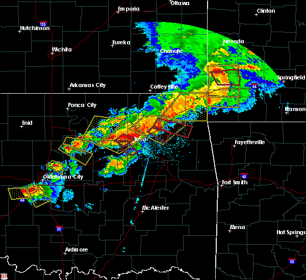 At 623 pm cdt, severe thunderstorms were located along a line extending from near owasso to 3 miles south of mannford, moving southeast at 40 mph (radar indicated). Hazards include 60 mph wind gusts and quarter size hail. Hail damage to vehicles is expected. expect wind damage to roofs, siding, and trees. locations in or near the path include, tulsa, broken arrow, sand springs, claremore, owasso, bixby, sapulpa, jenks, glenpool, coweta, catoosa, verdigris, inola, kiefer, jenks riverside airport, stonebluff, tulsa international airport, taiwah, tiawah, oneta, this includes interstate 44 between mile markers 205 and 248. A tornado watch remains in effect until 1100 pm cdt for northeastern and east central oklahoma. At 623 pm cdt, severe thunderstorms were located along a line extending from near owasso to 3 miles south of mannford, moving southeast at 40 mph (radar indicated). Hazards include 60 mph wind gusts and quarter size hail. Hail damage to vehicles is expected. expect wind damage to roofs, siding, and trees. locations in or near the path include, tulsa, broken arrow, sand springs, claremore, owasso, bixby, sapulpa, jenks, glenpool, coweta, catoosa, verdigris, inola, kiefer, jenks riverside airport, stonebluff, tulsa international airport, taiwah, tiawah, oneta, this includes interstate 44 between mile markers 205 and 248. A tornado watch remains in effect until 1100 pm cdt for northeastern and east central oklahoma.
|
| 4/28/2020 6:16 PM CDT |
 At 615 pm cdt, a severe thunderstorm capable of producing a tornado was located near sand springs, moving southeast at 40 mph (radar indicated rotation). Hazards include tornado. Flying debris will be dangerous to those caught without shelter. mobile homes will be damaged or destroyed. damage to roofs, windows, and vehicles will occur. tree damage is likely. Locations in or near the path include, tulsa, sand springs, bixby, jenks, glenpool, jenks riverside airport, gray, this includes interstate 44 between mile markers 212 and 222. At 615 pm cdt, a severe thunderstorm capable of producing a tornado was located near sand springs, moving southeast at 40 mph (radar indicated rotation). Hazards include tornado. Flying debris will be dangerous to those caught without shelter. mobile homes will be damaged or destroyed. damage to roofs, windows, and vehicles will occur. tree damage is likely. Locations in or near the path include, tulsa, sand springs, bixby, jenks, glenpool, jenks riverside airport, gray, this includes interstate 44 between mile markers 212 and 222.
|
| 4/28/2020 6:10 PM CDT |
 At 610 pm cdt, severe thunderstorms were located along a line extending from 3 miles northwest of skiatook to 2 miles north of mannford, moving southeast at 30 mph (radar indicated). Hazards include 70 mph wind gusts and quarter size hail. Hail damage to vehicles is expected. expect considerable tree damage. wind damage is also likely to mobile homes, roofs, and outbuildings. locations in or near the path include, tulsa, sand springs, owasso, sapulpa, skiatook, catoosa, collinsville, mannford, sperry, westport, keystone state park, walnut creek state park, turley, tulsa international airport, gray, this includes interstate 44 between mile markers 205 and 232. A tornado watch remains in effect until 1100 pm cdt for northeastern oklahoma. At 610 pm cdt, severe thunderstorms were located along a line extending from 3 miles northwest of skiatook to 2 miles north of mannford, moving southeast at 30 mph (radar indicated). Hazards include 70 mph wind gusts and quarter size hail. Hail damage to vehicles is expected. expect considerable tree damage. wind damage is also likely to mobile homes, roofs, and outbuildings. locations in or near the path include, tulsa, sand springs, owasso, sapulpa, skiatook, catoosa, collinsville, mannford, sperry, westport, keystone state park, walnut creek state park, turley, tulsa international airport, gray, this includes interstate 44 between mile markers 205 and 232. A tornado watch remains in effect until 1100 pm cdt for northeastern oklahoma.
|
| 4/28/2020 6:10 PM CDT |
 At 610 pm cdt, a severe thunderstorm capable of producing a tornado was located over sand springs, moving southeast at 45 mph (radar indicated rotation). Hazards include tornado. Flying debris will be dangerous to those caught without shelter. mobile homes will be damaged or destroyed. damage to roofs, windows, and vehicles will occur. tree damage is likely. Locations in or near the path include, tulsa, sand springs, gray,. At 610 pm cdt, a severe thunderstorm capable of producing a tornado was located over sand springs, moving southeast at 45 mph (radar indicated rotation). Hazards include tornado. Flying debris will be dangerous to those caught without shelter. mobile homes will be damaged or destroyed. damage to roofs, windows, and vehicles will occur. tree damage is likely. Locations in or near the path include, tulsa, sand springs, gray,.
|
| 4/28/2020 6:01 PM CDT |
 At 601 pm cdt, a severe thunderstorm capable of producing a tornado was located 6 miles east of walnut creek state park, moving southeast at 50 mph (radar indicated rotation). Hazards include tornado. Flying debris will be dangerous to those caught without shelter. mobile homes will be damaged or destroyed. damage to roofs, windows, and vehicles will occur. tree damage is likely. Locations in or near the path include, tulsa, sand springs, turley, gray,. At 601 pm cdt, a severe thunderstorm capable of producing a tornado was located 6 miles east of walnut creek state park, moving southeast at 50 mph (radar indicated rotation). Hazards include tornado. Flying debris will be dangerous to those caught without shelter. mobile homes will be damaged or destroyed. damage to roofs, windows, and vehicles will occur. tree damage is likely. Locations in or near the path include, tulsa, sand springs, turley, gray,.
|
| 4/28/2020 5:36 PM CDT |
 At 535 pm cdt, severe thunderstorms were located along a line extending from near avant to 2 miles northwest of mannford, moving east at 35 mph (radar indicated). Hazards include 70 mph wind gusts and quarter size hail. Hail damage to vehicles is expected. expect considerable tree damage. wind damage is also likely to mobile homes, roofs, and outbuildings. locations in or near the path include, tulsa, sand springs, claremore, owasso, sapulpa, jenks, glenpool, skiatook, catoosa, collinsville, mannford, kiefer, sperry, avant, westport, vera, terlton, keystone state park, walnut creek state park, jenks riverside airport, this includes interstate 44 between mile markers 205 and 234. A tornado watch remains in effect until 1100 pm cdt for northeastern oklahoma. At 535 pm cdt, severe thunderstorms were located along a line extending from near avant to 2 miles northwest of mannford, moving east at 35 mph (radar indicated). Hazards include 70 mph wind gusts and quarter size hail. Hail damage to vehicles is expected. expect considerable tree damage. wind damage is also likely to mobile homes, roofs, and outbuildings. locations in or near the path include, tulsa, sand springs, claremore, owasso, sapulpa, jenks, glenpool, skiatook, catoosa, collinsville, mannford, kiefer, sperry, avant, westport, vera, terlton, keystone state park, walnut creek state park, jenks riverside airport, this includes interstate 44 between mile markers 205 and 234. A tornado watch remains in effect until 1100 pm cdt for northeastern oklahoma.
|
| 4/22/2020 9:35 AM CDT |
 At 935 am cdt, a severe thunderstorm was located over drumright, moving northeast at 70 mph (radar indicated). Hazards include quarter size hail. Damage to vehicles is expected. Locations in or near the path include, sand springs, mannford, drumright, oilton, westport, terlton, shamrock, keystone state park, silver city, this includes interstate 44 between mile markers 207 and 208, and near mile marker 212. At 935 am cdt, a severe thunderstorm was located over drumright, moving northeast at 70 mph (radar indicated). Hazards include quarter size hail. Damage to vehicles is expected. Locations in or near the path include, sand springs, mannford, drumright, oilton, westport, terlton, shamrock, keystone state park, silver city, this includes interstate 44 between mile markers 207 and 208, and near mile marker 212.
|
| 4/22/2020 8:55 AM CDT |
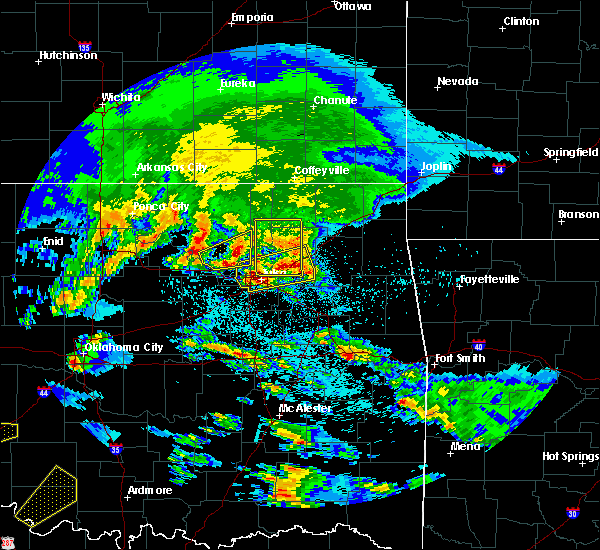 The severe thunderstorm warning for southeastern osage county will expire at 900 am cdt, the storm which prompted the warning has weakened below severe limits, and no longer poses an immediate threat to life or property. therefore the warning will be allowed to expire. however small hail is still possible with this thunderstorm. a severe thunderstorm watch remains in effect until 300 pm cdt for northeastern oklahoma. The severe thunderstorm warning for southeastern osage county will expire at 900 am cdt, the storm which prompted the warning has weakened below severe limits, and no longer poses an immediate threat to life or property. therefore the warning will be allowed to expire. however small hail is still possible with this thunderstorm. a severe thunderstorm watch remains in effect until 300 pm cdt for northeastern oklahoma.
|
| 4/22/2020 8:45 AM CDT |
 At 845 am cdt, a severe thunderstorm was located 3 miles west of tulsa, moving northeast at 45 mph (radar indicated). Hazards include ping pong ball size hail. People and animals outdoors will be injured. expect damage to roofs, siding, windows, and vehicles. Locations in or near the path include, tulsa, broken arrow, sand springs, claremore, owasso, catoosa, collinsville, verdigris, inola, sperry, foyil, jenks riverside airport, turley, tulsa international airport, taiwah, tiawah, gray, this includes interstate 44 between mile markers 216 and 256. At 845 am cdt, a severe thunderstorm was located 3 miles west of tulsa, moving northeast at 45 mph (radar indicated). Hazards include ping pong ball size hail. People and animals outdoors will be injured. expect damage to roofs, siding, windows, and vehicles. Locations in or near the path include, tulsa, broken arrow, sand springs, claremore, owasso, catoosa, collinsville, verdigris, inola, sperry, foyil, jenks riverside airport, turley, tulsa international airport, taiwah, tiawah, gray, this includes interstate 44 between mile markers 216 and 256.
|
| 4/22/2020 8:40 AM CDT | Ping Pong Ball sized hail reported 2.7 miles NW of Sand Springs, OK, ping pont ball hail at 81st west and hwy 412 |
| 4/22/2020 8:38 AM CDT | Golf Ball sized hail reported 4.4 miles NNW of Sand Springs, OK, ping pong to golf ball size hail in and around prattville |
| 4/22/2020 8:32 AM CDT |
 At 832 am cdt, a severe thunderstorm was located 4 miles southwest of sand springs, moving northeast at 45 mph (radar indicated). Hazards include quarter size hail. Damage to vehicles is expected. Locations in or near the path include, tulsa, broken arrow, sand springs, bixby, sapulpa, jenks, glenpool, mannford, keystone state park, jenks riverside airport, turley, gray, this includes interstate 44 between mile markers 207 and 227. At 832 am cdt, a severe thunderstorm was located 4 miles southwest of sand springs, moving northeast at 45 mph (radar indicated). Hazards include quarter size hail. Damage to vehicles is expected. Locations in or near the path include, tulsa, broken arrow, sand springs, bixby, sapulpa, jenks, glenpool, mannford, keystone state park, jenks riverside airport, turley, gray, this includes interstate 44 between mile markers 207 and 227.
|
| 4/22/2020 8:30 AM CDT |
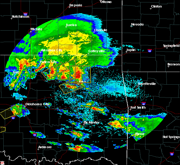 At 830 am cdt, a severe thunderstorm was located 4 miles northeast of osage, moving east at 40 mph (radar indicated). Hazards include ping pong ball size hail. People and animals outdoors will be injured. expect damage to roofs, siding, windows, and vehicles. Locations in or near the path include, skiatook, hominy, avant, osage, walnut creek state park, wolco,. At 830 am cdt, a severe thunderstorm was located 4 miles northeast of osage, moving east at 40 mph (radar indicated). Hazards include ping pong ball size hail. People and animals outdoors will be injured. expect damage to roofs, siding, windows, and vehicles. Locations in or near the path include, skiatook, hominy, avant, osage, walnut creek state park, wolco,.
|
| 4/22/2020 8:23 AM CDT |
 At 822 am cdt, a severe thunderstorm was located over skiatook, moving east at 40 mph (radar indicated). Hazards include half dollar size hail. Damage to vehicles is expected. Locations in or near the path include, tulsa, sand springs, claremore, owasso, skiatook, catoosa, collinsville, verdigris, barnsdall, sperry, oologah, ramona, ochelata, avant, talala, vera, watova, turley, tulsa international airport, tiawah, this includes interstate 44 between mile markers 237 and 251. At 822 am cdt, a severe thunderstorm was located over skiatook, moving east at 40 mph (radar indicated). Hazards include half dollar size hail. Damage to vehicles is expected. Locations in or near the path include, tulsa, sand springs, claremore, owasso, skiatook, catoosa, collinsville, verdigris, barnsdall, sperry, oologah, ramona, ochelata, avant, talala, vera, watova, turley, tulsa international airport, tiawah, this includes interstate 44 between mile markers 237 and 251.
|
| 4/22/2020 8:16 AM CDT |
 At 815 am cdt, a severe thunderstorm was located 7 miles northwest of kellyville, moving northeast at 55 mph (radar indicated). Hazards include quarter size hail. Damage to vehicles is expected. Locations in or near the path include, tulsa, broken arrow, sand springs, bixby, sapulpa, jenks, glenpool, mannford, kiefer, kellyville, keystone state park, jenks riverside airport, turley, gray, this includes interstate 44 between mile markers 196 and 227. At 815 am cdt, a severe thunderstorm was located 7 miles northwest of kellyville, moving northeast at 55 mph (radar indicated). Hazards include quarter size hail. Damage to vehicles is expected. Locations in or near the path include, tulsa, broken arrow, sand springs, bixby, sapulpa, jenks, glenpool, mannford, kiefer, kellyville, keystone state park, jenks riverside airport, turley, gray, this includes interstate 44 between mile markers 196 and 227.
|
| 4/22/2020 8:08 AM CDT |
 At 808 am cdt, a severe thunderstorm was located 6 miles west of skiatook, moving east at 45 mph (radar indicated). Hazards include half dollar size hail. Damage to vehicles is expected. Locations in or near the path include, tulsa, sand springs, claremore, pawhuska, owasso, skiatook, catoosa, collinsville, verdigris, hominy, barnsdall, sperry, oologah, ramona, wynona, ochelata, avant, westport, talala, vera, this includes interstate 44 between mile markers 237 and 251. At 808 am cdt, a severe thunderstorm was located 6 miles west of skiatook, moving east at 45 mph (radar indicated). Hazards include half dollar size hail. Damage to vehicles is expected. Locations in or near the path include, tulsa, sand springs, claremore, pawhuska, owasso, skiatook, catoosa, collinsville, verdigris, hominy, barnsdall, sperry, oologah, ramona, wynona, ochelata, avant, westport, talala, vera, this includes interstate 44 between mile markers 237 and 251.
|
| 4/22/2020 7:51 AM CDT |
 At 750 am cdt, a severe thunderstorm was located 3 miles northeast of hominy, moving east at 35 mph (radar indicated). Hazards include two inch hail. People and animals outdoors will be injured. expect damage to roofs, siding, windows, and vehicles. Locations in or near the path include, bartlesville, pawhuska, skiatook, hominy, cleveland, barnsdall, wynona, avant, osage, bartlesville municipal airport, sunset lake, osage hills state park, okesa, tallant, pershing, nelagoney, wolco,. At 750 am cdt, a severe thunderstorm was located 3 miles northeast of hominy, moving east at 35 mph (radar indicated). Hazards include two inch hail. People and animals outdoors will be injured. expect damage to roofs, siding, windows, and vehicles. Locations in or near the path include, bartlesville, pawhuska, skiatook, hominy, cleveland, barnsdall, wynona, avant, osage, bartlesville municipal airport, sunset lake, osage hills state park, okesa, tallant, pershing, nelagoney, wolco,.
|
| 4/22/2020 7:39 AM CDT |
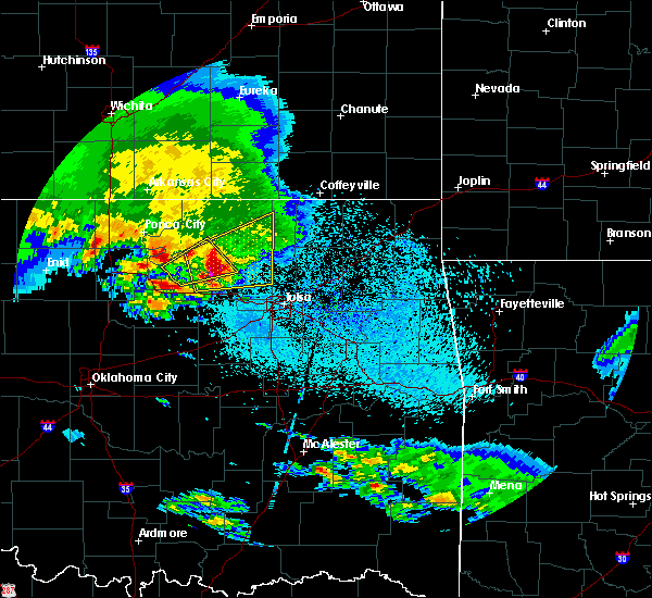 At 738 am cdt, a severe thunderstorm was located 5 miles west of hominy, moving east at 35 mph (radar indicated). Hazards include two inch hail. People and animals outdoors will be injured. expect damage to roofs, siding, windows, and vehicles. Locations in or near the path include, bartlesville, pawhuska, skiatook, hominy, cleveland, fairfax, barnsdall, wynona, avant, osage, blackburn, bartlesville municipal airport, sunset lake, osage hills state park, okesa, tallant, pershing, nelagoney, wolco,. At 738 am cdt, a severe thunderstorm was located 5 miles west of hominy, moving east at 35 mph (radar indicated). Hazards include two inch hail. People and animals outdoors will be injured. expect damage to roofs, siding, windows, and vehicles. Locations in or near the path include, bartlesville, pawhuska, skiatook, hominy, cleveland, fairfax, barnsdall, wynona, avant, osage, blackburn, bartlesville municipal airport, sunset lake, osage hills state park, okesa, tallant, pershing, nelagoney, wolco,.
|
| 3/28/2020 6:22 AM CDT |
 The severe thunderstorm warning for southeastern osage, north central creek, southeastern pawnee and west central tulsa counties will expire at 630 am cdt, the storm which prompted the warning has weakened below severe limits, and no longer poses an immediate threat to life or property. therefore the warning will be allowed to expire. however gusty winds are still possible with this thunderstorm. The severe thunderstorm warning for southeastern osage, north central creek, southeastern pawnee and west central tulsa counties will expire at 630 am cdt, the storm which prompted the warning has weakened below severe limits, and no longer poses an immediate threat to life or property. therefore the warning will be allowed to expire. however gusty winds are still possible with this thunderstorm.
|
| 3/28/2020 6:10 AM CDT |
 At 610 am cdt, a severe thunderstorm was located near walnut creek state park, moving northeast at 70 mph (radar indicated). Hazards include 60 mph wind gusts and quarter size hail. Hail damage to vehicles is expected. expect wind damage to roofs, siding, and trees. Locations in or near the path include, tulsa, sand springs, hominy, mannford, sperry, wynona, westport, osage, keystone state park, turley, walnut creek state park, gray,. At 610 am cdt, a severe thunderstorm was located near walnut creek state park, moving northeast at 70 mph (radar indicated). Hazards include 60 mph wind gusts and quarter size hail. Hail damage to vehicles is expected. expect wind damage to roofs, siding, and trees. Locations in or near the path include, tulsa, sand springs, hominy, mannford, sperry, wynona, westport, osage, keystone state park, turley, walnut creek state park, gray,.
|
| 3/28/2020 6:00 AM CDT |
 At 559 am cdt, a severe thunderstorm was located 3 miles east of terlton, moving northeast at 65 mph (radar indicated). Hazards include 60 mph wind gusts and quarter size hail. Hail damage to vehicles is expected. expect wind damage to roofs, siding, and trees. Locations in or near the path include, tulsa, sand springs, hominy, cleveland, mannford, sperry, wynona, westport, osage, hallett, terlton, keystone state park, walnut creek state park, turley, gray, silver city,. At 559 am cdt, a severe thunderstorm was located 3 miles east of terlton, moving northeast at 65 mph (radar indicated). Hazards include 60 mph wind gusts and quarter size hail. Hail damage to vehicles is expected. expect wind damage to roofs, siding, and trees. Locations in or near the path include, tulsa, sand springs, hominy, cleveland, mannford, sperry, wynona, westport, osage, hallett, terlton, keystone state park, walnut creek state park, turley, gray, silver city,.
|
| 3/28/2020 5:38 AM CDT |
 At 538 am cdt, a severe thunderstorm was located 3 miles northeast of cushing, moving northeast at 80 mph (radar indicated). Hazards include 60 mph wind gusts and quarter size hail. Hail damage to vehicles is expected. expect wind damage to roofs, siding, and trees. Locations in or near the path include, tulsa, sand springs, hominy, cleveland, mannford, drumright, sperry, oilton, wynona, jennings, westport, osage, hallett, terlton, shamrock, keystone state park, walnut creek state park, turley, gray, silver city,. At 538 am cdt, a severe thunderstorm was located 3 miles northeast of cushing, moving northeast at 80 mph (radar indicated). Hazards include 60 mph wind gusts and quarter size hail. Hail damage to vehicles is expected. expect wind damage to roofs, siding, and trees. Locations in or near the path include, tulsa, sand springs, hominy, cleveland, mannford, drumright, sperry, oilton, wynona, jennings, westport, osage, hallett, terlton, shamrock, keystone state park, walnut creek state park, turley, gray, silver city,.
|
| 3/27/2020 3:26 PM CDT |
 The severe thunderstorm warning for southwestern rogers, southeastern osage and central tulsa counties will expire at 330 pm cdt, the storm which prompted the warning has moved out of the area. therefore the warning will be allowed to expire. The severe thunderstorm warning for southwestern rogers, southeastern osage and central tulsa counties will expire at 330 pm cdt, the storm which prompted the warning has moved out of the area. therefore the warning will be allowed to expire.
|
| 3/27/2020 3:06 PM CDT |
 At 305 pm cdt, a severe thunderstorm was located over sand springs, moving northeast at 60 mph (radar indicated). Hazards include half dollar size hail. Damage to vehicles is expected. Locations in or near the path include, tulsa, sand springs, owasso, skiatook, catoosa, collinsville, sperry, keystone state park, turley, tulsa international airport, gray, this includes interstate 44 between mile markers 217 and 239. At 305 pm cdt, a severe thunderstorm was located over sand springs, moving northeast at 60 mph (radar indicated). Hazards include half dollar size hail. Damage to vehicles is expected. Locations in or near the path include, tulsa, sand springs, owasso, skiatook, catoosa, collinsville, sperry, keystone state park, turley, tulsa international airport, gray, this includes interstate 44 between mile markers 217 and 239.
|
| 3/27/2020 2:58 PM CDT |
 At 258 pm cdt, a severe thunderstorm was located 5 miles southeast of keystone state park, moving northeast at 60 mph (radar indicated). Hazards include quarter size hail. Damage to vehicles is expected. Locations in or near the path include, tulsa, sand springs, owasso, skiatook, catoosa, collinsville, mannford, sperry, keystone state park, turley, tulsa international airport, gray, this includes interstate 44 between mile markers 214 and 239. At 258 pm cdt, a severe thunderstorm was located 5 miles southeast of keystone state park, moving northeast at 60 mph (radar indicated). Hazards include quarter size hail. Damage to vehicles is expected. Locations in or near the path include, tulsa, sand springs, owasso, skiatook, catoosa, collinsville, mannford, sperry, keystone state park, turley, tulsa international airport, gray, this includes interstate 44 between mile markers 214 and 239.
|
| 3/27/2020 2:46 PM CDT |
 At 246 pm cdt, a severe thunderstorm was located 9 miles north of bristow, moving northeast at 60 mph (radar indicated). Hazards include quarter size hail. Damage to vehicles is expected. Locations in or near the path include, tulsa, sand springs, owasso, skiatook, catoosa, collinsville, mannford, sperry, keystone state park, turley, tulsa international airport, gray, this includes interstate 44 between mile markers 205 and 239. At 246 pm cdt, a severe thunderstorm was located 9 miles north of bristow, moving northeast at 60 mph (radar indicated). Hazards include quarter size hail. Damage to vehicles is expected. Locations in or near the path include, tulsa, sand springs, owasso, skiatook, catoosa, collinsville, mannford, sperry, keystone state park, turley, tulsa international airport, gray, this includes interstate 44 between mile markers 205 and 239.
|
| 3/19/2020 1:39 AM CDT |
 At 138 am cdt, a severe thunderstorm was located 4 miles northwest of sand springs, moving northeast at 35 mph (radar indicated). Hazards include 60 mph wind gusts. Expect damage to roofs, siding, and trees. Locations in or near the path include, tulsa, sand springs, owasso, skiatook, collinsville, sperry, vera, keystone state park, turley, gray,. At 138 am cdt, a severe thunderstorm was located 4 miles northwest of sand springs, moving northeast at 35 mph (radar indicated). Hazards include 60 mph wind gusts. Expect damage to roofs, siding, and trees. Locations in or near the path include, tulsa, sand springs, owasso, skiatook, collinsville, sperry, vera, keystone state park, turley, gray,.
|
| 3/19/2020 1:23 AM CDT |
 At 123 am cdt, a severe thunderstorm was located near keystone state park, moving northeast at 35 mph (radar indicated). Hazards include 60 mph wind gusts. Expect damage to roofs, siding, and trees. Locations in or near the path include, tulsa, sand springs, owasso, skiatook, collinsville, mannford, sperry, vera, keystone state park, turley, gray,. At 123 am cdt, a severe thunderstorm was located near keystone state park, moving northeast at 35 mph (radar indicated). Hazards include 60 mph wind gusts. Expect damage to roofs, siding, and trees. Locations in or near the path include, tulsa, sand springs, owasso, skiatook, collinsville, mannford, sperry, vera, keystone state park, turley, gray,.
|
| 10/20/2019 10:54 PM CDT |
 The severe thunderstorm warning for central creek, northwestern okmulgee and south central tulsa counties will expire at 1100 pm cdt, the storm which prompted the warning has weakened below severe limits, and no longer poses an immediate threat to life or property. therefore the warning will be allowed to expire. however gusty winds are still possible with this thunderstorm. a tornado watch remains in effect until 300 am cdt for northeastern oklahoma. The severe thunderstorm warning for central creek, northwestern okmulgee and south central tulsa counties will expire at 1100 pm cdt, the storm which prompted the warning has weakened below severe limits, and no longer poses an immediate threat to life or property. therefore the warning will be allowed to expire. however gusty winds are still possible with this thunderstorm. a tornado watch remains in effect until 300 am cdt for northeastern oklahoma.
|
| 10/20/2019 10:44 PM CDT |
 At 1044 pm cdt, a severe thunderstorm was located near sapulpa, moving east at 65 mph (radar indicated). Hazards include 60 mph wind gusts and penny size hail. Expect damage to roofs, siding, and trees. locations in or near the path include, tulsa, bristow, sapulpa, jenks, glenpool, kiefer, mounds, kellyville, depew, this includes interstate 44 between mile markers 183 and 219. A tornado watch remains in effect until 300 am cdt for northeastern oklahoma. At 1044 pm cdt, a severe thunderstorm was located near sapulpa, moving east at 65 mph (radar indicated). Hazards include 60 mph wind gusts and penny size hail. Expect damage to roofs, siding, and trees. locations in or near the path include, tulsa, bristow, sapulpa, jenks, glenpool, kiefer, mounds, kellyville, depew, this includes interstate 44 between mile markers 183 and 219. A tornado watch remains in effect until 300 am cdt for northeastern oklahoma.
|
| 10/20/2019 10:23 PM CDT |
 At 1023 pm cdt, a severe thunderstorm was located 4 miles north of depew, moving east at 65 mph (radar indicated). Hazards include 60 mph wind gusts and quarter size hail. Hail damage to vehicles is expected. expect wind damage to roofs, siding, and trees. locations in or near the path include, tulsa, sand springs, bristow, sapulpa, jenks, glenpool, kiefer, mounds, kellyville, depew, shamrock, gray, this includes interstate 44 between mile markers 178 and 218. A tornado watch remains in effect until 300 am cdt for northeastern oklahoma. At 1023 pm cdt, a severe thunderstorm was located 4 miles north of depew, moving east at 65 mph (radar indicated). Hazards include 60 mph wind gusts and quarter size hail. Hail damage to vehicles is expected. expect wind damage to roofs, siding, and trees. locations in or near the path include, tulsa, sand springs, bristow, sapulpa, jenks, glenpool, kiefer, mounds, kellyville, depew, shamrock, gray, this includes interstate 44 between mile markers 178 and 218. A tornado watch remains in effect until 300 am cdt for northeastern oklahoma.
|
| 10/20/2019 10:21 PM CDT |
 At 1021 pm cdt, severe thunderstorms were located along a line extending from 2 miles north of westport to 6 miles south of keystone state park, moving northeast at 65 mph (radar indicated). Hazards include 60 mph wind gusts and penny size hail. Expect damage to roofs, siding, and trees. locations in or near the path include, tulsa, sand springs, owasso, skiatook, catoosa, mannford, sperry, avant, westport, keystone state park, walnut creek state park, turley, tulsa international airport, gray, this includes interstate 44 between mile markers 204 and 232. A tornado watch remains in effect until 300 am cdt for northeastern oklahoma. At 1021 pm cdt, severe thunderstorms were located along a line extending from 2 miles north of westport to 6 miles south of keystone state park, moving northeast at 65 mph (radar indicated). Hazards include 60 mph wind gusts and penny size hail. Expect damage to roofs, siding, and trees. locations in or near the path include, tulsa, sand springs, owasso, skiatook, catoosa, mannford, sperry, avant, westport, keystone state park, walnut creek state park, turley, tulsa international airport, gray, this includes interstate 44 between mile markers 204 and 232. A tornado watch remains in effect until 300 am cdt for northeastern oklahoma.
|
| 10/20/2019 9:51 PM CDT |
 At 951 pm cdt, a severe thunderstorm was located 4 miles south of turley, moving northeast at 60 mph (radar indicated). Hazards include 60 mph wind gusts and quarter size hail. Hail damage to vehicles is expected. expect wind damage to roofs, siding, and trees. locations in or near the path include, tulsa, sand springs, claremore, owasso, skiatook, catoosa, collinsville, verdigris, chelsea, sperry, oologah, foyil, talala, vera, turley, tulsa international airport, gray, bushyhead, this includes interstate 44 between mile markers 220 and 235. A tornado watch remains in effect until 300 am cdt for northeastern oklahoma. At 951 pm cdt, a severe thunderstorm was located 4 miles south of turley, moving northeast at 60 mph (radar indicated). Hazards include 60 mph wind gusts and quarter size hail. Hail damage to vehicles is expected. expect wind damage to roofs, siding, and trees. locations in or near the path include, tulsa, sand springs, claremore, owasso, skiatook, catoosa, collinsville, verdigris, chelsea, sperry, oologah, foyil, talala, vera, turley, tulsa international airport, gray, bushyhead, this includes interstate 44 between mile markers 220 and 235. A tornado watch remains in effect until 300 am cdt for northeastern oklahoma.
|
| 10/20/2019 9:44 PM CDT | Quarter sized hail reported 4.4 miles NNW of Sand Springs, OK, dime and quarter size hail fell in prattville. |
| 10/20/2019 9:44 PM CDT | Golf Ball sized hail reported 4.4 miles NNW of Sand Springs, OK, golf ball size hail estimated from picture on social media from prattville. |
| 10/20/2019 9:41 PM CDT |
 At 941 pm cdt, a severe thunderstorm was located over sapulpa, moving northeast at 60 mph (radar indicated). Hazards include 60 mph wind gusts and quarter size hail. Hail damage to vehicles is expected. expect wind damage to roofs, siding, and trees. locations in or near the path include, tulsa, sand springs, claremore, owasso, sapulpa, jenks, glenpool, skiatook, catoosa, collinsville, verdigris, chelsea, kiefer, sperry, oologah, foyil, talala, vera, jenks riverside airport, turley, this includes interstate 44 between mile markers 205 and 235, and near mile marker 247. A tornado watch remains in effect until 300 am cdt for northeastern oklahoma. At 941 pm cdt, a severe thunderstorm was located over sapulpa, moving northeast at 60 mph (radar indicated). Hazards include 60 mph wind gusts and quarter size hail. Hail damage to vehicles is expected. expect wind damage to roofs, siding, and trees. locations in or near the path include, tulsa, sand springs, claremore, owasso, sapulpa, jenks, glenpool, skiatook, catoosa, collinsville, verdigris, chelsea, kiefer, sperry, oologah, foyil, talala, vera, jenks riverside airport, turley, this includes interstate 44 between mile markers 205 and 235, and near mile marker 247. A tornado watch remains in effect until 300 am cdt for northeastern oklahoma.
|
| 10/20/2019 9:20 PM CDT |
 At 920 pm cdt, a severe thunderstorm was located 6 miles east of oilton, moving northeast at 60 mph (radar indicated). Hazards include 60 mph wind gusts and quarter size hail. Hail damage to vehicles is expected. expect wind damage to roofs, siding, and trees. Locations in or near the path include, sand springs, mannford, oilton, westport, terlton, keystone state park, walnut creek state park, silver city, a tornado watch remains in effect until 300 am cdt for northeastern oklahoma. At 920 pm cdt, a severe thunderstorm was located 6 miles east of oilton, moving northeast at 60 mph (radar indicated). Hazards include 60 mph wind gusts and quarter size hail. Hail damage to vehicles is expected. expect wind damage to roofs, siding, and trees. Locations in or near the path include, sand springs, mannford, oilton, westport, terlton, keystone state park, walnut creek state park, silver city, a tornado watch remains in effect until 300 am cdt for northeastern oklahoma.
|
| 10/20/2019 9:10 PM CDT |
 At 910 pm cdt, a severe thunderstorm was located over drumright, moving northeast at 60 mph (radar indicated). Hazards include 60 mph wind gusts and quarter size hail. Hail damage to vehicles is expected. expect wind damage to roofs, siding, and trees. Locations in or near the path include, sand springs, mannford, drumright, oilton, westport, terlton, shamrock, keystone state park, walnut creek state park, silver city, a tornado watch remains in effect until 300 am cdt for northeastern oklahoma. At 910 pm cdt, a severe thunderstorm was located over drumright, moving northeast at 60 mph (radar indicated). Hazards include 60 mph wind gusts and quarter size hail. Hail damage to vehicles is expected. expect wind damage to roofs, siding, and trees. Locations in or near the path include, sand springs, mannford, drumright, oilton, westport, terlton, shamrock, keystone state park, walnut creek state park, silver city, a tornado watch remains in effect until 300 am cdt for northeastern oklahoma.
|
| 10/20/2019 8:36 PM CDT |
 At 835 pm cdt, a severe thunderstorm was located 4 miles north of slick, moving northeast at 60 mph (radar indicated). Hazards include 60 mph wind gusts and quarter size hail. Hail damage to vehicles is expected. expect wind damage to roofs, siding, and trees. locations in or near the path include, tulsa, broken arrow, sand springs, bristow, owasso, bixby, sapulpa, jenks, glenpool, catoosa, verdigris, kiefer, mounds, kellyville, slick, jenks riverside airport, turley, tulsa international airport, liberty, gray, this includes interstate 44 between mile markers 189 and 242. A tornado watch remains in effect until 300 am cdt for northeastern oklahoma. At 835 pm cdt, a severe thunderstorm was located 4 miles north of slick, moving northeast at 60 mph (radar indicated). Hazards include 60 mph wind gusts and quarter size hail. Hail damage to vehicles is expected. expect wind damage to roofs, siding, and trees. locations in or near the path include, tulsa, broken arrow, sand springs, bristow, owasso, bixby, sapulpa, jenks, glenpool, catoosa, verdigris, kiefer, mounds, kellyville, slick, jenks riverside airport, turley, tulsa international airport, liberty, gray, this includes interstate 44 between mile markers 189 and 242. A tornado watch remains in effect until 300 am cdt for northeastern oklahoma.
|
| 10/10/2019 1:34 PM CDT |
 At 134 pm cdt, a severe thunderstorm was located 3 miles east of sapulpa, moving northeast at 35 mph (radar indicated). Hazards include 60 mph wind gusts and penny size hail. Expect damage to roofs, siding, and trees. Locations in or near the path include, tulsa, broken arrow, sand springs, owasso, bixby, sapulpa, jenks, glenpool, catoosa, kiefer, jenks riverside airport, tulsa international airport, gray, this includes interstate 44 between mile markers 208 and 232. At 134 pm cdt, a severe thunderstorm was located 3 miles east of sapulpa, moving northeast at 35 mph (radar indicated). Hazards include 60 mph wind gusts and penny size hail. Expect damage to roofs, siding, and trees. Locations in or near the path include, tulsa, broken arrow, sand springs, owasso, bixby, sapulpa, jenks, glenpool, catoosa, kiefer, jenks riverside airport, tulsa international airport, gray, this includes interstate 44 between mile markers 208 and 232.
|
| 10/10/2019 1:20 PM CDT |
 At 119 pm cdt, a severe thunderstorm was located over kellyville, moving northeast at 35 mph (radar indicated). Hazards include 60 mph wind gusts and quarter size hail. Hail damage to vehicles is expected. expect wind damage to roofs, siding, and trees. Locations in or near the path include, tulsa, broken arrow, sand springs, owasso, bixby, sapulpa, jenks, glenpool, catoosa, kiefer, kellyville, jenks riverside airport, tulsa international airport, gray, this includes interstate 44 between mile markers 199 and 232. At 119 pm cdt, a severe thunderstorm was located over kellyville, moving northeast at 35 mph (radar indicated). Hazards include 60 mph wind gusts and quarter size hail. Hail damage to vehicles is expected. expect wind damage to roofs, siding, and trees. Locations in or near the path include, tulsa, broken arrow, sand springs, owasso, bixby, sapulpa, jenks, glenpool, catoosa, kiefer, kellyville, jenks riverside airport, tulsa international airport, gray, this includes interstate 44 between mile markers 199 and 232.
|
| 10/10/2019 1:04 PM CDT |
 At 103 pm cdt, a severe thunderstorm was located 6 miles west of kellyville, moving northeast at 45 mph (radar indicated). Hazards include 60 mph wind gusts and quarter size hail. Hail damage to vehicles is expected. expect wind damage to roofs, siding, and trees. Locations in or near the path include, tulsa, broken arrow, sand springs, owasso, bixby, sapulpa, jenks, glenpool, catoosa, kiefer, kellyville, jenks riverside airport, turley, tulsa international airport, gray, this includes interstate 44 between mile markers 192 and 232. At 103 pm cdt, a severe thunderstorm was located 6 miles west of kellyville, moving northeast at 45 mph (radar indicated). Hazards include 60 mph wind gusts and quarter size hail. Hail damage to vehicles is expected. expect wind damage to roofs, siding, and trees. Locations in or near the path include, tulsa, broken arrow, sand springs, owasso, bixby, sapulpa, jenks, glenpool, catoosa, kiefer, kellyville, jenks riverside airport, turley, tulsa international airport, gray, this includes interstate 44 between mile markers 192 and 232.
|
| 9/26/2019 12:59 AM CDT |
 At 1258 am cdt, severe thunderstorms were located along a line extending from 4 miles northwest of oologah to near turley to 4 miles southeast of terlton, moving east at 20 mph (radar indicated). Hazards include 60 mph wind gusts and quarter size hail. Hail damage to vehicles is expected. expect wind damage to roofs, siding, and trees. Locations in or near the path include, tulsa, broken arrow, sand springs, claremore, owasso, sapulpa, jenks, skiatook, catoosa, collinsville, verdigris, mannford, sperry, oologah, foyil, talala, vera, jenks riverside airport, keystone state park, turley, this includes interstate 44 between mile markers 204 and 268. At 1258 am cdt, severe thunderstorms were located along a line extending from 4 miles northwest of oologah to near turley to 4 miles southeast of terlton, moving east at 20 mph (radar indicated). Hazards include 60 mph wind gusts and quarter size hail. Hail damage to vehicles is expected. expect wind damage to roofs, siding, and trees. Locations in or near the path include, tulsa, broken arrow, sand springs, claremore, owasso, sapulpa, jenks, skiatook, catoosa, collinsville, verdigris, mannford, sperry, oologah, foyil, talala, vera, jenks riverside airport, keystone state park, turley, this includes interstate 44 between mile markers 204 and 268.
|
| 9/26/2019 12:49 AM CDT |
 At 1249 am cdt, severe thunderstorms were located along a line extending from 4 miles southwest of ramona to 2 miles northwest of keystone state park to 4 miles south of stillwater, moving southeast at 40 mph (radar indicated). Hazards include 60 mph wind gusts and penny size hail. Expect damage to roofs, siding, and trees. Locations in or near the path include, tulsa, sand springs, owasso, sapulpa, jenks, skiatook, collinsville, mannford, drumright, sperry, oilton, ramona, avant, westport, vera, terlton, shamrock, keystone state park, walnut creek state park, turley, this includes interstate 44 between mile markers 202 and 223. At 1249 am cdt, severe thunderstorms were located along a line extending from 4 miles southwest of ramona to 2 miles northwest of keystone state park to 4 miles south of stillwater, moving southeast at 40 mph (radar indicated). Hazards include 60 mph wind gusts and penny size hail. Expect damage to roofs, siding, and trees. Locations in or near the path include, tulsa, sand springs, owasso, sapulpa, jenks, skiatook, collinsville, mannford, drumright, sperry, oilton, ramona, avant, westport, vera, terlton, shamrock, keystone state park, walnut creek state park, turley, this includes interstate 44 between mile markers 202 and 223.
|
| 9/26/2019 12:21 AM CDT |
 At 1220 am cdt, severe thunderstorms were located along a line extending from 4 miles southwest of okesa to 4 miles east of blackburn to 3 miles south of perry, moving southeast at 40 mph (radar indicated). Hazards include 60 mph wind gusts and penny size hail. Expect damage to roofs, siding, and trees. Locations in or near the path include, tulsa, sand springs, pawnee, owasso, sapulpa, jenks, glenpool, skiatook, catoosa, collinsville, hominy, cleveland, mannford, drumright, kiefer, barnsdall, sperry, kellyville, oologah, oilton, this includes interstate 44 between mile markers 199 and 229. At 1220 am cdt, severe thunderstorms were located along a line extending from 4 miles southwest of okesa to 4 miles east of blackburn to 3 miles south of perry, moving southeast at 40 mph (radar indicated). Hazards include 60 mph wind gusts and penny size hail. Expect damage to roofs, siding, and trees. Locations in or near the path include, tulsa, sand springs, pawnee, owasso, sapulpa, jenks, glenpool, skiatook, catoosa, collinsville, hominy, cleveland, mannford, drumright, kiefer, barnsdall, sperry, kellyville, oologah, oilton, this includes interstate 44 between mile markers 199 and 229.
|
| 9/12/2019 7:07 PM CDT |
 The severe thunderstorm warning for southeastern osage. northern creek. southeastern pawnee and central tulsa counties will expire at 715 pm cdt. the storms which prompted the warning have weakened below severe limits, and no longer pose an immediate threat to life or property. therefore the warning will be allowed to expire. However gusty winds. The severe thunderstorm warning for southeastern osage. northern creek. southeastern pawnee and central tulsa counties will expire at 715 pm cdt. the storms which prompted the warning have weakened below severe limits, and no longer pose an immediate threat to life or property. therefore the warning will be allowed to expire. However gusty winds.
|
| 9/12/2019 6:54 PM CDT |
 At 652 pm cdt, severe thunderstorms were located along a line extending from 2 miles northeast of walnut creek state park to 4 miles northeast of keystone state park to 7 miles northwest of kellyville to 10 miles east of drumright, moving east at 25 mph (radar indicated). Hazards include 60 mph wind gusts. Expect damage to roofs, siding, and trees. locations in or near the path include, tulsa, sand springs, bixby, sapulpa, jenks, glenpool, mannford, kiefer, sperry, mounds, kellyville, westport, keystone state park, walnut creek state park, jenks riverside airport, turley, liberty, gray, silver city, this includes interstate 44 between mile markers 198 and 224. a weakening trend has been observed over the past 10 to 15 minutes. If this trend continues, a warning will not be needed downstream. At 652 pm cdt, severe thunderstorms were located along a line extending from 2 miles northeast of walnut creek state park to 4 miles northeast of keystone state park to 7 miles northwest of kellyville to 10 miles east of drumright, moving east at 25 mph (radar indicated). Hazards include 60 mph wind gusts. Expect damage to roofs, siding, and trees. locations in or near the path include, tulsa, sand springs, bixby, sapulpa, jenks, glenpool, mannford, kiefer, sperry, mounds, kellyville, westport, keystone state park, walnut creek state park, jenks riverside airport, turley, liberty, gray, silver city, this includes interstate 44 between mile markers 198 and 224. a weakening trend has been observed over the past 10 to 15 minutes. If this trend continues, a warning will not be needed downstream.
|
| 9/12/2019 6:29 PM CDT |
 At 628 pm cdt, severe thunderstorms were located along a line extending from 2 miles north of cleveland to 4 miles northeast of terlton to 5 miles east of oilton to 3 miles northwest of drumright, moving southeast at 45 mph (radar indicated). Hazards include 60 mph wind gusts. Expect damage to roofs, siding, and trees. Locations in or near the path include, tulsa, sand springs, bixby, sapulpa, jenks, glenpool, skiatook, hominy, cleveland, mannford, drumright, kiefer, sperry, mounds, kellyville, oilton, jennings, westport, osage, terlton, this includes interstate 44 between mile markers 193 and 224. At 628 pm cdt, severe thunderstorms were located along a line extending from 2 miles north of cleveland to 4 miles northeast of terlton to 5 miles east of oilton to 3 miles northwest of drumright, moving southeast at 45 mph (radar indicated). Hazards include 60 mph wind gusts. Expect damage to roofs, siding, and trees. Locations in or near the path include, tulsa, sand springs, bixby, sapulpa, jenks, glenpool, skiatook, hominy, cleveland, mannford, drumright, kiefer, sperry, mounds, kellyville, oilton, jennings, westport, osage, terlton, this includes interstate 44 between mile markers 193 and 224.
|
| 9/12/2019 6:06 PM CDT |
 At 605 pm cdt, severe thunderstorms were located along a line extending from 5 miles southwest of ralston to near skedee to 6 miles east of pawnee to 2 miles west of maramec to 5 miles northwest of quay, moving east at 45 mph (radar indicated). Hazards include 60 mph wind gusts. Expect damage to roofs, siding, and trees. Locations in or near the path include, sand springs, pawnee, hominy, cleveland, jennings, westport, osage, hallett, blackburn, terlton, maramec, skedee, walnut creek state park,. At 605 pm cdt, severe thunderstorms were located along a line extending from 5 miles southwest of ralston to near skedee to 6 miles east of pawnee to 2 miles west of maramec to 5 miles northwest of quay, moving east at 45 mph (radar indicated). Hazards include 60 mph wind gusts. Expect damage to roofs, siding, and trees. Locations in or near the path include, sand springs, pawnee, hominy, cleveland, jennings, westport, osage, hallett, blackburn, terlton, maramec, skedee, walnut creek state park,.
|
| 8/30/2019 3:54 AM CDT |
 The severe thunderstorm warning for rogers, southern osage, northern creek, mayes, southern washington, southwestern nowata, northern wagoner, pawnee and tulsa counties will expire at 400 am cdt, the storms which prompted the warning have weakened below severe limits, and no longer pose an immediate threat to life or property. therefore the warning will be allowed to expire. however gusty winds 50 to 55 mph and heavy rain are still possible with these thunderstorms. The severe thunderstorm warning for rogers, southern osage, northern creek, mayes, southern washington, southwestern nowata, northern wagoner, pawnee and tulsa counties will expire at 400 am cdt, the storms which prompted the warning have weakened below severe limits, and no longer pose an immediate threat to life or property. therefore the warning will be allowed to expire. however gusty winds 50 to 55 mph and heavy rain are still possible with these thunderstorms.
|
| 8/30/2019 3:33 AM CDT |
 At 333 am cdt, severe thunderstorms were located along a line extending from near chelsea to 2 miles northeast of owasso to 3 miles north of maramec, moving southeast at 45 mph (radar indicated). Hazards include 60 mph wind gusts and nickel size hail. Expect damage to roofs, siding, and trees. Locations in or near the path include, tulsa, broken arrow, sand springs, claremore, pawnee, pryor, owasso, bixby, jenks, coweta, pryor creek, skiatook, catoosa, collinsville, verdigris, hominy, cleveland, mannford, chouteau, chelsea, this includes interstate 44 between mile markers 212 and 272. At 333 am cdt, severe thunderstorms were located along a line extending from near chelsea to 2 miles northeast of owasso to 3 miles north of maramec, moving southeast at 45 mph (radar indicated). Hazards include 60 mph wind gusts and nickel size hail. Expect damage to roofs, siding, and trees. Locations in or near the path include, tulsa, broken arrow, sand springs, claremore, pawnee, pryor, owasso, bixby, jenks, coweta, pryor creek, skiatook, catoosa, collinsville, verdigris, hominy, cleveland, mannford, chouteau, chelsea, this includes interstate 44 between mile markers 212 and 272.
|
| 8/30/2019 3:15 AM CDT |
 At 314 am cdt, severe thunderstorms were located along a line extending from 4 miles north of new alluwe to near vera to 2 miles north of skedee, moving southeast at 55 mph (radar indicated. at 305 am, the oklahoma mesonet station 2 miles south of wynona reported a 62 mph wind gust). Hazards include 60 mph wind gusts and nickel size hail. Expect damage to roofs, siding, and trees. Locations in or near the path include, tulsa, broken arrow, sand springs, claremore, pawhuska, pawnee, pryor, owasso, bixby, jenks, coweta, pryor creek, skiatook, catoosa, collinsville, verdigris, hominy, cleveland, mannford, chouteau, this includes interstate 44 between mile markers 212 and 272. At 314 am cdt, severe thunderstorms were located along a line extending from 4 miles north of new alluwe to near vera to 2 miles north of skedee, moving southeast at 55 mph (radar indicated. at 305 am, the oklahoma mesonet station 2 miles south of wynona reported a 62 mph wind gust). Hazards include 60 mph wind gusts and nickel size hail. Expect damage to roofs, siding, and trees. Locations in or near the path include, tulsa, broken arrow, sand springs, claremore, pawhuska, pawnee, pryor, owasso, bixby, jenks, coweta, pryor creek, skiatook, catoosa, collinsville, verdigris, hominy, cleveland, mannford, chouteau, this includes interstate 44 between mile markers 212 and 272.
|
| 8/30/2019 2:48 AM CDT |
 At 247 am cdt, severe thunderstorms were located along a line extending from 4 miles northwest of bartlesville municipal airport to 3 miles southwest of ponca city, moving southeast at 35 mph (radar indicated). Hazards include 60 mph wind gusts and penny size hail. Expect damage to roofs, siding, and trees. Locations in or near the path include, bartlesville, pawhuska, pawnee, skiatook, hominy, cleveland, fairfax, barnsdall, ramona, shidler, wynona, ochelata, ralston, avant, vera, osage, burbank, hallett, blackburn, maramec,. At 247 am cdt, severe thunderstorms were located along a line extending from 4 miles northwest of bartlesville municipal airport to 3 miles southwest of ponca city, moving southeast at 35 mph (radar indicated). Hazards include 60 mph wind gusts and penny size hail. Expect damage to roofs, siding, and trees. Locations in or near the path include, bartlesville, pawhuska, pawnee, skiatook, hominy, cleveland, fairfax, barnsdall, ramona, shidler, wynona, ochelata, ralston, avant, vera, osage, burbank, hallett, blackburn, maramec,.
|
| 8/26/2019 11:17 PM CDT |
 At 1117 pm cdt, a severe thunderstorm was located 4 miles east of tulsa, moving southeast at 30 mph (radar indicated). Hazards include 60 mph wind gusts and quarter size hail. Hail damage to vehicles is expected. expect wind damage to roofs, siding, and trees. Locations in or near the path include, tulsa, broken arrow, sand springs, bixby, jenks, glenpool, coweta, catoosa, jenks riverside airport, tulsa international airport, stonebluff, oneta, turley, leonard, this includes interstate 44 between mile markers 217 and 232. At 1117 pm cdt, a severe thunderstorm was located 4 miles east of tulsa, moving southeast at 30 mph (radar indicated). Hazards include 60 mph wind gusts and quarter size hail. Hail damage to vehicles is expected. expect wind damage to roofs, siding, and trees. Locations in or near the path include, tulsa, broken arrow, sand springs, bixby, jenks, glenpool, coweta, catoosa, jenks riverside airport, tulsa international airport, stonebluff, oneta, turley, leonard, this includes interstate 44 between mile markers 217 and 232.
|
| 8/22/2019 8:49 PM CDT |
 At 829 pm cdt, a severe thunderstorm was located 4 miles south of bristow, moving northeast at 45 mph (radar indicated). Hazards include 60 mph wind gusts. Expect damage to roofs, siding, and trees. Locations in or near the path include, tulsa, sand springs, bristow, sapulpa, jenks, glenpool, mannford, kiefer, mounds, kellyville, depew, slick, keystone state park, jenks riverside airport, gray, this includes interstate 44 between mile markers 184 and 226. At 829 pm cdt, a severe thunderstorm was located 4 miles south of bristow, moving northeast at 45 mph (radar indicated). Hazards include 60 mph wind gusts. Expect damage to roofs, siding, and trees. Locations in or near the path include, tulsa, sand springs, bristow, sapulpa, jenks, glenpool, mannford, kiefer, mounds, kellyville, depew, slick, keystone state park, jenks riverside airport, gray, this includes interstate 44 between mile markers 184 and 226.
|
| 8/22/2019 8:29 PM CDT |
 At 829 pm cdt, a severe thunderstorm was located 4 miles south of bristow, moving northeast at 45 mph (radar indicated). Hazards include 60 mph wind gusts. Expect damage to roofs, siding, and trees. Locations in or near the path include, tulsa, sand springs, bristow, sapulpa, jenks, glenpool, mannford, kiefer, mounds, kellyville, depew, slick, keystone state park, jenks riverside airport, gray, this includes interstate 44 between mile markers 184 and 226. At 829 pm cdt, a severe thunderstorm was located 4 miles south of bristow, moving northeast at 45 mph (radar indicated). Hazards include 60 mph wind gusts. Expect damage to roofs, siding, and trees. Locations in or near the path include, tulsa, sand springs, bristow, sapulpa, jenks, glenpool, mannford, kiefer, mounds, kellyville, depew, slick, keystone state park, jenks riverside airport, gray, this includes interstate 44 between mile markers 184 and 226.
|
| 7/29/2019 8:14 PM CDT |
 At 813 pm cdt, a severe thunderstorm was located 3 miles northeast of jenks riverside airport, moving southwest at 15 mph (trained weather spotters). Hazards include 60 mph wind gusts. Expect damage to roofs, siding, and trees. Locations in or near the path include, tulsa, broken arrow, sand springs, bixby, jenks, glenpool, jenks riverside airport, gray, this includes interstate 44 between mile markers 211 and 228. At 813 pm cdt, a severe thunderstorm was located 3 miles northeast of jenks riverside airport, moving southwest at 15 mph (trained weather spotters). Hazards include 60 mph wind gusts. Expect damage to roofs, siding, and trees. Locations in or near the path include, tulsa, broken arrow, sand springs, bixby, jenks, glenpool, jenks riverside airport, gray, this includes interstate 44 between mile markers 211 and 228.
|
| 7/29/2019 7:53 PM CDT |
 At 753 pm cdt, a severe thunderstorm was located near tulsa, moving southwest at 15 mph (radar indicated). Hazards include 60 mph wind gusts. Expect damage to roofs, siding, and trees. Locations in or near the path include, tulsa, broken arrow, sand springs, bixby, jenks, glenpool, catoosa, tulsa international airport, jenks riverside airport, gray, this includes interstate 44 between mile markers 211 and 232. At 753 pm cdt, a severe thunderstorm was located near tulsa, moving southwest at 15 mph (radar indicated). Hazards include 60 mph wind gusts. Expect damage to roofs, siding, and trees. Locations in or near the path include, tulsa, broken arrow, sand springs, bixby, jenks, glenpool, catoosa, tulsa international airport, jenks riverside airport, gray, this includes interstate 44 between mile markers 211 and 232.
|
| 6/23/2019 7:35 AM CDT |
 The severe thunderstorm warning for central rogers, west central mayes, northwestern wagoner and southeastern tulsa counties will expire at 745 am cdt, the storm which prompted the warning has weakened below severe limits, and no longer poses an immediate threat to life or property. therefore the warning will be allowed to expire. however gusty winds and heavy rain are still possible with this thunderstorm. a severe thunderstorm watch remains in effect until 1000 am cdt for northeastern oklahoma. a severe thunderstorm watch also remains in effect until noon cdt for northeastern oklahoma. The severe thunderstorm warning for central rogers, west central mayes, northwestern wagoner and southeastern tulsa counties will expire at 745 am cdt, the storm which prompted the warning has weakened below severe limits, and no longer poses an immediate threat to life or property. therefore the warning will be allowed to expire. however gusty winds and heavy rain are still possible with this thunderstorm. a severe thunderstorm watch remains in effect until 1000 am cdt for northeastern oklahoma. a severe thunderstorm watch also remains in effect until noon cdt for northeastern oklahoma.
|
| 6/23/2019 7:07 AM CDT |
 At 707 am cdt, a severe thunderstorm was located 3 miles north of jenks riverside airport, moving northeast at 50 mph (radar indicated). Hazards include 60 mph wind gusts and penny size hail. Expect damage to roofs, siding, and trees. Locations in or near the path include, tulsa, broken arrow, sand springs, claremore, owasso, jenks, glenpool, catoosa, verdigris, inola, foyil, jenks riverside airport, tulsa international airport, taiwah, tiawah, gray, this includes interstate 44 between mile markers 217 and 258. At 707 am cdt, a severe thunderstorm was located 3 miles north of jenks riverside airport, moving northeast at 50 mph (radar indicated). Hazards include 60 mph wind gusts and penny size hail. Expect damage to roofs, siding, and trees. Locations in or near the path include, tulsa, broken arrow, sand springs, claremore, owasso, jenks, glenpool, catoosa, verdigris, inola, foyil, jenks riverside airport, tulsa international airport, taiwah, tiawah, gray, this includes interstate 44 between mile markers 217 and 258.
|
| 6/18/2019 9:15 PM CDT |
 At 915 pm cdt, a severe thunderstorm was located 4 miles south of avant, moving southeast at 25 mph (radar indicated). Hazards include golf ball size hail and 60 mph wind gusts. People and animals outdoors will be injured. expect hail damage to roofs, siding, windows, and vehicles. expect wind damage to roofs, siding, and trees. Locations in or near the path include, skiatook, avant, wolco,. At 915 pm cdt, a severe thunderstorm was located 4 miles south of avant, moving southeast at 25 mph (radar indicated). Hazards include golf ball size hail and 60 mph wind gusts. People and animals outdoors will be injured. expect hail damage to roofs, siding, windows, and vehicles. expect wind damage to roofs, siding, and trees. Locations in or near the path include, skiatook, avant, wolco,.
|
| 6/18/2019 9:01 PM CDT |
 At 901 pm cdt, a severe thunderstorm was located 6 miles south of barnsdall, moving southeast at 25 mph (radar indicated). Hazards include golf ball size hail and 60 mph wind gusts. People and animals outdoors will be injured. expect hail damage to roofs, siding, windows, and vehicles. expect wind damage to roofs, siding, and trees. Locations in or near the path include, skiatook, barnsdall, avant, wolco,. At 901 pm cdt, a severe thunderstorm was located 6 miles south of barnsdall, moving southeast at 25 mph (radar indicated). Hazards include golf ball size hail and 60 mph wind gusts. People and animals outdoors will be injured. expect hail damage to roofs, siding, windows, and vehicles. expect wind damage to roofs, siding, and trees. Locations in or near the path include, skiatook, barnsdall, avant, wolco,.
|
| 6/16/2019 1:12 AM CDT |
 At 112 am cdt, severe thunderstorms were located along a line extending from 3 miles north of osage to 7 miles northwest of bald hill to 4 miles southwest of hanna, moving east at 45 mph (radar indicated). Hazards include 60 mph wind gusts. Expect damage to roofs, siding, and trees. locations in or near the path include, tulsa, broken arrow, sand springs, okmulgee, eufaula, pawnee, owasso, bixby, sapulpa, jenks, glenpool, coweta, skiatook, catoosa, henryetta, hominy, cleveland, mannford, haskell, kiefer, this includes the following highways, interstate 40 in oklahoma between mile markers 237 and 261. Interstate 44 between mile markers 203 and 232. At 112 am cdt, severe thunderstorms were located along a line extending from 3 miles north of osage to 7 miles northwest of bald hill to 4 miles southwest of hanna, moving east at 45 mph (radar indicated). Hazards include 60 mph wind gusts. Expect damage to roofs, siding, and trees. locations in or near the path include, tulsa, broken arrow, sand springs, okmulgee, eufaula, pawnee, owasso, bixby, sapulpa, jenks, glenpool, coweta, skiatook, catoosa, henryetta, hominy, cleveland, mannford, haskell, kiefer, this includes the following highways, interstate 40 in oklahoma between mile markers 237 and 261. Interstate 44 between mile markers 203 and 232.
|
| 6/16/2019 12:53 AM CDT |
 At 1253 am cdt, severe thunderstorms were located along a line extending from 3 miles northeast of maramec to 4 miles west of beggs to 4 miles southwest of horntown, moving east at 45 mph (radar indicated). Hazards include 60 mph wind gusts. Expect damage to roofs, siding, and trees. locations in or near the path include, tulsa, broken arrow, sand springs, okmulgee, okemah, eufaula, pawnee, owasso, bixby, sapulpa, jenks, okfuskee, glenpool, coweta, skiatook, catoosa, henryetta, hominy, cleveland, mannford, this includes the following highways, interstate 40 in oklahoma between mile markers 219 and 261. Interstate 44 between mile markers 192 and 232. At 1253 am cdt, severe thunderstorms were located along a line extending from 3 miles northeast of maramec to 4 miles west of beggs to 4 miles southwest of horntown, moving east at 45 mph (radar indicated). Hazards include 60 mph wind gusts. Expect damage to roofs, siding, and trees. locations in or near the path include, tulsa, broken arrow, sand springs, okmulgee, okemah, eufaula, pawnee, owasso, bixby, sapulpa, jenks, okfuskee, glenpool, coweta, skiatook, catoosa, henryetta, hominy, cleveland, mannford, this includes the following highways, interstate 40 in oklahoma between mile markers 219 and 261. Interstate 44 between mile markers 192 and 232.
|
| 6/3/2019 2:53 PM CDT |
 At 253 pm cdt, a severe thunderstorm was located near sapulpa, moving east at 20 mph (radar indicated). Hazards include 60 mph wind gusts and quarter size hail. Hail damage to vehicles is expected. expect wind damage to roofs, siding, and trees. Locations in or near the path include, tulsa, broken arrow, sand springs, bixby, sapulpa, jenks, glenpool, coweta, catoosa, kiefer, jenks riverside airport, oneta, this includes interstate 44 between mile markers 209 and 232. At 253 pm cdt, a severe thunderstorm was located near sapulpa, moving east at 20 mph (radar indicated). Hazards include 60 mph wind gusts and quarter size hail. Hail damage to vehicles is expected. expect wind damage to roofs, siding, and trees. Locations in or near the path include, tulsa, broken arrow, sand springs, bixby, sapulpa, jenks, glenpool, coweta, catoosa, kiefer, jenks riverside airport, oneta, this includes interstate 44 between mile markers 209 and 232.
|
| 5/26/2019 12:46 AM CDT |
 At 1245 am cdt, severe thunderstorms were located along a line extending from 7 miles west of skiatook to 4 miles south of turley, moving northeast at 45 mph (radar indicated). Hazards include 60 mph wind gusts. Expect damage to roofs, siding, and trees. Locations in or near the path include, tulsa, owasso, skiatook, collinsville, sperry, turley,. At 1245 am cdt, severe thunderstorms were located along a line extending from 7 miles west of skiatook to 4 miles south of turley, moving northeast at 45 mph (radar indicated). Hazards include 60 mph wind gusts. Expect damage to roofs, siding, and trees. Locations in or near the path include, tulsa, owasso, skiatook, collinsville, sperry, turley,.
|
| 5/26/2019 12:36 AM CDT |
 At 1234 am cdt, a confirmed extremely dangerous tornado was located over jenks, moving east at 55 mph. potentially tornadic storms were also located just northeast of glenpool and near liberty. this is a particularly dangerous situation. take cover now! (radar confirmed tornado). Hazards include damaging tornado. You are in a life-threatening situation. flying debris may be deadly to those caught without shelter. mobile homes will be destroyed. considerable damage to homes, businesses, and vehicles is likely and complete destruction is possible. Locations in or near the path include, tulsa, broken arrow, sand springs, owasso, bixby, sapulpa, jenks, glenpool, coweta, catoosa, verdigris, kiefer, mounds, kellyville, jenks riverside airport, tulsa international airport, oneta, liberty, gray, leonard, this includes interstate 44 between mile markers 199 and 242. At 1234 am cdt, a confirmed extremely dangerous tornado was located over jenks, moving east at 55 mph. potentially tornadic storms were also located just northeast of glenpool and near liberty. this is a particularly dangerous situation. take cover now! (radar confirmed tornado). Hazards include damaging tornado. You are in a life-threatening situation. flying debris may be deadly to those caught without shelter. mobile homes will be destroyed. considerable damage to homes, businesses, and vehicles is likely and complete destruction is possible. Locations in or near the path include, tulsa, broken arrow, sand springs, owasso, bixby, sapulpa, jenks, glenpool, coweta, catoosa, verdigris, kiefer, mounds, kellyville, jenks riverside airport, tulsa international airport, oneta, liberty, gray, leonard, this includes interstate 44 between mile markers 199 and 242.
|
| 5/26/2019 12:31 AM CDT |
 At 1231 am cdt, a confirmed extremely dangerous tornado was located 3 miles east of sapulpa, moving east at 55 mph. this is a particularly dangerous situation. take cover now! (radar confirmed tornado). Hazards include damaging tornado. You are in a life-threatening situation. flying debris may be deadly to those caught without shelter. mobile homes will be destroyed. considerable damage to homes, businesses, and vehicles is likely and complete destruction is possible. Locations in or near the path include, tulsa, broken arrow, sand springs, owasso, bixby, sapulpa, jenks, glenpool, coweta, catoosa, verdigris, kiefer, mounds, kellyville, jenks riverside airport, tulsa international airport, oneta, liberty, gray, leonard, this includes interstate 44 between mile markers 199 and 242. At 1231 am cdt, a confirmed extremely dangerous tornado was located 3 miles east of sapulpa, moving east at 55 mph. this is a particularly dangerous situation. take cover now! (radar confirmed tornado). Hazards include damaging tornado. You are in a life-threatening situation. flying debris may be deadly to those caught without shelter. mobile homes will be destroyed. considerable damage to homes, businesses, and vehicles is likely and complete destruction is possible. Locations in or near the path include, tulsa, broken arrow, sand springs, owasso, bixby, sapulpa, jenks, glenpool, coweta, catoosa, verdigris, kiefer, mounds, kellyville, jenks riverside airport, tulsa international airport, oneta, liberty, gray, leonard, this includes interstate 44 between mile markers 199 and 242.
|
| 5/26/2019 12:27 AM CDT |
 At 1227 am cdt, a confirmed dangerous tornado was located over sapulpa, moving east at 50 mph. this is a particularly dangerous situation. take cover now! (radar confirmed tornado). Hazards include damaging tornado. You are in a life-threatening situation. flying debris may be deadly to those caught without shelter. mobile homes will be destroyed. considerable damage to homes, businesses, and vehicles is likely and complete destruction is possible. Locations in or near the path include, tulsa, broken arrow, sand springs, owasso, bixby, sapulpa, jenks, glenpool, coweta, catoosa, verdigris, kiefer, mounds, kellyville, jenks riverside airport, tulsa international airport, oneta, liberty, gray, leonard, this includes interstate 44 between mile markers 199 and 242. At 1227 am cdt, a confirmed dangerous tornado was located over sapulpa, moving east at 50 mph. this is a particularly dangerous situation. take cover now! (radar confirmed tornado). Hazards include damaging tornado. You are in a life-threatening situation. flying debris may be deadly to those caught without shelter. mobile homes will be destroyed. considerable damage to homes, businesses, and vehicles is likely and complete destruction is possible. Locations in or near the path include, tulsa, broken arrow, sand springs, owasso, bixby, sapulpa, jenks, glenpool, coweta, catoosa, verdigris, kiefer, mounds, kellyville, jenks riverside airport, tulsa international airport, oneta, liberty, gray, leonard, this includes interstate 44 between mile markers 199 and 242.
|
| 5/26/2019 12:24 AM CDT |
 At 1223 am cdt, severe thunderstorms with strong low level rotation that could produce tornadoes at any time were located 3 miles north of kellyville and 4 miles southwest of kiefer, moving northeast at 60 mph (radar indicated rotation). Hazards include tornado. Flying debris will be dangerous to those caught without shelter. mobile homes will be damaged or destroyed. damage to roofs, windows, and vehicles will occur. tree damage is likely. Locations in or near the path include, tulsa, broken arrow, sand springs, owasso, bixby, sapulpa, jenks, glenpool, coweta, catoosa, verdigris, kiefer, mounds, kellyville, jenks riverside airport, tulsa international airport, oneta, liberty, gray, leonard, this includes interstate 44 between mile markers 199 and 242. At 1223 am cdt, severe thunderstorms with strong low level rotation that could produce tornadoes at any time were located 3 miles north of kellyville and 4 miles southwest of kiefer, moving northeast at 60 mph (radar indicated rotation). Hazards include tornado. Flying debris will be dangerous to those caught without shelter. mobile homes will be damaged or destroyed. damage to roofs, windows, and vehicles will occur. tree damage is likely. Locations in or near the path include, tulsa, broken arrow, sand springs, owasso, bixby, sapulpa, jenks, glenpool, coweta, catoosa, verdigris, kiefer, mounds, kellyville, jenks riverside airport, tulsa international airport, oneta, liberty, gray, leonard, this includes interstate 44 between mile markers 199 and 242.
|
| 5/26/2019 12:23 AM CDT |
 At 1223 am cdt, severe thunderstorms were located along a line extending from 3 miles east of osage to 4 miles south of keystone state park, moving east at 40 mph (radar indicated). Hazards include 60 mph wind gusts. Expect damage to roofs, siding, and trees. Locations in or near the path include, tulsa, sand springs, owasso, skiatook, collinsville, sperry, keystone state park, turley, walnut creek state park,. At 1223 am cdt, severe thunderstorms were located along a line extending from 3 miles east of osage to 4 miles south of keystone state park, moving east at 40 mph (radar indicated). Hazards include 60 mph wind gusts. Expect damage to roofs, siding, and trees. Locations in or near the path include, tulsa, sand springs, owasso, skiatook, collinsville, sperry, keystone state park, turley, walnut creek state park,.
|
| 5/26/2019 12:20 AM CDT |
 At 1219 am cdt, severe thunderstorms with strong low level rotation that could produce tornadoes at any time were located 2 miles northwest of kellyville and 7 miles northeast of slick, moving northeast at 50 mph (radar indicated rotation). Hazards include tornado. Flying debris will be dangerous to those caught without shelter. mobile homes will be damaged or destroyed. damage to roofs, windows, and vehicles will occur. tree damage is likely. Locations in or near the path include, tulsa, broken arrow, sand springs, owasso, bixby, sapulpa, jenks, glenpool, coweta, catoosa, verdigris, kiefer, mounds, kellyville, jenks riverside airport, tulsa international airport, oneta, liberty, gray, leonard, this includes interstate 44 between mile markers 199 and 242. At 1219 am cdt, severe thunderstorms with strong low level rotation that could produce tornadoes at any time were located 2 miles northwest of kellyville and 7 miles northeast of slick, moving northeast at 50 mph (radar indicated rotation). Hazards include tornado. Flying debris will be dangerous to those caught without shelter. mobile homes will be damaged or destroyed. damage to roofs, windows, and vehicles will occur. tree damage is likely. Locations in or near the path include, tulsa, broken arrow, sand springs, owasso, bixby, sapulpa, jenks, glenpool, coweta, catoosa, verdigris, kiefer, mounds, kellyville, jenks riverside airport, tulsa international airport, oneta, liberty, gray, leonard, this includes interstate 44 between mile markers 199 and 242.
|
| 5/22/2019 10:41 PM CDT |
 At 1040 pm cdt, severe thunderstorms capable of producing tornadoes were located 3 miles northeast of collinsville and 8 miles west of skiatook, moving east at 30 mph (radar indicated rotation). Hazards include tornado. Flying debris will be dangerous to those caught without shelter. mobile homes will be damaged or destroyed. damage to roofs, windows, and vehicles will occur. tree damage is likely. Locations in or near the path include, skiatook, collinsville, sperry, oologah, foyil, vera, bushyhead,. At 1040 pm cdt, severe thunderstorms capable of producing tornadoes were located 3 miles northeast of collinsville and 8 miles west of skiatook, moving east at 30 mph (radar indicated rotation). Hazards include tornado. Flying debris will be dangerous to those caught without shelter. mobile homes will be damaged or destroyed. damage to roofs, windows, and vehicles will occur. tree damage is likely. Locations in or near the path include, skiatook, collinsville, sperry, oologah, foyil, vera, bushyhead,.
|
| 5/22/2019 10:30 PM CDT |
 At 1030 pm cdt, severe thunderstorms capable of producing a tornado were located 3 miles northwest of collinsville and 4 miles northeast of walnut creek state park, moving east at 25 mph (radar indicated rotation). Hazards include tornado. Flying debris will be dangerous to those caught without shelter. mobile homes will be damaged or destroyed. damage to roofs, windows, and vehicles will occur. tree damage is likely. Locations in or near the path include, skiatook, collinsville, sperry, oologah, foyil, vera, bushyhead,. At 1030 pm cdt, severe thunderstorms capable of producing a tornado were located 3 miles northwest of collinsville and 4 miles northeast of walnut creek state park, moving east at 25 mph (radar indicated rotation). Hazards include tornado. Flying debris will be dangerous to those caught without shelter. mobile homes will be damaged or destroyed. damage to roofs, windows, and vehicles will occur. tree damage is likely. Locations in or near the path include, skiatook, collinsville, sperry, oologah, foyil, vera, bushyhead,.
|
| 5/22/2019 10:16 PM CDT |
 At 1015 pm cdt, severe thunderstorms capable of producing tornadoes were located 3 miles northwest of westport and 2 miles northeast of skiatook, moving east at 30 mph (radar indicated rotation). Hazards include tornado. Flying debris will be dangerous to those caught without shelter. mobile homes will be damaged or destroyed. damage to roofs, windows, and vehicles will occur. tree damage is likely. Locations in or near the path include, skiatook, collinsville, sperry, talala, vera, osage, walnut creek state park,. At 1015 pm cdt, severe thunderstorms capable of producing tornadoes were located 3 miles northwest of westport and 2 miles northeast of skiatook, moving east at 30 mph (radar indicated rotation). Hazards include tornado. Flying debris will be dangerous to those caught without shelter. mobile homes will be damaged or destroyed. damage to roofs, windows, and vehicles will occur. tree damage is likely. Locations in or near the path include, skiatook, collinsville, sperry, talala, vera, osage, walnut creek state park,.
|
| 5/22/2019 9:54 PM CDT |
 At 953 pm cdt, severe thunderstorms capable of producing tornadoes were located 2 miles north of terlton and 7 miles northeast of walnut creek state park, moving east at 30 mph (radar indicated rotation). Hazards include tornado. Flying debris will be dangerous to those caught without shelter. mobile homes will be damaged or destroyed. damage to roofs, windows, and vehicles will occur. tree damage is likely. Locations in or near the path include, tulsa, skiatook, collinsville, hominy, cleveland, sperry, avant, westport, talala, vera, osage, hallett, walnut creek state park,. At 953 pm cdt, severe thunderstorms capable of producing tornadoes were located 2 miles north of terlton and 7 miles northeast of walnut creek state park, moving east at 30 mph (radar indicated rotation). Hazards include tornado. Flying debris will be dangerous to those caught without shelter. mobile homes will be damaged or destroyed. damage to roofs, windows, and vehicles will occur. tree damage is likely. Locations in or near the path include, tulsa, skiatook, collinsville, hominy, cleveland, sperry, avant, westport, talala, vera, osage, hallett, walnut creek state park,.
|
| 5/22/2019 9:46 PM CDT |
 At 946 pm cdt, severe thunderstorms capable of producing a tornado were located along a line extending from near jennings to 6 miles north of walnut creek state park, moving east at 35 mph (radar indicated rotation). Hazards include tornado. Flying debris will be dangerous to those caught without shelter. mobile homes will be damaged or destroyed. damage to roofs, windows, and vehicles will occur. tree damage is likely. Locations in or near the path include, tulsa, skiatook, collinsville, hominy, cleveland, sperry, avant, westport, talala, vera, osage, hallett, blackburn, maramec, walnut creek state park,. At 946 pm cdt, severe thunderstorms capable of producing a tornado were located along a line extending from near jennings to 6 miles north of walnut creek state park, moving east at 35 mph (radar indicated rotation). Hazards include tornado. Flying debris will be dangerous to those caught without shelter. mobile homes will be damaged or destroyed. damage to roofs, windows, and vehicles will occur. tree damage is likely. Locations in or near the path include, tulsa, skiatook, collinsville, hominy, cleveland, sperry, avant, westport, talala, vera, osage, hallett, blackburn, maramec, walnut creek state park,.
|
| 5/22/2019 9:26 PM CDT |
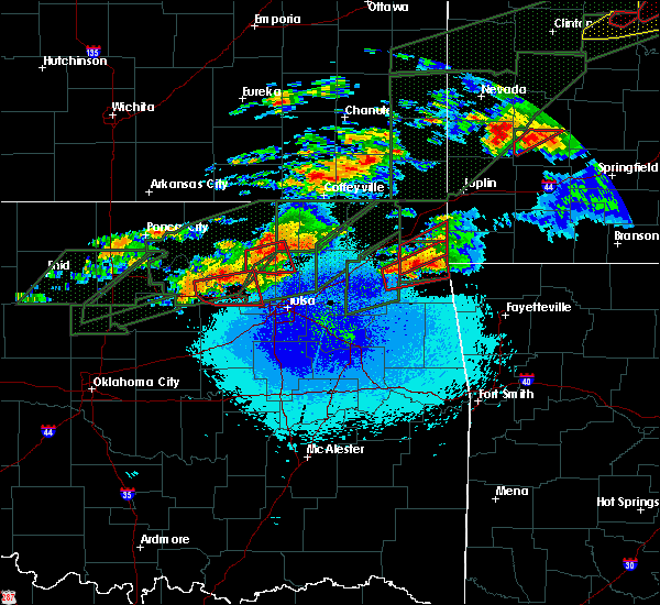 At 926 pm cdt, a severe thunderstorm capable of producing a tornado was located over osage, moving east at 30 mph (radar indicated rotation). Hazards include tornado and quarter size hail. Flying debris will be dangerous to those caught without shelter. mobile homes will be damaged or destroyed. damage to roofs, windows, and vehicles will occur. tree damage is likely. Locations in or near the path include, hominy, cleveland, westport, osage, walnut creek state park,. At 926 pm cdt, a severe thunderstorm capable of producing a tornado was located over osage, moving east at 30 mph (radar indicated rotation). Hazards include tornado and quarter size hail. Flying debris will be dangerous to those caught without shelter. mobile homes will be damaged or destroyed. damage to roofs, windows, and vehicles will occur. tree damage is likely. Locations in or near the path include, hominy, cleveland, westport, osage, walnut creek state park,.
|
| 5/22/2019 9:17 PM CDT |
 At 916 pm cdt, a severe thunderstorm capable of producing a tornado was located near cleveland, moving east at 30 mph (radar indicated rotation). Hazards include tornado and quarter size hail. Flying debris will be dangerous to those caught without shelter. mobile homes will be damaged or destroyed. damage to roofs, windows, and vehicles will occur. tree damage is likely. Locations in or near the path include, sand springs, cleveland, westport, osage, hallett, terlton, walnut creek state park,. At 916 pm cdt, a severe thunderstorm capable of producing a tornado was located near cleveland, moving east at 30 mph (radar indicated rotation). Hazards include tornado and quarter size hail. Flying debris will be dangerous to those caught without shelter. mobile homes will be damaged or destroyed. damage to roofs, windows, and vehicles will occur. tree damage is likely. Locations in or near the path include, sand springs, cleveland, westport, osage, hallett, terlton, walnut creek state park,.
|
| 5/22/2019 9:04 PM CDT |
 At 904 pm cdt, a severe thunderstorm capable of producing a tornado was located over hallett, moving east at 30 mph (radar indicated rotation). Hazards include tornado and quarter size hail. Flying debris will be dangerous to those caught without shelter. mobile homes will be damaged or destroyed. damage to roofs, windows, and vehicles will occur. tree damage is likely. Locations in or near the path include, sand springs, cleveland, mannford, jennings, westport, osage, hallett, terlton, maramec, walnut creek state park,. At 904 pm cdt, a severe thunderstorm capable of producing a tornado was located over hallett, moving east at 30 mph (radar indicated rotation). Hazards include tornado and quarter size hail. Flying debris will be dangerous to those caught without shelter. mobile homes will be damaged or destroyed. damage to roofs, windows, and vehicles will occur. tree damage is likely. Locations in or near the path include, sand springs, cleveland, mannford, jennings, westport, osage, hallett, terlton, maramec, walnut creek state park,.
|
| 5/22/2019 6:47 PM CDT |
 At 647 pm cdt, a severe thunderstorm was located near kiefer, moving northeast at 40 mph (radar indicated). Hazards include 60 mph wind gusts and quarter size hail. Hail damage to vehicles is expected. expect wind damage to roofs, siding, and trees. locations in or near the path include, tulsa, broken arrow, sand springs, claremore, owasso, bixby, sapulpa, jenks, glenpool, catoosa, verdigris, kiefer, sperry, mounds, jenks riverside airport, turley, tulsa international airport, tiawah, taiwah, liberty, this includes interstate 44 between mile markers 207 and 250. A tornado watch remains in effect until 1100 pm cdt for northeastern oklahoma. At 647 pm cdt, a severe thunderstorm was located near kiefer, moving northeast at 40 mph (radar indicated). Hazards include 60 mph wind gusts and quarter size hail. Hail damage to vehicles is expected. expect wind damage to roofs, siding, and trees. locations in or near the path include, tulsa, broken arrow, sand springs, claremore, owasso, bixby, sapulpa, jenks, glenpool, catoosa, verdigris, kiefer, sperry, mounds, jenks riverside airport, turley, tulsa international airport, tiawah, taiwah, liberty, this includes interstate 44 between mile markers 207 and 250. A tornado watch remains in effect until 1100 pm cdt for northeastern oklahoma.
|
| 5/22/2019 6:34 PM CDT |
 At 633 pm cdt, a severe thunderstorm was located near mounds, moving northeast at 35 mph (radar indicated). Hazards include 60 mph wind gusts and quarter size hail. Hail damage to vehicles is expected. expect wind damage to roofs, siding, and trees. locations in or near the path include, tulsa, broken arrow, sand springs, bixby, sapulpa, jenks, glenpool, catoosa, kiefer, mounds, kellyville, jenks riverside airport, liberty, gray, this includes interstate 44 between mile markers 202 and 231. A tornado watch remains in effect until 1100 pm cdt for northeastern oklahoma. At 633 pm cdt, a severe thunderstorm was located near mounds, moving northeast at 35 mph (radar indicated). Hazards include 60 mph wind gusts and quarter size hail. Hail damage to vehicles is expected. expect wind damage to roofs, siding, and trees. locations in or near the path include, tulsa, broken arrow, sand springs, bixby, sapulpa, jenks, glenpool, catoosa, kiefer, mounds, kellyville, jenks riverside airport, liberty, gray, this includes interstate 44 between mile markers 202 and 231. A tornado watch remains in effect until 1100 pm cdt for northeastern oklahoma.
|
| 5/22/2019 6:12 PM CDT |
 At 612 pm cdt, severe thunderstorms were located along a line extending from 6 miles southwest of sperry to 2 miles west of collinsville to talala to 9 miles northwest of white oak, moving northeast at 50 mph (radar indicated). Hazards include 60 mph wind gusts and quarter size hail. Hail damage to vehicles is expected. expect wind damage to roofs, siding, and trees. Locations in or near the path include, tulsa, nowata, owasso, skiatook, collinsville, sperry, oologah, welch, ramona, delaware, lenapah, talala, vera, new alluwe, walnut creek state park, watova, turley, tulsa international airport, hollow, centrailia, a tornado watch remains in effect until 1100 pm cdt for northeastern oklahoma. At 612 pm cdt, severe thunderstorms were located along a line extending from 6 miles southwest of sperry to 2 miles west of collinsville to talala to 9 miles northwest of white oak, moving northeast at 50 mph (radar indicated). Hazards include 60 mph wind gusts and quarter size hail. Hail damage to vehicles is expected. expect wind damage to roofs, siding, and trees. Locations in or near the path include, tulsa, nowata, owasso, skiatook, collinsville, sperry, oologah, welch, ramona, delaware, lenapah, talala, vera, new alluwe, walnut creek state park, watova, turley, tulsa international airport, hollow, centrailia, a tornado watch remains in effect until 1100 pm cdt for northeastern oklahoma.
|
| 5/22/2019 6:09 PM CDT |
 At 609 pm cdt, a severe thunderstorm was located 3 miles west of mounds, moving northeast at 65 mph (radar indicated). Hazards include ping pong ball size hail and 60 mph wind gusts. People and animals outdoors will be injured. expect hail damage to roofs, siding, windows, and vehicles. expect wind damage to roofs, siding, and trees. locations in or near the path include, tulsa, broken arrow, sand springs, bixby, sapulpa, jenks, glenpool, catoosa, kiefer, mounds, kellyville, jenks riverside airport, liberty, gray, this includes interstate 44 between mile markers 202 and 231. A tornado watch remains in effect until 1100 pm cdt for northeastern oklahoma. At 609 pm cdt, a severe thunderstorm was located 3 miles west of mounds, moving northeast at 65 mph (radar indicated). Hazards include ping pong ball size hail and 60 mph wind gusts. People and animals outdoors will be injured. expect hail damage to roofs, siding, windows, and vehicles. expect wind damage to roofs, siding, and trees. locations in or near the path include, tulsa, broken arrow, sand springs, bixby, sapulpa, jenks, glenpool, catoosa, kiefer, mounds, kellyville, jenks riverside airport, liberty, gray, this includes interstate 44 between mile markers 202 and 231. A tornado watch remains in effect until 1100 pm cdt for northeastern oklahoma.
|
| 5/22/2019 6:04 PM CDT |
 At 604 pm cdt, a severe thunderstorm was located 5 miles northwest of sand springs, moving northeast at 10 mph (radar indicated). Hazards include 60 mph wind gusts and quarter size hail. Hail damage to vehicles is expected. expect wind damage to roofs, siding, and trees. Locations in or near the path include, tulsa, sand springs, a tornado watch remains in effect until 1100 pm cdt for northeastern oklahoma. At 604 pm cdt, a severe thunderstorm was located 5 miles northwest of sand springs, moving northeast at 10 mph (radar indicated). Hazards include 60 mph wind gusts and quarter size hail. Hail damage to vehicles is expected. expect wind damage to roofs, siding, and trees. Locations in or near the path include, tulsa, sand springs, a tornado watch remains in effect until 1100 pm cdt for northeastern oklahoma.
|
| 5/22/2019 5:43 PM CDT |
 At 543 pm cdt, a severe thunderstorm was located near sperry, moving north at 40 mph (radar indicated). Hazards include two inch hail and 70 mph wind gusts. People and animals outdoors will be injured. expect hail damage to roofs, siding, windows, and vehicles. expect considerable tree damage. wind damage is also likely to mobile homes, roofs, and outbuildings. Locations in or near the path include, tulsa, bartlesville, skiatook, sperry, ramona, ochelata, avant, vera, turley, wolco, a tornado watch remains in effect until 1100 pm cdt for northeastern oklahoma. At 543 pm cdt, a severe thunderstorm was located near sperry, moving north at 40 mph (radar indicated). Hazards include two inch hail and 70 mph wind gusts. People and animals outdoors will be injured. expect hail damage to roofs, siding, windows, and vehicles. expect considerable tree damage. wind damage is also likely to mobile homes, roofs, and outbuildings. Locations in or near the path include, tulsa, bartlesville, skiatook, sperry, ramona, ochelata, avant, vera, turley, wolco, a tornado watch remains in effect until 1100 pm cdt for northeastern oklahoma.
|
| 5/22/2019 5:40 PM CDT |
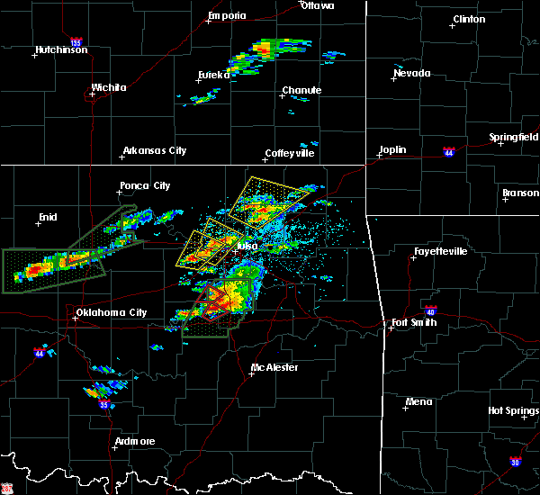 A tornado warning remains in effect until 615 pm cdt for northwestern creek and west central tulsa counties. at 540 pm cdt, a severe thunderstorm capable of producing a tornado was located 7 miles south of mannford, moving northeast at 30 mph. hazard. tornado. source. Radar indicated rotation. A tornado warning remains in effect until 615 pm cdt for northwestern creek and west central tulsa counties. at 540 pm cdt, a severe thunderstorm capable of producing a tornado was located 7 miles south of mannford, moving northeast at 30 mph. hazard. tornado. source. Radar indicated rotation.
|
| 5/22/2019 5:36 PM CDT |
 At 536 pm cdt, a severe thunderstorm capable of producing a tornado was located 9 miles south of mannford, moving northeast at 30 mph (radar indicated rotation). Hazards include tornado. Flying debris will be dangerous to those caught without shelter. mobile homes will be damaged or destroyed. damage to roofs, windows, and vehicles will occur. tree damage is likely. Locations in or near the path include, sand springs, mannford, westport, keystone state park,. At 536 pm cdt, a severe thunderstorm capable of producing a tornado was located 9 miles south of mannford, moving northeast at 30 mph (radar indicated rotation). Hazards include tornado. Flying debris will be dangerous to those caught without shelter. mobile homes will be damaged or destroyed. damage to roofs, windows, and vehicles will occur. tree damage is likely. Locations in or near the path include, sand springs, mannford, westport, keystone state park,.
|
| 5/22/2019 5:35 PM CDT |
 At 535 pm cdt, a severe thunderstorm was located 5 miles southeast of mannford, moving northeast at 60 mph (radar indicated). Hazards include 60 mph wind gusts and quarter size hail. Hail damage to vehicles is expected. expect wind damage to roofs, siding, and trees. Locations in or near the path include, tulsa, sand springs, mannford, westport, keystone state park, walnut creek state park, a tornado watch remains in effect until 1100 pm cdt for northeastern oklahoma. At 535 pm cdt, a severe thunderstorm was located 5 miles southeast of mannford, moving northeast at 60 mph (radar indicated). Hazards include 60 mph wind gusts and quarter size hail. Hail damage to vehicles is expected. expect wind damage to roofs, siding, and trees. Locations in or near the path include, tulsa, sand springs, mannford, westport, keystone state park, walnut creek state park, a tornado watch remains in effect until 1100 pm cdt for northeastern oklahoma.
|
| 5/22/2019 5:24 PM CDT |
 At 524 pm cdt, a severe thunderstorm was located near sand springs, moving northeast at 60 mph (radar indicated). Hazards include 60 mph wind gusts and quarter size hail. Hail damage to vehicles is expected. expect wind damage to roofs, siding, and trees. locations in or near the path include, tulsa, sand springs, owasso, skiatook, sperry, keystone state park, turley, gray, this includes interstate 44 between mile markers 211 and 218. A tornado watch remains in effect until 1100 pm cdt for northeastern oklahoma. At 524 pm cdt, a severe thunderstorm was located near sand springs, moving northeast at 60 mph (radar indicated). Hazards include 60 mph wind gusts and quarter size hail. Hail damage to vehicles is expected. expect wind damage to roofs, siding, and trees. locations in or near the path include, tulsa, sand springs, owasso, skiatook, sperry, keystone state park, turley, gray, this includes interstate 44 between mile markers 211 and 218. A tornado watch remains in effect until 1100 pm cdt for northeastern oklahoma.
|
| 5/21/2019 6:34 AM CDT |
 At 634 am cdt, a confirmed tornado was located over tulsa international airport, moving northeast at 45 mph (radar confirmed tornado). Hazards include damaging tornado. Flying debris will be dangerous to those caught without shelter. mobile homes will be damaged or destroyed. damage to roofs, windows, and vehicles will occur. tree damage is likely. Locations in or near the path include, tulsa, sand springs, claremore, owasso, skiatook, catoosa, collinsville, verdigris, sperry, turley, tulsa international airport, taiwah, tiawah, gray, this includes interstate 44 between mile markers 221 and 253. At 634 am cdt, a confirmed tornado was located over tulsa international airport, moving northeast at 45 mph (radar confirmed tornado). Hazards include damaging tornado. Flying debris will be dangerous to those caught without shelter. mobile homes will be damaged or destroyed. damage to roofs, windows, and vehicles will occur. tree damage is likely. Locations in or near the path include, tulsa, sand springs, claremore, owasso, skiatook, catoosa, collinsville, verdigris, sperry, turley, tulsa international airport, taiwah, tiawah, gray, this includes interstate 44 between mile markers 221 and 253.
|
| 5/21/2019 6:32 AM CDT |
 At 631 am cdt, severe thunderstorms were located along a line extending from near sperry to 3 miles north of broken arrow to 4 miles east of preston, moving northeast at 25 mph (radar indicated). Hazards include 60 mph wind gusts and nickel size hail. Expect damage to roofs, siding, and trees. locations in or near the path include, tulsa, broken arrow, sand springs, claremore, okmulgee, owasso, bixby, jenks, glenpool, coweta, skiatook, catoosa, collinsville, verdigris, haskell, inola, morris, beggs, sperry, oologah, this includes interstate 44 between mile markers 216 and 264. A tornado watch remains in effect until noon cdt for northeastern and east central oklahoma. At 631 am cdt, severe thunderstorms were located along a line extending from near sperry to 3 miles north of broken arrow to 4 miles east of preston, moving northeast at 25 mph (radar indicated). Hazards include 60 mph wind gusts and nickel size hail. Expect damage to roofs, siding, and trees. locations in or near the path include, tulsa, broken arrow, sand springs, claremore, okmulgee, owasso, bixby, jenks, glenpool, coweta, skiatook, catoosa, collinsville, verdigris, haskell, inola, morris, beggs, sperry, oologah, this includes interstate 44 between mile markers 216 and 264. A tornado watch remains in effect until noon cdt for northeastern and east central oklahoma.
|
| 5/21/2019 6:29 AM CDT |
 At 629 am cdt, a severe thunderstorm capable of producing a tornado was located 4 miles southwest of tulsa international airport, moving northeast at 40 mph (radar indicated rotation). Hazards include tornado. Flying debris will be dangerous to those caught without shelter. mobile homes will be damaged or destroyed. damage to roofs, windows, and vehicles will occur. tree damage is likely. Locations in or near the path include, tulsa, sand springs, sperry,. At 629 am cdt, a severe thunderstorm capable of producing a tornado was located 4 miles southwest of tulsa international airport, moving northeast at 40 mph (radar indicated rotation). Hazards include tornado. Flying debris will be dangerous to those caught without shelter. mobile homes will be damaged or destroyed. damage to roofs, windows, and vehicles will occur. tree damage is likely. Locations in or near the path include, tulsa, sand springs, sperry,.
|
| 5/21/2019 6:28 AM CDT |
 At 628 am cdt, a severe thunderstorm capable of producing a tornado was located 3 miles northwest of tulsa, moving northeast at 40 mph (radar indicated rotation). Hazards include tornado. Flying debris will be dangerous to those caught without shelter. mobile homes will be damaged or destroyed. damage to roofs, windows, and vehicles will occur. tree damage is likely. Locations in or near the path include, tulsa, sand springs, claremore, owasso, skiatook, catoosa, collinsville, verdigris, sperry, turley, tulsa international airport, taiwah, tiawah, gray, this includes interstate 44 between mile markers 221 and 253. At 628 am cdt, a severe thunderstorm capable of producing a tornado was located 3 miles northwest of tulsa, moving northeast at 40 mph (radar indicated rotation). Hazards include tornado. Flying debris will be dangerous to those caught without shelter. mobile homes will be damaged or destroyed. damage to roofs, windows, and vehicles will occur. tree damage is likely. Locations in or near the path include, tulsa, sand springs, claremore, owasso, skiatook, catoosa, collinsville, verdigris, sperry, turley, tulsa international airport, taiwah, tiawah, gray, this includes interstate 44 between mile markers 221 and 253.
|
| 5/21/2019 6:18 AM CDT |
 At 618 am cdt, severe thunderstorms capable of producing a tornado were located along a line extending from 8 miles southwest of sperry to sand springs, moving east at 30 mph (radar indicated rotation). Hazards include tornado. Flying debris will be dangerous to those caught without shelter. mobile homes will be damaged or destroyed. damage to roofs, windows, and vehicles will occur. tree damage is likely. Locations in or near the path include, tulsa, sand springs, sperry,. At 618 am cdt, severe thunderstorms capable of producing a tornado were located along a line extending from 8 miles southwest of sperry to sand springs, moving east at 30 mph (radar indicated rotation). Hazards include tornado. Flying debris will be dangerous to those caught without shelter. mobile homes will be damaged or destroyed. damage to roofs, windows, and vehicles will occur. tree damage is likely. Locations in or near the path include, tulsa, sand springs, sperry,.
|
| 5/21/2019 6:17 AM CDT |
 At 616 am cdt, severe thunderstorms capable of producing a tornado were located along a line extending from 2 miles southwest of sand springs to jenks riverside airport, moving northeast at 55 mph (radar indicated rotation). Hazards include tornado. Flying debris will be dangerous to those caught without shelter. mobile homes will be damaged or destroyed. damage to roofs, windows, and vehicles will occur. tree damage is likely. Locations in or near the path include, tulsa, broken arrow, sand springs, claremore, owasso, jenks, skiatook, catoosa, collinsville, verdigris, sperry, jenks riverside airport, turley, tulsa international airport, taiwah, tiawah, gray, this includes interstate 44 between mile markers 217 and 253. At 616 am cdt, severe thunderstorms capable of producing a tornado were located along a line extending from 2 miles southwest of sand springs to jenks riverside airport, moving northeast at 55 mph (radar indicated rotation). Hazards include tornado. Flying debris will be dangerous to those caught without shelter. mobile homes will be damaged or destroyed. damage to roofs, windows, and vehicles will occur. tree damage is likely. Locations in or near the path include, tulsa, broken arrow, sand springs, claremore, owasso, jenks, skiatook, catoosa, collinsville, verdigris, sperry, jenks riverside airport, turley, tulsa international airport, taiwah, tiawah, gray, this includes interstate 44 between mile markers 217 and 253.
|
| 5/21/2019 6:00 AM CDT |
 At 600 am cdt, severe thunderstorms were located along a line extending from 3 miles southwest of keystone state park to mounds to 6 miles northwest of pharoah, moving northeast at 60 mph (radar indicated). Hazards include 60 mph wind gusts and nickel size hail. Expect damage to roofs, siding, and trees. locations in or near the path include, tulsa, broken arrow, sand springs, claremore, okmulgee, owasso, bixby, sapulpa, jenks, glenpool, coweta, skiatook, catoosa, collinsville, verdigris, mannford, haskell, inola, kiefer, morris, this includes interstate 44 between mile markers 202 and 264. A tornado watch remains in effect until noon cdt for northeastern and east central oklahoma. At 600 am cdt, severe thunderstorms were located along a line extending from 3 miles southwest of keystone state park to mounds to 6 miles northwest of pharoah, moving northeast at 60 mph (radar indicated). Hazards include 60 mph wind gusts and nickel size hail. Expect damage to roofs, siding, and trees. locations in or near the path include, tulsa, broken arrow, sand springs, claremore, okmulgee, owasso, bixby, sapulpa, jenks, glenpool, coweta, skiatook, catoosa, collinsville, verdigris, mannford, haskell, inola, kiefer, morris, this includes interstate 44 between mile markers 202 and 264. A tornado watch remains in effect until noon cdt for northeastern and east central oklahoma.
|
| 5/20/2019 9:23 PM CDT |
 The tornado warning for southeastern osage, northeastern creek and northwestern tulsa counties will expire at 930 pm cdt, the tornado threat has diminished and the tornado warning has been cancelled. however, damaging winds remain likely and a severe thunderstorm warning remains in effect for the area. a tornado watch remains in effect until 1000 pm cdt for northeastern oklahoma. remember, a severe thunderstorm warning still remains in effect for portions of creek, osage, and tulsa counties until 945 pm. The tornado warning for southeastern osage, northeastern creek and northwestern tulsa counties will expire at 930 pm cdt, the tornado threat has diminished and the tornado warning has been cancelled. however, damaging winds remain likely and a severe thunderstorm warning remains in effect for the area. a tornado watch remains in effect until 1000 pm cdt for northeastern oklahoma. remember, a severe thunderstorm warning still remains in effect for portions of creek, osage, and tulsa counties until 945 pm.
|
| 5/20/2019 9:06 PM CDT |
 At 906 pm cdt, a severe thunderstorm capable of producing a tornado was located 4 miles southeast of mannford, moving northeast at 40 mph (radar indicated rotation). Hazards include tornado. Flying debris will be dangerous to those caught without shelter. mobile homes will be damaged or destroyed. damage to roofs, windows, and vehicles will occur. tree damage is likely. Locations in or near the path include, tulsa, sand springs, skiatook, mannford, keystone state park, gray, this includes interstate 44 between mile markers 215 and 219. At 906 pm cdt, a severe thunderstorm capable of producing a tornado was located 4 miles southeast of mannford, moving northeast at 40 mph (radar indicated rotation). Hazards include tornado. Flying debris will be dangerous to those caught without shelter. mobile homes will be damaged or destroyed. damage to roofs, windows, and vehicles will occur. tree damage is likely. Locations in or near the path include, tulsa, sand springs, skiatook, mannford, keystone state park, gray, this includes interstate 44 between mile markers 215 and 219.
|
| 5/20/2019 8:46 PM CDT |
 At 846 pm cdt, severe thunderstorms were located along a line extending from near drumright to 2 miles east of collinsville, moving east at 25 mph (radar indicated). Hazards include 60 mph wind gusts and penny size hail. Expect damage to roofs, siding, and trees. locations in or near the path include, tulsa, broken arrow, sand springs, claremore, pryor, owasso, sapulpa, jenks, glenpool, pryor creek, skiatook, catoosa, collinsville, verdigris, cleveland, mannford, drumright, kiefer, sperry, kellyville, this includes interstate 44 between mile markers 199 and 262. a tornado watch remains in effect until 1000 pm cdt for northeastern oklahoma. A tornado watch also remains in effect until 100 am cdt for northeastern oklahoma. At 846 pm cdt, severe thunderstorms were located along a line extending from near drumright to 2 miles east of collinsville, moving east at 25 mph (radar indicated). Hazards include 60 mph wind gusts and penny size hail. Expect damage to roofs, siding, and trees. locations in or near the path include, tulsa, broken arrow, sand springs, claremore, pryor, owasso, sapulpa, jenks, glenpool, pryor creek, skiatook, catoosa, collinsville, verdigris, cleveland, mannford, drumright, kiefer, sperry, kellyville, this includes interstate 44 between mile markers 199 and 262. a tornado watch remains in effect until 1000 pm cdt for northeastern oklahoma. A tornado watch also remains in effect until 100 am cdt for northeastern oklahoma.
|
| 5/20/2019 8:23 PM CDT |
 At 822 pm cdt, a severe thunderstorm was located near cleveland, moving east at 25 mph. another severe thunderstorm was located near avant, moving east at 25 mph (radar indicated). Hazards include 60 mph wind gusts and quarter size hail. Hail damage to vehicles is expected. expect wind damage to roofs, siding, and trees. locations in or near the path include, tulsa, sand springs, owasso, skiatook, collinsville, hominy, cleveland, sperry, ramona, jennings, avant, westport, vera, osage, hallett, terlton, walnut creek state park, turley, tulsa international airport, a tornado watch remains in effect until 1000 pm cdt for northeastern oklahoma. A tornado watch also remains in effect until 100 am cdt for northeastern oklahoma. At 822 pm cdt, a severe thunderstorm was located near cleveland, moving east at 25 mph. another severe thunderstorm was located near avant, moving east at 25 mph (radar indicated). Hazards include 60 mph wind gusts and quarter size hail. Hail damage to vehicles is expected. expect wind damage to roofs, siding, and trees. locations in or near the path include, tulsa, sand springs, owasso, skiatook, collinsville, hominy, cleveland, sperry, ramona, jennings, avant, westport, vera, osage, hallett, terlton, walnut creek state park, turley, tulsa international airport, a tornado watch remains in effect until 1000 pm cdt for northeastern oklahoma. A tornado watch also remains in effect until 100 am cdt for northeastern oklahoma.
|
| 5/20/2019 7:43 PM CDT |
 At 742 pm cdt, a severe thunderstorm was located near osage, moving east at 30 mph (radar indicated). Hazards include 60 mph wind gusts and quarter size hail. Hail damage to vehicles is expected. expect wind damage to roofs, siding, and trees. Locations in or near the path include, tulsa, sand springs, pawnee, skiatook, hominy, cleveland, mannford, jennings, avant, westport, osage, hallett, blackburn, terlton, maramec, skedee, walnut creek state park, a tornado watch remains in effect until 1000 pm cdt for northeastern oklahoma. At 742 pm cdt, a severe thunderstorm was located near osage, moving east at 30 mph (radar indicated). Hazards include 60 mph wind gusts and quarter size hail. Hail damage to vehicles is expected. expect wind damage to roofs, siding, and trees. Locations in or near the path include, tulsa, sand springs, pawnee, skiatook, hominy, cleveland, mannford, jennings, avant, westport, osage, hallett, blackburn, terlton, maramec, skedee, walnut creek state park, a tornado watch remains in effect until 1000 pm cdt for northeastern oklahoma.
|
| 5/20/2019 7:31 PM CDT |
 At 731 pm cdt, severe thunderstorms were located along a line extending from 2 miles east of edna to 3 miles west of watova to 3 miles southwest of osage, moving east at 45 mph (radar indicated). Hazards include 60 mph wind gusts and quarter size hail. Hail damage to vehicles is expected. expect wind damage to roofs, siding, and trees. locations in or near the path include, tulsa, bartlesville, sand springs, nowata, pawhuska, pawnee, owasso, skiatook, collinsville, hominy, dewey, cleveland, chelsea, barnsdall, sperry, oologah, south coffeyville, copan, ramona, wynona, a tornado watch remains in effect until 1000 pm cdt for northeastern oklahoma. A tornado watch also remains in effect until 100 am cdt for northeastern oklahoma. At 731 pm cdt, severe thunderstorms were located along a line extending from 2 miles east of edna to 3 miles west of watova to 3 miles southwest of osage, moving east at 45 mph (radar indicated). Hazards include 60 mph wind gusts and quarter size hail. Hail damage to vehicles is expected. expect wind damage to roofs, siding, and trees. locations in or near the path include, tulsa, bartlesville, sand springs, nowata, pawhuska, pawnee, owasso, skiatook, collinsville, hominy, dewey, cleveland, chelsea, barnsdall, sperry, oologah, south coffeyville, copan, ramona, wynona, a tornado watch remains in effect until 1000 pm cdt for northeastern oklahoma. A tornado watch also remains in effect until 100 am cdt for northeastern oklahoma.
|
| 5/20/2019 6:57 PM CDT |
 At 657 pm cdt, severe thunderstorms were located along a line extending from 4 miles south of dearing to 2 miles east of barnsdall to 4 miles southeast of glencoe, moving east at 45 mph (radar indicated). Hazards include 60 mph wind gusts and quarter size hail. Hail damage to vehicles is expected. expect wind damage to roofs, siding, and trees. locations in or near the path include, tulsa, bartlesville, sand springs, nowata, pawhuska, pawnee, owasso, skiatook, collinsville, hominy, dewey, cleveland, chelsea, barnsdall, sperry, oologah, south coffeyville, copan, ramona, wynona, a tornado watch remains in effect until 1000 pm cdt for northeastern oklahoma. A tornado watch also remains in effect until 100 am cdt for northeastern oklahoma. At 657 pm cdt, severe thunderstorms were located along a line extending from 4 miles south of dearing to 2 miles east of barnsdall to 4 miles southeast of glencoe, moving east at 45 mph (radar indicated). Hazards include 60 mph wind gusts and quarter size hail. Hail damage to vehicles is expected. expect wind damage to roofs, siding, and trees. locations in or near the path include, tulsa, bartlesville, sand springs, nowata, pawhuska, pawnee, owasso, skiatook, collinsville, hominy, dewey, cleveland, chelsea, barnsdall, sperry, oologah, south coffeyville, copan, ramona, wynona, a tornado watch remains in effect until 1000 pm cdt for northeastern oklahoma. A tornado watch also remains in effect until 100 am cdt for northeastern oklahoma.
|
| 5/20/2019 6:42 PM CDT |
 The national weather service in tulsa has issued a * severe thunderstorm warning for. southeastern osage county in northeastern oklahoma. southeastern pawnee county in northeastern oklahoma. until 700 pm cdt. At 642 pm cdt, severe thunderstorms were located along a line. The national weather service in tulsa has issued a * severe thunderstorm warning for. southeastern osage county in northeastern oklahoma. southeastern pawnee county in northeastern oklahoma. until 700 pm cdt. At 642 pm cdt, severe thunderstorms were located along a line.
|
| 5/20/2019 6:11 PM CDT |
 At 611 pm cdt, a severe thunderstorm capable of producing a tornado was located 5 miles north of pawnee, moving east at 45 mph (radar indicated rotation). Hazards include tornado and half dollar size hail. Flying debris will be dangerous to those caught without shelter. mobile homes will be damaged or destroyed. damage to roofs, windows, and vehicles will occur. tree damage is likely. Locations in or near the path include, pawhuska, pawnee, hominy, cleveland, fairfax, wynona, ralston, westport, osage, hallett, blackburn, maramec, skedee, walnut creek state park, sooner lake,. At 611 pm cdt, a severe thunderstorm capable of producing a tornado was located 5 miles north of pawnee, moving east at 45 mph (radar indicated rotation). Hazards include tornado and half dollar size hail. Flying debris will be dangerous to those caught without shelter. mobile homes will be damaged or destroyed. damage to roofs, windows, and vehicles will occur. tree damage is likely. Locations in or near the path include, pawhuska, pawnee, hominy, cleveland, fairfax, wynona, ralston, westport, osage, hallett, blackburn, maramec, skedee, walnut creek state park, sooner lake,.
|
| 5/20/2019 11:37 AM CDT |
 The severe thunderstorm warning for west central rogers, southeastern osage, southern washington and northern tulsa counties will expire at 1145 am cdt, the storm which prompted the warning has moved out of the warning area. a second strong storm continues near skiatook but has also weakened below severe limits. therefore the warning will be allowed to expire. however small hail is still possible with this thunderstorm. The severe thunderstorm warning for west central rogers, southeastern osage, southern washington and northern tulsa counties will expire at 1145 am cdt, the storm which prompted the warning has moved out of the warning area. a second strong storm continues near skiatook but has also weakened below severe limits. therefore the warning will be allowed to expire. however small hail is still possible with this thunderstorm.
|
| 5/20/2019 11:19 AM CDT |
 At 1118 am cdt, a severe thunderstorm was located over collinsville, moving northeast at 40 mph (radar indicated). Hazards include 60 mph wind gusts and half dollar size hail. Hail damage to vehicles is expected. expect wind damage to roofs, siding, and trees. Locations in or near the path include, tulsa, sand springs, owasso, skiatook, collinsville, barnsdall, sperry, oologah, ramona, avant, vera, walnut creek state park, turley, tulsa international airport, gray, tallant, pershing, nelagoney, wolco,. At 1118 am cdt, a severe thunderstorm was located over collinsville, moving northeast at 40 mph (radar indicated). Hazards include 60 mph wind gusts and half dollar size hail. Hail damage to vehicles is expected. expect wind damage to roofs, siding, and trees. Locations in or near the path include, tulsa, sand springs, owasso, skiatook, collinsville, barnsdall, sperry, oologah, ramona, avant, vera, walnut creek state park, turley, tulsa international airport, gray, tallant, pershing, nelagoney, wolco,.
|
| 5/20/2019 11:07 AM CDT |
 At 1105 am cdt, a severe thunderstorm was located over walnut creek state park, moving northeast at 45 mph. a second storm was developing just west of owasso (radar indicated). Hazards include 60 mph wind gusts and half dollar size hail. Hail damage to vehicles is expected. expect wind damage to roofs, siding, and trees. Locations in or near the path include, tulsa, sand springs, owasso, skiatook, collinsville, mannford, barnsdall, sperry, oologah, ramona, avant, westport, vera, keystone state park, walnut creek state park, turley, tulsa international airport, gray, tallant, pershing,. At 1105 am cdt, a severe thunderstorm was located over walnut creek state park, moving northeast at 45 mph. a second storm was developing just west of owasso (radar indicated). Hazards include 60 mph wind gusts and half dollar size hail. Hail damage to vehicles is expected. expect wind damage to roofs, siding, and trees. Locations in or near the path include, tulsa, sand springs, owasso, skiatook, collinsville, mannford, barnsdall, sperry, oologah, ramona, avant, westport, vera, keystone state park, walnut creek state park, turley, tulsa international airport, gray, tallant, pershing,.
|
| 5/20/2019 10:53 AM CDT |
 The national weather service in tulsa has issued a * severe thunderstorm warning for. west central rogers county in northeastern oklahoma. southeastern osage county in northeastern oklahoma. northeastern creek county in northeastern oklahoma. Southern washington county in northeastern oklahoma. The national weather service in tulsa has issued a * severe thunderstorm warning for. west central rogers county in northeastern oklahoma. southeastern osage county in northeastern oklahoma. northeastern creek county in northeastern oklahoma. Southern washington county in northeastern oklahoma.
|
| 5/8/2019 1:57 AM CDT |
 The severe thunderstorm warning for osage and southeastern pawnee counties will expire at 200 am cdt, the storms which prompted the warning have weakened below severe limits, and have exited the warned area. therefore the warning will be allowed to expire. however gusty winds up to 50 mph are still possible with these thunderstorms. a tornado watch remains in effect until 500 am cdt for northeastern oklahoma. The severe thunderstorm warning for osage and southeastern pawnee counties will expire at 200 am cdt, the storms which prompted the warning have weakened below severe limits, and have exited the warned area. therefore the warning will be allowed to expire. however gusty winds up to 50 mph are still possible with these thunderstorms. a tornado watch remains in effect until 500 am cdt for northeastern oklahoma.
|
| 5/8/2019 1:33 AM CDT |
 At 133 am cdt, severe thunderstorms were located along a line extending from 4 miles southwest of sedan to 2 miles northwest of westport, moving northeast at 45 mph (radar indicated). Hazards include 60 mph wind gusts and penny size hail. Expect damage to roofs, siding, and trees. Locations in or near the path include, tulsa, bartlesville, sand springs, pawhuska, skiatook, hominy, cleveland, barnsdall, sperry, wynona, avant, westport, osage, terlton, elgin, bigheart, bartlesville municipal airport, osage hills state park, walnut creek state park, hulah, a tornado watch remains in effect until 500 am cdt for northeastern oklahoma. At 133 am cdt, severe thunderstorms were located along a line extending from 4 miles southwest of sedan to 2 miles northwest of westport, moving northeast at 45 mph (radar indicated). Hazards include 60 mph wind gusts and penny size hail. Expect damage to roofs, siding, and trees. Locations in or near the path include, tulsa, bartlesville, sand springs, pawhuska, skiatook, hominy, cleveland, barnsdall, sperry, wynona, avant, westport, osage, terlton, elgin, bigheart, bartlesville municipal airport, osage hills state park, walnut creek state park, hulah, a tornado watch remains in effect until 500 am cdt for northeastern oklahoma.
|
| 5/8/2019 1:04 AM CDT |
 At 104 am cdt, severe thunderstorms were located along a line extending from 7 miles northeast of grainola to 3 miles east of quay, moving east at 40 mph (radar indicated). Hazards include 60 mph wind gusts and penny size hail. Expect damage to roofs, siding, and trees. Locations in or near the path include, tulsa, bartlesville, sand springs, pawhuska, skiatook, hominy, cleveland, barnsdall, sperry, wynona, jennings, avant, westport, osage, hallett, blackburn, terlton, maramec, elgin, foraker, a tornado watch remains in effect until 500 am cdt for northeastern oklahoma. At 104 am cdt, severe thunderstorms were located along a line extending from 7 miles northeast of grainola to 3 miles east of quay, moving east at 40 mph (radar indicated). Hazards include 60 mph wind gusts and penny size hail. Expect damage to roofs, siding, and trees. Locations in or near the path include, tulsa, bartlesville, sand springs, pawhuska, skiatook, hominy, cleveland, barnsdall, sperry, wynona, jennings, avant, westport, osage, hallett, blackburn, terlton, maramec, elgin, foraker, a tornado watch remains in effect until 500 am cdt for northeastern oklahoma.
|
| 5/6/2019 1:58 AM CDT |
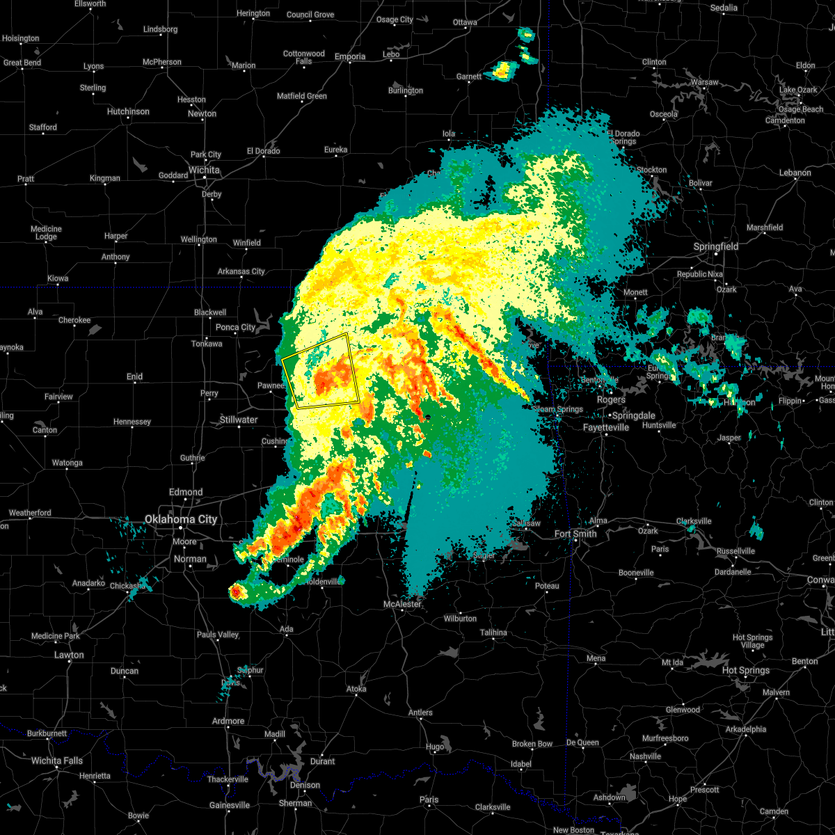 The severe thunderstorm warning for southeastern osage and southeastern pawnee counties will expire at 200 am cdt, the storms which prompted the warning have weakened below severe limits, and no longer pose an immediate threat to life or property. therefore the warning will be allowed to expire. however gusty winds around 50 mph are still possible with these thunderstorms. a severe thunderstorm watch remains in effect until 400 am cdt for northeastern oklahoma. The severe thunderstorm warning for southeastern osage and southeastern pawnee counties will expire at 200 am cdt, the storms which prompted the warning have weakened below severe limits, and no longer pose an immediate threat to life or property. therefore the warning will be allowed to expire. however gusty winds around 50 mph are still possible with these thunderstorms. a severe thunderstorm watch remains in effect until 400 am cdt for northeastern oklahoma.
|
| 5/6/2019 1:39 AM CDT |
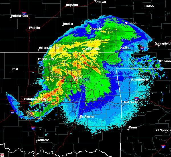 At 138 am cdt, severe thunderstorms were located along a line extending from 5 miles north of hominy to 3 miles northeast of osage, moving east at 25 mph (radar indicated). Hazards include 60 mph wind gusts. Expect damage to roofs, siding, and trees. Locations in or near the path include, pawhuska, hominy, cleveland, wynona, osage, hallett, blackburn, pershing, nelagoney, tallant,. At 138 am cdt, severe thunderstorms were located along a line extending from 5 miles north of hominy to 3 miles northeast of osage, moving east at 25 mph (radar indicated). Hazards include 60 mph wind gusts. Expect damage to roofs, siding, and trees. Locations in or near the path include, pawhuska, hominy, cleveland, wynona, osage, hallett, blackburn, pershing, nelagoney, tallant,.
|
| 5/6/2019 1:12 AM CDT |
 At 112 am cdt, severe thunderstorms were located along a line extending from 7 miles north of blackburn to 4 miles west of cleveland, moving east at 30 mph (radar indicated). Hazards include 60 mph wind gusts. Expect damage to roofs, siding, and trees. Locations in or near the path include, pawhuska, hominy, cleveland, wynona, osage, hallett, blackburn, pershing, nelagoney, tallant,. At 112 am cdt, severe thunderstorms were located along a line extending from 7 miles north of blackburn to 4 miles west of cleveland, moving east at 30 mph (radar indicated). Hazards include 60 mph wind gusts. Expect damage to roofs, siding, and trees. Locations in or near the path include, pawhuska, hominy, cleveland, wynona, osage, hallett, blackburn, pershing, nelagoney, tallant,.
|
| 4/17/2019 10:39 PM CDT |
 At 1039 pm cdt, severe thunderstorms were located along a line extending from 3 miles north of elgin to 2 miles northwest of pawhuska to 4 miles southeast of wynona to near westport, moving northeast at 50 mph (radar indicated). Hazards include 70 mph wind gusts and quarter size hail. Hail damage to vehicles is expected. expect considerable tree damage. wind damage is also likely to mobile homes, roofs, and outbuildings. Locations in or near the path include, tulsa, bartlesville, sand springs, pawhuska, skiatook, hominy, cleveland, barnsdall, sperry, wynona, jennings, avant, westport, osage, hallett, terlton, elgin, bigheart, bartlesville municipal airport, osage hills state park,. At 1039 pm cdt, severe thunderstorms were located along a line extending from 3 miles north of elgin to 2 miles northwest of pawhuska to 4 miles southeast of wynona to near westport, moving northeast at 50 mph (radar indicated). Hazards include 70 mph wind gusts and quarter size hail. Hail damage to vehicles is expected. expect considerable tree damage. wind damage is also likely to mobile homes, roofs, and outbuildings. Locations in or near the path include, tulsa, bartlesville, sand springs, pawhuska, skiatook, hominy, cleveland, barnsdall, sperry, wynona, jennings, avant, westport, osage, hallett, terlton, elgin, bigheart, bartlesville municipal airport, osage hills state park,.
|
| 4/17/2019 10:21 PM CDT |
 At 1021 pm cdt, severe thunderstorms were located along a line extending from 6 miles northeast of grainola to 5 miles east of burbank to 6 miles northeast of blackburn to 2 miles northwest of jennings, moving northeast at 50 mph (radar indicated). Hazards include 70 mph wind gusts and nickel size hail. Expect considerable tree damage. damage is likely to mobile homes, roofs, and outbuildings. Locations in or near the path include, tulsa, bartlesville, sand springs, pawhuska, skiatook, hominy, cleveland, barnsdall, sperry, shidler, wynona, jennings, avant, westport, osage, hallett, blackburn, terlton, maramec, elgin,. At 1021 pm cdt, severe thunderstorms were located along a line extending from 6 miles northeast of grainola to 5 miles east of burbank to 6 miles northeast of blackburn to 2 miles northwest of jennings, moving northeast at 50 mph (radar indicated). Hazards include 70 mph wind gusts and nickel size hail. Expect considerable tree damage. damage is likely to mobile homes, roofs, and outbuildings. Locations in or near the path include, tulsa, bartlesville, sand springs, pawhuska, skiatook, hominy, cleveland, barnsdall, sperry, shidler, wynona, jennings, avant, westport, osage, hallett, blackburn, terlton, maramec, elgin,.
|
| 11/30/2018 9:46 PM CST |
 At 946 pm cst, severe thunderstorms were located along a line extending from 3 miles northeast of ochelata to near collinsville to near bixby, moving northeast at 55 mph (radar indicated). Hazards include 70 mph wind gusts and nickel size hail. Expect considerable tree damage. damage is likely to mobile homes, roofs, and outbuildings. locations in or near the path include, tulsa, broken arrow, bartlesville, sand springs, claremore, nowata, owasso, bixby, sapulpa, jenks, glenpool, coweta, skiatook, catoosa, collinsville, verdigris, haskell, inola, kiefer, beggs, this includes interstate 44 between mile markers 211 and 258. A tornado watch remains in effect until midnight cst for northeastern and east central oklahoma. At 946 pm cst, severe thunderstorms were located along a line extending from 3 miles northeast of ochelata to near collinsville to near bixby, moving northeast at 55 mph (radar indicated). Hazards include 70 mph wind gusts and nickel size hail. Expect considerable tree damage. damage is likely to mobile homes, roofs, and outbuildings. locations in or near the path include, tulsa, broken arrow, bartlesville, sand springs, claremore, nowata, owasso, bixby, sapulpa, jenks, glenpool, coweta, skiatook, catoosa, collinsville, verdigris, haskell, inola, kiefer, beggs, this includes interstate 44 between mile markers 211 and 258. A tornado watch remains in effect until midnight cst for northeastern and east central oklahoma.
|
| 11/30/2018 9:26 PM CST | Storm damage reported in tulsa county OK, 4.4 miles NNW of Sand Springs, OK |
| 11/30/2018 9:12 PM CST |
 At 911 pm cst, severe thunderstorms were located along a line extending from 2 miles east of osage to 5 miles northwest of sapulpa to 3 miles north of okfuskee, moving northeast at 50 mph (radar indicated). Hazards include 70 mph wind gusts and quarter size hail. Hail damage to vehicles is expected. expect considerable tree damage. wind damage is also likely to mobile homes, roofs, and outbuildings. locations in or near the path include, tulsa, broken arrow, bartlesville, sand springs, claremore, nowata, owasso, bixby, sapulpa, jenks, okfuskee, glenpool, coweta, skiatook, catoosa, collinsville, verdigris, haskell, inola, kiefer, this includes interstate 44 between mile markers 208 and 258. A tornado watch remains in effect until midnight cst for northeastern and east central oklahoma. At 911 pm cst, severe thunderstorms were located along a line extending from 2 miles east of osage to 5 miles northwest of sapulpa to 3 miles north of okfuskee, moving northeast at 50 mph (radar indicated). Hazards include 70 mph wind gusts and quarter size hail. Hail damage to vehicles is expected. expect considerable tree damage. wind damage is also likely to mobile homes, roofs, and outbuildings. locations in or near the path include, tulsa, broken arrow, bartlesville, sand springs, claremore, nowata, owasso, bixby, sapulpa, jenks, okfuskee, glenpool, coweta, skiatook, catoosa, collinsville, verdigris, haskell, inola, kiefer, this includes interstate 44 between mile markers 208 and 258. A tornado watch remains in effect until midnight cst for northeastern and east central oklahoma.
|
| 11/30/2018 9:08 PM CST |
 At 908 pm cst, a severe thunderstorm was located 5 miles southeast of mannford, moving northeast at 55 mph (radar indicated). Hazards include 70 mph wind gusts and quarter size hail. Hail damage to vehicles is expected. expect considerable tree damage. wind damage is also likely to mobile homes, roofs, and outbuildings. locations in or near the path include, tulsa, sand springs, bristow, sapulpa, skiatook, cleveland, mannford, kellyville, depew, westport, osage, terlton, keystone state park, walnut creek state park, gray, silver city, this includes interstate 44 between mile markers 185 and 218. A tornado watch remains in effect until midnight cst for northeastern oklahoma. At 908 pm cst, a severe thunderstorm was located 5 miles southeast of mannford, moving northeast at 55 mph (radar indicated). Hazards include 70 mph wind gusts and quarter size hail. Hail damage to vehicles is expected. expect considerable tree damage. wind damage is also likely to mobile homes, roofs, and outbuildings. locations in or near the path include, tulsa, sand springs, bristow, sapulpa, skiatook, cleveland, mannford, kellyville, depew, westport, osage, terlton, keystone state park, walnut creek state park, gray, silver city, this includes interstate 44 between mile markers 185 and 218. A tornado watch remains in effect until midnight cst for northeastern oklahoma.
|
| 10/9/2018 11:10 AM CDT |
 At 1109 am cdt, severe thunderstorms were located along a line extending from 3 miles east of sand springs to 5 miles south of council hill, moving northeast at 35 mph (radar indicated). Hazards include 60 mph wind gusts. Expect damage to roofs, siding, and trees. locations in or near the path include, tulsa, broken arrow, muskogee, sand springs, claremore, wagoner, owasso, bixby, jenks, glenpool, coweta, catoosa, collinsville, fort gibson, verdigris, haskell, inola, morris, oologah, okay, this includes the following highways, interstate 40 in oklahoma near mile marker 247. interstate 44 between mile markers 217 and 260. A tornado watch remains in effect until 200 pm cdt for southeastern, northeastern and east central oklahoma. At 1109 am cdt, severe thunderstorms were located along a line extending from 3 miles east of sand springs to 5 miles south of council hill, moving northeast at 35 mph (radar indicated). Hazards include 60 mph wind gusts. Expect damage to roofs, siding, and trees. locations in or near the path include, tulsa, broken arrow, muskogee, sand springs, claremore, wagoner, owasso, bixby, jenks, glenpool, coweta, catoosa, collinsville, fort gibson, verdigris, haskell, inola, morris, oologah, okay, this includes the following highways, interstate 40 in oklahoma near mile marker 247. interstate 44 between mile markers 217 and 260. A tornado watch remains in effect until 200 pm cdt for southeastern, northeastern and east central oklahoma.
|
| 10/9/2018 11:06 AM CDT |
 The severe thunderstorm warning for southeastern osage, north central creek, southeastern pawnee and west central tulsa counties will expire at 1115 am cdt, the storms which prompted the warning have moved out of the area. therefore the warning will be allowed to expire. a tornado watch remains in effect until 200 pm cdt for northeastern oklahoma. The severe thunderstorm warning for southeastern osage, north central creek, southeastern pawnee and west central tulsa counties will expire at 1115 am cdt, the storms which prompted the warning have moved out of the area. therefore the warning will be allowed to expire. a tornado watch remains in effect until 200 pm cdt for northeastern oklahoma.
|
| 10/9/2018 11:04 AM CDT |
 At 1104 am cdt, severe thunderstorms were located along a line extending from 5 miles southwest of barnsdall to 5 miles west of sperry to 4 miles south of turley, moving northeast at 40 mph (radar indicated). Hazards include 60 mph wind gusts. Expect damage to roofs, siding, and trees. Locations in or near the path include, tulsa, bartlesville, skiatook, collinsville, dewey, barnsdall, sperry, ramona, ochelata, avant, talala, vera, bartlesville municipal airport, turley, okesa, watova, tallant, wolco, a tornado watch remains in effect until 200 pm cdt for northeastern oklahoma. At 1104 am cdt, severe thunderstorms were located along a line extending from 5 miles southwest of barnsdall to 5 miles west of sperry to 4 miles south of turley, moving northeast at 40 mph (radar indicated). Hazards include 60 mph wind gusts. Expect damage to roofs, siding, and trees. Locations in or near the path include, tulsa, bartlesville, skiatook, collinsville, dewey, barnsdall, sperry, ramona, ochelata, avant, talala, vera, bartlesville municipal airport, turley, okesa, watova, tallant, wolco, a tornado watch remains in effect until 200 pm cdt for northeastern oklahoma.
|
| 10/9/2018 10:46 AM CDT |
 At 1046 am cdt, severe thunderstorms were located along a line extending from 5 miles northwest of sapulpa to 4 miles southeast of dewar, moving northeast at 35 mph (radar indicated). Hazards include 60 mph wind gusts. Expect damage to roofs, siding, and trees. locations in or near the path include, tulsa, broken arrow, sand springs, okmulgee, bixby, sapulpa, jenks, glenpool, henryetta, kiefer, morris, beggs, mounds, kellyville, dewar, schulter, boynton, grayson, council hill, slick, this includes the following highways, interstate 40 in oklahoma between mile markers 232 and 249. interstate 44 between mile markers 196 and 224. A tornado watch remains in effect until 200 pm cdt for southeastern, northeastern and east central oklahoma. At 1046 am cdt, severe thunderstorms were located along a line extending from 5 miles northwest of sapulpa to 4 miles southeast of dewar, moving northeast at 35 mph (radar indicated). Hazards include 60 mph wind gusts. Expect damage to roofs, siding, and trees. locations in or near the path include, tulsa, broken arrow, sand springs, okmulgee, bixby, sapulpa, jenks, glenpool, henryetta, kiefer, morris, beggs, mounds, kellyville, dewar, schulter, boynton, grayson, council hill, slick, this includes the following highways, interstate 40 in oklahoma between mile markers 232 and 249. interstate 44 between mile markers 196 and 224. A tornado watch remains in effect until 200 pm cdt for southeastern, northeastern and east central oklahoma.
|
| 10/9/2018 10:40 AM CDT |
 At 1039 am cdt, severe thunderstorms were located along a line extending from 3 miles southeast of osage to 2 miles south of westport to 2 miles south of keystone state park, moving north at 35 mph (radar indicated). Hazards include 60 mph wind gusts. Expect damage to roofs, siding, and trees. Locations in or near the path include, hominy, mannford, westport, osage, keystone state park, walnut creek state park, a tornado watch remains in effect until 200 pm cdt for northeastern oklahoma. At 1039 am cdt, severe thunderstorms were located along a line extending from 3 miles southeast of osage to 2 miles south of westport to 2 miles south of keystone state park, moving north at 35 mph (radar indicated). Hazards include 60 mph wind gusts. Expect damage to roofs, siding, and trees. Locations in or near the path include, hominy, mannford, westport, osage, keystone state park, walnut creek state park, a tornado watch remains in effect until 200 pm cdt for northeastern oklahoma.
|
| 10/9/2018 10:31 AM CDT |
 At 1030 am cdt, severe thunderstorms were located along a line extending from 4 miles northwest of kellyville to 5 miles northeast of dustin, moving northeast at 40 mph (radar indicated). Hazards include 60 mph wind gusts. Expect damage to roofs, siding, and trees. locations in or near the path include, tulsa, broken arrow, sand springs, okmulgee, bristow, bixby, sapulpa, jenks, okfuskee, glenpool, henryetta, kiefer, morris, beggs, mounds, kellyville, weleetka, dewar, schulter, boynton, this includes the following highways, interstate 40 in oklahoma between mile markers 224 and 250. interstate 44 between mile markers 191 and 224. A tornado watch remains in effect until 200 pm cdt for southeastern, northeastern and east central oklahoma. At 1030 am cdt, severe thunderstorms were located along a line extending from 4 miles northwest of kellyville to 5 miles northeast of dustin, moving northeast at 40 mph (radar indicated). Hazards include 60 mph wind gusts. Expect damage to roofs, siding, and trees. locations in or near the path include, tulsa, broken arrow, sand springs, okmulgee, bristow, bixby, sapulpa, jenks, okfuskee, glenpool, henryetta, kiefer, morris, beggs, mounds, kellyville, weleetka, dewar, schulter, boynton, this includes the following highways, interstate 40 in oklahoma between mile markers 224 and 250. interstate 44 between mile markers 191 and 224. A tornado watch remains in effect until 200 pm cdt for southeastern, northeastern and east central oklahoma.
|
| 10/9/2018 10:23 AM CDT |
 At 1023 am cdt, severe thunderstorms were located along a line extending from 4 miles southeast of terlton to 5 miles south of mannford to 6 miles northwest of kellyville, moving north at 35 mph (radar indicated). Hazards include 60 mph wind gusts. Expect damage to roofs, siding, and trees. Locations in or near the path include, hominy, mannford, westport, osage, keystone state park, walnut creek state park, a tornado watch remains in effect until 200 pm cdt for northeastern oklahoma. At 1023 am cdt, severe thunderstorms were located along a line extending from 4 miles southeast of terlton to 5 miles south of mannford to 6 miles northwest of kellyville, moving north at 35 mph (radar indicated). Hazards include 60 mph wind gusts. Expect damage to roofs, siding, and trees. Locations in or near the path include, hominy, mannford, westport, osage, keystone state park, walnut creek state park, a tornado watch remains in effect until 200 pm cdt for northeastern oklahoma.
|
| 8/16/2018 4:57 PM CDT |
 At 457 pm cdt, severe thunderstorms were located along a line extending from 3 miles east of jenks to 4 miles west of welty, moving southeast at 20 mph (radar indicated). Hazards include 60 mph wind gusts and nickel size hail. Expect damage to roofs, siding, and trees. locations in or near the path include, tulsa, broken arrow, sand springs, bristow, owasso, bixby, sapulpa, jenks, okfuskee, glenpool, coweta, catoosa, kiefer, beggs, boley, mounds, kellyville, depew, slick, castle, this includes the following highways, interstate 40 in oklahoma near mile marker 213. Interstate 44 between mile markers 184 and 232. At 457 pm cdt, severe thunderstorms were located along a line extending from 3 miles east of jenks to 4 miles west of welty, moving southeast at 20 mph (radar indicated). Hazards include 60 mph wind gusts and nickel size hail. Expect damage to roofs, siding, and trees. locations in or near the path include, tulsa, broken arrow, sand springs, bristow, owasso, bixby, sapulpa, jenks, okfuskee, glenpool, coweta, catoosa, kiefer, beggs, boley, mounds, kellyville, depew, slick, castle, this includes the following highways, interstate 40 in oklahoma near mile marker 213. Interstate 44 between mile markers 184 and 232.
|
| 8/16/2018 4:45 PM CDT |
 At 445 pm cdt, severe thunderstorms were located along a line extending from 3 miles northwest of bristow to near mounds to 3 miles northeast of jenks riverside airport, moving southeast at 45 mph (radar indicated). Hazards include 60 mph wind gusts and quarter size hail. Hail damage to vehicles is expected. expect wind damage to roofs, siding, and trees. Locations in or near the path include, tulsa, broken arrow, sand springs, owasso, bixby, sapulpa, jenks, glenpool, kiefer, mounds, kellyville, jenks riverside airport, tulsa international airport, turley, liberty, gray, this includes interstate 44 between mile markers 193 and 232. At 445 pm cdt, severe thunderstorms were located along a line extending from 3 miles northwest of bristow to near mounds to 3 miles northeast of jenks riverside airport, moving southeast at 45 mph (radar indicated). Hazards include 60 mph wind gusts and quarter size hail. Hail damage to vehicles is expected. expect wind damage to roofs, siding, and trees. Locations in or near the path include, tulsa, broken arrow, sand springs, owasso, bixby, sapulpa, jenks, glenpool, kiefer, mounds, kellyville, jenks riverside airport, tulsa international airport, turley, liberty, gray, this includes interstate 44 between mile markers 193 and 232.
|
| 8/16/2018 4:34 PM CDT |
 At 434 pm cdt, severe thunderstorms were located along a line extending from 5 miles north of depew to 3 miles east of kellyville to near jenks riverside airport, moving southeast at 20 mph (radar indicated). Hazards include 60 mph wind gusts and quarter size hail. Hail damage to vehicles is expected. expect wind damage to roofs, siding, and trees. Locations in or near the path include, tulsa, broken arrow, sand springs, owasso, bixby, sapulpa, jenks, glenpool, mannford, kiefer, mounds, kellyville, shamrock, keystone state park, jenks riverside airport, tulsa international airport, turley, liberty, gray, this includes interstate 44 between mile markers 194 and 232. At 434 pm cdt, severe thunderstorms were located along a line extending from 5 miles north of depew to 3 miles east of kellyville to near jenks riverside airport, moving southeast at 20 mph (radar indicated). Hazards include 60 mph wind gusts and quarter size hail. Hail damage to vehicles is expected. expect wind damage to roofs, siding, and trees. Locations in or near the path include, tulsa, broken arrow, sand springs, owasso, bixby, sapulpa, jenks, glenpool, mannford, kiefer, mounds, kellyville, shamrock, keystone state park, jenks riverside airport, tulsa international airport, turley, liberty, gray, this includes interstate 44 between mile markers 194 and 232.
|
| 8/16/2018 4:16 PM CDT |
 At 416 pm cdt, severe thunderstorms were located along a line extending from near drumright to 5 miles southeast of keystone state park to jenks riverside airport, moving east at 40 mph (radar indicated). Hazards include 60 mph wind gusts and quarter size hail. Hail damage to vehicles is expected. expect wind damage to roofs, siding, and trees. Locations in or near the path include, tulsa, broken arrow, sand springs, owasso, bixby, sapulpa, jenks, glenpool, mannford, drumright, kiefer, mounds, kellyville, oilton, jennings, westport, hallett, terlton, shamrock, jenks riverside airport, this includes interstate 44 between mile markers 194 and 232. At 416 pm cdt, severe thunderstorms were located along a line extending from near drumright to 5 miles southeast of keystone state park to jenks riverside airport, moving east at 40 mph (radar indicated). Hazards include 60 mph wind gusts and quarter size hail. Hail damage to vehicles is expected. expect wind damage to roofs, siding, and trees. Locations in or near the path include, tulsa, broken arrow, sand springs, owasso, bixby, sapulpa, jenks, glenpool, mannford, drumright, kiefer, mounds, kellyville, oilton, jennings, westport, hallett, terlton, shamrock, jenks riverside airport, this includes interstate 44 between mile markers 194 and 232.
|
| 8/16/2018 4:02 PM CDT |
 At 402 pm cdt, severe thunderstorms were located along a line extending from 6 miles east of newkirk to 6 miles north of blackburn to 3 miles southeast of hominy, moving east at 40 mph (radar indicated). Hazards include 60 mph wind gusts. Expect damage to roofs, siding, and trees. Locations in or near the path include, pawhuska, hominy, cleveland, fairfax, barnsdall, shidler, wynona, ralston, osage, burbank, blackburn, grainola, foraker, pearsonia, sunset lake, eastern kaw lake, webb city, tallant, apperson, pershing,. At 402 pm cdt, severe thunderstorms were located along a line extending from 6 miles east of newkirk to 6 miles north of blackburn to 3 miles southeast of hominy, moving east at 40 mph (radar indicated). Hazards include 60 mph wind gusts. Expect damage to roofs, siding, and trees. Locations in or near the path include, pawhuska, hominy, cleveland, fairfax, barnsdall, shidler, wynona, ralston, osage, burbank, blackburn, grainola, foraker, pearsonia, sunset lake, eastern kaw lake, webb city, tallant, apperson, pershing,.
|
| 8/16/2018 3:57 PM CDT |
 At 357 pm cdt, severe thunderstorms were located along a line extending from 3 miles west of drumright to near jennings to 2 miles north of jenks riverside airport, moving east at 20 mph (radar indicated). Hazards include 60 mph wind gusts. Expect damage to roofs, siding, and trees. Locations in or near the path include, tulsa, broken arrow, sand springs, owasso, bixby, sapulpa, jenks, glenpool, mannford, drumright, kiefer, mounds, kellyville, oilton, jennings, westport, hallett, terlton, shamrock, jenks riverside airport, this includes interstate 44 between mile markers 194 and 232. At 357 pm cdt, severe thunderstorms were located along a line extending from 3 miles west of drumright to near jennings to 2 miles north of jenks riverside airport, moving east at 20 mph (radar indicated). Hazards include 60 mph wind gusts. Expect damage to roofs, siding, and trees. Locations in or near the path include, tulsa, broken arrow, sand springs, owasso, bixby, sapulpa, jenks, glenpool, mannford, drumright, kiefer, mounds, kellyville, oilton, jennings, westport, hallett, terlton, shamrock, jenks riverside airport, this includes interstate 44 between mile markers 194 and 232.
|
| 8/16/2018 3:50 PM CDT | Awning blown off building... tree limbs down near highway 412 and main. via media vide in tulsa county OK, 2.7 miles NW of Sand Springs, OK |
| 8/16/2018 3:50 PM CDT |
 At 350 pm cdt, severe thunderstorms were located along a line extending from 3 miles southwest of terlton to 2 miles east of sand springs, moving east at 20 mph (radar indicated). Hazards include 60 mph wind gusts. Expect damage to roofs, siding, and trees. Locations in or near the path include, tulsa, sand springs, owasso, sapulpa, jenks, glenpool, catoosa, mannford, oilton, jennings, westport, hallett, terlton, keystone state park, walnut creek state park, jenks riverside airport, turley, tulsa international airport, gray, silver city, this includes interstate 44 between mile markers 210 and 231. At 350 pm cdt, severe thunderstorms were located along a line extending from 3 miles southwest of terlton to 2 miles east of sand springs, moving east at 20 mph (radar indicated). Hazards include 60 mph wind gusts. Expect damage to roofs, siding, and trees. Locations in or near the path include, tulsa, sand springs, owasso, sapulpa, jenks, glenpool, catoosa, mannford, oilton, jennings, westport, hallett, terlton, keystone state park, walnut creek state park, jenks riverside airport, turley, tulsa international airport, gray, silver city, this includes interstate 44 between mile markers 210 and 231.
|
| 8/16/2018 3:49 PM CDT |
 At 348 pm cdt, severe thunderstorms were located along a line extending from near kildare to 3 miles north of skedee to 3 miles southeast of hominy, moving east at 40 mph (radar indicated). Hazards include 60 mph wind gusts. Expect damage to roofs, siding, and trees. Locations in or near the path include, pawhuska, pawnee, hominy, cleveland, fairfax, barnsdall, shidler, wynona, ralston, osage, burbank, blackburn, skedee, grainola, foraker, pearsonia, sunset lake, southern kaw lake, webb city, tallant,. At 348 pm cdt, severe thunderstorms were located along a line extending from near kildare to 3 miles north of skedee to 3 miles southeast of hominy, moving east at 40 mph (radar indicated). Hazards include 60 mph wind gusts. Expect damage to roofs, siding, and trees. Locations in or near the path include, pawhuska, pawnee, hominy, cleveland, fairfax, barnsdall, shidler, wynona, ralston, osage, burbank, blackburn, skedee, grainola, foraker, pearsonia, sunset lake, southern kaw lake, webb city, tallant,.
|
| 8/16/2018 3:39 PM CDT |
 At 339 pm cdt, severe thunderstorms were located along a line extending from 3 miles southwest of maramec to sand springs, and are nearly stationary (radar indicated). Hazards include 60 mph wind gusts. Expect damage to roofs, siding, and trees. Locations in or near the path include, tulsa, sand springs, owasso, sapulpa, jenks, glenpool, catoosa, mannford, oilton, jennings, westport, hallett, terlton, maramec, keystone state park, walnut creek state park, jenks riverside airport, turley, tulsa international airport, gray, this includes interstate 44 between mile markers 210 and 231. At 339 pm cdt, severe thunderstorms were located along a line extending from 3 miles southwest of maramec to sand springs, and are nearly stationary (radar indicated). Hazards include 60 mph wind gusts. Expect damage to roofs, siding, and trees. Locations in or near the path include, tulsa, sand springs, owasso, sapulpa, jenks, glenpool, catoosa, mannford, oilton, jennings, westport, hallett, terlton, maramec, keystone state park, walnut creek state park, jenks riverside airport, turley, tulsa international airport, gray, this includes interstate 44 between mile markers 210 and 231.
|
| 8/16/2018 3:26 PM CDT |
 At 326 pm cdt, severe thunderstorms were located along a line extending from 4 miles northwest of quay to 2 miles west of keystone state park to 2 miles southeast of sand springs, moving east at 15 mph (radar indicated). Hazards include 60 mph wind gusts. Expect damage to roofs, siding, and trees. Locations in or near the path include, tulsa, sand springs, owasso, sapulpa, jenks, glenpool, catoosa, mannford, oilton, jennings, westport, hallett, terlton, maramec, keystone state park, walnut creek state park, jenks riverside airport, turley, tulsa international airport, gray, this includes interstate 44 between mile markers 210 and 231. At 326 pm cdt, severe thunderstorms were located along a line extending from 4 miles northwest of quay to 2 miles west of keystone state park to 2 miles southeast of sand springs, moving east at 15 mph (radar indicated). Hazards include 60 mph wind gusts. Expect damage to roofs, siding, and trees. Locations in or near the path include, tulsa, sand springs, owasso, sapulpa, jenks, glenpool, catoosa, mannford, oilton, jennings, westport, hallett, terlton, maramec, keystone state park, walnut creek state park, jenks riverside airport, turley, tulsa international airport, gray, this includes interstate 44 between mile markers 210 and 231.
|
| 8/16/2018 3:25 PM CDT |
 At 325 pm cdt, a severe thunderstorm was located near sand springs, moving east at 5 mph (radar indicated). Hazards include 60 mph wind gusts. Expect damage to roofs, siding, and trees. Locations in or near the path include, tulsa, sand springs, bixby, jenks, jenks riverside airport, this includes interstate 44 between mile markers 216 and 229. At 325 pm cdt, a severe thunderstorm was located near sand springs, moving east at 5 mph (radar indicated). Hazards include 60 mph wind gusts. Expect damage to roofs, siding, and trees. Locations in or near the path include, tulsa, sand springs, bixby, jenks, jenks riverside airport, this includes interstate 44 between mile markers 216 and 229.
|
| 8/16/2018 3:08 PM CDT |
 The national weather service in tulsa has issued a * severe thunderstorm warning for. southeastern osage county in northeastern oklahoma. northern creek county in northeastern oklahoma. southern pawnee county in northeastern oklahoma. Central tulsa county in northeastern oklahoma. The national weather service in tulsa has issued a * severe thunderstorm warning for. southeastern osage county in northeastern oklahoma. northern creek county in northeastern oklahoma. southern pawnee county in northeastern oklahoma. Central tulsa county in northeastern oklahoma.
|
| 8/16/2018 2:56 PM CDT |
 At 256 pm cdt, a severe thunderstorm was located 4 miles north of jenks riverside airport, moving east at 10 mph (radar indicated). Hazards include 60 mph wind gusts. Expect damage to roofs, siding, and trees. Locations in or near the path include, tulsa, sand springs, bixby, jenks, jenks riverside airport, this includes interstate 44 between mile markers 216 and 229. At 256 pm cdt, a severe thunderstorm was located 4 miles north of jenks riverside airport, moving east at 10 mph (radar indicated). Hazards include 60 mph wind gusts. Expect damage to roofs, siding, and trees. Locations in or near the path include, tulsa, sand springs, bixby, jenks, jenks riverside airport, this includes interstate 44 between mile markers 216 and 229.
|
| 8/16/2018 2:45 PM CDT |
 At 245 pm cdt, a severe thunderstorm was located 4 miles southeast of sand springs, moving east at 15 mph (radar indicated). Hazards include 60 mph wind gusts. Expect damage to roofs, siding, and trees. Locations in or near the path include, tulsa, sand springs, bixby, jenks, jenks riverside airport, gray, this includes interstate 44 between mile markers 217 and 229. At 245 pm cdt, a severe thunderstorm was located 4 miles southeast of sand springs, moving east at 15 mph (radar indicated). Hazards include 60 mph wind gusts. Expect damage to roofs, siding, and trees. Locations in or near the path include, tulsa, sand springs, bixby, jenks, jenks riverside airport, gray, this includes interstate 44 between mile markers 217 and 229.
|
| 8/10/2018 4:05 PM CDT |
 At 404 pm cdt, a severe thunderstorm was located 3 miles northwest of sapulpa, moving south at 5 mph (radar indicated). Hazards include 60 mph wind gusts and penny size hail. Expect damage to roofs, siding, and trees. Locations in or near the path include, sapulpa, kellyville, this includes interstate 44 between mile markers 199 and 216. At 404 pm cdt, a severe thunderstorm was located 3 miles northwest of sapulpa, moving south at 5 mph (radar indicated). Hazards include 60 mph wind gusts and penny size hail. Expect damage to roofs, siding, and trees. Locations in or near the path include, sapulpa, kellyville, this includes interstate 44 between mile markers 199 and 216.
|
| 8/10/2018 3:54 PM CDT |
 At 354 pm cdt, a severe thunderstorm was located 3 miles southwest of sand springs, and is nearly stationary (radar indicated). Hazards include 60 mph wind gusts and nickel size hail. Expect damage to roofs, siding, and trees. Locations in or near the path include, tulsa, sand springs, sapulpa, kellyville, gray, this includes interstate 44 between mile markers 199 and 218. At 354 pm cdt, a severe thunderstorm was located 3 miles southwest of sand springs, and is nearly stationary (radar indicated). Hazards include 60 mph wind gusts and nickel size hail. Expect damage to roofs, siding, and trees. Locations in or near the path include, tulsa, sand springs, sapulpa, kellyville, gray, this includes interstate 44 between mile markers 199 and 218.
|
| 8/10/2018 3:46 PM CDT |
 At 346 pm cdt, a severe thunderstorm was located 3 miles southwest of sand springs, and is nearly stationary (radar indicated). Hazards include 60 mph wind gusts and quarter size hail. Hail damage to vehicles is expected. expect wind damage to roofs, siding, and trees. Locations in or near the path include, tulsa, sand springs, keystone state park, gray, this includes interstate 44 between mile markers 217 and 220. At 346 pm cdt, a severe thunderstorm was located 3 miles southwest of sand springs, and is nearly stationary (radar indicated). Hazards include 60 mph wind gusts and quarter size hail. Hail damage to vehicles is expected. expect wind damage to roofs, siding, and trees. Locations in or near the path include, tulsa, sand springs, keystone state park, gray, this includes interstate 44 between mile markers 217 and 220.
|
| 8/10/2018 3:40 PM CDT | Storm damage reported in osage county OK, 2 miles W of Sand Springs, OK |
| 8/10/2018 3:35 PM CDT |
 At 334 pm cdt, a severe thunderstorm was located 6 miles northwest of sand springs, moving south at 10 mph (radar indicated). Hazards include 60 mph wind gusts. Expect damage to roofs, siding, and trees. locations in or near the path include, tulsa, sand springs, keystone state park, gray, this includes interstate 44 between mile markers 217 and 220. a pronounced weakening trend has been observed with this storm. If trend continues, the warning may be cancelled early. At 334 pm cdt, a severe thunderstorm was located 6 miles northwest of sand springs, moving south at 10 mph (radar indicated). Hazards include 60 mph wind gusts. Expect damage to roofs, siding, and trees. locations in or near the path include, tulsa, sand springs, keystone state park, gray, this includes interstate 44 between mile markers 217 and 220. a pronounced weakening trend has been observed with this storm. If trend continues, the warning may be cancelled early.
|
| 8/10/2018 3:17 PM CDT |
 At 317 pm cdt, a severe thunderstorm was located 6 miles east of walnut creek state park, moving south at 10 mph (radar indicated). Hazards include 60 mph wind gusts and half dollar size hail. Hail damage to vehicles is expected. expect wind damage to roofs, siding, and trees. Locations in or near the path include, tulsa, sand springs, keystone state park, gray, this includes interstate 44 between mile markers 217 and 220. At 317 pm cdt, a severe thunderstorm was located 6 miles east of walnut creek state park, moving south at 10 mph (radar indicated). Hazards include 60 mph wind gusts and half dollar size hail. Hail damage to vehicles is expected. expect wind damage to roofs, siding, and trees. Locations in or near the path include, tulsa, sand springs, keystone state park, gray, this includes interstate 44 between mile markers 217 and 220.
|
| 8/10/2018 3:10 PM CDT |
 At 310 pm cdt, a severe thunderstorm was located 7 miles east of walnut creek state park, moving south at 10 mph (radar indicated). Hazards include 60 mph wind gusts and quarter size hail. Hail damage to vehicles is expected. expect wind damage to roofs, siding, and trees. Locations in or near the path include, tulsa, skiatook, walnut creek state park,. At 310 pm cdt, a severe thunderstorm was located 7 miles east of walnut creek state park, moving south at 10 mph (radar indicated). Hazards include 60 mph wind gusts and quarter size hail. Hail damage to vehicles is expected. expect wind damage to roofs, siding, and trees. Locations in or near the path include, tulsa, skiatook, walnut creek state park,.
|
| 8/10/2018 2:54 PM CDT |
 At 254 pm cdt, a severe thunderstorm was located 9 miles west of skiatook, moving south at 10 mph (radar indicated). Hazards include 60 mph wind gusts and quarter size hail. Hail damage to vehicles is expected. expect wind damage to roofs, siding, and trees. Locations in or near the path include, tulsa, skiatook, walnut creek state park,. At 254 pm cdt, a severe thunderstorm was located 9 miles west of skiatook, moving south at 10 mph (radar indicated). Hazards include 60 mph wind gusts and quarter size hail. Hail damage to vehicles is expected. expect wind damage to roofs, siding, and trees. Locations in or near the path include, tulsa, skiatook, walnut creek state park,.
|
| 8/7/2018 4:07 PM CDT |
 A severe thunderstorm warning remains in effect until 430 pm cdt for southeastern osage and west central tulsa counties. at 406 pm cdt, a severe thunderstorm was located 3 miles northeast of keystone state park, moving east at 30 mph. hazard. 60 mph wind gusts. source. Radar indicated. A severe thunderstorm warning remains in effect until 430 pm cdt for southeastern osage and west central tulsa counties. at 406 pm cdt, a severe thunderstorm was located 3 miles northeast of keystone state park, moving east at 30 mph. hazard. 60 mph wind gusts. source. Radar indicated.
|
| 8/7/2018 4:01 PM CDT |
 At 401 pm cdt, a severe thunderstorm was located near sperry, and is nearly stationary (radar indicated). Hazards include two inch hail and 60 mph wind gusts. People and animals outdoors will be injured. expect hail damage to roofs, siding, windows, and vehicles. expect wind damage to roofs, siding, and trees. Locations in or near the path include, tulsa, skiatook, sperry, turley, tulsa international airport,. At 401 pm cdt, a severe thunderstorm was located near sperry, and is nearly stationary (radar indicated). Hazards include two inch hail and 60 mph wind gusts. People and animals outdoors will be injured. expect hail damage to roofs, siding, windows, and vehicles. expect wind damage to roofs, siding, and trees. Locations in or near the path include, tulsa, skiatook, sperry, turley, tulsa international airport,.
|
| 8/7/2018 3:56 PM CDT |
 At 356 pm cdt, a severe thunderstorm was located near sperry, moving east at 5 mph (radar indicated). Hazards include 60 mph wind gusts and half dollar size hail. Hail damage to vehicles is expected. expect wind damage to roofs, siding, and trees. Locations in or near the path include, tulsa, skiatook, sperry, turley, tulsa international airport,. At 356 pm cdt, a severe thunderstorm was located near sperry, moving east at 5 mph (radar indicated). Hazards include 60 mph wind gusts and half dollar size hail. Hail damage to vehicles is expected. expect wind damage to roofs, siding, and trees. Locations in or near the path include, tulsa, skiatook, sperry, turley, tulsa international airport,.
|
| 8/7/2018 3:41 PM CDT |
 At 340 pm cdt, a severe thunderstorm was located 3 miles southeast of terlton, moving east at 30 mph (radar indicated). Hazards include 60 mph wind gusts. Expect damage to roofs, siding, and trees. Locations in or near the path include, tulsa, sand springs, mannford, westport, terlton, keystone state park, walnut creek state park, silver city, gray, this includes interstate 44 between mile markers 214 and 218. At 340 pm cdt, a severe thunderstorm was located 3 miles southeast of terlton, moving east at 30 mph (radar indicated). Hazards include 60 mph wind gusts. Expect damage to roofs, siding, and trees. Locations in or near the path include, tulsa, sand springs, mannford, westport, terlton, keystone state park, walnut creek state park, silver city, gray, this includes interstate 44 between mile markers 214 and 218.
|
| 7/30/2018 3:52 PM CDT |
 At 351 pm cdt, severe thunderstorms were located along a line extending from 4 miles southwest of oologah to 2 miles north of owasso to 4 miles southwest of turley, moving southeast at 50 mph (radar indicated). Hazards include 70 mph wind gusts. Expect considerable tree damage. damage is likely to mobile homes, roofs, and outbuildings. Locations in or near the path include, tulsa, broken arrow, sand springs, claremore, owasso, bixby, jenks, skiatook, catoosa, collinsville, verdigris, sperry, oologah, ramona, talala, vera, jenks riverside airport, turley, tulsa international airport, gray, this includes interstate 44 between mile markers 217 and 248. At 351 pm cdt, severe thunderstorms were located along a line extending from 4 miles southwest of oologah to 2 miles north of owasso to 4 miles southwest of turley, moving southeast at 50 mph (radar indicated). Hazards include 70 mph wind gusts. Expect considerable tree damage. damage is likely to mobile homes, roofs, and outbuildings. Locations in or near the path include, tulsa, broken arrow, sand springs, claremore, owasso, bixby, jenks, skiatook, catoosa, collinsville, verdigris, sperry, oologah, ramona, talala, vera, jenks riverside airport, turley, tulsa international airport, gray, this includes interstate 44 between mile markers 217 and 248.
|
| 7/30/2018 3:43 PM CDT |
 A severe thunderstorm warning remains in effect until 430 pm cdt for western rogers. southeastern osage. northeastern creek. southern washington. southwestern nowata. northwestern wagoner and tulsa counties. At 342 pm cdt, severe thunderstorms were located along a line extending from 3 miles north of vera to 3 miles east of skiatook to 6. A severe thunderstorm warning remains in effect until 430 pm cdt for western rogers. southeastern osage. northeastern creek. southern washington. southwestern nowata. northwestern wagoner and tulsa counties. At 342 pm cdt, severe thunderstorms were located along a line extending from 3 miles north of vera to 3 miles east of skiatook to 6.
|
| 7/30/2018 3:35 PM CDT |
 At 334 pm cdt, severe thunderstorms were located along a line extending from near ochelata to 4 miles southeast of avant to 5 miles north of walnut creek state park, moving southeast at 45 mph. these are very dangerous storms (radar indicated). Hazards include 80 mph wind gusts. Flying debris will be dangerous to those caught without shelter. mobile homes will be heavily damaged. expect considerable damage to roofs, windows, and vehicles. extensive tree damage and power outages are likely. Locations in or near the path include, tulsa, broken arrow, bartlesville, sand springs, claremore, owasso, sapulpa, jenks, glenpool, skiatook, catoosa, collinsville, verdigris, hominy, dewey, cleveland, mannford, barnsdall, sperry, oologah, this includes interstate 44 between mile markers 208 and 248. At 334 pm cdt, severe thunderstorms were located along a line extending from near ochelata to 4 miles southeast of avant to 5 miles north of walnut creek state park, moving southeast at 45 mph. these are very dangerous storms (radar indicated). Hazards include 80 mph wind gusts. Flying debris will be dangerous to those caught without shelter. mobile homes will be heavily damaged. expect considerable damage to roofs, windows, and vehicles. extensive tree damage and power outages are likely. Locations in or near the path include, tulsa, broken arrow, bartlesville, sand springs, claremore, owasso, sapulpa, jenks, glenpool, skiatook, catoosa, collinsville, verdigris, hominy, dewey, cleveland, mannford, barnsdall, sperry, oologah, this includes interstate 44 between mile markers 208 and 248.
|
| 7/30/2018 3:25 PM CDT |
 At 325 pm cdt, severe thunderstorms were located along a line extending from 5 miles southeast of okesa to 3 miles north of avant to 2 miles northeast of hominy, moving southeast at 50 mph. these are very dangerous storms (radar indicated). Hazards include 80 mph wind gusts. Flying debris will be dangerous to those caught without shelter. mobile homes will be heavily damaged. expect considerable damage to roofs, windows, and vehicles. extensive tree damage and power outages are likely. Locations in or near the path include, tulsa, broken arrow, bartlesville, sand springs, claremore, owasso, sapulpa, jenks, glenpool, skiatook, catoosa, collinsville, verdigris, hominy, dewey, cleveland, mannford, barnsdall, sperry, oologah, this includes interstate 44 between mile markers 208 and 248. At 325 pm cdt, severe thunderstorms were located along a line extending from 5 miles southeast of okesa to 3 miles north of avant to 2 miles northeast of hominy, moving southeast at 50 mph. these are very dangerous storms (radar indicated). Hazards include 80 mph wind gusts. Flying debris will be dangerous to those caught without shelter. mobile homes will be heavily damaged. expect considerable damage to roofs, windows, and vehicles. extensive tree damage and power outages are likely. Locations in or near the path include, tulsa, broken arrow, bartlesville, sand springs, claremore, owasso, sapulpa, jenks, glenpool, skiatook, catoosa, collinsville, verdigris, hominy, dewey, cleveland, mannford, barnsdall, sperry, oologah, this includes interstate 44 between mile markers 208 and 248.
|
| 7/29/2018 6:07 AM CDT |
 The severe thunderstorm warning for southeastern osage county will expire at 615 am cdt, the storms which prompted the warning have weakened below severe limits, and no longer pose an immediate threat to life or property. therefore the warning will be allowed to expire. a severe thunderstorm watch remains in effect until 900 am cdt for northeastern oklahoma. The severe thunderstorm warning for southeastern osage county will expire at 615 am cdt, the storms which prompted the warning have weakened below severe limits, and no longer pose an immediate threat to life or property. therefore the warning will be allowed to expire. a severe thunderstorm watch remains in effect until 900 am cdt for northeastern oklahoma.
|
| 7/29/2018 5:51 AM CDT |
 At 550 am cdt, severe thunderstorms were located along a line extending from 8 miles south of barnsdall to 9 miles west of skiatook to 3 miles south of walnut creek state park, moving east at 40 mph (radar indicated). Hazards include 60 mph wind gusts. Expect damage to roofs, siding, and trees. Locations in or near the path include, tulsa, skiatook, hominy, barnsdall, sperry, wynona, avant, osage, walnut creek state park, wolco,. At 550 am cdt, severe thunderstorms were located along a line extending from 8 miles south of barnsdall to 9 miles west of skiatook to 3 miles south of walnut creek state park, moving east at 40 mph (radar indicated). Hazards include 60 mph wind gusts. Expect damage to roofs, siding, and trees. Locations in or near the path include, tulsa, skiatook, hominy, barnsdall, sperry, wynona, avant, osage, walnut creek state park, wolco,.
|
| 7/29/2018 5:28 AM CDT |
 At 528 am cdt, severe thunderstorms were located along a line extending from 9 miles northwest of hominy to 4 miles north of cleveland to 2 miles southwest of hallett, moving east at 45 mph (radar indicated). Hazards include 60 mph wind gusts. Expect damage to roofs, siding, and trees. Locations in or near the path include, tulsa, sand springs, skiatook, hominy, cleveland, barnsdall, sperry, wynona, jennings, avant, westport, osage, hallett, terlton, walnut creek state park, wolco,. At 528 am cdt, severe thunderstorms were located along a line extending from 9 miles northwest of hominy to 4 miles north of cleveland to 2 miles southwest of hallett, moving east at 45 mph (radar indicated). Hazards include 60 mph wind gusts. Expect damage to roofs, siding, and trees. Locations in or near the path include, tulsa, sand springs, skiatook, hominy, cleveland, barnsdall, sperry, wynona, jennings, avant, westport, osage, hallett, terlton, walnut creek state park, wolco,.
|
| 6/25/2018 3:53 AM CDT |
 The severe thunderstorm warning for eastern osage, northwestern creek and southeastern pawnee counties will expire at 400 am cdt, the line of storms which prompted the warning have weakened below severe limits, and no longer pose an immediate threat to life or property. therefore the warning will be allowed to expire. however gusty winds to 50 mph are still possible with these thunderstorms. a severe thunderstorm watch remains in effect until 800 am cdt for northeastern oklahoma. The severe thunderstorm warning for eastern osage, northwestern creek and southeastern pawnee counties will expire at 400 am cdt, the line of storms which prompted the warning have weakened below severe limits, and no longer pose an immediate threat to life or property. therefore the warning will be allowed to expire. however gusty winds to 50 mph are still possible with these thunderstorms. a severe thunderstorm watch remains in effect until 800 am cdt for northeastern oklahoma.
|
| 6/25/2018 3:42 AM CDT |
 At 342 am cdt, severe thunderstorms were located along a line extending from 4 miles northwest of caney to 8 miles north of bristow, moving east at 35 mph (radar indicated). Hazards include 60 mph wind gusts and penny size hail. Expect damage to roofs, siding, and trees. Locations in or near the path include, pawhuska, hominy, cleveland, mannford, drumright, barnsdall, oilton, depew, wynona, westport, osage, terlton, shamrock, elgin, bigheart, osage hills state park, walnut creek state park, hulah, sunset lake, okesa, this includes interstate 44 between mile markers 182 and 190. At 342 am cdt, severe thunderstorms were located along a line extending from 4 miles northwest of caney to 8 miles north of bristow, moving east at 35 mph (radar indicated). Hazards include 60 mph wind gusts and penny size hail. Expect damage to roofs, siding, and trees. Locations in or near the path include, pawhuska, hominy, cleveland, mannford, drumright, barnsdall, oilton, depew, wynona, westport, osage, terlton, shamrock, elgin, bigheart, osage hills state park, walnut creek state park, hulah, sunset lake, okesa, this includes interstate 44 between mile markers 182 and 190.
|
| 6/25/2018 3:30 AM CDT |
 At 301 am cdt, severe thunderstorms were located along a line extending from 7 miles south of cedar vale to cushing, moving east at 35 mph (radar indicated). Hazards include 60 mph wind gusts and penny size hail. Expect damage to roofs, siding, and trees. Locations in or near the path include, pawhuska, pawnee, hominy, cleveland, mannford, drumright, fairfax, barnsdall, oilton, depew, shidler, wynona, jennings, ralston, westport, osage, hallett, blackburn, terlton, shamrock, this includes interstate 44 between mile markers 182 and 190. At 301 am cdt, severe thunderstorms were located along a line extending from 7 miles south of cedar vale to cushing, moving east at 35 mph (radar indicated). Hazards include 60 mph wind gusts and penny size hail. Expect damage to roofs, siding, and trees. Locations in or near the path include, pawhuska, pawnee, hominy, cleveland, mannford, drumright, fairfax, barnsdall, oilton, depew, shidler, wynona, jennings, ralston, westport, osage, hallett, blackburn, terlton, shamrock, this includes interstate 44 between mile markers 182 and 190.
|
| 6/25/2018 3:01 AM CDT |
 The national weather service in tulsa has issued a * severe thunderstorm warning for. osage county in northeastern oklahoma. northwestern creek county in northeastern oklahoma. pawnee county in northeastern oklahoma. Until 400 am cdt. The national weather service in tulsa has issued a * severe thunderstorm warning for. osage county in northeastern oklahoma. northwestern creek county in northeastern oklahoma. pawnee county in northeastern oklahoma. Until 400 am cdt.
|
| 6/24/2018 4:57 AM CDT |
 At 457 am cdt, severe thunderstorms were located along a line extending from near sperry to 4 miles southeast of tulsa to 5 miles east of mounds to 5 miles southeast of slick, moving east at 50 mph (radar indicated). Hazards include 60 mph wind gusts and nickel size hail. Expect damage to roofs, siding, and trees. Locations in or near the path include, tulsa, broken arrow, sand springs, claremore, okmulgee, owasso, bixby, sapulpa, jenks, glenpool, coweta, skiatook, catoosa, collinsville, verdigris, haskell, inola, kiefer, morris, beggs, this includes interstate 44 between mile markers 203 and 259. At 457 am cdt, severe thunderstorms were located along a line extending from near sperry to 4 miles southeast of tulsa to 5 miles east of mounds to 5 miles southeast of slick, moving east at 50 mph (radar indicated). Hazards include 60 mph wind gusts and nickel size hail. Expect damage to roofs, siding, and trees. Locations in or near the path include, tulsa, broken arrow, sand springs, claremore, okmulgee, owasso, bixby, sapulpa, jenks, glenpool, coweta, skiatook, catoosa, collinsville, verdigris, haskell, inola, kiefer, morris, beggs, this includes interstate 44 between mile markers 203 and 259.
|
| 6/24/2018 4:32 AM CDT |
 At 431 am cdt, severe thunderstorms were located along a line extending from 5 miles east of hominy to 4 miles northeast of keystone state park to 4 miles west of kellyville to 3 miles west of depew, moving east at 60 mph (radar indicated). Hazards include 70 mph wind gusts and nickel size hail. Expect considerable tree damage. damage is likely to mobile homes, roofs, and outbuildings. Locations in or near the path include, tulsa, broken arrow, sand springs, claremore, okmulgee, bristow, owasso, bixby, sapulpa, jenks, glenpool, coweta, skiatook, catoosa, collinsville, verdigris, hominy, mannford, haskell, inola, this includes interstate 44 between mile markers 178 and 259. At 431 am cdt, severe thunderstorms were located along a line extending from 5 miles east of hominy to 4 miles northeast of keystone state park to 4 miles west of kellyville to 3 miles west of depew, moving east at 60 mph (radar indicated). Hazards include 70 mph wind gusts and nickel size hail. Expect considerable tree damage. damage is likely to mobile homes, roofs, and outbuildings. Locations in or near the path include, tulsa, broken arrow, sand springs, claremore, okmulgee, bristow, owasso, bixby, sapulpa, jenks, glenpool, coweta, skiatook, catoosa, collinsville, verdigris, hominy, mannford, haskell, inola, this includes interstate 44 between mile markers 178 and 259.
|
| 6/24/2018 4:21 AM CDT |
 At 401 am cdt, severe thunderstorms were located along a line extending from 2 miles southwest of ralston to 3 miles northwest of quay to 2 miles east of perkins to 5 miles northeast of meridian, moving east at 40 mph (radar indicated). Hazards include 70 mph wind gusts and nickel size hail. Expect considerable tree damage. damage is likely to mobile homes, roofs, and outbuildings. Locations in or near the path include, tulsa, sand springs, bristow, pawnee, sapulpa, glenpool, skiatook, hominy, cleveland, mannford, drumright, kiefer, kellyville, oilton, depew, jennings, westport, osage, slick, hallett, this includes interstate 44 between mile markers 178 and 219. At 401 am cdt, severe thunderstorms were located along a line extending from 2 miles southwest of ralston to 3 miles northwest of quay to 2 miles east of perkins to 5 miles northeast of meridian, moving east at 40 mph (radar indicated). Hazards include 70 mph wind gusts and nickel size hail. Expect considerable tree damage. damage is likely to mobile homes, roofs, and outbuildings. Locations in or near the path include, tulsa, sand springs, bristow, pawnee, sapulpa, glenpool, skiatook, hominy, cleveland, mannford, drumright, kiefer, kellyville, oilton, depew, jennings, westport, osage, slick, hallett, this includes interstate 44 between mile markers 178 and 219.
|
| 6/24/2018 4:01 AM CDT |
 The national weather service in tulsa has issued a * severe thunderstorm warning for. southern osage county in northeastern oklahoma. creek county in northeastern oklahoma. pawnee county in northeastern oklahoma. Southwestern tulsa county in northeastern oklahoma. The national weather service in tulsa has issued a * severe thunderstorm warning for. southern osage county in northeastern oklahoma. creek county in northeastern oklahoma. pawnee county in northeastern oklahoma. Southwestern tulsa county in northeastern oklahoma.
|
| 6/23/2018 12:05 AM CDT |
 At 1204 am cdt, severe thunderstorms were located along a line extending from 5 miles east of collinsville to 3 miles west of kiefer, moving east at 55 mph (radar indicated). Hazards include 60 mph wind gusts. Expect damage to roofs, siding, and trees. Locations in or near the path include, tulsa, broken arrow, sand springs, owasso, bixby, sapulpa, jenks, glenpool, skiatook, catoosa, collinsville, kiefer, sperry, mounds, kellyville, jenks riverside airport, turley, tulsa international airport, liberty, gray, this includes interstate 44 between mile markers 197 and 239. At 1204 am cdt, severe thunderstorms were located along a line extending from 5 miles east of collinsville to 3 miles west of kiefer, moving east at 55 mph (radar indicated). Hazards include 60 mph wind gusts. Expect damage to roofs, siding, and trees. Locations in or near the path include, tulsa, broken arrow, sand springs, owasso, bixby, sapulpa, jenks, glenpool, skiatook, catoosa, collinsville, kiefer, sperry, mounds, kellyville, jenks riverside airport, turley, tulsa international airport, liberty, gray, this includes interstate 44 between mile markers 197 and 239.
|
| 6/22/2018 11:48 PM CDT |
 At 1148 pm cdt, severe thunderstorms were located along a line extending from 2 miles northwest of skiatook to 9 miles north of bristow, moving east at 40 mph (radar indicated). Hazards include 60 mph wind gusts. Expect damage to roofs, siding, and trees. Locations in or near the path include, tulsa, broken arrow, sand springs, owasso, bixby, sapulpa, jenks, glenpool, skiatook, catoosa, collinsville, mannford, kiefer, sperry, mounds, kellyville, westport, jenks riverside airport, keystone state park, walnut creek state park, this includes interstate 44 between mile markers 197 and 239. At 1148 pm cdt, severe thunderstorms were located along a line extending from 2 miles northwest of skiatook to 9 miles north of bristow, moving east at 40 mph (radar indicated). Hazards include 60 mph wind gusts. Expect damage to roofs, siding, and trees. Locations in or near the path include, tulsa, broken arrow, sand springs, owasso, bixby, sapulpa, jenks, glenpool, skiatook, catoosa, collinsville, mannford, kiefer, sperry, mounds, kellyville, westport, jenks riverside airport, keystone state park, walnut creek state park, this includes interstate 44 between mile markers 197 and 239.
|
| 6/22/2018 11:25 PM CDT |
 At 1125 pm cdt, severe thunderstorms were located along a line extending from 5 miles east of hominy to 4 miles west of drumright, moving east at 40 mph (radar indicated). Hazards include 60 mph wind gusts. Expect damage to roofs, siding, and trees. Locations in or near the path include, tulsa, broken arrow, sand springs, owasso, bixby, sapulpa, jenks, glenpool, skiatook, catoosa, collinsville, hominy, cleveland, mannford, drumright, kiefer, sperry, mounds, kellyville, oilton, this includes interstate 44 between mile markers 197 and 239. At 1125 pm cdt, severe thunderstorms were located along a line extending from 5 miles east of hominy to 4 miles west of drumright, moving east at 40 mph (radar indicated). Hazards include 60 mph wind gusts. Expect damage to roofs, siding, and trees. Locations in or near the path include, tulsa, broken arrow, sand springs, owasso, bixby, sapulpa, jenks, glenpool, skiatook, catoosa, collinsville, hominy, cleveland, mannford, drumright, kiefer, sperry, mounds, kellyville, oilton, this includes interstate 44 between mile markers 197 and 239.
|
| 6/12/2018 6:55 AM CDT |
 At 654 am cdt, severe thunderstorms were located along a line extending from near ripley to 3 miles north of kellyville, moving south at 30 mph (radar indicated). Hazards include 60 mph wind gusts and nickel size hail. Expect damage to roofs, siding, and trees. Locations in or near the path include, sand springs, bristow, sapulpa, mannford, drumright, kellyville, oilton, depew, slick, shamrock, keystone state park, silver city, this includes interstate 44 between mile markers 178 and 213. At 654 am cdt, severe thunderstorms were located along a line extending from near ripley to 3 miles north of kellyville, moving south at 30 mph (radar indicated). Hazards include 60 mph wind gusts and nickel size hail. Expect damage to roofs, siding, and trees. Locations in or near the path include, sand springs, bristow, sapulpa, mannford, drumright, kellyville, oilton, depew, slick, shamrock, keystone state park, silver city, this includes interstate 44 between mile markers 178 and 213.
|
| 6/12/2018 6:29 AM CDT |
 At 629 am cdt, severe thunderstorms were located along a line extending from 7 miles southeast of glencoe to 2 miles west of keystone state park, moving southwest at 25 mph (radar indicated). Hazards include 60 mph wind gusts and nickel size hail. Expect damage to roofs, siding, and trees. Locations in or near the path include, sand springs, bristow, sapulpa, mannford, drumright, kellyville, oilton, depew, jennings, slick, terlton, shamrock, keystone state park, silver city, this includes interstate 44 between mile markers 178 and 213. At 629 am cdt, severe thunderstorms were located along a line extending from 7 miles southeast of glencoe to 2 miles west of keystone state park, moving southwest at 25 mph (radar indicated). Hazards include 60 mph wind gusts and nickel size hail. Expect damage to roofs, siding, and trees. Locations in or near the path include, sand springs, bristow, sapulpa, mannford, drumright, kellyville, oilton, depew, jennings, slick, terlton, shamrock, keystone state park, silver city, this includes interstate 44 between mile markers 178 and 213.
|
| 6/12/2018 5:41 AM CDT |
 At 540 am cdt, severe thunderstorms were located along a line extending from 4 miles south of avant to 5 miles northeast of skedee, moving southwest at 35 mph (radar indicated). Hazards include 60 mph wind gusts and half dollar size hail. Hail damage to vehicles is expected. expect wind damage to roofs, siding, and trees. Locations in or near the path include, sand springs, pawnee, skiatook, hominy, cleveland, mannford, drumright, oilton, jennings, westport, osage, hallett, blackburn, terlton, maramec, skedee, keystone state park, walnut creek state park, silver city, this includes interstate 44 between mile markers 205 and 207. At 540 am cdt, severe thunderstorms were located along a line extending from 4 miles south of avant to 5 miles northeast of skedee, moving southwest at 35 mph (radar indicated). Hazards include 60 mph wind gusts and half dollar size hail. Hail damage to vehicles is expected. expect wind damage to roofs, siding, and trees. Locations in or near the path include, sand springs, pawnee, skiatook, hominy, cleveland, mannford, drumright, oilton, jennings, westport, osage, hallett, blackburn, terlton, maramec, skedee, keystone state park, walnut creek state park, silver city, this includes interstate 44 between mile markers 205 and 207.
|
| 6/12/2018 5:22 AM CDT |
 At 521 am cdt, severe thunderstorms were located along a line extending from avant to 5 miles east of fairfax, moving southwest at 40 mph (radar indicated). Hazards include 70 mph wind gusts and half dollar size hail. Hail damage to vehicles is expected. expect considerable tree damage. wind damage is also likely to mobile homes, roofs, and outbuildings. Locations in or near the path include, sand springs, pawnee, skiatook, hominy, cleveland, fairfax, wynona, ralston, avant, westport, osage, hallett, blackburn, terlton, maramec, skedee, walnut creek state park, wolco,. At 521 am cdt, severe thunderstorms were located along a line extending from avant to 5 miles east of fairfax, moving southwest at 40 mph (radar indicated). Hazards include 70 mph wind gusts and half dollar size hail. Hail damage to vehicles is expected. expect considerable tree damage. wind damage is also likely to mobile homes, roofs, and outbuildings. Locations in or near the path include, sand springs, pawnee, skiatook, hominy, cleveland, fairfax, wynona, ralston, avant, westport, osage, hallett, blackburn, terlton, maramec, skedee, walnut creek state park, wolco,.
|
| 6/12/2018 5:05 AM CDT |
 At 504 am cdt, severe thunderstorms were located along a line extending from near avant to 8 miles southwest of pearsonia, moving southwest at 50 mph (radar indicated). Hazards include 70 mph wind gusts and half dollar size hail. Hail damage to vehicles is expected. expect considerable tree damage. wind damage is also likely to mobile homes, roofs, and outbuildings. Locations in or near the path include, tulsa, sand springs, pawhuska, pawnee, jenks, skiatook, hominy, cleveland, mannford, fairfax, barnsdall, sperry, wynona, jennings, ralston, avant, westport, osage, hallett, blackburn, this includes interstate 44 between mile markers 212 and 222. At 504 am cdt, severe thunderstorms were located along a line extending from near avant to 8 miles southwest of pearsonia, moving southwest at 50 mph (radar indicated). Hazards include 70 mph wind gusts and half dollar size hail. Hail damage to vehicles is expected. expect considerable tree damage. wind damage is also likely to mobile homes, roofs, and outbuildings. Locations in or near the path include, tulsa, sand springs, pawhuska, pawnee, jenks, skiatook, hominy, cleveland, mannford, fairfax, barnsdall, sperry, wynona, jennings, ralston, avant, westport, osage, hallett, blackburn, this includes interstate 44 between mile markers 212 and 222.
|
| 5/31/2018 3:04 AM CDT |
 A severe thunderstorm warning remains in effect until 330 am cdt for rogers. southeastern osage. northeastern creek. southern washington. western wagoner. northern okmulgee and tulsa counties. At 303 am cdt, severe thunderstorms were located along a line extending from 2 miles southeast of ramona to 4 miles west of tulsa. A severe thunderstorm warning remains in effect until 330 am cdt for rogers. southeastern osage. northeastern creek. southern washington. western wagoner. northern okmulgee and tulsa counties. At 303 am cdt, severe thunderstorms were located along a line extending from 2 miles southeast of ramona to 4 miles west of tulsa.
|
| 5/31/2018 2:33 AM CDT |
 At 232 am cdt, severe thunderstorms were located along a line extending from 4 miles northwest of hominy to 3 miles southwest of mannford to 2 miles west of depew, moving east at 55 mph (radar indicated). Hazards include 60 mph wind gusts and penny size hail. Expect damage to roofs, siding, and trees. Locations in or near the path include, tulsa, broken arrow, sand springs, claremore, bristow, owasso, bixby, sapulpa, jenks, glenpool, coweta, skiatook, catoosa, collinsville, verdigris, hominy, mannford, chelsea, inola, kiefer, this includes interstate 44 between mile markers 189 and 260. At 232 am cdt, severe thunderstorms were located along a line extending from 4 miles northwest of hominy to 3 miles southwest of mannford to 2 miles west of depew, moving east at 55 mph (radar indicated). Hazards include 60 mph wind gusts and penny size hail. Expect damage to roofs, siding, and trees. Locations in or near the path include, tulsa, broken arrow, sand springs, claremore, bristow, owasso, bixby, sapulpa, jenks, glenpool, coweta, skiatook, catoosa, collinsville, verdigris, hominy, mannford, chelsea, inola, kiefer, this includes interstate 44 between mile markers 189 and 260.
|
| 5/30/2018 1:00 AM CDT |
 At 100 am cdt, severe thunderstorms were located along a line extending from 4 miles west of tulsa to 3 miles east of mounds, moving east at 50 mph (radar indicated). Hazards include 60 mph wind gusts and penny size hail. Expect damage to roofs, siding, and trees. Locations in or near the path include, tulsa, broken arrow, sand springs, bixby, sapulpa, jenks, glenpool, catoosa, mannford, kiefer, mounds, kellyville, keystone state park, jenks riverside airport, tulsa international airport, liberty, gray, leonard, this includes interstate 44 between mile markers 198 and 232. At 100 am cdt, severe thunderstorms were located along a line extending from 4 miles west of tulsa to 3 miles east of mounds, moving east at 50 mph (radar indicated). Hazards include 60 mph wind gusts and penny size hail. Expect damage to roofs, siding, and trees. Locations in or near the path include, tulsa, broken arrow, sand springs, bixby, sapulpa, jenks, glenpool, catoosa, mannford, kiefer, mounds, kellyville, keystone state park, jenks riverside airport, tulsa international airport, liberty, gray, leonard, this includes interstate 44 between mile markers 198 and 232.
|
| 5/30/2018 12:34 AM CDT |
 At 1234 am cdt, severe thunderstorms were located along a line extending from 2 miles east of mannford to 5 miles north of slick, moving east at 30 mph (radar indicated). Hazards include 60 mph wind gusts and quarter size hail. Hail damage to vehicles is expected. expect wind damage to roofs, siding, and trees. Locations in or near the path include, tulsa, broken arrow, sand springs, bixby, sapulpa, jenks, glenpool, catoosa, mannford, kiefer, mounds, kellyville, keystone state park, jenks riverside airport, tulsa international airport, liberty, gray, leonard, this includes interstate 44 between mile markers 198 and 232. At 1234 am cdt, severe thunderstorms were located along a line extending from 2 miles east of mannford to 5 miles north of slick, moving east at 30 mph (radar indicated). Hazards include 60 mph wind gusts and quarter size hail. Hail damage to vehicles is expected. expect wind damage to roofs, siding, and trees. Locations in or near the path include, tulsa, broken arrow, sand springs, bixby, sapulpa, jenks, glenpool, catoosa, mannford, kiefer, mounds, kellyville, keystone state park, jenks riverside airport, tulsa international airport, liberty, gray, leonard, this includes interstate 44 between mile markers 198 and 232.
|
| 5/23/2018 5:32 PM CDT |
 At 532 pm cdt, a severe thunderstorm was located over mounds, moving north at 25 mph (radar indicated). Hazards include 60 mph wind gusts. Expect damage to roofs, siding, and trees. Locations in or near the path include, tulsa, broken arrow, sand springs, bixby, sapulpa, jenks, glenpool, kiefer, mounds, jenks riverside airport, liberty, gray, hectorville, this includes interstate 44 between mile markers 208 and 227. At 532 pm cdt, a severe thunderstorm was located over mounds, moving north at 25 mph (radar indicated). Hazards include 60 mph wind gusts. Expect damage to roofs, siding, and trees. Locations in or near the path include, tulsa, broken arrow, sand springs, bixby, sapulpa, jenks, glenpool, kiefer, mounds, jenks riverside airport, liberty, gray, hectorville, this includes interstate 44 between mile markers 208 and 227.
|
| 5/15/2018 1:04 AM CDT |
 At 104 am cdt, severe thunderstorms were located along a line extending from 4 miles north of broken arrow to 3 miles south of taiwah to 3 miles west of salina, moving east at 35 mph (radar indicated). Hazards include 60 mph wind gusts and quarter size hail. Hail damage to vehicles is expected. expect wind damage to roofs, siding, and trees. Locations in or near the path include, tulsa, broken arrow, sand springs, claremore, pryor, owasso, bixby, jenks, glenpool, coweta, pryor creek, skiatook, catoosa, collinsville, verdigris, chouteau, chelsea, inola, locust grove, salina, this includes interstate 44 between mile markers 217 and 272. At 104 am cdt, severe thunderstorms were located along a line extending from 4 miles north of broken arrow to 3 miles south of taiwah to 3 miles west of salina, moving east at 35 mph (radar indicated). Hazards include 60 mph wind gusts and quarter size hail. Hail damage to vehicles is expected. expect wind damage to roofs, siding, and trees. Locations in or near the path include, tulsa, broken arrow, sand springs, claremore, pryor, owasso, bixby, jenks, glenpool, coweta, pryor creek, skiatook, catoosa, collinsville, verdigris, chouteau, chelsea, inola, locust grove, salina, this includes interstate 44 between mile markers 217 and 272.
|
| 5/15/2018 12:45 AM CDT |
 At 1245 am cdt, severe thunderstorms were located along a line extending from 4 miles west of turley to pryor, moving southeast at 40 mph (radar indicated). Hazards include 60 mph wind gusts and quarter size hail. Hail damage to vehicles is expected. expect wind damage to roofs, siding, and trees. Locations in or near the path include, tulsa, broken arrow, sand springs, claremore, pryor, owasso, bixby, jenks, glenpool, coweta, pryor creek, skiatook, catoosa, collinsville, verdigris, chouteau, chelsea, inola, locust grove, salina, this includes interstate 44 between mile markers 217 and 272. At 1245 am cdt, severe thunderstorms were located along a line extending from 4 miles west of turley to pryor, moving southeast at 40 mph (radar indicated). Hazards include 60 mph wind gusts and quarter size hail. Hail damage to vehicles is expected. expect wind damage to roofs, siding, and trees. Locations in or near the path include, tulsa, broken arrow, sand springs, claremore, pryor, owasso, bixby, jenks, glenpool, coweta, pryor creek, skiatook, catoosa, collinsville, verdigris, chouteau, chelsea, inola, locust grove, salina, this includes interstate 44 between mile markers 217 and 272.
|
| 5/2/2018 10:45 PM CDT |
 At 1045 pm cdt, severe thunderstorms were located along a line extending from 2 miles northwest of hulah to 6 miles southeast of dewey to 5 miles west of vera, moving northeast at 60 mph (radar indicated). Hazards include 60 mph wind gusts. Expect damage to roofs, siding, and trees. Locations in or near the path include, bartlesville, skiatook, collinsville, dewey, sperry, copan, ramona, ochelata, avant, vera, bigheart, bartlesville municipal airport, hulah, sunset lake, osage hills state park, okesa, wah sha she state park, wolco, a tornado watch remains in effect until 300 am cdt for northeastern oklahoma. At 1045 pm cdt, severe thunderstorms were located along a line extending from 2 miles northwest of hulah to 6 miles southeast of dewey to 5 miles west of vera, moving northeast at 60 mph (radar indicated). Hazards include 60 mph wind gusts. Expect damage to roofs, siding, and trees. Locations in or near the path include, bartlesville, skiatook, collinsville, dewey, sperry, copan, ramona, ochelata, avant, vera, bigheart, bartlesville municipal airport, hulah, sunset lake, osage hills state park, okesa, wah sha she state park, wolco, a tornado watch remains in effect until 300 am cdt for northeastern oklahoma.
|
| 5/2/2018 10:40 PM CDT |
 At 1040 pm cdt, severe thunderstorms were located along a line extending from 3 miles southwest of tulsa international airport to 5 miles northeast of bixby to 5 miles south of hoffman, moving northeast at 60 mph (trained weather spotters). Hazards include 70 mph wind gusts. Expect considerable tree damage. damage is likely to mobile homes, roofs, and outbuildings. locations in or near the path include, tulsa, broken arrow, muskogee, sand springs, claremore, okmulgee, wagoner, owasso, bixby, sapulpa, jenks, glenpool, coweta, catoosa, henryetta, verdigris, checotah, haskell, inola, kiefer, this includes the following highways, interstate 40 in oklahoma between mile markers 231 and 269. interstate 44 between mile markers 209 and 252. A tornado watch remains in effect until 300 am cdt for southeastern, northeastern and east central oklahoma. At 1040 pm cdt, severe thunderstorms were located along a line extending from 3 miles southwest of tulsa international airport to 5 miles northeast of bixby to 5 miles south of hoffman, moving northeast at 60 mph (trained weather spotters). Hazards include 70 mph wind gusts. Expect considerable tree damage. damage is likely to mobile homes, roofs, and outbuildings. locations in or near the path include, tulsa, broken arrow, muskogee, sand springs, claremore, okmulgee, wagoner, owasso, bixby, sapulpa, jenks, glenpool, coweta, catoosa, henryetta, verdigris, checotah, haskell, inola, kiefer, this includes the following highways, interstate 40 in oklahoma between mile markers 231 and 269. interstate 44 between mile markers 209 and 252. A tornado watch remains in effect until 300 am cdt for southeastern, northeastern and east central oklahoma.
|
| 5/2/2018 10:35 PM CDT |
 At 1035 pm cdt, severe thunderstorms were located along a line extending from 5 miles east of sand springs to near bixby to 6 miles south of dewar, moving east at 45 mph (radar indicated). Hazards include 60 mph wind gusts. Expect damage to roofs, siding, and trees. locations in or near the path include, tulsa, broken arrow, muskogee, sand springs, claremore, okmulgee, wagoner, owasso, bixby, sapulpa, jenks, glenpool, coweta, catoosa, henryetta, verdigris, checotah, haskell, inola, kiefer, this includes the following highways, interstate 40 in oklahoma between mile markers 231 and 269. interstate 44 between mile markers 209 and 252. A tornado watch remains in effect until 300 am cdt for southeastern, northeastern and east central oklahoma. At 1035 pm cdt, severe thunderstorms were located along a line extending from 5 miles east of sand springs to near bixby to 6 miles south of dewar, moving east at 45 mph (radar indicated). Hazards include 60 mph wind gusts. Expect damage to roofs, siding, and trees. locations in or near the path include, tulsa, broken arrow, muskogee, sand springs, claremore, okmulgee, wagoner, owasso, bixby, sapulpa, jenks, glenpool, coweta, catoosa, henryetta, verdigris, checotah, haskell, inola, kiefer, this includes the following highways, interstate 40 in oklahoma between mile markers 231 and 269. interstate 44 between mile markers 209 and 252. A tornado watch remains in effect until 300 am cdt for southeastern, northeastern and east central oklahoma.
|
| 5/2/2018 10:29 PM CDT |
 At 1029 pm cdt, severe thunderstorms were located along a line extending from 4 miles west of sunset lake to 5 miles west of ochelata to 5 miles northeast of walnut creek state park, moving northeast at 70 mph (radar indicated). Hazards include 60 mph wind gusts. Expect damage to roofs, siding, and trees. Locations in or near the path include, bartlesville, pawhuska, skiatook, collinsville, dewey, barnsdall, sperry, copan, ramona, wynona, ochelata, avant, vera, bigheart, bartlesville municipal airport, osage hills state park, walnut creek state park, hulah, sunset lake, okesa, a tornado watch remains in effect until 300 am cdt for northeastern oklahoma. At 1029 pm cdt, severe thunderstorms were located along a line extending from 4 miles west of sunset lake to 5 miles west of ochelata to 5 miles northeast of walnut creek state park, moving northeast at 70 mph (radar indicated). Hazards include 60 mph wind gusts. Expect damage to roofs, siding, and trees. Locations in or near the path include, bartlesville, pawhuska, skiatook, collinsville, dewey, barnsdall, sperry, copan, ramona, wynona, ochelata, avant, vera, bigheart, bartlesville municipal airport, osage hills state park, walnut creek state park, hulah, sunset lake, okesa, a tornado watch remains in effect until 300 am cdt for northeastern oklahoma.
|
| 5/2/2018 10:28 PM CDT |
 At 1028 pm cdt, severe thunderstorms were located along a line extending from near sand springs to 3 miles southwest of bixby to 5 miles south of henryetta, moving east at 45 mph (radar indicated). Hazards include 60 mph wind gusts. Expect damage to roofs, siding, and trees. locations in or near the path include, tulsa, broken arrow, muskogee, sand springs, claremore, okmulgee, wagoner, owasso, bixby, sapulpa, jenks, glenpool, coweta, catoosa, henryetta, verdigris, checotah, haskell, inola, kiefer, this includes the following highways, interstate 40 in oklahoma between mile markers 224 and 269. interstate 44 between mile markers 200 and 252. A tornado watch remains in effect until 300 am cdt for southeastern, northeastern and east central oklahoma. At 1028 pm cdt, severe thunderstorms were located along a line extending from near sand springs to 3 miles southwest of bixby to 5 miles south of henryetta, moving east at 45 mph (radar indicated). Hazards include 60 mph wind gusts. Expect damage to roofs, siding, and trees. locations in or near the path include, tulsa, broken arrow, muskogee, sand springs, claremore, okmulgee, wagoner, owasso, bixby, sapulpa, jenks, glenpool, coweta, catoosa, henryetta, verdigris, checotah, haskell, inola, kiefer, this includes the following highways, interstate 40 in oklahoma between mile markers 224 and 269. interstate 44 between mile markers 200 and 252. A tornado watch remains in effect until 300 am cdt for southeastern, northeastern and east central oklahoma.
|
| 5/2/2018 10:13 PM CDT |
 At 1012 pm cdt, severe thunderstorms were located along a line extending from 5 miles south of keystone state park to 3 miles west of mounds to 3 miles southwest of weleetka, moving east at 45 mph (radar indicated). Hazards include 60 mph wind gusts. Expect damage to roofs, siding, and trees. locations in or near the path include, tulsa, broken arrow, muskogee, sand springs, claremore, okmulgee, wagoner, owasso, bixby, sapulpa, jenks, glenpool, coweta, catoosa, henryetta, verdigris, checotah, haskell, inola, kiefer, this includes the following highways, interstate 40 in oklahoma between mile markers 224 and 269. interstate 44 between mile markers 200 and 252. A tornado watch remains in effect until 300 am cdt for southeastern, northeastern and east central oklahoma. At 1012 pm cdt, severe thunderstorms were located along a line extending from 5 miles south of keystone state park to 3 miles west of mounds to 3 miles southwest of weleetka, moving east at 45 mph (radar indicated). Hazards include 60 mph wind gusts. Expect damage to roofs, siding, and trees. locations in or near the path include, tulsa, broken arrow, muskogee, sand springs, claremore, okmulgee, wagoner, owasso, bixby, sapulpa, jenks, glenpool, coweta, catoosa, henryetta, verdigris, checotah, haskell, inola, kiefer, this includes the following highways, interstate 40 in oklahoma between mile markers 224 and 269. interstate 44 between mile markers 200 and 252. A tornado watch remains in effect until 300 am cdt for southeastern, northeastern and east central oklahoma.
|
| 5/2/2018 10:10 PM CDT |
 At 1009 pm cdt, severe thunderstorms were located along a line extending from 9 miles south of pearsonia to 3 miles south of mannford, moving northeast at 45 mph (radar indicated). Hazards include 60 mph wind gusts. Expect damage to roofs, siding, and trees. Locations in or near the path include, tulsa, bartlesville, sand springs, pawhuska, skiatook, collinsville, hominy, dewey, cleveland, mannford, barnsdall, sperry, copan, ramona, wynona, ochelata, avant, westport, vera, osage, a tornado watch remains in effect until 300 am cdt for northeastern oklahoma. At 1009 pm cdt, severe thunderstorms were located along a line extending from 9 miles south of pearsonia to 3 miles south of mannford, moving northeast at 45 mph (radar indicated). Hazards include 60 mph wind gusts. Expect damage to roofs, siding, and trees. Locations in or near the path include, tulsa, bartlesville, sand springs, pawhuska, skiatook, collinsville, hominy, dewey, cleveland, mannford, barnsdall, sperry, copan, ramona, wynona, ochelata, avant, westport, vera, osage, a tornado watch remains in effect until 300 am cdt for northeastern oklahoma.
|
| 4/13/2018 3:30 PM CDT |
 At 330 pm cdt, a severe thunderstorm was located over beggs, moving northeast at 45 mph (radar indicated). Hazards include 70 mph wind gusts and quarter size hail. Hail damage to vehicles is expected. expect considerable tree damage. wind damage is also likely to mobile homes, roofs, and outbuildings. locations in or near the path include, tulsa, broken arrow, sand springs, bixby, sapulpa, jenks, glenpool, coweta, catoosa, inola, kiefer, beggs, sperry, mounds, kellyville, preston, jenks riverside airport, turley, tulsa international airport, oneta, this includes interstate 44 between mile markers 205 and 232. A tornado watch remains in effect until 1000 pm cdt for northeastern oklahoma. At 330 pm cdt, a severe thunderstorm was located over beggs, moving northeast at 45 mph (radar indicated). Hazards include 70 mph wind gusts and quarter size hail. Hail damage to vehicles is expected. expect considerable tree damage. wind damage is also likely to mobile homes, roofs, and outbuildings. locations in or near the path include, tulsa, broken arrow, sand springs, bixby, sapulpa, jenks, glenpool, coweta, catoosa, inola, kiefer, beggs, sperry, mounds, kellyville, preston, jenks riverside airport, turley, tulsa international airport, oneta, this includes interstate 44 between mile markers 205 and 232. A tornado watch remains in effect until 1000 pm cdt for northeastern oklahoma.
|
| 4/13/2018 3:17 PM CDT |
 At 317 pm cdt, severe thunderstorms were located along a line extending from 4 miles southwest of slick to 3 miles east of okfuskee, moving north at 55 mph (radar indicated). Hazards include 70 mph wind gusts and quarter size hail. Hail damage to vehicles is expected. expect considerable tree damage. wind damage is also likely to mobile homes, roofs, and outbuildings. locations in or near the path include, tulsa, broken arrow, sand springs, bixby, sapulpa, jenks, okfuskee, glenpool, coweta, catoosa, mannford, inola, kiefer, beggs, sperry, mounds, kellyville, slick, preston, jenks riverside airport, this includes interstate 44 between mile markers 194 and 232. A tornado watch remains in effect until 1000 pm cdt for northeastern and east central oklahoma. At 317 pm cdt, severe thunderstorms were located along a line extending from 4 miles southwest of slick to 3 miles east of okfuskee, moving north at 55 mph (radar indicated). Hazards include 70 mph wind gusts and quarter size hail. Hail damage to vehicles is expected. expect considerable tree damage. wind damage is also likely to mobile homes, roofs, and outbuildings. locations in or near the path include, tulsa, broken arrow, sand springs, bixby, sapulpa, jenks, okfuskee, glenpool, coweta, catoosa, mannford, inola, kiefer, beggs, sperry, mounds, kellyville, slick, preston, jenks riverside airport, this includes interstate 44 between mile markers 194 and 232. A tornado watch remains in effect until 1000 pm cdt for northeastern and east central oklahoma.
|
| 4/13/2018 2:51 PM CDT |
 At 250 pm cdt, a severe thunderstorm was located 5 miles northeast of osage, moving northeast at 50 mph (radar indicated). Hazards include 60 mph wind gusts and quarter size hail. Hail damage to vehicles is expected. expect wind damage to roofs, siding, and trees. Locations in or near the path include, skiatook, hominy, cleveland, barnsdall, oilton, wynona, jennings, avant, westport, osage, hallett, terlton, maramec, walnut creek state park, tallant, silver city, pershing, nelagoney, wolco, a tornado watch remains in effect until 1000 pm cdt for northeastern oklahoma. At 250 pm cdt, a severe thunderstorm was located 5 miles northeast of osage, moving northeast at 50 mph (radar indicated). Hazards include 60 mph wind gusts and quarter size hail. Hail damage to vehicles is expected. expect wind damage to roofs, siding, and trees. Locations in or near the path include, skiatook, hominy, cleveland, barnsdall, oilton, wynona, jennings, avant, westport, osage, hallett, terlton, maramec, walnut creek state park, tallant, silver city, pershing, nelagoney, wolco, a tornado watch remains in effect until 1000 pm cdt for northeastern oklahoma.
|
| 4/13/2018 2:30 PM CDT |
 At 229 pm cdt, a severe thunderstorm was located over jennings, moving northeast at 50 mph (radar indicated). Hazards include 60 mph wind gusts and half dollar size hail. Hail damage to vehicles is expected. expect wind damage to roofs, siding, and trees. Locations in or near the path include, skiatook, hominy, cleveland, barnsdall, oilton, wynona, jennings, avant, westport, osage, hallett, terlton, maramec, walnut creek state park, tallant, silver city, pershing, nelagoney, wolco, a tornado watch remains in effect until 1000 pm cdt for northeastern oklahoma. At 229 pm cdt, a severe thunderstorm was located over jennings, moving northeast at 50 mph (radar indicated). Hazards include 60 mph wind gusts and half dollar size hail. Hail damage to vehicles is expected. expect wind damage to roofs, siding, and trees. Locations in or near the path include, skiatook, hominy, cleveland, barnsdall, oilton, wynona, jennings, avant, westport, osage, hallett, terlton, maramec, walnut creek state park, tallant, silver city, pershing, nelagoney, wolco, a tornado watch remains in effect until 1000 pm cdt for northeastern oklahoma.
|
| 10/21/2017 8:46 PM CDT |
 At 845 pm cdt, severe thunderstorms were located along a line extending from 3 miles southwest of caney to 3 miles west of jennings, moving east at 45 mph (radar indicated). Hazards include 60 mph wind gusts. Expect damage to roofs, siding, and trees. Locations in or near the path include, northwestern tulsa, bartlesville, sand springs, pawhuska, pawnee, skiatook, hominy, dewey, cleveland, fairfax, barnsdall, copan, wynona, ochelata, jennings, ralston, avant, westport, osage, hallett, a tornado watch remains in effect until 200 am cdt for northeastern oklahoma. At 845 pm cdt, severe thunderstorms were located along a line extending from 3 miles southwest of caney to 3 miles west of jennings, moving east at 45 mph (radar indicated). Hazards include 60 mph wind gusts. Expect damage to roofs, siding, and trees. Locations in or near the path include, northwestern tulsa, bartlesville, sand springs, pawhuska, pawnee, skiatook, hominy, dewey, cleveland, fairfax, barnsdall, copan, wynona, ochelata, jennings, ralston, avant, westport, osage, hallett, a tornado watch remains in effect until 200 am cdt for northeastern oklahoma.
|
| 10/21/2017 8:30 PM CDT |
 At 829 pm cdt, severe thunderstorms were located along a line extending from 4 miles east of chautauqua to 4 miles west of hominy, moving east at 40 mph (at 819 pm a wind gust of 50 mph was reported near foraker by the oklahoma mesonet). Hazards include 70 mph wind gusts. Expect considerable tree damage. damage is likely to mobile homes, roofs, and outbuildings. Locations in or near the path include, northwestern tulsa, bartlesville, sand springs, pawhuska, pawnee, skiatook, hominy, dewey, cleveland, fairfax, barnsdall, copan, shidler, wynona, ochelata, jennings, ralston, avant, westport, osage, a tornado watch remains in effect until 200 am cdt for northeastern oklahoma. At 829 pm cdt, severe thunderstorms were located along a line extending from 4 miles east of chautauqua to 4 miles west of hominy, moving east at 40 mph (at 819 pm a wind gust of 50 mph was reported near foraker by the oklahoma mesonet). Hazards include 70 mph wind gusts. Expect considerable tree damage. damage is likely to mobile homes, roofs, and outbuildings. Locations in or near the path include, northwestern tulsa, bartlesville, sand springs, pawhuska, pawnee, skiatook, hominy, dewey, cleveland, fairfax, barnsdall, copan, shidler, wynona, ochelata, jennings, ralston, avant, westport, osage, a tornado watch remains in effect until 200 am cdt for northeastern oklahoma.
|
| 10/21/2017 8:13 PM CDT |
 At 813 pm cdt, severe thunderstorms were located along a line extending from 5 miles west of elgin to 3 miles north of maramec, moving east at 40 mph (radar indicated). Hazards include 70 mph wind gusts. Expect considerable tree damage. damage is likely to mobile homes, roofs, and outbuildings. Locations in or near the path include, northwestern tulsa, bartlesville, sand springs, pawhuska, pawnee, skiatook, hominy, dewey, cleveland, fairfax, barnsdall, copan, shidler, wynona, ochelata, jennings, ralston, avant, westport, osage, a tornado watch remains in effect until 200 am cdt for northeastern oklahoma. At 813 pm cdt, severe thunderstorms were located along a line extending from 5 miles west of elgin to 3 miles north of maramec, moving east at 40 mph (radar indicated). Hazards include 70 mph wind gusts. Expect considerable tree damage. damage is likely to mobile homes, roofs, and outbuildings. Locations in or near the path include, northwestern tulsa, bartlesville, sand springs, pawhuska, pawnee, skiatook, hominy, dewey, cleveland, fairfax, barnsdall, copan, shidler, wynona, ochelata, jennings, ralston, avant, westport, osage, a tornado watch remains in effect until 200 am cdt for northeastern oklahoma.
|
| 8/16/2017 9:38 PM CDT |
 The severe thunderstorm warning for northwestern rogers, southeastern osage, northern creek, southern washington, southeastern pawnee and tulsa counties will expire at 945 pm cdt, the storms which prompted the warning have weakened below severe limits, and no longer pose an immediate threat to life or property. therefore the warning will be allowed to expire. however gusty winds of up to 45 mph are still possible with these thunderstorms. a severe thunderstorm watch remains in effect until midnight cdt for northeastern oklahoma. The severe thunderstorm warning for northwestern rogers, southeastern osage, northern creek, southern washington, southeastern pawnee and tulsa counties will expire at 945 pm cdt, the storms which prompted the warning have weakened below severe limits, and no longer pose an immediate threat to life or property. therefore the warning will be allowed to expire. however gusty winds of up to 45 mph are still possible with these thunderstorms. a severe thunderstorm watch remains in effect until midnight cdt for northeastern oklahoma.
|
| 8/16/2017 9:21 PM CDT |
 At 921 pm cdt, severe thunderstorms were located along a line extending from 5 miles northeast of vera to 4 miles west of collinsville to jennings, moving east at 35 mph (radar indicated). Hazards include 60 mph wind gusts. Expect damage to roofs, siding, and trees. Locations in or near the path include, tulsa, sand springs, claremore, owasso, bixby, sapulpa, jenks, glenpool, skiatook, catoosa, collinsville, hominy, cleveland, mannford, kiefer, sperry, mounds, kellyville, oologah, oilton, this includes interstate 44 between mile markers 202 and 235. At 921 pm cdt, severe thunderstorms were located along a line extending from 5 miles northeast of vera to 4 miles west of collinsville to jennings, moving east at 35 mph (radar indicated). Hazards include 60 mph wind gusts. Expect damage to roofs, siding, and trees. Locations in or near the path include, tulsa, sand springs, claremore, owasso, bixby, sapulpa, jenks, glenpool, skiatook, catoosa, collinsville, hominy, cleveland, mannford, kiefer, sperry, mounds, kellyville, oologah, oilton, this includes interstate 44 between mile markers 202 and 235.
|
| 8/16/2017 8:55 PM CDT |
 At 855 pm cdt, severe thunderstorms were located along a line extending from 3 miles east of barnsdall to 6 miles northeast of walnut creek state park to 3 miles south of osage, moving east at 50 mph (radar indicated). Hazards include 70 mph wind gusts. Expect considerable tree damage. damage is likely to mobile homes, roofs, and outbuildings. Locations in or near the path include, tulsa, sand springs, claremore, pawhuska, pawnee, owasso, bixby, sapulpa, jenks, glenpool, skiatook, catoosa, collinsville, hominy, cleveland, mannford, kiefer, barnsdall, sperry, mounds, this includes interstate 44 between mile markers 202 and 235. At 855 pm cdt, severe thunderstorms were located along a line extending from 3 miles east of barnsdall to 6 miles northeast of walnut creek state park to 3 miles south of osage, moving east at 50 mph (radar indicated). Hazards include 70 mph wind gusts. Expect considerable tree damage. damage is likely to mobile homes, roofs, and outbuildings. Locations in or near the path include, tulsa, sand springs, claremore, pawhuska, pawnee, owasso, bixby, sapulpa, jenks, glenpool, skiatook, catoosa, collinsville, hominy, cleveland, mannford, kiefer, barnsdall, sperry, mounds, this includes interstate 44 between mile markers 202 and 235.
|
| 8/16/2017 8:39 PM CDT |
 At 839 pm cdt, severe thunderstorms were located along a line extending from 3 miles north of wynona to 2 miles southwest of hominy to 5 miles northwest of hallett, moving east at 50 mph (radar indicated). Hazards include 70 mph wind gusts. Expect considerable tree damage. damage is likely to mobile homes, roofs, and outbuildings. Locations in or near the path include, tulsa, sand springs, claremore, pawhuska, pawnee, owasso, bixby, sapulpa, jenks, glenpool, skiatook, catoosa, collinsville, hominy, cleveland, mannford, kiefer, barnsdall, sperry, mounds, this includes interstate 44 between mile markers 202 and 235. At 839 pm cdt, severe thunderstorms were located along a line extending from 3 miles north of wynona to 2 miles southwest of hominy to 5 miles northwest of hallett, moving east at 50 mph (radar indicated). Hazards include 70 mph wind gusts. Expect considerable tree damage. damage is likely to mobile homes, roofs, and outbuildings. Locations in or near the path include, tulsa, sand springs, claremore, pawhuska, pawnee, owasso, bixby, sapulpa, jenks, glenpool, skiatook, catoosa, collinsville, hominy, cleveland, mannford, kiefer, barnsdall, sperry, mounds, this includes interstate 44 between mile markers 202 and 235.
|
| 8/15/2017 6:02 PM CDT |
 At 601 pm cdt, severe thunderstorms were located along a line extending from 4 miles southeast of sand springs to jenks to 4 miles southwest of bixby, moving northeast at 40 mph (radar indicated). Hazards include 60 mph wind gusts. Expect damage to roofs, siding, and trees. Locations in or near the path include, tulsa, broken arrow, sand springs, claremore, owasso, bixby, sapulpa, jenks, glenpool, coweta, catoosa, collinsville, verdigris, inola, turley, tiawah, oneta, liberty, gray, leonard, this includes interstate 44 between mile markers 212 and 250. At 601 pm cdt, severe thunderstorms were located along a line extending from 4 miles southeast of sand springs to jenks to 4 miles southwest of bixby, moving northeast at 40 mph (radar indicated). Hazards include 60 mph wind gusts. Expect damage to roofs, siding, and trees. Locations in or near the path include, tulsa, broken arrow, sand springs, claremore, owasso, bixby, sapulpa, jenks, glenpool, coweta, catoosa, collinsville, verdigris, inola, turley, tiawah, oneta, liberty, gray, leonard, this includes interstate 44 between mile markers 212 and 250.
|
| 8/15/2017 5:21 PM CDT |
 At 521 pm cdt, severe thunderstorms were located along a line extending from 4 miles northwest of skiatook to 2 miles northeast of turley to tulsa to 5 miles south of kellyville, moving east at 35 mph (radar indicated). Hazards include 60 mph wind gusts. Expect damage to roofs, siding, and trees. Locations in or near the path include, tulsa, broken arrow, sand springs, claremore, bristow, owasso, bixby, sapulpa, jenks, glenpool, skiatook, catoosa, collinsville, verdigris, kiefer, sperry, mounds, kellyville, oologah, ramona, this includes interstate 44 between mile markers 186 and 248. At 521 pm cdt, severe thunderstorms were located along a line extending from 4 miles northwest of skiatook to 2 miles northeast of turley to tulsa to 5 miles south of kellyville, moving east at 35 mph (radar indicated). Hazards include 60 mph wind gusts. Expect damage to roofs, siding, and trees. Locations in or near the path include, tulsa, broken arrow, sand springs, claremore, bristow, owasso, bixby, sapulpa, jenks, glenpool, skiatook, catoosa, collinsville, verdigris, kiefer, sperry, mounds, kellyville, oologah, ramona, this includes interstate 44 between mile markers 186 and 248.
|
| 8/15/2017 5:03 PM CDT |
 At 502 pm cdt, severe thunderstorms were located along a line extending from 9 miles north of walnut creek state park to 6 miles north of sand springs to 3 miles west of sapulpa to bristow, moving east at 45 mph (radar indicated). Hazards include 60 mph wind gusts and penny size hail. Expect damage to roofs, siding, and trees. Locations in or near the path include, tulsa, broken arrow, sand springs, claremore, bristow, owasso, bixby, sapulpa, jenks, glenpool, skiatook, catoosa, collinsville, verdigris, kiefer, sperry, mounds, kellyville, oologah, ramona, this includes interstate 44 between mile markers 186 and 248. At 502 pm cdt, severe thunderstorms were located along a line extending from 9 miles north of walnut creek state park to 6 miles north of sand springs to 3 miles west of sapulpa to bristow, moving east at 45 mph (radar indicated). Hazards include 60 mph wind gusts and penny size hail. Expect damage to roofs, siding, and trees. Locations in or near the path include, tulsa, broken arrow, sand springs, claremore, bristow, owasso, bixby, sapulpa, jenks, glenpool, skiatook, catoosa, collinsville, verdigris, kiefer, sperry, mounds, kellyville, oologah, ramona, this includes interstate 44 between mile markers 186 and 248.
|
| 8/15/2017 4:44 PM CDT |
 At 444 pm cdt, severe thunderstorms were located along a line extending from near cleveland to mannford to 8 miles northwest of kellyville to 3 miles northeast of stroud, moving northeast at 30 mph (radar indicated). Hazards include 60 mph wind gusts and quarter size hail. Hail damage to vehicles is expected. expect wind damage to roofs, siding, and trees. Locations in or near the path include, sand springs, bristow, sapulpa, cleveland, mannford, drumright, kellyville, oilton, depew, jennings, westport, osage, slick, hallett, terlton, shamrock, keystone state park, walnut creek state park, silver city, this includes interstate 44 between mile markers 178 and 214. At 444 pm cdt, severe thunderstorms were located along a line extending from near cleveland to mannford to 8 miles northwest of kellyville to 3 miles northeast of stroud, moving northeast at 30 mph (radar indicated). Hazards include 60 mph wind gusts and quarter size hail. Hail damage to vehicles is expected. expect wind damage to roofs, siding, and trees. Locations in or near the path include, sand springs, bristow, sapulpa, cleveland, mannford, drumright, kellyville, oilton, depew, jennings, westport, osage, slick, hallett, terlton, shamrock, keystone state park, walnut creek state park, silver city, this includes interstate 44 between mile markers 178 and 214.
|
| 8/15/2017 4:29 PM CDT |
 At 429 pm cdt, severe thunderstorms were located along a line extending from 2 miles southeast of hallett to 7 miles east of drumright to 4 miles south of shamrock, moving east at 35 mph (radar indicated). Hazards include 60 mph wind gusts and nickel size hail. Expect damage to roofs, siding, and trees. Locations in or near the path include, sand springs, bristow, sapulpa, cleveland, mannford, drumright, kellyville, oilton, depew, jennings, westport, osage, slick, hallett, terlton, shamrock, maramec, keystone state park, walnut creek state park, silver city, this includes interstate 44 between mile markers 178 and 214. At 429 pm cdt, severe thunderstorms were located along a line extending from 2 miles southeast of hallett to 7 miles east of drumright to 4 miles south of shamrock, moving east at 35 mph (radar indicated). Hazards include 60 mph wind gusts and nickel size hail. Expect damage to roofs, siding, and trees. Locations in or near the path include, sand springs, bristow, sapulpa, cleveland, mannford, drumright, kellyville, oilton, depew, jennings, westport, osage, slick, hallett, terlton, shamrock, maramec, keystone state park, walnut creek state park, silver city, this includes interstate 44 between mile markers 178 and 214.
|
| 8/15/2017 4:12 PM CDT |
 At 412 pm cdt, severe thunderstorms were located along a line extending from 3 miles north of quay to near drumright to 3 miles southeast of avery, moving east at 35 mph (radar indicated). Hazards include 60 mph wind gusts and quarter size hail. Hail damage to vehicles is expected. expect wind damage to roofs, siding, and trees. Locations in or near the path include, sand springs, bristow, sapulpa, cleveland, mannford, drumright, kellyville, oilton, depew, jennings, westport, osage, slick, hallett, terlton, shamrock, maramec, keystone state park, walnut creek state park, silver city, this includes interstate 44 between mile markers 178 and 214. At 412 pm cdt, severe thunderstorms were located along a line extending from 3 miles north of quay to near drumright to 3 miles southeast of avery, moving east at 35 mph (radar indicated). Hazards include 60 mph wind gusts and quarter size hail. Hail damage to vehicles is expected. expect wind damage to roofs, siding, and trees. Locations in or near the path include, sand springs, bristow, sapulpa, cleveland, mannford, drumright, kellyville, oilton, depew, jennings, westport, osage, slick, hallett, terlton, shamrock, maramec, keystone state park, walnut creek state park, silver city, this includes interstate 44 between mile markers 178 and 214.
|
| 8/6/2017 2:07 AM CDT |
 The severe thunderstorm warning for rogers, southeastern osage, northeastern creek, southern washington, northwestern wagoner, southwestern nowata and tulsa counties will expire at 215 am cdt, the storms which prompted the warning have weakened below severe limits, and have exited the warned area. therefore the warning will be allowed to expire. however heavy rain is still possible with these thunderstorms. a severe thunderstorm watch remains in effect until 400 am cdt for northeastern oklahoma. The severe thunderstorm warning for rogers, southeastern osage, northeastern creek, southern washington, northwestern wagoner, southwestern nowata and tulsa counties will expire at 215 am cdt, the storms which prompted the warning have weakened below severe limits, and have exited the warned area. therefore the warning will be allowed to expire. however heavy rain is still possible with these thunderstorms. a severe thunderstorm watch remains in effect until 400 am cdt for northeastern oklahoma.
|
| 8/6/2017 1:19 AM CDT |
 At 119 am cdt, severe thunderstorms were located along a line extending from 4 miles east of ramona to 3 miles southeast of collinsville to tulsa, moving east at 30 mph (radar indicated). Hazards include 60 mph wind gusts. Expect damage to roofs, siding, and trees. Locations in or near the path include, tulsa, broken arrow, sand springs, claremore, owasso, bixby, sapulpa, jenks, coweta, skiatook, catoosa, collinsville, verdigris, mannford, chelsea, inola, sperry, oologah, ramona, ochelata, this includes interstate 44 between mile markers 212 and 259. At 119 am cdt, severe thunderstorms were located along a line extending from 4 miles east of ramona to 3 miles southeast of collinsville to tulsa, moving east at 30 mph (radar indicated). Hazards include 60 mph wind gusts. Expect damage to roofs, siding, and trees. Locations in or near the path include, tulsa, broken arrow, sand springs, claremore, owasso, bixby, sapulpa, jenks, coweta, skiatook, catoosa, collinsville, verdigris, mannford, chelsea, inola, sperry, oologah, ramona, ochelata, this includes interstate 44 between mile markers 212 and 259.
|
| 8/6/2017 1:08 AM CDT |
 At 108 am cdt, severe thunderstorms were located along a line extending from near ramona to 2 miles southwest of collinsville to 4 miles southwest of sand springs, moving east at 30 mph (radar indicated). Hazards include 60 mph wind gusts. Expect damage to roofs, siding, and trees. Locations in or near the path include, tulsa, broken arrow, sand springs, claremore, owasso, bixby, sapulpa, jenks, coweta, skiatook, catoosa, collinsville, verdigris, mannford, chelsea, inola, sperry, oologah, ramona, ochelata, this includes interstate 44 between mile markers 212 and 259. At 108 am cdt, severe thunderstorms were located along a line extending from near ramona to 2 miles southwest of collinsville to 4 miles southwest of sand springs, moving east at 30 mph (radar indicated). Hazards include 60 mph wind gusts. Expect damage to roofs, siding, and trees. Locations in or near the path include, tulsa, broken arrow, sand springs, claremore, owasso, bixby, sapulpa, jenks, coweta, skiatook, catoosa, collinsville, verdigris, mannford, chelsea, inola, sperry, oologah, ramona, ochelata, this includes interstate 44 between mile markers 212 and 259.
|
| 7/3/2017 11:09 PM CDT |
 At 1109 pm cdt, severe thunderstorms were located along a line extending from 6 miles south of keystone state park to 3 miles southeast of kellyville to 3 miles southeast of slick, moving east at 40 mph (radar indicated). Hazards include 60 mph wind gusts. Expect damage to roofs, siding, and trees. Locations in or near the path include, tulsa, broken arrow, sand springs, okmulgee, bixby, sapulpa, jenks, okfuskee, glenpool, kiefer, beggs, mounds, kellyville, slick, preston, bald hill, okmulgee state park, liberty, gray, hectorville, this includes interstate 44 between mile markers 194 and 231. At 1109 pm cdt, severe thunderstorms were located along a line extending from 6 miles south of keystone state park to 3 miles southeast of kellyville to 3 miles southeast of slick, moving east at 40 mph (radar indicated). Hazards include 60 mph wind gusts. Expect damage to roofs, siding, and trees. Locations in or near the path include, tulsa, broken arrow, sand springs, okmulgee, bixby, sapulpa, jenks, okfuskee, glenpool, kiefer, beggs, mounds, kellyville, slick, preston, bald hill, okmulgee state park, liberty, gray, hectorville, this includes interstate 44 between mile markers 194 and 231.
|
| 7/3/2017 10:44 PM CDT |
 At 1044 pm cdt, severe thunderstorms were located along a line extending from 8 miles west of kellyville to depew to near paden, moving northeast at 40 mph (radar indicated). Hazards include 60 mph wind gusts. Expect damage to roofs, siding, and trees. Locations in or near the path include, bristow, okfuskee, mannford, drumright, beggs, boley, kellyville, oilton, depew, paden, slick, shamrock, keystone state park, okmulgee state park, welty, milfay, silver city, mason, this includes interstate 44 between mile markers 178 and 207. At 1044 pm cdt, severe thunderstorms were located along a line extending from 8 miles west of kellyville to depew to near paden, moving northeast at 40 mph (radar indicated). Hazards include 60 mph wind gusts. Expect damage to roofs, siding, and trees. Locations in or near the path include, bristow, okfuskee, mannford, drumright, beggs, boley, kellyville, oilton, depew, paden, slick, shamrock, keystone state park, okmulgee state park, welty, milfay, silver city, mason, this includes interstate 44 between mile markers 178 and 207.
|
| 7/3/2017 10:14 PM CDT |
 At 1013 pm cdt, severe thunderstorms were located along a line extending from 2 miles north of agra to 4 miles northwest of prague, moving east at 40 mph (radar indicated). Hazards include 60 mph wind gusts. Expect damage to roofs, siding, and trees. Locations in or near the path include, bristow, okfuskee, mannford, drumright, beggs, boley, kellyville, oilton, depew, paden, slick, shamrock, keystone state park, okmulgee state park, welty, milfay, silver city, mason, this includes interstate 44 between mile markers 178 and 207. At 1013 pm cdt, severe thunderstorms were located along a line extending from 2 miles north of agra to 4 miles northwest of prague, moving east at 40 mph (radar indicated). Hazards include 60 mph wind gusts. Expect damage to roofs, siding, and trees. Locations in or near the path include, bristow, okfuskee, mannford, drumright, beggs, boley, kellyville, oilton, depew, paden, slick, shamrock, keystone state park, okmulgee state park, welty, milfay, silver city, mason, this includes interstate 44 between mile markers 178 and 207.
|
| 7/3/2017 10:10 PM CDT |
 At 1010 pm cdt, severe thunderstorms were located along a line extending from 6 miles east of hominy to 4 miles east of terlton, moving east at 35 mph (radar indicated). Hazards include 60 mph wind gusts and quarter size hail. Hail damage to vehicles is expected. expect wind damage to roofs, siding, and trees. Locations in or near the path include, sand springs, skiatook, hominy, cleveland, jennings, westport, osage, hallett, blackburn, terlton, maramec, walnut creek state park,. At 1010 pm cdt, severe thunderstorms were located along a line extending from 6 miles east of hominy to 4 miles east of terlton, moving east at 35 mph (radar indicated). Hazards include 60 mph wind gusts and quarter size hail. Hail damage to vehicles is expected. expect wind damage to roofs, siding, and trees. Locations in or near the path include, sand springs, skiatook, hominy, cleveland, jennings, westport, osage, hallett, blackburn, terlton, maramec, walnut creek state park,.
|
| 7/3/2017 10:01 PM CDT |
 At 1001 pm cdt, severe thunderstorms were located along a line extending from 2 miles south of wynona to 3 miles southwest of hominy to near maramec, moving east at 20 mph (radar indicated). Hazards include 60 mph wind gusts and quarter size hail. Hail damage to vehicles is expected. expect wind damage to roofs, siding, and trees. Locations in or near the path include, northwestern tulsa, sand springs, pawhuska, pawnee, skiatook, hominy, cleveland, fairfax, barnsdall, sperry, wynona, jennings, ralston, avant, westport, osage, hallett, blackburn, terlton, maramec,. At 1001 pm cdt, severe thunderstorms were located along a line extending from 2 miles south of wynona to 3 miles southwest of hominy to near maramec, moving east at 20 mph (radar indicated). Hazards include 60 mph wind gusts and quarter size hail. Hail damage to vehicles is expected. expect wind damage to roofs, siding, and trees. Locations in or near the path include, northwestern tulsa, sand springs, pawhuska, pawnee, skiatook, hominy, cleveland, fairfax, barnsdall, sperry, wynona, jennings, ralston, avant, westport, osage, hallett, blackburn, terlton, maramec,.
|
| 7/3/2017 9:39 PM CDT |
 At 939 pm cdt, severe thunderstorms were located along a line extending from 3 miles north of burbank to 7 miles southeast of fairfax to 4 miles west of maramec, moving east at 50 mph (radar indicated). Hazards include 60 mph wind gusts and quarter size hail. Hail damage to vehicles is expected. expect wind damage to roofs, siding, and trees. Locations in or near the path include, northwestern tulsa, bartlesville, sand springs, pawhuska, pawnee, skiatook, hominy, cleveland, fairfax, barnsdall, sperry, shidler, wynona, jennings, ralston, avant, westport, osage, burbank, hallett,. At 939 pm cdt, severe thunderstorms were located along a line extending from 3 miles north of burbank to 7 miles southeast of fairfax to 4 miles west of maramec, moving east at 50 mph (radar indicated). Hazards include 60 mph wind gusts and quarter size hail. Hail damage to vehicles is expected. expect wind damage to roofs, siding, and trees. Locations in or near the path include, northwestern tulsa, bartlesville, sand springs, pawhuska, pawnee, skiatook, hominy, cleveland, fairfax, barnsdall, sperry, shidler, wynona, jennings, ralston, avant, westport, osage, burbank, hallett,.
|
| 7/2/2017 5:23 PM CDT |
 At 522 pm cdt, severe thunderstorms were located along a line extending from near sperry to tulsa to 6 miles northwest of bald hill, moving east at 30 mph (radar indicated). Hazards include 60 mph wind gusts. Expect damage to roofs, siding, and trees. Locations in or near the path include, tulsa, broken arrow, sand springs, claremore, owasso, bixby, jenks, glenpool, coweta, skiatook, catoosa, collinsville, verdigris, haskell, sperry, turley, stonebluff, oneta, liberty, hectorville, this includes interstate 44 between mile markers 217 and 248. At 522 pm cdt, severe thunderstorms were located along a line extending from near sperry to tulsa to 6 miles northwest of bald hill, moving east at 30 mph (radar indicated). Hazards include 60 mph wind gusts. Expect damage to roofs, siding, and trees. Locations in or near the path include, tulsa, broken arrow, sand springs, claremore, owasso, bixby, jenks, glenpool, coweta, skiatook, catoosa, collinsville, verdigris, haskell, sperry, turley, stonebluff, oneta, liberty, hectorville, this includes interstate 44 between mile markers 217 and 248.
|
| 7/2/2017 5:09 PM CDT |
 The national weather service in tulsa has issued a * severe thunderstorm warning for. southwestern rogers county in northeastern oklahoma. southeastern osage county in northeastern oklahoma. northeastern creek county in northeastern oklahoma. Western wagoner county in northeastern oklahoma. The national weather service in tulsa has issued a * severe thunderstorm warning for. southwestern rogers county in northeastern oklahoma. southeastern osage county in northeastern oklahoma. northeastern creek county in northeastern oklahoma. Western wagoner county in northeastern oklahoma.
|
| 7/2/2017 4:55 PM CDT | Storm damage reported in tulsa county OK, 2.7 miles NW of Sand Springs, OK |
| 7/2/2017 4:48 PM CDT |
 At 447 pm cdt, severe thunderstorms were located along a line extending from near mannford to 4 miles south of slick, moving northeast at 20 mph (radar indicated). Hazards include 60 mph wind gusts. Expect damage to roofs, siding, and trees. Locations in or near the path include, western tulsa, sand springs, bristow, bixby, sapulpa, jenks, glenpool, mannford, kiefer, beggs, sperry, mounds, kellyville, slick, keystone state park, preston, bald hill, turley, liberty, gray, this includes interstate 44 between mile markers 191 and 225. At 447 pm cdt, severe thunderstorms were located along a line extending from near mannford to 4 miles south of slick, moving northeast at 20 mph (radar indicated). Hazards include 60 mph wind gusts. Expect damage to roofs, siding, and trees. Locations in or near the path include, western tulsa, sand springs, bristow, bixby, sapulpa, jenks, glenpool, mannford, kiefer, beggs, sperry, mounds, kellyville, slick, keystone state park, preston, bald hill, turley, liberty, gray, this includes interstate 44 between mile markers 191 and 225.
|
| 7/2/2017 4:31 PM CDT |
 At 430 pm cdt, severe thunderstorms were located along a line extending from 5 miles east of oilton to 2 miles north of welty, moving east at 40 mph (radar indicated). Hazards include 60 mph wind gusts. Expect damage to roofs, siding, and trees. Locations in or near the path include, western tulsa, sand springs, bristow, bixby, sapulpa, jenks, glenpool, mannford, kiefer, beggs, sperry, mounds, kellyville, slick, keystone state park, preston, bald hill, turley, liberty, gray, this includes interstate 44 between mile markers 186 and 225. At 430 pm cdt, severe thunderstorms were located along a line extending from 5 miles east of oilton to 2 miles north of welty, moving east at 40 mph (radar indicated). Hazards include 60 mph wind gusts. Expect damage to roofs, siding, and trees. Locations in or near the path include, western tulsa, sand springs, bristow, bixby, sapulpa, jenks, glenpool, mannford, kiefer, beggs, sperry, mounds, kellyville, slick, keystone state park, preston, bald hill, turley, liberty, gray, this includes interstate 44 between mile markers 186 and 225.
|
| 6/18/2017 6:43 AM CDT |
 At 642 am cdt, a severe thunderstorm was located 3 miles south of pawnee, moving southeast at 35 mph (radar indicated). Hazards include golf ball size hail and 60 mph wind gusts. People and animals outdoors will be injured. expect hail damage to roofs, siding, windows, and vehicles. expect wind damage to roofs, siding, and trees. Locations in or near the path include, pawnee, cleveland, mannford, oilton, jennings, westport, hallett, terlton, maramec, skedee, silver city,. At 642 am cdt, a severe thunderstorm was located 3 miles south of pawnee, moving southeast at 35 mph (radar indicated). Hazards include golf ball size hail and 60 mph wind gusts. People and animals outdoors will be injured. expect hail damage to roofs, siding, windows, and vehicles. expect wind damage to roofs, siding, and trees. Locations in or near the path include, pawnee, cleveland, mannford, oilton, jennings, westport, hallett, terlton, maramec, skedee, silver city,.
|
| 6/15/2017 10:51 PM CDT |
 At 1050 pm cdt, severe thunderstorms were located along a line extending from 2 miles southwest of claremore to 2 miles south of maramec, moving southeast at 30 mph (radar indicated). Hazards include 60 mph wind gusts and nickel size hail. Expect damage to roofs, siding, and trees. Locations in or near the path include, northwestern tulsa, owasso, skiatook, collinsville, hominy, cleveland, sperry, wynona, jennings, westport, osage, hallett, blackburn, terlton, maramec, skedee, walnut creek state park, turley,. At 1050 pm cdt, severe thunderstorms were located along a line extending from 2 miles southwest of claremore to 2 miles south of maramec, moving southeast at 30 mph (radar indicated). Hazards include 60 mph wind gusts and nickel size hail. Expect damage to roofs, siding, and trees. Locations in or near the path include, northwestern tulsa, owasso, skiatook, collinsville, hominy, cleveland, sperry, wynona, jennings, westport, osage, hallett, blackburn, terlton, maramec, skedee, walnut creek state park, turley,.
|
| 6/15/2017 10:36 PM CDT |
 At 1035 pm cdt, severe thunderstorms were located along a line extending from near disney to 5 miles southwest of locust grove to near jenks, moving southeast at 50 mph (radar indicated). Hazards include 70 mph wind gusts. Expect considerable tree damage. damage is likely to mobile homes, roofs, and outbuildings. Locations in or near the path include, tulsa, broken arrow, muskogee, sand springs, claremore, tahlequah, siloam springs, okmulgee, wagoner, jay, pryor, owasso, bixby, sapulpa, jenks, glenpool, coweta, pryor creek, catoosa, fort gibson, this includes interstate 44 between mile markers 204 and 261. At 1035 pm cdt, severe thunderstorms were located along a line extending from near disney to 5 miles southwest of locust grove to near jenks, moving southeast at 50 mph (radar indicated). Hazards include 70 mph wind gusts. Expect considerable tree damage. damage is likely to mobile homes, roofs, and outbuildings. Locations in or near the path include, tulsa, broken arrow, muskogee, sand springs, claremore, tahlequah, siloam springs, okmulgee, wagoner, jay, pryor, owasso, bixby, sapulpa, jenks, glenpool, coweta, pryor creek, catoosa, fort gibson, this includes interstate 44 between mile markers 204 and 261.
|
| 6/15/2017 10:28 PM CDT |
 At 1028 pm cdt, severe thunderstorms were located along a line extending from 3 miles east of welch to 4 miles south of chelsea to near skedee, moving southeast at 25 mph (radar indicated). Hazards include 70 mph wind gusts and nickel size hail. Expect considerable tree damage. damage is likely to mobile homes, roofs, and outbuildings. Locations in or near the path include, northwestern tulsa, claremore, vinita, pawnee, owasso, skiatook, collinsville, hominy, cleveland, chelsea, fairfax, barnsdall, sperry, oologah, adair, welch, ramona, ketchum, wynona, ochelata, this includes interstate 44 between mile markers 261 and 292. At 1028 pm cdt, severe thunderstorms were located along a line extending from 3 miles east of welch to 4 miles south of chelsea to near skedee, moving southeast at 25 mph (radar indicated). Hazards include 70 mph wind gusts and nickel size hail. Expect considerable tree damage. damage is likely to mobile homes, roofs, and outbuildings. Locations in or near the path include, northwestern tulsa, claremore, vinita, pawnee, owasso, skiatook, collinsville, hominy, cleveland, chelsea, fairfax, barnsdall, sperry, oologah, adair, welch, ramona, ketchum, wynona, ochelata, this includes interstate 44 between mile markers 261 and 292.
|
| 6/15/2017 10:23 PM CDT |
 At 1022 pm cdt, severe thunderstorms were located along a line extending from 3 miles southeast of vinita to pryor creek to 2 miles north of sand springs, moving southeast at 60 mph (radar indicated). Hazards include 70 mph wind gusts. Expect considerable tree damage. damage is likely to mobile homes, roofs, and outbuildings. Locations in or near the path include, tulsa, broken arrow, muskogee, sand springs, claremore, tahlequah, siloam springs, okmulgee, wagoner, jay, pryor, owasso, bixby, sapulpa, jenks, glenpool, coweta, pryor creek, catoosa, fort gibson, this includes interstate 44 between mile markers 204 and 261. At 1022 pm cdt, severe thunderstorms were located along a line extending from 3 miles southeast of vinita to pryor creek to 2 miles north of sand springs, moving southeast at 60 mph (radar indicated). Hazards include 70 mph wind gusts. Expect considerable tree damage. damage is likely to mobile homes, roofs, and outbuildings. Locations in or near the path include, tulsa, broken arrow, muskogee, sand springs, claremore, tahlequah, siloam springs, okmulgee, wagoner, jay, pryor, owasso, bixby, sapulpa, jenks, glenpool, coweta, pryor creek, catoosa, fort gibson, this includes interstate 44 between mile markers 204 and 261.
|
| 6/15/2017 10:12 PM CDT |
 At 1011 pm cdt, severe thunderstorms were located along a line extending from 4 miles southeast of bluejacket to 5 miles southeast of chelsea to 8 miles northeast of walnut creek state park, moving southeast at 45 mph (radar indicated). Hazards include 70 mph wind gusts. Expect considerable tree damage. damage is likely to mobile homes, roofs, and outbuildings. Locations in or near the path include, northwestern tulsa, bartlesville, claremore, vinita, nowata, pawhuska, owasso, skiatook, collinsville, dewey, chelsea, barnsdall, sperry, oologah, adair, welch, ramona, ketchum, wynona, ochelata, this includes interstate 44 between mile markers 260 and 292. At 1011 pm cdt, severe thunderstorms were located along a line extending from 4 miles southeast of bluejacket to 5 miles southeast of chelsea to 8 miles northeast of walnut creek state park, moving southeast at 45 mph (radar indicated). Hazards include 70 mph wind gusts. Expect considerable tree damage. damage is likely to mobile homes, roofs, and outbuildings. Locations in or near the path include, northwestern tulsa, bartlesville, claremore, vinita, nowata, pawhuska, owasso, skiatook, collinsville, dewey, chelsea, barnsdall, sperry, oologah, adair, welch, ramona, ketchum, wynona, ochelata, this includes interstate 44 between mile markers 260 and 292.
|
| 6/15/2017 9:51 PM CDT |
 At 951 pm cdt, severe thunderstorms were located along a line extending from 2 miles north of wynona to 9 miles east of marland, moving southeast at 45 mph (radar indicated). Hazards include 60 mph wind gusts and quarter size hail. Hail damage to vehicles is expected. expect wind damage to roofs, siding, and trees. Locations in or near the path include, pawnee, hominy, cleveland, fairfax, shidler, jennings, ralston, westport, osage, burbank, hallett, blackburn, terlton, maramec, skedee, foraker, pearsonia, walnut creek state park, southern kaw lake, webb city,. At 951 pm cdt, severe thunderstorms were located along a line extending from 2 miles north of wynona to 9 miles east of marland, moving southeast at 45 mph (radar indicated). Hazards include 60 mph wind gusts and quarter size hail. Hail damage to vehicles is expected. expect wind damage to roofs, siding, and trees. Locations in or near the path include, pawnee, hominy, cleveland, fairfax, shidler, jennings, ralston, westport, osage, burbank, hallett, blackburn, terlton, maramec, skedee, foraker, pearsonia, walnut creek state park, southern kaw lake, webb city,.
|
| 6/15/2017 9:40 PM CDT |
 At 939 pm cdt, severe thunderstorms were located along a line extending from 8 miles southwest of chetopa to 3 miles east of nowata to 2 miles southwest of wynona, moving southeast at 35 mph (radar indicated). Hazards include 70 mph wind gusts. Expect considerable tree damage. damage is likely to mobile homes, roofs, and outbuildings. Locations in or near the path include, northwestern tulsa, bartlesville, claremore, vinita, nowata, pawhuska, owasso, skiatook, collinsville, dewey, chelsea, barnsdall, sperry, oologah, adair, south coffeyville, copan, welch, ramona, ketchum, this includes interstate 44 between mile markers 260 and 292. At 939 pm cdt, severe thunderstorms were located along a line extending from 8 miles southwest of chetopa to 3 miles east of nowata to 2 miles southwest of wynona, moving southeast at 35 mph (radar indicated). Hazards include 70 mph wind gusts. Expect considerable tree damage. damage is likely to mobile homes, roofs, and outbuildings. Locations in or near the path include, northwestern tulsa, bartlesville, claremore, vinita, nowata, pawhuska, owasso, skiatook, collinsville, dewey, chelsea, barnsdall, sperry, oologah, adair, south coffeyville, copan, welch, ramona, ketchum, this includes interstate 44 between mile markers 260 and 292.
|
| 5/27/2017 9:04 PM CDT |
 At 904 pm cdt, a severe thunderstorm was located over northern tulsa, moving northeast at 55 mph (radar indicated). Hazards include 60 mph wind gusts and quarter size hail. Hail damage to vehicles is expected. expect wind damage to roofs, siding, and trees. locations in or near the path include, tulsa, broken arrow, sand springs, owasso, jenks, catoosa, turley, gray, this includes interstate 44 between mile markers 217 and 232. A tornado watch remains in effect until midnight cdt for northeastern oklahoma. At 904 pm cdt, a severe thunderstorm was located over northern tulsa, moving northeast at 55 mph (radar indicated). Hazards include 60 mph wind gusts and quarter size hail. Hail damage to vehicles is expected. expect wind damage to roofs, siding, and trees. locations in or near the path include, tulsa, broken arrow, sand springs, owasso, jenks, catoosa, turley, gray, this includes interstate 44 between mile markers 217 and 232. A tornado watch remains in effect until midnight cdt for northeastern oklahoma.
|
| 5/27/2017 8:57 PM CDT | Also reported hail up to one inch in diameter... spotter located at highway 97 and 41st stree in tulsa county OK, 2.7 miles NW of Sand Springs, OK |
| 5/27/2017 8:55 PM CDT |
 At 855 pm cdt, a severe thunderstorm was located 4 miles southeast of sand springs, moving east at 55 mph (radar indicated). Hazards include 60 mph wind gusts and quarter size hail. Hail damage to vehicles is expected. expect wind damage to roofs, siding, and trees. locations in or near the path include, tulsa, broken arrow, sand springs, owasso, sapulpa, jenks, glenpool, catoosa, turley, gray, this includes interstate 44 between mile markers 211 and 232. A tornado watch remains in effect until midnight cdt for northeastern oklahoma. At 855 pm cdt, a severe thunderstorm was located 4 miles southeast of sand springs, moving east at 55 mph (radar indicated). Hazards include 60 mph wind gusts and quarter size hail. Hail damage to vehicles is expected. expect wind damage to roofs, siding, and trees. locations in or near the path include, tulsa, broken arrow, sand springs, owasso, sapulpa, jenks, glenpool, catoosa, turley, gray, this includes interstate 44 between mile markers 211 and 232. A tornado watch remains in effect until midnight cdt for northeastern oklahoma.
|
| 5/27/2017 8:53 PM CDT | Quarter sized hail reported 5 miles NNW of Sand Springs, OK |
| 5/27/2017 8:33 PM CDT |
 At 833 pm cdt, a severe thunderstorm was located 7 miles north of bristow, moving east at 35 mph (radar indicated). Hazards include 60 mph wind gusts and quarter size hail. Hail damage to vehicles is expected. expect wind damage to roofs, siding, and trees. locations in or near the path include, sapulpa, kiefer, mounds, kellyville, this includes interstate 44 between mile markers 194 and 216. A tornado watch remains in effect until midnight cdt for northeastern oklahoma. At 833 pm cdt, a severe thunderstorm was located 7 miles north of bristow, moving east at 35 mph (radar indicated). Hazards include 60 mph wind gusts and quarter size hail. Hail damage to vehicles is expected. expect wind damage to roofs, siding, and trees. locations in or near the path include, sapulpa, kiefer, mounds, kellyville, this includes interstate 44 between mile markers 194 and 216. A tornado watch remains in effect until midnight cdt for northeastern oklahoma.
|
| 5/18/2017 10:22 PM CDT |
 The national weather service in tulsa has issued a * severe thunderstorm warning for. southwestern rogers county in northeastern oklahoma. southwestern mayes county in northeastern oklahoma. wagoner county in northeastern oklahoma. West central cherokee county in east central oklahoma. The national weather service in tulsa has issued a * severe thunderstorm warning for. southwestern rogers county in northeastern oklahoma. southwestern mayes county in northeastern oklahoma. wagoner county in northeastern oklahoma. West central cherokee county in east central oklahoma.
|
| 5/18/2017 9:43 PM CDT |
 At 942 pm cdt, severe thunderstorms were located along a line extending from near keystone state park to tulsa to 3 miles northeast of oneta, moving northeast at 30 mph (radar indicated). Hazards include 70 mph wind gusts and quarter size hail. Hail damage to vehicles is expected. expect considerable tree damage. wind damage is also likely to mobile homes, roofs, and outbuildings. locations in or near the path include, tulsa, broken arrow, sand springs, claremore, okmulgee, bristow, owasso, bixby, sapulpa, jenks, glenpool, coweta, skiatook, catoosa, collinsville, verdigris, mannford, inola, kiefer, morris, this includes interstate 44 between mile markers 191 and 259. A tornado watch remains in effect until midnight cdt for northeastern and east central oklahoma. At 942 pm cdt, severe thunderstorms were located along a line extending from near keystone state park to tulsa to 3 miles northeast of oneta, moving northeast at 30 mph (radar indicated). Hazards include 70 mph wind gusts and quarter size hail. Hail damage to vehicles is expected. expect considerable tree damage. wind damage is also likely to mobile homes, roofs, and outbuildings. locations in or near the path include, tulsa, broken arrow, sand springs, claremore, okmulgee, bristow, owasso, bixby, sapulpa, jenks, glenpool, coweta, skiatook, catoosa, collinsville, verdigris, mannford, inola, kiefer, morris, this includes interstate 44 between mile markers 191 and 259. A tornado watch remains in effect until midnight cdt for northeastern and east central oklahoma.
|
| 5/18/2017 9:26 PM CDT |
 At 926 pm cdt, severe thunderstorms were located along a line extending from 8 miles south of mannford to tulsa to 5 miles southwest of oneta, moving northeast at 55 mph (radar indicated). Hazards include 70 mph wind gusts and quarter size hail. Hail damage to vehicles is expected. expect considerable tree damage. wind damage is also likely to mobile homes, roofs, and outbuildings. locations in or near the path include, tulsa, broken arrow, sand springs, claremore, okmulgee, bristow, owasso, bixby, sapulpa, jenks, glenpool, coweta, skiatook, catoosa, collinsville, verdigris, mannford, inola, kiefer, morris, this includes interstate 44 between mile markers 186 and 259. A tornado watch remains in effect until midnight cdt for northeastern and east central oklahoma. At 926 pm cdt, severe thunderstorms were located along a line extending from 8 miles south of mannford to tulsa to 5 miles southwest of oneta, moving northeast at 55 mph (radar indicated). Hazards include 70 mph wind gusts and quarter size hail. Hail damage to vehicles is expected. expect considerable tree damage. wind damage is also likely to mobile homes, roofs, and outbuildings. locations in or near the path include, tulsa, broken arrow, sand springs, claremore, okmulgee, bristow, owasso, bixby, sapulpa, jenks, glenpool, coweta, skiatook, catoosa, collinsville, verdigris, mannford, inola, kiefer, morris, this includes interstate 44 between mile markers 186 and 259. A tornado watch remains in effect until midnight cdt for northeastern and east central oklahoma.
|
| 5/18/2017 9:17 PM CDT |
 At 916 pm cdt, severe thunderstorms were located along a line extending from 8 miles west of kellyville to 2 miles northwest of glenpool to 5 miles southwest of stonebluff, moving northeast at 55 mph (radar indicated). Hazards include 70 mph wind gusts and nickel size hail. Expect considerable tree damage. damage is likely to mobile homes, roofs, and outbuildings. locations in or near the path include, tulsa, broken arrow, sand springs, okmulgee, bristow, bixby, sapulpa, jenks, glenpool, coweta, catoosa, mannford, kiefer, morris, beggs, mounds, kellyville, depew, westport, slick, this includes interstate 44 between mile markers 185 and 232. A tornado watch remains in effect until midnight cdt for northeastern and east central oklahoma. At 916 pm cdt, severe thunderstorms were located along a line extending from 8 miles west of kellyville to 2 miles northwest of glenpool to 5 miles southwest of stonebluff, moving northeast at 55 mph (radar indicated). Hazards include 70 mph wind gusts and nickel size hail. Expect considerable tree damage. damage is likely to mobile homes, roofs, and outbuildings. locations in or near the path include, tulsa, broken arrow, sand springs, okmulgee, bristow, bixby, sapulpa, jenks, glenpool, coweta, catoosa, mannford, kiefer, morris, beggs, mounds, kellyville, depew, westport, slick, this includes interstate 44 between mile markers 185 and 232. A tornado watch remains in effect until midnight cdt for northeastern and east central oklahoma.
|
| 5/18/2017 9:06 PM CDT |
 At 906 pm cdt, severe thunderstorms were located along a line extending from 3 miles northwest of bristow to 3 miles west of mounds to 2 miles west of bald hill, moving northeast at 60 mph (radar indicated). Hazards include 60 mph wind gusts and quarter size hail. Hail damage to vehicles is expected. expect wind damage to roofs, siding, and trees. locations in or near the path include, tulsa, broken arrow, sand springs, okmulgee, bristow, bixby, sapulpa, jenks, glenpool, coweta, catoosa, mannford, kiefer, morris, beggs, mounds, kellyville, depew, westport, slick, this includes interstate 44 between mile markers 185 and 232. A tornado watch remains in effect until midnight cdt for northeastern and east central oklahoma. At 906 pm cdt, severe thunderstorms were located along a line extending from 3 miles northwest of bristow to 3 miles west of mounds to 2 miles west of bald hill, moving northeast at 60 mph (radar indicated). Hazards include 60 mph wind gusts and quarter size hail. Hail damage to vehicles is expected. expect wind damage to roofs, siding, and trees. locations in or near the path include, tulsa, broken arrow, sand springs, okmulgee, bristow, bixby, sapulpa, jenks, glenpool, coweta, catoosa, mannford, kiefer, morris, beggs, mounds, kellyville, depew, westport, slick, this includes interstate 44 between mile markers 185 and 232. A tornado watch remains in effect until midnight cdt for northeastern and east central oklahoma.
|
| 5/18/2017 8:42 PM CDT |
 At 841 pm cdt, severe thunderstorms were located along a line extending from 3 miles west of vera to 3 miles southeast of owasso to jenks, moving east at 20 mph (radar indicated). Hazards include 60 mph wind gusts and quarter size hail. Hail damage to vehicles is expected. expect wind damage to roofs, siding, and trees. locations in or near the path include, tulsa, broken arrow, sand springs, claremore, owasso, bixby, jenks, glenpool, coweta, skiatook, catoosa, collinsville, verdigris, chelsea, inola, sperry, oologah, ramona, foyil, avant, this includes interstate 44 between mile markers 217 and 259. A tornado watch remains in effect until midnight cdt for northeastern oklahoma. At 841 pm cdt, severe thunderstorms were located along a line extending from 3 miles west of vera to 3 miles southeast of owasso to jenks, moving east at 20 mph (radar indicated). Hazards include 60 mph wind gusts and quarter size hail. Hail damage to vehicles is expected. expect wind damage to roofs, siding, and trees. locations in or near the path include, tulsa, broken arrow, sand springs, claremore, owasso, bixby, jenks, glenpool, coweta, skiatook, catoosa, collinsville, verdigris, chelsea, inola, sperry, oologah, ramona, foyil, avant, this includes interstate 44 between mile markers 217 and 259. A tornado watch remains in effect until midnight cdt for northeastern oklahoma.
|
| 5/18/2017 8:25 PM CDT | Storm damage reported in tulsa county OK, 2.7 miles NW of Sand Springs, OK |
| 5/18/2017 8:19 PM CDT |
 At 817 pm cdt, a severe thunderstorm was located 3 miles southeast of sand springs, moving northeast at 35 mph. at 812 pm, ham radio operator storm spotters estimated 60 mph wind gusts 2 miles south of sand springs (radar indicated). Hazards include 70 mph wind gusts and penny size hail. Expect considerable tree damage. damage is likely to mobile homes, roofs, and outbuildings. locations in or near the path include, tulsa, broken arrow, sand springs, owasso, bixby, sapulpa, jenks, glenpool, catoosa, collinsville, sperry, turley, gray, this includes interstate 44 between mile markers 209 and 234. A tornado watch remains in effect until midnight cdt for northeastern oklahoma. At 817 pm cdt, a severe thunderstorm was located 3 miles southeast of sand springs, moving northeast at 35 mph. at 812 pm, ham radio operator storm spotters estimated 60 mph wind gusts 2 miles south of sand springs (radar indicated). Hazards include 70 mph wind gusts and penny size hail. Expect considerable tree damage. damage is likely to mobile homes, roofs, and outbuildings. locations in or near the path include, tulsa, broken arrow, sand springs, owasso, bixby, sapulpa, jenks, glenpool, catoosa, collinsville, sperry, turley, gray, this includes interstate 44 between mile markers 209 and 234. A tornado watch remains in effect until midnight cdt for northeastern oklahoma.
|
| 5/18/2017 8:12 PM CDT | Storm damage reported in tulsa county OK, 4.4 miles NNW of Sand Springs, OK |
| 5/18/2017 8:10 PM CDT |
 At 810 pm cdt, a severe thunderstorm was located 4 miles south of sand springs, moving northeast at 45 mph (radar indicated). Hazards include 70 mph wind gusts and penny size hail. Expect considerable tree damage. damage is likely to mobile homes, roofs, and outbuildings. locations in or near the path include, tulsa, broken arrow, sand springs, owasso, bixby, sapulpa, jenks, glenpool, catoosa, collinsville, sperry, turley, gray, this includes interstate 44 between mile markers 208 and 234. A tornado watch remains in effect until midnight cdt for northeastern oklahoma. At 810 pm cdt, a severe thunderstorm was located 4 miles south of sand springs, moving northeast at 45 mph (radar indicated). Hazards include 70 mph wind gusts and penny size hail. Expect considerable tree damage. damage is likely to mobile homes, roofs, and outbuildings. locations in or near the path include, tulsa, broken arrow, sand springs, owasso, bixby, sapulpa, jenks, glenpool, catoosa, collinsville, sperry, turley, gray, this includes interstate 44 between mile markers 208 and 234. A tornado watch remains in effect until midnight cdt for northeastern oklahoma.
|
| 5/11/2017 5:23 PM CDT |
 At 523 pm cdt, severe thunderstorms were located along a line extending from 2 miles north of vera to 5 miles northwest of sapulpa, moving northeast at 35 mph (radar indicated). Hazards include 60 mph wind gusts and quarter size hail. Hail damage to vehicles is expected. expect wind damage to roofs, siding, and trees. Locations in or near the path include, tulsa, broken arrow, sand springs, claremore, owasso, bixby, sapulpa, jenks, glenpool, coweta, skiatook, catoosa, collinsville, verdigris, inola, kiefer, sperry, kellyville, oologah, foyil, this includes interstate 44 between mile markers 200 and 266. At 523 pm cdt, severe thunderstorms were located along a line extending from 2 miles north of vera to 5 miles northwest of sapulpa, moving northeast at 35 mph (radar indicated). Hazards include 60 mph wind gusts and quarter size hail. Hail damage to vehicles is expected. expect wind damage to roofs, siding, and trees. Locations in or near the path include, tulsa, broken arrow, sand springs, claremore, owasso, bixby, sapulpa, jenks, glenpool, coweta, skiatook, catoosa, collinsville, verdigris, inola, kiefer, sperry, kellyville, oologah, foyil, this includes interstate 44 between mile markers 200 and 266.
|
| 5/11/2017 5:08 PM CDT | Quarter sized hail reported 2.7 miles NW of Sand Springs, OK |
| 5/11/2017 5:05 PM CDT |
 At 505 pm cdt, severe thunderstorms were located along a line extending from 2 miles north of skiatook to 6 miles west of kellyville, moving east at 35 mph (radar indicated). Hazards include 70 mph wind gusts and half dollar size hail. Hail damage to vehicles is expected. expect considerable tree damage. wind damage is also likely to mobile homes, roofs, and outbuildings. Locations in or near the path include, tulsa, broken arrow, sand springs, claremore, owasso, bixby, sapulpa, jenks, glenpool, coweta, skiatook, catoosa, collinsville, verdigris, inola, kiefer, sperry, mounds, kellyville, oologah, this includes interstate 44 between mile markers 194 and 266. At 505 pm cdt, severe thunderstorms were located along a line extending from 2 miles north of skiatook to 6 miles west of kellyville, moving east at 35 mph (radar indicated). Hazards include 70 mph wind gusts and half dollar size hail. Hail damage to vehicles is expected. expect considerable tree damage. wind damage is also likely to mobile homes, roofs, and outbuildings. Locations in or near the path include, tulsa, broken arrow, sand springs, claremore, owasso, bixby, sapulpa, jenks, glenpool, coweta, skiatook, catoosa, collinsville, verdigris, inola, kiefer, sperry, mounds, kellyville, oologah, this includes interstate 44 between mile markers 194 and 266.
|
| 5/11/2017 4:48 PM CDT |
 At 448 pm cdt, a severe thunderstorm was located 4 miles south of mannford, moving east at 40 mph (radar indicated). Hazards include 60 mph wind gusts and quarter size hail. Hail damage to vehicles is expected. expect wind damage to roofs, siding, and trees. Locations in or near the path include, sand springs, sapulpa, mannford, keystone state park, this includes interstate 44 between mile markers 204 and 215. At 448 pm cdt, a severe thunderstorm was located 4 miles south of mannford, moving east at 40 mph (radar indicated). Hazards include 60 mph wind gusts and quarter size hail. Hail damage to vehicles is expected. expect wind damage to roofs, siding, and trees. Locations in or near the path include, sand springs, sapulpa, mannford, keystone state park, this includes interstate 44 between mile markers 204 and 215.
|
| 5/11/2017 4:25 PM CDT |
 At 425 pm cdt, a severe thunderstorm was located 3 miles south of terlton, moving east at 20 mph (radar indicated). Hazards include 60 mph wind gusts and quarter size hail. Hail damage to vehicles is expected. expect wind damage to roofs, siding, and trees. Locations in or near the path include, sand springs, sapulpa, mannford, drumright, oilton, jennings, westport, terlton, keystone state park, walnut creek state park, silver city, this includes interstate 44 between mile markers 204 and 215. At 425 pm cdt, a severe thunderstorm was located 3 miles south of terlton, moving east at 20 mph (radar indicated). Hazards include 60 mph wind gusts and quarter size hail. Hail damage to vehicles is expected. expect wind damage to roofs, siding, and trees. Locations in or near the path include, sand springs, sapulpa, mannford, drumright, oilton, jennings, westport, terlton, keystone state park, walnut creek state park, silver city, this includes interstate 44 between mile markers 204 and 215.
|
| 5/11/2017 4:08 PM CDT |
 At 408 pm cdt, a severe thunderstorm was located over jennings, moving east at 35 mph (radar indicated). Hazards include 60 mph wind gusts and half dollar size hail. Hail damage to vehicles is expected. expect wind damage to roofs, siding, and trees. Locations in or near the path include, cleveland, mannford, oilton, jennings, westport, osage, hallett, terlton, maramec, walnut creek state park,. At 408 pm cdt, a severe thunderstorm was located over jennings, moving east at 35 mph (radar indicated). Hazards include 60 mph wind gusts and half dollar size hail. Hail damage to vehicles is expected. expect wind damage to roofs, siding, and trees. Locations in or near the path include, cleveland, mannford, oilton, jennings, westport, osage, hallett, terlton, maramec, walnut creek state park,.
|
| 5/11/2017 3:50 PM CDT |
 At 349 pm cdt, a severe thunderstorm was located 3 miles west of yale, moving east at 35 mph (radar indicated). Hazards include 60 mph wind gusts and half dollar size hail. Hail damage to vehicles is expected. expect wind damage to roofs, siding, and trees. Locations in or near the path include, sand springs, cleveland, mannford, oilton, jennings, westport, osage, hallett, terlton, maramec, walnut creek state park, silver city,. At 349 pm cdt, a severe thunderstorm was located 3 miles west of yale, moving east at 35 mph (radar indicated). Hazards include 60 mph wind gusts and half dollar size hail. Hail damage to vehicles is expected. expect wind damage to roofs, siding, and trees. Locations in or near the path include, sand springs, cleveland, mannford, oilton, jennings, westport, osage, hallett, terlton, maramec, walnut creek state park, silver city,.
|
| 5/10/2017 10:34 PM CDT |
 At 1033 pm cdt, severe thunderstorms were located along a line extending from 5 miles west of skiatook to tulsa to near sapulpa, moving east at 55 mph (radar indicated). Hazards include 60 mph wind gusts and penny size hail. Expect damage to roofs, siding, and trees. Locations in or near the path include, tulsa, broken arrow, sand springs, bixby, sapulpa, jenks, skiatook, catoosa, sperry, turley, walnut creek state park, gray, this includes interstate 44 between mile markers 205 and 232. At 1033 pm cdt, severe thunderstorms were located along a line extending from 5 miles west of skiatook to tulsa to near sapulpa, moving east at 55 mph (radar indicated). Hazards include 60 mph wind gusts and penny size hail. Expect damage to roofs, siding, and trees. Locations in or near the path include, tulsa, broken arrow, sand springs, bixby, sapulpa, jenks, skiatook, catoosa, sperry, turley, walnut creek state park, gray, this includes interstate 44 between mile markers 205 and 232.
|
| 5/10/2017 10:33 PM CDT |
 At 1033 pm cdt, severe thunderstorms were located along a line extending from 2 miles south of wynona to 8 miles north of walnut creek state park to 6 miles west of sperry to 3 miles southeast of sand springs, moving northeast at 45 mph (radar indicated). Hazards include 60 mph wind gusts and penny size hail. Expect damage to roofs, siding, and trees. Locations in or near the path include, northern tulsa, claremore, owasso, skiatook, catoosa, collinsville, verdigris, barnsdall, sperry, oologah, ramona, wynona, ochelata, avant, talala, vera, turley, tiawah, tallant, wolco, this includes interstate 44 between mile markers 240 and 254. At 1033 pm cdt, severe thunderstorms were located along a line extending from 2 miles south of wynona to 8 miles north of walnut creek state park to 6 miles west of sperry to 3 miles southeast of sand springs, moving northeast at 45 mph (radar indicated). Hazards include 60 mph wind gusts and penny size hail. Expect damage to roofs, siding, and trees. Locations in or near the path include, northern tulsa, claremore, owasso, skiatook, catoosa, collinsville, verdigris, barnsdall, sperry, oologah, ramona, wynona, ochelata, avant, talala, vera, turley, tiawah, tallant, wolco, this includes interstate 44 between mile markers 240 and 254.
|
| 5/10/2017 10:22 PM CDT |
 At 1022 pm cdt, severe thunderstorms were located along a line extending from 4 miles south of hominy to 4 miles northeast of keystone state park to 4 miles northwest of kellyville, moving east at 50 mph (radar indicated). Hazards include 60 mph wind gusts and penny size hail. Expect damage to roofs, siding, and trees. Locations in or near the path include, tulsa, broken arrow, sand springs, bixby, sapulpa, jenks, glenpool, skiatook, catoosa, cleveland, mannford, sperry, westport, osage, terlton, keystone state park, walnut creek state park, turley, gray, this includes interstate 44 between mile markers 204 and 233. At 1022 pm cdt, severe thunderstorms were located along a line extending from 4 miles south of hominy to 4 miles northeast of keystone state park to 4 miles northwest of kellyville, moving east at 50 mph (radar indicated). Hazards include 60 mph wind gusts and penny size hail. Expect damage to roofs, siding, and trees. Locations in or near the path include, tulsa, broken arrow, sand springs, bixby, sapulpa, jenks, glenpool, skiatook, catoosa, cleveland, mannford, sperry, westport, osage, terlton, keystone state park, walnut creek state park, turley, gray, this includes interstate 44 between mile markers 204 and 233.
|
| 5/10/2017 10:07 PM CDT |
 At 1007 pm cdt, severe thunderstorms were located along a line extending from 3 miles north of hallett to 3 miles southwest of mannford to 5 miles northwest of bristow, moving east at 50 mph (radar indicated). Hazards include 60 mph wind gusts and penny size hail. Expect damage to roofs, siding, and trees. Locations in or near the path include, tulsa, broken arrow, sand springs, bixby, sapulpa, jenks, glenpool, skiatook, catoosa, cleveland, mannford, kiefer, sperry, kellyville, jennings, westport, osage, hallett, terlton, keystone state park, this includes interstate 44 between mile markers 194 and 233. At 1007 pm cdt, severe thunderstorms were located along a line extending from 3 miles north of hallett to 3 miles southwest of mannford to 5 miles northwest of bristow, moving east at 50 mph (radar indicated). Hazards include 60 mph wind gusts and penny size hail. Expect damage to roofs, siding, and trees. Locations in or near the path include, tulsa, broken arrow, sand springs, bixby, sapulpa, jenks, glenpool, skiatook, catoosa, cleveland, mannford, kiefer, sperry, kellyville, jennings, westport, osage, hallett, terlton, keystone state park, this includes interstate 44 between mile markers 194 and 233.
|
| 5/3/2017 4:18 AM CDT |
 At 418 am cdt, severe thunderstorms were located along a line extending from 4 miles northwest of skiatook to 6 miles north of sand springs, moving east at 40 mph (radar indicated). Hazards include 60 mph wind gusts and penny size hail. Expect damage to roofs, siding, and trees. Locations in or near the path include, northern tulsa, owasso, skiatook, catoosa, collinsville, verdigris, sperry, oologah, vera, turley, this includes interstate 44 between mile markers 236 and 243. At 418 am cdt, severe thunderstorms were located along a line extending from 4 miles northwest of skiatook to 6 miles north of sand springs, moving east at 40 mph (radar indicated). Hazards include 60 mph wind gusts and penny size hail. Expect damage to roofs, siding, and trees. Locations in or near the path include, northern tulsa, owasso, skiatook, catoosa, collinsville, verdigris, sperry, oologah, vera, turley, this includes interstate 44 between mile markers 236 and 243.
|
| 4/29/2017 4:47 AM CDT |
 At 447 am cdt, severe thunderstorms were located along a line extending from near barnsdall to 4 miles southeast of avant to 2 miles northeast of sand springs, moving northeast at 45 mph (radar indicated). Hazards include 70 mph wind gusts and quarter size hail. Hail damage to vehicles is expected. expect considerable tree damage. wind damage is also likely to mobile homes, roofs, and outbuildings. Locations in or near the path include, northwestern tulsa, bartlesville, sand springs, pawhuska, owasso, skiatook, collinsville, dewey, barnsdall, sperry, oologah, ramona, wynona, ochelata, avant, talala, vera, osage hills state park, turley, okesa, this includes interstate 44 between mile markers 216 and 218. At 447 am cdt, severe thunderstorms were located along a line extending from near barnsdall to 4 miles southeast of avant to 2 miles northeast of sand springs, moving northeast at 45 mph (radar indicated). Hazards include 70 mph wind gusts and quarter size hail. Hail damage to vehicles is expected. expect considerable tree damage. wind damage is also likely to mobile homes, roofs, and outbuildings. Locations in or near the path include, northwestern tulsa, bartlesville, sand springs, pawhuska, owasso, skiatook, collinsville, dewey, barnsdall, sperry, oologah, ramona, wynona, ochelata, avant, talala, vera, osage hills state park, turley, okesa, this includes interstate 44 between mile markers 216 and 218.
|
| 4/29/2017 4:40 AM CDT |
 At 440 am cdt, severe thunderstorms were located along a line extending from 5 miles southeast of wynona to 5 miles west of skiatook to 3 miles southwest of sand springs, moving northeast at 45 mph (radar indicated). Hazards include 60 mph wind gusts and quarter size hail. Hail damage to vehicles is expected. expect wind damage to roofs, siding, and trees. Locations in or near the path include, northwestern tulsa, bartlesville, sand springs, pawhuska, owasso, skiatook, collinsville, dewey, barnsdall, sperry, oologah, ramona, wynona, ochelata, avant, talala, vera, osage hills state park, turley, okesa, this includes interstate 44 between mile markers 216 and 218. At 440 am cdt, severe thunderstorms were located along a line extending from 5 miles southeast of wynona to 5 miles west of skiatook to 3 miles southwest of sand springs, moving northeast at 45 mph (radar indicated). Hazards include 60 mph wind gusts and quarter size hail. Hail damage to vehicles is expected. expect wind damage to roofs, siding, and trees. Locations in or near the path include, northwestern tulsa, bartlesville, sand springs, pawhuska, owasso, skiatook, collinsville, dewey, barnsdall, sperry, oologah, ramona, wynona, ochelata, avant, talala, vera, osage hills state park, turley, okesa, this includes interstate 44 between mile markers 216 and 218.
|
| 4/29/2017 4:27 AM CDT |
 At 427 am cdt, severe thunderstorms were located along a line extending from 2 miles northwest of hominy to 2 miles northeast of walnut creek state park to 5 miles northwest of kellyville, moving northeast at 45 mph (radar indicated). Hazards include 60 mph wind gusts and quarter size hail. Hail damage to vehicles is expected. expect wind damage to roofs, siding, and trees. Locations in or near the path include, northwestern tulsa, sand springs, sapulpa, skiatook, hominy, cleveland, mannford, kellyville, wynona, westport, osage, keystone state park, walnut creek state park, gray, this includes interstate 44 between mile markers 198 and 215. At 427 am cdt, severe thunderstorms were located along a line extending from 2 miles northwest of hominy to 2 miles northeast of walnut creek state park to 5 miles northwest of kellyville, moving northeast at 45 mph (radar indicated). Hazards include 60 mph wind gusts and quarter size hail. Hail damage to vehicles is expected. expect wind damage to roofs, siding, and trees. Locations in or near the path include, northwestern tulsa, sand springs, sapulpa, skiatook, hominy, cleveland, mannford, kellyville, wynona, westport, osage, keystone state park, walnut creek state park, gray, this includes interstate 44 between mile markers 198 and 215.
|
| 4/29/2017 4:15 AM CDT |
 At 415 am cdt, severe thunderstorms were located along a line extending from 2 miles east of blackburn to 2 miles west of westport to 7 miles north of bristow, moving northeast at 45 mph (radar indicated). Hazards include 60 mph wind gusts and quarter size hail. Hail damage to vehicles is expected. expect wind damage to roofs, siding, and trees. Locations in or near the path include, northwestern tulsa, sand springs, sapulpa, skiatook, hominy, cleveland, mannford, kellyville, wynona, westport, osage, blackburn, terlton, keystone state park, walnut creek state park, gray, this includes interstate 44 between mile markers 198 and 215. At 415 am cdt, severe thunderstorms were located along a line extending from 2 miles east of blackburn to 2 miles west of westport to 7 miles north of bristow, moving northeast at 45 mph (radar indicated). Hazards include 60 mph wind gusts and quarter size hail. Hail damage to vehicles is expected. expect wind damage to roofs, siding, and trees. Locations in or near the path include, northwestern tulsa, sand springs, sapulpa, skiatook, hominy, cleveland, mannford, kellyville, wynona, westport, osage, blackburn, terlton, keystone state park, walnut creek state park, gray, this includes interstate 44 between mile markers 198 and 215.
|
| 4/29/2017 12:07 AM CDT |
 The severe thunderstorm warning for southeastern osage, northwestern creek, southeastern pawnee and west central tulsa counties will expire at 1215 am cdt, the storm which prompted the warning has weakened below severe limits, and no longer poses an immediate threat to life or property. therefore the warning will be allowed to expire. however small hail and heavy rain are still possible with this thunderstorm. a severe thunderstorm watch remains in effect until 500 am cdt for northeastern oklahoma. The severe thunderstorm warning for southeastern osage, northwestern creek, southeastern pawnee and west central tulsa counties will expire at 1215 am cdt, the storm which prompted the warning has weakened below severe limits, and no longer poses an immediate threat to life or property. therefore the warning will be allowed to expire. however small hail and heavy rain are still possible with this thunderstorm. a severe thunderstorm watch remains in effect until 500 am cdt for northeastern oklahoma.
|
| 4/28/2017 11:50 PM CDT |
 At 1150 pm cdt, a severe thunderstorm was located near mannford, moving northeast at 40 mph (radar indicated). Hazards include 60 mph wind gusts and quarter size hail. Hail damage to vehicles is expected. expect wind damage to roofs, siding, and trees. Locations in or near the path include, sand springs, cleveland, mannford, westport, osage, terlton, keystone state park, walnut creek state park, silver city,. At 1150 pm cdt, a severe thunderstorm was located near mannford, moving northeast at 40 mph (radar indicated). Hazards include 60 mph wind gusts and quarter size hail. Hail damage to vehicles is expected. expect wind damage to roofs, siding, and trees. Locations in or near the path include, sand springs, cleveland, mannford, westport, osage, terlton, keystone state park, walnut creek state park, silver city,.
|
| 4/28/2017 11:40 PM CDT |
 At 1139 pm cdt, a severe thunderstorm was located 7 miles east of drumright, moving northeast at 40 mph (radar indicated). Hazards include 60 mph wind gusts and quarter size hail. Hail damage to vehicles is expected. expect wind damage to roofs, siding, and trees. Locations in or near the path include, sand springs, cleveland, mannford, drumright, westport, osage, terlton, shamrock, keystone state park, walnut creek state park, silver city,. At 1139 pm cdt, a severe thunderstorm was located 7 miles east of drumright, moving northeast at 40 mph (radar indicated). Hazards include 60 mph wind gusts and quarter size hail. Hail damage to vehicles is expected. expect wind damage to roofs, siding, and trees. Locations in or near the path include, sand springs, cleveland, mannford, drumright, westport, osage, terlton, shamrock, keystone state park, walnut creek state park, silver city,.
|
| 4/25/2017 11:01 PM CDT |
 At 1101 pm cdt, a severe thunderstorm was located over northwestern tulsa, moving east at 50 mph (radar indicated). Hazards include 60 mph wind gusts and quarter size hail. Hail damage to vehicles is expected. expect wind damage to roofs, siding, and trees. Locations in or near the path include, tulsa, broken arrow, sand springs, claremore, owasso, catoosa, verdigris, inola, sperry, turley, tiawah, gray, this includes interstate 44 between mile markers 217 and 252. At 1101 pm cdt, a severe thunderstorm was located over northwestern tulsa, moving east at 50 mph (radar indicated). Hazards include 60 mph wind gusts and quarter size hail. Hail damage to vehicles is expected. expect wind damage to roofs, siding, and trees. Locations in or near the path include, tulsa, broken arrow, sand springs, claremore, owasso, catoosa, verdigris, inola, sperry, turley, tiawah, gray, this includes interstate 44 between mile markers 217 and 252.
|
| 4/25/2017 10:55 PM CDT | Quarter sized hail reported 4.2 miles NNW of Sand Springs, OK, 1.1 miles west of highway 97 on west 41st st. |
| 4/25/2017 9:05 PM CDT |
 At 905 pm cdt, a severe thunderstorm was located near depew, moving northeast at 40 mph (radar indicated. at 859 pm, quarter size hail was reported 1 mile north northwest of milfay). Hazards include 60 mph wind gusts and half dollar size hail. Hail damage to vehicles is expected. expect wind damage to roofs, siding, and trees. Locations in or near the path include, bristow, kellyville, depew, slick, shamrock, milfay, this includes interstate 44 between mile markers 178 and 205. At 905 pm cdt, a severe thunderstorm was located near depew, moving northeast at 40 mph (radar indicated. at 859 pm, quarter size hail was reported 1 mile north northwest of milfay). Hazards include 60 mph wind gusts and half dollar size hail. Hail damage to vehicles is expected. expect wind damage to roofs, siding, and trees. Locations in or near the path include, bristow, kellyville, depew, slick, shamrock, milfay, this includes interstate 44 between mile markers 178 and 205.
|
| 4/25/2017 9:03 PM CDT |
 At 849 pm cdt, a severe thunderstorm was located over stroud, moving northeast at 40 mph (radar indicated). Hazards include 60 mph wind gusts and half dollar size hail. Hail damage to vehicles is expected. expect wind damage to roofs, siding, and trees. Locations in or near the path include, bristow, kellyville, depew, slick, shamrock, milfay, this includes interstate 44 between mile markers 178 and 205. At 849 pm cdt, a severe thunderstorm was located over stroud, moving northeast at 40 mph (radar indicated). Hazards include 60 mph wind gusts and half dollar size hail. Hail damage to vehicles is expected. expect wind damage to roofs, siding, and trees. Locations in or near the path include, bristow, kellyville, depew, slick, shamrock, milfay, this includes interstate 44 between mile markers 178 and 205.
|
| 4/25/2017 8:50 PM CDT |
 At 849 pm cdt, a severe thunderstorm was located over stroud, moving northeast at 40 mph (radar indicated). Hazards include 60 mph wind gusts and half dollar size hail. Hail damage to vehicles is expected. expect wind damage to roofs, siding, and trees. Locations in or near the path include, bristow, kellyville, depew, slick, shamrock, milfay, this includes interstate 44 between mile markers 178 and 205. At 849 pm cdt, a severe thunderstorm was located over stroud, moving northeast at 40 mph (radar indicated). Hazards include 60 mph wind gusts and half dollar size hail. Hail damage to vehicles is expected. expect wind damage to roofs, siding, and trees. Locations in or near the path include, bristow, kellyville, depew, slick, shamrock, milfay, this includes interstate 44 between mile markers 178 and 205.
|
| 4/4/2017 4:52 PM CDT |
 At 451 pm cdt, a severe thunderstorm was located 5 miles southwest of depew, moving northeast at 45 mph (radar indicated). Hazards include 60 mph wind gusts and quarter size hail. Hail damage to vehicles is expected. expect wind damage to roofs, siding, and trees. Locations in or near the path include, sand springs, bristow, mannford, depew, keystone state park, milfay, this includes interstate 44 between mile markers 179 and 203. At 451 pm cdt, a severe thunderstorm was located 5 miles southwest of depew, moving northeast at 45 mph (radar indicated). Hazards include 60 mph wind gusts and quarter size hail. Hail damage to vehicles is expected. expect wind damage to roofs, siding, and trees. Locations in or near the path include, sand springs, bristow, mannford, depew, keystone state park, milfay, this includes interstate 44 between mile markers 179 and 203.
|
| 4/4/2017 4:29 PM CDT |
 A severe thunderstorm warning remains in effect until 500 pm cdt for southeastern creek. northwestern wagoner. northwestern okmulgee and tulsa counties. at 428 pm cdt, a severe thunderstorm was located 4 miles northwest of beggs, moving northeast at 65 mph. hazard. 60 mph wind gusts and half dollar size hail. A severe thunderstorm warning remains in effect until 500 pm cdt for southeastern creek. northwestern wagoner. northwestern okmulgee and tulsa counties. at 428 pm cdt, a severe thunderstorm was located 4 miles northwest of beggs, moving northeast at 65 mph. hazard. 60 mph wind gusts and half dollar size hail.
|
| 4/4/2017 4:23 PM CDT |
 At 423 pm cdt, a severe thunderstorm was located 4 miles southwest of oilton, moving northeast at 55 mph (radar indicated). Hazards include 60 mph wind gusts and half dollar size hail. Hail damage to vehicles is expected. expect wind damage to roofs, siding, and trees. Locations in or near the path include, mannford, drumright, oilton, jennings, hallett, terlton, shamrock, maramec, silver city,. At 423 pm cdt, a severe thunderstorm was located 4 miles southwest of oilton, moving northeast at 55 mph (radar indicated). Hazards include 60 mph wind gusts and half dollar size hail. Hail damage to vehicles is expected. expect wind damage to roofs, siding, and trees. Locations in or near the path include, mannford, drumright, oilton, jennings, hallett, terlton, shamrock, maramec, silver city,.
|
| 4/4/2017 4:22 PM CDT |
 At 421 pm cdt, a severe thunderstorm was located 6 miles southeast of slick, moving northeast at 60 mph (radar indicated). Hazards include 60 mph wind gusts and half dollar size hail. Hail damage to vehicles is expected. expect wind damage to roofs, siding, and trees. Locations in or near the path include, tulsa, broken arrow, sand springs, bixby, sapulpa, jenks, okfuskee, glenpool, coweta, kiefer, beggs, mounds, kellyville, slick, preston, stonebluff, welty, oneta, okmulgee state park, turley, this includes interstate 44 between mile markers 208 and 232. At 421 pm cdt, a severe thunderstorm was located 6 miles southeast of slick, moving northeast at 60 mph (radar indicated). Hazards include 60 mph wind gusts and half dollar size hail. Hail damage to vehicles is expected. expect wind damage to roofs, siding, and trees. Locations in or near the path include, tulsa, broken arrow, sand springs, bixby, sapulpa, jenks, okfuskee, glenpool, coweta, kiefer, beggs, mounds, kellyville, slick, preston, stonebluff, welty, oneta, okmulgee state park, turley, this includes interstate 44 between mile markers 208 and 232.
|
| 4/4/2017 4:06 PM CDT |
 At 405 pm cdt, a severe thunderstorm was located 3 miles west of avery, moving northeast at 55 mph (radar indicated). Hazards include 60 mph wind gusts and half dollar size hail. Hail damage to vehicles is expected. expect wind damage to roofs, siding, and trees. Locations in or near the path include, mannford, drumright, oilton, jennings, hallett, terlton, shamrock, maramec, silver city,. At 405 pm cdt, a severe thunderstorm was located 3 miles west of avery, moving northeast at 55 mph (radar indicated). Hazards include 60 mph wind gusts and half dollar size hail. Hail damage to vehicles is expected. expect wind damage to roofs, siding, and trees. Locations in or near the path include, mannford, drumright, oilton, jennings, hallett, terlton, shamrock, maramec, silver city,.
|
| 3/6/2017 10:14 PM CST |
 At 1014 pm cst, severe thunderstorms were located along a line extending from 4 miles southeast of oologah to tulsa to 2 miles north of paden, moving east at 50 mph (radar indicated). Hazards include 60 mph wind gusts and quarter size hail. Hail damage to vehicles is expected. expect wind damage to roofs, siding, and trees. locations in or near the path include, tulsa, broken arrow, sand springs, claremore, okmulgee, bristow, okemah, pryor, owasso, bixby, sapulpa, jenks, okfuskee, glenpool, coweta, pryor creek, skiatook, catoosa, collinsville, verdigris, this includes the following highways, interstate 40 in oklahoma between mile markers 212 and 224. interstate 44 between mile markers 181 and 265. A tornado watch remains in effect until 300 am cst for northeastern and east central oklahoma. At 1014 pm cst, severe thunderstorms were located along a line extending from 4 miles southeast of oologah to tulsa to 2 miles north of paden, moving east at 50 mph (radar indicated). Hazards include 60 mph wind gusts and quarter size hail. Hail damage to vehicles is expected. expect wind damage to roofs, siding, and trees. locations in or near the path include, tulsa, broken arrow, sand springs, claremore, okmulgee, bristow, okemah, pryor, owasso, bixby, sapulpa, jenks, okfuskee, glenpool, coweta, pryor creek, skiatook, catoosa, collinsville, verdigris, this includes the following highways, interstate 40 in oklahoma between mile markers 212 and 224. interstate 44 between mile markers 181 and 265. A tornado watch remains in effect until 300 am cst for northeastern and east central oklahoma.
|
| 3/6/2017 10:14 PM CST |
 The severe thunderstorm warning for washington and pawnee counties is cancelled, the storms which prompted the warning have moved out of the warned area therefore the warning has been cancelled. a tornado watch remains in effect until 300 am cst for northeastern and east central oklahoma. The severe thunderstorm warning for washington and pawnee counties is cancelled, the storms which prompted the warning have moved out of the warned area therefore the warning has been cancelled. a tornado watch remains in effect until 300 am cst for northeastern and east central oklahoma.
|
| 3/6/2017 9:55 PM CST | Quarter sized hail reported 5.1 miles ENE of Sand Springs, OK, highway 412 and 209th west avenue |
| 3/6/2017 9:50 PM CST |
 At 949 pm cst, severe thunderstorms were located along a line extending from near skiatook to 3 miles northwest of bristow, moving east at 35 mph (radar indicated). Hazards include 60 mph wind gusts and quarter size hail. Hail damage to vehicles is expected. expect wind damage to roofs, siding, and trees. locations in or near the path include, northwestern tulsa, sand springs, bristow, skiatook, mannford, sperry, ramona, depew, avant, westport, shamrock, keystone state park, walnut creek state park, milfay, this includes interstate 44 between mile markers 178 and 202. A tornado watch remains in effect until 300 am cst for northeastern oklahoma. At 949 pm cst, severe thunderstorms were located along a line extending from near skiatook to 3 miles northwest of bristow, moving east at 35 mph (radar indicated). Hazards include 60 mph wind gusts and quarter size hail. Hail damage to vehicles is expected. expect wind damage to roofs, siding, and trees. locations in or near the path include, northwestern tulsa, sand springs, bristow, skiatook, mannford, sperry, ramona, depew, avant, westport, shamrock, keystone state park, walnut creek state park, milfay, this includes interstate 44 between mile markers 178 and 202. A tornado watch remains in effect until 300 am cst for northeastern oklahoma.
|
| 3/6/2017 9:46 PM CST |
 At 946 pm cst, severe thunderstorms were located along a line extending from near vera to near keystone state park to 6 miles southeast of davenport, moving east at 35 mph (radar indicated). Hazards include 60 mph wind gusts and quarter size hail. Hail damage to vehicles is expected. expect wind damage to roofs, siding, and trees. locations in or near the path include, tulsa, broken arrow, sand springs, claremore, okmulgee, bristow, okemah, pryor, owasso, bixby, sapulpa, jenks, okfuskee, glenpool, coweta, pryor creek, skiatook, catoosa, collinsville, verdigris, this includes the following highways, interstate 40 in oklahoma between mile markers 212 and 224. interstate 44 between mile markers 178 and 265. A tornado watch remains in effect until 300 am cst for northeastern and east central oklahoma. At 946 pm cst, severe thunderstorms were located along a line extending from near vera to near keystone state park to 6 miles southeast of davenport, moving east at 35 mph (radar indicated). Hazards include 60 mph wind gusts and quarter size hail. Hail damage to vehicles is expected. expect wind damage to roofs, siding, and trees. locations in or near the path include, tulsa, broken arrow, sand springs, claremore, okmulgee, bristow, okemah, pryor, owasso, bixby, sapulpa, jenks, okfuskee, glenpool, coweta, pryor creek, skiatook, catoosa, collinsville, verdigris, this includes the following highways, interstate 40 in oklahoma between mile markers 212 and 224. interstate 44 between mile markers 178 and 265. A tornado watch remains in effect until 300 am cst for northeastern and east central oklahoma.
|
| 3/6/2017 9:19 PM CST |
 At 918 pm cst, severe thunderstorms were located along a line extending from near hominy to 3 miles east of avery, moving east at 30 mph (radar indicated). Hazards include 60 mph wind gusts and quarter size hail. Hail damage to vehicles is expected. expect wind damage to roofs, siding, and trees. locations in or near the path include, northwestern tulsa, sand springs, bristow, skiatook, hominy, cleveland, mannford, drumright, sperry, oilton, ramona, depew, jennings, avant, westport, osage, terlton, shamrock, keystone state park, walnut creek state park, this includes interstate 44 between mile markers 178 and 202. A tornado watch remains in effect until 300 am cst for northeastern oklahoma. At 918 pm cst, severe thunderstorms were located along a line extending from near hominy to 3 miles east of avery, moving east at 30 mph (radar indicated). Hazards include 60 mph wind gusts and quarter size hail. Hail damage to vehicles is expected. expect wind damage to roofs, siding, and trees. locations in or near the path include, northwestern tulsa, sand springs, bristow, skiatook, hominy, cleveland, mannford, drumright, sperry, oilton, ramona, depew, jennings, avant, westport, osage, terlton, shamrock, keystone state park, walnut creek state park, this includes interstate 44 between mile markers 178 and 202. A tornado watch remains in effect until 300 am cst for northeastern oklahoma.
|
| 10/12/2016 1:26 AM CDT |
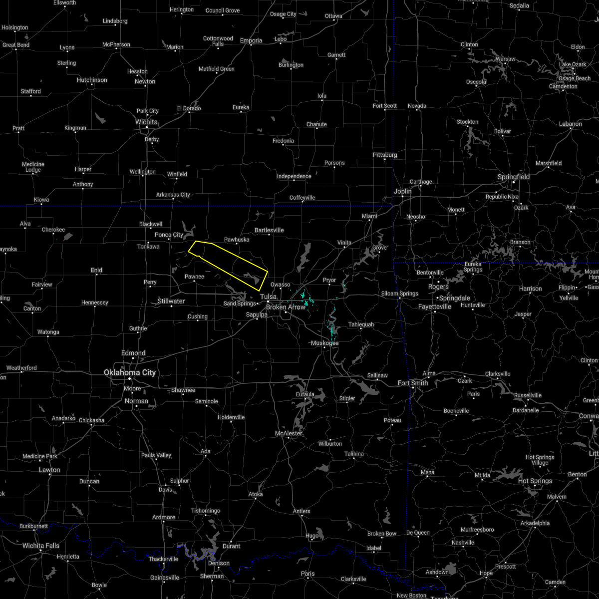 The severe thunderstorm warning for central osage county will expire at 130 am cdt, the storms which prompted the warning have weakened below severe limits. therefore the warning will be allowed to expire. however gusty winds are still possible with these thunderstorms. The severe thunderstorm warning for central osage county will expire at 130 am cdt, the storms which prompted the warning have weakened below severe limits. therefore the warning will be allowed to expire. however gusty winds are still possible with these thunderstorms.
|
| 10/12/2016 1:18 AM CDT |
 A severe thunderstorm warning remains in effect until 130 am cdt for central osage county. at 117 am cdt. severe thunderstorms were located along a line extending from 2 miles east of skiatook to 4 miles northeast of fairfax. moving east at 35 mph. hazard. 60 mph wind gusts and quarter size hail. A severe thunderstorm warning remains in effect until 130 am cdt for central osage county. at 117 am cdt. severe thunderstorms were located along a line extending from 2 miles east of skiatook to 4 miles northeast of fairfax. moving east at 35 mph. hazard. 60 mph wind gusts and quarter size hail.
|
| 10/12/2016 12:50 AM CDT |
 At 1249 am cdt, severe thunderstorms were located along a line extending from 2 miles east of hominy to 3 miles northwest of ralston, moving east at 30 mph (radar indicated). Hazards include 60 mph wind gusts and quarter size hail. Hail damage to vehicles is expected. expect wind damage to roofs, siding, and trees. Locations in or near the path include, skiatook, hominy, cleveland, fairfax, wynona, ralston, osage, burbank, blackburn, walnut creek state park, southwestern kaw lake,. At 1249 am cdt, severe thunderstorms were located along a line extending from 2 miles east of hominy to 3 miles northwest of ralston, moving east at 30 mph (radar indicated). Hazards include 60 mph wind gusts and quarter size hail. Hail damage to vehicles is expected. expect wind damage to roofs, siding, and trees. Locations in or near the path include, skiatook, hominy, cleveland, fairfax, wynona, ralston, osage, burbank, blackburn, walnut creek state park, southwestern kaw lake,.
|
| 8/29/2016 9:11 PM CDT |
 The severe thunderstorm warning for northeastern creek and south central tulsa counties will expire at 915 pm cdt, the storm which prompted the warning has weakened below severe limits, and no longer poses an immediate threat to life or property. therefore the warning will be allowed to expire. however gusty winds of 40 to 50 mph are still possible with this thunderstorm. The severe thunderstorm warning for northeastern creek and south central tulsa counties will expire at 915 pm cdt, the storm which prompted the warning has weakened below severe limits, and no longer poses an immediate threat to life or property. therefore the warning will be allowed to expire. however gusty winds of 40 to 50 mph are still possible with this thunderstorm.
|
| 8/29/2016 8:58 PM CDT |
 At 857 pm cdt, a severe thunderstorm was located 3 miles northeast of sapulpa, moving west at 20 mph (radar indicated). Hazards include 60 mph wind gusts. Expect damage to roofs. siding. and trees. Locations in or near the path include, southwestern tulsa, sand springs, bixby, sapulpa, jenks, glenpool, kiefer, this includes interstate 44 between mile markers 211 and 223. At 857 pm cdt, a severe thunderstorm was located 3 miles northeast of sapulpa, moving west at 20 mph (radar indicated). Hazards include 60 mph wind gusts. Expect damage to roofs. siding. and trees. Locations in or near the path include, southwestern tulsa, sand springs, bixby, sapulpa, jenks, glenpool, kiefer, this includes interstate 44 between mile markers 211 and 223.
|
| 8/29/2016 8:41 PM CDT |
 At 841 pm cdt, a severe thunderstorm was located over jenks, moving northwest at 20 mph (radar indicated). Hazards include 60 mph wind gusts. Expect damage to roofs. siding. and trees. Locations in or near the path include, southwestern tulsa, broken arrow, sand springs, bixby, sapulpa, jenks, glenpool, kiefer, this includes interstate 44 between mile markers 211 and 224. At 841 pm cdt, a severe thunderstorm was located over jenks, moving northwest at 20 mph (radar indicated). Hazards include 60 mph wind gusts. Expect damage to roofs. siding. and trees. Locations in or near the path include, southwestern tulsa, broken arrow, sand springs, bixby, sapulpa, jenks, glenpool, kiefer, this includes interstate 44 between mile markers 211 and 224.
|
| 7/28/2016 6:19 PM CDT |
 At 619 pm cdt, severe thunderstorms were located along a line extending from 6 miles northwest of kellyville to kiefer to 4 miles northeast of bixby, moving south at 10 mph (radar indicated). Hazards include 60 mph wind gusts and penny size hail. Expect damage to roofs. siding. and trees. Locations in or near the path include, southern tulsa, broken arrow, sand springs, bixby, sapulpa, jenks, glenpool, coweta, kiefer, mounds, kellyville, stonebluff, oneta, liberty, leonard, this includes interstate 44 between mile markers 192 and 225. At 619 pm cdt, severe thunderstorms were located along a line extending from 6 miles northwest of kellyville to kiefer to 4 miles northeast of bixby, moving south at 10 mph (radar indicated). Hazards include 60 mph wind gusts and penny size hail. Expect damage to roofs. siding. and trees. Locations in or near the path include, southern tulsa, broken arrow, sand springs, bixby, sapulpa, jenks, glenpool, coweta, kiefer, mounds, kellyville, stonebluff, oneta, liberty, leonard, this includes interstate 44 between mile markers 192 and 225.
|
| 7/28/2016 6:08 PM CDT |
 At 607 pm cdt, severe thunderstorms were located along a line extending from 7 miles south of mannford to 2 miles southwest of broken arrow, moving south at 15 mph (radar indicated. several reports of wind damage have been received in the tulsa metro area). Hazards include 60 mph wind gusts and penny size hail. Expect damage to roofs. siding. and trees. Locations in or near the path include, southern tulsa, broken arrow, sand springs, bixby, sapulpa, jenks, glenpool, coweta, kiefer, mounds, kellyville, stonebluff, oneta, liberty, leonard, this includes interstate 44 between mile markers 192 and 225. At 607 pm cdt, severe thunderstorms were located along a line extending from 7 miles south of mannford to 2 miles southwest of broken arrow, moving south at 15 mph (radar indicated. several reports of wind damage have been received in the tulsa metro area). Hazards include 60 mph wind gusts and penny size hail. Expect damage to roofs. siding. and trees. Locations in or near the path include, southern tulsa, broken arrow, sand springs, bixby, sapulpa, jenks, glenpool, coweta, kiefer, mounds, kellyville, stonebluff, oneta, liberty, leonard, this includes interstate 44 between mile markers 192 and 225.
|
| 7/28/2016 6:00 PM CDT |
 At 600 pm cdt, severe thunderstorms were located along a line extending from 5 miles northwest of jenks to 5 miles southeast of keystone state park, moving south at 10 mph (radar indicated). Hazards include 60 mph wind gusts and quarter size hail. Hail damage to vehicles is expected. expect wind damage to roofs, siding, and trees. Locations in or near the path include, western tulsa, sand springs, sapulpa, gray, this includes interstate 44 between mile markers 211 and 218. At 600 pm cdt, severe thunderstorms were located along a line extending from 5 miles northwest of jenks to 5 miles southeast of keystone state park, moving south at 10 mph (radar indicated). Hazards include 60 mph wind gusts and quarter size hail. Hail damage to vehicles is expected. expect wind damage to roofs, siding, and trees. Locations in or near the path include, western tulsa, sand springs, sapulpa, gray, this includes interstate 44 between mile markers 211 and 218.
|
| 7/28/2016 5:51 PM CDT |
 At 551 pm cdt, a severe thunderstorm was located 3 miles southwest of sand springs, moving southwest at 5 mph (radar indicated). Hazards include 60 mph wind gusts and quarter size hail. Hail damage to vehicles is expected. expect wind damage to roofs, siding, and trees. Locations in or near the path include, western tulsa, sand springs, sapulpa, gray, this includes interstate 44 between mile markers 211 and 218. At 551 pm cdt, a severe thunderstorm was located 3 miles southwest of sand springs, moving southwest at 5 mph (radar indicated). Hazards include 60 mph wind gusts and quarter size hail. Hail damage to vehicles is expected. expect wind damage to roofs, siding, and trees. Locations in or near the path include, western tulsa, sand springs, sapulpa, gray, this includes interstate 44 between mile markers 211 and 218.
|
| 7/28/2016 5:41 PM CDT |
 At 540 pm cdt, a severe thunderstorm was located over southwestern tulsa, moving southeast at 10 mph (radar indicated. at 528 pm...1 inch hail was reported in tulsa near 29th and peoria). Hazards include 60 mph wind gusts and quarter size hail. Hail damage to vehicles is expected. expect wind damage to roofs, siding, and trees. Locations in or near the path include, tulsa, sand springs, jenks, gray, this includes interstate 44 between mile markers 216 and 226. At 540 pm cdt, a severe thunderstorm was located over southwestern tulsa, moving southeast at 10 mph (radar indicated. at 528 pm...1 inch hail was reported in tulsa near 29th and peoria). Hazards include 60 mph wind gusts and quarter size hail. Hail damage to vehicles is expected. expect wind damage to roofs, siding, and trees. Locations in or near the path include, tulsa, sand springs, jenks, gray, this includes interstate 44 between mile markers 216 and 226.
|
| 7/28/2016 5:29 PM CDT |
 At 529 pm cdt, a severe thunderstorm was located over western tulsa, moving west at 5 mph (radar indicated). Hazards include 60 mph wind gusts and quarter size hail. Hail damage to vehicles is expected. expect wind damage to roofs, siding, and trees. Locations in or near the path include, tulsa, sand springs, jenks, gray, this includes interstate 44 between mile markers 216 and 226. At 529 pm cdt, a severe thunderstorm was located over western tulsa, moving west at 5 mph (radar indicated). Hazards include 60 mph wind gusts and quarter size hail. Hail damage to vehicles is expected. expect wind damage to roofs, siding, and trees. Locations in or near the path include, tulsa, sand springs, jenks, gray, this includes interstate 44 between mile markers 216 and 226.
|
| 7/14/2016 12:31 PM CDT |
 At 1230 pm cdt, severe thunderstorms were located along a line extending from tulsa to 2 miles northeast of jenks to 3 miles northwest of mounds, moving east at 30 mph (radar indicated). Hazards include 60 mph wind gusts and quarter size hail. Hail damage to vehicles is expected. expect wind damage to roofs, siding, and trees. Locations in or near the path include, tulsa, broken arrow, sand springs, claremore, owasso, bixby, sapulpa, jenks, glenpool, coweta, catoosa, verdigris, haskell, inola, kiefer, sperry, mounds, kellyville, stonebluff, oneta, this includes interstate 44 between mile markers 203 and 247. At 1230 pm cdt, severe thunderstorms were located along a line extending from tulsa to 2 miles northeast of jenks to 3 miles northwest of mounds, moving east at 30 mph (radar indicated). Hazards include 60 mph wind gusts and quarter size hail. Hail damage to vehicles is expected. expect wind damage to roofs, siding, and trees. Locations in or near the path include, tulsa, broken arrow, sand springs, claremore, owasso, bixby, sapulpa, jenks, glenpool, coweta, catoosa, verdigris, haskell, inola, kiefer, sperry, mounds, kellyville, stonebluff, oneta, this includes interstate 44 between mile markers 203 and 247.
|
| 7/14/2016 12:22 PM CDT | Roof damage to large barn angus valley in sand springs. via social media. time estimated from rada in tulsa county OK, 2.7 miles NW of Sand Springs, OK |
| 7/14/2016 12:19 PM CDT |
 At 1219 pm cdt, a severe thunderstorm capable of producing a tornado was located 4 miles south of sand springs, moving southeast at 75 mph (radar indicated rotation). Hazards include tornado. Flying debris will be dangerous to those caught without shelter. mobile homes will be damaged or destroyed. damage to roofs, windows, and vehicles will occur. tree damage is likely. Locations in or near the path include, tulsa, broken arrow, sand springs, bixby, sapulpa, jenks, glenpool, leonard, gray, this includes interstate 44 between mile markers 210 and 228. At 1219 pm cdt, a severe thunderstorm capable of producing a tornado was located 4 miles south of sand springs, moving southeast at 75 mph (radar indicated rotation). Hazards include tornado. Flying debris will be dangerous to those caught without shelter. mobile homes will be damaged or destroyed. damage to roofs, windows, and vehicles will occur. tree damage is likely. Locations in or near the path include, tulsa, broken arrow, sand springs, bixby, sapulpa, jenks, glenpool, leonard, gray, this includes interstate 44 between mile markers 210 and 228.
|
| 7/14/2016 12:09 PM CDT |
 At 1209 pm cdt, severe thunderstorms were located along a line extending from 3 miles north of bigheart to 2 miles west of walnut creek state park, moving east at 45 mph (radar indicated). Hazards include 60 mph wind gusts and quarter size hail. Hail damage to vehicles is expected. expect wind damage to roofs, siding, and trees. Locations in or near the path include, northern tulsa, bartlesville, sand springs, pawhuska, owasso, skiatook, catoosa, collinsville, hominy, dewey, cleveland, barnsdall, sperry, copan, ramona, wynona, ochelata, avant, westport, vera, this includes interstate 44 between mile markers 231 and 232. At 1209 pm cdt, severe thunderstorms were located along a line extending from 3 miles north of bigheart to 2 miles west of walnut creek state park, moving east at 45 mph (radar indicated). Hazards include 60 mph wind gusts and quarter size hail. Hail damage to vehicles is expected. expect wind damage to roofs, siding, and trees. Locations in or near the path include, northern tulsa, bartlesville, sand springs, pawhuska, owasso, skiatook, catoosa, collinsville, hominy, dewey, cleveland, barnsdall, sperry, copan, ramona, wynona, ochelata, avant, westport, vera, this includes interstate 44 between mile markers 231 and 232.
|
| 7/14/2016 12:03 PM CDT |
 At 1203 pm cdt, severe thunderstorms were located along a line extending from 3 miles east of terlton to 4 miles south of mannford to 6 miles north of bristow, moving east at 40 mph (radar indicated). Hazards include 60 mph wind gusts and quarter size hail. Hail damage to vehicles is expected. expect wind damage to roofs, siding, and trees. Locations in or near the path include, tulsa, broken arrow, sand springs, bixby, sapulpa, jenks, glenpool, mannford, kiefer, mounds, kellyville, terlton, keystone state park, liberty, gray, leonard, this includes interstate 44 between mile markers 194 and 232. At 1203 pm cdt, severe thunderstorms were located along a line extending from 3 miles east of terlton to 4 miles south of mannford to 6 miles north of bristow, moving east at 40 mph (radar indicated). Hazards include 60 mph wind gusts and quarter size hail. Hail damage to vehicles is expected. expect wind damage to roofs, siding, and trees. Locations in or near the path include, tulsa, broken arrow, sand springs, bixby, sapulpa, jenks, glenpool, mannford, kiefer, mounds, kellyville, terlton, keystone state park, liberty, gray, leonard, this includes interstate 44 between mile markers 194 and 232.
|
| 7/14/2016 11:48 AM CDT |
 At 1147 am cdt, severe thunderstorms were located along a line extending from 9 miles northeast of foraker to 4 miles southeast of blackburn, moving east at 45 mph. other severe storms were developing near just west of skiatook and sperry, and were lifting northeast at 20 mph (radar indicated). Hazards include 60 mph wind gusts and quarter size hail. Hail damage to vehicles is expected. expect wind damage to roofs, siding, and trees. Locations in or near the path include, northern tulsa, bartlesville, sand springs, pawhuska, pawnee, owasso, skiatook, catoosa, collinsville, hominy, dewey, cleveland, fairfax, barnsdall, sperry, copan, ramona, shidler, wynona, ochelata, this includes interstate 44 between mile markers 231 and 232. At 1147 am cdt, severe thunderstorms were located along a line extending from 9 miles northeast of foraker to 4 miles southeast of blackburn, moving east at 45 mph. other severe storms were developing near just west of skiatook and sperry, and were lifting northeast at 20 mph (radar indicated). Hazards include 60 mph wind gusts and quarter size hail. Hail damage to vehicles is expected. expect wind damage to roofs, siding, and trees. Locations in or near the path include, northern tulsa, bartlesville, sand springs, pawhuska, pawnee, owasso, skiatook, catoosa, collinsville, hominy, dewey, cleveland, fairfax, barnsdall, sperry, copan, ramona, shidler, wynona, ochelata, this includes interstate 44 between mile markers 231 and 232.
|
| 7/14/2016 11:22 AM CDT |
 At 1122 am cdt, a severe thunderstorm was located over glencoe, moving northeast at 40 mph (radar indicated). Hazards include 60 mph wind gusts and quarter size hail. Hail damage to vehicles is expected. expect wind damage to roofs, siding, and trees. Locations in or near the path include, pawnee, cleveland, jennings, westport, hallett, terlton, maramec,. At 1122 am cdt, a severe thunderstorm was located over glencoe, moving northeast at 40 mph (radar indicated). Hazards include 60 mph wind gusts and quarter size hail. Hail damage to vehicles is expected. expect wind damage to roofs, siding, and trees. Locations in or near the path include, pawnee, cleveland, jennings, westport, hallett, terlton, maramec,.
|
| 7/14/2016 1:28 AM CDT |
 At 128 am cdt, severe thunderstorms were located along a line extending from tulsa to 6 miles south of keystone state park, moving southeast at 30 mph (radar indicated). Hazards include 60 mph wind gusts and quarter size hail. Hail damage to vehicles is expected. expect wind damage to roofs, siding, and trees. Locations in or near the path include, southwestern tulsa, sand springs, bixby, sapulpa, jenks, glenpool, mannford, kiefer, mounds, kellyville, gray, this includes interstate 44 between mile markers 202 and 222. At 128 am cdt, severe thunderstorms were located along a line extending from tulsa to 6 miles south of keystone state park, moving southeast at 30 mph (radar indicated). Hazards include 60 mph wind gusts and quarter size hail. Hail damage to vehicles is expected. expect wind damage to roofs, siding, and trees. Locations in or near the path include, southwestern tulsa, sand springs, bixby, sapulpa, jenks, glenpool, mannford, kiefer, mounds, kellyville, gray, this includes interstate 44 between mile markers 202 and 222.
|
| 7/8/2016 8:35 AM CDT |
 At 835 am cdt, severe thunderstorms were located along a line extending from 3 miles west of westport to 6 miles south of mannford, moving east at 55 mph (radar indicated). Hazards include 60 mph wind gusts. Expect damage to roofs. siding. and trees. Locations in or near the path include, tulsa, sand springs, sapulpa, jenks, skiatook, mannford, sperry, westport, keystone state park, turley, walnut creek state park, gray, this includes interstate 44 between mile markers 204 and 227. At 835 am cdt, severe thunderstorms were located along a line extending from 3 miles west of westport to 6 miles south of mannford, moving east at 55 mph (radar indicated). Hazards include 60 mph wind gusts. Expect damage to roofs. siding. and trees. Locations in or near the path include, tulsa, sand springs, sapulpa, jenks, skiatook, mannford, sperry, westport, keystone state park, turley, walnut creek state park, gray, this includes interstate 44 between mile markers 204 and 227.
|
| 5/29/2016 4:24 PM CDT |
 At 424 pm cdt, a severe thunderstorm was located 7 miles east of walnut creek state park, moving east at 5 mph (radar indicated). Hazards include 60 mph wind gusts and quarter size hail. Hail damage to vehicles is expected. expect wind damage to roofs, siding, and trees. Locations in or near the path include, northwestern tulsa, skiatook,. At 424 pm cdt, a severe thunderstorm was located 7 miles east of walnut creek state park, moving east at 5 mph (radar indicated). Hazards include 60 mph wind gusts and quarter size hail. Hail damage to vehicles is expected. expect wind damage to roofs, siding, and trees. Locations in or near the path include, northwestern tulsa, skiatook,.
|
| 5/29/2016 4:13 PM CDT |
 At 412 pm cdt, a severe thunderstorm was located 7 miles northeast of walnut creek state park, and is nearly stationary (radar indicated). Hazards include 60 mph wind gusts and half dollar size hail. Hail damage to vehicles is expected. expect wind damage to roofs, siding, and trees. Locations in or near the path include, northwestern tulsa, skiatook,. At 412 pm cdt, a severe thunderstorm was located 7 miles northeast of walnut creek state park, and is nearly stationary (radar indicated). Hazards include 60 mph wind gusts and half dollar size hail. Hail damage to vehicles is expected. expect wind damage to roofs, siding, and trees. Locations in or near the path include, northwestern tulsa, skiatook,.
|
| 5/29/2016 4:00 PM CDT |
 At 400 pm cdt, a severe thunderstorm was located 8 miles northeast of walnut creek state park, and is nearly stationary (radar indicated). Hazards include 60 mph wind gusts and half dollar size hail. Hail damage to vehicles is expected. expect wind damage to roofs, siding, and trees. Locations in or near the path include, northwestern tulsa, skiatook, sperry,. At 400 pm cdt, a severe thunderstorm was located 8 miles northeast of walnut creek state park, and is nearly stationary (radar indicated). Hazards include 60 mph wind gusts and half dollar size hail. Hail damage to vehicles is expected. expect wind damage to roofs, siding, and trees. Locations in or near the path include, northwestern tulsa, skiatook, sperry,.
|
| 5/29/2016 3:51 PM CDT |
 At 351 pm cdt, a severe thunderstorm was located 8 miles west of skiatook, and is nearly stationary (radar indicated). Hazards include 60 mph wind gusts and quarter size hail. Hail damage to vehicles is expected. expect wind damage to roofs, siding, and trees. Locations in or near the path include, northwestern tulsa, skiatook, sperry,. At 351 pm cdt, a severe thunderstorm was located 8 miles west of skiatook, and is nearly stationary (radar indicated). Hazards include 60 mph wind gusts and quarter size hail. Hail damage to vehicles is expected. expect wind damage to roofs, siding, and trees. Locations in or near the path include, northwestern tulsa, skiatook, sperry,.
|
| 5/29/2016 3:45 PM CDT |
 At 345 pm cdt, a severe thunderstorm was located 6 miles southwest of skiatook, moving northeast at 15 mph (radar indicated). Hazards include 60 mph wind gusts and quarter size hail. Hail damage to vehicles is expected. expect wind damage to roofs, siding, and trees. Locations in or near the path include, northwestern tulsa, skiatook, sperry,. At 345 pm cdt, a severe thunderstorm was located 6 miles southwest of skiatook, moving northeast at 15 mph (radar indicated). Hazards include 60 mph wind gusts and quarter size hail. Hail damage to vehicles is expected. expect wind damage to roofs, siding, and trees. Locations in or near the path include, northwestern tulsa, skiatook, sperry,.
|
| 5/25/2016 12:36 AM CDT |
 At 1235 am cdt, a severe thunderstorm was located 5 miles south of slick, moving east at 35 mph (radar indicated). Hazards include 70 mph wind gusts and half dollar size hail. Hail damage to vehicles is expected. expect considerable tree damage. wind damage is also likely to mobile homes, roofs, and outbuildings. Locations in or near the path include, okmulgee, bristow, sapulpa, okfuskee, beggs, kellyville, depew, slick, preston, welty, okmulgee state park, this includes interstate 44 between mile markers 182 and 209. At 1235 am cdt, a severe thunderstorm was located 5 miles south of slick, moving east at 35 mph (radar indicated). Hazards include 70 mph wind gusts and half dollar size hail. Hail damage to vehicles is expected. expect considerable tree damage. wind damage is also likely to mobile homes, roofs, and outbuildings. Locations in or near the path include, okmulgee, bristow, sapulpa, okfuskee, beggs, kellyville, depew, slick, preston, welty, okmulgee state park, this includes interstate 44 between mile markers 182 and 209.
|
| 5/25/2016 12:13 AM CDT |
 At 1235 am cdt, a severe thunderstorm was located 5 miles south of slick, moving east at 35 mph (radar indicated). Hazards include 70 mph wind gusts and half dollar size hail. Hail damage to vehicles is expected. expect considerable tree damage. wind damage is also likely to mobile homes, roofs, and outbuildings. Locations in or near the path include, okmulgee, bristow, sapulpa, okfuskee, beggs, kellyville, depew, slick, preston, welty, okmulgee state park, this includes interstate 44 between mile markers 182 and 209. At 1235 am cdt, a severe thunderstorm was located 5 miles south of slick, moving east at 35 mph (radar indicated). Hazards include 70 mph wind gusts and half dollar size hail. Hail damage to vehicles is expected. expect considerable tree damage. wind damage is also likely to mobile homes, roofs, and outbuildings. Locations in or near the path include, okmulgee, bristow, sapulpa, okfuskee, beggs, kellyville, depew, slick, preston, welty, okmulgee state park, this includes interstate 44 between mile markers 182 and 209.
|
| 4/29/2016 5:50 PM CDT |
 At 550 pm cdt, a severe thunderstorm was located 3 miles northwest of glenpool, moving northeast at 30 mph (radar indicated). Hazards include 60 mph wind gusts and quarter size hail. Hail damage to vehicles is expected. expect wind damage to roofs, siding, and trees. Locations in or near the path include, tulsa, broken arrow, sand springs, claremore, owasso, bixby, sapulpa, jenks, glenpool, catoosa, collinsville, verdigris, kiefer, turley, this includes interstate 44 between mile markers 208 and 248. At 550 pm cdt, a severe thunderstorm was located 3 miles northwest of glenpool, moving northeast at 30 mph (radar indicated). Hazards include 60 mph wind gusts and quarter size hail. Hail damage to vehicles is expected. expect wind damage to roofs, siding, and trees. Locations in or near the path include, tulsa, broken arrow, sand springs, claremore, owasso, bixby, sapulpa, jenks, glenpool, catoosa, collinsville, verdigris, kiefer, turley, this includes interstate 44 between mile markers 208 and 248.
|
| 4/29/2016 5:34 PM CDT |
 At 534 pm cdt, a severe thunderstorm was located 3 miles northwest of mounds, moving northeast at 45 mph (radar indicated). Hazards include 60 mph wind gusts and quarter size hail. Hail damage to vehicles is expected. expect wind damage to roofs, siding, and trees. locations in or near the path include, tulsa, broken arrow, sand springs, claremore, owasso, bixby, sapulpa, jenks, glenpool, catoosa, collinsville, verdigris, kiefer, mounds, kellyville, turley, liberty, this includes interstate 44 between mile markers 208 and 248. A tornado watch remains in effect until 1000 pm cdt for northeastern oklahoma. At 534 pm cdt, a severe thunderstorm was located 3 miles northwest of mounds, moving northeast at 45 mph (radar indicated). Hazards include 60 mph wind gusts and quarter size hail. Hail damage to vehicles is expected. expect wind damage to roofs, siding, and trees. locations in or near the path include, tulsa, broken arrow, sand springs, claremore, owasso, bixby, sapulpa, jenks, glenpool, catoosa, collinsville, verdigris, kiefer, mounds, kellyville, turley, liberty, this includes interstate 44 between mile markers 208 and 248. A tornado watch remains in effect until 1000 pm cdt for northeastern oklahoma.
|
| 4/26/2016 10:22 PM CDT |
 At 1022 pm cdt, severe thunderstorms with strong low level rotation that could produce tornadoes at any time were located along a line extending from 2 miles west of sperry to tulsa, moving northeast at 50 mph (radar indicated rotation). Hazards include tornado. Flying debris will be dangerous to those caught without shelter. mobile homes will be damaged or destroyed. damage to roofs, windows, and vehicles will occur. tree damage is likely. Locations in or near the path include, tulsa, broken arrow, sand springs, jenks, skiatook, sperry, turley, this includes interstate 44 between mile markers 217 and 228. At 1022 pm cdt, severe thunderstorms with strong low level rotation that could produce tornadoes at any time were located along a line extending from 2 miles west of sperry to tulsa, moving northeast at 50 mph (radar indicated rotation). Hazards include tornado. Flying debris will be dangerous to those caught without shelter. mobile homes will be damaged or destroyed. damage to roofs, windows, and vehicles will occur. tree damage is likely. Locations in or near the path include, tulsa, broken arrow, sand springs, jenks, skiatook, sperry, turley, this includes interstate 44 between mile markers 217 and 228.
|
| 4/26/2016 10:20 PM CDT |
 At 1019 pm cdt, severe thunderstorms were located along a line extending from 4 miles southwest of skiatook to 2 miles south of glenpool to 4 miles south of okmulgee state park, moving northeast at 55 mph (radar indicated). Hazards include 70 mph wind gusts. Expect considerable tree damage. damage is likely to mobile homes, roofs, and outbuildings. locations in or near the path include, tulsa, broken arrow, sand springs, claremore, okmulgee, owasso, bixby, sapulpa, jenks, glenpool, coweta, skiatook, catoosa, collinsville, verdigris, haskell, chelsea, inola, kiefer, beggs, this includes interstate 44 between mile markers 209 and 259. A tornado watch remains in effect until midnight cdt for northeastern oklahoma. At 1019 pm cdt, severe thunderstorms were located along a line extending from 4 miles southwest of skiatook to 2 miles south of glenpool to 4 miles south of okmulgee state park, moving northeast at 55 mph (radar indicated). Hazards include 70 mph wind gusts. Expect considerable tree damage. damage is likely to mobile homes, roofs, and outbuildings. locations in or near the path include, tulsa, broken arrow, sand springs, claremore, okmulgee, owasso, bixby, sapulpa, jenks, glenpool, coweta, skiatook, catoosa, collinsville, verdigris, haskell, chelsea, inola, kiefer, beggs, this includes interstate 44 between mile markers 209 and 259. A tornado watch remains in effect until midnight cdt for northeastern oklahoma.
|
| 4/26/2016 10:13 PM CDT |
 At 1013 pm cdt, severe thunderstorms were located along a line extending from near elgin to near okesa to 8 miles southwest of avant, moving northeast at 70 mph (radar indicated). Hazards include 70 mph wind gusts. Expect considerable tree damage. damage is likely to mobile homes, roofs, and outbuildings. Locations in or near the path include, bartlesville, nowata, pawhuska, skiatook, dewey, barnsdall, south coffeyville, copan, ramona, ochelata, delaware, avant, lenapah, talala, vera, wann, new alluwe, elgin, okesa, bigheart, a tornado watch remains in effect until midnight cdt for northeastern oklahoma. At 1013 pm cdt, severe thunderstorms were located along a line extending from near elgin to near okesa to 8 miles southwest of avant, moving northeast at 70 mph (radar indicated). Hazards include 70 mph wind gusts. Expect considerable tree damage. damage is likely to mobile homes, roofs, and outbuildings. Locations in or near the path include, bartlesville, nowata, pawhuska, skiatook, dewey, barnsdall, south coffeyville, copan, ramona, ochelata, delaware, avant, lenapah, talala, vera, wann, new alluwe, elgin, okesa, bigheart, a tornado watch remains in effect until midnight cdt for northeastern oklahoma.
|
| 4/26/2016 10:09 PM CDT |
 At 1008 pm cdt, severe thunderstorms with strong low level rotation that could produce tornadoes at any time were located along a line extending from 4 miles southeast of walnut creek state park to 2 miles northwest of sapulpa, moving northeast at 70 mph (radar indicated rotation). Hazards include tornado. Flying debris will be dangerous to those caught without shelter. mobile homes will be damaged or destroyed. damage to roofs, windows, and vehicles will occur. tree damage is likely. Locations in or near the path include, tulsa, broken arrow, sand springs, sapulpa, jenks, skiatook, sperry, turley, gray, this includes interstate 44 between mile markers 208 and 228. At 1008 pm cdt, severe thunderstorms with strong low level rotation that could produce tornadoes at any time were located along a line extending from 4 miles southeast of walnut creek state park to 2 miles northwest of sapulpa, moving northeast at 70 mph (radar indicated rotation). Hazards include tornado. Flying debris will be dangerous to those caught without shelter. mobile homes will be damaged or destroyed. damage to roofs, windows, and vehicles will occur. tree damage is likely. Locations in or near the path include, tulsa, broken arrow, sand springs, sapulpa, jenks, skiatook, sperry, turley, gray, this includes interstate 44 between mile markers 208 and 228.
|
| 4/26/2016 10:00 PM CDT |
 At 1000 pm cdt, severe thunderstorms with strong low level rotation that could produce tornadoes at any time were located along a line extending from 2 miles northwest of westport to 2 miles south of kellyville, moving northeast at 55 mph (radar indicated rotation). Hazards include tornado. Flying debris will be dangerous to those caught without shelter. mobile homes will be damaged or destroyed. damage to roofs, windows, and vehicles will occur. tree damage is likely. Locations in or near the path include, tulsa, broken arrow, sand springs, bixby, sapulpa, jenks, glenpool, skiatook, mannford, sperry, kellyville, westport, turley, walnut creek state park, keystone state park, gray, this includes interstate 44 between mile markers 199 and 228. At 1000 pm cdt, severe thunderstorms with strong low level rotation that could produce tornadoes at any time were located along a line extending from 2 miles northwest of westport to 2 miles south of kellyville, moving northeast at 55 mph (radar indicated rotation). Hazards include tornado. Flying debris will be dangerous to those caught without shelter. mobile homes will be damaged or destroyed. damage to roofs, windows, and vehicles will occur. tree damage is likely. Locations in or near the path include, tulsa, broken arrow, sand springs, bixby, sapulpa, jenks, glenpool, skiatook, mannford, sperry, kellyville, westport, turley, walnut creek state park, keystone state park, gray, this includes interstate 44 between mile markers 199 and 228.
|
| 4/26/2016 9:57 PM CDT |
 At 957 pm cdt, severe thunderstorms were located along a line extending from 3 miles northeast of cleveland to 6 miles northwest of kellyville to 4 miles northeast of castle, moving northeast at 60 mph (radar indicated). Hazards include 70 mph wind gusts. Expect considerable tree damage. damage is likely to mobile homes, roofs, and outbuildings. locations in or near the path include, bristow, okfuskee, hominy, cleveland, mannford, beggs, kellyville, oilton, depew, jennings, westport, osage, slick, hallett, blackburn, castle, terlton, welty, walnut creek state park, keystone state park, this includes interstate 44 between mile markers 183 and 208. A tornado watch remains in effect until midnight cdt for northeastern oklahoma. At 957 pm cdt, severe thunderstorms were located along a line extending from 3 miles northeast of cleveland to 6 miles northwest of kellyville to 4 miles northeast of castle, moving northeast at 60 mph (radar indicated). Hazards include 70 mph wind gusts. Expect considerable tree damage. damage is likely to mobile homes, roofs, and outbuildings. locations in or near the path include, bristow, okfuskee, hominy, cleveland, mannford, beggs, kellyville, oilton, depew, jennings, westport, osage, slick, hallett, blackburn, castle, terlton, welty, walnut creek state park, keystone state park, this includes interstate 44 between mile markers 183 and 208. A tornado watch remains in effect until midnight cdt for northeastern oklahoma.
|
| 4/26/2016 9:31 PM CDT |
 At 930 pm cdt, severe thunderstorms were located along a line extending from 5 miles west of quay to 3 miles west of paden, moving northeast at 60 mph (radar indicated). Hazards include 70 mph wind gusts and penny size hail. Expect considerable tree damage. damage is likely to mobile homes, roofs, and outbuildings. locations in or near the path include, bristow, pawnee, okfuskee, hominy, cleveland, mannford, drumright, beggs, boley, kellyville, oilton, depew, paden, jennings, westport, osage, slick, hallett, blackburn, castle, this includes interstate 44 between mile markers 178 and 208. A tornado watch remains in effect until midnight cdt for northeastern oklahoma. At 930 pm cdt, severe thunderstorms were located along a line extending from 5 miles west of quay to 3 miles west of paden, moving northeast at 60 mph (radar indicated). Hazards include 70 mph wind gusts and penny size hail. Expect considerable tree damage. damage is likely to mobile homes, roofs, and outbuildings. locations in or near the path include, bristow, pawnee, okfuskee, hominy, cleveland, mannford, drumright, beggs, boley, kellyville, oilton, depew, paden, jennings, westport, osage, slick, hallett, blackburn, castle, this includes interstate 44 between mile markers 178 and 208. A tornado watch remains in effect until midnight cdt for northeastern oklahoma.
|
| 4/11/2016 2:43 AM CDT | The severe thunderstorm warning for southeastern osage and central tulsa counties will expire at 245 am cdt, the storms which prompted the warning have weakened below severe limits, and have exited the warned area. therefore the warning will be allowed to expire. a severe thunderstorm watch remains in effect until 800 am cdt for northeastern oklahoma. |
| 4/11/2016 2:29 AM CDT |
 At 229 am cdt, severe thunderstorms were located along a line extending from 6 miles east of walnut creek state park to tulsa, moving northeast at 30 mph (radar indicated). Hazards include 60 mph wind gusts. Expect damage to roofs. siding. and trees. Locations in or near the path include, tulsa, sand springs, sperry, turley, gray, this includes interstate 44 between mile markers 216 and 230. At 229 am cdt, severe thunderstorms were located along a line extending from 6 miles east of walnut creek state park to tulsa, moving northeast at 30 mph (radar indicated). Hazards include 60 mph wind gusts. Expect damage to roofs. siding. and trees. Locations in or near the path include, tulsa, sand springs, sperry, turley, gray, this includes interstate 44 between mile markers 216 and 230.
|
| 4/11/2016 2:17 AM CDT |
 At 216 am cdt, severe thunderstorms were located along a line extending from 3 miles southeast of walnut creek state park to tulsa, moving northeast at 40 mph (radar indicated). Hazards include 60 mph wind gusts. Expect damage to roofs. siding. and trees. Locations in or near the path include, tulsa, broken arrow, sand springs, bixby, jenks, sperry, turley, gray, this includes interstate 44 between mile markers 216 and 231. At 216 am cdt, severe thunderstorms were located along a line extending from 3 miles southeast of walnut creek state park to tulsa, moving northeast at 40 mph (radar indicated). Hazards include 60 mph wind gusts. Expect damage to roofs. siding. and trees. Locations in or near the path include, tulsa, broken arrow, sand springs, bixby, jenks, sperry, turley, gray, this includes interstate 44 between mile markers 216 and 231.
|
| 4/11/2016 2:02 AM CDT |
 At 202 am cdt, severe thunderstorms were located along a line extending from 2 miles southwest of keystone state park to kiefer, moving northeast at 40 mph (radar indicated). Hazards include 60 mph wind gusts. Expect damage to roofs. siding. and trees. Locations in or near the path include, tulsa, broken arrow, sand springs, bixby, sapulpa, jenks, glenpool, mannford, kiefer, sperry, turley, keystone state park, gray, this includes interstate 44 between mile markers 209 and 231. At 202 am cdt, severe thunderstorms were located along a line extending from 2 miles southwest of keystone state park to kiefer, moving northeast at 40 mph (radar indicated). Hazards include 60 mph wind gusts. Expect damage to roofs. siding. and trees. Locations in or near the path include, tulsa, broken arrow, sand springs, bixby, sapulpa, jenks, glenpool, mannford, kiefer, sperry, turley, keystone state park, gray, this includes interstate 44 between mile markers 209 and 231.
|
| 4/11/2016 1:47 AM CDT |
 At 146 am cdt, a severe thunderstorm was located over mannford, moving northeast at 30 mph (radar indicated). Hazards include 60 mph wind gusts. Expect damage to roofs. siding. and trees. Locations in or near the path include, mannford, westport, terlton,. At 146 am cdt, a severe thunderstorm was located over mannford, moving northeast at 30 mph (radar indicated). Hazards include 60 mph wind gusts. Expect damage to roofs. siding. and trees. Locations in or near the path include, mannford, westport, terlton,.
|
| 3/30/2016 7:02 PM CDT |
 At 701 pm cdt, a severe thunderstorm capable of producing a tornado was located 3 miles north of sand springs, moving east at 25 mph (radar indicated rotation). Hazards include tornado and golf ball size hail. Flying debris will be dangerous to those caught without shelter. mobile homes will be damaged or destroyed. damage to roofs, windows, and vehicles will occur. tree damage is likely. Locations in or near the path include, northern tulsa, sand springs, owasso, skiatook, collinsville, sperry, turley,. At 701 pm cdt, a severe thunderstorm capable of producing a tornado was located 3 miles north of sand springs, moving east at 25 mph (radar indicated rotation). Hazards include tornado and golf ball size hail. Flying debris will be dangerous to those caught without shelter. mobile homes will be damaged or destroyed. damage to roofs, windows, and vehicles will occur. tree damage is likely. Locations in or near the path include, northern tulsa, sand springs, owasso, skiatook, collinsville, sperry, turley,.
|
| 3/30/2016 6:46 PM CDT |
 At 646 pm cdt, a severe thunderstorm capable of producing a tornado was located near keystone state park, moving east at 35 mph (radar indicated rotation). Hazards include tornado and golf ball size hail. Flying debris will be dangerous to those caught without shelter. mobile homes will be damaged or destroyed. damage to roofs, windows, and vehicles will occur. tree damage is likely. Locations in or near the path include, northern tulsa, sand springs, owasso, skiatook, collinsville, sperry, westport, turley, walnut creek state park, keystone state park,. At 646 pm cdt, a severe thunderstorm capable of producing a tornado was located near keystone state park, moving east at 35 mph (radar indicated rotation). Hazards include tornado and golf ball size hail. Flying debris will be dangerous to those caught without shelter. mobile homes will be damaged or destroyed. damage to roofs, windows, and vehicles will occur. tree damage is likely. Locations in or near the path include, northern tulsa, sand springs, owasso, skiatook, collinsville, sperry, westport, turley, walnut creek state park, keystone state park,.
|
| 3/30/2016 6:35 PM CDT |
 At 634 pm cdt, a severe thunderstorm was located near westport, moving east at 35 mph (radar indicated). Hazards include 60 mph wind gusts and half dollar size hail. Hail damage to vehicles is expected. expect wind damage to roofs, siding, and trees. Locations in or near the path include, northwestern tulsa, owasso, skiatook, collinsville, sperry, westport, vera, turley, walnut creek state park,. At 634 pm cdt, a severe thunderstorm was located near westport, moving east at 35 mph (radar indicated). Hazards include 60 mph wind gusts and half dollar size hail. Hail damage to vehicles is expected. expect wind damage to roofs, siding, and trees. Locations in or near the path include, northwestern tulsa, owasso, skiatook, collinsville, sperry, westport, vera, turley, walnut creek state park,.
|
| 3/30/2016 11:52 AM CDT |
 At 1151 am cdt, severe thunderstorms were located along a line extending from 7 miles southeast of hominy to near jennings, moving northeast at 40 mph (radar indicated). Hazards include quarter size hail. Damage to vehicles is expected. Locations in or near the path include, hominy, cleveland, jennings, osage, hallett, terlton,. At 1151 am cdt, severe thunderstorms were located along a line extending from 7 miles southeast of hominy to near jennings, moving northeast at 40 mph (radar indicated). Hazards include quarter size hail. Damage to vehicles is expected. Locations in or near the path include, hominy, cleveland, jennings, osage, hallett, terlton,.
|
| 3/30/2016 11:35 AM CDT |
 At 1135 am cdt, a severe thunderstorm was located 3 miles northwest of westport, moving northeast at 55 mph (radar indicated). Hazards include 60 mph wind gusts and half dollar size hail. Hail damage to vehicles is expected. expect wind damage to roofs, siding, and trees. Locations in or near the path include, skiatook, hominy, cleveland, mannford, oilton, jennings, westport, osage, hallett, terlton, walnut creek state park, silver city,. At 1135 am cdt, a severe thunderstorm was located 3 miles northwest of westport, moving northeast at 55 mph (radar indicated). Hazards include 60 mph wind gusts and half dollar size hail. Hail damage to vehicles is expected. expect wind damage to roofs, siding, and trees. Locations in or near the path include, skiatook, hominy, cleveland, mannford, oilton, jennings, westport, osage, hallett, terlton, walnut creek state park, silver city,.
|
| 3/30/2016 11:24 AM CDT |
 At 1124 am cdt, a severe thunderstorm was located near terlton, moving northeast at 55 mph (radar indicated). Hazards include 60 mph wind gusts and quarter size hail. Hail damage to vehicles is expected. expect wind damage to roofs, siding, and trees. Locations in or near the path include, skiatook, hominy, cleveland, mannford, oilton, jennings, westport, osage, hallett, terlton, walnut creek state park, silver city,. At 1124 am cdt, a severe thunderstorm was located near terlton, moving northeast at 55 mph (radar indicated). Hazards include 60 mph wind gusts and quarter size hail. Hail damage to vehicles is expected. expect wind damage to roofs, siding, and trees. Locations in or near the path include, skiatook, hominy, cleveland, mannford, oilton, jennings, westport, osage, hallett, terlton, walnut creek state park, silver city,.
|
| 3/1/2016 2:20 AM CST |
 At 220 am cst, severe thunderstorms were located along a line extending from tulsa to 3 miles northwest of broken arrow, moving east at 30 mph (radar indicated). Hazards include quarter size hail. Damage to vehicles is expected. Locations in or near the path include, tulsa, broken arrow, sand springs, coweta, catoosa, inola, oneta, this includes interstate 44 between mile markers 223 and 238. At 220 am cst, severe thunderstorms were located along a line extending from tulsa to 3 miles northwest of broken arrow, moving east at 30 mph (radar indicated). Hazards include quarter size hail. Damage to vehicles is expected. Locations in or near the path include, tulsa, broken arrow, sand springs, coweta, catoosa, inola, oneta, this includes interstate 44 between mile markers 223 and 238.
|
| 11/17/2015 4:02 AM CST |
 At 402 am cst, severe thunderstorms were located along a line extending from 3 miles southeast of sand springs to 2 miles east of kellyville to 4 miles northeast of okemah, moving east at 45 mph (radar indicated). Hazards include 60 mph wind gusts. Damage to roofs. siding and trees will be possible. locations in or near the path include, tulsa, broken arrow, sand springs, okmulgee, bristow, okemah, bixby, sapulpa, jenks, okfuskee, glenpool, kiefer, beggs, boley, mounds, kellyville, paden, slick, castle, welty, this includes the following highways, interstate 40 in oklahoma between mile markers 218 and 223. Interstate 44 between mile markers 190 and 228. At 402 am cst, severe thunderstorms were located along a line extending from 3 miles southeast of sand springs to 2 miles east of kellyville to 4 miles northeast of okemah, moving east at 45 mph (radar indicated). Hazards include 60 mph wind gusts. Damage to roofs. siding and trees will be possible. locations in or near the path include, tulsa, broken arrow, sand springs, okmulgee, bristow, okemah, bixby, sapulpa, jenks, okfuskee, glenpool, kiefer, beggs, boley, mounds, kellyville, paden, slick, castle, welty, this includes the following highways, interstate 40 in oklahoma between mile markers 218 and 223. Interstate 44 between mile markers 190 and 228.
|
| 11/17/2015 3:56 AM CST |
 At 355 am cst, severe thunderstorms were located along a line extending from 2 miles east of sand springs to 2 miles southwest of kellyville to near okemah, moving east at 40 mph (radar indicated). Hazards include 60 mph wind gusts. Damage to roofs. siding and trees will be possible. locations in or near the path include, tulsa, broken arrow, sand springs, okmulgee, bristow, okemah, bixby, sapulpa, jenks, okfuskee, glenpool, henryetta, kiefer, beggs, boley, mounds, kellyville, schulter, depew, paden, this includes the following highways, interstate 40 in oklahoma between mile markers 217 and 225. Interstate 44 between mile markers 184 and 229. At 355 am cst, severe thunderstorms were located along a line extending from 2 miles east of sand springs to 2 miles southwest of kellyville to near okemah, moving east at 40 mph (radar indicated). Hazards include 60 mph wind gusts. Damage to roofs. siding and trees will be possible. locations in or near the path include, tulsa, broken arrow, sand springs, okmulgee, bristow, okemah, bixby, sapulpa, jenks, okfuskee, glenpool, henryetta, kiefer, beggs, boley, mounds, kellyville, schulter, depew, paden, this includes the following highways, interstate 40 in oklahoma between mile markers 217 and 225. Interstate 44 between mile markers 184 and 229.
|
| 11/17/2015 3:37 AM CST |
 At 337 am cst, severe thunderstorms were located along a line extending from 3 miles south of keystone state park to 4 miles northwest of bristow to near boley, moving east at 35 mph (radar indicated). Hazards include 60 mph wind gusts. Damage to roofs. siding and trees is possible. locations in or near the path include, tulsa, broken arrow, sand springs, okmulgee, bristow, okemah, bixby, sapulpa, jenks, okfuskee, glenpool, coweta, catoosa, henryetta, drumright, haskell, inola, kiefer, morris, beggs, this includes the following highways, interstate 40 in oklahoma between mile markers 217 and 225. Interstate 44 between mile markers 178 and 230. At 337 am cst, severe thunderstorms were located along a line extending from 3 miles south of keystone state park to 4 miles northwest of bristow to near boley, moving east at 35 mph (radar indicated). Hazards include 60 mph wind gusts. Damage to roofs. siding and trees is possible. locations in or near the path include, tulsa, broken arrow, sand springs, okmulgee, bristow, okemah, bixby, sapulpa, jenks, okfuskee, glenpool, coweta, catoosa, henryetta, drumright, haskell, inola, kiefer, morris, beggs, this includes the following highways, interstate 40 in oklahoma between mile markers 217 and 225. Interstate 44 between mile markers 178 and 230.
|
| 11/17/2015 3:36 AM CST |
 At 335 am cst, severe thunderstorms were located along a line extending from 2 miles north of wann to 6 miles northeast of ochelata to 2 miles east of keystone state park, moving northeast at 55 mph (radar indicated). Hazards include 60 mph wind gusts. Damage to roofs. siding and trees is possible. Locations in or near the path include, tulsa, bartlesville, sand springs, claremore, nowata, owasso, skiatook, catoosa, collinsville, verdigris, dewey, mannford, chelsea, inola, sperry, oologah, south coffeyville, copan, ramona, ochelata, this includes interstate 44 between mile markers 227 and 260. At 335 am cst, severe thunderstorms were located along a line extending from 2 miles north of wann to 6 miles northeast of ochelata to 2 miles east of keystone state park, moving northeast at 55 mph (radar indicated). Hazards include 60 mph wind gusts. Damage to roofs. siding and trees is possible. Locations in or near the path include, tulsa, bartlesville, sand springs, claremore, nowata, owasso, skiatook, catoosa, collinsville, verdigris, dewey, mannford, chelsea, inola, sperry, oologah, south coffeyville, copan, ramona, ochelata, this includes interstate 44 between mile markers 227 and 260.
|
| 11/17/2015 3:11 AM CST |
 At 311 am cst, severe thunderstorms were located along a line extending from 2 miles north of drumright to 3 miles northwest of prague, moving east at 45 mph (radar indicated). Hazards include 60 mph wind gusts. Damage to roofs. siding and trees is possible. locations in or near the path include, tulsa, broken arrow, sand springs, okmulgee, bristow, okemah, bixby, sapulpa, jenks, okfuskee, glenpool, coweta, catoosa, henryetta, drumright, haskell, inola, kiefer, morris, beggs, this includes the following highways, interstate 40 in oklahoma between mile markers 217 and 225. Interstate 44 between mile markers 178 and 230. At 311 am cst, severe thunderstorms were located along a line extending from 2 miles north of drumright to 3 miles northwest of prague, moving east at 45 mph (radar indicated). Hazards include 60 mph wind gusts. Damage to roofs. siding and trees is possible. locations in or near the path include, tulsa, broken arrow, sand springs, okmulgee, bristow, okemah, bixby, sapulpa, jenks, okfuskee, glenpool, coweta, catoosa, henryetta, drumright, haskell, inola, kiefer, morris, beggs, this includes the following highways, interstate 40 in oklahoma between mile markers 217 and 225. Interstate 44 between mile markers 178 and 230.
|
| 11/17/2015 3:07 AM CST |
 At 307 am cst, severe thunderstorms were located along a line extending from 2 miles northeast of bigheart to 2 miles southwest of barnsdall to 4 miles northeast of oilton, moving northeast at 70 mph (radar indicated). Hazards include 60 mph wind gusts. Expect damage to roofs. siding and trees. Locations in or near the path include, tulsa, bartlesville, sand springs, claremore, nowata, owasso, skiatook, catoosa, collinsville, verdigris, dewey, mannford, chelsea, inola, barnsdall, sperry, oologah, south coffeyville, copan, ramona, this includes interstate 44 between mile markers 227 and 260. At 307 am cst, severe thunderstorms were located along a line extending from 2 miles northeast of bigheart to 2 miles southwest of barnsdall to 4 miles northeast of oilton, moving northeast at 70 mph (radar indicated). Hazards include 60 mph wind gusts. Expect damage to roofs. siding and trees. Locations in or near the path include, tulsa, bartlesville, sand springs, claremore, nowata, owasso, skiatook, catoosa, collinsville, verdigris, dewey, mannford, chelsea, inola, barnsdall, sperry, oologah, south coffeyville, copan, ramona, this includes interstate 44 between mile markers 227 and 260.
|
| 11/17/2015 2:50 AM CST |
 At 249 am cst, severe thunderstorms were located along a line extending from 3 miles northeast of foraker to 4 miles northwest of wynona to hallett, moving east at 45 mph (radar indicated). Hazards include 60 mph wind gusts. Damage to roofs. siding and trees is possible. Locations in or near the path include, northwestern tulsa, bartlesville, sand springs, pawhuska, pawnee, skiatook, hominy, cleveland, mannford, fairfax, barnsdall, oilton, shidler, wynona, jennings, ralston, avant, westport, osage, burbank,. At 249 am cst, severe thunderstorms were located along a line extending from 3 miles northeast of foraker to 4 miles northwest of wynona to hallett, moving east at 45 mph (radar indicated). Hazards include 60 mph wind gusts. Damage to roofs. siding and trees is possible. Locations in or near the path include, northwestern tulsa, bartlesville, sand springs, pawhuska, pawnee, skiatook, hominy, cleveland, mannford, fairfax, barnsdall, oilton, shidler, wynona, jennings, ralston, avant, westport, osage, burbank,.
|
| 11/17/2015 2:37 AM CST |
 At 237 am cst, severe thunderstorms were located along a line extending from 2 miles west of shidler to 8 miles east of fairfax to near maramec, moving east at 50 mph (radar indicated). Hazards include 70 mph wind gusts. Expect considerable tree damage. damage is likely to mobile homes, roofs and outbuildings. Locations in or near the path include, northwestern tulsa, bartlesville, sand springs, pawhuska, pawnee, skiatook, hominy, cleveland, mannford, fairfax, barnsdall, oilton, shidler, wynona, jennings, ralston, avant, westport, osage, burbank,. At 237 am cst, severe thunderstorms were located along a line extending from 2 miles west of shidler to 8 miles east of fairfax to near maramec, moving east at 50 mph (radar indicated). Hazards include 70 mph wind gusts. Expect considerable tree damage. damage is likely to mobile homes, roofs and outbuildings. Locations in or near the path include, northwestern tulsa, bartlesville, sand springs, pawhuska, pawnee, skiatook, hominy, cleveland, mannford, fairfax, barnsdall, oilton, shidler, wynona, jennings, ralston, avant, westport, osage, burbank,.
|
| 11/17/2015 2:22 AM CST |
 At 222 am cst, severe thunderstorms were located along a line extending from 7 miles south of hardy to 4 miles west of quay, moving east at 45 mph (radar indicated). Hazards include 70 mph wind gusts. Expect considerable tree damage. damage is likely to mobile homes, roofs, and outbuildings. Locations in or near the path include, northwestern tulsa, bartlesville, sand springs, pawhuska, pawnee, skiatook, hominy, cleveland, mannford, fairfax, barnsdall, oilton, shidler, wynona, jennings, ralston, avant, westport, osage, burbank,. At 222 am cst, severe thunderstorms were located along a line extending from 7 miles south of hardy to 4 miles west of quay, moving east at 45 mph (radar indicated). Hazards include 70 mph wind gusts. Expect considerable tree damage. damage is likely to mobile homes, roofs, and outbuildings. Locations in or near the path include, northwestern tulsa, bartlesville, sand springs, pawhuska, pawnee, skiatook, hominy, cleveland, mannford, fairfax, barnsdall, oilton, shidler, wynona, jennings, ralston, avant, westport, osage, burbank,.
|
| 9/8/2015 6:29 PM CDT |
 At 629 pm cdt, severe thunderstorms were located along a line extending from 7 miles southeast of wynona to 2 miles east of walnut creek state park to 3 miles west of sapulpa, moving east at 50 mph (radar indicated). Hazards include 60 mph wind gusts. Expect damage to roofs. siding and trees. Locations in or near the path include, tulsa, broken arrow, sand springs, owasso, bixby, sapulpa, jenks, glenpool, skiatook, catoosa, collinsville, kiefer, barnsdall, sperry, kellyville, ramona, ochelata, avant, vera, walnut creek state park, this includes interstate 44 between mile markers 203 and 232. At 629 pm cdt, severe thunderstorms were located along a line extending from 7 miles southeast of wynona to 2 miles east of walnut creek state park to 3 miles west of sapulpa, moving east at 50 mph (radar indicated). Hazards include 60 mph wind gusts. Expect damage to roofs. siding and trees. Locations in or near the path include, tulsa, broken arrow, sand springs, owasso, bixby, sapulpa, jenks, glenpool, skiatook, catoosa, collinsville, kiefer, barnsdall, sperry, kellyville, ramona, ochelata, avant, vera, walnut creek state park, this includes interstate 44 between mile markers 203 and 232.
|
| 7/2/2015 6:23 PM CDT |
 At 623 pm cdt, a severe thunderstorm was located over northwestern tulsa, moving east at 15 mph (radar indicated). Hazards include 60 mph wind gusts and quarter size hail. Hail damage to vehicles is expected. Expect wind damage to roofs, siding and trees. At 623 pm cdt, a severe thunderstorm was located over northwestern tulsa, moving east at 15 mph (radar indicated). Hazards include 60 mph wind gusts and quarter size hail. Hail damage to vehicles is expected. Expect wind damage to roofs, siding and trees.
|
| 5/26/2015 4:22 PM CDT | The severe thunderstorm warning for pawnee, south central osage and northwestern creek counties will expire at 430 pm cdt, the storm which prompted the warning has weakened below severe limits, and no longer poses an immediate threat to life or property. however, heavy rain is still possible with this thunderstorm. |
| 5/26/2015 4:07 PM CDT | At 405 pm cdt, a severe thunderstorm was located near jennings, and moving northeast at 40 mph (radar indicated). Hazards include 60 mph wind gusts and quarter size hail. Hail damage to vehicles is expected. expect wind damage to roofs, siding and trees. Locations in or near the path include, hallett, terlton, cleveland, osage, westport and walnut creek state park. |
| 5/26/2015 3:44 PM CDT | At 338 pm cdt, a severe thunderstorm was located 6 miles northeast of ripley, and moving northeast at 40 mph (radar indicated). Hazards include 60 mph wind gusts and quarter size hail. Hail damage to vehicles is expected. expect wind damage to roofs, siding and trees. quarter size hail was reported with this storm in payne county. Locations in or near the path include, quay, oilton, maramec, jennings, hallett, terlton, cleveland, osage, westport, walnut creek state park and hominy. |
| 5/23/2015 8:40 PM CDT | At 836 pm cdt, severe thunderstorms were located along a line extending from 6 miles north of sand springs to 7 miles west of mounds, and moving east at 30 mph. the line of storms has weakened, but localized wind gusts of 50 to 60 mph remains possible (radar indicated). Hazards include 60 mph wind gusts. Expect damage to roofs. siding and trees. Locations in or near the path include, tulsa, jenks riverside airport, tulsa international airport, mounds, collinsville, skiatook, sperry, glenpool, owasso, jenks, liberty and kiefer this includes interstate 44 between mile markers 204 and 230. |
| 5/23/2015 8:34 PM CDT | At 832 pm cdt, severe thunderstorms were located along a line extending from hulah to ochelata to 7 miles west of sperry, and moving east at 15 mph. that part of the line withe greatest damage potential is near and just south of bartlesville (radar indicated). Hazards include 70 mph wind gusts. Expect considerable tree damage. damage is likely to mobile homes, roofs and outbuildings. Locations in or near the path include, bartlesville municipal airport, hulah, ochelata, bartlesville, copan, dewey, ramona and vera. |
| 5/23/2015 8:23 PM CDT | At 820 pm cdt, severe thunderstorms were located along a line extending from 6 miles north of sand springs to 5 miles southwest of slick, and moving east at 30 mph (radar indicated. a wind gust to 50 mph was reported in bristow). Hazards include 60 mph wind gusts. Expect damage to roofs. siding and trees. Locations in or near the path include, kellyville, slick, sand springs, gray, sapulpa, skiatook, sperry, kiefer, tulsa, mounds, jenks riverside airport, tulsa international airport, collinsville, glenpool, owasso, jenks, hectorville, beggs, preston and liberty this includes interstate 44 between mile markers 192 and 231. |
| 5/23/2015 8:18 PM CDT | At 815 pm cdt, severe thunderstorms were located along a line extending from chautauqua to 5 miles southeast of okesa to walnut creek state park, and moving east at 15 mph (radar indicated). Hazards include 70 mph wind gusts. Expect considerable tree damage. damage is likely to mobile homes, roofs and outbuildings. Locations in or near the path include, wah sha she state park, wolco, avant, bartlesville municipal airport, hulah, ochelata, bartlesville, copan, dewey, ramona and vera. |
| 5/23/2015 8:10 PM CDT | At 809 pm cdt, severe thunderstorms were located along a line extending from walnut creek state park to slick, and moving east at 30 mph (radar indicated). Hazards include 60 mph wind gusts. Expect damage to roofs. siding and trees. locations in or near the path include, slick, kellyville, sand springs, sapulpa, gray, kiefer, skiatook, mounds, sperry, beggs, tulsa, glenpool, jenks riverside airport, jenks, tulsa international airport, collinsville, owasso, hectorville, preston and liberty. This includes interstate 44 between mile markers 189 and 231. |
| 5/23/2015 8:07 PM CDT | At 806 pm cdt, severe thunderstorms were located along a line extending from elgin to 6 miles north of barnsdall to walnut creek state park, and moving east at 15 mph (radar indicated). Hazards include 70 mph wind gusts. Expect considerable tree damage. damage is likely to mobile homes, roofs and outbuildings. Locations in or near the path include, osage hills state park, barnsdall, okesa, wolco, wah sha she state park, avant, bartlesville municipal airport, copan, dewey, ochelata, ramona, vera, bartlesville and hulah. |
| 5/23/2015 7:55 PM CDT | At 753 pm cdt, severe thunderstorms were located along a line extending from elgin to pawhuska to walnut creek state park, and moving east at 15 mph (radar indicated). Hazards include 60 mph wind gusts. Expect damage to roofs. siding and trees. Locations in or near the path include, nelagoney, sunset lake, bigheart, tallant, osage hills state park, barnsdall, okesa, wolco, wah sha she state park, avant, bartlesville municipal airport, copan, dewey, ochelata, ramona, vera, bartlesville and hulah. |
| 5/23/2015 7:36 PM CDT | At 734 pm cdt, severe thunderstorms were located along a line extending from hominy to stroud, and moving east at 20 mph (radar indicated). Hazards include 60 mph wind gusts. Expect damage to roofs. siding and trees. Locations in or near the path include, shamrock, cleveland, terlton, hominy, silver city, osage, depew, walnut creek state park, mannford, bristow and westport this includes interstate 44 between mile markers 178 and 195. |
| 5/23/2015 7:17 PM CDT | At 715 pm cdt, severe thunderstorms were located along a line extending from 6 miles north of blackburn to avery, and moving east at 20 mph (radar indicated). Hazards include 60 mph wind gusts. Expect damage to roofs. siding and trees. locations in or near the path include, hallett, jennings, oilton, drumright, cleveland, shamrock, terlton, hominy, silver city, osage, depew, walnut creek state park, mannford, bristow and westport. This includes interstate 44 between mile markers 178 and 195. |
| 5/16/2015 10:44 PM CDT | At 1043 pm cdt, severe thunderstorms were located along a line extending from keystone state park to kellyville to slick, and moving northeast at 55 mph (radar indicated). Hazards include 60 mph wind gusts and nickel size hail. Expect damage to roofs. siding and trees. locations in or near the path include, sapulpa, kiefer, sand springs, gray, glenpool, mounds, jenks riverside airport, jenks, liberty, tulsa, tulsa international airport, bixby, owasso, broken arrow, catoosa, verdigris, oneta, claremore and tiawah. this includes interstate 44 between mile markers 198 and 252. 0. 88in. |
| 5/16/2015 10:35 PM CDT | At 1033 pm cdt, severe thunderstorms were located along a line extending from hulah to ochelata to sand springs, and moving northeast at 45 mph (radar indicated). Hazards include 70 mph wind gusts and quarter size hail. Hail damage to vehicles is expected. expect considerable tree damage. wind damage is also likely to mobile homes, roofs and outbuildings. locations in or near the path include, ramona, dewey, tulsa, copan, tulsa international airport, vera, collinsville, owasso, wann, catoosa, verdigris, talala, lenapah, oologah, delaware, watova, nowata, claremore, south coffeyville, tiawah, bushyhead, foyil and new alluwe. this includes interstate 44 between mile markers 231 and 257. Possible. |
| 5/16/2015 10:35 PM CDT | At 1033 pm cdt, severe thunderstorms were located along a line extending from keystone state park to 6 miles south of bristow, and moving northeast at 35 mph (radar indicated). Hazards include 60 mph wind gusts and nickel size hail. Expect damage to roofs. siding and trees. locations in or near the path include, keystone state park, jenks riverside airport, tulsa international airport, sapulpa, kellyville, kiefer, vera, collinsville, sperry, glenpool, owasso, jenks, sand springs, gray and tulsa this includes interstate 44 between mile markers 188 and 232. 0. 88in. |
| 5/16/2015 10:30 PM CDT | Damage to a gazebo. time estimated by rada in osage county OK, 9.3 miles S of Sand Springs, OK |
| 5/16/2015 10:17 PM CDT | At 1014 pm cdt, severe thunderstorms were located along a line extending from sunset lake to barnsdall to westport, moving east at 60 mph. storm hazards include, quarter size hail, damaging wind gusts to 70 mph, some locations in or near the path of this storm include, okesa, wolco, avant, bartlesville municipal airport, bartlesville, ochelata, skiatook, dewey and copan. |
| 5/16/2015 10:16 PM CDT | At 1014 pm cdt, severe thunderstorms were located along a line extending from sand springs to bristow, and moving northeast at 55 mph (radar indicated). Hazards include 60 mph wind gusts and nickel size hail. Expect damage to roofs. siding and trees. locations in or near the path include, sand springs, kellyville, sperry, gray, sapulpa, kiefer, vera, glenpool, tulsa, jenks riverside airport, jenks, collinsville, tulsa international airport and owasso this includes interstate 44 between mile markers 188 and 232. 0. 88in. |
| 5/16/2015 10:02 PM CDT | At 1000 pm cdt, a severe thunderstorm was located near bristow, and moving northeast at 55 mph (radar indicated). Hazards include 70 mph wind gusts and quarter size hail. Hail damage to vehicles is expected. expect considerable tree damage. wind damage is also likely to mobile homes, roofs and outbuildings. locations in or near the path include, kellyville, kiefer, sapulpa, keystone state park, glenpool, sand springs, jenks, jenks riverside airport, gray, tulsa, tulsa international airport, sperry, owasso, collinsville and vera. this includes interstate 44 between mile markers 188 and 232. 1. 00in. |
| 5/16/2015 9:59 PM CDT | At 958 pm cdt, severe thunderstorms were located along a line extending from 7 miles west of pawhuska to jennings, and moving northeast at 45 mph (radar indicated). Hazards include 70 mph wind gusts and quarter size hail. Hail damage to vehicles is expected. expect considerable tree damage. wind damage is also likely to mobile homes, roofs and outbuildings. locations in or near the path include, terlton, cleveland, hominy, pawhuska, westport, osage, walnut creek state park, wynona, sunset lake, pershing, nelagoney, osage hills state park, tallant, okesa, skiatook, barnsdall, bartlesville municipal airport, copan, dewey, ochelata, bartlesville, wolco and avant. Possible. |
| 5/6/2015 3:09 AM CDT | At 307 am cdt, severe thunderstorms were located along a line extending from sapulpa to kiefer to 5 miles southwest of mounds, and moving northeast at 40 mph (radar indicated). Hazards include 60 mph wind gusts. Expect damage to roofs. siding and trees. locations in or near the path include, sapulpa, kiefer and mounds this includes interstate 44 between mile markers 204 and 213. 75in. |
| 5/6/2015 3:05 AM CDT | At 303 am cdt, severe thunderstorms were located along a line extending from 6 miles southeast of keystone state park to mounds to beggs, and moving northeast at 45 mph (radar indicated). Hazards include 60 mph wind gusts. Expect damage to roofs. siding and trees. locations in or near the path include, kiefer, mounds, beggs, glenpool, liberty, jenks riverside airport, jenks, hectorville, bixby, tulsa, leonard, broken arrow, stonebluff, oneta, catoosa, coweta and verdigris. this includes interstate 44 between mile markers 210 and 245. 75in. |
| 5/6/2015 2:41 AM CDT | At 240 am cdt, severe thunderstorms were located along a line extending from bristow to 5 miles south of bristow to welty, and moving northeast at 40 mph (radar indicated). Hazards include 60 mph wind gusts. Expect damage to roofs. siding and trees. locations in or near the path include, slick, kellyville, sapulpa, kiefer and mounds. this includes interstate 44 between mile markers 189 and 213. 75in. |
| 3/25/2015 6:41 PM CDT | The national weather service in tulsa has issued a * severe thunderstorm warning for. northwestern cherokee county in east central oklahoma. southeastern craig county in northeast oklahoma. east central creek county in northeast oklahoma. Delaware county in northeast oklahoma. |
| 3/25/2015 6:26 PM CDT | A tornado warning remains in effect for northern wagoner. central tulsa. southern rogers. extreme southeastern osage. southwestern mayes and northeastern creek counties until 630 pm cdt. at 622 pm cdt. Severe thunderstorms with strong low level rotation that could produce extremely dangerous tornadoes were located over tulsa and also south of catoosa moving east at 40 mph. |
| 3/25/2015 6:21 PM CDT | A severe thunderstorm warning remains in effect for northwestern wagoner. tulsa. rogers. pawnee. southeastern osage. mayes. northern creek and southeastern craig counties until 700 pm cdt. at 619 pm cdt. severe thunderstorms were located along a line extending from 5 miles northwest of foyil to catoosa to tulsa to sapulpa to 9 miles east of drumright. And moving east at 40 mph. |
| 3/25/2015 6:19 PM CDT | A tornado warning remains in effect for northern wagoner. central tulsa. southern rogers. extreme southeastern osage. southwestern mayes and northeastern creek counties until 630 pm cdt. at 617 pm cdt. a severe thunderstorm with strong low level rotation that could produce an extremely dangerous tornado was located just west of catoosa. And moving east at 40 mph. |
| 3/25/2015 5:15 PM CST | Golf Ball sized hail reported 4.9 miles NW of Sand Springs, OK, golf ball size hail at berryville. |
| 3/25/2015 6:14 PM CDT | A severe thunderstorm warning remains in effect for southern washington. northwestern wagoner. tulsa. rogers. pawnee. southeastern osage. mayes. northern creek and southeastern craig counties in northeast oklahoma until 700 pm cdt. at 612 pm cdt. Severe thunderstorms were located along a line extending from talala to catoosa to tulsa to 6 miles north of. |
| 3/25/2015 6:11 PM CDT | A tornado warning remains in effect for northern wagoner. central tulsa. southern rogers. extreme southeastern osage. southwestern mayes and northeastern creek counties until 630 pm cdt. at 609 pm cdt. a severe thunderstorm with strong low level rotation that could produce an extremely dangerous tornado was located just south of the tulsa international airport. And moving east at 40 mph. |
| 3/25/2015 6:04 PM CDT | The national weather service in tulsa has issued a * tornado warning for. northeastern creek county in northeast oklahoma. southwestern mayes county in northeast oklahoma. extreme southeastern osage county in northeast oklahoma. Southern rogers county in northeast oklahoma. |
| 3/25/2015 6:01 PM CDT | The national weather service in tulsa has issued a * severe thunderstorm warning for. southeastern craig county in northeast oklahoma. northern creek county in northeast oklahoma. mayes county in northeast oklahoma. Southeastern osage county in northeast oklahoma. |
| 3/25/2015 5:58 PM CDT | A severe thunderstorm warning remains in effect for southern washington. tulsa. southern rogers. pawnee. southeastern osage and northern creek counties in northeast oklahoma until 630 pm cdt. at 555 pm cdt. severe thunderstorms were located along a line extending from owasso to sand springs to drumright. And moving east at 40 mph. |
| 3/25/2015 5:54 PM CDT | A tornado warning remains in effect for northwestern wagoner. central tulsa. southwestern rogers and southeastern osage counties until 615 pm cdt. at 553 pm cdt. a severe thunderstorm with strong low level rotation that could produce an extremely dangerous tornado was located over tulsa. And moving east at 40 mph. |
| 3/25/2015 5:45 PM CDT | The national weather service in tulsa has issued a * tornado warning for. extreme southeastern osage county in northeast oklahoma. southwestern rogers county in northeast oklahoma. central tulsa county in northeast oklahoma. Northwestern wagoner county in northeast oklahoma. |
| 3/25/2015 5:42 PM CDT | The national weather service in tulsa has issued a * severe thunderstorm warning for. northern creek county in northeast oklahoma. southeastern osage county in northeast oklahoma. pawnee county in northeast oklahoma. Southern rogers county in northeast oklahoma. |
| 3/25/2015 5:39 PM CDT | The national weather service in tulsa has issued a * tornado warning for. northeastern creek county in northeast oklahoma. extreme southeastern osage county in northeast oklahoma. central tulsa county in northeast oklahoma. Until 615 pm cdt. |
| 3/25/2015 5:36 PM CDT | A tornado warning remains in effect for northern tulsa. extreme eastern pawnee. southeastern osage and extreme north central creek counties until 600 pm cdt. at 534 pm cdt. a confirmed extremely dangerous tornado was located near sand springs. and moving east at 45 mph. This is a particularly dangerous situation. |
| 3/25/2015 5:32 PM CDT | A tornado warning remains in effect for northern tulsa. extreme eastern pawnee. southeastern osage and extreme north central creek counties until 600 pm cdt. at 531 pm cdt. a confirmed extremely dangerous tornado was located near keystone state park. and moving east at 45 mph. This is a particularly dangerous situation. |
| 3/25/2015 5:28 PM CDT | A tornado warning remains in effect for northern tulsa. extreme eastern pawnee. southeastern osage and extreme north central creek counties until 600 pm cdt. at 526 pm cdt. a confirmed extremely dangerous tornado was located near keystone state park. and moving east at 45 mph. This is a particularly dangerous situation. |
| 3/25/2015 5:22 PM CDT | The national weather service in tulsa has issued a * tornado warning for. north central creek county in northeast oklahoma. southeastern osage county in northeast oklahoma. extreme eastern pawnee county in northeast oklahoma. Northern tulsa county in northeast oklahoma. |
| 3/25/2015 5:21 PM CDT | A tornado warning remains in effect for west central tulsa. eastern pawnee. southeastern osage and extreme north central creek counties until 545 pm cdt. at 519 pm cdt. a confirmed extremely dangerous tornado was located near westport. and moving east at 45 mph. This is a particularly dangerous situation. |
| 3/25/2015 5:18 PM CDT | A severe thunderstorm warning remains in effect for southern washington. northwestern tulsa. pawnee. southeastern osage and northwestern creek counties in northeast oklahoma until 545 pm cdt. at 516 pm cdt. severe thunderstorms were located along a line extending from avant to hallett to yale. and moving east at 45 mph. hazard. Tennis ball size hail and 60 mph wind gusts. |
| 3/25/2015 5:13 PM CDT | The national weather service in tulsa has issued a * tornado warning for. extreme north central creek county in northeast oklahoma. southeastern osage county in northeast oklahoma. eastern pawnee county in northeast oklahoma. West central tulsa county in northeast oklahoma. |
| 3/25/2015 5:10 PM CDT | A severe thunderstorm warning remains in effect for southern washington. western tulsa. pawnee. southeastern osage and northwestern creek counties in northeast oklahoma until 545 pm cdt. at 507 pm cdt. severe thunderstorms were located along a line extending from avant to osage to yale. and moving east at 45 mph. hazard. Golf ball size hail and 60 mph wind gusts. |
| 3/25/2015 5:03 PM CDT | The national weather service in tulsa has issued a * severe thunderstorm warning for. northwestern creek county in northeast oklahoma. southeastern osage county in northeast oklahoma. pawnee county in northeast oklahoma. Northwestern rogers county in northeast oklahoma. |
| 3/25/2015 4:59 PM CDT | A severe thunderstorm warning remains in effect for pawnee and southeastern osage counties until 515 pm cdt. at 457 pm cdt. severe thunderstorms were located along a line extending from 7 miles southeast of wynona to cleveland to jennings. and moving east at 35 mph. hazard. 60 mph wind gusts and half dollar size hail. |
| 3/25/2015 4:46 PM CDT | The national weather service in tulsa has issued a * severe thunderstorm warning for. northeastern creek county in northeast oklahoma. southern rogers county in northeast oklahoma. central tulsa county in northeast oklahoma. Northwestern wagoner county in northeast oklahoma. |
| 3/25/2015 4:36 PM CDT | The national weather service in tulsa has issued a * severe thunderstorm warning for. southeastern osage county in northeast oklahoma. pawnee county in northeast oklahoma. until 515 pm cdt * at 436 pm cdt. Severe thunderstorms were located along a line. |
| 3/25/2015 4:34 PM CDT | A severe thunderstorm warning remains in effect for central tulsa and northeastern creek counties until 500 pm cdt. at 431 pm cdt. a severe thunderstorm was located near sapulpa. and moving northeast at 40 mph. hazard. 60 mph wind gusts and quarter size hail. source. Radar indicated. |
| 3/25/2015 4:26 PM CDT | A severe thunderstorm warning remains in effect for central tulsa and east central creek counties until 500 pm cdt. at 424 pm cdt. a severe thunderstorm was located near kellyville. and moving northeast at 40 mph. hazard. 60 mph wind gusts and quarter size hail. source. Radar indicated. |
| 3/25/2015 4:10 PM CDT | The national weather service in tulsa has issued a * severe thunderstorm warning for. central creek county in northeast oklahoma. central tulsa county in northeast oklahoma. until 500 pm cdt * at 409 pm cdt. A severe thunderstorm was located 8 miles north of. |
| 7/23/2013 11:30 PM CDT | A couple of trees blown down. many large limbs broken in other trees around the are in osage county OK, 0.3 miles SE of Sand Springs, OK |
| 5/30/2013 5:04 PM CDT | Quarter sized hail reported 2.7 miles NW of Sand Springs, OK |
| 10/13/2012 8:30 PM CDT | Thunderstorm wind uprooted crepe m in osage county OK, 7.3 miles SE of Sand Springs, OK |
| 8/16/2012 5:23 PM CDT | Several tree limbs down in pawnee county OK, 6.9 miles ESE of Sand Springs, OK |
| 4/15/2012 5:56 AM CDT | Quarter sized hail reported 2.7 miles NW of Sand Springs, OK |
| 1/1/0001 12:00 AM | Barn roof blown off and car port destroye in osage county OK, 7.4 miles SSW of Sand Springs, OK |
| 1/1/0001 12:00 AM | Quarter sized hail reported 6.9 miles ENE of Sand Springs, OK, keystone state park. |
| 1/1/0001 12:00 AM | Estimated 50 to 60 mp in tulsa county OK, 2.1 miles NNE of Sand Springs, OK |
| 4/23/2011 10:37 PM CDT | Golf Ball sized hail reported 5.8 miles NW of Sand Springs, OK |
Hail Maps for Sand Springs, OK

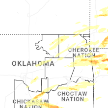
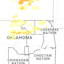

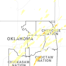
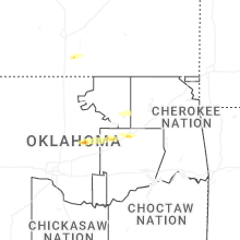

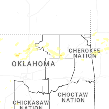
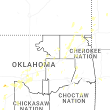


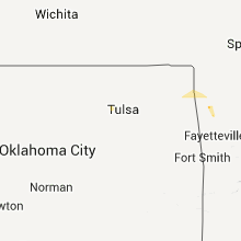


Connect with Interactive Hail Maps