

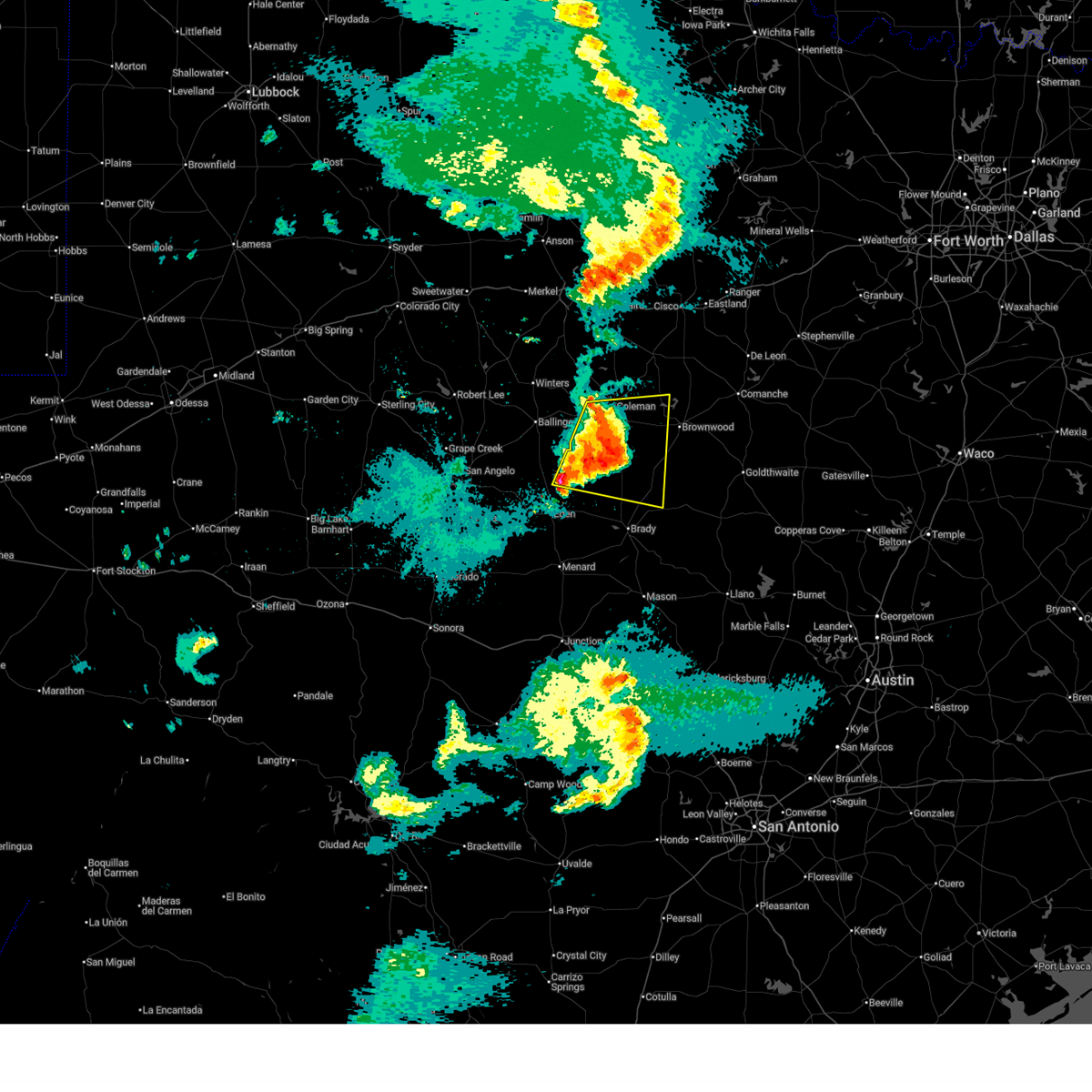
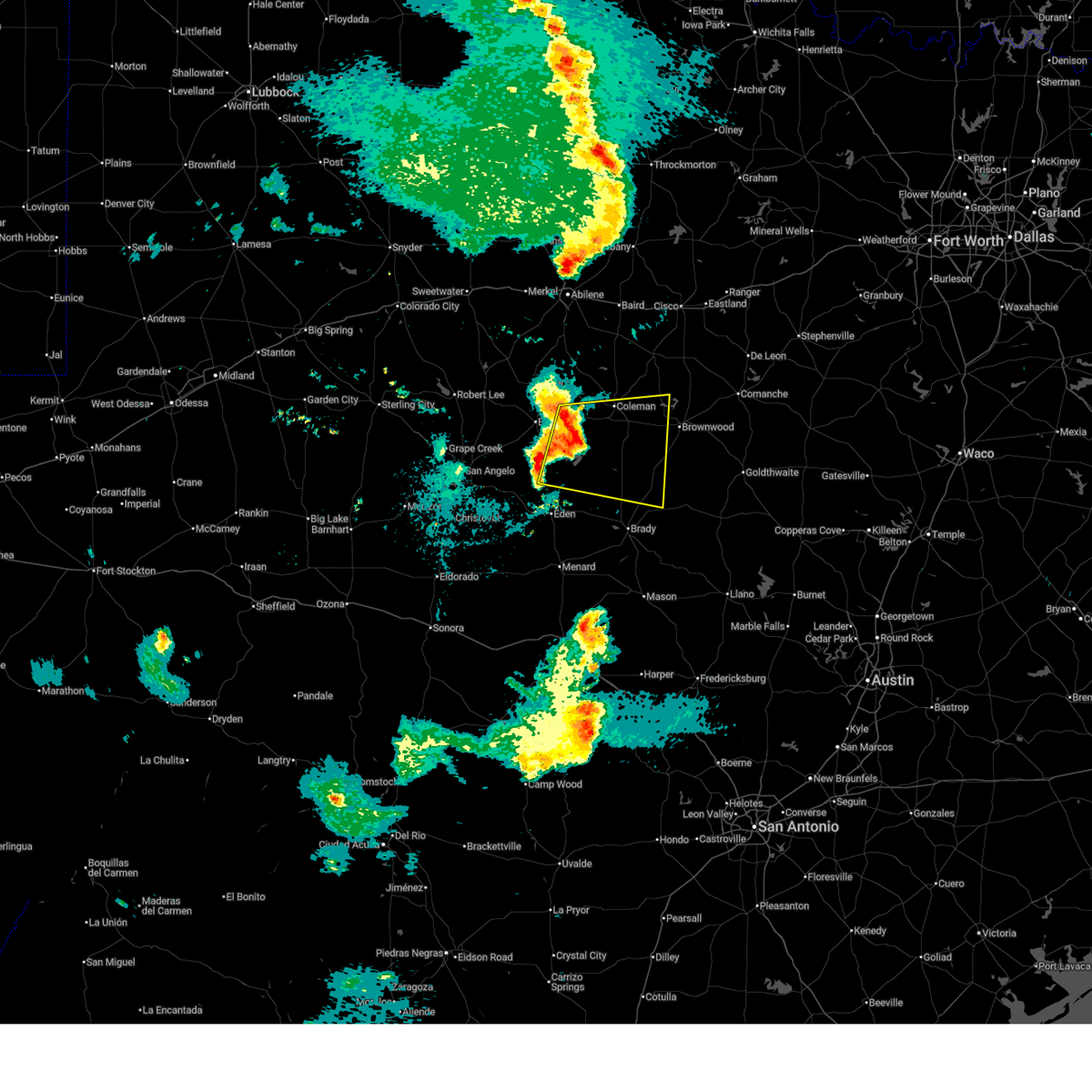
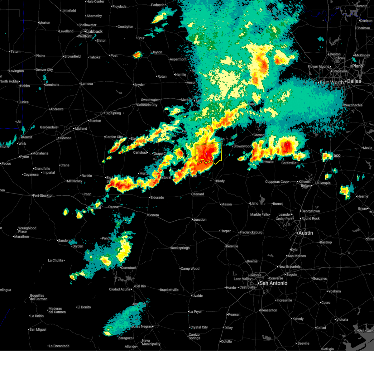
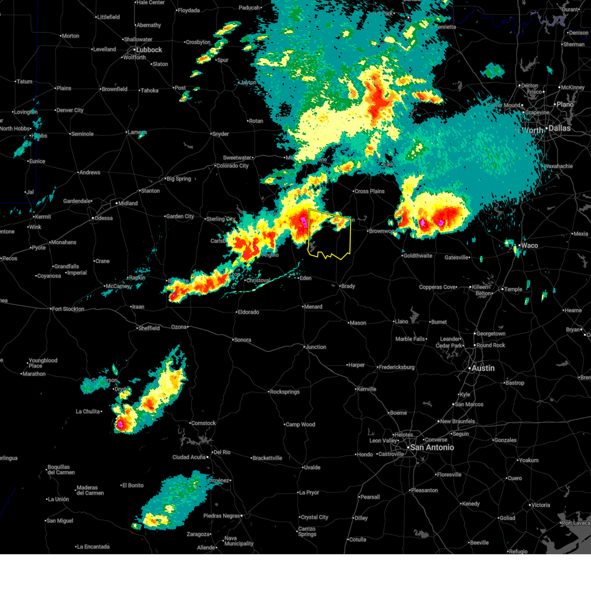
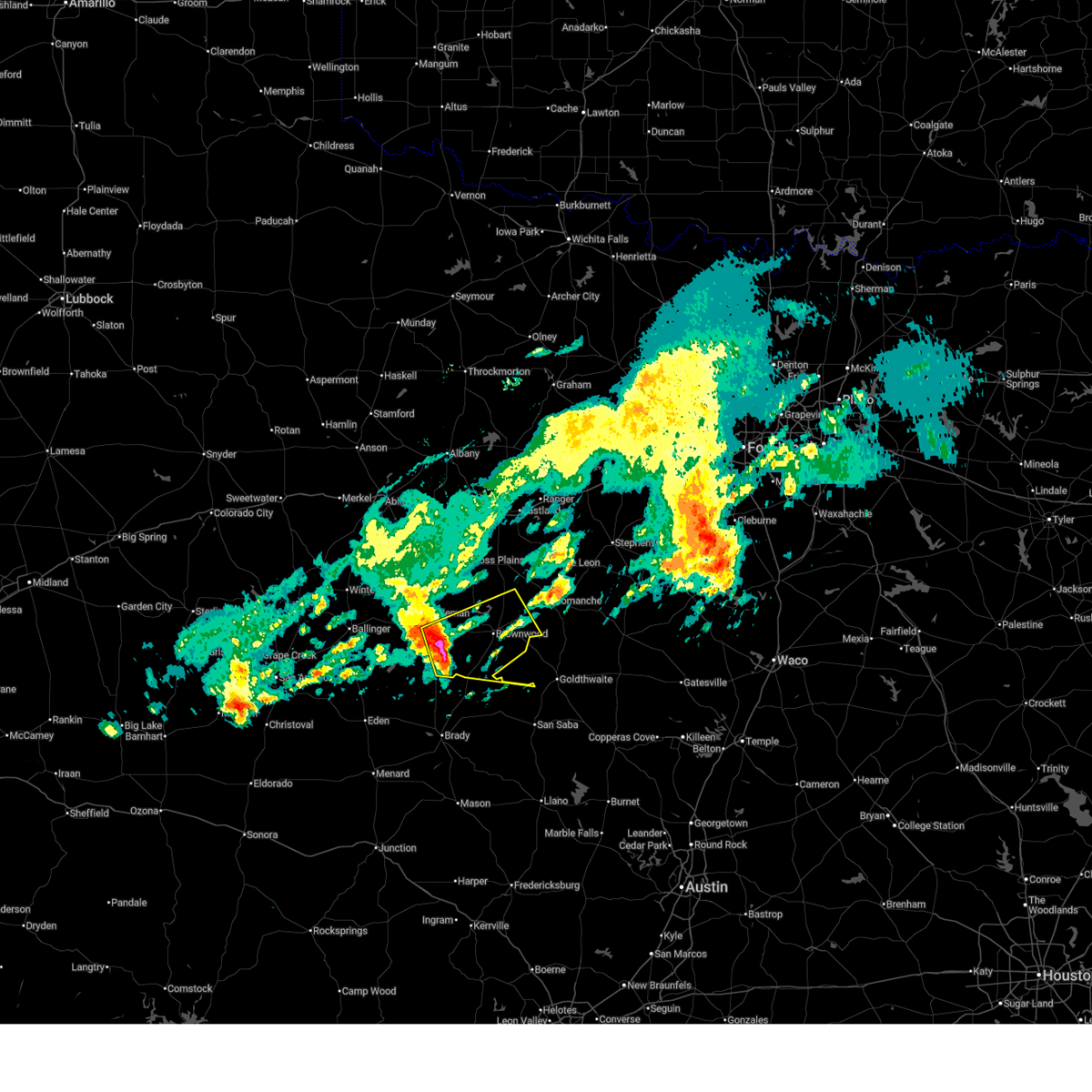
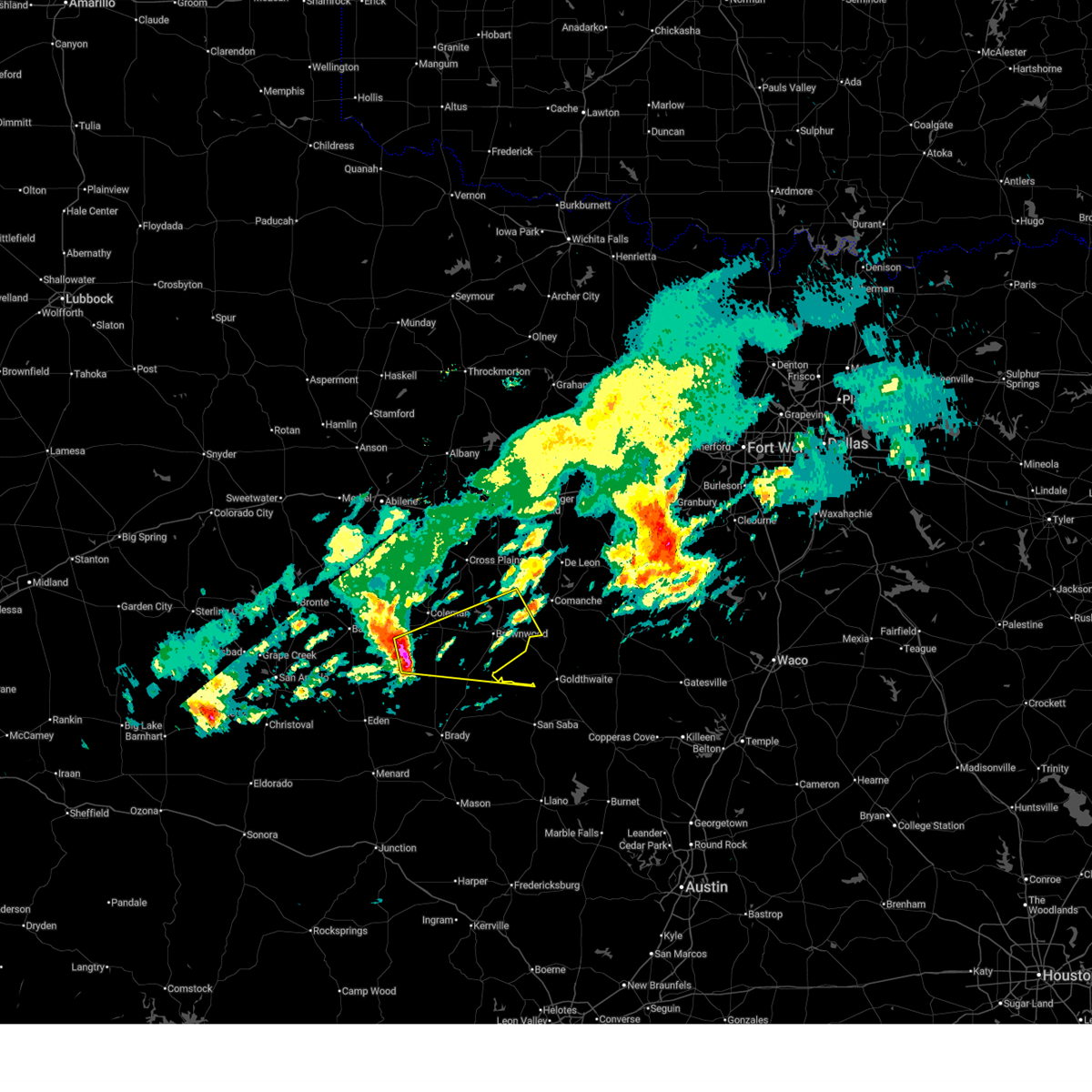
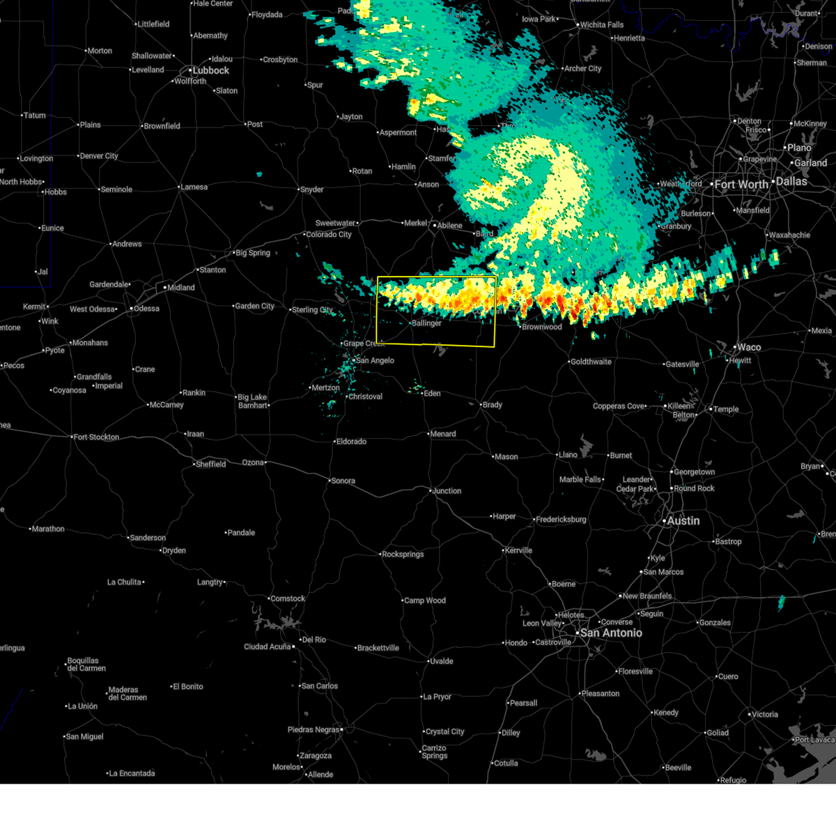
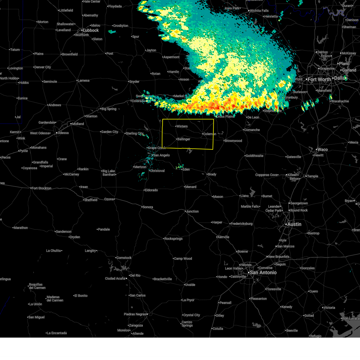
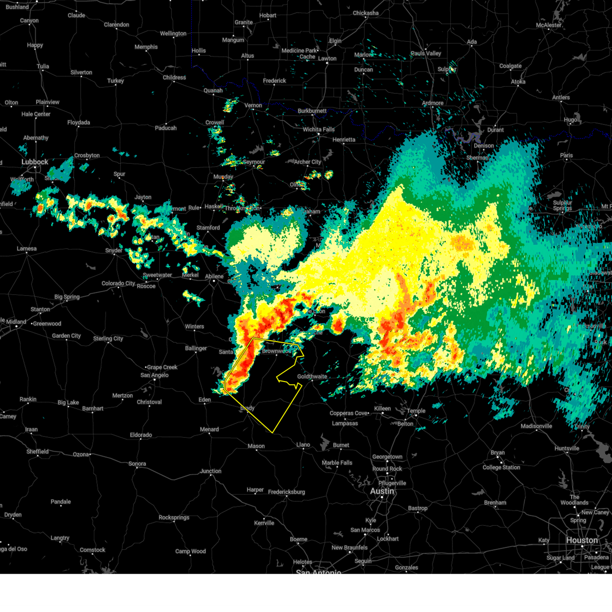
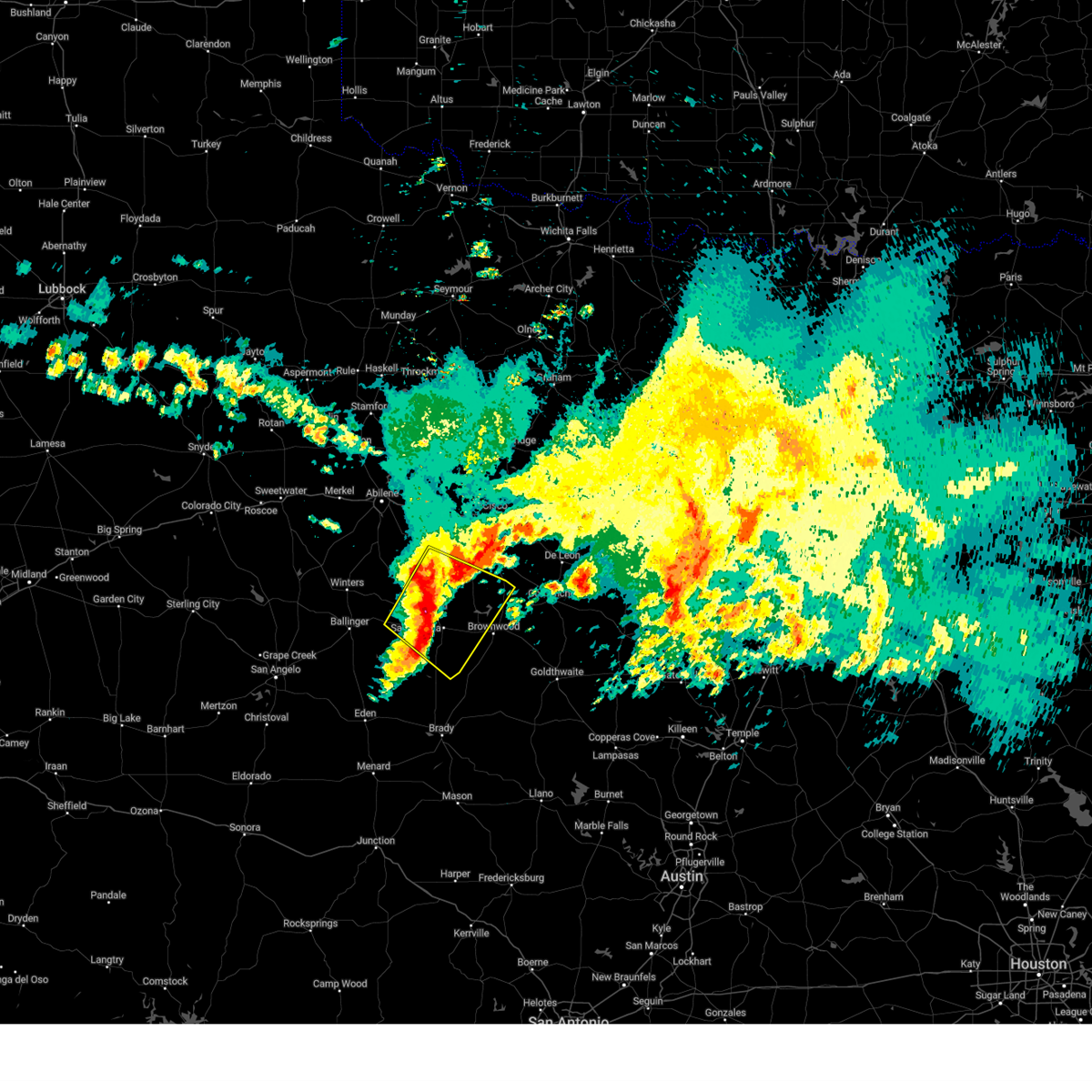
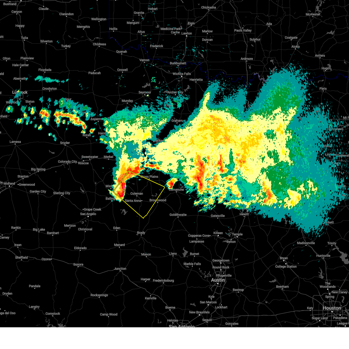
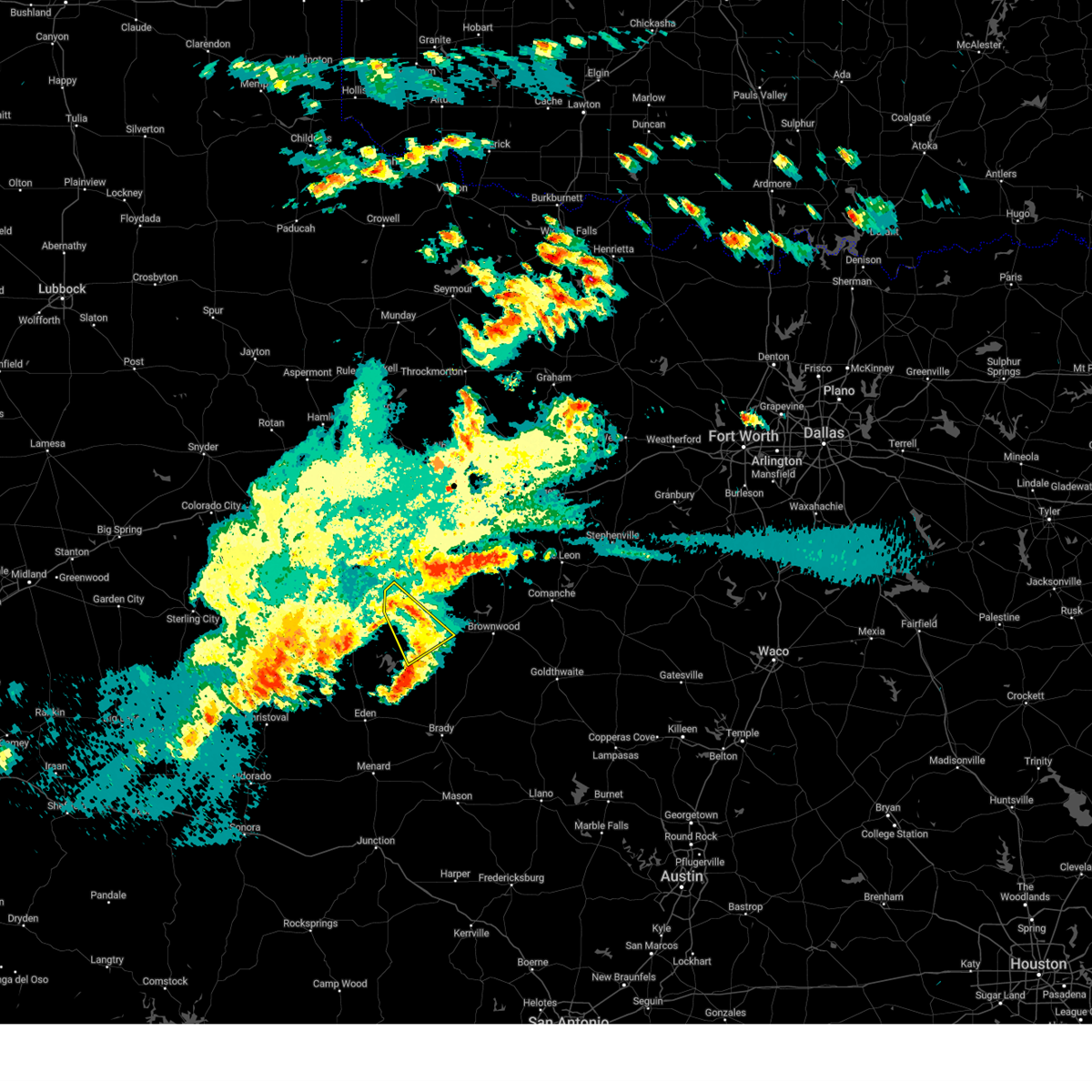
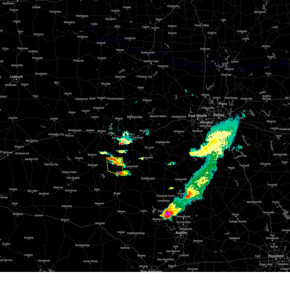
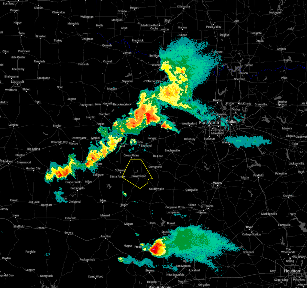
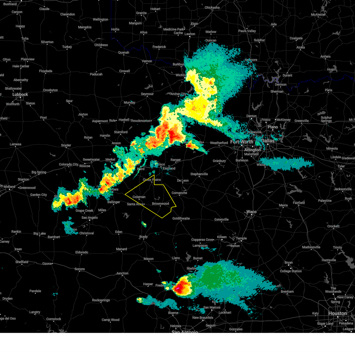
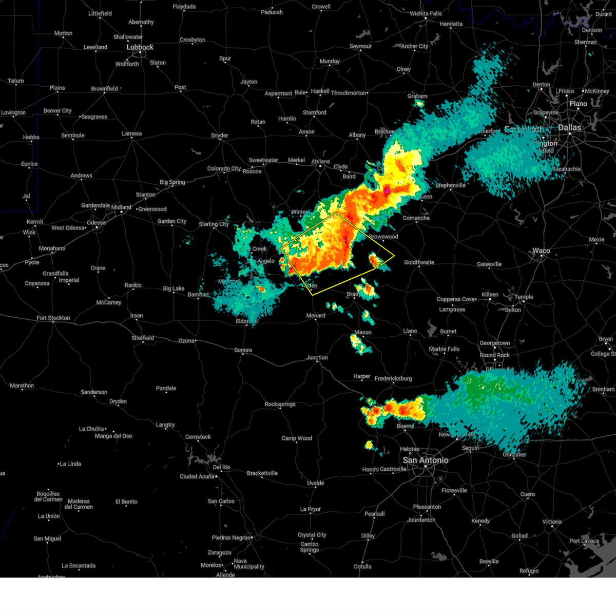
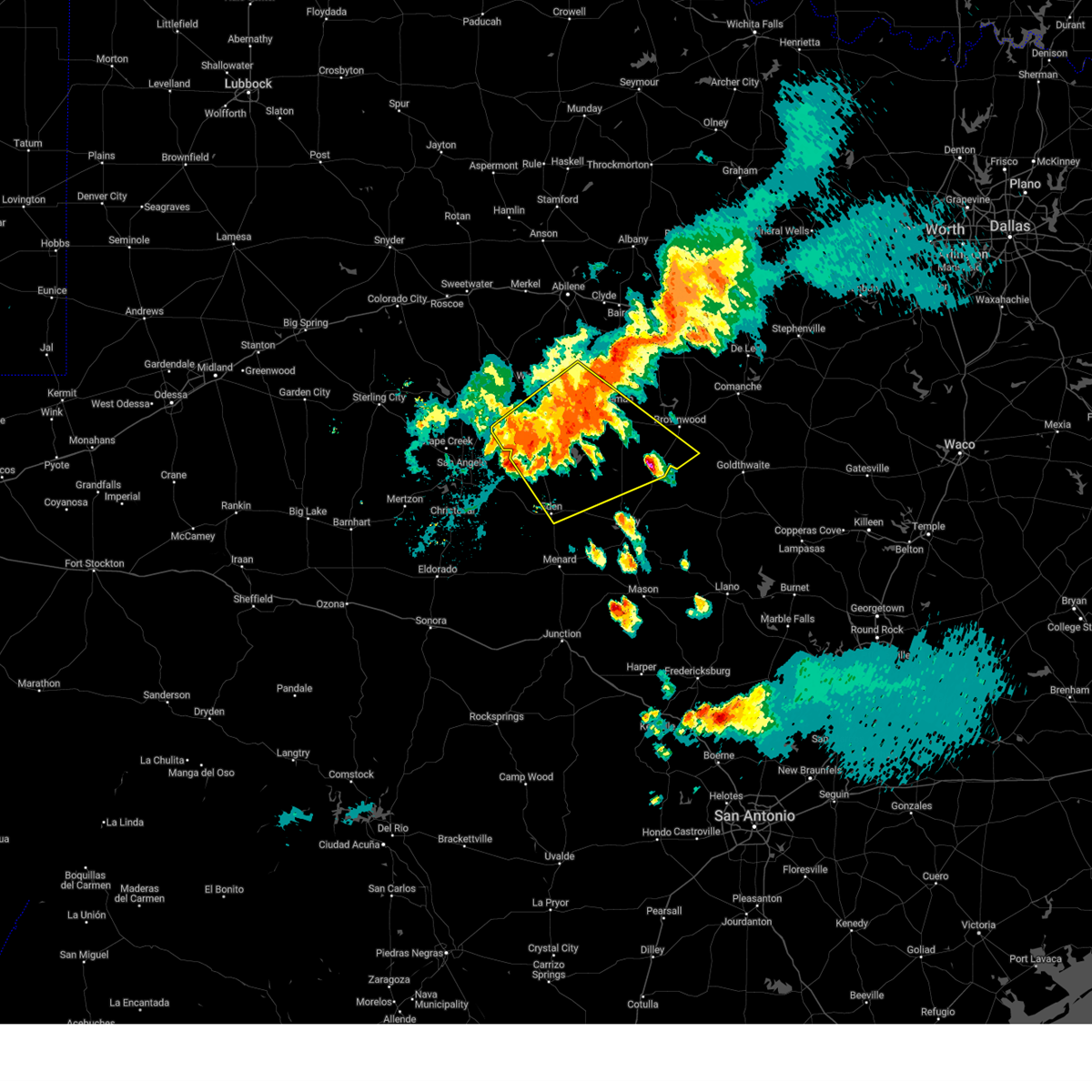
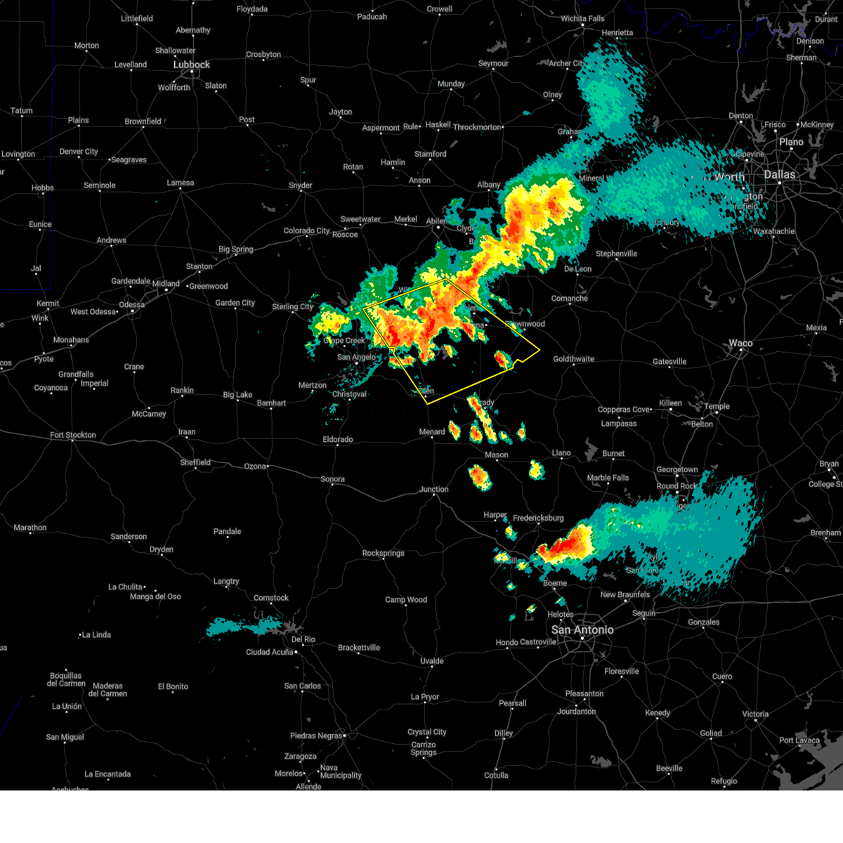
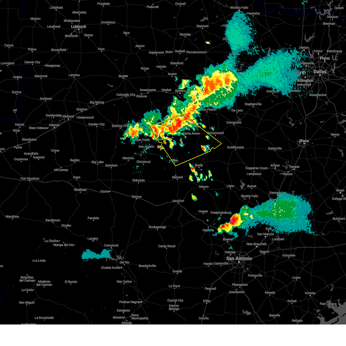
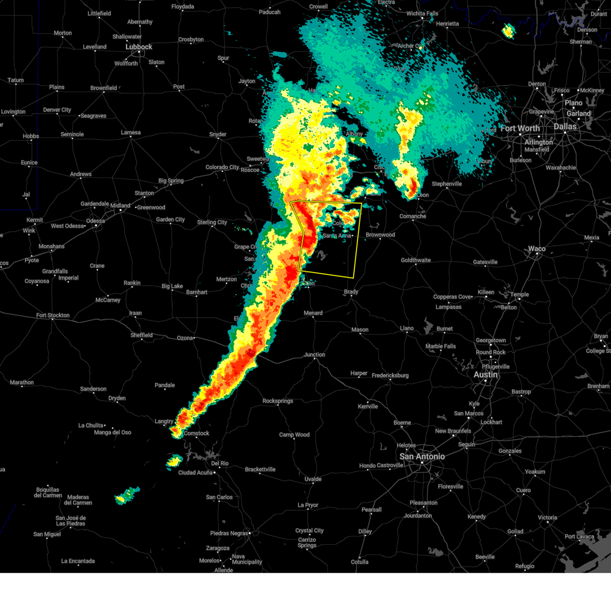
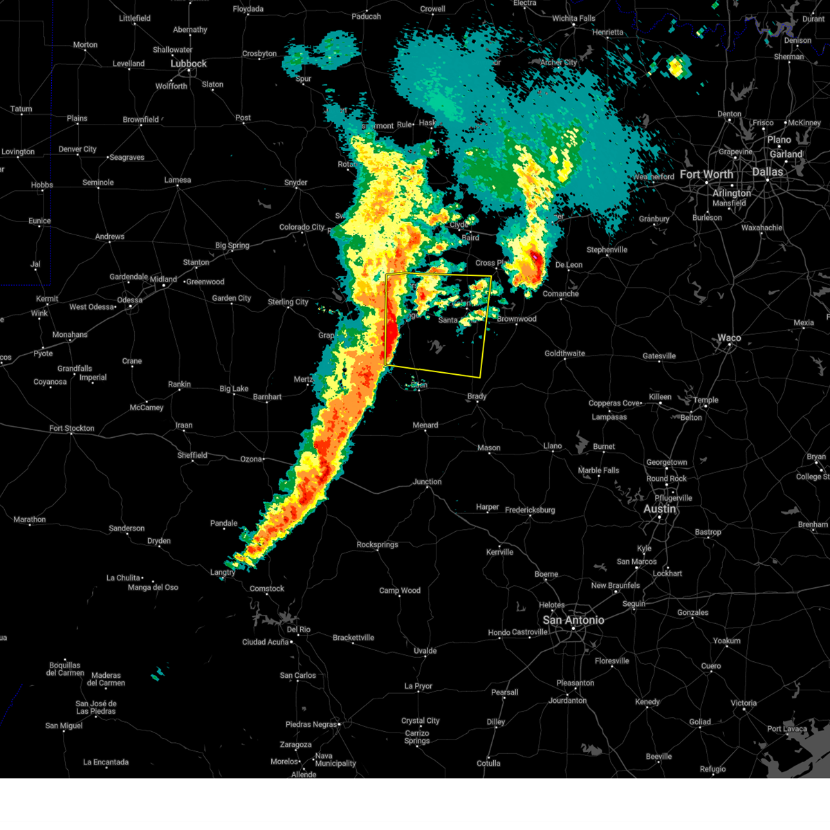
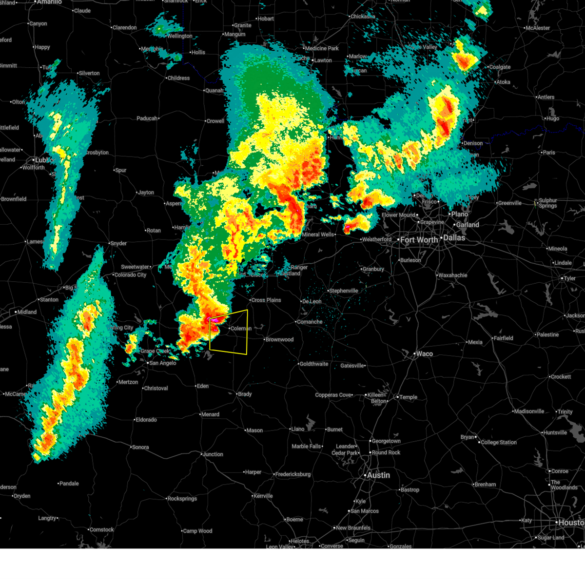
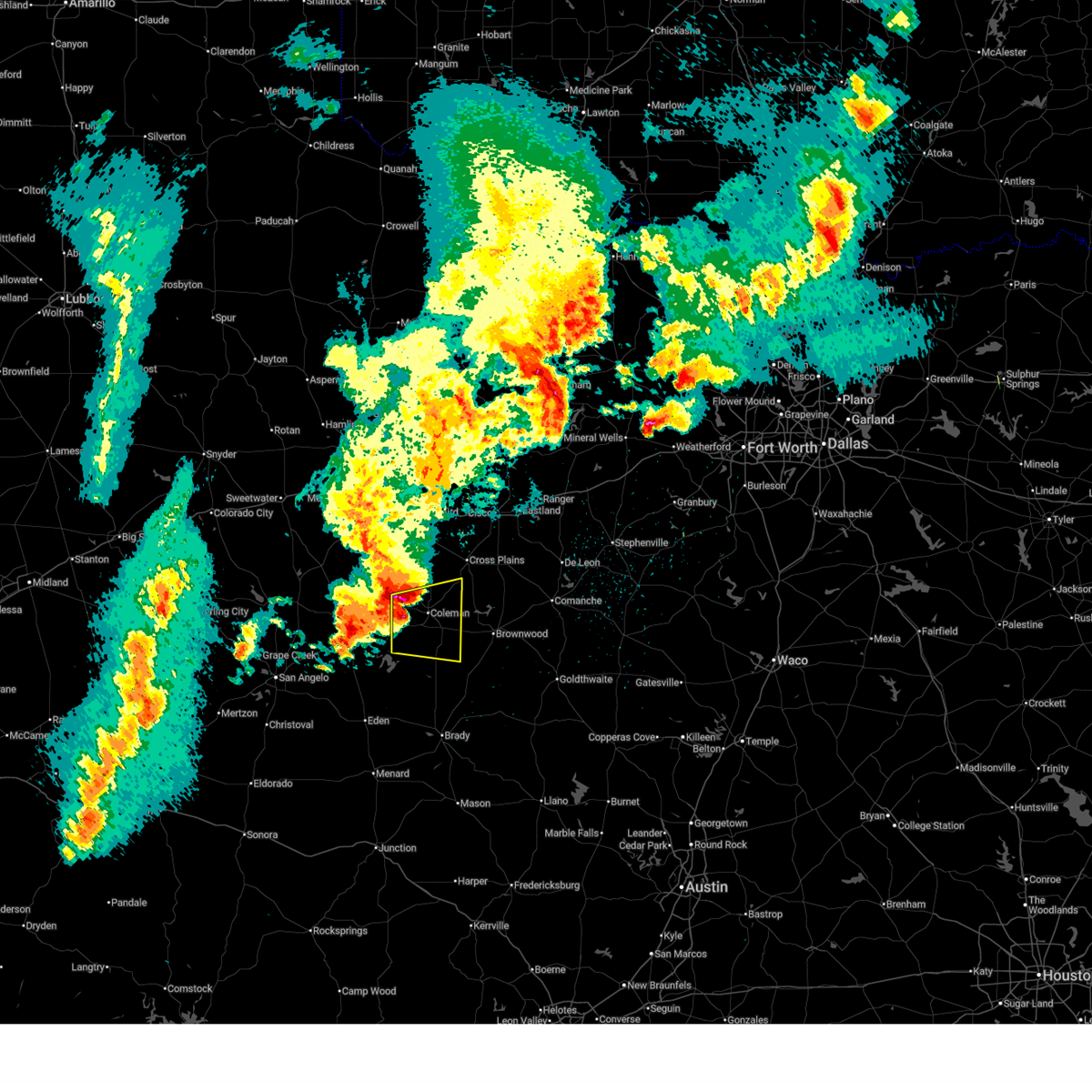
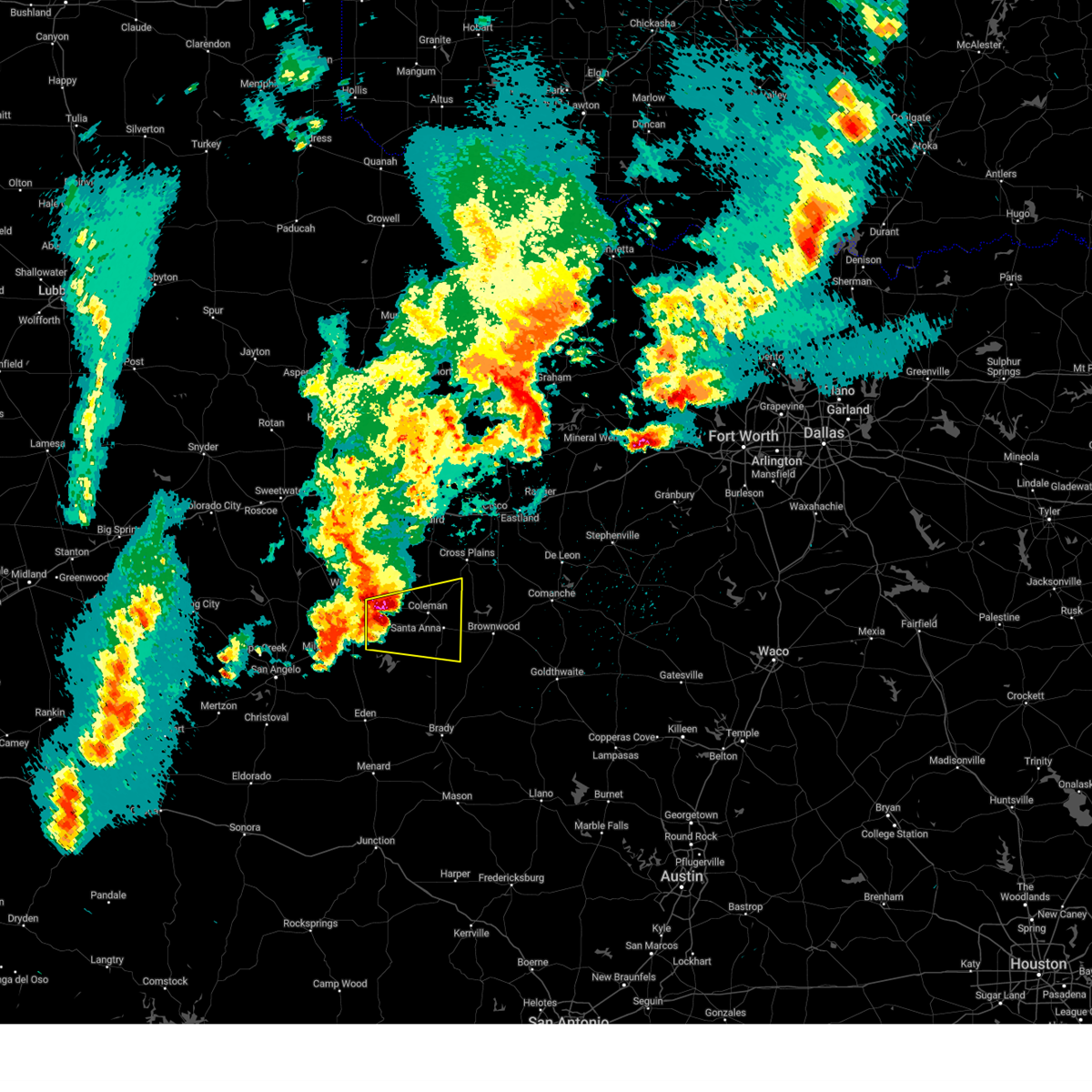
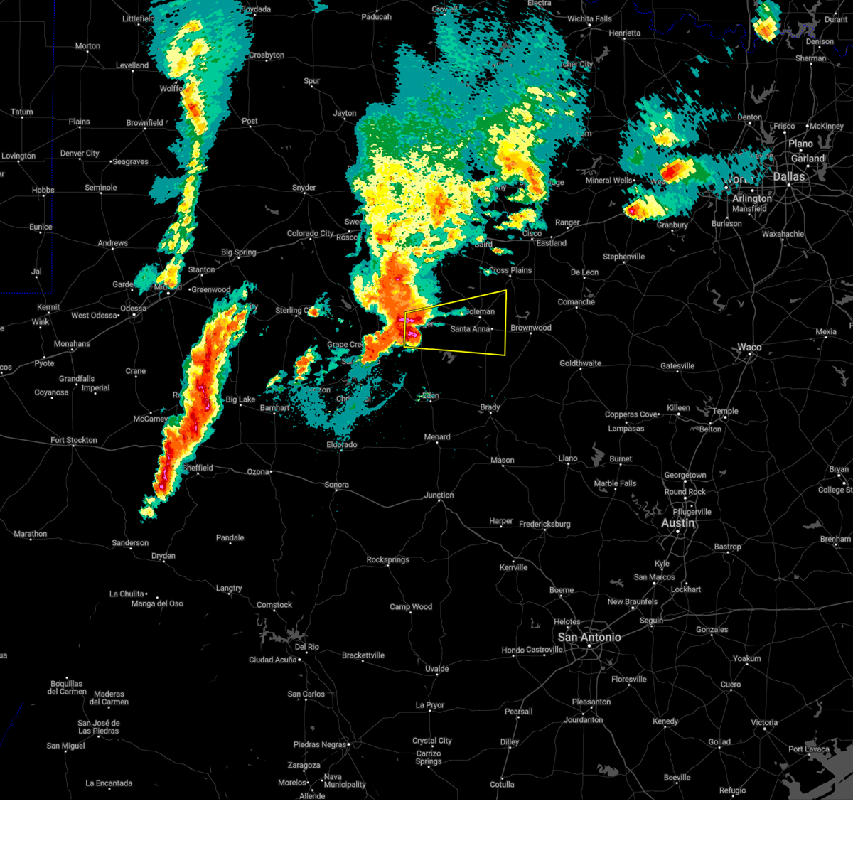
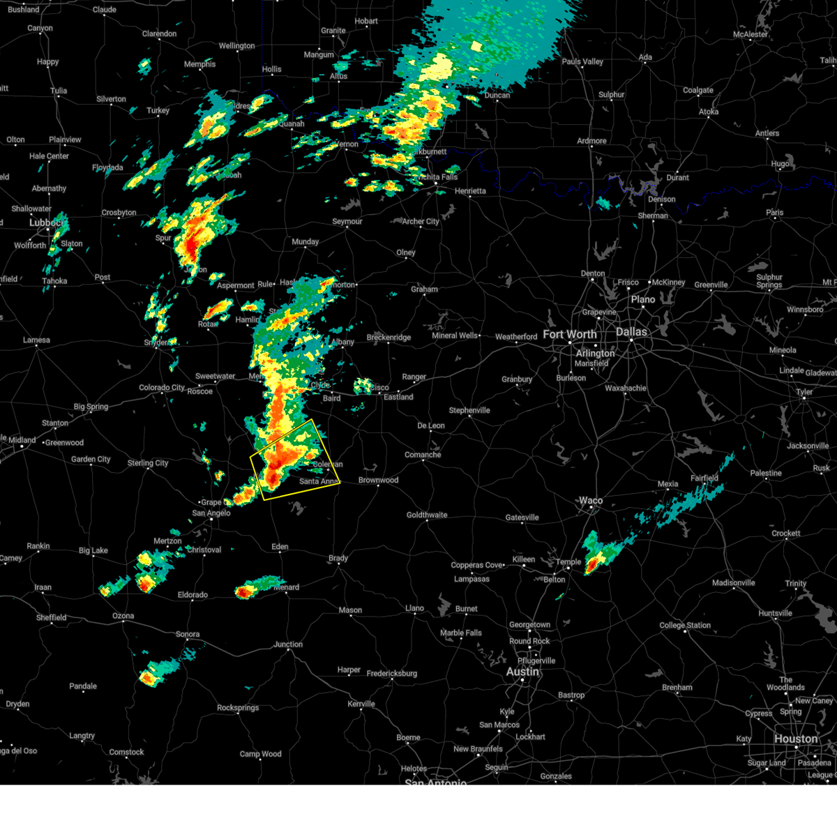
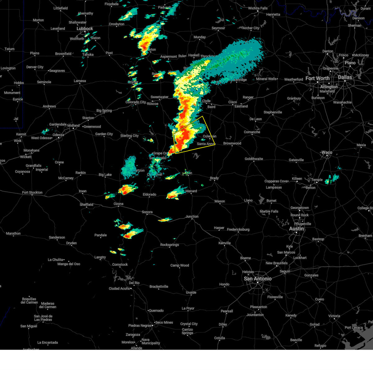
Hail Map for Santa Anna, TX
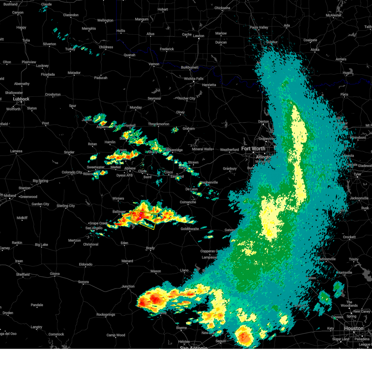
The Santa Anna, TX area has had 29 reports of on-the-ground hail by trained spotters, and has been under severe weather warnings 7 times during the past 12 months. Doppler radar has detected hail at or near Santa Anna, TX on 111 occasions, including 7 occasions during the past year.
| Name: | Santa Anna, TX |
| Where Located: | 54.6 miles SSE of Abilene, TX |
| Map: | Google Map for Santa Anna, TX |
| Population: | 1099 |
| Housing Units: | 586 |
| More Info: | Search Google for Santa Anna, TX |
1
The Top Recent Hail Date for Santa Anna, TX is Sunday, May 24, 2026 (22nd out of 111)

Hail and Wind Damage Spotted near Santa Anna, TX
| Date / Time | Report Details |
|---|---|
| 5/22/2026 10:00 PM CDT |
 At 1000 pm cdt, a severe thunderstorm was located over rockwood, moving east at 35 mph (radar indicated). Hazards include 70 mph wind gusts and quarter size hail. Hail damage to vehicles is expected. expect considerable tree damage. wind damage is also likely to mobile homes, roofs, and outbuildings. this severe storm will be near, winchell around 1005 pm cdt. mercury around 1010 pm cdt. brookesmith around 1020 pm cdt. Other locations impacted by this severe thunderstorm include the intersection of ranch road 1929 and ranch road 2134, milburn, fife, mozelle, whon, us-283 near the mcculloch- coleman county line, fisk, thrifty, shields, and hords creek reservoir. At 1000 pm cdt, a severe thunderstorm was located over rockwood, moving east at 35 mph (radar indicated). Hazards include 70 mph wind gusts and quarter size hail. Hail damage to vehicles is expected. expect considerable tree damage. wind damage is also likely to mobile homes, roofs, and outbuildings. this severe storm will be near, winchell around 1005 pm cdt. mercury around 1010 pm cdt. brookesmith around 1020 pm cdt. Other locations impacted by this severe thunderstorm include the intersection of ranch road 1929 and ranch road 2134, milburn, fife, mozelle, whon, us-283 near the mcculloch- coleman county line, fisk, thrifty, shields, and hords creek reservoir.
|
| 5/22/2026 9:51 PM CDT | Storm damage reported in coleman county TX, 11.2 miles NNE of Santa Anna, TX |
| 5/22/2026 9:27 PM CDT |
 Svrsjt the national weather service in san angelo has issued a * severe thunderstorm warning for, southwestern brown county in west central texas, coleman county in west central texas, northern mcculloch county in west central texas, southeastern runnels county in west central texas, northeastern concho county in west central texas, * until 1030 pm cdt. * at 927 pm cdt, a severe thunderstorm was located over leaday, moving east at 35 mph (radar indicated). Hazards include 60 mph wind gusts and quarter size hail. Hail damage to vehicles is expected. expect wind damage to roofs, siding, and trees. this severe thunderstorm will be near, voss, gouldbusk, and stacy around 935 pm cdt. rockwood and waldrip around 945 pm cdt. mercury and winchell around 1010 pm cdt. brookesmith around 1020 pm cdt. Other locations impacted by this severe thunderstorm include the intersection of ranch road 1929 and ranch road 2134, milburn, fife, the intersection of us-83 and ranch road 765, mozelle, whon, us- 283 near the mcculloch- coleman county line, fisk, thrifty, and shields. Svrsjt the national weather service in san angelo has issued a * severe thunderstorm warning for, southwestern brown county in west central texas, coleman county in west central texas, northern mcculloch county in west central texas, southeastern runnels county in west central texas, northeastern concho county in west central texas, * until 1030 pm cdt. * at 927 pm cdt, a severe thunderstorm was located over leaday, moving east at 35 mph (radar indicated). Hazards include 60 mph wind gusts and quarter size hail. Hail damage to vehicles is expected. expect wind damage to roofs, siding, and trees. this severe thunderstorm will be near, voss, gouldbusk, and stacy around 935 pm cdt. rockwood and waldrip around 945 pm cdt. mercury and winchell around 1010 pm cdt. brookesmith around 1020 pm cdt. Other locations impacted by this severe thunderstorm include the intersection of ranch road 1929 and ranch road 2134, milburn, fife, the intersection of us-83 and ranch road 765, mozelle, whon, us- 283 near the mcculloch- coleman county line, fisk, thrifty, and shields.
|
| 5/10/2026 7:06 PM CDT |
 Svrbro the national weather service in brownsville has issued a * severe thunderstorm warning for, central hidalgo county in deep south texas, northeastern starr county in deep south texas, * until 800 pm cdt. * at 705 pm cdt, a severe thunderstorm was located near citrus city, or 7 miles south of mccook, moving northeast at 40 mph (radar indicated). Hazards include 60 mph wind gusts and quarter size hail. Hail damage to vehicles is expected. Expect wind damage to roofs, siding, and trees. Svrbro the national weather service in brownsville has issued a * severe thunderstorm warning for, central hidalgo county in deep south texas, northeastern starr county in deep south texas, * until 800 pm cdt. * at 705 pm cdt, a severe thunderstorm was located near citrus city, or 7 miles south of mccook, moving northeast at 40 mph (radar indicated). Hazards include 60 mph wind gusts and quarter size hail. Hail damage to vehicles is expected. Expect wind damage to roofs, siding, and trees.
|
| 5/10/2026 6:42 PM CDT | Tennis Ball sized hail reported 16.7 miles N of Santa Anna, TX, report from mping: tennis ball (2.50 in.). |
| 5/10/2026 6:38 PM CDT | Hen Egg sized hail reported 14.7 miles N of Santa Anna, TX, report from mping: hen egg (2.00 in.). |
| 5/10/2026 6:37 PM CDT | Golf Ball sized hail reported 14 miles N of Santa Anna, TX, report from mping: golf ball (1.75 in.). |
| 5/10/2026 6:31 PM CDT | Storm damage reported in coleman county TX, 343.2 miles S of Santa Anna, TX |
| 5/10/2026 6:28 PM CDT |
 At 627 pm cdt, a severe thunderstorm was located over shields, or over gouldbusk, moving southeast at 25 mph (radar indicated). Hazards include golf ball size hail and 70 mph wind gusts. People and animals outdoors will be injured. expect hail damage to roofs, siding, windows, and vehicles. expect considerable tree damage. wind damage is also likely to mobile homes, roofs, and outbuildings. this severe storm will be near, rockwood around 635 pm cdt. trickham around 650 pm cdt. Other locations impacted by this severe thunderstorm include mozelle, whon, us-283 near the mcculloch-coleman county line, fisk, and shields. At 627 pm cdt, a severe thunderstorm was located over shields, or over gouldbusk, moving southeast at 25 mph (radar indicated). Hazards include golf ball size hail and 70 mph wind gusts. People and animals outdoors will be injured. expect hail damage to roofs, siding, windows, and vehicles. expect considerable tree damage. wind damage is also likely to mobile homes, roofs, and outbuildings. this severe storm will be near, rockwood around 635 pm cdt. trickham around 650 pm cdt. Other locations impacted by this severe thunderstorm include mozelle, whon, us-283 near the mcculloch-coleman county line, fisk, and shields.
|
| 5/10/2026 5:44 PM CDT |
 Svrsjt the national weather service in san angelo has issued a * severe thunderstorm warning for, coleman county in west central texas, northeastern concho county in west central texas, * until 645 pm cdt. * at 543 pm cdt, a severe thunderstorm was located near talpa, moving southeast at 25 mph (radar indicated). Hazards include tennis ball size hail and 70 mph wind gusts. People and animals outdoors will be injured. expect hail damage to roofs, siding, windows, and vehicles. expect considerable tree damage. wind damage is also likely to mobile homes, roofs, and outbuildings. this severe thunderstorm will be near, valera around 550 pm cdt. voss around 600 pm cdt. gouldbusk around 625 pm cdt. santa anna around 630 pm cdt. other locations impacted by this severe thunderstorm include mozelle, fisk, shields, o. h. Ivie reservoir, and hords creek reservoir. Svrsjt the national weather service in san angelo has issued a * severe thunderstorm warning for, coleman county in west central texas, northeastern concho county in west central texas, * until 645 pm cdt. * at 543 pm cdt, a severe thunderstorm was located near talpa, moving southeast at 25 mph (radar indicated). Hazards include tennis ball size hail and 70 mph wind gusts. People and animals outdoors will be injured. expect hail damage to roofs, siding, windows, and vehicles. expect considerable tree damage. wind damage is also likely to mobile homes, roofs, and outbuildings. this severe thunderstorm will be near, valera around 550 pm cdt. voss around 600 pm cdt. gouldbusk around 625 pm cdt. santa anna around 630 pm cdt. other locations impacted by this severe thunderstorm include mozelle, fisk, shields, o. h. Ivie reservoir, and hords creek reservoir.
|
| 4/18/2026 8:33 AM CDT |
 At 831 am cdt, a severe thunderstorm was located near trickham, moving east at 45 mph (radar indicated). Hazards include 60 mph wind gusts and quarter size hail. Hail damage to vehicles is expected. expect wind damage to roofs, siding, and trees. this severe storm will be near, bangs and trickham around 835 am cdt. brownwood and brookesmith around 840 am cdt. early and camp bowie around 845 am cdt. zephyr around 855 am cdt. blanket around 900 am cdt. Other locations impacted by this severe thunderstorm include whon, owens, thrifty, indian creek, and regency. At 831 am cdt, a severe thunderstorm was located near trickham, moving east at 45 mph (radar indicated). Hazards include 60 mph wind gusts and quarter size hail. Hail damage to vehicles is expected. expect wind damage to roofs, siding, and trees. this severe storm will be near, bangs and trickham around 835 am cdt. brownwood and brookesmith around 840 am cdt. early and camp bowie around 845 am cdt. zephyr around 855 am cdt. blanket around 900 am cdt. Other locations impacted by this severe thunderstorm include whon, owens, thrifty, indian creek, and regency.
|
| 4/18/2026 8:18 AM CDT |
 Svrsjt the national weather service in san angelo has issued a * severe thunderstorm warning for, brown county in west central texas, southern coleman county in west central texas, northeastern mcculloch county in west central texas, northwestern san saba county in west central texas, * until 915 am cdt. * at 818 am cdt, a severe thunderstorm was located over fisk, or near voss, moving east at 60 mph (radar indicated). Hazards include 60 mph wind gusts and quarter size hail. Hail damage to vehicles is expected. expect wind damage to roofs, siding, and trees. this severe thunderstorm will be near, santa anna around 825 am cdt. bangs and trickham around 830 am cdt. brownwood, early, and lake brownwood around 840 am cdt. camp bowie around 845 am cdt. blanket and zephyr around 855 am cdt. Other locations impacted by this severe thunderstorm include owens, mozelle, whon, fisk, thrifty, indian creek, shields, and regency. Svrsjt the national weather service in san angelo has issued a * severe thunderstorm warning for, brown county in west central texas, southern coleman county in west central texas, northeastern mcculloch county in west central texas, northwestern san saba county in west central texas, * until 915 am cdt. * at 818 am cdt, a severe thunderstorm was located over fisk, or near voss, moving east at 60 mph (radar indicated). Hazards include 60 mph wind gusts and quarter size hail. Hail damage to vehicles is expected. expect wind damage to roofs, siding, and trees. this severe thunderstorm will be near, santa anna around 825 am cdt. bangs and trickham around 830 am cdt. brownwood, early, and lake brownwood around 840 am cdt. camp bowie around 845 am cdt. blanket and zephyr around 855 am cdt. Other locations impacted by this severe thunderstorm include owens, mozelle, whon, fisk, thrifty, indian creek, shields, and regency.
|
| 6/15/2025 12:21 PM CDT |
 At 1220 pm cdt, severe thunderstorms were located along a line extending from ballinger lake to near santa anna, moving south at 35 mph (radar indicated). Hazards include 60 mph wind gusts. Expect damage to roofs, siding, and trees. these severe storms will be near, ballinger, miles, rowena, trickham, and voss around 1225 pm cdt. Other locations impacted by these severe thunderstorms include echo, mozelle, wilmeth, lake coleman, drasco, pumphrey, goldsboro, lake winters lake, fisk, and ballinger lake. At 1220 pm cdt, severe thunderstorms were located along a line extending from ballinger lake to near santa anna, moving south at 35 mph (radar indicated). Hazards include 60 mph wind gusts. Expect damage to roofs, siding, and trees. these severe storms will be near, ballinger, miles, rowena, trickham, and voss around 1225 pm cdt. Other locations impacted by these severe thunderstorms include echo, mozelle, wilmeth, lake coleman, drasco, pumphrey, goldsboro, lake winters lake, fisk, and ballinger lake.
|
| 6/15/2025 11:37 AM CDT |
 Svrsjt the national weather service in san angelo has issued a * severe thunderstorm warning for, coleman county in west central texas, runnels county in west central texas, * until 1230 pm cdt. * at 1137 am cdt, severe thunderstorms were located along a line extending from drasco to near burkett, moving south at 40 mph (radar indicated). Hazards include 60 mph wind gusts and penny size hail. Expect damage to roofs, siding, and trees. severe thunderstorms will be near, coleman, winters, novice, hatchel, burkett, silver valley, glen cove, and crews around 1145 am cdt. benoit, norton, and talpa around 1150 am cdt. ballinger, santa anna, and valera around 1155 am cdt. Other locations impacted by these severe thunderstorms include echo, mozelle, wilmeth, lake coleman, drasco, pumphrey, goldsboro, lake winters lake, fisk, and ballinger lake. Svrsjt the national weather service in san angelo has issued a * severe thunderstorm warning for, coleman county in west central texas, runnels county in west central texas, * until 1230 pm cdt. * at 1137 am cdt, severe thunderstorms were located along a line extending from drasco to near burkett, moving south at 40 mph (radar indicated). Hazards include 60 mph wind gusts and penny size hail. Expect damage to roofs, siding, and trees. severe thunderstorms will be near, coleman, winters, novice, hatchel, burkett, silver valley, glen cove, and crews around 1145 am cdt. benoit, norton, and talpa around 1150 am cdt. ballinger, santa anna, and valera around 1155 am cdt. Other locations impacted by these severe thunderstorms include echo, mozelle, wilmeth, lake coleman, drasco, pumphrey, goldsboro, lake winters lake, fisk, and ballinger lake.
|
| 6/9/2025 2:15 AM CDT |
 Svrsjt the national weather service in san angelo has issued a * severe thunderstorm warning for, brown county in west central texas, southeastern coleman county in west central texas, central mcculloch county in west central texas, western san saba county in west central texas, * until 315 am cdt. * at 215 am cdt, a severe thunderstorm was located near trickham, moving southeast at 35 mph (radar indicated). Hazards include 60 mph wind gusts and half dollar size hail. Hail damage to vehicles is expected. expect wind damage to roofs, siding, and trees. this severe thunderstorm will be near, brookesmith and trickham around 220 am cdt. winchell around 225 am cdt. mercury and elm grove around 235 am cdt. skeeterville around 250 am cdt. richland springs around 300 am cdt. Other locations impacted by this severe thunderstorm include regency, milburn, fife, locker, whon, spring creek, us-283 near the mcculloch- coleman county line, thrifty, us-190 near the mcculloch- san saba county line, and hall. Svrsjt the national weather service in san angelo has issued a * severe thunderstorm warning for, brown county in west central texas, southeastern coleman county in west central texas, central mcculloch county in west central texas, western san saba county in west central texas, * until 315 am cdt. * at 215 am cdt, a severe thunderstorm was located near trickham, moving southeast at 35 mph (radar indicated). Hazards include 60 mph wind gusts and half dollar size hail. Hail damage to vehicles is expected. expect wind damage to roofs, siding, and trees. this severe thunderstorm will be near, brookesmith and trickham around 220 am cdt. winchell around 225 am cdt. mercury and elm grove around 235 am cdt. skeeterville around 250 am cdt. richland springs around 300 am cdt. Other locations impacted by this severe thunderstorm include regency, milburn, fife, locker, whon, spring creek, us-283 near the mcculloch- coleman county line, thrifty, us-190 near the mcculloch- san saba county line, and hall.
|
| 6/9/2025 2:03 AM CDT |
 At 203 am cdt, a severe thunderstorm was located near coleman, moving southeast at 40 mph (radar indicated). Hazards include 60 mph wind gusts and half dollar size hail. Hail damage to vehicles is expected. expect wind damage to roofs, siding, and trees. this severe storm will be near, santa anna around 210 am cdt. trickham around 215 am cdt. bangs around 220 am cdt. Other locations impacted by this severe thunderstorm include echo, whon, fisk, thrifty, us-283 near the coleman- callahan county line, lake coleman, shields, hords creek reservoir, and mozelle. At 203 am cdt, a severe thunderstorm was located near coleman, moving southeast at 40 mph (radar indicated). Hazards include 60 mph wind gusts and half dollar size hail. Hail damage to vehicles is expected. expect wind damage to roofs, siding, and trees. this severe storm will be near, santa anna around 210 am cdt. trickham around 215 am cdt. bangs around 220 am cdt. Other locations impacted by this severe thunderstorm include echo, whon, fisk, thrifty, us-283 near the coleman- callahan county line, lake coleman, shields, hords creek reservoir, and mozelle.
|
| 6/9/2025 2:03 AM CDT |
 the severe thunderstorm warning has been cancelled and is no longer in effect the severe thunderstorm warning has been cancelled and is no longer in effect
|
| 6/9/2025 1:36 AM CDT |
 Svrsjt the national weather service in san angelo has issued a * severe thunderstorm warning for, southern callahan county in west central texas, northwestern brown county in west central texas, coleman county in west central texas, southeastern taylor county in west central texas, northeastern runnels county in west central texas, * until 215 am cdt. * at 136 am cdt, a severe thunderstorm was located near glen cove, moving southeast at 50 mph (radar indicated). Hazards include ping pong ball size hail and 60 mph wind gusts. People and animals outdoors will be injured. expect hail damage to roofs, siding, windows, and vehicles. expect wind damage to roofs, siding, and trees. this severe thunderstorm will be near, silver valley and glen cove around 140 am cdt. coleman and valera around 145 am cdt. santa anna around 155 am cdt. bangs and trickham around 210 am cdt. Other locations impacted by this severe thunderstorm include echo, mozelle, goldsboro, whon, fisk, thrifty, us-283 near the coleman- callahan county line, lake coleman, shields, and hords creek reservoir. Svrsjt the national weather service in san angelo has issued a * severe thunderstorm warning for, southern callahan county in west central texas, northwestern brown county in west central texas, coleman county in west central texas, southeastern taylor county in west central texas, northeastern runnels county in west central texas, * until 215 am cdt. * at 136 am cdt, a severe thunderstorm was located near glen cove, moving southeast at 50 mph (radar indicated). Hazards include ping pong ball size hail and 60 mph wind gusts. People and animals outdoors will be injured. expect hail damage to roofs, siding, windows, and vehicles. expect wind damage to roofs, siding, and trees. this severe thunderstorm will be near, silver valley and glen cove around 140 am cdt. coleman and valera around 145 am cdt. santa anna around 155 am cdt. bangs and trickham around 210 am cdt. Other locations impacted by this severe thunderstorm include echo, mozelle, goldsboro, whon, fisk, thrifty, us-283 near the coleman- callahan county line, lake coleman, shields, and hords creek reservoir.
|
| 5/29/2025 10:38 PM CDT |
 the severe thunderstorm warning has been cancelled and is no longer in effect the severe thunderstorm warning has been cancelled and is no longer in effect
|
| 5/29/2025 10:14 PM CDT |
 At 1014 pm cdt, a severe thunderstorm was located near valera, moving southeast at 35 mph (radar indicated). Hazards include 60 mph wind gusts and quarter size hail. Hail damage to vehicles is expected. expect wind damage to roofs, siding, and trees. this severe storm will be near, voss around 1020 pm cdt. Other locations impacted by this severe thunderstorm include mozelle, fisk, and hords creek reservoir. At 1014 pm cdt, a severe thunderstorm was located near valera, moving southeast at 35 mph (radar indicated). Hazards include 60 mph wind gusts and quarter size hail. Hail damage to vehicles is expected. expect wind damage to roofs, siding, and trees. this severe storm will be near, voss around 1020 pm cdt. Other locations impacted by this severe thunderstorm include mozelle, fisk, and hords creek reservoir.
|
| 5/29/2025 10:08 PM CDT |
 Svrsjt the national weather service in san angelo has issued a * severe thunderstorm warning for, coleman county in west central texas, * until 1115 pm cdt. * at 1008 pm cdt, a severe thunderstorm was located near glen cove, moving south at 15 mph (radar indicated). Hazards include 60 mph wind gusts and quarter size hail. Hail damage to vehicles is expected. expect wind damage to roofs, siding, and trees. this severe thunderstorm will be near, valera around 1015 pm cdt. voss around 1025 pm cdt. Other locations impacted by this severe thunderstorm include mozelle, fisk, and hords creek reservoir. Svrsjt the national weather service in san angelo has issued a * severe thunderstorm warning for, coleman county in west central texas, * until 1115 pm cdt. * at 1008 pm cdt, a severe thunderstorm was located near glen cove, moving south at 15 mph (radar indicated). Hazards include 60 mph wind gusts and quarter size hail. Hail damage to vehicles is expected. expect wind damage to roofs, siding, and trees. this severe thunderstorm will be near, valera around 1015 pm cdt. voss around 1025 pm cdt. Other locations impacted by this severe thunderstorm include mozelle, fisk, and hords creek reservoir.
|
| 5/29/2025 9:24 PM CDT |
 Svrsjt the national weather service in san angelo has issued a * severe thunderstorm warning for, central coleman county in west central texas, * until 1030 pm cdt. * at 924 pm cdt, a severe thunderstorm was located near silver valley, moving southeast at 20 mph (radar indicated). Hazards include 60 mph wind gusts and quarter size hail. Hail damage to vehicles is expected. expect wind damage to roofs, siding, and trees. this severe thunderstorm will be near, coleman and glen cove around 930 pm cdt. valera around 935 pm cdt. santa anna around 1000 pm cdt. Other locations impacted by this severe thunderstorm include mozelle, fisk, and hords creek reservoir. Svrsjt the national weather service in san angelo has issued a * severe thunderstorm warning for, central coleman county in west central texas, * until 1030 pm cdt. * at 924 pm cdt, a severe thunderstorm was located near silver valley, moving southeast at 20 mph (radar indicated). Hazards include 60 mph wind gusts and quarter size hail. Hail damage to vehicles is expected. expect wind damage to roofs, siding, and trees. this severe thunderstorm will be near, coleman and glen cove around 930 pm cdt. valera around 935 pm cdt. santa anna around 1000 pm cdt. Other locations impacted by this severe thunderstorm include mozelle, fisk, and hords creek reservoir.
|
| 5/28/2025 5:43 PM CDT |
 At 542 pm cdt, a severe thunderstorm was located near santa anna, moving east at 15 mph (radar indicated). Hazards include quarter size hail. Damage to vehicles is expected. This severe thunderstorm will remain over mainly rural areas of northeastern coleman county, including the following locations, echo. At 542 pm cdt, a severe thunderstorm was located near santa anna, moving east at 15 mph (radar indicated). Hazards include quarter size hail. Damage to vehicles is expected. This severe thunderstorm will remain over mainly rural areas of northeastern coleman county, including the following locations, echo.
|
| 5/28/2025 5:31 PM CDT |
 At 531 pm cdt, a severe thunderstorm was located near coleman, moving east at 15 mph (radar indicated). Hazards include quarter size hail. Damage to vehicles is expected. this severe storm will be near, santa anna around 535 pm cdt. Other locations impacted by this severe thunderstorm include echo, fisk, and hords creek reservoir. At 531 pm cdt, a severe thunderstorm was located near coleman, moving east at 15 mph (radar indicated). Hazards include quarter size hail. Damage to vehicles is expected. this severe storm will be near, santa anna around 535 pm cdt. Other locations impacted by this severe thunderstorm include echo, fisk, and hords creek reservoir.
|
| 5/28/2025 5:06 PM CDT |
 Svrsjt the national weather service in san angelo has issued a * severe thunderstorm warning for, central coleman county in west central texas, * until 600 pm cdt. * at 506 pm cdt, a severe thunderstorm was located over coleman, moving southeast at 10 mph (radar indicated). Hazards include 60 mph wind gusts and quarter size hail. Hail damage to vehicles is expected. expect wind damage to roofs, siding, and trees. this severe thunderstorm will be near, coleman around 510 pm cdt. santa anna around 515 pm cdt. Other locations impacted by this severe thunderstorm include echo, fisk, and hords creek reservoir. Svrsjt the national weather service in san angelo has issued a * severe thunderstorm warning for, central coleman county in west central texas, * until 600 pm cdt. * at 506 pm cdt, a severe thunderstorm was located over coleman, moving southeast at 10 mph (radar indicated). Hazards include 60 mph wind gusts and quarter size hail. Hail damage to vehicles is expected. expect wind damage to roofs, siding, and trees. this severe thunderstorm will be near, coleman around 510 pm cdt. santa anna around 515 pm cdt. Other locations impacted by this severe thunderstorm include echo, fisk, and hords creek reservoir.
|
| 5/28/2025 5:04 AM CDT |
 Svrbro the national weather service in brownsville has issued a * severe thunderstorm warning for, southern jim hogg county in deep south texas, northern starr county in deep south texas, southeastern zapata county in deep south texas, * until 600 am cdt. * at 504 am cdt, a severe thunderstorm was located near guerra, or 8 miles north of viboras, moving east at 25 mph (radar indicated). Hazards include 60 mph wind gusts and quarter size hail. Hail damage to vehicles is expected. Expect wind damage to roofs, siding, and trees. Svrbro the national weather service in brownsville has issued a * severe thunderstorm warning for, southern jim hogg county in deep south texas, northern starr county in deep south texas, southeastern zapata county in deep south texas, * until 600 am cdt. * at 504 am cdt, a severe thunderstorm was located near guerra, or 8 miles north of viboras, moving east at 25 mph (radar indicated). Hazards include 60 mph wind gusts and quarter size hail. Hail damage to vehicles is expected. Expect wind damage to roofs, siding, and trees.
|
| 5/22/2025 10:19 PM CDT |
 the severe thunderstorm warning has been cancelled and is no longer in effect the severe thunderstorm warning has been cancelled and is no longer in effect
|
| 5/22/2025 10:19 PM CDT |
 At 1018 pm cdt, a severe thunderstorm was located over winchell, moving southeast at 25 mph (radar indicated). Hazards include 70 mph wind gusts and penny size hail. Expect considerable tree damage. damage is likely to mobile homes, roofs, and outbuildings. Locations impacted include, brownwood, early, santa anna, bangs, blanket, lake brownwood near thrifty, burkett, may, cross cut, lake brownwood, zephyr, byrds, grosvenor, lake brownwood state park, camp bowie, owens, thrifty, and indian creek. At 1018 pm cdt, a severe thunderstorm was located over winchell, moving southeast at 25 mph (radar indicated). Hazards include 70 mph wind gusts and penny size hail. Expect considerable tree damage. damage is likely to mobile homes, roofs, and outbuildings. Locations impacted include, brownwood, early, santa anna, bangs, blanket, lake brownwood near thrifty, burkett, may, cross cut, lake brownwood, zephyr, byrds, grosvenor, lake brownwood state park, camp bowie, owens, thrifty, and indian creek.
|
| 5/22/2025 10:10 PM CDT |
 At 1009 pm cdt, a severe thunderstorm was located near winchell, moving southeast at 25 mph (radar indicated). Hazards include 70 mph wind gusts and penny size hail. Expect considerable tree damage. damage is likely to mobile homes, roofs, and outbuildings. Locations impacted include, brownwood, coleman, early, santa anna, bangs, cross plains, blanket, lake brownwood near thrifty, burkett, may, cross cut, lake brownwood, zephyr, byrds, grosvenor, lake brownwood state park, camp bowie, echo, owens, and thrifty. At 1009 pm cdt, a severe thunderstorm was located near winchell, moving southeast at 25 mph (radar indicated). Hazards include 70 mph wind gusts and penny size hail. Expect considerable tree damage. damage is likely to mobile homes, roofs, and outbuildings. Locations impacted include, brownwood, coleman, early, santa anna, bangs, cross plains, blanket, lake brownwood near thrifty, burkett, may, cross cut, lake brownwood, zephyr, byrds, grosvenor, lake brownwood state park, camp bowie, echo, owens, and thrifty.
|
| 5/22/2025 9:55 PM CDT |
 Svrsjt the national weather service in san angelo has issued a * severe thunderstorm warning for, southeastern callahan county in west central texas, brown county in west central texas, northern coleman county in west central texas, * until 1100 pm cdt. * at 954 pm cdt, a severe thunderstorm was located over trickham, moving southeast at 25 mph (radar indicated). Hazards include 70 mph wind gusts and penny size hail. Expect considerable tree damage. damage is likely to mobile homes, roofs, and outbuildings. This severe thunderstorm will remain over mainly rural areas of southeastern callahan, brown and northern coleman counties, including the following locations, owens, thrifty, indian creek, us-283 near the coleman-callahan county line, echo, and hords creek reservoir. Svrsjt the national weather service in san angelo has issued a * severe thunderstorm warning for, southeastern callahan county in west central texas, brown county in west central texas, northern coleman county in west central texas, * until 1100 pm cdt. * at 954 pm cdt, a severe thunderstorm was located over trickham, moving southeast at 25 mph (radar indicated). Hazards include 70 mph wind gusts and penny size hail. Expect considerable tree damage. damage is likely to mobile homes, roofs, and outbuildings. This severe thunderstorm will remain over mainly rural areas of southeastern callahan, brown and northern coleman counties, including the following locations, owens, thrifty, indian creek, us-283 near the coleman-callahan county line, echo, and hords creek reservoir.
|
| 5/22/2025 9:42 PM CDT | West texas mesonet shields station (southeast coleman county in coleman county TX, 10.8 miles NNE of Santa Anna, TX |
| 5/22/2025 9:40 PM CDT |
 At 939 pm cdt, a severe thunderstorm was located over gouldbusk, moving southeast at 30 mph (radar indicated). Hazards include 60 mph wind gusts and penny size hail. Expect damage to roofs, siding, and trees. this severe storm will be near, rockwood and waldrip around 945 pm cdt. lohn around 955 pm cdt. Other locations impacted by this severe thunderstorm include the intersection of us- 87 and ranch road 2134, the intersection of ranch road 1929 and ranch road 2134, fife, mozelle, us-283 near the mcculloch- coleman county line, milburn, the intersection of us- 83 and ranch road 765, the intersection of us- 83 and ranch road 1929, whon, and fisk. At 939 pm cdt, a severe thunderstorm was located over gouldbusk, moving southeast at 30 mph (radar indicated). Hazards include 60 mph wind gusts and penny size hail. Expect damage to roofs, siding, and trees. this severe storm will be near, rockwood and waldrip around 945 pm cdt. lohn around 955 pm cdt. Other locations impacted by this severe thunderstorm include the intersection of us- 87 and ranch road 2134, the intersection of ranch road 1929 and ranch road 2134, fife, mozelle, us-283 near the mcculloch- coleman county line, milburn, the intersection of us- 83 and ranch road 765, the intersection of us- 83 and ranch road 1929, whon, and fisk.
|
| 5/22/2025 9:25 PM CDT |
 At 925 pm cdt, a severe thunderstorm was located over voss, moving southeast at 30 mph (radar indicated). Hazards include 60 mph wind gusts and penny size hail. Expect damage to roofs, siding, and trees. this severe storm will be near, gouldbusk and stacy around 930 pm cdt. rockwood and waldrip around 935 pm cdt. lohn around 955 pm cdt. Other locations impacted by this severe thunderstorm include the intersection of us- 87 and ranch road 2134, the intersection of ranch road 1929 and ranch road 2134, fife, mozelle, us-283 near the mcculloch- coleman county line, milburn, the intersection of us- 83 and ranch road 765, the intersection of us- 83 and ranch road 1929, goldsboro, and whon. At 925 pm cdt, a severe thunderstorm was located over voss, moving southeast at 30 mph (radar indicated). Hazards include 60 mph wind gusts and penny size hail. Expect damage to roofs, siding, and trees. this severe storm will be near, gouldbusk and stacy around 930 pm cdt. rockwood and waldrip around 935 pm cdt. lohn around 955 pm cdt. Other locations impacted by this severe thunderstorm include the intersection of us- 87 and ranch road 2134, the intersection of ranch road 1929 and ranch road 2134, fife, mozelle, us-283 near the mcculloch- coleman county line, milburn, the intersection of us- 83 and ranch road 765, the intersection of us- 83 and ranch road 1929, goldsboro, and whon.
|
| 5/22/2025 9:25 PM CDT |
 the severe thunderstorm warning has been cancelled and is no longer in effect the severe thunderstorm warning has been cancelled and is no longer in effect
|
| 5/22/2025 9:13 PM CDT |
 At 913 pm cdt, a severe thunderstorm was located near voss, moving southeast at 30 mph (radar indicated). Hazards include 60 mph wind gusts and penny size hail. Expect damage to roofs, siding, and trees. this severe storm will be near, voss, gouldbusk, and leaday around 920 pm cdt. stacy around 930 pm cdt. rockwood and waldrip around 935 pm cdt. lohn around 955 pm cdt. Other locations impacted by this severe thunderstorm include the intersection of us- 87 and ranch road 2134, the intersection of ranch road 1929 and ranch road 2134, fife, mozelle, us-283 near the mcculloch- coleman county line, milburn, the intersection of us- 83 and ranch road 765, the intersection of us- 83 and ranch road 1929, goldsboro, and whon. At 913 pm cdt, a severe thunderstorm was located near voss, moving southeast at 30 mph (radar indicated). Hazards include 60 mph wind gusts and penny size hail. Expect damage to roofs, siding, and trees. this severe storm will be near, voss, gouldbusk, and leaday around 920 pm cdt. stacy around 930 pm cdt. rockwood and waldrip around 935 pm cdt. lohn around 955 pm cdt. Other locations impacted by this severe thunderstorm include the intersection of us- 87 and ranch road 2134, the intersection of ranch road 1929 and ranch road 2134, fife, mozelle, us-283 near the mcculloch- coleman county line, milburn, the intersection of us- 83 and ranch road 765, the intersection of us- 83 and ranch road 1929, goldsboro, and whon.
|
| 5/22/2025 8:59 PM CDT |
 Svrsjt the national weather service in san angelo has issued a * severe thunderstorm warning for, southeastern coke county in west central texas, southwestern brown county in west central texas, coleman county in west central texas, northern mcculloch county in west central texas, runnels county in west central texas, central concho county in west central texas, * until 1000 pm cdt. * at 857 pm cdt, a severe thunderstorm was located over talpa, moving southeast at 30 mph (radar indicated). Hazards include 60 mph wind gusts and penny size hail. Expect damage to roofs, siding, and trees. this severe thunderstorm will be near, valera around 905 pm cdt. voss around 910 pm cdt. leaday around 915 pm cdt. gouldbusk around 920 pm cdt. stacy around 930 pm cdt. rockwood around 935 pm cdt. waldrip around 940 pm cdt. Other locations impacted by this severe thunderstorm include the intersection of us- 87 and ranch road 2134, the intersection of ranch road 1929 and ranch road 2134, fife, mozelle, us-283 near the mcculloch- coleman county line, milburn, the intersection of us- 83 and ranch road 765, the intersection of us- 83 and ranch road 1929, goldsboro, and whon. Svrsjt the national weather service in san angelo has issued a * severe thunderstorm warning for, southeastern coke county in west central texas, southwestern brown county in west central texas, coleman county in west central texas, northern mcculloch county in west central texas, runnels county in west central texas, central concho county in west central texas, * until 1000 pm cdt. * at 857 pm cdt, a severe thunderstorm was located over talpa, moving southeast at 30 mph (radar indicated). Hazards include 60 mph wind gusts and penny size hail. Expect damage to roofs, siding, and trees. this severe thunderstorm will be near, valera around 905 pm cdt. voss around 910 pm cdt. leaday around 915 pm cdt. gouldbusk around 920 pm cdt. stacy around 930 pm cdt. rockwood around 935 pm cdt. waldrip around 940 pm cdt. Other locations impacted by this severe thunderstorm include the intersection of us- 87 and ranch road 2134, the intersection of ranch road 1929 and ranch road 2134, fife, mozelle, us-283 near the mcculloch- coleman county line, milburn, the intersection of us- 83 and ranch road 765, the intersection of us- 83 and ranch road 1929, goldsboro, and whon.
|
| 5/8/2025 6:24 PM CDT | Quarter sized hail reported 8.3 miles NNW of Santa Anna, TX, ranch owner sent video of estimated quarter sized hail. |
| 5/8/2025 6:09 PM CDT |
 Svrbro the national weather service in brownsville has issued a * severe thunderstorm warning for, southwestern hidalgo county in deep south texas, eastern starr county in deep south texas, * until 700 pm cdt. * at 608 pm cdt, a severe thunderstorm was located 9 miles southwest of santa catarina, or 14 miles east of el sauz, moving southeast at 45 mph (radar indicated). Hazards include two inch hail and 60 mph wind gusts. People and animals outdoors will be injured. expect hail damage to roofs, siding, windows, and vehicles. Expect wind damage to roofs, siding, and trees. Svrbro the national weather service in brownsville has issued a * severe thunderstorm warning for, southwestern hidalgo county in deep south texas, eastern starr county in deep south texas, * until 700 pm cdt. * at 608 pm cdt, a severe thunderstorm was located 9 miles southwest of santa catarina, or 14 miles east of el sauz, moving southeast at 45 mph (radar indicated). Hazards include two inch hail and 60 mph wind gusts. People and animals outdoors will be injured. expect hail damage to roofs, siding, windows, and vehicles. Expect wind damage to roofs, siding, and trees.
|
| 5/8/2025 5:59 PM CDT |
 the severe thunderstorm warning has been cancelled and is no longer in effect the severe thunderstorm warning has been cancelled and is no longer in effect
|
| 5/8/2025 5:59 PM CDT |
 At 558 pm cdt, a severe thunderstorm was located 8 miles northwest of mccook, moving southeast at 45 mph (radar indicated). Hazards include golf ball size hail and 60 mph wind gusts. People and animals outdoors will be injured. expect hail damage to roofs, siding, windows, and vehicles. expect wind damage to roofs, siding, and trees. Locations impacted include, la rosita, puerto rico, santa catarina, diamond o ranch airport, garceno, el sauz, delmita, la gloria, la reforma, and rio grande city municipal airport. At 558 pm cdt, a severe thunderstorm was located 8 miles northwest of mccook, moving southeast at 45 mph (radar indicated). Hazards include golf ball size hail and 60 mph wind gusts. People and animals outdoors will be injured. expect hail damage to roofs, siding, windows, and vehicles. expect wind damage to roofs, siding, and trees. Locations impacted include, la rosita, puerto rico, santa catarina, diamond o ranch airport, garceno, el sauz, delmita, la gloria, la reforma, and rio grande city municipal airport.
|
| 5/8/2025 5:34 PM CDT |
 Svrbro the national weather service in brownsville has issued a * severe thunderstorm warning for, southern jim hogg county in deep south texas, northwestern hidalgo county in deep south texas, starr county in deep south texas, * until 615 pm cdt. * at 533 pm cdt, a severe thunderstorm was located 7 miles east of viboras, moving southeast at 35 mph (radar indicated). Hazards include 60 mph wind gusts and half dollar size hail. Hail damage to vehicles is expected. Expect wind damage to roofs, siding, and trees. Svrbro the national weather service in brownsville has issued a * severe thunderstorm warning for, southern jim hogg county in deep south texas, northwestern hidalgo county in deep south texas, starr county in deep south texas, * until 615 pm cdt. * at 533 pm cdt, a severe thunderstorm was located 7 miles east of viboras, moving southeast at 35 mph (radar indicated). Hazards include 60 mph wind gusts and half dollar size hail. Hail damage to vehicles is expected. Expect wind damage to roofs, siding, and trees.
|
| 5/3/2025 1:52 AM CDT |
 At 152 am cdt, severe thunderstorms were located along a line extending from san isidro to near mccook to near sullivan city, moving east at 35 mph (radar indicated). Hazards include 60 mph wind gusts and quarter size hail. Hail damage to vehicles is expected. expect wind damage to roofs, siding, and trees. locations impacted include, puerto rico, delmita, citrus city, la gloria, la reforma, juan n. Seguin elementary school, santa catarina, mccook, diamond o ranch airport, and san isidro. At 152 am cdt, severe thunderstorms were located along a line extending from san isidro to near mccook to near sullivan city, moving east at 35 mph (radar indicated). Hazards include 60 mph wind gusts and quarter size hail. Hail damage to vehicles is expected. expect wind damage to roofs, siding, and trees. locations impacted include, puerto rico, delmita, citrus city, la gloria, la reforma, juan n. Seguin elementary school, santa catarina, mccook, diamond o ranch airport, and san isidro.
|
| 5/3/2025 1:44 AM CDT |
 the severe thunderstorm warning has been cancelled and is no longer in effect the severe thunderstorm warning has been cancelled and is no longer in effect
|
| 5/3/2025 1:44 AM CDT |
 At 143 am cdt, severe thunderstorms were located along a line extending from near la gloria to 6 miles west of mccook to near garciasville, moving east at 35 mph (radar indicated). Hazards include 60 mph wind gusts and quarter size hail. Hail damage to vehicles is expected. expect wind damage to roofs, siding, and trees. locations impacted include, puerto rico, delmita, citrus city, la gloria, la reforma, juan n. Seguin elementary school, santa catarina, mccook, diamond o ranch airport, and san isidro. At 143 am cdt, severe thunderstorms were located along a line extending from near la gloria to 6 miles west of mccook to near garciasville, moving east at 35 mph (radar indicated). Hazards include 60 mph wind gusts and quarter size hail. Hail damage to vehicles is expected. expect wind damage to roofs, siding, and trees. locations impacted include, puerto rico, delmita, citrus city, la gloria, la reforma, juan n. Seguin elementary school, santa catarina, mccook, diamond o ranch airport, and san isidro.
|
| 5/3/2025 1:41 AM CDT |
 The storms which prompted the warning have moved out of the area. therefore, the warning will be allowed to expire. remember, a severe thunderstorm warning still remains in effect for eastern starr county and southeastern jim hogg county until 215 am cdt. The storms which prompted the warning have moved out of the area. therefore, the warning will be allowed to expire. remember, a severe thunderstorm warning still remains in effect for eastern starr county and southeastern jim hogg county until 215 am cdt.
|
| 5/3/2025 1:30 AM CDT |
 At 129 am cdt, severe thunderstorms were located along a line extending from 6 miles northwest of la gloria to 7 miles south of santa catarina to near la victoria, moving east at 35 mph (radar indicated). Hazards include 60 mph wind gusts and quarter size hail. Hail damage to vehicles is expected. expect wind damage to roofs, siding, and trees. Locations impacted include, diamond o ranch airport, la gloria, san rafael ranch airport, santa elena, santa catarina, and el sauz. At 129 am cdt, severe thunderstorms were located along a line extending from 6 miles northwest of la gloria to 7 miles south of santa catarina to near la victoria, moving east at 35 mph (radar indicated). Hazards include 60 mph wind gusts and quarter size hail. Hail damage to vehicles is expected. expect wind damage to roofs, siding, and trees. Locations impacted include, diamond o ranch airport, la gloria, san rafael ranch airport, santa elena, santa catarina, and el sauz.
|
| 5/3/2025 1:24 AM CDT |
 Svrbro the national weather service in brownsville has issued a * severe thunderstorm warning for, southeastern jim hogg county in deep south texas, northwestern hidalgo county in deep south texas, eastern starr county in deep south texas, south central brooks county in deep south texas, * until 215 am cdt. * at 123 am cdt, severe thunderstorms were located along a line extending from 9 miles southwest of agua nueva to 8 miles southwest of santa catarina to los alvarez, moving southeast at 40 mph (radar indicated). Hazards include 60 mph wind gusts and quarter size hail. Hail damage to vehicles is expected. Expect wind damage to roofs, siding, and trees. Svrbro the national weather service in brownsville has issued a * severe thunderstorm warning for, southeastern jim hogg county in deep south texas, northwestern hidalgo county in deep south texas, eastern starr county in deep south texas, south central brooks county in deep south texas, * until 215 am cdt. * at 123 am cdt, severe thunderstorms were located along a line extending from 9 miles southwest of agua nueva to 8 miles southwest of santa catarina to los alvarez, moving southeast at 40 mph (radar indicated). Hazards include 60 mph wind gusts and quarter size hail. Hail damage to vehicles is expected. Expect wind damage to roofs, siding, and trees.
|
| 5/3/2025 1:06 AM CDT |
 At 106 am cdt, severe thunderstorms were located along a line extending from near guerra to near el sauz to near north escobares, moving southeast at 35 mph (radar indicated). Hazards include 60 mph wind gusts and half dollar size hail. Hail damage to vehicles is expected. expect wind damage to roofs, siding, and trees. Locations impacted include, diamond o ranch airport, los alvarez, fort ringgold county park, garceno, el sauz, starr county sheriffs office, la gloria, escobares, viboras, and rio grande city fire department. At 106 am cdt, severe thunderstorms were located along a line extending from near guerra to near el sauz to near north escobares, moving southeast at 35 mph (radar indicated). Hazards include 60 mph wind gusts and half dollar size hail. Hail damage to vehicles is expected. expect wind damage to roofs, siding, and trees. Locations impacted include, diamond o ranch airport, los alvarez, fort ringgold county park, garceno, el sauz, starr county sheriffs office, la gloria, escobares, viboras, and rio grande city fire department.
|
| 5/3/2025 12:58 AM CDT |
 Svrbro the national weather service in brownsville has issued a * severe thunderstorm warning for, southeastern jim hogg county in deep south texas, central starr county in deep south texas, * until 145 am cdt. * at 1257 am cdt, severe thunderstorms were located along a line extending from near guerra to 6 miles southwest of viboras to near roma high school, moving southeast at 30 mph (radar indicated). Hazards include ping pong ball size hail and 60 mph wind gusts. People and animals outdoors will be injured. expect hail damage to roofs, siding, windows, and vehicles. Expect wind damage to roofs, siding, and trees. Svrbro the national weather service in brownsville has issued a * severe thunderstorm warning for, southeastern jim hogg county in deep south texas, central starr county in deep south texas, * until 145 am cdt. * at 1257 am cdt, severe thunderstorms were located along a line extending from near guerra to 6 miles southwest of viboras to near roma high school, moving southeast at 30 mph (radar indicated). Hazards include ping pong ball size hail and 60 mph wind gusts. People and animals outdoors will be injured. expect hail damage to roofs, siding, windows, and vehicles. Expect wind damage to roofs, siding, and trees.
|
| 4/20/2025 1:25 AM CDT |
 Svrsjt the national weather service in san angelo has issued a * severe thunderstorm warning for, brown county in west central texas, eastern coleman county in west central texas, * until 230 am cdt. * at 123 am cdt, a line of severe thunderstorms in eastern coleman county were moving east at 35 mph (radar indicated). Hazards include 60 mph wind gusts and nickel size hail. Expect damage to roofs, siding, and trees. this severe thunderstorm will be near, lake brownwood near thrifty, grosvenor, byrds, lake brownwood state park, and lake brownwood around 130 am cdt. brownwood around 140 am cdt. may around 145 am cdt. blanket around 155 am cdt. Other locations impacted by this severe thunderstorm include whon, owens, thrifty, indian creek, and echo. Svrsjt the national weather service in san angelo has issued a * severe thunderstorm warning for, brown county in west central texas, eastern coleman county in west central texas, * until 230 am cdt. * at 123 am cdt, a line of severe thunderstorms in eastern coleman county were moving east at 35 mph (radar indicated). Hazards include 60 mph wind gusts and nickel size hail. Expect damage to roofs, siding, and trees. this severe thunderstorm will be near, lake brownwood near thrifty, grosvenor, byrds, lake brownwood state park, and lake brownwood around 130 am cdt. brownwood around 140 am cdt. may around 145 am cdt. blanket around 155 am cdt. Other locations impacted by this severe thunderstorm include whon, owens, thrifty, indian creek, and echo.
|
| 4/20/2025 12:51 AM CDT |
 the severe thunderstorm warning has been cancelled and is no longer in effect the severe thunderstorm warning has been cancelled and is no longer in effect
|
| 4/20/2025 12:51 AM CDT |
 At 1250 am cdt, severe thunderstorms were located along a line extending from near bradshaw to talpa to near the intersection of ranch road 1929 and ranch road 2134, moving east at 55 mph (radar indicated). Hazards include 70 mph wind gusts and quarter size hail. Hail damage to vehicles is expected. expect considerable tree damage. wind damage is also likely to mobile homes, roofs, and outbuildings. these severe storms will be near, stacy, leaday, crews, doole, ivie reservoir near concho park marina, voss, talpa, silver valley, valera, and coleman around 1255 am cdt. gouldbusk and santa anna around 100 am cdt. rockwood and waldrip around 105 am cdt. burkett around 115 am cdt. Other locations impacted by these severe thunderstorms include the intersection of ranch road 1929 and ranch road 2134, fife, echo, mozelle, us-283 near the mcculloch- coleman county line, lake coleman, drasco, the intersection of us- 83 and ranch road 765, pumphrey, and the intersection of us- 83 and ranch road 1929. At 1250 am cdt, severe thunderstorms were located along a line extending from near bradshaw to talpa to near the intersection of ranch road 1929 and ranch road 2134, moving east at 55 mph (radar indicated). Hazards include 70 mph wind gusts and quarter size hail. Hail damage to vehicles is expected. expect considerable tree damage. wind damage is also likely to mobile homes, roofs, and outbuildings. these severe storms will be near, stacy, leaday, crews, doole, ivie reservoir near concho park marina, voss, talpa, silver valley, valera, and coleman around 1255 am cdt. gouldbusk and santa anna around 100 am cdt. rockwood and waldrip around 105 am cdt. burkett around 115 am cdt. Other locations impacted by these severe thunderstorms include the intersection of ranch road 1929 and ranch road 2134, fife, echo, mozelle, us-283 near the mcculloch- coleman county line, lake coleman, drasco, the intersection of us- 83 and ranch road 765, pumphrey, and the intersection of us- 83 and ranch road 1929.
|
| 4/20/2025 12:31 AM CDT |
 Svrsjt the national weather service in san angelo has issued a * severe thunderstorm warning for, coleman county in west central texas, northwestern mcculloch county in west central texas, northeastern tom green county in west central texas, runnels county in west central texas, northern concho county in west central texas, * until 130 am cdt. * at 1230 am cdt, severe thunderstorms were located along a line extending from near wilmeth to near ballinger lake to near the intersection of ranch road 380 and ranch road 381, moving east at 50 mph (radar indicated). Hazards include 60 mph wind gusts and nickel size hail. Expect damage to roofs, siding, and trees. severe thunderstorms will be near, crews, talpa, millersview, winters, benoit, hatchel, paint rock, and ballinger around 1235 am cdt. leaday and ivie reservoir near concho park marina around 1240 am cdt. stacy, doole, voss, novice, and glen cove around 1245 am cdt. silver valley, gouldbusk, and valera around 1250 am cdt. lohn, coleman, and waldrip around 1255 am cdt. rockwood and santa anna around 100 am cdt. Other locations impacted by these severe thunderstorms include the intersection of ranch road 1929 and ranch road 2134, fife, echo, mozelle, wilmeth, us-283 near the mcculloch- coleman county line, lake coleman, the intersection of ranch road 380 and ranch road 381, drasco, and the intersection of us- 83 and ranch road 765. Svrsjt the national weather service in san angelo has issued a * severe thunderstorm warning for, coleman county in west central texas, northwestern mcculloch county in west central texas, northeastern tom green county in west central texas, runnels county in west central texas, northern concho county in west central texas, * until 130 am cdt. * at 1230 am cdt, severe thunderstorms were located along a line extending from near wilmeth to near ballinger lake to near the intersection of ranch road 380 and ranch road 381, moving east at 50 mph (radar indicated). Hazards include 60 mph wind gusts and nickel size hail. Expect damage to roofs, siding, and trees. severe thunderstorms will be near, crews, talpa, millersview, winters, benoit, hatchel, paint rock, and ballinger around 1235 am cdt. leaday and ivie reservoir near concho park marina around 1240 am cdt. stacy, doole, voss, novice, and glen cove around 1245 am cdt. silver valley, gouldbusk, and valera around 1250 am cdt. lohn, coleman, and waldrip around 1255 am cdt. rockwood and santa anna around 100 am cdt. Other locations impacted by these severe thunderstorms include the intersection of ranch road 1929 and ranch road 2134, fife, echo, mozelle, wilmeth, us-283 near the mcculloch- coleman county line, lake coleman, the intersection of ranch road 380 and ranch road 381, drasco, and the intersection of us- 83 and ranch road 765.
|
| 4/19/2025 11:06 PM CDT |
 the severe thunderstorm warning has been cancelled and is no longer in effect the severe thunderstorm warning has been cancelled and is no longer in effect
|
| 4/19/2025 11:06 PM CDT |
 At 1105 pm cdt, a severe thunderstorm was located near coleman, moving east at 40 mph (radar indicated). Hazards include 70 mph wind gusts and ping pong ball size hail. People and animals outdoors will be injured. expect hail damage to roofs, siding, windows, and vehicles. expect considerable tree damage. wind damage is also likely to mobile homes, roofs, and outbuildings. this severe storm will be near, coleman and santa anna around 1110 pm cdt. Other locations impacted by this severe thunderstorm include mozelle, fisk, echo, shields, and hords creek reservoir. At 1105 pm cdt, a severe thunderstorm was located near coleman, moving east at 40 mph (radar indicated). Hazards include 70 mph wind gusts and ping pong ball size hail. People and animals outdoors will be injured. expect hail damage to roofs, siding, windows, and vehicles. expect considerable tree damage. wind damage is also likely to mobile homes, roofs, and outbuildings. this severe storm will be near, coleman and santa anna around 1110 pm cdt. Other locations impacted by this severe thunderstorm include mozelle, fisk, echo, shields, and hords creek reservoir.
|
| 4/19/2025 10:44 PM CDT |
 At 1044 pm cdt, a severe thunderstorm was located over talpa, moving east at 40 mph (radar indicated). Hazards include 70 mph wind gusts and half dollar size hail. Hail damage to vehicles is expected. expect considerable tree damage. wind damage is also likely to mobile homes, roofs, and outbuildings. this severe storm will be near, valera and glen cove around 1050 pm cdt. coleman around 1055 pm cdt. santa anna around 1105 pm cdt. Other locations impacted by this severe thunderstorm include mozelle, fisk, echo, shields, and hords creek reservoir. At 1044 pm cdt, a severe thunderstorm was located over talpa, moving east at 40 mph (radar indicated). Hazards include 70 mph wind gusts and half dollar size hail. Hail damage to vehicles is expected. expect considerable tree damage. wind damage is also likely to mobile homes, roofs, and outbuildings. this severe storm will be near, valera and glen cove around 1050 pm cdt. coleman around 1055 pm cdt. santa anna around 1105 pm cdt. Other locations impacted by this severe thunderstorm include mozelle, fisk, echo, shields, and hords creek reservoir.
|
| 4/19/2025 10:25 PM CDT |
 Svrsjt the national weather service in san angelo has issued a * severe thunderstorm warning for, coleman county in west central texas, southeastern runnels county in west central texas, * until 1130 pm cdt. * at 1024 pm cdt, a severe thunderstorm was located over ballinger, moving east at 45 mph (radar indicated). Hazards include 70 mph wind gusts and half dollar size hail. Hail damage to vehicles is expected. expect considerable tree damage. wind damage is also likely to mobile homes, roofs, and outbuildings. this severe thunderstorm will be near, talpa and benoit around 1030 pm cdt. valera around 1045 pm cdt. coleman around 1055 pm cdt. santa anna around 1100 pm cdt. Other locations impacted by this severe thunderstorm include mozelle, fisk, ballinger lake, echo, shields, and hords creek reservoir. Svrsjt the national weather service in san angelo has issued a * severe thunderstorm warning for, coleman county in west central texas, southeastern runnels county in west central texas, * until 1130 pm cdt. * at 1024 pm cdt, a severe thunderstorm was located over ballinger, moving east at 45 mph (radar indicated). Hazards include 70 mph wind gusts and half dollar size hail. Hail damage to vehicles is expected. expect considerable tree damage. wind damage is also likely to mobile homes, roofs, and outbuildings. this severe thunderstorm will be near, talpa and benoit around 1030 pm cdt. valera around 1045 pm cdt. coleman around 1055 pm cdt. santa anna around 1100 pm cdt. Other locations impacted by this severe thunderstorm include mozelle, fisk, ballinger lake, echo, shields, and hords creek reservoir.
|
| 11/7/2024 7:12 PM CST |
 At 712 pm cst, a severe thunderstorm was located over benoit, moving northeast at 30 mph (radar indicated). Hazards include ping pong ball size hail and 60 mph wind gusts. People and animals outdoors will be injured. expect hail damage to roofs, siding, windows, and vehicles. expect wind damage to roofs, siding, and trees. this severe storm will be near, winters, crews, and talpa around 715 pm cst. glen cove around 725 pm cst. novice around 730 pm cst. silver valley around 740 pm cst. Other locations impacted by this severe thunderstorm include goldsboro, lake winters lake, ballinger lake, lake coleman, and hords creek reservoir. At 712 pm cst, a severe thunderstorm was located over benoit, moving northeast at 30 mph (radar indicated). Hazards include ping pong ball size hail and 60 mph wind gusts. People and animals outdoors will be injured. expect hail damage to roofs, siding, windows, and vehicles. expect wind damage to roofs, siding, and trees. this severe storm will be near, winters, crews, and talpa around 715 pm cst. glen cove around 725 pm cst. novice around 730 pm cst. silver valley around 740 pm cst. Other locations impacted by this severe thunderstorm include goldsboro, lake winters lake, ballinger lake, lake coleman, and hords creek reservoir.
|
| 11/7/2024 7:00 PM CST |
 Svrsjt the national weather service in san angelo has issued a * severe thunderstorm warning for, southwestern callahan county in west central texas, northwestern coleman county in west central texas, southeastern taylor county in west central texas, runnels county in west central texas, * until 745 pm cst. * at 659 pm cst, a severe thunderstorm was located over ballinger, moving northeast at 30 mph (radar indicated). Hazards include 60 mph wind gusts and quarter size hail. Hail damage to vehicles is expected. expect wind damage to roofs, siding, and trees. this severe thunderstorm will be near, benoit and hatchel around 705 pm cst. winters, crews, and talpa around 715 pm cst. glen cove around 725 pm cst. Other locations impacted by this severe thunderstorm include goldsboro, lake winters lake, ballinger lake, lake coleman, and hords creek reservoir. Svrsjt the national weather service in san angelo has issued a * severe thunderstorm warning for, southwestern callahan county in west central texas, northwestern coleman county in west central texas, southeastern taylor county in west central texas, runnels county in west central texas, * until 745 pm cst. * at 659 pm cst, a severe thunderstorm was located over ballinger, moving northeast at 30 mph (radar indicated). Hazards include 60 mph wind gusts and quarter size hail. Hail damage to vehicles is expected. expect wind damage to roofs, siding, and trees. this severe thunderstorm will be near, benoit and hatchel around 705 pm cst. winters, crews, and talpa around 715 pm cst. glen cove around 725 pm cst. Other locations impacted by this severe thunderstorm include goldsboro, lake winters lake, ballinger lake, lake coleman, and hords creek reservoir.
|
| 8/9/2024 5:46 PM CDT | Storm damage reported in coleman county TX, 343.3 miles S of Santa Anna, TX |
| 5/31/2024 6:24 AM CDT |
 At 624 am cdt, a severe thunderstorm was located over fisk, or near valera, moving east at 35 mph (radar indicated). Hazards include 60 mph wind gusts and half dollar size hail. Hail damage to vehicles is expected. expect wind damage to roofs, siding, and trees. this severe storm will be near, santa anna around 630 am cdt. Other locations impacted by this severe thunderstorm include mozelle, fisk, and shields. At 624 am cdt, a severe thunderstorm was located over fisk, or near valera, moving east at 35 mph (radar indicated). Hazards include 60 mph wind gusts and half dollar size hail. Hail damage to vehicles is expected. expect wind damage to roofs, siding, and trees. this severe storm will be near, santa anna around 630 am cdt. Other locations impacted by this severe thunderstorm include mozelle, fisk, and shields.
|
| 5/31/2024 6:09 AM CDT |
 Svrsjt the national weather service in san angelo has issued a * severe thunderstorm warning for, central coleman county in west central texas, * until 645 am cdt. * at 608 am cdt, a severe thunderstorm was located near valera, moving east at 35 mph (radar indicated). Hazards include 60 mph wind gusts and quarter size hail. Hail damage to vehicles is expected. expect wind damage to roofs, siding, and trees. this severe thunderstorm will be near, voss and valera around 615 am cdt. santa anna around 625 am cdt. Other locations impacted by this severe thunderstorm include mozelle, fisk, and shields. Svrsjt the national weather service in san angelo has issued a * severe thunderstorm warning for, central coleman county in west central texas, * until 645 am cdt. * at 608 am cdt, a severe thunderstorm was located near valera, moving east at 35 mph (radar indicated). Hazards include 60 mph wind gusts and quarter size hail. Hail damage to vehicles is expected. expect wind damage to roofs, siding, and trees. this severe thunderstorm will be near, voss and valera around 615 am cdt. santa anna around 625 am cdt. Other locations impacted by this severe thunderstorm include mozelle, fisk, and shields.
|
| 5/31/2024 12:45 AM CDT |
 the severe thunderstorm warning has been cancelled and is no longer in effect the severe thunderstorm warning has been cancelled and is no longer in effect
|
| 5/31/2024 12:45 AM CDT |
 At 1244 am cdt, severe thunderstorms were located along a line extending from near goldsboro to near us-83 near the concho- runnels county line to the intersection of ranch road 380 and ranch road 381, moving southeast at 50 mph (radar indicated). Hazards include 60 mph wind gusts and quarter size hail. Hail damage to vehicles is expected. expect wind damage to roofs, siding, and trees. these severe storms will be near, paint rock, novice, talpa, ivie reservoir near concho park marina, voss, millersview, silver valley, valera, leaday, and glen cove around 1250 am cdt. coleman around 1255 am cdt. santa anna around 105 am cdt. Other locations impacted by these severe thunderstorms include the intersection of ranch road 1929 and ranch road 2134, echo, mozelle, wilmeth, lake coleman, the intersection of ranch road 380 and ranch road 381, drasco, vick, the intersection of us- 83 and ranch road 765, and pumphrey. At 1244 am cdt, severe thunderstorms were located along a line extending from near goldsboro to near us-83 near the concho- runnels county line to the intersection of ranch road 380 and ranch road 381, moving southeast at 50 mph (radar indicated). Hazards include 60 mph wind gusts and quarter size hail. Hail damage to vehicles is expected. expect wind damage to roofs, siding, and trees. these severe storms will be near, paint rock, novice, talpa, ivie reservoir near concho park marina, voss, millersview, silver valley, valera, leaday, and glen cove around 1250 am cdt. coleman around 1255 am cdt. santa anna around 105 am cdt. Other locations impacted by these severe thunderstorms include the intersection of ranch road 1929 and ranch road 2134, echo, mozelle, wilmeth, lake coleman, the intersection of ranch road 380 and ranch road 381, drasco, vick, the intersection of us- 83 and ranch road 765, and pumphrey.
|
| 5/31/2024 12:11 AM CDT |
 Svrsjt the national weather service in san angelo has issued a * severe thunderstorm warning for, coke county in west central texas, west central brown county in west central texas, coleman county in west central texas, northeastern tom green county in west central texas, southern taylor county in west central texas, runnels county in west central texas, northern concho county in west central texas, * until 115 am cdt. * at 1209 am cdt, severe thunderstorms were located along a line extending from bradshaw to near maverick to 9 miles northeast of water valley, moving southeast at 35 mph (radar indicated). Hazards include 60 mph wind gusts and quarter size hail. Hail damage to vehicles is expected. expect wind damage to roofs, siding, and trees. severe thunderstorms will be near, ballinger, winters, maverick, lawn, norton, orient, crews, hatchel, tennyson, and grape creek around 1215 am cdt. northeastern san angelo, miles, novice, rowena, and benoit around 1220 am cdt. glen cove around 1225 am cdt. talpa, lowake, and silver valley around 1230 am cdt. veribest around 1235 am cdt. coleman, paint rock, and mereta around 1240 am cdt. valera around 1245 am cdt. eola, ivie reservoir near concho park marina, and leaday around 1250 am cdt. Other locations impacted by these severe thunderstorms include the intersection of ranch road 1929 and ranch road 2134, echo, mozelle, wilmeth, lake coleman, the intersection of ranch road 380 and ranch road 381, drasco, vick, the intersection of us- 83 and ranch road 765, and pumphrey. Svrsjt the national weather service in san angelo has issued a * severe thunderstorm warning for, coke county in west central texas, west central brown county in west central texas, coleman county in west central texas, northeastern tom green county in west central texas, southern taylor county in west central texas, runnels county in west central texas, northern concho county in west central texas, * until 115 am cdt. * at 1209 am cdt, severe thunderstorms were located along a line extending from bradshaw to near maverick to 9 miles northeast of water valley, moving southeast at 35 mph (radar indicated). Hazards include 60 mph wind gusts and quarter size hail. Hail damage to vehicles is expected. expect wind damage to roofs, siding, and trees. severe thunderstorms will be near, ballinger, winters, maverick, lawn, norton, orient, crews, hatchel, tennyson, and grape creek around 1215 am cdt. northeastern san angelo, miles, novice, rowena, and benoit around 1220 am cdt. glen cove around 1225 am cdt. talpa, lowake, and silver valley around 1230 am cdt. veribest around 1235 am cdt. coleman, paint rock, and mereta around 1240 am cdt. valera around 1245 am cdt. eola, ivie reservoir near concho park marina, and leaday around 1250 am cdt. Other locations impacted by these severe thunderstorms include the intersection of ranch road 1929 and ranch road 2134, echo, mozelle, wilmeth, lake coleman, the intersection of ranch road 380 and ranch road 381, drasco, vick, the intersection of us- 83 and ranch road 765, and pumphrey.
|
| 5/30/2024 9:15 PM CDT |
 Svrsjt the national weather service in san angelo has issued a * severe thunderstorm warning for, southeastern callahan county in west central texas, brown county in west central texas, eastern coleman county in west central texas, * until 1000 pm cdt. * at 914 pm cdt, severe thunderstorms were located along a line extending from near nimrod to near sipe springs to near owens to near santa anna, moving east at 40 mph (radar indicated). Hazards include 70 mph wind gusts and quarter size hail. Hail damage to vehicles is expected. expect considerable tree damage. wind damage is also likely to mobile homes, roofs, and outbuildings. severe thunderstorms will be near, brownwood, early, bangs, blanket, zephyr, lake brownwood near thrifty, brookesmith, trickham, camp bowie, and lake brownwood state park around 920 pm cdt. Other locations impacted by these severe thunderstorms include owens, echo, mozelle, fisk, thrifty, indian creek, shields, and scranton. Svrsjt the national weather service in san angelo has issued a * severe thunderstorm warning for, southeastern callahan county in west central texas, brown county in west central texas, eastern coleman county in west central texas, * until 1000 pm cdt. * at 914 pm cdt, severe thunderstorms were located along a line extending from near nimrod to near sipe springs to near owens to near santa anna, moving east at 40 mph (radar indicated). Hazards include 70 mph wind gusts and quarter size hail. Hail damage to vehicles is expected. expect considerable tree damage. wind damage is also likely to mobile homes, roofs, and outbuildings. severe thunderstorms will be near, brownwood, early, bangs, blanket, zephyr, lake brownwood near thrifty, brookesmith, trickham, camp bowie, and lake brownwood state park around 920 pm cdt. Other locations impacted by these severe thunderstorms include owens, echo, mozelle, fisk, thrifty, indian creek, shields, and scranton.
|
| 5/30/2024 9:02 PM CDT |
 At 901 pm cdt, severe thunderstorms were located along a line extending from near scranton to near sabanno to near cross cut to 7 miles southwest of grosvenor to fisk, moving east at 55 mph (radar indicated). Hazards include 70 mph wind gusts and quarter size hail. Hail damage to vehicles is expected. expect considerable tree damage. wind damage is also likely to mobile homes, roofs, and outbuildings. these severe storms will be near, brownwood, coleman, santa anna, bangs, lake brownwood near thrifty, may, trickham, byrds, grosvenor, and lake brownwood state park around 905 pm cdt. early around 910 pm cdt. blanket and camp bowie around 915 pm cdt. brookesmith around 920 pm cdt. zephyr around 925 pm cdt. other locations impacted by these severe thunderstorms include owens, echo, admiral, fisk, thrifty, indian creek, us-283 near the coleman- callahan county line, and i-20 near the callahan- eastland county line. This includes interstate 20 between mile markers 317 and 323. At 901 pm cdt, severe thunderstorms were located along a line extending from near scranton to near sabanno to near cross cut to 7 miles southwest of grosvenor to fisk, moving east at 55 mph (radar indicated). Hazards include 70 mph wind gusts and quarter size hail. Hail damage to vehicles is expected. expect considerable tree damage. wind damage is also likely to mobile homes, roofs, and outbuildings. these severe storms will be near, brownwood, coleman, santa anna, bangs, lake brownwood near thrifty, may, trickham, byrds, grosvenor, and lake brownwood state park around 905 pm cdt. early around 910 pm cdt. blanket and camp bowie around 915 pm cdt. brookesmith around 920 pm cdt. zephyr around 925 pm cdt. other locations impacted by these severe thunderstorms include owens, echo, admiral, fisk, thrifty, indian creek, us-283 near the coleman- callahan county line, and i-20 near the callahan- eastland county line. This includes interstate 20 between mile markers 317 and 323.
|
| 5/30/2024 9:02 PM CDT |
 the severe thunderstorm warning has been cancelled and is no longer in effect the severe thunderstorm warning has been cancelled and is no longer in effect
|
| 5/30/2024 8:39 PM CDT |
 the severe thunderstorm warning has been cancelled and is no longer in effect the severe thunderstorm warning has been cancelled and is no longer in effect
|
| 5/30/2024 8:39 PM CDT |
 At 838 pm cdt, severe thunderstorms were located along a line extending from near baird to near rowden to near echo to coleman to near fisk, moving east at 35 mph (radar indicated). Hazards include 60 mph wind gusts and half dollar size hail. Hail damage to vehicles is expected. expect wind damage to roofs, siding, and trees. these severe storms will be near, coleman, santa anna, cross plains, putnam, cross cut, grosvenor, burkett, atwell, and lake brownwood around 845 pm cdt. bangs, lake brownwood near thrifty, trickham, and byrds around 850 pm cdt. lake brownwood state park around 855 pm cdt. may around 900 pm cdt. brownwood around 905 pm cdt. other locations impacted by these severe thunderstorms include owens, echo, admiral, goldsboro, fisk, thrifty, indian creek, us- 283 near the coleman- callahan county line, lake coleman, and hords creek reservoir. This includes interstate 20 between mile markers 303 and 323. At 838 pm cdt, severe thunderstorms were located along a line extending from near baird to near rowden to near echo to coleman to near fisk, moving east at 35 mph (radar indicated). Hazards include 60 mph wind gusts and half dollar size hail. Hail damage to vehicles is expected. expect wind damage to roofs, siding, and trees. these severe storms will be near, coleman, santa anna, cross plains, putnam, cross cut, grosvenor, burkett, atwell, and lake brownwood around 845 pm cdt. bangs, lake brownwood near thrifty, trickham, and byrds around 850 pm cdt. lake brownwood state park around 855 pm cdt. may around 900 pm cdt. brownwood around 905 pm cdt. other locations impacted by these severe thunderstorms include owens, echo, admiral, goldsboro, fisk, thrifty, indian creek, us- 283 near the coleman- callahan county line, lake coleman, and hords creek reservoir. This includes interstate 20 between mile markers 303 and 323.
|
| 5/30/2024 8:16 PM CDT |
 Svrsjt the national weather service in san angelo has issued a * severe thunderstorm warning for, callahan county in west central texas, brown county in west central texas, coleman county in west central texas, eastern taylor county in west central texas, eastern runnels county in west central texas, * until 915 pm cdt. * at 816 pm cdt, severe thunderstorms were located along a line extending from near eula to near silver valley to near hords creek reservoir to 7 miles south of talpa, moving east at 50 mph (radar indicated). Hazards include 60 mph wind gusts and half dollar size hail. Hail damage to vehicles is expected. expect wind damage to roofs, siding, and trees. severe thunderstorms will be near, coleman, clyde, baird, santa anna, rowden, voss, valera, gouldbusk, and burkett around 820 pm cdt. cross plains and putnam around 825 pm cdt. cross cut, grosvenor, atwell, and lake brownwood around 830 pm cdt. bangs, lake brownwood near thrifty, trickham, and byrds around 835 pm cdt. brownwood and lake brownwood state park around 840 pm cdt. early, may, and brookesmith around 845 pm cdt. camp bowie around 850 pm cdt. blanket around 855 pm cdt. other locations impacted by these severe thunderstorms include echo, mozelle, lake coleman, owens, admiral, goldsboro, fisk, kirby lake, thrifty, and indian creek. This includes interstate 20 between mile markers 292 and 323. Svrsjt the national weather service in san angelo has issued a * severe thunderstorm warning for, callahan county in west central texas, brown county in west central texas, coleman county in west central texas, eastern taylor county in west central texas, eastern runnels county in west central texas, * until 915 pm cdt. * at 816 pm cdt, severe thunderstorms were located along a line extending from near eula to near silver valley to near hords creek reservoir to 7 miles south of talpa, moving east at 50 mph (radar indicated). Hazards include 60 mph wind gusts and half dollar size hail. Hail damage to vehicles is expected. expect wind damage to roofs, siding, and trees. severe thunderstorms will be near, coleman, clyde, baird, santa anna, rowden, voss, valera, gouldbusk, and burkett around 820 pm cdt. cross plains and putnam around 825 pm cdt. cross cut, grosvenor, atwell, and lake brownwood around 830 pm cdt. bangs, lake brownwood near thrifty, trickham, and byrds around 835 pm cdt. brownwood and lake brownwood state park around 840 pm cdt. early, may, and brookesmith around 845 pm cdt. camp bowie around 850 pm cdt. blanket around 855 pm cdt. other locations impacted by these severe thunderstorms include echo, mozelle, lake coleman, owens, admiral, goldsboro, fisk, kirby lake, thrifty, and indian creek. This includes interstate 20 between mile markers 292 and 323.
|
| 5/28/2024 11:04 PM CDT |
 Svrbro the national weather service in brownsville has issued a * severe thunderstorm warning for, southwestern jim hogg county in deep south texas, starr county in deep south texas, southeastern zapata county in deep south texas, * until 1145 pm cdt. * at 1103 pm cdt, a severe thunderstorm was located over falcon dam, or 10 miles southwest of lopeno, moving southeast at 40 mph (radar indicated). Hazards include 60 mph wind gusts and quarter size hail. Hail damage to vehicles is expected. Expect wind damage to roofs, siding, and trees. Svrbro the national weather service in brownsville has issued a * severe thunderstorm warning for, southwestern jim hogg county in deep south texas, starr county in deep south texas, southeastern zapata county in deep south texas, * until 1145 pm cdt. * at 1103 pm cdt, a severe thunderstorm was located over falcon dam, or 10 miles southwest of lopeno, moving southeast at 40 mph (radar indicated). Hazards include 60 mph wind gusts and quarter size hail. Hail damage to vehicles is expected. Expect wind damage to roofs, siding, and trees.
|
| 5/26/2024 3:36 AM CDT |
 At 335 am cdt, a severe thunderstorm was located over byrds, moving east at 45 mph (radar indicated). Hazards include 60 mph wind gusts and nickel size hail. Expect damage to roofs, siding, and trees. This severe thunderstorm will remain over mainly rural areas of northwestern brown, central coleman and southeastern runnels counties, including the following locations, mozelle, fisk, thrifty, and shields. At 335 am cdt, a severe thunderstorm was located over byrds, moving east at 45 mph (radar indicated). Hazards include 60 mph wind gusts and nickel size hail. Expect damage to roofs, siding, and trees. This severe thunderstorm will remain over mainly rural areas of northwestern brown, central coleman and southeastern runnels counties, including the following locations, mozelle, fisk, thrifty, and shields.
|
| 5/26/2024 3:36 AM CDT |
 the severe thunderstorm warning has been cancelled and is no longer in effect the severe thunderstorm warning has been cancelled and is no longer in effect
|
| 5/26/2024 3:30 AM CDT | Quarter sized hail reported 353 miles S of Santa Anna, TX, report of quarter size hail via social media. time estimated from radar. |
| 5/26/2024 3:15 AM CDT |
 the severe thunderstorm warning has been cancelled and is no longer in effect the severe thunderstorm warning has been cancelled and is no longer in effect
|
| 5/26/2024 3:15 AM CDT |
 At 314 am cdt, a severe thunderstorm was located near santa anna, moving east at 60 mph (radar indicated). Hazards include 60 mph wind gusts and nickel size hail. Expect damage to roofs, siding, and trees. this severe storm will be near, lake brownwood near thrifty, byrds, grosvenor, lake brownwood state park, and lake brownwood around 320 am cdt. brownwood around 325 am cdt. Other locations impacted by this severe thunderstorm include echo, mozelle, fisk, thrifty, us-283 near the coleman- callahan county line, lake coleman, shields, and hords creek reservoir. At 314 am cdt, a severe thunderstorm was located near santa anna, moving east at 60 mph (radar indicated). Hazards include 60 mph wind gusts and nickel size hail. Expect damage to roofs, siding, and trees. this severe storm will be near, lake brownwood near thrifty, byrds, grosvenor, lake brownwood state park, and lake brownwood around 320 am cdt. brownwood around 325 am cdt. Other locations impacted by this severe thunderstorm include echo, mozelle, fisk, thrifty, us-283 near the coleman- callahan county line, lake coleman, shields, and hords creek reservoir.
|
| 5/26/2024 2:49 AM CDT |
 Svrsjt the national weather service in san angelo has issued a * severe thunderstorm warning for, southern callahan county in west central texas, northwestern brown county in west central texas, coleman county in west central texas, southeastern taylor county in west central texas, eastern runnels county in west central texas, north central concho county in west central texas, * until 345 am cdt. * at 249 am cdt, a severe thunderstorm was located near benoit, moving east at 45 mph (radar indicated). Hazards include 60 mph wind gusts and quarter size hail. Hail damage to vehicles is expected. expect wind damage to roofs, siding, and trees. this severe thunderstorm will be near, talpa and benoit around 255 am cdt. glen cove around 300 am cdt. valera around 310 am cdt. coleman and silver valley around 315 am cdt. Other locations impacted by this severe thunderstorm include echo, mozelle, lake coleman, the intersection of us- 83 and ranch road 1929, admiral, goldsboro, fisk, lake winters lake, ballinger lake, and thrifty. Svrsjt the national weather service in san angelo has issued a * severe thunderstorm warning for, southern callahan county in west central texas, northwestern brown county in west central texas, coleman county in west central texas, southeastern taylor county in west central texas, eastern runnels county in west central texas, north central concho county in west central texas, * until 345 am cdt. * at 249 am cdt, a severe thunderstorm was located near benoit, moving east at 45 mph (radar indicated). Hazards include 60 mph wind gusts and quarter size hail. Hail damage to vehicles is expected. expect wind damage to roofs, siding, and trees. this severe thunderstorm will be near, talpa and benoit around 255 am cdt. glen cove around 300 am cdt. valera around 310 am cdt. coleman and silver valley around 315 am cdt. Other locations impacted by this severe thunderstorm include echo, mozelle, lake coleman, the intersection of us- 83 and ranch road 1929, admiral, goldsboro, fisk, lake winters lake, ballinger lake, and thrifty.
|
| 5/22/2024 3:32 PM CDT |
 At 331 pm cdt, a severe thunderstorm capable of producing a tornado was located near bangs, moving east at 30 mph (radar indicated rotation). Hazards include tornado and two inch hail. Flying debris will be dangerous to those caught without shelter. mobile homes will be damaged or destroyed. damage to roofs, windows, and vehicles will occur. tree damage is likely. this dangerous storm will be near, bangs, lake brownwood near thrifty, and lake brownwood around 335 pm cdt. Other locations impacted by this tornadic thunderstorm include thrifty. At 331 pm cdt, a severe thunderstorm capable of producing a tornado was located near bangs, moving east at 30 mph (radar indicated rotation). Hazards include tornado and two inch hail. Flying debris will be dangerous to those caught without shelter. mobile homes will be damaged or destroyed. damage to roofs, windows, and vehicles will occur. tree damage is likely. this dangerous storm will be near, bangs, lake brownwood near thrifty, and lake brownwood around 335 pm cdt. Other locations impacted by this tornadic thunderstorm include thrifty.
|
| 5/22/2024 3:16 PM CDT |
 At 315 pm cdt, a severe thunderstorm capable of producing a tornado was located over santa anna, moving east at 35 mph (radar indicated rotation). Hazards include tornado and tennis ball size hail. Flying debris will be dangerous to those caught without shelter. mobile homes will be damaged or destroyed. damage to roofs, windows, and vehicles will occur. tree damage is likely. this dangerous storm will be near, bangs around 320 pm cdt. lake brownwood near thrifty and lake brownwood around 325 pm cdt. Other locations impacted by this tornadic thunderstorm include fisk and thrifty. At 315 pm cdt, a severe thunderstorm capable of producing a tornado was located over santa anna, moving east at 35 mph (radar indicated rotation). Hazards include tornado and tennis ball size hail. Flying debris will be dangerous to those caught without shelter. mobile homes will be damaged or destroyed. damage to roofs, windows, and vehicles will occur. tree damage is likely. this dangerous storm will be near, bangs around 320 pm cdt. lake brownwood near thrifty and lake brownwood around 325 pm cdt. Other locations impacted by this tornadic thunderstorm include fisk and thrifty.
|
| 5/22/2024 2:57 PM CDT |
 Torsjt the national weather service in san angelo has issued a * tornado warning for, west central brown county in west central texas, east central coleman county in west central texas, * until 345 pm cdt. * at 257 pm cdt, a severe thunderstorm capable of producing a tornado was located near valera, moving east at 35 mph (radar indicated rotation). Hazards include tornado and tennis ball size hail. Flying debris will be dangerous to those caught without shelter. mobile homes will be damaged or destroyed. damage to roofs, windows, and vehicles will occur. tree damage is likely. this dangerous storm will be near, coleman and santa anna around 300 pm cdt. bangs around 315 pm cdt. lake brownwood around 320 pm cdt. lake brownwood near thrifty around 325 pm cdt. Other locations impacted by this tornadic thunderstorm include fisk, thrifty, and hords creek reservoir. Torsjt the national weather service in san angelo has issued a * tornado warning for, west central brown county in west central texas, east central coleman county in west central texas, * until 345 pm cdt. * at 257 pm cdt, a severe thunderstorm capable of producing a tornado was located near valera, moving east at 35 mph (radar indicated rotation). Hazards include tornado and tennis ball size hail. Flying debris will be dangerous to those caught without shelter. mobile homes will be damaged or destroyed. damage to roofs, windows, and vehicles will occur. tree damage is likely. this dangerous storm will be near, coleman and santa anna around 300 pm cdt. bangs around 315 pm cdt. lake brownwood around 320 pm cdt. lake brownwood near thrifty around 325 pm cdt. Other locations impacted by this tornadic thunderstorm include fisk, thrifty, and hords creek reservoir.
|
| 5/22/2024 2:43 PM CDT |
 the severe thunderstorm warning has been cancelled and is no longer in effect the severe thunderstorm warning has been cancelled and is no longer in effect
|
| 5/22/2024 2:43 PM CDT |
 At 242 pm cdt, a severe thunderstorm was located over glen cove, moving east at 35 mph (radar indicated). Hazards include two inch hail and 60 mph wind gusts. People and animals outdoors will be injured. expect hail damage to roofs, siding, windows, and vehicles. expect wind damage to roofs, siding, and trees. this severe storm will be near, coleman, silver valley, and valera around 245 pm cdt. santa anna around 305 pm cdt. Other locations impacted by this severe thunderstorm include echo, fisk, and hords creek reservoir. At 242 pm cdt, a severe thunderstorm was located over glen cove, moving east at 35 mph (radar indicated). Hazards include two inch hail and 60 mph wind gusts. People and animals outdoors will be injured. expect hail damage to roofs, siding, windows, and vehicles. expect wind damage to roofs, siding, and trees. this severe storm will be near, coleman, silver valley, and valera around 245 pm cdt. santa anna around 305 pm cdt. Other locations impacted by this severe thunderstorm include echo, fisk, and hords creek reservoir.
|
| 5/22/2024 2:23 PM CDT |
 Svrsjt the national weather service in san angelo has issued a * severe thunderstorm warning for, northwestern brown county in west central texas, coleman county in west central texas, eastern runnels county in west central texas, * until 315 pm cdt. * at 222 pm cdt, a severe thunderstorm was located near crews, moving east at 30 mph (radar indicated). Hazards include tennis ball size hail and 60 mph wind gusts. People and animals outdoors will be injured. expect hail damage to roofs, siding, windows, and vehicles. expect wind damage to roofs, siding, and trees. this severe thunderstorm will be near, talpa and glen cove around 225 pm cdt. silver valley and valera around 240 pm cdt. coleman around 245 pm cdt. santa anna around 305 pm cdt. Other locations impacted by this severe thunderstorm include fisk, lake winters lake, echo, shields, and hords creek reservoir. Svrsjt the national weather service in san angelo has issued a * severe thunderstorm warning for, northwestern brown county in west central texas, coleman county in west central texas, eastern runnels county in west central texas, * until 315 pm cdt. * at 222 pm cdt, a severe thunderstorm was located near crews, moving east at 30 mph (radar indicated). Hazards include tennis ball size hail and 60 mph wind gusts. People and animals outdoors will be injured. expect hail damage to roofs, siding, windows, and vehicles. expect wind damage to roofs, siding, and trees. this severe thunderstorm will be near, talpa and glen cove around 225 pm cdt. silver valley and valera around 240 pm cdt. coleman around 245 pm cdt. santa anna around 305 pm cdt. Other locations impacted by this severe thunderstorm include fisk, lake winters lake, echo, shields, and hords creek reservoir.
|
| 5/21/2024 8:25 PM CDT | Quarter sized hail reported 344.7 miles S of Santa Anna, TX, coleman co. so dispatch called in a report of quarter size hail near the brown co. border on cr210. |
| 5/21/2024 8:13 PM CDT |
 At 813 pm cdt, a severe thunderstorm was located over bangs, moving east at 25 mph (radar indicated). Hazards include two inch hail and 60 mph wind gusts. People and animals outdoors will be injured. expect hail damage to roofs, siding, windows, and vehicles. expect wind damage to roofs, siding, and trees. this severe storm will be near, brownwood, early, lake brownwood near thrifty, and lake brownwood around 820 pm cdt. camp bowie around 825 pm cdt. zephyr around 845 pm cdt. blanket around 855 pm cdt. Other locations impacted by this severe thunderstorm include owens and thrifty. At 813 pm cdt, a severe thunderstorm was located over bangs, moving east at 25 mph (radar indicated). Hazards include two inch hail and 60 mph wind gusts. People and animals outdoors will be injured. expect hail damage to roofs, siding, windows, and vehicles. expect wind damage to roofs, siding, and trees. this severe storm will be near, brownwood, early, lake brownwood near thrifty, and lake brownwood around 820 pm cdt. camp bowie around 825 pm cdt. zephyr around 845 pm cdt. blanket around 855 pm cdt. Other locations impacted by this severe thunderstorm include owens and thrifty.
|
| 5/21/2024 7:59 PM CDT |
 Svrsjt the national weather service in san angelo has issued a * severe thunderstorm warning for, central brown county in west central texas, east central coleman county in west central texas, * until 900 pm cdt. * at 758 pm cdt, a severe thunderstorm was located near santa anna, moving east at 25 mph (radar indicated). Hazards include golf ball size hail and 60 mph wind gusts. People and animals outdoors will be injured. expect hail damage to roofs, siding, windows, and vehicles. expect wind damage to roofs, siding, and trees. this severe thunderstorm will be near, bangs and lake brownwood around 805 pm cdt. lake brownwood near thrifty around 810 pm cdt. brownwood around 815 pm cdt. early around 820 pm cdt. camp bowie around 825 pm cdt. Other locations impacted by this severe thunderstorm include owens and thrifty. Svrsjt the national weather service in san angelo has issued a * severe thunderstorm warning for, central brown county in west central texas, east central coleman county in west central texas, * until 900 pm cdt. * at 758 pm cdt, a severe thunderstorm was located near santa anna, moving east at 25 mph (radar indicated). Hazards include golf ball size hail and 60 mph wind gusts. People and animals outdoors will be injured. expect hail damage to roofs, siding, windows, and vehicles. expect wind damage to roofs, siding, and trees. this severe thunderstorm will be near, bangs and lake brownwood around 805 pm cdt. lake brownwood near thrifty around 810 pm cdt. brownwood around 815 pm cdt. early around 820 pm cdt. camp bowie around 825 pm cdt. Other locations impacted by this severe thunderstorm include owens and thrifty.
|
| 5/21/2024 7:55 PM CDT | Golf Ball sized hail reported 352.4 miles S of Santa Anna, TX, golf ball size hail reported with mildly gusty winds and very heavy rainfall. hail damage to a stoplight was also reported by the santa anna fd chief. |
| 5/21/2024 7:44 PM CDT | Quarter sized hail reported 352.4 miles S of Santa Anna, TX, quarter size hail. |
| 5/21/2024 7:40 PM CDT |
 At 739 pm cdt, a severe thunderstorm was located 2 miles west of santa anna, moving east at 25 mph (radar indicated). Hazards include golf ball size hail and 60 mph wind gusts. People and animals outdoors will be injured. expect hail damage to roofs, siding, windows, and vehicles. expect wind damage to roofs, siding, and trees. This severe storm will be near, santa anna around 745 pm cdt. At 739 pm cdt, a severe thunderstorm was located 2 miles west of santa anna, moving east at 25 mph (radar indicated). Hazards include golf ball size hail and 60 mph wind gusts. People and animals outdoors will be injured. expect hail damage to roofs, siding, windows, and vehicles. expect wind damage to roofs, siding, and trees. This severe storm will be near, santa anna around 745 pm cdt.
|
| 5/21/2024 7:29 PM CDT |
 Svrsjt the national weather service in san angelo has issued a * severe thunderstorm warning for, east central coleman county in west central texas, * until 815 pm cdt. * at 729 pm cdt, a severe thunderstorm was located near fisk, or near valera, moving east at 25 mph (radar indicated). Hazards include 60 mph wind gusts and half dollar size hail. Hail damage to vehicles is expected. expect wind damage to roofs, siding, and trees. This severe thunderstorm will be near, coleman and santa anna around 735 pm cdt. Svrsjt the national weather service in san angelo has issued a * severe thunderstorm warning for, east central coleman county in west central texas, * until 815 pm cdt. * at 729 pm cdt, a severe thunderstorm was located near fisk, or near valera, moving east at 25 mph (radar indicated). Hazards include 60 mph wind gusts and half dollar size hail. Hail damage to vehicles is expected. expect wind damage to roofs, siding, and trees. This severe thunderstorm will be near, coleman and santa anna around 735 pm cdt.
|
| 5/13/2024 8:55 PM CDT |
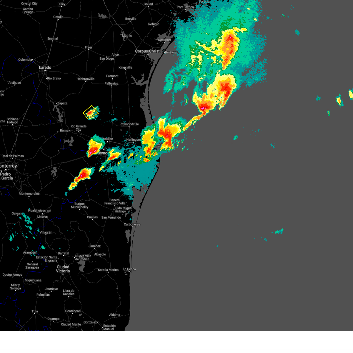 the severe thunderstorm warning has been cancelled and is no longer in effect the severe thunderstorm warning has been cancelled and is no longer in effect
|
| 5/13/2024 8:51 PM CDT |
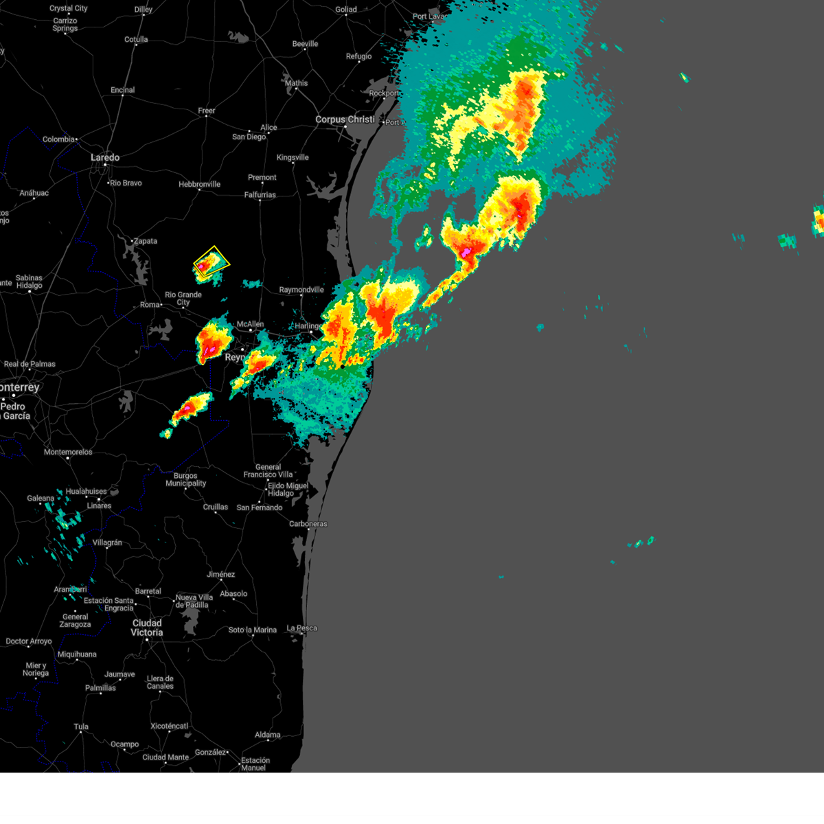 At 851 pm cdt, a severe thunderstorm was located near la gloria, or 11 miles south of agua nueva, moving northeast at 40 mph (radar indicated). Hazards include 60 mph wind gusts and quarter size hail. Hail damage to vehicles is expected. expect wind damage to roofs, siding, and trees. Locations impacted include, la gloria, san isidro, santa elena, santa catarina, and diamond o ranch airport. At 851 pm cdt, a severe thunderstorm was located near la gloria, or 11 miles south of agua nueva, moving northeast at 40 mph (radar indicated). Hazards include 60 mph wind gusts and quarter size hail. Hail damage to vehicles is expected. expect wind damage to roofs, siding, and trees. Locations impacted include, la gloria, san isidro, santa elena, santa catarina, and diamond o ranch airport.
|
| 5/13/2024 8:40 PM CDT |
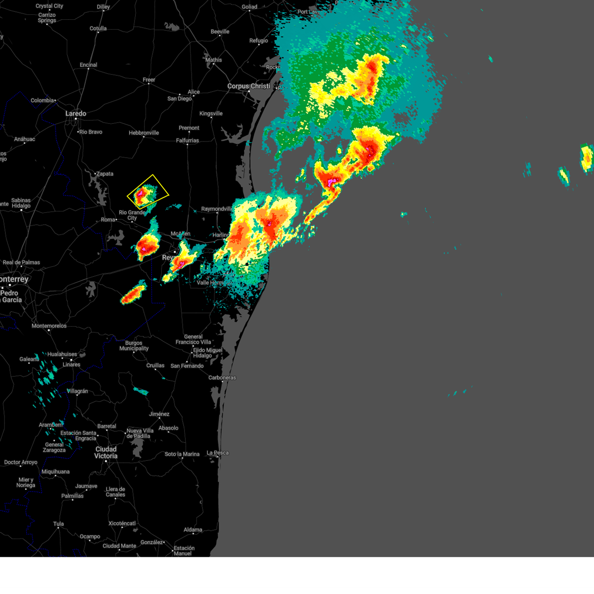 At 840 pm cdt, a severe thunderstorm was located near santa catarina, or 9 miles east of viboras, moving northeast at 40 mph (radar indicated). Hazards include 60 mph wind gusts and quarter size hail. Hail damage to vehicles is expected. expect wind damage to roofs, siding, and trees. Locations impacted include, la gloria, san isidro, santa elena, santa catarina, diamond o ranch airport, and delmita. At 840 pm cdt, a severe thunderstorm was located near santa catarina, or 9 miles east of viboras, moving northeast at 40 mph (radar indicated). Hazards include 60 mph wind gusts and quarter size hail. Hail damage to vehicles is expected. expect wind damage to roofs, siding, and trees. Locations impacted include, la gloria, san isidro, santa elena, santa catarina, diamond o ranch airport, and delmita.
|
| 5/13/2024 8:33 PM CDT |
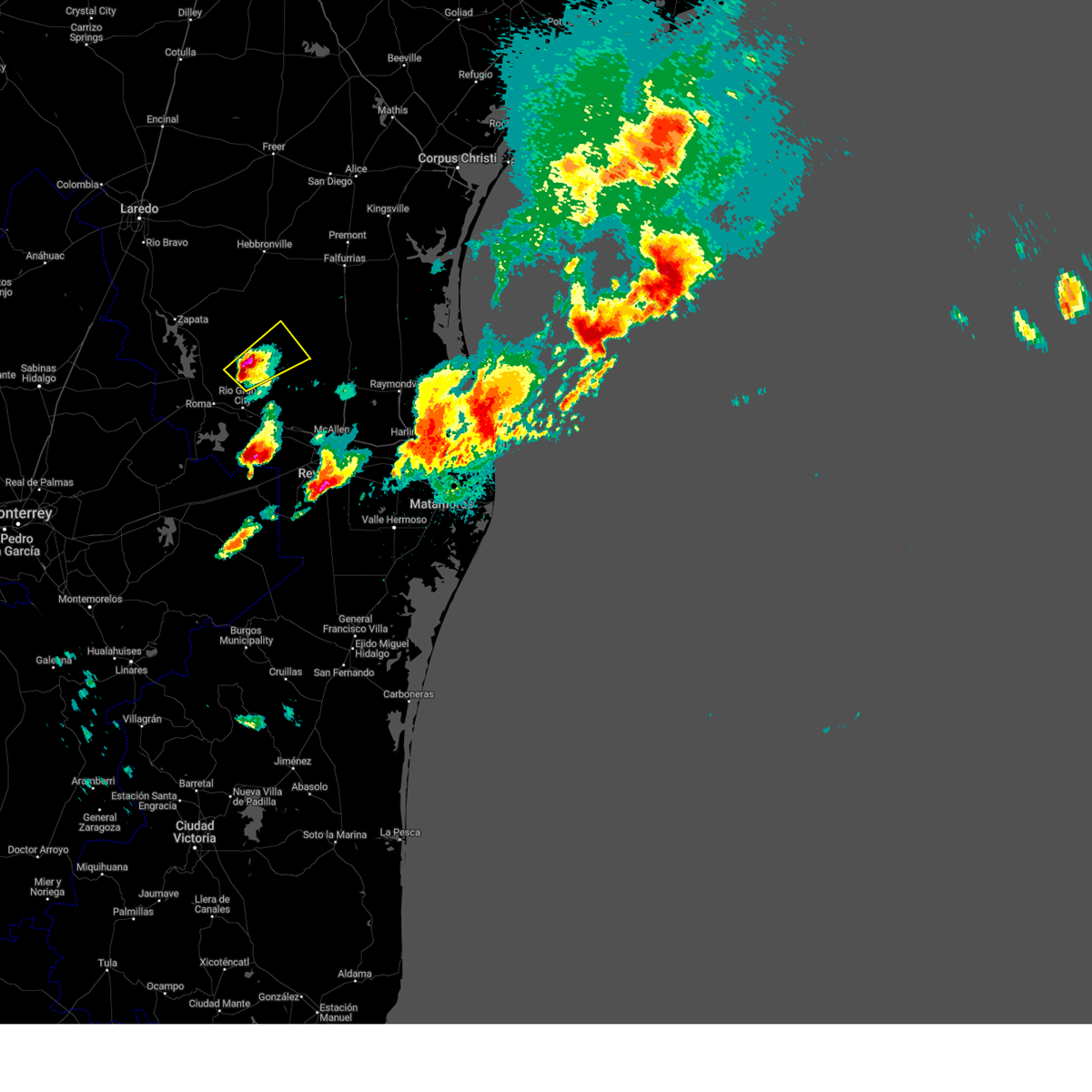 At 833 pm cdt, a severe thunderstorm was located 7 miles southeast of viboras, moving northeast at 40 mph (radar indicated). Hazards include tennis ball size hail and 70 mph wind gusts. People and animals outdoors will be injured. expect hail damage to roofs, siding, windows, and vehicles. expect considerable tree damage. wind damage is also likely to mobile homes, roofs, and outbuildings. Locations impacted include, el sauz, la gloria, santa catarina, san isidro, santa elena, delmita, and diamond o ranch airport. At 833 pm cdt, a severe thunderstorm was located 7 miles southeast of viboras, moving northeast at 40 mph (radar indicated). Hazards include tennis ball size hail and 70 mph wind gusts. People and animals outdoors will be injured. expect hail damage to roofs, siding, windows, and vehicles. expect considerable tree damage. wind damage is also likely to mobile homes, roofs, and outbuildings. Locations impacted include, el sauz, la gloria, santa catarina, san isidro, santa elena, delmita, and diamond o ranch airport.
|
| 5/13/2024 8:26 PM CDT |
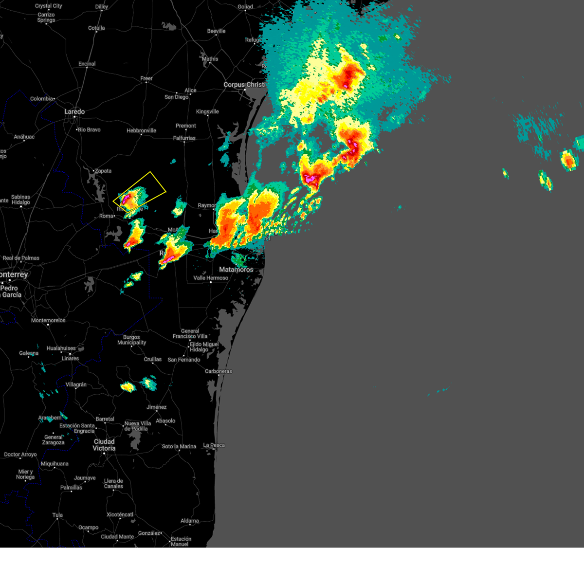 Svrbro the national weather service in brownsville has issued a * severe thunderstorm warning for, south central jim hogg county in deep south texas, northern starr county in deep south texas, * until 915 pm cdt. * at 824 pm cdt, a severe thunderstorm was located over el sauz, moving northeast at 40 mph. this is a destructive storm for central starr county (radar indicated). Hazards include three inch hail and 70 mph wind gusts. People and animals outdoors will be severely injured. Expect shattered windows, extensive damage to roofs, siding, and vehicles. Svrbro the national weather service in brownsville has issued a * severe thunderstorm warning for, south central jim hogg county in deep south texas, northern starr county in deep south texas, * until 915 pm cdt. * at 824 pm cdt, a severe thunderstorm was located over el sauz, moving northeast at 40 mph. this is a destructive storm for central starr county (radar indicated). Hazards include three inch hail and 70 mph wind gusts. People and animals outdoors will be severely injured. Expect shattered windows, extensive damage to roofs, siding, and vehicles.
|
| 5/13/2024 7:06 PM CDT |
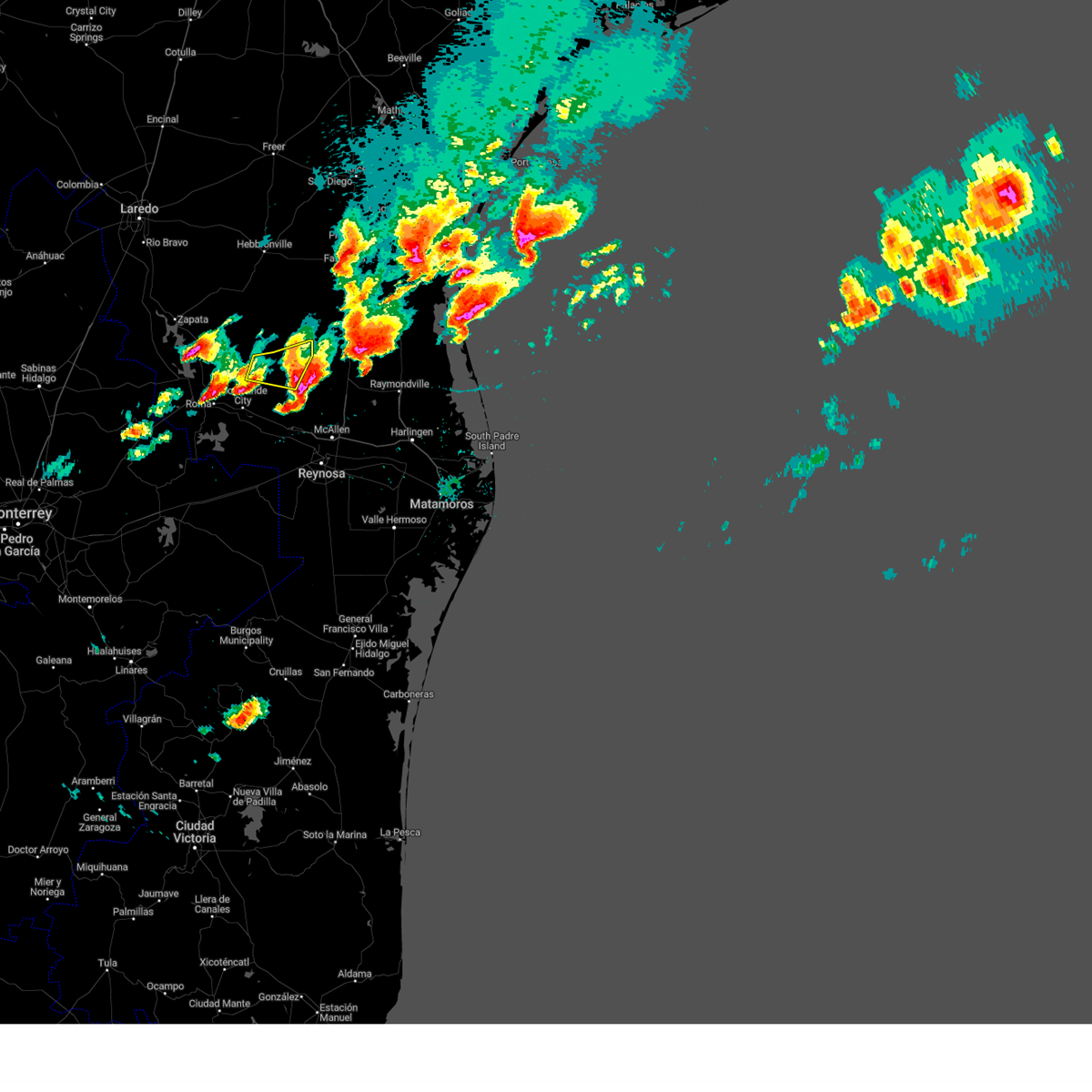 The storm which prompted the warning has moved out of the area. therefore, the warning will be allowed to expire. however, small hail is still possible with this thunderstorm. a severe thunderstorm watch remains in effect until 1000 pm cdt for deep south texas. remember, a severe thunderstorm warning still remains in effect for starr. The storm which prompted the warning has moved out of the area. therefore, the warning will be allowed to expire. however, small hail is still possible with this thunderstorm. a severe thunderstorm watch remains in effect until 1000 pm cdt for deep south texas. remember, a severe thunderstorm warning still remains in effect for starr.
|
| 5/13/2024 6:47 PM CDT |
 At 646 pm cdt, a severe thunderstorm was located over la reforma, or 14 miles north of mccook, moving east at 60 mph (radar indicated). Hazards include tennis ball size hail and 60 mph wind gusts. People and animals outdoors will be injured. expect hail damage to roofs, siding, windows, and vehicles. expect wind damage to roofs, siding, and trees. Locations impacted include, la gloria, la reforma, san isidro, santa catarina, diamond o ranch airport, and delmita. At 646 pm cdt, a severe thunderstorm was located over la reforma, or 14 miles north of mccook, moving east at 60 mph (radar indicated). Hazards include tennis ball size hail and 60 mph wind gusts. People and animals outdoors will be injured. expect hail damage to roofs, siding, windows, and vehicles. expect wind damage to roofs, siding, and trees. Locations impacted include, la gloria, la reforma, san isidro, santa catarina, diamond o ranch airport, and delmita.
|
| 5/13/2024 6:47 PM CDT |
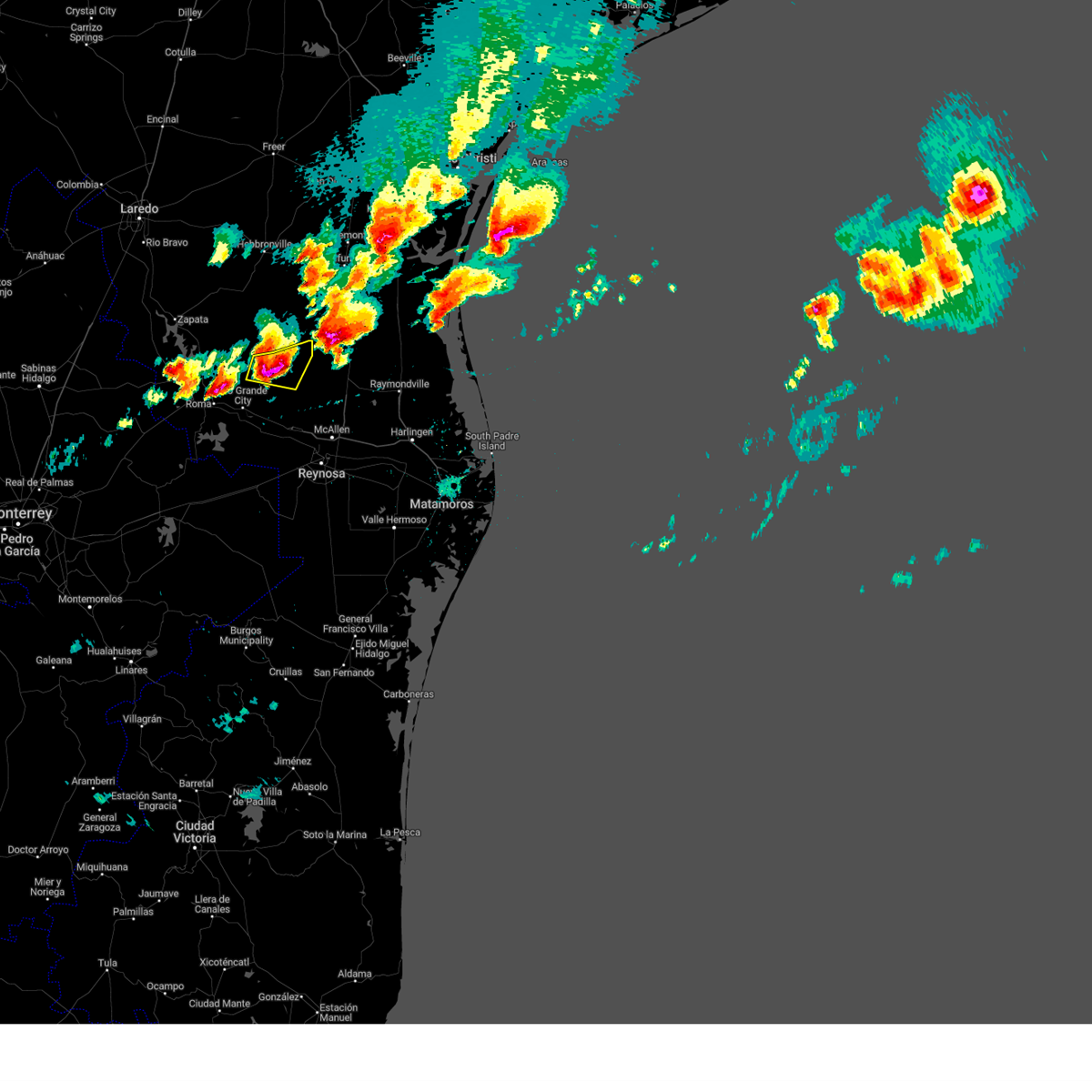 the severe thunderstorm warning has been cancelled and is no longer in effect the severe thunderstorm warning has been cancelled and is no longer in effect
|
| 5/13/2024 6:33 PM CDT |
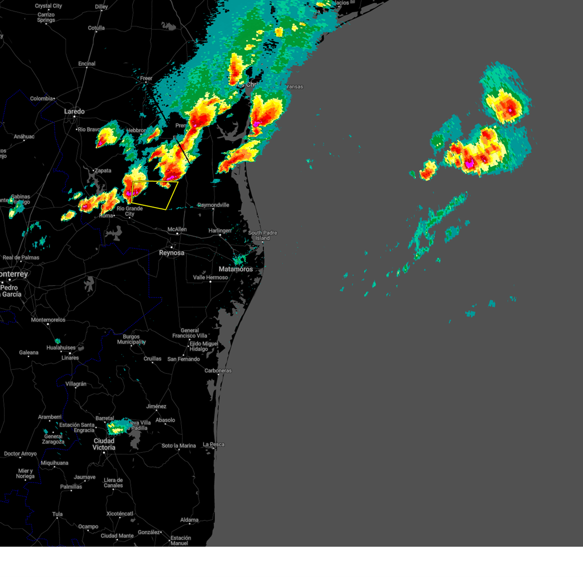 Svrbro the national weather service in brownsville has issued a * severe thunderstorm warning for, northwestern hidalgo county in deep south texas, northeastern starr county in deep south texas, * until 715 pm cdt. * at 633 pm cdt, a severe thunderstorm was located near santa catarina, or 12 miles east of viboras, moving east at 60 mph (radar indicated). Hazards include tennis ball size hail and 60 mph wind gusts. People and animals outdoors will be injured. expect hail damage to roofs, siding, windows, and vehicles. Expect wind damage to roofs, siding, and trees. Svrbro the national weather service in brownsville has issued a * severe thunderstorm warning for, northwestern hidalgo county in deep south texas, northeastern starr county in deep south texas, * until 715 pm cdt. * at 633 pm cdt, a severe thunderstorm was located near santa catarina, or 12 miles east of viboras, moving east at 60 mph (radar indicated). Hazards include tennis ball size hail and 60 mph wind gusts. People and animals outdoors will be injured. expect hail damage to roofs, siding, windows, and vehicles. Expect wind damage to roofs, siding, and trees.
|
| 5/11/2024 5:02 PM CDT |
 At 501 pm cdt, a severe thunderstorm was located over brookesmith, moving east at 50 mph (radar indicated). Hazards include golf ball size hail and 60 mph wind gusts. People and animals outdoors will be injured. expect hail damage to roofs, siding, windows, and vehicles. expect wind damage to roofs, siding, and trees. this severe storm will be near, brownwood and camp bowie around 505 pm cdt. Other locations impacted by this severe thunderstorm include regency, milburn, locker, whon, spring creek, us-283 near the mcculloch- coleman county line, and indian creek. At 501 pm cdt, a severe thunderstorm was located over brookesmith, moving east at 50 mph (radar indicated). Hazards include golf ball size hail and 60 mph wind gusts. People and animals outdoors will be injured. expect hail damage to roofs, siding, windows, and vehicles. expect wind damage to roofs, siding, and trees. this severe storm will be near, brownwood and camp bowie around 505 pm cdt. Other locations impacted by this severe thunderstorm include regency, milburn, locker, whon, spring creek, us-283 near the mcculloch- coleman county line, and indian creek.
|
| 5/11/2024 4:59 PM CDT | Ping Pong Ball sized hail reported 13.8 miles N of Santa Anna, TX |
| 5/11/2024 4:49 PM CDT | Lots of tree limbs down. wind gusts estimated to 60 mp in coleman county TX, 346.9 miles S of Santa Anna, TX |
| 5/11/2024 4:48 PM CDT | Ping Pong Ball sized hail reported 346.9 miles S of Santa Anna, TX, lots of quarter to ping pong ball sized hail covering the ground. |
| 5/11/2024 4:47 PM CDT | West texas mesone in coleman county TX, 343.3 miles S of Santa Anna, TX |
| 5/11/2024 4:41 PM CDT |
 Svrsjt the national weather service in san angelo has issued a * severe thunderstorm warning for, southern brown county in west central texas, southern coleman county in west central texas, northern mcculloch county in west central texas, northwestern san saba county in west central texas, * until 545 pm cdt. * at 440 pm cdt, a severe thunderstorm was located over shields, or near gouldbusk, moving east at 50 mph (radar indicated). Hazards include golf ball size hail and 60 mph wind gusts. People and animals outdoors will be injured. expect hail damage to roofs, siding, windows, and vehicles. expect wind damage to roofs, siding, and trees. this severe thunderstorm will be near, trickham and rockwood around 445 pm cdt. brookesmith around 455 pm cdt. winchell around 500 pm cdt. brownwood and camp bowie around 505 pm cdt. Other locations impacted by this severe thunderstorm include regency, milburn, locker, mozelle, whon, spring creek, fisk, us- 283 near the mcculloch- coleman county line, indian creek, and shields. Svrsjt the national weather service in san angelo has issued a * severe thunderstorm warning for, southern brown county in west central texas, southern coleman county in west central texas, northern mcculloch county in west central texas, northwestern san saba county in west central texas, * until 545 pm cdt. * at 440 pm cdt, a severe thunderstorm was located over shields, or near gouldbusk, moving east at 50 mph (radar indicated). Hazards include golf ball size hail and 60 mph wind gusts. People and animals outdoors will be injured. expect hail damage to roofs, siding, windows, and vehicles. expect wind damage to roofs, siding, and trees. this severe thunderstorm will be near, trickham and rockwood around 445 pm cdt. brookesmith around 455 pm cdt. winchell around 500 pm cdt. brownwood and camp bowie around 505 pm cdt. Other locations impacted by this severe thunderstorm include regency, milburn, locker, mozelle, whon, spring creek, fisk, us- 283 near the mcculloch- coleman county line, indian creek, and shields.
|
| 5/2/2024 8:52 PM CDT |
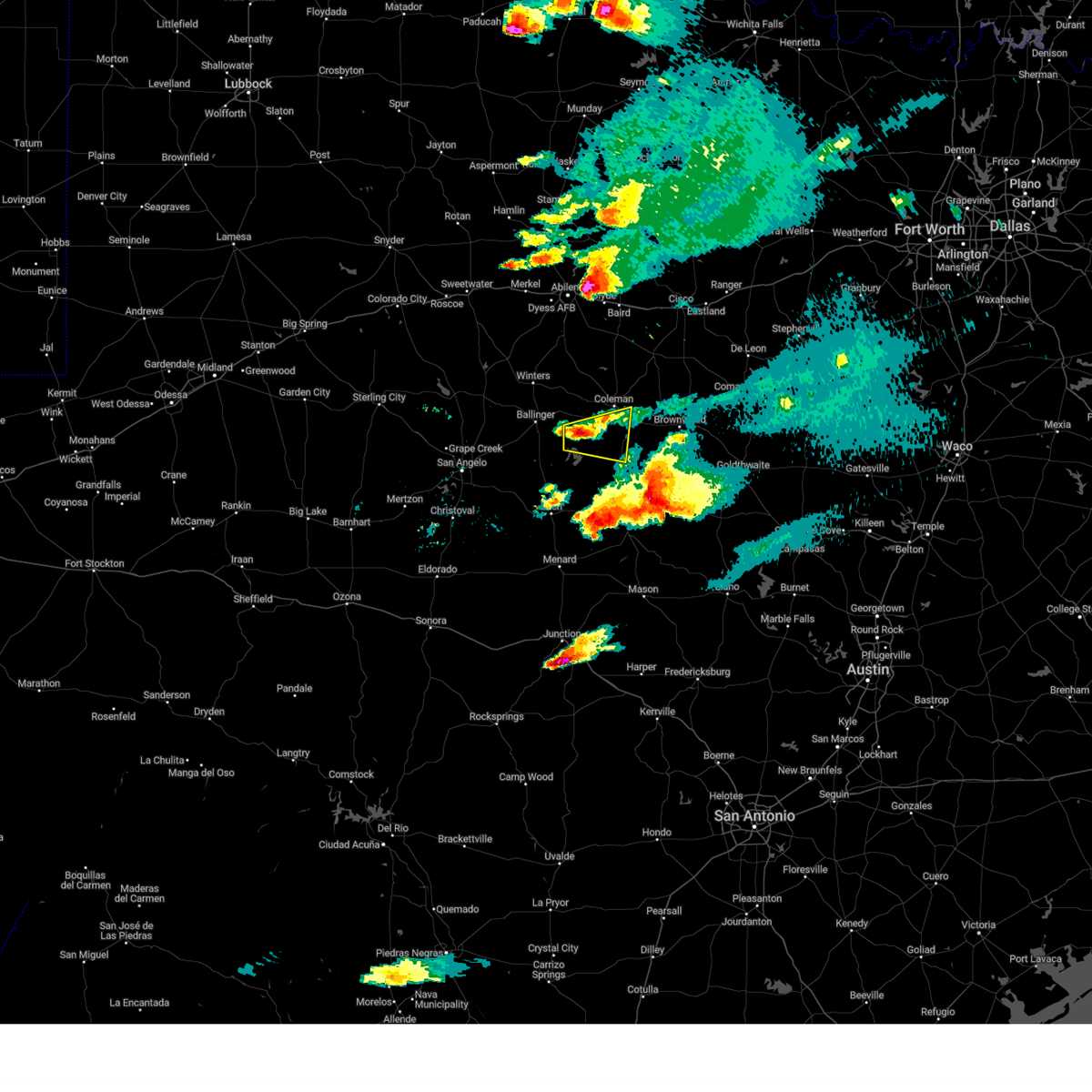 Svrsjt the national weather service in san angelo has issued a * severe thunderstorm warning for, southern coleman county in west central texas, southeastern runnels county in west central texas, * until 930 pm cdt. * at 851 pm cdt, a severe thunderstorm was located 7 miles north of leaday, moving east at 30 mph (radar indicated). Hazards include 60 mph wind gusts and quarter size hail. Hail damage to vehicles is expected. expect wind damage to roofs, siding, and trees. this severe thunderstorm will be near, voss and valera around 855 pm cdt. gouldbusk around 910 pm cdt. santa anna around 915 pm cdt. Other locations impacted by this severe thunderstorm include mozelle, fisk, and shields. Svrsjt the national weather service in san angelo has issued a * severe thunderstorm warning for, southern coleman county in west central texas, southeastern runnels county in west central texas, * until 930 pm cdt. * at 851 pm cdt, a severe thunderstorm was located 7 miles north of leaday, moving east at 30 mph (radar indicated). Hazards include 60 mph wind gusts and quarter size hail. Hail damage to vehicles is expected. expect wind damage to roofs, siding, and trees. this severe thunderstorm will be near, voss and valera around 855 pm cdt. gouldbusk around 910 pm cdt. santa anna around 915 pm cdt. Other locations impacted by this severe thunderstorm include mozelle, fisk, and shields.
|
| 5/2/2024 6:29 PM CDT | Baseball sized hail reported 19.5 miles NE of Santa Anna, TX, report from mping: baseball (2.75 in.). |
| 5/2/2024 6:03 PM CDT |
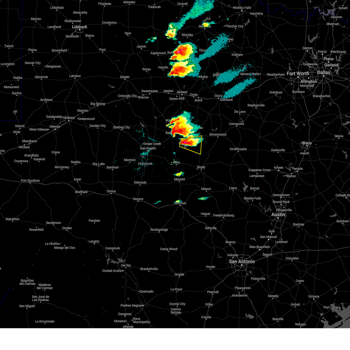 Svrsjt the national weather service in san angelo has issued a * severe thunderstorm warning for, southwestern coleman county in west central texas, northwestern mcculloch county in west central texas, southeastern runnels county in west central texas, northeastern concho county in west central texas, * until 645 pm cdt. * at 602 pm cdt, a severe thunderstorm was located near leaday, moving east at 25 mph (radar indicated). Hazards include ping pong ball size hail and 60 mph wind gusts. People and animals outdoors will be injured. expect hail damage to roofs, siding, windows, and vehicles. expect wind damage to roofs, siding, and trees. this severe thunderstorm will be near, voss and gouldbusk around 610 pm cdt. rockwood around 620 pm cdt. waldrip around 625 pm cdt. Other locations impacted by this severe thunderstorm include mozelle, fisk, us-283 near the mcculloch-coleman county line, and shields. Svrsjt the national weather service in san angelo has issued a * severe thunderstorm warning for, southwestern coleman county in west central texas, northwestern mcculloch county in west central texas, southeastern runnels county in west central texas, northeastern concho county in west central texas, * until 645 pm cdt. * at 602 pm cdt, a severe thunderstorm was located near leaday, moving east at 25 mph (radar indicated). Hazards include ping pong ball size hail and 60 mph wind gusts. People and animals outdoors will be injured. expect hail damage to roofs, siding, windows, and vehicles. expect wind damage to roofs, siding, and trees. this severe thunderstorm will be near, voss and gouldbusk around 610 pm cdt. rockwood around 620 pm cdt. waldrip around 625 pm cdt. Other locations impacted by this severe thunderstorm include mozelle, fisk, us-283 near the mcculloch-coleman county line, and shields.
|
| 5/1/2024 11:06 PM CDT |
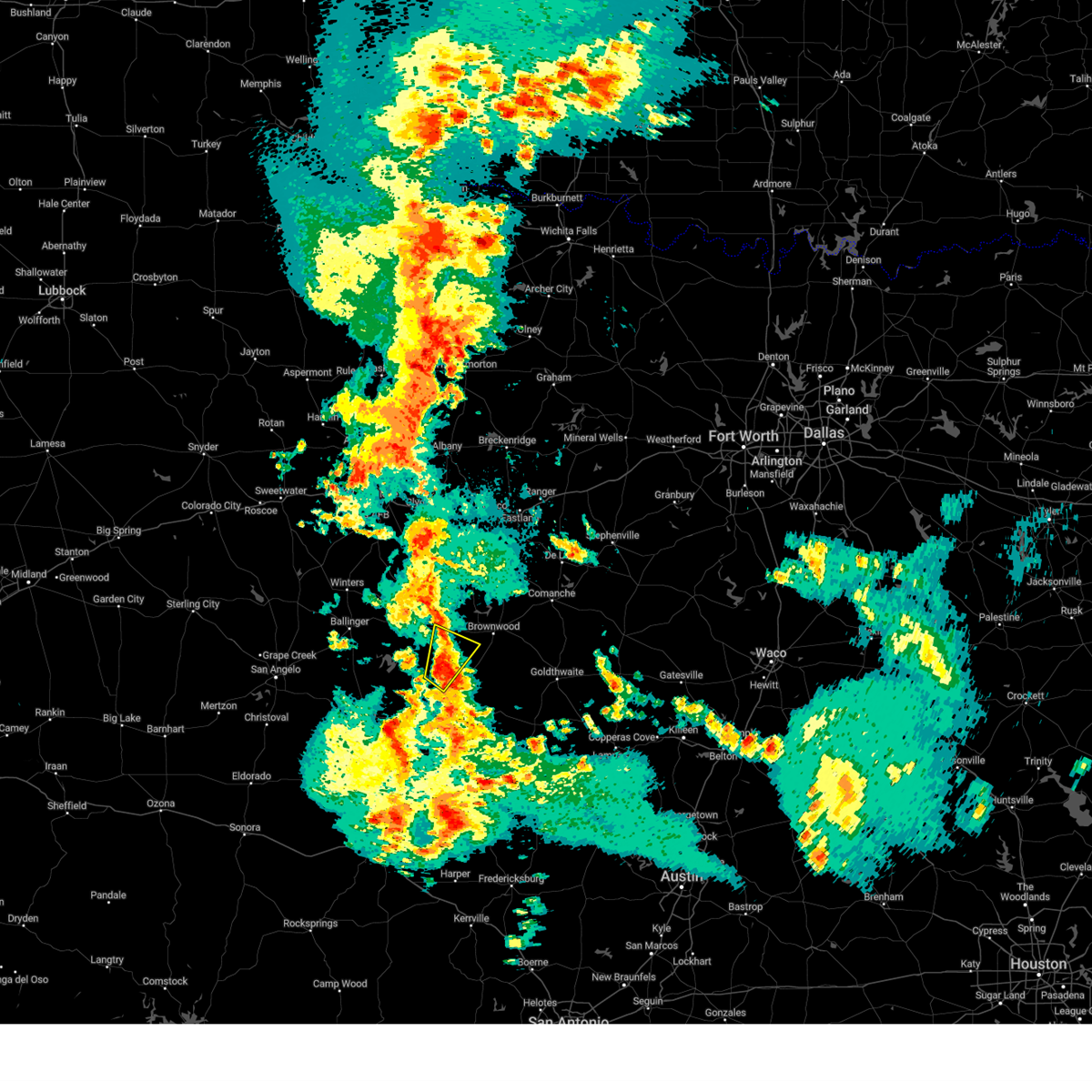 At 1106 pm cdt, a severe thunderstorm was located over rockwood, moving northeast at 35 mph (radar indicated). Hazards include 60 mph wind gusts and half dollar size hail. Hail damage to vehicles is expected. expect wind damage to roofs, siding, and trees. this severe storm will be near, trickham around 1110 pm cdt. santa anna around 1120 pm cdt. Other locations impacted by this severe thunderstorm include whon and us-283 near the mcculloch-coleman county line. At 1106 pm cdt, a severe thunderstorm was located over rockwood, moving northeast at 35 mph (radar indicated). Hazards include 60 mph wind gusts and half dollar size hail. Hail damage to vehicles is expected. expect wind damage to roofs, siding, and trees. this severe storm will be near, trickham around 1110 pm cdt. santa anna around 1120 pm cdt. Other locations impacted by this severe thunderstorm include whon and us-283 near the mcculloch-coleman county line.
|
| 5/1/2024 10:56 PM CDT |
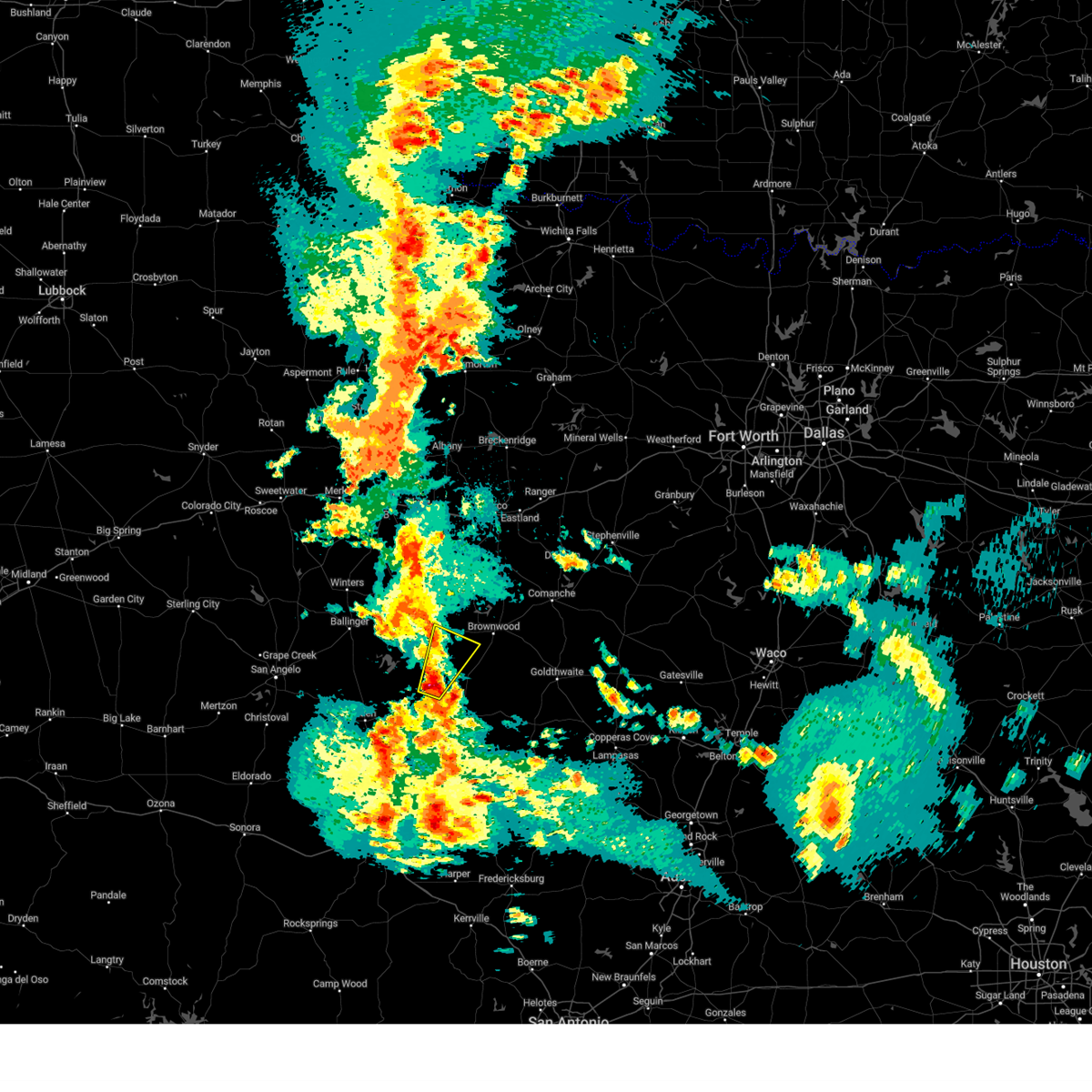 Svrsjt the national weather service in san angelo has issued a * severe thunderstorm warning for, west central brown county in west central texas, southeastern coleman county in west central texas, north central mcculloch county in west central texas, * until 1130 pm cdt. * at 1055 pm cdt, a severe thunderstorm was located over waldrip, moving northeast at 35 mph (radar indicated). Hazards include 60 mph wind gusts and half dollar size hail. Hail damage to vehicles is expected. expect wind damage to roofs, siding, and trees. this severe thunderstorm will be near, rockwood and waldrip around 1100 pm cdt. trickham around 1110 pm cdt. Other locations impacted by this severe thunderstorm include whon, us-283 near the mcculloch-coleman county line, fife, and shields. Svrsjt the national weather service in san angelo has issued a * severe thunderstorm warning for, west central brown county in west central texas, southeastern coleman county in west central texas, north central mcculloch county in west central texas, * until 1130 pm cdt. * at 1055 pm cdt, a severe thunderstorm was located over waldrip, moving northeast at 35 mph (radar indicated). Hazards include 60 mph wind gusts and half dollar size hail. Hail damage to vehicles is expected. expect wind damage to roofs, siding, and trees. this severe thunderstorm will be near, rockwood and waldrip around 1100 pm cdt. trickham around 1110 pm cdt. Other locations impacted by this severe thunderstorm include whon, us-283 near the mcculloch-coleman county line, fife, and shields.
|
| 3/7/2024 6:26 PM CST |
 At 625 pm cst, a severe thunderstorm was located near santa anna, moving east at 35 mph (radar indicated). Hazards include 60 mph wind gusts and half dollar size hail. Hail damage to vehicles is expected. expect wind damage to roofs, siding, and trees. this severe storm will be near, lake brownwood around 630 pm cst. bangs, lake brownwood near thrifty, and grosvenor around 635 pm cst. Other locations impacted by this severe thunderstorm include thrifty. At 625 pm cst, a severe thunderstorm was located near santa anna, moving east at 35 mph (radar indicated). Hazards include 60 mph wind gusts and half dollar size hail. Hail damage to vehicles is expected. expect wind damage to roofs, siding, and trees. this severe storm will be near, lake brownwood around 630 pm cst. bangs, lake brownwood near thrifty, and grosvenor around 635 pm cst. Other locations impacted by this severe thunderstorm include thrifty.
|
| 3/7/2024 6:13 PM CST |
 Svrsjt the national weather service in san angelo has issued a * severe thunderstorm warning for, west central brown county in west central texas, east central coleman county in west central texas, * until 700 pm cst. * at 612 pm cst, a severe thunderstorm was located over coleman, moving east at 40 mph (radar indicated). Hazards include 60 mph wind gusts. Expect damage to roofs, siding, and trees. this severe thunderstorm will be near, santa anna around 620 pm cst. grosvenor around 625 pm cst. lake brownwood near thrifty and lake brownwood around 630 pm cst. Other locations impacted by this severe thunderstorm include thrifty and hords creek reservoir. Svrsjt the national weather service in san angelo has issued a * severe thunderstorm warning for, west central brown county in west central texas, east central coleman county in west central texas, * until 700 pm cst. * at 612 pm cst, a severe thunderstorm was located over coleman, moving east at 40 mph (radar indicated). Hazards include 60 mph wind gusts. Expect damage to roofs, siding, and trees. this severe thunderstorm will be near, santa anna around 620 pm cst. grosvenor around 625 pm cst. lake brownwood near thrifty and lake brownwood around 630 pm cst. Other locations impacted by this severe thunderstorm include thrifty and hords creek reservoir.
|
| 3/7/2024 5:23 PM CST |
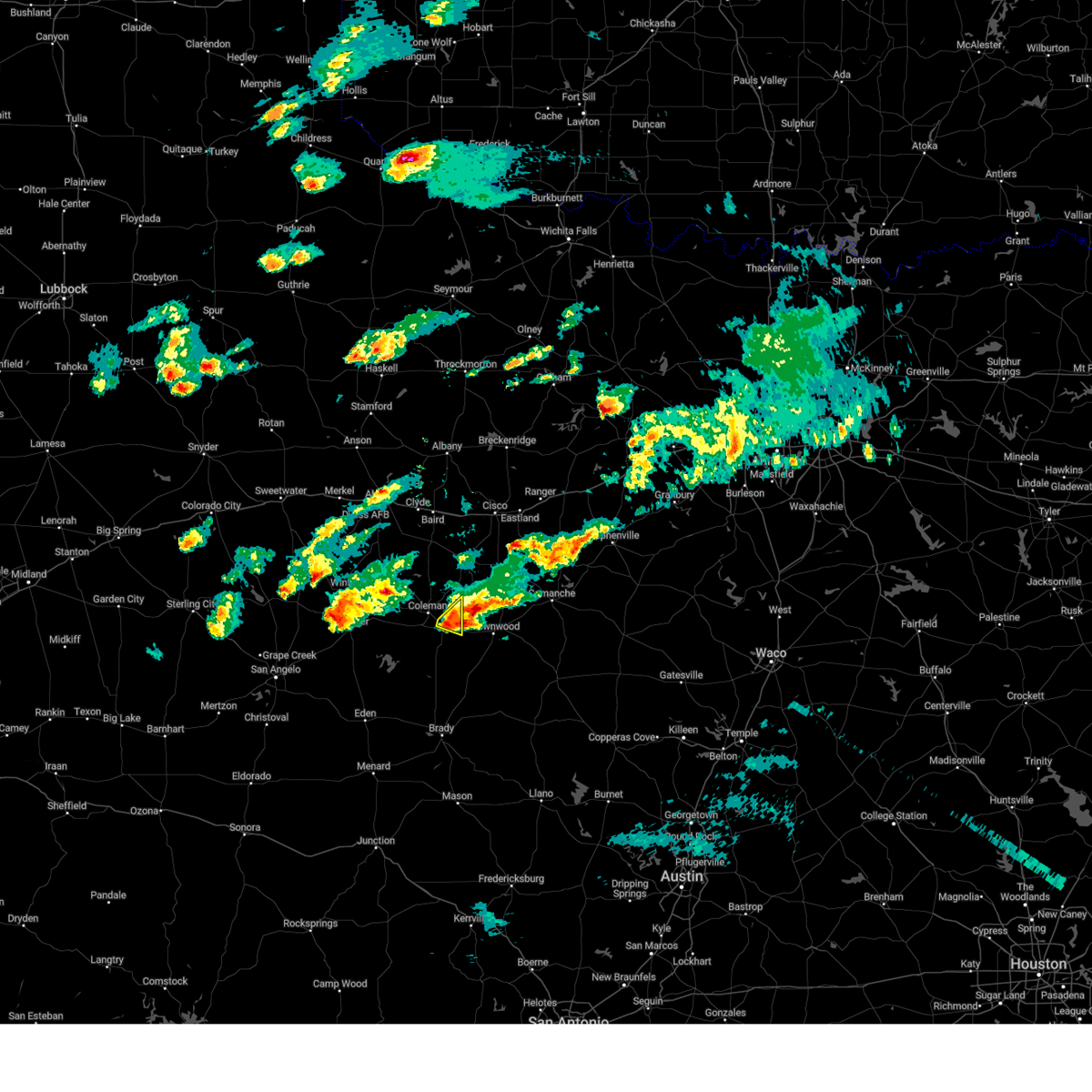 At 522 pm cst, a severe thunderstorm was located near santa anna, moving east at 30 mph (radar indicated). Hazards include 60 mph wind gusts and penny size hail. Expect damage to roofs, siding, and trees. This severe thunderstorm will remain over mainly rural areas of east central coleman county. At 522 pm cst, a severe thunderstorm was located near santa anna, moving east at 30 mph (radar indicated). Hazards include 60 mph wind gusts and penny size hail. Expect damage to roofs, siding, and trees. This severe thunderstorm will remain over mainly rural areas of east central coleman county.
|
| 3/7/2024 5:01 PM CST |
 At 500 pm cst, a severe thunderstorm was located 3 miles south of coleman, moving east at 25 mph (radar indicated). Hazards include 60 mph wind gusts and quarter size hail. Hail damage to vehicles is expected. expect wind damage to roofs, siding, and trees. this severe storm will be near, coleman and santa anna around 505 pm cst. Other locations impacted by this severe thunderstorm include echo. At 500 pm cst, a severe thunderstorm was located 3 miles south of coleman, moving east at 25 mph (radar indicated). Hazards include 60 mph wind gusts and quarter size hail. Hail damage to vehicles is expected. expect wind damage to roofs, siding, and trees. this severe storm will be near, coleman and santa anna around 505 pm cst. Other locations impacted by this severe thunderstorm include echo.
|
| 3/7/2024 4:41 PM CST |
 Svrsjt the national weather service in san angelo has issued a * severe thunderstorm warning for, central coleman county in west central texas, * until 545 pm cst. * at 441 pm cst, a severe thunderstorm was located near valera, moving east at 20 mph (radar indicated). Hazards include 60 mph wind gusts and half dollar size hail. Hail damage to vehicles is expected. expect wind damage to roofs, siding, and trees. this severe thunderstorm will be near, valera around 445 pm cst. coleman around 450 pm cst. santa anna around 500 pm cst. Other locations impacted by this severe thunderstorm include echo and hords creek reservoir. Svrsjt the national weather service in san angelo has issued a * severe thunderstorm warning for, central coleman county in west central texas, * until 545 pm cst. * at 441 pm cst, a severe thunderstorm was located near valera, moving east at 20 mph (radar indicated). Hazards include 60 mph wind gusts and half dollar size hail. Hail damage to vehicles is expected. expect wind damage to roofs, siding, and trees. this severe thunderstorm will be near, valera around 445 pm cst. coleman around 450 pm cst. santa anna around 500 pm cst. Other locations impacted by this severe thunderstorm include echo and hords creek reservoir.
|
| 9/16/2023 6:34 AM CDT |
 At 633 am cdt, a severe thunderstorm was located near silver valley, moving southeast at 15 mph (radar indicated). Hazards include 60 mph wind gusts and half dollar size hail. Hail damage to vehicles is expected. expect wind damage to roofs, siding, and trees. this severe thunderstorm will be near, coleman around 640 am cdt. other locations impacted by this severe thunderstorm include echo. hail threat, radar indicated max hail size, 1. 25 in wind threat, radar indicated max wind gust, 60 mph. At 633 am cdt, a severe thunderstorm was located near silver valley, moving southeast at 15 mph (radar indicated). Hazards include 60 mph wind gusts and half dollar size hail. Hail damage to vehicles is expected. expect wind damage to roofs, siding, and trees. this severe thunderstorm will be near, coleman around 640 am cdt. other locations impacted by this severe thunderstorm include echo. hail threat, radar indicated max hail size, 1. 25 in wind threat, radar indicated max wind gust, 60 mph.
|
| 9/9/2023 5:26 PM CDT |
 At 526 pm cdt, a severe thunderstorm was located near lake coleman, or near silver valley, moving southeast at 15 mph (radar indicated). Hazards include 60 mph wind gusts and quarter size hail. Hail damage to vehicles is expected. expect wind damage to roofs, siding, and trees. this severe storm will be near, coleman around 605 pm cdt. santa anna around 615 pm cdt. other locations impacted by this severe thunderstorm include echo and lake coleman. hail threat, radar indicated max hail size, 1. 00 in wind threat, radar indicated max wind gust, 60 mph. At 526 pm cdt, a severe thunderstorm was located near lake coleman, or near silver valley, moving southeast at 15 mph (radar indicated). Hazards include 60 mph wind gusts and quarter size hail. Hail damage to vehicles is expected. expect wind damage to roofs, siding, and trees. this severe storm will be near, coleman around 605 pm cdt. santa anna around 615 pm cdt. other locations impacted by this severe thunderstorm include echo and lake coleman. hail threat, radar indicated max hail size, 1. 00 in wind threat, radar indicated max wind gust, 60 mph.
|
| 9/9/2023 5:05 PM CDT |
 At 505 pm cdt, a severe thunderstorm was located near silver valley, moving southeast at 15 mph (radar indicated). Hazards include ping pong ball size hail and 60 mph wind gusts. People and animals outdoors will be injured. expect hail damage to roofs, siding, windows, and vehicles. expect wind damage to roofs, siding, and trees. this severe storm will be near, coleman around 540 pm cdt. santa anna around 600 pm cdt. other locations impacted by this severe thunderstorm include echo and lake coleman. hail threat, radar indicated max hail size, 1. 50 in wind threat, radar indicated max wind gust, 60 mph. At 505 pm cdt, a severe thunderstorm was located near silver valley, moving southeast at 15 mph (radar indicated). Hazards include ping pong ball size hail and 60 mph wind gusts. People and animals outdoors will be injured. expect hail damage to roofs, siding, windows, and vehicles. expect wind damage to roofs, siding, and trees. this severe storm will be near, coleman around 540 pm cdt. santa anna around 600 pm cdt. other locations impacted by this severe thunderstorm include echo and lake coleman. hail threat, radar indicated max hail size, 1. 50 in wind threat, radar indicated max wind gust, 60 mph.
|
| 9/9/2023 4:49 PM CDT |
 At 449 pm cdt, a severe thunderstorm was located near lake coleman, or near silver valley, moving south at 15 mph (radar indicated). Hazards include 60 mph wind gusts and quarter size hail. Hail damage to vehicles is expected. expect wind damage to roofs, siding, and trees. this severe thunderstorm will be near, coleman around 525 pm cdt. santa anna around 545 pm cdt. other locations impacted by this severe thunderstorm include echo, lake coleman and fisk. hail threat, radar indicated max hail size, 1. 00 in wind threat, radar indicated max wind gust, 60 mph. At 449 pm cdt, a severe thunderstorm was located near lake coleman, or near silver valley, moving south at 15 mph (radar indicated). Hazards include 60 mph wind gusts and quarter size hail. Hail damage to vehicles is expected. expect wind damage to roofs, siding, and trees. this severe thunderstorm will be near, coleman around 525 pm cdt. santa anna around 545 pm cdt. other locations impacted by this severe thunderstorm include echo, lake coleman and fisk. hail threat, radar indicated max hail size, 1. 00 in wind threat, radar indicated max wind gust, 60 mph.
|
| 8/10/2023 9:04 PM CDT |
 At 903 pm cdt, severe thunderstorms were located along a line extending from near cisco to near burkett to near voss, moving east at 30 mph (radar indicated). Hazards include 60 mph wind gusts. Expect damage to roofs, siding, and trees. these severe storms will be near, cross cut around 915 pm cdt. grosvenor around 920 pm cdt. lake brownwood near thrifty around 925 pm cdt. byrds, rockwood, waldrip and lake brownwood around 930 pm cdt. other locations impacted by these severe thunderstorms include echo, mozelle, fisk, thrifty, us-283 near the coleman- callahan county line, shields and hords creek reservoir. hail threat, radar indicated max hail size, <. 75 in wind threat, radar indicated max wind gust, 60 mph. At 903 pm cdt, severe thunderstorms were located along a line extending from near cisco to near burkett to near voss, moving east at 30 mph (radar indicated). Hazards include 60 mph wind gusts. Expect damage to roofs, siding, and trees. these severe storms will be near, cross cut around 915 pm cdt. grosvenor around 920 pm cdt. lake brownwood near thrifty around 925 pm cdt. byrds, rockwood, waldrip and lake brownwood around 930 pm cdt. other locations impacted by these severe thunderstorms include echo, mozelle, fisk, thrifty, us-283 near the coleman- callahan county line, shields and hords creek reservoir. hail threat, radar indicated max hail size, <. 75 in wind threat, radar indicated max wind gust, 60 mph.
|
| 8/10/2023 8:16 PM CDT |
 At 815 pm cdt, severe thunderstorms were located along a line extending from near us-283 near the callahan-shackelford county line to near oplin to near ballinger, moving east at 30 mph (radar indicated). Hazards include 60 mph wind gusts. Expect damage to roofs, siding, and trees. 5 * severe thunderstorms will be near, baird, novice and oplin around 820 pm cdt. putnam and silver valley around 830 pm cdt. talpa and rowden around 835 pm cdt. glen cove around 840 pm cdt. atwell and ivie reservoir near concho park marina around 845 pm cdt. leaday around 850 pm cdt. valera around 855 pm cdt. coleman, cross plains, voss, burkett and stacy around 900 pm cdt. other locations impacted by these severe thunderstorms include echo, mozelle, us-283 near the callahan- shackelford county line, lake coleman, i-20 near the callahan- eastland county line, admiral, goldsboro, lake winters lake, fisk and ballinger lake. this includes interstate 20 between mile markers 299 and 323. hail threat, radar indicated max hail size, <. 75 in wind threat, radar indicated max wind gust, 60 mph. At 815 pm cdt, severe thunderstorms were located along a line extending from near us-283 near the callahan-shackelford county line to near oplin to near ballinger, moving east at 30 mph (radar indicated). Hazards include 60 mph wind gusts. Expect damage to roofs, siding, and trees. 5 * severe thunderstorms will be near, baird, novice and oplin around 820 pm cdt. putnam and silver valley around 830 pm cdt. talpa and rowden around 835 pm cdt. glen cove around 840 pm cdt. atwell and ivie reservoir near concho park marina around 845 pm cdt. leaday around 850 pm cdt. valera around 855 pm cdt. coleman, cross plains, voss, burkett and stacy around 900 pm cdt. other locations impacted by these severe thunderstorms include echo, mozelle, us-283 near the callahan- shackelford county line, lake coleman, i-20 near the callahan- eastland county line, admiral, goldsboro, lake winters lake, fisk and ballinger lake. this includes interstate 20 between mile markers 299 and 323. hail threat, radar indicated max hail size, <. 75 in wind threat, radar indicated max wind gust, 60 mph.
|
| 6/22/2023 1:12 AM CDT |
 At 112 am cdt, a severe thunderstorm was located near echo, or 7 miles east of silver valley, moving southeast at 40 mph (radar indicated). Hazards include 60 mph wind gusts and penny size hail. Expect damage to roofs, siding, and trees. this severe thunderstorm will be near, coleman, burkett and cross cut around 120 am cdt. valera around 125 am cdt. santa anna, grosvenor and byrds around 135 am cdt. lake brownwood near thrifty, lake brownwood and lake brownwood state park around 140 am cdt. bangs and gouldbusk around 150 am cdt. early and trickham around 155 am cdt. brownwood, camp bowie and rockwood around 200 am cdt. brookesmith around 205 am cdt. other locations impacted by this severe thunderstorm include echo, mozelle, goldsboro, whon, fisk, thrifty, indian creek, us- 283 near the coleman-callahan county line, lake coleman and shields. hail threat, radar indicated max hail size, 0. 75 in wind threat, radar indicated max wind gust, 60 mph. At 112 am cdt, a severe thunderstorm was located near echo, or 7 miles east of silver valley, moving southeast at 40 mph (radar indicated). Hazards include 60 mph wind gusts and penny size hail. Expect damage to roofs, siding, and trees. this severe thunderstorm will be near, coleman, burkett and cross cut around 120 am cdt. valera around 125 am cdt. santa anna, grosvenor and byrds around 135 am cdt. lake brownwood near thrifty, lake brownwood and lake brownwood state park around 140 am cdt. bangs and gouldbusk around 150 am cdt. early and trickham around 155 am cdt. brownwood, camp bowie and rockwood around 200 am cdt. brookesmith around 205 am cdt. other locations impacted by this severe thunderstorm include echo, mozelle, goldsboro, whon, fisk, thrifty, indian creek, us- 283 near the coleman-callahan county line, lake coleman and shields. hail threat, radar indicated max hail size, 0. 75 in wind threat, radar indicated max wind gust, 60 mph.
|
| 6/19/2023 7:49 PM CDT | Quarter sized hail reported 351.2 miles S of Santa Anna, TX, report from mping: quarter (1.00 in.). |
| 6/19/2023 7:39 PM CDT | Ping Pong Ball sized hail reported 352 miles S of Santa Anna, TX, ping pong ball size hail was reported. |
| 6/19/2023 7:38 PM CDT |
 At 738 pm cdt, a severe thunderstorm was located near santa anna, moving southeast at 30 mph (radar indicated). Hazards include 60 mph wind gusts and quarter size hail. Hail damage to vehicles is expected. expect wind damage to roofs, siding, and trees. this severe storm will be near, bangs around 750 pm cdt. rockwood around 755 pm cdt. trickham around 800 pm cdt. brownwood around 805 pm cdt. hail threat, radar indicated max hail size, 1. 00 in wind threat, radar indicated max wind gust, 60 mph. At 738 pm cdt, a severe thunderstorm was located near santa anna, moving southeast at 30 mph (radar indicated). Hazards include 60 mph wind gusts and quarter size hail. Hail damage to vehicles is expected. expect wind damage to roofs, siding, and trees. this severe storm will be near, bangs around 750 pm cdt. rockwood around 755 pm cdt. trickham around 800 pm cdt. brownwood around 805 pm cdt. hail threat, radar indicated max hail size, 1. 00 in wind threat, radar indicated max wind gust, 60 mph.
|
| 6/19/2023 7:23 PM CDT |
 At 723 pm cdt, a severe thunderstorm was located near santa anna, moving southeast at 25 mph (radar indicated). Hazards include ping pong ball size hail and 60 mph wind gusts. People and animals outdoors will be injured. expect hail damage to roofs, siding, windows, and vehicles. expect wind damage to roofs, siding, and trees. this severe thunderstorm will be near, santa anna around 730 pm cdt. lake brownwood around 740 pm cdt. bangs around 750 pm cdt. trickham and rockwood around 800 pm cdt. brownwood around 805 pm cdt. other locations impacted by this severe thunderstorm include shields and thrifty. hail threat, radar indicated max hail size, 1. 50 in wind threat, radar indicated max wind gust, 60 mph. At 723 pm cdt, a severe thunderstorm was located near santa anna, moving southeast at 25 mph (radar indicated). Hazards include ping pong ball size hail and 60 mph wind gusts. People and animals outdoors will be injured. expect hail damage to roofs, siding, windows, and vehicles. expect wind damage to roofs, siding, and trees. this severe thunderstorm will be near, santa anna around 730 pm cdt. lake brownwood around 740 pm cdt. bangs around 750 pm cdt. trickham and rockwood around 800 pm cdt. brownwood around 805 pm cdt. other locations impacted by this severe thunderstorm include shields and thrifty. hail threat, radar indicated max hail size, 1. 50 in wind threat, radar indicated max wind gust, 60 mph.
|
| 6/19/2023 5:09 PM CDT | Tennis Ball sized hail reported 17.4 miles N of Santa Anna, TX |
| 6/19/2023 5:01 PM CDT | Golf Ball sized hail reported 18.2 miles N of Santa Anna, TX |
| 6/17/2023 9:20 PM CDT |
 At 920 pm cdt, a severe thunderstorm was located near santa anna, moving east at 45 mph (radar indicated). Hazards include 60 mph wind gusts and quarter size hail. Hail damage to vehicles is expected. expect wind damage to roofs, siding, and trees. this severe thunderstorm will be near, bangs around 930 pm cdt. lake brownwood near thrifty and lake brownwood around 935 pm cdt. other locations impacted by this severe thunderstorm include thrifty. hail threat, radar indicated max hail size, 1. 00 in wind threat, radar indicated max wind gust, 60 mph. At 920 pm cdt, a severe thunderstorm was located near santa anna, moving east at 45 mph (radar indicated). Hazards include 60 mph wind gusts and quarter size hail. Hail damage to vehicles is expected. expect wind damage to roofs, siding, and trees. this severe thunderstorm will be near, bangs around 930 pm cdt. lake brownwood near thrifty and lake brownwood around 935 pm cdt. other locations impacted by this severe thunderstorm include thrifty. hail threat, radar indicated max hail size, 1. 00 in wind threat, radar indicated max wind gust, 60 mph.
|
| 6/17/2023 7:16 PM CDT |
 At 715 pm cdt, a severe thunderstorm was located near leaday, moving northeast at 40 mph (radar indicated). Hazards include 60 mph wind gusts and half dollar size hail. Hail damage to vehicles is expected. expect wind damage to roofs, siding, and trees. this severe thunderstorm will be near, voss and talpa around 725 pm cdt. valera around 735 pm cdt. coleman and santa anna around 750 pm cdt. other locations impacted by this severe thunderstorm include mozelle, fisk, echo and hords creek reservoir. hail threat, radar indicated max hail size, 1. 25 in wind threat, radar indicated max wind gust, 60 mph. At 715 pm cdt, a severe thunderstorm was located near leaday, moving northeast at 40 mph (radar indicated). Hazards include 60 mph wind gusts and half dollar size hail. Hail damage to vehicles is expected. expect wind damage to roofs, siding, and trees. this severe thunderstorm will be near, voss and talpa around 725 pm cdt. valera around 735 pm cdt. coleman and santa anna around 750 pm cdt. other locations impacted by this severe thunderstorm include mozelle, fisk, echo and hords creek reservoir. hail threat, radar indicated max hail size, 1. 25 in wind threat, radar indicated max wind gust, 60 mph.
|
| 6/17/2023 6:01 PM CDT |
 At 601 pm cdt, a severe thunderstorm was located near shields, or near rockwood, moving southeast at 20 mph (radar indicated). Hazards include golf ball size hail and 60 mph wind gusts. People and animals outdoors will be injured. expect hail damage to roofs, siding, windows, and vehicles. expect wind damage to roofs, siding, and trees. this severe storm will be near, bangs and rockwood around 610 pm cdt. trickham around 615 pm cdt. brownwood around 635 pm cdt. brookesmith around 640 pm cdt. winchell and camp bowie around 645 pm cdt. mercury around 655 pm cdt. elm grove around 700 pm cdt. Other locations impacted by this severe thunderstorm include mozelle, whon, us-283 near the mcculloch- coleman county line, milburn, indian creek and shields. At 601 pm cdt, a severe thunderstorm was located near shields, or near rockwood, moving southeast at 20 mph (radar indicated). Hazards include golf ball size hail and 60 mph wind gusts. People and animals outdoors will be injured. expect hail damage to roofs, siding, windows, and vehicles. expect wind damage to roofs, siding, and trees. this severe storm will be near, bangs and rockwood around 610 pm cdt. trickham around 615 pm cdt. brownwood around 635 pm cdt. brookesmith around 640 pm cdt. winchell and camp bowie around 645 pm cdt. mercury around 655 pm cdt. elm grove around 700 pm cdt. Other locations impacted by this severe thunderstorm include mozelle, whon, us-283 near the mcculloch- coleman county line, milburn, indian creek and shields.
|
| 6/17/2023 5:53 PM CDT |
 At 552 pm cdt, a severe thunderstorm was located near shields, or near trickham, moving east at 20 mph (radar indicated). Hazards include golf ball size hail and 60 mph wind gusts. People and animals outdoors will be injured. expect hail damage to roofs, siding, windows, and vehicles. expect wind damage to roofs, siding, and trees. this severe thunderstorm will be near, trickham around 615 pm cdt. bangs around 620 pm cdt. brookesmith and winchell around 635 pm cdt. mercury around 640 pm cdt. brownwood, early, elm grove and camp bowie around 645 pm cdt. other locations impacted by this severe thunderstorm include mozelle, whon, us-283 near the mcculloch- coleman county line, milburn, indian creek and shields. thunderstorm damage threat, considerable hail threat, radar indicated max hail size, 1. 75 in wind threat, radar indicated max wind gust, 60 mph. At 552 pm cdt, a severe thunderstorm was located near shields, or near trickham, moving east at 20 mph (radar indicated). Hazards include golf ball size hail and 60 mph wind gusts. People and animals outdoors will be injured. expect hail damage to roofs, siding, windows, and vehicles. expect wind damage to roofs, siding, and trees. this severe thunderstorm will be near, trickham around 615 pm cdt. bangs around 620 pm cdt. brookesmith and winchell around 635 pm cdt. mercury around 640 pm cdt. brownwood, early, elm grove and camp bowie around 645 pm cdt. other locations impacted by this severe thunderstorm include mozelle, whon, us-283 near the mcculloch- coleman county line, milburn, indian creek and shields. thunderstorm damage threat, considerable hail threat, radar indicated max hail size, 1. 75 in wind threat, radar indicated max wind gust, 60 mph.
|
| 6/17/2023 5:35 PM CDT |
 At 534 pm cdt, a severe thunderstorm was located near shields, or near santa anna, moving east at 15 mph. this is a destructive storm for around fisk on east to south of santa ana (radar indicated). Hazards include baseball size hail and 60 mph wind gusts. People and animals outdoors will be severely injured. expect shattered windows, extensive damage to roofs, siding, and vehicles. this severe storm will be near, santa anna around 540 pm cdt. grosvenor around 605 pm cdt. trickham around 610 pm cdt. bangs around 620 pm cdt. brookesmith around 630 pm cdt. other locations impacted by this severe thunderstorm include mozelle, fisk, echo, shields and hords creek reservoir. thunderstorm damage threat, destructive hail threat, radar indicated max hail size, 2. 75 in wind threat, radar indicated max wind gust, 60 mph. At 534 pm cdt, a severe thunderstorm was located near shields, or near santa anna, moving east at 15 mph. this is a destructive storm for around fisk on east to south of santa ana (radar indicated). Hazards include baseball size hail and 60 mph wind gusts. People and animals outdoors will be severely injured. expect shattered windows, extensive damage to roofs, siding, and vehicles. this severe storm will be near, santa anna around 540 pm cdt. grosvenor around 605 pm cdt. trickham around 610 pm cdt. bangs around 620 pm cdt. brookesmith around 630 pm cdt. other locations impacted by this severe thunderstorm include mozelle, fisk, echo, shields and hords creek reservoir. thunderstorm damage threat, destructive hail threat, radar indicated max hail size, 2. 75 in wind threat, radar indicated max wind gust, 60 mph.
|
| 6/17/2023 5:22 PM CDT |
 At 521 pm cdt, a severe thunderstorm was located near santa anna, moving east at 25 mph (radar indicated). Hazards include two inch hail and 60 mph wind gusts. People and animals outdoors will be injured. expect hail damage to roofs, siding, windows, and vehicles. expect wind damage to roofs, siding, and trees. this severe storm will be near, santa anna around 530 pm cdt. trickham around 545 pm cdt. bangs, grosvenor and brookesmith around 600 pm cdt. other locations impacted by this severe thunderstorm include mozelle, fisk, echo, shields and hords creek reservoir. thunderstorm damage threat, considerable hail threat, radar indicated max hail size, 2. 00 in wind threat, radar indicated max wind gust, 60 mph. At 521 pm cdt, a severe thunderstorm was located near santa anna, moving east at 25 mph (radar indicated). Hazards include two inch hail and 60 mph wind gusts. People and animals outdoors will be injured. expect hail damage to roofs, siding, windows, and vehicles. expect wind damage to roofs, siding, and trees. this severe storm will be near, santa anna around 530 pm cdt. trickham around 545 pm cdt. bangs, grosvenor and brookesmith around 600 pm cdt. other locations impacted by this severe thunderstorm include mozelle, fisk, echo, shields and hords creek reservoir. thunderstorm damage threat, considerable hail threat, radar indicated max hail size, 2. 00 in wind threat, radar indicated max wind gust, 60 mph.
|
| 6/17/2023 5:05 PM CDT |
 At 504 pm cdt, a severe thunderstorm was located over valera, moving northeast at 15 mph. this is a destructive storm for around valera (radar indicated). Hazards include baseball size hail and 60 mph wind gusts. People and animals outdoors will be severely injured. expect shattered windows, extensive damage to roofs, siding, and vehicles. this severe storm will be near, coleman around 540 pm cdt. santa anna around 545 pm cdt. trickham around 550 pm cdt. bangs, grosvenor, burkett and brookesmith around 600 pm cdt. other locations impacted by this severe thunderstorm include mozelle, fisk, echo, shields and hords creek reservoir. thunderstorm damage threat, destructive hail threat, radar indicated max hail size, 2. 75 in wind threat, radar indicated max wind gust, 60 mph. At 504 pm cdt, a severe thunderstorm was located over valera, moving northeast at 15 mph. this is a destructive storm for around valera (radar indicated). Hazards include baseball size hail and 60 mph wind gusts. People and animals outdoors will be severely injured. expect shattered windows, extensive damage to roofs, siding, and vehicles. this severe storm will be near, coleman around 540 pm cdt. santa anna around 545 pm cdt. trickham around 550 pm cdt. bangs, grosvenor, burkett and brookesmith around 600 pm cdt. other locations impacted by this severe thunderstorm include mozelle, fisk, echo, shields and hords creek reservoir. thunderstorm damage threat, destructive hail threat, radar indicated max hail size, 2. 75 in wind threat, radar indicated max wind gust, 60 mph.
|
| 6/17/2023 5:01 PM CDT |
 At 500 pm cdt, a severe thunderstorm was located over valera, moving northeast at 20 mph (radar indicated). Hazards include two inch hail and 60 mph wind gusts. People and animals outdoors will be injured. expect hail damage to roofs, siding, windows, and vehicles. expect wind damage to roofs, siding, and trees. this severe thunderstorm will be near, coleman, santa anna and trickham around 520 pm cdt. bangs around 550 pm cdt. burkett and grosvenor around 600 pm cdt. other locations impacted by this severe thunderstorm include mozelle, fisk, echo, shields and hords creek reservoir. thunderstorm damage threat, considerable hail threat, radar indicated max hail size, 2. 00 in wind threat, radar indicated max wind gust, 60 mph. At 500 pm cdt, a severe thunderstorm was located over valera, moving northeast at 20 mph (radar indicated). Hazards include two inch hail and 60 mph wind gusts. People and animals outdoors will be injured. expect hail damage to roofs, siding, windows, and vehicles. expect wind damage to roofs, siding, and trees. this severe thunderstorm will be near, coleman, santa anna and trickham around 520 pm cdt. bangs around 550 pm cdt. burkett and grosvenor around 600 pm cdt. other locations impacted by this severe thunderstorm include mozelle, fisk, echo, shields and hords creek reservoir. thunderstorm damage threat, considerable hail threat, radar indicated max hail size, 2. 00 in wind threat, radar indicated max wind gust, 60 mph.
|
| 6/17/2023 4:38 PM CDT |
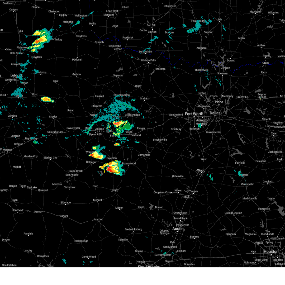 At 437 pm cdt, a severe thunderstorm was located over mozelle, or near gouldbusk, moving east at 20 mph (radar indicated). Hazards include ping pong ball size hail. People and animals outdoors will be injured. expect damage to roofs, siding, windows, and vehicles. this severe storm will be near, santa anna around 505 pm cdt. other locations impacted by this severe thunderstorm include mozelle, shields and fisk. hail threat, radar indicated max hail size, 1. 50 in wind threat, radar indicated max wind gust, <50 mph. At 437 pm cdt, a severe thunderstorm was located over mozelle, or near gouldbusk, moving east at 20 mph (radar indicated). Hazards include ping pong ball size hail. People and animals outdoors will be injured. expect damage to roofs, siding, windows, and vehicles. this severe storm will be near, santa anna around 505 pm cdt. other locations impacted by this severe thunderstorm include mozelle, shields and fisk. hail threat, radar indicated max hail size, 1. 50 in wind threat, radar indicated max wind gust, <50 mph.
|
| 6/17/2023 4:09 PM CDT |
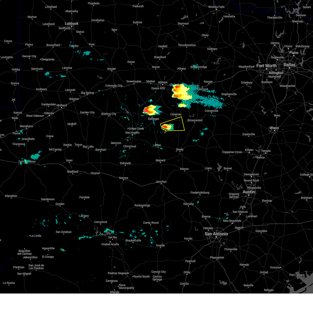 At 408 pm cdt, a severe thunderstorm was located near leaday, moving east at 15 mph (radar indicated). Hazards include half dollar size hail. Damage to vehicles is expected. this severe thunderstorm will be near, voss around 425 pm cdt. gouldbusk around 440 pm cdt. santa anna around 515 pm cdt. other locations impacted by this severe thunderstorm include mozelle, shields and fisk. hail threat, radar indicated max hail size, 1. 25 in wind threat, radar indicated max wind gust, <50 mph. At 408 pm cdt, a severe thunderstorm was located near leaday, moving east at 15 mph (radar indicated). Hazards include half dollar size hail. Damage to vehicles is expected. this severe thunderstorm will be near, voss around 425 pm cdt. gouldbusk around 440 pm cdt. santa anna around 515 pm cdt. other locations impacted by this severe thunderstorm include mozelle, shields and fisk. hail threat, radar indicated max hail size, 1. 25 in wind threat, radar indicated max wind gust, <50 mph.
|
| 6/12/2023 7:30 PM CDT |
 At 730 pm cdt, a severe thunderstorm was located near bangs, moving east at 40 mph (radar indicated). Hazards include 60 mph wind gusts and quarter size hail. Hail damage to vehicles is expected. expect wind damage to roofs, siding, and trees. this severe storm will be near, lake brownwood around 740 pm cdt. brownwood around 745 pm cdt. camp bowie around 750 pm cdt. early around 755 pm cdt. other locations impacted by this severe thunderstorm include whon, owens, indian creek and shields. hail threat, radar indicated max hail size, 1. 00 in wind threat, radar indicated max wind gust, 60 mph. At 730 pm cdt, a severe thunderstorm was located near bangs, moving east at 40 mph (radar indicated). Hazards include 60 mph wind gusts and quarter size hail. Hail damage to vehicles is expected. expect wind damage to roofs, siding, and trees. this severe storm will be near, lake brownwood around 740 pm cdt. brownwood around 745 pm cdt. camp bowie around 750 pm cdt. early around 755 pm cdt. other locations impacted by this severe thunderstorm include whon, owens, indian creek and shields. hail threat, radar indicated max hail size, 1. 00 in wind threat, radar indicated max wind gust, 60 mph.
|
| 6/12/2023 6:53 PM CDT |
 At 653 pm cdt, a severe thunderstorm was located over gouldbusk, moving northeast at 35 mph (radar indicated). Hazards include 60 mph wind gusts and half dollar size hail. Hail damage to vehicles is expected. expect wind damage to roofs, siding, and trees. this severe thunderstorm will be near, santa anna around 710 pm cdt. trickham and winchell around 715 pm cdt. brookesmith around 720 pm cdt. bangs around 730 pm cdt. lake brownwood around 735 pm cdt. brownwood and camp bowie around 740 pm cdt. early around 750 pm cdt. other locations impacted by this severe thunderstorm include owens, mozelle, whon, fisk, thrifty, indian creek and shields. hail threat, radar indicated max hail size, 1. 25 in wind threat, radar indicated max wind gust, 60 mph. At 653 pm cdt, a severe thunderstorm was located over gouldbusk, moving northeast at 35 mph (radar indicated). Hazards include 60 mph wind gusts and half dollar size hail. Hail damage to vehicles is expected. expect wind damage to roofs, siding, and trees. this severe thunderstorm will be near, santa anna around 710 pm cdt. trickham and winchell around 715 pm cdt. brookesmith around 720 pm cdt. bangs around 730 pm cdt. lake brownwood around 735 pm cdt. brownwood and camp bowie around 740 pm cdt. early around 750 pm cdt. other locations impacted by this severe thunderstorm include owens, mozelle, whon, fisk, thrifty, indian creek and shields. hail threat, radar indicated max hail size, 1. 25 in wind threat, radar indicated max wind gust, 60 mph.
|
| 6/11/2023 6:14 PM CDT |
 At 613 pm cdt, a severe thunderstorm was located near shields, or 7 miles north of rockwood, moving southeast at 30 mph (radar indicated). Hazards include golf ball size hail and 60 mph wind gusts. People and animals outdoors will be injured. expect hail damage to roofs, siding, windows, and vehicles. expect wind damage to roofs, siding, and trees. this severe storm will be near, trickham and rockwood around 625 pm cdt. other locations impacted by this severe thunderstorm include mozelle, fisk, shields and hords creek reservoir. thunderstorm damage threat, considerable hail threat, radar indicated max hail size, 1. 75 in wind threat, radar indicated max wind gust, 60 mph. At 613 pm cdt, a severe thunderstorm was located near shields, or 7 miles north of rockwood, moving southeast at 30 mph (radar indicated). Hazards include golf ball size hail and 60 mph wind gusts. People and animals outdoors will be injured. expect hail damage to roofs, siding, windows, and vehicles. expect wind damage to roofs, siding, and trees. this severe storm will be near, trickham and rockwood around 625 pm cdt. other locations impacted by this severe thunderstorm include mozelle, fisk, shields and hords creek reservoir. thunderstorm damage threat, considerable hail threat, radar indicated max hail size, 1. 75 in wind threat, radar indicated max wind gust, 60 mph.
|
| 6/11/2023 6:01 PM CDT |
 At 600 pm cdt, a severe thunderstorm was located near fisk, or near valera, moving southeast at 25 mph (radar indicated). Hazards include 60 mph wind gusts and half dollar size hail. Hail damage to vehicles is expected. expect wind damage to roofs, siding, and trees. this severe thunderstorm will be near, gouldbusk around 610 pm cdt. santa anna around 615 pm cdt. rockwood around 625 pm cdt. trickham around 640 pm cdt. other locations impacted by this severe thunderstorm include mozelle, fisk, shields and hords creek reservoir. hail threat, radar indicated max hail size, 1. 25 in wind threat, radar indicated max wind gust, 60 mph. At 600 pm cdt, a severe thunderstorm was located near fisk, or near valera, moving southeast at 25 mph (radar indicated). Hazards include 60 mph wind gusts and half dollar size hail. Hail damage to vehicles is expected. expect wind damage to roofs, siding, and trees. this severe thunderstorm will be near, gouldbusk around 610 pm cdt. santa anna around 615 pm cdt. rockwood around 625 pm cdt. trickham around 640 pm cdt. other locations impacted by this severe thunderstorm include mozelle, fisk, shields and hords creek reservoir. hail threat, radar indicated max hail size, 1. 25 in wind threat, radar indicated max wind gust, 60 mph.
|
| 6/5/2023 2:55 PM CDT |
 At 255 pm cdt, a severe thunderstorm was located near santa catarina, or 10 miles southeast of viboras, moving southeast at 20 mph (radar indicated). Hazards include 60 mph wind gusts and quarter size hail. Hail damage to vehicles is expected. expect wind damage to roofs, siding, and trees. locations impacted include, viboras, la victoria, la gloria, santa catarina, diamond o ranch airport and rio grande city--roma. hail threat, radar indicated max hail size, 1. 00 in wind threat, radar indicated max wind gust, 60 mph. At 255 pm cdt, a severe thunderstorm was located near santa catarina, or 10 miles southeast of viboras, moving southeast at 20 mph (radar indicated). Hazards include 60 mph wind gusts and quarter size hail. Hail damage to vehicles is expected. expect wind damage to roofs, siding, and trees. locations impacted include, viboras, la victoria, la gloria, santa catarina, diamond o ranch airport and rio grande city--roma. hail threat, radar indicated max hail size, 1. 00 in wind threat, radar indicated max wind gust, 60 mph.
|
| 6/5/2023 2:44 PM CDT |
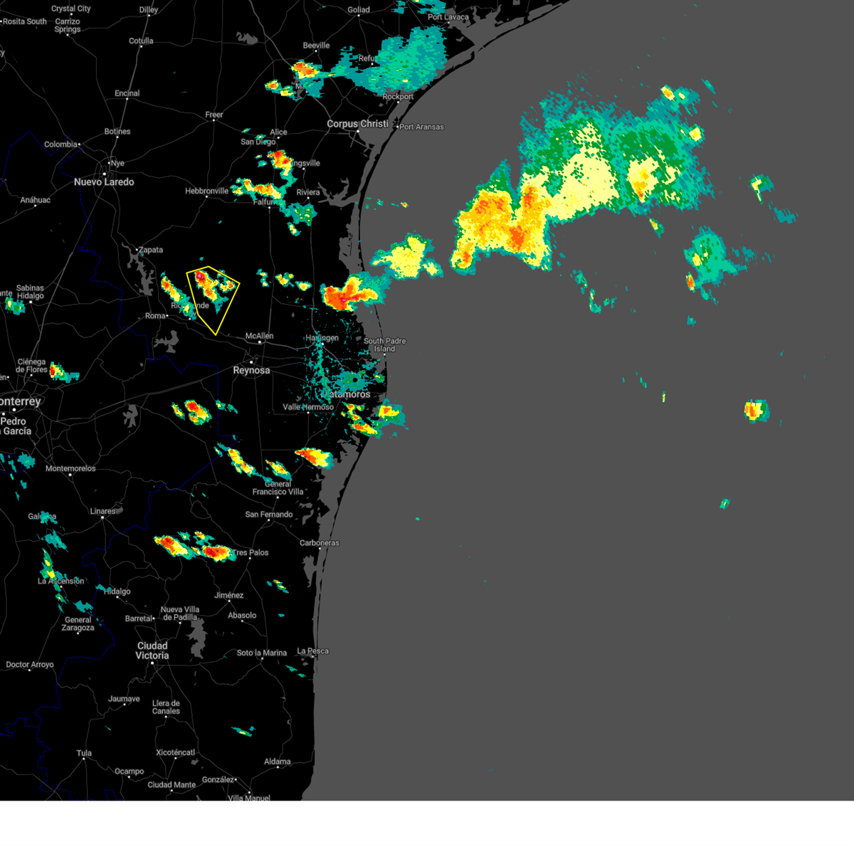 At 244 pm cdt, a severe thunderstorm was located 7 miles southeast of viboras, moving south at 30 mph (radar indicated). Hazards include ping pong ball size hail and 60 mph wind gusts. People and animals outdoors will be injured. expect hail damage to roofs, siding, windows, and vehicles. Expect wind damage to roofs, siding, and trees. At 244 pm cdt, a severe thunderstorm was located 7 miles southeast of viboras, moving south at 30 mph (radar indicated). Hazards include ping pong ball size hail and 60 mph wind gusts. People and animals outdoors will be injured. expect hail damage to roofs, siding, windows, and vehicles. Expect wind damage to roofs, siding, and trees.
|
| 6/3/2023 9:16 PM CDT |
 At 915 pm cdt, a severe thunderstorm was located near citrus city, or 7 miles north of la joya, moving east at 55 mph (radar indicated). Hazards include 60 mph wind gusts and quarter size hail. Hail damage to vehicles is expected. expect wind damage to roofs, siding, and trees. locations impacted include, edinburg, mission, pharr, rio grande city, hidalgo, palmview, penitas, sullivan city, la joya and palmhurst. hail threat, radar indicated max hail size, 1. 00 in wind threat, radar indicated max wind gust, 60 mph. At 915 pm cdt, a severe thunderstorm was located near citrus city, or 7 miles north of la joya, moving east at 55 mph (radar indicated). Hazards include 60 mph wind gusts and quarter size hail. Hail damage to vehicles is expected. expect wind damage to roofs, siding, and trees. locations impacted include, edinburg, mission, pharr, rio grande city, hidalgo, palmview, penitas, sullivan city, la joya and palmhurst. hail threat, radar indicated max hail size, 1. 00 in wind threat, radar indicated max wind gust, 60 mph.
|
| 6/3/2023 8:54 PM CDT |
 At 853 pm cdt, a severe thunderstorm was located over las lomas, or near rio grande city, moving east at 55 mph (radar indicated). Hazards include 60 mph wind gusts and quarter size hail. Hail damage to vehicles is expected. Expect wind damage to roofs, siding, and trees. At 853 pm cdt, a severe thunderstorm was located over las lomas, or near rio grande city, moving east at 55 mph (radar indicated). Hazards include 60 mph wind gusts and quarter size hail. Hail damage to vehicles is expected. Expect wind damage to roofs, siding, and trees.
|
| 6/3/2023 8:26 PM CDT |
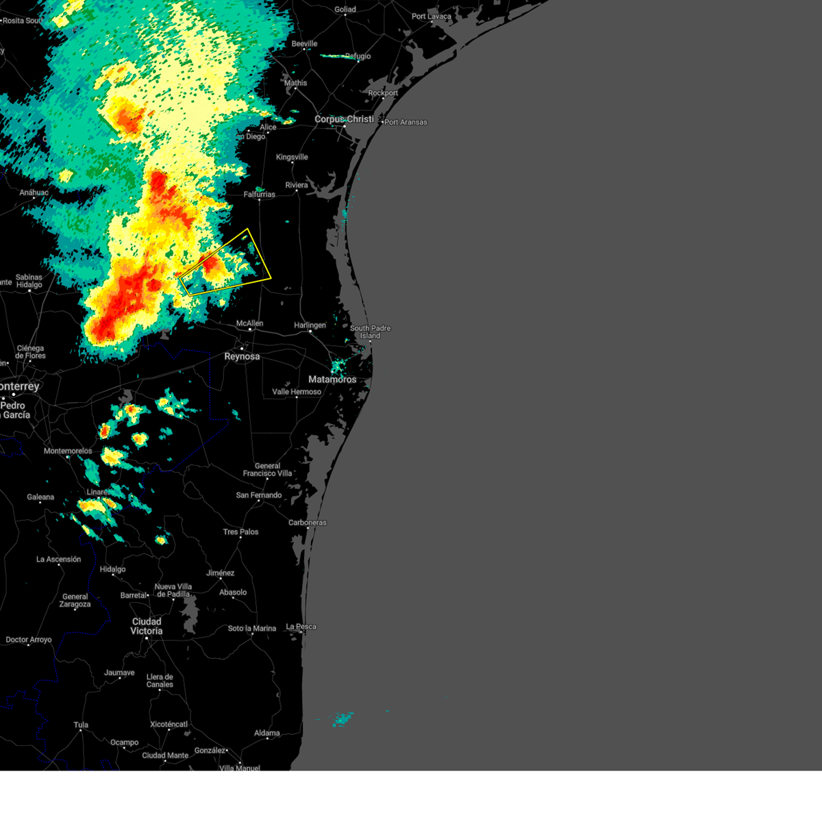 The severe thunderstorm warning for southeastern jim hogg, northwestern hidalgo, northeastern starr and southwestern brooks counties will expire at 830 pm cdt, the storm which prompted the warning has weakened below severe limits, and no longer poses an immediate threat to life or property. therefore, the warning will be allowed to expire. however small hail is still possible with this thunderstorm. a severe thunderstorm watch remains in effect until 100 am cdt for deep south texas. The severe thunderstorm warning for southeastern jim hogg, northwestern hidalgo, northeastern starr and southwestern brooks counties will expire at 830 pm cdt, the storm which prompted the warning has weakened below severe limits, and no longer poses an immediate threat to life or property. therefore, the warning will be allowed to expire. however small hail is still possible with this thunderstorm. a severe thunderstorm watch remains in effect until 100 am cdt for deep south texas.
|
| 6/3/2023 7:59 PM CDT |
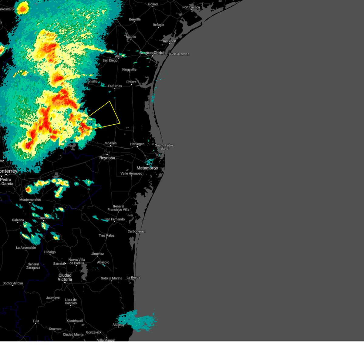 At 758 pm cdt, a severe thunderstorm was located over santa catarina, or 14 miles northwest of mccook, moving northeast at 50 mph (radar indicated). Hazards include ping pong ball size hail. People and animals outdoors will be injured. expect damage to roofs, siding, windows, and vehicles. Locations impacted include, puerto rico, la gloria, la reforma, santa catarina, el coyote ranch airport, san isidro, san rafael ranch airport, santa elena, delmita and diamond o ranch airport. At 758 pm cdt, a severe thunderstorm was located over santa catarina, or 14 miles northwest of mccook, moving northeast at 50 mph (radar indicated). Hazards include ping pong ball size hail. People and animals outdoors will be injured. expect damage to roofs, siding, windows, and vehicles. Locations impacted include, puerto rico, la gloria, la reforma, santa catarina, el coyote ranch airport, san isidro, san rafael ranch airport, santa elena, delmita and diamond o ranch airport.
|
| 6/3/2023 7:46 PM CDT |
 At 746 pm cdt, a severe thunderstorm was located 9 miles southwest of santa catarina, or 10 miles east of el sauz, moving northeast at 50 mph (radar indicated). Hazards include ping pong ball size hail. People and animals outdoors will be injured. expect damage to roofs, siding, windows, and vehicles. Locations impacted include, rio grande city, el sauz, puerto rico, starr county memorial hospital, ringgold middle school, santa catarina, fort ringgold county park, starr county sheriffs office, la gloria and la reforma. At 746 pm cdt, a severe thunderstorm was located 9 miles southwest of santa catarina, or 10 miles east of el sauz, moving northeast at 50 mph (radar indicated). Hazards include ping pong ball size hail. People and animals outdoors will be injured. expect damage to roofs, siding, windows, and vehicles. Locations impacted include, rio grande city, el sauz, puerto rico, starr county memorial hospital, ringgold middle school, santa catarina, fort ringgold county park, starr county sheriffs office, la gloria and la reforma.
|
| 6/3/2023 7:39 PM CDT |
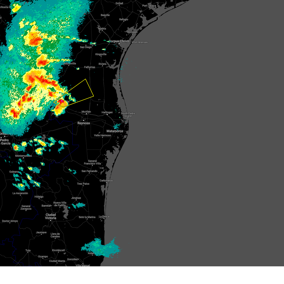 At 738 pm cdt, a severe thunderstorm was located near el sauz, moving northeast at 50 mph (radar indicated). Hazards include ping pong ball size hail. People and animals outdoors will be injured. Expect damage to roofs, siding, windows, and vehicles. At 738 pm cdt, a severe thunderstorm was located near el sauz, moving northeast at 50 mph (radar indicated). Hazards include ping pong ball size hail. People and animals outdoors will be injured. Expect damage to roofs, siding, windows, and vehicles.
|
| 5/29/2023 8:57 PM CDT |
 At 856 pm cdt, severe thunderstorms were located along a line extending from near la reforma to near mccook to 8 miles northeast of sullivan city to near las lomas to near el sauz, moving southeast at 15 mph (radar indicated). Hazards include 60 mph wind gusts and nickel size hail. expect damage to roofs, siding, and trees At 856 pm cdt, severe thunderstorms were located along a line extending from near la reforma to near mccook to 8 miles northeast of sullivan city to near las lomas to near el sauz, moving southeast at 15 mph (radar indicated). Hazards include 60 mph wind gusts and nickel size hail. expect damage to roofs, siding, and trees
|
| 5/29/2023 8:36 PM CDT |
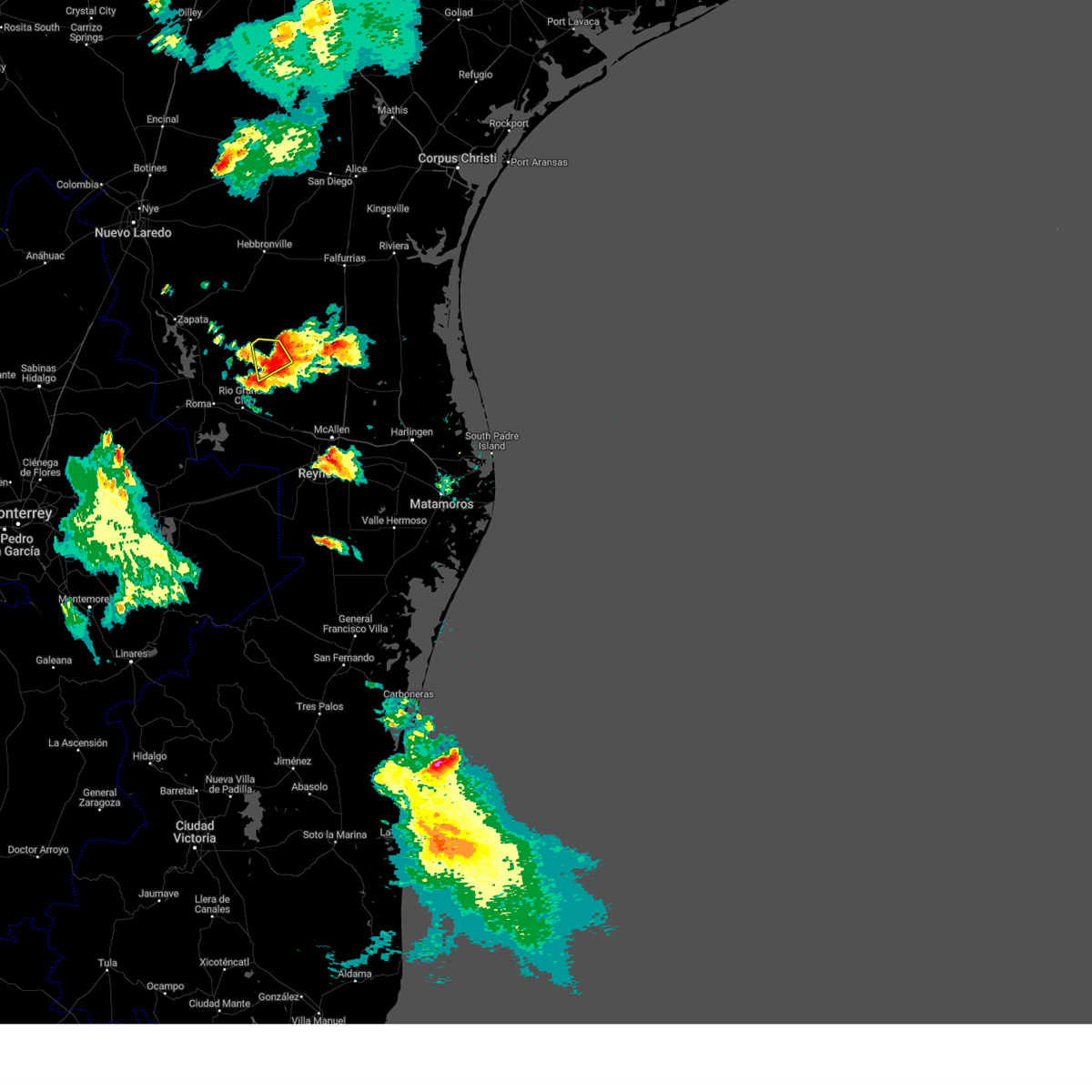 The severe thunderstorm warning for northeastern starr county will expire at 845 pm cdt, the storm which prompted the warning has moved out of the area. therefore, the warning will be allowed to expire. The severe thunderstorm warning for northeastern starr county will expire at 845 pm cdt, the storm which prompted the warning has moved out of the area. therefore, the warning will be allowed to expire.
|
| 5/29/2023 8:30 PM CDT |
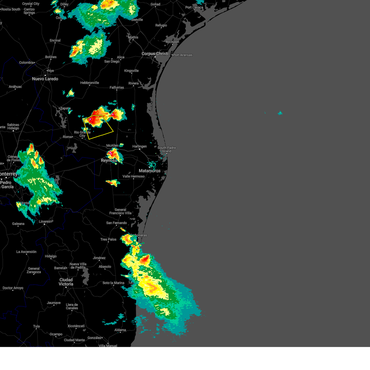 At 830 pm cdt, a severe thunderstorm was located over santa catarina, or 15 miles south of agua nueva, moving southeast at 20 mph (radar indicated). Hazards include 60 mph wind gusts and nickel size hail. expect damage to roofs, siding, and trees At 830 pm cdt, a severe thunderstorm was located over santa catarina, or 15 miles south of agua nueva, moving southeast at 20 mph (radar indicated). Hazards include 60 mph wind gusts and nickel size hail. expect damage to roofs, siding, and trees
|
| 5/29/2023 8:12 PM CDT |
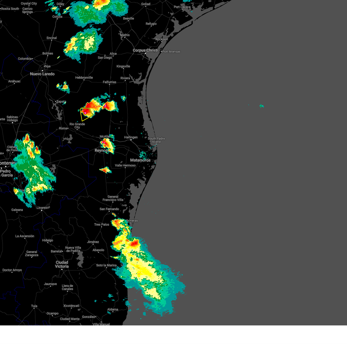 At 812 pm cdt, a severe thunderstorm was located 8 miles west of la gloria, or 9 miles east of viboras, moving southeast at 10 mph (radar indicated). Hazards include 60 mph wind gusts and half dollar size hail. Hail damage to vehicles is expected. expect wind damage to roofs, siding, and trees. locations impacted include, santa catarina, la gloria and diamond o ranch airport. hail threat, radar indicated max hail size, 1. 25 in wind threat, radar indicated max wind gust, 60 mph. At 812 pm cdt, a severe thunderstorm was located 8 miles west of la gloria, or 9 miles east of viboras, moving southeast at 10 mph (radar indicated). Hazards include 60 mph wind gusts and half dollar size hail. Hail damage to vehicles is expected. expect wind damage to roofs, siding, and trees. locations impacted include, santa catarina, la gloria and diamond o ranch airport. hail threat, radar indicated max hail size, 1. 25 in wind threat, radar indicated max wind gust, 60 mph.
|
| 5/29/2023 8:01 PM CDT |
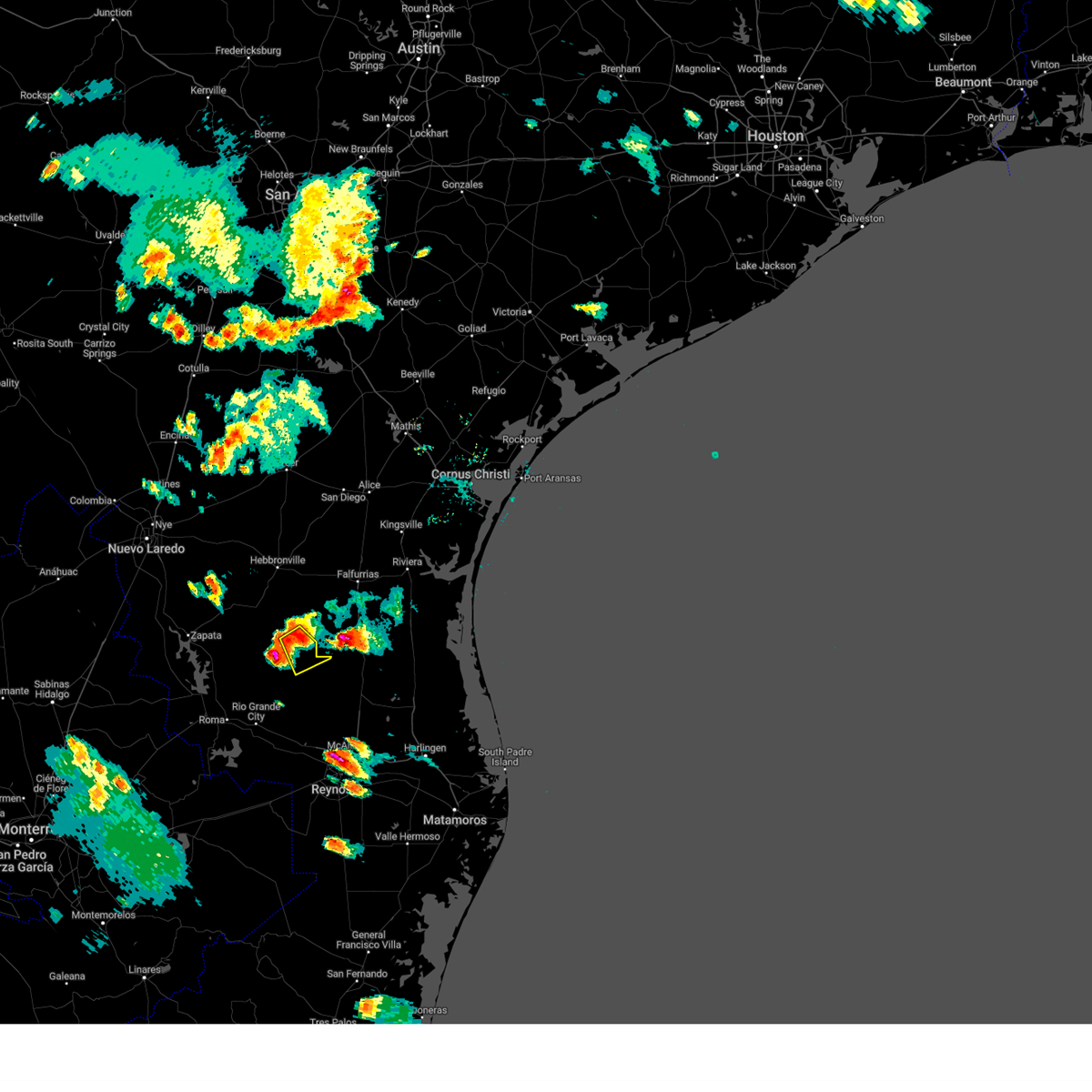 At 801 pm cdt, a severe thunderstorm was located over agua nueva, moving southeast at 15 mph (radar indicated). Hazards include 60 mph wind gusts and quarter size hail. Hail damage to vehicles is expected. expect wind damage to roofs, siding, and trees. locations impacted include, agua nueva, la gloria, san rafael ranch airport, santa elena, diamond o ranch airport and puesta del sol airport. hail threat, radar indicated max hail size, 1. 00 in wind threat, radar indicated max wind gust, 60 mph. At 801 pm cdt, a severe thunderstorm was located over agua nueva, moving southeast at 15 mph (radar indicated). Hazards include 60 mph wind gusts and quarter size hail. Hail damage to vehicles is expected. expect wind damage to roofs, siding, and trees. locations impacted include, agua nueva, la gloria, san rafael ranch airport, santa elena, diamond o ranch airport and puesta del sol airport. hail threat, radar indicated max hail size, 1. 00 in wind threat, radar indicated max wind gust, 60 mph.
|
| 5/29/2023 7:56 PM CDT |
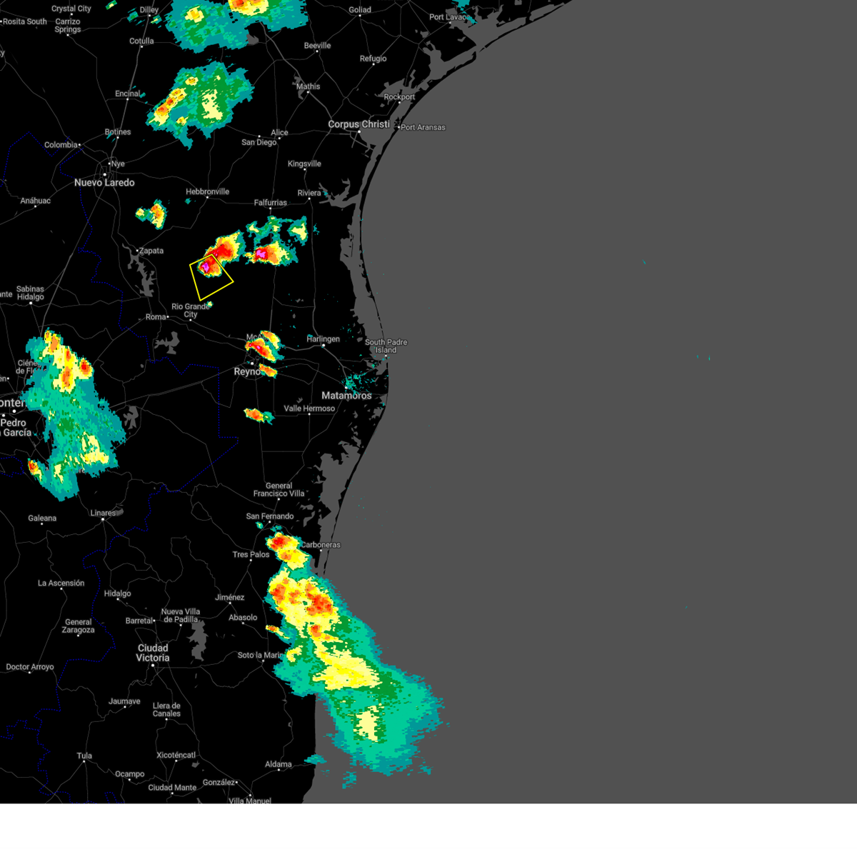 At 756 pm cdt, a severe thunderstorm was located 9 miles northeast of viboras, moving southeast at 10 mph (radar indicated). Hazards include two inch hail and 60 mph wind gusts. People and animals outdoors will be injured. expect hail damage to roofs, siding, windows, and vehicles. Expect wind damage to roofs, siding, and trees. At 756 pm cdt, a severe thunderstorm was located 9 miles northeast of viboras, moving southeast at 10 mph (radar indicated). Hazards include two inch hail and 60 mph wind gusts. People and animals outdoors will be injured. expect hail damage to roofs, siding, windows, and vehicles. Expect wind damage to roofs, siding, and trees.
|
| 5/29/2023 7:44 PM CDT |
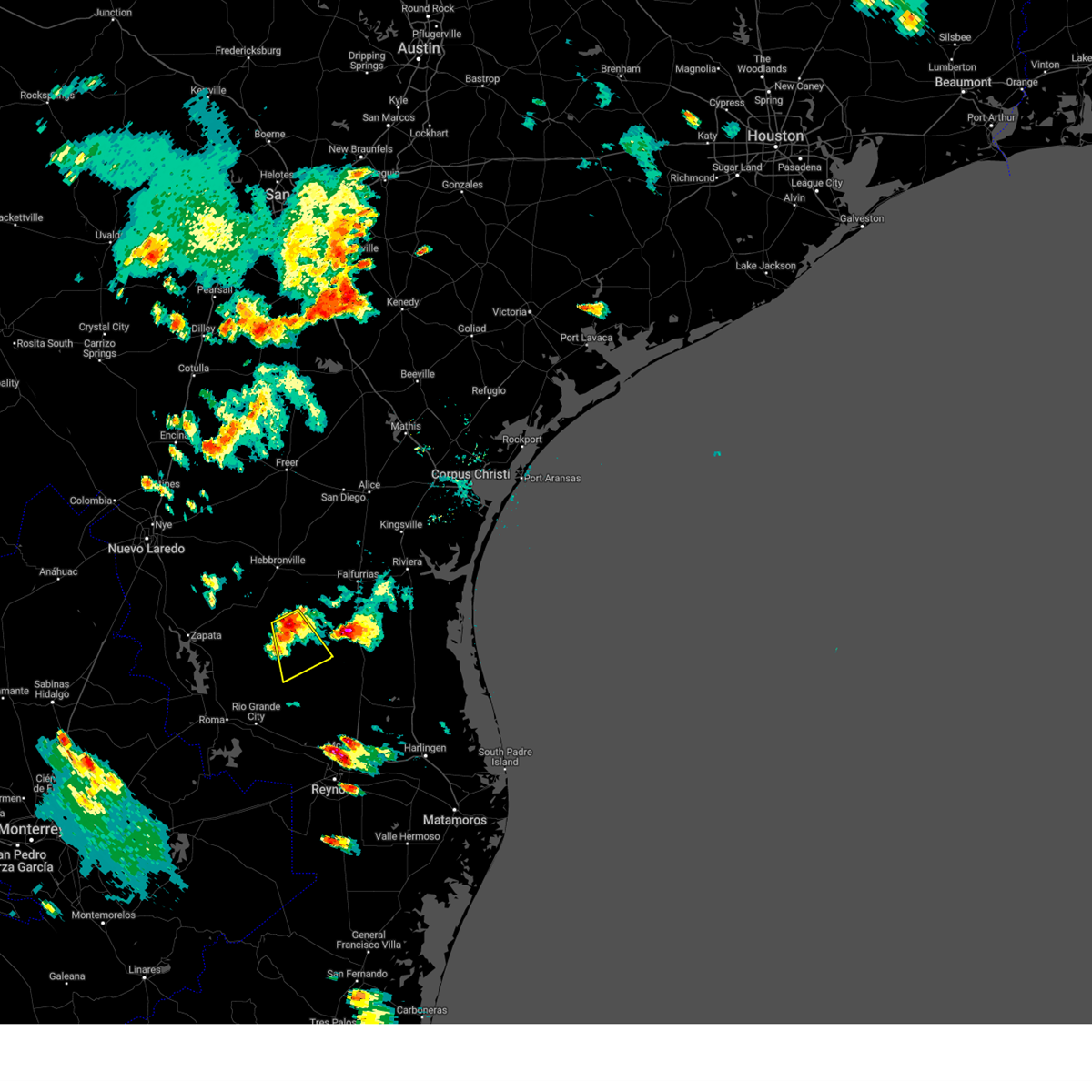 At 744 pm cdt, a severe thunderstorm was located near agua nueva, moving southeast at 15 mph (radar indicated). Hazards include 60 mph wind gusts and quarter size hail. Hail damage to vehicles is expected. Expect wind damage to roofs, siding, and trees. At 744 pm cdt, a severe thunderstorm was located near agua nueva, moving southeast at 15 mph (radar indicated). Hazards include 60 mph wind gusts and quarter size hail. Hail damage to vehicles is expected. Expect wind damage to roofs, siding, and trees.
|
| 5/23/2023 11:23 PM CDT |
 At 1123 pm cdt, a severe thunderstorm was located over lake brownwood, moving southeast at 35 mph (radar indicated). Hazards include 70 mph wind gusts and nickel size hail. Expect considerable tree damage. damage is likely to mobile homes, roofs, and outbuildings. this severe storm will be near, brownwood and early around 1140 pm cdt. camp bowie around 1145 pm cdt. zephyr around 1200 am cdt. other locations impacted by this severe thunderstorm include owens, thrifty, indian creek, echo and hords creek reservoir. thunderstorm damage threat, considerable hail threat, radar indicated max hail size, 0. 88 in wind threat, radar indicated max wind gust, 70 mph. At 1123 pm cdt, a severe thunderstorm was located over lake brownwood, moving southeast at 35 mph (radar indicated). Hazards include 70 mph wind gusts and nickel size hail. Expect considerable tree damage. damage is likely to mobile homes, roofs, and outbuildings. this severe storm will be near, brownwood and early around 1140 pm cdt. camp bowie around 1145 pm cdt. zephyr around 1200 am cdt. other locations impacted by this severe thunderstorm include owens, thrifty, indian creek, echo and hords creek reservoir. thunderstorm damage threat, considerable hail threat, radar indicated max hail size, 0. 88 in wind threat, radar indicated max wind gust, 70 mph.
|
| 5/23/2023 11:05 PM CDT |
 At 1105 pm cdt, a severe thunderstorm was located near grosvenor, moving southeast at 35 mph (radar indicated). Hazards include 60 mph wind gusts and quarter size hail. Hail damage to vehicles is expected. expect wind damage to roofs, siding, and trees. this severe thunderstorm will be near, grosvenor around 1115 pm cdt. lake brownwood near thrifty, lake brownwood and byrds around 1120 pm cdt. bangs and lake brownwood state park around 1125 pm cdt. brownwood around 1140 pm cdt. early and camp bowie around 1145 pm cdt. zephyr around 1200 am cdt. other locations impacted by this severe thunderstorm include owens, thrifty, indian creek, echo and hords creek reservoir. hail threat, radar indicated max hail size, 1. 00 in wind threat, radar indicated max wind gust, 60 mph. At 1105 pm cdt, a severe thunderstorm was located near grosvenor, moving southeast at 35 mph (radar indicated). Hazards include 60 mph wind gusts and quarter size hail. Hail damage to vehicles is expected. expect wind damage to roofs, siding, and trees. this severe thunderstorm will be near, grosvenor around 1115 pm cdt. lake brownwood near thrifty, lake brownwood and byrds around 1120 pm cdt. bangs and lake brownwood state park around 1125 pm cdt. brownwood around 1140 pm cdt. early and camp bowie around 1145 pm cdt. zephyr around 1200 am cdt. other locations impacted by this severe thunderstorm include owens, thrifty, indian creek, echo and hords creek reservoir. hail threat, radar indicated max hail size, 1. 00 in wind threat, radar indicated max wind gust, 60 mph.
|
| 5/13/2023 12:50 AM CDT |
 At 1249 am cdt, severe thunderstorms were located along a line extending from near starr county memorial hospital to near los ebanos to 16 miles southwest of granjero, moving northeast at 35 mph (radar indicated). Hazards include 60 mph wind gusts and nickel size hail. expect damage to roofs, siding, and trees At 1249 am cdt, severe thunderstorms were located along a line extending from near starr county memorial hospital to near los ebanos to 16 miles southwest of granjero, moving northeast at 35 mph (radar indicated). Hazards include 60 mph wind gusts and nickel size hail. expect damage to roofs, siding, and trees
|
| 5/12/2023 10:37 PM CDT |
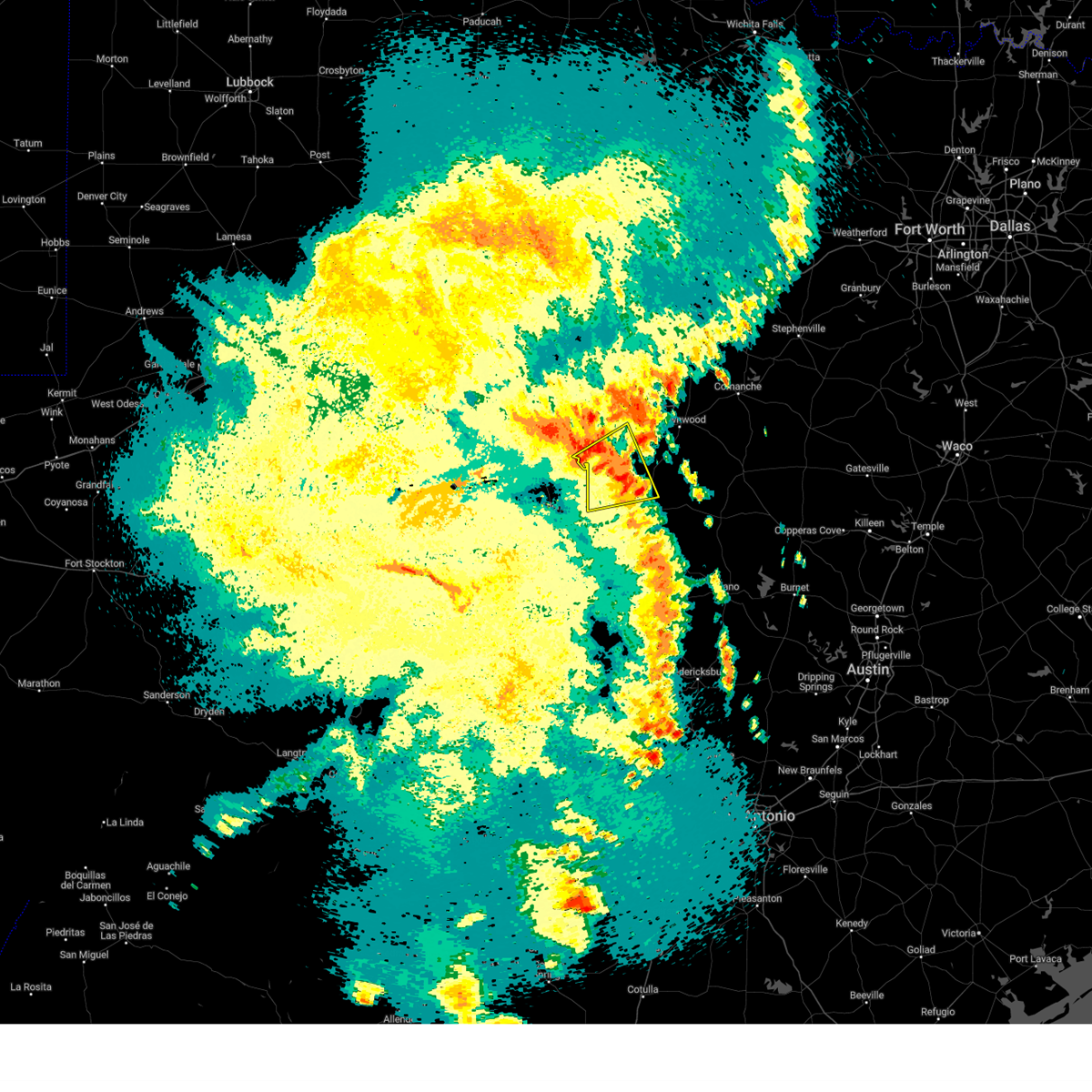 At 1036 pm cdt, a severe thunderstorm was located over gouldbusk, moving northeast at 40 mph (radar indicated). Hazards include 60 mph wind gusts and quarter size hail. Hail damage to vehicles is expected. expect wind damage to roofs, siding, and trees. this severe storm will be near, rockwood around 1045 pm cdt. other locations impacted by this severe thunderstorm include mozelle, whon, us-283 near the mcculloch- coleman county line, fife and shields. hail threat, radar indicated max hail size, 1. 00 in wind threat, radar indicated max wind gust, 60 mph. At 1036 pm cdt, a severe thunderstorm was located over gouldbusk, moving northeast at 40 mph (radar indicated). Hazards include 60 mph wind gusts and quarter size hail. Hail damage to vehicles is expected. expect wind damage to roofs, siding, and trees. this severe storm will be near, rockwood around 1045 pm cdt. other locations impacted by this severe thunderstorm include mozelle, whon, us-283 near the mcculloch- coleman county line, fife and shields. hail threat, radar indicated max hail size, 1. 00 in wind threat, radar indicated max wind gust, 60 mph.
|
| 5/12/2023 10:02 PM CDT |
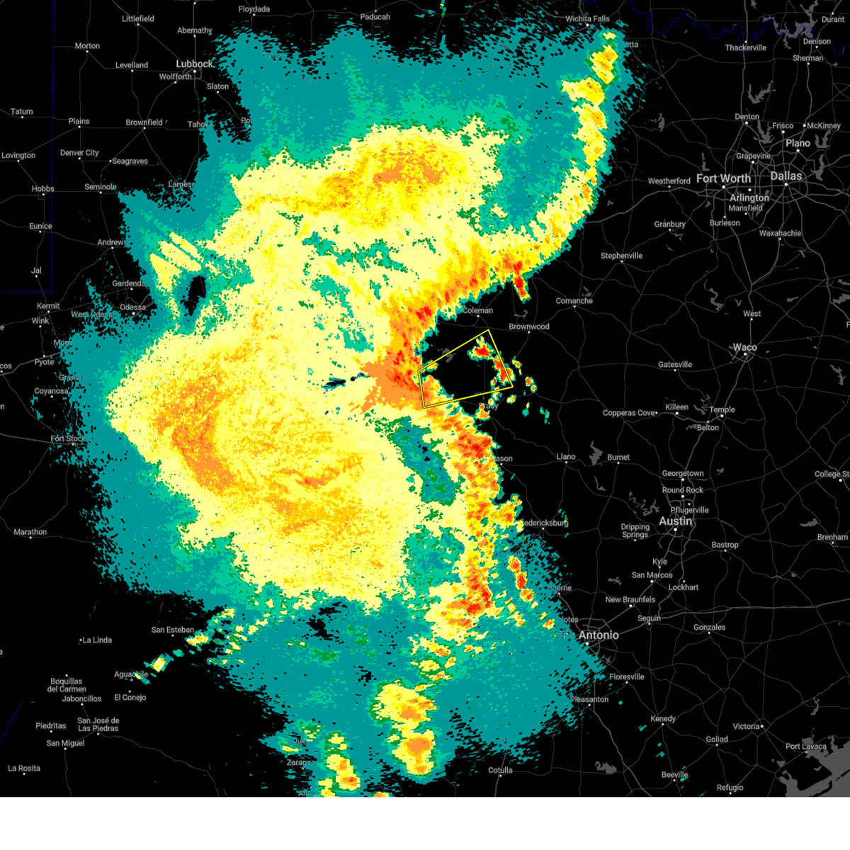 At 1002 pm cdt, a severe thunderstorm was located near the intersection of us-83 and ranch road 765, or near millersview, moving northeast at 40 mph (radar indicated). Hazards include 60 mph wind gusts and quarter size hail. Hail damage to vehicles is expected. expect wind damage to roofs, siding, and trees. this severe thunderstorm will be near, millersview around 1010 pm cdt. doole around 1020 pm cdt. stacy around 1025 pm cdt. gouldbusk and waldrip around 1040 pm cdt. rockwood around 1045 pm cdt. other locations impacted by this severe thunderstorm include the intersection of ranch road 1929 and ranch road 2134, the intersection of us-87 and ranch road 2134, the intersection of us- 83 and ranch road 765, fife, mozelle, whon, us- 283 near the mcculloch-coleman county line and shields. hail threat, radar indicated max hail size, 1. 00 in wind threat, radar indicated max wind gust, 60 mph. At 1002 pm cdt, a severe thunderstorm was located near the intersection of us-83 and ranch road 765, or near millersview, moving northeast at 40 mph (radar indicated). Hazards include 60 mph wind gusts and quarter size hail. Hail damage to vehicles is expected. expect wind damage to roofs, siding, and trees. this severe thunderstorm will be near, millersview around 1010 pm cdt. doole around 1020 pm cdt. stacy around 1025 pm cdt. gouldbusk and waldrip around 1040 pm cdt. rockwood around 1045 pm cdt. other locations impacted by this severe thunderstorm include the intersection of ranch road 1929 and ranch road 2134, the intersection of us-87 and ranch road 2134, the intersection of us- 83 and ranch road 765, fife, mozelle, whon, us- 283 near the mcculloch-coleman county line and shields. hail threat, radar indicated max hail size, 1. 00 in wind threat, radar indicated max wind gust, 60 mph.
|
| 5/8/2023 9:36 PM CDT |
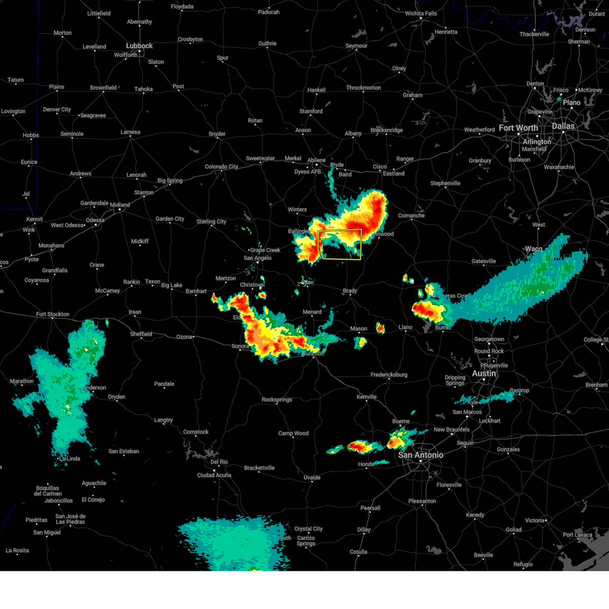 At 936 pm cdt, a severe thunderstorm was located over shields, or near gouldbusk, moving east at 20 mph (radar indicated). Hazards include 60 mph wind gusts and penny size hail. Expect damage to roofs, siding, and trees. this severe storm will be near, rockwood around 950 pm cdt. trickham around 1015 pm cdt. other locations impacted by this severe thunderstorm include mozelle, shields and fisk. hail threat, radar indicated max hail size, 0. 75 in wind threat, radar indicated max wind gust, 60 mph. At 936 pm cdt, a severe thunderstorm was located over shields, or near gouldbusk, moving east at 20 mph (radar indicated). Hazards include 60 mph wind gusts and penny size hail. Expect damage to roofs, siding, and trees. this severe storm will be near, rockwood around 950 pm cdt. trickham around 1015 pm cdt. other locations impacted by this severe thunderstorm include mozelle, shields and fisk. hail threat, radar indicated max hail size, 0. 75 in wind threat, radar indicated max wind gust, 60 mph.
|
| 5/8/2023 9:18 PM CDT |
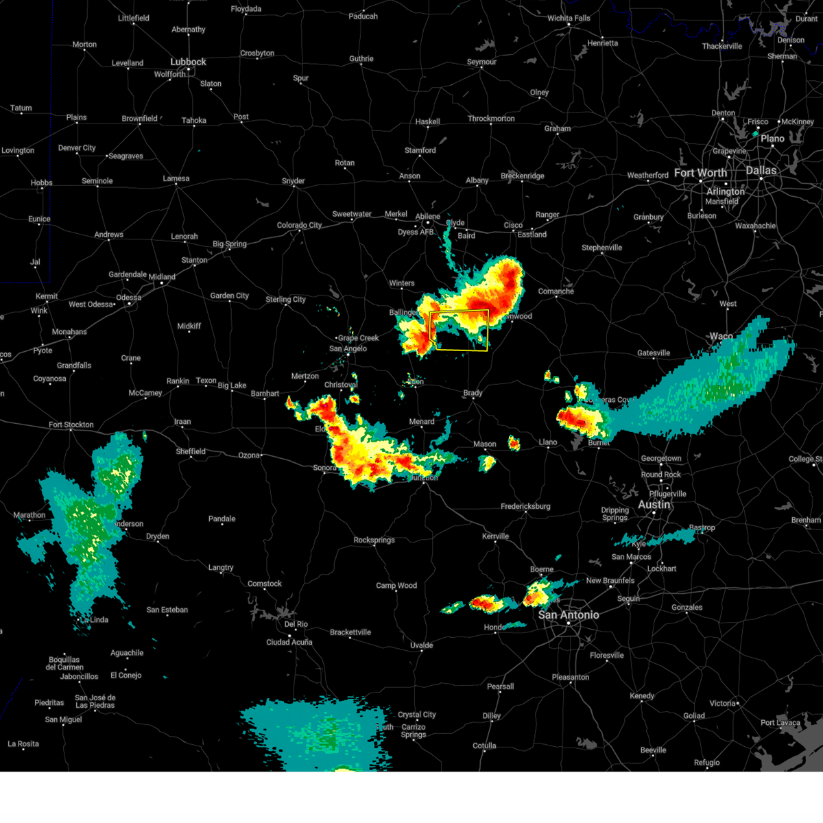 At 918 pm cdt, a severe thunderstorm was located over mozelle, or near voss, moving east at 25 mph (radar indicated). Hazards include 60 mph wind gusts and quarter size hail. Hail damage to vehicles is expected. expect wind damage to roofs, siding, and trees. this severe thunderstorm will be near, gouldbusk around 925 pm cdt. rockwood around 940 pm cdt. trickham around 1000 pm cdt. other locations impacted by this severe thunderstorm include mozelle, shields and fisk. hail threat, radar indicated max hail size, 1. 00 in wind threat, radar indicated max wind gust, 60 mph. At 918 pm cdt, a severe thunderstorm was located over mozelle, or near voss, moving east at 25 mph (radar indicated). Hazards include 60 mph wind gusts and quarter size hail. Hail damage to vehicles is expected. expect wind damage to roofs, siding, and trees. this severe thunderstorm will be near, gouldbusk around 925 pm cdt. rockwood around 940 pm cdt. trickham around 1000 pm cdt. other locations impacted by this severe thunderstorm include mozelle, shields and fisk. hail threat, radar indicated max hail size, 1. 00 in wind threat, radar indicated max wind gust, 60 mph.
|
| 5/8/2023 8:42 PM CDT |
 At 841 pm cdt, a severe thunderstorm was located near coleman to santa anna, and is nearly stationary (radar indicated). Hazards include ping pong ball size hail and 60 mph wind gusts. People and animals outdoors will be injured. expect hail damage to roofs, siding, windows, and vehicles. expect wind damage to roofs, siding, and trees. this severe storm will be near, santa anna around 930 pm cdt. other locations impacted by this severe thunderstorm include mozelle, whon, fisk, echo, shields and hords creek reservoir. hail threat, radar indicated max hail size, 1. 50 in wind threat, radar indicated max wind gust, 60 mph. At 841 pm cdt, a severe thunderstorm was located near coleman to santa anna, and is nearly stationary (radar indicated). Hazards include ping pong ball size hail and 60 mph wind gusts. People and animals outdoors will be injured. expect hail damage to roofs, siding, windows, and vehicles. expect wind damage to roofs, siding, and trees. this severe storm will be near, santa anna around 930 pm cdt. other locations impacted by this severe thunderstorm include mozelle, whon, fisk, echo, shields and hords creek reservoir. hail threat, radar indicated max hail size, 1. 50 in wind threat, radar indicated max wind gust, 60 mph.
|
| 5/8/2023 8:28 PM CDT |
 At 826 pm cdt, a line of severe thunderstorms was located from south of glen cove to coleman to echo moving, moving southeast at 25 mph (radar indicated). Hazards include 60 mph wind gusts and quarter size hail. Hail damage to vehicles is expected. expect wind damage to roofs, siding, and trees. this severe thunderstorm will be near, valera around 835 pm cdt. santa anna around 900 pm cdt. trickham around 915 pm cdt. other locations impacted by this severe thunderstorm include mozelle, whon, fisk, echo, shields and hords creek reservoir. hail threat, radar indicated max hail size, 1. 00 in wind threat, radar indicated max wind gust, 60 mph. At 826 pm cdt, a line of severe thunderstorms was located from south of glen cove to coleman to echo moving, moving southeast at 25 mph (radar indicated). Hazards include 60 mph wind gusts and quarter size hail. Hail damage to vehicles is expected. expect wind damage to roofs, siding, and trees. this severe thunderstorm will be near, valera around 835 pm cdt. santa anna around 900 pm cdt. trickham around 915 pm cdt. other locations impacted by this severe thunderstorm include mozelle, whon, fisk, echo, shields and hords creek reservoir. hail threat, radar indicated max hail size, 1. 00 in wind threat, radar indicated max wind gust, 60 mph.
|
| 5/8/2023 7:58 PM CDT |
 At 758 pm cdt, a severe thunderstorm was located near fisk, or near santa anna, and is nearly stationary (radar indicated). Hazards include two inch hail and 60 mph wind gusts. People and animals outdoors will be injured. expect hail damage to roofs, siding, windows, and vehicles. expect wind damage to roofs, siding, and trees. this severe storm will be near, santa anna around 845 pm cdt. other locations impacted by this severe thunderstorm include fisk. thunderstorm damage threat, considerable hail threat, radar indicated max hail size, 2. 00 in wind threat, radar indicated max wind gust, 60 mph. At 758 pm cdt, a severe thunderstorm was located near fisk, or near santa anna, and is nearly stationary (radar indicated). Hazards include two inch hail and 60 mph wind gusts. People and animals outdoors will be injured. expect hail damage to roofs, siding, windows, and vehicles. expect wind damage to roofs, siding, and trees. this severe storm will be near, santa anna around 845 pm cdt. other locations impacted by this severe thunderstorm include fisk. thunderstorm damage threat, considerable hail threat, radar indicated max hail size, 2. 00 in wind threat, radar indicated max wind gust, 60 mph.
|
| 5/8/2023 7:43 PM CDT |
 At 743 pm cdt, a severe thunderstorm was located near fisk, or near santa anna, and is nearly stationary (radar indicated). Hazards include 60 mph wind gusts and quarter size hail. Hail damage to vehicles is expected. expect wind damage to roofs, siding, and trees. this severe thunderstorm will be near, santa anna around 830 pm cdt. other locations impacted by this severe thunderstorm include fisk. hail threat, radar indicated max hail size, 1. 00 in wind threat, radar indicated max wind gust, 60 mph. At 743 pm cdt, a severe thunderstorm was located near fisk, or near santa anna, and is nearly stationary (radar indicated). Hazards include 60 mph wind gusts and quarter size hail. Hail damage to vehicles is expected. expect wind damage to roofs, siding, and trees. this severe thunderstorm will be near, santa anna around 830 pm cdt. other locations impacted by this severe thunderstorm include fisk. hail threat, radar indicated max hail size, 1. 00 in wind threat, radar indicated max wind gust, 60 mph.
|
| 5/6/2023 8:06 PM CDT |
 At 806 pm cdt, a severe thunderstorm was located near santa anna, moving northeast at 25 mph (radar indicated). Hazards include 60 mph wind gusts and half dollar size hail. Hail damage to vehicles is expected. expect wind damage to roofs, siding, and trees. this severe thunderstorm will be near, bangs around 820 pm cdt. lake brownwood near thrifty and lake brownwood around 840 pm cdt. grosvenor around 845 pm cdt. other locations impacted by this severe thunderstorm include thrifty. hail threat, radar indicated max hail size, 1. 25 in wind threat, radar indicated max wind gust, 60 mph. At 806 pm cdt, a severe thunderstorm was located near santa anna, moving northeast at 25 mph (radar indicated). Hazards include 60 mph wind gusts and half dollar size hail. Hail damage to vehicles is expected. expect wind damage to roofs, siding, and trees. this severe thunderstorm will be near, bangs around 820 pm cdt. lake brownwood near thrifty and lake brownwood around 840 pm cdt. grosvenor around 845 pm cdt. other locations impacted by this severe thunderstorm include thrifty. hail threat, radar indicated max hail size, 1. 25 in wind threat, radar indicated max wind gust, 60 mph.
|
| 5/6/2023 7:07 PM CDT |
 At 707 pm cdt, a severe thunderstorm was located near grosvenor, moving east at 20 mph (radar indicated). Hazards include golf ball size hail and 60 mph wind gusts. People and animals outdoors will be injured. expect hail damage to roofs, siding, windows, and vehicles. expect wind damage to roofs, siding, and trees. this severe thunderstorm will be near, grosvenor around 720 pm cdt. lake brownwood and lake brownwood near thrifty around 730 pm cdt. byrds around 740 pm cdt. lake brownwood state park around 745 pm cdt. may around 800 pm cdt. Other locations impacted by this severe thunderstorm include echo, owens and thrifty. At 707 pm cdt, a severe thunderstorm was located near grosvenor, moving east at 20 mph (radar indicated). Hazards include golf ball size hail and 60 mph wind gusts. People and animals outdoors will be injured. expect hail damage to roofs, siding, windows, and vehicles. expect wind damage to roofs, siding, and trees. this severe thunderstorm will be near, grosvenor around 720 pm cdt. lake brownwood and lake brownwood near thrifty around 730 pm cdt. byrds around 740 pm cdt. lake brownwood state park around 745 pm cdt. may around 800 pm cdt. Other locations impacted by this severe thunderstorm include echo, owens and thrifty.
|
| 5/4/2023 6:59 PM CDT |
 At 659 pm cdt, a severe thunderstorm was located near santa anna, moving east at 35 mph (radar indicated). Hazards include 60 mph wind gusts and quarter size hail. Hail damage to vehicles is expected. expect wind damage to roofs, siding, and trees. this severe thunderstorm will be near, bangs and grosvenor around 710 pm cdt. lake brownwood and lake brownwood near thrifty around 715 pm cdt. byrds around 720 pm cdt. lake brownwood state park around 725 pm cdt. early around 730 pm cdt. may around 735 pm cdt. blanket around 745 pm cdt. other locations impacted by this severe thunderstorm include owens and thrifty. hail threat, radar indicated max hail size, 1. 00 in wind threat, radar indicated max wind gust, 60 mph. At 659 pm cdt, a severe thunderstorm was located near santa anna, moving east at 35 mph (radar indicated). Hazards include 60 mph wind gusts and quarter size hail. Hail damage to vehicles is expected. expect wind damage to roofs, siding, and trees. this severe thunderstorm will be near, bangs and grosvenor around 710 pm cdt. lake brownwood and lake brownwood near thrifty around 715 pm cdt. byrds around 720 pm cdt. lake brownwood state park around 725 pm cdt. early around 730 pm cdt. may around 735 pm cdt. blanket around 745 pm cdt. other locations impacted by this severe thunderstorm include owens and thrifty. hail threat, radar indicated max hail size, 1. 00 in wind threat, radar indicated max wind gust, 60 mph.
|
| 4/25/2023 10:45 PM CDT |
 At 1043 pm cdt, a severe thunderstorm was located near santa anna, moving southeast at 25 mph (radar indicated). Hazards include ping pong ball size hail and 60 mph wind gusts. People and animals outdoors will be injured. expect hail damage to roofs, siding, windows, and vehicles. expect wind damage to roofs, siding, and trees. this severe thunderstorm will be near, bangs and trickham around 1105 pm cdt. brookesmith around 1120 pm cdt. hail threat, radar indicated max hail size, 1. 50 in wind threat, radar indicated max wind gust, 60 mph. At 1043 pm cdt, a severe thunderstorm was located near santa anna, moving southeast at 25 mph (radar indicated). Hazards include ping pong ball size hail and 60 mph wind gusts. People and animals outdoors will be injured. expect hail damage to roofs, siding, windows, and vehicles. expect wind damage to roofs, siding, and trees. this severe thunderstorm will be near, bangs and trickham around 1105 pm cdt. brookesmith around 1120 pm cdt. hail threat, radar indicated max hail size, 1. 50 in wind threat, radar indicated max wind gust, 60 mph.
|
| 4/25/2023 10:17 PM CDT |
 At 1015 pm cdt, a severe thunderstorm was located near valera, moving southeast at 25 mph (radar indicated). Hazards include golf ball size hail and 60 mph wind gusts. People and animals outdoors will be injured. expect hail damage to roofs, siding, windows, and vehicles. expect wind damage to roofs, siding, and trees. this severe storm will be near, santa anna around 1030 pm cdt. other locations impacted by this severe thunderstorm include mozelle, fisk, shields and hords creek reservoir. thunderstorm damage threat, considerable hail threat, radar indicated max hail size, 1. 75 in wind threat, radar indicated max wind gust, 60 mph. At 1015 pm cdt, a severe thunderstorm was located near valera, moving southeast at 25 mph (radar indicated). Hazards include golf ball size hail and 60 mph wind gusts. People and animals outdoors will be injured. expect hail damage to roofs, siding, windows, and vehicles. expect wind damage to roofs, siding, and trees. this severe storm will be near, santa anna around 1030 pm cdt. other locations impacted by this severe thunderstorm include mozelle, fisk, shields and hords creek reservoir. thunderstorm damage threat, considerable hail threat, radar indicated max hail size, 1. 75 in wind threat, radar indicated max wind gust, 60 mph.
|
| 4/25/2023 9:51 PM CDT |
 At 950 pm cdt, a severe thunderstorm was located near glen cove, moving southeast at 25 mph (radar indicated). Hazards include tennis ball size hail and 60 mph wind gusts. People and animals outdoors will be injured. expect hail damage to roofs, siding, windows, and vehicles. expect wind damage to roofs, siding, and trees. this severe thunderstorm will be near, valera around 1010 pm cdt. voss around 1025 pm cdt. gouldbusk around 1040 pm cdt. other locations impacted by this severe thunderstorm include mozelle, fisk, shields and hords creek reservoir. thunderstorm damage threat, considerable hail threat, radar indicated max hail size, 2. 50 in wind threat, radar indicated max wind gust, 60 mph. At 950 pm cdt, a severe thunderstorm was located near glen cove, moving southeast at 25 mph (radar indicated). Hazards include tennis ball size hail and 60 mph wind gusts. People and animals outdoors will be injured. expect hail damage to roofs, siding, windows, and vehicles. expect wind damage to roofs, siding, and trees. this severe thunderstorm will be near, valera around 1010 pm cdt. voss around 1025 pm cdt. gouldbusk around 1040 pm cdt. other locations impacted by this severe thunderstorm include mozelle, fisk, shields and hords creek reservoir. thunderstorm damage threat, considerable hail threat, radar indicated max hail size, 2. 50 in wind threat, radar indicated max wind gust, 60 mph.
|
| 4/23/2023 12:46 PM CDT |
 At 1246 pm cdt, severe thunderstorms were located along a line extending from 45 miles northeast of beach access six to porfirio to 7 miles west of mccook to near fronton, moving southeast at 45 mph (radar indicated). Hazards include 70 mph wind gusts and penny size hail. Expect considerable tree damage. damage is likely to mobile homes, roofs, and outbuildings. locations impacted include, edinburg, harlingen, rio grande city, raymondville, roma, elsa, edcouch, santa rosa, lyford and la villa. thunderstorm damage threat, considerable hail threat, radar indicated max hail size, 0. 75 in wind threat, radar indicated max wind gust, 70 mph. At 1246 pm cdt, severe thunderstorms were located along a line extending from 45 miles northeast of beach access six to porfirio to 7 miles west of mccook to near fronton, moving southeast at 45 mph (radar indicated). Hazards include 70 mph wind gusts and penny size hail. Expect considerable tree damage. damage is likely to mobile homes, roofs, and outbuildings. locations impacted include, edinburg, harlingen, rio grande city, raymondville, roma, elsa, edcouch, santa rosa, lyford and la villa. thunderstorm damage threat, considerable hail threat, radar indicated max hail size, 0. 75 in wind threat, radar indicated max wind gust, 70 mph.
|
| 4/23/2023 12:17 PM CDT |
 At 1216 pm cdt, severe thunderstorms were located along a line extending from 38 miles east of kenedy county wind farms to near rudolph to 7 miles west of santa catarina to 7 miles west of falcon dam, moving southeast at 45 mph (radar indicated). Hazards include 70 mph wind gusts and penny size hail. Expect considerable tree damage. Damage is likely to mobile homes, roofs, and outbuildings. At 1216 pm cdt, severe thunderstorms were located along a line extending from 38 miles east of kenedy county wind farms to near rudolph to 7 miles west of santa catarina to 7 miles west of falcon dam, moving southeast at 45 mph (radar indicated). Hazards include 70 mph wind gusts and penny size hail. Expect considerable tree damage. Damage is likely to mobile homes, roofs, and outbuildings.
|
| 4/23/2023 12:06 PM CDT |
 At 1206 pm cdt, severe thunderstorms were located along a line extending from 30 miles southeast of malaquite beach to 9 miles west of norias to near guerra, moving southeast at 55 mph (radar indicated). Hazards include 70 mph wind gusts and penny size hail. Expect considerable tree damage. damage is likely to mobile homes, roofs, and outbuildings. locations impacted include, falfurrias, armstrong, agua nueva, encino, rachal, sarita, puerto rico, randado, la gloria and la reforma. thunderstorm damage threat, considerable hail threat, radar indicated max hail size, 0. 75 in wind threat, radar indicated max wind gust, 70 mph. At 1206 pm cdt, severe thunderstorms were located along a line extending from 30 miles southeast of malaquite beach to 9 miles west of norias to near guerra, moving southeast at 55 mph (radar indicated). Hazards include 70 mph wind gusts and penny size hail. Expect considerable tree damage. damage is likely to mobile homes, roofs, and outbuildings. locations impacted include, falfurrias, armstrong, agua nueva, encino, rachal, sarita, puerto rico, randado, la gloria and la reforma. thunderstorm damage threat, considerable hail threat, radar indicated max hail size, 0. 75 in wind threat, radar indicated max wind gust, 70 mph.
|
| 4/23/2023 11:42 AM CDT |
 At 1141 am cdt, severe thunderstorms were located along a line extending from 21 miles southeast of malaquite beach to 6 miles east of rachal to near bustamante, moving southeast at 50 mph (radar indicated). Hazards include 70 mph wind gusts and penny size hail. Expect considerable tree damage. Damage is likely to mobile homes, roofs, and outbuildings. At 1141 am cdt, severe thunderstorms were located along a line extending from 21 miles southeast of malaquite beach to 6 miles east of rachal to near bustamante, moving southeast at 50 mph (radar indicated). Hazards include 70 mph wind gusts and penny size hail. Expect considerable tree damage. Damage is likely to mobile homes, roofs, and outbuildings.
|
| 4/21/2023 4:02 PM CDT |
 At 401 pm cdt, a severe thunderstorm was located over mccook, moving southeast at 35 mph (radar indicated). Hazards include golf ball size hail and 60 mph wind gusts. People and animals outdoors will be injured. expect hail damage to roofs, siding, windows, and vehicles. expect wind damage to roofs, siding, and trees. locations impacted include, mccook, red gate, santa catarina, juan n. seguin elementary school and delmita. thunderstorm damage threat, considerable hail threat, radar indicated max hail size, 1. 75 in wind threat, radar indicated max wind gust, 60 mph. At 401 pm cdt, a severe thunderstorm was located over mccook, moving southeast at 35 mph (radar indicated). Hazards include golf ball size hail and 60 mph wind gusts. People and animals outdoors will be injured. expect hail damage to roofs, siding, windows, and vehicles. expect wind damage to roofs, siding, and trees. locations impacted include, mccook, red gate, santa catarina, juan n. seguin elementary school and delmita. thunderstorm damage threat, considerable hail threat, radar indicated max hail size, 1. 75 in wind threat, radar indicated max wind gust, 60 mph.
|
| 4/21/2023 3:41 PM CDT |
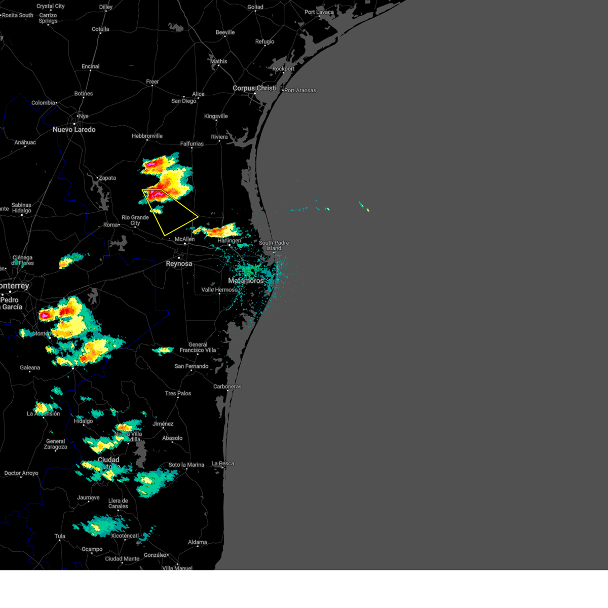 At 340 pm cdt, a severe thunderstorm was located near santa catarina, or 13 miles northwest of mccook, moving southeast at 35 mph (radar indicated). Hazards include golf ball size hail and 60 mph wind gusts. People and animals outdoors will be injured. expect hail damage to roofs, siding, windows, and vehicles. Expect wind damage to roofs, siding, and trees. At 340 pm cdt, a severe thunderstorm was located near santa catarina, or 13 miles northwest of mccook, moving southeast at 35 mph (radar indicated). Hazards include golf ball size hail and 60 mph wind gusts. People and animals outdoors will be injured. expect hail damage to roofs, siding, windows, and vehicles. Expect wind damage to roofs, siding, and trees.
|
| 4/21/2023 3:30 PM CDT |
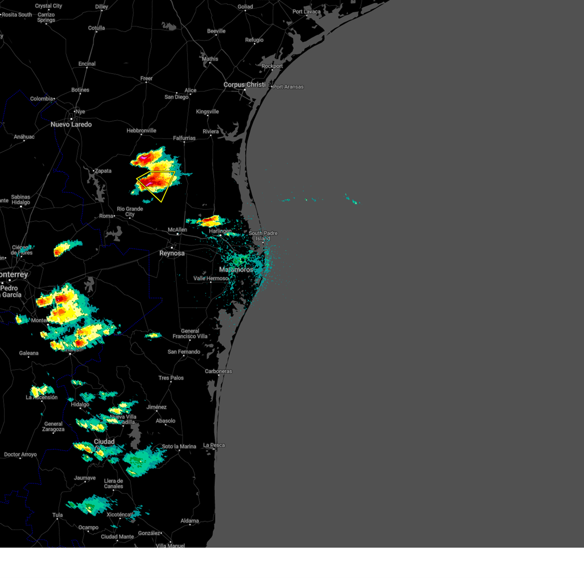 At 329 pm cdt, a severe thunderstorm was located over san rafael ranch airport, or 11 miles southeast of agua nueva, moving southeast at 35 mph (radar indicated). Hazards include golf ball size hail and 60 mph wind gusts. People and animals outdoors will be injured. expect hail damage to roofs, siding, windows, and vehicles. expect wind damage to roofs, siding, and trees. locations impacted include, la gloria, la reforma, san isidro, san rafael ranch airport, santa elena, delmita, diamond o ranch airport and puesta del sol airport. thunderstorm damage threat, considerable hail threat, radar indicated max hail size, 1. 75 in wind threat, radar indicated max wind gust, 60 mph. At 329 pm cdt, a severe thunderstorm was located over san rafael ranch airport, or 11 miles southeast of agua nueva, moving southeast at 35 mph (radar indicated). Hazards include golf ball size hail and 60 mph wind gusts. People and animals outdoors will be injured. expect hail damage to roofs, siding, windows, and vehicles. expect wind damage to roofs, siding, and trees. locations impacted include, la gloria, la reforma, san isidro, san rafael ranch airport, santa elena, delmita, diamond o ranch airport and puesta del sol airport. thunderstorm damage threat, considerable hail threat, radar indicated max hail size, 1. 75 in wind threat, radar indicated max wind gust, 60 mph.
|
| 4/21/2023 3:05 PM CDT |
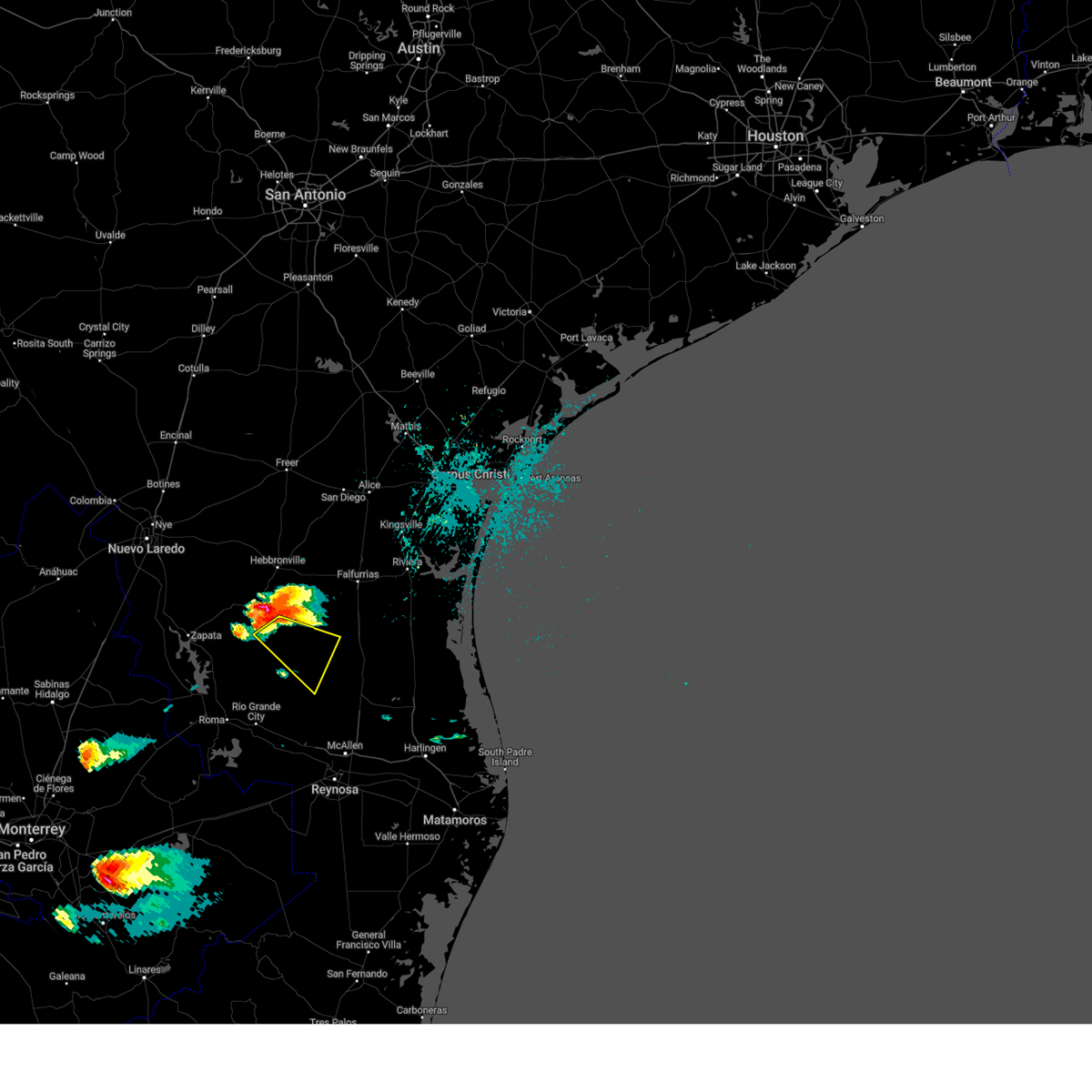 At 304 pm cdt, a severe thunderstorm was located near agua nueva, moving southeast at 30 mph (radar indicated). Hazards include 60 mph wind gusts and half dollar size hail. Hail damage to vehicles is expected. Expect wind damage to roofs, siding, and trees. At 304 pm cdt, a severe thunderstorm was located near agua nueva, moving southeast at 30 mph (radar indicated). Hazards include 60 mph wind gusts and half dollar size hail. Hail damage to vehicles is expected. Expect wind damage to roofs, siding, and trees.
|
| 4/10/2023 4:12 PM CDT |
 At 411 pm cdt, a severe thunderstorm was located near trickham, moving south at 25 mph (radar indicated). Hazards include ping pong ball size hail and 60 mph wind gusts. People and animals outdoors will be injured. expect hail damage to roofs, siding, windows, and vehicles. expect wind damage to roofs, siding, and trees. this severe storm will be near, trickham around 420 pm cdt. other locations impacted by this severe thunderstorm include shields. hail threat, radar indicated max hail size, 1. 50 in wind threat, radar indicated max wind gust, 60 mph. At 411 pm cdt, a severe thunderstorm was located near trickham, moving south at 25 mph (radar indicated). Hazards include ping pong ball size hail and 60 mph wind gusts. People and animals outdoors will be injured. expect hail damage to roofs, siding, windows, and vehicles. expect wind damage to roofs, siding, and trees. this severe storm will be near, trickham around 420 pm cdt. other locations impacted by this severe thunderstorm include shields. hail threat, radar indicated max hail size, 1. 50 in wind threat, radar indicated max wind gust, 60 mph.
|
| 4/10/2023 3:55 PM CDT |
 At 354 pm cdt, a severe thunderstorm was located near santa anna, moving south at 20 mph (radar indicated). Hazards include ping pong ball size hail and 60 mph wind gusts. People and animals outdoors will be injured. expect hail damage to roofs, siding, windows, and vehicles. expect wind damage to roofs, siding, and trees. this severe storm will be near, trickham around 425 pm cdt. other locations impacted by this severe thunderstorm include shields and thrifty. hail threat, radar indicated max hail size, 1. 50 in wind threat, radar indicated max wind gust, 60 mph. At 354 pm cdt, a severe thunderstorm was located near santa anna, moving south at 20 mph (radar indicated). Hazards include ping pong ball size hail and 60 mph wind gusts. People and animals outdoors will be injured. expect hail damage to roofs, siding, windows, and vehicles. expect wind damage to roofs, siding, and trees. this severe storm will be near, trickham around 425 pm cdt. other locations impacted by this severe thunderstorm include shields and thrifty. hail threat, radar indicated max hail size, 1. 50 in wind threat, radar indicated max wind gust, 60 mph.
|
| 4/10/2023 3:34 PM CDT |
 At 333 pm cdt, a severe thunderstorm was located near grosvenor, moving south at 20 mph (radar indicated). Hazards include ping pong ball size hail and 60 mph wind gusts. People and animals outdoors will be injured. expect hail damage to roofs, siding, windows, and vehicles. expect wind damage to roofs, siding, and trees. this severe thunderstorm will be near, santa anna around 355 pm cdt. bangs around 400 pm cdt. trickham around 430 pm cdt. other locations impacted by this severe thunderstorm include echo, shields and thrifty. hail threat, radar indicated max hail size, 1. 50 in wind threat, radar indicated max wind gust, 60 mph. At 333 pm cdt, a severe thunderstorm was located near grosvenor, moving south at 20 mph (radar indicated). Hazards include ping pong ball size hail and 60 mph wind gusts. People and animals outdoors will be injured. expect hail damage to roofs, siding, windows, and vehicles. expect wind damage to roofs, siding, and trees. this severe thunderstorm will be near, santa anna around 355 pm cdt. bangs around 400 pm cdt. trickham around 430 pm cdt. other locations impacted by this severe thunderstorm include echo, shields and thrifty. hail threat, radar indicated max hail size, 1. 50 in wind threat, radar indicated max wind gust, 60 mph.
|
| 3/2/2023 4:53 PM CST |
 At 451 pm cst, severe thunderstorms were located along a line extending from near rising star to near grosvenor to bangs to near rockwood to near brady lake, moving east at 50 mph (radar indicated). Hazards include 70 mph wind gusts and quarter size hail. Hail damage to vehicles is expected. expect considerable tree damage. wind damage is also likely to mobile homes, roofs, and outbuildings. these severe storms will be near, bangs, grosvenor, cross cut, lake brownwood and lake brownwood near thrifty around 455 pm cst. brownwood, byrds and lake brownwood state park around 500 pm cst. camp bowie and winchell around 505 pm cst. early, brookesmith and may around 510 pm cst. blanket and zephyr around 515 pm cst. sloan around 530 pm cst. algerita around 535 pm cst. san saba around 545 pm cst. other locations impacted by these severe thunderstorms include fife, locker, us-283 near the mcculloch-coleman county line, harkeyville, owens, milburn, whon, spring creek, thrifty and us-190 near the mcculloch-san saba county line. thunderstorm damage threat, considerable hail threat, radar indicated max hail size, 1. 00 in wind threat, radar indicated max wind gust, 70 mph. At 451 pm cst, severe thunderstorms were located along a line extending from near rising star to near grosvenor to bangs to near rockwood to near brady lake, moving east at 50 mph (radar indicated). Hazards include 70 mph wind gusts and quarter size hail. Hail damage to vehicles is expected. expect considerable tree damage. wind damage is also likely to mobile homes, roofs, and outbuildings. these severe storms will be near, bangs, grosvenor, cross cut, lake brownwood and lake brownwood near thrifty around 455 pm cst. brownwood, byrds and lake brownwood state park around 500 pm cst. camp bowie and winchell around 505 pm cst. early, brookesmith and may around 510 pm cst. blanket and zephyr around 515 pm cst. sloan around 530 pm cst. algerita around 535 pm cst. san saba around 545 pm cst. other locations impacted by these severe thunderstorms include fife, locker, us-283 near the mcculloch-coleman county line, harkeyville, owens, milburn, whon, spring creek, thrifty and us-190 near the mcculloch-san saba county line. thunderstorm damage threat, considerable hail threat, radar indicated max hail size, 1. 00 in wind threat, radar indicated max wind gust, 70 mph.
|
| 3/2/2023 4:31 PM CST |
 At 430 pm cst, severe thunderstorms were located along a line extending from near cross plains to near echo to near santa anna to near stacy to 7 miles east of us-83 near the menard-concho county line, moving rapidly east at 50 mph (radar indicated). Hazards include 65 to 70 mph wind gusts and quarter size hail. Hail damage to vehicles is expected. expect considerable tree damage. wind damage is also likely to mobile homes, roofs, and outbuildings. severe thunderstorms will be near, rockwood, burkett and waldrip around 445 pm cst. bangs, brady lake, grosvenor and lake brownwood near thrifty around 450 pm cst. brownwood, byrds and lake brownwood around 455 pm cst. brady, trickham, camp bowie and lake brownwood state park around 500 pm cst. early, brookesmith, may and winchell around 505 pm cst. blanket and zephyr around 515 pm cst. other locations impacted by these severe thunderstorms include the intersection of us- 87 and ranch road 2134, fife, locker, echo, mozelle, us- 83 near the menard-concho county line, us-283 near the mcculloch- coleman county line, harkeyville, owens and milburn. thunderstorm damage threat, considerable hail threat, radar indicated max hail size, 1. 00 in wind threat, radar indicated max wind gust, 70 mph. At 430 pm cst, severe thunderstorms were located along a line extending from near cross plains to near echo to near santa anna to near stacy to 7 miles east of us-83 near the menard-concho county line, moving rapidly east at 50 mph (radar indicated). Hazards include 65 to 70 mph wind gusts and quarter size hail. Hail damage to vehicles is expected. expect considerable tree damage. wind damage is also likely to mobile homes, roofs, and outbuildings. severe thunderstorms will be near, rockwood, burkett and waldrip around 445 pm cst. bangs, brady lake, grosvenor and lake brownwood near thrifty around 450 pm cst. brownwood, byrds and lake brownwood around 455 pm cst. brady, trickham, camp bowie and lake brownwood state park around 500 pm cst. early, brookesmith, may and winchell around 505 pm cst. blanket and zephyr around 515 pm cst. other locations impacted by these severe thunderstorms include the intersection of us- 87 and ranch road 2134, fife, locker, echo, mozelle, us- 83 near the menard-concho county line, us-283 near the mcculloch- coleman county line, harkeyville, owens and milburn. thunderstorm damage threat, considerable hail threat, radar indicated max hail size, 1. 00 in wind threat, radar indicated max wind gust, 70 mph.
|
| 3/2/2023 3:57 PM CST |
 At 356 pm cst, a severe thunderstorm was located near silver valley, moving northeast at 60 mph (radar indicated). Hazards include 60 mph wind gusts and quarter size hail. Hail damage to vehicles is expected. expect wind damage to roofs, siding, and trees. this severe storm will be near, rowden around 415 pm cst. cross plains around 420 pm cst. atwell around 425 pm cst. putnam around 430 pm cst. other locations impacted by this severe thunderstorm include us- 283 near the coleman- callahan county line, echo, admiral, lake coleman and hords creek reservoir. this includes interstate 20 between mile markers 310 and 320. hail threat, radar indicated max hail size, 1. 00 in wind threat, radar indicated max wind gust, 60 mph. At 356 pm cst, a severe thunderstorm was located near silver valley, moving northeast at 60 mph (radar indicated). Hazards include 60 mph wind gusts and quarter size hail. Hail damage to vehicles is expected. expect wind damage to roofs, siding, and trees. this severe storm will be near, rowden around 415 pm cst. cross plains around 420 pm cst. atwell around 425 pm cst. putnam around 430 pm cst. other locations impacted by this severe thunderstorm include us- 283 near the coleman- callahan county line, echo, admiral, lake coleman and hords creek reservoir. this includes interstate 20 between mile markers 310 and 320. hail threat, radar indicated max hail size, 1. 00 in wind threat, radar indicated max wind gust, 60 mph.
|
| 3/2/2023 3:44 PM CST |
 At 344 pm cst, a severe thunderstorm was located over valera, moving northeast at 60 mph (radar indicated). Hazards include 60 mph wind gusts and half dollar size hail. Hail damage to vehicles is expected. expect wind damage to roofs, siding, and trees. this severe thunderstorm will be near, coleman and silver valley around 355 pm cst. rowden around 415 pm cst. cross plains around 420 pm cst. atwell around 425 pm cst. putnam around 430 pm cst. other locations impacted by this severe thunderstorm include fisk, us-283 near the coleman- callahan county line, echo, admiral, lake coleman and hords creek reservoir. this includes interstate 20 between mile markers 310 and 320. hail threat, radar indicated max hail size, 1. 25 in wind threat, radar indicated max wind gust, 60 mph. At 344 pm cst, a severe thunderstorm was located over valera, moving northeast at 60 mph (radar indicated). Hazards include 60 mph wind gusts and half dollar size hail. Hail damage to vehicles is expected. expect wind damage to roofs, siding, and trees. this severe thunderstorm will be near, coleman and silver valley around 355 pm cst. rowden around 415 pm cst. cross plains around 420 pm cst. atwell around 425 pm cst. putnam around 430 pm cst. other locations impacted by this severe thunderstorm include fisk, us-283 near the coleman- callahan county line, echo, admiral, lake coleman and hords creek reservoir. this includes interstate 20 between mile markers 310 and 320. hail threat, radar indicated max hail size, 1. 25 in wind threat, radar indicated max wind gust, 60 mph.
|
| 10/24/2022 5:54 PM CDT |
 At 554 pm cdt, a severe thunderstorm was located near santa anna, moving east at 55 mph (radar indicated). Hazards include 60 mph wind gusts and half dollar size hail. Hail damage to vehicles is expected. expect wind damage to roofs, siding, and trees. this severe storm will be near, bangs and grosvenor around 605 pm cdt. lake brownwood and lake brownwood near thrifty around 610 pm cdt. lake brownwood state park and byrds around 615 pm cdt. early around 620 pm cdt. blanket around 630 pm cdt. Other locations impacted by this severe thunderstorm include owens, fisk, thrifty, echo and hords creek reservoir. At 554 pm cdt, a severe thunderstorm was located near santa anna, moving east at 55 mph (radar indicated). Hazards include 60 mph wind gusts and half dollar size hail. Hail damage to vehicles is expected. expect wind damage to roofs, siding, and trees. this severe storm will be near, bangs and grosvenor around 605 pm cdt. lake brownwood and lake brownwood near thrifty around 610 pm cdt. lake brownwood state park and byrds around 615 pm cdt. early around 620 pm cdt. blanket around 630 pm cdt. Other locations impacted by this severe thunderstorm include owens, fisk, thrifty, echo and hords creek reservoir.
|
| 10/24/2022 5:49 PM CDT |
 At 549 pm cdt, a severe thunderstorm was located near coleman, moving east at 40 mph (radar indicated). Hazards include 60 mph wind gusts and half dollar size hail. Hail damage to vehicles is expected. expect wind damage to roofs, siding, and trees. this severe storm will be near, bangs, lake brownwood near thrifty, lake brownwood and grosvenor around 610 pm cdt. byrds around 615 pm cdt. lake brownwood state park around 620 pm cdt. early around 625 pm cdt. blanket around 635 pm cdt. other locations impacted by this severe thunderstorm include owens, fisk, thrifty, echo and hords creek reservoir. hail threat, radar indicated max hail size, 1. 25 in wind threat, radar indicated max wind gust, 60 mph. At 549 pm cdt, a severe thunderstorm was located near coleman, moving east at 40 mph (radar indicated). Hazards include 60 mph wind gusts and half dollar size hail. Hail damage to vehicles is expected. expect wind damage to roofs, siding, and trees. this severe storm will be near, bangs, lake brownwood near thrifty, lake brownwood and grosvenor around 610 pm cdt. byrds around 615 pm cdt. lake brownwood state park around 620 pm cdt. early around 625 pm cdt. blanket around 635 pm cdt. other locations impacted by this severe thunderstorm include owens, fisk, thrifty, echo and hords creek reservoir. hail threat, radar indicated max hail size, 1. 25 in wind threat, radar indicated max wind gust, 60 mph.
|
| 10/24/2022 5:39 PM CDT |
 At 539 pm cdt, a severe thunderstorm was located near valera, moving east at 50 mph (radar indicated). Hazards include 60 mph wind gusts and quarter size hail. Hail damage to vehicles is expected. expect wind damage to roofs, siding, and trees. this severe thunderstorm will be near, coleman around 545 pm cdt. santa anna around 550 pm cdt. bangs, lake brownwood near thrifty, lake brownwood and grosvenor around 605 pm cdt. lake brownwood state park and byrds around 610 pm cdt. early around 620 pm cdt. blanket around 630 pm cdt. other locations impacted by this severe thunderstorm include owens, fisk, thrifty, echo and hords creek reservoir. hail threat, radar indicated max hail size, 1. 00 in wind threat, radar indicated max wind gust, 60 mph. At 539 pm cdt, a severe thunderstorm was located near valera, moving east at 50 mph (radar indicated). Hazards include 60 mph wind gusts and quarter size hail. Hail damage to vehicles is expected. expect wind damage to roofs, siding, and trees. this severe thunderstorm will be near, coleman around 545 pm cdt. santa anna around 550 pm cdt. bangs, lake brownwood near thrifty, lake brownwood and grosvenor around 605 pm cdt. lake brownwood state park and byrds around 610 pm cdt. early around 620 pm cdt. blanket around 630 pm cdt. other locations impacted by this severe thunderstorm include owens, fisk, thrifty, echo and hords creek reservoir. hail threat, radar indicated max hail size, 1. 00 in wind threat, radar indicated max wind gust, 60 mph.
|
| 5/24/2022 5:46 PM CDT |
 At 546 pm cdt, a severe thunderstorm was located over leaday, moving northeast at 25 mph (radar indicated). Hazards include 60 mph wind gusts and quarter size hail. Hail damage to vehicles is expected. expect wind damage to roofs, siding, and trees. this severe thunderstorm will be near, voss around 555 pm cdt. valera around 605 pm cdt. coleman and santa anna around 615 pm cdt. other locations impacted by this severe thunderstorm include mozelle, shields and fisk. hail threat, radar indicated max hail size, 1. 00 in wind threat, radar indicated max wind gust, 60 mph. At 546 pm cdt, a severe thunderstorm was located over leaday, moving northeast at 25 mph (radar indicated). Hazards include 60 mph wind gusts and quarter size hail. Hail damage to vehicles is expected. expect wind damage to roofs, siding, and trees. this severe thunderstorm will be near, voss around 555 pm cdt. valera around 605 pm cdt. coleman and santa anna around 615 pm cdt. other locations impacted by this severe thunderstorm include mozelle, shields and fisk. hail threat, radar indicated max hail size, 1. 00 in wind threat, radar indicated max wind gust, 60 mph.
|
| 5/24/2022 5:34 PM CDT | Half Dollar sized hail reported 339.3 miles S of Santa Anna, TX |
| 5/24/2022 4:34 PM CDT |
 At 433 pm cdt, a severe thunderstorm was located near voss, moving east at 30 mph (radar indicated). Hazards include tennis ball size hail and 60 mph wind gusts. People and animals outdoors will be injured. expect hail damage to roofs, siding, windows, and vehicles. expect wind damage to roofs, siding, and trees. this severe thunderstorm will be near, valera around 445 pm cdt. santa anna around 510 pm cdt. bangs, lake brownwood and grosvenor around 530 pm cdt. Other locations impacted by this severe thunderstorm include mozelle, fisk, thrifty and shields. At 433 pm cdt, a severe thunderstorm was located near voss, moving east at 30 mph (radar indicated). Hazards include tennis ball size hail and 60 mph wind gusts. People and animals outdoors will be injured. expect hail damage to roofs, siding, windows, and vehicles. expect wind damage to roofs, siding, and trees. this severe thunderstorm will be near, valera around 445 pm cdt. santa anna around 510 pm cdt. bangs, lake brownwood and grosvenor around 530 pm cdt. Other locations impacted by this severe thunderstorm include mozelle, fisk, thrifty and shields.
|
| 5/23/2022 10:49 PM CDT |
 At 1049 pm cdt, a severe thunderstorm was located near mccook, moving east at 35 mph (radar indicated). Hazards include tennis ball size hail and 70 mph wind gusts. People and animals outdoors will be injured. expect hail damage to roofs, siding, windows, and vehicles. expect considerable tree damage. wind damage is also likely to mobile homes, roofs, and outbuildings. Locations impacted include, san manuel, mccook, linn, faysville, puerto rico, red gate, la gloria, monte cristo elementary school, la reforma and doolittle. At 1049 pm cdt, a severe thunderstorm was located near mccook, moving east at 35 mph (radar indicated). Hazards include tennis ball size hail and 70 mph wind gusts. People and animals outdoors will be injured. expect hail damage to roofs, siding, windows, and vehicles. expect considerable tree damage. wind damage is also likely to mobile homes, roofs, and outbuildings. Locations impacted include, san manuel, mccook, linn, faysville, puerto rico, red gate, la gloria, monte cristo elementary school, la reforma and doolittle.
|
| 5/23/2022 10:38 PM CDT |
 At 1037 pm cdt, a severe thunderstorm was located near mccook, moving east at 30 mph (radar indicated). Hazards include tennis ball size hail and 70 mph wind gusts. People and animals outdoors will be injured. expect hail damage to roofs, siding, windows, and vehicles. expect considerable tree damage. wind damage is also likely to mobile homes, roofs, and outbuildings. Locations impacted include, encino, rachal, san manuel, mccook, linn, faysville, puerto rico, red gate, santa catarina and la gloria. At 1037 pm cdt, a severe thunderstorm was located near mccook, moving east at 30 mph (radar indicated). Hazards include tennis ball size hail and 70 mph wind gusts. People and animals outdoors will be injured. expect hail damage to roofs, siding, windows, and vehicles. expect considerable tree damage. wind damage is also likely to mobile homes, roofs, and outbuildings. Locations impacted include, encino, rachal, san manuel, mccook, linn, faysville, puerto rico, red gate, santa catarina and la gloria.
|
| 5/23/2022 10:28 PM CDT |
 The severe thunderstorm warning for southeastern jim hogg and starr counties will expire at 1030 pm cdt, the severe thunderstorm which prompted the warning continues to move east and has been replaced by new warnings. this warning will be allowed to expire. a severe thunderstorm watch remains in effect until midnight cdt for deep south texas. remember, a severe thunderstorm warning still remains in effect for eastern starr county and southeastern jim hogg county until 11:15 pm. The severe thunderstorm warning for southeastern jim hogg and starr counties will expire at 1030 pm cdt, the severe thunderstorm which prompted the warning continues to move east and has been replaced by new warnings. this warning will be allowed to expire. a severe thunderstorm watch remains in effect until midnight cdt for deep south texas. remember, a severe thunderstorm warning still remains in effect for eastern starr county and southeastern jim hogg county until 11:15 pm.
|
| 5/23/2022 10:24 PM CDT |
 At 1023 pm cdt, a severe thunderstorm was located near santa catarina, or 13 miles northwest of mccook, moving east at 30 mph (radar indicated). Hazards include tennis ball size hail and 60 mph wind gusts. People and animals outdoors will be injured. expect hail damage to roofs, siding, windows, and vehicles. Expect wind damage to roofs, siding, and trees. At 1023 pm cdt, a severe thunderstorm was located near santa catarina, or 13 miles northwest of mccook, moving east at 30 mph (radar indicated). Hazards include tennis ball size hail and 60 mph wind gusts. People and animals outdoors will be injured. expect hail damage to roofs, siding, windows, and vehicles. Expect wind damage to roofs, siding, and trees.
|
| 5/23/2022 10:15 PM CDT |
 At 1015 pm cdt, a severe thunderstorm was located 7 miles northwest of mccook, moving southeast at 30 mph (radar indicated). Hazards include ping pong ball size hail and 60 mph wind gusts. People and animals outdoors will be injured. expect hail damage to roofs, siding, windows, and vehicles. expect wind damage to roofs, siding, and trees. locations impacted include, rio grande city, roma, escobares, agua nueva, el sauz, viboras, garciasville, la rosita, los alvarez and fort ringgold county park. hail threat, radar indicated max hail size, 1. 50 in wind threat, radar indicated max wind gust, 60 mph. At 1015 pm cdt, a severe thunderstorm was located 7 miles northwest of mccook, moving southeast at 30 mph (radar indicated). Hazards include ping pong ball size hail and 60 mph wind gusts. People and animals outdoors will be injured. expect hail damage to roofs, siding, windows, and vehicles. expect wind damage to roofs, siding, and trees. locations impacted include, rio grande city, roma, escobares, agua nueva, el sauz, viboras, garciasville, la rosita, los alvarez and fort ringgold county park. hail threat, radar indicated max hail size, 1. 50 in wind threat, radar indicated max wind gust, 60 mph.
|
| 5/23/2022 9:56 PM CDT |
 At 955 pm cdt, a severe thunderstorm was located near santa catarina, or 14 miles southeast of viboras, moving southeast at 25 mph (radar indicated). Hazards include 60 mph wind gusts and half dollar size hail. Hail damage to vehicles is expected. expect wind damage to roofs, siding, and trees. locations impacted include, rio grande city, roma, escobares, agua nueva, el sauz, viboras, garciasville, la rosita, los alvarez and fort ringgold county park. hail threat, radar indicated max hail size, 1. 25 in wind threat, radar indicated max wind gust, 60 mph. At 955 pm cdt, a severe thunderstorm was located near santa catarina, or 14 miles southeast of viboras, moving southeast at 25 mph (radar indicated). Hazards include 60 mph wind gusts and half dollar size hail. Hail damage to vehicles is expected. expect wind damage to roofs, siding, and trees. locations impacted include, rio grande city, roma, escobares, agua nueva, el sauz, viboras, garciasville, la rosita, los alvarez and fort ringgold county park. hail threat, radar indicated max hail size, 1. 25 in wind threat, radar indicated max wind gust, 60 mph.
|
| 5/23/2022 9:39 PM CDT |
 At 939 pm cdt, a severe thunderstorm was located near viboras, moving southeast at 30 mph (radar indicated). Hazards include 60 mph wind gusts and half dollar size hail. Hail damage to vehicles is expected. Expect wind damage to roofs, siding, and trees. At 939 pm cdt, a severe thunderstorm was located near viboras, moving southeast at 30 mph (radar indicated). Hazards include 60 mph wind gusts and half dollar size hail. Hail damage to vehicles is expected. Expect wind damage to roofs, siding, and trees.
|
| 5/1/2022 10:03 PM CDT |
 At 1002 pm cdt, a severe thunderstorm was located near santa anna, moving northeast at 35 mph. this is a destructive storm for large hail to the size of baseballs (radar indicated). Hazards include baseball size hail and 60 mph wind gusts. People and animals outdoors will be severely injured. expect shattered windows, extensive damage to roofs, siding, and vehicles. this severe storm will be near, santa anna around 1010 pm cdt. grosvenor, lake brownwood and lake brownwood near thrifty around 1035 pm cdt. other locations impacted by this severe thunderstorm include mozelle, whon, fisk, thrifty, echo and shields. thunderstorm damage threat, destructive hail threat, radar indicated max hail size, 2. 75 in wind threat, radar indicated max wind gust, 60 mph. At 1002 pm cdt, a severe thunderstorm was located near santa anna, moving northeast at 35 mph. this is a destructive storm for large hail to the size of baseballs (radar indicated). Hazards include baseball size hail and 60 mph wind gusts. People and animals outdoors will be severely injured. expect shattered windows, extensive damage to roofs, siding, and vehicles. this severe storm will be near, santa anna around 1010 pm cdt. grosvenor, lake brownwood and lake brownwood near thrifty around 1035 pm cdt. other locations impacted by this severe thunderstorm include mozelle, whon, fisk, thrifty, echo and shields. thunderstorm damage threat, destructive hail threat, radar indicated max hail size, 2. 75 in wind threat, radar indicated max wind gust, 60 mph.
|
| 5/1/2022 9:49 PM CDT |
 At 949 pm cdt, a severe thunderstorm was located over mozelle, or near voss, moving northeast at 35 mph (radar indicated). Hazards include two inch hail and 60 mph wind gusts. People and animals outdoors will be injured. expect hail damage to roofs, siding, windows, and vehicles. expect wind damage to roofs, siding, and trees. this severe storm will be near, santa anna around 1010 pm cdt. grosvenor, lake brownwood near thrifty and lake brownwood around 1030 pm cdt. other locations impacted by this severe thunderstorm include mozelle, whon, fisk, thrifty, echo and shields. thunderstorm damage threat, considerable hail threat, radar indicated max hail size, 2. 00 in wind threat, radar indicated max wind gust, 60 mph. At 949 pm cdt, a severe thunderstorm was located over mozelle, or near voss, moving northeast at 35 mph (radar indicated). Hazards include two inch hail and 60 mph wind gusts. People and animals outdoors will be injured. expect hail damage to roofs, siding, windows, and vehicles. expect wind damage to roofs, siding, and trees. this severe storm will be near, santa anna around 1010 pm cdt. grosvenor, lake brownwood near thrifty and lake brownwood around 1030 pm cdt. other locations impacted by this severe thunderstorm include mozelle, whon, fisk, thrifty, echo and shields. thunderstorm damage threat, considerable hail threat, radar indicated max hail size, 2. 00 in wind threat, radar indicated max wind gust, 60 mph.
|
| 5/1/2022 9:45 PM CDT |
 At 944 pm cdt, a severe thunderstorm was located over mozelle, or near voss, moving northeast at 35 mph (radar indicated). Hazards include 60 mph wind gusts and half dollar size hail. Hail damage to vehicles is expected. expect wind damage to roofs, siding, and trees. this severe thunderstorm will be near, santa anna around 1010 pm cdt. grosvenor, lake brownwood near thrifty and lake brownwood around 1030 pm cdt. other locations impacted by this severe thunderstorm include mozelle, whon, fisk, thrifty, echo and shields. hail threat, radar indicated max hail size, 1. 25 in wind threat, radar indicated max wind gust, 60 mph. At 944 pm cdt, a severe thunderstorm was located over mozelle, or near voss, moving northeast at 35 mph (radar indicated). Hazards include 60 mph wind gusts and half dollar size hail. Hail damage to vehicles is expected. expect wind damage to roofs, siding, and trees. this severe thunderstorm will be near, santa anna around 1010 pm cdt. grosvenor, lake brownwood near thrifty and lake brownwood around 1030 pm cdt. other locations impacted by this severe thunderstorm include mozelle, whon, fisk, thrifty, echo and shields. hail threat, radar indicated max hail size, 1. 25 in wind threat, radar indicated max wind gust, 60 mph.
|
| 4/25/2022 9:11 PM CDT |
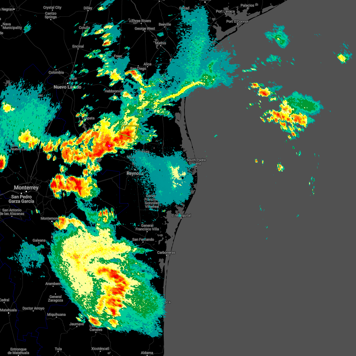 The severe thunderstorm warning for north central hidalgo and northeastern starr counties will expire at 915 pm cdt, the severe thunderstorm which prompted the warning has weakened. therefore, the warning will be allowed to expire. The severe thunderstorm warning for north central hidalgo and northeastern starr counties will expire at 915 pm cdt, the severe thunderstorm which prompted the warning has weakened. therefore, the warning will be allowed to expire.
|
| 4/25/2022 8:46 PM CDT |
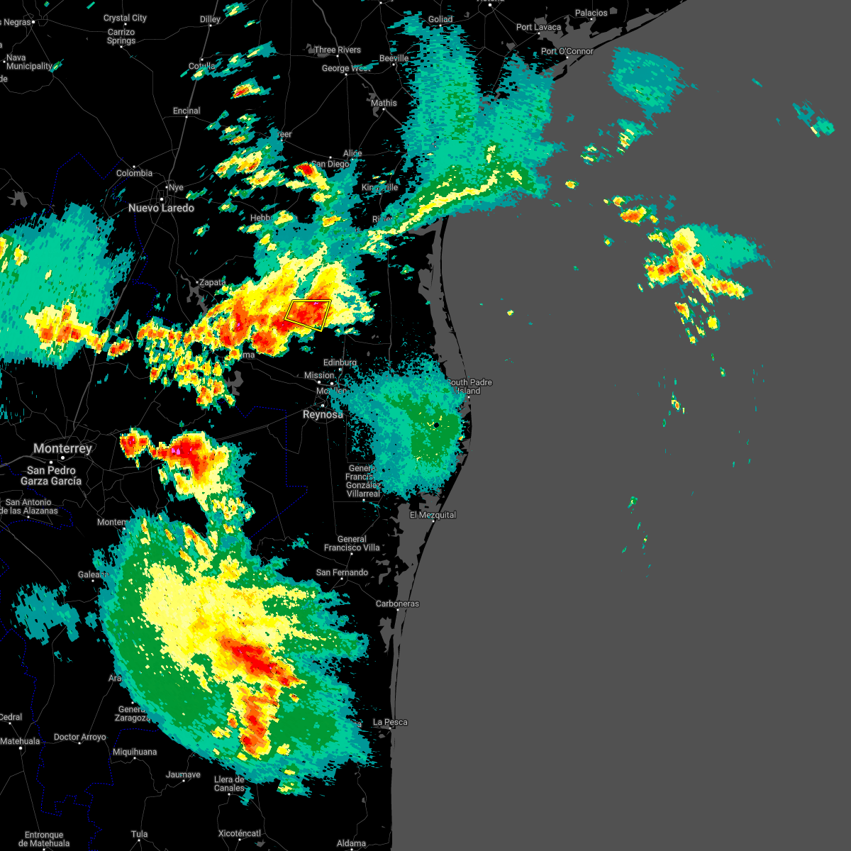 At 845 pm cdt, a severe thunderstorm was located near la reforma, or 16 miles southwest of rachal, moving south at 10 mph (radar indicated). Hazards include 60 mph wind gusts and nickel size hail. expect damage to roofs, siding, and trees At 845 pm cdt, a severe thunderstorm was located near la reforma, or 16 miles southwest of rachal, moving south at 10 mph (radar indicated). Hazards include 60 mph wind gusts and nickel size hail. expect damage to roofs, siding, and trees
|
| 4/25/2022 8:22 PM CDT |
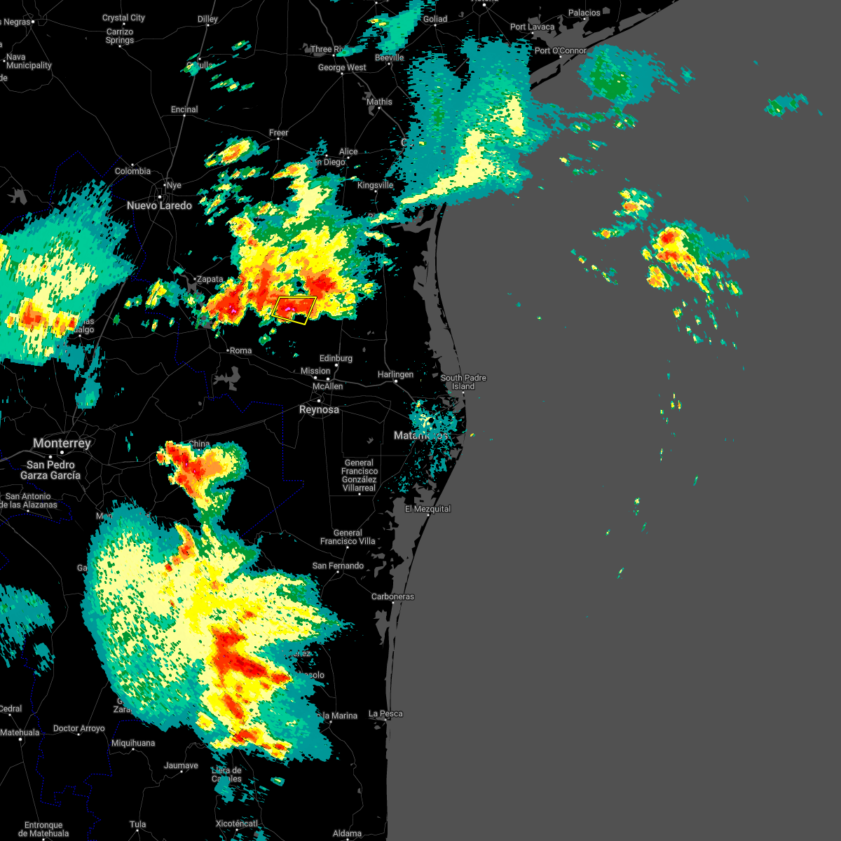 At 821 pm cdt, a severe thunderstorm was located over la gloria, or 13 miles south of agua nueva, and is nearly stationary (radar indicated). Hazards include 60 mph wind gusts and quarter size hail. Hail damage to vehicles is expected. expect wind damage to roofs, siding, and trees. locations impacted include, la gloria, la reforma, santa catarina, san isidro, santa elena, delmita and diamond o ranch airport. hail threat, radar indicated max hail size, 1. 00 in wind threat, radar indicated max wind gust, 60 mph. At 821 pm cdt, a severe thunderstorm was located over la gloria, or 13 miles south of agua nueva, and is nearly stationary (radar indicated). Hazards include 60 mph wind gusts and quarter size hail. Hail damage to vehicles is expected. expect wind damage to roofs, siding, and trees. locations impacted include, la gloria, la reforma, santa catarina, san isidro, santa elena, delmita and diamond o ranch airport. hail threat, radar indicated max hail size, 1. 00 in wind threat, radar indicated max wind gust, 60 mph.
|
| 4/25/2022 8:00 PM CDT |
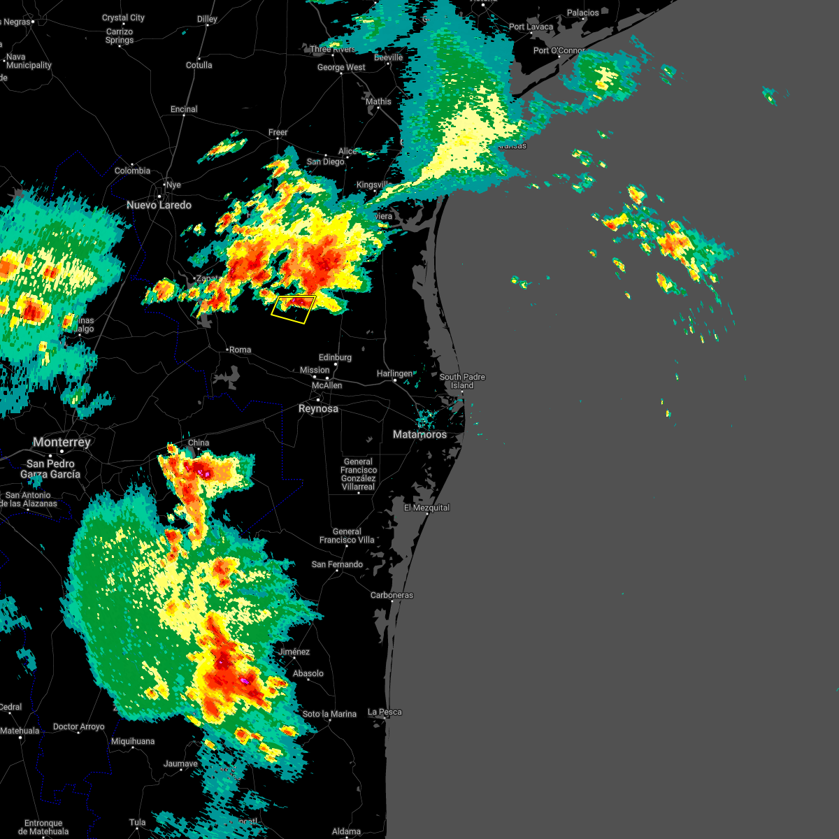 At 759 pm cdt, a severe thunderstorm was located over santa elena, or 12 miles southeast of agua nueva, moving south or southwest at 5 mph (radar indicated). Hazards include 60 mph wind gusts and half dollar size hail. Hail damage to vehicles is expected. Expect wind damage to roofs, siding, and trees. At 759 pm cdt, a severe thunderstorm was located over santa elena, or 12 miles southeast of agua nueva, moving south or southwest at 5 mph (radar indicated). Hazards include 60 mph wind gusts and half dollar size hail. Hail damage to vehicles is expected. Expect wind damage to roofs, siding, and trees.
|
| 7/28/2021 4:14 PM CDT |
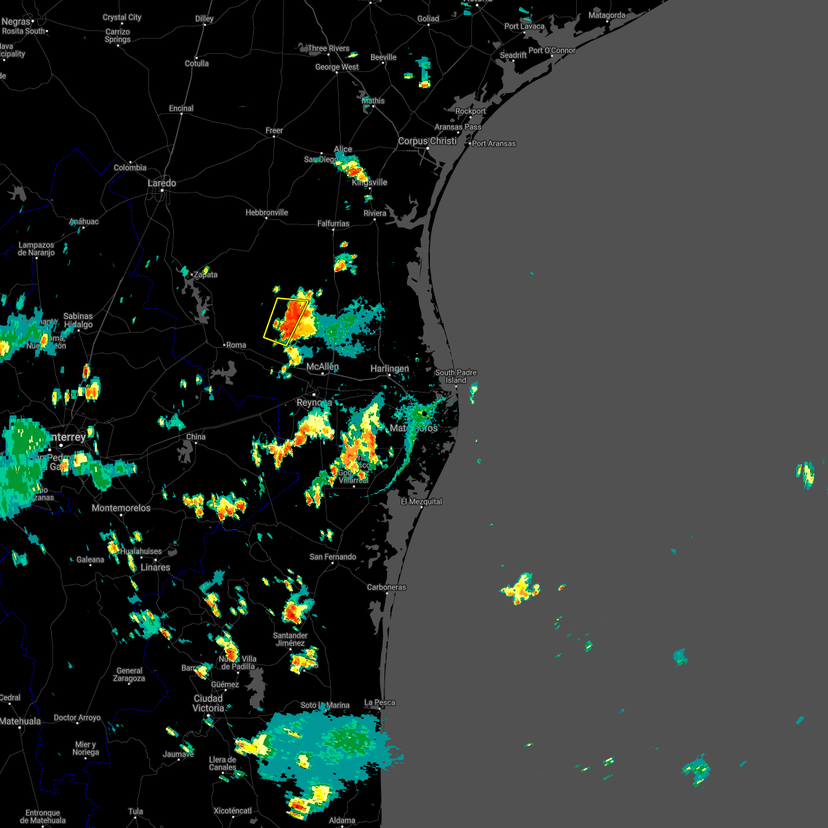 At 410 pm cdt, severe thunderstorms were located along a line extending from near la reforma to the starr hidalgo county line west of mccook, moving west at 20 mph (nws cooperative observer in mccook reported 61 mph gusts and pea sized hail at 349 pm). Hazards include 60 mph wind gusts and penny size hail. Expect damage to poorly constructed roofs, siding, and sheds as well as unanchored mobile homes or trailers. these severe storms will be near, san isidro around 420 pm cdt. la gloria through 430 pm cdt. santa catarina between 430 and 440 pm cdt. other locations impacted by these severe thunderstorms include diamond o ranch airport and delmita. the wind core is beginning to weaken, but the threat continues. Mcallen/miller airport had a 54 mph gust on the backside of similar storms at 334 pm. At 410 pm cdt, severe thunderstorms were located along a line extending from near la reforma to the starr hidalgo county line west of mccook, moving west at 20 mph (nws cooperative observer in mccook reported 61 mph gusts and pea sized hail at 349 pm). Hazards include 60 mph wind gusts and penny size hail. Expect damage to poorly constructed roofs, siding, and sheds as well as unanchored mobile homes or trailers. these severe storms will be near, san isidro around 420 pm cdt. la gloria through 430 pm cdt. santa catarina between 430 and 440 pm cdt. other locations impacted by these severe thunderstorms include diamond o ranch airport and delmita. the wind core is beginning to weaken, but the threat continues. Mcallen/miller airport had a 54 mph gust on the backside of similar storms at 334 pm.
|
| 7/28/2021 3:57 PM CDT |
 At 355 pm cdt, severe thunderstorms were located along a line extending from puerto rico to near mccook, moving west at 20 mph (cooperative nws observer. report of 61 mph wind and pea sized hail at 349 pm). Hazards include 60 mph wind gusts and quarter size hail. Expect wind damage to poorly constructured or anchored roofs and siding as well as mobile homes. some trees will also fall. severe thunderstorms will be near, la reforma around 405 pm cdt. san isidro around 420 pm cdt. la gloria and santa catarina around 430 pm cdt. Other locations impacted by these severe thunderstorms include diamond o ranch airport and delmita as addition cells move toward la gloria. At 355 pm cdt, severe thunderstorms were located along a line extending from puerto rico to near mccook, moving west at 20 mph (cooperative nws observer. report of 61 mph wind and pea sized hail at 349 pm). Hazards include 60 mph wind gusts and quarter size hail. Expect wind damage to poorly constructured or anchored roofs and siding as well as mobile homes. some trees will also fall. severe thunderstorms will be near, la reforma around 405 pm cdt. san isidro around 420 pm cdt. la gloria and santa catarina around 430 pm cdt. Other locations impacted by these severe thunderstorms include diamond o ranch airport and delmita as addition cells move toward la gloria.
|
| 6/3/2021 8:19 PM CDT |
 At 819 pm cdt, severe thunderstorms were located along a line extending from 7 miles east of viboras to starr county memorial hospital, moving east at 10 to 15 mph (radar indicated). Hazards include 60 mph wind gusts and penny size hail. Expect damage to roofs, siding, and trees. Locations impacted include, rio grande city, roma, escobares, el sauz, viboras, garciasville, la rosita, la victoria, los alvarez and fort ringgold county park. At 819 pm cdt, severe thunderstorms were located along a line extending from 7 miles east of viboras to starr county memorial hospital, moving east at 10 to 15 mph (radar indicated). Hazards include 60 mph wind gusts and penny size hail. Expect damage to roofs, siding, and trees. Locations impacted include, rio grande city, roma, escobares, el sauz, viboras, garciasville, la rosita, la victoria, los alvarez and fort ringgold county park.
|
| 6/3/2021 8:03 PM CDT |
 At 803 pm cdt, national weather service doppler radar indicated severe thunderstorms located along a line extending from near viboras to la rosita, moving southeast at 10 mph (radar indicated). Hazards include 60 mph wind gusts and penny size hail. expect damage to roofs, siding, and trees At 803 pm cdt, national weather service doppler radar indicated severe thunderstorms located along a line extending from near viboras to la rosita, moving southeast at 10 mph (radar indicated). Hazards include 60 mph wind gusts and penny size hail. expect damage to roofs, siding, and trees
|
| 5/25/2021 11:55 PM CDT |
 At 1152 pm cdt, a severe thunderstorm was located over stacy, moving southeast at 25 mph (radar indicated). Hazards include 60 mph wind gusts and quarter size hail. Hail damage to vehicles is expected. expect wind damage to roofs, siding, and trees. this severe storm will be near, gouldbusk around 1205 am cdt. waldrip and pear valley around 1220 am cdt. rockwood around 1225 am cdt. lohn around 1230 am cdt. placid around 1245 am cdt. Other locations impacted by this severe thunderstorm include bangs, doole, winchell, brookesmith, and rural areas of southwestern brown, northern mcculloch and southern coleman counties. At 1152 pm cdt, a severe thunderstorm was located over stacy, moving southeast at 25 mph (radar indicated). Hazards include 60 mph wind gusts and quarter size hail. Hail damage to vehicles is expected. expect wind damage to roofs, siding, and trees. this severe storm will be near, gouldbusk around 1205 am cdt. waldrip and pear valley around 1220 am cdt. rockwood around 1225 am cdt. lohn around 1230 am cdt. placid around 1245 am cdt. Other locations impacted by this severe thunderstorm include bangs, doole, winchell, brookesmith, and rural areas of southwestern brown, northern mcculloch and southern coleman counties.
|
| 5/25/2021 11:22 PM CDT |
 At 1122 pm cdt, a severe thunderstorm was located over mozelle, or over voss, moving southeast at 25 mph (radar indicated). Hazards include 60 mph wind gusts and quarter size hail. Hail damage to vehicles is expected. expect wind damage to roofs, siding, and trees. this severe thunderstorm will be near, gouldbusk around 1130 pm cdt. waldrip around 1145 pm cdt. rockwood around 1150 pm cdt. mercury, winchell and placid around 1215 am cdt. Other locations impacted by this severe thunderstorm include milburn, fife, echo, mozelle, fisk, thrifty, and hords creek reservoir. At 1122 pm cdt, a severe thunderstorm was located over mozelle, or over voss, moving southeast at 25 mph (radar indicated). Hazards include 60 mph wind gusts and quarter size hail. Hail damage to vehicles is expected. expect wind damage to roofs, siding, and trees. this severe thunderstorm will be near, gouldbusk around 1130 pm cdt. waldrip around 1145 pm cdt. rockwood around 1150 pm cdt. mercury, winchell and placid around 1215 am cdt. Other locations impacted by this severe thunderstorm include milburn, fife, echo, mozelle, fisk, thrifty, and hords creek reservoir.
|
| 5/25/2021 11:11 PM CDT |
 At 1110 pm cdt, a severe thunderstorm was located near coleman, moving east at 25 mph (radar indicated). Hazards include 60 mph wind gusts and half dollar size hail. Hail damage to vehicles is expected. expect wind damage to roofs, siding, and trees. this severe storm will be near, coleman around 1115 pm cdt. santa anna around 1130 pm cdt. Other locations impacted by this severe thunderstorm include echo, mozelle, goldsboro, fisk, lake coleman, shields, hords creek reservoir, us-283 near the coleman-callahan county line and whon. At 1110 pm cdt, a severe thunderstorm was located near coleman, moving east at 25 mph (radar indicated). Hazards include 60 mph wind gusts and half dollar size hail. Hail damage to vehicles is expected. expect wind damage to roofs, siding, and trees. this severe storm will be near, coleman around 1115 pm cdt. santa anna around 1130 pm cdt. Other locations impacted by this severe thunderstorm include echo, mozelle, goldsboro, fisk, lake coleman, shields, hords creek reservoir, us-283 near the coleman-callahan county line and whon.
|
| 5/25/2021 10:36 PM CDT |
 At 1035 pm cdt, a severe thunderstorm was located over goldsboro, or near novice, moving east at 25 mph (radar indicated). Hazards include 60 mph wind gusts and half dollar size hail. Hail damage to vehicles is expected. expect wind damage to roofs, siding, and trees. this severe thunderstorm will be near, novice around 1045 pm cdt. silver valley around 1100 pm cdt. burkett around 1130 pm cdt. Other locations impacted by this severe thunderstorm include echo, mozelle, goldsboro, fisk, lake coleman, shields, hords creek reservoir, us-283 near the coleman-callahan county line and whon. At 1035 pm cdt, a severe thunderstorm was located over goldsboro, or near novice, moving east at 25 mph (radar indicated). Hazards include 60 mph wind gusts and half dollar size hail. Hail damage to vehicles is expected. expect wind damage to roofs, siding, and trees. this severe thunderstorm will be near, novice around 1045 pm cdt. silver valley around 1100 pm cdt. burkett around 1130 pm cdt. Other locations impacted by this severe thunderstorm include echo, mozelle, goldsboro, fisk, lake coleman, shields, hords creek reservoir, us-283 near the coleman-callahan county line and whon.
|
| 5/19/2021 8:21 AM CDT |
 The national weather service in brownsville has issued a * severe thunderstorm warning for. western kenedy county in deep south texas. central jim hogg county in deep south texas. hidalgo county in deep south texas. Eastern starr county in deep south texas. The national weather service in brownsville has issued a * severe thunderstorm warning for. western kenedy county in deep south texas. central jim hogg county in deep south texas. hidalgo county in deep south texas. Eastern starr county in deep south texas.
|
| 5/19/2021 7:51 AM CDT |
 At 750 am cdt, a severe thunderstorm capable of producing a tornado was located near santa catarina, or 12 miles northwest of mccook, moving northeast at 40 mph (radar indicated rotation). Hazards include tornado. Flying debris will be dangerous to those caught without shelter. mobile homes will be damaged or destroyed. damage to roofs, windows, and vehicles will occur. tree damage is likely. this dangerous storm will be near, santa elena around 800 am cdt. la reforma, san isidro and puerto rico around 805 am cdt. Other locations impacted by this tornadic thunderstorm include delmita and diamond o ranch airport. At 750 am cdt, a severe thunderstorm capable of producing a tornado was located near santa catarina, or 12 miles northwest of mccook, moving northeast at 40 mph (radar indicated rotation). Hazards include tornado. Flying debris will be dangerous to those caught without shelter. mobile homes will be damaged or destroyed. damage to roofs, windows, and vehicles will occur. tree damage is likely. this dangerous storm will be near, santa elena around 800 am cdt. la reforma, san isidro and puerto rico around 805 am cdt. Other locations impacted by this tornadic thunderstorm include delmita and diamond o ranch airport.
|
| 5/19/2021 7:47 AM CDT |
 At 747 am cdt, severe thunderstorms were located along a line extending from 12 miles southeast of south fork estates to near los ebanos, moving southeast at 35 mph (radar indicated). Hazards include 60 mph wind gusts. expect damage to roofs, siding, and trees At 747 am cdt, severe thunderstorms were located along a line extending from 12 miles southeast of south fork estates to near los ebanos, moving southeast at 35 mph (radar indicated). Hazards include 60 mph wind gusts. expect damage to roofs, siding, and trees
|
| 4/28/2021 10:01 PM CDT |
 At 949 pm cdt, a severe thunderstorm was located over lake brownwood near thrifty, or 11 miles northwest of early, moving northeast at 45 mph (radar indicated). Hazards include ping pong ball size hail and 60 mph wind gusts. People and animals outdoors will be injured. expect hail damage to roofs, siding, windows, and vehicles. expect wind damage to roofs, siding, and trees. this severe storm will be near, lake brownwood state park and byrds around 955 pm cdt. may around 1010 pm cdt. Other locations impacted by this severe thunderstorm include echo, owens and thrifty. At 949 pm cdt, a severe thunderstorm was located over lake brownwood near thrifty, or 11 miles northwest of early, moving northeast at 45 mph (radar indicated). Hazards include ping pong ball size hail and 60 mph wind gusts. People and animals outdoors will be injured. expect hail damage to roofs, siding, windows, and vehicles. expect wind damage to roofs, siding, and trees. this severe storm will be near, lake brownwood state park and byrds around 955 pm cdt. may around 1010 pm cdt. Other locations impacted by this severe thunderstorm include echo, owens and thrifty.
|
| 4/28/2021 9:50 PM CDT |
 At 949 pm cdt, a severe thunderstorm was located over lake brownwood near thrifty, or 11 miles northwest of early, moving northeast at 45 mph (radar indicated). Hazards include ping pong ball size hail and 60 mph wind gusts. People and animals outdoors will be injured. expect hail damage to roofs, siding, windows, and vehicles. expect wind damage to roofs, siding, and trees. this severe storm will be near, lake brownwood state park and byrds around 955 pm cdt. may around 1010 pm cdt. Other locations impacted by this severe thunderstorm include echo, owens and thrifty. At 949 pm cdt, a severe thunderstorm was located over lake brownwood near thrifty, or 11 miles northwest of early, moving northeast at 45 mph (radar indicated). Hazards include ping pong ball size hail and 60 mph wind gusts. People and animals outdoors will be injured. expect hail damage to roofs, siding, windows, and vehicles. expect wind damage to roofs, siding, and trees. this severe storm will be near, lake brownwood state park and byrds around 955 pm cdt. may around 1010 pm cdt. Other locations impacted by this severe thunderstorm include echo, owens and thrifty.
|
| 4/28/2021 9:34 PM CDT |
 At 932 pm cdt, a severe thunderstorm was located near lake brownwood, or 9 miles east of santa anna, moving northeast at 45 mph. a second severe storm was located just south of cross cut (radar indicated). Hazards include ping pong ball size hail and 60 mph wind gusts. People and animals outdoors will be injured. expect hail damage to roofs, siding, windows, and vehicles. expect wind damage to roofs, siding, and trees. this severe thunderstorm will be near, lake brownwood state park and byrds around 945 pm cdt. may around 955 pm cdt. Other locations impacted by this severe thunderstorm include echo, owens and thrifty. At 932 pm cdt, a severe thunderstorm was located near lake brownwood, or 9 miles east of santa anna, moving northeast at 45 mph. a second severe storm was located just south of cross cut (radar indicated). Hazards include ping pong ball size hail and 60 mph wind gusts. People and animals outdoors will be injured. expect hail damage to roofs, siding, windows, and vehicles. expect wind damage to roofs, siding, and trees. this severe thunderstorm will be near, lake brownwood state park and byrds around 945 pm cdt. may around 955 pm cdt. Other locations impacted by this severe thunderstorm include echo, owens and thrifty.
|
| 3/17/2021 2:21 AM CDT |
 At 218 am cdt, severe thunderstorms were located along a line extending from burkett to near santa anna to near trickham, moving east at 50 mph (radar indicated). Hazards include 60 mph wind gusts and quarter size hail. Hail damage to vehicles is expected. expect wind damage to roofs, siding, and trees. these severe storms will be near, cross plains, cross cut, lake brownwood near thrifty and grosvenor around 225 am cdt. lake brownwood and byrds around 230 am cdt. brownwood and lake brownwood state park around 235 am cdt. zephyr around 250 am cdt. Other locations impacted by these severe thunderstorms include owens, milburn, locker, echo, whon, thrifty and indian creek. At 218 am cdt, severe thunderstorms were located along a line extending from burkett to near santa anna to near trickham, moving east at 50 mph (radar indicated). Hazards include 60 mph wind gusts and quarter size hail. Hail damage to vehicles is expected. expect wind damage to roofs, siding, and trees. these severe storms will be near, cross plains, cross cut, lake brownwood near thrifty and grosvenor around 225 am cdt. lake brownwood and byrds around 230 am cdt. brownwood and lake brownwood state park around 235 am cdt. zephyr around 250 am cdt. Other locations impacted by these severe thunderstorms include owens, milburn, locker, echo, whon, thrifty and indian creek.
|
| 3/17/2021 1:59 AM CDT |
 At 157 am cdt, severe thunderstorms were located along a line extending from silver valley to near valera to near stacy, moving east at 50 mph (radar indicated). Hazards include golf ball size hail and 70 mph wind gusts. People and animals outdoors will be injured. expect hail damage to roofs, siding, windows, and vehicles. expect considerable tree damage. wind damage is also likely to mobile homes, roofs, and outbuildings. severe thunderstorms will be near, coleman around 205 am cdt. santa anna around 210 am cdt. bangs, trickham and burkett around 220 am cdt. cross plains, cross cut, lake brownwood near thrifty, lake brownwood, brookesmith and grosvenor around 225 am cdt. lake brownwood state park and byrds around 230 am cdt. brownwood, camp bowie and may around 235 am cdt. early around 240 am cdt. blanket and zephyr around 245 am cdt. Other locations impacted by these severe thunderstorms include fife, locker, echo, mozelle, us-283 near the mcculloch- coleman county line, lake coleman, owens, milburn, goldsboro and whon. At 157 am cdt, severe thunderstorms were located along a line extending from silver valley to near valera to near stacy, moving east at 50 mph (radar indicated). Hazards include golf ball size hail and 70 mph wind gusts. People and animals outdoors will be injured. expect hail damage to roofs, siding, windows, and vehicles. expect considerable tree damage. wind damage is also likely to mobile homes, roofs, and outbuildings. severe thunderstorms will be near, coleman around 205 am cdt. santa anna around 210 am cdt. bangs, trickham and burkett around 220 am cdt. cross plains, cross cut, lake brownwood near thrifty, lake brownwood, brookesmith and grosvenor around 225 am cdt. lake brownwood state park and byrds around 230 am cdt. brownwood, camp bowie and may around 235 am cdt. early around 240 am cdt. blanket and zephyr around 245 am cdt. Other locations impacted by these severe thunderstorms include fife, locker, echo, mozelle, us-283 near the mcculloch- coleman county line, lake coleman, owens, milburn, goldsboro and whon.
|
| 5/27/2020 4:43 PM CDT |
 At 442 pm cdt, a severe thunderstorm was located over santa anna, moving east at 30 mph. another severe thunderstorms was located near cross cut, moving southeast at 30 mph (radar indicated). Hazards include 60 mph wind gusts. Expect damage to roofs, siding, and trees. Locations impacted include, coleman, santa anna, bangs, gouldbusk, lake brownwood near thrifty, burkett, cross cut, lake brownwood, rockwood, byrds, voss, waldrip, grosvenor, leaday, trickham, echo, mozelle, us- 283 near the mcculloch-coleman county line, whon and fisk. At 442 pm cdt, a severe thunderstorm was located over santa anna, moving east at 30 mph. another severe thunderstorms was located near cross cut, moving southeast at 30 mph (radar indicated). Hazards include 60 mph wind gusts. Expect damage to roofs, siding, and trees. Locations impacted include, coleman, santa anna, bangs, gouldbusk, lake brownwood near thrifty, burkett, cross cut, lake brownwood, rockwood, byrds, voss, waldrip, grosvenor, leaday, trickham, echo, mozelle, us- 283 near the mcculloch-coleman county line, whon and fisk.
|
| 5/27/2020 4:15 PM CDT |
 At 414 pm cdt, severe thunderstorms were located near coleman, moving southeast at 30 mph (law enforcement reported 60 mph winds near coleman). Hazards include 60 mph wind gusts. Expect damage to roofs, siding, and trees. this severe storm will be near, valera around 425 pm cdt. santa anna around 440 pm cdt. trickham around 510 pm cdt. Other locations impacted by this severe thunderstorm include echo, mozelle, whon, us-283 near the mcculloch- coleman county line, fisk, thrifty, lake coleman, shields and hords creek reservoir. At 414 pm cdt, severe thunderstorms were located near coleman, moving southeast at 30 mph (law enforcement reported 60 mph winds near coleman). Hazards include 60 mph wind gusts. Expect damage to roofs, siding, and trees. this severe storm will be near, valera around 425 pm cdt. santa anna around 440 pm cdt. trickham around 510 pm cdt. Other locations impacted by this severe thunderstorm include echo, mozelle, whon, us-283 near the mcculloch- coleman county line, fisk, thrifty, lake coleman, shields and hords creek reservoir.
|
| 5/27/2020 4:04 PM CDT |
 At 403 pm cdt, severe thunderstorms were located near glen cove, or 10 miles northwest of coleman and near benoit, moving southeast at 30 mph (radar indicated). Hazards include 60 mph wind gusts and quarter size hail. Hail damage to vehicles is expected. expect wind damage to roofs, siding, and trees. these severe thunderstorms will be near, coleman and valera around 420 pm cdt. santa anna around 440 pm cdt. trickham around 500 pm cdt. Other locations impacted by this severe thunderstorm include echo, mozelle, whon, us-283 near the mcculloch- coleman county line, fisk, thrifty, lake coleman, shields and hords creek reservoir. At 403 pm cdt, severe thunderstorms were located near glen cove, or 10 miles northwest of coleman and near benoit, moving southeast at 30 mph (radar indicated). Hazards include 60 mph wind gusts and quarter size hail. Hail damage to vehicles is expected. expect wind damage to roofs, siding, and trees. these severe thunderstorms will be near, coleman and valera around 420 pm cdt. santa anna around 440 pm cdt. trickham around 500 pm cdt. Other locations impacted by this severe thunderstorm include echo, mozelle, whon, us-283 near the mcculloch- coleman county line, fisk, thrifty, lake coleman, shields and hords creek reservoir.
|
| 5/27/2020 3:44 PM CDT |
 At 343 pm cdt, a severe thunderstorm was located near silver valley, or 9 miles north of coleman, moving southeast at 35 mph (radar indicated). Hazards include 60 mph wind gusts and quarter size hail. Hail damage to vehicles is expected. expect wind damage to roofs, siding, and trees. this severe storm will be near, coleman around 355 pm cdt. santa anna around 410 pm cdt. Other locations impacted by this severe thunderstorm include echo and lake coleman. At 343 pm cdt, a severe thunderstorm was located near silver valley, or 9 miles north of coleman, moving southeast at 35 mph (radar indicated). Hazards include 60 mph wind gusts and quarter size hail. Hail damage to vehicles is expected. expect wind damage to roofs, siding, and trees. this severe storm will be near, coleman around 355 pm cdt. santa anna around 410 pm cdt. Other locations impacted by this severe thunderstorm include echo and lake coleman.
|
| 5/27/2020 3:18 PM CDT |
 At 317 pm cdt, a severe thunderstorm was located over oplin, or 17 miles south of clyde, moving southeast at 25 mph (radar indicated). Hazards include 60 mph wind gusts and quarter size hail. Hail damage to vehicles is expected. expect wind damage to roofs, siding, and trees. this severe thunderstorm will be near, burkett around 415 pm cdt. Other locations impacted by this severe thunderstorm include us- 283 near the coleman-callahan county line, echo and lake coleman. At 317 pm cdt, a severe thunderstorm was located over oplin, or 17 miles south of clyde, moving southeast at 25 mph (radar indicated). Hazards include 60 mph wind gusts and quarter size hail. Hail damage to vehicles is expected. expect wind damage to roofs, siding, and trees. this severe thunderstorm will be near, burkett around 415 pm cdt. Other locations impacted by this severe thunderstorm include us- 283 near the coleman-callahan county line, echo and lake coleman.
|
| 5/26/2020 2:05 AM CDT |
 At 205 am cdt, severe thunderstorms were located along a line extending from 9 miles southwest of agua nueva to 8 miles southeast of el sauz to 6 miles south of roma park, moving east at 35 mph (radar indicated). Hazards include golf ball size hail and 70 mph wind gusts. People and animals outdoors will be injured. expect hail damage to roofs, siding, windows, and vehicles. expect considerable tree damage. wind damage is also likely to mobile homes, roofs, and outbuildings. Locations impacted include, rio grande city, roma, escobares, el sauz, viboras, garciasville, la rosita, la grulla, puerto rico and la victoria. At 205 am cdt, severe thunderstorms were located along a line extending from 9 miles southwest of agua nueva to 8 miles southeast of el sauz to 6 miles south of roma park, moving east at 35 mph (radar indicated). Hazards include golf ball size hail and 70 mph wind gusts. People and animals outdoors will be injured. expect hail damage to roofs, siding, windows, and vehicles. expect considerable tree damage. wind damage is also likely to mobile homes, roofs, and outbuildings. Locations impacted include, rio grande city, roma, escobares, el sauz, viboras, garciasville, la rosita, la grulla, puerto rico and la victoria.
|
| 5/26/2020 1:27 AM CDT |
 At 126 am cdt, severe thunderstorms were located along a line extending from near mirando city to near viboras to 16 miles southwest of falcon dam, moving east at 40 mph. these are very dangerous storms (radar indicated). Hazards include 80 mph wind gusts and golf ball size hail. Flying debris will be dangerous to those caught without shelter. mobile homes will be heavily damaged. expect considerable damage to roofs, windows, and vehicles. Extensive tree damage and power outages are likely. At 126 am cdt, severe thunderstorms were located along a line extending from near mirando city to near viboras to 16 miles southwest of falcon dam, moving east at 40 mph. these are very dangerous storms (radar indicated). Hazards include 80 mph wind gusts and golf ball size hail. Flying debris will be dangerous to those caught without shelter. mobile homes will be heavily damaged. expect considerable damage to roofs, windows, and vehicles. Extensive tree damage and power outages are likely.
|
| 5/15/2020 9:21 PM CDT |
 The severe thunderstorm warning for coleman, mcculloch and eastern concho counties will expire at 930 pm cdt, the storm which prompted the warning has weakened below severe limits, and has exited the warned area. therefore, the warning will be allowed to expire. a severe thunderstorm watch remains in effect until 1000 pm cdt for west central texas. The severe thunderstorm warning for coleman, mcculloch and eastern concho counties will expire at 930 pm cdt, the storm which prompted the warning has weakened below severe limits, and has exited the warned area. therefore, the warning will be allowed to expire. a severe thunderstorm watch remains in effect until 1000 pm cdt for west central texas.
|
| 5/15/2020 8:55 PM CDT | Power pole thrown into fiel in coleman county TX, 347.1 miles S of Santa Anna, TX |
| 5/15/2020 8:31 PM CDT |
 At 830 pm cdt, a severe thunderstorm was located over voss, or 17 miles southwest of coleman, moving east at 55 mph (radar indicated. quarter size hail was reported in ballinger with this storm). Hazards include 60 mph wind gusts and quarter size hail. Hail damage to vehicles is expected. expect wind damage to roofs, siding, and trees. this severe thunderstorm will be near, gouldbusk around 840 pm cdt. santa anna around 850 pm cdt. trickham around 855 pm cdt. Other locations impacted by this severe thunderstorm include fife, echo, mozelle, goldsboro, whon, us-283 near the mcculloch- coleman county line, fisk, lake coleman, shields and hords creek reservoir. At 830 pm cdt, a severe thunderstorm was located over voss, or 17 miles southwest of coleman, moving east at 55 mph (radar indicated. quarter size hail was reported in ballinger with this storm). Hazards include 60 mph wind gusts and quarter size hail. Hail damage to vehicles is expected. expect wind damage to roofs, siding, and trees. this severe thunderstorm will be near, gouldbusk around 840 pm cdt. santa anna around 850 pm cdt. trickham around 855 pm cdt. Other locations impacted by this severe thunderstorm include fife, echo, mozelle, goldsboro, whon, us-283 near the mcculloch- coleman county line, fisk, lake coleman, shields and hords creek reservoir.
|
| 5/15/2020 8:28 PM CDT |
 At 828 pm cdt, a severe thunderstorm was located near leaday, or 18 miles northeast of paint rock, moving east at 55 mph (radar indicated). Hazards include 60 mph wind gusts. Expect damage to roofs, siding, and trees. this severe thunderstorm will be near, gouldbusk around 840 pm cdt. santa anna around 850 pm cdt. trickham around 855 pm cdt. Other locations impacted by this severe thunderstorm include fife, echo, mozelle, goldsboro, whon, us-283 near the mcculloch- coleman county line, fisk, lake coleman, shields and hords creek reservoir. At 828 pm cdt, a severe thunderstorm was located near leaday, or 18 miles northeast of paint rock, moving east at 55 mph (radar indicated). Hazards include 60 mph wind gusts. Expect damage to roofs, siding, and trees. this severe thunderstorm will be near, gouldbusk around 840 pm cdt. santa anna around 850 pm cdt. trickham around 855 pm cdt. Other locations impacted by this severe thunderstorm include fife, echo, mozelle, goldsboro, whon, us-283 near the mcculloch- coleman county line, fisk, lake coleman, shields and hords creek reservoir.
|
| 5/8/2020 10:25 PM CDT |
 At 1024 pm cdt, a severe thunderstorm was located 9 miles south of santa catarina, or 12 miles west of mccook, moving south at 20 mph (radar indicated). Hazards include 60 mph wind gusts and quarter size hail. Hail damage to vehicles is expected. expect wind damage to roofs, siding, and trees. Locations impacted include, la gloria, santa elena, santa catarina and diamond o ranch airport. At 1024 pm cdt, a severe thunderstorm was located 9 miles south of santa catarina, or 12 miles west of mccook, moving south at 20 mph (radar indicated). Hazards include 60 mph wind gusts and quarter size hail. Hail damage to vehicles is expected. expect wind damage to roofs, siding, and trees. Locations impacted include, la gloria, santa elena, santa catarina and diamond o ranch airport.
|
| 5/8/2020 10:00 PM CDT |
 At 1000 pm cdt, a severe thunderstorm was located over santa catarina, or 14 miles east of viboras, moving south at 20 mph (radar indicated). Hazards include two inch hail and 60 mph wind gusts. People and animals outdoors will be injured. expect hail damage to roofs, siding, windows, and vehicles. Expect wind damage to roofs, siding, and trees. At 1000 pm cdt, a severe thunderstorm was located over santa catarina, or 14 miles east of viboras, moving south at 20 mph (radar indicated). Hazards include two inch hail and 60 mph wind gusts. People and animals outdoors will be injured. expect hail damage to roofs, siding, windows, and vehicles. Expect wind damage to roofs, siding, and trees.
|
| 10/20/2019 11:18 PM CDT |
 At 1117 pm cdt, a severe thunderstorm was located 7 miles southwest of santa anna, moving northeast at 70 mph (radar indicated). Hazards include 60 mph wind gusts and quarter size hail. Hail damage to vehicles is expected. expect wind damage to roofs, siding, and trees. this severe thunderstorm will be near, bangs around 1130 pm cdt. lake brownwood near thrifty, lake brownwood and grosvenor around 1135 pm cdt. lake brownwood state park and byrds around 1140 pm cdt. may around 1150 pm cdt. Other locations impacted by this severe thunderstorm include mozelle, owens, fisk, thrifty and shields. At 1117 pm cdt, a severe thunderstorm was located 7 miles southwest of santa anna, moving northeast at 70 mph (radar indicated). Hazards include 60 mph wind gusts and quarter size hail. Hail damage to vehicles is expected. expect wind damage to roofs, siding, and trees. this severe thunderstorm will be near, bangs around 1130 pm cdt. lake brownwood near thrifty, lake brownwood and grosvenor around 1135 pm cdt. lake brownwood state park and byrds around 1140 pm cdt. may around 1150 pm cdt. Other locations impacted by this severe thunderstorm include mozelle, owens, fisk, thrifty and shields.
|
| 6/19/2019 9:22 PM CDT |
 The severe thunderstorm warning for east central coleman county will expire at 930 pm cdt, the storms which prompted the warning have weakened below severe limits, and no longer pose an immediate threat to life or property. therefore, the warning will be allowed to expire. however small hail and heavy rain are still possible with these thunderstorms. a tornado watch remains in effect until midnight cdt for west central texas. remember, a significant weather advisory is in effect for eastern coleman county until 1015pm. The severe thunderstorm warning for east central coleman county will expire at 930 pm cdt, the storms which prompted the warning have weakened below severe limits, and no longer pose an immediate threat to life or property. therefore, the warning will be allowed to expire. however small hail and heavy rain are still possible with these thunderstorms. a tornado watch remains in effect until midnight cdt for west central texas. remember, a significant weather advisory is in effect for eastern coleman county until 1015pm.
|
| 6/19/2019 8:53 PM CDT |
 At 852 pm cdt, a severe thunderstorm was located near coleman, moving east at 25 mph. at 850pm, law enforcement in coleman reported quarter size hail (law enforcement). Hazards include 60 mph wind gusts and quarter size hail. Hail damage to vehicles is expected. Expect wind damage to roofs, siding, and trees. At 852 pm cdt, a severe thunderstorm was located near coleman, moving east at 25 mph. at 850pm, law enforcement in coleman reported quarter size hail (law enforcement). Hazards include 60 mph wind gusts and quarter size hail. Hail damage to vehicles is expected. Expect wind damage to roofs, siding, and trees.
|
| 6/19/2019 8:38 PM CDT | Golf Ball sized hail reported 352.4 miles S of Santa Anna, TX, golfball to slightly larger hail is currently falling in town... off main street. |
| 6/19/2019 8:35 PM CDT |
 At 834 pm cdt, a severe thunderstorm was located near santa anna, moving east at 35 mph. at 830pm, trained spotters reported golf ball size hail south of santa anna (trained weather spotters). Hazards include golf ball size hail and 60 mph wind gusts. People and animals outdoors will be injured. expect hail damage to roofs, siding, windows, and vehicles. expect wind damage to roofs, siding, and trees. Locations impacted include, coleman, santa anna and echo. At 834 pm cdt, a severe thunderstorm was located near santa anna, moving east at 35 mph. at 830pm, trained spotters reported golf ball size hail south of santa anna (trained weather spotters). Hazards include golf ball size hail and 60 mph wind gusts. People and animals outdoors will be injured. expect hail damage to roofs, siding, windows, and vehicles. expect wind damage to roofs, siding, and trees. Locations impacted include, coleman, santa anna and echo.
|
| 6/19/2019 8:34 PM CDT | Quarter sized hail reported 352.4 miles S of Santa Anna, TX, quarter size hail falling in town. |
| 6/19/2019 8:09 PM CDT |
 At 808 pm cdt, a severe thunderstorm was located near coleman, moving east at 25 mph. at 805pm, law enforcement 18 miles west of coleman reported softball-size hail. this is a very dangerous storm (law enforcement). Hazards include softball size hail and 60 mph wind gusts. People and animals outdoors will be severely injured. expect shattered windows, extensive damage to roofs, siding, and vehicles. this severe storm will be near, coleman around 820 pm cdt. santa anna around 840 pm cdt. Other locations impacted by this severe thunderstorm include echo and hords creek reservoir. At 808 pm cdt, a severe thunderstorm was located near coleman, moving east at 25 mph. at 805pm, law enforcement 18 miles west of coleman reported softball-size hail. this is a very dangerous storm (law enforcement). Hazards include softball size hail and 60 mph wind gusts. People and animals outdoors will be severely injured. expect shattered windows, extensive damage to roofs, siding, and vehicles. this severe storm will be near, coleman around 820 pm cdt. santa anna around 840 pm cdt. Other locations impacted by this severe thunderstorm include echo and hords creek reservoir.
|
| 6/19/2019 7:56 PM CDT |
 At 755 pm cdt, a severe thunderstorm was located over glen cove, or 10 miles west of coleman, moving east at 35 mph (radar indicated). Hazards include 60 mph wind gusts and half dollar size hail. Hail damage to vehicles is expected. expect wind damage to roofs, siding, and trees. this severe storm will be near, valera around 805 pm cdt. coleman around 810 pm cdt. santa anna around 825 pm cdt. Other locations impacted by this severe thunderstorm include echo and hords creek reservoir. At 755 pm cdt, a severe thunderstorm was located over glen cove, or 10 miles west of coleman, moving east at 35 mph (radar indicated). Hazards include 60 mph wind gusts and half dollar size hail. Hail damage to vehicles is expected. expect wind damage to roofs, siding, and trees. this severe storm will be near, valera around 805 pm cdt. coleman around 810 pm cdt. santa anna around 825 pm cdt. Other locations impacted by this severe thunderstorm include echo and hords creek reservoir.
|
| 6/19/2019 7:43 PM CDT |
 At 743 pm cdt, a severe thunderstorm was located near crews, or 14 miles east of winters, moving east at 35 mph (radar indicated). Hazards include 60 mph wind gusts and half dollar size hail. Hail damage to vehicles is expected. expect wind damage to roofs, siding, and trees. this severe thunderstorm will be near, glen cove around 750 pm cdt. silver valley around 800 pm cdt. valera around 805 pm cdt. coleman around 810 pm cdt. santa anna around 825 pm cdt. Other locations impacted by this severe thunderstorm include echo and hords creek reservoir. At 743 pm cdt, a severe thunderstorm was located near crews, or 14 miles east of winters, moving east at 35 mph (radar indicated). Hazards include 60 mph wind gusts and half dollar size hail. Hail damage to vehicles is expected. expect wind damage to roofs, siding, and trees. this severe thunderstorm will be near, glen cove around 750 pm cdt. silver valley around 800 pm cdt. valera around 805 pm cdt. coleman around 810 pm cdt. santa anna around 825 pm cdt. Other locations impacted by this severe thunderstorm include echo and hords creek reservoir.
|
| 6/19/2019 7:29 PM CDT |
 At 728 pm cdt, a severe thunderstorm was located over santa anna, moving east at 10 mph. quarter size hail was reported in santa anna (trained weather spotters). Hazards include 60 mph wind gusts and quarter size hail. Hail damage to vehicles is expected. expect wind damage to roofs, siding, and trees. this severe storm will be near, bangs around 745 pm cdt. Other locations impacted by this severe thunderstorm include thrifty. At 728 pm cdt, a severe thunderstorm was located over santa anna, moving east at 10 mph. quarter size hail was reported in santa anna (trained weather spotters). Hazards include 60 mph wind gusts and quarter size hail. Hail damage to vehicles is expected. expect wind damage to roofs, siding, and trees. this severe storm will be near, bangs around 745 pm cdt. Other locations impacted by this severe thunderstorm include thrifty.
|
| 6/19/2019 7:28 PM CDT | Golf Ball sized hail reported 352.4 miles S of Santa Anna, TX, lots of windows and windshields blown out do to wind driven hail. |
| 6/19/2019 7:10 PM CDT | Quarter sized hail reported 353 miles S of Santa Anna, TX, also 40-50mph winds estimated. |
| 6/19/2019 6:56 PM CDT |
 At 655 pm cdt, a severe thunderstorm was located near coleman, moving east at 15 mph. golf ball size hail was reported in valera (trained weather spotters). Hazards include golf ball size hail and 60 mph wind gusts. People and animals outdoors will be injured. expect hail damage to roofs, siding, windows, and vehicles. expect wind damage to roofs, siding, and trees. this severe thunderstorm will be near, santa anna around 715 pm cdt. bangs, lake brownwood near thrifty, lake brownwood and grosvenor around 745 pm cdt. Other locations impacted by this severe thunderstorm include fisk and thrifty. At 655 pm cdt, a severe thunderstorm was located near coleman, moving east at 15 mph. golf ball size hail was reported in valera (trained weather spotters). Hazards include golf ball size hail and 60 mph wind gusts. People and animals outdoors will be injured. expect hail damage to roofs, siding, windows, and vehicles. expect wind damage to roofs, siding, and trees. this severe thunderstorm will be near, santa anna around 715 pm cdt. bangs, lake brownwood near thrifty, lake brownwood and grosvenor around 745 pm cdt. Other locations impacted by this severe thunderstorm include fisk and thrifty.
|
| 6/19/2019 6:32 PM CDT |
 At 631 pm cdt, a severe thunderstorm was located near valera, or 11 miles west of coleman, moving east at 15 mph (radar indicated). Hazards include ping pong ball size hail and 60 mph wind gusts. People and animals outdoors will be injured. expect hail damage to roofs, siding, windows, and vehicles. expect wind damage to roofs, siding, and trees. this severe storm will be near, valera around 645 pm cdt. Other locations impacted by this severe thunderstorm include fisk and hords creek reservoir. At 631 pm cdt, a severe thunderstorm was located near valera, or 11 miles west of coleman, moving east at 15 mph (radar indicated). Hazards include ping pong ball size hail and 60 mph wind gusts. People and animals outdoors will be injured. expect hail damage to roofs, siding, windows, and vehicles. expect wind damage to roofs, siding, and trees. this severe storm will be near, valera around 645 pm cdt. Other locations impacted by this severe thunderstorm include fisk and hords creek reservoir.
|
| 6/19/2019 6:13 PM CDT |
 At 612 pm cdt, a severe thunderstorm was located over talpa, or 14 miles west of coleman, moving east at 15 mph (radar indicated). Hazards include 60 mph wind gusts and quarter size hail. Hail damage to vehicles is expected. expect wind damage to roofs, siding, and trees. this severe thunderstorm will be near, glen cove around 620 pm cdt. valera around 635 pm cdt. coleman and santa anna around 700 pm cdt. Other locations impacted by this severe thunderstorm include fisk and hords creek reservoir. At 612 pm cdt, a severe thunderstorm was located over talpa, or 14 miles west of coleman, moving east at 15 mph (radar indicated). Hazards include 60 mph wind gusts and quarter size hail. Hail damage to vehicles is expected. expect wind damage to roofs, siding, and trees. this severe thunderstorm will be near, glen cove around 620 pm cdt. valera around 635 pm cdt. coleman and santa anna around 700 pm cdt. Other locations impacted by this severe thunderstorm include fisk and hords creek reservoir.
|
| 6/17/2019 12:19 AM CDT |
 At 1218 am cdt, a severe thunderstorm was located 7 miles east of coleman, moving southeast at 25 mph (radar indicated). Hazards include 60 mph wind gusts and quarter size hail. Hail damage to vehicles is expected. expect wind damage to roofs, siding, and trees. this severe thunderstorm will be near, santa anna around 1230 am cdt. grosvenor around 1235 am cdt. lake brownwood near thrifty and lake brownwood around 1245 am cdt. bangs around 1255 am cdt. brownwood around 115 am cdt. Other locations impacted by this severe thunderstorm include echo and thrifty. At 1218 am cdt, a severe thunderstorm was located 7 miles east of coleman, moving southeast at 25 mph (radar indicated). Hazards include 60 mph wind gusts and quarter size hail. Hail damage to vehicles is expected. expect wind damage to roofs, siding, and trees. this severe thunderstorm will be near, santa anna around 1230 am cdt. grosvenor around 1235 am cdt. lake brownwood near thrifty and lake brownwood around 1245 am cdt. bangs around 1255 am cdt. brownwood around 115 am cdt. Other locations impacted by this severe thunderstorm include echo and thrifty.
|
| 6/5/2019 11:19 PM CDT |
 At 1118 pm cdt, severe thunderstorms were located along a line extending from silver valley to 8 miles southwest of eden, moving east at 45 mph (radar indicated). Hazards include 60 mph wind gusts. Expect damage to roofs, siding, and trees. these severe storms will be near, coleman and silver valley around 1125 pm cdt. burkett around 1140 pm cdt. melvin, cross cut and salt gap around 1145 pm cdt. pear valley and byrds around 1150 pm cdt. lohn around 1155 pm cdt. may and rochelle around 1200 am cdt. Other locations impacted by these severe thunderstorms include the intersection of ranch road 1929 and ranch road 2134, the intersection of us-87 and ranch road 2134, fife, locker, echo, mozelle, us- 283 near the mcculloch- coleman county line, lake coleman, owens and milburn. At 1118 pm cdt, severe thunderstorms were located along a line extending from silver valley to 8 miles southwest of eden, moving east at 45 mph (radar indicated). Hazards include 60 mph wind gusts. Expect damage to roofs, siding, and trees. these severe storms will be near, coleman and silver valley around 1125 pm cdt. burkett around 1140 pm cdt. melvin, cross cut and salt gap around 1145 pm cdt. pear valley and byrds around 1150 pm cdt. lohn around 1155 pm cdt. may and rochelle around 1200 am cdt. Other locations impacted by these severe thunderstorms include the intersection of ranch road 1929 and ranch road 2134, the intersection of us-87 and ranch road 2134, fife, locker, echo, mozelle, us- 283 near the mcculloch- coleman county line, lake coleman, owens and milburn.
|
| 6/5/2019 10:58 PM CDT |
 At 1057 pm cdt, severe thunderstorms were located along a line extending from near novice to 9 miles southeast of vancourt, moving east at 50 mph (radar indicated). Hazards include 60 mph wind gusts and penny size hail. Expect damage to roofs, siding, and trees. severe thunderstorms will be near, coleman around 1115 pm cdt. valera around 1120 pm cdt. santa anna around 1125 pm cdt. trickham and rockwood around 1140 pm cdt. brookesmith around 1145 pm cdt. winchell and mercury around 1150 pm cdt. elm grove and placid around 1155 pm cdt. skeeterville around 1200 am cdt. Other locations impacted by these severe thunderstorms include fife, locker, mozelle, lake coleman, the intersection of ranch road 380 and ranch road 381, vick, the intersection of us- 83 and ranch road 1929, goldsboro, fisk and ballinger lake. At 1057 pm cdt, severe thunderstorms were located along a line extending from near novice to 9 miles southeast of vancourt, moving east at 50 mph (radar indicated). Hazards include 60 mph wind gusts and penny size hail. Expect damage to roofs, siding, and trees. severe thunderstorms will be near, coleman around 1115 pm cdt. valera around 1120 pm cdt. santa anna around 1125 pm cdt. trickham and rockwood around 1140 pm cdt. brookesmith around 1145 pm cdt. winchell and mercury around 1150 pm cdt. elm grove and placid around 1155 pm cdt. skeeterville around 1200 am cdt. Other locations impacted by these severe thunderstorms include fife, locker, mozelle, lake coleman, the intersection of ranch road 380 and ranch road 381, vick, the intersection of us- 83 and ranch road 1929, goldsboro, fisk and ballinger lake.
|
| 5/31/2019 6:43 AM CDT |
 At 642 am cdt, a severe thunderstorm was located near brownwood, moving southeast at 50 mph (radar indicated). Hazards include 60 mph wind gusts. Expect damage to roofs, siding, and trees. this severe storm will be near, brownwood around 645 am cdt. early and camp bowie around 650 am cdt. Other locations impacted by this severe thunderstorm include owens, thrifty and indian creek. At 642 am cdt, a severe thunderstorm was located near brownwood, moving southeast at 50 mph (radar indicated). Hazards include 60 mph wind gusts. Expect damage to roofs, siding, and trees. this severe storm will be near, brownwood around 645 am cdt. early and camp bowie around 650 am cdt. Other locations impacted by this severe thunderstorm include owens, thrifty and indian creek.
|
| 5/31/2019 6:36 AM CDT |
 At 635 am cdt, a severe thunderstorm was located over lake brownwood, or 8 miles northwest of brownwood, moving southeast at 45 mph (radar indicated). Hazards include 60 mph wind gusts and penny size hail. Expect damage to roofs, siding, and trees. this severe storm will be near, brownwood around 645 am cdt. early and camp bowie around 650 am cdt. Other locations impacted by this severe thunderstorm include owens, thrifty, echo and indian creek. At 635 am cdt, a severe thunderstorm was located over lake brownwood, or 8 miles northwest of brownwood, moving southeast at 45 mph (radar indicated). Hazards include 60 mph wind gusts and penny size hail. Expect damage to roofs, siding, and trees. this severe storm will be near, brownwood around 645 am cdt. early and camp bowie around 650 am cdt. Other locations impacted by this severe thunderstorm include owens, thrifty, echo and indian creek.
|
| 5/31/2019 6:25 AM CDT |
 At 623 am cdt, a severe thunderstorm was located near grosvenor, or 11 miles northeast of santa anna, moving southeast at 45 mph (radar indicated). Hazards include 60 to 65 mph wind gusts and penny size hail. Expect damage to roofs, siding, and trees. this severe storm will be near, lake brownwood near thrifty around 630 am cdt. bangs, lake brownwood, lake brownwood state park and byrds around 635 am cdt. brownwood around 645 am cdt. early and camp bowie around 650 am cdt. Other locations impacted by this severe thunderstorm include owens, thrifty, echo and indian creek. At 623 am cdt, a severe thunderstorm was located near grosvenor, or 11 miles northeast of santa anna, moving southeast at 45 mph (radar indicated). Hazards include 60 to 65 mph wind gusts and penny size hail. Expect damage to roofs, siding, and trees. this severe storm will be near, lake brownwood near thrifty around 630 am cdt. bangs, lake brownwood, lake brownwood state park and byrds around 635 am cdt. brownwood around 645 am cdt. early and camp bowie around 650 am cdt. Other locations impacted by this severe thunderstorm include owens, thrifty, echo and indian creek.
|
| 5/31/2019 6:09 AM CDT |
 At 608 am cdt, severe thunderstorms were located along a line extending from near rowden to near burkett to near valera, moving southeast at 45 mph (radar indicated). Hazards include 60 mph wind gusts and quarter size hail. Hail damage to vehicles is expected. expect wind damage to roofs, siding, and trees. severe thunderstorms will be near, santa anna and burkett around 615 am cdt. grosvenor and cross cut around 625 am cdt. lake brownwood state park, lake brownwood, byrds and lake brownwood near thrifty around 630 am cdt. may around 640 am cdt. early around 645 am cdt. Other locations impacted by these severe thunderstorms include owens, thrifty, indian creek, us-283 near the coleman- callahan county line, echo and hords creek reservoir. At 608 am cdt, severe thunderstorms were located along a line extending from near rowden to near burkett to near valera, moving southeast at 45 mph (radar indicated). Hazards include 60 mph wind gusts and quarter size hail. Hail damage to vehicles is expected. expect wind damage to roofs, siding, and trees. severe thunderstorms will be near, santa anna and burkett around 615 am cdt. grosvenor and cross cut around 625 am cdt. lake brownwood state park, lake brownwood, byrds and lake brownwood near thrifty around 630 am cdt. may around 640 am cdt. early around 645 am cdt. Other locations impacted by these severe thunderstorms include owens, thrifty, indian creek, us-283 near the coleman- callahan county line, echo and hords creek reservoir.
|
| 5/2/2019 2:03 PM CDT |
 At 201 pm cdt, a severe thunderstorm was located near valera, or 7 miles southwest of coleman, moving east at 35 mph (radar indicated). Hazards include 60 mph wind gusts and quarter size hail. Hail damage to vehicles is expected. expect wind damage to roofs, siding, and trees. this severe storm will be near, santa anna around 215 pm cdt. Other locations impacted by this severe thunderstorm include mozelle, whon, fisk, echo, shields and hords creek reservoir. At 201 pm cdt, a severe thunderstorm was located near valera, or 7 miles southwest of coleman, moving east at 35 mph (radar indicated). Hazards include 60 mph wind gusts and quarter size hail. Hail damage to vehicles is expected. expect wind damage to roofs, siding, and trees. this severe storm will be near, santa anna around 215 pm cdt. Other locations impacted by this severe thunderstorm include mozelle, whon, fisk, echo, shields and hords creek reservoir.
|
| 5/2/2019 1:39 PM CDT |
 At 139 pm cdt, a severe thunderstorm was located near talpa, or 15 miles southwest of coleman, moving east at 20 mph (radar indicated). Hazards include 60 mph wind gusts and half dollar size hail. Hail damage to vehicles is expected. expect wind damage to roofs, siding, and trees. this severe thunderstorm will be near, voss around 150 pm cdt. valera around 155 pm cdt. santa anna around 230 pm cdt. Other locations impacted by this severe thunderstorm include mozelle, whon, fisk, echo, shields and hords creek reservoir. At 139 pm cdt, a severe thunderstorm was located near talpa, or 15 miles southwest of coleman, moving east at 20 mph (radar indicated). Hazards include 60 mph wind gusts and half dollar size hail. Hail damage to vehicles is expected. expect wind damage to roofs, siding, and trees. this severe thunderstorm will be near, voss around 150 pm cdt. valera around 155 pm cdt. santa anna around 230 pm cdt. Other locations impacted by this severe thunderstorm include mozelle, whon, fisk, echo, shields and hords creek reservoir.
|
| 4/24/2019 8:40 PM CDT |
 The severe thunderstorm warning for central starr county will expire at 845 pm cdt, the storm which prompted the warning has weakened below severe limits, and no longer poses an immediate threat to life or property. therefore, the warning will be allowed to expire. to report severe weather, contact your nearest law enforcement agency. they will relay your report to the national weather service brownsville. The severe thunderstorm warning for central starr county will expire at 845 pm cdt, the storm which prompted the warning has weakened below severe limits, and no longer poses an immediate threat to life or property. therefore, the warning will be allowed to expire. to report severe weather, contact your nearest law enforcement agency. they will relay your report to the national weather service brownsville.
|
| 4/24/2019 8:23 PM CDT |
 At 823 pm cdt, a severe thunderstorm was located 10 miles southwest of santa catarina, or 12 miles east of el sauz, moving east at 30 mph (radar indicated). Hazards include 60 mph wind gusts and half dollar size hail. Hail damage to vehicles is expected. expect wind damage to roofs, siding, and trees. Locations impacted include, santa catarina and la gloria. At 823 pm cdt, a severe thunderstorm was located 10 miles southwest of santa catarina, or 12 miles east of el sauz, moving east at 30 mph (radar indicated). Hazards include 60 mph wind gusts and half dollar size hail. Hail damage to vehicles is expected. expect wind damage to roofs, siding, and trees. Locations impacted include, santa catarina and la gloria.
|
| 4/24/2019 8:14 PM CDT |
 At 814 pm cdt, a severe thunderstorm was located 7 miles east of el sauz, moving east at 25 mph (radar indicated). Hazards include ping pong ball size hail and 60 mph wind gusts. People and animals outdoors will be injured. expect hail damage to roofs, siding, windows, and vehicles. expect wind damage to roofs, siding, and trees. Locations impacted include, el sauz, santa catarina and la gloria. At 814 pm cdt, a severe thunderstorm was located 7 miles east of el sauz, moving east at 25 mph (radar indicated). Hazards include ping pong ball size hail and 60 mph wind gusts. People and animals outdoors will be injured. expect hail damage to roofs, siding, windows, and vehicles. expect wind damage to roofs, siding, and trees. Locations impacted include, el sauz, santa catarina and la gloria.
|
| 4/24/2019 8:03 PM CDT |
 At 803 pm cdt, a severe thunderstorm was located over el sauz, moving east at 25 mph (radar indicated). Hazards include 60 mph wind gusts and quarter size hail. Hail damage to vehicles is expected. Expect wind damage to roofs, siding, and trees. At 803 pm cdt, a severe thunderstorm was located over el sauz, moving east at 25 mph (radar indicated). Hazards include 60 mph wind gusts and quarter size hail. Hail damage to vehicles is expected. Expect wind damage to roofs, siding, and trees.
|
| 4/24/2019 12:39 AM CDT |
 At 1238 am cdt, a severe thunderstorm was located near bangs, or 7 miles east of santa anna, moving east at 40 mph (radar indicated). Hazards include 70 mph wind gusts and quarter size hail. Hail damage to vehicles is expected. expect considerable tree damage. wind damage is also likely to mobile homes, roofs, and outbuildings. this severe thunderstorm will be near, lake brownwood near thrifty and lake brownwood around 1250 am cdt. brownwood around 1255 am cdt. camp bowie around 100 am cdt. early around 105 am cdt. zephyr around 115 am cdt. blanket around 120 am cdt. Other locations impacted by this severe thunderstorm include owens and thrifty. At 1238 am cdt, a severe thunderstorm was located near bangs, or 7 miles east of santa anna, moving east at 40 mph (radar indicated). Hazards include 70 mph wind gusts and quarter size hail. Hail damage to vehicles is expected. expect considerable tree damage. wind damage is also likely to mobile homes, roofs, and outbuildings. this severe thunderstorm will be near, lake brownwood near thrifty and lake brownwood around 1250 am cdt. brownwood around 1255 am cdt. camp bowie around 100 am cdt. early around 105 am cdt. zephyr around 115 am cdt. blanket around 120 am cdt. Other locations impacted by this severe thunderstorm include owens and thrifty.
|
| 4/24/2019 12:27 AM CDT |
 At 1227 am cdt, a severe thunderstorm was located over santa anna, moving east at 40 mph (radar indicated). Hazards include 60 mph wind gusts and quarter size hail. Hail damage to vehicles is expected. expect wind damage to roofs, siding, and trees. this severe storm will be near, bangs around 1240 am cdt. Other locations impacted by this severe thunderstorm include echo. At 1227 am cdt, a severe thunderstorm was located over santa anna, moving east at 40 mph (radar indicated). Hazards include 60 mph wind gusts and quarter size hail. Hail damage to vehicles is expected. expect wind damage to roofs, siding, and trees. this severe storm will be near, bangs around 1240 am cdt. Other locations impacted by this severe thunderstorm include echo.
|
| 4/24/2019 12:03 AM CDT |
 At 1202 am cdt, a severe thunderstorm was located over valera, or 11 miles southwest of coleman, moving northeast at 40 mph (radar indicated). Hazards include 60 mph wind gusts and quarter size hail. Hail damage to vehicles is expected. expect wind damage to roofs, siding, and trees. this severe thunderstorm will be near, coleman and santa anna around 1220 am cdt. burkett around 1240 am cdt. Other locations impacted by this severe thunderstorm include echo, fisk and hords creek reservoir. At 1202 am cdt, a severe thunderstorm was located over valera, or 11 miles southwest of coleman, moving northeast at 40 mph (radar indicated). Hazards include 60 mph wind gusts and quarter size hail. Hail damage to vehicles is expected. expect wind damage to roofs, siding, and trees. this severe thunderstorm will be near, coleman and santa anna around 1220 am cdt. burkett around 1240 am cdt. Other locations impacted by this severe thunderstorm include echo, fisk and hords creek reservoir.
|
| 4/13/2019 7:33 AM CDT |
 At 733 am cdt, a severe thunderstorm was located near ivie reservoir near concho park marina, or 10 miles northeast of paint rock, moving east at 35 mph (radar indicated). Hazards include 60 mph wind gusts and penny size hail. expect damage to roofs, siding, and trees At 733 am cdt, a severe thunderstorm was located near ivie reservoir near concho park marina, or 10 miles northeast of paint rock, moving east at 35 mph (radar indicated). Hazards include 60 mph wind gusts and penny size hail. expect damage to roofs, siding, and trees
|
| 4/7/2019 8:07 AM CDT |
 The severe thunderstorm warning for northeastern hidalgo, northeastern starr and brooks counties will expire at 815 am cdt, the storms which prompted the warning have weakened below severe limits, and no longer pose an immediate threat to life or property. therefore, the warning will be allowed to expire. however heavy rain and frequent lightning are still possible with these thunderstorms. a severe thunderstorm watch remains in effect until 900 am cdt for deep south texas. The severe thunderstorm warning for northeastern hidalgo, northeastern starr and brooks counties will expire at 815 am cdt, the storms which prompted the warning have weakened below severe limits, and no longer pose an immediate threat to life or property. therefore, the warning will be allowed to expire. however heavy rain and frequent lightning are still possible with these thunderstorms. a severe thunderstorm watch remains in effect until 900 am cdt for deep south texas.
|
| 4/7/2019 8:01 AM CDT |
 At 800 am cdt, severe thunderstorms were located along a line extending from near falfurrias to la gloria, moving east at 25 mph (radar indicated). Hazards include 60 mph wind gusts and penny size hail. Expect damage to roofs, siding, and trees. Locations impacted include, falfurrias, encino, rachal, san manuel, linn, puerto rico, la colonia park, airport road addition, falfurrias junior high school and la gloria. At 800 am cdt, severe thunderstorms were located along a line extending from near falfurrias to la gloria, moving east at 25 mph (radar indicated). Hazards include 60 mph wind gusts and penny size hail. Expect damage to roofs, siding, and trees. Locations impacted include, falfurrias, encino, rachal, san manuel, linn, puerto rico, la colonia park, airport road addition, falfurrias junior high school and la gloria.
|
| 4/7/2019 7:42 AM CDT |
 At 741 am cdt, severe thunderstorms were located along a line extending from near rio grande city to la gloria, moving east at 35 mph (radar indicated). Hazards include 60 mph wind gusts and quarter size hail. Hail damage to vehicles is expected. Expect wind damage to roofs, siding, and trees. At 741 am cdt, severe thunderstorms were located along a line extending from near rio grande city to la gloria, moving east at 35 mph (radar indicated). Hazards include 60 mph wind gusts and quarter size hail. Hail damage to vehicles is expected. Expect wind damage to roofs, siding, and trees.
|
| 4/7/2019 7:17 AM CDT |
 At 716 am cdt, severe thunderstorms were located along a line extending from 8 miles southeast of ramirez to near santa elena, moving east at 25 mph (radar indicated). Hazards include 60 mph wind gusts and quarter size hail. Hail damage to vehicles is expected. Expect wind damage to roofs, siding, and trees. At 716 am cdt, severe thunderstorms were located along a line extending from 8 miles southeast of ramirez to near santa elena, moving east at 25 mph (radar indicated). Hazards include 60 mph wind gusts and quarter size hail. Hail damage to vehicles is expected. Expect wind damage to roofs, siding, and trees.
|
| 6/6/2018 2:09 AM CDT |
 At 209 am cdt, severe thunderstorms were located along a line extending from near blanket to voss, moving southeast at 30 mph (radar indicated). Hazards include 60 mph wind gusts and nickel size hail. Expect damage to roofs, siding, and trees. Locations impacted include, brownwood, early, santa anna, bangs, blanket, gouldbusk, lake brownwood near thrifty, zephyr, brookesmith, rockwood, voss, lake brownwood state park, leaday, lake brownwood, winchell, byrds, camp bowie, trickham, mozelle and fisk. At 209 am cdt, severe thunderstorms were located along a line extending from near blanket to voss, moving southeast at 30 mph (radar indicated). Hazards include 60 mph wind gusts and nickel size hail. Expect damage to roofs, siding, and trees. Locations impacted include, brownwood, early, santa anna, bangs, blanket, gouldbusk, lake brownwood near thrifty, zephyr, brookesmith, rockwood, voss, lake brownwood state park, leaday, lake brownwood, winchell, byrds, camp bowie, trickham, mozelle and fisk.
|
| 6/6/2018 1:48 AM CDT |
 At 147 am cdt, severe thunderstorms were located along a line extending from 6 miles southeast of may to 6 miles southeast of talpa, moving southeast at 30 mph (radar indicated). Hazards include 70 mph wind gusts and nickel size hail. Expect considerable tree damage. damage is likely to mobile homes, roofs, and outbuildings. severe thunderstorms will be near, may around 150 am cdt. blanket around 200 am cdt. gouldbusk around 220 am cdt. rockwood around 230 am cdt. brownwood around 230 am cdt. santa anna around 2 am cdt. Other locations impacted by these severe thunderstorms include owens, mozelle, whon, fisk, thrifty, indian creek, shields and us- 283 near the mcculloch-coleman county line. At 147 am cdt, severe thunderstorms were located along a line extending from 6 miles southeast of may to 6 miles southeast of talpa, moving southeast at 30 mph (radar indicated). Hazards include 70 mph wind gusts and nickel size hail. Expect considerable tree damage. damage is likely to mobile homes, roofs, and outbuildings. severe thunderstorms will be near, may around 150 am cdt. blanket around 200 am cdt. gouldbusk around 220 am cdt. rockwood around 230 am cdt. brownwood around 230 am cdt. santa anna around 2 am cdt. Other locations impacted by these severe thunderstorms include owens, mozelle, whon, fisk, thrifty, indian creek, shields and us- 283 near the mcculloch-coleman county line.
|
| 6/4/2018 4:53 AM CDT |
 The severe thunderstorm warning for central coleman, northwestern mcculloch and east central concho counties will expire at 500 am cdt, the storm which prompted the warning has weakened below severe limits, and has exited the warned area. therefore, the warning will be allowed to expire. however heavy rain is still possible with this thunderstorm. a severe thunderstorm watch remains in effect until 500 am cdt for west central texas. The severe thunderstorm warning for central coleman, northwestern mcculloch and east central concho counties will expire at 500 am cdt, the storm which prompted the warning has weakened below severe limits, and has exited the warned area. therefore, the warning will be allowed to expire. however heavy rain is still possible with this thunderstorm. a severe thunderstorm watch remains in effect until 500 am cdt for west central texas.
|
| 6/4/2018 4:37 AM CDT |
 At 437 am cdt, a severe thunderstorm was located 7 miles west of trickham, or 8 miles south of santa anna, moving east at 30 mph (radar indicated). Hazards include 60 mph wind gusts. Expect damage to roofs, siding, and trees. This severe thunderstorm will remain over mainly rural areas of central coleman, northwestern mcculloch and east central concho counties, including the following locations, mozelle, us-283 near the mcculloch- coleman county line, fisk, fife and shields. At 437 am cdt, a severe thunderstorm was located 7 miles west of trickham, or 8 miles south of santa anna, moving east at 30 mph (radar indicated). Hazards include 60 mph wind gusts. Expect damage to roofs, siding, and trees. This severe thunderstorm will remain over mainly rural areas of central coleman, northwestern mcculloch and east central concho counties, including the following locations, mozelle, us-283 near the mcculloch- coleman county line, fisk, fife and shields.
|
| 6/4/2018 4:10 AM CDT |
 At 408 am cdt, a severe thunderstorm was located over o. h. ivie reservoir, or 18 miles east of paint rock, moving northeast at 30 mph (radar indicated). Hazards include 70 mph wind gusts. Expect considerable tree damage. damage is likely to mobile homes, roofs, and outbuildings. this severe thunderstorm will be near, voss around 415 am cdt. gouldbusk around 425 am cdt. Other locations impacted by this severe thunderstorm include the fife, mozelle, us-283 near the mcculloch- coleman county line, fisk, shields and hords creek reservoir. At 408 am cdt, a severe thunderstorm was located over o. h. ivie reservoir, or 18 miles east of paint rock, moving northeast at 30 mph (radar indicated). Hazards include 70 mph wind gusts. Expect considerable tree damage. damage is likely to mobile homes, roofs, and outbuildings. this severe thunderstorm will be near, voss around 415 am cdt. gouldbusk around 425 am cdt. Other locations impacted by this severe thunderstorm include the fife, mozelle, us-283 near the mcculloch- coleman county line, fisk, shields and hords creek reservoir.
|
| 3/28/2018 8:00 PM CDT |
 At 800 pm cdt, a severe thunderstorm was located over santa catarina, or 13 miles east of viboras, moving north at 30 mph (radar indicated). Hazards include ping pong ball size hail and 60 mph wind gusts. People and animals outdoors will be injured. expect hail damage to roofs, siding, windows, and vehicles. expect wind damage to roofs, siding, and trees. Locations impacted include, la gloria, san isidro, santa elena, santa catarina, diamond o ranch airport and delmita. At 800 pm cdt, a severe thunderstorm was located over santa catarina, or 13 miles east of viboras, moving north at 30 mph (radar indicated). Hazards include ping pong ball size hail and 60 mph wind gusts. People and animals outdoors will be injured. expect hail damage to roofs, siding, windows, and vehicles. expect wind damage to roofs, siding, and trees. Locations impacted include, la gloria, san isidro, santa elena, santa catarina, diamond o ranch airport and delmita.
|
| 3/28/2018 7:39 PM CDT |
 At 738 pm cdt, a severe thunderstorm was located 11 miles north of la victoria, or 11 miles north of garciasville, moving northeast at 40 mph (radar indicated). Hazards include golf ball size hail and 60 mph wind gusts. People and animals outdoors will be injured. expect hail damage to roofs, siding, windows, and vehicles. Expect wind damage to roofs, siding, and trees. At 738 pm cdt, a severe thunderstorm was located 11 miles north of la victoria, or 11 miles north of garciasville, moving northeast at 40 mph (radar indicated). Hazards include golf ball size hail and 60 mph wind gusts. People and animals outdoors will be injured. expect hail damage to roofs, siding, windows, and vehicles. Expect wind damage to roofs, siding, and trees.
|
| 7/9/2017 6:36 PM CDT |
 At 635 pm cdt, a severe thunderstorm was located over blanket, or 8 miles northeast of early, moving northwest at 15 mph (radar indicated). Hazards include 60 mph wind gusts and penny size hail. Expect damage to roofs, siding, and trees. this severe storm will be near, early around 640 pm cdt. may and lake brownwood around 700 pm cdt. Other locations impacted by this severe thunderstorm include owens, thrifty, shields and us-67 near the coleman-brown county line. At 635 pm cdt, a severe thunderstorm was located over blanket, or 8 miles northeast of early, moving northwest at 15 mph (radar indicated). Hazards include 60 mph wind gusts and penny size hail. Expect damage to roofs, siding, and trees. this severe storm will be near, early around 640 pm cdt. may and lake brownwood around 700 pm cdt. Other locations impacted by this severe thunderstorm include owens, thrifty, shields and us-67 near the coleman-brown county line.
|
| 7/9/2017 6:18 PM CDT |
 At 616 pm cdt, a severe thunderstorm was located over bangs, or 7 miles west of brownwood, moving south at 15 mph (radar indicated). Hazards include 60 mph wind gusts. Expect damage to roofs, siding, and trees. Locations impacted include, brownwood, coleman, early, santa anna, bangs, blanket, lake brownwood, may, zephyr, brookesmith. At 616 pm cdt, a severe thunderstorm was located over bangs, or 7 miles west of brownwood, moving south at 15 mph (radar indicated). Hazards include 60 mph wind gusts. Expect damage to roofs, siding, and trees. Locations impacted include, brownwood, coleman, early, santa anna, bangs, blanket, lake brownwood, may, zephyr, brookesmith.
|
| 7/9/2017 5:54 PM CDT |
 At 553 pm cdt, a severe thunderstorm was located over brownwood, moving north at 25 mph (radar indicated). Hazards include 60 mph wind gusts. Expect damage to roofs, siding, and trees. this severe thunderstorm will be near, zephyr around 615 pm cdt. Other locations impacted by this severe thunderstorm include owens, thrifty, echo, shields and us-67 near the coleman-brown county line. At 553 pm cdt, a severe thunderstorm was located over brownwood, moving north at 25 mph (radar indicated). Hazards include 60 mph wind gusts. Expect damage to roofs, siding, and trees. this severe thunderstorm will be near, zephyr around 615 pm cdt. Other locations impacted by this severe thunderstorm include owens, thrifty, echo, shields and us-67 near the coleman-brown county line.
|
| 7/9/2017 5:20 PM CDT |
 At 519 pm cdt, a severe thunderstorm was located 7 miles east of coleman, moving south at 25 mph (radar indicated). Hazards include 60 mph wind gusts and nickel size hail. Expect damage to roofs, siding, and trees. this severe storm will be near, santa anna around 540 pm cdt. Other locations impacted by this severe thunderstorm include fisk, echo, lake coleman and hords creek reservoir. At 519 pm cdt, a severe thunderstorm was located 7 miles east of coleman, moving south at 25 mph (radar indicated). Hazards include 60 mph wind gusts and nickel size hail. Expect damage to roofs, siding, and trees. this severe storm will be near, santa anna around 540 pm cdt. Other locations impacted by this severe thunderstorm include fisk, echo, lake coleman and hords creek reservoir.
|
| 7/9/2017 5:02 PM CDT |
 At 502 pm cdt, a severe thunderstorm was located near silver valley, or near coleman, moving southeast at 20 mph (radar indicated). Hazards include 60 mph wind gusts and nickel size hail. Expect damage to roofs, siding, and trees. this severe thunderstorm will be near, coleman around 515 pm cdt. santa anna around 540 pm cdt. Other locations impacted by this severe thunderstorm include fisk, echo, lake coleman and hords creek reservoir. At 502 pm cdt, a severe thunderstorm was located near silver valley, or near coleman, moving southeast at 20 mph (radar indicated). Hazards include 60 mph wind gusts and nickel size hail. Expect damage to roofs, siding, and trees. this severe thunderstorm will be near, coleman around 515 pm cdt. santa anna around 540 pm cdt. Other locations impacted by this severe thunderstorm include fisk, echo, lake coleman and hords creek reservoir.
|
| 5/29/2017 12:51 AM CDT |
 At 1251 am cdt, severe thunderstorms were located along a line extending from near san rafael ranch airport to near san isidro to 9 miles southwest of mccook to alto bonito, moving east at 40 mph (radar indicated). Hazards include 60 mph wind gusts and quarter size hail. Hail damage to vehicles. including cracked windshields and minor exterior dents can expected. some damage to crops and trees is expected. expect minor wind damage to mobile homes, some roofs, siding and some fences. tree limbs will blow down and small trees will be uprooted. damage to power lines and some power poles is expected. Locations impacted include, rio grande city, penitas, sullivan city, la joya, escobares, el sauz, garciasville, la rosita, mccook and los ebanos. At 1251 am cdt, severe thunderstorms were located along a line extending from near san rafael ranch airport to near san isidro to 9 miles southwest of mccook to alto bonito, moving east at 40 mph (radar indicated). Hazards include 60 mph wind gusts and quarter size hail. Hail damage to vehicles. including cracked windshields and minor exterior dents can expected. some damage to crops and trees is expected. expect minor wind damage to mobile homes, some roofs, siding and some fences. tree limbs will blow down and small trees will be uprooted. damage to power lines and some power poles is expected. Locations impacted include, rio grande city, penitas, sullivan city, la joya, escobares, el sauz, garciasville, la rosita, mccook and los ebanos.
|
| 5/29/2017 12:23 AM CDT |
 At 1221 am cdt, severe thunderstorms were located along a line extending from 7 miles southwest of aqua nuevo to 7 miles southeast of viboras to el saul to 7 miles southwest of , moving east at 45 mph (radar indicated). Hazards include 60 mph wind gusts and quarter size hail. Hail damage to vehicles. including cracked windshields and minor exterior dents can expected. some damage to crops and trees is expected. expect minor wind damage to mobile homes, some roofs, siding and some fences. tree limbs will blow down and small trees will be uprooted. Damage to power lines and some power poles is expected. At 1221 am cdt, severe thunderstorms were located along a line extending from 7 miles southwest of aqua nuevo to 7 miles southeast of viboras to el saul to 7 miles southwest of , moving east at 45 mph (radar indicated). Hazards include 60 mph wind gusts and quarter size hail. Hail damage to vehicles. including cracked windshields and minor exterior dents can expected. some damage to crops and trees is expected. expect minor wind damage to mobile homes, some roofs, siding and some fences. tree limbs will blow down and small trees will be uprooted. Damage to power lines and some power poles is expected.
|
| 5/21/2017 8:05 PM CDT |
 At 804 pm cdt, a severe thunderstorm was located near el sauz, moving southeast at 25 mph (radar indicated). Hazards include 60 mph wind gusts and half dollar size hail. Hail damage to vehicles. including cracked windshields and minor exterior dents can expected. some damage to crops and trees is expected. expect minor wind damage to mobile homes, some roofs, siding and some fences. tree limbs will blow down and small trees will be uprooted. damage to power lines and some power poles is expected. Locations impacted include, viboras, el sauz, la gloria, santa catarina and diamond o ranch airport. At 804 pm cdt, a severe thunderstorm was located near el sauz, moving southeast at 25 mph (radar indicated). Hazards include 60 mph wind gusts and half dollar size hail. Hail damage to vehicles. including cracked windshields and minor exterior dents can expected. some damage to crops and trees is expected. expect minor wind damage to mobile homes, some roofs, siding and some fences. tree limbs will blow down and small trees will be uprooted. damage to power lines and some power poles is expected. Locations impacted include, viboras, el sauz, la gloria, santa catarina and diamond o ranch airport.
|
| 5/21/2017 7:30 PM CDT |
 At 729 pm cdt, a severe thunderstorm was located near morales-sanchez, or 7 miles northeast of lopeno, moving southeast at 35 mph (radar indicated). Hazards include 60 mph wind gusts and half dollar size hail. Hail damage to vehicles. including cracked windshields and minor exterior dents can expected. some damage to crops and trees is expected. expect minor wind damage to mobile homes, some roofs, siding and some fences. tree limbs will blow down and small trees will be uprooted. Damage to power lines and some power poles is expected. At 729 pm cdt, a severe thunderstorm was located near morales-sanchez, or 7 miles northeast of lopeno, moving southeast at 35 mph (radar indicated). Hazards include 60 mph wind gusts and half dollar size hail. Hail damage to vehicles. including cracked windshields and minor exterior dents can expected. some damage to crops and trees is expected. expect minor wind damage to mobile homes, some roofs, siding and some fences. tree limbs will blow down and small trees will be uprooted. Damage to power lines and some power poles is expected.
|
| 5/19/2017 7:45 PM CDT |
 At 744 pm cdt, a confirmed tornado was located over trickham, or 12 miles southeast of santa anna, moving east at 10 mph (weather spotters confirmed tornado). Hazards include damaging tornado and ping pong ball size hail. Flying debris will be dangerous to those caught without shelter. mobile homes will be damaged or destroyed. damage to roofs, windows, and vehicles will occur. tree damage is likely. this tornado will be near, brookesmith around 815 pm cdt. Other locations impacted by this tornadic thunderstorm include us- 67 near the coleman-brown county line, indian creek and owens. At 744 pm cdt, a confirmed tornado was located over trickham, or 12 miles southeast of santa anna, moving east at 10 mph (weather spotters confirmed tornado). Hazards include damaging tornado and ping pong ball size hail. Flying debris will be dangerous to those caught without shelter. mobile homes will be damaged or destroyed. damage to roofs, windows, and vehicles will occur. tree damage is likely. this tornado will be near, brookesmith around 815 pm cdt. Other locations impacted by this tornadic thunderstorm include us- 67 near the coleman-brown county line, indian creek and owens.
|
| 5/19/2017 7:27 PM CDT |
 At 727 pm cdt, a confirmed tornado was located near trickham, or 5 miles southeast of santa anna, moving east at 20 mph (weather spotters confirmed tornado). Hazards include damaging tornado and golf ball size hail. Flying debris will be dangerous to those caught without shelter. mobile homes will be damaged or destroyed. damage to roofs, windows, and vehicles will occur. tree damage is likely. the tornado will be near, bangs and brookesmith around 750 pm cdt. brownwood around 815 pm cdt. Other locations impacted by this tornadic thunderstorm include us- 67 near the coleman-brown county line, indian creek and owens. At 727 pm cdt, a confirmed tornado was located near trickham, or 5 miles southeast of santa anna, moving east at 20 mph (weather spotters confirmed tornado). Hazards include damaging tornado and golf ball size hail. Flying debris will be dangerous to those caught without shelter. mobile homes will be damaged or destroyed. damage to roofs, windows, and vehicles will occur. tree damage is likely. the tornado will be near, bangs and brookesmith around 750 pm cdt. brownwood around 815 pm cdt. Other locations impacted by this tornadic thunderstorm include us- 67 near the coleman-brown county line, indian creek and owens.
|
| 5/19/2017 7:26 PM CDT | Softball sized hail reported 349.8 miles S of Santa Anna, TX, softball size hail reported |
| 5/19/2017 6:47 PM CDT |
 At 646 pm cdt, a severe thunderstorm was located 7 miles southwest of santa anna, moving northeast at 20 mph (radar indicated). Hazards include golf ball size hail and 60 mph wind gusts. People and animals outdoors will be injured. expect hail damage to roofs, siding, windows, and vehicles. expect wind damage to roofs, siding, and trees. this severe thunderstorm will be near, santa anna around 705 pm cdt. bangs around 730 pm cdt. other locations impacted by this severe thunderstorm include fisk, us-67 near the coleman-brown county line, shields and thrifty. A tornado watch remains in effect until 800 pm cdt for west central texas. At 646 pm cdt, a severe thunderstorm was located 7 miles southwest of santa anna, moving northeast at 20 mph (radar indicated). Hazards include golf ball size hail and 60 mph wind gusts. People and animals outdoors will be injured. expect hail damage to roofs, siding, windows, and vehicles. expect wind damage to roofs, siding, and trees. this severe thunderstorm will be near, santa anna around 705 pm cdt. bangs around 730 pm cdt. other locations impacted by this severe thunderstorm include fisk, us-67 near the coleman-brown county line, shields and thrifty. A tornado watch remains in effect until 800 pm cdt for west central texas.
|
| 4/1/2017 9:40 PM CDT |
 At 939 pm cdt, a severe thunderstorm was located near bangs, or near santa anna, moving east at 20 mph (radar indicated). Hazards include ping pong ball size hail and 60 mph wind gusts. People and animals outdoors will be injured. expect hail damage to roofs, siding, windows, and vehicles. expect wind damage to roofs, siding, and trees. this severe storm will be near, bangs around 955 pm cdt. lake brownwood near thrifty and lake brownwood around 1000 pm cdt. Other locations impacted by this severe thunderstorm include us- 67 near the coleman-brown county line and thrifty. At 939 pm cdt, a severe thunderstorm was located near bangs, or near santa anna, moving east at 20 mph (radar indicated). Hazards include ping pong ball size hail and 60 mph wind gusts. People and animals outdoors will be injured. expect hail damage to roofs, siding, windows, and vehicles. expect wind damage to roofs, siding, and trees. this severe storm will be near, bangs around 955 pm cdt. lake brownwood near thrifty and lake brownwood around 1000 pm cdt. Other locations impacted by this severe thunderstorm include us- 67 near the coleman-brown county line and thrifty.
|
| 4/1/2017 9:28 PM CDT |
 At 928 pm cdt, a severe thunderstorm was located over santa anna, moving east at 20 mph (radar indicated). Hazards include 60 mph wind gusts and half dollar size hail. Hail damage to vehicles is expected. expect wind damage to roofs, siding, and trees. this severe thunderstorm will be near, bangs and lake brownwood near thrifty around 1000 pm cdt. lake brownwood around 1005 pm cdt. Other locations impacted by this severe thunderstorm include us- 67 near the coleman-brown county line and thrifty. At 928 pm cdt, a severe thunderstorm was located over santa anna, moving east at 20 mph (radar indicated). Hazards include 60 mph wind gusts and half dollar size hail. Hail damage to vehicles is expected. expect wind damage to roofs, siding, and trees. this severe thunderstorm will be near, bangs and lake brownwood near thrifty around 1000 pm cdt. lake brownwood around 1005 pm cdt. Other locations impacted by this severe thunderstorm include us- 67 near the coleman-brown county line and thrifty.
|
| 4/1/2017 9:13 PM CDT |
 At 912 pm cdt, a severe thunderstorm was located over santa anna, moving east at 15 mph (radar indicated). Hazards include ping pong ball size hail and 60 mph wind gusts. People and animals outdoors will be injured. expect hail damage to roofs, siding, windows, and vehicles. expect wind damage to roofs, siding, and trees. this severe storm will be near, bangs and lake brownwood near thrifty around 930 pm cdt. Other locations impacted by this severe thunderstorm include us- 67 near the coleman-brown county line and thrifty. At 912 pm cdt, a severe thunderstorm was located over santa anna, moving east at 15 mph (radar indicated). Hazards include ping pong ball size hail and 60 mph wind gusts. People and animals outdoors will be injured. expect hail damage to roofs, siding, windows, and vehicles. expect wind damage to roofs, siding, and trees. this severe storm will be near, bangs and lake brownwood near thrifty around 930 pm cdt. Other locations impacted by this severe thunderstorm include us- 67 near the coleman-brown county line and thrifty.
|
| 4/1/2017 8:51 PM CDT |
 At 850 pm cdt, a severe thunderstorm was located over santa anna, moving east at 30 mph. this is a very dangerous storm (santa anna volunteer fire department). Hazards include baseball size hail and 60 mph wind gusts. People and animals outdoors will be severely injured. expect shattered windows, extensive damage to roofs, siding, and vehicles. this severe storm will be near, bangs around 910 pm cdt. lake brownwood near thrifty around 915 pm cdt. lake brownwood around 920 pm cdt. brownwood around 925 pm cdt. Other locations impacted by this severe thunderstorm include us- 67 near the coleman-brown county line and thrifty. At 850 pm cdt, a severe thunderstorm was located over santa anna, moving east at 30 mph. this is a very dangerous storm (santa anna volunteer fire department). Hazards include baseball size hail and 60 mph wind gusts. People and animals outdoors will be severely injured. expect shattered windows, extensive damage to roofs, siding, and vehicles. this severe storm will be near, bangs around 910 pm cdt. lake brownwood near thrifty around 915 pm cdt. lake brownwood around 920 pm cdt. brownwood around 925 pm cdt. Other locations impacted by this severe thunderstorm include us- 67 near the coleman-brown county line and thrifty.
|
| 4/1/2017 8:49 PM CDT | Baseball sized hail reported 351.1 miles S of Santa Anna, TX |
| 4/1/2017 8:44 PM CDT |
 At 843 pm cdt, a severe thunderstorm was located over santa anna, moving east at 25 mph (radar indicated). Hazards include two inch hail and 60 mph wind gusts. People and animals outdoors will be injured. expect hail damage to roofs, siding, windows, and vehicles. expect wind damage to roofs, siding, and trees. this severe thunderstorm will be near, bangs around 910 pm cdt. lake brownwood near thrifty and lake brownwood around 915 pm cdt. Other locations impacted by this severe thunderstorm include us- 67 near the coleman-brown county line and thrifty. At 843 pm cdt, a severe thunderstorm was located over santa anna, moving east at 25 mph (radar indicated). Hazards include two inch hail and 60 mph wind gusts. People and animals outdoors will be injured. expect hail damage to roofs, siding, windows, and vehicles. expect wind damage to roofs, siding, and trees. this severe thunderstorm will be near, bangs around 910 pm cdt. lake brownwood near thrifty and lake brownwood around 915 pm cdt. Other locations impacted by this severe thunderstorm include us- 67 near the coleman-brown county line and thrifty.
|
| 4/1/2017 8:43 PM CDT | Golf Ball sized hail reported 352.4 miles S of Santa Anna, TX |
| 4/1/2017 8:26 PM CDT |
 At 825 pm cdt, a confirmed large and extremely dangerous tornado was located 7 miles southwest of santa anna, moving east at 20 mph. this is a particularly dangerous situation. take cover now! (spotter confirmed tornado). Hazards include damaging tornado. You are in a life-threatening situation. flying debris may be deadly to those caught without shelter. mobile homes will be destroyed. considerable damage to homes, businesses, and vehicles is likely and complete destruction is possible. the tornado will be near, santa anna around 845 pm cdt. Other locations impacted by this tornadic thunderstorm include mozelle, fisk and shields. At 825 pm cdt, a confirmed large and extremely dangerous tornado was located 7 miles southwest of santa anna, moving east at 20 mph. this is a particularly dangerous situation. take cover now! (spotter confirmed tornado). Hazards include damaging tornado. You are in a life-threatening situation. flying debris may be deadly to those caught without shelter. mobile homes will be destroyed. considerable damage to homes, businesses, and vehicles is likely and complete destruction is possible. the tornado will be near, santa anna around 845 pm cdt. Other locations impacted by this tornadic thunderstorm include mozelle, fisk and shields.
|
| 4/1/2017 8:13 PM CDT |
 At 812 pm cdt, a confirmed large and extremely dangerous tornado was located near voss, or 11 miles southwest of coleman, moving east at 20 mph. this is a particularly dangerous situation. take cover now! (spotter confirmed large tornado on the ground). Hazards include damaging tornado. You are in a life-threatening situation. flying debris may be deadly to those caught without shelter. mobile homes will be destroyed. considerable damage to homes, businesses, and vehicles is likely and complete destruction is possible. the tornado will be near, santa anna around 845 pm cdt. Other locations impacted by this tornadic thunderstorm include mozelle, fisk and shields. At 812 pm cdt, a confirmed large and extremely dangerous tornado was located near voss, or 11 miles southwest of coleman, moving east at 20 mph. this is a particularly dangerous situation. take cover now! (spotter confirmed large tornado on the ground). Hazards include damaging tornado. You are in a life-threatening situation. flying debris may be deadly to those caught without shelter. mobile homes will be destroyed. considerable damage to homes, businesses, and vehicles is likely and complete destruction is possible. the tornado will be near, santa anna around 845 pm cdt. Other locations impacted by this tornadic thunderstorm include mozelle, fisk and shields.
|
| 6/4/2016 6:44 PM CDT |
 At 643 pm cdt, a severe thunderstorm was located near silver valley, or 14 miles north of coleman, moving south at 40 mph (radar indicated). Hazards include 60 mph wind gusts. Expect damage to roofs. siding. and trees. this severe thunderstorm will be near, silver valley around 650 pm cdt. coleman and glen cove around 700 pm cdt. valera around 710 pm cdt. Other locations impacted by this severe thunderstorm include us-283 near the coleman-callahan county line, lake coleman, hords creek reservoir, goldsboro and echo. At 643 pm cdt, a severe thunderstorm was located near silver valley, or 14 miles north of coleman, moving south at 40 mph (radar indicated). Hazards include 60 mph wind gusts. Expect damage to roofs. siding. and trees. this severe thunderstorm will be near, silver valley around 650 pm cdt. coleman and glen cove around 700 pm cdt. valera around 710 pm cdt. Other locations impacted by this severe thunderstorm include us-283 near the coleman-callahan county line, lake coleman, hords creek reservoir, goldsboro and echo.
|
| 5/30/2016 1:07 AM CDT |
 At 107 am cdt, severe thunderstorms were located along a line extending from 6 miles northwest of lake brownwood near thrifty to near valera to leaday, moving southeast at 20 mph (radar indicated). Hazards include 60 mph wind gusts and quarter size hail. Hail damage to vehicles is expected. expect wind damage to roofs, siding, and trees. severe thunderstorms will be near, lake brownwood near thrifty, lake brownwood and gouldbusk around 125 am cdt. bangs around 135 am cdt. brownwood, rockwood and trickham around 145 am cdt. Other locations impacted by these severe thunderstorms include fisk, shields, whon, us-67 near the coleman-brown county line, thrifty and mozelle. At 107 am cdt, severe thunderstorms were located along a line extending from 6 miles northwest of lake brownwood near thrifty to near valera to leaday, moving southeast at 20 mph (radar indicated). Hazards include 60 mph wind gusts and quarter size hail. Hail damage to vehicles is expected. expect wind damage to roofs, siding, and trees. severe thunderstorms will be near, lake brownwood near thrifty, lake brownwood and gouldbusk around 125 am cdt. bangs around 135 am cdt. brownwood, rockwood and trickham around 145 am cdt. Other locations impacted by these severe thunderstorms include fisk, shields, whon, us-67 near the coleman-brown county line, thrifty and mozelle.
|
| 5/30/2016 12:12 AM CDT |
 At 1212 am cdt, a severe thunderstorm was located over novice, or 13 miles northwest of coleman, moving east at 35 mph (radar indicated). Hazards include 60 mph wind gusts and quarter size hail. Hail damage to vehicles is expected. expect wind damage to roofs, siding, and trees. this severe thunderstorm will be near, silver valley around 1220 am cdt. coleman around 1230 am cdt. burkett around 1250 am cdt. lake brownwood and lake brownwood near thrifty around 105 am cdt. lake brownwood near byrds store around 115 am cdt. Other locations impacted by this severe thunderstorm include us-283 near the coleman-callahan county line, us-67 near the coleman-brown county line, echo, lake coleman, hords creek reservoir, owens, goldsboro and thrifty. At 1212 am cdt, a severe thunderstorm was located over novice, or 13 miles northwest of coleman, moving east at 35 mph (radar indicated). Hazards include 60 mph wind gusts and quarter size hail. Hail damage to vehicles is expected. expect wind damage to roofs, siding, and trees. this severe thunderstorm will be near, silver valley around 1220 am cdt. coleman around 1230 am cdt. burkett around 1250 am cdt. lake brownwood and lake brownwood near thrifty around 105 am cdt. lake brownwood near byrds store around 115 am cdt. Other locations impacted by this severe thunderstorm include us-283 near the coleman-callahan county line, us-67 near the coleman-brown county line, echo, lake coleman, hords creek reservoir, owens, goldsboro and thrifty.
|
| 5/27/2016 2:35 AM CDT |
 At 235 am cdt, severe thunderstorms were located along a line extending from near oplin to near silver valley to near voss, moving northeast at 40 mph (radar indicated). Hazards include 60 mph wind gusts. Expect damage to roofs. siding. and trees. these severe storms will be near, coleman and oplin around 240 am cdt. Other locations impacted by these severe thunderstorms include us- 283 near the coleman-callahan county line, admiral, the intersection of us-283 and highway 36, echo, fisk, lake coleman, hords creek reservoir and goldsboro. At 235 am cdt, severe thunderstorms were located along a line extending from near oplin to near silver valley to near voss, moving northeast at 40 mph (radar indicated). Hazards include 60 mph wind gusts. Expect damage to roofs. siding. and trees. these severe storms will be near, coleman and oplin around 240 am cdt. Other locations impacted by these severe thunderstorms include us- 283 near the coleman-callahan county line, admiral, the intersection of us-283 and highway 36, echo, fisk, lake coleman, hords creek reservoir and goldsboro.
|
| 5/27/2016 2:04 AM CDT |
 At 203 am cdt, severe thunderstorms were located along a line extending from near bradshaw to near benoit to 7 miles north of paint rock, moving northeast at 45 mph (radar indicated). Hazards include 60 mph wind gusts. Expect damage to roofs. siding. and trees. severe thunderstorms will be near, novice, glen cove, oplin and talpa around 215 am cdt. silver valley around 220 am cdt. valera around 225 am cdt. coleman and santa anna around 230 am cdt. Other locations impacted by these severe thunderstorms include us- 283 near the coleman-callahan county line, admiral, the intersection of us-283 and highway 36, winters little elm lake, us- 83 near the concho-runnels county line, echo, fisk, lake coleman, hords creek reservoir and goldsboro. At 203 am cdt, severe thunderstorms were located along a line extending from near bradshaw to near benoit to 7 miles north of paint rock, moving northeast at 45 mph (radar indicated). Hazards include 60 mph wind gusts. Expect damage to roofs. siding. and trees. severe thunderstorms will be near, novice, glen cove, oplin and talpa around 215 am cdt. silver valley around 220 am cdt. valera around 225 am cdt. coleman and santa anna around 230 am cdt. Other locations impacted by these severe thunderstorms include us- 283 near the coleman-callahan county line, admiral, the intersection of us-283 and highway 36, winters little elm lake, us- 83 near the concho-runnels county line, echo, fisk, lake coleman, hords creek reservoir and goldsboro.
|
| 5/26/2016 7:42 PM CDT |
 At 742 pm cdt, a severe thunderstorm was located near talpa, or 14 miles east of ballinger, moving northeast at 50 mph (radar indicated). Hazards include 70 mph wind gusts and penny size hail. Expect considerable tree damage. damage is likely to mobile homes, roofs, and outbuildings. this severe storm will be near, talpa around 750 pm cdt. glen cove and valera around 755 pm cdt. Other locations impacted by this severe thunderstorm include the intersection of ranch road 1929 and ranch road 2134, hords creek reservoir and fisk. At 742 pm cdt, a severe thunderstorm was located near talpa, or 14 miles east of ballinger, moving northeast at 50 mph (radar indicated). Hazards include 70 mph wind gusts and penny size hail. Expect considerable tree damage. damage is likely to mobile homes, roofs, and outbuildings. this severe storm will be near, talpa around 750 pm cdt. glen cove and valera around 755 pm cdt. Other locations impacted by this severe thunderstorm include the intersection of ranch road 1929 and ranch road 2134, hords creek reservoir and fisk.
|
| 5/26/2016 7:35 PM CDT |
 At 734 pm cdt, a severe thunderstorm was located 7 miles northwest of ivie reservoir near concho park marina, or 10 miles northeast of paint rock, moving northeast at 50 mph (radar indicated). Hazards include 70 mph wind gusts and penny size hail. Expect considerable tree damage. damage is likely to mobile homes, roofs, and outbuildings. this severe thunderstorm will be near, talpa around 750 pm cdt. glen cove and valera around 755 pm cdt. Other locations impacted by this severe thunderstorm include the intersection of ranch road 1929 and ranch road 2134, fisk, hords creek reservoir, us-83 near the concho- runnels county line and mozelle. At 734 pm cdt, a severe thunderstorm was located 7 miles northwest of ivie reservoir near concho park marina, or 10 miles northeast of paint rock, moving northeast at 50 mph (radar indicated). Hazards include 70 mph wind gusts and penny size hail. Expect considerable tree damage. damage is likely to mobile homes, roofs, and outbuildings. this severe thunderstorm will be near, talpa around 750 pm cdt. glen cove and valera around 755 pm cdt. Other locations impacted by this severe thunderstorm include the intersection of ranch road 1929 and ranch road 2134, fisk, hords creek reservoir, us-83 near the concho- runnels county line and mozelle.
|
| 5/26/2016 4:24 AM CDT |
 At 422 am cdt, a severe thunderstorm was located over voss, or 16 miles southwest of santa anna, moving east at 30 mph. the storm continues to gradually weaken (radar indicated). Hazards include 60 mph wind gusts. Expect damage to roofs. siding. and trees. this severe storm will be near, gouldbusk around 430 am cdt. Rockwood around 440 am cdt. At 422 am cdt, a severe thunderstorm was located over voss, or 16 miles southwest of santa anna, moving east at 30 mph. the storm continues to gradually weaken (radar indicated). Hazards include 60 mph wind gusts. Expect damage to roofs. siding. and trees. this severe storm will be near, gouldbusk around 430 am cdt. Rockwood around 440 am cdt.
|
| 5/26/2016 3:59 AM CDT |
 At 355 am cdt, a severe thunderstorm was located near ballinger, moving east at 35 mph. this storm is capable of producing quarter size hail and 60 mph winds. other severe storms with 60 mph winds were located near paint rock, moving towards ivie reservoir (radar indicated). Hazards include 60 mph wind gusts and quarter size hail. Hail damage to vehicles is expected. expect wind damage to roofs, siding, and trees. this severe thunderstorm will be near, benoit around 405 am cdt. talpa around 415 am cdt. glen cove around 425 am cdt. valera around 430 am cdt. coleman and santa anna around 445 am cdt. Other locations impacted by this severe thunderstorm include whon, hords creek reservoir, fife, shields, winters little elm lake. At 355 am cdt, a severe thunderstorm was located near ballinger, moving east at 35 mph. this storm is capable of producing quarter size hail and 60 mph winds. other severe storms with 60 mph winds were located near paint rock, moving towards ivie reservoir (radar indicated). Hazards include 60 mph wind gusts and quarter size hail. Hail damage to vehicles is expected. expect wind damage to roofs, siding, and trees. this severe thunderstorm will be near, benoit around 405 am cdt. talpa around 415 am cdt. glen cove around 425 am cdt. valera around 430 am cdt. coleman and santa anna around 445 am cdt. Other locations impacted by this severe thunderstorm include whon, hords creek reservoir, fife, shields, winters little elm lake.
|
| 5/18/2016 2:44 PM CDT |
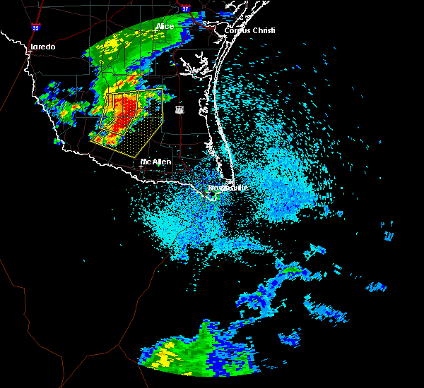 At 244 pm cdt, severe thunderstorms were located along a line extending from 12 miles northwest of encino to near la reforma to 8 miles northeast of la victoria, moving east at 25 mph (radar indicated). Hazards include 60 mph wind gusts and quarter size hail. Hail damage to vehicles. including cracked windshields and minor exterior dents can expected. some damage to crops and trees is expected. expect minor wind damage to mobile homes, some roofs, siding and some fences. tree limbs will blow down and small trees will be uprooted. Damage to power lines and some power poles is expected. At 244 pm cdt, severe thunderstorms were located along a line extending from 12 miles northwest of encino to near la reforma to 8 miles northeast of la victoria, moving east at 25 mph (radar indicated). Hazards include 60 mph wind gusts and quarter size hail. Hail damage to vehicles. including cracked windshields and minor exterior dents can expected. some damage to crops and trees is expected. expect minor wind damage to mobile homes, some roofs, siding and some fences. tree limbs will blow down and small trees will be uprooted. Damage to power lines and some power poles is expected.
|
| 5/18/2016 2:26 PM CDT |
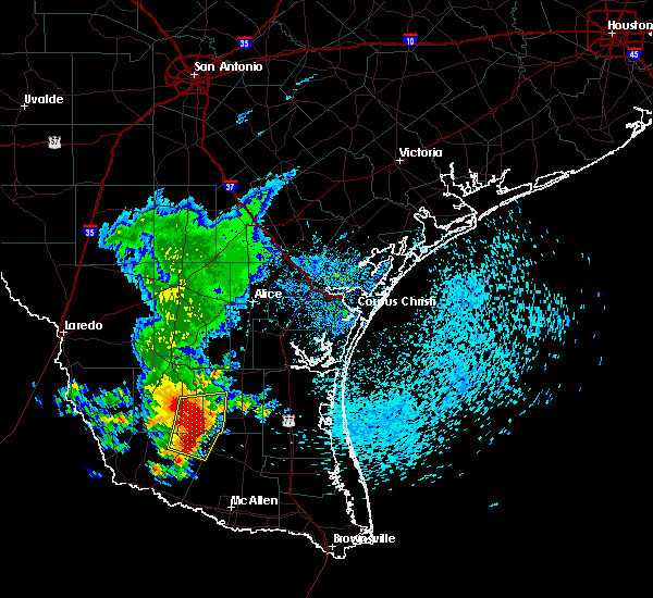 At 225 pm cdt, severe thunderstorms were located along a line extending from 11 miles northeast of agua nueva to near san rafael ranch airport to santa catarina, moving east at 35 mph (radar indicated). Hazards include ping pong ball size hail and 60 mph wind gusts. People and animals outdoors will be injured. expect hail damage to roofs, siding, windows and property. vehicle damage will include cracked or shattered windshields and major dents requiring significant repairs. expect minor wind damage to mobile homes, some roofs, siding and some fences. tree limbs will blow down and small trees will be uprooted. damage to power lines and some power poles is expected. Locations impacted include, agua nueva, san rafael ranch airport, san isidro, la reforma, santa catarina, santa elena, la gloria, delmita, puesta del sol airport and diamond o ranch airport. At 225 pm cdt, severe thunderstorms were located along a line extending from 11 miles northeast of agua nueva to near san rafael ranch airport to santa catarina, moving east at 35 mph (radar indicated). Hazards include ping pong ball size hail and 60 mph wind gusts. People and animals outdoors will be injured. expect hail damage to roofs, siding, windows and property. vehicle damage will include cracked or shattered windshields and major dents requiring significant repairs. expect minor wind damage to mobile homes, some roofs, siding and some fences. tree limbs will blow down and small trees will be uprooted. damage to power lines and some power poles is expected. Locations impacted include, agua nueva, san rafael ranch airport, san isidro, la reforma, santa catarina, santa elena, la gloria, delmita, puesta del sol airport and diamond o ranch airport.
|
| 5/18/2016 2:07 PM CDT |
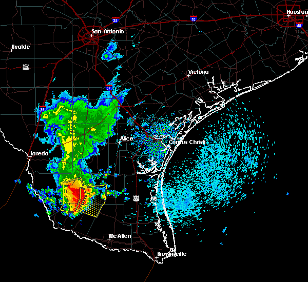 At 206 pm cdt, severe thunderstorms were located along a line extending from 13 miles east of randado to near agua nueva to 8 miles southeast of viboras, moving east at 35 mph (radar indicated). Hazards include 60 mph wind gusts and quarter size hail. Hail damage to vehicles. including cracked windshields and minor exterior dents can expected. some damage to crops and trees is expected. expect minor wind damage to mobile homes, some roofs, siding and some fences. tree limbs will blow down and small trees will be uprooted. Damage to power lines and some power poles is expected. At 206 pm cdt, severe thunderstorms were located along a line extending from 13 miles east of randado to near agua nueva to 8 miles southeast of viboras, moving east at 35 mph (radar indicated). Hazards include 60 mph wind gusts and quarter size hail. Hail damage to vehicles. including cracked windshields and minor exterior dents can expected. some damage to crops and trees is expected. expect minor wind damage to mobile homes, some roofs, siding and some fences. tree limbs will blow down and small trees will be uprooted. Damage to power lines and some power poles is expected.
|
| 5/18/2016 12:23 AM CDT |
 At 1223 am cdt, a severe thunderstorm was located 7 miles southwest of santa catarina, or 11 miles east of el sauz, moving east at 20 mph. this is a very dangerous storm (radar indicated). Hazards include softball size hail and 60 mph wind gusts. People and animals outdoors will be severely injured and may be killed. expect shattered windows, extensive damage to roofs, siding, windows and property. mobile homes and porrly constructed homes may be destroyed. some vehicles may be declared a total loss. Locations impacted include, el sauz, santa catarina and diamond o ranch airport. At 1223 am cdt, a severe thunderstorm was located 7 miles southwest of santa catarina, or 11 miles east of el sauz, moving east at 20 mph. this is a very dangerous storm (radar indicated). Hazards include softball size hail and 60 mph wind gusts. People and animals outdoors will be severely injured and may be killed. expect shattered windows, extensive damage to roofs, siding, windows and property. mobile homes and porrly constructed homes may be destroyed. some vehicles may be declared a total loss. Locations impacted include, el sauz, santa catarina and diamond o ranch airport.
|
| 5/17/2016 11:53 PM CDT |
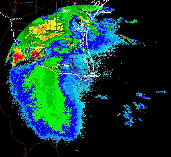 At 1152 pm cdt, a severe thunderstorm was located over el sauz, moving east at 20 mph. this is a very dangerous storm (radar indicated). Hazards include softball size hail and 60 mph wind gusts. People and animals outdoors will be severely injured and may be killed. expect shattered windows, extensive damage to roofs, siding, windows and property. mobile homes and porrly constructed homes may be destroyed. Some vehicles may be declared a total loss. At 1152 pm cdt, a severe thunderstorm was located over el sauz, moving east at 20 mph. this is a very dangerous storm (radar indicated). Hazards include softball size hail and 60 mph wind gusts. People and animals outdoors will be severely injured and may be killed. expect shattered windows, extensive damage to roofs, siding, windows and property. mobile homes and porrly constructed homes may be destroyed. Some vehicles may be declared a total loss.
|
| 5/10/2016 6:07 PM CDT |
 At 606 pm cdt, a severe thunderstorm was located near santa anna, moving northeast at 25 mph. a trained spotter reported golf ball size hail on highway 67 at the brown/coleman county line (radar indicated). Hazards include golf ball size hail and 60 mph wind gusts. People and animals outdoors will be injured. expect hail damage to roofs, siding, windows, and vehicles. expect wind damage to roofs, siding, and trees. this severe storm will be near, santa anna around 615 pm cdt. bangs around 640 pm cdt. lake brownwood near thrifty around 650 pm cdt. lake brownwood around 655 pm cdt. lake brownwood near byrds store around 700 pm cdt. Other locations impacted by this severe thunderstorm include indian creek, fisk, us-67 near the coleman- brown county line, thrifty, owens and echo. At 606 pm cdt, a severe thunderstorm was located near santa anna, moving northeast at 25 mph. a trained spotter reported golf ball size hail on highway 67 at the brown/coleman county line (radar indicated). Hazards include golf ball size hail and 60 mph wind gusts. People and animals outdoors will be injured. expect hail damage to roofs, siding, windows, and vehicles. expect wind damage to roofs, siding, and trees. this severe storm will be near, santa anna around 615 pm cdt. bangs around 640 pm cdt. lake brownwood near thrifty around 650 pm cdt. lake brownwood around 655 pm cdt. lake brownwood near byrds store around 700 pm cdt. Other locations impacted by this severe thunderstorm include indian creek, fisk, us-67 near the coleman- brown county line, thrifty, owens and echo.
|
| 5/10/2016 5:58 PM CDT |
 At 558 pm cdt, a severe thunderstorm was located near santa anna, moving northeast at 25 mph (radar indicated). Hazards include 60 mph wind gusts and quarter size hail. Hail damage to vehicles is expected. expect wind damage to roofs, siding, and trees. this severe thunderstorm will be near, santa anna around 610 pm cdt. bangs around 635 pm cdt. lake brownwood and lake brownwood near thrifty around 645 pm cdt. lake brownwood near byrds store around 700 pm cdt. Other locations impacted by this severe thunderstorm include indian creek, fisk, us-67 near the coleman- brown county line, thrifty, owens and echo. At 558 pm cdt, a severe thunderstorm was located near santa anna, moving northeast at 25 mph (radar indicated). Hazards include 60 mph wind gusts and quarter size hail. Hail damage to vehicles is expected. expect wind damage to roofs, siding, and trees. this severe thunderstorm will be near, santa anna around 610 pm cdt. bangs around 635 pm cdt. lake brownwood and lake brownwood near thrifty around 645 pm cdt. lake brownwood near byrds store around 700 pm cdt. Other locations impacted by this severe thunderstorm include indian creek, fisk, us-67 near the coleman- brown county line, thrifty, owens and echo.
|
| 5/10/2016 5:29 PM CDT |
 At 528 pm cdt, a severe thunderstorm was located near trickham, or 9 miles southeast of santa anna, moving northeast at 15 mph (radar indicated). Hazards include 60 mph wind gusts and half dollar size hail. Hail damage to vehicles is expected. expect wind damage to roofs, siding, and trees. this severe storm will be near, bangs around 555 pm cdt. brownwood, lake brownwood near thrifty and lake brownwood around 600 pm cdt. Other locations impacted by this severe thunderstorm include milburn, shields, us-67 near the coleman- brown county line, whon, indian creek, fisk, thrifty and owens. At 528 pm cdt, a severe thunderstorm was located near trickham, or 9 miles southeast of santa anna, moving northeast at 15 mph (radar indicated). Hazards include 60 mph wind gusts and half dollar size hail. Hail damage to vehicles is expected. expect wind damage to roofs, siding, and trees. this severe storm will be near, bangs around 555 pm cdt. brownwood, lake brownwood near thrifty and lake brownwood around 600 pm cdt. Other locations impacted by this severe thunderstorm include milburn, shields, us-67 near the coleman- brown county line, whon, indian creek, fisk, thrifty and owens.
|
| 5/10/2016 5:14 PM CDT |
 At 514 pm cdt, a severe thunderstorm was located over trickham, or 10 miles south of santa anna, moving northeast at 15 mph (radar indicated). Hazards include 60 mph wind gusts and half dollar size hail. Hail damage to vehicles is expected. expect wind damage to roofs, siding, and trees. this severe thunderstorm will be near, bangs around 555 pm cdt. lake brownwood near thrifty and lake brownwood around 600 pm cdt. Other locations impacted by this severe thunderstorm include milburn, shields, us-67 near the coleman- brown county line, whon, indian creek, fisk, thrifty and owens. At 514 pm cdt, a severe thunderstorm was located over trickham, or 10 miles south of santa anna, moving northeast at 15 mph (radar indicated). Hazards include 60 mph wind gusts and half dollar size hail. Hail damage to vehicles is expected. expect wind damage to roofs, siding, and trees. this severe thunderstorm will be near, bangs around 555 pm cdt. lake brownwood near thrifty and lake brownwood around 600 pm cdt. Other locations impacted by this severe thunderstorm include milburn, shields, us-67 near the coleman- brown county line, whon, indian creek, fisk, thrifty and owens.
|
| 5/10/2016 4:46 PM CDT |
 At 445 pm cdt, a severe thunderstorm was located near brookesmith, or 10 miles south of brownwood, moving northeast at 25 mph (radar indicated). Hazards include 60 mph wind gusts and half dollar size hail. Hail damage to vehicles is expected. expect wind damage to roofs, siding, and trees. this severe storm will be near, brownwood around 500 pm cdt. early and zephyr around 515 pm cdt. Other locations impacted by this severe thunderstorm include indian creek, milburn, us-67 near the coleman- brown county line, whon, thrifty and owens. At 445 pm cdt, a severe thunderstorm was located near brookesmith, or 10 miles south of brownwood, moving northeast at 25 mph (radar indicated). Hazards include 60 mph wind gusts and half dollar size hail. Hail damage to vehicles is expected. expect wind damage to roofs, siding, and trees. this severe storm will be near, brownwood around 500 pm cdt. early and zephyr around 515 pm cdt. Other locations impacted by this severe thunderstorm include indian creek, milburn, us-67 near the coleman- brown county line, whon, thrifty and owens.
|
| 5/10/2016 4:28 PM CDT |
 At 428 pm cdt, a severe thunderstorm was located near brookesmith, or 12 miles south of brownwood, moving northeast at 35 mph (radar indicated). Hazards include 60 mph wind gusts and half dollar size hail. Hail damage to vehicles is expected. expect wind damage to roofs, siding, and trees. this severe thunderstorm will be near, brownwood around 440 pm cdt. early and zephyr around 455 pm cdt. blanket around 510 pm cdt. Other locations impacted by this severe thunderstorm include indian creek, milburn, us-67 near the coleman- brown county line, whon, thrifty and owens. At 428 pm cdt, a severe thunderstorm was located near brookesmith, or 12 miles south of brownwood, moving northeast at 35 mph (radar indicated). Hazards include 60 mph wind gusts and half dollar size hail. Hail damage to vehicles is expected. expect wind damage to roofs, siding, and trees. this severe thunderstorm will be near, brownwood around 440 pm cdt. early and zephyr around 455 pm cdt. blanket around 510 pm cdt. Other locations impacted by this severe thunderstorm include indian creek, milburn, us-67 near the coleman- brown county line, whon, thrifty and owens.
|
| 5/10/2016 4:10 PM CDT |
 At 409 pm cdt, a severe thunderstorm was located over early, moving northeast at 25 mph. a trained spotter reported quarter size hail in early at 406 pm (radar indicated). Hazards include 60 mph wind gusts and half dollar size hail. Hail damage to vehicles is expected. expect wind damage to roofs, siding, and trees. this severe storm will be near, blanket around 430 pm cdt. Other locations impacted by this severe thunderstorm include indian creek, milburn, us-67 near the coleman- brown county line, whon, thrifty and owens. At 409 pm cdt, a severe thunderstorm was located over early, moving northeast at 25 mph. a trained spotter reported quarter size hail in early at 406 pm (radar indicated). Hazards include 60 mph wind gusts and half dollar size hail. Hail damage to vehicles is expected. expect wind damage to roofs, siding, and trees. this severe storm will be near, blanket around 430 pm cdt. Other locations impacted by this severe thunderstorm include indian creek, milburn, us-67 near the coleman- brown county line, whon, thrifty and owens.
|
| 5/10/2016 3:57 PM CDT |
 At 356 pm cdt, a severe thunderstorm was located over brownwood, moving northeast at 30 mph (radar indicated). Hazards include 60 mph wind gusts and half dollar size hail. Hail damage to vehicles is expected. expect wind damage to roofs, siding, and trees. this severe storm will be near, brownwood around 400 pm cdt. early around 415 pm cdt. blanket around 430 pm cdt. Other locations impacted by this severe thunderstorm include indian creek, milburn, us-67 near the coleman- brown county line, whon, thrifty and owens. At 356 pm cdt, a severe thunderstorm was located over brownwood, moving northeast at 30 mph (radar indicated). Hazards include 60 mph wind gusts and half dollar size hail. Hail damage to vehicles is expected. expect wind damage to roofs, siding, and trees. this severe storm will be near, brownwood around 400 pm cdt. early around 415 pm cdt. blanket around 430 pm cdt. Other locations impacted by this severe thunderstorm include indian creek, milburn, us-67 near the coleman- brown county line, whon, thrifty and owens.
|
| 5/10/2016 3:47 PM CDT |
 At 347 pm cdt, a severe thunderstorm was located near bangs, or near santa anna, moving northeast at 25 mph. these storms continue to have the potential to produce large hail and damaging winds (radar indicated). Hazards include 60 mph wind gusts and half dollar size hail. Hail damage to vehicles is expected. expect wind damage to roofs, siding, and trees. this severe storm will be near, bangs around 400 pm cdt. lake brownwood near thrifty around 410 pm cdt. lake brownwood around 415 pm cdt. lake brownwood near byrds store and may around 430 pm cdt. Other locations impacted by this severe thunderstorm include indian creek, milburn, us-67 near the coleman- brown county line, whon, thrifty and owens. At 347 pm cdt, a severe thunderstorm was located near bangs, or near santa anna, moving northeast at 25 mph. these storms continue to have the potential to produce large hail and damaging winds (radar indicated). Hazards include 60 mph wind gusts and half dollar size hail. Hail damage to vehicles is expected. expect wind damage to roofs, siding, and trees. this severe storm will be near, bangs around 400 pm cdt. lake brownwood near thrifty around 410 pm cdt. lake brownwood around 415 pm cdt. lake brownwood near byrds store and may around 430 pm cdt. Other locations impacted by this severe thunderstorm include indian creek, milburn, us-67 near the coleman- brown county line, whon, thrifty and owens.
|
| 5/10/2016 3:36 PM CDT | Half Dollar sized hail reported 335.9 miles S of Santa Anna, TX |
| 5/10/2016 3:32 PM CDT |
 At 331 pm cdt, a severe thunderstorm was located near trickham, or 9 miles south of santa anna, moving northeast at 25 mph (radar indicated). Hazards include 60 mph wind gusts and half dollar size hail. Hail damage to vehicles is expected. expect wind damage to roofs, siding, and trees. this severe thunderstorm will be near, bangs around 400 pm cdt. lake brownwood and lake brownwood near thrifty around 415 pm cdt. lake brownwood near byrds store around 430 pm cdt. Other locations impacted by this severe thunderstorm include indian creek, milburn, us-67 near the coleman- brown county line, whon, thrifty and owens. At 331 pm cdt, a severe thunderstorm was located near trickham, or 9 miles south of santa anna, moving northeast at 25 mph (radar indicated). Hazards include 60 mph wind gusts and half dollar size hail. Hail damage to vehicles is expected. expect wind damage to roofs, siding, and trees. this severe thunderstorm will be near, bangs around 400 pm cdt. lake brownwood and lake brownwood near thrifty around 415 pm cdt. lake brownwood near byrds store around 430 pm cdt. Other locations impacted by this severe thunderstorm include indian creek, milburn, us-67 near the coleman- brown county line, whon, thrifty and owens.
|
| 4/29/2016 3:03 PM CDT |
 At 303 pm cdt, a severe thunderstorm was located over waldrip, or 19 miles south of santa anna, moving northeast at 35 mph (radar indicated). Hazards include 60 mph wind gusts and quarter size hail. Hail damage to vehicles is expected. expect wind damage to roofs, siding, and trees. this severe thunderstorm will be near, trickham around 325 pm cdt. Other locations impacted by this severe thunderstorm include shields, us-67 near the coleman- brown county line, whon, fife, thrifty, owens and us- 283 near the mcculloch-coleman county line. At 303 pm cdt, a severe thunderstorm was located over waldrip, or 19 miles south of santa anna, moving northeast at 35 mph (radar indicated). Hazards include 60 mph wind gusts and quarter size hail. Hail damage to vehicles is expected. expect wind damage to roofs, siding, and trees. this severe thunderstorm will be near, trickham around 325 pm cdt. Other locations impacted by this severe thunderstorm include shields, us-67 near the coleman- brown county line, whon, fife, thrifty, owens and us- 283 near the mcculloch-coleman county line.
|
| 4/26/2016 10:08 PM CDT |
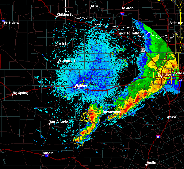 The severe thunderstorm warning for southeastern coleman county will expire at 1015 pm cdt, the storm which prompted the warning has moved out of the area. therefore the warning will be allowed to expire. a tornado watch remains in effect until midnight cdt for west central texas. The severe thunderstorm warning for southeastern coleman county will expire at 1015 pm cdt, the storm which prompted the warning has moved out of the area. therefore the warning will be allowed to expire. a tornado watch remains in effect until midnight cdt for west central texas.
|
| 4/26/2016 9:59 PM CDT |
 At 958 pm cdt, a severe thunderstorm was located 10 miles west of bangs, moving east at 40 mph (radar indicated). Hazards include 70 mph wind gusts and quarter size hail. Hail damage to vehicles is expected. expect considerable tree damage. wind damage is also likely to mobile homes, roofs, and outbuildings. this severe thunderstorm will be near, bangs around 1015 pm cdt. other locations impacted by this severe thunderstorm include us- 67 near the coleman-brown county line and shields. A tornado watch remains in effect until midnight cdt for west central texas. At 958 pm cdt, a severe thunderstorm was located 10 miles west of bangs, moving east at 40 mph (radar indicated). Hazards include 70 mph wind gusts and quarter size hail. Hail damage to vehicles is expected. expect considerable tree damage. wind damage is also likely to mobile homes, roofs, and outbuildings. this severe thunderstorm will be near, bangs around 1015 pm cdt. other locations impacted by this severe thunderstorm include us- 67 near the coleman-brown county line and shields. A tornado watch remains in effect until midnight cdt for west central texas.
|
| 4/26/2016 9:53 PM CDT |
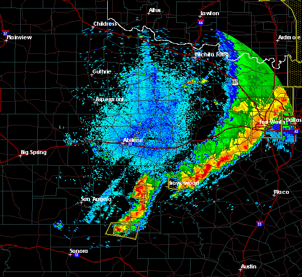 At 953 pm cdt, a severe thunderstorm was located near gouldbusk, or 9 miles southwest of santa anna, moving east at 35 mph (radar indicated). Hazards include 60 mph wind gusts and quarter size hail. Hail damage to vehicles is expected. expect wind damage to roofs, siding, and trees. locations impacted include, santa anna, gouldbusk, fisk, shields and mozelle. A tornado watch remains in effect until midnight cdt for west central texas. At 953 pm cdt, a severe thunderstorm was located near gouldbusk, or 9 miles southwest of santa anna, moving east at 35 mph (radar indicated). Hazards include 60 mph wind gusts and quarter size hail. Hail damage to vehicles is expected. expect wind damage to roofs, siding, and trees. locations impacted include, santa anna, gouldbusk, fisk, shields and mozelle. A tornado watch remains in effect until midnight cdt for west central texas.
|
| 4/26/2016 9:45 PM CDT |
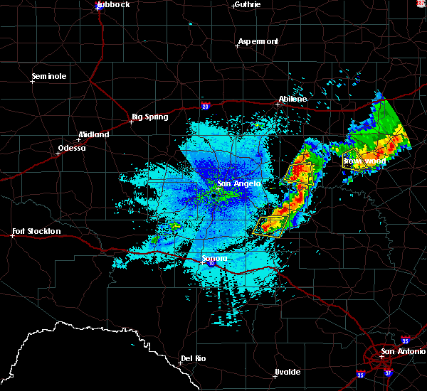 At 944 pm cdt, a severe thunderstorm was located near gouldbusk, or 12 miles southwest of santa anna, moving east at 35 mph (radar indicated). Hazards include 70 mph wind gusts and ping pong ball size hail. People and animals outdoors will be injured. expect hail damage to roofs, siding, windows, and vehicles. expect considerable tree damage. wind damage is also likely to mobile homes, roofs, and outbuildings. this severe thunderstorm will remain over mainly rural areas of southern coleman county, including the following locations: fisk, shields and mozelle. A tornado watch remains in effect until midnight cdt for west central texas. At 944 pm cdt, a severe thunderstorm was located near gouldbusk, or 12 miles southwest of santa anna, moving east at 35 mph (radar indicated). Hazards include 70 mph wind gusts and ping pong ball size hail. People and animals outdoors will be injured. expect hail damage to roofs, siding, windows, and vehicles. expect considerable tree damage. wind damage is also likely to mobile homes, roofs, and outbuildings. this severe thunderstorm will remain over mainly rural areas of southern coleman county, including the following locations: fisk, shields and mozelle. A tornado watch remains in effect until midnight cdt for west central texas.
|
| 4/26/2016 9:36 PM CDT |
 At 935 pm cdt, a severe thunderstorm was located over voss, or 16 miles southwest of coleman, moving east at 35 mph (radar indicated). Hazards include 60 mph wind gusts and half dollar size hail. Hail damage to vehicles is expected. expect wind damage to roofs, siding, and trees. this severe storm will be near, gouldbusk around 950 pm cdt. other locations impacted by this severe thunderstorm include fisk, shields and mozelle. A tornado watch remains in effect until midnight cdt for west central texas. At 935 pm cdt, a severe thunderstorm was located over voss, or 16 miles southwest of coleman, moving east at 35 mph (radar indicated). Hazards include 60 mph wind gusts and half dollar size hail. Hail damage to vehicles is expected. expect wind damage to roofs, siding, and trees. this severe storm will be near, gouldbusk around 950 pm cdt. other locations impacted by this severe thunderstorm include fisk, shields and mozelle. A tornado watch remains in effect until midnight cdt for west central texas.
|
| 4/26/2016 9:26 PM CDT |
 At 926 pm cdt, a severe thunderstorm was located near leaday, or 16 miles northeast of paint rock, moving east at 40 mph (radar indicated). Hazards include 60 mph wind gusts and half dollar size hail. Hail damage to vehicles is expected. expect wind damage to roofs, siding, and trees. this severe thunderstorm will be near, voss around 935 pm cdt. gouldbusk around 945 pm cdt. other locations impacted by this severe thunderstorm include fisk, shields and mozelle. A tornado watch remains in effect until midnight cdt for west central texas. At 926 pm cdt, a severe thunderstorm was located near leaday, or 16 miles northeast of paint rock, moving east at 40 mph (radar indicated). Hazards include 60 mph wind gusts and half dollar size hail. Hail damage to vehicles is expected. expect wind damage to roofs, siding, and trees. this severe thunderstorm will be near, voss around 935 pm cdt. gouldbusk around 945 pm cdt. other locations impacted by this severe thunderstorm include fisk, shields and mozelle. A tornado watch remains in effect until midnight cdt for west central texas.
|
| 4/26/2016 9:05 PM CDT |
 At 905 pm cdt, a severe thunderstorm was located near santa anna, moving east at 40 mph (radar indicated). Hazards include 60 mph wind gusts and half dollar size hail. Hail damage to vehicles is expected. expect wind damage to roofs, siding, and trees. this severe storm will be near, bangs, lake brownwood near thrifty and lake brownwood around 915 pm cdt. other locations impacted by this severe thunderstorm include us- 67 near the coleman-brown county line, echo and thrifty. A tornado watch remains in effect until midnight cdt for west central texas. At 905 pm cdt, a severe thunderstorm was located near santa anna, moving east at 40 mph (radar indicated). Hazards include 60 mph wind gusts and half dollar size hail. Hail damage to vehicles is expected. expect wind damage to roofs, siding, and trees. this severe storm will be near, bangs, lake brownwood near thrifty and lake brownwood around 915 pm cdt. other locations impacted by this severe thunderstorm include us- 67 near the coleman-brown county line, echo and thrifty. A tornado watch remains in effect until midnight cdt for west central texas.
|
| 4/26/2016 8:50 PM CDT |
 At 850 pm cdt, a severe thunderstorm was located over coleman, moving east at 35 mph (radar indicated). Hazards include ping pong ball size hail and 60 mph wind gusts. People and animals outdoors will be injured. expect hail damage to roofs, siding, windows, and vehicles. expect wind damage to roofs, siding, and trees. this severe storm will be near, santa anna around 855 pm cdt. bangs, lake brownwood near thrifty and lake brownwood around 920 pm cdt. other locations impacted by this severe thunderstorm include us- 67 near the coleman-brown county line, echo and thrifty. A tornado watch remains in effect until midnight cdt for west central texas. At 850 pm cdt, a severe thunderstorm was located over coleman, moving east at 35 mph (radar indicated). Hazards include ping pong ball size hail and 60 mph wind gusts. People and animals outdoors will be injured. expect hail damage to roofs, siding, windows, and vehicles. expect wind damage to roofs, siding, and trees. this severe storm will be near, santa anna around 855 pm cdt. bangs, lake brownwood near thrifty and lake brownwood around 920 pm cdt. other locations impacted by this severe thunderstorm include us- 67 near the coleman-brown county line, echo and thrifty. A tornado watch remains in effect until midnight cdt for west central texas.
|
| 4/26/2016 8:41 PM CDT |
 At 841 pm cdt, a severe thunderstorm was located near coleman, moving east at 35 mph (radar indicated). Hazards include 60 mph wind gusts and quarter size hail. Hail damage to vehicles is expected. expect wind damage to roofs, siding, and trees. this severe thunderstorm will be near, coleman around 845 pm cdt. santa anna around 900 pm cdt. bangs, lake brownwood near thrifty and lake brownwood around 920 pm cdt. other locations impacted by this severe thunderstorm include hords creek reservoir, us-67 near the coleman- brown county line, echo and thrifty. A tornado watch remains in effect until midnight cdt for west central texas. At 841 pm cdt, a severe thunderstorm was located near coleman, moving east at 35 mph (radar indicated). Hazards include 60 mph wind gusts and quarter size hail. Hail damage to vehicles is expected. expect wind damage to roofs, siding, and trees. this severe thunderstorm will be near, coleman around 845 pm cdt. santa anna around 900 pm cdt. bangs, lake brownwood near thrifty and lake brownwood around 920 pm cdt. other locations impacted by this severe thunderstorm include hords creek reservoir, us-67 near the coleman- brown county line, echo and thrifty. A tornado watch remains in effect until midnight cdt for west central texas.
|
| 4/18/2016 6:25 PM CDT |
 At 624 pm cdt, national weather service meteorologists detected severe thunderstorms located along a line extending from near santa catarina to 11 miles east of el sauz, moving east at 10 to 15 mph (radar indicated). Hazards include tennis ball size hail and 60 mph wind gusts. People and animals outdoors will be injured. expect hail damage to roofs, siding, windows and property. vehicle damage will include cracked or shattered windshields and major dents requiring significant repairs. expect minor wind damage to mobile homes, some roofs, siding and some fences. tree limbs will blow down and small trees will be uprooted. damage to power lines and some power poles is expected. Locations impacted include, santa catarina, santa elena, san isidro, la gloria and diamond o ranch airport. At 624 pm cdt, national weather service meteorologists detected severe thunderstorms located along a line extending from near santa catarina to 11 miles east of el sauz, moving east at 10 to 15 mph (radar indicated). Hazards include tennis ball size hail and 60 mph wind gusts. People and animals outdoors will be injured. expect hail damage to roofs, siding, windows and property. vehicle damage will include cracked or shattered windshields and major dents requiring significant repairs. expect minor wind damage to mobile homes, some roofs, siding and some fences. tree limbs will blow down and small trees will be uprooted. damage to power lines and some power poles is expected. Locations impacted include, santa catarina, santa elena, san isidro, la gloria and diamond o ranch airport.
|
| 4/18/2016 6:09 PM CDT |
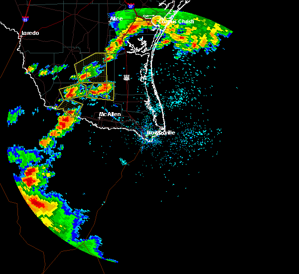 At 608 pm cdt, national weather service meteorologists detected a severe thunderstorm located 8 miles west of santa catarina, or 10 miles southeast of viboras, moving east at 10 mph (radar indicated). Hazards include tennis ball size hail and 60 mph wind gusts. People and animals outdoors will be injured. expect hail damage to roofs, siding, windows and property. vehicle damage will include cracked or shattered windshields and major dents requiring significant repairs. expect minor wind damage to mobile homes, some roofs, siding and some fences. tree limbs will blow down and small trees will be uprooted. damage to power lines and some power poles is expected. Locations impacted include, santa catarina, santa elena, san isidro, la gloria and diamond o ranch airport. At 608 pm cdt, national weather service meteorologists detected a severe thunderstorm located 8 miles west of santa catarina, or 10 miles southeast of viboras, moving east at 10 mph (radar indicated). Hazards include tennis ball size hail and 60 mph wind gusts. People and animals outdoors will be injured. expect hail damage to roofs, siding, windows and property. vehicle damage will include cracked or shattered windshields and major dents requiring significant repairs. expect minor wind damage to mobile homes, some roofs, siding and some fences. tree limbs will blow down and small trees will be uprooted. damage to power lines and some power poles is expected. Locations impacted include, santa catarina, santa elena, san isidro, la gloria and diamond o ranch airport.
|
| 4/18/2016 5:51 PM CDT |
 At 550 pm cdt, national weather service meteorologists indicated a severe thunderstorm located 7 miles southeast of viboras, moving east at 10 mph (radar indicated). Hazards include ping pong ball size hail and 60 mph wind gusts. People and animals outdoors will be injured. expect hail damage to roofs, siding, windows and property. vehicle damage will include cracked or shattered windshields and major dents requiring significant repairs. expect minor wind damage to mobile homes, some roofs, siding and some fences. tree limbs will blow down and small trees will be uprooted. Damage to power lines and some power poles is expected. At 550 pm cdt, national weather service meteorologists indicated a severe thunderstorm located 7 miles southeast of viboras, moving east at 10 mph (radar indicated). Hazards include ping pong ball size hail and 60 mph wind gusts. People and animals outdoors will be injured. expect hail damage to roofs, siding, windows and property. vehicle damage will include cracked or shattered windshields and major dents requiring significant repairs. expect minor wind damage to mobile homes, some roofs, siding and some fences. tree limbs will blow down and small trees will be uprooted. Damage to power lines and some power poles is expected.
|
| 5/28/2015 9:26 PM CDT | At 923 pm cdt, a severe thunderstorm was located near melvin, and moving east at 15 mph (radar indicated). Hazards include 60 mph wind gusts and half dollar size hail. Hail damage to vehicles is expected. expect wind damage to roofs, siding and trees. the severe thunderstorm will be near, brady lake around 940 pm cdt. Brady around 955 pm cdt. |
| 5/28/2015 9:11 PM CDT | At 907 pm cdt, a severe thunderstorm was located near brownwood, moving east at 20 mph (radar indicated). Hazards include 60 mph wind gusts and quarter size hail. Hail damage to vehicles is expected. expect wind damage to roofs, siding and trees. the severe thunderstorm will be near, lake brownwood state park around 930 pm cdt. may around 1000 pm cdt. Other locations in the warning include owens. |
| 5/28/2015 8:02 PM CDT | At 801 pm cdt, a severe thunderstorm was located near ballinger, and moving northeast at 20 mph (radar indicated). Hazards include 60 mph wind gusts and quarter size hail. Hail damage to vehicles is expected. expect wind damage to roofs, siding and trees. the severe thunderstorm will be near, hatchel around 820 pm cdt. Benoit around 825 pm cdt. |
| 5/28/2015 7:52 PM CDT | At 750 pm cdt, a severe thunderstorm was located near ballinger, moving northeast at 20 mph. the line of storms is propagating south (radar indicated). Hazards include 60 mph wind gusts and quarter size hail. Hail damage to vehicles is expected. expect wind damage to roofs, siding and trees. the severe thunderstorm will be near, ballinger around 800 pm cdt. hatchel around 820 pm cdt. Benoit around 825 pm cdt. |
| 5/25/2015 11:48 AM CDT | At 1145 am cdt, severe thunderstorms were located along a line extending from 7 miles northwest of burkett to ivie reservoir, and moving east at 30 mph (radar indicated). Hazards include 60 mph wind gusts. Expect damage to roofs. siding and trees. severe thunderstorms will be near, burkett and cross cut around 1155 am cdt. santa anna around 1205 pm cdt. grosvenor around 1210 pm cdt. Other locations in the warning include fisk, echo, mozelle, shields and thrifty. |
| 5/25/2015 11:23 AM CDT | At 1120 am cdt, severe thunderstorms were located along a line extending from 6 miles south of oplin to 5 miles north of paint rock, moving southeast at 40 mph (radar indicated). Hazards include 60 mph wind gusts. Expect damage to roofs. siding and trees. severe thunderstorms will be near, valera around 1140 am cdt. voss and coleman around 1145 am cdt. santa anna around noon cdt. trickham around 1215 pm cdt. Other locations in the warning include hords creek reservoir, echo, fisk, mozelle and shields. |
| 5/23/2015 11:39 PM CDT | At 1138 pm cdt, doppler radar indicated a line of severe thunderstorms capable of producing damaging winds in excess of 60 mph. these storms were located along a line extending from near concepcion to 11 miles northwest of encino to 7 miles northeast of la reforma to 9 miles south of santa catarina, moving east at 45 mph. locations impacted include, mcallen, rio grande city, falfurrias..sullivan city, la joya and la grulla. |
| 5/23/2015 11:12 PM CDT | At 1110 pm cdt, doppler radar indicated a line of severe thunderstorms capable of producing damaging winds in excess of 60 mph. these storms were located along a line extending from hebbronville to near agua nueva to santa catarina to near rio grande city, moving east at 45 mph. |
| 5/23/2015 11:01 PM CDT | At 1100 pm cdt, doppler radar indicated a line of severe thunderstorms capable of producing destructive winds in excess of 80 mph. these storms were located along a line extending from near south fork estates to near escobas to 6 miles east of el sauz, moving east at 30 mph. locations impacted include, hebbronville, escobas, randado and la gloria. |
| 5/23/2015 10:33 PM CDT | At 1032 pm cdt, doppler radar indicated a line of severe thunderstorms capable of producing damaging winds in excess of 60 mph. these storms were located along a line extending from 6 miles northwest of thompsonville to near bustamante to 6 miles west of el sauz, and moving east at 30 mph. penny size hail may also accompany the damaging winds. |
| 5/10/2015 3:54 AM CDT | At 352 am cdt, a severe thunderstorm was located near santa anna, moving east at 40 mph (radar indicated). Hazards include 60 mph wind gusts and quarter size hail. Hail damage to vehicles is expected. expect wind damage to roofs, siding and trees. the severe thunderstorm will be near, bangs around 400 am cdt. lake brownwood and lake brownwood near thrifty around 405 am cdt. lake brownwood state park and early around 415 am cdt. blanket around 435 am cdt. other locations in the warning include thrifty and owens. 1. 00in. |
| 5/10/2015 3:36 AM CDT | At 333 am cdt, a severe thunderstorm was located near santa anna, and moving northeast at 60 mph (trained weather spotters). Hazards include 70 mph wind gusts and quarter size hail. Hail damage to vehicles is expected. expect considerable tree damage. wind damage is also likely to mobile homes, roofs and outbuildings. the severe thunderstorm will be near, grosvenor around 345 am cdt. byrds and lake brownwood state park around 350 am cdt. Possible. |
| 5/10/2015 3:28 AM CDT | At 325 am cdt, a severe thunderstorm was located near santa anna, and moving northeast at 50 mph. at 325 am cdt a trained weather spotter reported a wind gust to 70 mph near talpa (trained weather spotters). Hazards include 70 mph wind gusts and quarter size hail. Hail damage to vehicles is expected. expect considerable tree damage. wind damage is also likely to mobile homes, roofs and outbuildings. the severe thunderstorm will be near, grosvenor and lake brownwood near thrifty around 345 am cdt. lake brownwood state park around 350 am cdt. byrds around 355 am cdt. other locations in the warning include thrifty. 1. 00in. |
| 5/10/2015 2:53 AM CDT | At 251 am cdt, a severe thunderstorm was located 6 miles west of ivie reservoir near concho park marina, moving northeast at 50 mph (radar indicated). Hazards include 60 mph wind gusts and quarter size hail. Hail damage to vehicles is expected. expect wind damage to roofs, siding and trees. the severe thunderstorm will be near, leaday around 300 am cdt. voss around 310 am cdt. valera around 315 am cdt. coleman around 325 am cdt. santa anna around 330 am cdt. grosvenor and lake brownwood near thrifty around 345 am cdt. other locations in the warning include mozelle, fisk and thrifty. 1. 00in. |
| 4/26/2015 10:12 PM CDT | At 1011 pm cdt, severe thunderstorms were located along a line extending from may to brookesmith, and moving east at 30 mph (radar indicated). Hazards include 60 mph wind gusts and quarter size hail. Hail damage to vehicles is expected. expect wind damage to roofs, siding and trees. severe thunderstorms will be near, camp bowie around 1020 pm cdt. blanket around 1025 pm cdt. zephyr around 1035 pm cdt. other locations in the warning include indian creek. Possible. |
| 4/26/2015 9:56 PM CDT | At 954 pm cdt, severe thunderstorms were located along a line extending from cross cut to waldrip, moving east at 30 mph (radar indicated). Hazards include 60 mph wind gusts and quarter size hail. Hail damage to vehicles is expected. expect wind damage to roofs, siding and trees. severe thunderstorms will be near, grosvenor around 1005 pm cdt. lake brownwood near thrifty and trickham around 1010 pm cdt. byrds and bangs around 1015 pm cdt. lake brownwood state park and winchell around 1020 pm cdt. may and brookesmith around 1025 pm cdt. early and brownwood around 1030 pm cdt. other locations in the warning include whon, thrifty, owens and indian creek. Possible. |
| 4/24/2015 5:25 PM CDT | At 524 pm cdt, a severe thunderstorm was located near santa anna, and moving east at 55 mph (radar indicated). Hazards include 60 mph wind gusts. Expect damage to roofs. siding and trees. the severe thunderstorm will be near, bangs around 530 pm cdt. lake brownwood and lake brownwood near thrifty around 535 pm cdt. other locations in the warning include thrifty. 75in. |
| 4/24/2015 5:05 PM CDT | At 501 pm cdt, a severe thunderstorm was located near voss, moving east at 60 mph (radar indicated). Hazards include 60 mph wind gusts. Expect damage to roofs. siding and trees. the severe thunderstorm will be near, santa anna around 515 pm cdt. bangs and lake brownwood around 530 pm cdt. other locations in the warning include thrifty. 75in. |
| 4/22/2015 3:10 PM CDT | At 308 pm cdt, a severe thunderstorm was located near silver valley, moving northeast at 30 mph. another storm was near valera, also moving northeast at 30 mph (radar indicated). Hazards include 60 mph wind gusts and quarter size hail. Hail damage to vehicles is expected. expect wind damage to roofs, siding and trees. the severe thunderstorm will affect mainly rural areas of northern coleman county. 1. 00in. |
| 4/18/2015 4:15 PM CDT | At 413 pm cdt, severe thunderstorms were located along a line extending from 6 miles southwest of cross plains to santa anna to gouldbusk, moving east at 10 mph (radar indicated). Hazards include 60 mph wind gusts and quarter size hail. Hail damage to vehicles is expected. expect wind damage to roofs, siding and trees. severe thunderstorms will be near, santa anna around 420 pm cdt. burkett around 430 pm cdt. waldrip around 440 pm cdt. cross plains around 445 pm cdt. rockwood around 455 pm cdt. cross cut and grosvenor around 500 pm cdt. other locations in the warning include whon, thrifty and us-283 near the mcculloch-coleman county line. 1. 00in. |
| 4/17/2015 10:39 PM CDT | The severe thunderstorm warning for southwestern jim hogg and northeastern starr counties will expire at 1045 pm cdt, the storm which prompted the warning has moved out of the area. therefore the warning will be allowed to expire. however gusty winds are still possible with this thunderstorm. |
| 4/17/2015 10:23 PM CDT | At 1022 pm cdt, doppler radar indicated a severe thunderstorm capable of producing quarter size hail and damaging winds in excess of 60 mph. this storm was located near la gloria, or 9 miles south of agua nueva, moving east at 50 mph. locations impacted include, agua nueva, viboras, el sauz, santa catarina, la gloria and diamond o ranch airport. a tornado watch remains in effect until 200 am cdt for portions of deep south texas. |
| 4/17/2015 10:08 PM CDT | The tornado warning for north central starr county will expire at 1015 pm cdt. the tornado threat has diminished. therefore the tornado warning has been cancelled. however. large hail and damaging winds remain likely and a severe thunderstorm warning remains in effect for the area. remember. A severe thunderstorm warning still remains in effect for. |
| 4/17/2015 10:02 PM CDT | A tornado warning remains in effect until 1015 pm cdt for north central starr county. at 1002 pm cdt. doppler radar indicated a severe thunderstorm capable of producing a tornado. this dangerous storm was located near viboras. moving east at 45 mph. This dangerous storm will be near. |
| 4/17/2015 9:52 PM CDT | At 950 pm cdt, doppler radar indicated a severe thunderstorm capable of producing quarter size hail and damaging winds in excess of 60 mph. this storm was located near viboras, and moving east at 55 mph. |
| 4/17/2015 9:40 PM CDT | The national weather service in brownsville has issued a * tornado warning for. northwestern starr county in deep south texas. until 1015 pm cdt * at 939 pm cdt. doppler radar indicated a severe thunderstorm capable of producing a tornado. This dangerous storm was located 8. |
| 4/12/2015 10:52 PM CDT | A severe thunderstorm warning remains in effect until 1130 pm cdt for hidalgo. kenedy. northwestern cameron. brooks. eastern starr and willacy counties. at 1048 pm cdt. doppler radar indicated a line of severe thunderstorms capable of producing quarter size hail and damaging winds in excess of 60 mph. These storms were located along a line. |
| 4/12/2015 10:28 PM CDT | The national weather service in brownsville has issued a * severe thunderstorm warning for. hidalgo county in deep south texas. eastern jim hogg county in deep south texas. kenedy county in deep south texas. Northwestern cameron county in deep south texas. |
| 4/12/2015 10:15 PM CDT | A severe thunderstorm warning remains in effect until 1030 pm cdt for jim hogg. western brooks and starr counties. at 1013 pm cdt. doppler radar indicated a line of severe thunderstorms capable of producing quarter size hail and destructive winds in excess of 70 mph. These storms were located along a line extending from 7 miles southwest of ramirez to near santa elena to. |
| 4/12/2015 10:04 PM CDT | A severe thunderstorm warning remains in effect until 1030 pm cdt for jim hogg. zapata. western brooks and starr counties. at 1001 pm cdt. doppler radar indicated a line of severe thunderstorms capable of producing quarter size hail and destructive winds in excess of 80 mph. These storms were located along a line extending from near hebbronville high school to 7 miles southwest of. |
| 4/12/2015 9:46 PM CDT | A severe thunderstorm warning remains in effect until 1030 pm cdt for jim hogg. zapata. western brooks and starr counties. at 942 pm cdt. doppler radar indicated a line of severe thunderstorms capable of producing quarter size hail and destructive winds in excess of 80 mph. These storms were located along a line extending from 6 miles west of south fork estates to near guerra to. |
| 4/12/2015 9:32 PM CDT | The national weather service in brownsville has issued a * severe thunderstorm warning for. jim hogg county in deep south texas. zapata county in deep south texas. western brooks county in deep south texas. Starr county in deep south texas. |
| 6/12/2014 7:51 PM CDT | Storm damage reported in coleman county TX, 352.4 miles S of Santa Anna, TX |
| 4/13/2014 5:15 PM CDT | Quarter sized hail reported 343.6 miles S of Santa Anna, TX |
| 5/9/2013 5:50 PM CDT | Golf Ball sized hail reported 16 miles NE of Santa Anna, TX |
| 5/9/2013 5:50 PM CDT | Baseball sized hail reported 16 miles NE of Santa Anna, TX |
| 5/9/2013 5:50 PM CDT | Golf Ball sized hail reported 15.8 miles NE of Santa Anna, TX |
| 1/1/0001 12:00 AM | Quarter sized hail reported 352.4 miles S of Santa Anna, TX |
| 1/1/0001 12:00 AM | Hail up to 2 inches in diameter with 60 to 70 mph winds. significant damage to vegetatio in coleman county TX, 6 miles NW of Santa Anna, TX |
Hail Maps for Santa Anna, TX
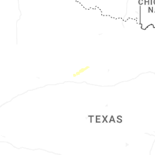
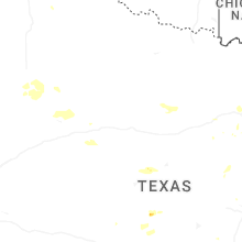
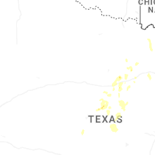
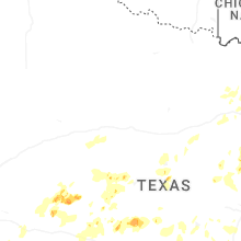
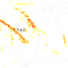
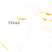
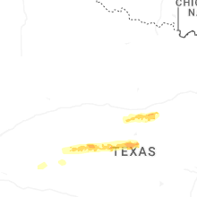

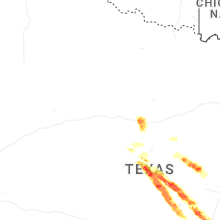
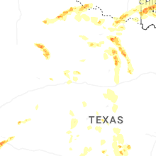


Connect with Interactive Hail Maps