

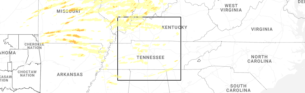
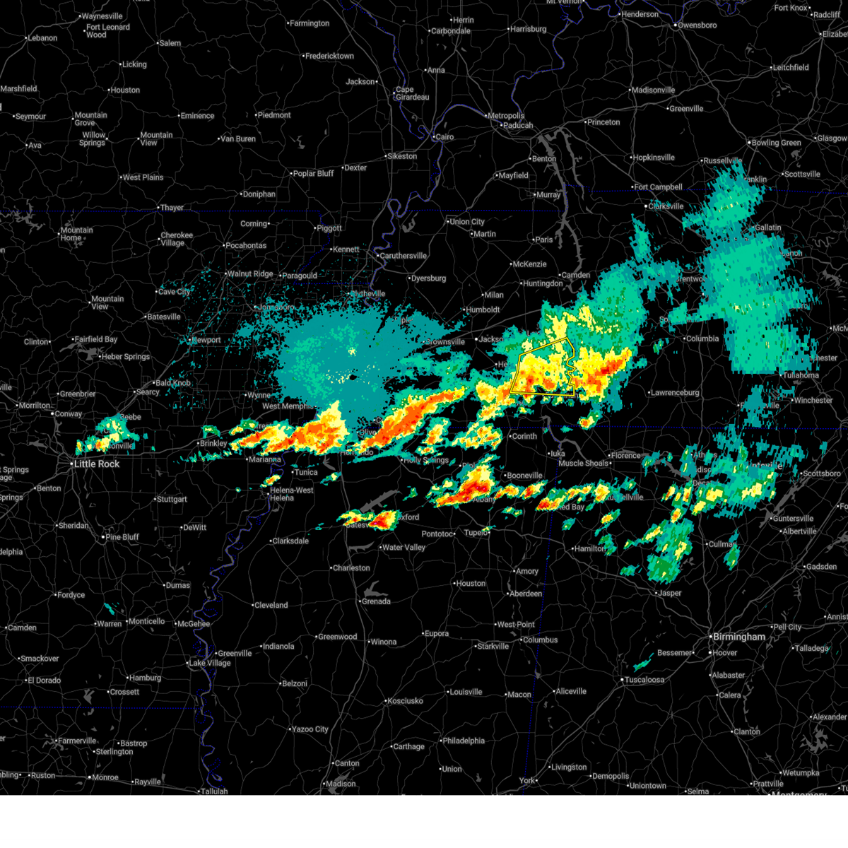
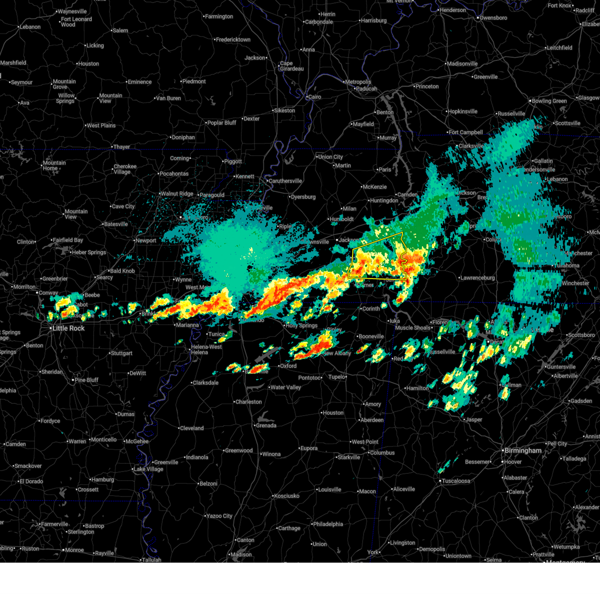
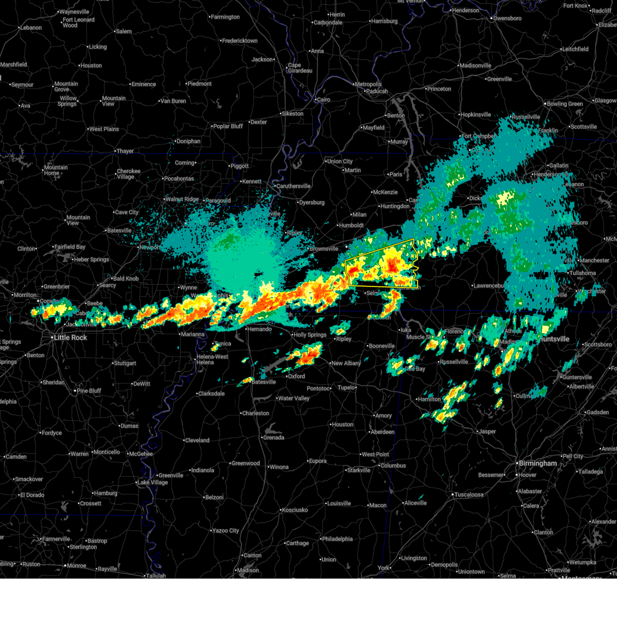
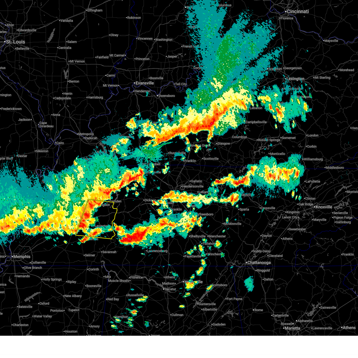
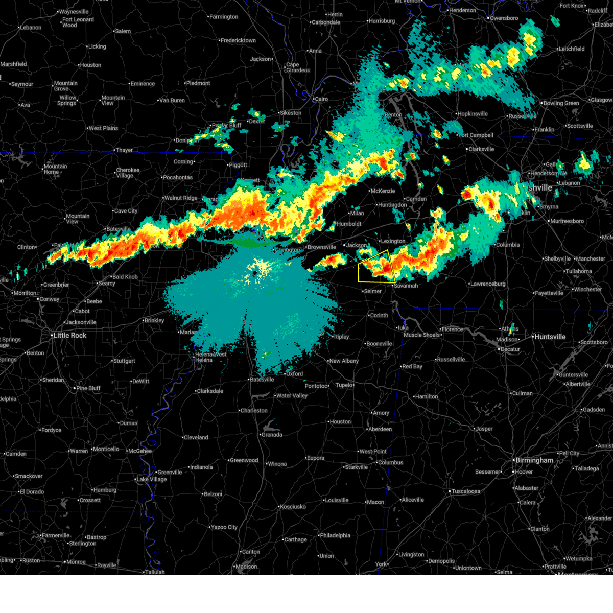
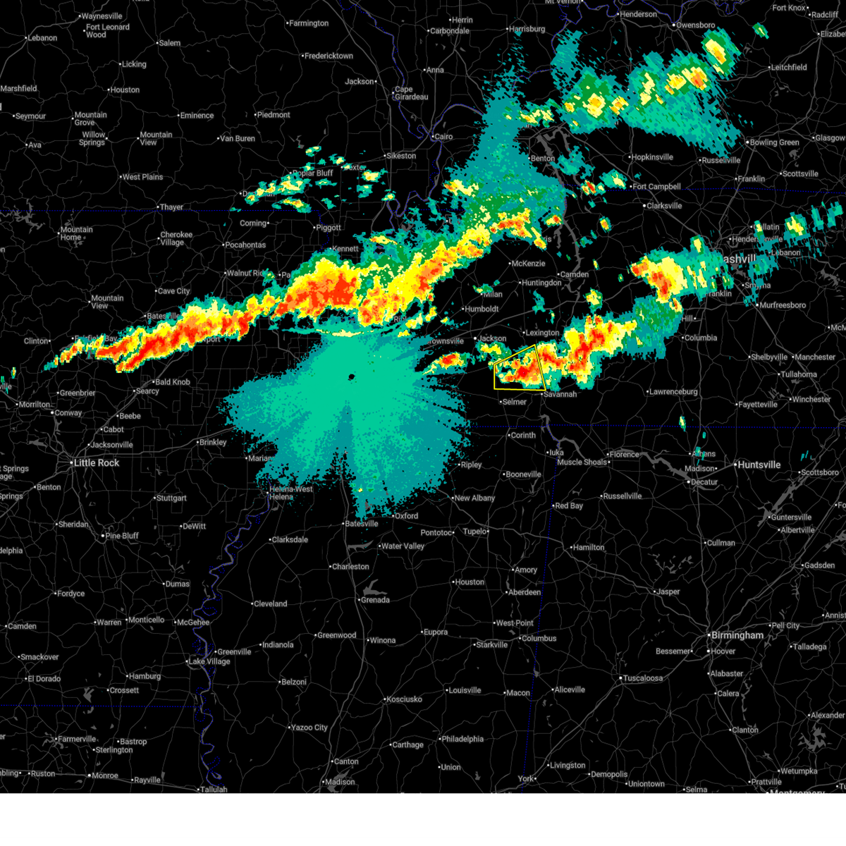
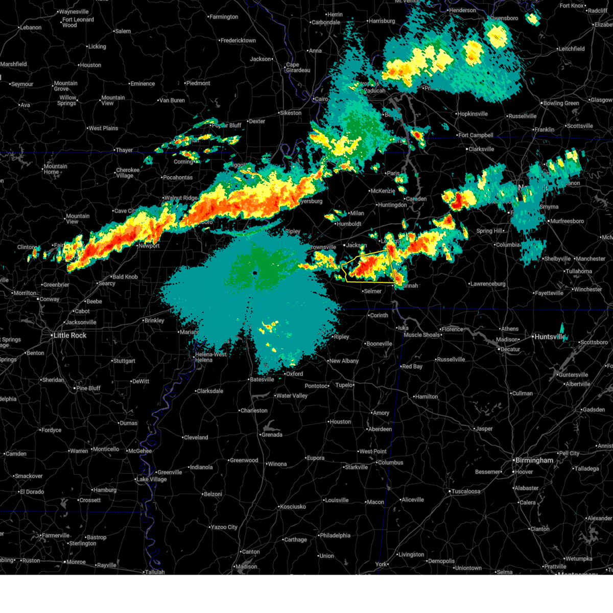
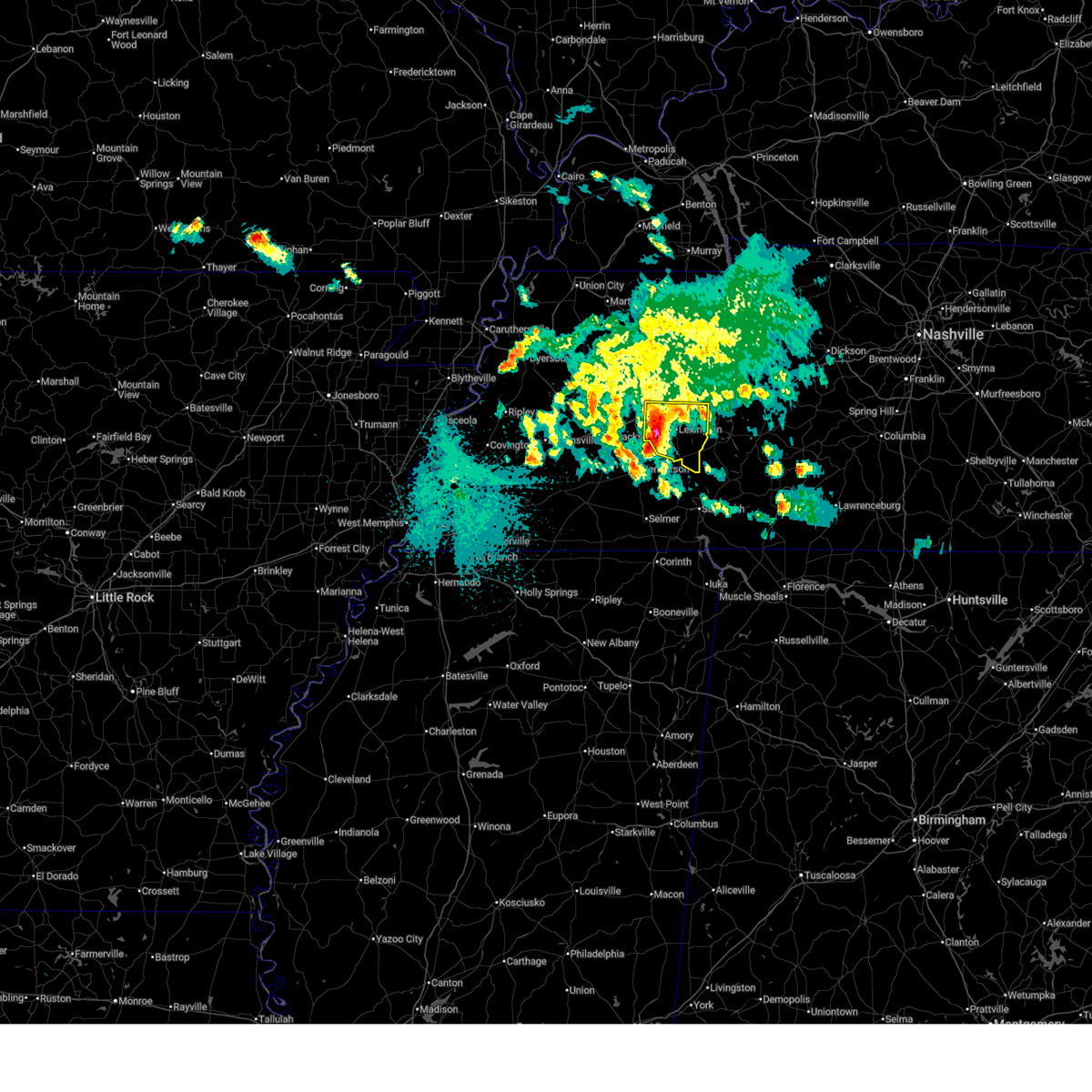
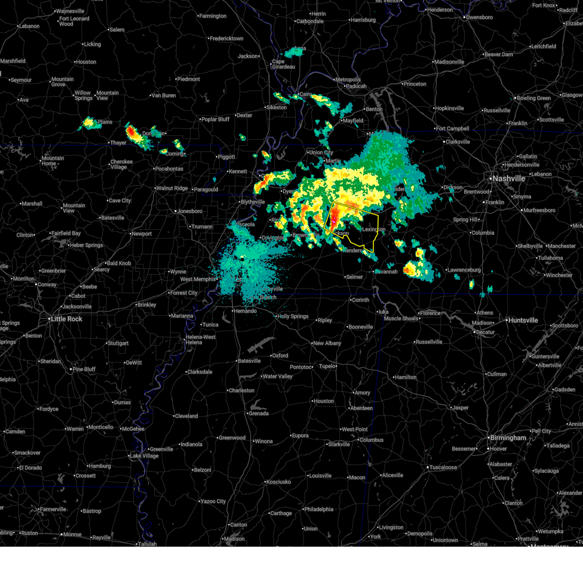
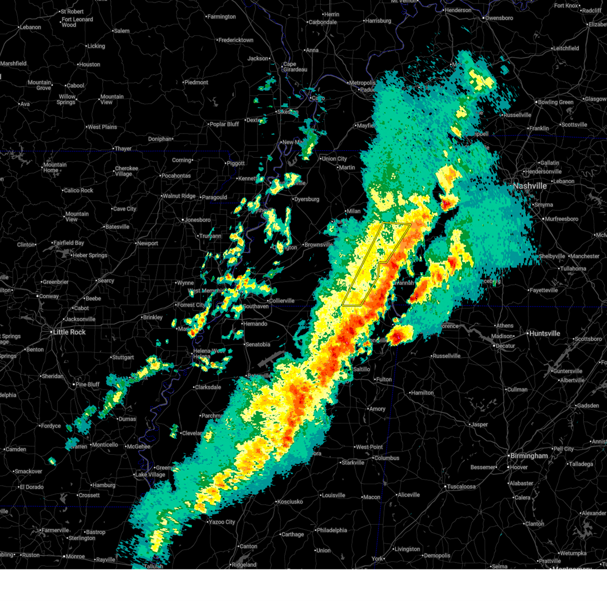
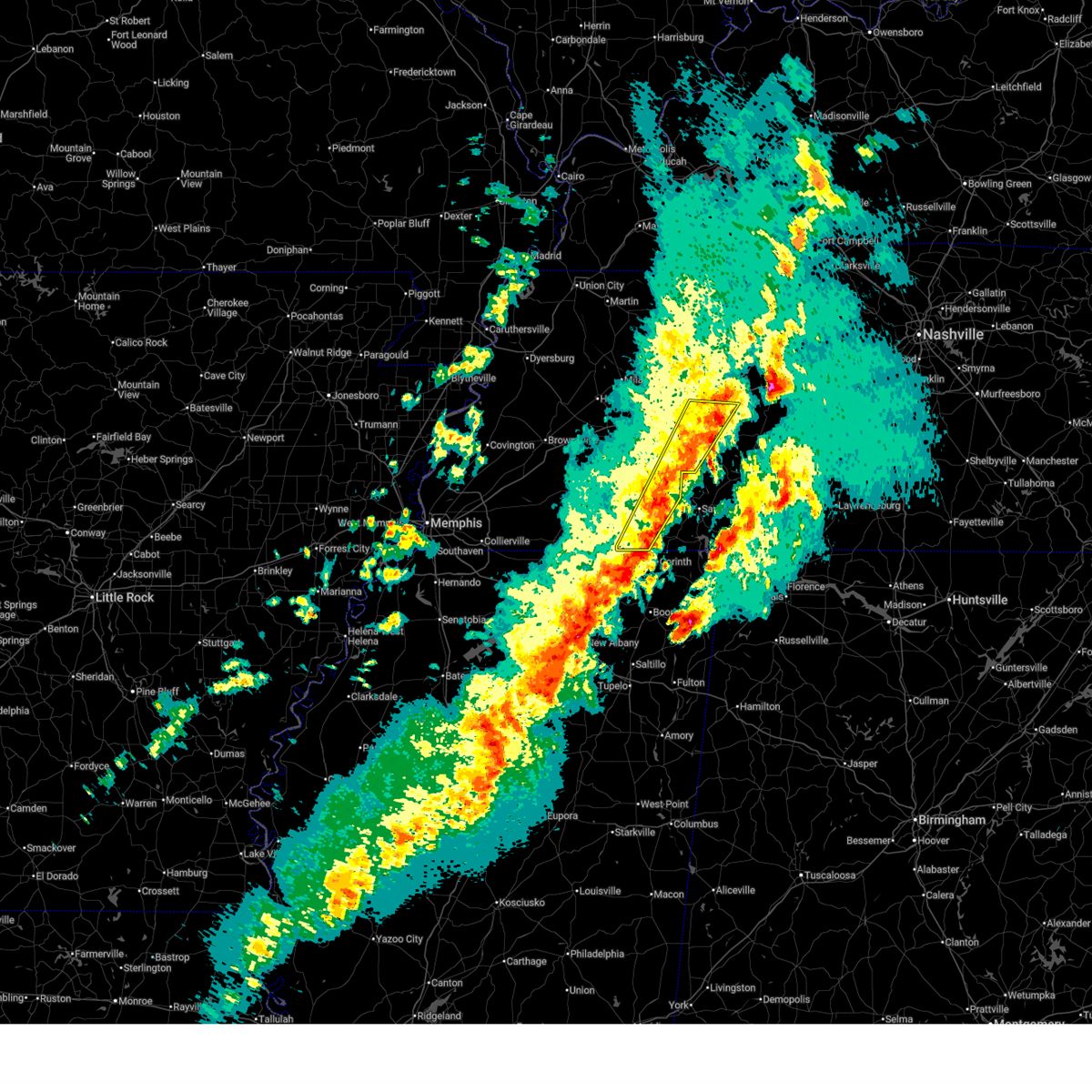
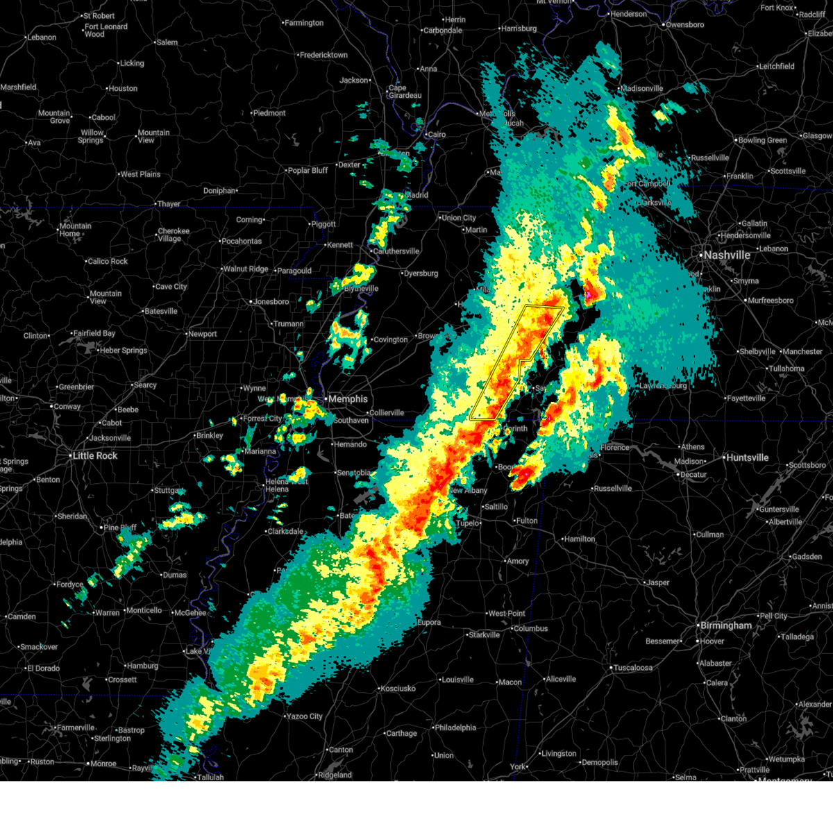
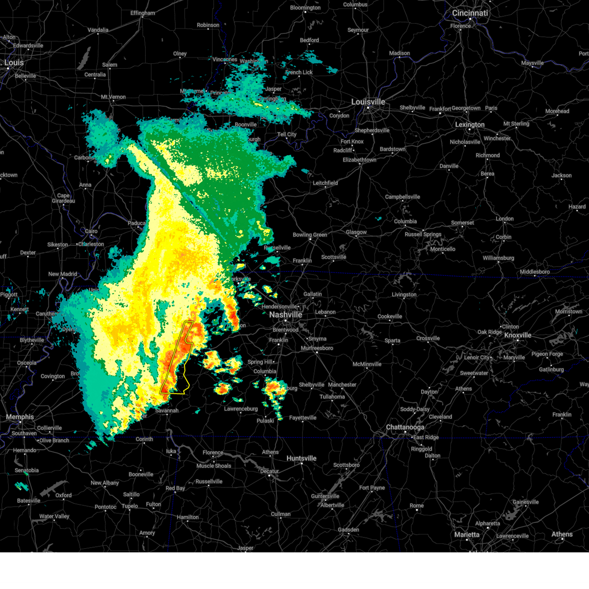
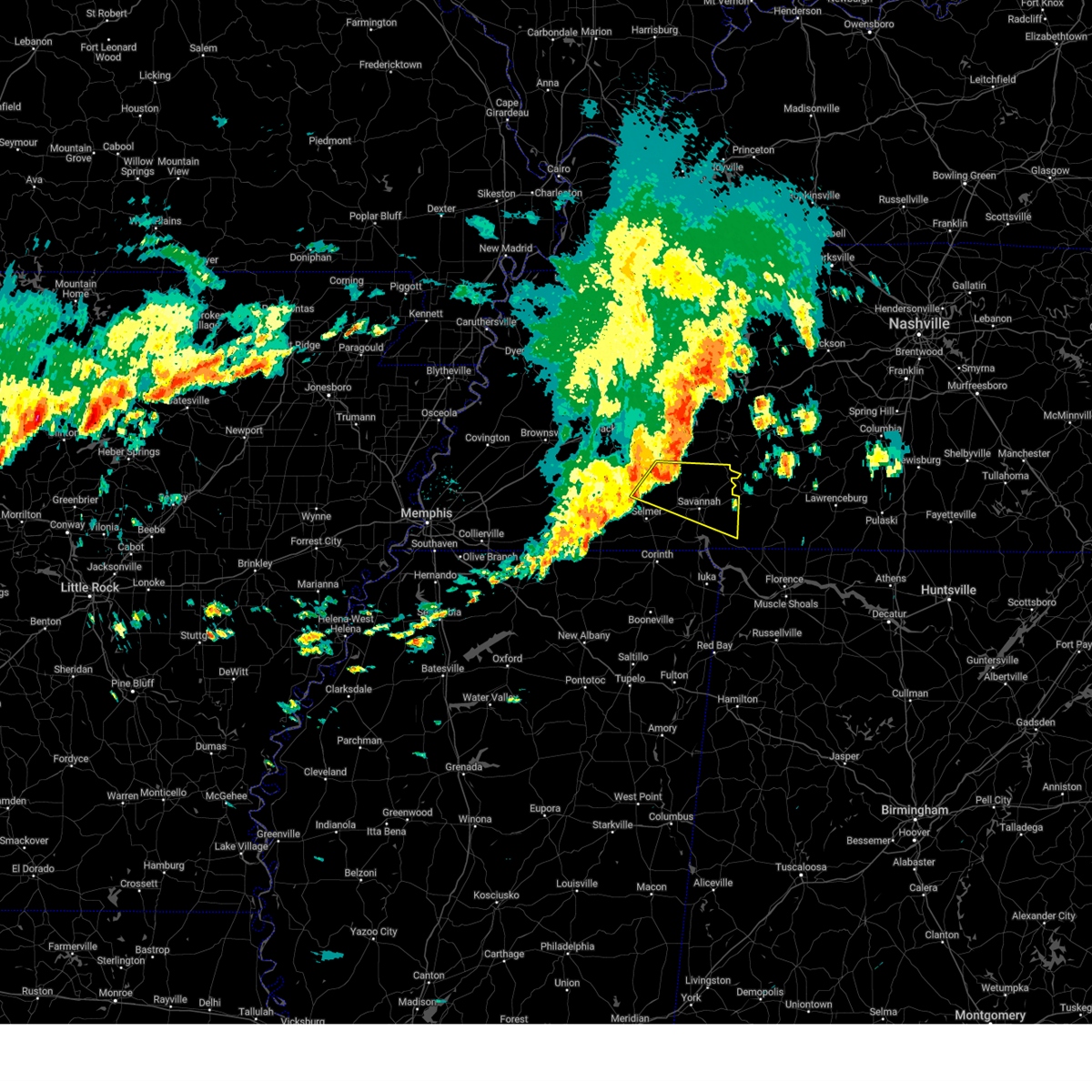
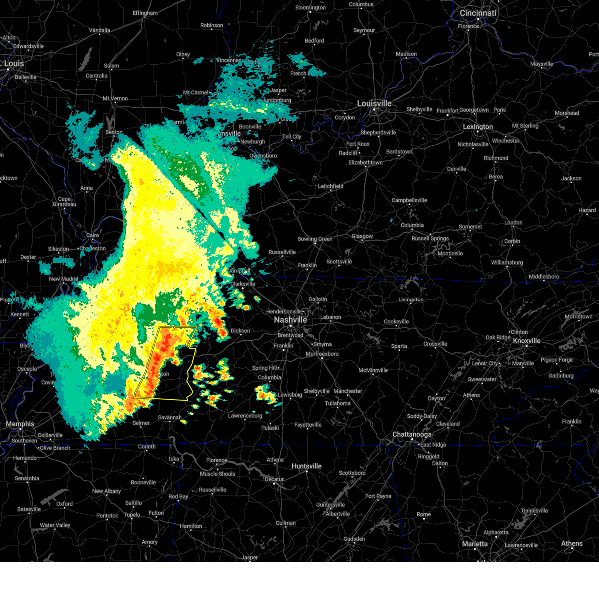
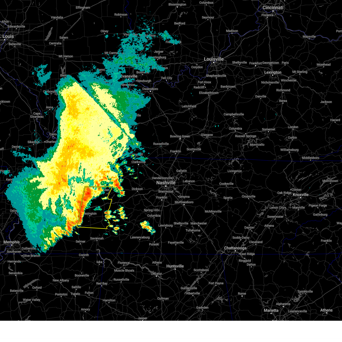
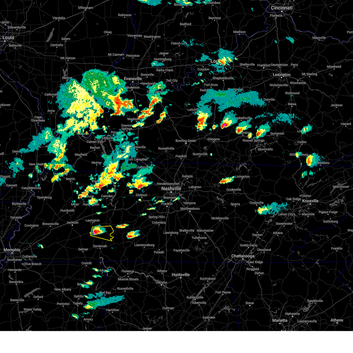
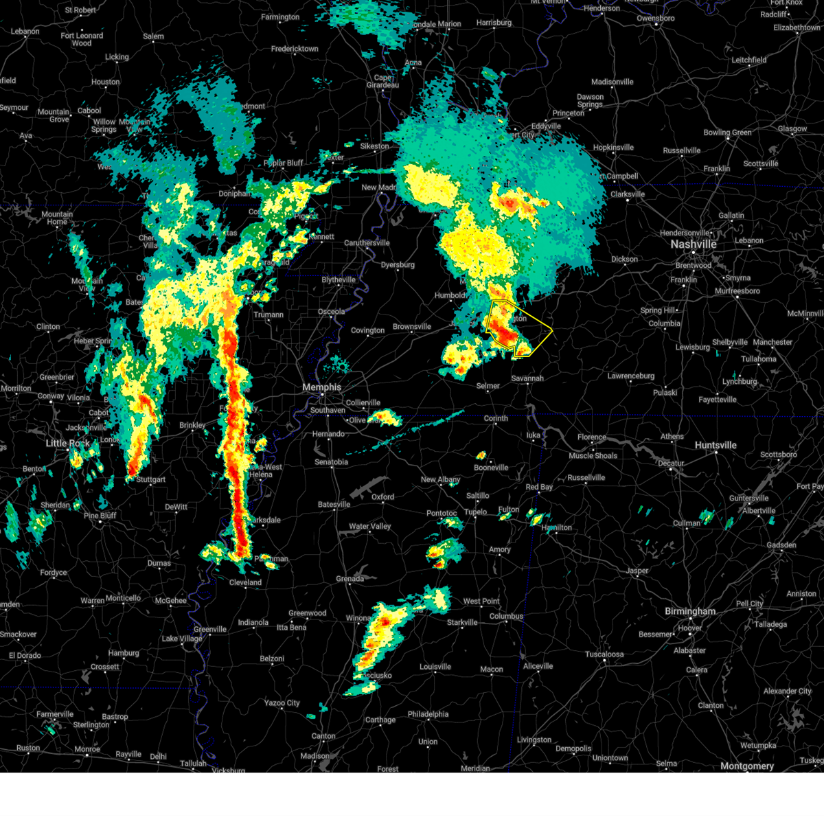
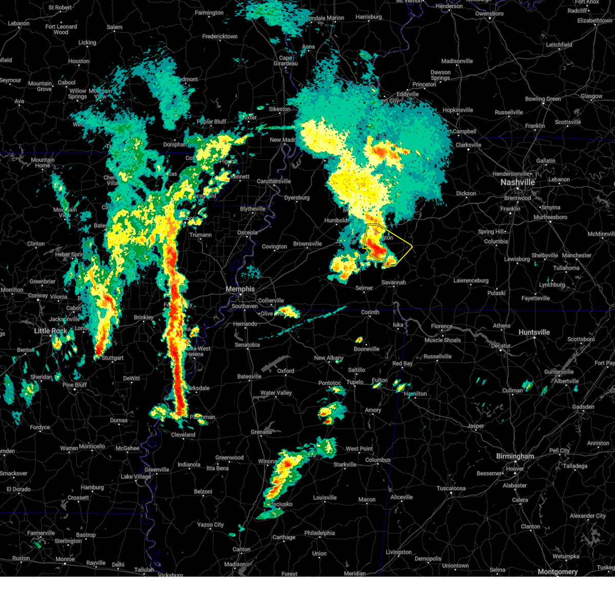
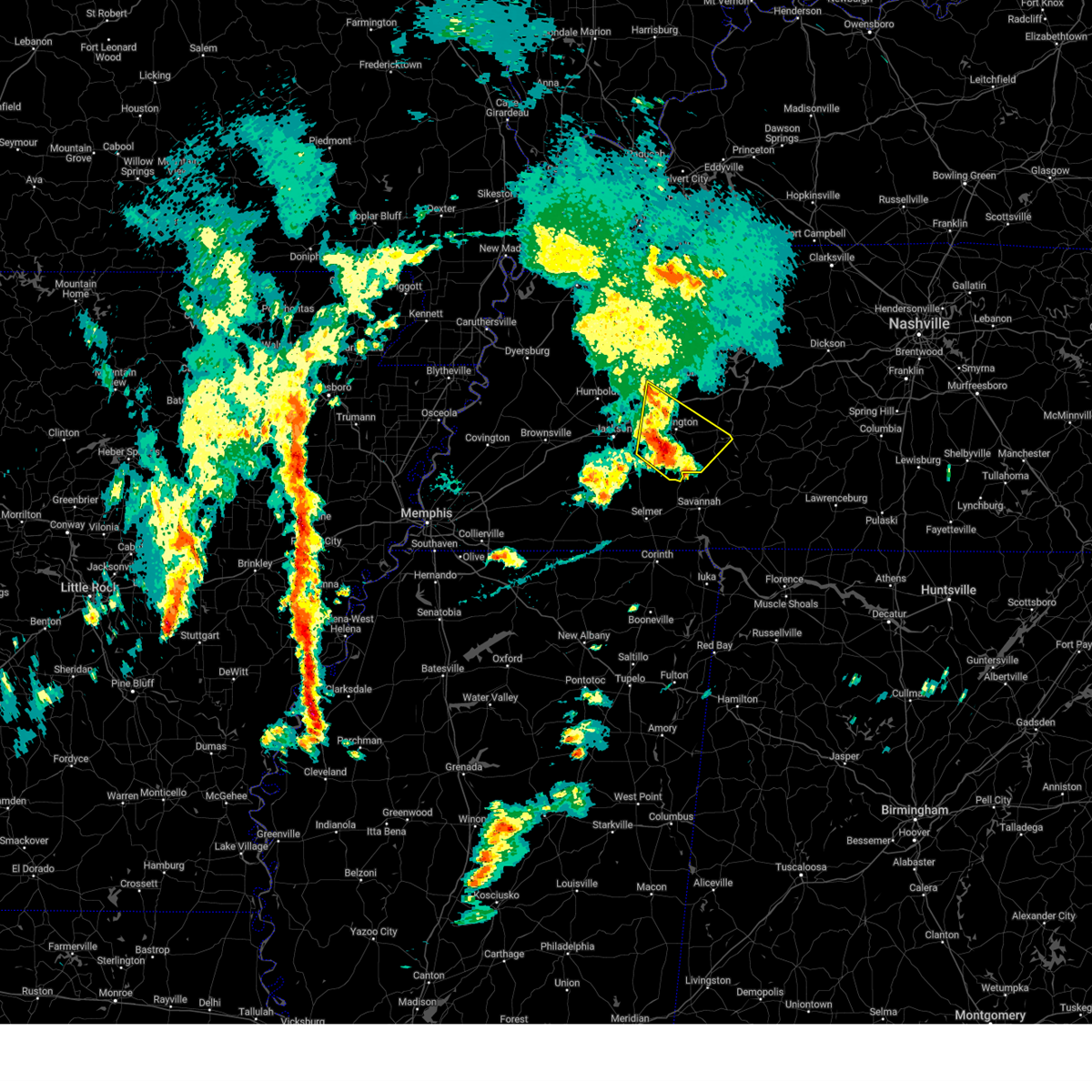
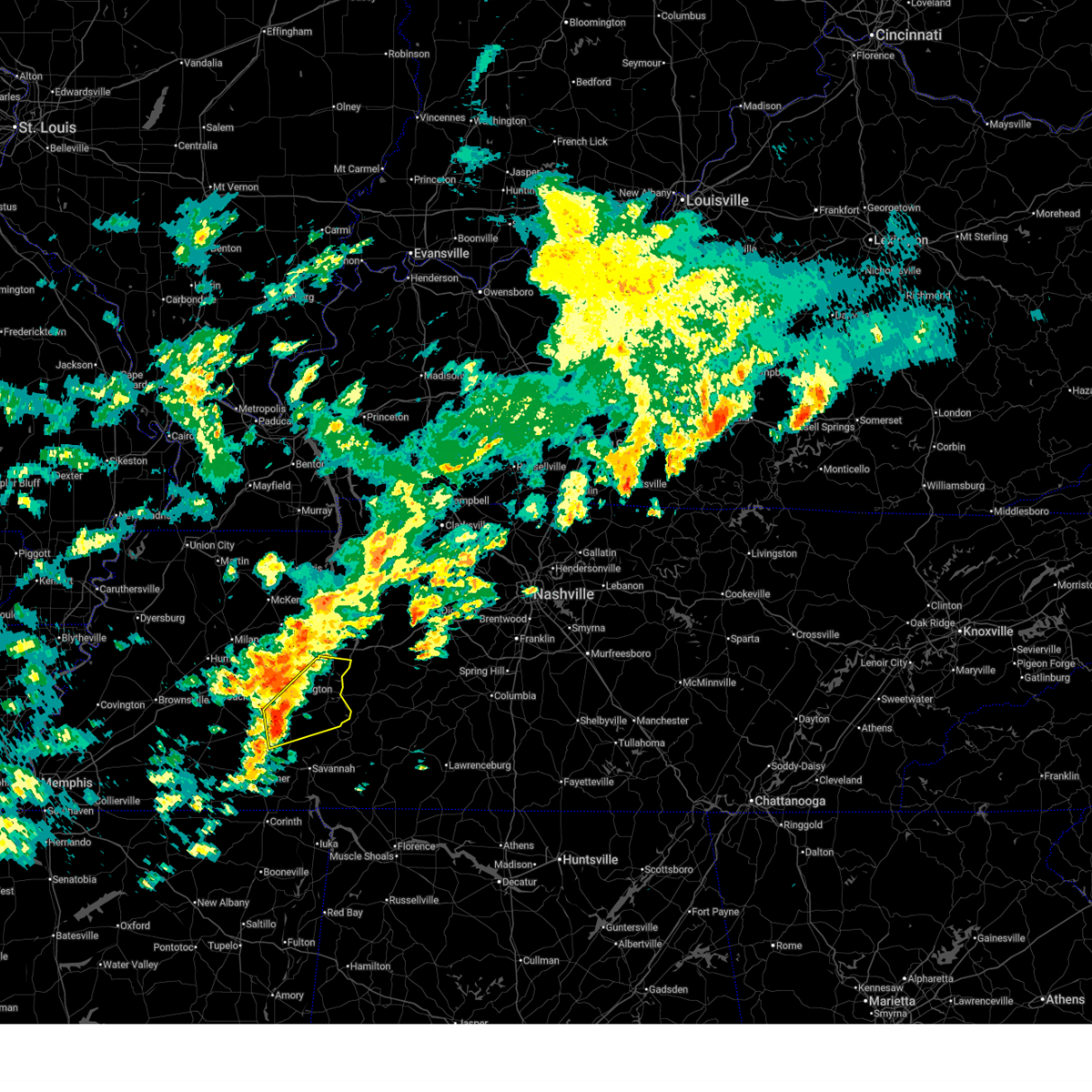
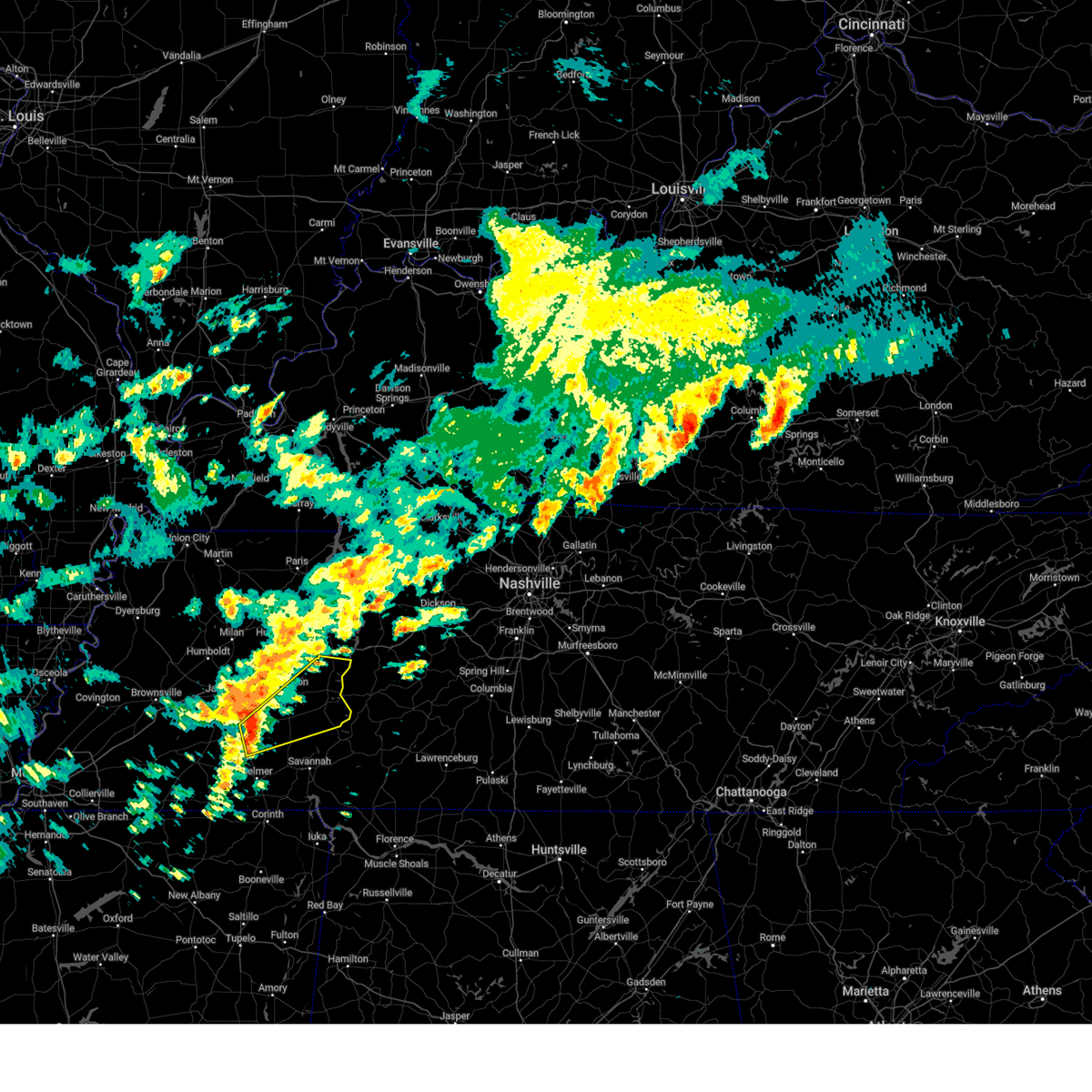
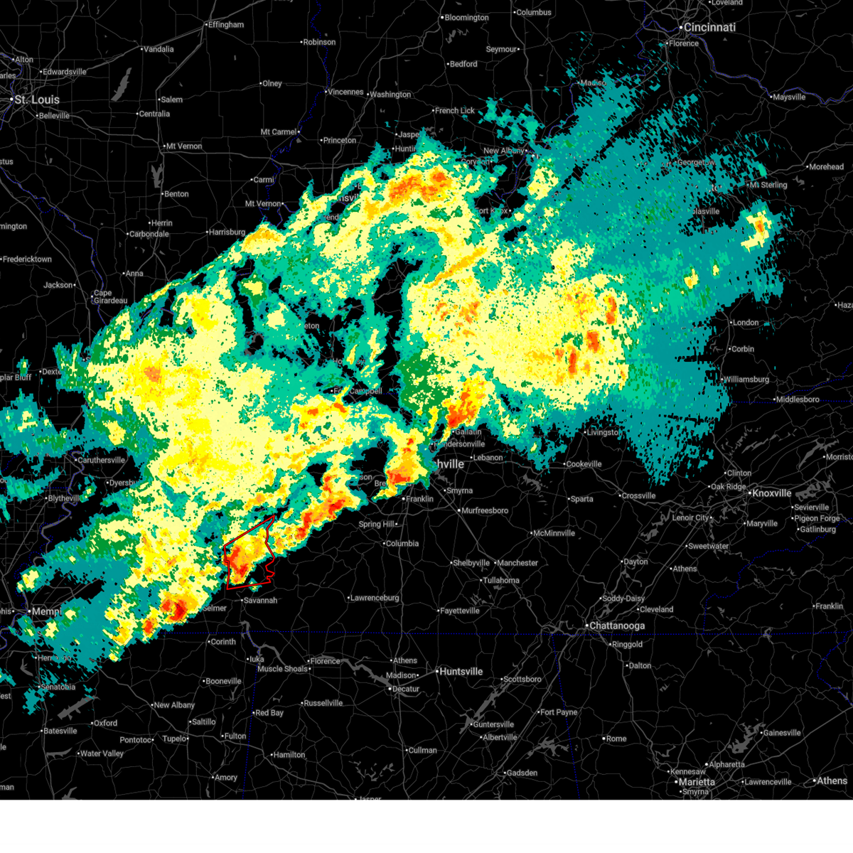
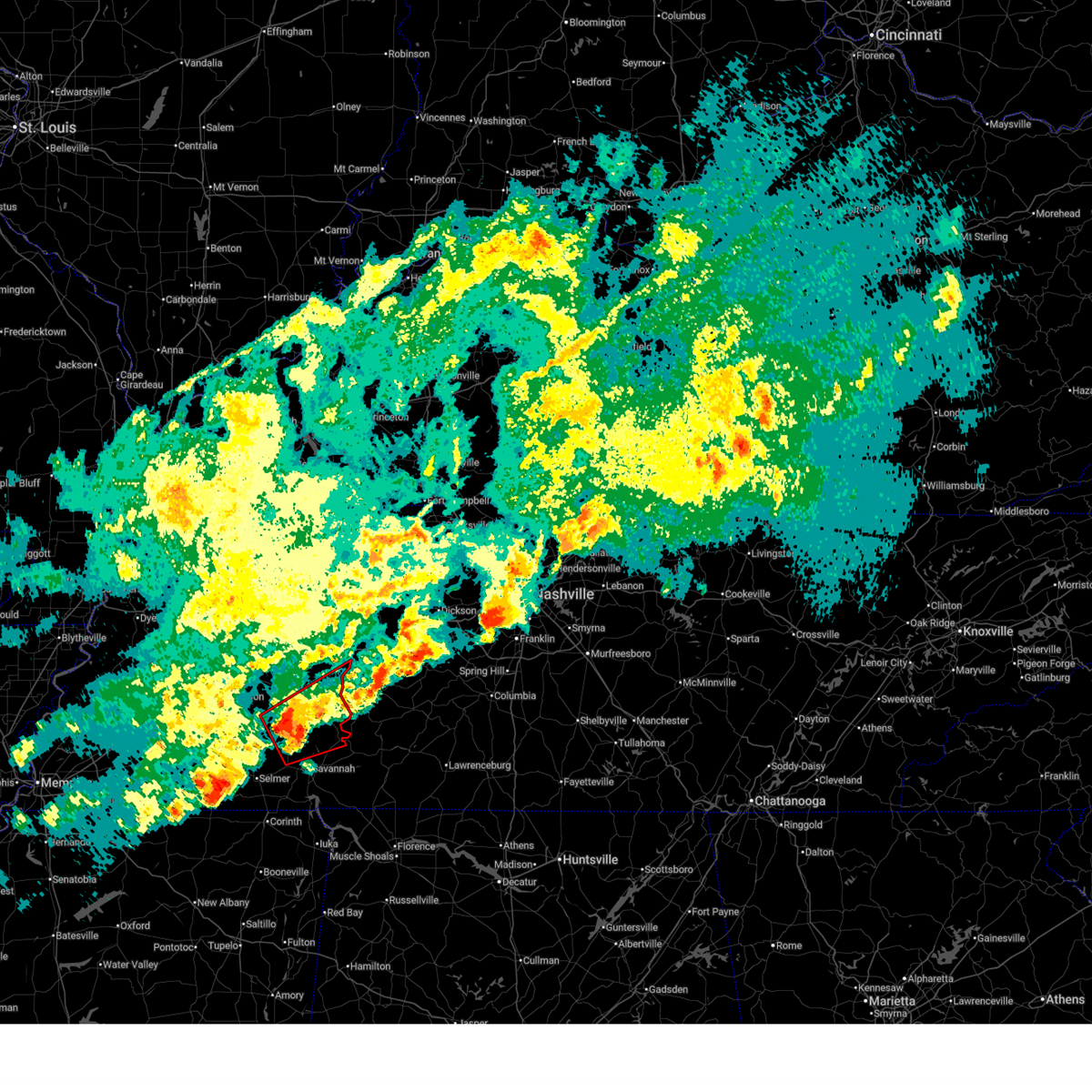
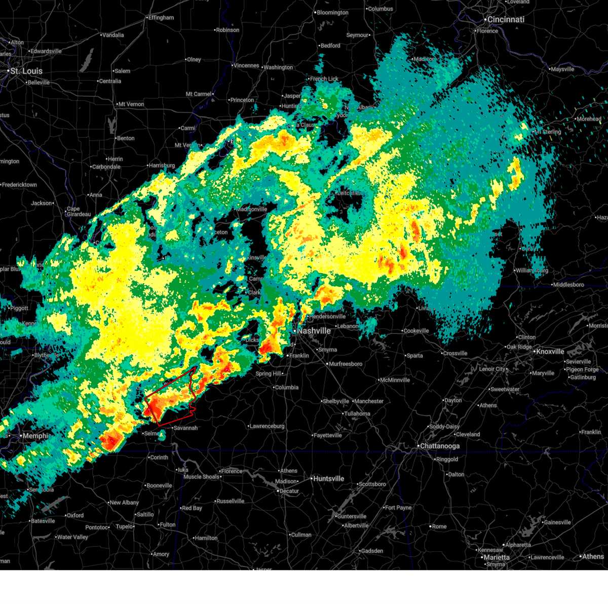
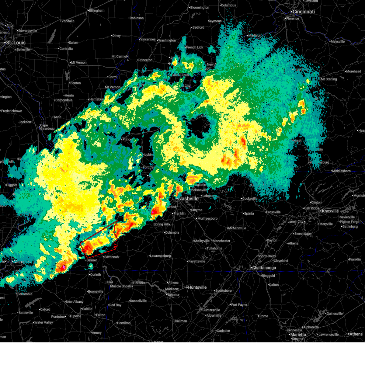
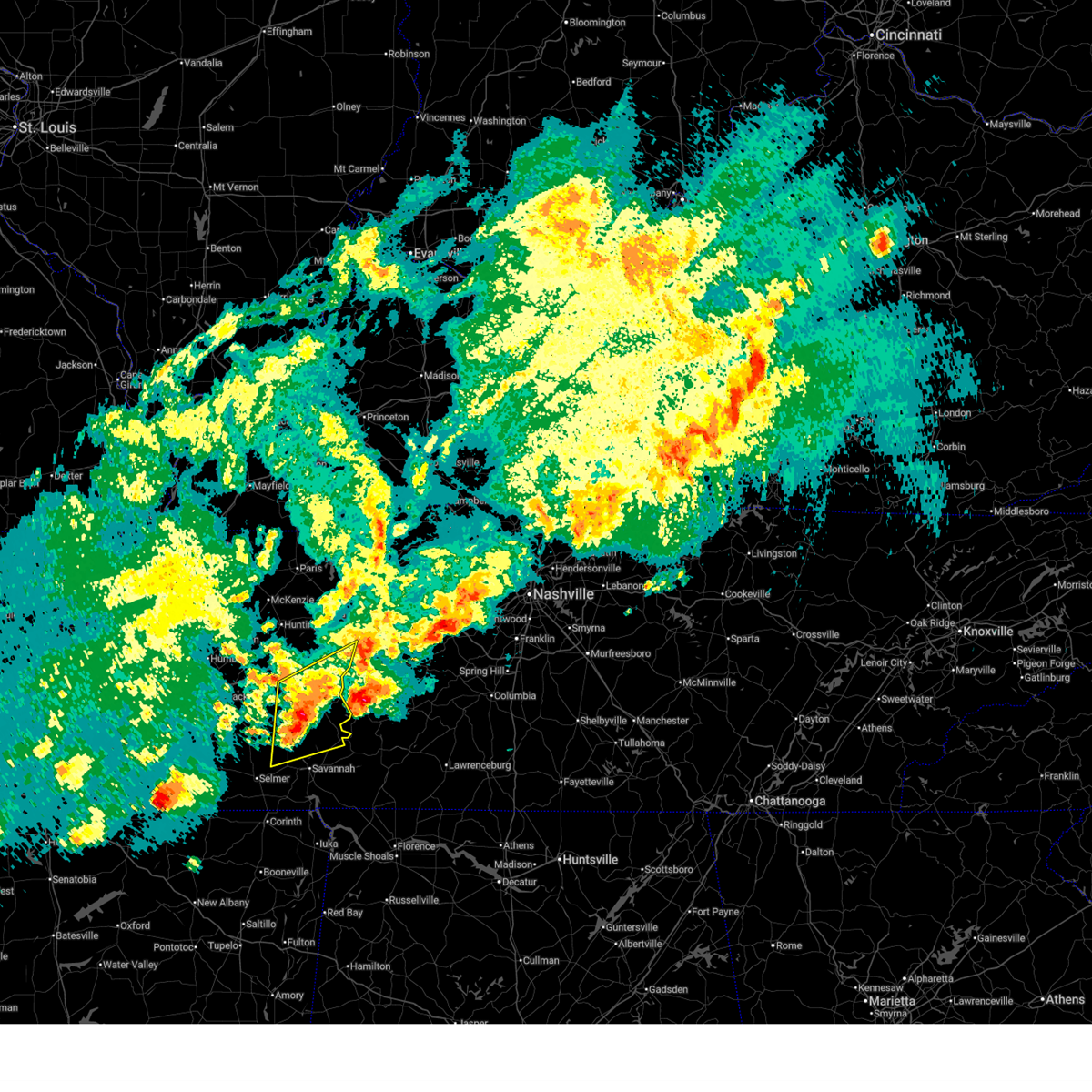
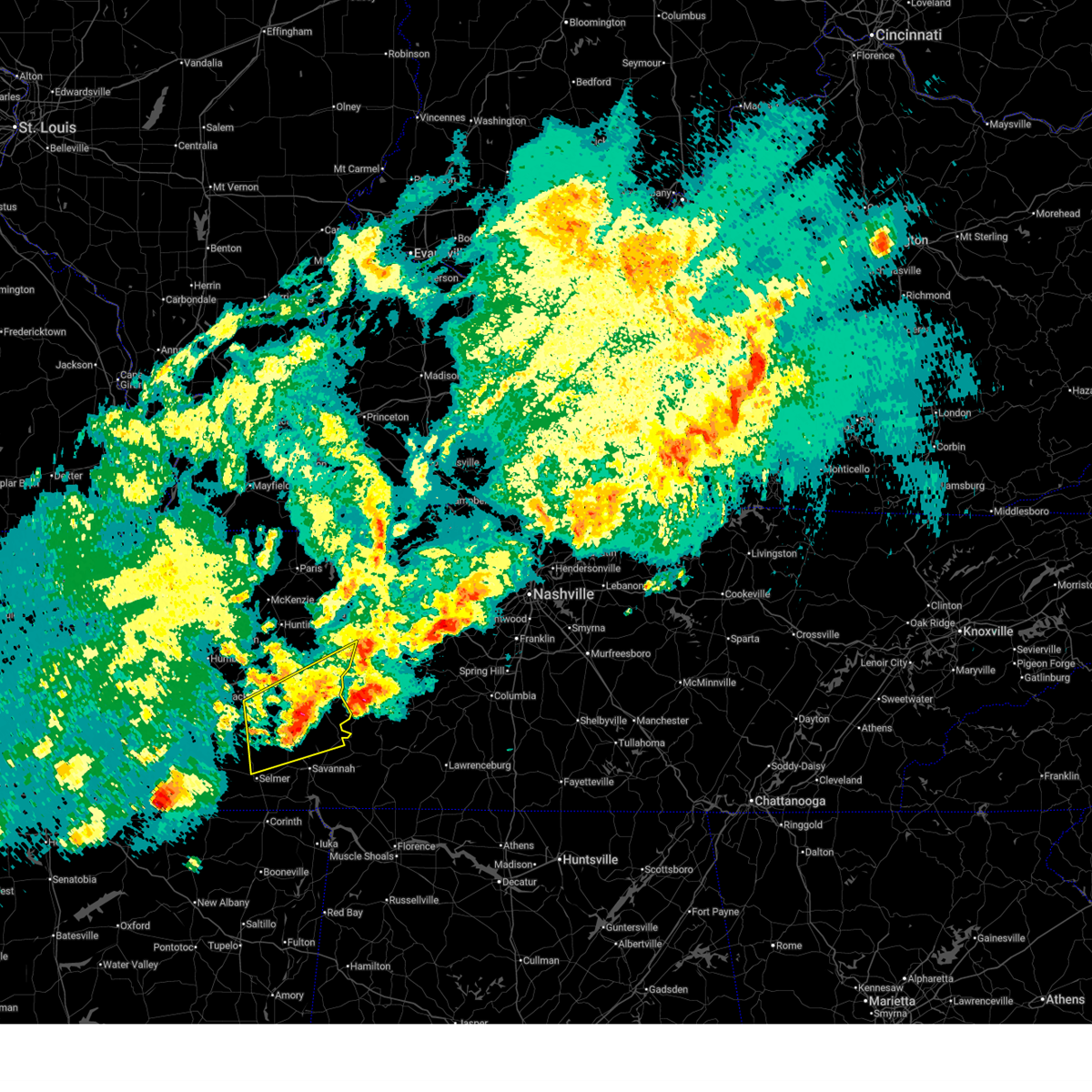
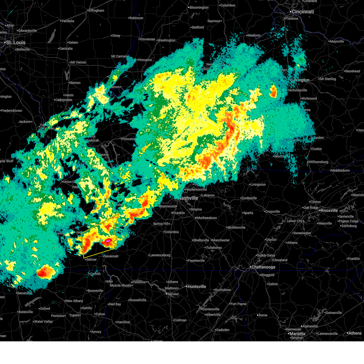
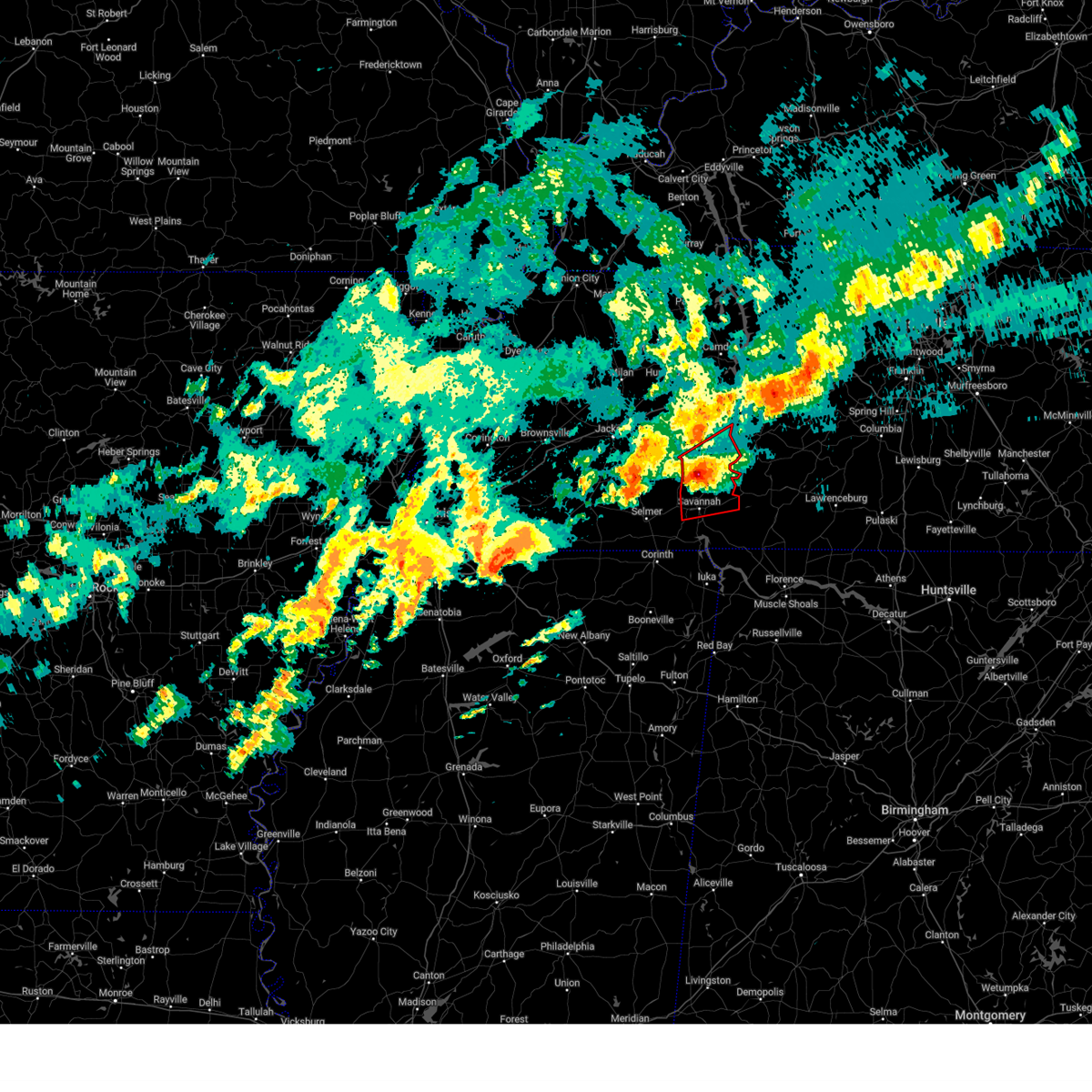
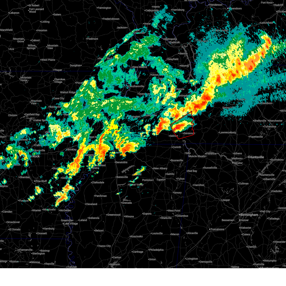
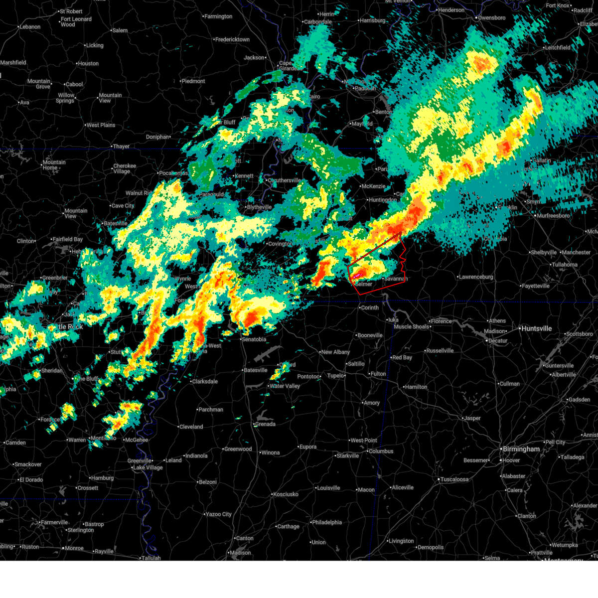
Hail Map for Sardis, TN
The Sardis, TN area has had 2 reports of on-the-ground hail by trained spotters, and has been under severe weather warnings 35 times during the past 12 months. Doppler radar has detected hail at or near Sardis, TN on 70 occasions, including 3 occasions during the past year.
| Name: | Sardis, TN |
| Where Located: | 49.4 miles SSE of Mc Kenzie, TN |
| Map: | Google Map for Sardis, TN |
| Population: | 381 |
| Housing Units: | 224 |
| More Info: | Search Google for Sardis, TN |
0
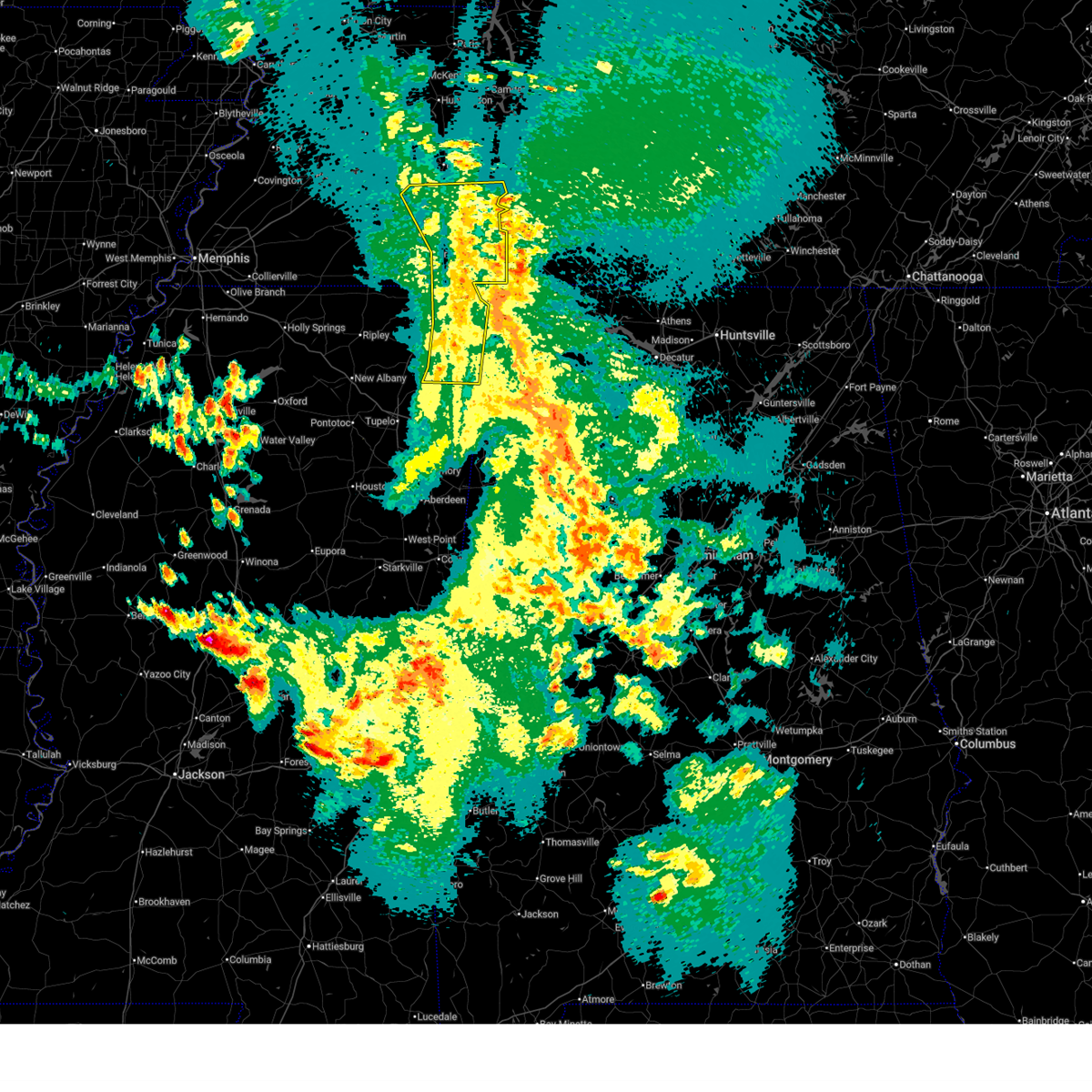
The Top Recent Hail Date for Sardis, TN is Monday, April 27, 2026 (57th out of 70)
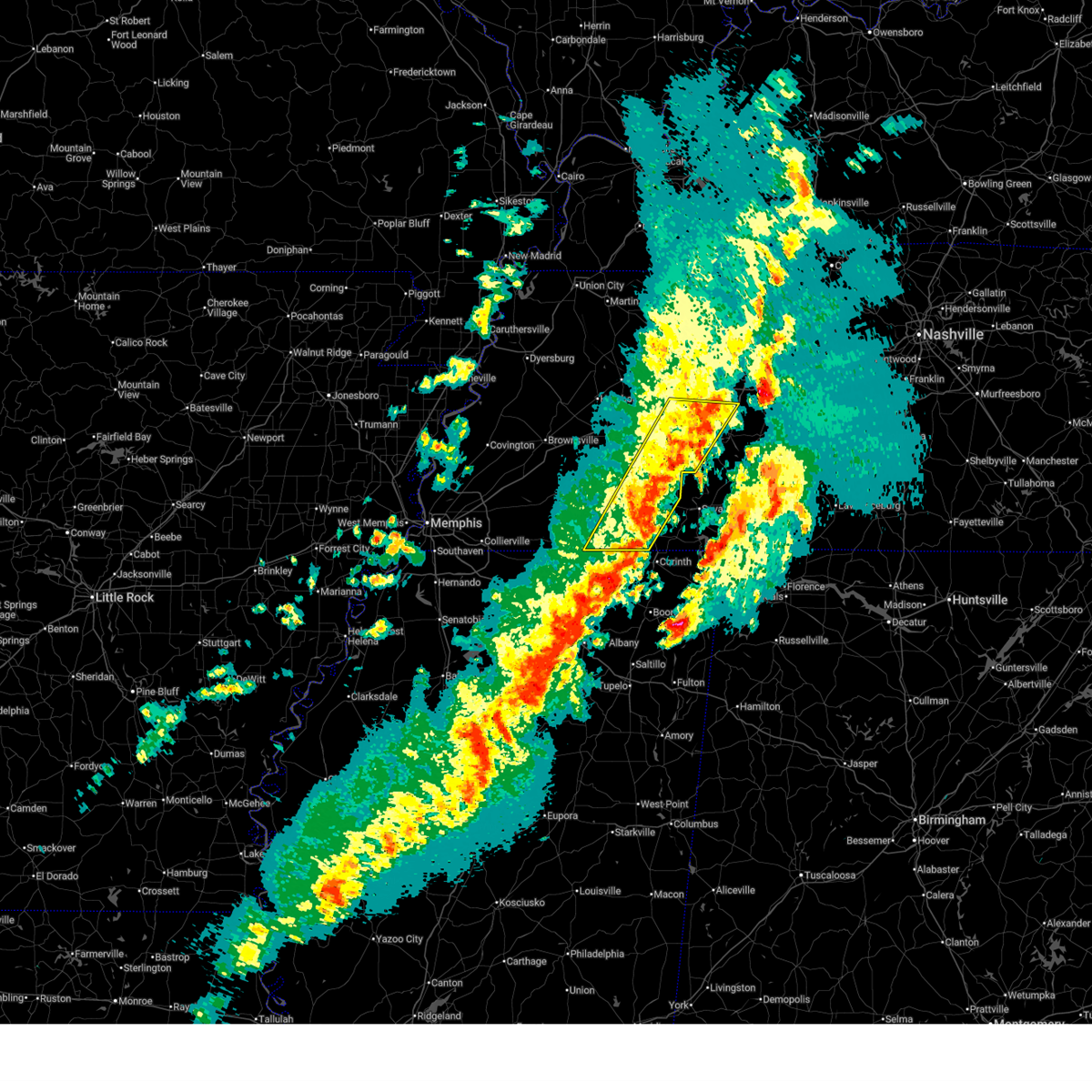
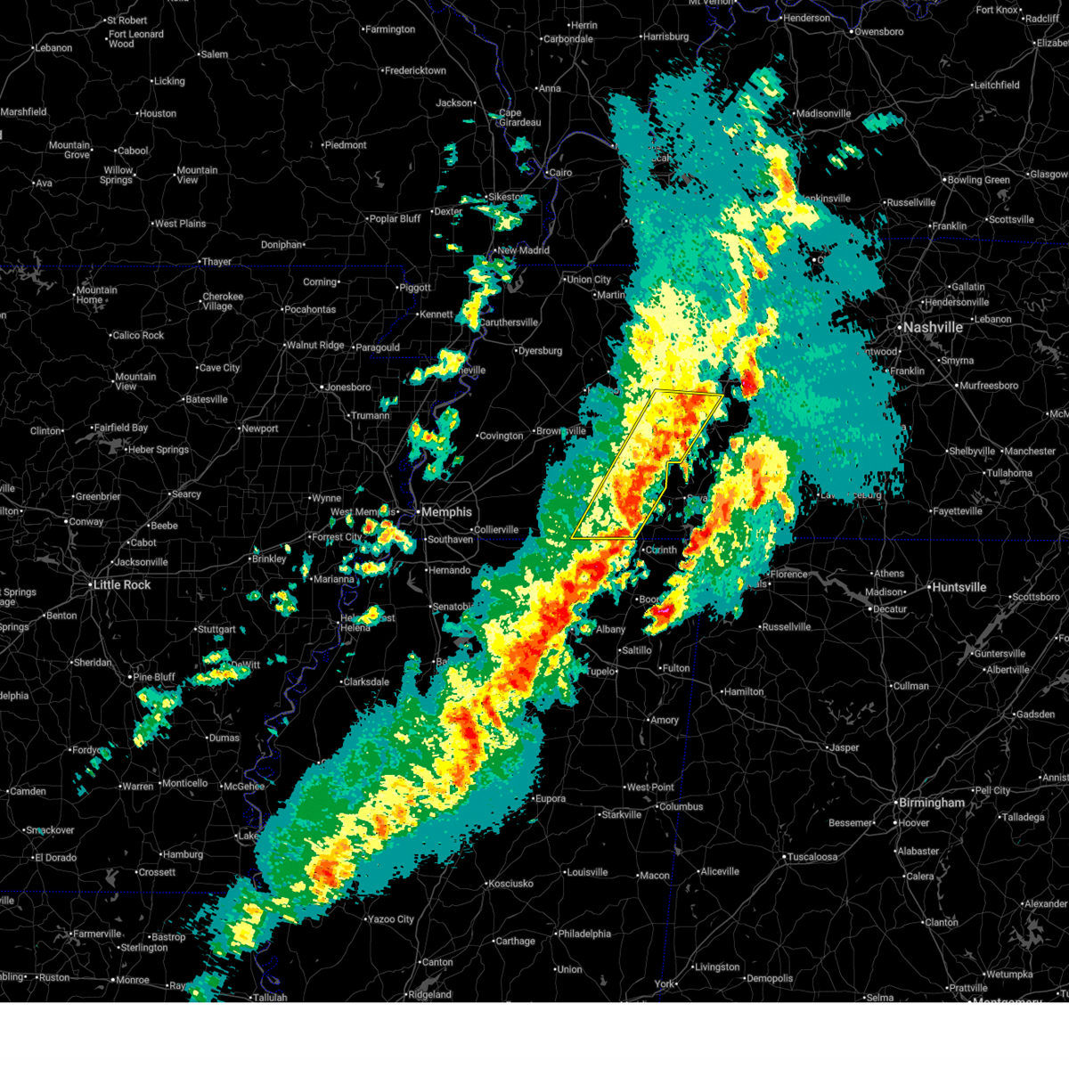
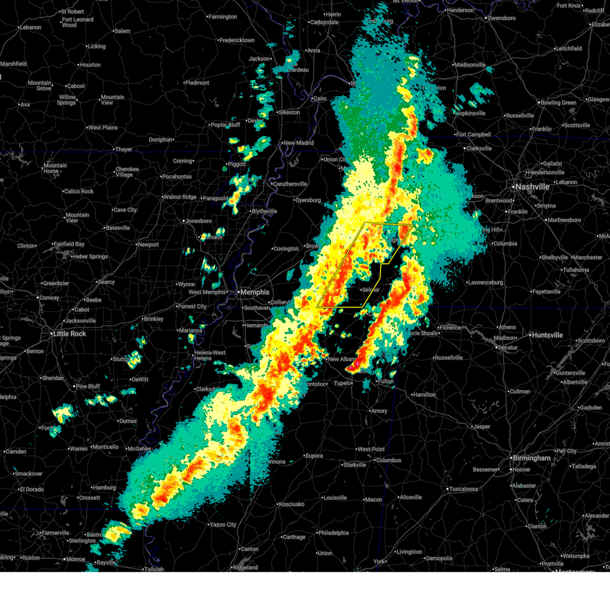
Hail and Wind Damage Spotted near Sardis, TN
| Date / Time | Report Details |
|---|---|
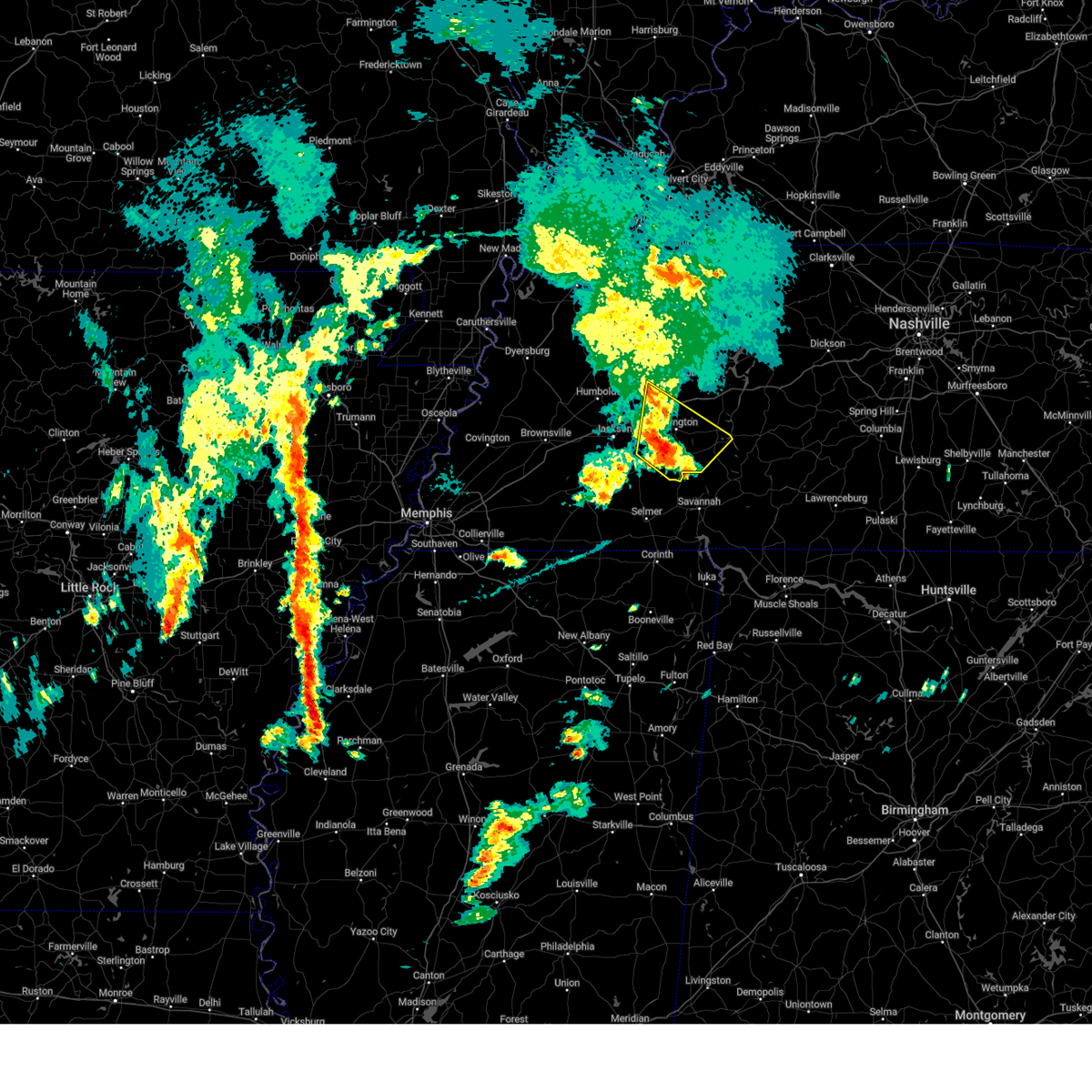
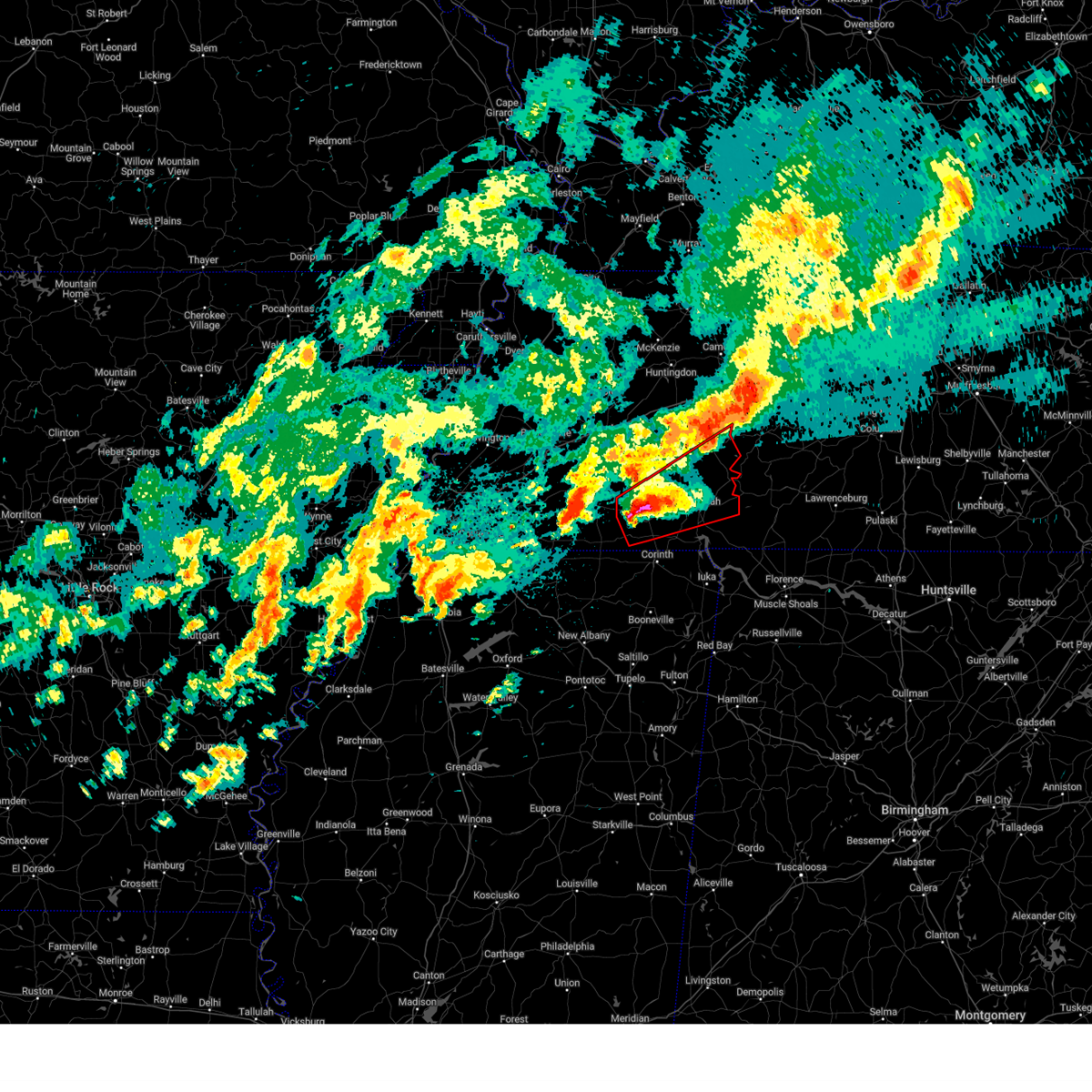
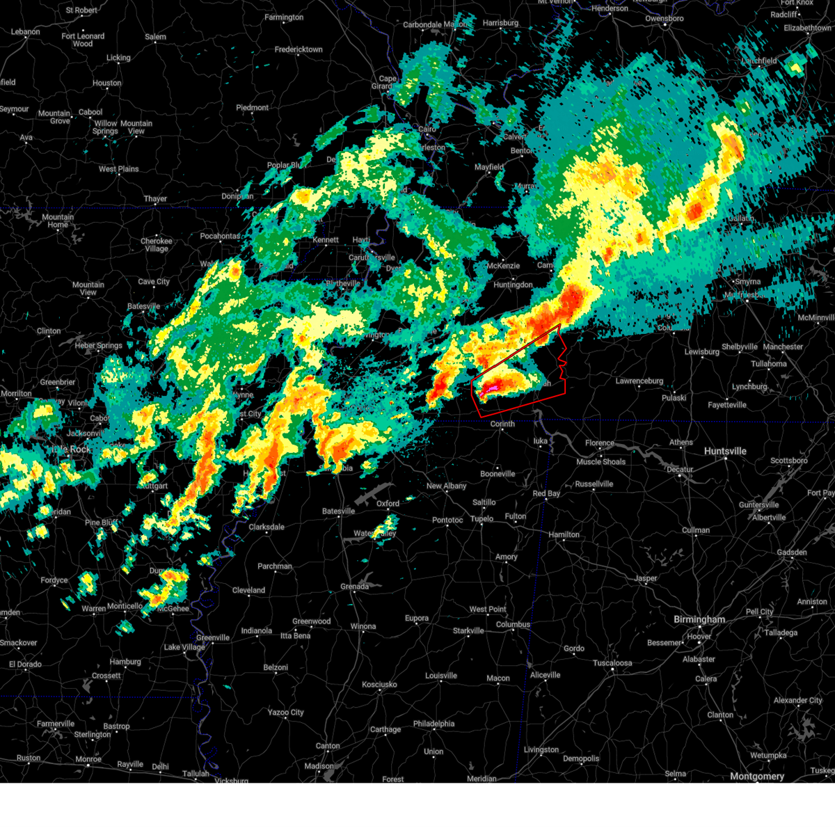
| 4/28/2026 5:59 PM CDT |
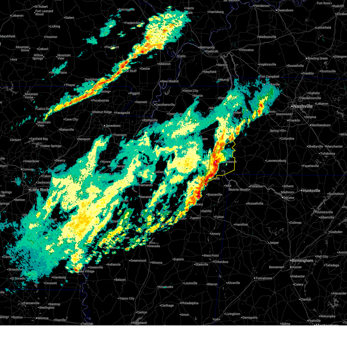
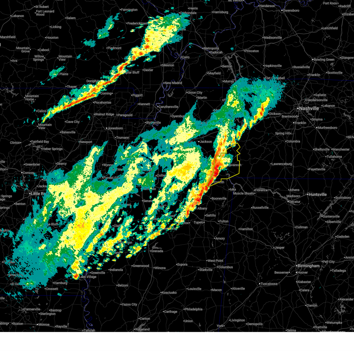
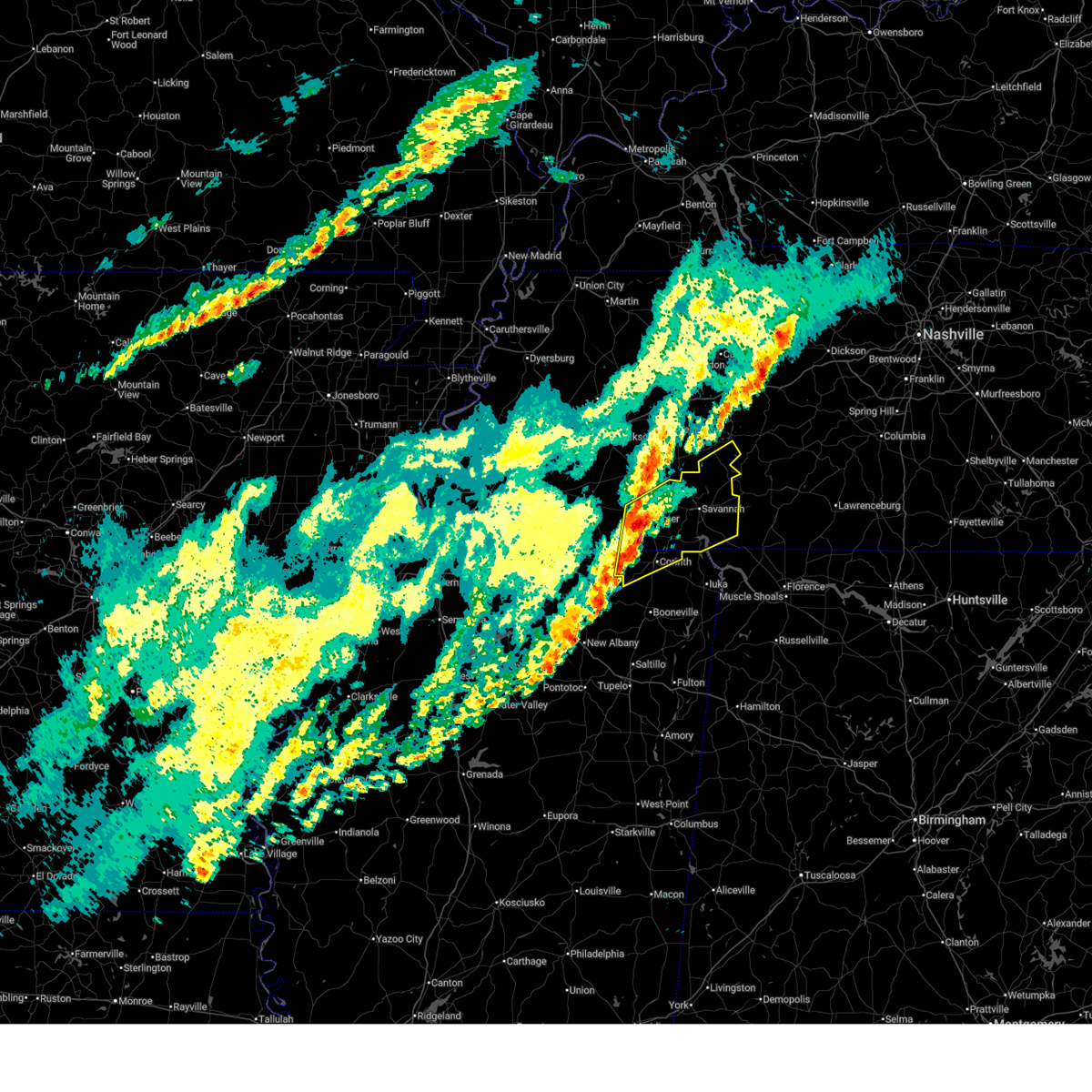
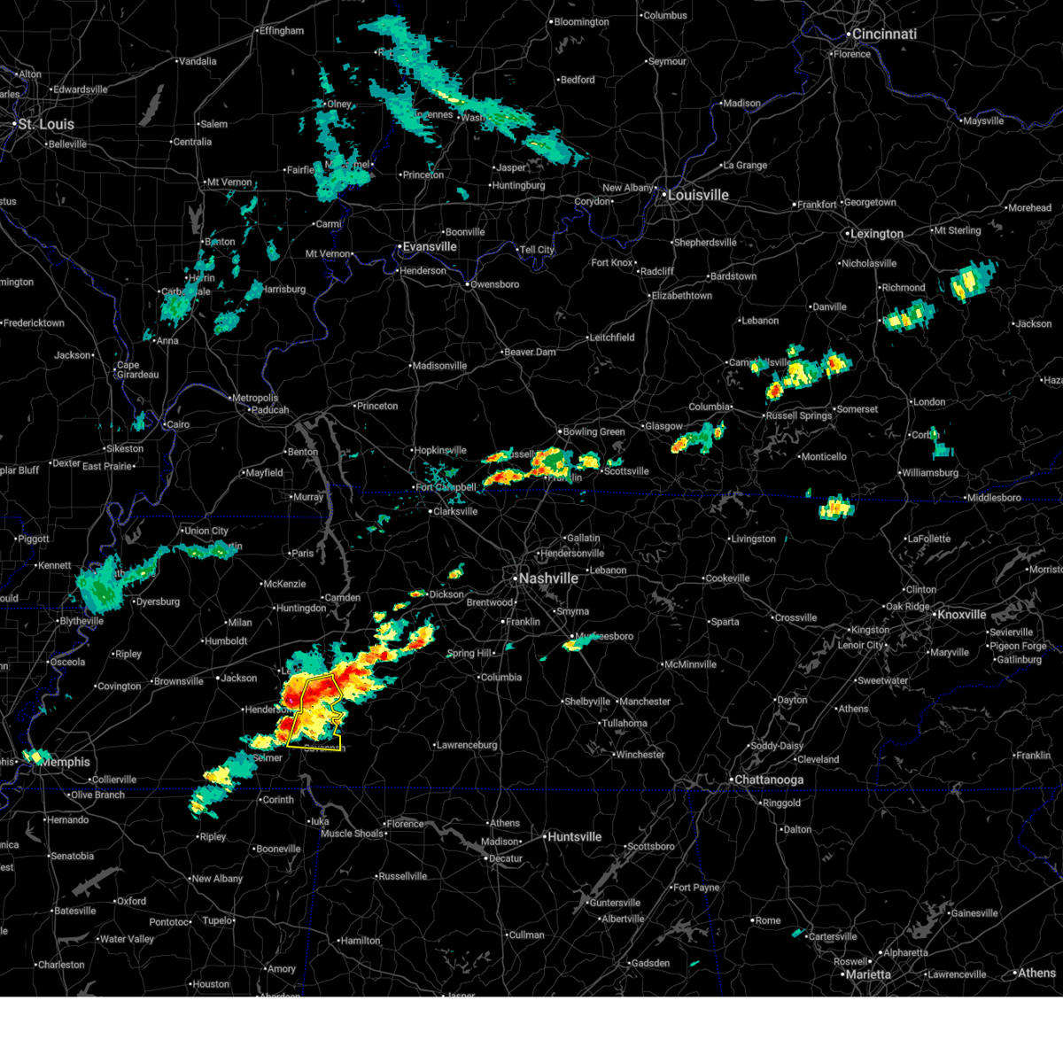
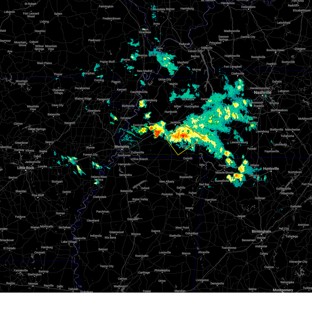
 At 559 pm cdt, severe thunderstorms were located along a line extending from near sardis to near pickwick landing state park to near tishomingo, moving east at 65 mph (radar indicated). Hazards include 60 mph wind gusts and quarter size hail. Hail damage to vehicles is expected. expect wind damage to roofs, siding, and trees. Locations impacted include, savannah, iuka, pickwick landing state park, j p coleman state park, tishomingo state park, adamsville, belmont, burnsville, sardis, tishomingo, pickwick dam, reagan, midway, morris chapel, shiloh, walnut grove, pineflat, leedy, olive hill, and montgomery. At 559 pm cdt, severe thunderstorms were located along a line extending from near sardis to near pickwick landing state park to near tishomingo, moving east at 65 mph (radar indicated). Hazards include 60 mph wind gusts and quarter size hail. Hail damage to vehicles is expected. expect wind damage to roofs, siding, and trees. Locations impacted include, savannah, iuka, pickwick landing state park, j p coleman state park, tishomingo state park, adamsville, belmont, burnsville, sardis, tishomingo, pickwick dam, reagan, midway, morris chapel, shiloh, walnut grove, pineflat, leedy, olive hill, and montgomery.
|
| 4/28/2026 5:55 PM CDT |
 the severe thunderstorm warning has been cancelled and is no longer in effect the severe thunderstorm warning has been cancelled and is no longer in effect
|
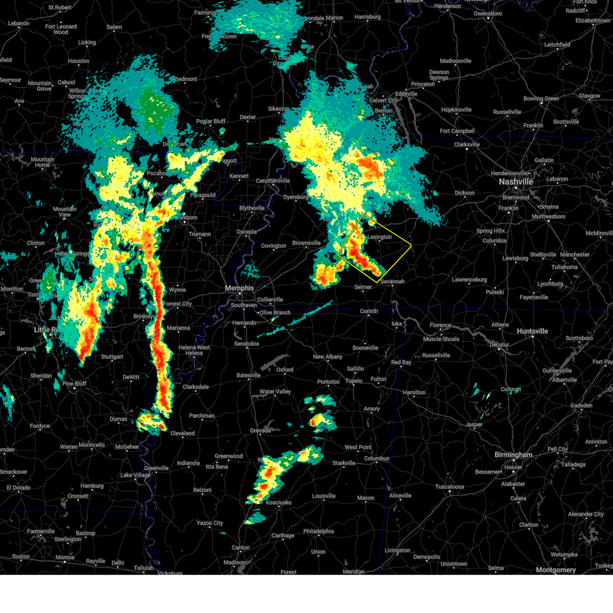
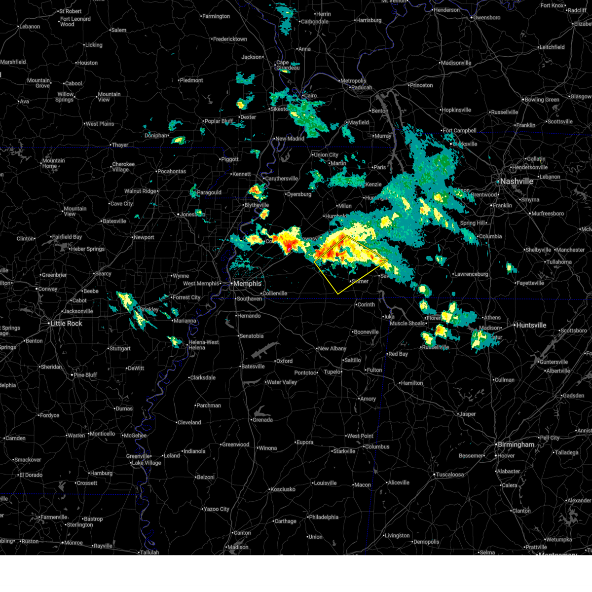
| 4/28/2026 5:55 PM CDT |
 At 555 pm cdt, severe thunderstorms were located along a line extending from near sardis to near pickwick landing state park to near burton, moving east at 65 mph (radar indicated). Hazards include 60 mph wind gusts and quarter size hail. Hail damage to vehicles is expected. expect wind damage to roofs, siding, and trees. Locations impacted include, corinth, savannah, henderson, iuka, pickwick landing state park, j p coleman state park, tishomingo state park, adamsville, belmont, burnsville, glen, sardis, tishomingo, pickwick dam, reagan, pineflat, jacks creek, midway, morris chapel, and shiloh. At 555 pm cdt, severe thunderstorms were located along a line extending from near sardis to near pickwick landing state park to near burton, moving east at 65 mph (radar indicated). Hazards include 60 mph wind gusts and quarter size hail. Hail damage to vehicles is expected. expect wind damage to roofs, siding, and trees. Locations impacted include, corinth, savannah, henderson, iuka, pickwick landing state park, j p coleman state park, tishomingo state park, adamsville, belmont, burnsville, glen, sardis, tishomingo, pickwick dam, reagan, pineflat, jacks creek, midway, morris chapel, and shiloh.
|
| 4/28/2026 5:37 PM CDT |
 At 537 pm cdt, severe thunderstorms were located along a line extending from jacks creek to near corinth to wheeler, moving east at 65 mph (radar indicated). Hazards include 60 mph wind gusts and quarter size hail. Hail damage to vehicles is expected. expect wind damage to roofs, siding, and trees. Locations impacted include, corinth, booneville, savannah, henderson, selmer, baldwyn, iuka, pickwick landing state park, j p coleman state park, chickasaw state park, big hill pond state park, tishomingo state park, adamsville, guntown, belmont, burnsville, jumpertown, glen, sardis, and tishomingo. At 537 pm cdt, severe thunderstorms were located along a line extending from jacks creek to near corinth to wheeler, moving east at 65 mph (radar indicated). Hazards include 60 mph wind gusts and quarter size hail. Hail damage to vehicles is expected. expect wind damage to roofs, siding, and trees. Locations impacted include, corinth, booneville, savannah, henderson, selmer, baldwyn, iuka, pickwick landing state park, j p coleman state park, chickasaw state park, big hill pond state park, tishomingo state park, adamsville, guntown, belmont, burnsville, jumpertown, glen, sardis, and tishomingo.
|
| 4/28/2026 5:19 PM CDT |
 Svrmeg the national weather service in memphis has issued a * severe thunderstorm warning for, northeastern union county in northeastern mississippi, northern lee county in northeastern mississippi, tishomingo county in northeastern mississippi, alcorn county in northeastern mississippi, tippah county in northeastern mississippi, prentiss county in northeastern mississippi, southern henderson county in west tennessee, hardeman county in west tennessee, hardin county in west tennessee, southern madison county in west tennessee, chester county in west tennessee, mcnairy county in west tennessee, southern decatur county in west tennessee, * until 615 pm cdt. * at 518 pm cdt, severe thunderstorms were located along a line extending from near chickasaw state forest to near pocahontas to keownville, moving east at 65 mph (radar indicated). Hazards include 60 mph wind gusts and quarter size hail. Hail damage to vehicles is expected. Expect wind damage to roofs, siding, and trees. Svrmeg the national weather service in memphis has issued a * severe thunderstorm warning for, northeastern union county in northeastern mississippi, northern lee county in northeastern mississippi, tishomingo county in northeastern mississippi, alcorn county in northeastern mississippi, tippah county in northeastern mississippi, prentiss county in northeastern mississippi, southern henderson county in west tennessee, hardeman county in west tennessee, hardin county in west tennessee, southern madison county in west tennessee, chester county in west tennessee, mcnairy county in west tennessee, southern decatur county in west tennessee, * until 615 pm cdt. * at 518 pm cdt, severe thunderstorms were located along a line extending from near chickasaw state forest to near pocahontas to keownville, moving east at 65 mph (radar indicated). Hazards include 60 mph wind gusts and quarter size hail. Hail damage to vehicles is expected. Expect wind damage to roofs, siding, and trees.
|
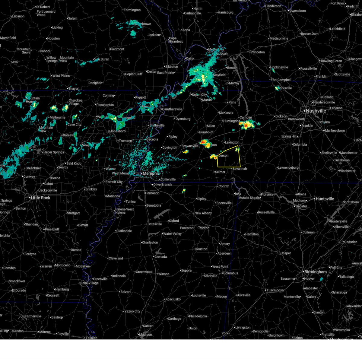
| 4/28/2026 4:51 AM CDT |
 At 451 am cdt, a severe thunderstorm was located near morris chapel, or 7 miles north of savannah, moving east at 30 mph (radar indicated). Hazards include 60 mph wind gusts. Expect damage to roofs, siding, and trees. Locations impacted include, savannah, adamsville, decaturville, sardis, reagan, olive hill, morris chapel, montgomery, crump, scotts hill, saltillo, milledgeville, enville, good hope, right, phillips, haney, hinkle, roby, and pleasant grove. At 451 am cdt, a severe thunderstorm was located near morris chapel, or 7 miles north of savannah, moving east at 30 mph (radar indicated). Hazards include 60 mph wind gusts. Expect damage to roofs, siding, and trees. Locations impacted include, savannah, adamsville, decaturville, sardis, reagan, olive hill, morris chapel, montgomery, crump, scotts hill, saltillo, milledgeville, enville, good hope, right, phillips, haney, hinkle, roby, and pleasant grove.
|
| 4/28/2026 4:36 AM CDT |
 At 436 am cdt, a severe thunderstorm was located near jacks creek, or 10 miles southeast of henderson, moving east at 45 mph (radar indicated). Hazards include 60 mph wind gusts. Expect damage to roofs, siding, and trees. Locations impacted include, savannah, henderson, parsons, adamsville, decaturville, sardis, reagan, morris chapel, jacks creek, olive hill, montgomery, mcnairy, crump, scotts hill, bethel springs, saltillo, finger, milledgeville, enville, and pleasant grove. At 436 am cdt, a severe thunderstorm was located near jacks creek, or 10 miles southeast of henderson, moving east at 45 mph (radar indicated). Hazards include 60 mph wind gusts. Expect damage to roofs, siding, and trees. Locations impacted include, savannah, henderson, parsons, adamsville, decaturville, sardis, reagan, morris chapel, jacks creek, olive hill, montgomery, mcnairy, crump, scotts hill, bethel springs, saltillo, finger, milledgeville, enville, and pleasant grove.
|
| 4/28/2026 4:20 AM CDT |
 Svrmeg the national weather service in memphis has issued a * severe thunderstorm warning for, southern henderson county in west tennessee, northern mcnairy county in west tennessee, northern hardin county in west tennessee, southeastern madison county in west tennessee, chester county in west tennessee, decatur county in west tennessee, * until 515 am cdt. * at 420 am cdt, a severe thunderstorm was located near chickasaw state park, moving east at 30 mph (radar indicated). Hazards include 60 mph wind gusts and nickel size hail. expect damage to roofs, siding, and trees Svrmeg the national weather service in memphis has issued a * severe thunderstorm warning for, southern henderson county in west tennessee, northern mcnairy county in west tennessee, northern hardin county in west tennessee, southeastern madison county in west tennessee, chester county in west tennessee, decatur county in west tennessee, * until 515 am cdt. * at 420 am cdt, a severe thunderstorm was located near chickasaw state park, moving east at 30 mph (radar indicated). Hazards include 60 mph wind gusts and nickel size hail. expect damage to roofs, siding, and trees
|
| 4/28/2026 2:06 AM CDT |
 The storm which prompted the warning has weakened below severe limits, and no longer poses an immediate threat to life or property. therefore, the warning will be allowed to expire. a tornado watch remains in effect until 500 am cdt for west tennessee. The storm which prompted the warning has weakened below severe limits, and no longer poses an immediate threat to life or property. therefore, the warning will be allowed to expire. a tornado watch remains in effect until 500 am cdt for west tennessee.
|
| 4/28/2026 1:39 AM CDT |
 Svrmeg the national weather service in memphis has issued a * severe thunderstorm warning for, henderson county in west tennessee, southern benton county in west tennessee, carroll county in west tennessee, eastern madison county in west tennessee, northeastern chester county in west tennessee, decatur county in west tennessee, * until 215 am cdt. * at 139 am cdt, a severe thunderstorm was located near bargerton, or 12 miles northwest of lexington, moving east at 50 mph (radar indicated). Hazards include 60 mph wind gusts and nickel size hail. expect damage to roofs, siding, and trees Svrmeg the national weather service in memphis has issued a * severe thunderstorm warning for, henderson county in west tennessee, southern benton county in west tennessee, carroll county in west tennessee, eastern madison county in west tennessee, northeastern chester county in west tennessee, decatur county in west tennessee, * until 215 am cdt. * at 139 am cdt, a severe thunderstorm was located near bargerton, or 12 miles northwest of lexington, moving east at 50 mph (radar indicated). Hazards include 60 mph wind gusts and nickel size hail. expect damage to roofs, siding, and trees
|
| 4/28/2026 12:50 AM CDT |
 The storm which prompted the warning has weakened below severe limits, and no longer poses an immediate threat to life or property. therefore, the warning will be allowed to expire. a tornado watch remains in effect until 500 am cdt for west tennessee. The storm which prompted the warning has weakened below severe limits, and no longer poses an immediate threat to life or property. therefore, the warning will be allowed to expire. a tornado watch remains in effect until 500 am cdt for west tennessee.
|
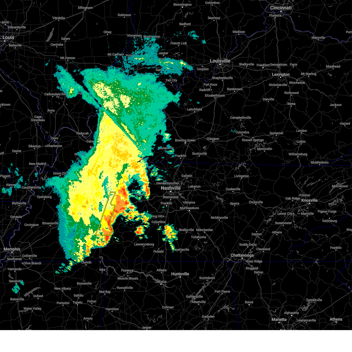
| 4/28/2026 12:42 AM CDT |
 At 1242 am cdt, a severe thunderstorm was located near morris chapel, or 12 miles southeast of henderson, moving east at 45 mph (radar indicated). Hazards include 60 mph wind gusts and quarter size hail. Hail damage to vehicles is expected. expect wind damage to roofs, siding, and trees. Locations impacted include, henderson, adamsville, sardis, jacks creek, reagan, morris chapel, mcnairy, finger, milledgeville, enville, right, sibley, hinkle, roby, cabo, and coffee landing. At 1242 am cdt, a severe thunderstorm was located near morris chapel, or 12 miles southeast of henderson, moving east at 45 mph (radar indicated). Hazards include 60 mph wind gusts and quarter size hail. Hail damage to vehicles is expected. expect wind damage to roofs, siding, and trees. Locations impacted include, henderson, adamsville, sardis, jacks creek, reagan, morris chapel, mcnairy, finger, milledgeville, enville, right, sibley, hinkle, roby, cabo, and coffee landing.
|
| 4/28/2026 12:36 AM CDT | Tree down across hwy 104. radar estimated tim in henderson county TN, 2.1 miles SSE of Sardis, TN |
| 4/28/2026 12:27 AM CDT |
 At 1227 am cdt, a severe thunderstorm was located near masseyville, or 7 miles south of henderson, moving east at 40 mph (radar indicated). Hazards include 60 mph wind gusts and quarter size hail. Hail damage to vehicles is expected. expect wind damage to roofs, siding, and trees. Locations impacted include, henderson, chickasaw state park, adamsville, sardis, masseyville, reagan, jacks creek, morris chapel, robertson, mcnairy, bethel springs, finger, milledgeville, enville, right, hinkle, hickory corners, roby, cabo, and woodville. At 1227 am cdt, a severe thunderstorm was located near masseyville, or 7 miles south of henderson, moving east at 40 mph (radar indicated). Hazards include 60 mph wind gusts and quarter size hail. Hail damage to vehicles is expected. expect wind damage to roofs, siding, and trees. Locations impacted include, henderson, chickasaw state park, adamsville, sardis, masseyville, reagan, jacks creek, morris chapel, robertson, mcnairy, bethel springs, finger, milledgeville, enville, right, hinkle, hickory corners, roby, cabo, and woodville.
|
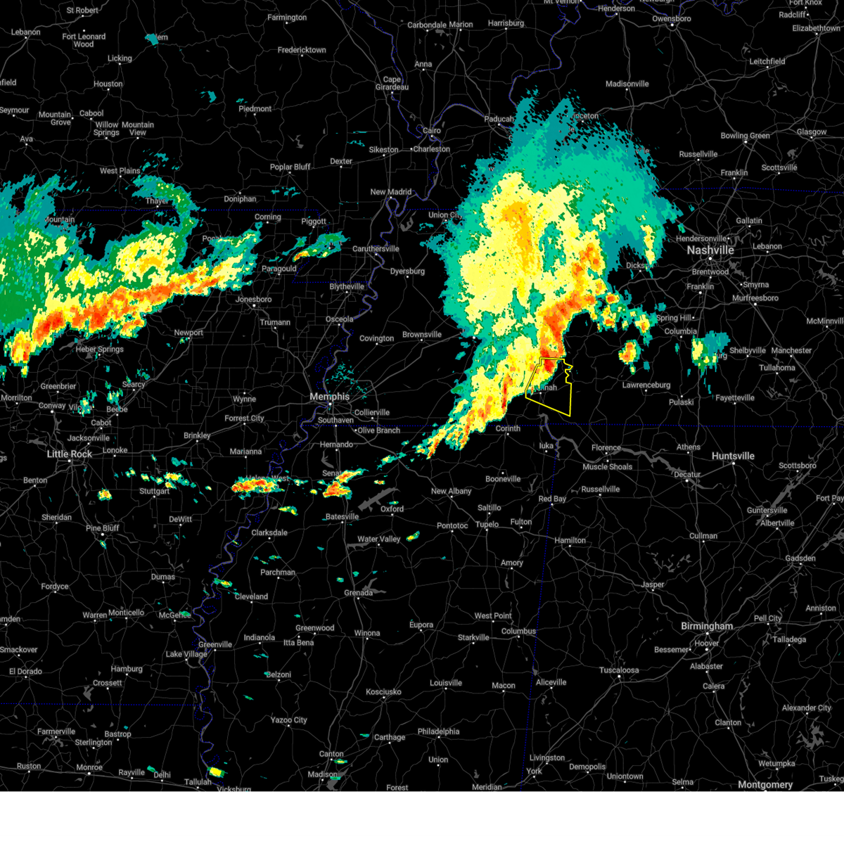
| 4/28/2026 12:11 AM CDT |
 Svrmeg the national weather service in memphis has issued a * severe thunderstorm warning for, southern henderson county in west tennessee, northeastern hardeman county in west tennessee, northern mcnairy county in west tennessee, northwestern hardin county in west tennessee, southeastern madison county in west tennessee, chester county in west tennessee, * until 100 am cdt. * at 1211 am cdt, a severe thunderstorm was located over chickasaw state forest, moving east at 45 mph (radar indicated). Hazards include 60 mph wind gusts and quarter size hail. Hail damage to vehicles is expected. Expect wind damage to roofs, siding, and trees. Svrmeg the national weather service in memphis has issued a * severe thunderstorm warning for, southern henderson county in west tennessee, northeastern hardeman county in west tennessee, northern mcnairy county in west tennessee, northwestern hardin county in west tennessee, southeastern madison county in west tennessee, chester county in west tennessee, * until 100 am cdt. * at 1211 am cdt, a severe thunderstorm was located over chickasaw state forest, moving east at 45 mph (radar indicated). Hazards include 60 mph wind gusts and quarter size hail. Hail damage to vehicles is expected. Expect wind damage to roofs, siding, and trees.
|
| 4/16/2026 9:04 PM CDT |
 At 903 pm cdt, a severe thunderstorm was located near blue goose, or 9 miles west of lexington, moving southeast at 35 mph (radar indicated). Hazards include 60 mph wind gusts and quarter size hail. Hail damage to vehicles is expected. expect wind damage to roofs, siding, and trees. locations impacted include, lexington, natchez trace state park, natchez trace state forest, sardis, reagan, blue goose, parkers crossroads, darden, bargerton, wildersville, scotts hill, cedar grove, rock hill, union cross, juno, middle fork, timberlake, hinson springs, parker's cross roads, and mount gilead. This includes interstate 40 in tennessee between mile markers 96 and 109. At 903 pm cdt, a severe thunderstorm was located near blue goose, or 9 miles west of lexington, moving southeast at 35 mph (radar indicated). Hazards include 60 mph wind gusts and quarter size hail. Hail damage to vehicles is expected. expect wind damage to roofs, siding, and trees. locations impacted include, lexington, natchez trace state park, natchez trace state forest, sardis, reagan, blue goose, parkers crossroads, darden, bargerton, wildersville, scotts hill, cedar grove, rock hill, union cross, juno, middle fork, timberlake, hinson springs, parker's cross roads, and mount gilead. This includes interstate 40 in tennessee between mile markers 96 and 109.
|
| 4/16/2026 8:50 PM CDT |
 Svrmeg the national weather service in memphis has issued a * severe thunderstorm warning for, henderson county in west tennessee, southeastern gibson county in west tennessee, southwestern carroll county in west tennessee, northeastern madison county in west tennessee, * until 930 pm cdt. * at 850 pm cdt, a severe thunderstorm was located near blue goose, or 8 miles northeast of jackson, moving southeast at 35 mph (radar indicated). Hazards include 60 mph wind gusts and quarter size hail. Hail damage to vehicles is expected. Expect wind damage to roofs, siding, and trees. Svrmeg the national weather service in memphis has issued a * severe thunderstorm warning for, henderson county in west tennessee, southeastern gibson county in west tennessee, southwestern carroll county in west tennessee, northeastern madison county in west tennessee, * until 930 pm cdt. * at 850 pm cdt, a severe thunderstorm was located near blue goose, or 8 miles northeast of jackson, moving southeast at 35 mph (radar indicated). Hazards include 60 mph wind gusts and quarter size hail. Hail damage to vehicles is expected. Expect wind damage to roofs, siding, and trees.
|
| 3/15/2026 9:41 PM CDT |
 The storms which prompted the warning have moved out of the area. therefore, the warning will be allowed to expire. a tornado watch remains in effect until 1100 pm cdt for west tennessee. The storms which prompted the warning have moved out of the area. therefore, the warning will be allowed to expire. a tornado watch remains in effect until 1100 pm cdt for west tennessee.
|
| 3/15/2026 9:26 PM CDT |
 the severe thunderstorm warning has been cancelled and is no longer in effect the severe thunderstorm warning has been cancelled and is no longer in effect
|
| 3/15/2026 9:26 PM CDT |
 At 926 pm cdt, severe thunderstorms were located along a line extending from 13 miles northeast of parsons to near corinth, moving east at 45 mph (radar indicated). Hazards include 60 mph wind gusts and nickel size hail. Expect damage to roofs, siding, and trees. locations impacted include, lexington, selmer, natchez trace state park, big hill pond state park, natchez trace state forest, parsons, adamsville, sardis, reagan, darden, scotts hill, bethel springs, eastview, guys, ramer, milledgeville, enville, forty forks, good hope, and jeannette. This includes interstate 40 in tennessee near mile marker 113. At 926 pm cdt, severe thunderstorms were located along a line extending from 13 miles northeast of parsons to near corinth, moving east at 45 mph (radar indicated). Hazards include 60 mph wind gusts and nickel size hail. Expect damage to roofs, siding, and trees. locations impacted include, lexington, selmer, natchez trace state park, big hill pond state park, natchez trace state forest, parsons, adamsville, sardis, reagan, darden, scotts hill, bethel springs, eastview, guys, ramer, milledgeville, enville, forty forks, good hope, and jeannette. This includes interstate 40 in tennessee near mile marker 113.
|
| 3/15/2026 9:25 PM CDT |
 Svrmeg the national weather service in memphis has issued a * severe thunderstorm warning for, southeastern henderson county in west tennessee, eastern mcnairy county in west tennessee, hardin county in west tennessee, decatur county in west tennessee, * until 1015 pm cdt. * at 925 pm cdt, severe thunderstorms were located along a line extending from 9 miles northeast of parsons to near corinth, moving east at 50 mph (radar indicated). Hazards include 60 mph wind gusts and nickel size hail. expect damage to roofs, siding, and trees Svrmeg the national weather service in memphis has issued a * severe thunderstorm warning for, southeastern henderson county in west tennessee, eastern mcnairy county in west tennessee, hardin county in west tennessee, decatur county in west tennessee, * until 1015 pm cdt. * at 925 pm cdt, severe thunderstorms were located along a line extending from 9 miles northeast of parsons to near corinth, moving east at 50 mph (radar indicated). Hazards include 60 mph wind gusts and nickel size hail. expect damage to roofs, siding, and trees
|
| 3/15/2026 9:18 PM CDT |
 At 917 pm cdt, severe thunderstorms were located along a line extending from 9 miles north of parsons to near corinth, moving east at 45 mph (radar indicated). Hazards include 60 mph wind gusts and nickel size hail. Expect damage to roofs, siding, and trees. locations impacted include, lexington, henderson, selmer, natchez trace state park, natchez trace state forest, big hill pond state park, parsons, adamsville, sardis, masseyville, reagan, mifflin, bargerton, wildersville, pocahontas, jacks creek, parkers crossroads, darden, robertson, and mcnairy. This includes interstate 40 in tennessee between mile markers 103 and 113. At 917 pm cdt, severe thunderstorms were located along a line extending from 9 miles north of parsons to near corinth, moving east at 45 mph (radar indicated). Hazards include 60 mph wind gusts and nickel size hail. Expect damage to roofs, siding, and trees. locations impacted include, lexington, henderson, selmer, natchez trace state park, natchez trace state forest, big hill pond state park, parsons, adamsville, sardis, masseyville, reagan, mifflin, bargerton, wildersville, pocahontas, jacks creek, parkers crossroads, darden, robertson, and mcnairy. This includes interstate 40 in tennessee between mile markers 103 and 113.
|
| 3/15/2026 9:18 PM CDT |
 the severe thunderstorm warning has been cancelled and is no longer in effect the severe thunderstorm warning has been cancelled and is no longer in effect
|
| 3/15/2026 8:58 PM CDT |
 Svrmeg the national weather service in memphis has issued a * severe thunderstorm warning for, henderson county in west tennessee, eastern hardeman county in west tennessee, mcnairy county in west tennessee, southeastern madison county in west tennessee, chester county in west tennessee, central decatur county in west tennessee, * until 945 pm cdt. * at 857 pm cdt, severe thunderstorms were located along a line extending from wildersville to near pocahontas, moving east at 45 mph (radar indicated). Hazards include 60 mph wind gusts and nickel size hail. expect damage to roofs, siding, and trees Svrmeg the national weather service in memphis has issued a * severe thunderstorm warning for, henderson county in west tennessee, eastern hardeman county in west tennessee, mcnairy county in west tennessee, southeastern madison county in west tennessee, chester county in west tennessee, central decatur county in west tennessee, * until 945 pm cdt. * at 857 pm cdt, severe thunderstorms were located along a line extending from wildersville to near pocahontas, moving east at 45 mph (radar indicated). Hazards include 60 mph wind gusts and nickel size hail. expect damage to roofs, siding, and trees
|
| 3/11/2026 1:21 PM CDT |
 At 121 pm cdt, a severe thunderstorm was located near savannah, moving northeast at 55 mph (radar indicated). Hazards include 60 mph wind gusts and quarter size hail. Hail damage to vehicles is expected. expect wind damage to roofs, siding, and trees. Locations impacted include, corinth, savannah, pickwick landing state park, adamsville, sardis, pickwick dam, morris chapel, shiloh, olive hill, montgomery, farmington, crump, eastview, michie, guys, saltillo, stantonville, milledgeville, kossuth, and bruton branch. At 121 pm cdt, a severe thunderstorm was located near savannah, moving northeast at 55 mph (radar indicated). Hazards include 60 mph wind gusts and quarter size hail. Hail damage to vehicles is expected. expect wind damage to roofs, siding, and trees. Locations impacted include, corinth, savannah, pickwick landing state park, adamsville, sardis, pickwick dam, morris chapel, shiloh, olive hill, montgomery, farmington, crump, eastview, michie, guys, saltillo, stantonville, milledgeville, kossuth, and bruton branch.
|
| 3/11/2026 1:15 PM CDT |
 At 115 pm cdt, a severe thunderstorm was located near adamsville, or near savannah, moving northeast at 55 mph (radar indicated). Hazards include 60 mph wind gusts and quarter size hail. Hail damage to vehicles is expected. expect wind damage to roofs, siding, and trees. Locations impacted include, corinth, savannah, pickwick landing state park, adamsville, sardis, pickwick dam, morris chapel, shiloh, olive hill, montgomery, farmington, crump, eastview, michie, guys, saltillo, stantonville, milledgeville, kossuth, and bruton branch. At 115 pm cdt, a severe thunderstorm was located near adamsville, or near savannah, moving northeast at 55 mph (radar indicated). Hazards include 60 mph wind gusts and quarter size hail. Hail damage to vehicles is expected. expect wind damage to roofs, siding, and trees. Locations impacted include, corinth, savannah, pickwick landing state park, adamsville, sardis, pickwick dam, morris chapel, shiloh, olive hill, montgomery, farmington, crump, eastview, michie, guys, saltillo, stantonville, milledgeville, kossuth, and bruton branch.
|
| 3/11/2026 12:55 PM CDT |
 Svrmeg the national weather service in memphis has issued a * severe thunderstorm warning for, northern alcorn county in northeastern mississippi, mcnairy county in west tennessee, hardin county in west tennessee, southern decatur county in west tennessee, * until 200 pm cdt. * at 1255 pm cdt, a severe thunderstorm was located near selmer, moving northeast at 55 mph (radar indicated). Hazards include 60 mph wind gusts and quarter size hail. Hail damage to vehicles is expected. Expect wind damage to roofs, siding, and trees. Svrmeg the national weather service in memphis has issued a * severe thunderstorm warning for, northern alcorn county in northeastern mississippi, mcnairy county in west tennessee, hardin county in west tennessee, southern decatur county in west tennessee, * until 200 pm cdt. * at 1255 pm cdt, a severe thunderstorm was located near selmer, moving northeast at 55 mph (radar indicated). Hazards include 60 mph wind gusts and quarter size hail. Hail damage to vehicles is expected. Expect wind damage to roofs, siding, and trees.
|
| 9/23/2025 4:10 PM CDT | Svrmeg the national weather service in memphis has issued a * severe thunderstorm warning for, southeastern henderson county in west tennessee, decatur county in west tennessee, * until 500 pm cdt. * at 410 pm cdt, a severe thunderstorm was located near reagan, or 8 miles southeast of lexington, moving east at 20 mph (radar indicated). Hazards include 60 mph wind gusts and quarter size hail. Hail damage to vehicles is expected. Expect wind damage to roofs, siding, and trees. |
| 9/5/2025 5:53 PM CDT |
 the severe thunderstorm warning has been cancelled and is no longer in effect the severe thunderstorm warning has been cancelled and is no longer in effect
|
| 9/5/2025 5:38 PM CDT |
 At 537 pm cdt, a severe thunderstorm was located 7 miles south of decaturville, or 18 miles north of savannah, moving east at 25 mph (radar indicated). Hazards include 60 mph wind gusts and quarter size hail. Hail damage to vehicles is expected. expect wind damage to roofs, siding, and trees. Locations impacted include, savannah, decaturville, olive hill, montgomery, crump, scotts hill, saltillo, phillips, haney, pleasant grove, red walnut, olivehill, cerro gordo, thurman, lick skillet, perryville, gumdale, sibley, five forks, and bath springs. At 537 pm cdt, a severe thunderstorm was located 7 miles south of decaturville, or 18 miles north of savannah, moving east at 25 mph (radar indicated). Hazards include 60 mph wind gusts and quarter size hail. Hail damage to vehicles is expected. expect wind damage to roofs, siding, and trees. Locations impacted include, savannah, decaturville, olive hill, montgomery, crump, scotts hill, saltillo, phillips, haney, pleasant grove, red walnut, olivehill, cerro gordo, thurman, lick skillet, perryville, gumdale, sibley, five forks, and bath springs.
|
| 9/5/2025 5:38 PM CDT |
 the severe thunderstorm warning has been cancelled and is no longer in effect the severe thunderstorm warning has been cancelled and is no longer in effect
|
| 9/5/2025 5:24 PM CDT | Tree down on sanderson roa in henderson county TN, 1.8 miles SE of Sardis, TN |
| 9/5/2025 5:24 PM CDT |
 Svrmeg the national weather service in memphis has issued a * severe thunderstorm warning for, southeastern henderson county in west tennessee, northern hardin county in west tennessee, southern decatur county in west tennessee, * until 615 pm cdt. * at 524 pm cdt, a severe thunderstorm was located near sardis, or 15 miles southeast of lexington, moving east at 25 mph (radar indicated). Hazards include 60 mph wind gusts and half dollar size hail. Hail damage to vehicles is expected. Expect wind damage to roofs, siding, and trees. Svrmeg the national weather service in memphis has issued a * severe thunderstorm warning for, southeastern henderson county in west tennessee, northern hardin county in west tennessee, southern decatur county in west tennessee, * until 615 pm cdt. * at 524 pm cdt, a severe thunderstorm was located near sardis, or 15 miles southeast of lexington, moving east at 25 mph (radar indicated). Hazards include 60 mph wind gusts and half dollar size hail. Hail damage to vehicles is expected. Expect wind damage to roofs, siding, and trees.
|
| 9/5/2025 5:19 PM CDT |
 the severe thunderstorm warning has been cancelled and is no longer in effect the severe thunderstorm warning has been cancelled and is no longer in effect
|
| 9/5/2025 5:19 PM CDT |
 At 519 pm cdt, a severe thunderstorm was located near sardis, or 11 miles north of savannah, moving northeast at 10 mph (radar indicated). Hazards include 60 mph wind gusts and half dollar size hail. Hail damage to vehicles is expected. expect wind damage to roofs, siding, and trees. Locations impacted include, decaturville, sardis, reagan, morris chapel, montgomery, scotts hill, saltillo, milledgeville, thurman, lick skillet, right, sibley, haney, hinkle, five forks, pleasant grove, red walnut, swift, dunbar, and taylors crossing. At 519 pm cdt, a severe thunderstorm was located near sardis, or 11 miles north of savannah, moving northeast at 10 mph (radar indicated). Hazards include 60 mph wind gusts and half dollar size hail. Hail damage to vehicles is expected. expect wind damage to roofs, siding, and trees. Locations impacted include, decaturville, sardis, reagan, morris chapel, montgomery, scotts hill, saltillo, milledgeville, thurman, lick skillet, right, sibley, haney, hinkle, five forks, pleasant grove, red walnut, swift, dunbar, and taylors crossing.
|
| 9/5/2025 5:04 PM CDT |
 At 503 pm cdt, a severe thunderstorm was located near morris chapel, or 10 miles northwest of savannah, moving east at 20 mph (radar indicated). Hazards include 60 mph wind gusts and half dollar size hail. Hail damage to vehicles is expected. expect wind damage to roofs, siding, and trees. Locations impacted include, adamsville, decaturville, sardis, reagan, morris chapel, montgomery, scotts hill, saltillo, milledgeville, enville, good hope, right, haney, hinkle, roby, pleasant grove, cabo, red walnut, cerro gordo, and thurman. At 503 pm cdt, a severe thunderstorm was located near morris chapel, or 10 miles northwest of savannah, moving east at 20 mph (radar indicated). Hazards include 60 mph wind gusts and half dollar size hail. Hail damage to vehicles is expected. expect wind damage to roofs, siding, and trees. Locations impacted include, adamsville, decaturville, sardis, reagan, morris chapel, montgomery, scotts hill, saltillo, milledgeville, enville, good hope, right, haney, hinkle, roby, pleasant grove, cabo, red walnut, cerro gordo, and thurman.
|
| 9/5/2025 4:38 PM CDT |
 Svrmeg the national weather service in memphis has issued a * severe thunderstorm warning for, southeastern henderson county in west tennessee, northeastern mcnairy county in west tennessee, northern hardin county in west tennessee, east central chester county in west tennessee, southwestern decatur county in west tennessee, * until 530 pm cdt. * at 438 pm cdt, a severe thunderstorm was located near morris chapel, or 12 miles southeast of henderson, moving east at 20 mph (radar indicated). Hazards include 60 mph wind gusts and quarter size hail. Hail damage to vehicles is expected. Expect wind damage to roofs, siding, and trees. Svrmeg the national weather service in memphis has issued a * severe thunderstorm warning for, southeastern henderson county in west tennessee, northeastern mcnairy county in west tennessee, northern hardin county in west tennessee, east central chester county in west tennessee, southwestern decatur county in west tennessee, * until 530 pm cdt. * at 438 pm cdt, a severe thunderstorm was located near morris chapel, or 12 miles southeast of henderson, moving east at 20 mph (radar indicated). Hazards include 60 mph wind gusts and quarter size hail. Hail damage to vehicles is expected. Expect wind damage to roofs, siding, and trees.
|
| 5/25/2025 2:08 PM CDT |
 The storm which prompted the warning has moved out of the area. therefore, the warning will be allowed to expire. The storm which prompted the warning has moved out of the area. therefore, the warning will be allowed to expire.
|
| 5/25/2025 2:07 PM CDT |
 the severe thunderstorm warning has been cancelled and is no longer in effect the severe thunderstorm warning has been cancelled and is no longer in effect
|
| 5/25/2025 2:07 PM CDT |
 At 207 pm cdt, a severe thunderstorm was located 7 miles west of waynesboro, moving east at 60 mph (radar indicated). Hazards include 60 mph wind gusts and penny size hail. Expect damage to roofs, siding, and trees. Locations impacted include, thurman, lowryville, saltillo, savannah, olive hill, right, crump, sibley, phillips, center star, bath springs, five forks, pleasant grove, maddox, swift, dunbar, walkertown, olivehill, bucktown, and cerro gordo. At 207 pm cdt, a severe thunderstorm was located 7 miles west of waynesboro, moving east at 60 mph (radar indicated). Hazards include 60 mph wind gusts and penny size hail. Expect damage to roofs, siding, and trees. Locations impacted include, thurman, lowryville, saltillo, savannah, olive hill, right, crump, sibley, phillips, center star, bath springs, five forks, pleasant grove, maddox, swift, dunbar, walkertown, olivehill, bucktown, and cerro gordo.
|
| 5/25/2025 1:58 PM CDT |
 the severe thunderstorm warning has been cancelled and is no longer in effect the severe thunderstorm warning has been cancelled and is no longer in effect
|
| 5/25/2025 1:58 PM CDT |
 At 157 pm cdt, a severe thunderstorm was located 10 miles northeast of parsons, or 12 miles northwest of linden, moving east at 45 mph (radar indicated). Hazards include 60 mph wind gusts and penny size hail. Expect damage to roofs, siding, and trees. Locations impacted include, nathan bedford forrest state park, busseltown, jeannette, haney, mount tabor, sugar tree, parsons, red walnut, decaturville, scotts hill, cozette, camden, lick skillet, sardis, perryville, gumdale, montgomery, wilkinstown, darden, and bath springs. At 157 pm cdt, a severe thunderstorm was located 10 miles northeast of parsons, or 12 miles northwest of linden, moving east at 45 mph (radar indicated). Hazards include 60 mph wind gusts and penny size hail. Expect damage to roofs, siding, and trees. Locations impacted include, nathan bedford forrest state park, busseltown, jeannette, haney, mount tabor, sugar tree, parsons, red walnut, decaturville, scotts hill, cozette, camden, lick skillet, sardis, perryville, gumdale, montgomery, wilkinstown, darden, and bath springs.
|
| 5/25/2025 1:58 PM CDT |
 At 158 pm cdt, a severe thunderstorm was located near olive hill, or 13 miles northeast of savannah, moving east at 60 mph (radar indicated). Hazards include 60 mph wind gusts and penny size hail. Expect damage to roofs, siding, and trees. Locations impacted include, saltillo, good hope, right, adamsville, crump, phillips, hinkle, pleasant grove, enville, walkertown, olivehill, cerro gordo, thurman, lowryville, hickory flats, savannah, olive hill, sardis, milledgeville, and sibley. At 158 pm cdt, a severe thunderstorm was located near olive hill, or 13 miles northeast of savannah, moving east at 60 mph (radar indicated). Hazards include 60 mph wind gusts and penny size hail. Expect damage to roofs, siding, and trees. Locations impacted include, saltillo, good hope, right, adamsville, crump, phillips, hinkle, pleasant grove, enville, walkertown, olivehill, cerro gordo, thurman, lowryville, hickory flats, savannah, olive hill, sardis, milledgeville, and sibley.
|
| 5/25/2025 1:45 PM CDT |
 At 145 pm cdt, a severe thunderstorm was located 7 miles east of natchez trace state park, moving east at 45 mph (radar indicated). Hazards include 60 mph wind gusts and penny size hail. Expect damage to roofs, siding, and trees. Locations impacted include, nathan bedford forrest state park, dollar, busseltown, jeannette, reagan, haney, lexington, rock hill, holladay, roby, mount tabor, sugar tree, parsons, red walnut, timberlake, decaturville, hinson springs, scotts hill, cozette, and camden. At 145 pm cdt, a severe thunderstorm was located 7 miles east of natchez trace state park, moving east at 45 mph (radar indicated). Hazards include 60 mph wind gusts and penny size hail. Expect damage to roofs, siding, and trees. Locations impacted include, nathan bedford forrest state park, dollar, busseltown, jeannette, reagan, haney, lexington, rock hill, holladay, roby, mount tabor, sugar tree, parsons, red walnut, timberlake, decaturville, hinson springs, scotts hill, cozette, and camden.
|
| 5/25/2025 1:43 PM CDT |
 Svrmeg the national weather service in memphis has issued a * severe thunderstorm warning for, south central henderson county in west tennessee, northern mcnairy county in west tennessee, hardin county in west tennessee, southeastern chester county in west tennessee, southern decatur county in west tennessee, * until 230 pm cdt. * at 143 pm cdt, a severe thunderstorm was located near morris chapel, or 11 miles northwest of savannah, moving east at 60 mph (radar indicated). Hazards include 60 mph wind gusts and penny size hail. expect damage to roofs, siding, and trees Svrmeg the national weather service in memphis has issued a * severe thunderstorm warning for, south central henderson county in west tennessee, northern mcnairy county in west tennessee, hardin county in west tennessee, southeastern chester county in west tennessee, southern decatur county in west tennessee, * until 230 pm cdt. * at 143 pm cdt, a severe thunderstorm was located near morris chapel, or 11 miles northwest of savannah, moving east at 60 mph (radar indicated). Hazards include 60 mph wind gusts and penny size hail. expect damage to roofs, siding, and trees
|
| 5/25/2025 1:36 PM CDT |
 At 136 pm cdt, a severe thunderstorm was located over natchez trace state park, moving east at 45 mph (radar indicated). Hazards include 60 mph wind gusts and penny size hail. Expect damage to roofs, siding, and trees. Locations impacted include, dollar, reagan, lexington, rock hill, bruceton, holladay, middle fork, decaturville, palmer shelter, hinson springs, buena vista, hollow rock, camden, lick skillet, clarksburg, perryville, montgomery, huron, warrens bluff, and vale. At 136 pm cdt, a severe thunderstorm was located over natchez trace state park, moving east at 45 mph (radar indicated). Hazards include 60 mph wind gusts and penny size hail. Expect damage to roofs, siding, and trees. Locations impacted include, dollar, reagan, lexington, rock hill, bruceton, holladay, middle fork, decaturville, palmer shelter, hinson springs, buena vista, hollow rock, camden, lick skillet, clarksburg, perryville, montgomery, huron, warrens bluff, and vale.
|
| 5/25/2025 1:24 PM CDT |
 Svrmeg the national weather service in memphis has issued a * severe thunderstorm warning for, henderson county in west tennessee, benton county in west tennessee, carroll county in west tennessee, northeastern chester county in west tennessee, decatur county in west tennessee, * until 215 pm cdt. * at 124 pm cdt, a severe thunderstorm was located over parkers crossroads, or near lexington, moving east at 45 mph (radar indicated). Hazards include 60 mph wind gusts and penny size hail. expect damage to roofs, siding, and trees Svrmeg the national weather service in memphis has issued a * severe thunderstorm warning for, henderson county in west tennessee, benton county in west tennessee, carroll county in west tennessee, northeastern chester county in west tennessee, decatur county in west tennessee, * until 215 pm cdt. * at 124 pm cdt, a severe thunderstorm was located over parkers crossroads, or near lexington, moving east at 45 mph (radar indicated). Hazards include 60 mph wind gusts and penny size hail. expect damage to roofs, siding, and trees
|
| 5/8/2025 2:37 PM CDT |
 Svrmeg the national weather service in memphis has issued a * severe thunderstorm warning for, southeastern henderson county in west tennessee, northeastern hardin county in west tennessee, eastern chester county in west tennessee, southern decatur county in west tennessee, * until 330 pm cdt. * at 237 pm cdt, a severe thunderstorm was located over reagan, or 12 miles south of lexington, moving east at 30 mph (radar indicated). Hazards include 60 mph wind gusts and quarter size hail. Hail damage to vehicles is expected. Expect wind damage to roofs, siding, and trees. Svrmeg the national weather service in memphis has issued a * severe thunderstorm warning for, southeastern henderson county in west tennessee, northeastern hardin county in west tennessee, eastern chester county in west tennessee, southern decatur county in west tennessee, * until 330 pm cdt. * at 237 pm cdt, a severe thunderstorm was located over reagan, or 12 miles south of lexington, moving east at 30 mph (radar indicated). Hazards include 60 mph wind gusts and quarter size hail. Hail damage to vehicles is expected. Expect wind damage to roofs, siding, and trees.
|
| 5/8/2025 2:35 PM CDT | Quarter sized hail reported 6.6 miles SE of Sardis, TN |
| 5/2/2025 11:03 AM CDT |
 the severe thunderstorm warning has been cancelled and is no longer in effect the severe thunderstorm warning has been cancelled and is no longer in effect
|
| 5/2/2025 11:03 AM CDT |
 At 1102 am cdt, a severe thunderstorm was located over lexington, moving northeast at 40 mph (radar indicated). Hazards include 60 mph wind gusts and quarter size hail. Hail damage to vehicles is expected. expect wind damage to roofs, siding, and trees. Locations impacted include, cedar grove, reagan, lexington, rock hill, union cross, juno, mount tabor, middle fork, parsons, timberlake, decaturville, hinson springs, scotts hill, parker's cross roads, lick skillet, sardis, parkers crossroads, perryville, mount gilead, and huron. At 1102 am cdt, a severe thunderstorm was located over lexington, moving northeast at 40 mph (radar indicated). Hazards include 60 mph wind gusts and quarter size hail. Hail damage to vehicles is expected. expect wind damage to roofs, siding, and trees. Locations impacted include, cedar grove, reagan, lexington, rock hill, union cross, juno, mount tabor, middle fork, parsons, timberlake, decaturville, hinson springs, scotts hill, parker's cross roads, lick skillet, sardis, parkers crossroads, perryville, mount gilead, and huron.
|
| 5/2/2025 10:51 AM CDT |
 At 1051 am cdt, a severe thunderstorm was located near mifflin, or 8 miles southwest of lexington, moving northeast at 40 mph (radar indicated). Hazards include 60 mph wind gusts and quarter size hail. Hail damage to vehicles is expected. expect wind damage to roofs, siding, and trees. Locations impacted include, hickory flat, cedar grove, beech bluff, reagan, lexington, rock hill, union cross, juno, roby, mount tabor, cabo, middle fork, blue goose, parsons, timberlake, decaturville, enville, hinson springs, scotts hill, and parker's cross roads. At 1051 am cdt, a severe thunderstorm was located near mifflin, or 8 miles southwest of lexington, moving northeast at 40 mph (radar indicated). Hazards include 60 mph wind gusts and quarter size hail. Hail damage to vehicles is expected. expect wind damage to roofs, siding, and trees. Locations impacted include, hickory flat, cedar grove, beech bluff, reagan, lexington, rock hill, union cross, juno, roby, mount tabor, cabo, middle fork, blue goose, parsons, timberlake, decaturville, enville, hinson springs, scotts hill, and parker's cross roads.
|
| 5/2/2025 10:51 AM CDT |
 the severe thunderstorm warning has been cancelled and is no longer in effect the severe thunderstorm warning has been cancelled and is no longer in effect
|
| 5/2/2025 10:43 AM CDT |
 At 1043 am cdt, a severe thunderstorm was located over mifflin, or near henderson, moving northeast at 40 mph (radar indicated). Hazards include 60 mph wind gusts and quarter size hail. Hail damage to vehicles is expected. expect wind damage to roofs, siding, and trees. Locations impacted include, hickory flat, pinson, reagan, madison hall, lexington, rock hill, middle fork, blue goose, decaturville, hinson springs, pinson mounds state archaeological park, lick skillet, milledgeville, perryville, huron, warrens bluff, mifflin, sand ridge, five points, and bargerton. At 1043 am cdt, a severe thunderstorm was located over mifflin, or near henderson, moving northeast at 40 mph (radar indicated). Hazards include 60 mph wind gusts and quarter size hail. Hail damage to vehicles is expected. expect wind damage to roofs, siding, and trees. Locations impacted include, hickory flat, pinson, reagan, madison hall, lexington, rock hill, middle fork, blue goose, decaturville, hinson springs, pinson mounds state archaeological park, lick skillet, milledgeville, perryville, huron, warrens bluff, mifflin, sand ridge, five points, and bargerton.
|
| 5/2/2025 10:37 AM CDT |
 Svrmeg the national weather service in memphis has issued a * severe thunderstorm warning for, henderson county in west tennessee, northeastern mcnairy county in west tennessee, southwestern carroll county in west tennessee, northwestern hardin county in west tennessee, eastern madison county in west tennessee, chester county in west tennessee, southern decatur county in west tennessee, * until 1130 am cdt. * at 1037 am cdt, a severe thunderstorm was located over henderson, moving northeast at 40 mph (radar indicated). Hazards include 60 mph wind gusts and quarter size hail. Hail damage to vehicles is expected. Expect wind damage to roofs, siding, and trees. Svrmeg the national weather service in memphis has issued a * severe thunderstorm warning for, henderson county in west tennessee, northeastern mcnairy county in west tennessee, southwestern carroll county in west tennessee, northwestern hardin county in west tennessee, eastern madison county in west tennessee, chester county in west tennessee, southern decatur county in west tennessee, * until 1130 am cdt. * at 1037 am cdt, a severe thunderstorm was located over henderson, moving northeast at 40 mph (radar indicated). Hazards include 60 mph wind gusts and quarter size hail. Hail damage to vehicles is expected. Expect wind damage to roofs, siding, and trees.
|
| 4/10/2025 5:04 PM CDT |
 the severe thunderstorm warning has been cancelled and is no longer in effect the severe thunderstorm warning has been cancelled and is no longer in effect
|
| 4/10/2025 4:50 PM CDT |
 the severe thunderstorm warning has been cancelled and is no longer in effect the severe thunderstorm warning has been cancelled and is no longer in effect
|
| 4/10/2025 4:50 PM CDT |
 At 450 pm cdt, a severe thunderstorm was located near selmer, moving southeast at 40 mph (public). Hazards include 60 mph wind gusts and quarter size hail. Hail damage to vehicles is expected. expect wind damage to roofs, siding, and trees. Locations impacted include, forty forks, saltillo, rose creek, selmer, good hope, pine top, bethel springs, masseyville, right, adamsville, old lawton, hinkle, silerton, hickory corners, roby, cabo, enville, purdy, jacks creek, and hickory flats. At 450 pm cdt, a severe thunderstorm was located near selmer, moving southeast at 40 mph (public). Hazards include 60 mph wind gusts and quarter size hail. Hail damage to vehicles is expected. expect wind damage to roofs, siding, and trees. Locations impacted include, forty forks, saltillo, rose creek, selmer, good hope, pine top, bethel springs, masseyville, right, adamsville, old lawton, hinkle, silerton, hickory corners, roby, cabo, enville, purdy, jacks creek, and hickory flats.
|
| 4/10/2025 4:40 PM CDT |
 At 440 pm cdt, a severe thunderstorm was located over masseyville, or 9 miles south of henderson, moving southeast at 40 mph (public). Hazards include 60 mph wind gusts and quarter size hail. Hail damage to vehicles is expected. expect wind damage to roofs, siding, and trees. Locations impacted include, pinson, selmer, pine top, masseyville, adamsville, silerton, hickory corners, middle fork, pinson mounds state archaeological park, hornsby, new lawton, martin camp, milledgeville, woodville, mifflin, deanburg, five points, montezuma, robertson, and toone. At 440 pm cdt, a severe thunderstorm was located over masseyville, or 9 miles south of henderson, moving southeast at 40 mph (public). Hazards include 60 mph wind gusts and quarter size hail. Hail damage to vehicles is expected. expect wind damage to roofs, siding, and trees. Locations impacted include, pinson, selmer, pine top, masseyville, adamsville, silerton, hickory corners, middle fork, pinson mounds state archaeological park, hornsby, new lawton, martin camp, milledgeville, woodville, mifflin, deanburg, five points, montezuma, robertson, and toone.
|
| 4/10/2025 4:27 PM CDT |
 Svrmeg the national weather service in memphis has issued a * severe thunderstorm warning for, southwestern henderson county in west tennessee, northeastern hardeman county in west tennessee, central mcnairy county in west tennessee, northwestern hardin county in west tennessee, southeastern madison county in west tennessee, chester county in west tennessee, * until 515 pm cdt. * at 426 pm cdt, a severe thunderstorm was located over chickasaw state park, moving southeast at 40 mph (measured at jackson airport). Hazards include 70 mph wind gusts and quarter size hail. Hail damage to vehicles is expected. expect considerable tree damage. Wind damage is also likely to mobile homes, roofs, and outbuildings. Svrmeg the national weather service in memphis has issued a * severe thunderstorm warning for, southwestern henderson county in west tennessee, northeastern hardeman county in west tennessee, central mcnairy county in west tennessee, northwestern hardin county in west tennessee, southeastern madison county in west tennessee, chester county in west tennessee, * until 515 pm cdt. * at 426 pm cdt, a severe thunderstorm was located over chickasaw state park, moving southeast at 40 mph (measured at jackson airport). Hazards include 70 mph wind gusts and quarter size hail. Hail damage to vehicles is expected. expect considerable tree damage. Wind damage is also likely to mobile homes, roofs, and outbuildings.
|
| 4/3/2025 1:51 PM CDT |
 At 150 pm cdt, a severe thunderstorm was located near darden, or 12 miles southeast of lexington, moving northeast at 65 mph (radar indicated). Hazards include 60 mph wind gusts and quarter size hail. Hail damage to vehicles is expected. expect wind damage to roofs, siding, and trees. Locations impacted include, busseltown, reagan, haney, rock hill, mount tabor, parsons, red walnut, decaturville, scotts hill, cozette, lick skillet, sardis, perryville, gumdale, montgomery, warrens bluff, wilkinstown, darden, garrett, and beacon. At 150 pm cdt, a severe thunderstorm was located near darden, or 12 miles southeast of lexington, moving northeast at 65 mph (radar indicated). Hazards include 60 mph wind gusts and quarter size hail. Hail damage to vehicles is expected. expect wind damage to roofs, siding, and trees. Locations impacted include, busseltown, reagan, haney, rock hill, mount tabor, parsons, red walnut, decaturville, scotts hill, cozette, lick skillet, sardis, perryville, gumdale, montgomery, warrens bluff, wilkinstown, darden, garrett, and beacon.
|
| 4/3/2025 1:51 PM CDT |
 the severe thunderstorm warning has been cancelled and is no longer in effect the severe thunderstorm warning has been cancelled and is no longer in effect
|
| 4/3/2025 1:39 PM CDT |
 At 138 pm cdt, a severe thunderstorm was located near reagan, or 9 miles south of lexington, moving northeast at 55 mph (radar indicated). Hazards include 60 mph wind gusts and penny size hail. Expect damage to roofs, siding, and trees. Locations impacted include, busseltown, jeannette, reagan, haney, lexington, rock hill, hinkle, roby, pleasant grove, mount tabor, cabo, middle fork, parsons, red walnut, decaturville, enville, hinson springs, scotts hill, cozette, and thurman. At 138 pm cdt, a severe thunderstorm was located near reagan, or 9 miles south of lexington, moving northeast at 55 mph (radar indicated). Hazards include 60 mph wind gusts and penny size hail. Expect damage to roofs, siding, and trees. Locations impacted include, busseltown, jeannette, reagan, haney, lexington, rock hill, hinkle, roby, pleasant grove, mount tabor, cabo, middle fork, parsons, red walnut, decaturville, enville, hinson springs, scotts hill, cozette, and thurman.
|
| 4/3/2025 1:24 PM CDT |
 Svrmeg the national weather service in memphis has issued a * severe thunderstorm warning for, southeastern henderson county in west tennessee, northeastern mcnairy county in west tennessee, northwestern hardin county in west tennessee, chester county in west tennessee, decatur county in west tennessee, * until 230 pm cdt. * at 123 pm cdt, a severe thunderstorm was located over henderson, moving northeast at 55 mph (radar indicated). Hazards include 60 mph wind gusts and penny size hail. expect damage to roofs, siding, and trees Svrmeg the national weather service in memphis has issued a * severe thunderstorm warning for, southeastern henderson county in west tennessee, northeastern mcnairy county in west tennessee, northwestern hardin county in west tennessee, chester county in west tennessee, decatur county in west tennessee, * until 230 pm cdt. * at 123 pm cdt, a severe thunderstorm was located over henderson, moving northeast at 55 mph (radar indicated). Hazards include 60 mph wind gusts and penny size hail. expect damage to roofs, siding, and trees
|
| 4/3/2025 2:54 AM CDT |
 At 253 am cdt, a large and extremely dangerous tornado was located near sardis, or 14 miles north of savannah, moving east at 45 mph. this is a particularly dangerous situation. take cover now! (radar indicated rotation). Hazards include damaging tornado. You are in a life-threatening situation. flying debris may be deadly to those caught without shelter. mobile homes will be destroyed. considerable damage to homes, businesses, and vehicles is likely and complete destruction is possible. Locations impacted include, saltillo, busseltown, reagan, haney, rock hill, hinkle, pleasant grove, mount tabor, parsons, red walnut, decaturville, scotts hill, cozette, thurman, lick skillet, sardis, perryville, gumdale, montgomery, and warrens bluff. At 253 am cdt, a large and extremely dangerous tornado was located near sardis, or 14 miles north of savannah, moving east at 45 mph. this is a particularly dangerous situation. take cover now! (radar indicated rotation). Hazards include damaging tornado. You are in a life-threatening situation. flying debris may be deadly to those caught without shelter. mobile homes will be destroyed. considerable damage to homes, businesses, and vehicles is likely and complete destruction is possible. Locations impacted include, saltillo, busseltown, reagan, haney, rock hill, hinkle, pleasant grove, mount tabor, parsons, red walnut, decaturville, scotts hill, cozette, thurman, lick skillet, sardis, perryville, gumdale, montgomery, and warrens bluff.
|
| 4/3/2025 2:54 AM CDT |
 the tornado warning has been cancelled and is no longer in effect the tornado warning has been cancelled and is no longer in effect
|
| 4/3/2025 2:47 AM CDT |
 At 247 am cdt, a large and extremely dangerous tornado was located over sardis, or 14 miles north of savannah, moving northeast at 50 mph. this is a particularly dangerous situation. take cover now! (radar indicated rotation). Hazards include damaging tornado. You are in a life-threatening situation. flying debris may be deadly to those caught without shelter. mobile homes will be destroyed. considerable damage to homes, businesses, and vehicles is likely and complete destruction is possible. Locations impacted include, saltillo, busseltown, right, adamsville, reagan, haney, rock hill, hinkle, roby, pleasant grove, mount tabor, cabo, middle fork, parsons, red walnut, decaturville, enville, scotts hill, cozette, and cerro gordo. At 247 am cdt, a large and extremely dangerous tornado was located over sardis, or 14 miles north of savannah, moving northeast at 50 mph. this is a particularly dangerous situation. take cover now! (radar indicated rotation). Hazards include damaging tornado. You are in a life-threatening situation. flying debris may be deadly to those caught without shelter. mobile homes will be destroyed. considerable damage to homes, businesses, and vehicles is likely and complete destruction is possible. Locations impacted include, saltillo, busseltown, right, adamsville, reagan, haney, rock hill, hinkle, roby, pleasant grove, mount tabor, cabo, middle fork, parsons, red walnut, decaturville, enville, scotts hill, cozette, and cerro gordo.
|
| 4/3/2025 2:43 AM CDT |
 At 243 am cdt, a large and extremely dangerous tornado was located near sardis, or 13 miles north of savannah, moving northeast at 50 mph. this is a particularly dangerous situation. take cover now! (radar indicated rotation). Hazards include damaging tornado. You are in a life-threatening situation. flying debris may be deadly to those caught without shelter. mobile homes will be destroyed. considerable damage to homes, businesses, and vehicles is likely and complete destruction is possible. Locations impacted include, saltillo, busseltown, right, adamsville, reagan, haney, rock hill, hinkle, roby, pleasant grove, mount tabor, cabo, middle fork, parsons, red walnut, decaturville, enville, scotts hill, cozette, and cerro gordo. At 243 am cdt, a large and extremely dangerous tornado was located near sardis, or 13 miles north of savannah, moving northeast at 50 mph. this is a particularly dangerous situation. take cover now! (radar indicated rotation). Hazards include damaging tornado. You are in a life-threatening situation. flying debris may be deadly to those caught without shelter. mobile homes will be destroyed. considerable damage to homes, businesses, and vehicles is likely and complete destruction is possible. Locations impacted include, saltillo, busseltown, right, adamsville, reagan, haney, rock hill, hinkle, roby, pleasant grove, mount tabor, cabo, middle fork, parsons, red walnut, decaturville, enville, scotts hill, cozette, and cerro gordo.
|
| 4/3/2025 2:33 AM CDT |
 the tornado warning has been cancelled and is no longer in effect the tornado warning has been cancelled and is no longer in effect
|
| 4/3/2025 2:33 AM CDT |
 At 233 am cdt, a large and extremely dangerous tornado was located 7 miles northwest of morris chapel, or 11 miles southeast of henderson, moving northeast at 50 mph. this is a particularly dangerous situation. take cover now! (radar indicated rotation). Hazards include damaging tornado. You are in a life-threatening situation. flying debris may be deadly to those caught without shelter. mobile homes will be destroyed. considerable damage to homes, businesses, and vehicles is likely and complete destruction is possible. Locations impacted include, adamsville, reagan, rock hill, pleasant grove, middle fork, decaturville, cerro gordo, thurman, lick skillet, milledgeville, perryville, montgomery, warrens bluff, bath springs, beacon, morris chapel, hickory forks, swift, dunbar, and taylors crossing. At 233 am cdt, a large and extremely dangerous tornado was located 7 miles northwest of morris chapel, or 11 miles southeast of henderson, moving northeast at 50 mph. this is a particularly dangerous situation. take cover now! (radar indicated rotation). Hazards include damaging tornado. You are in a life-threatening situation. flying debris may be deadly to those caught without shelter. mobile homes will be destroyed. considerable damage to homes, businesses, and vehicles is likely and complete destruction is possible. Locations impacted include, adamsville, reagan, rock hill, pleasant grove, middle fork, decaturville, cerro gordo, thurman, lick skillet, milledgeville, perryville, montgomery, warrens bluff, bath springs, beacon, morris chapel, hickory forks, swift, dunbar, and taylors crossing.
|
| 4/3/2025 2:22 AM CDT |
 At 222 am cdt, a large and extremely dangerous tornado was located near masseyville, or 8 miles north of selmer, moving northeast at 50 mph. this is a particularly dangerous situation. take cover now! (radar indicated rotation). Hazards include damaging tornado. You are in a life-threatening situation. flying debris may be deadly to those caught without shelter. mobile homes will be destroyed. considerable damage to homes, businesses, and vehicles is likely and complete destruction is possible. Locations impacted include, pine top, masseyville, adamsville, reagan, rock hill, silerton, hickory corners, pleasant grove, middle fork, decaturville, cerro gordo, thurman, lick skillet, milledgeville, perryville, montgomery, woodville, warrens bluff, bath springs, and montezuma. At 222 am cdt, a large and extremely dangerous tornado was located near masseyville, or 8 miles north of selmer, moving northeast at 50 mph. this is a particularly dangerous situation. take cover now! (radar indicated rotation). Hazards include damaging tornado. You are in a life-threatening situation. flying debris may be deadly to those caught without shelter. mobile homes will be destroyed. considerable damage to homes, businesses, and vehicles is likely and complete destruction is possible. Locations impacted include, pine top, masseyville, adamsville, reagan, rock hill, silerton, hickory corners, pleasant grove, middle fork, decaturville, cerro gordo, thurman, lick skillet, milledgeville, perryville, montgomery, woodville, warrens bluff, bath springs, and montezuma.
|
| 4/3/2025 2:19 AM CDT |
 Tormeg the national weather service in memphis has issued a * tornado warning for, southern henderson county in west tennessee, northeastern hardeman county in west tennessee, northern mcnairy county in west tennessee, northern hardin county in west tennessee, chester county in west tennessee, decatur county in west tennessee, * until 315 am cdt. * at 219 am cdt, a severe thunderstorm capable of producing a tornado was located near masseyville, or 8 miles northwest of selmer, moving northeast at 50 mph (radar indicated rotation). Hazards include tornado and tennis ball size hail. Flying debris will be dangerous to those caught without shelter. mobile homes will be damaged or destroyed. damage to roofs, windows, and vehicles will occur. Tree damage is likely. Tormeg the national weather service in memphis has issued a * tornado warning for, southern henderson county in west tennessee, northeastern hardeman county in west tennessee, northern mcnairy county in west tennessee, northern hardin county in west tennessee, chester county in west tennessee, decatur county in west tennessee, * until 315 am cdt. * at 219 am cdt, a severe thunderstorm capable of producing a tornado was located near masseyville, or 8 miles northwest of selmer, moving northeast at 50 mph (radar indicated rotation). Hazards include tornado and tennis ball size hail. Flying debris will be dangerous to those caught without shelter. mobile homes will be damaged or destroyed. damage to roofs, windows, and vehicles will occur. Tree damage is likely.
|
| 4/3/2025 1:44 AM CDT |
 At 144 am cdt, a severe thunderstorm was located over parsons, or 11 miles southeast of natchez trace state forest, moving northeast at 60 mph (radar indicated). Hazards include 60 mph wind gusts and quarter size hail. Hail damage to vehicles is expected. expect wind damage to roofs, siding, and trees. Locations impacted include, saltillo, busseltown, jeannette, right, reagan, haney, rock hill, hinkle, pleasant grove, mount tabor, sugar tree, parsons, red walnut, decaturville, scotts hill, cozette, thurman, lick skillet, sardis, and perryville. At 144 am cdt, a severe thunderstorm was located over parsons, or 11 miles southeast of natchez trace state forest, moving northeast at 60 mph (radar indicated). Hazards include 60 mph wind gusts and quarter size hail. Hail damage to vehicles is expected. expect wind damage to roofs, siding, and trees. Locations impacted include, saltillo, busseltown, jeannette, right, reagan, haney, rock hill, hinkle, pleasant grove, mount tabor, sugar tree, parsons, red walnut, decaturville, scotts hill, cozette, thurman, lick skillet, sardis, and perryville.
|
| 4/3/2025 1:44 AM CDT |
 the severe thunderstorm warning has been cancelled and is no longer in effect the severe thunderstorm warning has been cancelled and is no longer in effect
|
| 4/3/2025 1:39 AM CDT |
 At 138 am cdt, a severe thunderstorm was located near darden, or 10 miles southeast of natchez trace state forest, moving northeast at 60 mph (radar indicated). Hazards include 60 mph wind gusts and quarter size hail. Hail damage to vehicles is expected. expect wind damage to roofs, siding, and trees. Locations impacted include, reagan, lexington, rock hill, pleasant grove, decaturville, hinson springs, thurman, lick skillet, milledgeville, perryville, montgomery, warrens bluff, natchez trace state park, bath springs, beacon, morris chapel, hickory forks, swift, natchez trace state forest, and dunbar. At 138 am cdt, a severe thunderstorm was located near darden, or 10 miles southeast of natchez trace state forest, moving northeast at 60 mph (radar indicated). Hazards include 60 mph wind gusts and quarter size hail. Hail damage to vehicles is expected. expect wind damage to roofs, siding, and trees. Locations impacted include, reagan, lexington, rock hill, pleasant grove, decaturville, hinson springs, thurman, lick skillet, milledgeville, perryville, montgomery, warrens bluff, natchez trace state park, bath springs, beacon, morris chapel, hickory forks, swift, natchez trace state forest, and dunbar.
|
| 4/3/2025 1:39 AM CDT |
 the severe thunderstorm warning has been cancelled and is no longer in effect the severe thunderstorm warning has been cancelled and is no longer in effect
|
| 4/3/2025 1:26 AM CDT |
 At 126 am cdt, a severe thunderstorm was located over reagan, or 10 miles south of lexington, moving northeast at 60 mph (radar indicated). Hazards include 60 mph wind gusts and quarter size hail. Hail damage to vehicles is expected. expect wind damage to roofs, siding, and trees. Locations impacted include, adamsville, reagan, lexington, rock hill, pleasant grove, middle fork, decaturville, hinson springs, thurman, lick skillet, milledgeville, perryville, montgomery, huron, warrens bluff, mifflin, natchez trace state park, bath springs, five points, and beacon. At 126 am cdt, a severe thunderstorm was located over reagan, or 10 miles south of lexington, moving northeast at 60 mph (radar indicated). Hazards include 60 mph wind gusts and quarter size hail. Hail damage to vehicles is expected. expect wind damage to roofs, siding, and trees. Locations impacted include, adamsville, reagan, lexington, rock hill, pleasant grove, middle fork, decaturville, hinson springs, thurman, lick skillet, milledgeville, perryville, montgomery, huron, warrens bluff, mifflin, natchez trace state park, bath springs, five points, and beacon.
|
| 4/3/2025 1:21 AM CDT |
 Svrmeg the national weather service in memphis has issued a * severe thunderstorm warning for, henderson county in west tennessee, southeastern benton county in west tennessee, northeastern mcnairy county in west tennessee, northern hardin county in west tennessee, east central madison county in west tennessee, central chester county in west tennessee, decatur county in west tennessee, * until 200 am cdt. * at 121 am cdt, a severe thunderstorm was located near jacks creek, or 10 miles east of henderson, moving northeast at 60 mph (radar indicated). Hazards include 60 mph wind gusts and quarter size hail. Hail damage to vehicles is expected. Expect wind damage to roofs, siding, and trees. Svrmeg the national weather service in memphis has issued a * severe thunderstorm warning for, henderson county in west tennessee, southeastern benton county in west tennessee, northeastern mcnairy county in west tennessee, northern hardin county in west tennessee, east central madison county in west tennessee, central chester county in west tennessee, decatur county in west tennessee, * until 200 am cdt. * at 121 am cdt, a severe thunderstorm was located near jacks creek, or 10 miles east of henderson, moving northeast at 60 mph (radar indicated). Hazards include 60 mph wind gusts and quarter size hail. Hail damage to vehicles is expected. Expect wind damage to roofs, siding, and trees.
|
| 4/3/2025 1:12 AM CDT |
 At 112 am cdt, a confirmed large and extremely dangerous tornado was located 7 miles southeast of sardis, or 10 miles north of savannah, moving northeast at 50 mph. this is a particularly dangerous situation. take cover now! (weather spotters confirmed tornado). Hazards include damaging tornado. You are in a life-threatening situation. flying debris may be deadly to those caught without shelter. mobile homes will be destroyed. considerable damage to homes, businesses, and vehicles is likely and complete destruction is possible. Locations impacted include, saltillo, right, crump, phillips, haney, hinkle, pleasant grove, mount tabor, red walnut, decaturville, walkertown, scotts hill, olivehill, cerro gordo, thurman, lick skillet, savannah, olive hill, sardis, and perryville. At 112 am cdt, a confirmed large and extremely dangerous tornado was located 7 miles southeast of sardis, or 10 miles north of savannah, moving northeast at 50 mph. this is a particularly dangerous situation. take cover now! (weather spotters confirmed tornado). Hazards include damaging tornado. You are in a life-threatening situation. flying debris may be deadly to those caught without shelter. mobile homes will be destroyed. considerable damage to homes, businesses, and vehicles is likely and complete destruction is possible. Locations impacted include, saltillo, right, crump, phillips, haney, hinkle, pleasant grove, mount tabor, red walnut, decaturville, walkertown, scotts hill, olivehill, cerro gordo, thurman, lick skillet, savannah, olive hill, sardis, and perryville.
|
| 4/3/2025 1:12 AM CDT |
 the tornado warning has been cancelled and is no longer in effect the tornado warning has been cancelled and is no longer in effect
|
| 4/3/2025 1:00 AM CDT |
 At 100 am cdt, a confirmed large and extremely dangerous tornado was located over morris chapel, or 8 miles northwest of savannah, moving northeast at 50 mph. this is a particularly dangerous situation. take cover now! (weather spotters confirmed tornado). Hazards include damaging tornado. You are in a life-threatening situation. flying debris may be deadly to those caught without shelter. mobile homes will be destroyed. considerable damage to homes, businesses, and vehicles is likely and complete destruction is possible. Locations impacted include, adamsville, crump, pleasant grove, hurley, decaturville, walkertown, cerro gordo, thurman, lick skillet, mount vinson, savannah, milledgeville, perryville, montgomery, gilchrist, bath springs, morris chapel, swift, dunbar, and taylors crossing. At 100 am cdt, a confirmed large and extremely dangerous tornado was located over morris chapel, or 8 miles northwest of savannah, moving northeast at 50 mph. this is a particularly dangerous situation. take cover now! (weather spotters confirmed tornado). Hazards include damaging tornado. You are in a life-threatening situation. flying debris may be deadly to those caught without shelter. mobile homes will be destroyed. considerable damage to homes, businesses, and vehicles is likely and complete destruction is possible. Locations impacted include, adamsville, crump, pleasant grove, hurley, decaturville, walkertown, cerro gordo, thurman, lick skillet, mount vinson, savannah, milledgeville, perryville, montgomery, gilchrist, bath springs, morris chapel, swift, dunbar, and taylors crossing.
|
| 4/3/2025 12:51 AM CDT |
 At 1250 am cdt, a confirmed large and extremely dangerous tornado was located near adamsville, or 7 miles northeast of selmer, moving northeast at 50 mph. this is a particularly dangerous situation. take cover now! (weather spotters confirmed tornado). Hazards include damaging tornado. You are in a life-threatening situation. flying debris may be deadly to those caught without shelter. mobile homes will be destroyed. considerable damage to homes, businesses, and vehicles is likely and complete destruction is possible. Locations impacted include, selmer, adamsville, crump, pleasant grove, hurley, decaturville, walkertown, cerro gordo, thurman, lick skillet, mount vinson, new lawton, martin camp, savannah, milledgeville, perryville, montgomery, gilchrist, bath springs, and morris chapel. At 1250 am cdt, a confirmed large and extremely dangerous tornado was located near adamsville, or 7 miles northeast of selmer, moving northeast at 50 mph. this is a particularly dangerous situation. take cover now! (weather spotters confirmed tornado). Hazards include damaging tornado. You are in a life-threatening situation. flying debris may be deadly to those caught without shelter. mobile homes will be destroyed. considerable damage to homes, businesses, and vehicles is likely and complete destruction is possible. Locations impacted include, selmer, adamsville, crump, pleasant grove, hurley, decaturville, walkertown, cerro gordo, thurman, lick skillet, mount vinson, new lawton, martin camp, savannah, milledgeville, perryville, montgomery, gilchrist, bath springs, and morris chapel.
|
| 4/3/2025 12:37 AM CDT |
 the tornado warning has been cancelled and is no longer in effect the tornado warning has been cancelled and is no longer in effect
|
| 4/3/2025 12:37 AM CDT |
 At 1237 am cdt, a confirmed large and extremely dangerous tornado was located near selmer, moving northeast at 50 mph. this is a particularly dangerous situation. take cover now! (weather spotters confirmed tornado). Hazards include damaging tornado. You are in a life-threatening situation. flying debris may be deadly to those caught without shelter. mobile homes will be destroyed. considerable damage to homes, businesses, and vehicles is likely and complete destruction is possible. Locations impacted include, selmer, eastview, masseyville, adamsville, crump, pleasant grove, hurley, decaturville, ramer, walkertown, cerro gordo, thurman, lick skillet, mount vinson, new lawton, martin camp, savannah, milledgeville, perryville, and montgomery. At 1237 am cdt, a confirmed large and extremely dangerous tornado was located near selmer, moving northeast at 50 mph. this is a particularly dangerous situation. take cover now! (weather spotters confirmed tornado). Hazards include damaging tornado. You are in a life-threatening situation. flying debris may be deadly to those caught without shelter. mobile homes will be destroyed. considerable damage to homes, businesses, and vehicles is likely and complete destruction is possible. Locations impacted include, selmer, eastview, masseyville, adamsville, crump, pleasant grove, hurley, decaturville, ramer, walkertown, cerro gordo, thurman, lick skillet, mount vinson, new lawton, martin camp, savannah, milledgeville, perryville, and montgomery.
|
| 4/3/2025 12:31 AM CDT |
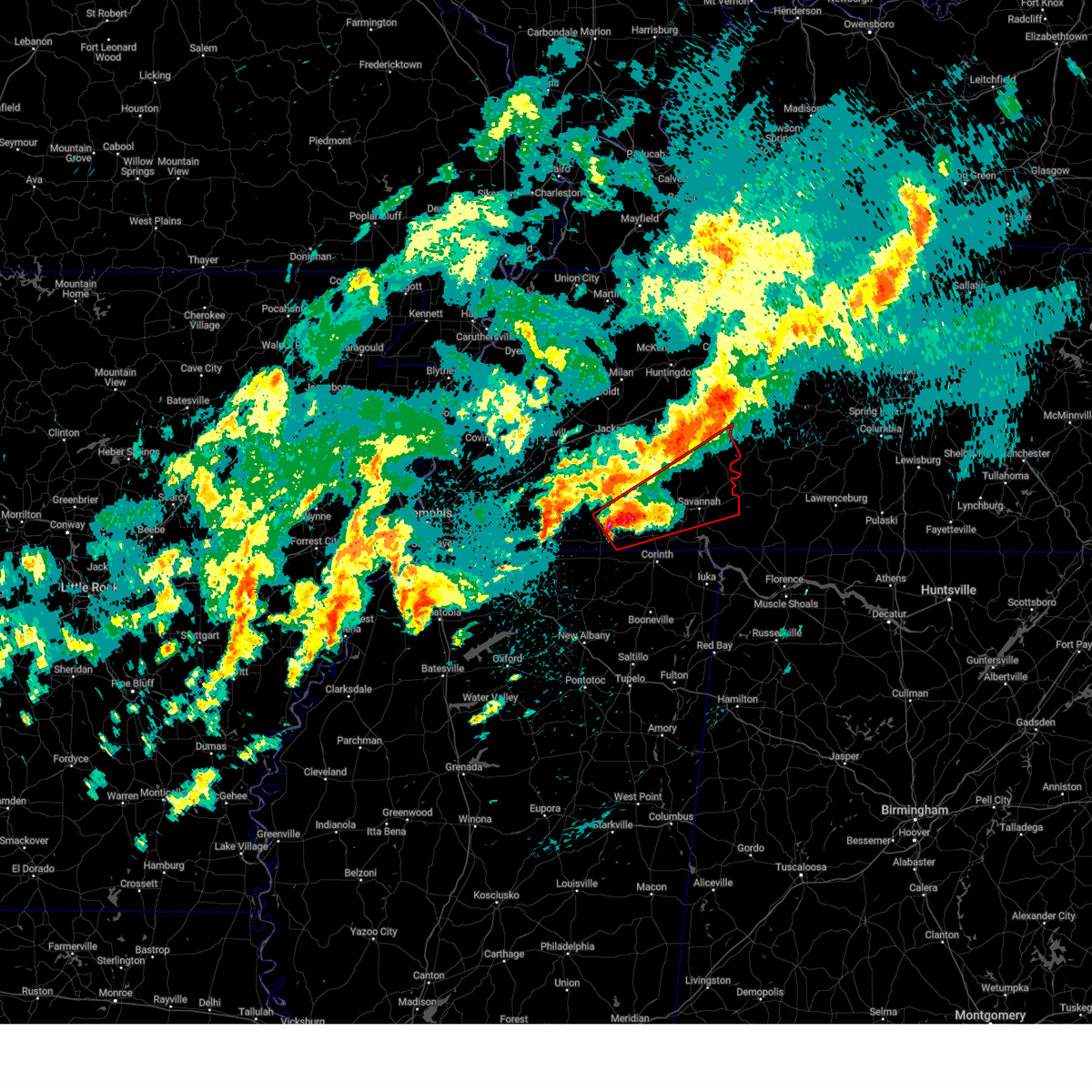 Tormeg the national weather service in memphis has issued a * tornado warning for, southeastern henderson county in west tennessee, east central hardeman county in west tennessee, mcnairy county in west tennessee, hardin county in west tennessee, southeastern chester county in west tennessee, southern decatur county in west tennessee, * until 130 am cdt. * at 1231 am cdt, a confirmed tornado was located near big hill pond state park, moving northeast at 50 mph (weather spotters confirmed tornado). Hazards include damaging tornado and hail up to two inches in diameter. Flying debris will be dangerous to those caught without shelter. mobile homes will be damaged or destroyed. damage to roofs, windows, and vehicles will occur. Tree damage is likely. Tormeg the national weather service in memphis has issued a * tornado warning for, southeastern henderson county in west tennessee, east central hardeman county in west tennessee, mcnairy county in west tennessee, hardin county in west tennessee, southeastern chester county in west tennessee, southern decatur county in west tennessee, * until 130 am cdt. * at 1231 am cdt, a confirmed tornado was located near big hill pond state park, moving northeast at 50 mph (weather spotters confirmed tornado). Hazards include damaging tornado and hail up to two inches in diameter. Flying debris will be dangerous to those caught without shelter. mobile homes will be damaged or destroyed. damage to roofs, windows, and vehicles will occur. Tree damage is likely.
|
| 4/3/2025 12:17 AM CDT |
 At 1217 am cdt, a severe thunderstorm capable of producing a tornado was located near natchez trace state forest, moving northeast at 45 mph (radar indicated rotation). Hazards include tornado and quarter size hail. Flying debris will be dangerous to those caught without shelter. mobile homes will be damaged or destroyed. damage to roofs, windows, and vehicles will occur. tree damage is likely. Locations impacted include, dollar, busseltown, jeannette, reagan, haney, lexington, rock hill, union cross, holladay, mount tabor, sugar tree, parsons, timberlake, decaturville, hinson springs, scotts hill, cozette, westport, parker's cross roads, and lick skillet. At 1217 am cdt, a severe thunderstorm capable of producing a tornado was located near natchez trace state forest, moving northeast at 45 mph (radar indicated rotation). Hazards include tornado and quarter size hail. Flying debris will be dangerous to those caught without shelter. mobile homes will be damaged or destroyed. damage to roofs, windows, and vehicles will occur. tree damage is likely. Locations impacted include, dollar, busseltown, jeannette, reagan, haney, lexington, rock hill, union cross, holladay, mount tabor, sugar tree, parsons, timberlake, decaturville, hinson springs, scotts hill, cozette, westport, parker's cross roads, and lick skillet.
|
| 4/3/2025 12:17 AM CDT |
 the tornado warning has been cancelled and is no longer in effect the tornado warning has been cancelled and is no longer in effect
|
| 4/3/2025 12:10 AM CDT |
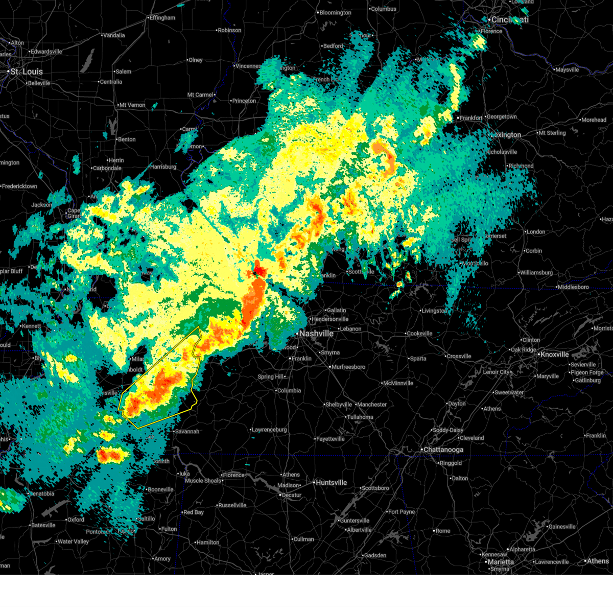 Svrmeg the national weather service in memphis has issued a * severe thunderstorm warning for, henderson county in west tennessee, benton county in west tennessee, northern mcnairy county in west tennessee, southeastern carroll county in west tennessee, northwestern hardin county in west tennessee, southeastern madison county in west tennessee, chester county in west tennessee, decatur county in west tennessee, * until 100 am cdt. * at 1210 am cdt, a severe thunderstorm was located near henderson, moving northeast at 55 mph (radar indicated). Hazards include 60 mph wind gusts and quarter size hail. Hail damage to vehicles is expected. Expect wind damage to roofs, siding, and trees. Svrmeg the national weather service in memphis has issued a * severe thunderstorm warning for, henderson county in west tennessee, benton county in west tennessee, northern mcnairy county in west tennessee, southeastern carroll county in west tennessee, northwestern hardin county in west tennessee, southeastern madison county in west tennessee, chester county in west tennessee, decatur county in west tennessee, * until 100 am cdt. * at 1210 am cdt, a severe thunderstorm was located near henderson, moving northeast at 55 mph (radar indicated). Hazards include 60 mph wind gusts and quarter size hail. Hail damage to vehicles is expected. Expect wind damage to roofs, siding, and trees.
|
| 4/2/2025 11:50 PM CDT |
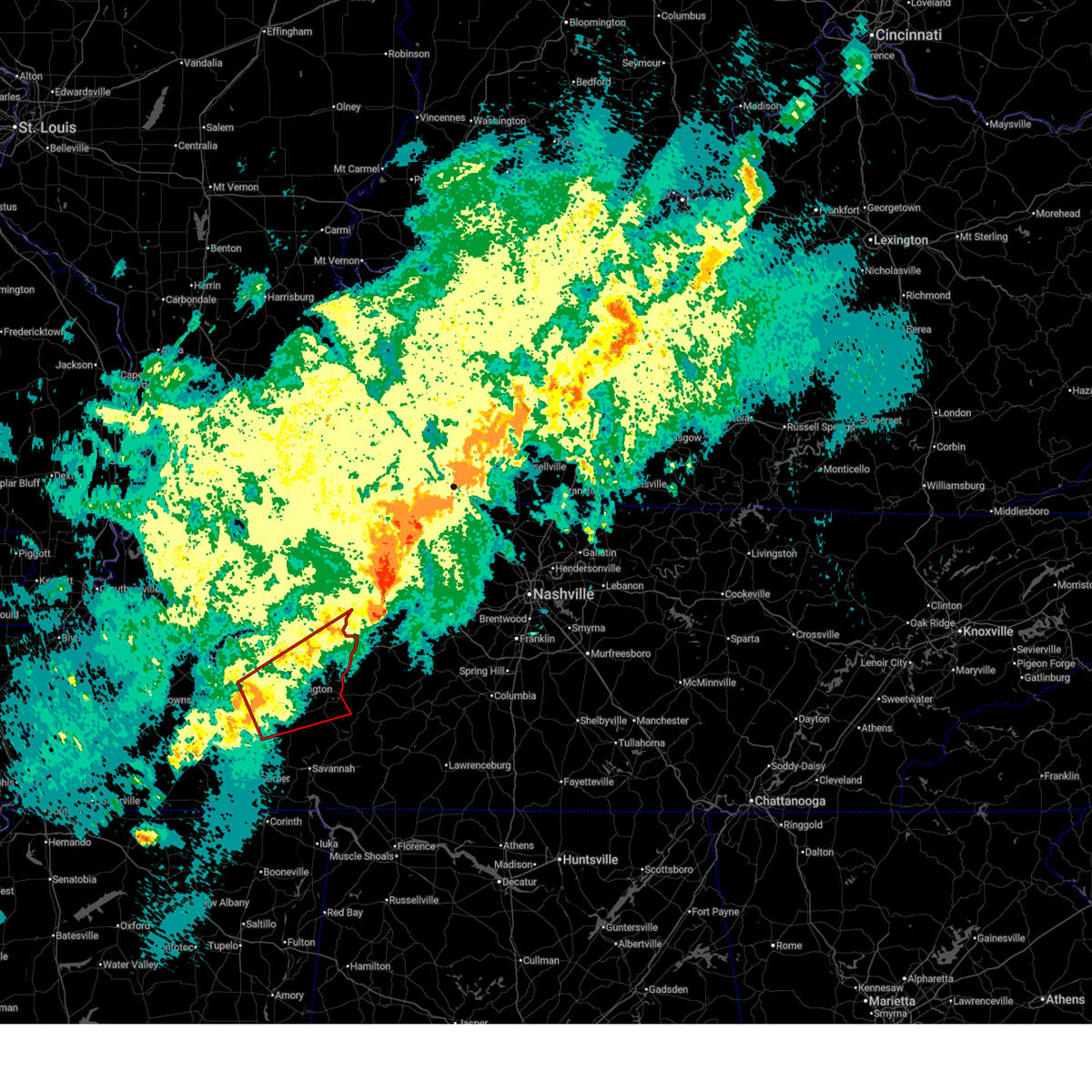 Tormeg the national weather service in memphis has issued a * tornado warning for, henderson county in west tennessee, southern benton county in west tennessee, southeastern carroll county in west tennessee, east central madison county in west tennessee, northeastern chester county in west tennessee, decatur county in west tennessee, * until 1230 am cdt. * at 1150 pm cdt, a severe thunderstorm capable of producing a tornado was located over mifflin, or 9 miles northeast of henderson, moving northeast at 45 mph (radar indicated rotation). Hazards include tornado and quarter size hail. Flying debris will be dangerous to those caught without shelter. mobile homes will be damaged or destroyed. damage to roofs, windows, and vehicles will occur. Tree damage is likely. Tormeg the national weather service in memphis has issued a * tornado warning for, henderson county in west tennessee, southern benton county in west tennessee, southeastern carroll county in west tennessee, east central madison county in west tennessee, northeastern chester county in west tennessee, decatur county in west tennessee, * until 1230 am cdt. * at 1150 pm cdt, a severe thunderstorm capable of producing a tornado was located over mifflin, or 9 miles northeast of henderson, moving northeast at 45 mph (radar indicated rotation). Hazards include tornado and quarter size hail. Flying debris will be dangerous to those caught without shelter. mobile homes will be damaged or destroyed. damage to roofs, windows, and vehicles will occur. Tree damage is likely.
|
| 4/2/2025 11:31 PM CDT |
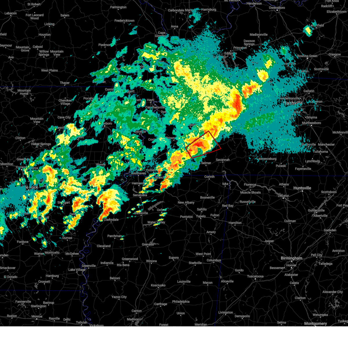 At 1131 pm cdt, a severe thunderstorm capable of producing a tornado was located over chickasaw state park, moving northeast at 45 mph (radar indicated rotation). Hazards include tornado and quarter size hail. Flying debris will be dangerous to those caught without shelter. mobile homes will be damaged or destroyed. damage to roofs, windows, and vehicles will occur. tree damage is likely. Locations impacted include, pinson, cedar grove, beech bluff, reagan, madison hall, chickasaw state forest, uptonville, juno, silerton, roby, teague, maple grove, cabo, middle fork, blue goose, east union, pinson mounds state archaeological park, jacks creek, malesus, and medon. At 1131 pm cdt, a severe thunderstorm capable of producing a tornado was located over chickasaw state park, moving northeast at 45 mph (radar indicated rotation). Hazards include tornado and quarter size hail. Flying debris will be dangerous to those caught without shelter. mobile homes will be damaged or destroyed. damage to roofs, windows, and vehicles will occur. tree damage is likely. Locations impacted include, pinson, cedar grove, beech bluff, reagan, madison hall, chickasaw state forest, uptonville, juno, silerton, roby, teague, maple grove, cabo, middle fork, blue goose, east union, pinson mounds state archaeological park, jacks creek, malesus, and medon.
|
| 4/2/2025 11:21 PM CDT |
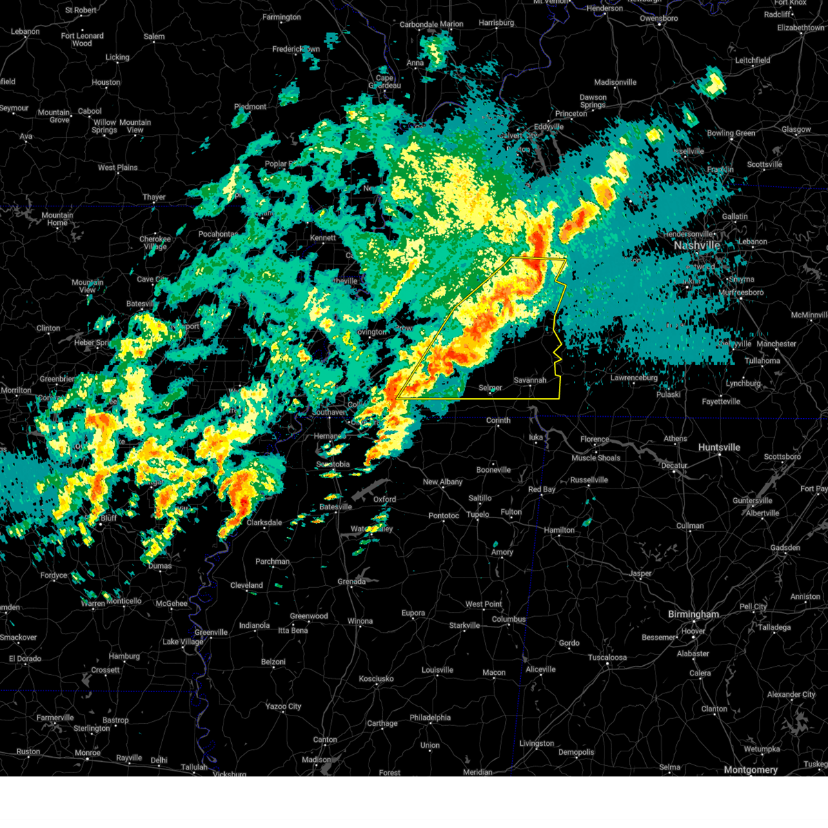 At 1120 pm cdt, a severe thunderstorm was located 7 miles south of bruceton, or 12 miles north of natchez trace state park, moving east at 65 mph (radar indicated). Hazards include 70 mph wind gusts and quarter size hail. Hail damage to vehicles is expected. expect considerable tree damage. wind damage is also likely to mobile homes, roofs, and outbuildings. Locations impacted include, neely, selmer, huntersville, masseyville, reagan, crump, westover, madison hall, uptonville, rock hill, silerton, bruceton, leach, walkertown, hinson springs, cerro gordo, buena vista, pinson mounds state archaeological park, hollow rock, and thurman. At 1120 pm cdt, a severe thunderstorm was located 7 miles south of bruceton, or 12 miles north of natchez trace state park, moving east at 65 mph (radar indicated). Hazards include 70 mph wind gusts and quarter size hail. Hail damage to vehicles is expected. expect considerable tree damage. wind damage is also likely to mobile homes, roofs, and outbuildings. Locations impacted include, neely, selmer, huntersville, masseyville, reagan, crump, westover, madison hall, uptonville, rock hill, silerton, bruceton, leach, walkertown, hinson springs, cerro gordo, buena vista, pinson mounds state archaeological park, hollow rock, and thurman.
|
| 4/2/2025 11:15 PM CDT |
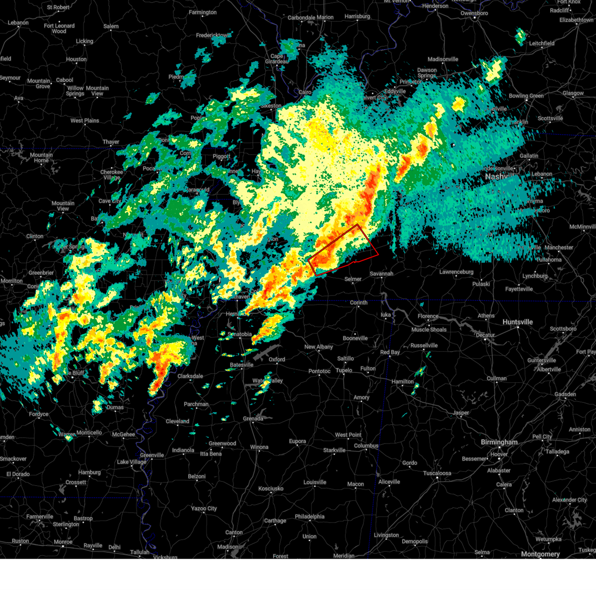 Tormeg the national weather service in memphis has issued a * tornado warning for, southwestern henderson county in west tennessee, northeastern hardeman county in west tennessee, southern madison county in west tennessee, chester county in west tennessee, * until midnight cdt. * at 1115 pm cdt, a severe thunderstorm capable of producing a tornado was located near cloverport, or near bolivar, moving northeast at 45 mph (radar indicated rotation). Hazards include tornado and quarter size hail. Flying debris will be dangerous to those caught without shelter. mobile homes will be damaged or destroyed. damage to roofs, windows, and vehicles will occur. Tree damage is likely. Tormeg the national weather service in memphis has issued a * tornado warning for, southwestern henderson county in west tennessee, northeastern hardeman county in west tennessee, southern madison county in west tennessee, chester county in west tennessee, * until midnight cdt. * at 1115 pm cdt, a severe thunderstorm capable of producing a tornado was located near cloverport, or near bolivar, moving northeast at 45 mph (radar indicated rotation). Hazards include tornado and quarter size hail. Flying debris will be dangerous to those caught without shelter. mobile homes will be damaged or destroyed. damage to roofs, windows, and vehicles will occur. Tree damage is likely.
|
| 4/2/2025 11:06 PM CDT |
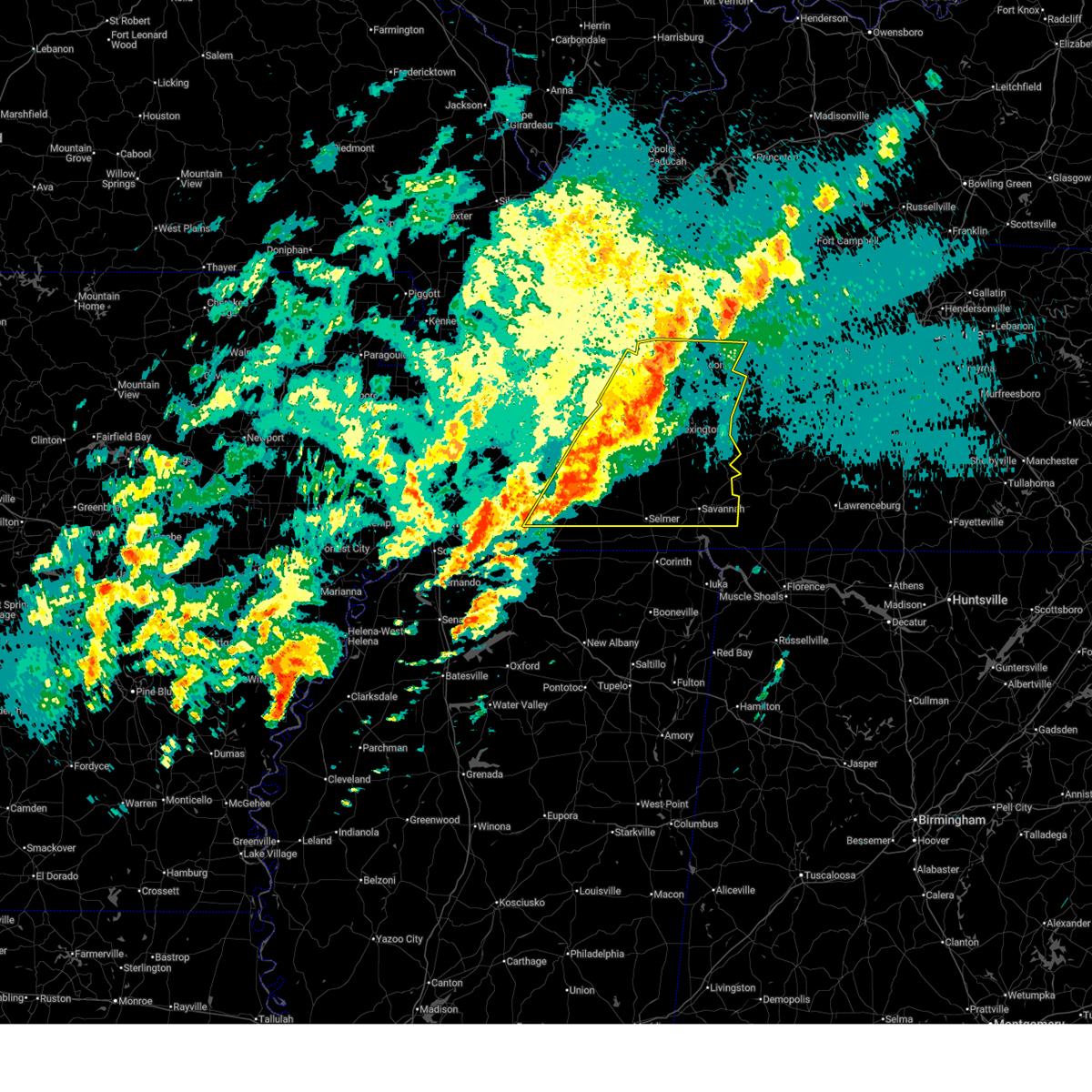 Svrmeg the national weather service in memphis has issued a * severe thunderstorm warning for, henderson county in west tennessee, southeastern gibson county in west tennessee, northeastern fayette county in west tennessee, hardeman county in west tennessee, benton county in west tennessee, mcnairy county in west tennessee, carroll county in west tennessee, hardin county in west tennessee, southeastern haywood county in west tennessee, madison county in west tennessee, chester county in west tennessee, decatur county in west tennessee, * until 1145 pm cdt. * at 1105 pm cdt, a severe thunderstorm was located 7 miles northwest of parkers crossroads, or 11 miles southwest of huntingdon, moving east at 65 mph. this is a destructive storm for humbolt, jackson, and henderson (radar indicated). Hazards include 80 mph wind gusts and quarter size hail. Flying debris will be dangerous to those caught without shelter. mobile homes will be heavily damaged. expect considerable damage to roofs, windows, and vehicles. Extensive tree damage and power outages are likely. Svrmeg the national weather service in memphis has issued a * severe thunderstorm warning for, henderson county in west tennessee, southeastern gibson county in west tennessee, northeastern fayette county in west tennessee, hardeman county in west tennessee, benton county in west tennessee, mcnairy county in west tennessee, carroll county in west tennessee, hardin county in west tennessee, southeastern haywood county in west tennessee, madison county in west tennessee, chester county in west tennessee, decatur county in west tennessee, * until 1145 pm cdt. * at 1105 pm cdt, a severe thunderstorm was located 7 miles northwest of parkers crossroads, or 11 miles southwest of huntingdon, moving east at 65 mph. this is a destructive storm for humbolt, jackson, and henderson (radar indicated). Hazards include 80 mph wind gusts and quarter size hail. Flying debris will be dangerous to those caught without shelter. mobile homes will be heavily damaged. expect considerable damage to roofs, windows, and vehicles. Extensive tree damage and power outages are likely.
|
| 4/2/2025 4:54 PM CDT |
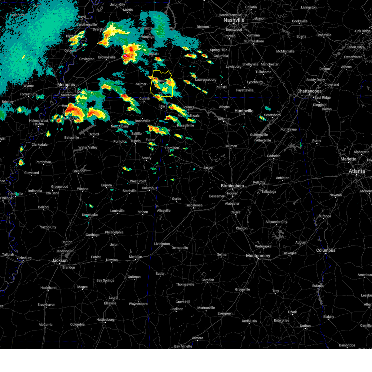 the severe thunderstorm warning has been cancelled and is no longer in effect the severe thunderstorm warning has been cancelled and is no longer in effect
|
| 4/2/2025 4:51 PM CDT |
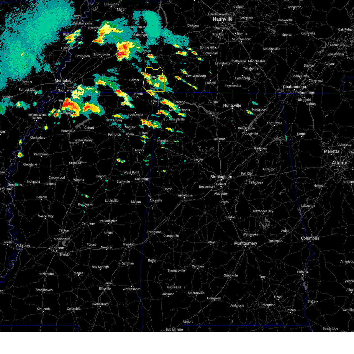 the severe thunderstorm warning has been cancelled and is no longer in effect the severe thunderstorm warning has been cancelled and is no longer in effect
|
| 4/2/2025 4:51 PM CDT |
 At 450 pm cdt, a severe thunderstorm was located near savannah, moving north at 55 mph (radar indicated). Hazards include 60 mph wind gusts and quarter size hail. Hail damage to vehicles is expected. expect wind damage to roofs, siding, and trees. Locations impacted include, shiloh national military park, saltillo, walnut grove, pickwick dam, right, hamburg, pineflat, crump, phillips, bruton branch, pickwick landing state park, hinkle, hurley, walkertown, olivehill, cerro gordo, red sulphur springs, chambers, counce, and lowryville. At 450 pm cdt, a severe thunderstorm was located near savannah, moving north at 55 mph (radar indicated). Hazards include 60 mph wind gusts and quarter size hail. Hail damage to vehicles is expected. expect wind damage to roofs, siding, and trees. Locations impacted include, shiloh national military park, saltillo, walnut grove, pickwick dam, right, hamburg, pineflat, crump, phillips, bruton branch, pickwick landing state park, hinkle, hurley, walkertown, olivehill, cerro gordo, red sulphur springs, chambers, counce, and lowryville.
|
| 4/2/2025 4:34 PM CDT |
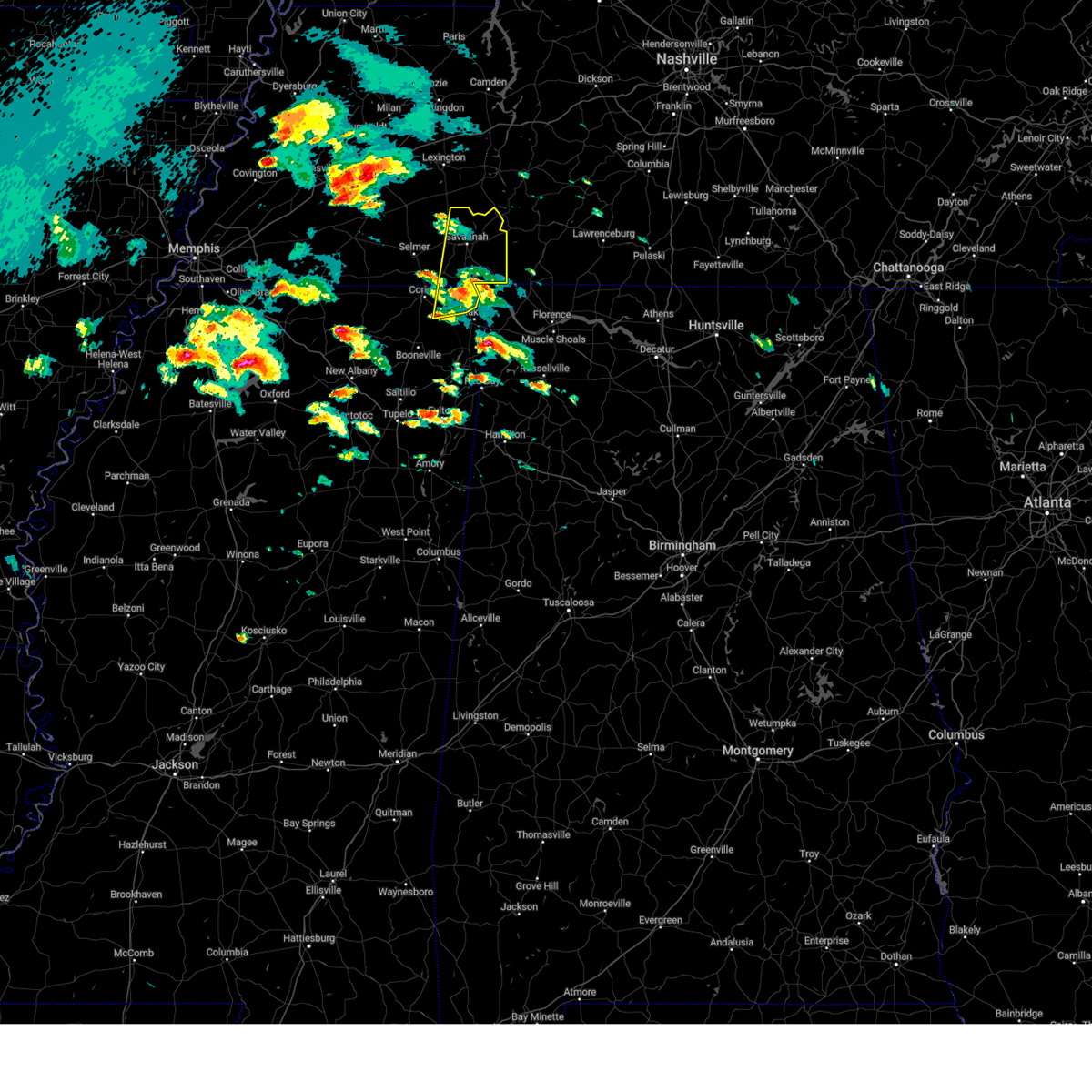 At 434 pm cdt, a severe thunderstorm was located over pickwick landing state park, moving north at 55 mph (radar indicated). Hazards include 60 mph wind gusts and quarter size hail. Hail damage to vehicles is expected. expect wind damage to roofs, siding, and trees. Locations impacted include, pickwick dam, crump, bruton branch, pickwick landing state park, hurley, walkertown, cerro gordo, chambers, mount vinson, damon, savannah, childers hill, center star, kendrick, morris chapel, swift, shiloh, farmington, coffee landing, and shiloh national military park. At 434 pm cdt, a severe thunderstorm was located over pickwick landing state park, moving north at 55 mph (radar indicated). Hazards include 60 mph wind gusts and quarter size hail. Hail damage to vehicles is expected. expect wind damage to roofs, siding, and trees. Locations impacted include, pickwick dam, crump, bruton branch, pickwick landing state park, hurley, walkertown, cerro gordo, chambers, mount vinson, damon, savannah, childers hill, center star, kendrick, morris chapel, swift, shiloh, farmington, coffee landing, and shiloh national military park.
|
| 4/2/2025 4:22 PM CDT |
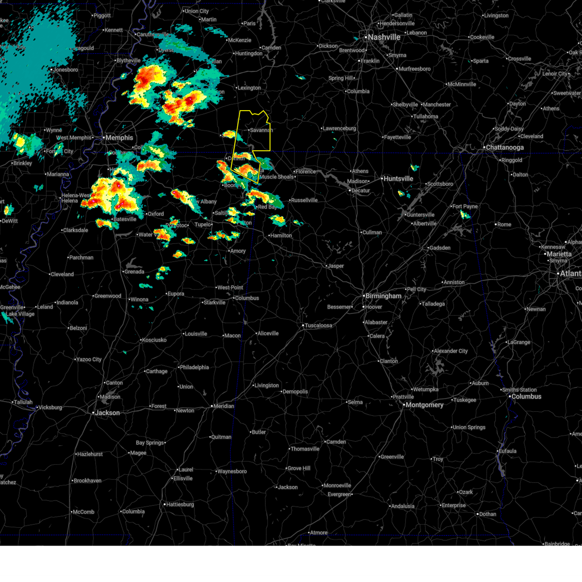 Svrmeg the national weather service in memphis has issued a * severe thunderstorm warning for, northern tishomingo county in northeastern mississippi, northeastern alcorn county in northeastern mississippi, southeastern mcnairy county in west tennessee, hardin county in west tennessee, * until 515 pm cdt. * at 422 pm cdt, a severe thunderstorm was located over burnsville, or near iuka, moving north at 55 mph (radar indicated). Hazards include 60 mph wind gusts and quarter size hail. Hail damage to vehicles is expected. Expect wind damage to roofs, siding, and trees. Svrmeg the national weather service in memphis has issued a * severe thunderstorm warning for, northern tishomingo county in northeastern mississippi, northeastern alcorn county in northeastern mississippi, southeastern mcnairy county in west tennessee, hardin county in west tennessee, * until 515 pm cdt. * at 422 pm cdt, a severe thunderstorm was located over burnsville, or near iuka, moving north at 55 mph (radar indicated). Hazards include 60 mph wind gusts and quarter size hail. Hail damage to vehicles is expected. Expect wind damage to roofs, siding, and trees.
|
| 3/31/2025 12:15 AM CDT |
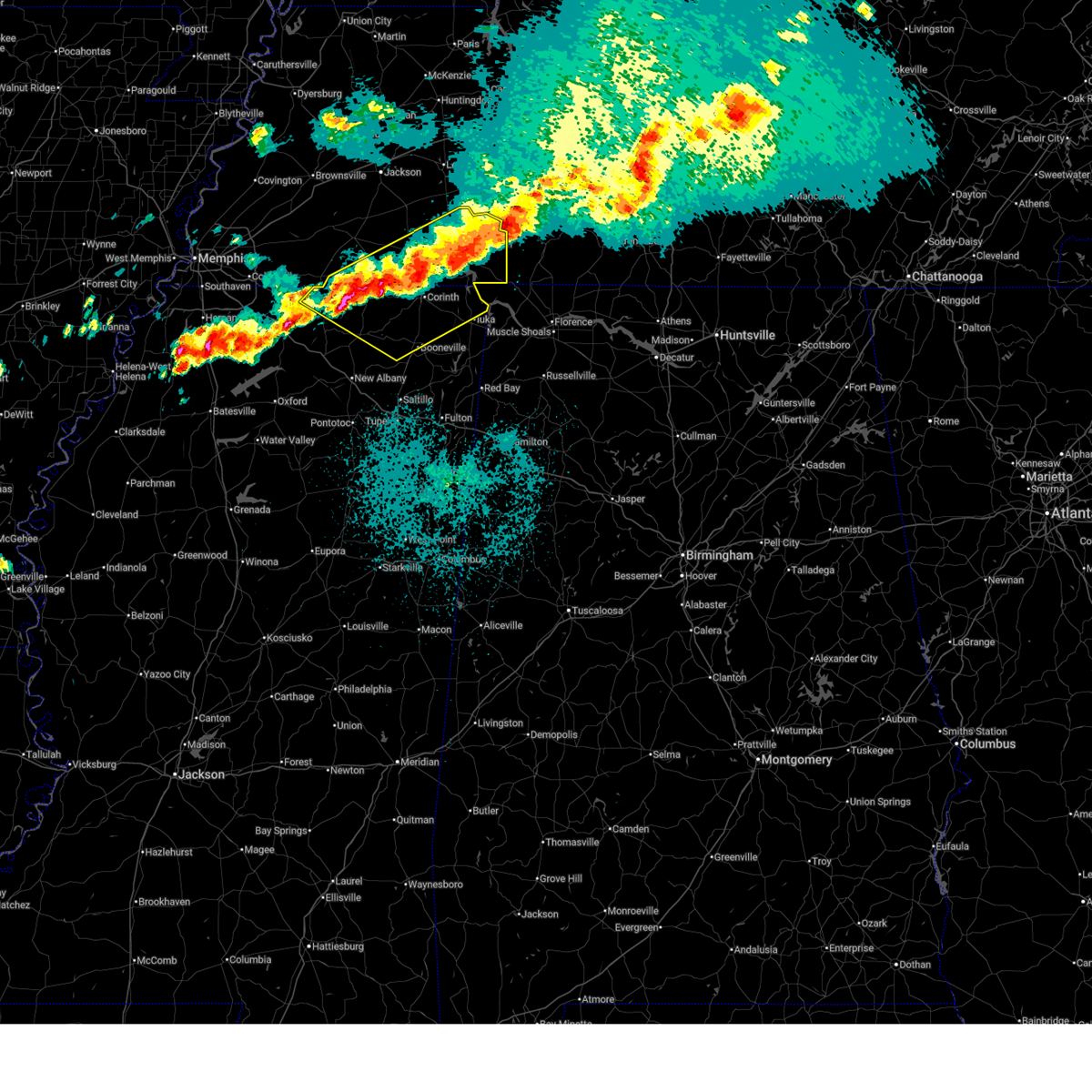 At 1215 am cdt, severe thunderstorms were located along a line extending from 6 miles southeast of olive hill to near pineflat to 6 miles north of ripley, moving southeast at 45 mph (public). Hazards include 60 mph wind gusts and quarter size hail. Hail damage to vehicles is expected. expect wind damage to roofs, siding, and trees. Locations impacted include, murry, brody, selmer, pickwick dam, crump, bruton branch, pickwick landing state park, acton, theo, walkertown, cerro gordo, rogers springs, kossuth, hightown, new lawton, martin camp, savannah, lisbon, caffey, and crumtown. At 1215 am cdt, severe thunderstorms were located along a line extending from 6 miles southeast of olive hill to near pineflat to 6 miles north of ripley, moving southeast at 45 mph (public). Hazards include 60 mph wind gusts and quarter size hail. Hail damage to vehicles is expected. expect wind damage to roofs, siding, and trees. Locations impacted include, murry, brody, selmer, pickwick dam, crump, bruton branch, pickwick landing state park, acton, theo, walkertown, cerro gordo, rogers springs, kossuth, hightown, new lawton, martin camp, savannah, lisbon, caffey, and crumtown.
|
| 3/30/2025 11:58 PM CDT |
 At 1157 pm cdt, severe thunderstorms were located along a line extending from 6 miles northeast of savannah to 7 miles south of selmer to near canaan, moving east at 30 mph (radar indicated). Hazards include 60 mph wind gusts and half dollar size hail. Hail damage to vehicles is expected. expect wind damage to roofs, siding, and trees. Locations impacted include, murry, brody, selmer, pickwick dam, crump, bruton branch, pickwick landing state park, acton, theo, walkertown, cerro gordo, rogers springs, kossuth, hightown, new lawton, martin camp, savannah, lisbon, caffey, and crumtown. At 1157 pm cdt, severe thunderstorms were located along a line extending from 6 miles northeast of savannah to 7 miles south of selmer to near canaan, moving east at 30 mph (radar indicated). Hazards include 60 mph wind gusts and half dollar size hail. Hail damage to vehicles is expected. expect wind damage to roofs, siding, and trees. Locations impacted include, murry, brody, selmer, pickwick dam, crump, bruton branch, pickwick landing state park, acton, theo, walkertown, cerro gordo, rogers springs, kossuth, hightown, new lawton, martin camp, savannah, lisbon, caffey, and crumtown.
|
| 3/30/2025 11:58 PM CDT |
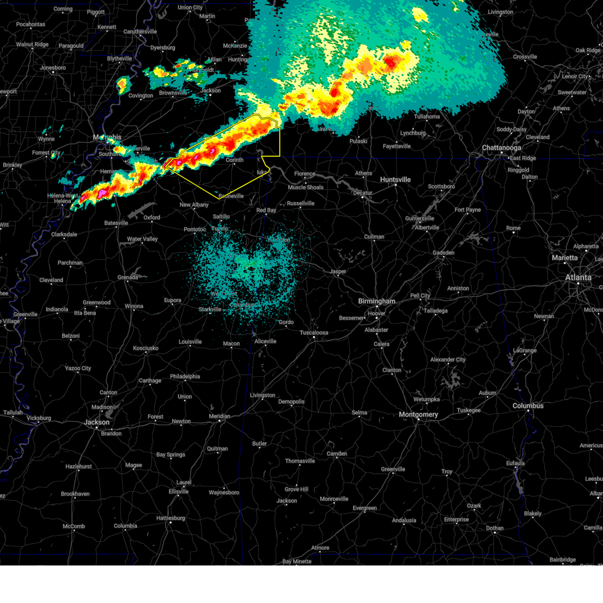 the severe thunderstorm warning has been cancelled and is no longer in effect the severe thunderstorm warning has been cancelled and is no longer in effect
|
| 3/30/2025 11:46 PM CDT |
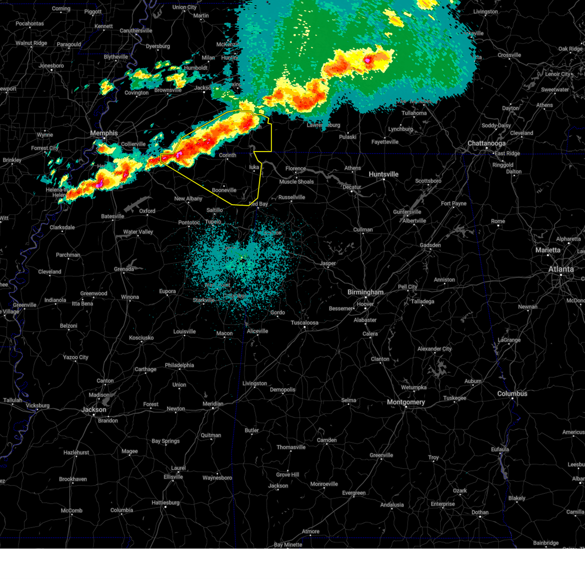 At 1146 pm cdt, severe thunderstorms were located along a line extending from near olive hill to near corinth to near ripley, moving southeast at 45 mph (radar indicated). Hazards include 60 mph wind gusts and half dollar size hail. Hail damage to vehicles is expected. expect wind damage to roofs, siding, and trees. Locations impacted include, murry, brody, selmer, pickwick dam, belmont, masseyville, blythe crossing, crump, bruton branch, pickwick landing state park, acton, theo, walkertown, petertown, cerro gordo, neil, rogers springs, kossuth, hightown, and hornsby. At 1146 pm cdt, severe thunderstorms were located along a line extending from near olive hill to near corinth to near ripley, moving southeast at 45 mph (radar indicated). Hazards include 60 mph wind gusts and half dollar size hail. Hail damage to vehicles is expected. expect wind damage to roofs, siding, and trees. Locations impacted include, murry, brody, selmer, pickwick dam, belmont, masseyville, blythe crossing, crump, bruton branch, pickwick landing state park, acton, theo, walkertown, petertown, cerro gordo, neil, rogers springs, kossuth, hightown, and hornsby.
|
| 3/30/2025 11:46 PM CDT |
 the severe thunderstorm warning has been cancelled and is no longer in effect the severe thunderstorm warning has been cancelled and is no longer in effect
|
| 3/30/2025 11:30 PM CDT |
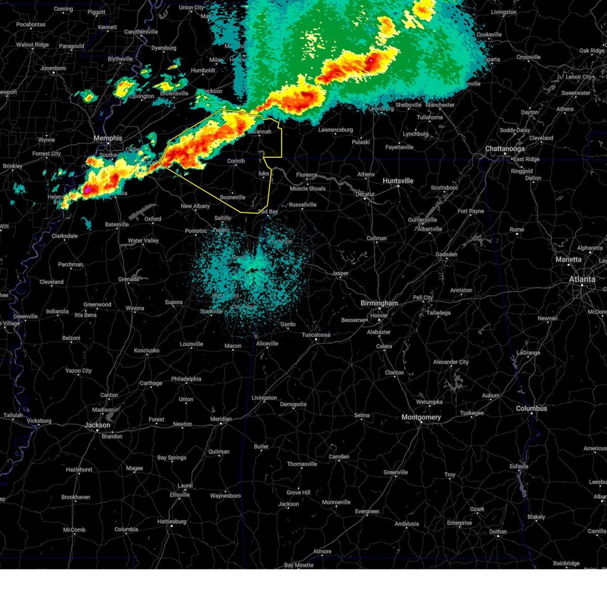 Svrmeg the national weather service in memphis has issued a * severe thunderstorm warning for, north central marshall county in northwestern mississippi, tippah county in northeastern mississippi, northern benton county in northeastern mississippi, tishomingo county in northeastern mississippi, prentiss county in northeastern mississippi, alcorn county in northeastern mississippi, southeastern fayette county in west tennessee, hardeman county in west tennessee, mcnairy county in west tennessee, hardin county in west tennessee, chester county in west tennessee, * until 1230 am cdt. * at 1130 pm cdt, severe thunderstorms were located along a line extending from near morris chapel to big hill pond state park to near gravestown, moving southeast at 45 mph (radar indicated). Hazards include 60 mph wind gusts and half dollar size hail. Hail damage to vehicles is expected. Expect wind damage to roofs, siding, and trees. Svrmeg the national weather service in memphis has issued a * severe thunderstorm warning for, north central marshall county in northwestern mississippi, tippah county in northeastern mississippi, northern benton county in northeastern mississippi, tishomingo county in northeastern mississippi, prentiss county in northeastern mississippi, alcorn county in northeastern mississippi, southeastern fayette county in west tennessee, hardeman county in west tennessee, mcnairy county in west tennessee, hardin county in west tennessee, chester county in west tennessee, * until 1230 am cdt. * at 1130 pm cdt, severe thunderstorms were located along a line extending from near morris chapel to big hill pond state park to near gravestown, moving southeast at 45 mph (radar indicated). Hazards include 60 mph wind gusts and half dollar size hail. Hail damage to vehicles is expected. Expect wind damage to roofs, siding, and trees.
|
| 3/15/2025 6:50 AM CDT |
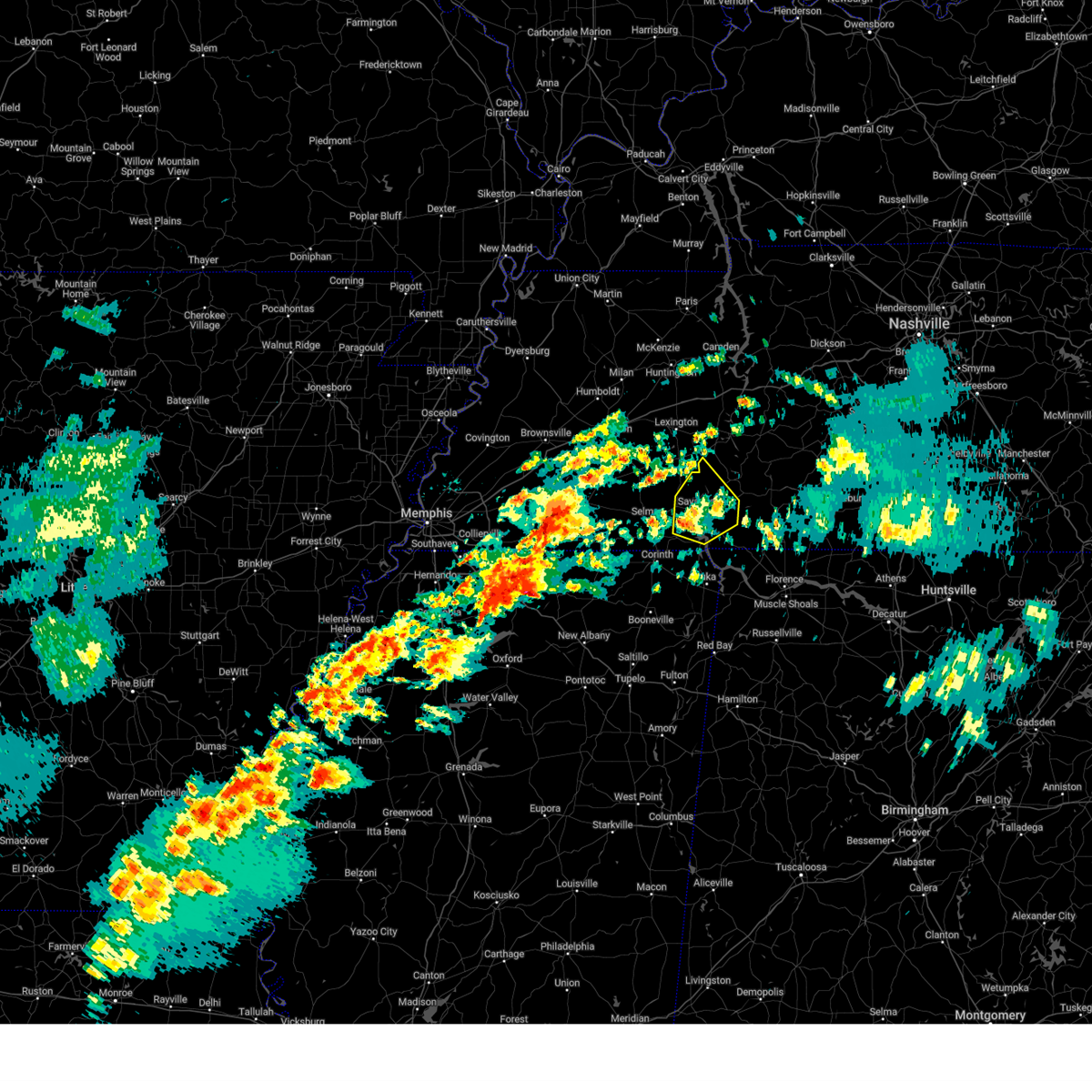 At 650 am cdt, a severe thunderstorm was located over shiloh, or 8 miles southwest of savannah, moving northeast at 45 mph (radar indicated). Hazards include quarter size hail. Damage to vehicles is expected. Locations impacted include, shiloh national military park, saltillo, pickwick dam, right, hamburg, adamsville, crump, phillips, bruton branch, pickwick landing state park, hinkle, pleasant grove, hurley, walkertown, olivehill, cerro gordo, thurman, lowryville, mount vinson, and savannah. At 650 am cdt, a severe thunderstorm was located over shiloh, or 8 miles southwest of savannah, moving northeast at 45 mph (radar indicated). Hazards include quarter size hail. Damage to vehicles is expected. Locations impacted include, shiloh national military park, saltillo, pickwick dam, right, hamburg, adamsville, crump, phillips, bruton branch, pickwick landing state park, hinkle, pleasant grove, hurley, walkertown, olivehill, cerro gordo, thurman, lowryville, mount vinson, and savannah.
|
| 3/15/2025 6:50 AM CDT |
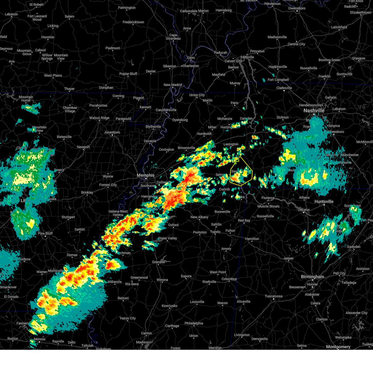 the severe thunderstorm warning has been cancelled and is no longer in effect the severe thunderstorm warning has been cancelled and is no longer in effect
|
| 3/15/2025 6:36 AM CDT |
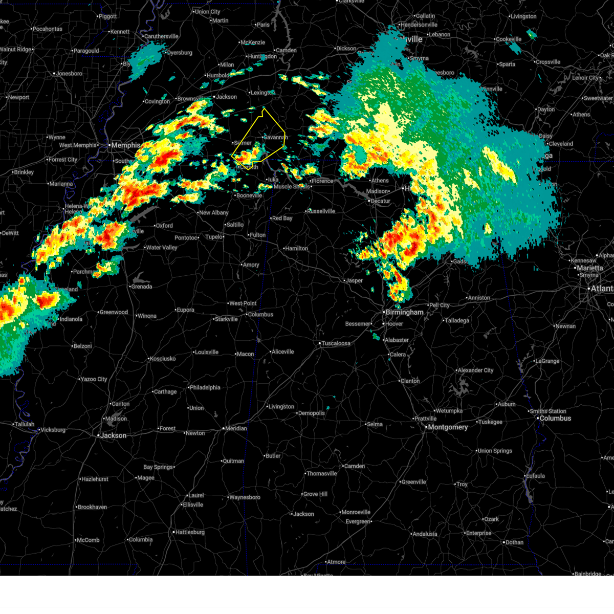 Svrmeg the national weather service in memphis has issued a * severe thunderstorm warning for, northeastern alcorn county in northeastern mississippi, southeastern mcnairy county in west tennessee, hardin county in west tennessee, southwestern decatur county in west tennessee, * until 715 am cdt. * at 635 am cdt, a severe thunderstorm was located near corinth, moving northeast at 45 mph (radar indicated). Hazards include 60 mph wind gusts and quarter size hail. Hail damage to vehicles is expected. Expect wind damage to roofs, siding, and trees. Svrmeg the national weather service in memphis has issued a * severe thunderstorm warning for, northeastern alcorn county in northeastern mississippi, southeastern mcnairy county in west tennessee, hardin county in west tennessee, southwestern decatur county in west tennessee, * until 715 am cdt. * at 635 am cdt, a severe thunderstorm was located near corinth, moving northeast at 45 mph (radar indicated). Hazards include 60 mph wind gusts and quarter size hail. Hail damage to vehicles is expected. Expect wind damage to roofs, siding, and trees.
|
| 7/9/2024 12:58 AM CDT |
 the severe thunderstorm warning has been cancelled and is no longer in effect the severe thunderstorm warning has been cancelled and is no longer in effect
|
| 7/9/2024 12:48 AM CDT |
 the severe thunderstorm warning has been cancelled and is no longer in effect the severe thunderstorm warning has been cancelled and is no longer in effect
|
| 7/9/2024 12:48 AM CDT |
 At 1248 am cdt, a severe thunderstorm was located near reagan, or 12 miles southeast of lexington, moving north at 25 mph (radar indicated). Hazards include 60 mph wind gusts. Expect damage to roofs, siding, and trees. Locations impacted include, lexington, natchez trace state park, natchez trace state forest, parsons, decaturville, sardis, reagan, parkers crossroads, darden, wildersville, montgomery, scotts hill, busseltown, jeannette, haney, rock hill, pleasant grove, mount tabor, red walnut, and timberlake. At 1248 am cdt, a severe thunderstorm was located near reagan, or 12 miles southeast of lexington, moving north at 25 mph (radar indicated). Hazards include 60 mph wind gusts. Expect damage to roofs, siding, and trees. Locations impacted include, lexington, natchez trace state park, natchez trace state forest, parsons, decaturville, sardis, reagan, parkers crossroads, darden, wildersville, montgomery, scotts hill, busseltown, jeannette, haney, rock hill, pleasant grove, mount tabor, red walnut, and timberlake.
|
| 7/9/2024 12:39 AM CDT |
 Svrmeg the national weather service in memphis has issued a * severe thunderstorm warning for, eastern henderson county in west tennessee, northwestern hardin county in west tennessee, decatur county in west tennessee, * until 130 am cdt. * at 1239 am cdt, a severe thunderstorm was located over sardis, or 15 miles southeast of lexington, moving north at 25 mph (radar indicated). Hazards include 60 mph wind gusts. expect damage to roofs, siding, and trees Svrmeg the national weather service in memphis has issued a * severe thunderstorm warning for, eastern henderson county in west tennessee, northwestern hardin county in west tennessee, decatur county in west tennessee, * until 130 am cdt. * at 1239 am cdt, a severe thunderstorm was located over sardis, or 15 miles southeast of lexington, moving north at 25 mph (radar indicated). Hazards include 60 mph wind gusts. expect damage to roofs, siding, and trees
|
| 5/27/2024 2:23 AM CDT |
 The storm which prompted the warning has weakened below severe limits, and has exited the warned area. therefore, the warning will be allowed to expire. a tornado watch remains in effect until 500 am cdt for west tennessee. a tornado watch also remains in effect until 800 am cdt for northeastern mississippi. The storm which prompted the warning has weakened below severe limits, and has exited the warned area. therefore, the warning will be allowed to expire. a tornado watch remains in effect until 500 am cdt for west tennessee. a tornado watch also remains in effect until 800 am cdt for northeastern mississippi.
|
| 5/27/2024 2:13 AM CDT |
 the severe thunderstorm warning has been cancelled and is no longer in effect the severe thunderstorm warning has been cancelled and is no longer in effect
|
| 5/27/2024 2:12 AM CDT |
 At 211 am cdt, a severe thunderstorm was located over st. florian, or near florence, moving east at 80 mph (radar indicated). Hazards include 60 mph wind gusts and nickel size hail. Expect damage to roofs, siding, and trees. Locations impacted include, corinth, booneville, savannah, iuka, pickwick landing state park, j p coleman state park, tishomingo state park, adamsville, belmont, burnsville, jumpertown, glen, sardis, tishomingo, pickwick dam, thrashers, midway, morris chapel, shiloh, and walnut grove. At 211 am cdt, a severe thunderstorm was located over st. florian, or near florence, moving east at 80 mph (radar indicated). Hazards include 60 mph wind gusts and nickel size hail. Expect damage to roofs, siding, and trees. Locations impacted include, corinth, booneville, savannah, iuka, pickwick landing state park, j p coleman state park, tishomingo state park, adamsville, belmont, burnsville, jumpertown, glen, sardis, tishomingo, pickwick dam, thrashers, midway, morris chapel, shiloh, and walnut grove.
|
| 5/27/2024 2:12 AM CDT |
 the severe thunderstorm warning has been cancelled and is no longer in effect the severe thunderstorm warning has been cancelled and is no longer in effect
|
| 5/27/2024 2:04 AM CDT |
 At 204 am cdt, a severe thunderstorm was located near linden, moving east at 60 mph (radar indicated). Hazards include 60 mph wind gusts and nickel size hail. Expect damage to roofs, siding, and trees. Locations impacted include, sardis, montgomery, scotts hill, lick skillet, bath springs, gumdale, red walnut, largo, dunbar, taylors crossing, haney, and shady hill. At 204 am cdt, a severe thunderstorm was located near linden, moving east at 60 mph (radar indicated). Hazards include 60 mph wind gusts and nickel size hail. Expect damage to roofs, siding, and trees. Locations impacted include, sardis, montgomery, scotts hill, lick skillet, bath springs, gumdale, red walnut, largo, dunbar, taylors crossing, haney, and shady hill.
|
| 5/27/2024 1:58 AM CDT |
 the severe thunderstorm warning has been cancelled and is no longer in effect the severe thunderstorm warning has been cancelled and is no longer in effect
|
| 5/27/2024 1:58 AM CDT |
 At 158 am cdt, a severe thunderstorm was located 10 miles southeast of walnut grove, or 13 miles east of j p coleman state park, moving east at 80 mph (radar indicated). Hazards include 60 mph wind gusts and nickel size hail. Expect damage to roofs, siding, and trees. Locations impacted include, corinth, booneville, savannah, selmer, iuka, pickwick landing state park, j p coleman state park, big hill pond state park, tishomingo state park, adamsville, belmont, burnsville, jumpertown, glen, sardis, tishomingo, pickwick dam, theo, pineflat, and hinkle. At 158 am cdt, a severe thunderstorm was located 10 miles southeast of walnut grove, or 13 miles east of j p coleman state park, moving east at 80 mph (radar indicated). Hazards include 60 mph wind gusts and nickel size hail. Expect damage to roofs, siding, and trees. Locations impacted include, corinth, booneville, savannah, selmer, iuka, pickwick landing state park, j p coleman state park, big hill pond state park, tishomingo state park, adamsville, belmont, burnsville, jumpertown, glen, sardis, tishomingo, pickwick dam, theo, pineflat, and hinkle.
|
| 5/27/2024 1:56 AM CDT |
 The tornado threat has diminished and the tornado warning has been cancelled. however, large hail and damaging winds remain likely and a severe thunderstorm warning remains in effect for the area. a tornado watch remains in effect until 500 am cdt for west tennessee. The tornado threat has diminished and the tornado warning has been cancelled. however, large hail and damaging winds remain likely and a severe thunderstorm warning remains in effect for the area. a tornado watch remains in effect until 500 am cdt for west tennessee.
|
| 5/27/2024 1:52 AM CDT |
 At 152 am cdt, a severe thunderstorm was located 7 miles west of linden, moving east at 60 mph (radar indicated). Hazards include 70 mph wind gusts and nickel size hail. Expect considerable tree damage. damage is likely to mobile homes, roofs, and outbuildings. Locations impacted include, lexington, natchez trace state park, natchez trace state forest, parsons, decaturville, sardis, reagan, darden, montgomery, scotts hill, busseltown, jeannette, haney, rock hill, mount tabor, sugar tree, red walnut, timberlake, cozette, and lick skillet. At 152 am cdt, a severe thunderstorm was located 7 miles west of linden, moving east at 60 mph (radar indicated). Hazards include 70 mph wind gusts and nickel size hail. Expect considerable tree damage. damage is likely to mobile homes, roofs, and outbuildings. Locations impacted include, lexington, natchez trace state park, natchez trace state forest, parsons, decaturville, sardis, reagan, darden, montgomery, scotts hill, busseltown, jeannette, haney, rock hill, mount tabor, sugar tree, red walnut, timberlake, cozette, and lick skillet.
|
| 5/27/2024 1:52 AM CDT |
 the severe thunderstorm warning has been cancelled and is no longer in effect the severe thunderstorm warning has been cancelled and is no longer in effect
|
| 5/27/2024 1:49 AM CDT |
 the severe thunderstorm warning has been cancelled and is no longer in effect the severe thunderstorm warning has been cancelled and is no longer in effect
|
| 5/27/2024 1:49 AM CDT |
 At 148 am cdt, a severe thunderstorm was located near pickwick landing state park, moving east at 80 mph (radar indicated). Hazards include 70 mph wind gusts and nickel size hail. Expect considerable tree damage. damage is likely to mobile homes, roofs, and outbuildings. Locations impacted include, corinth, booneville, savannah, selmer, iuka, pickwick landing state park, j p coleman state park, big hill pond state park, tishomingo state park, adamsville, belmont, burnsville, jumpertown, glen, sardis, tishomingo, pickwick dam, theo, pocahontas, and pineflat. At 148 am cdt, a severe thunderstorm was located near pickwick landing state park, moving east at 80 mph (radar indicated). Hazards include 70 mph wind gusts and nickel size hail. Expect considerable tree damage. damage is likely to mobile homes, roofs, and outbuildings. Locations impacted include, corinth, booneville, savannah, selmer, iuka, pickwick landing state park, j p coleman state park, big hill pond state park, tishomingo state park, adamsville, belmont, burnsville, jumpertown, glen, sardis, tishomingo, pickwick dam, theo, pocahontas, and pineflat.
|
| 5/27/2024 1:48 AM CDT |
 At 147 am cdt, a severe thunderstorm capable of producing a tornado was located 9 miles southeast of sardis, or 10 miles northeast of savannah, moving east at 50 mph (radar indicated rotation). Hazards include tornado. Flying debris will be dangerous to those caught without shelter. mobile homes will be damaged or destroyed. damage to roofs, windows, and vehicles will occur. tree damage is likely. Locations impacted include, savannah, adamsville, sardis, reagan, olive hill, morris chapel, montgomery, scotts hill, saltillo, milledgeville, enville, right, phillips, haney, hinkle, roby, pleasant grove, red walnut, olivehill, and cerro gordo. At 147 am cdt, a severe thunderstorm capable of producing a tornado was located 9 miles southeast of sardis, or 10 miles northeast of savannah, moving east at 50 mph (radar indicated rotation). Hazards include tornado. Flying debris will be dangerous to those caught without shelter. mobile homes will be damaged or destroyed. damage to roofs, windows, and vehicles will occur. tree damage is likely. Locations impacted include, savannah, adamsville, sardis, reagan, olive hill, morris chapel, montgomery, scotts hill, saltillo, milledgeville, enville, right, phillips, haney, hinkle, roby, pleasant grove, red walnut, olivehill, and cerro gordo.
|
| 5/27/2024 1:40 AM CDT |
 At 140 am cdt, a severe thunderstorm capable of producing a tornado was located near sardis, or 11 miles north of savannah, moving east at 50 mph (radar indicated rotation). Hazards include tornado. Flying debris will be dangerous to those caught without shelter. mobile homes will be damaged or destroyed. damage to roofs, windows, and vehicles will occur. tree damage is likely. Locations impacted include, savannah, adamsville, sardis, reagan, jacks creek, olive hill, morris chapel, montgomery, scotts hill, saltillo, milledgeville, enville, right, phillips, haney, hinkle, roby, pleasant grove, cabo, and red walnut. At 140 am cdt, a severe thunderstorm capable of producing a tornado was located near sardis, or 11 miles north of savannah, moving east at 50 mph (radar indicated rotation). Hazards include tornado. Flying debris will be dangerous to those caught without shelter. mobile homes will be damaged or destroyed. damage to roofs, windows, and vehicles will occur. tree damage is likely. Locations impacted include, savannah, adamsville, sardis, reagan, jacks creek, olive hill, morris chapel, montgomery, scotts hill, saltillo, milledgeville, enville, right, phillips, haney, hinkle, roby, pleasant grove, cabo, and red walnut.
|
| 5/27/2024 1:38 AM CDT |
 Svrmeg the national weather service in memphis has issued a * severe thunderstorm warning for, henderson county in west tennessee, northeastern chester county in west tennessee, decatur county in west tennessee, * until 230 am cdt. * at 138 am cdt, a severe thunderstorm was located over darden, or 7 miles southeast of natchez trace state forest, moving east at 60 mph (radar indicated). Hazards include 70 mph wind gusts and nickel size hail. Expect considerable tree damage. Damage is likely to mobile homes, roofs, and outbuildings. Svrmeg the national weather service in memphis has issued a * severe thunderstorm warning for, henderson county in west tennessee, northeastern chester county in west tennessee, decatur county in west tennessee, * until 230 am cdt. * at 138 am cdt, a severe thunderstorm was located over darden, or 7 miles southeast of natchez trace state forest, moving east at 60 mph (radar indicated). Hazards include 70 mph wind gusts and nickel size hail. Expect considerable tree damage. Damage is likely to mobile homes, roofs, and outbuildings.
|
| 5/27/2024 1:31 AM CDT |
 At 131 am cdt, a severe thunderstorm was located 12 miles south of new johnsonville, or 14 miles south of camden, moving east at 60 mph (radar indicated). Hazards include 70 mph wind gusts and nickel size hail. Expect considerable tree damage. damage is likely to mobile homes, roofs, and outbuildings. Locations impacted include, lexington, huntingdon, camden, natchez trace state park, natchez trace state forest, parsons, new johnsonville, bruceton, decaturville, sardis, reagan, blue goose, vale, mifflin, bargerton, wildersville, parkers crossroads, darden, montgomery, and scotts hill. At 131 am cdt, a severe thunderstorm was located 12 miles south of new johnsonville, or 14 miles south of camden, moving east at 60 mph (radar indicated). Hazards include 70 mph wind gusts and nickel size hail. Expect considerable tree damage. damage is likely to mobile homes, roofs, and outbuildings. Locations impacted include, lexington, huntingdon, camden, natchez trace state park, natchez trace state forest, parsons, new johnsonville, bruceton, decaturville, sardis, reagan, blue goose, vale, mifflin, bargerton, wildersville, parkers crossroads, darden, montgomery, and scotts hill.
|
| 5/27/2024 1:29 AM CDT |
 At 129 am cdt, a severe thunderstorm capable of producing a tornado was located over reagan, or 9 miles southeast of lexington, moving east at 60 mph (radar indicated rotation). Hazards include tornado. Flying debris will be dangerous to those caught without shelter. mobile homes will be damaged or destroyed. damage to roofs, windows, and vehicles will occur. tree damage is likely. Locations impacted include, lexington, henderson, natchez trace state forest, sardis, reagan, jacks creek, darden, mifflin, scotts hill, saltillo, milledgeville, enville, beech bluff, rock hill, juno, hinkle, roby, cabo, middle fork, and timberlake. At 129 am cdt, a severe thunderstorm capable of producing a tornado was located over reagan, or 9 miles southeast of lexington, moving east at 60 mph (radar indicated rotation). Hazards include tornado. Flying debris will be dangerous to those caught without shelter. mobile homes will be damaged or destroyed. damage to roofs, windows, and vehicles will occur. tree damage is likely. Locations impacted include, lexington, henderson, natchez trace state forest, sardis, reagan, jacks creek, darden, mifflin, scotts hill, saltillo, milledgeville, enville, beech bluff, rock hill, juno, hinkle, roby, cabo, middle fork, and timberlake.
|
| 5/27/2024 1:26 AM CDT |
 Svrmeg the national weather service in memphis has issued a * severe thunderstorm warning for, northern tippah county in northeastern mississippi, northeastern benton county in northeastern mississippi, tishomingo county in northeastern mississippi, northern prentiss county in northeastern mississippi, alcorn county in northeastern mississippi, southeastern henderson county in west tennessee, southeastern hardeman county in west tennessee, mcnairy county in west tennessee, hardin county in west tennessee, chester county in west tennessee, southern decatur county in west tennessee, * until 230 am cdt. * at 126 am cdt, a severe thunderstorm was located near selmer, moving east at 80 mph (radar indicated). Hazards include 70 mph wind gusts and nickel size hail. Expect considerable tree damage. Damage is likely to mobile homes, roofs, and outbuildings. Svrmeg the national weather service in memphis has issued a * severe thunderstorm warning for, northern tippah county in northeastern mississippi, northeastern benton county in northeastern mississippi, tishomingo county in northeastern mississippi, northern prentiss county in northeastern mississippi, alcorn county in northeastern mississippi, southeastern henderson county in west tennessee, southeastern hardeman county in west tennessee, mcnairy county in west tennessee, hardin county in west tennessee, chester county in west tennessee, southern decatur county in west tennessee, * until 230 am cdt. * at 126 am cdt, a severe thunderstorm was located near selmer, moving east at 80 mph (radar indicated). Hazards include 70 mph wind gusts and nickel size hail. Expect considerable tree damage. Damage is likely to mobile homes, roofs, and outbuildings.
|
| 5/27/2024 1:22 AM CDT |
 the severe thunderstorm warning has been cancelled and is no longer in effect the severe thunderstorm warning has been cancelled and is no longer in effect
|
| 5/27/2024 1:22 AM CDT |
 At 121 am cdt, a severe thunderstorm was located 7 miles northeast of natchez trace state park, moving east at 60 mph (radar indicated). Hazards include 70 mph wind gusts and nickel size hail. Expect considerable tree damage. damage is likely to mobile homes, roofs, and outbuildings. Locations impacted include, jackson, lexington, huntingdon, camden, natchez trace state park, natchez trace state forest, parsons, new johnsonville, bruceton, decaturville, sardis, reagan, blue goose, vale, mifflin, bargerton, wildersville, parkers crossroads, darden, and montgomery. At 121 am cdt, a severe thunderstorm was located 7 miles northeast of natchez trace state park, moving east at 60 mph (radar indicated). Hazards include 70 mph wind gusts and nickel size hail. Expect considerable tree damage. damage is likely to mobile homes, roofs, and outbuildings. Locations impacted include, jackson, lexington, huntingdon, camden, natchez trace state park, natchez trace state forest, parsons, new johnsonville, bruceton, decaturville, sardis, reagan, blue goose, vale, mifflin, bargerton, wildersville, parkers crossroads, darden, and montgomery.
|
| 5/27/2024 1:20 AM CDT |
 At 120 am cdt, a severe thunderstorm capable of producing a tornado was located near jacks creek, or 10 miles southwest of lexington, moving east at 60 mph (radar indicated rotation). Hazards include tornado. Flying debris will be dangerous to those caught without shelter. mobile homes will be damaged or destroyed. damage to roofs, windows, and vehicles will occur. tree damage is likely. Locations impacted include, jackson, lexington, henderson, natchez trace state forest, sardis, reagan, jacks creek, darden, mifflin, scotts hill, saltillo, milledgeville, enville, pinson, beech bluff, madison hall, rock hill, juno, hinkle, and roby. At 120 am cdt, a severe thunderstorm capable of producing a tornado was located near jacks creek, or 10 miles southwest of lexington, moving east at 60 mph (radar indicated rotation). Hazards include tornado. Flying debris will be dangerous to those caught without shelter. mobile homes will be damaged or destroyed. damage to roofs, windows, and vehicles will occur. tree damage is likely. Locations impacted include, jackson, lexington, henderson, natchez trace state forest, sardis, reagan, jacks creek, darden, mifflin, scotts hill, saltillo, milledgeville, enville, pinson, beech bluff, madison hall, rock hill, juno, hinkle, and roby.
|
| 5/27/2024 1:19 AM CDT |
 Tormeg the national weather service in memphis has issued a * tornado warning for, southern henderson county in west tennessee, northeastern mcnairy county in west tennessee, northern hardin county in west tennessee, chester county in west tennessee, southern decatur county in west tennessee, * until 200 am cdt. * at 118 am cdt, a severe thunderstorm capable of producing a tornado was located over henderson, moving east at 50 mph (radar indicated rotation). Hazards include tornado. Flying debris will be dangerous to those caught without shelter. mobile homes will be damaged or destroyed. damage to roofs, windows, and vehicles will occur. Tree damage is likely. Tormeg the national weather service in memphis has issued a * tornado warning for, southern henderson county in west tennessee, northeastern mcnairy county in west tennessee, northern hardin county in west tennessee, chester county in west tennessee, southern decatur county in west tennessee, * until 200 am cdt. * at 118 am cdt, a severe thunderstorm capable of producing a tornado was located over henderson, moving east at 50 mph (radar indicated rotation). Hazards include tornado. Flying debris will be dangerous to those caught without shelter. mobile homes will be damaged or destroyed. damage to roofs, windows, and vehicles will occur. Tree damage is likely.
|
| 5/27/2024 1:13 AM CDT |
 At 113 am cdt, a severe thunderstorm was located near wildersville, or near natchez trace state park, moving east at 60 mph (radar indicated). Hazards include 70 mph wind gusts and nickel size hail. Expect considerable tree damage. damage is likely to mobile homes, roofs, and outbuildings. Locations impacted include, jackson, humboldt, milan, lexington, huntingdon, camden, natchez trace state park, natchez trace state forest, fairview, parsons, new johnsonville, three way, bruceton, atwood, decaturville, sardis, reagan, bargerton, blue goose, and vale. At 113 am cdt, a severe thunderstorm was located near wildersville, or near natchez trace state park, moving east at 60 mph (radar indicated). Hazards include 70 mph wind gusts and nickel size hail. Expect considerable tree damage. damage is likely to mobile homes, roofs, and outbuildings. Locations impacted include, jackson, humboldt, milan, lexington, huntingdon, camden, natchez trace state park, natchez trace state forest, fairview, parsons, new johnsonville, three way, bruceton, atwood, decaturville, sardis, reagan, bargerton, blue goose, and vale.
|
| 5/27/2024 1:13 AM CDT |
 the severe thunderstorm warning has been cancelled and is no longer in effect the severe thunderstorm warning has been cancelled and is no longer in effect
|
| 5/27/2024 1:11 AM CDT |
 the tornado warning has been cancelled and is no longer in effect the tornado warning has been cancelled and is no longer in effect
|
| 5/27/2024 1:11 AM CDT |
 At 110 am cdt, a severe thunderstorm capable of producing a tornado was located near henderson, moving east at 60 mph (radar indicated rotation). Hazards include tornado. Flying debris will be dangerous to those caught without shelter. mobile homes will be damaged or destroyed. damage to roofs, windows, and vehicles will occur. tree damage is likely. Locations impacted include, jackson, lexington, henderson, natchez trace state forest, chickasaw state park, sardis, bemis, reagan, jacks creek, darden, mifflin, scotts hill, saltillo, milledgeville, enville, medon, pinson, beech bluff, westover, and madison hall. At 110 am cdt, a severe thunderstorm capable of producing a tornado was located near henderson, moving east at 60 mph (radar indicated rotation). Hazards include tornado. Flying debris will be dangerous to those caught without shelter. mobile homes will be damaged or destroyed. damage to roofs, windows, and vehicles will occur. tree damage is likely. Locations impacted include, jackson, lexington, henderson, natchez trace state forest, chickasaw state park, sardis, bemis, reagan, jacks creek, darden, mifflin, scotts hill, saltillo, milledgeville, enville, medon, pinson, beech bluff, westover, and madison hall.
|
| 5/27/2024 12:58 AM CDT |
 Tormeg the national weather service in memphis has issued a * tornado warning for, henderson county in west tennessee, north central hardeman county in west tennessee, northwestern hardin county in west tennessee, southern madison county in west tennessee, chester county in west tennessee, * until 145 am cdt. * at 1258 am cdt, a severe thunderstorm capable of producing a tornado was located near mercer, or 9 miles northwest of chickasaw state park, moving east at 60 mph (radar indicated rotation). Hazards include tornado. Flying debris will be dangerous to those caught without shelter. mobile homes will be damaged or destroyed. damage to roofs, windows, and vehicles will occur. Tree damage is likely. Tormeg the national weather service in memphis has issued a * tornado warning for, henderson county in west tennessee, north central hardeman county in west tennessee, northwestern hardin county in west tennessee, southern madison county in west tennessee, chester county in west tennessee, * until 145 am cdt. * at 1258 am cdt, a severe thunderstorm capable of producing a tornado was located near mercer, or 9 miles northwest of chickasaw state park, moving east at 60 mph (radar indicated rotation). Hazards include tornado. Flying debris will be dangerous to those caught without shelter. mobile homes will be damaged or destroyed. damage to roofs, windows, and vehicles will occur. Tree damage is likely.
|
| 5/27/2024 12:53 AM CDT |
 Svrmeg the national weather service in memphis has issued a * severe thunderstorm warning for, southeastern crockett county in west tennessee, henderson county in west tennessee, southeastern gibson county in west tennessee, benton county in west tennessee, carroll county in west tennessee, east central haywood county in west tennessee, madison county in west tennessee, northeastern chester county in west tennessee, decatur county in west tennessee, * until 145 am cdt. * at 1253 am cdt, a severe thunderstorm was located 8 miles south of milan, moving east at 60 mph (radar indicated). Hazards include 70 mph wind gusts and nickel size hail. Expect considerable tree damage. Damage is likely to mobile homes, roofs, and outbuildings. Svrmeg the national weather service in memphis has issued a * severe thunderstorm warning for, southeastern crockett county in west tennessee, henderson county in west tennessee, southeastern gibson county in west tennessee, benton county in west tennessee, carroll county in west tennessee, east central haywood county in west tennessee, madison county in west tennessee, northeastern chester county in west tennessee, decatur county in west tennessee, * until 145 am cdt. * at 1253 am cdt, a severe thunderstorm was located 8 miles south of milan, moving east at 60 mph (radar indicated). Hazards include 70 mph wind gusts and nickel size hail. Expect considerable tree damage. Damage is likely to mobile homes, roofs, and outbuildings.
|
| 5/22/2024 3:56 PM CDT |
 the severe thunderstorm warning has been cancelled and is no longer in effect the severe thunderstorm warning has been cancelled and is no longer in effect
|
| 5/22/2024 3:34 PM CDT |
 At 332 pm cdt, severe thunderstorms were located along a line extending from near parkers crossroads to near lexington to 7 miles south of silerton, moving east at 55 mph (trained weather spotters. at 330 pm cdt, several downed trees were reported near the intersection of highways 70 and 412 east of jackson). Hazards include 60 mph wind gusts and quarter size hail. Hail damage to vehicles is expected. expect wind damage to roofs, siding, and trees. Locations impacted include, jackson, lexington, savannah, henderson, bolivar, selmer, camden, natchez trace state park, chickasaw state park, natchez trace state forest, chickasaw state forest, parsons, adamsville, decaturville, sardis, silerton, masseyville, reagan, bargerton, and jacks creek. At 332 pm cdt, severe thunderstorms were located along a line extending from near parkers crossroads to near lexington to 7 miles south of silerton, moving east at 55 mph (trained weather spotters. at 330 pm cdt, several downed trees were reported near the intersection of highways 70 and 412 east of jackson). Hazards include 60 mph wind gusts and quarter size hail. Hail damage to vehicles is expected. expect wind damage to roofs, siding, and trees. Locations impacted include, jackson, lexington, savannah, henderson, bolivar, selmer, camden, natchez trace state park, chickasaw state park, natchez trace state forest, chickasaw state forest, parsons, adamsville, decaturville, sardis, silerton, masseyville, reagan, bargerton, and jacks creek.
|
| 5/22/2024 3:23 PM CDT |
 Svrmeg the national weather service in memphis has issued a * severe thunderstorm warning for, henderson county in west tennessee, northern hardeman county in west tennessee, southern benton county in west tennessee, northern mcnairy county in west tennessee, southern carroll county in west tennessee, northwestern hardin county in west tennessee, eastern madison county in west tennessee, chester county in west tennessee, decatur county in west tennessee, * until 415 pm cdt. * at 323 pm cdt, severe thunderstorms were located along a line extending from 6 miles north of bargerton to near mifflin to near bolivar, moving east at 55 mph (radar indicated). Hazards include 60 mph wind gusts and quarter size hail. Hail damage to vehicles is expected. Expect wind damage to roofs, siding, and trees. Svrmeg the national weather service in memphis has issued a * severe thunderstorm warning for, henderson county in west tennessee, northern hardeman county in west tennessee, southern benton county in west tennessee, northern mcnairy county in west tennessee, southern carroll county in west tennessee, northwestern hardin county in west tennessee, eastern madison county in west tennessee, chester county in west tennessee, decatur county in west tennessee, * until 415 pm cdt. * at 323 pm cdt, severe thunderstorms were located along a line extending from 6 miles north of bargerton to near mifflin to near bolivar, moving east at 55 mph (radar indicated). Hazards include 60 mph wind gusts and quarter size hail. Hail damage to vehicles is expected. Expect wind damage to roofs, siding, and trees.
|
| 5/8/2024 3:20 PM CDT |
 the severe thunderstorm warning has been cancelled and is no longer in effect the severe thunderstorm warning has been cancelled and is no longer in effect
|
| 5/8/2024 3:20 PM CDT |
 At 320 pm cdt, a severe thunderstorm was located near darden, or 7 miles southeast of lexington, moving northeast at 30 mph (radar indicated). Hazards include quarter size hail. Damage to vehicles is expected. Locations impacted include, lexington, parsons, decaturville, sardis, reagan, darden, scotts hill, busseltown, jeannette, haney, rock hill, mount tabor, cozette, lick skillet, perryville, gumdale, warrens bluff, wilkinstown, palestine, and garrett. At 320 pm cdt, a severe thunderstorm was located near darden, or 7 miles southeast of lexington, moving northeast at 30 mph (radar indicated). Hazards include quarter size hail. Damage to vehicles is expected. Locations impacted include, lexington, parsons, decaturville, sardis, reagan, darden, scotts hill, busseltown, jeannette, haney, rock hill, mount tabor, cozette, lick skillet, perryville, gumdale, warrens bluff, wilkinstown, palestine, and garrett.
|
| 5/8/2024 3:07 PM CDT |
 Svrmeg the national weather service in memphis has issued a * severe thunderstorm warning for, southern henderson county in west tennessee, east central chester county in west tennessee, decatur county in west tennessee, * until 400 pm cdt. * at 307 pm cdt, a severe thunderstorm was located near reagan, or 8 miles south of lexington, moving northeast at 35 mph (radar indicated). Hazards include quarter size hail. damage to vehicles is expected Svrmeg the national weather service in memphis has issued a * severe thunderstorm warning for, southern henderson county in west tennessee, east central chester county in west tennessee, decatur county in west tennessee, * until 400 pm cdt. * at 307 pm cdt, a severe thunderstorm was located near reagan, or 8 miles south of lexington, moving northeast at 35 mph (radar indicated). Hazards include quarter size hail. damage to vehicles is expected
|
| 4/2/2024 9:57 AM CDT |
 the severe thunderstorm warning has been cancelled and is no longer in effect the severe thunderstorm warning has been cancelled and is no longer in effect
|
| 4/2/2024 9:57 AM CDT |
 At 957 am cdt, a severe thunderstorm was located over reagan, or 8 miles south of lexington, moving east at 40 mph (radar indicated). Hazards include 60 mph wind gusts and quarter size hail. Hail damage to vehicles is expected. expect wind damage to roofs, siding, and trees. Locations impacted include, lexington, parsons, decaturville, sardis, reagan, darden, montgomery, scotts hill, saltillo, milledgeville, busseltown, haney, rock hill, hinkle, roby, pleasant grove, mount tabor, red walnut, hinson springs, and cozette. At 957 am cdt, a severe thunderstorm was located over reagan, or 8 miles south of lexington, moving east at 40 mph (radar indicated). Hazards include 60 mph wind gusts and quarter size hail. Hail damage to vehicles is expected. expect wind damage to roofs, siding, and trees. Locations impacted include, lexington, parsons, decaturville, sardis, reagan, darden, montgomery, scotts hill, saltillo, milledgeville, busseltown, haney, rock hill, hinkle, roby, pleasant grove, mount tabor, red walnut, hinson springs, and cozette.
|
| 4/2/2024 9:37 AM CDT |
 Svrmeg the national weather service in memphis has issued a * severe thunderstorm warning for, central henderson county in west tennessee, northeastern mcnairy county in west tennessee, northwestern hardin county in west tennessee, southeastern madison county in west tennessee, chester county in west tennessee, decatur county in west tennessee, * until 1015 am cdt. * at 936 am cdt, a severe thunderstorm was located near mifflin, or near henderson, moving east at 40 mph (radar indicated). Hazards include 60 mph wind gusts and quarter size hail. Hail damage to vehicles is expected. Expect wind damage to roofs, siding, and trees. Svrmeg the national weather service in memphis has issued a * severe thunderstorm warning for, central henderson county in west tennessee, northeastern mcnairy county in west tennessee, northwestern hardin county in west tennessee, southeastern madison county in west tennessee, chester county in west tennessee, decatur county in west tennessee, * until 1015 am cdt. * at 936 am cdt, a severe thunderstorm was located near mifflin, or near henderson, moving east at 40 mph (radar indicated). Hazards include 60 mph wind gusts and quarter size hail. Hail damage to vehicles is expected. Expect wind damage to roofs, siding, and trees.
|
| 3/14/2024 8:05 PM CDT |
 The storms which prompted the warning have moved out of the area. therefore, the warning will be allowed to expire. however, small hail is still possible with these thunderstorms. The storms which prompted the warning have moved out of the area. therefore, the warning will be allowed to expire. however, small hail is still possible with these thunderstorms.
|
| 3/14/2024 7:58 PM CDT |
 the severe thunderstorm warning has been cancelled and is no longer in effect the severe thunderstorm warning has been cancelled and is no longer in effect
|
| 3/14/2024 7:58 PM CDT |
 At 757 pm cdt, severe thunderstorms were located along a line extending from 9 miles northwest of olive hill to near savannah, moving northeast at 50 mph (radar indicated). Hazards include 60 mph wind gusts and quarter size hail. Hail damage to vehicles is expected. expect wind damage to roofs, siding, and trees. Locations impacted include, savannah, pickwick landing state park, adamsville, sardis, pickwick dam, olive hill, morris chapel, shiloh, montgomery, crump, saltillo, milledgeville, right, hamburg, phillips, bruton branch, hinkle, pleasant grove, hurley, and red walnut. At 757 pm cdt, severe thunderstorms were located along a line extending from 9 miles northwest of olive hill to near savannah, moving northeast at 50 mph (radar indicated). Hazards include 60 mph wind gusts and quarter size hail. Hail damage to vehicles is expected. expect wind damage to roofs, siding, and trees. Locations impacted include, savannah, pickwick landing state park, adamsville, sardis, pickwick dam, olive hill, morris chapel, shiloh, montgomery, crump, saltillo, milledgeville, right, hamburg, phillips, bruton branch, hinkle, pleasant grove, hurley, and red walnut.
|
| 3/14/2024 7:47 PM CDT |
 At 746 pm cdt, severe thunderstorms were located along a line extending from near morris chapel to savannah to shiloh, moving northeast at 55 mph (radar indicated). Hazards include 60 mph wind gusts and quarter size hail. Hail damage to vehicles is expected. expect wind damage to roofs, siding, and trees. Locations impacted include, savannah, pickwick landing state park, adamsville, sardis, pickwick dam, morris chapel, shiloh, olive hill, montgomery, crump, michie, saltillo, stantonville, milledgeville, bruton branch, acton, pleasant grove, hurley, walkertown, and cerro gordo. At 746 pm cdt, severe thunderstorms were located along a line extending from near morris chapel to savannah to shiloh, moving northeast at 55 mph (radar indicated). Hazards include 60 mph wind gusts and quarter size hail. Hail damage to vehicles is expected. expect wind damage to roofs, siding, and trees. Locations impacted include, savannah, pickwick landing state park, adamsville, sardis, pickwick dam, morris chapel, shiloh, olive hill, montgomery, crump, michie, saltillo, stantonville, milledgeville, bruton branch, acton, pleasant grove, hurley, walkertown, and cerro gordo.
|
| 3/14/2024 7:47 PM CDT |
 the severe thunderstorm warning has been cancelled and is no longer in effect the severe thunderstorm warning has been cancelled and is no longer in effect
|
| 3/14/2024 7:35 PM CDT |
 Svrmeg the national weather service in memphis has issued a * severe thunderstorm warning for, southeastern henderson county in west tennessee, mcnairy county in west tennessee, hardin county in west tennessee, east central chester county in west tennessee, southern decatur county in west tennessee, * until 815 pm cdt. * at 734 pm cdt, severe thunderstorms were located along a line extending from near adamsville to near shiloh to 6 miles north of corinth, moving northeast at 50 mph (radar indicated). Hazards include 60 mph wind gusts and quarter size hail. Hail damage to vehicles is expected. Expect wind damage to roofs, siding, and trees. Svrmeg the national weather service in memphis has issued a * severe thunderstorm warning for, southeastern henderson county in west tennessee, mcnairy county in west tennessee, hardin county in west tennessee, east central chester county in west tennessee, southern decatur county in west tennessee, * until 815 pm cdt. * at 734 pm cdt, severe thunderstorms were located along a line extending from near adamsville to near shiloh to 6 miles north of corinth, moving northeast at 50 mph (radar indicated). Hazards include 60 mph wind gusts and quarter size hail. Hail damage to vehicles is expected. Expect wind damage to roofs, siding, and trees.
|
| 8/10/2023 12:58 AM CDT |
 The severe thunderstorm warning for southeastern henderson, north central hardin and decatur counties will expire at 100 am cdt, the storm which prompted the warning has moved out of the area. therefore, the warning will be allowed to expire. a tornado watch remains in effect until 400 am cdt for west tennessee. The severe thunderstorm warning for southeastern henderson, north central hardin and decatur counties will expire at 100 am cdt, the storm which prompted the warning has moved out of the area. therefore, the warning will be allowed to expire. a tornado watch remains in effect until 400 am cdt for west tennessee.
|
| 8/10/2023 12:46 AM CDT |
 At 1246 am cdt, a severe thunderstorm was located over decaturville, or 13 miles west of linden, moving east at 60 mph (radar indicated). Hazards include 60 mph wind gusts. Expect damage to roofs, siding, and trees. Locations impacted include, parsons, decaturville, sardis, reagan, darden, montgomery, scotts hill, haney, rock hill, hinkle, pleasant grove, mount tabor, red walnut, thurman, lick skillet, perryville, gumdale, warrens bluff, wilkinstown and bath springs. At 1246 am cdt, a severe thunderstorm was located over decaturville, or 13 miles west of linden, moving east at 60 mph (radar indicated). Hazards include 60 mph wind gusts. Expect damage to roofs, siding, and trees. Locations impacted include, parsons, decaturville, sardis, reagan, darden, montgomery, scotts hill, haney, rock hill, hinkle, pleasant grove, mount tabor, red walnut, thurman, lick skillet, perryville, gumdale, warrens bluff, wilkinstown and bath springs.
|
| 8/10/2023 12:33 AM CDT |
 At 1233 am cdt, a severe thunderstorm was located near reagan, or 8 miles southeast of lexington, moving east at 45 mph (radar indicated). Hazards include 70 mph wind gusts. Expect considerable tree damage. damage is likely to mobile homes, roofs, and outbuildings. Locations impacted include, lexington, parsons, decaturville, sardis, reagan, darden, montgomery, scotts hill, enville, haney, hinkle, roby, pleasant grove, mount tabor, cabo, middle fork, red walnut, thurman, lick skillet and perryville. At 1233 am cdt, a severe thunderstorm was located near reagan, or 8 miles southeast of lexington, moving east at 45 mph (radar indicated). Hazards include 70 mph wind gusts. Expect considerable tree damage. damage is likely to mobile homes, roofs, and outbuildings. Locations impacted include, lexington, parsons, decaturville, sardis, reagan, darden, montgomery, scotts hill, enville, haney, hinkle, roby, pleasant grove, mount tabor, cabo, middle fork, red walnut, thurman, lick skillet and perryville.
|
| 8/10/2023 12:26 AM CDT |
 At 1226 am cdt, a severe thunderstorm was located over reagan, or 9 miles south of lexington, moving east at 55 mph (radar indicated). Hazards include 60 mph wind gusts. expect damage to roofs, siding, and trees At 1226 am cdt, a severe thunderstorm was located over reagan, or 9 miles south of lexington, moving east at 55 mph (radar indicated). Hazards include 60 mph wind gusts. expect damage to roofs, siding, and trees
|
| 8/9/2023 2:36 PM CDT |
 The severe thunderstorm warning for northeastern mcnairy, hardin, east central chester and southern decatur counties will expire at 245 pm cdt, the storm which prompted the warning has moved out of the area. therefore, the warning will be allowed to expire. a severe thunderstorm watch remains in effect until 800 pm cdt for west tennessee. The severe thunderstorm warning for northeastern mcnairy, hardin, east central chester and southern decatur counties will expire at 245 pm cdt, the storm which prompted the warning has moved out of the area. therefore, the warning will be allowed to expire. a severe thunderstorm watch remains in effect until 800 pm cdt for west tennessee.
|
| 8/9/2023 2:15 PM CDT |
 At 214 pm cdt, a severe thunderstorm was located near savannah, moving east at 55 mph (radar indicated). Hazards include 60 mph wind gusts. Expect damage to roofs, siding, and trees. locations impacted include, savannah, adamsville, sardis, olive hill, morris chapel, crump, saltillo, milledgeville, enville, right, phillips, old lawton, hinkle, pleasant grove, cabo, walkertown, olivehill, cerro gordo, thurman and hickory flats. hail threat, radar indicated max hail size, <. 75 in wind threat, radar indicated max wind gust, 60 mph. At 214 pm cdt, a severe thunderstorm was located near savannah, moving east at 55 mph (radar indicated). Hazards include 60 mph wind gusts. Expect damage to roofs, siding, and trees. locations impacted include, savannah, adamsville, sardis, olive hill, morris chapel, crump, saltillo, milledgeville, enville, right, phillips, old lawton, hinkle, pleasant grove, cabo, walkertown, olivehill, cerro gordo, thurman and hickory flats. hail threat, radar indicated max hail size, <. 75 in wind threat, radar indicated max wind gust, 60 mph.
|
| 8/9/2023 1:59 PM CDT |
 At 159 pm cdt, a severe thunderstorm was located over adamsville, or 9 miles west of savannah, moving east at 55 mph (radar indicated). Hazards include 60 mph wind gusts. expect damage to roofs, siding, and trees At 159 pm cdt, a severe thunderstorm was located over adamsville, or 9 miles west of savannah, moving east at 55 mph (radar indicated). Hazards include 60 mph wind gusts. expect damage to roofs, siding, and trees
|
| 8/7/2023 9:49 AM CDT |
 At 948 am cdt, severe thunderstorms were located along a line extending from reagan to near morris chapel to selmer, moving east at 50 mph (radar indicated). Hazards include 60 mph wind gusts. Expect damage to roofs, siding, and trees. locations impacted include, lexington, savannah, selmer, parsons, adamsville, decaturville, sardis, reagan, morris chapel, shiloh, olive hill, darden, jacks creek, montgomery, robertson, crump, scotts hill, bethel springs, eastview and hornsby. hail threat, radar indicated max hail size, <. 75 in wind threat, radar indicated max wind gust, 60 mph. At 948 am cdt, severe thunderstorms were located along a line extending from reagan to near morris chapel to selmer, moving east at 50 mph (radar indicated). Hazards include 60 mph wind gusts. Expect damage to roofs, siding, and trees. locations impacted include, lexington, savannah, selmer, parsons, adamsville, decaturville, sardis, reagan, morris chapel, shiloh, olive hill, darden, jacks creek, montgomery, robertson, crump, scotts hill, bethel springs, eastview and hornsby. hail threat, radar indicated max hail size, <. 75 in wind threat, radar indicated max wind gust, 60 mph.
|
| 8/7/2023 9:29 AM CDT |
 At 929 am cdt, severe thunderstorms were located along a line extending from near mifflin to near masseyville to 7 miles north of pocahontas, moving east at 50 mph (radar indicated). Hazards include 60 mph wind gusts and nickel size hail. expect damage to roofs, siding, and trees At 929 am cdt, severe thunderstorms were located along a line extending from near mifflin to near masseyville to 7 miles north of pocahontas, moving east at 50 mph (radar indicated). Hazards include 60 mph wind gusts and nickel size hail. expect damage to roofs, siding, and trees
|
| 8/5/2023 6:51 PM CDT |
 The severe thunderstorm warning for western hardin and southwestern decatur counties will expire at 700 pm cdt, the storm which prompted the warning has weakened below severe limits, and has exited the warned area. therefore, the warning will be allowed to expire. a severe thunderstorm watch remains in effect until 900 pm cdt for west tennessee. The severe thunderstorm warning for western hardin and southwestern decatur counties will expire at 700 pm cdt, the storm which prompted the warning has weakened below severe limits, and has exited the warned area. therefore, the warning will be allowed to expire. a severe thunderstorm watch remains in effect until 900 pm cdt for west tennessee.
|
| 8/5/2023 6:42 PM CDT |
 At 642 pm cdt, a severe thunderstorm was located over savannah, moving east at 35 mph (radar indicated). Hazards include 60 mph wind gusts. Expect damage to roofs, siding, and trees. locations impacted include, savannah, pickwick landing state park, pickwick dam, morris chapel, shiloh, crump, saltillo, right, hamburg, phillips, bruton branch, hinkle, pleasant grove, hurley, walkertown, cerro gordo, thurman, sibley, pittsburg landing and childers hill. hail threat, radar indicated max hail size, <. 75 in wind threat, radar indicated max wind gust, 60 mph. At 642 pm cdt, a severe thunderstorm was located over savannah, moving east at 35 mph (radar indicated). Hazards include 60 mph wind gusts. Expect damage to roofs, siding, and trees. locations impacted include, savannah, pickwick landing state park, pickwick dam, morris chapel, shiloh, crump, saltillo, right, hamburg, phillips, bruton branch, hinkle, pleasant grove, hurley, walkertown, cerro gordo, thurman, sibley, pittsburg landing and childers hill. hail threat, radar indicated max hail size, <. 75 in wind threat, radar indicated max wind gust, 60 mph.
|
| 8/5/2023 6:34 PM CDT |
 At 634 pm cdt, a severe thunderstorm was located over adamsville, or near savannah, moving east at 40 mph (radar indicated). Hazards include 60 mph wind gusts. Expect damage to roofs, siding, and trees. locations impacted include, savannah, pickwick landing state park, adamsville, sardis, pickwick dam, morris chapel, shiloh, montgomery, crump, scotts hill, eastview, michie, saltillo, stantonville, milledgeville, enville, bruton branch, pleasant grove, hurley and walkertown. hail threat, radar indicated max hail size, <. 75 in wind threat, radar indicated max wind gust, 60 mph. At 634 pm cdt, a severe thunderstorm was located over adamsville, or near savannah, moving east at 40 mph (radar indicated). Hazards include 60 mph wind gusts. Expect damage to roofs, siding, and trees. locations impacted include, savannah, pickwick landing state park, adamsville, sardis, pickwick dam, morris chapel, shiloh, montgomery, crump, scotts hill, eastview, michie, saltillo, stantonville, milledgeville, enville, bruton branch, pleasant grove, hurley and walkertown. hail threat, radar indicated max hail size, <. 75 in wind threat, radar indicated max wind gust, 60 mph.
|
| 8/5/2023 6:14 PM CDT |
 At 614 pm cdt, a severe thunderstorm was located near selmer, moving east at 35 mph (radar indicated). Hazards include 60 mph wind gusts. expect damage to roofs, siding, and trees At 614 pm cdt, a severe thunderstorm was located near selmer, moving east at 35 mph (radar indicated). Hazards include 60 mph wind gusts. expect damage to roofs, siding, and trees
|
| 7/21/2023 3:38 PM CDT |
 At 335 pm cdt, severe thunderstorms were located along a line extending from near mifflin to near savannah to near pineflat, moving east at 50 mph (public). Hazards include 60 mph wind gusts. Expect damage to roofs, siding, and trees. locations impacted include, lexington, savannah, pickwick landing state park, sardis, pickwick dam, reagan, walnut grove, olive hill, montgomery, scotts hill, saltillo, milledgeville, enville, bruton branch, rock hill, pleasant grove, middle fork, hinson springs, cerro gordo and thurman. hail threat, radar indicated max hail size, <. 75 in wind threat, radar indicated max wind gust, 60 mph. At 335 pm cdt, severe thunderstorms were located along a line extending from near mifflin to near savannah to near pineflat, moving east at 50 mph (public). Hazards include 60 mph wind gusts. Expect damage to roofs, siding, and trees. locations impacted include, lexington, savannah, pickwick landing state park, sardis, pickwick dam, reagan, walnut grove, olive hill, montgomery, scotts hill, saltillo, milledgeville, enville, bruton branch, rock hill, pleasant grove, middle fork, hinson springs, cerro gordo and thurman. hail threat, radar indicated max hail size, <. 75 in wind threat, radar indicated max wind gust, 60 mph.
|
| 7/21/2023 3:21 PM CDT |
 At 320 pm cdt, severe thunderstorms were located along a line extending from near mifflin to near shiloh to near corinth, moving east at 50 mph (public). Hazards include 60 mph wind gusts. Expect damage to roofs, siding, and trees. locations impacted include, lexington, savannah, henderson, selmer, pickwick landing state park, parsons, adamsville, decaturville, sardis, pickwick dam, masseyville, reagan, jacks creek, mifflin, morris chapel, shiloh, walnut grove, olive hill, darden and montgomery. hail threat, radar indicated max hail size, <. 75 in wind threat, radar indicated max wind gust, 60 mph. At 320 pm cdt, severe thunderstorms were located along a line extending from near mifflin to near shiloh to near corinth, moving east at 50 mph (public). Hazards include 60 mph wind gusts. Expect damage to roofs, siding, and trees. locations impacted include, lexington, savannah, henderson, selmer, pickwick landing state park, parsons, adamsville, decaturville, sardis, pickwick dam, masseyville, reagan, jacks creek, mifflin, morris chapel, shiloh, walnut grove, olive hill, darden and montgomery. hail threat, radar indicated max hail size, <. 75 in wind threat, radar indicated max wind gust, 60 mph.
|
| 7/21/2023 3:10 PM CDT |
 At 309 pm cdt, severe thunderstorms were located along a line extending from near bemis to near selmer to near theo, moving east at 50 mph (public). Hazards include 60 mph wind gusts. Expect damage to roofs, siding, and trees. locations impacted include, jackson, corinth, lexington, savannah, henderson, selmer, pickwick landing state park, j p coleman state park, chickasaw state park, chickasaw state forest, big hill pond state park, parsons, adamsville, decaturville, sardis, silerton, pickwick dam, masseyville, reagan and theo. hail threat, radar indicated max hail size, <. 75 in wind threat, radar indicated max wind gust, 60 mph. At 309 pm cdt, severe thunderstorms were located along a line extending from near bemis to near selmer to near theo, moving east at 50 mph (public). Hazards include 60 mph wind gusts. Expect damage to roofs, siding, and trees. locations impacted include, jackson, corinth, lexington, savannah, henderson, selmer, pickwick landing state park, j p coleman state park, chickasaw state park, chickasaw state forest, big hill pond state park, parsons, adamsville, decaturville, sardis, silerton, pickwick dam, masseyville, reagan and theo. hail threat, radar indicated max hail size, <. 75 in wind threat, radar indicated max wind gust, 60 mph.
|
| 7/21/2023 2:54 PM CDT |
 At 253 pm cdt, severe thunderstorms were located along a line extending from 7 miles north of mercer to 8 miles south of masseyville to 7 miles southwest of pocahontas, moving east at 50 mph (public). Hazards include 60 mph wind gusts and penny size hail. expect damage to roofs, siding, and trees At 253 pm cdt, severe thunderstorms were located along a line extending from 7 miles north of mercer to 8 miles south of masseyville to 7 miles southwest of pocahontas, moving east at 50 mph (public). Hazards include 60 mph wind gusts and penny size hail. expect damage to roofs, siding, and trees
|
| 7/18/2023 4:19 PM CDT |
 At 419 pm cdt, a severe thunderstorm was located near decaturville, or 17 miles southeast of lexington, moving southeast at 50 mph (radar indicated). Hazards include 60 mph wind gusts and penny size hail. expect damage to roofs, siding, and trees At 419 pm cdt, a severe thunderstorm was located near decaturville, or 17 miles southeast of lexington, moving southeast at 50 mph (radar indicated). Hazards include 60 mph wind gusts and penny size hail. expect damage to roofs, siding, and trees
|
| 7/18/2023 3:45 PM CDT |
 At 345 pm cdt, severe thunderstorms were located along a line extending from 6 miles southwest of linden to near mifflin, moving southeast at 35 mph (radar indicated). Hazards include 60 mph wind gusts. Expect damage to roofs, siding, and trees. locations impacted include, lexington, natchez trace state park, natchez trace state forest, parsons, decaturville, sardis, reagan, blue goose, bargerton, wildersville, parkers crossroads, darden, montgomery, scotts hill, saltillo, milledgeville, enville, rock hill, pleasant grove and middle fork. hail threat, radar indicated max hail size, <. 75 in wind threat, radar indicated max wind gust, 60 mph. At 345 pm cdt, severe thunderstorms were located along a line extending from 6 miles southwest of linden to near mifflin, moving southeast at 35 mph (radar indicated). Hazards include 60 mph wind gusts. Expect damage to roofs, siding, and trees. locations impacted include, lexington, natchez trace state park, natchez trace state forest, parsons, decaturville, sardis, reagan, blue goose, bargerton, wildersville, parkers crossroads, darden, montgomery, scotts hill, saltillo, milledgeville, enville, rock hill, pleasant grove and middle fork. hail threat, radar indicated max hail size, <. 75 in wind threat, radar indicated max wind gust, 60 mph.
|
| 7/18/2023 3:27 PM CDT |
 At 327 pm cdt, severe thunderstorms were located along a line extending from 10 miles northwest of linden to near mifflin, moving southeast at 45 mph (radar indicated). Hazards include 60 mph wind gusts and penny size hail. expect damage to roofs, siding, and trees At 327 pm cdt, severe thunderstorms were located along a line extending from 10 miles northwest of linden to near mifflin, moving southeast at 45 mph (radar indicated). Hazards include 60 mph wind gusts and penny size hail. expect damage to roofs, siding, and trees
|
| 7/18/2023 3:02 PM CDT |
 At 301 pm cdt, severe thunderstorms were located along a line extending from 6 miles west of waverly to near parkers crossroads to near fairview, moving southeast at 50 mph (trained weather spotters. at 300 pm cdt, trained spotters reported numerous trees down across carroll county). Hazards include 70 mph wind gusts. Expect considerable tree damage. damage is likely to mobile homes, roofs, and outbuildings. locations impacted include, jackson, humboldt, milan, lexington, henderson, mckenzie, trenton, huntingdon, camden, natchez trace state park, chickasaw state park, natchez trace state forest, fairview, alamo, bells, parsons, new johnsonville, three way, bruceton and bradford. thunderstorm damage threat, considerable hail threat, radar indicated max hail size, <. 75 in wind threat, observed max wind gust, 70 mph. At 301 pm cdt, severe thunderstorms were located along a line extending from 6 miles west of waverly to near parkers crossroads to near fairview, moving southeast at 50 mph (trained weather spotters. at 300 pm cdt, trained spotters reported numerous trees down across carroll county). Hazards include 70 mph wind gusts. Expect considerable tree damage. damage is likely to mobile homes, roofs, and outbuildings. locations impacted include, jackson, humboldt, milan, lexington, henderson, mckenzie, trenton, huntingdon, camden, natchez trace state park, chickasaw state park, natchez trace state forest, fairview, alamo, bells, parsons, new johnsonville, three way, bruceton and bradford. thunderstorm damage threat, considerable hail threat, radar indicated max hail size, <. 75 in wind threat, observed max wind gust, 70 mph.
|
| 7/18/2023 2:52 PM CDT |
 At 252 pm cdt, severe thunderstorms were located along a line extending from near camden to 9 miles southwest of huntingdon to near adair, moving southeast at 50 mph (trained weather spotters). Hazards include 60 mph wind gusts and penny size hail. expect damage to roofs, siding, and trees At 252 pm cdt, severe thunderstorms were located along a line extending from near camden to 9 miles southwest of huntingdon to near adair, moving southeast at 50 mph (trained weather spotters). Hazards include 60 mph wind gusts and penny size hail. expect damage to roofs, siding, and trees
|
| 7/1/2023 12:20 PM CDT |
 The severe thunderstorm warning for eastern henderson, southeastern benton, northern hardin and decatur counties will expire at 1230 pm cdt, the storm which prompted the warning has moved out of the area. therefore, the warning will be allowed to expire. a severe thunderstorm watch remains in effect until 900 pm cdt for west tennessee. The severe thunderstorm warning for eastern henderson, southeastern benton, northern hardin and decatur counties will expire at 1230 pm cdt, the storm which prompted the warning has moved out of the area. therefore, the warning will be allowed to expire. a severe thunderstorm watch remains in effect until 900 pm cdt for west tennessee.
|
| 7/1/2023 12:18 PM CDT |
 At 1218 pm cdt, a severe thunderstorm was located 7 miles south of decaturville, or 17 miles southeast of lexington, moving east at 20 mph (radar indicated). Hazards include 60 mph wind gusts and quarter size hail. Hail damage to vehicles is expected. expect wind damage to roofs, siding, and trees. locations impacted include, savannah, natchez trace state park, natchez trace state forest, parsons, adamsville, decaturville, sardis, morris chapel, olive hill, darden, reagan, montgomery, crump, scotts hill, saltillo, milledgeville, rock hill, pleasant grove, walkertown and cerro gordo. hail threat, radar indicated max hail size, 1. 00 in wind threat, radar indicated max wind gust, 60 mph. At 1218 pm cdt, a severe thunderstorm was located 7 miles south of decaturville, or 17 miles southeast of lexington, moving east at 20 mph (radar indicated). Hazards include 60 mph wind gusts and quarter size hail. Hail damage to vehicles is expected. expect wind damage to roofs, siding, and trees. locations impacted include, savannah, natchez trace state park, natchez trace state forest, parsons, adamsville, decaturville, sardis, morris chapel, olive hill, darden, reagan, montgomery, crump, scotts hill, saltillo, milledgeville, rock hill, pleasant grove, walkertown and cerro gordo. hail threat, radar indicated max hail size, 1. 00 in wind threat, radar indicated max wind gust, 60 mph.
|
| 7/1/2023 11:56 AM CDT |
 At 1156 am cdt, a severe thunderstorm was located over sardis, or 13 miles south of lexington, moving east at 20 mph (radar indicated). Hazards include 60 mph wind gusts and quarter size hail. Hail damage to vehicles is expected. Expect wind damage to roofs, siding, and trees. At 1156 am cdt, a severe thunderstorm was located over sardis, or 13 miles south of lexington, moving east at 20 mph (radar indicated). Hazards include 60 mph wind gusts and quarter size hail. Hail damage to vehicles is expected. Expect wind damage to roofs, siding, and trees.
|
| 7/1/2023 11:37 AM CDT |
 At 1137 am cdt, severe thunderstorms were located along a line extending from near mifflin to near jacks creek to 8 miles north of selmer, moving east at 25 mph (radar indicated). Hazards include 60 mph wind gusts and quarter size hail. Hail damage to vehicles is expected. Expect wind damage to roofs, siding, and trees. At 1137 am cdt, severe thunderstorms were located along a line extending from near mifflin to near jacks creek to 8 miles north of selmer, moving east at 25 mph (radar indicated). Hazards include 60 mph wind gusts and quarter size hail. Hail damage to vehicles is expected. Expect wind damage to roofs, siding, and trees.
|
| 6/25/2023 8:04 PM CDT |
 At 804 pm cdt, a severe thunderstorm was located near henderson, moving east at 40 mph (radar indicated). Hazards include 60 mph wind gusts and quarter size hail. Hail damage to vehicles is expected. Expect wind damage to roofs, siding, and trees. At 804 pm cdt, a severe thunderstorm was located near henderson, moving east at 40 mph (radar indicated). Hazards include 60 mph wind gusts and quarter size hail. Hail damage to vehicles is expected. Expect wind damage to roofs, siding, and trees.
|
| 3/24/2023 9:41 PM CDT |
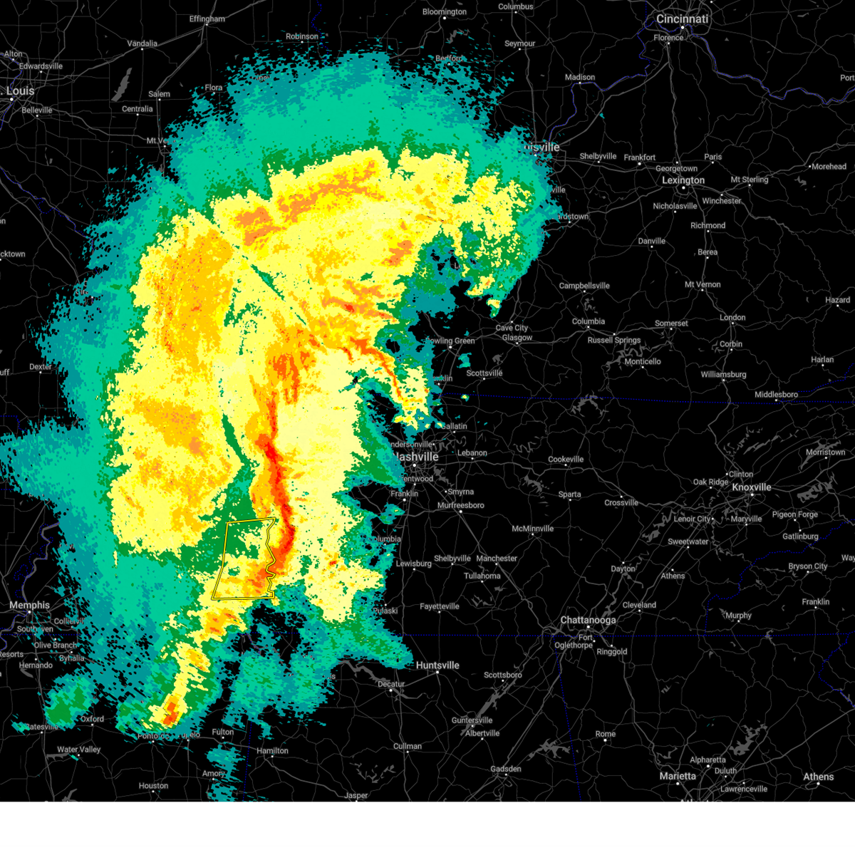 The severe thunderstorm warning for eastern henderson, northeastern mcnairy, northern hardin, east central chester and decatur counties will expire at 945 pm cdt, the storms which prompted the warning have moved out of the area. therefore, the warning will be allowed to expire. a tornado watch remains in effect until midnight cdt for west tennessee. The severe thunderstorm warning for eastern henderson, northeastern mcnairy, northern hardin, east central chester and decatur counties will expire at 945 pm cdt, the storms which prompted the warning have moved out of the area. therefore, the warning will be allowed to expire. a tornado watch remains in effect until midnight cdt for west tennessee.
|
| 3/24/2023 9:27 PM CDT |
 At 927 pm cdt, severe thunderstorms were located along a line extending from near natchez trace state park to decaturville to 6 miles southeast of sardis, moving east at 55 mph (radar indicated). Hazards include 60 mph wind gusts. Expect damage to roofs, siding, and trees. locations impacted include, lexington, natchez trace state park, natchez trace state forest, parsons, adamsville, decaturville, sardis, reagan, morris chapel, olive hill, darden, montgomery, scotts hill, saltillo, milledgeville, enville, rock hill, pleasant grove, cerro gordo and thurman. hail threat, radar indicated max hail size, <. 75 in wind threat, radar indicated max wind gust, 60 mph. At 927 pm cdt, severe thunderstorms were located along a line extending from near natchez trace state park to decaturville to 6 miles southeast of sardis, moving east at 55 mph (radar indicated). Hazards include 60 mph wind gusts. Expect damage to roofs, siding, and trees. locations impacted include, lexington, natchez trace state park, natchez trace state forest, parsons, adamsville, decaturville, sardis, reagan, morris chapel, olive hill, darden, montgomery, scotts hill, saltillo, milledgeville, enville, rock hill, pleasant grove, cerro gordo and thurman. hail threat, radar indicated max hail size, <. 75 in wind threat, radar indicated max wind gust, 60 mph.
|
| 3/24/2023 8:57 PM CDT |
 At 857 pm cdt, severe thunderstorms were located along a line extending from near blue goose to near mifflin to near masseyville, moving east at 55 mph (radar indicated). Hazards include 70 mph wind gusts. Expect considerable tree damage. Damage is likely to mobile homes, roofs, and outbuildings. At 857 pm cdt, severe thunderstorms were located along a line extending from near blue goose to near mifflin to near masseyville, moving east at 55 mph (radar indicated). Hazards include 70 mph wind gusts. Expect considerable tree damage. Damage is likely to mobile homes, roofs, and outbuildings.
|
| 5/21/2022 9:40 PM CDT | Quarter sized hail reported 0.2 miles NE of Sardis, TN |
| 5/21/2022 9:38 PM CDT |
 At 938 pm cdt, a severe thunderstorm was located over sardis, or 15 miles north of savannah, moving northeast at 40 mph (radar indicated). Hazards include 60 mph wind gusts and quarter size hail. Hail damage to vehicles is expected. Expect wind damage to roofs, siding, and trees. At 938 pm cdt, a severe thunderstorm was located over sardis, or 15 miles north of savannah, moving northeast at 40 mph (radar indicated). Hazards include 60 mph wind gusts and quarter size hail. Hail damage to vehicles is expected. Expect wind damage to roofs, siding, and trees.
|
| 5/13/2022 6:05 PM CDT |
 The severe thunderstorm warning for northern hardin county will expire at 615 pm cdt, the storm which prompted the warning has weakened below severe limits, and no longer poses an immediate threat to life or property. therefore, the warning will be allowed to expire. The severe thunderstorm warning for northern hardin county will expire at 615 pm cdt, the storm which prompted the warning has weakened below severe limits, and no longer poses an immediate threat to life or property. therefore, the warning will be allowed to expire.
|
| 5/13/2022 5:57 PM CDT |
 At 556 pm cdt, a severe thunderstorm was located over savannah, moving north at 10 mph (trained weather spotters). Hazards include quarter size hail. Damage to vehicles is expected. locations impacted include, savannah, sardis, morris chapel, crump, saltillo, right, sibley, phillips, hinkle, five forks, swift, bucktown, cerro gordo and coffee landing. hail threat, radar indicated max hail size, 1. 00 in wind threat, radar indicated max wind gust, <50 mph. At 556 pm cdt, a severe thunderstorm was located over savannah, moving north at 10 mph (trained weather spotters). Hazards include quarter size hail. Damage to vehicles is expected. locations impacted include, savannah, sardis, morris chapel, crump, saltillo, right, sibley, phillips, hinkle, five forks, swift, bucktown, cerro gordo and coffee landing. hail threat, radar indicated max hail size, 1. 00 in wind threat, radar indicated max wind gust, <50 mph.
|
| 5/13/2022 5:39 PM CDT |
 At 538 pm cdt, a severe thunderstorm was located over savannah, moving north at 10 mph (radar indicated). Hazards include quarter size hail. damage to vehicles is expected At 538 pm cdt, a severe thunderstorm was located over savannah, moving north at 10 mph (radar indicated). Hazards include quarter size hail. damage to vehicles is expected
|
| 5/2/2022 5:36 PM CDT |
 The severe thunderstorm warning for southeastern henderson, northeastern hardin and decatur counties will expire at 545 pm cdt, the storm which prompted the warning has weakened below severe limits, and no longer poses an immediate threat to life or property. therefore, the warning will be allowed to expire. however small hail is still possible with this thunderstorm. The severe thunderstorm warning for southeastern henderson, northeastern hardin and decatur counties will expire at 545 pm cdt, the storm which prompted the warning has weakened below severe limits, and no longer poses an immediate threat to life or property. therefore, the warning will be allowed to expire. however small hail is still possible with this thunderstorm.
|
| 5/2/2022 5:18 PM CDT |
 At 518 pm cdt, a severe thunderstorm was located near sardis, or 15 miles north of savannah, moving north at 35 mph (radar indicated). Hazards include 60 mph wind gusts and quarter size hail. Hail damage to vehicles is expected. expect wind damage to roofs, siding, and trees. locations impacted include, parsons, decaturville, sardis, darden, montgomery, scotts hill, saltillo, haney, hinkle, pleasant grove, mount tabor, red walnut, cerro gordo, thurman, lick skillet, perryville, gumdale, wilkinstown, bath springs and five forks. hail threat, radar indicated max hail size, 1. 00 in wind threat, radar indicated max wind gust, 60 mph. At 518 pm cdt, a severe thunderstorm was located near sardis, or 15 miles north of savannah, moving north at 35 mph (radar indicated). Hazards include 60 mph wind gusts and quarter size hail. Hail damage to vehicles is expected. expect wind damage to roofs, siding, and trees. locations impacted include, parsons, decaturville, sardis, darden, montgomery, scotts hill, saltillo, haney, hinkle, pleasant grove, mount tabor, red walnut, cerro gordo, thurman, lick skillet, perryville, gumdale, wilkinstown, bath springs and five forks. hail threat, radar indicated max hail size, 1. 00 in wind threat, radar indicated max wind gust, 60 mph.
|
| 5/2/2022 5:02 PM CDT |
 At 501 pm cdt, a severe thunderstorm was located near savannah, moving north at 35 mph (radar indicated). Hazards include 60 mph wind gusts and quarter size hail. Hail damage to vehicles is expected. Expect wind damage to roofs, siding, and trees. At 501 pm cdt, a severe thunderstorm was located near savannah, moving north at 35 mph (radar indicated). Hazards include 60 mph wind gusts and quarter size hail. Hail damage to vehicles is expected. Expect wind damage to roofs, siding, and trees.
|
| 4/13/2022 6:48 PM CDT |
 At 648 pm cdt, severe thunderstorms were located along a line extending from 11 miles northeast of parsons to 8 miles south of decaturville to near corinth, moving east at 45 mph (radar indicated). Hazards include 70 mph wind gusts. Expect considerable tree damage. damage is likely to mobile homes, roofs, and outbuildings. locations impacted include, savannah, pickwick landing state park, parsons, adamsville, decaturville, sardis, pickwick dam, morris chapel, shiloh, walnut grove, olive hill, darden, montgomery, crump, scotts hill, michie, guys, saltillo, stantonville and milledgeville. thunderstorm damage threat, considerable hail threat, radar indicated max hail size, <. 75 in wind threat, radar indicated max wind gust, 70 mph. At 648 pm cdt, severe thunderstorms were located along a line extending from 11 miles northeast of parsons to 8 miles south of decaturville to near corinth, moving east at 45 mph (radar indicated). Hazards include 70 mph wind gusts. Expect considerable tree damage. damage is likely to mobile homes, roofs, and outbuildings. locations impacted include, savannah, pickwick landing state park, parsons, adamsville, decaturville, sardis, pickwick dam, morris chapel, shiloh, walnut grove, olive hill, darden, montgomery, crump, scotts hill, michie, guys, saltillo, stantonville and milledgeville. thunderstorm damage threat, considerable hail threat, radar indicated max hail size, <. 75 in wind threat, radar indicated max wind gust, 70 mph.
|
| 4/13/2022 6:35 PM CDT |
 At 634 pm cdt, severe thunderstorms were located along a line extending from near natchez trace state park to sardis to near big hill pond state park, moving east at 45 mph (radar indicated). Hazards include 70 mph wind gusts. Expect considerable tree damage. damage is likely to mobile homes, roofs, and outbuildings. locations impacted include, lexington, savannah, henderson, selmer, pickwick landing state park, natchez trace state park, natchez trace state forest, big hill pond state park, parsons, adamsville, decaturville, sardis, pickwick dam, masseyville, reagan, bargerton, pocahontas, jacks creek, mifflin and wildersville. thunderstorm damage threat, considerable hail threat, radar indicated max hail size, <. 75 in wind threat, radar indicated max wind gust, 70 mph. At 634 pm cdt, severe thunderstorms were located along a line extending from near natchez trace state park to sardis to near big hill pond state park, moving east at 45 mph (radar indicated). Hazards include 70 mph wind gusts. Expect considerable tree damage. damage is likely to mobile homes, roofs, and outbuildings. locations impacted include, lexington, savannah, henderson, selmer, pickwick landing state park, natchez trace state park, natchez trace state forest, big hill pond state park, parsons, adamsville, decaturville, sardis, pickwick dam, masseyville, reagan, bargerton, pocahontas, jacks creek, mifflin and wildersville. thunderstorm damage threat, considerable hail threat, radar indicated max hail size, <. 75 in wind threat, radar indicated max wind gust, 70 mph.
|
| 4/13/2022 5:56 PM CDT |
 At 556 pm cdt, severe thunderstorms were located along a line extending from 8 miles southeast of milan to near chickasaw state park to near lagrange, moving east at 45 mph (radar indicated). Hazards include 60 mph wind gusts. expect damage to roofs, siding, and trees At 556 pm cdt, severe thunderstorms were located along a line extending from 8 miles southeast of milan to near chickasaw state park to near lagrange, moving east at 45 mph (radar indicated). Hazards include 60 mph wind gusts. expect damage to roofs, siding, and trees
|
| 7/31/2021 11:07 PM CDT |
 At 1107 pm cdt, a severe thunderstorm was located near sardis, or 14 miles southeast of lexington, moving southeast at 55 mph (radar indicated). Hazards include 60 mph wind gusts. expect damage to roofs, siding, and trees At 1107 pm cdt, a severe thunderstorm was located near sardis, or 14 miles southeast of lexington, moving southeast at 55 mph (radar indicated). Hazards include 60 mph wind gusts. expect damage to roofs, siding, and trees
|
| 5/28/2021 12:11 AM CDT |
 The severe thunderstorm warning for southeastern henderson, northern hardin and southern decatur counties will expire at 1215 am cdt, the storm which prompted the warning has moved out of the area. therefore, the warning will be allowed to expire. however gusty winds are still possible with this thunderstorm. The severe thunderstorm warning for southeastern henderson, northern hardin and southern decatur counties will expire at 1215 am cdt, the storm which prompted the warning has moved out of the area. therefore, the warning will be allowed to expire. however gusty winds are still possible with this thunderstorm.
|
| 5/27/2021 11:39 PM CDT |
 At 1139 pm cdt, a severe thunderstorm was located 8 miles north of savannah, moving east at 35 mph (radar indicated). Hazards include 60 mph wind gusts. Expect damage to roofs, siding, and trees. Locations impacted include, savannah, adamsville, decaturville, sardis, reagan, olive hill, morris chapel, montgomery, crump, scotts hill, saltillo, milledgeville, right, phillips, haney, hinkle, pleasant grove, red walnut, olivehill and cerro gordo. At 1139 pm cdt, a severe thunderstorm was located 8 miles north of savannah, moving east at 35 mph (radar indicated). Hazards include 60 mph wind gusts. Expect damage to roofs, siding, and trees. Locations impacted include, savannah, adamsville, decaturville, sardis, reagan, olive hill, morris chapel, montgomery, crump, scotts hill, saltillo, milledgeville, right, phillips, haney, hinkle, pleasant grove, red walnut, olivehill and cerro gordo.
|
| 5/27/2021 11:21 PM CDT |
 At 1121 pm cdt, a severe thunderstorm was located over morris chapel, or 10 miles northwest of savannah, moving east at 35 mph (radar indicated). Hazards include 60 mph wind gusts. expect damage to roofs, siding, and trees At 1121 pm cdt, a severe thunderstorm was located over morris chapel, or 10 miles northwest of savannah, moving east at 35 mph (radar indicated). Hazards include 60 mph wind gusts. expect damage to roofs, siding, and trees
|
| 4/9/2021 7:41 PM CDT |
 At 740 pm cdt, a severe thunderstorm was located near masseyville, or near henderson, moving northeast at 20 mph (radar indicated). Hazards include ping pong ball size hail and 60 mph wind gusts. People and animals outdoors will be injured. expect hail damage to roofs, siding, windows, and vehicles. Expect wind damage to roofs, siding, and trees. At 740 pm cdt, a severe thunderstorm was located near masseyville, or near henderson, moving northeast at 20 mph (radar indicated). Hazards include ping pong ball size hail and 60 mph wind gusts. People and animals outdoors will be injured. expect hail damage to roofs, siding, windows, and vehicles. Expect wind damage to roofs, siding, and trees.
|
| 3/27/2021 11:54 PM CDT |
 At 1154 pm cdt, severe thunderstorms were located along a line extending from near bargerton to near hinkle, moving east at 50 mph (radar indicated). Hazards include 60 mph wind gusts. expect damage to roofs, siding, and trees At 1154 pm cdt, severe thunderstorms were located along a line extending from near bargerton to near hinkle, moving east at 50 mph (radar indicated). Hazards include 60 mph wind gusts. expect damage to roofs, siding, and trees
|
| 3/27/2021 11:00 PM CDT |
 At 1100 pm cdt, doppler radar indicated a severe thunderstorm producing a tornado was located over jacks creek, or near henderson, moving northeast at 50 mph (radar indicated rotation). Hazards include tornado. Flying debris will be dangerous to those caught without shelter. mobile homes will be damaged or destroyed. damage to roofs, windows, and vehicles will occur. tree damage is likely. Locations impacted include, lexington, henderson, natchez trace state forest, parsons, decaturville, sardis, reagan, jacks creek, darden, mifflin, scotts hill, enville, rock hill, roby, mount tabor, cabo, middle fork, hinson springs, lick skillet and perryville. At 1100 pm cdt, doppler radar indicated a severe thunderstorm producing a tornado was located over jacks creek, or near henderson, moving northeast at 50 mph (radar indicated rotation). Hazards include tornado. Flying debris will be dangerous to those caught without shelter. mobile homes will be damaged or destroyed. damage to roofs, windows, and vehicles will occur. tree damage is likely. Locations impacted include, lexington, henderson, natchez trace state forest, parsons, decaturville, sardis, reagan, jacks creek, darden, mifflin, scotts hill, enville, rock hill, roby, mount tabor, cabo, middle fork, hinson springs, lick skillet and perryville.
|
| 3/27/2021 10:47 PM CDT |
 At 1047 pm cdt, doppler radar indicated a severe thunderstorm producing a tornado was located near henderson, moving northeast at 50 mph (radar indicated rotation). Hazards include tornado. Flying debris will be dangerous to those caught without shelter. mobile homes will be damaged or destroyed. damage to roofs, windows, and vehicles will occur. tree damage is likely. Locations impacted include, lexington, henderson, natchez trace state forest, chickasaw state park, parsons, decaturville, sardis, silerton, reagan, jacks creek, darden, mifflin, scotts hill, finger, enville, medon, pinson, rock hill, hickory corners and roby. At 1047 pm cdt, doppler radar indicated a severe thunderstorm producing a tornado was located near henderson, moving northeast at 50 mph (radar indicated rotation). Hazards include tornado. Flying debris will be dangerous to those caught without shelter. mobile homes will be damaged or destroyed. damage to roofs, windows, and vehicles will occur. tree damage is likely. Locations impacted include, lexington, henderson, natchez trace state forest, chickasaw state park, parsons, decaturville, sardis, silerton, reagan, jacks creek, darden, mifflin, scotts hill, finger, enville, medon, pinson, rock hill, hickory corners and roby.
|
| 3/27/2021 10:42 PM CDT |
 At 1042 pm cdt, doppler radar indicated a severe thunderstorm producing a tornado was located over chickasaw state park, moving northeast at 50 mph (radar indicated rotation). Hazards include tornado. Flying debris will be dangerous to those caught without shelter. mobile homes will be damaged or destroyed. damage to roofs, windows, and vehicles will occur. Tree damage is likely. At 1042 pm cdt, doppler radar indicated a severe thunderstorm producing a tornado was located over chickasaw state park, moving northeast at 50 mph (radar indicated rotation). Hazards include tornado. Flying debris will be dangerous to those caught without shelter. mobile homes will be damaged or destroyed. damage to roofs, windows, and vehicles will occur. Tree damage is likely.
|
| 3/27/2021 4:43 PM CDT |
 At 443 pm cdt, a large and extremely dangerous tornado was located near reagan, or 7 miles southwest of lexington, moving east at 35 mph. this is a particularly dangerous situation. take cover now! (radar indicated rotation). Hazards include damaging tornado. You are in a life-threatening situation. flying debris may be deadly to those caught without shelter. mobile homes will be destroyed. considerable damage to homes, businesses, and vehicles is likely and complete destruction is possible. Locations impacted include, lexington, parsons, decaturville, reagan, jacks creek, darden, mifflin, scotts hill, busseltown, jeannette, haney, rock hill, roby, mount tabor, middle fork, hinson springs, cozette, lick skillet, perryville and gumdale. At 443 pm cdt, a large and extremely dangerous tornado was located near reagan, or 7 miles southwest of lexington, moving east at 35 mph. this is a particularly dangerous situation. take cover now! (radar indicated rotation). Hazards include damaging tornado. You are in a life-threatening situation. flying debris may be deadly to those caught without shelter. mobile homes will be destroyed. considerable damage to homes, businesses, and vehicles is likely and complete destruction is possible. Locations impacted include, lexington, parsons, decaturville, reagan, jacks creek, darden, mifflin, scotts hill, busseltown, jeannette, haney, rock hill, roby, mount tabor, middle fork, hinson springs, cozette, lick skillet, perryville and gumdale.
|
| 3/27/2021 4:35 PM CDT |
 At 434 pm cdt, doppler radar indicated a severe thunderstorm producing a tornado was located near mifflin, or 9 miles northeast of henderson, moving east at 45 mph (radar indicated rotation). Hazards include tornado and quarter size hail. Flying debris will be dangerous to those caught without shelter. mobile homes will be damaged or destroyed. damage to roofs, windows, and vehicles will occur. Tree damage is likely. At 434 pm cdt, doppler radar indicated a severe thunderstorm producing a tornado was located near mifflin, or 9 miles northeast of henderson, moving east at 45 mph (radar indicated rotation). Hazards include tornado and quarter size hail. Flying debris will be dangerous to those caught without shelter. mobile homes will be damaged or destroyed. damage to roofs, windows, and vehicles will occur. Tree damage is likely.
|
| 3/27/2021 4:19 PM CDT |
 At 418 pm cdt, a severe thunderstorm was located near henderson, moving east at 50 mph (radar indicated). Hazards include 60 mph wind gusts and quarter size hail. Hail damage to vehicles is expected. expect wind damage to roofs, siding, and trees. Locations impacted include, jackson, lexington, henderson, natchez trace state forest, sardis, bemis, reagan, blue goose, jacks creek, parkers crossroads, mifflin, bargerton, wildersville, scotts hill, medon, pinson, cedar grove, beech bluff, madison hall and rock hill. At 418 pm cdt, a severe thunderstorm was located near henderson, moving east at 50 mph (radar indicated). Hazards include 60 mph wind gusts and quarter size hail. Hail damage to vehicles is expected. expect wind damage to roofs, siding, and trees. Locations impacted include, jackson, lexington, henderson, natchez trace state forest, sardis, bemis, reagan, blue goose, jacks creek, parkers crossroads, mifflin, bargerton, wildersville, scotts hill, medon, pinson, cedar grove, beech bluff, madison hall and rock hill.
|
| 3/27/2021 4:05 PM CDT |
 At 405 pm cdt, a severe thunderstorm was located near mercer, or 7 miles northwest of chickasaw state forest, moving northeast at 55 mph (radar indicated). Hazards include 60 mph wind gusts and quarter size hail. Hail damage to vehicles is expected. Expect wind damage to roofs, siding, and trees. At 405 pm cdt, a severe thunderstorm was located near mercer, or 7 miles northwest of chickasaw state forest, moving northeast at 55 mph (radar indicated). Hazards include 60 mph wind gusts and quarter size hail. Hail damage to vehicles is expected. Expect wind damage to roofs, siding, and trees.
|
| 3/25/2021 6:24 PM CDT |
 At 624 pm cdt, a severe thunderstorm was located near henderson, moving northeast at 45 mph (radar indicated). Hazards include 60 mph wind gusts and half dollar size hail. Hail damage to vehicles is expected. expect wind damage to roofs, siding, and trees. Locations impacted include, lexington, henderson, adamsville, sardis, reagan, jacks creek, darden, mifflin, mcnairy, scotts hill, saltillo, finger, milledgeville, enville, rock hill, hinkle, hickory corners, roby, pleasant grove and cabo. At 624 pm cdt, a severe thunderstorm was located near henderson, moving northeast at 45 mph (radar indicated). Hazards include 60 mph wind gusts and half dollar size hail. Hail damage to vehicles is expected. expect wind damage to roofs, siding, and trees. Locations impacted include, lexington, henderson, adamsville, sardis, reagan, jacks creek, darden, mifflin, mcnairy, scotts hill, saltillo, finger, milledgeville, enville, rock hill, hinkle, hickory corners, roby, pleasant grove and cabo.
|
| 3/25/2021 6:14 PM CDT |
 At 614 pm cdt, a severe thunderstorm was located over masseyville, or near chickasaw state park, moving northeast at 45 mph (radar indicated). Hazards include 60 mph wind gusts and quarter size hail. Hail damage to vehicles is expected. Expect wind damage to roofs, siding, and trees. At 614 pm cdt, a severe thunderstorm was located over masseyville, or near chickasaw state park, moving northeast at 45 mph (radar indicated). Hazards include 60 mph wind gusts and quarter size hail. Hail damage to vehicles is expected. Expect wind damage to roofs, siding, and trees.
|
| 3/17/2021 1:58 PM CDT |
 At 158 pm cdt, a severe thunderstorm was located near bemis, or 7 miles south of jackson, moving east at 55 mph (radar indicated). Hazards include 60 mph wind gusts. expect damage to roofs, siding, and trees At 158 pm cdt, a severe thunderstorm was located near bemis, or 7 miles south of jackson, moving east at 55 mph (radar indicated). Hazards include 60 mph wind gusts. expect damage to roofs, siding, and trees
|
| 7/12/2020 9:13 AM CDT |
 At 854 am cdt, a severe thunderstorm was located near lexington, moving southeast at 50 mph (radar indicated). Hazards include 60 mph wind gusts and quarter size hail. Hail damage to vehicles is expected. expect wind damage to roofs, siding, and trees. Locations impacted include, lexington, natchez trace state park, natchez trace state forest, parsons, decaturville, sardis, reagan, blue goose, mifflin, bargerton, wildersville, jacks creek, parkers crossroads, darden, montgomery, scotts hill, milledgeville, enville, rock hill and pleasant grove. At 854 am cdt, a severe thunderstorm was located near lexington, moving southeast at 50 mph (radar indicated). Hazards include 60 mph wind gusts and quarter size hail. Hail damage to vehicles is expected. expect wind damage to roofs, siding, and trees. Locations impacted include, lexington, natchez trace state park, natchez trace state forest, parsons, decaturville, sardis, reagan, blue goose, mifflin, bargerton, wildersville, jacks creek, parkers crossroads, darden, montgomery, scotts hill, milledgeville, enville, rock hill and pleasant grove.
|
| 7/12/2020 8:55 AM CDT |
 At 854 am cdt, a severe thunderstorm was located near lexington, moving southeast at 50 mph (radar indicated). Hazards include 60 mph wind gusts and quarter size hail. Hail damage to vehicles is expected. expect wind damage to roofs, siding, and trees. Locations impacted include, lexington, natchez trace state park, natchez trace state forest, parsons, decaturville, sardis, reagan, blue goose, mifflin, bargerton, wildersville, jacks creek, parkers crossroads, darden, montgomery, scotts hill, milledgeville, enville, rock hill and pleasant grove. At 854 am cdt, a severe thunderstorm was located near lexington, moving southeast at 50 mph (radar indicated). Hazards include 60 mph wind gusts and quarter size hail. Hail damage to vehicles is expected. expect wind damage to roofs, siding, and trees. Locations impacted include, lexington, natchez trace state park, natchez trace state forest, parsons, decaturville, sardis, reagan, blue goose, mifflin, bargerton, wildersville, jacks creek, parkers crossroads, darden, montgomery, scotts hill, milledgeville, enville, rock hill and pleasant grove.
|
| 7/12/2020 8:41 AM CDT |
 The national weather service in memphis has issued a * severe thunderstorm warning for. henderson county in western tennessee. southwestern carroll county in western tennessee. northeastern madison county in western tennessee. Northeastern chester county in western tennessee. The national weather service in memphis has issued a * severe thunderstorm warning for. henderson county in western tennessee. southwestern carroll county in western tennessee. northeastern madison county in western tennessee. Northeastern chester county in western tennessee.
|
| 5/22/2020 6:43 PM CDT |
 At 642 pm cdt, severe thunderstorms were located along a line extending from sardis to near adamsville, moving east at 35 mph (radar indicated). Hazards include 60 mph wind gusts and quarter size hail. Hail damage to vehicles is expected. Expect wind damage to roofs, siding, and trees. At 642 pm cdt, severe thunderstorms were located along a line extending from sardis to near adamsville, moving east at 35 mph (radar indicated). Hazards include 60 mph wind gusts and quarter size hail. Hail damage to vehicles is expected. Expect wind damage to roofs, siding, and trees.
|
| 5/22/2020 6:19 PM CDT |
 The national weather service in memphis has issued a * severe thunderstorm warning for. southeastern henderson county in western tennessee. mcnairy county in western tennessee. hardin county in western tennessee. Southeastern chester county in western tennessee. The national weather service in memphis has issued a * severe thunderstorm warning for. southeastern henderson county in western tennessee. mcnairy county in western tennessee. hardin county in western tennessee. Southeastern chester county in western tennessee.
|
| 5/4/2020 7:48 PM CDT |
 At 748 pm cdt, a severe thunderstorm was located 7 miles southeast of sardis, or 11 miles north of savannah, moving southeast at 55 mph (radar indicated). Hazards include golf ball size hail and 60 mph wind gusts. People and animals outdoors will be injured. expect hail damage to roofs, siding, windows, and vehicles. Expect wind damage to roofs, siding, and trees. At 748 pm cdt, a severe thunderstorm was located 7 miles southeast of sardis, or 11 miles north of savannah, moving southeast at 55 mph (radar indicated). Hazards include golf ball size hail and 60 mph wind gusts. People and animals outdoors will be injured. expect hail damage to roofs, siding, windows, and vehicles. Expect wind damage to roofs, siding, and trees.
|
| 5/4/2020 7:11 PM CDT |
 At 709 pm cdt, a severe thunderstorm was located over lexington, moving southeast at 70 mph (radar indicated). Hazards include 60 mph wind gusts and half dollar size hail. Hail damage to vehicles is expected. Expect wind damage to roofs, siding, and trees. At 709 pm cdt, a severe thunderstorm was located over lexington, moving southeast at 70 mph (radar indicated). Hazards include 60 mph wind gusts and half dollar size hail. Hail damage to vehicles is expected. Expect wind damage to roofs, siding, and trees.
|
| 5/3/2020 7:05 PM CDT |
 The severe thunderstorm warning for southeastern henderson and southern decatur counties will expire at 715 pm cdt, the storm which prompted the warning has weakened below severe limits, and no longer poses an immediate threat to life or property. therefore, the warning will be allowed to expire. however heavy rain is still possible with this thunderstorm. The severe thunderstorm warning for southeastern henderson and southern decatur counties will expire at 715 pm cdt, the storm which prompted the warning has weakened below severe limits, and no longer poses an immediate threat to life or property. therefore, the warning will be allowed to expire. however heavy rain is still possible with this thunderstorm.
|
| 5/3/2020 6:55 PM CDT |
 At 655 pm cdt, a severe thunderstorm was located near reagan, or 9 miles southeast of lexington, moving east at 60 mph (radar indicated). Hazards include 60 mph wind gusts and penny size hail. Expect damage to roofs, siding, and trees. Locations impacted include, lexington, parsons, decaturville, sardis, reagan, darden, montgomery, scotts hill, haney, rock hill, pleasant grove, mount tabor, red walnut, thurman, lick skillet, perryville, warrens bluff, wilkinstown, garrett and beacon. At 655 pm cdt, a severe thunderstorm was located near reagan, or 9 miles southeast of lexington, moving east at 60 mph (radar indicated). Hazards include 60 mph wind gusts and penny size hail. Expect damage to roofs, siding, and trees. Locations impacted include, lexington, parsons, decaturville, sardis, reagan, darden, montgomery, scotts hill, haney, rock hill, pleasant grove, mount tabor, red walnut, thurman, lick skillet, perryville, warrens bluff, wilkinstown, garrett and beacon.
|
| 5/3/2020 6:46 PM CDT |
 At 646 pm cdt, a severe thunderstorm was located near lexington, moving east at 50 mph (radar indicated). Hazards include 60 mph wind gusts and nickel size hail. Expect damage to roofs, siding, and trees. Locations impacted include, lexington, parsons, decaturville, sardis, reagan, blue goose, darden, bargerton, montgomery, scotts hill, cedar grove, haney, rock hill, juno, pleasant grove, mount tabor, middle fork, red walnut, timberlake and hinson springs. At 646 pm cdt, a severe thunderstorm was located near lexington, moving east at 50 mph (radar indicated). Hazards include 60 mph wind gusts and nickel size hail. Expect damage to roofs, siding, and trees. Locations impacted include, lexington, parsons, decaturville, sardis, reagan, blue goose, darden, bargerton, montgomery, scotts hill, cedar grove, haney, rock hill, juno, pleasant grove, mount tabor, middle fork, red walnut, timberlake and hinson springs.
|
| 5/3/2020 6:34 PM CDT |
 At 634 pm cdt, a severe thunderstorm was located near blue goose, or 10 miles east of jackson, moving east at 50 mph (radar indicated). Hazards include quarter size hail. damage to vehicles is expected At 634 pm cdt, a severe thunderstorm was located near blue goose, or 10 miles east of jackson, moving east at 50 mph (radar indicated). Hazards include quarter size hail. damage to vehicles is expected
|
| 5/3/2020 5:54 PM CDT |
 At 554 pm cdt, a severe thunderstorm was located near mifflin, or near henderson, moving southeast at 45 mph (radar indicated). Hazards include quarter size hail. damage to vehicles is expected At 554 pm cdt, a severe thunderstorm was located near mifflin, or near henderson, moving southeast at 45 mph (radar indicated). Hazards include quarter size hail. damage to vehicles is expected
|
| 5/3/2020 3:54 PM CDT |
 At 354 pm cdt, severe thunderstorms were located along a line extending from 6 miles north of linden to near decaturville to near masseyville, moving east at 60 mph (radar indicated). Hazards include 70 mph wind gusts and quarter size hail. Hail damage to vehicles is expected. expect considerable tree damage. wind damage is also likely to mobile homes, roofs, and outbuildings. Locations impacted include, lexington, savannah, henderson, selmer, parsons, adamsville, decaturville, sardis, masseyville, reagan, morris chapel, jacks creek, olive hill, darden, montgomery, robertson, mcnairy, crump, scotts hill and bethel springs. At 354 pm cdt, severe thunderstorms were located along a line extending from 6 miles north of linden to near decaturville to near masseyville, moving east at 60 mph (radar indicated). Hazards include 70 mph wind gusts and quarter size hail. Hail damage to vehicles is expected. expect considerable tree damage. wind damage is also likely to mobile homes, roofs, and outbuildings. Locations impacted include, lexington, savannah, henderson, selmer, parsons, adamsville, decaturville, sardis, masseyville, reagan, morris chapel, jacks creek, olive hill, darden, montgomery, robertson, mcnairy, crump, scotts hill and bethel springs.
|
| 5/3/2020 3:45 PM CDT | Tree down over the road on hwy 22 near edge road... eastside of chester c in chester county TN, 6.2 miles ESE of Sardis, TN |
| 5/3/2020 3:35 PM CDT |
 At 335 pm cdt, severe thunderstorms were located along a line extending from near new johnsonville to near lexington to near whiteville, moving east at 60 mph (radar indicated). Hazards include 70 mph wind gusts and quarter size hail. Hail damage to vehicles is expected. expect considerable tree damage. Wind damage is also likely to mobile homes, roofs, and outbuildings. At 335 pm cdt, severe thunderstorms were located along a line extending from near new johnsonville to near lexington to near whiteville, moving east at 60 mph (radar indicated). Hazards include 70 mph wind gusts and quarter size hail. Hail damage to vehicles is expected. expect considerable tree damage. Wind damage is also likely to mobile homes, roofs, and outbuildings.
|
| 4/12/2020 11:54 PM CDT |
 At 1154 pm cdt, severe thunderstorms were located along a line extending from near wildersville to 6 miles east of sardis to 7 miles north of walnut grove, moving northeast at 65 mph (trained weather spotters. at 1150 pm cdt, a large tree was downed on highway 22 near hamburg road). Hazards include 60 mph wind gusts. Expect damage to roofs, siding, and trees. Locations impacted include, lexington, savannah, pickwick landing state park, natchez trace state forest, parsons, adamsville, decaturville, sardis, pickwick dam, reagan, morris chapel, shiloh, walnut grove, olive hill, darden, montgomery, crump, scotts hill, michie and saltillo. At 1154 pm cdt, severe thunderstorms were located along a line extending from near wildersville to 6 miles east of sardis to 7 miles north of walnut grove, moving northeast at 65 mph (trained weather spotters. at 1150 pm cdt, a large tree was downed on highway 22 near hamburg road). Hazards include 60 mph wind gusts. Expect damage to roofs, siding, and trees. Locations impacted include, lexington, savannah, pickwick landing state park, natchez trace state forest, parsons, adamsville, decaturville, sardis, pickwick dam, reagan, morris chapel, shiloh, walnut grove, olive hill, darden, montgomery, crump, scotts hill, michie and saltillo.
|
| 4/12/2020 11:46 PM CDT |
 At 1146 pm cdt, severe thunderstorms were located along a line extending from near lexington to near sardis to near pickwick landing state park, moving northeast at 65 mph (radar indicated). Hazards include 60 mph wind gusts. Expect damage to roofs, siding, and trees. Locations impacted include, lexington, savannah, pickwick landing state park, natchez trace state forest, parsons, adamsville, decaturville, sardis, pickwick dam, reagan, morris chapel, shiloh, walnut grove, olive hill, darden, montgomery, crump, scotts hill, michie and saltillo. At 1146 pm cdt, severe thunderstorms were located along a line extending from near lexington to near sardis to near pickwick landing state park, moving northeast at 65 mph (radar indicated). Hazards include 60 mph wind gusts. Expect damage to roofs, siding, and trees. Locations impacted include, lexington, savannah, pickwick landing state park, natchez trace state forest, parsons, adamsville, decaturville, sardis, pickwick dam, reagan, morris chapel, shiloh, walnut grove, olive hill, darden, montgomery, crump, scotts hill, michie and saltillo.
|
| 4/12/2020 11:32 PM CDT |
 At 1131 pm cdt, severe thunderstorms were located along a line extending from near mifflin to 7 miles northwest of adamsville to 6 miles east of corinth, moving northeast at 70 mph (radar indicated). Hazards include 60 mph wind gusts. Expect damage to roofs, siding, and trees. Locations impacted include, corinth, lexington, savannah, henderson, selmer, pickwick landing state park, natchez trace state forest, parsons, adamsville, decaturville, sardis, pickwick dam, masseyville, reagan, jacks creek, mifflin, morris chapel, shiloh, walnut grove and olive hill. At 1131 pm cdt, severe thunderstorms were located along a line extending from near mifflin to 7 miles northwest of adamsville to 6 miles east of corinth, moving northeast at 70 mph (radar indicated). Hazards include 60 mph wind gusts. Expect damage to roofs, siding, and trees. Locations impacted include, corinth, lexington, savannah, henderson, selmer, pickwick landing state park, natchez trace state forest, parsons, adamsville, decaturville, sardis, pickwick dam, masseyville, reagan, jacks creek, mifflin, morris chapel, shiloh, walnut grove and olive hill.
|
| 4/12/2020 11:09 PM CDT |
 At 1109 pm cdt, severe thunderstorms were located along a line extending from near bolivar to pocahontas to near jumpertown, moving northeast at 65 mph (radar indicated). Hazards include 60 mph wind gusts. expect damage to roofs, siding, and trees At 1109 pm cdt, severe thunderstorms were located along a line extending from near bolivar to pocahontas to near jumpertown, moving northeast at 65 mph (radar indicated). Hazards include 60 mph wind gusts. expect damage to roofs, siding, and trees
|
| 4/8/2020 3:58 PM CDT |
 The severe thunderstorm warning for northeastern mcnairy, northwestern hardin and east central chester counties will expire at 400 pm cdt, the storm which prompted the warning has weakened below severe limits, and no longer poses an immediate threat to life or property. therefore, the warning will be allowed to expire. however small hail is still possible with this thunderstorm. The severe thunderstorm warning for northeastern mcnairy, northwestern hardin and east central chester counties will expire at 400 pm cdt, the storm which prompted the warning has weakened below severe limits, and no longer poses an immediate threat to life or property. therefore, the warning will be allowed to expire. however small hail is still possible with this thunderstorm.
|
| 4/8/2020 3:44 PM CDT |
 At 343 pm cdt, a severe thunderstorm was located near jacks creek, or 9 miles east of henderson, moving east at 25 mph (radar indicated). Hazards include 60 mph wind gusts and quarter size hail. Hail damage to vehicles is expected. expect wind damage to roofs, siding, and trees. Locations impacted include, adamsville, sardis, jacks creek, morris chapel, milledgeville, enville, roby, cabo and hinkle. At 343 pm cdt, a severe thunderstorm was located near jacks creek, or 9 miles east of henderson, moving east at 25 mph (radar indicated). Hazards include 60 mph wind gusts and quarter size hail. Hail damage to vehicles is expected. expect wind damage to roofs, siding, and trees. Locations impacted include, adamsville, sardis, jacks creek, morris chapel, milledgeville, enville, roby, cabo and hinkle.
|
| 4/8/2020 3:30 PM CDT |
 At 330 pm cdt, a severe thunderstorm was located near jacks creek, or near henderson, moving southeast at 30 mph (radar indicated). Hazards include 60 mph wind gusts and quarter size hail. Hail damage to vehicles is expected. expect wind damage to roofs, siding, and trees. Locations impacted include, henderson, adamsville, sardis, jacks creek, morris chapel, scotts hill, milledgeville, enville, roby, cabo and hinkle. At 330 pm cdt, a severe thunderstorm was located near jacks creek, or near henderson, moving southeast at 30 mph (radar indicated). Hazards include 60 mph wind gusts and quarter size hail. Hail damage to vehicles is expected. expect wind damage to roofs, siding, and trees. Locations impacted include, henderson, adamsville, sardis, jacks creek, morris chapel, scotts hill, milledgeville, enville, roby, cabo and hinkle.
|
| 4/8/2020 3:20 PM CDT |
 At 320 pm cdt, a severe thunderstorm was located over henderson, moving east at 15 mph (radar indicated). Hazards include 60 mph wind gusts and quarter size hail. Hail damage to vehicles is expected. expect wind damage to roofs, siding, and trees. Locations impacted include, henderson, adamsville, sardis, jacks creek, reagan, mifflin, morris chapel, scotts hill, finger, milledgeville, enville, hinkle, roby, montezuma, cabo and middle fork. At 320 pm cdt, a severe thunderstorm was located over henderson, moving east at 15 mph (radar indicated). Hazards include 60 mph wind gusts and quarter size hail. Hail damage to vehicles is expected. expect wind damage to roofs, siding, and trees. Locations impacted include, henderson, adamsville, sardis, jacks creek, reagan, mifflin, morris chapel, scotts hill, finger, milledgeville, enville, hinkle, roby, montezuma, cabo and middle fork.
|
| 4/8/2020 3:09 PM CDT |
 At 309 pm cdt, a severe thunderstorm was located over henderson, moving southeast at 20 mph (radar indicated). Hazards include 60 mph wind gusts and quarter size hail. Hail damage to vehicles is expected. Expect wind damage to roofs, siding, and trees. At 309 pm cdt, a severe thunderstorm was located over henderson, moving southeast at 20 mph (radar indicated). Hazards include 60 mph wind gusts and quarter size hail. Hail damage to vehicles is expected. Expect wind damage to roofs, siding, and trees.
|
| 3/28/2020 9:51 PM CDT |
 At 951 pm cdt, a severe thunderstorm was located near morris chapel, or 9 miles northwest of savannah, moving northeast at 60 mph (radar indicated). Hazards include 60 mph wind gusts. Expect damage to roofs, siding, and trees. Locations impacted include, savannah, adamsville, decaturville, sardis, reagan, olive hill, morris chapel, montgomery, crump, scotts hill, saltillo, stantonville, milledgeville, enville, right, phillips, haney, old lawton, hinkle and roby. At 951 pm cdt, a severe thunderstorm was located near morris chapel, or 9 miles northwest of savannah, moving northeast at 60 mph (radar indicated). Hazards include 60 mph wind gusts. Expect damage to roofs, siding, and trees. Locations impacted include, savannah, adamsville, decaturville, sardis, reagan, olive hill, morris chapel, montgomery, crump, scotts hill, saltillo, stantonville, milledgeville, enville, right, phillips, haney, old lawton, hinkle and roby.
|
| 3/28/2020 9:36 PM CDT |
 At 935 pm cdt, a severe thunderstorm was located near selmer, moving northeast at 60 mph (radar indicated). Hazards include 60 mph wind gusts. expect damage to roofs, siding, and trees At 935 pm cdt, a severe thunderstorm was located near selmer, moving northeast at 60 mph (radar indicated). Hazards include 60 mph wind gusts. expect damage to roofs, siding, and trees
|
| 1/11/2020 7:00 AM CST |
 At 700 am cst, a severe thunderstorm was located over decaturville, or 12 miles southeast of natchez trace state forest, moving northeast at 65 mph (radar indicated). Hazards include 70 mph wind gusts. Expect considerable tree damage. damage is likely to mobile homes, roofs, and outbuildings. Locations impacted include, lexington, savannah, camden, natchez trace state park, natchez trace state forest, parsons, adamsville, decaturville, sardis, reagan, morris chapel, olive hill, darden, parkers crossroads, montgomery, crump, scotts hill, saltillo, stantonville and milledgeville. At 700 am cst, a severe thunderstorm was located over decaturville, or 12 miles southeast of natchez trace state forest, moving northeast at 65 mph (radar indicated). Hazards include 70 mph wind gusts. Expect considerable tree damage. damage is likely to mobile homes, roofs, and outbuildings. Locations impacted include, lexington, savannah, camden, natchez trace state park, natchez trace state forest, parsons, adamsville, decaturville, sardis, reagan, morris chapel, olive hill, darden, parkers crossroads, montgomery, crump, scotts hill, saltillo, stantonville and milledgeville.
|
| 1/11/2020 6:47 AM CST | A tree down across center point road in far eastern chester count in chester county TN, 5 miles ESE of Sardis, TN |
| 1/11/2020 6:41 AM CST |
 At 641 am cst, a severe thunderstorm was located near morris chapel, or 13 miles northwest of savannah, moving northeast at 80 mph (radar indicated). Hazards include 60 mph wind gusts. expect damage to roofs, siding, and trees At 641 am cst, a severe thunderstorm was located near morris chapel, or 13 miles northwest of savannah, moving northeast at 80 mph (radar indicated). Hazards include 60 mph wind gusts. expect damage to roofs, siding, and trees
|
| 10/26/2019 1:42 PM CDT |
 At 141 pm cdt, a severe thunderstorm was located near camden, moving north at 65 mph (radar indicated). Hazards include 70 mph wind gusts. Expect considerable tree damage. Damage is likely to mobile homes, roofs, and outbuildings. At 141 pm cdt, a severe thunderstorm was located near camden, moving north at 65 mph (radar indicated). Hazards include 70 mph wind gusts. Expect considerable tree damage. Damage is likely to mobile homes, roofs, and outbuildings.
|
| 10/26/2019 12:55 PM CDT |
 At 1255 pm cdt, a severe thunderstorm was located near jacks creek, or near henderson, moving north at 60 mph (radar indicated). Hazards include 70 mph wind gusts. Expect considerable tree damage. Damage is likely to mobile homes, roofs, and outbuildings. At 1255 pm cdt, a severe thunderstorm was located near jacks creek, or near henderson, moving north at 60 mph (radar indicated). Hazards include 70 mph wind gusts. Expect considerable tree damage. Damage is likely to mobile homes, roofs, and outbuildings.
|
| 10/26/2019 12:28 PM CDT |
 At 1227 pm cdt, a severe thunderstorm was located near selmer, moving north at 50 mph (radar indicated). Hazards include 70 mph wind gusts. Expect considerable tree damage. Damage is likely to mobile homes, roofs, and outbuildings. At 1227 pm cdt, a severe thunderstorm was located near selmer, moving north at 50 mph (radar indicated). Hazards include 70 mph wind gusts. Expect considerable tree damage. Damage is likely to mobile homes, roofs, and outbuildings.
|
| 10/6/2019 11:33 PM CDT |
 At 1132 pm cdt, a severe thunderstorm was located 8 miles north of olive hill, or 14 miles northeast of savannah, moving east at 40 mph (radar indicated). Hazards include 60 mph wind gusts. Expect damage to roofs, siding, and trees. Locations impacted include, savannah, parsons, adamsville, decaturville, sardis, reagan, olive hill, morris chapel, montgomery, crump, scotts hill, saltillo, milledgeville, busseltown, right, phillips, haney, hinkle, pleasant grove and mount tabor. At 1132 pm cdt, a severe thunderstorm was located 8 miles north of olive hill, or 14 miles northeast of savannah, moving east at 40 mph (radar indicated). Hazards include 60 mph wind gusts. Expect damage to roofs, siding, and trees. Locations impacted include, savannah, parsons, adamsville, decaturville, sardis, reagan, olive hill, morris chapel, montgomery, crump, scotts hill, saltillo, milledgeville, busseltown, right, phillips, haney, hinkle, pleasant grove and mount tabor.
|
| 10/6/2019 11:17 PM CDT |
 At 1116 pm cdt, a severe thunderstorm was located near morris chapel, or 8 miles north of savannah, moving east at 40 mph (radar indicated). Hazards include 60 mph wind gusts. Expect damage to roofs, siding, and trees. Locations impacted include, savannah, henderson, selmer, parsons, adamsville, decaturville, sardis, reagan, morris chapel, jacks creek, olive hill, montgomery, crump, scotts hill, bethel springs, eastview, saltillo, finger, stantonville and milledgeville. At 1116 pm cdt, a severe thunderstorm was located near morris chapel, or 8 miles north of savannah, moving east at 40 mph (radar indicated). Hazards include 60 mph wind gusts. Expect damage to roofs, siding, and trees. Locations impacted include, savannah, henderson, selmer, parsons, adamsville, decaturville, sardis, reagan, morris chapel, jacks creek, olive hill, montgomery, crump, scotts hill, bethel springs, eastview, saltillo, finger, stantonville and milledgeville.
|
| 10/6/2019 11:00 PM CDT |
 At 1100 pm cdt, doppler radar indicated a severe thunderstorm producing a tornado was located near jacks creek, or 10 miles southeast of henderson, moving east at 40 mph (radar indicated rotation). Hazards include tornado. Flying debris will be dangerous to those caught without shelter. mobile homes will be damaged or destroyed. damage to roofs, windows, and vehicles will occur. Tree damage is likely. At 1100 pm cdt, doppler radar indicated a severe thunderstorm producing a tornado was located near jacks creek, or 10 miles southeast of henderson, moving east at 40 mph (radar indicated rotation). Hazards include tornado. Flying debris will be dangerous to those caught without shelter. mobile homes will be damaged or destroyed. damage to roofs, windows, and vehicles will occur. Tree damage is likely.
|
| 10/6/2019 10:59 PM CDT |
 At 1059 pm cdt, a severe thunderstorm was located over morris chapel, or 11 miles northwest of savannah, moving east at 40 mph (radar indicated). Hazards include 60 mph wind gusts. expect damage to roofs, siding, and trees At 1059 pm cdt, a severe thunderstorm was located over morris chapel, or 11 miles northwest of savannah, moving east at 40 mph (radar indicated). Hazards include 60 mph wind gusts. expect damage to roofs, siding, and trees
|
| 6/22/2019 5:26 PM CDT |
 The national weather service in memphis has issued a * severe thunderstorm warning for. south central henderson county in western tennessee. northern mcnairy county in western tennessee. hardin county in western tennessee. Southeastern madison county in western tennessee. The national weather service in memphis has issued a * severe thunderstorm warning for. south central henderson county in western tennessee. northern mcnairy county in western tennessee. hardin county in western tennessee. Southeastern madison county in western tennessee.
|
| 6/21/2019 7:50 PM CDT |
 At 750 pm cdt, severe thunderstorms were located along a line extending from 9 miles west of centerville to near sardis, moving southeast at 45 mph (radar indicated). Hazards include 60 mph wind gusts. Expect damage to roofs, siding, and trees. Locations impacted include, parsons, adamsville, decaturville, sardis, reagan, darden, morris chapel, montgomery, crump, scotts hill, saltillo, milledgeville, enville, busseltown, jeannette, right, haney, hinkle, roby and pleasant grove. At 750 pm cdt, severe thunderstorms were located along a line extending from 9 miles west of centerville to near sardis, moving southeast at 45 mph (radar indicated). Hazards include 60 mph wind gusts. Expect damage to roofs, siding, and trees. Locations impacted include, parsons, adamsville, decaturville, sardis, reagan, darden, morris chapel, montgomery, crump, scotts hill, saltillo, milledgeville, enville, busseltown, jeannette, right, haney, hinkle, roby and pleasant grove.
|
| 6/21/2019 7:43 PM CDT |
 At 743 pm cdt, severe thunderstorms were located along a line extending from 12 miles west of centerville to near reagan, moving southeast at 45 mph (radar indicated). Hazards include 60 mph wind gusts. Expect damage to roofs, siding, and trees. Locations impacted include, lexington, natchez trace state park, natchez trace state forest, parsons, adamsville, decaturville, sardis, reagan, morris chapel, darden, montgomery, crump, scotts hill, saltillo, milledgeville, enville, rock hill, holladay, pleasant grove and middle fork. At 743 pm cdt, severe thunderstorms were located along a line extending from 12 miles west of centerville to near reagan, moving southeast at 45 mph (radar indicated). Hazards include 60 mph wind gusts. Expect damage to roofs, siding, and trees. Locations impacted include, lexington, natchez trace state park, natchez trace state forest, parsons, adamsville, decaturville, sardis, reagan, morris chapel, darden, montgomery, crump, scotts hill, saltillo, milledgeville, enville, rock hill, holladay, pleasant grove and middle fork.
|
| 6/21/2019 7:30 PM CDT |
 At 730 pm cdt, severe thunderstorms were located along a line extending from 6 miles south of hurricane mills to near lexington, moving southeast at 45 mph (radar indicated). Hazards include 60 mph wind gusts. expect damage to roofs, siding, and trees At 730 pm cdt, severe thunderstorms were located along a line extending from 6 miles south of hurricane mills to near lexington, moving southeast at 45 mph (radar indicated). Hazards include 60 mph wind gusts. expect damage to roofs, siding, and trees
|
| 6/20/2019 1:50 AM CDT |
 At 149 am cdt, a severe thunderstorm was located near darden, or near lexington, moving east at 35 mph (radar indicated). Hazards include 60 mph wind gusts. Expect damage to roofs, siding, and trees. Locations impacted include, lexington, parsons, decaturville, sardis, reagan, darden, montgomery, scotts hill, saltillo, milledgeville, enville, busseltown, haney, rock hill, hinkle, roby, pleasant grove, mount tabor, red walnut and timberlake. At 149 am cdt, a severe thunderstorm was located near darden, or near lexington, moving east at 35 mph (radar indicated). Hazards include 60 mph wind gusts. Expect damage to roofs, siding, and trees. Locations impacted include, lexington, parsons, decaturville, sardis, reagan, darden, montgomery, scotts hill, saltillo, milledgeville, enville, busseltown, haney, rock hill, hinkle, roby, pleasant grove, mount tabor, red walnut and timberlake.
|
| 6/20/2019 1:27 AM CDT |
 At 127 am cdt, a severe thunderstorm was located over mifflin, or 9 miles northeast of henderson, moving east at 35 mph (radar indicated). Hazards include 60 mph wind gusts. expect damage to roofs, siding, and trees At 127 am cdt, a severe thunderstorm was located over mifflin, or 9 miles northeast of henderson, moving east at 35 mph (radar indicated). Hazards include 60 mph wind gusts. expect damage to roofs, siding, and trees
|
| 6/28/2018 10:50 PM CDT |
 At 1050 pm cdt, severe thunderstorms were located along a line extending from near belle eagle to 9 miles south of decaturville, moving south at 40 mph (trained weather spotters). Hazards include 60 mph wind gusts. Expect damage to roofs, siding, and trees. Locations impacted include, jackson, humboldt, lexington, natchez trace state park, natchez trace state forest, fairview, alamo, bells, parsons, three way, decaturville, sardis, reagan, blue goose, bargerton, wildersville, chestnut bluff, bemis, parkers crossroads and adair. At 1050 pm cdt, severe thunderstorms were located along a line extending from near belle eagle to 9 miles south of decaturville, moving south at 40 mph (trained weather spotters). Hazards include 60 mph wind gusts. Expect damage to roofs, siding, and trees. Locations impacted include, jackson, humboldt, lexington, natchez trace state park, natchez trace state forest, fairview, alamo, bells, parsons, three way, decaturville, sardis, reagan, blue goose, bargerton, wildersville, chestnut bluff, bemis, parkers crossroads and adair.
|
| 6/28/2018 10:49 PM CDT |
 At 1048 pm cdt, severe thunderstorms were located along a line extending from near holly grove to 7 miles north of olive hill, moving south at 45 mph (trained weather spotters). Hazards include 60 mph wind gusts. Expect damage to roofs, siding, and trees. Locations impacted include, jackson, humboldt, lexington, savannah, henderson, bolivar, selmer, pickwick landing state park, natchez trace state park, chickasaw state park, natchez trace state forest, chickasaw state forest, fairview, whiteville, alamo, bells, parsons, adamsville, three way and decaturville. At 1048 pm cdt, severe thunderstorms were located along a line extending from near holly grove to 7 miles north of olive hill, moving south at 45 mph (trained weather spotters). Hazards include 60 mph wind gusts. Expect damage to roofs, siding, and trees. Locations impacted include, jackson, humboldt, lexington, savannah, henderson, bolivar, selmer, pickwick landing state park, natchez trace state park, chickasaw state park, natchez trace state forest, chickasaw state forest, fairview, whiteville, alamo, bells, parsons, adamsville, three way and decaturville.
|
| 6/28/2018 10:27 PM CDT |
 At 1027 pm cdt, severe thunderstorms were located along a line extending from near alamo to decaturville, moving south at 50 mph (public). Hazards include 60 mph wind gusts. expect damage to roofs, siding, and trees At 1027 pm cdt, severe thunderstorms were located along a line extending from near alamo to decaturville, moving south at 50 mph (public). Hazards include 60 mph wind gusts. expect damage to roofs, siding, and trees
|
| 6/28/2018 10:17 PM CDT |
 At 1015 pm cdt, severe thunderstorms were located along a line extending from 11 miles northeast of chestnut bluff to 7 miles northeast of parsons, moving south at 40 mph (public). Hazards include 60 mph wind gusts. Expect damage to roofs, siding, and trees. Locations impacted include, jackson, humboldt, milan, lexington, mckenzie, trenton, huntingdon, camden, natchez trace state park, natchez trace state forest, fairview, alamo, bells, parsons, dyer, new johnsonville, three way, bruceton, kenton and rutherford. At 1015 pm cdt, severe thunderstorms were located along a line extending from 11 miles northeast of chestnut bluff to 7 miles northeast of parsons, moving south at 40 mph (public). Hazards include 60 mph wind gusts. Expect damage to roofs, siding, and trees. Locations impacted include, jackson, humboldt, milan, lexington, mckenzie, trenton, huntingdon, camden, natchez trace state park, natchez trace state forest, fairview, alamo, bells, parsons, dyer, new johnsonville, three way, bruceton, kenton and rutherford.
|
| 6/28/2018 9:55 PM CDT |
 At 954 pm cdt, severe thunderstorms were located along a line extending from 6 miles southwest of kenton to 6 miles south of new johnsonville, moving south at 40 mph (public). Hazards include 60 mph wind gusts. expect damage to roofs, siding, and trees At 954 pm cdt, severe thunderstorms were located along a line extending from 6 miles southwest of kenton to 6 miles south of new johnsonville, moving south at 40 mph (public). Hazards include 60 mph wind gusts. expect damage to roofs, siding, and trees
|
| 6/23/2018 10:22 AM CDT |
 The severe thunderstorm warning for hardin and southern decatur counties will expire at 1030 am cdt, the storm which prompted the warning has weakened below severe limits, and has exited the warned area. therefore, the warning will be allowed to expire. The severe thunderstorm warning for hardin and southern decatur counties will expire at 1030 am cdt, the storm which prompted the warning has weakened below severe limits, and has exited the warned area. therefore, the warning will be allowed to expire.
|
| 6/23/2018 10:03 AM CDT |
 At 1001 am cdt, a severe thunderstorm was located 9 miles southeast of sardis, or 11 miles northeast of savannah, moving east at 65 mph (radar indicated). Hazards include 60 mph wind gusts. Expect damage to roofs, siding, and trees. Locations impacted include, savannah, pickwick landing state park, adamsville, sardis, walnut grove, pickwick dam, olive hill, morris chapel, shiloh, crump, saltillo, milledgeville, right, hamburg, phillips, bruton branch, hinkle, pleasant grove, hurley and walkertown. At 1001 am cdt, a severe thunderstorm was located 9 miles southeast of sardis, or 11 miles northeast of savannah, moving east at 65 mph (radar indicated). Hazards include 60 mph wind gusts. Expect damage to roofs, siding, and trees. Locations impacted include, savannah, pickwick landing state park, adamsville, sardis, walnut grove, pickwick dam, olive hill, morris chapel, shiloh, crump, saltillo, milledgeville, right, hamburg, phillips, bruton branch, hinkle, pleasant grove, hurley and walkertown.
|
| 6/23/2018 9:35 AM CDT |
 At 935 am cdt, a severe thunderstorm was located near selmer, moving east at 60 mph (radar indicated). Hazards include 60 mph wind gusts. expect damage to roofs, siding, and trees At 935 am cdt, a severe thunderstorm was located near selmer, moving east at 60 mph (radar indicated). Hazards include 60 mph wind gusts. expect damage to roofs, siding, and trees
|
| 4/14/2018 6:14 AM CDT |
 At 613 am cdt, a severe thunderstorm was located near decaturville, or 16 miles southeast of lexington, moving northeast at 45 mph (radar indicated). Hazards include 60 mph wind gusts. Expect damage to roofs, siding, and trees. locations impacted include, savannah, parsons, adamsville, decaturville, sardis, olive hill, morris chapel, montgomery, crump, scotts hill, saltillo, busseltown, right, phillips, haney, hinkle, pleasant grove, mount tabor, red walnut and walkertown. A tornado watch remains in effect until 800 am cdt for southwestern tennessee. At 613 am cdt, a severe thunderstorm was located near decaturville, or 16 miles southeast of lexington, moving northeast at 45 mph (radar indicated). Hazards include 60 mph wind gusts. Expect damage to roofs, siding, and trees. locations impacted include, savannah, parsons, adamsville, decaturville, sardis, olive hill, morris chapel, montgomery, crump, scotts hill, saltillo, busseltown, right, phillips, haney, hinkle, pleasant grove, mount tabor, red walnut and walkertown. A tornado watch remains in effect until 800 am cdt for southwestern tennessee.
|
| 4/14/2018 5:30 AM CDT |
 At 530 am cdt, a severe thunderstorm was located over masseyville, or 8 miles southeast of chickasaw state forest, moving northeast at 50 mph (radar indicated). Hazards include 60 mph wind gusts. expect damage to roofs, siding, and trees At 530 am cdt, a severe thunderstorm was located over masseyville, or 8 miles southeast of chickasaw state forest, moving northeast at 50 mph (radar indicated). Hazards include 60 mph wind gusts. expect damage to roofs, siding, and trees
|
| 11/18/2017 4:21 PM CST |
 The severe thunderstorm warning for hardin and southern decatur counties will expire at 430 pm cst, the storm which prompted the warning has weakened below severe limits, and has exited the warned area. therefore, the warning will be allowed to expire. however gusty winds are still possible with this thunderstorm. a severe thunderstorm watch remains in effect until 700 pm cst for western tennessee. The severe thunderstorm warning for hardin and southern decatur counties will expire at 430 pm cst, the storm which prompted the warning has weakened below severe limits, and has exited the warned area. therefore, the warning will be allowed to expire. however gusty winds are still possible with this thunderstorm. a severe thunderstorm watch remains in effect until 700 pm cst for western tennessee.
|
| 11/18/2017 3:54 PM CST |
 At 354 pm cst, a severe thunderstorm was located over adamsville, or near savannah, moving east at 65 mph (radar indicated). Hazards include 60 mph wind gusts. expect damage to roofs, siding, and trees At 354 pm cst, a severe thunderstorm was located over adamsville, or near savannah, moving east at 65 mph (radar indicated). Hazards include 60 mph wind gusts. expect damage to roofs, siding, and trees
|
| 5/27/2017 11:48 PM CDT |
 At 1148 pm cdt, a severe thunderstorm was located near reagan, or 13 miles east of henderson, moving east at 65 mph (radar indicated). Hazards include 70 mph wind gusts and quarter size hail. Hail damage to vehicles is expected. expect considerable tree damage. wind damage is also likely to mobile homes, roofs, and outbuildings. locations impacted include, lexington, savannah, henderson, bolivar, selmer, pickwick landing state park, natchez trace state park, chickasaw state park, natchez trace state forest, chickasaw state forest, big hill pond state park, parsons, adamsville, decaturville, sardis, silerton, pickwick dam, masseyville, reagan and bargerton. A tornado watch remains in effect until 500 am cdt for western tennessee. At 1148 pm cdt, a severe thunderstorm was located near reagan, or 13 miles east of henderson, moving east at 65 mph (radar indicated). Hazards include 70 mph wind gusts and quarter size hail. Hail damage to vehicles is expected. expect considerable tree damage. wind damage is also likely to mobile homes, roofs, and outbuildings. locations impacted include, lexington, savannah, henderson, bolivar, selmer, pickwick landing state park, natchez trace state park, chickasaw state park, natchez trace state forest, chickasaw state forest, big hill pond state park, parsons, adamsville, decaturville, sardis, silerton, pickwick dam, masseyville, reagan and bargerton. A tornado watch remains in effect until 500 am cdt for western tennessee.
|
| 5/27/2017 11:23 PM CDT |
 At 1123 pm cdt, a severe thunderstorm was located over bemis, or near jackson, moving east at 65 mph (radar indicated). Hazards include quarter size hail. damage to vehicles is expected At 1123 pm cdt, a severe thunderstorm was located over bemis, or near jackson, moving east at 65 mph (radar indicated). Hazards include quarter size hail. damage to vehicles is expected
|
| 5/27/2017 11:14 PM CDT |
 At 1114 pm cdt, a severe thunderstorm producing a tornado was located near jacks creek, or 12 miles east of henderson, moving east at 50 mph (radar indicated rotation). Hazards include tornado. Flying debris will be dangerous to those caught without shelter. mobile homes will be damaged or destroyed. damage to roofs, windows, and vehicles will occur. tree damage is likely. this dangerous storm will be near, sardis around 1125 pm cdt. Other locations impacted by this tornadic thunderstorm include thurman, saltillo, lick skillet, gumdale, montgomery, haney, hinkle, roby, bath springs and five forks. At 1114 pm cdt, a severe thunderstorm producing a tornado was located near jacks creek, or 12 miles east of henderson, moving east at 50 mph (radar indicated rotation). Hazards include tornado. Flying debris will be dangerous to those caught without shelter. mobile homes will be damaged or destroyed. damage to roofs, windows, and vehicles will occur. tree damage is likely. this dangerous storm will be near, sardis around 1125 pm cdt. Other locations impacted by this tornadic thunderstorm include thurman, saltillo, lick skillet, gumdale, montgomery, haney, hinkle, roby, bath springs and five forks.
|
| 5/27/2017 10:49 PM CDT |
 At 1049 pm cdt, a severe thunderstorm was located near bemis, or near jackson, moving east at 45 mph (radar indicated). Hazards include 60 mph wind gusts and quarter size hail. Hail damage to vehicles is expected. Expect wind damage to roofs, siding, and trees. At 1049 pm cdt, a severe thunderstorm was located near bemis, or near jackson, moving east at 45 mph (radar indicated). Hazards include 60 mph wind gusts and quarter size hail. Hail damage to vehicles is expected. Expect wind damage to roofs, siding, and trees.
|
| 3/27/2017 6:29 PM CDT |
 At 629 pm cdt, a severe thunderstorm was located near morris chapel, or 12 miles southeast of henderson, moving east at 35 mph (radar indicated). Hazards include golf ball size hail and 60 mph wind gusts. People and animals outdoors will be injured. expect hail damage to roofs, siding, windows, and vehicles. expect wind damage to roofs, siding, and trees. Locations impacted include, sardis, jacks creek, montgomery, scotts hill, saltillo, milledgeville, enville, thurman, lick skillet, gumdale, haney, hinkle, roby, bath springs, five forks, pleasant grove, cabo, red walnut, swift and dunbar. At 629 pm cdt, a severe thunderstorm was located near morris chapel, or 12 miles southeast of henderson, moving east at 35 mph (radar indicated). Hazards include golf ball size hail and 60 mph wind gusts. People and animals outdoors will be injured. expect hail damage to roofs, siding, windows, and vehicles. expect wind damage to roofs, siding, and trees. Locations impacted include, sardis, jacks creek, montgomery, scotts hill, saltillo, milledgeville, enville, thurman, lick skillet, gumdale, haney, hinkle, roby, bath springs, five forks, pleasant grove, cabo, red walnut, swift and dunbar.
|
| 3/27/2017 6:17 PM CDT |
 At 617 pm cdt, a severe thunderstorm producing a tornado was located near sardis, or 9 miles north of savannah, moving east at 30 mph (radar indicated rotation). Hazards include tornado and ping pong ball size hail. Flying debris will be dangerous to those caught without shelter. mobile homes will be damaged or destroyed. damage to roofs, windows, and vehicles will occur. tree damage is likely. this dangerous storm will be near, olive hill around 645 pm cdt. Other locations impacted by this tornadic thunderstorm include saltillo, five forks, right, swift, olivehill, sibley, bucktown, cerro gordo, coffee landing and hinkle. At 617 pm cdt, a severe thunderstorm producing a tornado was located near sardis, or 9 miles north of savannah, moving east at 30 mph (radar indicated rotation). Hazards include tornado and ping pong ball size hail. Flying debris will be dangerous to those caught without shelter. mobile homes will be damaged or destroyed. damage to roofs, windows, and vehicles will occur. tree damage is likely. this dangerous storm will be near, olive hill around 645 pm cdt. Other locations impacted by this tornadic thunderstorm include saltillo, five forks, right, swift, olivehill, sibley, bucktown, cerro gordo, coffee landing and hinkle.
|
| 3/27/2017 6:06 PM CDT |
 At 606 pm cdt, a severe thunderstorm producing a tornado was located near morris chapel, or 12 miles northwest of savannah, moving east at 35 mph (radar indicated rotation). Hazards include tornado and golf ball size hail. Flying debris will be dangerous to those caught without shelter. mobile homes will be damaged or destroyed. damage to roofs, windows, and vehicles will occur. tree damage is likely. this dangerous storm will be near, olive hill around 640 pm cdt. Other locations impacted by this tornadic thunderstorm include thurman, saltillo, milledgeville, right, sibley, hinkle, roby, five forks, pleasant grove and swift. At 606 pm cdt, a severe thunderstorm producing a tornado was located near morris chapel, or 12 miles northwest of savannah, moving east at 35 mph (radar indicated rotation). Hazards include tornado and golf ball size hail. Flying debris will be dangerous to those caught without shelter. mobile homes will be damaged or destroyed. damage to roofs, windows, and vehicles will occur. tree damage is likely. this dangerous storm will be near, olive hill around 640 pm cdt. Other locations impacted by this tornadic thunderstorm include thurman, saltillo, milledgeville, right, sibley, hinkle, roby, five forks, pleasant grove and swift.
|
| 3/27/2017 5:55 PM CDT |
 At 555 pm cdt, a severe thunderstorm was located near jacks creek, or 12 miles east of henderson, moving east at 40 mph (radar indicated). Hazards include golf ball size hail and 60 mph wind gusts. this storm has rotation and a tornado may form with little or no advanced warning. People and animals outdoors will be injured. expect hail damage to roofs, siding, windows, and vehicles. Expect wind damage to roofs, siding, and trees. At 555 pm cdt, a severe thunderstorm was located near jacks creek, or 12 miles east of henderson, moving east at 40 mph (radar indicated). Hazards include golf ball size hail and 60 mph wind gusts. this storm has rotation and a tornado may form with little or no advanced warning. People and animals outdoors will be injured. expect hail damage to roofs, siding, windows, and vehicles. Expect wind damage to roofs, siding, and trees.
|
| 3/9/2017 10:50 PM CST |
 At 1050 pm cst, severe thunderstorms were located along a line extending from near henderson to 6 miles east of chickasaw state park to chickasaw state forest, moving southeast at 35 mph (radar indicated). Hazards include 60 mph wind gusts and quarter size hail. Hail damage to vehicles is expected. expect wind damage to roofs, siding, and trees. Locations impacted include, savannah, henderson, selmer, chickasaw state park, adamsville, sardis, masseyville, jacks creek, olive hill, morris chapel, robertson, mcnairy, crump, bethel springs, saltillo, finger, milledgeville, enville, forty forks and rose creek. At 1050 pm cst, severe thunderstorms were located along a line extending from near henderson to 6 miles east of chickasaw state park to chickasaw state forest, moving southeast at 35 mph (radar indicated). Hazards include 60 mph wind gusts and quarter size hail. Hail damage to vehicles is expected. expect wind damage to roofs, siding, and trees. Locations impacted include, savannah, henderson, selmer, chickasaw state park, adamsville, sardis, masseyville, jacks creek, olive hill, morris chapel, robertson, mcnairy, crump, bethel springs, saltillo, finger, milledgeville, enville, forty forks and rose creek.
|
| 3/9/2017 10:34 PM CST |
 At 1034 pm cst, severe thunderstorms were located along a line extending from near sardis to near henderson to near mercer, moving east at 55 mph (radar indicated). Hazards include 60 mph wind gusts and quarter size hail. Hail damage to vehicles is expected. Expect wind damage to roofs, siding, and trees. At 1034 pm cst, severe thunderstorms were located along a line extending from near sardis to near henderson to near mercer, moving east at 55 mph (radar indicated). Hazards include 60 mph wind gusts and quarter size hail. Hail damage to vehicles is expected. Expect wind damage to roofs, siding, and trees.
|
| 2/7/2017 10:38 AM CST |
 The severe thunderstorm warning for southeastern henderson, northern hardin and southern decatur counties will expire at 1045 am cst, the storm which prompted the warning has weakened below severe limits, and no longer pose an immediate threat to life or property. therefore, the warning will be allowed to expire. The severe thunderstorm warning for southeastern henderson, northern hardin and southern decatur counties will expire at 1045 am cst, the storm which prompted the warning has weakened below severe limits, and no longer pose an immediate threat to life or property. therefore, the warning will be allowed to expire.
|
| 2/7/2017 10:31 AM CST |
 At 1031 am cst, a severe thunderstorm was located near sardis, or 13 miles north of savannah, moving east at 55 mph (radar indicated). Hazards include 60 mph wind gusts. Expect damage to roofs, siding, and trees. Locations impacted include, sardis, reagan, morris chapel, montgomery, scotts hill, saltillo, milledgeville, right, haney, hinkle, pleasant grove, red walnut, cerro gordo, thurman, lick skillet, gumdale, sibley, bath springs, five forks and largo. At 1031 am cst, a severe thunderstorm was located near sardis, or 13 miles north of savannah, moving east at 55 mph (radar indicated). Hazards include 60 mph wind gusts. Expect damage to roofs, siding, and trees. Locations impacted include, sardis, reagan, morris chapel, montgomery, scotts hill, saltillo, milledgeville, right, haney, hinkle, pleasant grove, red walnut, cerro gordo, thurman, lick skillet, gumdale, sibley, bath springs, five forks and largo.
|
| 2/7/2017 10:17 AM CST |
 At 1017 am cst, a severe thunderstorm was located near jacks creek, or 11 miles east of henderson, moving east at 55 mph (radar indicated). Hazards include 60 mph wind gusts. Expect damage to roofs, siding, and trees. Locations impacted include, adamsville, sardis, reagan, jacks creek, morris chapel, montgomery, scotts hill, saltillo, milledgeville, enville, right, haney, hinkle, roby, pleasant grove, cabo, red walnut, cerro gordo, thurman and lick skillet. At 1017 am cst, a severe thunderstorm was located near jacks creek, or 11 miles east of henderson, moving east at 55 mph (radar indicated). Hazards include 60 mph wind gusts. Expect damage to roofs, siding, and trees. Locations impacted include, adamsville, sardis, reagan, jacks creek, morris chapel, montgomery, scotts hill, saltillo, milledgeville, enville, right, haney, hinkle, roby, pleasant grove, cabo, red walnut, cerro gordo, thurman and lick skillet.
|
| 2/7/2017 10:00 AM CST |
 At 959 am cst, a severe thunderstorm was located near masseyville, or near chickasaw state park, moving east at 55 mph (radar indicated). Hazards include 60 mph wind gusts and nickel size hail. Hail damage to vehicles is expected. Expect wind damage to roofs, siding, and trees. At 959 am cst, a severe thunderstorm was located near masseyville, or near chickasaw state park, moving east at 55 mph (radar indicated). Hazards include 60 mph wind gusts and nickel size hail. Hail damage to vehicles is expected. Expect wind damage to roofs, siding, and trees.
|
| 5/26/2016 6:54 PM CDT |
 The severe thunderstorm warning for northeastern hardeman, chester, northwestern hardin, northern mcnairy, southern madison and southern henderson counties will expire at 700 pm cdt, the storms which prompted the warning have weakened below severe limits, and no longer pose an immediate threat to life or property. therefore the warning will be allowed to expire. however heavy rain and flash flooding is still possible with these thunderstorms. The severe thunderstorm warning for northeastern hardeman, chester, northwestern hardin, northern mcnairy, southern madison and southern henderson counties will expire at 700 pm cdt, the storms which prompted the warning have weakened below severe limits, and no longer pose an immediate threat to life or property. therefore the warning will be allowed to expire. however heavy rain and flash flooding is still possible with these thunderstorms.
|
| 5/26/2016 6:08 PM CDT |
 At 608 pm cdt, severe thunderstorms were located along a line extending from near chickasaw state park to near sardis, moving southeast at 20 mph (radar indicated). Hazards include 60 mph wind gusts and quarter size hail. Hail damage to vehicles is expected. Expect wind damage to roofs, siding, and trees. At 608 pm cdt, severe thunderstorms were located along a line extending from near chickasaw state park to near sardis, moving southeast at 20 mph (radar indicated). Hazards include 60 mph wind gusts and quarter size hail. Hail damage to vehicles is expected. Expect wind damage to roofs, siding, and trees.
|
| 3/31/2016 4:12 PM CDT | The severe thunderstorm warning for east central chester, henderson, northern hardin, northeastern mcnairy and decatur counties will expire at 415 pm cdt, the storm which prompted the warning has moved out of the area. therefore the warning will be allowed to expire. a tornado watch remains in effect until 1000 pm cdt for western tennessee. |
| 3/31/2016 3:39 PM CDT |
 At 338 pm cdt, a severe thunderstorm producing a tornado was located near reagan, or 11 miles southeast of lexington, moving east at 45 mph (weather spotters reported funnel cloud). Hazards include tornado and golf ball size hail. Flying debris will be dangerous to those caught without shelter. mobile homes will be damaged or destroyed. damage to roofs, windows, and vehicles will occur. tree damage is likely. this dangerous storm will be near, decaturville around 350 pm cdt. Other locations impacted by this tornadic thunderstorm include mount tabor, hinkle, bath springs, mount lebanon, montgomery, garrett, haney, lick skillet, scotts hill and thurman. At 338 pm cdt, a severe thunderstorm producing a tornado was located near reagan, or 11 miles southeast of lexington, moving east at 45 mph (weather spotters reported funnel cloud). Hazards include tornado and golf ball size hail. Flying debris will be dangerous to those caught without shelter. mobile homes will be damaged or destroyed. damage to roofs, windows, and vehicles will occur. tree damage is likely. this dangerous storm will be near, decaturville around 350 pm cdt. Other locations impacted by this tornadic thunderstorm include mount tabor, hinkle, bath springs, mount lebanon, montgomery, garrett, haney, lick skillet, scotts hill and thurman.
|
| 3/31/2016 3:38 PM CDT |
 At 338 pm cdt, a severe thunderstorm producing a tornado was located near reagan, or 11 miles southeast of lexington, moving east at 45 mph (weather spotters reported funnel cloud). Hazards include tornado and golf ball size hail. Flying debris will be dangerous to those caught without shelter. mobile homes will be damaged or destroyed. damage to roofs, windows, and vehicles will occur. tree damage is likely. this dangerous storm will be near, decaturville around 350 pm cdt. Other locations impacted by this tornadic thunderstorm include mount tabor, hinkle, bath springs, mount lebanon, montgomery, garrett, haney, lick skillet, scotts hill and thurman. At 338 pm cdt, a severe thunderstorm producing a tornado was located near reagan, or 11 miles southeast of lexington, moving east at 45 mph (weather spotters reported funnel cloud). Hazards include tornado and golf ball size hail. Flying debris will be dangerous to those caught without shelter. mobile homes will be damaged or destroyed. damage to roofs, windows, and vehicles will occur. tree damage is likely. this dangerous storm will be near, decaturville around 350 pm cdt. Other locations impacted by this tornadic thunderstorm include mount tabor, hinkle, bath springs, mount lebanon, montgomery, garrett, haney, lick skillet, scotts hill and thurman.
|
| 3/31/2016 3:25 PM CDT |
 At 325 pm cdt, a severe thunderstorm was located over reagan, or 9 miles south of lexington, moving east at 45 mph (radar indicated). Hazards include 60 mph wind gusts and quarter size hail. Hail damage to vehicles is expected. Expect wind damage to roofs, siding, and trees. At 325 pm cdt, a severe thunderstorm was located over reagan, or 9 miles south of lexington, moving east at 45 mph (radar indicated). Hazards include 60 mph wind gusts and quarter size hail. Hail damage to vehicles is expected. Expect wind damage to roofs, siding, and trees.
|
| 3/31/2016 3:16 PM CDT |
 At 316 pm cdt, a severe thunderstorm was located near mifflin, or 7 miles southwest of lexington, moving east at 50 mph (radar indicated). Hazards include 60 mph wind gusts and quarter size hail. Hail damage to vehicles is expected. expect wind damage to roofs, siding, and trees. locations impacted include, lexington, henderson, chickasaw state forest, chickasaw state park, sardis, wildersville, mifflin, reagan, jacks creek, bargerton, parkers crossroads, blue goose, scotts hill, enville, sand ridge, union cross, parker`s cross roads, timberlake, middle fork and hinson springs. A tornado watch remains in effect until 1000 pm cdt for western tennessee. At 316 pm cdt, a severe thunderstorm was located near mifflin, or 7 miles southwest of lexington, moving east at 50 mph (radar indicated). Hazards include 60 mph wind gusts and quarter size hail. Hail damage to vehicles is expected. expect wind damage to roofs, siding, and trees. locations impacted include, lexington, henderson, chickasaw state forest, chickasaw state park, sardis, wildersville, mifflin, reagan, jacks creek, bargerton, parkers crossroads, blue goose, scotts hill, enville, sand ridge, union cross, parker`s cross roads, timberlake, middle fork and hinson springs. A tornado watch remains in effect until 1000 pm cdt for western tennessee.
|
| 3/31/2016 3:05 PM CDT |
 At 305 pm cdt, a severe thunderstorm was located near mifflin, or 8 miles north of henderson, moving east at 35 mph (radar indicated). Hazards include 70 mph wind gusts and quarter size hail. Hail damage to vehicles is expected. expect considerable tree damage. wind damage is also likely to mobile homes, roofs, and outbuildings. locations impacted include, lexington, henderson, chickasaw state forest, chickasaw state park, sardis, wildersville, mifflin, reagan, jacks creek, bargerton, parkers crossroads, blue goose, scotts hill, enville, sand ridge, union cross, parker`s cross roads, timberlake, maple grove and middle fork. A tornado watch remains in effect until 1000 pm cdt for western tennessee. At 305 pm cdt, a severe thunderstorm was located near mifflin, or 8 miles north of henderson, moving east at 35 mph (radar indicated). Hazards include 70 mph wind gusts and quarter size hail. Hail damage to vehicles is expected. expect considerable tree damage. wind damage is also likely to mobile homes, roofs, and outbuildings. locations impacted include, lexington, henderson, chickasaw state forest, chickasaw state park, sardis, wildersville, mifflin, reagan, jacks creek, bargerton, parkers crossroads, blue goose, scotts hill, enville, sand ridge, union cross, parker`s cross roads, timberlake, maple grove and middle fork. A tornado watch remains in effect until 1000 pm cdt for western tennessee.
|
| 3/31/2016 2:46 PM CDT |
 At 245 pm cdt, a severe thunderstorm was located near bemis, or 8 miles south of jackson, moving east at 45 mph (radar indicated). Hazards include 70 mph wind gusts and quarter size hail. Hail damage to vehicles is expected. expect considerable tree damage. Wind damage is also likely to mobile homes, roofs, and outbuildings. At 245 pm cdt, a severe thunderstorm was located near bemis, or 8 miles south of jackson, moving east at 45 mph (radar indicated). Hazards include 70 mph wind gusts and quarter size hail. Hail damage to vehicles is expected. expect considerable tree damage. Wind damage is also likely to mobile homes, roofs, and outbuildings.
|
| 12/25/2015 4:30 AM CST |
 At 430 am cst, a severe thunderstorm was located 10 miles south of decaturville, or 17 miles northeast of savannah, moving northeast at 55 mph (radar indicated). Hazards include 60 mph wind gusts and penny size hail. Expect damage to roofs. siding and trees. Locations impacted include, savannah, parsons, decaturville, sardis, olive hill, montgomery, crump, scotts hill, saltillo, bath springs, olivehill, bucktown, hamburg, busseltown, lick skillet, pittsburg landing, phillips, thurman, beacon and walkertown. At 430 am cst, a severe thunderstorm was located 10 miles south of decaturville, or 17 miles northeast of savannah, moving northeast at 55 mph (radar indicated). Hazards include 60 mph wind gusts and penny size hail. Expect damage to roofs. siding and trees. Locations impacted include, savannah, parsons, decaturville, sardis, olive hill, montgomery, crump, scotts hill, saltillo, bath springs, olivehill, bucktown, hamburg, busseltown, lick skillet, pittsburg landing, phillips, thurman, beacon and walkertown.
|
| 12/25/2015 4:23 AM CST |
 At 423 am cst, a severe thunderstorm was located 7 miles southeast of sardis, or 12 miles north of savannah, moving northeast at 55 mph (radar indicated). Hazards include 60 mph wind gusts and penny size hail. Expect damage to roofs. siding and trees. Locations impacted include, savannah, parsons, adamsville, decaturville, sardis, shiloh, olive hill, morris chapel, reagan, montgomery, crump, scotts hill, michie, saltillo, stantonville, milledgeville, enville, bath springs, olivehill and old lawton. At 423 am cst, a severe thunderstorm was located 7 miles southeast of sardis, or 12 miles north of savannah, moving northeast at 55 mph (radar indicated). Hazards include 60 mph wind gusts and penny size hail. Expect damage to roofs. siding and trees. Locations impacted include, savannah, parsons, adamsville, decaturville, sardis, shiloh, olive hill, morris chapel, reagan, montgomery, crump, scotts hill, michie, saltillo, stantonville, milledgeville, enville, bath springs, olivehill and old lawton.
|
| 12/25/2015 4:09 AM CST |
 At 408 am cst, a severe thunderstorm was located near morris chapel, or 10 miles northwest of savannah, moving northeast at 55 mph (radar indicated). Hazards include 60 mph wind gusts and penny size hail. Expect damage to roofs. Siding and trees. At 408 am cst, a severe thunderstorm was located near morris chapel, or 10 miles northwest of savannah, moving northeast at 55 mph (radar indicated). Hazards include 60 mph wind gusts and penny size hail. Expect damage to roofs. Siding and trees.
|
| 12/25/2015 4:00 AM CST |
 At 400 am cst, a severe thunderstorm was located near adamsville, or 11 miles northeast of selmer, moving northeast at 55 mph (radar indicated). Hazards include 60 mph wind gusts and penny size hail. Expect damage to roofs. siding and trees. Locations impacted include, savannah, selmer, adamsville, sardis, shiloh, masseyville, morris chapel, reagan, robertson, mcnairy, crump, bethel springs, eastview, michie, guys, ramer, saltillo, finger, stantonville and milledgeville. At 400 am cst, a severe thunderstorm was located near adamsville, or 11 miles northeast of selmer, moving northeast at 55 mph (radar indicated). Hazards include 60 mph wind gusts and penny size hail. Expect damage to roofs. siding and trees. Locations impacted include, savannah, selmer, adamsville, sardis, shiloh, masseyville, morris chapel, reagan, robertson, mcnairy, crump, bethel springs, eastview, michie, guys, ramer, saltillo, finger, stantonville and milledgeville.
|
| 12/25/2015 3:50 AM CST |
 At 350 am cst, a severe thunderstorm was located near selmer, moving northeast at 55 mph (radar indicated). Hazards include 60 mph wind gusts and penny size hail. Expect damage to roofs. siding and trees. Locations impacted include, savannah, selmer, big hill pond state park, adamsville, sardis, shiloh, pocahontas, masseyville, morris chapel, reagan, jacks creek, robertson, mcnairy, crump, bethel springs, eastview, michie, guys, ramer and hornsby. At 350 am cst, a severe thunderstorm was located near selmer, moving northeast at 55 mph (radar indicated). Hazards include 60 mph wind gusts and penny size hail. Expect damage to roofs. siding and trees. Locations impacted include, savannah, selmer, big hill pond state park, adamsville, sardis, shiloh, pocahontas, masseyville, morris chapel, reagan, jacks creek, robertson, mcnairy, crump, bethel springs, eastview, michie, guys, ramer and hornsby.
|
| 12/25/2015 3:34 AM CST |
 At 333 am cst, a severe thunderstorm was located near pocahontas, or 8 miles northwest of big hill pond state park, moving northeast at 55 mph (radar indicated). Hazards include 60 mph wind gusts and penny size hail. Expect damage to roofs. Siding and trees. At 333 am cst, a severe thunderstorm was located near pocahontas, or 8 miles northwest of big hill pond state park, moving northeast at 55 mph (radar indicated). Hazards include 60 mph wind gusts and penny size hail. Expect damage to roofs. Siding and trees.
|
| 12/23/2015 5:53 PM CST | At 553 pm cst, a severe thunderstorm was located 11 miles north of olive hill, or 16 miles southwest of linden, moving northeast at 70 mph (radar indicated). Hazards include 60 mph wind gusts and quarter size hail. Hail damage to vehicles is expected. expect wind damage to roofs, siding and trees. locations impacted include, decaturville, sardis, montgomery, scotts hill, saltillo, hinkle, bath springs, mount lebanon, lick skillet, haney, thurman, five forks, dunbar, cerro gordo, pleasant grove, red walnut, largo, swift, perryville and gumdale. A tornado watch remains in effect until 800 pm cst for western tennessee. |
| 12/23/2015 5:31 PM CST | At 531 pm cst, a severe thunderstorm was located near adamsville, or 10 miles northeast of selmer, moving northeast at 70 mph (radar indicated). Hazards include 60 mph wind gusts and quarter size hail. Hail damage to vehicles is expected. Expect wind damage to roofs, siding and trees. |
| 7/14/2015 5:07 PM CDT |
 At 506 pm cdt, severe thunderstorms were located along a line extending from near mifflin to near masseyville to 8 miles southwest of pocahontas, moving southeast at 55 mph (radar indicated). Hazards include 60 mph wind gusts. Expect damage to roofs. Siding and trees. At 506 pm cdt, severe thunderstorms were located along a line extending from near mifflin to near masseyville to 8 miles southwest of pocahontas, moving southeast at 55 mph (radar indicated). Hazards include 60 mph wind gusts. Expect damage to roofs. Siding and trees.
|
| 6/26/2015 6:35 PM CDT | At 635 pm cdt, a severe thunderstorm was located 7 miles west of morris chapel, or 11 miles southeast of henderson, moving east at 50 mph (trained weather spotters). Hazards include 60 mph wind gusts. Expect damage to roofs. siding and trees. Locations impacted include, savannah, henderson, selmer, chickasaw state forest, chickasaw state park, adamsville, sardis, silerton, morris chapel, jacks creek, masseyville, robertson, mcnairy, crump, bethel springs, hornsby, finger, milledgeville, enville and forty forks. |
| 6/26/2015 6:05 PM CDT | At 604 pm cdt, a severe thunderstorm was located near bolivar, moving east at 50 mph (trained weather spotters). Hazards include 60 mph wind gusts. Expect damage to roofs. Siding and trees. |
| 6/24/2015 3:20 AM CDT |
 At 320 am cdt, a severe thunderstorm was located near lexington, moving southeast at 15 mph (radar indicated). Hazards include 60 mph wind gusts. Expect damage to roofs. siding and trees. Locations impacted include, lexington, sardis, reagan, jacks creek, scotts hill, milledgeville, enville, huron, sand ridge, cabo, roby, middle fork, hinson springs, russell crossroads, shady hill and palestine. At 320 am cdt, a severe thunderstorm was located near lexington, moving southeast at 15 mph (radar indicated). Hazards include 60 mph wind gusts. Expect damage to roofs. siding and trees. Locations impacted include, lexington, sardis, reagan, jacks creek, scotts hill, milledgeville, enville, huron, sand ridge, cabo, roby, middle fork, hinson springs, russell crossroads, shady hill and palestine.
|
| 6/24/2015 2:57 AM CDT |
 At 257 am cdt, a severe thunderstorm was located near blue goose, or 7 miles west of lexington, moving southeast at 20 mph (radar indicated). Hazards include 60 mph wind gusts and nickel size hail. Expect damage to roofs. Siding and trees. At 257 am cdt, a severe thunderstorm was located near blue goose, or 7 miles west of lexington, moving southeast at 20 mph (radar indicated). Hazards include 60 mph wind gusts and nickel size hail. Expect damage to roofs. Siding and trees.
|
| 6/8/2015 6:25 PM CDT | The severe thunderstorm warning for hardin and southern decatur counties will expire at 630 pm cdt, the severe thunderstorm which prompted the warning has weakened. therefore the warning will be allowed to expire. a severe thunderstorm watch remains in effect until 700 pm cdt for western tennessee. |
| 6/8/2015 5:52 PM CDT | At 552 pm cdt, a severe thunderstorm was located near decaturville, or 17 miles southwest of linden, moving northeast at 55 mph (radar indicated). Hazards include 60 mph wind gusts and quarter size hail. Hail damage to vehicles is expected. expect wind damage to roofs, siding and trees. Locations impacted include, savannah, adamsville, sardis, morris chapel, olive hill, montgomery, crump, saltillo, milledgeville, bath springs, olivehill, bucktown, pittsburg landing, phillips, thurman, walkertown, five forks, cerro gordo, red walnut and hurley. |
| 6/8/2015 5:35 PM CDT | At 535 pm cdt, a severe thunderstorm was located near morris chapel, or 13 miles northwest of savannah, moving northeast at 55 mph (radar indicated). Hazards include 60 mph wind gusts and quarter size hail. Hail damage to vehicles is expected. Expect wind damage to roofs, siding and trees. |
| 6/8/2015 5:21 PM CDT | At 521 pm cdt, a severe thunderstorm was located 9 miles southeast of sardis, or 10 miles northeast of savannah, moving east at 20 mph (radar indicated). Hazards include 60 mph wind gusts and nickel size hail. Expect damage to roofs. siding and trees. Locations impacted include, adamsville, sardis, morris chapel, olive hill, montgomery, saltillo, milledgeville, enville, right, hinkle, sibley, bath springs, olivehill, bucktown, coffee landing, thurman, five forks, dunbar, cerro gordo and pleasant grove. |
| 6/8/2015 4:57 PM CDT | At 457 pm cdt, a severe thunderstorm was located near sardis, or 11 miles north of savannah, moving east at 20 mph (radar indicated). Hazards include 60 mph wind gusts and quarter size hail. Hail damage to vehicles is expected. Expect wind damage to roofs, siding and trees. |
| 6/8/2015 4:43 PM CDT | At 442 pm cdt, a severe thunderstorm was located 7 miles southeast of decaturville, or 12 miles southwest of linden, moving east at 10 mph (radar indicated). Hazards include 60 mph wind gusts and quarter size hail. Hail damage to vehicles is expected. expect wind damage to roofs, siding and trees. Locations impacted include, parsons, adamsville, decaturville, sardis, reagan, jacks creek, montgomery, scotts hill, saltillo, milledgeville, enville, bath springs, busseltown, lick skillet, middle fork, thurman, beacon, five forks, red walnut and largo. |
| 6/8/2015 4:11 PM CDT | At 411 pm cdt, a severe thunderstorm was located near decaturville, or 17 miles southwest of linden, moving east at 10 mph (radar indicated). Hazards include 60 mph wind gusts and quarter size hail. Hail damage to vehicles is expected. Expect wind damage to roofs, siding and trees. |
| 4/15/2015 10:55 PM CDT | The national weather service in memphis has issued a * severe thunderstorm warning for. southeastern henderson county in southwestern tennessee. central decatur county in middle tennessee. until 1145 pm cdt * at 1055 pm cdt. a severe thunderstorm was located over reagan. Or. |
| 4/15/2015 10:29 PM CDT | The national weather service in memphis has issued a * severe thunderstorm warning for. northeastern chester county in southwestern tennessee. southeastern henderson county in southwestern tennessee. central decatur county in middle tennessee. Until 1115 pm cdt. |
| 10/13/2014 4:18 PM CDT | Multiple trees and power lines down in sardis tennessee are in henderson county TN, 0.2 miles NE of Sardis, TN |
Hail Maps for Sardis, TN
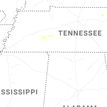
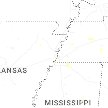


Connect with Interactive Hail Maps