

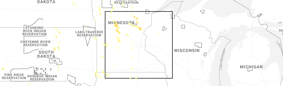
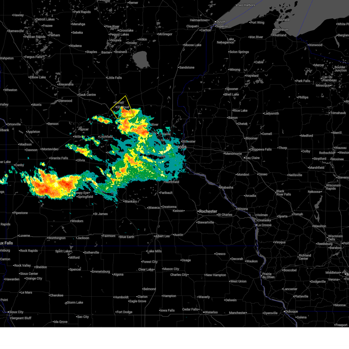
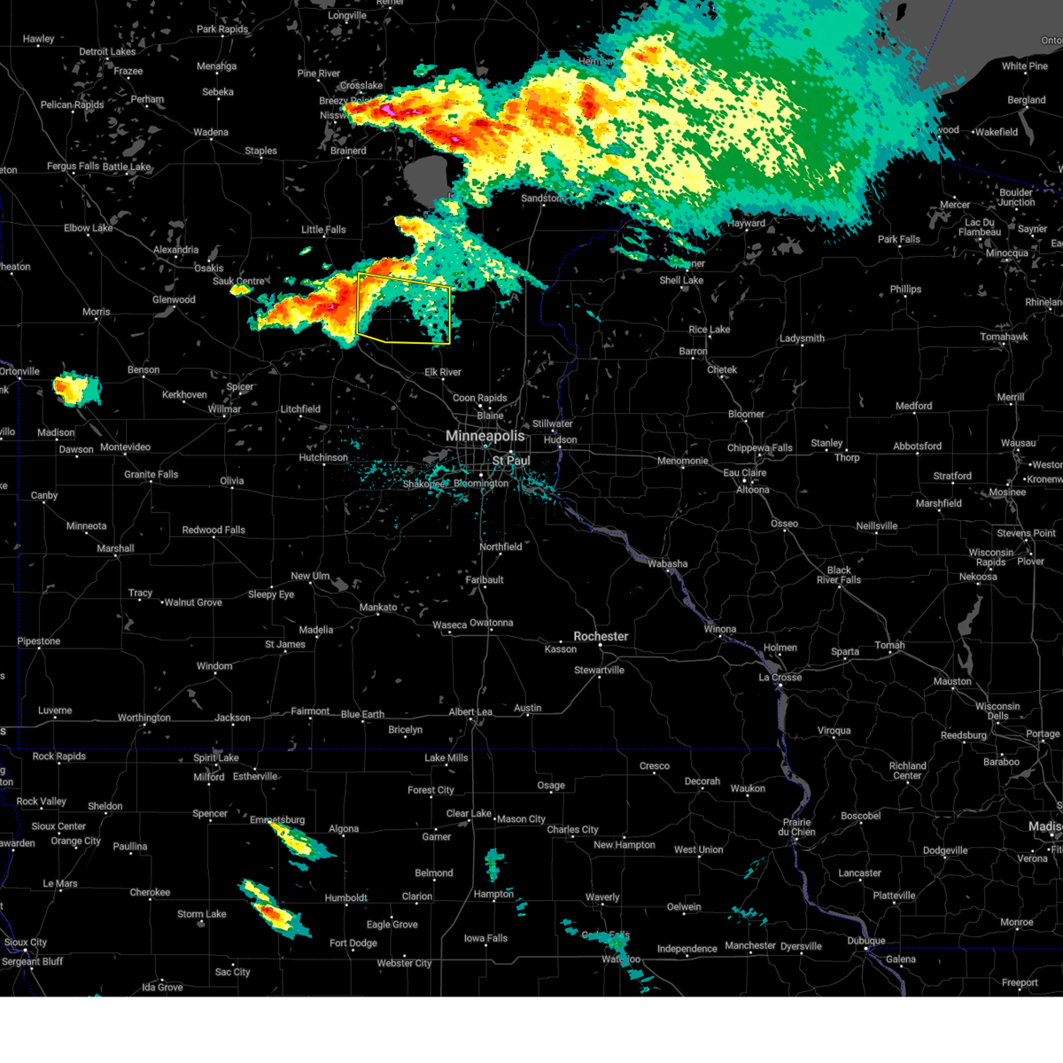
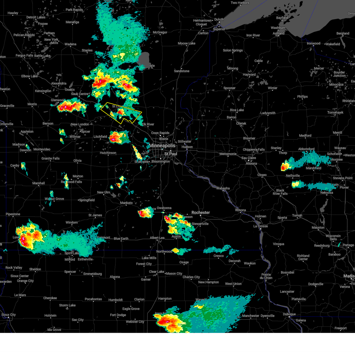
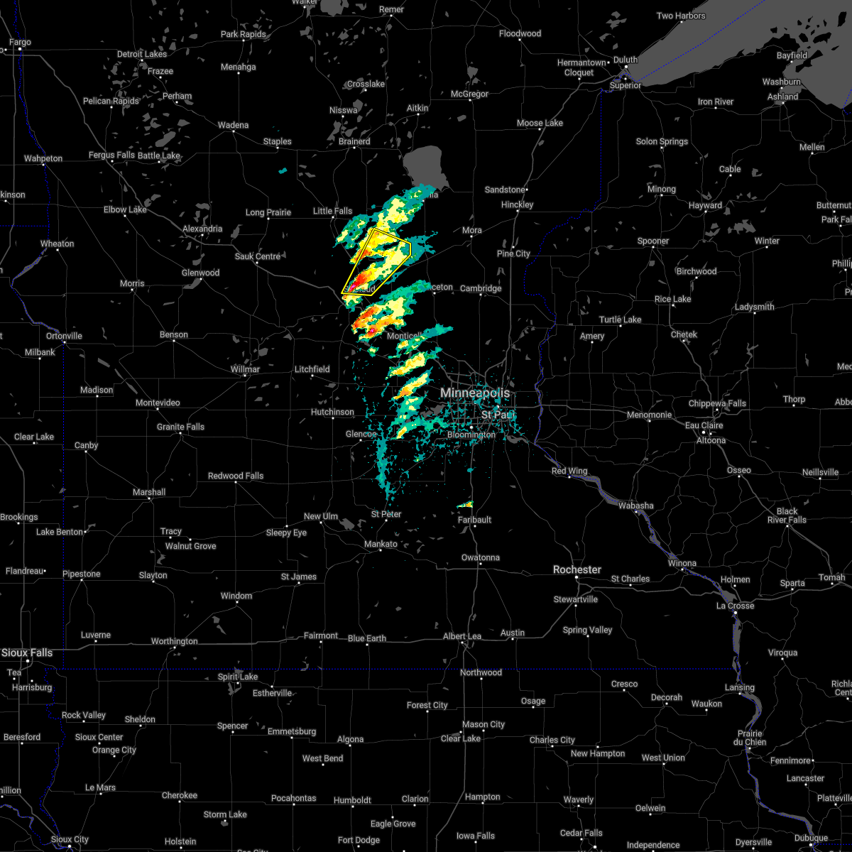
Hail Map for Sauk Rapids, MN
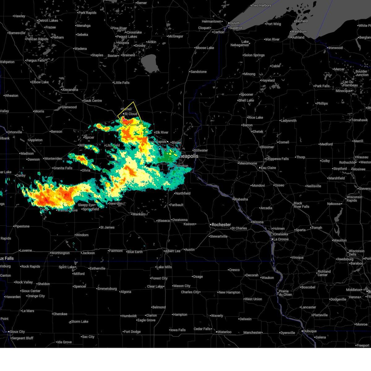
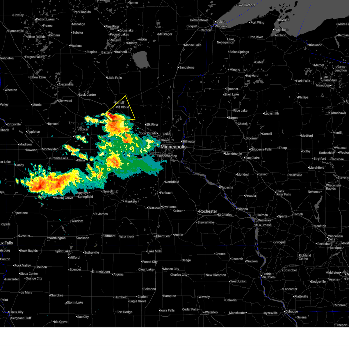
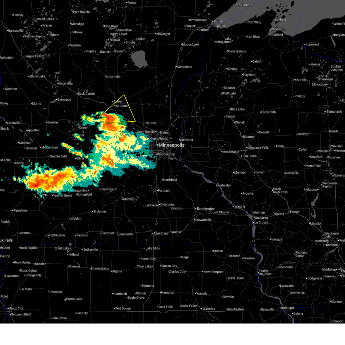
The Sauk Rapids, MN area has had 7 reports of on-the-ground hail by trained spotters, and has been under severe weather warnings 18 times during the past 12 months. Doppler radar has detected hail at or near Sauk Rapids, MN on 57 occasions, including 2 occasions during the past year.
| Name: | Sauk Rapids, MN |
| Where Located: | 60.7 miles NW of Minneapolis, MN |
| Map: | Google Map for Sauk Rapids, MN |
| Population: | 12773 |
| Housing Units: | 5219 |
| More Info: | Search Google for Sauk Rapids, MN |
1
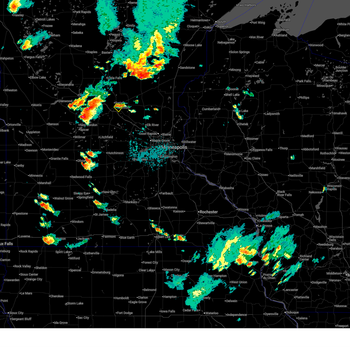
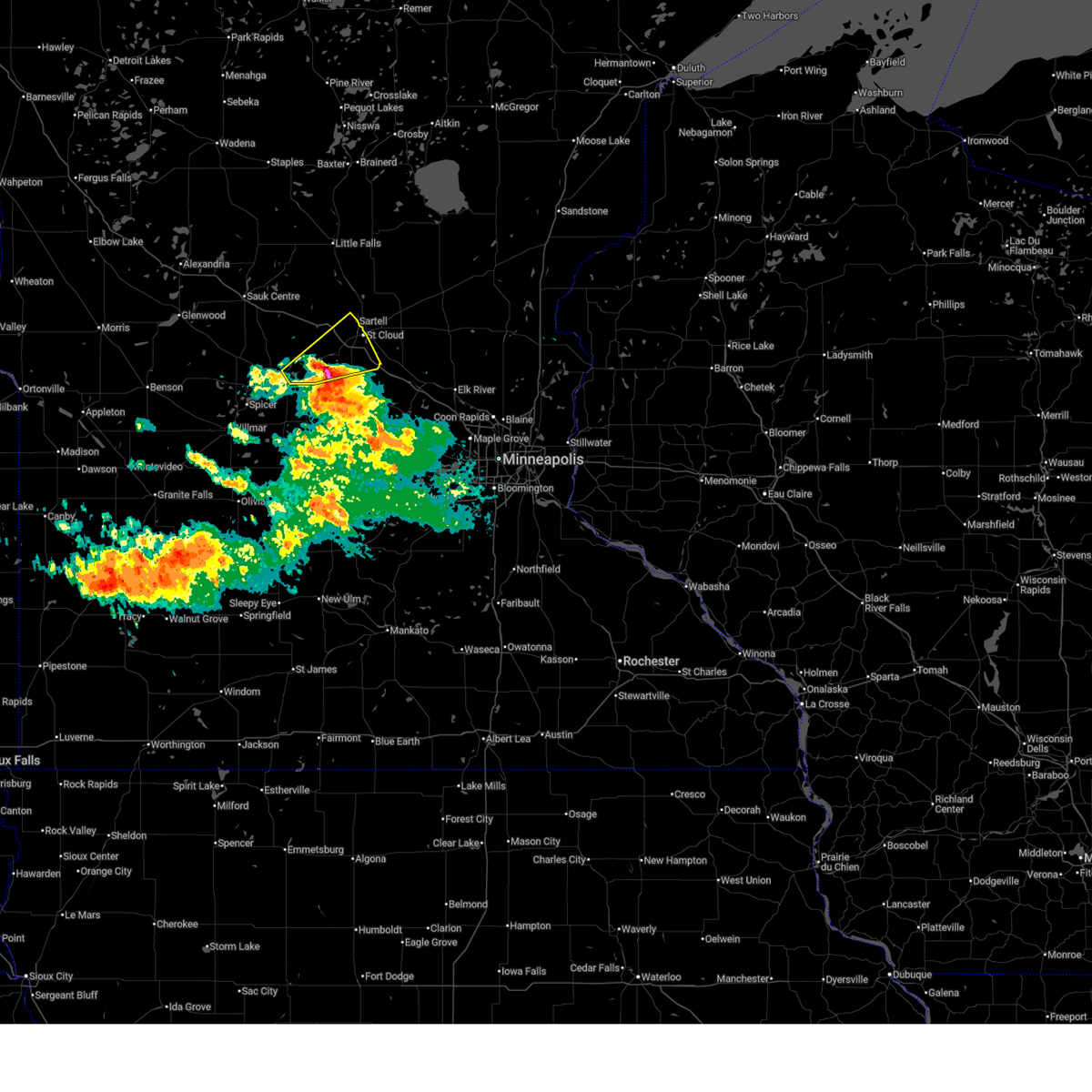
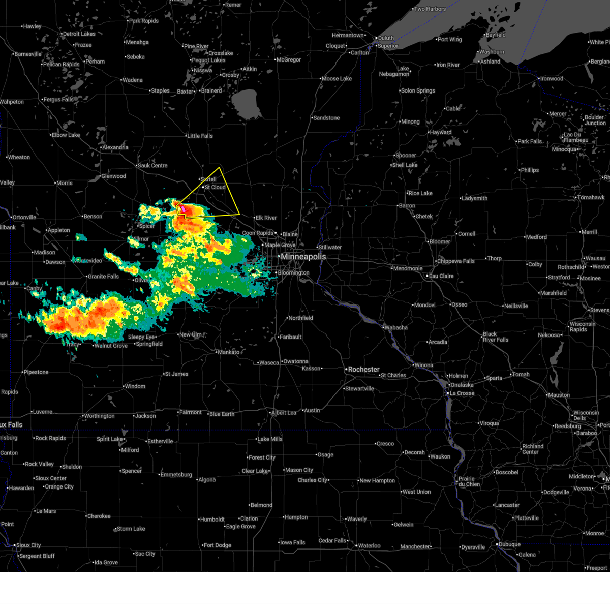
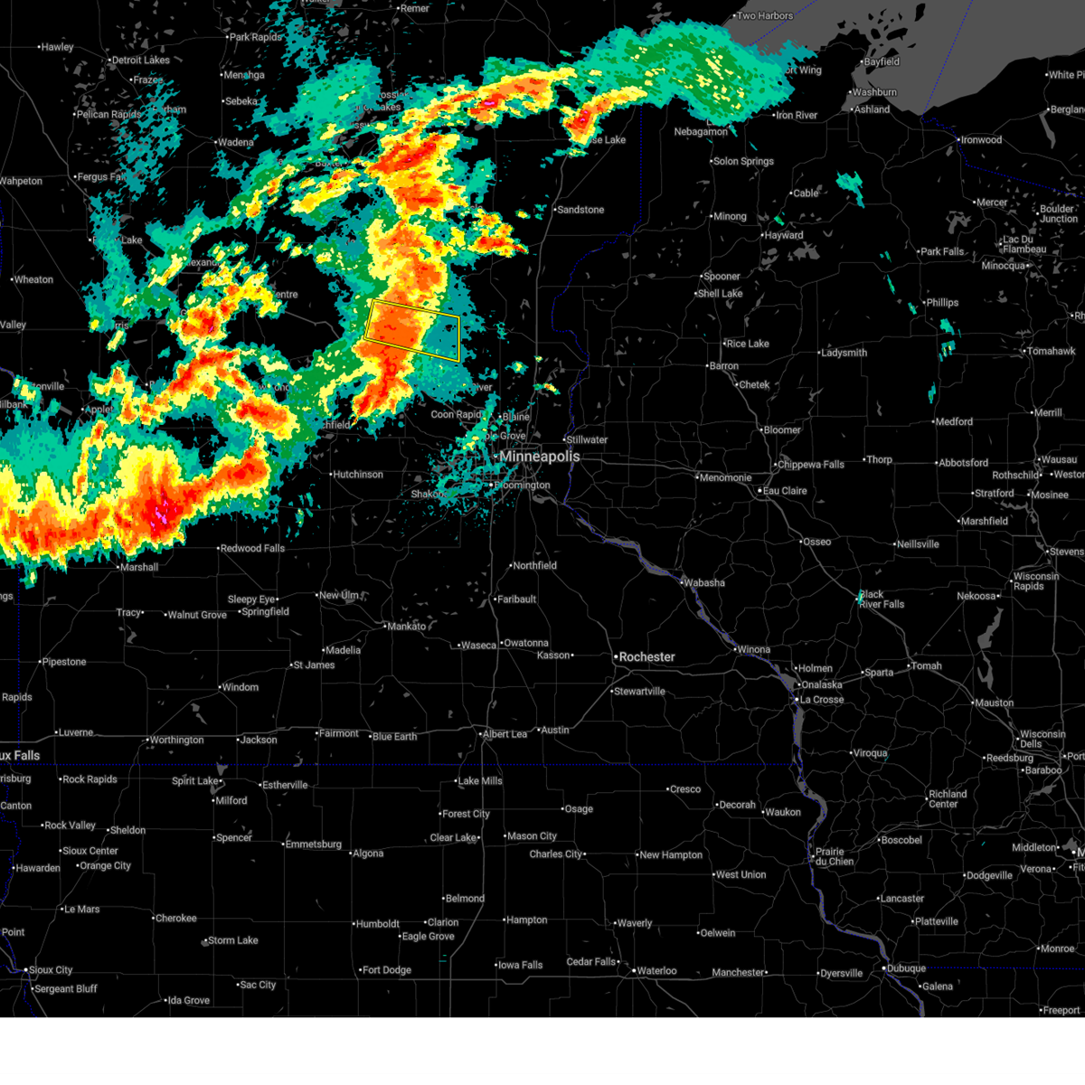
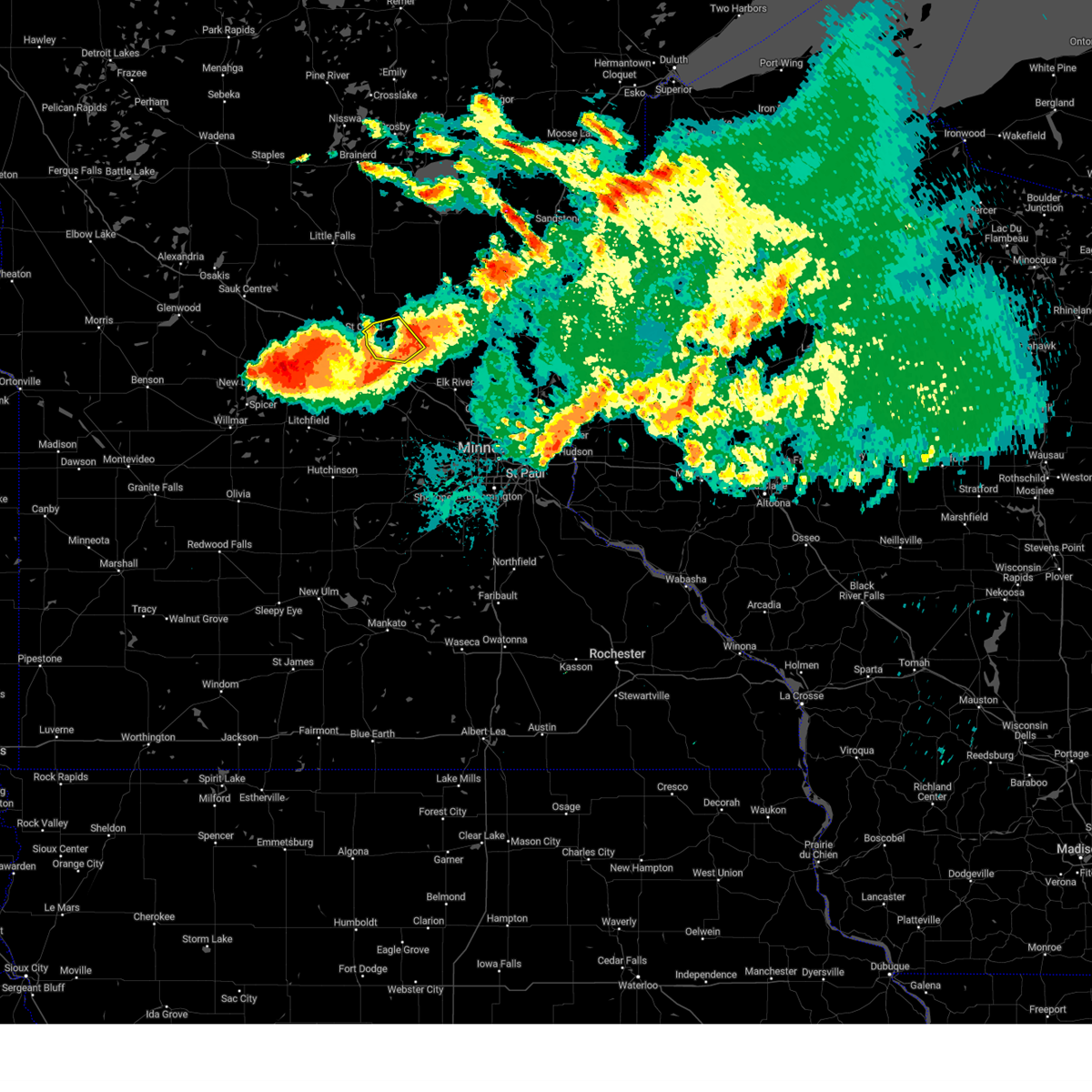
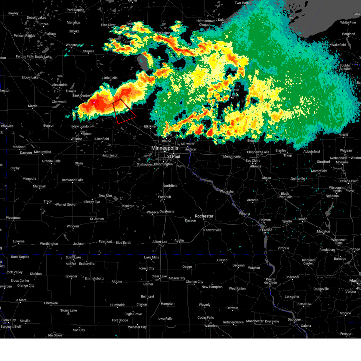
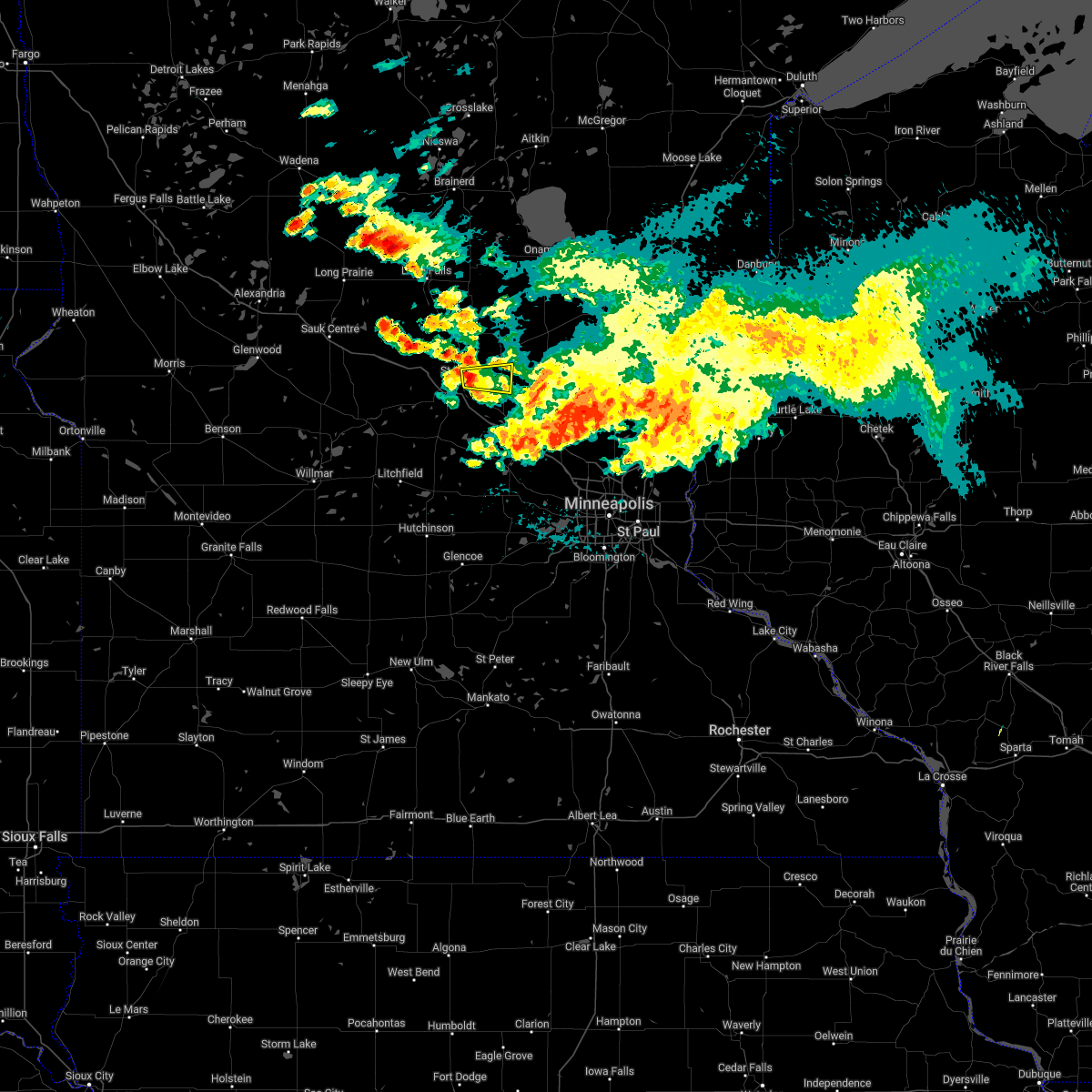
The Top Recent Hail Date for Sauk Rapids, MN is Saturday, July 4, 2026 (15th out of 57)
Hail and Wind Damage Spotted near Sauk Rapids, MN
| Date / Time | Report Details |
|---|---|
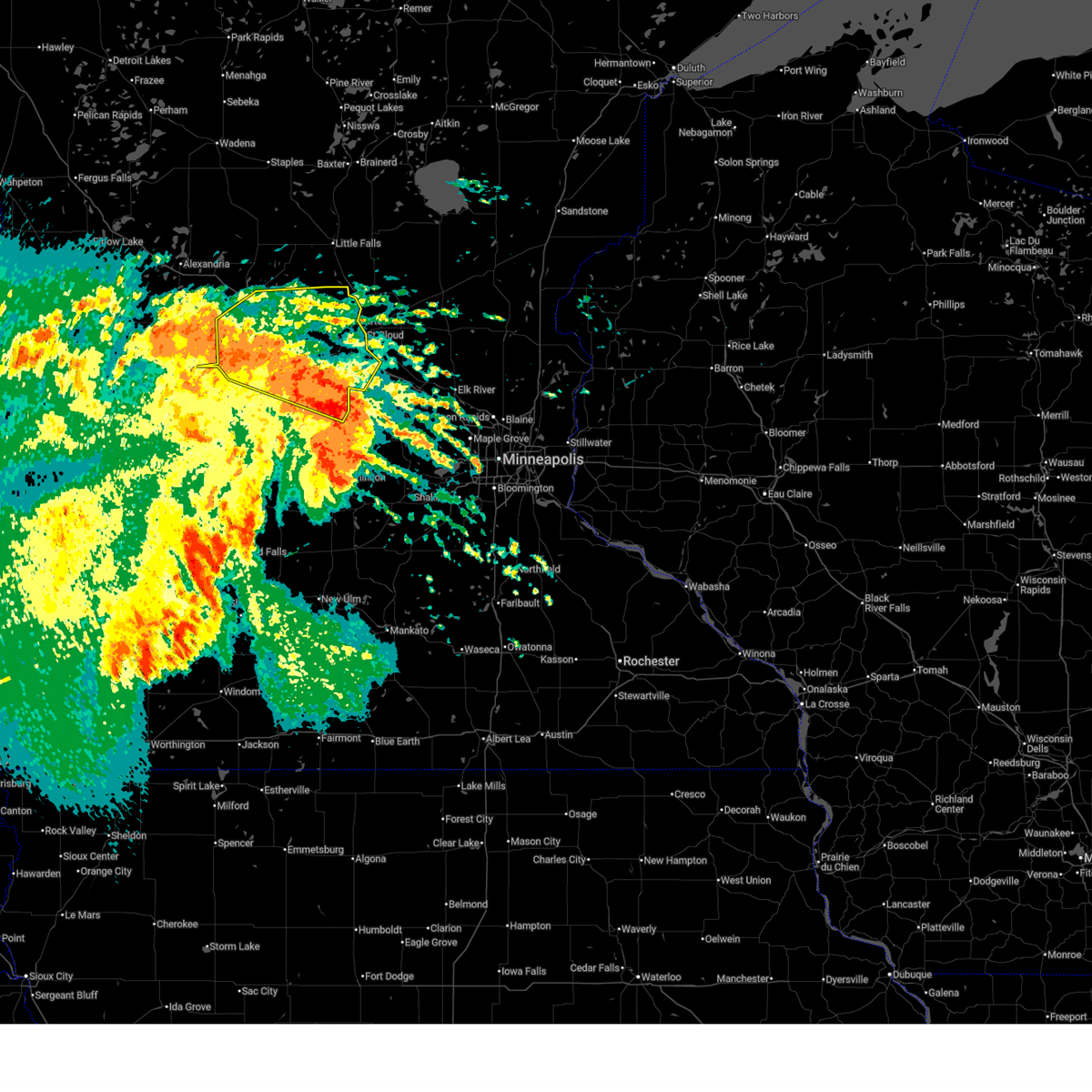
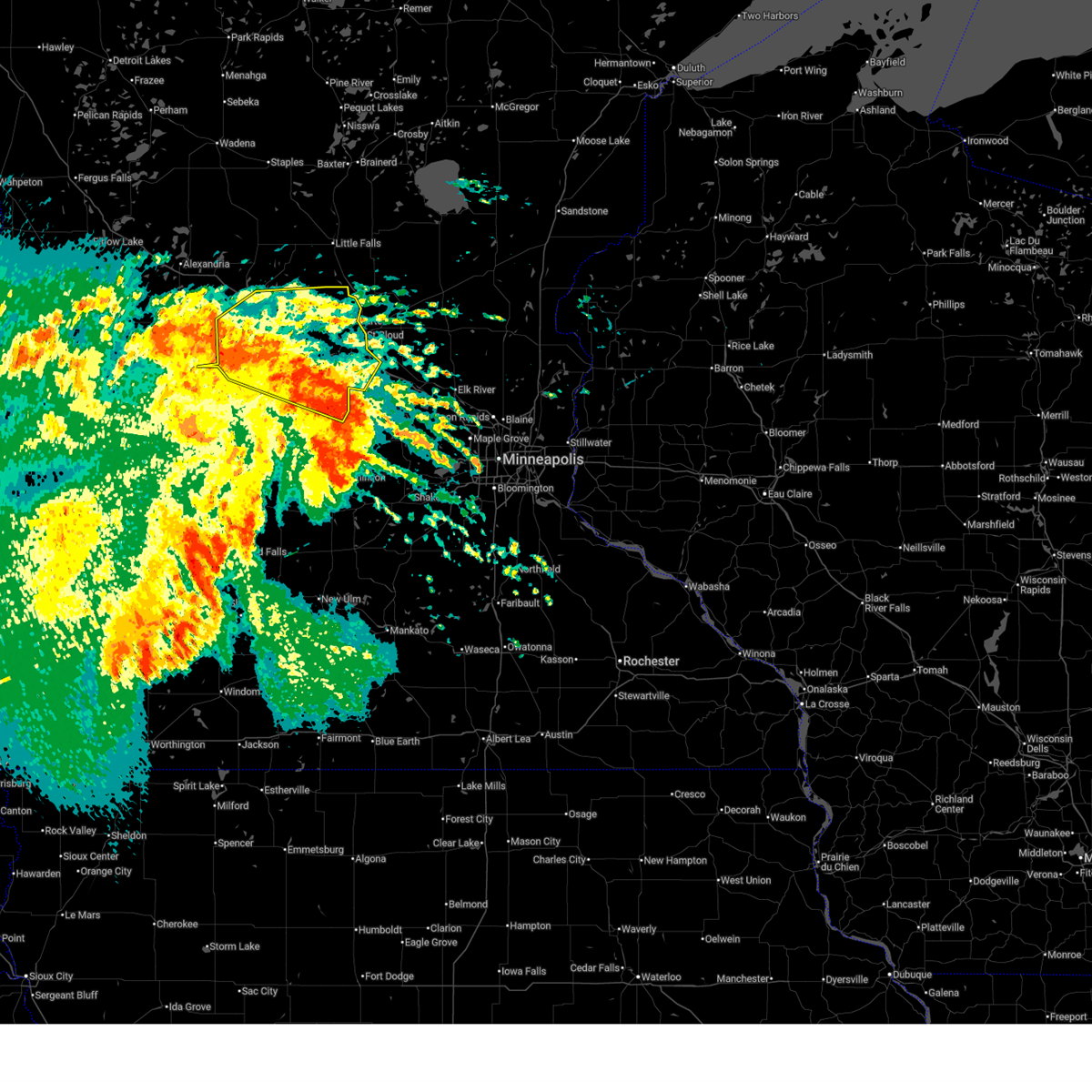
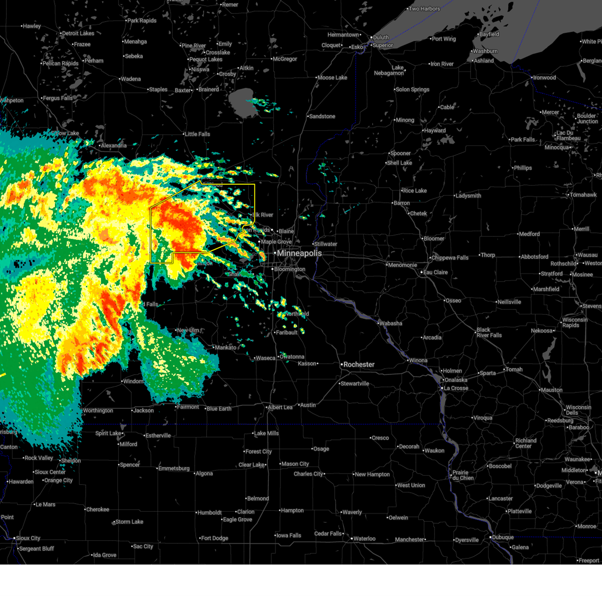
| 7/4/2026 5:02 PM CDT |
 Svrmpx the national weather service in the twin cities has issued a * severe thunderstorm warning for, south central benton county in central minnesota, northwestern sherburne county in central minnesota, east central stearns county in central minnesota, * until 545 pm cdt. * at 502 pm cdt, a severe thunderstorm was located over sauk rapids, or over st. cloud, moving southeast at 5 mph (trained spotters reported). Hazards include 60 mph wind gusts and half dollar size hail. Hail damage to vehicles is expected. Expect wind damage to roofs, siding, and trees. Svrmpx the national weather service in the twin cities has issued a * severe thunderstorm warning for, south central benton county in central minnesota, northwestern sherburne county in central minnesota, east central stearns county in central minnesota, * until 545 pm cdt. * at 502 pm cdt, a severe thunderstorm was located over sauk rapids, or over st. cloud, moving southeast at 5 mph (trained spotters reported). Hazards include 60 mph wind gusts and half dollar size hail. Hail damage to vehicles is expected. Expect wind damage to roofs, siding, and trees.
|
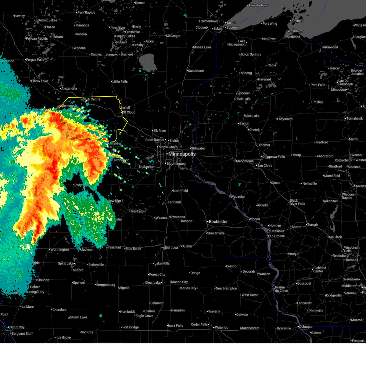
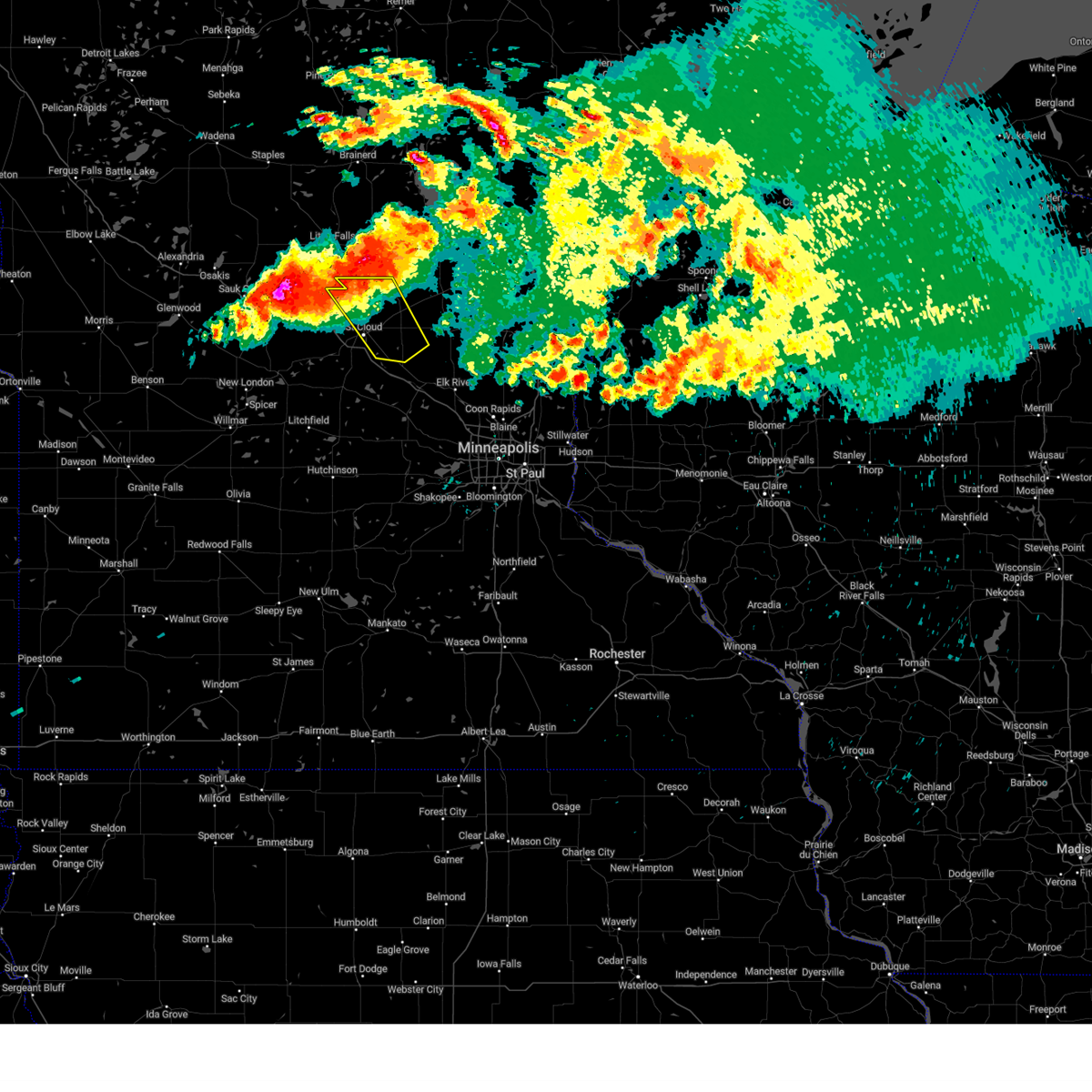
| 8/16/2025 6:27 AM CDT |
 The storms which prompted the warning have weakened below severe limits, and no longer pose an immediate threat to life or property. therefore, the warning will be allowed to expire. to report severe weather, contact your nearest law enforcement agency. they will send your report to the national weather service office. a severe thunderstorm watch remains in effect until 900 am cdt for a portion of central minnesota. The storms which prompted the warning have weakened below severe limits, and no longer pose an immediate threat to life or property. therefore, the warning will be allowed to expire. to report severe weather, contact your nearest law enforcement agency. they will send your report to the national weather service office. a severe thunderstorm watch remains in effect until 900 am cdt for a portion of central minnesota.
|
| 8/16/2025 6:11 AM CDT |
 At 611 am cdt, severe thunderstorms were located along a line from 6 miles south of foley to near rockford, or along a line from 12 miles east of st. cloud to 6 miles east of buffalo, moving northeast at 55 mph (radar indicated). Hazards include 60 mph wind gusts and quarter size hail. Hail damage to vehicles is expected. expect wind damage to roofs, siding, and trees. locations impacted include, st. cloud, buffalo, ramsey, elk river, st. michael, otsego, sauk rapids, monticello, big lake, st. francis, albertville, waite park, st. Joseph, zimmerman, princeton, becker, rockford, cold spring, annandale and montrose. At 611 am cdt, severe thunderstorms were located along a line from 6 miles south of foley to near rockford, or along a line from 12 miles east of st. cloud to 6 miles east of buffalo, moving northeast at 55 mph (radar indicated). Hazards include 60 mph wind gusts and quarter size hail. Hail damage to vehicles is expected. expect wind damage to roofs, siding, and trees. locations impacted include, st. cloud, buffalo, ramsey, elk river, st. michael, otsego, sauk rapids, monticello, big lake, st. francis, albertville, waite park, st. Joseph, zimmerman, princeton, becker, rockford, cold spring, annandale and montrose.
|
| 8/16/2025 6:09 AM CDT |
 the severe thunderstorm warning has been cancelled and is no longer in effect the severe thunderstorm warning has been cancelled and is no longer in effect
|
| 8/16/2025 6:09 AM CDT |
 At 609 am cdt, severe thunderstorms were located along a line from near albany to 6 miles southeast of clearwater, or along a line from 23 miles southwest of little falls to 12 miles northwest of buffalo, moving east at 55 mph (radar indicated). Hazards include 60 mph wind gusts and quarter size hail. Hail damage to vehicles is expected. expect wind damage to roofs, siding, and trees. locations impacted include, st. cloud, sartell, sauk rapids, st. anthony, waite park, st. Joseph, cold spring, collegeville, albany, rockville, paynesville, richmond, avon, watkins, kimball, holdingford, freeport, rice, farming and luxemburg. At 609 am cdt, severe thunderstorms were located along a line from near albany to 6 miles southeast of clearwater, or along a line from 23 miles southwest of little falls to 12 miles northwest of buffalo, moving east at 55 mph (radar indicated). Hazards include 60 mph wind gusts and quarter size hail. Hail damage to vehicles is expected. expect wind damage to roofs, siding, and trees. locations impacted include, st. cloud, sartell, sauk rapids, st. anthony, waite park, st. Joseph, cold spring, collegeville, albany, rockville, paynesville, richmond, avon, watkins, kimball, holdingford, freeport, rice, farming and luxemburg.
|
| 8/16/2025 6:00 AM CDT |
 At 600 am cdt, severe thunderstorms were located along a line from near melrose to near annandale, or along a line from 30 miles west of st. cloud to 15 miles northwest of buffalo, moving east at 55 mph (radar indicated). Hazards include 60 mph wind gusts and quarter size hail. Hail damage to vehicles is expected. expect wind damage to roofs, siding, and trees. locations impacted include, st. cloud, sartell, sauk rapids, st. anthony, waite park, st. Joseph, sauk centre, cold spring, melrose, collegeville, albany, rockville, paynesville, richmond, avon, watkins, kimball, brooten, belgrade and holdingford. At 600 am cdt, severe thunderstorms were located along a line from near melrose to near annandale, or along a line from 30 miles west of st. cloud to 15 miles northwest of buffalo, moving east at 55 mph (radar indicated). Hazards include 60 mph wind gusts and quarter size hail. Hail damage to vehicles is expected. expect wind damage to roofs, siding, and trees. locations impacted include, st. cloud, sartell, sauk rapids, st. anthony, waite park, st. Joseph, sauk centre, cold spring, melrose, collegeville, albany, rockville, paynesville, richmond, avon, watkins, kimball, brooten, belgrade and holdingford.
|
| 8/16/2025 6:00 AM CDT |
 the severe thunderstorm warning has been cancelled and is no longer in effect the severe thunderstorm warning has been cancelled and is no longer in effect
|
| 8/16/2025 5:52 AM CDT |
 Svrmpx the national weather service in the twin cities has issued a * severe thunderstorm warning for, meeker county in central minnesota, sherburne county in central minnesota, southeastern stearns county in central minnesota, wright county in central minnesota, * until 645 am cdt. * at 552 am cdt, severe thunderstorms were located along a line from 5 miles south of waite park to over howard lake, or along a line from 6 miles southwest of st. cloud to 14 miles southwest of buffalo, moving northeast at 55 mph (radar indicated). Hazards include 60 mph wind gusts and quarter size hail. Hail damage to vehicles is expected. Expect wind damage to roofs, siding, and trees. Svrmpx the national weather service in the twin cities has issued a * severe thunderstorm warning for, meeker county in central minnesota, sherburne county in central minnesota, southeastern stearns county in central minnesota, wright county in central minnesota, * until 645 am cdt. * at 552 am cdt, severe thunderstorms were located along a line from 5 miles south of waite park to over howard lake, or along a line from 6 miles southwest of st. cloud to 14 miles southwest of buffalo, moving northeast at 55 mph (radar indicated). Hazards include 60 mph wind gusts and quarter size hail. Hail damage to vehicles is expected. Expect wind damage to roofs, siding, and trees.
|
| 8/16/2025 5:23 AM CDT |
 Svrmpx the national weather service in the twin cities has issued a * severe thunderstorm warning for, northern kandiyohi county in central minnesota, northern meeker county in central minnesota, stearns county in central minnesota, eastern pope county in west central minnesota, * until 630 am cdt. * at 523 am cdt, severe thunderstorms were located along a line from 7 miles south of glenwood to near atwater, or along a line from 24 miles south of alexandria to 8 miles east of willmar, moving northeast at 50 mph (radar indicated). Hazards include 60 mph wind gusts and quarter size hail. Hail damage to vehicles is expected. Expect wind damage to roofs, siding, and trees. Svrmpx the national weather service in the twin cities has issued a * severe thunderstorm warning for, northern kandiyohi county in central minnesota, northern meeker county in central minnesota, stearns county in central minnesota, eastern pope county in west central minnesota, * until 630 am cdt. * at 523 am cdt, severe thunderstorms were located along a line from 7 miles south of glenwood to near atwater, or along a line from 24 miles south of alexandria to 8 miles east of willmar, moving northeast at 50 mph (radar indicated). Hazards include 60 mph wind gusts and quarter size hail. Hail damage to vehicles is expected. Expect wind damage to roofs, siding, and trees.
|
| 7/18/2025 9:41 PM CDT |
 The storm which prompted the warning has weakened below severe limits, and no longer poses an immediate threat to life or property. therefore, the warning will be allowed to expire. however, small hail is still possible with this thunderstorm. The storm which prompted the warning has weakened below severe limits, and no longer poses an immediate threat to life or property. therefore, the warning will be allowed to expire. however, small hail is still possible with this thunderstorm.
|
| 7/18/2025 9:34 PM CDT |
 At 934 pm cdt, a severe thunderstorm was located over becker, or 15 miles southeast of st. cloud, moving east at 50 mph (broadcast media reported). Hazards include golf ball size hail. People and animals outdoors will be injured. expect damage to roofs, siding, windows, and vehicles. locations impacted include, st. Cloud, sartell, sauk rapids, waite park, becker, foley, clearwater, clear lake, st cloud airport, duelm, parent and st augusta. At 934 pm cdt, a severe thunderstorm was located over becker, or 15 miles southeast of st. cloud, moving east at 50 mph (broadcast media reported). Hazards include golf ball size hail. People and animals outdoors will be injured. expect damage to roofs, siding, windows, and vehicles. locations impacted include, st. Cloud, sartell, sauk rapids, waite park, becker, foley, clearwater, clear lake, st cloud airport, duelm, parent and st augusta.
|
| 7/18/2025 9:34 PM CDT |
 the severe thunderstorm warning has been cancelled and is no longer in effect the severe thunderstorm warning has been cancelled and is no longer in effect
|
| 7/18/2025 9:22 PM CDT |
 At 922 pm cdt, a severe thunderstorm was located near clearwater, or 10 miles south of st. cloud, moving east at 50 mph (broadcast media reported). Hazards include golf ball size hail. People and animals outdoors will be injured. expect damage to roofs, siding, windows, and vehicles. locations impacted include, st. Cloud, sartell, sauk rapids, waite park, becker, foley, rockville, clearwater, clear lake, luxemburg, st cloud airport, st augusta, duelm, hasty, parent and pleasant lake. At 922 pm cdt, a severe thunderstorm was located near clearwater, or 10 miles south of st. cloud, moving east at 50 mph (broadcast media reported). Hazards include golf ball size hail. People and animals outdoors will be injured. expect damage to roofs, siding, windows, and vehicles. locations impacted include, st. Cloud, sartell, sauk rapids, waite park, becker, foley, rockville, clearwater, clear lake, luxemburg, st cloud airport, st augusta, duelm, hasty, parent and pleasant lake.
|
| 7/18/2025 9:16 PM CDT |
 At 916 pm cdt, a severe thunderstorm was located 5 miles northeast of kimball, or 12 miles south of st. cloud, moving east at 50 mph (broadcast media reported). Hazards include golf ball size hail. People and animals outdoors will be injured. expect damage to roofs, siding, windows, and vehicles. locations impacted include, st. Cloud, sauk rapids, monticello, big lake, waite park, becker, foley, rockville, clearwater, kimball, clear lake, luxemburg, st cloud airport, st augusta, hasty, fairhaven, enfield, duelm, lake maria state park and pleasant lake. At 916 pm cdt, a severe thunderstorm was located 5 miles northeast of kimball, or 12 miles south of st. cloud, moving east at 50 mph (broadcast media reported). Hazards include golf ball size hail. People and animals outdoors will be injured. expect damage to roofs, siding, windows, and vehicles. locations impacted include, st. Cloud, sauk rapids, monticello, big lake, waite park, becker, foley, rockville, clearwater, kimball, clear lake, luxemburg, st cloud airport, st augusta, hasty, fairhaven, enfield, duelm, lake maria state park and pleasant lake.
|
| 7/18/2025 9:11 PM CDT |
 the severe thunderstorm warning has been cancelled and is no longer in effect the severe thunderstorm warning has been cancelled and is no longer in effect
|
| 7/18/2025 9:11 PM CDT |
 Svrmpx the national weather service in the twin cities has issued a * severe thunderstorm warning for, south central benton county in central minnesota, northwestern sherburne county in central minnesota, southeastern stearns county in central minnesota, northwestern wright county in central minnesota, * until 945 pm cdt. * at 911 pm cdt, a severe thunderstorm was located near kimball, or 14 miles southwest of st. cloud, moving east at 50 mph (radar indicated). Hazards include ping pong ball size hail. People and animals outdoors will be injured. Expect damage to roofs, siding, windows, and vehicles. Svrmpx the national weather service in the twin cities has issued a * severe thunderstorm warning for, south central benton county in central minnesota, northwestern sherburne county in central minnesota, southeastern stearns county in central minnesota, northwestern wright county in central minnesota, * until 945 pm cdt. * at 911 pm cdt, a severe thunderstorm was located near kimball, or 14 miles southwest of st. cloud, moving east at 50 mph (radar indicated). Hazards include ping pong ball size hail. People and animals outdoors will be injured. Expect damage to roofs, siding, windows, and vehicles.
|
| 7/18/2025 9:01 PM CDT |
 Svrmpx the national weather service in the twin cities has issued a * severe thunderstorm warning for, western sherburne county in central minnesota, southeastern stearns county in central minnesota, * until 930 pm cdt. * at 901 pm cdt, a severe thunderstorm was located near richmond, or 21 miles southwest of st. cloud, moving northeast at 45 mph (radar indicated). Hazards include half dollar size hail. damage to vehicles is expected Svrmpx the national weather service in the twin cities has issued a * severe thunderstorm warning for, western sherburne county in central minnesota, southeastern stearns county in central minnesota, * until 930 pm cdt. * at 901 pm cdt, a severe thunderstorm was located near richmond, or 21 miles southwest of st. cloud, moving northeast at 45 mph (radar indicated). Hazards include half dollar size hail. damage to vehicles is expected
|
| 7/15/2025 4:15 PM CDT |
 Svrmpx the national weather service in the twin cities has issued a * severe thunderstorm warning for, eastern benton county in central minnesota, northern sherburne county in central minnesota, southeastern stearns county in central minnesota, northwestern wright county in central minnesota, southern mille lacs county in east central minnesota, * until 500 pm cdt. * at 415 pm cdt, severe thunderstorms were located along a line from 6 miles south of foley to 7 miles northeast of kimball, or along a line from 14 miles east of st. cloud to 9 miles south of st. cloud, moving northeast at 35 mph (radar indicated). Hazards include 60 mph wind gusts and quarter size hail. Hail damage to vehicles is expected. Expect wind damage to roofs, siding, and trees. Svrmpx the national weather service in the twin cities has issued a * severe thunderstorm warning for, eastern benton county in central minnesota, northern sherburne county in central minnesota, southeastern stearns county in central minnesota, northwestern wright county in central minnesota, southern mille lacs county in east central minnesota, * until 500 pm cdt. * at 415 pm cdt, severe thunderstorms were located along a line from 6 miles south of foley to 7 miles northeast of kimball, or along a line from 14 miles east of st. cloud to 9 miles south of st. cloud, moving northeast at 35 mph (radar indicated). Hazards include 60 mph wind gusts and quarter size hail. Hail damage to vehicles is expected. Expect wind damage to roofs, siding, and trees.
|
| 6/28/2025 10:29 PM CDT |
 The severe thunderstorm warning that was previously in effect has been reissued for mille lacs, sherburne, and benton counties and is in effect until 1115 pm cdt. please refer to that bulletin for the latest severe weather information. however, gusty winds are still possible with this thunderstorm. a tornado watch remains in effect until 100 am cdt for portions of central and east central minnesota. The severe thunderstorm warning that was previously in effect has been reissued for mille lacs, sherburne, and benton counties and is in effect until 1115 pm cdt. please refer to that bulletin for the latest severe weather information. however, gusty winds are still possible with this thunderstorm. a tornado watch remains in effect until 100 am cdt for portions of central and east central minnesota.
|
| 6/28/2025 10:02 PM CDT |
 At 1002 pm cdt, a severe thunderstorm was located over sauk rapids, or 6 miles north of st. cloud, moving east at 50 mph (radar indicated). Hazards include 60 mph wind gusts and small hail. Expect damage to roofs, siding, and trees. locations impacted include, st. Cloud, sauk rapids, zimmerman, princeton, foley, santiago, glendorado, ronneby, sherburne national wildlife refuge, duelm, parent, princeton airport, st cloud airport and mayhew. At 1002 pm cdt, a severe thunderstorm was located over sauk rapids, or 6 miles north of st. cloud, moving east at 50 mph (radar indicated). Hazards include 60 mph wind gusts and small hail. Expect damage to roofs, siding, and trees. locations impacted include, st. Cloud, sauk rapids, zimmerman, princeton, foley, santiago, glendorado, ronneby, sherburne national wildlife refuge, duelm, parent, princeton airport, st cloud airport and mayhew.
|
| 6/28/2025 10:02 PM CDT |
 the severe thunderstorm warning has been cancelled and is no longer in effect the severe thunderstorm warning has been cancelled and is no longer in effect
|
| 6/28/2025 9:50 PM CDT |
 Svrmpx the national weather service in the twin cities has issued a * severe thunderstorm warning for, benton county in central minnesota, northern sherburne county in central minnesota, northeastern stearns county in central minnesota, southern mille lacs county in east central minnesota, * until 1030 pm cdt. * at 950 pm cdt, a severe thunderstorm was located over sartell, or 9 miles northwest of st. cloud, moving east at 60 mph (radar indicated). Hazards include 60 mph wind gusts and small hail. expect damage to roofs, siding, and trees Svrmpx the national weather service in the twin cities has issued a * severe thunderstorm warning for, benton county in central minnesota, northern sherburne county in central minnesota, northeastern stearns county in central minnesota, southern mille lacs county in east central minnesota, * until 1030 pm cdt. * at 950 pm cdt, a severe thunderstorm was located over sartell, or 9 miles northwest of st. cloud, moving east at 60 mph (radar indicated). Hazards include 60 mph wind gusts and small hail. expect damage to roofs, siding, and trees
|
| 5/15/2025 3:37 PM CDT |
 Tormpx the national weather service in the twin cities has issued a * tornado warning for, western benton county in central minnesota, south central morrison county in central minnesota, northeastern stearns county in central minnesota, * until 400 pm cdt. * at 337 pm cdt, a severe thunderstorm capable of producing a tornado was located near sartell, or 11 miles northwest of st. cloud, moving north at 35 mph (radar indicated rotation). Hazards include tornado. Flying debris will be dangerous to those caught without shelter. mobile homes will be damaged or destroyed. damage to roofs, windows and vehicles will occur. Tree damage is likely. Tormpx the national weather service in the twin cities has issued a * tornado warning for, western benton county in central minnesota, south central morrison county in central minnesota, northeastern stearns county in central minnesota, * until 400 pm cdt. * at 337 pm cdt, a severe thunderstorm capable of producing a tornado was located near sartell, or 11 miles northwest of st. cloud, moving north at 35 mph (radar indicated rotation). Hazards include tornado. Flying debris will be dangerous to those caught without shelter. mobile homes will be damaged or destroyed. damage to roofs, windows and vehicles will occur. Tree damage is likely.
|
| 8/29/2024 3:20 PM CDT |
 At 320 pm cdt, severe thunderstorms were located along a line extending from 6 miles east of camp ripley to 5 miles north of collegeville to near st. cloud, moving northeast at 50 mph (radar indicated). Hazards include 60 mph wind gusts and quarter size hail. Hail damage to vehicles is expected. expect wind damage to roofs, siding, and trees. locations impacted include, st. cloud, little falls, sartell, sauk rapids, waite park, st. Joseph, cold spring, collegeville, rockville, clearwater, richmond, and avon. At 320 pm cdt, severe thunderstorms were located along a line extending from 6 miles east of camp ripley to 5 miles north of collegeville to near st. cloud, moving northeast at 50 mph (radar indicated). Hazards include 60 mph wind gusts and quarter size hail. Hail damage to vehicles is expected. expect wind damage to roofs, siding, and trees. locations impacted include, st. cloud, little falls, sartell, sauk rapids, waite park, st. Joseph, cold spring, collegeville, rockville, clearwater, richmond, and avon.
|
| 8/29/2024 2:54 PM CDT |
 Svrmpx the national weather service in the twin cities has issued a * severe thunderstorm warning for, northern meeker county in central minnesota, western benton county in central minnesota, northwestern sherburne county in central minnesota, eastern stearns county in central minnesota, morrison county in central minnesota, * until 345 pm cdt. * at 253 pm cdt, severe thunderstorms were located along a line extending from near flensburg to near richmond to near watkins, moving northeast at 50 mph (radar indicated). Hazards include 60 mph wind gusts and quarter size hail. Hail damage to vehicles is expected. Expect wind damage to roofs, siding, and trees. Svrmpx the national weather service in the twin cities has issued a * severe thunderstorm warning for, northern meeker county in central minnesota, western benton county in central minnesota, northwestern sherburne county in central minnesota, eastern stearns county in central minnesota, morrison county in central minnesota, * until 345 pm cdt. * at 253 pm cdt, severe thunderstorms were located along a line extending from near flensburg to near richmond to near watkins, moving northeast at 50 mph (radar indicated). Hazards include 60 mph wind gusts and quarter size hail. Hail damage to vehicles is expected. Expect wind damage to roofs, siding, and trees.
|
| 8/3/2024 8:55 PM CDT |
 The storm which prompted the warning has weakened below severe limits, and has exited the warned area. therefore, the warning will be allowed to expire. however, gusty winds and heavy rain are still possible with this thunderstorm. a severe thunderstorm watch remains in effect until 100 am cdt for central minnesota. The storm which prompted the warning has weakened below severe limits, and has exited the warned area. therefore, the warning will be allowed to expire. however, gusty winds and heavy rain are still possible with this thunderstorm. a severe thunderstorm watch remains in effect until 100 am cdt for central minnesota.
|
| 8/3/2024 8:44 PM CDT |
 the severe thunderstorm warning has been cancelled and is no longer in effect the severe thunderstorm warning has been cancelled and is no longer in effect
|
| 8/3/2024 8:44 PM CDT |
 At 844 pm cdt, a severe thunderstorm was located near clear lake, or 9 miles east of st. cloud, moving southeast at 40 mph (radar indicated). Hazards include 60 mph wind gusts and quarter size hail. Hail damage to vehicles is expected. expect wind damage to roofs, siding, and trees. locations impacted include, st. Cloud, sauk rapids, clear lake, santiago, duelm, and st cloud airport. At 844 pm cdt, a severe thunderstorm was located near clear lake, or 9 miles east of st. cloud, moving southeast at 40 mph (radar indicated). Hazards include 60 mph wind gusts and quarter size hail. Hail damage to vehicles is expected. expect wind damage to roofs, siding, and trees. locations impacted include, st. Cloud, sauk rapids, clear lake, santiago, duelm, and st cloud airport.
|
| 8/3/2024 8:43 PM CDT |
 the tornado warning has been cancelled and is no longer in effect the tornado warning has been cancelled and is no longer in effect
|
| 8/3/2024 8:35 PM CDT |
 At 834 pm cdt, a severe thunderstorm capable of producing a tornado was located over st. cloud, moving southeast at 40 mph (radar indicated rotation). Hazards include tornado. Flying debris will be dangerous to those caught without shelter. mobile homes will be damaged or destroyed. damage to roofs, windows, and vehicles will occur. tree damage is likely. this dangerous storm will be near, st. cloud and clear lake around 840 pm cdt. clearwater around 845 pm cdt. Other locations impacted by this tornadic thunderstorm include st augusta and st cloud airport. At 834 pm cdt, a severe thunderstorm capable of producing a tornado was located over st. cloud, moving southeast at 40 mph (radar indicated rotation). Hazards include tornado. Flying debris will be dangerous to those caught without shelter. mobile homes will be damaged or destroyed. damage to roofs, windows, and vehicles will occur. tree damage is likely. this dangerous storm will be near, st. cloud and clear lake around 840 pm cdt. clearwater around 845 pm cdt. Other locations impacted by this tornadic thunderstorm include st augusta and st cloud airport.
|
| 8/3/2024 8:27 PM CDT |
 At 826 pm cdt, a severe thunderstorm was located near sauk rapids, or 9 miles north of st. cloud, moving southeast at 35 mph (trained weather spotters). Hazards include 60 mph wind gusts and quarter size hail. Hail damage to vehicles is expected. expect wind damage to roofs, siding, and trees. locations impacted include, st. Cloud, sartell, sauk rapids, foley, clear lake, rice, santiago, gilman, duelm, mayhew, parent, and st cloud airport. At 826 pm cdt, a severe thunderstorm was located near sauk rapids, or 9 miles north of st. cloud, moving southeast at 35 mph (trained weather spotters). Hazards include 60 mph wind gusts and quarter size hail. Hail damage to vehicles is expected. expect wind damage to roofs, siding, and trees. locations impacted include, st. Cloud, sartell, sauk rapids, foley, clear lake, rice, santiago, gilman, duelm, mayhew, parent, and st cloud airport.
|
| 8/3/2024 8:24 PM CDT |
 Tormpx the national weather service in the twin cities has issued a * tornado warning for, south central benton county in central minnesota, northwestern sherburne county in central minnesota, east central stearns county in central minnesota, * until 900 pm cdt. * at 824 pm cdt, a severe thunderstorm capable of producing a tornado was located over sartell, or 7 miles north of st. cloud, moving southeast at 40 mph (radar indicated rotation). Hazards include tornado. Flying debris will be dangerous to those caught without shelter. mobile homes will be damaged or destroyed. damage to roofs, windows, and vehicles will occur. tree damage is likely. this dangerous storm will be near, st. cloud, sartell, sauk rapids, and waite park around 830 pm cdt. clearwater and clear lake around 845 pm cdt. other locations impacted by this tornadic thunderstorm include st augusta and st cloud airport. this includes the following highways, interstate 94 in minnesota between mile markers 167 and 178. u. s. Highway 10 in minnesota between mile markers 167 and 190. Tormpx the national weather service in the twin cities has issued a * tornado warning for, south central benton county in central minnesota, northwestern sherburne county in central minnesota, east central stearns county in central minnesota, * until 900 pm cdt. * at 824 pm cdt, a severe thunderstorm capable of producing a tornado was located over sartell, or 7 miles north of st. cloud, moving southeast at 40 mph (radar indicated rotation). Hazards include tornado. Flying debris will be dangerous to those caught without shelter. mobile homes will be damaged or destroyed. damage to roofs, windows, and vehicles will occur. tree damage is likely. this dangerous storm will be near, st. cloud, sartell, sauk rapids, and waite park around 830 pm cdt. clearwater and clear lake around 845 pm cdt. other locations impacted by this tornadic thunderstorm include st augusta and st cloud airport. this includes the following highways, interstate 94 in minnesota between mile markers 167 and 178. u. s. Highway 10 in minnesota between mile markers 167 and 190.
|
| 8/3/2024 8:10 PM CDT |
 Svrmpx the national weather service in the twin cities has issued a * severe thunderstorm warning for, benton county in central minnesota, northwestern sherburne county in central minnesota, northeastern stearns county in central minnesota, * until 900 pm cdt. * at 810 pm cdt, a severe thunderstorm was located over rice, or 15 miles south of little falls, moving southeast at 40 mph (trained weather spotters). Hazards include 60 mph wind gusts and quarter size hail. Hail damage to vehicles is expected. Expect wind damage to roofs, siding, and trees. Svrmpx the national weather service in the twin cities has issued a * severe thunderstorm warning for, benton county in central minnesota, northwestern sherburne county in central minnesota, northeastern stearns county in central minnesota, * until 900 pm cdt. * at 810 pm cdt, a severe thunderstorm was located over rice, or 15 miles south of little falls, moving southeast at 40 mph (trained weather spotters). Hazards include 60 mph wind gusts and quarter size hail. Hail damage to vehicles is expected. Expect wind damage to roofs, siding, and trees.
|
| 7/14/2024 12:02 AM CDT |
 Svrmpx the national weather service in the twin cities has issued a * severe thunderstorm warning for, north central wright county in central minnesota, south central benton county in central minnesota, northwestern sherburne county in central minnesota, east central stearns county in central minnesota, * until 1230 am cdt. * at 1202 am cdt, a severe thunderstorm was located near st. cloud, moving southeast at 35 mph (radar indicated). Hazards include half dollar size hail. damage to vehicles is expected Svrmpx the national weather service in the twin cities has issued a * severe thunderstorm warning for, north central wright county in central minnesota, south central benton county in central minnesota, northwestern sherburne county in central minnesota, east central stearns county in central minnesota, * until 1230 am cdt. * at 1202 am cdt, a severe thunderstorm was located near st. cloud, moving southeast at 35 mph (radar indicated). Hazards include half dollar size hail. damage to vehicles is expected
|
| 7/13/2024 11:51 PM CDT |
 At 1150 pm cdt, a severe thunderstorm was located over sartell, or 6 miles north of st. cloud, moving southeast at 40 mph (radar indicated). Hazards include ping pong ball size hail and 60 mph wind gusts. People and animals outdoors will be injured. expect hail damage to roofs, siding, windows, and vehicles. expect wind damage to roofs, siding, and trees. locations impacted include, st. cloud, sartell, sauk rapids, waite park, st. joseph, mayhew, st wendel, and st. Stephen. At 1150 pm cdt, a severe thunderstorm was located over sartell, or 6 miles north of st. cloud, moving southeast at 40 mph (radar indicated). Hazards include ping pong ball size hail and 60 mph wind gusts. People and animals outdoors will be injured. expect hail damage to roofs, siding, windows, and vehicles. expect wind damage to roofs, siding, and trees. locations impacted include, st. cloud, sartell, sauk rapids, waite park, st. joseph, mayhew, st wendel, and st. Stephen.
|
| 7/13/2024 11:42 PM CDT |
 At 1142 pm cdt, a severe thunderstorm was located near sartell, or 11 miles northwest of st. cloud, moving southeast at 40 mph (radar indicated). Hazards include ping pong ball size hail and 60 mph wind gusts. People and animals outdoors will be injured. expect hail damage to roofs, siding, windows, and vehicles. expect wind damage to roofs, siding, and trees. locations impacted include, st. cloud, sartell, sauk rapids, waite park, st. Joseph, cold spring, collegeville, richmond, avon, holdingford, rice, and mayhew. At 1142 pm cdt, a severe thunderstorm was located near sartell, or 11 miles northwest of st. cloud, moving southeast at 40 mph (radar indicated). Hazards include ping pong ball size hail and 60 mph wind gusts. People and animals outdoors will be injured. expect hail damage to roofs, siding, windows, and vehicles. expect wind damage to roofs, siding, and trees. locations impacted include, st. cloud, sartell, sauk rapids, waite park, st. Joseph, cold spring, collegeville, richmond, avon, holdingford, rice, and mayhew.
|
| 7/13/2024 11:42 PM CDT |
 the severe thunderstorm warning has been cancelled and is no longer in effect the severe thunderstorm warning has been cancelled and is no longer in effect
|
| 7/13/2024 11:15 PM CDT |
 Svrmpx the national weather service in the twin cities has issued a * severe thunderstorm warning for, western benton county in central minnesota, southeastern todd county in central minnesota, northeastern stearns county in central minnesota, southwestern morrison county in central minnesota, * until midnight cdt. * at 1114 pm cdt, a severe thunderstorm was located over upsala, or 14 miles southwest of little falls, moving southeast at 40 mph (radar indicated). Hazards include ping pong ball size hail and 60 mph wind gusts. People and animals outdoors will be injured. expect hail damage to roofs, siding, windows, and vehicles. Expect wind damage to roofs, siding, and trees. Svrmpx the national weather service in the twin cities has issued a * severe thunderstorm warning for, western benton county in central minnesota, southeastern todd county in central minnesota, northeastern stearns county in central minnesota, southwestern morrison county in central minnesota, * until midnight cdt. * at 1114 pm cdt, a severe thunderstorm was located over upsala, or 14 miles southwest of little falls, moving southeast at 40 mph (radar indicated). Hazards include ping pong ball size hail and 60 mph wind gusts. People and animals outdoors will be injured. expect hail damage to roofs, siding, windows, and vehicles. Expect wind damage to roofs, siding, and trees.
|
| 6/12/2024 8:05 PM CDT |
 At 805 pm cdt, a severe thunderstorm was located near princeton, or 15 miles west of cambridge, moving east at 45 mph (radar indicated). Hazards include 60 mph wind gusts. Expect damage to roofs, siding, and trees. locations impacted include, st. Cloud, sauk rapids, zimmerman, princeton, santiago, glendorado, sherburne national wildlife refuge, duelm, st cloud airport, and princeton airport. At 805 pm cdt, a severe thunderstorm was located near princeton, or 15 miles west of cambridge, moving east at 45 mph (radar indicated). Hazards include 60 mph wind gusts. Expect damage to roofs, siding, and trees. locations impacted include, st. Cloud, sauk rapids, zimmerman, princeton, santiago, glendorado, sherburne national wildlife refuge, duelm, st cloud airport, and princeton airport.
|
| 6/12/2024 7:40 PM CDT | Tree damage. reported via mpin in benton county MN, 0.6 miles NE of Sauk Rapids, MN |
| 6/12/2024 7:27 PM CDT |
 Svrmpx the national weather service in the twin cities has issued a * severe thunderstorm warning for, southern mille lacs county in east central minnesota, benton county in central minnesota, northern sherburne county in central minnesota, * until 815 pm cdt. * at 727 pm cdt, a severe thunderstorm was located near sauk rapids, or 10 miles north of st. cloud, moving east at 45 mph (radar indicated). Hazards include 60 mph wind gusts and quarter size hail. Hail damage to vehicles is expected. Expect wind damage to roofs, siding, and trees. Svrmpx the national weather service in the twin cities has issued a * severe thunderstorm warning for, southern mille lacs county in east central minnesota, benton county in central minnesota, northern sherburne county in central minnesota, * until 815 pm cdt. * at 727 pm cdt, a severe thunderstorm was located near sauk rapids, or 10 miles north of st. cloud, moving east at 45 mph (radar indicated). Hazards include 60 mph wind gusts and quarter size hail. Hail damage to vehicles is expected. Expect wind damage to roofs, siding, and trees.
|
| 6/12/2024 7:18 PM CDT |
 the severe thunderstorm warning has been cancelled and is no longer in effect the severe thunderstorm warning has been cancelled and is no longer in effect
|
| 6/12/2024 7:18 PM CDT |
 At 718 pm cdt, a severe thunderstorm was located over holdingford, or 17 miles south of little falls, moving east at 40 mph (radar indicated). Hazards include 60 mph wind gusts and quarter size hail. Hail damage to vehicles is expected. expect wind damage to roofs, siding, and trees. locations impacted include, st. cloud, sartell, sauk rapids, waite park, st. Joseph, collegeville, albany, avon, holdingford, freeport, rice, and opole. At 718 pm cdt, a severe thunderstorm was located over holdingford, or 17 miles south of little falls, moving east at 40 mph (radar indicated). Hazards include 60 mph wind gusts and quarter size hail. Hail damage to vehicles is expected. expect wind damage to roofs, siding, and trees. locations impacted include, st. cloud, sartell, sauk rapids, waite park, st. Joseph, collegeville, albany, avon, holdingford, freeport, rice, and opole.
|
| 6/12/2024 6:51 PM CDT |
 Svrmpx the national weather service in the twin cities has issued a * severe thunderstorm warning for, western benton county in central minnesota, northeastern stearns county in central minnesota, southwestern morrison county in central minnesota, * until 745 pm cdt. * at 651 pm cdt, a severe thunderstorm was located near grey eagle, or 27 miles east of alexandria, moving east at 40 mph (radar indicated). Hazards include 60 mph wind gusts and quarter size hail. Hail damage to vehicles is expected. Expect wind damage to roofs, siding, and trees. Svrmpx the national weather service in the twin cities has issued a * severe thunderstorm warning for, western benton county in central minnesota, northeastern stearns county in central minnesota, southwestern morrison county in central minnesota, * until 745 pm cdt. * at 651 pm cdt, a severe thunderstorm was located near grey eagle, or 27 miles east of alexandria, moving east at 40 mph (radar indicated). Hazards include 60 mph wind gusts and quarter size hail. Hail damage to vehicles is expected. Expect wind damage to roofs, siding, and trees.
|
| 7/19/2023 5:13 PM CDT |
 At 512 pm cdt, a severe thunderstorm was located over waite park, or over st. cloud, moving east at 35 mph (radar indicated). Hazards include 60 mph wind gusts and quarter size hail. Hail damage to vehicles is expected. expect wind damage to roofs, siding, and trees. this severe thunderstorm will remain over mainly rural areas of south central benton, northwestern sherburne and east central stearns counties, including the following locations, st cloud airport. hail threat, observed max hail size, 1. 00 in wind threat, radar indicated max wind gust, 60 mph. At 512 pm cdt, a severe thunderstorm was located over waite park, or over st. cloud, moving east at 35 mph (radar indicated). Hazards include 60 mph wind gusts and quarter size hail. Hail damage to vehicles is expected. expect wind damage to roofs, siding, and trees. this severe thunderstorm will remain over mainly rural areas of south central benton, northwestern sherburne and east central stearns counties, including the following locations, st cloud airport. hail threat, observed max hail size, 1. 00 in wind threat, radar indicated max wind gust, 60 mph.
|
| 7/19/2023 4:52 PM CDT |
 At 451 pm cdt, a severe thunderstorm was located near avon, or 14 miles west of st. cloud, moving east at 35 mph (trained weather spotters reported ping pong ball size hail 3 miles south of albany at 450 pm cdt). Hazards include ping pong ball size hail and 60 mph wind gusts. People and animals outdoors will be injured. expect hail damage to roofs, siding, windows, and vehicles. expect wind damage to roofs, siding, and trees. this severe thunderstorm will be near, collegeville and rockville around 500 pm cdt. st. joseph around 505 pm cdt. waite park around 510 pm cdt. other locations in the path of this severe thunderstorm include sartell, sauk rapids and st. cloud. hail threat, observed max hail size, 1. 50 in wind threat, radar indicated max wind gust, 60 mph. At 451 pm cdt, a severe thunderstorm was located near avon, or 14 miles west of st. cloud, moving east at 35 mph (trained weather spotters reported ping pong ball size hail 3 miles south of albany at 450 pm cdt). Hazards include ping pong ball size hail and 60 mph wind gusts. People and animals outdoors will be injured. expect hail damage to roofs, siding, windows, and vehicles. expect wind damage to roofs, siding, and trees. this severe thunderstorm will be near, collegeville and rockville around 500 pm cdt. st. joseph around 505 pm cdt. waite park around 510 pm cdt. other locations in the path of this severe thunderstorm include sartell, sauk rapids and st. cloud. hail threat, observed max hail size, 1. 50 in wind threat, radar indicated max wind gust, 60 mph.
|
| 7/13/2023 7:39 PM CDT |
 The severe thunderstorm warning for south central benton, northwestern sherburne and east central stearns counties will expire at 745 pm cdt, the storm which prompted the warning has weakened below severe limits, and no longer poses an immediate threat to life or property. therefore, the warning will be allowed to expire. a severe thunderstorm watch remains in effect until midnight cdt for central minnesota. The severe thunderstorm warning for south central benton, northwestern sherburne and east central stearns counties will expire at 745 pm cdt, the storm which prompted the warning has weakened below severe limits, and no longer poses an immediate threat to life or property. therefore, the warning will be allowed to expire. a severe thunderstorm watch remains in effect until midnight cdt for central minnesota.
|
| 7/13/2023 7:10 PM CDT |
 At 710 pm cdt, a severe thunderstorm was located over collegeville, or 9 miles west of st. cloud, moving southeast at 40 mph (radar indicated). Hazards include ping pong ball size hail and 60 mph wind gusts. People and animals outdoors will be injured. expect hail damage to roofs, siding, windows, and vehicles. expect wind damage to roofs, siding, and trees. this severe thunderstorm will be near, waite park around 715 pm cdt. sartell around 720 pm cdt. sauk rapids around 725 pm cdt. st. cloud around 730 pm cdt. other locations in the path of this severe thunderstorm include clearwater, clear lake and becker. hail threat, radar indicated max hail size, 1. 50 in wind threat, radar indicated max wind gust, 60 mph. At 710 pm cdt, a severe thunderstorm was located over collegeville, or 9 miles west of st. cloud, moving southeast at 40 mph (radar indicated). Hazards include ping pong ball size hail and 60 mph wind gusts. People and animals outdoors will be injured. expect hail damage to roofs, siding, windows, and vehicles. expect wind damage to roofs, siding, and trees. this severe thunderstorm will be near, waite park around 715 pm cdt. sartell around 720 pm cdt. sauk rapids around 725 pm cdt. st. cloud around 730 pm cdt. other locations in the path of this severe thunderstorm include clearwater, clear lake and becker. hail threat, radar indicated max hail size, 1. 50 in wind threat, radar indicated max wind gust, 60 mph.
|
| 6/24/2022 2:27 AM CDT |
 At 227 am cdt, a severe thunderstorm was located near sauk rapids, or near st. cloud, moving east at 15 mph (radar indicated). Hazards include quarter size hail. Damage to vehicles is expected. this severe thunderstorm will remain over mainly rural areas of southeastern benton and northwestern sherburne counties, including the following locations, duelm, parent and st cloud airport. hail threat, radar indicated max hail size, 1. 00 in wind threat, radar indicated max wind gust, <50 mph. At 227 am cdt, a severe thunderstorm was located near sauk rapids, or near st. cloud, moving east at 15 mph (radar indicated). Hazards include quarter size hail. Damage to vehicles is expected. this severe thunderstorm will remain over mainly rural areas of southeastern benton and northwestern sherburne counties, including the following locations, duelm, parent and st cloud airport. hail threat, radar indicated max hail size, 1. 00 in wind threat, radar indicated max wind gust, <50 mph.
|
| 6/24/2022 2:07 AM CDT |
 At 207 am cdt, a severe thunderstorm was located 7 miles southwest of foley, or 9 miles east of st. cloud, moving east at 20 mph (law enforcement). Hazards include quarter size hail. Damage to vehicles is expected. locations impacted include, st. cloud, sauk rapids, duelm and st cloud airport. hail threat, observed max hail size, 1. 00 in wind threat, radar indicated max wind gust, <50 mph. At 207 am cdt, a severe thunderstorm was located 7 miles southwest of foley, or 9 miles east of st. cloud, moving east at 20 mph (law enforcement). Hazards include quarter size hail. Damage to vehicles is expected. locations impacted include, st. cloud, sauk rapids, duelm and st cloud airport. hail threat, observed max hail size, 1. 00 in wind threat, radar indicated max wind gust, <50 mph.
|
| 6/24/2022 1:50 AM CDT |
 At 150 am cdt, a severe thunderstorm was located near sauk rapids, or near st. cloud, moving east at 25 mph (law enforcement). Hazards include quarter size hail. Damage to vehicles is expected. this severe thunderstorm will remain over mainly rural areas of southeastern benton and northwestern sherburne counties, including the following locations, duelm and st cloud airport. hail threat, radar indicated max hail size, 1. 00 in wind threat, radar indicated max wind gust, <50 mph. At 150 am cdt, a severe thunderstorm was located near sauk rapids, or near st. cloud, moving east at 25 mph (law enforcement). Hazards include quarter size hail. Damage to vehicles is expected. this severe thunderstorm will remain over mainly rural areas of southeastern benton and northwestern sherburne counties, including the following locations, duelm and st cloud airport. hail threat, radar indicated max hail size, 1. 00 in wind threat, radar indicated max wind gust, <50 mph.
|
| 5/30/2022 6:58 PM CDT |
 At 657 pm cdt, severe thunderstorms were located along a line extending from foley to near zimmerman to near ramsey, moving northeast at 65 mph (public). Hazards include 70 mph wind gusts and half dollar size hail. Hail damage to vehicles is expected. expect considerable tree damage. wind damage is also likely to mobile homes, roofs, and outbuildings. locations impacted include, ham lake, cambridge, east bethel, isanti, milaca and bock. thunderstorm damage threat, considerable hail threat, radar indicated max hail size, 1. 25 in wind threat, radar indicated max wind gust, 70 mph. At 657 pm cdt, severe thunderstorms were located along a line extending from foley to near zimmerman to near ramsey, moving northeast at 65 mph (public). Hazards include 70 mph wind gusts and half dollar size hail. Hail damage to vehicles is expected. expect considerable tree damage. wind damage is also likely to mobile homes, roofs, and outbuildings. locations impacted include, ham lake, cambridge, east bethel, isanti, milaca and bock. thunderstorm damage threat, considerable hail threat, radar indicated max hail size, 1. 25 in wind threat, radar indicated max wind gust, 70 mph.
|
| 5/30/2022 6:41 PM CDT |
 At 640 pm cdt, severe thunderstorms were located along a line extending from near waite park to monticello to near corcoran, moving northeast at 65 mph (public). Hazards include golf ball size hail and 70 mph wind gusts. People and animals outdoors will be injured. expect hail damage to roofs, siding, windows, and vehicles. expect considerable tree damage. wind damage is also likely to mobile homes, roofs, and outbuildings. severe thunderstorms will be near, maple grove, big lake and albertville around 645 pm cdt. brooklyn park, elk river, otsego, rogers and zimmerman around 650 pm cdt. coon rapids, ramsey, champlin, anoka and st. francis around 655 pm cdt. andover and princeton around 700 pm cdt. other locations in the path of these severe thunderstorms include cambridge and milaca. thunderstorm damage threat, considerable hail threat, radar indicated max hail size, 1. 75 in wind threat, radar indicated max wind gust, 70 mph. At 640 pm cdt, severe thunderstorms were located along a line extending from near waite park to monticello to near corcoran, moving northeast at 65 mph (public). Hazards include golf ball size hail and 70 mph wind gusts. People and animals outdoors will be injured. expect hail damage to roofs, siding, windows, and vehicles. expect considerable tree damage. wind damage is also likely to mobile homes, roofs, and outbuildings. severe thunderstorms will be near, maple grove, big lake and albertville around 645 pm cdt. brooklyn park, elk river, otsego, rogers and zimmerman around 650 pm cdt. coon rapids, ramsey, champlin, anoka and st. francis around 655 pm cdt. andover and princeton around 700 pm cdt. other locations in the path of these severe thunderstorms include cambridge and milaca. thunderstorm damage threat, considerable hail threat, radar indicated max hail size, 1. 75 in wind threat, radar indicated max wind gust, 70 mph.
|
| 5/30/2022 4:48 AM CDT |
 At 448 am cdt, severe thunderstorms were located along a line extending from near bowlus to 6 miles west of zimmerman, moving northeast at 70 mph (radar indicated). Hazards include 70 mph wind gusts. Expect considerable tree damage. damage is likely to mobile homes, roofs, and outbuildings. severe thunderstorms will be near, princeton around 455 am cdt. pierz, bock and lastrup around 505 am cdt. other locations in the path of these severe thunderstorms include ogilvie, mora, brunswick, grasston, quamba, vineland and mille lacs lake. thunderstorm damage threat, considerable hail threat, radar indicated max hail size, <. 75 in wind threat, radar indicated max wind gust, 70 mph. At 448 am cdt, severe thunderstorms were located along a line extending from near bowlus to 6 miles west of zimmerman, moving northeast at 70 mph (radar indicated). Hazards include 70 mph wind gusts. Expect considerable tree damage. damage is likely to mobile homes, roofs, and outbuildings. severe thunderstorms will be near, princeton around 455 am cdt. pierz, bock and lastrup around 505 am cdt. other locations in the path of these severe thunderstorms include ogilvie, mora, brunswick, grasston, quamba, vineland and mille lacs lake. thunderstorm damage threat, considerable hail threat, radar indicated max hail size, <. 75 in wind threat, radar indicated max wind gust, 70 mph.
|
| 5/30/2022 4:33 AM CDT |
 At 433 am cdt, severe thunderstorms were located along a line extending from 6 miles west of sauk centre to annandale, moving east at 65 mph (radar indicated). Hazards include 70 mph wind gusts. Expect considerable tree damage. damage is likely to mobile homes, roofs, and outbuildings. locations impacted include, annandale, freeport, st. anthony, albany, avon, holdingford, collegeville, sartell and rice. thunderstorm damage threat, considerable hail threat, radar indicated max hail size, <. 75 in wind threat, radar indicated max wind gust, 70 mph. At 433 am cdt, severe thunderstorms were located along a line extending from 6 miles west of sauk centre to annandale, moving east at 65 mph (radar indicated). Hazards include 70 mph wind gusts. Expect considerable tree damage. damage is likely to mobile homes, roofs, and outbuildings. locations impacted include, annandale, freeport, st. anthony, albany, avon, holdingford, collegeville, sartell and rice. thunderstorm damage threat, considerable hail threat, radar indicated max hail size, <. 75 in wind threat, radar indicated max wind gust, 70 mph.
|
| 5/30/2022 4:14 AM CDT |
 At 414 am cdt, severe thunderstorms were located along a line extending from 8 miles west of brooten to near dassel, moving northeast at 65 mph (radar indicated). Hazards include 70 mph wind gusts. Expect considerable tree damage. damage is likely to mobile homes, roofs, and outbuildings. severe thunderstorms will be near, cokato and dassel around 420 am cdt. annandale around 430 am cdt. other locations in the path of these severe thunderstorms include sauk centre, clearwater, becker and clear lake. thunderstorm damage threat, considerable hail threat, radar indicated max hail size, <. 75 in wind threat, radar indicated max wind gust, 70 mph. At 414 am cdt, severe thunderstorms were located along a line extending from 8 miles west of brooten to near dassel, moving northeast at 65 mph (radar indicated). Hazards include 70 mph wind gusts. Expect considerable tree damage. damage is likely to mobile homes, roofs, and outbuildings. severe thunderstorms will be near, cokato and dassel around 420 am cdt. annandale around 430 am cdt. other locations in the path of these severe thunderstorms include sauk centre, clearwater, becker and clear lake. thunderstorm damage threat, considerable hail threat, radar indicated max hail size, <. 75 in wind threat, radar indicated max wind gust, 70 mph.
|
| 5/12/2022 8:14 PM CDT |
 At 814 pm cdt, severe thunderstorms were located along a line extending from near milaca to near st. francis, moving east at 55 mph (radar indicated). Hazards include 60 mph wind gusts. Expect damage to roofs, siding, and trees. these severe storms will be near, st. francis around 820 pm cdt. cambridge and isanti around 825 pm cdt. east bethel around 830 pm cdt. other locations impacted by these severe thunderstorms include sherburne national wildlife refuge, mayhew, glendorado, parent, grandy, gilman, ronneby, dalbo, weber and granite ledge. hail threat, radar indicated max hail size, <. 75 in wind threat, radar indicated max wind gust, 60 mph. At 814 pm cdt, severe thunderstorms were located along a line extending from near milaca to near st. francis, moving east at 55 mph (radar indicated). Hazards include 60 mph wind gusts. Expect damage to roofs, siding, and trees. these severe storms will be near, st. francis around 820 pm cdt. cambridge and isanti around 825 pm cdt. east bethel around 830 pm cdt. other locations impacted by these severe thunderstorms include sherburne national wildlife refuge, mayhew, glendorado, parent, grandy, gilman, ronneby, dalbo, weber and granite ledge. hail threat, radar indicated max hail size, <. 75 in wind threat, radar indicated max wind gust, 60 mph.
|
| 5/12/2022 7:54 PM CDT |
 At 753 pm cdt, severe thunderstorms were located along a line extending from 9 miles south of motley to near camp ripley to 5 miles east of royalton to 5 miles south of clearwater, moving northeast at 65 mph (radar indicated). Hazards include 70 mph wind gusts. Expect considerable tree damage. damage is likely to mobile homes, roofs, and outbuildings. these severe thunderstorms will remain over mainly rural areas of western wright, eastern meeker, western benton, northwestern sherburne, southern todd, eastern stearns and southwestern morrison counties, including the following locations, mayhew, sobieski, st augusta, opole, burtrum, pleasant lake, smith lake, clotho, darwin and little falls airport. thunderstorm damage threat, considerable hail threat, radar indicated max hail size, <. 75 in wind threat, radar indicated max wind gust, 70 mph. At 753 pm cdt, severe thunderstorms were located along a line extending from 9 miles south of motley to near camp ripley to 5 miles east of royalton to 5 miles south of clearwater, moving northeast at 65 mph (radar indicated). Hazards include 70 mph wind gusts. Expect considerable tree damage. damage is likely to mobile homes, roofs, and outbuildings. these severe thunderstorms will remain over mainly rural areas of western wright, eastern meeker, western benton, northwestern sherburne, southern todd, eastern stearns and southwestern morrison counties, including the following locations, mayhew, sobieski, st augusta, opole, burtrum, pleasant lake, smith lake, clotho, darwin and little falls airport. thunderstorm damage threat, considerable hail threat, radar indicated max hail size, <. 75 in wind threat, radar indicated max wind gust, 70 mph.
|
| 5/12/2022 7:48 PM CDT |
 At 748 pm cdt, severe thunderstorms were located along a line extending from near rice to 6 miles east of sauk rapids to near maple lake, moving northeast at 55 mph (radar indicated). Hazards include 60 mph wind gusts. Expect damage to roofs, siding, and trees. severe thunderstorms will be near, foley around 755 pm cdt. zimmerman around 805 pm cdt. st. francis, milaca and foreston around 810 pm cdt. bock around 815 pm cdt. cambridge and isanti around 825 pm cdt. hail threat, radar indicated max hail size, <. 75 in wind threat, radar indicated max wind gust, 60 mph. At 748 pm cdt, severe thunderstorms were located along a line extending from near rice to 6 miles east of sauk rapids to near maple lake, moving northeast at 55 mph (radar indicated). Hazards include 60 mph wind gusts. Expect damage to roofs, siding, and trees. severe thunderstorms will be near, foley around 755 pm cdt. zimmerman around 805 pm cdt. st. francis, milaca and foreston around 810 pm cdt. bock around 815 pm cdt. cambridge and isanti around 825 pm cdt. hail threat, radar indicated max hail size, <. 75 in wind threat, radar indicated max wind gust, 60 mph.
|
| 5/12/2022 7:25 PM CDT |
 At 724 pm cdt, severe thunderstorms were located along a line extending from near long prairie to near upsala to near avon to dassel, moving northeast at 75 mph (radar indicated). Hazards include 70 mph wind gusts. Expect considerable tree damage. damage is likely to mobile homes, roofs, and outbuildings. these severe storms will be near, waite park, st. joseph, collegeville, holdingford and upsala around 730 pm cdt. sartell, annandale, browerville and flensburg around 735 pm cdt. little falls, maple lake, royalton and rice around 740 pm cdt. thunderstorm damage threat, considerable hail threat, radar indicated max hail size, <. 75 in wind threat, radar indicated max wind gust, 70 mph. At 724 pm cdt, severe thunderstorms were located along a line extending from near long prairie to near upsala to near avon to dassel, moving northeast at 75 mph (radar indicated). Hazards include 70 mph wind gusts. Expect considerable tree damage. damage is likely to mobile homes, roofs, and outbuildings. these severe storms will be near, waite park, st. joseph, collegeville, holdingford and upsala around 730 pm cdt. sartell, annandale, browerville and flensburg around 735 pm cdt. little falls, maple lake, royalton and rice around 740 pm cdt. thunderstorm damage threat, considerable hail threat, radar indicated max hail size, <. 75 in wind threat, radar indicated max wind gust, 70 mph.
|
| 5/12/2022 7:08 PM CDT |
 At 707 pm cdt, severe thunderstorms were located along a line extending from 8 miles northeast of glenwood to 8 miles northeast of belgrade to near paynesville to 6 miles south of grove city, moving northeast at 70 mph (radar indicated). Hazards include 70 mph wind gusts. Expect considerable tree damage. damage is likely to mobile homes, roofs, and outbuildings. severe thunderstorms will be near, melrose around 715 pm cdt. st. anthony, freeport and lake osakis around 720 pm cdt. collegeville, albany, avon, watkins and grey eagle around 725 pm cdt. long prairie, kimball, holdingford, upsala and swanville around 730 pm cdt. rockville, browerville, clarissa, bowlus and flensburg around 735 pm cdt. thunderstorm damage threat, considerable hail threat, radar indicated max hail size, <. 75 in wind threat, radar indicated max wind gust, 70 mph. At 707 pm cdt, severe thunderstorms were located along a line extending from 8 miles northeast of glenwood to 8 miles northeast of belgrade to near paynesville to 6 miles south of grove city, moving northeast at 70 mph (radar indicated). Hazards include 70 mph wind gusts. Expect considerable tree damage. damage is likely to mobile homes, roofs, and outbuildings. severe thunderstorms will be near, melrose around 715 pm cdt. st. anthony, freeport and lake osakis around 720 pm cdt. collegeville, albany, avon, watkins and grey eagle around 725 pm cdt. long prairie, kimball, holdingford, upsala and swanville around 730 pm cdt. rockville, browerville, clarissa, bowlus and flensburg around 735 pm cdt. thunderstorm damage threat, considerable hail threat, radar indicated max hail size, <. 75 in wind threat, radar indicated max wind gust, 70 mph.
|
| 5/12/2022 11:37 AM CDT | Quarter sized hail reported 6.9 miles W of Sauk Rapids, MN, hail with torrential rain from 11:37-11:48am. sent via facebook messenger. |
| 5/12/2022 11:26 AM CDT |
 At 1125 am cdt, a severe thunderstorm was located over sauk rapids, or near st. cloud, moving northeast at 30 mph (trained weather spotters). Hazards include golf ball size hail and 60 mph wind gusts. People and animals outdoors will be injured. expect hail damage to roofs, siding, windows, and vehicles. Expect wind damage to roofs, siding, and trees. At 1125 am cdt, a severe thunderstorm was located over sauk rapids, or near st. cloud, moving northeast at 30 mph (trained weather spotters). Hazards include golf ball size hail and 60 mph wind gusts. People and animals outdoors will be injured. expect hail damage to roofs, siding, windows, and vehicles. Expect wind damage to roofs, siding, and trees.
|
| 5/12/2022 11:08 AM CDT |
 At 1108 am cdt, a severe thunderstorm was located over avon, or 11 miles west of st. cloud, moving northeast at 30 mph (emergency management). Hazards include two inch hail and 60 mph wind gusts. People and animals outdoors will be injured. expect hail damage to roofs, siding, windows, and vehicles. expect wind damage to roofs, siding, and trees. locations impacted include, st. cloud, sauk rapids, waite park, st. Joseph, cold spring, collegeville, albany, rockville, richmond, avon, rice and farming. At 1108 am cdt, a severe thunderstorm was located over avon, or 11 miles west of st. cloud, moving northeast at 30 mph (emergency management). Hazards include two inch hail and 60 mph wind gusts. People and animals outdoors will be injured. expect hail damage to roofs, siding, windows, and vehicles. expect wind damage to roofs, siding, and trees. locations impacted include, st. cloud, sauk rapids, waite park, st. Joseph, cold spring, collegeville, albany, rockville, richmond, avon, rice and farming.
|
| 5/12/2022 10:58 AM CDT |
 At 1058 am cdt, a severe thunderstorm was located near avon, or 16 miles west of st. cloud, moving northeast at 30 mph (radar indicated). Hazards include ping pong ball size hail and 60 mph wind gusts. People and animals outdoors will be injured. expect hail damage to roofs, siding, windows, and vehicles. expect wind damage to roofs, siding, and trees. locations impacted include, avon, waite park, st. Joseph, collegeville, sartell and rice. At 1058 am cdt, a severe thunderstorm was located near avon, or 16 miles west of st. cloud, moving northeast at 30 mph (radar indicated). Hazards include ping pong ball size hail and 60 mph wind gusts. People and animals outdoors will be injured. expect hail damage to roofs, siding, windows, and vehicles. expect wind damage to roofs, siding, and trees. locations impacted include, avon, waite park, st. Joseph, collegeville, sartell and rice.
|
| 5/12/2022 10:44 AM CDT |
 At 1044 am cdt, a severe thunderstorm was located 7 miles west of richmond, or 23 miles west of st. cloud, moving northeast at 30 mph (radar indicated). Hazards include 60 mph wind gusts and half dollar size hail. Hail damage to vehicles is expected. expect wind damage to roofs, siding, and trees. this severe thunderstorm will be near, richmond around 1050 am cdt. albany around 1100 am cdt. other locations in the path of this severe thunderstorm include avon, st. joseph, collegeville, waite park, sartell and rice. hail threat, radar indicated max hail size, 1. 25 in wind threat, radar indicated max wind gust, 60 mph. At 1044 am cdt, a severe thunderstorm was located 7 miles west of richmond, or 23 miles west of st. cloud, moving northeast at 30 mph (radar indicated). Hazards include 60 mph wind gusts and half dollar size hail. Hail damage to vehicles is expected. expect wind damage to roofs, siding, and trees. this severe thunderstorm will be near, richmond around 1050 am cdt. albany around 1100 am cdt. other locations in the path of this severe thunderstorm include avon, st. joseph, collegeville, waite park, sartell and rice. hail threat, radar indicated max hail size, 1. 25 in wind threat, radar indicated max wind gust, 60 mph.
|
| 5/12/2022 7:22 AM CDT | Half Dollar sized hail reported 6.9 miles W of Sauk Rapids, MN, photo sent via facebook messenger. hail started at 722am and ended at 729am. mostly quarter size with 1.25 inch mixed in. |
| 5/11/2022 12:13 PM CDT |
 At 1213 pm cdt, a severe thunderstorm was located near collegeville, or 8 miles northwest of st. cloud, moving north at 45 mph (radar indicated). Hazards include quarter size hail. Damage to vehicles is expected. locations impacted include, st. cloud, sauk rapids, waite park, st. joseph, collegeville, rockville, avon, st wendel, pleasant lake and st. stephen. hail threat, radar indicated max hail size, 1. 00 in wind threat, radar indicated max wind gust, <50 mph. At 1213 pm cdt, a severe thunderstorm was located near collegeville, or 8 miles northwest of st. cloud, moving north at 45 mph (radar indicated). Hazards include quarter size hail. Damage to vehicles is expected. locations impacted include, st. cloud, sauk rapids, waite park, st. joseph, collegeville, rockville, avon, st wendel, pleasant lake and st. stephen. hail threat, radar indicated max hail size, 1. 00 in wind threat, radar indicated max wind gust, <50 mph.
|
| 5/11/2022 12:03 PM CDT |
 At 1203 pm cdt, a severe thunderstorm was located near st. joseph, or 10 miles west of st. cloud, moving north at 45 mph (radar indicated). Hazards include quarter size hail. Damage to vehicles is expected. locations impacted include, waite park and holdingford. hail threat, radar indicated max hail size, 1. 00 in wind threat, radar indicated max wind gust, <50 mph. At 1203 pm cdt, a severe thunderstorm was located near st. joseph, or 10 miles west of st. cloud, moving north at 45 mph (radar indicated). Hazards include quarter size hail. Damage to vehicles is expected. locations impacted include, waite park and holdingford. hail threat, radar indicated max hail size, 1. 00 in wind threat, radar indicated max wind gust, <50 mph.
|
| 5/11/2022 11:44 AM CDT |
 At 1143 am cdt, a severe thunderstorm was located near watkins, or 22 miles southwest of st. cloud, moving north at 45 mph (radar indicated). Hazards include quarter size hail. Damage to vehicles is expected. this severe thunderstorm will be near, cold spring and richmond around 1155 am cdt. rockville around 1200 pm cdt. other locations in the path of this severe thunderstorm include waite park, st. joseph, collegeville, avon and holdingford. hail threat, radar indicated max hail size, 1. 00 in wind threat, radar indicated max wind gust, <50 mph. At 1143 am cdt, a severe thunderstorm was located near watkins, or 22 miles southwest of st. cloud, moving north at 45 mph (radar indicated). Hazards include quarter size hail. Damage to vehicles is expected. this severe thunderstorm will be near, cold spring and richmond around 1155 am cdt. rockville around 1200 pm cdt. other locations in the path of this severe thunderstorm include waite park, st. joseph, collegeville, avon and holdingford. hail threat, radar indicated max hail size, 1. 00 in wind threat, radar indicated max wind gust, <50 mph.
|
| 5/9/2022 4:11 PM CDT |
 At 411 pm cdt, a severe thunderstorm was located over sauk rapids, or near st. cloud, moving northeast at 50 mph (radar indicated). Hazards include 60 mph wind gusts and half dollar size hail. Hail damage to vehicles is expected. expect wind damage to roofs, siding, and trees. this severe thunderstorm will remain over mainly rural areas of benton, east central stearns and southeastern morrison counties, including the following locations, mayhew, morrill, gilman, parent, granite ledge, rum river and little rock. hail threat, radar indicated max hail size, 1. 25 in wind threat, radar indicated max wind gust, 60 mph. At 411 pm cdt, a severe thunderstorm was located over sauk rapids, or near st. cloud, moving northeast at 50 mph (radar indicated). Hazards include 60 mph wind gusts and half dollar size hail. Hail damage to vehicles is expected. expect wind damage to roofs, siding, and trees. this severe thunderstorm will remain over mainly rural areas of benton, east central stearns and southeastern morrison counties, including the following locations, mayhew, morrill, gilman, parent, granite ledge, rum river and little rock. hail threat, radar indicated max hail size, 1. 25 in wind threat, radar indicated max wind gust, 60 mph.
|
| 5/9/2022 9:07 AM CDT |
 At 906 am cdt, a severe thunderstorm was located 9 miles south of foley, or 16 miles east of st. cloud, moving northeast at 70 mph (public reported golf ball size hail in st. cloud at 850 am cdt). Hazards include golf ball size hail and 70 mph wind gusts. People and animals outdoors will be injured. expect hail damage to roofs, siding, windows, and vehicles. expect considerable tree damage. wind damage is also likely to mobile homes, roofs, and outbuildings. locations impacted include, princeton and foreston. thunderstorm damage threat, considerable hail threat, observed max hail size, 1. 75 in wind threat, radar indicated max wind gust, 70 mph. At 906 am cdt, a severe thunderstorm was located 9 miles south of foley, or 16 miles east of st. cloud, moving northeast at 70 mph (public reported golf ball size hail in st. cloud at 850 am cdt). Hazards include golf ball size hail and 70 mph wind gusts. People and animals outdoors will be injured. expect hail damage to roofs, siding, windows, and vehicles. expect considerable tree damage. wind damage is also likely to mobile homes, roofs, and outbuildings. locations impacted include, princeton and foreston. thunderstorm damage threat, considerable hail threat, observed max hail size, 1. 75 in wind threat, radar indicated max wind gust, 70 mph.
|
| 5/9/2022 9:03 AM CDT | Ping Pong Ball sized hail reported 1 miles ENE of Sauk Rapids, MN |
| 5/9/2022 8:50 AM CDT |
 At 849 am cdt, a severe thunderstorm was located 6 miles northeast of kimball, or 13 miles south of st. cloud, moving northeast at 70 mph (law enforcement reported golf ball size hail in kimball at 843 am cdt). Hazards include golf ball size hail and 60 mph wind gusts. People and animals outdoors will be injured. expect hail damage to roofs, siding, windows, and vehicles. expect wind damage to roofs, siding, and trees. this severe thunderstorm will be near, clearwater around 855 am cdt. st. cloud and clear lake around 900 am cdt. becker around 905 am cdt. other locations in the path of this severe thunderstorm include princeton and foreston. thunderstorm damage threat, considerable hail threat, observed max hail size, 1. 75 in wind threat, radar indicated max wind gust, 60 mph. At 849 am cdt, a severe thunderstorm was located 6 miles northeast of kimball, or 13 miles south of st. cloud, moving northeast at 70 mph (law enforcement reported golf ball size hail in kimball at 843 am cdt). Hazards include golf ball size hail and 60 mph wind gusts. People and animals outdoors will be injured. expect hail damage to roofs, siding, windows, and vehicles. expect wind damage to roofs, siding, and trees. this severe thunderstorm will be near, clearwater around 855 am cdt. st. cloud and clear lake around 900 am cdt. becker around 905 am cdt. other locations in the path of this severe thunderstorm include princeton and foreston. thunderstorm damage threat, considerable hail threat, observed max hail size, 1. 75 in wind threat, radar indicated max wind gust, 60 mph.
|
| 8/28/2021 12:18 PM CDT |
 At 1218 pm cdt, severe thunderstorms were located along a line extending from 12 miles east of pierz to near milaca to 6 miles southeast of foley, moving east at 50 mph (trained weather spotters). Hazards include two inch hail and 70 mph wind gusts. People and animals outdoors will be injured. expect hail damage to roofs, siding, windows, and vehicles. expect considerable tree damage. wind damage is also likely to mobile homes, roofs, and outbuildings. these severe storms will be near, bock around 1225 pm cdt. Other locations impacted by these severe thunderstorms include duelm, mayhew, morrill, glendorado, parent, pease, oak park, and santiago. At 1218 pm cdt, severe thunderstorms were located along a line extending from 12 miles east of pierz to near milaca to 6 miles southeast of foley, moving east at 50 mph (trained weather spotters). Hazards include two inch hail and 70 mph wind gusts. People and animals outdoors will be injured. expect hail damage to roofs, siding, windows, and vehicles. expect considerable tree damage. wind damage is also likely to mobile homes, roofs, and outbuildings. these severe storms will be near, bock around 1225 pm cdt. Other locations impacted by these severe thunderstorms include duelm, mayhew, morrill, glendorado, parent, pease, oak park, and santiago.
|
| 8/28/2021 12:00 PM CDT | Golf Ball sized hail reported 8.7 miles SW of Sauk Rapids, MN, picture from social media with a half dollar and golf ball sized hail stone with time estimated based on radar. |
| 8/28/2021 11:55 AM CDT | Ping Pong Ball sized hail reported 1 miles ENE of Sauk Rapids, MN, time estimated based on radar. |
| 8/28/2021 11:55 AM CDT |
 The severe thunderstorm warning for central stearns county will expire at noon cdt, the storms which prompted the warning have moved out of the area. therefore, the warning will be allowed to expire. however gusty winds and heavy rain are still possible with these thunderstorms. a tornado watch remains in effect until 400 pm cdt for central minnesota. The severe thunderstorm warning for central stearns county will expire at noon cdt, the storms which prompted the warning have moved out of the area. therefore, the warning will be allowed to expire. however gusty winds and heavy rain are still possible with these thunderstorms. a tornado watch remains in effect until 400 pm cdt for central minnesota.
|
| 8/28/2021 11:45 AM CDT |
 At 1145 am cdt, severe thunderstorms were located along a line extending from near bowlus to 5 miles north of sauk rapids to near rockville, moving east at 55 mph (trained weather spotters). Hazards include two inch hail and 70 mph wind gusts. People and animals outdoors will be injured. expect hail damage to roofs, siding, windows, and vehicles. expect considerable tree damage. wind damage is also likely to mobile homes, roofs, and outbuildings. severe thunderstorms will be near, st. cloud and foley around 1200 pm cdt. foreston around 1210 pm cdt. milaca around 1215 pm cdt. bock around 1220 pm cdt. princeton around 1225 pm cdt. Other locations impacted by these severe thunderstorms include duelm, mayhew, morrill, glendorado, parent, st cloud airport, pease, oak park, princeton airport and santiago. At 1145 am cdt, severe thunderstorms were located along a line extending from near bowlus to 5 miles north of sauk rapids to near rockville, moving east at 55 mph (trained weather spotters). Hazards include two inch hail and 70 mph wind gusts. People and animals outdoors will be injured. expect hail damage to roofs, siding, windows, and vehicles. expect considerable tree damage. wind damage is also likely to mobile homes, roofs, and outbuildings. severe thunderstorms will be near, st. cloud and foley around 1200 pm cdt. foreston around 1210 pm cdt. milaca around 1215 pm cdt. bock around 1220 pm cdt. princeton around 1225 pm cdt. Other locations impacted by these severe thunderstorms include duelm, mayhew, morrill, glendorado, parent, st cloud airport, pease, oak park, princeton airport and santiago.
|
| 8/28/2021 11:24 AM CDT |
 At 1123 am cdt, severe thunderstorms capable of producing both tornadoes and extensive straight line wind damage were located near albany, or 21 miles west of st. cloud, moving east at 45 mph (radar indicated rotation). Hazards include tornado and ping pong ball size hail. Flying debris will be dangerous to those caught without shelter. mobile homes will be damaged or destroyed. damage to roofs, windows, and vehicles will occur. tree damage is likely. these dangerous storms will be near, st. anthony around 1130 am cdt. avon and holdingford around 1135 am cdt. st. joseph and collegeville around 1140 am cdt. sartell around 1150 am cdt. other locations impacted by this tornadic thunderstorm include st wendel, opole, st. Stephen and farming. At 1123 am cdt, severe thunderstorms capable of producing both tornadoes and extensive straight line wind damage were located near albany, or 21 miles west of st. cloud, moving east at 45 mph (radar indicated rotation). Hazards include tornado and ping pong ball size hail. Flying debris will be dangerous to those caught without shelter. mobile homes will be damaged or destroyed. damage to roofs, windows, and vehicles will occur. tree damage is likely. these dangerous storms will be near, st. anthony around 1130 am cdt. avon and holdingford around 1135 am cdt. st. joseph and collegeville around 1140 am cdt. sartell around 1150 am cdt. other locations impacted by this tornadic thunderstorm include st wendel, opole, st. Stephen and farming.
|
| 8/28/2021 11:20 AM CDT |
 At 1120 am cdt, severe thunderstorms were located along a line extending from near grey eagle to near freeport to 5 miles northwest of paynesville, moving east at 45 mph (radar indicated). Hazards include 70 mph wind gusts and ping pong ball size hail. People and animals outdoors will be injured. expect hail damage to roofs, siding, windows, and vehicles. expect considerable tree damage. wind damage is also likely to mobile homes, roofs, and outbuildings. severe thunderstorms will be near, st. anthony and freeport around 1125 am cdt. albany around 1130 am cdt. avon and holdingford around 1135 am cdt. collegeville and richmond around 1140 am cdt. other locations in the path of these severe thunderstorms include st. Joseph, cold spring, rockville, sartell and waite park. At 1120 am cdt, severe thunderstorms were located along a line extending from near grey eagle to near freeport to 5 miles northwest of paynesville, moving east at 45 mph (radar indicated). Hazards include 70 mph wind gusts and ping pong ball size hail. People and animals outdoors will be injured. expect hail damage to roofs, siding, windows, and vehicles. expect considerable tree damage. wind damage is also likely to mobile homes, roofs, and outbuildings. severe thunderstorms will be near, st. anthony and freeport around 1125 am cdt. albany around 1130 am cdt. avon and holdingford around 1135 am cdt. collegeville and richmond around 1140 am cdt. other locations in the path of these severe thunderstorms include st. Joseph, cold spring, rockville, sartell and waite park.
|
| 4/5/2021 9:48 PM CDT |
 At 948 pm cdt, a severe thunderstorm was located near foley, or 9 miles northeast of st. cloud, moving east at 30 mph (radar indicated). Hazards include 60 mph wind gusts and quarter size hail. Hail damage to vehicles is expected. expect wind damage to roofs, siding, and trees. this severe thunderstorm will be near, foley around 1000 pm cdt. foreston around 1020 pm cdt. milaca around 1025 pm cdt. princeton around 1030 pm cdt. Other locations impacted by this severe thunderstorm include mayhew, glendorado, parent, ronneby, pease, oak park, princeton airport and gilman. At 948 pm cdt, a severe thunderstorm was located near foley, or 9 miles northeast of st. cloud, moving east at 30 mph (radar indicated). Hazards include 60 mph wind gusts and quarter size hail. Hail damage to vehicles is expected. expect wind damage to roofs, siding, and trees. this severe thunderstorm will be near, foley around 1000 pm cdt. foreston around 1020 pm cdt. milaca around 1025 pm cdt. princeton around 1030 pm cdt. Other locations impacted by this severe thunderstorm include mayhew, glendorado, parent, ronneby, pease, oak park, princeton airport and gilman.
|
| 8/14/2020 6:35 PM CDT |
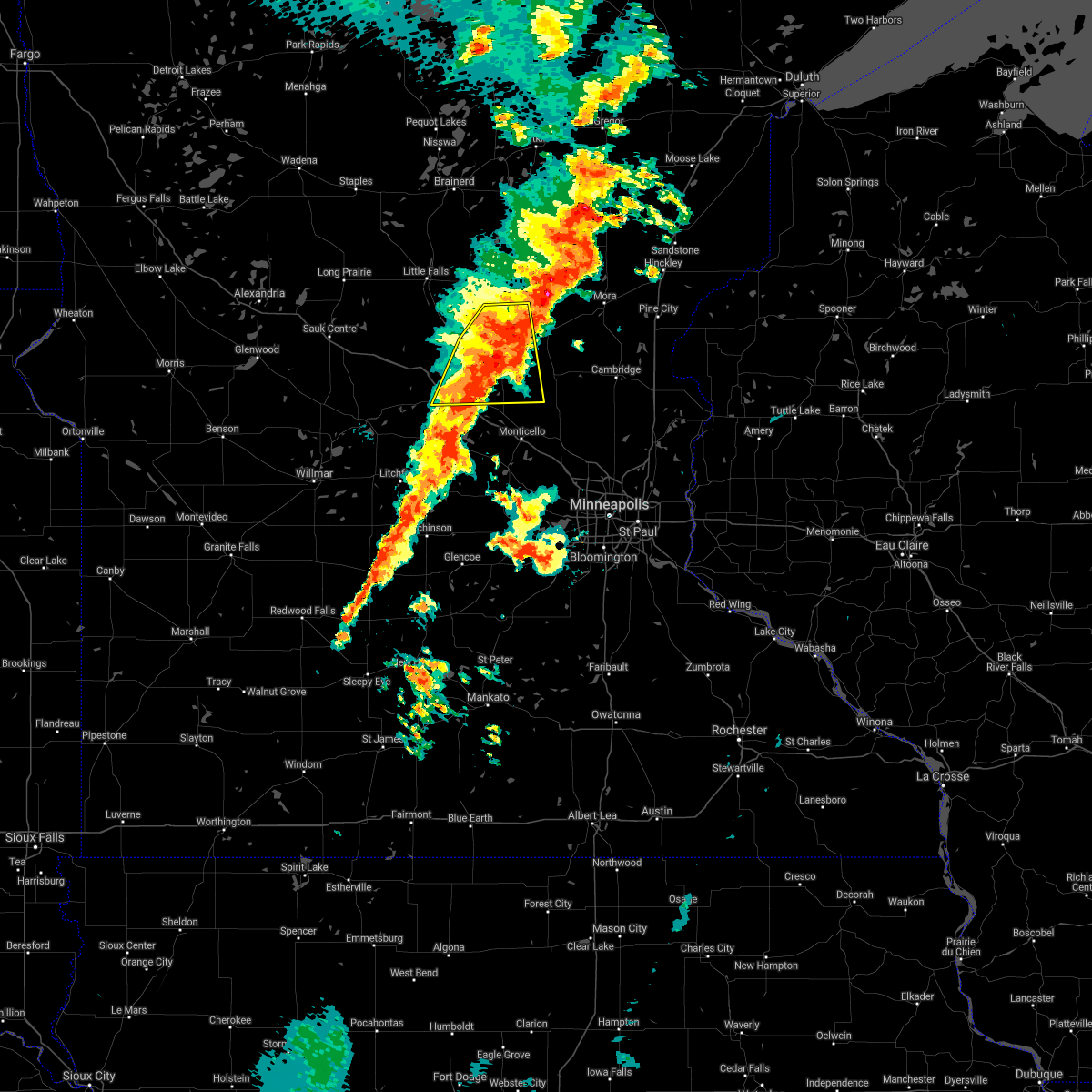 At 635 pm cdt, a severe thunderstorm was located near foreston, or 23 miles northeast of st. cloud, moving east at 55 mph (radar indicated). Hazards include 60 mph wind gusts and half dollar size hail. Hail damage to vehicles is expected. expect wind damage to roofs, siding, and trees. This severe thunderstorm will remain over mainly rural areas of southwestern mille lacs, benton, northwestern sherburne, east central stearns and southeastern morrison counties, including the following locations, sherburne national wildlife refuge, duelm, mayhew, morrill, glendorado, parent, st cloud airport, oak park, pleasant lake and luxemburg. At 635 pm cdt, a severe thunderstorm was located near foreston, or 23 miles northeast of st. cloud, moving east at 55 mph (radar indicated). Hazards include 60 mph wind gusts and half dollar size hail. Hail damage to vehicles is expected. expect wind damage to roofs, siding, and trees. This severe thunderstorm will remain over mainly rural areas of southwestern mille lacs, benton, northwestern sherburne, east central stearns and southeastern morrison counties, including the following locations, sherburne national wildlife refuge, duelm, mayhew, morrill, glendorado, parent, st cloud airport, oak park, pleasant lake and luxemburg.
|
| 8/14/2020 6:18 PM CDT |
 At 618 pm cdt, a severe thunderstorm was located near sauk rapids, or 8 miles northeast of st. cloud, moving east at 55 mph (radar indicated). Hazards include 60 mph wind gusts and half dollar size hail. Hail damage to vehicles is expected. expect wind damage to roofs, siding, and trees. this severe storm will be near, foley around 625 pm cdt. foreston around 640 pm cdt. other locations impacted by this severe thunderstorm include sherburne national wildlife refuge, duelm, mayhew, morrill, glendorado, parent, st cloud airport, oak park, pleasant lake and st. Stephen. At 618 pm cdt, a severe thunderstorm was located near sauk rapids, or 8 miles northeast of st. cloud, moving east at 55 mph (radar indicated). Hazards include 60 mph wind gusts and half dollar size hail. Hail damage to vehicles is expected. expect wind damage to roofs, siding, and trees. this severe storm will be near, foley around 625 pm cdt. foreston around 640 pm cdt. other locations impacted by this severe thunderstorm include sherburne national wildlife refuge, duelm, mayhew, morrill, glendorado, parent, st cloud airport, oak park, pleasant lake and st. Stephen.
|
| 8/14/2020 6:10 PM CDT |
 At 610 pm cdt, a severe thunderstorm capable of producing a tornado was located over sauk rapids, or over st. cloud, moving east at 45 mph (radar indicated rotation). Hazards include tornado and quarter size hail. Flying debris will be dangerous to those caught without shelter. mobile homes will be damaged or destroyed. damage to roofs, windows, and vehicles will occur. tree damage is likely. this dangerous storm will be near, foley around 630 pm cdt. Other locations impacted by this tornadic thunderstorm include duelm, mayhew, gilman, pleasant lake, parent and st cloud airport. At 610 pm cdt, a severe thunderstorm capable of producing a tornado was located over sauk rapids, or over st. cloud, moving east at 45 mph (radar indicated rotation). Hazards include tornado and quarter size hail. Flying debris will be dangerous to those caught without shelter. mobile homes will be damaged or destroyed. damage to roofs, windows, and vehicles will occur. tree damage is likely. this dangerous storm will be near, foley around 630 pm cdt. Other locations impacted by this tornadic thunderstorm include duelm, mayhew, gilman, pleasant lake, parent and st cloud airport.
|
| 8/14/2020 6:04 PM CDT |
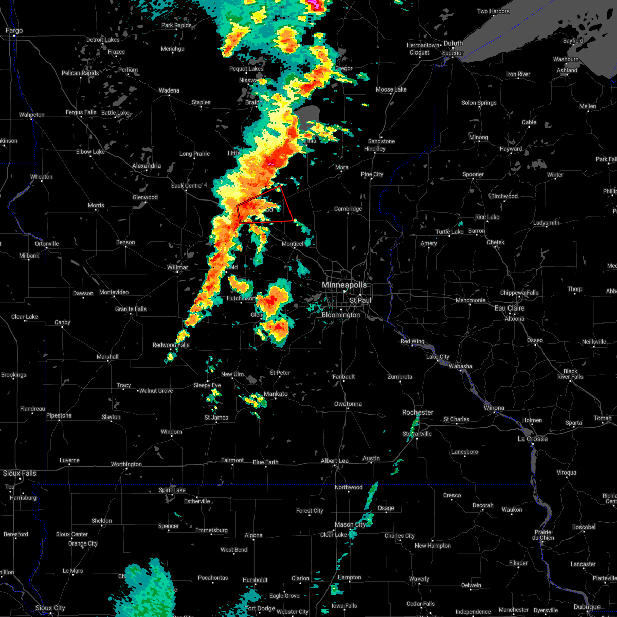 At 604 pm cdt, a severe thunderstorm capable of producing a tornado was located over st. joseph, or near st. cloud, moving east at 45 mph (radar indicated rotation). Hazards include tornado and quarter size hail. Flying debris will be dangerous to those caught without shelter. mobile homes will be damaged or destroyed. damage to roofs, windows, and vehicles will occur. tree damage is likely. this dangerous storm will be near, sauk rapids around 615 pm cdt. st. cloud around 620 pm cdt. foley around 630 pm cdt. Other locations impacted by this tornadic thunderstorm include duelm, mayhew, gilman, pleasant lake, parent and st cloud airport. At 604 pm cdt, a severe thunderstorm capable of producing a tornado was located over st. joseph, or near st. cloud, moving east at 45 mph (radar indicated rotation). Hazards include tornado and quarter size hail. Flying debris will be dangerous to those caught without shelter. mobile homes will be damaged or destroyed. damage to roofs, windows, and vehicles will occur. tree damage is likely. this dangerous storm will be near, sauk rapids around 615 pm cdt. st. cloud around 620 pm cdt. foley around 630 pm cdt. Other locations impacted by this tornadic thunderstorm include duelm, mayhew, gilman, pleasant lake, parent and st cloud airport.
|
| 8/14/2020 6:01 PM CDT |
 At 601 pm cdt, a severe thunderstorm was located over collegeville, or 10 miles west of st. cloud, moving east at 55 mph (radar indicated). Hazards include 60 mph wind gusts and quarter size hail. Hail damage to vehicles is expected. expect wind damage to roofs, siding, and trees. this severe thunderstorm will be near, waite park around 605 pm cdt. sauk rapids and rice around 615 pm cdt. st. cloud around 620 pm cdt. foley around 625 pm cdt. foreston around 640 pm cdt. Other locations impacted by this severe thunderstorm include sherburne national wildlife refuge, duelm, mayhew, morrill, glendorado, parent, st cloud airport, oak park, opole and pleasant lake. At 601 pm cdt, a severe thunderstorm was located over collegeville, or 10 miles west of st. cloud, moving east at 55 mph (radar indicated). Hazards include 60 mph wind gusts and quarter size hail. Hail damage to vehicles is expected. expect wind damage to roofs, siding, and trees. this severe thunderstorm will be near, waite park around 605 pm cdt. sauk rapids and rice around 615 pm cdt. st. cloud around 620 pm cdt. foley around 625 pm cdt. foreston around 640 pm cdt. Other locations impacted by this severe thunderstorm include sherburne national wildlife refuge, duelm, mayhew, morrill, glendorado, parent, st cloud airport, oak park, opole and pleasant lake.
|
| 7/18/2020 1:16 AM CDT |
 At 116 am cdt, severe thunderstorms were located along a line extending from 8 miles south of freeport to near paynesville to near new london, moving east at 45 mph (radar indicated). Hazards include 60 mph wind gusts. Expect damage to roofs, siding, and trees. severe thunderstorms will be near, richmond around 125 am cdt. avon around 130 am cdt. cold spring and watkins around 135 am cdt. st. joseph and rockville around 140 am cdt. waite park and kimball around 145 am cdt. Clearwater around 200 am cdt. At 116 am cdt, severe thunderstorms were located along a line extending from 8 miles south of freeport to near paynesville to near new london, moving east at 45 mph (radar indicated). Hazards include 60 mph wind gusts. Expect damage to roofs, siding, and trees. severe thunderstorms will be near, richmond around 125 am cdt. avon around 130 am cdt. cold spring and watkins around 135 am cdt. st. joseph and rockville around 140 am cdt. waite park and kimball around 145 am cdt. Clearwater around 200 am cdt.
|
| 7/18/2020 12:46 AM CDT |
 At 1246 am cdt, severe thunderstorms were located along a line extending from near foley to cold spring to 6 miles north of new london, moving southeast at 25 mph (radar indicated). Hazards include 60 mph wind gusts. Expect damage to roofs, siding, and trees. these severe storms will be near, st. cloud, sauk rapids and foley around 1250 am cdt. rockville around 1255 am cdt. paynesville around 100 am cdt. other locations impacted by these severe thunderstorms include mayhew, paynesville airport, parent, spring hill, oak park, padua, pleasant lake, st. stephen, regal and st. Martin. At 1246 am cdt, severe thunderstorms were located along a line extending from near foley to cold spring to 6 miles north of new london, moving southeast at 25 mph (radar indicated). Hazards include 60 mph wind gusts. Expect damage to roofs, siding, and trees. these severe storms will be near, st. cloud, sauk rapids and foley around 1250 am cdt. rockville around 1255 am cdt. paynesville around 100 am cdt. other locations impacted by these severe thunderstorms include mayhew, paynesville airport, parent, spring hill, oak park, padua, pleasant lake, st. stephen, regal and st. Martin.
|
| 7/18/2020 12:19 AM CDT |
 At 1218 am cdt, severe thunderstorms were located along a line extending from 7 miles east of rice to near albany to near brooten, moving southeast at 35 mph (radar indicated). Hazards include 60 mph wind gusts. Expect damage to roofs, siding, and trees. these severe storms will be near, sauk rapids, foley and richmond around 1235 am cdt. st. cloud, cold spring and rockville around 1240 am cdt. new london around 1250 am cdt. other locations impacted by these severe thunderstorms include mayhew, morrill, parent, spring hill, opole, pleasant lake, hillman, st. Martin, greenwald and gilman. At 1218 am cdt, severe thunderstorms were located along a line extending from 7 miles east of rice to near albany to near brooten, moving southeast at 35 mph (radar indicated). Hazards include 60 mph wind gusts. Expect damage to roofs, siding, and trees. these severe storms will be near, sauk rapids, foley and richmond around 1235 am cdt. st. cloud, cold spring and rockville around 1240 am cdt. new london around 1250 am cdt. other locations impacted by these severe thunderstorms include mayhew, morrill, parent, spring hill, opole, pleasant lake, hillman, st. Martin, greenwald and gilman.
|
| 7/17/2020 11:58 PM CDT |
 At 1158 pm cdt, severe thunderstorms were located along a line extending from near royalton to near melrose to near brooten, moving southeast at 25 mph (radar indicated). Hazards include 60 mph wind gusts. Expect damage to roofs, siding, and trees. severe thunderstorms will be near, royalton around 1205 am cdt. st. anthony and freeport around 1215 am cdt. rice around 1220 am cdt. albany around 1225 am cdt. sauk rapids, paynesville and new london around 1250 am cdt. st. Cloud and cold spring around 100 am cdt. At 1158 pm cdt, severe thunderstorms were located along a line extending from near royalton to near melrose to near brooten, moving southeast at 25 mph (radar indicated). Hazards include 60 mph wind gusts. Expect damage to roofs, siding, and trees. severe thunderstorms will be near, royalton around 1205 am cdt. st. anthony and freeport around 1215 am cdt. rice around 1220 am cdt. albany around 1225 am cdt. sauk rapids, paynesville and new london around 1250 am cdt. st. Cloud and cold spring around 100 am cdt.
|
| 9/21/2019 3:49 PM CDT |
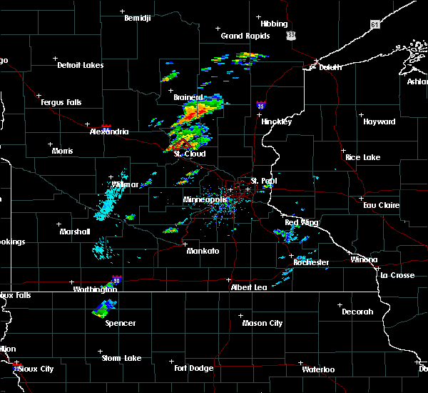 At 349 pm cdt, a severe thunderstorm capable of producing a tornado was located near sauk rapids, or 7 miles east of st. cloud, moving northeast at 30 mph (radar indicated rotation). Hazards include tornado. Flying debris will be dangerous to those caught without shelter. mobile homes will be damaged or destroyed. damage to roofs, windows, and vehicles will occur. tree damage is likely. locations impacted include, st. Cloud, sauk rapids and parent. At 349 pm cdt, a severe thunderstorm capable of producing a tornado was located near sauk rapids, or 7 miles east of st. cloud, moving northeast at 30 mph (radar indicated rotation). Hazards include tornado. Flying debris will be dangerous to those caught without shelter. mobile homes will be damaged or destroyed. damage to roofs, windows, and vehicles will occur. tree damage is likely. locations impacted include, st. Cloud, sauk rapids and parent.
|
| 9/21/2019 3:42 PM CDT |
 At 342 pm cdt, a severe thunderstorm capable of producing a tornado was located near sauk rapids, or near st. cloud, moving northeast at 25 mph (radar indicated rotation). Hazards include tornado. Flying debris will be dangerous to those caught without shelter. mobile homes will be damaged or destroyed. damage to roofs, windows, and vehicles will occur. tree damage is likely. This tornadic thunderstorm will remain over mainly rural areas of south central benton and northwestern sherburne counties, including the following locations, duelm, parent and st cloud airport. At 342 pm cdt, a severe thunderstorm capable of producing a tornado was located near sauk rapids, or near st. cloud, moving northeast at 25 mph (radar indicated rotation). Hazards include tornado. Flying debris will be dangerous to those caught without shelter. mobile homes will be damaged or destroyed. damage to roofs, windows, and vehicles will occur. tree damage is likely. This tornadic thunderstorm will remain over mainly rural areas of south central benton and northwestern sherburne counties, including the following locations, duelm, parent and st cloud airport.
|
| 9/21/2019 3:36 PM CDT |
 At 336 pm cdt, a severe thunderstorm capable of producing a tornado was located near waite park, or near st. cloud, moving northeast at 25 mph (radar indicated rotation). Hazards include tornado. Flying debris will be dangerous to those caught without shelter. mobile homes will be damaged or destroyed. damage to roofs, windows, and vehicles will occur. tree damage is likely. this dangerous storm will be near, sauk rapids around 350 pm cdt. other locations impacted by this tornadic thunderstorm include duelm, parent and st cloud airport. this includes the following highways, interstate 94 in minnesota between mile markers 167 and 171. u. s. Highway 10 in minnesota between mile markers 178 and 183. At 336 pm cdt, a severe thunderstorm capable of producing a tornado was located near waite park, or near st. cloud, moving northeast at 25 mph (radar indicated rotation). Hazards include tornado. Flying debris will be dangerous to those caught without shelter. mobile homes will be damaged or destroyed. damage to roofs, windows, and vehicles will occur. tree damage is likely. this dangerous storm will be near, sauk rapids around 350 pm cdt. other locations impacted by this tornadic thunderstorm include duelm, parent and st cloud airport. this includes the following highways, interstate 94 in minnesota between mile markers 167 and 171. u. s. Highway 10 in minnesota between mile markers 178 and 183.
|
| 9/2/2019 9:08 PM CDT |
 At 908 pm cdt, severe thunderstorms were located along a line extending from near rice to 11 miles east of prinsburg, moving east at 60 mph (radar indicated). Hazards include 60 mph wind gusts and half dollar size hail. Hail damage to vehicles is expected. Expect wind damage to roofs, siding, and trees. At 908 pm cdt, severe thunderstorms were located along a line extending from near rice to 11 miles east of prinsburg, moving east at 60 mph (radar indicated). Hazards include 60 mph wind gusts and half dollar size hail. Hail damage to vehicles is expected. Expect wind damage to roofs, siding, and trees.
|
| 8/13/2019 3:14 PM CDT |
 At 314 pm cdt, a severe thunderstorm was located near collegeville, or near st. cloud, moving east at 30 mph (radar indicated). Hazards include ping pong ball size hail. People and animals outdoors will be injured. expect damage to roofs, siding, windows, and vehicles. locations impacted include, sauk rapids, mayhew, st wendel and st. Stephen. At 314 pm cdt, a severe thunderstorm was located near collegeville, or near st. cloud, moving east at 30 mph (radar indicated). Hazards include ping pong ball size hail. People and animals outdoors will be injured. expect damage to roofs, siding, windows, and vehicles. locations impacted include, sauk rapids, mayhew, st wendel and st. Stephen.
|
| 8/13/2019 3:04 PM CDT |
 At 304 pm cdt, a severe thunderstorm was located near collegeville, or 10 miles northwest of st. cloud, moving east at 30 mph (radar indicated). Hazards include quarter size hail. damage to vehicles is expected At 304 pm cdt, a severe thunderstorm was located near collegeville, or 10 miles northwest of st. cloud, moving east at 30 mph (radar indicated). Hazards include quarter size hail. damage to vehicles is expected
|
| 7/26/2019 5:37 PM CDT | Ping Pong Ball sized hail reported 1 miles ESE of Sauk Rapids, MN |
| 7/26/2019 5:36 PM CDT |
 At 536 pm cdt, a severe thunderstorm was located near sauk rapids, or near st. cloud, moving east at 30 mph (trained weather spotters). Hazards include ping pong ball size hail and 60 mph wind gusts. People and animals outdoors will be injured. expect hail damage to roofs, siding, windows, and vehicles. expect wind damage to roofs, siding, and trees. This severe thunderstorm will remain over mainly rural areas of southeastern benton, northwestern sherburne and northeastern stearns counties, including the following locations, duelm, santiago, pleasant lake, parent, st cloud airport and ronneby. At 536 pm cdt, a severe thunderstorm was located near sauk rapids, or near st. cloud, moving east at 30 mph (trained weather spotters). Hazards include ping pong ball size hail and 60 mph wind gusts. People and animals outdoors will be injured. expect hail damage to roofs, siding, windows, and vehicles. expect wind damage to roofs, siding, and trees. This severe thunderstorm will remain over mainly rural areas of southeastern benton, northwestern sherburne and northeastern stearns counties, including the following locations, duelm, santiago, pleasant lake, parent, st cloud airport and ronneby.
|
| 7/26/2019 5:36 PM CDT |
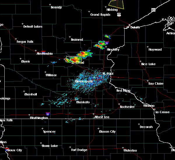 At 536 pm cdt, a severe thunderstorm was located near sauk rapids, or near st. cloud, moving east at 30 mph (trained weather spotters). Hazards include ping pong ball size hail and 60 mph wind gusts. People and animals outdoors will be injured. expect hail damage to roofs, siding, windows, and vehicles. expect wind damage to roofs, siding, and trees. This severe thunderstorm will remain over mainly rural areas of southeastern benton, northwestern sherburne and northeastern stearns counties, including the following locations, duelm, santiago, pleasant lake, parent, st cloud airport and ronneby. At 536 pm cdt, a severe thunderstorm was located near sauk rapids, or near st. cloud, moving east at 30 mph (trained weather spotters). Hazards include ping pong ball size hail and 60 mph wind gusts. People and animals outdoors will be injured. expect hail damage to roofs, siding, windows, and vehicles. expect wind damage to roofs, siding, and trees. This severe thunderstorm will remain over mainly rural areas of southeastern benton, northwestern sherburne and northeastern stearns counties, including the following locations, duelm, santiago, pleasant lake, parent, st cloud airport and ronneby.
|
| 7/26/2019 5:22 PM CDT | Tennis Ball sized hail reported 1 miles ENE of Sauk Rapids, MN, time estimated from radar. |
| 7/26/2019 5:20 PM CDT |
 At 520 pm cdt, a severe thunderstorm was located over st. cloud, moving east at 30 mph (radar indicated). Hazards include 60 mph wind gusts and quarter size hail. Hail damage to vehicles is expected. expect wind damage to roofs, siding, and trees. this severe thunderstorm will be near, foley around 545 pm cdt. other locations impacted by this severe thunderstorm include duelm, santiago, pleasant lake, parent, st cloud airport and ronneby. this includes the following highways, interstate 94 in minnesota between mile markers 162 and 172. u. s. Highway 10 in minnesota between mile markers 169 and 187. At 520 pm cdt, a severe thunderstorm was located over st. cloud, moving east at 30 mph (radar indicated). Hazards include 60 mph wind gusts and quarter size hail. Hail damage to vehicles is expected. expect wind damage to roofs, siding, and trees. this severe thunderstorm will be near, foley around 545 pm cdt. other locations impacted by this severe thunderstorm include duelm, santiago, pleasant lake, parent, st cloud airport and ronneby. this includes the following highways, interstate 94 in minnesota between mile markers 162 and 172. u. s. Highway 10 in minnesota between mile markers 169 and 187.
|
| 8/3/2018 7:47 PM CDT |
 At 732 pm cdt, severe thunderstorms were located along a line extending from near st cloud airport to becker to near buffalo, moving northeast at 55 mph (radar indicated). Hazards include 60 mph wind gusts. Expect damage to roofs, siding, and trees. severe thunderstorms will be near, st. michael, big lake, albertville, zimmerman and foley around 745 pm cdt. elk river and otsego around 750 pm cdt. Princeton around 755 pm cdt. At 732 pm cdt, severe thunderstorms were located along a line extending from near st cloud airport to becker to near buffalo, moving northeast at 55 mph (radar indicated). Hazards include 60 mph wind gusts. Expect damage to roofs, siding, and trees. severe thunderstorms will be near, st. michael, big lake, albertville, zimmerman and foley around 745 pm cdt. elk river and otsego around 750 pm cdt. Princeton around 755 pm cdt.
|
| 8/3/2018 7:33 PM CDT |
 At 732 pm cdt, severe thunderstorms were located along a line extending from near st cloud airport to becker to near buffalo, moving northeast at 55 mph (radar indicated). Hazards include 60 mph wind gusts. Expect damage to roofs, siding, and trees. severe thunderstorms will be near, st. michael, big lake, albertville, zimmerman and foley around 745 pm cdt. elk river and otsego around 750 pm cdt. Princeton around 755 pm cdt. At 732 pm cdt, severe thunderstorms were located along a line extending from near st cloud airport to becker to near buffalo, moving northeast at 55 mph (radar indicated). Hazards include 60 mph wind gusts. Expect damage to roofs, siding, and trees. severe thunderstorms will be near, st. michael, big lake, albertville, zimmerman and foley around 745 pm cdt. elk river and otsego around 750 pm cdt. Princeton around 755 pm cdt.
|
| 6/6/2018 3:42 AM CDT |
 At 341 am cdt, severe thunderstorms were located along a line extending from albany to near paynesville to near kandiyohi, moving east at 65 mph (radar indicated). Hazards include 60 mph wind gusts and penny size hail. Expect damage to roofs, siding, and trees. These severe thunderstorms will remain over mainly rural areas of northern meeker and southeastern stearns counties, including the following locations: fairhaven, st augusta, pleasant lake, st nicholas, luxemburg, manannah, lake koronis regional park and forest city. At 341 am cdt, severe thunderstorms were located along a line extending from albany to near paynesville to near kandiyohi, moving east at 65 mph (radar indicated). Hazards include 60 mph wind gusts and penny size hail. Expect damage to roofs, siding, and trees. These severe thunderstorms will remain over mainly rural areas of northern meeker and southeastern stearns counties, including the following locations: fairhaven, st augusta, pleasant lake, st nicholas, luxemburg, manannah, lake koronis regional park and forest city.
|
| 5/28/2018 7:19 PM CDT |
 At 719 pm cdt, a severe thunderstorm was located over st wendel, or 12 miles northwest of st. cloud, moving north at 30 mph (public). Hazards include 60 mph wind gusts and quarter size hail. Hail damage to vehicles is expected. expect wind damage to roofs, siding, and trees. this severe storm will be near, holdingford around 725 pm cdt. other locations impacted by this severe thunderstorm include st wendel, farming and st. Stephen. At 719 pm cdt, a severe thunderstorm was located over st wendel, or 12 miles northwest of st. cloud, moving north at 30 mph (public). Hazards include 60 mph wind gusts and quarter size hail. Hail damage to vehicles is expected. expect wind damage to roofs, siding, and trees. this severe storm will be near, holdingford around 725 pm cdt. other locations impacted by this severe thunderstorm include st wendel, farming and st. Stephen.
|
| 5/28/2018 7:06 PM CDT |
 At 706 pm cdt, a severe thunderstorm was located over collegeville, or 9 miles west of st. cloud, moving north at 30 mph. 2" hail was reported in avon (public). Hazards include two inch hail and 60 mph wind gusts. People and animals outdoors will be injured. expect hail damage to roofs, siding, windows, and vehicles. expect wind damage to roofs, siding, and trees. this severe thunderstorm will be near, holdingford around 725 pm cdt. other locations impacted by this severe thunderstorm include st wendel, farming and st. stephen. this includes the following highways, interstate 94 in minnesota between mile markers 147 and 163. u. s. Highway 10 in minnesota between mile markers 165 and 178. At 706 pm cdt, a severe thunderstorm was located over collegeville, or 9 miles west of st. cloud, moving north at 30 mph. 2" hail was reported in avon (public). Hazards include two inch hail and 60 mph wind gusts. People and animals outdoors will be injured. expect hail damage to roofs, siding, windows, and vehicles. expect wind damage to roofs, siding, and trees. this severe thunderstorm will be near, holdingford around 725 pm cdt. other locations impacted by this severe thunderstorm include st wendel, farming and st. stephen. this includes the following highways, interstate 94 in minnesota between mile markers 147 and 163. u. s. Highway 10 in minnesota between mile markers 165 and 178.
|
| 5/28/2018 6:38 PM CDT |
 At 638 pm cdt, a severe thunderstorm was located over sauk rapids, or near st. cloud, moving north at 35 mph (radar indicated). Hazards include 60 mph wind gusts and half dollar size hail. Hail damage to vehicles is expected. expect wind damage to roofs, siding, and trees. locations impacted include, st. cloud, sauk rapids, waite park, st. Joseph, cold spring, collegeville, foley, rockville, avon, holdingford, rice and glendorado. At 638 pm cdt, a severe thunderstorm was located over sauk rapids, or near st. cloud, moving north at 35 mph (radar indicated). Hazards include 60 mph wind gusts and half dollar size hail. Hail damage to vehicles is expected. expect wind damage to roofs, siding, and trees. locations impacted include, st. cloud, sauk rapids, waite park, st. Joseph, cold spring, collegeville, foley, rockville, avon, holdingford, rice and glendorado.
|
| 5/28/2018 6:22 PM CDT |
 At 622 pm cdt, a severe thunderstorm was located near st augusta, or 7 miles south of st. cloud, moving north at 35 mph (radar indicated). Hazards include 60 mph wind gusts and half dollar size hail. Hail damage to vehicles is expected. expect wind damage to roofs, siding, and trees. this severe thunderstorm will remain over mainly rural areas of benton, northwestern sherburne and eastern stearns counties, including the following locations: duelm, mayhew, glendorado, parent, st cloud airport, st augusta, oak park, opole, pleasant lake and st. stephen. this includes the following highways, interstate 94 in minnesota between mile markers 151 and 178. u. s. Highway 10 in minnesota between mile markers 158 and 196. At 622 pm cdt, a severe thunderstorm was located near st augusta, or 7 miles south of st. cloud, moving north at 35 mph (radar indicated). Hazards include 60 mph wind gusts and half dollar size hail. Hail damage to vehicles is expected. expect wind damage to roofs, siding, and trees. this severe thunderstorm will remain over mainly rural areas of benton, northwestern sherburne and eastern stearns counties, including the following locations: duelm, mayhew, glendorado, parent, st cloud airport, st augusta, oak park, opole, pleasant lake and st. stephen. this includes the following highways, interstate 94 in minnesota between mile markers 151 and 178. u. s. Highway 10 in minnesota between mile markers 158 and 196.
|
| 9/20/2017 1:27 AM CDT |
 At 127 am cdt, severe thunderstorms were located along a line extending from near camp ripley junction to near royalton to near st. joseph, moving northeast at 70 mph (radar indicated). Hazards include 70 mph wind gusts and nickel size hail. Expect considerable tree damage. damage is likely to mobile homes, roofs, and outbuildings. locations impacted include, st. cloud, little falls, sauk rapids, waite park, st. Joseph, cold spring, collegeville, foley, albany, rockville, paynesville and richmond. At 127 am cdt, severe thunderstorms were located along a line extending from near camp ripley junction to near royalton to near st. joseph, moving northeast at 70 mph (radar indicated). Hazards include 70 mph wind gusts and nickel size hail. Expect considerable tree damage. damage is likely to mobile homes, roofs, and outbuildings. locations impacted include, st. cloud, little falls, sauk rapids, waite park, st. Joseph, cold spring, collegeville, foley, albany, rockville, paynesville and richmond.
|
| 9/20/2017 1:11 AM CDT |
 At 110 am cdt, severe thunderstorms were located along a line extending from swanville to near albany to near manannah, moving northeast at 70 mph (radar indicated). Hazards include 60 mph wind gusts and nickel size hail. Expect damage to roofs, siding, and trees. These severe thunderstorms will remain over mainly rural areas of benton, northwestern sherburne, eastern stearns and morrison counties, including the following locations: mayhew, morrill, glendorado, parent, sobieski, st augusta, opole, pleasant lake, harding and hillman. At 110 am cdt, severe thunderstorms were located along a line extending from swanville to near albany to near manannah, moving northeast at 70 mph (radar indicated). Hazards include 60 mph wind gusts and nickel size hail. Expect damage to roofs, siding, and trees. These severe thunderstorms will remain over mainly rural areas of benton, northwestern sherburne, eastern stearns and morrison counties, including the following locations: mayhew, morrill, glendorado, parent, sobieski, st augusta, opole, pleasant lake, harding and hillman.
|
| 7/12/2017 1:47 AM CDT |
 At 146 am cdt, severe thunderstorms were located along a line extending from near bock to near princeton to near st augusta, moving southeast at 45 mph (radar indicated). Hazards include 60 mph wind gusts. Expect damage to roofs, siding, and trees. severe thunderstorms will be near, princeton and bock around 150 am cdt. becker around 205 am cdt. monticello around 210 am cdt. cambridge, big lake and isanti around 215 am cdt. east bethel around 220 am cdt. Otsego around 230 am cdt. At 146 am cdt, severe thunderstorms were located along a line extending from near bock to near princeton to near st augusta, moving southeast at 45 mph (radar indicated). Hazards include 60 mph wind gusts. Expect damage to roofs, siding, and trees. severe thunderstorms will be near, princeton and bock around 150 am cdt. becker around 205 am cdt. monticello around 210 am cdt. cambridge, big lake and isanti around 215 am cdt. east bethel around 220 am cdt. Otsego around 230 am cdt.
|
| 7/12/2017 1:44 AM CDT |
 At 143 am cdt, severe thunderstorms were located along a line extending from near bock to near pease to near st augusta, moving southeast at 40 mph (radar indicated). Hazards include 60 mph wind gusts. Expect damage to roofs, siding, and trees. severe thunderstorms will be near, princeton around 150 am cdt. becker around 205 am cdt. monticello around 210 am cdt. cambridge, big lake and isanti around 215 am cdt. east bethel around 220 am cdt. Otsego around 230 am cdt. At 143 am cdt, severe thunderstorms were located along a line extending from near bock to near pease to near st augusta, moving southeast at 40 mph (radar indicated). Hazards include 60 mph wind gusts. Expect damage to roofs, siding, and trees. severe thunderstorms will be near, princeton around 150 am cdt. becker around 205 am cdt. monticello around 210 am cdt. cambridge, big lake and isanti around 215 am cdt. east bethel around 220 am cdt. Otsego around 230 am cdt.
|
| 7/9/2017 8:55 PM CDT |
 At 855 pm cdt, a severe thunderstorm was located over parent, or 9 miles northeast of st. cloud, moving south at 30 mph (radar indicated). Hazards include ping pong ball size hail and 60 mph wind gusts. People and animals outdoors will be injured. expect hail damage to roofs, siding, windows, and vehicles. expect wind damage to roofs, siding, and trees. this severe thunderstorm will be near, clear lake around 920 pm cdt. becker and clearwater around 925 pm cdt. big lake around 940 pm cdt. other locations impacted by this severe thunderstorm include duelm, mayhew, santiago, parent, st cloud airport and ronneby. this includes u. s. highway 10 in minnesota between mile markers 183 and 206. A tornado watch remains in effect until 100 am cdt for central minnesota. At 855 pm cdt, a severe thunderstorm was located over parent, or 9 miles northeast of st. cloud, moving south at 30 mph (radar indicated). Hazards include ping pong ball size hail and 60 mph wind gusts. People and animals outdoors will be injured. expect hail damage to roofs, siding, windows, and vehicles. expect wind damage to roofs, siding, and trees. this severe thunderstorm will be near, clear lake around 920 pm cdt. becker and clearwater around 925 pm cdt. big lake around 940 pm cdt. other locations impacted by this severe thunderstorm include duelm, mayhew, santiago, parent, st cloud airport and ronneby. this includes u. s. highway 10 in minnesota between mile markers 183 and 206. A tornado watch remains in effect until 100 am cdt for central minnesota.
|
| 7/9/2017 8:22 PM CDT |
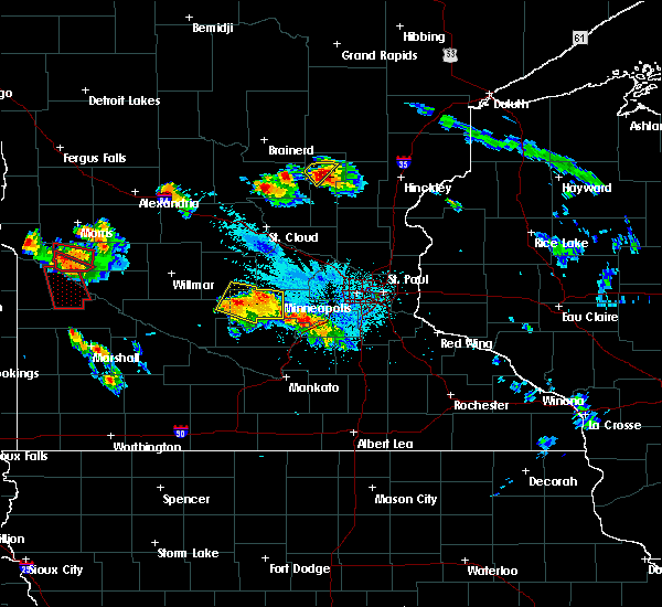 At 821 pm cdt, a severe thunderstorm was located near royalton, or 10 miles southeast of little falls, moving southeast at 30 mph (radar indicated). Hazards include ping pong ball size hail and 60 mph wind gusts. People and animals outdoors will be injured. expect hail damage to roofs, siding, windows, and vehicles. expect wind damage to roofs, siding, and trees. this severe thunderstorm will be near, rice around 840 pm cdt. sauk rapids and foley around 900 pm cdt. other locations impacted by this severe thunderstorm include buckman, mayhew, gilman, little rock and ronneby. A tornado watch remains in effect until 100 am cdt for central minnesota. At 821 pm cdt, a severe thunderstorm was located near royalton, or 10 miles southeast of little falls, moving southeast at 30 mph (radar indicated). Hazards include ping pong ball size hail and 60 mph wind gusts. People and animals outdoors will be injured. expect hail damage to roofs, siding, windows, and vehicles. expect wind damage to roofs, siding, and trees. this severe thunderstorm will be near, rice around 840 pm cdt. sauk rapids and foley around 900 pm cdt. other locations impacted by this severe thunderstorm include buckman, mayhew, gilman, little rock and ronneby. A tornado watch remains in effect until 100 am cdt for central minnesota.
|
| 7/11/2016 7:50 PM CDT |
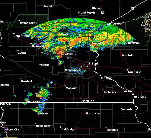 At 749 pm cdt, a severe thunderstorm capable of producing a tornado was located over st. cloud, moving east at 35 mph (weather spotters reported a funnel cloud). Hazards include tornado. Flying debris will be dangerous to those caught without shelter. mobile homes will be damaged or destroyed. damage to roofs, windows, and vehicles will occur. tree damage is likely. this tornadic thunderstorm will impact st. Cloud and surrounding locations in sherburne and benton counties. At 749 pm cdt, a severe thunderstorm capable of producing a tornado was located over st. cloud, moving east at 35 mph (weather spotters reported a funnel cloud). Hazards include tornado. Flying debris will be dangerous to those caught without shelter. mobile homes will be damaged or destroyed. damage to roofs, windows, and vehicles will occur. tree damage is likely. this tornadic thunderstorm will impact st. Cloud and surrounding locations in sherburne and benton counties.
|
| 7/11/2016 7:37 PM CDT |
 At 737 pm cdt, a severe thunderstorm capable of producing a tornado was located over pleasant lake, or near st. cloud, moving east at 35 mph (weather spotters reported funnel cloud). Hazards include tornado. Flying debris will be dangerous to those caught without shelter. mobile homes will be damaged or destroyed. damage to roofs, windows, and vehicles will occur. tree damage is likely. this tornadic thunderstorm will be moving through st. cloud. this includes the following highways, interstate 94 in minnesota between mile markers 159 and 173. u. s. Highway 10 in minnesota between mile markers 174 and 187. At 737 pm cdt, a severe thunderstorm capable of producing a tornado was located over pleasant lake, or near st. cloud, moving east at 35 mph (weather spotters reported funnel cloud). Hazards include tornado. Flying debris will be dangerous to those caught without shelter. mobile homes will be damaged or destroyed. damage to roofs, windows, and vehicles will occur. tree damage is likely. this tornadic thunderstorm will be moving through st. cloud. this includes the following highways, interstate 94 in minnesota between mile markers 159 and 173. u. s. Highway 10 in minnesota between mile markers 174 and 187.
|
| 7/11/2016 6:57 PM CDT |
 At 657 pm cdt, a severe thunderstorm capable of producing a tornado was located over sauk rapids, or near st. cloud, moving northeast at 20 mph (weather spotters reported a funnel cloud). Hazards include tornado. Flying debris will be dangerous to those caught without shelter. mobile homes will be damaged or destroyed. damage to roofs, windows, and vehicles will occur. tree damage is likely. This tornadic thunderstorm will remain over mainly rural areas of south central benton county, including the following locations: mayhew and parent. At 657 pm cdt, a severe thunderstorm capable of producing a tornado was located over sauk rapids, or near st. cloud, moving northeast at 20 mph (weather spotters reported a funnel cloud). Hazards include tornado. Flying debris will be dangerous to those caught without shelter. mobile homes will be damaged or destroyed. damage to roofs, windows, and vehicles will occur. tree damage is likely. This tornadic thunderstorm will remain over mainly rural areas of south central benton county, including the following locations: mayhew and parent.
|
| 7/11/2016 6:43 PM CDT |
 At 642 pm cdt, a confirmed tornado was located over st. cloud, moving northeast at 25 mph (weather spotters confirmed tornado). Hazards include damaging tornado. Flying debris will be dangerous to those caught without shelter. mobile homes will be damaged or destroyed. damage to roofs, windows, and vehicles will occur. tree damage is likely. this tornadic thunderstorm will be moving through sauk rapids. this includes u. s. Highway 10 in minnesota between mile markers 167 and 180. At 642 pm cdt, a confirmed tornado was located over st. cloud, moving northeast at 25 mph (weather spotters confirmed tornado). Hazards include damaging tornado. Flying debris will be dangerous to those caught without shelter. mobile homes will be damaged or destroyed. damage to roofs, windows, and vehicles will occur. tree damage is likely. this tornadic thunderstorm will be moving through sauk rapids. this includes u. s. Highway 10 in minnesota between mile markers 167 and 180.
|
| 7/11/2016 6:39 PM CDT |
 At 638 pm cdt, a severe thunderstorm capable of producing a tornado was located over waite park, or over st. cloud, moving northeast at 25 mph (weather spotters reported a funnel cloud). Hazards include tornado. Flying debris will be dangerous to those caught without shelter. mobile homes will be damaged or destroyed. damage to roofs, windows, and vehicles will occur. tree damage is likely. this tornadic thunderstorm will move across the northwest part of st. Cloud on its way toward sauk rapids. At 638 pm cdt, a severe thunderstorm capable of producing a tornado was located over waite park, or over st. cloud, moving northeast at 25 mph (weather spotters reported a funnel cloud). Hazards include tornado. Flying debris will be dangerous to those caught without shelter. mobile homes will be damaged or destroyed. damage to roofs, windows, and vehicles will occur. tree damage is likely. this tornadic thunderstorm will move across the northwest part of st. Cloud on its way toward sauk rapids.
|
| 7/11/2016 6:32 PM CDT |
 At 631 pm cdt, a confirmed large and extremely dangerous tornado was located over waite park, or near st. cloud, moving northeast at 25 mph. this is a particularly dangerous situation. take cover now! (weather spotters confirmed tornado). Hazards include damaging tornado. You are in a life-threatening situation. flying debris may be deadly to those caught without shelter. mobile homes will be destroyed. considerable damage to homes, businesses, and vehicles is likely and complete destruction is possible. this tornadic thunderstorm will move through northwest side of st. Cloud and is moving toward sauk rapids. At 631 pm cdt, a confirmed large and extremely dangerous tornado was located over waite park, or near st. cloud, moving northeast at 25 mph. this is a particularly dangerous situation. take cover now! (weather spotters confirmed tornado). Hazards include damaging tornado. You are in a life-threatening situation. flying debris may be deadly to those caught without shelter. mobile homes will be destroyed. considerable damage to homes, businesses, and vehicles is likely and complete destruction is possible. this tornadic thunderstorm will move through northwest side of st. Cloud and is moving toward sauk rapids.
|
| 7/11/2016 6:26 PM CDT |
 At 625 pm cdt, a confirmed large and extremely dangerous tornado was located over pleasant lake, or near st. cloud, moving northeast at 30 mph. this is a particularly dangerous situation. take cover now! (weather spotters confirmed tornado). Hazards include damaging tornado. You are in a life-threatening situation. flying debris may be deadly to those caught without shelter. mobile homes will be destroyed. considerable damage to homes, businesses, and vehicles is likely and complete destruction is possible. this tornadic thunderstorm will impact the st. Cloud metro area. At 625 pm cdt, a confirmed large and extremely dangerous tornado was located over pleasant lake, or near st. cloud, moving northeast at 30 mph. this is a particularly dangerous situation. take cover now! (weather spotters confirmed tornado). Hazards include damaging tornado. You are in a life-threatening situation. flying debris may be deadly to those caught without shelter. mobile homes will be destroyed. considerable damage to homes, businesses, and vehicles is likely and complete destruction is possible. this tornadic thunderstorm will impact the st. Cloud metro area.
|
| 7/11/2016 6:24 PM CDT |
 At 623 pm cdt, a severe thunderstorm capable of producing a tornado was located over pleasant lake, or near st. cloud, moving northeast at 30 mph (weather spotters reported a funnel cloud). Hazards include tornado. Flying debris will be dangerous to those caught without shelter. mobile homes will be damaged or destroyed. damage to roofs, windows, and vehicles will occur. tree damage is likely. this tornadic thunderstorm is heading for the st. Cloud metro area. At 623 pm cdt, a severe thunderstorm capable of producing a tornado was located over pleasant lake, or near st. cloud, moving northeast at 30 mph (weather spotters reported a funnel cloud). Hazards include tornado. Flying debris will be dangerous to those caught without shelter. mobile homes will be damaged or destroyed. damage to roofs, windows, and vehicles will occur. tree damage is likely. this tornadic thunderstorm is heading for the st. Cloud metro area.
|
| 7/11/2016 6:19 PM CDT |
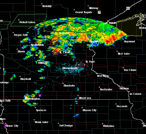 At 619 pm cdt, a severe thunderstorm capable of producing a tornado was located over pleasant lake, or 8 miles southwest of st. cloud, moving northeast at 30 mph (weather spotters reported funnel cloud). Hazards include tornado. Flying debris will be dangerous to those caught without shelter. mobile homes will be damaged or destroyed. damage to roofs, windows, and vehicles will occur. tree damage is likely. this tornadic thunderstorm will remain over mainly rural areas of east central stearns and south central benton counties, including the following locations: pleasant lake and luxemburg. this includes the following highways, interstate 94 in minnesota between mile markers 161 and 170. u. s. Highway 10 in minnesota between mile markers 171 and 180. At 619 pm cdt, a severe thunderstorm capable of producing a tornado was located over pleasant lake, or 8 miles southwest of st. cloud, moving northeast at 30 mph (weather spotters reported funnel cloud). Hazards include tornado. Flying debris will be dangerous to those caught without shelter. mobile homes will be damaged or destroyed. damage to roofs, windows, and vehicles will occur. tree damage is likely. this tornadic thunderstorm will remain over mainly rural areas of east central stearns and south central benton counties, including the following locations: pleasant lake and luxemburg. this includes the following highways, interstate 94 in minnesota between mile markers 161 and 170. u. s. Highway 10 in minnesota between mile markers 171 and 180.
|
| 7/11/2016 11:45 AM CDT |
 At 1144 am cdt, a severe thunderstorm was located near mayhew, or near st. cloud, moving northeast at 25 mph (radar indicated). Hazards include quarter size hail. Damage to vehicles is expected. locations impacted include, st. cloud, sauk rapids, waite park, st. Joseph, collegeville, foley, avon, rice, santiago, glendorado, gilman and oak park. At 1144 am cdt, a severe thunderstorm was located near mayhew, or near st. cloud, moving northeast at 25 mph (radar indicated). Hazards include quarter size hail. Damage to vehicles is expected. locations impacted include, st. cloud, sauk rapids, waite park, st. Joseph, collegeville, foley, avon, rice, santiago, glendorado, gilman and oak park.
|
| 7/11/2016 11:35 AM CDT |
 At 1135 am cdt, a severe thunderstorm was located over st. cloud, moving east at 45 mph (radar indicated). Hazards include quarter size hail. Damage to vehicles is expected. this severe thunderstorm will remain over mainly rural areas of northeastern stearns, northwestern sherburne and benton counties, including the following locations: ronneby, glendorado, parent, oak park, st. stephen, st cloud airport, duelm, st wendel, santiago and pleasant lake. this includes the following highways, interstate 94 in minnesota between mile markers 153 and 173. u. s. Highway 10 in minnesota between mile markers 164 and 187. At 1135 am cdt, a severe thunderstorm was located over st. cloud, moving east at 45 mph (radar indicated). Hazards include quarter size hail. Damage to vehicles is expected. this severe thunderstorm will remain over mainly rural areas of northeastern stearns, northwestern sherburne and benton counties, including the following locations: ronneby, glendorado, parent, oak park, st. stephen, st cloud airport, duelm, st wendel, santiago and pleasant lake. this includes the following highways, interstate 94 in minnesota between mile markers 153 and 173. u. s. Highway 10 in minnesota between mile markers 164 and 187.
|
| 7/7/2016 8:53 PM CDT |
 The severe thunderstorm warning for benton county will expire at 900 pm cdt, the storm which prompted the warning has weakened below severe limits, and no longer pose an immediate threat to life or property. therefore the warning will be allowed to expire. however heavy rain is still possible with this thunderstorm. The severe thunderstorm warning for benton county will expire at 900 pm cdt, the storm which prompted the warning has weakened below severe limits, and no longer pose an immediate threat to life or property. therefore the warning will be allowed to expire. however heavy rain is still possible with this thunderstorm.
|
| 7/7/2016 8:36 PM CDT |
 At 835 pm cdt, a severe thunderstorm was located over parent, or 10 miles east of st. cloud, moving northeast at 30 mph (radar indicated). Hazards include 60 mph wind gusts and quarter size hail. Hail damage to vehicles is expected. expect wind damage to roofs, siding, and trees. locations impacted include, st. Cloud, sauk rapids, foley, glendorado, granite ledge, gilman, oak park, ronneby, parent, duelm, rum river and mayhew. At 835 pm cdt, a severe thunderstorm was located over parent, or 10 miles east of st. cloud, moving northeast at 30 mph (radar indicated). Hazards include 60 mph wind gusts and quarter size hail. Hail damage to vehicles is expected. expect wind damage to roofs, siding, and trees. locations impacted include, st. Cloud, sauk rapids, foley, glendorado, granite ledge, gilman, oak park, ronneby, parent, duelm, rum river and mayhew.
|
| 7/7/2016 8:17 PM CDT |
 At 817 pm cdt, a severe thunderstorm was located over sauk rapids, or over st. cloud, moving northeast at 30 mph (radar indicated). Hazards include 60 mph wind gusts and half dollar size hail. Hail damage to vehicles is expected. expect wind damage to roofs, siding, and trees. this severe thunderstorm will remain over mainly rural areas of east central stearns, northwestern sherburne and benton counties, including the following locations: ronneby, glendorado, parent, oak park, st cloud airport, duelm, gilman, rum river, mayhew and granite ledge. this includes the following highways, interstate 94 in minnesota between mile markers 167 and 172. u. s. Highway 10 in minnesota between mile markers 169 and 184. At 817 pm cdt, a severe thunderstorm was located over sauk rapids, or over st. cloud, moving northeast at 30 mph (radar indicated). Hazards include 60 mph wind gusts and half dollar size hail. Hail damage to vehicles is expected. expect wind damage to roofs, siding, and trees. this severe thunderstorm will remain over mainly rural areas of east central stearns, northwestern sherburne and benton counties, including the following locations: ronneby, glendorado, parent, oak park, st cloud airport, duelm, gilman, rum river, mayhew and granite ledge. this includes the following highways, interstate 94 in minnesota between mile markers 167 and 172. u. s. Highway 10 in minnesota between mile markers 169 and 184.
|
| 6/25/2016 4:50 PM CDT | A few trees dow in benton county MN, 5.2 miles S of Sauk Rapids, MN |
| 6/19/2016 8:47 PM CDT |
 At 846 pm cdt, a severe thunderstorm capable of producing a tornado was located over st augusta, or near st. cloud, moving east at 35 mph (radar indicated rotation). Hazards include tornado and quarter size hail. Flying debris will be dangerous to those caught without shelter. mobile homes will be damaged or destroyed. damage to roofs, windows, and vehicles will occur. tree damage is likely. locations impacted include, st. Cloud, sauk rapids, big lake, waite park, becker, rockville, clearwater, clear lake, santiago, glendorado, luxemburg and st cloud airport. At 846 pm cdt, a severe thunderstorm capable of producing a tornado was located over st augusta, or near st. cloud, moving east at 35 mph (radar indicated rotation). Hazards include tornado and quarter size hail. Flying debris will be dangerous to those caught without shelter. mobile homes will be damaged or destroyed. damage to roofs, windows, and vehicles will occur. tree damage is likely. locations impacted include, st. Cloud, sauk rapids, big lake, waite park, becker, rockville, clearwater, clear lake, santiago, glendorado, luxemburg and st cloud airport.
|
| 6/19/2016 8:30 PM CDT |
 At 830 pm cdt, a severe thunderstorm capable of producing a tornado was located over rockville, or 11 miles southwest of st. cloud, moving east at 40 mph (radar indicated rotation). Hazards include tornado. Flying debris will be dangerous to those caught without shelter. mobile homes will be damaged or destroyed. damage to roofs, windows, and vehicles will occur. tree damage is likely. this tornadic thunderstorm will remain over mainly rural areas of southeastern stearns, northwestern sherburne and southeastern benton counties, including the following locations: glendorado, parent, luxemburg, st cloud airport, duelm, santiago, pleasant lake and st augusta. this includes the following highways, interstate 94 in minnesota between mile markers 159 and 178. u. s. Highway 10 in minnesota between mile markers 176 and 198. At 830 pm cdt, a severe thunderstorm capable of producing a tornado was located over rockville, or 11 miles southwest of st. cloud, moving east at 40 mph (radar indicated rotation). Hazards include tornado. Flying debris will be dangerous to those caught without shelter. mobile homes will be damaged or destroyed. damage to roofs, windows, and vehicles will occur. tree damage is likely. this tornadic thunderstorm will remain over mainly rural areas of southeastern stearns, northwestern sherburne and southeastern benton counties, including the following locations: glendorado, parent, luxemburg, st cloud airport, duelm, santiago, pleasant lake and st augusta. this includes the following highways, interstate 94 in minnesota between mile markers 159 and 178. u. s. Highway 10 in minnesota between mile markers 176 and 198.
|
| 6/19/2016 8:02 PM CDT |
 At 802 pm cdt, a severe thunderstorm capable of producing a tornado was located near st. stephen, or near st. cloud, moving east at 60 mph (radar indicated rotation). Hazards include tornado. Flying debris will be dangerous to those caught without shelter. mobile homes will be damaged or destroyed. damage to roofs, windows, and vehicles will occur. tree damage is likely. locations impacted include, st. cloud, sauk rapids, st. joseph, collegeville, st. Stephen and st wendel. At 802 pm cdt, a severe thunderstorm capable of producing a tornado was located near st. stephen, or near st. cloud, moving east at 60 mph (radar indicated rotation). Hazards include tornado. Flying debris will be dangerous to those caught without shelter. mobile homes will be damaged or destroyed. damage to roofs, windows, and vehicles will occur. tree damage is likely. locations impacted include, st. cloud, sauk rapids, st. joseph, collegeville, st. Stephen and st wendel.
|
| 6/19/2016 7:50 PM CDT |
 At 750 pm cdt, a severe thunderstorm capable of producing a tornado was located near albany, or 16 miles west of st. cloud, moving east at 60 mph (radar indicated rotation). Hazards include tornado. Flying debris will be dangerous to those caught without shelter. mobile homes will be damaged or destroyed. damage to roofs, windows, and vehicles will occur. tree damage is likely. this tornadic thunderstorm will remain over mainly rural areas of northeastern stearns county, including the following locations: st wendel and st. stephen. This includes interstate 94 in minnesota between mile markers 146 and 147, near mile marker 150, and between mile markers 154 and 157. At 750 pm cdt, a severe thunderstorm capable of producing a tornado was located near albany, or 16 miles west of st. cloud, moving east at 60 mph (radar indicated rotation). Hazards include tornado. Flying debris will be dangerous to those caught without shelter. mobile homes will be damaged or destroyed. damage to roofs, windows, and vehicles will occur. tree damage is likely. this tornadic thunderstorm will remain over mainly rural areas of northeastern stearns county, including the following locations: st wendel and st. stephen. This includes interstate 94 in minnesota between mile markers 146 and 147, near mile marker 150, and between mile markers 154 and 157.
|
| 7/12/2015 9:20 PM CDT |
 At 919 pm cdt, severe thunderstorms were located along a line extending from enfield to near st nicholas, moving southeast at 25 mph (trained weather spotters reported a measured 69 mph wind gust with this line of storms). Hazards include 70 mph wind gusts and half dollar size hail. Hail damage to vehicles is expected. expect considerable tree damage. wind damage is also likely to mobile homes, roofs and outbuildings. these severe storms will be near, monticello around 925 pm cdt. big lake around 935 pm cdt. albertville around 950 pm cdt. annandale around 955 pm cdt. st. michael and otsego around 1000 pm cdt. independence and maple lake around 1010 pm cdt. buffalo, montrose and howard lake around 1015 pm cdt. other locations impacted by these severe thunderstorms include buffalo airport, pleasant lake, darwin, rassat, luxemburg, south haven, enfield, roscoe, st. martin and french lake. this includes interstate 94 in minnesota between mile markers 158 and 205. A tornado watch remains in effect until 100 am cdt for east central minnesota. At 919 pm cdt, severe thunderstorms were located along a line extending from enfield to near st nicholas, moving southeast at 25 mph (trained weather spotters reported a measured 69 mph wind gust with this line of storms). Hazards include 70 mph wind gusts and half dollar size hail. Hail damage to vehicles is expected. expect considerable tree damage. wind damage is also likely to mobile homes, roofs and outbuildings. these severe storms will be near, monticello around 925 pm cdt. big lake around 935 pm cdt. albertville around 950 pm cdt. annandale around 955 pm cdt. st. michael and otsego around 1000 pm cdt. independence and maple lake around 1010 pm cdt. buffalo, montrose and howard lake around 1015 pm cdt. other locations impacted by these severe thunderstorms include buffalo airport, pleasant lake, darwin, rassat, luxemburg, south haven, enfield, roscoe, st. martin and french lake. this includes interstate 94 in minnesota between mile markers 158 and 205. A tornado watch remains in effect until 100 am cdt for east central minnesota.
|
| 7/12/2015 9:08 PM CDT |
 At 908 pm cdt, a severe thunderstorm was located over granite ledge, or 21 miles northeast of st. cloud, moving southeast at 20 mph (radar indicated). Hazards include 70 mph wind gusts and quarter size hail. Hail damage to vehicles is expected. expect considerable tree damage. wind damage is also likely to mobile homes, roofs and outbuildings. locations impacted include, st. cloud, sartell, sauk rapids, foley, clearwater, clear lake, santiago, glendorado, granite ledge, morrill, gilman and little rock. A tornado watch remains in effect until 100 am cdt for east central minnesota. At 908 pm cdt, a severe thunderstorm was located over granite ledge, or 21 miles northeast of st. cloud, moving southeast at 20 mph (radar indicated). Hazards include 70 mph wind gusts and quarter size hail. Hail damage to vehicles is expected. expect considerable tree damage. wind damage is also likely to mobile homes, roofs and outbuildings. locations impacted include, st. cloud, sartell, sauk rapids, foley, clearwater, clear lake, santiago, glendorado, granite ledge, morrill, gilman and little rock. A tornado watch remains in effect until 100 am cdt for east central minnesota.
|
| 7/12/2015 8:54 PM CDT |
 At 853 pm cdt, severe thunderstorms were located along a line extending from clear lake to near richmond, moving southeast at 35 mph (trained weather spotters). Hazards include 70 mph wind gusts and half dollar size hail. Hail damage to vehicles is expected. expect considerable tree damage. wind damage is also likely to mobile homes, roofs and outbuildings. severe thunderstorms will be near, clearwater around 900 pm cdt. monticello and watkins around 915 pm cdt. big lake around 920 pm cdt. kimball around 925 pm cdt. albertville and annandale around 935 pm cdt. st. michael and otsego around 945 pm cdt. maple lake around 950 pm cdt. buffalo around 1000 pm cdt. other locations impacted by these severe thunderstorms include greenleaf, buffalo airport, pleasant lake, darwin, rassat, luxemburg, south haven, enfield, roscoe and st. martin. this includes interstate 94 in minnesota between mile markers 158 and 205. A tornado watch remains in effect until 100 am cdt for east central minnesota. At 853 pm cdt, severe thunderstorms were located along a line extending from clear lake to near richmond, moving southeast at 35 mph (trained weather spotters). Hazards include 70 mph wind gusts and half dollar size hail. Hail damage to vehicles is expected. expect considerable tree damage. wind damage is also likely to mobile homes, roofs and outbuildings. severe thunderstorms will be near, clearwater around 900 pm cdt. monticello and watkins around 915 pm cdt. big lake around 920 pm cdt. kimball around 925 pm cdt. albertville and annandale around 935 pm cdt. st. michael and otsego around 945 pm cdt. maple lake around 950 pm cdt. buffalo around 1000 pm cdt. other locations impacted by these severe thunderstorms include greenleaf, buffalo airport, pleasant lake, darwin, rassat, luxemburg, south haven, enfield, roscoe and st. martin. this includes interstate 94 in minnesota between mile markers 158 and 205. A tornado watch remains in effect until 100 am cdt for east central minnesota.
|
| 7/12/2015 8:44 PM CDT |
 At 843 pm cdt, a severe thunderstorm was located near little rock, or 17 miles southeast of little falls, moving southeast at 20 mph (radar indicated). Hazards include 70 mph wind gusts and quarter size hail. Hail damage to vehicles is expected. expect considerable tree damage. wind damage is also likely to mobile homes, roofs and outbuildings. locations impacted include, st. cloud, sartell, sauk rapids, foley, clearwater, pierz, royalton, clear lake, lastrup, rice, santiago and glendorado. A tornado watch remains in effect until 100 am cdt for east central minnesota. At 843 pm cdt, a severe thunderstorm was located near little rock, or 17 miles southeast of little falls, moving southeast at 20 mph (radar indicated). Hazards include 70 mph wind gusts and quarter size hail. Hail damage to vehicles is expected. expect considerable tree damage. wind damage is also likely to mobile homes, roofs and outbuildings. locations impacted include, st. cloud, sartell, sauk rapids, foley, clearwater, pierz, royalton, clear lake, lastrup, rice, santiago and glendorado. A tornado watch remains in effect until 100 am cdt for east central minnesota.
|
| 7/12/2015 8:41 PM CDT |
 At 841 pm cdt, severe thunderstorms were located along a line extending from near mayhew to manannah, moving southeast at 35 mph (radar indicated). Hazards include 70 mph wind gusts and half dollar size hail. Hail damage to vehicles is expected. expect considerable tree damage. wind damage is also likely to mobile homes, roofs and outbuildings. these severe storms will be near, watkins around 900 pm cdt. other locations impacted by these severe thunderstorms include fairhaven, lake henry, georgeville, st wendel, pleasant lake, elrosa, greenwald, st augusta, farming and new munich. this includes interstate 94 in minnesota between mile markers 128 and 178. A tornado watch remains in effect until 100 am cdt for west central minnesota. At 841 pm cdt, severe thunderstorms were located along a line extending from near mayhew to manannah, moving southeast at 35 mph (radar indicated). Hazards include 70 mph wind gusts and half dollar size hail. Hail damage to vehicles is expected. expect considerable tree damage. wind damage is also likely to mobile homes, roofs and outbuildings. these severe storms will be near, watkins around 900 pm cdt. other locations impacted by these severe thunderstorms include fairhaven, lake henry, georgeville, st wendel, pleasant lake, elrosa, greenwald, st augusta, farming and new munich. this includes interstate 94 in minnesota between mile markers 128 and 178. A tornado watch remains in effect until 100 am cdt for west central minnesota.
|
| 7/12/2015 8:24 PM CDT |
 At 824 pm cdt, a severe thunderstorm was located over buckman, or 11 miles southeast of little falls, moving southeast at 20 mph (radar indicated). Hazards include 60 mph wind gusts and quarter size hail. Hail damage to vehicles is expected. expect wind damage to roofs, siding and trees. this severe thunderstorm will remain over mainly rural areas of southeastern morrison, northwestern sherburne and benton counties, including the following locations, ronneby, hillman, parent, oak park, harding, st cloud airport, duelm, gilman, little rock and glendorado. A tornado watch remains in effect until 100 am cdt for east central minnesota. At 824 pm cdt, a severe thunderstorm was located over buckman, or 11 miles southeast of little falls, moving southeast at 20 mph (radar indicated). Hazards include 60 mph wind gusts and quarter size hail. Hail damage to vehicles is expected. expect wind damage to roofs, siding and trees. this severe thunderstorm will remain over mainly rural areas of southeastern morrison, northwestern sherburne and benton counties, including the following locations, ronneby, hillman, parent, oak park, harding, st cloud airport, duelm, gilman, little rock and glendorado. A tornado watch remains in effect until 100 am cdt for east central minnesota.
|
| 7/12/2015 8:16 PM CDT |
 At 815 pm cdt, severe thunderstorms were located along a line extending from royalton to near regal, moving southeast at 35 mph (radar indicated). Hazards include 70 mph wind gusts and half dollar size hail. Hail damage to vehicles is expected. expect considerable tree damage. wind damage is also likely to mobile homes, roofs and outbuildings. severe thunderstorms will be near, rice around 825 pm cdt. eden valley around 845 pm cdt. watkins around 855 pm cdt. other locations impacted by these severe thunderstorms include fairhaven, lake henry, georgeville, st wendel, pleasant lake, elrosa, greenwald, st augusta, farming and new munich. this includes interstate 94 in minnesota between mile markers 125 and 178. A tornado watch remains in effect until 100 am cdt for west central minnesota. At 815 pm cdt, severe thunderstorms were located along a line extending from royalton to near regal, moving southeast at 35 mph (radar indicated). Hazards include 70 mph wind gusts and half dollar size hail. Hail damage to vehicles is expected. expect considerable tree damage. wind damage is also likely to mobile homes, roofs and outbuildings. severe thunderstorms will be near, rice around 825 pm cdt. eden valley around 845 pm cdt. watkins around 855 pm cdt. other locations impacted by these severe thunderstorms include fairhaven, lake henry, georgeville, st wendel, pleasant lake, elrosa, greenwald, st augusta, farming and new munich. this includes interstate 94 in minnesota between mile markers 125 and 178. A tornado watch remains in effect until 100 am cdt for west central minnesota.
|
| 7/5/2015 11:37 PM CDT |
 At 1136 pm cdt, severe thunderstorms were located along a line extending from near mayhew to near sauk rapids to near pleasant lake, moving east at 35 mph (radar indicated). Hazards include 60 mph wind gusts. Expect damage to roofs. siding and trees. these severe storms will be near, foley around 1140 pm cdt. other locations impacted by these severe thunderstorms include ronneby, parent, oak park, st cloud airport, duelm, pleasant lake, gilman and mayhew. This includes interstate 94 in minnesota between mile markers 161 and 171. At 1136 pm cdt, severe thunderstorms were located along a line extending from near mayhew to near sauk rapids to near pleasant lake, moving east at 35 mph (radar indicated). Hazards include 60 mph wind gusts. Expect damage to roofs. siding and trees. these severe storms will be near, foley around 1140 pm cdt. other locations impacted by these severe thunderstorms include ronneby, parent, oak park, st cloud airport, duelm, pleasant lake, gilman and mayhew. This includes interstate 94 in minnesota between mile markers 161 and 171.
|
| 7/5/2015 11:18 PM CDT |
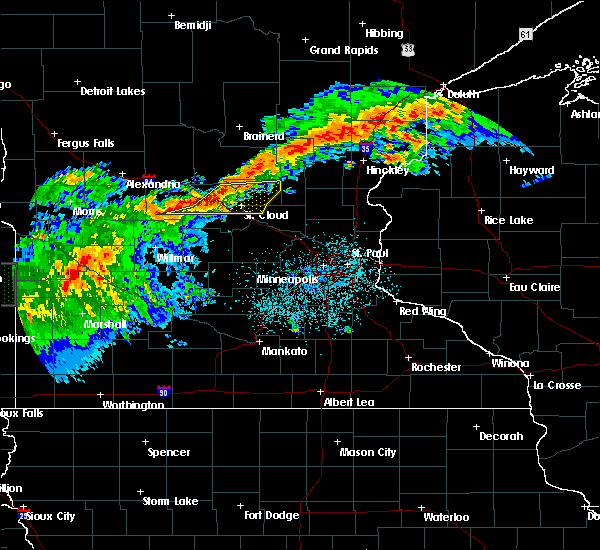 At 1118 pm cdt, severe thunderstorms were located along a line extending from near st. stephen to st. joseph to near farming, moving east at 40 mph (radar indicated). Hazards include 60 mph wind gusts and nickel size hail. Expect damage to roofs. siding and trees. these severe storms will be near, rice around 1125 pm cdt. sartell around 1130 pm cdt. sauk rapids, waite park and foley around 1135 pm cdt. st. cloud around 1140 pm cdt. other locations impacted by these severe thunderstorms include ronneby, parent, oak park, st. stephen, st cloud airport, duelm, st wendel, pleasant lake, gilman and mayhew. This includes interstate 94 in minnesota between mile markers 153 and 171. At 1118 pm cdt, severe thunderstorms were located along a line extending from near st. stephen to st. joseph to near farming, moving east at 40 mph (radar indicated). Hazards include 60 mph wind gusts and nickel size hail. Expect damage to roofs. siding and trees. these severe storms will be near, rice around 1125 pm cdt. sartell around 1130 pm cdt. sauk rapids, waite park and foley around 1135 pm cdt. st. cloud around 1140 pm cdt. other locations impacted by these severe thunderstorms include ronneby, parent, oak park, st. stephen, st cloud airport, duelm, st wendel, pleasant lake, gilman and mayhew. This includes interstate 94 in minnesota between mile markers 153 and 171.
|
| 7/5/2015 11:03 PM CDT |
 At 1103 pm cdt, severe thunderstorms were located along a line extending from st wendel to near farming to st. martin, moving east at 40 mph (radar indicated). Hazards include 60 mph wind gusts and nickel size hail. Expect damage to roofs. siding and trees. severe thunderstorms will be near, collegeville around 1110 pm cdt. st. joseph and rice around 1115 pm cdt. waite park around 1120 pm cdt. sartell around 1125 pm cdt. sauk rapids and rockville around 1130 pm cdt. st. cloud and foley around 1135 pm cdt. other locations impacted by these severe thunderstorms include ronneby, parent, opole, oak park, st. stephen, st cloud airport, duelm, st wendel, st. martin and pleasant lake. This includes interstate 94 in minnesota between mile markers 148 and 171. At 1103 pm cdt, severe thunderstorms were located along a line extending from st wendel to near farming to st. martin, moving east at 40 mph (radar indicated). Hazards include 60 mph wind gusts and nickel size hail. Expect damage to roofs. siding and trees. severe thunderstorms will be near, collegeville around 1110 pm cdt. st. joseph and rice around 1115 pm cdt. waite park around 1120 pm cdt. sartell around 1125 pm cdt. sauk rapids and rockville around 1130 pm cdt. st. cloud and foley around 1135 pm cdt. other locations impacted by these severe thunderstorms include ronneby, parent, opole, oak park, st. stephen, st cloud airport, duelm, st wendel, st. martin and pleasant lake. This includes interstate 94 in minnesota between mile markers 148 and 171.
|
| 5/1/2012 6:34 PM CDT | Storm damage reported in benton county MN, 4 miles WSW of Sauk Rapids, MN |
| 1/1/0001 12:00 AM | Lot of trees down around tow in benton county MN, 1 miles ENE of Sauk Rapids, MN |
| 1/1/0001 12:00 AM | Benton drive being closed due to trees in roadwa in benton county MN, 1 miles ENE of Sauk Rapids, MN |
| 1/1/0001 12:00 AM | Numerous trees down in benton county MN, 1 miles ENE of Sauk Rapids, MN |
Hail Maps for Sauk Rapids, MN
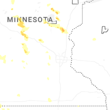


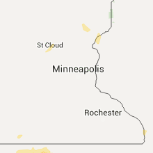


Connect with Interactive Hail Maps