

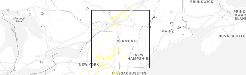
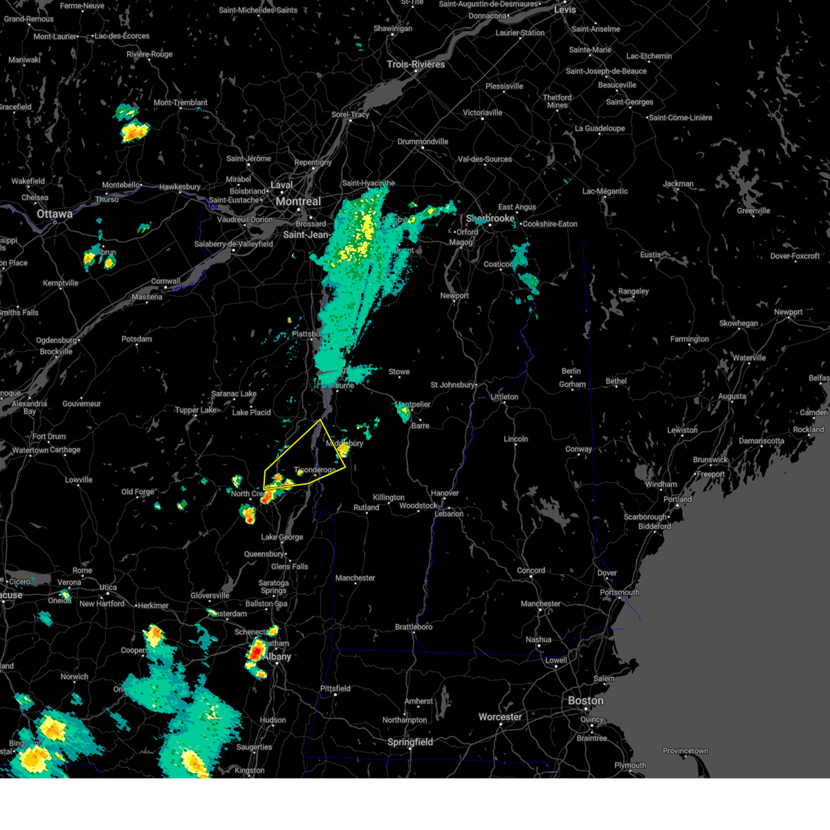
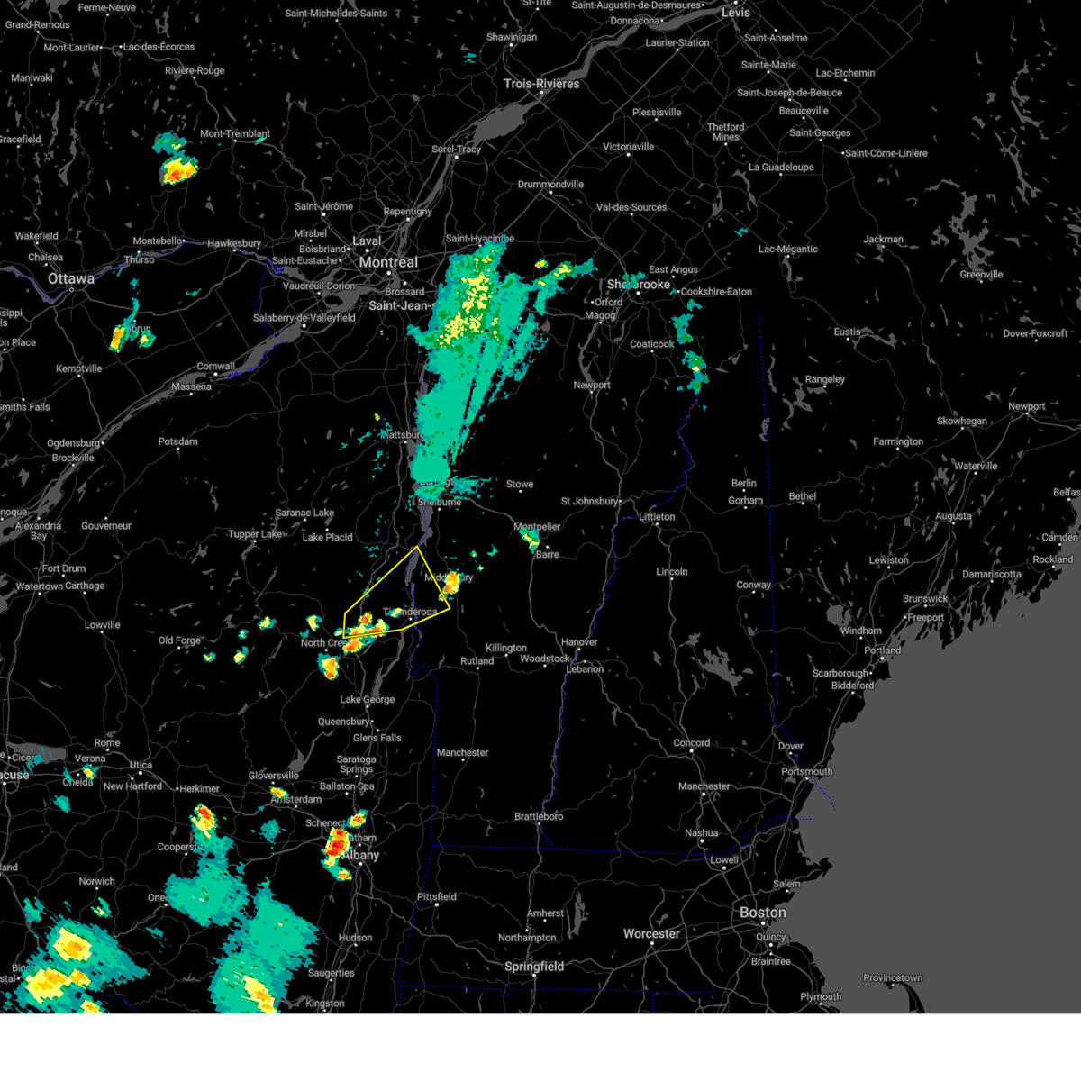
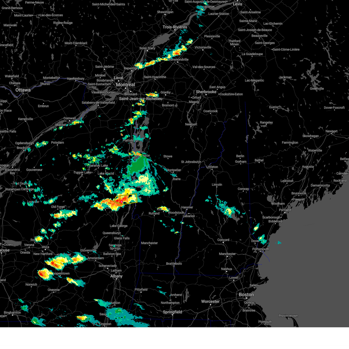
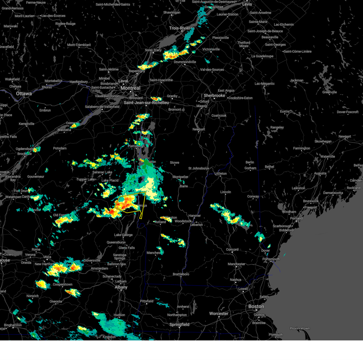
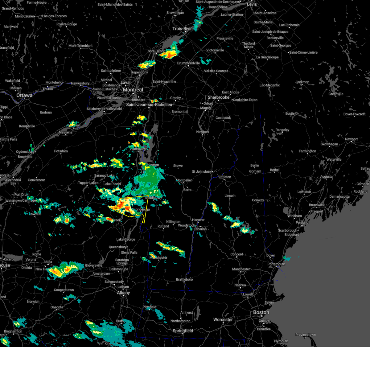
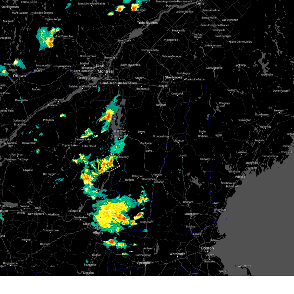
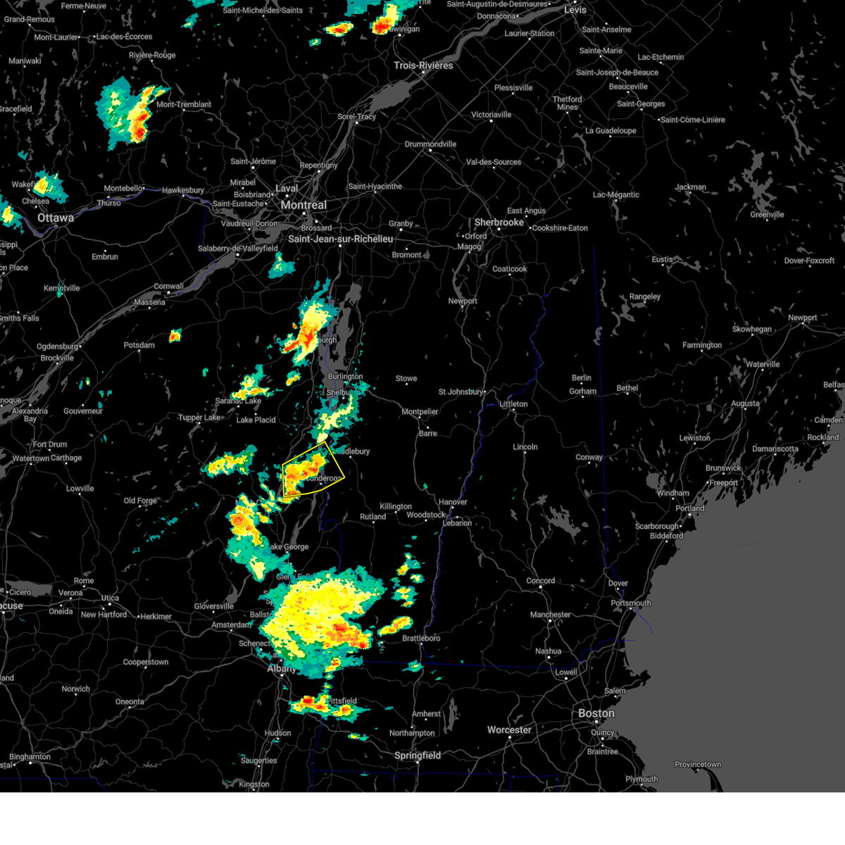
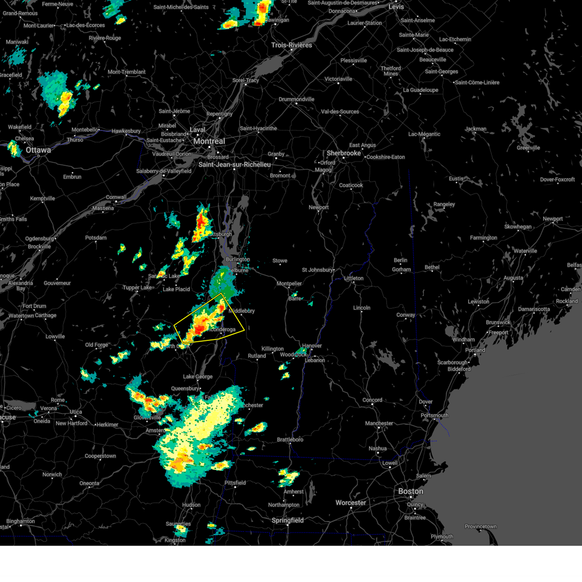
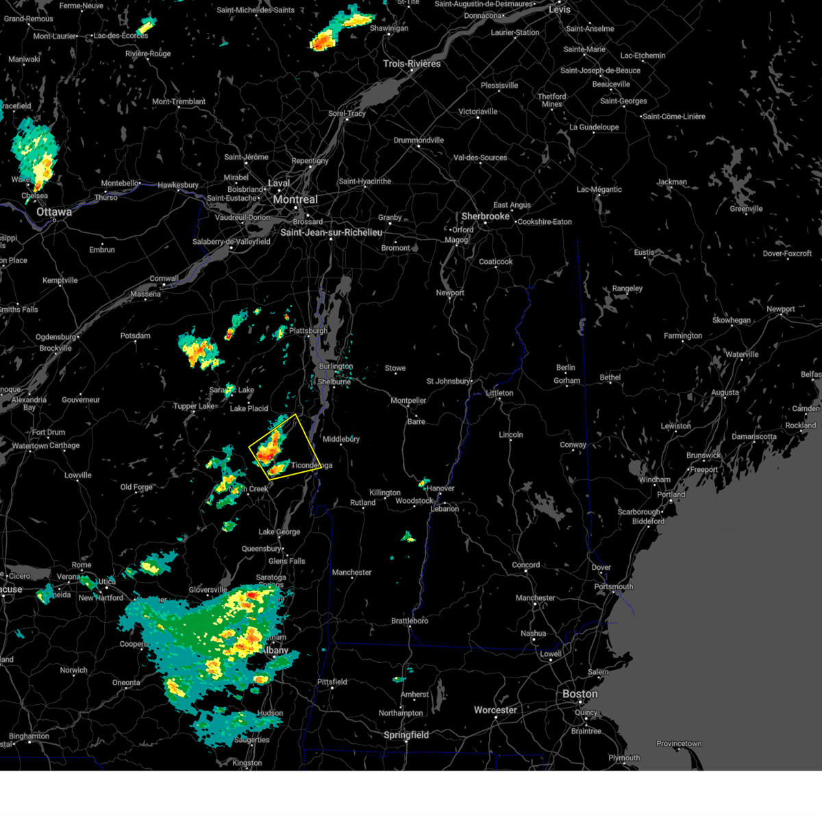
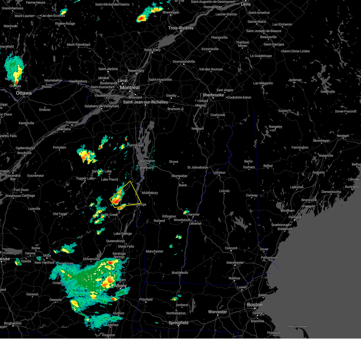
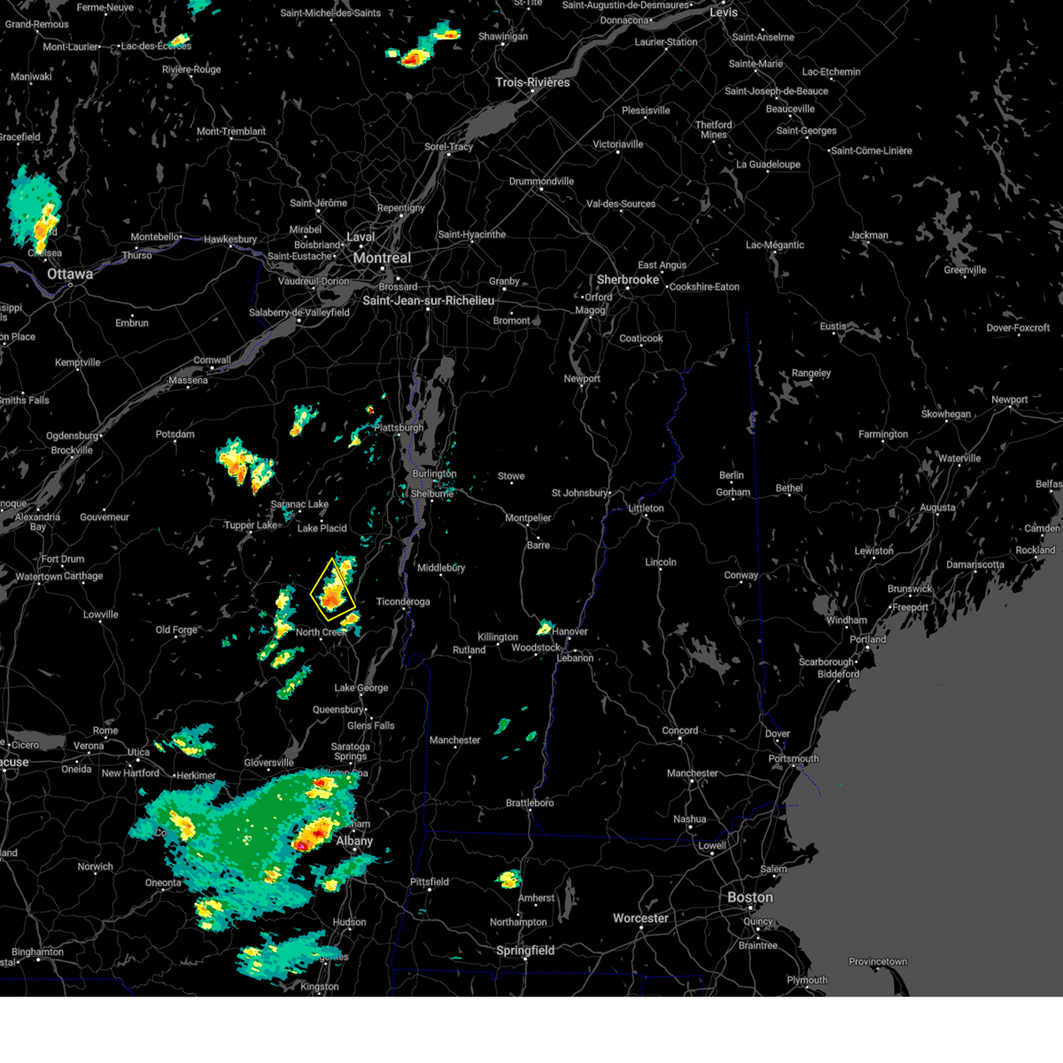
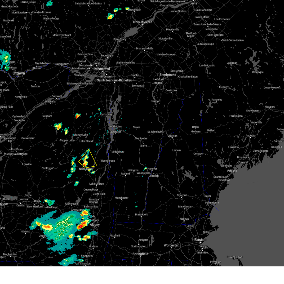
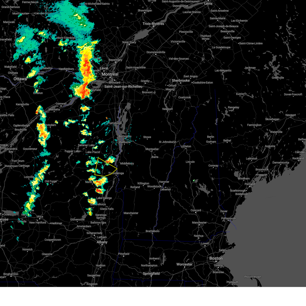
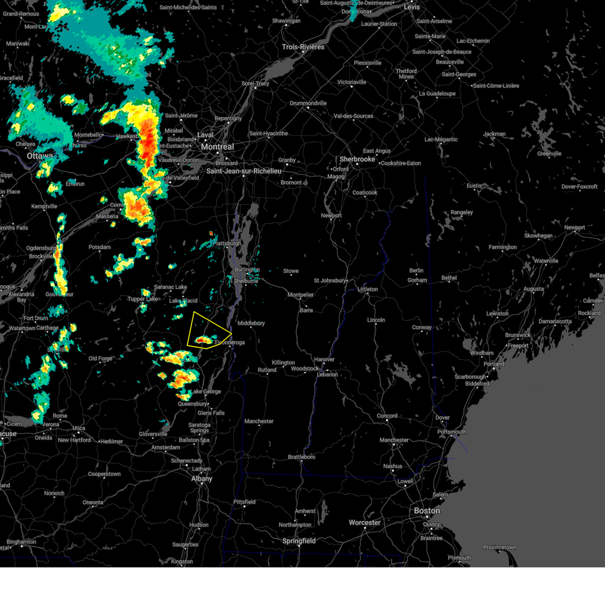
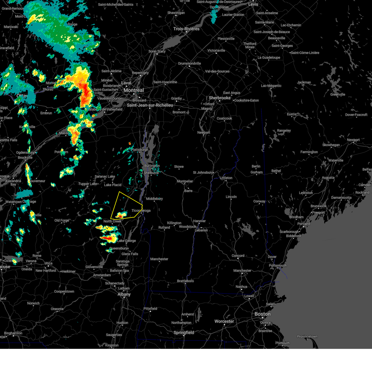
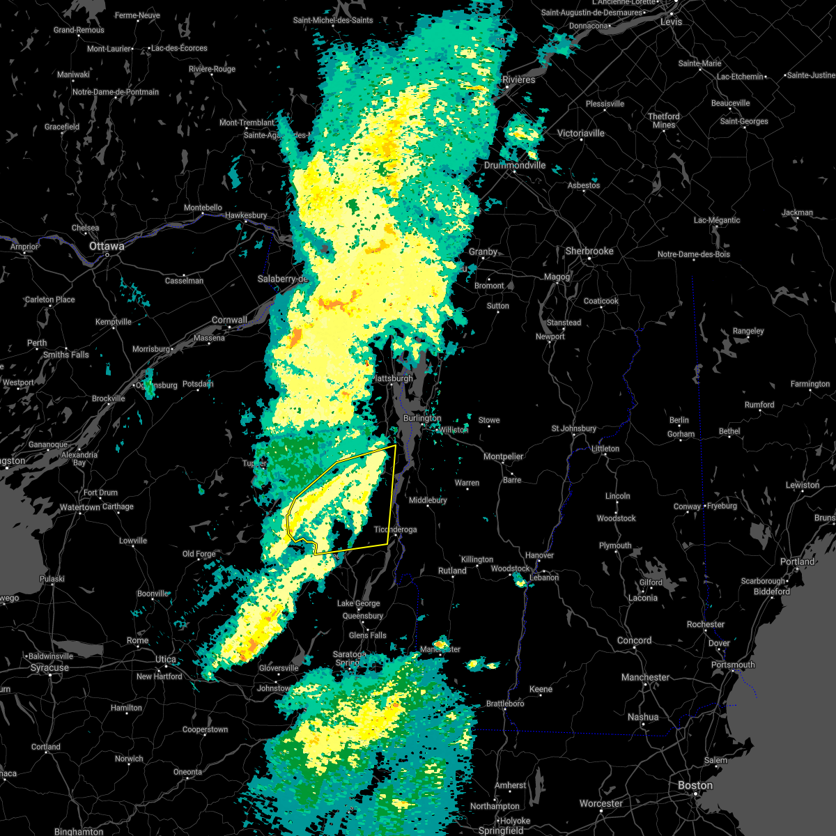
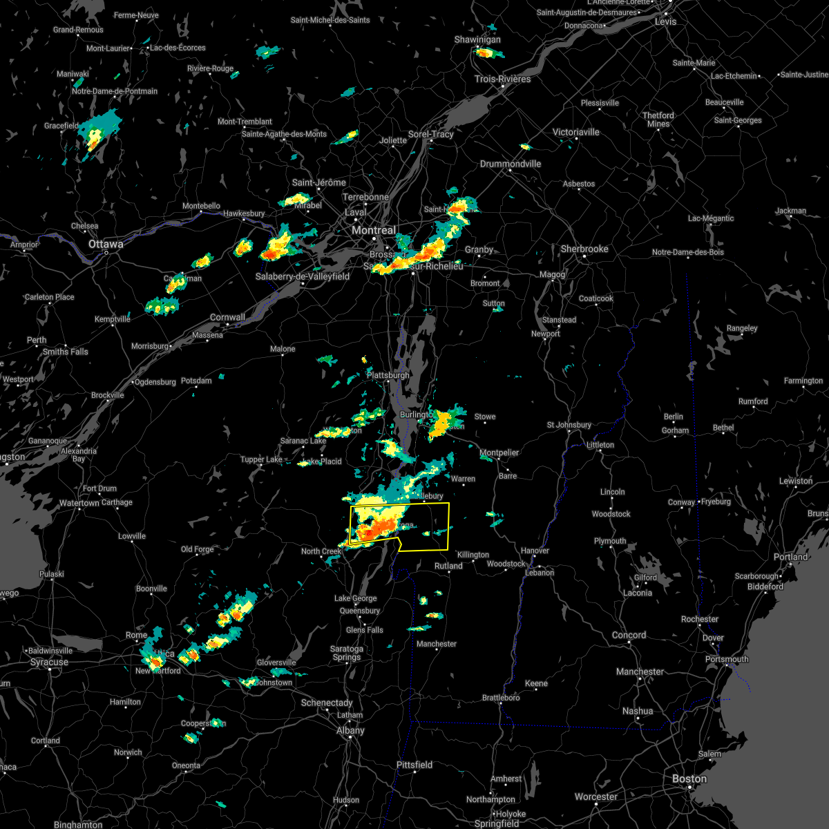
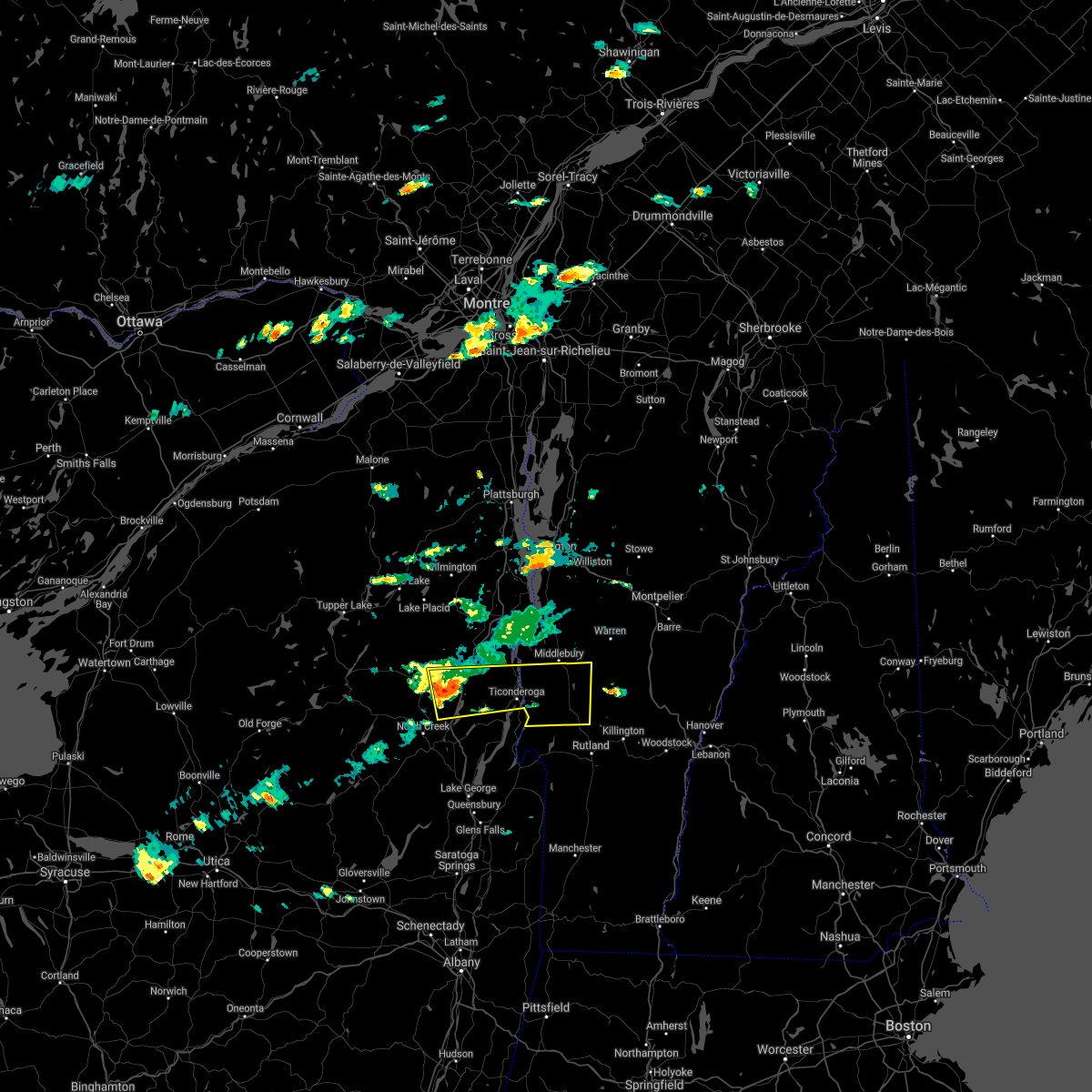
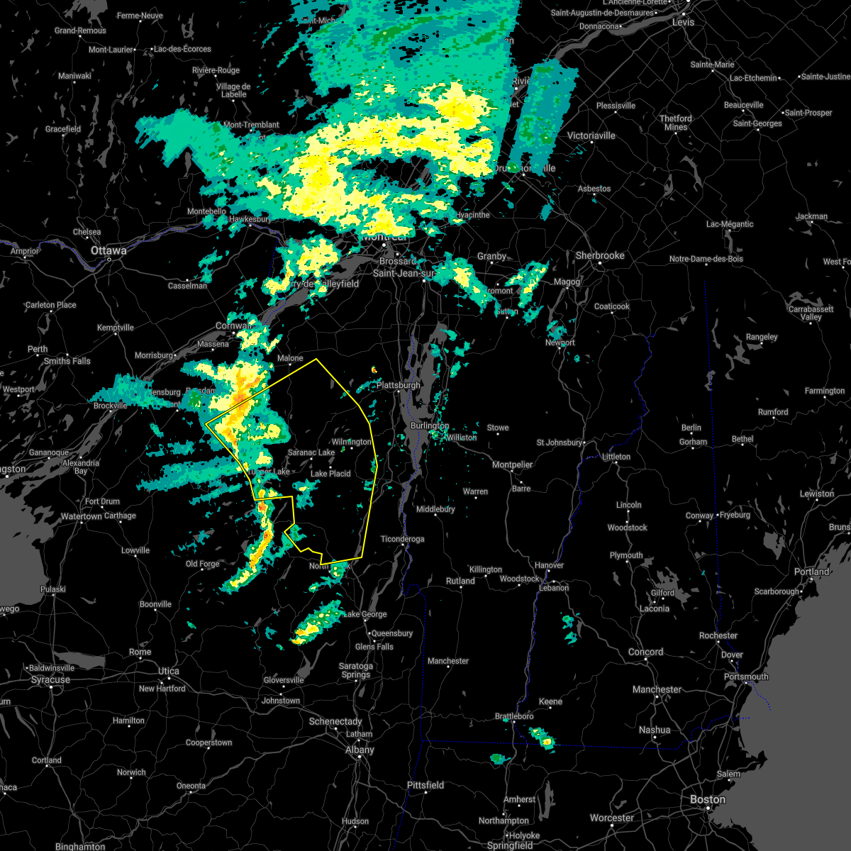
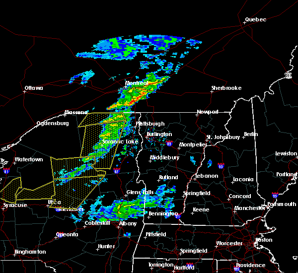
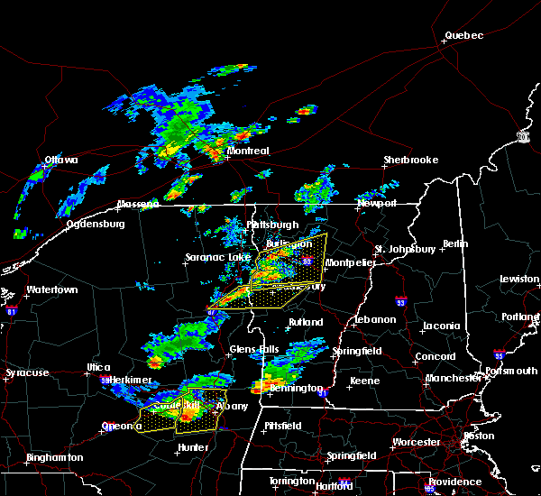
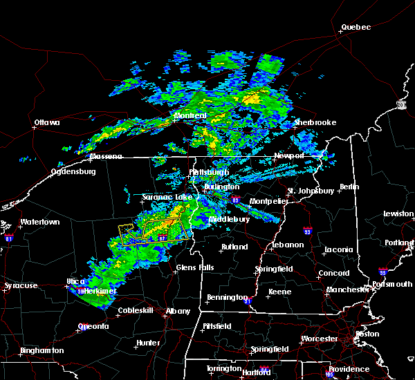
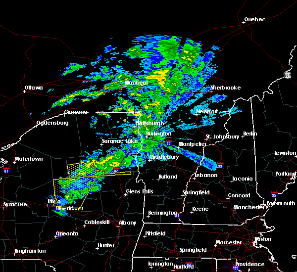
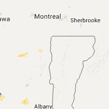
Hail Map for Schroon Lake, NY
The Schroon Lake, NY area has had 6 reports of on-the-ground hail by trained spotters, and has been under severe weather warnings 29 times during the past 12 months. Doppler radar has detected hail at or near Schroon Lake, NY on 14 occasions, including 3 occasions during the past year.
| Name: | Schroon Lake, NY |
| Where Located: | 51.2 miles SSW of Burlington, VT |
| Map: | Google Map for Schroon Lake, NY |
| Population: | 833 |
| Housing Units: | 834 |
| More Info: | Search Google for Schroon Lake, NY |
5
The Top Recent Hail Date for Schroon Lake, NY is Thursday, July 13, 2023 (1st out of 14)
Hail and Wind Damage Spotted near Schroon Lake, NY
| Date / Time | Report Details |
|---|---|
| 9/7/2023 5:26 PM EDT |
 At 525 pm edt, a severe thunderstorm was located over severance, moving northeast at 25 mph (radar indicated). Hazards include 60 mph wind gusts and quarter size hail. Minor hail damage to vehicles is possible. Expect wind damage to trees and powerlines. At 525 pm edt, a severe thunderstorm was located over severance, moving northeast at 25 mph (radar indicated). Hazards include 60 mph wind gusts and quarter size hail. Minor hail damage to vehicles is possible. Expect wind damage to trees and powerlines.
|
| 8/4/2023 2:56 PM EDT |
 At 255 pm edt, a severe thunderstorm was located over pharoah mountain, moving southeast at 20 mph (radar indicated). Hazards include 60 mph wind gusts and quarter size hail. Minor hail damage to vehicles is possible. expect wind damage to trees and powerlines. Locations impacted include, schroon lake, shoreham, orwell, bridport, schroon falls, coates point, black point, grass island, beadles cove, larrabees point, lapham bay, fivemile point, chilson, spar mill bay, stony cove, paradox, pharoah mountain, steep bay, mossy point, and catfish bay in addison county. At 255 pm edt, a severe thunderstorm was located over pharoah mountain, moving southeast at 20 mph (radar indicated). Hazards include 60 mph wind gusts and quarter size hail. Minor hail damage to vehicles is possible. expect wind damage to trees and powerlines. Locations impacted include, schroon lake, shoreham, orwell, bridport, schroon falls, coates point, black point, grass island, beadles cove, larrabees point, lapham bay, fivemile point, chilson, spar mill bay, stony cove, paradox, pharoah mountain, steep bay, mossy point, and catfish bay in addison county.
|
| 8/4/2023 2:53 PM EDT | Numerous trees down between paradox and chilso in essex county NY, 7.3 miles WSW of Schroon Lake, NY |
| 8/4/2023 2:40 PM EDT |
 At 240 pm edt, a severe thunderstorm was located over ironville, moving east at 25 mph (radar indicated). Hazards include 60 mph wind gusts and quarter size hail. Minor hail damage to vehicles is possible. expect wind damage to trees and powerlines. Locations impacted include, moriah, crown point, schroon lake, port henry, shoreham, d a r state park, crown point center, bridport, addison, orwell, benson, weybridge, north hudson, benson bay, black point, plumies point, gilligans bay, giards bay, fivemile point, and west bridport. At 240 pm edt, a severe thunderstorm was located over ironville, moving east at 25 mph (radar indicated). Hazards include 60 mph wind gusts and quarter size hail. Minor hail damage to vehicles is possible. expect wind damage to trees and powerlines. Locations impacted include, moriah, crown point, schroon lake, port henry, shoreham, d a r state park, crown point center, bridport, addison, orwell, benson, weybridge, north hudson, benson bay, black point, plumies point, gilligans bay, giards bay, fivemile point, and west bridport.
|
| 8/4/2023 2:36 PM EDT | Half Dollar sized hail reported 1.6 miles SW of Schroon Lake, NY |
| 8/4/2023 2:19 PM EDT |
 At 218 pm edt, a severe thunderstorm was located over north hudson, moving east at 25 mph (radar indicated). Hazards include 60 mph wind gusts and quarter size hail. Minor hail damage to vehicles is possible. Expect wind damage to trees and powerlines. At 218 pm edt, a severe thunderstorm was located over north hudson, moving east at 25 mph (radar indicated). Hazards include 60 mph wind gusts and quarter size hail. Minor hail damage to vehicles is possible. Expect wind damage to trees and powerlines.
|
| 7/24/2023 3:28 PM EDT |
 The severe thunderstorm warning for southeastern essex and southwestern addison counties will expire at 330 pm edt, the storm which prompted the warning has weakened below severe limits, and no longer poses an immediate threat to life or property. therefore, the warning will be allowed to expire. a severe thunderstorm watch remains in effect until 800 pm edt for northern new york, and central vermont. The severe thunderstorm warning for southeastern essex and southwestern addison counties will expire at 330 pm edt, the storm which prompted the warning has weakened below severe limits, and no longer poses an immediate threat to life or property. therefore, the warning will be allowed to expire. a severe thunderstorm watch remains in effect until 800 pm edt for northern new york, and central vermont.
|
| 7/24/2023 3:17 PM EDT |
 At 317 pm edt, a severe thunderstorm was located over hickock point, moving northeast at 15 mph (radar indicated). Hazards include 60 mph wind gusts and quarter size hail. Minor hail damage to vehicles is possible. expect wind damage to trees and powerlines. locations impacted include, moriah, crown point, port henry, shoreham, d a r state park, crown point center, bridport, addison, whiting, cornwall, orwell, north hudson, owls head bay, plumies point, gilligans bay, giards bay, potash bay, fivemile point, west bridport, and chilson. hail threat, radar indicated max hail size, 1. 00 in wind threat, radar indicated max wind gust, 60 mph. At 317 pm edt, a severe thunderstorm was located over hickock point, moving northeast at 15 mph (radar indicated). Hazards include 60 mph wind gusts and quarter size hail. Minor hail damage to vehicles is possible. expect wind damage to trees and powerlines. locations impacted include, moriah, crown point, port henry, shoreham, d a r state park, crown point center, bridport, addison, whiting, cornwall, orwell, north hudson, owls head bay, plumies point, gilligans bay, giards bay, potash bay, fivemile point, west bridport, and chilson. hail threat, radar indicated max hail size, 1. 00 in wind threat, radar indicated max wind gust, 60 mph.
|
| 7/24/2023 2:35 PM EDT | Multiple trees uprooted and snapped. wind estimated 55 - 72 mp in essex county NY, 7.3 miles WSW of Schroon Lake, NY |
| 7/24/2023 2:27 PM EDT |
 At 227 pm edt, a severe thunderstorm was located over grass island, moving northeast at 20 mph (radar indicated). Hazards include 60 mph wind gusts and quarter size hail. Minor hail damage to vehicles is possible. Expect wind damage to trees and powerlines. At 227 pm edt, a severe thunderstorm was located over grass island, moving northeast at 20 mph (radar indicated). Hazards include 60 mph wind gusts and quarter size hail. Minor hail damage to vehicles is possible. Expect wind damage to trees and powerlines.
|
| 7/24/2023 1:35 PM EDT | Trees dow in essex county NY, 7.3 miles S of Schroon Lake, NY |
| 7/24/2023 1:28 PM EDT |
 At 128 pm edt, a severe thunderstorm was located near north hudson, moving northeast at 15 mph (radar indicated). Hazards include 60 mph wind gusts and quarter size hail. Minor hail damage to vehicles is possible. Expect wind damage to trees and powerlines. At 128 pm edt, a severe thunderstorm was located near north hudson, moving northeast at 15 mph (radar indicated). Hazards include 60 mph wind gusts and quarter size hail. Minor hail damage to vehicles is possible. Expect wind damage to trees and powerlines.
|
| 7/24/2023 1:21 PM EDT |
 At 121 pm edt, a severe thunderstorm was located over schroon falls, moving northeast at 30 mph (radar indicated). Hazards include 60 mph wind gusts and quarter size hail. Minor hail damage to vehicles is possible. Expect wind damage to trees and powerlines. At 121 pm edt, a severe thunderstorm was located over schroon falls, moving northeast at 30 mph (radar indicated). Hazards include 60 mph wind gusts and quarter size hail. Minor hail damage to vehicles is possible. Expect wind damage to trees and powerlines.
|
| 7/24/2023 1:15 PM EDT | Half Dollar sized hail reported 1.3 miles ENE of Schroon Lake, NY, hoffman road |
| 7/24/2023 1:09 PM EDT |
 At 109 pm edt, a severe thunderstorm was located 8 miles north of minerva, moving east at 10 mph (radar indicated). Hazards include 60 mph wind gusts and half dollar size hail. Minor hail damage to vehicles is possible. expect wind damage to trees and powerlines. this severe thunderstorm will remain over mainly rural areas of south central essex county. hail threat, radar indicated max hail size, 1. 25 in wind threat, radar indicated max wind gust, 60 mph. At 109 pm edt, a severe thunderstorm was located 8 miles north of minerva, moving east at 10 mph (radar indicated). Hazards include 60 mph wind gusts and half dollar size hail. Minor hail damage to vehicles is possible. expect wind damage to trees and powerlines. this severe thunderstorm will remain over mainly rural areas of south central essex county. hail threat, radar indicated max hail size, 1. 25 in wind threat, radar indicated max wind gust, 60 mph.
|
| 7/24/2023 12:50 PM EDT |
 At 1250 pm edt, a severe thunderstorm was located near vanderwhacker mountain, moving east at 10 mph (radar indicated). Hazards include 60 mph wind gusts and half dollar size hail. Minor hail damage to vehicles is possible. Expect wind damage to trees and powerlines. At 1250 pm edt, a severe thunderstorm was located near vanderwhacker mountain, moving east at 10 mph (radar indicated). Hazards include 60 mph wind gusts and half dollar size hail. Minor hail damage to vehicles is possible. Expect wind damage to trees and powerlines.
|
| 1/1/0001 12:00 AM | Quarter sized hail reported 7.3 miles S of Schroon Lake, NY, frontier campground reported quarter size hail. time estimated from radar. |
| 1/1/0001 12:00 AM | Quarter sized hail reported 4.4 miles WSW of Schroon Lake, NY, paradox lake campground reported hail ranging from dime to quarter size. |
| 7/13/2023 5:14 PM EDT |
 At 514 pm edt, a severe thunderstorm was located over pharoah mountain, moving northeast at 40 mph (radar indicated). Hazards include 60 mph wind gusts and quarter size hail. Minor hail damage to vehicles is possible. Expect wind damage to trees and powerlines. At 514 pm edt, a severe thunderstorm was located over pharoah mountain, moving northeast at 40 mph (radar indicated). Hazards include 60 mph wind gusts and quarter size hail. Minor hail damage to vehicles is possible. Expect wind damage to trees and powerlines.
|
| 1/1/0001 12:00 AM | Quarter sized hail reported 7.3 miles S of Schroon Lake, NY, frontier campground reported quarter size hail. time estimated from radar. |
| 7/13/2023 4:36 PM EDT |
 At 436 pm edt, a severe thunderstorm was located over grass island, moving northeast at 30 mph (radar indicated). Hazards include 60 mph wind gusts and quarter size hail. Minor hail damage to vehicles is possible. Expect wind damage to trees and powerlines. At 436 pm edt, a severe thunderstorm was located over grass island, moving northeast at 30 mph (radar indicated). Hazards include 60 mph wind gusts and quarter size hail. Minor hail damage to vehicles is possible. Expect wind damage to trees and powerlines.
|
| 7/13/2023 4:26 PM EDT |
 The severe thunderstorm warning for southeastern essex county will expire at 430 pm edt, the storm which prompted the warning has weakened below severe limits, and has exited the warned area. therefore, the warning will be allowed to expire. a severe thunderstorm watch remains in effect until 800 pm edt for northern new york, and central vermont. The severe thunderstorm warning for southeastern essex county will expire at 430 pm edt, the storm which prompted the warning has weakened below severe limits, and has exited the warned area. therefore, the warning will be allowed to expire. a severe thunderstorm watch remains in effect until 800 pm edt for northern new york, and central vermont.
|
| 7/13/2023 3:38 PM EDT |
 At 338 pm edt, a severe thunderstorm was located near south schroon, moving northeast at 20 mph (radar indicated). Hazards include 60 mph wind gusts and quarter size hail. Minor hail damage to vehicles is possible. Expect wind damage to trees and powerlines. At 338 pm edt, a severe thunderstorm was located near south schroon, moving northeast at 20 mph (radar indicated). Hazards include 60 mph wind gusts and quarter size hail. Minor hail damage to vehicles is possible. Expect wind damage to trees and powerlines.
|
| 7/13/2023 3:25 PM EDT |
 The severe thunderstorm warning for southeastern essex county will expire at 330 pm edt, the storm which prompted the warning has moved out of the area. therefore, the warning will be allowed to expire. a severe thunderstorm watch remains in effect until 800 pm edt for northern new york, and central vermont. The severe thunderstorm warning for southeastern essex county will expire at 330 pm edt, the storm which prompted the warning has moved out of the area. therefore, the warning will be allowed to expire. a severe thunderstorm watch remains in effect until 800 pm edt for northern new york, and central vermont.
|
| 7/13/2023 3:01 PM EDT | Half Dollar sized hail reported 7.3 miles S of Schroon Lake, NY, north hudson campground estimated half dollar size hail. |
| 7/13/2023 3:01 PM EDT |
 At 300 pm edt, a severe thunderstorm was located over schroon falls, moving northeast at 25 mph (radar indicated). Hazards include 60 mph wind gusts and quarter size hail. Minor hail damage to vehicles is possible. expect wind damage to trees and powerlines. locations impacted include, crown point, schroon lake, crown point center, north hudson, paradox, severance, schroon falls, steep bay, ironville, chilson, grass island, and gilligans bay. hail threat, radar indicated max hail size, 1. 00 in wind threat, radar indicated max wind gust, 60 mph. At 300 pm edt, a severe thunderstorm was located over schroon falls, moving northeast at 25 mph (radar indicated). Hazards include 60 mph wind gusts and quarter size hail. Minor hail damage to vehicles is possible. expect wind damage to trees and powerlines. locations impacted include, crown point, schroon lake, crown point center, north hudson, paradox, severance, schroon falls, steep bay, ironville, chilson, grass island, and gilligans bay. hail threat, radar indicated max hail size, 1. 00 in wind threat, radar indicated max wind gust, 60 mph.
|
| 7/13/2023 2:44 PM EDT |
 At 243 pm edt, a severe thunderstorm was located over schroon lake, moving northeast at 25 mph (radar indicated). Hazards include 60 mph wind gusts and quarter size hail. Minor hail damage to vehicles is possible. Expect wind damage to trees and powerlines. At 243 pm edt, a severe thunderstorm was located over schroon lake, moving northeast at 25 mph (radar indicated). Hazards include 60 mph wind gusts and quarter size hail. Minor hail damage to vehicles is possible. Expect wind damage to trees and powerlines.
|
| 10/16/2021 2:30 PM EDT | Tree down on trout brook r in essex county NY, 6.7 miles ENE of Schroon Lake, NY |
| 7/20/2021 7:06 PM EDT |
 At 704 pm edt, a line of severe thunderstorms over northwest vermont and essex county new york was located along a line extending from shad island to south burlington to near chilson, new york moving east at 35 mph (radar indicated). Hazards include 60 mph wind gusts and quarter size hail. Expect wind damage to trees and powerlines. minor hail damage to vehicles is possible. Locations impacted include, essex junction, plattsburgh international airport, burlington, burlington international airport, plattsburgh, middlebury, south burlington, vergennes, peru, beekmantown, moriah, chazy, willsboro, crown point, morrisville, enosburg falls, westport, elizabethtown, champlain and waterbury village. At 704 pm edt, a line of severe thunderstorms over northwest vermont and essex county new york was located along a line extending from shad island to south burlington to near chilson, new york moving east at 35 mph (radar indicated). Hazards include 60 mph wind gusts and quarter size hail. Expect wind damage to trees and powerlines. minor hail damage to vehicles is possible. Locations impacted include, essex junction, plattsburgh international airport, burlington, burlington international airport, plattsburgh, middlebury, south burlington, vergennes, peru, beekmantown, moriah, chazy, willsboro, crown point, morrisville, enosburg falls, westport, elizabethtown, champlain and waterbury village.
|
| 7/20/2021 6:31 PM EDT |
 At 630 pm edt, a line of severe thunderstorms over northeast new york was located along a line extending from near perry mills to near harkness to 9 miles west of schroon falls, moving east at 40 mph (radar indicated). Hazards include 60 mph wind gusts and quarter size hail. Expect wind damage to trees and powerlines. Minor hail damage to vehicles is possible. At 630 pm edt, a line of severe thunderstorms over northeast new york was located along a line extending from near perry mills to near harkness to 9 miles west of schroon falls, moving east at 40 mph (radar indicated). Hazards include 60 mph wind gusts and quarter size hail. Expect wind damage to trees and powerlines. Minor hail damage to vehicles is possible.
|
| 7/8/2021 9:14 PM EDT |
 At 912 pm edt, a severe thunderstorm was located over st. huberts, moving east at 45 mph (radar indicated). Hazards include 60 mph wind gusts. Expect damage to trees and powerlines. Locations impacted include, moriah, elizabethtown, keene, minerva, newcomb, port henry, mount marcy, schroon lake, keene valley, lewis, north hudson, olmstedville, schroon falls, grass island, mount van hoevenberg, mineville, chilson, moriah center, new russia and vanderwhacker mountain. At 912 pm edt, a severe thunderstorm was located over st. huberts, moving east at 45 mph (radar indicated). Hazards include 60 mph wind gusts. Expect damage to trees and powerlines. Locations impacted include, moriah, elizabethtown, keene, minerva, newcomb, port henry, mount marcy, schroon lake, keene valley, lewis, north hudson, olmstedville, schroon falls, grass island, mount van hoevenberg, mineville, chilson, moriah center, new russia and vanderwhacker mountain.
|
| 7/8/2021 8:50 PM EDT |
 At 849 pm edt, a severe thunderstorm was located near tahawus, moving east at 45 mph (radar indicated). Hazards include 60 mph wind gusts. expect damage to trees and powerlines At 849 pm edt, a severe thunderstorm was located near tahawus, moving east at 45 mph (radar indicated). Hazards include 60 mph wind gusts. expect damage to trees and powerlines
|
| 6/30/2021 1:18 PM EDT |
 At 118 pm edt, a severe thunderstorm was located over paradox, moving east at 45 mph (radar indicated). Hazards include 60 mph wind gusts and quarter size hail. Minor hail damage to vehicles is possible. expect wind damage to trees and powerlines. Locations impacted include, middlebury, crown point, cornwall, sudbury, salisbury, orwell, whiting, goshen, shoreham, ripton, crown point center, brandon, leicester, bridport, benson, hubbardton, pittsford, chittenden, hancock and north hudson. At 118 pm edt, a severe thunderstorm was located over paradox, moving east at 45 mph (radar indicated). Hazards include 60 mph wind gusts and quarter size hail. Minor hail damage to vehicles is possible. expect wind damage to trees and powerlines. Locations impacted include, middlebury, crown point, cornwall, sudbury, salisbury, orwell, whiting, goshen, shoreham, ripton, crown point center, brandon, leicester, bridport, benson, hubbardton, pittsford, chittenden, hancock and north hudson.
|
| 6/30/2021 1:10 PM EDT | Trees and power lines down on fowler ave in essex county NY, 0.5 miles NE of Schroon Lake, NY |
| 6/30/2021 1:00 PM EDT |
 At 1259 pm edt, a severe thunderstorm was located near schroon falls, moving east at 45 mph (radar indicated). Hazards include 60 mph wind gusts and quarter size hail. Minor hail damage to vehicles is possible. expect wind damage to trees and powerlines. Locations impacted include, middlebury, crown point, cornwall, sudbury, salisbury, schroon lake, orwell, whiting, goshen, shoreham, ripton, crown point center, brandon, leicester, bridport, benson, hubbardton, pittsford, chittenden and hancock. At 1259 pm edt, a severe thunderstorm was located near schroon falls, moving east at 45 mph (radar indicated). Hazards include 60 mph wind gusts and quarter size hail. Minor hail damage to vehicles is possible. expect wind damage to trees and powerlines. Locations impacted include, middlebury, crown point, cornwall, sudbury, salisbury, schroon lake, orwell, whiting, goshen, shoreham, ripton, crown point center, brandon, leicester, bridport, benson, hubbardton, pittsford, chittenden and hancock.
|
| 6/30/2021 12:46 PM EDT |
 At 1245 pm edt, a severe thunderstorm was located 7 miles north of minerva, moving east at 45 mph (radar indicated). Hazards include 60 mph wind gusts and quarter size hail. Minor hail damage to vehicles is possible. Expect wind damage to trees and powerlines. At 1245 pm edt, a severe thunderstorm was located 7 miles north of minerva, moving east at 45 mph (radar indicated). Hazards include 60 mph wind gusts and quarter size hail. Minor hail damage to vehicles is possible. Expect wind damage to trees and powerlines.
|
| 5/26/2021 3:18 PM EDT | Trees down on wires near old schroon roa in essex county NY, 4.2 miles NNE of Schroon Lake, NY |
| 3/26/2021 1:14 PM EDT | Tree down on powerlines on river road just off of route 7 in essex county NY, 2.7 miles W of Schroon Lake, NY |
| 3/26/2021 12:13 PM EDT |
 At 1213 pm edt, severe thunderstorms were located along a line extending from near stark to near childwold to piercefield to 11 miles southeast of horseshoe lake to 24 miles west of vanderwhacker mountain, moving northeast at 50 mph (radar indicated). Hazards include 60 mph wind gusts. expect damage to trees and powerlines At 1213 pm edt, severe thunderstorms were located along a line extending from near stark to near childwold to piercefield to 11 miles southeast of horseshoe lake to 24 miles west of vanderwhacker mountain, moving northeast at 50 mph (radar indicated). Hazards include 60 mph wind gusts. expect damage to trees and powerlines
|
| 3/20/2020 3:54 PM EDT | Trees down in essex county NY, 3.8 miles S of Schroon Lake, NY |
| 3/20/2020 3:43 PM EDT |
 At 343 pm edt, severe thunderstorms were located along a line extending from bluff point to mount marcy, moving east at 65 mph (radar indicated). Hazards include 60 mph wind gusts. expect damage to trees and powerlines At 343 pm edt, severe thunderstorms were located along a line extending from bluff point to mount marcy, moving east at 65 mph (radar indicated). Hazards include 60 mph wind gusts. expect damage to trees and powerlines
|
| 3/20/2020 3:15 PM EDT |
 At 314 pm edt, severe thunderstorms were located along a line extending from standish to near ray brook, moving northeast at 70 mph (radar indicated. this line has a history of producing wind damage). Hazards include 60 mph wind gusts. expect damage to trees and powerlines At 314 pm edt, severe thunderstorms were located along a line extending from standish to near ray brook, moving northeast at 70 mph (radar indicated. this line has a history of producing wind damage). Hazards include 60 mph wind gusts. expect damage to trees and powerlines
|
| 8/17/2019 4:40 PM EDT | Route 74 from wicker street in the town of schroon had downed trees and wires. time estimated by rada in essex county NY, 3.8 miles S of Schroon Lake, NY |
| 5/4/2018 7:41 PM EDT |
 At 741 pm edt, a severe thunderstorm was located over severance, moving east at 45 mph (radar indicated). Hazards include 60 mph wind gusts and quarter size hail. Minor hail damage to vehicles is possible. Expect wind damage to trees and powerlines. At 741 pm edt, a severe thunderstorm was located over severance, moving east at 45 mph (radar indicated). Hazards include 60 mph wind gusts and quarter size hail. Minor hail damage to vehicles is possible. Expect wind damage to trees and powerlines.
|
| 8/12/2017 6:16 PM EDT |
 At 615 pm edt, severe thunderstorms were located along a line extending from moriah to schroon lake, moving east at 25 mph (radar indicated). Hazards include 60 mph wind gusts and quarter size hail. Minor hail damage to vehicles is possible. Expect wind damage to trees and powerlines. At 615 pm edt, severe thunderstorms were located along a line extending from moriah to schroon lake, moving east at 25 mph (radar indicated). Hazards include 60 mph wind gusts and quarter size hail. Minor hail damage to vehicles is possible. Expect wind damage to trees and powerlines.
|
| 5/1/2017 8:49 PM EDT |
 At 848 pm edt, severe thunderstorms were located along a line extending from near harkness to st. huberts to near south schroon, moving east at 50 mph (radar indicated). Hazards include 60 mph wind gusts. Expect damage to roofs, siding, and trees. Locations impacted include, plattsburgh international airport, essex, peru, willsboro, crown point, westport, wilmington, elizabethtown, minerva, schroon lake, au sable forks, mount marcy, jay in essex county, ferrisburg, clayburg, keene valley, port kent, kingsland bay state park, d a r state park and crown point center. At 848 pm edt, severe thunderstorms were located along a line extending from near harkness to st. huberts to near south schroon, moving east at 50 mph (radar indicated). Hazards include 60 mph wind gusts. Expect damage to roofs, siding, and trees. Locations impacted include, plattsburgh international airport, essex, peru, willsboro, crown point, westport, wilmington, elizabethtown, minerva, schroon lake, au sable forks, mount marcy, jay in essex county, ferrisburg, clayburg, keene valley, port kent, kingsland bay state park, d a r state park and crown point center.
|
| 5/1/2017 8:22 PM EDT |
 At 821 pm edt, severe thunderstorms were located along a line extending from near loon lake to near coreys to near long lake, moving east at 50 mph (radar indicated). Hazards include 60 mph wind gusts. expect damage to roofs, siding, and trees At 821 pm edt, severe thunderstorms were located along a line extending from near loon lake to near coreys to near long lake, moving east at 50 mph (radar indicated). Hazards include 60 mph wind gusts. expect damage to roofs, siding, and trees
|
| 8/16/2016 10:40 PM EDT |
 At 1039 pm edt, severe thunderstorms were located along a line extending from north ferrisburgh to bridport to pharoah mountain, moving east at 40 mph (radar indicated). Hazards include 60 mph wind gusts. Expect damage to roofs. siding. And trees. At 1039 pm edt, severe thunderstorms were located along a line extending from north ferrisburgh to bridport to pharoah mountain, moving east at 40 mph (radar indicated). Hazards include 60 mph wind gusts. Expect damage to roofs. siding. And trees.
|
| 8/16/2016 9:49 PM EDT |
 At 947 pm edt, a severe thunderstorm was located from near schroon falls to minerva, moving east at 45 mph (radar indicated). Hazards include 60 mph wind gusts. Expect damage to roofs. siding. and trees. Locations impacted include, minerva, schroon lake, north hudson, pharoah mountain, chilson, steep bay, severance, paradox, grass island, south schroon, underwood, ironville, olmstedville, schroon falls and tahawus. At 947 pm edt, a severe thunderstorm was located from near schroon falls to minerva, moving east at 45 mph (radar indicated). Hazards include 60 mph wind gusts. Expect damage to roofs. siding. and trees. Locations impacted include, minerva, schroon lake, north hudson, pharoah mountain, chilson, steep bay, severance, paradox, grass island, south schroon, underwood, ironville, olmstedville, schroon falls and tahawus.
|
| 8/16/2016 9:19 PM EDT |
 At 917 pm edt, a severe thunderstorm was located near indian lake, moving east at 45 mph (radar indicated). Hazards include 60 mph wind gusts. Expect damage to roofs. siding. And trees. At 917 pm edt, a severe thunderstorm was located near indian lake, moving east at 45 mph (radar indicated). Hazards include 60 mph wind gusts. Expect damage to roofs. siding. And trees.
|
| 8/9/2012 2:30 PM EDT | Limbs and branches down throughout campground in essex county NY, 3.2 miles SSE of Schroon Lake, NY |
| 7/17/2012 5:30 PM EDT | Multiple trees down in essex county NY, 0.5 miles NE of Schroon Lake, NY |
| 7/17/2012 5:25 PM EDT | Numerous trees down in essex county NY, 2.7 miles SSW of Schroon Lake, NY |
| 7/17/2012 5:24 PM EDT | Trees down in essex county NY, 7.3 miles S of Schroon Lake, NY |
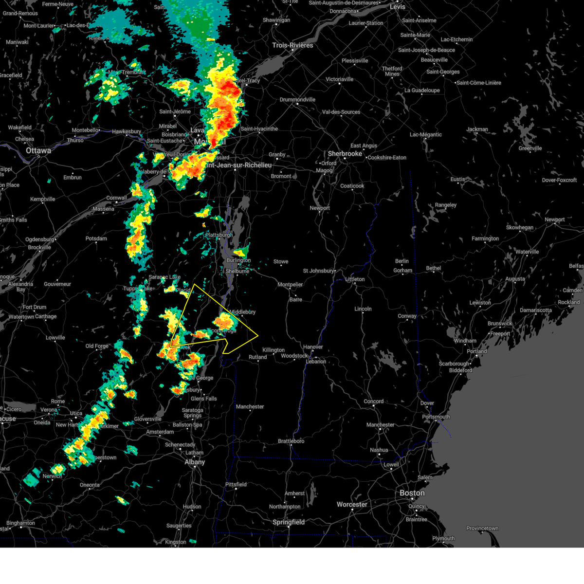
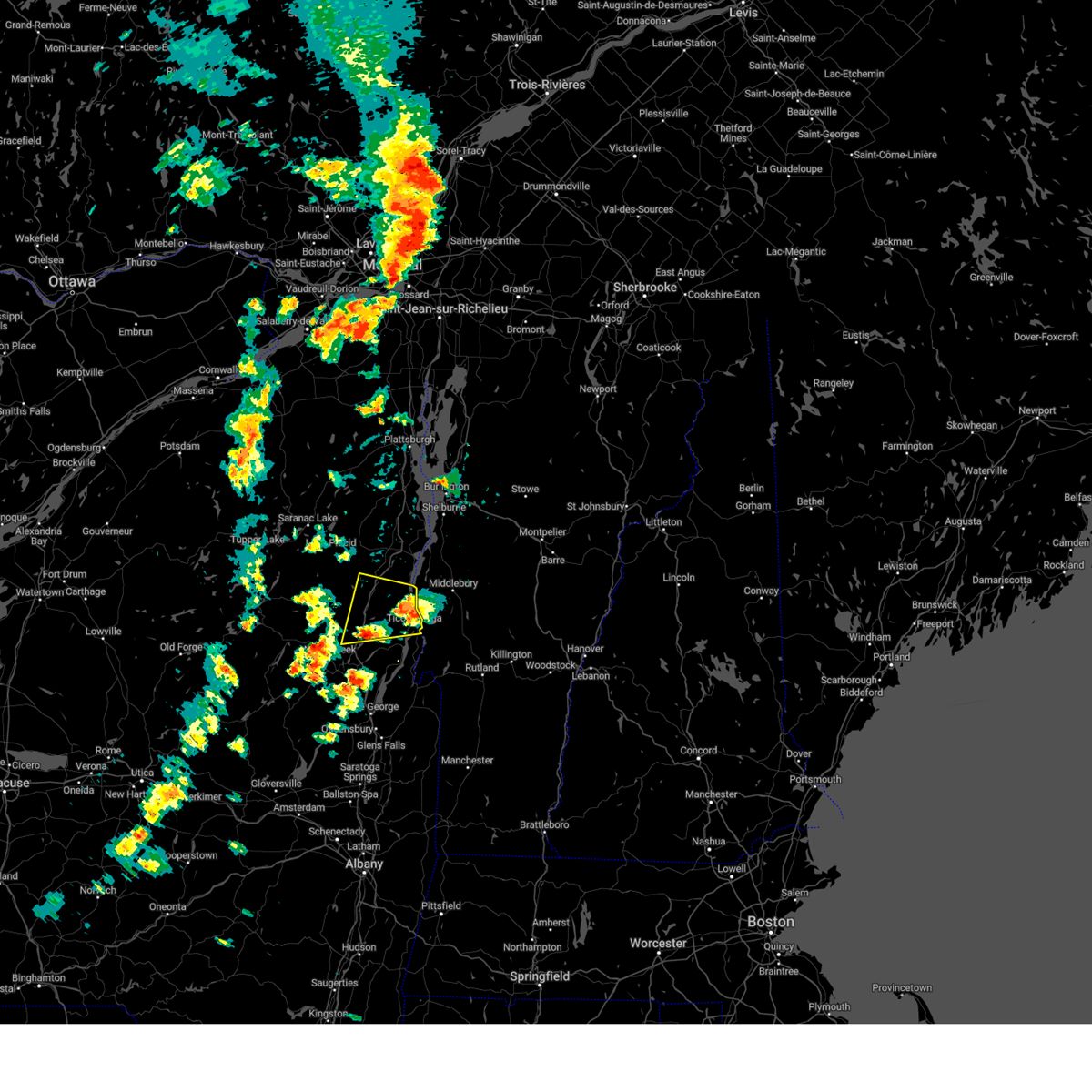
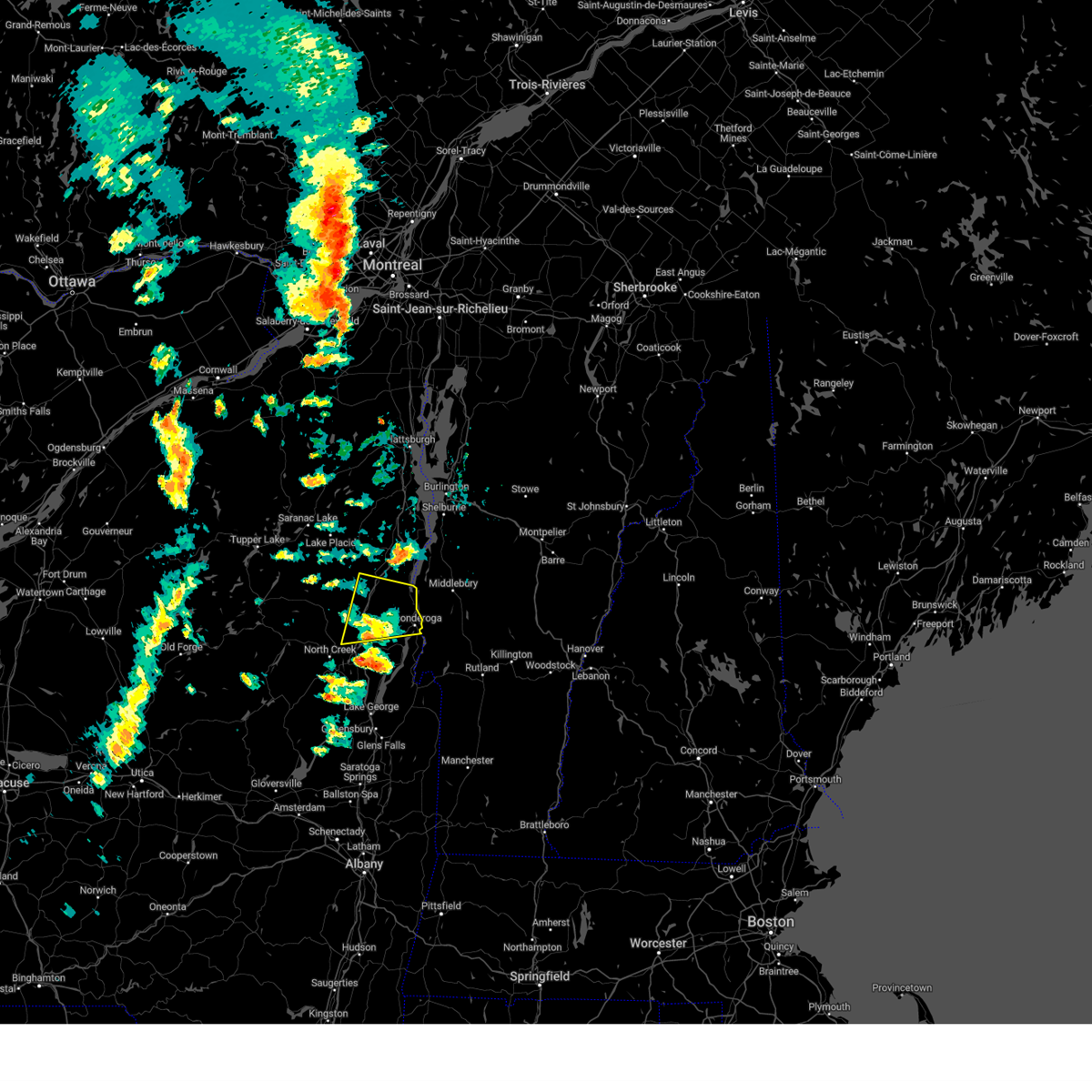
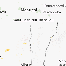
Hail Maps for Schroon Lake, NY


Connect with Interactive Hail Maps