

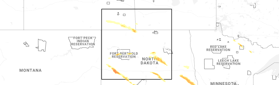
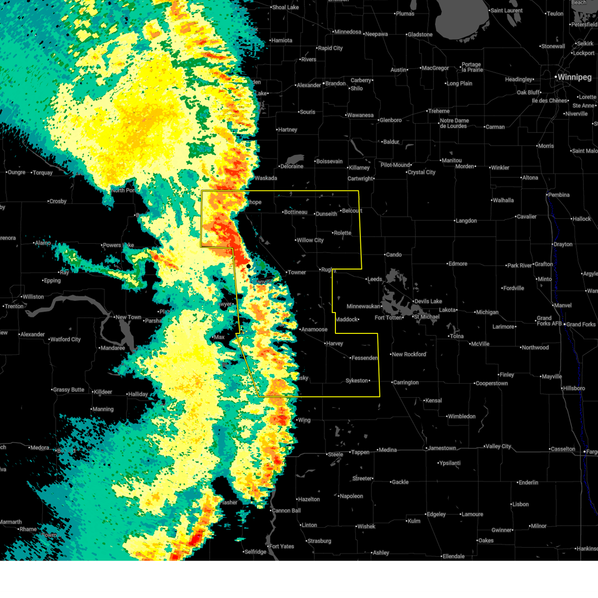
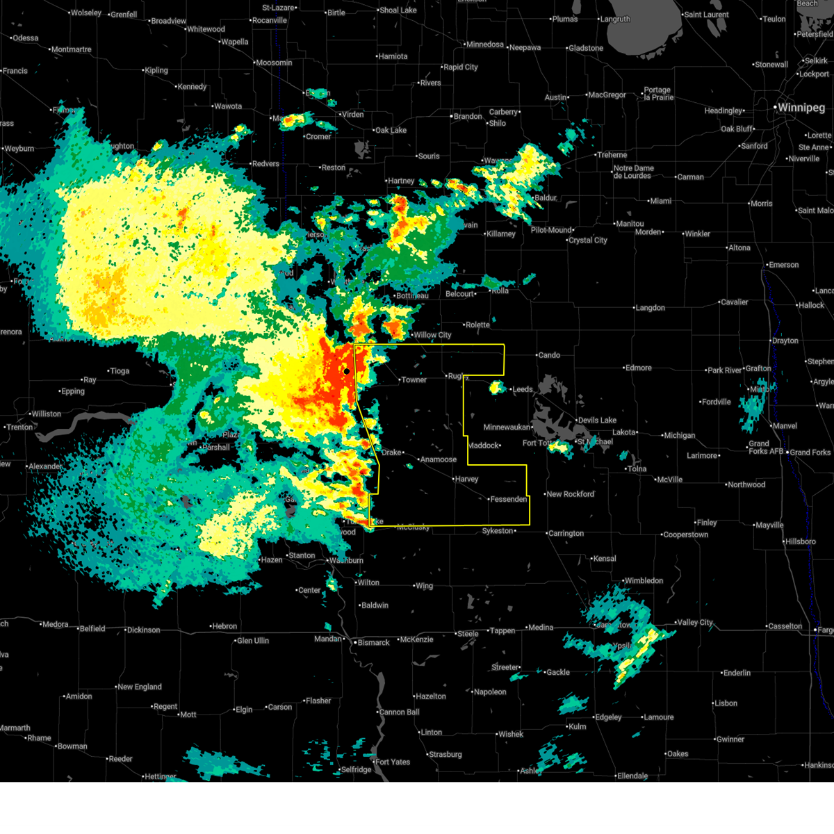
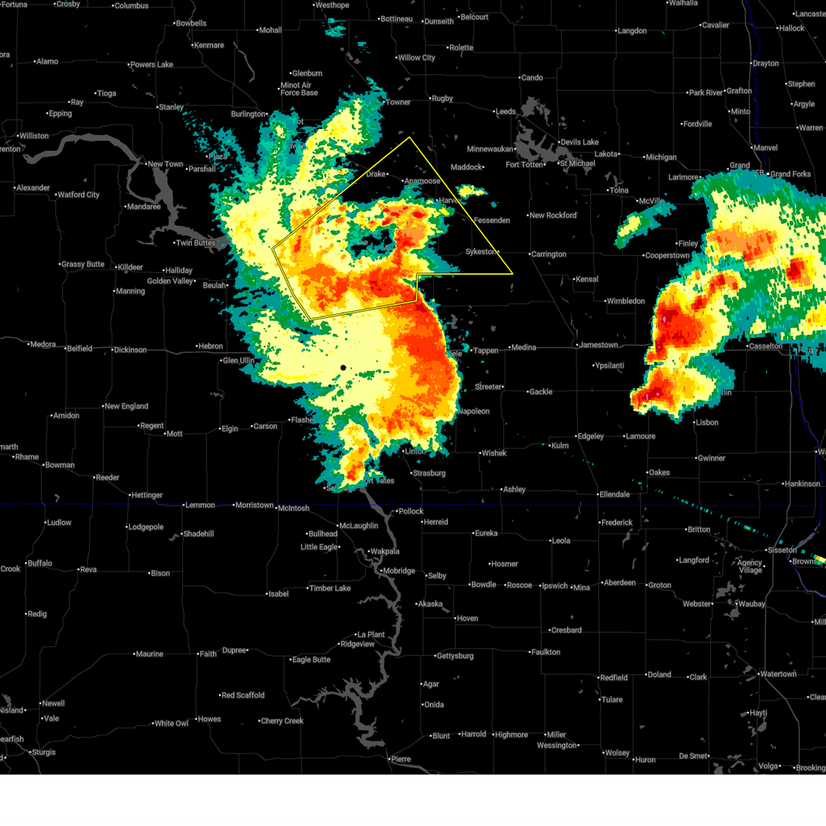
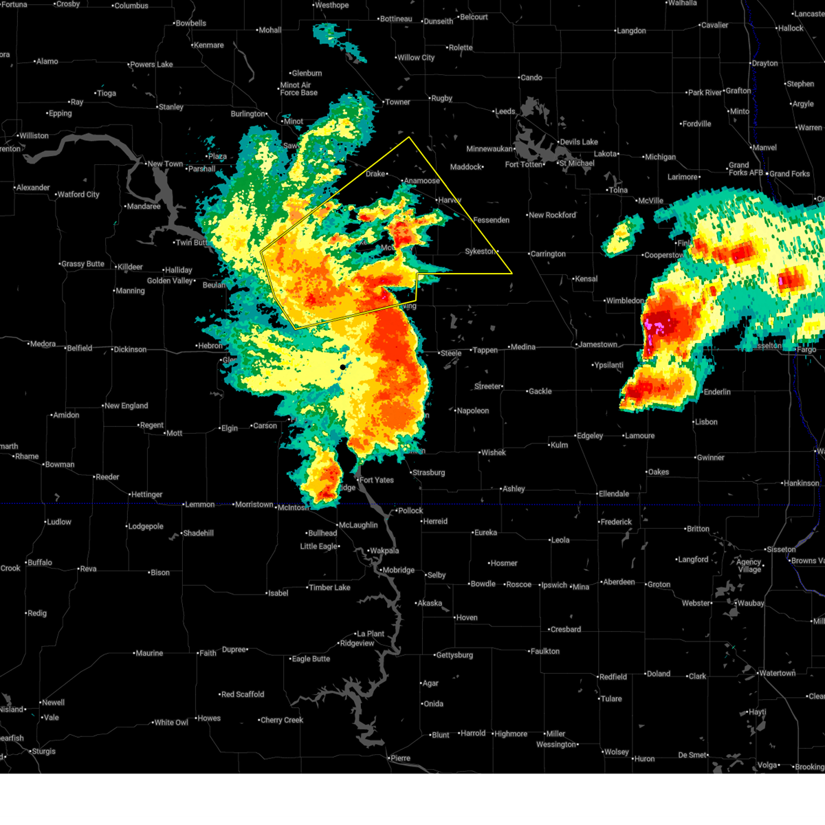
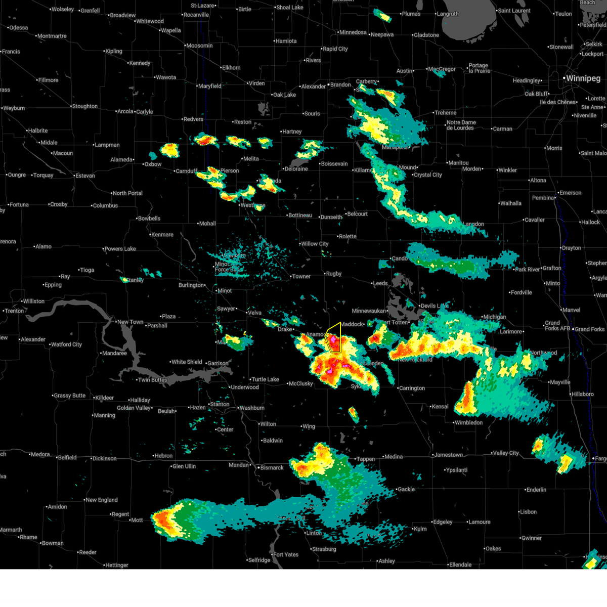
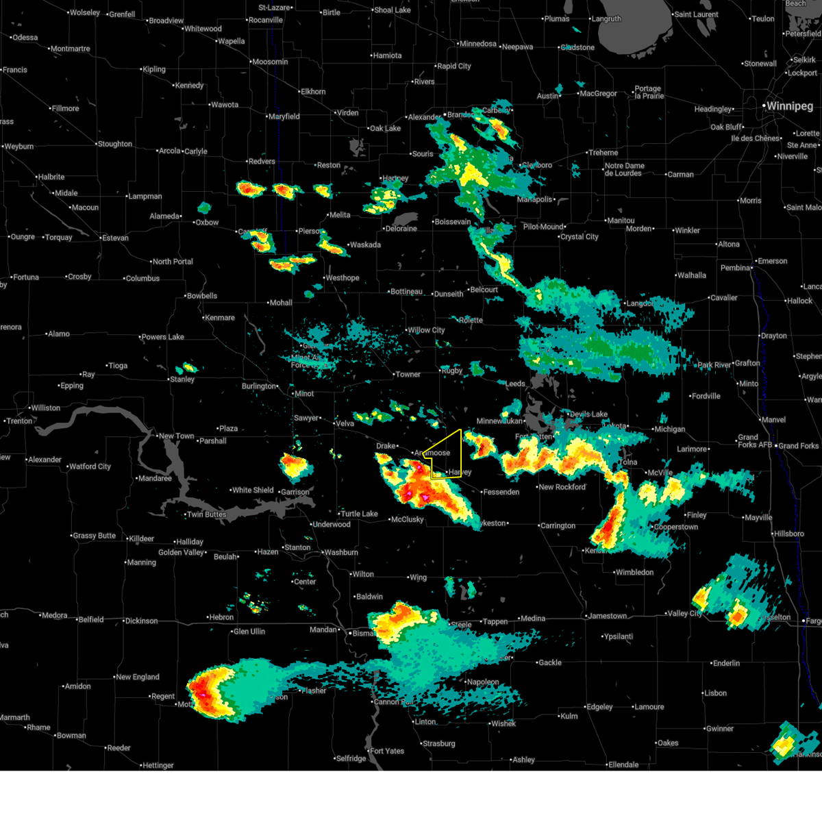
Hail Map for Selz, ND
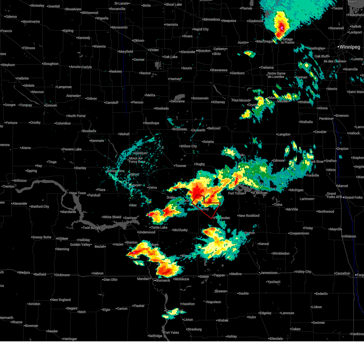
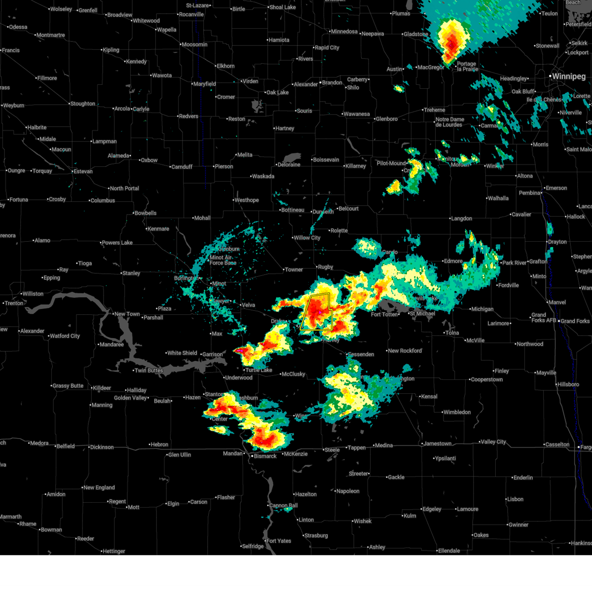
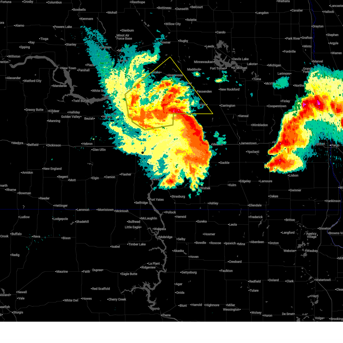
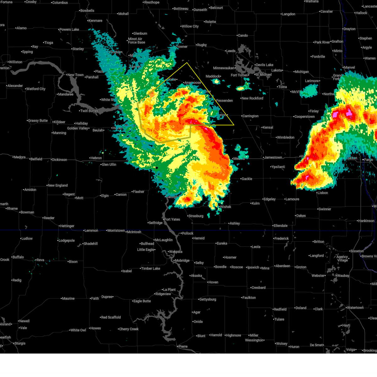
The Selz, ND area has had 0 reports of on-the-ground hail by trained spotters, and has been under severe weather warnings 29 times during the past 12 months. Doppler radar has detected hail at or near Selz, ND on 42 occasions, including 4 occasions during the past year.
| Name: | Selz, ND |
| Where Located: | 51 miles WSW of Devils Lake, ND |
| Map: | Google Map for Selz, ND |
| Population: | 46 |
| Housing Units: | 30 |
| More Info: | Search Google for Selz, ND |
1
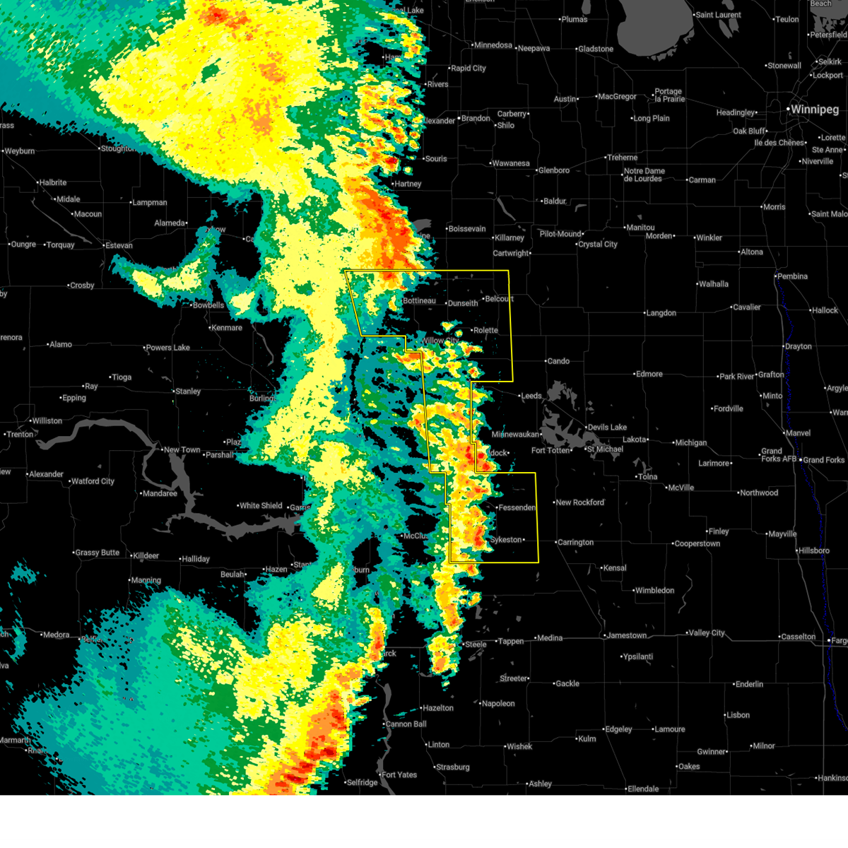
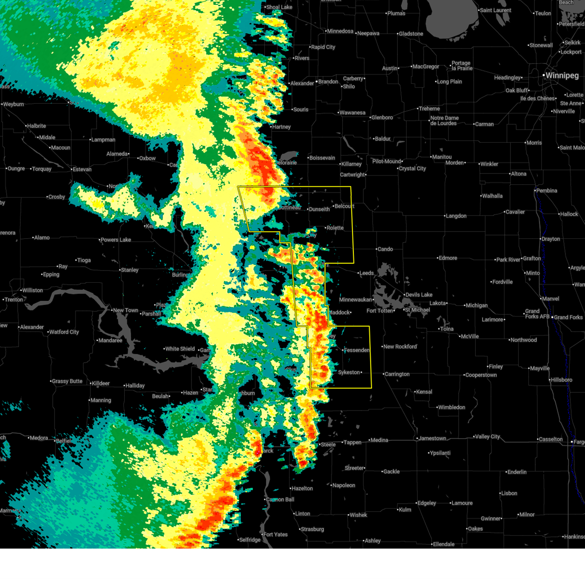
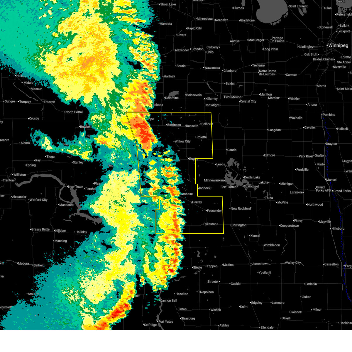
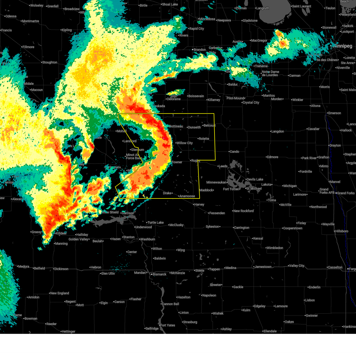
The Top Recent Hail Date for Selz, ND is Thursday, June 19, 2025 (6th out of 42)
Hail and Wind Damage Spotted near Selz, ND
| Date / Time | Report Details |
|---|---|
| 6/7/2026 11:28 PM CDT |
 At 1128 pm cdt, severe thunderstorms were located along a line from 38 miles north of souris to 11 miles northwest of fessenden, or along a line from 43 miles north of bottineau to 9 miles east of harvey, moving northeast at 55 mph (public reported). Hazards include 70 mph wind gusts and small hail. Expect considerable tree damage. damage is likely to mobile homes, roofs, and outbuildings. locations impacted include, rugby, bottineau, harvey, rolla, dunseith, rolette, fessenden, st. John, willow city, hurdsfield, balta, souris, cathay, wolford, barton, barton city, belcourt, international peace garden, shell valley and bowdon. At 1128 pm cdt, severe thunderstorms were located along a line from 38 miles north of souris to 11 miles northwest of fessenden, or along a line from 43 miles north of bottineau to 9 miles east of harvey, moving northeast at 55 mph (public reported). Hazards include 70 mph wind gusts and small hail. Expect considerable tree damage. damage is likely to mobile homes, roofs, and outbuildings. locations impacted include, rugby, bottineau, harvey, rolla, dunseith, rolette, fessenden, st. John, willow city, hurdsfield, balta, souris, cathay, wolford, barton, barton city, belcourt, international peace garden, shell valley and bowdon.
|
| 6/7/2026 11:26 PM CDT |
 At 1126 pm cdt, severe thunderstorms were located along a line from 36 miles north of souris to 8 miles east of harvey, or along a line from 41 miles north of bottineau to 8 miles east of harvey, moving northeast at 55 mph (radar indicated). Hazards include 60 mph wind gusts and small hail. Expect damage to roofs, siding, and trees. locations impacted include, rugby, bottineau, harvey, rolla, dunseith, rolette, fessenden, st. John, willow city, hurdsfield, balta, souris, cathay, wolford, barton, barton city, belcourt, international peace garden, shell valley and bowdon. At 1126 pm cdt, severe thunderstorms were located along a line from 36 miles north of souris to 8 miles east of harvey, or along a line from 41 miles north of bottineau to 8 miles east of harvey, moving northeast at 55 mph (radar indicated). Hazards include 60 mph wind gusts and small hail. Expect damage to roofs, siding, and trees. locations impacted include, rugby, bottineau, harvey, rolla, dunseith, rolette, fessenden, st. John, willow city, hurdsfield, balta, souris, cathay, wolford, barton, barton city, belcourt, international peace garden, shell valley and bowdon.
|
| 6/7/2026 11:26 PM CDT |
 the severe thunderstorm warning has been cancelled and is no longer in effect the severe thunderstorm warning has been cancelled and is no longer in effect
|
| 6/7/2026 11:01 PM CDT |
 At 1101 pm cdt, severe thunderstorms were located along a line from 21 miles north of souris to 6 miles northeast of goodrich, or along a line from 31 miles northwest of bottineau to 17 miles southwest of harvey, moving northeast at 55 mph (radar indicated). Hazards include 70 mph wind gusts and small hail. Expect considerable tree damage. damage is likely to mobile homes, roofs, and outbuildings. locations impacted include, rugby, bottineau, harvey, rolla, velva, dunseith, rolette, towner, fessenden, westhope, mcclusky, st. John, drake, granville, anamoose, willow city, upham, newburg, goodrich and hurdsfield. At 1101 pm cdt, severe thunderstorms were located along a line from 21 miles north of souris to 6 miles northeast of goodrich, or along a line from 31 miles northwest of bottineau to 17 miles southwest of harvey, moving northeast at 55 mph (radar indicated). Hazards include 70 mph wind gusts and small hail. Expect considerable tree damage. damage is likely to mobile homes, roofs, and outbuildings. locations impacted include, rugby, bottineau, harvey, rolla, velva, dunseith, rolette, towner, fessenden, westhope, mcclusky, st. John, drake, granville, anamoose, willow city, upham, newburg, goodrich and hurdsfield.
|
| 6/7/2026 10:43 PM CDT |
 Svrbis the national weather service in bismarck has issued a * severe thunderstorm warning for, bottineau county in north central north dakota, mchenry county in north central north dakota, pierce county in north central north dakota, rolette county in north central north dakota, northeastern mclean county in south central north dakota, sheridan county in south central north dakota, wells county in south central north dakota, * until midnight cdt. * at 1043 pm cdt, severe thunderstorms were located along a line from 8 miles north of westhope to 7 miles south of mcclusky, or along a line from 31 miles northwest of bottineau to 35 miles southwest of harvey, moving northeast at 55 mph (radar indicated). Hazards include 70 mph wind gusts and small hail. Expect considerable tree damage. Damage is likely to mobile homes, roofs, and outbuildings. Svrbis the national weather service in bismarck has issued a * severe thunderstorm warning for, bottineau county in north central north dakota, mchenry county in north central north dakota, pierce county in north central north dakota, rolette county in north central north dakota, northeastern mclean county in south central north dakota, sheridan county in south central north dakota, wells county in south central north dakota, * until midnight cdt. * at 1043 pm cdt, severe thunderstorms were located along a line from 8 miles north of westhope to 7 miles south of mcclusky, or along a line from 31 miles northwest of bottineau to 35 miles southwest of harvey, moving northeast at 55 mph (radar indicated). Hazards include 70 mph wind gusts and small hail. Expect considerable tree damage. Damage is likely to mobile homes, roofs, and outbuildings.
|
| 8/7/2025 11:56 PM CDT |
 The storms which prompted the warning have weakened below severe limits, and no longer pose an immediate threat to life or property. therefore, the warning will be allowed to expire. however, gusty winds to 55 mph are still possible with these thunderstorms. a severe thunderstorm watch remains in effect until 300 am cdt for north central north dakota. The storms which prompted the warning have weakened below severe limits, and no longer pose an immediate threat to life or property. therefore, the warning will be allowed to expire. however, gusty winds to 55 mph are still possible with these thunderstorms. a severe thunderstorm watch remains in effect until 300 am cdt for north central north dakota.
|
| 8/7/2025 11:33 PM CDT |
 the severe thunderstorm warning has been cancelled and is no longer in effect the severe thunderstorm warning has been cancelled and is no longer in effect
|
| 8/7/2025 11:33 PM CDT |
 At 1132 pm cdt, severe thunderstorms were located along a line extending from 11 miles west of international peace garden to 4 miles southwest of rolette to 6 miles northeast of balta to 5 miles north of drake to 5 miles east of ruso city, moving east at 45 mph (law enforcement reported thunderstorm wind damage south of bottineau). Hazards include 70 mph wind gusts and quarter size hail. Hail damage to vehicles is expected. expect considerable tree damage. wind damage is also likely to mobile homes, roofs, and outbuildings. locations impacted include, rugby, bottineau, rolla, velva, dunseith, rolette, towner, westhope, st. John, drake, granville, anamoose, willow city, upham, newburg, maxbass, denbigh, karlsruhe, balta, and souris. At 1132 pm cdt, severe thunderstorms were located along a line extending from 11 miles west of international peace garden to 4 miles southwest of rolette to 6 miles northeast of balta to 5 miles north of drake to 5 miles east of ruso city, moving east at 45 mph (law enforcement reported thunderstorm wind damage south of bottineau). Hazards include 70 mph wind gusts and quarter size hail. Hail damage to vehicles is expected. expect considerable tree damage. wind damage is also likely to mobile homes, roofs, and outbuildings. locations impacted include, rugby, bottineau, rolla, velva, dunseith, rolette, towner, westhope, st. John, drake, granville, anamoose, willow city, upham, newburg, maxbass, denbigh, karlsruhe, balta, and souris.
|
| 8/7/2025 11:18 PM CDT |
 At 1118 pm cdt, severe thunderstorms were located along a line extending from 10 miles northeast of souris to 8 miles northeast of willow city to 9 miles northwest of balta to 6 miles southeast of karlsruhe to near ruso city, moving east at 45 mph (radar indicated). Hazards include 70 mph wind gusts and quarter size hail. Hail damage to vehicles is expected. expect considerable tree damage. wind damage is also likely to mobile homes, roofs, and outbuildings. locations impacted include, rugby, bottineau, rolla, velva, dunseith, rolette, towner, westhope, sawyer, st. John, drake, granville, anamoose, willow city, upham, newburg, maxbass, denbigh, karlsruhe, and balta. At 1118 pm cdt, severe thunderstorms were located along a line extending from 10 miles northeast of souris to 8 miles northeast of willow city to 9 miles northwest of balta to 6 miles southeast of karlsruhe to near ruso city, moving east at 45 mph (radar indicated). Hazards include 70 mph wind gusts and quarter size hail. Hail damage to vehicles is expected. expect considerable tree damage. wind damage is also likely to mobile homes, roofs, and outbuildings. locations impacted include, rugby, bottineau, rolla, velva, dunseith, rolette, towner, westhope, sawyer, st. John, drake, granville, anamoose, willow city, upham, newburg, maxbass, denbigh, karlsruhe, and balta.
|
| 8/7/2025 10:58 PM CDT |
 Svrbis the national weather service in bismarck has issued a * severe thunderstorm warning for, southeastern ward county in north central north dakota, bottineau county in north central north dakota, pierce county in north central north dakota, mchenry county in north central north dakota, rolette county in north central north dakota, * until midnight cdt. * at 1057 pm cdt, severe thunderstorms were located along a line extending from 8 miles north of souris to 5 miles northwest of willow city to 4 miles south of towner to 7 miles east of velva to 5 miles northeast of max, moving east at 45 mph (radar indicated). Hazards include 70 mph wind gusts and quarter size hail. Hail damage to vehicles is expected. expect considerable tree damage. Wind damage is also likely to mobile homes, roofs, and outbuildings. Svrbis the national weather service in bismarck has issued a * severe thunderstorm warning for, southeastern ward county in north central north dakota, bottineau county in north central north dakota, pierce county in north central north dakota, mchenry county in north central north dakota, rolette county in north central north dakota, * until midnight cdt. * at 1057 pm cdt, severe thunderstorms were located along a line extending from 8 miles north of souris to 5 miles northwest of willow city to 4 miles south of towner to 7 miles east of velva to 5 miles northeast of max, moving east at 45 mph (radar indicated). Hazards include 70 mph wind gusts and quarter size hail. Hail damage to vehicles is expected. expect considerable tree damage. Wind damage is also likely to mobile homes, roofs, and outbuildings.
|
| 7/27/2025 6:08 AM CDT |
 Svrbis the national weather service in bismarck has issued a * severe thunderstorm warning for, northern wells county in south central north dakota, pierce county in north central north dakota, southern rolette county in north central north dakota, * until 700 am cdt. * at 608 am cdt, severe thunderstorms were located along a line extending from 7 miles west of rolette to 8 miles south of wolford to 5 miles northwest of fessenden, moving east at 45 mph (trained weather spotters). Hazards include 70 mph wind gusts. Expect considerable tree damage. Damage is likely to mobile homes, roofs, and outbuildings. Svrbis the national weather service in bismarck has issued a * severe thunderstorm warning for, northern wells county in south central north dakota, pierce county in north central north dakota, southern rolette county in north central north dakota, * until 700 am cdt. * at 608 am cdt, severe thunderstorms were located along a line extending from 7 miles west of rolette to 8 miles south of wolford to 5 miles northwest of fessenden, moving east at 45 mph (trained weather spotters). Hazards include 70 mph wind gusts. Expect considerable tree damage. Damage is likely to mobile homes, roofs, and outbuildings.
|
| 7/27/2025 6:04 AM CDT |
 the severe thunderstorm warning has been cancelled and is no longer in effect the severe thunderstorm warning has been cancelled and is no longer in effect
|
| 7/27/2025 6:04 AM CDT |
 At 603 am cdt, severe thunderstorms were located along a line extending from 9 miles west of wolford to 5 miles east of esmond to 5 miles west of fessenden, moving east at 50 mph (trained weather spotters). Hazards include 70 mph wind gusts. Expect considerable tree damage. damage is likely to mobile homes, roofs, and outbuildings. Locations impacted include, rugby, harvey, fessenden, balta, wolford, barton, barton city, heimdal, bremen, manfred, hamberg, silva, selz, wellsburg, orrin, and pleasant lake. At 603 am cdt, severe thunderstorms were located along a line extending from 9 miles west of wolford to 5 miles east of esmond to 5 miles west of fessenden, moving east at 50 mph (trained weather spotters). Hazards include 70 mph wind gusts. Expect considerable tree damage. damage is likely to mobile homes, roofs, and outbuildings. Locations impacted include, rugby, harvey, fessenden, balta, wolford, barton, barton city, heimdal, bremen, manfred, hamberg, silva, selz, wellsburg, orrin, and pleasant lake.
|
| 7/27/2025 5:53 AM CDT |
 At 551 am cdt, severe thunderstorms were located along a line extending from 4 miles southeast of barton city to 6 miles southwest of esmond to 10 miles north of hurdsfield, moving east at 60 mph (trained weather spotters. at 530 am cdt, a 78 mph wind gust was reported near drake). Hazards include 70 mph wind gusts. Expect considerable tree damage. damage is likely to mobile homes, roofs, and outbuildings. Locations impacted include, rugby, harvey, towner, fessenden, drake, anamoose, denbigh, martin, balta, wolford, barton city, barton, berwick, heimdal, bremen, manfred, balfour, hamberg, bantry, and kief. At 551 am cdt, severe thunderstorms were located along a line extending from 4 miles southeast of barton city to 6 miles southwest of esmond to 10 miles north of hurdsfield, moving east at 60 mph (trained weather spotters. at 530 am cdt, a 78 mph wind gust was reported near drake). Hazards include 70 mph wind gusts. Expect considerable tree damage. damage is likely to mobile homes, roofs, and outbuildings. Locations impacted include, rugby, harvey, towner, fessenden, drake, anamoose, denbigh, martin, balta, wolford, barton city, barton, berwick, heimdal, bremen, manfred, balfour, hamberg, bantry, and kief.
|
| 7/27/2025 5:34 AM CDT |
 At 534 am cdt, severe thunderstorms were located along a line extending from 9 miles southwest of willow city to 12 miles west of balta to 13 miles north of mcclusky, moving east at 50 mph (trained weather spotters). Hazards include 70 mph wind gusts. Expect considerable tree damage. damage is likely to mobile homes, roofs, and outbuildings. Locations impacted include, rugby, harvey, towner, fessenden, drake, anamoose, denbigh, karlsruhe, martin, balta, wolford, barton city, barton, berwick, heimdal, bremen, manfred, balfour, hamberg, and bantry. At 534 am cdt, severe thunderstorms were located along a line extending from 9 miles southwest of willow city to 12 miles west of balta to 13 miles north of mcclusky, moving east at 50 mph (trained weather spotters). Hazards include 70 mph wind gusts. Expect considerable tree damage. damage is likely to mobile homes, roofs, and outbuildings. Locations impacted include, rugby, harvey, towner, fessenden, drake, anamoose, denbigh, karlsruhe, martin, balta, wolford, barton city, barton, berwick, heimdal, bremen, manfred, balfour, hamberg, and bantry.
|
| 7/27/2025 5:15 AM CDT |
 Svrbis the national weather service in bismarck has issued a * severe thunderstorm warning for, wells county in south central north dakota, sheridan county in south central north dakota, pierce county in north central north dakota, eastern mchenry county in north central north dakota, * until 615 am cdt. * at 515 am cdt, severe thunderstorms were located along a line extending from near upham to 7 miles west of karlsruhe to 5 miles north of mercer, moving east at 55 mph (trained weather spotters). Hazards include 70 mph wind gusts. Expect considerable tree damage. Damage is likely to mobile homes, roofs, and outbuildings. Svrbis the national weather service in bismarck has issued a * severe thunderstorm warning for, wells county in south central north dakota, sheridan county in south central north dakota, pierce county in north central north dakota, eastern mchenry county in north central north dakota, * until 615 am cdt. * at 515 am cdt, severe thunderstorms were located along a line extending from near upham to 7 miles west of karlsruhe to 5 miles north of mercer, moving east at 55 mph (trained weather spotters). Hazards include 70 mph wind gusts. Expect considerable tree damage. Damage is likely to mobile homes, roofs, and outbuildings.
|
| 6/27/2025 9:40 PM CDT |
 the severe thunderstorm warning has been cancelled and is no longer in effect the severe thunderstorm warning has been cancelled and is no longer in effect
|
| 6/27/2025 9:40 PM CDT |
 At 940 pm cdt, a severe thunderstorm was located 14 miles south of anamoose, or 20 miles west of harvey, moving east at 35 mph (radar indicated). Hazards include 60 mph wind gusts and quarter size hail. Hail damage to vehicles is expected. expect wind damage to roofs, siding, and trees. Locations impacted include, harvey, goodrich, hurdsfield, martin, sheyenne lake, krueger lake, and selz. At 940 pm cdt, a severe thunderstorm was located 14 miles south of anamoose, or 20 miles west of harvey, moving east at 35 mph (radar indicated). Hazards include 60 mph wind gusts and quarter size hail. Hail damage to vehicles is expected. expect wind damage to roofs, siding, and trees. Locations impacted include, harvey, goodrich, hurdsfield, martin, sheyenne lake, krueger lake, and selz.
|
| 6/27/2025 9:34 PM CDT |
 At 934 pm cdt, a severe thunderstorm capable of producing a tornado was located 7 miles northeast of harvey, moving southeast at 35 mph (radar indicated rotation). Hazards include tornado and two inch hail. Flying debris will be dangerous to those caught without shelter. mobile homes will be damaged or destroyed. damage to roofs, windows, and vehicles will occur. tree damage is likely. Locations impacted include, harvey, heimdal, manfred, wellsburg, and selz. At 934 pm cdt, a severe thunderstorm capable of producing a tornado was located 7 miles northeast of harvey, moving southeast at 35 mph (radar indicated rotation). Hazards include tornado and two inch hail. Flying debris will be dangerous to those caught without shelter. mobile homes will be damaged or destroyed. damage to roofs, windows, and vehicles will occur. tree damage is likely. Locations impacted include, harvey, heimdal, manfred, wellsburg, and selz.
|
| 6/27/2025 9:31 PM CDT |
 Svrbis the national weather service in bismarck has issued a * severe thunderstorm warning for, western wells county in south central north dakota, sheridan county in south central north dakota, south central pierce county in north central north dakota, northeastern mclean county in south central north dakota, southeastern mchenry county in north central north dakota, * until 1015 pm cdt. * at 931 pm cdt, a severe thunderstorm was located 14 miles southeast of butte, or 24 miles west of harvey, moving east at 35 mph (radar indicated). Hazards include 60 mph wind gusts and quarter size hail. Hail damage to vehicles is expected. Expect wind damage to roofs, siding, and trees. Svrbis the national weather service in bismarck has issued a * severe thunderstorm warning for, western wells county in south central north dakota, sheridan county in south central north dakota, south central pierce county in north central north dakota, northeastern mclean county in south central north dakota, southeastern mchenry county in north central north dakota, * until 1015 pm cdt. * at 931 pm cdt, a severe thunderstorm was located 14 miles southeast of butte, or 24 miles west of harvey, moving east at 35 mph (radar indicated). Hazards include 60 mph wind gusts and quarter size hail. Hail damage to vehicles is expected. Expect wind damage to roofs, siding, and trees.
|
| 6/27/2025 9:18 PM CDT |
 Torbis the national weather service in bismarck has issued a * tornado warning for, northwestern wells county in south central north dakota, south central pierce county in north central north dakota, * until 945 pm cdt. * at 918 pm cdt, a severe thunderstorm capable of producing a tornado was located 7 miles north of harvey, moving southeast at 35 mph (radar indicated rotation). Hazards include tornado and quarter size hail. Flying debris will be dangerous to those caught without shelter. mobile homes will be damaged or destroyed. damage to roofs, windows, and vehicles will occur. tree damage is likely. This tornadic thunderstorm will remain over mainly rural areas of northwestern wells and south central pierce counties, including the following locations, manfred, heimdal, wellsburg, and selz. Torbis the national weather service in bismarck has issued a * tornado warning for, northwestern wells county in south central north dakota, south central pierce county in north central north dakota, * until 945 pm cdt. * at 918 pm cdt, a severe thunderstorm capable of producing a tornado was located 7 miles north of harvey, moving southeast at 35 mph (radar indicated rotation). Hazards include tornado and quarter size hail. Flying debris will be dangerous to those caught without shelter. mobile homes will be damaged or destroyed. damage to roofs, windows, and vehicles will occur. tree damage is likely. This tornadic thunderstorm will remain over mainly rural areas of northwestern wells and south central pierce counties, including the following locations, manfred, heimdal, wellsburg, and selz.
|
| 6/27/2025 9:15 PM CDT |
 Svrbis the national weather service in bismarck has issued a * severe thunderstorm warning for, southwestern pierce county in north central north dakota, * until 945 pm cdt. * at 915 pm cdt, a severe thunderstorm was located 8 miles west of esmond, or 15 miles north of harvey, moving east at 35 mph (radar indicated). Hazards include 60 mph wind gusts and half dollar size hail. Hail damage to vehicles is expected. Expect wind damage to roofs, siding, and trees. Svrbis the national weather service in bismarck has issued a * severe thunderstorm warning for, southwestern pierce county in north central north dakota, * until 945 pm cdt. * at 915 pm cdt, a severe thunderstorm was located 8 miles west of esmond, or 15 miles north of harvey, moving east at 35 mph (radar indicated). Hazards include 60 mph wind gusts and half dollar size hail. Hail damage to vehicles is expected. Expect wind damage to roofs, siding, and trees.
|
| 6/20/2025 10:15 PM CDT |
 At 1014 pm cdt, severe thunderstorms were located along a line extending from 11 miles southwest of butte to 6 miles northeast of mercer to 10 miles south of mcclusky, moving northeast at 55 mph (radar indicated). Hazards include 70 mph wind gusts and quarter size hail. Hail damage to vehicles is expected. expect considerable tree damage. wind damage is also likely to mobile homes, roofs, and outbuildings. Locations impacted include, harvey, washburn, wilton, turtle lake, fessenden, mcclusky, drake, anamoose, goodrich, mercer, hurdsfield, martin, butte, regan, bowdon, manfred, chaseley, denhoff, kief, and krueger lake. At 1014 pm cdt, severe thunderstorms were located along a line extending from 11 miles southwest of butte to 6 miles northeast of mercer to 10 miles south of mcclusky, moving northeast at 55 mph (radar indicated). Hazards include 70 mph wind gusts and quarter size hail. Hail damage to vehicles is expected. expect considerable tree damage. wind damage is also likely to mobile homes, roofs, and outbuildings. Locations impacted include, harvey, washburn, wilton, turtle lake, fessenden, mcclusky, drake, anamoose, goodrich, mercer, hurdsfield, martin, butte, regan, bowdon, manfred, chaseley, denhoff, kief, and krueger lake.
|
| 6/20/2025 10:15 PM CDT |
 the severe thunderstorm warning has been cancelled and is no longer in effect the severe thunderstorm warning has been cancelled and is no longer in effect
|
| 6/20/2025 9:56 PM CDT |
 the severe thunderstorm warning has been cancelled and is no longer in effect the severe thunderstorm warning has been cancelled and is no longer in effect
|
| 6/20/2025 9:56 PM CDT |
 At 955 pm cdt, severe thunderstorms were located along a line extending from 6 miles east of coleharbor to 7 miles south of turtle lake to near wilton, moving northeast at 55 mph (radar indicated). Hazards include 70 mph wind gusts and quarter size hail. Hail damage to vehicles is expected. expect considerable tree damage. wind damage is also likely to mobile homes, roofs, and outbuildings. Locations impacted include, harvey, washburn, underwood, wilton, turtle lake, fessenden, mcclusky, drake, anamoose, riverdale, goodrich, mercer, hurdsfield, coleharbor, martin, butte, regan, bowdon, manfred, and chaseley. At 955 pm cdt, severe thunderstorms were located along a line extending from 6 miles east of coleharbor to 7 miles south of turtle lake to near wilton, moving northeast at 55 mph (radar indicated). Hazards include 70 mph wind gusts and quarter size hail. Hail damage to vehicles is expected. expect considerable tree damage. wind damage is also likely to mobile homes, roofs, and outbuildings. Locations impacted include, harvey, washburn, underwood, wilton, turtle lake, fessenden, mcclusky, drake, anamoose, riverdale, goodrich, mercer, hurdsfield, coleharbor, martin, butte, regan, bowdon, manfred, and chaseley.
|
| 6/20/2025 9:44 PM CDT |
 Svrbis the national weather service in bismarck has issued a * severe thunderstorm warning for, wells county in south central north dakota, sheridan county in south central north dakota, southwestern pierce county in north central north dakota, eastern mclean county in south central north dakota, northern burleigh county in south central north dakota, southeastern mchenry county in north central north dakota, eastern oliver county in south central north dakota, northeastern mercer county in south central north dakota, * until 1045 pm cdt. * at 944 pm cdt, severe thunderstorms were located along a line extending from near coleharbor to 4 miles north of washburn to 4 miles west of wilton, moving northeast at 55 mph (radar indicated). Hazards include 70 mph wind gusts and quarter size hail. Hail damage to vehicles is expected. expect considerable tree damage. Wind damage is also likely to mobile homes, roofs, and outbuildings. Svrbis the national weather service in bismarck has issued a * severe thunderstorm warning for, wells county in south central north dakota, sheridan county in south central north dakota, southwestern pierce county in north central north dakota, eastern mclean county in south central north dakota, northern burleigh county in south central north dakota, southeastern mchenry county in north central north dakota, eastern oliver county in south central north dakota, northeastern mercer county in south central north dakota, * until 1045 pm cdt. * at 944 pm cdt, severe thunderstorms were located along a line extending from near coleharbor to 4 miles north of washburn to 4 miles west of wilton, moving northeast at 55 mph (radar indicated). Hazards include 70 mph wind gusts and quarter size hail. Hail damage to vehicles is expected. expect considerable tree damage. Wind damage is also likely to mobile homes, roofs, and outbuildings.
|
| 6/19/2025 9:13 PM CDT |
 At 912 pm cdt, a severe thunderstorm was located 7 miles northeast of harvey, moving east at 45 mph (radar indicated). Hazards include quarter size hail. Damage to vehicles is expected. Locations impacted include, selz. At 912 pm cdt, a severe thunderstorm was located 7 miles northeast of harvey, moving east at 45 mph (radar indicated). Hazards include quarter size hail. Damage to vehicles is expected. Locations impacted include, selz.
|
| 6/19/2025 9:03 PM CDT |
 Svrbis the national weather service in bismarck has issued a * severe thunderstorm warning for, northwestern wells county in south central north dakota, south central pierce county in north central north dakota, * until 930 pm cdt. * at 902 pm cdt, a severe thunderstorm was located near harvey, moving east at 50 mph (radar indicated). Hazards include quarter size hail. damage to vehicles is expected Svrbis the national weather service in bismarck has issued a * severe thunderstorm warning for, northwestern wells county in south central north dakota, south central pierce county in north central north dakota, * until 930 pm cdt. * at 902 pm cdt, a severe thunderstorm was located near harvey, moving east at 50 mph (radar indicated). Hazards include quarter size hail. damage to vehicles is expected
|
| 9/16/2024 9:00 PM CDT |
 At 900 pm cdt, a severe thunderstorm was located 9 miles north of anamoose, or 19 miles northwest of harvey, moving east at 30 mph (radar indicated). Hazards include golf ball size hail and 60 mph wind gusts. People and animals outdoors will be injured. expect hail damage to roofs, siding, windows, and vehicles. expect wind damage to roofs, siding, and trees. Locations impacted include, anamoose, balta, orrin, silva, george lake, and selz. At 900 pm cdt, a severe thunderstorm was located 9 miles north of anamoose, or 19 miles northwest of harvey, moving east at 30 mph (radar indicated). Hazards include golf ball size hail and 60 mph wind gusts. People and animals outdoors will be injured. expect hail damage to roofs, siding, windows, and vehicles. expect wind damage to roofs, siding, and trees. Locations impacted include, anamoose, balta, orrin, silva, george lake, and selz.
|
| 9/16/2024 8:51 PM CDT |
 At 850 pm cdt, a severe thunderstorm was located 8 miles northeast of drake, or 21 miles northwest of harvey, moving east at 35 mph (radar indicated). Hazards include 60 mph wind gusts and quarter size hail. Hail damage to vehicles is expected. expect wind damage to roofs, siding, and trees. Locations impacted include, drake, anamoose, balta, silva, selz, orrin, and george lake. At 850 pm cdt, a severe thunderstorm was located 8 miles northeast of drake, or 21 miles northwest of harvey, moving east at 35 mph (radar indicated). Hazards include 60 mph wind gusts and quarter size hail. Hail damage to vehicles is expected. expect wind damage to roofs, siding, and trees. Locations impacted include, drake, anamoose, balta, silva, selz, orrin, and george lake.
|
| 9/16/2024 8:40 PM CDT |
 Svrbis the national weather service in bismarck has issued a * severe thunderstorm warning for, southwestern pierce county in north central north dakota, southeastern mchenry county in north central north dakota, * until 945 pm cdt. * at 840 pm cdt, a severe thunderstorm was located 5 miles north of drake, or 26 miles northwest of harvey, moving east at 35 mph (radar indicated). Hazards include 60 mph wind gusts and quarter size hail. Hail damage to vehicles is expected. Expect wind damage to roofs, siding, and trees. Svrbis the national weather service in bismarck has issued a * severe thunderstorm warning for, southwestern pierce county in north central north dakota, southeastern mchenry county in north central north dakota, * until 945 pm cdt. * at 840 pm cdt, a severe thunderstorm was located 5 miles north of drake, or 26 miles northwest of harvey, moving east at 35 mph (radar indicated). Hazards include 60 mph wind gusts and quarter size hail. Hail damage to vehicles is expected. Expect wind damage to roofs, siding, and trees.
|
| 8/29/2024 1:05 AM CDT |
 The storm which prompted the warning has weakened below severe limits, and has exited the warned area. therefore, the warning will be allowed to expire. The storm which prompted the warning has weakened below severe limits, and has exited the warned area. therefore, the warning will be allowed to expire.
|
| 8/29/2024 12:44 AM CDT |
 At 1244 am cdt, a severe thunderstorm was located near harvey, moving northeast at 40 mph (public. at 1235 am cdt, quarter size hail was reported in harvey). Hazards include 60 mph wind gusts and quarter size hail. Hail damage to vehicles is expected. expect wind damage to roofs, siding, and trees. Locations impacted include, harvey, martin, wellsburg, and selz. At 1244 am cdt, a severe thunderstorm was located near harvey, moving northeast at 40 mph (public. at 1235 am cdt, quarter size hail was reported in harvey). Hazards include 60 mph wind gusts and quarter size hail. Hail damage to vehicles is expected. expect wind damage to roofs, siding, and trees. Locations impacted include, harvey, martin, wellsburg, and selz.
|
| 8/29/2024 12:33 AM CDT |
 At 1232 am cdt, a severe thunderstorm was located 10 miles southwest of harvey, moving northeast at 45 mph (trained weather spotters. at 1225 am cdt, quarter size hail was reported in harvey). Hazards include 60 mph wind gusts and quarter size hail. Hail damage to vehicles is expected. expect wind damage to roofs, siding, and trees. Locations impacted include, harvey, martin, heimdal, manfred, sheyenne lake, selz, and wellsburg. At 1232 am cdt, a severe thunderstorm was located 10 miles southwest of harvey, moving northeast at 45 mph (trained weather spotters. at 1225 am cdt, quarter size hail was reported in harvey). Hazards include 60 mph wind gusts and quarter size hail. Hail damage to vehicles is expected. expect wind damage to roofs, siding, and trees. Locations impacted include, harvey, martin, heimdal, manfred, sheyenne lake, selz, and wellsburg.
|
| 8/29/2024 12:21 AM CDT |
 Svrbis the national weather service in bismarck has issued a * severe thunderstorm warning for, northwestern wells county in south central north dakota, northeastern sheridan county in south central north dakota, southwestern pierce county in north central north dakota, * until 115 am cdt. * at 1220 am cdt, a severe thunderstorm was located over goodrich, or 20 miles southwest of harvey, moving northeast at 45 mph (radar indicated). Hazards include 60 mph wind gusts and half dollar size hail. Hail damage to vehicles is expected. Expect wind damage to roofs, siding, and trees. Svrbis the national weather service in bismarck has issued a * severe thunderstorm warning for, northwestern wells county in south central north dakota, northeastern sheridan county in south central north dakota, southwestern pierce county in north central north dakota, * until 115 am cdt. * at 1220 am cdt, a severe thunderstorm was located over goodrich, or 20 miles southwest of harvey, moving northeast at 45 mph (radar indicated). Hazards include 60 mph wind gusts and half dollar size hail. Hail damage to vehicles is expected. Expect wind damage to roofs, siding, and trees.
|
| 7/14/2024 11:23 PM CDT |
 the severe thunderstorm warning has been cancelled and is no longer in effect the severe thunderstorm warning has been cancelled and is no longer in effect
|
| 7/14/2024 11:23 PM CDT |
 At 1123 pm cdt, a severe thunderstorm was located near harvey, moving southeast at 30 mph (radar indicated). Hazards include 60 mph wind gusts and half dollar size hail. Hail damage to vehicles is expected. expect wind damage to roofs, siding, and trees. Locations impacted include, harvey, fessenden, cathay, heimdal, bremen, manfred, hamberg, emrick, selz, and wellsburg. At 1123 pm cdt, a severe thunderstorm was located near harvey, moving southeast at 30 mph (radar indicated). Hazards include 60 mph wind gusts and half dollar size hail. Hail damage to vehicles is expected. expect wind damage to roofs, siding, and trees. Locations impacted include, harvey, fessenden, cathay, heimdal, bremen, manfred, hamberg, emrick, selz, and wellsburg.
|
| 7/14/2024 11:11 PM CDT |
 Svrbis the national weather service in bismarck has issued a * severe thunderstorm warning for, wells county in south central north dakota, northeastern sheridan county in south central north dakota, southwestern pierce county in north central north dakota, * until 1215 am cdt. * at 1111 pm cdt, a severe thunderstorm was located over martin, or 10 miles northwest of harvey, moving southeast at 30 mph (radar indicated). Hazards include 60 mph wind gusts and half dollar size hail. Hail damage to vehicles is expected. Expect wind damage to roofs, siding, and trees. Svrbis the national weather service in bismarck has issued a * severe thunderstorm warning for, wells county in south central north dakota, northeastern sheridan county in south central north dakota, southwestern pierce county in north central north dakota, * until 1215 am cdt. * at 1111 pm cdt, a severe thunderstorm was located over martin, or 10 miles northwest of harvey, moving southeast at 30 mph (radar indicated). Hazards include 60 mph wind gusts and half dollar size hail. Hail damage to vehicles is expected. Expect wind damage to roofs, siding, and trees.
|
| 7/12/2024 9:29 PM CDT |
 The storms which prompted the warning have weakened below severe limits. the warning will be allowed to expire. a severe thunderstorm watch remains in effect until midnight cdt for south central and north central north dakota. The storms which prompted the warning have weakened below severe limits. the warning will be allowed to expire. a severe thunderstorm watch remains in effect until midnight cdt for south central and north central north dakota.
|
| 7/12/2024 9:19 PM CDT |
 the severe thunderstorm warning has been cancelled and is no longer in effect the severe thunderstorm warning has been cancelled and is no longer in effect
|
| 7/12/2024 9:19 PM CDT |
 At 918 pm cdt, severe thunderstorms were located along a line extending from 8 miles southeast of wolford to 9 miles east of harvey to 4 miles south of goodrich, moving east at 40 mph (radar indicated). Hazards include 60 mph wind gusts and quarter size hail. Hail damage to vehicles is expected. expect wind damage to roofs, siding, and trees. Locations impacted include, rugby, harvey, mcclusky, goodrich, mercer, martin, balta, wolford, heimdal, denhoff, sheyenne lake, silva, selz, wellsburg, and hoffer lake. At 918 pm cdt, severe thunderstorms were located along a line extending from 8 miles southeast of wolford to 9 miles east of harvey to 4 miles south of goodrich, moving east at 40 mph (radar indicated). Hazards include 60 mph wind gusts and quarter size hail. Hail damage to vehicles is expected. expect wind damage to roofs, siding, and trees. Locations impacted include, rugby, harvey, mcclusky, goodrich, mercer, martin, balta, wolford, heimdal, denhoff, sheyenne lake, silva, selz, wellsburg, and hoffer lake.
|
| 7/12/2024 8:58 PM CDT |
 At 852 pm cdt, severe thunderstorms were located along a line extending from 8 miles southwest of wolford to 4 miles northwest of harvey to near mcclusky, moving east at 40 mph (radar indicated). Hazards include 60 mph wind gusts and quarter size hail. Hail damage to vehicles is expected. expect wind damage to roofs, siding, and trees. locations impacted include, rugby, harvey, mcclusky, drake, anamoose, goodrich, mercer, martin, balta, wolford, berwick, denhoff, balfour, kief, krueger lake, wellsburg, and george lake. the most likely threat area for quarter size hail is near mercer, mclean county, and the rugby area of pierce county. The most likely threat area for 60 mph wind is southern pierce county and northern sheridan county. At 852 pm cdt, severe thunderstorms were located along a line extending from 8 miles southwest of wolford to 4 miles northwest of harvey to near mcclusky, moving east at 40 mph (radar indicated). Hazards include 60 mph wind gusts and quarter size hail. Hail damage to vehicles is expected. expect wind damage to roofs, siding, and trees. locations impacted include, rugby, harvey, mcclusky, drake, anamoose, goodrich, mercer, martin, balta, wolford, berwick, denhoff, balfour, kief, krueger lake, wellsburg, and george lake. the most likely threat area for quarter size hail is near mercer, mclean county, and the rugby area of pierce county. The most likely threat area for 60 mph wind is southern pierce county and northern sheridan county.
|
| 7/12/2024 8:30 PM CDT |
 Svrbis the national weather service in bismarck has issued a * severe thunderstorm warning for, northwestern wells county in south central north dakota, sheridan county in south central north dakota, pierce county in north central north dakota, northeastern mclean county in south central north dakota, eastern mchenry county in north central north dakota, * until 930 pm cdt. * at 830 pm cdt, severe thunderstorms were located along a line extending from near barton to near anamoose to near mercer, moving east at 40 mph (radar indicated). Hazards include 60 mph wind gusts and quarter size hail. Hail damage to vehicles is expected. Expect wind damage to roofs, siding, and trees. Svrbis the national weather service in bismarck has issued a * severe thunderstorm warning for, northwestern wells county in south central north dakota, sheridan county in south central north dakota, pierce county in north central north dakota, northeastern mclean county in south central north dakota, eastern mchenry county in north central north dakota, * until 930 pm cdt. * at 830 pm cdt, severe thunderstorms were located along a line extending from near barton to near anamoose to near mercer, moving east at 40 mph (radar indicated). Hazards include 60 mph wind gusts and quarter size hail. Hail damage to vehicles is expected. Expect wind damage to roofs, siding, and trees.
|
| 7/31/2023 9:40 PM CDT |
 The severe thunderstorm warning for southwestern pierce and southeastern mchenry counties will expire at 945 pm cdt, the storm which prompted the warning has weakened below severe limits, and has exited the warned area. therefore, the warning will be allowed to expire. however gusty winds are still possible with this thunderstorm. a severe thunderstorm watch remains in effect until 1100 pm cdt for north central north dakota. The severe thunderstorm warning for southwestern pierce and southeastern mchenry counties will expire at 945 pm cdt, the storm which prompted the warning has weakened below severe limits, and has exited the warned area. therefore, the warning will be allowed to expire. however gusty winds are still possible with this thunderstorm. a severe thunderstorm watch remains in effect until 1100 pm cdt for north central north dakota.
|
| 7/31/2023 9:25 PM CDT |
 At 924 pm cdt, a severe thunderstorm was located 6 miles northeast of martin, or 6 miles northwest of harvey, moving southeast at 25 mph (radar indicated). Hazards include 60 mph wind gusts and quarter size hail. Hail damage to vehicles is expected. expect wind damage to roofs, siding, and trees. locations impacted include, anamoose and selz. hail threat, radar indicated max hail size, 1. 00 in wind threat, radar indicated max wind gust, 60 mph. At 924 pm cdt, a severe thunderstorm was located 6 miles northeast of martin, or 6 miles northwest of harvey, moving southeast at 25 mph (radar indicated). Hazards include 60 mph wind gusts and quarter size hail. Hail damage to vehicles is expected. expect wind damage to roofs, siding, and trees. locations impacted include, anamoose and selz. hail threat, radar indicated max hail size, 1. 00 in wind threat, radar indicated max wind gust, 60 mph.
|
| 7/31/2023 9:07 PM CDT |
 At 907 pm cdt, a severe thunderstorm was located 9 miles north of martin, or 13 miles northwest of harvey, moving southeast at 25 mph (radar indicated). Hazards include golf ball size hail and 60 mph wind gusts. People and animals outdoors will be injured. expect hail damage to roofs, siding, windows, and vehicles. expect wind damage to roofs, siding, and trees. locations impacted include, anamoose, balta, orrin, silva and selz. thunderstorm damage threat, considerable hail threat, radar indicated max hail size, 1. 75 in wind threat, radar indicated max wind gust, 60 mph. At 907 pm cdt, a severe thunderstorm was located 9 miles north of martin, or 13 miles northwest of harvey, moving southeast at 25 mph (radar indicated). Hazards include golf ball size hail and 60 mph wind gusts. People and animals outdoors will be injured. expect hail damage to roofs, siding, windows, and vehicles. expect wind damage to roofs, siding, and trees. locations impacted include, anamoose, balta, orrin, silva and selz. thunderstorm damage threat, considerable hail threat, radar indicated max hail size, 1. 75 in wind threat, radar indicated max wind gust, 60 mph.
|
| 7/31/2023 8:42 PM CDT |
 At 841 pm cdt, a severe thunderstorm was located 7 miles southwest of balta, or 20 miles south of rugby, moving south at 25 mph (radar indicated). Hazards include golf ball size hail and 60 mph wind gusts. People and animals outdoors will be injured. expect hail damage to roofs, siding, windows, and vehicles. expect wind damage to roofs, siding, and trees. this severe thunderstorm will remain over mainly rural areas of southwestern pierce and southeastern mchenry counties, including the following locations, orrin, silva and selz. thunderstorm damage threat, considerable hail threat, radar indicated max hail size, 1. 75 in wind threat, radar indicated max wind gust, 60 mph. At 841 pm cdt, a severe thunderstorm was located 7 miles southwest of balta, or 20 miles south of rugby, moving south at 25 mph (radar indicated). Hazards include golf ball size hail and 60 mph wind gusts. People and animals outdoors will be injured. expect hail damage to roofs, siding, windows, and vehicles. expect wind damage to roofs, siding, and trees. this severe thunderstorm will remain over mainly rural areas of southwestern pierce and southeastern mchenry counties, including the following locations, orrin, silva and selz. thunderstorm damage threat, considerable hail threat, radar indicated max hail size, 1. 75 in wind threat, radar indicated max wind gust, 60 mph.
|
| 6/20/2023 6:56 PM CDT |
 At 656 pm cdt, a severe thunderstorm was located 6 miles northeast of harvey, moving north at 15 mph (radar indicated). Hazards include 60 mph wind gusts and quarter size hail. Hail damage to vehicles is expected. expect wind damage to roofs, siding, and trees. this severe thunderstorm will remain over mainly rural areas of northwestern wells and south central pierce counties, including the following locations, wellsburg, silva and selz. hail threat, radar indicated max hail size, 1. 00 in wind threat, radar indicated max wind gust, 60 mph. At 656 pm cdt, a severe thunderstorm was located 6 miles northeast of harvey, moving north at 15 mph (radar indicated). Hazards include 60 mph wind gusts and quarter size hail. Hail damage to vehicles is expected. expect wind damage to roofs, siding, and trees. this severe thunderstorm will remain over mainly rural areas of northwestern wells and south central pierce counties, including the following locations, wellsburg, silva and selz. hail threat, radar indicated max hail size, 1. 00 in wind threat, radar indicated max wind gust, 60 mph.
|
| 6/20/2023 6:43 PM CDT |
 At 643 pm cdt, a severe thunderstorm was located 9 miles north of harvey, moving north at 20 mph (radar indicated). Hazards include quarter size hail. Damage to vehicles is expected. locations impacted include, wellsburg, silva and selz. hail threat, radar indicated max hail size, 1. 00 in wind threat, radar indicated max wind gust, <50 mph. At 643 pm cdt, a severe thunderstorm was located 9 miles north of harvey, moving north at 20 mph (radar indicated). Hazards include quarter size hail. Damage to vehicles is expected. locations impacted include, wellsburg, silva and selz. hail threat, radar indicated max hail size, 1. 00 in wind threat, radar indicated max wind gust, <50 mph.
|
| 6/20/2023 6:24 PM CDT |
 At 624 pm cdt, a severe thunderstorm was located 8 miles northeast of harvey, moving north at 20 mph (radar indicated). Hazards include quarter size hail. Damage to vehicles is expected. locations impacted include, wellsburg, silva and selz. hail threat, radar indicated max hail size, 1. 00 in wind threat, radar indicated max wind gust, <50 mph. At 624 pm cdt, a severe thunderstorm was located 8 miles northeast of harvey, moving north at 20 mph (radar indicated). Hazards include quarter size hail. Damage to vehicles is expected. locations impacted include, wellsburg, silva and selz. hail threat, radar indicated max hail size, 1. 00 in wind threat, radar indicated max wind gust, <50 mph.
|
| 6/20/2023 6:04 PM CDT |
 At 604 pm cdt, a severe thunderstorm was located over harvey, moving north at 20 mph (radar indicated). Hazards include golf ball size hail and 60 mph wind gusts. People and animals outdoors will be injured. expect hail damage to roofs, siding, windows, and vehicles. expect wind damage to roofs, siding, and trees. this severe thunderstorm will remain over mainly rural areas of northwestern wells and south central pierce counties, including the following locations, wellsburg, silva and selz. thunderstorm damage threat, considerable hail threat, radar indicated max hail size, 1. 75 in wind threat, radar indicated max wind gust, 60 mph. At 604 pm cdt, a severe thunderstorm was located over harvey, moving north at 20 mph (radar indicated). Hazards include golf ball size hail and 60 mph wind gusts. People and animals outdoors will be injured. expect hail damage to roofs, siding, windows, and vehicles. expect wind damage to roofs, siding, and trees. this severe thunderstorm will remain over mainly rural areas of northwestern wells and south central pierce counties, including the following locations, wellsburg, silva and selz. thunderstorm damage threat, considerable hail threat, radar indicated max hail size, 1. 75 in wind threat, radar indicated max wind gust, 60 mph.
|
| 8/18/2022 1:50 AM CDT |
 The severe thunderstorm warning for southwestern pierce and southeastern mchenry counties will expire at 200 am cdt, the storm which prompted the warning has weakened below severe limits, and has exited the warned area. therefore, the warning will be allowed to expire. however gusty winds up to 55 mph are still possible with this thunderstorm. The severe thunderstorm warning for southwestern pierce and southeastern mchenry counties will expire at 200 am cdt, the storm which prompted the warning has weakened below severe limits, and has exited the warned area. therefore, the warning will be allowed to expire. however gusty winds up to 55 mph are still possible with this thunderstorm.
|
| 8/18/2022 1:34 AM CDT |
 At 134 am cdt, a severe thunderstorm was located 11 miles south of balta, or 16 miles north of harvey, moving southeast at 45 mph (radar indicated). Hazards include 60 mph wind gusts. Expect damage to roofs, siding, and trees. this severe thunderstorm will remain over mainly rural areas of southwestern pierce and southeastern mchenry counties, including the following locations, orrin, silva and selz. hail threat, radar indicated max hail size, <. 75 in wind threat, radar indicated max wind gust, 60 mph. At 134 am cdt, a severe thunderstorm was located 11 miles south of balta, or 16 miles north of harvey, moving southeast at 45 mph (radar indicated). Hazards include 60 mph wind gusts. Expect damage to roofs, siding, and trees. this severe thunderstorm will remain over mainly rural areas of southwestern pierce and southeastern mchenry counties, including the following locations, orrin, silva and selz. hail threat, radar indicated max hail size, <. 75 in wind threat, radar indicated max wind gust, 60 mph.
|
| 8/18/2022 1:14 AM CDT |
 At 113 am cdt, a severe thunderstorm was located 13 miles west of balta, or 22 miles southwest of rugby, moving east at 45 mph (radar indicated). Hazards include 60 mph wind gusts. Expect damage to roofs, siding, and trees. this severe storm will be near, balta around 130 am cdt. other locations impacted by this severe thunderstorm include orrin, silva, george lake and selz. hail threat, radar indicated max hail size, <. 75 in wind threat, radar indicated max wind gust, 60 mph. At 113 am cdt, a severe thunderstorm was located 13 miles west of balta, or 22 miles southwest of rugby, moving east at 45 mph (radar indicated). Hazards include 60 mph wind gusts. Expect damage to roofs, siding, and trees. this severe storm will be near, balta around 130 am cdt. other locations impacted by this severe thunderstorm include orrin, silva, george lake and selz. hail threat, radar indicated max hail size, <. 75 in wind threat, radar indicated max wind gust, 60 mph.
|
| 8/18/2022 12:59 AM CDT |
 At 1259 am cdt, a severe thunderstorm was located 6 miles northeast of karlsruhe, or 28 miles southwest of rugby, moving east at 45 mph (radar indicated). Hazards include 60 mph wind gusts. Expect damage to roofs, siding, and trees. this severe thunderstorm will be near, balta around 130 am cdt. other locations impacted by this severe thunderstorm include orrin, silva, george lake and selz. hail threat, radar indicated max hail size, <. 75 in wind threat, radar indicated max wind gust, 60 mph. At 1259 am cdt, a severe thunderstorm was located 6 miles northeast of karlsruhe, or 28 miles southwest of rugby, moving east at 45 mph (radar indicated). Hazards include 60 mph wind gusts. Expect damage to roofs, siding, and trees. this severe thunderstorm will be near, balta around 130 am cdt. other locations impacted by this severe thunderstorm include orrin, silva, george lake and selz. hail threat, radar indicated max hail size, <. 75 in wind threat, radar indicated max wind gust, 60 mph.
|
| 7/22/2022 10:39 PM CDT |
 At 1038 pm cdt, a severe thunderstorm was located 7 miles northeast of harvey, moving southeast at 35 mph (radar indicated). Hazards include 70 mph wind gusts and ping pong ball size hail. People and animals outdoors will be injured. expect hail damage to roofs, siding, windows, and vehicles. expect considerable tree damage. wind damage is also likely to mobile homes, roofs, and outbuildings. this severe thunderstorm will remain over mainly rural areas of northern wells and southwestern pierce counties, including the following locations, manfred, silva, emrick, bremen, selz, hamberg, heimdal and wellsburg. thunderstorm damage threat, considerable hail threat, radar indicated max hail size, 1. 50 in wind threat, radar indicated max wind gust, 70 mph. At 1038 pm cdt, a severe thunderstorm was located 7 miles northeast of harvey, moving southeast at 35 mph (radar indicated). Hazards include 70 mph wind gusts and ping pong ball size hail. People and animals outdoors will be injured. expect hail damage to roofs, siding, windows, and vehicles. expect considerable tree damage. wind damage is also likely to mobile homes, roofs, and outbuildings. this severe thunderstorm will remain over mainly rural areas of northern wells and southwestern pierce counties, including the following locations, manfred, silva, emrick, bremen, selz, hamberg, heimdal and wellsburg. thunderstorm damage threat, considerable hail threat, radar indicated max hail size, 1. 50 in wind threat, radar indicated max wind gust, 70 mph.
|
| 7/22/2022 10:33 PM CDT |
 At 1031 pm cdt, severe thunderstorms were located along a line extending from 4 miles southeast of rolla to 7 miles southwest of balta to near drake, moving southeast at 35 mph (trained weather spotters have reported wind gusts up to 68 mph and hail up to ping pong size ). Hazards include golf ball size hail and 70 mph wind gusts. People and animals outdoors will be injured. expect hail damage to roofs, siding, windows, and vehicles. expect considerable tree damage. wind damage is also likely to mobile homes, roofs, and outbuildings. locations impacted include, rugby, rolla, dunseith, rolette, towner, st. john, anamoose, willow city, balta, wolford, barton, international peace garden, belcourt, shell valley, berwick, mylo, overly, silva, selz and thorne. thunderstorm damage threat, considerable hail threat, radar indicated max hail size, 1. 75 in wind threat, radar indicated max wind gust, 70 mph. At 1031 pm cdt, severe thunderstorms were located along a line extending from 4 miles southeast of rolla to 7 miles southwest of balta to near drake, moving southeast at 35 mph (trained weather spotters have reported wind gusts up to 68 mph and hail up to ping pong size ). Hazards include golf ball size hail and 70 mph wind gusts. People and animals outdoors will be injured. expect hail damage to roofs, siding, windows, and vehicles. expect considerable tree damage. wind damage is also likely to mobile homes, roofs, and outbuildings. locations impacted include, rugby, rolla, dunseith, rolette, towner, st. john, anamoose, willow city, balta, wolford, barton, international peace garden, belcourt, shell valley, berwick, mylo, overly, silva, selz and thorne. thunderstorm damage threat, considerable hail threat, radar indicated max hail size, 1. 75 in wind threat, radar indicated max wind gust, 70 mph.
|
| 7/22/2022 10:09 PM CDT |
 At 1009 pm cdt, severe thunderstorms were located along a line extending from near belcourt to 11 miles south of towner to 5 miles southeast of karlsruhe, moving southeast at 35 mph (radar indicated). Hazards include golf ball size hail and 70 mph wind gusts. People and animals outdoors will be injured. expect hail damage to roofs, siding, windows, and vehicles. expect considerable tree damage. wind damage is also likely to mobile homes, roofs, and outbuildings. locations impacted include, st. john, belcourt, rolla, balta and anamoose. thunderstorm damage threat, considerable hail threat, radar indicated max hail size, 1. 75 in wind threat, radar indicated max wind gust, 70 mph. At 1009 pm cdt, severe thunderstorms were located along a line extending from near belcourt to 11 miles south of towner to 5 miles southeast of karlsruhe, moving southeast at 35 mph (radar indicated). Hazards include golf ball size hail and 70 mph wind gusts. People and animals outdoors will be injured. expect hail damage to roofs, siding, windows, and vehicles. expect considerable tree damage. wind damage is also likely to mobile homes, roofs, and outbuildings. locations impacted include, st. john, belcourt, rolla, balta and anamoose. thunderstorm damage threat, considerable hail threat, radar indicated max hail size, 1. 75 in wind threat, radar indicated max wind gust, 70 mph.
|
| 7/22/2022 9:42 PM CDT |
 At 942 pm cdt, severe thunderstorms were located along a line extending from near international peace garden to 5 miles southwest of denbigh to 6 miles northeast of velva, moving southeast at 35 mph (radar indicated). Hazards include golf ball size hail and 70 mph wind gusts. People and animals outdoors will be injured. expect hail damage to roofs, siding, windows, and vehicles. expect considerable tree damage. wind damage is also likely to mobile homes, roofs, and outbuildings. severe thunderstorms will be near, international peace garden around 950 pm cdt. other locations in the path of these severe thunderstorms include st. john, belcourt, rolla, drake, anamoose and balta. thunderstorm damage threat, considerable hail threat, radar indicated max hail size, 1. 75 in wind threat, radar indicated max wind gust, 70 mph. At 942 pm cdt, severe thunderstorms were located along a line extending from near international peace garden to 5 miles southwest of denbigh to 6 miles northeast of velva, moving southeast at 35 mph (radar indicated). Hazards include golf ball size hail and 70 mph wind gusts. People and animals outdoors will be injured. expect hail damage to roofs, siding, windows, and vehicles. expect considerable tree damage. wind damage is also likely to mobile homes, roofs, and outbuildings. severe thunderstorms will be near, international peace garden around 950 pm cdt. other locations in the path of these severe thunderstorms include st. john, belcourt, rolla, drake, anamoose and balta. thunderstorm damage threat, considerable hail threat, radar indicated max hail size, 1. 75 in wind threat, radar indicated max wind gust, 70 mph.
|
| 6/13/2022 10:22 PM CDT |
 At 1022 pm cdt, severe thunderstorms were located along a line extending from 6 miles north of maddock to 8 miles west of fessenden to 10 miles north of wing, moving east at 40 mph (radar indicated). Hazards include 70 mph wind gusts and half dollar size hail. Hail damage to vehicles is expected. expect considerable tree damage. wind damage is also likely to mobile homes, roofs, and outbuildings. locations impacted include, harvey, mcclusky, fessenden, goodrich, hurdsfield, martin, bowdon, heimdal, bremen, manfred, chaseley, denhoff, hamberg, sheyenne lake, selz, wellsburg, hoffer lake and emrick. thunderstorm damage threat, considerable hail threat, radar indicated max hail size, 1. 25 in wind threat, radar indicated max wind gust, 70 mph. At 1022 pm cdt, severe thunderstorms were located along a line extending from 6 miles north of maddock to 8 miles west of fessenden to 10 miles north of wing, moving east at 40 mph (radar indicated). Hazards include 70 mph wind gusts and half dollar size hail. Hail damage to vehicles is expected. expect considerable tree damage. wind damage is also likely to mobile homes, roofs, and outbuildings. locations impacted include, harvey, mcclusky, fessenden, goodrich, hurdsfield, martin, bowdon, heimdal, bremen, manfred, chaseley, denhoff, hamberg, sheyenne lake, selz, wellsburg, hoffer lake and emrick. thunderstorm damage threat, considerable hail threat, radar indicated max hail size, 1. 25 in wind threat, radar indicated max wind gust, 70 mph.
|
| 6/13/2022 10:08 PM CDT |
 At 1007 pm cdt, a severe thunderstorm capable of producing a tornado was located near harvey, moving northeast at 30 mph (radar indicated rotation). Hazards include tornado and half dollar size hail. Flying debris will be dangerous to those caught without shelter. mobile homes will be damaged or destroyed. damage to roofs, windows, and vehicles will occur. tree damage is likely. This tornadic thunderstorm will remain over mainly rural areas of northwestern wells and south central pierce counties, including the following locations, heimdal, wellsburg and selz. At 1007 pm cdt, a severe thunderstorm capable of producing a tornado was located near harvey, moving northeast at 30 mph (radar indicated rotation). Hazards include tornado and half dollar size hail. Flying debris will be dangerous to those caught without shelter. mobile homes will be damaged or destroyed. damage to roofs, windows, and vehicles will occur. tree damage is likely. This tornadic thunderstorm will remain over mainly rural areas of northwestern wells and south central pierce counties, including the following locations, heimdal, wellsburg and selz.
|
| 6/13/2022 10:02 PM CDT |
 At 1002 pm cdt, severe thunderstorms were located along a line extending from near esmond to 9 miles north of goodrich to 5 miles north of regan, moving east at 40 mph (radar indicated). Hazards include golf ball size hail and 70 mph wind gusts. People and animals outdoors will be injured. expect hail damage to roofs, siding, windows, and vehicles. expect considerable tree damage. wind damage is also likely to mobile homes, roofs, and outbuildings. locations impacted include, harvey, mcclusky, fessenden, anamoose, goodrich, hurdsfield, martin, bowdon, heimdal, bremen, manfred, chaseley, denhoff, hamberg, sheyenne lake, selz, wellsburg, hoffer lake and emrick. thunderstorm damage threat, considerable hail threat, radar indicated max hail size, 1. 75 in wind threat, radar indicated max wind gust, 70 mph. At 1002 pm cdt, severe thunderstorms were located along a line extending from near esmond to 9 miles north of goodrich to 5 miles north of regan, moving east at 40 mph (radar indicated). Hazards include golf ball size hail and 70 mph wind gusts. People and animals outdoors will be injured. expect hail damage to roofs, siding, windows, and vehicles. expect considerable tree damage. wind damage is also likely to mobile homes, roofs, and outbuildings. locations impacted include, harvey, mcclusky, fessenden, anamoose, goodrich, hurdsfield, martin, bowdon, heimdal, bremen, manfred, chaseley, denhoff, hamberg, sheyenne lake, selz, wellsburg, hoffer lake and emrick. thunderstorm damage threat, considerable hail threat, radar indicated max hail size, 1. 75 in wind threat, radar indicated max wind gust, 70 mph.
|
| 6/13/2022 9:54 PM CDT |
 At 954 pm cdt, severe thunderstorms were located along a line extending from 5 miles southwest of esmond to 7 miles north of goodrich to 6 miles northwest of regan, moving east at 40 mph (radar indicated). Hazards include 70 mph wind gusts and half dollar size hail. Hail damage to vehicles is expected. expect considerable tree damage. Wind damage is also likely to mobile homes, roofs, and outbuildings. At 954 pm cdt, severe thunderstorms were located along a line extending from 5 miles southwest of esmond to 7 miles north of goodrich to 6 miles northwest of regan, moving east at 40 mph (radar indicated). Hazards include 70 mph wind gusts and half dollar size hail. Hail damage to vehicles is expected. expect considerable tree damage. Wind damage is also likely to mobile homes, roofs, and outbuildings.
|
| 6/13/2022 9:53 PM CDT |
 At 953 pm cdt, a severe thunderstorm capable of producing a tornado was located over martin, or 7 miles west of harvey, moving northeast at 40 mph (radar indicated rotation). Hazards include tornado and half dollar size hail. Flying debris will be dangerous to those caught without shelter. mobile homes will be damaged or destroyed. damage to roofs, windows, and vehicles will occur. tree damage is likely. this dangerous storm will be near, harvey around 1000 pm cdt. Other locations impacted by this tornadic thunderstorm include heimdal, wellsburg and selz. At 953 pm cdt, a severe thunderstorm capable of producing a tornado was located over martin, or 7 miles west of harvey, moving northeast at 40 mph (radar indicated rotation). Hazards include tornado and half dollar size hail. Flying debris will be dangerous to those caught without shelter. mobile homes will be damaged or destroyed. damage to roofs, windows, and vehicles will occur. tree damage is likely. this dangerous storm will be near, harvey around 1000 pm cdt. Other locations impacted by this tornadic thunderstorm include heimdal, wellsburg and selz.
|
| 8/22/2021 4:15 PM CDT |
 At 415 pm cdt, severe thunderstorms were located along a line extending from 8 miles southwest of esmond to near hurdsfield, moving northeast at 50 mph (radar indicated). Hazards include ping pong ball size hail and 60 mph wind gusts. People and animals outdoors will be injured. expect hail damage to roofs, siding, windows, and vehicles. Expect wind damage to roofs, siding, and trees. At 415 pm cdt, severe thunderstorms were located along a line extending from 8 miles southwest of esmond to near hurdsfield, moving northeast at 50 mph (radar indicated). Hazards include ping pong ball size hail and 60 mph wind gusts. People and animals outdoors will be injured. expect hail damage to roofs, siding, windows, and vehicles. Expect wind damage to roofs, siding, and trees.
|
| 6/11/2021 2:51 AM CDT |
 At 251 am cdt, severe thunderstorms were located along a line extending from 14 miles northwest of lake metigoshe state park to 8 miles north of upham to 6 miles northwest of towner to 5 miles northeast of drake, moving east at 60 mph (radar indicated). Hazards include 60 mph wind gusts and penny size hail. Expect damage to roofs, siding, and trees. locations impacted include, anamoose, bottineau, barton, rugby, dunseith, wolford, belcourt and st. John. At 251 am cdt, severe thunderstorms were located along a line extending from 14 miles northwest of lake metigoshe state park to 8 miles north of upham to 6 miles northwest of towner to 5 miles northeast of drake, moving east at 60 mph (radar indicated). Hazards include 60 mph wind gusts and penny size hail. Expect damage to roofs, siding, and trees. locations impacted include, anamoose, bottineau, barton, rugby, dunseith, wolford, belcourt and st. John.
|
| 6/11/2021 2:26 AM CDT |
 At 226 am cdt, severe thunderstorms were located along a line extending from 14 miles north of westhope to 5 miles south of maxbass to 6 miles northwest of granville to 5 miles north of butte, moving east at 60 mph (radar indicated). Hazards include 60 mph wind gusts and quarter size hail. Hail damage to vehicles is expected. expect wind damage to roofs, siding, and trees. severe thunderstorms will be near, drake and denbigh around 240 am cdt. Other locations in the path of these severe thunderstorms include towner, anamoose, bottineau, barton, rugby, dunseith, wolford and belcourt. At 226 am cdt, severe thunderstorms were located along a line extending from 14 miles north of westhope to 5 miles south of maxbass to 6 miles northwest of granville to 5 miles north of butte, moving east at 60 mph (radar indicated). Hazards include 60 mph wind gusts and quarter size hail. Hail damage to vehicles is expected. expect wind damage to roofs, siding, and trees. severe thunderstorms will be near, drake and denbigh around 240 am cdt. Other locations in the path of these severe thunderstorms include towner, anamoose, bottineau, barton, rugby, dunseith, wolford and belcourt.
|
| 6/6/2021 2:08 AM CDT |
 At 207 am cdt, severe thunderstorms were located along a line extending from 8 miles southwest of bisbee to 8 miles northwest of minnewaukan to 4 miles northwest of cathay, moving east at 50 mph (surface observations). Hazards include 60 mph wind gusts and penny size hail. Expect damage to roofs, siding, and trees. Locations impacted include, rugby, harvey, fessenden, balta, wolford, barton, heimdal, bremen, manfred, hamberg, silva, selz, wellsburg, and orrin. At 207 am cdt, severe thunderstorms were located along a line extending from 8 miles southwest of bisbee to 8 miles northwest of minnewaukan to 4 miles northwest of cathay, moving east at 50 mph (surface observations). Hazards include 60 mph wind gusts and penny size hail. Expect damage to roofs, siding, and trees. Locations impacted include, rugby, harvey, fessenden, balta, wolford, barton, heimdal, bremen, manfred, hamberg, silva, selz, wellsburg, and orrin.
|
| 6/6/2021 1:52 AM CDT |
 At 152 am cdt, severe thunderstorms were located along a line extending from 5 miles northwest of wolford to 10 miles south of esmond to 9 miles south of hurdsfield, moving east at 60 mph (surface observations). Hazards include 60 mph wind gusts and quarter size hail. Hail damage to vehicles is expected. Expect wind damage to roofs, siding, and trees. At 152 am cdt, severe thunderstorms were located along a line extending from 5 miles northwest of wolford to 10 miles south of esmond to 9 miles south of hurdsfield, moving east at 60 mph (surface observations). Hazards include 60 mph wind gusts and quarter size hail. Hail damage to vehicles is expected. Expect wind damage to roofs, siding, and trees.
|
| 9/2/2020 7:13 PM CDT |
 At 712 pm cdt, severe thunderstorms were located along a line extending from 4 miles east of maddock to 4 miles east of harvey to 9 miles southwest of goodrich, moving east at 65 mph (radar indicated). Hazards include 70 mph wind gusts. Expect considerable tree damage. damage is likely to mobile homes, roofs, and outbuildings. severe thunderstorms will be near, fessenden around 720 pm cdt. hurdsfield around 725 pm cdt. carrington around 800 pm cdt. Other locations impacted by these severe thunderstorms include juanita, manfred, selz, bowdon, wellsburg, barlow, sykeston, chaseley, emrick and denhoff. At 712 pm cdt, severe thunderstorms were located along a line extending from 4 miles east of maddock to 4 miles east of harvey to 9 miles southwest of goodrich, moving east at 65 mph (radar indicated). Hazards include 70 mph wind gusts. Expect considerable tree damage. damage is likely to mobile homes, roofs, and outbuildings. severe thunderstorms will be near, fessenden around 720 pm cdt. hurdsfield around 725 pm cdt. carrington around 800 pm cdt. Other locations impacted by these severe thunderstorms include juanita, manfred, selz, bowdon, wellsburg, barlow, sykeston, chaseley, emrick and denhoff.
|
| 7/17/2020 6:43 PM CDT |
 At 643 pm cdt, severe thunderstorms were located along a line extending from 5 miles northeast of esmond to 7 miles east of harvey to 4 miles southwest of goodrich, moving east at 30 mph (radar indicated). Hazards include 60 mph wind gusts and quarter size hail. Hail damage to vehicles is expected. expect wind damage to roofs, siding, and trees. these severe storms will be near, fessenden around 700 pm cdt. Other locations impacted by these severe thunderstorms include sheyenne lake, manfred, emrick, denhoff, bremen, heaton, selz, hamberg, bowdon and heimdal. At 643 pm cdt, severe thunderstorms were located along a line extending from 5 miles northeast of esmond to 7 miles east of harvey to 4 miles southwest of goodrich, moving east at 30 mph (radar indicated). Hazards include 60 mph wind gusts and quarter size hail. Hail damage to vehicles is expected. expect wind damage to roofs, siding, and trees. these severe storms will be near, fessenden around 700 pm cdt. Other locations impacted by these severe thunderstorms include sheyenne lake, manfred, emrick, denhoff, bremen, heaton, selz, hamberg, bowdon and heimdal.
|
| 7/17/2020 6:28 PM CDT |
 At 627 pm cdt, severe thunderstorms were located along a line extending from 5 miles northwest of esmond to harvey to 4 miles southeast of mcclusky, moving east at 15 mph (radar indicated). Hazards include golf ball size hail and 60 mph wind gusts. People and animals outdoors will be injured. expect hail damage to roofs, siding, windows, and vehicles. expect wind damage to roofs, siding, and trees. Locations impacted include, harvey, mcclusky, fessenden, anamoose, goodrich, martin, cathay, bowdon, heimdal, bremen, manfred, denhoff, hamberg, sheyenne lake, selz, wellsburg, hoffer lake, emrick, heaton and orrin. At 627 pm cdt, severe thunderstorms were located along a line extending from 5 miles northwest of esmond to harvey to 4 miles southeast of mcclusky, moving east at 15 mph (radar indicated). Hazards include golf ball size hail and 60 mph wind gusts. People and animals outdoors will be injured. expect hail damage to roofs, siding, windows, and vehicles. expect wind damage to roofs, siding, and trees. Locations impacted include, harvey, mcclusky, fessenden, anamoose, goodrich, martin, cathay, bowdon, heimdal, bremen, manfred, denhoff, hamberg, sheyenne lake, selz, wellsburg, hoffer lake, emrick, heaton and orrin.
|
| 7/17/2020 6:01 PM CDT |
 The national weather service in bismarck has issued a * severe thunderstorm warning for. wells county in south central north dakota. central sheridan county in south central north dakota. southwestern pierce county in north central north dakota. Southeastern mchenry county in north central north dakota. The national weather service in bismarck has issued a * severe thunderstorm warning for. wells county in south central north dakota. central sheridan county in south central north dakota. southwestern pierce county in north central north dakota. Southeastern mchenry county in north central north dakota.
|
| 7/8/2020 1:00 AM CDT |
 At 1259 am cdt, severe thunderstorms were located along a line extending from 18 miles northeast of international peace garden to near balta, moving northeast at 70 mph (radar indicated). Hazards include 70 mph wind gusts. Expect considerable tree damage. damage is likely to mobile homes, roofs, and outbuildings. locations impacted include, rugby, rolla, dunseith, rolette, towner, st. john, willow city, balta, wolford, lake metigoshe state park, barton, international peace garden, belcourt, shell valley, berwick, mylo, overly, silva, selz and thorne. these storms have a history of producing severe wind gusts of 60 to 70 mph. Seek shelter now inside a sturdy structure and stay away from windows. At 1259 am cdt, severe thunderstorms were located along a line extending from 18 miles northeast of international peace garden to near balta, moving northeast at 70 mph (radar indicated). Hazards include 70 mph wind gusts. Expect considerable tree damage. damage is likely to mobile homes, roofs, and outbuildings. locations impacted include, rugby, rolla, dunseith, rolette, towner, st. john, willow city, balta, wolford, lake metigoshe state park, barton, international peace garden, belcourt, shell valley, berwick, mylo, overly, silva, selz and thorne. these storms have a history of producing severe wind gusts of 60 to 70 mph. Seek shelter now inside a sturdy structure and stay away from windows.
|
| 7/8/2020 12:33 AM CDT |
 At 1233 am cdt, severe thunderstorms were located along a line extending from lake metigoshe state park to near drake, moving northeast at 60 mph (radar indicated). Hazards include 70 mph wind gusts. Expect considerable tree damage. damage is likely to mobile homes, roofs, and outbuildings. locations impacted include, rugby, bottineau, rolla, velva, dunseith, rolette, towner, st. john, drake, granville, anamoose, willow city, upham, denbigh, karlsruhe, balta, souris, wolford, belcourt and lake metigoshe state park. these storms have a history of producing severe wind gusts of 60 to 70 mph. Seek shelter now inside a sturdy structure and stay away from windows. At 1233 am cdt, severe thunderstorms were located along a line extending from lake metigoshe state park to near drake, moving northeast at 60 mph (radar indicated). Hazards include 70 mph wind gusts. Expect considerable tree damage. damage is likely to mobile homes, roofs, and outbuildings. locations impacted include, rugby, bottineau, rolla, velva, dunseith, rolette, towner, st. john, drake, granville, anamoose, willow city, upham, denbigh, karlsruhe, balta, souris, wolford, belcourt and lake metigoshe state park. these storms have a history of producing severe wind gusts of 60 to 70 mph. Seek shelter now inside a sturdy structure and stay away from windows.
|
| 7/8/2020 12:14 AM CDT |
 At 1214 am cdt, severe thunderstorms were located along a line extending from 11 miles north of souris to 5 miles southwest of karlsruhe, moving northeast at 70 mph (radar indicated). Hazards include 70 mph wind gusts. Expect considerable tree damage. Damage is likely to mobile homes, roofs, and outbuildings. At 1214 am cdt, severe thunderstorms were located along a line extending from 11 miles north of souris to 5 miles southwest of karlsruhe, moving northeast at 70 mph (radar indicated). Hazards include 70 mph wind gusts. Expect considerable tree damage. Damage is likely to mobile homes, roofs, and outbuildings.
|
| 6/30/2020 4:46 PM CDT |
 At 445 pm cdt, a severe thunderstorm was located over esmond, or 17 miles north of harvey, moving north at 35 mph (radar indicated). Hazards include 60 mph wind gusts and nickel size hail. Expect damage to roofs, siding, and trees. Locations impacted include, rugby, selz and silva. At 445 pm cdt, a severe thunderstorm was located over esmond, or 17 miles north of harvey, moving north at 35 mph (radar indicated). Hazards include 60 mph wind gusts and nickel size hail. Expect damage to roofs, siding, and trees. Locations impacted include, rugby, selz and silva.
|
| 6/30/2020 4:29 PM CDT |
 At 429 pm cdt, a severe thunderstorm was located 8 miles south of esmond, or 11 miles northeast of harvey, moving north at 40 mph (radar indicated). Hazards include 60 mph wind gusts and nickel size hail. Expect damage to roofs, siding, and trees. This severe thunderstorm will remain over mainly rural areas of north central wells and central pierce counties, including the following locations, heimdal, wellsburg, silva and selz. At 429 pm cdt, a severe thunderstorm was located 8 miles south of esmond, or 11 miles northeast of harvey, moving north at 40 mph (radar indicated). Hazards include 60 mph wind gusts and nickel size hail. Expect damage to roofs, siding, and trees. This severe thunderstorm will remain over mainly rural areas of north central wells and central pierce counties, including the following locations, heimdal, wellsburg, silva and selz.
|
| 6/30/2020 4:14 PM CDT |
 At 414 pm cdt, a severe thunderstorm was located 9 miles east of harvey, moving north at 10 mph (radar indicated). Hazards include 70 mph wind gusts and ping pong ball size hail. People and animals outdoors will be injured. expect hail damage to roofs, siding, windows, and vehicles. expect considerable tree damage. wind damage is also likely to mobile homes, roofs, and outbuildings. Locations impacted include, harvey, heimdal, manfred, wellsburg and selz. At 414 pm cdt, a severe thunderstorm was located 9 miles east of harvey, moving north at 10 mph (radar indicated). Hazards include 70 mph wind gusts and ping pong ball size hail. People and animals outdoors will be injured. expect hail damage to roofs, siding, windows, and vehicles. expect considerable tree damage. wind damage is also likely to mobile homes, roofs, and outbuildings. Locations impacted include, harvey, heimdal, manfred, wellsburg and selz.
|
| 6/30/2020 4:00 PM CDT |
 At 400 pm cdt, a severe thunderstorm was located 8 miles northeast of harvey, moving north at 25 mph (radar indicated). Hazards include 70 mph wind gusts and ping pong ball size hail. People and animals outdoors will be injured. expect hail damage to roofs, siding, windows, and vehicles. expect considerable tree damage. wind damage is also likely to mobile homes, roofs, and outbuildings. Locations impacted include, harvey, heimdal, manfred, wellsburg and selz. At 400 pm cdt, a severe thunderstorm was located 8 miles northeast of harvey, moving north at 25 mph (radar indicated). Hazards include 70 mph wind gusts and ping pong ball size hail. People and animals outdoors will be injured. expect hail damage to roofs, siding, windows, and vehicles. expect considerable tree damage. wind damage is also likely to mobile homes, roofs, and outbuildings. Locations impacted include, harvey, heimdal, manfred, wellsburg and selz.
|
| 6/30/2020 3:41 PM CDT |
 At 340 pm cdt, a severe thunderstorm was located 9 miles south of esmond, or 11 miles northeast of harvey, moving north at 40 mph (radar indicated). Hazards include 60 mph wind gusts and quarter size hail. Hail damage to vehicles is expected. expect wind damage to roofs, siding, and trees. This severe thunderstorm will remain over mainly rural areas of northwestern wells and south central pierce counties, including the following locations, manfred, heimdal, wellsburg and selz. At 340 pm cdt, a severe thunderstorm was located 9 miles south of esmond, or 11 miles northeast of harvey, moving north at 40 mph (radar indicated). Hazards include 60 mph wind gusts and quarter size hail. Hail damage to vehicles is expected. expect wind damage to roofs, siding, and trees. This severe thunderstorm will remain over mainly rural areas of northwestern wells and south central pierce counties, including the following locations, manfred, heimdal, wellsburg and selz.
|
| 6/30/2020 3:13 PM CDT |
 At 313 pm cdt, severe thunderstorms were located along a line extending from near harvey to 4 miles north of fessenden, moving north at 20 mph (radar indicated). Hazards include 60 mph wind gusts and quarter size hail. Hail damage to vehicles is expected. expect wind damage to roofs, siding, and trees. These severe thunderstorms will remain over mainly rural areas of northwestern wells and south central pierce counties, including the following locations, manfred, heimdal, wellsburg and selz. At 313 pm cdt, severe thunderstorms were located along a line extending from near harvey to 4 miles north of fessenden, moving north at 20 mph (radar indicated). Hazards include 60 mph wind gusts and quarter size hail. Hail damage to vehicles is expected. expect wind damage to roofs, siding, and trees. These severe thunderstorms will remain over mainly rural areas of northwestern wells and south central pierce counties, including the following locations, manfred, heimdal, wellsburg and selz.
|
| 6/30/2020 2:57 PM CDT |
 A severe thunderstorm warning remains in effect until 330 pm cdt for northwestern wells. northeastern sheridan and southwestern pierce counties. at 256 pm cdt, severe thunderstorms were located along a line extending from near martin to near fessenden, moving north at 20 mph. hazard. 60 mph wind gusts and quarter size hail. A severe thunderstorm warning remains in effect until 330 pm cdt for northwestern wells. northeastern sheridan and southwestern pierce counties. at 256 pm cdt, severe thunderstorms were located along a line extending from near martin to near fessenden, moving north at 20 mph. hazard. 60 mph wind gusts and quarter size hail.
|
| 6/30/2020 2:38 PM CDT |
 At 237 pm cdt, severe thunderstorms were located along a line extending from 6 miles southwest of martin to 5 miles southeast of harvey to 9 miles northeast of hurdsfield, moving north at 40 mph (radar indicated). Hazards include 60 mph wind gusts and quarter size hail. Hail damage to vehicles is expected. expect wind damage to roofs, siding, and trees. severe thunderstorms will be near, martin around 245 pm cdt. harvey and anamoose around 250 pm cdt. drake around 300 pm cdt. Other locations impacted by these severe thunderstorms include sheyenne lake, manfred, heimdal, wellsburg and selz. At 237 pm cdt, severe thunderstorms were located along a line extending from 6 miles southwest of martin to 5 miles southeast of harvey to 9 miles northeast of hurdsfield, moving north at 40 mph (radar indicated). Hazards include 60 mph wind gusts and quarter size hail. Hail damage to vehicles is expected. expect wind damage to roofs, siding, and trees. severe thunderstorms will be near, martin around 245 pm cdt. harvey and anamoose around 250 pm cdt. drake around 300 pm cdt. Other locations impacted by these severe thunderstorms include sheyenne lake, manfred, heimdal, wellsburg and selz.
|
| 8/25/2019 4:51 PM CDT |
 At 451 pm cdt, a severe thunderstorm was located over harvey, moving northeast at 40 mph (radar indicated). Hazards include 60 mph wind gusts and half dollar size hail. Hail damage to vehicles is expected. expect wind damage to roofs, siding, and trees. this severe storm will be near, harvey around 455 pm cdt. Other locations impacted by this severe thunderstorm include sheyenne lake, hoffer lake, manfred, denhoff and selz. At 451 pm cdt, a severe thunderstorm was located over harvey, moving northeast at 40 mph (radar indicated). Hazards include 60 mph wind gusts and half dollar size hail. Hail damage to vehicles is expected. expect wind damage to roofs, siding, and trees. this severe storm will be near, harvey around 455 pm cdt. Other locations impacted by this severe thunderstorm include sheyenne lake, hoffer lake, manfred, denhoff and selz.
|
| 8/25/2019 4:28 PM CDT |
 At 427 pm cdt, a severe thunderstorm was located 12 miles northeast of mcclusky, moving northeast at 40 mph (radar indicated). Hazards include golf ball size hail and 60 mph wind gusts. People and animals outdoors will be injured. expect hail damage to roofs, siding, windows, and vehicles. expect wind damage to roofs, siding, and trees. this severe thunderstorm will be near, martin around 450 pm cdt. harvey around 455 pm cdt. Other locations impacted by this severe thunderstorm include sheyenne lake, hoffer lake, manfred, denhoff and selz. At 427 pm cdt, a severe thunderstorm was located 12 miles northeast of mcclusky, moving northeast at 40 mph (radar indicated). Hazards include golf ball size hail and 60 mph wind gusts. People and animals outdoors will be injured. expect hail damage to roofs, siding, windows, and vehicles. expect wind damage to roofs, siding, and trees. this severe thunderstorm will be near, martin around 450 pm cdt. harvey around 455 pm cdt. Other locations impacted by this severe thunderstorm include sheyenne lake, hoffer lake, manfred, denhoff and selz.
|
| 8/5/2019 12:47 AM CDT |
 At 1247 am cdt, a severe thunderstorm was located 6 miles east of harvey, moving southeast at 35 mph (radar indicated). Hazards include 70 mph wind gusts and half dollar size hail. Hail damage to vehicles is expected. expect considerable tree damage. wind damage is also likely to mobile homes, roofs, and outbuildings. Locations impacted include, harvey, heimdal, manfred, wellsburg and selz. At 1247 am cdt, a severe thunderstorm was located 6 miles east of harvey, moving southeast at 35 mph (radar indicated). Hazards include 70 mph wind gusts and half dollar size hail. Hail damage to vehicles is expected. expect considerable tree damage. wind damage is also likely to mobile homes, roofs, and outbuildings. Locations impacted include, harvey, heimdal, manfred, wellsburg and selz.
|
| 8/5/2019 12:34 AM CDT |
 At 1234 am cdt, a severe thunderstorm was located near harvey, moving southeast at 35 mph (radar indicated). Hazards include 70 mph wind gusts and quarter size hail. Hail damage to vehicles is expected. expect considerable tree damage. wind damage is also likely to mobile homes, roofs, and outbuildings. This severe thunderstorm will remain over mainly rural areas of northwestern wells, northeastern sheridan and southwestern pierce counties, including the following locations, manfred, heimdal, wellsburg and selz. At 1234 am cdt, a severe thunderstorm was located near harvey, moving southeast at 35 mph (radar indicated). Hazards include 70 mph wind gusts and quarter size hail. Hail damage to vehicles is expected. expect considerable tree damage. wind damage is also likely to mobile homes, roofs, and outbuildings. This severe thunderstorm will remain over mainly rural areas of northwestern wells, northeastern sheridan and southwestern pierce counties, including the following locations, manfred, heimdal, wellsburg and selz.
|
| 8/5/2019 12:22 AM CDT |
 At 1222 am cdt, a severe thunderstorm was located over martin, or 10 miles northwest of harvey, moving southeast at 35 mph (radar indicated). Hazards include 60 mph wind gusts and penny size hail. Expect damage to roofs, siding, and trees. this severe thunderstorm will be near, harvey around 1240 am cdt. Other locations impacted by this severe thunderstorm include manfred, heimdal, wellsburg and selz. At 1222 am cdt, a severe thunderstorm was located over martin, or 10 miles northwest of harvey, moving southeast at 35 mph (radar indicated). Hazards include 60 mph wind gusts and penny size hail. Expect damage to roofs, siding, and trees. this severe thunderstorm will be near, harvey around 1240 am cdt. Other locations impacted by this severe thunderstorm include manfred, heimdal, wellsburg and selz.
|
| 7/8/2019 4:18 PM CDT |
 At 417 pm cdt, a severe thunderstorm was located 7 miles northeast of harvey, moving east at 25 mph (radar indicated. at 407 pm cdt, nickel size hail was reported by a trained spotter in selz). Hazards include 60 mph wind gusts and half dollar size hail. Hail damage to vehicles is expected. expect wind damage to roofs, siding, and trees. Locations impacted include, harvey, heimdal, manfred, hamberg, wellsburg and selz. At 417 pm cdt, a severe thunderstorm was located 7 miles northeast of harvey, moving east at 25 mph (radar indicated. at 407 pm cdt, nickel size hail was reported by a trained spotter in selz). Hazards include 60 mph wind gusts and half dollar size hail. Hail damage to vehicles is expected. expect wind damage to roofs, siding, and trees. Locations impacted include, harvey, heimdal, manfred, hamberg, wellsburg and selz.
|
| 7/8/2019 4:04 PM CDT |
 At 404 pm cdt, a severe thunderstorm was located near harvey, moving east at 25 mph (radar indicated). Hazards include 60 mph wind gusts and half dollar size hail. Hail damage to vehicles is expected. expect wind damage to roofs, siding, and trees. This severe thunderstorm will remain over mainly rural areas of northern wells and south central pierce counties, including the following locations, hamberg, manfred, heimdal, wellsburg and selz. At 404 pm cdt, a severe thunderstorm was located near harvey, moving east at 25 mph (radar indicated). Hazards include 60 mph wind gusts and half dollar size hail. Hail damage to vehicles is expected. expect wind damage to roofs, siding, and trees. This severe thunderstorm will remain over mainly rural areas of northern wells and south central pierce counties, including the following locations, hamberg, manfred, heimdal, wellsburg and selz.
|
| 7/14/2018 7:02 PM CDT |
 At 702 pm cdt, a severe thunderstorm was located near harvey, moving east at 35 mph (radar indicated). Hazards include quarter size hail. Damage to vehicles is expected. this severe storm will be near, harvey around 705 pm cdt. Other locations impacted by this severe thunderstorm include selz. At 702 pm cdt, a severe thunderstorm was located near harvey, moving east at 35 mph (radar indicated). Hazards include quarter size hail. Damage to vehicles is expected. this severe storm will be near, harvey around 705 pm cdt. Other locations impacted by this severe thunderstorm include selz.
|
| 7/14/2018 6:53 PM CDT |
 At 653 pm cdt, a severe thunderstorm was located near martin, or 9 miles northwest of harvey, moving east at 35 mph (radar indicated). Hazards include quarter size hail. Damage to vehicles is expected. this severe storm will be near, harvey around 705 pm cdt. Other locations impacted by this severe thunderstorm include selz. At 653 pm cdt, a severe thunderstorm was located near martin, or 9 miles northwest of harvey, moving east at 35 mph (radar indicated). Hazards include quarter size hail. Damage to vehicles is expected. this severe storm will be near, harvey around 705 pm cdt. Other locations impacted by this severe thunderstorm include selz.
|
| 7/14/2018 6:38 PM CDT |
 At 636 pm cdt, a severe thunderstorm was located over anamoose, or 17 miles northwest of harvey, moving east at 35 mph (radar indicated). Hazards include half dollar size hail. Damage to vehicles is expected. this severe storm will be near, martin around 650 pm cdt. harvey around 705 pm cdt. Other locations impacted by this severe thunderstorm include selz. At 636 pm cdt, a severe thunderstorm was located over anamoose, or 17 miles northwest of harvey, moving east at 35 mph (radar indicated). Hazards include half dollar size hail. Damage to vehicles is expected. this severe storm will be near, martin around 650 pm cdt. harvey around 705 pm cdt. Other locations impacted by this severe thunderstorm include selz.
|
| 7/14/2018 6:22 PM CDT |
 At 622 pm cdt, a severe thunderstorm was located near drake, or 25 miles west of harvey, moving east at 35 mph (radar indicated). Hazards include half dollar size hail. Damage to vehicles is expected. this severe thunderstorm will be near, drake around 630 pm cdt. anamoose around 640 pm cdt. martin around 650 pm cdt. harvey around 705 pm cdt. Other locations impacted by this severe thunderstorm include kief, balfour and selz. At 622 pm cdt, a severe thunderstorm was located near drake, or 25 miles west of harvey, moving east at 35 mph (radar indicated). Hazards include half dollar size hail. Damage to vehicles is expected. this severe thunderstorm will be near, drake around 630 pm cdt. anamoose around 640 pm cdt. martin around 650 pm cdt. harvey around 705 pm cdt. Other locations impacted by this severe thunderstorm include kief, balfour and selz.
|
| 7/8/2018 3:27 AM CDT |
 At 327 am cdt, severe thunderstorms were located along a line extending from 8 miles northeast of harvey to 7 miles northeast of carrington, moving northeast at 45 mph. these are very dangerous storms (radar indicated). Hazards include 80 mph wind gusts and penny size hail. Flying debris will be dangerous to those caught without shelter. mobile homes will be heavily damaged. expect considerable damage to roofs, windows, and vehicles. extensive tree damage and power outages are likely. Locations impacted include, carrington, harvey, fessenden, bordulac, grace city, mchenry, cathay, sykeston, heimdal, bremen, manfred, melville, hamberg, selz, wellsburg, barlow, emrick and heaton. At 327 am cdt, severe thunderstorms were located along a line extending from 8 miles northeast of harvey to 7 miles northeast of carrington, moving northeast at 45 mph. these are very dangerous storms (radar indicated). Hazards include 80 mph wind gusts and penny size hail. Flying debris will be dangerous to those caught without shelter. mobile homes will be heavily damaged. expect considerable damage to roofs, windows, and vehicles. extensive tree damage and power outages are likely. Locations impacted include, carrington, harvey, fessenden, bordulac, grace city, mchenry, cathay, sykeston, heimdal, bremen, manfred, melville, hamberg, selz, wellsburg, barlow, emrick and heaton.
|
| 7/8/2018 3:11 AM CDT |
 At 310 am cdt, severe thunderstorms were located along a line extending from near harvey to 5 miles west of carrington, moving northeast at 55 mph. these are very dangerous storms (radar and surface observation indicated). Hazards include 80 mph wind gusts and penny size hail. Flying debris will be dangerous to those caught without shelter. mobile homes will be heavily damaged. expect considerable damage to roofs, windows, and vehicles. extensive tree damage and power outages are likely. These severe thunderstorms will remain over mainly rural areas of wells, south central pierce and foster counties, including the following locations, manfred, emrick, bremen, melville, heaton, selz, hamberg, heimdal, wellsburg and barlow. At 310 am cdt, severe thunderstorms were located along a line extending from near harvey to 5 miles west of carrington, moving northeast at 55 mph. these are very dangerous storms (radar and surface observation indicated). Hazards include 80 mph wind gusts and penny size hail. Flying debris will be dangerous to those caught without shelter. mobile homes will be heavily damaged. expect considerable damage to roofs, windows, and vehicles. extensive tree damage and power outages are likely. These severe thunderstorms will remain over mainly rural areas of wells, south central pierce and foster counties, including the following locations, manfred, emrick, bremen, melville, heaton, selz, hamberg, heimdal, wellsburg and barlow.
|
| 6/29/2018 1:56 AM CDT |
 At 156 am cdt, severe thunderstorms were located along a line extending from rolette to 7 miles east of rugby to 8 miles north of harvey, moving east at 30 mph (radar indicated). Hazards include 60 mph wind gusts. Expect damage to roofs, siding, and trees. these severe storms will be near, rolette around 200 am cdt. wolford around 215 am cdt. Other locations impacted by these severe thunderstorms include nanson, silva, selz, agate, orrin, thorne, mylo and overly. At 156 am cdt, severe thunderstorms were located along a line extending from rolette to 7 miles east of rugby to 8 miles north of harvey, moving east at 30 mph (radar indicated). Hazards include 60 mph wind gusts. Expect damage to roofs, siding, and trees. these severe storms will be near, rolette around 200 am cdt. wolford around 215 am cdt. Other locations impacted by these severe thunderstorms include nanson, silva, selz, agate, orrin, thorne, mylo and overly.
|
| 6/29/2018 1:11 AM CDT |
 At 111 am cdt, severe thunderstorms were located along a line extending from 7 miles south of dunseith to 5 miles southwest of drake, moving east at 30 mph (radar indicated). Hazards include 60 mph wind gusts. Expect damage to roofs, siding, and trees. severe thunderstorms will be near, rolette around 130 am cdt. anamoose around 135 am cdt. Other locations impacted by these severe thunderstorms include balfour, nanson, silva, selz, agate, orrin, thorne, berwick, mylo and george lake. At 111 am cdt, severe thunderstorms were located along a line extending from 7 miles south of dunseith to 5 miles southwest of drake, moving east at 30 mph (radar indicated). Hazards include 60 mph wind gusts. Expect damage to roofs, siding, and trees. severe thunderstorms will be near, rolette around 130 am cdt. anamoose around 135 am cdt. Other locations impacted by these severe thunderstorms include balfour, nanson, silva, selz, agate, orrin, thorne, berwick, mylo and george lake.
|
| 6/29/2018 12:59 AM CDT |
 At 1259 am cdt, severe thunderstorms were located along a line extending from near international peace garden to 7 miles south of barton to near drake, moving east at 30 mph (radar indicated). Hazards include 60 mph wind gusts and penny size hail. Expect damage to roofs, siding, and trees. these severe storms will be near, international peace garden around 105 am cdt. rugby around 115 am cdt. Other locations impacted by these severe thunderstorms include silva, bergen, shell valley, norwich, bantry, selz, voltaire, thorne, landa and mylo. At 1259 am cdt, severe thunderstorms were located along a line extending from near international peace garden to 7 miles south of barton to near drake, moving east at 30 mph (radar indicated). Hazards include 60 mph wind gusts and penny size hail. Expect damage to roofs, siding, and trees. these severe storms will be near, international peace garden around 105 am cdt. rugby around 115 am cdt. Other locations impacted by these severe thunderstorms include silva, bergen, shell valley, norwich, bantry, selz, voltaire, thorne, landa and mylo.
|
| 6/29/2018 12:40 AM CDT |
 At 1240 am cdt, severe thunderstorms were located along a line extending from lake metigoshe state park to 5 miles north of towner to 6 miles northeast of butte, moving east at 35 mph (radar indicated). Hazards include 70 mph wind gusts and nickel size hail. Expect considerable tree damage. damage is likely to mobile homes, roofs, and outbuildings. these severe storms will be near, lake metigoshe state park around 1245 am cdt. international peace garden and barton around 100 am cdt. anamoose around 110 am cdt. rugby around 115 am cdt. Other locations impacted by these severe thunderstorms include silva, bergen, shell valley, norwich, bantry, selz, voltaire, thorne, landa and mylo. At 1240 am cdt, severe thunderstorms were located along a line extending from lake metigoshe state park to 5 miles north of towner to 6 miles northeast of butte, moving east at 35 mph (radar indicated). Hazards include 70 mph wind gusts and nickel size hail. Expect considerable tree damage. damage is likely to mobile homes, roofs, and outbuildings. these severe storms will be near, lake metigoshe state park around 1245 am cdt. international peace garden and barton around 100 am cdt. anamoose around 110 am cdt. rugby around 115 am cdt. Other locations impacted by these severe thunderstorms include silva, bergen, shell valley, norwich, bantry, selz, voltaire, thorne, landa and mylo.
|
| 6/29/2018 12:10 AM CDT |
 At 1209 am cdt, severe thunderstorms were located along a line extending from near souris to 10 miles south of upham to 9 miles west of butte, moving east at 45 mph (radar indicated). Hazards include 60 mph wind gusts and penny size hail. Expect damage to roofs, siding, and trees. severe thunderstorms will be near, lake metigoshe state park around 1230 am cdt. towner around 1235 am cdt. drake around 1240 am cdt. international peace garden and barton around 1250 am cdt. rugby around 100 am cdt. st. john around 110 am cdt. Other locations impacted by these severe thunderstorms include silva, bergen, shell valley, norwich, bantry, selz, voltaire, thorne, landa and mylo. At 1209 am cdt, severe thunderstorms were located along a line extending from near souris to 10 miles south of upham to 9 miles west of butte, moving east at 45 mph (radar indicated). Hazards include 60 mph wind gusts and penny size hail. Expect damage to roofs, siding, and trees. severe thunderstorms will be near, lake metigoshe state park around 1230 am cdt. towner around 1235 am cdt. drake around 1240 am cdt. international peace garden and barton around 1250 am cdt. rugby around 100 am cdt. st. john around 110 am cdt. Other locations impacted by these severe thunderstorms include silva, bergen, shell valley, norwich, bantry, selz, voltaire, thorne, landa and mylo.
|
| 6/28/2018 9:02 PM CDT |
 At 901 pm cdt, a severe thunderstorm was located near harvey, moving east at 20 mph (radar indicated). Hazards include ping pong ball size hail and 60 mph wind gusts. People and animals outdoors will be injured. expect hail damage to roofs, siding, windows, and vehicles. expect wind damage to roofs, siding, and trees. locations impacted include, harvey, heimdal, hamberg, wellsburg and selz. A tornado watch remains in effect until 1100 pm cdt for south central and north central north dakota. At 901 pm cdt, a severe thunderstorm was located near harvey, moving east at 20 mph (radar indicated). Hazards include ping pong ball size hail and 60 mph wind gusts. People and animals outdoors will be injured. expect hail damage to roofs, siding, windows, and vehicles. expect wind damage to roofs, siding, and trees. locations impacted include, harvey, heimdal, hamberg, wellsburg and selz. A tornado watch remains in effect until 1100 pm cdt for south central and north central north dakota.
|
| 6/28/2018 8:51 PM CDT |
 At 851 pm cdt, a severe thunderstorm was located over harvey, moving northeast at 25 mph (radar indicated). Hazards include ping pong ball size hail and 60 mph wind gusts. People and animals outdoors will be injured. expect hail damage to roofs, siding, windows, and vehicles. expect wind damage to roofs, siding, and trees. this severe thunderstorm will remain over mainly rural areas of northwestern wells and south central pierce counties, including the following locations, hamberg, heimdal, wellsburg and selz. A tornado watch remains in effect until 1100 pm cdt for south central and north central north dakota. At 851 pm cdt, a severe thunderstorm was located over harvey, moving northeast at 25 mph (radar indicated). Hazards include ping pong ball size hail and 60 mph wind gusts. People and animals outdoors will be injured. expect hail damage to roofs, siding, windows, and vehicles. expect wind damage to roofs, siding, and trees. this severe thunderstorm will remain over mainly rural areas of northwestern wells and south central pierce counties, including the following locations, hamberg, heimdal, wellsburg and selz. A tornado watch remains in effect until 1100 pm cdt for south central and north central north dakota.
|
| 6/28/2018 8:38 PM CDT |
 At 838 pm cdt, a severe thunderstorm was located near harvey, moving east at 20 mph (radar indicated). Hazards include ping pong ball size hail and 60 mph wind gusts. People and animals outdoors will be injured. expect hail damage to roofs, siding, windows, and vehicles. expect wind damage to roofs, siding, and trees. this severe storm will be near, harvey around 850 pm cdt. other locations impacted by this severe thunderstorm include hamberg, heimdal, wellsburg and selz. A tornado watch remains in effect until 1100 pm cdt for south central and north central north dakota. At 838 pm cdt, a severe thunderstorm was located near harvey, moving east at 20 mph (radar indicated). Hazards include ping pong ball size hail and 60 mph wind gusts. People and animals outdoors will be injured. expect hail damage to roofs, siding, windows, and vehicles. expect wind damage to roofs, siding, and trees. this severe storm will be near, harvey around 850 pm cdt. other locations impacted by this severe thunderstorm include hamberg, heimdal, wellsburg and selz. A tornado watch remains in effect until 1100 pm cdt for south central and north central north dakota.
|
| 6/28/2018 8:24 PM CDT |
 At 824 pm cdt, a severe thunderstorm was located near martin, or near harvey, moving northeast at 30 mph (radar indicated). Hazards include 60 mph wind gusts and quarter size hail. Hail damage to vehicles is expected. expect wind damage to roofs, siding, and trees. this severe thunderstorm will be near, harvey around 830 pm cdt. other locations impacted by this severe thunderstorm include hamberg, heimdal, wellsburg and selz. A tornado watch remains in effect until 1100 pm cdt for south central and north central north dakota. At 824 pm cdt, a severe thunderstorm was located near martin, or near harvey, moving northeast at 30 mph (radar indicated). Hazards include 60 mph wind gusts and quarter size hail. Hail damage to vehicles is expected. expect wind damage to roofs, siding, and trees. this severe thunderstorm will be near, harvey around 830 pm cdt. other locations impacted by this severe thunderstorm include hamberg, heimdal, wellsburg and selz. A tornado watch remains in effect until 1100 pm cdt for south central and north central north dakota.
|
| 6/28/2018 7:40 PM CDT |
 At 740 pm cdt, a severe thunderstorm was located over martin, or 10 miles northwest of harvey, moving northeast at 25 mph (radar indicated). Hazards include 60 mph wind gusts and quarter size hail. Hail damage to vehicles is expected. expect wind damage to roofs, siding, and trees. this severe thunderstorm will remain over mainly rural areas of northwestern wells, northeastern sheridan, southwestern pierce and southeastern mchenry counties, including the following locations, selz. A tornado watch remains in effect until 1100 pm cdt for south central and north central north dakota. At 740 pm cdt, a severe thunderstorm was located over martin, or 10 miles northwest of harvey, moving northeast at 25 mph (radar indicated). Hazards include 60 mph wind gusts and quarter size hail. Hail damage to vehicles is expected. expect wind damage to roofs, siding, and trees. this severe thunderstorm will remain over mainly rural areas of northwestern wells, northeastern sheridan, southwestern pierce and southeastern mchenry counties, including the following locations, selz. A tornado watch remains in effect until 1100 pm cdt for south central and north central north dakota.
|
| 6/28/2018 7:18 PM CDT |
 At 718 pm cdt, a severe thunderstorm was located 9 miles southwest of martin, or 15 miles west of harvey, moving northeast at 15 mph (radar indicated). Hazards include ping pong ball size hail and 60 mph wind gusts. People and animals outdoors will be injured. expect hail damage to roofs, siding, windows, and vehicles. expect wind damage to roofs, siding, and trees. this severe storm will be near, anamoose around 755 pm cdt. martin around 800 pm cdt. other locations impacted by this severe thunderstorm include sheyenne lake, krueger lake and selz. A tornado watch remains in effect until 1100 pm cdt for south central and north central north dakota. At 718 pm cdt, a severe thunderstorm was located 9 miles southwest of martin, or 15 miles west of harvey, moving northeast at 15 mph (radar indicated). Hazards include ping pong ball size hail and 60 mph wind gusts. People and animals outdoors will be injured. expect hail damage to roofs, siding, windows, and vehicles. expect wind damage to roofs, siding, and trees. this severe storm will be near, anamoose around 755 pm cdt. martin around 800 pm cdt. other locations impacted by this severe thunderstorm include sheyenne lake, krueger lake and selz. A tornado watch remains in effect until 1100 pm cdt for south central and north central north dakota.
|
| 6/28/2018 7:09 PM CDT |
 At 709 pm cdt, a severe thunderstorm was located 9 miles southwest of martin, or 15 miles west of harvey, moving northeast at 25 mph (radar indicated). Hazards include 60 mph wind gusts and quarter size hail. Hail damage to vehicles is expected. expect wind damage to roofs, siding, and trees. this severe thunderstorm will be near, anamoose around 730 pm cdt. martin around 735 pm cdt. harvey around 745 pm cdt. other locations impacted by this severe thunderstorm include sheyenne lake, krueger lake and selz. A tornado watch remains in effect until 1100 pm cdt for south central and north central north dakota. At 709 pm cdt, a severe thunderstorm was located 9 miles southwest of martin, or 15 miles west of harvey, moving northeast at 25 mph (radar indicated). Hazards include 60 mph wind gusts and quarter size hail. Hail damage to vehicles is expected. expect wind damage to roofs, siding, and trees. this severe thunderstorm will be near, anamoose around 730 pm cdt. martin around 735 pm cdt. harvey around 745 pm cdt. other locations impacted by this severe thunderstorm include sheyenne lake, krueger lake and selz. A tornado watch remains in effect until 1100 pm cdt for south central and north central north dakota.
|
| 6/14/2018 10:59 PM CDT |
 At 1058 pm cdt, severe thunderstorms were located along a line extending from 6 miles south of rugby to 7 miles east of balta to 9 miles west of esmond, moving east at 55 mph (radar indicated). Hazards include 60 mph wind gusts and penny size hail. Expect damage to roofs, siding, and trees. These severe thunderstorms will remain over mainly rural areas of southwestern pierce county, including the following locations, orrin, selz and silva. At 1058 pm cdt, severe thunderstorms were located along a line extending from 6 miles south of rugby to 7 miles east of balta to 9 miles west of esmond, moving east at 55 mph (radar indicated). Hazards include 60 mph wind gusts and penny size hail. Expect damage to roofs, siding, and trees. These severe thunderstorms will remain over mainly rural areas of southwestern pierce county, including the following locations, orrin, selz and silva.
|
| 6/14/2018 10:41 PM CDT |
 At 1041 pm cdt, severe thunderstorms were located along a line extending from 10 miles west of balta to anamoose, moving east at 50 mph (radar indicated). Hazards include 60 mph wind gusts and nickel size hail. Expect damage to roofs, siding, and trees. severe thunderstorms will be near, balta around 1050 pm cdt. other locations impacted by these severe thunderstorms include orrin, selz and silva. A tornado watch remains in effect until 1100 pm cdt for north central north dakota. At 1041 pm cdt, severe thunderstorms were located along a line extending from 10 miles west of balta to anamoose, moving east at 50 mph (radar indicated). Hazards include 60 mph wind gusts and nickel size hail. Expect damage to roofs, siding, and trees. severe thunderstorms will be near, balta around 1050 pm cdt. other locations impacted by these severe thunderstorms include orrin, selz and silva. A tornado watch remains in effect until 1100 pm cdt for north central north dakota.
|
| 7/6/2017 2:41 AM CDT |
 At 240 am cdt, a severe thunderstorm was located 6 miles north of harvey, moving southeast at 30 mph (radar indicated). Hazards include 60 mph wind gusts and half dollar size hail. Hail damage to vehicles is expected. Expect wind damage to roofs, siding, and trees. At 240 am cdt, a severe thunderstorm was located 6 miles north of harvey, moving southeast at 30 mph (radar indicated). Hazards include 60 mph wind gusts and half dollar size hail. Hail damage to vehicles is expected. Expect wind damage to roofs, siding, and trees.
|
| 7/6/2017 2:27 AM CDT |
 At 226 am cdt, a severe thunderstorm was located 10 miles northeast of martin, or 11 miles north of harvey, moving southeast at 35 mph (radar indicated). Hazards include 60 mph wind gusts and half dollar size hail. Hail damage to vehicles is expected. expect wind damage to roofs, siding, and trees. Locations impacted include, balta, orrin, silva and selz. At 226 am cdt, a severe thunderstorm was located 10 miles northeast of martin, or 11 miles north of harvey, moving southeast at 35 mph (radar indicated). Hazards include 60 mph wind gusts and half dollar size hail. Hail damage to vehicles is expected. expect wind damage to roofs, siding, and trees. Locations impacted include, balta, orrin, silva and selz.
|
| 7/6/2017 2:09 AM CDT |
 At 209 am cdt, a severe thunderstorm was located 10 miles south of balta, or 18 miles northwest of harvey, moving southeast at 40 mph. this is a very dangerous storm (radar indicated). Hazards include baseball size hail and 60 mph wind gusts. People and animals outdoors will be severely injured. expect shattered windows, extensive damage to roofs, siding, and vehicles. Locations impacted include, rugby, anamoose, balta, silva, selz, orrin and george lake. At 209 am cdt, a severe thunderstorm was located 10 miles south of balta, or 18 miles northwest of harvey, moving southeast at 40 mph. this is a very dangerous storm (radar indicated). Hazards include baseball size hail and 60 mph wind gusts. People and animals outdoors will be severely injured. expect shattered windows, extensive damage to roofs, siding, and vehicles. Locations impacted include, rugby, anamoose, balta, silva, selz, orrin and george lake.
|
| 7/6/2017 1:58 AM CDT |
 At 157 am cdt, a severe thunderstorm was located 6 miles west of balta, or 17 miles southwest of rugby, moving southeast at 35 mph (radar indicated). Hazards include two inch hail and 60 mph wind gusts. People and animals outdoors will be injured. expect hail damage to roofs, siding, windows, and vehicles. Expect wind damage to roofs, siding, and trees. At 157 am cdt, a severe thunderstorm was located 6 miles west of balta, or 17 miles southwest of rugby, moving southeast at 35 mph (radar indicated). Hazards include two inch hail and 60 mph wind gusts. People and animals outdoors will be injured. expect hail damage to roofs, siding, windows, and vehicles. Expect wind damage to roofs, siding, and trees.
|
| 9/4/2016 5:10 AM CDT |
 At 510 am cdt, a severe thunderstorm was located 9 miles south of esmond, or 10 miles northeast of harvey, moving northeast at 30 mph (radar indicated). Hazards include 60 mph wind gusts and quarter size hail. Hail damage to vehicles is expected. expect wind damage to roofs, siding, and trees. Locations impacted include, selz. At 510 am cdt, a severe thunderstorm was located 9 miles south of esmond, or 10 miles northeast of harvey, moving northeast at 30 mph (radar indicated). Hazards include 60 mph wind gusts and quarter size hail. Hail damage to vehicles is expected. expect wind damage to roofs, siding, and trees. Locations impacted include, selz.
|
| 9/4/2016 4:53 AM CDT |
 At 453 am cdt, a severe thunderstorm was located 5 miles north of harvey, moving northeast at 30 mph (radar indicated). Hazards include 60 mph wind gusts and half dollar size hail. Hail damage to vehicles is expected. expect wind damage to roofs, siding, and trees. This severe thunderstorm will remain over mainly rural areas of south central pierce and northwestern wells counties, including the following locations: wellsburg and selz. At 453 am cdt, a severe thunderstorm was located 5 miles north of harvey, moving northeast at 30 mph (radar indicated). Hazards include 60 mph wind gusts and half dollar size hail. Hail damage to vehicles is expected. expect wind damage to roofs, siding, and trees. This severe thunderstorm will remain over mainly rural areas of south central pierce and northwestern wells counties, including the following locations: wellsburg and selz.
|
| 7/20/2016 9:18 PM CDT |
 At 917 pm cdt, severe thunderstorms were located along a line extending from 4 miles northwest of maddock to 9 miles northeast of martin to near drake, moving east at 20 mph (radar indicated). Hazards include 60 mph wind gusts. Expect damage to roofs. siding. and trees. locations impacted include, selz. A tornado watch remains in effect until 1100 pm cdt for north central north dakota. At 917 pm cdt, severe thunderstorms were located along a line extending from 4 miles northwest of maddock to 9 miles northeast of martin to near drake, moving east at 20 mph (radar indicated). Hazards include 60 mph wind gusts. Expect damage to roofs. siding. and trees. locations impacted include, selz. A tornado watch remains in effect until 1100 pm cdt for north central north dakota.
|
| 7/20/2016 8:54 PM CDT |
 At 854 pm cdt, severe thunderstorms were located along a line extending from near esmond to 5 miles northeast of anamoose to 6 miles southwest of drake, moving east at 15 mph (radar indicated). Hazards include 60 mph wind gusts. Expect damage to roofs. siding. and trees. these severe thunderstorms will remain over mainly rural areas of southwestern pierce and southeastern mchenry counties, including the following locations: kief and selz. A tornado watch remains in effect until 1100 pm cdt for north central north dakota. At 854 pm cdt, severe thunderstorms were located along a line extending from near esmond to 5 miles northeast of anamoose to 6 miles southwest of drake, moving east at 15 mph (radar indicated). Hazards include 60 mph wind gusts. Expect damage to roofs. siding. and trees. these severe thunderstorms will remain over mainly rural areas of southwestern pierce and southeastern mchenry counties, including the following locations: kief and selz. A tornado watch remains in effect until 1100 pm cdt for north central north dakota.
|
| 7/20/2016 8:39 PM CDT |
 At 839 pm cdt, severe thunderstorms were located along a line extending from near esmond to near anamoose to 5 miles northeast of butte, moving east at 15 mph (radar indicated). Hazards include 60 mph wind gusts. Expect damage to roofs. siding. and trees. severe thunderstorms will be near, drake around 915 pm cdt. other locations impacted by these severe thunderstorms include orrin, kief and selz. A tornado watch remains in effect until 1100 pm cdt for north central north dakota. At 839 pm cdt, severe thunderstorms were located along a line extending from near esmond to near anamoose to 5 miles northeast of butte, moving east at 15 mph (radar indicated). Hazards include 60 mph wind gusts. Expect damage to roofs. siding. and trees. severe thunderstorms will be near, drake around 915 pm cdt. other locations impacted by these severe thunderstorms include orrin, kief and selz. A tornado watch remains in effect until 1100 pm cdt for north central north dakota.
|
| 7/20/2016 8:18 PM CDT |
 At 818 pm cdt, a severe thunderstorm was located 8 miles south of balta, or 19 miles north of harvey, moving east at 35 mph (radar indicated). Hazards include 60 mph wind gusts and quarter size hail. Hail damage to vehicles is expected. expect wind damage to roofs, siding, and trees. locations impacted include, balta, orrin, silva and selz. A tornado watch remains in effect until 1100 pm cdt for north central north dakota. At 818 pm cdt, a severe thunderstorm was located 8 miles south of balta, or 19 miles north of harvey, moving east at 35 mph (radar indicated). Hazards include 60 mph wind gusts and quarter size hail. Hail damage to vehicles is expected. expect wind damage to roofs, siding, and trees. locations impacted include, balta, orrin, silva and selz. A tornado watch remains in effect until 1100 pm cdt for north central north dakota.
|
| 7/20/2016 7:58 PM CDT |
 At 758 pm cdt, a severe thunderstorm was located 7 miles southeast of balta, or 20 miles south of rugby, moving east at 35 mph (radar indicated). Hazards include 70 mph wind gusts and quarter size hail. Hail damage to vehicles is expected. expect considerable tree damage. wind damage is also likely to mobile homes, roofs, and outbuildings. this severe thunderstorm will remain over mainly rural areas of southwestern pierce and southeastern mchenry counties, including the following locations: orrin, silva and selz. A tornado watch remains in effect until 1100 pm cdt for north central north dakota. At 758 pm cdt, a severe thunderstorm was located 7 miles southeast of balta, or 20 miles south of rugby, moving east at 35 mph (radar indicated). Hazards include 70 mph wind gusts and quarter size hail. Hail damage to vehicles is expected. expect considerable tree damage. wind damage is also likely to mobile homes, roofs, and outbuildings. this severe thunderstorm will remain over mainly rural areas of southwestern pierce and southeastern mchenry counties, including the following locations: orrin, silva and selz. A tornado watch remains in effect until 1100 pm cdt for north central north dakota.
|
| 7/20/2016 7:41 PM CDT |
 At 741 pm cdt, a severe thunderstorm was located 6 miles southwest of balta, or 19 miles south of rugby, moving east at 35 mph (radar indicated). Hazards include 70 mph wind gusts and quarter size hail. Hail damage to vehicles is expected. expect considerable tree damage. wind damage is also likely to mobile homes, roofs, and outbuildings. this severe thunderstorm will be near, balta around 750 pm cdt. other locations impacted by this severe thunderstorm include orrin, silva, selz and george lake. A tornado watch remains in effect until 1100 pm cdt for north central north dakota. At 741 pm cdt, a severe thunderstorm was located 6 miles southwest of balta, or 19 miles south of rugby, moving east at 35 mph (radar indicated). Hazards include 70 mph wind gusts and quarter size hail. Hail damage to vehicles is expected. expect considerable tree damage. wind damage is also likely to mobile homes, roofs, and outbuildings. this severe thunderstorm will be near, balta around 750 pm cdt. other locations impacted by this severe thunderstorm include orrin, silva, selz and george lake. A tornado watch remains in effect until 1100 pm cdt for north central north dakota.
|
| 6/10/2016 1:20 AM CDT |
 At 119 am cdt, severe thunderstorms were located along a line extending from 14 miles southeast of rugby to 8 miles southeast of hurdsfield, moving east at 45 mph (radar indicated). Hazards include 70 mph wind gusts and penny size hail. Expect considerable tree damage. damage is likely to mobile homes, roofs, and outbuildings. Locations impacted by these severe thunderstorms include the following locations: harvey, bremen, chaseley, bowdon, sykeston, fessenden, heimdal, wellsburg, selz, sheyenne lake, hamberg and manfred. At 119 am cdt, severe thunderstorms were located along a line extending from 14 miles southeast of rugby to 8 miles southeast of hurdsfield, moving east at 45 mph (radar indicated). Hazards include 70 mph wind gusts and penny size hail. Expect considerable tree damage. damage is likely to mobile homes, roofs, and outbuildings. Locations impacted by these severe thunderstorms include the following locations: harvey, bremen, chaseley, bowdon, sykeston, fessenden, heimdal, wellsburg, selz, sheyenne lake, hamberg and manfred.
|
| 6/10/2016 1:15 AM CDT |
 At 111 am cdt, severe thunderstorms were located along a line extending from 9 miles northeast of balta to 4 miles south of hurdsfield, moving east at 45 mph (radar indicated). Hazards include 60 mph wind gusts and penny size hail. Expect damage to roofs. siding. and trees. Locations impacted by these severe thunderstorms include the following locations: harvey, bremen, chaseley, bowdon, sykeston, fessenden, heimdal, wellsburg, selz, sheyenne lake, hamberg and manfred. At 111 am cdt, severe thunderstorms were located along a line extending from 9 miles northeast of balta to 4 miles south of hurdsfield, moving east at 45 mph (radar indicated). Hazards include 60 mph wind gusts and penny size hail. Expect damage to roofs. siding. and trees. Locations impacted by these severe thunderstorms include the following locations: harvey, bremen, chaseley, bowdon, sykeston, fessenden, heimdal, wellsburg, selz, sheyenne lake, hamberg and manfred.
|
| 6/10/2016 12:40 AM CDT |
 At 1239 am cdt, severe thunderstorms were located along a line extending from 6 miles south of towner to 7 miles south of mcclusky, moving east at 45 mph (radar indicated). Hazards include 60 mph wind gusts and penny size hail. Expect damage to roofs. siding. and trees. severe thunderstorms will be near, goodrich and balta around 100 am cdt. hurdsfield around 110 am cdt. Other locations impacted by these severe thunderstorms include bremen, chaseley, bowdon, sykeston, heimdal, denhoff, wellsburg, selz, sheyenne lake, harvey and hamberg. At 1239 am cdt, severe thunderstorms were located along a line extending from 6 miles south of towner to 7 miles south of mcclusky, moving east at 45 mph (radar indicated). Hazards include 60 mph wind gusts and penny size hail. Expect damage to roofs. siding. and trees. severe thunderstorms will be near, goodrich and balta around 100 am cdt. hurdsfield around 110 am cdt. Other locations impacted by these severe thunderstorms include bremen, chaseley, bowdon, sykeston, heimdal, denhoff, wellsburg, selz, sheyenne lake, harvey and hamberg.
|
| 7/12/2015 8:09 PM CDT |
 At 809 pm cdt, severe thunderstorms were located along a line extending from 5 miles northwest of wolford to 7 miles northeast of martin, moving east at 35 mph (radar indicated). Hazards include 60 mph wind gusts and quarter size hail. Hail damage to vehicles is expected. expect wind damage to roofs, siding and trees. these severe storms will be near, wolford around 815 pm cdt. Other locations impacted by these severe thunderstorms include selz and silva. At 809 pm cdt, severe thunderstorms were located along a line extending from 5 miles northwest of wolford to 7 miles northeast of martin, moving east at 35 mph (radar indicated). Hazards include 60 mph wind gusts and quarter size hail. Hail damage to vehicles is expected. expect wind damage to roofs, siding and trees. these severe storms will be near, wolford around 815 pm cdt. Other locations impacted by these severe thunderstorms include selz and silva.
|
| 7/12/2015 7:53 PM CDT |
 At 752 pm cdt, severe thunderstorms were located along a line extending from 8 miles east of barton to anamoose, moving east at 35 mph (radar indicated). Hazards include 60 mph wind gusts and quarter size hail. Hail damage to vehicles is expected. expect wind damage to roofs, siding and trees. these severe storms will be near, wolford around 815 pm cdt. Other locations impacted by these severe thunderstorms include orrin, silva and selz. At 752 pm cdt, severe thunderstorms were located along a line extending from 8 miles east of barton to anamoose, moving east at 35 mph (radar indicated). Hazards include 60 mph wind gusts and quarter size hail. Hail damage to vehicles is expected. expect wind damage to roofs, siding and trees. these severe storms will be near, wolford around 815 pm cdt. Other locations impacted by these severe thunderstorms include orrin, silva and selz.
|
| 7/12/2015 7:36 PM CDT |
 At 736 pm cdt, severe thunderstorms were located along a line extending from barton to near drake, moving east at 35 mph (radar indicated). Hazards include 60 mph wind gusts and quarter size hail. Hail damage to vehicles is expected. expect wind damage to roofs, siding and trees. severe thunderstorms will be near, barton around 740 pm cdt. wolford around 810 pm cdt. Other locations impacted by these severe thunderstorms include orrin, berwick, kief, george lake, silva, selz and balfour. At 736 pm cdt, severe thunderstorms were located along a line extending from barton to near drake, moving east at 35 mph (radar indicated). Hazards include 60 mph wind gusts and quarter size hail. Hail damage to vehicles is expected. expect wind damage to roofs, siding and trees. severe thunderstorms will be near, barton around 740 pm cdt. wolford around 810 pm cdt. Other locations impacted by these severe thunderstorms include orrin, berwick, kief, george lake, silva, selz and balfour.
|
| 6/20/2015 9:39 PM CDT |
 At 938 pm cdt, a severe thunderstorm was located over harvey, moving south at 40 mph (radar indicated). Hazards include 60 mph wind gusts and quarter size hail. Hail damage to vehicles is expected. expect wind damage to roofs, siding and trees. This severe thunderstorm will remain over mainly rural areas of northwestern wells and south central pierce counties, including the following locations, manfred, wellsburg, selz and heimdal. At 938 pm cdt, a severe thunderstorm was located over harvey, moving south at 40 mph (radar indicated). Hazards include 60 mph wind gusts and quarter size hail. Hail damage to vehicles is expected. expect wind damage to roofs, siding and trees. This severe thunderstorm will remain over mainly rural areas of northwestern wells and south central pierce counties, including the following locations, manfred, wellsburg, selz and heimdal.
|
| 6/20/2015 9:27 PM CDT |
 At 926 pm cdt, a severe thunderstorm was located 8 miles northeast of martin, or 10 miles north of harvey, moving south at 40 mph (radar indicated). Hazards include 60 mph wind gusts and quarter size hail. Hail damage to vehicles is expected. expect wind damage to roofs, siding and trees. this severe storm will be near, martin around 930 pm cdt. harvey around 940 pm cdt. Other locations impacted by this severe thunderstorm include manfred, wellsburg, selz and heimdal. At 926 pm cdt, a severe thunderstorm was located 8 miles northeast of martin, or 10 miles north of harvey, moving south at 40 mph (radar indicated). Hazards include 60 mph wind gusts and quarter size hail. Hail damage to vehicles is expected. expect wind damage to roofs, siding and trees. this severe storm will be near, martin around 930 pm cdt. harvey around 940 pm cdt. Other locations impacted by this severe thunderstorm include manfred, wellsburg, selz and heimdal.
|
| 6/20/2015 9:16 PM CDT |
 At 916 pm cdt, a severe thunderstorm was located 11 miles south of balta, or 16 miles north of harvey, moving south at 40 mph (radar indicated). Hazards include 60 mph wind gusts and quarter size hail. Hail damage to vehicles is expected. expect wind damage to roofs, siding and trees. this severe thunderstorm will be near, martin around 930 pm cdt. harvey around 940 pm cdt. Other locations impacted by this severe thunderstorm include manfred, wellsburg, selz and heimdal. At 916 pm cdt, a severe thunderstorm was located 11 miles south of balta, or 16 miles north of harvey, moving south at 40 mph (radar indicated). Hazards include 60 mph wind gusts and quarter size hail. Hail damage to vehicles is expected. expect wind damage to roofs, siding and trees. this severe thunderstorm will be near, martin around 930 pm cdt. harvey around 940 pm cdt. Other locations impacted by this severe thunderstorm include manfred, wellsburg, selz and heimdal.
|
Hail Maps for Selz, ND
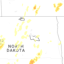
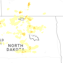
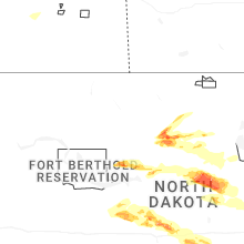
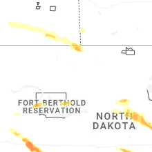


Connect with Interactive Hail Maps