

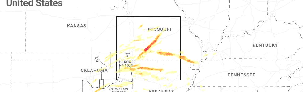
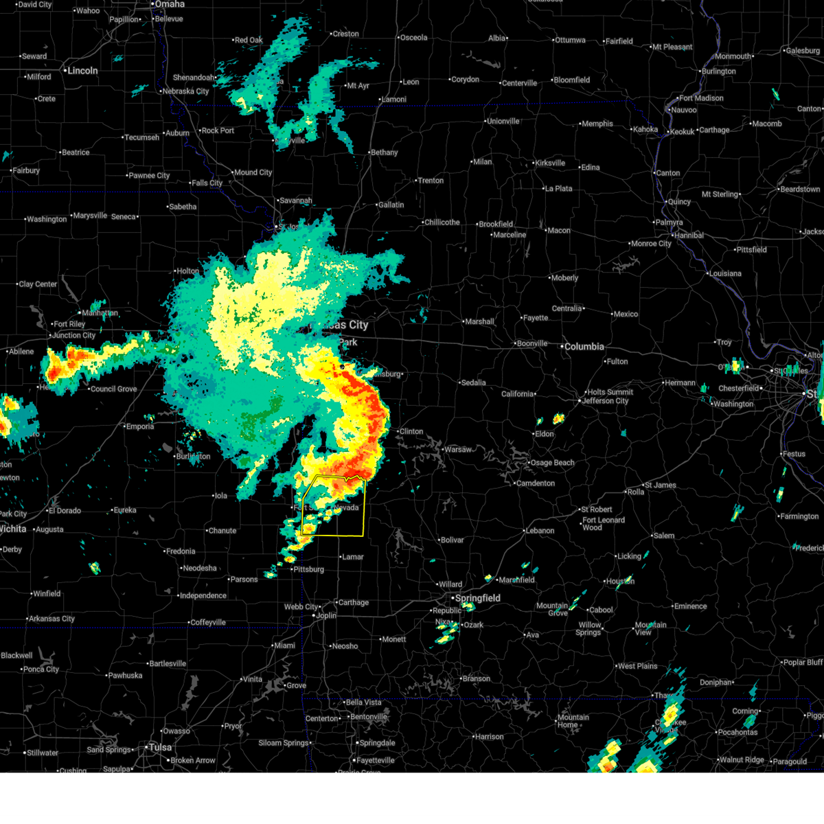
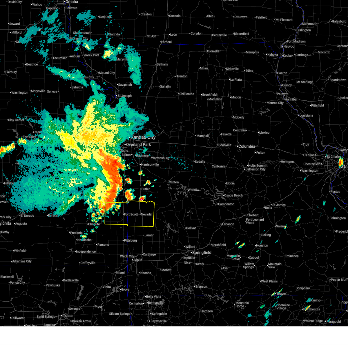
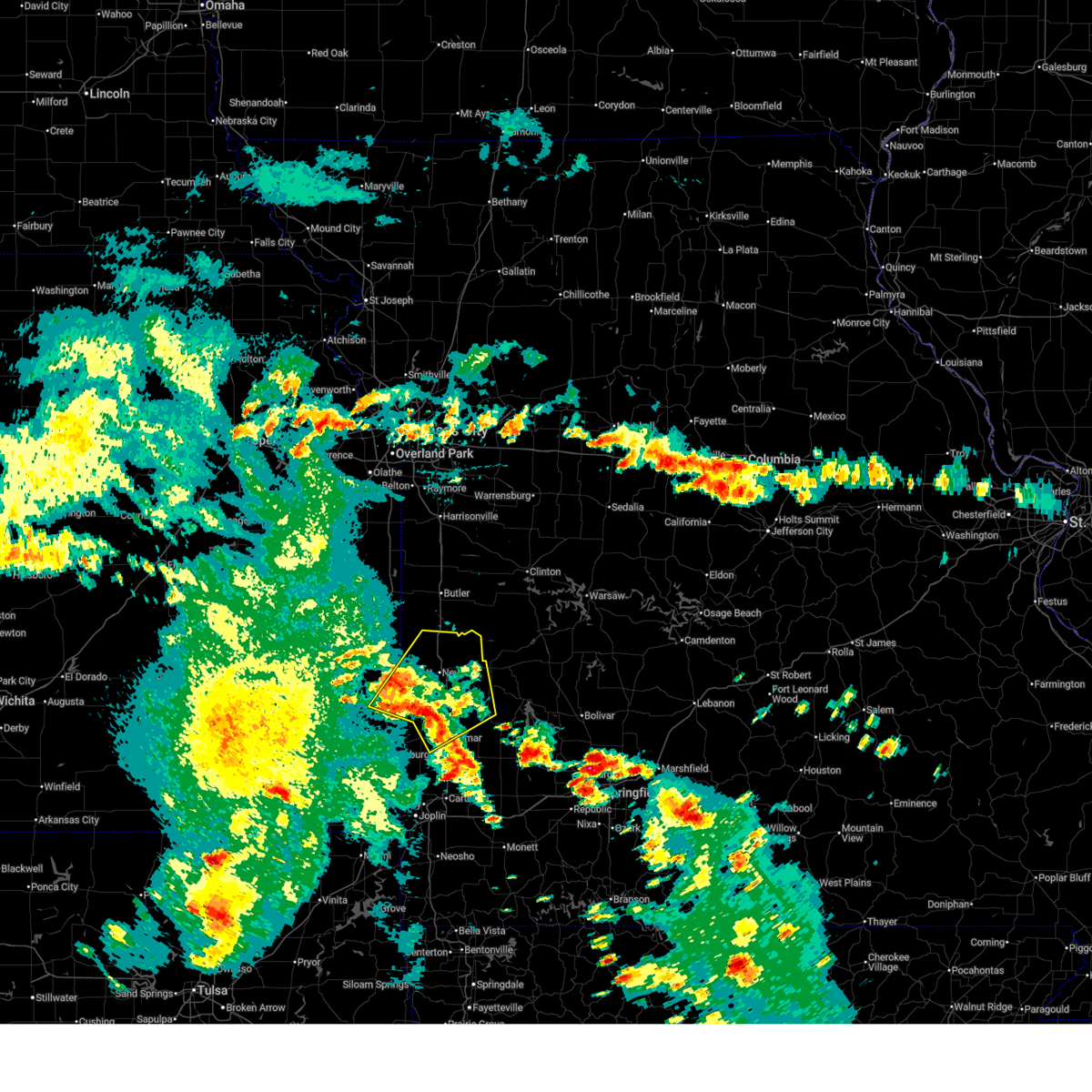
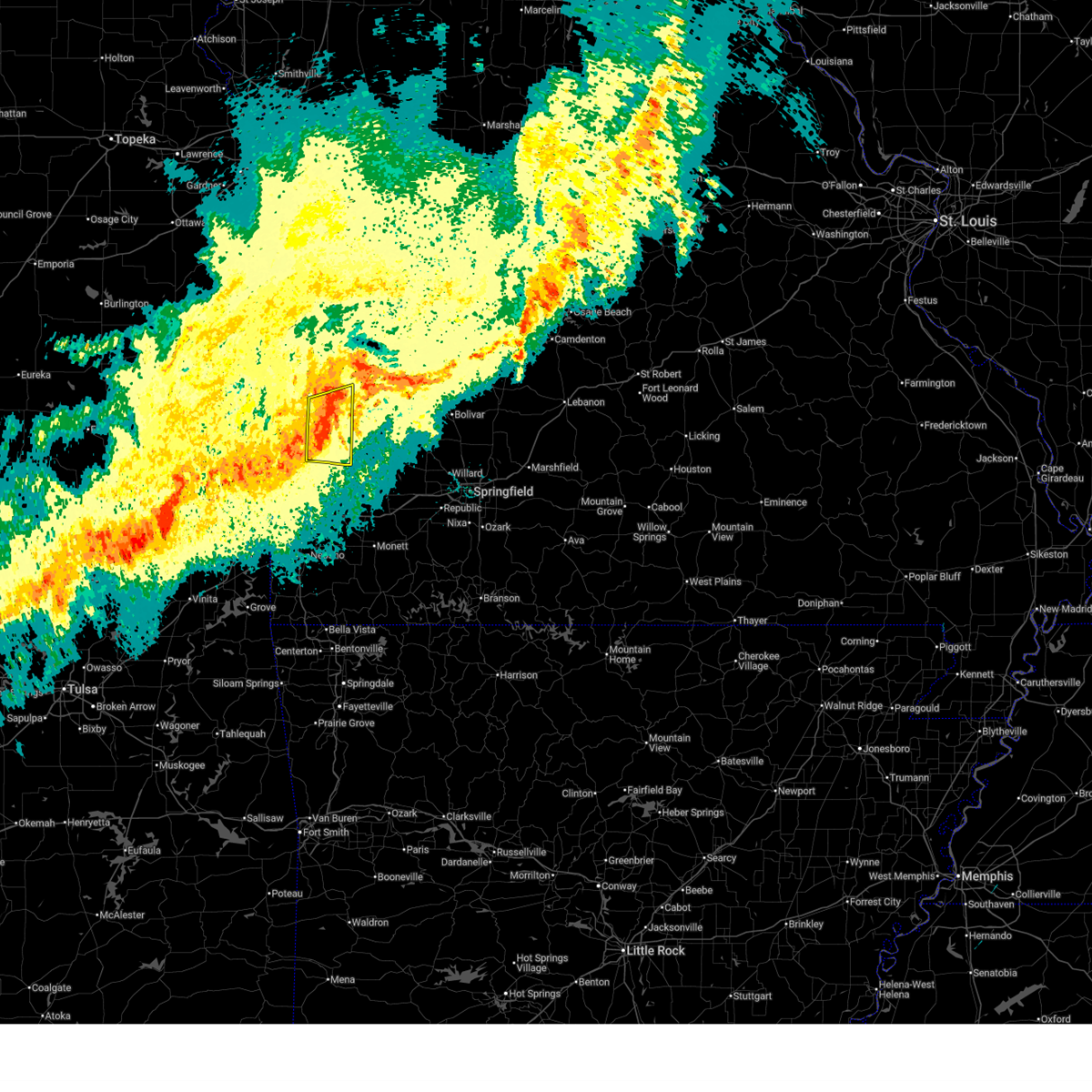
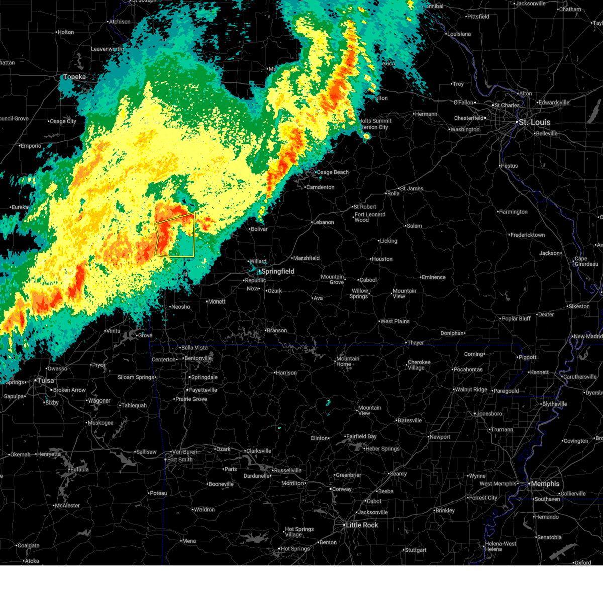
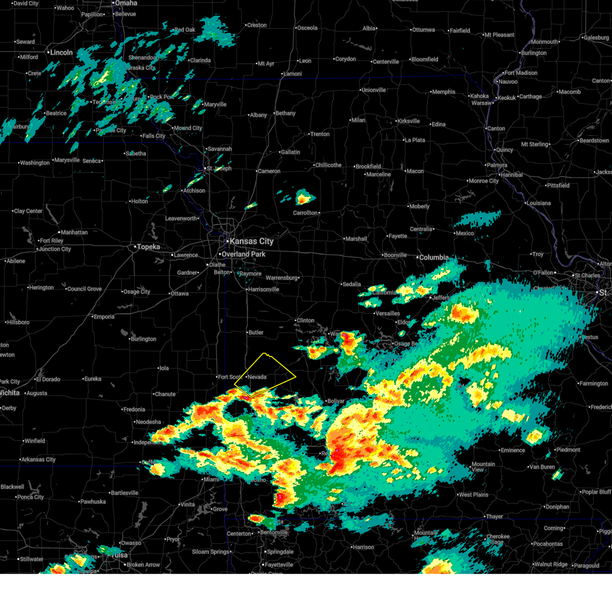
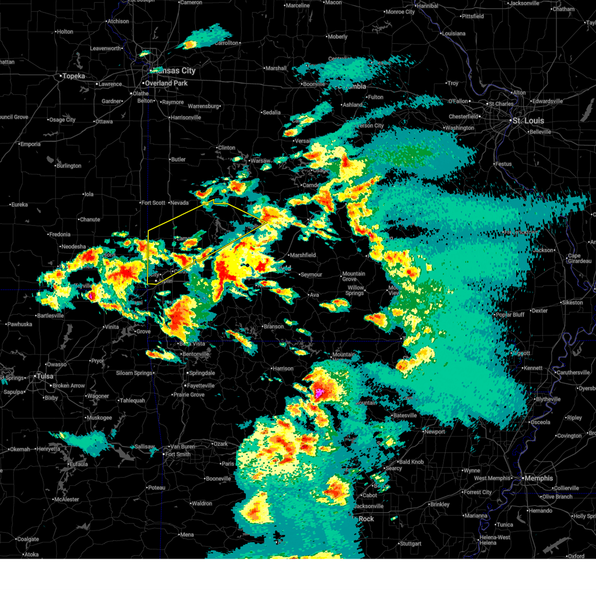
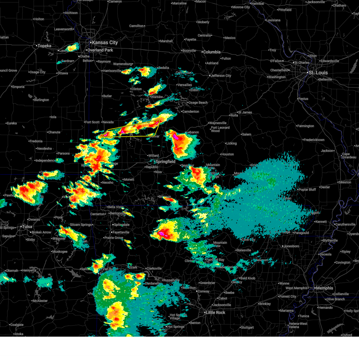
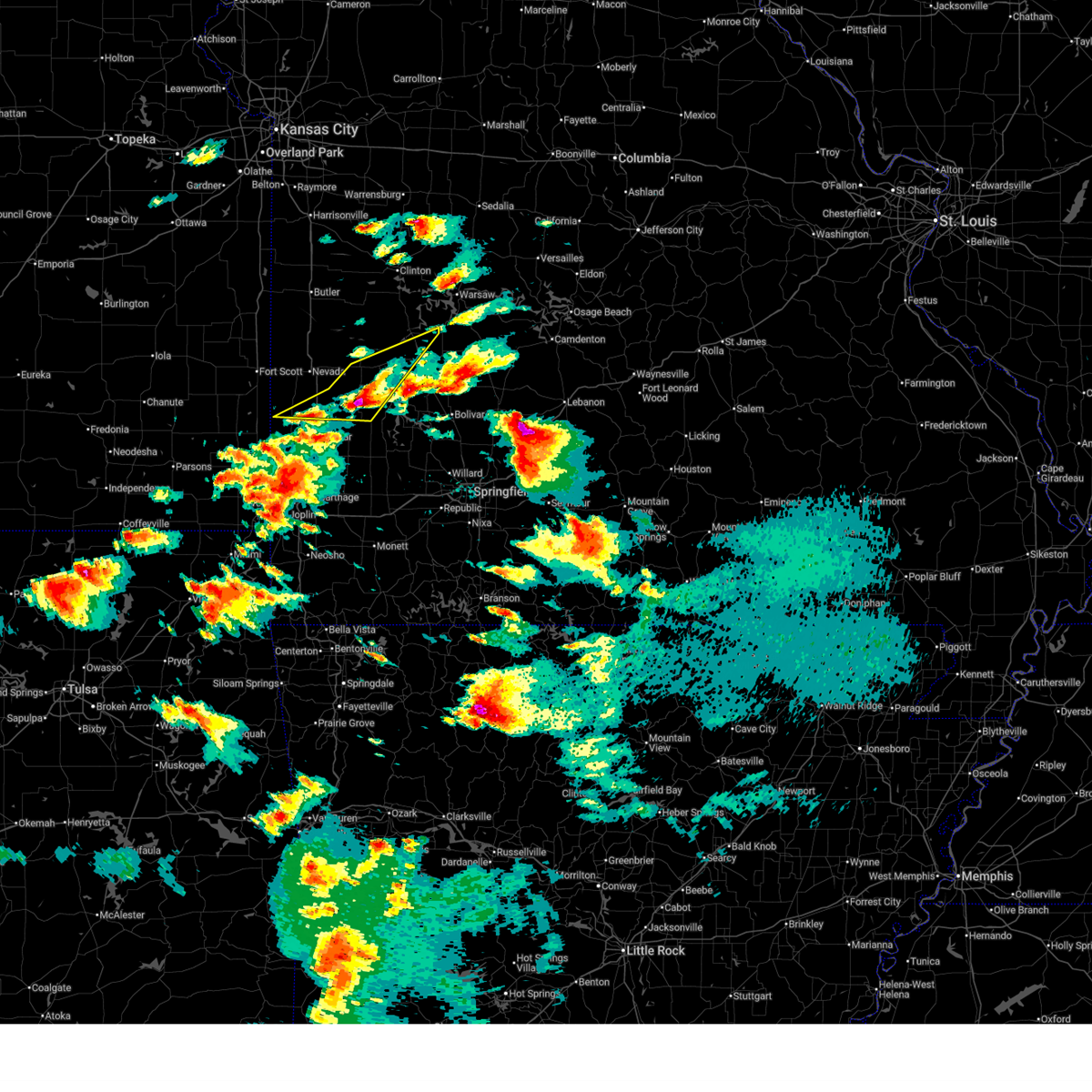
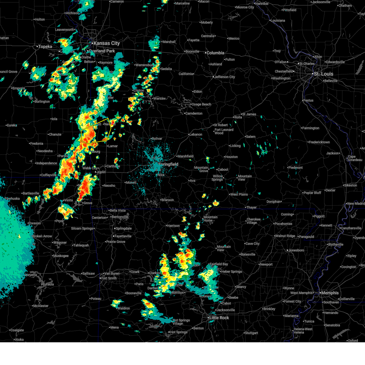
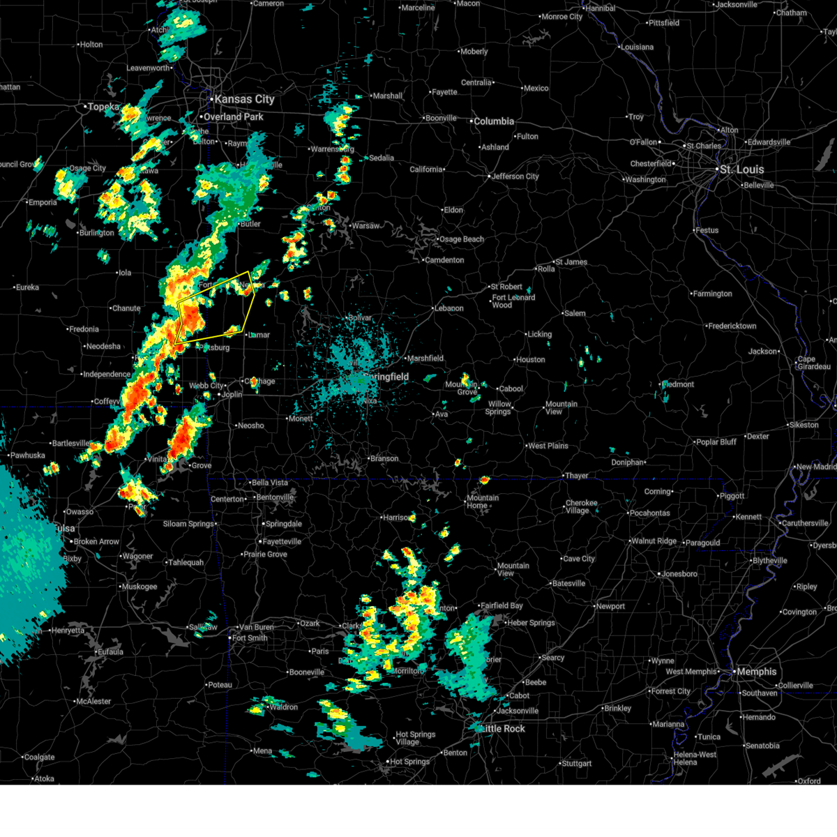
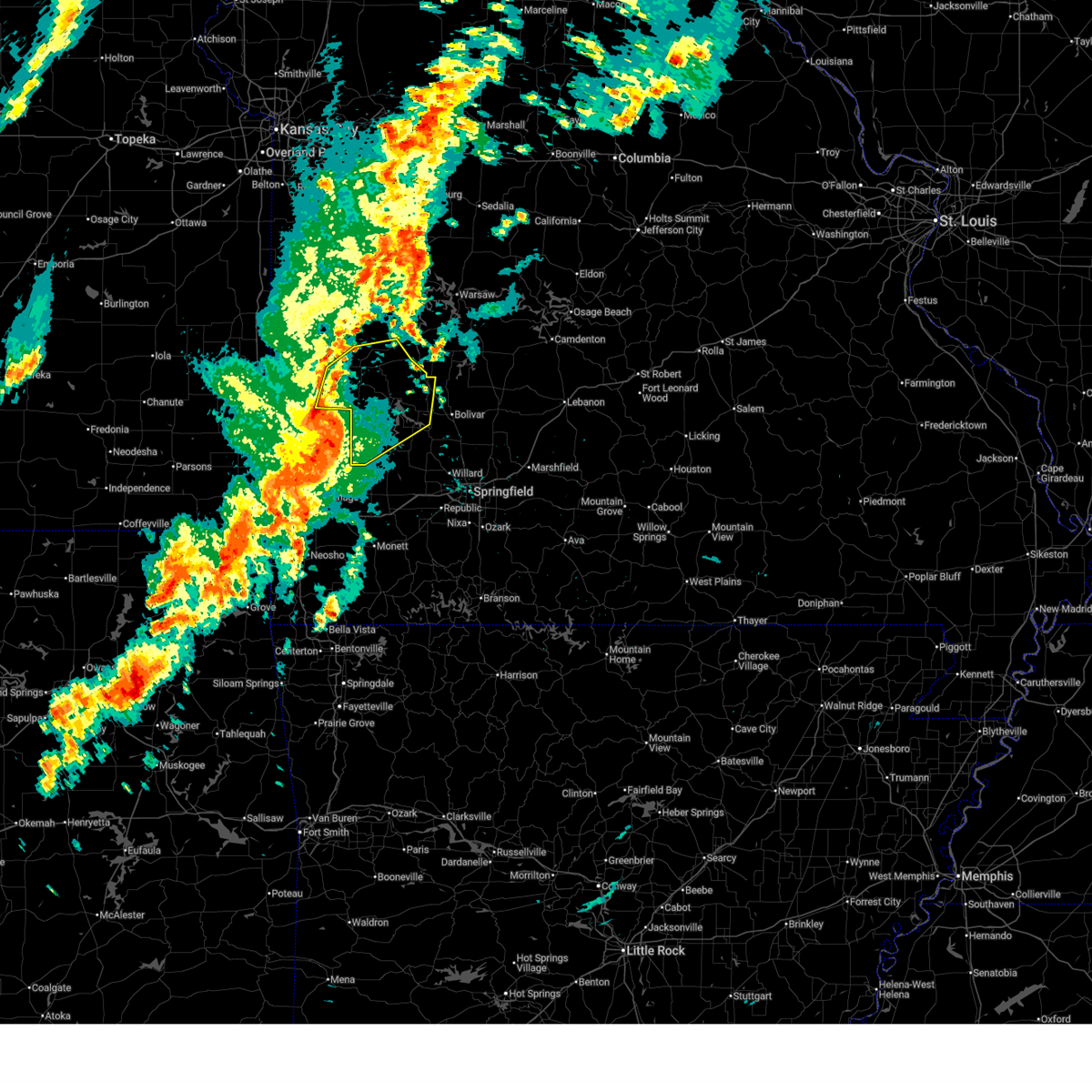
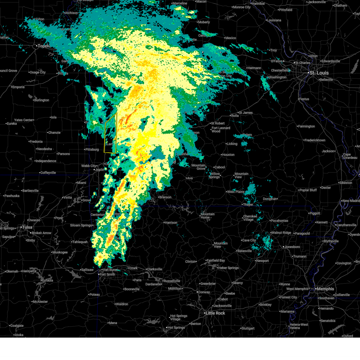
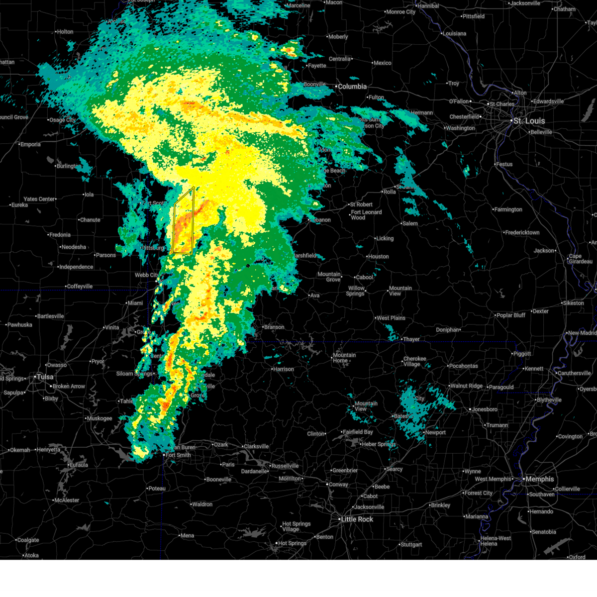
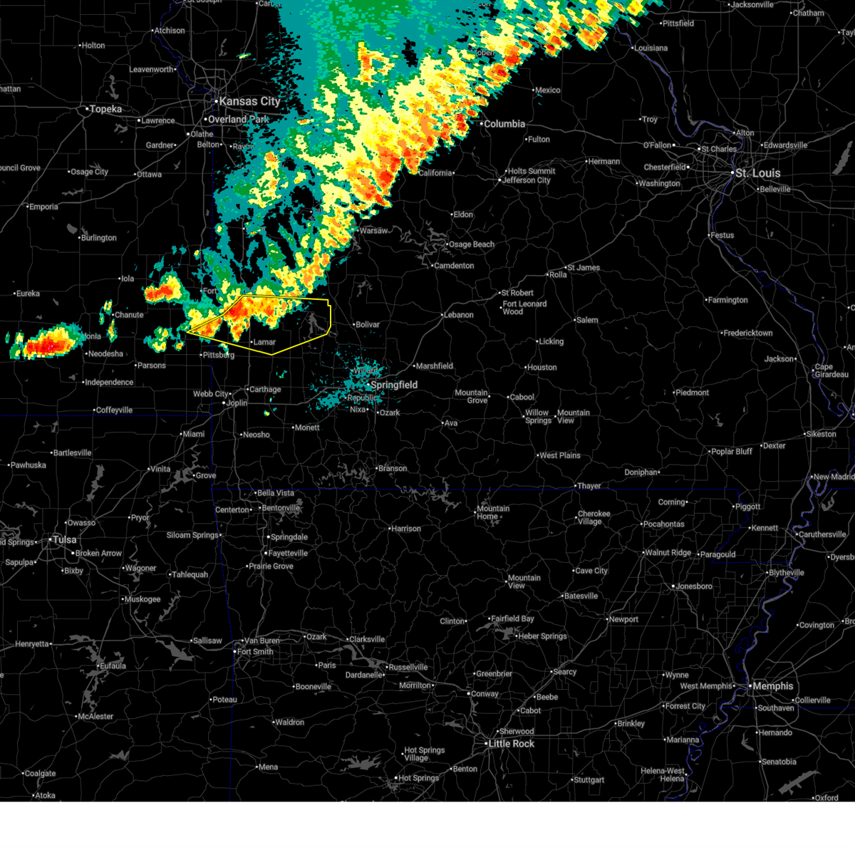
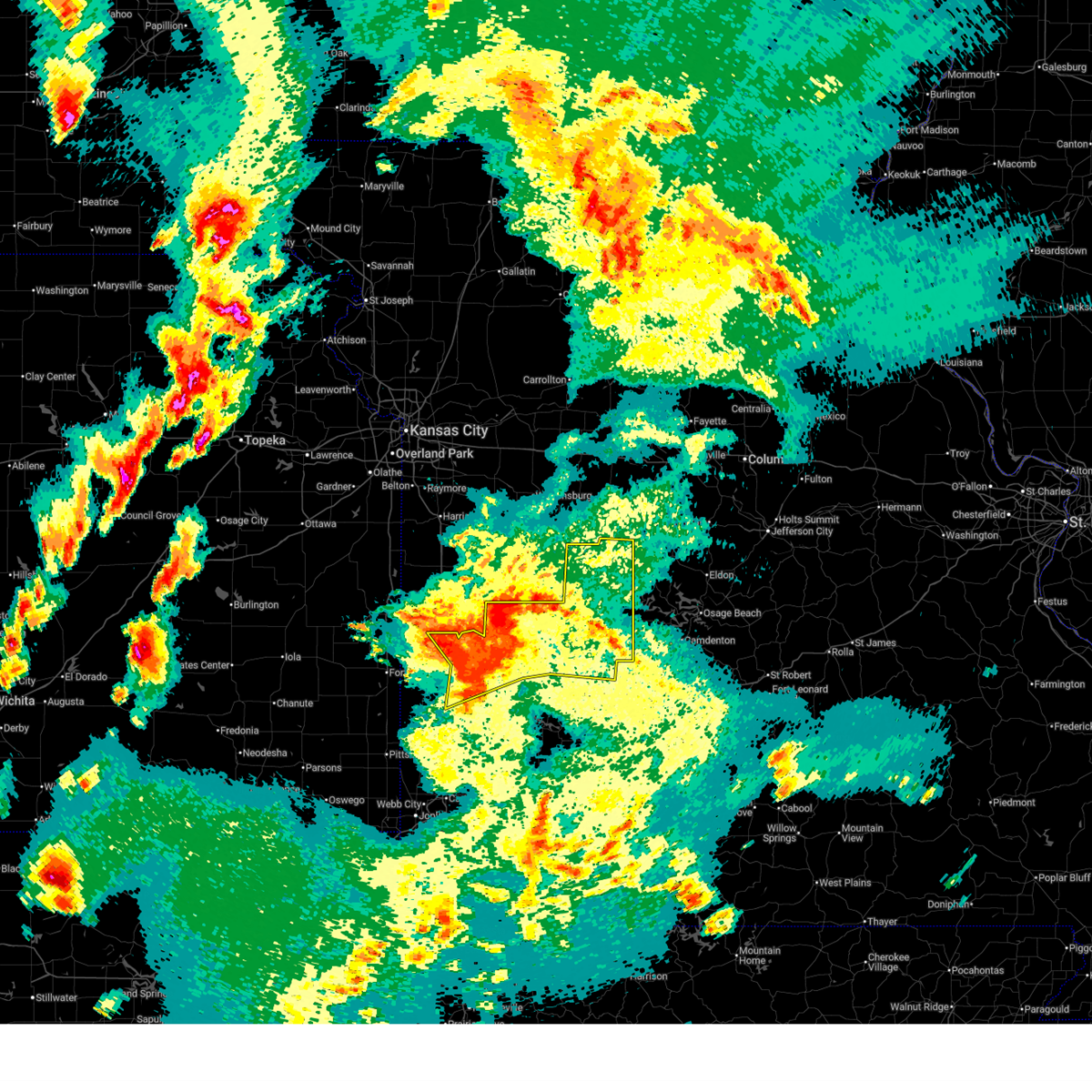
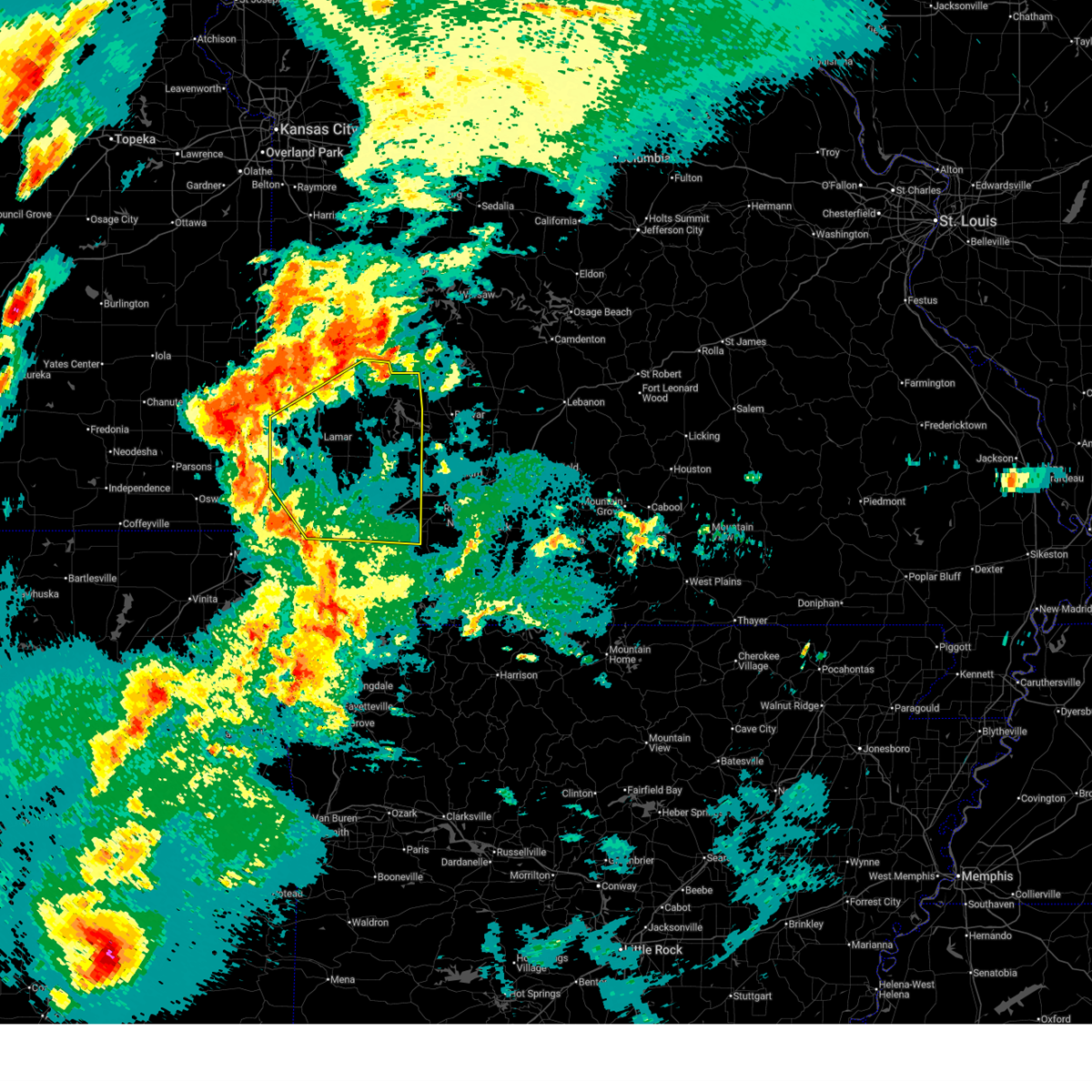
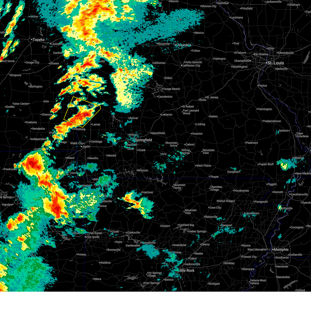
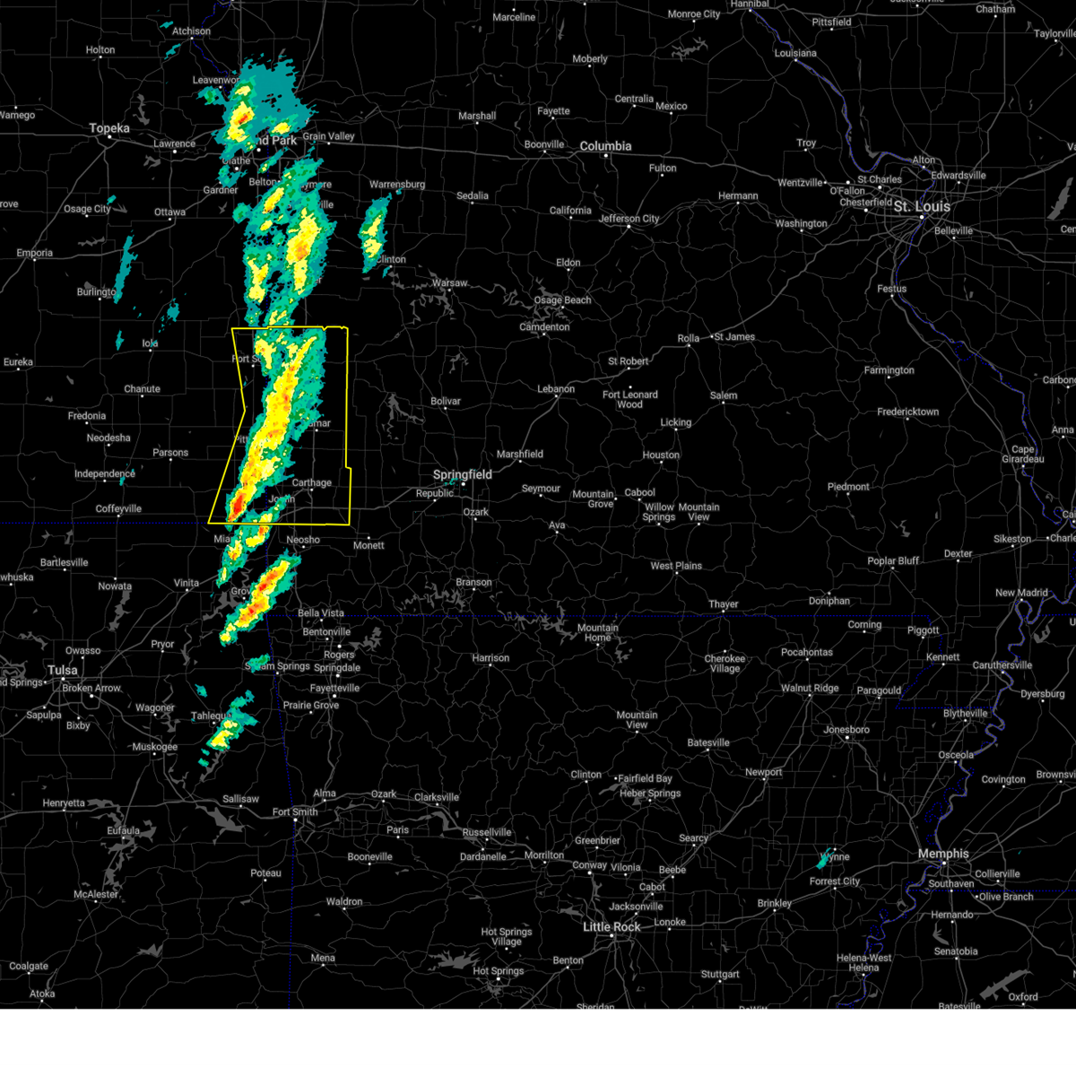
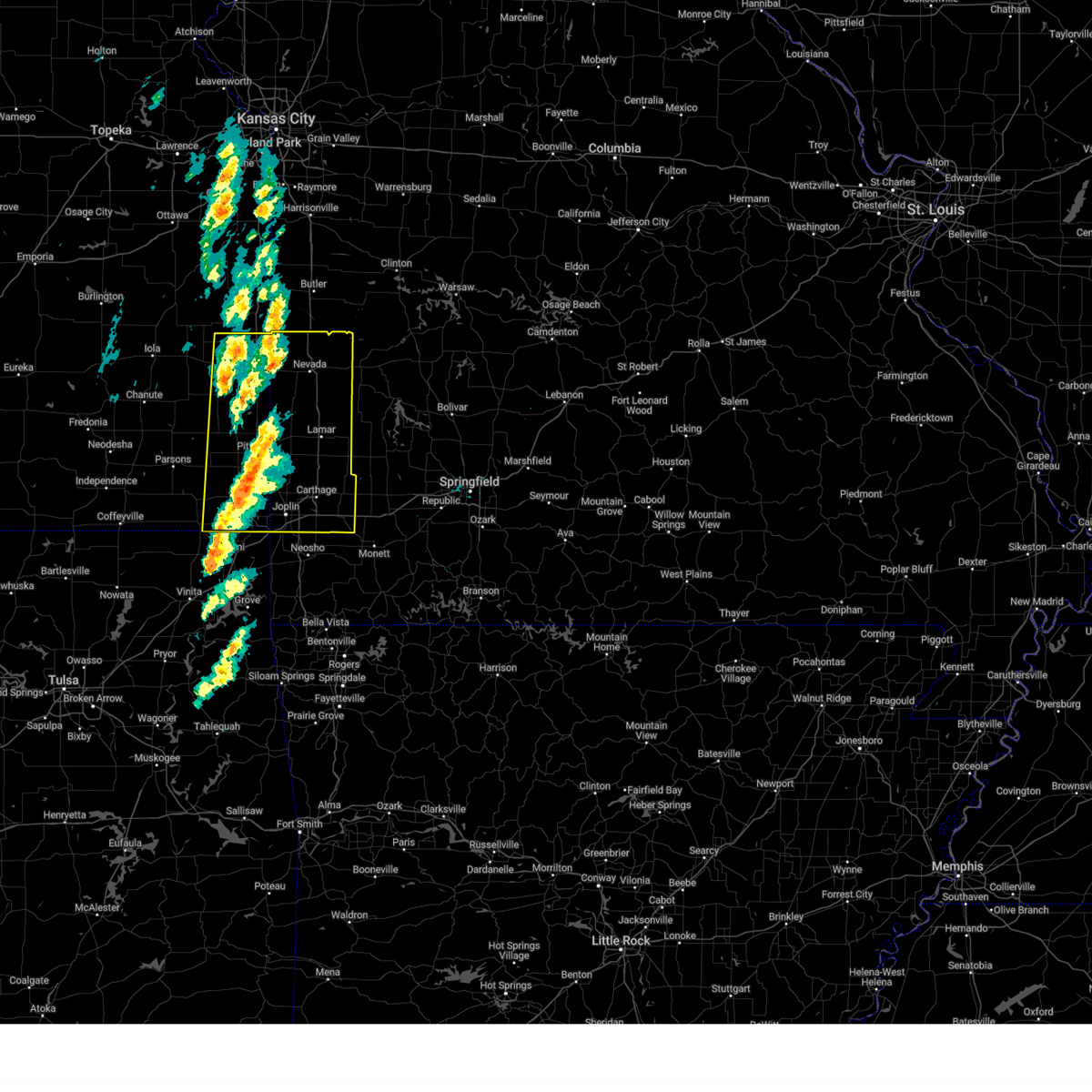
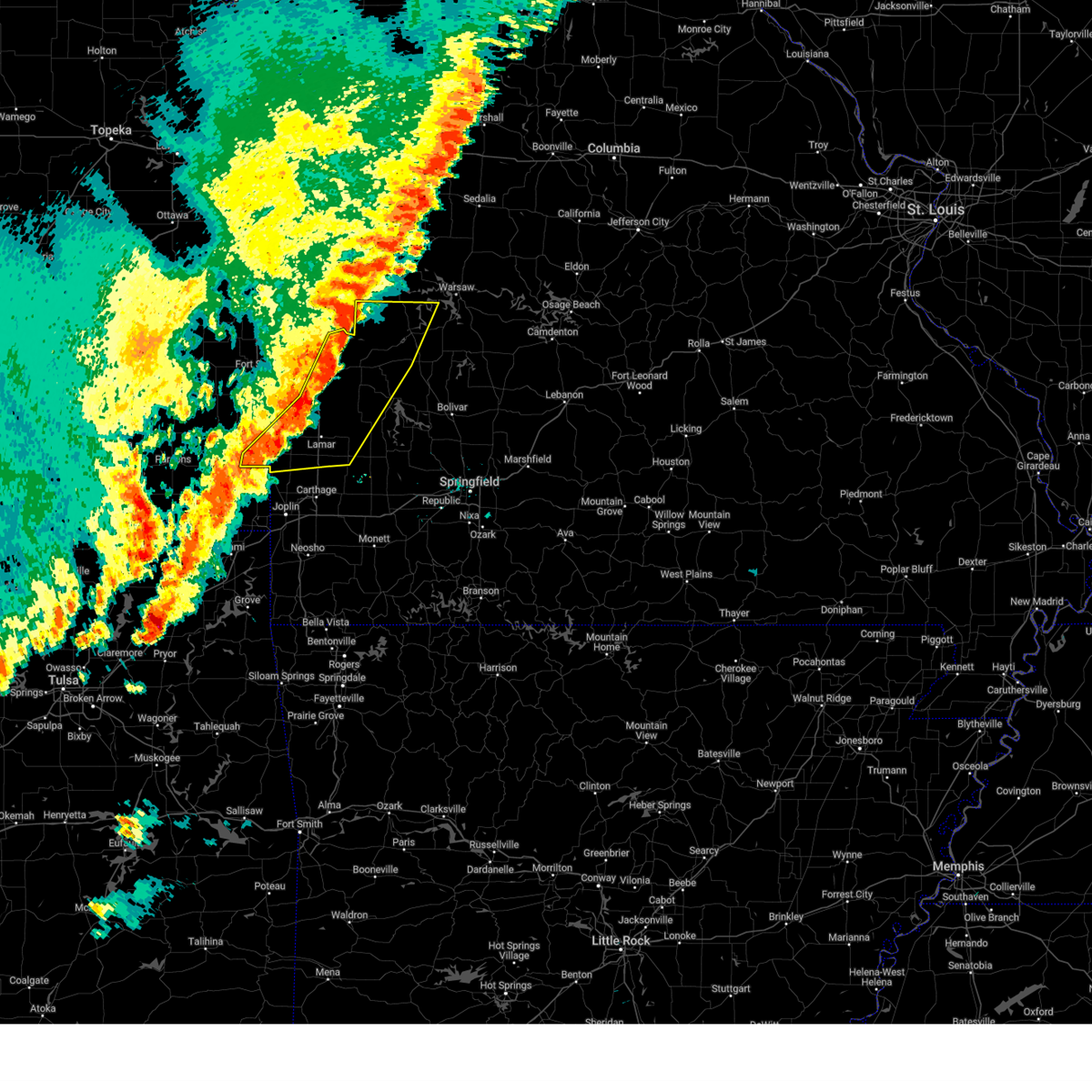
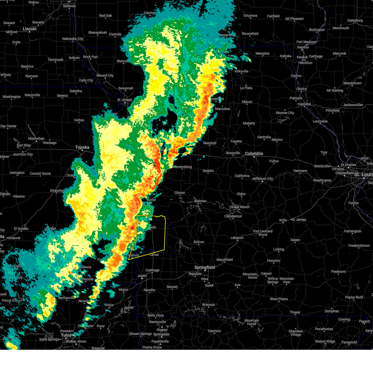
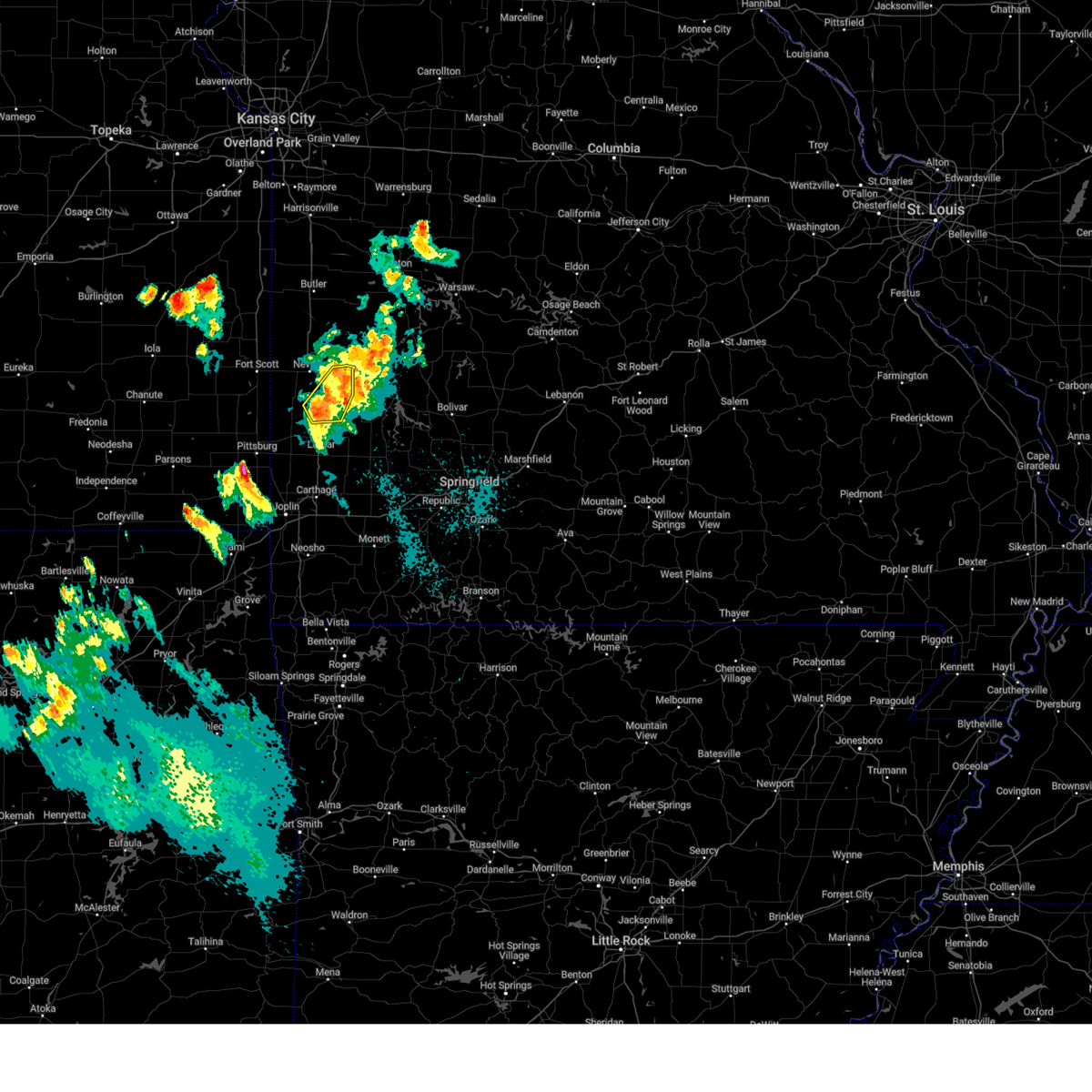
Hail Map for Sheldon, MO
The Sheldon, MO area has had 4 reports of on-the-ground hail by trained spotters, and has been under severe weather warnings 34 times during the past 12 months. Doppler radar has detected hail at or near Sheldon, MO on 69 occasions, including 4 occasions during the past year.
| Name: | Sheldon, MO |
| Where Located: | 63.4 miles E of Chanute, KS |
| Map: | Google Map for Sheldon, MO |
| Population: | 543 |
| Housing Units: | 238 |
| More Info: | Search Google for Sheldon, MO |
2
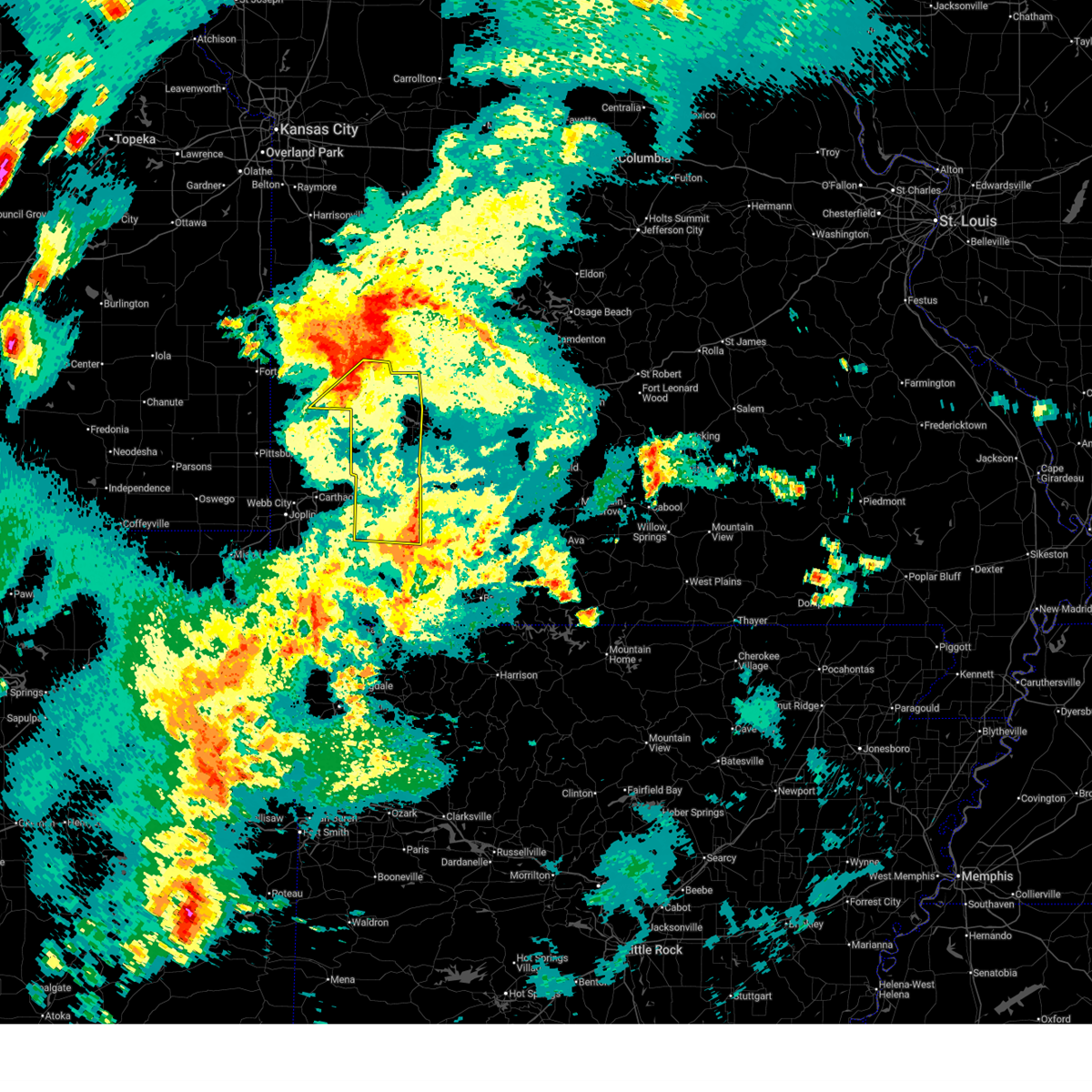
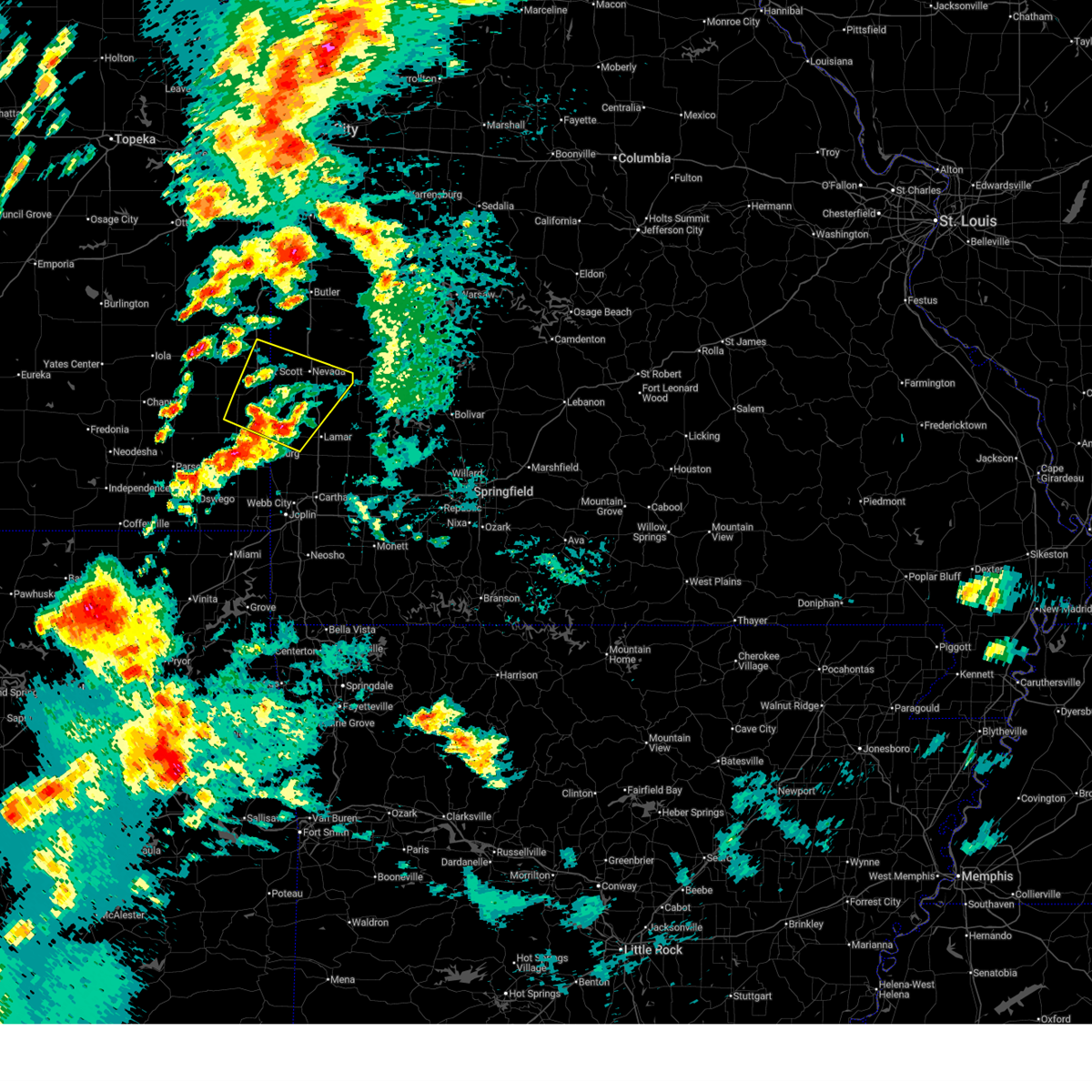
The Top Recent Hail Date for Sheldon, MO is Tuesday, April 28, 2026 (4th out of 69)
Hail and Wind Damage Spotted near Sheldon, MO
| Date / Time | Report Details |
|---|---|
| 7/10/2026 10:34 PM CDT |
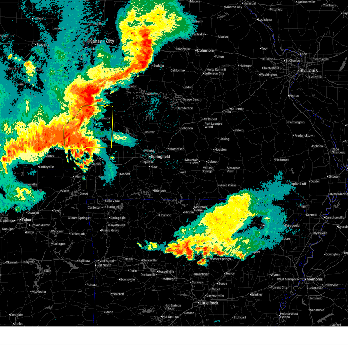
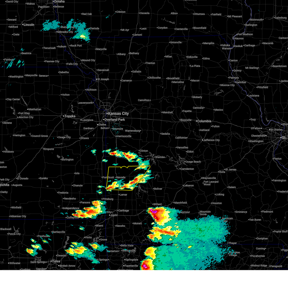
 Svrsgf the national weather service in springfield has issued a * severe thunderstorm warning for, eastern barton county in southwestern missouri, southwestern cedar county in southwestern missouri, southeastern vernon county in west central missouri, northwestern dade county in southwestern missouri, * until 1115 pm cdt. * at 1034 pm cdt, severe thunderstorms were located along a line extending from near sheldon to near lamar to 10 miles east of liberal, moving east at 30 mph (radar indicated). Hazards include 60 mph wind gusts and penny size hail. expect damage to roofs, siding, and trees Svrsgf the national weather service in springfield has issued a * severe thunderstorm warning for, eastern barton county in southwestern missouri, southwestern cedar county in southwestern missouri, southeastern vernon county in west central missouri, northwestern dade county in southwestern missouri, * until 1115 pm cdt. * at 1034 pm cdt, severe thunderstorms were located along a line extending from near sheldon to near lamar to 10 miles east of liberal, moving east at 30 mph (radar indicated). Hazards include 60 mph wind gusts and penny size hail. expect damage to roofs, siding, and trees
|
| 7/10/2026 10:05 PM CDT |
 the severe thunderstorm warning has been cancelled and is no longer in effect the severe thunderstorm warning has been cancelled and is no longer in effect
|
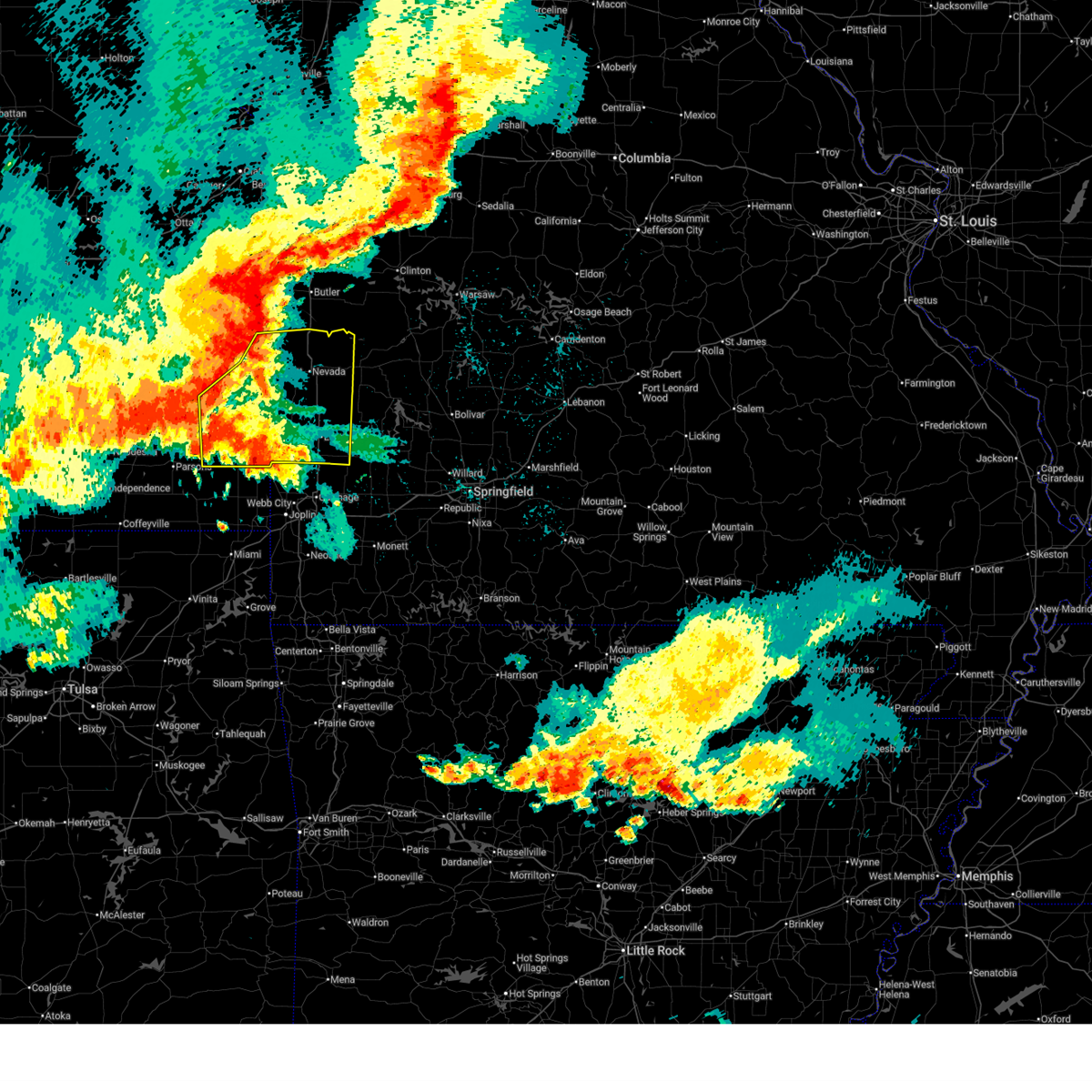
| 7/10/2026 10:05 PM CDT |
 At 1004 pm cdt, a severe thunderstorm was located near arcadia, or 14 miles southwest of nevada, moving east at 35 mph (radar indicated). Hazards include 60 mph wind gusts and penny size hail. Expect damage to roofs, siding, and trees. Locations impacted include, sheldon, bronaugh, milo, oskaloosa, verdella, and hannon. At 1004 pm cdt, a severe thunderstorm was located near arcadia, or 14 miles southwest of nevada, moving east at 35 mph (radar indicated). Hazards include 60 mph wind gusts and penny size hail. Expect damage to roofs, siding, and trees. Locations impacted include, sheldon, bronaugh, milo, oskaloosa, verdella, and hannon.
|
| 7/10/2026 9:46 PM CDT |
 Svrsgf the national weather service in springfield has issued a * severe thunderstorm warning for, southeastern bourbon county in southeastern kansas, northeastern crawford county in southeastern kansas, northwestern barton county in southwestern missouri, southwestern vernon county in west central missouri, * until 1030 pm cdt. * at 946 pm cdt, a severe thunderstorm was located over arcadia, or 12 miles south of fort scott, moving east at 40 mph (radar indicated). Hazards include 60 mph wind gusts and quarter size hail. Hail damage to vehicles is expected. Expect wind damage to roofs, siding, and trees. Svrsgf the national weather service in springfield has issued a * severe thunderstorm warning for, southeastern bourbon county in southeastern kansas, northeastern crawford county in southeastern kansas, northwestern barton county in southwestern missouri, southwestern vernon county in west central missouri, * until 1030 pm cdt. * at 946 pm cdt, a severe thunderstorm was located over arcadia, or 12 miles south of fort scott, moving east at 40 mph (radar indicated). Hazards include 60 mph wind gusts and quarter size hail. Hail damage to vehicles is expected. Expect wind damage to roofs, siding, and trees.
|
| 7/4/2026 1:06 PM CDT |
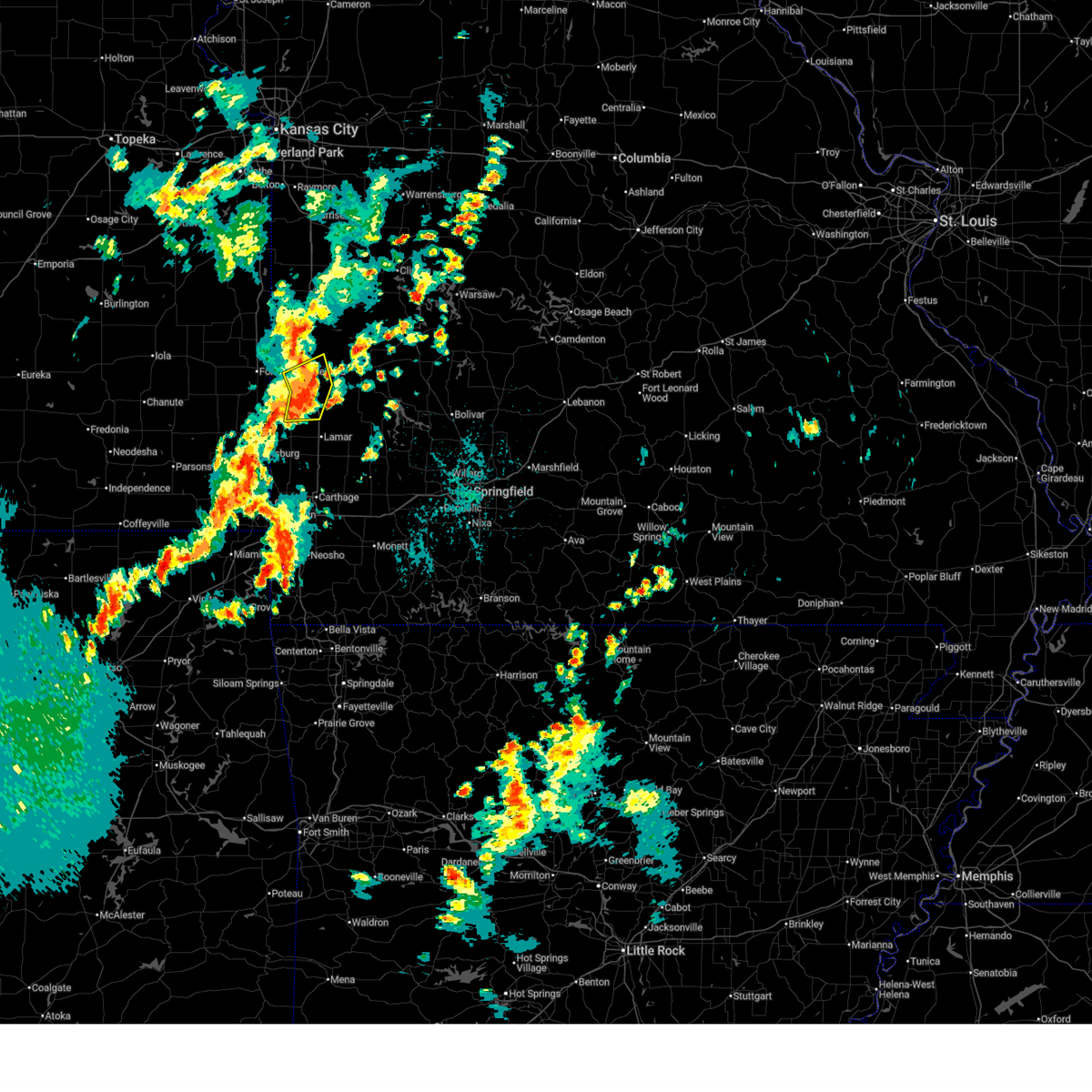
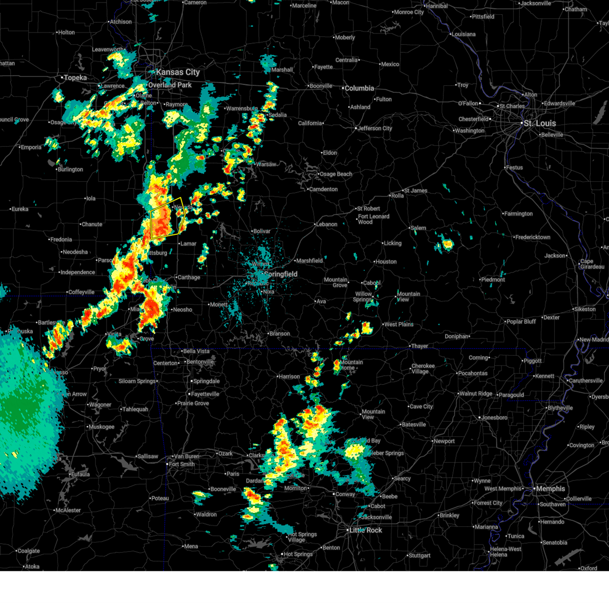
 At 104 pm cdt, severe thunderstorms were located along a line extending from 9 miles east of schell city to 6 miles southwest of el dorado springs to sheldon, moving southeast at 35 mph. damaging winds may start 10 to 15 minutes before rain begins (public. these storms have a history of producing 50 to 60 mph winds and quarter sized hail). Hazards include 60 mph wind gusts and quarter size hail. Hail damage to vehicles is expected. expect wind damage to roofs, siding, and trees. Locations impacted include, stockton lake, truman lake, stockton state park, nevada, el dorado springs, stockton, appleton city, osceola, lowry city, sheldon, montevallo, walker, schell city, jerico springs, collins, roscoe, milo, vista, umber view heights, and harwood. At 104 pm cdt, severe thunderstorms were located along a line extending from 9 miles east of schell city to 6 miles southwest of el dorado springs to sheldon, moving southeast at 35 mph. damaging winds may start 10 to 15 minutes before rain begins (public. these storms have a history of producing 50 to 60 mph winds and quarter sized hail). Hazards include 60 mph wind gusts and quarter size hail. Hail damage to vehicles is expected. expect wind damage to roofs, siding, and trees. Locations impacted include, stockton lake, truman lake, stockton state park, nevada, el dorado springs, stockton, appleton city, osceola, lowry city, sheldon, montevallo, walker, schell city, jerico springs, collins, roscoe, milo, vista, umber view heights, and harwood.
|
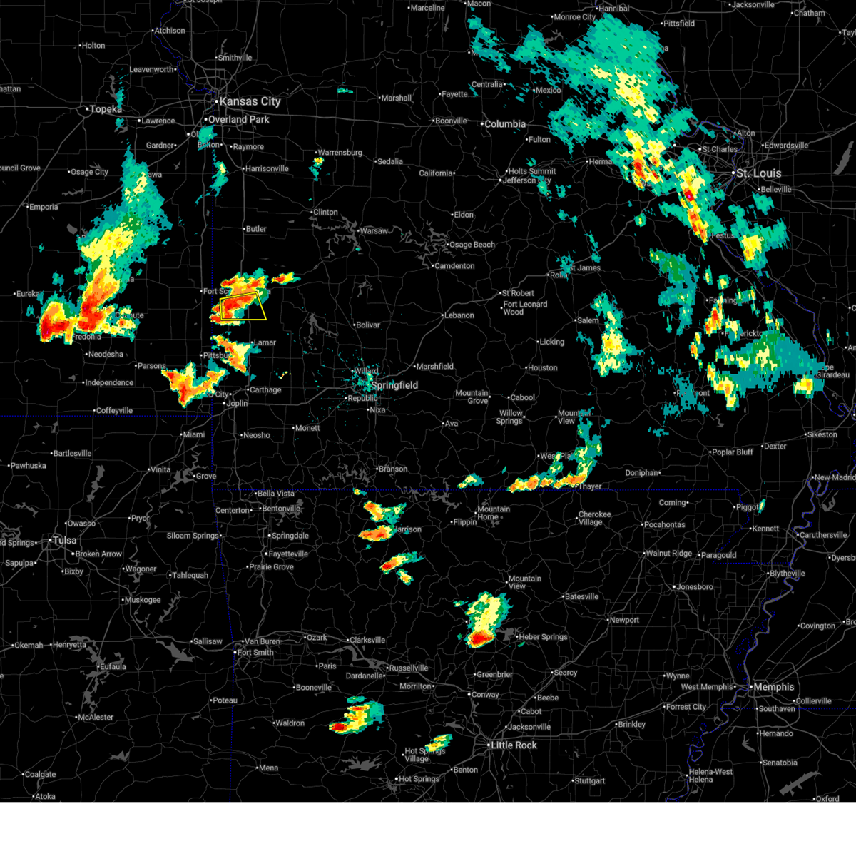
| 7/4/2026 12:49 PM CDT |
 At 1248 pm cdt, severe thunderstorms were located along a line extending from near schell city to near walker to 9 miles northeast of arcadia, moving east at 30 mph (public. these storms have a history of producing wind gust of 50 to 60 mph and quarter sized hail). Hazards include 70 mph wind gusts and quarter size hail. Hail damage to vehicles is expected. expect considerable tree damage. wind damage is also likely to mobile homes, roofs, and outbuildings. Locations impacted include, nevada, sheldon, montevallo, walker, schell city, bronaugh, moundville, richards, milo, deerfield, metz, harwood, and horton. At 1248 pm cdt, severe thunderstorms were located along a line extending from near schell city to near walker to 9 miles northeast of arcadia, moving east at 30 mph (public. these storms have a history of producing wind gust of 50 to 60 mph and quarter sized hail). Hazards include 70 mph wind gusts and quarter size hail. Hail damage to vehicles is expected. expect considerable tree damage. wind damage is also likely to mobile homes, roofs, and outbuildings. Locations impacted include, nevada, sheldon, montevallo, walker, schell city, bronaugh, moundville, richards, milo, deerfield, metz, harwood, and horton.
|
| 7/4/2026 12:41 PM CDT |
 At 1240 pm cdt, severe thunderstorms were located along a line extending from near schell city to near nevada to 7 miles northeast of arcadia, moving east at 30 mph. damaging winds will arrive 10 to 20 minutes before rain begins (public. these storms produced quarter sized hail near fort scott). Hazards include 70 mph wind gusts and quarter size hail. Hail damage to vehicles is expected. expect considerable tree damage. wind damage is also likely to mobile homes, roofs, and outbuildings. Locations impacted include, nevada, fort scott, sheldon, montevallo, walker, schell city, bronaugh, moundville, richards, milo, deerfield, metz, harwood, stotesbury, horton, and garland. At 1240 pm cdt, severe thunderstorms were located along a line extending from near schell city to near nevada to 7 miles northeast of arcadia, moving east at 30 mph. damaging winds will arrive 10 to 20 minutes before rain begins (public. these storms produced quarter sized hail near fort scott). Hazards include 70 mph wind gusts and quarter size hail. Hail damage to vehicles is expected. expect considerable tree damage. wind damage is also likely to mobile homes, roofs, and outbuildings. Locations impacted include, nevada, fort scott, sheldon, montevallo, walker, schell city, bronaugh, moundville, richards, milo, deerfield, metz, harwood, stotesbury, horton, and garland.
|
| 7/4/2026 12:38 PM CDT |
 Svrsgf the national weather service in springfield has issued a * severe thunderstorm warning for, cedar county in southwestern missouri, st. clair county in west central missouri, vernon county in west central missouri, * until 130 pm cdt. * at 1235 pm cdt, severe thunderstorms were located along a line extending from 7 miles northwest of schell city to near nevada to 7 miles northeast of arcadia, moving southeast at 35 mph. damaging winds will arrive 10 to 20 minutes before rain begins (public. these storms produced quarter sized hail near fort scott). Hazards include 70 mph wind gusts and quarter size hail. Hail damage to vehicles is expected. expect considerable tree damage. Wind damage is also likely to mobile homes, roofs, and outbuildings. Svrsgf the national weather service in springfield has issued a * severe thunderstorm warning for, cedar county in southwestern missouri, st. clair county in west central missouri, vernon county in west central missouri, * until 130 pm cdt. * at 1235 pm cdt, severe thunderstorms were located along a line extending from 7 miles northwest of schell city to near nevada to 7 miles northeast of arcadia, moving southeast at 35 mph. damaging winds will arrive 10 to 20 minutes before rain begins (public. these storms produced quarter sized hail near fort scott). Hazards include 70 mph wind gusts and quarter size hail. Hail damage to vehicles is expected. expect considerable tree damage. Wind damage is also likely to mobile homes, roofs, and outbuildings.
|
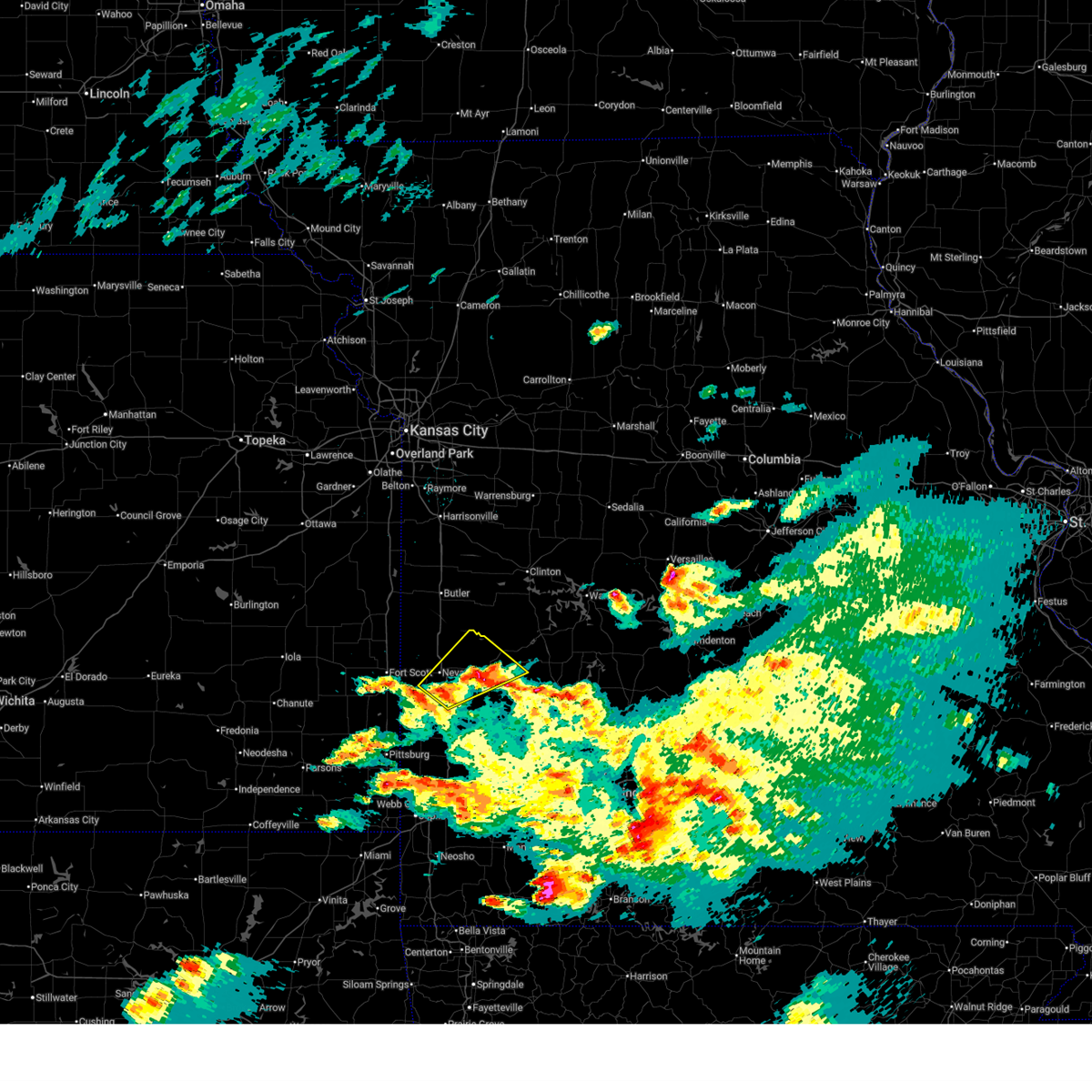
| 7/4/2026 12:26 PM CDT |
 At 1225 pm cdt, severe thunderstorms were located along a line extending from near rich hill to 10 miles northwest of nevada to 6 miles south of fort scott, moving southeast at 30 mph (public. quarter-sized hail was reported with these storms near fort scott). Hazards include 70 mph wind gusts and quarter size hail. Hail damage to vehicles is expected. expect considerable tree damage. wind damage is also likely to mobile homes, roofs, and outbuildings. Locations impacted include, nevada, fort scott, marmaton, sheldon, bronson, montevallo, uniontown, walker, schell city, bronaugh, fulton, redfield, moundville, richards, milo, mapleton, deerfield, metz, harwood, and stotesbury. At 1225 pm cdt, severe thunderstorms were located along a line extending from near rich hill to 10 miles northwest of nevada to 6 miles south of fort scott, moving southeast at 30 mph (public. quarter-sized hail was reported with these storms near fort scott). Hazards include 70 mph wind gusts and quarter size hail. Hail damage to vehicles is expected. expect considerable tree damage. wind damage is also likely to mobile homes, roofs, and outbuildings. Locations impacted include, nevada, fort scott, marmaton, sheldon, bronson, montevallo, uniontown, walker, schell city, bronaugh, fulton, redfield, moundville, richards, milo, mapleton, deerfield, metz, harwood, and stotesbury.
|
| 7/4/2026 12:04 PM CDT |
 Svrsgf the national weather service in springfield has issued a * severe thunderstorm warning for, bourbon county in southeastern kansas, vernon county in west central missouri, * until 100 pm cdt. * at 1204 pm cdt, severe thunderstorms were located along a line extending from 6 miles southeast of la cygne to near fulton to uniontown, moving east at 30 mph (radar indicated). Hazards include 60 mph wind gusts and quarter size hail. Hail damage to vehicles is expected. Expect wind damage to roofs, siding, and trees. Svrsgf the national weather service in springfield has issued a * severe thunderstorm warning for, bourbon county in southeastern kansas, vernon county in west central missouri, * until 100 pm cdt. * at 1204 pm cdt, severe thunderstorms were located along a line extending from 6 miles southeast of la cygne to near fulton to uniontown, moving east at 30 mph (radar indicated). Hazards include 60 mph wind gusts and quarter size hail. Hail damage to vehicles is expected. Expect wind damage to roofs, siding, and trees.
|
| 6/25/2026 3:47 PM CDT |
 Svrsgf the national weather service in springfield has issued a * severe thunderstorm warning for, southeastern bourbon county in southeastern kansas, northeastern crawford county in southeastern kansas, northern barton county in southwestern missouri, western cedar county in southwestern missouri, vernon county in west central missouri, * until 430 pm cdt. * at 347 pm cdt, severe thunderstorms were located along a line extending from near fort scott to 6 miles west of sheldon to near lamar, moving northeast at 35 mph (radar indicated). Hazards include 60 mph wind gusts. expect damage to roofs, siding, and trees Svrsgf the national weather service in springfield has issued a * severe thunderstorm warning for, southeastern bourbon county in southeastern kansas, northeastern crawford county in southeastern kansas, northern barton county in southwestern missouri, western cedar county in southwestern missouri, vernon county in west central missouri, * until 430 pm cdt. * at 347 pm cdt, severe thunderstorms were located along a line extending from near fort scott to 6 miles west of sheldon to near lamar, moving northeast at 35 mph (radar indicated). Hazards include 60 mph wind gusts. expect damage to roofs, siding, and trees
|
| 6/21/2026 8:15 AM CDT |
 At 815 am cdt, severe thunderstorms were located along a line extending from sheldon to near lamar, moving east at 30 mph (radar indicated). Hazards include 60 mph wind gusts. Expect damage to roofs, siding, and trees. Locations impacted include, lamar, golden city, sheldon, montevallo, lamar heights, irwin, milford, kenoma, oakton, and boston. At 815 am cdt, severe thunderstorms were located along a line extending from sheldon to near lamar, moving east at 30 mph (radar indicated). Hazards include 60 mph wind gusts. Expect damage to roofs, siding, and trees. Locations impacted include, lamar, golden city, sheldon, montevallo, lamar heights, irwin, milford, kenoma, oakton, and boston.
|
| 6/21/2026 7:58 AM CDT |
 Svrsgf the national weather service in springfield has issued a * severe thunderstorm warning for, barton county in southwestern missouri, southeastern vernon county in west central missouri, * until 845 am cdt. * at 758 am cdt, severe thunderstorms were located along a line extending from 6 miles west of sheldon to 6 miles northwest of lamar to 7 miles northwest of jasper, moving east at 30 mph (radar indicated). Hazards include 60 mph wind gusts. expect damage to roofs, siding, and trees Svrsgf the national weather service in springfield has issued a * severe thunderstorm warning for, barton county in southwestern missouri, southeastern vernon county in west central missouri, * until 845 am cdt. * at 758 am cdt, severe thunderstorms were located along a line extending from 6 miles west of sheldon to 6 miles northwest of lamar to 7 miles northwest of jasper, moving east at 30 mph (radar indicated). Hazards include 60 mph wind gusts. expect damage to roofs, siding, and trees
|
| 6/13/2026 10:20 PM CDT |
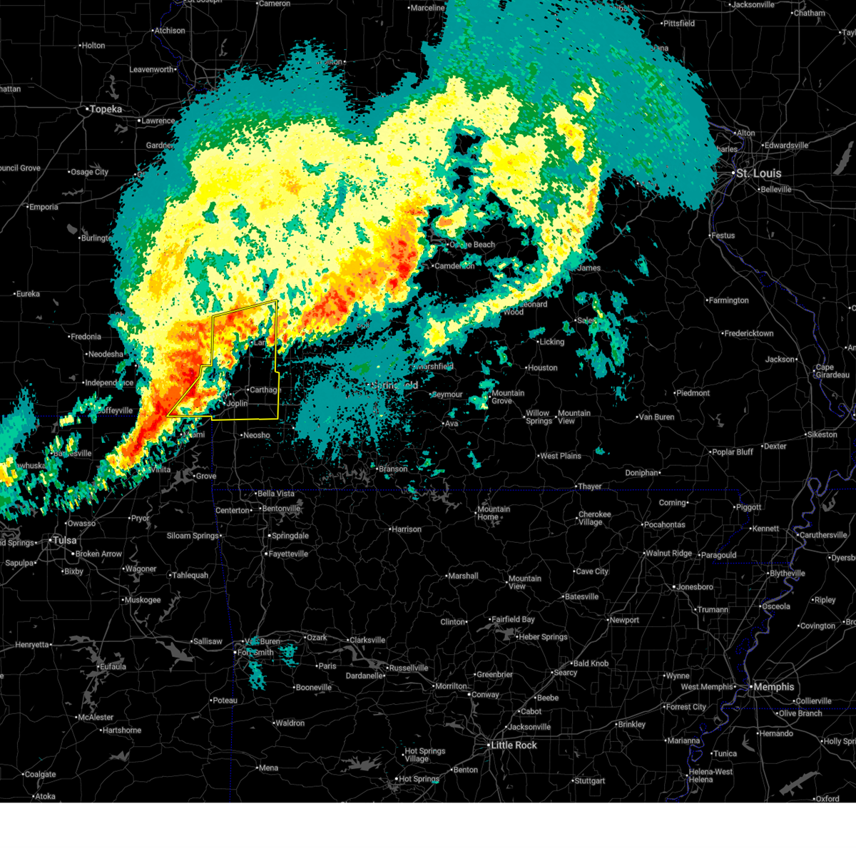
 At 1019 pm cdt, severe thunderstorms were located along a line extending from 7 miles east of pleasanton to near fort scott to 6 miles northeast of parsons, moving southeast at 60 mph (radar indicated. multiple reports of 60 to 70 mph wind gusts have been received from this line of storms). Hazards include 70 mph wind gusts and quarter size hail. Hail damage to vehicles is expected. expect considerable tree damage. wind damage is also likely to mobile homes, roofs, and outbuildings. Locations impacted include, pittsburg, prairie state park, nevada, fort scott, lamar, frontenac, girard, arma, marmaton, golden city, liberal, cherokee, sheldon, mulberry, chicopee, mccune, nashville, mindenmines, franklin, and montevallo. At 1019 pm cdt, severe thunderstorms were located along a line extending from 7 miles east of pleasanton to near fort scott to 6 miles northeast of parsons, moving southeast at 60 mph (radar indicated. multiple reports of 60 to 70 mph wind gusts have been received from this line of storms). Hazards include 70 mph wind gusts and quarter size hail. Hail damage to vehicles is expected. expect considerable tree damage. wind damage is also likely to mobile homes, roofs, and outbuildings. Locations impacted include, pittsburg, prairie state park, nevada, fort scott, lamar, frontenac, girard, arma, marmaton, golden city, liberal, cherokee, sheldon, mulberry, chicopee, mccune, nashville, mindenmines, franklin, and montevallo.
|
| 6/13/2026 10:08 PM CDT |
 Svrsgf the national weather service in springfield has issued a * severe thunderstorm warning for, southeastern bourbon county in southeastern kansas, crawford county in southeastern kansas, barton county in southwestern missouri, vernon county in west central missouri, * until 1115 pm cdt. * at 1008 pm cdt, severe thunderstorms were located along a line extending from near la cygne to near fort scott to near galesburg, moving southeast at 60 mph (radar indicated). Hazards include 70 mph wind gusts and nickel size hail. Expect considerable tree damage. Damage is likely to mobile homes, roofs, and outbuildings. Svrsgf the national weather service in springfield has issued a * severe thunderstorm warning for, southeastern bourbon county in southeastern kansas, crawford county in southeastern kansas, barton county in southwestern missouri, vernon county in west central missouri, * until 1115 pm cdt. * at 1008 pm cdt, severe thunderstorms were located along a line extending from near la cygne to near fort scott to near galesburg, moving southeast at 60 mph (radar indicated). Hazards include 70 mph wind gusts and nickel size hail. Expect considerable tree damage. Damage is likely to mobile homes, roofs, and outbuildings.
|
| 5/30/2026 3:12 PM CDT |
 Svrsgf the national weather service in springfield has issued a * severe thunderstorm warning for, southwestern vernon county in west central missouri, * until 400 pm cdt. * at 312 pm cdt, a severe thunderstorm was located 9 miles southwest of nevada, moving east at 15 mph (radar indicated). Hazards include 60 mph wind gusts and quarter size hail. Hail damage to vehicles is expected. Expect wind damage to roofs, siding, and trees. Svrsgf the national weather service in springfield has issued a * severe thunderstorm warning for, southwestern vernon county in west central missouri, * until 400 pm cdt. * at 312 pm cdt, a severe thunderstorm was located 9 miles southwest of nevada, moving east at 15 mph (radar indicated). Hazards include 60 mph wind gusts and quarter size hail. Hail damage to vehicles is expected. Expect wind damage to roofs, siding, and trees.
|
| 4/28/2026 2:14 PM CDT |
 At 214 pm cdt, a severe thunderstorm was located over el dorado springs, moving northeast at 50 mph (trained weather spotters). Hazards include golf ball size hail and 60 mph wind gusts. People and animals outdoors will be injured. expect hail damage to roofs, siding, windows, and vehicles. expect wind damage to roofs, siding, and trees. Locations impacted include, nevada, el dorado springs, sheldon, montevallo, walker, schell city, moundville, milo, harwood, and cedar springs. At 214 pm cdt, a severe thunderstorm was located over el dorado springs, moving northeast at 50 mph (trained weather spotters). Hazards include golf ball size hail and 60 mph wind gusts. People and animals outdoors will be injured. expect hail damage to roofs, siding, windows, and vehicles. expect wind damage to roofs, siding, and trees. Locations impacted include, nevada, el dorado springs, sheldon, montevallo, walker, schell city, moundville, milo, harwood, and cedar springs.
|
| 4/28/2026 1:50 PM CDT |
 Svrsgf the national weather service in springfield has issued a * severe thunderstorm warning for, northwestern cedar county in southwestern missouri, southwestern st. clair county in west central missouri, southeastern vernon county in west central missouri, * until 230 pm cdt. * at 149 pm cdt, a severe thunderstorm was located near sheldon, or 11 miles northwest of lamar, moving northeast at 45 mph (trained weather spotters reported golfball size hail in liberal, mo with this storm). Hazards include golf ball size hail and 60 mph wind gusts. People and animals outdoors will be injured. expect hail damage to roofs, siding, windows, and vehicles. Expect wind damage to roofs, siding, and trees. Svrsgf the national weather service in springfield has issued a * severe thunderstorm warning for, northwestern cedar county in southwestern missouri, southwestern st. clair county in west central missouri, southeastern vernon county in west central missouri, * until 230 pm cdt. * at 149 pm cdt, a severe thunderstorm was located near sheldon, or 11 miles northwest of lamar, moving northeast at 45 mph (trained weather spotters reported golfball size hail in liberal, mo with this storm). Hazards include golf ball size hail and 60 mph wind gusts. People and animals outdoors will be injured. expect hail damage to roofs, siding, windows, and vehicles. Expect wind damage to roofs, siding, and trees.
|
| 4/28/2026 1:30 PM CDT |
 Svrsgf the national weather service in springfield has issued a * severe thunderstorm warning for, barton county in southwestern missouri, cedar county in southwestern missouri, polk county in southwestern missouri, southeastern vernon county in west central missouri, jasper county in southwestern missouri, dade county in southwestern missouri, * until 215 pm cdt. * at 129 pm cdt, a pair of severe thunderstorms were located near golden city mo and also columbus ks moving northeast at 65 mph (radar indicated). Hazards include golf ball size hail. People and animals outdoors will be injured. Expect damage to roofs, siding, windows, and vehicles. Svrsgf the national weather service in springfield has issued a * severe thunderstorm warning for, barton county in southwestern missouri, cedar county in southwestern missouri, polk county in southwestern missouri, southeastern vernon county in west central missouri, jasper county in southwestern missouri, dade county in southwestern missouri, * until 215 pm cdt. * at 129 pm cdt, a pair of severe thunderstorms were located near golden city mo and also columbus ks moving northeast at 65 mph (radar indicated). Hazards include golf ball size hail. People and animals outdoors will be injured. Expect damage to roofs, siding, windows, and vehicles.
|
| 4/28/2026 12:31 PM CDT |
 Svrsgf the national weather service in springfield has issued a * severe thunderstorm warning for, southwestern hickory county in central missouri, northeastern barton county in southwestern missouri, southern cedar county in southwestern missouri, northern polk county in southwestern missouri, southeastern vernon county in west central missouri, * until 115 pm cdt. * at 1229 pm cdt, a pair of severe thunderstorms were located near sheldon and near stockton, moving east at 45 mph (radar indicated). Hazards include tennis ball size hail. People and animals outdoors will be injured. Expect damage to roofs, siding, windows, and vehicles. Svrsgf the national weather service in springfield has issued a * severe thunderstorm warning for, southwestern hickory county in central missouri, northeastern barton county in southwestern missouri, southern cedar county in southwestern missouri, northern polk county in southwestern missouri, southeastern vernon county in west central missouri, * until 115 pm cdt. * at 1229 pm cdt, a pair of severe thunderstorms were located near sheldon and near stockton, moving east at 45 mph (radar indicated). Hazards include tennis ball size hail. People and animals outdoors will be injured. Expect damage to roofs, siding, windows, and vehicles.
|
| 4/28/2026 12:19 PM CDT |
 At 1219 pm cdt, a severe thunderstorm was located 9 miles south of el dorado springs, moving northeast at 55 mph (radar indicated). Hazards include golf ball size hail. People and animals outdoors will be injured. expect damage to roofs, siding, windows, and vehicles. Locations impacted include, el dorado springs, sheldon, montevallo, jerico springs, roscoe, vista, milford, olympia, caplinger mills, wagoner, harper, verdella, filley, cedar springs, and hannon. At 1219 pm cdt, a severe thunderstorm was located 9 miles south of el dorado springs, moving northeast at 55 mph (radar indicated). Hazards include golf ball size hail. People and animals outdoors will be injured. expect damage to roofs, siding, windows, and vehicles. Locations impacted include, el dorado springs, sheldon, montevallo, jerico springs, roscoe, vista, milford, olympia, caplinger mills, wagoner, harper, verdella, filley, cedar springs, and hannon.
|
| 4/28/2026 11:46 AM CDT |
 Svrsgf the national weather service in springfield has issued a * severe thunderstorm warning for, northern barton county in southwestern missouri, northwestern cedar county in southwestern missouri, southern st. clair county in west central missouri, vernon county in west central missouri, * until 1230 pm cdt. * at 1146 am cdt, a severe thunderstorm was located near sheldon, or 9 miles north of lamar, moving northeast at 80 mph (radar indicated). Hazards include golf ball size hail. People and animals outdoors will be injured. Expect damage to roofs, siding, windows, and vehicles. Svrsgf the national weather service in springfield has issued a * severe thunderstorm warning for, northern barton county in southwestern missouri, northwestern cedar county in southwestern missouri, southern st. clair county in west central missouri, vernon county in west central missouri, * until 1230 pm cdt. * at 1146 am cdt, a severe thunderstorm was located near sheldon, or 9 miles north of lamar, moving northeast at 80 mph (radar indicated). Hazards include golf ball size hail. People and animals outdoors will be injured. Expect damage to roofs, siding, windows, and vehicles.
|
| 4/17/2026 9:22 PM CDT |
 Svrsgf the national weather service in springfield has issued a * severe thunderstorm warning for, eastern cherokee county in southeastern kansas, barton county in southwestern missouri, northern newton county in southwestern missouri, southern vernon county in west central missouri, jasper county in southwestern missouri, * until 1000 pm cdt. * at 921 pm cdt, severe thunderstorms were located along a line extending from near arcadia to 7 miles north of carl junction to baxter springs, moving east at 65 mph (radar indicated). Hazards include 60 mph wind gusts. expect damage to roofs, siding, and trees Svrsgf the national weather service in springfield has issued a * severe thunderstorm warning for, eastern cherokee county in southeastern kansas, barton county in southwestern missouri, northern newton county in southwestern missouri, southern vernon county in west central missouri, jasper county in southwestern missouri, * until 1000 pm cdt. * at 921 pm cdt, severe thunderstorms were located along a line extending from near arcadia to 7 miles north of carl junction to baxter springs, moving east at 65 mph (radar indicated). Hazards include 60 mph wind gusts. expect damage to roofs, siding, and trees
|
| 4/3/2026 9:56 PM CDT |
 The storms which prompted the warning have weakened below severe limits, and have exited the warned area. therefore, the warning will be allowed to expire. however, gusty winds are still possible with these thunderstorms. a severe thunderstorm watch remains in effect until 500 am cdt for southwestern and west central missouri. The storms which prompted the warning have weakened below severe limits, and have exited the warned area. therefore, the warning will be allowed to expire. however, gusty winds are still possible with these thunderstorms. a severe thunderstorm watch remains in effect until 500 am cdt for southwestern and west central missouri.
|
| 4/3/2026 9:49 PM CDT |
 At 948 pm cdt, severe thunderstorms were located along a line extending from 9 miles west of walker to near nevada to near sheldon to 6 miles east of liberal, moving east at 40 mph (radar indicated). Hazards include 60 mph wind gusts. Expect damage to roofs, siding, and trees. Locations impacted include, nevada, sheldon, bronaugh, moundville, milo, deerfield, verdella, and hannon. At 948 pm cdt, severe thunderstorms were located along a line extending from 9 miles west of walker to near nevada to near sheldon to 6 miles east of liberal, moving east at 40 mph (radar indicated). Hazards include 60 mph wind gusts. Expect damage to roofs, siding, and trees. Locations impacted include, nevada, sheldon, bronaugh, moundville, milo, deerfield, verdella, and hannon.
|
| 4/3/2026 9:38 PM CDT |
 the severe thunderstorm warning has been cancelled and is no longer in effect the severe thunderstorm warning has been cancelled and is no longer in effect
|
| 4/3/2026 9:38 PM CDT |
 At 937 pm cdt, severe thunderstorms were located along a line extending from 10 miles east of fort scott to near nevada to near sheldon to near liberal, moving northeast at 40 mph (radar indicated). Hazards include 60 mph wind gusts. Expect damage to roofs, siding, and trees. Locations impacted include, nevada, liberal, sheldon, bronaugh, moundville, milo, deerfield, oskaloosa, verdella, and hannon. At 937 pm cdt, severe thunderstorms were located along a line extending from 10 miles east of fort scott to near nevada to near sheldon to near liberal, moving northeast at 40 mph (radar indicated). Hazards include 60 mph wind gusts. Expect damage to roofs, siding, and trees. Locations impacted include, nevada, liberal, sheldon, bronaugh, moundville, milo, deerfield, oskaloosa, verdella, and hannon.
|
| 4/3/2026 9:25 PM CDT |
 At 925 pm cdt, severe thunderstorms were located along a line extending from 6 miles east of fort scott to near arcadia to near pittsburg, moving east at 40 mph (radar indicated). Hazards include 60 mph wind gusts. Expect damage to roofs, siding, and trees. Locations impacted include, nevada, arma, liberal, sheldon, mulberry, arcadia, bronaugh, moundville, milo, deerfield, burgess, croweburg, oskaloosa, pawnee station, verdella, garland, englevale, and hannon. At 925 pm cdt, severe thunderstorms were located along a line extending from 6 miles east of fort scott to near arcadia to near pittsburg, moving east at 40 mph (radar indicated). Hazards include 60 mph wind gusts. Expect damage to roofs, siding, and trees. Locations impacted include, nevada, arma, liberal, sheldon, mulberry, arcadia, bronaugh, moundville, milo, deerfield, burgess, croweburg, oskaloosa, pawnee station, verdella, garland, englevale, and hannon.
|
| 4/3/2026 9:12 PM CDT |
 Svrsgf the national weather service in springfield has issued a * severe thunderstorm warning for, southeastern bourbon county in southeastern kansas, northeastern crawford county in southeastern kansas, northwestern barton county in southwestern missouri, southwestern vernon county in west central missouri, * until 1000 pm cdt. * at 912 pm cdt, severe thunderstorms were located along a line extending from near fort scott to near arma to near cherokee, moving northeast at 40 mph (radar indicated). Hazards include 60 mph wind gusts. expect damage to roofs, siding, and trees Svrsgf the national weather service in springfield has issued a * severe thunderstorm warning for, southeastern bourbon county in southeastern kansas, northeastern crawford county in southeastern kansas, northwestern barton county in southwestern missouri, southwestern vernon county in west central missouri, * until 1000 pm cdt. * at 912 pm cdt, severe thunderstorms were located along a line extending from near fort scott to near arma to near cherokee, moving northeast at 40 mph (radar indicated). Hazards include 60 mph wind gusts. expect damage to roofs, siding, and trees
|
| 3/6/2026 8:31 PM CST |
 Svrsgf the national weather service in springfield has issued a * severe thunderstorm warning for, cedar county in southwestern missouri, northwestern polk county in southwestern missouri, southwestern st. clair county in west central missouri, southeastern vernon county in west central missouri, northern dade county in southwestern missouri, * until 915 pm cst. * at 830 pm cst, severe thunderstorms were located along a line extending from near sheldon to 10 miles northeast of lamar to near jasper, moving northeast at 65 mph (radar indicated). Hazards include 70 mph wind gusts and penny size hail. Expect considerable tree damage. Damage is likely to mobile homes, roofs, and outbuildings. Svrsgf the national weather service in springfield has issued a * severe thunderstorm warning for, cedar county in southwestern missouri, northwestern polk county in southwestern missouri, southwestern st. clair county in west central missouri, southeastern vernon county in west central missouri, northern dade county in southwestern missouri, * until 915 pm cst. * at 830 pm cst, severe thunderstorms were located along a line extending from near sheldon to 10 miles northeast of lamar to near jasper, moving northeast at 65 mph (radar indicated). Hazards include 70 mph wind gusts and penny size hail. Expect considerable tree damage. Damage is likely to mobile homes, roofs, and outbuildings.
|
| 1/8/2026 11:45 AM CST |
 The storms which prompted the warning have moved out of the area. therefore, the warning has been allowed to expire. The storms which prompted the warning have moved out of the area. therefore, the warning has been allowed to expire.
|
| 1/8/2026 11:23 AM CST |
 At 1123 am cst, severe thunderstorms were located along a line extending from near el dorado springs to near sheldon to near jasper, moving northeast at 60 mph (radar indicated). Hazards include 60 mph wind gusts and penny size hail. Expect damage to roofs, siding, and trees. Locations impacted include, lamar, golden city, sheldon, montevallo, lamar heights, irwin, milford, kenoma, and boston. At 1123 am cst, severe thunderstorms were located along a line extending from near el dorado springs to near sheldon to near jasper, moving northeast at 60 mph (radar indicated). Hazards include 60 mph wind gusts and penny size hail. Expect damage to roofs, siding, and trees. Locations impacted include, lamar, golden city, sheldon, montevallo, lamar heights, irwin, milford, kenoma, and boston.
|
| 1/8/2026 11:23 AM CST |
 the severe thunderstorm warning has been cancelled and is no longer in effect the severe thunderstorm warning has been cancelled and is no longer in effect
|
| 1/8/2026 10:57 AM CST |
 Svrsgf the national weather service in springfield has issued a * severe thunderstorm warning for, barton county in southwestern missouri, northwestern newton county in southwestern missouri, southeastern vernon county in west central missouri, jasper county in southwestern missouri, * until 1145 am cst. * at 1057 am cst, severe thunderstorms were located along a line extending from lamar to near mindenmines to near quapaw, moving northeast at 65 mph (radar indicated). Hazards include 60 mph wind gusts and penny size hail. expect damage to roofs, siding, and trees Svrsgf the national weather service in springfield has issued a * severe thunderstorm warning for, barton county in southwestern missouri, northwestern newton county in southwestern missouri, southeastern vernon county in west central missouri, jasper county in southwestern missouri, * until 1145 am cst. * at 1057 am cst, severe thunderstorms were located along a line extending from lamar to near mindenmines to near quapaw, moving northeast at 65 mph (radar indicated). Hazards include 60 mph wind gusts and penny size hail. expect damage to roofs, siding, and trees
|
| 7/11/2025 10:35 PM CDT |
 the severe thunderstorm warning has been cancelled and is no longer in effect the severe thunderstorm warning has been cancelled and is no longer in effect
|
| 7/11/2025 10:35 PM CDT |
 At 1035 pm cdt, severe thunderstorms were located along a line extending from 6 miles south of el dorado springs to 11 miles east of sheldon to near liberal, moving east at 45 mph (radar indicated). Hazards include 60 mph wind gusts and penny size hail. Expect damage to roofs, siding, and trees. Locations impacted include, stockton lake, prairie state park, stockton state park, lamar, stockton, liberal, sheldon, montevallo, jerico springs, lamar heights, irwin, arcola, umber view heights, milford, bearcreek, cane hill, arnica, neola, sylvania, and masters. At 1035 pm cdt, severe thunderstorms were located along a line extending from 6 miles south of el dorado springs to 11 miles east of sheldon to near liberal, moving east at 45 mph (radar indicated). Hazards include 60 mph wind gusts and penny size hail. Expect damage to roofs, siding, and trees. Locations impacted include, stockton lake, prairie state park, stockton state park, lamar, stockton, liberal, sheldon, montevallo, jerico springs, lamar heights, irwin, arcola, umber view heights, milford, bearcreek, cane hill, arnica, neola, sylvania, and masters.
|
| 7/11/2025 10:14 PM CDT |
 Svrsgf the national weather service in springfield has issued a * severe thunderstorm warning for, east central crawford county in southeastern kansas, barton county in southwestern missouri, cedar county in southwestern missouri, southeastern vernon county in west central missouri, northern dade county in southwestern missouri, * until 1100 pm cdt. * at 1014 pm cdt, severe thunderstorms were located along a line extending from 6 miles southeast of nevada to near sheldon to near arma, moving east at 45 mph (radar indicated). Hazards include 60 mph wind gusts and penny size hail. expect damage to roofs, siding, and trees Svrsgf the national weather service in springfield has issued a * severe thunderstorm warning for, east central crawford county in southeastern kansas, barton county in southwestern missouri, cedar county in southwestern missouri, southeastern vernon county in west central missouri, northern dade county in southwestern missouri, * until 1100 pm cdt. * at 1014 pm cdt, severe thunderstorms were located along a line extending from 6 miles southeast of nevada to near sheldon to near arma, moving east at 45 mph (radar indicated). Hazards include 60 mph wind gusts and penny size hail. expect damage to roofs, siding, and trees
|
| 6/29/2025 3:00 PM CDT |
 At 259 pm cdt, severe thunderstorms were located along a line extending from near nevada to near sheldon to 9 miles northeast of liberal, moving southeast at 40 mph (radar indicated). Hazards include 60 mph wind gusts and penny size hail. Expect damage to roofs, siding, and trees. Locations impacted include, nevada, sheldon, montevallo, walker, bronaugh, moundville, milo, and harwood. At 259 pm cdt, severe thunderstorms were located along a line extending from near nevada to near sheldon to 9 miles northeast of liberal, moving southeast at 40 mph (radar indicated). Hazards include 60 mph wind gusts and penny size hail. Expect damage to roofs, siding, and trees. Locations impacted include, nevada, sheldon, montevallo, walker, bronaugh, moundville, milo, and harwood.
|
| 6/29/2025 3:00 PM CDT |
 the severe thunderstorm warning has been cancelled and is no longer in effect the severe thunderstorm warning has been cancelled and is no longer in effect
|
| 6/29/2025 2:30 PM CDT |
 Svrsgf the national weather service in springfield has issued a * severe thunderstorm warning for, east central bourbon county in southeastern kansas, vernon county in west central missouri, * until 315 pm cdt. * at 229 pm cdt, severe thunderstorms were located along a line extending from 10 miles southwest of rich hill to 6 miles west of nevada to near fort scott, moving southeast at 30 mph (radar indicated). Hazards include 60 mph wind gusts and penny size hail. expect damage to roofs, siding, and trees Svrsgf the national weather service in springfield has issued a * severe thunderstorm warning for, east central bourbon county in southeastern kansas, vernon county in west central missouri, * until 315 pm cdt. * at 229 pm cdt, severe thunderstorms were located along a line extending from 10 miles southwest of rich hill to 6 miles west of nevada to near fort scott, moving southeast at 30 mph (radar indicated). Hazards include 60 mph wind gusts and penny size hail. expect damage to roofs, siding, and trees
|
| 5/19/2025 7:07 PM CDT |
 The storms which prompted the warning have moved out of the area. therefore, the warning will be allowed to expire. a tornado watch remains in effect until 900 pm cdt for southwestern and west central missouri. The storms which prompted the warning have moved out of the area. therefore, the warning will be allowed to expire. a tornado watch remains in effect until 900 pm cdt for southwestern and west central missouri.
|
| 5/19/2025 6:46 PM CDT |
 At 646 pm cdt, severe thunderstorms were located along a line extending from near el dorado springs to 7 miles northwest of walnut grove to near willard, moving northeast at 65 mph (radar indicated). Hazards include 60 mph wind gusts. Expect damage to roofs, siding, and trees. locations impacted include, stockton lake, stockton state park, aurora, mount vernon, el dorado springs, marionville, stockton, greenfield, pierce city, lockwood, miller, verona, sheldon, everton, montevallo, dadeville, jerico springs, stotts city, halltown, and freistatt. this includes the following highways, interstate 44 between mile markers 33 and 58. Interstate 49 between mile markers 77 and 79. At 646 pm cdt, severe thunderstorms were located along a line extending from near el dorado springs to 7 miles northwest of walnut grove to near willard, moving northeast at 65 mph (radar indicated). Hazards include 60 mph wind gusts. Expect damage to roofs, siding, and trees. locations impacted include, stockton lake, stockton state park, aurora, mount vernon, el dorado springs, marionville, stockton, greenfield, pierce city, lockwood, miller, verona, sheldon, everton, montevallo, dadeville, jerico springs, stotts city, halltown, and freistatt. this includes the following highways, interstate 44 between mile markers 33 and 58. Interstate 49 between mile markers 77 and 79.
|
| 5/19/2025 6:46 PM CDT |
 the severe thunderstorm warning has been cancelled and is no longer in effect the severe thunderstorm warning has been cancelled and is no longer in effect
|
| 5/19/2025 6:40 PM CDT |
 Svrsgf the national weather service in springfield has issued a * severe thunderstorm warning for, hickory county in central missouri, northern cedar county in southwestern missouri, benton county in central missouri, st. clair county in west central missouri, eastern vernon county in west central missouri, * until 745 pm cdt. * at 640 pm cdt, severe thunderstorms were located along a line extending from near lowry city to 10 miles southwest of osceola to 8 miles east of sheldon, moving east at 45 mph (radar indicated). Hazards include 60 mph wind gusts and quarter size hail. Hail damage to vehicles is expected. Expect wind damage to roofs, siding, and trees. Svrsgf the national weather service in springfield has issued a * severe thunderstorm warning for, hickory county in central missouri, northern cedar county in southwestern missouri, benton county in central missouri, st. clair county in west central missouri, eastern vernon county in west central missouri, * until 745 pm cdt. * at 640 pm cdt, severe thunderstorms were located along a line extending from near lowry city to 10 miles southwest of osceola to 8 miles east of sheldon, moving east at 45 mph (radar indicated). Hazards include 60 mph wind gusts and quarter size hail. Hail damage to vehicles is expected. Expect wind damage to roofs, siding, and trees.
|
| 5/19/2025 6:11 PM CDT |
 Svrsgf the national weather service in springfield has issued a * severe thunderstorm warning for, barton county in southwestern missouri, northeastern newton county in southwestern missouri, cedar county in southwestern missouri, lawrence county in southwestern missouri, southeastern vernon county in west central missouri, jasper county in southwestern missouri, dade county in southwestern missouri, * until 715 pm cdt. * at 611 pm cdt, severe thunderstorms were located along a line extending from near arcadia to near jasper to near sarcoxie, moving east at 65 mph (radar indicated). Hazards include 70 mph wind gusts and quarter size hail. Hail damage to vehicles is expected. expect considerable tree damage. Wind damage is also likely to mobile homes, roofs, and outbuildings. Svrsgf the national weather service in springfield has issued a * severe thunderstorm warning for, barton county in southwestern missouri, northeastern newton county in southwestern missouri, cedar county in southwestern missouri, lawrence county in southwestern missouri, southeastern vernon county in west central missouri, jasper county in southwestern missouri, dade county in southwestern missouri, * until 715 pm cdt. * at 611 pm cdt, severe thunderstorms were located along a line extending from near arcadia to near jasper to near sarcoxie, moving east at 65 mph (radar indicated). Hazards include 70 mph wind gusts and quarter size hail. Hail damage to vehicles is expected. expect considerable tree damage. Wind damage is also likely to mobile homes, roofs, and outbuildings.
|
| 5/19/2025 5:02 PM CDT |
 At 502 pm cdt, a severe thunderstorm was located near sheldon, or 7 miles south of nevada, moving northeast at 35 mph (radar indicated). Hazards include 60 mph wind gusts and quarter size hail. Hail damage to vehicles is expected. expect wind damage to roofs, siding, and trees. locations impacted include, prairie state park, nevada, arma, liberal, sheldon, mulberry, mindenmines, franklin, arcadia, bronaugh, moundville, milo, deerfield, burgess, croweburg, oskaloosa, verdella, farlington, polk, and garland. This includes interstate 49 between mile markers 76 and 95. At 502 pm cdt, a severe thunderstorm was located near sheldon, or 7 miles south of nevada, moving northeast at 35 mph (radar indicated). Hazards include 60 mph wind gusts and quarter size hail. Hail damage to vehicles is expected. expect wind damage to roofs, siding, and trees. locations impacted include, prairie state park, nevada, arma, liberal, sheldon, mulberry, mindenmines, franklin, arcadia, bronaugh, moundville, milo, deerfield, burgess, croweburg, oskaloosa, verdella, farlington, polk, and garland. This includes interstate 49 between mile markers 76 and 95.
|
| 5/19/2025 4:49 PM CDT |
 At 449 pm cdt, a severe thunderstorm was located 7 miles west of sheldon, or 13 miles northwest of lamar, moving northeast at 35 mph (radar indicated). Hazards include golf ball size hail and 60 mph wind gusts. People and animals outdoors will be injured. expect hail damage to roofs, siding, windows, and vehicles. expect wind damage to roofs, siding, and trees. locations impacted include, prairie state park, nevada, fort scott, arma, liberal, sheldon, mulberry, mindenmines, franklin, arcadia, bronaugh, moundville, richards, milo, deerfield, burgess, croweburg, farlington, hannon, and iantha. This includes interstate 49 between mile markers 74 and 95. At 449 pm cdt, a severe thunderstorm was located 7 miles west of sheldon, or 13 miles northwest of lamar, moving northeast at 35 mph (radar indicated). Hazards include golf ball size hail and 60 mph wind gusts. People and animals outdoors will be injured. expect hail damage to roofs, siding, windows, and vehicles. expect wind damage to roofs, siding, and trees. locations impacted include, prairie state park, nevada, fort scott, arma, liberal, sheldon, mulberry, mindenmines, franklin, arcadia, bronaugh, moundville, richards, milo, deerfield, burgess, croweburg, farlington, hannon, and iantha. This includes interstate 49 between mile markers 74 and 95.
|
| 5/19/2025 4:30 PM CDT |
 Svrsgf the national weather service in springfield has issued a * severe thunderstorm warning for, eastern bourbon county in southeastern kansas, northeastern crawford county in southeastern kansas, northwestern barton county in southwestern missouri, southern vernon county in west central missouri, * until 515 pm cdt. * at 430 pm cdt, a severe thunderstorm was located near liberal, or 10 miles northeast of pittsburg, moving northeast at 35 mph (radar indicated). Hazards include golf ball size hail and 60 mph wind gusts. People and animals outdoors will be injured. expect hail damage to roofs, siding, windows, and vehicles. Expect wind damage to roofs, siding, and trees. Svrsgf the national weather service in springfield has issued a * severe thunderstorm warning for, eastern bourbon county in southeastern kansas, northeastern crawford county in southeastern kansas, northwestern barton county in southwestern missouri, southern vernon county in west central missouri, * until 515 pm cdt. * at 430 pm cdt, a severe thunderstorm was located near liberal, or 10 miles northeast of pittsburg, moving northeast at 35 mph (radar indicated). Hazards include golf ball size hail and 60 mph wind gusts. People and animals outdoors will be injured. expect hail damage to roofs, siding, windows, and vehicles. Expect wind damage to roofs, siding, and trees.
|
| 4/20/2025 2:42 PM CDT |
 Torsgf the national weather service in springfield has issued a * tornado warning for, eastern barton county in southwestern missouri, northwestern cedar county in southwestern missouri, southeastern vernon county in west central missouri, * until 330 pm cdt. * at 242 pm cdt, a severe thunderstorm capable of producing a tornado was located near lamar, moving northeast at 60 mph (radar indicated rotation). Hazards include tornado. Flying debris will be dangerous to those caught without shelter. mobile homes will be damaged or destroyed. damage to roofs, windows, and vehicles will occur. tree damage is likely. this dangerous storm will be near, el dorado springs around 305 pm cdt. other locations impacted by this tornadic thunderstorm include olympia, milford, irwin, caplinger mills, montevallo, filley, milo, cedar springs, boston, and lamar heights. This includes interstate 49 between mile markers 62 and 90. Torsgf the national weather service in springfield has issued a * tornado warning for, eastern barton county in southwestern missouri, northwestern cedar county in southwestern missouri, southeastern vernon county in west central missouri, * until 330 pm cdt. * at 242 pm cdt, a severe thunderstorm capable of producing a tornado was located near lamar, moving northeast at 60 mph (radar indicated rotation). Hazards include tornado. Flying debris will be dangerous to those caught without shelter. mobile homes will be damaged or destroyed. damage to roofs, windows, and vehicles will occur. tree damage is likely. this dangerous storm will be near, el dorado springs around 305 pm cdt. other locations impacted by this tornadic thunderstorm include olympia, milford, irwin, caplinger mills, montevallo, filley, milo, cedar springs, boston, and lamar heights. This includes interstate 49 between mile markers 62 and 90.
|
| 4/20/2025 2:37 PM CDT |
 Svrsgf the national weather service in springfield has issued a * severe thunderstorm warning for, barton county in southwestern missouri, eastern newton county in southwestern missouri, cedar county in southwestern missouri, lawrence county in southwestern missouri, st. clair county in west central missouri, vernon county in west central missouri, eastern jasper county in southwestern missouri, dade county in southwestern missouri, * until 330 pm cdt. * at 236 pm cdt, severe thunderstorms were located along a line extending from 7 miles northwest of sheldon to 8 miles east of lamar to near goodman, moving northeast at 60 mph (radar indicated). Hazards include 60 mph wind gusts and penny size hail. expect damage to roofs, siding, and trees Svrsgf the national weather service in springfield has issued a * severe thunderstorm warning for, barton county in southwestern missouri, eastern newton county in southwestern missouri, cedar county in southwestern missouri, lawrence county in southwestern missouri, st. clair county in west central missouri, vernon county in west central missouri, eastern jasper county in southwestern missouri, dade county in southwestern missouri, * until 330 pm cdt. * at 236 pm cdt, severe thunderstorms were located along a line extending from 7 miles northwest of sheldon to 8 miles east of lamar to near goodman, moving northeast at 60 mph (radar indicated). Hazards include 60 mph wind gusts and penny size hail. expect damage to roofs, siding, and trees
|
| 3/30/2025 3:01 AM CDT |
 Svrsgf the national weather service in springfield has issued a * severe thunderstorm warning for, cedar county in southwestern missouri, southwestern st. clair county in west central missouri, southeastern vernon county in west central missouri, dade county in southwestern missouri, * until 400 am cdt. * at 301 am cdt, severe thunderstorms were located along a line extending from 7 miles north of liberal to near lamar to near golden city, moving northeast at 50 mph (radar indicated). Hazards include 60 mph wind gusts. expect damage to roofs, siding, and trees Svrsgf the national weather service in springfield has issued a * severe thunderstorm warning for, cedar county in southwestern missouri, southwestern st. clair county in west central missouri, southeastern vernon county in west central missouri, dade county in southwestern missouri, * until 400 am cdt. * at 301 am cdt, severe thunderstorms were located along a line extending from 7 miles north of liberal to near lamar to near golden city, moving northeast at 50 mph (radar indicated). Hazards include 60 mph wind gusts. expect damage to roofs, siding, and trees
|
| 3/14/2025 4:07 PM CDT |
 the severe thunderstorm warning has been cancelled and is no longer in effect the severe thunderstorm warning has been cancelled and is no longer in effect
|
| 3/14/2025 4:07 PM CDT |
 At 403 pm cdt, severe thunderstorms located across southeast kansas and west missouri, moving northeast at 60 mph (emergency management. over the past hour, wind gusts up to 60 to 70 mph have been reported, with tree limbs down, across southeast kansas and west missouri). Hazards include 70 mph wind gusts and quarter size hail. Hail damage to vehicles is expected. expect considerable tree damage. wind damage is also likely to mobile homes, roofs, and outbuildings. locations impacted include, fidelity, appleton city, sarcoxie, aurora, osceola, lowry city, milo, boston, olympia, red oak, marionville, caplinger mills, brooklyn heights, kenoma, stotts city, reeds, avilla, sheldon, roscoe, and bearcreek. this includes the following highways, interstate 44 between mile markers 5 and 58. Interstate 49 between mile markers 32 and 103, and between mile markers 106 and 107. At 403 pm cdt, severe thunderstorms located across southeast kansas and west missouri, moving northeast at 60 mph (emergency management. over the past hour, wind gusts up to 60 to 70 mph have been reported, with tree limbs down, across southeast kansas and west missouri). Hazards include 70 mph wind gusts and quarter size hail. Hail damage to vehicles is expected. expect considerable tree damage. wind damage is also likely to mobile homes, roofs, and outbuildings. locations impacted include, fidelity, appleton city, sarcoxie, aurora, osceola, lowry city, milo, boston, olympia, red oak, marionville, caplinger mills, brooklyn heights, kenoma, stotts city, reeds, avilla, sheldon, roscoe, and bearcreek. this includes the following highways, interstate 44 between mile markers 5 and 58. Interstate 49 between mile markers 32 and 103, and between mile markers 106 and 107.
|
| 3/14/2025 3:42 PM CDT |
 Svrsgf the national weather service in springfield has issued a * severe thunderstorm warning for, eastern cherokee county in southeastern kansas, barton county in southwestern missouri, northern newton county in southwestern missouri, cedar county in southwestern missouri, lawrence county in southwestern missouri, st. clair county in west central missouri, vernon county in west central missouri, jasper county in southwestern missouri, dade county in southwestern missouri, * until 445 pm cdt. * at 341 pm cdt, a severe thunderstorm was located near lamar, moving northeast at 70 mph (radar indicated). Hazards include 70 mph wind gusts and penny size hail. these storms have been reported to down tree limbs with measured gusts up to 60 to 70 mph. Expect considerable tree damage. Damage is likely to mobile homes, roofs, and outbuildings. Svrsgf the national weather service in springfield has issued a * severe thunderstorm warning for, eastern cherokee county in southeastern kansas, barton county in southwestern missouri, northern newton county in southwestern missouri, cedar county in southwestern missouri, lawrence county in southwestern missouri, st. clair county in west central missouri, vernon county in west central missouri, jasper county in southwestern missouri, dade county in southwestern missouri, * until 445 pm cdt. * at 341 pm cdt, a severe thunderstorm was located near lamar, moving northeast at 70 mph (radar indicated). Hazards include 70 mph wind gusts and penny size hail. these storms have been reported to down tree limbs with measured gusts up to 60 to 70 mph. Expect considerable tree damage. Damage is likely to mobile homes, roofs, and outbuildings.
|
| 3/14/2025 3:09 PM CDT |
 At 305 pm cdt, a severe thunderstorm was located over liberal, or 12 miles northeast of pittsburg, moving northeast at 70 mph (radar indicated. at 245 pm, emergency management reported 4 inch tree limbs down in cherokee county. a 62 mph gust was measured in crestline, kansas). Hazards include 70 mph wind gusts and penny size hail. Expect considerable tree damage. damage is likely to mobile homes, roofs, and outbuildings. locations impacted include, franklin, fidelity, frontenac, sarcoxie, richards, metz, milo, iron gates, boston, mulberry, cherokee, roseland, nashville, brooklyn heights, kenoma, lone oak, arcadia, reeds, hammond, and avilla. this includes the following highways, interstate 44 between mile markers 0 and 32. Interstate 49 between mile markers 32 and 106. At 305 pm cdt, a severe thunderstorm was located over liberal, or 12 miles northeast of pittsburg, moving northeast at 70 mph (radar indicated. at 245 pm, emergency management reported 4 inch tree limbs down in cherokee county. a 62 mph gust was measured in crestline, kansas). Hazards include 70 mph wind gusts and penny size hail. Expect considerable tree damage. damage is likely to mobile homes, roofs, and outbuildings. locations impacted include, franklin, fidelity, frontenac, sarcoxie, richards, metz, milo, iron gates, boston, mulberry, cherokee, roseland, nashville, brooklyn heights, kenoma, lone oak, arcadia, reeds, hammond, and avilla. this includes the following highways, interstate 44 between mile markers 0 and 32. Interstate 49 between mile markers 32 and 106.
|
| 3/14/2025 2:47 PM CDT |
 Svrsgf the national weather service in springfield has issued a * severe thunderstorm warning for, bourbon county in southeastern kansas, cherokee county in southeastern kansas, crawford county in southeastern kansas, barton county in southwestern missouri, northern newton county in southwestern missouri, vernon county in west central missouri, jasper county in southwestern missouri, * until 345 pm cdt. * at 246 pm cdt, a severe thunderstorm was located near weir, or 7 miles northeast of columbus, moving northeast at 70 mph (radar indicated. emergency manager reported 4 inch tree limbs down in cherokee county). Hazards include 70 mph wind gusts and penny size hail. Expect considerable tree damage. Damage is likely to mobile homes, roofs, and outbuildings. Svrsgf the national weather service in springfield has issued a * severe thunderstorm warning for, bourbon county in southeastern kansas, cherokee county in southeastern kansas, crawford county in southeastern kansas, barton county in southwestern missouri, northern newton county in southwestern missouri, vernon county in west central missouri, jasper county in southwestern missouri, * until 345 pm cdt. * at 246 pm cdt, a severe thunderstorm was located near weir, or 7 miles northeast of columbus, moving northeast at 70 mph (radar indicated. emergency manager reported 4 inch tree limbs down in cherokee county). Hazards include 70 mph wind gusts and penny size hail. Expect considerable tree damage. Damage is likely to mobile homes, roofs, and outbuildings.
|
| 10/30/2024 9:45 PM CDT |
 Svrsgf the national weather service in springfield has issued a * severe thunderstorm warning for, southeastern crawford county in southeastern kansas, barton county in southwestern missouri, cedar county in southwestern missouri, st. clair county in west central missouri, eastern vernon county in west central missouri, northwestern jasper county in southwestern missouri, northwestern dade county in southwestern missouri, * until 1015 pm cdt. * at 944 pm cdt, severe thunderstorms were located along a line extending from near montrose to 8 miles south of walker to 8 miles southeast of pittsburg, moving east at 50 mph (radar indicated). Hazards include 60 mph wind gusts and penny size hail. expect damage to roofs, siding, and trees Svrsgf the national weather service in springfield has issued a * severe thunderstorm warning for, southeastern crawford county in southeastern kansas, barton county in southwestern missouri, cedar county in southwestern missouri, st. clair county in west central missouri, eastern vernon county in west central missouri, northwestern jasper county in southwestern missouri, northwestern dade county in southwestern missouri, * until 1015 pm cdt. * at 944 pm cdt, severe thunderstorms were located along a line extending from near montrose to 8 miles south of walker to 8 miles southeast of pittsburg, moving east at 50 mph (radar indicated). Hazards include 60 mph wind gusts and penny size hail. expect damage to roofs, siding, and trees
|
| 10/30/2024 9:00 PM CDT |
 Svrsgf the national weather service in springfield has issued a * severe thunderstorm warning for, eastern crawford county in southeastern kansas, northern barton county in southwestern missouri, vernon county in west central missouri, * until 945 pm cdt. * at 859 pm cdt, severe thunderstorms were located along a line extending from near hume to 6 miles southeast of fort scott to near cherokee, moving east at 55 mph (radar indicated). Hazards include 60 mph wind gusts and penny size hail. expect damage to roofs, siding, and trees Svrsgf the national weather service in springfield has issued a * severe thunderstorm warning for, eastern crawford county in southeastern kansas, northern barton county in southwestern missouri, vernon county in west central missouri, * until 945 pm cdt. * at 859 pm cdt, severe thunderstorms were located along a line extending from near hume to 6 miles southeast of fort scott to near cherokee, moving east at 55 mph (radar indicated). Hazards include 60 mph wind gusts and penny size hail. expect damage to roofs, siding, and trees
|
| 9/19/2024 8:39 PM CDT |
 The storm which prompted the warning has weakened below severe limits, and no longer poses an immediate threat to life or property. therefore, the warning will be allowed to expire. a severe thunderstorm watch remains in effect until midnight cdt for southwestern and west central missouri. to report severe weather, contact your nearest law enforcement agency. they will relay your report to the national weather service springfield. The storm which prompted the warning has weakened below severe limits, and no longer poses an immediate threat to life or property. therefore, the warning will be allowed to expire. a severe thunderstorm watch remains in effect until midnight cdt for southwestern and west central missouri. to report severe weather, contact your nearest law enforcement agency. they will relay your report to the national weather service springfield.
|
| 9/19/2024 8:30 PM CDT |
 At 830 pm cdt, a severe thunderstorm was located over sheldon, or 12 miles south of nevada, moving east at 30 mph (radar indicated). Hazards include 60 mph wind gusts and quarter size hail. Hail damage to vehicles is expected. expect wind damage to roofs, siding, and trees. locations impacted include, sheldon, montevallo, milo, irwin, and milford. This includes interstate 49 between mile markers 72 and 83. At 830 pm cdt, a severe thunderstorm was located over sheldon, or 12 miles south of nevada, moving east at 30 mph (radar indicated). Hazards include 60 mph wind gusts and quarter size hail. Hail damage to vehicles is expected. expect wind damage to roofs, siding, and trees. locations impacted include, sheldon, montevallo, milo, irwin, and milford. This includes interstate 49 between mile markers 72 and 83.
|
| 9/19/2024 8:14 PM CDT |
 Svrsgf the national weather service in springfield has issued a * severe thunderstorm warning for, northern barton county in southwestern missouri, southern vernon county in west central missouri, * until 845 pm cdt. * at 814 pm cdt, a severe thunderstorm was located near liberal, or 14 miles northwest of lamar, moving east at 30 mph (radar indicated). Hazards include 60 mph wind gusts and quarter size hail. Hail damage to vehicles is expected. Expect wind damage to roofs, siding, and trees. Svrsgf the national weather service in springfield has issued a * severe thunderstorm warning for, northern barton county in southwestern missouri, southern vernon county in west central missouri, * until 845 pm cdt. * at 814 pm cdt, a severe thunderstorm was located near liberal, or 14 miles northwest of lamar, moving east at 30 mph (radar indicated). Hazards include 60 mph wind gusts and quarter size hail. Hail damage to vehicles is expected. Expect wind damage to roofs, siding, and trees.
|
| 6/29/2024 7:28 PM CDT |
 The storm which prompted the warning has weakened below severe limits, and has exited the warned area. therefore, the warning will be allowed to expire. a severe thunderstorm watch remains in effect until 1100 pm cdt for southwestern and west central missouri. The storm which prompted the warning has weakened below severe limits, and has exited the warned area. therefore, the warning will be allowed to expire. a severe thunderstorm watch remains in effect until 1100 pm cdt for southwestern and west central missouri.
|
| 6/29/2024 7:17 PM CDT |
 At 717 pm cdt, a severe thunderstorm was located near sheldon, or 10 miles northwest of lamar, moving southeast at 30 mph (radar indicated). Hazards include 60 mph wind gusts. Expect damage to roofs, siding, and trees. locations impacted include, sheldon, milo, verdella, and hannon. This includes interstate 49 between mile markers 73 and 84. At 717 pm cdt, a severe thunderstorm was located near sheldon, or 10 miles northwest of lamar, moving southeast at 30 mph (radar indicated). Hazards include 60 mph wind gusts. Expect damage to roofs, siding, and trees. locations impacted include, sheldon, milo, verdella, and hannon. This includes interstate 49 between mile markers 73 and 84.
|
| 6/29/2024 7:00 PM CDT |
 Svrsgf the national weather service in springfield has issued a * severe thunderstorm warning for, northwestern barton county in southwestern missouri, southwestern vernon county in west central missouri, * until 730 pm cdt. * at 700 pm cdt, a severe thunderstorm was located 8 miles northeast of arcadia, or 11 miles southwest of nevada, moving southeast at 30 mph (radar indicated). Hazards include 60 mph wind gusts and penny size hail. expect damage to roofs, siding, and trees Svrsgf the national weather service in springfield has issued a * severe thunderstorm warning for, northwestern barton county in southwestern missouri, southwestern vernon county in west central missouri, * until 730 pm cdt. * at 700 pm cdt, a severe thunderstorm was located 8 miles northeast of arcadia, or 11 miles southwest of nevada, moving southeast at 30 mph (radar indicated). Hazards include 60 mph wind gusts and penny size hail. expect damage to roofs, siding, and trees
|
| 6/29/2024 6:10 PM CDT |
 The storm which prompted the warning has weakened below severe limits, and no longer poses an immediate threat to life or property. therefore, the warning will be allowed to expire. however, gusty winds are still possible with this thunderstorm. a severe thunderstorm watch remains in effect until 1100 pm cdt for southwestern and west central missouri. to report severe weather, contact your nearest law enforcement agency. they will relay your report to the national weather service springfield. The storm which prompted the warning has weakened below severe limits, and no longer poses an immediate threat to life or property. therefore, the warning will be allowed to expire. however, gusty winds are still possible with this thunderstorm. a severe thunderstorm watch remains in effect until 1100 pm cdt for southwestern and west central missouri. to report severe weather, contact your nearest law enforcement agency. they will relay your report to the national weather service springfield.
|
| 6/29/2024 5:39 PM CDT |
 Svrsgf the national weather service in springfield has issued a * severe thunderstorm warning for, central barton county in southwestern missouri, south central vernon county in west central missouri, * until 615 pm cdt. * at 539 pm cdt, a severe thunderstorm was located near liberal, or 12 miles northeast of pittsburg, moving east at 15 mph (radar indicated). Hazards include 60 mph wind gusts and quarter size hail. Hail damage to vehicles is expected. Expect wind damage to roofs, siding, and trees. Svrsgf the national weather service in springfield has issued a * severe thunderstorm warning for, central barton county in southwestern missouri, south central vernon county in west central missouri, * until 615 pm cdt. * at 539 pm cdt, a severe thunderstorm was located near liberal, or 12 miles northeast of pittsburg, moving east at 15 mph (radar indicated). Hazards include 60 mph wind gusts and quarter size hail. Hail damage to vehicles is expected. Expect wind damage to roofs, siding, and trees.
|
| 6/26/2024 4:31 AM CDT |
 Svrsgf the national weather service in springfield has issued a * severe thunderstorm warning for, bourbon county in southeastern kansas, crawford county in southeastern kansas, southwestern hickory county in central missouri, barton county in southwestern missouri, southwestern dallas county in southwestern missouri, cedar county in southwestern missouri, polk county in southwestern missouri, southern st. clair county in west central missouri, vernon county in west central missouri, northern dade county in southwestern missouri, * until 515 am cdt. * at 431 am cdt, severe thunderstorms were located along a line extending from near weaubleau to near el dorado springs to near bronson, moving southeast at 40 mph (radar indicated). Hazards include 60 mph wind gusts and penny size hail. expect damage to roofs, siding, and trees Svrsgf the national weather service in springfield has issued a * severe thunderstorm warning for, bourbon county in southeastern kansas, crawford county in southeastern kansas, southwestern hickory county in central missouri, barton county in southwestern missouri, southwestern dallas county in southwestern missouri, cedar county in southwestern missouri, polk county in southwestern missouri, southern st. clair county in west central missouri, vernon county in west central missouri, northern dade county in southwestern missouri, * until 515 am cdt. * at 431 am cdt, severe thunderstorms were located along a line extending from near weaubleau to near el dorado springs to near bronson, moving southeast at 40 mph (radar indicated). Hazards include 60 mph wind gusts and penny size hail. expect damage to roofs, siding, and trees
|
| 6/9/2024 12:58 AM CDT |
 Svrsgf the national weather service in springfield has issued a * severe thunderstorm warning for, northeastern barton county in southwestern missouri, western cedar county in southwestern missouri, southeastern vernon county in west central missouri, * until 145 am cdt. * at 1258 am cdt, a severe thunderstorm was located 7 miles northeast of sheldon, or 10 miles southeast of nevada, moving east at 20 mph (radar indicated). Hazards include 60 mph wind gusts and quarter size hail. Hail damage to vehicles is expected. Expect wind damage to roofs, siding, and trees. Svrsgf the national weather service in springfield has issued a * severe thunderstorm warning for, northeastern barton county in southwestern missouri, western cedar county in southwestern missouri, southeastern vernon county in west central missouri, * until 145 am cdt. * at 1258 am cdt, a severe thunderstorm was located 7 miles northeast of sheldon, or 10 miles southeast of nevada, moving east at 20 mph (radar indicated). Hazards include 60 mph wind gusts and quarter size hail. Hail damage to vehicles is expected. Expect wind damage to roofs, siding, and trees.
|
| 6/8/2024 2:30 AM CDT |
 Svrsgf the national weather service in springfield has issued a * severe thunderstorm warning for, northeastern cherokee county in southeastern kansas, crawford county in southeastern kansas, barton county in southwestern missouri, cedar county in southwestern missouri, southern vernon county in west central missouri, * until 315 am cdt. * at 230 am cdt, severe thunderstorms were located along a line extending from near el dorado springs to near arcadia to 8 miles east of st. paul, moving east at 35 mph (radar indicated). Hazards include 60 mph wind gusts and penny size hail. expect damage to roofs, siding, and trees Svrsgf the national weather service in springfield has issued a * severe thunderstorm warning for, northeastern cherokee county in southeastern kansas, crawford county in southeastern kansas, barton county in southwestern missouri, cedar county in southwestern missouri, southern vernon county in west central missouri, * until 315 am cdt. * at 230 am cdt, severe thunderstorms were located along a line extending from near el dorado springs to near arcadia to 8 miles east of st. paul, moving east at 35 mph (radar indicated). Hazards include 60 mph wind gusts and penny size hail. expect damage to roofs, siding, and trees
|
| 5/26/2024 3:10 AM CDT |
 Svrsgf the national weather service in springfield has issued a * severe thunderstorm warning for, barton county in southwestern missouri, southern cedar county in southwestern missouri, northern lawrence county in southwestern missouri, southeastern vernon county in west central missouri, northeastern jasper county in southwestern missouri, dade county in southwestern missouri, * until 415 am cdt. * at 309 am cdt, severe thunderstorms were located along a line extending from sheldon to alba, moving east at 45 mph (radar indicated). Hazards include 60 mph wind gusts and quarter size hail. Hail damage to vehicles is expected. Expect wind damage to roofs, siding, and trees. Svrsgf the national weather service in springfield has issued a * severe thunderstorm warning for, barton county in southwestern missouri, southern cedar county in southwestern missouri, northern lawrence county in southwestern missouri, southeastern vernon county in west central missouri, northeastern jasper county in southwestern missouri, dade county in southwestern missouri, * until 415 am cdt. * at 309 am cdt, severe thunderstorms were located along a line extending from sheldon to alba, moving east at 45 mph (radar indicated). Hazards include 60 mph wind gusts and quarter size hail. Hail damage to vehicles is expected. Expect wind damage to roofs, siding, and trees.
|
| 5/21/2024 6:05 PM CDT |
 Svrsgf the national weather service in springfield has issued a * severe thunderstorm warning for, northeastern barton county in southwestern missouri, cedar county in southwestern missouri, southeastern vernon county in west central missouri, * until 700 pm cdt. * at 604 pm cdt, a severe thunderstorm was located near sheldon, or 10 miles north of lamar, moving east at 35 mph (radar indicated). Hazards include 60 mph wind gusts and quarter size hail. Hail damage to vehicles is expected. Expect wind damage to roofs, siding, and trees. Svrsgf the national weather service in springfield has issued a * severe thunderstorm warning for, northeastern barton county in southwestern missouri, cedar county in southwestern missouri, southeastern vernon county in west central missouri, * until 700 pm cdt. * at 604 pm cdt, a severe thunderstorm was located near sheldon, or 10 miles north of lamar, moving east at 35 mph (radar indicated). Hazards include 60 mph wind gusts and quarter size hail. Hail damage to vehicles is expected. Expect wind damage to roofs, siding, and trees.
|
| 5/21/2024 5:44 PM CDT |
 The storm which prompted the warning has weakened below severe limits, and no longer poses an immediate threat to life or property. therefore, the warning will be allowed to expire. a tornado watch remains in effect until 1000 pm cdt for southeastern kansas, and southwestern and west central missouri. remember, a tornado warning still remains in effect for barton and vernon counties until 10 pm. The storm which prompted the warning has weakened below severe limits, and no longer poses an immediate threat to life or property. therefore, the warning will be allowed to expire. a tornado watch remains in effect until 1000 pm cdt for southeastern kansas, and southwestern and west central missouri. remember, a tornado warning still remains in effect for barton and vernon counties until 10 pm.
|
| 5/21/2024 5:33 PM CDT |
 the severe thunderstorm warning has been cancelled and is no longer in effect the severe thunderstorm warning has been cancelled and is no longer in effect
|
| 5/21/2024 5:33 PM CDT |
 At 533 pm cdt, a severe thunderstorm was located over liberal, or 14 miles northwest of lamar, moving east at 35 mph (radar indicated). Hazards include golf ball size hail and 60 mph wind gusts. People and animals outdoors will be injured. expect hail damage to roofs, siding, windows, and vehicles. expect wind damage to roofs, siding, and trees. locations impacted include, prairie state park, liberal, mindenmines, bronaugh, lamar heights, oakton, iantha, oskaloosa, verdella, and hannon. This includes interstate 49 between mile markers 60 and 67, and between mile markers 77 and 81. At 533 pm cdt, a severe thunderstorm was located over liberal, or 14 miles northwest of lamar, moving east at 35 mph (radar indicated). Hazards include golf ball size hail and 60 mph wind gusts. People and animals outdoors will be injured. expect hail damage to roofs, siding, windows, and vehicles. expect wind damage to roofs, siding, and trees. locations impacted include, prairie state park, liberal, mindenmines, bronaugh, lamar heights, oakton, iantha, oskaloosa, verdella, and hannon. This includes interstate 49 between mile markers 60 and 67, and between mile markers 77 and 81.
|
| 5/21/2024 5:16 PM CDT |
 At 515 pm cdt, a severe thunderstorm was located over arma, or 7 miles north of pittsburg, moving east at 55 mph (radar indicated). Hazards include two inch hail and 60 mph wind gusts. People and animals outdoors will be injured. expect hail damage to roofs, siding, windows, and vehicles. expect wind damage to roofs, siding, and trees. locations impacted include, pittsburg, prairie state park, lamar, frontenac, arma, liberal, sheldon, mulberry, mindenmines, franklin, bronaugh, lamar heights, burgess, oakton, croweburg, yale, ringo, iantha, oskaloosa, and verdella. This includes interstate 49 between mile markers 58 and 70, and between mile markers 76 and 82. At 515 pm cdt, a severe thunderstorm was located over arma, or 7 miles north of pittsburg, moving east at 55 mph (radar indicated). Hazards include two inch hail and 60 mph wind gusts. People and animals outdoors will be injured. expect hail damage to roofs, siding, windows, and vehicles. expect wind damage to roofs, siding, and trees. locations impacted include, pittsburg, prairie state park, lamar, frontenac, arma, liberal, sheldon, mulberry, mindenmines, franklin, bronaugh, lamar heights, burgess, oakton, croweburg, yale, ringo, iantha, oskaloosa, and verdella. This includes interstate 49 between mile markers 58 and 70, and between mile markers 76 and 82.
|
| 5/21/2024 5:06 PM CDT |
 Svrsgf the national weather service in springfield has issued a * severe thunderstorm warning for, eastern crawford county in southeastern kansas, western barton county in southwestern missouri, south central vernon county in west central missouri, * until 545 pm cdt. * at 506 pm cdt, a severe thunderstorm was located over girard, moving east at 40 mph (radar indicated). Hazards include 60 mph wind gusts and half dollar size hail. Hail damage to vehicles is expected. Expect wind damage to roofs, siding, and trees. Svrsgf the national weather service in springfield has issued a * severe thunderstorm warning for, eastern crawford county in southeastern kansas, western barton county in southwestern missouri, south central vernon county in west central missouri, * until 545 pm cdt. * at 506 pm cdt, a severe thunderstorm was located over girard, moving east at 40 mph (radar indicated). Hazards include 60 mph wind gusts and half dollar size hail. Hail damage to vehicles is expected. Expect wind damage to roofs, siding, and trees.
|
| 5/8/2024 4:52 PM CDT |
 Svrsgf the national weather service in springfield has issued a * severe thunderstorm warning for, northeastern barton county in southwestern missouri, cedar county in southwestern missouri, southwestern st. clair county in west central missouri, southeastern vernon county in west central missouri, * until 530 pm cdt. * at 452 pm cdt, a severe thunderstorm was located near sheldon, or 10 miles northeast of lamar, moving northeast at 25 mph (radar indicated). Hazards include 60 mph wind gusts and half dollar size hail. Hail damage to vehicles is expected. Expect wind damage to roofs, siding, and trees. Svrsgf the national weather service in springfield has issued a * severe thunderstorm warning for, northeastern barton county in southwestern missouri, cedar county in southwestern missouri, southwestern st. clair county in west central missouri, southeastern vernon county in west central missouri, * until 530 pm cdt. * at 452 pm cdt, a severe thunderstorm was located near sheldon, or 10 miles northeast of lamar, moving northeast at 25 mph (radar indicated). Hazards include 60 mph wind gusts and half dollar size hail. Hail damage to vehicles is expected. Expect wind damage to roofs, siding, and trees.
|
| 5/6/2024 11:48 PM CDT |
 At 1148 pm cdt, severe thunderstorms were located along a line extending from near nevada to near jasper to near sarcoxie to near neosho, moving northeast at 60 mph (radar indicated). Hazards include 70 mph wind gusts and penny size hail. Expect considerable tree damage. damage is likely to mobile homes, roofs, and outbuildings. locations impacted include, stockton lake, stockton state park, monett, nevada, aurora, mount vernon, el dorado springs, marionville, stockton, greenfield, pierce city, purdy, lockwood, miller, wheaton, verona, sheldon, butterfield, everton, and montevallo. this includes the following highways, interstate 44 between mile markers 32 and 58. Interstate 49 between mile markers 77 and 99. At 1148 pm cdt, severe thunderstorms were located along a line extending from near nevada to near jasper to near sarcoxie to near neosho, moving northeast at 60 mph (radar indicated). Hazards include 70 mph wind gusts and penny size hail. Expect considerable tree damage. damage is likely to mobile homes, roofs, and outbuildings. locations impacted include, stockton lake, stockton state park, monett, nevada, aurora, mount vernon, el dorado springs, marionville, stockton, greenfield, pierce city, purdy, lockwood, miller, wheaton, verona, sheldon, butterfield, everton, and montevallo. this includes the following highways, interstate 44 between mile markers 32 and 58. Interstate 49 between mile markers 77 and 99.
|
| 5/6/2024 11:48 PM CDT |
 the severe thunderstorm warning has been cancelled and is no longer in effect the severe thunderstorm warning has been cancelled and is no longer in effect
|
| 5/6/2024 11:36 PM CDT |
 Svrsgf the national weather service in springfield has issued a * severe thunderstorm warning for, southeastern bourbon county in southeastern kansas, cedar county in southwestern missouri, northern barry county in southwestern missouri, lawrence county in southwestern missouri, western st. clair county in west central missouri, vernon county in west central missouri, dade county in southwestern missouri, * until 1230 am cdt. * at 1136 pm cdt, severe thunderstorms were located along a line extending from 7 miles east of fort scott to near alba to near duenweg to seneca, moving northeast at 55 mph (radar indicated). Hazards include 60 mph wind gusts and penny size hail. expect damage to roofs, siding, and trees Svrsgf the national weather service in springfield has issued a * severe thunderstorm warning for, southeastern bourbon county in southeastern kansas, cedar county in southwestern missouri, northern barry county in southwestern missouri, lawrence county in southwestern missouri, western st. clair county in west central missouri, vernon county in west central missouri, dade county in southwestern missouri, * until 1230 am cdt. * at 1136 pm cdt, severe thunderstorms were located along a line extending from 7 miles east of fort scott to near alba to near duenweg to seneca, moving northeast at 55 mph (radar indicated). Hazards include 60 mph wind gusts and penny size hail. expect damage to roofs, siding, and trees
|
| 5/6/2024 11:20 PM CDT |
 Svrsgf the national weather service in springfield has issued a * severe thunderstorm warning for, barton county in southwestern missouri, newton county in southwestern missouri, mcdonald county in southwestern missouri, southeastern vernon county in west central missouri, jasper county in southwestern missouri, * until midnight cdt. * at 1119 pm cdt, a severe thunderstorm was located near scammon, or near columbus, moving northeast at 60 mph (mesonet measured 65 mph gusts in vinita). Hazards include 60 mph wind gusts and penny size hail. expect damage to roofs, siding, and trees Svrsgf the national weather service in springfield has issued a * severe thunderstorm warning for, barton county in southwestern missouri, newton county in southwestern missouri, mcdonald county in southwestern missouri, southeastern vernon county in west central missouri, jasper county in southwestern missouri, * until midnight cdt. * at 1119 pm cdt, a severe thunderstorm was located near scammon, or near columbus, moving northeast at 60 mph (mesonet measured 65 mph gusts in vinita). Hazards include 60 mph wind gusts and penny size hail. expect damage to roofs, siding, and trees
|
| 4/27/2024 10:38 PM CDT |
 Svrsgf the national weather service in springfield has issued a * severe thunderstorm warning for, northern cedar county in southwestern missouri, st. clair county in west central missouri, eastern vernon county in west central missouri, * until 1130 pm cdt. * at 1038 pm cdt, a severe thunderstorm was located near nevada, moving east at 30 mph (radar indicated). Hazards include 60 mph wind gusts and quarter size hail. Hail damage to vehicles is expected. Expect wind damage to roofs, siding, and trees. Svrsgf the national weather service in springfield has issued a * severe thunderstorm warning for, northern cedar county in southwestern missouri, st. clair county in west central missouri, eastern vernon county in west central missouri, * until 1130 pm cdt. * at 1038 pm cdt, a severe thunderstorm was located near nevada, moving east at 30 mph (radar indicated). Hazards include 60 mph wind gusts and quarter size hail. Hail damage to vehicles is expected. Expect wind damage to roofs, siding, and trees.
|
| 4/27/2024 10:10 PM CDT |
 At 1010 pm cdt, a severe thunderstorm was located 7 miles southwest of nevada, moving east at 40 mph (radar indicated). Hazards include 60 mph wind gusts and quarter size hail. Hail damage to vehicles is expected. expect wind damage to roofs, siding, and trees. locations impacted include, truman lake, nevada, el dorado springs, appleton city, osceola, lowry city, sheldon, montevallo, walker, schell city, bronaugh, collins, moundville, roscoe, richards, milo, deerfield, vista, metz, and harwood. This includes interstate 49 between mile markers 77 and 106. At 1010 pm cdt, a severe thunderstorm was located 7 miles southwest of nevada, moving east at 40 mph (radar indicated). Hazards include 60 mph wind gusts and quarter size hail. Hail damage to vehicles is expected. expect wind damage to roofs, siding, and trees. locations impacted include, truman lake, nevada, el dorado springs, appleton city, osceola, lowry city, sheldon, montevallo, walker, schell city, bronaugh, collins, moundville, roscoe, richards, milo, deerfield, vista, metz, and harwood. This includes interstate 49 between mile markers 77 and 106.
|
| 4/27/2024 10:10 PM CDT |
 the severe thunderstorm warning has been cancelled and is no longer in effect the severe thunderstorm warning has been cancelled and is no longer in effect
|
| 4/27/2024 9:50 PM CDT |
 Svrsgf the national weather service in springfield has issued a * severe thunderstorm warning for, northwestern barton county in southwestern missouri, northern cedar county in southwestern missouri, st. clair county in west central missouri, vernon county in west central missouri, * until 1045 pm cdt. * at 949 pm cdt, a severe thunderstorm was located near el dorado springs, moving east at 30 mph (radar indicated). Hazards include 60 mph wind gusts and quarter size hail. Hail damage to vehicles is expected. Expect wind damage to roofs, siding, and trees. Svrsgf the national weather service in springfield has issued a * severe thunderstorm warning for, northwestern barton county in southwestern missouri, northern cedar county in southwestern missouri, st. clair county in west central missouri, vernon county in west central missouri, * until 1045 pm cdt. * at 949 pm cdt, a severe thunderstorm was located near el dorado springs, moving east at 30 mph (radar indicated). Hazards include 60 mph wind gusts and quarter size hail. Hail damage to vehicles is expected. Expect wind damage to roofs, siding, and trees.
|
| 4/1/2024 8:42 PM CDT |
 Svrsgf the national weather service in springfield has issued a * severe thunderstorm warning for, southeastern bourbon county in southeastern kansas, crawford county in southeastern kansas, northwestern barton county in southwestern missouri, southwestern vernon county in west central missouri, * until 915 pm cdt. * at 842 pm cdt, a severe thunderstorm was located near girard, moving northeast at 60 mph (radar indicated). Hazards include 60 mph wind gusts and quarter size hail. Hail damage to vehicles is expected. Expect wind damage to roofs, siding, and trees. Svrsgf the national weather service in springfield has issued a * severe thunderstorm warning for, southeastern bourbon county in southeastern kansas, crawford county in southeastern kansas, northwestern barton county in southwestern missouri, southwestern vernon county in west central missouri, * until 915 pm cdt. * at 842 pm cdt, a severe thunderstorm was located near girard, moving northeast at 60 mph (radar indicated). Hazards include 60 mph wind gusts and quarter size hail. Hail damage to vehicles is expected. Expect wind damage to roofs, siding, and trees.
|
| 3/7/2024 7:24 PM CST |
 the severe thunderstorm warning has been cancelled and is no longer in effect the severe thunderstorm warning has been cancelled and is no longer in effect
|
| 3/7/2024 7:09 PM CST |
 Svrsgf the national weather service in springfield has issued a * severe thunderstorm warning for, northeastern barton county in southwestern missouri, southwestern cedar county in southwestern missouri, southeastern vernon county in west central missouri, * until 815 pm cst. * at 709 pm cst, a severe thunderstorm was located near liberal, or 13 miles northwest of lamar, moving east at 25 mph (radar indicated). Hazards include 60 mph wind gusts and penny size hail. expect damage to roofs, siding, and trees Svrsgf the national weather service in springfield has issued a * severe thunderstorm warning for, northeastern barton county in southwestern missouri, southwestern cedar county in southwestern missouri, southeastern vernon county in west central missouri, * until 815 pm cst. * at 709 pm cst, a severe thunderstorm was located near liberal, or 13 miles northwest of lamar, moving east at 25 mph (radar indicated). Hazards include 60 mph wind gusts and penny size hail. expect damage to roofs, siding, and trees
|
| 9/23/2023 8:07 PM CDT |
 At 806 pm cdt, severe thunderstorms were located along a line extending from near el dorado springs to near sheldon to near mindenmines, moving east at 35 mph (radar indicated). Hazards include 60 mph wind gusts and quarter size hail. Hail damage to vehicles is expected. Expect wind damage to roofs, siding, and trees. At 806 pm cdt, severe thunderstorms were located along a line extending from near el dorado springs to near sheldon to near mindenmines, moving east at 35 mph (radar indicated). Hazards include 60 mph wind gusts and quarter size hail. Hail damage to vehicles is expected. Expect wind damage to roofs, siding, and trees.
|
| 8/12/2023 3:11 AM CDT |
 At 311 am cdt, a severe thunderstorm was located near lamar, moving east at 50 mph (radar indicated). Hazards include 60 mph wind gusts and quarter size hail. Hail damage to vehicles is expected. Expect wind damage to roofs, siding, and trees. At 311 am cdt, a severe thunderstorm was located near lamar, moving east at 50 mph (radar indicated). Hazards include 60 mph wind gusts and quarter size hail. Hail damage to vehicles is expected. Expect wind damage to roofs, siding, and trees.
|
| 7/30/2023 9:52 PM CDT |
 The severe thunderstorm warning for bourbon, northern crawford, northern barton and vernon counties will expire at 1000 pm cdt, the storm which prompted the warning has moved out of the area. therefore, the warning will be allowed to expire. however gusty winds are still possible with this thunderstorm. a severe thunderstorm watch remains in effect until 100 am cdt for southeastern kansas, and southwestern and west central missouri. to report severe weather, contact your nearest law enforcement agency. they will relay your report to the national weather service springfield. The severe thunderstorm warning for bourbon, northern crawford, northern barton and vernon counties will expire at 1000 pm cdt, the storm which prompted the warning has moved out of the area. therefore, the warning will be allowed to expire. however gusty winds are still possible with this thunderstorm. a severe thunderstorm watch remains in effect until 100 am cdt for southeastern kansas, and southwestern and west central missouri. to report severe weather, contact your nearest law enforcement agency. they will relay your report to the national weather service springfield.
|
| 7/30/2023 9:44 PM CDT |
 At 943 pm cdt, a severe thunderstorm was located near schell city, or near el dorado springs, moving southeast at 55 mph (law enforcement). Hazards include 70 mph wind gusts. Expect considerable tree damage. damage is likely to mobile homes, roofs, and outbuildings. locations impacted include, nevada, fort scott, marmaton, sheldon, bronson, montevallo, arcadia, uniontown, walker, schell city, bronaugh, fulton, redfield, hepler, moundville, richards, milo, mapleton, deerfield and metz. this includes interstate 49 between mile markers 75 and 107. thunderstorm damage threat, considerable hail threat, radar indicated max hail size, <. 75 in wind threat, observed max wind gust, 70 mph. At 943 pm cdt, a severe thunderstorm was located near schell city, or near el dorado springs, moving southeast at 55 mph (law enforcement). Hazards include 70 mph wind gusts. Expect considerable tree damage. damage is likely to mobile homes, roofs, and outbuildings. locations impacted include, nevada, fort scott, marmaton, sheldon, bronson, montevallo, arcadia, uniontown, walker, schell city, bronaugh, fulton, redfield, hepler, moundville, richards, milo, mapleton, deerfield and metz. this includes interstate 49 between mile markers 75 and 107. thunderstorm damage threat, considerable hail threat, radar indicated max hail size, <. 75 in wind threat, observed max wind gust, 70 mph.
|
| 7/30/2023 8:59 PM CDT |
 At 859 pm cdt, a severe thunderstorm was located over pleasanton, moving southeast at 55 mph (trained weather spotters). Hazards include 70 mph wind gusts. Expect considerable tree damage. Damage is likely to mobile homes, roofs, and outbuildings. At 859 pm cdt, a severe thunderstorm was located over pleasanton, moving southeast at 55 mph (trained weather spotters). Hazards include 70 mph wind gusts. Expect considerable tree damage. Damage is likely to mobile homes, roofs, and outbuildings.
|
| 7/14/2023 7:04 PM CDT |
 At 704 pm cdt, severe thunderstorms were located along a line extending from near nevada to 6 miles east of lamar to 8 miles east of carthage to near diamond, moving southeast at 60 mph (trained weather spotters). Hazards include 70 mph wind gusts and quarter size hail. Hail damage to vehicles is expected. expect considerable tree damage. wind damage is also likely to mobile homes, roofs, and outbuildings. locations impacted include, southeastern joplin, carthage, webb city, nevada, lamar, carterville, duquesne, sarcoxie, duenweg, jasper, diamond, golden city, leawood, silver creek, sheldon, shoal creek drive, montevallo, saginaw, carytown and walker. this includes the following highways, interstate 44 between mile markers 5 and 32. interstate 49 between mile markers 31 and 103. thunderstorm damage threat, considerable hail threat, radar indicated max hail size, 1. 00 in wind threat, observed max wind gust, 70 mph. At 704 pm cdt, severe thunderstorms were located along a line extending from near nevada to 6 miles east of lamar to 8 miles east of carthage to near diamond, moving southeast at 60 mph (trained weather spotters). Hazards include 70 mph wind gusts and quarter size hail. Hail damage to vehicles is expected. expect considerable tree damage. wind damage is also likely to mobile homes, roofs, and outbuildings. locations impacted include, southeastern joplin, carthage, webb city, nevada, lamar, carterville, duquesne, sarcoxie, duenweg, jasper, diamond, golden city, leawood, silver creek, sheldon, shoal creek drive, montevallo, saginaw, carytown and walker. this includes the following highways, interstate 44 between mile markers 5 and 32. interstate 49 between mile markers 31 and 103. thunderstorm damage threat, considerable hail threat, radar indicated max hail size, 1. 00 in wind threat, observed max wind gust, 70 mph.
|
| 7/14/2023 6:51 PM CDT |
 At 650 pm cdt, severe thunderstorms were located along a line extending from 9 miles east of fort scott to 6 miles southwest of sheldon to near alba to near webb city, moving southeast at 60 mph (trained weather spotters). Hazards include 70 mph wind gusts and quarter size hail. Hail damage to vehicles is expected. expect considerable tree damage. wind damage is also likely to mobile homes, roofs, and outbuildings. locations impacted include, joplin, carthage, webb city, prairie state park, nevada, fort scott, carl junction, lamar, galena, oronogo, carterville, duquesne, sarcoxie, duenweg, jasper, diamond, golden city, liberal, loma linda and airport drive. this includes the following highways, interstate 44 between mile markers 0 and 32. interstate 49 between mile markers 30 and 104. thunderstorm damage threat, considerable hail threat, radar indicated max hail size, 1. 00 in wind threat, observed max wind gust, 70 mph. At 650 pm cdt, severe thunderstorms were located along a line extending from 9 miles east of fort scott to 6 miles southwest of sheldon to near alba to near webb city, moving southeast at 60 mph (trained weather spotters). Hazards include 70 mph wind gusts and quarter size hail. Hail damage to vehicles is expected. expect considerable tree damage. wind damage is also likely to mobile homes, roofs, and outbuildings. locations impacted include, joplin, carthage, webb city, prairie state park, nevada, fort scott, carl junction, lamar, galena, oronogo, carterville, duquesne, sarcoxie, duenweg, jasper, diamond, golden city, liberal, loma linda and airport drive. this includes the following highways, interstate 44 between mile markers 0 and 32. interstate 49 between mile markers 30 and 104. thunderstorm damage threat, considerable hail threat, radar indicated max hail size, 1. 00 in wind threat, observed max wind gust, 70 mph.
|
| 7/14/2023 6:42 PM CDT |
 At 641 pm cdt, severe thunderstorms were located along a line extending from 6 miles southeast of fulton to 6 miles north of liberal to 7 miles north of purcell to near carl junction, moving east at 40 mph (trained weather spotters). Hazards include 70 mph wind gusts and quarter size hail. Hail damage to vehicles is expected. expect considerable tree damage. wind damage is also likely to mobile homes, roofs, and outbuildings. locations impacted include, joplin, carthage, webb city, prairie state park, nevada, fort scott, carl junction, lamar, galena, oronogo, carterville, duquesne, sarcoxie, duenweg, jasper, diamond, golden city, liberal, loma linda and airport drive. this includes the following highways, interstate 44 between mile markers 0 and 32. interstate 49 between mile markers 30 and 104. thunderstorm damage threat, considerable hail threat, radar indicated max hail size, 1. 00 in wind threat, observed max wind gust, 70 mph. At 641 pm cdt, severe thunderstorms were located along a line extending from 6 miles southeast of fulton to 6 miles north of liberal to 7 miles north of purcell to near carl junction, moving east at 40 mph (trained weather spotters). Hazards include 70 mph wind gusts and quarter size hail. Hail damage to vehicles is expected. expect considerable tree damage. wind damage is also likely to mobile homes, roofs, and outbuildings. locations impacted include, joplin, carthage, webb city, prairie state park, nevada, fort scott, carl junction, lamar, galena, oronogo, carterville, duquesne, sarcoxie, duenweg, jasper, diamond, golden city, liberal, loma linda and airport drive. this includes the following highways, interstate 44 between mile markers 0 and 32. interstate 49 between mile markers 30 and 104. thunderstorm damage threat, considerable hail threat, radar indicated max hail size, 1. 00 in wind threat, observed max wind gust, 70 mph.
|
| 7/14/2023 6:27 PM CDT |
 At 625 pm cdt, severe thunderstorms were located along a line extending from 6 miles south of fulton to 6 miles north of arcadia to near mindenmines to near weir, moving southeast at 55 mph (trained weather spotters). Hazards include 70 mph wind gusts and quarter size hail. Hail damage to vehicles is expected. expect considerable tree damage. Wind damage is also likely to mobile homes, roofs, and outbuildings. At 625 pm cdt, severe thunderstorms were located along a line extending from 6 miles south of fulton to 6 miles north of arcadia to near mindenmines to near weir, moving southeast at 55 mph (trained weather spotters). Hazards include 70 mph wind gusts and quarter size hail. Hail damage to vehicles is expected. expect considerable tree damage. Wind damage is also likely to mobile homes, roofs, and outbuildings.
|
| 7/12/2023 11:30 PM CDT |
 At 1130 pm cdt, a severe thunderstorm was located near fort scott, moving southeast at 30 mph (radar indicated). Hazards include 60 mph wind gusts and penny size hail. expect damage to roofs, siding, and trees At 1130 pm cdt, a severe thunderstorm was located near fort scott, moving southeast at 30 mph (radar indicated). Hazards include 60 mph wind gusts and penny size hail. expect damage to roofs, siding, and trees
|
| 5/30/2023 7:27 PM CDT |
 At 726 pm cdt, a severe thunderstorm was located near nevada, and is nearly stationary (radar indicated). Hazards include 60 mph wind gusts and penny size hail. Expect damage to roofs, siding, and trees. locations impacted include, nevada, sheldon, walker, moundville, milo, deerfield and horton. this includes interstate 49 between mile markers 77 and 107. hail threat, radar indicated max hail size, 0. 75 in wind threat, radar indicated max wind gust, 60 mph. At 726 pm cdt, a severe thunderstorm was located near nevada, and is nearly stationary (radar indicated). Hazards include 60 mph wind gusts and penny size hail. Expect damage to roofs, siding, and trees. locations impacted include, nevada, sheldon, walker, moundville, milo, deerfield and horton. this includes interstate 49 between mile markers 77 and 107. hail threat, radar indicated max hail size, 0. 75 in wind threat, radar indicated max wind gust, 60 mph.
|
| 5/30/2023 6:53 PM CDT |
 At 652 pm cdt, a severe thunderstorm was located near nevada, and is nearly stationary (radar indicated). Hazards include 60 mph wind gusts and quarter size hail. Hail damage to vehicles is expected. Expect wind damage to roofs, siding, and trees. At 652 pm cdt, a severe thunderstorm was located near nevada, and is nearly stationary (radar indicated). Hazards include 60 mph wind gusts and quarter size hail. Hail damage to vehicles is expected. Expect wind damage to roofs, siding, and trees.
|
| 5/9/2023 6:59 PM CDT |
 At 659 pm cdt, severe thunderstorms were located along a line extending from near schell city to 9 miles east of sheldon to near jasper to west mineral, moving southeast at 40 mph (radar indicated). Hazards include 60 mph wind gusts and quarter size hail. Hail damage to vehicles is expected. Expect wind damage to roofs, siding, and trees. At 659 pm cdt, severe thunderstorms were located along a line extending from near schell city to 9 miles east of sheldon to near jasper to west mineral, moving southeast at 40 mph (radar indicated). Hazards include 60 mph wind gusts and quarter size hail. Hail damage to vehicles is expected. Expect wind damage to roofs, siding, and trees.
|
| 5/9/2023 6:47 PM CDT |
 At 646 pm cdt, severe thunderstorms were located along a line extending from near appleton city to 9 miles southwest of el dorado springs to 6 miles west of lamar to near weir, moving southeast at 50 mph (radar indicated). Hazards include 60 mph wind gusts and quarter size hail. Hail damage to vehicles is expected. expect wind damage to roofs, siding, and trees. locations impacted include, pittsburg, prairie state park, nevada, frontenac, girard, arma, liberal, cherokee, sheldon, mulberry, chicopee, mccune, nashville, mindenmines, franklin, arcadia, walker, schell city, bronaugh and moundville. this includes interstate 49 between mile markers 69 and 103. hail threat, radar indicated max hail size, 1. 00 in wind threat, radar indicated max wind gust, 60 mph. At 646 pm cdt, severe thunderstorms were located along a line extending from near appleton city to 9 miles southwest of el dorado springs to 6 miles west of lamar to near weir, moving southeast at 50 mph (radar indicated). Hazards include 60 mph wind gusts and quarter size hail. Hail damage to vehicles is expected. expect wind damage to roofs, siding, and trees. locations impacted include, pittsburg, prairie state park, nevada, frontenac, girard, arma, liberal, cherokee, sheldon, mulberry, chicopee, mccune, nashville, mindenmines, franklin, arcadia, walker, schell city, bronaugh and moundville. this includes interstate 49 between mile markers 69 and 103. hail threat, radar indicated max hail size, 1. 00 in wind threat, radar indicated max wind gust, 60 mph.
|
| 5/9/2023 6:27 PM CDT |
 At 627 pm cdt, severe thunderstorms were located along a line extending from near butler to nevada to near arcadia to near mccune, moving southeast at 45 mph (radar indicated). Hazards include 60 mph wind gusts and quarter size hail. Hail damage to vehicles is expected. expect wind damage to roofs, siding, and trees. locations impacted include, pittsburg, prairie state park, nevada, fort scott, frontenac, girard, arma, liberal, cherokee, sheldon, mulberry, chicopee, mccune, nashville, mindenmines, franklin, arcadia, walker, schell city and bronaugh. this includes interstate 49 between mile markers 69 and 107. hail threat, radar indicated max hail size, 1. 00 in wind threat, radar indicated max wind gust, 60 mph. At 627 pm cdt, severe thunderstorms were located along a line extending from near butler to nevada to near arcadia to near mccune, moving southeast at 45 mph (radar indicated). Hazards include 60 mph wind gusts and quarter size hail. Hail damage to vehicles is expected. expect wind damage to roofs, siding, and trees. locations impacted include, pittsburg, prairie state park, nevada, fort scott, frontenac, girard, arma, liberal, cherokee, sheldon, mulberry, chicopee, mccune, nashville, mindenmines, franklin, arcadia, walker, schell city and bronaugh. this includes interstate 49 between mile markers 69 and 107. hail threat, radar indicated max hail size, 1. 00 in wind threat, radar indicated max wind gust, 60 mph.
|
| 5/9/2023 6:10 PM CDT |
 At 609 pm cdt, severe thunderstorms were located along a line extending from near butler to 9 miles northwest of nevada to 7 miles west of arcadia to near st. paul, moving southeast at 50 mph. uniontown, kansas mesonet gusted to 61 mph at 550 pm cdt (radar indicated). Hazards include 60 mph wind gusts and quarter size hail. Hail damage to vehicles is expected. expect wind damage to roofs, siding, and trees. locations impacted include, pittsburg, prairie state park, nevada, fort scott, frontenac, girard, arma, marmaton, liberal, cherokee, sheldon, mulberry, chicopee, mccune, nashville, mindenmines, franklin, bronson, arcadia and uniontown. this includes interstate 49 between mile markers 69 and 107. hail threat, radar indicated max hail size, 1. 00 in wind threat, radar indicated max wind gust, 60 mph. At 609 pm cdt, severe thunderstorms were located along a line extending from near butler to 9 miles northwest of nevada to 7 miles west of arcadia to near st. paul, moving southeast at 50 mph. uniontown, kansas mesonet gusted to 61 mph at 550 pm cdt (radar indicated). Hazards include 60 mph wind gusts and quarter size hail. Hail damage to vehicles is expected. expect wind damage to roofs, siding, and trees. locations impacted include, pittsburg, prairie state park, nevada, fort scott, frontenac, girard, arma, marmaton, liberal, cherokee, sheldon, mulberry, chicopee, mccune, nashville, mindenmines, franklin, bronson, arcadia and uniontown. this includes interstate 49 between mile markers 69 and 107. hail threat, radar indicated max hail size, 1. 00 in wind threat, radar indicated max wind gust, 60 mph.
|
| 5/9/2023 5:59 PM CDT |
 At 559 pm cdt, severe thunderstorms were located along a line extending from 8 miles east of linn valley to 6 miles southeast of fulton to 6 miles northeast of hepler to erie, moving southeast at 50 mph (radar indicated). Hazards include 60 mph wind gusts and quarter size hail. Hail damage to vehicles is expected. Expect wind damage to roofs, siding, and trees. At 559 pm cdt, severe thunderstorms were located along a line extending from 8 miles east of linn valley to 6 miles southeast of fulton to 6 miles northeast of hepler to erie, moving southeast at 50 mph (radar indicated). Hazards include 60 mph wind gusts and quarter size hail. Hail damage to vehicles is expected. Expect wind damage to roofs, siding, and trees.
|
| 5/8/2023 9:21 PM CDT |
 At 921 pm cdt, severe thunderstorms were located along a line extending from 8 miles northwest of arma to sheldon, moving southeast at 20 mph (radar indicated). Hazards include 60 mph wind gusts and quarter size hail. Hail damage to vehicles is expected. expect wind damage to roofs, siding, and trees. locations impacted include, sheldon, arcadia, bronaugh, irwin, milford, hiattville, farlington, oskaloosa, pawnee station, englevale, verdella and hannon. this includes interstate 49 between mile markers 73 and 82. hail threat, radar indicated max hail size, 1. 00 in wind threat, radar indicated max wind gust, 60 mph. At 921 pm cdt, severe thunderstorms were located along a line extending from 8 miles northwest of arma to sheldon, moving southeast at 20 mph (radar indicated). Hazards include 60 mph wind gusts and quarter size hail. Hail damage to vehicles is expected. expect wind damage to roofs, siding, and trees. locations impacted include, sheldon, arcadia, bronaugh, irwin, milford, hiattville, farlington, oskaloosa, pawnee station, englevale, verdella and hannon. this includes interstate 49 between mile markers 73 and 82. hail threat, radar indicated max hail size, 1. 00 in wind threat, radar indicated max wind gust, 60 mph.
|
| 5/8/2023 9:00 PM CDT |
 At 900 pm cdt, severe thunderstorms were located along a line extending from 6 miles northeast of hepler to near sheldon, moving southeast at 20 mph (radar indicated). Hazards include 60 mph wind gusts and half dollar size hail. Hail damage to vehicles is expected. Expect wind damage to roofs, siding, and trees. At 900 pm cdt, severe thunderstorms were located along a line extending from 6 miles northeast of hepler to near sheldon, moving southeast at 20 mph (radar indicated). Hazards include 60 mph wind gusts and half dollar size hail. Hail damage to vehicles is expected. Expect wind damage to roofs, siding, and trees.
|
| 5/8/2023 8:43 PM CDT |
 At 843 pm cdt, severe thunderstorms were located along a line extending from 6 miles north of sheldon to 7 miles southeast of fort scott, moving southeast at 30 mph (radar indicated). Hazards include ping pong ball size hail and 60 mph wind gusts. People and animals outdoors will be injured. expect hail damage to roofs, siding, windows, and vehicles. expect wind damage to roofs, siding, and trees. locations impacted include, nevada, fort scott, sheldon, bronaugh, moundville, milo and garland. this includes interstate 49 between mile markers 77 and 88. hail threat, radar indicated max hail size, 1. 50 in wind threat, radar indicated max wind gust, 60 mph. At 843 pm cdt, severe thunderstorms were located along a line extending from 6 miles north of sheldon to 7 miles southeast of fort scott, moving southeast at 30 mph (radar indicated). Hazards include ping pong ball size hail and 60 mph wind gusts. People and animals outdoors will be injured. expect hail damage to roofs, siding, windows, and vehicles. expect wind damage to roofs, siding, and trees. locations impacted include, nevada, fort scott, sheldon, bronaugh, moundville, milo and garland. this includes interstate 49 between mile markers 77 and 88. hail threat, radar indicated max hail size, 1. 50 in wind threat, radar indicated max wind gust, 60 mph.
|
| 5/8/2023 8:23 PM CDT |
 At 822 pm cdt, severe thunderstorms were located along a line extending from near nevada to fort scott, moving southeast at 25 mph (radar indicated). Hazards include 60 mph wind gusts and half dollar size hail. Hail damage to vehicles is expected. Expect wind damage to roofs, siding, and trees. At 822 pm cdt, severe thunderstorms were located along a line extending from near nevada to fort scott, moving southeast at 25 mph (radar indicated). Hazards include 60 mph wind gusts and half dollar size hail. Hail damage to vehicles is expected. Expect wind damage to roofs, siding, and trees.
|
| 5/8/2023 7:54 PM CDT |
 At 753 pm cdt, a severe thunderstorm was located near nevada, moving southeast at 15 mph (radar indicated). Hazards include 60 mph wind gusts and half dollar size hail. Hail damage to vehicles is expected. expect wind damage to roofs, siding, and trees. locations impacted include, nevada, sheldon, montevallo, walker and milo. this includes interstate 49 between mile markers 77 and 91. hail threat, radar indicated max hail size, 1. 25 in wind threat, radar indicated max wind gust, 60 mph. At 753 pm cdt, a severe thunderstorm was located near nevada, moving southeast at 15 mph (radar indicated). Hazards include 60 mph wind gusts and half dollar size hail. Hail damage to vehicles is expected. expect wind damage to roofs, siding, and trees. locations impacted include, nevada, sheldon, montevallo, walker and milo. this includes interstate 49 between mile markers 77 and 91. hail threat, radar indicated max hail size, 1. 25 in wind threat, radar indicated max wind gust, 60 mph.
|
| 5/8/2023 7:37 PM CDT |
 At 737 pm cdt, a severe thunderstorm was located over nevada, moving southeast at 20 mph (radar indicated). Hazards include tennis ball size hail and 70 mph wind gusts. People and animals outdoors will be injured. expect hail damage to roofs, siding, windows, and vehicles. expect considerable tree damage. wind damage is also likely to mobile homes, roofs, and outbuildings. locations impacted include, nevada, sheldon, montevallo, walker and milo. this includes interstate 49 between mile markers 77 and 98. thunderstorm damage threat, considerable hail threat, radar indicated max hail size, 2. 50 in wind threat, radar indicated max wind gust, 70 mph. At 737 pm cdt, a severe thunderstorm was located over nevada, moving southeast at 20 mph (radar indicated). Hazards include tennis ball size hail and 70 mph wind gusts. People and animals outdoors will be injured. expect hail damage to roofs, siding, windows, and vehicles. expect considerable tree damage. wind damage is also likely to mobile homes, roofs, and outbuildings. locations impacted include, nevada, sheldon, montevallo, walker and milo. this includes interstate 49 between mile markers 77 and 98. thunderstorm damage threat, considerable hail threat, radar indicated max hail size, 2. 50 in wind threat, radar indicated max wind gust, 70 mph.
|
| 5/8/2023 7:30 PM CDT |
 At 730 pm cdt, a severe thunderstorm was located over nevada, moving southeast at 25 mph (public). Hazards include golf ball size hail and 60 mph wind gusts. People and animals outdoors will be injured. expect hail damage to roofs, siding, windows, and vehicles. expect wind damage to roofs, siding, and trees. locations impacted include, nevada, sheldon, montevallo, walker, milo and horton. this includes interstate 49 between mile markers 77 and 101. thunderstorm damage threat, considerable hail threat, observed max hail size, 1. 75 in wind threat, radar indicated max wind gust, 60 mph. At 730 pm cdt, a severe thunderstorm was located over nevada, moving southeast at 25 mph (public). Hazards include golf ball size hail and 60 mph wind gusts. People and animals outdoors will be injured. expect hail damage to roofs, siding, windows, and vehicles. expect wind damage to roofs, siding, and trees. locations impacted include, nevada, sheldon, montevallo, walker, milo and horton. this includes interstate 49 between mile markers 77 and 101. thunderstorm damage threat, considerable hail threat, observed max hail size, 1. 75 in wind threat, radar indicated max wind gust, 60 mph.
|
| 5/8/2023 7:25 PM CDT |
 At 724 pm cdt, a severe thunderstorm was located over nevada, moving southeast at 30 mph (radar indicated). Hazards include 60 mph wind gusts and half dollar size hail. Hail damage to vehicles is expected. Expect wind damage to roofs, siding, and trees. At 724 pm cdt, a severe thunderstorm was located over nevada, moving southeast at 30 mph (radar indicated). Hazards include 60 mph wind gusts and half dollar size hail. Hail damage to vehicles is expected. Expect wind damage to roofs, siding, and trees.
|
| 4/15/2023 1:07 PM CDT |
 At 106 pm cdt, a severe thunderstorm was located near mindenmines, or 7 miles southeast of pittsburg, moving northeast at 25 mph (trained weather spotters. ping pong ball size hail was reported in nashville missouri). Hazards include golf ball size hail and 60 mph wind gusts. People and animals outdoors will be injured. expect hail damage to roofs, siding, windows, and vehicles. expect wind damage to roofs, siding, and trees. locations impacted include, prairie state park, lamar, jasper, liberal, nashville, mindenmines, asbury, lamar heights, waco, irwin, oakton, iantha, verdella, hannon and boston. this includes interstate 49 between mile markers 56 and 76. thunderstorm damage threat, considerable hail threat, radar indicated max hail size, 1. 75 in wind threat, radar indicated max wind gust, 60 mph. At 106 pm cdt, a severe thunderstorm was located near mindenmines, or 7 miles southeast of pittsburg, moving northeast at 25 mph (trained weather spotters. ping pong ball size hail was reported in nashville missouri). Hazards include golf ball size hail and 60 mph wind gusts. People and animals outdoors will be injured. expect hail damage to roofs, siding, windows, and vehicles. expect wind damage to roofs, siding, and trees. locations impacted include, prairie state park, lamar, jasper, liberal, nashville, mindenmines, asbury, lamar heights, waco, irwin, oakton, iantha, verdella, hannon and boston. this includes interstate 49 between mile markers 56 and 76. thunderstorm damage threat, considerable hail threat, radar indicated max hail size, 1. 75 in wind threat, radar indicated max wind gust, 60 mph.
|
| 4/15/2023 12:58 PM CDT |
 At 1258 pm cdt, a severe thunderstorm was located near pittsburg, moving northeast at 30 mph (trained weather spotters. quarter size hail was reported in southeast pittsburg kansas). Hazards include golf ball size hail and 60 mph wind gusts. People and animals outdoors will be injured. expect hail damage to roofs, siding, windows, and vehicles. expect wind damage to roofs, siding, and trees. locations impacted include, pittsburg, prairie state park, lamar, frontenac, jasper, liberal, nashville, mindenmines, asbury, lamar heights, waco, irwin, oakton, opolis, yale, iantha, verdella, hannon and boston. this includes interstate 49 between mile markers 56 and 76. thunderstorm damage threat, considerable hail threat, radar indicated max hail size, 1. 75 in wind threat, radar indicated max wind gust, 60 mph. At 1258 pm cdt, a severe thunderstorm was located near pittsburg, moving northeast at 30 mph (trained weather spotters. quarter size hail was reported in southeast pittsburg kansas). Hazards include golf ball size hail and 60 mph wind gusts. People and animals outdoors will be injured. expect hail damage to roofs, siding, windows, and vehicles. expect wind damage to roofs, siding, and trees. locations impacted include, pittsburg, prairie state park, lamar, frontenac, jasper, liberal, nashville, mindenmines, asbury, lamar heights, waco, irwin, oakton, opolis, yale, iantha, verdella, hannon and boston. this includes interstate 49 between mile markers 56 and 76. thunderstorm damage threat, considerable hail threat, radar indicated max hail size, 1. 75 in wind threat, radar indicated max wind gust, 60 mph.
|
| 4/15/2023 12:47 PM CDT |
 At 1246 pm cdt, a severe thunderstorm was located near pittsburg, moving northeast at 30 mph (radar indicated). Hazards include ping pong ball size hail and 60 mph wind gusts. People and animals outdoors will be injured. expect hail damage to roofs, siding, windows, and vehicles. expect wind damage to roofs, siding, and trees. locations impacted include, pittsburg, prairie state park, lamar, frontenac, jasper, liberal, cherokee, weir, mulberry, chicopee, nashville, mindenmines, asbury, lamar heights, waco, irwin, burgess, yale, hannon and boston. this includes interstate 49 between mile markers 56 and 76. hail threat, radar indicated max hail size, 1. 50 in wind threat, radar indicated max wind gust, 60 mph. At 1246 pm cdt, a severe thunderstorm was located near pittsburg, moving northeast at 30 mph (radar indicated). Hazards include ping pong ball size hail and 60 mph wind gusts. People and animals outdoors will be injured. expect hail damage to roofs, siding, windows, and vehicles. expect wind damage to roofs, siding, and trees. locations impacted include, pittsburg, prairie state park, lamar, frontenac, jasper, liberal, cherokee, weir, mulberry, chicopee, nashville, mindenmines, asbury, lamar heights, waco, irwin, burgess, yale, hannon and boston. this includes interstate 49 between mile markers 56 and 76. hail threat, radar indicated max hail size, 1. 50 in wind threat, radar indicated max wind gust, 60 mph.
|
| 4/15/2023 12:42 PM CDT |
 At 1241 pm cdt, a severe thunderstorm was located near weir, or near pittsburg, moving northeast at 30 mph (radar indicated). Hazards include 60 mph wind gusts and quarter size hail. Hail damage to vehicles is expected. Expect wind damage to roofs, siding, and trees. At 1241 pm cdt, a severe thunderstorm was located near weir, or near pittsburg, moving northeast at 30 mph (radar indicated). Hazards include 60 mph wind gusts and quarter size hail. Hail damage to vehicles is expected. Expect wind damage to roofs, siding, and trees.
|
| 4/5/2023 3:35 AM CDT |
 At 335 am cdt, a severe thunderstorm was located near lamar, moving northeast at 60 mph (radar indicated). Hazards include 70 mph wind gusts and quarter size hail. Hail damage to vehicles is expected. expect considerable tree damage. Wind damage is also likely to mobile homes, roofs, and outbuildings. At 335 am cdt, a severe thunderstorm was located near lamar, moving northeast at 60 mph (radar indicated). Hazards include 70 mph wind gusts and quarter size hail. Hail damage to vehicles is expected. expect considerable tree damage. Wind damage is also likely to mobile homes, roofs, and outbuildings.
|
| 4/5/2023 3:07 AM CDT |
 At 307 am cdt, a severe thunderstorm was located over scammon, or 9 miles north of columbus, moving northeast at 65 mph (radar indicated). Hazards include 70 mph wind gusts and half dollar size hail. Hail damage to vehicles is expected. expect considerable tree damage. Wind damage is also likely to mobile homes, roofs, and outbuildings. At 307 am cdt, a severe thunderstorm was located over scammon, or 9 miles north of columbus, moving northeast at 65 mph (radar indicated). Hazards include 70 mph wind gusts and half dollar size hail. Hail damage to vehicles is expected. expect considerable tree damage. Wind damage is also likely to mobile homes, roofs, and outbuildings.
|
| 4/5/2023 3:00 AM CDT |
 At 300 am cdt, a severe thunderstorm was located near walker, or 8 miles east of nevada, moving northeast at 60 mph (radar indicated). Hazards include 60 mph wind gusts and quarter size hail. Hail damage to vehicles is expected. expect wind damage to roofs, siding, and trees. locations impacted include, nevada, sheldon, montevallo, walker, schell city, milo, harwood and horton. this includes interstate 49 between mile markers 78 and 101. hail threat, radar indicated max hail size, 1. 00 in wind threat, radar indicated max wind gust, 60 mph. At 300 am cdt, a severe thunderstorm was located near walker, or 8 miles east of nevada, moving northeast at 60 mph (radar indicated). Hazards include 60 mph wind gusts and quarter size hail. Hail damage to vehicles is expected. expect wind damage to roofs, siding, and trees. locations impacted include, nevada, sheldon, montevallo, walker, schell city, milo, harwood and horton. this includes interstate 49 between mile markers 78 and 101. hail threat, radar indicated max hail size, 1. 00 in wind threat, radar indicated max wind gust, 60 mph.
|
| 4/5/2023 2:45 AM CDT |
 At 245 am cdt, a severe thunderstorm was located near arcadia, or 11 miles southeast of fort scott, moving northeast at 65 mph (radar indicated). Hazards include 60 mph wind gusts and quarter size hail. Hail damage to vehicles is expected. expect wind damage to roofs, siding, and trees. locations impacted include, prairie state park, nevada, liberal, sheldon, montevallo, arcadia, walker, schell city, bronaugh, moundville, milo, deerfield, irwin, burgess, harwood, milford, horton, oskaloosa, verdella and garland. this includes interstate 49 between mile markers 70 and 101. hail threat, radar indicated max hail size, 1. 00 in wind threat, radar indicated max wind gust, 60 mph. At 245 am cdt, a severe thunderstorm was located near arcadia, or 11 miles southeast of fort scott, moving northeast at 65 mph (radar indicated). Hazards include 60 mph wind gusts and quarter size hail. Hail damage to vehicles is expected. expect wind damage to roofs, siding, and trees. locations impacted include, prairie state park, nevada, liberal, sheldon, montevallo, arcadia, walker, schell city, bronaugh, moundville, milo, deerfield, irwin, burgess, harwood, milford, horton, oskaloosa, verdella and garland. this includes interstate 49 between mile markers 70 and 101. hail threat, radar indicated max hail size, 1. 00 in wind threat, radar indicated max wind gust, 60 mph.
|
| 4/5/2023 2:35 AM CDT |
 At 235 am cdt, a severe thunderstorm was located near arma, or 9 miles northeast of girard, moving northeast at 65 mph (radar indicated). Hazards include 70 mph wind gusts and half dollar size hail. Hail damage to vehicles is expected. expect considerable tree damage. Wind damage is also likely to mobile homes, roofs, and outbuildings. At 235 am cdt, a severe thunderstorm was located near arma, or 9 miles northeast of girard, moving northeast at 65 mph (radar indicated). Hazards include 70 mph wind gusts and half dollar size hail. Hail damage to vehicles is expected. expect considerable tree damage. Wind damage is also likely to mobile homes, roofs, and outbuildings.
|
| 4/5/2023 2:14 AM CDT |
 At 214 am cdt, a severe thunderstorm was located near arcadia, or 8 miles southeast of fort scott, moving northeast at 65 mph (radar indicated). Hazards include 60 mph wind gusts and quarter size hail. Hail damage to vehicles is expected. Expect wind damage to roofs, siding, and trees. At 214 am cdt, a severe thunderstorm was located near arcadia, or 8 miles southeast of fort scott, moving northeast at 65 mph (radar indicated). Hazards include 60 mph wind gusts and quarter size hail. Hail damage to vehicles is expected. Expect wind damage to roofs, siding, and trees.
|
| 3/2/2023 1:29 PM CST |
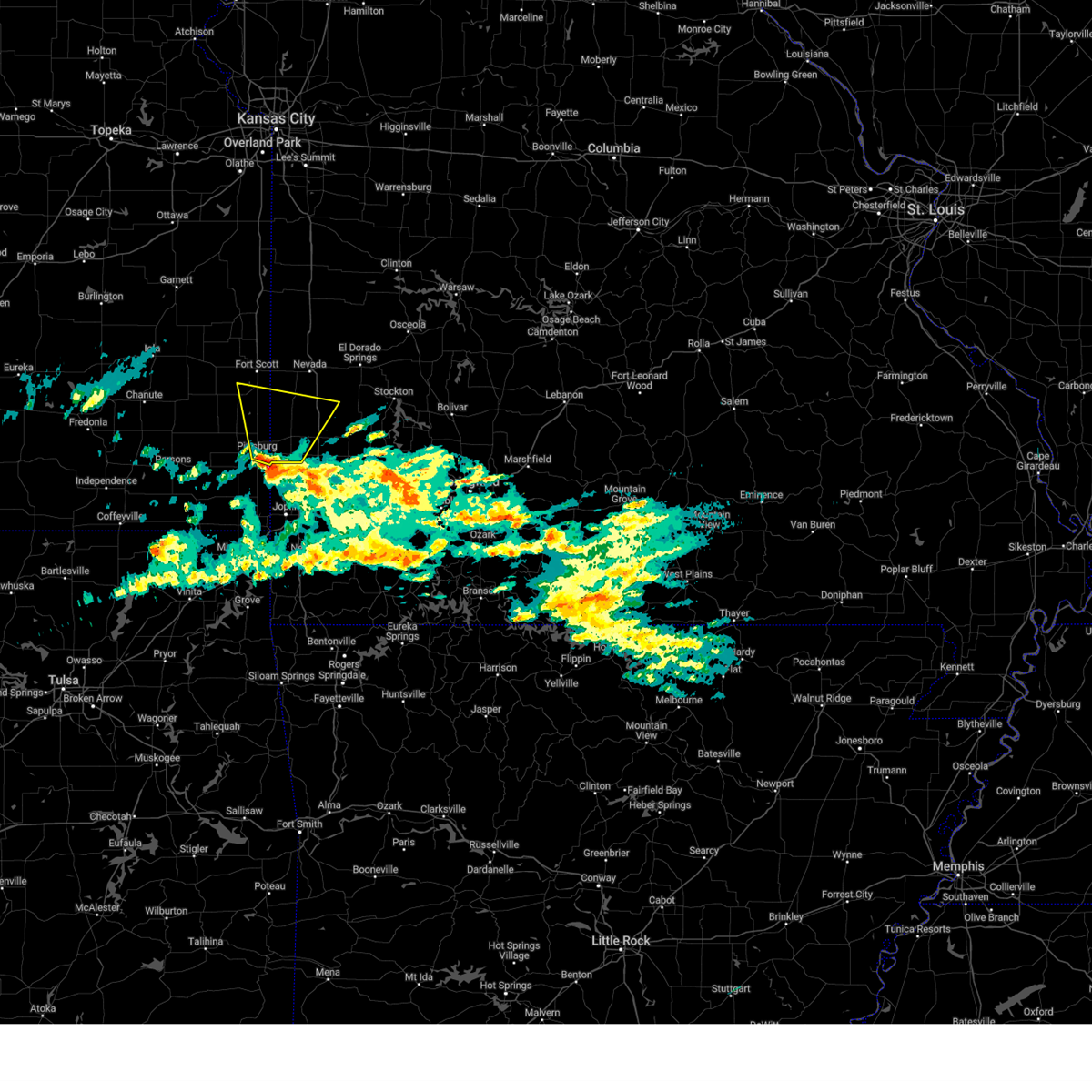 At 128 pm cst, a severe thunderstorm was located near frontenac, or near pittsburg, moving north at 45 mph (radar indicated). Hazards include quarter size hail. Damage to vehicles is expected. locations impacted include, pittsburg, prairie state park, frontenac, arma, liberal, sheldon, mulberry, nashville, mindenmines, franklin, arcadia, bronaugh, lamar heights, irwin, burgess, croweburg, yale, hannon, oakton and iantha. this includes interstate 49 between mile markers 67 and 80. hail threat, radar indicated max hail size, 1. 00 in wind threat, radar indicated max wind gust, <50 mph. At 128 pm cst, a severe thunderstorm was located near frontenac, or near pittsburg, moving north at 45 mph (radar indicated). Hazards include quarter size hail. Damage to vehicles is expected. locations impacted include, pittsburg, prairie state park, frontenac, arma, liberal, sheldon, mulberry, nashville, mindenmines, franklin, arcadia, bronaugh, lamar heights, irwin, burgess, croweburg, yale, hannon, oakton and iantha. this includes interstate 49 between mile markers 67 and 80. hail threat, radar indicated max hail size, 1. 00 in wind threat, radar indicated max wind gust, <50 mph.
|
| 3/2/2023 1:11 PM CST |
 At 111 pm cst, a severe thunderstorm was located near weir, or 9 miles northeast of columbus, moving north at 45 mph (radar indicated). Hazards include quarter size hail. damage to vehicles is expected At 111 pm cst, a severe thunderstorm was located near weir, or 9 miles northeast of columbus, moving north at 45 mph (radar indicated). Hazards include quarter size hail. damage to vehicles is expected
|
| 10/12/2022 6:41 AM CDT |
 The severe thunderstorm warning for barton, cedar, st. clair, southeastern vernon and northwestern dade counties will expire at 645 am cdt, the storms which prompted the warning have weakened below severe limits, and no longer pose an immediate threat to life or property. therefore, the warning will be allowed to expire. The severe thunderstorm warning for barton, cedar, st. clair, southeastern vernon and northwestern dade counties will expire at 645 am cdt, the storms which prompted the warning have weakened below severe limits, and no longer pose an immediate threat to life or property. therefore, the warning will be allowed to expire.
|
| 10/12/2022 6:08 AM CDT |
 At 607 am cdt, severe thunderstorms were located along a line extending from near schell city to near sheldon to near mulberry, moving east at 45 mph (radar indicated). Hazards include quarter size hail. damage to vehicles is expected At 607 am cdt, severe thunderstorms were located along a line extending from near schell city to near sheldon to near mulberry, moving east at 45 mph (radar indicated). Hazards include quarter size hail. damage to vehicles is expected
|
| 6/26/2022 2:59 AM CDT |
 At 259 am cdt, severe thunderstorms were located along a line extending from near sheldon to near lamar to near jasper, moving east at 35 mph (radar indicated). Hazards include 60 mph wind gusts. Expect damage to roofs, siding, and trees. locations impacted include, lamar, golden city, sheldon, lamar heights, irwin, milford, kenoma, oakton, iantha, boston, this includes interstate 49 between mile markers 57 and 80. hail threat, radar indicated max hail size, <. 75 in wind threat, radar indicated max wind gust, 60 mph. At 259 am cdt, severe thunderstorms were located along a line extending from near sheldon to near lamar to near jasper, moving east at 35 mph (radar indicated). Hazards include 60 mph wind gusts. Expect damage to roofs, siding, and trees. locations impacted include, lamar, golden city, sheldon, lamar heights, irwin, milford, kenoma, oakton, iantha, boston, this includes interstate 49 between mile markers 57 and 80. hail threat, radar indicated max hail size, <. 75 in wind threat, radar indicated max wind gust, 60 mph.
|
| 6/26/2022 2:25 AM CDT |
 At 225 am cdt, severe thunderstorms were located along a line extending from near arcadia to near liberal to frontenac, moving east at 35 mph (radar indicated). Hazards include 60 mph wind gusts and nickel size hail. expect damage to roofs, siding, and trees At 225 am cdt, severe thunderstorms were located along a line extending from near arcadia to near liberal to frontenac, moving east at 35 mph (radar indicated). Hazards include 60 mph wind gusts and nickel size hail. expect damage to roofs, siding, and trees
|
| 4/21/2022 2:31 PM CDT | Half Dollar sized hail reported 3.1 miles SSE of Sheldon, MO, mping report of half dollar size hail between sheldon and milo. time estimated from radar. |
| 4/21/2022 2:30 PM CDT |
 At 230 pm cdt, a severe thunderstorm was located near sheldon, or 8 miles south of nevada, moving east at 40 mph (radar indicated). Hazards include 60 mph wind gusts and half dollar size hail. Hail damage to vehicles is expected. expect wind damage to roofs, siding, and trees. locations impacted include, nevada, sheldon, montevallo, bronaugh, moundville, milo, verdella, this includes interstate 49 between mile markers 76 and 89. hail threat, radar indicated max hail size, 1. 25 in wind threat, radar indicated max wind gust, 60 mph. At 230 pm cdt, a severe thunderstorm was located near sheldon, or 8 miles south of nevada, moving east at 40 mph (radar indicated). Hazards include 60 mph wind gusts and half dollar size hail. Hail damage to vehicles is expected. expect wind damage to roofs, siding, and trees. locations impacted include, nevada, sheldon, montevallo, bronaugh, moundville, milo, verdella, this includes interstate 49 between mile markers 76 and 89. hail threat, radar indicated max hail size, 1. 25 in wind threat, radar indicated max wind gust, 60 mph.
|
| 4/21/2022 2:19 PM CDT |
 At 218 pm cdt, a severe thunderstorm was located near sheldon, or 8 miles south of nevada, moving northeast at 30 mph (radar indicated). Hazards include 60 mph wind gusts and half dollar size hail. Hail damage to vehicles is expected. expect wind damage to roofs, siding, and trees. locations impacted include, nevada, sheldon, montevallo, walker, bronaugh, moundville, richards, milo, deerfield, metz, stotesbury, horton, verdella, this includes interstate 49 between mile markers 76 and 107. hail threat, radar indicated max hail size, 1. 25 in wind threat, radar indicated max wind gust, 60 mph. At 218 pm cdt, a severe thunderstorm was located near sheldon, or 8 miles south of nevada, moving northeast at 30 mph (radar indicated). Hazards include 60 mph wind gusts and half dollar size hail. Hail damage to vehicles is expected. expect wind damage to roofs, siding, and trees. locations impacted include, nevada, sheldon, montevallo, walker, bronaugh, moundville, richards, milo, deerfield, metz, stotesbury, horton, verdella, this includes interstate 49 between mile markers 76 and 107. hail threat, radar indicated max hail size, 1. 25 in wind threat, radar indicated max wind gust, 60 mph.
|
| 4/21/2022 2:08 PM CDT |
 At 208 pm cdt, a severe thunderstorm was located 7 miles northwest of sheldon, or 10 miles southwest of nevada, moving northeast at 30 mph (radar indicated). Hazards include 60 mph wind gusts and half dollar size hail. Hail damage to vehicles is expected. Expect wind damage to roofs, siding, and trees. At 208 pm cdt, a severe thunderstorm was located 7 miles northwest of sheldon, or 10 miles southwest of nevada, moving northeast at 30 mph (radar indicated). Hazards include 60 mph wind gusts and half dollar size hail. Hail damage to vehicles is expected. Expect wind damage to roofs, siding, and trees.
|
| 10/13/2021 8:55 AM CDT |
 The severe thunderstorm warning for eastern barton and southeastern vernon counties will expire at 900 am cdt, the storms which prompted the warning have weakened below severe limits, and no longer pose an immediate threat to life or property. therefore, the warning will be allowed to expire. however heavy rain is still possible with these thunderstorms. The severe thunderstorm warning for eastern barton and southeastern vernon counties will expire at 900 am cdt, the storms which prompted the warning have weakened below severe limits, and no longer pose an immediate threat to life or property. therefore, the warning will be allowed to expire. however heavy rain is still possible with these thunderstorms.
|
| 10/13/2021 8:39 AM CDT |
 At 838 am cdt, severe thunderstorms were located along a line extending from near sheldon to 9 miles west of jasper, moving east at 45 mph (radar indicated). Hazards include 60 mph wind gusts. Expect damage to roofs, siding, and trees. locations impacted include, lamar, sheldon, montevallo, lamar heights, irwin, milford, kenoma, oakton, iantha, boston, this includes interstate 49 between mile markers 60 and 79. hail threat, radar indicated max hail size, <. 75 in wind threat, radar indicated max wind gust, 60 mph. At 838 am cdt, severe thunderstorms were located along a line extending from near sheldon to 9 miles west of jasper, moving east at 45 mph (radar indicated). Hazards include 60 mph wind gusts. Expect damage to roofs, siding, and trees. locations impacted include, lamar, sheldon, montevallo, lamar heights, irwin, milford, kenoma, oakton, iantha, boston, this includes interstate 49 between mile markers 60 and 79. hail threat, radar indicated max hail size, <. 75 in wind threat, radar indicated max wind gust, 60 mph.
|
| 10/13/2021 8:16 AM CDT |
 At 816 am cdt, severe thunderstorms were located along a line extending from mulberry to near pittsburg, moving northeast at 50 mph (radar indicated). Hazards include 60 mph wind gusts. expect damage to roofs, siding, and trees At 816 am cdt, severe thunderstorms were located along a line extending from mulberry to near pittsburg, moving northeast at 50 mph (radar indicated). Hazards include 60 mph wind gusts. expect damage to roofs, siding, and trees
|
| 6/30/2021 2:45 PM CDT |
 At 245 pm cdt, severe thunderstorms were located along a line extending from 6 miles north of nevada to near walker to near sheldon, moving northeast at 25 mph (radar indicated). Hazards include 60 mph wind gusts and penny size hail. Expect damage to roofs, siding, and trees. these severe storms will be near, walker around 250 pm cdt. schell city around 315 pm cdt. other locations impacted by these severe thunderstorms include montevallo, milo, harwood and horton. This includes interstate 49 between mile markers 77 and 103. At 245 pm cdt, severe thunderstorms were located along a line extending from 6 miles north of nevada to near walker to near sheldon, moving northeast at 25 mph (radar indicated). Hazards include 60 mph wind gusts and penny size hail. Expect damage to roofs, siding, and trees. these severe storms will be near, walker around 250 pm cdt. schell city around 315 pm cdt. other locations impacted by these severe thunderstorms include montevallo, milo, harwood and horton. This includes interstate 49 between mile markers 77 and 103.
|
| 6/30/2021 2:29 PM CDT |
 At 229 pm cdt, severe thunderstorms were located along a line extending from 10 miles west of walker to near nevada to near sheldon, moving northeast at 25 mph (radar indicated). Hazards include 60 mph wind gusts and penny size hail. Expect damage to roofs, siding, and trees. severe thunderstorms will be near, nevada around 235 pm cdt. walker around 250 pm cdt. schell city around 315 pm cdt. other locations impacted by these severe thunderstorms include montevallo, moundville, milo, deerfield, harwood and horton. This includes interstate 49 between mile markers 77 and 103. At 229 pm cdt, severe thunderstorms were located along a line extending from 10 miles west of walker to near nevada to near sheldon, moving northeast at 25 mph (radar indicated). Hazards include 60 mph wind gusts and penny size hail. Expect damage to roofs, siding, and trees. severe thunderstorms will be near, nevada around 235 pm cdt. walker around 250 pm cdt. schell city around 315 pm cdt. other locations impacted by these severe thunderstorms include montevallo, moundville, milo, deerfield, harwood and horton. This includes interstate 49 between mile markers 77 and 103.
|
| 3/17/2021 5:16 AM CDT |
 At 515 am cdt, a severe thunderstorm was located 7 miles east of lamar, moving north at 45 mph. another severe thunderstorm was located near verdella moving north at 45 mph (radar indicated). Hazards include quarter size hail. damage to vehicles is expected At 515 am cdt, a severe thunderstorm was located 7 miles east of lamar, moving north at 45 mph. another severe thunderstorm was located near verdella moving north at 45 mph (radar indicated). Hazards include quarter size hail. damage to vehicles is expected
|
| 6/4/2020 4:01 AM CDT |
 At 401 am cdt, severe thunderstorms were located along a line extending from 7 miles northeast of osceola to near sheldon to 6 miles north of girard, moving east at 45 mph (radar indicated). Hazards include 60 mph wind gusts and quarter size hail. Hail damage to vehicles is expected. expect wind damage to roofs, siding, and trees. Locations impacted include, truman lake, nevada, el dorado springs, osceola, lowry city, sheldon, montevallo, walker, bronaugh, jerico springs, collins, moundville, roscoe, milo, vista, harwood, gerster, monegaw springs, olympia, caplinger mills, this includes interstate 49 between mile markers 78 and 97. At 401 am cdt, severe thunderstorms were located along a line extending from 7 miles northeast of osceola to near sheldon to 6 miles north of girard, moving east at 45 mph (radar indicated). Hazards include 60 mph wind gusts and quarter size hail. Hail damage to vehicles is expected. expect wind damage to roofs, siding, and trees. Locations impacted include, truman lake, nevada, el dorado springs, osceola, lowry city, sheldon, montevallo, walker, bronaugh, jerico springs, collins, moundville, roscoe, milo, vista, harwood, gerster, monegaw springs, olympia, caplinger mills, this includes interstate 49 between mile markers 78 and 97.
|
| 6/4/2020 3:21 AM CDT |
 At 321 am cdt, severe thunderstorms were located along a line extending from near clinton to near hume to near la harpe, moving southeast at 45 mph (radar indicated). Hazards include 60 mph wind gusts and quarter size hail. Hail damage to vehicles is expected. Expect wind damage to roofs, siding, and trees. At 321 am cdt, severe thunderstorms were located along a line extending from near clinton to near hume to near la harpe, moving southeast at 45 mph (radar indicated). Hazards include 60 mph wind gusts and quarter size hail. Hail damage to vehicles is expected. Expect wind damage to roofs, siding, and trees.
|
| 5/4/2020 11:29 AM CDT |
 At 1128 am cdt, a severe thunderstorm was located 9 miles east of sheldon, or 14 miles southwest of el dorado springs, moving east at 35 mph (radar indicated). Hazards include two inch hail. People and animals outdoors will be injured. expect damage to roofs, siding, windows, and vehicles. Locations impacted include, sheldon, montevallo, schell city, harwood, this includes interstate 49 between mile markers 77 and 82. At 1128 am cdt, a severe thunderstorm was located 9 miles east of sheldon, or 14 miles southwest of el dorado springs, moving east at 35 mph (radar indicated). Hazards include two inch hail. People and animals outdoors will be injured. expect damage to roofs, siding, windows, and vehicles. Locations impacted include, sheldon, montevallo, schell city, harwood, this includes interstate 49 between mile markers 77 and 82.
|
| 5/4/2020 11:17 AM CDT | Half Dollar sized hail reported 0.3 miles SE of Sheldon, MO, report via convenience store in sheldon of quarters to half dollar size hail. time estimated from radar. |
| 5/4/2020 11:08 AM CDT |
 At 1108 am cdt, a severe thunderstorm was located over sheldon, or 11 miles south of nevada, moving east at 50 mph (radar indicated). Hazards include two inch hail. People and animals outdoors will be injured. expect damage to roofs, siding, windows, and vehicles. Locations impacted include, nevada, sheldon, montevallo, walker, schell city, bronaugh, moundville, milo, harwood, horton, this includes interstate 49 between mile markers 77 and 106. At 1108 am cdt, a severe thunderstorm was located over sheldon, or 11 miles south of nevada, moving east at 50 mph (radar indicated). Hazards include two inch hail. People and animals outdoors will be injured. expect damage to roofs, siding, windows, and vehicles. Locations impacted include, nevada, sheldon, montevallo, walker, schell city, bronaugh, moundville, milo, harwood, horton, this includes interstate 49 between mile markers 77 and 106.
|
| 5/4/2020 11:03 AM CDT |
 At 1102 am cdt, a severe thunderstorm was located 7 miles west of sheldon, or 11 miles south of nevada. other storms were located near harwood. these storms were moving east at 50 mph (radar indicated). Hazards include half dollar size hail. damage to vehicles is expected At 1102 am cdt, a severe thunderstorm was located 7 miles west of sheldon, or 11 miles south of nevada. other storms were located near harwood. these storms were moving east at 50 mph (radar indicated). Hazards include half dollar size hail. damage to vehicles is expected
|
| 5/4/2020 10:04 AM CDT |
 At 1004 am cdt, a severe thunderstorm was located 8 miles northeast of arcadia, or 11 miles southwest of nevada, moving east at 45 mph. another storm was located just west of hammond (radar indicated). Hazards include golf ball size hail. People and animals outdoors will be injured. Expect damage to roofs, siding, windows, and vehicles. At 1004 am cdt, a severe thunderstorm was located 8 miles northeast of arcadia, or 11 miles southwest of nevada, moving east at 45 mph. another storm was located just west of hammond (radar indicated). Hazards include golf ball size hail. People and animals outdoors will be injured. Expect damage to roofs, siding, windows, and vehicles.
|
| 5/3/2020 9:45 AM CDT |
 At 944 am cdt, severe thunderstorms were located along a line extending from near el dorado springs to 10 miles east of sheldon to near alba, moving east at 45 mph (radar indicated). Hazards include 70 mph wind gusts and quarter size hail. Hail damage to vehicles is expected. expect considerable tree damage. Wind damage is also likely to mobile homes, roofs, and outbuildings. At 944 am cdt, severe thunderstorms were located along a line extending from near el dorado springs to 10 miles east of sheldon to near alba, moving east at 45 mph (radar indicated). Hazards include 70 mph wind gusts and quarter size hail. Hail damage to vehicles is expected. expect considerable tree damage. Wind damage is also likely to mobile homes, roofs, and outbuildings.
|
| 5/3/2020 9:20 AM CDT |
 At 920 am cdt, severe thunderstorms were located along a line extending from 8 miles south of rich hill to 7 miles west of sheldon to near weir, moving east at 45 mph (trained weather spotters). Hazards include tennis ball size hail and 70 mph wind gusts. People and animals outdoors will be injured. expect hail damage to roofs, siding, windows, and vehicles. expect considerable tree damage. wind damage is also likely to mobile homes, roofs, and outbuildings. Locations impacted include, prairie state park, nevada, lamar, golden city, liberal, sheldon, mulberry, nashville, mindenmines, montevallo, walker, schell city, bronaugh, lamar heights, moundville, richards, milo, deerfield, irwin, burgess, this includes interstate 49 between mile markers 57 and 107. At 920 am cdt, severe thunderstorms were located along a line extending from 8 miles south of rich hill to 7 miles west of sheldon to near weir, moving east at 45 mph (trained weather spotters). Hazards include tennis ball size hail and 70 mph wind gusts. People and animals outdoors will be injured. expect hail damage to roofs, siding, windows, and vehicles. expect considerable tree damage. wind damage is also likely to mobile homes, roofs, and outbuildings. Locations impacted include, prairie state park, nevada, lamar, golden city, liberal, sheldon, mulberry, nashville, mindenmines, montevallo, walker, schell city, bronaugh, lamar heights, moundville, richards, milo, deerfield, irwin, burgess, this includes interstate 49 between mile markers 57 and 107.
|
| 5/3/2020 8:53 AM CDT |
 At 852 am cdt, severe thunderstorms were located along a line extending from fulton to 8 miles south of fort scott to mccune, moving east at 45 mph (trained weather spotters). Hazards include 70 mph wind gusts and quarter size hail has been reported with these storms. Hail damage to vehicles is expected. expect considerable tree damage. Wind damage is also likely to mobile homes, roofs, and outbuildings. At 852 am cdt, severe thunderstorms were located along a line extending from fulton to 8 miles south of fort scott to mccune, moving east at 45 mph (trained weather spotters). Hazards include 70 mph wind gusts and quarter size hail has been reported with these storms. Hail damage to vehicles is expected. expect considerable tree damage. Wind damage is also likely to mobile homes, roofs, and outbuildings.
|
| 4/24/2020 7:35 PM CDT |
 At 735 pm cdt, severe thunderstorms were located along a line extending from near sheldon to 9 miles northeast of lamar to near golden city, moving northeast at 30 mph (radar indicated). Hazards include 60 mph wind gusts. Expect damage to roofs, siding, and trees. these severe storms will be near, lockwood around 755 pm cdt. greenfield around 800 pm cdt. other locations impacted by these severe thunderstorms include stockton lake, stockton state park, montevallo, dadeville, jerico springs, irwin, arcola, umber view heights, milford and bearcreek. This includes interstate 49 between mile markers 70 and 78. At 735 pm cdt, severe thunderstorms were located along a line extending from near sheldon to 9 miles northeast of lamar to near golden city, moving northeast at 30 mph (radar indicated). Hazards include 60 mph wind gusts. Expect damage to roofs, siding, and trees. these severe storms will be near, lockwood around 755 pm cdt. greenfield around 800 pm cdt. other locations impacted by these severe thunderstorms include stockton lake, stockton state park, montevallo, dadeville, jerico springs, irwin, arcola, umber view heights, milford and bearcreek. This includes interstate 49 between mile markers 70 and 78.
|
| 4/24/2020 7:13 PM CDT |
 At 713 pm cdt, severe thunderstorms were located along a line extending from 6 miles southwest of sheldon to lamar to near jasper, moving east at 35 mph (radar indicated). Hazards include 60 mph wind gusts. expect damage to roofs, siding, and trees At 713 pm cdt, severe thunderstorms were located along a line extending from 6 miles southwest of sheldon to lamar to near jasper, moving east at 35 mph (radar indicated). Hazards include 60 mph wind gusts. expect damage to roofs, siding, and trees
|
| 1/10/2020 1:23 PM CST |
 At 122 pm cst, a severe thunderstorm was located over sheldon, or 8 miles north of lamar, moving northeast at 40 mph (radar indicated). Hazards include 60 mph wind gusts and quarter size hail. Hail damage to vehicles is expected. Expect wind damage to roofs, siding, and trees. At 122 pm cst, a severe thunderstorm was located over sheldon, or 8 miles north of lamar, moving northeast at 40 mph (radar indicated). Hazards include 60 mph wind gusts and quarter size hail. Hail damage to vehicles is expected. Expect wind damage to roofs, siding, and trees.
|
| 9/12/2019 8:05 PM CDT |
 At 805 pm cdt, a severe thunderstorm was located over arma, or 8 miles northeast of girard, moving east at 30 mph (radar indicated). Hazards include 60 mph wind gusts. expect damage to roofs, siding, and trees At 805 pm cdt, a severe thunderstorm was located over arma, or 8 miles northeast of girard, moving east at 30 mph (radar indicated). Hazards include 60 mph wind gusts. expect damage to roofs, siding, and trees
|
| 8/30/2019 3:56 AM CDT |
 The severe thunderstorm warning for vernon county will expire at 400 am cdt, the storm which prompted the warning has weakened below severe limits, and no longer poses an immediate threat to life or property. therefore, the warning will be allowed to expire. however gusty winds are still possible with this thunderstorm. The severe thunderstorm warning for vernon county will expire at 400 am cdt, the storm which prompted the warning has weakened below severe limits, and no longer poses an immediate threat to life or property. therefore, the warning will be allowed to expire. however gusty winds are still possible with this thunderstorm.
|
| 8/30/2019 3:22 AM CDT |
 At 322 am cdt, a severe thunderstorm was located near fort scott, moving east at 40 mph (radar indicated). Hazards include 60 mph wind gusts and penny size hail. expect damage to roofs, siding, and trees At 322 am cdt, a severe thunderstorm was located near fort scott, moving east at 40 mph (radar indicated). Hazards include 60 mph wind gusts and penny size hail. expect damage to roofs, siding, and trees
|
| 8/26/2019 1:46 PM CDT |
 The national weather service in springfield has issued a * severe thunderstorm warning for. eastern barton county in southwestern missouri. northwestern lawrence county in southwestern missouri. northeastern jasper county in southwestern missouri. Western dade county in southwestern missouri. The national weather service in springfield has issued a * severe thunderstorm warning for. eastern barton county in southwestern missouri. northwestern lawrence county in southwestern missouri. northeastern jasper county in southwestern missouri. Western dade county in southwestern missouri.
|
| 8/16/2019 2:17 AM CDT |
 At 217 am cdt, severe thunderstorms were located along a line extending from near el dorado springs to sheldon to near arcadia, moving east at 45 mph (radar indicated). Hazards include 60 mph wind gusts and quarter size hail. Hail damage to vehicles is expected. expect wind damage to roofs, siding, and trees. Locations impacted include, nevada, fort scott, el dorado springs, sheldon, montevallo, walker, bronaugh, moundville, milo, deerfield, olympia, caplinger mills, pawnee station, hiattville, garland, filley, cedar springs, this includes interstate 49 between mile markers 77 and 94. At 217 am cdt, severe thunderstorms were located along a line extending from near el dorado springs to sheldon to near arcadia, moving east at 45 mph (radar indicated). Hazards include 60 mph wind gusts and quarter size hail. Hail damage to vehicles is expected. expect wind damage to roofs, siding, and trees. Locations impacted include, nevada, fort scott, el dorado springs, sheldon, montevallo, walker, bronaugh, moundville, milo, deerfield, olympia, caplinger mills, pawnee station, hiattville, garland, filley, cedar springs, this includes interstate 49 between mile markers 77 and 94.
|
| 8/16/2019 2:17 AM CDT |
 A severe thunderstorm warning remains in effect until 245 am cdt for southeastern bourbon. northern cedar. southern vernon and southwestern st. clair counties. At 217 am cdt, severe thunderstorms were located along a line extending from near el dorado springs to sheldon to near arcadia, moving east at 45 mph. A severe thunderstorm warning remains in effect until 245 am cdt for southeastern bourbon. northern cedar. southern vernon and southwestern st. clair counties. At 217 am cdt, severe thunderstorms were located along a line extending from near el dorado springs to sheldon to near arcadia, moving east at 45 mph.
|
| 8/16/2019 1:51 AM CDT |
 At 151 am cdt, severe thunderstorms were located along a line extending from near nevada to near arcadia to near hepler, moving east at 45 mph (radar indicated). Hazards include 70 mph wind gusts and half dollar size hail. Hail damage to vehicles is expected. expect considerable tree damage. Wind damage is also likely to mobile homes, roofs, and outbuildings. At 151 am cdt, severe thunderstorms were located along a line extending from near nevada to near arcadia to near hepler, moving east at 45 mph (radar indicated). Hazards include 70 mph wind gusts and half dollar size hail. Hail damage to vehicles is expected. expect considerable tree damage. Wind damage is also likely to mobile homes, roofs, and outbuildings.
|
| 8/16/2019 1:33 AM CDT |
 At 133 am cdt, severe thunderstorms were located along a line extending from 6 miles southeast of appleton city to near el dorado springs to nevada to 8 miles southwest of uniontown, moving southeast at 50 mph. these are very dangerous storms (radar indicated). Hazards include 80 mph wind gusts and half dollar size hail. Flying debris will be dangerous to those caught without shelter. mobile homes will be heavily damaged. expect considerable damage to roofs, windows, and vehicles. extensive tree damage and power outages are likely. Locations impacted include, nevada, fort scott, el dorado springs, appleton city, osceola, marmaton, sheldon, bronson, montevallo, uniontown, walker, schell city, bronaugh, fulton, redfield, moundville, roscoe, richards, milo, mapleton, this includes interstate 49 between mile markers 77 and 107. At 133 am cdt, severe thunderstorms were located along a line extending from 6 miles southeast of appleton city to near el dorado springs to nevada to 8 miles southwest of uniontown, moving southeast at 50 mph. these are very dangerous storms (radar indicated). Hazards include 80 mph wind gusts and half dollar size hail. Flying debris will be dangerous to those caught without shelter. mobile homes will be heavily damaged. expect considerable damage to roofs, windows, and vehicles. extensive tree damage and power outages are likely. Locations impacted include, nevada, fort scott, el dorado springs, appleton city, osceola, marmaton, sheldon, bronson, montevallo, uniontown, walker, schell city, bronaugh, fulton, redfield, moundville, roscoe, richards, milo, mapleton, this includes interstate 49 between mile markers 77 and 107.
|
| 8/16/2019 1:07 AM CDT |
 At 106 am cdt, severe thunderstorms were located along a line extending from near butler to near rich hill to near fulton to near redfield, moving southeast at 45 mph. these are very dangerous storms (radar indicated). Hazards include 80 mph wind gusts and half dollar size hail. Flying debris will be dangerous to those caught without shelter. mobile homes will be heavily damaged. expect considerable damage to roofs, windows, and vehicles. Extensive tree damage and power outages are likely. At 106 am cdt, severe thunderstorms were located along a line extending from near butler to near rich hill to near fulton to near redfield, moving southeast at 45 mph. these are very dangerous storms (radar indicated). Hazards include 80 mph wind gusts and half dollar size hail. Flying debris will be dangerous to those caught without shelter. mobile homes will be heavily damaged. expect considerable damage to roofs, windows, and vehicles. Extensive tree damage and power outages are likely.
|
| 8/13/2019 1:12 AM CDT |
 The severe thunderstorm warning for southeastern vernon county will expire at 115 am cdt, the storm which prompted the warning has moved out of the area. therefore, the warning will be allowed to expire. however heavy rain is still possible with this thunderstorm. to report severe weather, contact your nearest law enforcement agency. they will relay your report to the national weather service springfield. The severe thunderstorm warning for southeastern vernon county will expire at 115 am cdt, the storm which prompted the warning has moved out of the area. therefore, the warning will be allowed to expire. however heavy rain is still possible with this thunderstorm. to report severe weather, contact your nearest law enforcement agency. they will relay your report to the national weather service springfield.
|
| 8/13/2019 1:00 AM CDT |
 At 100 am cdt, a severe thunderstorm was located 9 miles south of el dorado springs, moving east at 35 mph (radar indicated). Hazards include 60 mph wind gusts. Expect damage to roofs, siding, and trees. Locations impacted include, nevada, sheldon, montevallo, walker, milo, this includes interstate 49 between mile markers 77 and 89. At 100 am cdt, a severe thunderstorm was located 9 miles south of el dorado springs, moving east at 35 mph (radar indicated). Hazards include 60 mph wind gusts. Expect damage to roofs, siding, and trees. Locations impacted include, nevada, sheldon, montevallo, walker, milo, this includes interstate 49 between mile markers 77 and 89.
|
| 8/13/2019 12:40 AM CDT |
 At 1239 am cdt, a severe thunderstorm was located near nevada, moving east at 25 mph (radar indicated). Hazards include 60 mph wind gusts and penny size hail. Expect damage to roofs, siding, and trees. Locations impacted include, nevada, sheldon, montevallo, walker, bronaugh, moundville, richards, milo, deerfield, this includes interstate 49 between mile markers 78 and 99. At 1239 am cdt, a severe thunderstorm was located near nevada, moving east at 25 mph (radar indicated). Hazards include 60 mph wind gusts and penny size hail. Expect damage to roofs, siding, and trees. Locations impacted include, nevada, sheldon, montevallo, walker, bronaugh, moundville, richards, milo, deerfield, this includes interstate 49 between mile markers 78 and 99.
|
| 8/13/2019 12:23 AM CDT |
 At 1223 am cdt, a severe thunderstorm was located near nevada, moving east at 35 mph (radar indicated). Hazards include 60 mph wind gusts and nickel size hail. expect damage to roofs, siding, and trees At 1223 am cdt, a severe thunderstorm was located near nevada, moving east at 35 mph (radar indicated). Hazards include 60 mph wind gusts and nickel size hail. expect damage to roofs, siding, and trees
|
| 6/23/2019 8:21 AM CDT |
 At 820 am cdt, severe thunderstorms were located along a line extending from 8 miles southwest of rich hill to near sheldon to mindenmines, moving east at 55 mph (radar indicated). Hazards include 60 mph wind gusts. Expect damage to roofs, siding, and trees. Locations impacted include, prairie state park, nevada, lamar, golden city, liberal, sheldon, nashville, mindenmines, montevallo, walker, schell city, bronaugh, lamar heights, moundville, milo, deerfield, irwin, metz, harwood, milford, this includes interstate 49 between mile markers 57 and 107. At 820 am cdt, severe thunderstorms were located along a line extending from 8 miles southwest of rich hill to near sheldon to mindenmines, moving east at 55 mph (radar indicated). Hazards include 60 mph wind gusts. Expect damage to roofs, siding, and trees. Locations impacted include, prairie state park, nevada, lamar, golden city, liberal, sheldon, nashville, mindenmines, montevallo, walker, schell city, bronaugh, lamar heights, moundville, milo, deerfield, irwin, metz, harwood, milford, this includes interstate 49 between mile markers 57 and 107.
|
| 6/23/2019 7:46 AM CDT |
 At 746 am cdt, severe thunderstorms were located along a line extending from 7 miles south of blue mound to near hepler to near st. paul, moving east at 55 mph (radar indicated). Hazards include 60 mph wind gusts. expect damage to roofs, siding, and trees At 746 am cdt, severe thunderstorms were located along a line extending from 7 miles south of blue mound to near hepler to near st. paul, moving east at 55 mph (radar indicated). Hazards include 60 mph wind gusts. expect damage to roofs, siding, and trees
|
| 6/21/2019 12:59 PM CDT |
 At 1258 pm cdt, severe thunderstorms were located along a line extending from near hermitage to 10 miles north of stockton to 6 miles north of sheldon, moving southeast at 20 mph (public). Hazards include 60 mph wind gusts and quarter size hail. instrument observations and the public reported 60 mph gusts with these storms. Hail damage to vehicles is expected. Expect wind damage to roofs, siding, and trees. At 1258 pm cdt, severe thunderstorms were located along a line extending from near hermitage to 10 miles north of stockton to 6 miles north of sheldon, moving southeast at 20 mph (public). Hazards include 60 mph wind gusts and quarter size hail. instrument observations and the public reported 60 mph gusts with these storms. Hail damage to vehicles is expected. Expect wind damage to roofs, siding, and trees.
|
| 6/21/2019 12:33 PM CDT |
 At 1219 pm cdt, severe thunderstorms were located along a line extending from near warsaw to 9 miles southwest of osceola to near arcadia, moving east at 35 mph (radar indicated). Hazards include 60 mph wind gusts and penny size hail. Expect damage to roofs, siding, and trees. Locations impacted include, pomme de terre lake, truman lake, stockton lake, prairie state park, pomme de terre state park, stockton state park, nevada, fort scott, lamar, el dorado springs, frontenac, girard, stockton, arma, pittsburg, appleton city, humansville, osceola, marmaton, liberal, this includes interstate 49 between mile markers 67 and 107. At 1219 pm cdt, severe thunderstorms were located along a line extending from near warsaw to 9 miles southwest of osceola to near arcadia, moving east at 35 mph (radar indicated). Hazards include 60 mph wind gusts and penny size hail. Expect damage to roofs, siding, and trees. Locations impacted include, pomme de terre lake, truman lake, stockton lake, prairie state park, pomme de terre state park, stockton state park, nevada, fort scott, lamar, el dorado springs, frontenac, girard, stockton, arma, pittsburg, appleton city, humansville, osceola, marmaton, liberal, this includes interstate 49 between mile markers 67 and 107.
|
| 6/21/2019 12:20 PM CDT |
 At 1219 pm cdt, severe thunderstorms were located along a line extending from near warsaw to 9 miles southwest of osceola to near arcadia, moving east at 35 mph (radar indicated). Hazards include 60 mph wind gusts and penny size hail. Expect damage to roofs, siding, and trees. Locations impacted include, pomme de terre lake, truman lake, stockton lake, prairie state park, pomme de terre state park, stockton state park, nevada, fort scott, lamar, el dorado springs, frontenac, girard, stockton, arma, pittsburg, appleton city, humansville, osceola, marmaton, liberal, this includes interstate 49 between mile markers 67 and 107. At 1219 pm cdt, severe thunderstorms were located along a line extending from near warsaw to 9 miles southwest of osceola to near arcadia, moving east at 35 mph (radar indicated). Hazards include 60 mph wind gusts and penny size hail. Expect damage to roofs, siding, and trees. Locations impacted include, pomme de terre lake, truman lake, stockton lake, prairie state park, pomme de terre state park, stockton state park, nevada, fort scott, lamar, el dorado springs, frontenac, girard, stockton, arma, pittsburg, appleton city, humansville, osceola, marmaton, liberal, this includes interstate 49 between mile markers 67 and 107.
|
| 6/21/2019 11:56 AM CDT |
 At 1154 am cdt, severe thunderstorms were located along a line extending from near deepwater to near schell city to near redfield, moving east at 35 mph (radar indicated). Hazards include 60 mph wind gusts and penny size hail. expect damage to roofs, siding, and trees At 1154 am cdt, severe thunderstorms were located along a line extending from near deepwater to near schell city to near redfield, moving east at 35 mph (radar indicated). Hazards include 60 mph wind gusts and penny size hail. expect damage to roofs, siding, and trees
|
| 6/1/2019 6:45 PM CDT |
 At 644 pm cdt, severe thunderstorms were located along a line extending from near el dorado springs to 7 miles southeast of sheldon to near redfield, moving southeast at 30 mph (emergency management. received reports of trees down in nevada and have received several 60 mph wind reports with this line). Hazards include 60 mph wind gusts and quarter size hail. Hail damage to vehicles is expected. expect wind damage to roofs, siding, and trees. Locations impacted include, fort scott, el dorado springs, marmaton, liberal, sheldon, montevallo, arcadia, uniontown, bronaugh, jerico springs, redfield, moundville, deerfield, irwin, milford, petersburg, porterville, hannon, olympia, wagoner, this includes interstate 49 between mile markers 70 and 84. At 644 pm cdt, severe thunderstorms were located along a line extending from near el dorado springs to 7 miles southeast of sheldon to near redfield, moving southeast at 30 mph (emergency management. received reports of trees down in nevada and have received several 60 mph wind reports with this line). Hazards include 60 mph wind gusts and quarter size hail. Hail damage to vehicles is expected. expect wind damage to roofs, siding, and trees. Locations impacted include, fort scott, el dorado springs, marmaton, liberal, sheldon, montevallo, arcadia, uniontown, bronaugh, jerico springs, redfield, moundville, deerfield, irwin, milford, petersburg, porterville, hannon, olympia, wagoner, this includes interstate 49 between mile markers 70 and 84.
|
| 6/1/2019 6:24 PM CDT | Estimated 60mph wind gust in vernon county MO, 1.2 miles SE of Sheldon, MO |
| 6/1/2019 6:23 PM CDT |
 At 622 pm cdt, severe thunderstorms were located along a line extending from near walker to near sheldon to 7 miles north of uniontown, moving southeast at 45 mph (emergency management. have received multiple reports of 60 mph winds across vernon county). Hazards include 70 mph wind gusts and quarter size hail. Hail damage to vehicles is expected. expect considerable tree damage. wind damage is also likely to mobile homes, roofs, and outbuildings. Locations impacted include, nevada, fort scott, el dorado springs, marmaton, liberal, sheldon, bronson, montevallo, arcadia, uniontown, walker, bronaugh, jerico springs, redfield, moundville, richards, milo, deerfield, irwin, harwood, this includes interstate 49 between mile markers 70 and 99. At 622 pm cdt, severe thunderstorms were located along a line extending from near walker to near sheldon to 7 miles north of uniontown, moving southeast at 45 mph (emergency management. have received multiple reports of 60 mph winds across vernon county). Hazards include 70 mph wind gusts and quarter size hail. Hail damage to vehicles is expected. expect considerable tree damage. wind damage is also likely to mobile homes, roofs, and outbuildings. Locations impacted include, nevada, fort scott, el dorado springs, marmaton, liberal, sheldon, bronson, montevallo, arcadia, uniontown, walker, bronaugh, jerico springs, redfield, moundville, richards, milo, deerfield, irwin, harwood, this includes interstate 49 between mile markers 70 and 99.
|
| 6/1/2019 6:07 PM CDT |
 At 605 pm cdt, severe thunderstorms were located along a line extending from near schell city to 9 miles east of fort scott to 6 miles southwest of blue mound, moving southeast at 25 mph (radar indicated). Hazards include 70 mph wind gusts and half dollar size hail. Hail damage to vehicles is expected. expect considerable tree damage. Wind damage is also likely to mobile homes, roofs, and outbuildings. At 605 pm cdt, severe thunderstorms were located along a line extending from near schell city to 9 miles east of fort scott to 6 miles southwest of blue mound, moving southeast at 25 mph (radar indicated). Hazards include 70 mph wind gusts and half dollar size hail. Hail damage to vehicles is expected. expect considerable tree damage. Wind damage is also likely to mobile homes, roofs, and outbuildings.
|
| 5/27/2019 9:27 AM CDT |
 The severe thunderstorm warning for barton and southeastern vernon counties will expire at 930 am cdt, the storm which prompted the warning has weakened, though is expected to produce winds to 50 mph as it tracks eastward into the stockton lake area southward and into greenfield. The severe thunderstorm warning for barton and southeastern vernon counties will expire at 930 am cdt, the storm which prompted the warning has weakened, though is expected to produce winds to 50 mph as it tracks eastward into the stockton lake area southward and into greenfield.
|
| 5/27/2019 8:58 AM CDT |
 At 856 am cdt, a severe thunderstorm was located near mindenmines, or 11 miles northeast of pittsburg, moving east at 50 mph. spotters report power lines down and small limbs in frontenac kansas (law enforcement). Hazards include 60 mph wind gusts. expect damage to roofs, siding, and trees At 856 am cdt, a severe thunderstorm was located near mindenmines, or 11 miles northeast of pittsburg, moving east at 50 mph. spotters report power lines down and small limbs in frontenac kansas (law enforcement). Hazards include 60 mph wind gusts. expect damage to roofs, siding, and trees
|
| 5/22/2019 7:06 PM CDT |
 At 705 pm cdt, a severe thunderstorm was located near sheldon, or 12 miles southeast of nevada, moving northeast at 40 mph (radar indicated). Hazards include 60 mph wind gusts and half dollar size hail. Hail damage to vehicles is expected. expect wind damage to roofs, siding, and trees. Locations impacted include, nevada, el dorado springs, sheldon, montevallo, walker, milo, olympia, cedar springs, this includes interstate 49 between mile markers 77 and 95. At 705 pm cdt, a severe thunderstorm was located near sheldon, or 12 miles southeast of nevada, moving northeast at 40 mph (radar indicated). Hazards include 60 mph wind gusts and half dollar size hail. Hail damage to vehicles is expected. expect wind damage to roofs, siding, and trees. Locations impacted include, nevada, el dorado springs, sheldon, montevallo, walker, milo, olympia, cedar springs, this includes interstate 49 between mile markers 77 and 95.
|
| 5/22/2019 6:53 PM CDT |
 At 653 pm cdt, a severe thunderstorm was located over sheldon, or 9 miles north of lamar, moving northeast at 40 mph (radar indicated). Hazards include 60 mph wind gusts and half dollar size hail. Hail damage to vehicles is expected. Expect wind damage to roofs, siding, and trees. At 653 pm cdt, a severe thunderstorm was located over sheldon, or 9 miles north of lamar, moving northeast at 40 mph (radar indicated). Hazards include 60 mph wind gusts and half dollar size hail. Hail damage to vehicles is expected. Expect wind damage to roofs, siding, and trees.
|
| 5/20/2019 9:11 PM CDT |
 The severe thunderstorm warning for barton and vernon counties will expire at 915 pm cdt, the storms which prompted the warning have moved out of the warned area. therefore, the warning will be allowed to expire. a tornado watch remains in effect until 100 am cdt for southeastern kansas, and southwestern missouri. The severe thunderstorm warning for barton and vernon counties will expire at 915 pm cdt, the storms which prompted the warning have moved out of the warned area. therefore, the warning will be allowed to expire. a tornado watch remains in effect until 100 am cdt for southeastern kansas, and southwestern missouri.
|
| 5/20/2019 8:47 PM CDT |
 At 847 pm cdt, severe thunderstorms were located along a line extending from near rich hill to near nevada to near sheldon to near jasper, moving east at 40 mph (trained weather spotters). Hazards include 60 mph wind gusts and quarter size hail. Hail damage to vehicles is expected. expect wind damage to roofs, siding, and trees. Locations impacted include, prairie state park, nevada, lamar, golden city, liberal, sheldon, nashville, mindenmines, montevallo, walker, schell city, bronaugh, lamar heights, moundville, milo, deerfield, irwin, metz, harwood, milford, this includes interstate 49 between mile markers 57 and 104. At 847 pm cdt, severe thunderstorms were located along a line extending from near rich hill to near nevada to near sheldon to near jasper, moving east at 40 mph (trained weather spotters). Hazards include 60 mph wind gusts and quarter size hail. Hail damage to vehicles is expected. expect wind damage to roofs, siding, and trees. Locations impacted include, prairie state park, nevada, lamar, golden city, liberal, sheldon, nashville, mindenmines, montevallo, walker, schell city, bronaugh, lamar heights, moundville, milo, deerfield, irwin, metz, harwood, milford, this includes interstate 49 between mile markers 57 and 104.
|
| 5/20/2019 8:36 PM CDT |
 At 835 pm cdt, severe thunderstorms were located along a line extending from near hume to 7 miles west of sheldon to 7 miles southeast of liberal, moving east at 40 mph (trained weather spotters. estimated 60 mph winds have been reported over western barton county). Hazards include 60 mph wind gusts. Expect damage to roofs, siding, and trees. Locations impacted include, prairie state park, nevada, lamar, golden city, liberal, sheldon, mulberry, nashville, mindenmines, montevallo, arcadia, walker, schell city, bronaugh, lamar heights, moundville, richards, milo, deerfield, irwin, this includes interstate 49 between mile markers 57 and 107. At 835 pm cdt, severe thunderstorms were located along a line extending from near hume to 7 miles west of sheldon to 7 miles southeast of liberal, moving east at 40 mph (trained weather spotters. estimated 60 mph winds have been reported over western barton county). Hazards include 60 mph wind gusts. Expect damage to roofs, siding, and trees. Locations impacted include, prairie state park, nevada, lamar, golden city, liberal, sheldon, mulberry, nashville, mindenmines, montevallo, arcadia, walker, schell city, bronaugh, lamar heights, moundville, richards, milo, deerfield, irwin, this includes interstate 49 between mile markers 57 and 107.
|
| 5/20/2019 8:15 PM CDT |
 At 814 pm cdt, severe thunderstorms were located along a line extending from fulton to near arcadia to near pittsburg, moving east at 40 mph (radar indicated). Hazards include 60 mph wind gusts. expect damage to roofs, siding, and trees At 814 pm cdt, severe thunderstorms were located along a line extending from fulton to near arcadia to near pittsburg, moving east at 40 mph (radar indicated). Hazards include 60 mph wind gusts. expect damage to roofs, siding, and trees
|
| 5/20/2019 4:55 PM CDT |
 At 455 pm cdt, severe thunderstorms were located along a line extending from near lamar to near jasper to near alba, moving northeast at 50 mph (radar indicated). Hazards include 60 mph wind gusts. expect damage to roofs, siding, and trees At 455 pm cdt, severe thunderstorms were located along a line extending from near lamar to near jasper to near alba, moving northeast at 50 mph (radar indicated). Hazards include 60 mph wind gusts. expect damage to roofs, siding, and trees
|
| 5/20/2019 4:36 PM CDT |
 At 436 pm cdt, a severe thunderstorm capable of producing a tornado was located near mindenmines, or 10 miles east of pittsburg, moving northeast at 45 mph (radar indicated rotation). Hazards include tornado and half dollar size hail. Flying debris will be dangerous to those caught without shelter. mobile homes will be damaged or destroyed. damage to roofs, windows, and vehicles will occur. Tree damage is likely. At 436 pm cdt, a severe thunderstorm capable of producing a tornado was located near mindenmines, or 10 miles east of pittsburg, moving northeast at 45 mph (radar indicated rotation). Hazards include tornado and half dollar size hail. Flying debris will be dangerous to those caught without shelter. mobile homes will be damaged or destroyed. damage to roofs, windows, and vehicles will occur. Tree damage is likely.
|
| 5/18/2019 2:56 PM CDT |
 The severe thunderstorm warning for eastern barton, southwestern cedar, northwestern lawrence, eastern vernon, eastern jasper and western dade counties will expire at 300 pm cdt, the storms which prompted the warning have moved out of the area. other severe thunderstorm warnings have been issued east of this area. a tornado watch remains in effect until 500 pm cdt for southwestern and west central missouri. The severe thunderstorm warning for eastern barton, southwestern cedar, northwestern lawrence, eastern vernon, eastern jasper and western dade counties will expire at 300 pm cdt, the storms which prompted the warning have moved out of the area. other severe thunderstorm warnings have been issued east of this area. a tornado watch remains in effect until 500 pm cdt for southwestern and west central missouri.
|
| 5/18/2019 2:43 PM CDT |
 At 242 pm cdt, severe thunderstorms were located along a line extending from near walker to golden city to near sarcoxie, moving northeast at 45 mph (radar indicated). Hazards include 60 mph wind gusts and quarter size hail. Hail damage to vehicles is expected. expect wind damage to roofs, siding, and trees. locations impacted include, nevada, lamar, sarcoxie, lockwood, golden city, sheldon, montevallo, walker, jerico springs, stotts city, avilla, la russell, reeds, milo, metz, harwood, milford, maple grove, sylvania, olympia, this includes the following highways, interstate 44 between mile markers 25 and 41. Interstate 49 between mile markers 79 and 105. At 242 pm cdt, severe thunderstorms were located along a line extending from near walker to golden city to near sarcoxie, moving northeast at 45 mph (radar indicated). Hazards include 60 mph wind gusts and quarter size hail. Hail damage to vehicles is expected. expect wind damage to roofs, siding, and trees. locations impacted include, nevada, lamar, sarcoxie, lockwood, golden city, sheldon, montevallo, walker, jerico springs, stotts city, avilla, la russell, reeds, milo, metz, harwood, milford, maple grove, sylvania, olympia, this includes the following highways, interstate 44 between mile markers 25 and 41. Interstate 49 between mile markers 79 and 105.
|
| 5/18/2019 2:38 PM CDT |
 At 224 pm cdt, severe thunderstorms were located along a line extending from 10 miles southeast of hume to near nevada to near sheldon to near carthage to near goodman, moving northeast at 40 mph (radar indicated). Hazards include 60 mph wind gusts and quarter size hail. Hail damage to vehicles is expected. expect wind damage to roofs, siding, and trees. locations impacted include, eastern joplin, carthage, neosho, webb city, big sugar creek state park, prairie state park, roaring river state park, monett, nevada, lamar, el dorado springs, cassville, oronogo, granby, anderson, carterville, duquesne, sarcoxie, pierce city, goodman, this includes the following highways, interstate 44 between mile markers 11 and 42. Interstate 49 between mile markers 1 and 30, and between mile markers 32 and 105. At 224 pm cdt, severe thunderstorms were located along a line extending from 10 miles southeast of hume to near nevada to near sheldon to near carthage to near goodman, moving northeast at 40 mph (radar indicated). Hazards include 60 mph wind gusts and quarter size hail. Hail damage to vehicles is expected. expect wind damage to roofs, siding, and trees. locations impacted include, eastern joplin, carthage, neosho, webb city, big sugar creek state park, prairie state park, roaring river state park, monett, nevada, lamar, el dorado springs, cassville, oronogo, granby, anderson, carterville, duquesne, sarcoxie, pierce city, goodman, this includes the following highways, interstate 44 between mile markers 11 and 42. Interstate 49 between mile markers 1 and 30, and between mile markers 32 and 105.
|
| 5/18/2019 2:25 PM CDT |
 At 224 pm cdt, severe thunderstorms were located along a line extending from 10 miles southeast of hume to near nevada to near sheldon to near carthage to near goodman, moving northeast at 40 mph (radar indicated). Hazards include 60 mph wind gusts and quarter size hail. Hail damage to vehicles is expected. expect wind damage to roofs, siding, and trees. locations impacted include, eastern joplin, carthage, neosho, webb city, big sugar creek state park, prairie state park, roaring river state park, monett, nevada, lamar, el dorado springs, cassville, oronogo, granby, anderson, carterville, duquesne, sarcoxie, pierce city, goodman, this includes the following highways, interstate 44 between mile markers 11 and 42. Interstate 49 between mile markers 1 and 30, and between mile markers 32 and 105. At 224 pm cdt, severe thunderstorms were located along a line extending from 10 miles southeast of hume to near nevada to near sheldon to near carthage to near goodman, moving northeast at 40 mph (radar indicated). Hazards include 60 mph wind gusts and quarter size hail. Hail damage to vehicles is expected. expect wind damage to roofs, siding, and trees. locations impacted include, eastern joplin, carthage, neosho, webb city, big sugar creek state park, prairie state park, roaring river state park, monett, nevada, lamar, el dorado springs, cassville, oronogo, granby, anderson, carterville, duquesne, sarcoxie, pierce city, goodman, this includes the following highways, interstate 44 between mile markers 11 and 42. Interstate 49 between mile markers 1 and 30, and between mile markers 32 and 105.
|
| 5/18/2019 2:11 PM CDT |
 A severe thunderstorm warning remains in effect until 300 pm cdt for northeastern bourbon. barton. newton. western cedar. mcdonald. western barry. western lawrence. vernon. jasper and western dade counties. At 210 pm cdt, severe thunderstorms were located along a line extending from near fulton to 8 miles northeast of arcadia to near. A severe thunderstorm warning remains in effect until 300 pm cdt for northeastern bourbon. barton. newton. western cedar. mcdonald. western barry. western lawrence. vernon. jasper and western dade counties. At 210 pm cdt, severe thunderstorms were located along a line extending from near fulton to 8 miles northeast of arcadia to near.
|
| 5/18/2019 2:11 PM CDT |
 At 210 pm cdt, severe thunderstorms were located along a line extending from near fulton to 8 miles northeast of arcadia to near sheldon to near carthage to near pineville, moving northeast at 45 mph (radar indicated). Hazards include 60 mph wind gusts and quarter size hail. Hail damage to vehicles is expected. expect wind damage to roofs, siding, and trees. locations impacted include, joplin, carthage, neosho, webb city, big sugar creek state park, prairie state park, roaring river state park, monett, nevada, carl junction, lamar, el dorado springs, cassville, oronogo, granby, anderson, carterville, noel, duquesne, sarcoxie, this includes the following highways, interstate 44 between mile markers 5 and 42. Interstate 49 between mile markers 1 and 105. At 210 pm cdt, severe thunderstorms were located along a line extending from near fulton to 8 miles northeast of arcadia to near sheldon to near carthage to near pineville, moving northeast at 45 mph (radar indicated). Hazards include 60 mph wind gusts and quarter size hail. Hail damage to vehicles is expected. expect wind damage to roofs, siding, and trees. locations impacted include, joplin, carthage, neosho, webb city, big sugar creek state park, prairie state park, roaring river state park, monett, nevada, carl junction, lamar, el dorado springs, cassville, oronogo, granby, anderson, carterville, noel, duquesne, sarcoxie, this includes the following highways, interstate 44 between mile markers 5 and 42. Interstate 49 between mile markers 1 and 105.
|
| 5/18/2019 1:55 PM CDT |
 The national weather service in springfield has issued a * severe thunderstorm warning for. bourbon county in southeastern kansas. northeastern crawford county in southeastern kansas. barton county in southwestern missouri. Newton county in southwestern missouri. The national weather service in springfield has issued a * severe thunderstorm warning for. bourbon county in southeastern kansas. northeastern crawford county in southeastern kansas. barton county in southwestern missouri. Newton county in southwestern missouri.
|
| 5/18/2019 1:55 PM CDT |
 At 154 pm cdt, severe thunderstorms were located along a line extending from near redfield to near arcadia to near mindenmines to joplin to near noel, moving northeast at 40 mph (radar indicated). Hazards include 60 mph wind gusts and quarter size hail. Hail damage to vehicles is expected. Expect wind damage to roofs, siding, and trees. At 154 pm cdt, severe thunderstorms were located along a line extending from near redfield to near arcadia to near mindenmines to joplin to near noel, moving northeast at 40 mph (radar indicated). Hazards include 60 mph wind gusts and quarter size hail. Hail damage to vehicles is expected. Expect wind damage to roofs, siding, and trees.
|
| 5/18/2019 1:47 PM CDT |
 At 146 pm cdt, severe thunderstorms were located along a line extending from near bronson to 8 miles southeast of redfield to near mindenmines to near shoal creek drive to 7 miles northwest of anderson, moving north at 55 mph (radar indicated. at 141 pm cdt...powerlines were blown over 2 miles east of pittsburg kansas). Hazards include 60 mph wind gusts and quarter size hail. Hail damage to vehicles is expected. expect wind damage to roofs, siding, and trees. locations impacted include, joplin, pittsburg, carthage, neosho, webb city, big sugar creek state park, prairie state park, fort scott, carl junction, lamar, frontenac, galena, girard, oronogo, seneca, granby, anderson, carterville, noel, duquesne, this includes the following highways, interstate 44 between mile markers 0 and 30. Interstate 49 between mile markers 1 and 85. At 146 pm cdt, severe thunderstorms were located along a line extending from near bronson to 8 miles southeast of redfield to near mindenmines to near shoal creek drive to 7 miles northwest of anderson, moving north at 55 mph (radar indicated. at 141 pm cdt...powerlines were blown over 2 miles east of pittsburg kansas). Hazards include 60 mph wind gusts and quarter size hail. Hail damage to vehicles is expected. expect wind damage to roofs, siding, and trees. locations impacted include, joplin, pittsburg, carthage, neosho, webb city, big sugar creek state park, prairie state park, fort scott, carl junction, lamar, frontenac, galena, girard, oronogo, seneca, granby, anderson, carterville, noel, duquesne, this includes the following highways, interstate 44 between mile markers 0 and 30. Interstate 49 between mile markers 1 and 85.
|
| 5/18/2019 1:32 PM CDT |
 At 132 pm cdt, severe thunderstorms were located along a line extending from near uniontown to near girard to near pittsburg to seneca to near south west city, moving north-northeast at 55 mph (radar indicated). Hazards include 60 mph wind gusts and quarter size hail. Hail damage to vehicles is expected. expect wind damage to roofs, siding, and trees. locations impacted include, joplin, pittsburg, carthage, neosho, webb city, big sugar creek state park, prairie state park, fort scott, carl junction, lamar, baxter springs, frontenac, galena, girard, oronogo, seneca, granby, anderson, carterville, noel, this includes the following highways, interstate 44 between mile markers 0 and 30. Interstate 49 between mile markers 1 and 85. At 132 pm cdt, severe thunderstorms were located along a line extending from near uniontown to near girard to near pittsburg to seneca to near south west city, moving north-northeast at 55 mph (radar indicated). Hazards include 60 mph wind gusts and quarter size hail. Hail damage to vehicles is expected. expect wind damage to roofs, siding, and trees. locations impacted include, joplin, pittsburg, carthage, neosho, webb city, big sugar creek state park, prairie state park, fort scott, carl junction, lamar, baxter springs, frontenac, galena, girard, oronogo, seneca, granby, anderson, carterville, noel, this includes the following highways, interstate 44 between mile markers 0 and 30. Interstate 49 between mile markers 1 and 85.
|
| 5/18/2019 1:13 PM CDT |
 At 113 pm cdt, severe thunderstorms were located along a line extending from near mccune to near scammon to near miami to near maysville, moving north at 55 mph (radar indicated). Hazards include 60 mph wind gusts and half dollar size hail. Hail damage to vehicles is expected. Expect wind damage to roofs, siding, and trees. At 113 pm cdt, severe thunderstorms were located along a line extending from near mccune to near scammon to near miami to near maysville, moving north at 55 mph (radar indicated). Hazards include 60 mph wind gusts and half dollar size hail. Hail damage to vehicles is expected. Expect wind damage to roofs, siding, and trees.
|
| 5/6/2019 10:47 PM CDT |
 At 1047 pm cdt, severe thunderstorms were located along a line extending from 9 miles east of sheldon to near jasper to 8 miles northwest of purcell, moving southeast at 40 mph (radar indicated). Hazards include 60 mph wind gusts and quarter size hail. damaging winds have been reported with these storms. Hail damage to vehicles is expected. expect wind damage to roofs, siding, and trees. Locations impacted include, pittsburg, prairie state park, lamar, frontenac, liberal, sheldon, mulberry, nashville, mindenmines, montevallo, lamar heights, irwin, milford, oakton, opolis, yale, iantha, lone oak, boston, this includes interstate 49 between mile markers 57 and 81. At 1047 pm cdt, severe thunderstorms were located along a line extending from 9 miles east of sheldon to near jasper to 8 miles northwest of purcell, moving southeast at 40 mph (radar indicated). Hazards include 60 mph wind gusts and quarter size hail. damaging winds have been reported with these storms. Hail damage to vehicles is expected. expect wind damage to roofs, siding, and trees. Locations impacted include, pittsburg, prairie state park, lamar, frontenac, liberal, sheldon, mulberry, nashville, mindenmines, montevallo, lamar heights, irwin, milford, oakton, opolis, yale, iantha, lone oak, boston, this includes interstate 49 between mile markers 57 and 81.
|
| 5/6/2019 10:09 PM CDT |
 At 1009 pm cdt, severe thunderstorms were located along a line extending from 7 miles northwest of nevada to near arma to near girard, moving southeast at 40 mph (radar indicated). Hazards include ping pong ball size hail and 60 mph wind gusts. People and animals outdoors will be injured. expect hail damage to roofs, siding, windows, and vehicles. Expect wind damage to roofs, siding, and trees. At 1009 pm cdt, severe thunderstorms were located along a line extending from 7 miles northwest of nevada to near arma to near girard, moving southeast at 40 mph (radar indicated). Hazards include ping pong ball size hail and 60 mph wind gusts. People and animals outdoors will be injured. expect hail damage to roofs, siding, windows, and vehicles. Expect wind damage to roofs, siding, and trees.
|
| 4/29/2019 4:55 AM CDT |
 The severe thunderstorm warning for vernon county will expire at 500 am cdt, the storms which prompted the warning have weakened below severe limits, and no longer pose an immediate threat to life or property. therefore, the warning will be allowed to expire. The severe thunderstorm warning for vernon county will expire at 500 am cdt, the storms which prompted the warning have weakened below severe limits, and no longer pose an immediate threat to life or property. therefore, the warning will be allowed to expire.
|
| 4/29/2019 4:41 AM CDT |
 At 440 am cdt, severe thunderstorms were located along a line extending from 6 miles northeast of schell city to 9 miles east of arcadia, moving east at 60 mph (radar indicated). Hazards include 60 mph wind gusts and nickel size hail. Expect damage to roofs, siding, and trees. Locations impacted include, nevada, sheldon, montevallo, walker, schell city, bronaugh, moundville, richards, milo, deerfield, metz, harwood, stotesbury, horton, this includes interstate 49 between mile markers 77 and 107. At 440 am cdt, severe thunderstorms were located along a line extending from 6 miles northeast of schell city to 9 miles east of arcadia, moving east at 60 mph (radar indicated). Hazards include 60 mph wind gusts and nickel size hail. Expect damage to roofs, siding, and trees. Locations impacted include, nevada, sheldon, montevallo, walker, schell city, bronaugh, moundville, richards, milo, deerfield, metz, harwood, stotesbury, horton, this includes interstate 49 between mile markers 77 and 107.
|
| 4/29/2019 4:17 AM CDT |
 At 417 am cdt, severe thunderstorms were located along a line extending from near hume to near hepler, moving east at 60 mph (radar indicated). Hazards include 60 mph wind gusts and nickel size hail. expect damage to roofs, siding, and trees At 417 am cdt, severe thunderstorms were located along a line extending from near hume to near hepler, moving east at 60 mph (radar indicated). Hazards include 60 mph wind gusts and nickel size hail. expect damage to roofs, siding, and trees
|
| 4/18/2019 12:58 AM CDT |
 The severe thunderstorm warning for eastern barton, northeastern newton, southeastern vernon and eastern jasper counties will expire at 100 am cdt, the storms which prompted the warning have moved out of the area. therefore, the warning will be allowed to expire. a severe thunderstorm watch remains in effect until 500 am cdt for southwestern and west central missouri. The severe thunderstorm warning for eastern barton, northeastern newton, southeastern vernon and eastern jasper counties will expire at 100 am cdt, the storms which prompted the warning have moved out of the area. therefore, the warning will be allowed to expire. a severe thunderstorm watch remains in effect until 500 am cdt for southwestern and west central missouri.
|
| 4/18/2019 12:43 AM CDT |
 At 1242 am cdt, severe thunderstorms were located along a line extending from 7 miles south of nevada to near sheldon to near lamar to 9 miles southeast of jasper to near granby, moving northeast at 60 mph (trained weather spotters. numerous reports of 60 mph winds or greater). Hazards include 70 mph wind gusts and half dollar size hail. Hail damage to vehicles is expected. expect considerable tree damage. wind damage is also likely to mobile homes, roofs, and outbuildings. locations impacted include, nevada, lamar, granby, sarcoxie, diamond, golden city, sheldon, montevallo, lamar heights, wentworth, avilla, la russell, reeds, milo, ritchey, irwin, milford, dudenville, kenoma, maple grove, this includes the following highways, interstate 44 between mile markers 20 and 32. Interstate 49 between mile markers 59 and 89. At 1242 am cdt, severe thunderstorms were located along a line extending from 7 miles south of nevada to near sheldon to near lamar to 9 miles southeast of jasper to near granby, moving northeast at 60 mph (trained weather spotters. numerous reports of 60 mph winds or greater). Hazards include 70 mph wind gusts and half dollar size hail. Hail damage to vehicles is expected. expect considerable tree damage. wind damage is also likely to mobile homes, roofs, and outbuildings. locations impacted include, nevada, lamar, granby, sarcoxie, diamond, golden city, sheldon, montevallo, lamar heights, wentworth, avilla, la russell, reeds, milo, ritchey, irwin, milford, dudenville, kenoma, maple grove, this includes the following highways, interstate 44 between mile markers 20 and 32. Interstate 49 between mile markers 59 and 89.
|
| 4/18/2019 12:15 AM CDT |
 At 1214 am cdt, severe thunderstorms were located along a line extending from 9 miles northwest of arma to near seneca, moving east at 65 mph (radar indicated. at 1214 am, 73 mph wind gusts were measured at koam tv). Hazards include 70 mph wind gusts. Expect considerable tree damage. damage is likely to mobile homes, roofs, and outbuildings. locations impacted include, joplin, carthage, webb city, prairie state park, nevada, carl junction, lamar, galena, oronogo, granby, carterville, duquesne, sarcoxie, duenweg, jasper, diamond, golden city, liberal, loma linda, airport drive, this includes the following highways, interstate 44 between mile markers 0 and 32. Interstate 49 between mile markers 25 and 90. At 1214 am cdt, severe thunderstorms were located along a line extending from 9 miles northwest of arma to near seneca, moving east at 65 mph (radar indicated. at 1214 am, 73 mph wind gusts were measured at koam tv). Hazards include 70 mph wind gusts. Expect considerable tree damage. damage is likely to mobile homes, roofs, and outbuildings. locations impacted include, joplin, carthage, webb city, prairie state park, nevada, carl junction, lamar, galena, oronogo, granby, carterville, duquesne, sarcoxie, duenweg, jasper, diamond, golden city, liberal, loma linda, airport drive, this includes the following highways, interstate 44 between mile markers 0 and 32. Interstate 49 between mile markers 25 and 90.
|
| 4/18/2019 12:03 AM CDT |
 At 1200 am cdt, severe thunderstorms were located along a line extending from near walnut to near narcissa, moving east at 65 mph (radar indicated). Hazards include 70 mph wind gusts. Expect considerable tree damage. Damage is likely to mobile homes, roofs, and outbuildings. At 1200 am cdt, severe thunderstorms were located along a line extending from near walnut to near narcissa, moving east at 65 mph (radar indicated). Hazards include 70 mph wind gusts. Expect considerable tree damage. Damage is likely to mobile homes, roofs, and outbuildings.
|
| 12/1/2018 12:05 AM CST |
 At 1203 am cst, severe thunderstorms were located along a line extending from near hume to near sheldon to near lamar to near carthage, moving east at 40 mph (law enforcement. these storms have a history of producing wind damage across extreme southeastern kansas). Hazards include 60 mph wind gusts and penny size hail. Expect damage to roofs, siding, and trees. locations impacted include, northern joplin, carthage, webb city, prairie state park, nevada, lamar, oronogo, carterville, jasper, golden city, liberal, alba, sheldon, purcell, nashville, montevallo, carytown, walker, schell city, bronaugh, this includes interstate 49 between mile markers 42 and 107. A tornado watch remains in effect until 500 am cst for southwestern and west central missouri. At 1203 am cst, severe thunderstorms were located along a line extending from near hume to near sheldon to near lamar to near carthage, moving east at 40 mph (law enforcement. these storms have a history of producing wind damage across extreme southeastern kansas). Hazards include 60 mph wind gusts and penny size hail. Expect damage to roofs, siding, and trees. locations impacted include, northern joplin, carthage, webb city, prairie state park, nevada, lamar, oronogo, carterville, jasper, golden city, liberal, alba, sheldon, purcell, nashville, montevallo, carytown, walker, schell city, bronaugh, this includes interstate 49 between mile markers 42 and 107. A tornado watch remains in effect until 500 am cst for southwestern and west central missouri.
|
| 11/30/2018 11:40 PM CST |
 At 1138 pm cst, severe thunderstorms were located along a line extending from 7 miles southeast of blue mound to near arcadia to near mindenmines to galena, moving northeast at 55 mph (radar indicated. at 1131 pm damage was reported to a grain bin and a home near girard ks). Hazards include 70 mph wind gusts and quarter size hail. Hail damage to vehicles is expected. expect considerable tree damage. Wind damage is also likely to mobile homes, roofs, and outbuildings. At 1138 pm cst, severe thunderstorms were located along a line extending from 7 miles southeast of blue mound to near arcadia to near mindenmines to galena, moving northeast at 55 mph (radar indicated. at 1131 pm damage was reported to a grain bin and a home near girard ks). Hazards include 70 mph wind gusts and quarter size hail. Hail damage to vehicles is expected. expect considerable tree damage. Wind damage is also likely to mobile homes, roofs, and outbuildings.
|
| 8/30/2018 9:21 AM CDT |
 At 920 am cdt, a severe thunderstorm was located near walker, or 8 miles east of nevada, moving east at 25 mph (radar indicated). Hazards include quarter size hail. Damage to vehicles is expected. locations impacted include, nevada, sheldon, montevallo, milo, this includes interstate 49 between mile markers 77 and 89. The warning for this storm will likely be cancelled early as it has continued to show signs of diminishing in intensity. At 920 am cdt, a severe thunderstorm was located near walker, or 8 miles east of nevada, moving east at 25 mph (radar indicated). Hazards include quarter size hail. Damage to vehicles is expected. locations impacted include, nevada, sheldon, montevallo, milo, this includes interstate 49 between mile markers 77 and 89. The warning for this storm will likely be cancelled early as it has continued to show signs of diminishing in intensity.
|
| 8/30/2018 9:00 AM CDT |
 The national weather service in springfield has issued a * severe thunderstorm warning for. southeastern vernon county in west central missouri. until 945 am cdt. At 900 am cdt, a severe thunderstorm was located bewteen nevada and moundville, moving east at 25 mph. The national weather service in springfield has issued a * severe thunderstorm warning for. southeastern vernon county in west central missouri. until 945 am cdt. At 900 am cdt, a severe thunderstorm was located bewteen nevada and moundville, moving east at 25 mph.
|
| 8/19/2018 5:58 PM CDT |
 At 558 pm cdt, a tornado producing storm was located over sheldon, or 10 miles north of lamar, moving northeast at 40 mph (radar confirmed tornado). Hazards include damaging tornado. Flying debris will be dangerous to those caught without shelter. mobile homes will be damaged or destroyed. damage to roofs, windows, and vehicles will occur. Tree damage is likely. At 558 pm cdt, a tornado producing storm was located over sheldon, or 10 miles north of lamar, moving northeast at 40 mph (radar confirmed tornado). Hazards include damaging tornado. Flying debris will be dangerous to those caught without shelter. mobile homes will be damaged or destroyed. damage to roofs, windows, and vehicles will occur. Tree damage is likely.
|
| 8/19/2018 5:50 PM CDT |
 At 550 pm cdt, a severe thunderstorm capable of producing a tornado was located near lamar, moving northeast at 30 mph. another possible tornado was located just northeast of verdella (radar indicated rotation). Hazards include tornado. Flying debris will be dangerous to those caught without shelter. mobile homes will be damaged or destroyed. damage to roofs, windows, and vehicles will occur. tree damage is likely. Locations impacted include, lamar, sheldon, irwin, milford, this includes interstate 49 between mile markers 68 and 82. At 550 pm cdt, a severe thunderstorm capable of producing a tornado was located near lamar, moving northeast at 30 mph. another possible tornado was located just northeast of verdella (radar indicated rotation). Hazards include tornado. Flying debris will be dangerous to those caught without shelter. mobile homes will be damaged or destroyed. damage to roofs, windows, and vehicles will occur. tree damage is likely. Locations impacted include, lamar, sheldon, irwin, milford, this includes interstate 49 between mile markers 68 and 82.
|
| 8/19/2018 5:35 PM CDT |
 At 534 pm cdt, a severe thunderstorm capable of producing a tornado was located near lamar, moving east at 25 mph. another possible tornado near verdella (radar indicated rotation). Hazards include tornado. Flying debris will be dangerous to those caught without shelter. mobile homes will be damaged or destroyed. damage to roofs, windows, and vehicles will occur. Tree damage is likely. At 534 pm cdt, a severe thunderstorm capable of producing a tornado was located near lamar, moving east at 25 mph. another possible tornado near verdella (radar indicated rotation). Hazards include tornado. Flying debris will be dangerous to those caught without shelter. mobile homes will be damaged or destroyed. damage to roofs, windows, and vehicles will occur. Tree damage is likely.
|
| 8/16/2018 8:09 PM CDT |
 At 746 pm cdt, severe thunderstorms were located along a line extending from near el dorado springs to 8 miles north of golden city to 6 miles southeast of pittsburg, moving east at 40 mph (radar indicated). Hazards include 60 mph wind gusts and quarter size hail. Hail damage to vehicles is expected. expect wind damage to roofs, siding, and trees. Locations impacted include, pittsburg, prairie state park, nevada, lamar, frontenac, arma, golden city, liberal, sheldon, mulberry, chicopee, nashville, mindenmines, franklin, montevallo, arcadia, walker, bronaugh, lamar heights, moundville, this includes interstate 49 between mile markers 57 and 95. At 746 pm cdt, severe thunderstorms were located along a line extending from near el dorado springs to 8 miles north of golden city to 6 miles southeast of pittsburg, moving east at 40 mph (radar indicated). Hazards include 60 mph wind gusts and quarter size hail. Hail damage to vehicles is expected. expect wind damage to roofs, siding, and trees. Locations impacted include, pittsburg, prairie state park, nevada, lamar, frontenac, arma, golden city, liberal, sheldon, mulberry, chicopee, nashville, mindenmines, franklin, montevallo, arcadia, walker, bronaugh, lamar heights, moundville, this includes interstate 49 between mile markers 57 and 95.
|
| 8/16/2018 8:09 PM CDT |
 The severe thunderstorm warning for southeastern bourbon, eastern crawford, barton and vernon counties will expire at 815 pm cdt, the storms which prompted the warning have weakened below severe limits, and have exited the warned area. therefore, the warning will be allowed to expire. a severe thunderstorm watch remains in effect until 100 am cdt for southeastern kansas, and southwestern and west central missouri. The severe thunderstorm warning for southeastern bourbon, eastern crawford, barton and vernon counties will expire at 815 pm cdt, the storms which prompted the warning have weakened below severe limits, and have exited the warned area. therefore, the warning will be allowed to expire. a severe thunderstorm watch remains in effect until 100 am cdt for southeastern kansas, and southwestern and west central missouri.
|
| 8/16/2018 7:47 PM CDT |
 At 724 pm cdt, severe thunderstorms were located along a line extending from 6 miles north of nevada to 6 miles south of sheldon to 7 miles south of walnut, moving southeast at 30 mph (radar indicated). Hazards include 70 mph wind gusts and quarter size hail. Hail damage to vehicles is expected. expect considerable tree damage. Wind damage is also likely to mobile homes, roofs, and outbuildings. At 724 pm cdt, severe thunderstorms were located along a line extending from 6 miles north of nevada to 6 miles south of sheldon to 7 miles south of walnut, moving southeast at 30 mph (radar indicated). Hazards include 70 mph wind gusts and quarter size hail. Hail damage to vehicles is expected. expect considerable tree damage. Wind damage is also likely to mobile homes, roofs, and outbuildings.
|
| 8/16/2018 7:47 PM CDT |
 At 746 pm cdt, severe thunderstorms were located along a line extending from near el dorado springs to 8 miles north of golden city to 6 miles southeast of pittsburg, moving east at 40 mph (radar indicated). Hazards include 60 mph wind gusts and quarter size hail. Hail damage to vehicles is expected. expect wind damage to roofs, siding, and trees. Locations impacted include, pittsburg, prairie state park, nevada, lamar, frontenac, arma, golden city, liberal, sheldon, mulberry, chicopee, nashville, mindenmines, franklin, montevallo, arcadia, walker, bronaugh, lamar heights, moundville, this includes interstate 49 between mile markers 57 and 95. At 746 pm cdt, severe thunderstorms were located along a line extending from near el dorado springs to 8 miles north of golden city to 6 miles southeast of pittsburg, moving east at 40 mph (radar indicated). Hazards include 60 mph wind gusts and quarter size hail. Hail damage to vehicles is expected. expect wind damage to roofs, siding, and trees. Locations impacted include, pittsburg, prairie state park, nevada, lamar, frontenac, arma, golden city, liberal, sheldon, mulberry, chicopee, nashville, mindenmines, franklin, montevallo, arcadia, walker, bronaugh, lamar heights, moundville, this includes interstate 49 between mile markers 57 and 95.
|
| 8/16/2018 7:25 PM CDT |
 At 724 pm cdt, severe thunderstorms were located along a line extending from 6 miles north of nevada to 6 miles south of sheldon to 7 miles south of walnut, moving southeast at 30 mph (radar indicated). Hazards include 70 mph wind gusts and quarter size hail. Hail damage to vehicles is expected. expect considerable tree damage. Wind damage is also likely to mobile homes, roofs, and outbuildings. At 724 pm cdt, severe thunderstorms were located along a line extending from 6 miles north of nevada to 6 miles south of sheldon to 7 miles south of walnut, moving southeast at 30 mph (radar indicated). Hazards include 70 mph wind gusts and quarter size hail. Hail damage to vehicles is expected. expect considerable tree damage. Wind damage is also likely to mobile homes, roofs, and outbuildings.
|
| 7/19/2018 5:53 PM CDT |
 The severe thunderstorm warning for barton, western cedar, southeastern vernon and northwestern dade counties will expire at 600 pm cdt, the storms which prompted the warning have moved out of the area. therefore, the warning will be allowed to expire. however heavy rain is still possible with these thunderstorms. a severe thunderstorm watch remains in effect until 900 pm cdt for southwestern and west central missouri. The severe thunderstorm warning for barton, western cedar, southeastern vernon and northwestern dade counties will expire at 600 pm cdt, the storms which prompted the warning have moved out of the area. therefore, the warning will be allowed to expire. however heavy rain is still possible with these thunderstorms. a severe thunderstorm watch remains in effect until 900 pm cdt for southwestern and west central missouri.
|
| 7/19/2018 5:28 PM CDT |
 At 528 pm cdt, severe thunderstorms were located along a line extending from 8 miles east of el dorado springs to near mindenmines, moving southeast at 40 mph (radar indicated). Hazards include 60 mph wind gusts. Expect damage to roofs, siding, and trees. Locations impacted include, prairie state park, lamar, el dorado springs, golden city, liberal, sheldon, montevallo, jerico springs, lamar heights, milo, irwin, arcola, milford, sylvania, hannon, boston, oakton, olympia, wagoner, iantha, this includes interstate 49 between mile markers 57 and 85. At 528 pm cdt, severe thunderstorms were located along a line extending from 8 miles east of el dorado springs to near mindenmines, moving southeast at 40 mph (radar indicated). Hazards include 60 mph wind gusts. Expect damage to roofs, siding, and trees. Locations impacted include, prairie state park, lamar, el dorado springs, golden city, liberal, sheldon, montevallo, jerico springs, lamar heights, milo, irwin, arcola, milford, sylvania, hannon, boston, oakton, olympia, wagoner, iantha, this includes interstate 49 between mile markers 57 and 85.
|
| 7/19/2018 5:06 PM CDT |
 At 506 pm cdt, severe thunderstorms were located along a line extending from near nevada to 6 miles east of arcadia, moving southeast at 50 mph (radar indicated). Hazards include 60 mph wind gusts. expect damage to roofs, siding, and trees At 506 pm cdt, severe thunderstorms were located along a line extending from near nevada to 6 miles east of arcadia, moving southeast at 50 mph (radar indicated). Hazards include 60 mph wind gusts. expect damage to roofs, siding, and trees
|
| 6/26/2018 3:10 PM CDT |
 At 310 pm cdt, severe thunderstorms were located along a line extending from near schell city to near arcadia, moving east at 35 mph (radar indicated). Hazards include 60 mph wind gusts and quarter size hail. Hail damage to vehicles is expected. Expect wind damage to roofs, siding, and trees. At 310 pm cdt, severe thunderstorms were located along a line extending from near schell city to near arcadia, moving east at 35 mph (radar indicated). Hazards include 60 mph wind gusts and quarter size hail. Hail damage to vehicles is expected. Expect wind damage to roofs, siding, and trees.
|
| 6/12/2018 2:56 AM CDT |
 The severe thunderstorm warning for vernon county will expire at 300 am cdt, the storms which prompted the warning have weakened below severe limits, and no longer pose an immediate threat to life or property. therefore the warning will be allowed to expire. however gusty winds and heavy rain are still possible with these thunderstorms. to report severe weather, contact your nearest law enforcement agency. they will relay your report to the national weather service springfield. The severe thunderstorm warning for vernon county will expire at 300 am cdt, the storms which prompted the warning have weakened below severe limits, and no longer pose an immediate threat to life or property. therefore the warning will be allowed to expire. however gusty winds and heavy rain are still possible with these thunderstorms. to report severe weather, contact your nearest law enforcement agency. they will relay your report to the national weather service springfield.
|
| 6/12/2018 2:34 AM CDT |
 At 233 am cdt, severe thunderstorms were located along a line extending from near el dorado springs to 6 miles east of fort scott, moving southeast at 30 mph (radar indicated). Hazards include 60 mph wind gusts and penny size hail. Expect damage to roofs, siding, and trees. Locations impacted include, nevada, sheldon, montevallo, walker, schell city, bronaugh, moundville, richards, milo, deerfield, metz, harwood, stotesbury, horton, this includes interstate 49 between mile markers 77 and 107. At 233 am cdt, severe thunderstorms were located along a line extending from near el dorado springs to 6 miles east of fort scott, moving southeast at 30 mph (radar indicated). Hazards include 60 mph wind gusts and penny size hail. Expect damage to roofs, siding, and trees. Locations impacted include, nevada, sheldon, montevallo, walker, schell city, bronaugh, moundville, richards, milo, deerfield, metz, harwood, stotesbury, horton, this includes interstate 49 between mile markers 77 and 107.
|
| 6/12/2018 1:53 AM CDT |
 At 153 am cdt, severe thunderstorms were located along a line extending from 6 miles northwest of appleton city to hume, moving southeast at 40 mph (radar indicated). Hazards include 60 mph wind gusts and nickel size hail. expect damage to roofs, siding, and trees At 153 am cdt, severe thunderstorms were located along a line extending from 6 miles northwest of appleton city to hume, moving southeast at 40 mph (radar indicated). Hazards include 60 mph wind gusts and nickel size hail. expect damage to roofs, siding, and trees
|
| 5/19/2018 5:38 PM CDT |
 The tornado warning for northeastern barton and southeastern vernon counties will expire at 545 pm cdt, the tornado threat has diminished and the tornado warning has been cancelled. however, large hail and damaging winds remain likely and a severe thunderstorm warning remains in effect for the area. however gusty winds are still possible with this thunderstorm. a severe thunderstorm watch remains in effect until 1000 pm cdt for southwestern and west central missouri. remember, a severe thunderstorm warning still remains in effect. The tornado warning for northeastern barton and southeastern vernon counties will expire at 545 pm cdt, the tornado threat has diminished and the tornado warning has been cancelled. however, large hail and damaging winds remain likely and a severe thunderstorm warning remains in effect for the area. however gusty winds are still possible with this thunderstorm. a severe thunderstorm watch remains in effect until 1000 pm cdt for southwestern and west central missouri. remember, a severe thunderstorm warning still remains in effect.
|
| 5/19/2018 5:23 PM CDT |
 At 522 pm cdt, a severe thunderstorm capable of producing a tornado was located near sheldon, or near lamar, moving east at 25 mph (radar indicated rotation). Hazards include tornado and golf ball size hail. Flying debris will be dangerous to those caught without shelter. mobile homes will be damaged or destroyed. damage to roofs, windows, and vehicles will occur. tree damage is likely. Locations impacted include, sheldon, montevallo, irwin, milford, this includes interstate 49 between mile markers 68 and 80. At 522 pm cdt, a severe thunderstorm capable of producing a tornado was located near sheldon, or near lamar, moving east at 25 mph (radar indicated rotation). Hazards include tornado and golf ball size hail. Flying debris will be dangerous to those caught without shelter. mobile homes will be damaged or destroyed. damage to roofs, windows, and vehicles will occur. tree damage is likely. Locations impacted include, sheldon, montevallo, irwin, milford, this includes interstate 49 between mile markers 68 and 80.
|
| 5/19/2018 5:20 PM CDT |
 At 520 pm cdt, severe thunderstorms were located along a line extending from 7 miles south of nevada to near lamar to near purcell, moving east at 50 mph (radar indicated). Hazards include 60 mph wind gusts and quarter size hail. Hail damage to vehicles is expected. Expect wind damage to roofs, siding, and trees. At 520 pm cdt, severe thunderstorms were located along a line extending from 7 miles south of nevada to near lamar to near purcell, moving east at 50 mph (radar indicated). Hazards include 60 mph wind gusts and quarter size hail. Hail damage to vehicles is expected. Expect wind damage to roofs, siding, and trees.
|
| 5/19/2018 5:14 PM CDT |
 At 514 pm cdt, a severe thunderstorm capable of producing a tornado was located near liberal, or 9 miles northwest of lamar, moving east at 40 mph (radar indicated rotation). Hazards include tornado and golf ball size hail. Flying debris will be dangerous to those caught without shelter. mobile homes will be damaged or destroyed. damage to roofs, windows, and vehicles will occur. Tree damage is likely. At 514 pm cdt, a severe thunderstorm capable of producing a tornado was located near liberal, or 9 miles northwest of lamar, moving east at 40 mph (radar indicated rotation). Hazards include tornado and golf ball size hail. Flying debris will be dangerous to those caught without shelter. mobile homes will be damaged or destroyed. damage to roofs, windows, and vehicles will occur. Tree damage is likely.
|
| 5/19/2018 5:06 PM CDT |
 At 506 pm cdt, a severe thunderstorm was located over liberal, or 12 miles west of lamar, moving east at 45 mph (radar indicated). Hazards include ping pong ball size hail and 60 mph wind gusts. People and animals outdoors will be injured. expect hail damage to roofs, siding, windows, and vehicles. expect wind damage to roofs, siding, and trees. Locations impacted include, pittsburg, prairie state park, lamar, frontenac, girard, arma, liberal, sheldon, mulberry, chicopee, nashville, mindenmines, franklin, arcadia, bronaugh, lamar heights, moundville, milo, irwin, burgess, this includes interstate 49 between mile markers 60 and 87. At 506 pm cdt, a severe thunderstorm was located over liberal, or 12 miles west of lamar, moving east at 45 mph (radar indicated). Hazards include ping pong ball size hail and 60 mph wind gusts. People and animals outdoors will be injured. expect hail damage to roofs, siding, windows, and vehicles. expect wind damage to roofs, siding, and trees. Locations impacted include, pittsburg, prairie state park, lamar, frontenac, girard, arma, liberal, sheldon, mulberry, chicopee, nashville, mindenmines, franklin, arcadia, bronaugh, lamar heights, moundville, milo, irwin, burgess, this includes interstate 49 between mile markers 60 and 87.
|
| 5/19/2018 4:48 PM CDT |
 At 448 pm cdt, a severe thunderstorm was located near frontenac, or near girard, moving east at 45 mph (radar indicated). Hazards include 60 mph wind gusts and half dollar size hail. Hail damage to vehicles is expected. Expect wind damage to roofs, siding, and trees. At 448 pm cdt, a severe thunderstorm was located near frontenac, or near girard, moving east at 45 mph (radar indicated). Hazards include 60 mph wind gusts and half dollar size hail. Hail damage to vehicles is expected. Expect wind damage to roofs, siding, and trees.
|
| 5/14/2018 6:14 PM CDT |
 At 612 pm cdt, severe thunderstorms were located along a line extending from near nevada to 9 miles south of walker to sheldon, moving east at 30 mph (public. nickel to quarter size hail and a large oak tree blown down were reported just west of milo). Hazards include 60 mph wind gusts and quarter size hail. Hail damage to vehicles is expected. expect wind damage to roofs, siding, and trees. Locations impacted include, nevada, sheldon, montevallo, milo, this includes interstate 49 between mile markers 77 and 91. At 612 pm cdt, severe thunderstorms were located along a line extending from near nevada to 9 miles south of walker to sheldon, moving east at 30 mph (public. nickel to quarter size hail and a large oak tree blown down were reported just west of milo). Hazards include 60 mph wind gusts and quarter size hail. Hail damage to vehicles is expected. expect wind damage to roofs, siding, and trees. Locations impacted include, nevada, sheldon, montevallo, milo, this includes interstate 49 between mile markers 77 and 91.
|
| 5/14/2018 6:07 PM CDT |
 At 607 pm cdt, severe thunderstorms were located along a line extending from near nevada to 10 miles southwest of walker to near sheldon, moving east at 30 mph (radar indicated). Hazards include 60 mph wind gusts and quarter size hail. Hail damage to vehicles is expected. expect wind damage to roofs, siding, and trees. Locations impacted include, nevada, sheldon, montevallo, milo, this includes interstate 49 between mile markers 77 and 91. At 607 pm cdt, severe thunderstorms were located along a line extending from near nevada to 10 miles southwest of walker to near sheldon, moving east at 30 mph (radar indicated). Hazards include 60 mph wind gusts and quarter size hail. Hail damage to vehicles is expected. expect wind damage to roofs, siding, and trees. Locations impacted include, nevada, sheldon, montevallo, milo, this includes interstate 49 between mile markers 77 and 91.
|
| 5/14/2018 5:47 PM CDT |
 At 547 pm cdt, a severe thunderstorm was located 9 miles southwest of nevada, moving east at 30 mph (radar indicated). Hazards include 60 mph wind gusts and quarter size hail. Hail damage to vehicles is expected. expect wind damage to roofs, siding, and trees. Locations impacted include, nevada, sheldon, montevallo, bronaugh, moundville, milo, deerfield, this includes interstate 49 between mile markers 77 and 91. At 547 pm cdt, a severe thunderstorm was located 9 miles southwest of nevada, moving east at 30 mph (radar indicated). Hazards include 60 mph wind gusts and quarter size hail. Hail damage to vehicles is expected. expect wind damage to roofs, siding, and trees. Locations impacted include, nevada, sheldon, montevallo, bronaugh, moundville, milo, deerfield, this includes interstate 49 between mile markers 77 and 91.
|
| 5/14/2018 5:28 PM CDT |
 At 528 pm cdt, a severe thunderstorm was located near fort scott, moving east at 30 mph (radar indicated). Hazards include 60 mph wind gusts and quarter size hail. Hail damage to vehicles is expected. Expect wind damage to roofs, siding, and trees. At 528 pm cdt, a severe thunderstorm was located near fort scott, moving east at 30 mph (radar indicated). Hazards include 60 mph wind gusts and quarter size hail. Hail damage to vehicles is expected. Expect wind damage to roofs, siding, and trees.
|
| 12/4/2017 4:21 PM CST |
 The severe thunderstorm warning for north central barton and southeastern vernon counties will expire at 430 pm cst, the storm which prompted the warning has moved out of the area. therefore the warning will be allowed to expire. however gusty winds are still possible with this thunderstorm. a severe thunderstorm watch remains in effect until 900 pm cst for southwestern and west central missouri. to report severe weather, contact your nearest law enforcement agency. they will relay your report to the national weather service springfield. The severe thunderstorm warning for north central barton and southeastern vernon counties will expire at 430 pm cst, the storm which prompted the warning has moved out of the area. therefore the warning will be allowed to expire. however gusty winds are still possible with this thunderstorm. a severe thunderstorm watch remains in effect until 900 pm cst for southwestern and west central missouri. to report severe weather, contact your nearest law enforcement agency. they will relay your report to the national weather service springfield.
|
| 12/4/2017 4:01 PM CST |
 At 400 pm cst, a severe thunderstorm was located near sheldon, or 8 miles south of nevada, moving northeast at 35 mph (radar indicated). Hazards include 60 mph wind gusts and quarter size hail. Hail damage to vehicles is expected. expect wind damage to roofs, siding, and trees. Locations impacted include, sheldon, montevallo, milo, hannon, this includes interstate 49 between mile markers 76 and 85. At 400 pm cst, a severe thunderstorm was located near sheldon, or 8 miles south of nevada, moving northeast at 35 mph (radar indicated). Hazards include 60 mph wind gusts and quarter size hail. Hail damage to vehicles is expected. expect wind damage to roofs, siding, and trees. Locations impacted include, sheldon, montevallo, milo, hannon, this includes interstate 49 between mile markers 76 and 85.
|
| 12/4/2017 3:45 PM CST |
 At 344 pm cst, a severe thunderstorm was located 7 miles east of arcadia, or 14 miles southwest of nevada, moving northeast at 35 mph (radar indicated). Hazards include 60 mph wind gusts and quarter size hail. Hail damage to vehicles is expected. Expect wind damage to roofs, siding, and trees. At 344 pm cst, a severe thunderstorm was located 7 miles east of arcadia, or 14 miles southwest of nevada, moving northeast at 35 mph (radar indicated). Hazards include 60 mph wind gusts and quarter size hail. Hail damage to vehicles is expected. Expect wind damage to roofs, siding, and trees.
|
| 9/16/2017 6:28 PM CDT |
 At 628 pm cdt, severe thunderstorms were located along a line extending from 6 miles southeast of fort scott to near sheldon to jasper, moving northeast at 30 mph (radar indicated). Hazards include 60 mph wind gusts. expect damage to roofs, siding, and trees At 628 pm cdt, severe thunderstorms were located along a line extending from 6 miles southeast of fort scott to near sheldon to jasper, moving northeast at 30 mph (radar indicated). Hazards include 60 mph wind gusts. expect damage to roofs, siding, and trees
|
| 9/16/2017 6:20 PM CDT |
 At 619 pm cdt, severe thunderstorms were located along a line extending from 7 miles northwest of arcadia to near liberal to 6 miles northwest of jasper, moving northeast at 45 mph (radar indicated). Hazards include 60 mph wind gusts. Expect damage to roofs, siding, and trees. Locations impacted include, lamar, liberal, sheldon, arcadia, bronaugh, lamar heights, moundville, irwin, milford, oakton, iantha, oskaloosa, pawnee station, verdella, kenoma, garland, hannon, boston,. At 619 pm cdt, severe thunderstorms were located along a line extending from 7 miles northwest of arcadia to near liberal to 6 miles northwest of jasper, moving northeast at 45 mph (radar indicated). Hazards include 60 mph wind gusts. Expect damage to roofs, siding, and trees. Locations impacted include, lamar, liberal, sheldon, arcadia, bronaugh, lamar heights, moundville, irwin, milford, oakton, iantha, oskaloosa, pawnee station, verdella, kenoma, garland, hannon, boston,.
|
| 9/16/2017 6:11 PM CDT |
 At 611 pm cdt, severe thunderstorms were located along a line extending from 7 miles east of hepler to near mindenmines to 7 miles northwest of purcell, moving east at 35 mph (radar indicated). Hazards include 60 mph wind gusts. Expect damage to roofs, siding, and trees. Locations impacted include, pittsburg, prairie state park, lamar, frontenac, girard, arma, liberal, cherokee, weir, sheldon, mulberry, scammon, chicopee, nashville, mindenmines, franklin, arcadia, bronaugh, lamar heights, hepler,. At 611 pm cdt, severe thunderstorms were located along a line extending from 7 miles east of hepler to near mindenmines to 7 miles northwest of purcell, moving east at 35 mph (radar indicated). Hazards include 60 mph wind gusts. Expect damage to roofs, siding, and trees. Locations impacted include, pittsburg, prairie state park, lamar, frontenac, girard, arma, liberal, cherokee, weir, sheldon, mulberry, scammon, chicopee, nashville, mindenmines, franklin, arcadia, bronaugh, lamar heights, hepler,.
|
| 9/16/2017 5:54 PM CDT |
 At 553 pm cdt, severe thunderstorms were located along a line extending from near hepler to near frontenac to near weir, moving east at 35 mph (emergency management. damaging wind gusts were reported in the town of weir, with trees and power lines down). Hazards include 60 mph wind gusts. expect damage to roofs, siding, and trees At 553 pm cdt, severe thunderstorms were located along a line extending from near hepler to near frontenac to near weir, moving east at 35 mph (emergency management. damaging wind gusts were reported in the town of weir, with trees and power lines down). Hazards include 60 mph wind gusts. expect damage to roofs, siding, and trees
|
| 6/29/2017 11:11 PM CDT |
 At 346 am cdt, severe thunderstorms were located along a line extending from 8 miles southeast of butler to walker to near liberal, moving east at 40 mph (radar indicated). Hazards include 60 mph wind gusts. Expect damage to roofs, siding, and trees. Locations impacted include, prairie state park, nevada, lamar, golden city, liberal, sheldon, nashville, mindenmines, montevallo, walker, schell city, bronaugh, lamar heights, moundville, milo, deerfield, irwin, metz, harwood, milford,. At 346 am cdt, severe thunderstorms were located along a line extending from 8 miles southeast of butler to walker to near liberal, moving east at 40 mph (radar indicated). Hazards include 60 mph wind gusts. Expect damage to roofs, siding, and trees. Locations impacted include, prairie state park, nevada, lamar, golden city, liberal, sheldon, nashville, mindenmines, montevallo, walker, schell city, bronaugh, lamar heights, moundville, milo, deerfield, irwin, metz, harwood, milford,.
|
| 6/29/2017 10:46 PM CDT |
 At 346 am cdt, severe thunderstorms were located along a line extending from 8 miles southeast of butler to walker to near liberal, moving east at 40 mph (radar indicated). Hazards include 60 mph wind gusts. Expect damage to roofs, siding, and trees. Locations impacted include, prairie state park, nevada, lamar, golden city, liberal, sheldon, nashville, mindenmines, montevallo, walker, schell city, bronaugh, lamar heights, moundville, milo, deerfield, irwin, metz, harwood, milford,. At 346 am cdt, severe thunderstorms were located along a line extending from 8 miles southeast of butler to walker to near liberal, moving east at 40 mph (radar indicated). Hazards include 60 mph wind gusts. Expect damage to roofs, siding, and trees. Locations impacted include, prairie state park, nevada, lamar, golden city, liberal, sheldon, nashville, mindenmines, montevallo, walker, schell city, bronaugh, lamar heights, moundville, milo, deerfield, irwin, metz, harwood, milford,.
|
| 6/29/2017 10:31 PM CDT |
 At 331 am cdt, severe thunderstorms were located along a line extending from 7 miles west of butler to 8 miles northwest of nevada to near arma, moving east at 40 mph (radar indicated). Hazards include 60 mph wind gusts. Expect damage to roofs, siding, and trees. Locations impacted include, prairie state park, nevada, lamar, golden city, liberal, sheldon, mulberry, nashville, mindenmines, montevallo, walker, schell city, bronaugh, lamar heights, moundville, richards, milo, deerfield, irwin, burgess,. At 331 am cdt, severe thunderstorms were located along a line extending from 7 miles west of butler to 8 miles northwest of nevada to near arma, moving east at 40 mph (radar indicated). Hazards include 60 mph wind gusts. Expect damage to roofs, siding, and trees. Locations impacted include, prairie state park, nevada, lamar, golden city, liberal, sheldon, mulberry, nashville, mindenmines, montevallo, walker, schell city, bronaugh, lamar heights, moundville, richards, milo, deerfield, irwin, burgess,.
|
| 6/29/2017 10:16 PM CDT |
 At 316 am cdt, severe thunderstorms were located along a line extending from near pleasanton to near fort scott to near hepler, moving east at 40 mph (radar indicated). Hazards include 60 mph wind gusts. expect damage to roofs, siding, and trees At 316 am cdt, severe thunderstorms were located along a line extending from near pleasanton to near fort scott to near hepler, moving east at 40 mph (radar indicated). Hazards include 60 mph wind gusts. expect damage to roofs, siding, and trees
|
| 6/17/2017 4:13 AM CDT |
 The severe thunderstorm warning for southeastern bourbon. barton. western cedar. vernon and northern dade counties will expire at 415 am cdt. the storm which prompted the warning has weakened below severe limits, and no longer poses an immediate threat to life or property. Therefore the warning will be allowed to expire. The severe thunderstorm warning for southeastern bourbon. barton. western cedar. vernon and northern dade counties will expire at 415 am cdt. the storm which prompted the warning has weakened below severe limits, and no longer poses an immediate threat to life or property. Therefore the warning will be allowed to expire.
|
| 6/17/2017 3:46 AM CDT |
 At 346 am cdt, a severe thunderstorm was located near sheldon, or near lamar, moving southeast at 65 mph (radar indicated). Hazards include 60 mph wind gusts. Expect damage to roofs, siding, and trees. Locations impacted include, stockton lake, prairie state park, stockton state park, nevada, lamar, el dorado springs, greenfield, golden city, liberal, sheldon, nashville, mindenmines, montevallo, arcadia, walker, bronaugh, dadeville, jerico springs, lamar heights, moundville,. At 346 am cdt, a severe thunderstorm was located near sheldon, or near lamar, moving southeast at 65 mph (radar indicated). Hazards include 60 mph wind gusts. Expect damage to roofs, siding, and trees. Locations impacted include, stockton lake, prairie state park, stockton state park, nevada, lamar, el dorado springs, greenfield, golden city, liberal, sheldon, nashville, mindenmines, montevallo, arcadia, walker, bronaugh, dadeville, jerico springs, lamar heights, moundville,.
|
| 6/17/2017 3:26 AM CDT |
 At 326 am cdt, a severe thunderstorm was located near nevada, moving southeast at 65 mph (radar indicated). Hazards include 60 mph wind gusts. expect damage to roofs, siding, and trees At 326 am cdt, a severe thunderstorm was located near nevada, moving southeast at 65 mph (radar indicated). Hazards include 60 mph wind gusts. expect damage to roofs, siding, and trees
|
| 5/30/2017 11:07 PM CDT |
 The severe thunderstorm warning for northeastern barton and southeastern vernon counties will expire at 1115 pm cdt, the storms which prompted the warning have weakened below severe limits, and no longer pose an immediate threat to life or property. therefore the warning will be allowed to expire. however small hail is still possible with these thunderstorms. to report severe weather, contact your nearest law enforcement agency. they will relay your report to the national weather service springfield. The severe thunderstorm warning for northeastern barton and southeastern vernon counties will expire at 1115 pm cdt, the storms which prompted the warning have weakened below severe limits, and no longer pose an immediate threat to life or property. therefore the warning will be allowed to expire. however small hail is still possible with these thunderstorms. to report severe weather, contact your nearest law enforcement agency. they will relay your report to the national weather service springfield.
|
| 5/30/2017 10:55 PM CDT |
 At 1055 pm cdt, severe thunderstorms were located along a line extending from 7 miles southwest of el dorado springs to sheldon, moving southeast at 35 mph (radar indicated). Hazards include 60 mph wind gusts and quarter size hail. Hail damage to vehicles is expected. expect wind damage to roofs, siding, and trees. Locations impacted include, sheldon, montevallo, milo, verdella,. At 1055 pm cdt, severe thunderstorms were located along a line extending from 7 miles southwest of el dorado springs to sheldon, moving southeast at 35 mph (radar indicated). Hazards include 60 mph wind gusts and quarter size hail. Hail damage to vehicles is expected. expect wind damage to roofs, siding, and trees. Locations impacted include, sheldon, montevallo, milo, verdella,.
|
| 5/30/2017 10:33 PM CDT |
 At 1033 pm cdt, severe thunderstorms were located along a line extending from near walker to 7 miles southwest of nevada, moving southeast at 35 mph (radar indicated). Hazards include 60 mph wind gusts and quarter size hail. Hail damage to vehicles is expected. expect wind damage to roofs, siding, and trees. Locations impacted include, nevada, sheldon, montevallo, walker, bronaugh, moundville, milo, deerfield, harwood, verdella,. At 1033 pm cdt, severe thunderstorms were located along a line extending from near walker to 7 miles southwest of nevada, moving southeast at 35 mph (radar indicated). Hazards include 60 mph wind gusts and quarter size hail. Hail damage to vehicles is expected. expect wind damage to roofs, siding, and trees. Locations impacted include, nevada, sheldon, montevallo, walker, bronaugh, moundville, milo, deerfield, harwood, verdella,.
|
| 5/30/2017 10:19 PM CDT |
 At 1019 pm cdt, a severe thunderstorm was located 7 miles north of nevada, moving southeast at 40 mph (radar indicated). Hazards include quarter size hail. damage to vehicles is expected At 1019 pm cdt, a severe thunderstorm was located 7 miles north of nevada, moving southeast at 40 mph (radar indicated). Hazards include quarter size hail. damage to vehicles is expected
|
| 5/27/2017 1:44 PM CDT |
 At 144 pm cdt, severe thunderstorms were located along a line extending from 9 miles north of golden city to near fair play, moving east at 35 mph (radar indicated). Hazards include ping pong ball size hail and 60 mph wind gusts. the largest hail is expected to occur near sylvania. People and animals outdoors will be injured. expect hail damage to roofs, siding, windows, and vehicles. expect wind damage to roofs, siding, and trees. Locations impacted include, bolivar, stockton lake, pomme de terre lake, stockton state park, stockton, sheldon, fair play, montevallo, dadeville, jerico springs, aldrich, irwin, arcola, umber view heights, milford, bearcreek, cane hill, arnica, eudora, neola, a tornado watch remains in effect until 700 pm cdt for southeastern kansas, and southwestern and west central missouri. At 144 pm cdt, severe thunderstorms were located along a line extending from 9 miles north of golden city to near fair play, moving east at 35 mph (radar indicated). Hazards include ping pong ball size hail and 60 mph wind gusts. the largest hail is expected to occur near sylvania. People and animals outdoors will be injured. expect hail damage to roofs, siding, windows, and vehicles. expect wind damage to roofs, siding, and trees. Locations impacted include, bolivar, stockton lake, pomme de terre lake, stockton state park, stockton, sheldon, fair play, montevallo, dadeville, jerico springs, aldrich, irwin, arcola, umber view heights, milford, bearcreek, cane hill, arnica, eudora, neola, a tornado watch remains in effect until 700 pm cdt for southeastern kansas, and southwestern and west central missouri.
|
| 5/27/2017 1:27 PM CDT |
 At 126 pm cdt, severe thunderstorms were located along a line extending from near liberal to near walnut grove, moving east at 30 mph (radar indicated). Hazards include 60 mph wind gusts and quarter size hail. Hail damage to vehicles is expected. Expect wind damage to roofs, siding, and trees. At 126 pm cdt, severe thunderstorms were located along a line extending from near liberal to near walnut grove, moving east at 30 mph (radar indicated). Hazards include 60 mph wind gusts and quarter size hail. Hail damage to vehicles is expected. Expect wind damage to roofs, siding, and trees.
|
| 5/27/2017 1:13 PM CDT |
 At 113 pm cdt, severe thunderstorms were located along a line extending from liberal to 10 miles east of sheldon to near greenfield, moving northeast at 25 mph (emergency management. quarter sized hail was reported east of lamar in barton county). Hazards include 60 mph wind gusts and quarter size hail. Hail damage to vehicles is expected. expect wind damage to roofs, siding, and trees. Locations impacted include, stockton lake, prairie state park, stockton state park, lamar, stockton, greenfield, liberal, sheldon, mulberry, mindenmines, montevallo, arcadia, bronaugh, jerico springs, lamar heights, moundville, milo, irwin, burgess, arcola, a tornado watch remains in effect until 700 pm cdt for southeastern kansas, and southwestern and west central missouri. At 113 pm cdt, severe thunderstorms were located along a line extending from liberal to 10 miles east of sheldon to near greenfield, moving northeast at 25 mph (emergency management. quarter sized hail was reported east of lamar in barton county). Hazards include 60 mph wind gusts and quarter size hail. Hail damage to vehicles is expected. expect wind damage to roofs, siding, and trees. Locations impacted include, stockton lake, prairie state park, stockton state park, lamar, stockton, greenfield, liberal, sheldon, mulberry, mindenmines, montevallo, arcadia, bronaugh, jerico springs, lamar heights, moundville, milo, irwin, burgess, arcola, a tornado watch remains in effect until 700 pm cdt for southeastern kansas, and southwestern and west central missouri.
|
| 5/27/2017 12:47 PM CDT |
 The national weather service in springfield has issued a * severe thunderstorm warning for. barton county in southwestern missouri. southern cedar county in southwestern missouri. southern vernon county in west central missouri. Western dade county in southwestern missouri. The national weather service in springfield has issued a * severe thunderstorm warning for. barton county in southwestern missouri. southern cedar county in southwestern missouri. southern vernon county in west central missouri. Western dade county in southwestern missouri.
|
| 5/18/2017 11:44 PM CDT |
 At 1144 pm cdt, severe thunderstorms were located along a line extending from near arcadia to 6 miles east of liberal to jasper, moving northeast at 50 mph (radar indicated). Hazards include 60 mph wind gusts. expect damage to roofs, siding, and trees At 1144 pm cdt, severe thunderstorms were located along a line extending from near arcadia to 6 miles east of liberal to jasper, moving northeast at 50 mph (radar indicated). Hazards include 60 mph wind gusts. expect damage to roofs, siding, and trees
|
| 4/29/2017 8:53 PM CDT |
 At 853 pm cdt, severe thunderstorms were located along a line extending from near hepler to 7 miles northeast of girard to arma to near frontenac, moving north at 40 mph (radar indicated). Hazards include 60 mph wind gusts. expect damage to roofs, siding, and trees At 853 pm cdt, severe thunderstorms were located along a line extending from near hepler to 7 miles northeast of girard to arma to near frontenac, moving north at 40 mph (radar indicated). Hazards include 60 mph wind gusts. expect damage to roofs, siding, and trees
|
| 3/6/2017 9:07 PM CST |
 At 906 pm cst, severe thunderstorms were located along a line extending from near fort scott to near arcadia, moving northeast at 50 mph. this storm has a history of producing damage to outbuildings in bourbon county, ks (radar indicated). Hazards include 70 mph wind gusts and quarter size hail. Hail damage to vehicles is expected. expect considerable tree damage. Wind damage is also likely to mobile homes, roofs, and outbuildings. At 906 pm cst, severe thunderstorms were located along a line extending from near fort scott to near arcadia, moving northeast at 50 mph. this storm has a history of producing damage to outbuildings in bourbon county, ks (radar indicated). Hazards include 70 mph wind gusts and quarter size hail. Hail damage to vehicles is expected. expect considerable tree damage. Wind damage is also likely to mobile homes, roofs, and outbuildings.
|
| 2/28/2017 11:42 PM CST | Quarter sized hail reported 0.4 miles WSW of Sheldon, MO, . |
| 2/28/2017 11:29 PM CST |
 At 1129 pm cst, severe thunderstorms were located along a line extending from near fort scott to 6 miles northeast of arcadia to near liberal, moving east at 65 mph (radar indicated). Hazards include 60 mph wind gusts. expect damage to roofs, siding, and trees At 1129 pm cst, severe thunderstorms were located along a line extending from near fort scott to 6 miles northeast of arcadia to near liberal, moving east at 65 mph (radar indicated). Hazards include 60 mph wind gusts. expect damage to roofs, siding, and trees
|
| 7/13/2016 12:15 PM CDT |
 At 1215 pm cdt, severe thunderstorms were located along a line extending from near appleton city to 12 miles east of sheldon, moving east at 55 mph (radar indicated). Hazards include 60 mph wind gusts and quarter size hail. Hail damage to vehicles is expected. Expect wind damage to roofs, siding, and trees. At 1215 pm cdt, severe thunderstorms were located along a line extending from near appleton city to 12 miles east of sheldon, moving east at 55 mph (radar indicated). Hazards include 60 mph wind gusts and quarter size hail. Hail damage to vehicles is expected. Expect wind damage to roofs, siding, and trees.
|
| 7/13/2016 11:46 AM CDT |
 At 1146 am cdt, severe thunderstorms were located along a line extending from 6 miles southwest of rich hill to 8 miles southwest of nevada, moving east at 45 mph (radar indicated). Hazards include 60 mph wind gusts and quarter size hail. Hail damage to vehicles is expected. expect wind damage to roofs, siding, and trees. Locations impacted include, nevada, sheldon, montevallo, walker, schell city, bronaugh, moundville, richards, milo, deerfield, metz, harwood, stotesbury, horton,. At 1146 am cdt, severe thunderstorms were located along a line extending from 6 miles southwest of rich hill to 8 miles southwest of nevada, moving east at 45 mph (radar indicated). Hazards include 60 mph wind gusts and quarter size hail. Hail damage to vehicles is expected. expect wind damage to roofs, siding, and trees. Locations impacted include, nevada, sheldon, montevallo, walker, schell city, bronaugh, moundville, richards, milo, deerfield, metz, harwood, stotesbury, horton,.
|
| 7/13/2016 11:30 AM CDT |
 At 1130 am cdt, severe thunderstorms were located along a line extending from near fulton to 7 miles north of arcadia, moving east at 50 mph (radar indicated). Hazards include 60 mph wind gusts and quarter size hail. Hail damage to vehicles is expected. Expect wind damage to roofs, siding, and trees. At 1130 am cdt, severe thunderstorms were located along a line extending from near fulton to 7 miles north of arcadia, moving east at 50 mph (radar indicated). Hazards include 60 mph wind gusts and quarter size hail. Hail damage to vehicles is expected. Expect wind damage to roofs, siding, and trees.
|
| 7/8/2016 12:11 AM CDT |
 At 1210 am cdt, severe thunderstorms were located along a line extending from near walker to 6 miles east of sheldon to near lamar, moving southeast at 45 mph (law enforcement. these storms have a history of downing large trees across extreme southeastern kansas). Hazards include 60 mph wind gusts and nickel size hail. Expect damage to roofs. siding. and trees. Locations impacted include, prairie state park, nevada, lamar, golden city, liberal, sheldon, mindenmines, montevallo, walker, bronaugh, lamar heights, moundville, milo, irwin, metz, harwood, milford, kenoma, iantha, oakton,. At 1210 am cdt, severe thunderstorms were located along a line extending from near walker to 6 miles east of sheldon to near lamar, moving southeast at 45 mph (law enforcement. these storms have a history of downing large trees across extreme southeastern kansas). Hazards include 60 mph wind gusts and nickel size hail. Expect damage to roofs. siding. and trees. Locations impacted include, prairie state park, nevada, lamar, golden city, liberal, sheldon, mindenmines, montevallo, walker, bronaugh, lamar heights, moundville, milo, irwin, metz, harwood, milford, kenoma, iantha, oakton,.
|
| 7/7/2016 11:40 PM CDT |
 At 1140 pm cdt, severe thunderstorms were located along a line extending from 8 miles east of fulton to 8 miles west of nevada to arcadia, moving east at 30 mph (law enforcement). Hazards include 60 mph wind gusts and nickel size hail. Expect damage to roofs. siding. And trees. At 1140 pm cdt, severe thunderstorms were located along a line extending from 8 miles east of fulton to 8 miles west of nevada to arcadia, moving east at 30 mph (law enforcement). Hazards include 60 mph wind gusts and nickel size hail. Expect damage to roofs. siding. And trees.
|
| 7/7/2016 11:24 PM CDT |
 At 1124 pm cdt, severe thunderstorms were located along a line extending from near fulton to 7 miles northwest of arcadia, moving east at 45 mph (radar indicated). Hazards include 60 mph wind gusts and nickel size hail. Expect damage to roofs. siding. And trees. At 1124 pm cdt, severe thunderstorms were located along a line extending from near fulton to 7 miles northwest of arcadia, moving east at 45 mph (radar indicated). Hazards include 60 mph wind gusts and nickel size hail. Expect damage to roofs. siding. And trees.
|
| 7/7/2016 7:50 AM CDT |
 The severe thunderstorm warning for cedar, vernon, northern polk and western hickory counties will expire at 800 am cdt, the storms which prompted the warning have weakened below severe limits, and no longer pose an immediate threat to life or property. therefore the warning will be allowed to expire. however heavy rain is still possible with these thunderstorms. a severe thunderstorm watch remains in effect until 100 pm cdt for southwestern missouri. The severe thunderstorm warning for cedar, vernon, northern polk and western hickory counties will expire at 800 am cdt, the storms which prompted the warning have weakened below severe limits, and no longer pose an immediate threat to life or property. therefore the warning will be allowed to expire. however heavy rain is still possible with these thunderstorms. a severe thunderstorm watch remains in effect until 100 pm cdt for southwestern missouri.
|
| 7/7/2016 7:00 AM CDT |
 At 659 am cdt, severe thunderstorms were located along a line extending from 6 miles north of wheatland to 7 miles southwest of osceola to near hume, moving southeast at 25 mph (radar indicated). Hazards include 60 mph wind gusts. Expect damage to roofs. siding. And trees. At 659 am cdt, severe thunderstorms were located along a line extending from 6 miles north of wheatland to 7 miles southwest of osceola to near hume, moving southeast at 25 mph (radar indicated). Hazards include 60 mph wind gusts. Expect damage to roofs. siding. And trees.
|
| 7/6/2016 5:58 AM CDT | The severe thunderstorm warning for southern vernon, jasper and barton counties will expire at 600 am cdt, the storms which prompted the warning have weakened below severe limits, and exited the warned area. therefore the warning will be allowed to expire. however heavy rain is still possible with these thunderstorms. a severe thunderstorm watch remains in effect until 900 am cdt for southeastern kansas, and southwestern missouri. |
| 7/6/2016 5:24 AM CDT |
 At 524 am cdt, severe thunderstorms were located along a line extending from mulberry to 8 miles southeast of mindenmines to near galena, moving east at 55 mph (radar indicated). Hazards include 60 mph wind gusts. Expect damage to roofs. siding. and trees. Locations impacted include, joplin, carthage, webb city, prairie state park, carl junction, lamar, galena, oronogo, carterville, duquesne, sarcoxie, duenweg, jasper, golden city, liberal, airport drive, alba, sheldon, mulberry, purcell, this includes interstate 44 between mile markers 10 and 32. At 524 am cdt, severe thunderstorms were located along a line extending from mulberry to 8 miles southeast of mindenmines to near galena, moving east at 55 mph (radar indicated). Hazards include 60 mph wind gusts. Expect damage to roofs. siding. and trees. Locations impacted include, joplin, carthage, webb city, prairie state park, carl junction, lamar, galena, oronogo, carterville, duquesne, sarcoxie, duenweg, jasper, golden city, liberal, airport drive, alba, sheldon, mulberry, purcell, this includes interstate 44 between mile markers 10 and 32.
|
| 7/6/2016 5:03 AM CDT |
 At 502 am cdt, severe thunderstorms were located along a line extending from near uniontown to near girard to near west mineral to near oswego, moving east at 60 mph (radar indicated). Hazards include 60 mph wind gusts. Expect damage to roofs. siding. And trees. At 502 am cdt, severe thunderstorms were located along a line extending from near uniontown to near girard to near west mineral to near oswego, moving east at 60 mph (radar indicated). Hazards include 60 mph wind gusts. Expect damage to roofs. siding. And trees.
|
| 6/23/2016 7:54 PM CDT |
 At 754 pm cdt, a severe thunderstorm was located 9 miles southwest of nevada, moving northeast at 20 mph (radar indicated). Hazards include 60 mph wind gusts. Expect damage to roofs. siding. and trees. Locations impacted include, nevada, sheldon, bronaugh, moundville, richards, milo, deerfield, stotesbury,. At 754 pm cdt, a severe thunderstorm was located 9 miles southwest of nevada, moving northeast at 20 mph (radar indicated). Hazards include 60 mph wind gusts. Expect damage to roofs. siding. and trees. Locations impacted include, nevada, sheldon, bronaugh, moundville, richards, milo, deerfield, stotesbury,.
|
| 6/23/2016 7:27 PM CDT |
 At 727 pm cdt, a severe thunderstorm was located near arcadia, or 9 miles south of fort scott, moving northeast at 20 mph (radar indicated). Hazards include 60 mph wind gusts. Expect damage to roofs. siding. And trees. At 727 pm cdt, a severe thunderstorm was located near arcadia, or 9 miles south of fort scott, moving northeast at 20 mph (radar indicated). Hazards include 60 mph wind gusts. Expect damage to roofs. siding. And trees.
|
| 6/16/2016 1:41 AM CDT |
 At 138 am cdt, severe thunderstorms were located along a line extending from 7 miles southwest of nevada to mindenmines, moving east at 20 mph. strong winds will likely arrive at least 15 minutes before the actual thunderstorms. these storms have a history of producing wind damage in the fort scott area (radar indicated). Hazards include 60 mph wind gusts. Expect damage to roofs. siding. and trees. Locations impacted include, prairie state park, lamar, golden city, liberal, sheldon, mulberry, mindenmines, montevallo, arcadia, bronaugh, lamar heights, moundville, milo, irwin, burgess, milford, kenoma, oskaloosa, iantha, oakton,. At 138 am cdt, severe thunderstorms were located along a line extending from 7 miles southwest of nevada to mindenmines, moving east at 20 mph. strong winds will likely arrive at least 15 minutes before the actual thunderstorms. these storms have a history of producing wind damage in the fort scott area (radar indicated). Hazards include 60 mph wind gusts. Expect damage to roofs. siding. and trees. Locations impacted include, prairie state park, lamar, golden city, liberal, sheldon, mulberry, mindenmines, montevallo, arcadia, bronaugh, lamar heights, moundville, milo, irwin, burgess, milford, kenoma, oskaloosa, iantha, oakton,.
|
| 6/16/2016 1:18 AM CDT |
 At 117 am cdt, a severe thunderstorm was located near arcadia, or 7 miles south of fort scott, moving east at 20 mph (radar indicated). Hazards include 60 mph wind gusts and penny size hail. Expect damage to roofs. siding. And trees. At 117 am cdt, a severe thunderstorm was located near arcadia, or 7 miles south of fort scott, moving east at 20 mph (radar indicated). Hazards include 60 mph wind gusts and penny size hail. Expect damage to roofs. siding. And trees.
|
| 5/26/2016 6:33 PM CDT |
 At 633 pm cdt, a severe thunderstorm was located near sheldon, or 13 miles southeast of nevada, moving north at 25 mph (radar indicated). Hazards include 60 mph wind gusts and half dollar size hail. Hail damage to vehicles is expected. Expect wind damage to roofs, siding, and trees. At 633 pm cdt, a severe thunderstorm was located near sheldon, or 13 miles southeast of nevada, moving north at 25 mph (radar indicated). Hazards include 60 mph wind gusts and half dollar size hail. Hail damage to vehicles is expected. Expect wind damage to roofs, siding, and trees.
|
| 5/11/2016 2:44 AM CDT |
 At 244 am cdt, severe thunderstorms were located along a line extending from 9 miles north of uniontown to near fort scott to near lamar, moving northeast at 25 mph (radar indicated). Hazards include 60 mph wind gusts and quarter size hail. Hail damage to vehicles is expected. Expect wind damage to roofs, siding, and trees. At 244 am cdt, severe thunderstorms were located along a line extending from 9 miles north of uniontown to near fort scott to near lamar, moving northeast at 25 mph (radar indicated). Hazards include 60 mph wind gusts and quarter size hail. Hail damage to vehicles is expected. Expect wind damage to roofs, siding, and trees.
|
| 5/11/2016 2:12 AM CDT |
 At 211 am cdt, severe thunderstorms were located along a line extending from liberal to 11 miles east of sheldon, moving northeast at 15 mph (radar indicated). Hazards include half dollar size hail. Damage to vehicles is expected. Locations impacted include, prairie state park, lamar, liberal, sheldon, mulberry, mindenmines, arcadia, bronaugh, lamar heights, moundville, milo, irwin, burgess, milford, oskaloosa, iantha, verdella, hannon,. At 211 am cdt, severe thunderstorms were located along a line extending from liberal to 11 miles east of sheldon, moving northeast at 15 mph (radar indicated). Hazards include half dollar size hail. Damage to vehicles is expected. Locations impacted include, prairie state park, lamar, liberal, sheldon, mulberry, mindenmines, arcadia, bronaugh, lamar heights, moundville, milo, irwin, burgess, milford, oskaloosa, iantha, verdella, hannon,.
|
| 5/11/2016 1:52 AM CDT |
 At 151 am cdt, severe thunderstorms were located along a line extending from near liberal to near lamar, moving east at 25 mph (radar indicated). Hazards include quarter size hail. damage to vehicles is expected At 151 am cdt, severe thunderstorms were located along a line extending from near liberal to near lamar, moving east at 25 mph (radar indicated). Hazards include quarter size hail. damage to vehicles is expected
|
| 5/11/2016 1:43 AM CDT |
 At 142 am cdt, a severe thunderstorm was located near liberal, or 14 miles northwest of lamar, moving northeast at 30 mph (radar indicated). Hazards include quarter size hail. Damage to vehicles is expected. Locations impacted include, prairie state park, liberal, sheldon, mulberry, mindenmines, arcadia, bronaugh, moundville, burgess, oskaloosa, hannon, verdella,. At 142 am cdt, a severe thunderstorm was located near liberal, or 14 miles northwest of lamar, moving northeast at 30 mph (radar indicated). Hazards include quarter size hail. Damage to vehicles is expected. Locations impacted include, prairie state park, liberal, sheldon, mulberry, mindenmines, arcadia, bronaugh, moundville, burgess, oskaloosa, hannon, verdella,.
|
| 5/11/2016 1:16 AM CDT |
 At 116 am cdt, a severe thunderstorm was located over arma, or 7 miles north of pittsburg, moving northeast at 30 mph (radar indicated). Hazards include quarter size hail. damage to vehicles is expected At 116 am cdt, a severe thunderstorm was located over arma, or 7 miles north of pittsburg, moving northeast at 30 mph (radar indicated). Hazards include quarter size hail. damage to vehicles is expected
|
| 4/27/2016 12:44 AM CDT |
 At 1243 am cdt, severe thunderstorms were located along a line extending from 9 miles southeast of butler to near schell city to near el dorado springs to 10 miles northeast of sheldon to 9 miles east of lamar, moving northeast at 40 mph (radar indicated). Hazards include 70 mph wind gusts and quarter size hail. Hail damage to vehicles is expected. expect considerable tree damage. Wind damage is also likely to mobile homes, roofs, and outbuildings. At 1243 am cdt, severe thunderstorms were located along a line extending from 9 miles southeast of butler to near schell city to near el dorado springs to 10 miles northeast of sheldon to 9 miles east of lamar, moving northeast at 40 mph (radar indicated). Hazards include 70 mph wind gusts and quarter size hail. Hail damage to vehicles is expected. expect considerable tree damage. Wind damage is also likely to mobile homes, roofs, and outbuildings.
|
| 4/27/2016 12:34 AM CDT |
 At 1233 am cdt, severe thunderstorms were located along a line extending from 8 miles east of pleasanton to 7 miles southwest of rich hill to near nevada, moving northeast at 60 mph (radar indicated). Hazards include 70 mph wind gusts and quarter size hail. Hail damage to vehicles is expected. expect considerable tree damage. wind damage is also likely to mobile homes, roofs, and outbuildings. Locations impacted include, prairie state park, nevada, liberal, sheldon, mindenmines, montevallo, walker, schell city, bronaugh, moundville, richards, milo, deerfield, irwin, metz, harwood, milford, stotesbury, oskaloosa, iantha,. At 1233 am cdt, severe thunderstorms were located along a line extending from 8 miles east of pleasanton to 7 miles southwest of rich hill to near nevada, moving northeast at 60 mph (radar indicated). Hazards include 70 mph wind gusts and quarter size hail. Hail damage to vehicles is expected. expect considerable tree damage. wind damage is also likely to mobile homes, roofs, and outbuildings. Locations impacted include, prairie state park, nevada, liberal, sheldon, mindenmines, montevallo, walker, schell city, bronaugh, moundville, richards, milo, deerfield, irwin, metz, harwood, milford, stotesbury, oskaloosa, iantha,.
|
| 4/27/2016 12:04 AM CDT |
 At 1203 am cdt, severe thunderstorms were located along a line extending from near redfield to near arcadia to arma, moving northeast at 55 mph (radar indicated). Hazards include 70 mph wind gusts and quarter size hail. Hail damage to vehicles is expected. expect considerable tree damage. Wind damage is also likely to mobile homes, roofs, and outbuildings. At 1203 am cdt, severe thunderstorms were located along a line extending from near redfield to near arcadia to arma, moving northeast at 55 mph (radar indicated). Hazards include 70 mph wind gusts and quarter size hail. Hail damage to vehicles is expected. expect considerable tree damage. Wind damage is also likely to mobile homes, roofs, and outbuildings.
|
| 11/5/2015 2:09 PM CST |
 The severe thunderstorm warning for southeastern vernon and northern barton counties will expire at 215 pm cst, the storms which prompted the warning have weakened below severe limits, and no longer pose an immediate threat to life or property. therefore the warning will be allowed to expire. however gusty winds are still possible with these thunderstorms. a severe thunderstorm watch remains in effect until 800 pm cst for southwestern missouri. The severe thunderstorm warning for southeastern vernon and northern barton counties will expire at 215 pm cst, the storms which prompted the warning have weakened below severe limits, and no longer pose an immediate threat to life or property. therefore the warning will be allowed to expire. however gusty winds are still possible with these thunderstorms. a severe thunderstorm watch remains in effect until 800 pm cst for southwestern missouri.
|
| 11/5/2015 2:03 PM CST |
 At 203 pm cst, severe thunderstorms were located along a line extending from 6 miles west of walker to nevada to 7 miles west of sheldon to liberal, moving northeast at 55 mph (radar indicated). Hazards include 70 mph wind gusts and quarter size hail. Hail damage to vehicles is expected. expect considerable tree damage. wind damage is also likely to mobile homes, roofs and outbuildings. Locations impacted include, prairie state park, nevada, liberal, sheldon, mindenmines, montevallo, walker, milo, irwin, harwood, milford, iantha, verdella,. At 203 pm cst, severe thunderstorms were located along a line extending from 6 miles west of walker to nevada to 7 miles west of sheldon to liberal, moving northeast at 55 mph (radar indicated). Hazards include 70 mph wind gusts and quarter size hail. Hail damage to vehicles is expected. expect considerable tree damage. wind damage is also likely to mobile homes, roofs and outbuildings. Locations impacted include, prairie state park, nevada, liberal, sheldon, mindenmines, montevallo, walker, milo, irwin, harwood, milford, iantha, verdella,.
|
| 11/5/2015 1:43 PM CST |
 At 141 pm cst, severe thunderstorms were located along a line extending from 9 miles north of mulberry to arcadia to frontenac to near cherokee, moving northeast at 55 mph (radar indicated. at 530...high winds damaging businesses and downing trees was reported in girard). Hazards include 70 mph wind gusts and quarter size hail. Hail damage to vehicles is expected. expect considerable tree damage. wind damage is also likely to mobile homes, roofs and outbuildings. Locations impacted include, prairie state park, nevada, lamar, liberal, sheldon, mindenmines, montevallo, walker, bronaugh, lamar heights, moundville, milo, irwin, burgess, harwood, milford, oskaloosa, iantha, oakton, verdella,. At 141 pm cst, severe thunderstorms were located along a line extending from 9 miles north of mulberry to arcadia to frontenac to near cherokee, moving northeast at 55 mph (radar indicated. at 530...high winds damaging businesses and downing trees was reported in girard). Hazards include 70 mph wind gusts and quarter size hail. Hail damage to vehicles is expected. expect considerable tree damage. wind damage is also likely to mobile homes, roofs and outbuildings. Locations impacted include, prairie state park, nevada, lamar, liberal, sheldon, mindenmines, montevallo, walker, bronaugh, lamar heights, moundville, milo, irwin, burgess, harwood, milford, oskaloosa, iantha, oakton, verdella,.
|
| 11/5/2015 1:33 PM CST |
 At 133 pm cst, severe thunderstorms were located along a line extending from near arcadia to arma to near cherokee to near west mineral, moving northeast at 55 mph (radar indicated). Hazards include 60 mph wind gusts and quarter size hail. Hail damage to vehicles is expected. Expect wind damage to roofs, siding and trees. At 133 pm cst, severe thunderstorms were located along a line extending from near arcadia to arma to near cherokee to near west mineral, moving northeast at 55 mph (radar indicated). Hazards include 60 mph wind gusts and quarter size hail. Hail damage to vehicles is expected. Expect wind damage to roofs, siding and trees.
|
| 9/18/2015 9:26 PM CDT |
 At 925 pm cdt, severe thunderstorms were located along a line extending from near nevada to sheldon to lamar, moving east at 35 mph (radar indicated). Hazards include 60 mph wind gusts. Expect damage to roofs. Siding and trees. At 925 pm cdt, severe thunderstorms were located along a line extending from near nevada to sheldon to lamar, moving east at 35 mph (radar indicated). Hazards include 60 mph wind gusts. Expect damage to roofs. Siding and trees.
|
| 8/23/2015 3:36 AM CDT |
 At 336 am cdt, a severe thunderstorm was located near sheldon, or 9 miles southeast of nevada, moving east at 60 mph (radar indicated). Hazards include 60 mph wind gusts. Expect damage to roofs. Siding and trees. At 336 am cdt, a severe thunderstorm was located near sheldon, or 9 miles southeast of nevada, moving east at 60 mph (radar indicated). Hazards include 60 mph wind gusts. Expect damage to roofs. Siding and trees.
|
| 8/8/2015 8:51 AM CDT |
 The severe thunderstorm warning for vernon county will expire at 900 am cdt, the storms which prompted the warning have moved out of the area. therefore the warning will be allowed to expire. however heavy rain is still possible with these thunderstorms. The severe thunderstorm warning for vernon county will expire at 900 am cdt, the storms which prompted the warning have moved out of the area. therefore the warning will be allowed to expire. however heavy rain is still possible with these thunderstorms.
|
| 8/8/2015 8:25 AM CDT |
 At 825 am cdt, severe thunderstorms were located along a line extending from schell city to 8 miles east of arcadia, moving southeast at 40 mph (radar indicated). Hazards include 60 mph wind gusts. Expect damage to roofs. siding and trees. Locations impacted include, nevada, sheldon, montevallo, walker, schell city, bronaugh, moundville, milo, deerfield, harwood, horton,. At 825 am cdt, severe thunderstorms were located along a line extending from schell city to 8 miles east of arcadia, moving southeast at 40 mph (radar indicated). Hazards include 60 mph wind gusts. Expect damage to roofs. siding and trees. Locations impacted include, nevada, sheldon, montevallo, walker, schell city, bronaugh, moundville, milo, deerfield, harwood, horton,.
|
| 8/8/2015 8:05 AM CDT |
 The national weather service in springfield has issued a * severe thunderstorm warning for. vernon county in west central missouri. until 900 am cdt * at 805 am cdt. severe thunderstorms were located along a line extending from butler to 6 miles east of fort scott. Moving. The national weather service in springfield has issued a * severe thunderstorm warning for. vernon county in west central missouri. until 900 am cdt * at 805 am cdt. severe thunderstorms were located along a line extending from butler to 6 miles east of fort scott. Moving.
|
| 7/14/2015 10:11 AM CDT |
 At 1008 am cdt, a severe thunderstorm was located 9 miles south of walker, and moving east at 45 mph (radar indicated). Hazards include 60 mph wind gusts and quarter size hail. Hail damage to vehicles is expected. Expect wind damage to roofs, siding and trees. At 1008 am cdt, a severe thunderstorm was located 9 miles south of walker, and moving east at 45 mph (radar indicated). Hazards include 60 mph wind gusts and quarter size hail. Hail damage to vehicles is expected. Expect wind damage to roofs, siding and trees.
|
| 7/14/2015 10:08 AM CDT |
 At 1005 am cdt, a severe thunderstorm was located near nevada, and moving east at 35 mph (radar indicated). Hazards include 60 mph wind gusts and quarter size hail. Hail damage to vehicles is expected. expect wind damage to roofs, siding and trees. Locations impacted include, bronaugh, deerfield, milo, moundville, nevada, richards, sheldon and walker. At 1005 am cdt, a severe thunderstorm was located near nevada, and moving east at 35 mph (radar indicated). Hazards include 60 mph wind gusts and quarter size hail. Hail damage to vehicles is expected. expect wind damage to roofs, siding and trees. Locations impacted include, bronaugh, deerfield, milo, moundville, nevada, richards, sheldon and walker.
|
| 7/14/2015 9:42 AM CDT |
 At 941 am cdt, a severe thunderstorm was located 5 miles east of fort scott, and moving east at 35 mph (law enforcement. power lines were reported down in fort scott). Hazards include 60 mph wind gusts. Expect damage to roofs. Siding and trees. At 941 am cdt, a severe thunderstorm was located 5 miles east of fort scott, and moving east at 35 mph (law enforcement. power lines were reported down in fort scott). Hazards include 60 mph wind gusts. Expect damage to roofs. Siding and trees.
|
| 7/2/2015 12:50 AM CDT |
 At 1248 am cdt, severe thunderstorms were located along a line extending from stockton to 13 miles east of sheldon, and moving southeast at 35 mph (radar indicated). Hazards include 60 mph wind gusts and nickel size hail. Expect damage to roofs. siding and trees. locations impacted include, el dorado springs, nevada, sheldon, stockton and walker. this warning also includes stockton lake and stockton state park. A severe thunderstorm watch remains in effect until 400 am cdt thursday morning for southeast kansas and southwestern missouri. At 1248 am cdt, severe thunderstorms were located along a line extending from stockton to 13 miles east of sheldon, and moving southeast at 35 mph (radar indicated). Hazards include 60 mph wind gusts and nickel size hail. Expect damage to roofs. siding and trees. locations impacted include, el dorado springs, nevada, sheldon, stockton and walker. this warning also includes stockton lake and stockton state park. A severe thunderstorm watch remains in effect until 400 am cdt thursday morning for southeast kansas and southwestern missouri.
|
| 7/2/2015 12:29 AM CDT |
 At 1227 am cdt, severe thunderstorms were located along a line extending from el dorado springs to sheldon, and moving south southeast at 30 mph (radar indicated). Hazards include 60 mph wind gusts and quarter size hail. Hail damage to vehicles is expected. Expect wind damage to roofs, siding and trees. At 1227 am cdt, severe thunderstorms were located along a line extending from el dorado springs to sheldon, and moving south southeast at 30 mph (radar indicated). Hazards include 60 mph wind gusts and quarter size hail. Hail damage to vehicles is expected. Expect wind damage to roofs, siding and trees.
|
| 6/26/2015 3:42 AM CDT |
 At 339 am cdt, severe thunderstorms were located along a line extending from 5 miles southwest of stover to 8 miles northeast of hermitage to 6 miles northwest of humansville to 9 miles southwest of el dorado springs, and moving southeast at 40 mph (trained weather spotters). Hazards include 70 mph wind gusts and penny size hail. these storms have a history of producing wind damage across central missouri. Expect considerable tree damage. damage is likely to mobile homes, roofs and outbuildings. locations impacted include, el dorado springs, fair play, hermitage, humansville, laurie, macks creek, sheldon, stockton, stover, urbana, versailles, village of four seasons, weaubleau and wheatland. This warning also includes ha ha tonka state park, lake of the ozarks, pomme de terre lake, pomme de terre state park, stockton lake, stockton state park and truman lake. At 339 am cdt, severe thunderstorms were located along a line extending from 5 miles southwest of stover to 8 miles northeast of hermitage to 6 miles northwest of humansville to 9 miles southwest of el dorado springs, and moving southeast at 40 mph (trained weather spotters). Hazards include 70 mph wind gusts and penny size hail. these storms have a history of producing wind damage across central missouri. Expect considerable tree damage. damage is likely to mobile homes, roofs and outbuildings. locations impacted include, el dorado springs, fair play, hermitage, humansville, laurie, macks creek, sheldon, stockton, stover, urbana, versailles, village of four seasons, weaubleau and wheatland. This warning also includes ha ha tonka state park, lake of the ozarks, pomme de terre lake, pomme de terre state park, stockton lake, stockton state park and truman lake.
|
| 6/26/2015 3:26 AM CDT |
 At 323 am cdt, severe thunderstorms were located along a line extending from 11 miles west of stover to 13 miles north of wheatland to 13 miles northeast of el dorado springs to 17 miles west of el dorado springs, and moving southeast at 40 mph (law enforcement). Hazards include 70 mph wind gusts and penny size hail. these storms have a history of producing wind damage across central missouri. Expect considerable tree damage. Damage is likely to mobile homes, roofs and outbuildings. At 323 am cdt, severe thunderstorms were located along a line extending from 11 miles west of stover to 13 miles north of wheatland to 13 miles northeast of el dorado springs to 17 miles west of el dorado springs, and moving southeast at 40 mph (law enforcement). Hazards include 70 mph wind gusts and penny size hail. these storms have a history of producing wind damage across central missouri. Expect considerable tree damage. Damage is likely to mobile homes, roofs and outbuildings.
|
| 6/12/2015 5:09 PM CDT |
 The severe thunderstorm warning for southeastern vernon and northeastern barton counties will expire at 515 pm cdt, the storm which prompted the warning has weakened and moved out of the warned area. The severe thunderstorm warning for southeastern vernon and northeastern barton counties will expire at 515 pm cdt, the storm which prompted the warning has weakened and moved out of the warned area.
|
| 6/12/2015 5:03 PM CDT |
 At 501 pm cdt, a severe thunderstorm was located 6 miles northeast of sheldon, and moving northeast at 25 mph (radar indicated). Hazards include 60 mph wind gusts. Expect damage to roofs. siding and trees. Locations impacted include, milo, montevallo and sheldon. At 501 pm cdt, a severe thunderstorm was located 6 miles northeast of sheldon, and moving northeast at 25 mph (radar indicated). Hazards include 60 mph wind gusts. Expect damage to roofs. siding and trees. Locations impacted include, milo, montevallo and sheldon.
|
| 6/12/2015 4:47 PM CDT |
 At 444 pm cdt, a severe thunderstorm was located near sheldon, and moving northeast at 25 mph (radar indicated). Hazards include 60 mph wind gusts and quarter size hail. Hail damage to vehicles is expected. expect wind damage to roofs, siding and trees. Locations impacted include, bronaugh, milo, montevallo, moundville, sheldon and verdella. At 444 pm cdt, a severe thunderstorm was located near sheldon, and moving northeast at 25 mph (radar indicated). Hazards include 60 mph wind gusts and quarter size hail. Hail damage to vehicles is expected. expect wind damage to roofs, siding and trees. Locations impacted include, bronaugh, milo, montevallo, moundville, sheldon and verdella.
|
| 6/12/2015 4:45 PM CDT | Numerous trees and powerlines down in sheldon in vernon county MO, 0.4 miles WSW of Sheldon, MO |
| 6/12/2015 4:30 PM CDT |
 The national weather service in springfield has issued a * severe thunderstorm warning for. northwestern barton county in southwest missouri. southern vernon county in west central missouri. until 515 pm cdt * at 429 pm cdt. A severe thunderstorm was located near verdella. The national weather service in springfield has issued a * severe thunderstorm warning for. northwestern barton county in southwest missouri. southern vernon county in west central missouri. until 515 pm cdt * at 429 pm cdt. A severe thunderstorm was located near verdella.
|
| 5/17/2015 12:40 AM CDT | At 1237 am cdt, severe thunderstorms were located along a line extending from 5 miles southwest of appleton city to 11 miles south of verdella, and moving east at 40 mph (radar indicated). Hazards include 60 mph wind gusts. Expect damage to roofs. siding and trees. locations impacted include, appleton city, el dorado springs, nevada, schell city, sheldon, verdella and walker. this storm produced a 55 mph wind gust near nevada. a tornado watch remains in effect until 500 am cdt sunday morning for southeast kansas and southwestern missouri. 75in. |
| 5/17/2015 12:29 AM CDT | At 1226 am cdt, severe thunderstorms were located along a line extending from 9 miles northwest of schell city to 5 miles southeast of mindenmines, and moving east at 40 mph (radar indicated. along with radar indications of strong winds, the airport in nevada recorded a wind gust of 55 mph). Hazards include 60 mph wind gusts. Expect damage to roofs. siding and trees. locations impacted include, appleton city, el dorado springs, golden city, lamar, liberal, mindenmines, nevada, schell city, sheldon, verdella and walker. this warning also includes prairie state park. a tornado watch remains in effect until 500 am cdt sunday morning for southeast kansas and southwestern missouri. 75in. |
| 5/17/2015 12:12 AM CDT | At 1210 am cdt, severe thunderstorms were located along a line extending from 15 miles northwest of walker to 10 miles southwest of mindenmines, and moving east at 40 mph (radar indicated). Hazards include 60 mph wind gusts. Expect damage to roofs. Siding and trees. |
| 4/8/2015 7:17 AM CDT | A severe thunderstorm warning remains in effect for vernon county until 745 am cdt. at 715 am cdt. a severe thunderstorm was located 8 miles southwest of nevada. and moving east at 25 mph. hazard. 60 mph wind gusts and quarter size hail. source. Radar indicated. |
| 4/8/2015 6:59 AM CDT | A severe thunderstorm warning remains in effect for southern vernon county until 745 am cdt. at 657 am cdt. a severe thunderstorm was located 13 miles southwest of nevada. and moving east at 25 mph. hazard. 60 mph wind gusts and quarter size hail. source. Radar indicated. |
| 4/8/2015 6:52 AM CDT | The national weather service in springfield has issued a * severe thunderstorm warning for. southeastern bourbon county in southeast kansas. southern vernon county in west central missouri. until 745 am cdt * at 650 am cdt. A severe thunderstorm was located 16 miles. |
| 4/8/2015 6:52 AM CDT | The national weather service in springfield has issued a * severe thunderstorm warning for. southeastern bourbon county in southeast kansas. southern vernon county in west central missouri. until 745 am cdt * at 650 am cdt. A severe thunderstorm was located 16 miles. |
| 3/24/2015 4:48 PM CDT | A severe thunderstorm warning remains in effect for eastern vernon and northeastern barton counties until 515 pm cdt. at 446 pm cdt. a severe thunderstorm was located near lamar. and moving east at 50 mph. hazard. ping pong ball size hail and 60 mph wind gusts. source. trained weather spotters. Reported ping pong size hail west. |
| 3/24/2015 4:43 PM CDT | A severe thunderstorm warning remains in effect for vernon and barton counties until 515 pm cdt. at 439 pm cdt. a severe thunderstorm was located 9 miles west of lamar. and moving east at 50 mph. hazard. ping pong ball size hail and 60 mph wind gusts. source. radar indicated. This storm has as history of producing. |
| 3/24/2015 4:28 PM CDT | The national weather service in springfield has issued a * severe thunderstorm warning for. barton county in southwest missouri. vernon county in west central missouri. until 515 pm cdt * at 425 pm cdt. Severe thunderstorms were located along a line. |
| 7/8/2014 1:40 AM CDT | Tree down and partially blocking highway d in vernon county MO, 2.3 miles S of Sheldon, MO |
| 4/7/2013 6:12 PM CDT | Golf Ball sized hail reported 0.4 miles WSW of Sheldon, MO |
| 1/1/0001 12:00 AM | Large metal sign blown over on highway 71 at county road d in vernon county MO, 3 miles S of Sheldon, MO |
| 1/1/0001 12:00 AM | Steel highway sign bolts sheared by high winds and sign was blown over onto roa in barton county MO, 0.6 miles NW of Sheldon, MO |
Hail Maps for Sheldon, MO
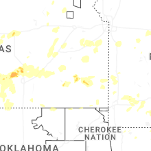

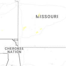
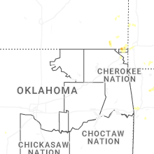

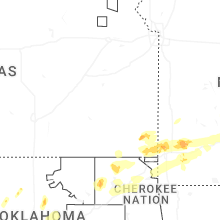


Connect with Interactive Hail Maps