

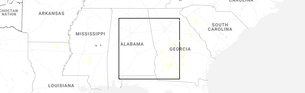
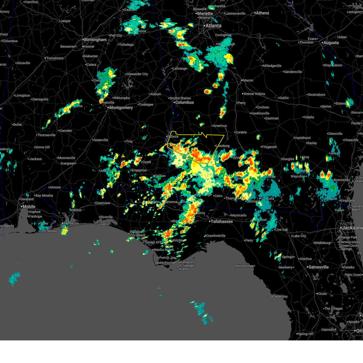
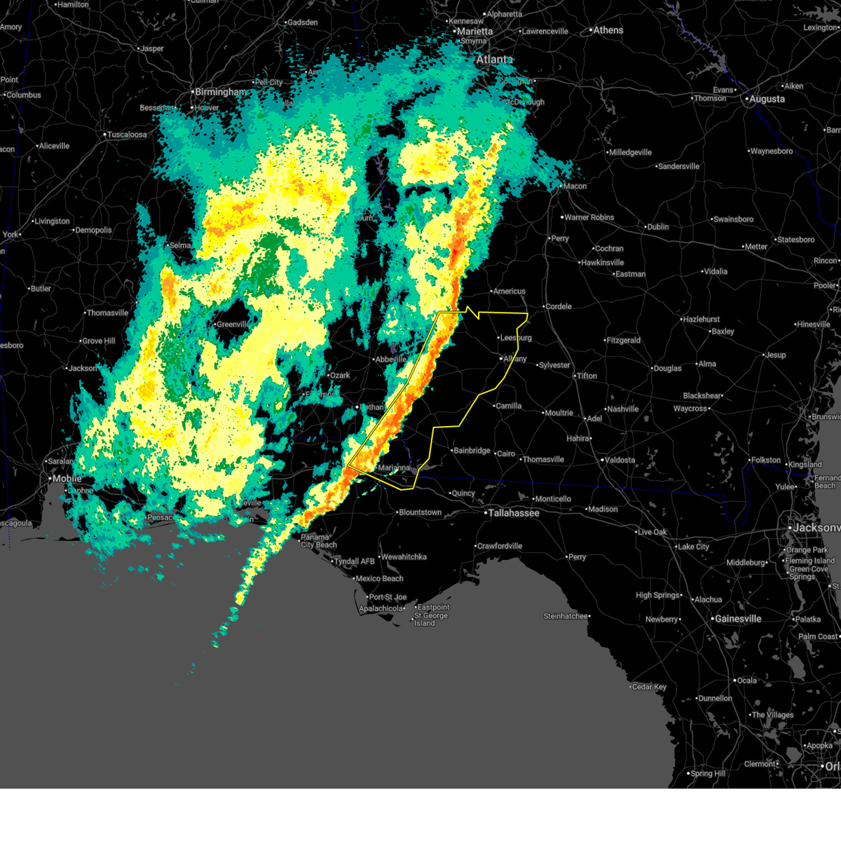
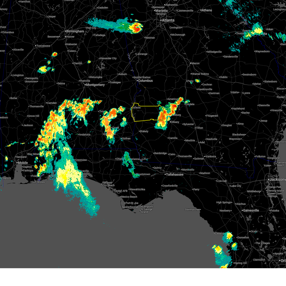
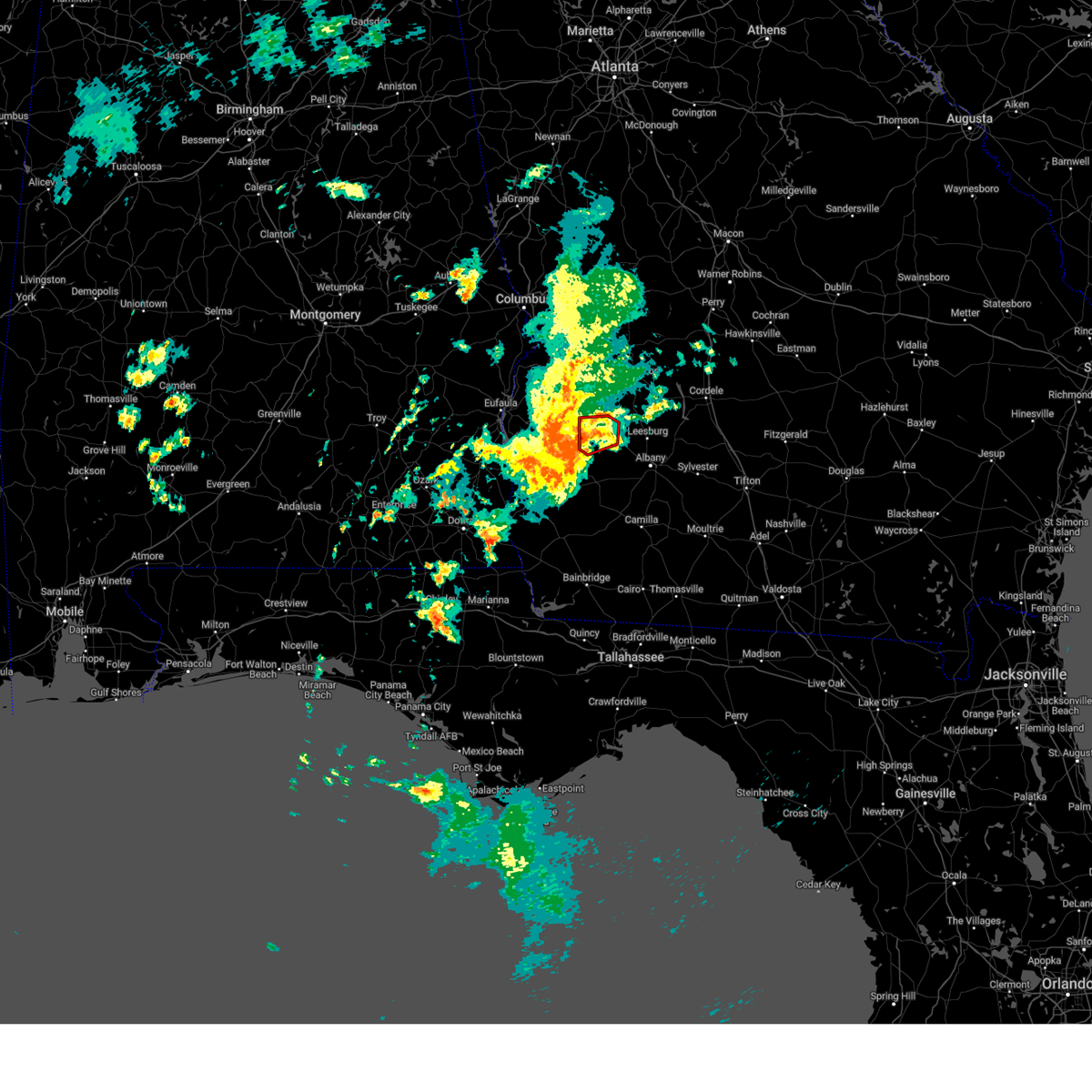
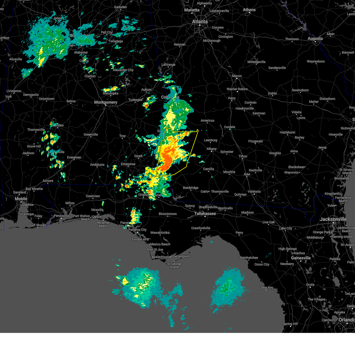
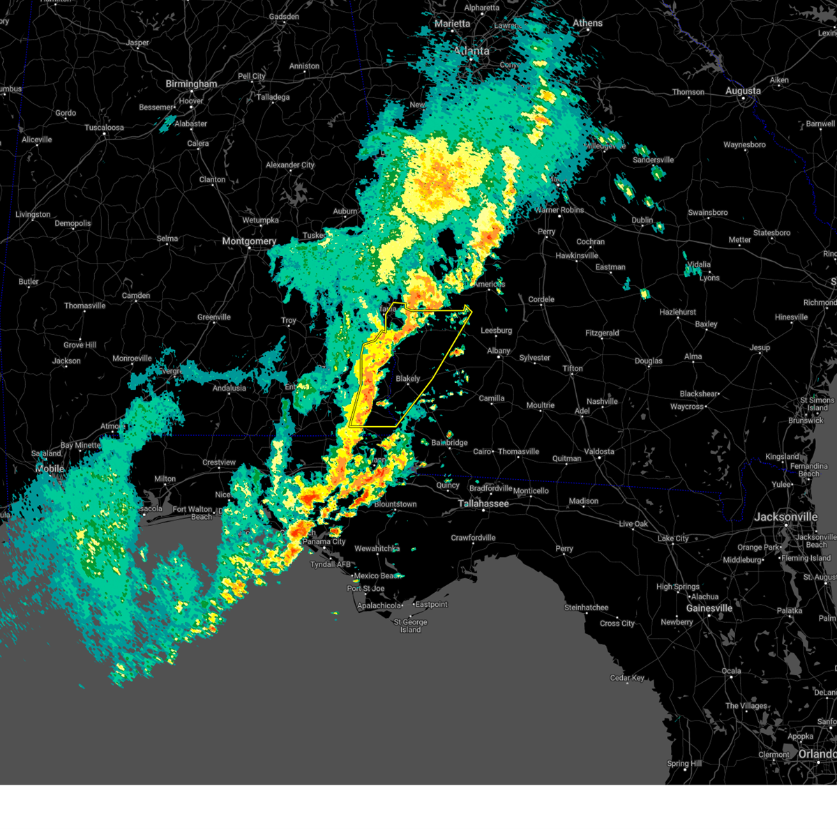
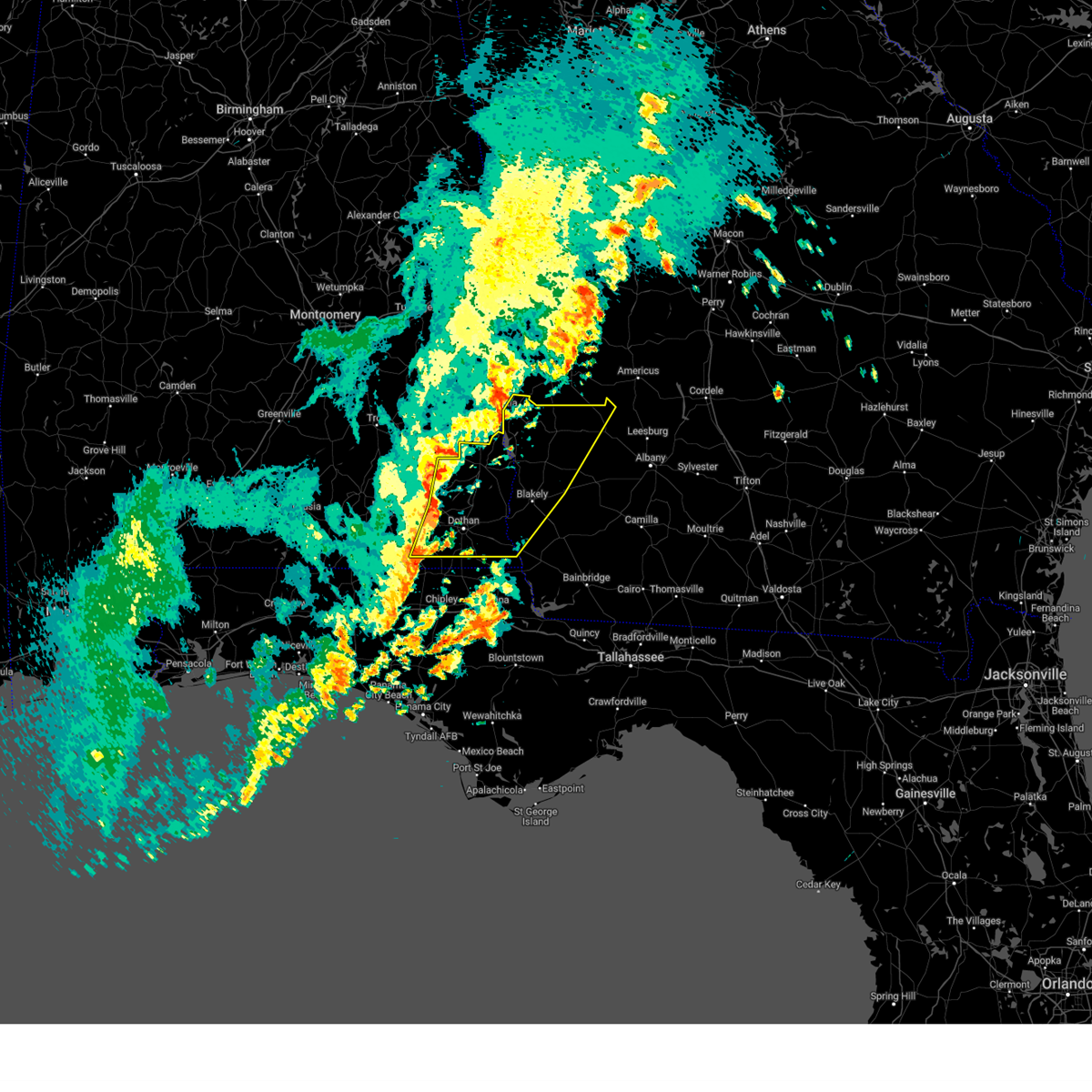
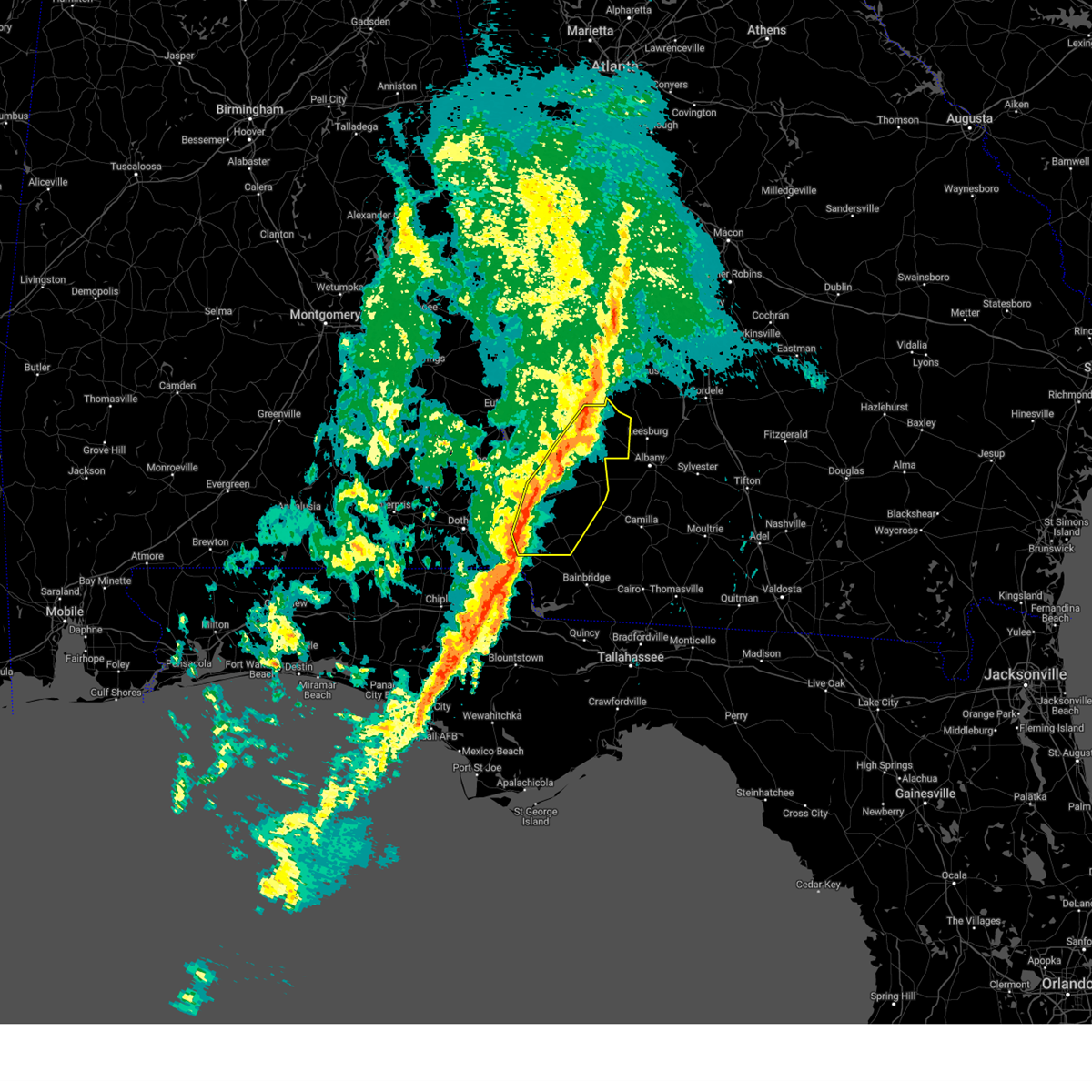
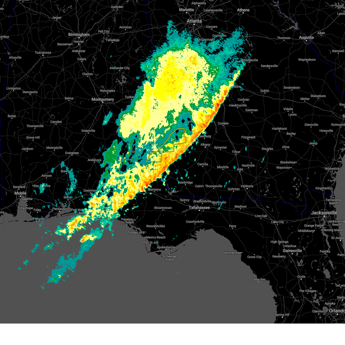
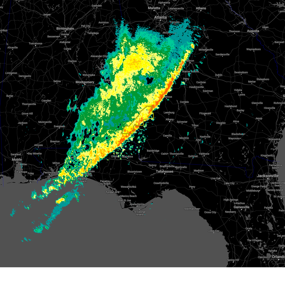
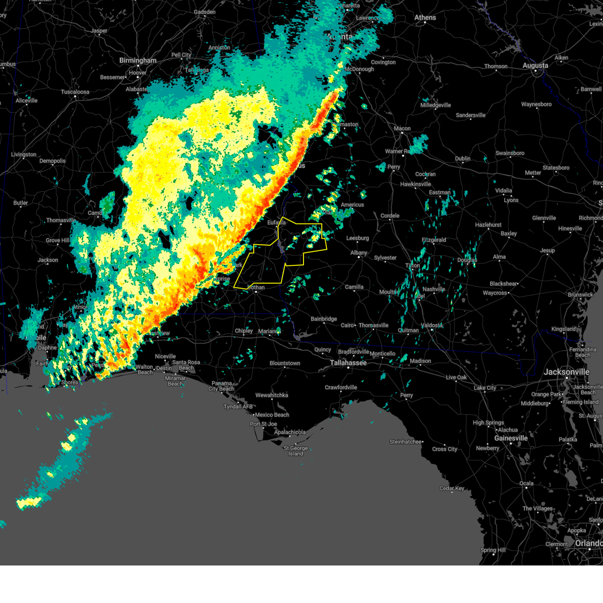
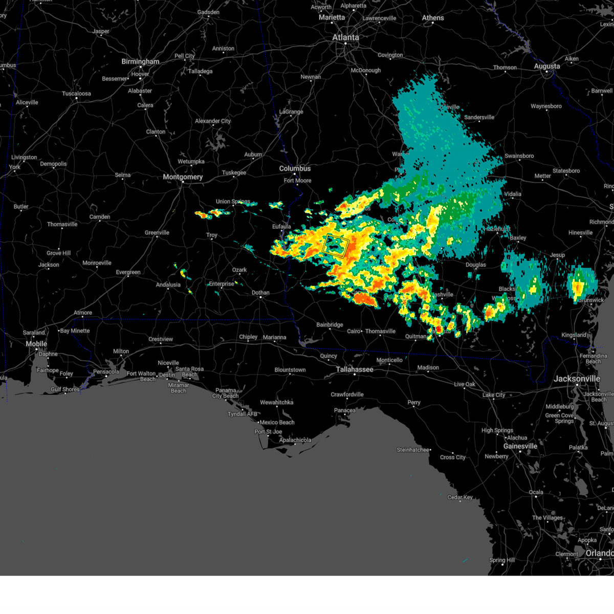
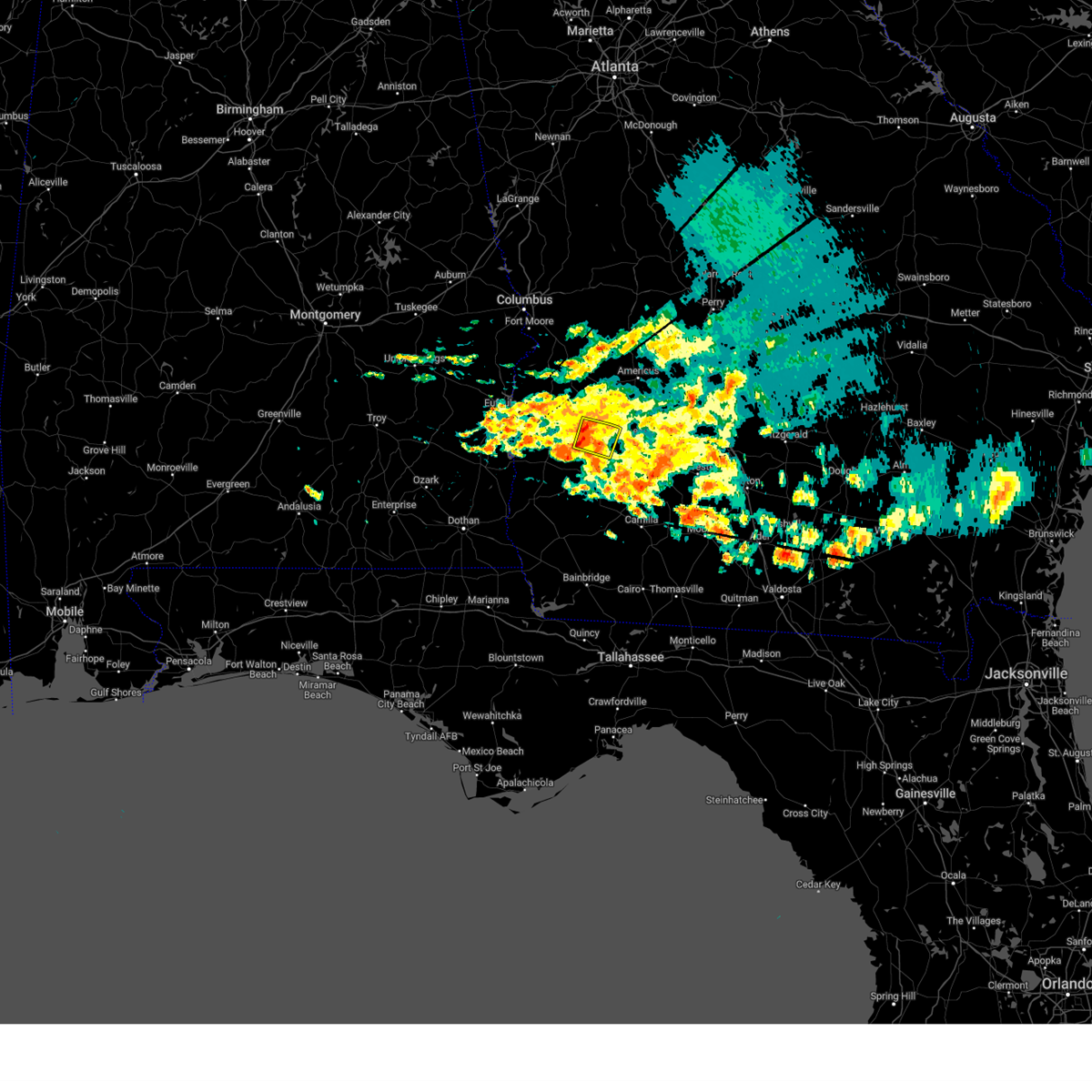
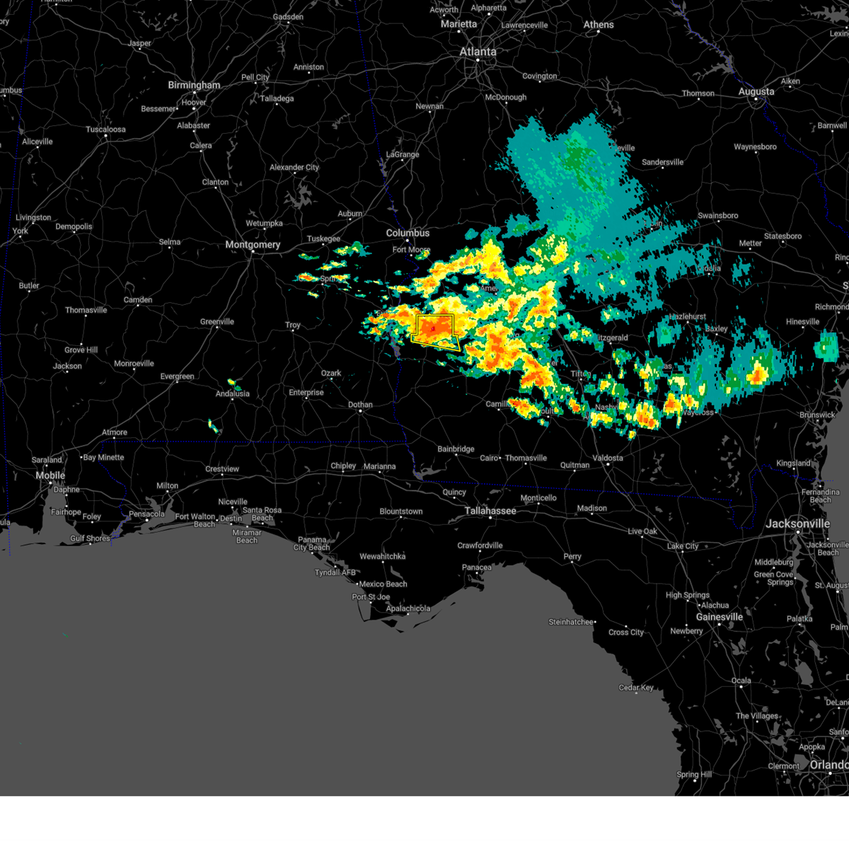
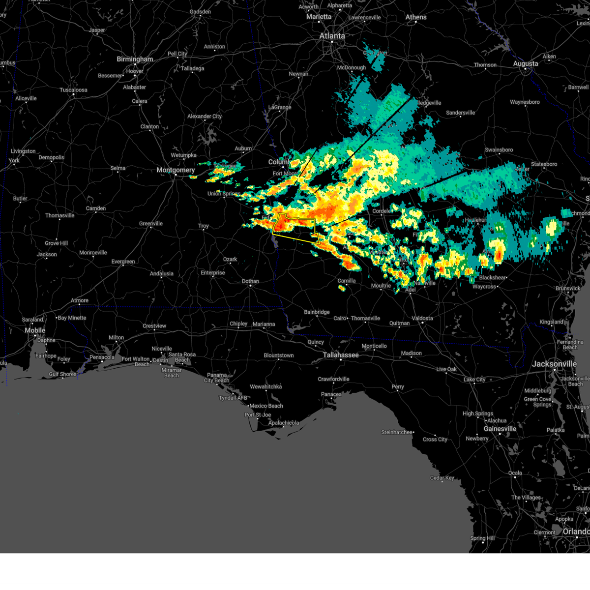
Hail Map for Shellman, GA
The Shellman, GA area has had 0 reports of on-the-ground hail by trained spotters, and has been under severe weather warnings 11 times during the past 12 months. Doppler radar has detected hail at or near Shellman, GA on 60 occasions, including 1 occasion during the past year.
| Name: | Shellman, GA |
| Where Located: | 77.5 miles SE of Auburn, AL |
| Map: | Google Map for Shellman, GA |
| Population: | 1083 |
| Housing Units: | 498 |
| More Info: | Search Google for Shellman, GA |
0
The Top Recent Hail Date for Shellman, GA is Friday, May 22, 2026 (48th out of 60)
Hail and Wind Damage Spotted near Shellman, GA
| Date / Time | Report Details |
|---|---|
| 6/1/2026 7:15 PM EDT |
 Svrtae the national weather service in tallahassee has issued a * severe thunderstorm warning for, northeastern randolph county in southwestern georgia, western lee county in southwestern georgia, terrell county in southwestern georgia, * until 800 pm edt. * at 715 pm edt, severe thunderstorms were located along a line extending from 7 miles north of richland to 6 miles southwest of weston to near cuthbert, moving southeast at 40 mph (radar indicated). Hazards include 60 mph wind gusts. expect damage to roofs, siding, and trees Svrtae the national weather service in tallahassee has issued a * severe thunderstorm warning for, northeastern randolph county in southwestern georgia, western lee county in southwestern georgia, terrell county in southwestern georgia, * until 800 pm edt. * at 715 pm edt, severe thunderstorms were located along a line extending from 7 miles north of richland to 6 miles southwest of weston to near cuthbert, moving southeast at 40 mph (radar indicated). Hazards include 60 mph wind gusts. expect damage to roofs, siding, and trees
|
| 6/1/2026 5:52 PM CDT |
 Svrtae the national weather service in tallahassee has issued a * severe thunderstorm warning for, dale county in southeastern alabama, henry county in southeastern alabama, coffee county in southeastern alabama, northwestern geneva county in southeastern alabama, northwestern houston county in southeastern alabama, clay county in southwestern georgia, randolph county in southwestern georgia, northwestern calhoun county in southwestern georgia, northwestern early county in southwestern georgia, quitman county in southwestern georgia, * until 745 pm edt/645 pm cdt/. * at 652 pm edt/552 pm cdt/, severe thunderstorms were located along a line extending from near cusseta to near lakepoint resort state park to near louisville to near glenwood, moving south at 40 mph (radar indicated). Hazards include 60 mph wind gusts. expect damage to roofs, siding, and trees Svrtae the national weather service in tallahassee has issued a * severe thunderstorm warning for, dale county in southeastern alabama, henry county in southeastern alabama, coffee county in southeastern alabama, northwestern geneva county in southeastern alabama, northwestern houston county in southeastern alabama, clay county in southwestern georgia, randolph county in southwestern georgia, northwestern calhoun county in southwestern georgia, northwestern early county in southwestern georgia, quitman county in southwestern georgia, * until 745 pm edt/645 pm cdt/. * at 652 pm edt/552 pm cdt/, severe thunderstorms were located along a line extending from near cusseta to near lakepoint resort state park to near louisville to near glenwood, moving south at 40 mph (radar indicated). Hazards include 60 mph wind gusts. expect damage to roofs, siding, and trees
|
| 5/24/2026 5:09 PM EDT |
 At 509 pm edt, severe thunderstorms were located along a line extending from 8 miles east of georgetown to 9 miles west of albany, moving northeast at 30 mph (radar indicated). Hazards include 60 mph wind gusts. Expect damage to roofs, siding, and trees. Locations impacted include, dawson, leesburg, cuthbert, georgetown, albany, shellman, smithville, sasser, bronwood, parrott, wire bridge, chokee, crossroads, clarks mill, dawson municipal a/p, chambliss, olivers mill, hatcher, morris, and neyami. At 509 pm edt, severe thunderstorms were located along a line extending from 8 miles east of georgetown to 9 miles west of albany, moving northeast at 30 mph (radar indicated). Hazards include 60 mph wind gusts. Expect damage to roofs, siding, and trees. Locations impacted include, dawson, leesburg, cuthbert, georgetown, albany, shellman, smithville, sasser, bronwood, parrott, wire bridge, chokee, crossroads, clarks mill, dawson municipal a/p, chambliss, olivers mill, hatcher, morris, and neyami.
|
| 5/24/2026 4:59 PM EDT | Several trees reported down south of shellma in randolph county GA, 2.1 miles NNE of Shellman, GA |
| 5/24/2026 4:48 PM EDT |
 Svrtae the national weather service in tallahassee has issued a * severe thunderstorm warning for, western dougherty county in southwestern georgia, northern clay county in southwestern georgia, randolph county in southwestern georgia, lee county in southwestern georgia, calhoun county in southwestern georgia, quitman county in southwestern georgia, terrell county in southwestern georgia, * until 600 pm edt. * at 448 pm edt, severe thunderstorms were located along a line extending from 9 miles north of fort gaines to near leary, moving northeast at 30 mph (radar indicated). Hazards include 60 mph wind gusts. expect damage to roofs, siding, and trees Svrtae the national weather service in tallahassee has issued a * severe thunderstorm warning for, western dougherty county in southwestern georgia, northern clay county in southwestern georgia, randolph county in southwestern georgia, lee county in southwestern georgia, calhoun county in southwestern georgia, quitman county in southwestern georgia, terrell county in southwestern georgia, * until 600 pm edt. * at 448 pm edt, severe thunderstorms were located along a line extending from 9 miles north of fort gaines to near leary, moving northeast at 30 mph (radar indicated). Hazards include 60 mph wind gusts. expect damage to roofs, siding, and trees
|
| 3/16/2026 8:41 AM EDT |
 the severe thunderstorm warning has been cancelled and is no longer in effect the severe thunderstorm warning has been cancelled and is no longer in effect
|
| 3/16/2026 8:27 AM EDT |
 At 827 am edt, severe thunderstorms were located along a line extending from 9 miles north of cuthbert to 8 miles southeast of fort gaines, moving northeast at 45 mph (radar indicated). Hazards include 60 mph wind gusts and penny size hail. Expect damage to roofs, siding, and trees. Locations impacted include, cuthbert, edison, shellman, parrott, bellville, bluffton, carnegie, randolph co a/p, chambliss, martins crossroads, jones crossing, bethel, benevolence, suttons corner, springvale, wades, harrisons mill, springvale station, pachitla, and zetto. At 827 am edt, severe thunderstorms were located along a line extending from 9 miles north of cuthbert to 8 miles southeast of fort gaines, moving northeast at 45 mph (radar indicated). Hazards include 60 mph wind gusts and penny size hail. Expect damage to roofs, siding, and trees. Locations impacted include, cuthbert, edison, shellman, parrott, bellville, bluffton, carnegie, randolph co a/p, chambliss, martins crossroads, jones crossing, bethel, benevolence, suttons corner, springvale, wades, harrisons mill, springvale station, pachitla, and zetto.
|
| 3/16/2026 8:27 AM EDT |
 the severe thunderstorm warning has been cancelled and is no longer in effect the severe thunderstorm warning has been cancelled and is no longer in effect
|
| 3/16/2026 8:09 AM EDT |
 Svrtae the national weather service in tallahassee has issued a * severe thunderstorm warning for, eastern henry county in southeastern alabama, clay county in southwestern georgia, randolph county in southwestern georgia, western calhoun county in southwestern georgia, northwestern early county in southwestern georgia, southeastern quitman county in southwestern georgia, northwestern terrell county in southwestern georgia, * until 915 am edt/815 am cdt/. * at 809 am edt/709 am cdt/, severe thunderstorms were located along a line extending from 9 miles west of cuthbert to 9 miles southeast of abbeville, moving northeast at 45 mph (radar indicated). Hazards include 60 mph wind gusts and penny size hail. expect damage to roofs, siding, and trees Svrtae the national weather service in tallahassee has issued a * severe thunderstorm warning for, eastern henry county in southeastern alabama, clay county in southwestern georgia, randolph county in southwestern georgia, western calhoun county in southwestern georgia, northwestern early county in southwestern georgia, southeastern quitman county in southwestern georgia, northwestern terrell county in southwestern georgia, * until 915 am edt/815 am cdt/. * at 809 am edt/709 am cdt/, severe thunderstorms were located along a line extending from 9 miles west of cuthbert to 9 miles southeast of abbeville, moving northeast at 45 mph (radar indicated). Hazards include 60 mph wind gusts and penny size hail. expect damage to roofs, siding, and trees
|
| 3/12/2026 5:58 AM EDT |
 Svrtae the national weather service in tallahassee has issued a * severe thunderstorm warning for, southeastern houston county in southeastern alabama, jackson county in the panhandle of florida, miller county in southwestern georgia, dougherty county in southwestern georgia, southeastern clay county in southwestern georgia, eastern randolph county in southwestern georgia, lee county in southwestern georgia, baker county in southwestern georgia, calhoun county in southwestern georgia, early county in southwestern georgia, seminole county in southwestern georgia, terrell county in southwestern georgia, * until 700 am edt/600 am cdt/. * at 558 am edt/458 am cdt/, severe thunderstorms were located along a line extending from 8 miles southwest of plains to near arlington to marianna, moving east at 25 mph (radar indicated). Hazards include 60 mph wind gusts. expect damage to roofs, siding, and trees Svrtae the national weather service in tallahassee has issued a * severe thunderstorm warning for, southeastern houston county in southeastern alabama, jackson county in the panhandle of florida, miller county in southwestern georgia, dougherty county in southwestern georgia, southeastern clay county in southwestern georgia, eastern randolph county in southwestern georgia, lee county in southwestern georgia, baker county in southwestern georgia, calhoun county in southwestern georgia, early county in southwestern georgia, seminole county in southwestern georgia, terrell county in southwestern georgia, * until 700 am edt/600 am cdt/. * at 558 am edt/458 am cdt/, severe thunderstorms were located along a line extending from 8 miles southwest of plains to near arlington to marianna, moving east at 25 mph (radar indicated). Hazards include 60 mph wind gusts. expect damage to roofs, siding, and trees
|
| 3/12/2026 5:08 AM EDT |
 Svrtae the national weather service in tallahassee has issued a * severe thunderstorm warning for, southeastern dale county in southeastern alabama, eastern geneva county in southeastern alabama, houston county in southeastern alabama, henry county in southeastern alabama, clay county in southwestern georgia, randolph county in southwestern georgia, northwestern lee county in southwestern georgia, calhoun county in southwestern georgia, early county in southwestern georgia, quitman county in southwestern georgia, western miller county in southwestern georgia, northwestern baker county in southwestern georgia, terrell county in southwestern georgia, * until 615 am edt/515 am cdt/. * at 508 am edt/408 am cdt/, severe thunderstorms were located along a line extending from 6 miles northeast of georgetown to near headland to near hartford, moving east at 45 mph (radar indicated). Hazards include 60 mph wind gusts. expect damage to roofs, siding, and trees Svrtae the national weather service in tallahassee has issued a * severe thunderstorm warning for, southeastern dale county in southeastern alabama, eastern geneva county in southeastern alabama, houston county in southeastern alabama, henry county in southeastern alabama, clay county in southwestern georgia, randolph county in southwestern georgia, northwestern lee county in southwestern georgia, calhoun county in southwestern georgia, early county in southwestern georgia, quitman county in southwestern georgia, western miller county in southwestern georgia, northwestern baker county in southwestern georgia, terrell county in southwestern georgia, * until 615 am edt/515 am cdt/. * at 508 am edt/408 am cdt/, severe thunderstorms were located along a line extending from 6 miles northeast of georgetown to near headland to near hartford, moving east at 45 mph (radar indicated). Hazards include 60 mph wind gusts. expect damage to roofs, siding, and trees
|
| 1/25/2026 2:50 PM EST |
 Svrtae the national weather service in tallahassee has issued a * severe thunderstorm warning for, north central clay county in southwestern georgia, central randolph county in southwestern georgia, lee county in southwestern georgia, terrell county in southwestern georgia, * until 345 pm est. * at 250 pm est, severe thunderstorms were located along a line extending from near weston to near cuthbert to 10 miles northeast of fort gaines, moving east at 35 mph (radar indicated). Hazards include 60 mph wind gusts. expect damage to roofs, siding, and trees Svrtae the national weather service in tallahassee has issued a * severe thunderstorm warning for, north central clay county in southwestern georgia, central randolph county in southwestern georgia, lee county in southwestern georgia, terrell county in southwestern georgia, * until 345 pm est. * at 250 pm est, severe thunderstorms were located along a line extending from near weston to near cuthbert to 10 miles northeast of fort gaines, moving east at 35 mph (radar indicated). Hazards include 60 mph wind gusts. expect damage to roofs, siding, and trees
|
| 6/25/2025 10:39 PM EDT |
 At 1039 pm edt, a severe thunderstorm was located over cuthbert, moving west at 25 mph (radar indicated). Hazards include 60 mph wind gusts. Expect damage to roofs, siding, and trees. locations impacted include, fort gaines, cuthbert, georgetown, shellman, parrott, walter f. George lock and dam, wire bridge, walter f george lake, bonapartes retreat, standleys store, carnegie, watson crossroads, crossroads, ricks place, pecan, randolph co a/p, chambliss, hatcher, morris, and jones crossing. At 1039 pm edt, a severe thunderstorm was located over cuthbert, moving west at 25 mph (radar indicated). Hazards include 60 mph wind gusts. Expect damage to roofs, siding, and trees. locations impacted include, fort gaines, cuthbert, georgetown, shellman, parrott, walter f. George lock and dam, wire bridge, walter f george lake, bonapartes retreat, standleys store, carnegie, watson crossroads, crossroads, ricks place, pecan, randolph co a/p, chambliss, hatcher, morris, and jones crossing.
|
| 6/25/2025 10:06 PM EDT |
 Svrtae the national weather service in tallahassee has issued a * severe thunderstorm warning for, northern clay county in southwestern georgia, randolph county in southwestern georgia, quitman county in southwestern georgia, terrell county in southwestern georgia, * until 1130 pm edt. * at 1006 pm edt, a severe thunderstorm was located near dawson, moving west at 20 mph (radar indicated). Hazards include 60 mph wind gusts. expect damage to roofs, siding, and trees Svrtae the national weather service in tallahassee has issued a * severe thunderstorm warning for, northern clay county in southwestern georgia, randolph county in southwestern georgia, quitman county in southwestern georgia, terrell county in southwestern georgia, * until 1130 pm edt. * at 1006 pm edt, a severe thunderstorm was located near dawson, moving west at 20 mph (radar indicated). Hazards include 60 mph wind gusts. expect damage to roofs, siding, and trees
|
| 5/10/2025 3:28 PM EDT | Several trees and a powerline were reported down in shellma in randolph county GA, 0.3 miles WSW of Shellman, GA |
| 5/10/2025 3:22 PM EDT |
 Tortae the national weather service in tallahassee has issued a * tornado warning for, southeastern randolph county in southwestern georgia, southwestern terrell county in southwestern georgia, * until 345 pm edt. * at 322 pm edt, a severe thunderstorm capable of producing a tornado was located near shellman, or 9 miles southwest of dawson, moving northeast at 30 mph (radar indicated rotation). Hazards include tornado. Flying debris will be dangerous to those caught without shelter. mobile homes will be damaged or destroyed. damage to roofs, windows, and vehicles will occur. tree damage is likely. this dangerous storm will be near, dawson around 330 pm edt. Other locations impacted by this tornadic thunderstorm include dawson municipal a/p, graves, oakville, herod, chickasawhatchee, doverel, yeomans, and bronwood. Tortae the national weather service in tallahassee has issued a * tornado warning for, southeastern randolph county in southwestern georgia, southwestern terrell county in southwestern georgia, * until 345 pm edt. * at 322 pm edt, a severe thunderstorm capable of producing a tornado was located near shellman, or 9 miles southwest of dawson, moving northeast at 30 mph (radar indicated rotation). Hazards include tornado. Flying debris will be dangerous to those caught without shelter. mobile homes will be damaged or destroyed. damage to roofs, windows, and vehicles will occur. tree damage is likely. this dangerous storm will be near, dawson around 330 pm edt. Other locations impacted by this tornadic thunderstorm include dawson municipal a/p, graves, oakville, herod, chickasawhatchee, doverel, yeomans, and bronwood.
|
| 5/10/2025 2:33 PM EDT |
 Svrtae the national weather service in tallahassee has issued a * severe thunderstorm warning for, eastern henry county in southeastern alabama, northeastern houston county in southeastern alabama, northwestern miller county in southwestern georgia, clay county in southwestern georgia, randolph county in southwestern georgia, calhoun county in southwestern georgia, early county in southwestern georgia, quitman county in southwestern georgia, western terrell county in southwestern georgia, * until 330 pm edt/230 pm cdt/. * at 233 pm edt/133 pm cdt/, severe thunderstorms were located along a line extending from 7 miles southeast of fort gaines to near columbia, moving northeast at 25 mph (radar indicated). Hazards include 60 mph wind gusts and quarter size hail. Hail damage to vehicles is expected. Expect wind damage to roofs, siding, and trees. Svrtae the national weather service in tallahassee has issued a * severe thunderstorm warning for, eastern henry county in southeastern alabama, northeastern houston county in southeastern alabama, northwestern miller county in southwestern georgia, clay county in southwestern georgia, randolph county in southwestern georgia, calhoun county in southwestern georgia, early county in southwestern georgia, quitman county in southwestern georgia, western terrell county in southwestern georgia, * until 330 pm edt/230 pm cdt/. * at 233 pm edt/133 pm cdt/, severe thunderstorms were located along a line extending from 7 miles southeast of fort gaines to near columbia, moving northeast at 25 mph (radar indicated). Hazards include 60 mph wind gusts and quarter size hail. Hail damage to vehicles is expected. Expect wind damage to roofs, siding, and trees.
|
| 3/31/2025 1:58 PM EDT |
 Svrtae the national weather service in tallahassee has issued a * severe thunderstorm warning for, southeastern henry county in southeastern alabama, northeastern houston county in southeastern alabama, miller county in southwestern georgia, dougherty county in southwestern georgia, clay county in southwestern georgia, randolph county in southwestern georgia, mitchell county in southwestern georgia, lee county in southwestern georgia, baker county in southwestern georgia, calhoun county in southwestern georgia, early county in southwestern georgia, terrell county in southwestern georgia, * until 300 pm edt/200 pm cdt/. * at 158 pm edt/1258 pm cdt/, severe thunderstorms were located along a line extending from near cuthbert to 9 miles northwest of blakely to near cottonwood, moving east at 45 mph (radar indicated). Hazards include 60 mph wind gusts and penny size hail. expect damage to roofs, siding, and trees Svrtae the national weather service in tallahassee has issued a * severe thunderstorm warning for, southeastern henry county in southeastern alabama, northeastern houston county in southeastern alabama, miller county in southwestern georgia, dougherty county in southwestern georgia, clay county in southwestern georgia, randolph county in southwestern georgia, mitchell county in southwestern georgia, lee county in southwestern georgia, baker county in southwestern georgia, calhoun county in southwestern georgia, early county in southwestern georgia, terrell county in southwestern georgia, * until 300 pm edt/200 pm cdt/. * at 158 pm edt/1258 pm cdt/, severe thunderstorms were located along a line extending from near cuthbert to 9 miles northwest of blakely to near cottonwood, moving east at 45 mph (radar indicated). Hazards include 60 mph wind gusts and penny size hail. expect damage to roofs, siding, and trees
|
| 3/31/2025 1:47 PM EDT |
 the severe thunderstorm warning has been cancelled and is no longer in effect the severe thunderstorm warning has been cancelled and is no longer in effect
|
| 3/31/2025 1:47 PM EDT |
 At 147 pm edt/1247 pm cdt/, severe thunderstorms were located along a line extending from near cuthbert to 7 miles northwest of columbia to 6 miles east of graceville, moving east at 45 mph (radar indicated). Hazards include 60 mph wind gusts. Expect damage to roofs, siding, and trees. Locations impacted include, shorterville, parksville, hayes, pecan, rock hill, thomas mill creek, chambliss, hatcher, suttons corner, springvale, fort gaines-clay airport, arlington, georgetown, wades, balkum, howards mill, moores crossroads, yeomans, garnersville, and blakely. At 147 pm edt/1247 pm cdt/, severe thunderstorms were located along a line extending from near cuthbert to 7 miles northwest of columbia to 6 miles east of graceville, moving east at 45 mph (radar indicated). Hazards include 60 mph wind gusts. Expect damage to roofs, siding, and trees. Locations impacted include, shorterville, parksville, hayes, pecan, rock hill, thomas mill creek, chambliss, hatcher, suttons corner, springvale, fort gaines-clay airport, arlington, georgetown, wades, balkum, howards mill, moores crossroads, yeomans, garnersville, and blakely.
|
| 3/31/2025 1:22 PM EDT |
 Svrtae the national weather service in tallahassee has issued a * severe thunderstorm warning for, eastern dale county in southeastern alabama, henry county in southeastern alabama, northeastern geneva county in southeastern alabama, houston county in southeastern alabama, northwestern miller county in southwestern georgia, clay county in southwestern georgia, randolph county in southwestern georgia, western calhoun county in southwestern georgia, early county in southwestern georgia, quitman county in southwestern georgia, western terrell county in southwestern georgia, * until 200 pm edt/100 pm cdt/. * at 121 pm edt/1221 pm cdt/, severe thunderstorms were located along a line extending from near clio to 6 miles southwest of new brockton to 10 miles northwest of de funiak springs, moving east at 45 mph (radar indicated). Hazards include 60 mph wind gusts. expect damage to roofs, siding, and trees Svrtae the national weather service in tallahassee has issued a * severe thunderstorm warning for, eastern dale county in southeastern alabama, henry county in southeastern alabama, northeastern geneva county in southeastern alabama, houston county in southeastern alabama, northwestern miller county in southwestern georgia, clay county in southwestern georgia, randolph county in southwestern georgia, western calhoun county in southwestern georgia, early county in southwestern georgia, quitman county in southwestern georgia, western terrell county in southwestern georgia, * until 200 pm edt/100 pm cdt/. * at 121 pm edt/1221 pm cdt/, severe thunderstorms were located along a line extending from near clio to 6 miles southwest of new brockton to 10 miles northwest of de funiak springs, moving east at 45 mph (radar indicated). Hazards include 60 mph wind gusts. expect damage to roofs, siding, and trees
|
| 3/16/2025 3:35 AM EDT |
 The storms which prompted the warning have weakened below severe limits, and no longer pose an immediate threat to life or property. therefore, the warning will be allowed to expire. a tornado watch remains in effect until 400 am edt for southeastern alabama, and southwestern georgia. a tornado watch also remains in effect until 1000 am edt for southwestern georgia. to report severe weather, contact your nearest law enforcement agency. they will relay your report to the national weather service tallahassee. The storms which prompted the warning have weakened below severe limits, and no longer pose an immediate threat to life or property. therefore, the warning will be allowed to expire. a tornado watch remains in effect until 400 am edt for southeastern alabama, and southwestern georgia. a tornado watch also remains in effect until 1000 am edt for southwestern georgia. to report severe weather, contact your nearest law enforcement agency. they will relay your report to the national weather service tallahassee.
|
| 3/16/2025 3:03 AM EDT |
 At 303 am edt, severe thunderstorms were located along a line extending from near richland to 6 miles north of fort gaines, moving east at 40 mph (radar indicated). Hazards include 60 mph wind gusts. Expect damage to roofs, siding, and trees. Locations impacted include, wire bridge, walter f george lake, bonapartes retreat, standleys store, carnegie, watson crossroads, cuthbert, crossroads, ricks place, pecan, shellman, randolph co a/p, bellville, aycock mill, hatcher, morris, jones crossing, martins crossroads, bethel, and benevolence. At 303 am edt, severe thunderstorms were located along a line extending from near richland to 6 miles north of fort gaines, moving east at 40 mph (radar indicated). Hazards include 60 mph wind gusts. Expect damage to roofs, siding, and trees. Locations impacted include, wire bridge, walter f george lake, bonapartes retreat, standleys store, carnegie, watson crossroads, cuthbert, crossroads, ricks place, pecan, shellman, randolph co a/p, bellville, aycock mill, hatcher, morris, jones crossing, martins crossroads, bethel, and benevolence.
|
| 3/16/2025 3:03 AM EDT |
 the severe thunderstorm warning has been cancelled and is no longer in effect the severe thunderstorm warning has been cancelled and is no longer in effect
|
| 3/16/2025 2:24 AM EDT |
 Svrtae the national weather service in tallahassee has issued a * severe thunderstorm warning for, northern henry county in southeastern alabama, clay county in southwestern georgia, randolph county in southwestern georgia, quitman county in southwestern georgia, * until 345 am edt/245 am cdt/. * at 224 am edt/124 am cdt/, severe thunderstorms were located along a line extending from 6 miles northeast of lakepoint resort state park to 6 miles southeast of blue springs, moving east at 40 mph (radar indicated). Hazards include 60 mph wind gusts. expect damage to roofs, siding, and trees Svrtae the national weather service in tallahassee has issued a * severe thunderstorm warning for, northern henry county in southeastern alabama, clay county in southwestern georgia, randolph county in southwestern georgia, quitman county in southwestern georgia, * until 345 am edt/245 am cdt/. * at 224 am edt/124 am cdt/, severe thunderstorms were located along a line extending from 6 miles northeast of lakepoint resort state park to 6 miles southeast of blue springs, moving east at 40 mph (radar indicated). Hazards include 60 mph wind gusts. expect damage to roofs, siding, and trees
|
| 3/5/2025 2:42 AM EST |
 At 242 am est, severe thunderstorms were located along a line extending from 7 miles southwest of plains to 7 miles northwest of donalsonville, moving east at 40 mph (radar indicated). Hazards include 60 mph wind gusts. Expect damage to roofs, siding, and trees. Locations impacted include, iveys mill, parksville, carnegie, parrott, bluffton, dawson municipal a/p, chambliss, suttons corner, chickasawhatchee, arlington, rowena, howards mill, herod, centerville, yeomans, blakely, graves, fountain bridge, goffs mill, and commissary hill. At 242 am est, severe thunderstorms were located along a line extending from 7 miles southwest of plains to 7 miles northwest of donalsonville, moving east at 40 mph (radar indicated). Hazards include 60 mph wind gusts. Expect damage to roofs, siding, and trees. Locations impacted include, iveys mill, parksville, carnegie, parrott, bluffton, dawson municipal a/p, chambliss, suttons corner, chickasawhatchee, arlington, rowena, howards mill, herod, centerville, yeomans, blakely, graves, fountain bridge, goffs mill, and commissary hill.
|
| 3/5/2025 2:15 AM EST |
 the severe thunderstorm warning has been cancelled and is no longer in effect the severe thunderstorm warning has been cancelled and is no longer in effect
|
| 3/5/2025 2:15 AM EST |
 At 215 am est, severe thunderstorms were located along a line extending from 9 miles south of lumpkin to near ashford, moving east at 50 mph (radar indicated). Hazards include 60 mph wind gusts. Expect damage to roofs, siding, and trees. Locations impacted include, iveys mill, parksville, carnegie, watson crossroads, parrott, bluffton, pecan, rock hill, dawson municipal a/p, bellville, chambliss, bethel, suttons corner, springvale, fort gaines-clay airport, chickasawhatchee, arlington, wades, rowena, and howards mill. At 215 am est, severe thunderstorms were located along a line extending from 9 miles south of lumpkin to near ashford, moving east at 50 mph (radar indicated). Hazards include 60 mph wind gusts. Expect damage to roofs, siding, and trees. Locations impacted include, iveys mill, parksville, carnegie, watson crossroads, parrott, bluffton, pecan, rock hill, dawson municipal a/p, bellville, chambliss, bethel, suttons corner, springvale, fort gaines-clay airport, chickasawhatchee, arlington, wades, rowena, and howards mill.
|
| 3/5/2025 1:30 AM EST |
 Svrtae the national weather service in tallahassee has issued a * severe thunderstorm warning for, miller county in southwestern georgia, clay county in southwestern georgia, randolph county in southwestern georgia, northwestern baker county in southwestern georgia, calhoun county in southwestern georgia, early county in southwestern georgia, quitman county in southwestern georgia, terrell county in southwestern georgia, * until 300 am est. * at 129 am est, severe thunderstorms were located along a line extending from near blue springs to near geneva, moving east at 45 mph (radar indicated). Hazards include 60 mph wind gusts. expect damage to roofs, siding, and trees Svrtae the national weather service in tallahassee has issued a * severe thunderstorm warning for, miller county in southwestern georgia, clay county in southwestern georgia, randolph county in southwestern georgia, northwestern baker county in southwestern georgia, calhoun county in southwestern georgia, early county in southwestern georgia, quitman county in southwestern georgia, terrell county in southwestern georgia, * until 300 am est. * at 129 am est, severe thunderstorms were located along a line extending from near blue springs to near geneva, moving east at 45 mph (radar indicated). Hazards include 60 mph wind gusts. expect damage to roofs, siding, and trees
|
| 2/16/2025 6:05 AM EST |
 The storms which prompted the warning have moved out of the area. therefore, the warning will be allowed to expire. a tornado watch remains in effect until 1000 am est/900 am cst/ for southeastern alabama, and southwestern georgia. to report severe weather, contact your nearest law enforcement agency. they will relay your report to the national weather service tallahassee. The storms which prompted the warning have moved out of the area. therefore, the warning will be allowed to expire. a tornado watch remains in effect until 1000 am est/900 am cst/ for southeastern alabama, and southwestern georgia. to report severe weather, contact your nearest law enforcement agency. they will relay your report to the national weather service tallahassee.
|
| 2/16/2025 5:50 AM EST |
 At 550 am est/450 am cst/, severe thunderstorms were located along a line extending from near preston to near columbia, moving east at 50 mph (radar indicated). Hazards include 60 mph wind gusts. Expect damage to roofs, siding, and trees. Locations impacted include, fort gaines, headland, cuthbert, shellman, newville, bellville, haleburg, bluffton, tumbleton, grandberry crossroads, carnegie, hayes, pecan, randolph co a/p, headland municipal a/p, dancey, jones crossing, martins crossroads, bethel, and benevolence. At 550 am est/450 am cst/, severe thunderstorms were located along a line extending from near preston to near columbia, moving east at 50 mph (radar indicated). Hazards include 60 mph wind gusts. Expect damage to roofs, siding, and trees. Locations impacted include, fort gaines, headland, cuthbert, shellman, newville, bellville, haleburg, bluffton, tumbleton, grandberry crossroads, carnegie, hayes, pecan, randolph co a/p, headland municipal a/p, dancey, jones crossing, martins crossroads, bethel, and benevolence.
|
| 2/16/2025 5:50 AM EST |
 the severe thunderstorm warning has been cancelled and is no longer in effect the severe thunderstorm warning has been cancelled and is no longer in effect
|
| 2/16/2025 4:47 AM EST |
 Svrtae the national weather service in tallahassee has issued a * severe thunderstorm warning for, eastern dale county in southeastern alabama, henry county in southeastern alabama, clay county in southwestern georgia, randolph county in southwestern georgia, quitman county in southwestern georgia, * until 615 am est/515 am cst/. * at 447 am est/347 am cst/, severe thunderstorms were located along a line extending from spring hill to near elba, moving east at 50 mph (radar indicated). Hazards include 60 mph wind gusts. expect damage to roofs, siding, and trees Svrtae the national weather service in tallahassee has issued a * severe thunderstorm warning for, eastern dale county in southeastern alabama, henry county in southeastern alabama, clay county in southwestern georgia, randolph county in southwestern georgia, quitman county in southwestern georgia, * until 615 am est/515 am cst/. * at 447 am est/347 am cst/, severe thunderstorms were located along a line extending from spring hill to near elba, moving east at 50 mph (radar indicated). Hazards include 60 mph wind gusts. expect damage to roofs, siding, and trees
|
| 7/15/2024 4:17 PM EDT |
 Svrtae the national weather service in tallahassee has issued a * severe thunderstorm warning for, northeastern randolph county in southwestern georgia, west central terrell county in southwestern georgia, * until 445 pm edt. * at 417 pm edt, a severe thunderstorm was located near cuthbert, moving east at 5 mph (radar indicated). Hazards include 60 mph wind gusts and penny size hail. expect damage to roofs, siding, and trees Svrtae the national weather service in tallahassee has issued a * severe thunderstorm warning for, northeastern randolph county in southwestern georgia, west central terrell county in southwestern georgia, * until 445 pm edt. * at 417 pm edt, a severe thunderstorm was located near cuthbert, moving east at 5 mph (radar indicated). Hazards include 60 mph wind gusts and penny size hail. expect damage to roofs, siding, and trees
|
| 6/6/2024 2:20 PM EDT |
 Svrtae the national weather service in tallahassee has issued a * severe thunderstorm warning for, southeastern randolph county in southwestern georgia, western lee county in southwestern georgia, terrell county in southwestern georgia, * until 300 pm edt. * at 219 pm edt, a severe thunderstorm was located near dawson, moving northeast at 35 mph (radar indicated). Hazards include 60 mph wind gusts. expect damage to roofs, siding, and trees Svrtae the national weather service in tallahassee has issued a * severe thunderstorm warning for, southeastern randolph county in southwestern georgia, western lee county in southwestern georgia, terrell county in southwestern georgia, * until 300 pm edt. * at 219 pm edt, a severe thunderstorm was located near dawson, moving northeast at 35 mph (radar indicated). Hazards include 60 mph wind gusts. expect damage to roofs, siding, and trees
|
| 5/27/2024 6:35 PM EDT |
 The storm which prompted the warning has weakened below severe limits, and has exited the warned area. therefore, the warning will be allowed to expire. a severe thunderstorm watch remains in effect until 1000 pm edt for southwestern georgia. The storm which prompted the warning has weakened below severe limits, and has exited the warned area. therefore, the warning will be allowed to expire. a severe thunderstorm watch remains in effect until 1000 pm edt for southwestern georgia.
|
| 5/27/2024 6:09 PM EDT |
 the severe thunderstorm warning has been cancelled and is no longer in effect the severe thunderstorm warning has been cancelled and is no longer in effect
|
| 5/27/2024 6:09 PM EDT |
 At 609 pm edt, a severe thunderstorm was located near shellman, or 11 miles northeast of cuthbert, moving east at 35 mph (radar indicated). Hazards include 60 mph wind gusts and quarter size hail. Hail damage to vehicles is expected. expect wind damage to roofs, siding, and trees. Locations impacted include, dawson, leesburg, shellman, smithville, sasser, bronwood, parrott, carnegie, dawson municipal a/p, chambliss, olivers mill, neyami, martins crossroads, benevolence, wades, pachitla, bridges crossroad, white house, yeomans, and graves. At 609 pm edt, a severe thunderstorm was located near shellman, or 11 miles northeast of cuthbert, moving east at 35 mph (radar indicated). Hazards include 60 mph wind gusts and quarter size hail. Hail damage to vehicles is expected. expect wind damage to roofs, siding, and trees. Locations impacted include, dawson, leesburg, shellman, smithville, sasser, bronwood, parrott, carnegie, dawson municipal a/p, chambliss, olivers mill, neyami, martins crossroads, benevolence, wades, pachitla, bridges crossroad, white house, yeomans, and graves.
|
| 5/27/2024 5:43 PM EDT |
 the severe thunderstorm warning has been cancelled and is no longer in effect the severe thunderstorm warning has been cancelled and is no longer in effect
|
| 5/27/2024 5:43 PM EDT |
 At 542 pm edt, a severe thunderstorm was located near cuthbert, moving northeast at 30 mph (radar indicated). Hazards include 60 mph wind gusts and quarter size hail. Hail damage to vehicles is expected. expect wind damage to roofs, siding, and trees. Locations impacted include, dawson, cuthbert, leesburg, shellman, smithville, sasser, bronwood, parrott, carnegie, randolph co a/p, dawson municipal a/p, chambliss, olivers mill, neyami, morris, jones crossing, martins crossroads, bethel, benevolence, and springvale. At 542 pm edt, a severe thunderstorm was located near cuthbert, moving northeast at 30 mph (radar indicated). Hazards include 60 mph wind gusts and quarter size hail. Hail damage to vehicles is expected. expect wind damage to roofs, siding, and trees. Locations impacted include, dawson, cuthbert, leesburg, shellman, smithville, sasser, bronwood, parrott, carnegie, randolph co a/p, dawson municipal a/p, chambliss, olivers mill, neyami, morris, jones crossing, martins crossroads, bethel, benevolence, and springvale.
|
| 5/27/2024 5:12 PM EDT |
 Svrtae the national weather service in tallahassee has issued a * severe thunderstorm warning for, northeastern henry county in southeastern alabama, central clay county in southwestern georgia, randolph county in southwestern georgia, northwestern lee county in southwestern georgia, southeastern quitman county in southwestern georgia, terrell county in southwestern georgia, * until 645 pm edt/545 pm cdt/. * at 512 pm edt/412 pm cdt/, a severe thunderstorm was located over fort gaines, moving east at 35 mph (radar indicated). Hazards include 60 mph wind gusts and quarter size hail. Hail damage to vehicles is expected. Expect wind damage to roofs, siding, and trees. Svrtae the national weather service in tallahassee has issued a * severe thunderstorm warning for, northeastern henry county in southeastern alabama, central clay county in southwestern georgia, randolph county in southwestern georgia, northwestern lee county in southwestern georgia, southeastern quitman county in southwestern georgia, terrell county in southwestern georgia, * until 645 pm edt/545 pm cdt/. * at 512 pm edt/412 pm cdt/, a severe thunderstorm was located over fort gaines, moving east at 35 mph (radar indicated). Hazards include 60 mph wind gusts and quarter size hail. Hail damage to vehicles is expected. Expect wind damage to roofs, siding, and trees.
|
| 5/27/2024 3:12 PM EDT |
 Svrtae the national weather service in tallahassee has issued a * severe thunderstorm warning for, north central clay county in southwestern georgia, randolph county in southwestern georgia, quitman county in southwestern georgia, western terrell county in southwestern georgia, * until 400 pm edt. * at 312 pm edt, a severe thunderstorm was located 9 miles west of cuthbert, moving east at 45 mph (radar indicated). Hazards include 60 mph wind gusts and quarter size hail. Hail damage to vehicles is expected. Expect wind damage to roofs, siding, and trees. Svrtae the national weather service in tallahassee has issued a * severe thunderstorm warning for, north central clay county in southwestern georgia, randolph county in southwestern georgia, quitman county in southwestern georgia, western terrell county in southwestern georgia, * until 400 pm edt. * at 312 pm edt, a severe thunderstorm was located 9 miles west of cuthbert, moving east at 45 mph (radar indicated). Hazards include 60 mph wind gusts and quarter size hail. Hail damage to vehicles is expected. Expect wind damage to roofs, siding, and trees.
|
| 5/10/2024 3:46 AM CDT |
 Svrtae the national weather service in tallahassee has issued a * severe thunderstorm warning for, dale county in southeastern alabama, henry county in southeastern alabama, geneva county in southeastern alabama, houston county in southeastern alabama, miller county in southwestern georgia, clay county in southwestern georgia, randolph county in southwestern georgia, calhoun county in southwestern georgia, northern seminole county in southwestern georgia, early county in southwestern georgia, quitman county in southwestern georgia, * until 545 am edt/445 am cdt/. * at 446 am edt/346 am cdt/, severe thunderstorms were located along a line extending from 6 miles south of georgetown to 7 miles west of blakely to 10 miles southeast of ashford, moving northeast at 50 mph (radar indicated). Hazards include 60 mph wind gusts and quarter size hail. Hail damage to vehicles is expected. Expect wind damage to roofs, siding, and trees. Svrtae the national weather service in tallahassee has issued a * severe thunderstorm warning for, dale county in southeastern alabama, henry county in southeastern alabama, geneva county in southeastern alabama, houston county in southeastern alabama, miller county in southwestern georgia, clay county in southwestern georgia, randolph county in southwestern georgia, calhoun county in southwestern georgia, northern seminole county in southwestern georgia, early county in southwestern georgia, quitman county in southwestern georgia, * until 545 am edt/445 am cdt/. * at 446 am edt/346 am cdt/, severe thunderstorms were located along a line extending from 6 miles south of georgetown to 7 miles west of blakely to 10 miles southeast of ashford, moving northeast at 50 mph (radar indicated). Hazards include 60 mph wind gusts and quarter size hail. Hail damage to vehicles is expected. Expect wind damage to roofs, siding, and trees.
|
| 5/10/2024 12:47 AM EDT |
 Svrtae the national weather service in tallahassee has issued a * severe thunderstorm warning for, randolph county in southwestern georgia, western lee county in southwestern georgia, eastern quitman county in southwestern georgia, terrell county in southwestern georgia, * until 130 am edt. * at 1246 am edt, a severe thunderstorm was located 8 miles north of cuthbert, moving east at 35 mph (radar indicated). Hazards include 60 mph wind gusts and quarter size hail. Hail damage to vehicles is expected. Expect wind damage to roofs, siding, and trees. Svrtae the national weather service in tallahassee has issued a * severe thunderstorm warning for, randolph county in southwestern georgia, western lee county in southwestern georgia, eastern quitman county in southwestern georgia, terrell county in southwestern georgia, * until 130 am edt. * at 1246 am edt, a severe thunderstorm was located 8 miles north of cuthbert, moving east at 35 mph (radar indicated). Hazards include 60 mph wind gusts and quarter size hail. Hail damage to vehicles is expected. Expect wind damage to roofs, siding, and trees.
|
| 5/9/2024 4:10 PM EDT |
 the severe thunderstorm warning has been cancelled and is no longer in effect the severe thunderstorm warning has been cancelled and is no longer in effect
|
| 5/9/2024 3:59 PM EDT |
 At 359 pm edt, a severe thunderstorm was located near shellman, or 7 miles southwest of dawson, moving southeast at 40 mph (radar indicated). Hazards include half dollar size hail. Damage to vehicles is expected. Locations impacted include, dawson, shellman, clarks mill, dawson municipal a/p, graves, martins crossroads, herod, and doverel. At 359 pm edt, a severe thunderstorm was located near shellman, or 7 miles southwest of dawson, moving southeast at 40 mph (radar indicated). Hazards include half dollar size hail. Damage to vehicles is expected. Locations impacted include, dawson, shellman, clarks mill, dawson municipal a/p, graves, martins crossroads, herod, and doverel.
|
| 5/9/2024 3:44 PM EDT |
 Svrtae the national weather service in tallahassee has issued a * severe thunderstorm warning for, central randolph county in southwestern georgia, terrell county in southwestern georgia, * until 430 pm edt. * at 343 pm edt, a severe thunderstorm was located near cuthbert, moving east at 35 mph (radar indicated). Hazards include half dollar size hail. damage to vehicles is expected Svrtae the national weather service in tallahassee has issued a * severe thunderstorm warning for, central randolph county in southwestern georgia, terrell county in southwestern georgia, * until 430 pm edt. * at 343 pm edt, a severe thunderstorm was located near cuthbert, moving east at 35 mph (radar indicated). Hazards include half dollar size hail. damage to vehicles is expected
|
| 5/9/2024 3:40 PM EDT |
 At 339 pm edt, a severe thunderstorm was located near cuthbert, moving east at 40 mph (radar indicated). Hazards include 60 mph wind gusts and half dollar size hail. Hail damage to vehicles is expected. expect wind damage to roofs, siding, and trees. Locations impacted include, cuthbert, shellman, springvale station, pachitla, peterson hill, coles, white house, goffs mill, martins crossroads, brooksville, benevolence, springvale, and wades. At 339 pm edt, a severe thunderstorm was located near cuthbert, moving east at 40 mph (radar indicated). Hazards include 60 mph wind gusts and half dollar size hail. Hail damage to vehicles is expected. expect wind damage to roofs, siding, and trees. Locations impacted include, cuthbert, shellman, springvale station, pachitla, peterson hill, coles, white house, goffs mill, martins crossroads, brooksville, benevolence, springvale, and wades.
|
| 5/9/2024 3:40 PM EDT |
 the severe thunderstorm warning has been cancelled and is no longer in effect the severe thunderstorm warning has been cancelled and is no longer in effect
|
| 5/9/2024 3:22 PM EDT |
 At 321 pm edt, a severe thunderstorm was located 9 miles northwest of cuthbert, moving east at 40 mph (radar indicated). Hazards include 60 mph wind gusts and quarter size hail. Hail damage to vehicles is expected. expect wind damage to roofs, siding, and trees. Locations impacted include, cuthbert, shellman, springvale station, wire bridge, pachitla, peterson hill, coles, white house, moores crossroads, crossroads, ricks place, garnersville, goffs mill, hatcher, morris, martins crossroads, brooksville, benevolence, springvale, and wades. At 321 pm edt, a severe thunderstorm was located 9 miles northwest of cuthbert, moving east at 40 mph (radar indicated). Hazards include 60 mph wind gusts and quarter size hail. Hail damage to vehicles is expected. expect wind damage to roofs, siding, and trees. Locations impacted include, cuthbert, shellman, springvale station, wire bridge, pachitla, peterson hill, coles, white house, moores crossroads, crossroads, ricks place, garnersville, goffs mill, hatcher, morris, martins crossroads, brooksville, benevolence, springvale, and wades.
|
| 5/9/2024 3:22 PM EDT |
 the severe thunderstorm warning has been cancelled and is no longer in effect the severe thunderstorm warning has been cancelled and is no longer in effect
|
| 5/9/2024 2:54 PM EDT |
 At 254 pm edt/154 pm cdt/, a severe thunderstorm was located near eufaula, moving east at 35 mph (radar indicated). Hazards include 60 mph wind gusts and quarter size hail. Hail damage to vehicles is expected. expect wind damage to roofs, siding, and trees. Locations impacted include, cuthbert, georgetown, shellman, wire bridge, bonapartes retreat, standleys store, watson crossroads, crossroads, ricks place, randolph co a/p, hatcher, morris, martins crossroads, benevolence, springvale, cotton hill, wades, days crossroads, springvale station, and pachitla. At 254 pm edt/154 pm cdt/, a severe thunderstorm was located near eufaula, moving east at 35 mph (radar indicated). Hazards include 60 mph wind gusts and quarter size hail. Hail damage to vehicles is expected. expect wind damage to roofs, siding, and trees. Locations impacted include, cuthbert, georgetown, shellman, wire bridge, bonapartes retreat, standleys store, watson crossroads, crossroads, ricks place, randolph co a/p, hatcher, morris, martins crossroads, benevolence, springvale, cotton hill, wades, days crossroads, springvale station, and pachitla.
|
| 5/9/2024 2:35 PM EDT |
 Svrtae the national weather service in tallahassee has issued a * severe thunderstorm warning for, north central henry county in southeastern alabama, northwestern clay county in southwestern georgia, randolph county in southwestern georgia, quitman county in southwestern georgia, * until 345 pm edt/245 pm cdt/. * at 234 pm edt/134 pm cdt/, a severe thunderstorm was located over comer, or 9 miles southeast of midway, moving east at 40 mph (radar indicated). Hazards include 60 mph wind gusts and quarter size hail. Hail damage to vehicles is expected. Expect wind damage to roofs, siding, and trees. Svrtae the national weather service in tallahassee has issued a * severe thunderstorm warning for, north central henry county in southeastern alabama, northwestern clay county in southwestern georgia, randolph county in southwestern georgia, quitman county in southwestern georgia, * until 345 pm edt/245 pm cdt/. * at 234 pm edt/134 pm cdt/, a severe thunderstorm was located over comer, or 9 miles southeast of midway, moving east at 40 mph (radar indicated). Hazards include 60 mph wind gusts and quarter size hail. Hail damage to vehicles is expected. Expect wind damage to roofs, siding, and trees.
|
| 4/3/2024 4:13 AM EDT |
 At 413 am edt, severe thunderstorms were located along a line extending from 8 miles west of smithville to near fort gaines, moving east at 35 mph (radar indicated). Hazards include 60 mph wind gusts. Expect damage to roofs, siding, and trees. Locations impacted include, fort gaines, dawson, leesburg, cuthbert, albany, shellman, smithville, sasser, bronwood, parrott, bellville, bluffton, stocks, carnegie, watson crossroads, pecan, dawson municipal a/p, neyami, bethel, and suttons corner. At 413 am edt, severe thunderstorms were located along a line extending from 8 miles west of smithville to near fort gaines, moving east at 35 mph (radar indicated). Hazards include 60 mph wind gusts. Expect damage to roofs, siding, and trees. Locations impacted include, fort gaines, dawson, leesburg, cuthbert, albany, shellman, smithville, sasser, bronwood, parrott, bellville, bluffton, stocks, carnegie, watson crossroads, pecan, dawson municipal a/p, neyami, bethel, and suttons corner.
|
| 4/3/2024 3:48 AM EDT |
 the severe thunderstorm warning has been cancelled and is no longer in effect the severe thunderstorm warning has been cancelled and is no longer in effect
|
| 4/3/2024 3:48 AM EDT |
 At 348 am edt, a severe thunderstorm was located near cuthbert, moving east at 55 mph (radar indicated). Hazards include 60 mph wind gusts. Expect damage to roofs, siding, and trees. Locations impacted include, fort gaines, dawson, leesburg, cuthbert, albany, shellman, smithville, sasser, bronwood, parrott, bellville, bluffton, stocks, carnegie, watson crossroads, ricks place, pecan, dawson municipal a/p, chambliss, and neyami. At 348 am edt, a severe thunderstorm was located near cuthbert, moving east at 55 mph (radar indicated). Hazards include 60 mph wind gusts. Expect damage to roofs, siding, and trees. Locations impacted include, fort gaines, dawson, leesburg, cuthbert, albany, shellman, smithville, sasser, bronwood, parrott, bellville, bluffton, stocks, carnegie, watson crossroads, ricks place, pecan, dawson municipal a/p, chambliss, and neyami.
|
| 4/3/2024 3:14 AM EDT |
 Svrtae the national weather service in tallahassee has issued a * severe thunderstorm warning for, clay county in southwestern georgia, randolph county in southwestern georgia, lee county in southwestern georgia, quitman county in southwestern georgia, terrell county in southwestern georgia, * until 445 am edt. * at 314 am edt, severe thunderstorms were located along a line extending from 7 miles east of lakepoint resort state park to 7 miles northwest of abbeville, moving east at 55 mph (radar indicated). Hazards include 60 mph wind gusts. expect damage to roofs, siding, and trees Svrtae the national weather service in tallahassee has issued a * severe thunderstorm warning for, clay county in southwestern georgia, randolph county in southwestern georgia, lee county in southwestern georgia, quitman county in southwestern georgia, terrell county in southwestern georgia, * until 445 am edt. * at 314 am edt, severe thunderstorms were located along a line extending from 7 miles east of lakepoint resort state park to 7 miles northwest of abbeville, moving east at 55 mph (radar indicated). Hazards include 60 mph wind gusts. expect damage to roofs, siding, and trees
|
| 1/9/2024 10:03 AM EST |
 At 1003 am est, severe thunderstorms were located along a line extending from near plains to 6 miles southeast of colquitt, moving east at 40 mph (radar indicated). Hazards include 70 mph wind gusts. Expect considerable tree damage. damage is likely to mobile homes, roofs, and outbuildings. Locations impacted include, colquitt, morgan, dawson, arlington, shellman, leary, douglasville, sasser, damascus, bronwood, parrott, babcock, iveys mill, holt, clarks mill, boykin, dawson municipal a/p, mimsville, aycock mill, and chambliss. At 1003 am est, severe thunderstorms were located along a line extending from near plains to 6 miles southeast of colquitt, moving east at 40 mph (radar indicated). Hazards include 70 mph wind gusts. Expect considerable tree damage. damage is likely to mobile homes, roofs, and outbuildings. Locations impacted include, colquitt, morgan, dawson, arlington, shellman, leary, douglasville, sasser, damascus, bronwood, parrott, babcock, iveys mill, holt, clarks mill, boykin, dawson municipal a/p, mimsville, aycock mill, and chambliss.
|
| 1/9/2024 9:25 AM EST |
 At 925 am est/825 am cst/, severe thunderstorms were located along a line extending from 8 miles south of lumpkin to 6 miles southeast of cottonwood, moving east at 30 mph (radar indicated). Hazards include 70 mph wind gusts. Expect considerable tree damage. damage is likely to mobile homes, roofs, and outbuildings. Locations impacted include, colquitt, cottonwood, fort gaines, morgan, blakely, dawson, cuthbert, ashford, edison, arlington, shellman, columbia, leary, douglasville, centerville, avon, gordon, sasser, damascus, and bronwood. At 925 am est/825 am cst/, severe thunderstorms were located along a line extending from 8 miles south of lumpkin to 6 miles southeast of cottonwood, moving east at 30 mph (radar indicated). Hazards include 70 mph wind gusts. Expect considerable tree damage. damage is likely to mobile homes, roofs, and outbuildings. Locations impacted include, colquitt, cottonwood, fort gaines, morgan, blakely, dawson, cuthbert, ashford, edison, arlington, shellman, columbia, leary, douglasville, centerville, avon, gordon, sasser, damascus, and bronwood.
|
| 1/9/2024 8:54 AM EST |
 At 854 am est/754 am cst/, severe thunderstorms were located along a line extending from 9 miles northeast of lakepoint resort state park to graceville, moving northeast at 65 mph (radar indicated). Hazards include 60 mph wind gusts. expect damage to roofs, siding, and trees At 854 am est/754 am cst/, severe thunderstorms were located along a line extending from 9 miles northeast of lakepoint resort state park to graceville, moving northeast at 65 mph (radar indicated). Hazards include 60 mph wind gusts. expect damage to roofs, siding, and trees
|
| 8/11/2023 5:09 PM EDT |
 At 508 pm edt/408 pm cdt/, severe thunderstorms were located along a line extending from 9 miles northwest of cuthbert to near fort gaines to near richards crossroads, moving southeast at 55 mph (radar indicated). Hazards include 60 mph wind gusts. expect damage to roofs, siding, and trees At 508 pm edt/408 pm cdt/, severe thunderstorms were located along a line extending from 9 miles northwest of cuthbert to near fort gaines to near richards crossroads, moving southeast at 55 mph (radar indicated). Hazards include 60 mph wind gusts. expect damage to roofs, siding, and trees
|
| 8/8/2023 5:09 PM EDT |
 The severe thunderstorm warning for henry county in southeastern alabama, clay, randolph, calhoun, northern early and quitman counties in southwestern georgia will expire at 515 pm edt/415 pm cdt/, the storms which prompted the warning have moved out of the area. therefore, the warning will be allowed to expire. a severe thunderstorm watch remains in effect until 900 pm edt/800 pm cdt/ for southeastern alabama, and southwestern georgia. to report severe weather, contact your nearest law enforcement agency. they will relay your report to the national weather service tallahassee. The severe thunderstorm warning for henry county in southeastern alabama, clay, randolph, calhoun, northern early and quitman counties in southwestern georgia will expire at 515 pm edt/415 pm cdt/, the storms which prompted the warning have moved out of the area. therefore, the warning will be allowed to expire. a severe thunderstorm watch remains in effect until 900 pm edt/800 pm cdt/ for southeastern alabama, and southwestern georgia. to report severe weather, contact your nearest law enforcement agency. they will relay your report to the national weather service tallahassee.
|
| 8/8/2023 4:32 PM EDT |
 At 432 pm edt/332 pm cdt/, severe thunderstorms were located along a line extending from 8 miles north of cuthbert to near daleville, moving east at 55 mph (radar indicated). Hazards include 60 mph wind gusts. Expect damage to roofs, siding, and trees. locations impacted include, abbeville, fort gaines, morgan, georgetown, cuthbert, edison, arlington, shellman, newville, bellville, haleburg, bluffton, shorterville, wire bridge, parksville, carnegie, hayes, watson crossroads, scottsboro crossroads and ricks place. hail threat, radar indicated max hail size, <. 75 in wind threat, radar indicated max wind gust, 60 mph. At 432 pm edt/332 pm cdt/, severe thunderstorms were located along a line extending from 8 miles north of cuthbert to near daleville, moving east at 55 mph (radar indicated). Hazards include 60 mph wind gusts. Expect damage to roofs, siding, and trees. locations impacted include, abbeville, fort gaines, morgan, georgetown, cuthbert, edison, arlington, shellman, newville, bellville, haleburg, bluffton, shorterville, wire bridge, parksville, carnegie, hayes, watson crossroads, scottsboro crossroads and ricks place. hail threat, radar indicated max hail size, <. 75 in wind threat, radar indicated max wind gust, 60 mph.
|
| 8/8/2023 4:15 PM EDT |
 At 415 pm edt/315 pm cdt/, severe thunderstorms were located along a line extending from near georgetown to 6 miles east of opp, moving east at 30 mph (radar indicated). Hazards include 60 mph wind gusts. Expect damage to roofs, siding, and trees. locations impacted include, abbeville, fort gaines, morgan, georgetown, cuthbert, ozark, fort novosel, edison, arlington, shellman, ariton, newville, bellville, haleburg, bluffton, shorterville, parksville, hayes, camp humming hills and pecan. hail threat, radar indicated max hail size, <. 75 in wind threat, radar indicated max wind gust, 60 mph. At 415 pm edt/315 pm cdt/, severe thunderstorms were located along a line extending from near georgetown to 6 miles east of opp, moving east at 30 mph (radar indicated). Hazards include 60 mph wind gusts. Expect damage to roofs, siding, and trees. locations impacted include, abbeville, fort gaines, morgan, georgetown, cuthbert, ozark, fort novosel, edison, arlington, shellman, ariton, newville, bellville, haleburg, bluffton, shorterville, parksville, hayes, camp humming hills and pecan. hail threat, radar indicated max hail size, <. 75 in wind threat, radar indicated max wind gust, 60 mph.
|
| 8/8/2023 2:45 PM CDT |
 At 344 pm edt/244 pm cdt/, severe thunderstorms were located along a line extending from near davisville to near glenwood, moving east at 50 mph (radar indicated). Hazards include 60 mph wind gusts. expect damage to roofs, siding, and trees At 344 pm edt/244 pm cdt/, severe thunderstorms were located along a line extending from near davisville to near glenwood, moving east at 50 mph (radar indicated). Hazards include 60 mph wind gusts. expect damage to roofs, siding, and trees
|
| 8/6/2023 8:35 PM EDT |
 At 835 pm edt/735 pm cdt/, severe thunderstorms were located along a line extending from near lumpkin to 7 miles southwest of abbeville, moving east at 35 mph (radar indicated). Hazards include 60 mph wind gusts. Expect damage to roofs, siding, and trees. locations impacted include, abbeville, fort gaines, georgetown, cuthbert, shellman, bellville, bluffton, haleburg, shorterville, wire bridge, carnegie, hayes, watson crossroads, scottsboro crossroads, ricks place, pecan, thomas mill creek, phillips crossroads, hatcher and morris. hail threat, radar indicated max hail size, <. 75 in wind threat, radar indicated max wind gust, 60 mph. At 835 pm edt/735 pm cdt/, severe thunderstorms were located along a line extending from near lumpkin to 7 miles southwest of abbeville, moving east at 35 mph (radar indicated). Hazards include 60 mph wind gusts. Expect damage to roofs, siding, and trees. locations impacted include, abbeville, fort gaines, georgetown, cuthbert, shellman, bellville, bluffton, haleburg, shorterville, wire bridge, carnegie, hayes, watson crossroads, scottsboro crossroads, ricks place, pecan, thomas mill creek, phillips crossroads, hatcher and morris. hail threat, radar indicated max hail size, <. 75 in wind threat, radar indicated max wind gust, 60 mph.
|
| 8/6/2023 7:45 PM EDT |
 At 745 pm edt/645 pm cdt/, a severe thunderstorm was located near tyler crossroads, or near clio, moving east at 20 mph (radar indicated). Hazards include 60 mph wind gusts. expect damage to roofs, siding, and trees At 745 pm edt/645 pm cdt/, a severe thunderstorm was located near tyler crossroads, or near clio, moving east at 20 mph (radar indicated). Hazards include 60 mph wind gusts. expect damage to roofs, siding, and trees
|
| 7/1/2023 8:37 PM EDT |
 At 837 pm edt, severe thunderstorms were located along a line extending from near shellman to 9 miles northwest of baconton, moving south at 10 mph (radar indicated). Hazards include 60 mph wind gusts. Expect damage to roofs, siding, and trees. locations impacted include, morgan, albany, edison, arlington, shellman, leary, walker, parksville, lockett crossing, carnegie, holt, clarks mill, aycock mill, martins crossroads, pachitla, moye, herod, ducker, cordrays mill and fountain bridge. hail threat, radar indicated max hail size, <. 75 in wind threat, radar indicated max wind gust, 60 mph. At 837 pm edt, severe thunderstorms were located along a line extending from near shellman to 9 miles northwest of baconton, moving south at 10 mph (radar indicated). Hazards include 60 mph wind gusts. Expect damage to roofs, siding, and trees. locations impacted include, morgan, albany, edison, arlington, shellman, leary, walker, parksville, lockett crossing, carnegie, holt, clarks mill, aycock mill, martins crossroads, pachitla, moye, herod, ducker, cordrays mill and fountain bridge. hail threat, radar indicated max hail size, <. 75 in wind threat, radar indicated max wind gust, 60 mph.
|
| 7/1/2023 8:25 PM EDT |
 At 825 pm edt, severe thunderstorms were located along a line extending from near shellman to 8 miles southwest of albany, moving south at 10 mph (radar indicated). Hazards include 60 mph wind gusts and nickel size hail. Expect damage to roofs, siding, and trees. locations impacted include, morgan, cuthbert, albany, edison, arlington, shellman, leary, walker, parksville, lockett crossing, carnegie, holt, randolph co a/p, clarks mill, aycock mill, martins crossroads, springvale, springvale station, pachitla and moye. hail threat, radar indicated max hail size, 0. 88 in wind threat, radar indicated max wind gust, 60 mph. At 825 pm edt, severe thunderstorms were located along a line extending from near shellman to 8 miles southwest of albany, moving south at 10 mph (radar indicated). Hazards include 60 mph wind gusts and nickel size hail. Expect damage to roofs, siding, and trees. locations impacted include, morgan, cuthbert, albany, edison, arlington, shellman, leary, walker, parksville, lockett crossing, carnegie, holt, randolph co a/p, clarks mill, aycock mill, martins crossroads, springvale, springvale station, pachitla and moye. hail threat, radar indicated max hail size, 0. 88 in wind threat, radar indicated max wind gust, 60 mph.
|
| 7/1/2023 8:12 PM EDT |
 At 812 pm edt, severe thunderstorms were located along a line extending from near weston to 7 miles northwest of baconton, moving southwest at 10 mph (radar indicated). Hazards include 60 mph wind gusts and nickel size hail. Expect damage to roofs, siding, and trees. locations impacted include, morgan, dawson, cuthbert, albany, edison, arlington, shellman, leary, walker, sasser, parrott, parksville, lockett crossing, carnegie, holt, randolph co a/p, clarks mill, dawson municipal a/p, aycock mill and chambliss. hail threat, radar indicated max hail size, 0. 88 in wind threat, radar indicated max wind gust, 60 mph. At 812 pm edt, severe thunderstorms were located along a line extending from near weston to 7 miles northwest of baconton, moving southwest at 10 mph (radar indicated). Hazards include 60 mph wind gusts and nickel size hail. Expect damage to roofs, siding, and trees. locations impacted include, morgan, dawson, cuthbert, albany, edison, arlington, shellman, leary, walker, sasser, parrott, parksville, lockett crossing, carnegie, holt, randolph co a/p, clarks mill, dawson municipal a/p, aycock mill and chambliss. hail threat, radar indicated max hail size, 0. 88 in wind threat, radar indicated max wind gust, 60 mph.
|
| 7/1/2023 7:53 PM EDT |
 At 753 pm edt, severe thunderstorms were located along a line extending from near weston to 6 miles south of albany, moving south at 10 mph (radar indicated). Hazards include 60 mph wind gusts and nickel size hail. expect damage to roofs, siding, and trees At 753 pm edt, severe thunderstorms were located along a line extending from near weston to 6 miles south of albany, moving south at 10 mph (radar indicated). Hazards include 60 mph wind gusts and nickel size hail. expect damage to roofs, siding, and trees
|
| 6/19/2023 7:38 AM EDT |
 At 738 am edt/638 am cdt/, severe thunderstorms were located along a line extending from near weston to near shellman to near fort gaines, moving northeast at 60 mph (radar indicated). Hazards include 60 mph wind gusts. Expect damage to roofs, siding, and trees. locations impacted include, morgan, blakely, dawson, cuthbert, edison, arlington, webb, shellman, columbia, leary, douglasville, centerville, damascus, bronwood, parrott, bellville, haleburg, bluffton, iveys mill and parksville. hail threat, radar indicated max hail size, <. 75 in wind threat, radar indicated max wind gust, 60 mph. At 738 am edt/638 am cdt/, severe thunderstorms were located along a line extending from near weston to near shellman to near fort gaines, moving northeast at 60 mph (radar indicated). Hazards include 60 mph wind gusts. Expect damage to roofs, siding, and trees. locations impacted include, morgan, blakely, dawson, cuthbert, edison, arlington, webb, shellman, columbia, leary, douglasville, centerville, damascus, bronwood, parrott, bellville, haleburg, bluffton, iveys mill and parksville. hail threat, radar indicated max hail size, <. 75 in wind threat, radar indicated max wind gust, 60 mph.
|
| 6/19/2023 7:15 AM EDT |
 At 715 am edt/615 am cdt/, severe thunderstorms were located along a line extending from near georgetown to near fort gaines to near headland, moving northeast at 60 mph (radar indicated). Hazards include 60 mph wind gusts. expect damage to roofs, siding, and trees At 715 am edt/615 am cdt/, severe thunderstorms were located along a line extending from near georgetown to near fort gaines to near headland, moving northeast at 60 mph (radar indicated). Hazards include 60 mph wind gusts. expect damage to roofs, siding, and trees
|
| 6/15/2023 8:55 AM EDT |
 At 855 am edt, severe thunderstorms were located along a line extending from near americus to 7 miles southwest of plains to near cuthbert, moving southeast at 40 mph (radar indicated). Hazards include 60 mph wind gusts and quarter size hail. Hail damage to vehicles is expected. Expect wind damage to roofs, siding, and trees. At 855 am edt, severe thunderstorms were located along a line extending from near americus to 7 miles southwest of plains to near cuthbert, moving southeast at 40 mph (radar indicated). Hazards include 60 mph wind gusts and quarter size hail. Hail damage to vehicles is expected. Expect wind damage to roofs, siding, and trees.
|
| 6/14/2023 6:15 PM EDT | Tree limbs on sr 50 at peavy rd. all lanes close in randolph county GA, 2.4 miles ENE of Shellman, GA |
| 6/14/2023 5:13 PM EDT |
 At 513 pm edt, a severe thunderstorm was located 7 miles north of edison, or 9 miles southeast of cuthbert, moving southeast at 40 mph (radar indicated). Hazards include 60 mph wind gusts and quarter size hail. Hail damage to vehicles is expected. Expect wind damage to roofs, siding, and trees. At 513 pm edt, a severe thunderstorm was located 7 miles north of edison, or 9 miles southeast of cuthbert, moving southeast at 40 mph (radar indicated). Hazards include 60 mph wind gusts and quarter size hail. Hail damage to vehicles is expected. Expect wind damage to roofs, siding, and trees.
|
| 6/14/2023 5:10 PM EDT |
 At 509 pm edt/409 pm cdt/, a severe thunderstorm was located near hawkinsville, or 11 miles northwest of eufaula, moving southeast at 40 mph (radar indicated). Hazards include 60 mph wind gusts and quarter size hail. Hail damage to vehicles is expected. Expect wind damage to roofs, siding, and trees. At 509 pm edt/409 pm cdt/, a severe thunderstorm was located near hawkinsville, or 11 miles northwest of eufaula, moving southeast at 40 mph (radar indicated). Hazards include 60 mph wind gusts and quarter size hail. Hail damage to vehicles is expected. Expect wind damage to roofs, siding, and trees.
|
| 6/14/2023 4:27 PM EDT |
 At 427 pm edt, a severe thunderstorm was located over cuthbert, moving east at 40 mph (radar indicated). Hazards include 60 mph wind gusts and half dollar size hail. Hail damage to vehicles is expected. Expect wind damage to roofs, siding, and trees. At 427 pm edt, a severe thunderstorm was located over cuthbert, moving east at 40 mph (radar indicated). Hazards include 60 mph wind gusts and half dollar size hail. Hail damage to vehicles is expected. Expect wind damage to roofs, siding, and trees.
|
| 6/14/2023 4:19 PM EDT |
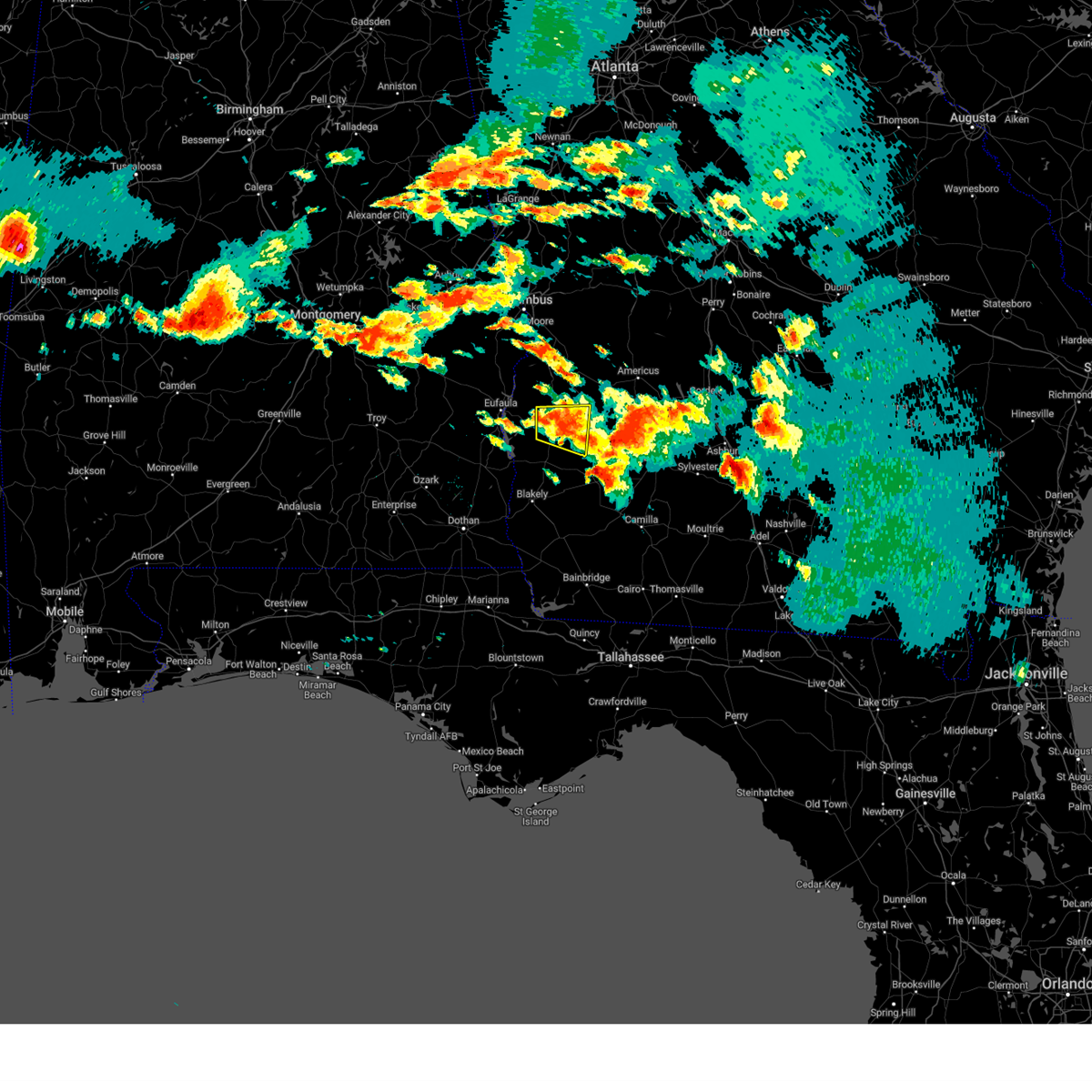 At 419 pm edt, a severe thunderstorm was located over cuthbert, moving east at 25 mph (radar indicated). Hazards include 60 mph wind gusts and quarter size hail. Hail damage to vehicles is expected. expect wind damage to roofs, siding, and trees. Locations impacted include, cuthbert, shellman, springvale station, pachitla, peterson hill, coles, white house, goffs mill, martins crossroads, brooksville, benevolence, springvale, wades and fountain bridge. At 419 pm edt, a severe thunderstorm was located over cuthbert, moving east at 25 mph (radar indicated). Hazards include 60 mph wind gusts and quarter size hail. Hail damage to vehicles is expected. expect wind damage to roofs, siding, and trees. Locations impacted include, cuthbert, shellman, springvale station, pachitla, peterson hill, coles, white house, goffs mill, martins crossroads, brooksville, benevolence, springvale, wades and fountain bridge.
|
| 6/14/2023 3:43 PM EDT |
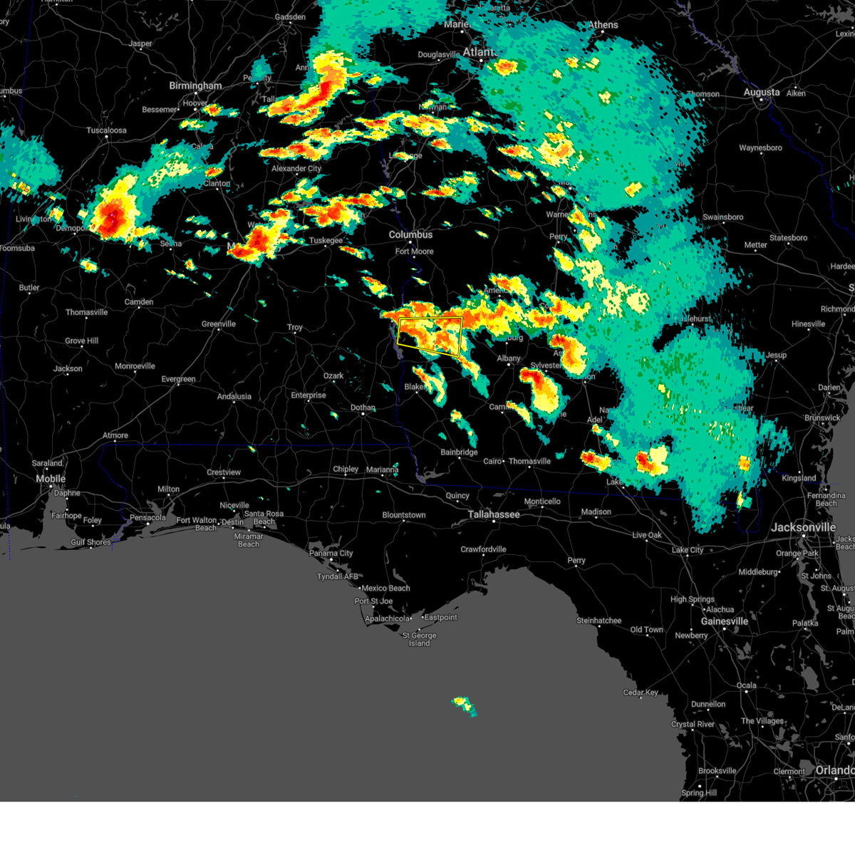 At 343 pm edt, a severe thunderstorm was located 7 miles southeast of georgetown, moving east at 30 mph (radar indicated). Hazards include 60 mph wind gusts and half dollar size hail. Hail damage to vehicles is expected. Expect wind damage to roofs, siding, and trees. At 343 pm edt, a severe thunderstorm was located 7 miles southeast of georgetown, moving east at 30 mph (radar indicated). Hazards include 60 mph wind gusts and half dollar size hail. Hail damage to vehicles is expected. Expect wind damage to roofs, siding, and trees.
|
| 6/14/2023 1:46 PM EDT |
 At 146 pm edt, a severe thunderstorm was located over shellman, or 8 miles east of cuthbert, moving east at 40 mph (radar indicated). Hazards include 60 mph wind gusts and half dollar size hail. Hail damage to vehicles is expected. Expect wind damage to roofs, siding, and trees. At 146 pm edt, a severe thunderstorm was located over shellman, or 8 miles east of cuthbert, moving east at 40 mph (radar indicated). Hazards include 60 mph wind gusts and half dollar size hail. Hail damage to vehicles is expected. Expect wind damage to roofs, siding, and trees.
|
| 6/13/2023 4:08 PM EDT |
 At 408 pm edt, a severe thunderstorm was located near dawson, moving east at 45 mph (law enforcement. numerous trees have been blown down in randolph county). Hazards include 60 mph wind gusts and quarter size hail. Hail damage to vehicles is expected. expect wind damage to roofs, siding, and trees. locations impacted include, morgan, albany, dawson, leesburg, putney, edison, arlington, shellman, leary, smithville, east albany, marine corps logistics base, turner city, walker, sasser, bronwood, parrott, stocks, radium springs and dawson municipal a/p. hail threat, radar indicated max hail size, 1. 00 in wind threat, observed max wind gust, 60 mph. At 408 pm edt, a severe thunderstorm was located near dawson, moving east at 45 mph (law enforcement. numerous trees have been blown down in randolph county). Hazards include 60 mph wind gusts and quarter size hail. Hail damage to vehicles is expected. expect wind damage to roofs, siding, and trees. locations impacted include, morgan, albany, dawson, leesburg, putney, edison, arlington, shellman, leary, smithville, east albany, marine corps logistics base, turner city, walker, sasser, bronwood, parrott, stocks, radium springs and dawson municipal a/p. hail threat, radar indicated max hail size, 1. 00 in wind threat, observed max wind gust, 60 mph.
|
| 6/13/2023 3:06 PM EDT |
 At 306 pm edt, a severe thunderstorm was located over richards crossroads, or 10 miles southwest of eufaula, moving east at 45 mph (radar indicated). Hazards include 60 mph wind gusts and quarter size hail. Hail damage to vehicles is expected. Expect wind damage to roofs, siding, and trees. At 306 pm edt, a severe thunderstorm was located over richards crossroads, or 10 miles southwest of eufaula, moving east at 45 mph (radar indicated). Hazards include 60 mph wind gusts and quarter size hail. Hail damage to vehicles is expected. Expect wind damage to roofs, siding, and trees.
|
| 6/12/2023 5:12 PM EDT |
 At 512 pm edt, severe thunderstorms were located along a line extending from 6 miles northwest of leesburg to 7 miles southeast of cuthbert, moving east at 35 mph (radar indicated). Hazards include 60 mph wind gusts and quarter size hail. Hail damage to vehicles is expected. Expect wind damage to roofs, siding, and trees. At 512 pm edt, severe thunderstorms were located along a line extending from 6 miles northwest of leesburg to 7 miles southeast of cuthbert, moving east at 35 mph (radar indicated). Hazards include 60 mph wind gusts and quarter size hail. Hail damage to vehicles is expected. Expect wind damage to roofs, siding, and trees.
|
| 6/12/2023 4:45 AM EDT |
 At 445 am edt, severe thunderstorms were located along a line extending from smithville to 6 miles southeast of dawson to 7 miles north of morgan, moving southeast at 40 mph (radar indicated). Hazards include 60 mph wind gusts. expect damage to roofs, siding, and trees At 445 am edt, severe thunderstorms were located along a line extending from smithville to 6 miles southeast of dawson to 7 miles north of morgan, moving southeast at 40 mph (radar indicated). Hazards include 60 mph wind gusts. expect damage to roofs, siding, and trees
|
| 4/26/2023 4:45 PM EDT |
 At 444 pm edt, a severe thunderstorm was located over shellman, or 8 miles west of dawson, moving southeast at 35 mph (radar indicated). Hazards include golf ball size hail and 60 mph wind gusts. People and animals outdoors will be injured. expect hail damage to roofs, siding, windows, and vehicles. Expect wind damage to roofs, siding, and trees. At 444 pm edt, a severe thunderstorm was located over shellman, or 8 miles west of dawson, moving southeast at 35 mph (radar indicated). Hazards include golf ball size hail and 60 mph wind gusts. People and animals outdoors will be injured. expect hail damage to roofs, siding, windows, and vehicles. Expect wind damage to roofs, siding, and trees.
|
| 4/26/2023 4:23 PM EDT |
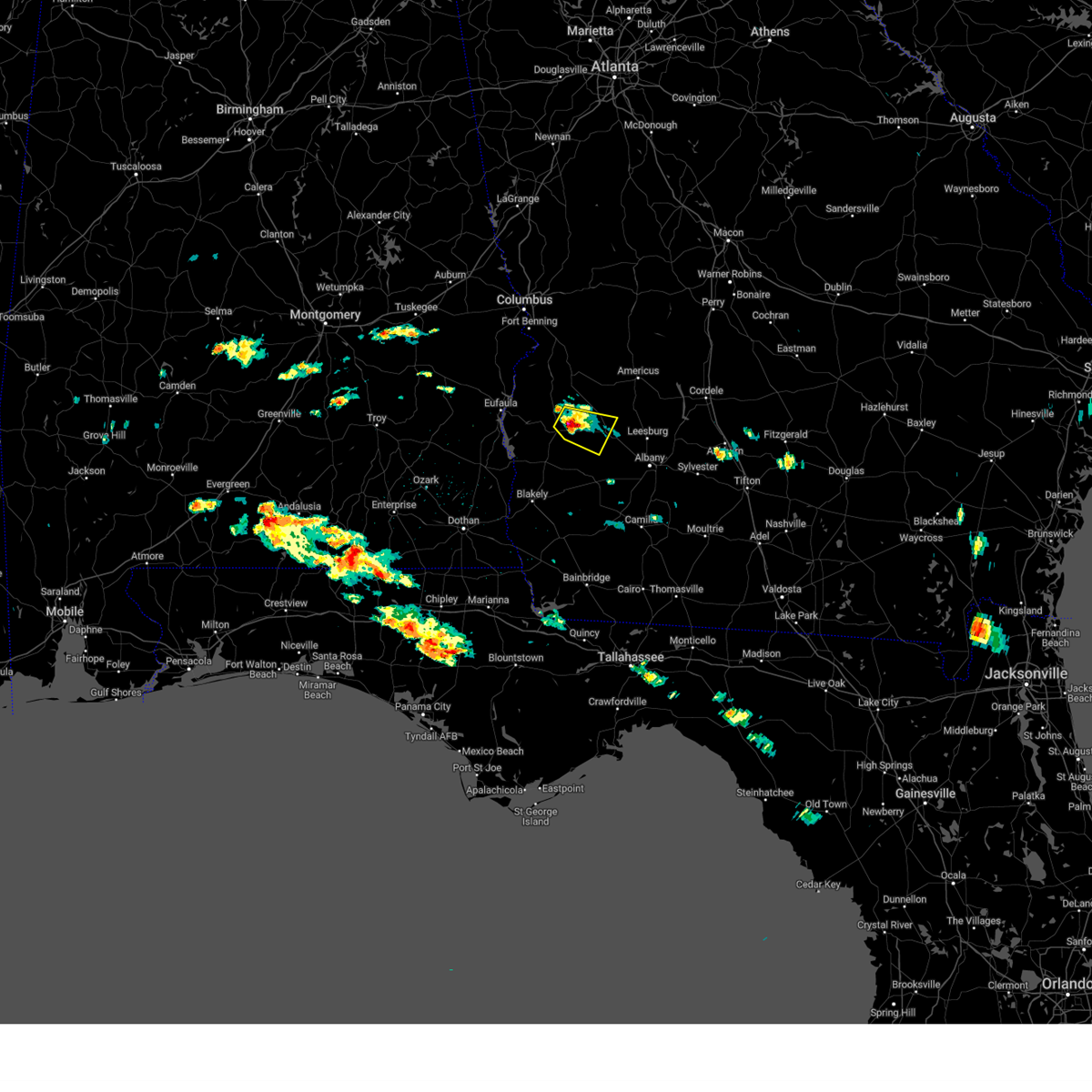 At 423 pm edt, a severe thunderstorm was located over shellman, or 9 miles east of cuthbert, moving east at 20 mph (radar indicated). Hazards include golf ball size hail and 60 mph wind gusts. People and animals outdoors will be injured. expect hail damage to roofs, siding, windows, and vehicles. expect wind damage to roofs, siding, and trees. locations impacted include, dawson, shellman, graves, pachitla, oakville, brooksville, benevolence, wades, doverel and yeomans. thunderstorm damage threat, considerable hail threat, radar indicated max hail size, 1. 75 in wind threat, radar indicated max wind gust, 60 mph. At 423 pm edt, a severe thunderstorm was located over shellman, or 9 miles east of cuthbert, moving east at 20 mph (radar indicated). Hazards include golf ball size hail and 60 mph wind gusts. People and animals outdoors will be injured. expect hail damage to roofs, siding, windows, and vehicles. expect wind damage to roofs, siding, and trees. locations impacted include, dawson, shellman, graves, pachitla, oakville, brooksville, benevolence, wades, doverel and yeomans. thunderstorm damage threat, considerable hail threat, radar indicated max hail size, 1. 75 in wind threat, radar indicated max wind gust, 60 mph.
|
| 4/26/2023 4:16 PM EDT |
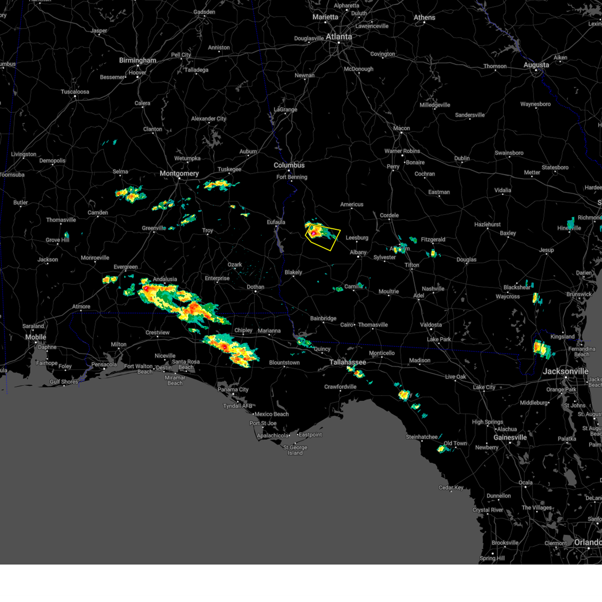 At 415 pm edt, a severe thunderstorm was located near shellman, or 7 miles east of cuthbert, moving east at 20 mph (radar indicated). Hazards include 60 mph wind gusts and quarter size hail. Hail damage to vehicles is expected. Expect wind damage to roofs, siding, and trees. At 415 pm edt, a severe thunderstorm was located near shellman, or 7 miles east of cuthbert, moving east at 20 mph (radar indicated). Hazards include 60 mph wind gusts and quarter size hail. Hail damage to vehicles is expected. Expect wind damage to roofs, siding, and trees.
|
| 1/12/2023 6:42 PM EST |
 At 642 pm est, a severe thunderstorm was located near morgan, moving east at 60 mph (radar indicated). Hazards include 70 mph wind gusts and quarter size hail. Hail damage to vehicles is expected. expect considerable tree damage. Wind damage is also likely to mobile homes, roofs, and outbuildings. At 642 pm est, a severe thunderstorm was located near morgan, moving east at 60 mph (radar indicated). Hazards include 70 mph wind gusts and quarter size hail. Hail damage to vehicles is expected. expect considerable tree damage. Wind damage is also likely to mobile homes, roofs, and outbuildings.
|
| 1/12/2023 5:15 PM EST |
 At 515 pm est, a severe thunderstorm was located 7 miles northwest of cuthbert, moving east at 55 mph (radar indicated). Hazards include 60 mph wind gusts and quarter size hail. Hail damage to vehicles is expected. Expect wind damage to roofs, siding, and trees. At 515 pm est, a severe thunderstorm was located 7 miles northwest of cuthbert, moving east at 55 mph (radar indicated). Hazards include 60 mph wind gusts and quarter size hail. Hail damage to vehicles is expected. Expect wind damage to roofs, siding, and trees.
|
| 1/3/2023 6:21 PM EST |
 At 621 pm est, a severe thunderstorm was located 7 miles northwest of edison, or 8 miles south of cuthbert, moving northeast at 40 mph (radar indicated). Hazards include 60 mph wind gusts. expect damage to roofs, siding, and trees At 621 pm est, a severe thunderstorm was located 7 miles northwest of edison, or 8 miles south of cuthbert, moving northeast at 40 mph (radar indicated). Hazards include 60 mph wind gusts. expect damage to roofs, siding, and trees
|
| 11/30/2022 7:22 AM EST |
 At 722 am est, severe thunderstorms were located along a line extending from near lakepoint resort state park to 7 miles east of richards crossroads to near abbeville, moving east at 40 mph (radar indicated). Hazards include 60 mph wind gusts. expect damage to roofs, siding, and trees At 722 am est, severe thunderstorms were located along a line extending from near lakepoint resort state park to 7 miles east of richards crossroads to near abbeville, moving east at 40 mph (radar indicated). Hazards include 60 mph wind gusts. expect damage to roofs, siding, and trees
|
| 10/12/2022 5:57 PM EDT |
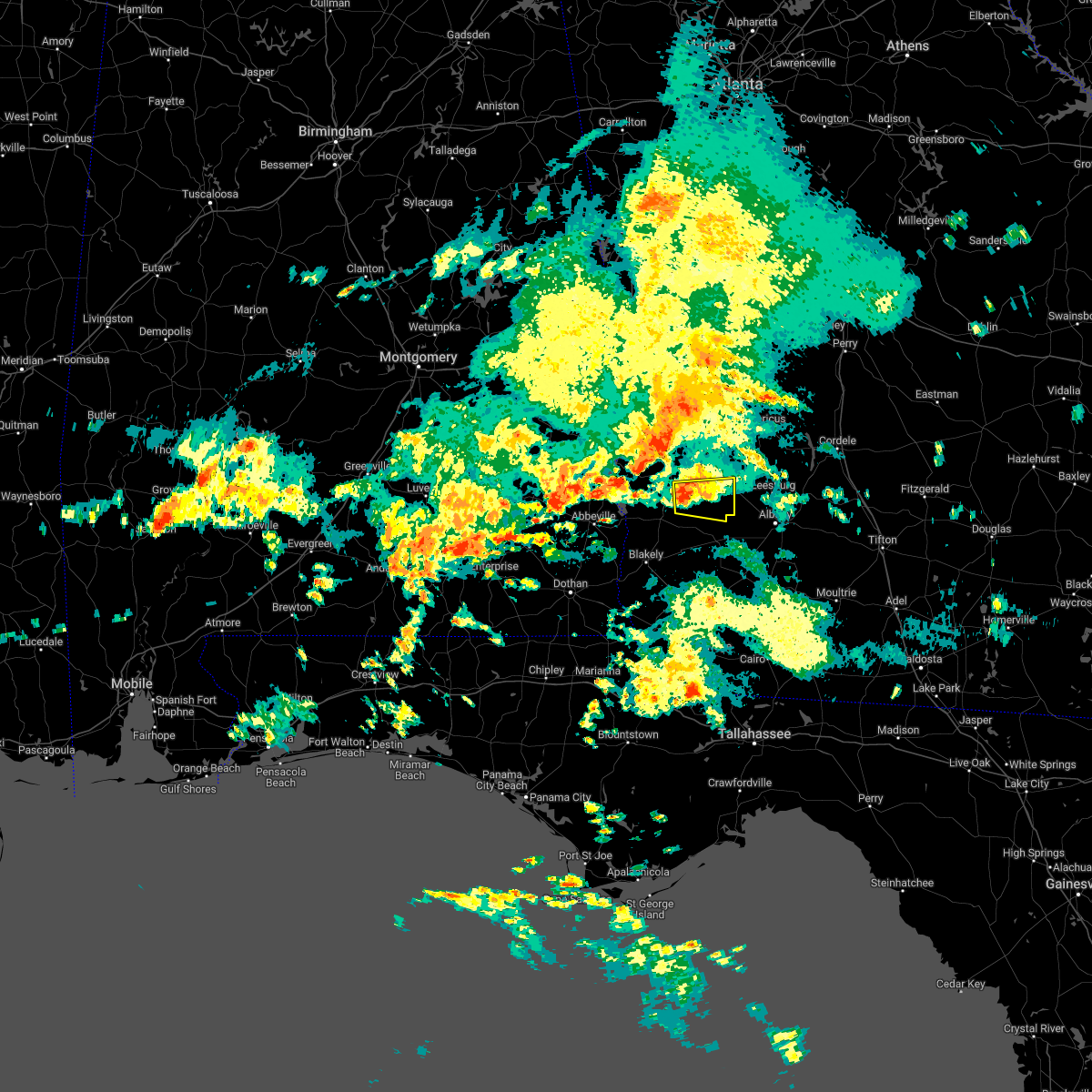 At 556 pm edt, a severe thunderstorm was located near shellman, or 8 miles southeast of cuthbert, moving east at 25 mph (radar indicated). Hazards include 60 mph wind gusts. Expect damage to roofs, siding, and trees. locations impacted include, dawson, shellman, pachitla, herod, clarks mill, dawson municipal a/p, graves, fountain bridge, goffs mill, shivers mill, aycock mill, martins crossroads and doverel. hail threat, radar indicated max hail size, <. 75 in wind threat, radar indicated max wind gust, 60 mph. At 556 pm edt, a severe thunderstorm was located near shellman, or 8 miles southeast of cuthbert, moving east at 25 mph (radar indicated). Hazards include 60 mph wind gusts. Expect damage to roofs, siding, and trees. locations impacted include, dawson, shellman, pachitla, herod, clarks mill, dawson municipal a/p, graves, fountain bridge, goffs mill, shivers mill, aycock mill, martins crossroads and doverel. hail threat, radar indicated max hail size, <. 75 in wind threat, radar indicated max wind gust, 60 mph.
|
| 10/12/2022 5:39 PM EDT |
 At 538 pm edt, a severe thunderstorm was located near cuthbert, moving east at 25 mph (radar indicated). Hazards include 60 mph wind gusts and penny size hail. expect damage to roofs, siding, and trees At 538 pm edt, a severe thunderstorm was located near cuthbert, moving east at 25 mph (radar indicated). Hazards include 60 mph wind gusts and penny size hail. expect damage to roofs, siding, and trees
|
| 10/12/2022 5:31 PM EDT |
 At 531 pm edt, a severe thunderstorm was located near cuthbert, moving east at 25 mph (radar indicated). Hazards include 60 mph wind gusts and penny size hail. Expect damage to roofs, siding, and trees. Locations impacted include, cuthbert, shellman, goffs mill, pachitla, shivers mill, coleman, peterson hill, coles, white house, randolph co a/p and wades. At 531 pm edt, a severe thunderstorm was located near cuthbert, moving east at 25 mph (radar indicated). Hazards include 60 mph wind gusts and penny size hail. Expect damage to roofs, siding, and trees. Locations impacted include, cuthbert, shellman, goffs mill, pachitla, shivers mill, coleman, peterson hill, coles, white house, randolph co a/p and wades.
|
| 10/12/2022 5:11 PM EDT |
 At 511 pm edt, a severe thunderstorm was located 8 miles northeast of fort gaines, moving northeast at 40 mph (radar indicated). Hazards include 60 mph wind gusts and quarter size hail. Hail damage to vehicles is expected. expect wind damage to roofs, siding, and trees. Locations impacted include, fort gaines, cuthbert, shellman, standleys store, watson crossroads, crossroads, ricks place, pecan, randolph co a/p, hatcher, morris, jones crossing, bethel, benevolence, springvale, cotton hill, fort gaines-clay airport, wades, days crossroads and springvale station. At 511 pm edt, a severe thunderstorm was located 8 miles northeast of fort gaines, moving northeast at 40 mph (radar indicated). Hazards include 60 mph wind gusts and quarter size hail. Hail damage to vehicles is expected. expect wind damage to roofs, siding, and trees. Locations impacted include, fort gaines, cuthbert, shellman, standleys store, watson crossroads, crossroads, ricks place, pecan, randolph co a/p, hatcher, morris, jones crossing, bethel, benevolence, springvale, cotton hill, fort gaines-clay airport, wades, days crossroads and springvale station.
|
| 10/12/2022 5:04 PM EDT |
 At 504 pm edt/404 pm cdt/, a severe thunderstorm was located near fort gaines, moving northeast at 40 mph (radar indicated). Hazards include 60 mph wind gusts and quarter size hail. Hail damage to vehicles is expected. expect wind damage to roofs, siding, and trees. locations impacted include, fort gaines, cuthbert, shellman, shorterville, walter f. George lock and dam, walter f george lake, standleys store, watson crossroads, double bridges, crossroads, ricks place, pecan, randolph co a/p, thomas mill creek, hatcher, morris, jones crossing, bethel, benevolence and springvale. At 504 pm edt/404 pm cdt/, a severe thunderstorm was located near fort gaines, moving northeast at 40 mph (radar indicated). Hazards include 60 mph wind gusts and quarter size hail. Hail damage to vehicles is expected. expect wind damage to roofs, siding, and trees. locations impacted include, fort gaines, cuthbert, shellman, shorterville, walter f. George lock and dam, walter f george lake, standleys store, watson crossroads, double bridges, crossroads, ricks place, pecan, randolph co a/p, thomas mill creek, hatcher, morris, jones crossing, bethel, benevolence and springvale.
|
| 10/12/2022 5:00 PM EDT |
 At 459 pm edt/359 pm cdt/, a severe thunderstorm was located over fort gaines, moving northeast at 25 mph (radar indicated). Hazards include 60 mph wind gusts and penny size hail. Expect damage to roofs, siding, and trees. locations impacted include, fort gaines, cuthbert, shellman, shorterville, walter f. George lock and dam, walter f george lake, standleys store, watson crossroads, double bridges, crossroads, ricks place, pecan, randolph co a/p, thomas mill creek, hatcher, morris, jones crossing, bethel, benevolence and springvale. At 459 pm edt/359 pm cdt/, a severe thunderstorm was located over fort gaines, moving northeast at 25 mph (radar indicated). Hazards include 60 mph wind gusts and penny size hail. Expect damage to roofs, siding, and trees. locations impacted include, fort gaines, cuthbert, shellman, shorterville, walter f. George lock and dam, walter f george lake, standleys store, watson crossroads, double bridges, crossroads, ricks place, pecan, randolph co a/p, thomas mill creek, hatcher, morris, jones crossing, bethel, benevolence and springvale.
|
| 10/12/2022 5:00 PM EDT |
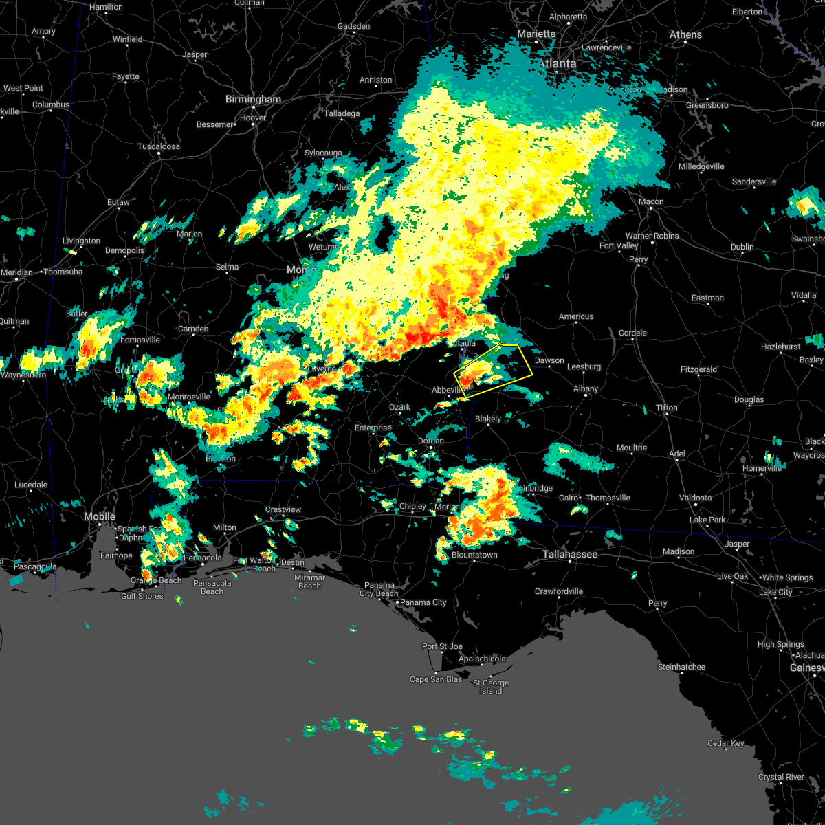 At 459 pm edt/359 pm cdt/, a severe thunderstorm was located over fort gaines, moving northeast at 25 mph (radar indicated). Hazards include 60 mph wind gusts and penny size hail. Expect damage to roofs, siding, and trees. locations impacted include, fort gaines, cuthbert, shellman, shorterville, walter f. George lock and dam, walter f george lake, standleys store, watson crossroads, double bridges, crossroads, ricks place, pecan, randolph co a/p, thomas mill creek, hatcher, morris, jones crossing, bethel, benevolence and springvale. At 459 pm edt/359 pm cdt/, a severe thunderstorm was located over fort gaines, moving northeast at 25 mph (radar indicated). Hazards include 60 mph wind gusts and penny size hail. Expect damage to roofs, siding, and trees. locations impacted include, fort gaines, cuthbert, shellman, shorterville, walter f. George lock and dam, walter f george lake, standleys store, watson crossroads, double bridges, crossroads, ricks place, pecan, randolph co a/p, thomas mill creek, hatcher, morris, jones crossing, bethel, benevolence and springvale.
|
| 10/12/2022 4:51 PM EDT |
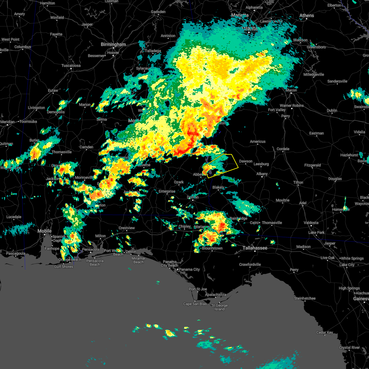 At 451 pm edt/351 pm cdt/, a severe thunderstorm was located near fort gaines, moving northeast at 40 mph (radar indicated). Hazards include 60 mph wind gusts and penny size hail. expect damage to roofs, siding, and trees At 451 pm edt/351 pm cdt/, a severe thunderstorm was located near fort gaines, moving northeast at 40 mph (radar indicated). Hazards include 60 mph wind gusts and penny size hail. expect damage to roofs, siding, and trees
|
| 8/10/2022 5:58 PM EDT |
 At 558 pm edt, severe thunderstorms were located along a line extending from near edison to near putney, moving northeast at 25 mph (radar indicated). Hazards include 60 mph wind gusts. expect damage to roofs, siding, and trees At 558 pm edt, severe thunderstorms were located along a line extending from near edison to near putney, moving northeast at 25 mph (radar indicated). Hazards include 60 mph wind gusts. expect damage to roofs, siding, and trees
|
| 7/20/2022 4:16 PM EDT |
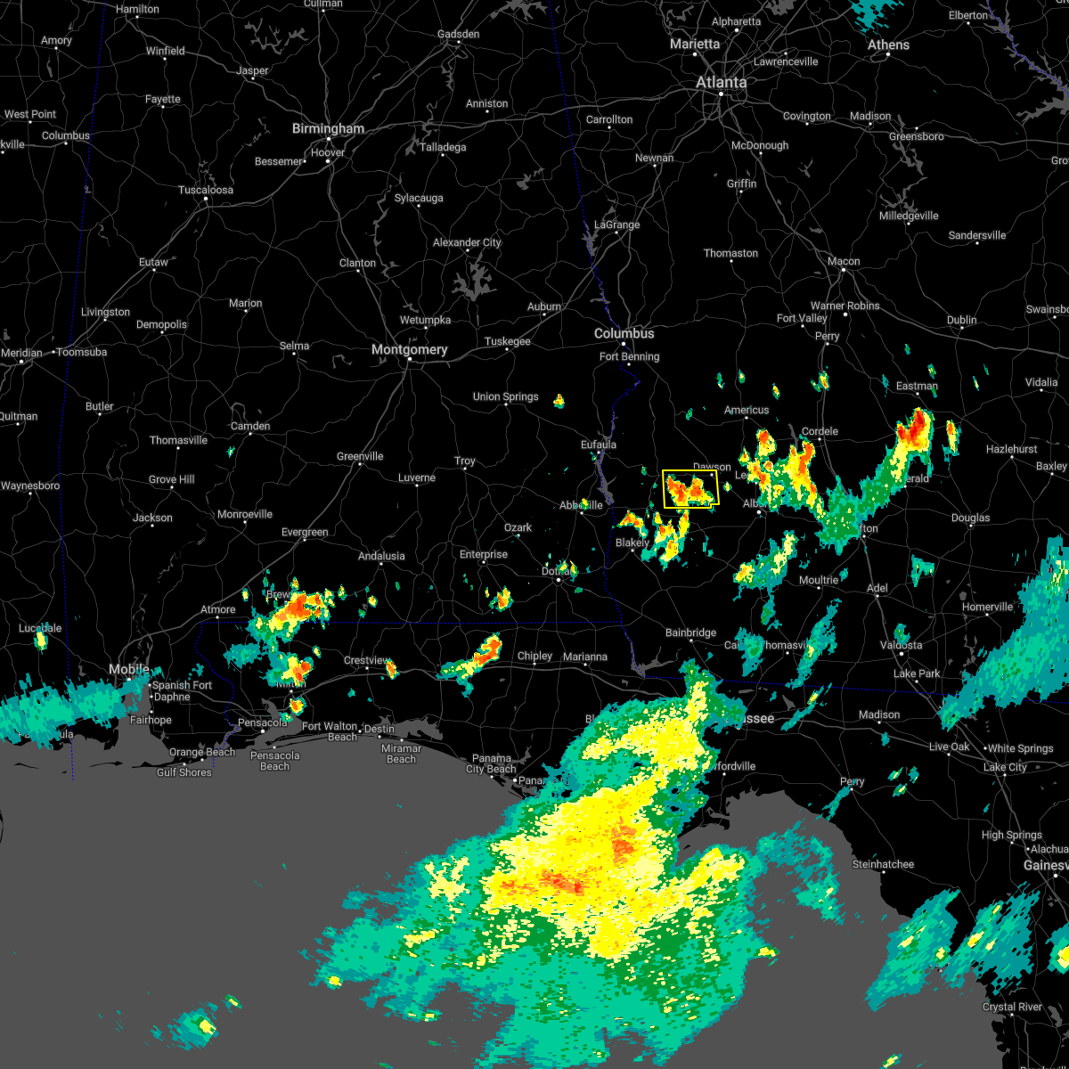 At 416 pm edt, a severe thunderstorm was located near shellman, or 10 miles north of morgan, and is nearly stationary (radar indicated). Hazards include 60 mph wind gusts and quarter size hail. Hail damage to vehicles is expected. Expect wind damage to roofs, siding, and trees. At 416 pm edt, a severe thunderstorm was located near shellman, or 10 miles north of morgan, and is nearly stationary (radar indicated). Hazards include 60 mph wind gusts and quarter size hail. Hail damage to vehicles is expected. Expect wind damage to roofs, siding, and trees.
|
| 6/15/2022 8:57 PM EDT |
 At 857 pm edt, a severe thunderstorm was located near shellman, or near cuthbert, moving west at 20 mph (radar indicated). Hazards include 60 mph wind gusts. Expect damage to roofs, siding, and trees. locations impacted include, fort gaines, cuthbert, georgetown, shellman, walter f. george lock and dam, wire bridge, walter f george lake, bonapartes retreat, standleys store, carnegie, watson crossroads, crossroads, ricks place, pecan, randolph co a/p, aycock mill, hatcher, morris, jones crossing and martins crossroads. hail threat, radar indicated max hail size, <. 75 in wind threat, radar indicated max wind gust, 60 mph. At 857 pm edt, a severe thunderstorm was located near shellman, or near cuthbert, moving west at 20 mph (radar indicated). Hazards include 60 mph wind gusts. Expect damage to roofs, siding, and trees. locations impacted include, fort gaines, cuthbert, georgetown, shellman, walter f. george lock and dam, wire bridge, walter f george lake, bonapartes retreat, standleys store, carnegie, watson crossroads, crossroads, ricks place, pecan, randolph co a/p, aycock mill, hatcher, morris, jones crossing and martins crossroads. hail threat, radar indicated max hail size, <. 75 in wind threat, radar indicated max wind gust, 60 mph.
|
| 6/15/2022 8:24 PM EDT |
 At 824 pm edt, a severe thunderstorm was located over dawson, moving west at 15 mph (radar indicated). Hazards include 60 mph wind gusts. expect damage to roofs, siding, and trees At 824 pm edt, a severe thunderstorm was located over dawson, moving west at 15 mph (radar indicated). Hazards include 60 mph wind gusts. expect damage to roofs, siding, and trees
|
| 6/3/2022 4:30 PM EDT |
 At 429 pm edt, a severe thunderstorm was located near shellman, or 7 miles southwest of dawson, moving northeast at 10 mph (radar indicated). Hazards include 60 mph wind gusts and penny size hail. expect damage to roofs, siding, and trees At 429 pm edt, a severe thunderstorm was located near shellman, or 7 miles southwest of dawson, moving northeast at 10 mph (radar indicated). Hazards include 60 mph wind gusts and penny size hail. expect damage to roofs, siding, and trees
|
| 5/22/2022 1:35 PM EDT |
 At 135 pm edt, severe thunderstorms were located along a line extending from near cuthbert to near leary, moving north at 40 mph (radar indicated). Hazards include 60 mph wind gusts and penny size hail. expect damage to roofs, siding, and trees At 135 pm edt, severe thunderstorms were located along a line extending from near cuthbert to near leary, moving north at 40 mph (radar indicated). Hazards include 60 mph wind gusts and penny size hail. expect damage to roofs, siding, and trees
|
| 5/6/2022 1:21 PM EDT |
 At 121 pm edt, severe thunderstorms were located along a line extending from 7 miles southwest of shellman to near leary, moving northeast at 45 mph (radar indicated). Hazards include 60 mph wind gusts and quarter size hail. Hail damage to vehicles is expected. Expect wind damage to roofs, siding, and trees. At 121 pm edt, severe thunderstorms were located along a line extending from 7 miles southwest of shellman to near leary, moving northeast at 45 mph (radar indicated). Hazards include 60 mph wind gusts and quarter size hail. Hail damage to vehicles is expected. Expect wind damage to roofs, siding, and trees.
|
| 4/6/2022 2:56 PM EDT |
 At 255 pm edt, a severe thunderstorm was located near shellman, or 8 miles east of cuthbert, moving east at 35 mph. at 245 pm edt the public reported quarter sized hailin cuthbert. larger hail remains possible in stronger parts of the storm (radar indicated). Hazards include golf ball size hail and 60 mph wind gusts. People and animals outdoors will be injured. expect hail damage to roofs, siding, windows, and vehicles. expect wind damage to roofs, siding, and trees. Locations impacted include, dawson, cuthbert, shellman, sasser, bronwood, parrott, pachitla, bridges crossroad, white house, herod, yeomans, dawson municipal a/p, graves, oakville, chambliss, brooksville, benevolence, chickasawhatchee, wades and doverel. At 255 pm edt, a severe thunderstorm was located near shellman, or 8 miles east of cuthbert, moving east at 35 mph. at 245 pm edt the public reported quarter sized hailin cuthbert. larger hail remains possible in stronger parts of the storm (radar indicated). Hazards include golf ball size hail and 60 mph wind gusts. People and animals outdoors will be injured. expect hail damage to roofs, siding, windows, and vehicles. expect wind damage to roofs, siding, and trees. Locations impacted include, dawson, cuthbert, shellman, sasser, bronwood, parrott, pachitla, bridges crossroad, white house, herod, yeomans, dawson municipal a/p, graves, oakville, chambliss, brooksville, benevolence, chickasawhatchee, wades and doverel.
|
| 4/6/2022 2:36 PM EDT |
 At 236 pm edt, a severe thunderstorm was located over cuthbert, moving northeast at 35 mph (radar indicated). Hazards include golf ball size hail and 60 mph wind gusts. People and animals outdoors will be injured. expect hail damage to roofs, siding, windows, and vehicles. Expect wind damage to roofs, siding, and trees. At 236 pm edt, a severe thunderstorm was located over cuthbert, moving northeast at 35 mph (radar indicated). Hazards include golf ball size hail and 60 mph wind gusts. People and animals outdoors will be injured. expect hail damage to roofs, siding, windows, and vehicles. Expect wind damage to roofs, siding, and trees.
|
| 4/5/2022 2:48 PM EDT |
 At 246 pm edt/146 pm cdt/, severe thunderstorms were located along a line extending from near dawson to near taylor, moving east at 45 mph (radar indicated). Hazards include 60 mph wind gusts. Expect damage to roofs, siding, and trees. Locations impacted include, abbeville, fort gaines, headland, dothan, dawson, cuthbert, blakely, midland city, kinsey, edison, newton, webb, shellman, columbia, pinckard, smithville, clayhatchee, grimes, newville and napier field. At 246 pm edt/146 pm cdt/, severe thunderstorms were located along a line extending from near dawson to near taylor, moving east at 45 mph (radar indicated). Hazards include 60 mph wind gusts. Expect damage to roofs, siding, and trees. Locations impacted include, abbeville, fort gaines, headland, dothan, dawson, cuthbert, blakely, midland city, kinsey, edison, newton, webb, shellman, columbia, pinckard, smithville, clayhatchee, grimes, newville and napier field.
|
| 4/5/2022 2:14 PM EDT |
 At 214 pm edt/114 pm cdt/, severe thunderstorms were located along a line extending from 7 miles north of cuthbert to 8 miles southwest of enterprise, moving east at 40 mph (radar indicated). Hazards include 60 mph wind gusts. expect damage to roofs, siding, and trees At 214 pm edt/114 pm cdt/, severe thunderstorms were located along a line extending from 7 miles north of cuthbert to 8 miles southwest of enterprise, moving east at 40 mph (radar indicated). Hazards include 60 mph wind gusts. expect damage to roofs, siding, and trees
|
| 12/30/2021 5:09 PM EST |
 At 508 pm est, a severe thunderstorm was located 7 miles south of cuthbert, moving east at 40 mph (radar indicated). Hazards include 60 mph wind gusts and quarter size hail. Hail damage to vehicles is expected. Expect wind damage to roofs, siding, and trees. At 508 pm est, a severe thunderstorm was located 7 miles south of cuthbert, moving east at 40 mph (radar indicated). Hazards include 60 mph wind gusts and quarter size hail. Hail damage to vehicles is expected. Expect wind damage to roofs, siding, and trees.
|
| 12/30/2021 5:02 PM EST |
 At 501 pm est, a severe thunderstorm was located near cuthbert, moving east at 40 mph (radar indicated). Hazards include 60 mph wind gusts and half dollar size hail. Hail damage to vehicles is expected. expect wind damage to roofs, siding, and trees. Locations impacted include, cuthbert, shellman, pachitla, carnegie, peterson hill, coles, white house, randolph co a/p, garnersville, fountain bridge, goffs mill, shivers mill, aycock mill, coleman, jones crossing, martins crossroads, bethel and cotton hill. At 501 pm est, a severe thunderstorm was located near cuthbert, moving east at 40 mph (radar indicated). Hazards include 60 mph wind gusts and half dollar size hail. Hail damage to vehicles is expected. expect wind damage to roofs, siding, and trees. Locations impacted include, cuthbert, shellman, pachitla, carnegie, peterson hill, coles, white house, randolph co a/p, garnersville, fountain bridge, goffs mill, shivers mill, aycock mill, coleman, jones crossing, martins crossroads, bethel and cotton hill.
|
| 12/30/2021 4:56 PM EST |
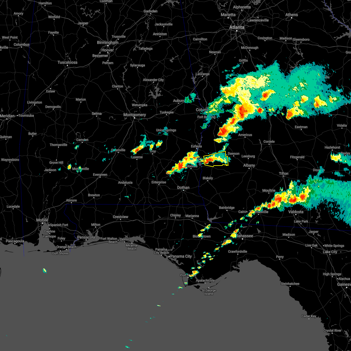 At 456 pm est, a severe thunderstorm was located 8 miles southwest of cuthbert, moving east at 25 mph (radar indicated). Hazards include 60 mph wind gusts and quarter size hail. Hail damage to vehicles is expected. expect wind damage to roofs, siding, and trees. Locations impacted include, cuthbert, shellman, pachitla, carnegie, peterson hill, coles, white house, randolph co a/p, garnersville, fountain bridge, goffs mill, shivers mill, aycock mill, coleman, jones crossing, martins crossroads, bethel and cotton hill. At 456 pm est, a severe thunderstorm was located 8 miles southwest of cuthbert, moving east at 25 mph (radar indicated). Hazards include 60 mph wind gusts and quarter size hail. Hail damage to vehicles is expected. expect wind damage to roofs, siding, and trees. Locations impacted include, cuthbert, shellman, pachitla, carnegie, peterson hill, coles, white house, randolph co a/p, garnersville, fountain bridge, goffs mill, shivers mill, aycock mill, coleman, jones crossing, martins crossroads, bethel and cotton hill.
|
| 12/30/2021 4:44 PM EST |
 At 443 pm est, a severe thunderstorm was located 8 miles northeast of fort gaines, moving east at 40 mph (radar indicated). Hazards include 60 mph wind gusts and quarter size hail. Hail damage to vehicles is expected. expect wind damage to roofs, siding, and trees. Locations impacted include, fort gaines, cuthbert, shellman, walter f george lake, standleys store, carnegie, watson crossroads, ricks place, pecan, randolph co a/p, aycock mill, morris, jones crossing, martins crossroads, bethel, cotton hill, fort gaines-clay airport, days crossroads, springvale station and pachitla. At 443 pm est, a severe thunderstorm was located 8 miles northeast of fort gaines, moving east at 40 mph (radar indicated). Hazards include 60 mph wind gusts and quarter size hail. Hail damage to vehicles is expected. expect wind damage to roofs, siding, and trees. Locations impacted include, fort gaines, cuthbert, shellman, walter f george lake, standleys store, carnegie, watson crossroads, ricks place, pecan, randolph co a/p, aycock mill, morris, jones crossing, martins crossroads, bethel, cotton hill, fort gaines-clay airport, days crossroads, springvale station and pachitla.
|
| 12/30/2021 4:39 PM EST |
 At 439 pm est, a severe thunderstorm was located near fort gaines, moving east at 40 mph (radar indicated). Hazards include 60 mph wind gusts. expect damage to roofs, siding, and trees At 439 pm est, a severe thunderstorm was located near fort gaines, moving east at 40 mph (radar indicated). Hazards include 60 mph wind gusts. expect damage to roofs, siding, and trees
|
| 5/4/2021 9:24 PM EDT |
 At 924 pm edt/824 pm cdt/, severe thunderstorms were located along a line extending from 7 miles west of buena vista to near ozark, moving east at 45 mph (radar indicated). Hazards include 60 mph wind gusts. Expect damage to roofs, siding, and trees. Locations impacted include, abbeville, fort gaines, georgetown, cuthbert, fort rucker, ozark, shellman, ariton, newville, bellville, haleburg, bluffton, shorterville, hooper stage field, hayes, pecan, thomas mill creek, phillips crossroads, hatcher and suttons corner. At 924 pm edt/824 pm cdt/, severe thunderstorms were located along a line extending from 7 miles west of buena vista to near ozark, moving east at 45 mph (radar indicated). Hazards include 60 mph wind gusts. Expect damage to roofs, siding, and trees. Locations impacted include, abbeville, fort gaines, georgetown, cuthbert, fort rucker, ozark, shellman, ariton, newville, bellville, haleburg, bluffton, shorterville, hooper stage field, hayes, pecan, thomas mill creek, phillips crossroads, hatcher and suttons corner.
|
| 5/4/2021 8:21 PM EDT |
 At 821 pm edt/721 pm cdt/, severe thunderstorms were located along a line extending from near society hill to near dozier, moving east at 45 mph (radar indicated). Hazards include 60 mph wind gusts. expect damage to roofs, siding, and trees At 821 pm edt/721 pm cdt/, severe thunderstorms were located along a line extending from near society hill to near dozier, moving east at 45 mph (radar indicated). Hazards include 60 mph wind gusts. expect damage to roofs, siding, and trees
|
| 4/24/2021 8:37 PM EDT |
 At 837 pm edt/737 pm cdt/, a severe thunderstorm was located near fort gaines, moving east at 60 mph (radar indicated). Hazards include 60 mph wind gusts. expect damage to roofs, siding, and trees At 837 pm edt/737 pm cdt/, a severe thunderstorm was located near fort gaines, moving east at 60 mph (radar indicated). Hazards include 60 mph wind gusts. expect damage to roofs, siding, and trees
|
| 4/24/2021 7:05 PM EDT |
 At 705 pm edt/605 pm cdt/, a severe thunderstorm was located near fort gaines, moving east at 55 mph (radar indicated). Hazards include ping pong ball size hail and 60 mph wind gusts. People and animals outdoors will be injured. expect hail damage to roofs, siding, windows, and vehicles. Expect wind damage to roofs, siding, and trees. At 705 pm edt/605 pm cdt/, a severe thunderstorm was located near fort gaines, moving east at 55 mph (radar indicated). Hazards include ping pong ball size hail and 60 mph wind gusts. People and animals outdoors will be injured. expect hail damage to roofs, siding, windows, and vehicles. Expect wind damage to roofs, siding, and trees.
|
| 4/24/2021 3:49 PM EDT |
 At 349 pm edt/249 pm cdt/, a severe thunderstorm was located near headland, moving east at 45 mph (radar indicated). Hazards include 60 mph wind gusts. expect damage to roofs, siding, and trees At 349 pm edt/249 pm cdt/, a severe thunderstorm was located near headland, moving east at 45 mph (radar indicated). Hazards include 60 mph wind gusts. expect damage to roofs, siding, and trees
|
| 4/24/2021 8:40 AM EDT |
 At 839 am edt, severe thunderstorms were located along a line extending from 6 miles southwest of richards crossroads to 7 miles north of graceville, moving east at 60 mph (radar indicated). Hazards include 70 mph wind gusts. Expect considerable tree damage. Damage is likely to mobile homes, roofs, and outbuildings. At 839 am edt, severe thunderstorms were located along a line extending from 6 miles southwest of richards crossroads to 7 miles north of graceville, moving east at 60 mph (radar indicated). Hazards include 70 mph wind gusts. Expect considerable tree damage. Damage is likely to mobile homes, roofs, and outbuildings.
|
| 3/18/2021 8:46 AM EDT |
 At 846 am edt, severe thunderstorms were located along a line extending from 7 miles southeast of weston to near newton, moving northeast at 40 mph (radar indicated). Hazards include 60 mph wind gusts. Expect damage to roofs, siding, and trees. Locations impacted include, newton, morgan, dawson, shellman, leary, sasser, bronwood, parrott, holt, clarks mill, dawson municipal a/p, aycock mill, chambliss, olivers mill, chickasawhatchee, milford, bridges crossroad, herod, ducker and cordrays mill. At 846 am edt, severe thunderstorms were located along a line extending from 7 miles southeast of weston to near newton, moving northeast at 40 mph (radar indicated). Hazards include 60 mph wind gusts. Expect damage to roofs, siding, and trees. Locations impacted include, newton, morgan, dawson, shellman, leary, sasser, bronwood, parrott, holt, clarks mill, dawson municipal a/p, aycock mill, chambliss, olivers mill, chickasawhatchee, milford, bridges crossroad, herod, ducker and cordrays mill.
|
| 3/18/2021 8:28 AM EDT |
 At 828 am edt, severe thunderstorms were located along a line extending from 7 miles southwest of weston to 10 miles south of leary, moving east at 30 mph (radar indicated). Hazards include 60 mph wind gusts. Expect damage to roofs, siding, and trees. Locations impacted include, newton, morgan, dawson, shellman, leary, sasser, bronwood, parrott, iveys mill, holt, clarks mill, dawson municipal a/p, aycock mill, chambliss, olivers mill, martins crossroads, benevolence, chickasawhatchee, wades and pachitla. At 828 am edt, severe thunderstorms were located along a line extending from 7 miles southwest of weston to 10 miles south of leary, moving east at 30 mph (radar indicated). Hazards include 60 mph wind gusts. Expect damage to roofs, siding, and trees. Locations impacted include, newton, morgan, dawson, shellman, leary, sasser, bronwood, parrott, iveys mill, holt, clarks mill, dawson municipal a/p, aycock mill, chambliss, olivers mill, martins crossroads, benevolence, chickasawhatchee, wades and pachitla.
|
| 3/18/2021 7:56 AM EDT |
 At 756 am edt, severe thunderstorms were located along a line extending from 8 miles west of cuthbert to near arlington, moving northeast at 60 mph (radar indicated). Hazards include 60 mph wind gusts. Expect damage to roofs, siding, and trees. Locations impacted include, newton, morgan, dawson, cuthbert, edison, arlington, shellman, leary, douglasville, sasser, damascus, bronwood, parrott, bellville, bluffton, iveys mill, parksville, carnegie, dawson municipal a/p and chambliss. At 756 am edt, severe thunderstorms were located along a line extending from 8 miles west of cuthbert to near arlington, moving northeast at 60 mph (radar indicated). Hazards include 60 mph wind gusts. Expect damage to roofs, siding, and trees. Locations impacted include, newton, morgan, dawson, cuthbert, edison, arlington, shellman, leary, douglasville, sasser, damascus, bronwood, parrott, bellville, bluffton, iveys mill, parksville, carnegie, dawson municipal a/p and chambliss.
|
| 2/15/2021 4:01 PM EST |
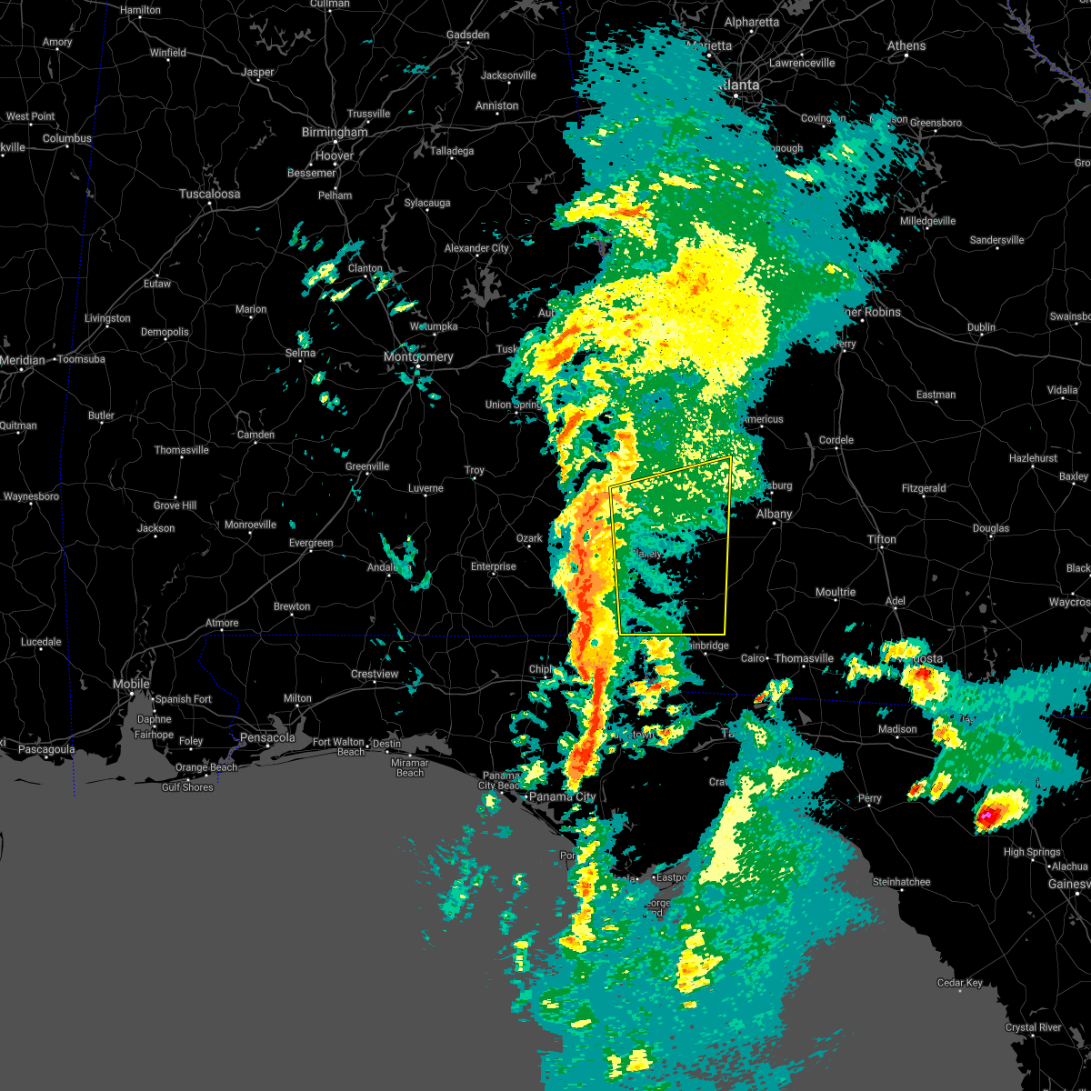 At 401 pm est/301 pm cst/, severe thunderstorms were located along a line extending from 6 miles west of fort gaines to 7 miles east of cottonwood, moving northeast at 75 mph (radar indicated). Hazards include 60 mph wind gusts and quarter size hail. Hail damage to vehicles is expected. Expect wind damage to roofs, siding, and trees. At 401 pm est/301 pm cst/, severe thunderstorms were located along a line extending from 6 miles west of fort gaines to 7 miles east of cottonwood, moving northeast at 75 mph (radar indicated). Hazards include 60 mph wind gusts and quarter size hail. Hail damage to vehicles is expected. Expect wind damage to roofs, siding, and trees.
|
| 7/1/2020 1:27 PM EDT |
 At 127 pm edt, a severe thunderstorm was located over shellman, or 8 miles west of dawson, moving east at 35 mph (radar indicated). Hazards include 60 mph wind gusts and penny size hail. expect damage to roofs, siding, and trees At 127 pm edt, a severe thunderstorm was located over shellman, or 8 miles west of dawson, moving east at 35 mph (radar indicated). Hazards include 60 mph wind gusts and penny size hail. expect damage to roofs, siding, and trees
|
| 6/25/2020 7:28 PM EDT |
 At 727 pm edt, doppler radar indicated a severe thunderstorm capable of producing destructive winds in excess of 70 mph. this storm was located 8 miles southeast of shellman, or 8 miles northeast of morgan, and moving east at 40 mph. penny size hail may also accompany the damaging winds. At 727 pm edt, doppler radar indicated a severe thunderstorm capable of producing destructive winds in excess of 70 mph. this storm was located 8 miles southeast of shellman, or 8 miles northeast of morgan, and moving east at 40 mph. penny size hail may also accompany the damaging winds.
|
| 6/25/2020 7:13 PM EDT |
 At 713 pm edt, a severe thunderstorm was located near shellman, or 9 miles north of morgan, moving east at 30 mph (radar indicated). Hazards include 70 mph wind gusts and penny size hail. Expect considerable tree damage. damage is likely to mobile homes, roofs, and outbuildings. Locations impacted include, morgan, dawson, cuthbert, edison, shellman, walker, sasser, carnegie, clarks mill, dawson municipal a/p, aycock mill, martins crossroads, chickasawhatchee, pachitla, moye, herod, ducker, cordrays mill, yeomans and graves. At 713 pm edt, a severe thunderstorm was located near shellman, or 9 miles north of morgan, moving east at 30 mph (radar indicated). Hazards include 70 mph wind gusts and penny size hail. Expect considerable tree damage. damage is likely to mobile homes, roofs, and outbuildings. Locations impacted include, morgan, dawson, cuthbert, edison, shellman, walker, sasser, carnegie, clarks mill, dawson municipal a/p, aycock mill, martins crossroads, chickasawhatchee, pachitla, moye, herod, ducker, cordrays mill, yeomans and graves.
|
| 6/25/2020 6:51 PM EDT |
 At 650 pm edt, a severe thunderstorm was located near cuthbert, moving east at 45 mph (radar indicated). Hazards include 70 mph wind gusts and penny size hail. Expect considerable tree damage. Damage is likely to mobile homes, roofs, and outbuildings. At 650 pm edt, a severe thunderstorm was located near cuthbert, moving east at 45 mph (radar indicated). Hazards include 70 mph wind gusts and penny size hail. Expect considerable tree damage. Damage is likely to mobile homes, roofs, and outbuildings.
|
| 6/24/2020 4:01 PM EDT |
 At 401 pm edt, a severe thunderstorm was located near shellman, or 10 miles southwest of dawson, moving east at 35 mph (radar indicated). Hazards include 60 mph wind gusts and quarter size hail. Hail damage to vehicles is expected. Expect wind damage to roofs, siding, and trees. At 401 pm edt, a severe thunderstorm was located near shellman, or 10 miles southwest of dawson, moving east at 35 mph (radar indicated). Hazards include 60 mph wind gusts and quarter size hail. Hail damage to vehicles is expected. Expect wind damage to roofs, siding, and trees.
|
| 4/20/2020 1:17 AM EDT |
 At 117 am edt, a severe thunderstorm capable of producing a tornado was located near shellman, or near cuthbert, moving east at 55 mph (radar indicated rotation). Hazards include tornado. Flying debris will be dangerous to those caught without shelter. mobile homes will be damaged or destroyed. damage to roofs, windows, and vehicles will occur. tree damage is likely. this dangerous storm will be near, shellman around 120 am edt. Other locations impacted by this tornadic thunderstorm include pachitla, carnegie, moye, peterson hill, coles, white house, randolph co a/p, fountain bridge, goffs mill and shivers mill. At 117 am edt, a severe thunderstorm capable of producing a tornado was located near shellman, or near cuthbert, moving east at 55 mph (radar indicated rotation). Hazards include tornado. Flying debris will be dangerous to those caught without shelter. mobile homes will be damaged or destroyed. damage to roofs, windows, and vehicles will occur. tree damage is likely. this dangerous storm will be near, shellman around 120 am edt. Other locations impacted by this tornadic thunderstorm include pachitla, carnegie, moye, peterson hill, coles, white house, randolph co a/p, fountain bridge, goffs mill and shivers mill.
|
| 4/20/2020 1:05 AM EDT |
 At 105 am edt, severe thunderstorms were located along a line extending from near lumpkin to 6 miles west of edison to near blakely, moving east at 50 mph (radar indicated). Hazards include 70 mph wind gusts. Expect considerable tree damage. Damage is likely to mobile homes, roofs, and outbuildings. At 105 am edt, severe thunderstorms were located along a line extending from near lumpkin to 6 miles west of edison to near blakely, moving east at 50 mph (radar indicated). Hazards include 70 mph wind gusts. Expect considerable tree damage. Damage is likely to mobile homes, roofs, and outbuildings.
|
| 4/20/2020 12:59 AM EDT |
 The national weather service in tallahassee has issued a * tornado warning for. east central henry county in southeastern alabama. central clay county in southwestern georgia. randolph county in southwestern georgia. Northwestern calhoun county in southwestern georgia. The national weather service in tallahassee has issued a * tornado warning for. east central henry county in southeastern alabama. central clay county in southwestern georgia. randolph county in southwestern georgia. Northwestern calhoun county in southwestern georgia.
|
| 4/20/2020 12:59 AM EDT |
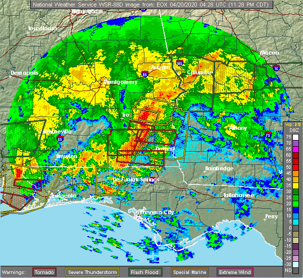 At 1258 am edt/1158 pm cdt/, a severe thunderstorm capable of producing a tornado was located near fort gaines, moving east at 55 mph (radar indicated rotation). Hazards include tornado. Flying debris will be dangerous to those caught without shelter. mobile homes will be damaged or destroyed. damage to roofs, windows, and vehicles will occur. tree damage is likely. this dangerous storm will be near, cuthbert around 115 am edt. shellman around 125 am edt. other locations impacted by this tornadic thunderstorm include walter f. George lock and dam, walter f george lake, standleys store, carnegie, watson crossroads, pecan, randolph co a/p, bellville, jones crossing and martins crossroads. At 1258 am edt/1158 pm cdt/, a severe thunderstorm capable of producing a tornado was located near fort gaines, moving east at 55 mph (radar indicated rotation). Hazards include tornado. Flying debris will be dangerous to those caught without shelter. mobile homes will be damaged or destroyed. damage to roofs, windows, and vehicles will occur. tree damage is likely. this dangerous storm will be near, cuthbert around 115 am edt. shellman around 125 am edt. other locations impacted by this tornadic thunderstorm include walter f. George lock and dam, walter f george lake, standleys store, carnegie, watson crossroads, pecan, randolph co a/p, bellville, jones crossing and martins crossroads.
|
| 4/13/2020 4:07 AM EDT |
 The tornado warning for southern randolph county will expire at 415 am edt, the storm which prompted the warning has moved out of the area. therefore, the warning will be allowed to expire. a tornado watch remains in effect until 700 am edt for southwestern georgia. The tornado warning for southern randolph county will expire at 415 am edt, the storm which prompted the warning has moved out of the area. therefore, the warning will be allowed to expire. a tornado watch remains in effect until 700 am edt for southwestern georgia.
|
| 4/13/2020 3:44 AM EDT |
 At 344 am edt, a severe thunderstorm capable of producing a tornado was located near cuthbert, moving east at 55 mph (radar indicated rotation). Hazards include tornado. Flying debris will be dangerous to those caught without shelter. mobile homes will be damaged or destroyed. damage to roofs, windows, and vehicles will occur. tree damage is likely. this dangerous storm will be near, shellman around 400 am edt. Other locations impacted by this tornadic thunderstorm include fountain bridge, goffs mill, pachitla, shivers mill, aycock mill, carnegie, coleman, peterson hill, coles and martins crossroads. At 344 am edt, a severe thunderstorm capable of producing a tornado was located near cuthbert, moving east at 55 mph (radar indicated rotation). Hazards include tornado. Flying debris will be dangerous to those caught without shelter. mobile homes will be damaged or destroyed. damage to roofs, windows, and vehicles will occur. tree damage is likely. this dangerous storm will be near, shellman around 400 am edt. Other locations impacted by this tornadic thunderstorm include fountain bridge, goffs mill, pachitla, shivers mill, aycock mill, carnegie, coleman, peterson hill, coles and martins crossroads.
|
| 4/13/2020 3:42 AM EDT |
 At 342 am edt, a severe thunderstorm was located near cuthbert, moving east at 55 mph (radar indicated). Hazards include 60 mph wind gusts. expect damage to roofs, siding, and trees At 342 am edt, a severe thunderstorm was located near cuthbert, moving east at 55 mph (radar indicated). Hazards include 60 mph wind gusts. expect damage to roofs, siding, and trees
|
| 4/13/2020 3:29 AM EDT |
 At 329 am edt, a severe thunderstorm capable of producing a tornado was located over fort gaines, moving east at 65 mph (radar indicated rotation). Hazards include tornado. Flying debris will be dangerous to those caught without shelter. mobile homes will be damaged or destroyed. damage to roofs, windows, and vehicles will occur. tree damage is likely. this dangerous storm will be near, cuthbert around 345 am edt. shellman around 350 am edt. Other locations impacted by this tornadic thunderstorm include days crossroads, pachitla, walter f george lake, standleys store, zetto, carnegie, watson crossroads, peterson hill, coles and moores crossroads. At 329 am edt, a severe thunderstorm capable of producing a tornado was located over fort gaines, moving east at 65 mph (radar indicated rotation). Hazards include tornado. Flying debris will be dangerous to those caught without shelter. mobile homes will be damaged or destroyed. damage to roofs, windows, and vehicles will occur. tree damage is likely. this dangerous storm will be near, cuthbert around 345 am edt. shellman around 350 am edt. Other locations impacted by this tornadic thunderstorm include days crossroads, pachitla, walter f george lake, standleys store, zetto, carnegie, watson crossroads, peterson hill, coles and moores crossroads.
|
| 4/13/2020 2:13 AM EDT |
 At 213 am edt, a severe thunderstorm was located over georgetown, moving east at 50 mph (radar indicated). Hazards include 60 mph wind gusts. expect damage to roofs, siding, and trees At 213 am edt, a severe thunderstorm was located over georgetown, moving east at 50 mph (radar indicated). Hazards include 60 mph wind gusts. expect damage to roofs, siding, and trees
|
| 3/31/2020 1:31 PM EDT |
 At 131 pm edt/1231 pm cdt/, severe thunderstorms were located along a line extending from 8 miles south of plains to morgan to near ashford, moving east at 55 mph (radar indicated). Hazards include 60 mph wind gusts. Expect damage to roofs, siding, and trees. Locations impacted include, colquitt, cottonwood, morgan, blakely, dawson, dothan, donalsonville, geneva, hartford, taylor, ashford, slocomb, cowarts, edison, arlington, webb, shellman, columbia, leary and smithville. At 131 pm edt/1231 pm cdt/, severe thunderstorms were located along a line extending from 8 miles south of plains to morgan to near ashford, moving east at 55 mph (radar indicated). Hazards include 60 mph wind gusts. Expect damage to roofs, siding, and trees. Locations impacted include, colquitt, cottonwood, morgan, blakely, dawson, dothan, donalsonville, geneva, hartford, taylor, ashford, slocomb, cowarts, edison, arlington, webb, shellman, columbia, leary and smithville.
|
| 3/31/2020 1:05 PM EDT |
 At 105 pm edt/1205 pm cdt/, severe thunderstorms were located along a line extending from 8 miles north of cuthbert to 8 miles north of blakely to near taylor, moving east at 55 mph (radar indicated). Hazards include 60 mph wind gusts. expect damage to roofs, siding, and trees At 105 pm edt/1205 pm cdt/, severe thunderstorms were located along a line extending from 8 miles north of cuthbert to 8 miles north of blakely to near taylor, moving east at 55 mph (radar indicated). Hazards include 60 mph wind gusts. expect damage to roofs, siding, and trees
|
| 3/31/2020 12:50 PM EDT |
 At 1249 pm edt/1149 am cdt/, severe thunderstorms were located along a line extending from 8 miles northeast of georgetown to 7 miles south of abbeville to near daleville, moving east at 50 mph (radar indicated). Hazards include 60 mph wind gusts. expect damage to roofs, siding, and trees At 1249 pm edt/1149 am cdt/, severe thunderstorms were located along a line extending from 8 miles northeast of georgetown to 7 miles south of abbeville to near daleville, moving east at 50 mph (radar indicated). Hazards include 60 mph wind gusts. expect damage to roofs, siding, and trees
|
| 3/4/2020 8:52 AM EST |
 At 852 am est, doppler radar indicated a line of severe thunderstorms capable of producing quarter size hail and damaging winds in excess of 60 mph. these storms were located along a line extending from near georgetown to near fort gaines, and moving east at 55 mph. At 852 am est, doppler radar indicated a line of severe thunderstorms capable of producing quarter size hail and damaging winds in excess of 60 mph. these storms were located along a line extending from near georgetown to near fort gaines, and moving east at 55 mph.
|
| 1/11/2020 7:06 PM EST |
 At 706 pm est, severe thunderstorms were located along a line extending from 6 miles southwest of plains to near edison, moving east at 25 mph (radar indicated). Hazards include 60 mph wind gusts. Expect damage to roofs, siding, and trees. Locations impacted include, dawson, leesburg, albany, shellman, smithville, sasser, bronwood, parrott, forrester, palmyra, clarks mill, dawson municipal a/p, chambliss, olivers mill, neyami, martins crossroads, chickasawhatchee, pachitla, bridges crossroad and century. At 706 pm est, severe thunderstorms were located along a line extending from 6 miles southwest of plains to near edison, moving east at 25 mph (radar indicated). Hazards include 60 mph wind gusts. Expect damage to roofs, siding, and trees. Locations impacted include, dawson, leesburg, albany, shellman, smithville, sasser, bronwood, parrott, forrester, palmyra, clarks mill, dawson municipal a/p, chambliss, olivers mill, neyami, martins crossroads, chickasawhatchee, pachitla, bridges crossroad and century.
|
| 1/11/2020 6:34 PM EST |
 At 634 pm est, severe thunderstorms were located along a line extending from near weston to near fort gaines, moving east at 45 mph (radar indicated). Hazards include 60 mph wind gusts. expect damage to roofs, siding, and trees At 634 pm est, severe thunderstorms were located along a line extending from near weston to near fort gaines, moving east at 45 mph (radar indicated). Hazards include 60 mph wind gusts. expect damage to roofs, siding, and trees
|
| 7/18/2019 5:31 PM EDT |
 At 530 pm edt, severe thunderstorms were located along a line extending from near cuthbert to near leesburg, moving south at 20 mph (radar indicated). Hazards include 60 mph wind gusts and penny size hail. Expect damage to roofs, siding, and trees. Locations impacted include, morgan, dawson, leesburg, cuthbert, albany, edison, shellman, sasser, bronwood, bluffton, forrester, parksville, carnegie, palmyra, randolph co a/p, clarks mill, dawson municipal a/p, aycock mill, neyami and martins crossroads. At 530 pm edt, severe thunderstorms were located along a line extending from near cuthbert to near leesburg, moving south at 20 mph (radar indicated). Hazards include 60 mph wind gusts and penny size hail. Expect damage to roofs, siding, and trees. Locations impacted include, morgan, dawson, leesburg, cuthbert, albany, edison, shellman, sasser, bronwood, bluffton, forrester, parksville, carnegie, palmyra, randolph co a/p, clarks mill, dawson municipal a/p, aycock mill, neyami and martins crossroads.
|
| 7/18/2019 5:15 PM EDT |
 At 515 pm edt, severe thunderstorms were located along a line extending from near cuthbert to 6 miles northwest of leesburg, moving south at 25 mph (radar indicated). Hazards include 60 mph wind gusts and quarter size hail. Hail damage to vehicles is expected. Expect wind damage to roofs, siding, and trees. At 515 pm edt, severe thunderstorms were located along a line extending from near cuthbert to 6 miles northwest of leesburg, moving south at 25 mph (radar indicated). Hazards include 60 mph wind gusts and quarter size hail. Hail damage to vehicles is expected. Expect wind damage to roofs, siding, and trees.
|
| 6/20/2019 4:55 PM EDT |
 At 455 pm edt, a severe thunderstorm was located near shellman, or near cuthbert, moving east at 45 mph (radar indicated). Hazards include 60 mph wind gusts and quarter size hail. Hail damage to vehicles is expected. Expect wind damage to roofs, siding, and trees. At 455 pm edt, a severe thunderstorm was located near shellman, or near cuthbert, moving east at 45 mph (radar indicated). Hazards include 60 mph wind gusts and quarter size hail. Hail damage to vehicles is expected. Expect wind damage to roofs, siding, and trees.
|
| 6/20/2019 4:50 PM EDT |
 At 449 pm edt, a severe thunderstorm was located near cuthbert, moving east at 50 mph (radar indicated). Hazards include 60 mph wind gusts and penny size hail. Expect damage to roofs, siding, and trees. Locations impacted include, cuthbert, shellman, parrott, graves, pachitla, chambliss, white house, brooksville, benevolence and wades. At 449 pm edt, a severe thunderstorm was located near cuthbert, moving east at 50 mph (radar indicated). Hazards include 60 mph wind gusts and penny size hail. Expect damage to roofs, siding, and trees. Locations impacted include, cuthbert, shellman, parrott, graves, pachitla, chambliss, white house, brooksville, benevolence and wades.
|
| 6/20/2019 4:35 PM EDT |
 At 435 pm edt, a severe thunderstorm was located 7 miles west of cuthbert, moving east at 50 mph (radar indicated). Hazards include 60 mph wind gusts and penny size hail. expect damage to roofs, siding, and trees At 435 pm edt, a severe thunderstorm was located 7 miles west of cuthbert, moving east at 50 mph (radar indicated). Hazards include 60 mph wind gusts and penny size hail. expect damage to roofs, siding, and trees
|
| 5/12/2019 12:28 PM EDT |
 At 1228 pm edt, severe thunderstorms were located along a line extending from 6 miles east of fort gaines to near arlington to near colquitt, moving northeast at 40 mph (radar indicated). Hazards include 60 mph wind gusts. expect damage to roofs, siding, and trees At 1228 pm edt, severe thunderstorms were located along a line extending from 6 miles east of fort gaines to near arlington to near colquitt, moving northeast at 40 mph (radar indicated). Hazards include 60 mph wind gusts. expect damage to roofs, siding, and trees
|
| 4/14/2019 11:58 AM EDT |
 At 1158 am edt, severe thunderstorms were located along a line extending from near shellman to near leary to 12 miles west of newton, moving northeast at 50 mph (radar indicated). Hazards include 60 mph wind gusts. expect damage to roofs, siding, and trees At 1158 am edt, severe thunderstorms were located along a line extending from near shellman to near leary to 12 miles west of newton, moving northeast at 50 mph (radar indicated). Hazards include 60 mph wind gusts. expect damage to roofs, siding, and trees
|
| 4/14/2019 11:23 AM EDT |
 At 1123 am edt, a severe thunderstorm capable of producing a tornado was located near blakely, moving northeast at 45 mph (radar indicated rotation). Hazards include tornado. Flying debris will be dangerous to those caught without shelter. mobile homes will be damaged or destroyed. damage to roofs, windows, and vehicles will occur. tree damage is likely. this dangerous storm will be near, arlington around 1130 am edt. edison around 1140 am edt. morgan around 1145 am edt. shellman around 1155 am edt. Other locations impacted by this tornadic thunderstorm include pachitla, parksville, moye, cordrays mill, clarks mill, fountain bridge, goffs mill, commissary hill, turman and aycock mill. At 1123 am edt, a severe thunderstorm capable of producing a tornado was located near blakely, moving northeast at 45 mph (radar indicated rotation). Hazards include tornado. Flying debris will be dangerous to those caught without shelter. mobile homes will be damaged or destroyed. damage to roofs, windows, and vehicles will occur. tree damage is likely. this dangerous storm will be near, arlington around 1130 am edt. edison around 1140 am edt. morgan around 1145 am edt. shellman around 1155 am edt. Other locations impacted by this tornadic thunderstorm include pachitla, parksville, moye, cordrays mill, clarks mill, fountain bridge, goffs mill, commissary hill, turman and aycock mill.
|
| 4/14/2019 11:21 AM EDT |
 At 1121 am edt, severe thunderstorms were located along a line extending from near blakely to 8 miles southwest of arlington to 11 miles east of columbia, moving northeast at 45 mph (radar indicated). Hazards include 60 mph wind gusts. expect damage to roofs, siding, and trees At 1121 am edt, severe thunderstorms were located along a line extending from near blakely to 8 miles southwest of arlington to 11 miles east of columbia, moving northeast at 45 mph (radar indicated). Hazards include 60 mph wind gusts. expect damage to roofs, siding, and trees
|
| 3/3/2019 5:52 PM EST |
 At 552 pm est, severe thunderstorms were located along a line extending from 6 miles southeast of plains to 6 miles southeast of cuthbert, moving east at 60 mph (radar indicated). Hazards include 60 mph wind gusts. expect damage to roofs, siding, and trees At 552 pm est, severe thunderstorms were located along a line extending from 6 miles southeast of plains to 6 miles southeast of cuthbert, moving east at 60 mph (radar indicated). Hazards include 60 mph wind gusts. expect damage to roofs, siding, and trees
|
| 3/3/2019 5:11 PM EST |
 At 511 pm est/411 pm cst/, severe thunderstorms were located along a line extending from near lumpkin to near abbeville, moving east at 45 mph (radar indicated). Hazards include 60 mph wind gusts. expect damage to roofs, siding, and trees At 511 pm est/411 pm cst/, severe thunderstorms were located along a line extending from near lumpkin to near abbeville, moving east at 45 mph (radar indicated). Hazards include 60 mph wind gusts. expect damage to roofs, siding, and trees
|
| 3/3/2019 3:00 PM EST |
 At 259 pm est, a severe thunderstorm was located over edison, or 9 miles west of morgan, moving northeast at 35 mph (radar indicated). Hazards include 60 mph wind gusts and quarter size hail. Hail damage to vehicles is expected. Expect wind damage to roofs, siding, and trees. At 259 pm est, a severe thunderstorm was located over edison, or 9 miles west of morgan, moving northeast at 35 mph (radar indicated). Hazards include 60 mph wind gusts and quarter size hail. Hail damage to vehicles is expected. Expect wind damage to roofs, siding, and trees.
|
| 3/3/2019 1:58 PM EST |
 At 158 pm est, a severe thunderstorm capable of producing a tornado was located near cuthbert, moving northeast at 40 mph (radar indicated rotation). Hazards include tornado. Flying debris will be dangerous to those caught without shelter. mobile homes will be damaged or destroyed. damage to roofs, windows, and vehicles will occur. tree damage is likely. this dangerous storm will be near, shellman around 215 pm est. Other locations impacted by this tornadic thunderstorm include fountain bridge, goffs mill, pachitla, shivers mill, carnegie, martins crossroads, randolph co a/p and coleman. At 158 pm est, a severe thunderstorm capable of producing a tornado was located near cuthbert, moving northeast at 40 mph (radar indicated rotation). Hazards include tornado. Flying debris will be dangerous to those caught without shelter. mobile homes will be damaged or destroyed. damage to roofs, windows, and vehicles will occur. tree damage is likely. this dangerous storm will be near, shellman around 215 pm est. Other locations impacted by this tornadic thunderstorm include fountain bridge, goffs mill, pachitla, shivers mill, carnegie, martins crossroads, randolph co a/p and coleman.
|
| 1/23/2019 9:31 PM EST |
 At 931 pm est, severe thunderstorms were located along a line extending from 7 miles southwest of weston to 6 miles west of blakely, moving east at 35 mph (radar indicated). Hazards include 60 mph wind gusts. Expect damage to roofs, siding, and trees. Locations impacted include, cuthbert, blakely, edison, arlington, shellman, columbia, centerville, parrott, bellville, bluffton, parksville, carnegie, pecan, randolph co a/p, rock hill, chambliss, early co a/p, jones crossing, martins crossroads and bethel. At 931 pm est, severe thunderstorms were located along a line extending from 7 miles southwest of weston to 6 miles west of blakely, moving east at 35 mph (radar indicated). Hazards include 60 mph wind gusts. Expect damage to roofs, siding, and trees. Locations impacted include, cuthbert, blakely, edison, arlington, shellman, columbia, centerville, parrott, bellville, bluffton, parksville, carnegie, pecan, randolph co a/p, rock hill, chambliss, early co a/p, jones crossing, martins crossroads and bethel.
|
| 1/23/2019 8:56 PM EST |
 At 855 pm est, severe thunderstorms were located along a line extending from near lakepoint resort state park to near kinsey, moving northeast at 45 mph (radar indicated). Hazards include 60 mph wind gusts. expect damage to roofs, siding, and trees At 855 pm est, severe thunderstorms were located along a line extending from near lakepoint resort state park to near kinsey, moving northeast at 45 mph (radar indicated). Hazards include 60 mph wind gusts. expect damage to roofs, siding, and trees
|
| 1/19/2019 8:19 PM EST |
 At 819 pm est, severe thunderstorms were located along a line extending from 8 miles south of plains to edison, moving east at 30 mph (radar indicated). Hazards include 60 mph wind gusts. Expect damage to roofs, siding, and trees. locations impacted include, morgan, dawson, leesburg, albany, edison, shellman, leary, smithville, walker, sasser, bronwood, parrott, holt, clarks mill, dawson municipal a/p, aycock mill, chambliss, olivers mill, neyami and martins crossroads. A tornado watch remains in effect until midnight est for southwestern georgia. At 819 pm est, severe thunderstorms were located along a line extending from 8 miles south of plains to edison, moving east at 30 mph (radar indicated). Hazards include 60 mph wind gusts. Expect damage to roofs, siding, and trees. locations impacted include, morgan, dawson, leesburg, albany, edison, shellman, leary, smithville, walker, sasser, bronwood, parrott, holt, clarks mill, dawson municipal a/p, aycock mill, chambliss, olivers mill, neyami and martins crossroads. A tornado watch remains in effect until midnight est for southwestern georgia.
|
| 1/19/2019 7:55 PM EST |
 At 755 pm est, severe thunderstorms were located along a line extending from near weston to 6 miles southeast of fort gaines, moving northeast at 25 mph (radar indicated). Hazards include 60 mph wind gusts. expect damage to roofs, siding, and trees At 755 pm est, severe thunderstorms were located along a line extending from near weston to 6 miles southeast of fort gaines, moving northeast at 25 mph (radar indicated). Hazards include 60 mph wind gusts. expect damage to roofs, siding, and trees
|
| 1/4/2019 6:26 AM EST |
 At 626 am est, severe thunderstorms were located along a line extending from 9 miles south of lumpkin to near arlington, moving northeast at 55 mph (radar indicated). Hazards include 60 mph wind gusts. expect damage to roofs, siding, and trees At 626 am est, severe thunderstorms were located along a line extending from 9 miles south of lumpkin to near arlington, moving northeast at 55 mph (radar indicated). Hazards include 60 mph wind gusts. expect damage to roofs, siding, and trees
|
| 12/2/2018 3:26 AM EST |
 At 326 am est/226 am cst/, a severe thunderstorm was located near fort gaines, moving northeast at 35 mph (radar indicated). Hazards include 60 mph wind gusts. expect damage to roofs, siding, and trees At 326 am est/226 am cst/, a severe thunderstorm was located near fort gaines, moving northeast at 35 mph (radar indicated). Hazards include 60 mph wind gusts. expect damage to roofs, siding, and trees
|
| 8/31/2018 7:38 PM EDT |
 The severe thunderstorm warning for northwestern clay, randolph, quitman and central terrell counties will expire at 745 pm edt, the storms which prompted the warning have weakened below severe limits, and no longer pose an immediate threat to life or property. therefore, the warning will be allowed to expire. to report severe weather, contact your nearest law enforcement agency. they will relay your report to the national weather service tallahassee. The severe thunderstorm warning for northwestern clay, randolph, quitman and central terrell counties will expire at 745 pm edt, the storms which prompted the warning have weakened below severe limits, and no longer pose an immediate threat to life or property. therefore, the warning will be allowed to expire. to report severe weather, contact your nearest law enforcement agency. they will relay your report to the national weather service tallahassee.
|
| 8/31/2018 7:21 PM EDT |
 At 721 pm edt, severe thunderstorms were located along a line extending from 8 miles northeast of fort gaines to near smithville, moving north at 40 mph (radar indicated). Hazards include 60 mph wind gusts. expect damage to roofs, siding, and trees At 721 pm edt, severe thunderstorms were located along a line extending from 8 miles northeast of fort gaines to near smithville, moving north at 40 mph (radar indicated). Hazards include 60 mph wind gusts. expect damage to roofs, siding, and trees
|
| 8/31/2018 6:34 PM EDT |
 At 633 pm edt, severe thunderstorms were located along a line extending from near turner city to 11 miles northeast of colquitt, moving northwest at 40 mph (radar indicated). Hazards include 60 mph wind gusts. expect damage to roofs, siding, and trees At 633 pm edt, severe thunderstorms were located along a line extending from near turner city to 11 miles northeast of colquitt, moving northwest at 40 mph (radar indicated). Hazards include 60 mph wind gusts. expect damage to roofs, siding, and trees
|
| 8/29/2018 8:11 PM EDT |
 The severe thunderstorm warning for randolph and northwestern terrell counties will expire at 815 pm edt, the storms which prompted the warning have weakened below severe limits, and no longer pose an immediate threat to life or property. therefore, the warning will be allowed to expire. to report severe weather, contact your nearest law enforcement agency. they will relay your report to the national weather service tallahassee. The severe thunderstorm warning for randolph and northwestern terrell counties will expire at 815 pm edt, the storms which prompted the warning have weakened below severe limits, and no longer pose an immediate threat to life or property. therefore, the warning will be allowed to expire. to report severe weather, contact your nearest law enforcement agency. they will relay your report to the national weather service tallahassee.
|
| 8/29/2018 8:02 PM EDT |
 At 801 pm edt, severe thunderstorms were located along a line extending from 6 miles southeast of weston to 6 miles south of cuthbert, moving northwest at 25 mph. these storms have a history of blowing down trees and power lines in the dawson area (radar indicated). Hazards include 60 mph wind gusts. Expect damage to roofs, siding, and trees. Locations impacted include, cuthbert, shellman, parrott, pachitla, carnegie, peterson hill, coles, white house, randolph co a/p, fountain bridge, goffs mill, shivers mill, chambliss, coleman, martins crossroads, brooksville, benevolence and wades. At 801 pm edt, severe thunderstorms were located along a line extending from 6 miles southeast of weston to 6 miles south of cuthbert, moving northwest at 25 mph. these storms have a history of blowing down trees and power lines in the dawson area (radar indicated). Hazards include 60 mph wind gusts. Expect damage to roofs, siding, and trees. Locations impacted include, cuthbert, shellman, parrott, pachitla, carnegie, peterson hill, coles, white house, randolph co a/p, fountain bridge, goffs mill, shivers mill, chambliss, coleman, martins crossroads, brooksville, benevolence and wades.
|
| 8/29/2018 7:47 PM EDT |
 At 746 pm edt, severe thunderstorms were located along a line extending from 8 miles southeast of weston to near edison, moving northwest at 25 mph. there have been trees and power lines blown down in the dawson area with these storms (radar indicated). Hazards include 60 mph wind gusts. Expect damage to roofs, siding, and trees. Locations impacted include, cuthbert, shellman, parrott, pachitla, carnegie, moye, peterson hill, coles, white house, randolph co a/p, yeomans, graves, fountain bridge, goffs mill, shivers mill, aycock mill, oakville, chambliss, coleman and martins crossroads. At 746 pm edt, severe thunderstorms were located along a line extending from 8 miles southeast of weston to near edison, moving northwest at 25 mph. there have been trees and power lines blown down in the dawson area with these storms (radar indicated). Hazards include 60 mph wind gusts. Expect damage to roofs, siding, and trees. Locations impacted include, cuthbert, shellman, parrott, pachitla, carnegie, moye, peterson hill, coles, white house, randolph co a/p, yeomans, graves, fountain bridge, goffs mill, shivers mill, aycock mill, oakville, chambliss, coleman and martins crossroads.
|
| 8/29/2018 7:25 PM EDT |
 At 725 pm edt, doppler radar indicated a line of severe thunderstorms capable of producing damaging winds in excess of 60 mph. these storms were located along a line extending from 6 miles northeast of dawson to morgan, and moving northwest at 30 mph. At 725 pm edt, doppler radar indicated a line of severe thunderstorms capable of producing damaging winds in excess of 60 mph. these storms were located along a line extending from 6 miles northeast of dawson to morgan, and moving northwest at 30 mph.
|
| 7/22/2018 4:47 PM EDT |
 At 447 pm edt, a severe thunderstorm was located 7 miles south of dawson, moving east at 45 mph (radar indicated). Hazards include 60 mph wind gusts. Expect damage to roofs, siding, and trees. Locations impacted include, morgan, dawson, edison, arlington, shellman, leary, parksville, carnegie, holt, clarks mill, dawson municipal a/p, aycock mill, martins crossroads, pachitla, moye, herod, cordrays mill, yeomans, graves and fountain bridge. At 447 pm edt, a severe thunderstorm was located 7 miles south of dawson, moving east at 45 mph (radar indicated). Hazards include 60 mph wind gusts. Expect damage to roofs, siding, and trees. Locations impacted include, morgan, dawson, edison, arlington, shellman, leary, parksville, carnegie, holt, clarks mill, dawson municipal a/p, aycock mill, martins crossroads, pachitla, moye, herod, cordrays mill, yeomans, graves and fountain bridge.
|
| 7/22/2018 4:08 PM EDT |
 At 408 pm edt/308 pm cdt/, doppler radar indicated a severe thunderstorm capable of producing quarter size hail and destructive winds in excess of 80 mph. this storm was located 7 miles east of fort gaines, and moving east at 45 mph. At 408 pm edt/308 pm cdt/, doppler radar indicated a severe thunderstorm capable of producing quarter size hail and destructive winds in excess of 80 mph. this storm was located 7 miles east of fort gaines, and moving east at 45 mph.
|
| 7/21/2018 9:44 PM EDT |
 At 944 pm edt, severe thunderstorms were located along a line extending from 7 miles north of leary to near morgan to near edison, moving southeast at 35 mph (radar indicated). Hazards include 60 mph wind gusts and penny size hail. Expect damage to roofs, siding, and trees. Locations impacted include, morgan, edison, shellman, bellville, bluffton, harrisons mill, parksville, carnegie, moye, cordrays mill, fountain bridge, goffs mill, turman, shivers mill, aycock mill, martins crossroads, suttons corner and dickey. At 944 pm edt, severe thunderstorms were located along a line extending from 7 miles north of leary to near morgan to near edison, moving southeast at 35 mph (radar indicated). Hazards include 60 mph wind gusts and penny size hail. Expect damage to roofs, siding, and trees. Locations impacted include, morgan, edison, shellman, bellville, bluffton, harrisons mill, parksville, carnegie, moye, cordrays mill, fountain bridge, goffs mill, turman, shivers mill, aycock mill, martins crossroads, suttons corner and dickey.
|
| 7/21/2018 9:31 PM EDT |
 At 931 pm edt, a severe thunderstorm was located near dawson, moving southeast at 25 mph (radar indicated). Hazards include 60 mph wind gusts and quarter size hail. Hail damage to vehicles is expected. expect wind damage to roofs, siding, and trees. Locations impacted include, dawson, albany, shellman, sasser, bridges crossroad, herod, yeomans, clarks mill, dawson municipal a/p, graves, armena, chickasawhatchee and doverel. At 931 pm edt, a severe thunderstorm was located near dawson, moving southeast at 25 mph (radar indicated). Hazards include 60 mph wind gusts and quarter size hail. Hail damage to vehicles is expected. expect wind damage to roofs, siding, and trees. Locations impacted include, dawson, albany, shellman, sasser, bridges crossroad, herod, yeomans, clarks mill, dawson municipal a/p, graves, armena, chickasawhatchee and doverel.
|
| 7/21/2018 9:09 PM EDT |
 At 909 pm edt, a severe thunderstorm was located near dawson, moving southeast at 25 mph (radar indicated). Hazards include 60 mph wind gusts and quarter size hail. Hail damage to vehicles is expected. Expect wind damage to roofs, siding, and trees. At 909 pm edt, a severe thunderstorm was located near dawson, moving southeast at 25 mph (radar indicated). Hazards include 60 mph wind gusts and quarter size hail. Hail damage to vehicles is expected. Expect wind damage to roofs, siding, and trees.
|
| 7/21/2018 9:07 PM EDT |
 At 907 pm edt, severe thunderstorms were located along a line extending from near cuthbert to 13 miles northeast of fort gaines to 8 miles south of georgetown, moving southeast at 35 mph (radar indicated). Hazards include 60 mph wind gusts and quarter size hail. Hail damage to vehicles is expected. Expect wind damage to roofs, siding, and trees. At 907 pm edt, severe thunderstorms were located along a line extending from near cuthbert to 13 miles northeast of fort gaines to 8 miles south of georgetown, moving southeast at 35 mph (radar indicated). Hazards include 60 mph wind gusts and quarter size hail. Hail damage to vehicles is expected. Expect wind damage to roofs, siding, and trees.
|
| 7/21/2018 11:12 AM EDT |
 At 1111 am edt, a severe thunderstorm was located near dawson, moving south at 30 mph (radar indicated). Hazards include 60 mph wind gusts and quarter size hail. Hail damage to vehicles is expected. Expect wind damage to roofs, siding, and trees. At 1111 am edt, a severe thunderstorm was located near dawson, moving south at 30 mph (radar indicated). Hazards include 60 mph wind gusts and quarter size hail. Hail damage to vehicles is expected. Expect wind damage to roofs, siding, and trees.
|
| 8/30/2017 2:34 PM EDT |
 At 234 pm edt, a severe thunderstorm was located over dawson, moving northeast at 45 mph (radar indicated). Hazards include 60 mph wind gusts. Expect damage to roofs, siding, and trees. Locations impacted include, dawson, albany, shellman, leary, smithville, walker, sasser, bronwood, parrott, lockett crossing, holt, clarks mill, dawson municipal a/p, aycock mill, chambliss, olivers mill, martins crossroads, benevolence, chickasawhatchee and wades. At 234 pm edt, a severe thunderstorm was located over dawson, moving northeast at 45 mph (radar indicated). Hazards include 60 mph wind gusts. Expect damage to roofs, siding, and trees. Locations impacted include, dawson, albany, shellman, leary, smithville, walker, sasser, bronwood, parrott, lockett crossing, holt, clarks mill, dawson municipal a/p, aycock mill, chambliss, olivers mill, martins crossroads, benevolence, chickasawhatchee and wades.
|
| 8/30/2017 2:10 PM EDT |
 At 209 pm edt, a severe thunderstorm was located over edison, or 8 miles northwest of morgan, moving northeast at 45 mph (radar indicated). Hazards include 60 mph wind gusts. expect damage to roofs, siding, and trees At 209 pm edt, a severe thunderstorm was located over edison, or 8 miles northwest of morgan, moving northeast at 45 mph (radar indicated). Hazards include 60 mph wind gusts. expect damage to roofs, siding, and trees
|
| 8/30/2017 2:03 PM EDT |
 At 202 pm edt, a severe thunderstorm was located near shellman, or near cuthbert, moving northeast at 30 mph (radar indicated). Hazards include 60 mph wind gusts. Expect damage to roofs, siding, and trees. Locations impacted include, cuthbert, edison, shellman, bellville, bluffton, harrisons mill, pachitla, parksville, zetto, carnegie, moye, coles, white house, randolph co a/p, colomokee, fountain bridge, goffs mill, shivers mill, aycock mill and coleman. At 202 pm edt, a severe thunderstorm was located near shellman, or near cuthbert, moving northeast at 30 mph (radar indicated). Hazards include 60 mph wind gusts. Expect damage to roofs, siding, and trees. Locations impacted include, cuthbert, edison, shellman, bellville, bluffton, harrisons mill, pachitla, parksville, zetto, carnegie, moye, coles, white house, randolph co a/p, colomokee, fountain bridge, goffs mill, shivers mill, aycock mill and coleman.
|
| 8/30/2017 1:42 PM EDT |
 At 142 pm edt, doppler radar indicated a severe thunderstorm capable of producing damaging winds in excess of 60 mph. this storm was located 8 miles southeast of fort gaines, and moving northeast at 45 mph. At 142 pm edt, doppler radar indicated a severe thunderstorm capable of producing damaging winds in excess of 60 mph. this storm was located 8 miles southeast of fort gaines, and moving northeast at 45 mph.
|
| 5/23/2017 12:10 PM EDT |
 The tornado warning for southern randolph county will expire at 1215 pm edt, the storm which prompted the warning has weakened below severe limits, and no longer appears capable of producing a tornado. therefore the warning will be allowed to expire. a tornado watch remains in effect until 600 pm edt for southwestern georgia. The tornado warning for southern randolph county will expire at 1215 pm edt, the storm which prompted the warning has weakened below severe limits, and no longer appears capable of producing a tornado. therefore the warning will be allowed to expire. a tornado watch remains in effect until 600 pm edt for southwestern georgia.
|
| 5/23/2017 11:50 AM EDT |
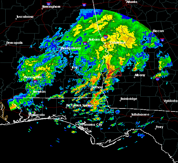 At 1150 am edt, a confirmed tornado was located 8 miles south of cuthbert, moving east at 30 mph (radar confirmed tornado). Hazards include damaging tornado. Flying debris will be dangerous to those caught without shelter. mobile homes will be damaged or destroyed. damage to roofs, windows, and vehicles will occur. tree damage is likely. this tornado will be near, shellman around 1215 pm edt. Other locations impacted by this tornadic thunderstorm include fountain bridge, goffs mill, pachitla, shivers mill, aycock mill, carnegie, martins crossroads and randolph co a/p. At 1150 am edt, a confirmed tornado was located 8 miles south of cuthbert, moving east at 30 mph (radar confirmed tornado). Hazards include damaging tornado. Flying debris will be dangerous to those caught without shelter. mobile homes will be damaged or destroyed. damage to roofs, windows, and vehicles will occur. tree damage is likely. this tornado will be near, shellman around 1215 pm edt. Other locations impacted by this tornadic thunderstorm include fountain bridge, goffs mill, pachitla, shivers mill, aycock mill, carnegie, martins crossroads and randolph co a/p.
|
| 5/23/2017 11:47 AM EDT |
 At 1147 am edt, a severe thunderstorm capable of producing a tornado was located 9 miles southwest of cuthbert, moving east at 30 mph (radar indicated rotation). Hazards include tornado. Flying debris will be dangerous to those caught without shelter. mobile homes will be damaged or destroyed. damage to roofs, windows, and vehicles will occur. tree damage is likely. this dangerous storm will be near, shellman around 1215 pm edt. Other locations impacted by this tornadic thunderstorm include fountain bridge, goffs mill, pachitla, shivers mill, aycock mill, carnegie, coleman, martins crossroads and randolph co a/p. At 1147 am edt, a severe thunderstorm capable of producing a tornado was located 9 miles southwest of cuthbert, moving east at 30 mph (radar indicated rotation). Hazards include tornado. Flying debris will be dangerous to those caught without shelter. mobile homes will be damaged or destroyed. damage to roofs, windows, and vehicles will occur. tree damage is likely. this dangerous storm will be near, shellman around 1215 pm edt. Other locations impacted by this tornadic thunderstorm include fountain bridge, goffs mill, pachitla, shivers mill, aycock mill, carnegie, coleman, martins crossroads and randolph co a/p.
|
| 1/22/2017 3:00 PM EST |
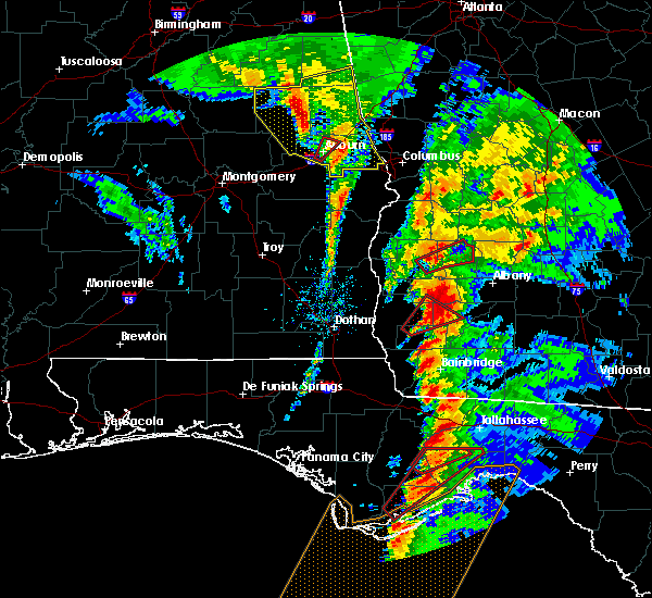 At 300 pm est, a confirmed tornado was located over shellman, or 9 miles east of cuthbert, moving northeast at 50 mph (radar confirmed tornado). Hazards include damaging tornado and quarter size hail. Flying debris will be dangerous to those caught without shelter. mobile homes will be damaged or destroyed. damage to roofs, windows, and vehicles will occur. tree damage is likely. this tornado will be near, dawson around 315 pm est. Other locations impacted by this tornadic thunderstorm include dawson municipal a/p, bronwood, oakville, yeomans, pachitla, graves, martins crossroads, goffs mill, bridges crossroad and olivers mill. At 300 pm est, a confirmed tornado was located over shellman, or 9 miles east of cuthbert, moving northeast at 50 mph (radar confirmed tornado). Hazards include damaging tornado and quarter size hail. Flying debris will be dangerous to those caught without shelter. mobile homes will be damaged or destroyed. damage to roofs, windows, and vehicles will occur. tree damage is likely. this tornado will be near, dawson around 315 pm est. Other locations impacted by this tornadic thunderstorm include dawson municipal a/p, bronwood, oakville, yeomans, pachitla, graves, martins crossroads, goffs mill, bridges crossroad and olivers mill.
|
| 1/22/2017 2:51 PM EST |
 At 251 pm est, a confirmed tornado was located 9 miles southeast of cuthbert, moving northeast at 50 mph (radar confirmed tornado). Hazards include damaging tornado and quarter size hail. Flying debris will be dangerous to those caught without shelter. mobile homes will be damaged or destroyed. damage to roofs, windows, and vehicles will occur. tree damage is likely. this tornado will be near, shellman around 300 pm est. dawson around 310 pm est. Other locations impacted by this tornadic thunderstorm include dawson municipal a/p, aycock mill, bronwood, yeomans, shivers mill, graves, herod, randolph co a/p, goffs mill and olivers mill. At 251 pm est, a confirmed tornado was located 9 miles southeast of cuthbert, moving northeast at 50 mph (radar confirmed tornado). Hazards include damaging tornado and quarter size hail. Flying debris will be dangerous to those caught without shelter. mobile homes will be damaged or destroyed. damage to roofs, windows, and vehicles will occur. tree damage is likely. this tornado will be near, shellman around 300 pm est. dawson around 310 pm est. Other locations impacted by this tornadic thunderstorm include dawson municipal a/p, aycock mill, bronwood, yeomans, shivers mill, graves, herod, randolph co a/p, goffs mill and olivers mill.
|
| 1/22/2017 2:42 PM EST |
 At 242 pm est, a tornado producing storm was located near edison, or 12 miles south of cuthbert, moving northeast at 50 mph (radar confirmed tornado). Hazards include damaging tornado and quarter size hail. Flying debris will be dangerous to those caught without shelter. mobile homes will be damaged or destroyed. damage to roofs, windows, and vehicles will occur. tree damage is likely. this tornadic storm will be near, edison around 245 pm est. shellman around 300 pm est. dawson around 310 pm est. Other locations impacted by this tornadic thunderstorm include dawson municipal a/p, suttons corner, bluffton, cordrays mill, moye, yeomans, clarks mill, shivers mill, herod and olivers mill. At 242 pm est, a tornado producing storm was located near edison, or 12 miles south of cuthbert, moving northeast at 50 mph (radar confirmed tornado). Hazards include damaging tornado and quarter size hail. Flying debris will be dangerous to those caught without shelter. mobile homes will be damaged or destroyed. damage to roofs, windows, and vehicles will occur. tree damage is likely. this tornadic storm will be near, edison around 245 pm est. shellman around 300 pm est. dawson around 310 pm est. Other locations impacted by this tornadic thunderstorm include dawson municipal a/p, suttons corner, bluffton, cordrays mill, moye, yeomans, clarks mill, shivers mill, herod and olivers mill.
|
| 1/21/2017 11:59 PM EST |
 At 1158 pm est, severe thunderstorms were located along a line extending from near cuthbert to arlington, moving east at 50 mph (radar indicated). Hazards include 60 mph wind gusts and quarter size hail. Hail damage to vehicles is expected. expect wind damage to roofs, siding, and trees. locations impacted include, morgan, dawson, cuthbert, albany, edison, arlington, shellman, leary, smithville, walker, sasser, bronwood, parrott, dawson municipal a/p, cordrays mill, moye, yeomans, rowena, parksville and clarks mill. A tornado watch remains in effect until 400 am est for southwestern georgia. At 1158 pm est, severe thunderstorms were located along a line extending from near cuthbert to arlington, moving east at 50 mph (radar indicated). Hazards include 60 mph wind gusts and quarter size hail. Hail damage to vehicles is expected. expect wind damage to roofs, siding, and trees. locations impacted include, morgan, dawson, cuthbert, albany, edison, arlington, shellman, leary, smithville, walker, sasser, bronwood, parrott, dawson municipal a/p, cordrays mill, moye, yeomans, rowena, parksville and clarks mill. A tornado watch remains in effect until 400 am est for southwestern georgia.
|
| 1/21/2017 11:44 PM EST |
 At 1144 pm est, severe thunderstorms were located along a line extending from 8 miles northeast of fort gaines to near blakely, moving northeast at 45 mph (radar indicated). Hazards include 60 mph wind gusts and quarter size hail. Hail damage to vehicles is expected. Expect wind damage to roofs, siding, and trees. At 1144 pm est, severe thunderstorms were located along a line extending from 8 miles northeast of fort gaines to near blakely, moving northeast at 45 mph (radar indicated). Hazards include 60 mph wind gusts and quarter size hail. Hail damage to vehicles is expected. Expect wind damage to roofs, siding, and trees.
|
| 1/21/2017 12:07 PM EST |
 At 1207 pm est, severe thunderstorms were located along a line extending from smithville to near arlington, moving east at 75 mph (radar indicated). Hazards include 60 mph wind gusts. expect damage to roofs, siding, and trees At 1207 pm est, severe thunderstorms were located along a line extending from smithville to near arlington, moving east at 75 mph (radar indicated). Hazards include 60 mph wind gusts. expect damage to roofs, siding, and trees
|
| 1/2/2017 9:46 PM EST |
 At 946 pm est, a severe thunderstorm was located near morgan, moving east at 45 mph (radar indicated). Hazards include 60 mph wind gusts. Expect damage to roofs, siding, and trees. locations impacted include, dawson, cuthbert, edison, shellman, sasser, bronwood, dawson municipal a/p, aycock mill, cordrays mill, yeomans, clarks mill, shivers mill, graves, herod, goffs mill, doverel, oakville, chickasawhatchee, pachitla and white house. A tornado watch remains in effect until 1100 pm est for southwestern georgia. At 946 pm est, a severe thunderstorm was located near morgan, moving east at 45 mph (radar indicated). Hazards include 60 mph wind gusts. Expect damage to roofs, siding, and trees. locations impacted include, dawson, cuthbert, edison, shellman, sasser, bronwood, dawson municipal a/p, aycock mill, cordrays mill, yeomans, clarks mill, shivers mill, graves, herod, goffs mill, doverel, oakville, chickasawhatchee, pachitla and white house. A tornado watch remains in effect until 1100 pm est for southwestern georgia.
|
| 1/2/2017 9:26 PM EST |
 At 926 pm est, a severe thunderstorm was located 9 miles southeast of fort gaines, moving east at 45 mph (radar indicated). Hazards include 60 mph wind gusts. expect damage to roofs, siding, and trees At 926 pm est, a severe thunderstorm was located 9 miles southeast of fort gaines, moving east at 45 mph (radar indicated). Hazards include 60 mph wind gusts. expect damage to roofs, siding, and trees
|
| 7/31/2016 2:36 PM EDT |
 The severe thunderstorm warning for southwestern terrell and southeastern randolph counties will expire at 245 pm edt, the storm which prompted the warning has weakened below severe limits, and no longer pose an immediate threat to life or property. therefore, the warning will be allowed to expire. The severe thunderstorm warning for southwestern terrell and southeastern randolph counties will expire at 245 pm edt, the storm which prompted the warning has weakened below severe limits, and no longer pose an immediate threat to life or property. therefore, the warning will be allowed to expire.
|
| 7/31/2016 2:16 PM EDT | Tree down on highway 41 south. time estimated based on rada in randolph county GA, 4.7 miles N of Shellman, GA |
| 7/31/2016 1:54 PM EDT |
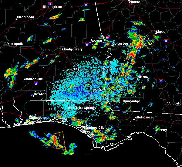 At 154 pm edt, a severe thunderstorm was located near shellman, or 9 miles southwest of dawson, and is nearly stationary (radar indicated). Hazards include 60 mph wind gusts and penny size hail. Expect damage to roofs. siding. And trees. At 154 pm edt, a severe thunderstorm was located near shellman, or 9 miles southwest of dawson, and is nearly stationary (radar indicated). Hazards include 60 mph wind gusts and penny size hail. Expect damage to roofs. siding. And trees.
|
| 7/19/2016 4:05 PM EDT |
 The severe thunderstorm warning for terrell, lee and randolph counties will expire at 415 pm edt, the storms which prompted the warning have weakened below severe limits, and no longer pose an immediate threat to life or property. therefore, the warning will be allowed to expire. to report severe weather, contact your nearest law enforcement agency. they will relay your report to the national weather service tallahassee. The severe thunderstorm warning for terrell, lee and randolph counties will expire at 415 pm edt, the storms which prompted the warning have weakened below severe limits, and no longer pose an immediate threat to life or property. therefore, the warning will be allowed to expire. to report severe weather, contact your nearest law enforcement agency. they will relay your report to the national weather service tallahassee.
|
| 7/19/2016 3:38 PM EDT |
 At 338 pm edt, severe thunderstorms were located along a line extending from near cuthbert to 7 miles south of desoto, moving southeast at 20 mph (radar indicated). Hazards include 60 mph wind gusts. Expect damage to roofs. siding. and trees. Locations impacted include, cuthbert, dawson, leesburg, albany, shellman, smithville, sasser, bronwood, dawson municipal a/p, forrester, yeomans, springvale, clarks mill, starksville, shivers mill, herod, mossy dell, wades, palmyra and doverel. At 338 pm edt, severe thunderstorms were located along a line extending from near cuthbert to 7 miles south of desoto, moving southeast at 20 mph (radar indicated). Hazards include 60 mph wind gusts. Expect damage to roofs. siding. and trees. Locations impacted include, cuthbert, dawson, leesburg, albany, shellman, smithville, sasser, bronwood, dawson municipal a/p, forrester, yeomans, springvale, clarks mill, starksville, shivers mill, herod, mossy dell, wades, palmyra and doverel.
|
| 7/19/2016 3:25 PM EDT |
 At 325 pm edt, severe thunderstorms were located along a line extending from 7 miles northwest of cuthbert to 6 miles southeast of smithville, moving south at 25 mph (radar indicated). Hazards include 60 mph wind gusts. Expect damage to roofs. siding. And trees. At 325 pm edt, severe thunderstorms were located along a line extending from 7 miles northwest of cuthbert to 6 miles southeast of smithville, moving south at 25 mph (radar indicated). Hazards include 60 mph wind gusts. Expect damage to roofs. siding. And trees.
|
| 7/12/2016 4:58 PM EDT |
 At 457 pm edt, a severe thunderstorm was located near cuthbert, moving east at 25 mph (radar indicated). Hazards include 60 mph wind gusts. Expect damage to roofs. siding. And trees. At 457 pm edt, a severe thunderstorm was located near cuthbert, moving east at 25 mph (radar indicated). Hazards include 60 mph wind gusts. Expect damage to roofs. siding. And trees.
|
| 7/10/2016 4:28 PM EDT |
 At 427 pm edt, a severe thunderstorm was located over dawson, moving northeast at 25 mph (radar indicated). Hazards include 60 mph wind gusts and penny size hail. Expect damage to roofs. siding. And trees. At 427 pm edt, a severe thunderstorm was located over dawson, moving northeast at 25 mph (radar indicated). Hazards include 60 mph wind gusts and penny size hail. Expect damage to roofs. siding. And trees.
|
| 7/10/2016 4:00 PM EDT | Report of tree down on fountain bridge rd in randolph county GA, 7.8 miles NNE of Shellman, GA |
| 7/10/2016 3:48 PM EDT |
 At 348 pm edt, severe thunderstorms were located along a line extending from near cuthbert to near edison to near arlington, moving northeast at 35 mph (radar indicated). Hazards include 60 mph wind gusts. Expect damage to roofs. siding. And trees. At 348 pm edt, severe thunderstorms were located along a line extending from near cuthbert to near edison to near arlington, moving northeast at 35 mph (radar indicated). Hazards include 60 mph wind gusts. Expect damage to roofs. siding. And trees.
|
| 7/9/2016 4:01 PM EDT |
 At 400 pm edt, a severe thunderstorm was located 7 miles north of shellman, or 11 miles northwest of dawson, and is nearly stationary (radar indicated). Hazards include 60 mph wind gusts and quarter size hail. Hail damage to vehicles is expected. Expect wind damage to roofs, siding, and trees. At 400 pm edt, a severe thunderstorm was located 7 miles north of shellman, or 11 miles northwest of dawson, and is nearly stationary (radar indicated). Hazards include 60 mph wind gusts and quarter size hail. Hail damage to vehicles is expected. Expect wind damage to roofs, siding, and trees.
|
| 6/17/2016 8:47 PM EDT |
 At 846 pm edt/746 pm cdt/, severe thunderstorms were located along a line extending from 6 miles south of dawson to 8 miles northwest of bonifay, moving southeast at 50 mph (trained weather spotters). Hazards include 70 mph wind gusts and quarter size hail. Hail damage to vehicles is expected. expect considerable tree damage. wind damage is also likely to mobile homes, roofs, and outbuildings. Locations impacted include, daleville, abbeville, cottonwood, fort gaines, morgan, blakely, cuthbert, geneva, dothan, headland, hartford, taylor, midland city, kinsey, ashford, slocomb, cowarts, edison, newton and arlington. At 846 pm edt/746 pm cdt/, severe thunderstorms were located along a line extending from 6 miles south of dawson to 8 miles northwest of bonifay, moving southeast at 50 mph (trained weather spotters). Hazards include 70 mph wind gusts and quarter size hail. Hail damage to vehicles is expected. expect considerable tree damage. wind damage is also likely to mobile homes, roofs, and outbuildings. Locations impacted include, daleville, abbeville, cottonwood, fort gaines, morgan, blakely, cuthbert, geneva, dothan, headland, hartford, taylor, midland city, kinsey, ashford, slocomb, cowarts, edison, newton and arlington.
|
| 6/17/2016 8:15 PM EDT | A few trees and power lines down in the shellman area in randolph county GA, 0.3 miles ESE of Shellman, GA |
| 6/17/2016 8:12 PM EDT |
 At 812 pm edt/712 pm cdt/, severe thunderstorms were located along a line extending from 8 miles south of lumpkin to 7 miles west of samson, moving southeast at 50 mph (radar indicated). Hazards include 70 mph wind gusts and quarter size hail. Hail damage to vehicles is expected. expect considerable tree damage. Wind damage is also likely to mobile homes, roofs, and outbuildings. At 812 pm edt/712 pm cdt/, severe thunderstorms were located along a line extending from 8 miles south of lumpkin to 7 miles west of samson, moving southeast at 50 mph (radar indicated). Hazards include 70 mph wind gusts and quarter size hail. Hail damage to vehicles is expected. expect considerable tree damage. Wind damage is also likely to mobile homes, roofs, and outbuildings.
|
| 6/17/2016 6:20 PM CDT |
 At 719 pm edt/619 pm cdt/, severe thunderstorms were located along a line extending from 8 miles south of seale to near gantt, moving southeast at 60 mph (radar indicated). Hazards include 60 mph wind gusts and quarter size hail. Hail damage to vehicles is expected. Expect wind damage to roofs, siding, and trees. At 719 pm edt/619 pm cdt/, severe thunderstorms were located along a line extending from 8 miles south of seale to near gantt, moving southeast at 60 mph (radar indicated). Hazards include 60 mph wind gusts and quarter size hail. Hail damage to vehicles is expected. Expect wind damage to roofs, siding, and trees.
|
| 6/17/2016 7:00 PM EDT |
 At 700 pm edt, a severe thunderstorm was located over shellman, or 10 miles west of dawson, moving east at 20 mph (radar indicated). Hazards include 60 mph wind gusts and quarter size hail. Hail damage to vehicles is expected. Expect wind damage to roofs, siding, and trees. At 700 pm edt, a severe thunderstorm was located over shellman, or 10 miles west of dawson, moving east at 20 mph (radar indicated). Hazards include 60 mph wind gusts and quarter size hail. Hail damage to vehicles is expected. Expect wind damage to roofs, siding, and trees.
|
| 6/17/2016 6:11 PM EDT |
 At 610 pm edt, a severe thunderstorm was located over cuthbert, moving east at 15 mph (radar indicated). Hazards include 60 mph wind gusts and nickel size hail. Expect damage to roofs. siding. And trees. At 610 pm edt, a severe thunderstorm was located over cuthbert, moving east at 15 mph (radar indicated). Hazards include 60 mph wind gusts and nickel size hail. Expect damage to roofs. siding. And trees.
|
| 4/28/2016 1:54 PM EDT |
 The severe thunderstorm warning for western terrell and southeastern randolph counties will expire at 200 pm edt, the storm which prompted the warning has weakened below severe limits, and no longer pose an immediate threat to life or property. therefore the warning will be allowed to expire. however gusty winds are still possible with this thunderstorm. The severe thunderstorm warning for western terrell and southeastern randolph counties will expire at 200 pm edt, the storm which prompted the warning has weakened below severe limits, and no longer pose an immediate threat to life or property. therefore the warning will be allowed to expire. however gusty winds are still possible with this thunderstorm.
|
| 4/28/2016 1:48 PM EDT |
 At 148 pm edt, a severe thunderstorm was located near dawson, moving east at 40 mph (radar indicated). Hazards include 60 mph wind gusts. Expect damage to roofs. siding. and trees. Locations impacted include, dawson, shellman, parrott, dawson municipal a/p, doverel, oakville, yeomans, pachitla, graves and martins crossroads. At 148 pm edt, a severe thunderstorm was located near dawson, moving east at 40 mph (radar indicated). Hazards include 60 mph wind gusts. Expect damage to roofs. siding. and trees. Locations impacted include, dawson, shellman, parrott, dawson municipal a/p, doverel, oakville, yeomans, pachitla, graves and martins crossroads.
|
| 4/28/2016 1:29 PM EDT |
 At 128 pm edt, a severe thunderstorm was located near cuthbert, moving east at 40 mph (radar indicated). Hazards include 60 mph wind gusts. Expect damage to roofs. siding. And trees. At 128 pm edt, a severe thunderstorm was located near cuthbert, moving east at 40 mph (radar indicated). Hazards include 60 mph wind gusts. Expect damage to roofs. siding. And trees.
|
| 3/24/2016 5:45 PM EDT |
 At 544 pm edt, severe thunderstorms were located along a line extending from 6 miles south of georgetown to 7 miles northeast of fort gaines to 10 miles west of edison to 12 miles west of arlington to blakely, moving northeast at 50 mph (radar indicated). Hazards include 60 mph wind gusts. Expect damage to roofs. siding. And trees. At 544 pm edt, severe thunderstorms were located along a line extending from 6 miles south of georgetown to 7 miles northeast of fort gaines to 10 miles west of edison to 12 miles west of arlington to blakely, moving northeast at 50 mph (radar indicated). Hazards include 60 mph wind gusts. Expect damage to roofs. siding. And trees.
|
| 3/17/2016 6:16 PM EDT |
 At 616 pm edt, a severe thunderstorm was located over shellman, or 9 miles west of dawson, moving east at 20 mph (radar indicated). Hazards include 60 mph wind gusts and quarter size hail. Hail damage to vehicles is expected. Expect wind damage to roofs, siding, and trees. At 616 pm edt, a severe thunderstorm was located over shellman, or 9 miles west of dawson, moving east at 20 mph (radar indicated). Hazards include 60 mph wind gusts and quarter size hail. Hail damage to vehicles is expected. Expect wind damage to roofs, siding, and trees.
|
| 2/24/2016 12:27 AM EST |
 At 1226 am est, severe thunderstorms were located along a line extending from near shellman to morgan to near arlington to 9 miles west of colquitt, moving east at 55 mph (radar indicated). Hazards include 70 mph wind gusts and penny size hail. Expect considerable tree damage. damage is likely to mobile homes, roofs and outbuildings. locations impacted include, newton, morgan, edison, arlington, shellman, leary, walker, douglasville, damascus, suttons corner, patmos, bethany, cordrays mill, moye, rowena, oak hill, parksville, turman, clarks mill and shivers mill. A tornado watch remains in effect until 400 am est for southwestern georgia. At 1226 am est, severe thunderstorms were located along a line extending from near shellman to morgan to near arlington to 9 miles west of colquitt, moving east at 55 mph (radar indicated). Hazards include 70 mph wind gusts and penny size hail. Expect considerable tree damage. damage is likely to mobile homes, roofs and outbuildings. locations impacted include, newton, morgan, edison, arlington, shellman, leary, walker, douglasville, damascus, suttons corner, patmos, bethany, cordrays mill, moye, rowena, oak hill, parksville, turman, clarks mill and shivers mill. A tornado watch remains in effect until 400 am est for southwestern georgia.
|
| 2/24/2016 12:19 AM EST |
 At 1219 am est, severe thunderstorms were located along a line extending from 6 miles southeast of cuthbert to near edison to 6 miles southeast of blakely to 11 miles southeast of columbia, moving east at 55 mph (radar indicated). Hazards include 70 mph wind gusts and penny size hail. Expect considerable tree damage. Damage is likely to mobile homes, roofs and outbuildings. At 1219 am est, severe thunderstorms were located along a line extending from 6 miles southeast of cuthbert to near edison to 6 miles southeast of blakely to 11 miles southeast of columbia, moving east at 55 mph (radar indicated). Hazards include 70 mph wind gusts and penny size hail. Expect considerable tree damage. Damage is likely to mobile homes, roofs and outbuildings.
|
| 2/15/2016 9:16 PM EST |
 At 915 pm est /815 pm cst/, severe thunderstorms were located along a line extending from near dawson to 11 miles south of donalsonville, moving east at 40 mph (radar indicated). Hazards include 60 mph wind gusts. Expect damage to roofs. siding and trees. locations impacted include, colquitt, morgan, donalsonville, dawson, edison, arlington, shellman, leary, douglasville, centerville, iron city, sasser, damascus, bronwood, parrott, jakin, dawson municipal a/p, cuba, cordrays mill and oak hill. a tornado watch remains in effect until 1000 pm est/900 pm cst/ for southeastern alabama and central florida. A tornado watch also remains in effect until 100 am est/midnight cst/ for southwestern georgia. At 915 pm est /815 pm cst/, severe thunderstorms were located along a line extending from near dawson to 11 miles south of donalsonville, moving east at 40 mph (radar indicated). Hazards include 60 mph wind gusts. Expect damage to roofs. siding and trees. locations impacted include, colquitt, morgan, donalsonville, dawson, edison, arlington, shellman, leary, douglasville, centerville, iron city, sasser, damascus, bronwood, parrott, jakin, dawson municipal a/p, cuba, cordrays mill and oak hill. a tornado watch remains in effect until 1000 pm est/900 pm cst/ for southeastern alabama and central florida. A tornado watch also remains in effect until 100 am est/midnight cst/ for southwestern georgia.
|
| 2/15/2016 9:07 PM EST | Trees down in the shellman area in randolph county GA, 0.3 miles ESE of Shellman, GA |
| 2/15/2016 8:36 PM EST |
 At 835 pm est /735 pm cst/, severe thunderstorms were located along a line extending from 10 miles southwest of lumpkin to near cottonwood, moving east at 40 mph (radar indicated). Hazards include 60 mph wind gusts. Expect damage to roofs. Siding and trees. At 835 pm est /735 pm cst/, severe thunderstorms were located along a line extending from 10 miles southwest of lumpkin to near cottonwood, moving east at 40 mph (radar indicated). Hazards include 60 mph wind gusts. Expect damage to roofs. Siding and trees.
|
| 7/30/2015 6:26 PM EDT |
 At 626 pm edt, the national weather service has detected a line of severe thunderstorms capable of producing damaging winds in excess of 60 mph. these storms were located along a line extending from near shellman to 7 miles southwest of cuthbert, and moving southwest at 10 mph. At 626 pm edt, the national weather service has detected a line of severe thunderstorms capable of producing damaging winds in excess of 60 mph. these storms were located along a line extending from near shellman to 7 miles southwest of cuthbert, and moving southwest at 10 mph.
|
| 7/15/2015 4:47 PM EDT |
 At 447 pm edt, doppler radar indicated a line of severe thunderstorms capable of producing damaging winds in excess of 60 mph. these storms were located along a line extending from near shellman to 6 miles west of arabi, moving southeast at 30 mph. locations impacted include, cuthbert, leesburg, dawson, albany, shellman, warwick, sasser, bronwood, dawson municipal a/p, forrester, springvale, starksville, shivers mill, herod, wades, palmyra, peterson hill, carnegie, philema and fountain bridge. At 447 pm edt, doppler radar indicated a line of severe thunderstorms capable of producing damaging winds in excess of 60 mph. these storms were located along a line extending from near shellman to 6 miles west of arabi, moving southeast at 30 mph. locations impacted include, cuthbert, leesburg, dawson, albany, shellman, warwick, sasser, bronwood, dawson municipal a/p, forrester, springvale, starksville, shivers mill, herod, wades, palmyra, peterson hill, carnegie, philema and fountain bridge.
|
| 7/15/2015 4:20 PM EDT |
 At 419 pm edt, the national weather service has detected a line of severe thunderstorms capable of producing damaging winds in excess of 60 mph. these storms were located along a line extending from 6 miles northwest of shellman to near desoto, and moving southeast at 35 mph. At 419 pm edt, the national weather service has detected a line of severe thunderstorms capable of producing damaging winds in excess of 60 mph. these storms were located along a line extending from 6 miles northwest of shellman to near desoto, and moving southeast at 35 mph.
|
| 7/4/2015 9:57 PM EDT | The severe thunderstorm warning for northern calhoun, randolph and western terrell counties in southwestern georgia will expire at 1000 pm edt, the storms which prompted the warning have weakened below severe limits, therefore the warning will be allowed to expire. however gusty winds are still possible with these thunderstorms. |
| 7/4/2015 9:38 PM EDT |
 At 937 pm edt, doppler radar indicated a line of severe thunderstorms capable of producing damaging winds in excess of 60 mph. these storms were located along a line extending from near weston to near shellman to near edison, moving east at 40 mph. wind damage has been reported in southeast alabama, including henry and dale counties, with this line of storms. locations impacted include, morgan, cuthbert, dawson, edison, shellman, parrott, dawson municipal a/p, cordrays mill, moye, yeomans, oak hill, clarks mill, shivers mill, herod, wades, chambliss, doverel, oakville, carnegie and dickey. At 937 pm edt, doppler radar indicated a line of severe thunderstorms capable of producing damaging winds in excess of 60 mph. these storms were located along a line extending from near weston to near shellman to near edison, moving east at 40 mph. wind damage has been reported in southeast alabama, including henry and dale counties, with this line of storms. locations impacted include, morgan, cuthbert, dawson, edison, shellman, parrott, dawson municipal a/p, cordrays mill, moye, yeomans, oak hill, clarks mill, shivers mill, herod, wades, chambliss, doverel, oakville, carnegie and dickey.
|
| 7/4/2015 9:14 PM EDT |
 At 913 pm edt, doppler radar indicated a line of severe thunderstorms capable of producing damaging winds in excess of 60 mph. these storms were located along a line extending from 8 miles southwest of lumpkin to 8 miles east of georgetown to 9 miles east of fort gaines to 8 miles north of blakely, moving east at 40 mph. locations impacted include, fort gaines, morgan, cuthbert, georgetown, dawson, edison, shellman, union, parrott, bellville, bluffton, dawson municipal a/p, suttons corner, cordrays mill, springvale, oak hill, springvale station, bethel, shivers mill and herod. At 913 pm edt, doppler radar indicated a line of severe thunderstorms capable of producing damaging winds in excess of 60 mph. these storms were located along a line extending from 8 miles southwest of lumpkin to 8 miles east of georgetown to 9 miles east of fort gaines to 8 miles north of blakely, moving east at 40 mph. locations impacted include, fort gaines, morgan, cuthbert, georgetown, dawson, edison, shellman, union, parrott, bellville, bluffton, dawson municipal a/p, suttons corner, cordrays mill, springvale, oak hill, springvale station, bethel, shivers mill and herod.
|
| 7/4/2015 8:59 PM EDT |
 At 858 pm edt /758 pm cdt/, local law enforcement reported a line of severe thunderstorms producing damaging winds in excess of 60 mph. these storms were located along a line extending from near lakepoint resort state park to near georgetown to fort gaines to 6 miles north of columbia, and moving east at 40 mph. these storms have a history of blowing down trees in southeast alabama. multiple reports of trees down have been received. At 858 pm edt /758 pm cdt/, local law enforcement reported a line of severe thunderstorms producing damaging winds in excess of 60 mph. these storms were located along a line extending from near lakepoint resort state park to near georgetown to fort gaines to 6 miles north of columbia, and moving east at 40 mph. these storms have a history of blowing down trees in southeast alabama. multiple reports of trees down have been received.
|
| 7/4/2015 2:17 PM EDT |
 At 217 pm edt, the national weather service has detected a severe thunderstorm capable of producing damaging winds in excess of 60 mph. this storm was located 8 miles northeast of cuthbert, and moving east at 35 mph. At 217 pm edt, the national weather service has detected a severe thunderstorm capable of producing damaging winds in excess of 60 mph. this storm was located 8 miles northeast of cuthbert, and moving east at 35 mph.
|
| 6/30/2015 3:32 PM EDT |
 At 332 pm edt, the national weather service has detected a line of severe thunderstorms capable of producing damaging winds in excess of 60 mph. these storms were located along a line extending from smithville to 7 miles southeast of shellman, and moving east at 50 mph. At 332 pm edt, the national weather service has detected a line of severe thunderstorms capable of producing damaging winds in excess of 60 mph. these storms were located along a line extending from smithville to 7 miles southeast of shellman, and moving east at 50 mph.
|
| 6/18/2015 6:36 PM EDT | At 636 pm edt, the national weather service has detected a severe thunderstorm capable of producing damaging winds in excess of 60 mph. this storm was located 8 miles east of fort gaines, and moving northeast at 10 mph. |
| 6/17/2015 9:20 PM EDT |
 At 920 pm edt, the national weather service has detected a line of severe thunderstorms capable of producing quarter size hail and damaging winds in excess of 60 mph. these storms were located along a line extending from near weston to 8 miles east of fort gaines, and moving north at 10 mph. At 920 pm edt, the national weather service has detected a line of severe thunderstorms capable of producing quarter size hail and damaging winds in excess of 60 mph. these storms were located along a line extending from near weston to 8 miles east of fort gaines, and moving north at 10 mph.
|
| 5/26/2015 2:25 PM EDT | At 225 pm edt, doppler radar indicated a severe thunderstorm capable of producing damaging winds in excess of 60 mph. this storm was located near cuthbert, moving northeast at 35 mph. locations impacted include, cuthbert, shellman, parrott, peterson hill, springvale, springvale station, pachitla, white house, benevolence, wades, chambliss and brooksville. |
| 5/26/2015 2:13 PM EDT | At 213 pm edt, the national weather service has detected a severe thunderstorm capable of producing damaging winds in excess of 60 mph. this storm was located over cuthbert, and moving north at 35 mph. |
| 4/25/2015 6:27 PM EDT | At 625 pm edt, the national weather service has detected a severe thunderstorm capable of producing quarter size hail and damaging winds in excess of 60 mph. this storm was located near shellman, or 7 miles southwest of dawson, and moving east at 40 mph. there were reports of trees down in cuthbert from this storm. |
| 4/25/2015 6:25 PM EDT | Tree down across a road in shellman in randolph county GA, 0.3 miles ESE of Shellman, GA |
| 4/25/2015 5:57 PM EDT | At 555 pm edt, the national weather service has detected a severe thunderstorm capable of producing half dollar size hail and damaging winds in excess of 60 mph. this storm was located 8 miles west of cuthbert, and moving east at 40 mph. |
| 4/19/2015 11:01 AM EDT | A tornado warning remains in effect until 1130 am edt for northeastern calhoun. terrell and randolph counties in southwestern georgia. at 1100 am edt. doppler radar indicated a severe thunderstorm capable of producing a tornado. this dangerous storm was located near shellman. or 9 miles west of dawson. Moving northeast at 40 mph. |
| 4/19/2015 11:00 AM EDT | Large tree blown down into a home near shellman. time is estimated from radar. via walb-t in randolph county GA, 0.3 miles ESE of Shellman, GA |
| 4/19/2015 10:47 AM EDT | The national weather service in tallahassee has issued a * tornado warning for. eastern clay county in southwestern georgia. northern calhoun county in southwestern georgia. southeastern quitman county in southwestern georgia. Terrell county in southwestern georgia. |
| 7/25/2012 6:59 PM EDT | 2 trees down on hwy 41 in randolph county GA, 1.6 miles ENE of Shellman, GA |
Hail Maps for Shellman, GA
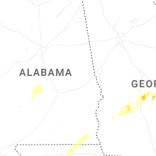


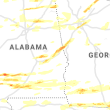


Connect with Interactive Hail Maps