

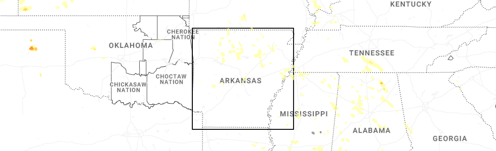
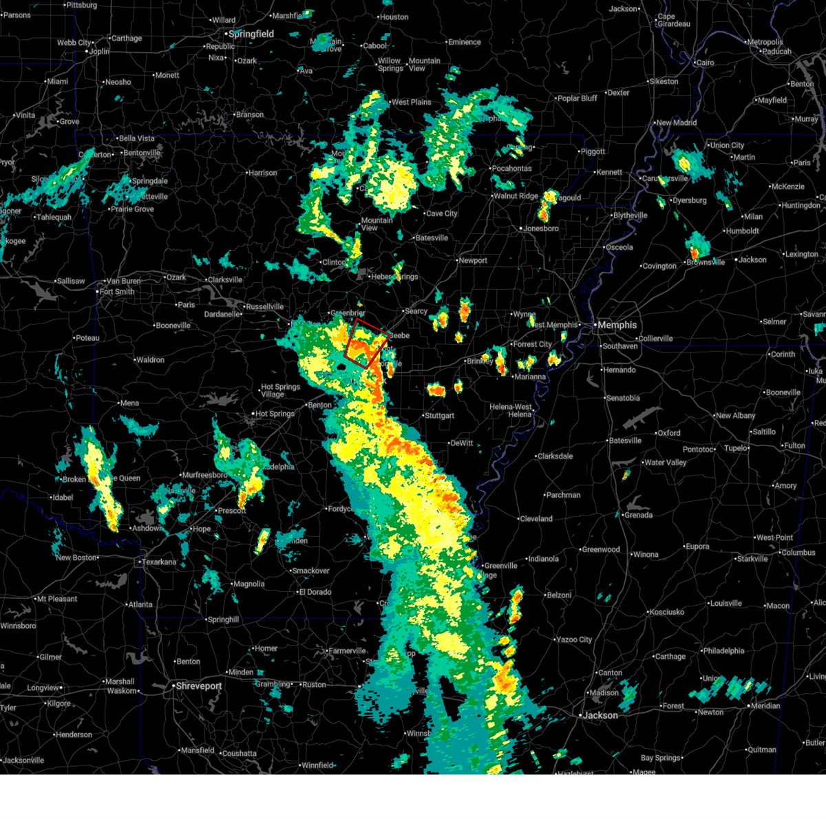
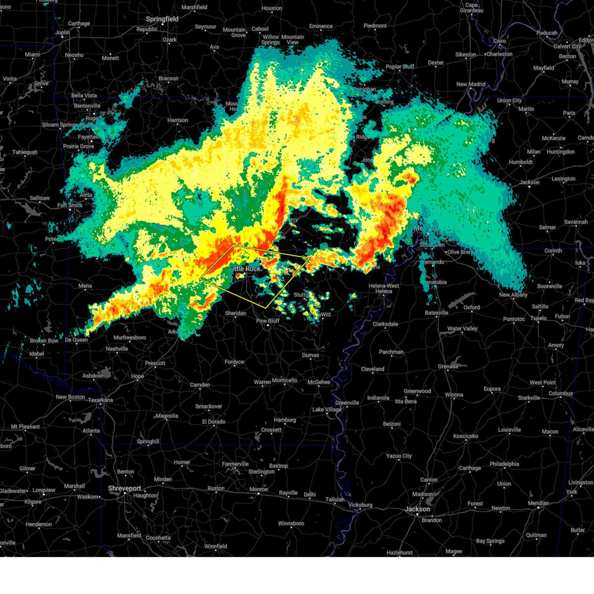
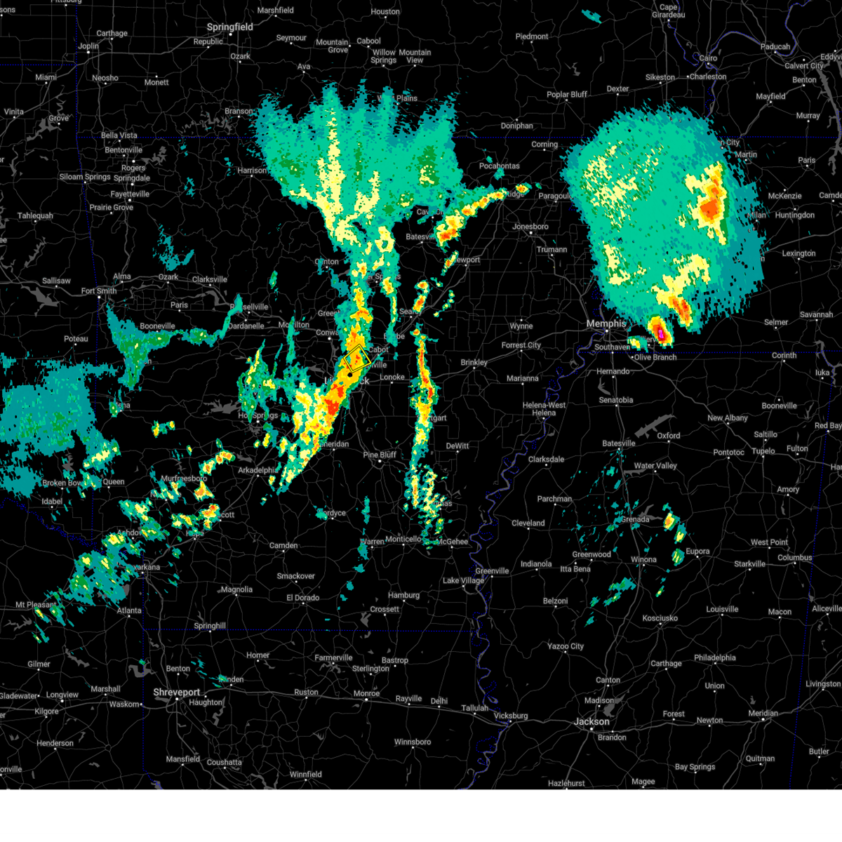
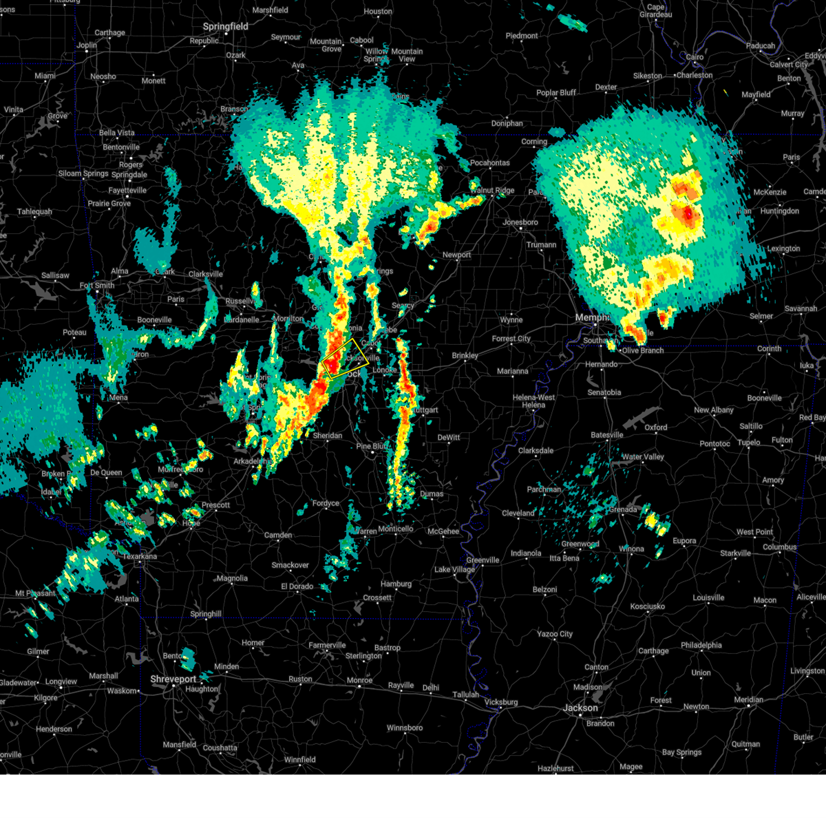
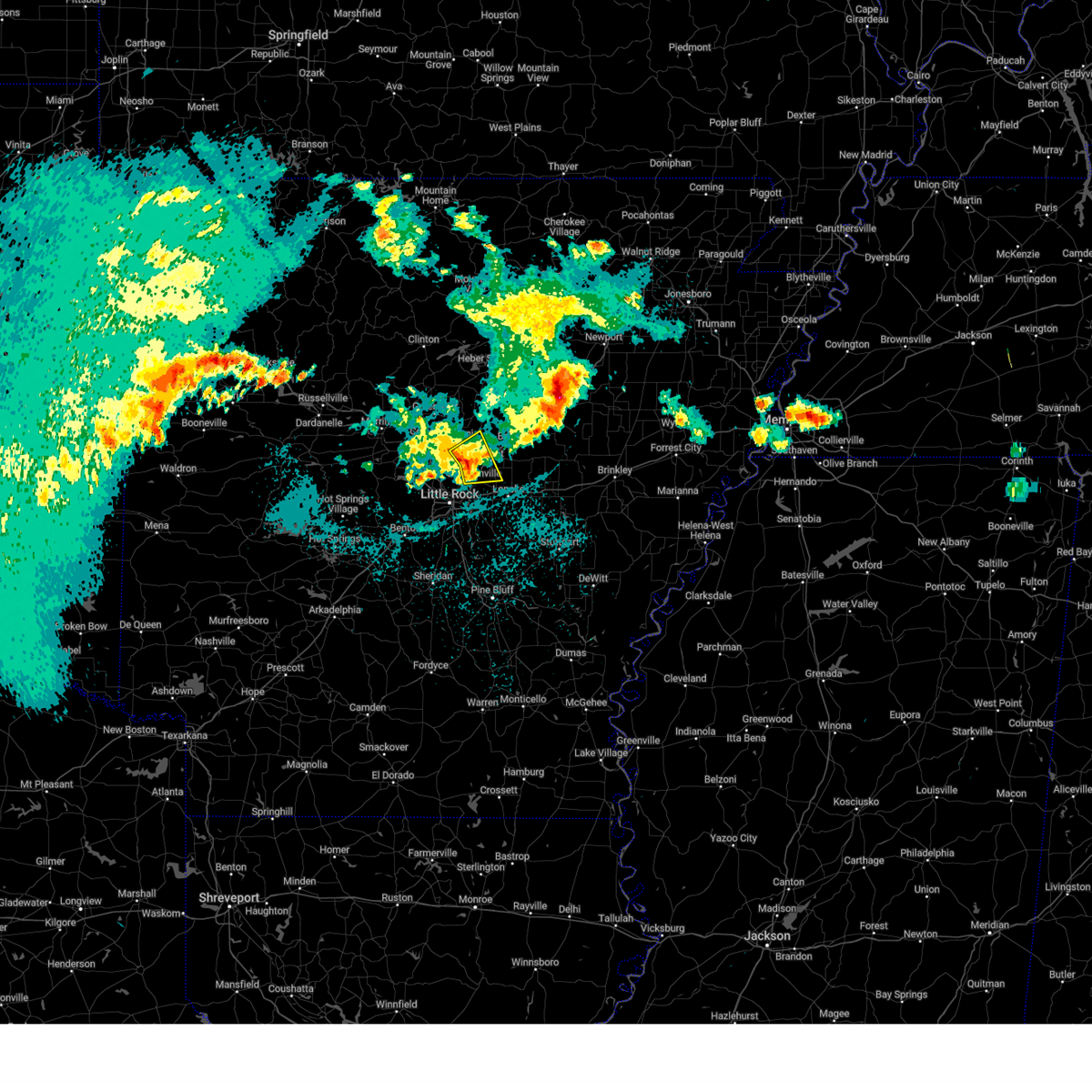
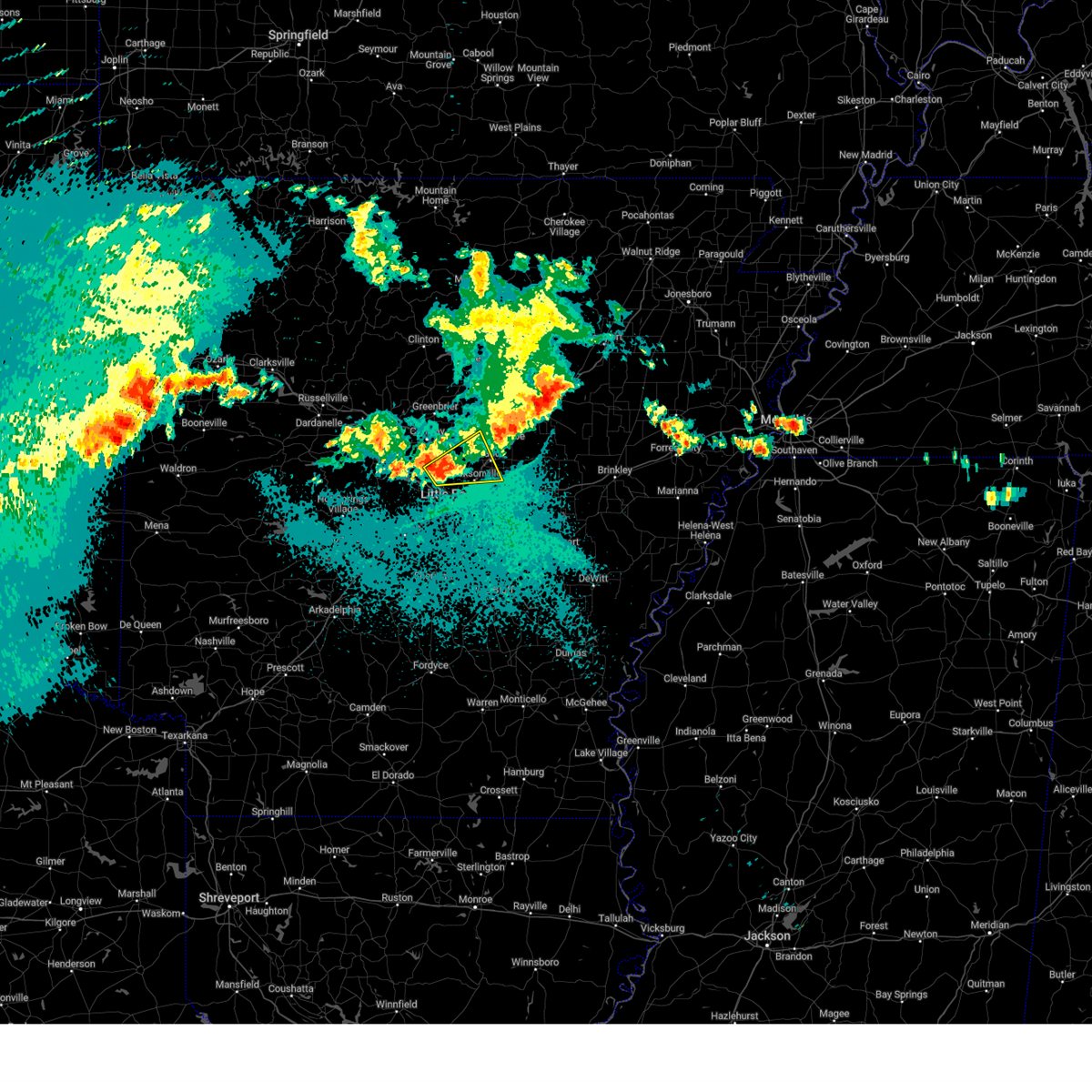
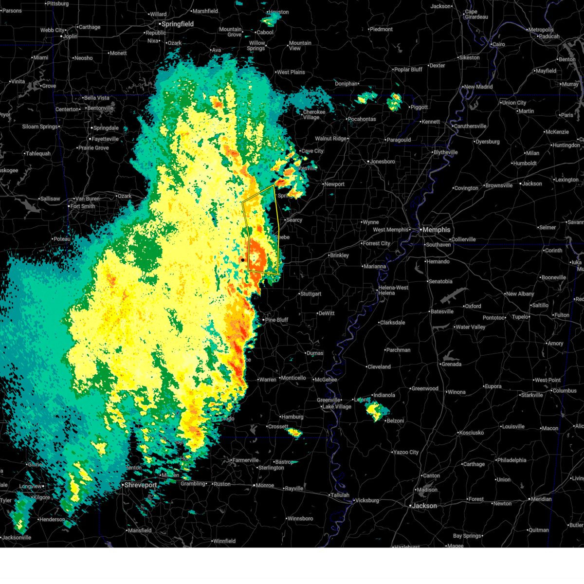
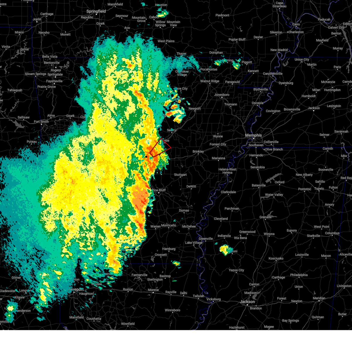
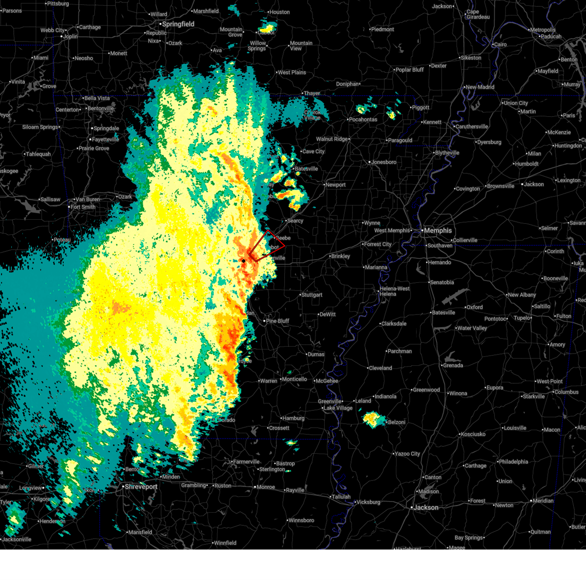
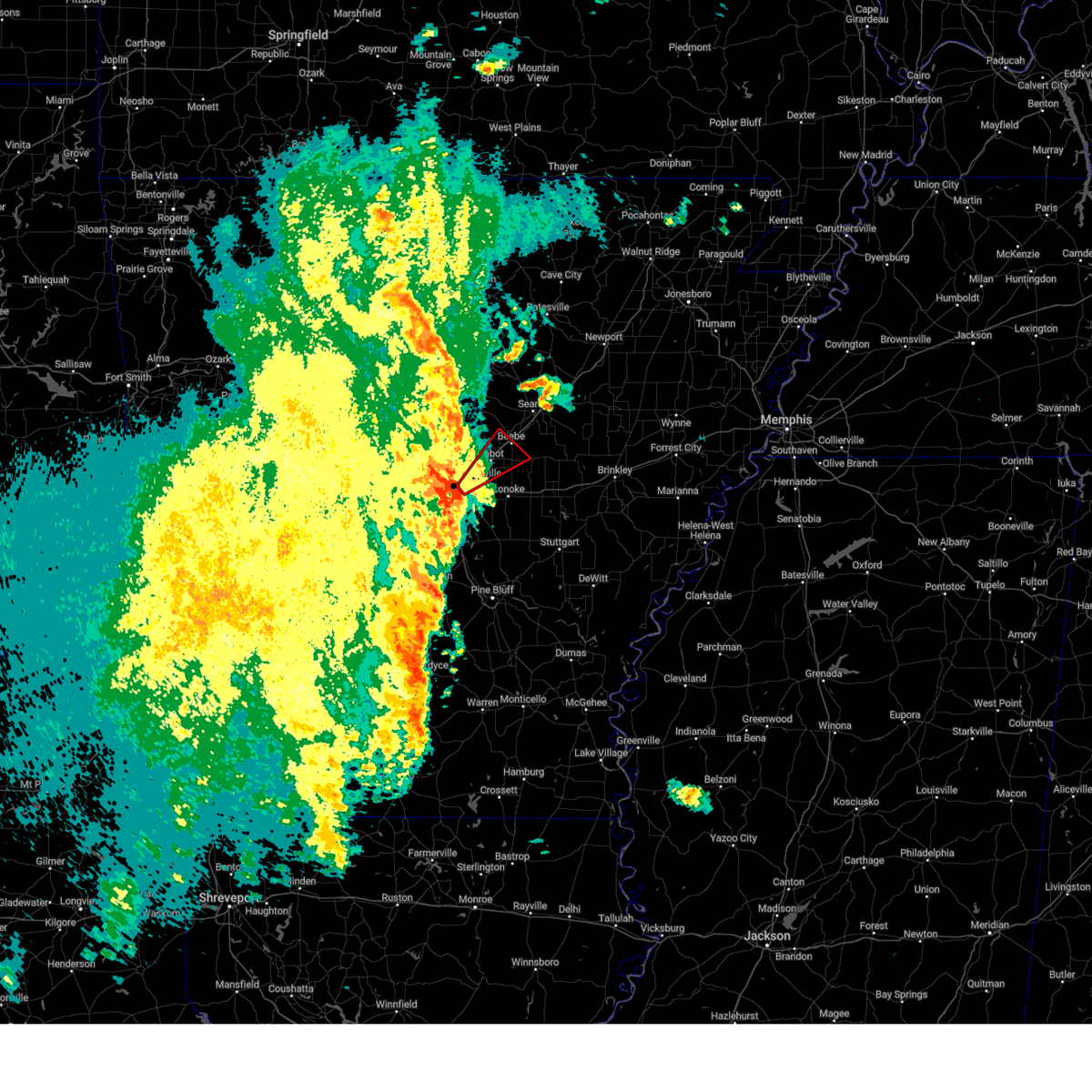
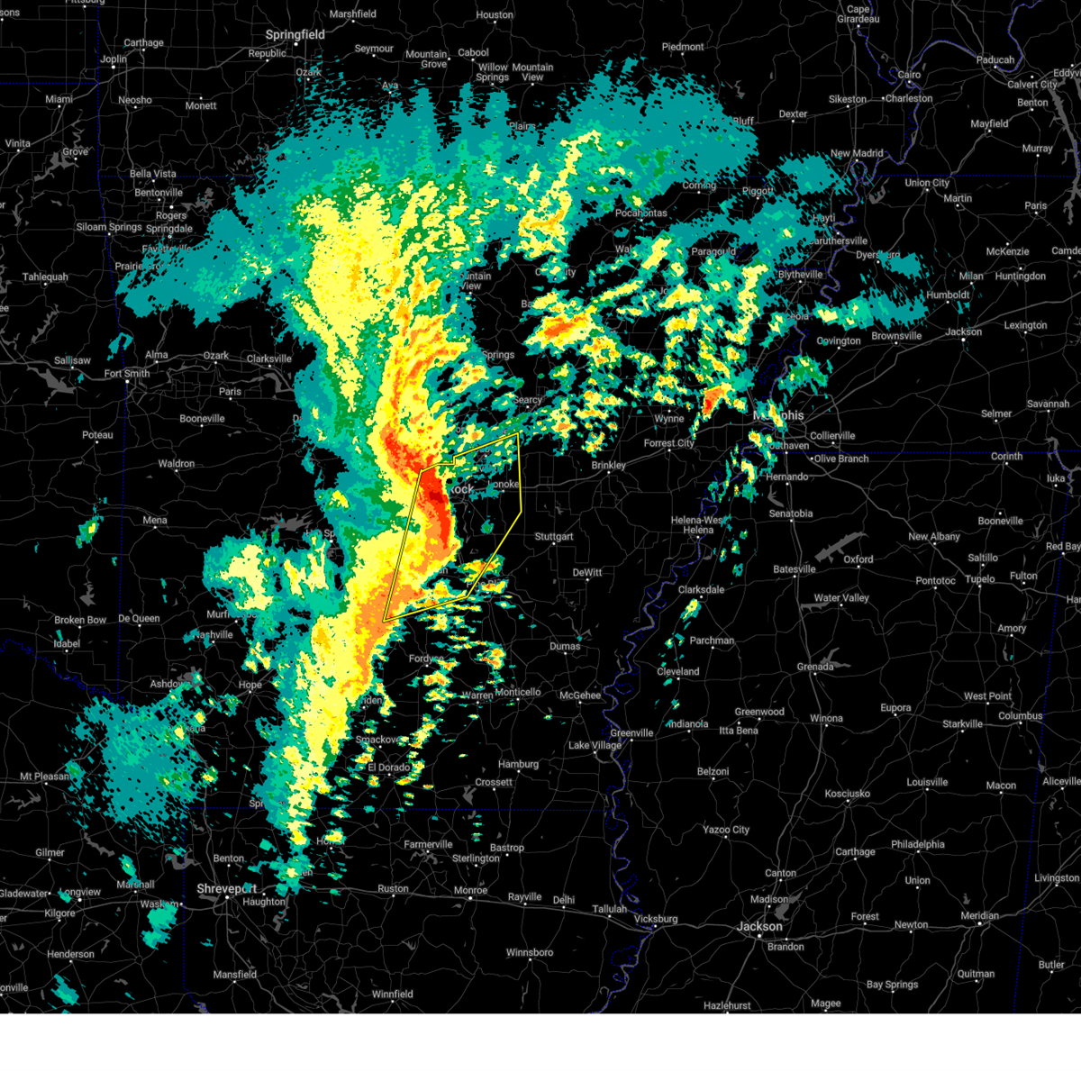
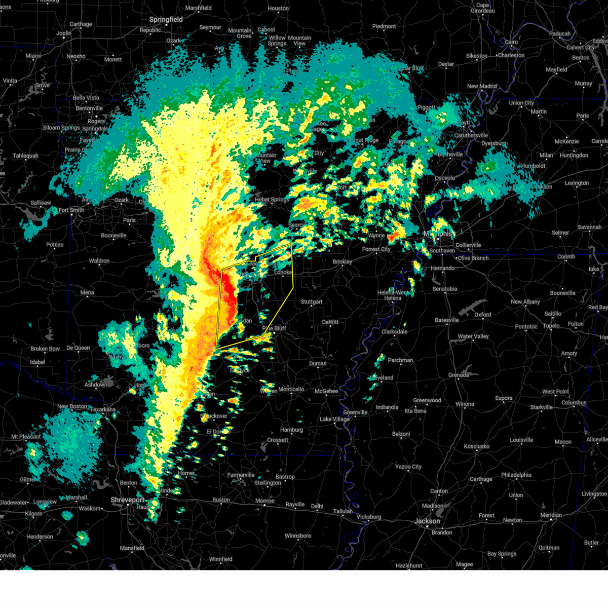
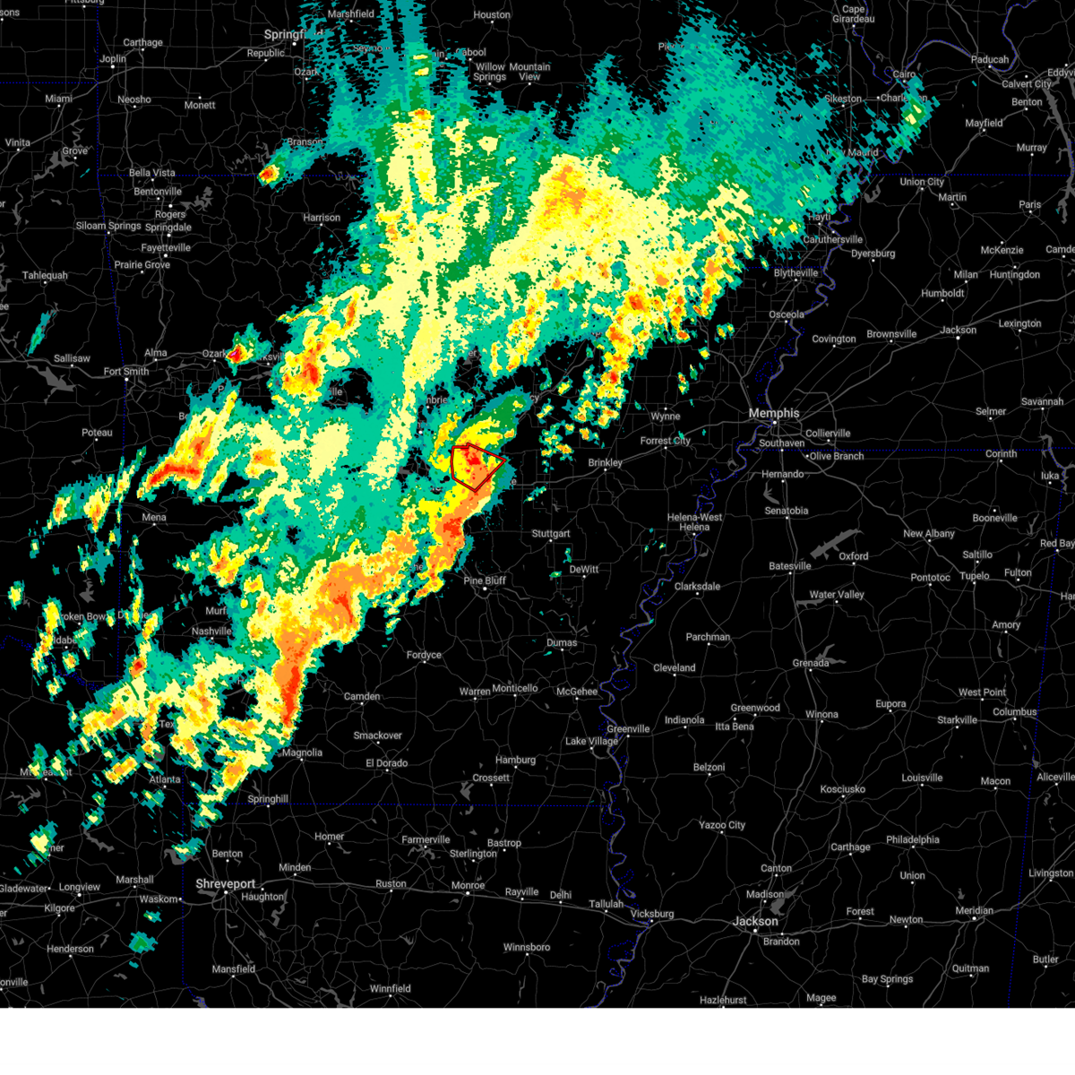
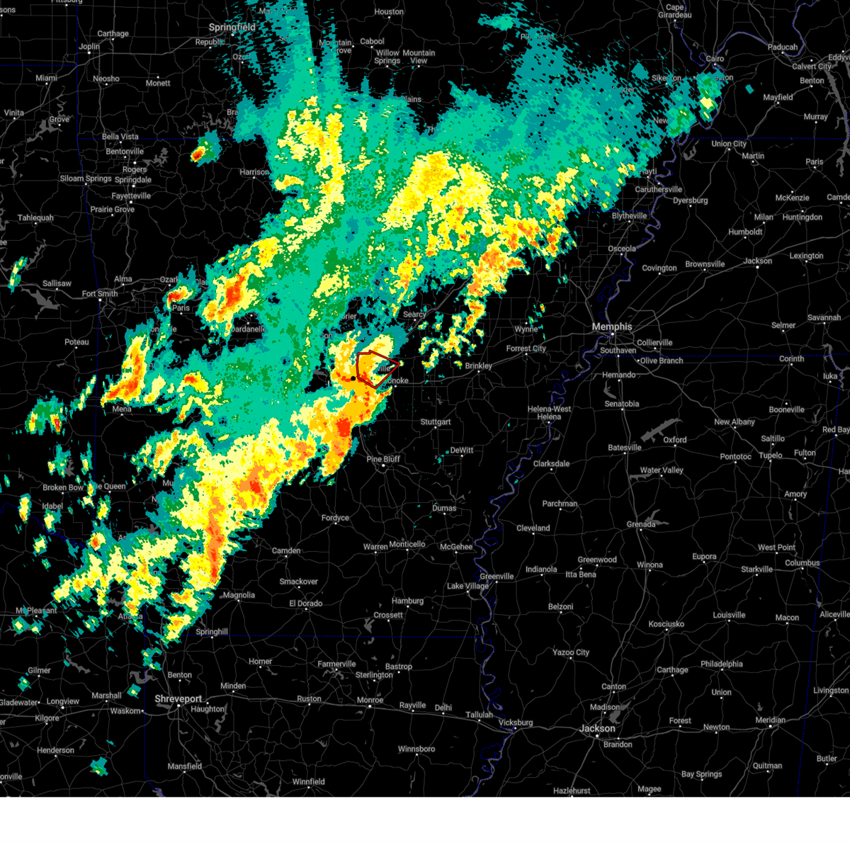
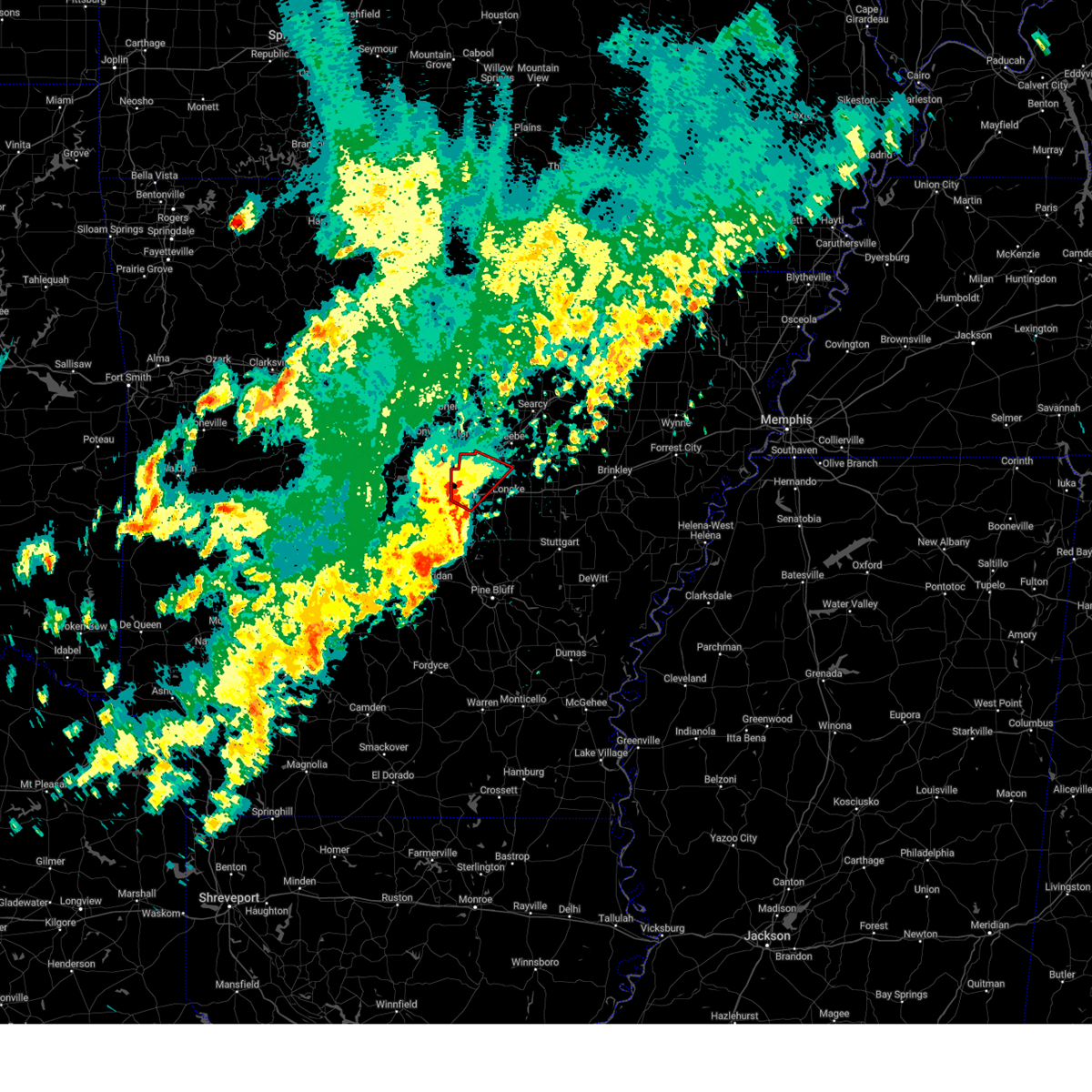
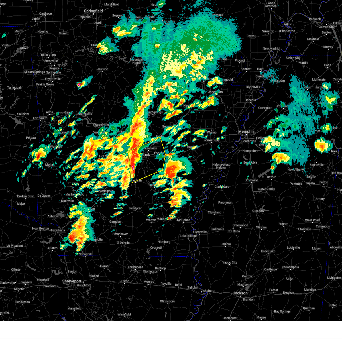
Hail Map for Sherwood, AR
The Sherwood, AR area has had 12 reports of on-the-ground hail by trained spotters, and has been under severe weather warnings 17 times during the past 12 months. Doppler radar has detected hail at or near Sherwood, AR on 93 occasions, including 1 occasion during the past year.
| Name: | Sherwood, AR |
| Where Located: | 8 miles NNE of Little Rock, AR |
| Map: | Google Map for Sherwood, AR |
| Population: | 29523 |
| Housing Units: | 12924 |
| More Info: | Search Google for Sherwood, AR |
2
The Top Recent Hail Date for Sherwood, AR is Monday, June 1, 2026 (24th out of 93)
Hail and Wind Damage Spotted near Sherwood, AR
| Date / Time | Report Details |
|---|---|
| 5/31/2026 7:06 PM CDT |
 The storm which prompted the warning has weakened below severe limits, and no longer poses an immediate threat to life or property. therefore, the warning will be allowed to expire. however gusty winds and heavy rain are still possible with this thunderstorm. The storm which prompted the warning has weakened below severe limits, and no longer poses an immediate threat to life or property. therefore, the warning will be allowed to expire. however gusty winds and heavy rain are still possible with this thunderstorm.
|
| 5/31/2026 6:37 PM CDT |
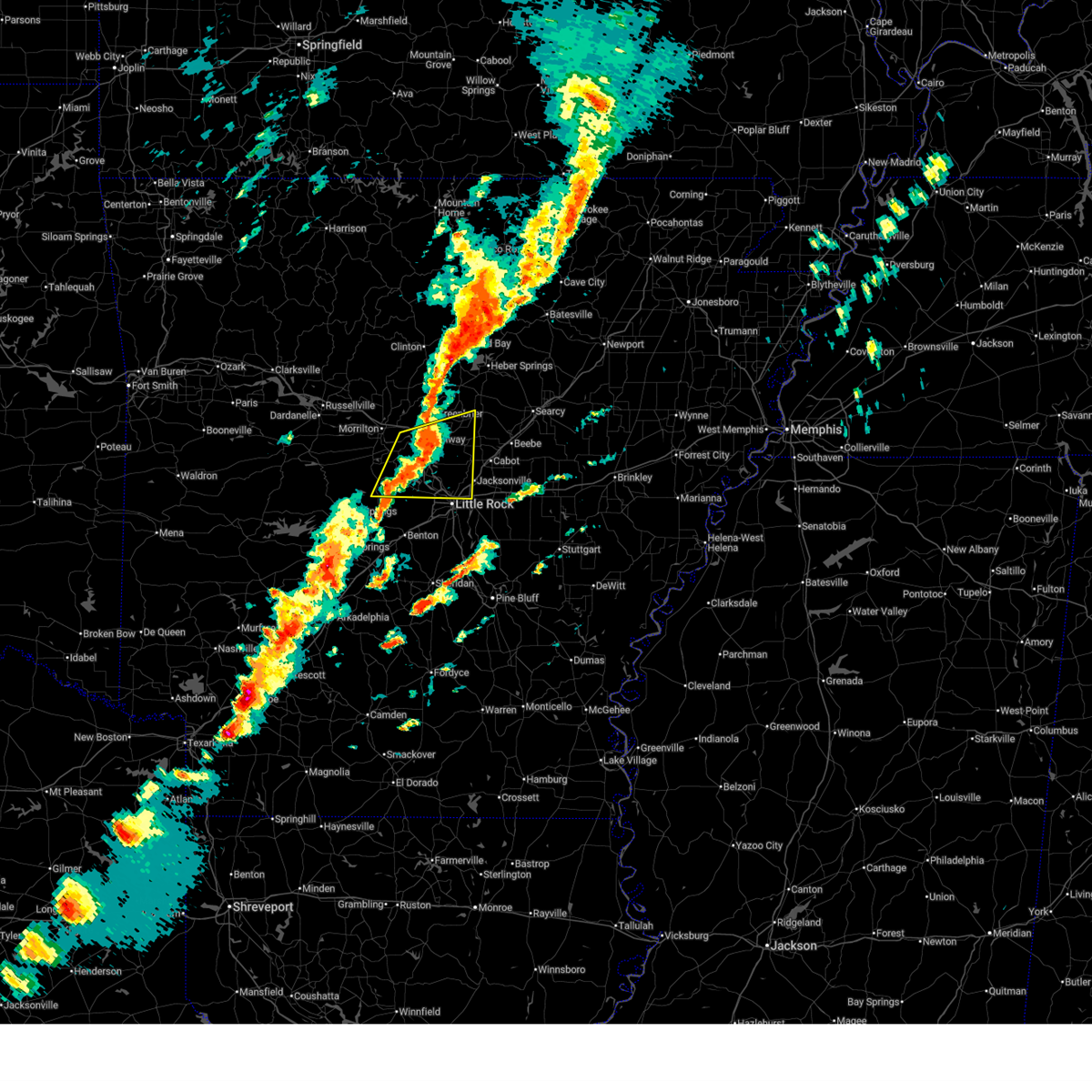
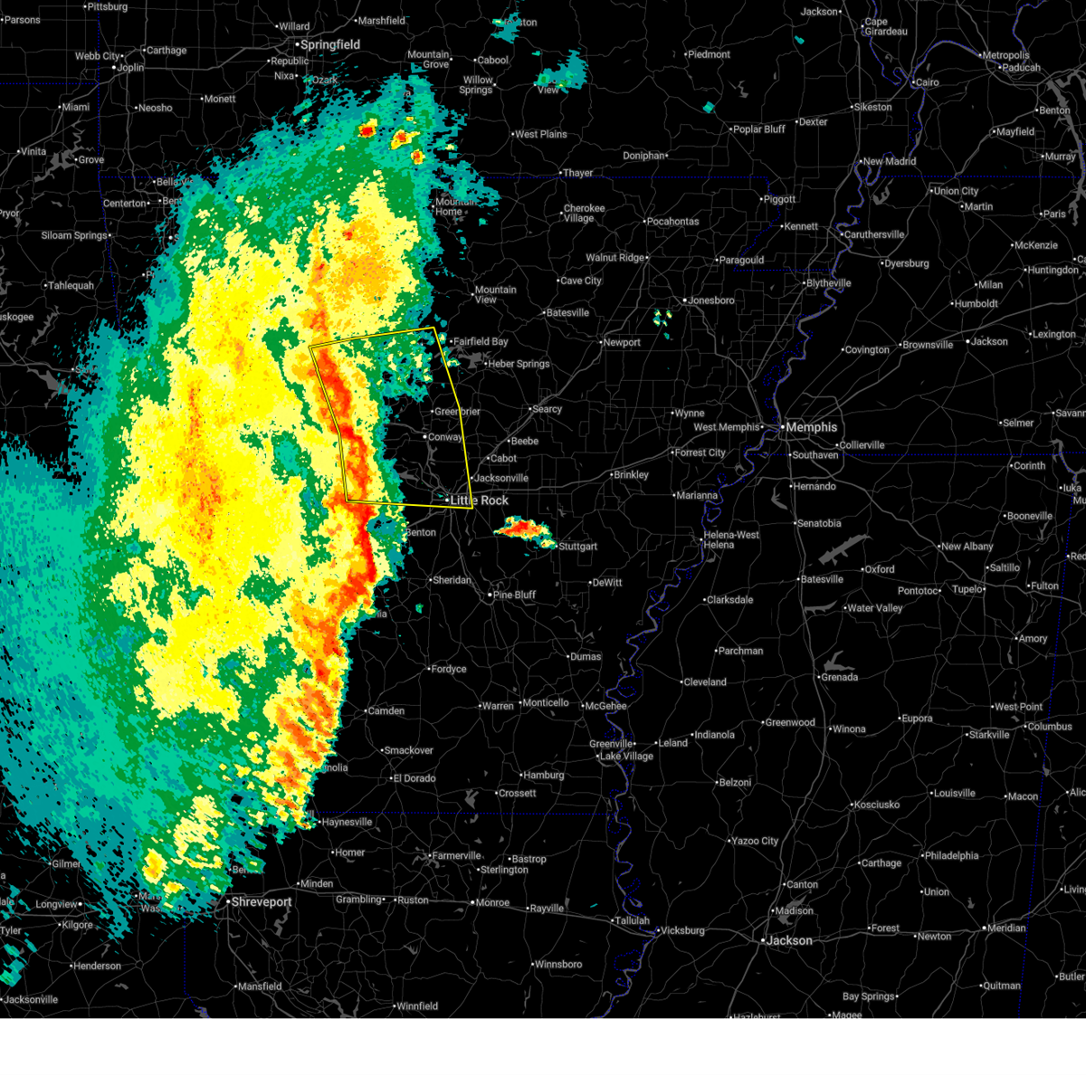
 Svrlzk the national weather service in little rock has issued a * severe thunderstorm warning for, west central lonoke county in central arkansas, east central pulaski county in central arkansas, * until 715 pm cdt. * at 637 pm cdt, a severe thunderstorm was located near south bend, or near jacksonville, and is nearly stationary (radar indicated). Hazards include 60 mph wind gusts and quarter size hail. Hail damage to vehicles is expected. Expect wind damage to roofs, siding, and trees. Svrlzk the national weather service in little rock has issued a * severe thunderstorm warning for, west central lonoke county in central arkansas, east central pulaski county in central arkansas, * until 715 pm cdt. * at 637 pm cdt, a severe thunderstorm was located near south bend, or near jacksonville, and is nearly stationary (radar indicated). Hazards include 60 mph wind gusts and quarter size hail. Hail damage to vehicles is expected. Expect wind damage to roofs, siding, and trees.
|
| 4/28/2026 2:19 PM CDT |
 At 219 pm cdt, a severe thunderstorm was located over olmstead, or near little rock afb, moving northeast at 40 mph (radar indicated). Hazards include 60 mph wind gusts and penny size hail. Expect damage to roofs, siding, and trees. Locations impacted include, north little rock, sherwood, jacksonville, cabot, north little rock airport, little rock afb, vilonia, austin in lonoke county, protho junction, gibson, lakewood, gravel ridge, camp robinson, sylvan hills, mcalmont, olmstead, oak grove in pulaski county, levy, amboy, macon,. At 219 pm cdt, a severe thunderstorm was located over olmstead, or near little rock afb, moving northeast at 40 mph (radar indicated). Hazards include 60 mph wind gusts and penny size hail. Expect damage to roofs, siding, and trees. Locations impacted include, north little rock, sherwood, jacksonville, cabot, north little rock airport, little rock afb, vilonia, austin in lonoke county, protho junction, gibson, lakewood, gravel ridge, camp robinson, sylvan hills, mcalmont, olmstead, oak grove in pulaski county, levy, amboy, macon,.
|
| 4/28/2026 2:13 PM CDT |
 At 212 pm cdt, a severe thunderstorm was located over levy, or over north little rock airport, moving northeast at 40 mph (radar indicated). Hazards include 60 mph wind gusts and penny size hail. Expect damage to roofs, siding, and trees. Locations impacted include, little rock, north little rock, sherwood, jacksonville, cabot, west little rock, maumelle, downtown little rock, north little rock airport, little rock afb, southwest little rock, vilonia, austin in lonoke county, argenta, burns park, gravel ridge, marche, oak grove in pulaski county, olmstead, protho junction,. At 212 pm cdt, a severe thunderstorm was located over levy, or over north little rock airport, moving northeast at 40 mph (radar indicated). Hazards include 60 mph wind gusts and penny size hail. Expect damage to roofs, siding, and trees. Locations impacted include, little rock, north little rock, sherwood, jacksonville, cabot, west little rock, maumelle, downtown little rock, north little rock airport, little rock afb, southwest little rock, vilonia, austin in lonoke county, argenta, burns park, gravel ridge, marche, oak grove in pulaski county, olmstead, protho junction,.
|
| 4/28/2026 2:02 PM CDT |
 Svrlzk the national weather service in little rock has issued a * severe thunderstorm warning for, northwestern lonoke county in central arkansas, southeastern faulkner county in central arkansas, central pulaski county in central arkansas, * until 245 pm cdt. * at 202 pm cdt, a severe thunderstorm was located over southwest little rock, moving northeast at 50 mph (radar indicated). Hazards include 60 mph wind gusts and penny size hail. expect damage to roofs, siding, and trees Svrlzk the national weather service in little rock has issued a * severe thunderstorm warning for, northwestern lonoke county in central arkansas, southeastern faulkner county in central arkansas, central pulaski county in central arkansas, * until 245 pm cdt. * at 202 pm cdt, a severe thunderstorm was located over southwest little rock, moving northeast at 50 mph (radar indicated). Hazards include 60 mph wind gusts and penny size hail. expect damage to roofs, siding, and trees
|
| 3/15/2026 5:24 PM CDT |
 the severe thunderstorm warning has been cancelled and is no longer in effect the severe thunderstorm warning has been cancelled and is no longer in effect
|
| 3/15/2026 5:21 PM CDT |
 The severe thunderstorm which prompted the warning has weakened. therefore, the warning will be allowed to expire. a tornado watch remains in effect until 900 pm cdt for central arkansas. The severe thunderstorm which prompted the warning has weakened. therefore, the warning will be allowed to expire. a tornado watch remains in effect until 900 pm cdt for central arkansas.
|
| 3/15/2026 5:19 PM CDT |
 the severe thunderstorm warning has been cancelled and is no longer in effect the severe thunderstorm warning has been cancelled and is no longer in effect
|
| 3/15/2026 5:19 PM CDT |
 At 518 pm cdt, a severe thunderstorm was located near vilonia, or 9 miles northwest of cabot, moving east at 55 mph (radar indicated). Hazards include 60 mph wind gusts and quarter size hail. Hail damage to vehicles is expected. expect wind damage to roofs, siding, and trees. Locations impacted include, little rock, north little rock, sherwood, jacksonville, north little rock airport, little rock afb, vilonia, enola, mount vernon, burns park, gravel ridge, oak grove in pulaski county, olmstead, protho junction, gibson, lakewood, camp robinson, sylvan hills, levy, mcalmont,. At 518 pm cdt, a severe thunderstorm was located near vilonia, or 9 miles northwest of cabot, moving east at 55 mph (radar indicated). Hazards include 60 mph wind gusts and quarter size hail. Hail damage to vehicles is expected. expect wind damage to roofs, siding, and trees. Locations impacted include, little rock, north little rock, sherwood, jacksonville, north little rock airport, little rock afb, vilonia, enola, mount vernon, burns park, gravel ridge, oak grove in pulaski county, olmstead, protho junction, gibson, lakewood, camp robinson, sylvan hills, levy, mcalmont,.
|
| 3/15/2026 5:13 PM CDT |
 Svrlzk the national weather service in little rock has issued a * severe thunderstorm warning for, northwestern prairie county in central arkansas, southwestern cleburne county in north central arkansas, northern lonoke county in central arkansas, eastern faulkner county in central arkansas, southwestern white county in central arkansas, northeastern pulaski county in central arkansas, * until 600 pm cdt. * at 513 pm cdt, severe thunderstorms were located along a line extending from woolly hollow state park to near olmstead, moving east at 50 mph (radar indicated). Hazards include 60 mph wind gusts and quarter size hail. Hail damage to vehicles is expected. Expect wind damage to roofs, siding, and trees. Svrlzk the national weather service in little rock has issued a * severe thunderstorm warning for, northwestern prairie county in central arkansas, southwestern cleburne county in north central arkansas, northern lonoke county in central arkansas, eastern faulkner county in central arkansas, southwestern white county in central arkansas, northeastern pulaski county in central arkansas, * until 600 pm cdt. * at 513 pm cdt, severe thunderstorms were located along a line extending from woolly hollow state park to near olmstead, moving east at 50 mph (radar indicated). Hazards include 60 mph wind gusts and quarter size hail. Hail damage to vehicles is expected. Expect wind damage to roofs, siding, and trees.
|
| 3/15/2026 4:56 PM CDT |
 At 455 pm cdt, a severe thunderstorm was located near mayflower, or near conway, moving east at 55 mph (radar indicated). Hazards include 60 mph wind gusts and quarter size hail. Hail damage to vehicles is expected. expect wind damage to roofs, siding, and trees. Locations impacted include, little rock, north little rock, conway, sherwood, jacksonville, west little rock, maumelle, north little rock airport, little rock afb, vilonia, mayflower, enola, menifee, mount vernon, little italy, gravel ridge, olmstead, roland in pulaski county, protho junction, toad suck,. At 455 pm cdt, a severe thunderstorm was located near mayflower, or near conway, moving east at 55 mph (radar indicated). Hazards include 60 mph wind gusts and quarter size hail. Hail damage to vehicles is expected. expect wind damage to roofs, siding, and trees. Locations impacted include, little rock, north little rock, conway, sherwood, jacksonville, west little rock, maumelle, north little rock airport, little rock afb, vilonia, mayflower, enola, menifee, mount vernon, little italy, gravel ridge, olmstead, roland in pulaski county, protho junction, toad suck,.
|
| 3/15/2026 4:39 PM CDT |
 Svrlzk the national weather service in little rock has issued a * severe thunderstorm warning for, eastern perry county in central arkansas, southeastern conway county in central arkansas, faulkner county in central arkansas, northwestern saline county in central arkansas, northern pulaski county in central arkansas, * until 530 pm cdt. * at 439 pm cdt, a severe thunderstorm was located near williams junction, or near perryville, moving east at 55 mph (radar indicated). Hazards include 60 mph wind gusts and quarter size hail. Hail damage to vehicles is expected. Expect wind damage to roofs, siding, and trees. Svrlzk the national weather service in little rock has issued a * severe thunderstorm warning for, eastern perry county in central arkansas, southeastern conway county in central arkansas, faulkner county in central arkansas, northwestern saline county in central arkansas, northern pulaski county in central arkansas, * until 530 pm cdt. * at 439 pm cdt, a severe thunderstorm was located near williams junction, or near perryville, moving east at 55 mph (radar indicated). Hazards include 60 mph wind gusts and quarter size hail. Hail damage to vehicles is expected. Expect wind damage to roofs, siding, and trees.
|
| 8/19/2025 3:45 PM CDT |
 The storms which prompted the warning have weakened below severe limits, and no longer pose an immediate threat to life or property. therefore, the warning has been allowed to expire. however gusty winds are still possible with these thunderstorms. The storms which prompted the warning have weakened below severe limits, and no longer pose an immediate threat to life or property. therefore, the warning has been allowed to expire. however gusty winds are still possible with these thunderstorms.
|
| 8/19/2025 3:09 PM CDT |
 At 308 pm cdt, severe thunderstorms were located along a line extending from near jacksonville to levy to chenal valley, moving south at 30 mph (radar indicated). Hazards include 60 mph wind gusts and penny size hail. Expect damage to roofs, siding, and trees. Locations impacted include, little rock, north little rock, benton, sherwood, jacksonville, cabot, west little rock, maumelle, bryant, downtown little rock, lonoke, north little rock airport, little rock afb, southwest little rock, shannon hills, england, mayflower, wrightsville, austin in lonoke county, argenta,. At 308 pm cdt, severe thunderstorms were located along a line extending from near jacksonville to levy to chenal valley, moving south at 30 mph (radar indicated). Hazards include 60 mph wind gusts and penny size hail. Expect damage to roofs, siding, and trees. Locations impacted include, little rock, north little rock, benton, sherwood, jacksonville, cabot, west little rock, maumelle, bryant, downtown little rock, lonoke, north little rock airport, little rock afb, southwest little rock, shannon hills, england, mayflower, wrightsville, austin in lonoke county, argenta,.
|
| 8/19/2025 2:54 PM CDT |
 Svrlzk the national weather service in little rock has issued a * severe thunderstorm warning for, western lonoke county in central arkansas, southwestern faulkner county in central arkansas, eastern saline county in central arkansas, pulaski county in central arkansas, * until 345 pm cdt. * at 254 pm cdt, severe thunderstorms were located along a line extending from little rock afb to near camp robinson to near pinnacle mountain state park, moving south at 25 mph (radar indicated). Hazards include 60 mph wind gusts and penny size hail. expect damage to roofs, siding, and trees Svrlzk the national weather service in little rock has issued a * severe thunderstorm warning for, western lonoke county in central arkansas, southwestern faulkner county in central arkansas, eastern saline county in central arkansas, pulaski county in central arkansas, * until 345 pm cdt. * at 254 pm cdt, severe thunderstorms were located along a line extending from little rock afb to near camp robinson to near pinnacle mountain state park, moving south at 25 mph (radar indicated). Hazards include 60 mph wind gusts and penny size hail. expect damage to roofs, siding, and trees
|
| 6/30/2025 11:21 PM CDT |
 the severe thunderstorm warning has been cancelled and is no longer in effect the severe thunderstorm warning has been cancelled and is no longer in effect
|
| 6/30/2025 11:03 PM CDT | Storm damage reported in pulaski county AR, 3.5 miles SE of Sherwood, AR |
| 6/30/2025 11:02 PM CDT |
 Svrlzk the national weather service in little rock has issued a * severe thunderstorm warning for, northern lonoke county in central arkansas, south central faulkner county in central arkansas, northeastern pulaski county in central arkansas, * until 1145 pm cdt. * at 1102 pm cdt, a severe thunderstorm was located over gibson, or near little rock afb, moving southeast at 25 mph (radar indicated). Hazards include 60 mph wind gusts and penny size hail. expect damage to roofs, siding, and trees Svrlzk the national weather service in little rock has issued a * severe thunderstorm warning for, northern lonoke county in central arkansas, south central faulkner county in central arkansas, northeastern pulaski county in central arkansas, * until 1145 pm cdt. * at 1102 pm cdt, a severe thunderstorm was located over gibson, or near little rock afb, moving southeast at 25 mph (radar indicated). Hazards include 60 mph wind gusts and penny size hail. expect damage to roofs, siding, and trees
|
| 6/18/2025 6:46 AM CDT |
 At 645 am cdt, a severe thunderstorm was located over little rock afb, moving east at 45 mph (radar indicated). Hazards include 60 mph wind gusts and quarter size hail. Hail damage to vehicles is expected. expect wind damage to roofs, siding, and trees. Locations impacted include, little rock, north little rock, sherwood, jacksonville, cabot, west little rock, maumelle, lonoke, north little rock airport, little rock afb, ward, mayflower, austin in lonoke county, old austin, parnell, gravel ridge, meto, olmstead, roland in pulaski county, and protho junction. At 645 am cdt, a severe thunderstorm was located over little rock afb, moving east at 45 mph (radar indicated). Hazards include 60 mph wind gusts and quarter size hail. Hail damage to vehicles is expected. expect wind damage to roofs, siding, and trees. Locations impacted include, little rock, north little rock, sherwood, jacksonville, cabot, west little rock, maumelle, lonoke, north little rock airport, little rock afb, ward, mayflower, austin in lonoke county, old austin, parnell, gravel ridge, meto, olmstead, roland in pulaski county, and protho junction.
|
| 6/18/2025 6:16 AM CDT |
 Svrlzk the national weather service in little rock has issued a * severe thunderstorm warning for, northwestern lonoke county in central arkansas, southern faulkner county in central arkansas, northern pulaski county in central arkansas, * until 700 am cdt. * at 616 am cdt, a severe thunderstorm was located over roland in pulaski county, or near maumelle, moving east at 45 mph (radar indicated). Hazards include 60 mph wind gusts and penny size hail. expect damage to roofs, siding, and trees Svrlzk the national weather service in little rock has issued a * severe thunderstorm warning for, northwestern lonoke county in central arkansas, southern faulkner county in central arkansas, northern pulaski county in central arkansas, * until 700 am cdt. * at 616 am cdt, a severe thunderstorm was located over roland in pulaski county, or near maumelle, moving east at 45 mph (radar indicated). Hazards include 60 mph wind gusts and penny size hail. expect damage to roofs, siding, and trees
|
| 6/12/2025 4:06 PM CDT |
 The storm which prompted the warning has weakened below severe limits, and no longer appears capable of producing a tornado. therefore, the warning will be allowed to expire. however heavy rain is still possible with this thunderstorm. The storm which prompted the warning has weakened below severe limits, and no longer appears capable of producing a tornado. therefore, the warning will be allowed to expire. however heavy rain is still possible with this thunderstorm.
|
| 6/12/2025 3:55 PM CDT |
 Torlzk the national weather service in little rock has issued a * tornado warning for, northwestern lonoke county in central arkansas, southeastern faulkner county in central arkansas, southwestern white county in central arkansas, northeastern pulaski county in central arkansas, * until 415 pm cdt. * at 354 pm cdt, a severe thunderstorm capable of producing a tornado was located near little rock afb, moving northeast at 35 mph (radar indicated rotation). Hazards include tornado. Flying debris will be dangerous to those caught without shelter. mobile homes will be damaged or destroyed. damage to roofs, windows, and vehicles will occur. Tree damage is likely. Torlzk the national weather service in little rock has issued a * tornado warning for, northwestern lonoke county in central arkansas, southeastern faulkner county in central arkansas, southwestern white county in central arkansas, northeastern pulaski county in central arkansas, * until 415 pm cdt. * at 354 pm cdt, a severe thunderstorm capable of producing a tornado was located near little rock afb, moving northeast at 35 mph (radar indicated rotation). Hazards include tornado. Flying debris will be dangerous to those caught without shelter. mobile homes will be damaged or destroyed. damage to roofs, windows, and vehicles will occur. Tree damage is likely.
|
| 6/7/2025 9:14 AM CDT | Several reports of large limbs down in sherwoo in pulaski county AR, 1.6 miles NNW of Sherwood, AR |
| 6/7/2025 9:14 AM CDT |
 At 913 am cdt, severe thunderstorms were located along a line extending from near mccreanor to near shannon hills, moving southeast at 55 mph (radar indicated). Hazards include 60 mph wind gusts and quarter size hail. Hail damage to vehicles is expected. expect wind damage to roofs, siding, and trees. Locations impacted include, park hill, otter creek, england, furlow, parnell, college station, carlisle, north little rock, gravel ridge, ironton, quapaw quarter, estes, hillcrest neighborhood, meto, kerr, parkers-iron springs, jacksonville, bevis corner, blakemore, olmstead,. At 913 am cdt, severe thunderstorms were located along a line extending from near mccreanor to near shannon hills, moving southeast at 55 mph (radar indicated). Hazards include 60 mph wind gusts and quarter size hail. Hail damage to vehicles is expected. expect wind damage to roofs, siding, and trees. Locations impacted include, park hill, otter creek, england, furlow, parnell, college station, carlisle, north little rock, gravel ridge, ironton, quapaw quarter, estes, hillcrest neighborhood, meto, kerr, parkers-iron springs, jacksonville, bevis corner, blakemore, olmstead,.
|
| 6/7/2025 9:07 AM CDT |
 The storms which prompted the warning have weakened below severe limits, wind gusts up to 45 mph are still possible through 915 am. a tornado watch remains in effect until noon cdt for central, eastern and north central arkansas. The storms which prompted the warning have weakened below severe limits, wind gusts up to 45 mph are still possible through 915 am. a tornado watch remains in effect until noon cdt for central, eastern and north central arkansas.
|
| 6/7/2025 8:53 AM CDT |
 Svrlzk the national weather service in little rock has issued a * severe thunderstorm warning for, west central prairie county in central arkansas, lonoke county in central arkansas, northeastern grant county in central arkansas, southwestern faulkner county in central arkansas, northwestern jefferson county in southeastern arkansas, central saline county in central arkansas, pulaski county in central arkansas, * until 945 am cdt. * at 853 am cdt, severe thunderstorms were located along a line extending from 6 miles northwest of olmstead to 11 miles northwest of salem in saline county, moving southeast at 50 mph (radar indicated). Hazards include 60 mph wind gusts and quarter size hail. Hail damage to vehicles is expected. Expect wind damage to roofs, siding, and trees. Svrlzk the national weather service in little rock has issued a * severe thunderstorm warning for, west central prairie county in central arkansas, lonoke county in central arkansas, northeastern grant county in central arkansas, southwestern faulkner county in central arkansas, northwestern jefferson county in southeastern arkansas, central saline county in central arkansas, pulaski county in central arkansas, * until 945 am cdt. * at 853 am cdt, severe thunderstorms were located along a line extending from 6 miles northwest of olmstead to 11 miles northwest of salem in saline county, moving southeast at 50 mph (radar indicated). Hazards include 60 mph wind gusts and quarter size hail. Hail damage to vehicles is expected. Expect wind damage to roofs, siding, and trees.
|
| 6/7/2025 8:34 AM CDT |
 Svrlzk the national weather service in little rock has issued a * severe thunderstorm warning for, northwestern woodruff county in eastern arkansas, southern independence county in north central arkansas, northern prairie county in central arkansas, southwestern jackson county in eastern arkansas, eastern cleburne county in north central arkansas, northern lonoke county in central arkansas, southeastern faulkner county in central arkansas, white county in central arkansas, northeastern pulaski county in central arkansas, * until 915 am cdt. * at 833 am cdt, severe thunderstorms were located along a line extending from 6 miles northeast of heber springs to near mount vernon to mayflower, moving southeast at 45 mph (radar indicated). Hazards include 60 mph wind gusts and quarter size hail. Hail damage to vehicles is expected. Expect wind damage to roofs, siding, and trees. Svrlzk the national weather service in little rock has issued a * severe thunderstorm warning for, northwestern woodruff county in eastern arkansas, southern independence county in north central arkansas, northern prairie county in central arkansas, southwestern jackson county in eastern arkansas, eastern cleburne county in north central arkansas, northern lonoke county in central arkansas, southeastern faulkner county in central arkansas, white county in central arkansas, northeastern pulaski county in central arkansas, * until 915 am cdt. * at 833 am cdt, severe thunderstorms were located along a line extending from 6 miles northeast of heber springs to near mount vernon to mayflower, moving southeast at 45 mph (radar indicated). Hazards include 60 mph wind gusts and quarter size hail. Hail damage to vehicles is expected. Expect wind damage to roofs, siding, and trees.
|
| 5/20/2025 4:28 AM CDT |
 The storms which prompted the warning have weakened below severe limits, and no longer pose an immediate threat to life or property. therefore, the warning will be allowed to expire. however gusty winds and heavy rain are still possible with these thunderstorms. a severe thunderstorm watch remains in effect until 800 am cdt for central and north central arkansas. The storms which prompted the warning have weakened below severe limits, and no longer pose an immediate threat to life or property. therefore, the warning will be allowed to expire. however gusty winds and heavy rain are still possible with these thunderstorms. a severe thunderstorm watch remains in effect until 800 am cdt for central and north central arkansas.
|
| 5/20/2025 4:13 AM CDT |
 At 412 am cdt, severe thunderstorms were located along a line extending from near woolly hollow state park to near enola to olmstead to downtown little rock, moving northeast at 60 mph (radar indicated). Hazards include 60 mph wind gusts. Expect damage to roofs, siding, and trees. Locations impacted include, park hill, wilburn, otter creek, old austin, furlow, antioch in white county, pearson, ironton, quapaw quarter, hillcrest neighborhood, meto, kerr, floyd, vilonia, olmstead, thurman, mccreanor, providence, macon, the heights,. At 412 am cdt, severe thunderstorms were located along a line extending from near woolly hollow state park to near enola to olmstead to downtown little rock, moving northeast at 60 mph (radar indicated). Hazards include 60 mph wind gusts. Expect damage to roofs, siding, and trees. Locations impacted include, park hill, wilburn, otter creek, old austin, furlow, antioch in white county, pearson, ironton, quapaw quarter, hillcrest neighborhood, meto, kerr, floyd, vilonia, olmstead, thurman, mccreanor, providence, macon, the heights,.
|
| 5/20/2025 4:13 AM CDT |
 the severe thunderstorm warning has been cancelled and is no longer in effect the severe thunderstorm warning has been cancelled and is no longer in effect
|
| 5/20/2025 4:12 AM CDT | Tree limbs blown dow in pulaski county AR, 3.5 miles SE of Sherwood, AR |
| 5/20/2025 3:58 AM CDT |
 At 357 am cdt, severe thunderstorms were located along a line extending from wooster to near pickles gap to maumelle to near bryant, moving northeast at 55 mph (radar indicated). Hazards include 60 mph wind gusts and penny size hail. Expect damage to roofs, siding, and trees. Locations impacted include, park hill, wilburn, otter creek, old austin, furlow, palarm, antioch in white county, mayflower, pearson, ironton, quapaw quarter, hillcrest neighborhood, meto, haskell, kerr, floyd, vilonia, olmstead, bryant, thurman,. At 357 am cdt, severe thunderstorms were located along a line extending from wooster to near pickles gap to maumelle to near bryant, moving northeast at 55 mph (radar indicated). Hazards include 60 mph wind gusts and penny size hail. Expect damage to roofs, siding, and trees. Locations impacted include, park hill, wilburn, otter creek, old austin, furlow, palarm, antioch in white county, mayflower, pearson, ironton, quapaw quarter, hillcrest neighborhood, meto, haskell, kerr, floyd, vilonia, olmstead, bryant, thurman,.
|
| 5/20/2025 3:48 AM CDT |
 Svrlzk the national weather service in little rock has issued a * severe thunderstorm warning for, southwestern independence county in north central arkansas, northeastern perry county in central arkansas, northwestern prairie county in central arkansas, southern cleburne county in north central arkansas, lonoke county in central arkansas, southeastern conway county in central arkansas, faulkner county in central arkansas, western white county in central arkansas, central saline county in central arkansas, pulaski county in central arkansas, * until 430 am cdt. * at 347 am cdt, severe thunderstorms were located along a line extending from menifee to near toad suck to 6 miles west of chenal valley to near benton, moving northeast at 60 mph (radar indicated). Hazards include 60 mph wind gusts and quarter size hail. Hail damage to vehicles is expected. Expect wind damage to roofs, siding, and trees. Svrlzk the national weather service in little rock has issued a * severe thunderstorm warning for, southwestern independence county in north central arkansas, northeastern perry county in central arkansas, northwestern prairie county in central arkansas, southern cleburne county in north central arkansas, lonoke county in central arkansas, southeastern conway county in central arkansas, faulkner county in central arkansas, western white county in central arkansas, central saline county in central arkansas, pulaski county in central arkansas, * until 430 am cdt. * at 347 am cdt, severe thunderstorms were located along a line extending from menifee to near toad suck to 6 miles west of chenal valley to near benton, moving northeast at 60 mph (radar indicated). Hazards include 60 mph wind gusts and quarter size hail. Hail damage to vehicles is expected. Expect wind damage to roofs, siding, and trees.
|
| 5/18/2025 6:53 AM CDT |
 Svrlzk the national weather service in little rock has issued a * severe thunderstorm warning for, south central woodruff county in eastern arkansas, prairie county in central arkansas, lonoke county in central arkansas, northwestern monroe county in eastern arkansas, south central white county in central arkansas, north central jefferson county in southeastern arkansas, northeastern pulaski county in central arkansas, northwestern arkansas county in southeastern arkansas, * until 745 am cdt. * at 652 am cdt, severe thunderstorms were located along a line extending from near cabot to south bend to near scott, moving southeast at 55 mph (radar indicated). Hazards include 60 mph wind gusts. expect damage to roofs, siding, and trees Svrlzk the national weather service in little rock has issued a * severe thunderstorm warning for, south central woodruff county in eastern arkansas, prairie county in central arkansas, lonoke county in central arkansas, northwestern monroe county in eastern arkansas, south central white county in central arkansas, north central jefferson county in southeastern arkansas, northeastern pulaski county in central arkansas, northwestern arkansas county in southeastern arkansas, * until 745 am cdt. * at 652 am cdt, severe thunderstorms were located along a line extending from near cabot to south bend to near scott, moving southeast at 55 mph (radar indicated). Hazards include 60 mph wind gusts. expect damage to roofs, siding, and trees
|
| 5/18/2025 6:35 AM CDT |
 the severe thunderstorm warning has been cancelled and is no longer in effect the severe thunderstorm warning has been cancelled and is no longer in effect
|
| 5/18/2025 6:35 AM CDT |
 At 634 am cdt, severe thunderstorms were located along a line extending from near pickles gap to near olmstead to maumelle, moving southeast at 60 mph (radar indicated). Hazards include 60 mph wind gusts and quarter size hail. Hail damage to vehicles is expected. expect wind damage to roofs, siding, and trees. Locations impacted include, park hill, old austin, little italy, furlow, parnell, college station, natural steps, palarm, north little rock, antioch in white county, mayflower, gravel ridge, mount vernon, quapaw quarter, hillcrest neighborhood, meto, kerr, floyd, austin in lonoke county, vilonia,. At 634 am cdt, severe thunderstorms were located along a line extending from near pickles gap to near olmstead to maumelle, moving southeast at 60 mph (radar indicated). Hazards include 60 mph wind gusts and quarter size hail. Hail damage to vehicles is expected. expect wind damage to roofs, siding, and trees. Locations impacted include, park hill, old austin, little italy, furlow, parnell, college station, natural steps, palarm, north little rock, antioch in white county, mayflower, gravel ridge, mount vernon, quapaw quarter, hillcrest neighborhood, meto, kerr, floyd, austin in lonoke county, vilonia,.
|
| 5/18/2025 6:24 AM CDT |
 At 623 am cdt, severe thunderstorms were located along a line extending from bethlehem to near toad suck to near little italy to 10 miles south of williams junction, moving east at 55 mph (radar indicated). Hazards include 70 mph wind gusts and quarter size hail. Hail damage to vehicles is expected. expect considerable tree damage. wind damage is also likely to mobile homes, roofs, and outbuildings. Locations impacted include, park hill, otter creek, hill creek, old austin, furlow, palarm, antioch in white county, mayflower, oak grove in perry county, twin groves, ironton, quapaw quarter, hillcrest neighborhood, meto, haskell, kerr, floyd, vilonia, olmstead, bryant,. At 623 am cdt, severe thunderstorms were located along a line extending from bethlehem to near toad suck to near little italy to 10 miles south of williams junction, moving east at 55 mph (radar indicated). Hazards include 70 mph wind gusts and quarter size hail. Hail damage to vehicles is expected. expect considerable tree damage. wind damage is also likely to mobile homes, roofs, and outbuildings. Locations impacted include, park hill, otter creek, hill creek, old austin, furlow, palarm, antioch in white county, mayflower, oak grove in perry county, twin groves, ironton, quapaw quarter, hillcrest neighborhood, meto, haskell, kerr, floyd, vilonia, olmstead, bryant,.
|
| 5/18/2025 6:24 AM CDT |
 the severe thunderstorm warning has been cancelled and is no longer in effect the severe thunderstorm warning has been cancelled and is no longer in effect
|
| 5/18/2025 6:14 AM CDT |
 At 614 am cdt, severe thunderstorms were located along a line extending from blick to near morrilton to near williams junction to hot springs national park, moving east at 55 mph (radar indicated). Hazards include 70 mph wind gusts and quarter size hail. Hail damage to vehicles is expected. expect considerable tree damage. wind damage is also likely to mobile homes, roofs, and outbuildings. Locations impacted include, park hill, otter creek, oaklawn racetrack, old austin, traskwood, palarm, antioch in white county, mayflower, twin groves, meto, vilonia, bryant, perryville, the heights, bethlehem, aplin, lake ouachita state park, congo, blick, sylvan hills,. At 614 am cdt, severe thunderstorms were located along a line extending from blick to near morrilton to near williams junction to hot springs national park, moving east at 55 mph (radar indicated). Hazards include 70 mph wind gusts and quarter size hail. Hail damage to vehicles is expected. expect considerable tree damage. wind damage is also likely to mobile homes, roofs, and outbuildings. Locations impacted include, park hill, otter creek, oaklawn racetrack, old austin, traskwood, palarm, antioch in white county, mayflower, twin groves, meto, vilonia, bryant, perryville, the heights, bethlehem, aplin, lake ouachita state park, congo, blick, sylvan hills,.
|
| 5/18/2025 6:14 AM CDT |
 the severe thunderstorm warning has been cancelled and is no longer in effect the severe thunderstorm warning has been cancelled and is no longer in effect
|
| 5/18/2025 5:57 AM CDT |
 Svrlzk the national weather service in little rock has issued a * severe thunderstorm warning for, perry county in central arkansas, northwestern lonoke county in central arkansas, northern grant county in central arkansas, conway county in central arkansas, faulkner county in central arkansas, southwestern white county in central arkansas, garland county in central arkansas, saline county in central arkansas, northeastern yell county in central arkansas, northeastern hot spring county in southwestern arkansas, pulaski county in central arkansas, southeastern pope county in central arkansas, * until 700 am cdt. * at 556 am cdt, severe thunderstorms were located along a line extending from broomfield to pottsville to near ola to 13 miles southeast of muddy creek wma, moving east at 70 mph (radar indicated). Hazards include 70 mph wind gusts and quarter size hail. Hail damage to vehicles is expected. expect considerable tree damage. Wind damage is also likely to mobile homes, roofs, and outbuildings. Svrlzk the national weather service in little rock has issued a * severe thunderstorm warning for, perry county in central arkansas, northwestern lonoke county in central arkansas, northern grant county in central arkansas, conway county in central arkansas, faulkner county in central arkansas, southwestern white county in central arkansas, garland county in central arkansas, saline county in central arkansas, northeastern yell county in central arkansas, northeastern hot spring county in southwestern arkansas, pulaski county in central arkansas, southeastern pope county in central arkansas, * until 700 am cdt. * at 556 am cdt, severe thunderstorms were located along a line extending from broomfield to pottsville to near ola to 13 miles southeast of muddy creek wma, moving east at 70 mph (radar indicated). Hazards include 70 mph wind gusts and quarter size hail. Hail damage to vehicles is expected. expect considerable tree damage. Wind damage is also likely to mobile homes, roofs, and outbuildings.
|
| 5/16/2025 10:11 PM CDT |
 the severe thunderstorm warning has been cancelled and is no longer in effect the severe thunderstorm warning has been cancelled and is no longer in effect
|
| 5/16/2025 9:57 PM CDT |
 At 957 pm cdt, a severe thunderstorm was located over little rock afb, moving east at 40 mph (radar indicated). Hazards include 60 mph wind gusts and quarter size hail. Hail damage to vehicles is expected. expect wind damage to roofs, siding, and trees. Locations impacted include, thurman, macon, old austin, furlow, parnell, butlerville, gibson, woodlawn, gravel ridge, cabot, jacksonville, sylvania, fairview in lonoke county, south bend, olmstead, little rock afb, sylvan hills, sherwood, austin in lonoke county, ward,. At 957 pm cdt, a severe thunderstorm was located over little rock afb, moving east at 40 mph (radar indicated). Hazards include 60 mph wind gusts and quarter size hail. Hail damage to vehicles is expected. expect wind damage to roofs, siding, and trees. Locations impacted include, thurman, macon, old austin, furlow, parnell, butlerville, gibson, woodlawn, gravel ridge, cabot, jacksonville, sylvania, fairview in lonoke county, south bend, olmstead, little rock afb, sylvan hills, sherwood, austin in lonoke county, ward,.
|
| 5/16/2025 9:48 PM CDT |
 At 948 pm cdt, a severe thunderstorm was located over gibson, or near north little rock airport, moving east at 40 mph (radar indicated). Hazards include 60 mph wind gusts and quarter size hail. Hail damage to vehicles is expected. expect wind damage to roofs, siding, and trees. Locations impacted include, old austin, furlow, parnell, gravel ridge, morgan, marche, cabot, meto, kerr, oak grove in pulaski county, jacksonville, sylvania, olmstead, thurman, maumelle, macon, cato, north little rock airport, butlerville, gibson,. At 948 pm cdt, a severe thunderstorm was located over gibson, or near north little rock airport, moving east at 40 mph (radar indicated). Hazards include 60 mph wind gusts and quarter size hail. Hail damage to vehicles is expected. expect wind damage to roofs, siding, and trees. Locations impacted include, old austin, furlow, parnell, gravel ridge, morgan, marche, cabot, meto, kerr, oak grove in pulaski county, jacksonville, sylvania, olmstead, thurman, maumelle, macon, cato, north little rock airport, butlerville, gibson,.
|
| 5/16/2025 9:34 PM CDT |
 Svrlzk the national weather service in little rock has issued a * severe thunderstorm warning for, western prairie county in central arkansas, northwestern lonoke county in central arkansas, south central faulkner county in central arkansas, northeastern pulaski county in central arkansas, * until 1030 pm cdt. * at 934 pm cdt, a severe thunderstorm was located over morgan, or near maumelle, moving east at 35 mph (radar indicated). Hazards include 60 mph wind gusts and quarter size hail. Hail damage to vehicles is expected. Expect wind damage to roofs, siding, and trees. Svrlzk the national weather service in little rock has issued a * severe thunderstorm warning for, western prairie county in central arkansas, northwestern lonoke county in central arkansas, south central faulkner county in central arkansas, northeastern pulaski county in central arkansas, * until 1030 pm cdt. * at 934 pm cdt, a severe thunderstorm was located over morgan, or near maumelle, moving east at 35 mph (radar indicated). Hazards include 60 mph wind gusts and quarter size hail. Hail damage to vehicles is expected. Expect wind damage to roofs, siding, and trees.
|
| 5/2/2025 9:51 AM CDT |
 The storm which prompted the warning has weakened below severe limits, and no longer poses an immediate threat to life or property. therefore, the warning will be allowed to expire. however heavy rain is still possible with this thunderstorm. The storm which prompted the warning has weakened below severe limits, and no longer poses an immediate threat to life or property. therefore, the warning will be allowed to expire. however heavy rain is still possible with this thunderstorm.
|
| 5/2/2025 9:46 AM CDT |
 the severe thunderstorm warning has been cancelled and is no longer in effect the severe thunderstorm warning has been cancelled and is no longer in effect
|
| 5/2/2025 9:46 AM CDT |
 At 946 am cdt, a severe thunderstorm was located over gibson, or near north little rock airport, moving northeast at 30 mph (radar indicated). Hazards include quarter size hail. Damage to vehicles is expected. Locations impacted include, macon, otto, cato, gibson, olmstead, little rock afb, gravel ridge, sherwood,. At 946 am cdt, a severe thunderstorm was located over gibson, or near north little rock airport, moving northeast at 30 mph (radar indicated). Hazards include quarter size hail. Damage to vehicles is expected. Locations impacted include, macon, otto, cato, gibson, olmstead, little rock afb, gravel ridge, sherwood,.
|
| 5/2/2025 9:31 AM CDT |
 Svrlzk the national weather service in little rock has issued a * severe thunderstorm warning for, west central lonoke county in central arkansas, southeastern faulkner county in central arkansas, northeastern pulaski county in central arkansas, * until 1000 am cdt. * at 931 am cdt, a severe thunderstorm was located over oak grove in pulaski county, or over maumelle, moving northeast at 30 mph (radar indicated). Hazards include quarter size hail. damage to vehicles is expected Svrlzk the national weather service in little rock has issued a * severe thunderstorm warning for, west central lonoke county in central arkansas, southeastern faulkner county in central arkansas, northeastern pulaski county in central arkansas, * until 1000 am cdt. * at 931 am cdt, a severe thunderstorm was located over oak grove in pulaski county, or over maumelle, moving northeast at 30 mph (radar indicated). Hazards include quarter size hail. damage to vehicles is expected
|
| 5/2/2025 6:16 AM CDT |
 At 616 am cdt, a severe thunderstorm was located near olmstead, or near cabot, moving east at 35 mph (radar indicated). Hazards include 60 mph wind gusts and quarter size hail. Hail damage to vehicles is expected. expect wind damage to roofs, siding, and trees. Locations impacted include, gravel ridge, macon, cabot, el paso, otto, parnell, jacksonville, olmstead, little rock afb, vilonia, gibson, sherwood,. At 616 am cdt, a severe thunderstorm was located near olmstead, or near cabot, moving east at 35 mph (radar indicated). Hazards include 60 mph wind gusts and quarter size hail. Hail damage to vehicles is expected. expect wind damage to roofs, siding, and trees. Locations impacted include, gravel ridge, macon, cabot, el paso, otto, parnell, jacksonville, olmstead, little rock afb, vilonia, gibson, sherwood,.
|
| 5/2/2025 5:57 AM CDT |
 Svrlzk the national weather service in little rock has issued a * severe thunderstorm warning for, northwestern lonoke county in central arkansas, southeastern faulkner county in central arkansas, southwestern white county in central arkansas, northeastern pulaski county in central arkansas, * until 630 am cdt. * at 557 am cdt, a severe thunderstorm was located near marche, or near maumelle, moving east at 35 mph (radar indicated). Hazards include 60 mph wind gusts and quarter size hail. Hail damage to vehicles is expected. Expect wind damage to roofs, siding, and trees. Svrlzk the national weather service in little rock has issued a * severe thunderstorm warning for, northwestern lonoke county in central arkansas, southeastern faulkner county in central arkansas, southwestern white county in central arkansas, northeastern pulaski county in central arkansas, * until 630 am cdt. * at 557 am cdt, a severe thunderstorm was located near marche, or near maumelle, moving east at 35 mph (radar indicated). Hazards include 60 mph wind gusts and quarter size hail. Hail damage to vehicles is expected. Expect wind damage to roofs, siding, and trees.
|
| 4/30/2025 6:17 PM CDT |
 At 617 pm cdt, severe thunderstorms were located along a line extending from 6 miles south of heber springs to near ward to near meto, moving east at 35 mph (radar indicated). Hazards include 70 mph wind gusts. Expect considerable tree damage. damage is likely to mobile homes, roofs, and outbuildings. Locations impacted include, wilburn, old austin, crosby, furlow, parnell, antioch in white county, gravel ridge, pearson, mount vernon, meto, pickens in white county, kerr, floyd, austin in lonoke county, jacksonville, bevis corner, dam site marina, macon, el paso, baucum,. At 617 pm cdt, severe thunderstorms were located along a line extending from 6 miles south of heber springs to near ward to near meto, moving east at 35 mph (radar indicated). Hazards include 70 mph wind gusts. Expect considerable tree damage. damage is likely to mobile homes, roofs, and outbuildings. Locations impacted include, wilburn, old austin, crosby, furlow, parnell, antioch in white county, gravel ridge, pearson, mount vernon, meto, pickens in white county, kerr, floyd, austin in lonoke county, jacksonville, bevis corner, dam site marina, macon, el paso, baucum,.
|
| 4/30/2025 6:17 PM CDT |
 the severe thunderstorm warning has been cancelled and is no longer in effect the severe thunderstorm warning has been cancelled and is no longer in effect
|
| 4/30/2025 6:14 PM CDT |
 the tornado warning has been cancelled and is no longer in effect the tornado warning has been cancelled and is no longer in effect
|
| 4/30/2025 6:08 PM CDT |
 At 607 pm cdt, a severe thunderstorm capable of producing a tornado was located over jacksonville, moving northeast at 35 mph (radar indicated rotation). Hazards include tornado. Flying debris will be dangerous to those caught without shelter. mobile homes will be damaged or destroyed. damage to roofs, windows, and vehicles will occur. tree damage is likely. Locations impacted include, thurman, macon, old austin, cabot, beebe, ward, parnell, austin in lonoke county, butlerville, jacksonville, sylvania, little rock afb,. At 607 pm cdt, a severe thunderstorm capable of producing a tornado was located over jacksonville, moving northeast at 35 mph (radar indicated rotation). Hazards include tornado. Flying debris will be dangerous to those caught without shelter. mobile homes will be damaged or destroyed. damage to roofs, windows, and vehicles will occur. tree damage is likely. Locations impacted include, thurman, macon, old austin, cabot, beebe, ward, parnell, austin in lonoke county, butlerville, jacksonville, sylvania, little rock afb,.
|
| 4/30/2025 5:57 PM CDT | Trees blown down and fencing blown down in numerous locations in sherwoo in pulaski county AR, 0.7 miles NNE of Sherwood, AR |
| 4/30/2025 5:57 PM CDT |
 Torlzk the national weather service in little rock has issued a * tornado warning for, northwestern prairie county in central arkansas, northwestern lonoke county in central arkansas, southwestern white county in central arkansas, northeastern pulaski county in central arkansas, * until 645 pm cdt. * at 557 pm cdt, a severe thunderstorm capable of producing a tornado was located over sherwood, moving northeast at 30 mph (radar indicated rotation). Hazards include tornado. Flying debris will be dangerous to those caught without shelter. mobile homes will be damaged or destroyed. damage to roofs, windows, and vehicles will occur. Tree damage is likely. Torlzk the national weather service in little rock has issued a * tornado warning for, northwestern prairie county in central arkansas, northwestern lonoke county in central arkansas, southwestern white county in central arkansas, northeastern pulaski county in central arkansas, * until 645 pm cdt. * at 557 pm cdt, a severe thunderstorm capable of producing a tornado was located over sherwood, moving northeast at 30 mph (radar indicated rotation). Hazards include tornado. Flying debris will be dangerous to those caught without shelter. mobile homes will be damaged or destroyed. damage to roofs, windows, and vehicles will occur. Tree damage is likely.
|
| 4/30/2025 5:56 PM CDT | Roof damage to cornerstone bible fellowship churc in pulaski county AR, 2 miles N of Sherwood, AR |
| 4/30/2025 5:53 PM CDT | Report of tree down on hous in pulaski county AR, 2.9 miles NNE of Sherwood, AR |
| 4/30/2025 5:49 PM CDT |
 At 548 pm cdt, severe thunderstorms were located along a line extending from near fairbanks to near vilonia to downtown little rock, moving east at 30 mph. this line of storms has a history 60 mph winds, most recently in the little rock metro area (radar indicated). Hazards include 70 mph wind gusts. Expect considerable tree damage. damage is likely to mobile homes, roofs, and outbuildings. Locations impacted include, park hill, wilburn, old austin, furlow, antioch in white county, mayflower, twin groves, pearson, quapaw quarter, narrows marina, hillcrest neighborhood, meto, kerr, floyd, vilonia, choctow recreation area, olmstead, dam site marina, macon, the heights,. At 548 pm cdt, severe thunderstorms were located along a line extending from near fairbanks to near vilonia to downtown little rock, moving east at 30 mph. this line of storms has a history 60 mph winds, most recently in the little rock metro area (radar indicated). Hazards include 70 mph wind gusts. Expect considerable tree damage. damage is likely to mobile homes, roofs, and outbuildings. Locations impacted include, park hill, wilburn, old austin, furlow, antioch in white county, mayflower, twin groves, pearson, quapaw quarter, narrows marina, hillcrest neighborhood, meto, kerr, floyd, vilonia, choctow recreation area, olmstead, dam site marina, macon, the heights,.
|
| 4/30/2025 5:41 PM CDT |
 Svrlzk the national weather service in little rock has issued a * severe thunderstorm warning for, southeastern van buren county in north central arkansas, cleburne county in north central arkansas, northwestern lonoke county in central arkansas, northeastern conway county in central arkansas, faulkner county in central arkansas, southwestern white county in central arkansas, northeastern pulaski county in central arkansas, * until 630 pm cdt. * at 540 pm cdt, severe thunderstorms were located along a line extending from near damascus to 6 miles southwest of vilonia to state fairgrounds, moving east at 35 mph (radar indicated). Hazards include 60 mph wind gusts. expect damage to roofs, siding, and trees Svrlzk the national weather service in little rock has issued a * severe thunderstorm warning for, southeastern van buren county in north central arkansas, cleburne county in north central arkansas, northwestern lonoke county in central arkansas, northeastern conway county in central arkansas, faulkner county in central arkansas, southwestern white county in central arkansas, northeastern pulaski county in central arkansas, * until 630 pm cdt. * at 540 pm cdt, severe thunderstorms were located along a line extending from near damascus to 6 miles southwest of vilonia to state fairgrounds, moving east at 35 mph (radar indicated). Hazards include 60 mph wind gusts. expect damage to roofs, siding, and trees
|
| 4/30/2025 5:18 PM CDT |
 At 518 pm cdt, severe thunderstorms were located along a line extending from near cleveland to near toad suck to chenal valley, moving east at 40 mph (radar indicated). Hazards include 70 mph wind gusts. Expect considerable tree damage. damage is likely to mobile homes, roofs, and outbuildings. Locations impacted include, park hill, hill creek, palarm, mayflower, oak grove in perry county, twin groves, quapaw quarter, hillcrest neighborhood, crabtree, vilonia, choctow recreation area, oak grove in pope county, olmstead, perryville, macon, the heights, protho junction, bethlehem, wonderview, guy,. At 518 pm cdt, severe thunderstorms were located along a line extending from near cleveland to near toad suck to chenal valley, moving east at 40 mph (radar indicated). Hazards include 70 mph wind gusts. Expect considerable tree damage. damage is likely to mobile homes, roofs, and outbuildings. Locations impacted include, park hill, hill creek, palarm, mayflower, oak grove in perry county, twin groves, quapaw quarter, hillcrest neighborhood, crabtree, vilonia, choctow recreation area, oak grove in pope county, olmstead, perryville, macon, the heights, protho junction, bethlehem, wonderview, guy,.
|
| 4/30/2025 5:13 PM CDT |
 the severe thunderstorm warning has been cancelled and is no longer in effect the severe thunderstorm warning has been cancelled and is no longer in effect
|
| 4/30/2025 5:13 PM CDT |
 At 512 pm cdt, severe thunderstorms were located along a line extending from near cleveland to near toad suck to near chenal valley, moving east at 40 mph (radar indicated). Hazards include 60 mph wind gusts. Expect damage to roofs, siding, and trees. Locations impacted include, park hill, hill creek, palarm, mayflower, oak grove in perry county, twin groves, quapaw quarter, hillcrest neighborhood, crabtree, vilonia, choctow recreation area, oak grove in pope county, olmstead, perryville, macon, the heights, protho junction, bethlehem, wonderview, guy,. At 512 pm cdt, severe thunderstorms were located along a line extending from near cleveland to near toad suck to near chenal valley, moving east at 40 mph (radar indicated). Hazards include 60 mph wind gusts. Expect damage to roofs, siding, and trees. Locations impacted include, park hill, hill creek, palarm, mayflower, oak grove in perry county, twin groves, quapaw quarter, hillcrest neighborhood, crabtree, vilonia, choctow recreation area, oak grove in pope county, olmstead, perryville, macon, the heights, protho junction, bethlehem, wonderview, guy,.
|
| 4/30/2025 4:54 PM CDT |
 Svrlzk the national weather service in little rock has issued a * severe thunderstorm warning for, eastern perry county in central arkansas, van buren county in north central arkansas, conway county in central arkansas, faulkner county in central arkansas, northwestern saline county in central arkansas, east central yell county in central arkansas, northern pulaski county in central arkansas, central pope county in central arkansas, * until 545 pm cdt. * at 453 pm cdt, severe thunderstorms were located along a line extending from hector to perry to 8 miles south of williams junction, moving east at 40 mph (radar indicated). Hazards include 60 mph wind gusts. expect damage to roofs, siding, and trees Svrlzk the national weather service in little rock has issued a * severe thunderstorm warning for, eastern perry county in central arkansas, van buren county in north central arkansas, conway county in central arkansas, faulkner county in central arkansas, northwestern saline county in central arkansas, east central yell county in central arkansas, northern pulaski county in central arkansas, central pope county in central arkansas, * until 545 pm cdt. * at 453 pm cdt, severe thunderstorms were located along a line extending from hector to perry to 8 miles south of williams junction, moving east at 40 mph (radar indicated). Hazards include 60 mph wind gusts. expect damage to roofs, siding, and trees
|
| 4/20/2025 7:42 PM CDT |
 The storm which prompted the warning has weakened below severe limits, and no longer poses an immediate threat to life or property. therefore, the warning will be allowed to expire. however heavy rain is still possible with this thunderstorm. a tornado watch remains in effect until 900 pm cdt for central arkansas. a tornado watch also remains in effect until midnight cdt for central arkansas. to report severe weather, contact your nearest law enforcement agency. they will relay your report to the national weather service little rock. The storm which prompted the warning has weakened below severe limits, and no longer poses an immediate threat to life or property. therefore, the warning will be allowed to expire. however heavy rain is still possible with this thunderstorm. a tornado watch remains in effect until 900 pm cdt for central arkansas. a tornado watch also remains in effect until midnight cdt for central arkansas. to report severe weather, contact your nearest law enforcement agency. they will relay your report to the national weather service little rock.
|
| 4/20/2025 6:54 PM CDT |
 The storm which prompted the warning has weakened below severe limits, and has exited the warned area. therefore, the warning will be allowed to expire. a tornado watch remains in effect until 900 pm cdt for central arkansas. a tornado watch also remains in effect until midnight cdt for central arkansas. The storm which prompted the warning has weakened below severe limits, and has exited the warned area. therefore, the warning will be allowed to expire. a tornado watch remains in effect until 900 pm cdt for central arkansas. a tornado watch also remains in effect until midnight cdt for central arkansas.
|
| 4/20/2025 6:53 PM CDT |
 Svrlzk the national weather service in little rock has issued a * severe thunderstorm warning for, west central lonoke county in central arkansas, southeastern faulkner county in central arkansas, east central saline county in central arkansas, northeastern pulaski county in central arkansas, * until 745 pm cdt. * at 653 pm cdt, a severe thunderstorm was located over otter creek, or near southwest little rock, moving northeast at 35 mph (radar indicated). Hazards include 70 mph wind gusts and quarter size hail. Hail damage to vehicles is expected. expect considerable tree damage. Wind damage is also likely to mobile homes, roofs, and outbuildings. Svrlzk the national weather service in little rock has issued a * severe thunderstorm warning for, west central lonoke county in central arkansas, southeastern faulkner county in central arkansas, east central saline county in central arkansas, northeastern pulaski county in central arkansas, * until 745 pm cdt. * at 653 pm cdt, a severe thunderstorm was located over otter creek, or near southwest little rock, moving northeast at 35 mph (radar indicated). Hazards include 70 mph wind gusts and quarter size hail. Hail damage to vehicles is expected. expect considerable tree damage. Wind damage is also likely to mobile homes, roofs, and outbuildings.
|
| 4/20/2025 6:51 PM CDT |
 Svrlzk the national weather service in little rock has issued a * severe thunderstorm warning for, northwestern lonoke county in central arkansas, southeastern faulkner county in central arkansas, southwestern white county in central arkansas, northeastern pulaski county in central arkansas, * until 730 pm cdt. * at 651 pm cdt, a severe thunderstorm was located near olmstead, or 9 miles northwest of little rock afb, moving northeast at 35 mph (radar indicated). Hazards include 70 mph wind gusts and quarter size hail. Hail damage to vehicles is expected. expect considerable tree damage. Wind damage is also likely to mobile homes, roofs, and outbuildings. Svrlzk the national weather service in little rock has issued a * severe thunderstorm warning for, northwestern lonoke county in central arkansas, southeastern faulkner county in central arkansas, southwestern white county in central arkansas, northeastern pulaski county in central arkansas, * until 730 pm cdt. * at 651 pm cdt, a severe thunderstorm was located near olmstead, or 9 miles northwest of little rock afb, moving northeast at 35 mph (radar indicated). Hazards include 70 mph wind gusts and quarter size hail. Hail damage to vehicles is expected. expect considerable tree damage. Wind damage is also likely to mobile homes, roofs, and outbuildings.
|
| 4/20/2025 6:22 PM CDT |
 Torlzk the national weather service in little rock has issued a * tornado warning for, western lonoke county in central arkansas, southern faulkner county in central arkansas, northern pulaski county in central arkansas, * until 700 pm cdt. * at 622 pm cdt, a severe thunderstorm capable of producing a tornado was located over chenal valley, or near west little rock, moving northeast at 40 mph (radar indicated rotation). Hazards include tornado. Flying debris will be dangerous to those caught without shelter. mobile homes will be damaged or destroyed. damage to roofs, windows, and vehicles will occur. Tree damage is likely. Torlzk the national weather service in little rock has issued a * tornado warning for, western lonoke county in central arkansas, southern faulkner county in central arkansas, northern pulaski county in central arkansas, * until 700 pm cdt. * at 622 pm cdt, a severe thunderstorm capable of producing a tornado was located over chenal valley, or near west little rock, moving northeast at 40 mph (radar indicated rotation). Hazards include tornado. Flying debris will be dangerous to those caught without shelter. mobile homes will be damaged or destroyed. damage to roofs, windows, and vehicles will occur. Tree damage is likely.
|
| 4/20/2025 6:10 PM CDT |
 Svrlzk the national weather service in little rock has issued a * severe thunderstorm warning for, northeastern clark county in southwestern arkansas, southeastern perry county in central arkansas, northwestern lonoke county in central arkansas, grant county in central arkansas, south central faulkner county in central arkansas, north central dallas county in southwestern arkansas, southeastern garland county in central arkansas, saline county in central arkansas, hot spring county in southwestern arkansas, pulaski county in central arkansas, * until 700 pm cdt. * at 610 pm cdt, severe thunderstorms were located along a line extending from near pinnacle mountain state park to near malvern to near gurdon, moving northeast at 45 mph (radar indicated). Hazards include 60 mph wind gusts and penny size hail. expect damage to roofs, siding, and trees Svrlzk the national weather service in little rock has issued a * severe thunderstorm warning for, northeastern clark county in southwestern arkansas, southeastern perry county in central arkansas, northwestern lonoke county in central arkansas, grant county in central arkansas, south central faulkner county in central arkansas, north central dallas county in southwestern arkansas, southeastern garland county in central arkansas, saline county in central arkansas, hot spring county in southwestern arkansas, pulaski county in central arkansas, * until 700 pm cdt. * at 610 pm cdt, severe thunderstorms were located along a line extending from near pinnacle mountain state park to near malvern to near gurdon, moving northeast at 45 mph (radar indicated). Hazards include 60 mph wind gusts and penny size hail. expect damage to roofs, siding, and trees
|
| 4/5/2025 11:38 AM CDT |
 At 1137 am cdt, severe thunderstorms were located along a line extending from near thurman to 6 miles west of parkers corner to near hensley island, moving northeast at 60 mph (trained weather spotters). Hazards include 70 mph wind gusts and quarter size hail. Hail damage to vehicles is expected. expect considerable tree damage. wind damage is also likely to mobile homes, roofs, and outbuildings. Locations impacted include, park hill, otter creek, pastoria, old austin, england, furlow, jenkins ferry state park, ironton, quapaw quarter, hillcrest neighborhood, meto, hardin, kerr, dexter, olmstead, bryant, mccreanor, macon, the heights, protho junction,. At 1137 am cdt, severe thunderstorms were located along a line extending from near thurman to 6 miles west of parkers corner to near hensley island, moving northeast at 60 mph (trained weather spotters). Hazards include 70 mph wind gusts and quarter size hail. Hail damage to vehicles is expected. expect considerable tree damage. wind damage is also likely to mobile homes, roofs, and outbuildings. Locations impacted include, park hill, otter creek, pastoria, old austin, england, furlow, jenkins ferry state park, ironton, quapaw quarter, hillcrest neighborhood, meto, hardin, kerr, dexter, olmstead, bryant, mccreanor, macon, the heights, protho junction,.
|
| 4/5/2025 11:25 AM CDT |
 Svrlzk the national weather service in little rock has issued a * severe thunderstorm warning for, southwestern independence county in north central arkansas, northwestern prairie county in central arkansas, southwestern jackson county in eastern arkansas, southeastern cleburne county in north central arkansas, lonoke county in central arkansas, southeastern faulkner county in central arkansas, white county in central arkansas, northwestern jefferson county in southeastern arkansas, eastern pulaski county in central arkansas, * until noon cdt. * at 1124 am cdt, severe thunderstorms were located along a line extending from vilonia to parnell to near england, moving northeast at 85 mph (radar indicated). Hazards include 70 mph wind gusts and quarter size hail. Hail damage to vehicles is expected. expect considerable tree damage. Wind damage is also likely to mobile homes, roofs, and outbuildings. Svrlzk the national weather service in little rock has issued a * severe thunderstorm warning for, southwestern independence county in north central arkansas, northwestern prairie county in central arkansas, southwestern jackson county in eastern arkansas, southeastern cleburne county in north central arkansas, lonoke county in central arkansas, southeastern faulkner county in central arkansas, white county in central arkansas, northwestern jefferson county in southeastern arkansas, eastern pulaski county in central arkansas, * until noon cdt. * at 1124 am cdt, severe thunderstorms were located along a line extending from vilonia to parnell to near england, moving northeast at 85 mph (radar indicated). Hazards include 70 mph wind gusts and quarter size hail. Hail damage to vehicles is expected. expect considerable tree damage. Wind damage is also likely to mobile homes, roofs, and outbuildings.
|
| 4/5/2025 11:19 AM CDT | A large tree limb was impaled through the roof of a house in sherwoo in pulaski county AR, 1.6 miles NE of Sherwood, AR |
| 4/5/2025 11:14 AM CDT |
 the severe thunderstorm warning has been cancelled and is no longer in effect the severe thunderstorm warning has been cancelled and is no longer in effect
|
| 4/5/2025 11:14 AM CDT |
 At 1114 am cdt, severe thunderstorms were located along a line extending from near camp robinson to orion to near sheridan, moving northeast at 55 mph (radar indicated). Hazards include 70 mph wind gusts and quarter size hail. Hail damage to vehicles is expected. expect considerable tree damage. wind damage is also likely to mobile homes, roofs, and outbuildings. Locations impacted include, park hill, otter creek, pastoria, old austin, england, furlow, jenkins ferry state park, ironton, quapaw quarter, hillcrest neighborhood, meto, hardin, kerr, dexter, olmstead, bryant, mccreanor, macon, the heights, protho junction,. At 1114 am cdt, severe thunderstorms were located along a line extending from near camp robinson to orion to near sheridan, moving northeast at 55 mph (radar indicated). Hazards include 70 mph wind gusts and quarter size hail. Hail damage to vehicles is expected. expect considerable tree damage. wind damage is also likely to mobile homes, roofs, and outbuildings. Locations impacted include, park hill, otter creek, pastoria, old austin, england, furlow, jenkins ferry state park, ironton, quapaw quarter, hillcrest neighborhood, meto, hardin, kerr, dexter, olmstead, bryant, mccreanor, macon, the heights, protho junction,.
|
| 4/5/2025 10:58 AM CDT |
 Svrlzk the national weather service in little rock has issued a * severe thunderstorm warning for, western prairie county in central arkansas, lonoke county in central arkansas, grant county in central arkansas, north central dallas county in southwestern arkansas, south central white county in central arkansas, northwestern jefferson county in southeastern arkansas, eastern saline county in central arkansas, southeastern hot spring county in southwestern arkansas, pulaski county in central arkansas, * until 1145 am cdt. * at 1058 am cdt, severe thunderstorms were located along a line extending from near chenal valley to 6 miles northeast of prattsville to near leola, moving northeast at 55 mph (radar indicated). Hazards include 60 mph wind gusts and nickel size hail. expect damage to roofs, siding, and trees Svrlzk the national weather service in little rock has issued a * severe thunderstorm warning for, western prairie county in central arkansas, lonoke county in central arkansas, grant county in central arkansas, north central dallas county in southwestern arkansas, south central white county in central arkansas, northwestern jefferson county in southeastern arkansas, eastern saline county in central arkansas, southeastern hot spring county in southwestern arkansas, pulaski county in central arkansas, * until 1145 am cdt. * at 1058 am cdt, severe thunderstorms were located along a line extending from near chenal valley to 6 miles northeast of prattsville to near leola, moving northeast at 55 mph (radar indicated). Hazards include 60 mph wind gusts and nickel size hail. expect damage to roofs, siding, and trees
|
| 4/4/2025 11:44 PM CDT |
 The storm which prompted the warning has weakened below severe limits, and no longer appears capable of producing a tornado. therefore, the warning will be allowed to expire. however small hail, gusty winds and heavy rain are still possible with this thunderstorm. a tornado watch remains in effect until 400 am cdt for central arkansas. The storm which prompted the warning has weakened below severe limits, and no longer appears capable of producing a tornado. therefore, the warning will be allowed to expire. however small hail, gusty winds and heavy rain are still possible with this thunderstorm. a tornado watch remains in effect until 400 am cdt for central arkansas.
|
| 4/4/2025 11:34 PM CDT |
 At 1134 pm cdt, a severe thunderstorm capable of producing a tornado was located over south bend, or near jacksonville, moving northeast at 25 mph (radar indicated rotation). Hazards include tornado. Flying debris will be dangerous to those caught without shelter. mobile homes will be damaged or destroyed. damage to roofs, windows, and vehicles will occur. tree damage is likely. Locations impacted include, macon, parnell, gibson, sherwood, gravel ridge, cabot, kerr, jacksonville, south bend, olmstead, little rock afb, furlow, galloway,. At 1134 pm cdt, a severe thunderstorm capable of producing a tornado was located over south bend, or near jacksonville, moving northeast at 25 mph (radar indicated rotation). Hazards include tornado. Flying debris will be dangerous to those caught without shelter. mobile homes will be damaged or destroyed. damage to roofs, windows, and vehicles will occur. tree damage is likely. Locations impacted include, macon, parnell, gibson, sherwood, gravel ridge, cabot, kerr, jacksonville, south bend, olmstead, little rock afb, furlow, galloway,.
|
| 4/4/2025 11:20 PM CDT |
 At 1120 pm cdt, a severe thunderstorm capable of producing a tornado was located over mcalmont, or over north little rock, moving northeast at 50 mph (radar indicated rotation). Hazards include tornado and quarter size hail. Flying debris will be dangerous to those caught without shelter. mobile homes will be damaged or destroyed. damage to roofs, windows, and vehicles will occur. tree damage is likely. Locations impacted include, park hill, parnell, north little rock, gravel ridge, cabot, argenta, kerr, jacksonville, olmstead, macon, protho junction, baucum, north little rock airport, rose city, gibson, sherwood, lakewood, sylvan hills, indian hills, levy,. At 1120 pm cdt, a severe thunderstorm capable of producing a tornado was located over mcalmont, or over north little rock, moving northeast at 50 mph (radar indicated rotation). Hazards include tornado and quarter size hail. Flying debris will be dangerous to those caught without shelter. mobile homes will be damaged or destroyed. damage to roofs, windows, and vehicles will occur. tree damage is likely. Locations impacted include, park hill, parnell, north little rock, gravel ridge, cabot, argenta, kerr, jacksonville, olmstead, macon, protho junction, baucum, north little rock airport, rose city, gibson, sherwood, lakewood, sylvan hills, indian hills, levy,.
|
| 4/4/2025 11:10 PM CDT |
 Torlzk the national weather service in little rock has issued a * tornado warning for, northwestern lonoke county in central arkansas, eastern pulaski county in central arkansas, * until 1145 pm cdt. * at 1110 pm cdt, a severe thunderstorm capable of producing a tornado was located over sweet home, or near downtown little rock, moving northeast at 45 mph (radar indicated rotation). Hazards include tornado and quarter size hail. Flying debris will be dangerous to those caught without shelter. mobile homes will be damaged or destroyed. damage to roofs, windows, and vehicles will occur. Tree damage is likely. Torlzk the national weather service in little rock has issued a * tornado warning for, northwestern lonoke county in central arkansas, eastern pulaski county in central arkansas, * until 1145 pm cdt. * at 1110 pm cdt, a severe thunderstorm capable of producing a tornado was located over sweet home, or near downtown little rock, moving northeast at 45 mph (radar indicated rotation). Hazards include tornado and quarter size hail. Flying debris will be dangerous to those caught without shelter. mobile homes will be damaged or destroyed. damage to roofs, windows, and vehicles will occur. Tree damage is likely.
|
| 4/3/2025 5:13 PM CDT |
 The storms which prompted the warning have weakened below severe limits, and no longer pose an immediate threat to life or property. therefore, the warning will be allowed to expire. however small hail and gusty winds are still possible with these thunderstorms. a tornado watch remains in effect until 1000 pm cdt for southeastern arkansas. a severe thunderstorm watch remains in effect until 1000 pm cdt for central arkansas. The storms which prompted the warning have weakened below severe limits, and no longer pose an immediate threat to life or property. therefore, the warning will be allowed to expire. however small hail and gusty winds are still possible with these thunderstorms. a tornado watch remains in effect until 1000 pm cdt for southeastern arkansas. a severe thunderstorm watch remains in effect until 1000 pm cdt for central arkansas.
|
| 4/3/2025 4:58 PM CDT |
 At 458 pm cdt, severe thunderstorms were located along a line extending from otter creek to near cane creek to near sheridan, moving northeast at 60 mph (radar indicated). Hazards include 60 mph wind gusts. Expect damage to roofs, siding, and trees. Locations impacted include, park hill, old austin, england, furlow, parnell, college station, north little rock, gravel ridge, ironton, quapaw quarter, estes, hillcrest neighborhood, meto, kerr, austin in lonoke county, jacksonville, bevis corner, blakemore, olmstead, mccreanor,. At 458 pm cdt, severe thunderstorms were located along a line extending from otter creek to near cane creek to near sheridan, moving northeast at 60 mph (radar indicated). Hazards include 60 mph wind gusts. Expect damage to roofs, siding, and trees. Locations impacted include, park hill, old austin, england, furlow, parnell, college station, north little rock, gravel ridge, ironton, quapaw quarter, estes, hillcrest neighborhood, meto, kerr, austin in lonoke county, jacksonville, bevis corner, blakemore, olmstead, mccreanor,.
|
| 4/3/2025 4:45 PM CDT |
 At 445 pm cdt, severe thunderstorms were located along a line extending from near otter creek to near east end to near sheridan, moving northeast at 55 mph (radar indicated). Hazards include 60 mph wind gusts. Expect damage to roofs, siding, and trees. Locations impacted include, park hill, otter creek, old austin, england, furlow, ironton, quapaw quarter, hillcrest neighborhood, meto, kerr, olmstead, bryant, mccreanor, macon, the heights, protho junction, baseline, woodlawn, keo, sylvan hills,. At 445 pm cdt, severe thunderstorms were located along a line extending from near otter creek to near east end to near sheridan, moving northeast at 55 mph (radar indicated). Hazards include 60 mph wind gusts. Expect damage to roofs, siding, and trees. Locations impacted include, park hill, otter creek, old austin, england, furlow, ironton, quapaw quarter, hillcrest neighborhood, meto, kerr, olmstead, bryant, mccreanor, macon, the heights, protho junction, baseline, woodlawn, keo, sylvan hills,.
|
| 4/3/2025 4:37 PM CDT |
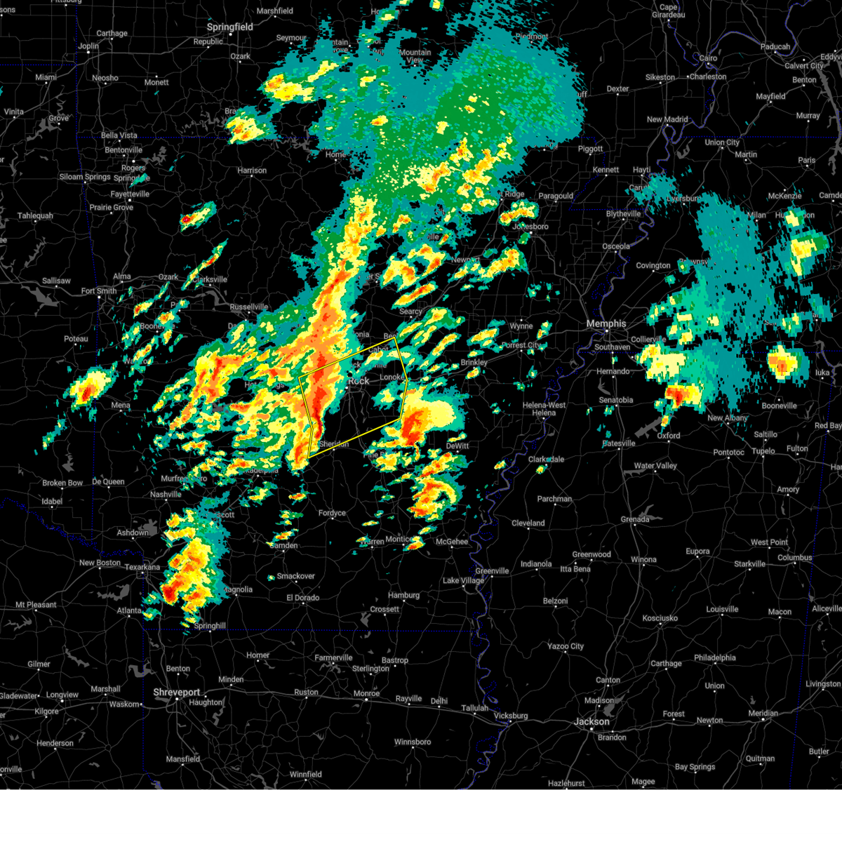 Svrlzk the national weather service in little rock has issued a * severe thunderstorm warning for, lonoke county in central arkansas, northern grant county in central arkansas, southeastern faulkner county in central arkansas, southwestern white county in central arkansas, northwestern jefferson county in southeastern arkansas, eastern saline county in central arkansas, pulaski county in central arkansas, * until 515 pm cdt. * at 436 pm cdt, severe thunderstorms were located along a line extending from bryant to 6 miles west of cane creek to near dogwood, moving northeast at 60 mph (radar indicated). Hazards include 60 mph wind gusts. expect damage to roofs, siding, and trees Svrlzk the national weather service in little rock has issued a * severe thunderstorm warning for, lonoke county in central arkansas, northern grant county in central arkansas, southeastern faulkner county in central arkansas, southwestern white county in central arkansas, northwestern jefferson county in southeastern arkansas, eastern saline county in central arkansas, pulaski county in central arkansas, * until 515 pm cdt. * at 436 pm cdt, severe thunderstorms were located along a line extending from bryant to 6 miles west of cane creek to near dogwood, moving northeast at 60 mph (radar indicated). Hazards include 60 mph wind gusts. expect damage to roofs, siding, and trees
|
| 4/2/2025 6:21 PM CDT |
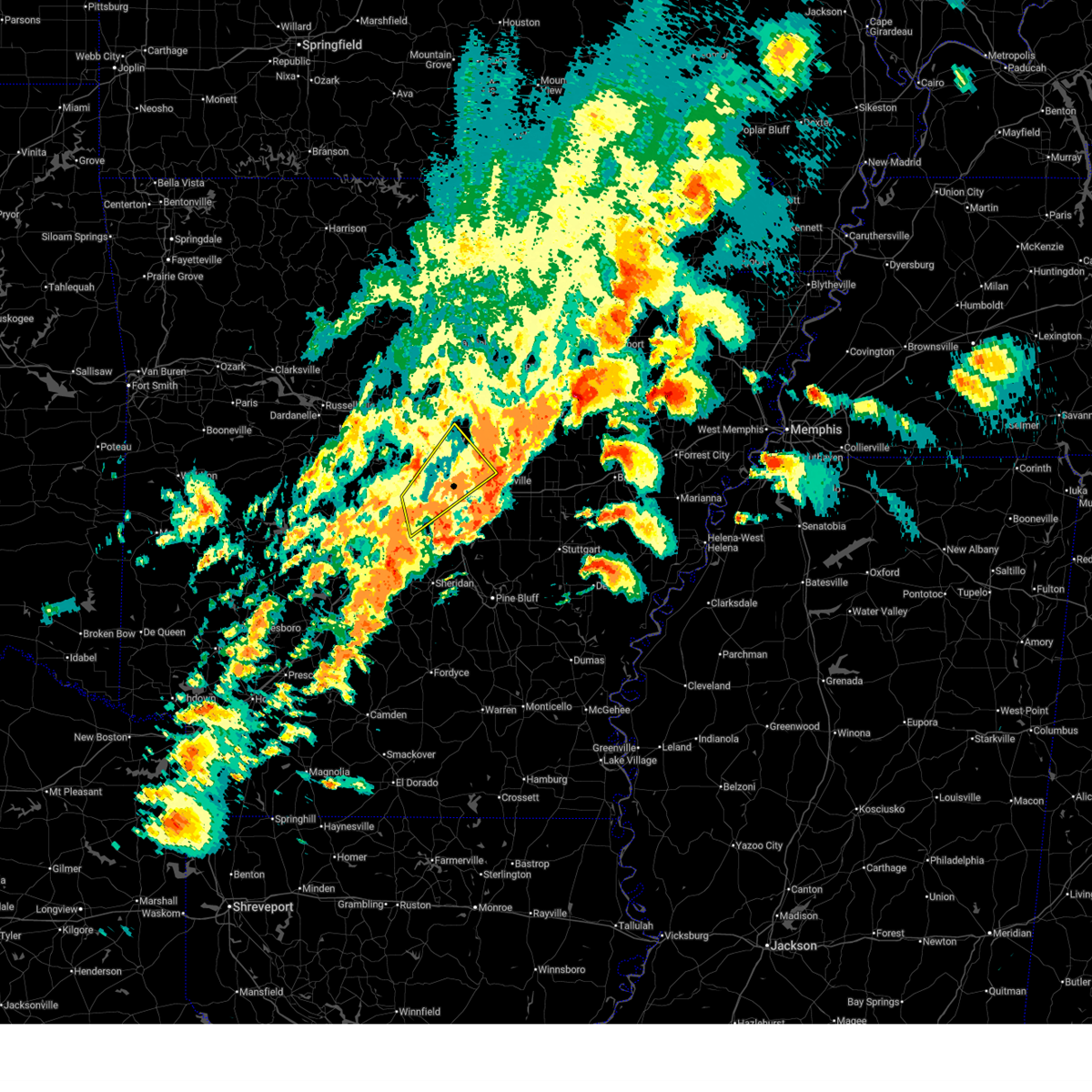 The storm which prompted the warning has weakened below severe limits, and no longer poses an immediate threat to life or property. therefore, the warning will be allowed to expire. a tornado watch remains in effect until midnight cdt for central arkansas. The storm which prompted the warning has weakened below severe limits, and no longer poses an immediate threat to life or property. therefore, the warning will be allowed to expire. a tornado watch remains in effect until midnight cdt for central arkansas.
|
| 4/2/2025 5:53 PM CDT |
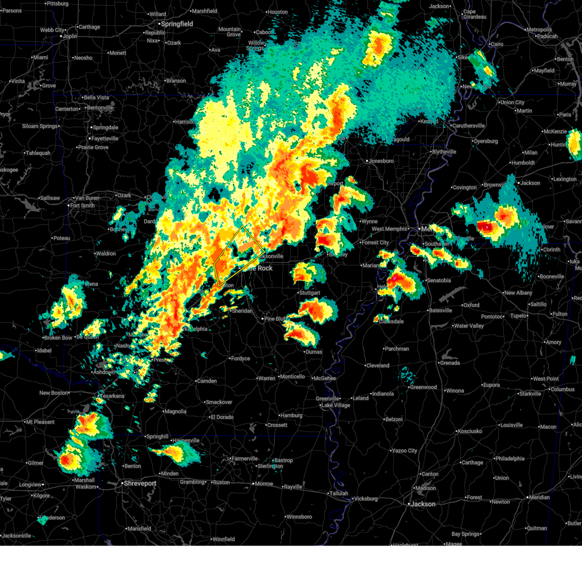 At 553 pm cdt, a severe thunderstorm was located over chenal valley, or near west little rock, moving northeast at 60 mph (radar indicated). Hazards include 60 mph wind gusts and half dollar size hail. Hail damage to vehicles is expected. expect wind damage to roofs, siding, and trees. Locations impacted include, park hill, otter creek, parnell, natural steps, palarm, north little rock, mayflower, gravel ridge, quapaw quarter, hillcrest neighborhood, vilonia, jacksonville, olmstead, roland in pulaski county, bryant, macon, the heights, north little rock airport, lakewood, camp robinson,. At 553 pm cdt, a severe thunderstorm was located over chenal valley, or near west little rock, moving northeast at 60 mph (radar indicated). Hazards include 60 mph wind gusts and half dollar size hail. Hail damage to vehicles is expected. expect wind damage to roofs, siding, and trees. Locations impacted include, park hill, otter creek, parnell, natural steps, palarm, north little rock, mayflower, gravel ridge, quapaw quarter, hillcrest neighborhood, vilonia, jacksonville, olmstead, roland in pulaski county, bryant, macon, the heights, north little rock airport, lakewood, camp robinson,.
|
| 4/2/2025 5:44 PM CDT |
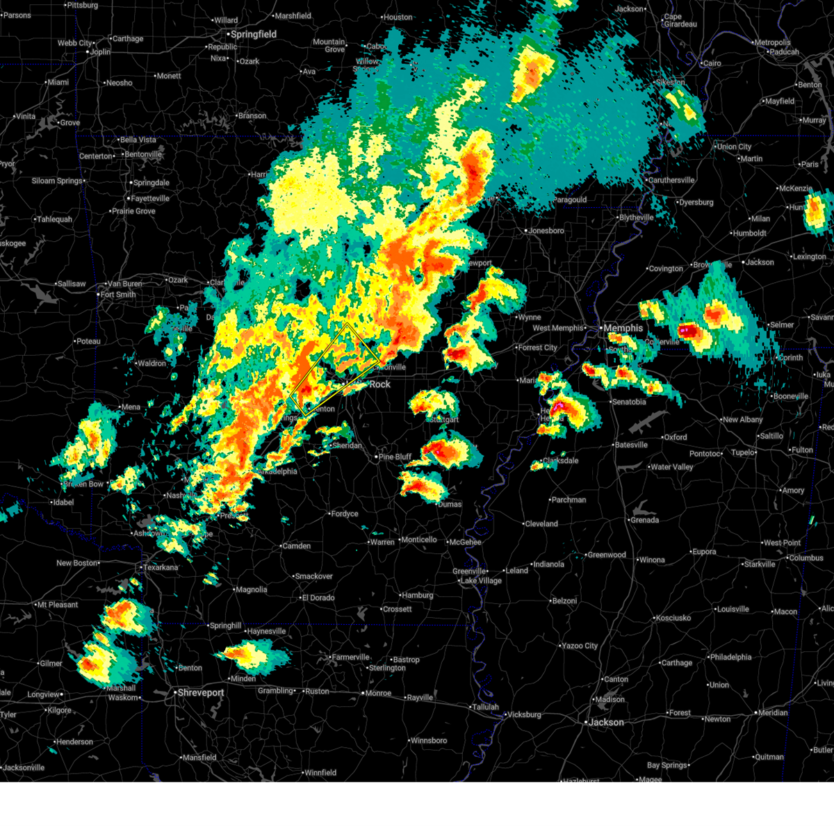 At 544 pm cdt, a severe thunderstorm was located near salem in saline county, or 7 miles northwest of bryant, moving northeast at 60 mph (radar indicated). Hazards include 60 mph wind gusts and half dollar size hail. Hail damage to vehicles is expected. expect wind damage to roofs, siding, and trees. Locations impacted include, park hill, otter creek, parnell, natural steps, palarm, north little rock, mayflower, gravel ridge, quapaw quarter, hillcrest neighborhood, vilonia, jacksonville, olmstead, roland in pulaski county, bryant, macon, the heights, north little rock airport, congo, lakewood,. At 544 pm cdt, a severe thunderstorm was located near salem in saline county, or 7 miles northwest of bryant, moving northeast at 60 mph (radar indicated). Hazards include 60 mph wind gusts and half dollar size hail. Hail damage to vehicles is expected. expect wind damage to roofs, siding, and trees. Locations impacted include, park hill, otter creek, parnell, natural steps, palarm, north little rock, mayflower, gravel ridge, quapaw quarter, hillcrest neighborhood, vilonia, jacksonville, olmstead, roland in pulaski county, bryant, macon, the heights, north little rock airport, congo, lakewood,.
|
| 4/2/2025 5:39 PM CDT |
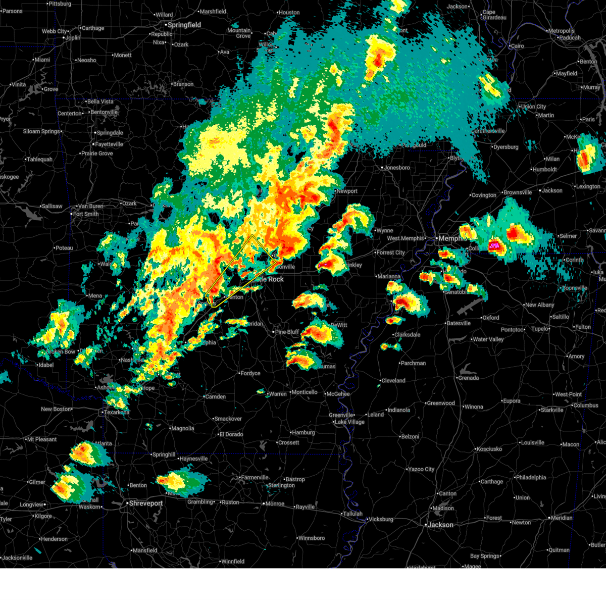 Svrlzk the national weather service in little rock has issued a * severe thunderstorm warning for, west central lonoke county in central arkansas, southeastern faulkner county in central arkansas, central saline county in central arkansas, northern pulaski county in central arkansas, * until 630 pm cdt. * at 539 pm cdt, a severe thunderstorm was located near salem in saline county, or near benton, moving northeast at 60 mph (radar indicated). Hazards include 60 mph wind gusts and half dollar size hail. Hail damage to vehicles is expected. Expect wind damage to roofs, siding, and trees. Svrlzk the national weather service in little rock has issued a * severe thunderstorm warning for, west central lonoke county in central arkansas, southeastern faulkner county in central arkansas, central saline county in central arkansas, northern pulaski county in central arkansas, * until 630 pm cdt. * at 539 pm cdt, a severe thunderstorm was located near salem in saline county, or near benton, moving northeast at 60 mph (radar indicated). Hazards include 60 mph wind gusts and half dollar size hail. Hail damage to vehicles is expected. Expect wind damage to roofs, siding, and trees.
|
| 4/2/2025 5:31 PM CDT |
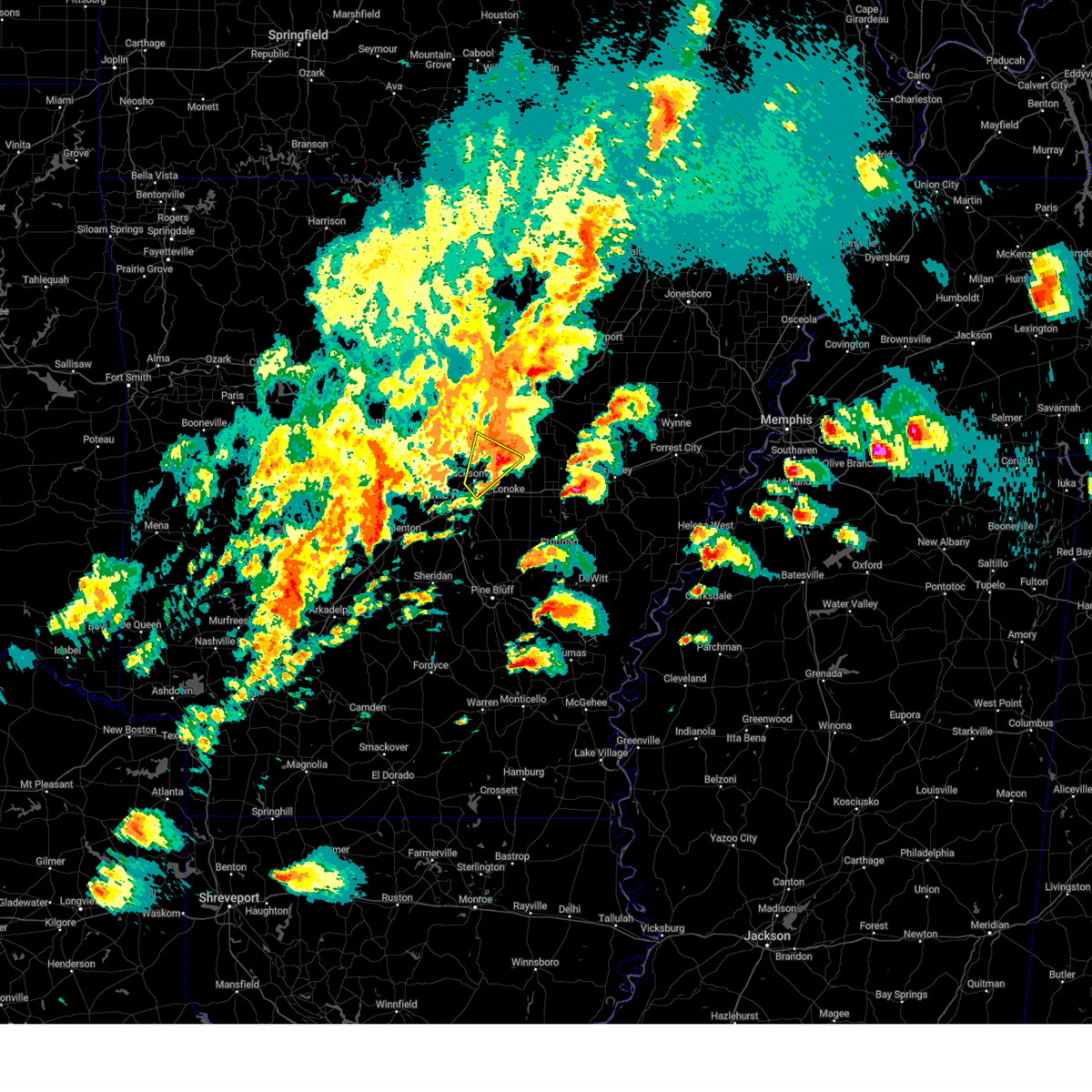 the severe thunderstorm warning has been cancelled and is no longer in effect the severe thunderstorm warning has been cancelled and is no longer in effect
|
| 4/2/2025 5:24 PM CDT |
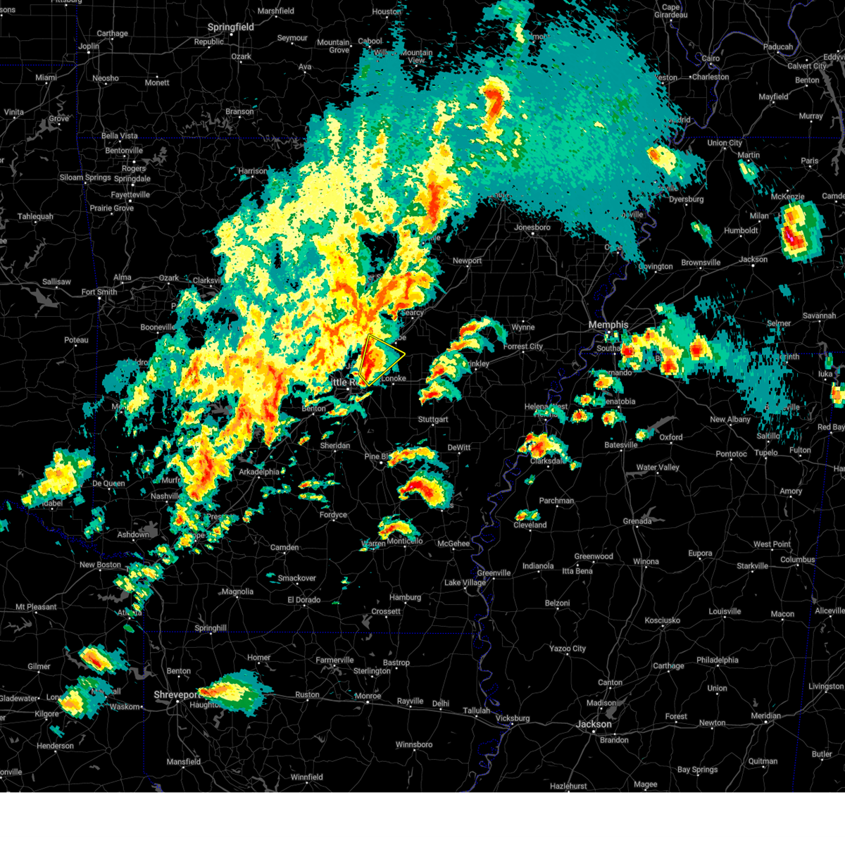 At 524 pm cdt, a severe thunderstorm was located over parnell, or near cabot, moving northeast at 60 mph (radar indicated). Hazards include ping pong ball size hail and 60 mph wind gusts. People and animals outdoors will be injured. expect hail damage to roofs, siding, windows, and vehicles. expect wind damage to roofs, siding, and trees. Locations impacted include, macon, old austin, parnell, butlerville, cabot, ward, austin in lonoke county, jacksonville, sylvania, south bend, little rock afb, gravel ridge, el paso, galloway, sherwood,. At 524 pm cdt, a severe thunderstorm was located over parnell, or near cabot, moving northeast at 60 mph (radar indicated). Hazards include ping pong ball size hail and 60 mph wind gusts. People and animals outdoors will be injured. expect hail damage to roofs, siding, windows, and vehicles. expect wind damage to roofs, siding, and trees. Locations impacted include, macon, old austin, parnell, butlerville, cabot, ward, austin in lonoke county, jacksonville, sylvania, south bend, little rock afb, gravel ridge, el paso, galloway, sherwood,.
|
| 4/2/2025 5:19 PM CDT |
 At 519 pm cdt, a severe thunderstorm was located over little rock afb, moving northeast at 60 mph (radar indicated). Hazards include ping pong ball size hail and 60 mph wind gusts. People and animals outdoors will be injured. expect hail damage to roofs, siding, windows, and vehicles. expect wind damage to roofs, siding, and trees. Locations impacted include, park hill, old austin, amboy, burns park, parnell, north little rock, gravel ridge, cabot, argenta, austin in lonoke county, vilonia, oak grove in pulaski county, jacksonville, sylvania, olmstead, macon, otto, protho junction, cato, north little rock airport,. At 519 pm cdt, a severe thunderstorm was located over little rock afb, moving northeast at 60 mph (radar indicated). Hazards include ping pong ball size hail and 60 mph wind gusts. People and animals outdoors will be injured. expect hail damage to roofs, siding, windows, and vehicles. expect wind damage to roofs, siding, and trees. Locations impacted include, park hill, old austin, amboy, burns park, parnell, north little rock, gravel ridge, cabot, argenta, austin in lonoke county, vilonia, oak grove in pulaski county, jacksonville, sylvania, olmstead, macon, otto, protho junction, cato, north little rock airport,.
|
| 4/2/2025 5:16 PM CDT |
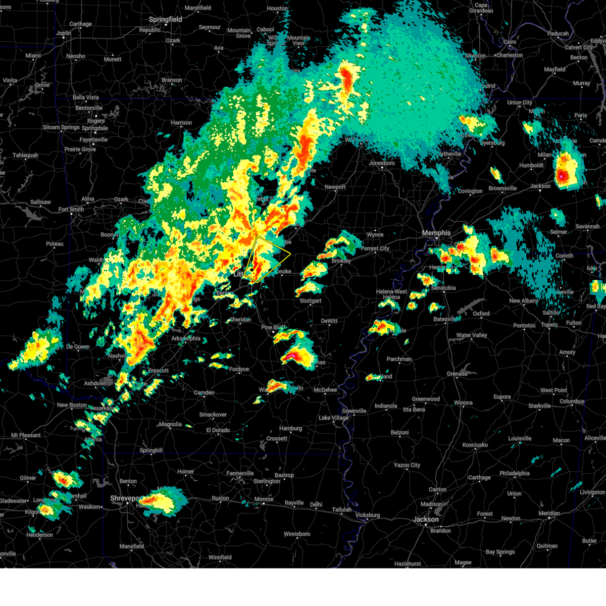 At 516 pm cdt, a severe thunderstorm was located over little rock afb, moving northeast at 60 mph (radar indicated). Hazards include 60 mph wind gusts and quarter size hail. Hail damage to vehicles is expected. expect wind damage to roofs, siding, and trees. Locations impacted include, park hill, old austin, amboy, burns park, parnell, north little rock, gravel ridge, cabot, argenta, austin in lonoke county, vilonia, oak grove in pulaski county, jacksonville, sylvania, olmstead, macon, otto, protho junction, cato, north little rock airport,. At 516 pm cdt, a severe thunderstorm was located over little rock afb, moving northeast at 60 mph (radar indicated). Hazards include 60 mph wind gusts and quarter size hail. Hail damage to vehicles is expected. expect wind damage to roofs, siding, and trees. Locations impacted include, park hill, old austin, amboy, burns park, parnell, north little rock, gravel ridge, cabot, argenta, austin in lonoke county, vilonia, oak grove in pulaski county, jacksonville, sylvania, olmstead, macon, otto, protho junction, cato, north little rock airport,.
|
| 4/2/2025 5:08 PM CDT |
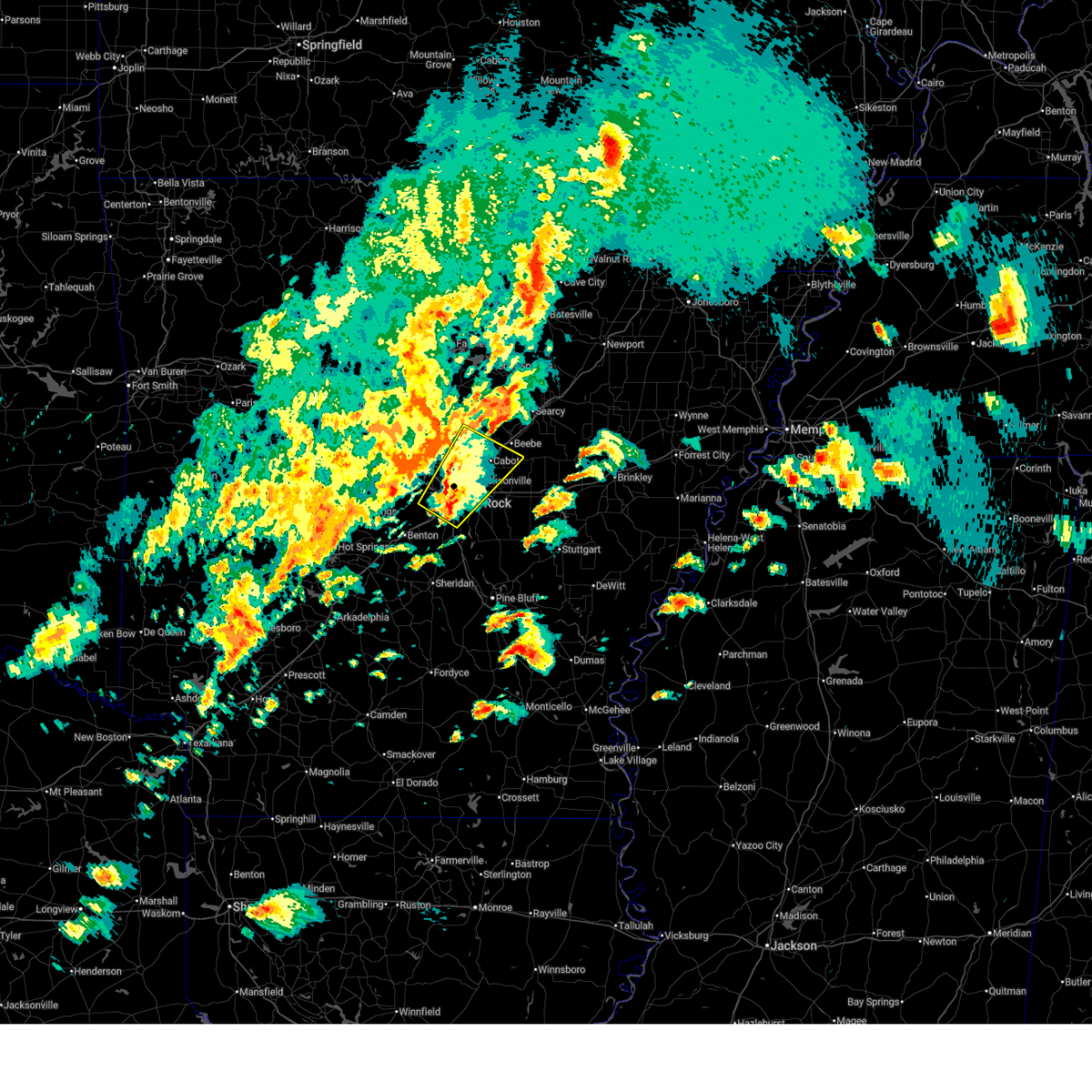 the severe thunderstorm warning has been cancelled and is no longer in effect the severe thunderstorm warning has been cancelled and is no longer in effect
|
| 4/2/2025 5:08 PM CDT |
 At 508 pm cdt, a severe thunderstorm was located over burns park, or over downtown little rock, moving northeast at 60 mph (radar indicated). Hazards include 60 mph wind gusts and quarter size hail. Hail damage to vehicles is expected. expect wind damage to roofs, siding, and trees. Locations impacted include, park hill, old austin, furlow, parnell, college station, north little rock, gravel ridge, ironton, quapaw quarter, hillcrest neighborhood, kerr, austin in lonoke county, vilonia, jacksonville, olmstead, macon, the heights, protho junction, baucum, north little rock airport,. At 508 pm cdt, a severe thunderstorm was located over burns park, or over downtown little rock, moving northeast at 60 mph (radar indicated). Hazards include 60 mph wind gusts and quarter size hail. Hail damage to vehicles is expected. expect wind damage to roofs, siding, and trees. Locations impacted include, park hill, old austin, furlow, parnell, college station, north little rock, gravel ridge, ironton, quapaw quarter, hillcrest neighborhood, kerr, austin in lonoke county, vilonia, jacksonville, olmstead, macon, the heights, protho junction, baucum, north little rock airport,.
|
| 4/2/2025 5:04 PM CDT |
 Svrlzk the national weather service in little rock has issued a * severe thunderstorm warning for, northeastern perry county in central arkansas, western prairie county in central arkansas, northwestern lonoke county in central arkansas, southeastern conway county in central arkansas, faulkner county in central arkansas, southwestern white county in central arkansas, northern pulaski county in central arkansas, * until 545 pm cdt. * at 503 pm cdt, severe thunderstorms were located along a line extending from near wooster to near mayflower to pinnacle mountain state park, moving east at 50 mph (radar indicated). Hazards include 70 mph wind gusts. Expect considerable tree damage. Damage is likely to mobile homes, roofs, and outbuildings. Svrlzk the national weather service in little rock has issued a * severe thunderstorm warning for, northeastern perry county in central arkansas, western prairie county in central arkansas, northwestern lonoke county in central arkansas, southeastern conway county in central arkansas, faulkner county in central arkansas, southwestern white county in central arkansas, northern pulaski county in central arkansas, * until 545 pm cdt. * at 503 pm cdt, severe thunderstorms were located along a line extending from near wooster to near mayflower to pinnacle mountain state park, moving east at 50 mph (radar indicated). Hazards include 70 mph wind gusts. Expect considerable tree damage. Damage is likely to mobile homes, roofs, and outbuildings.
|
| 4/2/2025 4:56 PM CDT |
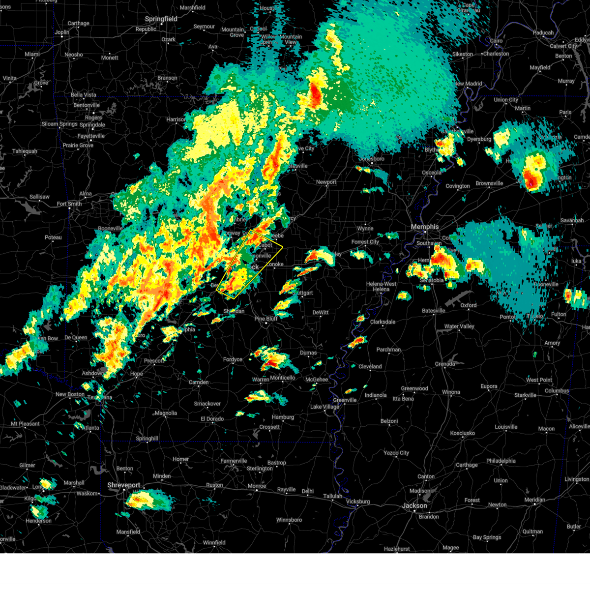 Svrlzk the national weather service in little rock has issued a * severe thunderstorm warning for, northwestern lonoke county in central arkansas, northern grant county in central arkansas, southeastern faulkner county in central arkansas, southwestern white county in central arkansas, southeastern saline county in central arkansas, eastern pulaski county in central arkansas, * until 545 pm cdt. * at 456 pm cdt, a severe thunderstorm was located over bryant, moving northeast at 60 mph (radar indicated). Hazards include 60 mph wind gusts and quarter size hail. Hail damage to vehicles is expected. Expect wind damage to roofs, siding, and trees. Svrlzk the national weather service in little rock has issued a * severe thunderstorm warning for, northwestern lonoke county in central arkansas, northern grant county in central arkansas, southeastern faulkner county in central arkansas, southwestern white county in central arkansas, southeastern saline county in central arkansas, eastern pulaski county in central arkansas, * until 545 pm cdt. * at 456 pm cdt, a severe thunderstorm was located over bryant, moving northeast at 60 mph (radar indicated). Hazards include 60 mph wind gusts and quarter size hail. Hail damage to vehicles is expected. Expect wind damage to roofs, siding, and trees.
|
| 3/14/2025 10:37 PM CDT |
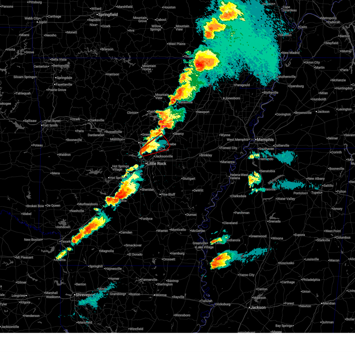 Torlzk the national weather service in little rock has issued a * tornado warning for, northwestern lonoke county in central arkansas, southeastern faulkner county in central arkansas, southwestern white county in central arkansas, northeastern pulaski county in central arkansas, * until 1115 pm cdt. * at 1036 pm cdt, a severe thunderstorm capable of producing a tornado was located over marche, or near maumelle, moving northeast at 40 mph (radar indicated rotation). Hazards include tornado and quarter size hail. Flying debris will be dangerous to those caught without shelter. mobile homes will be damaged or destroyed. damage to roofs, windows, and vehicles will occur. Tree damage is likely. Torlzk the national weather service in little rock has issued a * tornado warning for, northwestern lonoke county in central arkansas, southeastern faulkner county in central arkansas, southwestern white county in central arkansas, northeastern pulaski county in central arkansas, * until 1115 pm cdt. * at 1036 pm cdt, a severe thunderstorm capable of producing a tornado was located over marche, or near maumelle, moving northeast at 40 mph (radar indicated rotation). Hazards include tornado and quarter size hail. Flying debris will be dangerous to those caught without shelter. mobile homes will be damaged or destroyed. damage to roofs, windows, and vehicles will occur. Tree damage is likely.
|
| 3/14/2025 10:25 PM CDT |
 At 1024 pm cdt, a severe thunderstorm was located over maumelle, moving northeast at 50 mph (radar indicated). Hazards include 60 mph wind gusts and quarter size hail. Hail damage to vehicles is expected. expect wind damage to roofs, siding, and trees. Locations impacted include, pinnacle mountain state park, hamlet, saltillo, maumelle, macon, otto, cato, natural steps, gibson, palarm, mayflower, morgan, marche, vilonia, olmstead, little rock afb, roland in pulaski county, oak grove in pulaski county, conway, holland,. At 1024 pm cdt, a severe thunderstorm was located over maumelle, moving northeast at 50 mph (radar indicated). Hazards include 60 mph wind gusts and quarter size hail. Hail damage to vehicles is expected. expect wind damage to roofs, siding, and trees. Locations impacted include, pinnacle mountain state park, hamlet, saltillo, maumelle, macon, otto, cato, natural steps, gibson, palarm, mayflower, morgan, marche, vilonia, olmstead, little rock afb, roland in pulaski county, oak grove in pulaski county, conway, holland,.
|
| 3/14/2025 10:25 PM CDT |
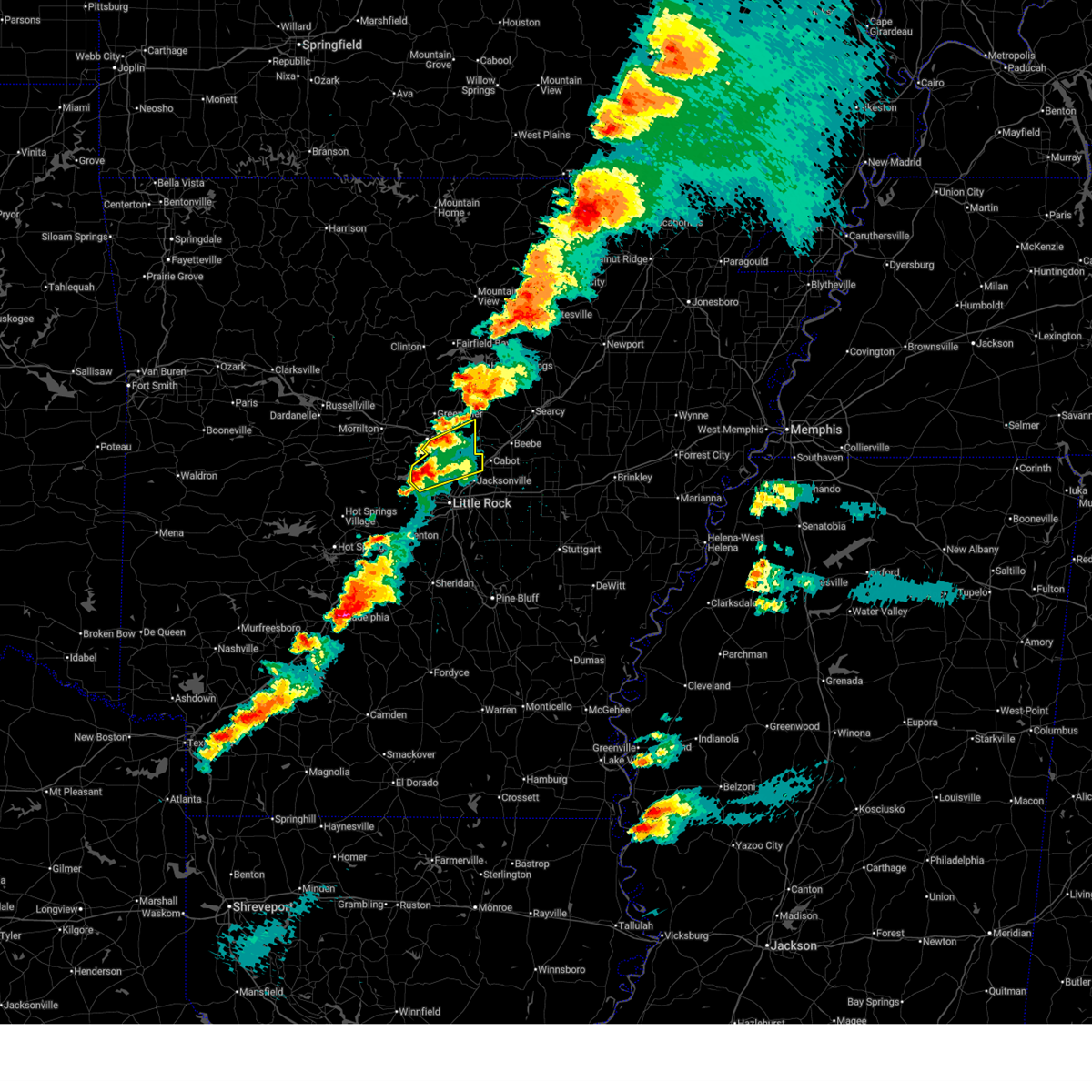 the severe thunderstorm warning has been cancelled and is no longer in effect the severe thunderstorm warning has been cancelled and is no longer in effect
|
| 3/14/2025 10:12 PM CDT |
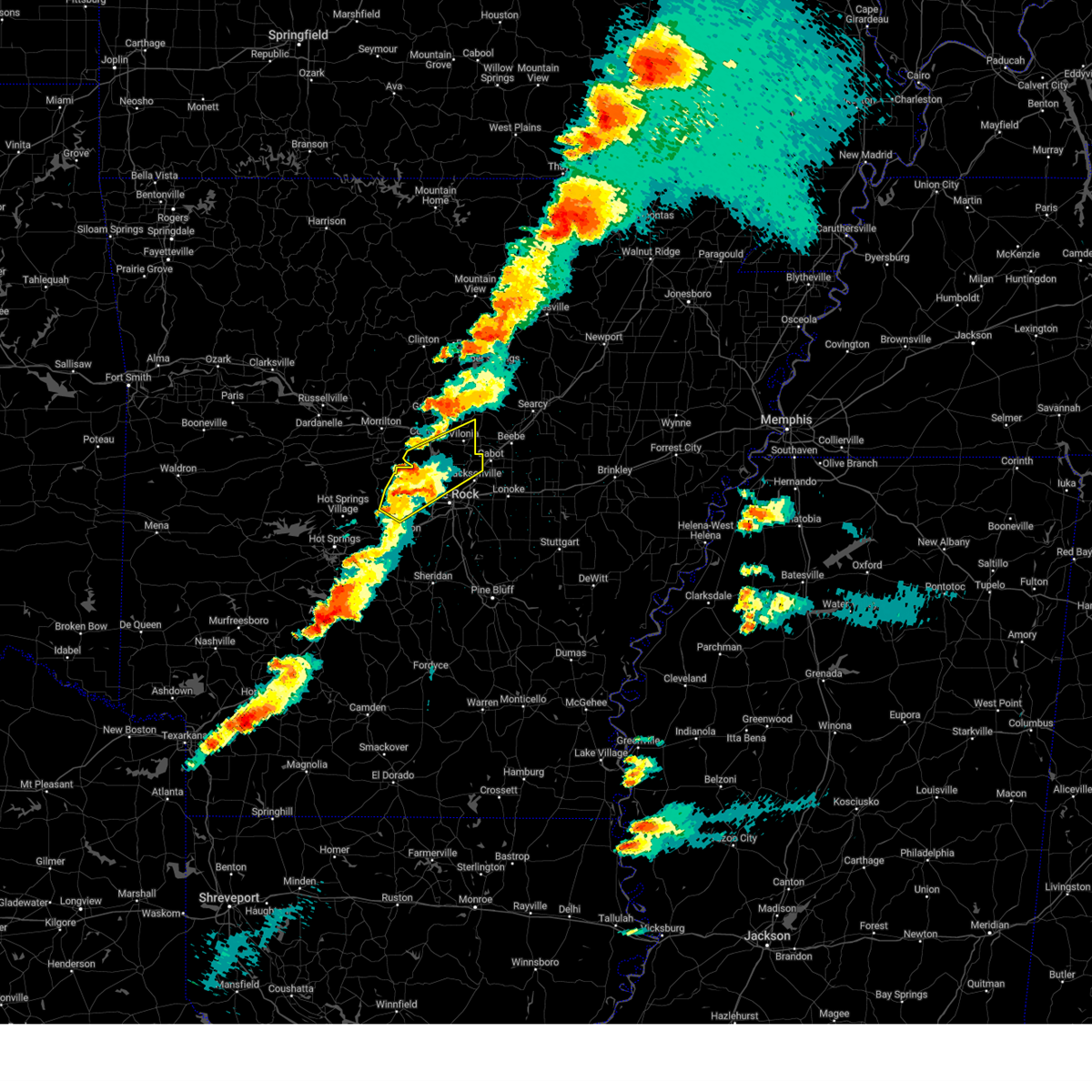 Svrlzk the national weather service in little rock has issued a * severe thunderstorm warning for, western lonoke county in central arkansas, southern faulkner county in central arkansas, north central saline county in central arkansas, northern pulaski county in central arkansas, * until 1100 pm cdt. * at 1012 pm cdt, a severe thunderstorm was located 7 miles west of chenal valley, or 10 miles west of west little rock, moving northeast at 50 mph (radar indicated). Hazards include 60 mph wind gusts and quarter size hail. Hail damage to vehicles is expected. Expect wind damage to roofs, siding, and trees. Svrlzk the national weather service in little rock has issued a * severe thunderstorm warning for, western lonoke county in central arkansas, southern faulkner county in central arkansas, north central saline county in central arkansas, northern pulaski county in central arkansas, * until 1100 pm cdt. * at 1012 pm cdt, a severe thunderstorm was located 7 miles west of chenal valley, or 10 miles west of west little rock, moving northeast at 50 mph (radar indicated). Hazards include 60 mph wind gusts and quarter size hail. Hail damage to vehicles is expected. Expect wind damage to roofs, siding, and trees.
|
| 8/18/2024 9:11 PM CDT |
 the severe thunderstorm warning has been cancelled and is no longer in effect the severe thunderstorm warning has been cancelled and is no longer in effect
|
| 8/18/2024 9:11 PM CDT |
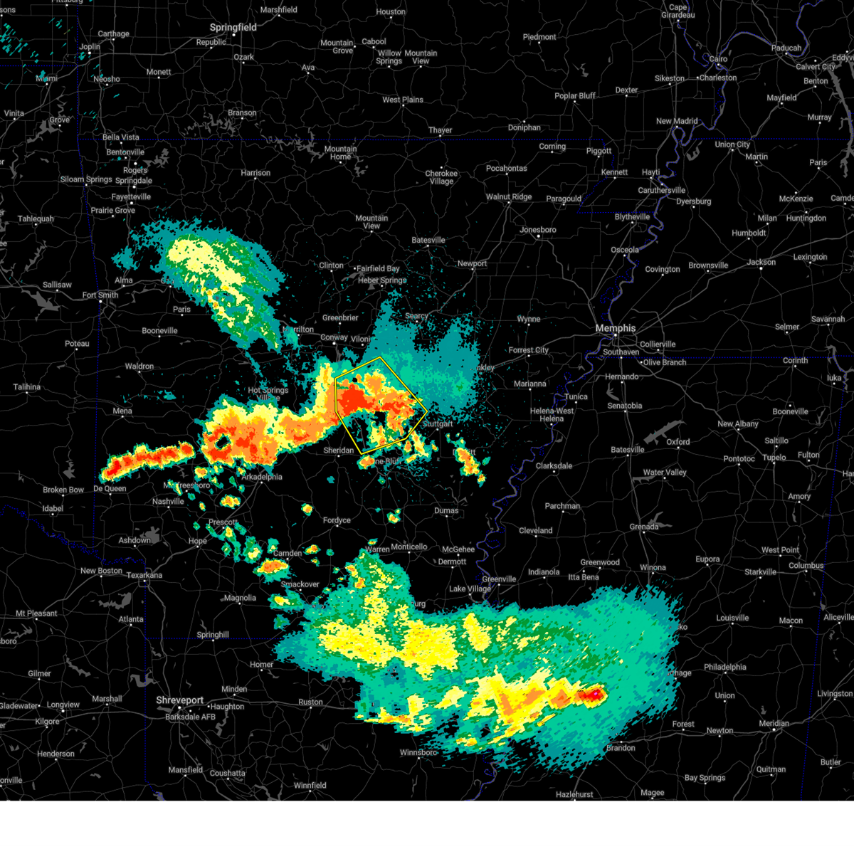 At 910 pm cdt, severe thunderstorms were located along a line extending from 6 miles northeast of keo to plum bayou mounds sp to near east end, moving southeast at 55 mph (radar indicated). Hazards include 60 mph wind gusts and nickel size hail. Expect damage to roofs, siding, and trees. Locations impacted include, little rock, north little rock, sherwood, jacksonville, cabot, west little rock, maumelle, downtown little rock, lonoke, north little rock airport, little rock afb, southwest little rock, shannon hills, england, wrightsville, argenta, redfield, humnoke, keo, parnell,. At 910 pm cdt, severe thunderstorms were located along a line extending from 6 miles northeast of keo to plum bayou mounds sp to near east end, moving southeast at 55 mph (radar indicated). Hazards include 60 mph wind gusts and nickel size hail. Expect damage to roofs, siding, and trees. Locations impacted include, little rock, north little rock, sherwood, jacksonville, cabot, west little rock, maumelle, downtown little rock, lonoke, north little rock airport, little rock afb, southwest little rock, shannon hills, england, wrightsville, argenta, redfield, humnoke, keo, parnell,.
|
| 8/18/2024 8:44 PM CDT |
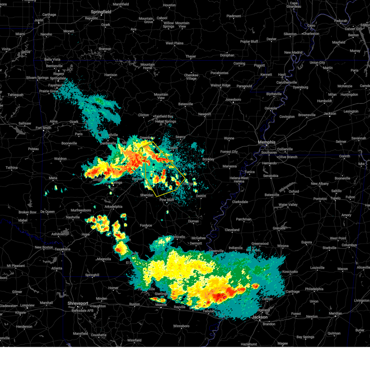 Svrlzk the national weather service in little rock has issued a * severe thunderstorm warning for, lonoke county in central arkansas, northeastern grant county in central arkansas, central faulkner county in central arkansas, northwestern jefferson county in southeastern arkansas, east central saline county in central arkansas, pulaski county in central arkansas, * until 930 pm cdt. * at 844 pm cdt, severe thunderstorms were located along a line extending from near olmstead to marche to near chenal valley, moving southeast at 55 mph (radar indicated). Hazards include 60 mph wind gusts and nickel size hail. expect damage to roofs, siding, and trees Svrlzk the national weather service in little rock has issued a * severe thunderstorm warning for, lonoke county in central arkansas, northeastern grant county in central arkansas, central faulkner county in central arkansas, northwestern jefferson county in southeastern arkansas, east central saline county in central arkansas, pulaski county in central arkansas, * until 930 pm cdt. * at 844 pm cdt, severe thunderstorms were located along a line extending from near olmstead to marche to near chenal valley, moving southeast at 55 mph (radar indicated). Hazards include 60 mph wind gusts and nickel size hail. expect damage to roofs, siding, and trees
|
| 8/18/2024 4:58 PM CDT |
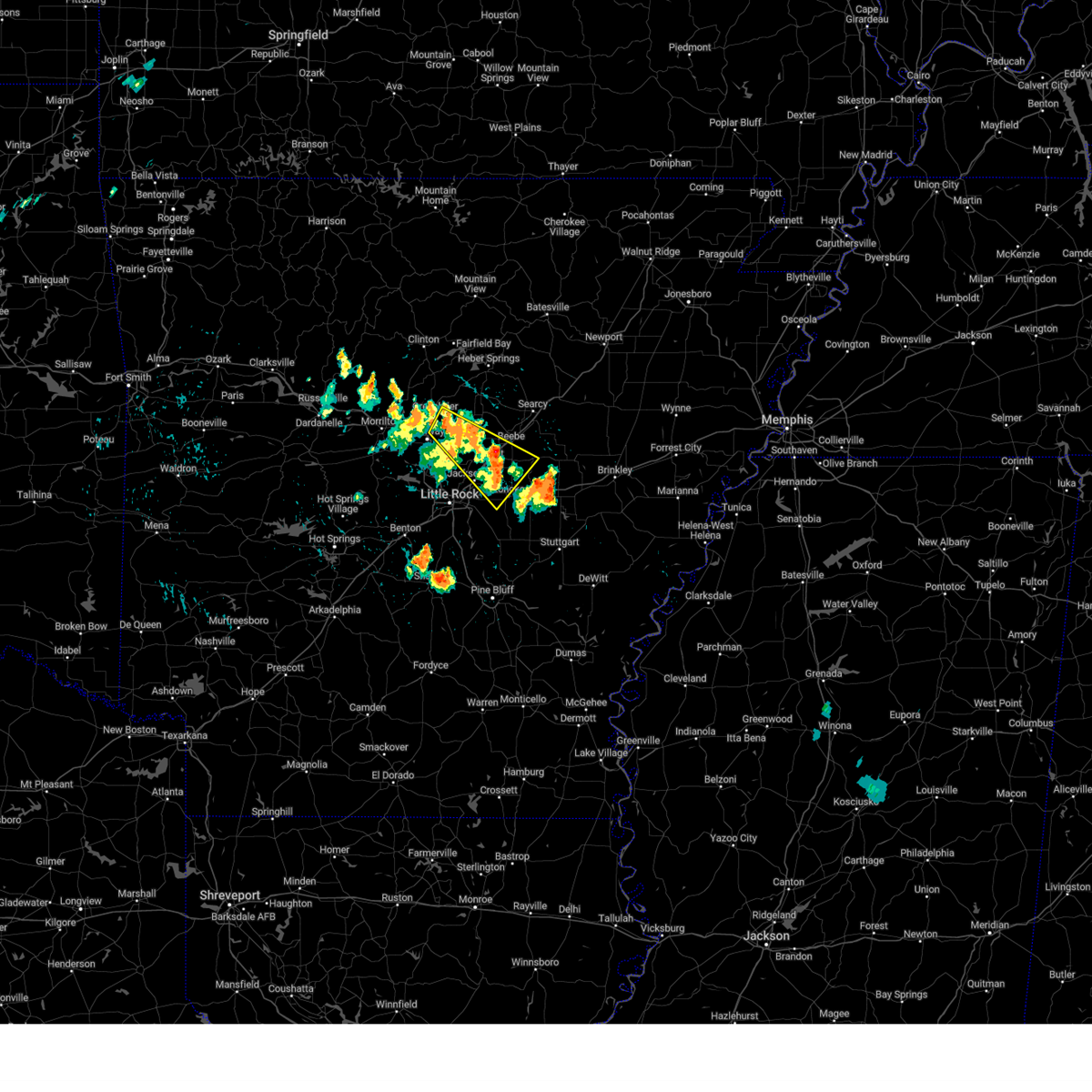 At 458 pm cdt, a severe thunderstorm was located near vilonia, or 11 miles northwest of cabot, moving southeast at 40 mph (radar indicated). Hazards include 60 mph wind gusts and quarter size hail. Hail damage to vehicles is expected. expect wind damage to roofs, siding, and trees. Locations impacted include, conway, jacksonville, cabot, lonoke, little rock afb, beebe, greenbrier, ward, vilonia, austin in lonoke county, enola, old austin, pickles gap, parnell, meto, sylvania, olmstead, thurman, south bend, springhill,. At 458 pm cdt, a severe thunderstorm was located near vilonia, or 11 miles northwest of cabot, moving southeast at 40 mph (radar indicated). Hazards include 60 mph wind gusts and quarter size hail. Hail damage to vehicles is expected. expect wind damage to roofs, siding, and trees. Locations impacted include, conway, jacksonville, cabot, lonoke, little rock afb, beebe, greenbrier, ward, vilonia, austin in lonoke county, enola, old austin, pickles gap, parnell, meto, sylvania, olmstead, thurman, south bend, springhill,.
|
| 8/18/2024 4:40 PM CDT |
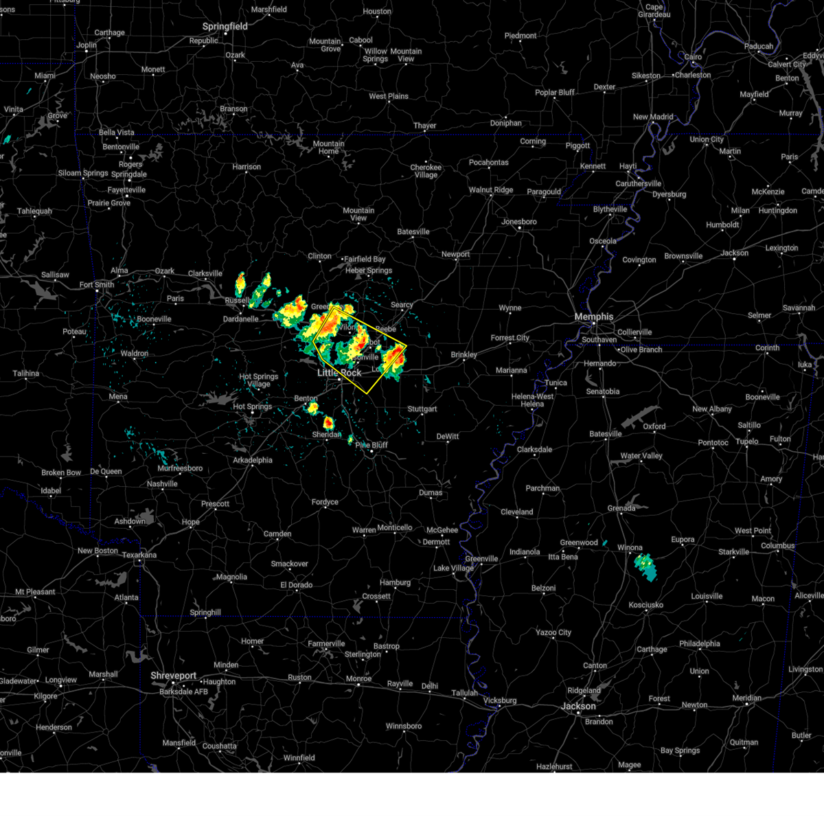 Svrlzk the national weather service in little rock has issued a * severe thunderstorm warning for, northwestern prairie county in central arkansas, northwestern lonoke county in central arkansas, central faulkner county in central arkansas, southwestern white county in central arkansas, northeastern pulaski county in central arkansas, * until 530 pm cdt. * at 440 pm cdt, a severe thunderstorm was located over pickles gap, or near conway, moving southeast at 40 mph (radar indicated). Hazards include 60 mph wind gusts and quarter size hail. Hail damage to vehicles is expected. Expect wind damage to roofs, siding, and trees. Svrlzk the national weather service in little rock has issued a * severe thunderstorm warning for, northwestern prairie county in central arkansas, northwestern lonoke county in central arkansas, central faulkner county in central arkansas, southwestern white county in central arkansas, northeastern pulaski county in central arkansas, * until 530 pm cdt. * at 440 pm cdt, a severe thunderstorm was located over pickles gap, or near conway, moving southeast at 40 mph (radar indicated). Hazards include 60 mph wind gusts and quarter size hail. Hail damage to vehicles is expected. Expect wind damage to roofs, siding, and trees.
|
| 8/18/2024 4:20 PM CDT |
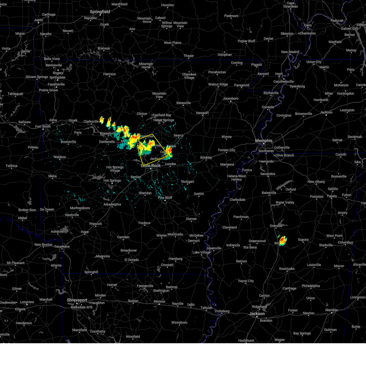 At 420 pm cdt, a severe thunderstorm was located near vilonia, or 11 miles east of conway, moving southeast at 30 mph (radar indicated). Hazards include 60 mph wind gusts and quarter size hail. Hail damage to vehicles is expected. expect wind damage to roofs, siding, and trees. Locations impacted include, little rock, north little rock, conway, sherwood, jacksonville, cabot, west little rock, maumelle, little rock afb, greenbrier, ward, vilonia, mayflower, austin in lonoke county, wooster, enola, pickles gap, morgan, marche, oak grove in pulaski county,. At 420 pm cdt, a severe thunderstorm was located near vilonia, or 11 miles east of conway, moving southeast at 30 mph (radar indicated). Hazards include 60 mph wind gusts and quarter size hail. Hail damage to vehicles is expected. expect wind damage to roofs, siding, and trees. Locations impacted include, little rock, north little rock, conway, sherwood, jacksonville, cabot, west little rock, maumelle, little rock afb, greenbrier, ward, vilonia, mayflower, austin in lonoke county, wooster, enola, pickles gap, morgan, marche, oak grove in pulaski county,.
|
| 8/18/2024 4:05 PM CDT |
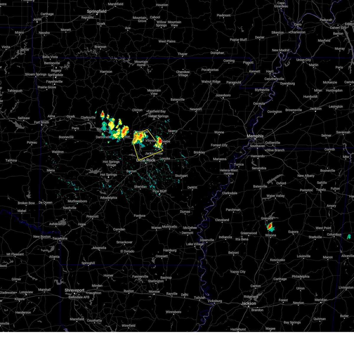 Svrlzk the national weather service in little rock has issued a * severe thunderstorm warning for, northeastern perry county in central arkansas, northwestern lonoke county in central arkansas, faulkner county in central arkansas, southwestern white county in central arkansas, northeastern pulaski county in central arkansas, * until 445 pm cdt. * at 405 pm cdt, a severe thunderstorm was located near greenbrier, or 11 miles northeast of conway, moving southeast at 25 mph (radar indicated). Hazards include 60 mph wind gusts and quarter size hail. Hail damage to vehicles is expected. Expect wind damage to roofs, siding, and trees. Svrlzk the national weather service in little rock has issued a * severe thunderstorm warning for, northeastern perry county in central arkansas, northwestern lonoke county in central arkansas, faulkner county in central arkansas, southwestern white county in central arkansas, northeastern pulaski county in central arkansas, * until 445 pm cdt. * at 405 pm cdt, a severe thunderstorm was located near greenbrier, or 11 miles northeast of conway, moving southeast at 25 mph (radar indicated). Hazards include 60 mph wind gusts and quarter size hail. Hail damage to vehicles is expected. Expect wind damage to roofs, siding, and trees.
|
| 6/9/2024 6:43 PM CDT | the severe thunderstorm warning has been cancelled and is no longer in effect |
| 6/9/2024 6:34 PM CDT |
 At 634 pm cdt, a severe thunderstorm was located over scott, or 9 miles southeast of north little rock, moving southeast at 30 mph (radar indicated). Hazards include 60 mph wind gusts and quarter size hail. Hail damage to vehicles is expected. expect wind damage to roofs, siding, and trees. Locations impacted include, little rock, north little rock, sherwood, lonoke, keo, protho junction, plum bayou mounds sp, estes, meto, mcalmont, scott, baucum, bevis corner, willow beach, toltec, rose city, kerr, pettus, terry lock and dam, galloway,. At 634 pm cdt, a severe thunderstorm was located over scott, or 9 miles southeast of north little rock, moving southeast at 30 mph (radar indicated). Hazards include 60 mph wind gusts and quarter size hail. Hail damage to vehicles is expected. expect wind damage to roofs, siding, and trees. Locations impacted include, little rock, north little rock, sherwood, lonoke, keo, protho junction, plum bayou mounds sp, estes, meto, mcalmont, scott, baucum, bevis corner, willow beach, toltec, rose city, kerr, pettus, terry lock and dam, galloway,.
|
| 6/9/2024 6:20 PM CDT |
 Svrlzk the national weather service in little rock has issued a * severe thunderstorm warning for, southwestern lonoke county in central arkansas, east central pulaski county in central arkansas, * until 700 pm cdt. * at 620 pm cdt, a severe thunderstorm was located over mcalmont, or near north little rock, moving southeast at 30 mph (radar indicated). Hazards include 60 mph wind gusts and quarter size hail. Hail damage to vehicles is expected. Expect wind damage to roofs, siding, and trees. Svrlzk the national weather service in little rock has issued a * severe thunderstorm warning for, southwestern lonoke county in central arkansas, east central pulaski county in central arkansas, * until 700 pm cdt. * at 620 pm cdt, a severe thunderstorm was located over mcalmont, or near north little rock, moving southeast at 30 mph (radar indicated). Hazards include 60 mph wind gusts and quarter size hail. Hail damage to vehicles is expected. Expect wind damage to roofs, siding, and trees.
|
| 6/9/2024 6:19 PM CDT |
 At 619 pm cdt, a severe thunderstorm was located over argenta, or over north little rock, moving southeast at 30 mph (radar indicated). Hazards include 60 mph wind gusts and quarter size hail. Hail damage to vehicles is expected. expect wind damage to roofs, siding, and trees. Locations impacted include, little rock, north little rock, sherwood, jacksonville, west little rock, maumelle, downtown little rock, north little rock airport, little rock afb, southwest little rock, argenta, burns park, gravel ridge, oak grove in pulaski county, olmstead, protho junction, gibson, lakewood, camp robinson, geyer springs,. At 619 pm cdt, a severe thunderstorm was located over argenta, or over north little rock, moving southeast at 30 mph (radar indicated). Hazards include 60 mph wind gusts and quarter size hail. Hail damage to vehicles is expected. expect wind damage to roofs, siding, and trees. Locations impacted include, little rock, north little rock, sherwood, jacksonville, west little rock, maumelle, downtown little rock, north little rock airport, little rock afb, southwest little rock, argenta, burns park, gravel ridge, oak grove in pulaski county, olmstead, protho junction, gibson, lakewood, camp robinson, geyer springs,.
|
| 6/9/2024 6:13 PM CDT | Tree down in cat in faulkner county AR, 7 miles SSE of Sherwood, AR |
| 6/9/2024 5:52 PM CDT |
 Svrlzk the national weather service in little rock has issued a * severe thunderstorm warning for, west central lonoke county in central arkansas, southwestern faulkner county in central arkansas, northeastern pulaski county in central arkansas, * until 630 pm cdt. * at 552 pm cdt, a severe thunderstorm was located over morgan, or near maumelle, moving southeast at 30 mph (radar indicated). Hazards include 60 mph wind gusts and quarter size hail. Hail damage to vehicles is expected. Expect wind damage to roofs, siding, and trees. Svrlzk the national weather service in little rock has issued a * severe thunderstorm warning for, west central lonoke county in central arkansas, southwestern faulkner county in central arkansas, northeastern pulaski county in central arkansas, * until 630 pm cdt. * at 552 pm cdt, a severe thunderstorm was located over morgan, or near maumelle, moving southeast at 30 mph (radar indicated). Hazards include 60 mph wind gusts and quarter size hail. Hail damage to vehicles is expected. Expect wind damage to roofs, siding, and trees.
|
| 5/24/2024 10:23 PM CDT |
 The storms which prompted the warning have weakened below severe limits, and no longer pose an immediate threat to life or property. therefore, the warning will be allowed to expire. however gusty winds and heavy rain are still possible with these thunderstorms. a severe thunderstorm watch remains in effect until midnight cdt for central arkansas. a severe thunderstorm watch also remains in effect until 1100 pm cdt for central and southeastern arkansas. The storms which prompted the warning have weakened below severe limits, and no longer pose an immediate threat to life or property. therefore, the warning will be allowed to expire. however gusty winds and heavy rain are still possible with these thunderstorms. a severe thunderstorm watch remains in effect until midnight cdt for central arkansas. a severe thunderstorm watch also remains in effect until 1100 pm cdt for central and southeastern arkansas.
|
| 5/24/2024 10:15 PM CDT |
 At 1015 pm cdt, severe thunderstorms were located along a line extending from near roland in pulaski county to state fairgrounds to near estes to white hall, moving east at 40 mph (radar indicated). Hazards include 60 mph wind gusts and quarter size hail. Hail damage to vehicles is expected. expect wind damage to roofs, siding, and trees. Locations impacted include, little rock, north little rock, conway, pine bluff, benton, sherwood, jacksonville, west little rock, maumelle, bryant, downtown little rock, lonoke, north little rock airport, little rock afb, southwest little rock, white hall, shannon hills, england, mayflower, wrightsville,. At 1015 pm cdt, severe thunderstorms were located along a line extending from near roland in pulaski county to state fairgrounds to near estes to white hall, moving east at 40 mph (radar indicated). Hazards include 60 mph wind gusts and quarter size hail. Hail damage to vehicles is expected. expect wind damage to roofs, siding, and trees. Locations impacted include, little rock, north little rock, conway, pine bluff, benton, sherwood, jacksonville, west little rock, maumelle, bryant, downtown little rock, lonoke, north little rock airport, little rock afb, southwest little rock, white hall, shannon hills, england, mayflower, wrightsville,.
|
| 5/24/2024 9:52 PM CDT |
 Svrlzk the national weather service in little rock has issued a * severe thunderstorm warning for, eastern perry county in central arkansas, southwestern lonoke county in central arkansas, grant county in central arkansas, southwestern faulkner county in central arkansas, jefferson county in southeastern arkansas, saline county in central arkansas, pulaski county in central arkansas, * until 1030 pm cdt. * at 951 pm cdt, severe thunderstorms were located along a line extending from 6 miles south of williams junction to near salem in saline county to cane creek to 7 miles north of lamont, moving east at 40 mph (radar indicated). Hazards include 60 mph wind gusts and half dollar size hail. Hail damage to vehicles is expected. Expect wind damage to roofs, siding, and trees. Svrlzk the national weather service in little rock has issued a * severe thunderstorm warning for, eastern perry county in central arkansas, southwestern lonoke county in central arkansas, grant county in central arkansas, southwestern faulkner county in central arkansas, jefferson county in southeastern arkansas, saline county in central arkansas, pulaski county in central arkansas, * until 1030 pm cdt. * at 951 pm cdt, severe thunderstorms were located along a line extending from 6 miles south of williams junction to near salem in saline county to cane creek to 7 miles north of lamont, moving east at 40 mph (radar indicated). Hazards include 60 mph wind gusts and half dollar size hail. Hail damage to vehicles is expected. Expect wind damage to roofs, siding, and trees.
|
| 5/24/2024 4:22 PM CDT |
 the severe thunderstorm warning has been cancelled and is no longer in effect the severe thunderstorm warning has been cancelled and is no longer in effect
|
| 5/24/2024 4:03 PM CDT |
 Svrlzk the national weather service in little rock has issued a * severe thunderstorm warning for, southern lonoke county in central arkansas, southeastern pulaski county in central arkansas, * until 445 pm cdt. * at 402 pm cdt, a severe thunderstorm was located near scott, or 7 miles southeast of downtown little rock, moving east at 30 mph (radar indicated). Hazards include 60 mph wind gusts and quarter size hail. Hail damage to vehicles is expected. Expect wind damage to roofs, siding, and trees. Svrlzk the national weather service in little rock has issued a * severe thunderstorm warning for, southern lonoke county in central arkansas, southeastern pulaski county in central arkansas, * until 445 pm cdt. * at 402 pm cdt, a severe thunderstorm was located near scott, or 7 miles southeast of downtown little rock, moving east at 30 mph (radar indicated). Hazards include 60 mph wind gusts and quarter size hail. Hail damage to vehicles is expected. Expect wind damage to roofs, siding, and trees.
|
| 5/22/2024 12:02 AM CDT |
 At 1201 am cdt, a severe thunderstorm was located over wrightsville, or 9 miles south of downtown little rock, moving east at 30 mph (radar indicated). Hazards include 60 mph wind gusts and quarter size hail. Hail damage to vehicles is expected. expect wind damage to roofs, siding, and trees. Locations impacted include, little rock, north little rock, sherwood, downtown little rock, wrightsville, argenta, keo, ironton, estes, protho junction, plum bayou mounds sp, sweet home, mcalmont, south bend, scott, lakewood, east end, baucum, higgins, college station,. At 1201 am cdt, a severe thunderstorm was located over wrightsville, or 9 miles south of downtown little rock, moving east at 30 mph (radar indicated). Hazards include 60 mph wind gusts and quarter size hail. Hail damage to vehicles is expected. expect wind damage to roofs, siding, and trees. Locations impacted include, little rock, north little rock, sherwood, downtown little rock, wrightsville, argenta, keo, ironton, estes, protho junction, plum bayou mounds sp, sweet home, mcalmont, south bend, scott, lakewood, east end, baucum, higgins, college station,.
|
| 5/22/2024 12:02 AM CDT |
 the severe thunderstorm warning has been cancelled and is no longer in effect the severe thunderstorm warning has been cancelled and is no longer in effect
|
| 5/21/2024 11:51 PM CDT |
 At 1151 pm cdt, a severe thunderstorm was located over ironton, or near downtown little rock, moving east at 70 mph (radar indicated). Hazards include 60 mph wind gusts and quarter size hail. Hail damage to vehicles is expected. expect wind damage to roofs, siding, and trees. Locations impacted include, little rock, north little rock, sherwood, jacksonville, west little rock, bryant, downtown little rock, southwest little rock, shannon hills, wrightsville, argenta, otter creek, ironton, protho junction, sweet home, lakewood, geyer springs, mabelvale, levy, mcalmont,. At 1151 pm cdt, a severe thunderstorm was located over ironton, or near downtown little rock, moving east at 70 mph (radar indicated). Hazards include 60 mph wind gusts and quarter size hail. Hail damage to vehicles is expected. expect wind damage to roofs, siding, and trees. Locations impacted include, little rock, north little rock, sherwood, jacksonville, west little rock, bryant, downtown little rock, southwest little rock, shannon hills, wrightsville, argenta, otter creek, ironton, protho junction, sweet home, lakewood, geyer springs, mabelvale, levy, mcalmont,.
|
| 5/21/2024 11:50 PM CDT |
 At 1150 pm cdt, a severe thunderstorm was located over east end, or 7 miles south of southwest little rock, moving east at 30 mph (radar indicated). Hazards include 60 mph wind gusts and quarter size hail. Hail damage to vehicles is expected. expect wind damage to roofs, siding, and trees. Locations impacted include, little rock, north little rock, sherwood, jacksonville, west little rock, downtown little rock, southwest little rock, shannon hills, wrightsville, argenta, redfield, keo, otter creek, ironton, estes, east end, protho junction, plum bayou mounds sp, lakewood, geyer springs,. At 1150 pm cdt, a severe thunderstorm was located over east end, or 7 miles south of southwest little rock, moving east at 30 mph (radar indicated). Hazards include 60 mph wind gusts and quarter size hail. Hail damage to vehicles is expected. expect wind damage to roofs, siding, and trees. Locations impacted include, little rock, north little rock, sherwood, jacksonville, west little rock, downtown little rock, southwest little rock, shannon hills, wrightsville, argenta, redfield, keo, otter creek, ironton, estes, east end, protho junction, plum bayou mounds sp, lakewood, geyer springs,.
|
| 5/21/2024 11:29 PM CDT |
 At 1129 pm cdt, a severe thunderstorm was located over west little rock, moving east at 40 mph (radar indicated). Hazards include 60 mph wind gusts and quarter size hail. Hail damage to vehicles is expected. expect wind damage to roofs, siding, and trees. Locations impacted include, little rock, north little rock, benton, sherwood, jacksonville, west little rock, maumelle, bryant, downtown little rock, north little rock airport, southwest little rock, little rock afb, shannon hills, argenta, otter creek, gravel ridge, ironton, protho junction, lakewood, camp robinson,. At 1129 pm cdt, a severe thunderstorm was located over west little rock, moving east at 40 mph (radar indicated). Hazards include 60 mph wind gusts and quarter size hail. Hail damage to vehicles is expected. expect wind damage to roofs, siding, and trees. Locations impacted include, little rock, north little rock, benton, sherwood, jacksonville, west little rock, maumelle, bryant, downtown little rock, north little rock airport, southwest little rock, little rock afb, shannon hills, argenta, otter creek, gravel ridge, ironton, protho junction, lakewood, camp robinson,.
|
| 5/21/2024 11:29 PM CDT |
 the severe thunderstorm warning has been cancelled and is no longer in effect the severe thunderstorm warning has been cancelled and is no longer in effect
|
| 5/21/2024 11:27 PM CDT |
 Svrlzk the national weather service in little rock has issued a * severe thunderstorm warning for, southwestern lonoke county in central arkansas, northeastern grant county in central arkansas, northwestern jefferson county in southeastern arkansas, eastern saline county in central arkansas, pulaski county in central arkansas, * until 1215 am cdt. * at 1127 pm cdt, a severe thunderstorm was located near otter creek, or near bryant, moving east at 35 mph (radar indicated). Hazards include 60 mph wind gusts and quarter size hail. Hail damage to vehicles is expected. Expect wind damage to roofs, siding, and trees. Svrlzk the national weather service in little rock has issued a * severe thunderstorm warning for, southwestern lonoke county in central arkansas, northeastern grant county in central arkansas, northwestern jefferson county in southeastern arkansas, eastern saline county in central arkansas, pulaski county in central arkansas, * until 1215 am cdt. * at 1127 pm cdt, a severe thunderstorm was located near otter creek, or near bryant, moving east at 35 mph (radar indicated). Hazards include 60 mph wind gusts and quarter size hail. Hail damage to vehicles is expected. Expect wind damage to roofs, siding, and trees.
|
| 5/21/2024 11:14 PM CDT |
 Svrlzk the national weather service in little rock has issued a * severe thunderstorm warning for, west central lonoke county in central arkansas, southeastern faulkner county in central arkansas, central saline county in central arkansas, pulaski county in central arkansas, * until midnight cdt. * at 1114 pm cdt, a severe thunderstorm was located near salem in saline county, or 8 miles north of benton, moving east at 40 mph (radar indicated). Hazards include 60 mph wind gusts and quarter size hail. Hail damage to vehicles is expected. Expect wind damage to roofs, siding, and trees. Svrlzk the national weather service in little rock has issued a * severe thunderstorm warning for, west central lonoke county in central arkansas, southeastern faulkner county in central arkansas, central saline county in central arkansas, pulaski county in central arkansas, * until midnight cdt. * at 1114 pm cdt, a severe thunderstorm was located near salem in saline county, or 8 miles north of benton, moving east at 40 mph (radar indicated). Hazards include 60 mph wind gusts and quarter size hail. Hail damage to vehicles is expected. Expect wind damage to roofs, siding, and trees.
|
| 5/8/2024 2:48 AM CDT |
 At 248 am cdt, a severe thunderstorm was located near scott, or 8 miles southeast of downtown little rock, moving east at 40 mph (radar indicated). Hazards include golf ball size hail and 60 mph wind gusts. People and animals outdoors will be injured. expect hail damage to roofs, siding, windows, and vehicles. expect wind damage to roofs, siding, and trees. Locations impacted include, little rock, north little rock, sherwood, jacksonville, little rock afb, wrightsville, keo, estes, meto, toltec mounds state park, protho junction, sweet home, mcalmont, south bend, scott, lakewood, east end, baucum, bevis corner, higgins,. At 248 am cdt, a severe thunderstorm was located near scott, or 8 miles southeast of downtown little rock, moving east at 40 mph (radar indicated). Hazards include golf ball size hail and 60 mph wind gusts. People and animals outdoors will be injured. expect hail damage to roofs, siding, windows, and vehicles. expect wind damage to roofs, siding, and trees. Locations impacted include, little rock, north little rock, sherwood, jacksonville, little rock afb, wrightsville, keo, estes, meto, toltec mounds state park, protho junction, sweet home, mcalmont, south bend, scott, lakewood, east end, baucum, bevis corner, higgins,.
|
| 5/8/2024 2:48 AM CDT |
 the severe thunderstorm warning has been cancelled and is no longer in effect the severe thunderstorm warning has been cancelled and is no longer in effect
|
| 5/8/2024 2:42 AM CDT |
 At 242 am cdt, a severe thunderstorm was located near protho junction, or near downtown little rock, moving east at 35 mph (radar indicated). Hazards include ping pong ball size hail and 60 mph wind gusts. People and animals outdoors will be injured. expect hail damage to roofs, siding, windows, and vehicles. expect wind damage to roofs, siding, and trees. Locations impacted include, little rock, north little rock, sherwood, jacksonville, downtown little rock, north little rock airport, little rock afb, southwest little rock, wrightsville, argenta, keo, gravel ridge, ironton, estes, meto, toltec mounds state park, olmstead, east end, protho junction, lakewood,. At 242 am cdt, a severe thunderstorm was located near protho junction, or near downtown little rock, moving east at 35 mph (radar indicated). Hazards include ping pong ball size hail and 60 mph wind gusts. People and animals outdoors will be injured. expect hail damage to roofs, siding, windows, and vehicles. expect wind damage to roofs, siding, and trees. Locations impacted include, little rock, north little rock, sherwood, jacksonville, downtown little rock, north little rock airport, little rock afb, southwest little rock, wrightsville, argenta, keo, gravel ridge, ironton, estes, meto, toltec mounds state park, olmstead, east end, protho junction, lakewood,.
|
| 5/8/2024 2:14 AM CDT |
 Svrlzk the national weather service in little rock has issued a * severe thunderstorm warning for, southwestern lonoke county in central arkansas, southeastern faulkner county in central arkansas, northeastern saline county in central arkansas, pulaski county in central arkansas, * until 300 am cdt. * at 213 am cdt, a severe thunderstorm was located over bryant, moving east at 40 mph (radar indicated). Hazards include ping pong ball size hail and 60 mph wind gusts. People and animals outdoors will be injured. expect hail damage to roofs, siding, windows, and vehicles. Expect wind damage to roofs, siding, and trees. Svrlzk the national weather service in little rock has issued a * severe thunderstorm warning for, southwestern lonoke county in central arkansas, southeastern faulkner county in central arkansas, northeastern saline county in central arkansas, pulaski county in central arkansas, * until 300 am cdt. * at 213 am cdt, a severe thunderstorm was located over bryant, moving east at 40 mph (radar indicated). Hazards include ping pong ball size hail and 60 mph wind gusts. People and animals outdoors will be injured. expect hail damage to roofs, siding, windows, and vehicles. Expect wind damage to roofs, siding, and trees.
|
| 4/26/2024 7:50 PM CDT |
 The storms which prompted the warning have moved out of the area. therefore, the warning will be allowed to expire. however small hail and gusty winds are still possible with these thunderstorms. a tornado watch remains in effect until 1100 pm cdt for central and southeastern arkansas. The storms which prompted the warning have moved out of the area. therefore, the warning will be allowed to expire. however small hail and gusty winds are still possible with these thunderstorms. a tornado watch remains in effect until 1100 pm cdt for central and southeastern arkansas.
|
| 4/26/2024 7:39 PM CDT |
 At 739 pm cdt, severe thunderstorms were located along a line extending from near vilonia to east end, moving northeast at 35 mph (radar indicated). Hazards include 60 mph wind gusts and quarter size hail. Hail damage to vehicles is expected. expect wind damage to roofs, siding, and trees. Locations impacted include, little rock, north little rock, conway, sherwood, jacksonville, cabot, little rock afb, vilonia, wrightsville, enola, keo, mount vernon, pickles gap, gravel ridge, estes, toltec mounds state park, olmstead, protho junction, orion, gibson,. At 739 pm cdt, severe thunderstorms were located along a line extending from near vilonia to east end, moving northeast at 35 mph (radar indicated). Hazards include 60 mph wind gusts and quarter size hail. Hail damage to vehicles is expected. expect wind damage to roofs, siding, and trees. Locations impacted include, little rock, north little rock, conway, sherwood, jacksonville, cabot, little rock afb, vilonia, wrightsville, enola, keo, mount vernon, pickles gap, gravel ridge, estes, toltec mounds state park, olmstead, protho junction, orion, gibson,.
|
| 4/26/2024 7:39 PM CDT |
 the severe thunderstorm warning has been cancelled and is no longer in effect the severe thunderstorm warning has been cancelled and is no longer in effect
|
| 4/26/2024 7:32 PM CDT |
 the severe thunderstorm warning has been cancelled and is no longer in effect the severe thunderstorm warning has been cancelled and is no longer in effect
|
| 4/26/2024 7:32 PM CDT |
 At 731 pm cdt, severe thunderstorms were located along a line extending from near pickles gap to near cane creek, moving northeast at 35 mph (radar indicated). Hazards include 60 mph wind gusts and quarter size hail. Hail damage to vehicles is expected. expect wind damage to roofs, siding, and trees. Locations impacted include, little rock, north little rock, conway, sherwood, jacksonville, cabot, west little rock, maumelle, downtown little rock, north little rock airport, little rock afb, southwest little rock, vilonia, shannon hills, mayflower, wrightsville, argenta, redfield, enola, keo,. At 731 pm cdt, severe thunderstorms were located along a line extending from near pickles gap to near cane creek, moving northeast at 35 mph (radar indicated). Hazards include 60 mph wind gusts and quarter size hail. Hail damage to vehicles is expected. expect wind damage to roofs, siding, and trees. Locations impacted include, little rock, north little rock, conway, sherwood, jacksonville, cabot, west little rock, maumelle, downtown little rock, north little rock airport, little rock afb, southwest little rock, vilonia, shannon hills, mayflower, wrightsville, argenta, redfield, enola, keo,.
|
| 4/26/2024 7:28 PM CDT | Large tree blown over and resting on a powerline. numerous people without powe in pulaski county AR, 0.7 miles NNE of Sherwood, AR |
| 4/26/2024 7:25 PM CDT | Large tree limbs down in gibson. winds estimated to be 60 mp in pulaski county AR, 3.8 miles SSE of Sherwood, AR |
| 4/26/2024 7:10 PM CDT |
 Svrlzk the national weather service in little rock has issued a * severe thunderstorm warning for, east central perry county in central arkansas, western lonoke county in central arkansas, northern grant county in central arkansas, central faulkner county in central arkansas, southwestern white county in central arkansas, northwestern jefferson county in southeastern arkansas, eastern saline county in central arkansas, pulaski county in central arkansas, * until 800 pm cdt. * at 709 pm cdt, severe thunderstorms were located along a line extending from near roland in pulaski county to near prattsville, moving northeast at 35 mph (radar indicated). Hazards include 60 mph wind gusts and quarter size hail. Hail damage to vehicles is expected. Expect wind damage to roofs, siding, and trees. Svrlzk the national weather service in little rock has issued a * severe thunderstorm warning for, east central perry county in central arkansas, western lonoke county in central arkansas, northern grant county in central arkansas, central faulkner county in central arkansas, southwestern white county in central arkansas, northwestern jefferson county in southeastern arkansas, eastern saline county in central arkansas, pulaski county in central arkansas, * until 800 pm cdt. * at 709 pm cdt, severe thunderstorms were located along a line extending from near roland in pulaski county to near prattsville, moving northeast at 35 mph (radar indicated). Hazards include 60 mph wind gusts and quarter size hail. Hail damage to vehicles is expected. Expect wind damage to roofs, siding, and trees.
|
| 4/19/2024 1:20 AM CDT |
 the severe thunderstorm warning has been cancelled and is no longer in effect the severe thunderstorm warning has been cancelled and is no longer in effect
|
| 4/19/2024 12:58 AM CDT |
 Svrlzk the national weather service in little rock has issued a * severe thunderstorm warning for, central pulaski county in central arkansas, * until 145 am cdt. * at 1258 am cdt, a severe thunderstorm was located over pinnacle mountain state park, or near maumelle, moving southeast at 35 mph (radar indicated). Hazards include 60 mph wind gusts and quarter size hail. Hail damage to vehicles is expected. Expect wind damage to roofs, siding, and trees. Svrlzk the national weather service in little rock has issued a * severe thunderstorm warning for, central pulaski county in central arkansas, * until 145 am cdt. * at 1258 am cdt, a severe thunderstorm was located over pinnacle mountain state park, or near maumelle, moving southeast at 35 mph (radar indicated). Hazards include 60 mph wind gusts and quarter size hail. Hail damage to vehicles is expected. Expect wind damage to roofs, siding, and trees.
|
| 4/16/2024 3:20 PM CDT |
 the severe thunderstorm warning has been cancelled and is no longer in effect the severe thunderstorm warning has been cancelled and is no longer in effect
|
| 4/16/2024 3:09 PM CDT |
 At 308 pm cdt, a severe thunderstorm was located over roland in pulaski county, or 7 miles northwest of maumelle, moving east at 50 mph (radar indicated). Hazards include 60 mph wind gusts and quarter size hail. Hail damage to vehicles is expected. expect wind damage to roofs, siding, and trees. Locations impacted include, north little rock, conway, sherwood, maumelle, little rock afb, vilonia, mayflower, enola, pickles gap, little italy, gravel ridge, morgan, marche, olmstead, roland in pulaski county, pinnacle mountain state park, gibson, oak grove in pulaski county, camp robinson, holland,. At 308 pm cdt, a severe thunderstorm was located over roland in pulaski county, or 7 miles northwest of maumelle, moving east at 50 mph (radar indicated). Hazards include 60 mph wind gusts and quarter size hail. Hail damage to vehicles is expected. expect wind damage to roofs, siding, and trees. Locations impacted include, north little rock, conway, sherwood, maumelle, little rock afb, vilonia, mayflower, enola, pickles gap, little italy, gravel ridge, morgan, marche, olmstead, roland in pulaski county, pinnacle mountain state park, gibson, oak grove in pulaski county, camp robinson, holland,.
|
| 4/16/2024 3:09 PM CDT |
 the severe thunderstorm warning has been cancelled and is no longer in effect the severe thunderstorm warning has been cancelled and is no longer in effect
|
| 4/16/2024 2:59 PM CDT |
 Svrlzk the national weather service in little rock has issued a * severe thunderstorm warning for, southeastern perry county in central arkansas, central faulkner county in central arkansas, northern saline county in central arkansas, northern pulaski county in central arkansas, * until 345 pm cdt. * at 259 pm cdt, a severe thunderstorm was located over williams junction, or 9 miles south of perryville, moving northeast at 40 mph (radar indicated). Hazards include 60 mph wind gusts and quarter size hail. Hail damage to vehicles is expected. Expect wind damage to roofs, siding, and trees. Svrlzk the national weather service in little rock has issued a * severe thunderstorm warning for, southeastern perry county in central arkansas, central faulkner county in central arkansas, northern saline county in central arkansas, northern pulaski county in central arkansas, * until 345 pm cdt. * at 259 pm cdt, a severe thunderstorm was located over williams junction, or 9 miles south of perryville, moving northeast at 40 mph (radar indicated). Hazards include 60 mph wind gusts and quarter size hail. Hail damage to vehicles is expected. Expect wind damage to roofs, siding, and trees.
|
| 3/14/2024 10:19 PM CDT |
 Svrlzk the national weather service in little rock has issued a * severe thunderstorm warning for, northwestern lonoke county in central arkansas, southwestern white county in central arkansas, northeastern pulaski county in central arkansas, * until 1100 pm cdt. * at 1019 pm cdt, a severe thunderstorm was located near little rock afb, moving northeast at 20 mph (radar indicated). Hazards include 60 mph wind gusts and quarter size hail. Hail damage to vehicles is expected. Expect wind damage to roofs, siding, and trees. Svrlzk the national weather service in little rock has issued a * severe thunderstorm warning for, northwestern lonoke county in central arkansas, southwestern white county in central arkansas, northeastern pulaski county in central arkansas, * until 1100 pm cdt. * at 1019 pm cdt, a severe thunderstorm was located near little rock afb, moving northeast at 20 mph (radar indicated). Hazards include 60 mph wind gusts and quarter size hail. Hail damage to vehicles is expected. Expect wind damage to roofs, siding, and trees.
|
| 3/14/2024 10:07 PM CDT |
 The storm which prompted the warning has weakened below severe limits, and no longer poses an immediate threat to life or property. therefore, the warning will be allowed to expire. however gusty winds and heavy rain are still possible with this thunderstorm. a tornado watch remains in effect until midnight cdt for central arkansas. The storm which prompted the warning has weakened below severe limits, and no longer poses an immediate threat to life or property. therefore, the warning will be allowed to expire. however gusty winds and heavy rain are still possible with this thunderstorm. a tornado watch remains in effect until midnight cdt for central arkansas.
|
| 3/14/2024 9:38 PM CDT |
 The storms which prompted the warning have weakened below severe limits, and no longer pose an immediate threat to life or property. therefore, the warning will be allowed to expire. however gusty winds are still possible with these thunderstorms. a tornado watch remains in effect until midnight cdt for central arkansas. The storms which prompted the warning have weakened below severe limits, and no longer pose an immediate threat to life or property. therefore, the warning will be allowed to expire. however gusty winds are still possible with these thunderstorms. a tornado watch remains in effect until midnight cdt for central arkansas.
|
| 3/14/2024 9:33 PM CDT |
 Svrlzk the national weather service in little rock has issued a * severe thunderstorm warning for, northwestern lonoke county in central arkansas, southern faulkner county in central arkansas, southwestern white county in central arkansas, northeastern pulaski county in central arkansas, * until 1015 pm cdt. * at 932 pm cdt, a severe thunderstorm was located over maumelle, moving east at 35 mph (radar indicated). Hazards include 60 mph wind gusts and quarter size hail. Hail damage to vehicles is expected. Expect wind damage to roofs, siding, and trees. Svrlzk the national weather service in little rock has issued a * severe thunderstorm warning for, northwestern lonoke county in central arkansas, southern faulkner county in central arkansas, southwestern white county in central arkansas, northeastern pulaski county in central arkansas, * until 1015 pm cdt. * at 932 pm cdt, a severe thunderstorm was located over maumelle, moving east at 35 mph (radar indicated). Hazards include 60 mph wind gusts and quarter size hail. Hail damage to vehicles is expected. Expect wind damage to roofs, siding, and trees.
|
| 3/14/2024 9:14 PM CDT |
 At 914 pm cdt, severe thunderstorms were located along a line extending from near mount vernon to near vilonia to near mayflower, moving east at 35 mph (radar indicated). Hazards include 60 mph wind gusts. Expect damage to roofs, siding, and trees. Locations impacted include, jacksonville, cabot, searcy, little rock afb, beebe, ward, vilonia, mayflower, austin in lonoke county, rose bud, enola, mount vernon, old austin, crosby, parnell, gravel hill, sylvania, olmstead, mcrae, gibson,. At 914 pm cdt, severe thunderstorms were located along a line extending from near mount vernon to near vilonia to near mayflower, moving east at 35 mph (radar indicated). Hazards include 60 mph wind gusts. Expect damage to roofs, siding, and trees. Locations impacted include, jacksonville, cabot, searcy, little rock afb, beebe, ward, vilonia, mayflower, austin in lonoke county, rose bud, enola, mount vernon, old austin, crosby, parnell, gravel hill, sylvania, olmstead, mcrae, gibson,.
|
| 3/14/2024 8:58 PM CDT |
 Svrlzk the national weather service in little rock has issued a * severe thunderstorm warning for, northwestern lonoke county in central arkansas, faulkner county in central arkansas, southwestern white county in central arkansas, northeastern pulaski county in central arkansas, * until 945 pm cdt. * at 858 pm cdt, severe thunderstorms were located along a line extending from guy to near springhill to conway, moving east at 40 mph (radar indicated). Hazards include 60 mph wind gusts and quarter size hail. Hail damage to vehicles is expected. Expect wind damage to roofs, siding, and trees. Svrlzk the national weather service in little rock has issued a * severe thunderstorm warning for, northwestern lonoke county in central arkansas, faulkner county in central arkansas, southwestern white county in central arkansas, northeastern pulaski county in central arkansas, * until 945 pm cdt. * at 858 pm cdt, severe thunderstorms were located along a line extending from guy to near springhill to conway, moving east at 40 mph (radar indicated). Hazards include 60 mph wind gusts and quarter size hail. Hail damage to vehicles is expected. Expect wind damage to roofs, siding, and trees.
|
| 1/12/2024 12:58 AM CST |
 At 1258 am cst, a severe thunderstorm was located over south bend, or near jacksonville, moving northeast at 40 mph (radar indicated). Hazards include 60 mph wind gusts and quarter size hail. Hail damage to vehicles is expected. expect wind damage to roofs, siding, and trees. locations impacted include, north little rock, sherwood, jacksonville, cabot, lonoke, little rock afb, barrettsville, parnell, gravel ridge, sylvania, thurman, protho junction, mcalmont, south bend, gibson, furlow, hayley, butlerville, childers, hickory plains, hail threat, radar indicated max hail size, 1. 00 in wind threat, radar indicated max wind gust, 60 mph. At 1258 am cst, a severe thunderstorm was located over south bend, or near jacksonville, moving northeast at 40 mph (radar indicated). Hazards include 60 mph wind gusts and quarter size hail. Hail damage to vehicles is expected. expect wind damage to roofs, siding, and trees. locations impacted include, north little rock, sherwood, jacksonville, cabot, lonoke, little rock afb, barrettsville, parnell, gravel ridge, sylvania, thurman, protho junction, mcalmont, south bend, gibson, furlow, hayley, butlerville, childers, hickory plains, hail threat, radar indicated max hail size, 1. 00 in wind threat, radar indicated max wind gust, 60 mph.
|
| 1/12/2024 12:43 AM CST |
 At 1243 am cst, a severe thunderstorm was located over protho junction, or near sherwood, moving northeast at 45 mph (radar indicated). Hazards include 60 mph wind gusts and quarter size hail. Hail damage to vehicles is expected. Expect wind damage to roofs, siding, and trees. At 1243 am cst, a severe thunderstorm was located over protho junction, or near sherwood, moving northeast at 45 mph (radar indicated). Hazards include 60 mph wind gusts and quarter size hail. Hail damage to vehicles is expected. Expect wind damage to roofs, siding, and trees.
|
| 1/12/2024 12:30 AM CST |
 At 1229 am cst, a severe thunderstorm capable of producing a tornado was located over geyer springs, or over southwest little rock, moving northeast at 55 mph (radar indicated rotation). Hazards include tornado and quarter size hail. Flying debris will be dangerous to those caught without shelter. mobile homes will be damaged or destroyed. damage to roofs, windows, and vehicles will occur. tree damage is likely. Locations impacted include, little rock, north little rock, sherwood, jacksonville, downtown little rock, southwest little rock, argenta, protho junction, sweet home, lakewood, geyer springs, mabelvale, levy, mcalmont, state fairgrounds, scott, otter creek, baseline, baucum, park hill,. At 1229 am cst, a severe thunderstorm capable of producing a tornado was located over geyer springs, or over southwest little rock, moving northeast at 55 mph (radar indicated rotation). Hazards include tornado and quarter size hail. Flying debris will be dangerous to those caught without shelter. mobile homes will be damaged or destroyed. damage to roofs, windows, and vehicles will occur. tree damage is likely. Locations impacted include, little rock, north little rock, sherwood, jacksonville, downtown little rock, southwest little rock, argenta, protho junction, sweet home, lakewood, geyer springs, mabelvale, levy, mcalmont, state fairgrounds, scott, otter creek, baseline, baucum, park hill,.
|
| 1/12/2024 12:18 AM CST |
 A tornado warning remains in effect until 1245 am cst for southwestern lonoke. east central saline and southeastern pulaski counties. at 1218 am cst, a severe thunderstorm capable of producing a tornado was located over bryant, moving northeast at 45 mph. hazard. Tornado and golf ball size hail. A tornado warning remains in effect until 1245 am cst for southwestern lonoke. east central saline and southeastern pulaski counties. at 1218 am cst, a severe thunderstorm capable of producing a tornado was located over bryant, moving northeast at 45 mph. hazard. Tornado and golf ball size hail.
|
| 1/12/2024 12:15 AM CST | Quarter sized hail reported 7.4 miles SSE of Sherwood, AR |
| 1/12/2024 12:14 AM CST |
 At 1213 am cst, a severe thunderstorm capable of producing a tornado was located over benton, moving northeast at 50 mph (radar indicated rotation). Hazards include tornado and half dollar size hail. Flying debris will be dangerous to those caught without shelter. mobile homes will be damaged or destroyed. damage to roofs, windows, and vehicles will occur. Tree damage is likely. At 1213 am cst, a severe thunderstorm capable of producing a tornado was located over benton, moving northeast at 50 mph (radar indicated rotation). Hazards include tornado and half dollar size hail. Flying debris will be dangerous to those caught without shelter. mobile homes will be damaged or destroyed. damage to roofs, windows, and vehicles will occur. Tree damage is likely.
|
| 1/11/2024 11:50 PM CST |
 At 1150 pm cst, a severe thunderstorm was located over olmstead, or near little rock afb, moving northeast at 50 mph (radar indicated). Hazards include 60 mph wind gusts and half dollar size hail. Hail damage to vehicles is expected. expect wind damage to roofs, siding, and trees. locations impacted include, jacksonville, cabot, little rock afb, ward, austin in lonoke county, old austin, parnell, gibson, sylvania, olmstead, macon, cato, hail threat, radar indicated max hail size, 1. 25 in wind threat, radar indicated max wind gust, 60 mph. At 1150 pm cst, a severe thunderstorm was located over olmstead, or near little rock afb, moving northeast at 50 mph (radar indicated). Hazards include 60 mph wind gusts and half dollar size hail. Hail damage to vehicles is expected. expect wind damage to roofs, siding, and trees. locations impacted include, jacksonville, cabot, little rock afb, ward, austin in lonoke county, old austin, parnell, gibson, sylvania, olmstead, macon, cato, hail threat, radar indicated max hail size, 1. 25 in wind threat, radar indicated max wind gust, 60 mph.
|
| 1/11/2024 11:37 PM CST |
 At 1136 pm cst, severe thunderstorms were located along a line extending from near mayflower to near pinnacle mountain state park, moving east at 40 mph (radar indicated). Hazards include 60 mph wind gusts and half dollar size hail. Hail damage to vehicles is expected. expect wind damage to roofs, siding, and trees. locations impacted include, little rock, north little rock, sherwood, jacksonville, cabot, west little rock, maumelle, little rock afb, north little rock airport, ward, mayflower, austin in lonoke county, old austin, burns park, parnell, gravel ridge, morgan, marche, oak grove in pulaski county, sylvania, hail threat, radar indicated max hail size, 1. 25 in wind threat, radar indicated max wind gust, 60 mph. At 1136 pm cst, severe thunderstorms were located along a line extending from near mayflower to near pinnacle mountain state park, moving east at 40 mph (radar indicated). Hazards include 60 mph wind gusts and half dollar size hail. Hail damage to vehicles is expected. expect wind damage to roofs, siding, and trees. locations impacted include, little rock, north little rock, sherwood, jacksonville, cabot, west little rock, maumelle, little rock afb, north little rock airport, ward, mayflower, austin in lonoke county, old austin, burns park, parnell, gravel ridge, morgan, marche, oak grove in pulaski county, sylvania, hail threat, radar indicated max hail size, 1. 25 in wind threat, radar indicated max wind gust, 60 mph.
|
| 1/11/2024 11:27 PM CST |
 At 1126 pm cst, severe thunderstorms were located along a line extending from near mayflower to roland in pulaski county to 8 miles west of chenal valley, moving northeast at 55 mph (radar indicated). Hazards include 60 mph wind gusts and quarter size hail. Hail damage to vehicles is expected. Expect wind damage to roofs, siding, and trees. At 1126 pm cst, severe thunderstorms were located along a line extending from near mayflower to roland in pulaski county to 8 miles west of chenal valley, moving northeast at 55 mph (radar indicated). Hazards include 60 mph wind gusts and quarter size hail. Hail damage to vehicles is expected. Expect wind damage to roofs, siding, and trees.
|
| 7/21/2023 8:46 AM CDT |
 At 846 am cdt, a severe thunderstorm was located over west little rock, moving southeast at 25 mph (radar indicated). Hazards include 60 mph wind gusts and penny size hail. Expect damage to roofs, siding, and trees. locations impacted include, little rock, north little rock, sherwood, west little rock, maumelle, bryant, downtown little rock, southwest little rock, north little rock airport, shannon hills, argenta, otter creek, burns park, morgan, marche, chenal valley, oak grove in pulaski county, protho junction, sweet home, lakewood, hail threat, radar indicated max hail size, 0. 75 in wind threat, radar indicated max wind gust, 60 mph. At 846 am cdt, a severe thunderstorm was located over west little rock, moving southeast at 25 mph (radar indicated). Hazards include 60 mph wind gusts and penny size hail. Expect damage to roofs, siding, and trees. locations impacted include, little rock, north little rock, sherwood, west little rock, maumelle, bryant, downtown little rock, southwest little rock, north little rock airport, shannon hills, argenta, otter creek, burns park, morgan, marche, chenal valley, oak grove in pulaski county, protho junction, sweet home, lakewood, hail threat, radar indicated max hail size, 0. 75 in wind threat, radar indicated max wind gust, 60 mph.
|
| 7/21/2023 8:22 AM CDT |
 At 822 am cdt, a severe thunderstorm was located over pinnacle mountain state park, or near maumelle, moving southeast at 25 mph (radar indicated). Hazards include 60 mph wind gusts and penny size hail. expect damage to roofs, siding, and trees At 822 am cdt, a severe thunderstorm was located over pinnacle mountain state park, or near maumelle, moving southeast at 25 mph (radar indicated). Hazards include 60 mph wind gusts and penny size hail. expect damage to roofs, siding, and trees
|
| 7/14/2023 10:43 PM CDT |
 At 1042 pm cdt, severe thunderstorms were located along a line extending from near quitman to near greenbrier to st. vincent, moving southeast at 45 mph (radar indicated). Hazards include 60 mph wind gusts and penny size hail. expect damage to roofs, siding, and trees At 1042 pm cdt, severe thunderstorms were located along a line extending from near quitman to near greenbrier to st. vincent, moving southeast at 45 mph (radar indicated). Hazards include 60 mph wind gusts and penny size hail. expect damage to roofs, siding, and trees
|
| 6/25/2023 5:51 PM CDT |
 At 550 pm cdt, severe thunderstorms were located along a line extending from near ward to parnell to near protho junction, moving southeast at 40 mph. these are destructive storms for lonoke, woodlawn and scott (radar indicated). Hazards include 80 mph wind gusts and nickel size hail. Flying debris will be dangerous to those caught without shelter. mobile homes will be heavily damaged. expect considerable damage to roofs, windows, and vehicles. extensive tree damage and power outages are likely. Locations impacted include, little rock, north little rock, sherwood, jacksonville, cabot, west little rock, maumelle, downtown little rock, lonoke, hazen, de valls bluff, north little rock airport, little rock afb, southwest little rock, beebe, ward, shannon hills, england, carlisle, wrightsville,. At 550 pm cdt, severe thunderstorms were located along a line extending from near ward to parnell to near protho junction, moving southeast at 40 mph. these are destructive storms for lonoke, woodlawn and scott (radar indicated). Hazards include 80 mph wind gusts and nickel size hail. Flying debris will be dangerous to those caught without shelter. mobile homes will be heavily damaged. expect considerable damage to roofs, windows, and vehicles. extensive tree damage and power outages are likely. Locations impacted include, little rock, north little rock, sherwood, jacksonville, cabot, west little rock, maumelle, downtown little rock, lonoke, hazen, de valls bluff, north little rock airport, little rock afb, southwest little rock, beebe, ward, shannon hills, england, carlisle, wrightsville,.
|
| 6/25/2023 5:37 PM CDT | Numerous trees and powerlines reported down through out the city of sherwoo in pulaski county AR, 0.7 miles NNE of Sherwood, AR |
| 6/25/2023 5:35 PM CDT |
 At 533 pm cdt, severe thunderstorms were located along a line extending from 6 miles northwest of ward to near vilonia to near olmstead, moving southeast at 40 mph. these are destructive storms for cato, cabot, jacksonville and sherwood (radar indicated). Hazards include 80 mph wind gusts and half dollar size hail. Flying debris will be dangerous to those caught without shelter. mobile homes will be heavily damaged. expect considerable damage to roofs, windows, and vehicles. Extensive tree damage and power outages are likely. At 533 pm cdt, severe thunderstorms were located along a line extending from 6 miles northwest of ward to near vilonia to near olmstead, moving southeast at 40 mph. these are destructive storms for cato, cabot, jacksonville and sherwood (radar indicated). Hazards include 80 mph wind gusts and half dollar size hail. Flying debris will be dangerous to those caught without shelter. mobile homes will be heavily damaged. expect considerable damage to roofs, windows, and vehicles. Extensive tree damage and power outages are likely.
|
| 6/25/2023 5:35 PM CDT |
 At 535 pm cdt, a severe thunderstorm capable of producing a tornado was located near olmstead, or near little rock afb, moving southeast at 35 mph (radar indicated rotation). Hazards include tornado. Flying debris will be dangerous to those caught without shelter. mobile homes will be damaged or destroyed. damage to roofs, windows, and vehicles will occur. Tree damage is likely. At 535 pm cdt, a severe thunderstorm capable of producing a tornado was located near olmstead, or near little rock afb, moving southeast at 35 mph (radar indicated rotation). Hazards include tornado. Flying debris will be dangerous to those caught without shelter. mobile homes will be damaged or destroyed. damage to roofs, windows, and vehicles will occur. Tree damage is likely.
|
| 6/25/2023 5:21 PM CDT |
 At 520 pm cdt, a severe thunderstorm was located over mayflower, or 7 miles north of maumelle, moving southeast at 45 mph. this is a destructive storm for conway, mayflower, maumelle and cato (radar indicated). Hazards include 80 mph wind gusts and golf ball size hail. Flying debris will be dangerous to those caught without shelter. mobile homes will be heavily damaged. expect considerable damage to roofs, windows, and vehicles. extensive tree damage and power outages are likely. locations impacted include, little rock, north little rock, conway, benton, sherwood, jacksonville, cabot, west little rock, maumelle, bryant, downtown little rock, perryville, north little rock airport, little rock afb, southwest little rock, greenbrier, vilonia, shannon hills, mayflower, wrightsville, thunderstorm damage threat, destructive hail threat, radar indicated max hail size, 1. 75 in wind threat, radar indicated max wind gust, 80 mph. At 520 pm cdt, a severe thunderstorm was located over mayflower, or 7 miles north of maumelle, moving southeast at 45 mph. this is a destructive storm for conway, mayflower, maumelle and cato (radar indicated). Hazards include 80 mph wind gusts and golf ball size hail. Flying debris will be dangerous to those caught without shelter. mobile homes will be heavily damaged. expect considerable damage to roofs, windows, and vehicles. extensive tree damage and power outages are likely. locations impacted include, little rock, north little rock, conway, benton, sherwood, jacksonville, cabot, west little rock, maumelle, bryant, downtown little rock, perryville, north little rock airport, little rock afb, southwest little rock, greenbrier, vilonia, shannon hills, mayflower, wrightsville, thunderstorm damage threat, destructive hail threat, radar indicated max hail size, 1. 75 in wind threat, radar indicated max wind gust, 80 mph.
|
| 6/25/2023 5:11 PM CDT |
 At 511 pm cdt, a severe thunderstorm was located over toad suck, or near conway, moving southeast at 40 mph. this is a destructive storm for conway and mayflower (radar indicated). Hazards include 80 mph wind gusts and golf ball size hail. Flying debris will be dangerous to those caught without shelter. mobile homes will be heavily damaged. expect considerable damage to roofs, windows, and vehicles. extensive tree damage and power outages are likely. locations impacted include, little rock, north little rock, conway, benton, sherwood, jacksonville, cabot, west little rock, maumelle, bryant, downtown little rock, morrilton, perryville, north little rock airport, little rock afb, southwest little rock, greenbrier, vilonia, shannon hills, mayflower, thunderstorm damage threat, destructive hail threat, radar indicated max hail size, 1. 75 in wind threat, radar indicated max wind gust, 80 mph. At 511 pm cdt, a severe thunderstorm was located over toad suck, or near conway, moving southeast at 40 mph. this is a destructive storm for conway and mayflower (radar indicated). Hazards include 80 mph wind gusts and golf ball size hail. Flying debris will be dangerous to those caught without shelter. mobile homes will be heavily damaged. expect considerable damage to roofs, windows, and vehicles. extensive tree damage and power outages are likely. locations impacted include, little rock, north little rock, conway, benton, sherwood, jacksonville, cabot, west little rock, maumelle, bryant, downtown little rock, morrilton, perryville, north little rock airport, little rock afb, southwest little rock, greenbrier, vilonia, shannon hills, mayflower, thunderstorm damage threat, destructive hail threat, radar indicated max hail size, 1. 75 in wind threat, radar indicated max wind gust, 80 mph.
|
| 6/25/2023 5:03 PM CDT |
 At 503 pm cdt, a severe thunderstorm was located near toad suck, or 7 miles southeast of morrilton, moving southeast at 40 mph (radar indicated). Hazards include tennis ball size hail and 70 mph wind gusts. People and animals outdoors will be injured. expect hail damage to roofs, siding, windows, and vehicles. expect considerable tree damage. Wind damage is also likely to mobile homes, roofs, and outbuildings. At 503 pm cdt, a severe thunderstorm was located near toad suck, or 7 miles southeast of morrilton, moving southeast at 40 mph (radar indicated). Hazards include tennis ball size hail and 70 mph wind gusts. People and animals outdoors will be injured. expect hail damage to roofs, siding, windows, and vehicles. expect considerable tree damage. Wind damage is also likely to mobile homes, roofs, and outbuildings.
|
| 6/18/2023 2:34 AM CDT | Trees dow in pulaski county AR, 4.4 miles SSE of Sherwood, AR |
| 6/18/2023 2:26 AM CDT |
 At 226 am cdt, severe thunderstorms were located along a line extending from near mayflower to oak grove in pulaski county to near scott to near hensley island, moving northeast at 45 mph (radar indicated). Hazards include 60 mph wind gusts and penny size hail. Expect damage to roofs, siding, and trees. locations impacted include, little rock, north little rock, conway, pine bluff, sherwood, jacksonville, west little rock, maumelle, downtown little rock, north little rock airport, little rock afb, southwest little rock, white hall, england, mayflower, wrightsville, argenta, redfield, altheimer, keo, hail threat, radar indicated max hail size, 0. 75 in wind threat, radar indicated max wind gust, 60 mph. At 226 am cdt, severe thunderstorms were located along a line extending from near mayflower to oak grove in pulaski county to near scott to near hensley island, moving northeast at 45 mph (radar indicated). Hazards include 60 mph wind gusts and penny size hail. Expect damage to roofs, siding, and trees. locations impacted include, little rock, north little rock, conway, pine bluff, sherwood, jacksonville, west little rock, maumelle, downtown little rock, north little rock airport, little rock afb, southwest little rock, white hall, england, mayflower, wrightsville, argenta, redfield, altheimer, keo, hail threat, radar indicated max hail size, 0. 75 in wind threat, radar indicated max wind gust, 60 mph.
|
| 6/18/2023 2:08 AM CDT |
 At 208 am cdt, severe thunderstorms were located along a line extending from near little italy to near pinnacle mountain state park to near east end to near orion, moving northeast at 45 mph (radar indicated). Hazards include 60 mph wind gusts and penny size hail. Expect damage to roofs, siding, and trees. locations impacted include, little rock, north little rock, conway, pine bluff, benton, sherwood, jacksonville, west little rock, maumelle, bryant, downtown little rock, sheridan, north little rock airport, southwest little rock, little rock afb, white hall, shannon hills, england, mayflower, wrightsville, hail threat, radar indicated max hail size, 0. 75 in wind threat, radar indicated max wind gust, 60 mph. At 208 am cdt, severe thunderstorms were located along a line extending from near little italy to near pinnacle mountain state park to near east end to near orion, moving northeast at 45 mph (radar indicated). Hazards include 60 mph wind gusts and penny size hail. Expect damage to roofs, siding, and trees. locations impacted include, little rock, north little rock, conway, pine bluff, benton, sherwood, jacksonville, west little rock, maumelle, bryant, downtown little rock, sheridan, north little rock airport, southwest little rock, little rock afb, white hall, shannon hills, england, mayflower, wrightsville, hail threat, radar indicated max hail size, 0. 75 in wind threat, radar indicated max wind gust, 60 mph.
|
| 6/18/2023 1:54 AM CDT |
 At 153 am cdt, severe thunderstorms were located along a line extending from near perryville to 10 miles south of williams junction to near benton to near sheridan, moving east at 30 mph (radar indicated). Hazards include 60 mph wind gusts and quarter size hail. Hail damage to vehicles is expected. Expect wind damage to roofs, siding, and trees. At 153 am cdt, severe thunderstorms were located along a line extending from near perryville to 10 miles south of williams junction to near benton to near sheridan, moving east at 30 mph (radar indicated). Hazards include 60 mph wind gusts and quarter size hail. Hail damage to vehicles is expected. Expect wind damage to roofs, siding, and trees.
|
| 6/18/2023 1:40 AM CDT |
 At 140 am cdt, severe thunderstorms were located along a line extending from 11 miles southwest of adona to 8 miles southwest of williams junction to 6 miles northeast of lonsdale to poyen, moving east at 35 mph (radar indicated). Hazards include 60 mph wind gusts and penny size hail. Expect damage to roofs, siding, and trees. locations impacted include, little rock, north little rock, conway, benton, west little rock, maumelle, bryant, hot springs village, malvern, downtown little rock, morrilton, sheridan, perryville, north little rock airport, southwest little rock, haskell, shannon hills, mayflower, wrightsville, argenta, hail threat, radar indicated max hail size, 0. 75 in wind threat, radar indicated max wind gust, 60 mph. At 140 am cdt, severe thunderstorms were located along a line extending from 11 miles southwest of adona to 8 miles southwest of williams junction to 6 miles northeast of lonsdale to poyen, moving east at 35 mph (radar indicated). Hazards include 60 mph wind gusts and penny size hail. Expect damage to roofs, siding, and trees. locations impacted include, little rock, north little rock, conway, benton, west little rock, maumelle, bryant, hot springs village, malvern, downtown little rock, morrilton, sheridan, perryville, north little rock airport, southwest little rock, haskell, shannon hills, mayflower, wrightsville, argenta, hail threat, radar indicated max hail size, 0. 75 in wind threat, radar indicated max wind gust, 60 mph.
|
| 6/18/2023 1:22 AM CDT |
 At 121 am cdt, severe thunderstorms were located along a line extending from 9 miles north of jessieville to near hot springs village to lonsdale to 7 miles south of malvern, moving northeast at 40 mph (radar indicated). Hazards include 60 mph wind gusts and penny size hail. expect damage to roofs, siding, and trees At 121 am cdt, severe thunderstorms were located along a line extending from 9 miles north of jessieville to near hot springs village to lonsdale to 7 miles south of malvern, moving northeast at 40 mph (radar indicated). Hazards include 60 mph wind gusts and penny size hail. expect damage to roofs, siding, and trees
|
| 6/14/2023 7:25 AM CDT |
 The severe thunderstorm warning for northwestern lonoke, southern faulkner and northeastern pulaski counties will expire at 730 am cdt, the storm which prompted the warning has weakened below severe limits, and no longer poses an immediate threat to life or property. therefore, the warning will be allowed to expire. however gusty winds and heavy rain are still possible with this thunderstorm. a severe thunderstorm watch remains in effect until 800 am cdt for central arkansas. to report severe weather, contact your nearest law enforcement agency. they will relay your report to the national weather service little rock. The severe thunderstorm warning for northwestern lonoke, southern faulkner and northeastern pulaski counties will expire at 730 am cdt, the storm which prompted the warning has weakened below severe limits, and no longer poses an immediate threat to life or property. therefore, the warning will be allowed to expire. however gusty winds and heavy rain are still possible with this thunderstorm. a severe thunderstorm watch remains in effect until 800 am cdt for central arkansas. to report severe weather, contact your nearest law enforcement agency. they will relay your report to the national weather service little rock.
|
| 6/14/2023 7:08 AM CDT |
 At 708 am cdt, a severe thunderstorm was located over sylvan hills, or over sherwood, moving southeast at 45 mph (radar indicated). Hazards include 60 mph wind gusts and nickel size hail. Expect damage to roofs, siding, and trees. locations impacted include, north little rock, conway, sherwood, jacksonville, cabot, little rock afb, north little rock airport, vilonia, mayflower, austin in lonoke county, pickles gap, gravel ridge, morgan, marche, olmstead, protho junction, gibson, lakewood, camp robinson, sylvan hills, hail threat, radar indicated max hail size, 0. 88 in wind threat, radar indicated max wind gust, 60 mph. At 708 am cdt, a severe thunderstorm was located over sylvan hills, or over sherwood, moving southeast at 45 mph (radar indicated). Hazards include 60 mph wind gusts and nickel size hail. Expect damage to roofs, siding, and trees. locations impacted include, north little rock, conway, sherwood, jacksonville, cabot, little rock afb, north little rock airport, vilonia, mayflower, austin in lonoke county, pickles gap, gravel ridge, morgan, marche, olmstead, protho junction, gibson, lakewood, camp robinson, sylvan hills, hail threat, radar indicated max hail size, 0. 88 in wind threat, radar indicated max wind gust, 60 mph.
|
| 6/14/2023 6:49 AM CDT |
 At 649 am cdt, a severe thunderstorm was located over conway, moving southeast at 40 mph (radar indicated). Hazards include ping pong ball size hail and 60 mph wind gusts. People and animals outdoors will be injured. expect hail damage to roofs, siding, windows, and vehicles. Expect wind damage to roofs, siding, and trees. At 649 am cdt, a severe thunderstorm was located over conway, moving southeast at 40 mph (radar indicated). Hazards include ping pong ball size hail and 60 mph wind gusts. People and animals outdoors will be injured. expect hail damage to roofs, siding, windows, and vehicles. Expect wind damage to roofs, siding, and trees.
|
| 6/10/2023 4:32 AM CDT |
 At 431 am cdt, a severe thunderstorm was located over west little rock, moving east at 20 mph (radar indicated). Hazards include 60 mph wind gusts and quarter size hail. Hail damage to vehicles is expected. expect wind damage to roofs, siding, and trees. locations impacted include, little rock, north little rock, sherwood, jacksonville, west little rock, maumelle, downtown little rock, north little rock airport, little rock afb, southwest little rock, argenta, burns park, gravel ridge, marche, chenal valley, oak grove in pulaski county, pinnacle mountain state park, protho junction, gibson, sweet home, hail threat, radar indicated max hail size, 1. 00 in wind threat, radar indicated max wind gust, 60 mph. At 431 am cdt, a severe thunderstorm was located over west little rock, moving east at 20 mph (radar indicated). Hazards include 60 mph wind gusts and quarter size hail. Hail damage to vehicles is expected. expect wind damage to roofs, siding, and trees. locations impacted include, little rock, north little rock, sherwood, jacksonville, west little rock, maumelle, downtown little rock, north little rock airport, little rock afb, southwest little rock, argenta, burns park, gravel ridge, marche, chenal valley, oak grove in pulaski county, pinnacle mountain state park, protho junction, gibson, sweet home, hail threat, radar indicated max hail size, 1. 00 in wind threat, radar indicated max wind gust, 60 mph.
|
| 6/10/2023 4:23 AM CDT |
 At 423 am cdt, a severe thunderstorm was located over west little rock, moving east at 25 mph (radar indicated). Hazards include 60 mph wind gusts and half dollar size hail. Hail damage to vehicles is expected. Expect wind damage to roofs, siding, and trees. At 423 am cdt, a severe thunderstorm was located over west little rock, moving east at 25 mph (radar indicated). Hazards include 60 mph wind gusts and half dollar size hail. Hail damage to vehicles is expected. Expect wind damage to roofs, siding, and trees.
|
| 4/15/2023 6:47 PM CDT |
 At 646 pm cdt, severe thunderstorms were located along a line extending from near mount vernon to 6 miles northwest of olmstead to 6 miles southwest of chenal valley to near lonsdale, moving east at 40 mph (radar indicated). Hazards include 60 mph wind gusts and quarter size hail. Hail damage to vehicles is expected. expect wind damage to roofs, siding, and trees. locations impacted include, little rock, north little rock, benton, sherwood, jacksonville, cabot, searcy, west little rock, maumelle, bryant, downtown little rock, north little rock airport, little rock afb, southwest little rock, beebe, ward, haskell, vilonia, shannon hills, mayflower, hail threat, radar indicated max hail size, 1. 00 in wind threat, radar indicated max wind gust, 60 mph. At 646 pm cdt, severe thunderstorms were located along a line extending from near mount vernon to 6 miles northwest of olmstead to 6 miles southwest of chenal valley to near lonsdale, moving east at 40 mph (radar indicated). Hazards include 60 mph wind gusts and quarter size hail. Hail damage to vehicles is expected. expect wind damage to roofs, siding, and trees. locations impacted include, little rock, north little rock, benton, sherwood, jacksonville, cabot, searcy, west little rock, maumelle, bryant, downtown little rock, north little rock airport, little rock afb, southwest little rock, beebe, ward, haskell, vilonia, shannon hills, mayflower, hail threat, radar indicated max hail size, 1. 00 in wind threat, radar indicated max wind gust, 60 mph.
|
| 4/15/2023 6:29 PM CDT |
 At 629 pm cdt, severe thunderstorms were located along a line extending from greenbrier to near little italy to 9 miles south of williams junction to hot springs national park, moving east at 40 mph (radar indicated). Hazards include 60 mph wind gusts and quarter size hail. Hail damage to vehicles is expected. Expect wind damage to roofs, siding, and trees. At 629 pm cdt, severe thunderstorms were located along a line extending from greenbrier to near little italy to 9 miles south of williams junction to hot springs national park, moving east at 40 mph (radar indicated). Hazards include 60 mph wind gusts and quarter size hail. Hail damage to vehicles is expected. Expect wind damage to roofs, siding, and trees.
|
| 4/5/2023 10:39 AM CDT |
 At 1039 am cdt, a severe thunderstorm was located over southwest little rock, moving northeast at 55 mph (radar indicated). Hazards include 60 mph wind gusts. expect damage to roofs, siding, and trees At 1039 am cdt, a severe thunderstorm was located over southwest little rock, moving northeast at 55 mph (radar indicated). Hazards include 60 mph wind gusts. expect damage to roofs, siding, and trees
|
| 3/11/2023 11:58 PM CDT |
 At 1058 pm cst, severe thunderstorms were located along a line extending from little rock afb to jacksonville to near protho junction, moving east at 50 mph (radar indicated). Hazards include 60 mph wind gusts and quarter size hail. Hail damage to vehicles is expected. Expect wind damage to roofs, siding, and trees. At 1058 pm cst, severe thunderstorms were located along a line extending from little rock afb to jacksonville to near protho junction, moving east at 50 mph (radar indicated). Hazards include 60 mph wind gusts and quarter size hail. Hail damage to vehicles is expected. Expect wind damage to roofs, siding, and trees.
|
| 3/11/2023 11:41 PM CDT |
 At 1041 pm cst, a severe thunderstorm was located over west little rock, moving east at 45 mph (radar indicated). Hazards include 60 mph wind gusts and quarter size hail. Hail damage to vehicles is expected. Expect wind damage to roofs, siding, and trees. At 1041 pm cst, a severe thunderstorm was located over west little rock, moving east at 45 mph (radar indicated). Hazards include 60 mph wind gusts and quarter size hail. Hail damage to vehicles is expected. Expect wind damage to roofs, siding, and trees.
|
| 3/11/2023 11:40 PM CDT |
 At 1039 pm cst, a severe thunderstorm was located over morgan, or near maumelle, moving east at 50 mph (radar indicated). Hazards include 60 mph wind gusts and quarter size hail. Hail damage to vehicles is expected. expect wind damage to roofs, siding, and trees. locations impacted include, north little rock, sherwood, jacksonville, maumelle, little rock afb, north little rock airport, mayflower, gibson, gravel ridge, morgan, camp robinson, marche, sylvan hills, mcalmont, oak grove in pulaski county, olmstead, pinnacle mountain state park, amboy, macon, cato, hail threat, radar indicated max hail size, 1. 00 in wind threat, radar indicated max wind gust, 60 mph. At 1039 pm cst, a severe thunderstorm was located over morgan, or near maumelle, moving east at 50 mph (radar indicated). Hazards include 60 mph wind gusts and quarter size hail. Hail damage to vehicles is expected. expect wind damage to roofs, siding, and trees. locations impacted include, north little rock, sherwood, jacksonville, maumelle, little rock afb, north little rock airport, mayflower, gibson, gravel ridge, morgan, camp robinson, marche, sylvan hills, mcalmont, oak grove in pulaski county, olmstead, pinnacle mountain state park, amboy, macon, cato, hail threat, radar indicated max hail size, 1. 00 in wind threat, radar indicated max wind gust, 60 mph.
|
| 3/11/2023 11:29 PM CDT |
 At 1028 pm cst, a severe thunderstorm was located over little italy, or 9 miles northwest of maumelle, moving east at 55 mph (radar indicated). Hazards include 60 mph wind gusts and quarter size hail. Hail damage to vehicles is expected. expect wind damage to roofs, siding, and trees. locations impacted include, north little rock, sherwood, jacksonville, maumelle, little rock afb, north little rock airport, mayflower, little italy, gravel ridge, morgan, marche, oak grove in pulaski county, olmstead, roland in pulaski county, pinnacle mountain state park, gibson, camp robinson, sylvan hills, mcalmont, wye mountain, hail threat, radar indicated max hail size, 1. 00 in wind threat, radar indicated max wind gust, 60 mph. At 1028 pm cst, a severe thunderstorm was located over little italy, or 9 miles northwest of maumelle, moving east at 55 mph (radar indicated). Hazards include 60 mph wind gusts and quarter size hail. Hail damage to vehicles is expected. expect wind damage to roofs, siding, and trees. locations impacted include, north little rock, sherwood, jacksonville, maumelle, little rock afb, north little rock airport, mayflower, little italy, gravel ridge, morgan, marche, oak grove in pulaski county, olmstead, roland in pulaski county, pinnacle mountain state park, gibson, camp robinson, sylvan hills, mcalmont, wye mountain, hail threat, radar indicated max hail size, 1. 00 in wind threat, radar indicated max wind gust, 60 mph.
|
| 3/11/2023 11:17 PM CDT |
 At 1016 pm cst, a severe thunderstorm was located over williams junction, or 7 miles southeast of perryville, moving east at 50 mph (radar indicated). Hazards include 60 mph wind gusts and quarter size hail. Hail damage to vehicles is expected. Expect wind damage to roofs, siding, and trees. At 1016 pm cst, a severe thunderstorm was located over williams junction, or 7 miles southeast of perryville, moving east at 50 mph (radar indicated). Hazards include 60 mph wind gusts and quarter size hail. Hail damage to vehicles is expected. Expect wind damage to roofs, siding, and trees.
|
| 2/8/2023 7:48 PM CST |
 At 748 pm cst, a severe thunderstorm was located over mcalmont, or near sherwood, moving north at 55 mph (radar indicated). Hazards include 60 mph wind gusts. expect damage to roofs, siding, and trees At 748 pm cst, a severe thunderstorm was located over mcalmont, or near sherwood, moving north at 55 mph (radar indicated). Hazards include 60 mph wind gusts. expect damage to roofs, siding, and trees
|
| 11/4/2022 11:40 PM CDT |
 The severe thunderstorm warning for western lonoke, southern faulkner, southwestern white, east central saline and pulaski counties will expire at 1145 pm cdt, the storms which prompted the warning have moved out of the area. therefore, the warning will be allowed to expire. a new severe thunderstorm warning has been issued for parts of white and lonoke county. a tornado watch remains in effect until midnight cdt for central arkansas. a tornado watch also remains in effect until 400 am cdt for central arkansas. The severe thunderstorm warning for western lonoke, southern faulkner, southwestern white, east central saline and pulaski counties will expire at 1145 pm cdt, the storms which prompted the warning have moved out of the area. therefore, the warning will be allowed to expire. a new severe thunderstorm warning has been issued for parts of white and lonoke county. a tornado watch remains in effect until midnight cdt for central arkansas. a tornado watch also remains in effect until 400 am cdt for central arkansas.
|
| 11/4/2022 11:23 PM CDT |
 At 1122 pm cdt, a confirmed tornado was located over sweet home, or 7 miles southeast of downtown little rock, moving northeast at 50 mph (radar confirmed tornado). Hazards include damaging tornado. Flying debris will be dangerous to those caught without shelter. mobile homes will be damaged or destroyed. damage to roofs, windows, and vehicles will occur. tree damage is likely. Locations impacted include, little rock, north little rock, sherwood, jacksonville, wrightsville, protho junction, sweet home, ironton, mcalmont, toltec mounds state park, scott, baucum, higgins, willow beach, college station, rose city, terry lock and dam, galloway, toltec,. At 1122 pm cdt, a confirmed tornado was located over sweet home, or 7 miles southeast of downtown little rock, moving northeast at 50 mph (radar confirmed tornado). Hazards include damaging tornado. Flying debris will be dangerous to those caught without shelter. mobile homes will be damaged or destroyed. damage to roofs, windows, and vehicles will occur. tree damage is likely. Locations impacted include, little rock, north little rock, sherwood, jacksonville, wrightsville, protho junction, sweet home, ironton, mcalmont, toltec mounds state park, scott, baucum, higgins, willow beach, college station, rose city, terry lock and dam, galloway, toltec,.
|
| 11/4/2022 11:16 PM CDT |
 At 1115 pm cdt, a confirmed tornado was located over wrightsville, or 10 miles southeast of southwest little rock, moving northeast at 45 mph (radar confirmed tornado). Hazards include damaging tornado. Flying debris will be dangerous to those caught without shelter. mobile homes will be damaged or destroyed. damage to roofs, windows, and vehicles will occur. tree damage is likely. Locations impacted include, little rock, north little rock, sherwood, jacksonville, wrightsville, east end, protho junction, sweet home, ironton, estes, mcalmont, toltec mounds state park, scott, baucum, higgins, willow beach, toltec, college station, rose city, parkers-iron springs,. At 1115 pm cdt, a confirmed tornado was located over wrightsville, or 10 miles southeast of southwest little rock, moving northeast at 45 mph (radar confirmed tornado). Hazards include damaging tornado. Flying debris will be dangerous to those caught without shelter. mobile homes will be damaged or destroyed. damage to roofs, windows, and vehicles will occur. tree damage is likely. Locations impacted include, little rock, north little rock, sherwood, jacksonville, wrightsville, east end, protho junction, sweet home, ironton, estes, mcalmont, toltec mounds state park, scott, baucum, higgins, willow beach, toltec, college station, rose city, parkers-iron springs,.
|
| 11/4/2022 11:09 PM CDT |
 At 1108 pm cdt, a tornado producing storm was located over east end, or 8 miles east of bryant, moving northeast at 45 mph (radar confirmed tornado). Hazards include damaging tornado. Flying debris will be dangerous to those caught without shelter. mobile homes will be damaged or destroyed. damage to roofs, windows, and vehicles will occur. Tree damage is likely. At 1108 pm cdt, a tornado producing storm was located over east end, or 8 miles east of bryant, moving northeast at 45 mph (radar confirmed tornado). Hazards include damaging tornado. Flying debris will be dangerous to those caught without shelter. mobile homes will be damaged or destroyed. damage to roofs, windows, and vehicles will occur. Tree damage is likely.
|
| 11/4/2022 10:57 PM CDT |
 At 1057 pm cdt, severe thunderstorms were located along a line extending from near maumelle to west little rock to near benton, moving east at 40 mph (radar indicated). Hazards include 60 mph wind gusts. expect damage to roofs, siding, and trees At 1057 pm cdt, severe thunderstorms were located along a line extending from near maumelle to west little rock to near benton, moving east at 40 mph (radar indicated). Hazards include 60 mph wind gusts. expect damage to roofs, siding, and trees
|
| 10/12/2022 1:00 PM CDT |
 At 100 pm cdt, a severe thunderstorm was located near roland in pulaski county, or near maumelle, moving east at 30 mph (radar indicated). Hazards include 60 mph wind gusts and quarter size hail. Hail damage to vehicles is expected. Expect wind damage to roofs, siding, and trees. At 100 pm cdt, a severe thunderstorm was located near roland in pulaski county, or near maumelle, moving east at 30 mph (radar indicated). Hazards include 60 mph wind gusts and quarter size hail. Hail damage to vehicles is expected. Expect wind damage to roofs, siding, and trees.
|
| 8/8/2022 2:30 PM CDT |
 At 228 pm cdt, a severe thunderstorm was located over parnell, moving southwest at 10 mph. another storm was over sherwood, and may become severe (radar indicated). Hazards include 60 mph wind gusts and quarter size hail. Hail damage to vehicles is expected. expect wind damage to roofs, siding, and trees. locations impacted include, little rock, north little rock, sherwood, jacksonville, little rock afb, protho junction, gravel ridge, sylvan hills, meto, mcalmont, south bend, gibson, baucum, macon, rose city, kerr, galloway, hail threat, radar indicated max hail size, 1. 00 in wind threat, radar indicated max wind gust, 60 mph. At 228 pm cdt, a severe thunderstorm was located over parnell, moving southwest at 10 mph. another storm was over sherwood, and may become severe (radar indicated). Hazards include 60 mph wind gusts and quarter size hail. Hail damage to vehicles is expected. expect wind damage to roofs, siding, and trees. locations impacted include, little rock, north little rock, sherwood, jacksonville, little rock afb, protho junction, gravel ridge, sylvan hills, meto, mcalmont, south bend, gibson, baucum, macon, rose city, kerr, galloway, hail threat, radar indicated max hail size, 1. 00 in wind threat, radar indicated max wind gust, 60 mph.
|
| 8/8/2022 2:08 PM CDT |
 At 208 pm cdt, a severe thunderstorm was located over gravel ridge, or over little rock afb, moving southeast at 10 mph (radar indicated). Hazards include 60 mph wind gusts and quarter size hail. Hail damage to vehicles is expected. Expect wind damage to roofs, siding, and trees. At 208 pm cdt, a severe thunderstorm was located over gravel ridge, or over little rock afb, moving southeast at 10 mph (radar indicated). Hazards include 60 mph wind gusts and quarter size hail. Hail damage to vehicles is expected. Expect wind damage to roofs, siding, and trees.
|
| 7/27/2022 3:05 PM CDT |
 The severe thunderstorm warning for west central lonoke and east central pulaski counties will expire at 315 pm cdt, the storm which prompted the warning has weakened below severe limits, and no longer poses an immediate threat to life or property. therefore, the warning will be allowed to expire. however gusty winds are still possible with this thunderstorm. The severe thunderstorm warning for west central lonoke and east central pulaski counties will expire at 315 pm cdt, the storm which prompted the warning has weakened below severe limits, and no longer poses an immediate threat to life or property. therefore, the warning will be allowed to expire. however gusty winds are still possible with this thunderstorm.
|
| 7/27/2022 2:51 PM CDT |
 At 251 pm cdt, a severe thunderstorm was located over mcalmont, or near sherwood, moving southeast at 10 mph (radar indicated). Hazards include 60 mph wind gusts and quarter size hail. Hail damage to vehicles is expected. expect wind damage to roofs, siding, and trees. locations impacted include, little rock, north little rock, sherwood, jacksonville, downtown little rock, north little rock airport, wrightsville, argenta, meto, protho junction, sweet home, lakewood, levy, mcalmont, south bend, scott, camp robinson, sylvan hills, gravel ridge, amboy, this includes the following highways, interstate 30 between mile markers 141 and 142. interstate 40 between mile markers 153 and 170. interstate 440 between mile markers 2 and 14. us highway 67 between mile markers 1 and 10. hail threat, radar indicated max hail size, 1. 00 in wind threat, radar indicated max wind gust, 60 mph. At 251 pm cdt, a severe thunderstorm was located over mcalmont, or near sherwood, moving southeast at 10 mph (radar indicated). Hazards include 60 mph wind gusts and quarter size hail. Hail damage to vehicles is expected. expect wind damage to roofs, siding, and trees. locations impacted include, little rock, north little rock, sherwood, jacksonville, downtown little rock, north little rock airport, wrightsville, argenta, meto, protho junction, sweet home, lakewood, levy, mcalmont, south bend, scott, camp robinson, sylvan hills, gravel ridge, amboy, this includes the following highways, interstate 30 between mile markers 141 and 142. interstate 40 between mile markers 153 and 170. interstate 440 between mile markers 2 and 14. us highway 67 between mile markers 1 and 10. hail threat, radar indicated max hail size, 1. 00 in wind threat, radar indicated max wind gust, 60 mph.
|
| 7/27/2022 2:36 PM CDT |
 At 235 pm cdt, a severe thunderstorm was located over gravel ridge, or over sherwood, moving southeast at 10 mph (radar indicated). Hazards include 60 mph wind gusts and quarter size hail. Hail damage to vehicles is expected. Expect wind damage to roofs, siding, and trees. At 235 pm cdt, a severe thunderstorm was located over gravel ridge, or over sherwood, moving southeast at 10 mph (radar indicated). Hazards include 60 mph wind gusts and quarter size hail. Hail damage to vehicles is expected. Expect wind damage to roofs, siding, and trees.
|
| 7/18/2022 1:39 AM CDT |
 The severe thunderstorm warning for southeastern perry, southwestern faulkner, northeastern saline and pulaski counties will expire at 145 am cdt, the storms which prompted the warning have weakened below severe limits, and no longer pose an immediate threat to life or property. therefore, the warning will be allowed to expire. however gusty winds are still possible with these thunderstorms. The severe thunderstorm warning for southeastern perry, southwestern faulkner, northeastern saline and pulaski counties will expire at 145 am cdt, the storms which prompted the warning have weakened below severe limits, and no longer pose an immediate threat to life or property. therefore, the warning will be allowed to expire. however gusty winds are still possible with these thunderstorms.
|
| 7/18/2022 1:23 AM CDT |
 At 123 am cdt, severe thunderstorms were located along a line extending from roland in pulaski county to near pinnacle mountain state park to 7 miles north of salem in saline county, moving southeast at 40 mph (radar indicated). Hazards include 60 mph wind gusts. Expect damage to roofs, siding, and trees. locations impacted include, little rock, north little rock, conway, sherwood, jacksonville, west little rock, maumelle, bryant, downtown little rock, north little rock airport, southwest little rock, little rock afb, shannon hills, mayflower, argenta, otter creek, little italy, gravel ridge, ironton, olmstead, this includes the following highways, interstate 30 between mile markers 123 and 142. interstate 40 between mile markers 133 and 157. interstate 430 between mile markers 1 and 12. interstate 530 between mile markers 1 and 5. interstate 630 between mile markers 1 and 7. interstate 440 between mile markers 1 and 4. us highway 67 between mile markers 1 and 4. hail threat, radar indicated max hail size, <. 75 in wind threat, radar indicated max wind gust, 60 mph. At 123 am cdt, severe thunderstorms were located along a line extending from roland in pulaski county to near pinnacle mountain state park to 7 miles north of salem in saline county, moving southeast at 40 mph (radar indicated). Hazards include 60 mph wind gusts. Expect damage to roofs, siding, and trees. locations impacted include, little rock, north little rock, conway, sherwood, jacksonville, west little rock, maumelle, bryant, downtown little rock, north little rock airport, southwest little rock, little rock afb, shannon hills, mayflower, argenta, otter creek, little italy, gravel ridge, ironton, olmstead, this includes the following highways, interstate 30 between mile markers 123 and 142. interstate 40 between mile markers 133 and 157. interstate 430 between mile markers 1 and 12. interstate 530 between mile markers 1 and 5. interstate 630 between mile markers 1 and 7. interstate 440 between mile markers 1 and 4. us highway 67 between mile markers 1 and 4. hail threat, radar indicated max hail size, <. 75 in wind threat, radar indicated max wind gust, 60 mph.
|
| 7/18/2022 1:04 AM CDT |
 At 103 am cdt, severe thunderstorms were located along a line extending from near houston to near wye mountain to near williams junction, moving southeast at 40 mph (radar indicated). Hazards include 60 mph wind gusts and penny size hail. expect damage to roofs, siding, and trees At 103 am cdt, severe thunderstorms were located along a line extending from near houston to near wye mountain to near williams junction, moving southeast at 40 mph (radar indicated). Hazards include 60 mph wind gusts and penny size hail. expect damage to roofs, siding, and trees
|
| 7/12/2022 6:27 PM CDT |
 At 626 pm cdt, severe thunderstorms were located along a line extending from mayflower to gibson to near parnell, moving south at 20 mph this complex of storms has a history of producing 50 to 60 mph wind gusts, most recently, south of vilonia (radar indicated). Hazards include 60 mph wind gusts and quarter size hail. Hail damage to vehicles is expected. Expect wind damage to roofs, siding, and trees. At 626 pm cdt, severe thunderstorms were located along a line extending from mayflower to gibson to near parnell, moving south at 20 mph this complex of storms has a history of producing 50 to 60 mph wind gusts, most recently, south of vilonia (radar indicated). Hazards include 60 mph wind gusts and quarter size hail. Hail damage to vehicles is expected. Expect wind damage to roofs, siding, and trees.
|
| 7/12/2022 6:01 PM CDT |
 At 601 pm cdt, severe thunderstorms were located along a line extending from springhill to near vilonia to 6 miles northwest of cabot, moving south at 15 mph (radar indicated). Hazards include 60 mph wind gusts and quarter size hail. Hail damage to vehicles is expected. Expect wind damage to roofs, siding, and trees. At 601 pm cdt, severe thunderstorms were located along a line extending from springhill to near vilonia to 6 miles northwest of cabot, moving south at 15 mph (radar indicated). Hazards include 60 mph wind gusts and quarter size hail. Hail damage to vehicles is expected. Expect wind damage to roofs, siding, and trees.
|
| 6/8/2022 1:25 PM CDT |
 At 125 pm cdt, a severe thunderstorm was located near little italy, or 11 miles west of maumelle, moving east at 40 mph (radar indicated). Hazards include 60 mph wind gusts. Expect damage to roofs, siding, and trees. locations impacted include, little rock, north little rock, conway, sherwood, west little rock, maumelle, downtown little rock, north little rock airport, southwest little rock, vilonia, mayflower, wrightsville, argenta, little italy, ironton, olmstead, roland in pulaski county, protho junction, lakewood, camp robinson, this includes the following highways, interstate 30 between mile markers 131 and 142. interstate 40 between mile markers 131 and 157. interstate 430 between mile markers 2 and 12. interstate 530 between mile markers 1 and 6. interstate 630 between mile markers 1 and 7. interstate 440 between mile markers 1 and 4. us highway 67 between mile markers 1 and 4. hail threat, radar indicated max hail size, <. 75 in wind threat, radar indicated max wind gust, 60 mph. At 125 pm cdt, a severe thunderstorm was located near little italy, or 11 miles west of maumelle, moving east at 40 mph (radar indicated). Hazards include 60 mph wind gusts. Expect damage to roofs, siding, and trees. locations impacted include, little rock, north little rock, conway, sherwood, west little rock, maumelle, downtown little rock, north little rock airport, southwest little rock, vilonia, mayflower, wrightsville, argenta, little italy, ironton, olmstead, roland in pulaski county, protho junction, lakewood, camp robinson, this includes the following highways, interstate 30 between mile markers 131 and 142. interstate 40 between mile markers 131 and 157. interstate 430 between mile markers 2 and 12. interstate 530 between mile markers 1 and 6. interstate 630 between mile markers 1 and 7. interstate 440 between mile markers 1 and 4. us highway 67 between mile markers 1 and 4. hail threat, radar indicated max hail size, <. 75 in wind threat, radar indicated max wind gust, 60 mph.
|
| 6/8/2022 1:09 PM CDT |
 At 108 pm cdt, a severe thunderstorm was located over williams junction, or 7 miles south of perryville, moving east at 40 mph (radar indicated). Hazards include 60 mph wind gusts and penny size hail. expect damage to roofs, siding, and trees At 108 pm cdt, a severe thunderstorm was located over williams junction, or 7 miles south of perryville, moving east at 40 mph (radar indicated). Hazards include 60 mph wind gusts and penny size hail. expect damage to roofs, siding, and trees
|
| 6/1/2022 4:24 PM CDT |
 At 424 pm cdt, severe thunderstorms were located along a line extending from mayflower to roland in pulaski county to near pinnacle mountain state park, moving south at 15 mph (radar indicated). Hazards include 60 mph wind gusts. Expect damage to roofs, siding, and trees. locations impacted include, little rock, north little rock, conway, sherwood, west little rock, maumelle, north little rock airport, mayflower, little italy, burns park, morgan, marche, chenal valley, oak grove in pulaski county, roland in pulaski county, pinnacle mountain state park, gibson, wye mountain, camp robinson, amboy, this includes the following highways, interstate 40 between mile markers 127 and 149. interstate 430 between mile markers 8 and 12. hail threat, radar indicated max hail size, <. 75 in wind threat, radar indicated max wind gust, 60 mph. At 424 pm cdt, severe thunderstorms were located along a line extending from mayflower to roland in pulaski county to near pinnacle mountain state park, moving south at 15 mph (radar indicated). Hazards include 60 mph wind gusts. Expect damage to roofs, siding, and trees. locations impacted include, little rock, north little rock, conway, sherwood, west little rock, maumelle, north little rock airport, mayflower, little italy, burns park, morgan, marche, chenal valley, oak grove in pulaski county, roland in pulaski county, pinnacle mountain state park, gibson, wye mountain, camp robinson, amboy, this includes the following highways, interstate 40 between mile markers 127 and 149. interstate 430 between mile markers 8 and 12. hail threat, radar indicated max hail size, <. 75 in wind threat, radar indicated max wind gust, 60 mph.
|
| 6/1/2022 4:16 PM CDT |
 At 415 pm cdt, severe thunderstorms were located along a line extending from mayflower to roland in pulaski county to near little italy, moving southeast at 15 mph (radar indicated). Hazards include 60 mph wind gusts and penny size hail. expect damage to roofs, siding, and trees At 415 pm cdt, severe thunderstorms were located along a line extending from mayflower to roland in pulaski county to near little italy, moving southeast at 15 mph (radar indicated). Hazards include 60 mph wind gusts and penny size hail. expect damage to roofs, siding, and trees
|
| 5/24/2022 5:31 PM CDT |
 At 531 pm cdt, a severe thunderstorm was located over estes, or 11 miles southeast of downtown little rock, moving northeast at 15 mph (radar indicated). Hazards include 60 mph wind gusts and half dollar size hail. Hail damage to vehicles is expected. expect wind damage to roofs, siding, and trees. locations impacted include, little rock, north little rock, jacksonville, wrightsville, keo, estes, meto, toltec mounds state park, protho junction, scott, sweet home, mcalmont, baucum, bevis corner, higgins, college station, kerr, bredlow corner, willow beach, toltec, this includes the following highways, interstate 40 between mile markers 157 and 168. interstate 440 between mile markers 4 and 14. us highway 67 between mile markers 6 and 8. hail threat, radar indicated max hail size, 1. 25 in wind threat, radar indicated max wind gust, 60 mph. At 531 pm cdt, a severe thunderstorm was located over estes, or 11 miles southeast of downtown little rock, moving northeast at 15 mph (radar indicated). Hazards include 60 mph wind gusts and half dollar size hail. Hail damage to vehicles is expected. expect wind damage to roofs, siding, and trees. locations impacted include, little rock, north little rock, jacksonville, wrightsville, keo, estes, meto, toltec mounds state park, protho junction, scott, sweet home, mcalmont, baucum, bevis corner, higgins, college station, kerr, bredlow corner, willow beach, toltec, this includes the following highways, interstate 40 between mile markers 157 and 168. interstate 440 between mile markers 4 and 14. us highway 67 between mile markers 6 and 8. hail threat, radar indicated max hail size, 1. 25 in wind threat, radar indicated max wind gust, 60 mph.
|
| 5/24/2022 5:12 PM CDT |
 At 512 pm cdt, a severe thunderstorm was located near wrightsville, or 13 miles southeast of downtown little rock, moving northeast at 15 mph (radar indicated). Hazards include 60 mph wind gusts and quarter size hail. Hail damage to vehicles is expected. Expect wind damage to roofs, siding, and trees. At 512 pm cdt, a severe thunderstorm was located near wrightsville, or 13 miles southeast of downtown little rock, moving northeast at 15 mph (radar indicated). Hazards include 60 mph wind gusts and quarter size hail. Hail damage to vehicles is expected. Expect wind damage to roofs, siding, and trees.
|
| 5/21/2022 9:40 PM CDT |
 At 940 pm cdt, severe thunderstorms were located along a line extending from near lonoke to tull, moving southeast at 35 mph (radar indicated). Hazards include 60 mph wind gusts and quarter size hail. Hail damage to vehicles is expected. Expect wind damage to roofs, siding, and trees. At 940 pm cdt, severe thunderstorms were located along a line extending from near lonoke to tull, moving southeast at 35 mph (radar indicated). Hazards include 60 mph wind gusts and quarter size hail. Hail damage to vehicles is expected. Expect wind damage to roofs, siding, and trees.
|
| 5/21/2022 9:29 PM CDT |
 At 928 pm cdt, severe thunderstorms were located along a line extending from near crosby to ward to near parnell, moving northeast at 40 mph (radar indicated). Hazards include 60 mph wind gusts and quarter size hail. Hail damage to vehicles is expected. Expect wind damage to roofs, siding, and trees. At 928 pm cdt, severe thunderstorms were located along a line extending from near crosby to ward to near parnell, moving northeast at 40 mph (radar indicated). Hazards include 60 mph wind gusts and quarter size hail. Hail damage to vehicles is expected. Expect wind damage to roofs, siding, and trees.
|
| 5/21/2022 8:57 PM CDT |
 At 856 pm cdt, severe thunderstorms were located along a line extending from burns park to near benton, moving east at 35 mph (radar indicated). Hazards include 60 mph wind gusts and quarter size hail. Hail damage to vehicles is expected. Expect wind damage to roofs, siding, and trees. At 856 pm cdt, severe thunderstorms were located along a line extending from burns park to near benton, moving east at 35 mph (radar indicated). Hazards include 60 mph wind gusts and quarter size hail. Hail damage to vehicles is expected. Expect wind damage to roofs, siding, and trees.
|
| 5/21/2022 8:37 PM CDT |
 At 837 pm cdt, a severe thunderstorm was located near vilonia, or near cabot, moving east at 45 mph (radar indicated). Hazards include 60 mph wind gusts and quarter size hail. Hail damage to vehicles is expected. Expect wind damage to roofs, siding, and trees. At 837 pm cdt, a severe thunderstorm was located near vilonia, or near cabot, moving east at 45 mph (radar indicated). Hazards include 60 mph wind gusts and quarter size hail. Hail damage to vehicles is expected. Expect wind damage to roofs, siding, and trees.
|
| 5/21/2022 8:15 PM CDT |
 At 814 pm cdt, severe thunderstorms were located along a line extending from pinnacle mountain state park to near hot springs village to near lofton, moving east at 55 mph (radar indicated). Hazards include 60 mph wind gusts and quarter size hail. Hail damage to vehicles is expected. Expect wind damage to roofs, siding, and trees. At 814 pm cdt, severe thunderstorms were located along a line extending from pinnacle mountain state park to near hot springs village to near lofton, moving east at 55 mph (radar indicated). Hazards include 60 mph wind gusts and quarter size hail. Hail damage to vehicles is expected. Expect wind damage to roofs, siding, and trees.
|
| 5/21/2022 8:03 PM CDT |
 At 803 pm cdt, severe thunderstorms were located along a line extending from near searcy to roland in pulaski county, moving east at 35 mph (radar indicated). Hazards include 60 mph wind gusts and quarter size hail. Hail damage to vehicles is expected. expect wind damage to roofs, siding, and trees. locations impacted include, north little rock, conway, sherwood, jacksonville, cabot, searcy, maumelle, morrilton, brinkley, augusta, des arc, perryville, little rock afb, beebe, greenbrier, ward, vilonia, bald knob, mayflower, austin in lonoke county, this includes the following highways, interstate 40 between mile markers 107 and 145, and between mile markers 201 and 218. us highway 67 between mile markers 8 and 59. hail threat, radar indicated max hail size, 1. 00 in wind threat, radar indicated max wind gust, 60 mph. At 803 pm cdt, severe thunderstorms were located along a line extending from near searcy to roland in pulaski county, moving east at 35 mph (radar indicated). Hazards include 60 mph wind gusts and quarter size hail. Hail damage to vehicles is expected. expect wind damage to roofs, siding, and trees. locations impacted include, north little rock, conway, sherwood, jacksonville, cabot, searcy, maumelle, morrilton, brinkley, augusta, des arc, perryville, little rock afb, beebe, greenbrier, ward, vilonia, bald knob, mayflower, austin in lonoke county, this includes the following highways, interstate 40 between mile markers 107 and 145, and between mile markers 201 and 218. us highway 67 between mile markers 8 and 59. hail threat, radar indicated max hail size, 1. 00 in wind threat, radar indicated max wind gust, 60 mph.
|
| 5/21/2022 7:28 PM CDT |
 At 727 pm cdt, severe thunderstorms were located along a line extending from quitman to near wye mountain, moving east at 50 mph (radar indicated). Hazards include 60 mph wind gusts and quarter size hail. Hail damage to vehicles is expected. Expect wind damage to roofs, siding, and trees. At 727 pm cdt, severe thunderstorms were located along a line extending from quitman to near wye mountain, moving east at 50 mph (radar indicated). Hazards include 60 mph wind gusts and quarter size hail. Hail damage to vehicles is expected. Expect wind damage to roofs, siding, and trees.
|
| 5/15/2022 4:18 PM CDT |
 At 417 pm cdt, severe thunderstorms were located along a line extending from near tupelo to near thurman to near lonsdale, moving southeast at 40 mph (emergency management). Hazards include 60 mph wind gusts and quarter size hail. Hail damage to vehicles is expected. Expect wind damage to roofs, siding, and trees. At 417 pm cdt, severe thunderstorms were located along a line extending from near tupelo to near thurman to near lonsdale, moving southeast at 40 mph (emergency management). Hazards include 60 mph wind gusts and quarter size hail. Hail damage to vehicles is expected. Expect wind damage to roofs, siding, and trees.
|
| 5/15/2022 4:14 PM CDT | Social media picture of a large tree (a foot in diameter) that partially blown over... with a large limb knocked down. additionally the picture depicted a flag pole tha in pulaski county AR, 1.4 miles NNE of Sherwood, AR |
| 5/15/2022 4:08 PM CDT | A large tree was knocked down... partially blocking jacksonville-cato rd between gibson and gravel ridg in pulaski county AR, 2.1 miles S of Sherwood, AR |
| 5/15/2022 4:06 PM CDT |
 At 405 pm cdt, severe thunderstorms were located along a line extending from near tupelo to near thurman to camp robinson, moving southeast at 40 mph (trained weather spotters). Hazards include 60 mph wind gusts and quarter size hail. Hail damage to vehicles is expected. expect wind damage to roofs, siding, and trees. locations impacted include, little rock, north little rock, conway, sherwood, jacksonville, cabot, searcy, west little rock, maumelle, downtown little rock, lonoke, augusta, des arc, north little rock airport, little rock afb, beebe, ward, vilonia, bald knob, mayflower, this includes the following highways, interstate 30 between mile markers 136 and 142. interstate 40 between mile markers 128 and 176. interstate 430 between mile markers 8 and 12. interstate 530 between mile markers 1 and 3. interstate 630 between mile markers 1 and 5. interstate 440 between mile markers 1 and 14. us highway 67 between mile markers 1 and 71. hail threat, radar indicated max hail size, 1. 00 in wind threat, observed max wind gust, 60 mph. At 405 pm cdt, severe thunderstorms were located along a line extending from near tupelo to near thurman to camp robinson, moving southeast at 40 mph (trained weather spotters). Hazards include 60 mph wind gusts and quarter size hail. Hail damage to vehicles is expected. expect wind damage to roofs, siding, and trees. locations impacted include, little rock, north little rock, conway, sherwood, jacksonville, cabot, searcy, west little rock, maumelle, downtown little rock, lonoke, augusta, des arc, north little rock airport, little rock afb, beebe, ward, vilonia, bald knob, mayflower, this includes the following highways, interstate 30 between mile markers 136 and 142. interstate 40 between mile markers 128 and 176. interstate 430 between mile markers 8 and 12. interstate 530 between mile markers 1 and 3. interstate 630 between mile markers 1 and 5. interstate 440 between mile markers 1 and 14. us highway 67 between mile markers 1 and 71. hail threat, radar indicated max hail size, 1. 00 in wind threat, observed max wind gust, 60 mph.
|
| 5/15/2022 3:41 PM CDT |
 At 340 pm cdt, severe thunderstorms were located along a line extending from 7 miles east of pleasant plains to near gravel hill to mayflower, moving southeast at 45 mph (trained weather spotters). Hazards include 60 mph wind gusts and quarter size hail. Hail damage to vehicles is expected. Expect wind damage to roofs, siding, and trees. At 340 pm cdt, severe thunderstorms were located along a line extending from 7 miles east of pleasant plains to near gravel hill to mayflower, moving southeast at 45 mph (trained weather spotters). Hazards include 60 mph wind gusts and quarter size hail. Hail damage to vehicles is expected. Expect wind damage to roofs, siding, and trees.
|
| 5/14/2022 5:54 AM CDT |
 At 553 am cdt, a severe thunderstorm was located over sylvan hills, or over sherwood, moving east at 15 mph. dime sized hail was falling at the national weather service office at the north little rock airport (radar indicated). Hazards include 60 mph wind gusts and quarter size hail. Hail damage to vehicles is expected. Expect wind damage to roofs, siding, and trees. At 553 am cdt, a severe thunderstorm was located over sylvan hills, or over sherwood, moving east at 15 mph. dime sized hail was falling at the national weather service office at the north little rock airport (radar indicated). Hazards include 60 mph wind gusts and quarter size hail. Hail damage to vehicles is expected. Expect wind damage to roofs, siding, and trees.
|
| 4/13/2022 1:06 PM CDT |
 The severe thunderstorm warning for northeastern perry, southeastern conway, faulkner, north central saline and northern pulaski counties will expire at 115 pm cdt, the storms which prompted the warning are moving east of the warned area and are weakening. the warning will be allowed to expire. a tornado watch remains in effect until 500 pm cdt for central and north central arkansas. &&. The severe thunderstorm warning for northeastern perry, southeastern conway, faulkner, north central saline and northern pulaski counties will expire at 115 pm cdt, the storms which prompted the warning are moving east of the warned area and are weakening. the warning will be allowed to expire. a tornado watch remains in effect until 500 pm cdt for central and north central arkansas. &&.
|
| 4/13/2022 12:45 PM CDT |
 At 1245 pm cdt, severe thunderstorms were located along a line extending from mallet town to near mayflower to pinnacle mountain state park, moving northeast at 65 mph (radar indicated). Hazards include 60 mph wind gusts and penny size hail. Expect damage to roofs, siding, and trees. locations impacted include, little rock, north little rock, conway, sherwood, jacksonville, west little rock, maumelle, north little rock airport, little rock afb, greenbrier, vilonia, mayflower, wooster, guy, damascus, enola, twin groves, menifee, mount vernon, bethlehem, this includes the following highways, interstate 40 between mile markers 112 and 154. interstate 430 between mile markers 4 and 12. interstate 630 between mile markers 4 and 7. interstate 440 between mile markers 13 and 14. Us highway 67 between mile markers 1 and 14. At 1245 pm cdt, severe thunderstorms were located along a line extending from mallet town to near mayflower to pinnacle mountain state park, moving northeast at 65 mph (radar indicated). Hazards include 60 mph wind gusts and penny size hail. Expect damage to roofs, siding, and trees. locations impacted include, little rock, north little rock, conway, sherwood, jacksonville, west little rock, maumelle, north little rock airport, little rock afb, greenbrier, vilonia, mayflower, wooster, guy, damascus, enola, twin groves, menifee, mount vernon, bethlehem, this includes the following highways, interstate 40 between mile markers 112 and 154. interstate 430 between mile markers 4 and 12. interstate 630 between mile markers 4 and 7. interstate 440 between mile markers 13 and 14. Us highway 67 between mile markers 1 and 14.
|
| 4/13/2022 12:24 PM CDT |
 At 1224 pm cdt, severe thunderstorms were located along a line extending from near lonsdale to near malvern to richwoods, moving northeast at 80 mph (radar indicated). Hazards include 60 mph wind gusts and nickel size hail. expect damage to roofs, siding, and trees At 1224 pm cdt, severe thunderstorms were located along a line extending from near lonsdale to near malvern to richwoods, moving northeast at 80 mph (radar indicated). Hazards include 60 mph wind gusts and nickel size hail. expect damage to roofs, siding, and trees
|
| 4/13/2022 12:18 PM CDT |
 At 1217 pm cdt, severe thunderstorms were located along a line extending from adona to 7 miles south of williams junction to near lonsdale, moving northeast at 65 mph (radar indicated). Hazards include 60 mph wind gusts and penny size hail. expect damage to roofs, siding, and trees At 1217 pm cdt, severe thunderstorms were located along a line extending from adona to 7 miles south of williams junction to near lonsdale, moving northeast at 65 mph (radar indicated). Hazards include 60 mph wind gusts and penny size hail. expect damage to roofs, siding, and trees
|
| 4/11/2022 8:32 PM CDT |
 At 830 pm cdt, a confirmed large and destructive tornado was located over little rock afb, moving east at 20 mph. tornado emergency for little rock air force base and jacksonville! this is a particularly dangerous situation. take cover now! (radar confirmed tornado). Hazards include deadly tornado. You are in a life-threatening situation. flying debris may be deadly to those caught without shelter. mobile homes will be destroyed. considerable damage to homes, businesses, and vehicles is likely and complete destruction is possible. locations impacted include, north little rock, sherwood, jacksonville, cabot, lonoke, little rock afb, parnell, gibson, gravel ridge, sylvania, south bend, olmstead, sylvan hills, macon, cato, furlow, woodlawn, fairview in lonoke county, this includes the following highways, interstate 40 between mile markers 168 and 173. interstate 440 near mile marker 14. Us highway 67 between mile markers 6 and 19. At 830 pm cdt, a confirmed large and destructive tornado was located over little rock afb, moving east at 20 mph. tornado emergency for little rock air force base and jacksonville! this is a particularly dangerous situation. take cover now! (radar confirmed tornado). Hazards include deadly tornado. You are in a life-threatening situation. flying debris may be deadly to those caught without shelter. mobile homes will be destroyed. considerable damage to homes, businesses, and vehicles is likely and complete destruction is possible. locations impacted include, north little rock, sherwood, jacksonville, cabot, lonoke, little rock afb, parnell, gibson, gravel ridge, sylvania, south bend, olmstead, sylvan hills, macon, cato, furlow, woodlawn, fairview in lonoke county, this includes the following highways, interstate 40 between mile markers 168 and 173. interstate 440 near mile marker 14. Us highway 67 between mile markers 6 and 19.
|
| 4/11/2022 8:21 PM CDT |
 At 819 pm cdt, a confirmed large and destructive tornado was located over olmstead, or near little rock afb, moving east at 25 mph. tornado emergency for olmstead and little rock air force base! this is a particularly dangerous situation. take cover now! (radar confirmed tornado). Hazards include deadly tornado. You are in a life-threatening situation. flying debris may be deadly to those caught without shelter. mobile homes will be destroyed. considerable damage to homes, businesses, and vehicles is likely and complete destruction is possible. locations impacted include, north little rock, sherwood, jacksonville, cabot, lonoke, little rock afb, ward, austin in lonoke county, old austin, parnell, gibson, gravel ridge, sylvan hills, sylvania, south bend, olmstead, camp robinson, macon, cato, furlow, this includes the following highways, interstate 40 between mile markers 168 and 173. interstate 440 near mile marker 14. Us highway 67 between mile markers 6 and 23. At 819 pm cdt, a confirmed large and destructive tornado was located over olmstead, or near little rock afb, moving east at 25 mph. tornado emergency for olmstead and little rock air force base! this is a particularly dangerous situation. take cover now! (radar confirmed tornado). Hazards include deadly tornado. You are in a life-threatening situation. flying debris may be deadly to those caught without shelter. mobile homes will be destroyed. considerable damage to homes, businesses, and vehicles is likely and complete destruction is possible. locations impacted include, north little rock, sherwood, jacksonville, cabot, lonoke, little rock afb, ward, austin in lonoke county, old austin, parnell, gibson, gravel ridge, sylvan hills, sylvania, south bend, olmstead, camp robinson, macon, cato, furlow, this includes the following highways, interstate 40 between mile markers 168 and 173. interstate 440 near mile marker 14. Us highway 67 between mile markers 6 and 23.
|
| 4/11/2022 8:20 PM CDT | A tree was blown down near batesville pike and watson roa in pulaski county AR, 4.6 miles SSE of Sherwood, AR |
| 4/11/2022 8:13 PM CDT |
 At 811 pm cdt, a confirmed large and destructive tornado was located near olmstead, or 8 miles west of little rock afb, moving east at 35 mph. tornado emergency for cato, gibson, olmstead, macon, little rock air force base!. this is a particularly dangerous situation. take cover now! (radar confirmed tornado). Hazards include deadly tornado. You are in a life-threatening situation. flying debris may be deadly to those caught without shelter. mobile homes will be destroyed. considerable damage to homes, businesses, and vehicles is likely and complete destruction is possible. locations impacted include, north little rock, sherwood, jacksonville, cabot, maumelle, lonoke, little rock afb, ward, mayflower, austin in lonoke county, old austin, parnell, gravel ridge, morgan, marche, sylvania, olmstead, gibson, sylvan hills, south bend, this includes the following highways, interstate 40 between mile markers 131 and 143, and between mile markers 168 and 173. interstate 440 near mile marker 14. Us highway 67 between mile markers 6 and 23. At 811 pm cdt, a confirmed large and destructive tornado was located near olmstead, or 8 miles west of little rock afb, moving east at 35 mph. tornado emergency for cato, gibson, olmstead, macon, little rock air force base!. this is a particularly dangerous situation. take cover now! (radar confirmed tornado). Hazards include deadly tornado. You are in a life-threatening situation. flying debris may be deadly to those caught without shelter. mobile homes will be destroyed. considerable damage to homes, businesses, and vehicles is likely and complete destruction is possible. locations impacted include, north little rock, sherwood, jacksonville, cabot, maumelle, lonoke, little rock afb, ward, mayflower, austin in lonoke county, old austin, parnell, gravel ridge, morgan, marche, sylvania, olmstead, gibson, sylvan hills, south bend, this includes the following highways, interstate 40 between mile markers 131 and 143, and between mile markers 168 and 173. interstate 440 near mile marker 14. Us highway 67 between mile markers 6 and 23.
|
| 4/11/2022 7:58 PM CDT |
 At 758 pm cdt, a severe thunderstorm capable of producing a tornado was located over mayflower, or 7 miles north of maumelle, moving east at 40 mph (radar indicated rotation). Hazards include tornado and half dollar size hail. Flying debris will be dangerous to those caught without shelter. mobile homes will be damaged or destroyed. damage to roofs, windows, and vehicles will occur. Tree damage is likely. At 758 pm cdt, a severe thunderstorm capable of producing a tornado was located over mayflower, or 7 miles north of maumelle, moving east at 40 mph (radar indicated rotation). Hazards include tornado and half dollar size hail. Flying debris will be dangerous to those caught without shelter. mobile homes will be damaged or destroyed. damage to roofs, windows, and vehicles will occur. Tree damage is likely.
|
| 12/10/2021 8:22 PM CST |
 At 822 pm cst, a severe thunderstorm was located over thurman, or 12 miles east of cabot, moving east at 60 mph (radar indicated). Hazards include 60 mph wind gusts and quarter size hail. Hail damage to vehicles is expected. expect wind damage to roofs, siding, and trees. locations impacted include, little rock, north little rock, sherwood, jacksonville, downtown little rock, lonoke, hazen, north little rock airport, southwest little rock, carlisle, argenta, barrettsville, burns park, prairie center, meto, mccreanor, protho junction, lakewood, sisemore, camp robinson, this includes the following highways, interstate 30 between mile markers 135 and 142. interstate 40 between mile markers 149 and 194. interstate 530 near mile marker 1. interstate 630 between mile markers 1 and 5. interstate 440 between mile markers 1 and 14. us highway 67 between mile markers 1 and 8. hail threat, radar indicated max hail size, 1. 00 in wind threat, radar indicated max wind gust, 60 mph. At 822 pm cst, a severe thunderstorm was located over thurman, or 12 miles east of cabot, moving east at 60 mph (radar indicated). Hazards include 60 mph wind gusts and quarter size hail. Hail damage to vehicles is expected. expect wind damage to roofs, siding, and trees. locations impacted include, little rock, north little rock, sherwood, jacksonville, downtown little rock, lonoke, hazen, north little rock airport, southwest little rock, carlisle, argenta, barrettsville, burns park, prairie center, meto, mccreanor, protho junction, lakewood, sisemore, camp robinson, this includes the following highways, interstate 30 between mile markers 135 and 142. interstate 40 between mile markers 149 and 194. interstate 530 near mile marker 1. interstate 630 between mile markers 1 and 5. interstate 440 between mile markers 1 and 14. us highway 67 between mile markers 1 and 8. hail threat, radar indicated max hail size, 1. 00 in wind threat, radar indicated max wind gust, 60 mph.
|
| 12/10/2021 8:14 PM CST |
 At 813 pm cst, severe thunderstorms were located along a line extending from near higginson to near thurman to parnell to gravel ridge, moving northeast at 60 mph (radar indicated). Hazards include 60 mph wind gusts and quarter size hail. Hail damage to vehicles is expected. Expect wind damage to roofs, siding, and trees. At 813 pm cst, severe thunderstorms were located along a line extending from near higginson to near thurman to parnell to gravel ridge, moving northeast at 60 mph (radar indicated). Hazards include 60 mph wind gusts and quarter size hail. Hail damage to vehicles is expected. Expect wind damage to roofs, siding, and trees.
|
| 12/10/2021 8:00 PM CST | Quarter sized hail reported 4.2 miles S of Sherwood, AR |
| 12/10/2021 7:44 PM CST |
 At 744 pm cst, a severe thunderstorm was located over west little rock, moving east at 60 mph (radar indicated). Hazards include 60 mph wind gusts and quarter size hail. Hail damage to vehicles is expected. Expect wind damage to roofs, siding, and trees. At 744 pm cst, a severe thunderstorm was located over west little rock, moving east at 60 mph (radar indicated). Hazards include 60 mph wind gusts and quarter size hail. Hail damage to vehicles is expected. Expect wind damage to roofs, siding, and trees.
|
| 12/10/2021 7:38 PM CST |
 At 738 pm cst, a severe thunderstorm capable of producing a tornado was located over little rock afb, moving east at 55 mph (radar indicated rotation). Hazards include tornado. Flying debris will be dangerous to those caught without shelter. mobile homes will be damaged or destroyed. damage to roofs, windows, and vehicles will occur. Tree damage is likely. At 738 pm cst, a severe thunderstorm capable of producing a tornado was located over little rock afb, moving east at 55 mph (radar indicated rotation). Hazards include tornado. Flying debris will be dangerous to those caught without shelter. mobile homes will be damaged or destroyed. damage to roofs, windows, and vehicles will occur. Tree damage is likely.
|
| 12/10/2021 7:29 PM CST |
 At 728 pm cst, a severe thunderstorm was located over oak grove in pulaski county, or near sherwood, moving northeast at 50 mph (radar indicated). Hazards include 60 mph wind gusts and penny size hail. expect damage to roofs, siding, and trees At 728 pm cst, a severe thunderstorm was located over oak grove in pulaski county, or near sherwood, moving northeast at 50 mph (radar indicated). Hazards include 60 mph wind gusts and penny size hail. expect damage to roofs, siding, and trees
|
| 12/10/2021 7:09 PM CST |
 At 709 pm cst, severe thunderstorms were located along a line extending from near olmstead to near gibson to near chenal valley, moving east at 45 mph (radar indicated). Hazards include 60 mph wind gusts and penny size hail. Expect damage to roofs, siding, and trees. locations impacted include, little rock, north little rock, sherwood, jacksonville, cabot, west little rock, maumelle, north little rock airport, little rock afb, vilonia, mayflower, austin in lonoke county, enola, mount vernon, burns park, gravel ridge, morgan, marche, chenal valley, oak grove in pulaski county, this includes the following highways, interstate 40 between mile markers 132 and 153, and mile marker 156 and near mile marker 158. interstate 430 between mile markers 9 and 12. interstate 440 between mile markers 11 and 14. us highway 67 between mile markers 1 and 22. hail threat, radar indicated max hail size, 0. 75 in wind threat, radar indicated max wind gust, 60 mph. At 709 pm cst, severe thunderstorms were located along a line extending from near olmstead to near gibson to near chenal valley, moving east at 45 mph (radar indicated). Hazards include 60 mph wind gusts and penny size hail. Expect damage to roofs, siding, and trees. locations impacted include, little rock, north little rock, sherwood, jacksonville, cabot, west little rock, maumelle, north little rock airport, little rock afb, vilonia, mayflower, austin in lonoke county, enola, mount vernon, burns park, gravel ridge, morgan, marche, chenal valley, oak grove in pulaski county, this includes the following highways, interstate 40 between mile markers 132 and 153, and mile marker 156 and near mile marker 158. interstate 430 between mile markers 9 and 12. interstate 440 between mile markers 11 and 14. us highway 67 between mile markers 1 and 22. hail threat, radar indicated max hail size, 0. 75 in wind threat, radar indicated max wind gust, 60 mph.
|
| 11/11/2021 1:23 AM CST |
 The severe thunderstorm warning for southern faulkner and northeastern pulaski counties will expire at 130 am cst, the storms which prompted the warning have weakened below severe limits, and no longer pose an immediate threat to life or property. therefore, the warning will be allowed to expire. however gusty winds are still possible with these thunderstorms. The severe thunderstorm warning for southern faulkner and northeastern pulaski counties will expire at 130 am cst, the storms which prompted the warning have weakened below severe limits, and no longer pose an immediate threat to life or property. therefore, the warning will be allowed to expire. however gusty winds are still possible with these thunderstorms.
|
| 11/11/2021 1:12 AM CST |
 At 111 am cst, severe thunderstorms were located along a line extending from near pickles gap to near mayflower to near morgan, moving east at 35 mph (radar indicated). Hazards include 60 mph wind gusts. Expect damage to roofs, siding, and trees. locations impacted include, north little rock, conway, sherwood, jacksonville, maumelle, little rock afb, north little rock airport, vilonia, mayflower, gravel ridge, morgan, marche, oak grove in pulaski county, olmstead, roland in pulaski county, gibson, camp robinson, sylvan hills, lakewood, hamlet, this includes the following highways, interstate 40 between mile markers 126 and 146. us highway 67 between mile markers 2 and 5. hail threat, radar indicated max hail size, <. 75 in wind threat, radar indicated max wind gust, 60 mph. At 111 am cst, severe thunderstorms were located along a line extending from near pickles gap to near mayflower to near morgan, moving east at 35 mph (radar indicated). Hazards include 60 mph wind gusts. Expect damage to roofs, siding, and trees. locations impacted include, north little rock, conway, sherwood, jacksonville, maumelle, little rock afb, north little rock airport, vilonia, mayflower, gravel ridge, morgan, marche, oak grove in pulaski county, olmstead, roland in pulaski county, gibson, camp robinson, sylvan hills, lakewood, hamlet, this includes the following highways, interstate 40 between mile markers 126 and 146. us highway 67 between mile markers 2 and 5. hail threat, radar indicated max hail size, <. 75 in wind threat, radar indicated max wind gust, 60 mph.
|
| 11/11/2021 1:02 AM CST |
 At 101 am cst, severe thunderstorms were located along a line extending from conway to near mayflower to roland in pulaski county, moving east at 40 mph (radar indicated). Hazards include 60 mph wind gusts. Expect damage to roofs, siding, and trees. locations impacted include, north little rock, conway, sherwood, jacksonville, maumelle, little rock afb, north little rock airport, vilonia, mayflower, little italy, gravel ridge, morgan, marche, oak grove in pulaski county, olmstead, roland in pulaski county, gibson, camp robinson, sylvan hills, lakewood, this includes the following highways, interstate 40 between mile markers 122 and 146. us highway 67 between mile markers 2 and 5. hail threat, radar indicated max hail size, <. 75 in wind threat, radar indicated max wind gust, 60 mph. At 101 am cst, severe thunderstorms were located along a line extending from conway to near mayflower to roland in pulaski county, moving east at 40 mph (radar indicated). Hazards include 60 mph wind gusts. Expect damage to roofs, siding, and trees. locations impacted include, north little rock, conway, sherwood, jacksonville, maumelle, little rock afb, north little rock airport, vilonia, mayflower, little italy, gravel ridge, morgan, marche, oak grove in pulaski county, olmstead, roland in pulaski county, gibson, camp robinson, sylvan hills, lakewood, this includes the following highways, interstate 40 between mile markers 122 and 146. us highway 67 between mile markers 2 and 5. hail threat, radar indicated max hail size, <. 75 in wind threat, radar indicated max wind gust, 60 mph.
|
| 11/11/2021 12:47 AM CST |
 At 1246 am cst, severe thunderstorms were located along a line extending from near toad suck to 6 miles north of little italy to near wye mountain, moving east at 40 mph (radar indicated). Hazards include 60 mph wind gusts. expect damage to roofs, siding, and trees At 1246 am cst, severe thunderstorms were located along a line extending from near toad suck to 6 miles north of little italy to near wye mountain, moving east at 40 mph (radar indicated). Hazards include 60 mph wind gusts. expect damage to roofs, siding, and trees
|
| 10/15/2021 3:03 PM CDT |
 At 303 pm cdt, severe thunderstorms were located along a line extending from 6 miles southeast of pickles gap to near morgan to pinnacle mountain state park, mov**!ing east at 40 mph (radar indicated). Hazards include 60 mph wind gusts and penny size hail. expect damage to roofs, siding, and trees At 303 pm cdt, severe thunderstorms were located along a line extending from 6 miles southeast of pickles gap to near morgan to pinnacle mountain state park, mov**!ing east at 40 mph (radar indicated). Hazards include 60 mph wind gusts and penny size hail. expect damage to roofs, siding, and trees
|
| 6/9/2021 7:13 PM CDT |
 At 712 pm cdt, severe thunderstorms were located along a line extending from near scott to north little rock, moving south at 5 mph (radar indicated). Hazards include 60 mph wind gusts and penny size hail. Expect damage to roofs, siding, and trees. locations impacted include, north little rock, sherwood, protho junction, lakewood, scott, levy, mcalmont, toltec mounds state park, baucum, bevis corner, park hill, willow beach, toltec, rose city, galloway, this includes the following highways, interstate 30 near mile marker 142. interstate 40 between mile markers 152 and 161. interstate 440 between mile markers 6 and 11. Us highway 67 between mile markers 1 and 3. At 712 pm cdt, severe thunderstorms were located along a line extending from near scott to north little rock, moving south at 5 mph (radar indicated). Hazards include 60 mph wind gusts and penny size hail. Expect damage to roofs, siding, and trees. locations impacted include, north little rock, sherwood, protho junction, lakewood, scott, levy, mcalmont, toltec mounds state park, baucum, bevis corner, park hill, willow beach, toltec, rose city, galloway, this includes the following highways, interstate 30 near mile marker 142. interstate 40 between mile markers 152 and 161. interstate 440 between mile markers 6 and 11. Us highway 67 between mile markers 1 and 3.
|
| 6/9/2021 7:00 PM CDT |
 At 700 pm cdt, severe thunderstorms were located along a line extending from near scott to lakewood, moving southeast at 10 mph (radar indicated). Hazards include 60 mph wind gusts and penny size hail. Expect damage to roofs, siding, and trees. locations impacted include, north little rock, sherwood, jacksonville, north little rock airport, protho junction, burns park, lakewood, camp robinson, sylvan hills, meto, levy, mcalmont, scott, toltec mounds state park, amboy, baucum, bevis corner, park hill, willow beach, toltec, this includes the following highways, interstate 30 near mile marker 142. interstate 40 between mile markers 150 and 167. interstate 440 between mile markers 6 and 14. Us highway 67 between mile markers 1 and 6. At 700 pm cdt, severe thunderstorms were located along a line extending from near scott to lakewood, moving southeast at 10 mph (radar indicated). Hazards include 60 mph wind gusts and penny size hail. Expect damage to roofs, siding, and trees. locations impacted include, north little rock, sherwood, jacksonville, north little rock airport, protho junction, burns park, lakewood, camp robinson, sylvan hills, meto, levy, mcalmont, scott, toltec mounds state park, amboy, baucum, bevis corner, park hill, willow beach, toltec, this includes the following highways, interstate 30 near mile marker 142. interstate 40 between mile markers 150 and 167. interstate 440 between mile markers 6 and 14. Us highway 67 between mile markers 1 and 6.
|
| 6/9/2021 6:53 PM CDT |
 At 653 pm cdt, a severe thunderstorm was located over lakewood, or over sherwood, and is nearly stationary (radar indicated). Hazards include 60 mph wind gusts and penny size hail. expect damage to roofs, siding, and trees At 653 pm cdt, a severe thunderstorm was located over lakewood, or over sherwood, and is nearly stationary (radar indicated). Hazards include 60 mph wind gusts and penny size hail. expect damage to roofs, siding, and trees
|
| 6/9/2021 6:26 PM CDT |
 The severe thunderstorm warning for west central lonoke and northeastern pulaski counties will expire at 630 pm cdt, the storm which prompted the warning has weakened below severe limits, and no longer poses an immediate threat to life or property. therefore, the warning will be allowed to expire. however gusty winds and heavy rain are still possible with this thunderstorm. The severe thunderstorm warning for west central lonoke and northeastern pulaski counties will expire at 630 pm cdt, the storm which prompted the warning has weakened below severe limits, and no longer poses an immediate threat to life or property. therefore, the warning will be allowed to expire. however gusty winds and heavy rain are still possible with this thunderstorm.
|
| 6/9/2021 6:17 PM CDT |
 At 617 pm cdt, a severe thunderstorm was located near south bend, or near jacksonville, moving southeast at 10 mph (radar indicated). Hazards include 60 mph wind gusts and nickel size hail. Expect damage to roofs, siding, and trees. locations impacted include, north little rock, sherwood, jacksonville, lonoke, little rock afb, gravel ridge, meto, south bend, olmstead, mcalmont, gibson, bevis corner, macon, furlow, kerr, galloway, this includes the following highways, interstate 40 between mile markers 160 and 172. interstate 440 between mile markers 12 and 14. Us highway 67 between mile markers 5 and 11. At 617 pm cdt, a severe thunderstorm was located near south bend, or near jacksonville, moving southeast at 10 mph (radar indicated). Hazards include 60 mph wind gusts and nickel size hail. Expect damage to roofs, siding, and trees. locations impacted include, north little rock, sherwood, jacksonville, lonoke, little rock afb, gravel ridge, meto, south bend, olmstead, mcalmont, gibson, bevis corner, macon, furlow, kerr, galloway, this includes the following highways, interstate 40 between mile markers 160 and 172. interstate 440 between mile markers 12 and 14. Us highway 67 between mile markers 5 and 11.
|
| 6/9/2021 6:07 PM CDT |
 At 607 pm cdt, a severe thunderstorm was located over marche, or near maumelle, moving south at 15 mph (radar indicated). Hazards include 60 mph wind gusts and penny size hail. Expect damage to roofs, siding, and trees. locations impacted include, north little rock, sherwood, north little rock airport, burns park, gibson, camp robinson, marche, sylvan hills, mcalmont, oak grove in pulaski county, gravel ridge, lakewood, levy, amboy, cato, indian hills, this includes the following highways, interstate 40 between mile markers 147 and 150. Us highway 67 between mile markers 3 and 5. At 607 pm cdt, a severe thunderstorm was located over marche, or near maumelle, moving south at 15 mph (radar indicated). Hazards include 60 mph wind gusts and penny size hail. Expect damage to roofs, siding, and trees. locations impacted include, north little rock, sherwood, north little rock airport, burns park, gibson, camp robinson, marche, sylvan hills, mcalmont, oak grove in pulaski county, gravel ridge, lakewood, levy, amboy, cato, indian hills, this includes the following highways, interstate 40 between mile markers 147 and 150. Us highway 67 between mile markers 3 and 5.
|
| 6/9/2021 6:03 PM CDT |
 At 603 pm cdt, a severe thunderstorm was located near south bend, or near jacksonville, moving southeast at 10 mph (radar indicated). Hazards include 60 mph wind gusts and quarter size hail. Hail damage to vehicles is expected. Expect wind damage to roofs, siding, and trees. At 603 pm cdt, a severe thunderstorm was located near south bend, or near jacksonville, moving southeast at 10 mph (radar indicated). Hazards include 60 mph wind gusts and quarter size hail. Hail damage to vehicles is expected. Expect wind damage to roofs, siding, and trees.
|
| 6/9/2021 5:56 PM CDT |
 At 543 pm cdt, a severe thunderstorm was located near mayflower, or 9 miles southeast of conway, moving south at 15 mph (radar indicated). Hazards include 60 mph wind gusts and quarter size hail. Hail damage to vehicles is expected. Expect wind damage to roofs, siding, and trees. At 543 pm cdt, a severe thunderstorm was located near mayflower, or 9 miles southeast of conway, moving south at 15 mph (radar indicated). Hazards include 60 mph wind gusts and quarter size hail. Hail damage to vehicles is expected. Expect wind damage to roofs, siding, and trees.
|
| 6/9/2021 5:44 PM CDT |
 At 543 pm cdt, a severe thunderstorm was located near mayflower, or 9 miles southeast of conway, moving south at 15 mph (radar indicated). Hazards include 60 mph wind gusts and quarter size hail. Hail damage to vehicles is expected. Expect wind damage to roofs, siding, and trees. At 543 pm cdt, a severe thunderstorm was located near mayflower, or 9 miles southeast of conway, moving south at 15 mph (radar indicated). Hazards include 60 mph wind gusts and quarter size hail. Hail damage to vehicles is expected. Expect wind damage to roofs, siding, and trees.
|
| 5/4/2021 2:52 AM CDT |
 At 251 am cdt, severe thunderstorms were located along a line extending from 7 miles south of gravel hill to near ward to near meto, moving northeast at 60 mph (radar indicated). Hazards include 60 mph wind gusts and quarter size hail. Hail damage to vehicles is expected. expect wind damage to roofs, siding, and trees. locations impacted include, north little rock, sherwood, jacksonville, cabot, little rock afb, ward, vilonia, austin in lonoke county, old austin, parnell, gravel ridge, meto, olmstead, mcalmont, south bend, scott, protho junction, gibson, baucum, antioch in white county, this includes the following highways, interstate 40 between mile markers 157 and 168. interstate 440 between mile markers 6 and 14. Us highway 67 between mile markers 4 and 26. At 251 am cdt, severe thunderstorms were located along a line extending from 7 miles south of gravel hill to near ward to near meto, moving northeast at 60 mph (radar indicated). Hazards include 60 mph wind gusts and quarter size hail. Hail damage to vehicles is expected. expect wind damage to roofs, siding, and trees. locations impacted include, north little rock, sherwood, jacksonville, cabot, little rock afb, ward, vilonia, austin in lonoke county, old austin, parnell, gravel ridge, meto, olmstead, mcalmont, south bend, scott, protho junction, gibson, baucum, antioch in white county, this includes the following highways, interstate 40 between mile markers 157 and 168. interstate 440 between mile markers 6 and 14. Us highway 67 between mile markers 4 and 26.
|
| 5/4/2021 2:46 AM CDT |
 At 246 am cdt, severe thunderstorms were located along a line extending from 8 miles south of gravel hill to near ward to near scott, moving northeast at 60 mph (public). Hazards include 60 mph wind gusts and quarter size hail. Hail damage to vehicles is expected. expect wind damage to roofs, siding, and trees. locations impacted include, little rock, north little rock, sherwood, jacksonville, cabot, downtown little rock, north little rock airport, little rock afb, southwest little rock, ward, vilonia, austin in lonoke county, argenta, old austin, parnell, gravel ridge, meto, olmstead, protho junction, lakewood, this includes the following highways, interstate 30 between mile markers 131 and 142. interstate 40 between mile markers 150 and 168. interstate 530 between mile markers 1 and 5. interstate 630 between mile markers 1 and 4. interstate 440 between mile markers 1 and 14. Us highway 67 between mile markers 1 and 26. At 246 am cdt, severe thunderstorms were located along a line extending from 8 miles south of gravel hill to near ward to near scott, moving northeast at 60 mph (public). Hazards include 60 mph wind gusts and quarter size hail. Hail damage to vehicles is expected. expect wind damage to roofs, siding, and trees. locations impacted include, little rock, north little rock, sherwood, jacksonville, cabot, downtown little rock, north little rock airport, little rock afb, southwest little rock, ward, vilonia, austin in lonoke county, argenta, old austin, parnell, gravel ridge, meto, olmstead, protho junction, lakewood, this includes the following highways, interstate 30 between mile markers 131 and 142. interstate 40 between mile markers 150 and 168. interstate 530 between mile markers 1 and 5. interstate 630 between mile markers 1 and 4. interstate 440 between mile markers 1 and 14. Us highway 67 between mile markers 1 and 26.
|
| 5/4/2021 2:41 AM CDT |
 A severe thunderstorm warning remains in effect until 300 am cdt for northwestern lonoke. eastern faulkner. southwestern white. east central saline and eastern pulaski counties. At 241 am cdt, severe thunderstorms were located along a line extending from near rose bud to 6 miles east of vilonia to near sweet home, moving northeast at 60 mph. A severe thunderstorm warning remains in effect until 300 am cdt for northwestern lonoke. eastern faulkner. southwestern white. east central saline and eastern pulaski counties. At 241 am cdt, severe thunderstorms were located along a line extending from near rose bud to 6 miles east of vilonia to near sweet home, moving northeast at 60 mph.
|
| 5/4/2021 2:27 AM CDT |
 At 226 am cdt, severe thunderstorms were located along a line extending from near oppelo to near wye mountain to near traskwood, moving northeast at 60 mph. quarter size hail was reported in conway recently. additionally, damaging winds have occurred with these storms (public). Hazards include 60 mph wind gusts and quarter size hail. Hail damage to vehicles is expected. expect wind damage to roofs, siding, and trees. locations impacted include, little rock, north little rock, conway, sherwood, jacksonville, cabot, west little rock, maumelle, downtown little rock, north little rock airport, little rock afb, southwest little rock, greenbrier, ward, vilonia, shannon hills, wrightsville, austin in lonoke county, argenta, wooster, this includes the following highways, interstate 30 between mile markers 128 and 142. interstate 40 between mile markers 143 and 169. interstate 430 between mile markers 1 and 12. interstate 530 between mile markers 1 and 10. interstate 630 between mile markers 1 and 7. interstate 440 between mile markers 1 and 14. Us highway 67 between mile markers 1 and 26. At 226 am cdt, severe thunderstorms were located along a line extending from near oppelo to near wye mountain to near traskwood, moving northeast at 60 mph. quarter size hail was reported in conway recently. additionally, damaging winds have occurred with these storms (public). Hazards include 60 mph wind gusts and quarter size hail. Hail damage to vehicles is expected. expect wind damage to roofs, siding, and trees. locations impacted include, little rock, north little rock, conway, sherwood, jacksonville, cabot, west little rock, maumelle, downtown little rock, north little rock airport, little rock afb, southwest little rock, greenbrier, ward, vilonia, shannon hills, wrightsville, austin in lonoke county, argenta, wooster, this includes the following highways, interstate 30 between mile markers 128 and 142. interstate 40 between mile markers 143 and 169. interstate 430 between mile markers 1 and 12. interstate 530 between mile markers 1 and 10. interstate 630 between mile markers 1 and 7. interstate 440 between mile markers 1 and 14. Us highway 67 between mile markers 1 and 26.
|
| 5/4/2021 2:18 AM CDT |
 At 218 am cdt, severe thunderstorms were located along a line extending from near perry to near williams junction to near rockport, moving northeast at 60 mph (radar indicated). Hazards include 60 mph wind gusts and quarter size hail. Hail damage to vehicles is expected. Expect wind damage to roofs, siding, and trees. At 218 am cdt, severe thunderstorms were located along a line extending from near perry to near williams junction to near rockport, moving northeast at 60 mph (radar indicated). Hazards include 60 mph wind gusts and quarter size hail. Hail damage to vehicles is expected. Expect wind damage to roofs, siding, and trees.
|
| 4/7/2021 2:49 PM CDT |
 At 237 pm cdt, a severe thunderstorm was located over southwest little rock, moving northeast at 55 mph (radar indicated). Hazards include 60 mph wind gusts and quarter size hail. Hail damage to vehicles is expected. expect wind damage to roofs, siding, and trees. locations impacted include, little rock, north little rock, sherwood, jacksonville, cabot, west little rock, maumelle, downtown little rock, north little rock airport, little rock afb, southwest little rock, shannon hills, argenta, otter creek, parnell, gravel ridge, olmstead, protho junction, lakewood, camp robinson, this includes the following highways, interstate 30 between mile markers 127 and 142. interstate 40 between mile markers 145 and 164. interstate 430 between mile markers 1 and 12. interstate 530 between mile markers 1 and 2. interstate 630 between mile markers 1 and 7. interstate 440 between mile markers 1 and 4, and between mile markers 7 and 14. Us highway 67 between mile markers 1 and 19. At 237 pm cdt, a severe thunderstorm was located over southwest little rock, moving northeast at 55 mph (radar indicated). Hazards include 60 mph wind gusts and quarter size hail. Hail damage to vehicles is expected. expect wind damage to roofs, siding, and trees. locations impacted include, little rock, north little rock, sherwood, jacksonville, cabot, west little rock, maumelle, downtown little rock, north little rock airport, little rock afb, southwest little rock, shannon hills, argenta, otter creek, parnell, gravel ridge, olmstead, protho junction, lakewood, camp robinson, this includes the following highways, interstate 30 between mile markers 127 and 142. interstate 40 between mile markers 145 and 164. interstate 430 between mile markers 1 and 12. interstate 530 between mile markers 1 and 2. interstate 630 between mile markers 1 and 7. interstate 440 between mile markers 1 and 4, and between mile markers 7 and 14. Us highway 67 between mile markers 1 and 19.
|
| 4/7/2021 2:37 PM CDT |
 At 237 pm cdt, a severe thunderstorm was located over southwest little rock, moving northeast at 55 mph (radar indicated). Hazards include 60 mph wind gusts and quarter size hail. Hail damage to vehicles is expected. expect wind damage to roofs, siding, and trees. locations impacted include, little rock, north little rock, sherwood, jacksonville, cabot, west little rock, maumelle, downtown little rock, north little rock airport, little rock afb, southwest little rock, shannon hills, argenta, otter creek, parnell, gravel ridge, olmstead, protho junction, lakewood, camp robinson, this includes the following highways, interstate 30 between mile markers 127 and 142. interstate 40 between mile markers 145 and 164. interstate 430 between mile markers 1 and 12. interstate 530 between mile markers 1 and 2. interstate 630 between mile markers 1 and 7. interstate 440 between mile markers 1 and 4, and between mile markers 7 and 14. Us highway 67 between mile markers 1 and 19. At 237 pm cdt, a severe thunderstorm was located over southwest little rock, moving northeast at 55 mph (radar indicated). Hazards include 60 mph wind gusts and quarter size hail. Hail damage to vehicles is expected. expect wind damage to roofs, siding, and trees. locations impacted include, little rock, north little rock, sherwood, jacksonville, cabot, west little rock, maumelle, downtown little rock, north little rock airport, little rock afb, southwest little rock, shannon hills, argenta, otter creek, parnell, gravel ridge, olmstead, protho junction, lakewood, camp robinson, this includes the following highways, interstate 30 between mile markers 127 and 142. interstate 40 between mile markers 145 and 164. interstate 430 between mile markers 1 and 12. interstate 530 between mile markers 1 and 2. interstate 630 between mile markers 1 and 7. interstate 440 between mile markers 1 and 4, and between mile markers 7 and 14. Us highway 67 between mile markers 1 and 19.
|
| 4/7/2021 2:30 PM CDT |
 At 230 pm cdt, a severe thunderstorm was located over otter creek, or near bryant, moving northeast at 55 mph (radar indicated). Hazards include 60 mph wind gusts and quarter size hail. Hail damage to vehicles is expected. Expect wind damage to roofs, siding, and trees. At 230 pm cdt, a severe thunderstorm was located over otter creek, or near bryant, moving northeast at 55 mph (radar indicated). Hazards include 60 mph wind gusts and quarter size hail. Hail damage to vehicles is expected. Expect wind damage to roofs, siding, and trees.
|
| 3/27/2021 6:12 PM CDT |
 At 612 pm cdt, a severe thunderstorm was located over scott, or 8 miles southeast of downtown little rock, moving northeast at 45 mph (radar indicated). Hazards include two inch hail and 60 mph wind gusts. People and animals outdoors will be injured. expect hail damage to roofs, siding, windows, and vehicles. Expect wind damage to roofs, siding, and trees. At 612 pm cdt, a severe thunderstorm was located over scott, or 8 miles southeast of downtown little rock, moving northeast at 45 mph (radar indicated). Hazards include two inch hail and 60 mph wind gusts. People and animals outdoors will be injured. expect hail damage to roofs, siding, windows, and vehicles. Expect wind damage to roofs, siding, and trees.
|
| 2/28/2021 3:50 PM CST |
 At 350 pm cst, severe thunderstorms were located along a line extending from near steprock to near higginson to near thurman to parnell, moving east at 45 mph (radar indicated). Hazards include 60 mph wind gusts and quarter size hail. Hail damage to vehicles is expected. expect wind damage to roofs, siding, and trees. Locations impacted include, jacksonville, cabot, searcy, little rock afb, beebe, ward, bald knob, austin in lonoke county, judsonia, kensett, higginson, russell, west point, old austin, parnell, steprock, sylvania, thurman, pryor, mcrae, this includes us highway 67 between mile markers 10 and 18, between mile markers 20 and 24, and between mile markers 29 and 63. At 350 pm cst, severe thunderstorms were located along a line extending from near steprock to near higginson to near thurman to parnell, moving east at 45 mph (radar indicated). Hazards include 60 mph wind gusts and quarter size hail. Hail damage to vehicles is expected. expect wind damage to roofs, siding, and trees. Locations impacted include, jacksonville, cabot, searcy, little rock afb, beebe, ward, bald knob, austin in lonoke county, judsonia, kensett, higginson, russell, west point, old austin, parnell, steprock, sylvania, thurman, pryor, mcrae, this includes us highway 67 between mile markers 10 and 18, between mile markers 20 and 24, and between mile markers 29 and 63.
|
| 2/28/2021 3:37 PM CST |
 At 336 pm cst, severe thunderstorms were located along a line extending from near pangburn to near mcrae to ward to little rock afb, moving east at 45 mph (radar indicated). Hazards include 60 mph wind gusts and quarter size hail. Hail damage to vehicles is expected. expect wind damage to roofs, siding, and trees. Locations impacted include, sherwood, jacksonville, cabot, searcy, little rock afb, beebe, ward, bald knob, austin in lonoke county, judsonia, kensett, higginson, pangburn, russell, west point, old austin, crosby, parnell, olmstead, thurman, this includes us highway 67 between mile markers 10 and 63. At 336 pm cst, severe thunderstorms were located along a line extending from near pangburn to near mcrae to ward to little rock afb, moving east at 45 mph (radar indicated). Hazards include 60 mph wind gusts and quarter size hail. Hail damage to vehicles is expected. expect wind damage to roofs, siding, and trees. Locations impacted include, sherwood, jacksonville, cabot, searcy, little rock afb, beebe, ward, bald knob, austin in lonoke county, judsonia, kensett, higginson, pangburn, russell, west point, old austin, crosby, parnell, olmstead, thurman, this includes us highway 67 between mile markers 10 and 63.
|
| 2/28/2021 3:16 PM CST |
 At 315 pm cst, severe thunderstorms were located along a line extending from near rose bud to near mount vernon to near vilonia to near morgan, moving east at 45 mph (radar indicated). Hazards include 60 mph wind gusts and quarter size hail. Hail damage to vehicles is expected. Expect wind damage to roofs, siding, and trees. At 315 pm cst, severe thunderstorms were located along a line extending from near rose bud to near mount vernon to near vilonia to near morgan, moving east at 45 mph (radar indicated). Hazards include 60 mph wind gusts and quarter size hail. Hail damage to vehicles is expected. Expect wind damage to roofs, siding, and trees.
|
| 7/9/2020 1:39 PM CDT |
 At 139 pm cdt, severe thunderstorms were located along a line extending from houston to near jessieville to 10 miles west of lake ouachita state park, moving southeast at 45 mph (radar indicated). Hazards include 60 mph wind gusts. expect damage to roofs, siding, and trees At 139 pm cdt, severe thunderstorms were located along a line extending from houston to near jessieville to 10 miles west of lake ouachita state park, moving southeast at 45 mph (radar indicated). Hazards include 60 mph wind gusts. expect damage to roofs, siding, and trees
|
| 6/23/2020 12:49 PM CDT |
 At 1220 pm cdt, severe thunderstorms were located along a line extending from 6 miles south of williams junction to near shannon hills, moving northeast at 35 mph (radar indicated). Hazards include 60 mph wind gusts and quarter size hail. Hail damage to vehicles is expected. Expect wind damage to roofs, siding, and trees. At 1220 pm cdt, severe thunderstorms were located along a line extending from 6 miles south of williams junction to near shannon hills, moving northeast at 35 mph (radar indicated). Hazards include 60 mph wind gusts and quarter size hail. Hail damage to vehicles is expected. Expect wind damage to roofs, siding, and trees.
|
| 6/23/2020 12:21 PM CDT |
 At 1220 pm cdt, severe thunderstorms were located along a line extending from 6 miles south of williams junction to near shannon hills, moving northeast at 35 mph (radar indicated). Hazards include 60 mph wind gusts and quarter size hail. Hail damage to vehicles is expected. Expect wind damage to roofs, siding, and trees. At 1220 pm cdt, severe thunderstorms were located along a line extending from 6 miles south of williams junction to near shannon hills, moving northeast at 35 mph (radar indicated). Hazards include 60 mph wind gusts and quarter size hail. Hail damage to vehicles is expected. Expect wind damage to roofs, siding, and trees.
|
| 6/23/2020 12:04 PM CDT |
 At 1204 pm cdt, a severe thunderstorm was located over maumelle, moving east at 15 mph (radar indicated). Hazards include 60 mph wind gusts and quarter size hail. Hail damage to vehicles is expected. Expect wind damage to roofs, siding, and trees. At 1204 pm cdt, a severe thunderstorm was located over maumelle, moving east at 15 mph (radar indicated). Hazards include 60 mph wind gusts and quarter size hail. Hail damage to vehicles is expected. Expect wind damage to roofs, siding, and trees.
|
| 5/25/2020 8:33 PM CDT |
 At 832 pm cdt, a severe thunderstorm was located near gibson, or 7 miles northwest of sherwood, moving northwest at 35 mph (radar indicated). Hazards include 60 mph wind gusts. Expect damage to roofs, siding, and trees. Locations impacted include, north little rock, sherwood, maumelle, little rock afb, vilonia, mayflower, gibson, morgan, marche, oak grove in pulaski county, olmstead, camp robinson, saltillo, macon, cato, palarm, this includes interstate 40 between mile markers 133 and 146. At 832 pm cdt, a severe thunderstorm was located near gibson, or 7 miles northwest of sherwood, moving northwest at 35 mph (radar indicated). Hazards include 60 mph wind gusts. Expect damage to roofs, siding, and trees. Locations impacted include, north little rock, sherwood, maumelle, little rock afb, vilonia, mayflower, gibson, morgan, marche, oak grove in pulaski county, olmstead, camp robinson, saltillo, macon, cato, palarm, this includes interstate 40 between mile markers 133 and 146.
|
| 5/25/2020 8:25 PM CDT | Large tree limb blown down. power outages in the area as wel in pulaski county AR, 2 miles SE of Sherwood, AR |
| 5/25/2020 8:20 PM CDT |
 At 819 pm cdt, a severe thunderstorm was located over mcalmont, or over sherwood, moving northwest at 40 mph (radar indicated). Hazards include 70 mph wind gusts. Expect considerable tree damage. damage is likely to mobile homes, roofs, and outbuildings. locations impacted include, little rock, north little rock, sherwood, jacksonville, maumelle, downtown little rock, north little rock airport, little rock afb, vilonia, mayflower, argenta, burns park, gravel ridge, morgan, marche, oak grove in pulaski county, olmstead, roland in pulaski county, protho junction, gibson, this includes the following highways, interstate 30 between mile markers 140 and 142. interstate 40 between mile markers 133 and 164. interstate 430 between mile markers 11 and 12. interstate 630 near mile marker 1. interstate 440 between mile markers 2 and 14. Us highway 67 between mile markers 1 and 10. At 819 pm cdt, a severe thunderstorm was located over mcalmont, or over sherwood, moving northwest at 40 mph (radar indicated). Hazards include 70 mph wind gusts. Expect considerable tree damage. damage is likely to mobile homes, roofs, and outbuildings. locations impacted include, little rock, north little rock, sherwood, jacksonville, maumelle, downtown little rock, north little rock airport, little rock afb, vilonia, mayflower, argenta, burns park, gravel ridge, morgan, marche, oak grove in pulaski county, olmstead, roland in pulaski county, protho junction, gibson, this includes the following highways, interstate 30 between mile markers 140 and 142. interstate 40 between mile markers 133 and 164. interstate 430 between mile markers 11 and 12. interstate 630 near mile marker 1. interstate 440 between mile markers 2 and 14. Us highway 67 between mile markers 1 and 10.
|
| 5/25/2020 8:11 PM CDT |
 At 810 pm cdt, a severe thunderstorm was located over england, or 18 miles south of lonoke, moving northwest at 35 mph (radar indicated). Hazards include 70 mph wind gusts. Expect considerable tree damage. Damage is likely to mobile homes, roofs, and outbuildings. At 810 pm cdt, a severe thunderstorm was located over england, or 18 miles south of lonoke, moving northwest at 35 mph (radar indicated). Hazards include 70 mph wind gusts. Expect considerable tree damage. Damage is likely to mobile homes, roofs, and outbuildings.
|
| 4/28/2020 11:14 PM CDT |
 At 1114 pm cdt, severe thunderstorms were located along a line extending from near sylvania to lonoke to near scott to near cane creek, moving southeast at 50 mph (radar indicated). Hazards include 60 mph wind gusts and quarter size hail. Hail damage to vehicles is expected. expect wind damage to roofs, siding, and trees. locations impacted include, little rock, north little rock, pine bluff, sherwood, jacksonville, cabot, downtown little rock, lonoke, hazen, southwest little rock, little rock afb, white hall, ward, shannon hills, england, carlisle, wrightsville, austin in lonoke county, argenta, redfield, this includes the following highways, interstate 30 between mile markers 129 and 142. interstate 40 between mile markers 152 and 199. interstate 530 between mile markers 1 and 35. interstate 630 between mile markers 1 and 3. interstate 440 between mile markers 1 and 14. Us highway 67 between mile markers 1 and 24. At 1114 pm cdt, severe thunderstorms were located along a line extending from near sylvania to lonoke to near scott to near cane creek, moving southeast at 50 mph (radar indicated). Hazards include 60 mph wind gusts and quarter size hail. Hail damage to vehicles is expected. expect wind damage to roofs, siding, and trees. locations impacted include, little rock, north little rock, pine bluff, sherwood, jacksonville, cabot, downtown little rock, lonoke, hazen, southwest little rock, little rock afb, white hall, ward, shannon hills, england, carlisle, wrightsville, austin in lonoke county, argenta, redfield, this includes the following highways, interstate 30 between mile markers 129 and 142. interstate 40 between mile markers 152 and 199. interstate 530 between mile markers 1 and 35. interstate 630 between mile markers 1 and 3. interstate 440 between mile markers 1 and 14. Us highway 67 between mile markers 1 and 24.
|
| 4/28/2020 10:58 PM CDT | Quarter sized hail reported 3.2 miles SSE of Sherwood, AR |
| 4/28/2020 10:54 PM CDT |
 At 1054 pm cdt, severe thunderstorms were located along a line extending from near vilonia to gibson to burns park to near shannon hills to near haskell, moving southeast at 50 mph (radar indicated). Hazards include 70 mph wind gusts and penny size hail. Expect considerable tree damage. damage is likely to mobile homes, roofs, and outbuildings. locations impacted include, little rock, north little rock, conway, benton, sherwood, west little rock, maumelle, bryant, hot springs village, downtown little rock, north little rock airport, southwest little rock, haskell, vilonia, shannon hills, mayflower, argenta, traskwood, lonsdale, otter creek, this includes the following highways, interstate 30 between mile markers 106 and 137, and between mile markers 141 and 142. interstate 40 between mile markers 126 and 153. interstate 430 between mile markers 1 and 12. Interstate 630 between mile markers 1 and 7. At 1054 pm cdt, severe thunderstorms were located along a line extending from near vilonia to gibson to burns park to near shannon hills to near haskell, moving southeast at 50 mph (radar indicated). Hazards include 70 mph wind gusts and penny size hail. Expect considerable tree damage. damage is likely to mobile homes, roofs, and outbuildings. locations impacted include, little rock, north little rock, conway, benton, sherwood, west little rock, maumelle, bryant, hot springs village, downtown little rock, north little rock airport, southwest little rock, haskell, vilonia, shannon hills, mayflower, argenta, traskwood, lonsdale, otter creek, this includes the following highways, interstate 30 between mile markers 106 and 137, and between mile markers 141 and 142. interstate 40 between mile markers 126 and 153. interstate 430 between mile markers 1 and 12. Interstate 630 between mile markers 1 and 7.
|
| 4/28/2020 10:52 PM CDT |
 At 1051 pm cdt, a severe thunderstorm capable of producing a tornado was located over olmstead, or near little rock afb, moving southeast at 50 mph (radar indicated rotation). Hazards include tornado and quarter size hail. Flying debris will be dangerous to those caught without shelter. mobile homes will be damaged or destroyed. damage to roofs, windows, and vehicles will occur. tree damage is likely. locations impacted include, sherwood, jacksonville, cabot, lonoke, little rock afb, ward, austin in lonoke county, old austin, parnell, gibson, gravel ridge, meto, sylvania, south bend, olmstead, macon, otto, cato, furlow, woodlawn, this includes the following highways, interstate 40 between mile markers 165 and 173. interstate 440 near mile marker 14. Us highway 67 between mile markers 6 and 22. At 1051 pm cdt, a severe thunderstorm capable of producing a tornado was located over olmstead, or near little rock afb, moving southeast at 50 mph (radar indicated rotation). Hazards include tornado and quarter size hail. Flying debris will be dangerous to those caught without shelter. mobile homes will be damaged or destroyed. damage to roofs, windows, and vehicles will occur. tree damage is likely. locations impacted include, sherwood, jacksonville, cabot, lonoke, little rock afb, ward, austin in lonoke county, old austin, parnell, gibson, gravel ridge, meto, sylvania, south bend, olmstead, macon, otto, cato, furlow, woodlawn, this includes the following highways, interstate 40 between mile markers 165 and 173. interstate 440 near mile marker 14. Us highway 67 between mile markers 6 and 22.
|
| 4/28/2020 10:46 PM CDT |
 At 1045 pm cdt, severe thunderstorms were located along a line extending from near vilonia to near olmstead to maumelle to near benton, moving southeast at 50 mph (radar indicated). Hazards include 60 mph wind gusts and quarter size hail. Hail damage to vehicles is expected. Expect wind damage to roofs, siding, and trees. At 1045 pm cdt, severe thunderstorms were located along a line extending from near vilonia to near olmstead to maumelle to near benton, moving southeast at 50 mph (radar indicated). Hazards include 60 mph wind gusts and quarter size hail. Hail damage to vehicles is expected. Expect wind damage to roofs, siding, and trees.
|
| 4/28/2020 10:41 PM CDT |
 At 1041 pm cdt, a severe thunderstorm capable of producing a tornado was located near mayflower, or 8 miles southeast of conway, moving east at 45 mph (radar indicated rotation). Hazards include tornado and quarter size hail. Flying debris will be dangerous to those caught without shelter. mobile homes will be damaged or destroyed. damage to roofs, windows, and vehicles will occur. Tree damage is likely. At 1041 pm cdt, a severe thunderstorm capable of producing a tornado was located near mayflower, or 8 miles southeast of conway, moving east at 45 mph (radar indicated rotation). Hazards include tornado and quarter size hail. Flying debris will be dangerous to those caught without shelter. mobile homes will be damaged or destroyed. damage to roofs, windows, and vehicles will occur. Tree damage is likely.
|
| 4/28/2020 10:27 PM CDT |
 At 1027 pm cdt, a severe thunderstorm was located near toad suck, or 7 miles southwest of conway, moving southeast at 50 mph (radar indicated). Hazards include 70 mph wind gusts and penny size hail. Expect considerable tree damage. damage is likely to mobile homes, roofs, and outbuildings. locations impacted include, little rock, north little rock, conway, benton, sherwood, west little rock, maumelle, bryant, hot springs village, downtown little rock, north little rock airport, southwest little rock, greenbrier, haskell, vilonia, shannon hills, mayflower, argenta, wooster, traskwood, this includes the following highways, interstate 30 between mile markers 106 and 137, and between mile markers 141 and 142. interstate 40 between mile markers 118 and 153. interstate 430 between mile markers 1 and 12. Interstate 630 between mile markers 1 and 7. At 1027 pm cdt, a severe thunderstorm was located near toad suck, or 7 miles southwest of conway, moving southeast at 50 mph (radar indicated). Hazards include 70 mph wind gusts and penny size hail. Expect considerable tree damage. damage is likely to mobile homes, roofs, and outbuildings. locations impacted include, little rock, north little rock, conway, benton, sherwood, west little rock, maumelle, bryant, hot springs village, downtown little rock, north little rock airport, southwest little rock, greenbrier, haskell, vilonia, shannon hills, mayflower, argenta, wooster, traskwood, this includes the following highways, interstate 30 between mile markers 106 and 137, and between mile markers 141 and 142. interstate 40 between mile markers 118 and 153. interstate 430 between mile markers 1 and 12. Interstate 630 between mile markers 1 and 7.
|
| 4/28/2020 10:09 PM CDT |
 At 1009 pm cdt, severe thunderstorms were located along a line extending from near lanty to near adona to 9 miles northwest of jessieville, moving southeast at 45 mph (radar indicated). Hazards include 60 mph wind gusts and quarter size hail. Hail damage to vehicles is expected. Expect wind damage to roofs, siding, and trees. At 1009 pm cdt, severe thunderstorms were located along a line extending from near lanty to near adona to 9 miles northwest of jessieville, moving southeast at 45 mph (radar indicated). Hazards include 60 mph wind gusts and quarter size hail. Hail damage to vehicles is expected. Expect wind damage to roofs, siding, and trees.
|
| 4/24/2020 11:28 PM CDT |
 At 1128 pm cdt, severe thunderstorms were located along a line extending from 7 miles northwest of beebe to jacksonville to near otter creek, moving east at 50 mph (radar indicated). Hazards include 60 mph wind gusts and penny size hail. Expect damage to roofs, siding, and trees. locations impacted include, little rock, north little rock, cabot, west little rock, maumelle, vilonia, mayflower, morgan, marche, chenal valley, oak grove in pulaski county, olmstead, pinnacle mountain state park, gibson, camp robinson, burns park, avilla, saltillo, palarm, natural steps, this includes the following highways, interstate 40 between mile markers 137 and 148. Interstate 430 between mile markers 7 and 12. At 1128 pm cdt, severe thunderstorms were located along a line extending from 7 miles northwest of beebe to jacksonville to near otter creek, moving east at 50 mph (radar indicated). Hazards include 60 mph wind gusts and penny size hail. Expect damage to roofs, siding, and trees. locations impacted include, little rock, north little rock, cabot, west little rock, maumelle, vilonia, mayflower, morgan, marche, chenal valley, oak grove in pulaski county, olmstead, pinnacle mountain state park, gibson, camp robinson, burns park, avilla, saltillo, palarm, natural steps, this includes the following highways, interstate 40 between mile markers 137 and 148. Interstate 430 between mile markers 7 and 12.
|
| 4/24/2020 11:19 PM CDT |
 At 1119 pm cdt, severe thunderstorms were located along a line extending from rose bud to gibson to near salem in saline county, moving east at 45 mph (radar indicated). Hazards include 60 mph wind gusts and quarter size hail. Hail damage to vehicles is expected. expect wind damage to roofs, siding, and trees. locations impacted include, little rock, north little rock, conway, cabot, west little rock, maumelle, vilonia, mayflower, pickles gap, little italy, morgan, marche, chenal valley, oak grove in pulaski county, olmstead, roland in pulaski county, pinnacle mountain state park, gibson, toad suck, camp robinson, this includes the following highways, interstate 40 between mile markers 122 and 148. Interstate 430 between mile markers 7 and 12. At 1119 pm cdt, severe thunderstorms were located along a line extending from rose bud to gibson to near salem in saline county, moving east at 45 mph (radar indicated). Hazards include 60 mph wind gusts and quarter size hail. Hail damage to vehicles is expected. expect wind damage to roofs, siding, and trees. locations impacted include, little rock, north little rock, conway, cabot, west little rock, maumelle, vilonia, mayflower, pickles gap, little italy, morgan, marche, chenal valley, oak grove in pulaski county, olmstead, roland in pulaski county, pinnacle mountain state park, gibson, toad suck, camp robinson, this includes the following highways, interstate 40 between mile markers 122 and 148. Interstate 430 between mile markers 7 and 12.
|
| 4/24/2020 11:10 PM CDT |
 At 1110 pm cdt, severe thunderstorms were located along a line extending from near rose bud to marche to 8 miles northwest of salem in saline county, moving east at 45 mph (radar indicated). Hazards include 60 mph wind gusts and quarter size hail. Hail damage to vehicles is expected. expect wind damage to roofs, siding, and trees. locations impacted include, little rock, north little rock, conway, cabot, west little rock, maumelle, hot springs village, greenbrier, vilonia, mayflower, wooster, quitman, guy, rose bud, enola, twin groves, mount vernon, little italy, olmstead, roland in pulaski county, this includes the following highways, interstate 40 between mile markers 122 and 148. Interstate 430 between mile markers 7 and 12. At 1110 pm cdt, severe thunderstorms were located along a line extending from near rose bud to marche to 8 miles northwest of salem in saline county, moving east at 45 mph (radar indicated). Hazards include 60 mph wind gusts and quarter size hail. Hail damage to vehicles is expected. expect wind damage to roofs, siding, and trees. locations impacted include, little rock, north little rock, conway, cabot, west little rock, maumelle, hot springs village, greenbrier, vilonia, mayflower, wooster, quitman, guy, rose bud, enola, twin groves, mount vernon, little italy, olmstead, roland in pulaski county, this includes the following highways, interstate 40 between mile markers 122 and 148. Interstate 430 between mile markers 7 and 12.
|
| 4/24/2020 11:05 PM CDT |
 At 1104 pm cdt, severe thunderstorms were located along a line extending from 6 miles northeast of mayflower to maumelle to 10 miles northwest of salem in saline county, moving east at 40 mph (radar indicated). Hazards include 60 mph wind gusts and nickel size hail. expect damage to roofs, siding, and trees At 1104 pm cdt, severe thunderstorms were located along a line extending from 6 miles northeast of mayflower to maumelle to 10 miles northwest of salem in saline county, moving east at 40 mph (radar indicated). Hazards include 60 mph wind gusts and nickel size hail. expect damage to roofs, siding, and trees
|
| 4/24/2020 10:37 PM CDT |
 At 1037 pm cdt, severe thunderstorms were located along a line extending from near claude to near houston to near jessieville, moving east at 45 mph (radar indicated). Hazards include 60 mph wind gusts and quarter size hail. Hail damage to vehicles is expected. Expect wind damage to roofs, siding, and trees. At 1037 pm cdt, severe thunderstorms were located along a line extending from near claude to near houston to near jessieville, moving east at 45 mph (radar indicated). Hazards include 60 mph wind gusts and quarter size hail. Hail damage to vehicles is expected. Expect wind damage to roofs, siding, and trees.
|
| 4/12/2020 8:11 PM CDT |
 At 810 pm cdt, severe thunderstorms were located along a line extending from elba to near fairbanks to near mount vernon to near little rock afb to geyer springs, moving east at 45 mph (radar indicated). Hazards include 60 mph wind gusts and quarter size hail. Hail damage to vehicles is expected. expect wind damage to roofs, siding, and trees. locations impacted include, little rock, north little rock, sherwood, jacksonville, cabot, west little rock, maumelle, bryant, downtown little rock, heber springs, clinton, fairfield bay, north little rock airport, little rock afb, southwest little rock, greenbrier, ward, vilonia, austin in lonoke county, argenta, this includes the following highways, interstate 30 between mile markers 126 and 142. interstate 40 between mile markers 139 and 161. interstate 430 between mile markers 1 and 12. interstate 530 between mile markers 1 and 5. interstate 630 between mile markers 1 and 7. interstate 440 between mile markers 1 and 14. Us highway 67 between mile markers 1 and 23. At 810 pm cdt, severe thunderstorms were located along a line extending from elba to near fairbanks to near mount vernon to near little rock afb to geyer springs, moving east at 45 mph (radar indicated). Hazards include 60 mph wind gusts and quarter size hail. Hail damage to vehicles is expected. expect wind damage to roofs, siding, and trees. locations impacted include, little rock, north little rock, sherwood, jacksonville, cabot, west little rock, maumelle, bryant, downtown little rock, heber springs, clinton, fairfield bay, north little rock airport, little rock afb, southwest little rock, greenbrier, ward, vilonia, austin in lonoke county, argenta, this includes the following highways, interstate 30 between mile markers 126 and 142. interstate 40 between mile markers 139 and 161. interstate 430 between mile markers 1 and 12. interstate 530 between mile markers 1 and 5. interstate 630 between mile markers 1 and 7. interstate 440 between mile markers 1 and 14. Us highway 67 between mile markers 1 and 23.
|
| 4/12/2020 8:02 PM CDT |
 At 801 pm cdt, severe thunderstorms were located along a line extending from near rocky hill to fairbanks to enola to olmstead to near otter creek, moving east at 45 mph (radar indicated). Hazards include 60 mph wind gusts and quarter size hail. Hail damage to vehicles is expected. expect wind damage to roofs, siding, and trees. locations impacted include, little rock, north little rock, conway, sherwood, jacksonville, cabot, west little rock, maumelle, bryant, downtown little rock, heber springs, clinton, fairfield bay, north little rock airport, little rock afb, southwest little rock, greenbrier, ward, vilonia, mayflower, this includes the following highways, interstate 30 between mile markers 127 and 142. interstate 40 between mile markers 123 and 161. interstate 430 between mile markers 1 and 12. interstate 530 between mile markers 1 and 5. interstate 630 between mile markers 1 and 7. interstate 440 between mile markers 1 and 14. Us highway 67 between mile markers 1 and 23. At 801 pm cdt, severe thunderstorms were located along a line extending from near rocky hill to fairbanks to enola to olmstead to near otter creek, moving east at 45 mph (radar indicated). Hazards include 60 mph wind gusts and quarter size hail. Hail damage to vehicles is expected. expect wind damage to roofs, siding, and trees. locations impacted include, little rock, north little rock, conway, sherwood, jacksonville, cabot, west little rock, maumelle, bryant, downtown little rock, heber springs, clinton, fairfield bay, north little rock airport, little rock afb, southwest little rock, greenbrier, ward, vilonia, mayflower, this includes the following highways, interstate 30 between mile markers 127 and 142. interstate 40 between mile markers 123 and 161. interstate 430 between mile markers 1 and 12. interstate 530 between mile markers 1 and 5. interstate 630 between mile markers 1 and 7. interstate 440 between mile markers 1 and 14. Us highway 67 between mile markers 1 and 23.
|
| 4/12/2020 7:33 PM CDT |
 At 732 pm cdt, severe thunderstorms were located along a line extending from near dabney to near cleveland to near menifee to little italy to 7 miles east of hot springs village, moving east at 45 mph (radar indicated). Hazards include 60 mph wind gusts and quarter size hail. Hail damage to vehicles is expected. Expect wind damage to roofs, siding, and trees. At 732 pm cdt, severe thunderstorms were located along a line extending from near dabney to near cleveland to near menifee to little italy to 7 miles east of hot springs village, moving east at 45 mph (radar indicated). Hazards include 60 mph wind gusts and quarter size hail. Hail damage to vehicles is expected. Expect wind damage to roofs, siding, and trees.
|
| 3/11/2020 9:57 AM CDT |
 A severe thunderstorm warning remains in effect until 1015 am cdt for northwestern prairie. northern lonoke. south central white and northeastern pulaski counties. At 956 am cdt, severe thunderstorms were located along a line extending from near higginson to near thurman to jacksonville, moving southeast at 45 mph. A severe thunderstorm warning remains in effect until 1015 am cdt for northwestern prairie. northern lonoke. south central white and northeastern pulaski counties. At 956 am cdt, severe thunderstorms were located along a line extending from near higginson to near thurman to jacksonville, moving southeast at 45 mph.
|
| 3/11/2020 9:37 AM CDT |
 At 937 am cdt, severe thunderstorms were located along a line extending from near crosby to near ward to near olmstead, moving southeast at 45 mph (radar indicated). Hazards include 60 mph wind gusts and nickel size hail. Expect damage to roofs, siding, and trees. locations impacted include, jacksonville, cabot, lonoke, des arc, little rock afb, beebe, ward, vilonia, carlisle, austin in lonoke county, barrettsville, old austin, parnell, meto, sylvania, olmstead, thurman, mccreanor, mcrae, sisemore, this includes the following highways, interstate 40 between mile markers 166 and 184. Us highway 67 between mile markers 9 and 41. At 937 am cdt, severe thunderstorms were located along a line extending from near crosby to near ward to near olmstead, moving southeast at 45 mph (radar indicated). Hazards include 60 mph wind gusts and nickel size hail. Expect damage to roofs, siding, and trees. locations impacted include, jacksonville, cabot, lonoke, des arc, little rock afb, beebe, ward, vilonia, carlisle, austin in lonoke county, barrettsville, old austin, parnell, meto, sylvania, olmstead, thurman, mccreanor, mcrae, sisemore, this includes the following highways, interstate 40 between mile markers 166 and 184. Us highway 67 between mile markers 9 and 41.
|
| 3/11/2020 9:27 AM CDT |
 At 926 am cdt, severe thunderstorms were located along a line extending from near gravel hill to near vilonia to near houston, moving southeast at 45 mph (radar indicated). Hazards include 60 mph wind gusts and quarter size hail. Hail damage to vehicles is expected. Expect wind damage to roofs, siding, and trees. At 926 am cdt, severe thunderstorms were located along a line extending from near gravel hill to near vilonia to near houston, moving southeast at 45 mph (radar indicated). Hazards include 60 mph wind gusts and quarter size hail. Hail damage to vehicles is expected. Expect wind damage to roofs, siding, and trees.
|
| 1/11/2020 12:14 AM CST |
 At 1214 am cst, severe thunderstorms were located along a line extending from near jacksonville to near ironton to near cane creek to near sheridan, moving east at 40 mph (radar indicated). Hazards include 60 mph wind gusts. Expect damage to roofs, siding, and trees. locations impacted include, little rock, north little rock, sherwood, jacksonville, west little rock, maumelle, bryant, downtown little rock, sheridan, north little rock airport, southwest little rock, shannon hills, wrightsville, argenta, redfield, tull, prattsville, poyen, otter creek, cane creek, this includes the following highways, interstate 30 between mile markers 126 and 142. interstate 40 between mile markers 143 and 167. interstate 430 between mile markers 1 and 12. interstate 530 between mile markers 1 and 21. interstate 630 between mile markers 1 and 7. interstate 440 between mile markers 1 and 14. Us highway 67 between mile markers 1 and 9. At 1214 am cst, severe thunderstorms were located along a line extending from near jacksonville to near ironton to near cane creek to near sheridan, moving east at 40 mph (radar indicated). Hazards include 60 mph wind gusts. Expect damage to roofs, siding, and trees. locations impacted include, little rock, north little rock, sherwood, jacksonville, west little rock, maumelle, bryant, downtown little rock, sheridan, north little rock airport, southwest little rock, shannon hills, wrightsville, argenta, redfield, tull, prattsville, poyen, otter creek, cane creek, this includes the following highways, interstate 30 between mile markers 126 and 142. interstate 40 between mile markers 143 and 167. interstate 430 between mile markers 1 and 12. interstate 530 between mile markers 1 and 21. interstate 630 between mile markers 1 and 7. interstate 440 between mile markers 1 and 14. Us highway 67 between mile markers 1 and 9.
|
| 1/10/2020 11:44 PM CST |
 At 1143 pm cst, severe thunderstorms were located along a line extending from near maumelle to near otter creek to traskwood to near malvern, moving east at 25 mph (radar indicated). Hazards include 60 mph wind gusts. expect damage to roofs, siding, and trees At 1143 pm cst, severe thunderstorms were located along a line extending from near maumelle to near otter creek to traskwood to near malvern, moving east at 25 mph (radar indicated). Hazards include 60 mph wind gusts. expect damage to roofs, siding, and trees
|
| 1/10/2020 11:35 PM CST |
 At 1135 pm cst, severe thunderstorms were located along a line extending from near heber springs to near mount vernon to near pickles gap to mayflower, moving east at 40 mph (radar indicated). Hazards include 60 mph wind gusts. Expect damage to roofs, siding, and trees. Locations impacted include, conway, sherwood, jacksonville, cabot, heber springs, little rock afb, greenbrier, vilonia, mayflower, greers ferry, wooster, quitman, guy, pangburn, rose bud, enola, mount vernon, higden, olmstead, roland in pulaski county, this includes interstate 40 between mile markers 123 and 142. At 1135 pm cst, severe thunderstorms were located along a line extending from near heber springs to near mount vernon to near pickles gap to mayflower, moving east at 40 mph (radar indicated). Hazards include 60 mph wind gusts. Expect damage to roofs, siding, and trees. Locations impacted include, conway, sherwood, jacksonville, cabot, heber springs, little rock afb, greenbrier, vilonia, mayflower, greers ferry, wooster, quitman, guy, pangburn, rose bud, enola, mount vernon, higden, olmstead, roland in pulaski county, this includes interstate 40 between mile markers 123 and 142.
|
| 1/10/2020 11:05 PM CST |
 At 1105 pm cst, severe thunderstorms were located along a line extending from near sugar loaf recreation area to near greenbrier to toad suck to wye mountain, moving east at 30 mph (radar indicated). Hazards include 70 mph wind gusts. Expect considerable tree damage. Damage is likely to mobile homes, roofs, and outbuildings. At 1105 pm cst, severe thunderstorms were located along a line extending from near sugar loaf recreation area to near greenbrier to toad suck to wye mountain, moving east at 30 mph (radar indicated). Hazards include 70 mph wind gusts. Expect considerable tree damage. Damage is likely to mobile homes, roofs, and outbuildings.
|
| 10/21/2019 4:17 AM CDT |
 At 416 am cdt, a severe thunderstorm was located over south bend, or near jacksonville, moving northeast at 65 mph (radar indicated). Hazards include 60 mph wind gusts. Expect damage to roofs, siding, and trees. locations impacted include, little rock, north little rock, sherwood, jacksonville, cabot, north little rock airport, little rock afb, ward, austin in lonoke county, old austin, parnell, gravel ridge, sylvania, protho junction, lakewood, sylvan hills, mcalmont, south bend, levy, gibson, this includes the following highways, interstate 40 between mile markers 153 and 164. interstate 440 between mile markers 3 and 4, and between mile markers 7 and 14. Us highway 67 between mile markers 1 and 26. At 416 am cdt, a severe thunderstorm was located over south bend, or near jacksonville, moving northeast at 65 mph (radar indicated). Hazards include 60 mph wind gusts. Expect damage to roofs, siding, and trees. locations impacted include, little rock, north little rock, sherwood, jacksonville, cabot, north little rock airport, little rock afb, ward, austin in lonoke county, old austin, parnell, gravel ridge, sylvania, protho junction, lakewood, sylvan hills, mcalmont, south bend, levy, gibson, this includes the following highways, interstate 40 between mile markers 153 and 164. interstate 440 between mile markers 3 and 4, and between mile markers 7 and 14. Us highway 67 between mile markers 1 and 26.
|
| 10/21/2019 4:11 AM CDT |
 At 410 am cdt, a severe thunderstorm was located over protho junction, or near sherwood, moving northeast at 60 mph (radar indicated). Hazards include 60 mph wind gusts. Expect damage to roofs, siding, and trees. locations impacted include, little rock, north little rock, sherwood, jacksonville, cabot, downtown little rock, north little rock airport, little rock afb, ward, austin in lonoke county, argenta, old austin, burns park, parnell, gravel ridge, sylvania, olmstead, protho junction, gibson, lakewood, this includes the following highways, interstate 30 between mile markers 135 and 142. interstate 40 between mile markers 149 and 165. interstate 530 between mile markers 1 and 2. interstate 630 between mile markers 1 and 4. interstate 440 between mile markers 1 and 4, and between mile markers 7 and 14. Us highway 67 between mile markers 1 and 26. At 410 am cdt, a severe thunderstorm was located over protho junction, or near sherwood, moving northeast at 60 mph (radar indicated). Hazards include 60 mph wind gusts. Expect damage to roofs, siding, and trees. locations impacted include, little rock, north little rock, sherwood, jacksonville, cabot, downtown little rock, north little rock airport, little rock afb, ward, austin in lonoke county, argenta, old austin, burns park, parnell, gravel ridge, sylvania, olmstead, protho junction, gibson, lakewood, this includes the following highways, interstate 30 between mile markers 135 and 142. interstate 40 between mile markers 149 and 165. interstate 530 between mile markers 1 and 2. interstate 630 between mile markers 1 and 4. interstate 440 between mile markers 1 and 4, and between mile markers 7 and 14. Us highway 67 between mile markers 1 and 26.
|
| 10/21/2019 4:03 AM CDT |
 At 403 am cdt, a severe thunderstorm was located over gibson, or near sherwood, moving northeast at 65 mph (radar indicated). Hazards include 60 mph wind gusts. Expect damage to roofs, siding, and trees. locations impacted include, little rock, north little rock, sherwood, jacksonville, cabot, west little rock, maumelle, downtown little rock, north little rock airport, little rock afb, southwest little rock, ward, vilonia, austin in lonoke county, argenta, otter creek, old austin, parnell, gravel ridge, olmstead, this includes the following highways, interstate 30 between mile markers 129 and 142. interstate 40 between mile markers 139 and 165. interstate 430 between mile markers 1 and 12. interstate 530 between mile markers 1 and 2. interstate 630 between mile markers 1 and 7. interstate 440 between mile markers 1 and 4, and between mile markers 7 and 14. Us highway 67 between mile markers 1 and 26. At 403 am cdt, a severe thunderstorm was located over gibson, or near sherwood, moving northeast at 65 mph (radar indicated). Hazards include 60 mph wind gusts. Expect damage to roofs, siding, and trees. locations impacted include, little rock, north little rock, sherwood, jacksonville, cabot, west little rock, maumelle, downtown little rock, north little rock airport, little rock afb, southwest little rock, ward, vilonia, austin in lonoke county, argenta, otter creek, old austin, parnell, gravel ridge, olmstead, this includes the following highways, interstate 30 between mile markers 129 and 142. interstate 40 between mile markers 139 and 165. interstate 430 between mile markers 1 and 12. interstate 530 between mile markers 1 and 2. interstate 630 between mile markers 1 and 7. interstate 440 between mile markers 1 and 4, and between mile markers 7 and 14. Us highway 67 between mile markers 1 and 26.
|
| 10/21/2019 3:59 AM CDT |
 At 359 am cdt, a severe thunderstorm was located over gibson, or near sherwood, moving northeast at 65 mph (radar indicated). Hazards include 60 mph wind gusts. Expect damage to roofs, siding, and trees. locations impacted include, little rock, north little rock, conway, sherwood, jacksonville, cabot, west little rock, maumelle, downtown little rock, north little rock airport, little rock afb, southwest little rock, ward, vilonia, mayflower, austin in lonoke county, argenta, enola, otter creek, old austin, this includes the following highways, interstate 30 between mile markers 127 and 142. interstate 40 between mile markers 126 and 165. interstate 430 between mile markers 1 and 12. interstate 530 between mile markers 1 and 2. interstate 630 between mile markers 1 and 7. interstate 440 between mile markers 1 and 4, and between mile markers 7 and 14. Us highway 67 between mile markers 1 and 26. At 359 am cdt, a severe thunderstorm was located over gibson, or near sherwood, moving northeast at 65 mph (radar indicated). Hazards include 60 mph wind gusts. Expect damage to roofs, siding, and trees. locations impacted include, little rock, north little rock, conway, sherwood, jacksonville, cabot, west little rock, maumelle, downtown little rock, north little rock airport, little rock afb, southwest little rock, ward, vilonia, mayflower, austin in lonoke county, argenta, enola, otter creek, old austin, this includes the following highways, interstate 30 between mile markers 127 and 142. interstate 40 between mile markers 126 and 165. interstate 430 between mile markers 1 and 12. interstate 530 between mile markers 1 and 2. interstate 630 between mile markers 1 and 7. interstate 440 between mile markers 1 and 4, and between mile markers 7 and 14. Us highway 67 between mile markers 1 and 26.
|
| 10/21/2019 3:45 AM CDT |
 At 345 am cdt, a severe thunderstorm was located near chenal valley, or near west little rock, moving northeast at 65 mph (radar indicated). Hazards include 60 mph wind gusts. expect damage to roofs, siding, and trees At 345 am cdt, a severe thunderstorm was located near chenal valley, or near west little rock, moving northeast at 65 mph (radar indicated). Hazards include 60 mph wind gusts. expect damage to roofs, siding, and trees
|
| 10/21/2019 2:47 AM CDT |
 At 247 am cdt, severe thunderstorms were located along a line extending from near ward to near south bend, moving northeast at 60 mph (radar indicated). Hazards include 60 mph wind gusts and quarter size hail. Hail damage to vehicles is expected. Expect wind damage to roofs, siding, and trees. At 247 am cdt, severe thunderstorms were located along a line extending from near ward to near south bend, moving northeast at 60 mph (radar indicated). Hazards include 60 mph wind gusts and quarter size hail. Hail damage to vehicles is expected. Expect wind damage to roofs, siding, and trees.
|
| 10/21/2019 2:15 AM CDT |
 At 215 am cdt, severe thunderstorms were located along a line extending from near enola to near vilonia to gibson, moving northeast at 55 mph (radar indicated). Hazards include 60 mph wind gusts and quarter size hail. Hail damage to vehicles is expected. expect wind damage to roofs, siding, and trees. locations impacted include, little rock, north little rock, sherwood, jacksonville, cabot, west little rock, maumelle, north little rock airport, little rock afb, beebe, ward, vilonia, mayflower, austin in lonoke county, old austin, burns park, parnell, gravel ridge, morgan, marche, this includes the following highways, interstate 40 between mile markers 138 and 168. interstate 430 between mile markers 8 and 12. interstate 440 between mile markers 10 and 14. Us highway 67 between mile markers 1 and 26. At 215 am cdt, severe thunderstorms were located along a line extending from near enola to near vilonia to gibson, moving northeast at 55 mph (radar indicated). Hazards include 60 mph wind gusts and quarter size hail. Hail damage to vehicles is expected. expect wind damage to roofs, siding, and trees. locations impacted include, little rock, north little rock, sherwood, jacksonville, cabot, west little rock, maumelle, north little rock airport, little rock afb, beebe, ward, vilonia, mayflower, austin in lonoke county, old austin, burns park, parnell, gravel ridge, morgan, marche, this includes the following highways, interstate 40 between mile markers 138 and 168. interstate 430 between mile markers 8 and 12. interstate 440 between mile markers 10 and 14. Us highway 67 between mile markers 1 and 26.
|
| 10/21/2019 2:08 AM CDT |
 At 208 am cdt, severe thunderstorms were located along a line extending from near enola to vilonia to near oak grove in pulaski county, moving northeast at 55 mph (radar indicated). Hazards include 60 mph wind gusts and quarter size hail. Hail damage to vehicles is expected. expect wind damage to roofs, siding, and trees. locations impacted include, little rock, north little rock, conway, sherwood, jacksonville, cabot, west little rock, maumelle, north little rock airport, little rock afb, beebe, greenbrier, ward, vilonia, mayflower, austin in lonoke county, wooster, quitman, rose bud, enola, this includes the following highways, interstate 40 between mile markers 124 and 168. interstate 430 between mile markers 8 and 12. interstate 440 between mile markers 10 and 14. Us highway 67 between mile markers 1 and 26. At 208 am cdt, severe thunderstorms were located along a line extending from near enola to vilonia to near oak grove in pulaski county, moving northeast at 55 mph (radar indicated). Hazards include 60 mph wind gusts and quarter size hail. Hail damage to vehicles is expected. expect wind damage to roofs, siding, and trees. locations impacted include, little rock, north little rock, conway, sherwood, jacksonville, cabot, west little rock, maumelle, north little rock airport, little rock afb, beebe, greenbrier, ward, vilonia, mayflower, austin in lonoke county, wooster, quitman, rose bud, enola, this includes the following highways, interstate 40 between mile markers 124 and 168. interstate 430 between mile markers 8 and 12. interstate 440 between mile markers 10 and 14. Us highway 67 between mile markers 1 and 26.
|
| 10/21/2019 1:50 AM CDT |
 At 150 am cdt, severe thunderstorms were located along a line extending from toad suck to near little italy to near chenal valley, moving east at 55 mph (radar indicated). Hazards include 60 mph wind gusts and quarter size hail. Hail damage to vehicles is expected. Expect wind damage to roofs, siding, and trees. At 150 am cdt, severe thunderstorms were located along a line extending from toad suck to near little italy to near chenal valley, moving east at 55 mph (radar indicated). Hazards include 60 mph wind gusts and quarter size hail. Hail damage to vehicles is expected. Expect wind damage to roofs, siding, and trees.
|
| 10/6/2019 8:16 PM CDT |
 At 815 pm cdt, a severe thunderstorm was located over south bend, or near jacksonville, moving southeast at 25 mph (radar indicated). Hazards include 60 mph wind gusts and penny size hail. Expect damage to roofs, siding, and trees. locations impacted include, north little rock, sherwood, jacksonville, little rock afb, north little rock airport, gravel ridge, sylvan hills, mcalmont, south bend, gibson, macon, furlow, kerr, galloway, this includes the following highways, interstate 40 between mile markers 159 and 168. interstate 440 between mile markers 10 and 14. Us highway 67 between mile markers 3 and 13. At 815 pm cdt, a severe thunderstorm was located over south bend, or near jacksonville, moving southeast at 25 mph (radar indicated). Hazards include 60 mph wind gusts and penny size hail. Expect damage to roofs, siding, and trees. locations impacted include, north little rock, sherwood, jacksonville, little rock afb, north little rock airport, gravel ridge, sylvan hills, mcalmont, south bend, gibson, macon, furlow, kerr, galloway, this includes the following highways, interstate 40 between mile markers 159 and 168. interstate 440 between mile markers 10 and 14. Us highway 67 between mile markers 3 and 13.
|
| 10/6/2019 7:45 PM CDT |
 At 745 pm cdt, a severe thunderstorm was located over olmstead, or near little rock afb, moving southeast at 30 mph (radar indicated). Hazards include 60 mph wind gusts and penny size hail. expect damage to roofs, siding, and trees At 745 pm cdt, a severe thunderstorm was located over olmstead, or near little rock afb, moving southeast at 30 mph (radar indicated). Hazards include 60 mph wind gusts and penny size hail. expect damage to roofs, siding, and trees
|
| 9/9/2019 5:42 PM CDT |
 At 541 pm cdt, a severe thunderstorm was located over little rock afb, moving northwest at 15 mph (radar indicated). Hazards include 60 mph wind gusts and quarter size hail. Hail damage to vehicles is expected. expect wind damage to roofs, siding, and trees. Locations impacted include, jacksonville, cabot, little rock afb, vilonia, olmstead, parnell, gibson, saltillo, macon, otto, hamlet, this includes us highway 67 between mile markers 10 and 19. At 541 pm cdt, a severe thunderstorm was located over little rock afb, moving northwest at 15 mph (radar indicated). Hazards include 60 mph wind gusts and quarter size hail. Hail damage to vehicles is expected. expect wind damage to roofs, siding, and trees. Locations impacted include, jacksonville, cabot, little rock afb, vilonia, olmstead, parnell, gibson, saltillo, macon, otto, hamlet, this includes us highway 67 between mile markers 10 and 19.
|
| 9/9/2019 5:37 PM CDT |
 At 537 pm cdt, a severe thunderstorm was located over lakewood, or over north little rock, moving northwest at 15 mph (radar indicated). Hazards include 60 mph wind gusts and quarter size hail. Hail damage to vehicles is expected. expect wind damage to roofs, siding, and trees. locations impacted include, little rock, north little rock, sherwood, jacksonville, maumelle, downtown little rock, north little rock airport, little rock afb, argenta, burns park, gravel ridge, morgan, marche, oak grove in pulaski county, olmstead, protho junction, gibson, lakewood, camp robinson, sylvan hills, this includes the following highways, interstate 30 between mile markers 140 and 142. interstate 40 between mile markers 142 and 160. interstate 440 between mile markers 9 and 14. Us highway 67 between mile markers 1 and 7. At 537 pm cdt, a severe thunderstorm was located over lakewood, or over north little rock, moving northwest at 15 mph (radar indicated). Hazards include 60 mph wind gusts and quarter size hail. Hail damage to vehicles is expected. expect wind damage to roofs, siding, and trees. locations impacted include, little rock, north little rock, sherwood, jacksonville, maumelle, downtown little rock, north little rock airport, little rock afb, argenta, burns park, gravel ridge, morgan, marche, oak grove in pulaski county, olmstead, protho junction, gibson, lakewood, camp robinson, sylvan hills, this includes the following highways, interstate 30 between mile markers 140 and 142. interstate 40 between mile markers 142 and 160. interstate 440 between mile markers 9 and 14. Us highway 67 between mile markers 1 and 7.
|
| 9/9/2019 5:31 PM CDT |
 At 531 pm cdt, a severe thunderstorm was located near parnell, or near jacksonville, moving northwest at 15 mph (radar indicated). Hazards include 60 mph wind gusts and quarter size hail. Hail damage to vehicles is expected. Expect wind damage to roofs, siding, and trees. At 531 pm cdt, a severe thunderstorm was located near parnell, or near jacksonville, moving northwest at 15 mph (radar indicated). Hazards include 60 mph wind gusts and quarter size hail. Hail damage to vehicles is expected. Expect wind damage to roofs, siding, and trees.
|
| 9/9/2019 5:25 PM CDT |
 At 525 pm cdt, a severe thunderstorm was located over protho junction, or over north little rock, moving northwest at 15 mph (radar indicated). Hazards include 60 mph wind gusts and quarter size hail. Hail damage to vehicles is expected. Expect wind damage to roofs, siding, and trees. At 525 pm cdt, a severe thunderstorm was located over protho junction, or over north little rock, moving northwest at 15 mph (radar indicated). Hazards include 60 mph wind gusts and quarter size hail. Hail damage to vehicles is expected. Expect wind damage to roofs, siding, and trees.
|
| 6/23/2019 3:29 PM CDT |
 At 329 pm cdt, severe thunderstorms were located along a line extending from meto to benton to mountain pine, moving south at 35 mph (radar indicated). Hazards include 60 mph wind gusts and penny size hail. expect damage to roofs, siding, and trees At 329 pm cdt, severe thunderstorms were located along a line extending from meto to benton to mountain pine, moving south at 35 mph (radar indicated). Hazards include 60 mph wind gusts and penny size hail. expect damage to roofs, siding, and trees
|
| 6/23/2019 3:21 PM CDT |
 At 321 pm cdt, severe thunderstorms were located along a line extending from 6 miles southwest of thurman to chenal valley, moving southeast at 35 mph (radar indicated). Hazards include 60 mph wind gusts and penny size hail. Expect damage to roofs, siding, and trees. locations impacted include, little rock, north little rock, sherwood, jacksonville, cabot, west little rock, maumelle, downtown little rock, lonoke, north little rock airport, little rock afb, southwest little rock, ward, wrightsville, austin in lonoke county, argenta, otter creek, old austin, parnell, gravel ridge, this includes the following highways, interstate 30 between mile markers 127 and 142. interstate 40 between mile markers 139 and 179. interstate 430 between mile markers 1 and 12. interstate 530 between mile markers 1 and 5. interstate 630 between mile markers 1 and 7. interstate 440 between mile markers 1 and 14. Us highway 67 between mile markers 1 and 23. At 321 pm cdt, severe thunderstorms were located along a line extending from 6 miles southwest of thurman to chenal valley, moving southeast at 35 mph (radar indicated). Hazards include 60 mph wind gusts and penny size hail. Expect damage to roofs, siding, and trees. locations impacted include, little rock, north little rock, sherwood, jacksonville, cabot, west little rock, maumelle, downtown little rock, lonoke, north little rock airport, little rock afb, southwest little rock, ward, wrightsville, austin in lonoke county, argenta, otter creek, old austin, parnell, gravel ridge, this includes the following highways, interstate 30 between mile markers 127 and 142. interstate 40 between mile markers 139 and 179. interstate 430 between mile markers 1 and 12. interstate 530 between mile markers 1 and 5. interstate 630 between mile markers 1 and 7. interstate 440 between mile markers 1 and 14. Us highway 67 between mile markers 1 and 23.
|
| 6/23/2019 2:39 PM CDT |
 At 238 pm cdt, severe thunderstorms were located along a line extending from near mount vernon to near houston, moving southeast at 35 mph (radar indicated). Hazards include 60 mph wind gusts and penny size hail. expect damage to roofs, siding, and trees At 238 pm cdt, severe thunderstorms were located along a line extending from near mount vernon to near houston, moving southeast at 35 mph (radar indicated). Hazards include 60 mph wind gusts and penny size hail. expect damage to roofs, siding, and trees
|
| 6/19/2019 9:46 PM CDT | Trees were blown down along jim hall road near old tom box roa in pulaski county AR, 4.9 miles S of Sherwood, AR |
| 6/19/2019 9:38 PM CDT |
 At 938 pm cdt, severe thunderstorms were located along a line extending from toad suck to mayflower to morgan to maumelle, moving northeast at 40 mph (radar indicated). Hazards include 60 mph wind gusts and quarter size hail. Hail damage to vehicles is expected. Expect wind damage to roofs, siding, and trees. At 938 pm cdt, severe thunderstorms were located along a line extending from toad suck to mayflower to morgan to maumelle, moving northeast at 40 mph (radar indicated). Hazards include 60 mph wind gusts and quarter size hail. Hail damage to vehicles is expected. Expect wind damage to roofs, siding, and trees.
|
| 6/19/2019 9:30 PM CDT |
 At 930 pm cdt, severe thunderstorms were located along a line extending from olmstead to near south bend to near scott to estes, moving northeast at 65 mph (radar indicated). Hazards include 70 mph wind gusts and nickel size hail. Expect considerable tree damage. damage is likely to mobile homes, roofs, and outbuildings. locations impacted include, little rock, north little rock, sherwood, jacksonville, cabot, west little rock, maumelle, downtown little rock, north little rock airport, little rock afb, southwest little rock, shannon hills, england, mayflower, wrightsville, argenta, keo, gravel ridge, ironton, estes, this includes the following highways, interstate 30 between mile markers 129 and 142. interstate 40 between mile markers 137 and 171. interstate 430 between mile markers 1 and 12. interstate 530 between mile markers 1 and 16. interstate 630 between mile markers 1 and 7. interstate 440 between mile markers 1 and 14. Us highway 67 between mile markers 1 and 16. At 930 pm cdt, severe thunderstorms were located along a line extending from olmstead to near south bend to near scott to estes, moving northeast at 65 mph (radar indicated). Hazards include 70 mph wind gusts and nickel size hail. Expect considerable tree damage. damage is likely to mobile homes, roofs, and outbuildings. locations impacted include, little rock, north little rock, sherwood, jacksonville, cabot, west little rock, maumelle, downtown little rock, north little rock airport, little rock afb, southwest little rock, shannon hills, england, mayflower, wrightsville, argenta, keo, gravel ridge, ironton, estes, this includes the following highways, interstate 30 between mile markers 129 and 142. interstate 40 between mile markers 137 and 171. interstate 430 between mile markers 1 and 12. interstate 530 between mile markers 1 and 16. interstate 630 between mile markers 1 and 7. interstate 440 between mile markers 1 and 14. Us highway 67 between mile markers 1 and 16.
|
| 6/19/2019 9:25 PM CDT | Tree was snapped along shelby roa in pulaski county AR, 1.4 miles NNE of Sherwood, AR |
| 6/19/2019 9:19 PM CDT |
 At 913 pm cdt, severe thunderstorms were located along a line extending from near pinnacle mountain state park to cammack village to near east end, moving east at 50 mph (radar indicated). Hazards include 70 mph wind gusts and nickel size hail. Expect considerable tree damage. damage is likely to mobile homes, roofs, and outbuildings. locations impacted include, little rock, north little rock, benton, sherwood, jacksonville, cabot, west little rock, maumelle, bryant, downtown little rock, north little rock airport, little rock afb, southwest little rock, haskell, vilonia, shannon hills, england, mayflower, wrightsville, argenta, this includes the following highways, interstate 30 between mile markers 110 and 142. interstate 40 between mile markers 133 and 171. interstate 430 between mile markers 1 and 12. interstate 530 between mile markers 1 and 16. interstate 630 between mile markers 1 and 7. interstate 440 between mile markers 1 and 14. Us highway 67 between mile markers 1 and 16. At 913 pm cdt, severe thunderstorms were located along a line extending from near pinnacle mountain state park to cammack village to near east end, moving east at 50 mph (radar indicated). Hazards include 70 mph wind gusts and nickel size hail. Expect considerable tree damage. damage is likely to mobile homes, roofs, and outbuildings. locations impacted include, little rock, north little rock, benton, sherwood, jacksonville, cabot, west little rock, maumelle, bryant, downtown little rock, north little rock airport, little rock afb, southwest little rock, haskell, vilonia, shannon hills, england, mayflower, wrightsville, argenta, this includes the following highways, interstate 30 between mile markers 110 and 142. interstate 40 between mile markers 133 and 171. interstate 430 between mile markers 1 and 12. interstate 530 between mile markers 1 and 16. interstate 630 between mile markers 1 and 7. interstate 440 between mile markers 1 and 14. Us highway 67 between mile markers 1 and 16.
|
| 6/19/2019 9:14 PM CDT |
 At 913 pm cdt, severe thunderstorms were located along a line extending from near pinnacle mountain state park to cammack village to near east end, moving east at 50 mph (radar indicated). Hazards include 70 mph wind gusts and nickel size hail. Expect considerable tree damage. damage is likely to mobile homes, roofs, and outbuildings. locations impacted include, little rock, north little rock, benton, sherwood, jacksonville, cabot, west little rock, maumelle, bryant, downtown little rock, north little rock airport, little rock afb, southwest little rock, haskell, vilonia, shannon hills, england, mayflower, wrightsville, argenta, this includes the following highways, interstate 30 between mile markers 110 and 142. interstate 40 between mile markers 133 and 171. interstate 430 between mile markers 1 and 12. interstate 530 between mile markers 1 and 16. interstate 630 between mile markers 1 and 7. interstate 440 between mile markers 1 and 14. Us highway 67 between mile markers 1 and 16. At 913 pm cdt, severe thunderstorms were located along a line extending from near pinnacle mountain state park to cammack village to near east end, moving east at 50 mph (radar indicated). Hazards include 70 mph wind gusts and nickel size hail. Expect considerable tree damage. damage is likely to mobile homes, roofs, and outbuildings. locations impacted include, little rock, north little rock, benton, sherwood, jacksonville, cabot, west little rock, maumelle, bryant, downtown little rock, north little rock airport, little rock afb, southwest little rock, haskell, vilonia, shannon hills, england, mayflower, wrightsville, argenta, this includes the following highways, interstate 30 between mile markers 110 and 142. interstate 40 between mile markers 133 and 171. interstate 430 between mile markers 1 and 12. interstate 530 between mile markers 1 and 16. interstate 630 between mile markers 1 and 7. interstate 440 between mile markers 1 and 14. Us highway 67 between mile markers 1 and 16.
|
| 6/19/2019 8:51 PM CDT |
 At 851 pm cdt, severe thunderstorms were located along a line extending from near williams junction to near salem in saline county to near tull, moving northeast at 50 mph (radar indicated). Hazards include 70 mph wind gusts and nickel size hail. Expect considerable tree damage. Damage is likely to mobile homes, roofs, and outbuildings. At 851 pm cdt, severe thunderstorms were located along a line extending from near williams junction to near salem in saline county to near tull, moving northeast at 50 mph (radar indicated). Hazards include 70 mph wind gusts and nickel size hail. Expect considerable tree damage. Damage is likely to mobile homes, roofs, and outbuildings.
|
| 5/29/2019 5:58 PM CDT |
 At 558 pm cdt, a severe thunderstorm was located over bryant, moving northeast at 30 mph (radar indicated). Hazards include 60 mph wind gusts and nickel size hail. expect damage to roofs, siding, and trees At 558 pm cdt, a severe thunderstorm was located over bryant, moving northeast at 30 mph (radar indicated). Hazards include 60 mph wind gusts and nickel size hail. expect damage to roofs, siding, and trees
|
| 5/29/2019 5:28 PM CDT |
 At 528 pm cdt, severe thunderstorms were located along a line extending from quitman to near enola to near mayflower, moving east at 40 mph (radar indicated). Hazards include 60 mph wind gusts and penny size hail. expect damage to roofs, siding, and trees At 528 pm cdt, severe thunderstorms were located along a line extending from quitman to near enola to near mayflower, moving east at 40 mph (radar indicated). Hazards include 60 mph wind gusts and penny size hail. expect damage to roofs, siding, and trees
|
| 5/2/2019 1:17 PM CDT |
 At 117 pm cdt, a severe thunderstorm capable of producing a tornado was located over gibson, or near sherwood, moving north at 25 mph (radar indicated rotation). Hazards include tornado. Flying debris will be dangerous to those caught without shelter. mobile homes will be damaged or destroyed. damage to roofs, windows, and vehicles will occur. Tree damage is likely. At 117 pm cdt, a severe thunderstorm capable of producing a tornado was located over gibson, or near sherwood, moving north at 25 mph (radar indicated rotation). Hazards include tornado. Flying debris will be dangerous to those caught without shelter. mobile homes will be damaged or destroyed. damage to roofs, windows, and vehicles will occur. Tree damage is likely.
|
| 5/2/2019 1:07 PM CDT |
 At 107 pm cdt, a severe thunderstorm was located near protho junction, or near north little rock, moving north at 25 mph (radar indicated). Hazards include 70 mph wind gusts. Expect considerable tree damage. Damage is likely to mobile homes, roofs, and outbuildings. At 107 pm cdt, a severe thunderstorm was located near protho junction, or near north little rock, moving north at 25 mph (radar indicated). Hazards include 70 mph wind gusts. Expect considerable tree damage. Damage is likely to mobile homes, roofs, and outbuildings.
|
| 3/9/2019 10:21 AM CST |
 The tornado warning for south central faulkner and northeastern pulaski counties will expire at 1030 am cst, the storm which prompted the warning has weakened below severe limits, and no longer appears capable of producing a tornado. therefore, the warning will be allowed to expire. however gusty winds are still possible with this thunderstorm. a severe thunderstorm watch remains in effect until 300 pm cst for central arkansas. remember, a severe thunderstorm warning still remains in effect for eastern pulaski county through 11 am. The tornado warning for south central faulkner and northeastern pulaski counties will expire at 1030 am cst, the storm which prompted the warning has weakened below severe limits, and no longer appears capable of producing a tornado. therefore, the warning will be allowed to expire. however gusty winds are still possible with this thunderstorm. a severe thunderstorm watch remains in effect until 300 pm cst for central arkansas. remember, a severe thunderstorm warning still remains in effect for eastern pulaski county through 11 am.
|
| 3/9/2019 10:19 AM CST |
 At 1018 am cst, severe thunderstorms were located along a line extending from gravel ridge to orion to jenkins ferry state park, moving east at 40 mph (radar indicated). Hazards include 60 mph wind gusts. expect damage to roofs, siding, and trees At 1018 am cst, severe thunderstorms were located along a line extending from gravel ridge to orion to jenkins ferry state park, moving east at 40 mph (radar indicated). Hazards include 60 mph wind gusts. expect damage to roofs, siding, and trees
|
| 3/9/2019 10:11 AM CST | Small limbs reported down. winds estimated to be 50 mp in pulaski county AR, 5.7 miles SSE of Sherwood, AR |
| 3/9/2019 10:08 AM CST |
 At 1008 am cst, a severe thunderstorm capable of producing a tornado was located over marche, or near maumelle, moving northeast at 35 mph (radar indicated rotation). Hazards include tornado and quarter size hail. Flying debris will be dangerous to those caught without shelter. mobile homes will be damaged or destroyed. damage to roofs, windows, and vehicles will occur. tree damage is likely. locations impacted include, north little rock, sherwood, jacksonville, little rock afb, north little rock airport, gibson, gravel ridge, camp robinson, marche, sylvan hills, oak grove in pulaski county, olmstead, morgan, macon, cato, indian hills, this includes the following highways, interstate 40 between mile markers 144 and 148. interstate 440 near mile marker 14. Us highway 67 between mile markers 5 and 11. At 1008 am cst, a severe thunderstorm capable of producing a tornado was located over marche, or near maumelle, moving northeast at 35 mph (radar indicated rotation). Hazards include tornado and quarter size hail. Flying debris will be dangerous to those caught without shelter. mobile homes will be damaged or destroyed. damage to roofs, windows, and vehicles will occur. tree damage is likely. locations impacted include, north little rock, sherwood, jacksonville, little rock afb, north little rock airport, gibson, gravel ridge, camp robinson, marche, sylvan hills, oak grove in pulaski county, olmstead, morgan, macon, cato, indian hills, this includes the following highways, interstate 40 between mile markers 144 and 148. interstate 440 near mile marker 14. Us highway 67 between mile markers 5 and 11.
|
| 3/9/2019 10:02 AM CST | Snapped power pole on kiehl avenu in pulaski county AR, 1.4 miles NNE of Sherwood, AR |
| 3/9/2019 9:54 AM CST |
 At 954 am cst, a severe thunderstorm capable of producing a tornado was located over west little rock, moving northeast at 35 mph (radar indicated rotation). Hazards include tornado and quarter size hail. Flying debris will be dangerous to those caught without shelter. mobile homes will be damaged or destroyed. damage to roofs, windows, and vehicles will occur. Tree damage is likely. At 954 am cst, a severe thunderstorm capable of producing a tornado was located over west little rock, moving northeast at 35 mph (radar indicated rotation). Hazards include tornado and quarter size hail. Flying debris will be dangerous to those caught without shelter. mobile homes will be damaged or destroyed. damage to roofs, windows, and vehicles will occur. Tree damage is likely.
|
| 3/9/2019 8:45 AM CST |
 At 844 am cst, severe thunderstorms were located along a line extending from 7 miles east of ola to 7 miles northeast of jessieville to near hot springs national park, moving northeast at 75 mph (radar indicated). Hazards include 60 mph wind gusts and quarter size hail. Hail damage to vehicles is expected. Expect wind damage to roofs, siding, and trees. At 844 am cst, severe thunderstorms were located along a line extending from 7 miles east of ola to 7 miles northeast of jessieville to near hot springs national park, moving northeast at 75 mph (radar indicated). Hazards include 60 mph wind gusts and quarter size hail. Hail damage to vehicles is expected. Expect wind damage to roofs, siding, and trees.
|
| 2/7/2019 8:50 AM CST |
 At 850 am cst, a severe thunderstorm was located over south bend, or near jacksonville, moving northeast at 65 mph. wind damage has been reported with this storm. seek shelter! (public). Hazards include 60 mph wind gusts and quarter size hail. Hail damage to vehicles is expected. expect wind damage to roofs, siding, and trees. locations impacted include, north little rock, sherwood, jacksonville, cabot, lonoke, little rock afb, ward, austin in lonoke county, old austin, parnell, gravel ridge, meto, sylvania, thurman, protho junction, mcalmont, south bend, gibson, baucum, furlow, this includes the following highways, interstate 40 between mile markers 157 and 178. interstate 440 between mile markers 6 and 14. Us highway 67 between mile markers 3 and 23. At 850 am cst, a severe thunderstorm was located over south bend, or near jacksonville, moving northeast at 65 mph. wind damage has been reported with this storm. seek shelter! (public). Hazards include 60 mph wind gusts and quarter size hail. Hail damage to vehicles is expected. expect wind damage to roofs, siding, and trees. locations impacted include, north little rock, sherwood, jacksonville, cabot, lonoke, little rock afb, ward, austin in lonoke county, old austin, parnell, gravel ridge, meto, sylvania, thurman, protho junction, mcalmont, south bend, gibson, baucum, furlow, this includes the following highways, interstate 40 between mile markers 157 and 178. interstate 440 between mile markers 6 and 14. Us highway 67 between mile markers 3 and 23.
|
| 2/7/2019 8:41 AM CST |
 At 840 am cst, a severe thunderstorm was located over argenta, or over downtown little rock, moving northeast at 65 mph. this storm has a history of producing wind damage and large, destructive hail (public). Hazards include 60 mph wind gusts and half dollar size hail. Hail damage to vehicles is expected. Expect wind damage to roofs, siding, and trees. At 840 am cst, a severe thunderstorm was located over argenta, or over downtown little rock, moving northeast at 65 mph. this storm has a history of producing wind damage and large, destructive hail (public). Hazards include 60 mph wind gusts and half dollar size hail. Hail damage to vehicles is expected. Expect wind damage to roofs, siding, and trees.
|
| 2/7/2019 8:33 AM CST |
 At 832 am cst, a severe thunderstorm was located near west little rock, moving northeast at 65 mph. there have been reports of widespread wind damage, including large trees downed, and hail large enough to crack windshields. this is a very dangerous storm! street flooding is also likely given torrential rainfall with this storm (public). Hazards include ping pong ball size hail and 60 mph wind gusts. People and animals outdoors will be injured. expect hail damage to roofs, siding, windows, and vehicles. expect wind damage to roofs, siding, and trees. locations impacted include, little rock, north little rock, sherwood, jacksonville, west little rock, maumelle, downtown little rock, southwest little rock, north little rock airport, little rock afb, argenta, otter creek, burns park, gravel ridge, marche, chenal valley, oak grove in pulaski county, olmstead, protho junction, gibson, this includes the following highways, interstate 30 between mile markers 127 and 142. interstate 40 between mile markers 144 and 161. interstate 430 between mile markers 1 and 12. interstate 530 between mile markers 1 and 2. interstate 630 between mile markers 1 and 7. interstate 440 between mile markers 1 and 14. Us highway 67 between mile markers 1 and 15. At 832 am cst, a severe thunderstorm was located near west little rock, moving northeast at 65 mph. there have been reports of widespread wind damage, including large trees downed, and hail large enough to crack windshields. this is a very dangerous storm! street flooding is also likely given torrential rainfall with this storm (public). Hazards include ping pong ball size hail and 60 mph wind gusts. People and animals outdoors will be injured. expect hail damage to roofs, siding, windows, and vehicles. expect wind damage to roofs, siding, and trees. locations impacted include, little rock, north little rock, sherwood, jacksonville, west little rock, maumelle, downtown little rock, southwest little rock, north little rock airport, little rock afb, argenta, otter creek, burns park, gravel ridge, marche, chenal valley, oak grove in pulaski county, olmstead, protho junction, gibson, this includes the following highways, interstate 30 between mile markers 127 and 142. interstate 40 between mile markers 144 and 161. interstate 430 between mile markers 1 and 12. interstate 530 between mile markers 1 and 2. interstate 630 between mile markers 1 and 7. interstate 440 between mile markers 1 and 14. Us highway 67 between mile markers 1 and 15.
|
| 2/7/2019 8:26 AM CST |
 At 825 am cst, a severe thunderstorm was located near chenal valley, or near west little rock, moving northeast at 60 mph. there have been reports of widespread wind damage, including large trees downed, and hail large enough to crack windshields. this is a very dangerous storm! (public). Hazards include ping pong ball size hail and 60 mph wind gusts. People and animals outdoors will be injured. expect hail damage to roofs, siding, windows, and vehicles. expect wind damage to roofs, siding, and trees. locations impacted include, little rock, north little rock, benton, sherwood, jacksonville, west little rock, maumelle, bryant, downtown little rock, north little rock airport, little rock afb, southwest little rock, shannon hills, wrightsville, argenta, otter creek, gravel ridge, ironton, olmstead, protho junction, this includes the following highways, interstate 30 between mile markers 119 and 142. interstate 40 between mile markers 142 and 161. interstate 430 between mile markers 1 and 12. interstate 530 between mile markers 1 and 7. interstate 630 between mile markers 1 and 7. interstate 440 between mile markers 1 and 14. Us highway 67 between mile markers 1 and 15. At 825 am cst, a severe thunderstorm was located near chenal valley, or near west little rock, moving northeast at 60 mph. there have been reports of widespread wind damage, including large trees downed, and hail large enough to crack windshields. this is a very dangerous storm! (public). Hazards include ping pong ball size hail and 60 mph wind gusts. People and animals outdoors will be injured. expect hail damage to roofs, siding, windows, and vehicles. expect wind damage to roofs, siding, and trees. locations impacted include, little rock, north little rock, benton, sherwood, jacksonville, west little rock, maumelle, bryant, downtown little rock, north little rock airport, little rock afb, southwest little rock, shannon hills, wrightsville, argenta, otter creek, gravel ridge, ironton, olmstead, protho junction, this includes the following highways, interstate 30 between mile markers 119 and 142. interstate 40 between mile markers 142 and 161. interstate 430 between mile markers 1 and 12. interstate 530 between mile markers 1 and 7. interstate 630 between mile markers 1 and 7. interstate 440 between mile markers 1 and 14. Us highway 67 between mile markers 1 and 15.
|
| 2/7/2019 8:13 AM CST |
 At 813 am cst, a severe thunderstorm was located near salem in saline county, or 8 miles northwest of benton, moving northeast at 65 mph (radar indicated). Hazards include 60 mph wind gusts and quarter size hail. Hail damage to vehicles is expected. expect wind damage to roofs, siding, and trees. locations impacted include, little rock, north little rock, benton, sherwood, jacksonville, cabot, west little rock, maumelle, bryant, downtown little rock, north little rock airport, little rock afb, southwest little rock, haskell, shannon hills, wrightsville, argenta, lonsdale, otter creek, gravel ridge, this includes the following highways, interstate 30 between mile markers 109 and 142. interstate 40 between mile markers 140 and 161. interstate 430 between mile markers 1 and 12. interstate 530 between mile markers 1 and 8. interstate 630 between mile markers 1 and 7. interstate 440 between mile markers 1 and 14. Us highway 67 between mile markers 1 and 15. At 813 am cst, a severe thunderstorm was located near salem in saline county, or 8 miles northwest of benton, moving northeast at 65 mph (radar indicated). Hazards include 60 mph wind gusts and quarter size hail. Hail damage to vehicles is expected. expect wind damage to roofs, siding, and trees. locations impacted include, little rock, north little rock, benton, sherwood, jacksonville, cabot, west little rock, maumelle, bryant, downtown little rock, north little rock airport, little rock afb, southwest little rock, haskell, shannon hills, wrightsville, argenta, lonsdale, otter creek, gravel ridge, this includes the following highways, interstate 30 between mile markers 109 and 142. interstate 40 between mile markers 140 and 161. interstate 430 between mile markers 1 and 12. interstate 530 between mile markers 1 and 8. interstate 630 between mile markers 1 and 7. interstate 440 between mile markers 1 and 14. Us highway 67 between mile markers 1 and 15.
|
| 2/7/2019 8:02 AM CST |
 At 802 am cst, a severe thunderstorm was located near lonsdale, or near hot springs village, moving northeast at 65 mph (radar indicated). Hazards include 60 mph wind gusts and quarter size hail. Hail damage to vehicles is expected. Expect wind damage to roofs, siding, and trees. At 802 am cst, a severe thunderstorm was located near lonsdale, or near hot springs village, moving northeast at 65 mph (radar indicated). Hazards include 60 mph wind gusts and quarter size hail. Hail damage to vehicles is expected. Expect wind damage to roofs, siding, and trees.
|
| 12/1/2018 2:46 AM CST |
 At 245 am cst, severe thunderstorms were located along a line extending from near olmstead to little rock afb to gravel ridge, moving northeast at 45 mph (radar indicated). Hazards include 60 mph wind gusts. Expect damage to roofs, siding, and trees. locations impacted include, little rock, north little rock, sherwood, jacksonville, cabot, searcy, north little rock airport, little rock afb, beebe, ward, austin in lonoke county, higginson, old austin, burns park, parnell, gravel ridge, marche, oak grove in pulaski county, sylvania, olmstead, this includes the following highways, interstate 30 near mile marker 142. interstate 40 between mile markers 148 and 156. interstate 440 between mile markers 11 and 14. us highway 67 between mile markers 1 and 43. A tornado watch remains in effect until 800 am cst for central arkansas. At 245 am cst, severe thunderstorms were located along a line extending from near olmstead to little rock afb to gravel ridge, moving northeast at 45 mph (radar indicated). Hazards include 60 mph wind gusts. Expect damage to roofs, siding, and trees. locations impacted include, little rock, north little rock, sherwood, jacksonville, cabot, searcy, north little rock airport, little rock afb, beebe, ward, austin in lonoke county, higginson, old austin, burns park, parnell, gravel ridge, marche, oak grove in pulaski county, sylvania, olmstead, this includes the following highways, interstate 30 near mile marker 142. interstate 40 between mile markers 148 and 156. interstate 440 between mile markers 11 and 14. us highway 67 between mile markers 1 and 43. A tornado watch remains in effect until 800 am cst for central arkansas.
|
| 12/1/2018 2:33 AM CST |
 At 233 am cst, severe thunderstorms were located along a line extending from near marche to near oak grove in pulaski county to burns park, moving northeast at 40 mph (radar indicated). Hazards include 60 mph wind gusts. expect damage to roofs, siding, and trees At 233 am cst, severe thunderstorms were located along a line extending from near marche to near oak grove in pulaski county to burns park, moving northeast at 40 mph (radar indicated). Hazards include 60 mph wind gusts. expect damage to roofs, siding, and trees
|
| 8/19/2018 10:19 PM CDT |
 At 1018 pm cdt, severe thunderstorms were located along a line extending from near menifee to near toad suck to near maumelle, moving east at 50 mph (radar indicated). Hazards include 60 mph wind gusts and nickel size hail. expect damage to roofs, siding, and trees At 1018 pm cdt, severe thunderstorms were located along a line extending from near menifee to near toad suck to near maumelle, moving east at 50 mph (radar indicated). Hazards include 60 mph wind gusts and nickel size hail. expect damage to roofs, siding, and trees
|
| 8/19/2018 10:12 PM CDT |
 At 1012 pm cdt, a severe thunderstorm was located near gibson, or 7 miles northwest of sherwood, moving east at 45 mph (radar indicated). Hazards include 60 mph wind gusts and nickel size hail. Expect damage to roofs, siding, and trees. Locations impacted include, little rock, north little rock, sherwood, jacksonville, west little rock, maumelle, downtown little rock, north little rock airport, little rock afb, mayflower, argenta, burns park, gravel ridge, morgan, marche, oak grove in pulaski county, olmstead, roland in pulaski county, pinnacle mountain state park, protho junction,. At 1012 pm cdt, a severe thunderstorm was located near gibson, or 7 miles northwest of sherwood, moving east at 45 mph (radar indicated). Hazards include 60 mph wind gusts and nickel size hail. Expect damage to roofs, siding, and trees. Locations impacted include, little rock, north little rock, sherwood, jacksonville, west little rock, maumelle, downtown little rock, north little rock airport, little rock afb, mayflower, argenta, burns park, gravel ridge, morgan, marche, oak grove in pulaski county, olmstead, roland in pulaski county, pinnacle mountain state park, protho junction,.
|
| 8/19/2018 10:05 PM CDT |
 At 1004 pm cdt, a severe thunderstorm was located over morgan, or over maumelle, moving east at 45 mph (radar indicated). Hazards include 60 mph wind gusts and nickel size hail. Expect damage to roofs, siding, and trees. Locations impacted include, little rock, north little rock, sherwood, jacksonville, west little rock, maumelle, downtown little rock, north little rock airport, little rock afb, mayflower, argenta, burns park, gravel ridge, morgan, marche, chenal valley, oak grove in pulaski county, olmstead, roland in pulaski county, pinnacle mountain state park,. At 1004 pm cdt, a severe thunderstorm was located over morgan, or over maumelle, moving east at 45 mph (radar indicated). Hazards include 60 mph wind gusts and nickel size hail. Expect damage to roofs, siding, and trees. Locations impacted include, little rock, north little rock, sherwood, jacksonville, west little rock, maumelle, downtown little rock, north little rock airport, little rock afb, mayflower, argenta, burns park, gravel ridge, morgan, marche, chenal valley, oak grove in pulaski county, olmstead, roland in pulaski county, pinnacle mountain state park,.
|
| 8/19/2018 9:55 PM CDT |
 At 955 pm cdt, a severe thunderstorm was located over pinnacle mountain state park, or near maumelle, moving east at 45 mph (radar indicated). Hazards include 60 mph wind gusts and nickel size hail. expect damage to roofs, siding, and trees At 955 pm cdt, a severe thunderstorm was located over pinnacle mountain state park, or near maumelle, moving east at 45 mph (radar indicated). Hazards include 60 mph wind gusts and nickel size hail. expect damage to roofs, siding, and trees
|
| 8/6/2018 4:12 PM CDT |
 The severe thunderstorm warning for northwestern lonoke and northeastern pulaski counties will expire at 415 pm cdt, the storm which prompted the warning has weakened below severe limits, and no longer poses an immediate threat to life or property. therefore, the warning will be allowed to expire. however gusty winds are still possible with this thunderstorm. The severe thunderstorm warning for northwestern lonoke and northeastern pulaski counties will expire at 415 pm cdt, the storm which prompted the warning has weakened below severe limits, and no longer poses an immediate threat to life or property. therefore, the warning will be allowed to expire. however gusty winds are still possible with this thunderstorm.
|
| 8/6/2018 3:31 PM CDT |
 At 331 pm cdt, a severe thunderstorm was located near mcalmont, or near jacksonville, moving southeast at 10 mph (radar indicated). Hazards include 60 mph wind gusts. expect damage to roofs, siding, and trees At 331 pm cdt, a severe thunderstorm was located near mcalmont, or near jacksonville, moving southeast at 10 mph (radar indicated). Hazards include 60 mph wind gusts. expect damage to roofs, siding, and trees
|
| 7/21/2018 3:18 AM CDT |
 At 318 am cdt, a severe thunderstorm was located over chenal valley, or over west little rock, moving southeast at 55 mph (radar indicated). Hazards include 60 mph wind gusts. expect damage to roofs, siding, and trees At 318 am cdt, a severe thunderstorm was located over chenal valley, or over west little rock, moving southeast at 55 mph (radar indicated). Hazards include 60 mph wind gusts. expect damage to roofs, siding, and trees
|
| 7/20/2018 10:27 PM CDT |
 At 1027 pm cdt, a severe thunderstorm was located over north little rock, moving southeast at 30 mph (radar indicated). Hazards include quarter size hail. damage to vehicles is expected At 1027 pm cdt, a severe thunderstorm was located over north little rock, moving southeast at 30 mph (radar indicated). Hazards include quarter size hail. damage to vehicles is expected
|
| 7/20/2018 10:12 PM CDT |
 At 1011 pm cdt, a severe thunderstorm was located over camp robinson, or in north little rock, moving southeast at 35 mph (radar indicated). Hazards include quarter size hail. Damage to vehicles is expected. Locations impacted include, little rock, north little rock, sherwood, jacksonville, maumelle, downtown little rock, north little rock airport, little rock afb, argenta, burns park, gravel ridge, morgan, marche, meto, oak grove in pulaski county, protho junction, gibson, lakewood, camp robinson, sylvan hills,. At 1011 pm cdt, a severe thunderstorm was located over camp robinson, or in north little rock, moving southeast at 35 mph (radar indicated). Hazards include quarter size hail. Damage to vehicles is expected. Locations impacted include, little rock, north little rock, sherwood, jacksonville, maumelle, downtown little rock, north little rock airport, little rock afb, argenta, burns park, gravel ridge, morgan, marche, meto, oak grove in pulaski county, protho junction, gibson, lakewood, camp robinson, sylvan hills,.
|
| 7/20/2018 9:57 PM CDT |
 At 944 pm cdt, a severe thunderstorm was located over sylvan hills, or over sherwood, moving southeast at 35 mph (radar indicated). Hazards include quarter size hail. damage to vehicles is expected At 944 pm cdt, a severe thunderstorm was located over sylvan hills, or over sherwood, moving southeast at 35 mph (radar indicated). Hazards include quarter size hail. damage to vehicles is expected
|
| 7/20/2018 9:44 PM CDT |
 At 944 pm cdt, a severe thunderstorm was located over sylvan hills, or over sherwood, moving southeast at 35 mph (radar indicated). Hazards include quarter size hail. damage to vehicles is expected At 944 pm cdt, a severe thunderstorm was located over sylvan hills, or over sherwood, moving southeast at 35 mph (radar indicated). Hazards include quarter size hail. damage to vehicles is expected
|
| 7/20/2018 9:40 PM CDT | Half Dollar sized hail reported 2.9 miles SSE of Sherwood, AR |
| 7/20/2018 9:40 PM CDT | Quarter sized hail reported 3.5 miles SE of Sherwood, AR |
| 7/20/2018 9:29 PM CDT |
 At 929 pm cdt, a severe thunderstorm was located over marche, or near maumelle, moving southeast at 25 mph (radar indicated). Hazards include 60 mph wind gusts and quarter size hail. Hail damage to vehicles is expected. expect wind damage to roofs, siding, and trees. Locations impacted include, little rock, north little rock, sherwood, jacksonville, west little rock, maumelle, downtown little rock, lonoke, north little rock airport, little rock afb, argenta, burns park, gravel ridge, morgan, marche, meto, oak grove in pulaski county, protho junction, gibson, sweet home,. At 929 pm cdt, a severe thunderstorm was located over marche, or near maumelle, moving southeast at 25 mph (radar indicated). Hazards include 60 mph wind gusts and quarter size hail. Hail damage to vehicles is expected. expect wind damage to roofs, siding, and trees. Locations impacted include, little rock, north little rock, sherwood, jacksonville, west little rock, maumelle, downtown little rock, lonoke, north little rock airport, little rock afb, argenta, burns park, gravel ridge, morgan, marche, meto, oak grove in pulaski county, protho junction, gibson, sweet home,.
|
| 7/20/2018 9:16 PM CDT |
 At 916 pm cdt, a severe thunderstorm was located near morgan, or near maumelle, moving southeast at 30 mph (radar indicated). Hazards include 60 mph wind gusts and quarter size hail. Hail damage to vehicles is expected. expect wind damage to roofs, siding, and trees. Locations impacted include, little rock, north little rock, conway, sherwood, jacksonville, west little rock, maumelle, downtown little rock, lonoke, north little rock airport, little rock afb, mayflower, argenta, gravel ridge, meto, roland in pulaski county, protho junction, lakewood, camp robinson, sylvan hills,. At 916 pm cdt, a severe thunderstorm was located near morgan, or near maumelle, moving southeast at 30 mph (radar indicated). Hazards include 60 mph wind gusts and quarter size hail. Hail damage to vehicles is expected. expect wind damage to roofs, siding, and trees. Locations impacted include, little rock, north little rock, conway, sherwood, jacksonville, west little rock, maumelle, downtown little rock, lonoke, north little rock airport, little rock afb, mayflower, argenta, gravel ridge, meto, roland in pulaski county, protho junction, lakewood, camp robinson, sylvan hills,.
|
| 7/20/2018 9:09 PM CDT |
 At 909 pm cdt, a severe thunderstorm was located over marche, or near maumelle, moving southeast at 25 mph (radar indicated). Hazards include 60 mph wind gusts and quarter size hail. Hail damage to vehicles is expected. expect wind damage to roofs, siding, and trees. Locations impacted include, little rock, north little rock, conway, sherwood, jacksonville, west little rock, maumelle, downtown little rock, lonoke, north little rock airport, little rock afb, mayflower, argenta, gravel ridge, meto, roland in pulaski county, protho junction, lakewood, camp robinson, sylvan hills,. At 909 pm cdt, a severe thunderstorm was located over marche, or near maumelle, moving southeast at 25 mph (radar indicated). Hazards include 60 mph wind gusts and quarter size hail. Hail damage to vehicles is expected. expect wind damage to roofs, siding, and trees. Locations impacted include, little rock, north little rock, conway, sherwood, jacksonville, west little rock, maumelle, downtown little rock, lonoke, north little rock airport, little rock afb, mayflower, argenta, gravel ridge, meto, roland in pulaski county, protho junction, lakewood, camp robinson, sylvan hills,.
|
| 7/20/2018 8:55 PM CDT |
 At 855 pm cdt, a severe thunderstorm was located over mayflower, or near maumelle, moving southeast at 25 mph (radar indicated). Hazards include 60 mph wind gusts and quarter size hail. Hail damage to vehicles is expected. Expect wind damage to roofs, siding, and trees. At 855 pm cdt, a severe thunderstorm was located over mayflower, or near maumelle, moving southeast at 25 mph (radar indicated). Hazards include 60 mph wind gusts and quarter size hail. Hail damage to vehicles is expected. Expect wind damage to roofs, siding, and trees.
|
| 7/17/2018 7:08 PM CDT |
 At 706 pm cdt, severe thunderstorms were located along a line extending from near lake conway to near cato to near cammack village, moving east at 25 mph (radar indicated). Hazards include 70 mph wind gusts and quarter size hail. Hail damage to vehicles is expected. expect considerable tree damage. wind damage is also likely to mobile homes, roofs, and outbuildings. Locations impacted include, little rock, north little rock, sherwood, jacksonville, west little rock, maumelle, downtown little rock, north little rock airport, little rock afb, argenta, burns park, gravel ridge, morgan, marche, oak grove in pulaski county, olmstead, protho junction, gibson, lakewood, camp robinson,. At 706 pm cdt, severe thunderstorms were located along a line extending from near lake conway to near cato to near cammack village, moving east at 25 mph (radar indicated). Hazards include 70 mph wind gusts and quarter size hail. Hail damage to vehicles is expected. expect considerable tree damage. wind damage is also likely to mobile homes, roofs, and outbuildings. Locations impacted include, little rock, north little rock, sherwood, jacksonville, west little rock, maumelle, downtown little rock, north little rock airport, little rock afb, argenta, burns park, gravel ridge, morgan, marche, oak grove in pulaski county, olmstead, protho junction, gibson, lakewood, camp robinson,.
|
| 7/17/2018 6:58 PM CDT |
 At 657 pm cdt, severe thunderstorms were located along a line extending from mayflower to morgan to west little rock, moving east at 25 mph (radar indicated). Hazards include 70 mph wind gusts and quarter size hail. Hail damage to vehicles is expected. expect considerable tree damage. Wind damage is also likely to mobile homes, roofs, and outbuildings. At 657 pm cdt, severe thunderstorms were located along a line extending from mayflower to morgan to west little rock, moving east at 25 mph (radar indicated). Hazards include 70 mph wind gusts and quarter size hail. Hail damage to vehicles is expected. expect considerable tree damage. Wind damage is also likely to mobile homes, roofs, and outbuildings.
|
| 7/17/2018 6:44 PM CDT |
 At 644 pm cdt, severe thunderstorms were located along a line extending from near mayflower to near morgan to maumelle, moving east at 25 mph (radar indicated). Hazards include 70 mph wind gusts and quarter size hail. Hail damage to vehicles is expected. expect considerable tree damage. wind damage is also likely to mobile homes, roofs, and outbuildings. Locations impacted include, little rock, north little rock, conway, sherwood, maumelle, north little rock airport, little rock afb, mayflower, burns park, gravel ridge, morgan, marche, oak grove in pulaski county, olmstead, roland in pulaski county, pinnacle mountain state park, gibson, lakewood, camp robinson, sylvan hills,. At 644 pm cdt, severe thunderstorms were located along a line extending from near mayflower to near morgan to maumelle, moving east at 25 mph (radar indicated). Hazards include 70 mph wind gusts and quarter size hail. Hail damage to vehicles is expected. expect considerable tree damage. wind damage is also likely to mobile homes, roofs, and outbuildings. Locations impacted include, little rock, north little rock, conway, sherwood, maumelle, north little rock airport, little rock afb, mayflower, burns park, gravel ridge, morgan, marche, oak grove in pulaski county, olmstead, roland in pulaski county, pinnacle mountain state park, gibson, lakewood, camp robinson, sylvan hills,.
|
| 7/17/2018 6:36 PM CDT |
 At 635 pm cdt, severe thunderstorms were located along a line extending from 6 miles north of roland in pulaski county to near mayflower to near maumelle, moving east at 25 mph. boaters on area waterways must seek safe harbor immediately! (radar indicated). Hazards include 70 mph wind gusts and quarter size hail. Hail damage to vehicles is expected. expect considerable tree damage. Wind damage is also likely to mobile homes, roofs, and outbuildings. At 635 pm cdt, severe thunderstorms were located along a line extending from 6 miles north of roland in pulaski county to near mayflower to near maumelle, moving east at 25 mph. boaters on area waterways must seek safe harbor immediately! (radar indicated). Hazards include 70 mph wind gusts and quarter size hail. Hail damage to vehicles is expected. expect considerable tree damage. Wind damage is also likely to mobile homes, roofs, and outbuildings.
|
| 7/16/2018 1:51 PM CDT |
 At 151 pm cdt, a severe thunderstorm was located near mayflower, or 7 miles northeast of maumelle, moving southeast at 5 mph (radar indicated). Hazards include 60 mph wind gusts and penny size hail. expect damage to roofs, siding, and trees At 151 pm cdt, a severe thunderstorm was located near mayflower, or 7 miles northeast of maumelle, moving southeast at 5 mph (radar indicated). Hazards include 60 mph wind gusts and penny size hail. expect damage to roofs, siding, and trees
|
| 6/24/2018 8:33 PM CDT |
 At 833 pm cdt, a severe thunderstorm was located over jacksonville, moving northeast at 35 mph (radar indicated). Hazards include 60 mph wind gusts and penny size hail. Expect damage to roofs, siding, and trees. Locations impacted include, little rock, north little rock, sherwood, jacksonville, cabot, downtown little rock, north little rock airport, little rock afb, argenta, burns park, gravel ridge, olmstead, protho junction, gibson, lakewood, camp robinson, sylvan hills, levy, mcalmont, south bend,. At 833 pm cdt, a severe thunderstorm was located over jacksonville, moving northeast at 35 mph (radar indicated). Hazards include 60 mph wind gusts and penny size hail. Expect damage to roofs, siding, and trees. Locations impacted include, little rock, north little rock, sherwood, jacksonville, cabot, downtown little rock, north little rock airport, little rock afb, argenta, burns park, gravel ridge, olmstead, protho junction, gibson, lakewood, camp robinson, sylvan hills, levy, mcalmont, south bend,.
|
| 6/24/2018 8:11 PM CDT |
 At 811 pm cdt, a severe thunderstorm was located near oak grove in pulaski county, or near maumelle, moving northeast at 40 mph (radar indicated). Hazards include 60 mph wind gusts and penny size hail. expect damage to roofs, siding, and trees At 811 pm cdt, a severe thunderstorm was located near oak grove in pulaski county, or near maumelle, moving northeast at 40 mph (radar indicated). Hazards include 60 mph wind gusts and penny size hail. expect damage to roofs, siding, and trees
|
| 6/24/2018 1:23 AM CDT |
 At 123 am cdt, a severe thunderstorm was located over jacksonville, moving northeast at 15 mph (radar indicated). Hazards include 60 mph wind gusts and quarter size hail. Hail damage to vehicles is expected. expect wind damage to roofs, siding, and trees. Locations impacted include, sherwood, jacksonville, cabot, little rock afb, ward, austin in lonoke county, old austin, parnell, gravel ridge, sylvania, south bend, gibson, macon, woodlawn, fairview in lonoke county, furlow,. At 123 am cdt, a severe thunderstorm was located over jacksonville, moving northeast at 15 mph (radar indicated). Hazards include 60 mph wind gusts and quarter size hail. Hail damage to vehicles is expected. expect wind damage to roofs, siding, and trees. Locations impacted include, sherwood, jacksonville, cabot, little rock afb, ward, austin in lonoke county, old austin, parnell, gravel ridge, sylvania, south bend, gibson, macon, woodlawn, fairview in lonoke county, furlow,.
|
| 6/24/2018 1:13 AM CDT |
 At 113 am cdt, a severe thunderstorm was located over jacksonville, moving northeast at 15 mph (radar indicated). Hazards include 60 mph wind gusts and quarter size hail. Hail damage to vehicles is expected. Expect wind damage to roofs, siding, and trees. At 113 am cdt, a severe thunderstorm was located over jacksonville, moving northeast at 15 mph (radar indicated). Hazards include 60 mph wind gusts and quarter size hail. Hail damage to vehicles is expected. Expect wind damage to roofs, siding, and trees.
|
| 6/24/2018 1:01 AM CDT |
 At 101 am cdt, a severe thunderstorm was located over gravel ridge, or over sherwood, moving northeast at 20 mph (radar indicated). Hazards include 60 mph wind gusts and quarter size hail. Hail damage to vehicles is expected. expect wind damage to roofs, siding, and trees. Locations impacted include, north little rock, sherwood, jacksonville, cabot, little rock afb, north little rock airport, beebe, ward, austin in lonoke county, old austin, parnell, gravel ridge, sylvania, olmstead, thurman, mcrae, gibson, sylvan hills, mcalmont, south bend,. At 101 am cdt, a severe thunderstorm was located over gravel ridge, or over sherwood, moving northeast at 20 mph (radar indicated). Hazards include 60 mph wind gusts and quarter size hail. Hail damage to vehicles is expected. expect wind damage to roofs, siding, and trees. Locations impacted include, north little rock, sherwood, jacksonville, cabot, little rock afb, north little rock airport, beebe, ward, austin in lonoke county, old austin, parnell, gravel ridge, sylvania, olmstead, thurman, mcrae, gibson, sylvan hills, mcalmont, south bend,.
|
| 6/24/2018 12:51 AM CDT |
 At 1250 am cdt, a severe thunderstorm was located over little rock afb, moving northeast at 25 mph (radar indicated). Hazards include 60 mph wind gusts and quarter size hail. Hail damage to vehicles is expected. Expect wind damage to roofs, siding, and trees. At 1250 am cdt, a severe thunderstorm was located over little rock afb, moving northeast at 25 mph (radar indicated). Hazards include 60 mph wind gusts and quarter size hail. Hail damage to vehicles is expected. Expect wind damage to roofs, siding, and trees.
|
| 6/23/2018 5:25 AM CDT |
 The national weather service in little rock has issued a * severe thunderstorm warning for. prairie county in central arkansas. lonoke county in central arkansas. southeastern faulkner county in central arkansas. Southern white county in central arkansas. The national weather service in little rock has issued a * severe thunderstorm warning for. prairie county in central arkansas. lonoke county in central arkansas. southeastern faulkner county in central arkansas. Southern white county in central arkansas.
|
| 6/23/2018 5:19 AM CDT |
 At 517 am cdt, a severe thunderstorm was located over maumelle, moving east at 55 mph (radar indicated). Hazards include 70 mph wind gusts and penny size hail. Expect considerable tree damage. damage is likely to mobile homes, roofs, and outbuildings. a large swath of 60 to 70 mph winds will move over northern portions of the little rock metro area. wind damage is very likely in the area, maumelle, north little rock, and sherwood are in the direct path of these dangerous winds. Locations impacted include, little rock, north little rock, conway, sherwood, jacksonville, west little rock, maumelle, downtown little rock, north little rock airport, southwest little rock, little rock afb, greenbrier, vilonia, mayflower, argenta, wooster, enola, menifee, otter creek, gravel ridge,. At 517 am cdt, a severe thunderstorm was located over maumelle, moving east at 55 mph (radar indicated). Hazards include 70 mph wind gusts and penny size hail. Expect considerable tree damage. damage is likely to mobile homes, roofs, and outbuildings. a large swath of 60 to 70 mph winds will move over northern portions of the little rock metro area. wind damage is very likely in the area, maumelle, north little rock, and sherwood are in the direct path of these dangerous winds. Locations impacted include, little rock, north little rock, conway, sherwood, jacksonville, west little rock, maumelle, downtown little rock, north little rock airport, southwest little rock, little rock afb, greenbrier, vilonia, mayflower, argenta, wooster, enola, menifee, otter creek, gravel ridge,.
|
| 6/23/2018 5:06 AM CDT |
 At 505 am cdt, a severe thunderstorm was located 8 miles south of wye mountain, or 13 miles west of west little rock, moving east at 50 mph (radar indicated). Hazards include 70 mph wind gusts and penny size hail. Expect considerable tree damage. damage is likely to mobile homes, roofs, and outbuildings. 60 to 70 mph winds are headed directly at west little rock,. maumelle, and north little rock. wind damage appears very likely at this time. Locations impacted include, little rock, north little rock, conway, sherwood, jacksonville, west little rock, maumelle, downtown little rock, morrilton, perryville, north little rock airport, southwest little rock, little rock afb, greenbrier, vilonia, mayflower, argenta, wooster, oppelo, enola,. At 505 am cdt, a severe thunderstorm was located 8 miles south of wye mountain, or 13 miles west of west little rock, moving east at 50 mph (radar indicated). Hazards include 70 mph wind gusts and penny size hail. Expect considerable tree damage. damage is likely to mobile homes, roofs, and outbuildings. 60 to 70 mph winds are headed directly at west little rock,. maumelle, and north little rock. wind damage appears very likely at this time. Locations impacted include, little rock, north little rock, conway, sherwood, jacksonville, west little rock, maumelle, downtown little rock, morrilton, perryville, north little rock airport, southwest little rock, little rock afb, greenbrier, vilonia, mayflower, argenta, wooster, oppelo, enola,.
|
| 6/23/2018 4:47 AM CDT |
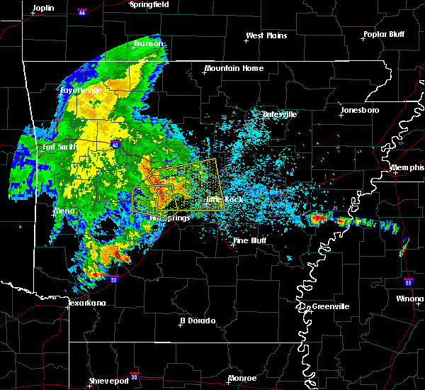 At 447 am cdt, severe thunderstorms were located along a line extending from near carden bottoms to near jessieville, moving east at 50 mph (radar indicated). Hazards include 60 mph wind gusts and penny size hail. expect damage to roofs, siding, and trees At 447 am cdt, severe thunderstorms were located along a line extending from near carden bottoms to near jessieville, moving east at 50 mph (radar indicated). Hazards include 60 mph wind gusts and penny size hail. expect damage to roofs, siding, and trees
|
| 5/15/2018 4:44 PM CDT |
 At 444 pm cdt, a severe thunderstorm was located 3 miles southeast of sherwood, moving east at 15 mph (radar indicated). Hazards include 60 mph wind gusts and nickel size hail. expect damage to roofs, siding, and trees At 444 pm cdt, a severe thunderstorm was located 3 miles southeast of sherwood, moving east at 15 mph (radar indicated). Hazards include 60 mph wind gusts and nickel size hail. expect damage to roofs, siding, and trees
|
| 5/15/2018 4:34 PM CDT |
 At 433 pm cdt, a severe thunderstorm was located over mcalmont, or near sherwood, moving east at 15 mph (radar indicated). Hazards include 60 mph wind gusts and nickel size hail. Expect damage to roofs, siding, and trees. Locations impacted include, little rock, north little rock, sherwood, jacksonville, downtown little rock, north little rock airport, argenta, protho junction, lakewood, sylvan hills, mcalmont, scott, levy, gravel ridge, camp robinson, baucum, park hill, willow beach, college station, rose city,. At 433 pm cdt, a severe thunderstorm was located over mcalmont, or near sherwood, moving east at 15 mph (radar indicated). Hazards include 60 mph wind gusts and nickel size hail. Expect damage to roofs, siding, and trees. Locations impacted include, little rock, north little rock, sherwood, jacksonville, downtown little rock, north little rock airport, argenta, protho junction, lakewood, sylvan hills, mcalmont, scott, levy, gravel ridge, camp robinson, baucum, park hill, willow beach, college station, rose city,.
|
| 5/15/2018 4:13 PM CDT |
 The national weather service in little rock has issued a * severe thunderstorm warning for. east central pulaski county in central arkansas. until 445 pm cdt. At 412 pm cdt, a severe thunderstorm was located over burns park, or near north little rock, moving east at 10 mph. The national weather service in little rock has issued a * severe thunderstorm warning for. east central pulaski county in central arkansas. until 445 pm cdt. At 412 pm cdt, a severe thunderstorm was located over burns park, or near north little rock, moving east at 10 mph.
|
| 5/6/2018 7:31 PM CDT |
 At 730 pm cdt, a severe thunderstorm was located over olmstead, or over little rock afb, moving southeast at 25 mph (radar indicated). Hazards include 60 mph wind gusts and quarter size hail. Hail damage to vehicles is expected. expect wind damage to roofs, siding, and trees. Locations impacted include, sherwood, jacksonville, cabot, lonoke, little rock afb, parnell, gravel ridge, sisemore, mcalmont, south bend, olmstead, meto, gibson, macon, furlow, kerr,. At 730 pm cdt, a severe thunderstorm was located over olmstead, or over little rock afb, moving southeast at 25 mph (radar indicated). Hazards include 60 mph wind gusts and quarter size hail. Hail damage to vehicles is expected. expect wind damage to roofs, siding, and trees. Locations impacted include, sherwood, jacksonville, cabot, lonoke, little rock afb, parnell, gravel ridge, sisemore, mcalmont, south bend, olmstead, meto, gibson, macon, furlow, kerr,.
|
| 5/6/2018 7:19 PM CDT |
 The national weather service in little rock has issued a * severe thunderstorm warning for. northwestern lonoke county in central arkansas. southeastern faulkner county in central arkansas. northeastern pulaski county in central arkansas. Until 800 pm cdt. The national weather service in little rock has issued a * severe thunderstorm warning for. northwestern lonoke county in central arkansas. southeastern faulkner county in central arkansas. northeastern pulaski county in central arkansas. Until 800 pm cdt.
|
| 4/13/2018 10:21 PM CDT |
 At 1021 pm cdt, severe thunderstorms were located along a line extending from gravel ridge to little rock to bryant, moving east at 40 mph (radar indicated). Hazards include 60 mph wind gusts. Expect damage to roofs, siding, and trees. Locations impacted include, little rock, north little rock, benton, sherwood, jacksonville, west little rock, maumelle, bryant, downtown little rock, lonoke, north little rock airport, southwest little rock, little rock afb, haskell, shannon hills, england, carlisle, wrightsville, argenta, redfield, a tornado watch remains in effect until 600 am cdt for central and southeastern arkansas. At 1021 pm cdt, severe thunderstorms were located along a line extending from gravel ridge to little rock to bryant, moving east at 40 mph (radar indicated). Hazards include 60 mph wind gusts. Expect damage to roofs, siding, and trees. Locations impacted include, little rock, north little rock, benton, sherwood, jacksonville, west little rock, maumelle, bryant, downtown little rock, lonoke, north little rock airport, southwest little rock, little rock afb, haskell, shannon hills, england, carlisle, wrightsville, argenta, redfield, a tornado watch remains in effect until 600 am cdt for central and southeastern arkansas.
|
| 4/13/2018 10:19 PM CDT |
 At 1018 pm cdt, severe thunderstorms were located along a line extending from near crosby to 7 miles southeast of mount vernon to near cabot to near olmstead, moving east at 40 mph (radar indicated). Hazards include 60 mph wind gusts. Expect damage to roofs, siding, and trees. Locations impacted include, jacksonville, cabot, searcy, augusta, little rock afb, beebe, ward, vilonia, bald knob, austin in lonoke county, judsonia, kensett, higginson, rose bud, russell, west point, mount vernon, old austin, crosby, parnell, a tornado watch remains in effect until 600 am cdt for central, eastern and north central arkansas. At 1018 pm cdt, severe thunderstorms were located along a line extending from near crosby to 7 miles southeast of mount vernon to near cabot to near olmstead, moving east at 40 mph (radar indicated). Hazards include 60 mph wind gusts. Expect damage to roofs, siding, and trees. Locations impacted include, jacksonville, cabot, searcy, augusta, little rock afb, beebe, ward, vilonia, bald knob, austin in lonoke county, judsonia, kensett, higginson, rose bud, russell, west point, mount vernon, old austin, crosby, parnell, a tornado watch remains in effect until 600 am cdt for central, eastern and north central arkansas.
|
| 4/13/2018 10:00 PM CDT |
 At 1000 pm cdt, severe thunderstorms were located along a line extending from maumelle to 6 miles southwest of chenal valley to 6 miles northeast of lonsdale, moving east at 40 mph (radar indicated). Hazards include 60 mph wind gusts. expect damage to roofs, siding, and trees At 1000 pm cdt, severe thunderstorms were located along a line extending from maumelle to 6 miles southwest of chenal valley to 6 miles northeast of lonsdale, moving east at 40 mph (radar indicated). Hazards include 60 mph wind gusts. expect damage to roofs, siding, and trees
|
| 4/13/2018 9:49 PM CDT |
 At 949 pm cdt, severe thunderstorms were located along a line extending from near rose bud to near springhill to near mayflower to near roland in pulaski county, moving east at 50 mph (radar indicated). Hazards include 70 mph wind gusts. Expect considerable tree damage. Damage is likely to mobile homes, roofs, and outbuildings. At 949 pm cdt, severe thunderstorms were located along a line extending from near rose bud to near springhill to near mayflower to near roland in pulaski county, moving east at 50 mph (radar indicated). Hazards include 70 mph wind gusts. Expect considerable tree damage. Damage is likely to mobile homes, roofs, and outbuildings.
|
| 4/3/2018 4:38 PM CDT |
 At 437 pm cdt, a cluster of severe thunderstorms was located near jacksonville, moving east at 25 mph (radar indicated). Hazards include quarter size hail. damage to vehicles is expected At 437 pm cdt, a cluster of severe thunderstorms was located near jacksonville, moving east at 25 mph (radar indicated). Hazards include quarter size hail. damage to vehicles is expected
|
| 3/10/2018 8:55 PM CDT |
 At 755 pm cst, severe thunderstorms were located along a line extending from near west little rock to near salem in saline county, moving southeast at 30 mph (radar indicated). Hazards include 60 mph wind gusts and quarter size hail. Hail damage to vehicles is expected. expect wind damage to roofs, siding, and trees. Locations impacted include, little rock, north little rock, sherwood, west little rock, maumelle, downtown little rock, lonoke, north little rock airport, southwest little rock, argenta, meto, toltec mounds state park, protho junction, lakewood, camp robinson, geyer springs, levy, mcalmont, state fairgrounds, burns park,. At 755 pm cst, severe thunderstorms were located along a line extending from near west little rock to near salem in saline county, moving southeast at 30 mph (radar indicated). Hazards include 60 mph wind gusts and quarter size hail. Hail damage to vehicles is expected. expect wind damage to roofs, siding, and trees. Locations impacted include, little rock, north little rock, sherwood, west little rock, maumelle, downtown little rock, lonoke, north little rock airport, southwest little rock, argenta, meto, toltec mounds state park, protho junction, lakewood, camp robinson, geyer springs, levy, mcalmont, state fairgrounds, burns park,.
|
| 3/10/2018 8:38 PM CDT |
 At 738 pm cst, severe thunderstorms were located along a line extending from pinnacle mountain state park to 10 miles northwest of salem in saline county, moving east at 35 mph (radar indicated). Hazards include 60 mph wind gusts and quarter size hail. Hail damage to vehicles is expected. Expect wind damage to roofs, siding, and trees. At 738 pm cst, severe thunderstorms were located along a line extending from pinnacle mountain state park to 10 miles northwest of salem in saline county, moving east at 35 mph (radar indicated). Hazards include 60 mph wind gusts and quarter size hail. Hail damage to vehicles is expected. Expect wind damage to roofs, siding, and trees.
|
| 2/24/2018 3:58 PM CST |
 At 358 pm cst, severe thunderstorms were located along a line extending from near vilonia to protho junction to near east end, moving east at 45 mph (radar indicated). Hazards include 60 mph wind gusts. Expect damage to roofs, siding, and trees. locations impacted include, little rock, north little rock, sherwood, jacksonville, cabot, downtown little rock, lonoke, north little rock airport, little rock afb, southwest little rock, beebe, ward, vilonia, shannon hills, wrightsville, austin in lonoke county, argenta, old austin, parnell, gravel ridge, this includes the following highways, interstate 30 between mile markers 127 and 142. interstate 40 between mile markers 148 and 172. interstate 430 near mile marker 1. interstate 530 between mile markers 1 and 16. interstate 630 between mile markers 1 and 6. interstate 440 between mile markers 1 and 14. us highway 67 between mile markers 1 and 27. A tornado watch remains in effect until 600 pm cst for central and southeastern arkansas. At 358 pm cst, severe thunderstorms were located along a line extending from near vilonia to protho junction to near east end, moving east at 45 mph (radar indicated). Hazards include 60 mph wind gusts. Expect damage to roofs, siding, and trees. locations impacted include, little rock, north little rock, sherwood, jacksonville, cabot, downtown little rock, lonoke, north little rock airport, little rock afb, southwest little rock, beebe, ward, vilonia, shannon hills, wrightsville, austin in lonoke county, argenta, old austin, parnell, gravel ridge, this includes the following highways, interstate 30 between mile markers 127 and 142. interstate 40 between mile markers 148 and 172. interstate 430 near mile marker 1. interstate 530 between mile markers 1 and 16. interstate 630 between mile markers 1 and 6. interstate 440 between mile markers 1 and 14. us highway 67 between mile markers 1 and 27. A tornado watch remains in effect until 600 pm cst for central and southeastern arkansas.
|
| 2/24/2018 3:39 PM CST |
 At 339 pm cst, severe thunderstorms were located along a line extending from near pickles gap to near chenal valley to near traskwood, moving east at 45 mph (radar indicated). Hazards include 60 mph wind gusts. Expect damage to roofs, siding, and trees. locations impacted include, little rock, north little rock, conway, benton, sherwood, jacksonville, cabot, west little rock, maumelle, bryant, downtown little rock, lonoke, north little rock airport, little rock afb, southwest little rock, beebe, ward, haskell, vilonia, shannon hills, this includes the following highways, interstate 30 between mile markers 106 and 142. interstate 40 between mile markers 127 and 172. interstate 430 between mile markers 1 and 12. interstate 530 between mile markers 1 and 16. interstate 630 between mile markers 1 and 7. interstate 440 between mile markers 1 and 14. us highway 67 between mile markers 1 and 27. A tornado watch remains in effect until 600 pm cst for central, southeastern and southwestern arkansas. At 339 pm cst, severe thunderstorms were located along a line extending from near pickles gap to near chenal valley to near traskwood, moving east at 45 mph (radar indicated). Hazards include 60 mph wind gusts. Expect damage to roofs, siding, and trees. locations impacted include, little rock, north little rock, conway, benton, sherwood, jacksonville, cabot, west little rock, maumelle, bryant, downtown little rock, lonoke, north little rock airport, little rock afb, southwest little rock, beebe, ward, haskell, vilonia, shannon hills, this includes the following highways, interstate 30 between mile markers 106 and 142. interstate 40 between mile markers 127 and 172. interstate 430 between mile markers 1 and 12. interstate 530 between mile markers 1 and 16. interstate 630 between mile markers 1 and 7. interstate 440 between mile markers 1 and 14. us highway 67 between mile markers 1 and 27. A tornado watch remains in effect until 600 pm cst for central, southeastern and southwestern arkansas.
|
| 2/24/2018 3:25 PM CST |
 At 325 pm cst, severe thunderstorms were located along a line extending from toad suck to near salem in saline county to near rockport, moving east at 45 mph (radar indicated). Hazards include 60 mph wind gusts. expect damage to roofs, siding, and trees At 325 pm cst, severe thunderstorms were located along a line extending from toad suck to near salem in saline county to near rockport, moving east at 45 mph (radar indicated). Hazards include 60 mph wind gusts. expect damage to roofs, siding, and trees
|
| 8/18/2017 10:51 PM CDT |
 At 1050 pm cdt, a severe thunderstorm was located near protho junction, or near sherwood, moving east at 30 mph (radar indicated). Hazards include 60 mph wind gusts. expect damage to roofs, siding, and trees At 1050 pm cdt, a severe thunderstorm was located near protho junction, or near sherwood, moving east at 30 mph (radar indicated). Hazards include 60 mph wind gusts. expect damage to roofs, siding, and trees
|
| 6/23/2017 5:28 PM CDT |
 The severe thunderstorm warning for central saline and southern pulaski counties will expire at 530 pm cdt, the storm which prompted the warning has weakened below severe limits, and no longer poses an immediate threat to life or property. therefore, the warning will be allowed to expire. however gusty winds and heavy rain are still possible with this thunderstorm. a severe thunderstorm watch remains in effect until 900 pm cdt for central arkansas. The severe thunderstorm warning for central saline and southern pulaski counties will expire at 530 pm cdt, the storm which prompted the warning has weakened below severe limits, and no longer poses an immediate threat to life or property. therefore, the warning will be allowed to expire. however gusty winds and heavy rain are still possible with this thunderstorm. a severe thunderstorm watch remains in effect until 900 pm cdt for central arkansas.
|
| 6/23/2017 5:08 PM CDT |
 A severe thunderstorm warning remains in effect until 530 pm cdt for central saline and southern pulaski counties. at 507 pm cdt, a severe thunderstorm was located near salem in saline county, or near bryant, moving south at 30 mph. hazard. 60 mph wind gusts and quarter size hail. source. Radar indicated. A severe thunderstorm warning remains in effect until 530 pm cdt for central saline and southern pulaski counties. at 507 pm cdt, a severe thunderstorm was located near salem in saline county, or near bryant, moving south at 30 mph. hazard. 60 mph wind gusts and quarter size hail. source. Radar indicated.
|
| 6/23/2017 4:39 PM CDT |
 At 439 pm cdt, a severe thunderstorm was located over roland in pulaski county, or near maumelle, moving south at 30 mph (radar indicated). Hazards include 60 mph wind gusts and quarter size hail. Hail damage to vehicles is expected. Expect wind damage to roofs, siding, and trees. At 439 pm cdt, a severe thunderstorm was located over roland in pulaski county, or near maumelle, moving south at 30 mph (radar indicated). Hazards include 60 mph wind gusts and quarter size hail. Hail damage to vehicles is expected. Expect wind damage to roofs, siding, and trees.
|
| 5/28/2017 1:35 AM CDT |
 At 135 am cdt, severe thunderstorms were located along a line extending from near enola to near conway to houston, moving southeast at 55 mph (radar indicated). Hazards include 60 mph wind gusts. Expect damage to roofs, siding, and trees. locations impacted include, little rock, north little rock, conway, benton, sherwood, jacksonville, cabot, west little rock, maumelle, bryant, downtown little rock, morrilton, lonoke, des arc, hazen, perryville, north little rock airport, little rock afb, southwest little rock, beebe, this includes the following highways, interstate 30 between mile markers 118 and 142. interstate 40 between mile markers 103 and 196. interstate 430 between mile markers 1 and 12. interstate 530 between mile markers 1 and 23. interstate 630 between mile markers 1 and 7. interstate 440 between mile markers 1 and 14. Us highway 67 between mile markers 1 and 41. At 135 am cdt, severe thunderstorms were located along a line extending from near enola to near conway to houston, moving southeast at 55 mph (radar indicated). Hazards include 60 mph wind gusts. Expect damage to roofs, siding, and trees. locations impacted include, little rock, north little rock, conway, benton, sherwood, jacksonville, cabot, west little rock, maumelle, bryant, downtown little rock, morrilton, lonoke, des arc, hazen, perryville, north little rock airport, little rock afb, southwest little rock, beebe, this includes the following highways, interstate 30 between mile markers 118 and 142. interstate 40 between mile markers 103 and 196. interstate 430 between mile markers 1 and 12. interstate 530 between mile markers 1 and 23. interstate 630 between mile markers 1 and 7. interstate 440 between mile markers 1 and 14. Us highway 67 between mile markers 1 and 41.
|
| 5/28/2017 1:24 AM CDT |
 At 124 am cdt, severe thunderstorms were located along a line extending from near greenbrier to near toad suck to near adona, moving southeast at 70 mph (radar indicated). Hazards include 70 mph wind gusts. Expect considerable tree damage. Damage is likely to mobile homes, roofs, and outbuildings. At 124 am cdt, severe thunderstorms were located along a line extending from near greenbrier to near toad suck to near adona, moving southeast at 70 mph (radar indicated). Hazards include 70 mph wind gusts. Expect considerable tree damage. Damage is likely to mobile homes, roofs, and outbuildings.
|
| 5/19/2017 6:35 PM CDT |
 At 635 pm cdt, a severe thunderstorm was located over little rock afb, moving north at 25 mph (radar indicated). Hazards include 60 mph wind gusts and quarter size hail. Hail damage to vehicles is expected. expect wind damage to roofs, siding, and trees. locations impacted include, sherwood, jacksonville, cabot, little rock afb, ward, austin in lonoke county, old austin, parnell, gravel ridge, sylvan hills, meto, south bend, olmstead, gibson, macon, furlow, kerr, this includes the following highways, interstate 40 between mile markers 163 and 169. interstate 440 between mile markers 13 and 14. Us highway 67 between mile markers 5 and 23. At 635 pm cdt, a severe thunderstorm was located over little rock afb, moving north at 25 mph (radar indicated). Hazards include 60 mph wind gusts and quarter size hail. Hail damage to vehicles is expected. expect wind damage to roofs, siding, and trees. locations impacted include, sherwood, jacksonville, cabot, little rock afb, ward, austin in lonoke county, old austin, parnell, gravel ridge, sylvan hills, meto, south bend, olmstead, gibson, macon, furlow, kerr, this includes the following highways, interstate 40 between mile markers 163 and 169. interstate 440 between mile markers 13 and 14. Us highway 67 between mile markers 5 and 23.
|
| 5/19/2017 6:26 PM CDT |
 At 625 pm cdt, a severe thunderstorm was located over jacksonville, moving north at 25 mph (radar indicated). Hazards include 60 mph wind gusts and quarter size hail. Hail damage to vehicles is expected. expect wind damage to roofs, siding, and trees. locations impacted include, little rock, north little rock, sherwood, jacksonville, cabot, downtown little rock, north little rock airport, little rock afb, ward, austin in lonoke county, argenta, old austin, parnell, gravel ridge, meto, olmstead, protho junction, gibson, lakewood, sylvan hills, this includes the following highways, interstate 30 between mile markers 138 and 142. interstate 40 between mile markers 153 and 169. interstate 440 between mile markers 1 and 14. Us highway 67 between mile markers 1 and 23. At 625 pm cdt, a severe thunderstorm was located over jacksonville, moving north at 25 mph (radar indicated). Hazards include 60 mph wind gusts and quarter size hail. Hail damage to vehicles is expected. expect wind damage to roofs, siding, and trees. locations impacted include, little rock, north little rock, sherwood, jacksonville, cabot, downtown little rock, north little rock airport, little rock afb, ward, austin in lonoke county, argenta, old austin, parnell, gravel ridge, meto, olmstead, protho junction, gibson, lakewood, sylvan hills, this includes the following highways, interstate 30 between mile markers 138 and 142. interstate 40 between mile markers 153 and 169. interstate 440 between mile markers 1 and 14. Us highway 67 between mile markers 1 and 23.
|
| 5/19/2017 5:57 PM CDT |
 At 557 pm cdt, a severe thunderstorm was located near scott, or 9 miles southeast of downtown little rock, moving north at 25 mph (radar indicated). Hazards include 60 mph wind gusts and quarter size hail. Hail damage to vehicles is expected. Expect wind damage to roofs, siding, and trees. At 557 pm cdt, a severe thunderstorm was located near scott, or 9 miles southeast of downtown little rock, moving north at 25 mph (radar indicated). Hazards include 60 mph wind gusts and quarter size hail. Hail damage to vehicles is expected. Expect wind damage to roofs, siding, and trees.
|
| 4/29/2017 11:37 PM CDT |
 At 1136 pm cdt, severe thunderstorms were located along a line extending from near clinton to springhill to 6 miles west of chenal valley, moving northeast at 55 mph (radar indicated). Hazards include 60 mph wind gusts and penny size hail. Expect damage to roofs, siding, and trees. locations impacted include, little rock, north little rock, conway, sherwood, jacksonville, cabot, west little rock, maumelle, bryant, hot springs village, downtown little rock, heber springs, lonoke, clinton, fairfield bay, north little rock airport, little rock afb, southwest little rock, beebe, greenbrier, this includes the following highways, interstate 30 between mile markers 127 and 142. interstate 40 between mile markers 119 and 173. interstate 430 between mile markers 1 and 12. interstate 530 between mile markers 1 and 3. interstate 630 between mile markers 1 and 7. interstate 440 between mile markers 1 and 14. Us highway 67 between mile markers 1 and 27. At 1136 pm cdt, severe thunderstorms were located along a line extending from near clinton to springhill to 6 miles west of chenal valley, moving northeast at 55 mph (radar indicated). Hazards include 60 mph wind gusts and penny size hail. Expect damage to roofs, siding, and trees. locations impacted include, little rock, north little rock, conway, sherwood, jacksonville, cabot, west little rock, maumelle, bryant, hot springs village, downtown little rock, heber springs, lonoke, clinton, fairfield bay, north little rock airport, little rock afb, southwest little rock, beebe, greenbrier, this includes the following highways, interstate 30 between mile markers 127 and 142. interstate 40 between mile markers 119 and 173. interstate 430 between mile markers 1 and 12. interstate 530 between mile markers 1 and 3. interstate 630 between mile markers 1 and 7. interstate 440 between mile markers 1 and 14. Us highway 67 between mile markers 1 and 27.
|
| 4/29/2017 11:13 PM CDT |
 At 1113 pm cdt, severe thunderstorms were located along a line extending from near cleveland to near houston to near lonsdale, moving northeast at 55 mph (radar indicated). Hazards include 60 mph wind gusts and penny size hail. expect damage to roofs, siding, and trees At 1113 pm cdt, severe thunderstorms were located along a line extending from near cleveland to near houston to near lonsdale, moving northeast at 55 mph (radar indicated). Hazards include 60 mph wind gusts and penny size hail. expect damage to roofs, siding, and trees
|
| 4/29/2017 7:23 PM CDT |
 At 723 pm cdt, a severe thunderstorm was located near cabot, moving north at 35 mph (radar indicated). Hazards include 60 mph wind gusts and penny size hail. Expect damage to roofs, siding, and trees. Locations impacted include, jacksonville, cabot, little rock afb, beebe, ward, vilonia, austin in lonoke county, quitman, rose bud, enola, mount vernon, old austin, crosby, parnell, gravel hill, sylvania, olmstead, letona, antioch in white county, barney, this includes us highway 67 between mile markers 11 and 31. At 723 pm cdt, a severe thunderstorm was located near cabot, moving north at 35 mph (radar indicated). Hazards include 60 mph wind gusts and penny size hail. Expect damage to roofs, siding, and trees. Locations impacted include, jacksonville, cabot, little rock afb, beebe, ward, vilonia, austin in lonoke county, quitman, rose bud, enola, mount vernon, old austin, crosby, parnell, gravel hill, sylvania, olmstead, letona, antioch in white county, barney, this includes us highway 67 between mile markers 11 and 31.
|
| 4/29/2017 7:13 PM CDT |
 At 713 pm cdt, a severe thunderstorm was located over jacksonville, moving north at 40 mph (radar indicated). Hazards include 60 mph wind gusts and quarter size hail. Hail damage to vehicles is expected. Expect wind damage to roofs, siding, and trees. At 713 pm cdt, a severe thunderstorm was located over jacksonville, moving north at 40 mph (radar indicated). Hazards include 60 mph wind gusts and quarter size hail. Hail damage to vehicles is expected. Expect wind damage to roofs, siding, and trees.
|
| 3/24/2017 11:29 PM CDT |
 At 1129 pm cdt, a severe thunderstorm was located over parnell, or near cabot, moving northeast at 50 mph (radar indicated). Hazards include 60 mph wind gusts. Expect damage to roofs, siding, and trees. Locations impacted include, jacksonville, cabot, lonoke, little rock afb, ward, austin in lonoke county, old austin, parnell, meto, sylvania, south bend, olmstead, bevis corner, macon, furlow, butlerville, woodlawn, fairview in lonoke county, kerr,. At 1129 pm cdt, a severe thunderstorm was located over parnell, or near cabot, moving northeast at 50 mph (radar indicated). Hazards include 60 mph wind gusts. Expect damage to roofs, siding, and trees. Locations impacted include, jacksonville, cabot, lonoke, little rock afb, ward, austin in lonoke county, old austin, parnell, meto, sylvania, south bend, olmstead, bevis corner, macon, furlow, butlerville, woodlawn, fairview in lonoke county, kerr,.
|
| 3/24/2017 11:05 PM CDT |
 At 1105 pm cdt, a severe thunderstorm was located over little rock, moving northeast at 55 mph (radar indicated). Hazards include 70 mph wind gusts. Expect considerable tree damage. Damage is likely to mobile homes, roofs, and outbuildings. At 1105 pm cdt, a severe thunderstorm was located over little rock, moving northeast at 55 mph (radar indicated). Hazards include 70 mph wind gusts. Expect considerable tree damage. Damage is likely to mobile homes, roofs, and outbuildings.
|
| 3/1/2017 4:56 AM CST |
 At 456 am cst, a severe thunderstorm was located over meto, or near lonoke, moving east at 75 mph (radar indicated). Hazards include 60 mph wind gusts and quarter size hail. Hail damage to vehicles is expected. expect wind damage to roofs, siding, and trees. locations impacted include, little rock, north little rock, sherwood, jacksonville, cabot, downtown little rock, lonoke, des arc, little rock afb, beebe, ward, carlisle, austin in lonoke county, argenta, west point, barrettsville, old austin, parnell, meto, thurman, this includes the following highways, interstate 30 between mile markers 134 and 142. interstate 40 between mile markers 151 and 190. interstate 530 between mile markers 1 and 3. interstate 630 between mile markers 1 and 3. interstate 440 between mile markers 1 and 14. Us highway 67 between mile markers 1 and 14. At 456 am cst, a severe thunderstorm was located over meto, or near lonoke, moving east at 75 mph (radar indicated). Hazards include 60 mph wind gusts and quarter size hail. Hail damage to vehicles is expected. expect wind damage to roofs, siding, and trees. locations impacted include, little rock, north little rock, sherwood, jacksonville, cabot, downtown little rock, lonoke, des arc, little rock afb, beebe, ward, carlisle, austin in lonoke county, argenta, west point, barrettsville, old austin, parnell, meto, thurman, this includes the following highways, interstate 30 between mile markers 134 and 142. interstate 40 between mile markers 151 and 190. interstate 530 between mile markers 1 and 3. interstate 630 between mile markers 1 and 3. interstate 440 between mile markers 1 and 14. Us highway 67 between mile markers 1 and 14.
|
| 3/1/2017 4:45 AM CST |
 At 445 am cst, a severe thunderstorm was located over protho junction, or near north little rock, moving east at 75 mph (radar indicated). Hazards include 60 mph wind gusts and quarter size hail. Hail damage to vehicles is expected. expect wind damage to roofs, siding, and trees. locations impacted include, little rock, north little rock, sherwood, jacksonville, cabot, west little rock, maumelle, downtown little rock, lonoke, des arc, north little rock airport, little rock afb, southwest little rock, beebe, ward, carlisle, austin in lonoke county, argenta, higginson, west point, this includes the following highways, interstate 30 between mile markers 133 and 142. interstate 40 between mile markers 145 and 190. interstate 430 between mile markers 7 and 12. interstate 530 between mile markers 1 and 3. interstate 630 between mile markers 1 and 7. interstate 440 between mile markers 1 and 14. Us highway 67 between mile markers 1 and 35. At 445 am cst, a severe thunderstorm was located over protho junction, or near north little rock, moving east at 75 mph (radar indicated). Hazards include 60 mph wind gusts and quarter size hail. Hail damage to vehicles is expected. expect wind damage to roofs, siding, and trees. locations impacted include, little rock, north little rock, sherwood, jacksonville, cabot, west little rock, maumelle, downtown little rock, lonoke, des arc, north little rock airport, little rock afb, southwest little rock, beebe, ward, carlisle, austin in lonoke county, argenta, higginson, west point, this includes the following highways, interstate 30 between mile markers 133 and 142. interstate 40 between mile markers 145 and 190. interstate 430 between mile markers 7 and 12. interstate 530 between mile markers 1 and 3. interstate 630 between mile markers 1 and 7. interstate 440 between mile markers 1 and 14. Us highway 67 between mile markers 1 and 35.
|
| 3/1/2017 4:35 AM CST |
 At 435 am cst, a severe thunderstorm was located near otter creek, or near southwest little rock, moving east at 75 mph (radar indicated). Hazards include 60 mph wind gusts and quarter size hail. Hail damage to vehicles is expected. Expect wind damage to roofs, siding, and trees. At 435 am cst, a severe thunderstorm was located near otter creek, or near southwest little rock, moving east at 75 mph (radar indicated). Hazards include 60 mph wind gusts and quarter size hail. Hail damage to vehicles is expected. Expect wind damage to roofs, siding, and trees.
|
| 2/28/2017 6:05 PM CST |
 At 605 pm cst, a severe thunderstorm was located over little italy, or 10 miles west of maumelle, moving northeast at 40 mph (radar indicated). Hazards include tennis ball size hail and 60 mph wind gusts. People and animals outdoors will be injured. expect hail damage to roofs, siding, windows, and vehicles. Expect wind damage to roofs, siding, and trees. At 605 pm cst, a severe thunderstorm was located over little italy, or 10 miles west of maumelle, moving northeast at 40 mph (radar indicated). Hazards include tennis ball size hail and 60 mph wind gusts. People and animals outdoors will be injured. expect hail damage to roofs, siding, windows, and vehicles. Expect wind damage to roofs, siding, and trees.
|
| 2/28/2017 6:01 PM CST |
 At 600 pm cst, a severe thunderstorm capable of producing a tornado was located over mayflower, or 7 miles north of maumelle, moving northeast at 40 mph (radar indicated rotation). Hazards include tornado and softball size hail. Flying debris will be dangerous to those caught without shelter. mobile homes will be damaged or destroyed. damage to roofs, windows, and vehicles will occur. tree damage is likely. storm spotters reported softball sized hail with this storm. This is an incredibly dangerous storm, take shelter or avoid this storm! locations impacted include, little rock afb, vilonia, mayflower, olmstead, gibson, hamlet, saltillo, macon, otto, cato, this includes interstate 40 between mile markers 131 and 140. At 600 pm cst, a severe thunderstorm capable of producing a tornado was located over mayflower, or 7 miles north of maumelle, moving northeast at 40 mph (radar indicated rotation). Hazards include tornado and softball size hail. Flying debris will be dangerous to those caught without shelter. mobile homes will be damaged or destroyed. damage to roofs, windows, and vehicles will occur. tree damage is likely. storm spotters reported softball sized hail with this storm. This is an incredibly dangerous storm, take shelter or avoid this storm! locations impacted include, little rock afb, vilonia, mayflower, olmstead, gibson, hamlet, saltillo, macon, otto, cato, this includes interstate 40 between mile markers 131 and 140.
|
| 2/28/2017 5:54 PM CST |
 At 554 pm cst, a severe thunderstorm capable of producing a tornado was located near mayflower, or near maumelle, moving northeast at 40 mph. this dangerous storm will cross interstate 40 near mayflower, stay out of its path! (radar indicated rotation). Hazards include tornado and baseball size hail. Flying debris will be dangerous to those caught without shelter. mobile homes will be damaged or destroyed. damage to roofs, windows, and vehicles will occur. Tree damage is likely. At 554 pm cst, a severe thunderstorm capable of producing a tornado was located near mayflower, or near maumelle, moving northeast at 40 mph. this dangerous storm will cross interstate 40 near mayflower, stay out of its path! (radar indicated rotation). Hazards include tornado and baseball size hail. Flying debris will be dangerous to those caught without shelter. mobile homes will be damaged or destroyed. damage to roofs, windows, and vehicles will occur. Tree damage is likely.
|
| 2/7/2017 4:56 AM CST |
 At 455 am cst, a severe thunderstorm was located over maumelle, moving east at 40 mph (radar indicated). Hazards include quarter size hail. damage to vehicles is expected At 455 am cst, a severe thunderstorm was located over maumelle, moving east at 40 mph (radar indicated). Hazards include quarter size hail. damage to vehicles is expected
|
| 8/7/2016 4:41 PM CDT |
 The severe thunderstorm warning for central pulaski and south central faulkner counties will expire at 445 pm cdt, the storm which prompted the warning has weakened below severe limits, and no longer pose an immediate threat to life or property. therefore the warning will be allowed to expire. however heavy rain is still possible with this thunderstorm. The severe thunderstorm warning for central pulaski and south central faulkner counties will expire at 445 pm cdt, the storm which prompted the warning has weakened below severe limits, and no longer pose an immediate threat to life or property. therefore the warning will be allowed to expire. however heavy rain is still possible with this thunderstorm.
|
| 8/7/2016 4:33 PM CDT |
 At 433 pm cdt, a severe thunderstorm was located near enola, or 14 miles east of conway, moving southeast at 35 mph (radar indicated). Hazards include 60 mph wind gusts. Expect damage to roofs. siding. And trees. At 433 pm cdt, a severe thunderstorm was located near enola, or 14 miles east of conway, moving southeast at 35 mph (radar indicated). Hazards include 60 mph wind gusts. Expect damage to roofs. siding. And trees.
|
| 8/7/2016 4:26 PM CDT |
 At 426 pm cdt, a severe thunderstorm was located over morgan, or over maumelle, moving south at 40 mph (radar indicated). Hazards include 60 mph wind gusts. Expect damage to roofs. siding. And trees. At 426 pm cdt, a severe thunderstorm was located over morgan, or over maumelle, moving south at 40 mph (radar indicated). Hazards include 60 mph wind gusts. Expect damage to roofs. siding. And trees.
|
| 8/3/2016 5:08 PM CDT |
 At 507 pm cdt, a severe thunderstorm was located over gravel ridge, or over sherwood, and is nearly stationary (radar and spotter indicated). Hazards include 60 mph wind gusts and quarter size hail. Hail damage to vehicles is expected. expect wind damage to roofs, siding, and trees. Locations impacted include, little rock, north little rock, sherwood, jacksonville, maumelle, downtown little rock, north little rock airport, little rock afb, argenta, oak grove in pulaski county, lakewood, mcalmont, marche, olmstead, gibson, levy, camp robinson, sylvan hills, gravel ridge, protho junction,. At 507 pm cdt, a severe thunderstorm was located over gravel ridge, or over sherwood, and is nearly stationary (radar and spotter indicated). Hazards include 60 mph wind gusts and quarter size hail. Hail damage to vehicles is expected. expect wind damage to roofs, siding, and trees. Locations impacted include, little rock, north little rock, sherwood, jacksonville, maumelle, downtown little rock, north little rock airport, little rock afb, argenta, oak grove in pulaski county, lakewood, mcalmont, marche, olmstead, gibson, levy, camp robinson, sylvan hills, gravel ridge, protho junction,.
|
| 8/3/2016 4:54 PM CDT |
 At 454 pm cdt, a severe thunderstorm was located over gravel ridge, or over sherwood, and is nearly stationary (radar indicated). Hazards include 60 mph wind gusts and quarter size hail. Hail damage to vehicles is expected. Expect wind damage to roofs, siding, and trees. At 454 pm cdt, a severe thunderstorm was located over gravel ridge, or over sherwood, and is nearly stationary (radar indicated). Hazards include 60 mph wind gusts and quarter size hail. Hail damage to vehicles is expected. Expect wind damage to roofs, siding, and trees.
|
| 7/29/2016 4:27 PM CDT | The severe thunderstorm warning for eastern pulaski county will expire at 430 pm cdt, the severe storm which prompted the warning has moved east into lonoke county. therefore the warningwill be allowed to expire. gusty winds, heavy rain and lightning will contniue across eastern pulaski county through 5 pm. |
| 7/29/2016 4:13 PM CDT |
 At 413 pm cdt, a severe thunderstorm was located over protho junction, or near north little rock, moving east at 25 mph (radar indicated). Hazards include 60 mph wind gusts and penny size hail. Expect damage to roofs. siding. and trees. Locations impacted include, little rock, north little rock, sherwood, jacksonville, downtown little rock, north little rock airport, little rock afb, wrightsville, argenta, sweet home, lakewood, mcalmont, scott, ironton, olmstead, gibson, levy, camp robinson, sylvan hills, gravel ridge,. At 413 pm cdt, a severe thunderstorm was located over protho junction, or near north little rock, moving east at 25 mph (radar indicated). Hazards include 60 mph wind gusts and penny size hail. Expect damage to roofs. siding. and trees. Locations impacted include, little rock, north little rock, sherwood, jacksonville, downtown little rock, north little rock airport, little rock afb, wrightsville, argenta, sweet home, lakewood, mcalmont, scott, ironton, olmstead, gibson, levy, camp robinson, sylvan hills, gravel ridge,.
|
| 7/29/2016 3:45 PM CDT |
 At 345 pm cdt, a severe thunderstorm was located over west little rock, moving east at 20 mph (radar indicated). Hazards include 60 mph wind gusts and penny size hail. Expect damage to roofs. siding. And trees. At 345 pm cdt, a severe thunderstorm was located over west little rock, moving east at 20 mph (radar indicated). Hazards include 60 mph wind gusts and penny size hail. Expect damage to roofs. siding. And trees.
|
| 7/23/2016 4:41 PM CDT |
 At 440 pm cdt, severe thunderstorms were located along a line extending from cabot to just northwest of lonoke, moving southwest at 25 mph (radar indicated). Hazards include 60 mph wind gusts and penny size hail. Expect damage to roofs. siding. And trees. At 440 pm cdt, severe thunderstorms were located along a line extending from cabot to just northwest of lonoke, moving southwest at 25 mph (radar indicated). Hazards include 60 mph wind gusts and penny size hail. Expect damage to roofs. siding. And trees.
|
| 7/14/2016 6:20 PM CDT |
 At 620 pm cdt, a severe thunderstorm was located near meto, or 7 miles southeast of jacksonville, moving east at 40 mph (automated weather station observation). Hazards include 70 mph wind gusts. Expect considerable tree damage. damage is likely to mobile homes, roofs, and outbuildings. Locations impacted include, little rock, north little rock, sherwood, jacksonville, cabot, west little rock, maumelle, downtown little rock, lonoke, little rock afb, southwest little rock, north little rock airport, ward, vilonia, shannon hills, england, mayflower, wrightsville, austin in lonoke county, argenta,. At 620 pm cdt, a severe thunderstorm was located near meto, or 7 miles southeast of jacksonville, moving east at 40 mph (automated weather station observation). Hazards include 70 mph wind gusts. Expect considerable tree damage. damage is likely to mobile homes, roofs, and outbuildings. Locations impacted include, little rock, north little rock, sherwood, jacksonville, cabot, west little rock, maumelle, downtown little rock, lonoke, little rock afb, southwest little rock, north little rock airport, ward, vilonia, shannon hills, england, mayflower, wrightsville, austin in lonoke county, argenta,.
|
| 7/14/2016 5:56 PM CDT |
 At 555 pm cdt, a severe thunderstorm was located over west little rock, moving east at 30 mph (radar indicated). Hazards include 70 mph wind gusts and quarter size hail. Hail damage to vehicles is expected. expect considerable tree damage. Wind damage is also likely to mobile homes, roofs, and outbuildings. At 555 pm cdt, a severe thunderstorm was located over west little rock, moving east at 30 mph (radar indicated). Hazards include 70 mph wind gusts and quarter size hail. Hail damage to vehicles is expected. expect considerable tree damage. Wind damage is also likely to mobile homes, roofs, and outbuildings.
|
| 7/10/2016 4:52 PM CDT |
 The severe thunderstorm warning for northeastern pulaski county will expire at 500 pm cdt, the storm which prompted the warning has weakened below severe limits, and no longer pose an immediate threat to life or property. therefore the warning will be allowed to expire. however heavy rain is still possible with this thunderstorm. The severe thunderstorm warning for northeastern pulaski county will expire at 500 pm cdt, the storm which prompted the warning has weakened below severe limits, and no longer pose an immediate threat to life or property. therefore the warning will be allowed to expire. however heavy rain is still possible with this thunderstorm.
|
| 7/10/2016 4:14 PM CDT |
 At 414 pm cdt, a severe thunderstorm was located near protho junction, or near downtown little rock, moving north at 10 mph (radar indicated). Hazards include 60 mph wind gusts and quarter size hail. Hail damage to vehicles is expected. Expect wind damage to roofs, siding, and trees. At 414 pm cdt, a severe thunderstorm was located near protho junction, or near downtown little rock, moving north at 10 mph (radar indicated). Hazards include 60 mph wind gusts and quarter size hail. Hail damage to vehicles is expected. Expect wind damage to roofs, siding, and trees.
|
| 7/10/2016 3:30 PM CDT |
 At 330 pm cdt, a severe thunderstorm was located over camp robinson, or over north little rock, moving north at 5 mph (radar indicated). Hazards include 60 mph wind gusts and quarter size hail. Hail damage to vehicles is expected. Expect wind damage to roofs, siding, and trees. At 330 pm cdt, a severe thunderstorm was located over camp robinson, or over north little rock, moving north at 5 mph (radar indicated). Hazards include 60 mph wind gusts and quarter size hail. Hail damage to vehicles is expected. Expect wind damage to roofs, siding, and trees.
|
| 6/1/2016 1:25 AM CDT |
 At 125 am cdt, a severe thunderstorm was located over oak grove in pulaski county, or near maumelle, moving northeast at 10 mph (radar indicated). Hazards include 60 mph wind gusts. Expect damage to roofs. siding. and trees. Locations impacted include, little rock, north little rock, sherwood, jacksonville, maumelle, north little rock ai, little rock afb, oak grove in pulaski, morgan, marche, gibson, camp robinson, sylvan hills, gravel ridge, burns park, amboy, cammack village, cato, indian hills, the heights,. At 125 am cdt, a severe thunderstorm was located over oak grove in pulaski county, or near maumelle, moving northeast at 10 mph (radar indicated). Hazards include 60 mph wind gusts. Expect damage to roofs. siding. and trees. Locations impacted include, little rock, north little rock, sherwood, jacksonville, maumelle, north little rock ai, little rock afb, oak grove in pulaski, morgan, marche, gibson, camp robinson, sylvan hills, gravel ridge, burns park, amboy, cammack village, cato, indian hills, the heights,.
|
| 6/1/2016 1:09 AM CDT |
 At 108 am cdt, a severe thunderstorm was located over maumelle, moving northeast at 10 mph (radar indicated). Hazards include 60 mph wind gusts and penny size hail. Expect damage to roofs. siding. And trees. At 108 am cdt, a severe thunderstorm was located over maumelle, moving northeast at 10 mph (radar indicated). Hazards include 60 mph wind gusts and penny size hail. Expect damage to roofs. siding. And trees.
|
| 5/12/2016 7:07 AM CDT |
 At 707 am cdt, severe thunderstorms were located along a line extending from near olmstead to little rock afb to mcalmont, moving northeast at 55 mph (radar indicated). Hazards include 60 mph wind gusts. Expect damage to roofs. siding. and trees. Locations impacted include, north little rock, sherwood, jacksonville, cabot, little rock afb, north little rock ai, beebe, ward, austin in lonoke cou, thurman, olmstead, old austin, gibson, parnell, camp robinson, sylvan hills, sylvania, gravel ridge, burns park, south bend,. At 707 am cdt, severe thunderstorms were located along a line extending from near olmstead to little rock afb to mcalmont, moving northeast at 55 mph (radar indicated). Hazards include 60 mph wind gusts. Expect damage to roofs. siding. and trees. Locations impacted include, north little rock, sherwood, jacksonville, cabot, little rock afb, north little rock ai, beebe, ward, austin in lonoke cou, thurman, olmstead, old austin, gibson, parnell, camp robinson, sylvan hills, sylvania, gravel ridge, burns park, south bend,.
|
| 5/12/2016 7:05 AM CDT | Large tree limbs dow in pulaski county AR, 2.1 miles S of Sherwood, AR |
| 5/12/2016 7:05 AM CDT | Large tree limbs down near batesville pike with one large limb on a hom in pulaski county AR, 2.5 miles SE of Sherwood, AR |
| 5/12/2016 7:05 AM CDT | Tree reported down near batesville pike and frenchman mountain r in pulaski county AR, 4.2 miles S of Sherwood, AR |
| 5/12/2016 6:54 AM CDT |
 At 654 am cdt, a severe thunderstorm was located over marche, or near maumelle, moving east at 50 mph (radar indicated). Hazards include 60 mph wind gusts. Expect damage to roofs. siding. And trees. At 654 am cdt, a severe thunderstorm was located over marche, or near maumelle, moving east at 50 mph (radar indicated). Hazards include 60 mph wind gusts. Expect damage to roofs. siding. And trees.
|
| 5/9/2016 11:30 PM CDT |
 A severe thunderstorm warning remains in effect until midnight cdt for eastern pulaski. lonoke. east central faulkner. southwestern white and northwestern prairie counties. at 1128 pm cdt. severe thunderstorms were located along a line extending from floyd to cabot to near toltec mounds state park. Moving east at 45 mph. A severe thunderstorm warning remains in effect until midnight cdt for eastern pulaski. lonoke. east central faulkner. southwestern white and northwestern prairie counties. at 1128 pm cdt. severe thunderstorms were located along a line extending from floyd to cabot to near toltec mounds state park. Moving east at 45 mph.
|
| 5/9/2016 11:06 PM CDT |
 At 1104 pm cdt, severe thunderstorms were located along a line extending from enola to north little rock to shannon hills, moving east at 45 mph (radar indicated). Hazards include 60 mph wind gusts and nickel size hail. Expect damage to roofs. siding. And trees. At 1104 pm cdt, severe thunderstorms were located along a line extending from enola to north little rock to shannon hills, moving east at 45 mph (radar indicated). Hazards include 60 mph wind gusts and nickel size hail. Expect damage to roofs. siding. And trees.
|
| 5/9/2016 11:03 PM CDT |
 At 1103 pm cdt, severe thunderstorms were located along a line extending from near vilonia to sylvan hills to near geyer springs, moving east at 35 mph (radar indicated). Hazards include 60 mph wind gusts and quarter size hail. Hail damage to vehicles is expected. Expect wind damage to roofs, siding, and trees. At 1103 pm cdt, severe thunderstorms were located along a line extending from near vilonia to sylvan hills to near geyer springs, moving east at 35 mph (radar indicated). Hazards include 60 mph wind gusts and quarter size hail. Hail damage to vehicles is expected. Expect wind damage to roofs, siding, and trees.
|
| 5/9/2016 10:52 PM CDT |
 At 1050 pm cdt, severe thunderstorms were located along a line extending from near mayflower to morgan to near otter creek, moving northeast at 40 mph (radar indicated). Hazards include 70 mph wind gusts and quarter size hail. Hail damage to vehicles is expected. expect considerable tree damage. wind damage is also likely to mobile homes, roofs, and outbuildings. Locations impacted include, little rock, north little rock, conway, sherwood, jacksonville, west little rock, maumelle, bryant, downtown little rock, little rock afb, southwest little roc, north little rock ai, vilonia, mayflower, argenta, enola, mount vernon, sweet home, geyer springs, state fairgrounds, a tornado watch remains in effect until 200 am cdt for central arkansas. At 1050 pm cdt, severe thunderstorms were located along a line extending from near mayflower to morgan to near otter creek, moving northeast at 40 mph (radar indicated). Hazards include 70 mph wind gusts and quarter size hail. Hail damage to vehicles is expected. expect considerable tree damage. wind damage is also likely to mobile homes, roofs, and outbuildings. Locations impacted include, little rock, north little rock, conway, sherwood, jacksonville, west little rock, maumelle, bryant, downtown little rock, little rock afb, southwest little roc, north little rock ai, vilonia, mayflower, argenta, enola, mount vernon, sweet home, geyer springs, state fairgrounds, a tornado watch remains in effect until 200 am cdt for central arkansas.
|
| 5/9/2016 10:28 PM CDT |
 At 1028 pm cdt, severe thunderstorms were located along a line extending from little italy to 6 miles southwest of pinnacle mountain state park to 8 miles west of salem in saline county, moving northeast at 40 mph (radar indicated). Hazards include 60 mph wind gusts and quarter size hail. Hail damage to vehicles is expected. Expect wind damage to roofs, siding, and trees. At 1028 pm cdt, severe thunderstorms were located along a line extending from little italy to 6 miles southwest of pinnacle mountain state park to 8 miles west of salem in saline county, moving northeast at 40 mph (radar indicated). Hazards include 60 mph wind gusts and quarter size hail. Hail damage to vehicles is expected. Expect wind damage to roofs, siding, and trees.
|
| 3/31/2016 10:47 AM CDT |
 At 1046 am cdt, a severe thunderstorm was located over cabot, moving northeast at 60 mph (radar indicated). Hazards include quarter size hail. damage to vehicles is expected At 1046 am cdt, a severe thunderstorm was located over cabot, moving northeast at 60 mph (radar indicated). Hazards include quarter size hail. damage to vehicles is expected
|
| 3/30/2016 5:51 PM CDT |
 At 551 pm cdt, a severe thunderstorm was located near otter creek, or near southwest little rock, moving northeast at 55 mph (radar indicated). Hazards include 60 mph wind gusts. Expect damage to roofs. siding. And trees. At 551 pm cdt, a severe thunderstorm was located near otter creek, or near southwest little rock, moving northeast at 55 mph (radar indicated). Hazards include 60 mph wind gusts. Expect damage to roofs. siding. And trees.
|
| 3/13/2016 8:15 PM CDT |
 At 813 pm cdt, a severe thunderstorm was located near cabot, moving east at 35 mph (national weather service meteorologists). Hazards include ping pong ball size hail and 60 mph wind gusts. People and animals outdoors will be injured. expect hail damage to roofs, siding, windows, and vehicles. expect wind damage to roofs, siding, and trees. locations impacted include, jacksonville, cabot, little rock afb, ward, austin in lonoke county, parnell, south bend, old austin, gravel ridge, furlow and macon. A tornado watch remains in effect until 200 am cdt for central arkansas. At 813 pm cdt, a severe thunderstorm was located near cabot, moving east at 35 mph (national weather service meteorologists). Hazards include ping pong ball size hail and 60 mph wind gusts. People and animals outdoors will be injured. expect hail damage to roofs, siding, windows, and vehicles. expect wind damage to roofs, siding, and trees. locations impacted include, jacksonville, cabot, little rock afb, ward, austin in lonoke county, parnell, south bend, old austin, gravel ridge, furlow and macon. A tornado watch remains in effect until 200 am cdt for central arkansas.
|
| 3/13/2016 7:57 PM CDT | Ping Pong Ball sized hail reported 1.4 miles NNE of Sherwood, AR |
| 3/13/2016 7:57 PM CDT | Ping Pong Ball sized hail reported 3.5 miles SE of Sherwood, AR, ping pong ball sized hail was falling at gibson. |
| 3/13/2016 7:42 PM CDT |
 At 742 pm cdt, a severe thunderstorm was located over morgan, or over maumelle, moving east at 30 mph (radar indicated). Hazards include 60 mph wind gusts and half dollar size hail. Hail damage to vehicles is expected. Expect wind damage to roofs, siding, and trees. At 742 pm cdt, a severe thunderstorm was located over morgan, or over maumelle, moving east at 30 mph (radar indicated). Hazards include 60 mph wind gusts and half dollar size hail. Hail damage to vehicles is expected. Expect wind damage to roofs, siding, and trees.
|
| 3/13/2016 7:13 PM CDT |
 At 711 pm cdt, severe thunderstorms were located from mayflower to near conway, to beebe moving northeast at 30 mph (radar indicated). Hazards include 70 mph wind gusts and ping pong ball size hail. People and animals outdoors will be injured. expect hail damage to roofs, siding, windows, and vehicles. expect considerable tree damage. Wind damage is also likely to mobile homes, roofs, and outbuildings. At 711 pm cdt, severe thunderstorms were located from mayflower to near conway, to beebe moving northeast at 30 mph (radar indicated). Hazards include 70 mph wind gusts and ping pong ball size hail. People and animals outdoors will be injured. expect hail damage to roofs, siding, windows, and vehicles. expect considerable tree damage. Wind damage is also likely to mobile homes, roofs, and outbuildings.
|
| 3/13/2016 5:58 PM CDT |
 At 557 pm cdt, a severe thunderstorm was located over estes, or 11 miles southeast of downtown little rock, moving northeast at 40 mph (radar indicated). Hazards include 70 mph wind gusts and ping pong ball size hail. People and animals outdoors will be injured. expect hail damage to roofs, siding, windows, and vehicles. expect considerable tree damage. Wind damage is also likely to mobile homes, roofs, and outbuildings. At 557 pm cdt, a severe thunderstorm was located over estes, or 11 miles southeast of downtown little rock, moving northeast at 40 mph (radar indicated). Hazards include 70 mph wind gusts and ping pong ball size hail. People and animals outdoors will be injured. expect hail damage to roofs, siding, windows, and vehicles. expect considerable tree damage. Wind damage is also likely to mobile homes, roofs, and outbuildings.
|
| 3/13/2016 5:19 PM CDT |
 At 518 pm cdt, a severe thunderstorm was located near tull, or 9 miles southeast of benton, moving east at 45 mph. this is a very dangerous storm (radar indicated). Hazards include baseball size hail and 70 mph wind gusts. People and animals outdoors will be severely injured. Expect shattered windows, extensive damage to roofs, siding, and vehicles. At 518 pm cdt, a severe thunderstorm was located near tull, or 9 miles southeast of benton, moving east at 45 mph. this is a very dangerous storm (radar indicated). Hazards include baseball size hail and 70 mph wind gusts. People and animals outdoors will be severely injured. Expect shattered windows, extensive damage to roofs, siding, and vehicles.
|
| 12/23/2015 11:24 AM CST | At 1124 am cst, severe thunderstorms were located along a line extending from near austin in lonoke county to near meto to wrightsville, moving northeast at 60 mph (radar indicated). Hazards include 60 mph wind gusts and quarter size hail. Hail damage to vehicles is expected. expect wind damage to roofs, siding, and trees. locations impacted include, little rock, north little rock, sherwood, jacksonville, cabot, downtown little rock, lonoke, little rock afb, beebe, ward, england, wrightsville, austin in lonoke county, keo, sweet home, toltec mounds state park, estes, gravel ridge, protho junction and south bend. A tornado watch remains in effect until 100 pm cst for central arkansas. |
| 12/23/2015 11:00 AM CST | At 1059 am cst, severe thunderstorms were located along a line extending from near maumelle to shannon hills to near tull, moving northeast at 50 mph (radar indicated). Hazards include 60 mph wind gusts and quarter size hail. Hail damage to vehicles is expected. Expect wind damage to roofs, siding, and trees. |
| 11/17/2015 2:35 PM CST |
 At 234 pm cst, severe thunderstorms were located along a line extending from near south bend to near toltec mounds state park to england to near warbritton to near pine bluff, moving northeast at 35 mph (radar indicated). Hazards include 60 mph wind gusts. Expect damage to roofs. siding and trees. locations impacted include, little rock, north little rock, pine bluff, sherwood, jacksonville, cabot, lonoke, little rock afb, white hall, england, altheimer, keo, toltec mounds state park, estes, pine bluff arsenal, madding, hensley island, linwood, protho junction and south bend. A tornado watch remains in effect until 600 pm cst for southeastern arkansas. At 234 pm cst, severe thunderstorms were located along a line extending from near south bend to near toltec mounds state park to england to near warbritton to near pine bluff, moving northeast at 35 mph (radar indicated). Hazards include 60 mph wind gusts. Expect damage to roofs. siding and trees. locations impacted include, little rock, north little rock, pine bluff, sherwood, jacksonville, cabot, lonoke, little rock afb, white hall, england, altheimer, keo, toltec mounds state park, estes, pine bluff arsenal, madding, hensley island, linwood, protho junction and south bend. A tornado watch remains in effect until 600 pm cst for southeastern arkansas.
|
| 11/17/2015 2:13 PM CST |
 At 213 pm cst, severe thunderstorms were located along a line extending from sweet home to near estes to hensley island to near white hall to near kedron, moving northeast at 40 mph (radar indicated). Hazards include 60 mph wind gusts. Expect damage to roofs. siding and trees. locations impacted include, little rock, north little rock, pine bluff, sherwood, jacksonville, cabot, downtown little rock, lonoke, little rock afb, white hall, england, wrightsville, argenta, redfield, altheimer, keo, sweet home, toltec mounds state park, estes and pine bluff arsenal. A tornado watch remains in effect until 600 pm cst for southeastern arkansas. At 213 pm cst, severe thunderstorms were located along a line extending from sweet home to near estes to hensley island to near white hall to near kedron, moving northeast at 40 mph (radar indicated). Hazards include 60 mph wind gusts. Expect damage to roofs. siding and trees. locations impacted include, little rock, north little rock, pine bluff, sherwood, jacksonville, cabot, downtown little rock, lonoke, little rock afb, white hall, england, wrightsville, argenta, redfield, altheimer, keo, sweet home, toltec mounds state park, estes and pine bluff arsenal. A tornado watch remains in effect until 600 pm cst for southeastern arkansas.
|
| 11/17/2015 2:00 PM CST |
 At 159 pm cst, severe thunderstorms were located along a line extending from mabelvale to near orion to 6 miles southwest of redfield to 9 miles southwest of white hall to near lamont, moving northeast at 40 mph (radar indicated). Hazards include 60 mph wind gusts. Expect damage to roofs. Siding and trees. At 159 pm cst, severe thunderstorms were located along a line extending from mabelvale to near orion to 6 miles southwest of redfield to 9 miles southwest of white hall to near lamont, moving northeast at 40 mph (radar indicated). Hazards include 60 mph wind gusts. Expect damage to roofs. Siding and trees.
|
| 8/5/2015 10:09 PM CDT |
 At 1009 pm cdt, severe thunderstorms were located along a line extending from catholic point to solgohachia to near morrilton to near dardanelle to near mosley, moving southeast at 45 mph (radar indicated). Hazards include 60 mph wind gusts. Expect damage to roofs. Siding and trees. At 1009 pm cdt, severe thunderstorms were located along a line extending from catholic point to solgohachia to near morrilton to near dardanelle to near mosley, moving southeast at 45 mph (radar indicated). Hazards include 60 mph wind gusts. Expect damage to roofs. Siding and trees.
|
| 8/5/2015 2:26 PM CDT |
 At 225 pm cdt, the leading edge of damging winds due to severe thunderstorms were located along a line extending from near quitman to oak grove in pulaski county, moving east at 50 mph (radar indicated). Hazards include 60 mph wind gusts. Expect damage to roofs. siding and trees. Locations impacted include, north little rock, conway, sherwood, jacksonville, cabot, maumelle, little rock afb, north little rock airport, greenbrier, vilonia, mayflower, wooster, quitman, guy, rose bud, enola, mount vernon, woolly hollow state park, marche and olmstead. At 225 pm cdt, the leading edge of damging winds due to severe thunderstorms were located along a line extending from near quitman to oak grove in pulaski county, moving east at 50 mph (radar indicated). Hazards include 60 mph wind gusts. Expect damage to roofs. siding and trees. Locations impacted include, north little rock, conway, sherwood, jacksonville, cabot, maumelle, little rock afb, north little rock airport, greenbrier, vilonia, mayflower, wooster, quitman, guy, rose bud, enola, mount vernon, woolly hollow state park, marche and olmstead.
|
| 8/5/2015 2:03 PM CDT |
 At 203 pm cdt, severe thunderstorms were located along a line extending from near guy to wye mountain, moving east at 40 mph (radar indicated). Hazards include 60 mph wind gusts. Expect damage to roofs. Siding and trees. At 203 pm cdt, severe thunderstorms were located along a line extending from near guy to wye mountain, moving east at 40 mph (radar indicated). Hazards include 60 mph wind gusts. Expect damage to roofs. Siding and trees.
|
| 7/15/2015 4:49 PM CDT |
 At 449 pm cdt, a severe thunderstorm was located near protho junction, or near sherwood, moving south at 10 mph (radar indicated). Hazards include 60 mph wind gusts and penny size hail. Expect damage to roofs. Siding and trees. At 449 pm cdt, a severe thunderstorm was located near protho junction, or near sherwood, moving south at 10 mph (radar indicated). Hazards include 60 mph wind gusts and penny size hail. Expect damage to roofs. Siding and trees.
|
| 6/26/2015 7:20 PM CDT | At 715 pm cdt, severe thunderstorms were located along a line extending from little rock air force base to prothro junction to shannon hills, and moving east at 35 mph (radar indicated). Hazards include 60 mph wind gusts and nickel size hail. Expect damage to roofs. Siding and trees. |
| 6/26/2015 7:12 PM CDT | At 710 pm cdt, severe thunderstorms were located along a line extending from vilonia to mcalmont to otter creek, and moving east at 35 mph (radar indicated). Hazards include 60 mph wind gusts and quarter size hail. Hail damage to vehicles is expected. Expect wind damage to roofs, siding and trees. |
| 6/26/2015 6:46 PM CDT | At 644 pm cdt, severe thunderstorms were located along a line extending from conway to roland to 7 miles southeast of lake winona, and moving east at 35 mph (radar indicated). Hazards include 60 mph wind gusts and nickel size hail. Expect damage to roofs. Siding and trees. |
| 6/26/2015 6:25 PM CDT | At 620 pm cdt, severe thunderstorms were located along a line extending from morrilton to perryville and jessieville, and moving east at 30 mph (radar indicated). Hazards include 60 mph wind gusts and nickel size hail. Expect damage to roofs. Siding and trees. |
| 5/29/2015 7:47 PM CDT | At 744 pm cdt, severe thunderstorms were located along a line extending from haskell to tull to 6 miles northwest of sheridan, and moving north at 55 mph (radar indicated). Hazards include 60 mph wind gusts and quarter size hail. Hail damage to vehicles is expected. Expect wind damage to roofs, siding and trees. |
| 5/25/2015 9:51 PM CDT | At 950 pm cdt, a severe thunderstorm was located near estes, and moving north at 40 mph (radar indicated). Hazards include 60 mph wind gusts and quarter size hail. Hail damage to vehicles is expected. Expect wind damage to roofs, siding and trees. |
| 5/25/2015 9:37 PM CDT | At 934 pm cdt, a severe thunderstorm was located near orion, and moving north at 40 mph (radar indicated). Hazards include 60 mph wind gusts and quarter size hail. Hail damage to vehicles is expected. Expect wind damage to roofs, siding and trees. |
| 5/25/2015 9:00 PM CDT | At 855 pm cdt, severe thunderstorms were located along a line extending from lake conway to redfield, and moving east at 50 mph (radar indicated). Hazards include 60 mph wind gusts and nickel size hail. Expect damage to roofs. Siding and trees. |
| 5/25/2015 8:45 PM CDT | At 841 pm cdt, severe thunderstorms were located along a line extending from mayflower to east end and ivan, and moving east at 50 mph (radar indicated). Hazards include 70 mph wind gusts and nickel size hail. Expect considerable tree damage. Damage is likely to mobile homes, roofs and outbuildings. |
| 5/25/2015 8:39 PM CDT | At 836 pm cdt, a severe thunderstorm capable of producing a tornado was located near roland, and moving east at 30 mph (radar indicated rotation). Hazards include tornado. Flying debris will be dangerous to those caught without shelter. mobile homes will be damaged or destroyed. damage to roofs, windows and vehicles will occur. tree damage is likely. Locations in the path of this dangerous storm include, little rock afb, roland, olmstead, morgan, marche, palarm, natural steps, macon, cato, this includes interstate 40 between mile markers 136 and 143. |
| 5/25/2015 8:17 PM CDT | At 814 pm cdt, severe thunderstorms were located along a line extending from williams junction to tull to 9 miles southeast of sparkman, and moving east at 50 mph (radar indicated). Hazards include 70 mph wind gusts and nickel size hail. Expect considerable tree damage. Damage is likely to mobile homes, roofs and outbuildings. |
| 5/24/2015 4:45 PM CDT | At 443 pm cdt, severe thunderstorms were located along a line extending from enola to greystone to meto, and moving north at 60 mph (radar indicated). Hazards include 70 mph wind gusts. Expect considerable tree damage. Damage is likely to mobile homes, roofs and outbuildings. |
| 5/24/2015 4:28 PM CDT | At 424 pm cdt, severe thunderstorms were located along a line extending from morgan to sherwood to mcalmont to scott, and moving northeast at 45 mph (radar indicated). Hazards include 60 mph wind gusts. Expect damage to roofs. Siding and trees. |
| 5/24/2015 4:23 PM CDT | At 414 pm cdt, severe thunderstorms were located along a line extending from geyer springs to chenal valley to estes, and moving northeast at 50 mph (radar indicated). Hazards include 70 mph wind gusts. Expect considerable tree damage. Damage is likely to mobile homes, roofs and outbuildings. |
| 5/24/2015 4:20 PM CDT | At 416 pm cdt, severe thunderstorms were located along a line extending from maumelle to levy to little rock airport, and moving northeast at 60 mph. these are very dangerous storms (radar indicated). Hazards include 80 mph wind gusts. Flying debris will be dangerous to those caught without shelter. mobile homes will be heavily damaged. expect considerable damage to roofs, windows and vehicles. Extensive tree damage and power outages are likely. |
| 5/24/2015 4:06 PM CDT | At 403 pm cdt, a severe thunderstorm was located near shannon hills, and moving north at 55 mph. this is a very dangerous storm (radar indicated). Hazards include 80 mph wind gusts. Flying debris will be dangerous to those caught without shelter. mobile homes will be heavily damaged. expect considerable damage to roofs, windows and vehicles. Extensive tree damage and power outages are likely. |
| 5/24/2015 3:59 PM CDT | At 358 pm cdt, severe thunderstorms were located along a line extending from bryant to east end, and moving northeast at 50 mph (radar indicated). Hazards include 70 mph wind gusts. Expect considerable tree damage. Damage is likely to mobile homes, roofs and outbuildings. |
| 5/24/2015 3:59 PM CDT | At 358 pm cdt, severe thunderstorms were located along a line extending from bryant to east end, and moving northeast at 50 mph (radar indicated). Hazards include 70 mph wind gusts. Expect considerable tree damage. Damage is likely to mobile homes, roofs and outbuildings. |
| 5/24/2015 3:59 PM CDT | At 358 pm cdt, severe thunderstorms were located along a line extending from bryant to east end, and moving northeast at 50 mph (radar indicated). Hazards include 70 mph wind gusts. Expect considerable tree damage. Damage is likely to mobile homes, roofs and outbuildings. |
| 5/24/2015 3:41 PM CDT | At 339 pm cdt, severe thunderstorms were located along a line extending from prattsville to sheridan to 5 miles south of sheridan to lamont, and moving northeast at 45 mph (radar indicated). Hazards include 60 mph wind gusts. Expect damage to roofs. Siding and trees. |
| 4/19/2015 8:16 PM CDT | At 755 pm cdt, severe thunderstorms were located along a line extending from lake conway to chenal valley, and moving east at 45 mph (radar indicated). Hazards include ping pong ball size hail and 60 mph wind gusts. People and animals outdoors will be injured. expect hail damage to roofs, siding, windows and vehicles. Expect wind damage to roofs, siding and trees. |
| 4/19/2015 7:58 PM CDT | The national weather service in little rock has issued a * severe thunderstorm warning for. southeastern faulkner county in central arkansas. northern lonoke county in central arkansas. northeastern pulaski county in central arkansas. Until 845 pm cdt. |
| 4/19/2015 7:47 PM CDT | At 744 pm cdt, severe thunderstorms were located along a line extending from roland to ferndale, and moving east at 45 mph (radar indicated). Hazards include quarter to ping pong ball size hail and 60 mph wind gusts. People and animals outdoors will be injured. expect hail damage to roofs, siding, windows and vehicles. Expect wind damage to roofs and trees. |
| 4/19/2015 7:40 PM CDT | At 737 pm cdt, a severe thunderstorm was located near lake norrell, and moving east at 40 mph (radar indicated). Hazards include quarter to ping pong ball size hail. People and animals outdoors will be injured. Expect damage to roofs, siding, windows and vehicles. |
| 4/19/2015 7:18 PM CDT | The national weather service in little rock has issued a * severe thunderstorm warning for. south central faulkner county in central arkansas. northeastern garland county in central arkansas. central pulaski county in central arkansas. Northwestern saline county in central arkansas. |
| 4/19/2015 6:23 PM CDT | At 620 pm cdt, severe thunderstorms were located along a line extending from benton to tull, and moving east at 40 mph (radar indicated). Hazards include 60 mph wind gusts and half dollar size hail. Hail damage to vehicles is expected. Expect wind damage to roofs, siding and trees. |
| 4/19/2015 6:08 PM CDT | The national weather service in little rock has issued a * severe thunderstorm warning for. northern grant county in central arkansas. northeastern hot spring county in southwest arkansas. southern pulaski county in central arkansas. Southeastern saline county in central arkansas. |
| 4/9/2015 6:09 PM CDT | A severe thunderstorm warning remains in effect for northern pulaski. eastern perry. northwestern lonoke. southern faulkner and south central conway counties until 630 pm cdt. at 606 pm cdt. severe thunderstorms were located along a line extending from lake maumelle to mayflower to morgan. And moving northeast at 55 mph. |
| 4/9/2015 6:00 PM CDT | A severe thunderstorm warning remains in effect for north central saline. pulaski. eastern perry. northwestern lonoke. southern faulkner and south central conway counties until 630 pm cdt. at 557 pm cdt. a severe thunderstorm was located near maumelle. and moving northeast at 35 mph. hazard. Golf ball size hail and 60 mph wind gusts. |
| 4/9/2015 5:52 PM CDT | A severe thunderstorm warning remains in effect for north central saline. pulaski. eastern perry. northwestern lonoke. southern faulkner and south central conway counties until 630 pm cdt. at 548 pm cdt. a severe thunderstorm was located near chenal valley. and moving northeast at 35 mph. hazard. Golf ball size hail and 60 mph wind gusts. |
| 4/9/2015 5:41 PM CDT | The national weather service in little rock has issued a * severe thunderstorm warning for. south central conway county in central arkansas. southern faulkner county in central arkansas. northwestern lonoke county in central arkansas. Eastern perry county in central arkansas. |
| 4/1/2015 9:07 PM CDT | The severe thunderstorm warning for southeastern saline. southeastern pulaski. west central lonoke and northeastern grant counties will expire at 915 pm cdt. the storm which prompted the warning has weakened below severe limits. and no longer poses an immediate threat to life or property. however. Gusty winds up to 40 to 50 mph are still possible with. |
| 4/1/2015 8:36 PM CDT | The national weather service in little rock has issued a * severe thunderstorm warning for. northeastern grant county in central arkansas. west central lonoke county in central arkansas. southeastern pulaski county in central arkansas. Southeastern saline county in central arkansas. |
| 3/31/2015 9:38 PM CDT | A severe thunderstorm warning remains in effect for northeastern pulaski. northwestern lonoke and southeastern faulkner counties until 1000 pm cdt. at 935 pm cdt. national weather service doppler radar continued to indicate a severe thunderstorm capable of producing golf ball size hail. This storm was located 4 miles northeast of little rock afb. |
| 3/31/2015 9:24 PM CDT | The national weather service in little rock has issued a * severe thunderstorm warning for. southeastern faulkner county in central arkansas. northwestern lonoke county in central arkansas. northeastern pulaski county in central arkansas. Until 1000 pm cdt. |
| 10/6/2014 3:15 AM CDT | Several trees reported down in the cit in pulaski county AR, 1.4 miles NNE of Sherwood, AR |
| 7/8/2014 8:35 PM CDT | Tree limb reported dow in pulaski county AR, 1.4 miles NNE of Sherwood, AR |
| 6/6/2014 1:58 PM CDT | Winds estimated to be 65 mph on warden road in sherwood. building located next to russell honda car dealership has windows blown i in pulaski county AR, 1.4 miles NNE of Sherwood, AR |
| 2/18/2013 5:23 PM CST | Quarter sized hail reported 1.4 miles NNE of Sherwood, AR |
| 9/7/2012 9:19 PM CDT | Trees limbs reported dow in pulaski county AR, 1.4 miles NNE of Sherwood, AR |
| 6/11/2012 3:25 PM CDT | A tree was snapped off of bear paw road along chestnut driv in pulaski county AR, 1.4 miles NNE of Sherwood, AR |
| 1/1/0001 12:00 AM | Quarter sized hail reported 2.9 miles SSW of Sherwood, AR |
| 1/1/0001 12:00 AM | Trees down across sherwood with some trees down on powerlines and houses. no injuries reporte in pulaski county AR, 1.4 miles NNE of Sherwood, AR |
| 1/1/0001 12:00 AM | Quarter sized hail reported 6.4 miles SSE of Sherwood, AR |
| 1/1/0001 12:00 AM | Trees were blown down on two house in pulaski county AR, 1.4 miles NNE of Sherwood, AR |
| 1/1/0001 12:00 AM | Quarter sized hail reported 1.4 miles NNE of Sherwood, AR |
| 1/1/0001 12:00 AM | Storm damage reported in pulaski county AR, 1.4 miles NNE of Sherwood, AR |
| 1/1/0001 12:00 AM | Quarter sized hail reported 5.1 miles SSE of Sherwood, AR, some tree branches were being knocked down by the hail. |
Hail Maps for Sherwood, AR


Connect with Interactive Hail Maps