

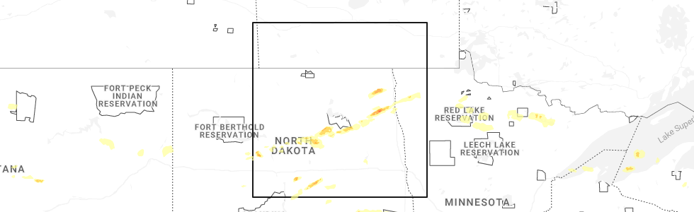
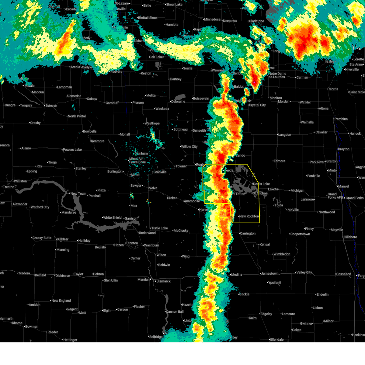
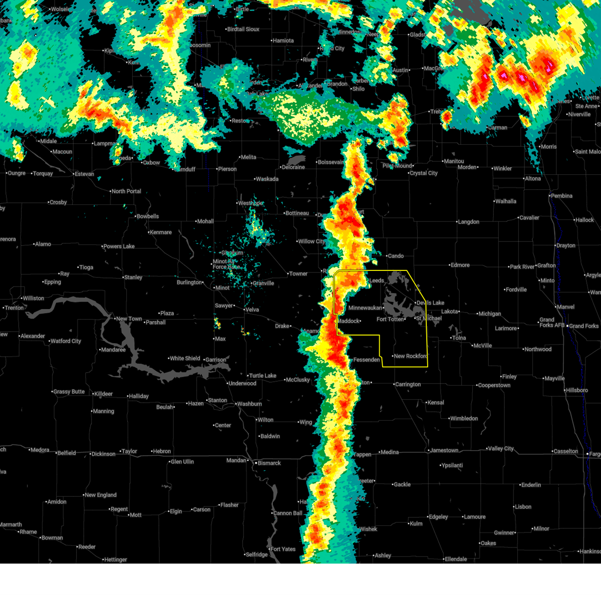
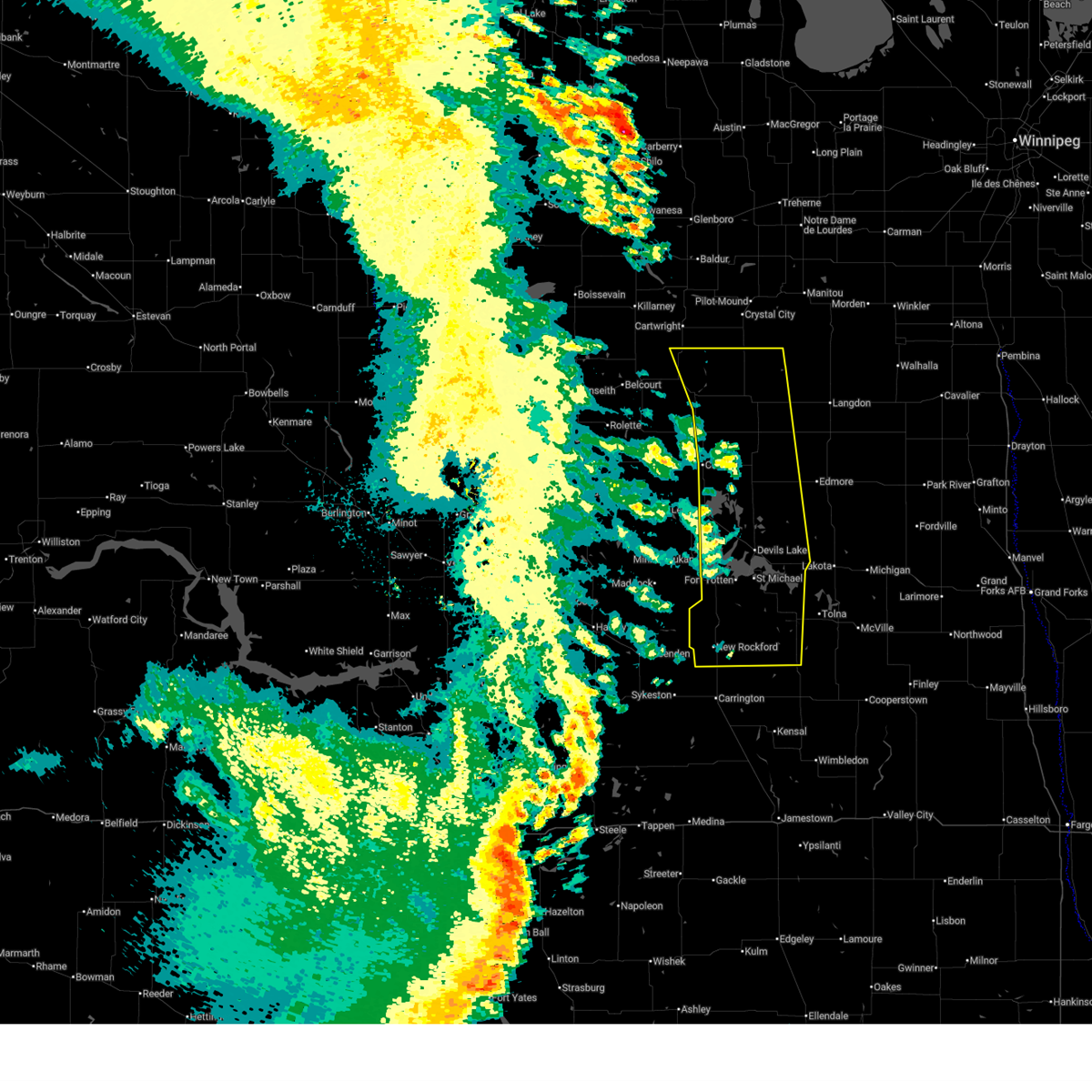
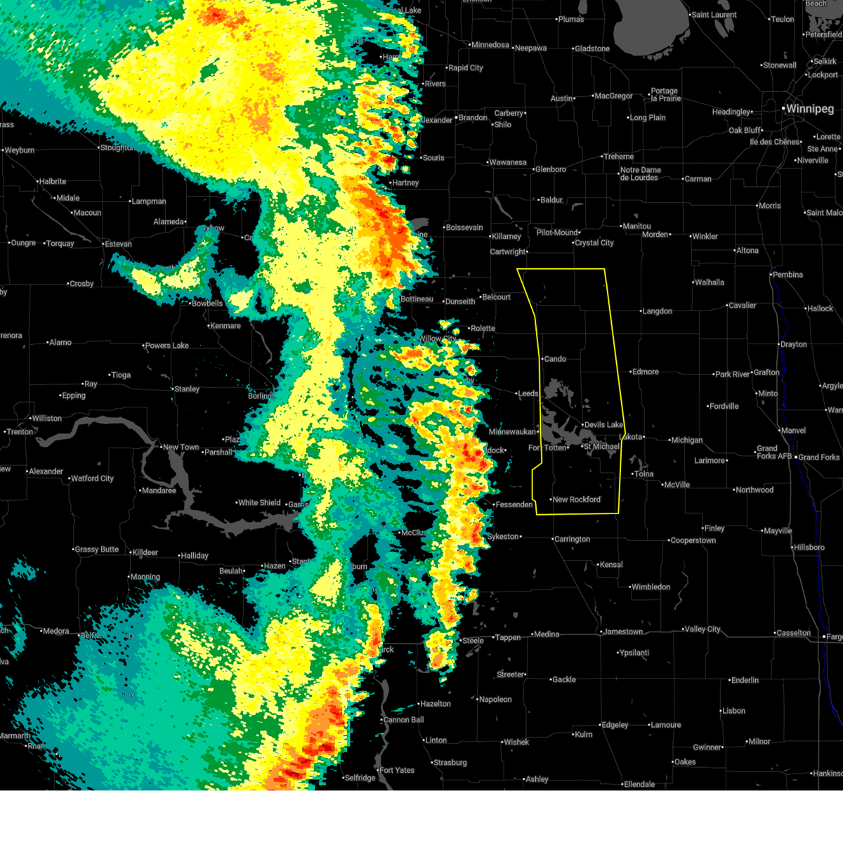
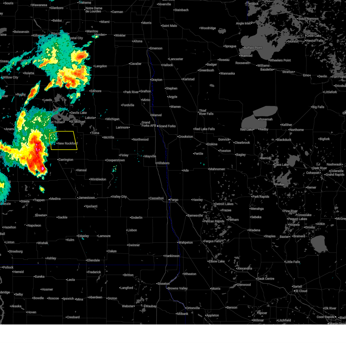
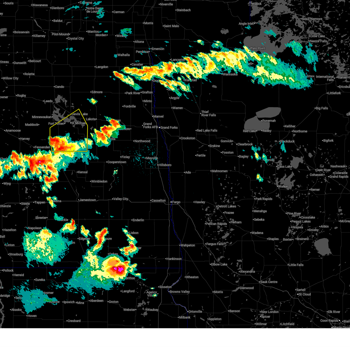
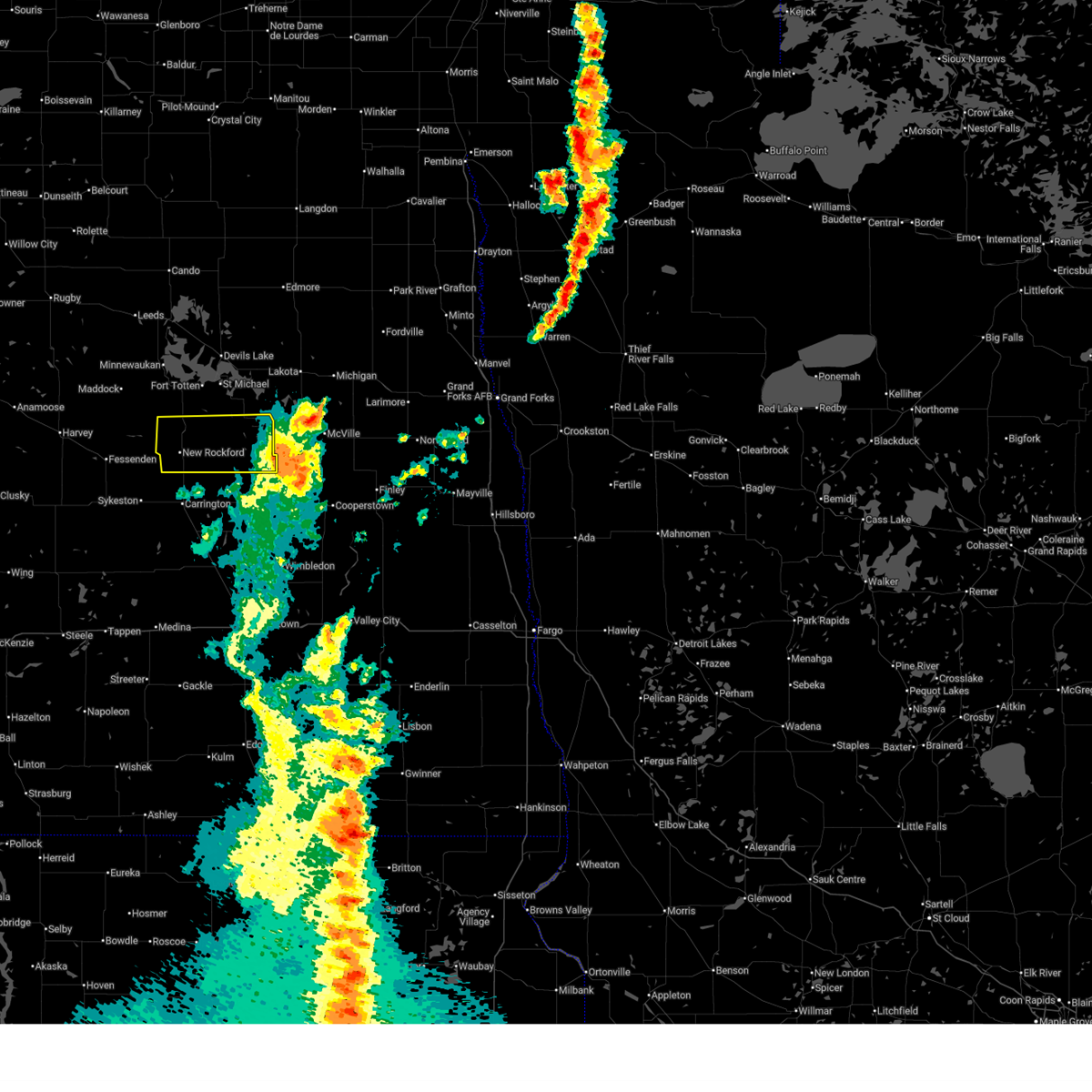
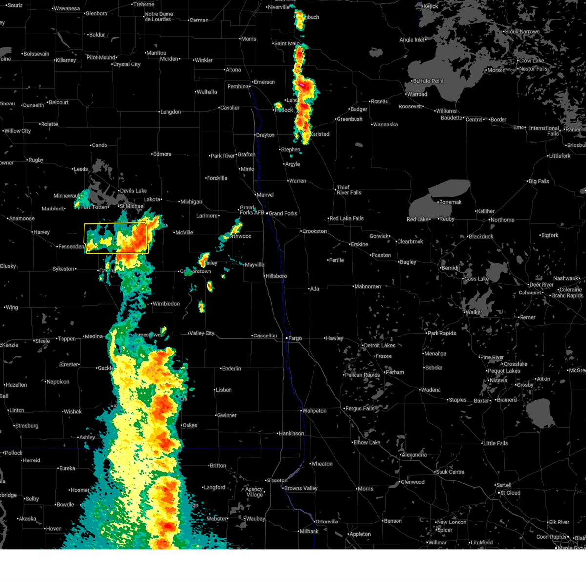
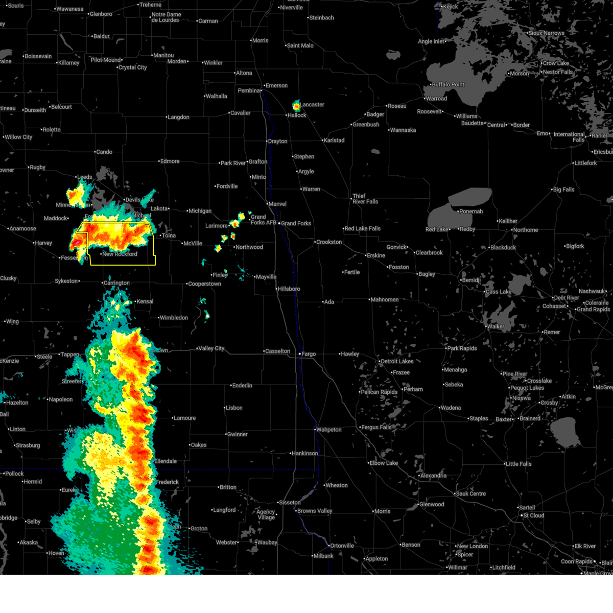
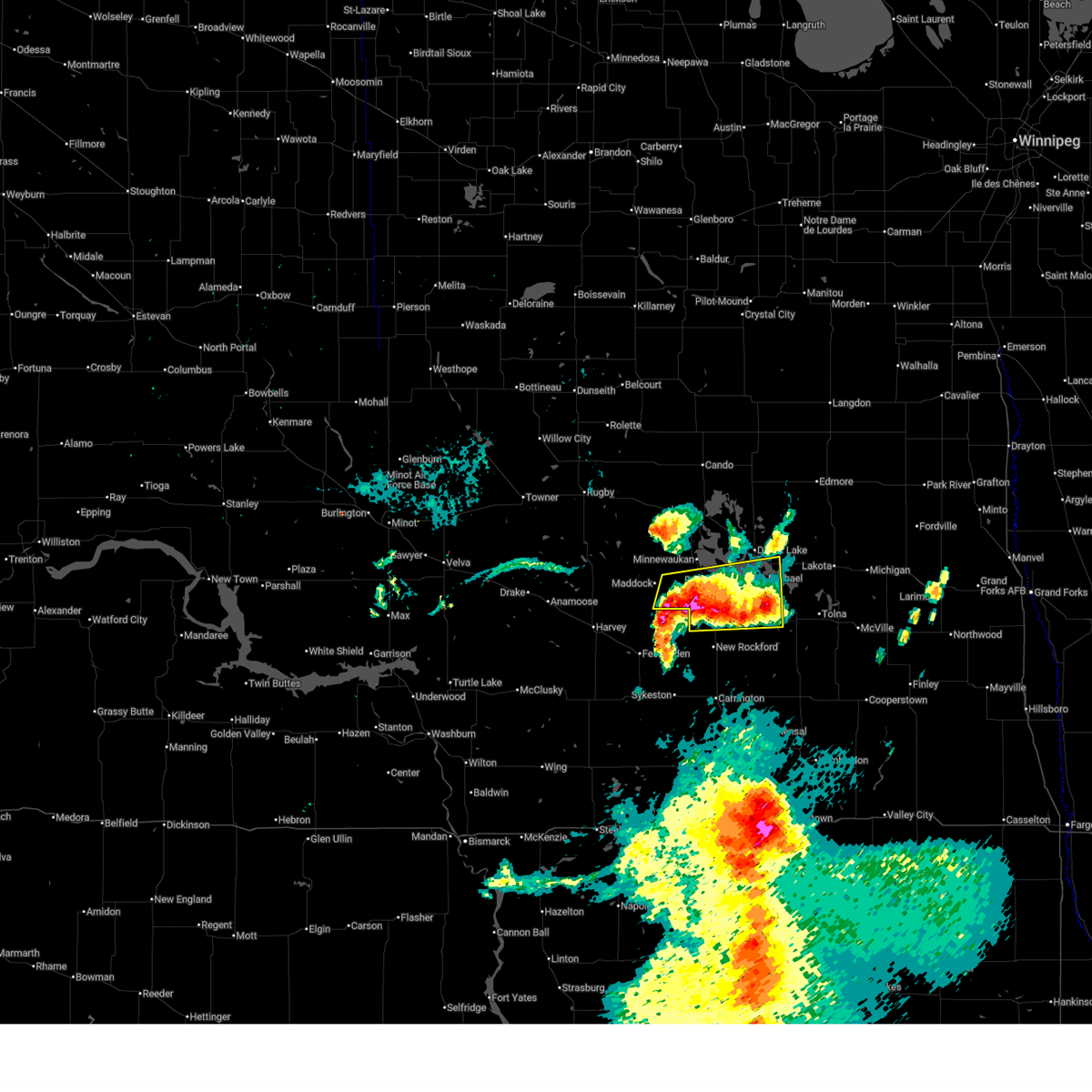
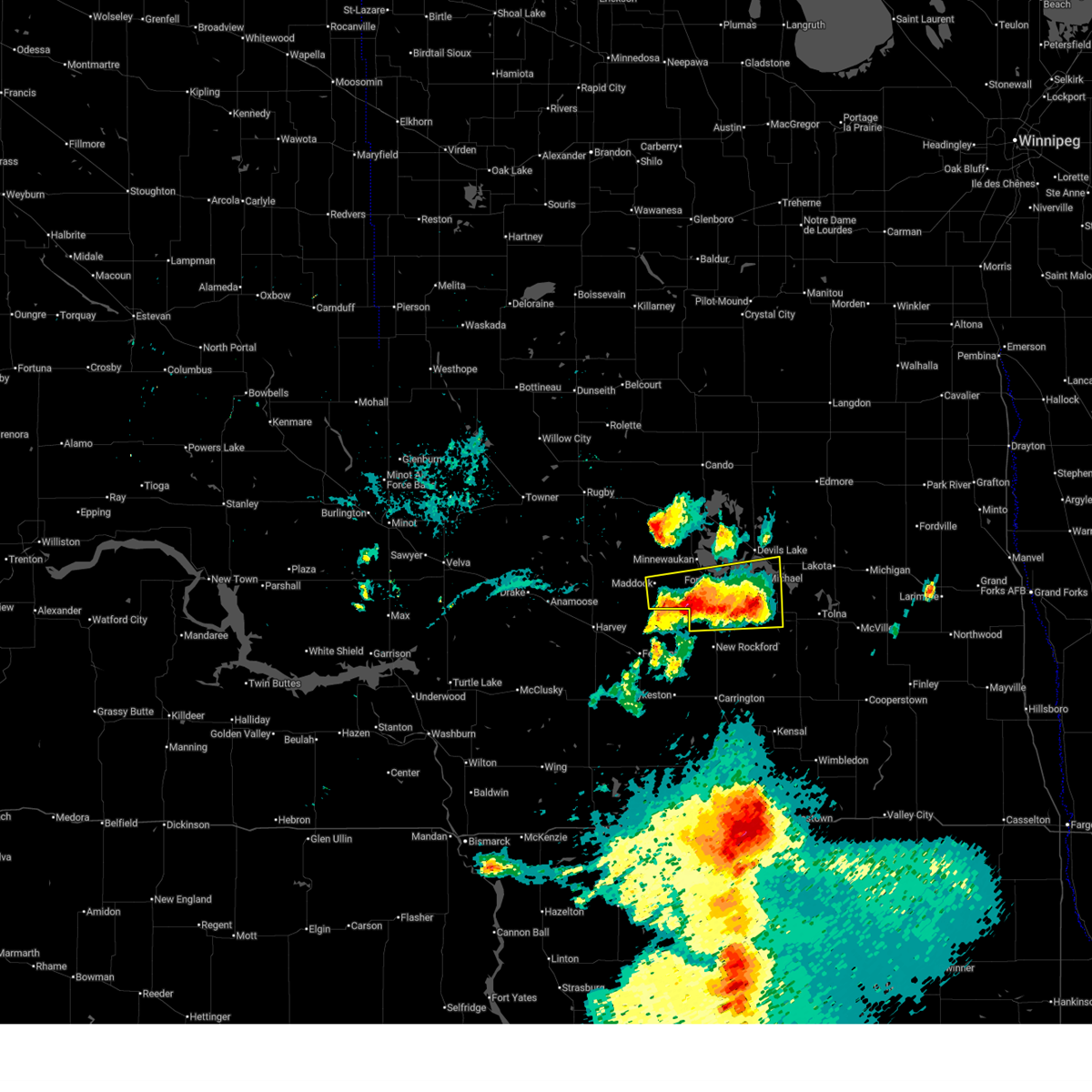
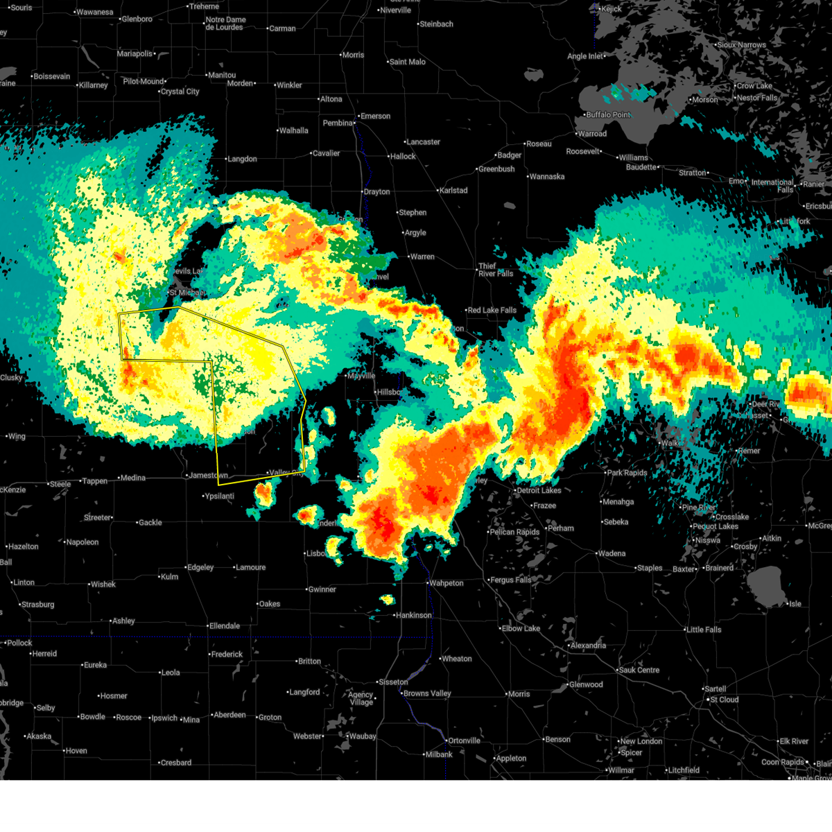
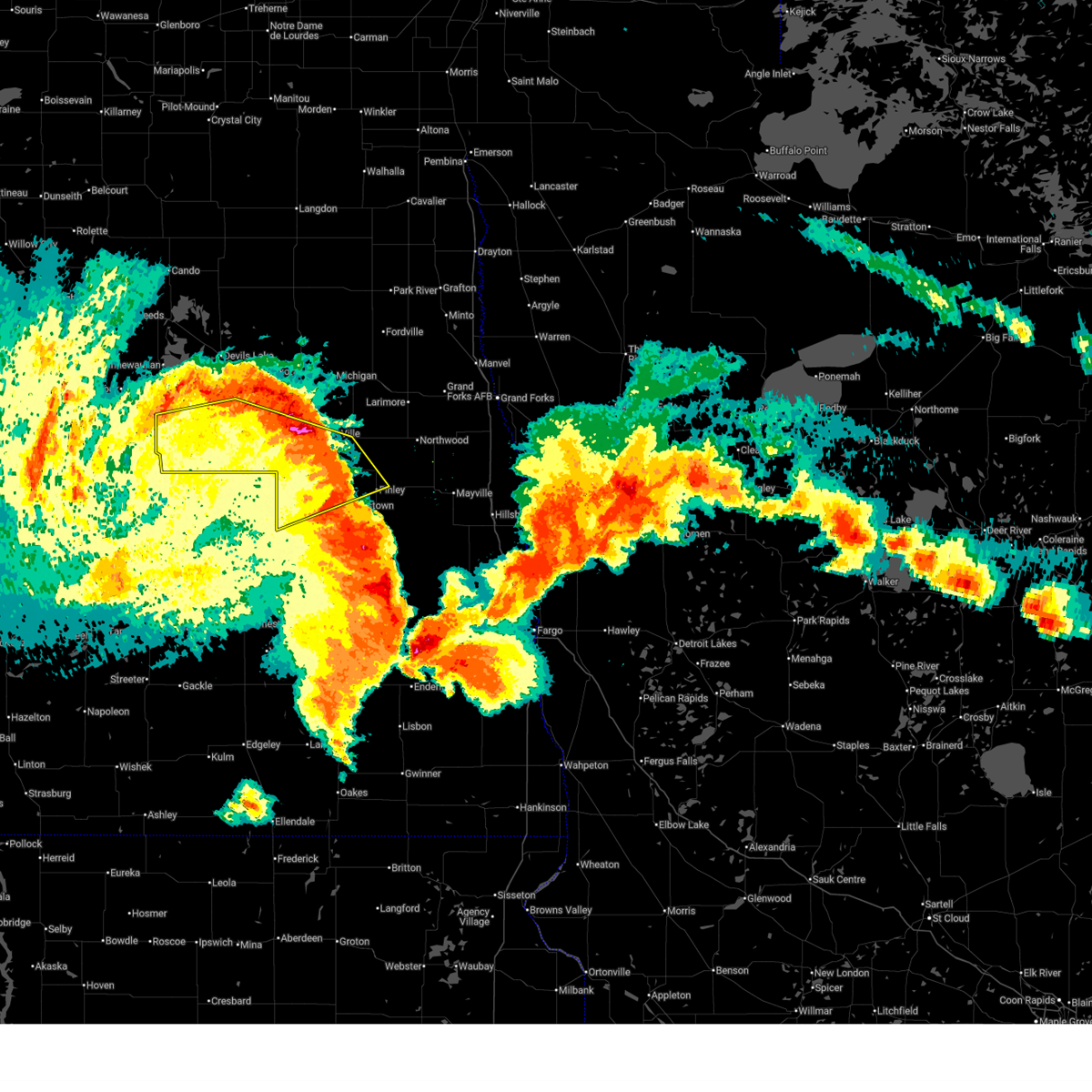
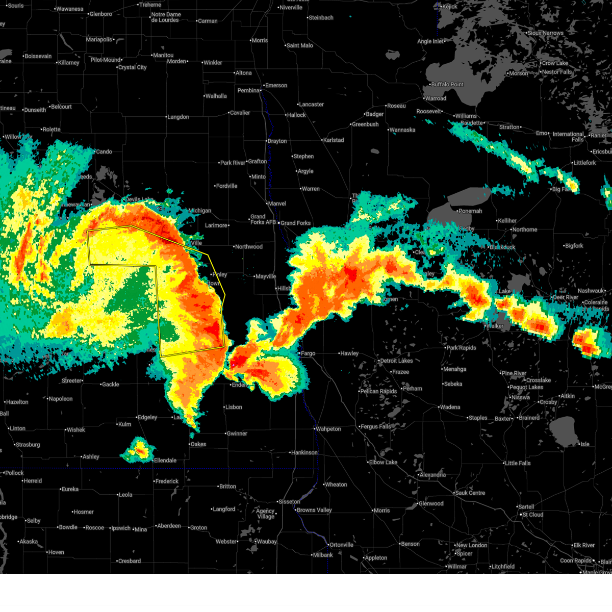
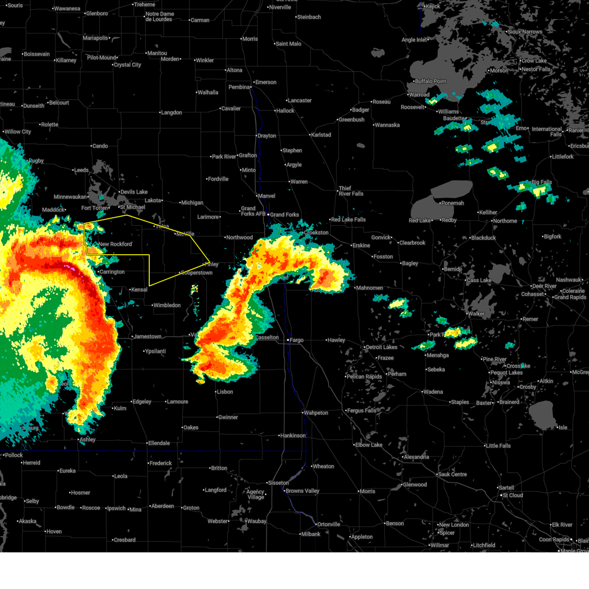
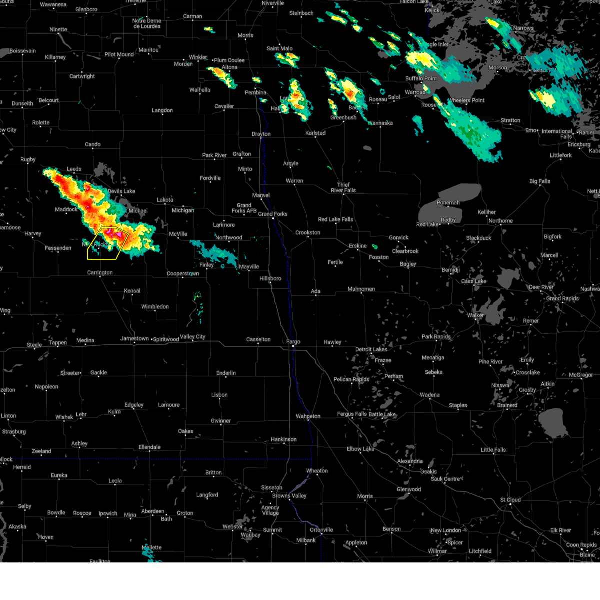
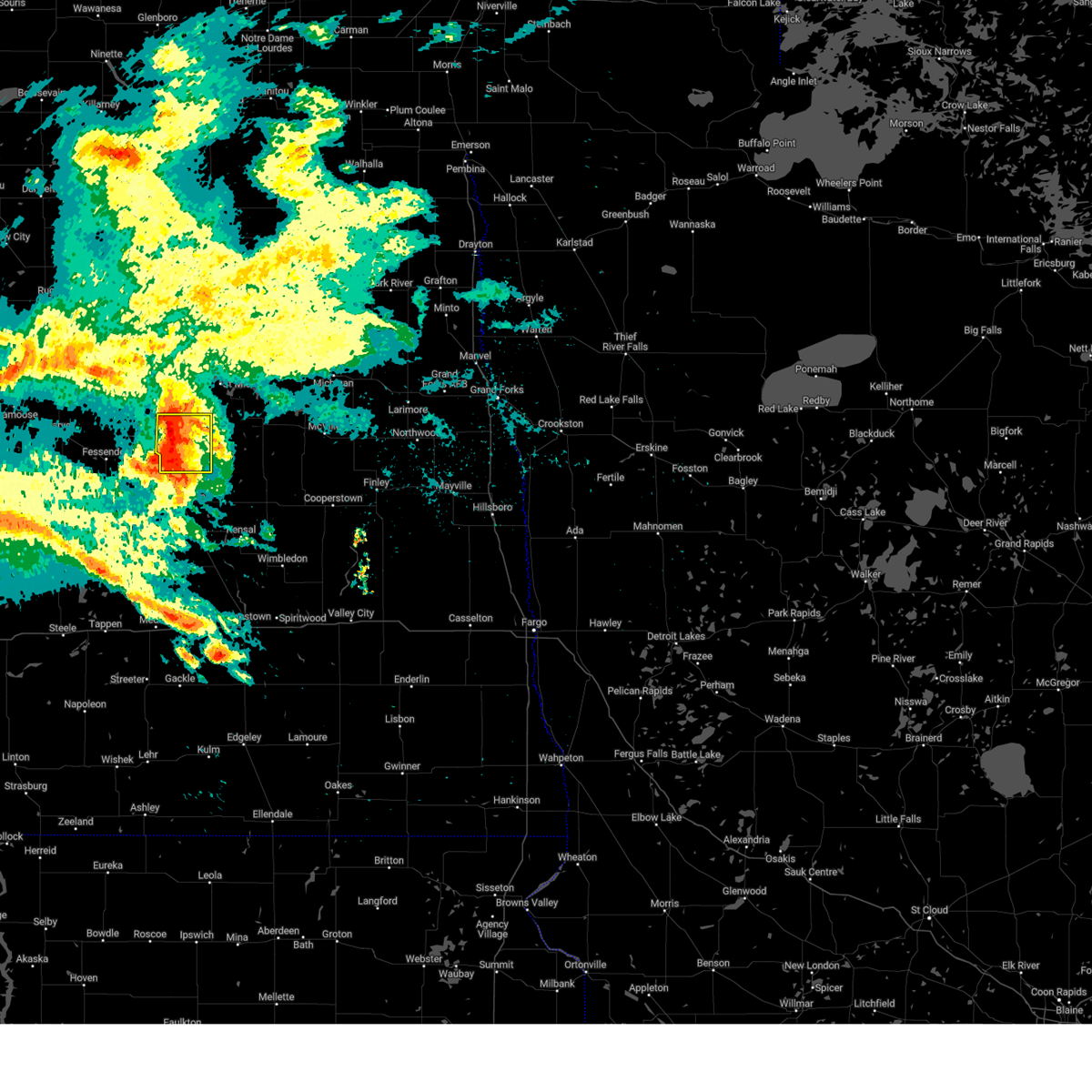
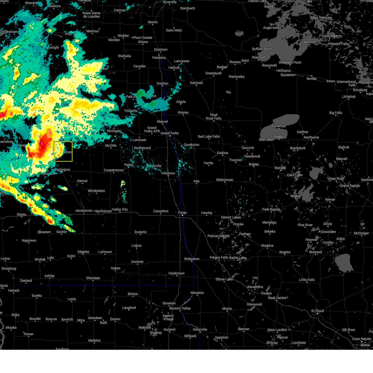
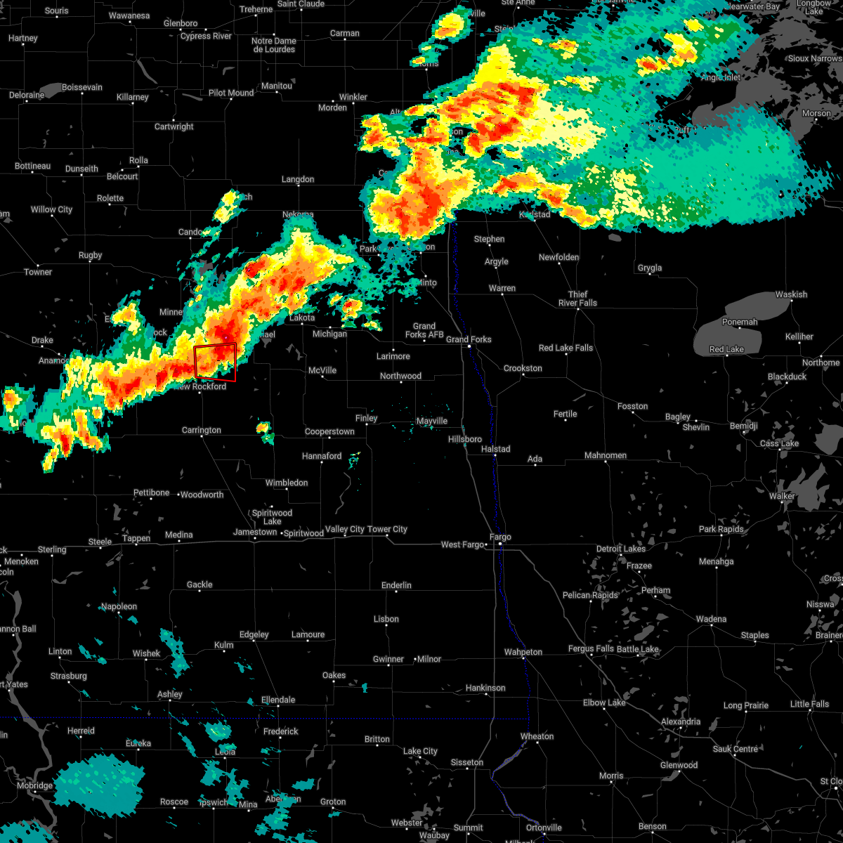
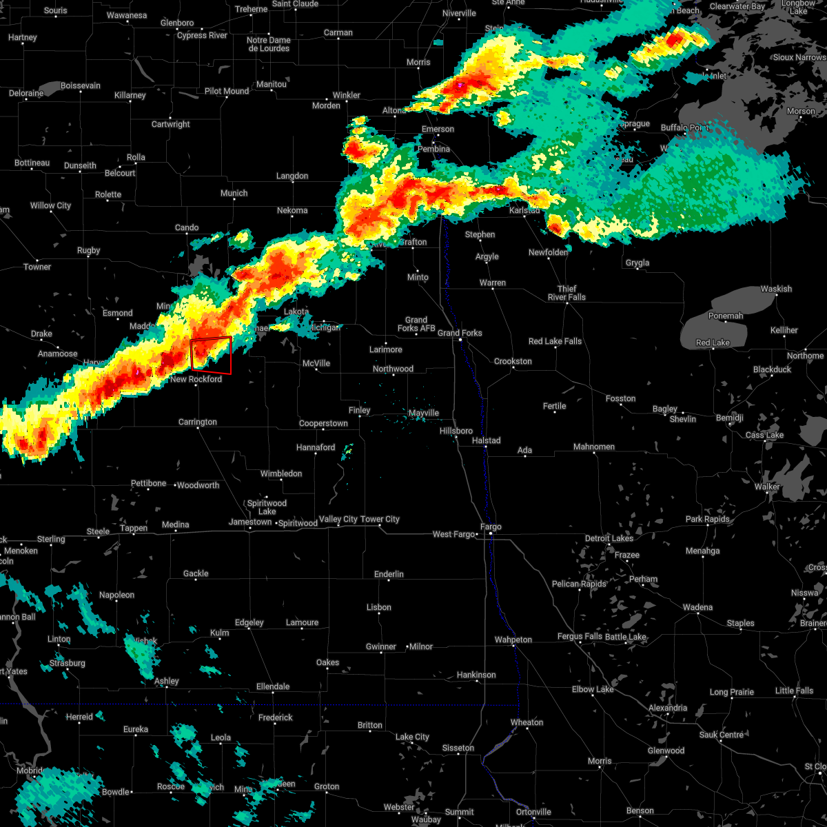
Hail Map for Sheyenne, ND
The Sheyenne, ND area has had 3 reports of on-the-ground hail by trained spotters, and has been under severe weather warnings 9 times during the past 12 months. Doppler radar has detected hail at or near Sheyenne, ND on 47 occasions.
| Name: | Sheyenne, ND |
| Where Located: | 23.1 miles SSW of Devils Lake, ND |
| Map: | Google Map for Sheyenne, ND |
| Population: | 204 |
| Housing Units: | 147 |
| More Info: | Search Google for Sheyenne, ND |
0
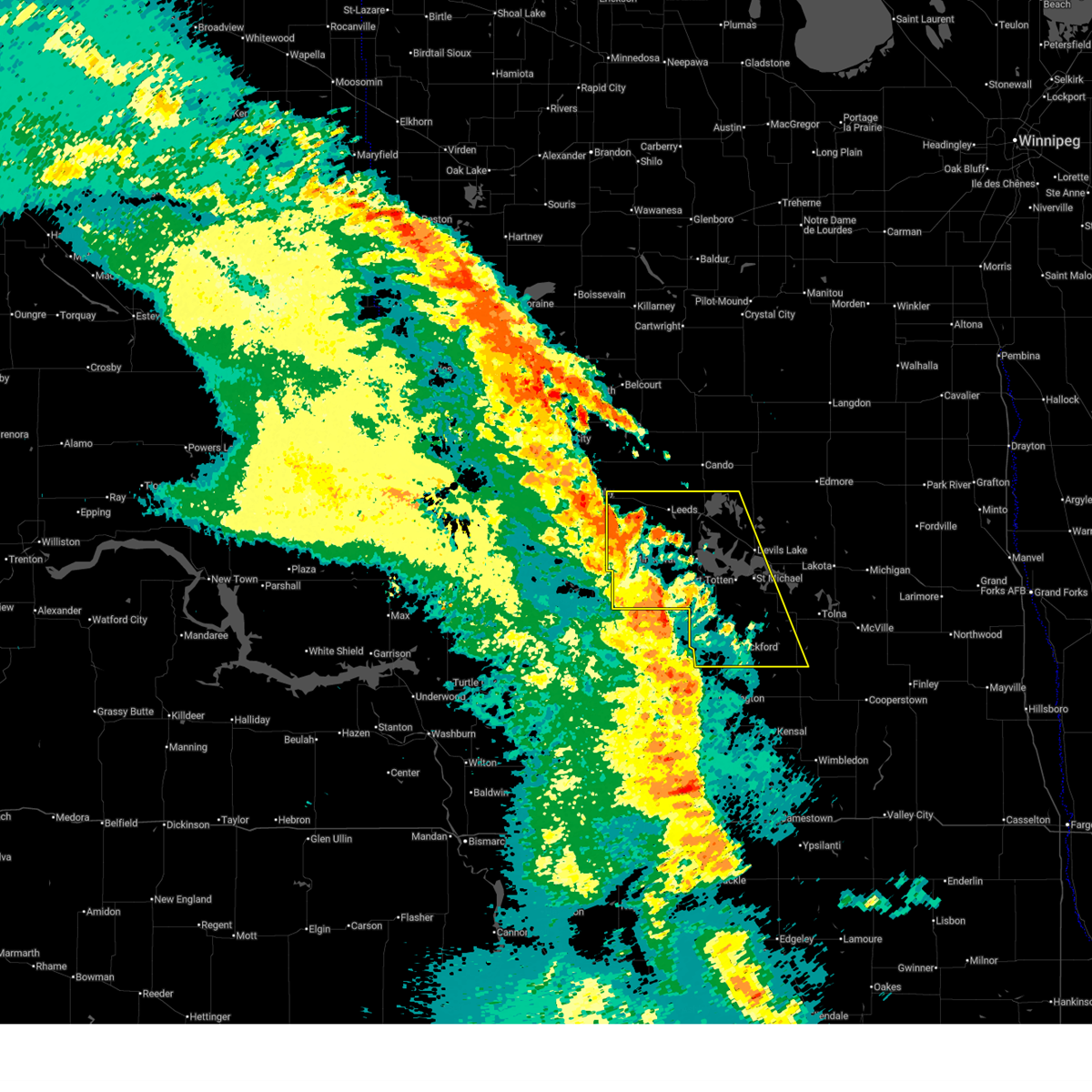
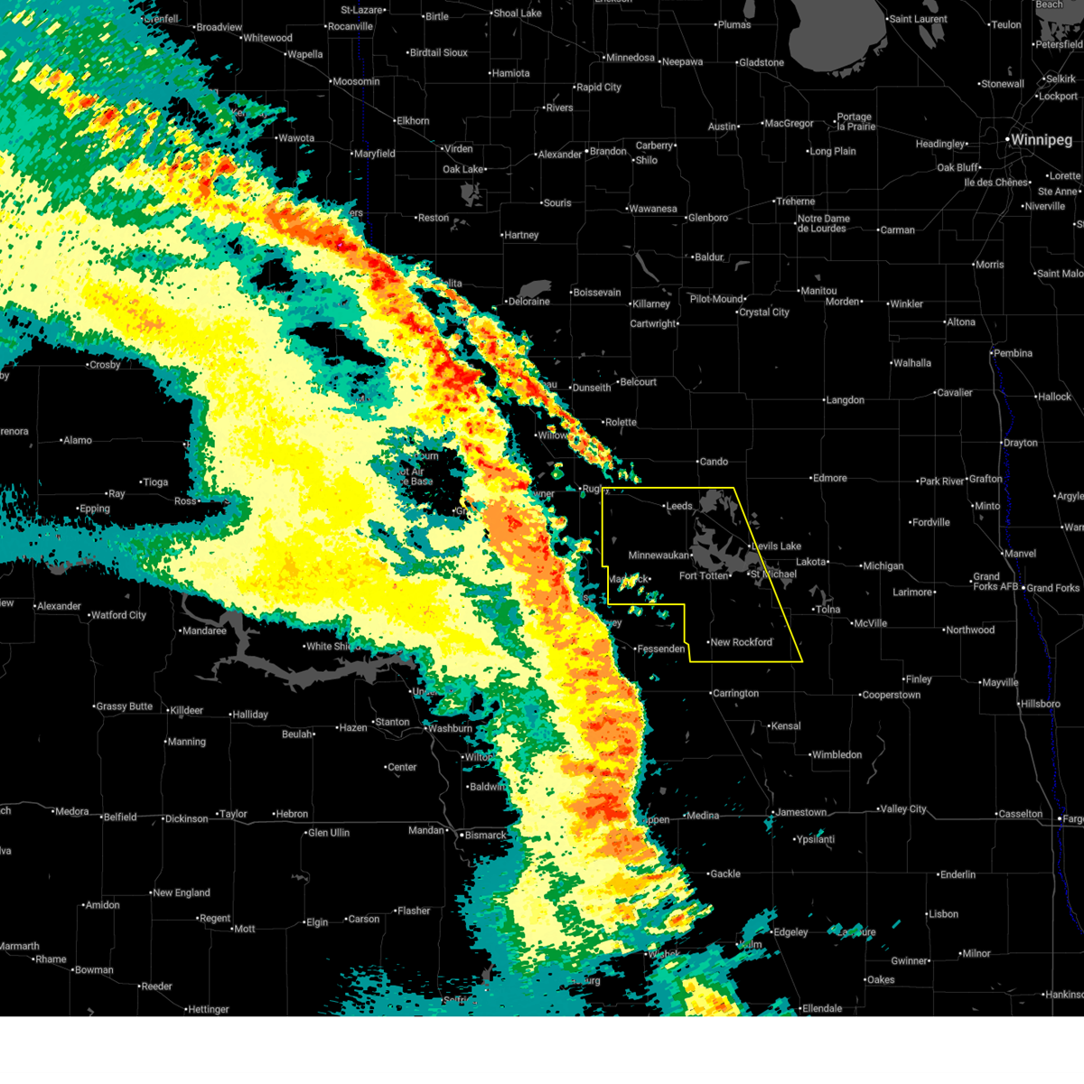
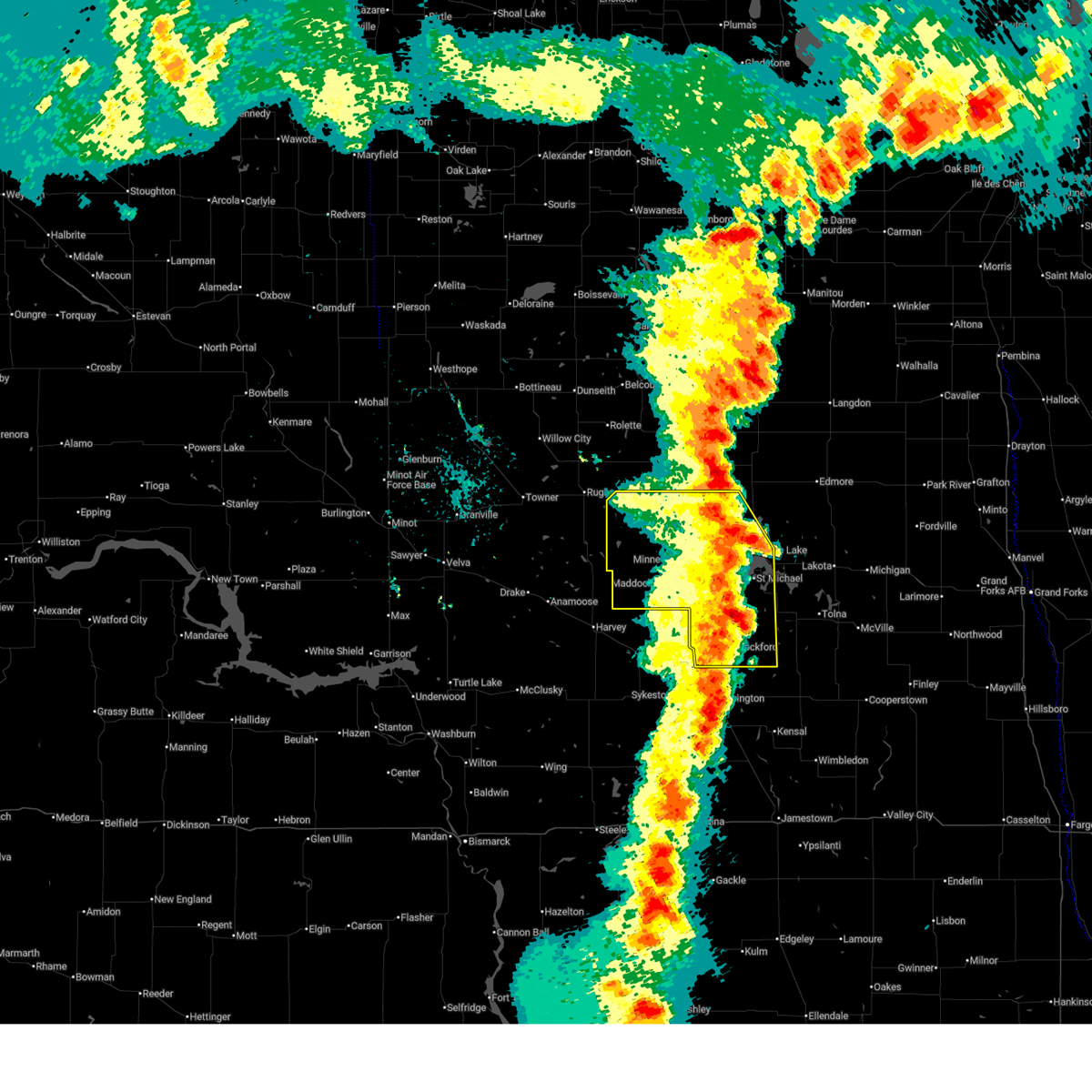
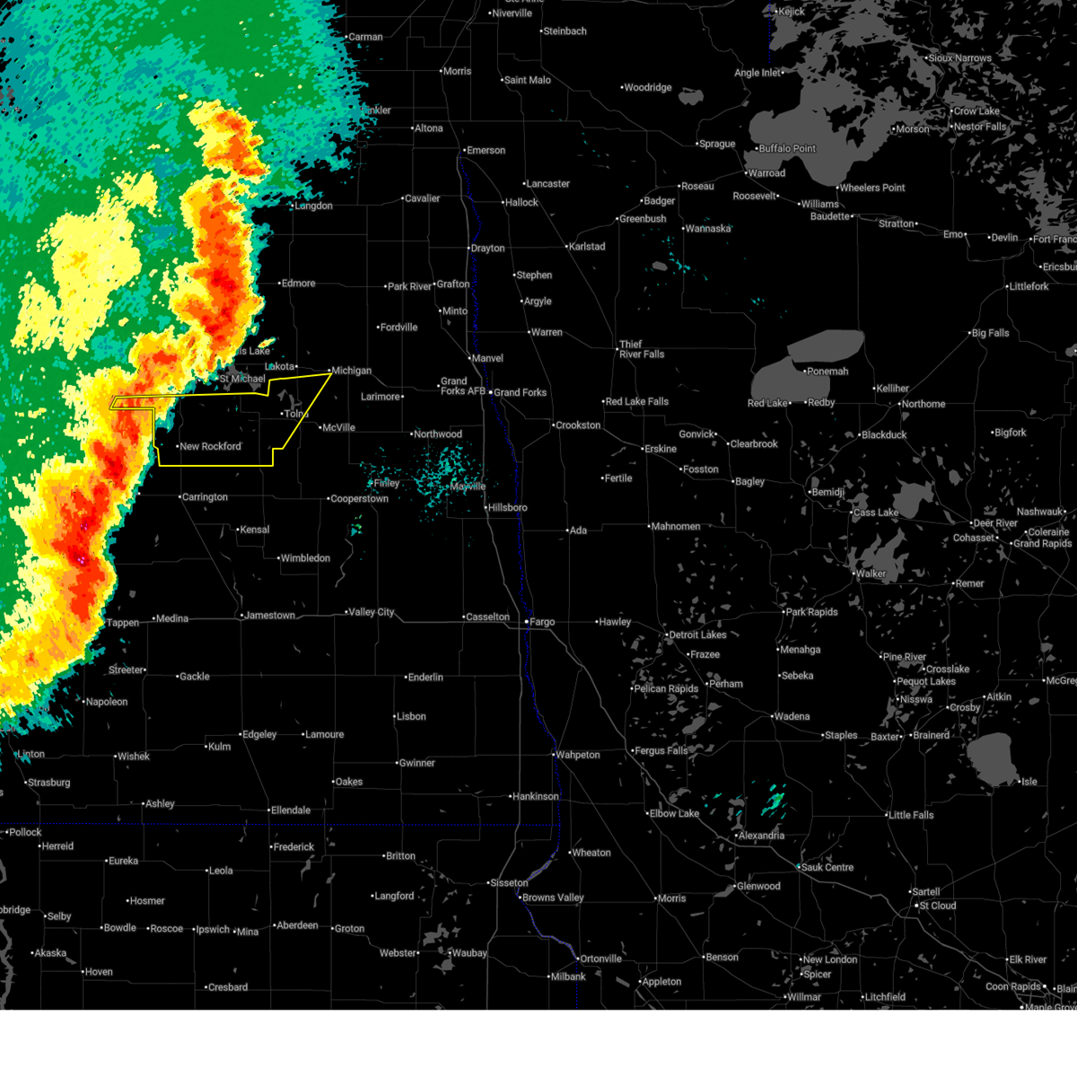
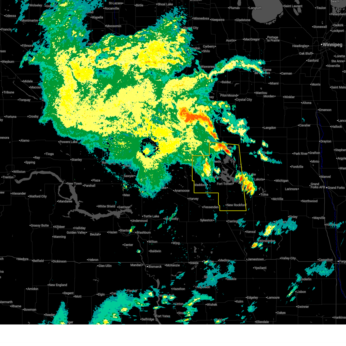
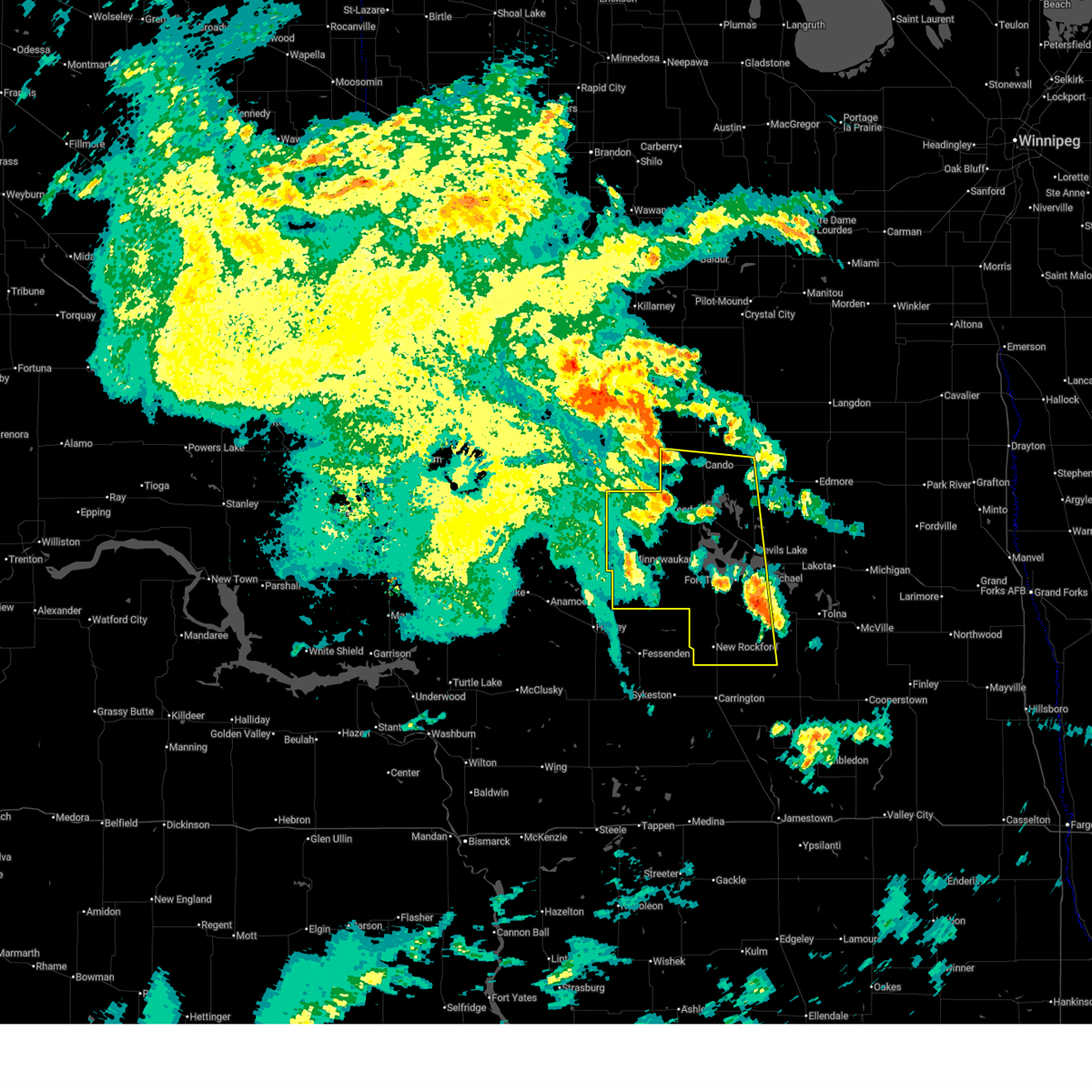
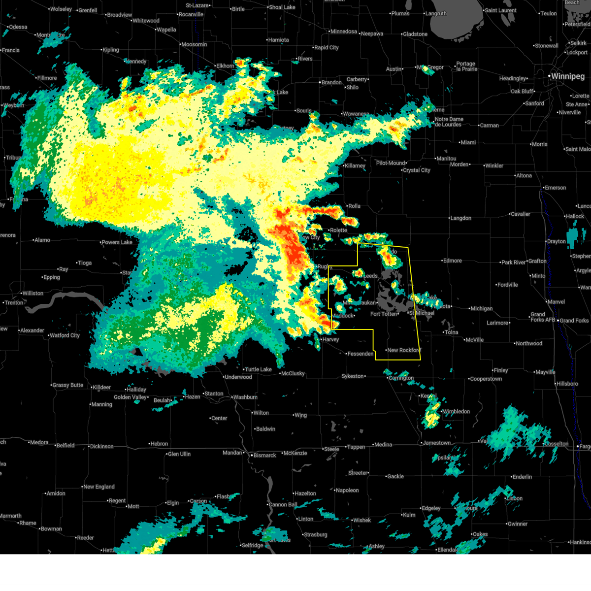
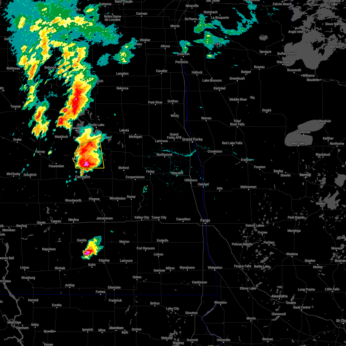
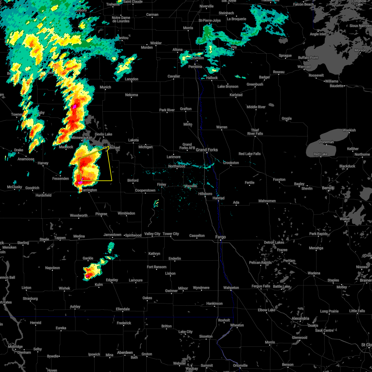
The Top Recent Hail Date for Sheyenne, ND is Monday, July 14, 2025 (47th out of 47)
Hail and Wind Damage Spotted near Sheyenne, ND
| Date / Time | Report Details |
|---|---|
| 6/28/2026 12:50 AM CDT |
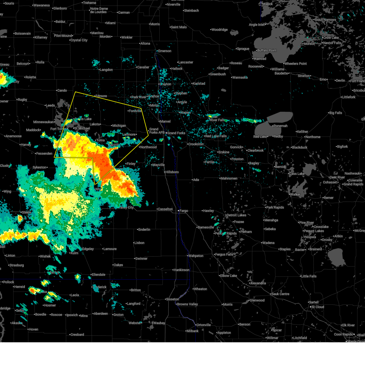
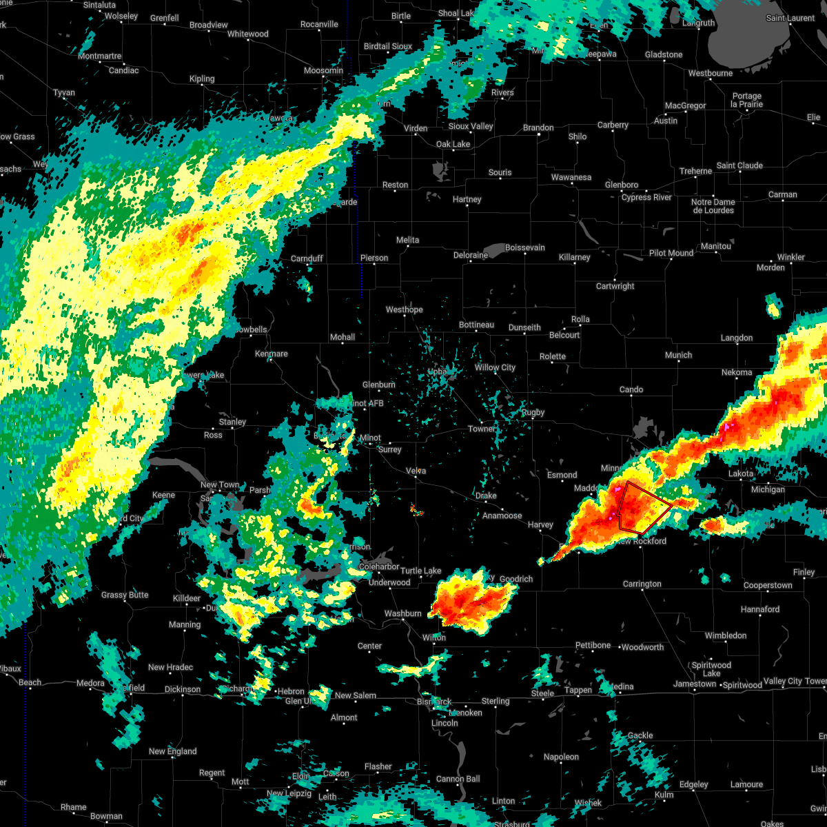
 At 1250 am cdt, severe thunderstorms were located along a line extending from near fillmore to maddock to 6 miles southwest of barlow, moving northeast at 40 mph (radar indicated). Hazards include 60 mph wind gusts. Expect damage to roofs, siding, and trees. Locations impacted include, devils lake, new rockford, camp grafton, lakewood park, leeds, maddock, and fort totten. At 1250 am cdt, severe thunderstorms were located along a line extending from near fillmore to maddock to 6 miles southwest of barlow, moving northeast at 40 mph (radar indicated). Hazards include 60 mph wind gusts. Expect damage to roofs, siding, and trees. Locations impacted include, devils lake, new rockford, camp grafton, lakewood park, leeds, maddock, and fort totten.
|
| 6/28/2026 12:19 AM CDT |
 Svrfgf the national weather service in grand forks has issued a * severe thunderstorm warning for, benson county in northeastern north dakota, southwestern ramsey county in northeastern north dakota, eddy county in northeastern north dakota, * until 115 am cdt. * at 1218 am cdt, severe thunderstorms were located along a line extending from 9 miles north of orrin to near selz to 10 miles southeast of bowdon, moving northeast at 45 mph (radar indicated). Hazards include 60 mph wind gusts and penny size hail. expect damage to roofs, siding, and trees Svrfgf the national weather service in grand forks has issued a * severe thunderstorm warning for, benson county in northeastern north dakota, southwestern ramsey county in northeastern north dakota, eddy county in northeastern north dakota, * until 115 am cdt. * at 1218 am cdt, severe thunderstorms were located along a line extending from 9 miles north of orrin to near selz to 10 miles southeast of bowdon, moving northeast at 45 mph (radar indicated). Hazards include 60 mph wind gusts and penny size hail. expect damage to roofs, siding, and trees
|
| 6/9/2026 10:26 PM CDT |
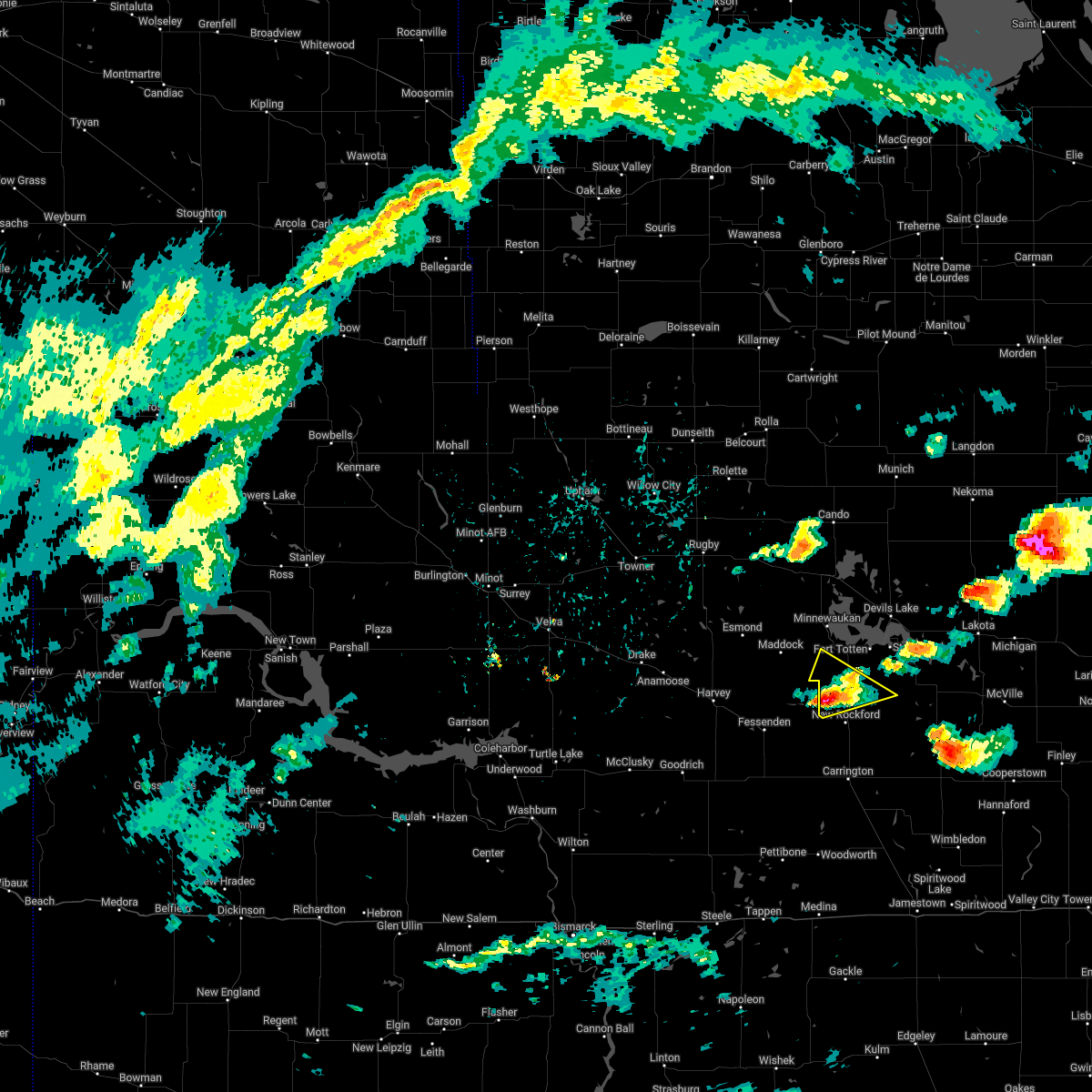
 The storms which prompted the warning have weakened. therefore, the warning will be allowed to expire. however, gusty winds are still possible with these thunderstorms. a severe thunderstorm watch remains in effect until 400 am cdt for northeastern north dakota. The storms which prompted the warning have weakened. therefore, the warning will be allowed to expire. however, gusty winds are still possible with these thunderstorms. a severe thunderstorm watch remains in effect until 400 am cdt for northeastern north dakota.
|
| 6/9/2026 9:53 PM CDT |
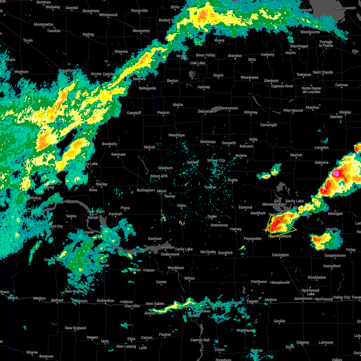
 At 952 pm cdt, severe thunderstorms were located along a line extending from near leeds to near flora to 7 miles west of new rockford, moving northeast at 50 mph. at 952 pm cdt, a 61 mph wind gust was reported near baker (radar indicated). Hazards include 60 mph wind gusts. Expect damage to roofs, siding, and trees. Locations impacted include, devils lake, new rockford, camp grafton, lakewood park, leeds, maddock, and fort totten. At 952 pm cdt, severe thunderstorms were located along a line extending from near leeds to near flora to 7 miles west of new rockford, moving northeast at 50 mph. at 952 pm cdt, a 61 mph wind gust was reported near baker (radar indicated). Hazards include 60 mph wind gusts. Expect damage to roofs, siding, and trees. Locations impacted include, devils lake, new rockford, camp grafton, lakewood park, leeds, maddock, and fort totten.
|
| 6/9/2026 9:28 PM CDT |
 Svrfgf the national weather service in grand forks has issued a * severe thunderstorm warning for, benson county in northeastern north dakota, southwestern ramsey county in northeastern north dakota, eddy county in northeastern north dakota, * until 1030 pm cdt. * at 928 pm cdt, severe thunderstorms were located along a line extending from near esmond to heimdal to near heaton, moving northeast at 50 mph (radar indicated). Hazards include 60 mph wind gusts. expect damage to roofs, siding, and trees Svrfgf the national weather service in grand forks has issued a * severe thunderstorm warning for, benson county in northeastern north dakota, southwestern ramsey county in northeastern north dakota, eddy county in northeastern north dakota, * until 1030 pm cdt. * at 928 pm cdt, severe thunderstorms were located along a line extending from near esmond to heimdal to near heaton, moving northeast at 50 mph (radar indicated). Hazards include 60 mph wind gusts. expect damage to roofs, siding, and trees
|
| 6/8/2026 12:20 AM CDT |
 The storms which prompted the warning have weakened below severe limits, and have exited the warned area. therefore, the warning will be allowed to expire. however, gusty winds are still possible with these thunderstorms. to report any damage, contact your nearest law enforcement agency. they will relay your report to the national weather service grand forks. The storms which prompted the warning have weakened below severe limits, and have exited the warned area. therefore, the warning will be allowed to expire. however, gusty winds are still possible with these thunderstorms. to report any damage, contact your nearest law enforcement agency. they will relay your report to the national weather service grand forks.
|
| 6/7/2026 11:34 PM CDT |
 Svrfgf the national weather service in grand forks has issued a * severe thunderstorm warning for, eastern benson county in northeastern north dakota, eastern towner county in northeastern north dakota, western cavalier county in northeastern north dakota, ramsey county in northeastern north dakota, eddy county in northeastern north dakota, * until 1230 am cdt. * at 1133 pm cdt, severe thunderstorms were located along a line extending from near leeds to near bremen to near chase lake, moving northeast at 55 mph (radar indicated). Hazards include 60 mph wind gusts. expect damage to roofs, siding, and trees Svrfgf the national weather service in grand forks has issued a * severe thunderstorm warning for, eastern benson county in northeastern north dakota, eastern towner county in northeastern north dakota, western cavalier county in northeastern north dakota, ramsey county in northeastern north dakota, eddy county in northeastern north dakota, * until 1230 am cdt. * at 1133 pm cdt, severe thunderstorms were located along a line extending from near leeds to near bremen to near chase lake, moving northeast at 55 mph (radar indicated). Hazards include 60 mph wind gusts. expect damage to roofs, siding, and trees
|
| 8/8/2025 2:54 AM CDT |
 The storms which prompted the warning have continued and therefore, the warning will be reissued. a severe thunderstorm watch remains in effect until 300 am cdt for northeastern north dakota. a severe thunderstorm watch also remains in effect until 700 am cdt for southeastern and northeastern north dakota. remember, a severe thunderstorm warning still remains in effect for benson, nelson, and eddy counties. The storms which prompted the warning have continued and therefore, the warning will be reissued. a severe thunderstorm watch remains in effect until 300 am cdt for northeastern north dakota. a severe thunderstorm watch also remains in effect until 700 am cdt for southeastern and northeastern north dakota. remember, a severe thunderstorm warning still remains in effect for benson, nelson, and eddy counties.
|
| 8/8/2025 1:59 AM CDT |
 Svrfgf the national weather service in grand forks has issued a * severe thunderstorm warning for, southeastern benson county in northeastern north dakota, southwestern nelson county in northeastern north dakota, eddy county in northeastern north dakota, * until 300 am cdt. * at 158 am cdt, severe thunderstorms were located along a line extending from near flora to near bowdon, moving east at 55 mph (radar indicated). Hazards include 60 mph wind gusts and quarter size hail. Hail damage to vehicles is expected. Expect wind damage to roofs, siding, and trees. Svrfgf the national weather service in grand forks has issued a * severe thunderstorm warning for, southeastern benson county in northeastern north dakota, southwestern nelson county in northeastern north dakota, eddy county in northeastern north dakota, * until 300 am cdt. * at 158 am cdt, severe thunderstorms were located along a line extending from near flora to near bowdon, moving east at 55 mph (radar indicated). Hazards include 60 mph wind gusts and quarter size hail. Hail damage to vehicles is expected. Expect wind damage to roofs, siding, and trees.
|
| 7/27/2025 6:54 AM CDT |
 The storms which prompted the warning have weakened below severe limits, and no longer pose an immediate threat to life or property. therefore, the warning will be allowed to expire. however, gusty winds are still possible with these thunderstorms. a severe thunderstorm watch remains in effect until 700 am cdt for northeastern north dakota. The storms which prompted the warning have weakened below severe limits, and no longer pose an immediate threat to life or property. therefore, the warning will be allowed to expire. however, gusty winds are still possible with these thunderstorms. a severe thunderstorm watch remains in effect until 700 am cdt for northeastern north dakota.
|
| 7/27/2025 6:33 AM CDT |
 At 633 am cdt, severe thunderstorms were located along in a cluster extending from 7 miles southeast of agate to near flora to near barlow, moving east at 60 mph (radar indicated). Hazards include 70 mph wind gusts. Expect considerable tree damage. damage is likely to mobile homes, roofs, and outbuildings. Locations impacted include, devils lake, new rockford, cando, camp grafton, lakewood park, leeds, and maddock. At 633 am cdt, severe thunderstorms were located along in a cluster extending from 7 miles southeast of agate to near flora to near barlow, moving east at 60 mph (radar indicated). Hazards include 70 mph wind gusts. Expect considerable tree damage. damage is likely to mobile homes, roofs, and outbuildings. Locations impacted include, devils lake, new rockford, cando, camp grafton, lakewood park, leeds, and maddock.
|
| 7/27/2025 5:56 AM CDT |
 Svrfgf the national weather service in grand forks has issued a * severe thunderstorm warning for, benson county in northeastern north dakota, southern towner county in northeastern north dakota, western ramsey county in northeastern north dakota, eddy county in northeastern north dakota, * until 700 am cdt. * at 555 am cdt, severe thunderstorms were located in a cluster extending from barton to near orrin to 8 miles south of harvey, moving east at 60 mph (radar indicated). Hazards include 70 mph wind gusts. Expect considerable tree damage. Damage is likely to mobile homes, roofs, and outbuildings. Svrfgf the national weather service in grand forks has issued a * severe thunderstorm warning for, benson county in northeastern north dakota, southern towner county in northeastern north dakota, western ramsey county in northeastern north dakota, eddy county in northeastern north dakota, * until 700 am cdt. * at 555 am cdt, severe thunderstorms were located in a cluster extending from barton to near orrin to 8 miles south of harvey, moving east at 60 mph (radar indicated). Hazards include 70 mph wind gusts. Expect considerable tree damage. Damage is likely to mobile homes, roofs, and outbuildings.
|
| 7/27/2025 1:16 AM CDT |
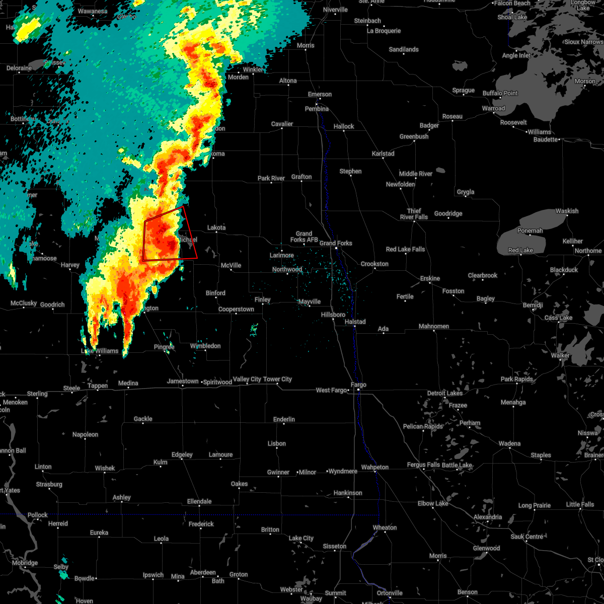
 Svrfgf the national weather service in grand forks has issued a * severe thunderstorm warning for, southeastern benson county in northeastern north dakota, western grand forks county in northeastern north dakota, nelson county in northeastern north dakota, griggs county in southeastern north dakota, ramsey county in northeastern north dakota, southwestern walsh county in northeastern north dakota, eddy county in northeastern north dakota, northwestern steele county in southeastern north dakota, * until 215 am cdt. * at 116 am cdt, severe thunderstorms were located along a line extending from spirit lake nation to near mcville to near cooperstown, moving northeast at 50 mph (radar indicated). Hazards include 70 mph wind gusts and quarter size hail. Hail damage to vehicles is expected. expect considerable tree damage. Wind damage is also likely to mobile homes, roofs, and outbuildings. Svrfgf the national weather service in grand forks has issued a * severe thunderstorm warning for, southeastern benson county in northeastern north dakota, western grand forks county in northeastern north dakota, nelson county in northeastern north dakota, griggs county in southeastern north dakota, ramsey county in northeastern north dakota, southwestern walsh county in northeastern north dakota, eddy county in northeastern north dakota, northwestern steele county in southeastern north dakota, * until 215 am cdt. * at 116 am cdt, severe thunderstorms were located along a line extending from spirit lake nation to near mcville to near cooperstown, moving northeast at 50 mph (radar indicated). Hazards include 70 mph wind gusts and quarter size hail. Hail damage to vehicles is expected. expect considerable tree damage. Wind damage is also likely to mobile homes, roofs, and outbuildings.
|
| 7/27/2025 12:59 AM CDT |
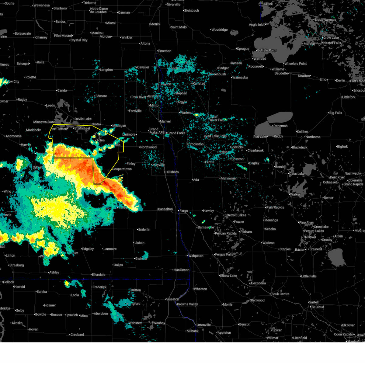 At 1259 am cdt, severe thunderstorms were located along a line extending from 6 miles northwest of new rockford to 9 miles north of grace city to revere, moving northeast at 60 mph (radar indicated). Hazards include 70 mph wind gusts and quarter size hail. Hail damage to vehicles is expected. expect considerable tree damage. wind damage is also likely to mobile homes, roofs, and outbuildings. Locations impacted include, new rockford, cooperstown, mcville, fort totten, aneta, sheyenne, and binford. At 1259 am cdt, severe thunderstorms were located along a line extending from 6 miles northwest of new rockford to 9 miles north of grace city to revere, moving northeast at 60 mph (radar indicated). Hazards include 70 mph wind gusts and quarter size hail. Hail damage to vehicles is expected. expect considerable tree damage. wind damage is also likely to mobile homes, roofs, and outbuildings. Locations impacted include, new rockford, cooperstown, mcville, fort totten, aneta, sheyenne, and binford.
|
| 7/27/2025 12:25 AM CDT |
 Svrfgf the national weather service in grand forks has issued a * severe thunderstorm warning for, southern benson county in northeastern north dakota, southern nelson county in northeastern north dakota, griggs county in southeastern north dakota, southwestern ramsey county in northeastern north dakota, eddy county in northeastern north dakota, * until 130 am cdt. * at 1224 am cdt, severe thunderstorms were located along a line extending from 6 miles southeast of bowdon to 6 miles southwest of carrington to near courtenay, moving northeast at 55 mph (radar indicated). Hazards include 70 mph wind gusts and quarter size hail. Hail damage to vehicles is expected. expect considerable tree damage. Wind damage is also likely to mobile homes, roofs, and outbuildings. Svrfgf the national weather service in grand forks has issued a * severe thunderstorm warning for, southern benson county in northeastern north dakota, southern nelson county in northeastern north dakota, griggs county in southeastern north dakota, southwestern ramsey county in northeastern north dakota, eddy county in northeastern north dakota, * until 130 am cdt. * at 1224 am cdt, severe thunderstorms were located along a line extending from 6 miles southeast of bowdon to 6 miles southwest of carrington to near courtenay, moving northeast at 55 mph (radar indicated). Hazards include 70 mph wind gusts and quarter size hail. Hail damage to vehicles is expected. expect considerable tree damage. Wind damage is also likely to mobile homes, roofs, and outbuildings.
|
| 7/26/2025 2:06 AM CDT |
 A severe thunderstorm warning still remains in effect for eddy county. A severe thunderstorm warning still remains in effect for eddy county.
|
| 7/26/2025 2:03 AM CDT |
 Svrfgf the national weather service in grand forks has issued a * severe thunderstorm warning for, southeastern benson county in northeastern north dakota, nelson county in northeastern north dakota, northwestern griggs county in southeastern north dakota, southeastern ramsey county in northeastern north dakota, eddy county in northeastern north dakota, * until 300 am cdt. * at 203 am cdt, severe thunderstorms were located along a line extending from near sheyenne to 6 miles north of brantford to 9 miles southwest of pingree, moving northeast at 45 mph (radar indicated). Hazards include 60 mph wind gusts and quarter size hail. Hail damage to vehicles is expected. Expect wind damage to roofs, siding, and trees. Svrfgf the national weather service in grand forks has issued a * severe thunderstorm warning for, southeastern benson county in northeastern north dakota, nelson county in northeastern north dakota, northwestern griggs county in southeastern north dakota, southeastern ramsey county in northeastern north dakota, eddy county in northeastern north dakota, * until 300 am cdt. * at 203 am cdt, severe thunderstorms were located along a line extending from near sheyenne to 6 miles north of brantford to 9 miles southwest of pingree, moving northeast at 45 mph (radar indicated). Hazards include 60 mph wind gusts and quarter size hail. Hail damage to vehicles is expected. Expect wind damage to roofs, siding, and trees.
|
| 7/26/2025 1:18 AM CDT |
 Svrfgf the national weather service in grand forks has issued a * severe thunderstorm warning for, eddy county in northeastern north dakota, * until 215 am cdt. * at 118 am cdt, severe thunderstorms were located along a line extending from near hamberg to near heaton to 10 miles north of lake williams, moving east at 30 mph (radar indicated). Hazards include 60 mph wind gusts. expect damage to roofs, siding, and trees Svrfgf the national weather service in grand forks has issued a * severe thunderstorm warning for, eddy county in northeastern north dakota, * until 215 am cdt. * at 118 am cdt, severe thunderstorms were located along a line extending from near hamberg to near heaton to 10 miles north of lake williams, moving east at 30 mph (radar indicated). Hazards include 60 mph wind gusts. expect damage to roofs, siding, and trees
|
| 7/14/2025 11:38 PM CDT |
 Svrfgf the national weather service in grand forks has issued a * severe thunderstorm warning for, southeastern benson county in northeastern north dakota, southwestern ramsey county in northeastern north dakota, eddy county in northeastern north dakota, * until 1245 am cdt. * at 1137 pm cdt, a severe thunderstorm was located near bremen, or 22 miles north of carrington, moving northeast at 40 mph (radar indicated). Hazards include ping pong ball size hail and 60 mph wind gusts. People and animals outdoors will be injured. expect hail damage to roofs, siding, windows, and vehicles. Expect wind damage to roofs, siding, and trees. Svrfgf the national weather service in grand forks has issued a * severe thunderstorm warning for, southeastern benson county in northeastern north dakota, southwestern ramsey county in northeastern north dakota, eddy county in northeastern north dakota, * until 1245 am cdt. * at 1137 pm cdt, a severe thunderstorm was located near bremen, or 22 miles north of carrington, moving northeast at 40 mph (radar indicated). Hazards include ping pong ball size hail and 60 mph wind gusts. People and animals outdoors will be injured. expect hail damage to roofs, siding, windows, and vehicles. Expect wind damage to roofs, siding, and trees.
|
| 7/9/2025 10:55 PM CDT |
 The storms which prompted the warning have moved out of the area. therefore, the warning will be allowed to expire. a severe thunderstorm watch remains in effect until 100 am cdt for southeastern and northeastern north dakota. The storms which prompted the warning have moved out of the area. therefore, the warning will be allowed to expire. a severe thunderstorm watch remains in effect until 100 am cdt for southeastern and northeastern north dakota.
|
| 7/9/2025 10:27 PM CDT |
 At 1027 pm cdt, severe thunderstorms were located along a line extending from near new rockford to near hamar, moving south at 20 mph (radar indicated). Hazards include 60 mph wind gusts and nickel size hail. Expect damage to roofs, siding, and trees. Locations impacted include, new rockford, sheyenne, hamar, brantford, and southern spirit lake nation. At 1027 pm cdt, severe thunderstorms were located along a line extending from near new rockford to near hamar, moving south at 20 mph (radar indicated). Hazards include 60 mph wind gusts and nickel size hail. Expect damage to roofs, siding, and trees. Locations impacted include, new rockford, sheyenne, hamar, brantford, and southern spirit lake nation.
|
| 7/9/2025 10:27 PM CDT |
 the severe thunderstorm warning has been cancelled and is no longer in effect the severe thunderstorm warning has been cancelled and is no longer in effect
|
| 7/9/2025 10:03 PM CDT |
 Svrfgf the national weather service in grand forks has issued a * severe thunderstorm warning for, southeastern benson county in northeastern north dakota, eddy county in northeastern north dakota, * until 1100 pm cdt. * at 1003 pm cdt, severe thunderstorms were located along a line extending from near oberon to spirit lake nation, moving east at 20 mph (radar indicated). Hazards include 60 mph wind gusts and quarter size hail. Hail damage to vehicles is expected. Expect wind damage to roofs, siding, and trees. Svrfgf the national weather service in grand forks has issued a * severe thunderstorm warning for, southeastern benson county in northeastern north dakota, eddy county in northeastern north dakota, * until 1100 pm cdt. * at 1003 pm cdt, severe thunderstorms were located along a line extending from near oberon to spirit lake nation, moving east at 20 mph (radar indicated). Hazards include 60 mph wind gusts and quarter size hail. Hail damage to vehicles is expected. Expect wind damage to roofs, siding, and trees.
|
| 7/9/2025 9:54 PM CDT |
 the severe thunderstorm warning has been cancelled and is no longer in effect the severe thunderstorm warning has been cancelled and is no longer in effect
|
| 7/9/2025 9:54 PM CDT |
 At 953 pm cdt, severe thunderstorms were located along a line extending from spirit lake nation to 6 miles south of flora, moving east at 10 mph (radar indicated). Hazards include 60 mph wind gusts and quarter size hail. Hail damage to vehicles is expected. expect wind damage to roofs, siding, and trees. Locations impacted include, sheyenne, oberon, warwick, tokio, and spirit lake nation. At 953 pm cdt, severe thunderstorms were located along a line extending from spirit lake nation to 6 miles south of flora, moving east at 10 mph (radar indicated). Hazards include 60 mph wind gusts and quarter size hail. Hail damage to vehicles is expected. expect wind damage to roofs, siding, and trees. Locations impacted include, sheyenne, oberon, warwick, tokio, and spirit lake nation.
|
| 7/9/2025 9:40 PM CDT |
 At 940 pm cdt, severe thunderstorms were located along a line extending from spirit lake nation to near flora, moving east at 5 mph (radar indicated). Hazards include 60 mph wind gusts and quarter size hail. Hail damage to vehicles is expected. expect wind damage to roofs, siding, and trees. Locations impacted include, camp grafton, fort totten, sheyenne, oberon, warwick, tokio, and flora. At 940 pm cdt, severe thunderstorms were located along a line extending from spirit lake nation to near flora, moving east at 5 mph (radar indicated). Hazards include 60 mph wind gusts and quarter size hail. Hail damage to vehicles is expected. expect wind damage to roofs, siding, and trees. Locations impacted include, camp grafton, fort totten, sheyenne, oberon, warwick, tokio, and flora.
|
| 7/9/2025 9:29 PM CDT |
 Svrfgf the national weather service in grand forks has issued a * severe thunderstorm warning for, southern benson county in northeastern north dakota, southwestern ramsey county in northeastern north dakota, northern eddy county in northeastern north dakota, * until 1015 pm cdt. * at 928 pm cdt, severe thunderstorms were located along a line extending from spirit lake nation to 6 miles north of hamberg, moving east at 5 mph (radar indicated). Hazards include 60 mph wind gusts and quarter size hail. Hail damage to vehicles is expected. Expect wind damage to roofs, siding, and trees. Svrfgf the national weather service in grand forks has issued a * severe thunderstorm warning for, southern benson county in northeastern north dakota, southwestern ramsey county in northeastern north dakota, northern eddy county in northeastern north dakota, * until 1015 pm cdt. * at 928 pm cdt, severe thunderstorms were located along a line extending from spirit lake nation to 6 miles north of hamberg, moving east at 5 mph (radar indicated). Hazards include 60 mph wind gusts and quarter size hail. Hail damage to vehicles is expected. Expect wind damage to roofs, siding, and trees.
|
| 6/21/2025 12:28 AM CDT |
 The storms which prompted the warning have moved out of the area. therefore, the warning will be allowed to expire. however, gusty winds are still possible with these thunderstorms. a tornado watch remains in effect until 300 am cdt for southeastern and northeastern north dakota. remember, a severe thunderstorm warning still remains in effect for east central north dakota. widespread observed and long duration wind speeds have been greater than 75 mph within this area of storms. The storms which prompted the warning have moved out of the area. therefore, the warning will be allowed to expire. however, gusty winds are still possible with these thunderstorms. a tornado watch remains in effect until 300 am cdt for southeastern and northeastern north dakota. remember, a severe thunderstorm warning still remains in effect for east central north dakota. widespread observed and long duration wind speeds have been greater than 75 mph within this area of storms.
|
| 6/20/2025 11:30 PM CDT |
 The storms which prompted the warning have moved out of the area. therefore, the warning will be allowed to expire. a tornado watch remains in effect until 300 am cdt for southeastern and northeastern north dakota. remember, a severe thunderstorm warning still remains in effect for all areas previously warned!. The storms which prompted the warning have moved out of the area. therefore, the warning will be allowed to expire. a tornado watch remains in effect until 300 am cdt for southeastern and northeastern north dakota. remember, a severe thunderstorm warning still remains in effect for all areas previously warned!.
|
| 6/20/2025 11:29 PM CDT |
 Svrfgf the national weather service in grand forks has issued a * severe thunderstorm warning for, south central benson county in northeastern north dakota, southwestern nelson county in northeastern north dakota, griggs county in southeastern north dakota, northern barnes county in southeastern north dakota, eddy county in northeastern north dakota, western steele county in southeastern north dakota, * until 1230 am cdt. * at 1128 pm cdt, severe thunderstorms were located along a line extending from 6 miles east of bremen to near eldridge, moving east at 50 mph (public). Hazards include 70 mph wind gusts. Expect considerable tree damage. damage is likely to mobile homes, roofs, and outbuildings. severe thunderstorms will be near, new rockford around 1130 pm cdt. sheyenne, brantford, and southern spirit lake nation around 1135 pm cdt. wimbledon around 1150 pm cdt. sutton, warwick, and leal around 1155 pm cdt. rogers, hamar, and revere around 1200 am cdt. this includes the following highways, interstate 94 in north dakota between mile markers 272 and 303. Interstate 94 in minnesota between mile markers 272 and 303. Svrfgf the national weather service in grand forks has issued a * severe thunderstorm warning for, south central benson county in northeastern north dakota, southwestern nelson county in northeastern north dakota, griggs county in southeastern north dakota, northern barnes county in southeastern north dakota, eddy county in northeastern north dakota, western steele county in southeastern north dakota, * until 1230 am cdt. * at 1128 pm cdt, severe thunderstorms were located along a line extending from 6 miles east of bremen to near eldridge, moving east at 50 mph (public). Hazards include 70 mph wind gusts. Expect considerable tree damage. damage is likely to mobile homes, roofs, and outbuildings. severe thunderstorms will be near, new rockford around 1130 pm cdt. sheyenne, brantford, and southern spirit lake nation around 1135 pm cdt. wimbledon around 1150 pm cdt. sutton, warwick, and leal around 1155 pm cdt. rogers, hamar, and revere around 1200 am cdt. this includes the following highways, interstate 94 in north dakota between mile markers 272 and 303. Interstate 94 in minnesota between mile markers 272 and 303.
|
| 6/20/2025 10:33 PM CDT |
 Svrfgf the national weather service in grand forks has issued a * severe thunderstorm warning for, southeastern benson county in northeastern north dakota, southwestern nelson county in northeastern north dakota, griggs county in southeastern north dakota, eddy county in northeastern north dakota, northwestern steele county in southeastern north dakota, * until 1130 pm cdt. * at 1032 pm cdt, severe thunderstorms were located along a line extending from 9 miles north of hurdsfield to sykeston to 8 miles west of edmunds, moving east at 65 mph. these are destructive storms for eddy, benson, nelson, griggs and steele counties (public). Hazards include 80 mph wind gusts and quarter size hail. Flying debris will be dangerous to those caught without shelter. mobile homes will be heavily damaged. expect considerable damage to roofs, windows, and vehicles. Extensive tree damage and power outages are likely. Svrfgf the national weather service in grand forks has issued a * severe thunderstorm warning for, southeastern benson county in northeastern north dakota, southwestern nelson county in northeastern north dakota, griggs county in southeastern north dakota, eddy county in northeastern north dakota, northwestern steele county in southeastern north dakota, * until 1130 pm cdt. * at 1032 pm cdt, severe thunderstorms were located along a line extending from 9 miles north of hurdsfield to sykeston to 8 miles west of edmunds, moving east at 65 mph. these are destructive storms for eddy, benson, nelson, griggs and steele counties (public). Hazards include 80 mph wind gusts and quarter size hail. Flying debris will be dangerous to those caught without shelter. mobile homes will be heavily damaged. expect considerable damage to roofs, windows, and vehicles. Extensive tree damage and power outages are likely.
|
| 7/22/2024 7:22 PM CDT |
 Svrfgf the national weather service in grand forks has issued a * severe thunderstorm warning for, western eddy county in northeastern north dakota, * until 800 pm cdt. * at 722 pm cdt, a severe thunderstorm was located near sheyenne, or 23 miles south of devils lake, moving southwest at 20 mph (radar indicated). Hazards include 60 mph wind gusts and quarter size hail. Hail damage to vehicles is expected. Expect wind damage to roofs, siding, and trees. Svrfgf the national weather service in grand forks has issued a * severe thunderstorm warning for, western eddy county in northeastern north dakota, * until 800 pm cdt. * at 722 pm cdt, a severe thunderstorm was located near sheyenne, or 23 miles south of devils lake, moving southwest at 20 mph (radar indicated). Hazards include 60 mph wind gusts and quarter size hail. Hail damage to vehicles is expected. Expect wind damage to roofs, siding, and trees.
|
| 7/15/2024 12:20 AM CDT |
 At 1220 am cdt, a severe thunderstorm was located over new rockford, or 15 miles north of carrington, moving east at 30 mph (radar indicated). Hazards include 60 mph wind gusts and quarter size hail. Hail damage to vehicles is expected. expect wind damage to roofs, siding, and trees. Locations impacted include, new rockford and sheyenne. At 1220 am cdt, a severe thunderstorm was located over new rockford, or 15 miles north of carrington, moving east at 30 mph (radar indicated). Hazards include 60 mph wind gusts and quarter size hail. Hail damage to vehicles is expected. expect wind damage to roofs, siding, and trees. Locations impacted include, new rockford and sheyenne.
|
| 7/14/2024 11:45 PM CDT |
 Svrfgf the national weather service in grand forks has issued a * severe thunderstorm warning for, western eddy county in northeastern north dakota, * until 1230 am cdt. * at 1145 pm cdt, a severe thunderstorm was located over hamberg, or 20 miles east of harvey, moving east at 25 mph (radar indicated). Hazards include 60 mph wind gusts and quarter size hail. Hail damage to vehicles is expected. Expect wind damage to roofs, siding, and trees. Svrfgf the national weather service in grand forks has issued a * severe thunderstorm warning for, western eddy county in northeastern north dakota, * until 1230 am cdt. * at 1145 pm cdt, a severe thunderstorm was located over hamberg, or 20 miles east of harvey, moving east at 25 mph (radar indicated). Hazards include 60 mph wind gusts and quarter size hail. Hail damage to vehicles is expected. Expect wind damage to roofs, siding, and trees.
|
| 9/5/2023 12:07 AM CDT |
 The severe thunderstorm warning for benson, southwestern ramsey and eddy counties will expire at 1215 am cdt, the severe winds which prompted the warning have diminished. therefore, the warning will be allowed to expire. sub-severe gusty winds may continue. a severe thunderstorm watch remains in effect until 300 am cdt for northeastern north dakota. The severe thunderstorm warning for benson, southwestern ramsey and eddy counties will expire at 1215 am cdt, the severe winds which prompted the warning have diminished. therefore, the warning will be allowed to expire. sub-severe gusty winds may continue. a severe thunderstorm watch remains in effect until 300 am cdt for northeastern north dakota.
|
| 9/4/2023 11:47 PM CDT |
 At 1146 pm cdt, a severe thunderstorm has produced severe winds near devils lake area, moving north at 45 mph. gusty winds are following severe thunderstorm activity and are producing gusts up to 60 mph. this will continue for at least the next 45 minutes (radar indicated). Hazards include 60 mph wind gusts. expect damage to roofs, siding, and trees At 1146 pm cdt, a severe thunderstorm has produced severe winds near devils lake area, moving north at 45 mph. gusty winds are following severe thunderstorm activity and are producing gusts up to 60 mph. this will continue for at least the next 45 minutes (radar indicated). Hazards include 60 mph wind gusts. expect damage to roofs, siding, and trees
|
| 9/4/2023 11:27 PM CDT |
 At 1126 pm cdt, severe thunderstorms were located along a line extending from near brinsmade to lawton to 7 miles northwest of luverne, moving northeast at 20 mph (radar indicated). Hazards include 60 mph wind gusts and penny size hail. Expect damage to roofs, siding, and trees. Locations impacted include, devils lake, new rockford, cando, cooperstown, camp grafton, lakota and lakewood park. At 1126 pm cdt, severe thunderstorms were located along a line extending from near brinsmade to lawton to 7 miles northwest of luverne, moving northeast at 20 mph (radar indicated). Hazards include 60 mph wind gusts and penny size hail. Expect damage to roofs, siding, and trees. Locations impacted include, devils lake, new rockford, cando, cooperstown, camp grafton, lakota and lakewood park.
|
| 9/4/2023 10:58 PM CDT |
 At 1058 pm cdt, severe thunderstorms were located along a line extending from esmond to 7 miles northeast of devils lake to near wimbledon, moving northeast at 55 mph (radar indicated). Hazards include 60 mph wind gusts and penny size hail. expect damage to roofs, siding, and trees At 1058 pm cdt, severe thunderstorms were located along a line extending from esmond to 7 miles northeast of devils lake to near wimbledon, moving northeast at 55 mph (radar indicated). Hazards include 60 mph wind gusts and penny size hail. expect damage to roofs, siding, and trees
|
| 9/4/2023 10:01 PM CDT |
 At 1000 pm cdt, severe thunderstorms were located along a line extending from 10 miles south of harvey to near sykeston to near cleveland, moving northeast at 45 mph (radar indicated). Hazards include 60 mph wind gusts and penny size hail. expect damage to roofs, siding, and trees At 1000 pm cdt, severe thunderstorms were located along a line extending from 10 miles south of harvey to near sykeston to near cleveland, moving northeast at 45 mph (radar indicated). Hazards include 60 mph wind gusts and penny size hail. expect damage to roofs, siding, and trees
|
| 7/31/2022 1:04 AM CDT |
 At 104 am cdt, severe thunderstorms were located along a line extending from 7 miles northeast of warwick to 7 miles northeast of bordulac, moving east at 45 mph (radar indicated). Hazards include 60 mph wind gusts and penny size hail. expect damage to roofs, siding, and trees At 104 am cdt, severe thunderstorms were located along a line extending from 7 miles northeast of warwick to 7 miles northeast of bordulac, moving east at 45 mph (radar indicated). Hazards include 60 mph wind gusts and penny size hail. expect damage to roofs, siding, and trees
|
| 7/22/2022 11:37 PM CDT |
 At 1136 pm cdt, a severe thunderstorm was located 8 miles east of sheyenne, or 22 miles south of devils lake, moving east at 45 mph (radar indicated). Hazards include 70 mph wind gusts and ping pong ball size hail. People and animals outdoors will be injured. expect hail damage to roofs, siding, windows, and vehicles. expect considerable tree damage. wind damage is also likely to mobile homes, roofs, and outbuildings. locations impacted include, warwick and hamar. thunderstorm damage threat, considerable hail threat, radar indicated max hail size, 1. 50 in wind threat, radar indicated max wind gust, 70 mph. At 1136 pm cdt, a severe thunderstorm was located 8 miles east of sheyenne, or 22 miles south of devils lake, moving east at 45 mph (radar indicated). Hazards include 70 mph wind gusts and ping pong ball size hail. People and animals outdoors will be injured. expect hail damage to roofs, siding, windows, and vehicles. expect considerable tree damage. wind damage is also likely to mobile homes, roofs, and outbuildings. locations impacted include, warwick and hamar. thunderstorm damage threat, considerable hail threat, radar indicated max hail size, 1. 50 in wind threat, radar indicated max wind gust, 70 mph.
|
| 7/22/2022 11:14 PM CDT |
 At 1113 pm cdt, a severe thunderstorm was located 7 miles northeast of bremen, or 27 miles southwest of devils lake, moving east at 45 mph (radar indicated). Hazards include 70 mph wind gusts and ping pong ball size hail. People and animals outdoors will be injured. expect hail damage to roofs, siding, windows, and vehicles. expect considerable tree damage. wind damage is also likely to mobile homes, roofs, and outbuildings. this severe thunderstorm will be near, oberon around 1120 pm cdt. sheyenne around 1125 pm cdt. other locations in the path of this severe thunderstorm include warwick and hamar. thunderstorm damage threat, considerable hail threat, radar indicated max hail size, 1. 50 in wind threat, radar indicated max wind gust, 70 mph. At 1113 pm cdt, a severe thunderstorm was located 7 miles northeast of bremen, or 27 miles southwest of devils lake, moving east at 45 mph (radar indicated). Hazards include 70 mph wind gusts and ping pong ball size hail. People and animals outdoors will be injured. expect hail damage to roofs, siding, windows, and vehicles. expect considerable tree damage. wind damage is also likely to mobile homes, roofs, and outbuildings. this severe thunderstorm will be near, oberon around 1120 pm cdt. sheyenne around 1125 pm cdt. other locations in the path of this severe thunderstorm include warwick and hamar. thunderstorm damage threat, considerable hail threat, radar indicated max hail size, 1. 50 in wind threat, radar indicated max wind gust, 70 mph.
|
| 6/24/2022 4:57 PM CDT |
 At 457 pm cdt, severe thunderstorms were located along a line extending from 6 miles east of bremen to near cathay to 10 miles southeast of bowdon, moving east at 35 mph (radar indicated). Hazards include 60 mph wind gusts and half dollar size hail. Hail damage to vehicles is expected. expect wind damage to roofs, siding, and trees. severe thunderstorms will be near, new rockford around 505 pm cdt. sheyenne around 515 pm cdt. other locations in the path of these severe thunderstorms include brantford. hail threat, radar indicated max hail size, 1. 25 in wind threat, radar indicated max wind gust, 60 mph. At 457 pm cdt, severe thunderstorms were located along a line extending from 6 miles east of bremen to near cathay to 10 miles southeast of bowdon, moving east at 35 mph (radar indicated). Hazards include 60 mph wind gusts and half dollar size hail. Hail damage to vehicles is expected. expect wind damage to roofs, siding, and trees. severe thunderstorms will be near, new rockford around 505 pm cdt. sheyenne around 515 pm cdt. other locations in the path of these severe thunderstorms include brantford. hail threat, radar indicated max hail size, 1. 25 in wind threat, radar indicated max wind gust, 60 mph.
|
| 6/24/2022 4:21 PM CDT |
 At 421 pm cdt, a severe thunderstorm capable of producing a tornado was located near spirit lake nation, or 17 miles south of devils lake, moving east at 15 mph (radar indicated rotation). Hazards include tornado and quarter size hail. Flying debris will be dangerous to those caught without shelter. mobile homes will be damaged or destroyed. damage to roofs, windows, and vehicles will occur. tree damage is likely. Locations impacted include, sheyenne and spirit lake nation. At 421 pm cdt, a severe thunderstorm capable of producing a tornado was located near spirit lake nation, or 17 miles south of devils lake, moving east at 15 mph (radar indicated rotation). Hazards include tornado and quarter size hail. Flying debris will be dangerous to those caught without shelter. mobile homes will be damaged or destroyed. damage to roofs, windows, and vehicles will occur. tree damage is likely. Locations impacted include, sheyenne and spirit lake nation.
|
| 6/24/2022 3:58 PM CDT |
 At 358 pm cdt, a severe thunderstorm capable of producing a tornado was located over sheyenne, or 20 miles southwest of devils lake, moving east at 15 mph (radar indicated rotation). Hazards include tornado. Flying debris will be dangerous to those caught without shelter. mobile homes will be damaged or destroyed. damage to roofs, windows, and vehicles will occur. tree damage is likely. This tornadic thunderstorm will remain over mainly rural areas of southeastern benson and northwestern eddy counties. At 358 pm cdt, a severe thunderstorm capable of producing a tornado was located over sheyenne, or 20 miles southwest of devils lake, moving east at 15 mph (radar indicated rotation). Hazards include tornado. Flying debris will be dangerous to those caught without shelter. mobile homes will be damaged or destroyed. damage to roofs, windows, and vehicles will occur. tree damage is likely. This tornadic thunderstorm will remain over mainly rural areas of southeastern benson and northwestern eddy counties.
|
| 6/24/2022 3:18 PM CDT |
 At 318 pm cdt, a severe thunderstorm capable of producing a tornado was located near sheyenne, or 25 miles southwest of devils lake, moving northeast at 5 mph (radar indicated rotation). Hazards include tornado and ping pong ball size hail. Flying debris will be dangerous to those caught without shelter. mobile homes will be damaged or destroyed. damage to roofs, windows, and vehicles will occur. Tree damage is likely. At 318 pm cdt, a severe thunderstorm capable of producing a tornado was located near sheyenne, or 25 miles southwest of devils lake, moving northeast at 5 mph (radar indicated rotation). Hazards include tornado and ping pong ball size hail. Flying debris will be dangerous to those caught without shelter. mobile homes will be damaged or destroyed. damage to roofs, windows, and vehicles will occur. Tree damage is likely.
|
| 6/24/2022 2:57 PM CDT |
 At 257 pm cdt, a severe thunderstorm was located near oberon, or 23 miles southwest of devils lake, moving north at 10 mph (radar indicated). Hazards include ping pong ball size hail and 60 mph wind gusts. People and animals outdoors will be injured. expect hail damage to roofs, siding, windows, and vehicles. expect wind damage to roofs, siding, and trees. locations impacted include, minnewaukan, sheyenne, oberon, flora, fort totten and northwestern spirit lake nation. hail threat, radar indicated max hail size, 1. 50 in wind threat, radar indicated max wind gust, 60 mph. At 257 pm cdt, a severe thunderstorm was located near oberon, or 23 miles southwest of devils lake, moving north at 10 mph (radar indicated). Hazards include ping pong ball size hail and 60 mph wind gusts. People and animals outdoors will be injured. expect hail damage to roofs, siding, windows, and vehicles. expect wind damage to roofs, siding, and trees. locations impacted include, minnewaukan, sheyenne, oberon, flora, fort totten and northwestern spirit lake nation. hail threat, radar indicated max hail size, 1. 50 in wind threat, radar indicated max wind gust, 60 mph.
|
| 6/24/2022 2:42 PM CDT |
 At 241 pm cdt, a severe thunderstorm was located near oberon, or 25 miles southwest of devils lake, moving north at 10 mph (radar indicated). Hazards include 60 mph wind gusts and quarter size hail. Hail damage to vehicles is expected. Expect wind damage to roofs, siding, and trees. At 241 pm cdt, a severe thunderstorm was located near oberon, or 25 miles southwest of devils lake, moving north at 10 mph (radar indicated). Hazards include 60 mph wind gusts and quarter size hail. Hail damage to vehicles is expected. Expect wind damage to roofs, siding, and trees.
|
| 6/24/2022 2:32 PM CDT |
 At 232 pm cdt, a severe thunderstorm was located near sheyenne, or 27 miles southwest of devils lake, moving north at 5 mph (radar indicated). Hazards include 60 mph wind gusts and quarter size hail. Hail damage to vehicles is expected. expect wind damage to roofs, siding, and trees. locations impacted include, sheyenne, oberon and southwestern spirit lake nation. hail threat, radar indicated max hail size, 1. 00 in wind threat, radar indicated max wind gust, 60 mph. At 232 pm cdt, a severe thunderstorm was located near sheyenne, or 27 miles southwest of devils lake, moving north at 5 mph (radar indicated). Hazards include 60 mph wind gusts and quarter size hail. Hail damage to vehicles is expected. expect wind damage to roofs, siding, and trees. locations impacted include, sheyenne, oberon and southwestern spirit lake nation. hail threat, radar indicated max hail size, 1. 00 in wind threat, radar indicated max wind gust, 60 mph.
|
| 6/24/2022 2:06 PM CDT |
 At 206 pm cdt, a severe thunderstorm was located near bremen, or 29 miles southwest of devils lake, moving north at 5 mph (radar indicated). Hazards include 60 mph wind gusts and quarter size hail. Hail damage to vehicles is expected. Expect wind damage to roofs, siding, and trees. At 206 pm cdt, a severe thunderstorm was located near bremen, or 29 miles southwest of devils lake, moving north at 5 mph (radar indicated). Hazards include 60 mph wind gusts and quarter size hail. Hail damage to vehicles is expected. Expect wind damage to roofs, siding, and trees.
|
| 6/13/2022 11:52 PM CDT |
 At 1151 pm cdt, a severe thunderstorm capable of producing a tornado was located over northeastern spirit lake nation, or 10 miles southeast of devils lake, moving east at 30 mph (radar indicated rotation). Hazards include tornado and quarter size hail. Flying debris will be dangerous to those caught without shelter. mobile homes will be damaged or destroyed. damage to roofs, windows, and vehicles will occur. tree damage is likely. Locations impacted include, crary. At 1151 pm cdt, a severe thunderstorm capable of producing a tornado was located over northeastern spirit lake nation, or 10 miles southeast of devils lake, moving east at 30 mph (radar indicated rotation). Hazards include tornado and quarter size hail. Flying debris will be dangerous to those caught without shelter. mobile homes will be damaged or destroyed. damage to roofs, windows, and vehicles will occur. tree damage is likely. Locations impacted include, crary.
|
| 6/13/2022 11:49 PM CDT |
 At 1147 pm cdt, a severe thunderstorm was located near sheyenne to warwick, or 24 miles southwest of devils lake, moving east at 20 mph (radar indicated). Hazards include 70 mph wind gusts and quarter size hail. Hail damage to vehicles is expected. expect considerable tree damage. wind damage is also likely to mobile homes, roofs, and outbuildings. locations impacted include, new rockford, brantford and southern spirit lake nation. thunderstorm damage threat, considerable hail threat, radar indicated max hail size, 1. 00 in wind threat, radar indicated max wind gust, 70 mph. At 1147 pm cdt, a severe thunderstorm was located near sheyenne to warwick, or 24 miles southwest of devils lake, moving east at 20 mph (radar indicated). Hazards include 70 mph wind gusts and quarter size hail. Hail damage to vehicles is expected. expect considerable tree damage. wind damage is also likely to mobile homes, roofs, and outbuildings. locations impacted include, new rockford, brantford and southern spirit lake nation. thunderstorm damage threat, considerable hail threat, radar indicated max hail size, 1. 00 in wind threat, radar indicated max wind gust, 70 mph.
|
| 6/13/2022 11:27 PM CDT |
 At 1127 pm cdt, a severe thunderstorm capable of producing a tornado was located over northwestern spirit lake nation, or 13 miles southwest of devils lake, moving east at 30 mph (radar indicated rotation). Hazards include tornado and ping pong ball size hail. Flying debris will be dangerous to those caught without shelter. mobile homes will be damaged or destroyed. damage to roofs, windows, and vehicles will occur. tree damage is likely. this dangerous storm will be near, st michael and camp grafton around 1140 pm cdt. tokio around 1145 pm cdt. Other locations in the path of this tornadic thunderstorm include spirit lake nation and crary. At 1127 pm cdt, a severe thunderstorm capable of producing a tornado was located over northwestern spirit lake nation, or 13 miles southwest of devils lake, moving east at 30 mph (radar indicated rotation). Hazards include tornado and ping pong ball size hail. Flying debris will be dangerous to those caught without shelter. mobile homes will be damaged or destroyed. damage to roofs, windows, and vehicles will occur. tree damage is likely. this dangerous storm will be near, st michael and camp grafton around 1140 pm cdt. tokio around 1145 pm cdt. Other locations in the path of this tornadic thunderstorm include spirit lake nation and crary.
|
| 6/13/2022 11:18 PM CDT |
 At 1117 pm cdt, a severe thunderstorm capable of producing a tornado was located near oberon, or 15 miles southwest of devils lake, moving east at 35 mph (radar indicated rotation). Hazards include tornado and half dollar size hail. Flying debris will be dangerous to those caught without shelter. mobile homes will be damaged or destroyed. damage to roofs, windows, and vehicles will occur. tree damage is likely. Locations impacted include, fort totten, st michael, tokio and spirit lake nation. At 1117 pm cdt, a severe thunderstorm capable of producing a tornado was located near oberon, or 15 miles southwest of devils lake, moving east at 35 mph (radar indicated rotation). Hazards include tornado and half dollar size hail. Flying debris will be dangerous to those caught without shelter. mobile homes will be damaged or destroyed. damage to roofs, windows, and vehicles will occur. tree damage is likely. Locations impacted include, fort totten, st michael, tokio and spirit lake nation.
|
| 6/13/2022 11:08 PM CDT |
 At 1107 pm cdt, a severe thunderstorm was located over bremen, or 36 miles southwest of devils lake, moving east at 20 mph (radar indicated). Hazards include 70 mph wind gusts and ping pong ball size hail. People and animals outdoors will be injured. expect hail damage to roofs, siding, windows, and vehicles. expect considerable tree damage. Wind damage is also likely to mobile homes, roofs, and outbuildings. At 1107 pm cdt, a severe thunderstorm was located over bremen, or 36 miles southwest of devils lake, moving east at 20 mph (radar indicated). Hazards include 70 mph wind gusts and ping pong ball size hail. People and animals outdoors will be injured. expect hail damage to roofs, siding, windows, and vehicles. expect considerable tree damage. Wind damage is also likely to mobile homes, roofs, and outbuildings.
|
| 6/13/2022 10:52 PM CDT |
 At 1052 pm cdt, a severe thunderstorm capable of producing a tornado was located near flora, or 27 miles southwest of devils lake, moving east at 35 mph (radar indicated rotation). Hazards include tornado. Flying debris will be dangerous to those caught without shelter. mobile homes will be damaged or destroyed. damage to roofs, windows, and vehicles will occur. tree damage is likely. this dangerous storm will be near, oberon around 1105 pm cdt. sheyenne around 1110 pm cdt. Other locations in the path of this tornadic thunderstorm include fort totten, tokio, st michael and spirit lake nation. At 1052 pm cdt, a severe thunderstorm capable of producing a tornado was located near flora, or 27 miles southwest of devils lake, moving east at 35 mph (radar indicated rotation). Hazards include tornado. Flying debris will be dangerous to those caught without shelter. mobile homes will be damaged or destroyed. damage to roofs, windows, and vehicles will occur. tree damage is likely. this dangerous storm will be near, oberon around 1105 pm cdt. sheyenne around 1110 pm cdt. Other locations in the path of this tornadic thunderstorm include fort totten, tokio, st michael and spirit lake nation.
|
| 8/9/2021 6:34 PM CDT |
 At 634 pm cdt, a severe thunderstorm was located over sheyenne, or 23 miles southwest of devils lake, moving northeast at 30 mph (radar indicated). Hazards include two inch hail and 70 mph wind gusts. People and animals outdoors will be injured. expect hail damage to roofs, siding, windows, and vehicles. expect considerable tree damage. wind damage is also likely to mobile homes, roofs, and outbuildings. Locations impacted include, new rockford, sheyenne, tokio, brantford and spirit lake nation. At 634 pm cdt, a severe thunderstorm was located over sheyenne, or 23 miles southwest of devils lake, moving northeast at 30 mph (radar indicated). Hazards include two inch hail and 70 mph wind gusts. People and animals outdoors will be injured. expect hail damage to roofs, siding, windows, and vehicles. expect considerable tree damage. wind damage is also likely to mobile homes, roofs, and outbuildings. Locations impacted include, new rockford, sheyenne, tokio, brantford and spirit lake nation.
|
| 8/9/2021 6:21 PM CDT |
 At 621 pm cdt, a severe thunderstorm was located near sheyenne, or 28 miles southwest of devils lake, moving northeast at 30 mph (radar indicated). Hazards include 70 mph wind gusts and half dollar size hail. Hail damage to vehicles is expected. expect considerable tree damage. wind damage is also likely to mobile homes, roofs, and outbuildings. Locations impacted include, new rockford, sheyenne, tokio, brantford and spirit lake nation. At 621 pm cdt, a severe thunderstorm was located near sheyenne, or 28 miles southwest of devils lake, moving northeast at 30 mph (radar indicated). Hazards include 70 mph wind gusts and half dollar size hail. Hail damage to vehicles is expected. expect considerable tree damage. wind damage is also likely to mobile homes, roofs, and outbuildings. Locations impacted include, new rockford, sheyenne, tokio, brantford and spirit lake nation.
|
| 8/9/2021 6:03 PM CDT |
 At 602 pm cdt, a severe thunderstorm was located near bremen, or 38 miles southwest of devils lake, moving northeast at 30 mph (radar indicated). Hazards include golf ball size hail and 70 mph wind gusts. People and animals outdoors will be injured. expect hail damage to roofs, siding, windows, and vehicles. expect considerable tree damage. Wind damage is also likely to mobile homes, roofs, and outbuildings. At 602 pm cdt, a severe thunderstorm was located near bremen, or 38 miles southwest of devils lake, moving northeast at 30 mph (radar indicated). Hazards include golf ball size hail and 70 mph wind gusts. People and animals outdoors will be injured. expect hail damage to roofs, siding, windows, and vehicles. expect considerable tree damage. Wind damage is also likely to mobile homes, roofs, and outbuildings.
|
| 8/9/2021 5:38 PM CDT |
 At 537 pm cdt, a severe thunderstorm was located near heimdal, or 44 miles southwest of devils lake, moving northeast at 40 mph (radar indicated). Hazards include 70 mph wind gusts and ping pong ball size hail. People and animals outdoors will be injured. expect hail damage to roofs, siding, windows, and vehicles. expect considerable tree damage. Wind damage is also likely to mobile homes, roofs, and outbuildings. At 537 pm cdt, a severe thunderstorm was located near heimdal, or 44 miles southwest of devils lake, moving northeast at 40 mph (radar indicated). Hazards include 70 mph wind gusts and ping pong ball size hail. People and animals outdoors will be injured. expect hail damage to roofs, siding, windows, and vehicles. expect considerable tree damage. Wind damage is also likely to mobile homes, roofs, and outbuildings.
|
| 7/4/2021 10:54 AM CDT | Relayed via broadcast media. pictures and video of large trees dow in eddy county ND, 6.8 miles NW of Sheyenne, ND |
| 6/11/2021 3:57 AM CDT |
 At 357 am cdt, severe thunderstorms were located along a line extending from spirit lake nation to near mchenry, moving east at 50 mph (radar indicated). Hazards include 70 mph wind gusts. Expect considerable tree damage. damage is likely to mobile homes, roofs, and outbuildings. Locations impacted include, new rockford, lakota, mcville, fort totten, aneta, sheyenne and tolna. At 357 am cdt, severe thunderstorms were located along a line extending from spirit lake nation to near mchenry, moving east at 50 mph (radar indicated). Hazards include 70 mph wind gusts. Expect considerable tree damage. damage is likely to mobile homes, roofs, and outbuildings. Locations impacted include, new rockford, lakota, mcville, fort totten, aneta, sheyenne and tolna.
|
| 6/11/2021 3:23 AM CDT |
 At 323 am cdt, severe thunderstorms were located along a line extending from 6 miles northeast of bremen to near carrington, moving east at 50 mph (radar indicated). Hazards include 70 mph wind gusts. Expect considerable tree damage. Damage is likely to mobile homes, roofs, and outbuildings. At 323 am cdt, severe thunderstorms were located along a line extending from 6 miles northeast of bremen to near carrington, moving east at 50 mph (radar indicated). Hazards include 70 mph wind gusts. Expect considerable tree damage. Damage is likely to mobile homes, roofs, and outbuildings.
|
| 6/6/2021 2:44 AM CDT |
 At 242 am cdt, severe thunderstorms were located along a line extending from 7 miles east of hansboro to near barlow, moving east at 45 mph (at 2:18 am cdt, 65 mph wind gust was reported at 2 n maddock at the ndawn mesonet). Hazards include 60 mph wind gusts and quarter size hail. Hail damage to vehicles is expected. expect wind damage to roofs, siding, and trees. Locations impacted include, devils lake, new rockford, cando, camp grafton, lakewood park, leeds and fort totten. At 242 am cdt, severe thunderstorms were located along a line extending from 7 miles east of hansboro to near barlow, moving east at 45 mph (at 2:18 am cdt, 65 mph wind gust was reported at 2 n maddock at the ndawn mesonet). Hazards include 60 mph wind gusts and quarter size hail. Hail damage to vehicles is expected. expect wind damage to roofs, siding, and trees. Locations impacted include, devils lake, new rockford, cando, camp grafton, lakewood park, leeds and fort totten.
|
| 6/6/2021 1:55 AM CDT |
 At 155 am cdt, severe thunderstorms were located along a line extending from near shell valley to hurdsfield, moving east at 40 mph (radar indicated). Hazards include 60 mph wind gusts and quarter size hail. Hail damage to vehicles is expected. Expect wind damage to roofs, siding, and trees. At 155 am cdt, severe thunderstorms were located along a line extending from near shell valley to hurdsfield, moving east at 40 mph (radar indicated). Hazards include 60 mph wind gusts and quarter size hail. Hail damage to vehicles is expected. Expect wind damage to roofs, siding, and trees.
|
| 9/2/2020 7:41 PM CDT |
 At 741 pm cdt, severe thunderstorms were located along a line extending from near st michael to near sykeston, moving east at 60 mph (radar indicated). Hazards include 70 mph wind gusts. Expect considerable tree damage. damage is likely to mobile homes, roofs, and outbuildings. Locations impacted include, new rockford, fort totten, sheyenne, tolna, red willow lake, oberon and pekin. At 741 pm cdt, severe thunderstorms were located along a line extending from near st michael to near sykeston, moving east at 60 mph (radar indicated). Hazards include 70 mph wind gusts. Expect considerable tree damage. damage is likely to mobile homes, roofs, and outbuildings. Locations impacted include, new rockford, fort totten, sheyenne, tolna, red willow lake, oberon and pekin.
|
| 9/2/2020 7:10 PM CDT |
 At 709 pm cdt, severe thunderstorms were located along a line extending from near maddock to 10 miles south of goodrich, moving east at 60 mph (radar indicated). Hazards include 70 mph wind gusts. Expect considerable tree damage. Damage is likely to mobile homes, roofs, and outbuildings. At 709 pm cdt, severe thunderstorms were located along a line extending from near maddock to 10 miles south of goodrich, moving east at 60 mph (radar indicated). Hazards include 70 mph wind gusts. Expect considerable tree damage. Damage is likely to mobile homes, roofs, and outbuildings.
|
| 7/17/2020 5:39 PM CDT |
 At 538 pm cdt, a severe thunderstorm was located over new rockford, or 29 miles southwest of devils lake, moving northeast at 25 mph (radar indicated). Hazards include golf ball size hail and 60 mph wind gusts. People and animals outdoors will be injured. expect hail damage to roofs, siding, windows, and vehicles. expect wind damage to roofs, siding, and trees. this severe thunderstorm will be near, sheyenne around 550 pm cdt. tokio around 625 pm cdt. Warwick and st michael around 630 pm cdt. At 538 pm cdt, a severe thunderstorm was located over new rockford, or 29 miles southwest of devils lake, moving northeast at 25 mph (radar indicated). Hazards include golf ball size hail and 60 mph wind gusts. People and animals outdoors will be injured. expect hail damage to roofs, siding, windows, and vehicles. expect wind damage to roofs, siding, and trees. this severe thunderstorm will be near, sheyenne around 550 pm cdt. tokio around 625 pm cdt. Warwick and st michael around 630 pm cdt.
|
| 7/17/2020 5:10 PM CDT | Baseball sized hail reported 10.1 miles W of Sheyenne, ND, golfball to baseball sized hail. |
| 7/17/2020 4:49 PM CDT |
 At 449 pm cdt, a severe thunderstorm was located near sheyenne, or 18 miles south of devils lake, moving northeast at 40 mph (radar indicated). Hazards include 60 mph wind gusts and quarter size hail. Hail damage to vehicles is expected. expect wind damage to roofs, siding, and trees. this severe thunderstorm will be near, fort totten around 455 pm cdt. tokio, st michael and warwick around 505 pm cdt. crary around 525 pm cdt. Doyon and bartlett around 530 pm cdt. At 449 pm cdt, a severe thunderstorm was located near sheyenne, or 18 miles south of devils lake, moving northeast at 40 mph (radar indicated). Hazards include 60 mph wind gusts and quarter size hail. Hail damage to vehicles is expected. expect wind damage to roofs, siding, and trees. this severe thunderstorm will be near, fort totten around 455 pm cdt. tokio, st michael and warwick around 505 pm cdt. crary around 525 pm cdt. Doyon and bartlett around 530 pm cdt.
|
| 7/8/2020 1:29 AM CDT |
 At 128 am cdt, severe thunderstorms were located along a line extending from near sheyenne to near kensal, moving east at 65 mph (radar indicated). Hazards include 70 mph wind gusts and quarter size hail. Hail damage to vehicles is expected. expect considerable tree damage. wind damage is also likely to mobile homes, roofs, and outbuildings. severe thunderstorms will be near, sutton around 140 am cdt. warwick around 150 am cdt. hamar around 155 am cdt. tolna around 205 am cdt. Pekin around 210 am cdt. At 128 am cdt, severe thunderstorms were located along a line extending from near sheyenne to near kensal, moving east at 65 mph (radar indicated). Hazards include 70 mph wind gusts and quarter size hail. Hail damage to vehicles is expected. expect considerable tree damage. wind damage is also likely to mobile homes, roofs, and outbuildings. severe thunderstorms will be near, sutton around 140 am cdt. warwick around 150 am cdt. hamar around 155 am cdt. tolna around 205 am cdt. Pekin around 210 am cdt.
|
| 7/8/2020 1:12 AM CDT |
 At 112 am cdt, severe thunderstorms were located along a line extending from 6 miles northeast of york to near warwick, moving northeast at 45 mph (radar indicated). Hazards include 60 mph wind gusts. Expect damage to roofs, siding, and trees. these severe storms will be near, warwick around 115 am cdt. hamar around 120 am cdt. Tolna and maza around 125 am cdt. At 112 am cdt, severe thunderstorms were located along a line extending from 6 miles northeast of york to near warwick, moving northeast at 45 mph (radar indicated). Hazards include 60 mph wind gusts. Expect damage to roofs, siding, and trees. these severe storms will be near, warwick around 115 am cdt. hamar around 120 am cdt. Tolna and maza around 125 am cdt.
|
| 7/8/2020 12:44 AM CDT |
 At 1242 am cdt, severe thunderstorms were located along a line extending from near balta to near barlow, moving northeast at 45 mph (radar indicated). Hazards include 60 mph wind gusts and penny size hail. Expect damage to roofs, siding, and trees. severe thunderstorms will be near, new rockford around 1250 am cdt. brantford around 1255 am cdt. knox around 100 am cdt. york around 105 am cdt. Leeds around 110 am cdt. At 1242 am cdt, severe thunderstorms were located along a line extending from near balta to near barlow, moving northeast at 45 mph (radar indicated). Hazards include 60 mph wind gusts and penny size hail. Expect damage to roofs, siding, and trees. severe thunderstorms will be near, new rockford around 1250 am cdt. brantford around 1255 am cdt. knox around 100 am cdt. york around 105 am cdt. Leeds around 110 am cdt.
|
| 6/30/2020 7:59 PM CDT |
 The national weather service in grand forks has issued a * severe thunderstorm warning for. southeastern benson county in northeastern north dakota. central eddy county in northeastern north dakota. until 845 pm cdt. At 759 pm cdt, a severe thunderstorm was located over brantford, or. The national weather service in grand forks has issued a * severe thunderstorm warning for. southeastern benson county in northeastern north dakota. central eddy county in northeastern north dakota. until 845 pm cdt. At 759 pm cdt, a severe thunderstorm was located over brantford, or.
|
| 6/7/2020 7:53 PM CDT |
 At 752 pm cdt, a severe thunderstorm was located near barlow, or 40 miles southwest of devils lake, moving northeast at 30 mph (radar indicated). Hazards include 60 mph wind gusts and quarter size hail. Hail damage to vehicles is expected. expect wind damage to roofs, siding, and trees. this severe thunderstorm will be near, new rockford around 810 pm cdt. Sheyenne around 830 pm cdt. At 752 pm cdt, a severe thunderstorm was located near barlow, or 40 miles southwest of devils lake, moving northeast at 30 mph (radar indicated). Hazards include 60 mph wind gusts and quarter size hail. Hail damage to vehicles is expected. expect wind damage to roofs, siding, and trees. this severe thunderstorm will be near, new rockford around 810 pm cdt. Sheyenne around 830 pm cdt.
|
| 6/7/2020 7:19 PM CDT |
 At 718 pm cdt, a severe thunderstorm was located near new rockford, or 27 miles southwest of devils lake, moving north at 30 mph (radar indicated). Hazards include 60 mph wind gusts and quarter size hail. Hail damage to vehicles is expected. expect wind damage to roofs, siding, and trees. this severe thunderstorm will be near, sheyenne around 730 pm cdt. fort totten and st michael around 755 pm cdt. Camp grafton, lakewood park and grahams island state park around 800 pm cdt. At 718 pm cdt, a severe thunderstorm was located near new rockford, or 27 miles southwest of devils lake, moving north at 30 mph (radar indicated). Hazards include 60 mph wind gusts and quarter size hail. Hail damage to vehicles is expected. expect wind damage to roofs, siding, and trees. this severe thunderstorm will be near, sheyenne around 730 pm cdt. fort totten and st michael around 755 pm cdt. Camp grafton, lakewood park and grahams island state park around 800 pm cdt.
|
| 8/5/2019 1:50 AM CDT |
 The severe thunderstorm warning for western eddy county will expire at 200 am cdt, the storm which prompted the warning has weakened below severe limits, and no longer pose an immediate threat to life or property. therefore, the warning will be allowed to expire. however heavy rain is still possible with this thunderstorm. a severe thunderstorm watch remains in effect until 700 am cdt for northeastern north dakota. The severe thunderstorm warning for western eddy county will expire at 200 am cdt, the storm which prompted the warning has weakened below severe limits, and no longer pose an immediate threat to life or property. therefore, the warning will be allowed to expire. however heavy rain is still possible with this thunderstorm. a severe thunderstorm watch remains in effect until 700 am cdt for northeastern north dakota.
|
| 8/5/2019 1:31 AM CDT |
 At 131 am cdt, a severe thunderstorm was located near cathay, or 41 miles southwest of devils lake, moving east at 40 mph (radar indicated). Hazards include 60 mph wind gusts and quarter size hail. Hail damage to vehicles is expected. expect wind damage to roofs, siding, and trees. Locations impacted include, new rockford, sheyenne and brantford. At 131 am cdt, a severe thunderstorm was located near cathay, or 41 miles southwest of devils lake, moving east at 40 mph (radar indicated). Hazards include 60 mph wind gusts and quarter size hail. Hail damage to vehicles is expected. expect wind damage to roofs, siding, and trees. Locations impacted include, new rockford, sheyenne and brantford.
|
| 8/5/2019 1:07 AM CDT |
 At 106 am cdt, a severe thunderstorm was located over fessenden moving east at 40 mph (radar indicated). Hazards include 60 mph wind gusts and quarter size hail. Hail damage to vehicles is expected. expect wind damage to roofs, siding, and trees. This severe thunderstorm will remain over mainly rural areas of southwestern benson and western eddy counties. At 106 am cdt, a severe thunderstorm was located over fessenden moving east at 40 mph (radar indicated). Hazards include 60 mph wind gusts and quarter size hail. Hail damage to vehicles is expected. expect wind damage to roofs, siding, and trees. This severe thunderstorm will remain over mainly rural areas of southwestern benson and western eddy counties.
|
| 6/29/2019 9:06 AM CDT |
 At 906 am cdt, severe thunderstorms were located along a line extending from near derrick to st michael to near new rockford, moving southeast at 35 mph (radar indicated). Hazards include 60 mph wind gusts and quarter size hail. Hail damage to vehicles is expected. expect wind damage to roofs, siding, and trees. these severe storms will be near, edmore, tokio and derrick around 910 am cdt. lawton and warwick around 920 am cdt. Brantford, hamar and brocket around 925 am cdt. At 906 am cdt, severe thunderstorms were located along a line extending from near derrick to st michael to near new rockford, moving southeast at 35 mph (radar indicated). Hazards include 60 mph wind gusts and quarter size hail. Hail damage to vehicles is expected. expect wind damage to roofs, siding, and trees. these severe storms will be near, edmore, tokio and derrick around 910 am cdt. lawton and warwick around 920 am cdt. Brantford, hamar and brocket around 925 am cdt.
|
| 6/29/2019 8:50 AM CDT | A few large tree 3 to 5 inch diameter branches broken down... along with some dime to nickel sized hail and very heavy rains. wind was very strong between 845 and 9 am in benson county ND, 6.7 miles SSE of Sheyenne, ND |
| 6/29/2019 8:45 AM CDT |
 At 844 am cdt, severe thunderstorms were located along a line extending from near starkweather to near minnewaukan to hamberg, moving southeast at 35 mph (radar indicated). Hazards include 60 mph wind gusts and quarter size hail. Hail damage to vehicles is expected. expect wind damage to roofs, siding, and trees. severe thunderstorms will be near, starkweather around 845 am cdt. grahams island state park around 850 am cdt. fort totten, lakewood park and devils lake around 855 am cdt. st michael, camp grafton and derrick around 900 am cdt. Tokio around 905 am cdt. At 844 am cdt, severe thunderstorms were located along a line extending from near starkweather to near minnewaukan to hamberg, moving southeast at 35 mph (radar indicated). Hazards include 60 mph wind gusts and quarter size hail. Hail damage to vehicles is expected. expect wind damage to roofs, siding, and trees. severe thunderstorms will be near, starkweather around 845 am cdt. grahams island state park around 850 am cdt. fort totten, lakewood park and devils lake around 855 am cdt. st michael, camp grafton and derrick around 900 am cdt. Tokio around 905 am cdt.
|
| 5/15/2019 6:58 PM CDT |
 At 658 pm cdt, a severe thunderstorm was located near new rockford, or 27 miles south of devils lake, moving east at 40 mph (radar indicated). Hazards include 60 mph wind gusts and quarter size hail. Hail damage to vehicles is expected. expect wind damage to roofs, siding, and trees. This severe thunderstorm will remain over mainly rural areas of eddy county. At 658 pm cdt, a severe thunderstorm was located near new rockford, or 27 miles south of devils lake, moving east at 40 mph (radar indicated). Hazards include 60 mph wind gusts and quarter size hail. Hail damage to vehicles is expected. expect wind damage to roofs, siding, and trees. This severe thunderstorm will remain over mainly rural areas of eddy county.
|
| 5/15/2019 6:42 PM CDT |
 At 642 pm cdt, a severe thunderstorm was located near sheyenne, or 25 miles south of devils lake, moving east at 40 mph (radar indicated). Hazards include 60 mph wind gusts and quarter size hail. Hail damage to vehicles is expected. expect wind damage to roofs, siding, and trees. This severe thunderstorm will remain over mainly rural areas of western eddy county. At 642 pm cdt, a severe thunderstorm was located near sheyenne, or 25 miles south of devils lake, moving east at 40 mph (radar indicated). Hazards include 60 mph wind gusts and quarter size hail. Hail damage to vehicles is expected. expect wind damage to roofs, siding, and trees. This severe thunderstorm will remain over mainly rural areas of western eddy county.
|
| 5/15/2019 6:23 PM CDT |
 At 622 pm cdt, a severe thunderstorm was located near bremen, or 31 miles southwest of devils lake, moving east at 40 mph (radar indicated). Hazards include 60 mph wind gusts and quarter size hail. Hail damage to vehicles is expected. expect wind damage to roofs, siding, and trees. This severe thunderstorm will be near, sheyenne and new rockford around 640 pm cdt. At 622 pm cdt, a severe thunderstorm was located near bremen, or 31 miles southwest of devils lake, moving east at 40 mph (radar indicated). Hazards include 60 mph wind gusts and quarter size hail. Hail damage to vehicles is expected. expect wind damage to roofs, siding, and trees. This severe thunderstorm will be near, sheyenne and new rockford around 640 pm cdt.
|
| 8/26/2018 9:01 PM CDT |
 At 900 pm cdt, severe thunderstorms were located along a line extending from near mount carmel to near sheyenne, moving east at 60 mph (radar indicated). Hazards include 60 mph wind gusts and quarter size hail. Hail damage to vehicles is expected. expect wind damage to roofs, siding, and trees. Locations impacted include, devils lake, langdon, camp grafton, lakewood park, fort totten, minnewaukan and munich. At 900 pm cdt, severe thunderstorms were located along a line extending from near mount carmel to near sheyenne, moving east at 60 mph (radar indicated). Hazards include 60 mph wind gusts and quarter size hail. Hail damage to vehicles is expected. expect wind damage to roofs, siding, and trees. Locations impacted include, devils lake, langdon, camp grafton, lakewood park, fort totten, minnewaukan and munich.
|
| 8/26/2018 8:46 PM CDT |
 At 845 pm cdt, severe thunderstorms were located along a line extending from near hannah to bremen, moving east at 60 mph (radar indicated). Hazards include 60 mph wind gusts and quarter size hail. Hail damage to vehicles is expected. Expect wind damage to roofs, siding, and trees. At 845 pm cdt, severe thunderstorms were located along a line extending from near hannah to bremen, moving east at 60 mph (radar indicated). Hazards include 60 mph wind gusts and quarter size hail. Hail damage to vehicles is expected. Expect wind damage to roofs, siding, and trees.
|
| 7/8/2018 3:56 AM CDT |
 At 355 am cdt, a severe thunderstorm was located near warwick, or 23 miles south of devils lake, moving northeast at 55 mph. this is a very dangerous storm (trained weather spotters). Hazards include 80 mph wind gusts and penny size hail. Flying debris will be dangerous to those caught without shelter. mobile homes will be heavily damaged. expect considerable damage to roofs, windows, and vehicles. extensive tree damage and power outages are likely. this severe storm will be near, hamar around 405 am cdt. Tolna around 410 am cdt. At 355 am cdt, a severe thunderstorm was located near warwick, or 23 miles south of devils lake, moving northeast at 55 mph. this is a very dangerous storm (trained weather spotters). Hazards include 80 mph wind gusts and penny size hail. Flying debris will be dangerous to those caught without shelter. mobile homes will be heavily damaged. expect considerable damage to roofs, windows, and vehicles. extensive tree damage and power outages are likely. this severe storm will be near, hamar around 405 am cdt. Tolna around 410 am cdt.
|
| 7/8/2018 3:18 AM CDT |
 At 317 am cdt, severe thunderstorms were located along a line extending from near selz to 6 miles northeast of cathay to near melville, moving northeast at 55 mph. these are very dangerous storms (radar and surface observation indicated). Hazards include 80 mph wind gusts and penny size hail. Flying debris will be dangerous to those caught without shelter. mobile homes will be heavily damaged. expect considerable damage to roofs, windows, and vehicles. extensive tree damage and power outages are likely. severe thunderstorms will be near, new rockford around 325 am cdt. maddock around 335 am cdt. flora around 340 am cdt. warwick and tokio around 345 am cdt. Minnewaukan, hamar and mose around 350 am cdt. At 317 am cdt, severe thunderstorms were located along a line extending from near selz to 6 miles northeast of cathay to near melville, moving northeast at 55 mph. these are very dangerous storms (radar and surface observation indicated). Hazards include 80 mph wind gusts and penny size hail. Flying debris will be dangerous to those caught without shelter. mobile homes will be heavily damaged. expect considerable damage to roofs, windows, and vehicles. extensive tree damage and power outages are likely. severe thunderstorms will be near, new rockford around 325 am cdt. maddock around 335 am cdt. flora around 340 am cdt. warwick and tokio around 345 am cdt. Minnewaukan, hamar and mose around 350 am cdt.
|
| 7/4/2018 2:00 AM CDT |
 At 159 am cdt, severe thunderstorms were located along a line extending from near esmond to carrington, moving northeast at 50 mph (radar indicated). Hazards include 60 mph wind gusts and nickel size hail. Expect damage to roofs, siding, and trees. severe thunderstorms will be near, brantford and baker around 215 am cdt. harlow around 220 am cdt. leeds and brinsmade around 230 am cdt. Churchs ferry and hamar around 240 am cdt. At 159 am cdt, severe thunderstorms were located along a line extending from near esmond to carrington, moving northeast at 50 mph (radar indicated). Hazards include 60 mph wind gusts and nickel size hail. Expect damage to roofs, siding, and trees. severe thunderstorms will be near, brantford and baker around 215 am cdt. harlow around 220 am cdt. leeds and brinsmade around 230 am cdt. Churchs ferry and hamar around 240 am cdt.
|
| 7/1/2018 7:36 PM CDT | Golf Ball sized hail reported 8.2 miles NE of Sheyenne, ND, public estimated quarter to golf ball sized hail. hail caused crop damage. time estimated by radar. |
| 6/29/2018 3:02 AM CDT |
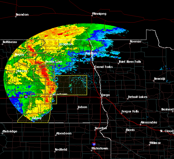 At 236 am cdt, severe thunderstorms were located along a line extending from near oberon to near sheyenne to barlow, moving east at 35 mph (radar indicated). Hazards include 60 mph wind gusts and quarter size hail. Hail damage to vehicles is expected. expect wind damage to roofs, siding, and trees. these severe storms will be near, grahams island state park around 245 am cdt. brantford around 250 am cdt. fort totten around 255 am cdt. camp grafton around 300 am cdt. St michael, tokio and warwick around 305 am cdt. At 236 am cdt, severe thunderstorms were located along a line extending from near oberon to near sheyenne to barlow, moving east at 35 mph (radar indicated). Hazards include 60 mph wind gusts and quarter size hail. Hail damage to vehicles is expected. expect wind damage to roofs, siding, and trees. these severe storms will be near, grahams island state park around 245 am cdt. brantford around 250 am cdt. fort totten around 255 am cdt. camp grafton around 300 am cdt. St michael, tokio and warwick around 305 am cdt.
|
| 6/29/2018 2:36 AM CDT |
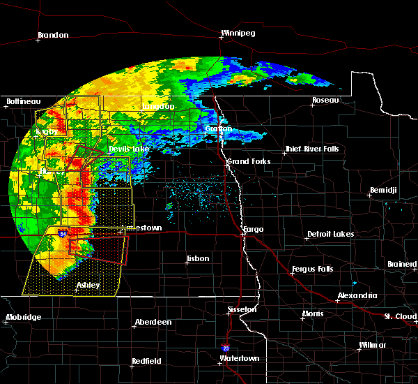 At 236 am cdt, severe thunderstorms were located along a line extending from near oberon to near sheyenne to barlow, moving east at 35 mph (radar indicated). Hazards include 60 mph wind gusts and quarter size hail. Hail damage to vehicles is expected. expect wind damage to roofs, siding, and trees. these severe storms will be near, grahams island state park around 245 am cdt. brantford around 250 am cdt. fort totten around 255 am cdt. camp grafton around 300 am cdt. St michael, tokio and warwick around 305 am cdt. At 236 am cdt, severe thunderstorms were located along a line extending from near oberon to near sheyenne to barlow, moving east at 35 mph (radar indicated). Hazards include 60 mph wind gusts and quarter size hail. Hail damage to vehicles is expected. expect wind damage to roofs, siding, and trees. these severe storms will be near, grahams island state park around 245 am cdt. brantford around 250 am cdt. fort totten around 255 am cdt. camp grafton around 300 am cdt. St michael, tokio and warwick around 305 am cdt.
|
| 6/29/2018 2:08 AM CDT |
 At 207 am cdt, severe thunderstorms were located along a line extending from maddock to cathay to 8 miles north of lake williams, moving east at 35 mph (radar indicated). Hazards include 60 mph wind gusts and quarter size hail. Hail damage to vehicles is expected. expect wind damage to roofs, siding, and trees. severe thunderstorms will be near, oberon around 235 am cdt. grahams island state park around 245 am cdt. brantford around 250 am cdt. fort totten around 255 am cdt. Camp grafton and lakewood park around 300 am cdt. At 207 am cdt, severe thunderstorms were located along a line extending from maddock to cathay to 8 miles north of lake williams, moving east at 35 mph (radar indicated). Hazards include 60 mph wind gusts and quarter size hail. Hail damage to vehicles is expected. expect wind damage to roofs, siding, and trees. severe thunderstorms will be near, oberon around 235 am cdt. grahams island state park around 245 am cdt. brantford around 250 am cdt. fort totten around 255 am cdt. Camp grafton and lakewood park around 300 am cdt.
|
| 6/1/2018 9:59 PM CDT |
 At 958 pm cdt, a severe thunderstorm was located 8 miles north of brantford, or 26 miles south of devils lake, moving north at 55 mph (radar indicated). Hazards include 70 mph wind gusts. Expect considerable tree damage. damage is likely to mobile homes, roofs, and outbuildings. This severe storm will be near, fort totten, tokio and st michael around 1015 pm cdt. At 958 pm cdt, a severe thunderstorm was located 8 miles north of brantford, or 26 miles south of devils lake, moving north at 55 mph (radar indicated). Hazards include 70 mph wind gusts. Expect considerable tree damage. damage is likely to mobile homes, roofs, and outbuildings. This severe storm will be near, fort totten, tokio and st michael around 1015 pm cdt.
|
| 6/1/2018 9:43 PM CDT |
 At 942 pm cdt, a severe thunderstorm was located near barlow, or 40 miles south of devils lake, moving north at 55 mph (radar indicated). Hazards include 70 mph wind gusts. Expect considerable tree damage. damage is likely to mobile homes, roofs, and outbuildings. this severe thunderstorm will be near, brantford around 945 pm cdt. new rockford around 955 pm cdt. sheyenne around 1005 pm cdt. Camp grafton, fort totten and st michael around 1015 pm cdt. At 942 pm cdt, a severe thunderstorm was located near barlow, or 40 miles south of devils lake, moving north at 55 mph (radar indicated). Hazards include 70 mph wind gusts. Expect considerable tree damage. damage is likely to mobile homes, roofs, and outbuildings. this severe thunderstorm will be near, brantford around 945 pm cdt. new rockford around 955 pm cdt. sheyenne around 1005 pm cdt. Camp grafton, fort totten and st michael around 1015 pm cdt.
|
| 7/22/2017 12:25 AM CDT |
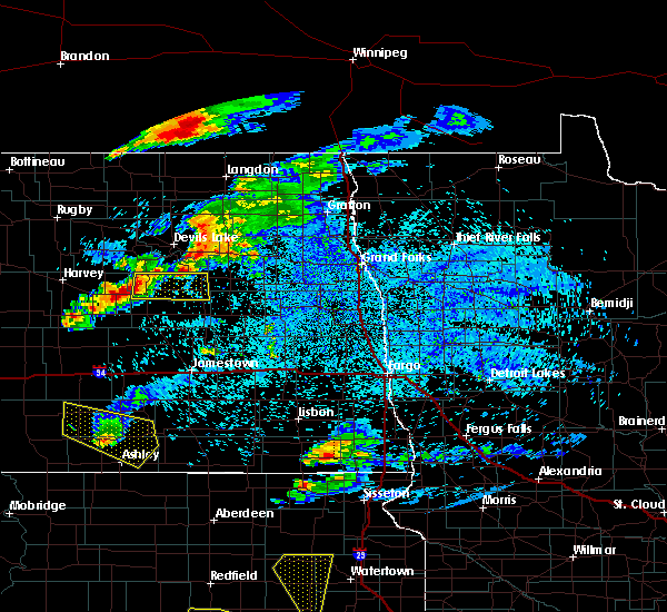 At 1225 am cdt, a severe thunderstorm was located near new rockford, or 29 miles southwest of devils lake, moving east at 35 mph (radar indicated). Hazards include quarter size hail. Damage to vehicles is expected. This severe thunderstorm will remain over mainly rural areas of eddy county. At 1225 am cdt, a severe thunderstorm was located near new rockford, or 29 miles southwest of devils lake, moving east at 35 mph (radar indicated). Hazards include quarter size hail. Damage to vehicles is expected. This severe thunderstorm will remain over mainly rural areas of eddy county.
|
| 8/3/2016 8:38 PM CDT |
 At 835 pm cdt, a severe thunderstorm capable of producing a tornado was located near sheyenne, or 22 miles south of devils lake, moving east at 30 mph. a second thunderstorm capable of producing a tornado was located 3 miles east of new rockford moving east at 30 mph (radar indicated rotation). Hazards include tornado and quarter size hail. Expect damage to mobile homes. roofs. and vehicles. This dangerous storm will be near, warwick around 905 pm cdt. At 835 pm cdt, a severe thunderstorm capable of producing a tornado was located near sheyenne, or 22 miles south of devils lake, moving east at 30 mph. a second thunderstorm capable of producing a tornado was located 3 miles east of new rockford moving east at 30 mph (radar indicated rotation). Hazards include tornado and quarter size hail. Expect damage to mobile homes. roofs. and vehicles. This dangerous storm will be near, warwick around 905 pm cdt.
|
| 8/3/2016 8:24 PM CDT |
 At 822 pm cdt, multiple severe thunderstorms capable of producing tornadoes were located near new rockford and sheyenne, or 24 miles southwest of devils lake, moving east at 30 mph (radar indicated rotation). Hazards include tornado and quarter size hail. Expect damage to mobile homes. roofs. and vehicles. this dangerous storm will be near, sheyenne around 830 pm cdt. tokio around 900 pm cdt. Warwick around 910 pm cdt. At 822 pm cdt, multiple severe thunderstorms capable of producing tornadoes were located near new rockford and sheyenne, or 24 miles southwest of devils lake, moving east at 30 mph (radar indicated rotation). Hazards include tornado and quarter size hail. Expect damage to mobile homes. roofs. and vehicles. this dangerous storm will be near, sheyenne around 830 pm cdt. tokio around 900 pm cdt. Warwick around 910 pm cdt.
|
| 8/1/2016 4:30 PM CDT |
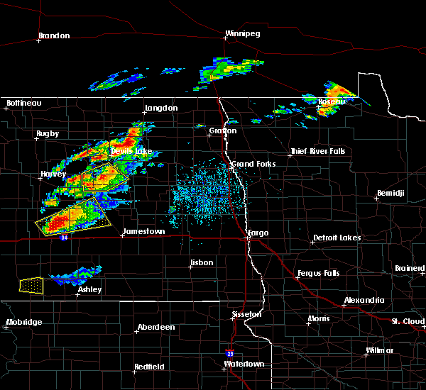 At 430 pm cdt, a severe thunderstorm was located 7 miles southeast of sheyenne, or 23 miles south of devils lake, moving northeast at 30 mph (radar indicated). Hazards include quarter size hail. Damage to vehicles is expected. This severe storm will be near, tokio and warwick around 445 pm cdt. At 430 pm cdt, a severe thunderstorm was located 7 miles southeast of sheyenne, or 23 miles south of devils lake, moving northeast at 30 mph (radar indicated). Hazards include quarter size hail. Damage to vehicles is expected. This severe storm will be near, tokio and warwick around 445 pm cdt.
|
| 8/1/2016 4:08 PM CDT |
 At 408 pm cdt, a severe thunderstorm was located over new rockford, or 33 miles south of devils lake, moving east at 20 mph (radar indicated). Hazards include quarter size hail. Damage to vehicles is expected. This severe storm will be near, brantford around 430 pm cdt. At 408 pm cdt, a severe thunderstorm was located over new rockford, or 33 miles south of devils lake, moving east at 20 mph (radar indicated). Hazards include quarter size hail. Damage to vehicles is expected. This severe storm will be near, brantford around 430 pm cdt.
|
| 8/1/2016 3:45 PM CDT |
 At 345 pm cdt, a severe thunderstorm was located near new rockford, or 31 miles southwest of devils lake, moving northeast at 30 mph (radar indicated). Hazards include quarter size hail. Damage to vehicles is expected. this severe thunderstorm will be near, new rockford around 350 pm cdt. sheyenne around 400 pm cdt. tokio around 435 pm cdt. Warwick around 440 pm cdt. At 345 pm cdt, a severe thunderstorm was located near new rockford, or 31 miles southwest of devils lake, moving northeast at 30 mph (radar indicated). Hazards include quarter size hail. Damage to vehicles is expected. this severe thunderstorm will be near, new rockford around 350 pm cdt. sheyenne around 400 pm cdt. tokio around 435 pm cdt. Warwick around 440 pm cdt.
|
| 7/20/2016 9:36 PM CDT |
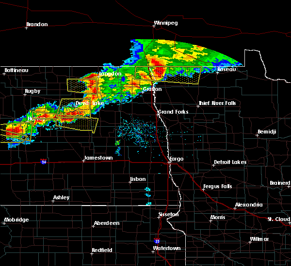 At 935 pm cdt, a severe thunderstorm was located near warwick, or 19 miles south of devils lake, moving east at 30 mph (radar indicated). Hazards include 70 mph wind gusts and ping pong ball size hail. People and animals outdoors will be injured. expect hail damage to roofs, siding, windows, and vehicles. expect considerable tree damage. wind damage is also likely to mobile homes, roofs, and outbuildings. this severe storm will be near, warwick around 945 pm cdt. hamar around 1000 pm cdt. tolna around 1015 pm cdt. A tornado watch remains in effect until 1100 pm cdt for northeastern north dakota. At 935 pm cdt, a severe thunderstorm was located near warwick, or 19 miles south of devils lake, moving east at 30 mph (radar indicated). Hazards include 70 mph wind gusts and ping pong ball size hail. People and animals outdoors will be injured. expect hail damage to roofs, siding, windows, and vehicles. expect considerable tree damage. wind damage is also likely to mobile homes, roofs, and outbuildings. this severe storm will be near, warwick around 945 pm cdt. hamar around 1000 pm cdt. tolna around 1015 pm cdt. A tornado watch remains in effect until 1100 pm cdt for northeastern north dakota.
|
| 7/20/2016 9:11 PM CDT |
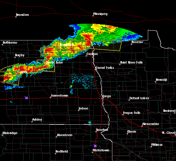 At 910 pm cdt, a severe thunderstorm was located near oberon, or 25 miles southwest of devils lake, moving east at 35 mph (radar indicated). Hazards include 70 mph wind gusts and quarter size hail. Hail damage to vehicles is expected. expect considerable tree damage. wind damage is also likely to mobile homes, roofs, and outbuildings. this severe thunderstorm will be near, sheyenne around 925 pm cdt. mose around 1015 pm cdt. A tornado watch remains in effect until 1100 pm cdt for northeastern north dakota. At 910 pm cdt, a severe thunderstorm was located near oberon, or 25 miles southwest of devils lake, moving east at 35 mph (radar indicated). Hazards include 70 mph wind gusts and quarter size hail. Hail damage to vehicles is expected. expect considerable tree damage. wind damage is also likely to mobile homes, roofs, and outbuildings. this severe thunderstorm will be near, sheyenne around 925 pm cdt. mose around 1015 pm cdt. A tornado watch remains in effect until 1100 pm cdt for northeastern north dakota.
|
| 7/10/2016 11:43 PM CDT |
 The severe thunderstorm warning for southwestern ramsey, central eddy and southeastern benson counties will expire at 1145 pm cdt, the storms which prompted the warning have weakened below severe limits, and no longer pose an immediate threat to life or property. therefore the warning will be allowed to expire. however gusty winds and heavy rain are still possible with these thunderstorms. a severe thunderstorm watch remains in effect until 300 am cdt for northeastern north dakota. The severe thunderstorm warning for southwestern ramsey, central eddy and southeastern benson counties will expire at 1145 pm cdt, the storms which prompted the warning have weakened below severe limits, and no longer pose an immediate threat to life or property. therefore the warning will be allowed to expire. however gusty winds and heavy rain are still possible with these thunderstorms. a severe thunderstorm watch remains in effect until 300 am cdt for northeastern north dakota.
|
| 7/10/2016 11:13 PM CDT |
 At 1113 pm cdt, severe thunderstorms were located along a line extending from near harlow to near brantford, moving east at 30 mph (radar indicated). Hazards include 60 mph wind gusts. Expect damage to roofs. siding. and trees. These severe storms will be near, brantford around 1115 pm cdt. At 1113 pm cdt, severe thunderstorms were located along a line extending from near harlow to near brantford, moving east at 30 mph (radar indicated). Hazards include 60 mph wind gusts. Expect damage to roofs. siding. and trees. These severe storms will be near, brantford around 1115 pm cdt.
|
| 7/10/2016 10:43 PM CDT |
 At 1042 pm cdt, severe thunderstorms were located along a line extending from near maddock to 6 miles southwest of carrington, moving east at 40 mph (radar indicated). Hazards include 60 mph wind gusts and quarter size hail. Hail damage to vehicles is expected. expect wind damage to roofs, siding, and trees. severe thunderstorms will be near, flora around 1100 pm cdt. minnewaukan and oberon around 1110 pm cdt. fort totten around 1125 pm cdt. devils lake, lakewood park and camp grafton around 1135 pm cdt. Crary around 1145 pm cdt. At 1042 pm cdt, severe thunderstorms were located along a line extending from near maddock to 6 miles southwest of carrington, moving east at 40 mph (radar indicated). Hazards include 60 mph wind gusts and quarter size hail. Hail damage to vehicles is expected. expect wind damage to roofs, siding, and trees. severe thunderstorms will be near, flora around 1100 pm cdt. minnewaukan and oberon around 1110 pm cdt. fort totten around 1125 pm cdt. devils lake, lakewood park and camp grafton around 1135 pm cdt. Crary around 1145 pm cdt.
|
| 7/9/2016 8:45 PM CDT |
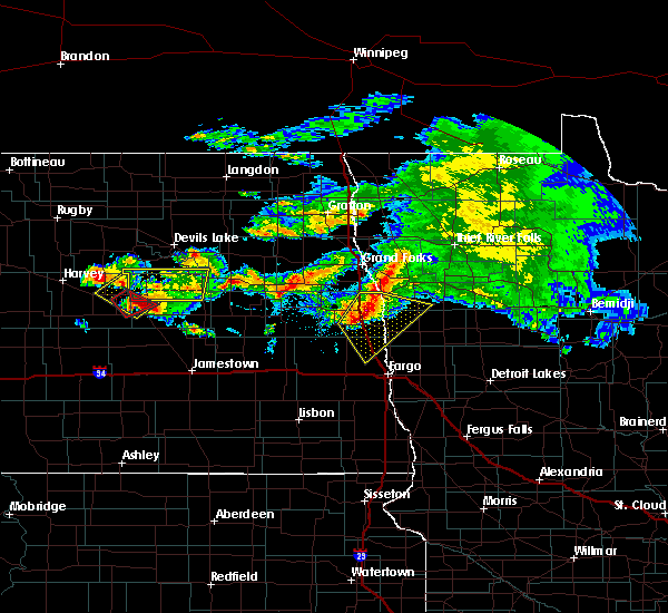 At 844 pm cdt, a severe thunderstorm was located over barlow, or 37 miles south of devils lake, moving east at 65 mph (radar indicated). Hazards include ping pong ball size hail and 60 mph wind gusts. People and animals outdoors will be injured. expect hail damage to roofs, siding, windows, and vehicles. expect wind damage to roofs, siding, and trees. This severe storm will be near, brantford around 850 pm cdt. At 844 pm cdt, a severe thunderstorm was located over barlow, or 37 miles south of devils lake, moving east at 65 mph (radar indicated). Hazards include ping pong ball size hail and 60 mph wind gusts. People and animals outdoors will be injured. expect hail damage to roofs, siding, windows, and vehicles. expect wind damage to roofs, siding, and trees. This severe storm will be near, brantford around 850 pm cdt.
|
| 7/9/2016 8:09 PM CDT |
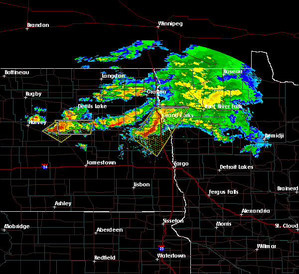 At 809 pm cdt, a severe thunderstorm was located near new rockford, or 32 miles southwest of devils lake, moving east at 30 mph (radar indicated). Hazards include ping pong ball size hail and 60 mph wind gusts. People and animals outdoors will be injured. expect hail damage to roofs, siding, windows, and vehicles. expect wind damage to roofs, siding, and trees. this severe thunderstorm will be near, new rockford around 820 pm cdt. Brantford around 845 pm cdt. At 809 pm cdt, a severe thunderstorm was located near new rockford, or 32 miles southwest of devils lake, moving east at 30 mph (radar indicated). Hazards include ping pong ball size hail and 60 mph wind gusts. People and animals outdoors will be injured. expect hail damage to roofs, siding, windows, and vehicles. expect wind damage to roofs, siding, and trees. this severe thunderstorm will be near, new rockford around 820 pm cdt. Brantford around 845 pm cdt.
|
| 7/4/2016 4:59 PM CDT |
 At 459 pm cdt, severe thunderstorms were located along a line extending from near webster to 8 miles north of brantford, moving east at 35 mph (radar indicated). Hazards include 60 mph wind gusts and quarter size hail. Hail damage to vehicles is expected. expect wind damage to roofs, siding, and trees. severe thunderstorms will be near, lawton and brocket around 535 pm cdt. pekin around 540 pm cdt. mcville around 550 pm cdt. Kloten around 600 pm cdt. At 459 pm cdt, severe thunderstorms were located along a line extending from near webster to 8 miles north of brantford, moving east at 35 mph (radar indicated). Hazards include 60 mph wind gusts and quarter size hail. Hail damage to vehicles is expected. expect wind damage to roofs, siding, and trees. severe thunderstorms will be near, lawton and brocket around 535 pm cdt. pekin around 540 pm cdt. mcville around 550 pm cdt. Kloten around 600 pm cdt.
|
| 6/17/2016 6:40 AM CDT | At 640 am cdt, a severe thunderstorm was located near tokio, or 15 miles south of devils lake, moving east at 40 mph (radar indicated). Hazards include 70 mph wind gusts and ping pong ball size hail. People and animals outdoors will be injured. expect hail damage to roofs, siding, windows, and vehicles. expect considerable tree damage. wind damage is also likely to mobile homes, roofs, and outbuildings. this severe storm will be near, tokio around 645 am cdt. Warwick around 650 am cdt. |
| 6/17/2016 6:11 AM CDT | At 610 am cdt, a severe thunderstorm was located near oberon, or 26 miles southwest of devils lake, moving northeast at 25 mph (radar indicated). Hazards include ping pong ball size hail and 60 mph wind gusts. People and animals outdoors will be injured. expect hail damage to roofs, siding, windows, and vehicles. expect wind damage to roofs, siding, and trees. this severe storm will be near, oberon and sheyenne around 625 am cdt. fort totten around 650 am cdt. Camp grafton, lakewood park and st michael around 700 am cdt. |
| 6/17/2016 5:56 AM CDT | At 555 am cdt, a severe thunderstorm was located near hamberg, or 33 miles southwest of devils lake, moving northeast at 25 mph (radar indicated). Hazards include 60 mph wind gusts and quarter size hail. Hail damage to vehicles is expected. expect wind damage to roofs, siding, and trees. this severe thunderstorm will be near, flora around 610 am cdt. oberon and sheyenne around 625 am cdt. fort totten around 650 am cdt. Camp grafton, lakewood park and st michael around 700 am cdt. |
| 6/10/2016 1:55 AM CDT |
 At 154 am cdt, severe thunderstorms were located along a line extending from near churchs ferry to 6 miles southwest of carrington, moving east at 45 mph (radar indicated). Hazards include 60 mph wind gusts. Expect damage to roofs. siding. and trees. these severe storms will be near, penn around 200 am cdt. webster around 205 am cdt. Garske around 210 am cdt. At 154 am cdt, severe thunderstorms were located along a line extending from near churchs ferry to 6 miles southwest of carrington, moving east at 45 mph (radar indicated). Hazards include 60 mph wind gusts. Expect damage to roofs. siding. and trees. these severe storms will be near, penn around 200 am cdt. webster around 205 am cdt. Garske around 210 am cdt.
|
| 6/10/2016 1:29 AM CDT |
 At 128 am cdt, severe thunderstorms were located along a line extending from near york to 6 miles south of bowdon, moving east at 45 mph (radar indicated). Hazards include 60 mph wind gusts. Expect damage to roofs. siding. and trees. severe thunderstorms will be near, york around 130 am cdt. leeds around 140 am cdt. brinsmade around 145 am cdt. churchs ferry around 150 am cdt. Penn around 155 am cdt. At 128 am cdt, severe thunderstorms were located along a line extending from near york to 6 miles south of bowdon, moving east at 45 mph (radar indicated). Hazards include 60 mph wind gusts. Expect damage to roofs. siding. and trees. severe thunderstorms will be near, york around 130 am cdt. leeds around 140 am cdt. brinsmade around 145 am cdt. churchs ferry around 150 am cdt. Penn around 155 am cdt.
|
| 5/22/2016 11:17 PM CDT |
 At 1116 pm cdt, a severe thunderstorm was located near selz, or 47 miles west of devils lake, moving east at 55 mph (radar indicated). Hazards include 60 mph wind gusts and penny size hail. Expect damage to roofs. siding. and trees. this severe thunderstorm will be near, maddock around 1135 pm cdt. flora around 1140 pm cdt. oberon and sheyenne around 1150 pm cdt. fort totten around 1200 am cdt. Camp grafton and st michael around 1205 am cdt. At 1116 pm cdt, a severe thunderstorm was located near selz, or 47 miles west of devils lake, moving east at 55 mph (radar indicated). Hazards include 60 mph wind gusts and penny size hail. Expect damage to roofs. siding. and trees. this severe thunderstorm will be near, maddock around 1135 pm cdt. flora around 1140 pm cdt. oberon and sheyenne around 1150 pm cdt. fort totten around 1200 am cdt. Camp grafton and st michael around 1205 am cdt.
|
| 7/23/2015 9:54 PM CDT |
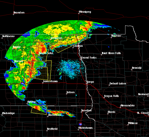 At 953 pm cdt, severe thunderstorms were located along a line extending from sheyenne to 6 miles east of woodworth, moving east at 25 mph (radar indicated). Hazards include 60 mph wind gusts and quarter size hail. Hail damage to vehicles is expected. expect wind damage to roofs, siding and trees. severe thunderstorms will be near, sheyenne around 955 pm cdt. warwick around 1035 pm cdt. hamar around 1045 pm cdt. Tolna and wimbledon around 1100 pm cdt. At 953 pm cdt, severe thunderstorms were located along a line extending from sheyenne to 6 miles east of woodworth, moving east at 25 mph (radar indicated). Hazards include 60 mph wind gusts and quarter size hail. Hail damage to vehicles is expected. expect wind damage to roofs, siding and trees. severe thunderstorms will be near, sheyenne around 955 pm cdt. warwick around 1035 pm cdt. hamar around 1045 pm cdt. Tolna and wimbledon around 1100 pm cdt.
|
| 7/12/2015 9:19 PM CDT |
 At 918 pm cdt, a severe thunderstorm was located near new rockford, or 12 miles north of carrington, moving east at 30 mph (radar indicated). Hazards include 60 mph wind gusts and half dollar size hail. Hail damage to vehicles is expected. expect wind damage to roofs, siding and trees. This severe storm will be near, brantford around 940 pm cdt. At 918 pm cdt, a severe thunderstorm was located near new rockford, or 12 miles north of carrington, moving east at 30 mph (radar indicated). Hazards include 60 mph wind gusts and half dollar size hail. Hail damage to vehicles is expected. expect wind damage to roofs, siding and trees. This severe storm will be near, brantford around 940 pm cdt.
|
| 7/12/2015 8:45 PM CDT |
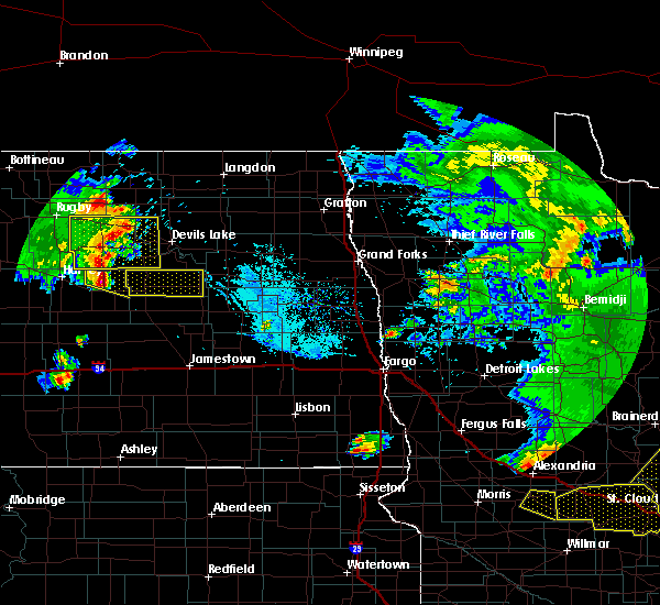 At 845 pm cdt, a severe thunderstorm was located over bremen, or 23 miles east of harvey, moving east at 35 mph (radar indicated). Hazards include 60 mph wind gusts and quarter size hail. Hail damage to vehicles is expected. expect wind damage to roofs, siding and trees. this severe thunderstorm will be near, new rockford and sheyenne around 910 pm cdt. Brantford around 930 pm cdt. At 845 pm cdt, a severe thunderstorm was located over bremen, or 23 miles east of harvey, moving east at 35 mph (radar indicated). Hazards include 60 mph wind gusts and quarter size hail. Hail damage to vehicles is expected. expect wind damage to roofs, siding and trees. this severe thunderstorm will be near, new rockford and sheyenne around 910 pm cdt. Brantford around 930 pm cdt.
|
| 7/5/2015 12:02 AM CDT |
 At 1201 am cdt, a severe thunderstorm was located near new rockford, or 13 miles north of carrington, moving east at 15 mph (radar indicated). Hazards include ping pong ball size hail and 60 mph wind gusts. People and animals outdoors will be injured. expect hail damage to roofs, siding, windows and vehicles. expect wind damage to roofs, siding and trees. This severe thunderstorm will remain over mainly rural areas of eddy county east of new rockford to north of grace city. At 1201 am cdt, a severe thunderstorm was located near new rockford, or 13 miles north of carrington, moving east at 15 mph (radar indicated). Hazards include ping pong ball size hail and 60 mph wind gusts. People and animals outdoors will be injured. expect hail damage to roofs, siding, windows and vehicles. expect wind damage to roofs, siding and trees. This severe thunderstorm will remain over mainly rural areas of eddy county east of new rockford to north of grace city.
|
| 7/4/2015 11:28 PM CDT |
 At 1127 pm cdt, a severe thunderstorm was located 7 miles south of warwick, or 25 miles south of devils lake, moving east at 40 mph (radar indicated). Hazards include ping pong ball size hail and 60 mph wind gusts. People and animals outdoors will be injured. expect hail damage to roofs, siding, windows and vehicles. expect wind damage to roofs, siding and trees. This severe thunderstorm will remain over mainly rural areas of eastern eddy county south of warwick. At 1127 pm cdt, a severe thunderstorm was located 7 miles south of warwick, or 25 miles south of devils lake, moving east at 40 mph (radar indicated). Hazards include ping pong ball size hail and 60 mph wind gusts. People and animals outdoors will be injured. expect hail damage to roofs, siding, windows and vehicles. expect wind damage to roofs, siding and trees. This severe thunderstorm will remain over mainly rural areas of eastern eddy county south of warwick.
|
| 7/4/2015 10:55 PM CDT |
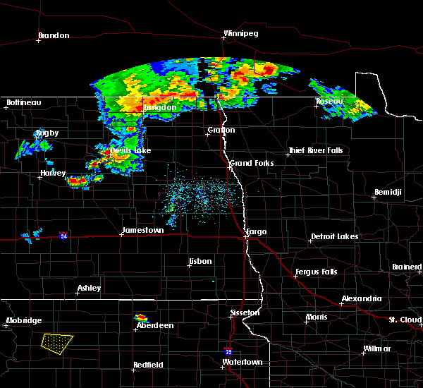 At 1055 pm cdt, a severe thunderstorm was located near new rockford, or 19 miles north of carrington, moving east at 30 mph (radar indicated). Hazards include ping pong ball size hail and 60 mph wind gusts. People and animals outdoors will be injured. expect hail damage to roofs, siding, windows and vehicles. expect wind damage to roofs, siding and trees. This severe thunderstorm will impact areas around new rockford through 1130 pm. At 1055 pm cdt, a severe thunderstorm was located near new rockford, or 19 miles north of carrington, moving east at 30 mph (radar indicated). Hazards include ping pong ball size hail and 60 mph wind gusts. People and animals outdoors will be injured. expect hail damage to roofs, siding, windows and vehicles. expect wind damage to roofs, siding and trees. This severe thunderstorm will impact areas around new rockford through 1130 pm.
|
| 1/1/0001 12:00 AM | Half Dollar sized hail reported 8.2 miles ENE of Sheyenne, ND, torrential rains with numerous nickel to walnut sized hail. hail began smaller and increased in size from about 125 to 130 pm cdt. |
Hail Maps for Sheyenne, ND
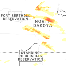


Connect with Interactive Hail Maps