

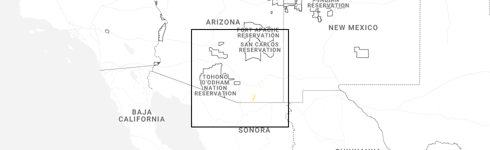
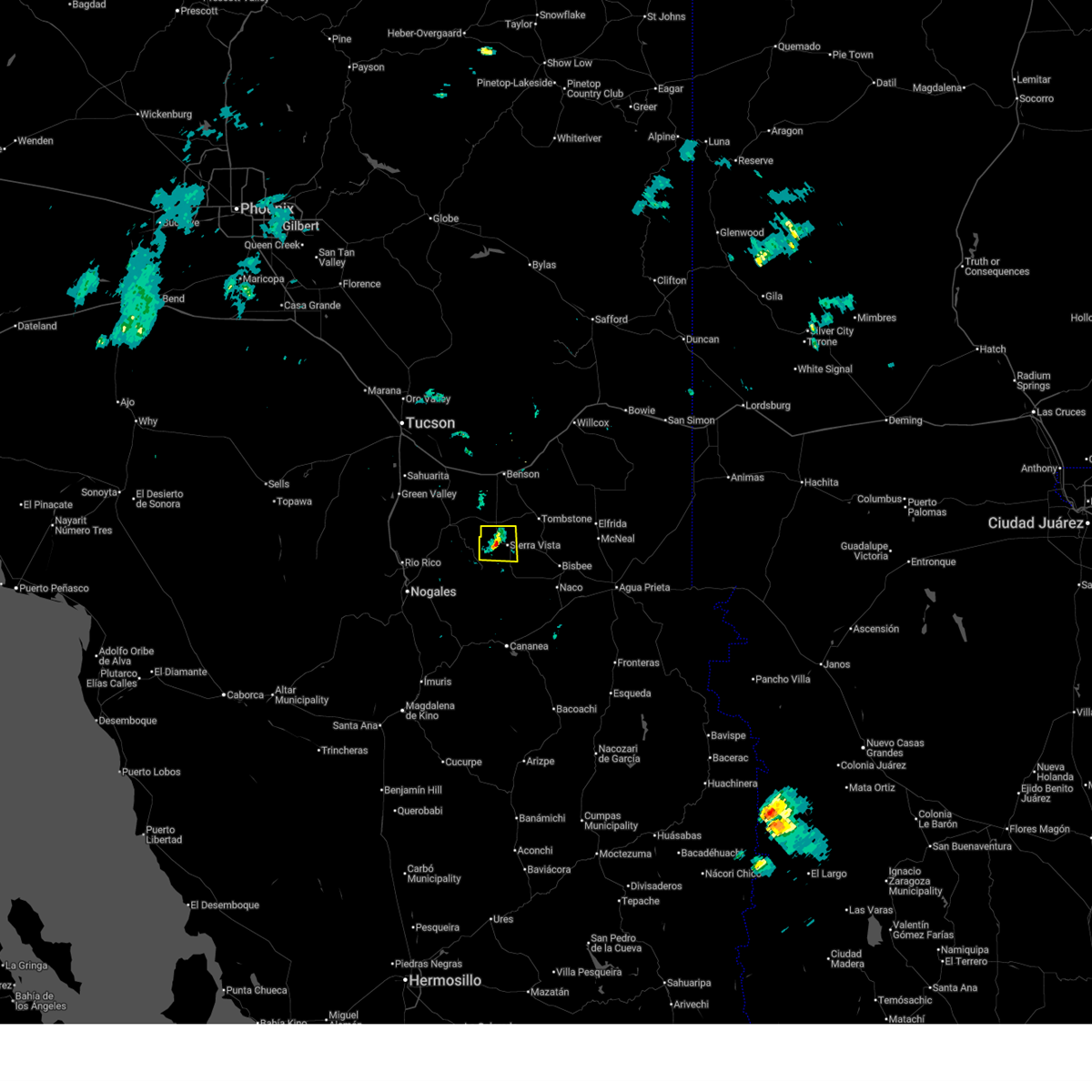
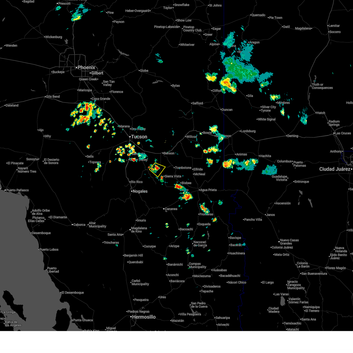
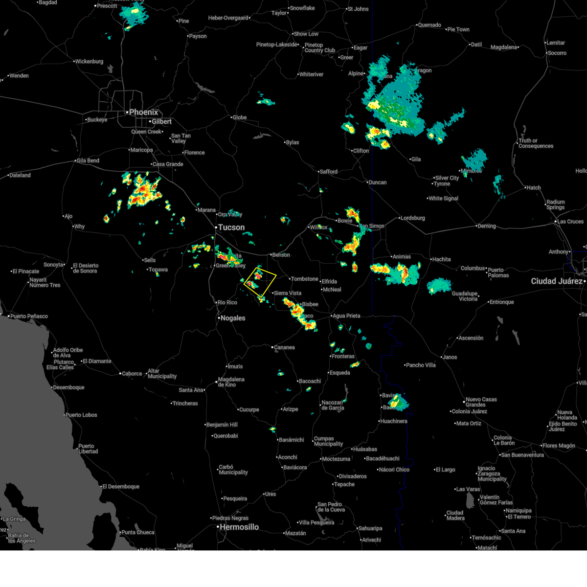
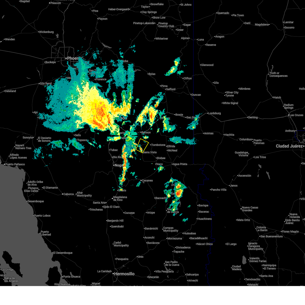
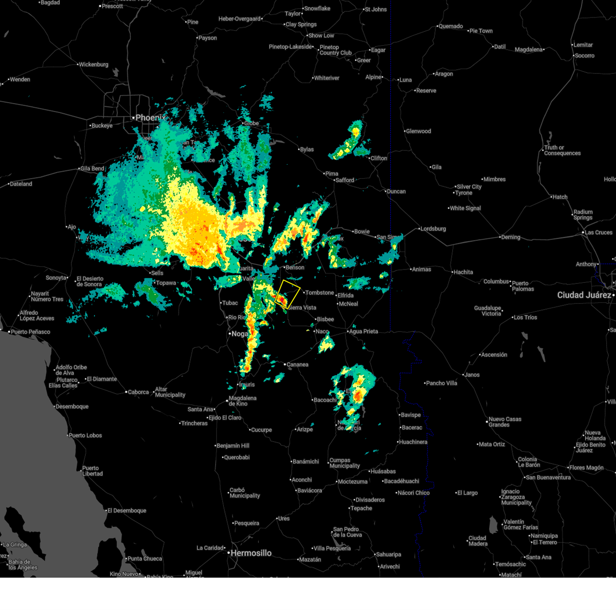
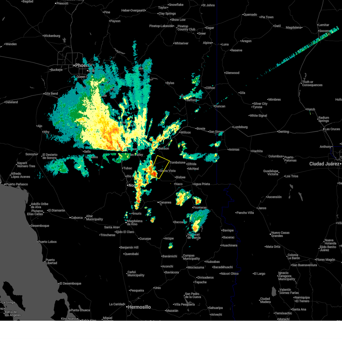
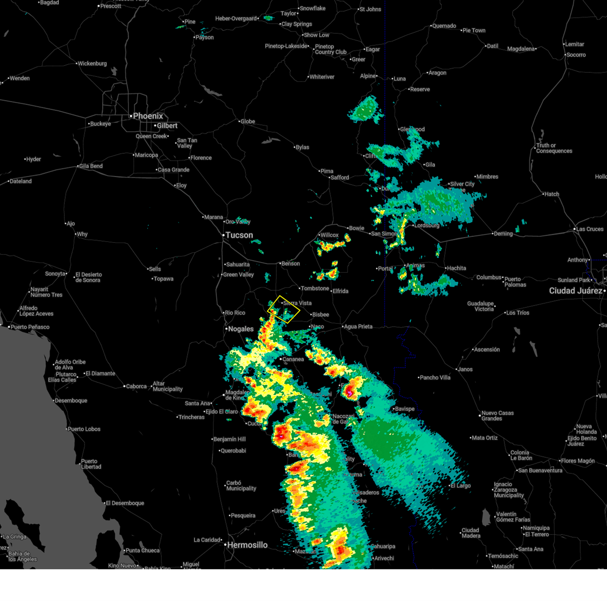
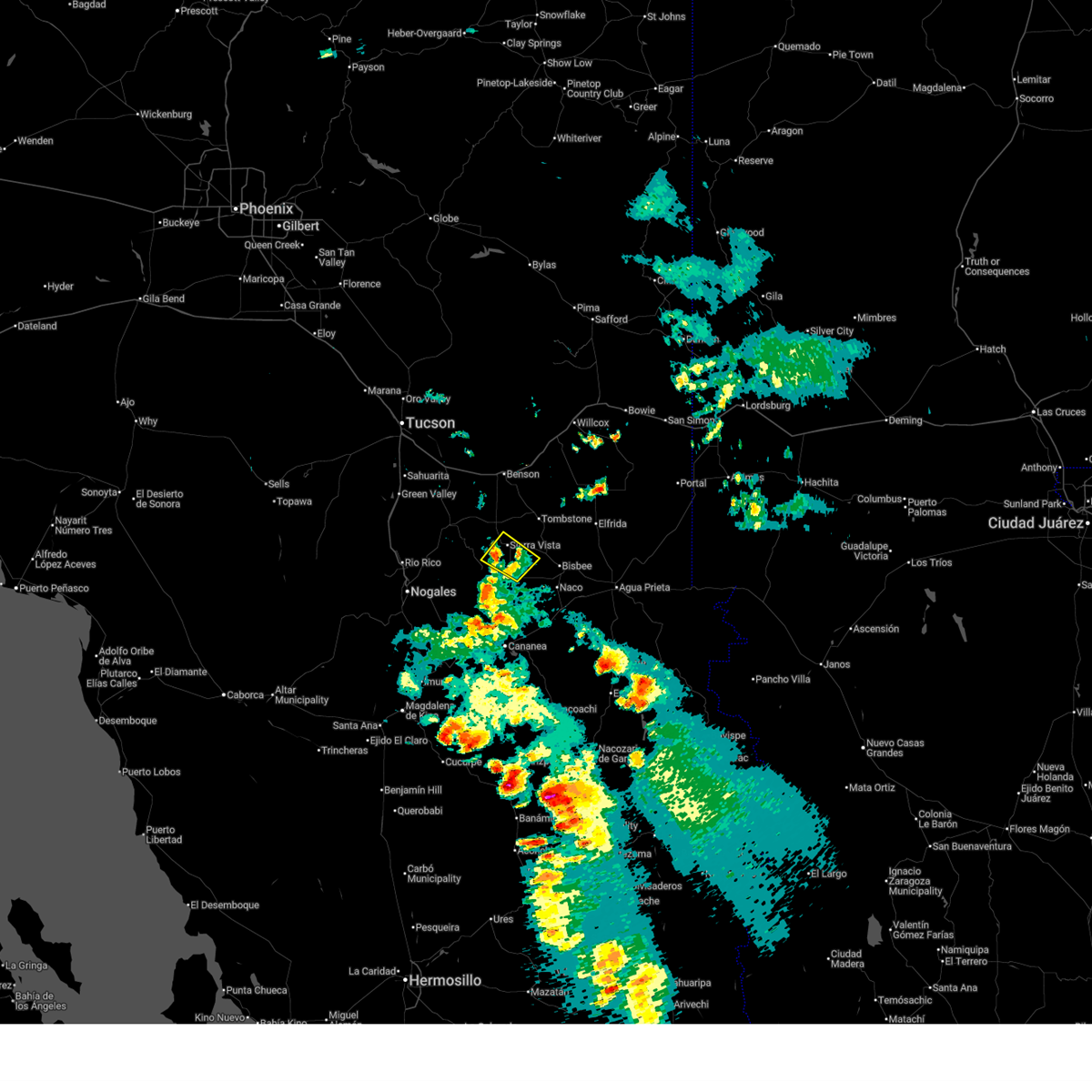
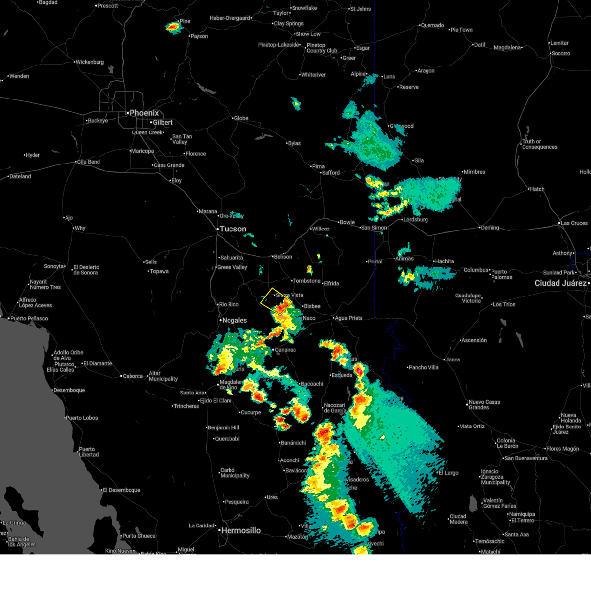
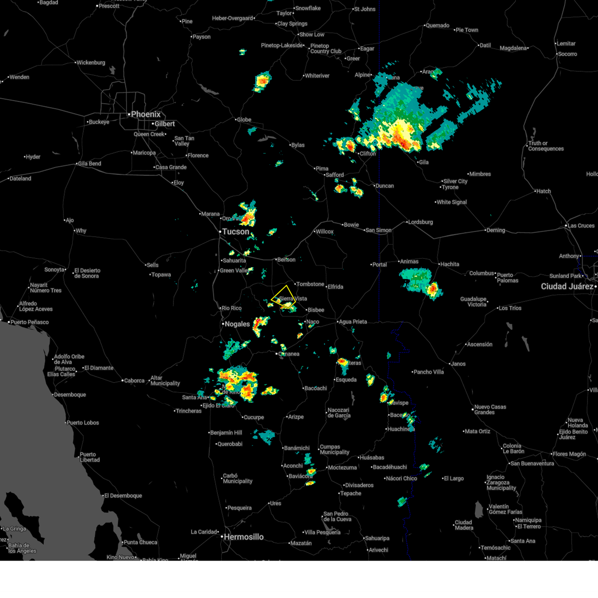
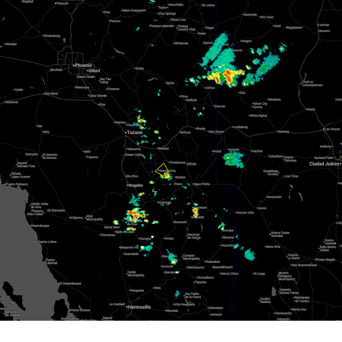
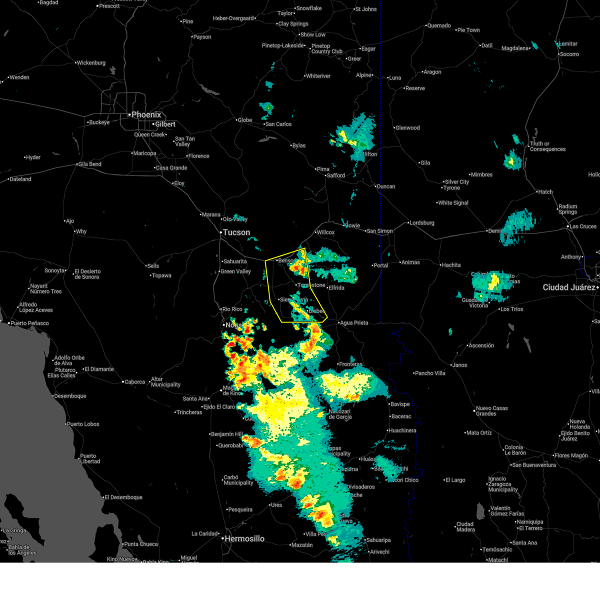
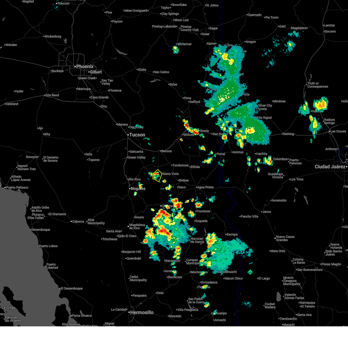
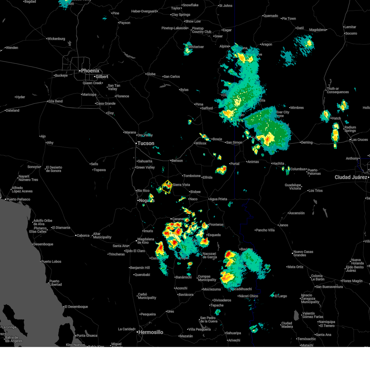
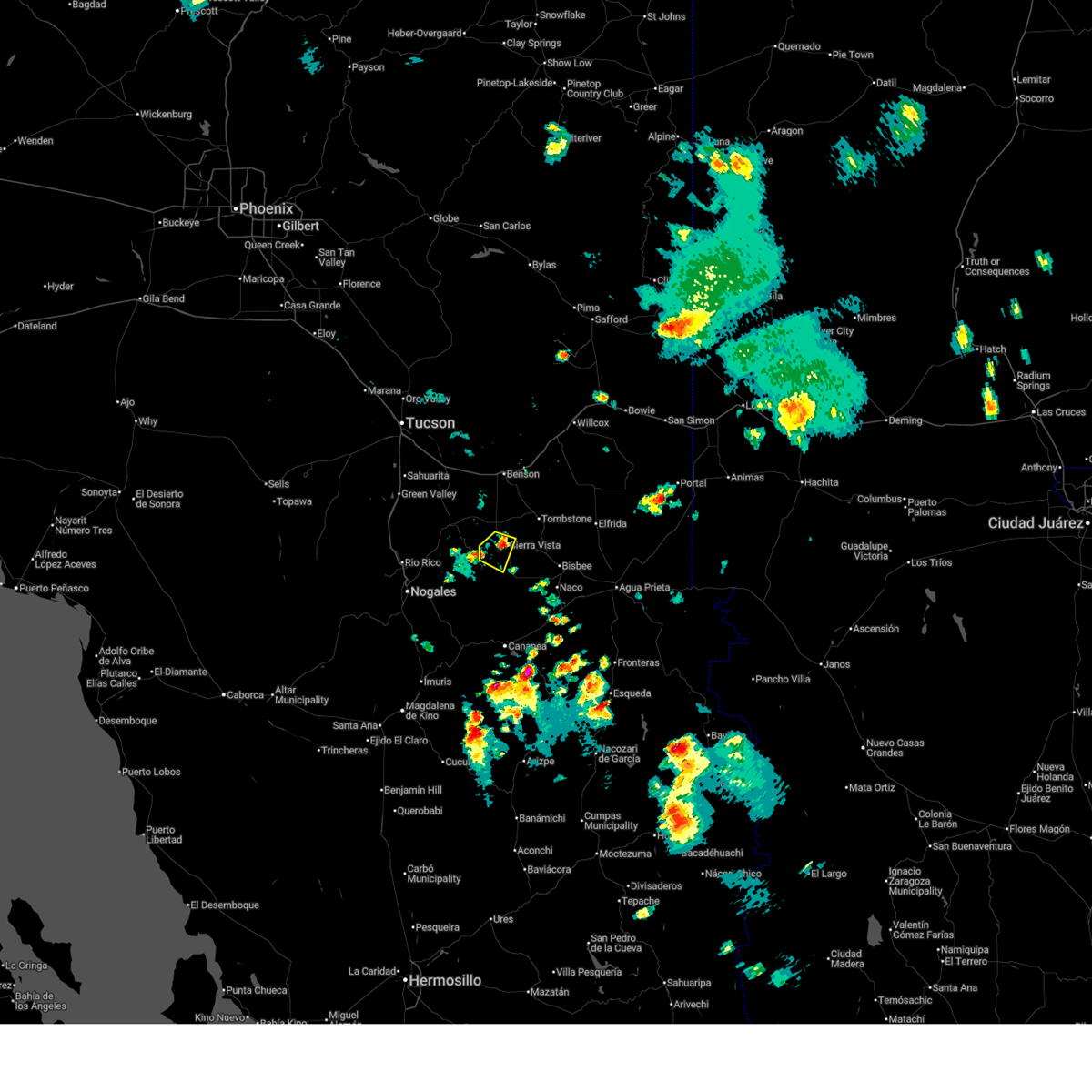
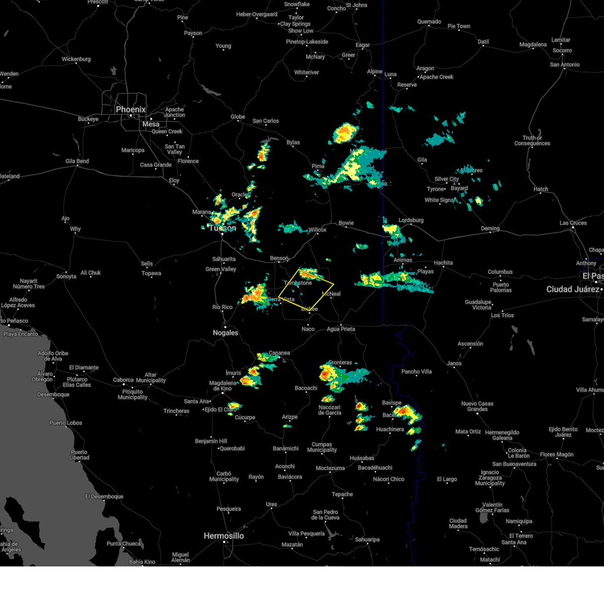
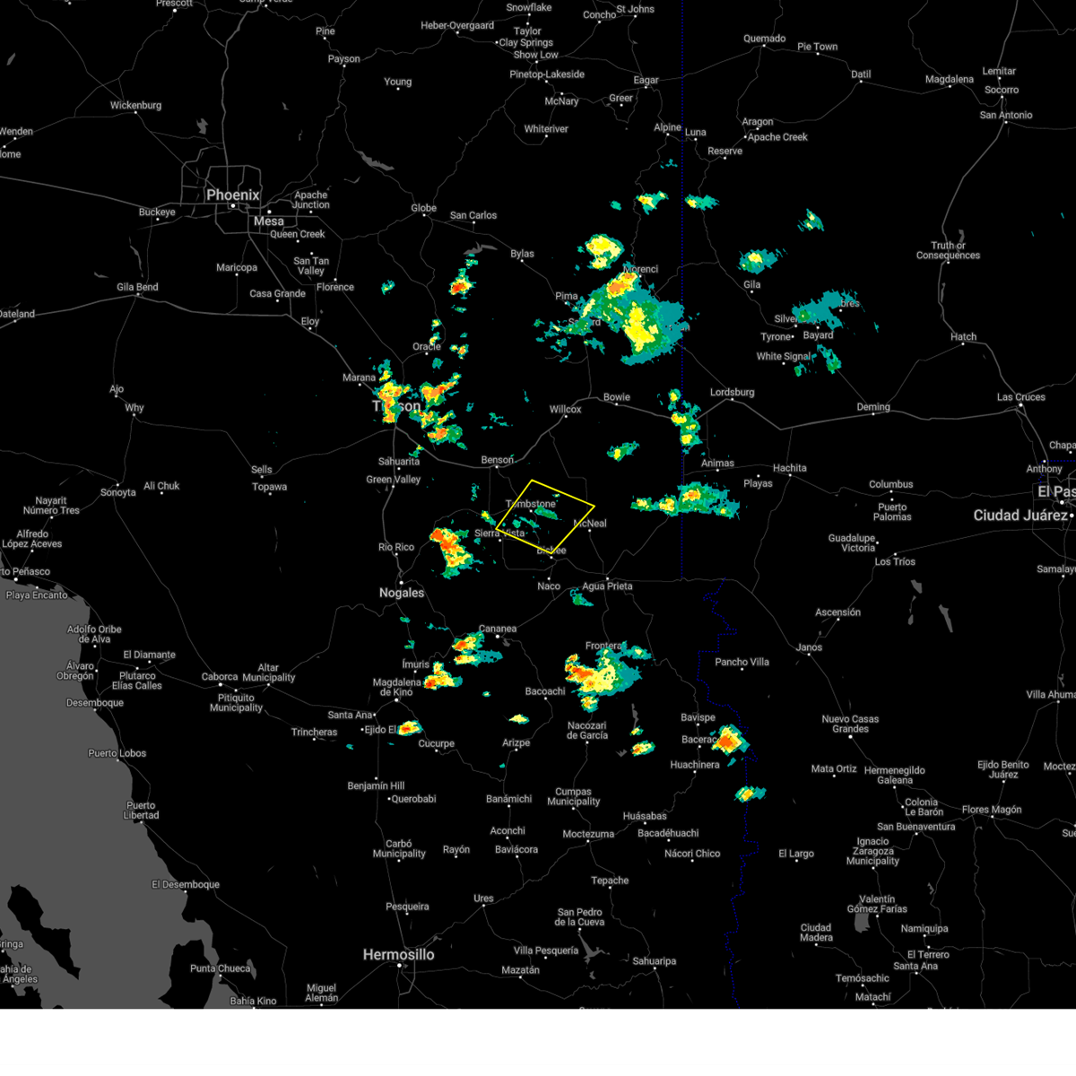
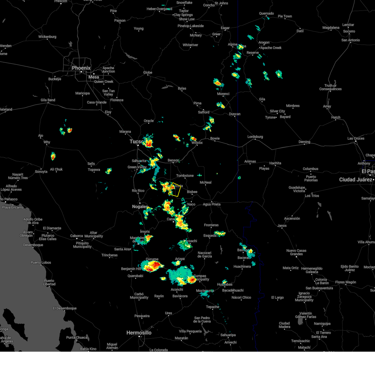
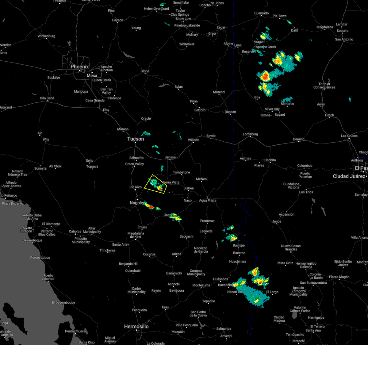
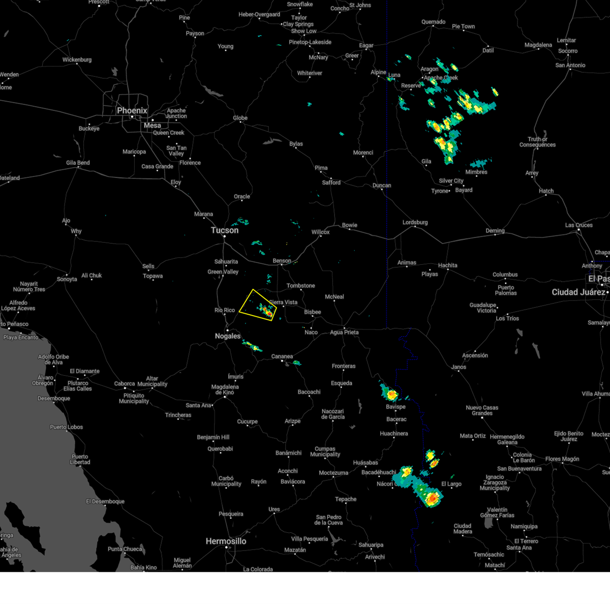
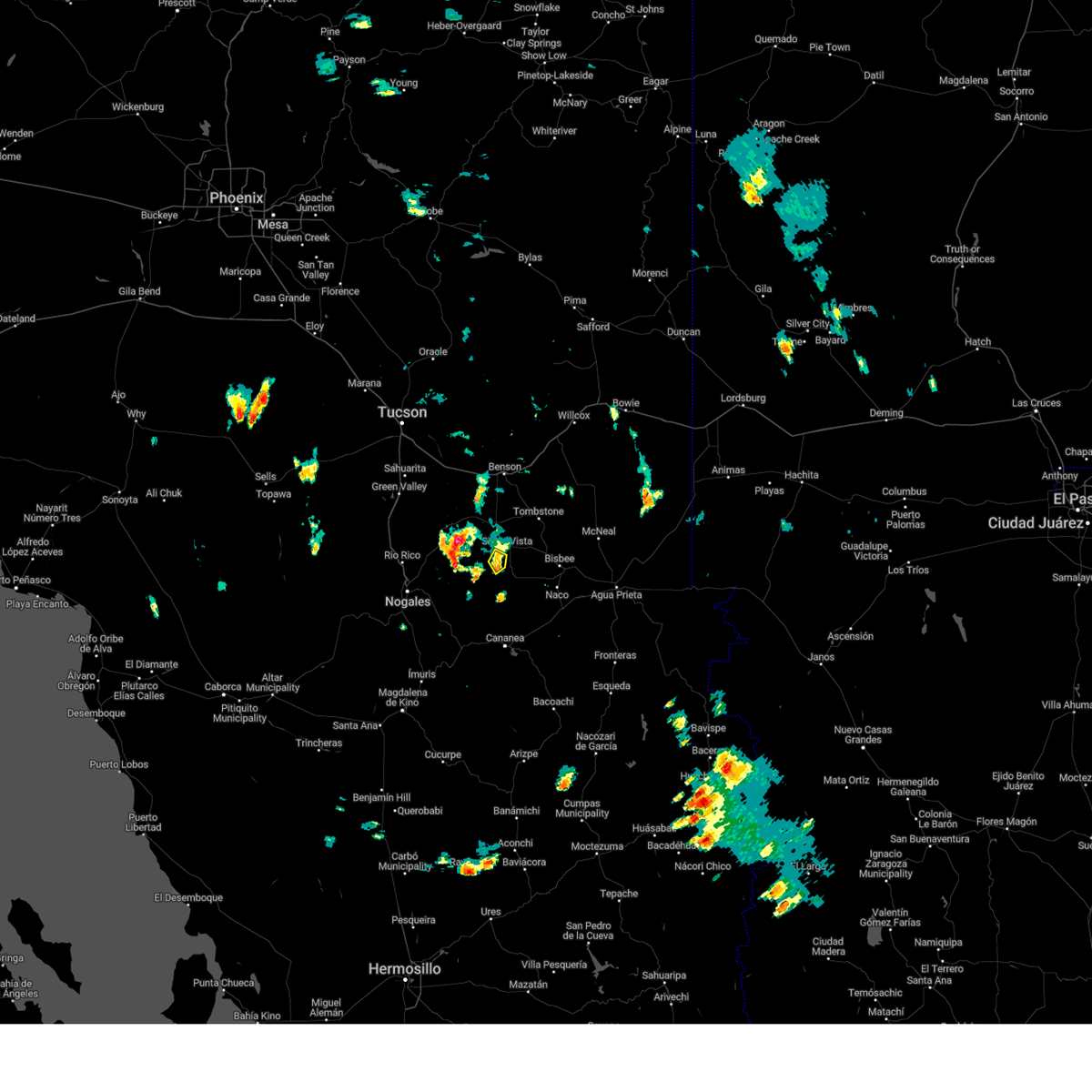
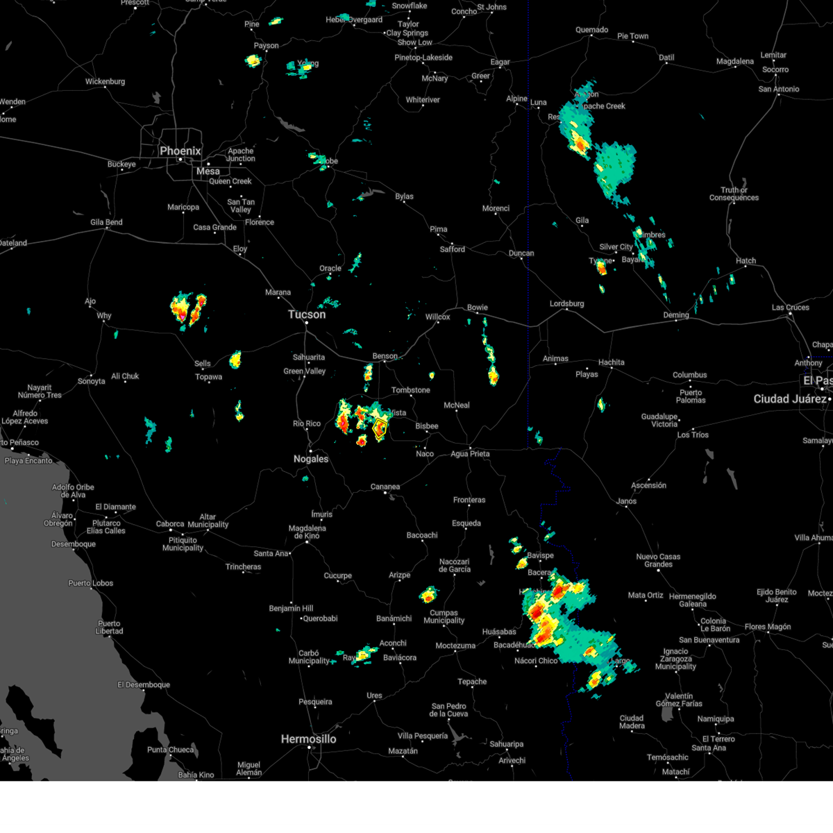
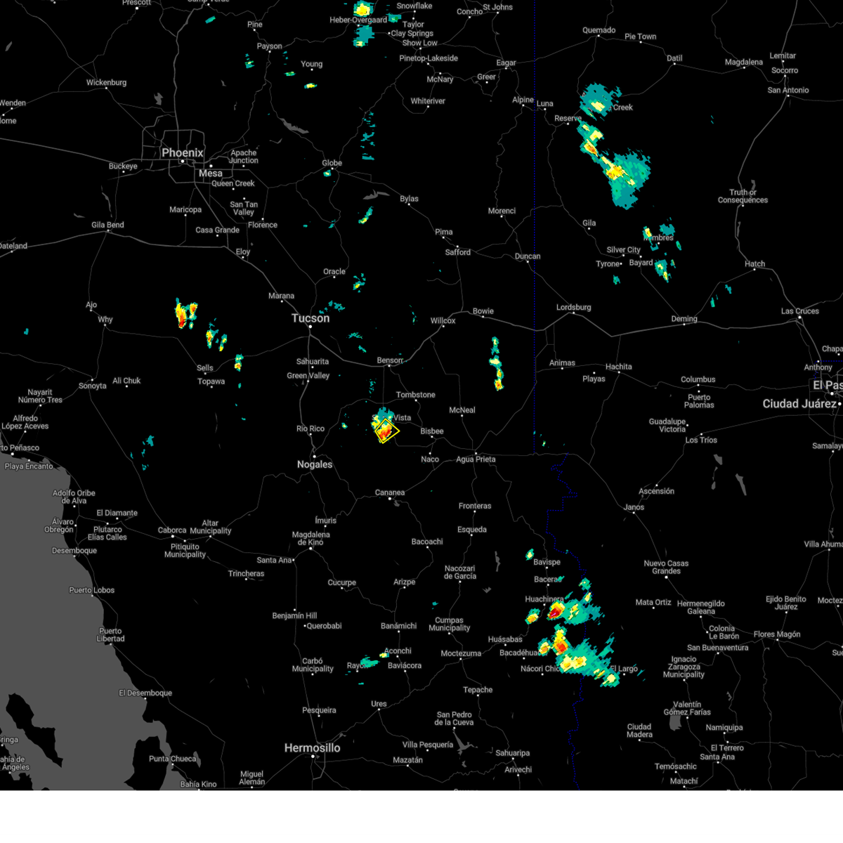
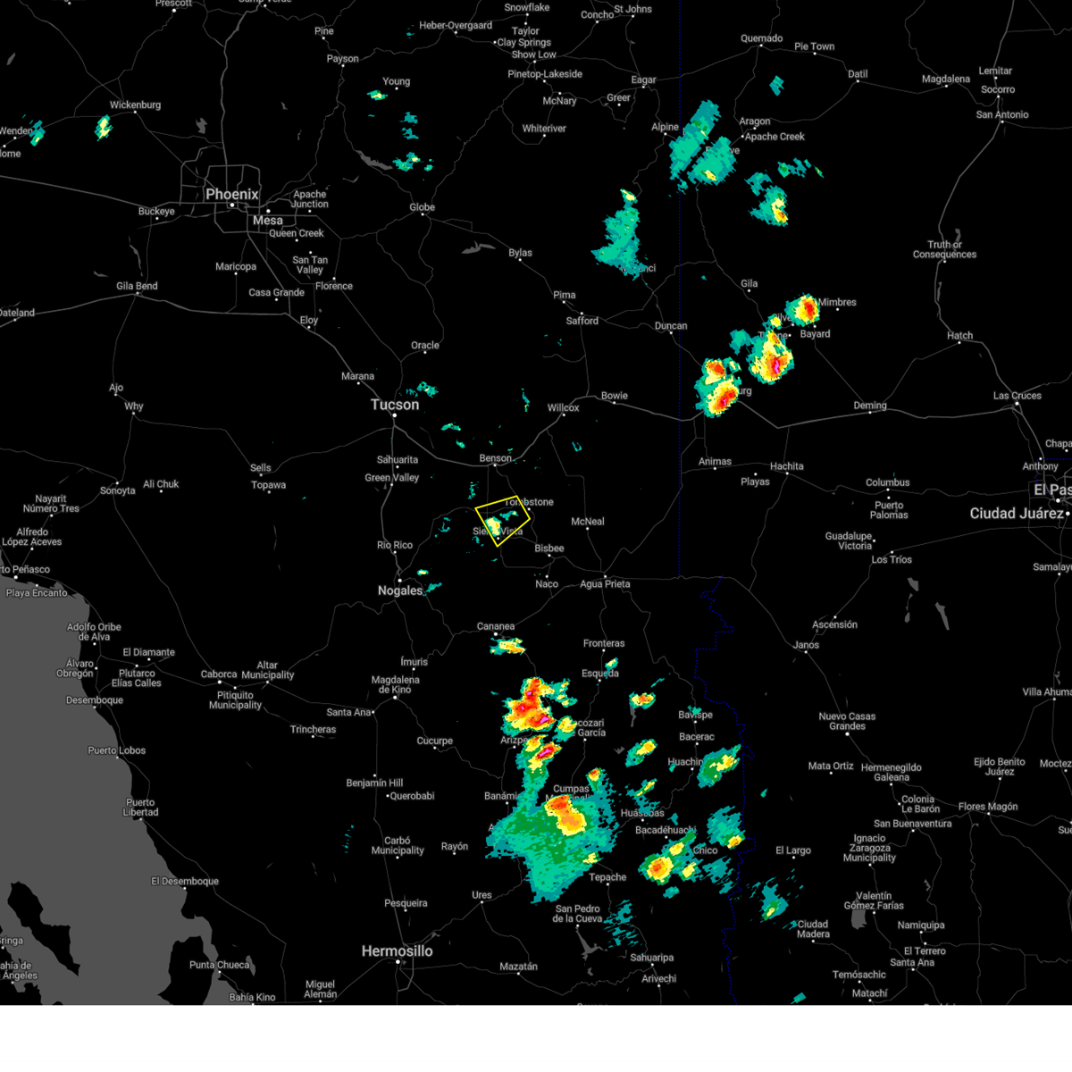
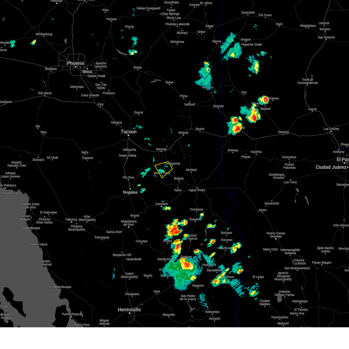
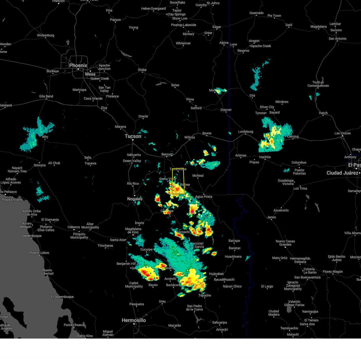
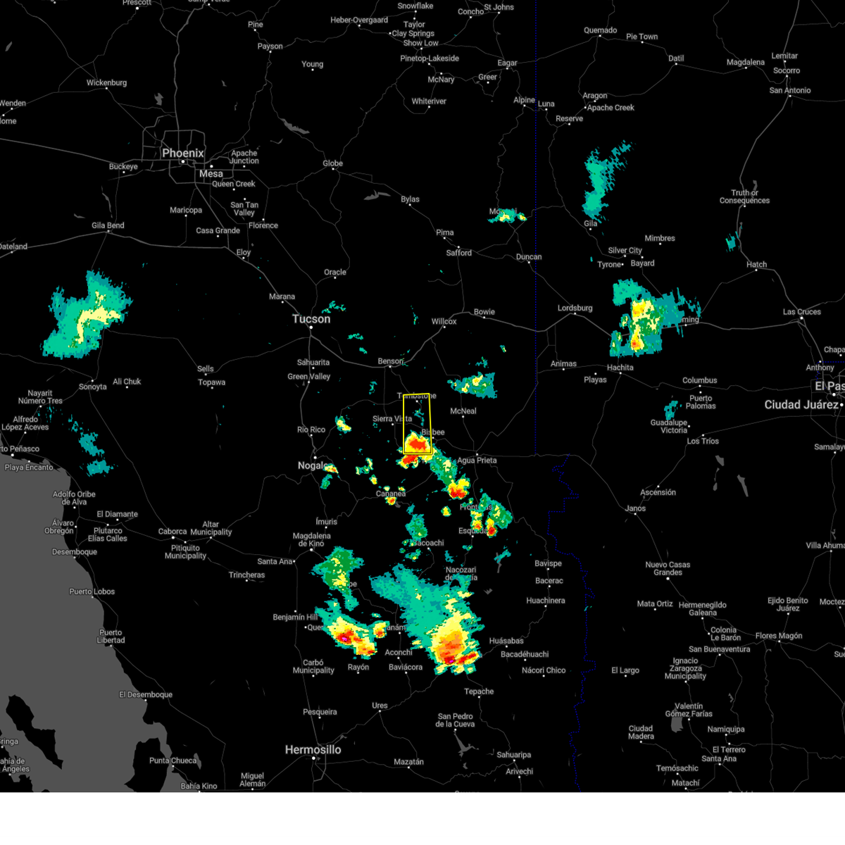
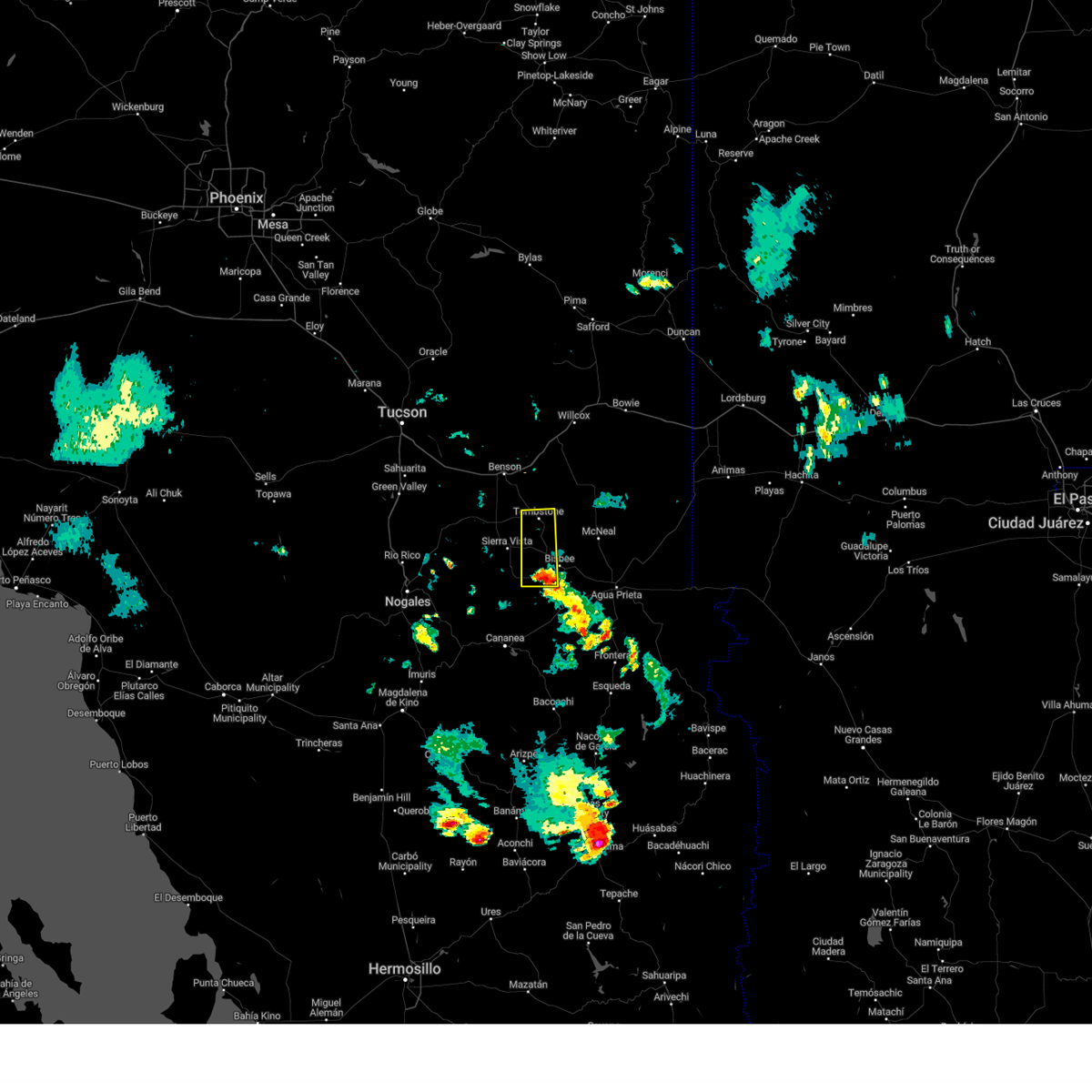
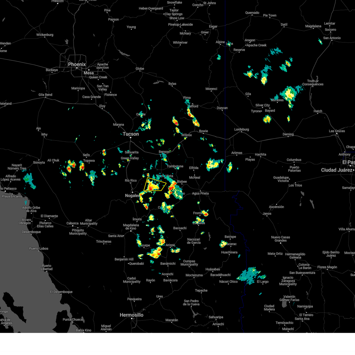
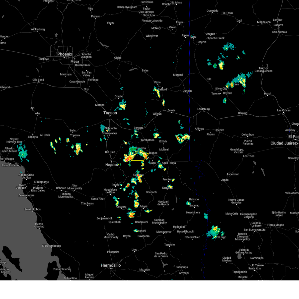
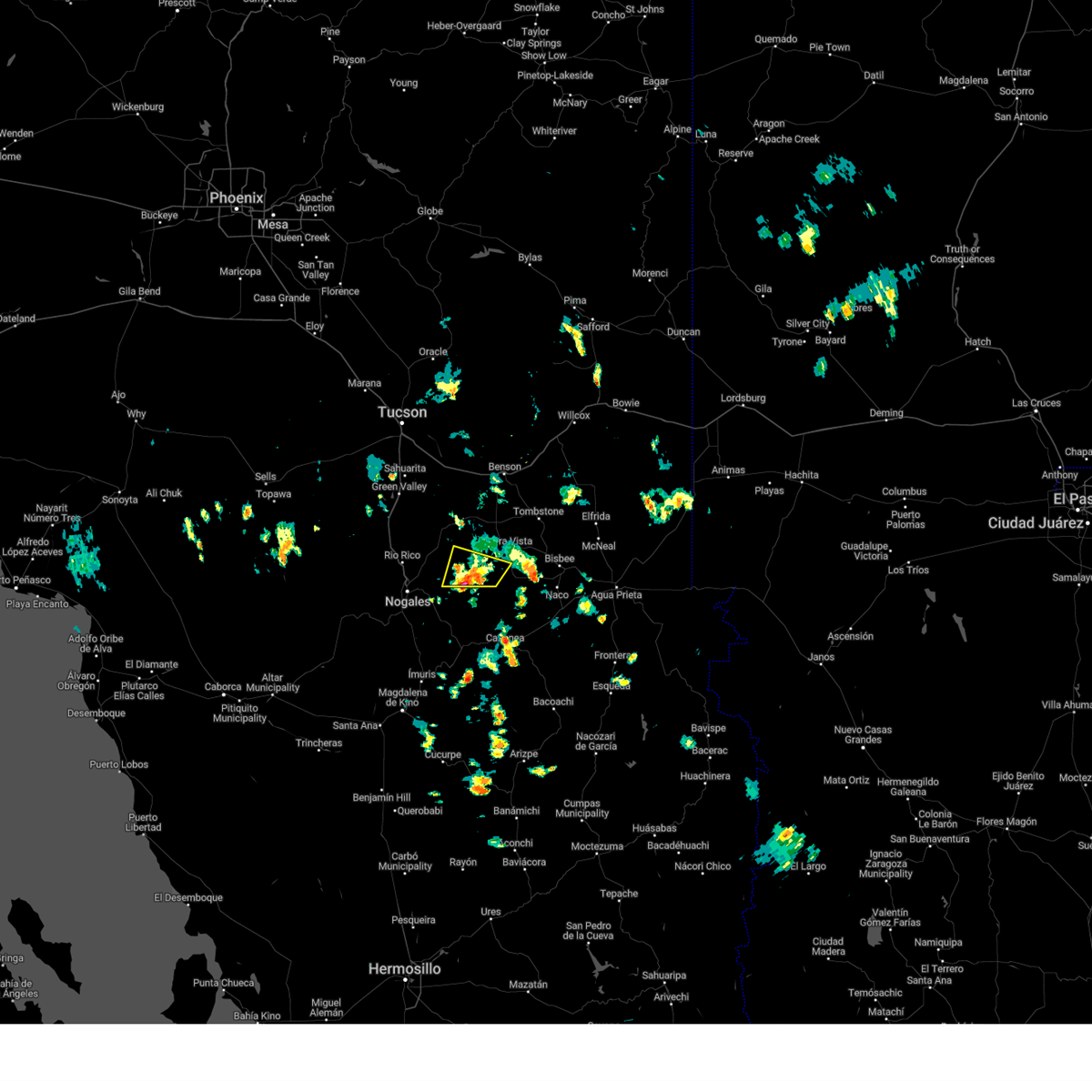
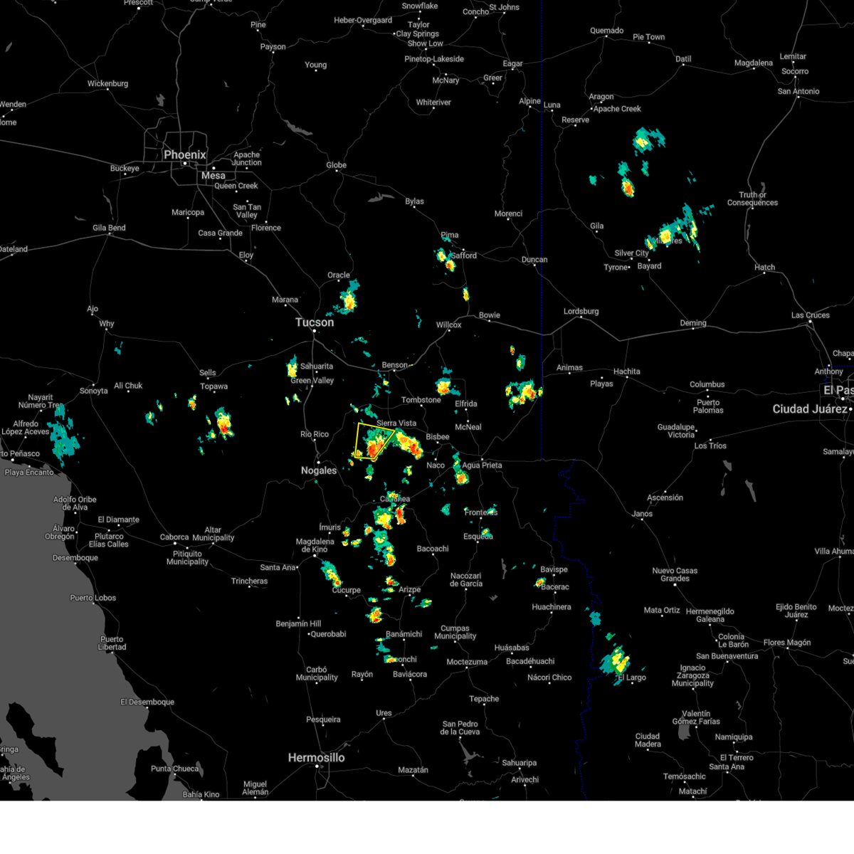
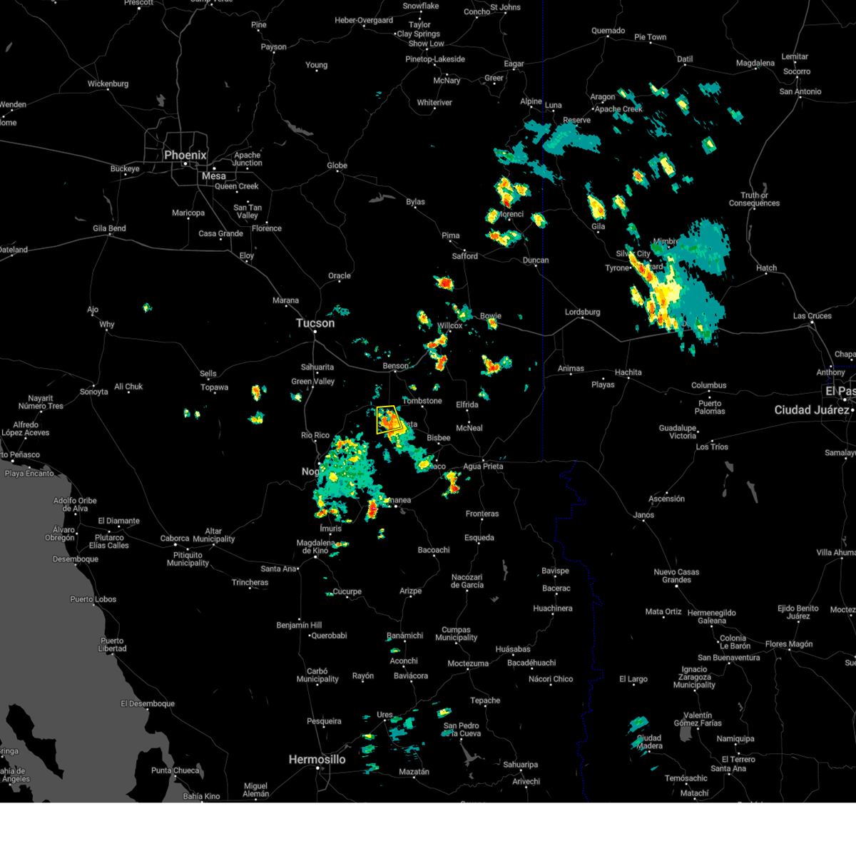
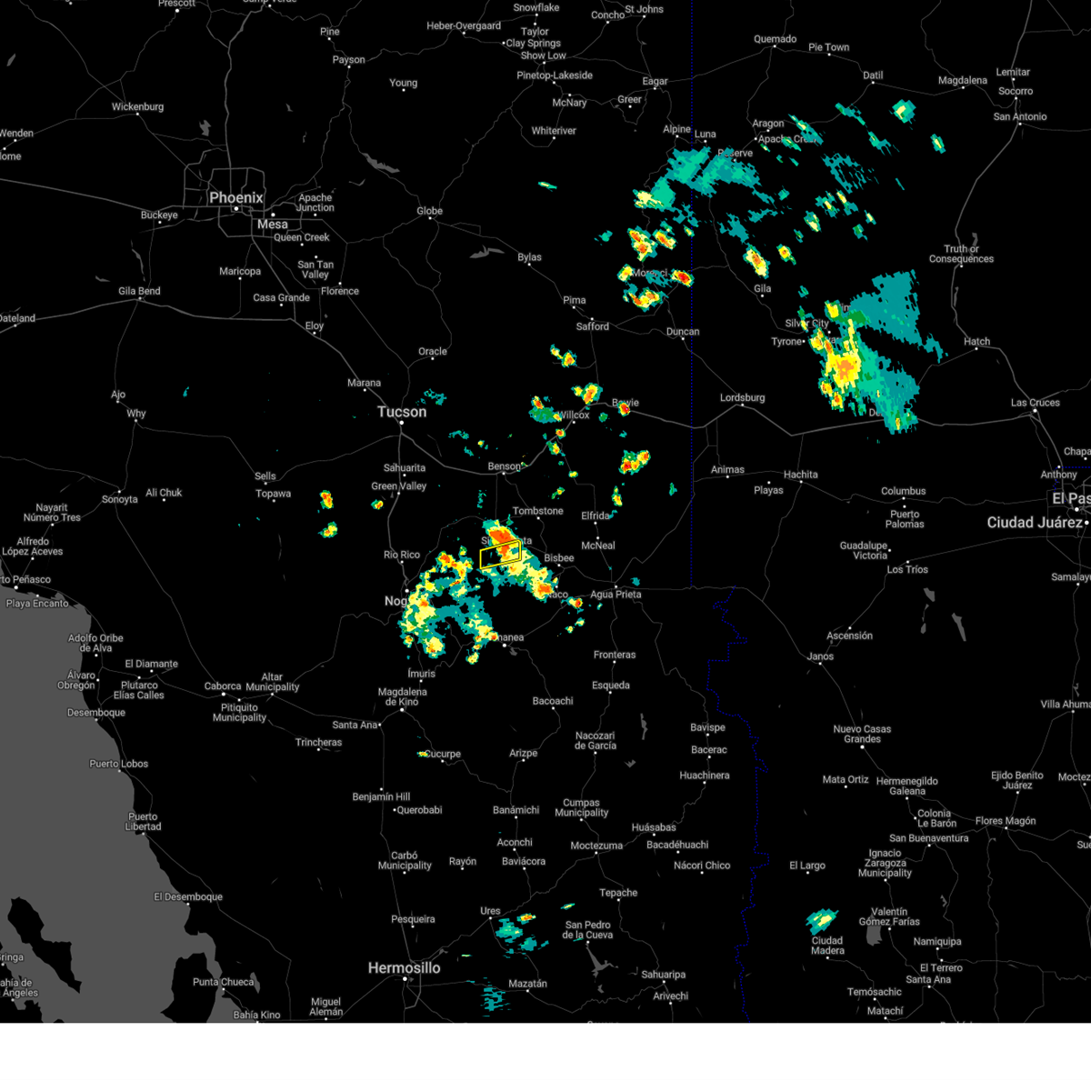
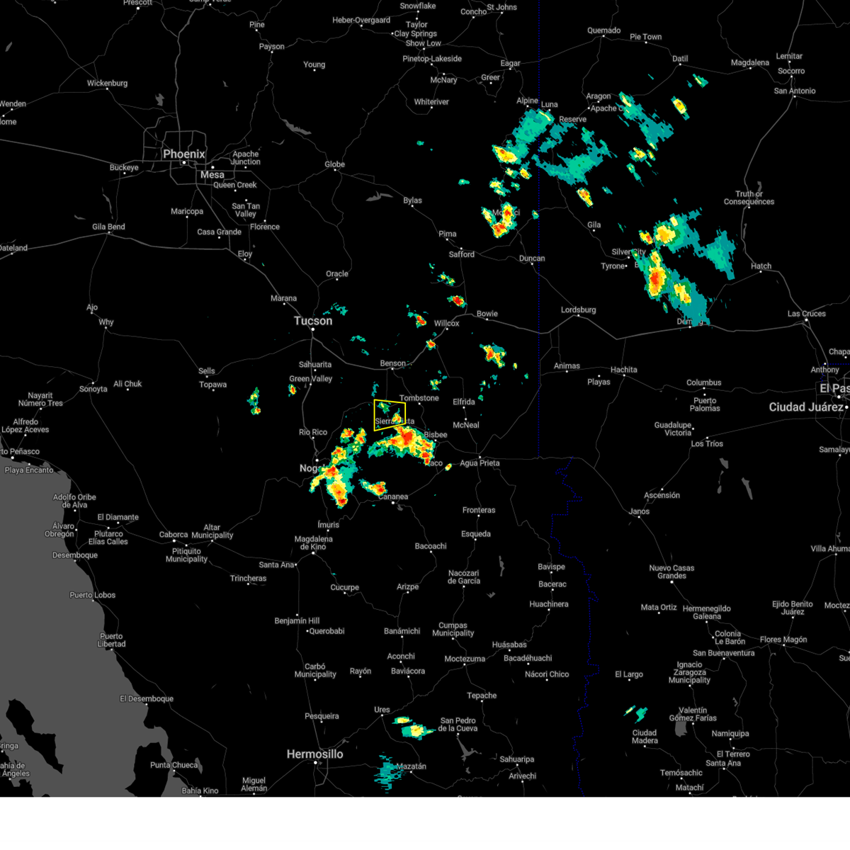
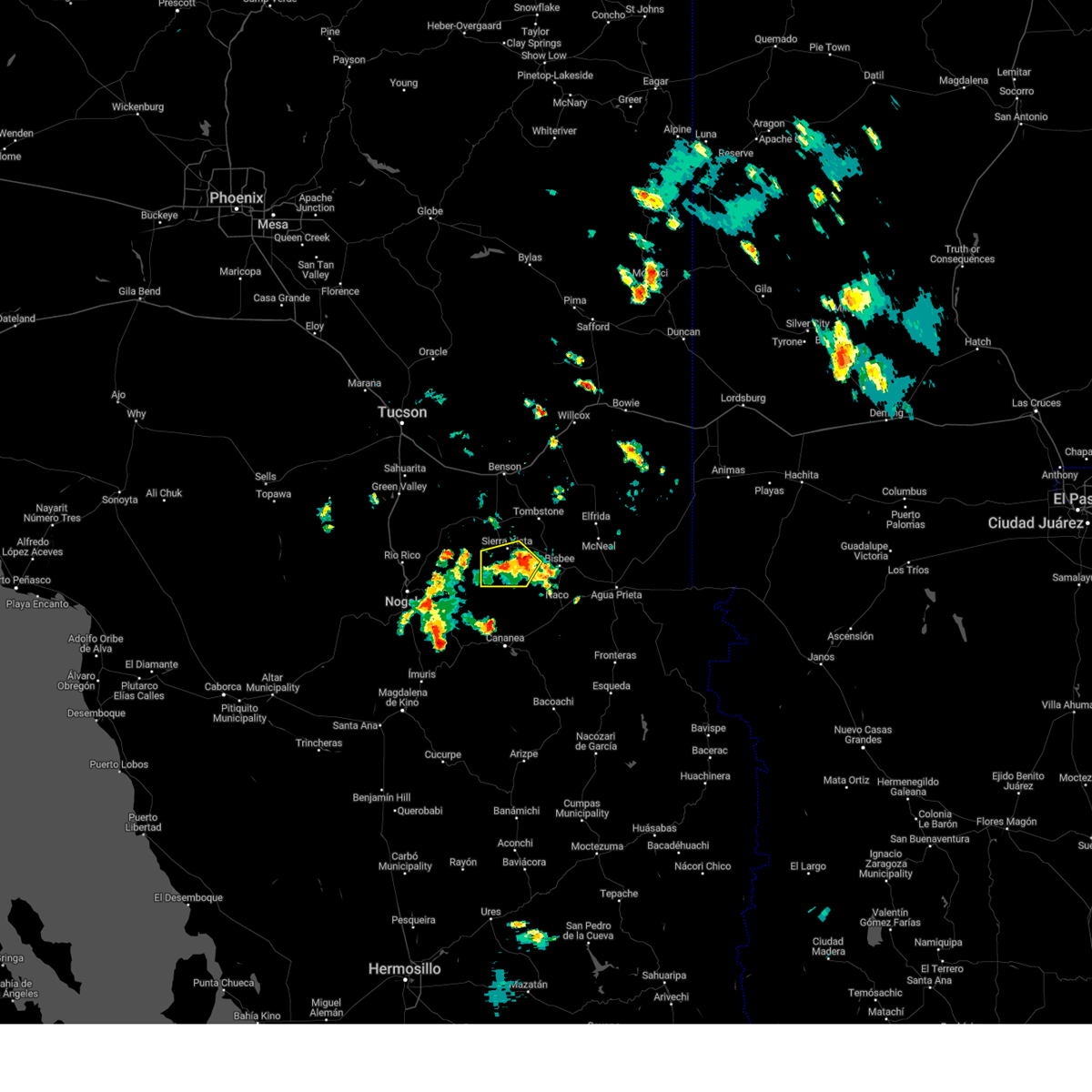
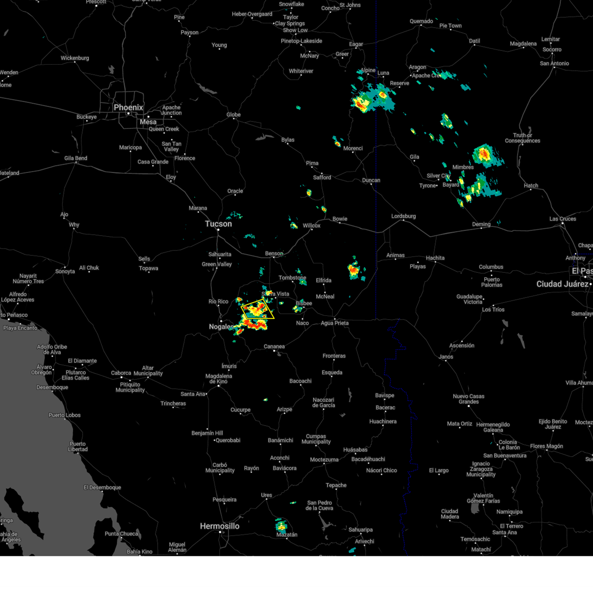
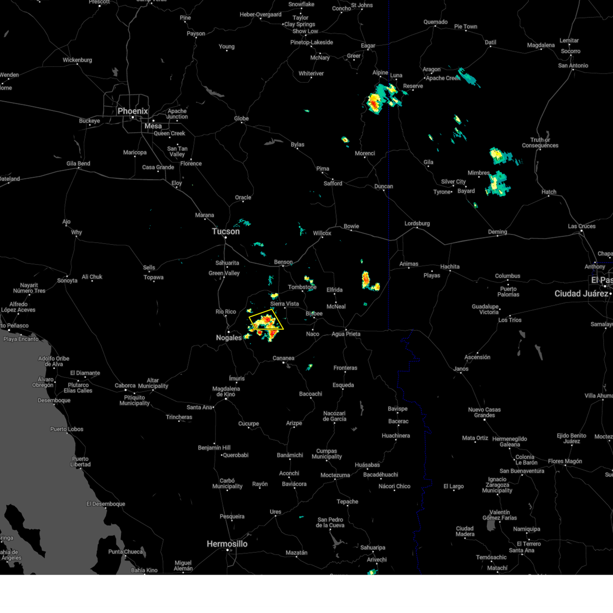
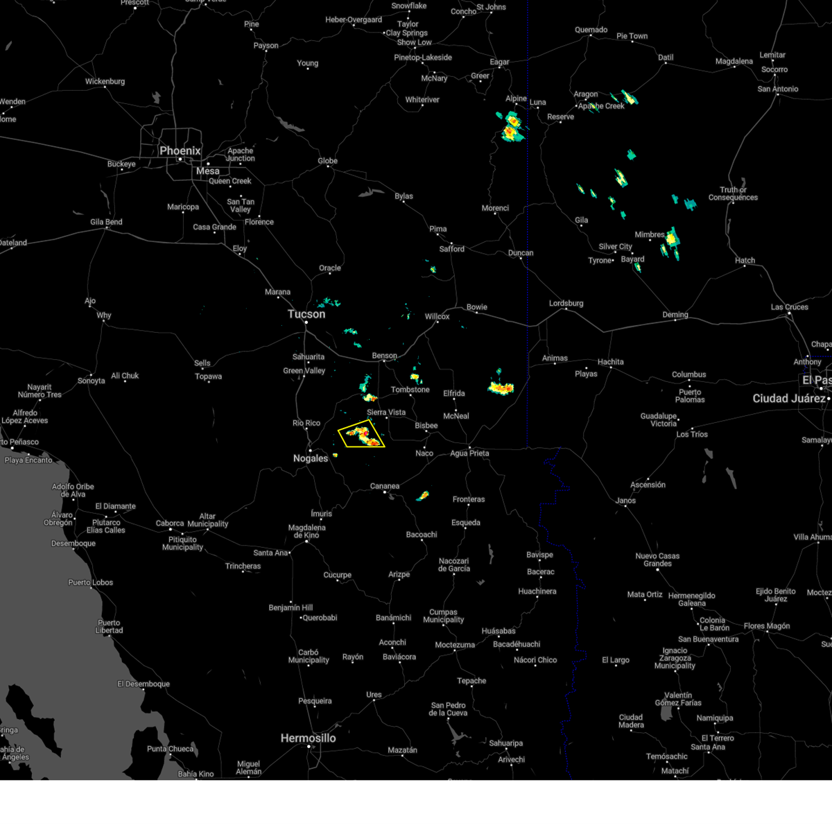
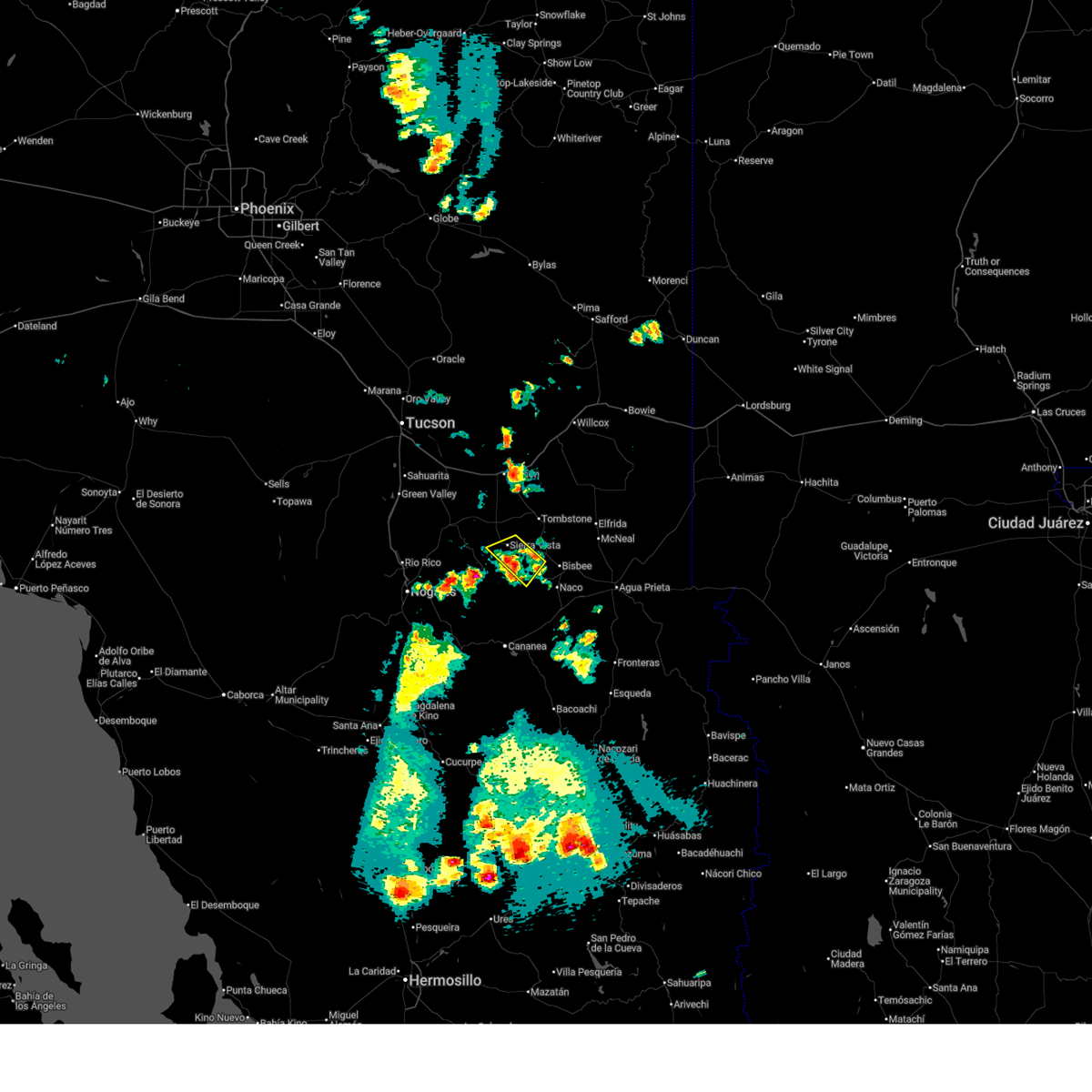
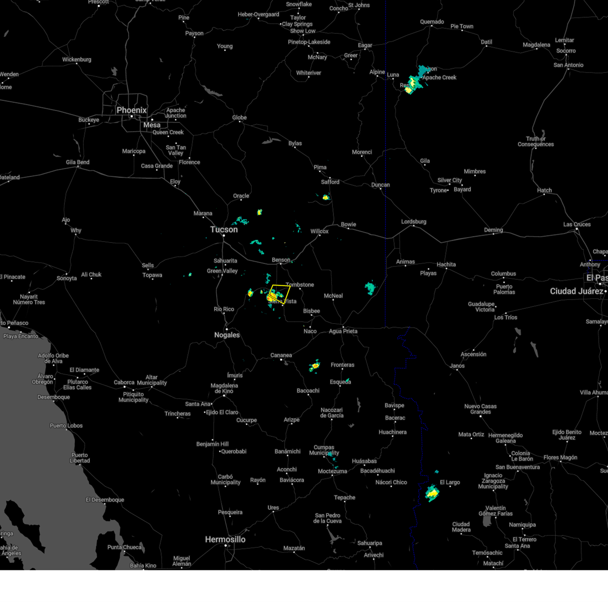
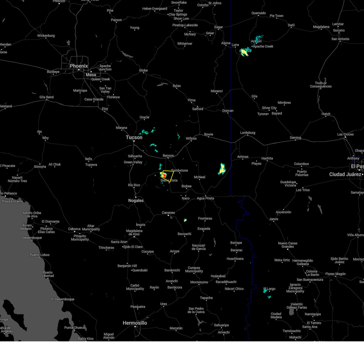
Hail Map for Sierra Vista, AZ
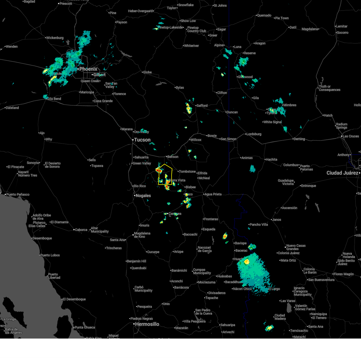
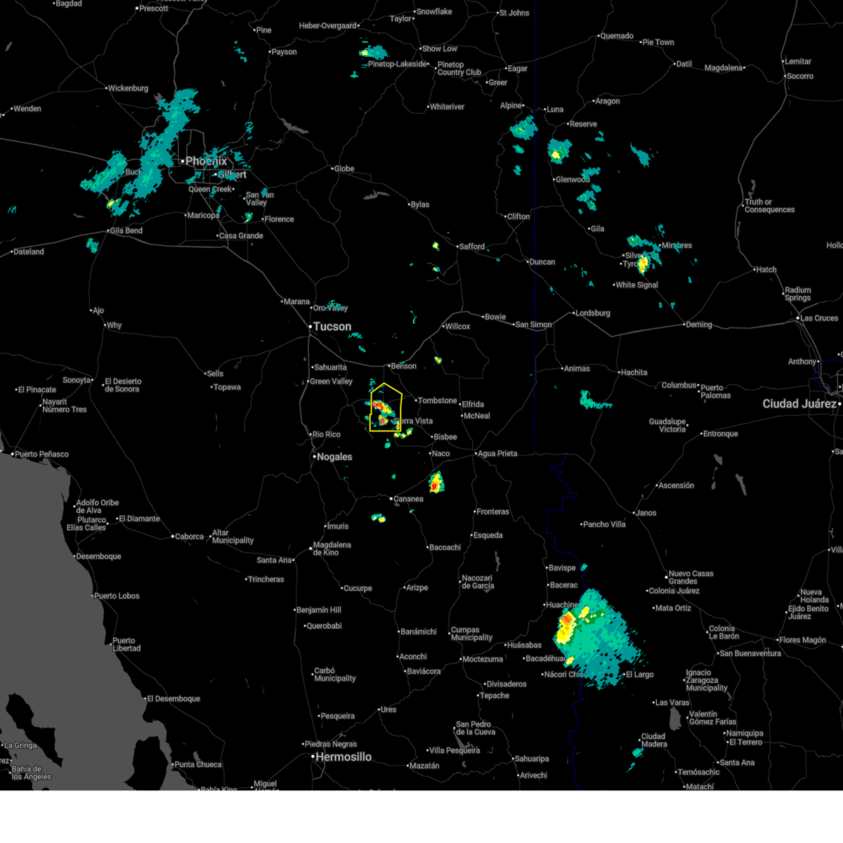
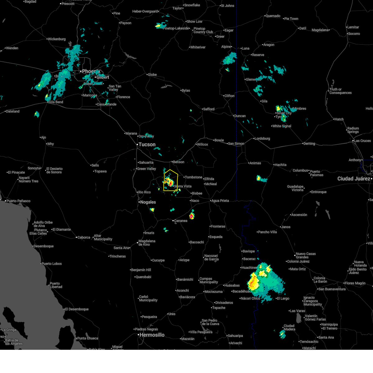
The Sierra Vista, AZ area has had 22 reports of on-the-ground hail by trained spotters, and has been under severe weather warnings 28 times during the past 12 months. Doppler radar has detected hail at or near Sierra Vista, AZ on 103 occasions, including 8 occasions during the past year.
| Name: | Sierra Vista, AZ |
| Where Located: | 46.4 miles WNW of Douglas, AZ |
| Map: | Google Map for Sierra Vista, AZ |
| Population: | 43888 |
| Housing Units: | 18742 |
| More Info: | Search Google for Sierra Vista, AZ |
2
The Top Recent Hail Date for Sierra Vista, AZ is Saturday, November 22, 2025 (6th out of 103)
Hail and Wind Damage Spotted near Sierra Vista, AZ
| Date / Time | Report Details |
|---|---|
| 6/24/2026 3:14 PM MST |
 The storms which prompted the warning have weakened below severe limits, and have exited the warned area. therefore, the warning will be allowed to expire. The storms which prompted the warning have weakened below severe limits, and have exited the warned area. therefore, the warning will be allowed to expire.
|
| 6/24/2026 2:50 PM MST | Half Dollar sized hail reported 3.7 miles SE of Sierra Vista, AZ, half-dollar sized hail reported by fort huachuca. |
| 6/24/2026 2:43 PM MST |
 At 243 pm mst, severe thunderstorms were located along a line from near kartchner caverns state park through whetstone and huachuca city to over fort huachuca. these storms were stationary (radar indicated). Hazards include 60 mph wind gusts and small hail. Expect damage to roofs, siding, and trees. locations impacted include, sierra vista, whetstone, huachuca city, fort huachuca and kartchner caverns state park. this includes the following highways, route 90 between mile markers 299 and 324. route 92 between mile markers 322 and 325. Route 82 between mile markers 46 and 61. At 243 pm mst, severe thunderstorms were located along a line from near kartchner caverns state park through whetstone and huachuca city to over fort huachuca. these storms were stationary (radar indicated). Hazards include 60 mph wind gusts and small hail. Expect damage to roofs, siding, and trees. locations impacted include, sierra vista, whetstone, huachuca city, fort huachuca and kartchner caverns state park. this includes the following highways, route 90 between mile markers 299 and 324. route 92 between mile markers 322 and 325. Route 82 between mile markers 46 and 61.
|
| 6/24/2026 2:28 PM MST |
 Svrtwc the national weather service in tucson has issued a * severe thunderstorm warning for, southwestern cochise county in southeastern arizona, * until 315 pm mst. * at 228 pm mst, severe thunderstorms were located along a line from over kartchner caverns state park through whetstone and huachuca city to near fort huachuca, moving east at 5 mph (radar indicated). Hazards include 60 mph wind gusts and small hail. expect damage to roofs, siding, and trees Svrtwc the national weather service in tucson has issued a * severe thunderstorm warning for, southwestern cochise county in southeastern arizona, * until 315 pm mst. * at 228 pm mst, severe thunderstorms were located along a line from over kartchner caverns state park through whetstone and huachuca city to near fort huachuca, moving east at 5 mph (radar indicated). Hazards include 60 mph wind gusts and small hail. expect damage to roofs, siding, and trees
|
| 6/24/2026 2:00 PM MST |
 At 200 pm mst, a severe thunderstorm was located near huachuca city and fort huachuca, moving northeast at 5 mph (radar indicated). Hazards include 60 mph wind gusts. Expect damage to roofs, siding, and trees. locations impacted include, sierra vista, huachuca city and fort huachuca. this includes the following highways, route 90 between mile markers 310 and 324. Route 92 between mile markers 322 and 326. At 200 pm mst, a severe thunderstorm was located near huachuca city and fort huachuca, moving northeast at 5 mph (radar indicated). Hazards include 60 mph wind gusts. Expect damage to roofs, siding, and trees. locations impacted include, sierra vista, huachuca city and fort huachuca. this includes the following highways, route 90 between mile markers 310 and 324. Route 92 between mile markers 322 and 326.
|
| 6/24/2026 1:41 PM MST |
 Svrtwc the national weather service in tucson has issued a * severe thunderstorm warning for, southwestern cochise county in southeastern arizona, * until 230 pm mst. * at 141 pm mst, a severe thunderstorm was located near fort huachuca. this storm was stationary (radar indicated). Hazards include 60 mph wind gusts. expect damage to roofs, siding, and trees Svrtwc the national weather service in tucson has issued a * severe thunderstorm warning for, southwestern cochise county in southeastern arizona, * until 230 pm mst. * at 141 pm mst, a severe thunderstorm was located near fort huachuca. this storm was stationary (radar indicated). Hazards include 60 mph wind gusts. expect damage to roofs, siding, and trees
|
| 6/17/2026 2:56 PM MST |
 At 256 pm mst, a severe thunderstorm was located near whetstone, moving southeast at 10 mph (radar indicated). Hazards include 60 mph wind gusts and quarter size hail. Hail damage to vehicles is expected. expect wind damage to roofs, siding, and trees. locations impacted include, whetstone, huachuca city, elgin and fort huachuca. this includes the following highways, route 90 between mile markers 304 and 313. Route 82 between mile markers 40 and 56. At 256 pm mst, a severe thunderstorm was located near whetstone, moving southeast at 10 mph (radar indicated). Hazards include 60 mph wind gusts and quarter size hail. Hail damage to vehicles is expected. expect wind damage to roofs, siding, and trees. locations impacted include, whetstone, huachuca city, elgin and fort huachuca. this includes the following highways, route 90 between mile markers 304 and 313. Route 82 between mile markers 40 and 56.
|
| 6/17/2026 2:31 PM MST |
 Svrtwc the national weather service in tucson has issued a * severe thunderstorm warning for, west central cochise county in southeastern arizona, southeastern pima county in southeastern arizona, northeastern santa cruz county in southeastern arizona, * until 315 pm mst. * at 231 pm mst, a severe thunderstorm was located near whetstone, moving southeast at 10 mph (radar indicated). Hazards include 60 mph wind gusts and quarter size hail. Hail damage to vehicles is expected. Expect wind damage to roofs, siding, and trees. Svrtwc the national weather service in tucson has issued a * severe thunderstorm warning for, west central cochise county in southeastern arizona, southeastern pima county in southeastern arizona, northeastern santa cruz county in southeastern arizona, * until 315 pm mst. * at 231 pm mst, a severe thunderstorm was located near whetstone, moving southeast at 10 mph (radar indicated). Hazards include 60 mph wind gusts and quarter size hail. Hail damage to vehicles is expected. Expect wind damage to roofs, siding, and trees.
|
| 11/22/2025 7:48 PM MST |
 the severe thunderstorm warning has been cancelled and is no longer in effect the severe thunderstorm warning has been cancelled and is no longer in effect
|
| 11/22/2025 7:41 PM MST |
 At 741 pm mst, a severe thunderstorm was located near whetstone, moving north at 45 mph (radar indicated). Hazards include quarter size hail. Damage to vehicles is expected. locations impacted include, sierra vista, whetstone, huachuca city, fort huachuca and fairbank. this includes the following highways, route 90 between mile markers 305 and 321. Route 82 between mile markers 50 and 66. At 741 pm mst, a severe thunderstorm was located near whetstone, moving north at 45 mph (radar indicated). Hazards include quarter size hail. Damage to vehicles is expected. locations impacted include, sierra vista, whetstone, huachuca city, fort huachuca and fairbank. this includes the following highways, route 90 between mile markers 305 and 321. Route 82 between mile markers 50 and 66.
|
| 11/22/2025 7:26 PM MST |
 Svrtwc the national weather service in tucson has issued a * severe thunderstorm warning for, southwestern cochise county in southeastern arizona, * until 800 pm mst. * at 726 pm mst, a severe thunderstorm was located near fort huachuca, moving northeast at 45 mph (radar indicated). Hazards include quarter size hail. damage to vehicles is expected Svrtwc the national weather service in tucson has issued a * severe thunderstorm warning for, southwestern cochise county in southeastern arizona, * until 800 pm mst. * at 726 pm mst, a severe thunderstorm was located near fort huachuca, moving northeast at 45 mph (radar indicated). Hazards include quarter size hail. damage to vehicles is expected
|
| 9/25/2025 1:52 PM MST | The storm which prompted the warning has weakened below severe limits, and no longer poses an immediate threat to life or property. therefore, the warning will be allowed to expire. |
| 9/25/2025 1:27 PM MST | At 127 pm mst, a severe thunderstorm was located 9 miles east of tombstone, moving east at 20 mph (radar indicated). Hazards include 60 mph wind gusts and quarter size hail. Hail damage to vehicles is expected. expect wind damage to roofs, siding, and trees. locations impacted include, whetstone, st. david, tombstone, pearce-sunsites, fairbank and charleston. this includes the following highways, route 90 between mile markers 306 and 309. route 80 between mile markers 299 and 331. route 181 near mile marker 39. route 191 between mile markers 35 and 48. Route 82 between mile markers 50 and 67. |
| 9/25/2025 1:11 PM MST | Svrtwc the national weather service in tucson has issued a * severe thunderstorm warning for, southwestern cochise county in southeastern arizona, * until 200 pm mst. * at 111 pm mst, a severe thunderstorm was located 7 miles northwest of tombstone, moving east at 15 mph (radar indicated). Hazards include 60 mph wind gusts and quarter size hail. Hail damage to vehicles is expected. Expect wind damage to roofs, siding, and trees. |
| 9/25/2025 12:47 PM MST | At 1247 pm mst, a severe thunderstorm was located near kartchner caverns state park, moving southeast at 20 mph (radar indicated). Hazards include 60 mph wind gusts and quarter size hail. Hail damage to vehicles is expected. expect wind damage to roofs, siding, and trees. locations impacted include, benson, whetstone, st. david, tombstone, kartchner caverns state park, mescal, fairbank and charleston. this includes the following highways, route 90 between mile markers 290 and 308. route 80 between mile markers 293 and 315. interstate 10 between mile markers 295 and 316. Route 82 between mile markers 52 and 67. |
| 9/25/2025 12:24 PM MST | Svrtwc the national weather service in tucson has issued a * severe thunderstorm warning for, west central cochise county in southeastern arizona, east central pima county in southeastern arizona, * until 115 pm mst. * at 1224 pm mst, a severe thunderstorm was located near kartchner caverns state park, moving east at 25 mph (radar indicated). Hazards include 60 mph wind gusts and quarter size hail. Hail damage to vehicles is expected. Expect wind damage to roofs, siding, and trees. |
| 9/15/2025 1:27 PM MST | The storm which prompted the warning has weakened below severe limits, and no longer poses an immediate threat to life or property. therefore, the warning will be allowed to expire. however, gusty winds are still possible with this thunderstorm. |
| 9/15/2025 1:15 PM MST | At 115 pm mst, a severe thunderstorm was located over fort huachuca, moving north at 5 mph (radar indicated). Hazards include 60 mph wind gusts. Expect damage to roofs, siding, and trees. locations impacted include, sierra vista, hereford, fort huachuca, parker canyon lake and ramsey canyon preserve. this includes the following highways, route 90 between mile markers 315 and 323. route 92 between mile markers 322 and 333. Route 83 between mile markers 3 and 6. |
| 9/15/2025 12:52 PM MST | Svrtwc the national weather service in tucson has issued a * severe thunderstorm warning for, southwestern cochise county in southeastern arizona, * until 130 pm mst. * at 1252 pm mst, a severe thunderstorm was located near fort huachuca, moving northeast at 5 mph (radar indicated). Hazards include 60 mph wind gusts and quarter size hail. Hail damage to vehicles is expected. Expect wind damage to roofs, siding, and trees. |
| 8/9/2025 6:45 PM MST |
 The storm which prompted the warning has weakened below severe limits, and no longer poses an immediate threat to life or property. therefore, the warning has been allowed to expire. The storm which prompted the warning has weakened below severe limits, and no longer poses an immediate threat to life or property. therefore, the warning has been allowed to expire.
|
| 8/9/2025 6:30 PM MST |
 At 630 pm mst, a severe thunderstorm was located near sierra vista, moving northwest at 10 mph (radar indicated). Hazards include 60 mph wind gusts and small hail. Expect damage to roofs, siding, and trees. locations impacted include, sierra vista, hereford, fort huachuca and ramsey canyon preserve. this includes the following highways, route 90 between mile markers 315 and 327. Route 92 between mile markers 322 and 335. At 630 pm mst, a severe thunderstorm was located near sierra vista, moving northwest at 10 mph (radar indicated). Hazards include 60 mph wind gusts and small hail. Expect damage to roofs, siding, and trees. locations impacted include, sierra vista, hereford, fort huachuca and ramsey canyon preserve. this includes the following highways, route 90 between mile markers 315 and 327. Route 92 between mile markers 322 and 335.
|
| 8/9/2025 5:59 PM MST |
 Svrtwc the national weather service in tucson has issued a * severe thunderstorm warning for, southwestern cochise county in southeastern arizona, * until 645 pm mst. * at 559 pm mst, a severe thunderstorm was located near sierra vista, moving northwest at 10 mph (radar indicated). Hazards include 60 mph wind gusts and small hail. expect damage to roofs, siding, and trees Svrtwc the national weather service in tucson has issued a * severe thunderstorm warning for, southwestern cochise county in southeastern arizona, * until 645 pm mst. * at 559 pm mst, a severe thunderstorm was located near sierra vista, moving northwest at 10 mph (radar indicated). Hazards include 60 mph wind gusts and small hail. expect damage to roofs, siding, and trees
|
| 7/30/2025 4:25 PM MST |
 The storm which prompted the warning has weakened below severe limits, and no longer poses an immediate threat to life or property. therefore, the warning will be allowed to expire. The storm which prompted the warning has weakened below severe limits, and no longer poses an immediate threat to life or property. therefore, the warning will be allowed to expire.
|
| 7/30/2025 4:00 PM MST | Personal weather station measured gust of 58 mp in cochise county AZ, 6.9 miles W of Sierra Vista, AZ |
| 7/30/2025 3:58 PM MST |
 Svrtwc the national weather service in tucson has issued a * severe thunderstorm warning for, southwestern cochise county in southeastern arizona, * until 430 pm mst. * at 358 pm mst, a severe thunderstorm was located near sierra vista, moving northwest at 15 mph (radar indicated). Hazards include 60 mph wind gusts and quarter size hail. Hail damage to vehicles is expected. Expect wind damage to roofs, siding, and trees. Svrtwc the national weather service in tucson has issued a * severe thunderstorm warning for, southwestern cochise county in southeastern arizona, * until 430 pm mst. * at 358 pm mst, a severe thunderstorm was located near sierra vista, moving northwest at 15 mph (radar indicated). Hazards include 60 mph wind gusts and quarter size hail. Hail damage to vehicles is expected. Expect wind damage to roofs, siding, and trees.
|
| 7/13/2025 6:52 PM MST |
 The storms which prompted the warning have weakened and moved out of the area. therefore, the warning will be allowed to expire. however, strong gusty winds are still possible. The storms which prompted the warning have weakened and moved out of the area. therefore, the warning will be allowed to expire. however, strong gusty winds are still possible.
|
| 7/13/2025 6:14 PM MST |
 Svrtwc the national weather service in tucson has issued a * severe thunderstorm warning for, southwestern cochise county in southeastern arizona, * until 700 pm mst. * at 614 pm mst, severe thunderstorms were located along a line from near bisbee to 6 miles southwest of dragoon, moving southwest at 20 mph (radar indicated). Hazards include 60 mph wind gusts and quarter size hail. Hail damage to vehicles is expected. Expect wind damage to roofs, siding, and trees. Svrtwc the national weather service in tucson has issued a * severe thunderstorm warning for, southwestern cochise county in southeastern arizona, * until 700 pm mst. * at 614 pm mst, severe thunderstorms were located along a line from near bisbee to 6 miles southwest of dragoon, moving southwest at 20 mph (radar indicated). Hazards include 60 mph wind gusts and quarter size hail. Hail damage to vehicles is expected. Expect wind damage to roofs, siding, and trees.
|
| 7/13/2025 4:14 PM MST |
 The storm which prompted the warning has weakened below severe limits, and no longer poses an immediate threat to life or property. therefore, the warning will be allowed to expire. however, small hail and gusty winds are still possible with this thunderstorm. The storm which prompted the warning has weakened below severe limits, and no longer poses an immediate threat to life or property. therefore, the warning will be allowed to expire. however, small hail and gusty winds are still possible with this thunderstorm.
|
| 7/13/2025 4:01 PM MST |
 At 401 pm mst, a severe thunderstorm was located over fort huachuca, moving southwest at 10 mph. this storm has produced one inch hail (radar indicated). Hazards include 60 mph wind gusts and quarter size hail. Hail damage to vehicles is expected. expect wind damage to roofs, siding, and trees. locations impacted include, sierra vista, huachuca city and fort huachuca. This includes route 90 between mile markers 314 and 319. At 401 pm mst, a severe thunderstorm was located over fort huachuca, moving southwest at 10 mph. this storm has produced one inch hail (radar indicated). Hazards include 60 mph wind gusts and quarter size hail. Hail damage to vehicles is expected. expect wind damage to roofs, siding, and trees. locations impacted include, sierra vista, huachuca city and fort huachuca. This includes route 90 between mile markers 314 and 319.
|
| 7/13/2025 3:52 PM MST | Quarter sized hail reported 2.8 miles SSW of Sierra Vista, AZ, trained spotter reports 1 inch hail lasting for approximately 5 minutes. |
| 7/13/2025 3:41 PM MST |
 Svrtwc the national weather service in tucson has issued a * severe thunderstorm warning for, southwestern cochise county in southeastern arizona, * until 415 pm mst. * at 341 pm mst, a severe thunderstorm was located near fort huachuca, moving southwest at 10 mph (radar indicated). Hazards include 60 mph wind gusts and small hail. expect damage to roofs, siding, and trees Svrtwc the national weather service in tucson has issued a * severe thunderstorm warning for, southwestern cochise county in southeastern arizona, * until 415 pm mst. * at 341 pm mst, a severe thunderstorm was located near fort huachuca, moving southwest at 10 mph (radar indicated). Hazards include 60 mph wind gusts and small hail. expect damage to roofs, siding, and trees
|
| 9/15/2024 5:06 PM MST |
 The storm which prompted the warning has weakened below severe limits, and no longer poses an immediate threat to life or property. therefore, the warning will be allowed to expire. however, heavy rain is still possible with this thunderstorm. The storm which prompted the warning has weakened below severe limits, and no longer poses an immediate threat to life or property. therefore, the warning will be allowed to expire. however, heavy rain is still possible with this thunderstorm.
|
| 9/15/2024 4:48 PM MST |
 At 448 pm mst, a severe thunderstorm was located near tombstone, or 16 miles northeast of sierra vista, moving northeast at 20 mph (radar indicated). Hazards include 60 mph wind gusts. Expect damage to roofs, siding, and trees. locations impacted include, tombstone, fairbank, and charleston. this includes the following highways, route 80 between mile markers 310 and 335. route 82 between mile markers 61 and 67. route 90 between mile markers 329 and 336. Route 191 between mile markers 26 and 29. At 448 pm mst, a severe thunderstorm was located near tombstone, or 16 miles northeast of sierra vista, moving northeast at 20 mph (radar indicated). Hazards include 60 mph wind gusts. Expect damage to roofs, siding, and trees. locations impacted include, tombstone, fairbank, and charleston. this includes the following highways, route 80 between mile markers 310 and 335. route 82 between mile markers 61 and 67. route 90 between mile markers 329 and 336. Route 191 between mile markers 26 and 29.
|
| 9/15/2024 4:29 PM MST |
 Svrtwc the national weather service in tucson has issued a * severe thunderstorm warning for, southwestern cochise county in southeastern arizona, * until 515 pm mst. * at 429 pm mst, a severe thunderstorm was located 8 miles south of tombstone, or 10 miles northeast of sierra vista, moving northeast at 20 mph (radar indicated). Hazards include 60 mph wind gusts. expect damage to roofs, siding, and trees Svrtwc the national weather service in tucson has issued a * severe thunderstorm warning for, southwestern cochise county in southeastern arizona, * until 515 pm mst. * at 429 pm mst, a severe thunderstorm was located 8 miles south of tombstone, or 10 miles northeast of sierra vista, moving northeast at 20 mph (radar indicated). Hazards include 60 mph wind gusts. expect damage to roofs, siding, and trees
|
| 8/21/2024 2:02 PM MST |
 At 201 pm mst, a severe thunderstorm was located 8 miles southeast of tombstone, or 15 miles north of bisbee, moving north at 15 mph (radar indicated). Hazards include 60 mph wind gusts and quarter size hail. Hail damage to vehicles is expected. expect wind damage to roofs, siding, and trees. locations impacted include, charleston. this includes the following highways, route 80 between mile markers 321 and 332. Route 90 between mile markers 328 and 336. At 201 pm mst, a severe thunderstorm was located 8 miles southeast of tombstone, or 15 miles north of bisbee, moving north at 15 mph (radar indicated). Hazards include 60 mph wind gusts and quarter size hail. Hail damage to vehicles is expected. expect wind damage to roofs, siding, and trees. locations impacted include, charleston. this includes the following highways, route 80 between mile markers 321 and 332. Route 90 between mile markers 328 and 336.
|
| 8/21/2024 1:39 PM MST |
 Svrtwc the national weather service in tucson has issued a * severe thunderstorm warning for, southwestern cochise county in southeastern arizona, * until 230 pm mst. * at 139 pm mst, a severe thunderstorm was located 10 miles north of bisbee, moving north at 15 mph (radar indicated). Hazards include 60 mph wind gusts and quarter size hail. Hail damage to vehicles is expected. Expect wind damage to roofs, siding, and trees. Svrtwc the national weather service in tucson has issued a * severe thunderstorm warning for, southwestern cochise county in southeastern arizona, * until 230 pm mst. * at 139 pm mst, a severe thunderstorm was located 10 miles north of bisbee, moving north at 15 mph (radar indicated). Hazards include 60 mph wind gusts and quarter size hail. Hail damage to vehicles is expected. Expect wind damage to roofs, siding, and trees.
|
| 8/19/2024 4:36 PM MST |
 The storm which prompted the warning has weakened below severe limits, and no longer poses an immediate threat to life or property. therefore, the warning will be allowed to expire. The storm which prompted the warning has weakened below severe limits, and no longer poses an immediate threat to life or property. therefore, the warning will be allowed to expire.
|
| 8/19/2024 4:19 PM MST |
 At 418 pm mst, a severe thunderstorm was located near sierra vista, moving west at 15 mph (radar indicated). Hazards include 60 mph wind gusts and quarter size hail. Hail damage to vehicles is expected. expect wind damage to roofs, siding, and trees. locations impacted include, sierra vista, hereford, fort huachuca, and ramsey canyon preserve. this includes the following highways, route 90 between mile markers 316 and 327. Route 92 between mile markers 322 and 331. At 418 pm mst, a severe thunderstorm was located near sierra vista, moving west at 15 mph (radar indicated). Hazards include 60 mph wind gusts and quarter size hail. Hail damage to vehicles is expected. expect wind damage to roofs, siding, and trees. locations impacted include, sierra vista, hereford, fort huachuca, and ramsey canyon preserve. this includes the following highways, route 90 between mile markers 316 and 327. Route 92 between mile markers 322 and 331.
|
| 8/19/2024 3:55 PM MST |
 Svrtwc the national weather service in tucson has issued a * severe thunderstorm warning for, southwestern cochise county in southeastern arizona, * until 445 pm mst. * at 354 pm mst, severe thunderstorms were located over hereford, or near sierra vista, moving west at 15 mph (radar indicated). Hazards include 60 mph wind gusts and quarter size hail. Hail damage to vehicles is expected. Expect wind damage to roofs, siding, and trees. Svrtwc the national weather service in tucson has issued a * severe thunderstorm warning for, southwestern cochise county in southeastern arizona, * until 445 pm mst. * at 354 pm mst, severe thunderstorms were located over hereford, or near sierra vista, moving west at 15 mph (radar indicated). Hazards include 60 mph wind gusts and quarter size hail. Hail damage to vehicles is expected. Expect wind damage to roofs, siding, and trees.
|
| 8/16/2024 2:59 PM MST |
 The severe thunderstorm which prompted the warning has weakened. moved out of the warned area. therefore, the warning will be allowed to expire. however, gusty winds are still possible with this thunderstorm. The severe thunderstorm which prompted the warning has weakened. moved out of the warned area. therefore, the warning will be allowed to expire. however, gusty winds are still possible with this thunderstorm.
|
| 8/16/2024 2:43 PM MST |
 At 241 pm mst, a severe thunderstorm was located 7 miles south of elgin, or 20 miles west of sierra vista, moving northwest at 10 mph (radar indicated). Hazards include 60 mph wind gusts and quarter size hail. Hail damage to vehicles is expected. expect wind damage to roofs, siding, and trees. locations impacted include, patagonia, sonoita, elgin, parker canyon lake and canelo. this includes the following highways, route 82 between mile markers 18 and 24, and between mile markers 31 and 35. Route 83 between mile markers 3 and 34. At 241 pm mst, a severe thunderstorm was located 7 miles south of elgin, or 20 miles west of sierra vista, moving northwest at 10 mph (radar indicated). Hazards include 60 mph wind gusts and quarter size hail. Hail damage to vehicles is expected. expect wind damage to roofs, siding, and trees. locations impacted include, patagonia, sonoita, elgin, parker canyon lake and canelo. this includes the following highways, route 82 between mile markers 18 and 24, and between mile markers 31 and 35. Route 83 between mile markers 3 and 34.
|
| 8/16/2024 2:22 PM MST |
 Svrtwc the national weather service in tucson has issued a * severe thunderstorm warning for, western cochise county in southeastern arizona, northeastern santa cruz county in southeastern arizona, * until 300 pm mst. * at 221 pm mst, a severe thunderstorm was located 7 miles northwest of parker canyon lake, or 16 miles west of sierra vista, moving northwest at 10 mph (radar indicated). Hazards include 60 mph wind gusts and quarter size hail. Hail damage to vehicles is expected. Expect wind damage to roofs, siding, and trees. Svrtwc the national weather service in tucson has issued a * severe thunderstorm warning for, western cochise county in southeastern arizona, northeastern santa cruz county in southeastern arizona, * until 300 pm mst. * at 221 pm mst, a severe thunderstorm was located 7 miles northwest of parker canyon lake, or 16 miles west of sierra vista, moving northwest at 10 mph (radar indicated). Hazards include 60 mph wind gusts and quarter size hail. Hail damage to vehicles is expected. Expect wind damage to roofs, siding, and trees.
|
| 8/12/2024 2:06 PM MST |
 The storm which prompted the warning has weakened below severe limits, and no longer poses an immediate threat to life or property. therefore, the warning will be allowed to expire. however, heavy rain is still possible with this thunderstorm. The storm which prompted the warning has weakened below severe limits, and no longer poses an immediate threat to life or property. therefore, the warning will be allowed to expire. however, heavy rain is still possible with this thunderstorm.
|
| 8/12/2024 1:51 PM MST |
 At 151 pm mst, a severe thunderstorm was located near sierra vista, and is nearly stationary (radar indicated). Hazards include 60 mph wind gusts. Expect damage to roofs, siding, and trees. Locations impacted include, sierra vista, fort huachuca, and ramsey canyon preserve. At 151 pm mst, a severe thunderstorm was located near sierra vista, and is nearly stationary (radar indicated). Hazards include 60 mph wind gusts. Expect damage to roofs, siding, and trees. Locations impacted include, sierra vista, fort huachuca, and ramsey canyon preserve.
|
| 8/12/2024 1:24 PM MST |
 Svrtwc the national weather service in tucson has issued a * severe thunderstorm warning for, southwestern cochise county in southeastern arizona, * until 215 pm mst. * at 124 pm mst, a severe thunderstorm was located near fort huachuca, or near sierra vista, and is nearly stationary (radar indicated). Hazards include 60 mph wind gusts and quarter size hail. Hail damage to vehicles is expected. Expect wind damage to roofs, siding, and trees. Svrtwc the national weather service in tucson has issued a * severe thunderstorm warning for, southwestern cochise county in southeastern arizona, * until 215 pm mst. * at 124 pm mst, a severe thunderstorm was located near fort huachuca, or near sierra vista, and is nearly stationary (radar indicated). Hazards include 60 mph wind gusts and quarter size hail. Hail damage to vehicles is expected. Expect wind damage to roofs, siding, and trees.
|
| 8/12/2024 1:11 PM MST |
 At 110 pm mst, a severe thunderstorm was located near fort huachuca, or near sierra vista, and is nearly stationary (radar indicated). Hazards include 60 mph wind gusts and quarter size hail. Hail damage to vehicles is expected. expect wind damage to roofs, siding, and trees. locations impacted include, sierra vista, fort huachuca, and ramsey canyon preserve. this includes the following highways, route 90 near mile marker 317. Route 92 between mile markers 323 and 328. At 110 pm mst, a severe thunderstorm was located near fort huachuca, or near sierra vista, and is nearly stationary (radar indicated). Hazards include 60 mph wind gusts and quarter size hail. Hail damage to vehicles is expected. expect wind damage to roofs, siding, and trees. locations impacted include, sierra vista, fort huachuca, and ramsey canyon preserve. this includes the following highways, route 90 near mile marker 317. Route 92 between mile markers 323 and 328.
|
| 8/12/2024 12:43 PM MST |
 Svrtwc the national weather service in tucson has issued a * severe thunderstorm warning for, southwestern cochise county in southeastern arizona, * until 130 pm mst. * at 1242 pm mst, a severe thunderstorm was located near fort huachuca, or near sierra vista, and is nearly stationary (radar indicated). Hazards include 60 mph wind gusts and quarter size hail. Hail damage to vehicles is expected. Expect wind damage to roofs, siding, and trees. Svrtwc the national weather service in tucson has issued a * severe thunderstorm warning for, southwestern cochise county in southeastern arizona, * until 130 pm mst. * at 1242 pm mst, a severe thunderstorm was located near fort huachuca, or near sierra vista, and is nearly stationary (radar indicated). Hazards include 60 mph wind gusts and quarter size hail. Hail damage to vehicles is expected. Expect wind damage to roofs, siding, and trees.
|
| 8/5/2024 6:20 PM MST |
 The storm which prompted the warning has weakened below severe limits, and no longer poses an immediate threat to life or property. therefore, the warning will be allowed to expire. however, gusty winds are still possible with this thunderstorm. The storm which prompted the warning has weakened below severe limits, and no longer poses an immediate threat to life or property. therefore, the warning will be allowed to expire. however, gusty winds are still possible with this thunderstorm.
|
| 8/5/2024 6:03 PM MST |
 At 603 pm mst, a severe thunderstorm was located 8 miles west of tombstone, or 12 miles north of sierra vista, moving southwest at 10 mph (radar indicated). Hazards include 60 mph wind gusts and quarter size hail. Hail damage to vehicles is expected. expect wind damage to roofs, siding, and trees. locations impacted include, sierra vista, whetstone, huachuca city, fort huachuca, fairbank, and charleston. this includes the following highways, route 82 between mile markers 48 and 66. route 90 between mile markers 306 and 324. Route 92 between mile markers 322 and 323. At 603 pm mst, a severe thunderstorm was located 8 miles west of tombstone, or 12 miles north of sierra vista, moving southwest at 10 mph (radar indicated). Hazards include 60 mph wind gusts and quarter size hail. Hail damage to vehicles is expected. expect wind damage to roofs, siding, and trees. locations impacted include, sierra vista, whetstone, huachuca city, fort huachuca, fairbank, and charleston. this includes the following highways, route 82 between mile markers 48 and 66. route 90 between mile markers 306 and 324. Route 92 between mile markers 322 and 323.
|
| 8/5/2024 5:49 PM MST |
 Svrtwc the national weather service in tucson has issued a * severe thunderstorm warning for, west central cochise county in southeastern arizona, * until 630 pm mst. * at 549 pm mst, a severe thunderstorm was located near tombstone, or 14 miles north of sierra vista, moving southwest at 10 mph (radar indicated). Hazards include 60 mph wind gusts and quarter size hail. Hail damage to vehicles is expected. Expect wind damage to roofs, siding, and trees. Svrtwc the national weather service in tucson has issued a * severe thunderstorm warning for, west central cochise county in southeastern arizona, * until 630 pm mst. * at 549 pm mst, a severe thunderstorm was located near tombstone, or 14 miles north of sierra vista, moving southwest at 10 mph (radar indicated). Hazards include 60 mph wind gusts and quarter size hail. Hail damage to vehicles is expected. Expect wind damage to roofs, siding, and trees.
|
| 8/3/2024 6:45 PM MST | Personal weather station gusted to 64 mph. time estimated based on rada in cochise county AZ, 5.2 miles WSW of Sierra Vista, AZ |
| 7/29/2024 7:44 PM MST |
 The storm which prompted the warning has weakened below severe limits, and no longer poses an immediate threat to life or property. therefore, the warning will be allowed to expire. however, gusty winds are still possible with these thunderstorms. The storm which prompted the warning has weakened below severe limits, and no longer poses an immediate threat to life or property. therefore, the warning will be allowed to expire. however, gusty winds are still possible with these thunderstorms.
|
| 7/29/2024 7:25 PM MST |
 At 724 pm mst, severe thunderstorms were located near hereford, and south of tombstone, moving northwest at 10 mph (radar indicated). Hazards include 60 mph wind gusts and quarter size hail. Hail damage to vehicles is expected. expect wind damage to roofs, siding, and trees. locations impacted include, sierra vista, hereford, tombstone, naco, palominas, and charleston. this includes the following highways, route 80 between mile markers 313 and 338. route 82 between mile markers 63 and 67. route 90 between mile markers 327 and 336. Route 92 between mile markers 337 and 350. At 724 pm mst, severe thunderstorms were located near hereford, and south of tombstone, moving northwest at 10 mph (radar indicated). Hazards include 60 mph wind gusts and quarter size hail. Hail damage to vehicles is expected. expect wind damage to roofs, siding, and trees. locations impacted include, sierra vista, hereford, tombstone, naco, palominas, and charleston. this includes the following highways, route 80 between mile markers 313 and 338. route 82 between mile markers 63 and 67. route 90 between mile markers 327 and 336. Route 92 between mile markers 337 and 350.
|
| 7/29/2024 7:04 PM MST |
 Svrtwc the national weather service in tucson has issued a * severe thunderstorm warning for, southwestern cochise county in southeastern arizona, * until 745 pm mst. * at 703 pm mst, severe thunderstorms were located near hereford, or 8 miles west of bisbee, and near tombstone moving northwest at 10 mph (radar indicated). Hazards include 60 mph wind gusts and quarter size hail. Hail damage to vehicles is expected. Expect wind damage to roofs, siding, and trees. Svrtwc the national weather service in tucson has issued a * severe thunderstorm warning for, southwestern cochise county in southeastern arizona, * until 745 pm mst. * at 703 pm mst, severe thunderstorms were located near hereford, or 8 miles west of bisbee, and near tombstone moving northwest at 10 mph (radar indicated). Hazards include 60 mph wind gusts and quarter size hail. Hail damage to vehicles is expected. Expect wind damage to roofs, siding, and trees.
|
| 7/28/2024 1:47 PM MST |
 the severe thunderstorm warning has been cancelled and is no longer in effect the severe thunderstorm warning has been cancelled and is no longer in effect
|
| 7/28/2024 1:22 PM MST |
 The storm which prompted the warning has weakened below severe limits, and has exited the warned area. therefore, the warning will be allowed to expire. however, heavy rain is still possible with this thunderstorm. remember, a severe thunderstorm warning still remains in effect for parker canyon lake and ramsey canyon preserve until 2 pm mst. The storm which prompted the warning has weakened below severe limits, and has exited the warned area. therefore, the warning will be allowed to expire. however, heavy rain is still possible with this thunderstorm. remember, a severe thunderstorm warning still remains in effect for parker canyon lake and ramsey canyon preserve until 2 pm mst.
|
| 7/28/2024 1:19 PM MST |
 Svrtwc the national weather service in tucson has issued a * severe thunderstorm warning for, southwestern cochise county in southeastern arizona, southeastern santa cruz county in southeastern arizona, * until 200 pm mst. * at 118 pm mst, a severe thunderstorm was located 7 miles southwest of parker canyon lake, or 21 miles southwest of sierra vista, moving northeast at 5 mph (radar indicated). Hazards include 60 mph wind gusts and quarter size hail. Hail damage to vehicles is expected. Expect wind damage to roofs, siding, and trees. Svrtwc the national weather service in tucson has issued a * severe thunderstorm warning for, southwestern cochise county in southeastern arizona, southeastern santa cruz county in southeastern arizona, * until 200 pm mst. * at 118 pm mst, a severe thunderstorm was located 7 miles southwest of parker canyon lake, or 21 miles southwest of sierra vista, moving northeast at 5 mph (radar indicated). Hazards include 60 mph wind gusts and quarter size hail. Hail damage to vehicles is expected. Expect wind damage to roofs, siding, and trees.
|
| 7/28/2024 1:09 PM MST |
 The storm which prompted the warning has weakened below severe limits, and no longer poses an immediate threat to life or property. therefore, the warning will be allowed to expire. however, heavy rain is still possible with this thunderstorm. The storm which prompted the warning has weakened below severe limits, and no longer poses an immediate threat to life or property. therefore, the warning will be allowed to expire. however, heavy rain is still possible with this thunderstorm.
|
| 7/28/2024 12:39 PM MST |
 Svrtwc the national weather service in tucson has issued a * severe thunderstorm warning for, southwestern cochise county in southeastern arizona, southeastern santa cruz county in southeastern arizona, * until 130 pm mst. * at 1239 pm mst, a severe thunderstorm was located near hereford, or 8 miles south of sierra vista, and is nearly stationary (radar indicated). Hazards include 60 mph wind gusts and nickel size hail. expect damage to roofs, siding, and trees Svrtwc the national weather service in tucson has issued a * severe thunderstorm warning for, southwestern cochise county in southeastern arizona, southeastern santa cruz county in southeastern arizona, * until 130 pm mst. * at 1239 pm mst, a severe thunderstorm was located near hereford, or 8 miles south of sierra vista, and is nearly stationary (radar indicated). Hazards include 60 mph wind gusts and nickel size hail. expect damage to roofs, siding, and trees
|
| 7/28/2024 12:36 PM MST |
 Svrtwc the national weather service in tucson has issued a * severe thunderstorm warning for, southwestern cochise county in southeastern arizona, southeastern santa cruz county in southeastern arizona, * until 115 pm mst. * at 1236 pm mst, a severe thunderstorm was located near parker canyon lake, or 17 miles west of sierra vista, and is nearly stationary (radar indicated). Hazards include 60 mph wind gusts and nickel size hail. expect damage to roofs, siding, and trees Svrtwc the national weather service in tucson has issued a * severe thunderstorm warning for, southwestern cochise county in southeastern arizona, southeastern santa cruz county in southeastern arizona, * until 115 pm mst. * at 1236 pm mst, a severe thunderstorm was located near parker canyon lake, or 17 miles west of sierra vista, and is nearly stationary (radar indicated). Hazards include 60 mph wind gusts and nickel size hail. expect damage to roofs, siding, and trees
|
| 7/27/2024 2:38 PM MST |
 The storm which prompted the warning has moved out of the area. therefore, the warning will be allowed to expire. The storm which prompted the warning has moved out of the area. therefore, the warning will be allowed to expire.
|
| 7/27/2024 2:38 PM MST |
 The storm which prompted the warning has weakened below severe limits, and no longer poses an immediate threat to life or property. therefore, the warning will be allowed to expire. The storm which prompted the warning has weakened below severe limits, and no longer poses an immediate threat to life or property. therefore, the warning will be allowed to expire.
|
| 7/27/2024 2:34 PM MST |
 At 233 pm mst, a severe thunderstorm was located over huachuca city, or 11 miles northwest of sierra vista, moving west at 10 mph (radar indicated). Hazards include 60 mph wind gusts. Expect damage to roofs, siding, and trees. locations impacted include, sierra vista, whetstone, huachuca city, and fort huachuca. this includes the following highways, route 82 between mile markers 46 and 54. Route 90 between mile markers 307 and 321. At 233 pm mst, a severe thunderstorm was located over huachuca city, or 11 miles northwest of sierra vista, moving west at 10 mph (radar indicated). Hazards include 60 mph wind gusts. Expect damage to roofs, siding, and trees. locations impacted include, sierra vista, whetstone, huachuca city, and fort huachuca. this includes the following highways, route 82 between mile markers 46 and 54. Route 90 between mile markers 307 and 321.
|
| 7/27/2024 2:20 PM MST |
 At 220 pm mst, a severe thunderstorm was located near sierra vista, moving west at 10 mph (radar indicated). Hazards include 60 mph wind gusts. Expect damage to roofs, siding, and trees. locations impacted include, sierra vista, fort huachuca, and parker canyon lake. this includes the following highways, route 83 between mile markers 4 and 5. route 90 between mile markers 319 and 325. Route 92 between mile markers 322 and 327. At 220 pm mst, a severe thunderstorm was located near sierra vista, moving west at 10 mph (radar indicated). Hazards include 60 mph wind gusts. Expect damage to roofs, siding, and trees. locations impacted include, sierra vista, fort huachuca, and parker canyon lake. this includes the following highways, route 83 between mile markers 4 and 5. route 90 between mile markers 319 and 325. Route 92 between mile markers 322 and 327.
|
| 7/27/2024 2:02 PM MST |
 Svrtwc the national weather service in tucson has issued a * severe thunderstorm warning for, southwestern cochise county in southeastern arizona, * until 245 pm mst. * at 202 pm mst, a severe thunderstorm was located near huachuca city, or near sierra vista, moving southwest at 10 mph (radar indicated). Hazards include 60 mph wind gusts. expect damage to roofs, siding, and trees Svrtwc the national weather service in tucson has issued a * severe thunderstorm warning for, southwestern cochise county in southeastern arizona, * until 245 pm mst. * at 202 pm mst, a severe thunderstorm was located near huachuca city, or near sierra vista, moving southwest at 10 mph (radar indicated). Hazards include 60 mph wind gusts. expect damage to roofs, siding, and trees
|
| 7/27/2024 1:54 PM MST |
 Svrtwc the national weather service in tucson has issued a * severe thunderstorm warning for, southwestern cochise county in southeastern arizona, * until 245 pm mst. * at 154 pm mst, a severe thunderstorm was located over sierra vista, moving southwest at 10 mph (radar indicated). Hazards include 60 mph wind gusts. expect damage to roofs, siding, and trees Svrtwc the national weather service in tucson has issued a * severe thunderstorm warning for, southwestern cochise county in southeastern arizona, * until 245 pm mst. * at 154 pm mst, a severe thunderstorm was located over sierra vista, moving southwest at 10 mph (radar indicated). Hazards include 60 mph wind gusts. expect damage to roofs, siding, and trees
|
| 7/27/2024 12:55 PM MST |
 The storm which prompted the warning has weakened below severe limits, and no longer poses an immediate threat to life or property. therefore, the warning will be allowed to expire. however, gusty winds and heavy rain are still possible with this thunderstorm. The storm which prompted the warning has weakened below severe limits, and no longer poses an immediate threat to life or property. therefore, the warning will be allowed to expire. however, gusty winds and heavy rain are still possible with this thunderstorm.
|
| 7/27/2024 12:36 PM MST |
 At 1236 pm mst, a severe thunderstorm was located over parker canyon lake, or 15 miles west of sierra vista, and is nearly stationary (radar indicated). Hazards include 60 mph wind gusts. Expect damage to roofs, siding, and trees. locations impacted include, parker canyon lake and lochiel. This includes route 83 between mile markers 3 and 11. At 1236 pm mst, a severe thunderstorm was located over parker canyon lake, or 15 miles west of sierra vista, and is nearly stationary (radar indicated). Hazards include 60 mph wind gusts. Expect damage to roofs, siding, and trees. locations impacted include, parker canyon lake and lochiel. This includes route 83 between mile markers 3 and 11.
|
| 7/27/2024 12:07 PM MST |
 Svrtwc the national weather service in tucson has issued a * severe thunderstorm warning for, southwestern cochise county in southeastern arizona, southeastern santa cruz county in southeastern arizona, * until 100 pm mst. * at 1207 pm mst, a severe thunderstorm was located over parker canyon lake, or 15 miles west of sierra vista, moving southwest at 5 mph (radar indicated). Hazards include 60 mph wind gusts. expect damage to roofs, siding, and trees Svrtwc the national weather service in tucson has issued a * severe thunderstorm warning for, southwestern cochise county in southeastern arizona, southeastern santa cruz county in southeastern arizona, * until 100 pm mst. * at 1207 pm mst, a severe thunderstorm was located over parker canyon lake, or 15 miles west of sierra vista, moving southwest at 5 mph (radar indicated). Hazards include 60 mph wind gusts. expect damage to roofs, siding, and trees
|
| 7/15/2024 6:21 PM MST |
 The storm which prompted the warning has moved out of the area. therefore, the warning will be allowed to expire. remember, a severe thunderstorm warning still remains in effect for southwestern cochise county until 7:00 pm mst. The storm which prompted the warning has moved out of the area. therefore, the warning will be allowed to expire. remember, a severe thunderstorm warning still remains in effect for southwestern cochise county until 7:00 pm mst.
|
| 7/15/2024 6:09 PM MST |
 Svrtwc the national weather service in tucson has issued a * severe thunderstorm warning for, southeastern pima county in southeastern arizona, west central cochise county in southeastern arizona, northeastern santa cruz county in southeastern arizona, * until 700 pm mst. * at 608 pm mst, a severe thunderstorm was located near elgin, or 15 miles northwest of sierra vista, moving northwest at 10 mph (radar indicated). Hazards include 60 mph wind gusts and quarter size hail. Hail damage to vehicles is expected. Expect wind damage to roofs, siding, and trees. Svrtwc the national weather service in tucson has issued a * severe thunderstorm warning for, southeastern pima county in southeastern arizona, west central cochise county in southeastern arizona, northeastern santa cruz county in southeastern arizona, * until 700 pm mst. * at 608 pm mst, a severe thunderstorm was located near elgin, or 15 miles northwest of sierra vista, moving northwest at 10 mph (radar indicated). Hazards include 60 mph wind gusts and quarter size hail. Hail damage to vehicles is expected. Expect wind damage to roofs, siding, and trees.
|
| 7/15/2024 5:59 PM MST |
 At 559 pm mst, a severe thunderstorm was located over sierra vista, moving southwest at 5 mph (radar indicated). Hazards include 70 mph wind gusts and quarter size hail. Hail damage to vehicles is expected. expect considerable tree damage. wind damage is also likely to mobile homes, roofs, and outbuildings. locations impacted include, sierra vista, hereford, fort huachuca, and ramsey canyon preserve. this includes the following highways, route 90 between mile markers 318 and 327. Route 92 between mile markers 322 and 335. At 559 pm mst, a severe thunderstorm was located over sierra vista, moving southwest at 5 mph (radar indicated). Hazards include 70 mph wind gusts and quarter size hail. Hail damage to vehicles is expected. expect considerable tree damage. wind damage is also likely to mobile homes, roofs, and outbuildings. locations impacted include, sierra vista, hereford, fort huachuca, and ramsey canyon preserve. this includes the following highways, route 90 between mile markers 318 and 327. Route 92 between mile markers 322 and 335.
|
| 7/15/2024 5:55 PM MST | Wind gust measured at 58 mp in cochise county AZ, 4.5 miles SSE of Sierra Vista, AZ |
| 7/15/2024 5:48 PM MST |
 the severe thunderstorm warning has been cancelled and is no longer in effect the severe thunderstorm warning has been cancelled and is no longer in effect
|
| 7/15/2024 5:42 PM MST |
 The storm which prompted the warning has moved out of the area. therefore, the warning will be allowed to expire. remember, a severe thunderstorm warning still remains in effect for southwestern cochise county until 6:30 pm mst. The storm which prompted the warning has moved out of the area. therefore, the warning will be allowed to expire. remember, a severe thunderstorm warning still remains in effect for southwestern cochise county until 6:30 pm mst.
|
| 7/15/2024 5:39 PM MST |
 Svrtwc the national weather service in tucson has issued a * severe thunderstorm warning for, southwestern cochise county in southeastern arizona, * until 630 pm mst. * at 539 pm mst, a severe thunderstorm was located near sierra vista, moving southwest at 5 mph (radar indicated). Hazards include 70 mph wind gusts and quarter size hail. Hail damage to vehicles is expected. expect considerable tree damage. Wind damage is also likely to mobile homes, roofs, and outbuildings. Svrtwc the national weather service in tucson has issued a * severe thunderstorm warning for, southwestern cochise county in southeastern arizona, * until 630 pm mst. * at 539 pm mst, a severe thunderstorm was located near sierra vista, moving southwest at 5 mph (radar indicated). Hazards include 70 mph wind gusts and quarter size hail. Hail damage to vehicles is expected. expect considerable tree damage. Wind damage is also likely to mobile homes, roofs, and outbuildings.
|
| 7/15/2024 5:30 PM MST |
 At 530 pm mst, a severe thunderstorm was located 8 miles northeast of hereford, or 8 miles east of sierra vista, moving southwest at 5 mph (radar indicated). Hazards include 60 mph wind gusts and quarter size hail. Hail damage to vehicles is expected. expect wind damage to roofs, siding, and trees. this severe thunderstorm will remain over mainly remote areas of southwestern cochise county. this includes the following highways, route 80 between mile markers 322 and 335. Route 90 between mile markers 328 and 336. At 530 pm mst, a severe thunderstorm was located 8 miles northeast of hereford, or 8 miles east of sierra vista, moving southwest at 5 mph (radar indicated). Hazards include 60 mph wind gusts and quarter size hail. Hail damage to vehicles is expected. expect wind damage to roofs, siding, and trees. this severe thunderstorm will remain over mainly remote areas of southwestern cochise county. this includes the following highways, route 80 between mile markers 322 and 335. Route 90 between mile markers 328 and 336.
|
| 7/15/2024 5:25 PM MST |
 The storm which prompted the warning has moved out of the area. therefore, the warning will be allowed to expire. remember, a severe thunderstorm warning still remains in effect for southwestern cochise county until 6:16 pm mst. The storm which prompted the warning has moved out of the area. therefore, the warning will be allowed to expire. remember, a severe thunderstorm warning still remains in effect for southwestern cochise county until 6:16 pm mst.
|
| 7/15/2024 5:23 PM MST |
 Svrtwc the national weather service in tucson has issued a * severe thunderstorm warning for, southwestern cochise county in southeastern arizona, * until 615 pm mst. * at 522 pm mst, a severe thunderstorm was located near fort huachuca, or near sierra vista, moving southwest at 5 mph (radar indicated). Hazards include 60 mph wind gusts and nickel size hail. expect damage to roofs, siding, and trees Svrtwc the national weather service in tucson has issued a * severe thunderstorm warning for, southwestern cochise county in southeastern arizona, * until 615 pm mst. * at 522 pm mst, a severe thunderstorm was located near fort huachuca, or near sierra vista, moving southwest at 5 mph (radar indicated). Hazards include 60 mph wind gusts and nickel size hail. expect damage to roofs, siding, and trees
|
| 7/15/2024 5:11 PM MST |
 At 510 pm mst, a severe thunderstorm was located near sierra vista, moving southwest at 5 mph (radar indicated). Hazards include 60 mph wind gusts and quarter size hail. Hail damage to vehicles is expected. expect wind damage to roofs, siding, and trees. locations impacted include, sierra vista, hereford, fort huachuca, and palominas. this includes the following highways, route 90 between mile markers 317 and 329. Route 92 between mile markers 322 and 331, and between mile markers 335 and 341. At 510 pm mst, a severe thunderstorm was located near sierra vista, moving southwest at 5 mph (radar indicated). Hazards include 60 mph wind gusts and quarter size hail. Hail damage to vehicles is expected. expect wind damage to roofs, siding, and trees. locations impacted include, sierra vista, hereford, fort huachuca, and palominas. this includes the following highways, route 90 between mile markers 317 and 329. Route 92 between mile markers 322 and 331, and between mile markers 335 and 341.
|
| 7/15/2024 5:00 PM MST |
 Svrtwc the national weather service in tucson has issued a * severe thunderstorm warning for, southwestern cochise county in southeastern arizona, * until 545 pm mst. * at 459 pm mst, a severe thunderstorm was located 10 miles northwest of bisbee, including the junction of highways 80 and 90, moving southwest at 5 mph (radar indicated). Hazards include 60 mph wind gusts and quarter size hail. Hail damage to vehicles is expected. expect wind damage to roofs, siding, and trees. this severe thunderstorm will remain over mainly remote areas of southwestern cochise county. this includes the following highways, route 80 between mile markers 322 and 339. Route 90 between mile markers 328 and 336. Svrtwc the national weather service in tucson has issued a * severe thunderstorm warning for, southwestern cochise county in southeastern arizona, * until 545 pm mst. * at 459 pm mst, a severe thunderstorm was located 10 miles northwest of bisbee, including the junction of highways 80 and 90, moving southwest at 5 mph (radar indicated). Hazards include 60 mph wind gusts and quarter size hail. Hail damage to vehicles is expected. expect wind damage to roofs, siding, and trees. this severe thunderstorm will remain over mainly remote areas of southwestern cochise county. this includes the following highways, route 80 between mile markers 322 and 339. Route 90 between mile markers 328 and 336.
|
| 7/15/2024 4:54 PM MST |
 The storm which prompted the warning has moved out of the area. therefore, the warning will be allowed to expire. remember, a severe thunderstorm warning still remains in effect for southwestern cochise county until 5:30 pm mst. The storm which prompted the warning has moved out of the area. therefore, the warning will be allowed to expire. remember, a severe thunderstorm warning still remains in effect for southwestern cochise county until 5:30 pm mst.
|
| 7/15/2024 4:52 PM MST |
 Svrtwc the national weather service in tucson has issued a * severe thunderstorm warning for, southwestern cochise county in southeastern arizona, * until 530 pm mst. * at 451 pm mst, a severe thunderstorm was located near sierra vista and hereford, moving southwest at 5 mph (radar indicated). Hazards include 60 mph wind gusts and quarter size hail. Hail damage to vehicles is expected. Expect wind damage to roofs, siding, and trees. Svrtwc the national weather service in tucson has issued a * severe thunderstorm warning for, southwestern cochise county in southeastern arizona, * until 530 pm mst. * at 451 pm mst, a severe thunderstorm was located near sierra vista and hereford, moving southwest at 5 mph (radar indicated). Hazards include 60 mph wind gusts and quarter size hail. Hail damage to vehicles is expected. Expect wind damage to roofs, siding, and trees.
|
| 7/15/2024 4:38 PM MST |
 At 438 pm mst, a severe thunderstorm was located over sierra vista, moving east at 5 mph (radar indicated). Hazards include 60 mph wind gusts and quarter size hail. Hail damage to vehicles is expected. expect wind damage to roofs, siding, and trees. locations impacted include, sierra vista, hereford, fort huachuca, and palominas. this includes the following highways, route 90 between mile markers 317 and 329. Route 92 between mile markers 322 and 327, and between mile markers 338 and 341. At 438 pm mst, a severe thunderstorm was located over sierra vista, moving east at 5 mph (radar indicated). Hazards include 60 mph wind gusts and quarter size hail. Hail damage to vehicles is expected. expect wind damage to roofs, siding, and trees. locations impacted include, sierra vista, hereford, fort huachuca, and palominas. this includes the following highways, route 90 between mile markers 317 and 329. Route 92 between mile markers 322 and 327, and between mile markers 338 and 341.
|
| 7/15/2024 4:23 PM MST |
 the severe thunderstorm warning has been cancelled and is no longer in effect the severe thunderstorm warning has been cancelled and is no longer in effect
|
| 7/15/2024 4:21 PM MST |
 Svrtwc the national weather service in tucson has issued a * severe thunderstorm warning for, southwestern cochise county in southeastern arizona, * until 500 pm mst. * at 421 pm mst, a severe thunderstorm was located over sierra vista, moving southwest at 5 mph (radar indicated). Hazards include 60 mph wind gusts and quarter size hail. Hail damage to vehicles is expected. Expect wind damage to roofs, siding, and trees. Svrtwc the national weather service in tucson has issued a * severe thunderstorm warning for, southwestern cochise county in southeastern arizona, * until 500 pm mst. * at 421 pm mst, a severe thunderstorm was located over sierra vista, moving southwest at 5 mph (radar indicated). Hazards include 60 mph wind gusts and quarter size hail. Hail damage to vehicles is expected. Expect wind damage to roofs, siding, and trees.
|
| 7/15/2024 4:03 PM MST |
 Svrtwc the national weather service in tucson has issued a * severe thunderstorm warning for, southwestern cochise county in southeastern arizona, * until 445 pm mst. * at 403 pm mst, a severe thunderstorm was located 7 miles west of hereford, or 10 miles south of sierra vista, moving southwest at 10 mph (radar indicated). Hazards include 60 mph wind gusts and nickel size hail. expect damage to roofs, siding, and trees Svrtwc the national weather service in tucson has issued a * severe thunderstorm warning for, southwestern cochise county in southeastern arizona, * until 445 pm mst. * at 403 pm mst, a severe thunderstorm was located 7 miles west of hereford, or 10 miles south of sierra vista, moving southwest at 10 mph (radar indicated). Hazards include 60 mph wind gusts and nickel size hail. expect damage to roofs, siding, and trees
|
| 7/14/2024 3:53 PM MST |
 The storm which prompted the warning has weakened below severe limits, and has exited the warned area. therefore, the warning will be allowed to expire. however, gusty winds and heavy rain are still possible with this thunderstorm which is now near elgin west of whetstone. The storm which prompted the warning has weakened below severe limits, and has exited the warned area. therefore, the warning will be allowed to expire. however, gusty winds and heavy rain are still possible with this thunderstorm which is now near elgin west of whetstone.
|
| 7/14/2024 3:40 PM MST |
 At 340 pm mst, a severe thunderstorm was located near elgin, or 19 miles northwest of sierra vista, moving northwest at 10 mph (radar indicated). Hazards include 60 mph wind gusts. Expect damage to roofs, siding, and trees. locations impacted include, whetstone, huachuca city, sonoita, elgin, and fort huachuca. this includes the following highways, route 82 between mile markers 35 and 56. route 83 between mile markers 19 and 29. Route 90 between mile markers 303 and 313. At 340 pm mst, a severe thunderstorm was located near elgin, or 19 miles northwest of sierra vista, moving northwest at 10 mph (radar indicated). Hazards include 60 mph wind gusts. Expect damage to roofs, siding, and trees. locations impacted include, whetstone, huachuca city, sonoita, elgin, and fort huachuca. this includes the following highways, route 82 between mile markers 35 and 56. route 83 between mile markers 19 and 29. Route 90 between mile markers 303 and 313.
|
| 7/14/2024 3:16 PM MST |
 Svrtwc the national weather service in tucson has issued a * severe thunderstorm warning for, east central pima county in southeastern arizona, west central cochise county in southeastern arizona, northeastern santa cruz county in southeastern arizona, * until 400 pm mst. * at 315 pm mst, a severe thunderstorm was located near huachuca city, or 14 miles northwest of sierra vista, moving northwest at 10 mph (radar indicated). Hazards include 60 mph wind gusts and penny size hail. expect damage to roofs, siding, and trees Svrtwc the national weather service in tucson has issued a * severe thunderstorm warning for, east central pima county in southeastern arizona, west central cochise county in southeastern arizona, northeastern santa cruz county in southeastern arizona, * until 400 pm mst. * at 315 pm mst, a severe thunderstorm was located near huachuca city, or 14 miles northwest of sierra vista, moving northwest at 10 mph (radar indicated). Hazards include 60 mph wind gusts and penny size hail. expect damage to roofs, siding, and trees
|
| 7/11/2024 5:21 PM MST |
 Svrtwc the national weather service in tucson has issued a * severe thunderstorm warning for, east central pima county in southeastern arizona, west central cochise county in southeastern arizona, eastern santa cruz county in southeastern arizona, * until 615 pm mst. * at 519 pm mst, there were a pair of severe thunderstorms, one south of benson in western cochise county and one near sonoita in eastern santa cruz county. these storms were moving to the southwest at 25 mph (radar indicated). Hazards include 60 mph wind gusts. expect damage to roofs, siding, and trees Svrtwc the national weather service in tucson has issued a * severe thunderstorm warning for, east central pima county in southeastern arizona, west central cochise county in southeastern arizona, eastern santa cruz county in southeastern arizona, * until 615 pm mst. * at 519 pm mst, there were a pair of severe thunderstorms, one south of benson in western cochise county and one near sonoita in eastern santa cruz county. these storms were moving to the southwest at 25 mph (radar indicated). Hazards include 60 mph wind gusts. expect damage to roofs, siding, and trees
|
| 7/10/2024 6:24 PM MST |
 The storms which prompted the warning have weakened below severe limits, and have exited the warned area. therefore, the warning will be allowed to expire. however, gusty winds are still possible with these thunderstorms. The storms which prompted the warning have weakened below severe limits, and have exited the warned area. therefore, the warning will be allowed to expire. however, gusty winds are still possible with these thunderstorms.
|
| 7/10/2024 5:40 PM MST |
 Svrtwc the national weather service in tucson has issued a * severe thunderstorm warning for, southwestern cochise county in southeastern arizona, northeastern santa cruz county in southeastern arizona, * until 630 pm mst. * at 540 pm mst, severe thunderstorms were located along a line extending from near whetstone to fort huachuca, moving west at 10 mph (radar indicated). Hazards include 60 mph wind gusts. expect damage to roofs, siding, and trees Svrtwc the national weather service in tucson has issued a * severe thunderstorm warning for, southwestern cochise county in southeastern arizona, northeastern santa cruz county in southeastern arizona, * until 630 pm mst. * at 540 pm mst, severe thunderstorms were located along a line extending from near whetstone to fort huachuca, moving west at 10 mph (radar indicated). Hazards include 60 mph wind gusts. expect damage to roofs, siding, and trees
|
| 7/9/2024 2:10 PM MST |
 At 210 pm mst, a severe thunderstorm was located over parker canyon lake, or 14 miles southwest of sierra vista, moving south at 10 mph (radar indicated). Hazards include 60 mph wind gusts and quarter size hail. Hail damage to vehicles is expected. expect wind damage to roofs, siding, and trees. locations impacted include, elgin, fort huachuca, parker canyon lake, coronado national memorial, ramsey canyon preserve, and canelo. this includes the following highways, route 82 near mile marker 44. Route 83 between mile markers 3 and 22. At 210 pm mst, a severe thunderstorm was located over parker canyon lake, or 14 miles southwest of sierra vista, moving south at 10 mph (radar indicated). Hazards include 60 mph wind gusts and quarter size hail. Hail damage to vehicles is expected. expect wind damage to roofs, siding, and trees. locations impacted include, elgin, fort huachuca, parker canyon lake, coronado national memorial, ramsey canyon preserve, and canelo. this includes the following highways, route 82 near mile marker 44. Route 83 between mile markers 3 and 22.
|
| 7/9/2024 2:00 PM MST |
 Svrtwc the national weather service in tucson has issued a * severe thunderstorm warning for, southwestern cochise county in southeastern arizona, eastern santa cruz county in southeastern arizona, * until 245 pm mst. * at 158 pm mst, a severe thunderstorm was located over parker canyon lake, or 13 miles southwest of sierra vista, moving south at 10 mph (radar indicated). Hazards include 60 mph wind gusts and quarter size hail. Hail damage to vehicles is expected. Expect wind damage to roofs, siding, and trees. Svrtwc the national weather service in tucson has issued a * severe thunderstorm warning for, southwestern cochise county in southeastern arizona, eastern santa cruz county in southeastern arizona, * until 245 pm mst. * at 158 pm mst, a severe thunderstorm was located over parker canyon lake, or 13 miles southwest of sierra vista, moving south at 10 mph (radar indicated). Hazards include 60 mph wind gusts and quarter size hail. Hail damage to vehicles is expected. Expect wind damage to roofs, siding, and trees.
|
| 6/30/2024 4:35 PM MST |
 The storm which prompted the warning has weakened below severe limits, and no longer poses an immediate threat to life or property. therefore, the warning will be allowed to expire. however, gusty winds are still possible with this thunderstorm. The storm which prompted the warning has weakened below severe limits, and no longer poses an immediate threat to life or property. therefore, the warning will be allowed to expire. however, gusty winds are still possible with this thunderstorm.
|
| 6/30/2024 3:55 PM MST |
 Svrtwc the national weather service in tucson has issued a * severe thunderstorm warning for, southwestern cochise county in southeastern arizona, southeastern santa cruz county in southeastern arizona, * until 445 pm mst. * at 355 pm mst, a severe thunderstorm was located near parker canyon lake, or 17 miles west of sierra vista, moving north at 10 mph (radar indicated). Hazards include 60 mph wind gusts and quarter size hail. Hail damage to vehicles is expected. Expect wind damage to roofs, siding, and trees. Svrtwc the national weather service in tucson has issued a * severe thunderstorm warning for, southwestern cochise county in southeastern arizona, southeastern santa cruz county in southeastern arizona, * until 445 pm mst. * at 355 pm mst, a severe thunderstorm was located near parker canyon lake, or 17 miles west of sierra vista, moving north at 10 mph (radar indicated). Hazards include 60 mph wind gusts and quarter size hail. Hail damage to vehicles is expected. Expect wind damage to roofs, siding, and trees.
|
| 6/30/2024 3:19 PM MST |
 Svrtwc the national weather service in tucson has issued a * severe thunderstorm warning for, southeastern pima county in southeastern arizona, west central cochise county in southeastern arizona, northeastern santa cruz county in southeastern arizona, * until 400 pm mst. * at 319 pm mst, a severe thunderstorm was located near huachuca city, or 15 miles northwest of sierra vista, moving northwest at 10 mph (radar indicated). Hazards include 60 mph wind gusts and quarter size hail. Hail damage to vehicles is expected. Expect wind damage to roofs, siding, and trees. Svrtwc the national weather service in tucson has issued a * severe thunderstorm warning for, southeastern pima county in southeastern arizona, west central cochise county in southeastern arizona, northeastern santa cruz county in southeastern arizona, * until 400 pm mst. * at 319 pm mst, a severe thunderstorm was located near huachuca city, or 15 miles northwest of sierra vista, moving northwest at 10 mph (radar indicated). Hazards include 60 mph wind gusts and quarter size hail. Hail damage to vehicles is expected. Expect wind damage to roofs, siding, and trees.
|
| 6/29/2024 11:42 PM MST |
 The storm which prompted the warning has weakened below severe limits, and no longer poses an immediate threat to life or property. therefore, the warning will be allowed to expire. however, gusty southeast winds between 45 and 50 mph are still possible. The storm which prompted the warning has weakened below severe limits, and no longer poses an immediate threat to life or property. therefore, the warning will be allowed to expire. however, gusty southeast winds between 45 and 50 mph are still possible.
|
| 6/29/2024 11:19 PM MST |
 At 1116 pm mst, a severe thunderstorm located along the international border to the southeast of sierra vista has produced a damaging thunderstorm outflow of 55-60 mph that is moving toward sierra vista (radar indicated). Hazards include 60 mph wind gusts. Expect damage to roofs, siding, and trees. locations impacted include, sierra vista, bisbee, hereford, huachuca city, naco, elgin, fort huachuca, parker canyon lake, palominas, coronado national memorial, canelo, and ramsey canyon preserve. this includes the following highways, route 80 between mile markers 333 and 342. route 82 between mile markers 42 and 48. route 83 between mile markers 3 and 18. route 90 between mile markers 311 and 336. Route 92 between mile markers 322 and 352. At 1116 pm mst, a severe thunderstorm located along the international border to the southeast of sierra vista has produced a damaging thunderstorm outflow of 55-60 mph that is moving toward sierra vista (radar indicated). Hazards include 60 mph wind gusts. Expect damage to roofs, siding, and trees. locations impacted include, sierra vista, bisbee, hereford, huachuca city, naco, elgin, fort huachuca, parker canyon lake, palominas, coronado national memorial, canelo, and ramsey canyon preserve. this includes the following highways, route 80 between mile markers 333 and 342. route 82 between mile markers 42 and 48. route 83 between mile markers 3 and 18. route 90 between mile markers 311 and 336. Route 92 between mile markers 322 and 352.
|
| 6/29/2024 11:05 PM MST |
 Svrtwc the national weather service in tucson has issued a * severe thunderstorm warning for, southeastern pima county in southeastern arizona, southwestern cochise county in southeastern arizona, eastern santa cruz county in southeastern arizona, * until 1145 pm mst. * at 1104 pm mst, a severe thunderstorm was located near hereford, or 8 miles southeast of sierra vista, moving northwest at 35 mph (radar indicated). Hazards include 60 mph wind gusts and penny size hail. expect damage to roofs, siding, and trees Svrtwc the national weather service in tucson has issued a * severe thunderstorm warning for, southeastern pima county in southeastern arizona, southwestern cochise county in southeastern arizona, eastern santa cruz county in southeastern arizona, * until 1145 pm mst. * at 1104 pm mst, a severe thunderstorm was located near hereford, or 8 miles southeast of sierra vista, moving northwest at 35 mph (radar indicated). Hazards include 60 mph wind gusts and penny size hail. expect damage to roofs, siding, and trees
|
| 6/28/2024 1:13 PM MST |
 the severe thunderstorm warning has been cancelled and is no longer in effect the severe thunderstorm warning has been cancelled and is no longer in effect
|
| 6/28/2024 12:45 PM MST |
 Svrtwc the national weather service in tucson has issued a * severe thunderstorm warning for, southwestern cochise county in southeastern arizona, * until 130 pm mst. * at 1244 pm mst, a severe thunderstorm was located over whetstone, or 15 miles northwest of sierra vista, moving east at 15 mph (radar indicated). Hazards include 60 mph wind gusts and quarter size hail. Hail damage to vehicles is expected. Expect wind damage to roofs, siding, and trees. Svrtwc the national weather service in tucson has issued a * severe thunderstorm warning for, southwestern cochise county in southeastern arizona, * until 130 pm mst. * at 1244 pm mst, a severe thunderstorm was located over whetstone, or 15 miles northwest of sierra vista, moving east at 15 mph (radar indicated). Hazards include 60 mph wind gusts and quarter size hail. Hail damage to vehicles is expected. Expect wind damage to roofs, siding, and trees.
|
| 6/27/2024 4:37 PM MST |
 The storm which prompted the warning has weakened below severe limits, and no longer poses an immediate threat to life or property. therefore, the warning will be allowed to expire. however, heavy rain is still possible with this thunderstorm. The storm which prompted the warning has weakened below severe limits, and no longer poses an immediate threat to life or property. therefore, the warning will be allowed to expire. however, heavy rain is still possible with this thunderstorm.
|
| 6/27/2024 4:20 PM MST |
 At 420 pm mst, a severe thunderstorm was located near parker canyon lake, or 14 miles southwest of sierra vista, moving east at 10 mph (radar indicated). Hazards include 60 mph wind gusts and penny size hail. Expect damage to roofs, siding, and trees. locations impacted include, parker canyon lake, fort huachuca, ramsey canyon preserve, and lochiel. This includes route 83 between mile markers 3 and 10. At 420 pm mst, a severe thunderstorm was located near parker canyon lake, or 14 miles southwest of sierra vista, moving east at 10 mph (radar indicated). Hazards include 60 mph wind gusts and penny size hail. Expect damage to roofs, siding, and trees. locations impacted include, parker canyon lake, fort huachuca, ramsey canyon preserve, and lochiel. This includes route 83 between mile markers 3 and 10.
|
| 6/27/2024 3:55 PM MST |
 Svrtwc the national weather service in tucson has issued a * severe thunderstorm warning for, southwestern cochise county in southeastern arizona, southeastern santa cruz county in southeastern arizona, * until 445 pm mst. * at 355 pm mst, a severe thunderstorm was located near parker canyon lake, or 16 miles southwest of sierra vista, moving east at 10 mph (radar indicated). Hazards include 60 mph wind gusts and quarter size hail. Hail damage to vehicles is expected. Expect wind damage to roofs, siding, and trees. Svrtwc the national weather service in tucson has issued a * severe thunderstorm warning for, southwestern cochise county in southeastern arizona, southeastern santa cruz county in southeastern arizona, * until 445 pm mst. * at 355 pm mst, a severe thunderstorm was located near parker canyon lake, or 16 miles southwest of sierra vista, moving east at 10 mph (radar indicated). Hazards include 60 mph wind gusts and quarter size hail. Hail damage to vehicles is expected. Expect wind damage to roofs, siding, and trees.
|
| 6/25/2024 11:06 PM MST |
 The severe thunderstorm which prompted the warning southeast of sierra vista has weakened. however, heavy rain is still possible with this thunderstorm. The severe thunderstorm which prompted the warning southeast of sierra vista has weakened. however, heavy rain is still possible with this thunderstorm.
|
| 6/25/2024 10:33 PM MST |
 Svrtwc the national weather service in tucson has issued a * severe thunderstorm warning for, southwestern cochise county in southeastern arizona, * until 1115 pm mst. * at 1032 pm mst, a severe thunderstorm was located near hereford, or 12 miles southwest of bisbee, moving north at 15 mph (radar indicated). Hazards include 60 mph wind gusts and penny size hail. expect damage to roofs, siding, and trees Svrtwc the national weather service in tucson has issued a * severe thunderstorm warning for, southwestern cochise county in southeastern arizona, * until 1115 pm mst. * at 1032 pm mst, a severe thunderstorm was located near hereford, or 12 miles southwest of bisbee, moving north at 15 mph (radar indicated). Hazards include 60 mph wind gusts and penny size hail. expect damage to roofs, siding, and trees
|
| 6/20/2024 9:12 PM MST |
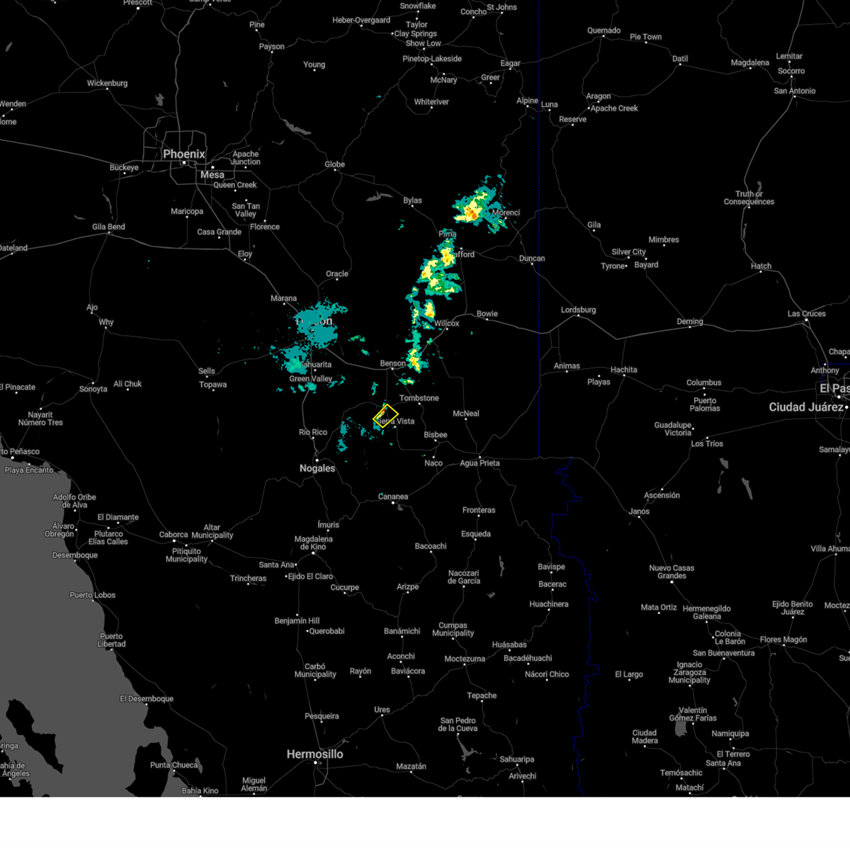 The storm which prompted the warning has weakened below severe limits, and no longer poses an immediate threat to life or property. therefore, the warning will be allowed to expire. however, gusty winds are still possible through 930 pm. The storm which prompted the warning has weakened below severe limits, and no longer poses an immediate threat to life or property. therefore, the warning will be allowed to expire. however, gusty winds are still possible through 930 pm.
|
| 6/20/2024 8:48 PM MST |
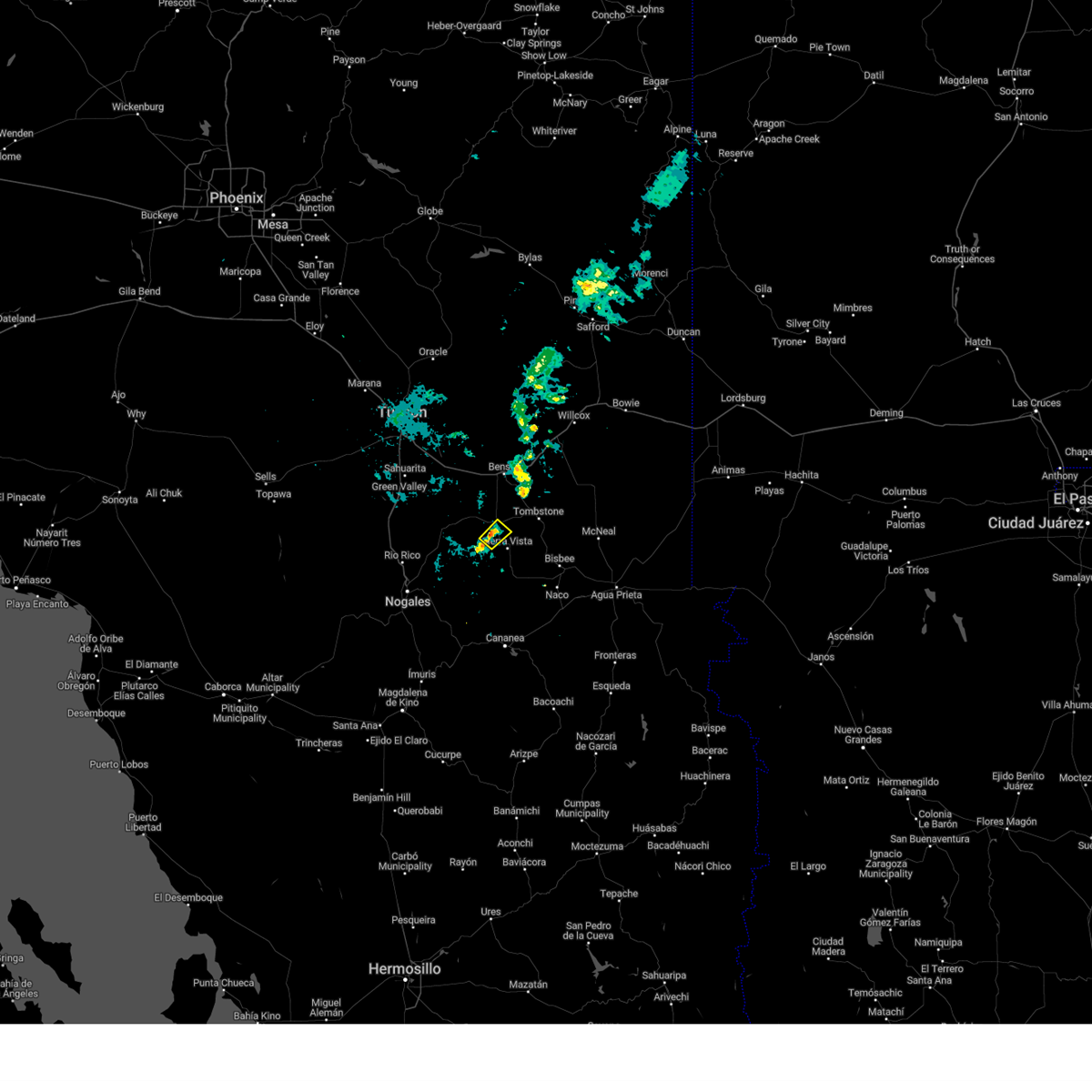 Svrtwc the national weather service in tucson has issued a * severe thunderstorm warning for, southwestern cochise county in southeastern arizona, * until 915 pm mst. * at 847 pm mst, a severe thunderstorm was located over huachuca city, or 11 miles northwest of sierra vista, moving northeast at 15 mph (radar indicated). Hazards include 60 mph wind gusts. expect damage to roofs, siding, and trees Svrtwc the national weather service in tucson has issued a * severe thunderstorm warning for, southwestern cochise county in southeastern arizona, * until 915 pm mst. * at 847 pm mst, a severe thunderstorm was located over huachuca city, or 11 miles northwest of sierra vista, moving northeast at 15 mph (radar indicated). Hazards include 60 mph wind gusts. expect damage to roofs, siding, and trees
|
| 6/20/2024 8:40 PM MST | Report for pioneer airfiel in cochise county AZ, 2.7 miles SSE of Sierra Vista, AZ |
| 8/21/2023 5:53 PM MST |
 At 553 pm mst, severe thunderstorms were located along a line extending from 7 miles east of whetstone to near fort huachuca to near parker canyon lake, moving northwest at 35 mph (radar indicated). Hazards include 60 mph wind gusts and quarter size hail. Hail damage to vehicles is expected. Expect wind damage to roofs, siding, and trees. At 553 pm mst, severe thunderstorms were located along a line extending from 7 miles east of whetstone to near fort huachuca to near parker canyon lake, moving northwest at 35 mph (radar indicated). Hazards include 60 mph wind gusts and quarter size hail. Hail damage to vehicles is expected. Expect wind damage to roofs, siding, and trees.
|
| 8/21/2023 5:48 PM MST |
 At 547 pm mst, a severe thunderstorm was located over fort huachuca, or 10 miles west of sierra vista, moving northwest at 25 mph (radar indicated). Hazards include ping pong ball size hail and 60 mph wind gusts. 60 mph gusts were reported just south of sierra vista around 530 pm. People and animals outdoors will be injured. expect hail damage to roofs, siding, windows, and vehicles. expect wind damage to roofs, siding, and trees. Locations impacted include, sierra vista, hereford, huachuca city, elgin, fort huachuca, parker canyon lake, coronado national memorial, canelo and ramsey canyon preserve. At 547 pm mst, a severe thunderstorm was located over fort huachuca, or 10 miles west of sierra vista, moving northwest at 25 mph (radar indicated). Hazards include ping pong ball size hail and 60 mph wind gusts. 60 mph gusts were reported just south of sierra vista around 530 pm. People and animals outdoors will be injured. expect hail damage to roofs, siding, windows, and vehicles. expect wind damage to roofs, siding, and trees. Locations impacted include, sierra vista, hereford, huachuca city, elgin, fort huachuca, parker canyon lake, coronado national memorial, canelo and ramsey canyon preserve.
|
| 8/21/2023 5:27 PM MST | 60 mph wind gusts for about 2 minute in cochise county AZ, 5.3 miles WNW of Sierra Vista, AZ |
| 8/21/2023 5:16 PM MST |
 At 516 pm mst, a severe thunderstorm was located 7 miles west of hereford, or 8 miles southwest of sierra vista, moving northwest at 25 mph (radar indicated). Hazards include ping pong ball size hail and 60 mph wind gusts. People and animals outdoors will be injured. expect hail damage to roofs, siding, windows, and vehicles. Expect wind damage to roofs, siding, and trees. At 516 pm mst, a severe thunderstorm was located 7 miles west of hereford, or 8 miles southwest of sierra vista, moving northwest at 25 mph (radar indicated). Hazards include ping pong ball size hail and 60 mph wind gusts. People and animals outdoors will be injured. expect hail damage to roofs, siding, windows, and vehicles. Expect wind damage to roofs, siding, and trees.
|
| 8/18/2023 4:31 PM MST |
 At 431 pm mst, a severe thunderstorm was located near kartchner caverns state park, or 7 miles southwest of benson, moving northwest at 20 mph (radar indicated). Hazards include 60 mph wind gusts and nickel size hail. expect damage to roofs, siding, and trees At 431 pm mst, a severe thunderstorm was located near kartchner caverns state park, or 7 miles southwest of benson, moving northwest at 20 mph (radar indicated). Hazards include 60 mph wind gusts and nickel size hail. expect damage to roofs, siding, and trees
|
| 8/7/2023 1:36 PM MST |
 The severe thunderstorm warning for southwestern cochise county will expire at 145 pm mst, the severe thunderstorm which prompted the warning for sierra vista has weakened and moved out of the warned area. therefore, the warning will be allowed to expire. The severe thunderstorm warning for southwestern cochise county will expire at 145 pm mst, the severe thunderstorm which prompted the warning for sierra vista has weakened and moved out of the warned area. therefore, the warning will be allowed to expire.
|
| 8/7/2023 1:15 PM MST | Golf Ball sized hail reported 2.7 miles SSE of Sierra Vista, AZ, photo of hail sent via social media. |
| 8/7/2023 1:10 PM MST |
 At 108 pm mst, a severe thunderstorm was located near sierra vista, moving northeast at 10 mph. this storm has a history of producing nickel to quarter size hail (radar indicated). Hazards include 60 mph wind gusts, quarter size hail and brief heavy rain. Hail damage to vehicles is expected. expect wind damage to roofs, siding, and trees. locations impacted include, sierra vista and fort huachuca. hail threat, radar indicated max hail size, 1. 00 in wind threat, radar indicated max wind gust, 60 mph. At 108 pm mst, a severe thunderstorm was located near sierra vista, moving northeast at 10 mph. this storm has a history of producing nickel to quarter size hail (radar indicated). Hazards include 60 mph wind gusts, quarter size hail and brief heavy rain. Hail damage to vehicles is expected. expect wind damage to roofs, siding, and trees. locations impacted include, sierra vista and fort huachuca. hail threat, radar indicated max hail size, 1. 00 in wind threat, radar indicated max wind gust, 60 mph.
|
| 8/7/2023 1:09 PM MST | Quarter sized hail reported 3.5 miles NW of Sierra Vista, AZ, quarter sized hail and 1in of rain in 45 minutes. |
| 8/7/2023 1:05 PM MST | Quarter sized hail reported 4.5 miles W of Sierra Vista, AZ, quarter sized hail. |
| 8/7/2023 1:02 PM MST |
 At 100 pm mst, a severe thunderstorm was located near sierra vista, moving northeast at 10 mph (radar indicated). Hazards include 60 mph wind gusts and quarter size hail. Hail damage to vehicles is expected. Expect wind damage to roofs, siding, and trees. At 100 pm mst, a severe thunderstorm was located near sierra vista, moving northeast at 10 mph (radar indicated). Hazards include 60 mph wind gusts and quarter size hail. Hail damage to vehicles is expected. Expect wind damage to roofs, siding, and trees.
|
| 8/6/2023 5:54 PM MST |
 At 552 pm mst, a severe thunderstorm was located over parker canyon lake, or 14 miles southwest of sierra vista, and is nearly stationary (radar indicated). Hazards include 70 mph wind gusts and half dollar size hail. Hail damage to vehicles is expected. expect considerable tree damage. Wind damage is also likely to mobile homes, roofs, and outbuildings. At 552 pm mst, a severe thunderstorm was located over parker canyon lake, or 14 miles southwest of sierra vista, and is nearly stationary (radar indicated). Hazards include 70 mph wind gusts and half dollar size hail. Hail damage to vehicles is expected. expect considerable tree damage. Wind damage is also likely to mobile homes, roofs, and outbuildings.
|
| 8/6/2023 5:28 PM MST |
 At 527 pm mst, a severe thunderstorm was located over parker canyon lake, or 16 miles southwest of sierra vista, moving northwest at 10 mph (radar indicated). Hazards include 70 mph wind gusts and quarter size hail. Hail damage to vehicles is expected. expect considerable tree damage. wind damage is also likely to mobile homes, roofs, and outbuildings. locations impacted include, parker canyon lake, fort huachuca, ramsey canyon preserve, canelo and coronado national memorial. thunderstorm damage threat, considerable hail threat, radar indicated max hail size, 1. 00 in wind threat, radar indicated max wind gust, 70 mph. At 527 pm mst, a severe thunderstorm was located over parker canyon lake, or 16 miles southwest of sierra vista, moving northwest at 10 mph (radar indicated). Hazards include 70 mph wind gusts and quarter size hail. Hail damage to vehicles is expected. expect considerable tree damage. wind damage is also likely to mobile homes, roofs, and outbuildings. locations impacted include, parker canyon lake, fort huachuca, ramsey canyon preserve, canelo and coronado national memorial. thunderstorm damage threat, considerable hail threat, radar indicated max hail size, 1. 00 in wind threat, radar indicated max wind gust, 70 mph.
|
| 8/6/2023 5:12 PM MST |
 At 510 pm mst, a severe thunderstorm was located near parker canyon lake, or 12 miles southwest of sierra vista, and is nearly stationary. additional storm development is expected (radar indicated). Hazards include 60 mph wind gusts and quarter size hail. Hail damage to vehicles is expected. Expect wind damage to roofs, siding, and trees. At 510 pm mst, a severe thunderstorm was located near parker canyon lake, or 12 miles southwest of sierra vista, and is nearly stationary. additional storm development is expected (radar indicated). Hazards include 60 mph wind gusts and quarter size hail. Hail damage to vehicles is expected. Expect wind damage to roofs, siding, and trees.
|
| 7/27/2023 8:23 PM MST |
 At 822 pm mst, a severe thunderstorm was located near elgin, or 19 miles southwest of benson, moving southwest at 10 mph (radar indicated). Hazards include 60 mph wind gusts and quarter size hail. Hail damage to vehicles is expected. Expect wind damage to roofs, siding, and trees. At 822 pm mst, a severe thunderstorm was located near elgin, or 19 miles southwest of benson, moving southwest at 10 mph (radar indicated). Hazards include 60 mph wind gusts and quarter size hail. Hail damage to vehicles is expected. Expect wind damage to roofs, siding, and trees.
|
| 7/21/2023 6:11 PM MST |
 At 608 pm mst, severe thunderstorms were located along a line extending from 11 miles northwest of benson to just west of huachuca city, moving west at 10 mph (radar indicated). Hazards include 60 mph wind gusts. Expect damage to roofs, siding, and trees. locations impacted include, vail, sonoita, elgin, kartchner caverns state park, corona de tucson, fort huachuca and mescal. hail threat, radar indicated max hail size, <. 75 in wind threat, radar indicated max wind gust, 60 mph. At 608 pm mst, severe thunderstorms were located along a line extending from 11 miles northwest of benson to just west of huachuca city, moving west at 10 mph (radar indicated). Hazards include 60 mph wind gusts. Expect damage to roofs, siding, and trees. locations impacted include, vail, sonoita, elgin, kartchner caverns state park, corona de tucson, fort huachuca and mescal. hail threat, radar indicated max hail size, <. 75 in wind threat, radar indicated max wind gust, 60 mph.
|
| 7/21/2023 5:57 PM MST |
 The severe thunderstorm warning for southwestern cochise and southeastern santa cruz counties will expire at 600 pm mst, the storm which prompted the warning has weakened below severe limits, and no longer poses an immediate threat to life or property. therefore, the warning will be allowed to expire. however gusty winds are still possible with this thunderstorm. The severe thunderstorm warning for southwestern cochise and southeastern santa cruz counties will expire at 600 pm mst, the storm which prompted the warning has weakened below severe limits, and no longer poses an immediate threat to life or property. therefore, the warning will be allowed to expire. however gusty winds are still possible with this thunderstorm.
|
| 7/21/2023 5:50 PM MST |
 At 550 pm mst, severe thunderstorms were located along a line extending from 10 miles northwest of benson to near huachuca city, moving west at 10 mph (radar indicated). Hazards include 60 mph wind gusts. expect damage to roofs, siding, and trees At 550 pm mst, severe thunderstorms were located along a line extending from 10 miles northwest of benson to near huachuca city, moving west at 10 mph (radar indicated). Hazards include 60 mph wind gusts. expect damage to roofs, siding, and trees
|
| 7/21/2023 5:27 PM MST |
 At 527 pm mst, a severe thunderstorm was located over parker canyon lake, or 15 miles west of sierra vista, moving southwest at 10 mph (radar indicated). Hazards include 60 mph wind gusts and quarter size hail. Hail damage to vehicles is expected. expect wind damage to roofs, siding, and trees. locations impacted include, parker canyon lake, fort huachuca, ramsey canyon preserve and canelo. hail threat, radar indicated max hail size, 1. 00 in wind threat, radar indicated max wind gust, 60 mph. At 527 pm mst, a severe thunderstorm was located over parker canyon lake, or 15 miles west of sierra vista, moving southwest at 10 mph (radar indicated). Hazards include 60 mph wind gusts and quarter size hail. Hail damage to vehicles is expected. expect wind damage to roofs, siding, and trees. locations impacted include, parker canyon lake, fort huachuca, ramsey canyon preserve and canelo. hail threat, radar indicated max hail size, 1. 00 in wind threat, radar indicated max wind gust, 60 mph.
|
| 7/21/2023 5:12 PM MST |
 At 512 pm mst, a severe thunderstorm was located over parker canyon lake, or 13 miles west of sierra vista, moving southwest at 10 mph (radar indicated). Hazards include 60 mph wind gusts and quarter size hail. Hail damage to vehicles is expected. Expect wind damage to roofs, siding, and trees. At 512 pm mst, a severe thunderstorm was located over parker canyon lake, or 13 miles west of sierra vista, moving southwest at 10 mph (radar indicated). Hazards include 60 mph wind gusts and quarter size hail. Hail damage to vehicles is expected. Expect wind damage to roofs, siding, and trees.
|
| 10/8/2022 2:10 PM MST |
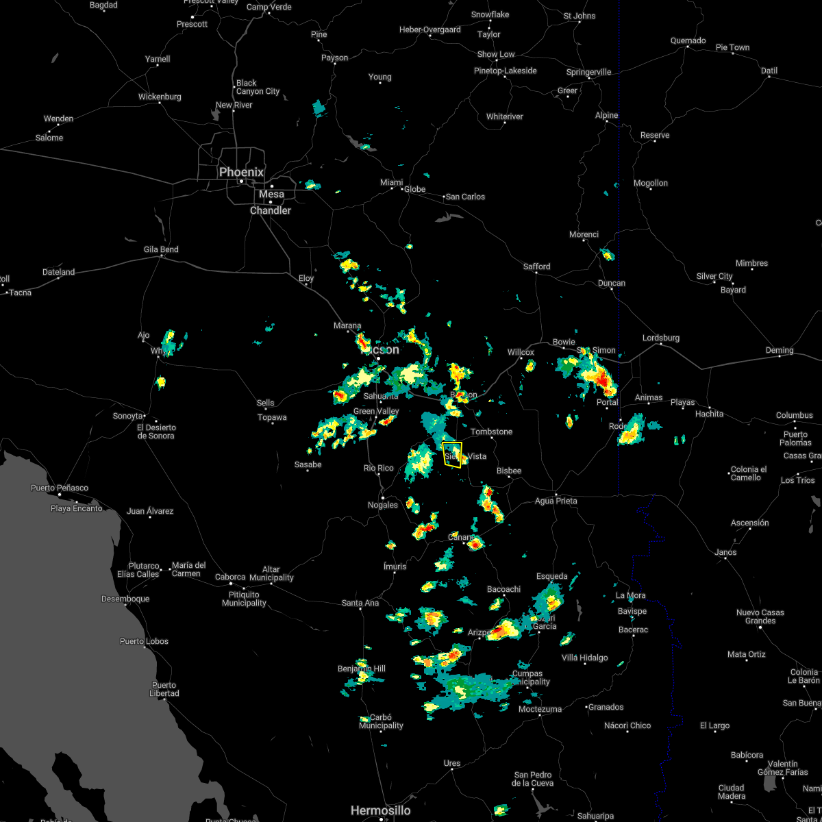 The severe thunderstorm warning for southwestern cochise and northeastern santa cruz counties will expire at 215 pm mst, the storm which prompted the warning has weakened below severe limits, and no longer poses an immediate threat to life or property. therefore, the warning will be allowed to expire. The severe thunderstorm warning for southwestern cochise and northeastern santa cruz counties will expire at 215 pm mst, the storm which prompted the warning has weakened below severe limits, and no longer poses an immediate threat to life or property. therefore, the warning will be allowed to expire.
|
| 10/8/2022 1:32 PM MST |
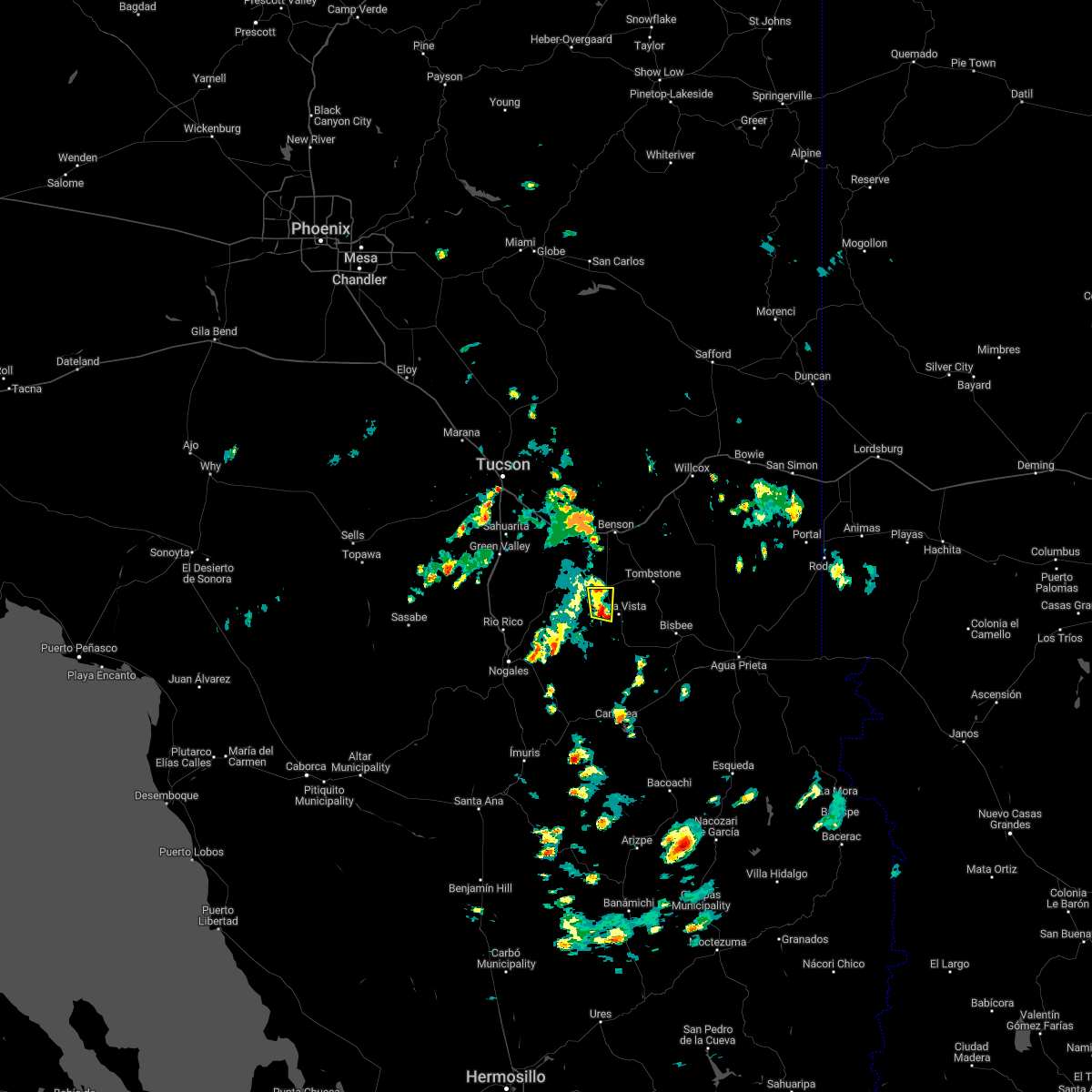 At 131 pm mst, a severe thunderstorm was located near fort huachuca, or 10 miles northwest of sierra vista, moving north at 5 mph (radar indicated). Hazards include 60 mph wind gusts and quarter size hail. Hail damage to vehicles is expected. expect wind damage to roofs, siding, and trees. locations impacted include, whetstone, huachuca city and fort huachuca. hail threat, radar indicated max hail size, 1. 00 in wind threat, radar indicated max wind gust, 60 mph. At 131 pm mst, a severe thunderstorm was located near fort huachuca, or 10 miles northwest of sierra vista, moving north at 5 mph (radar indicated). Hazards include 60 mph wind gusts and quarter size hail. Hail damage to vehicles is expected. expect wind damage to roofs, siding, and trees. locations impacted include, whetstone, huachuca city and fort huachuca. hail threat, radar indicated max hail size, 1. 00 in wind threat, radar indicated max wind gust, 60 mph.
|
| 10/8/2022 1:29 PM MST |
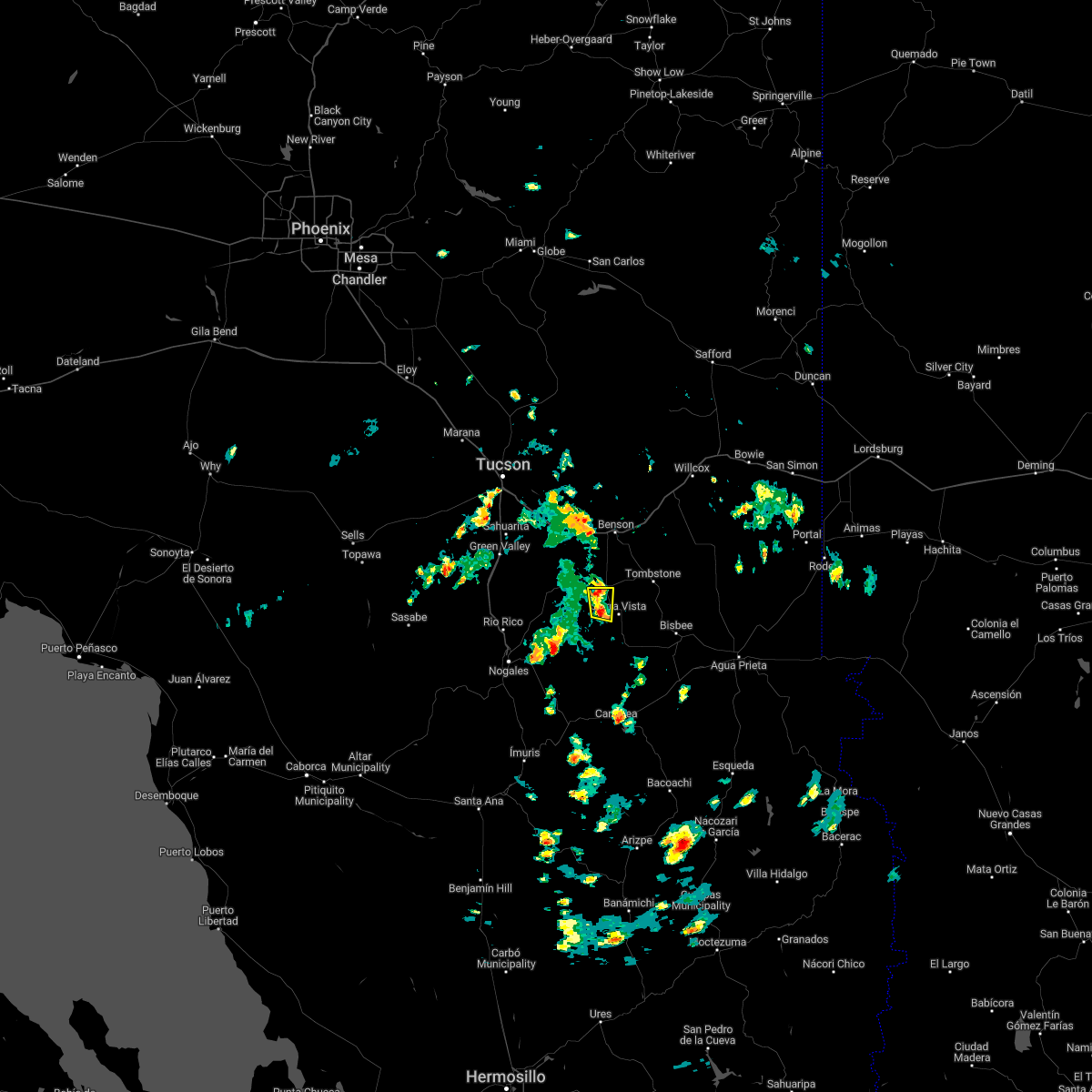 At 127 pm mst, a severe thunderstorm was located near fort huachuca, or 8 miles west of sierra vista, moving north at 5 mph (radar indicated). Hazards include large hail and strong winds. hail and wind damage At 127 pm mst, a severe thunderstorm was located near fort huachuca, or 8 miles west of sierra vista, moving north at 5 mph (radar indicated). Hazards include large hail and strong winds. hail and wind damage
|
| 9/23/2022 3:06 PM MST |
 At 306 pm mst, a severe thunderstorm was located near elgin, or 20 miles northwest of sierra vista, and is nearly stationary (radar indicated). Hazards include 60 mph wind gusts and quarter size hail. Hail damage to vehicles is expected. Expect wind damage to roofs, siding, and trees. At 306 pm mst, a severe thunderstorm was located near elgin, or 20 miles northwest of sierra vista, and is nearly stationary (radar indicated). Hazards include 60 mph wind gusts and quarter size hail. Hail damage to vehicles is expected. Expect wind damage to roofs, siding, and trees.
|
| 9/13/2022 12:21 PM MST |
 At 1221 pm mst, a severe thunderstorm was located near tombstone, or 12 miles north of sierra vista, moving northeast at 10 mph (radar indicated). Hazards include 60 mph wind gusts and quarter size hail. Hail damage to vehicles is expected. expect wind damage to roofs, siding, and trees. locations impacted include, benson, st. david, tombstone, kartchner caverns state park and fairbank. hail threat, radar indicated max hail size, 1. 00 in wind threat, radar indicated max wind gust, 60 mph. At 1221 pm mst, a severe thunderstorm was located near tombstone, or 12 miles north of sierra vista, moving northeast at 10 mph (radar indicated). Hazards include 60 mph wind gusts and quarter size hail. Hail damage to vehicles is expected. expect wind damage to roofs, siding, and trees. locations impacted include, benson, st. david, tombstone, kartchner caverns state park and fairbank. hail threat, radar indicated max hail size, 1. 00 in wind threat, radar indicated max wind gust, 60 mph.
|
| 9/13/2022 12:01 PM MST |
 At 1201 pm mst, a severe thunderstorm was located 8 miles east of huachuca city, or 9 miles north of sierra vista, moving northeast at 10 mph (radar indicated). Hazards include 60 mph wind gusts and quarter size hail. Hail damage to vehicles is expected. Expect wind damage to roofs, siding, and trees. At 1201 pm mst, a severe thunderstorm was located 8 miles east of huachuca city, or 9 miles north of sierra vista, moving northeast at 10 mph (radar indicated). Hazards include 60 mph wind gusts and quarter size hail. Hail damage to vehicles is expected. Expect wind damage to roofs, siding, and trees.
|
| 9/12/2022 4:09 PM MST |
 The severe thunderstorm warning for west central cochise and northeastern santa cruz counties will expire at 415 pm mst, the storms which prompted the warning near elgin and sonoita have moved out of the area. therefore, the warning will be allowed to expire. The severe thunderstorm warning for west central cochise and northeastern santa cruz counties will expire at 415 pm mst, the storms which prompted the warning near elgin and sonoita have moved out of the area. therefore, the warning will be allowed to expire.
|
| 9/12/2022 3:27 PM MST |
 At 325 pm mst, a severe thunderstorm was located near and southwest of elgin, or 22 miles northwest of sierra vista, moving northeast at 10 mph. additional storms were developing along an outflow through eastern santa cruz county and southwest cochise county (radar indicated). Hazards include 60 mph wind gusts and quarter size hail. Hail damage to vehicles is expected. Expect wind damage to roofs, siding, and trees. At 325 pm mst, a severe thunderstorm was located near and southwest of elgin, or 22 miles northwest of sierra vista, moving northeast at 10 mph. additional storms were developing along an outflow through eastern santa cruz county and southwest cochise county (radar indicated). Hazards include 60 mph wind gusts and quarter size hail. Hail damage to vehicles is expected. Expect wind damage to roofs, siding, and trees.
|
| 9/12/2022 3:11 PM MST |
 At 309 pm mst, a severe thunderstorm was located near pearce- sunsites, or 21 miles east of benson, moving north and northeast at 10 mph. another severe thunderstorm was noted near fairbank and whetstone, north to northeast of fort huachuca (radar indicated). Hazards include 60 mph wind gusts and quarter size hail. Hail damage to vehicles is expected. expect wind damage to roofs, siding, and trees. locations impacted include, whetstone, st. david, tombstone, dragoon, pearce-sunsites and fairbank. hail threat, radar indicated max hail size, 1. 00 in wind threat, radar indicated max wind gust, 60 mph. At 309 pm mst, a severe thunderstorm was located near pearce- sunsites, or 21 miles east of benson, moving north and northeast at 10 mph. another severe thunderstorm was noted near fairbank and whetstone, north to northeast of fort huachuca (radar indicated). Hazards include 60 mph wind gusts and quarter size hail. Hail damage to vehicles is expected. expect wind damage to roofs, siding, and trees. locations impacted include, whetstone, st. david, tombstone, dragoon, pearce-sunsites and fairbank. hail threat, radar indicated max hail size, 1. 00 in wind threat, radar indicated max wind gust, 60 mph.
|
| 9/12/2022 2:48 PM MST |
 At 247 pm mst, a severe thunderstorm was located 8 miles south of dragoon, or 14 miles east of benson, moving north at 5 to 10 mph, with another storm 10 miles northeast of sierra vista (radar indicated). Hazards include 60 mph wind gusts and quarter size hail. Hail damage to vehicles is expected. Expect wind damage to roofs, siding, and trees. At 247 pm mst, a severe thunderstorm was located 8 miles south of dragoon, or 14 miles east of benson, moving north at 5 to 10 mph, with another storm 10 miles northeast of sierra vista (radar indicated). Hazards include 60 mph wind gusts and quarter size hail. Hail damage to vehicles is expected. Expect wind damage to roofs, siding, and trees.
|
| 8/15/2022 1:04 PM MST |
 At 103 pm mst, a severe thunderstorm was located near parker canyon lake, or 18 miles west of sierra vista, moving west at 5 mph (radar indicated). Hazards include 60 mph wind gusts and nickel size hail. Expect damage to roofs, siding, and trees. locations impacted include, parker canyon lake. hail threat, radar indicated max hail size, 0. 88 in wind threat, radar indicated max wind gust, 60 mph. At 103 pm mst, a severe thunderstorm was located near parker canyon lake, or 18 miles west of sierra vista, moving west at 5 mph (radar indicated). Hazards include 60 mph wind gusts and nickel size hail. Expect damage to roofs, siding, and trees. locations impacted include, parker canyon lake. hail threat, radar indicated max hail size, 0. 88 in wind threat, radar indicated max wind gust, 60 mph.
|
| 8/15/2022 12:34 PM MST |
 At 1233 pm mst, a severe thunderstorm was located over parker canyon lake, or 14 miles west of sierra vista, moving northwest at 10 mph (radar indicated). Hazards include 60 mph wind gusts and nickel size hail. expect damage to roofs, siding, and trees At 1233 pm mst, a severe thunderstorm was located over parker canyon lake, or 14 miles west of sierra vista, moving northwest at 10 mph (radar indicated). Hazards include 60 mph wind gusts and nickel size hail. expect damage to roofs, siding, and trees
|
| 8/11/2022 5:53 PM MST |
 The severe thunderstorm warning for southwestern cochise county will expire at 600 pm mst, the storm which prompted the warning has weakened below severe limits, and no longer poses an immediate threat to life or property. therefore, the warning will be allowed to expire. however gusty winds and heavy rain are still possible with this thunderstorm. The severe thunderstorm warning for southwestern cochise county will expire at 600 pm mst, the storm which prompted the warning has weakened below severe limits, and no longer poses an immediate threat to life or property. therefore, the warning will be allowed to expire. however gusty winds and heavy rain are still possible with this thunderstorm.
|
| 8/11/2022 5:20 PM MST |
 At 520 pm mst, a severe thunderstorm was located near sierra vista, moving west at 20 mph (radar indicated). Hazards include 60 mph wind gusts and quarter size hail. Hail damage to vehicles is expected. expect wind damage to roofs, siding, and trees. locations impacted include, sierra vista, hereford, huachuca city, fort huachuca, ramsey canyon preserve and coronado national memorial. hail threat, radar indicated max hail size, 1. 00 in wind threat, radar indicated max wind gust, 60 mph. At 520 pm mst, a severe thunderstorm was located near sierra vista, moving west at 20 mph (radar indicated). Hazards include 60 mph wind gusts and quarter size hail. Hail damage to vehicles is expected. expect wind damage to roofs, siding, and trees. locations impacted include, sierra vista, hereford, huachuca city, fort huachuca, ramsey canyon preserve and coronado national memorial. hail threat, radar indicated max hail size, 1. 00 in wind threat, radar indicated max wind gust, 60 mph.
|
| 8/11/2022 5:20 PM MST |
 At 520 pm mst, a severe thunderstorm was located 8 miles east of whetstone, or 12 miles north of sierra vista, moving northwest at 15 mph (radar indicated). Hazards include 60 mph wind gusts and penny size hail. Expect damage to roofs, siding, and trees. locations impacted include, whetstone, huachuca city, fairbank and charleston. hail threat, radar indicated max hail size, 0. 75 in wind threat, radar indicated max wind gust, 60 mph. At 520 pm mst, a severe thunderstorm was located 8 miles east of whetstone, or 12 miles north of sierra vista, moving northwest at 15 mph (radar indicated). Hazards include 60 mph wind gusts and penny size hail. Expect damage to roofs, siding, and trees. locations impacted include, whetstone, huachuca city, fairbank and charleston. hail threat, radar indicated max hail size, 0. 75 in wind threat, radar indicated max wind gust, 60 mph.
|
| 8/11/2022 4:55 PM MST |
 At 455 pm mst, a severe thunderstorm was located near hereford, or near sierra vista, moving northwest at 10 mph (radar indicated). Hazards include 60 mph wind gusts and quarter size hail. Hail damage to vehicles is expected. Expect wind damage to roofs, siding, and trees. At 455 pm mst, a severe thunderstorm was located near hereford, or near sierra vista, moving northwest at 10 mph (radar indicated). Hazards include 60 mph wind gusts and quarter size hail. Hail damage to vehicles is expected. Expect wind damage to roofs, siding, and trees.
|
| 8/11/2022 4:54 PM MST |
 At 454 pm mst, a severe thunderstorm was located near tombstone, or 10 miles northeast of sierra vista, moving northwest at 15 mph (radar indicated). Hazards include 60 mph wind gusts and quarter size hail. Hail damage to vehicles is expected. Expect wind damage to roofs, siding, and trees. At 454 pm mst, a severe thunderstorm was located near tombstone, or 10 miles northeast of sierra vista, moving northwest at 15 mph (radar indicated). Hazards include 60 mph wind gusts and quarter size hail. Hail damage to vehicles is expected. Expect wind damage to roofs, siding, and trees.
|
| 8/10/2022 8:27 PM MST |
 The severe thunderstorm warning for southwestern cochise and east central santa cruz counties will expire at 830 pm mst, the storm which prompted the warning near sierra vista has weakened below severe limits. therefore, the warning will be allowed to expire. however heavy rain is still possible with this thunderstorm. The severe thunderstorm warning for southwestern cochise and east central santa cruz counties will expire at 830 pm mst, the storm which prompted the warning near sierra vista has weakened below severe limits. therefore, the warning will be allowed to expire. however heavy rain is still possible with this thunderstorm.
|
| 8/10/2022 7:50 PM MST |
 At 750 pm mst, a severe thunderstorm was located near sierra vista, moving northwest at 15 mph (radar indicated). Hazards include 60 mph wind gusts and quarter size hail. Hail damage to vehicles is expected. Expect wind damage to roofs, siding, and trees. At 750 pm mst, a severe thunderstorm was located near sierra vista, moving northwest at 15 mph (radar indicated). Hazards include 60 mph wind gusts and quarter size hail. Hail damage to vehicles is expected. Expect wind damage to roofs, siding, and trees.
|
| 8/7/2022 6:41 PM MST |
 At 641 pm mst, a severe thunderstorm was located near huachuca city, or 15 miles northwest of sierra vista, moving northwest at 20 mph (radar indicated). Hazards include 60 mph wind gusts and half dollar size hail. Hail damage to vehicles is expected. Expect wind damage to roofs, siding, and trees. At 641 pm mst, a severe thunderstorm was located near huachuca city, or 15 miles northwest of sierra vista, moving northwest at 20 mph (radar indicated). Hazards include 60 mph wind gusts and half dollar size hail. Hail damage to vehicles is expected. Expect wind damage to roofs, siding, and trees.
|
| 8/7/2022 6:26 PM MST |
 At 626 pm mst, a severe thunderstorm was located over huachuca city, or 11 miles northwest of sierra vista, moving northwest at 20 mph. this storm has a history of producing large hail, which is causing damage (radar indicated). Hazards include golf ball size hail and 70 mph wind gusts. People and animals outdoors will be injured. expect hail damage to roofs, siding, windows, and vehicles. expect considerable tree damage. wind damage is also likely to mobile homes, roofs, and outbuildings. locations impacted include, sierra vista, whetstone, huachuca city, elgin, fort huachuca and canelo. thunderstorm damage threat, considerable hail threat, observed max hail size, 1. 75 in wind threat, radar indicated max wind gust, 70 mph. At 626 pm mst, a severe thunderstorm was located over huachuca city, or 11 miles northwest of sierra vista, moving northwest at 20 mph. this storm has a history of producing large hail, which is causing damage (radar indicated). Hazards include golf ball size hail and 70 mph wind gusts. People and animals outdoors will be injured. expect hail damage to roofs, siding, windows, and vehicles. expect considerable tree damage. wind damage is also likely to mobile homes, roofs, and outbuildings. locations impacted include, sierra vista, whetstone, huachuca city, elgin, fort huachuca and canelo. thunderstorm damage threat, considerable hail threat, observed max hail size, 1. 75 in wind threat, radar indicated max wind gust, 70 mph.
|
| 8/7/2022 6:10 PM MST | Quarter sized hail reported 6.4 miles WNW of Sierra Vista, AZ, public report received via social media of quarter sized hail near the intersection of kino road and canada drive. |
| 8/7/2022 6:08 PM MST | Quarter sized hail reported 3.1 miles NW of Sierra Vista, AZ, public report received via social media of quarter-sized hail. |
| 8/7/2022 6:06 PM MST |
 At 605 pm mst, a severe thunderstorm was located near sierra vista, moving northwest at 20 mph (radar indicated). Hazards include golf ball size hail and 70 mph wind gusts. People and animals outdoors will be injured. expect hail damage to roofs, siding, windows, and vehicles. expect considerable tree damage. Wind damage is also likely to mobile homes, roofs, and outbuildings. At 605 pm mst, a severe thunderstorm was located near sierra vista, moving northwest at 20 mph (radar indicated). Hazards include golf ball size hail and 70 mph wind gusts. People and animals outdoors will be injured. expect hail damage to roofs, siding, windows, and vehicles. expect considerable tree damage. Wind damage is also likely to mobile homes, roofs, and outbuildings.
|
| 8/7/2022 6:00 PM MST | Personal weather station measured 74 mph wind gus in cochise county AZ, 3.1 miles NW of Sierra Vista, AZ |
| 8/7/2022 5:52 PM MST |
 At 551 pm mst, a severe thunderstorm was located over sierra vista, moving northwest at 15 mph. this is a very dangerous storm. move away from windows now (radar indicated). Hazards include golf ball size hail and 70 mph wind gusts. People and animals outdoors will be injured. expect hail damage to roofs, siding, windows, and vehicles. expect considerable tree damage. wind damage is also likely to mobile homes, roofs, and outbuildings. locations impacted include, sierra vista, hereford, fort huachuca, palominas, coronado national memorial and ramsey canyon preserve. thunderstorm damage threat, considerable hail threat, observed max hail size, 1. 75 in wind threat, radar indicated max wind gust, 70 mph. At 551 pm mst, a severe thunderstorm was located over sierra vista, moving northwest at 15 mph. this is a very dangerous storm. move away from windows now (radar indicated). Hazards include golf ball size hail and 70 mph wind gusts. People and animals outdoors will be injured. expect hail damage to roofs, siding, windows, and vehicles. expect considerable tree damage. wind damage is also likely to mobile homes, roofs, and outbuildings. locations impacted include, sierra vista, hereford, fort huachuca, palominas, coronado national memorial and ramsey canyon preserve. thunderstorm damage threat, considerable hail threat, observed max hail size, 1. 75 in wind threat, radar indicated max wind gust, 70 mph.
|
| 8/7/2022 5:50 PM MST | Golf Ball sized hail reported 3.5 miles NW of Sierra Vista, AZ |
| 8/7/2022 5:40 PM MST | Quarter sized hail reported 8.1 miles WNW of Sierra Vista, AZ, spotter reported dime to quarter-sized hail. |
| 8/7/2022 5:34 PM MST |
 At 534 pm mst, a severe thunderstorm was located over hereford, or near sierra vista, moving northwest at 15 mph (radar indicated). Hazards include 70 mph wind gusts and ping pong ball size hail. People and animals outdoors will be injured. expect hail damage to roofs, siding, windows, and vehicles. expect considerable tree damage. wind damage is also likely to mobile homes, roofs, and outbuildings. locations impacted include, sierra vista, hereford, fort huachuca, palominas, coronado national memorial and ramsey canyon preserve. thunderstorm damage threat, considerable hail threat, radar indicated max hail size, 1. 50 in wind threat, radar indicated max wind gust, 70 mph. At 534 pm mst, a severe thunderstorm was located over hereford, or near sierra vista, moving northwest at 15 mph (radar indicated). Hazards include 70 mph wind gusts and ping pong ball size hail. People and animals outdoors will be injured. expect hail damage to roofs, siding, windows, and vehicles. expect considerable tree damage. wind damage is also likely to mobile homes, roofs, and outbuildings. locations impacted include, sierra vista, hereford, fort huachuca, palominas, coronado national memorial and ramsey canyon preserve. thunderstorm damage threat, considerable hail threat, radar indicated max hail size, 1. 50 in wind threat, radar indicated max wind gust, 70 mph.
|
| 8/7/2022 5:26 PM MST |
 At 526 pm mst, a severe thunderstorm was located over hereford, or near sierra vista, moving west at 15 mph (radar indicated). Hazards include 60 mph wind gusts and quarter size hail. Hail damage to vehicles is expected. Expect wind damage to roofs, siding, and trees. At 526 pm mst, a severe thunderstorm was located over hereford, or near sierra vista, moving west at 15 mph (radar indicated). Hazards include 60 mph wind gusts and quarter size hail. Hail damage to vehicles is expected. Expect wind damage to roofs, siding, and trees.
|
| 8/6/2022 8:26 PM MST |
 The severe thunderstorm warning for southeastern pima, southwestern cochise and northeastern santa cruz counties will expire at 830 pm mst, the storm which prompted the warning has weakened below severe limits, and no longer poses an immediate threat to life or property. therefore, the warning will be allowed to expire. however gusty winds and heavy rain are still possible with this thunderstorm. The severe thunderstorm warning for southeastern pima, southwestern cochise and northeastern santa cruz counties will expire at 830 pm mst, the storm which prompted the warning has weakened below severe limits, and no longer poses an immediate threat to life or property. therefore, the warning will be allowed to expire. however gusty winds and heavy rain are still possible with this thunderstorm.
|
| 8/6/2022 8:17 PM MST |
 At 816 pm mst, a severe thunderstorm was located near patagonia, or 21 miles northeast of nogales, moving west at 15 mph (radar indicated). Hazards include 60 mph wind gusts and quarter size hail. Hail damage to vehicles is expected. expect wind damage to roofs, siding, and trees. locations impacted include, patagonia, sonoita, elgin, fort huachuca and canelo. hail threat, radar indicated max hail size, 1. 00 in wind threat, radar indicated max wind gust, 60 mph. At 816 pm mst, a severe thunderstorm was located near patagonia, or 21 miles northeast of nogales, moving west at 15 mph (radar indicated). Hazards include 60 mph wind gusts and quarter size hail. Hail damage to vehicles is expected. expect wind damage to roofs, siding, and trees. locations impacted include, patagonia, sonoita, elgin, fort huachuca and canelo. hail threat, radar indicated max hail size, 1. 00 in wind threat, radar indicated max wind gust, 60 mph.
|
| 8/6/2022 8:05 PM MST |
 The severe thunderstorm warning for southwestern cochise county will expire at 815 pm mst, the storm which prompted the warning has weakened below severe limits, and has exited the warned area. therefore, the warning will be allowed to expire. however gusty winds and heavy rain are still possible with this thunderstorm. The severe thunderstorm warning for southwestern cochise county will expire at 815 pm mst, the storm which prompted the warning has weakened below severe limits, and has exited the warned area. therefore, the warning will be allowed to expire. however gusty winds and heavy rain are still possible with this thunderstorm.
|
| 8/6/2022 7:50 PM MST |
 At 750 pm mst, a severe thunderstorm was located near elgin, or 20 miles west of sierra vista, moving west at 25 mph (radar indicated). Hazards include 60 mph wind gusts and quarter size hail. Hail damage to vehicles is expected. Expect wind damage to roofs, siding, and trees. At 750 pm mst, a severe thunderstorm was located near elgin, or 20 miles west of sierra vista, moving west at 25 mph (radar indicated). Hazards include 60 mph wind gusts and quarter size hail. Hail damage to vehicles is expected. Expect wind damage to roofs, siding, and trees.
|
| 8/6/2022 7:42 PM MST |
 At 742 pm mst, a severe thunderstorm was located 7 miles northwest of tombstone, or 14 miles southeast of benson, moving west at 25 mph (radar indicated). Hazards include 60 mph wind gusts and quarter size hail. Hail damage to vehicles is expected. expect wind damage to roofs, siding, and trees. locations impacted include, sierra vista, whetstone, huachuca city, st. david, tombstone, kartchner caverns state park, fort huachuca, fairbank and charleston. hail threat, radar indicated max hail size, 1. 00 in wind threat, radar indicated max wind gust, 60 mph. At 742 pm mst, a severe thunderstorm was located 7 miles northwest of tombstone, or 14 miles southeast of benson, moving west at 25 mph (radar indicated). Hazards include 60 mph wind gusts and quarter size hail. Hail damage to vehicles is expected. expect wind damage to roofs, siding, and trees. locations impacted include, sierra vista, whetstone, huachuca city, st. david, tombstone, kartchner caverns state park, fort huachuca, fairbank and charleston. hail threat, radar indicated max hail size, 1. 00 in wind threat, radar indicated max wind gust, 60 mph.
|
| 8/6/2022 7:27 PM MST |
 At 727 pm mst, a severe thunderstorm was located over tombstone, or 18 miles northeast of sierra vista, moving west at 25 mph (radar indicated). Hazards include 60 mph wind gusts and quarter size hail. Hail damage to vehicles is expected. Expect wind damage to roofs, siding, and trees. At 727 pm mst, a severe thunderstorm was located over tombstone, or 18 miles northeast of sierra vista, moving west at 25 mph (radar indicated). Hazards include 60 mph wind gusts and quarter size hail. Hail damage to vehicles is expected. Expect wind damage to roofs, siding, and trees.
|
| 8/6/2022 7:10 PM MST |
 At 710 pm mst, a severe thunderstorm was located 8 miles southeast of tombstone, or 14 miles north of bisbee, moving west at 25 mph (radar indicated). Hazards include 60 mph wind gusts and quarter size hail. Hail damage to vehicles is expected. expect wind damage to roofs, siding, and trees. locations impacted include, sierra vista, tombstone and charleston. hail threat, radar indicated max hail size, 1. 00 in wind threat, radar indicated max wind gust, 60 mph. At 710 pm mst, a severe thunderstorm was located 8 miles southeast of tombstone, or 14 miles north of bisbee, moving west at 25 mph (radar indicated). Hazards include 60 mph wind gusts and quarter size hail. Hail damage to vehicles is expected. expect wind damage to roofs, siding, and trees. locations impacted include, sierra vista, tombstone and charleston. hail threat, radar indicated max hail size, 1. 00 in wind threat, radar indicated max wind gust, 60 mph.
|
| 8/6/2022 6:51 PM MST |
 At 651 pm mst, a severe thunderstorm was located 13 miles southeast of tombstone, or 15 miles north of bisbee, moving west at 25 mph (radar indicated). Hazards include 60 mph wind gusts and quarter size hail. Hail damage to vehicles is expected. Expect wind damage to roofs, siding, and trees. At 651 pm mst, a severe thunderstorm was located 13 miles southeast of tombstone, or 15 miles north of bisbee, moving west at 25 mph (radar indicated). Hazards include 60 mph wind gusts and quarter size hail. Hail damage to vehicles is expected. Expect wind damage to roofs, siding, and trees.
|
| 8/3/2022 9:03 PM MST |
 At 903 pm mst, a severe thunderstorm was located near tombstone, or 15 miles northeast of sierra vista, moving northwest at 15 mph (radar indicated). Hazards include 60 mph wind gusts and quarter size hail. Hail damage to vehicles is expected. expect wind damage to roofs, siding, and trees. locations impacted include, tombstone, fairbank and charleston. hail threat, radar indicated max hail size, 1. 00 in wind threat, radar indicated max wind gust, 60 mph. At 903 pm mst, a severe thunderstorm was located near tombstone, or 15 miles northeast of sierra vista, moving northwest at 15 mph (radar indicated). Hazards include 60 mph wind gusts and quarter size hail. Hail damage to vehicles is expected. expect wind damage to roofs, siding, and trees. locations impacted include, tombstone, fairbank and charleston. hail threat, radar indicated max hail size, 1. 00 in wind threat, radar indicated max wind gust, 60 mph.
|
| 8/3/2022 8:50 PM MST |
 At 849 pm mst, a severe thunderstorm was located near tombstone, or 15 miles northeast of sierra vista, moving northwest at 15 mph (radar indicated). Hazards include 60 mph wind gusts and quarter size hail. Hail damage to vehicles is expected. Expect wind damage to roofs, siding, and trees. At 849 pm mst, a severe thunderstorm was located near tombstone, or 15 miles northeast of sierra vista, moving northwest at 15 mph (radar indicated). Hazards include 60 mph wind gusts and quarter size hail. Hail damage to vehicles is expected. Expect wind damage to roofs, siding, and trees.
|
| 8/3/2022 6:22 PM MST |
 The severe thunderstorm warning for southwestern cochise and southeastern santa cruz counties will expire at 630 pm mst, the storm which prompted the warning has weakened below severe limits, and no longer poses an immediate threat to life or property. therefore, the warning will be allowed to expire. The severe thunderstorm warning for southwestern cochise and southeastern santa cruz counties will expire at 630 pm mst, the storm which prompted the warning has weakened below severe limits, and no longer poses an immediate threat to life or property. therefore, the warning will be allowed to expire.
|
| 8/3/2022 6:03 PM MST |
 At 603 pm mst, a severe thunderstorm was located near parker canyon lake, or 16 miles west of sierra vista, moving northwest at 10 mph (radar indicated). Hazards include 60 mph wind gusts and quarter size hail. Hail damage to vehicles is expected. expect wind damage to roofs, siding, and trees. locations impacted include, elgin, fort huachuca, parker canyon lake and canelo. hail threat, radar indicated max hail size, 1. 00 in wind threat, radar indicated max wind gust, 60 mph. At 603 pm mst, a severe thunderstorm was located near parker canyon lake, or 16 miles west of sierra vista, moving northwest at 10 mph (radar indicated). Hazards include 60 mph wind gusts and quarter size hail. Hail damage to vehicles is expected. expect wind damage to roofs, siding, and trees. locations impacted include, elgin, fort huachuca, parker canyon lake and canelo. hail threat, radar indicated max hail size, 1. 00 in wind threat, radar indicated max wind gust, 60 mph.
|
| 8/3/2022 5:43 PM MST |
 At 543 pm mst, a severe thunderstorm was located over parker canyon lake, or 14 miles west of sierra vista, moving northwest at 10 mph (radar indicated). Hazards include 60 mph wind gusts and quarter size hail. Hail damage to vehicles is expected. Expect wind damage to roofs, siding, and trees. At 543 pm mst, a severe thunderstorm was located over parker canyon lake, or 14 miles west of sierra vista, moving northwest at 10 mph (radar indicated). Hazards include 60 mph wind gusts and quarter size hail. Hail damage to vehicles is expected. Expect wind damage to roofs, siding, and trees.
|
| 8/2/2022 12:40 PM MST |
 The severe thunderstorm warning for east central pima, west central cochise and northeastern santa cruz counties will expire at 1245 pm mst, the storm which prompted the warning has weakened below severe limits, and no longer poses an immediate threat to life or property. therefore, the warning will be allowed to expire. The severe thunderstorm warning for east central pima, west central cochise and northeastern santa cruz counties will expire at 1245 pm mst, the storm which prompted the warning has weakened below severe limits, and no longer poses an immediate threat to life or property. therefore, the warning will be allowed to expire.
|
| 8/2/2022 12:20 PM MST |
 At 1219 pm mst, a severe thunderstorm was located near elgin, or 21 miles southwest of benson, moving northwest at 10 mph (radar indicated). Hazards include 60 mph wind gusts and quarter size hail. Hail damage to vehicles is expected. expect wind damage to roofs, siding, and trees. locations impacted include, whetstone, huachuca city, sonoita, elgin and fort huachuca. hail threat, radar indicated max hail size, 1. 00 in wind threat, radar indicated max wind gust, 60 mph. At 1219 pm mst, a severe thunderstorm was located near elgin, or 21 miles southwest of benson, moving northwest at 10 mph (radar indicated). Hazards include 60 mph wind gusts and quarter size hail. Hail damage to vehicles is expected. expect wind damage to roofs, siding, and trees. locations impacted include, whetstone, huachuca city, sonoita, elgin and fort huachuca. hail threat, radar indicated max hail size, 1. 00 in wind threat, radar indicated max wind gust, 60 mph.
|
| 8/2/2022 12:05 PM MST |
 At 1205 pm mst, a severe thunderstorm was located near elgin, or 20 miles southwest of benson, moving northwest at 10 mph (radar indicated). Hazards include 60 mph wind gusts and quarter size hail. Hail damage to vehicles is expected. Expect wind damage to roofs, siding, and trees. At 1205 pm mst, a severe thunderstorm was located near elgin, or 20 miles southwest of benson, moving northwest at 10 mph (radar indicated). Hazards include 60 mph wind gusts and quarter size hail. Hail damage to vehicles is expected. Expect wind damage to roofs, siding, and trees.
|
| 7/30/2022 10:42 PM MST |
 The severe thunderstorm warning for southwestern cochise and southeastern santa cruz counties will expire at 1045 pm mst, the storm which prompted the warning has weakened below severe limits, and no longer poses an immediate threat to life or property. therefore, the warning will be allowed to expire. however heavy rain is still possible with this thunderstorm. The severe thunderstorm warning for southwestern cochise and southeastern santa cruz counties will expire at 1045 pm mst, the storm which prompted the warning has weakened below severe limits, and no longer poses an immediate threat to life or property. therefore, the warning will be allowed to expire. however heavy rain is still possible with this thunderstorm.
|
| 7/30/2022 10:03 PM MST |
 At 1002 pm mst, a severe thunderstorm was located 10 miles east of nogales international airport, or 15 miles east of nogales, moving northwest at 15 mph (radar indicated). Hazards include 60 mph wind gusts and quarter size hail. Hail damage to vehicles is expected. Expect wind damage to roofs, siding, and trees. At 1002 pm mst, a severe thunderstorm was located 10 miles east of nogales international airport, or 15 miles east of nogales, moving northwest at 15 mph (radar indicated). Hazards include 60 mph wind gusts and quarter size hail. Hail damage to vehicles is expected. Expect wind damage to roofs, siding, and trees.
|
| 7/23/2022 11:44 PM MST | Asos station kalk pioneer airfiel in cochise county AZ, 8.7 miles ESE of Sierra Vista, AZ |
| 7/19/2022 8:18 PM MST |
 At 816 pm mst, cluster of severe thunderstorms was located from sierra vista to parker canyon lake, moving west at 20 mph (radar indicated). Hazards include 60 mph wind gusts and quarter size hail. Hail damage to vehicles is expected. expect wind damage to roofs, siding, and trees. locations impacted include, sierra vista, hereford, fort huachuca, parker canyon lake, palominas, coronado national memorial and ramsey canyon preserve. dime size hail and torrential rainfall reducing visibilities have been reported with these storms. hail threat, observed max hail size, 1. 00 in wind threat, radar indicated max wind gust, 60 mph. At 816 pm mst, cluster of severe thunderstorms was located from sierra vista to parker canyon lake, moving west at 20 mph (radar indicated). Hazards include 60 mph wind gusts and quarter size hail. Hail damage to vehicles is expected. expect wind damage to roofs, siding, and trees. locations impacted include, sierra vista, hereford, fort huachuca, parker canyon lake, palominas, coronado national memorial and ramsey canyon preserve. dime size hail and torrential rainfall reducing visibilities have been reported with these storms. hail threat, observed max hail size, 1. 00 in wind threat, radar indicated max wind gust, 60 mph.
|
| 7/19/2022 8:16 PM MST | Asos station kalk pioneer airfiel in cochise county AZ, 8.7 miles ESE of Sierra Vista, AZ |
| 7/19/2022 7:52 PM MST |
 At 752 pm mst, a severe thunderstorm was located near hereford, or near sierra vista, moving west at 20 mph (radar indicated). Hazards include 60 mph wind gusts and quarter size hail. Hail damage to vehicles is expected. Expect wind damage to roofs, siding, and trees. At 752 pm mst, a severe thunderstorm was located near hereford, or near sierra vista, moving west at 20 mph (radar indicated). Hazards include 60 mph wind gusts and quarter size hail. Hail damage to vehicles is expected. Expect wind damage to roofs, siding, and trees.
|
| 7/12/2022 3:43 PM MST | 58mph wind gusts from kfhu libby army air fiel in cochise county AZ, 4.8 miles S of Sierra Vista, AZ |
| 7/4/2022 1:42 PM MST |
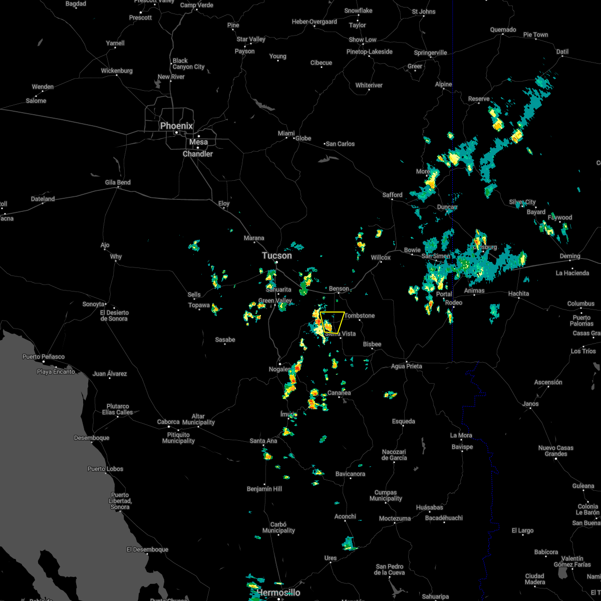 At 142 pm mst, a severe thunderstorm was located over huachuca city, or 12 miles northwest of sierra vista, moving north at 10 mph (radar indicated). Hazards include 60 mph wind gusts and quarter size hail. Hail damage to vehicles is expected. Expect wind damage to roofs, siding, and trees. At 142 pm mst, a severe thunderstorm was located over huachuca city, or 12 miles northwest of sierra vista, moving north at 10 mph (radar indicated). Hazards include 60 mph wind gusts and quarter size hail. Hail damage to vehicles is expected. Expect wind damage to roofs, siding, and trees.
|
| 9/26/2021 11:57 AM MST |
 At 1155 am mst, a severe thunderstorm was located 8 miles northeast of hereford, or 8 miles east of sierra vista, moving northeast at 25 mph (radar indicated and spotter observed marble sized hail in hereford and the storm continues to intensify). Hazards include 60 mph wind gusts and quarter size hail. Hail damage to vehicles is expected. Expect wind damage to roofs, siding, and trees. At 1155 am mst, a severe thunderstorm was located 8 miles northeast of hereford, or 8 miles east of sierra vista, moving northeast at 25 mph (radar indicated and spotter observed marble sized hail in hereford and the storm continues to intensify). Hazards include 60 mph wind gusts and quarter size hail. Hail damage to vehicles is expected. Expect wind damage to roofs, siding, and trees.
|
| 9/7/2021 7:15 PM MST |
 At 714 pm mst, a severe thunderstorm was located near hereford, or near sierra vista, moving west at 25 mph (radar indicated). Hazards include ping pong ball size hail and 60 mph wind gusts. People and animals outdoors will be injured. expect hail damage to roofs, siding, windows, and vehicles. Expect wind damage to roofs, siding, and trees. At 714 pm mst, a severe thunderstorm was located near hereford, or near sierra vista, moving west at 25 mph (radar indicated). Hazards include ping pong ball size hail and 60 mph wind gusts. People and animals outdoors will be injured. expect hail damage to roofs, siding, windows, and vehicles. Expect wind damage to roofs, siding, and trees.
|
| 9/7/2021 7:12 PM MST | Quarter sized hail reported 9.1 miles WNW of Sierra Vista, AZ |
| 9/7/2021 7:05 PM MST |
 At 704 pm mst, a severe thunderstorm was located over sierra vista, moving west at 30 mph. a trained spotter reported quarter size hail in hereford (trained weather spotters). Hazards include ping pong ball size hail and 60 mph wind gusts. People and animals outdoors will be injured. expect hail damage to roofs, siding, windows, and vehicles. expect wind damage to roofs, siding, and trees. locations impacted include, sierra vista, bisbee, hereford and fort huachuca. hail threat, observed max hail size, 1. 50 in wind threat, radar indicated max wind gust, 60 mph. At 704 pm mst, a severe thunderstorm was located over sierra vista, moving west at 30 mph. a trained spotter reported quarter size hail in hereford (trained weather spotters). Hazards include ping pong ball size hail and 60 mph wind gusts. People and animals outdoors will be injured. expect hail damage to roofs, siding, windows, and vehicles. expect wind damage to roofs, siding, and trees. locations impacted include, sierra vista, bisbee, hereford and fort huachuca. hail threat, observed max hail size, 1. 50 in wind threat, radar indicated max wind gust, 60 mph.
|
| 9/7/2021 6:47 PM MST |
 At 646 pm mst, a severe thunderstorm was located near hereford, or 10 miles west of bisbee, moving west at 20 mph. large ping pong sized hail is likely, especially along state highway 92 (radar indicated). Hazards include ping pong ball size hail and 60 mph wind gusts, especially along state highway 92. People and animals outdoors will be injured. expect hail damage to roofs, siding, windows, and vehicles. expect wind damage to roofs, siding, and trees. locations impacted include, sierra vista, bisbee, hereford, naco, palominas, coronado national memorial and ramsey canyon preserve. hail threat, radar indicated max hail size, 1. 50 in wind threat, radar indicated max wind gust, 60 mph. At 646 pm mst, a severe thunderstorm was located near hereford, or 10 miles west of bisbee, moving west at 20 mph. large ping pong sized hail is likely, especially along state highway 92 (radar indicated). Hazards include ping pong ball size hail and 60 mph wind gusts, especially along state highway 92. People and animals outdoors will be injured. expect hail damage to roofs, siding, windows, and vehicles. expect wind damage to roofs, siding, and trees. locations impacted include, sierra vista, bisbee, hereford, naco, palominas, coronado national memorial and ramsey canyon preserve. hail threat, radar indicated max hail size, 1. 50 in wind threat, radar indicated max wind gust, 60 mph.
|
| 9/7/2021 6:43 PM MST |
 At 643 pm mst, a severe thunderstorm was located 7 miles northeast of hereford, or 8 miles northwest of bisbee, moving west at 30 mph (radar indicated). Hazards include ping pong ball size hail and 60 mph wind gusts. People and animals outdoors will be injured. expect hail damage to roofs, siding, windows, and vehicles. Expect wind damage to roofs, siding, and trees. At 643 pm mst, a severe thunderstorm was located 7 miles northeast of hereford, or 8 miles northwest of bisbee, moving west at 30 mph (radar indicated). Hazards include ping pong ball size hail and 60 mph wind gusts. People and animals outdoors will be injured. expect hail damage to roofs, siding, windows, and vehicles. Expect wind damage to roofs, siding, and trees.
|
| 9/7/2021 6:20 PM MST |
 At 620 pm mst, a severe thunderstorm was located near naco, or 7 miles west of bisbee, moving west at 10 mph (radar indicated). Hazards include ping pong ball size hail and 60 mph wind gusts. People and animals outdoors will be injured. expect hail damage to roofs, siding, windows, and vehicles. Expect wind damage to roofs, siding, and trees. At 620 pm mst, a severe thunderstorm was located near naco, or 7 miles west of bisbee, moving west at 10 mph (radar indicated). Hazards include ping pong ball size hail and 60 mph wind gusts. People and animals outdoors will be injured. expect hail damage to roofs, siding, windows, and vehicles. Expect wind damage to roofs, siding, and trees.
|
| 9/5/2021 1:13 PM MST |
 The severe thunderstorm warning for west central cochise county will expire at 115 pm mst, the storm which prompted the warning has weakened below severe limits, and no longer poses an immediate threat to life or property. therefore, the warning will be allowed to expire. The severe thunderstorm warning for west central cochise county will expire at 115 pm mst, the storm which prompted the warning has weakened below severe limits, and no longer poses an immediate threat to life or property. therefore, the warning will be allowed to expire.
|
| 9/5/2021 12:58 PM MST |
 At 1258 pm mst, a severe thunderstorm was located near tombstone, or 13 miles northeast of sierra vista, moving west at 10 mph (radar indicated). Hazards include 60 mph wind gusts and penny size hail. expect damage to roofs, siding, and trees At 1258 pm mst, a severe thunderstorm was located near tombstone, or 13 miles northeast of sierra vista, moving west at 10 mph (radar indicated). Hazards include 60 mph wind gusts and penny size hail. expect damage to roofs, siding, and trees
|
| 9/5/2021 12:53 PM MST |
 At 1252 pm mst, a severe thunderstorm was located near tombstone, or 14 miles northeast of sierra vista, moving west at 10 mph (radar indicated). Hazards include 60 mph wind gusts and penny size hail. Expect damage to roofs, siding, and trees. locations impacted include, tombstone, fairbank and charleston. hail threat, radar indicated max hail size, 0. 75 in wind threat, radar indicated max wind gust, 60 mph. At 1252 pm mst, a severe thunderstorm was located near tombstone, or 14 miles northeast of sierra vista, moving west at 10 mph (radar indicated). Hazards include 60 mph wind gusts and penny size hail. Expect damage to roofs, siding, and trees. locations impacted include, tombstone, fairbank and charleston. hail threat, radar indicated max hail size, 0. 75 in wind threat, radar indicated max wind gust, 60 mph.
|
| 9/5/2021 12:24 PM MST |
 At 1224 pm mst, a severe thunderstorm was located over tombstone, or 18 miles northeast of sierra vista, moving west at 10 mph (radar indicated). Hazards include 60 mph wind gusts and penny size hail. expect damage to roofs, siding, and trees At 1224 pm mst, a severe thunderstorm was located over tombstone, or 18 miles northeast of sierra vista, moving west at 10 mph (radar indicated). Hazards include 60 mph wind gusts and penny size hail. expect damage to roofs, siding, and trees
|
| 8/23/2021 1:50 PM MST |
 At 149 pm mst, a severe thunderstorm was located near hereford, or near sierra vista, moving northeast at 5 mph (radar indicated). Hazards include 60 mph wind gusts and quarter size hail. Hail damage to vehicles is expected. Expect wind damage to roofs, siding, and trees. At 149 pm mst, a severe thunderstorm was located near hereford, or near sierra vista, moving northeast at 5 mph (radar indicated). Hazards include 60 mph wind gusts and quarter size hail. Hail damage to vehicles is expected. Expect wind damage to roofs, siding, and trees.
|
| 8/10/2021 1:35 PM MST |
 The severe thunderstorm warning for southwestern cochise county will expire at 145 pm mst, the storm which prompted the warning has weakened below severe limits, and no longer poses an immediate threat to life or property. therefore, the warning will be allowed to expire. The severe thunderstorm warning for southwestern cochise county will expire at 145 pm mst, the storm which prompted the warning has weakened below severe limits, and no longer poses an immediate threat to life or property. therefore, the warning will be allowed to expire.
|
| 8/10/2021 1:21 PM MST |
 At 121 pm mst, a severe thunderstorm was located 7 miles east of sierra vista, moving east at 10 mph (radar indicated). Hazards include 60 mph wind gusts and quarter size hail. Hail damage to vehicles is expected. expect wind damage to roofs, siding, and trees. locations impacted include, sierra vista and hereford. hail threat, radar indicated max hail size, 1. 00 in wind threat, radar indicated max wind gust, 60 mph. At 121 pm mst, a severe thunderstorm was located 7 miles east of sierra vista, moving east at 10 mph (radar indicated). Hazards include 60 mph wind gusts and quarter size hail. Hail damage to vehicles is expected. expect wind damage to roofs, siding, and trees. locations impacted include, sierra vista and hereford. hail threat, radar indicated max hail size, 1. 00 in wind threat, radar indicated max wind gust, 60 mph.
|
| 8/10/2021 12:55 PM MST |
 At 1255 pm mst, a severe thunderstorm was located near sierra vista, moving northeast at 10 mph (radar indicated). Hazards include 60 mph wind gusts and quarter size hail. Hail damage to vehicles is expected. Expect wind damage to roofs, siding, and trees. At 1255 pm mst, a severe thunderstorm was located near sierra vista, moving northeast at 10 mph (radar indicated). Hazards include 60 mph wind gusts and quarter size hail. Hail damage to vehicles is expected. Expect wind damage to roofs, siding, and trees.
|
| 7/28/2021 4:07 PM MST | Quarter sized hail reported 4.1 miles WSW of Sierra Vista, AZ |
| 7/18/2021 6:41 PM MST |
 The severe thunderstorm warning for western cochise and northeastern santa cruz counties will expire at 645 pm mst, the storm which prompted the warning has weakened below severe limits, and no longer poses an immediate threat to life or property. therefore, the warning will be allowed to expire. however gusty winds and heavy rain are still likely with this thunderstorm. The severe thunderstorm warning for western cochise and northeastern santa cruz counties will expire at 645 pm mst, the storm which prompted the warning has weakened below severe limits, and no longer poses an immediate threat to life or property. therefore, the warning will be allowed to expire. however gusty winds and heavy rain are still likely with this thunderstorm.
|
| 7/18/2021 6:02 PM MST |
 At 602 pm mst, a severe thunderstorm was located near elgin, or 19 miles west of sierra vista, moving northwest at 5 mph (radar indicated). Hazards include 60 mph wind gusts. expect damage to roofs, siding, and trees At 602 pm mst, a severe thunderstorm was located near elgin, or 19 miles west of sierra vista, moving northwest at 5 mph (radar indicated). Hazards include 60 mph wind gusts. expect damage to roofs, siding, and trees
|
| 7/13/2021 3:25 PM MST |
 At 323 pm mst, a severe thunderstorm was located over sonoita, or 24 miles southeast of green valley, moving west at 10 mph (radar indicated, and spotter verified the very strong and gusty winds). Hazards include 60 mph wind gusts and penny size hail. very heavy rain has been reported with this storm as well. Expect damage to roofs, siding, and trees. locations impacted include, sonoita and elgin. this includes the following highways, route 82 between mile markers 23 and 47. Route 83 between mile markers 19 and 48. At 323 pm mst, a severe thunderstorm was located over sonoita, or 24 miles southeast of green valley, moving west at 10 mph (radar indicated, and spotter verified the very strong and gusty winds). Hazards include 60 mph wind gusts and penny size hail. very heavy rain has been reported with this storm as well. Expect damage to roofs, siding, and trees. locations impacted include, sonoita and elgin. this includes the following highways, route 82 between mile markers 23 and 47. Route 83 between mile markers 19 and 48.
|
| 7/13/2021 3:02 PM MST |
 At 301 pm mst, a severe thunderstorm was located near sonoita, or 21 miles southwest of benson, moving west at 10 mph (radar indicated). Hazards include 60 mph wind gusts and nickel size hail. expect damage to roofs, siding, and trees At 301 pm mst, a severe thunderstorm was located near sonoita, or 21 miles southwest of benson, moving west at 10 mph (radar indicated). Hazards include 60 mph wind gusts and nickel size hail. expect damage to roofs, siding, and trees
|
| 7/10/2021 5:50 PM MST |
 The severe thunderstorm warning for western cochise county will expire at 600 pm mst, the storm which prompted the warning has moved out of the area. therefore, the warning will be allowed to expire. The severe thunderstorm warning for western cochise county will expire at 600 pm mst, the storm which prompted the warning has moved out of the area. therefore, the warning will be allowed to expire.
|
| 7/10/2021 5:22 PM MST |
 At 521 pm mst, a severe thunderstorm was located over huachuca city, or 12 miles northwest of sierra vista, moving west at 15 mph (trained weather spotters). Hazards include 70 mph wind gusts and quarter size hail. Hail damage to vehicles is expected. expect considerable tree damage. wind damage is also likely to mobile homes, roofs, and outbuildings. locations impacted include, sierra vista, whetstone, huachuca city, fort huachuca and parker canyon lake. this includes the following highways, route 82 between mile markers 48 and 52. route 83 between mile markers 4 and 5. Route 90 between mile markers 309 and 319. At 521 pm mst, a severe thunderstorm was located over huachuca city, or 12 miles northwest of sierra vista, moving west at 15 mph (trained weather spotters). Hazards include 70 mph wind gusts and quarter size hail. Hail damage to vehicles is expected. expect considerable tree damage. wind damage is also likely to mobile homes, roofs, and outbuildings. locations impacted include, sierra vista, whetstone, huachuca city, fort huachuca and parker canyon lake. this includes the following highways, route 82 between mile markers 48 and 52. route 83 between mile markers 4 and 5. Route 90 between mile markers 309 and 319.
|
| 7/10/2021 5:15 PM MST |
 At 514 pm mst, a severe thunderstorm was located over huachuca city, or 10 miles northwest of sierra vista, moving west at 15 mph (radar indicated). Hazards include 60 mph wind gusts and quarter size hail. Hail damage to vehicles is expected. Expect wind damage to roofs, siding, and trees. At 514 pm mst, a severe thunderstorm was located over huachuca city, or 10 miles northwest of sierra vista, moving west at 15 mph (radar indicated). Hazards include 60 mph wind gusts and quarter size hail. Hail damage to vehicles is expected. Expect wind damage to roofs, siding, and trees.
|
| 7/10/2021 4:46 PM MST |
 At 445 pm mst, a cluster of strong to severe thunderstorms continues from sierra vista, extending northeast to charleston and tombstone. these storms are moving west at 20 mph (radar indicated). Hazards include 60 mph wind gusts and quarter size hail. Hail damage to vehicles is expected. expect wind damage to roofs, siding, and trees. locations impacted include, sierra vista, whetstone, huachuca city, tombstone, fort huachuca, pearce-sunsites, fairbank and charleston. this includes the following highways, route 80 between mile markers 309 and 328. route 82 between mile markers 47 and 67. route 90 between mile markers 306 and 330. route 92 between mile markers 322 and 326. Route 191 between mile markers 44 and 47. At 445 pm mst, a cluster of strong to severe thunderstorms continues from sierra vista, extending northeast to charleston and tombstone. these storms are moving west at 20 mph (radar indicated). Hazards include 60 mph wind gusts and quarter size hail. Hail damage to vehicles is expected. expect wind damage to roofs, siding, and trees. locations impacted include, sierra vista, whetstone, huachuca city, tombstone, fort huachuca, pearce-sunsites, fairbank and charleston. this includes the following highways, route 80 between mile markers 309 and 328. route 82 between mile markers 47 and 67. route 90 between mile markers 306 and 330. route 92 between mile markers 322 and 326. Route 191 between mile markers 44 and 47.
|
| 7/10/2021 4:27 PM MST |
 At 426 pm mst, a cluster of strong to severe thunderstorms was located from just west of sierra vista, extending northeast to charleston and tombstone with the strong storm near tombstone. these storms are moving west at 20 mph (radar indicated). Hazards include 60 mph wind gusts and quarter size hail. Hail damage to vehicles is expected. Expect wind damage to roofs, siding, and trees. At 426 pm mst, a cluster of strong to severe thunderstorms was located from just west of sierra vista, extending northeast to charleston and tombstone with the strong storm near tombstone. these storms are moving west at 20 mph (radar indicated). Hazards include 60 mph wind gusts and quarter size hail. Hail damage to vehicles is expected. Expect wind damage to roofs, siding, and trees.
|
| 7/10/2021 4:25 PM MST | Quarter sized hail reported 1.1 miles WSW of Sierra Vista, AZ |
| 7/10/2021 4:00 PM MST | Quarter sized hail reported 1.6 miles WSW of Sierra Vista, AZ, mostly nickel size hail with quarter size hail. |
| 7/10/2021 3:43 PM MST |
 At 342 pm mst, a severe thunderstorm was located near sierra vista, and is tracking southwest at 5 mph (radar indicated). Hazards include 60 mph wind gusts and penny size hail. expect damage to roofs, siding, and trees At 342 pm mst, a severe thunderstorm was located near sierra vista, and is tracking southwest at 5 mph (radar indicated). Hazards include 60 mph wind gusts and penny size hail. expect damage to roofs, siding, and trees
|
| 7/3/2021 12:41 PM MST |
 At 1240 pm mst, severe thunderstorms were located along a line extending from near elgin to near sierra vista, moving south at 15 mph (radar indicated). Hazards include 60 mph wind gusts and penny size hail. Expect damage to roofs, siding, and trees. locations impacted include, sierra vista, hereford, whetstone, huachuca city, elgin, fort huachuca, parker canyon lake, palominas, coronado national memorial, canelo and ramsey canyon preserve. this includes the following highways, route 82 between mile markers 39 and 50. route 83 between mile markers 3 and 23. route 90 between mile markers 309 and 328. Route 92 between mile markers 322 and 340. At 1240 pm mst, severe thunderstorms were located along a line extending from near elgin to near sierra vista, moving south at 15 mph (radar indicated). Hazards include 60 mph wind gusts and penny size hail. Expect damage to roofs, siding, and trees. locations impacted include, sierra vista, hereford, whetstone, huachuca city, elgin, fort huachuca, parker canyon lake, palominas, coronado national memorial, canelo and ramsey canyon preserve. this includes the following highways, route 82 between mile markers 39 and 50. route 83 between mile markers 3 and 23. route 90 between mile markers 309 and 328. Route 92 between mile markers 322 and 340.
|
| 7/3/2021 12:23 PM MST |
 At 1223 pm mst, severe thunderstorms were located along a line extending from 6 miles northeast of elgin to sierra vista, moving south at 10 mph (radar indicated). Hazards include 60 mph wind gusts and penny size hail. expect damage to roofs, siding, and trees At 1223 pm mst, severe thunderstorms were located along a line extending from 6 miles northeast of elgin to sierra vista, moving south at 10 mph (radar indicated). Hazards include 60 mph wind gusts and penny size hail. expect damage to roofs, siding, and trees
|
| 9/8/2020 10:28 PM MST |
 At 1027 pm mst, a severe thunderstorm was located near st. david, or 11 miles southeast of benson, moving southeast at 15 mph (radar indicated). Hazards include 60 mph wind gusts. expect damage to roofs, siding, and trees At 1027 pm mst, a severe thunderstorm was located near st. david, or 11 miles southeast of benson, moving southeast at 15 mph (radar indicated). Hazards include 60 mph wind gusts. expect damage to roofs, siding, and trees
|
| 9/8/2020 9:37 PM MST |
 At 936 pm mst, severe thunderstorms were located along a line extending from 6 miles northeast of benson to 9 miles northeast of sonoita, moving southeast at 20 mph (radar indicated). Hazards include 60 mph wind gusts and nickel size hail. expect damage to roofs, siding, and trees At 936 pm mst, severe thunderstorms were located along a line extending from 6 miles northeast of benson to 9 miles northeast of sonoita, moving southeast at 20 mph (radar indicated). Hazards include 60 mph wind gusts and nickel size hail. expect damage to roofs, siding, and trees
|
| 8/29/2020 4:28 PM MST |
 At 427 pm mst, a severe thunderstorm was located just west of huachuca city, or 13 miles northwest of sierra vista, moving north at 10 mph (radar indicated). Hazards include 60 mph wind gusts and quarter size hail. Hail damage to vehicles is expected. Expect wind damage to roofs, siding, and trees. At 427 pm mst, a severe thunderstorm was located just west of huachuca city, or 13 miles northwest of sierra vista, moving north at 10 mph (radar indicated). Hazards include 60 mph wind gusts and quarter size hail. Hail damage to vehicles is expected. Expect wind damage to roofs, siding, and trees.
|
| 8/20/2020 2:59 PM MST |
 At 257 pm mst, a severe thunderstorm was located near fort huachuca, or 12 miles west of sierra vista, moving south at 15 mph (radar indicated). Hazards include 60 mph wind gusts and quarter size hail. Hail damage to vehicles is expected. expect wind damage to roofs, siding, and trees. locations impacted include, sierra vista, huachuca city, fort huachuca, parker canyon lake and ramsey canyon preserve. this includes the following highways, route 83 between mile markers 3 and 7. Route 92 near mile marker 328. At 257 pm mst, a severe thunderstorm was located near fort huachuca, or 12 miles west of sierra vista, moving south at 15 mph (radar indicated). Hazards include 60 mph wind gusts and quarter size hail. Hail damage to vehicles is expected. expect wind damage to roofs, siding, and trees. locations impacted include, sierra vista, huachuca city, fort huachuca, parker canyon lake and ramsey canyon preserve. this includes the following highways, route 83 between mile markers 3 and 7. Route 92 near mile marker 328.
|
| 8/20/2020 2:41 PM MST |
 At 241 pm mst, a severe thunderstorm was located near fort huachuca, or 10 miles northwest of sierra vista, moving southeast at 15 mph (radar indicated). Hazards include 60 mph wind gusts and quarter size hail. Hail damage to vehicles is expected. Expect wind damage to roofs, siding, and trees. At 241 pm mst, a severe thunderstorm was located near fort huachuca, or 10 miles northwest of sierra vista, moving southeast at 15 mph (radar indicated). Hazards include 60 mph wind gusts and quarter size hail. Hail damage to vehicles is expected. Expect wind damage to roofs, siding, and trees.
|
| 8/16/2020 4:53 PM MST |
 The severe thunderstorm warning for southwestern cochise and southeastern santa cruz counties will expire at 500 pm mst, the storm which prompted the warning has weakened below severe limits, and no longer poses an immediate threat to life or property. therefore, the warning will be allowed to expire. however gusty winds are still possible with this thunderstorm through 515 pm. The severe thunderstorm warning for southwestern cochise and southeastern santa cruz counties will expire at 500 pm mst, the storm which prompted the warning has weakened below severe limits, and no longer poses an immediate threat to life or property. therefore, the warning will be allowed to expire. however gusty winds are still possible with this thunderstorm through 515 pm.
|
| 8/16/2020 4:20 PM MST |
 At 419 pm mst, a severe thunderstorm was located near huachuca city, or 8 miles northwest of sierra vista, moving southwest at 20 mph (radar indicated). Hazards include 60 mph wind gusts and quarter size hail. Hail damage to vehicles is expected. Expect wind damage to roofs, siding, and trees. At 419 pm mst, a severe thunderstorm was located near huachuca city, or 8 miles northwest of sierra vista, moving southwest at 20 mph (radar indicated). Hazards include 60 mph wind gusts and quarter size hail. Hail damage to vehicles is expected. Expect wind damage to roofs, siding, and trees.
|
| 8/15/2020 6:26 PM MST |
 The severe thunderstorm warning for southeastern pima, west central cochise and northeastern santa cruz counties will expire at 630 pm mst, the storm which prompted the warning has moved out of the area. therefore, the warning will be allowed to expire. however gusty winds and heavy rain are still possible with this thunderstorm. The severe thunderstorm warning for southeastern pima, west central cochise and northeastern santa cruz counties will expire at 630 pm mst, the storm which prompted the warning has moved out of the area. therefore, the warning will be allowed to expire. however gusty winds and heavy rain are still possible with this thunderstorm.
|
| 8/15/2020 5:57 PM MST |
 At 557 pm mst, a severe thunderstorm was located over elgin, or 22 miles northwest of sierra vista, moving west at 15 mph (radar indicated). Hazards include 60 mph wind gusts and quarter size hail. Hail damage to vehicles is expected. expect wind damage to roofs, siding, and trees. locations impacted include, whetstone, huachuca city, sonoita, elgin, fort huachuca and canelo. this includes the following highways, route 82 between mile markers 25 and 51. Route 83 between mile markers 13 and 40. At 557 pm mst, a severe thunderstorm was located over elgin, or 22 miles northwest of sierra vista, moving west at 15 mph (radar indicated). Hazards include 60 mph wind gusts and quarter size hail. Hail damage to vehicles is expected. expect wind damage to roofs, siding, and trees. locations impacted include, whetstone, huachuca city, sonoita, elgin, fort huachuca and canelo. this includes the following highways, route 82 between mile markers 25 and 51. Route 83 between mile markers 13 and 40.
|
| 8/15/2020 5:38 PM MST | Asos station kalk pioneer airfiel in cochise county AZ, 8.7 miles ESE of Sierra Vista, AZ |
| 8/15/2020 5:38 PM MST |
 At 537 pm mst, a severe thunderstorm was located near elgin, or 18 miles northwest of sierra vista, moving west at 15 mph (radar indicated). Hazards include 60 mph wind gusts and quarter size hail. Hail damage to vehicles is expected. Expect wind damage to roofs, siding, and trees. At 537 pm mst, a severe thunderstorm was located near elgin, or 18 miles northwest of sierra vista, moving west at 15 mph (radar indicated). Hazards include 60 mph wind gusts and quarter size hail. Hail damage to vehicles is expected. Expect wind damage to roofs, siding, and trees.
|
| 8/2/2020 7:54 PM MST |
 The severe thunderstorm warning for western cochise and northeastern santa cruz counties will expire at 800 pm mst, the storm which prompted the warning has weakened below severe limits, and no longer poses an immediate threat to life or property. therefore, the warning will be allowed to expire. however heavy rain is still possible with this thunderstorm. The severe thunderstorm warning for western cochise and northeastern santa cruz counties will expire at 800 pm mst, the storm which prompted the warning has weakened below severe limits, and no longer poses an immediate threat to life or property. therefore, the warning will be allowed to expire. however heavy rain is still possible with this thunderstorm.
|
| 8/2/2020 7:37 PM MST |
 At 737 pm mst, a severe thunderstorm was located over elgin, or 22 miles northwest of sierra vista, moving south at 5 mph (radar indicated). Hazards include 60 mph wind gusts and quarter size hail. Hail damage to vehicles is expected. expect wind damage to roofs, siding, and trees. locations impacted include, sonoita, elgin and fort huachuca. this includes the following highways, route 82 between mile markers 35 and 44. Route 83 between mile markers 16 and 29. At 737 pm mst, a severe thunderstorm was located over elgin, or 22 miles northwest of sierra vista, moving south at 5 mph (radar indicated). Hazards include 60 mph wind gusts and quarter size hail. Hail damage to vehicles is expected. expect wind damage to roofs, siding, and trees. locations impacted include, sonoita, elgin and fort huachuca. this includes the following highways, route 82 between mile markers 35 and 44. Route 83 between mile markers 16 and 29.
|
| 8/2/2020 7:12 PM MST |
 At 712 pm mst, a severe thunderstorm was located over elgin, or 23 miles southwest of benson, moving south at 15 mph (radar indicated). Hazards include 60 mph wind gusts and quarter size hail. Hail damage to vehicles is expected. Expect wind damage to roofs, siding, and trees. At 712 pm mst, a severe thunderstorm was located over elgin, or 23 miles southwest of benson, moving south at 15 mph (radar indicated). Hazards include 60 mph wind gusts and quarter size hail. Hail damage to vehicles is expected. Expect wind damage to roofs, siding, and trees.
|
| 8/2/2020 5:44 PM MST |
 At 543 pm mst, a severe thunderstorm was located 8 miles east of parker canyon lake, or 10 miles southwest of sierra vista, moving south at 20 mph (radar indicated). Hazards include 60 mph wind gusts and quarter size hail. Hail damage to vehicles is expected. expect wind damage to roofs, siding, and trees. locations impacted include, sierra vista, hereford, fort huachuca, ramsey canyon preserve and coronado national memorial. this includes the following highways, route 90 between mile markers 317 and 322. Route 92 between mile markers 322 and 334. At 543 pm mst, a severe thunderstorm was located 8 miles east of parker canyon lake, or 10 miles southwest of sierra vista, moving south at 20 mph (radar indicated). Hazards include 60 mph wind gusts and quarter size hail. Hail damage to vehicles is expected. expect wind damage to roofs, siding, and trees. locations impacted include, sierra vista, hereford, fort huachuca, ramsey canyon preserve and coronado national memorial. this includes the following highways, route 90 between mile markers 317 and 322. Route 92 between mile markers 322 and 334.
|
| 8/2/2020 5:20 PM MST |
 At 519 pm mst, a severe thunderstorm was located near fort huachuca, or near sierra vista, moving south at 20 mph (radar indicated). Hazards include 60 mph wind gusts and quarter size hail. Hail damage to vehicles is expected. Expect wind damage to roofs, siding, and trees. At 519 pm mst, a severe thunderstorm was located near fort huachuca, or near sierra vista, moving south at 20 mph (radar indicated). Hazards include 60 mph wind gusts and quarter size hail. Hail damage to vehicles is expected. Expect wind damage to roofs, siding, and trees.
|
| 7/11/2020 5:49 PM MST |
 At 547 pm mst, a severe thunderstorm was located near fort huachuca, or 14 miles west of sierra vista, moving west at 20 mph (radar indicated). Hazards include 75 mph wind gusts and penny size hail. Expect considerable tree damage. damage is likely to mobile homes, roofs, and outbuildings. locations impacted include, sierra vista, whetstone, huachuca city, sonoita, elgin, fort huachuca and canelo. this includes the following highways, route 82 between mile markers 31 and 40, and between mile markers 42 and 56. route 83 between mile markers 7 and 36. Route 90 between mile markers 306 and 318. At 547 pm mst, a severe thunderstorm was located near fort huachuca, or 14 miles west of sierra vista, moving west at 20 mph (radar indicated). Hazards include 75 mph wind gusts and penny size hail. Expect considerable tree damage. damage is likely to mobile homes, roofs, and outbuildings. locations impacted include, sierra vista, whetstone, huachuca city, sonoita, elgin, fort huachuca and canelo. this includes the following highways, route 82 between mile markers 31 and 40, and between mile markers 42 and 56. route 83 between mile markers 7 and 36. Route 90 between mile markers 306 and 318.
|
| 7/11/2020 5:46 PM MST | 5 power poles down in sierra vista near wilcox and s carmichae in cochise county AZ, 1.3 miles SSW of Sierra Vista, AZ |
| 7/11/2020 5:39 PM MST | Asos station kalk pioneer airfiel in cochise county AZ, 8.7 miles ESE of Sierra Vista, AZ |
| 7/11/2020 5:38 PM MST |
 At 538 pm mst, a severe thunderstorm was located near fort huachuca, or 11 miles northwest of sierra vista, moving west at 20 mph (radar indicated). Hazards include 60 mph wind gusts and penny size hail. expect damage to roofs, siding, and trees At 538 pm mst, a severe thunderstorm was located near fort huachuca, or 11 miles northwest of sierra vista, moving west at 20 mph (radar indicated). Hazards include 60 mph wind gusts and penny size hail. expect damage to roofs, siding, and trees
|
| 6/15/2020 3:12 PM MST |
 The severe thunderstorm warning for southwestern cochise county will expire at 315 pm mst, the storm which prompted the warning has weakened below severe limits, and has exited the warned area. therefore, the warning will be allowed to expire. however gusty winds are still possible with this thunderstorm. The severe thunderstorm warning for southwestern cochise county will expire at 315 pm mst, the storm which prompted the warning has weakened below severe limits, and has exited the warned area. therefore, the warning will be allowed to expire. however gusty winds are still possible with this thunderstorm.
|
| 6/15/2020 3:02 PM MST |
 At 302 pm mst, a severe thunderstorm was located near sierra vista, and is nearly stationary (radar indicated). Hazards include 60 mph wind gusts. Expect damage to roofs, siding, and trees. locations impacted include, sierra vista, tombstone and charleston. this includes the following highways, route 80 between mile markers 316 and 332. Route 90 between mile markers 323 and 335. At 302 pm mst, a severe thunderstorm was located near sierra vista, and is nearly stationary (radar indicated). Hazards include 60 mph wind gusts. Expect damage to roofs, siding, and trees. locations impacted include, sierra vista, tombstone and charleston. this includes the following highways, route 80 between mile markers 316 and 332. Route 90 between mile markers 323 and 335.
|
| 6/15/2020 2:47 PM MST |
 At 247 pm mst, a severe thunderstorm was located 7 miles south of tombstone, or 13 miles northeast of sierra vista, moving northeast at 10 mph (radar indicated). Hazards include 60 mph wind gusts. Expect damage to roofs, siding, and trees. locations impacted include, sierra vista, tombstone and charleston. this includes the following highways, route 80 between mile markers 316 and 332. Route 90 between mile markers 323 and 335. At 247 pm mst, a severe thunderstorm was located 7 miles south of tombstone, or 13 miles northeast of sierra vista, moving northeast at 10 mph (radar indicated). Hazards include 60 mph wind gusts. Expect damage to roofs, siding, and trees. locations impacted include, sierra vista, tombstone and charleston. this includes the following highways, route 80 between mile markers 316 and 332. Route 90 between mile markers 323 and 335.
|
| 6/15/2020 2:36 PM MST |
 At 236 pm mst, a severe thunderstorm was located 7 miles south of tombstone, or 12 miles northeast of sierra vista, moving northeast at 10 mph (radar indicated). Hazards include 60 mph wind gusts. expect damage to roofs, siding, and trees At 236 pm mst, a severe thunderstorm was located 7 miles south of tombstone, or 12 miles northeast of sierra vista, moving northeast at 10 mph (radar indicated). Hazards include 60 mph wind gusts. expect damage to roofs, siding, and trees
|
| 11/29/2019 8:54 AM MST |
 The severe thunderstorm warning for east central pima, northwestern cochise and northeastern santa cruz counties will expire at 900 am mst, the storms which prompted the warning have weakened below severe limits. The severe thunderstorm warning for east central pima, northwestern cochise and northeastern santa cruz counties will expire at 900 am mst, the storms which prompted the warning have weakened below severe limits.
|
| 11/29/2019 8:13 AM MST |
 At 812 am mst, strong to severe thunderstorms were located along a line extending from 16 miles north of benson to i-10 between vail and benson, to 6 miles northeast of elgin, moving east at 35 mph (radar indicated). Hazards include 60 mph wind gusts. expect damage to roofs, siding, and trees At 812 am mst, strong to severe thunderstorms were located along a line extending from 16 miles north of benson to i-10 between vail and benson, to 6 miles northeast of elgin, moving east at 35 mph (radar indicated). Hazards include 60 mph wind gusts. expect damage to roofs, siding, and trees
|
| 8/23/2019 6:55 PM MST |
 The severe thunderstorm warning for southeastern pima, west central cochise and northeastern santa cruz counties will expire at 700 pm mst, the storm which prompted the warning has weakened below severe limits, and no longer poses an immediate threat to life or property. therefore, the warning will be allowed to expire. however gusty winds and heavy rain are still possible with this thunderstorm. The severe thunderstorm warning for southeastern pima, west central cochise and northeastern santa cruz counties will expire at 700 pm mst, the storm which prompted the warning has weakened below severe limits, and no longer poses an immediate threat to life or property. therefore, the warning will be allowed to expire. however gusty winds and heavy rain are still possible with this thunderstorm.
|
| 8/23/2019 6:26 PM MST |
 The severe thunderstorm warning for west central cochise county will expire at 630 pm mst, the storm which prompted the warning has weakened below severe limits, and no longer poses an immediate threat to life or property. therefore, the warning will be allowed to expire. however gusty winds and heavy rain are still expected with this thunderstorm. a flood advisory is in effect so watch for running or standing water. to report severe weather, contact your nearest law enforcement agency. they will relay your report to the national weather service tucson. The severe thunderstorm warning for west central cochise county will expire at 630 pm mst, the storm which prompted the warning has weakened below severe limits, and no longer poses an immediate threat to life or property. therefore, the warning will be allowed to expire. however gusty winds and heavy rain are still expected with this thunderstorm. a flood advisory is in effect so watch for running or standing water. to report severe weather, contact your nearest law enforcement agency. they will relay your report to the national weather service tucson.
|
| 8/23/2019 6:15 PM MST |
 At 615 pm mst, a severe thunderstorm was located near elgin, or 13 miles northwest of sierra vista, moving west at 10 mph (radar indicated). Hazards include 60 mph wind gusts and penny size hail. expect damage to roofs, siding, and trees At 615 pm mst, a severe thunderstorm was located near elgin, or 13 miles northwest of sierra vista, moving west at 10 mph (radar indicated). Hazards include 60 mph wind gusts and penny size hail. expect damage to roofs, siding, and trees
|
| 8/23/2019 6:12 PM MST | Asos station kalk pioneer airfiel in cochise county AZ, 8.7 miles ESE of Sierra Vista, AZ |
| 8/23/2019 6:09 PM MST | Asos station kfhu libby field/sierra vista muni a in cochise county AZ, 4.2 miles SE of Sierra Vista, AZ |
| 8/23/2019 6:08 PM MST |
 At 607 pm mst, a severe thunderstorm was located near st. david, or 10 miles southeast of benson, moving southeast at 15 mph (radar indicated. at 600 pm mst, trained spotters also reported wind gusts in excess of 50 mph in saint david). Hazards include 60 mph wind gusts. Expect damage to roofs, siding, and trees. locations impacted include, benson, st. david, tombstone and fairbank. this includes the following highways, interstate 10 between mile markers 307 and 314. route 80 between mile markers 293 and 319. Route 82 between mile markers 57 and 67. At 607 pm mst, a severe thunderstorm was located near st. david, or 10 miles southeast of benson, moving southeast at 15 mph (radar indicated. at 600 pm mst, trained spotters also reported wind gusts in excess of 50 mph in saint david). Hazards include 60 mph wind gusts. Expect damage to roofs, siding, and trees. locations impacted include, benson, st. david, tombstone and fairbank. this includes the following highways, interstate 10 between mile markers 307 and 314. route 80 between mile markers 293 and 319. Route 82 between mile markers 57 and 67.
|
| 8/23/2019 5:51 PM MST |
 At 550 pm mst, a severe thunderstorm was located over st. david, or near benson, moving southeast at 15 mph (radar indicated). Hazards include 60 mph wind gusts and penny size hail. expect damage to roofs, siding, and trees At 550 pm mst, a severe thunderstorm was located over st. david, or near benson, moving southeast at 15 mph (radar indicated). Hazards include 60 mph wind gusts and penny size hail. expect damage to roofs, siding, and trees
|
| 8/22/2019 3:05 PM MST |
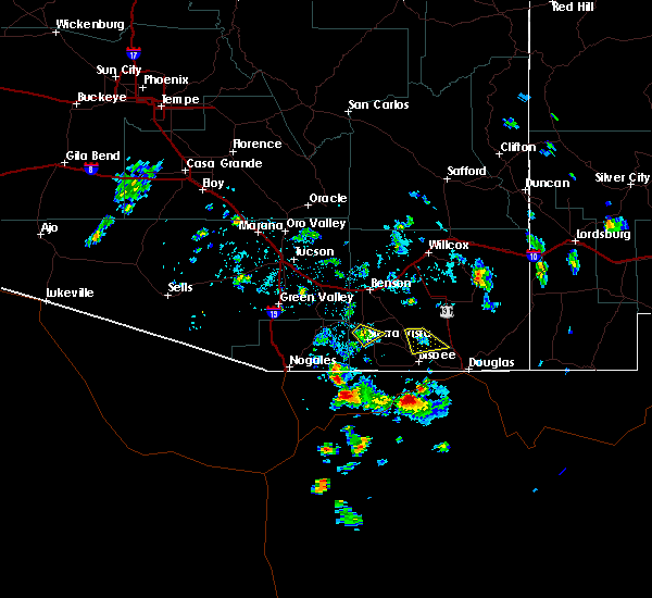 The severe thunderstorm warning for southwestern cochise county will expire at 315 pm mst, the storm which prompted the warning has weakened below severe limits, and no longer poses an immediate threat to life or property. therefore, the warning will be allowed to expire. however gusty winds and heavy rain are still possible with this thunderstorm. to report severe weather, contact your nearest law enforcement agency. they will relay your report to the national weather service tucson. The severe thunderstorm warning for southwestern cochise county will expire at 315 pm mst, the storm which prompted the warning has weakened below severe limits, and no longer poses an immediate threat to life or property. therefore, the warning will be allowed to expire. however gusty winds and heavy rain are still possible with this thunderstorm. to report severe weather, contact your nearest law enforcement agency. they will relay your report to the national weather service tucson.
|
| 8/22/2019 2:54 PM MST |
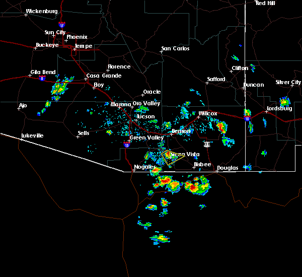 At 252 pm mst, a severe thunderstorm was located over fort huachuca, or over sierra vista, moving southeast at 5 mph (radar indicated). Hazards include 60 mph wind gusts. Expect damage to roofs, siding, and trees. locations impacted include, sierra vista, whetstone, huachuca city, fort huachuca and charleston. this includes the following highways, route 82 between mile markers 50 and 51. Route 90 between mile markers 309 and 319. At 252 pm mst, a severe thunderstorm was located over fort huachuca, or over sierra vista, moving southeast at 5 mph (radar indicated). Hazards include 60 mph wind gusts. Expect damage to roofs, siding, and trees. locations impacted include, sierra vista, whetstone, huachuca city, fort huachuca and charleston. this includes the following highways, route 82 between mile markers 50 and 51. Route 90 between mile markers 309 and 319.
|
| 8/22/2019 2:21 PM MST |
 The national weather service in tucson has issued a * severe thunderstorm warning for. southwestern cochise county in southeastern arizona. northeastern santa cruz county in southeastern arizona. until 315 pm mst. At 221 pm mst, a severe thunderstorm was located over huachuca. The national weather service in tucson has issued a * severe thunderstorm warning for. southwestern cochise county in southeastern arizona. northeastern santa cruz county in southeastern arizona. until 315 pm mst. At 221 pm mst, a severe thunderstorm was located over huachuca.
|
| 8/22/2019 2:10 PM MST |
 At 130 pm mst, a severe thunderstorm was located over parker canyon lake, or 13 miles southwest of sierra vista, and is nearly stationary (radar indicated). Hazards include 60 mph wind gusts and penny size hail. expect damage to roofs, siding, and trees At 130 pm mst, a severe thunderstorm was located over parker canyon lake, or 13 miles southwest of sierra vista, and is nearly stationary (radar indicated). Hazards include 60 mph wind gusts and penny size hail. expect damage to roofs, siding, and trees
|
| 8/22/2019 1:31 PM MST |
 The national weather service in tucson has issued a * severe thunderstorm warning for. southwestern cochise county in southeastern arizona. southeastern santa cruz county in southeastern arizona. until 215 pm mst. At 130 pm mst, a severe thunderstorm was located over parker canyon. The national weather service in tucson has issued a * severe thunderstorm warning for. southwestern cochise county in southeastern arizona. southeastern santa cruz county in southeastern arizona. until 215 pm mst. At 130 pm mst, a severe thunderstorm was located over parker canyon.
|
| 8/4/2019 2:13 PM MST | Asos station kalk pioneer airfield thunderstorm wind gust of 54 kts/62 mp in cochise county AZ, 8.7 miles ESE of Sierra Vista, AZ |
| 7/22/2019 4:21 PM MST |
 The severe thunderstorm warning for east central pima, western cochise and northeastern santa cruz counties will expire at 430 pm mst, the storm which prompted the warning has moved out of the area. therefore, the warning will be allowed to expire. a severe thunderstorm watch remains in effect until 1100 pm mst for southeastern arizona. The severe thunderstorm warning for east central pima, western cochise and northeastern santa cruz counties will expire at 430 pm mst, the storm which prompted the warning has moved out of the area. therefore, the warning will be allowed to expire. a severe thunderstorm watch remains in effect until 1100 pm mst for southeastern arizona.
|
| 7/22/2019 3:41 PM MST |
 The national weather service in tucson has issued a * severe thunderstorm warning for. east central pima county in southeastern arizona. western cochise county in southeastern arizona. northeastern santa cruz county in southeastern arizona. Until 430 pm mst. The national weather service in tucson has issued a * severe thunderstorm warning for. east central pima county in southeastern arizona. western cochise county in southeastern arizona. northeastern santa cruz county in southeastern arizona. Until 430 pm mst.
|
| 7/22/2019 3:38 PM MST |
 The severe thunderstorm warning for southwestern cochise and southeastern santa cruz counties will expire at 345 pm mst, the storm which prompted the warning has weakened and is moving out of the area. therefore, the warning will be allowed to expire at 345 pm mst. however gusty winds and heavy rain are still possible with this thunderstorm. The severe thunderstorm warning for southwestern cochise and southeastern santa cruz counties will expire at 345 pm mst, the storm which prompted the warning has weakened and is moving out of the area. therefore, the warning will be allowed to expire at 345 pm mst. however gusty winds and heavy rain are still possible with this thunderstorm.
|
| 7/22/2019 3:21 PM MST |
 At 319 pm mst, a severe thunderstorm was located near hereford, or 7 miles south of sierra vista, moving west at 25 mph. powerline damage and hail up to 3/4 inch in diameter has been reported in the hereford area. seek shelter from this storm as it continues to move west (radar indicated). Hazards include 60 mph wind gusts and penny size hail. Expect damage to roofs, siding, and trees. locations impacted include, sierra vista, hereford, parker canyon lake, fort huachuca, palominas, coronado national memorial, canelo and ramsey canyon preserve. this includes the following highways, route 83 between mile markers 3 and 14. route 90 between mile markers 317 and 332. Route 92 between mile markers 322 and 340. At 319 pm mst, a severe thunderstorm was located near hereford, or 7 miles south of sierra vista, moving west at 25 mph. powerline damage and hail up to 3/4 inch in diameter has been reported in the hereford area. seek shelter from this storm as it continues to move west (radar indicated). Hazards include 60 mph wind gusts and penny size hail. Expect damage to roofs, siding, and trees. locations impacted include, sierra vista, hereford, parker canyon lake, fort huachuca, palominas, coronado national memorial, canelo and ramsey canyon preserve. this includes the following highways, route 83 between mile markers 3 and 14. route 90 between mile markers 317 and 332. Route 92 between mile markers 322 and 340.
|
| 7/22/2019 3:05 PM MST |
 At 304 pm mst, a severe thunderstorm was located over hereford, or 9 miles southeast of sierra vista, moving west at 25 mph (radar indicated). Hazards include 60 mph wind gusts. heavy rainfall. expect damage to roofs, siding, and trees At 304 pm mst, a severe thunderstorm was located over hereford, or 9 miles southeast of sierra vista, moving west at 25 mph (radar indicated). Hazards include 60 mph wind gusts. heavy rainfall. expect damage to roofs, siding, and trees
|
| 7/17/2019 5:54 PM MST |
 The severe thunderstorm warning for southern cochise county will expire at 600 pm mst, the storm which prompted the warning has weakened below severe limits, and has exited the warned area. therefore, the warning will be allowed to expire. The severe thunderstorm warning for southern cochise county will expire at 600 pm mst, the storm which prompted the warning has weakened below severe limits, and has exited the warned area. therefore, the warning will be allowed to expire.
|
| 7/17/2019 5:33 PM MST |
 At 533 pm mst, a severe thunderstorm was located over hereford, or 11 miles southeast of sierra vista, and is nearly stationary (radar indicated). Hazards include 60 mph wind gusts and penny size hail. Expect damage to roofs, siding, and trees. locations impacted include, sierra vista and hereford. This includes route 92 between mile markers 329 and 337. At 533 pm mst, a severe thunderstorm was located over hereford, or 11 miles southeast of sierra vista, and is nearly stationary (radar indicated). Hazards include 60 mph wind gusts and penny size hail. Expect damage to roofs, siding, and trees. locations impacted include, sierra vista and hereford. This includes route 92 between mile markers 329 and 337.
|
| 7/17/2019 5:10 PM MST |
 At 509 pm mst, a severe thunderstorm was located over hereford, or 11 miles southeast of sierra vista, and is nearly stationary (radar indicated). Hazards include 60 mph wind gusts and quarter size hail. Hail damage to vehicles is expected. Expect wind damage to roofs, siding, and trees. At 509 pm mst, a severe thunderstorm was located over hereford, or 11 miles southeast of sierra vista, and is nearly stationary (radar indicated). Hazards include 60 mph wind gusts and quarter size hail. Hail damage to vehicles is expected. Expect wind damage to roofs, siding, and trees.
|
| 6/28/2019 1:53 PM MST |
 The severe thunderstorm warning for southwestern cochise county will expire at 200 pm mst, the storm which prompted the warning has weakened below severe limits, and no longer poses an immediate threat to life or property. therefore, the warning will be allowed to expire. however gusty winds are still possible with this thunderstorm. The severe thunderstorm warning for southwestern cochise county will expire at 200 pm mst, the storm which prompted the warning has weakened below severe limits, and no longer poses an immediate threat to life or property. therefore, the warning will be allowed to expire. however gusty winds are still possible with this thunderstorm.
|
| 6/28/2019 1:33 PM MST |
 At 132 pm mst, a severe thunderstorm was located over fort huachuca, or over sierra vista, moving north at 5 mph. a new storm is forming just south of sierra vista and is also moving north at 5 mph (radar indicated). Hazards include 60 mph wind gusts. Expect damage to roofs, siding, and trees. locations impacted include, sierra vista, hereford, whetstone, huachuca city, fort huachuca, charleston and ramsey canyon preserve. this includes the following highways, route 82 between mile markers 47 and 52. route 90 between mile markers 309 and 326. Route 92 between mile markers 322 and 330. At 132 pm mst, a severe thunderstorm was located over fort huachuca, or over sierra vista, moving north at 5 mph. a new storm is forming just south of sierra vista and is also moving north at 5 mph (radar indicated). Hazards include 60 mph wind gusts. Expect damage to roofs, siding, and trees. locations impacted include, sierra vista, hereford, whetstone, huachuca city, fort huachuca, charleston and ramsey canyon preserve. this includes the following highways, route 82 between mile markers 47 and 52. route 90 between mile markers 309 and 326. Route 92 between mile markers 322 and 330.
|
| 6/28/2019 12:55 PM MST |
 At 1255 pm mst, a severe thunderstorm was located over sierra vista, moving north at 5 mph (radar indicated). Hazards include 60 mph wind gusts. expect damage to roofs, siding, and trees At 1255 pm mst, a severe thunderstorm was located over sierra vista, moving north at 5 mph (radar indicated). Hazards include 60 mph wind gusts. expect damage to roofs, siding, and trees
|
| 10/21/2018 4:53 PM MST |
 The severe thunderstorm warning for southeastern pima, west central cochise and northeastern santa cruz counties will expire at 500 pm mst, the severe thunderstorms which prompted the warning have moved out of the area. therefore, the warning will be allowed to expire. however thunderstorms, some with heavy rain and small hail, will continue across northeast santa cruz and west central cochise county through 6 pm. The severe thunderstorm warning for southeastern pima, west central cochise and northeastern santa cruz counties will expire at 500 pm mst, the severe thunderstorms which prompted the warning have moved out of the area. therefore, the warning will be allowed to expire. however thunderstorms, some with heavy rain and small hail, will continue across northeast santa cruz and west central cochise county through 6 pm.
|
| 10/21/2018 4:22 PM MST |
 At 421 pm mst, severe thunderstorms were located along a line extending from near kartchner caverns state park to near huachuca city, moving east at 20 mph (radar indicated). Hazards include 60 mph wind gusts and quarter size hail. Hail damage to vehicles is expected. expect wind damage to roofs, siding, and trees. locations impacted include, sierra vista, benson, huachuca city, sierra vista southeast, kartchner caverns state park, fort huachuca, whetstone and elgin. this includes the following highways, route 82 between mile markers 43 and 58. route 83 near mile marker 13. route 90 between mile markers 297 and 322. Route 92 between mile markers 322 and 324. At 421 pm mst, severe thunderstorms were located along a line extending from near kartchner caverns state park to near huachuca city, moving east at 20 mph (radar indicated). Hazards include 60 mph wind gusts and quarter size hail. Hail damage to vehicles is expected. expect wind damage to roofs, siding, and trees. locations impacted include, sierra vista, benson, huachuca city, sierra vista southeast, kartchner caverns state park, fort huachuca, whetstone and elgin. this includes the following highways, route 82 between mile markers 43 and 58. route 83 near mile marker 13. route 90 between mile markers 297 and 322. Route 92 between mile markers 322 and 324.
|
| 10/21/2018 3:44 PM MST |
 The national weather service in tucson has issued a * severe thunderstorm warning for. southeastern pima county in southeastern arizona. west central cochise county in southeastern arizona. northeastern santa cruz county in southeastern arizona. Until 500 pm mst. The national weather service in tucson has issued a * severe thunderstorm warning for. southeastern pima county in southeastern arizona. west central cochise county in southeastern arizona. northeastern santa cruz county in southeastern arizona. Until 500 pm mst.
|
| 7/30/2018 7:23 PM MST |
 The severe thunderstorm warning for southwestern cochise county will expire at 730 pm mst, the storms which prompted the warning have weakened below severe limits, and no longer pose an immediate threat to life or property. therefore, the warning will be allowed to expire. The severe thunderstorm warning for southwestern cochise county will expire at 730 pm mst, the storms which prompted the warning have weakened below severe limits, and no longer pose an immediate threat to life or property. therefore, the warning will be allowed to expire.
|
| 7/30/2018 6:58 PM MST |
 At 656 pm mst, the storm near sierra vista was beginning to weaken, moving northwest at 10 mph (radar indicated). Hazards include 60 mph wind gusts and quarter size hail. Hail damage to vehicles is expected. expect wind damage to roofs, siding, and trees. locations impacted include, sierra vista, charleston and hereford. this includes the following highways, route 90 between mile markers 318 and 332. Route 92 between mile markers 322 and 327. At 656 pm mst, the storm near sierra vista was beginning to weaken, moving northwest at 10 mph (radar indicated). Hazards include 60 mph wind gusts and quarter size hail. Hail damage to vehicles is expected. expect wind damage to roofs, siding, and trees. locations impacted include, sierra vista, charleston and hereford. this includes the following highways, route 90 between mile markers 318 and 332. Route 92 between mile markers 322 and 327.
|
| 7/30/2018 6:50 PM MST |
 At 648 pm mst, doppler radar indicated a line of severe thunderstorms capable of producing quarter size hail and damaging winds in excess of 60 mph. these storms were located along a line extending from 29 miles north of douglas to 12 miles northwest of bisbee, and moving west at 15 mph. At 648 pm mst, doppler radar indicated a line of severe thunderstorms capable of producing quarter size hail and damaging winds in excess of 60 mph. these storms were located along a line extending from 29 miles north of douglas to 12 miles northwest of bisbee, and moving west at 15 mph.
|
| 7/30/2018 6:29 PM MST |
 At 628 pm mst, a severe thunderstorm was located near and just east of sierra vista, moving northwest at 10 mph (radar indicated). Hazards include 60 mph wind gusts and quarter size hail. Hail damage to vehicles is expected. Expect wind damage to roofs, siding, and trees. At 628 pm mst, a severe thunderstorm was located near and just east of sierra vista, moving northwest at 10 mph (radar indicated). Hazards include 60 mph wind gusts and quarter size hail. Hail damage to vehicles is expected. Expect wind damage to roofs, siding, and trees.
|
| 7/20/2018 6:09 PM MST |
 The severe thunderstorm warning for southwestern cochise county will expire at 615 pm mst, the storm which prompted the warning will move out of the warned area by 615 pm mst. another severe thunderstorm warning has been issued for this storm as it continued to track north toward tombstone and areas east of there. The severe thunderstorm warning for southwestern cochise county will expire at 615 pm mst, the storm which prompted the warning will move out of the warned area by 615 pm mst. another severe thunderstorm warning has been issued for this storm as it continued to track north toward tombstone and areas east of there.
|
| 7/20/2018 5:42 PM MST |
 At 541 pm mst, a severe thunderstorm was located 12 miles northeast of sierra vista southeast, or 13 miles east of sierra vista, moving northwest at 10 mph (radar indicated). Hazards include 60 mph wind gusts and quarter size hail. Hail damage to vehicles is expected. Expect wind damage to roofs, siding, and trees. At 541 pm mst, a severe thunderstorm was located 12 miles northeast of sierra vista southeast, or 13 miles east of sierra vista, moving northwest at 10 mph (radar indicated). Hazards include 60 mph wind gusts and quarter size hail. Hail damage to vehicles is expected. Expect wind damage to roofs, siding, and trees.
|
| 7/20/2018 5:40 PM MST | Quarter sized hail reported 2.7 miles NW of Sierra Vista, AZ, spotter 905 estimated quarter size hail. |
| 7/20/2018 5:38 PM MST | Quarter sized hail reported 2.6 miles NW of Sierra Vista, AZ, spotter 374 estimated quarter size hail. |
| 7/20/2018 5:36 PM MST | Quarter sized hail reported 3.1 miles NW of Sierra Vista, AZ, spotter 322 estimated nickel to quarter size hail falling for roughly 3-4 minutes. |
| 7/20/2018 5:35 PM MST | Quarter sized hail reported 2.1 miles W of Sierra Vista, AZ, spotter #3108 in sierra vista had dime to quarter size hail for 8 minutes. |
| 7/20/2018 5:34 PM MST | Quarter sized hail reported 2 miles SW of Sierra Vista, AZ, report via cocorahs estimated quarter size hail. |
| 7/20/2018 5:31 PM MST |
 At 524 pm mst, a severe thunderstorm was located near sierra vista, moving north at 10 mph. a weather spotter reported quarter size hail in sierra vista at 529 pm mst (radar indicated). Hazards include 60 mph wind gusts and quarter size hail. Hail damage to vehicles is expected. expect wind damage to roofs, siding, and trees. locations impacted include, sierra vista, sierra vista southeast, hereford, this includes the following highways, route 83 between mile markers 3 and 7. route 90 between mile markers 317 and 326. Route 92 between mile markers 322 and 334. At 524 pm mst, a severe thunderstorm was located near sierra vista, moving north at 10 mph. a weather spotter reported quarter size hail in sierra vista at 529 pm mst (radar indicated). Hazards include 60 mph wind gusts and quarter size hail. Hail damage to vehicles is expected. expect wind damage to roofs, siding, and trees. locations impacted include, sierra vista, sierra vista southeast, hereford, this includes the following highways, route 83 between mile markers 3 and 7. route 90 between mile markers 317 and 326. Route 92 between mile markers 322 and 334.
|
| 7/20/2018 5:29 PM MST | Quarter sized hail reported 4 miles NW of Sierra Vista, AZ, spotter #911 in sierra vista reports hail now up to 1" in diameter. |
| 7/20/2018 5:17 PM MST |
 At 516 pm mst, a severe thunderstorm was located near sierra vista southeast, or 7 miles south of sierra vista, moving west at 5 mph (radar indicated). Hazards include 60 mph wind gusts and quarter size hail. Hail damage to vehicles is expected. Expect wind damage to roofs, siding, and trees. At 516 pm mst, a severe thunderstorm was located near sierra vista southeast, or 7 miles south of sierra vista, moving west at 5 mph (radar indicated). Hazards include 60 mph wind gusts and quarter size hail. Hail damage to vehicles is expected. Expect wind damage to roofs, siding, and trees.
|
| 7/20/2018 4:57 PM MST |
 At 454 pm mst, a severe thunderstorm was located near sierra vista southeast, or 12 miles south of sierra vista, moving northwest at 10 mph. a weather spotter just west of hereford reported quarter size hail at 452 pm mst along with very heavy rainfall (trained weather spotters). Hazards include 60 mph wind gusts and quarter size hail. Hail damage to vehicles is expected. expect wind damage to roofs, siding, and trees. locations impacted include, sierra vista southeast, nicksville, coronado national memorial and ramsey canyon preserve. This includes route 92 between mile markers 328 and 338. At 454 pm mst, a severe thunderstorm was located near sierra vista southeast, or 12 miles south of sierra vista, moving northwest at 10 mph. a weather spotter just west of hereford reported quarter size hail at 452 pm mst along with very heavy rainfall (trained weather spotters). Hazards include 60 mph wind gusts and quarter size hail. Hail damage to vehicles is expected. expect wind damage to roofs, siding, and trees. locations impacted include, sierra vista southeast, nicksville, coronado national memorial and ramsey canyon preserve. This includes route 92 between mile markers 328 and 338.
|
| 7/20/2018 4:34 PM MST |
 At 434 pm mst, a severe thunderstorm was located 8 miles south of sierra vista southeast, or 15 miles south of sierra vista, and is nearly stationary (radar indicated). Hazards include 60 mph wind gusts and quarter size hail. Hail damage to vehicles is expected. Expect wind damage to roofs, siding, and trees. At 434 pm mst, a severe thunderstorm was located 8 miles south of sierra vista southeast, or 15 miles south of sierra vista, and is nearly stationary (radar indicated). Hazards include 60 mph wind gusts and quarter size hail. Hail damage to vehicles is expected. Expect wind damage to roofs, siding, and trees.
|
| 7/13/2017 6:47 PM MST |
 At 646 pm mst, a severe thunderstorm was located near sierra vista, moving southwest at 15 mph (radar indicated). Hazards include 60 mph wind gusts and quarter size hail. Hail damage to vehicles is expected. Expect wind damage to roofs, siding, and trees. At 646 pm mst, a severe thunderstorm was located near sierra vista, moving southwest at 15 mph (radar indicated). Hazards include 60 mph wind gusts and quarter size hail. Hail damage to vehicles is expected. Expect wind damage to roofs, siding, and trees.
|
| 7/13/2017 6:29 PM MST |
 At 629 pm mst, a severe thunderstorm was located 9 miles west of bisbee, moving southwest at 20 mph (radar indicated). Hazards include 60 mph wind gusts and quarter size hail. Hail damage to vehicles is expected. expect wind damage to roofs, siding, and trees. Locations impacted include, sierra vista, douglas, bisbee, sierra vista southeast, tombstone, palominas, charleston, nicksville, bisbee-douglas airport, hereford, naco, junction of highways 80 and 90 and pirtleville. At 629 pm mst, a severe thunderstorm was located 9 miles west of bisbee, moving southwest at 20 mph (radar indicated). Hazards include 60 mph wind gusts and quarter size hail. Hail damage to vehicles is expected. expect wind damage to roofs, siding, and trees. Locations impacted include, sierra vista, douglas, bisbee, sierra vista southeast, tombstone, palominas, charleston, nicksville, bisbee-douglas airport, hereford, naco, junction of highways 80 and 90 and pirtleville.
|
| 7/13/2017 6:27 PM MST |
 At 627 pm mst, severe thunderstorms were located along a line extending from near benson to 10 miles northeast of huachuca city, moving southwest at 20 mph (radar indicated). Hazards include 60 mph wind gusts. Expect damage to roofs, siding, and trees. locations impacted include, sierra vista, benson, huachuca city, kartchner caverns state park, fairbank, fort huachuca, saint david, mescal, whetstone and st. David. At 627 pm mst, severe thunderstorms were located along a line extending from near benson to 10 miles northeast of huachuca city, moving southwest at 20 mph (radar indicated). Hazards include 60 mph wind gusts. Expect damage to roofs, siding, and trees. locations impacted include, sierra vista, benson, huachuca city, kartchner caverns state park, fairbank, fort huachuca, saint david, mescal, whetstone and st. David.
|
| 7/13/2017 6:20 PM MST | Spotter reported damage to the roof of a building south of sierra vist in cochise county AZ, 3.9 miles NNW of Sierra Vista, AZ |
| 7/13/2017 6:00 PM MST |
 At 558 pm mst, severe thunderstorms were located along a line extending from 10 miles northeast of benson to 17 miles northeast of huachuca city, moving southwest at 20 mph. these storms will also impact portions of interstate 10 between benson and highway 191 (radar indicated). Hazards include 60 mph wind gusts. expect damage to roofs, siding, and trees At 558 pm mst, severe thunderstorms were located along a line extending from 10 miles northeast of benson to 17 miles northeast of huachuca city, moving southwest at 20 mph. these storms will also impact portions of interstate 10 between benson and highway 191 (radar indicated). Hazards include 60 mph wind gusts. expect damage to roofs, siding, and trees
|
| 7/13/2017 5:43 PM MST |
 At 542 pm mst, a severe thunderstorm was located 10 miles north of bisbee, moving southwest at 20 mph (radar indicated). Hazards include 60 mph wind gusts and quarter size hail. Hail damage to vehicles is expected. expect wind damage to roofs, siding, and trees. Storms may be preceded by damaging outflow winds. At 542 pm mst, a severe thunderstorm was located 10 miles north of bisbee, moving southwest at 20 mph (radar indicated). Hazards include 60 mph wind gusts and quarter size hail. Hail damage to vehicles is expected. expect wind damage to roofs, siding, and trees. Storms may be preceded by damaging outflow winds.
|
| 7/13/2017 4:56 PM MST |
 At 454 pm mst, a severe thunderstorm was located 17 miles southeast of benson, or just northeast of tombstone, moving southwest at 5 mph (radar indicated). Hazards include 60 mph wind gusts and quarter size hail. Hail damage to vehicles is expected. Expect wind damage to roofs, siding, and trees. At 454 pm mst, a severe thunderstorm was located 17 miles southeast of benson, or just northeast of tombstone, moving southwest at 5 mph (radar indicated). Hazards include 60 mph wind gusts and quarter size hail. Hail damage to vehicles is expected. Expect wind damage to roofs, siding, and trees.
|
| 7/13/2017 4:16 PM MST |
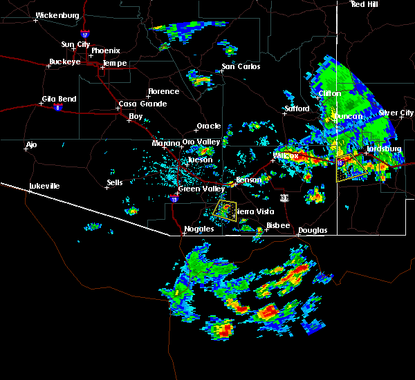 At 415 pm mst, a severe thunderstorm was located near huachuca city, or 11 miles northwest of sierra vista, and moving south at 5 mph (radar indicated). Hazards include 60 mph wind gusts and quarter size hail. Hail damage to vehicles is expected. Expect wind damage to roofs, siding, and trees. At 415 pm mst, a severe thunderstorm was located near huachuca city, or 11 miles northwest of sierra vista, and moving south at 5 mph (radar indicated). Hazards include 60 mph wind gusts and quarter size hail. Hail damage to vehicles is expected. Expect wind damage to roofs, siding, and trees.
|
| 10/8/2016 4:43 PM MST |
 At 439 pm mst, doppler radar continued to indicate a severe thunderstorm capable of producing quarter size hail and damaging winds in excess of 60 mph. this storm was located just to the north of whetstone, or 15 miles north of sierra vista, moving northeast at 10 mph. hail the size of peas to dimes has been occurring with this storm. locations impacted include, sierra vista, benson, huachuca city, fairbank, kartchner caverns state park, whetstone and st. david. At 439 pm mst, doppler radar continued to indicate a severe thunderstorm capable of producing quarter size hail and damaging winds in excess of 60 mph. this storm was located just to the north of whetstone, or 15 miles north of sierra vista, moving northeast at 10 mph. hail the size of peas to dimes has been occurring with this storm. locations impacted include, sierra vista, benson, huachuca city, fairbank, kartchner caverns state park, whetstone and st. david.
|
| 10/8/2016 4:10 PM MST |
 At 409 pm mst, doppler radar indicated a severe thunderstorm capable of producing quarter size hail and damaging winds in excess of 60 mph. this storm was located near huachuca city, or 10 miles north of sierra vista, and moving northeast at 10 to 15 mph. At 409 pm mst, doppler radar indicated a severe thunderstorm capable of producing quarter size hail and damaging winds in excess of 60 mph. this storm was located near huachuca city, or 10 miles north of sierra vista, and moving northeast at 10 to 15 mph.
|
| 9/30/2016 2:12 PM MST |
 At 211 pm mst, doppler radar indicated a severe thunderstorm capable of producing quarter size hail and damaging winds in excess of 60 mph. this storm was located over sierra vista, and moving northeast at 15 mph. At 211 pm mst, doppler radar indicated a severe thunderstorm capable of producing quarter size hail and damaging winds in excess of 60 mph. this storm was located over sierra vista, and moving northeast at 15 mph.
|
| 8/31/2016 4:51 PM MST |
 At 450 pm mst, doppler radar indicated a severe thunderstorm capable of producing quarter size hail and damaging winds in excess of 60 mph. this storm was located near fairbank, or 12 miles northeast of sierra vista, moving north at 5 to 10 mph. At 450 pm mst, doppler radar indicated a severe thunderstorm capable of producing quarter size hail and damaging winds in excess of 60 mph. this storm was located near fairbank, or 12 miles northeast of sierra vista, moving north at 5 to 10 mph.
|
| 7/27/2016 4:56 PM MST |
 The severe thunderstorm warning for southwestern cochise county will expire at 500 pm mst, the storms which prompted the warning have weakened below severe limits, and no longer pose an immediate threat to life or property. therefore the warning will be allowed to expire. however, heavy rain is still occurring with these thunderstorms, and a flash flood warning remains in effect for southwest cochise county until 630 pm mst. The severe thunderstorm warning for southwestern cochise county will expire at 500 pm mst, the storms which prompted the warning have weakened below severe limits, and no longer pose an immediate threat to life or property. therefore the warning will be allowed to expire. however, heavy rain is still occurring with these thunderstorms, and a flash flood warning remains in effect for southwest cochise county until 630 pm mst.
|
| 7/27/2016 4:41 PM MST |
 At 440 pm mst, national weather service meteorologists continued to detect severe thunderstorms capable of producing quarter size hail and damaging winds in excess of 60 mph. these storms were located along a line extending from 6 miles west of sierra vista to near sierra vista southeast, moving south at 15 mph. locations impacted include, sierra vista, sierra vista southeast, nicksville, fort huachuca, ramsey canyon preserve, hereford, parker canyon lake and coronado national memorial. At 440 pm mst, national weather service meteorologists continued to detect severe thunderstorms capable of producing quarter size hail and damaging winds in excess of 60 mph. these storms were located along a line extending from 6 miles west of sierra vista to near sierra vista southeast, moving south at 15 mph. locations impacted include, sierra vista, sierra vista southeast, nicksville, fort huachuca, ramsey canyon preserve, hereford, parker canyon lake and coronado national memorial.
|
| 7/27/2016 4:22 PM MST | Storm damage reported in cochise county AZ, 3.6 miles SSE of Sierra Vista, AZ |
| 7/27/2016 4:19 PM MST |
 At 418 pm mst, national weather service meteorologists detected a line of severe thunderstorms capable of producing quarter size hail and damaging winds in excess of 60 mph. these storms were located along a line extending from near huachuca city to near sierra vista southeast, and moving south at 15 mph. At 418 pm mst, national weather service meteorologists detected a line of severe thunderstorms capable of producing quarter size hail and damaging winds in excess of 60 mph. these storms were located along a line extending from near huachuca city to near sierra vista southeast, and moving south at 15 mph.
|
| 7/19/2016 6:28 PM MST |
 At 622 pm mst, doppler radar indicated a cluster of severe thunderstorms that continue to be capable of producing damaging winds in excess of 60 mph. the wind speed reported from fort huachuca indicated sustained winds of 29 mph with gusts to 32 mph. the strongest winds with these storms likely have occurred north of the sierra vista area, near huachuca city and whetsone. these storms were located near huachuca city, or 8 miles north of sierra vista, moving northwest at 15 mph. locations impacted include, sierra vista, benson, huachuca city, sierra vista southeast, tombstone, nicksville, fort huachuca, charleston, hereford, fairbank, kartchner caverns state park and whetstone. At 622 pm mst, doppler radar indicated a cluster of severe thunderstorms that continue to be capable of producing damaging winds in excess of 60 mph. the wind speed reported from fort huachuca indicated sustained winds of 29 mph with gusts to 32 mph. the strongest winds with these storms likely have occurred north of the sierra vista area, near huachuca city and whetsone. these storms were located near huachuca city, or 8 miles north of sierra vista, moving northwest at 15 mph. locations impacted include, sierra vista, benson, huachuca city, sierra vista southeast, tombstone, nicksville, fort huachuca, charleston, hereford, fairbank, kartchner caverns state park and whetstone.
|
| 7/19/2016 5:58 PM MST |
 At 557 pm mst, doppler radar indicated a cluster of severe thunderstorms capable of producing damaging winds in excess of 60 mph. these storms were located near sierra vista, and moving northwest at 15 mph. At 557 pm mst, doppler radar indicated a cluster of severe thunderstorms capable of producing damaging winds in excess of 60 mph. these storms were located near sierra vista, and moving northwest at 15 mph.
|
| 9/2/2015 2:43 PM MST | The severe thunderstorm warning for southwestern cochise county will expire at 245 pm mst, the storm which prompted the warning has weakened below severe limits, and no longer poses an immediate threat to life or property. therefore the warning will be allowed to expire. however gusty winds and heavy rain are still possible with this thunderstorm. |
| 9/2/2015 2:32 PM MST |
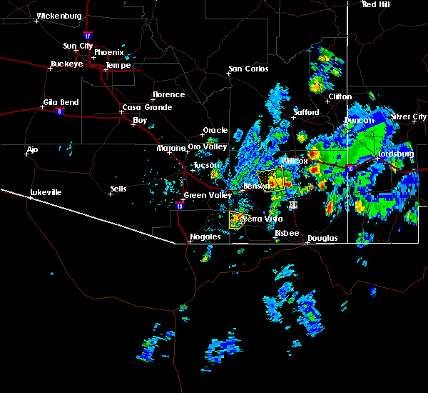 At 232 pm mst, doppler radar continued to indicate a severe thunderstorm capable of producing damaging winds in excess of 60 mph. this storm was located over fort huachuca, moving north at 5 mph. locations impacted include, sierra vista, huachuca city, fort huachuca and whetstone. At 232 pm mst, doppler radar continued to indicate a severe thunderstorm capable of producing damaging winds in excess of 60 mph. this storm was located over fort huachuca, moving north at 5 mph. locations impacted include, sierra vista, huachuca city, fort huachuca and whetstone.
|
| 9/2/2015 2:13 PM MST |
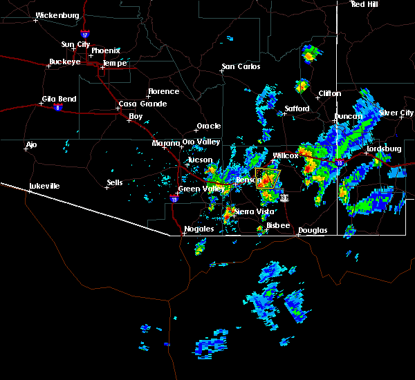 At 212 pm mst, national weather service meteorologists detected a severe thunderstorm capable of producing damaging winds in excess of 60 mph. this storm was located near fort huachuca, and moving north at 5 mph. At 212 pm mst, national weather service meteorologists detected a severe thunderstorm capable of producing damaging winds in excess of 60 mph. this storm was located near fort huachuca, and moving north at 5 mph.
|
| 8/20/2015 1:22 PM MST |
 At 121 pm mst, doppler radar indicated a severe thunderstorm capable of producing penny size hail and damaging winds in excess of 60 mph. this storm was located over sierra vista, moving northeast at 10 mph. this storm is also producing very heavy rainfall rates, that will likely result in significant ponding of water and minor street flooding. locations impacted include, sierra vista, huachuca city, sierra vista southeast, nicksville, fort huachuca, ramsey canyon preserve and hereford. At 121 pm mst, doppler radar indicated a severe thunderstorm capable of producing penny size hail and damaging winds in excess of 60 mph. this storm was located over sierra vista, moving northeast at 10 mph. this storm is also producing very heavy rainfall rates, that will likely result in significant ponding of water and minor street flooding. locations impacted include, sierra vista, huachuca city, sierra vista southeast, nicksville, fort huachuca, ramsey canyon preserve and hereford.
|
| 8/20/2015 1:08 PM MST | Storm damage reported in cochise county AZ, 3.2 miles SE of Sierra Vista, AZ |
| 8/20/2015 1:06 PM MST |
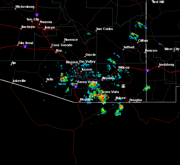 At 105 pm mst, doppler radar indicated a severe thunderstorm capable of producing quarter size hail and damaging winds in excess of 60 mph. this storm was located over sierra vista, moving northeast at 10 mph. At 105 pm mst, doppler radar indicated a severe thunderstorm capable of producing quarter size hail and damaging winds in excess of 60 mph. this storm was located over sierra vista, moving northeast at 10 mph.
|
| 8/1/2015 12:16 PM MST | Kalk recorded 58 kt thunderstorm wind gus in cochise county AZ, 9.1 miles SE of Sierra Vista, AZ |
| 8/1/2015 12:13 PM MST | Kalk asos recorded 53 kt thunderstorm wind gus in cochise county AZ, 9.1 miles SE of Sierra Vista, AZ |
| 7/7/2015 12:05 PM MST |
 At 1204 pm mst, doppler radar indicated a severe thunderstorm capable of producing damaging winds in excess of 60 mph. this storm was located over sierra vista, moving east at 5 mph. locations impacted include, sierra vista and sierra vista southeast. At 1204 pm mst, doppler radar indicated a severe thunderstorm capable of producing damaging winds in excess of 60 mph. this storm was located over sierra vista, moving east at 5 mph. locations impacted include, sierra vista and sierra vista southeast.
|
| 7/7/2015 11:44 AM MST |
 At 1144 am mst, national weather service meteorologists detected a severe thunderstorm capable of producing quarter size hail and damaging winds in excess of 60 mph. this storm was located over sierra vista, and moving east at 5 mph. At 1144 am mst, national weather service meteorologists detected a severe thunderstorm capable of producing quarter size hail and damaging winds in excess of 60 mph. this storm was located over sierra vista, and moving east at 5 mph.
|
| 6/30/2015 8:45 PM MST |
 At 841 pm mst, doppler radar indicated a severe rotating thunderstorm capable of producing quarter size hail and damaging winds in excess of 60 mph near green valley. due to the rotation funnel clouds are possible. locations impacted include, sierra vista, green valley, sahuarita, benson, huachuca city, rio rico northeast, rio rico southeast, rio rico northwest, rio rico southwest, tumacacori-carmen, sierra vista southeast, east sahuarita, tubac, patagonia, canelo, patagonia lake, tumacacori, sonoita, fort huachuca and ramsey canyon preserve. At 841 pm mst, doppler radar indicated a severe rotating thunderstorm capable of producing quarter size hail and damaging winds in excess of 60 mph near green valley. due to the rotation funnel clouds are possible. locations impacted include, sierra vista, green valley, sahuarita, benson, huachuca city, rio rico northeast, rio rico southeast, rio rico northwest, rio rico southwest, tumacacori-carmen, sierra vista southeast, east sahuarita, tubac, patagonia, canelo, patagonia lake, tumacacori, sonoita, fort huachuca and ramsey canyon preserve.
|
| 6/30/2015 8:22 PM MST | Quarter sized hail reported 2.6 miles NW of Sierra Vista, AZ, spoter reports quarter sized hail and heavy rain |
| 6/30/2015 8:21 PM MST |
 At 820 pm mst, doppler radar indicated a severe thunderstorm capable of producing quarter size hail and damaging winds in excess of 60 mph. this storm was located near sonoita, and moving west at 20 mph. At 820 pm mst, doppler radar indicated a severe thunderstorm capable of producing quarter size hail and damaging winds in excess of 60 mph. this storm was located near sonoita, and moving west at 20 mph.
|
| 6/30/2015 7:34 PM MST |
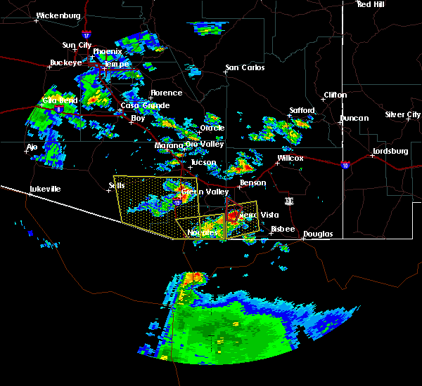 At 733 pm mst, doppler radar indicated a severe thunderstorm capable of producing a tornado. this dangerous storm was located near whetstone and north of huachuca city, and moving northwest at 10 mph. the public reported a rotating wall cloud with this storm. in addition radar is showing a strong rotating signature. At 733 pm mst, doppler radar indicated a severe thunderstorm capable of producing a tornado. this dangerous storm was located near whetstone and north of huachuca city, and moving northwest at 10 mph. the public reported a rotating wall cloud with this storm. in addition radar is showing a strong rotating signature.
|
| 6/30/2015 7:09 PM MST |
 At 708 pm mst, doppler radar indicated a severe thunderstorm capable of producing quarter size hail and damaging winds in excess of 60 mph. this storm was located over huachuca city, and moving west at 25 mph. At 708 pm mst, doppler radar indicated a severe thunderstorm capable of producing quarter size hail and damaging winds in excess of 60 mph. this storm was located over huachuca city, and moving west at 25 mph.
|
| 6/30/2015 5:51 PM MST |
 At 550 pm mst, doppler radar continued to indicate a severe thunderstorm capable of producing quarter size hail and damaging winds in excess of 60 mph. this storm was located near canelo, moving west at 25 mph. locations impacted include, sierra vista, huachuca city, sierra vista southeast and fort huachuca. At 550 pm mst, doppler radar continued to indicate a severe thunderstorm capable of producing quarter size hail and damaging winds in excess of 60 mph. this storm was located near canelo, moving west at 25 mph. locations impacted include, sierra vista, huachuca city, sierra vista southeast and fort huachuca.
|
| 6/30/2015 5:45 PM MST | Tree down in road in sierra vista...fry blvd and el camino rea in cochise county AZ, 1.5 miles SW of Sierra Vista, AZ |
| 6/30/2015 5:30 PM MST |
 At 528 pm mst, doppler radar indicated a severe thunderstorm capable of producing heavy rain, quarter size hail and damaging winds in excess of 60 mph. this storm was located over sierra vista, and moving west at 25 mph. At 528 pm mst, doppler radar indicated a severe thunderstorm capable of producing heavy rain, quarter size hail and damaging winds in excess of 60 mph. this storm was located over sierra vista, and moving west at 25 mph.
|
| 7/14/2014 7:44 PM MST | Quarter sized hail reported 4 miles NW of Sierra Vista, AZ, quater size hail in ash canyon |
| 7/9/2013 10:05 PM MST | Couple of trees down on a van on busby d in cochise county AZ, 1.5 miles SW of Sierra Vista, AZ |
| 7/9/2013 9:57 PM MST | Storm damage reported in cochise county AZ, 3.5 miles NW of Sierra Vista, AZ |
| 7/9/2013 9:55 PM MST | Wind sustained 40-50 mph...very heavy rain...pea sized hail...frequent lightning in cochise county AZ, 1.5 miles SW of Sierra Vista, AZ |
| 7/9/2013 9:51 PM MST | Storm damage reported in cochise county AZ, 3.6 miles SSE of Sierra Vista, AZ |
| 8/7/2012 9:41 PM MST | Storm damage reported in cochise county AZ, 3.6 miles SSE of Sierra Vista, AZ |
| 9/9/2011 6:08 PM MST | Quarter sized hail reported 1.5 miles SW of Sierra Vista, AZ |
| 1/1/0001 12:00 AM | Roof ripped off barn in canel in santa cruz county AZ, 9.9 miles ESE of Sierra Vista, AZ |
| 1/1/0001 12:00 AM | Storm damage reported in santa cruz county AZ, 9.9 miles ESE of Sierra Vista, AZ |
| 1/1/0001 12:00 AM | Storm damage reported in santa cruz county AZ, 9.9 miles ESE of Sierra Vista, AZ |
| 1/1/0001 12:00 AM | Several large tree limbs down and power outage in neighborhood in cochise county AZ, 5.4 miles WSW of Sierra Vista, AZ |
Hail Maps for Sierra Vista, AZ
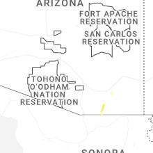
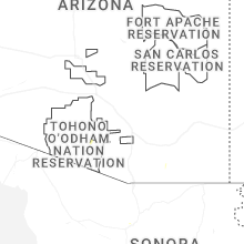
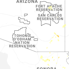


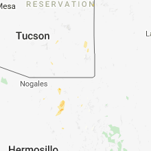


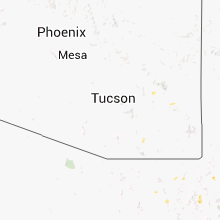


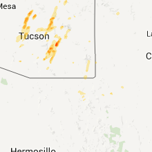


Connect with Interactive Hail Maps